

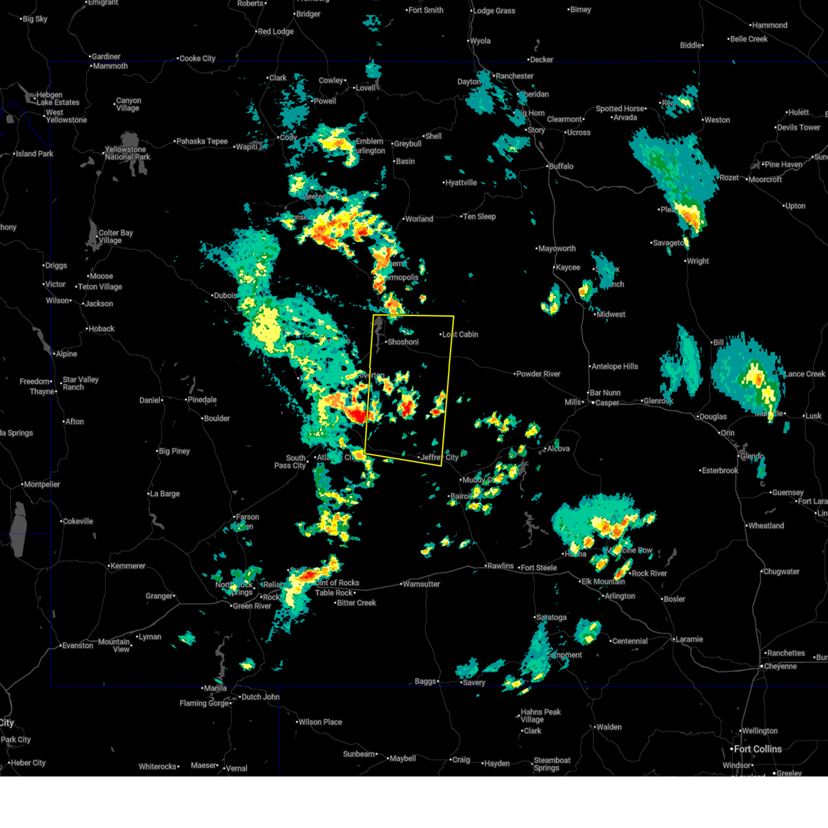
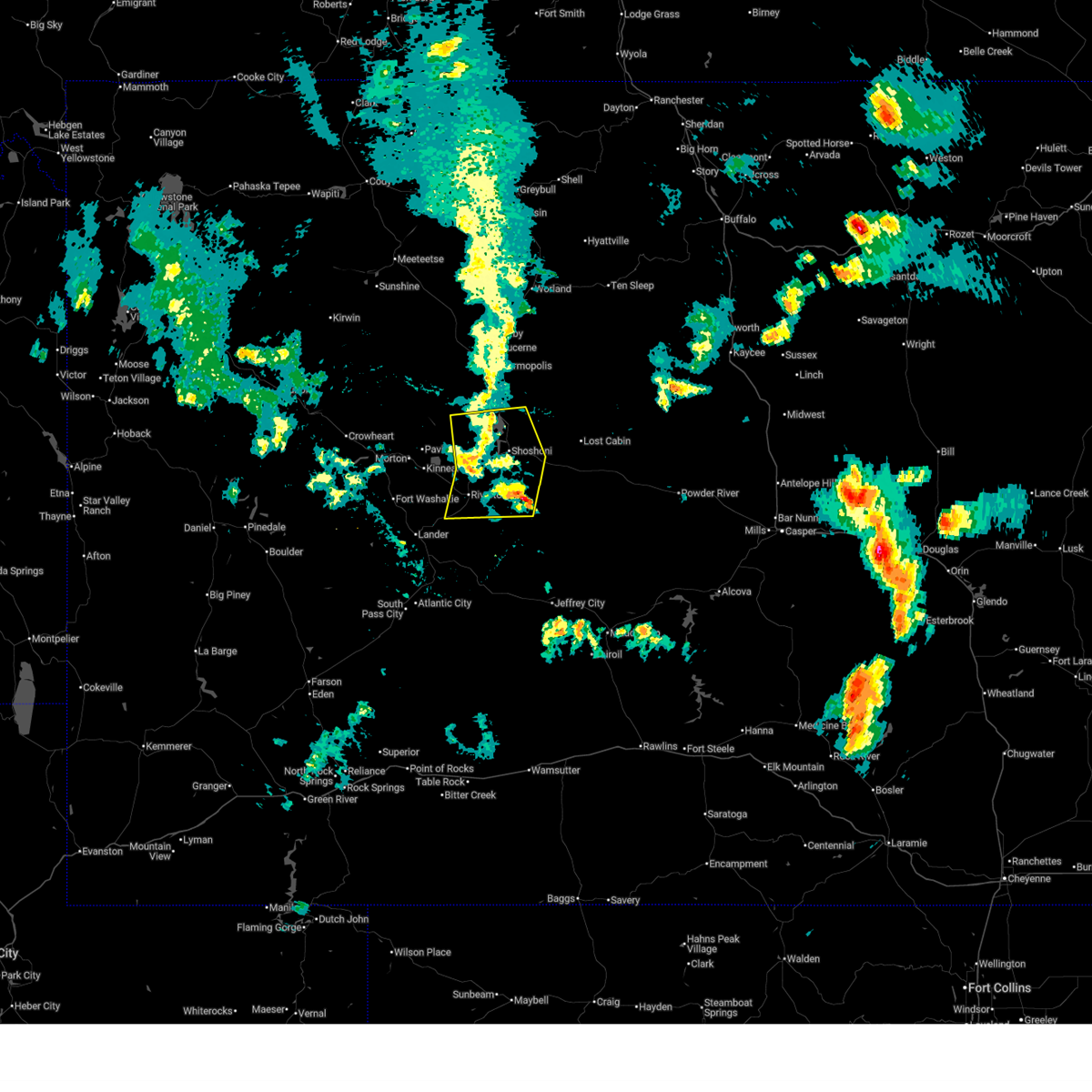
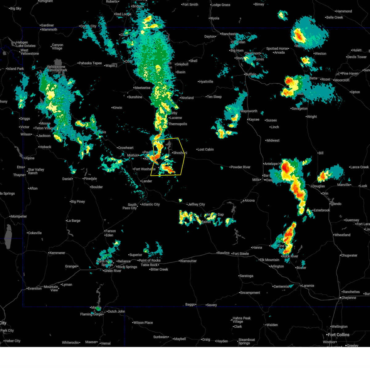
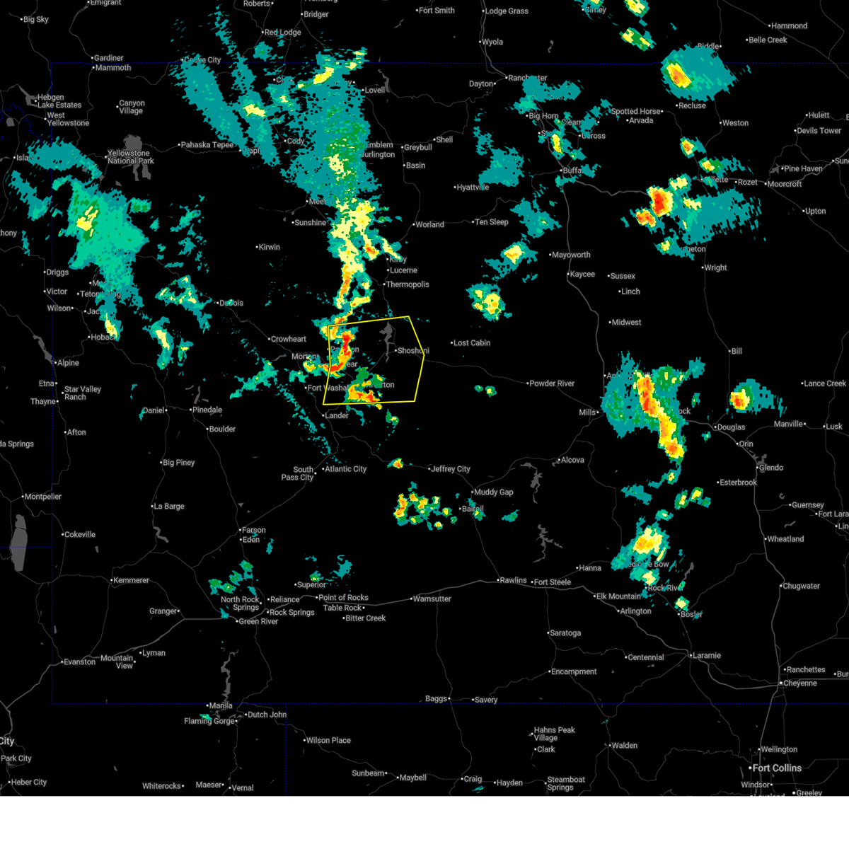
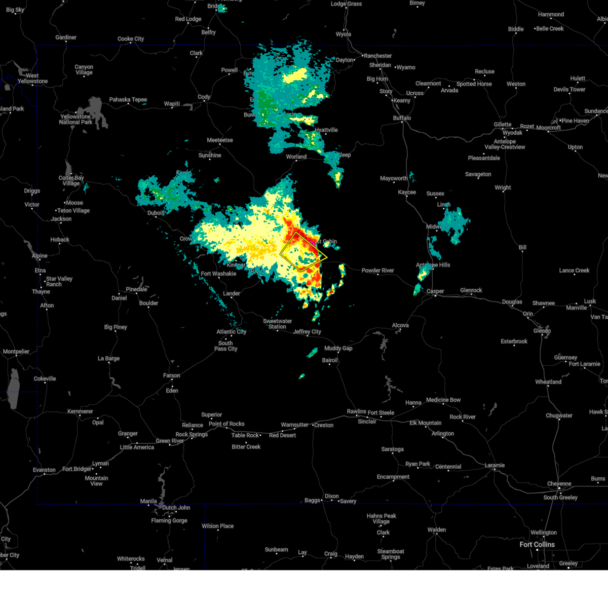
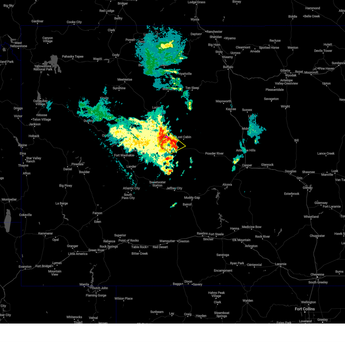
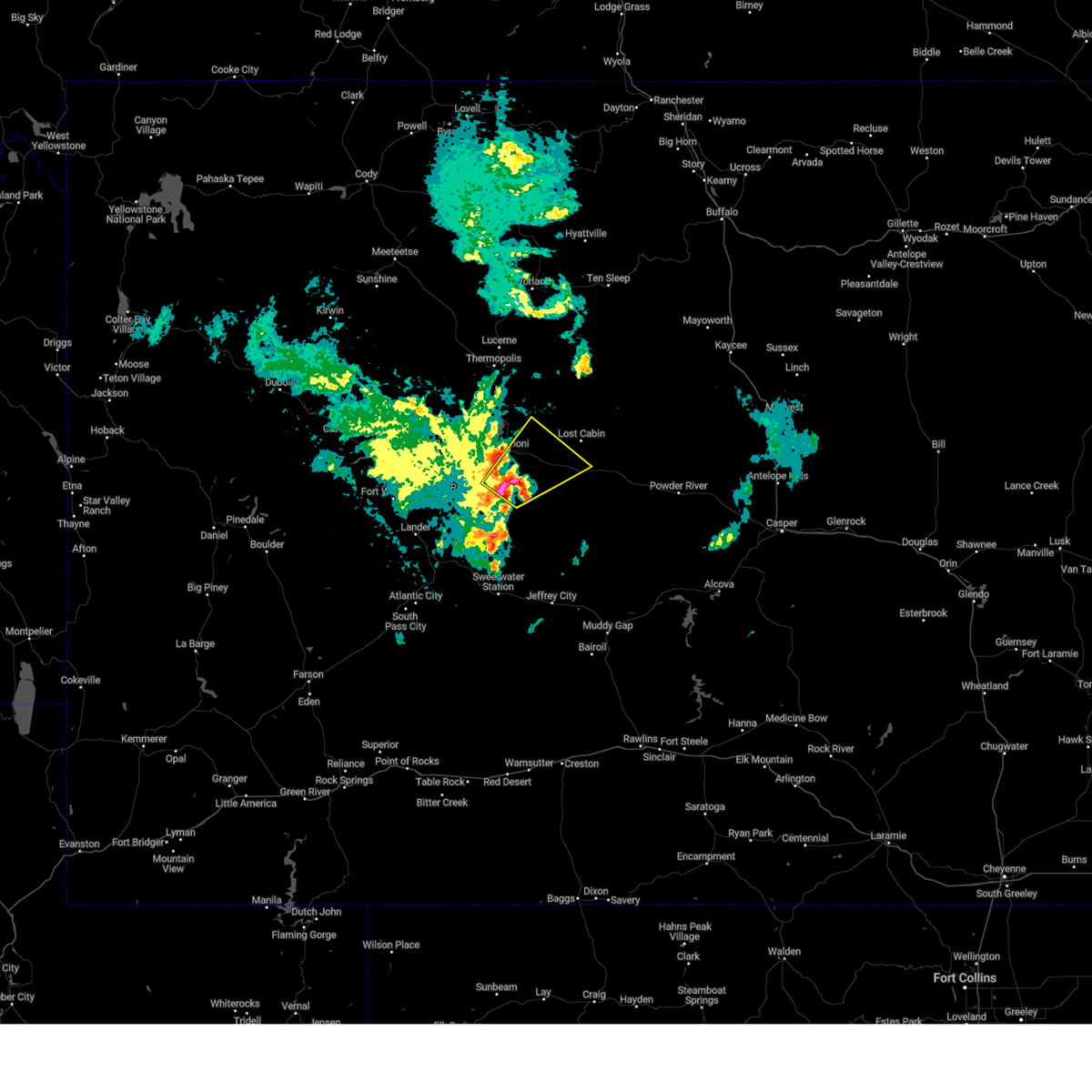
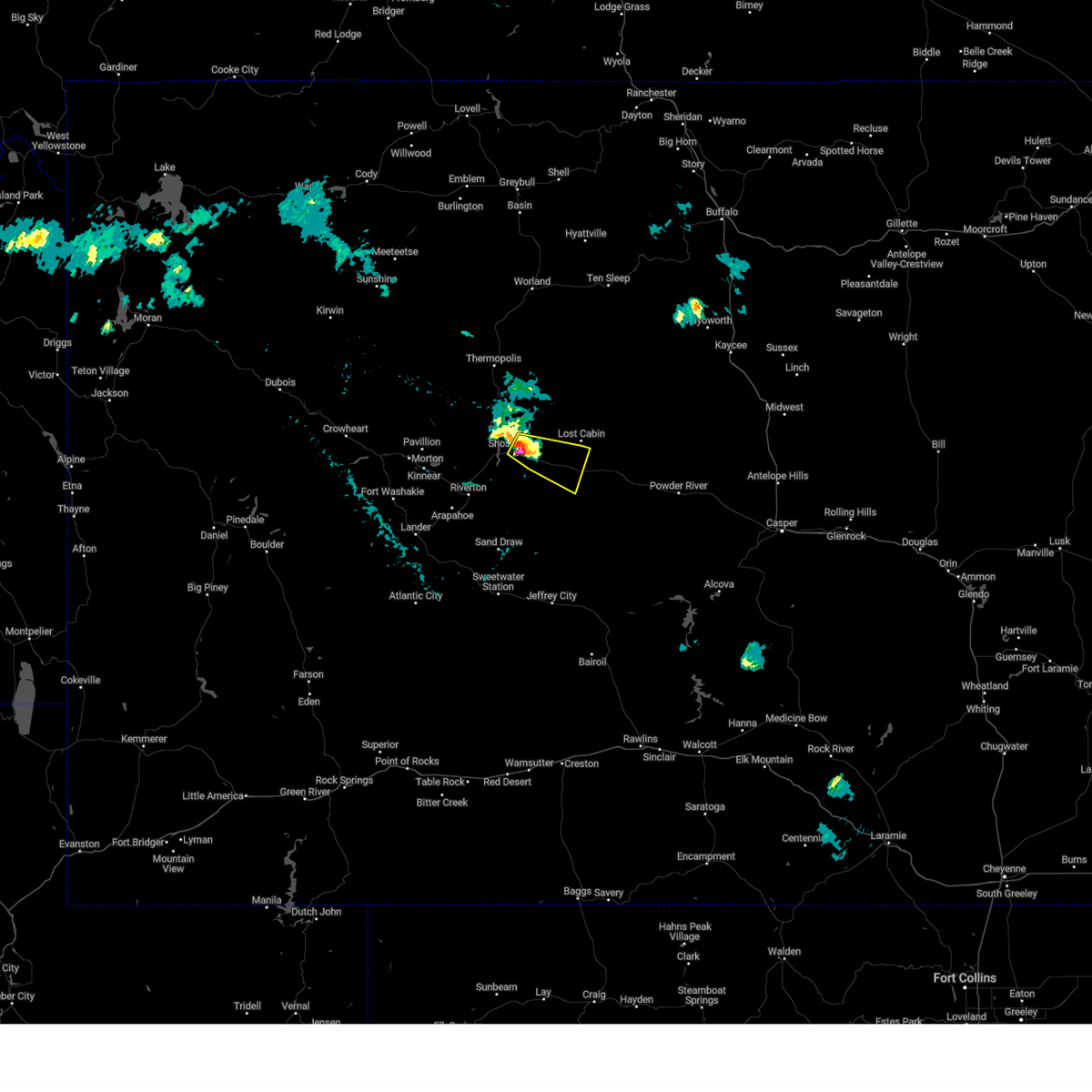
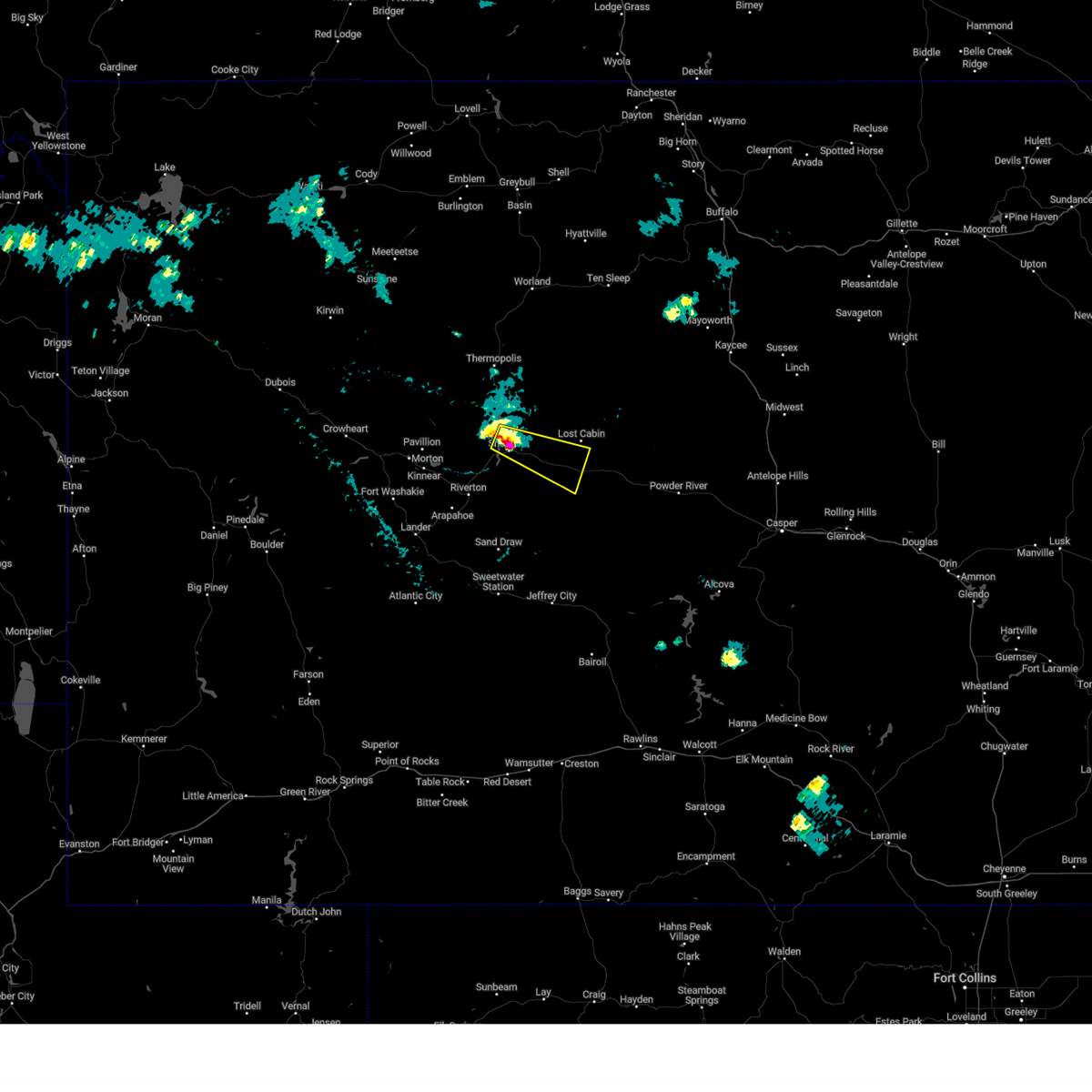
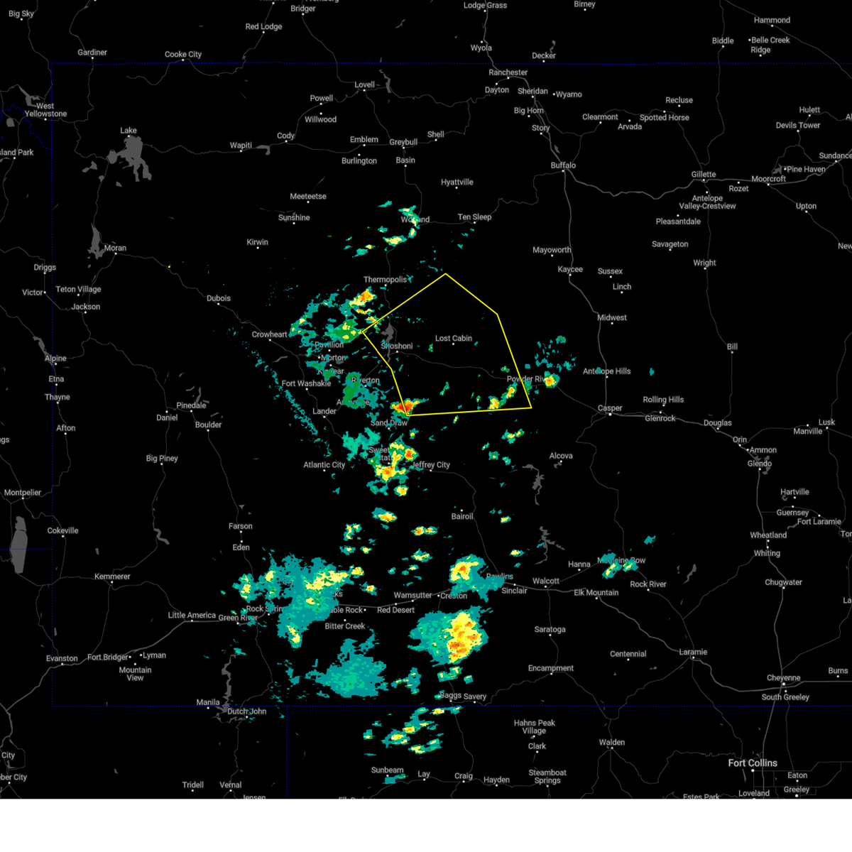
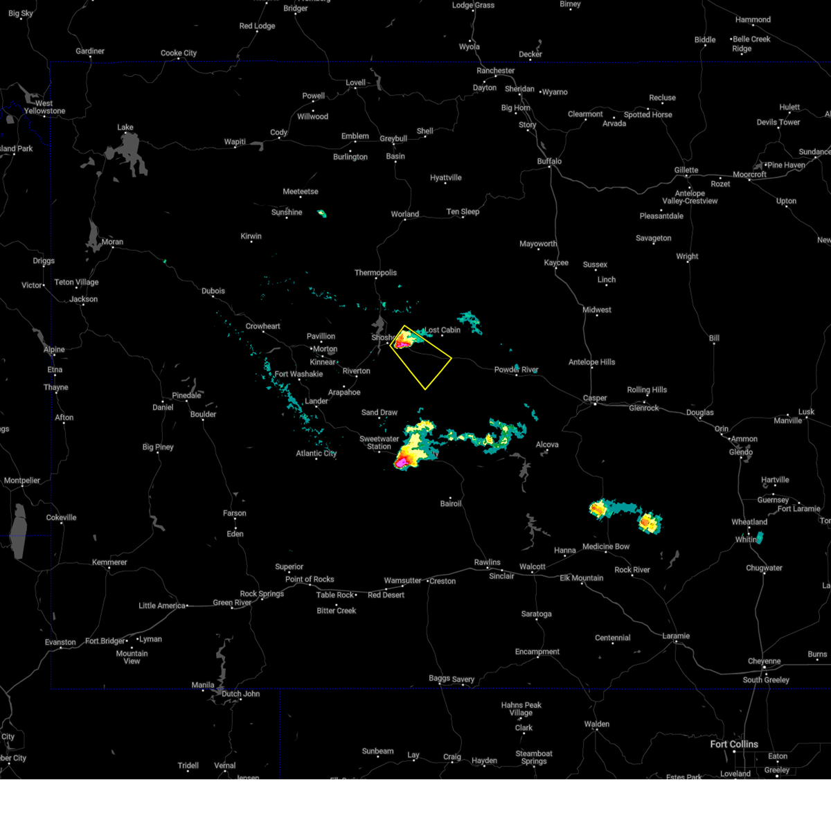
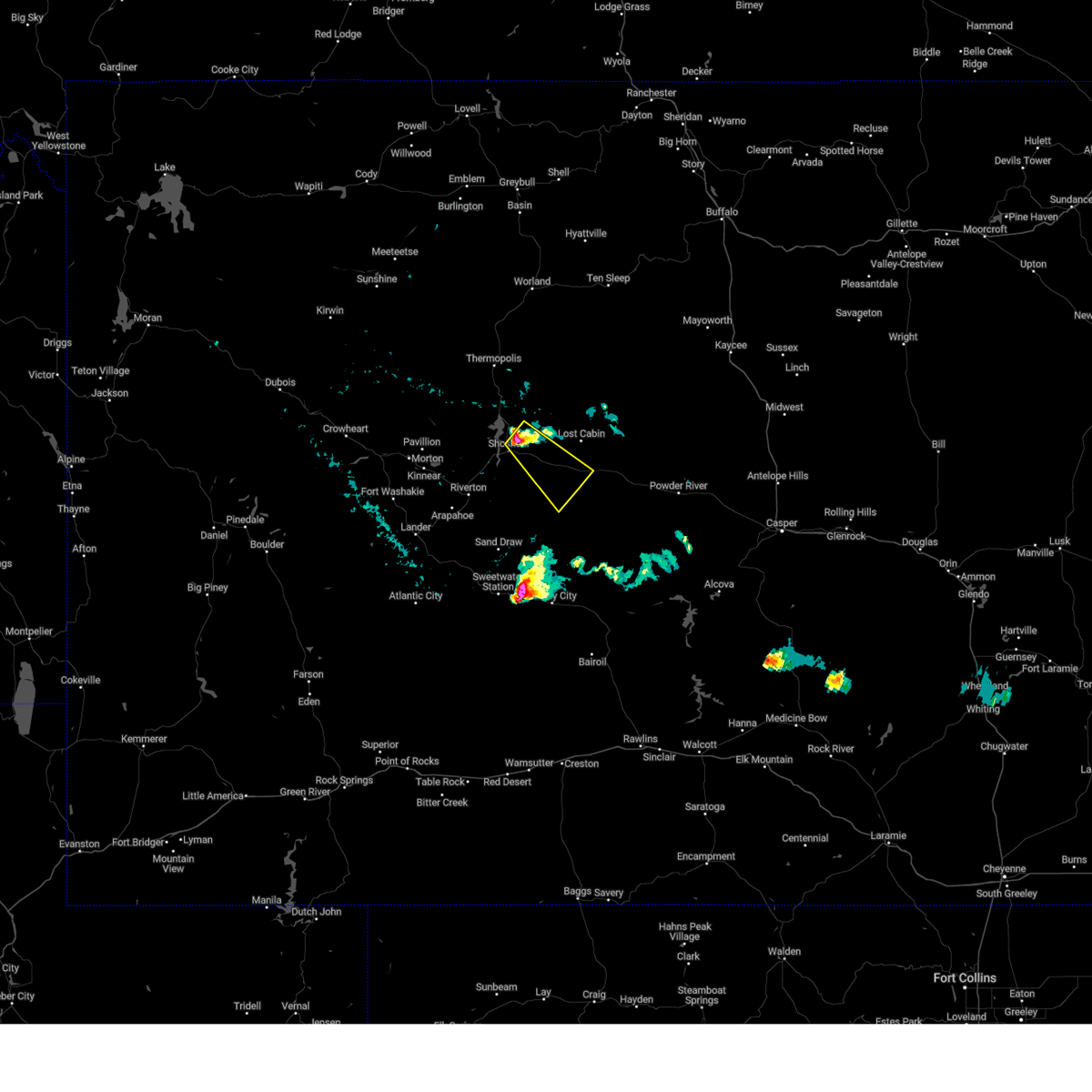
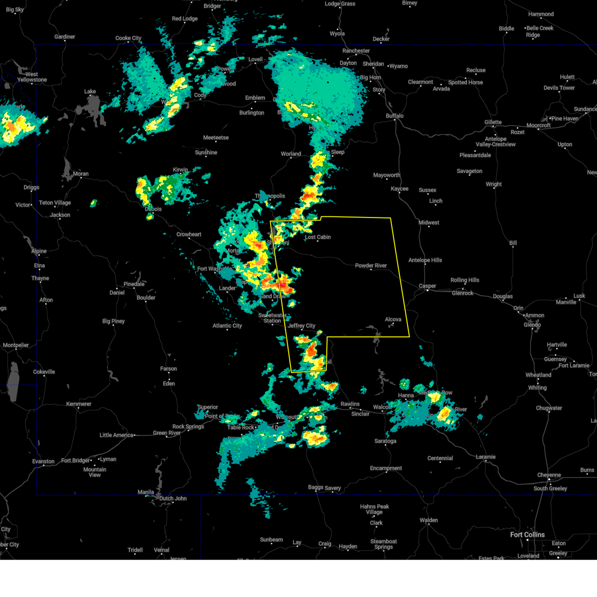
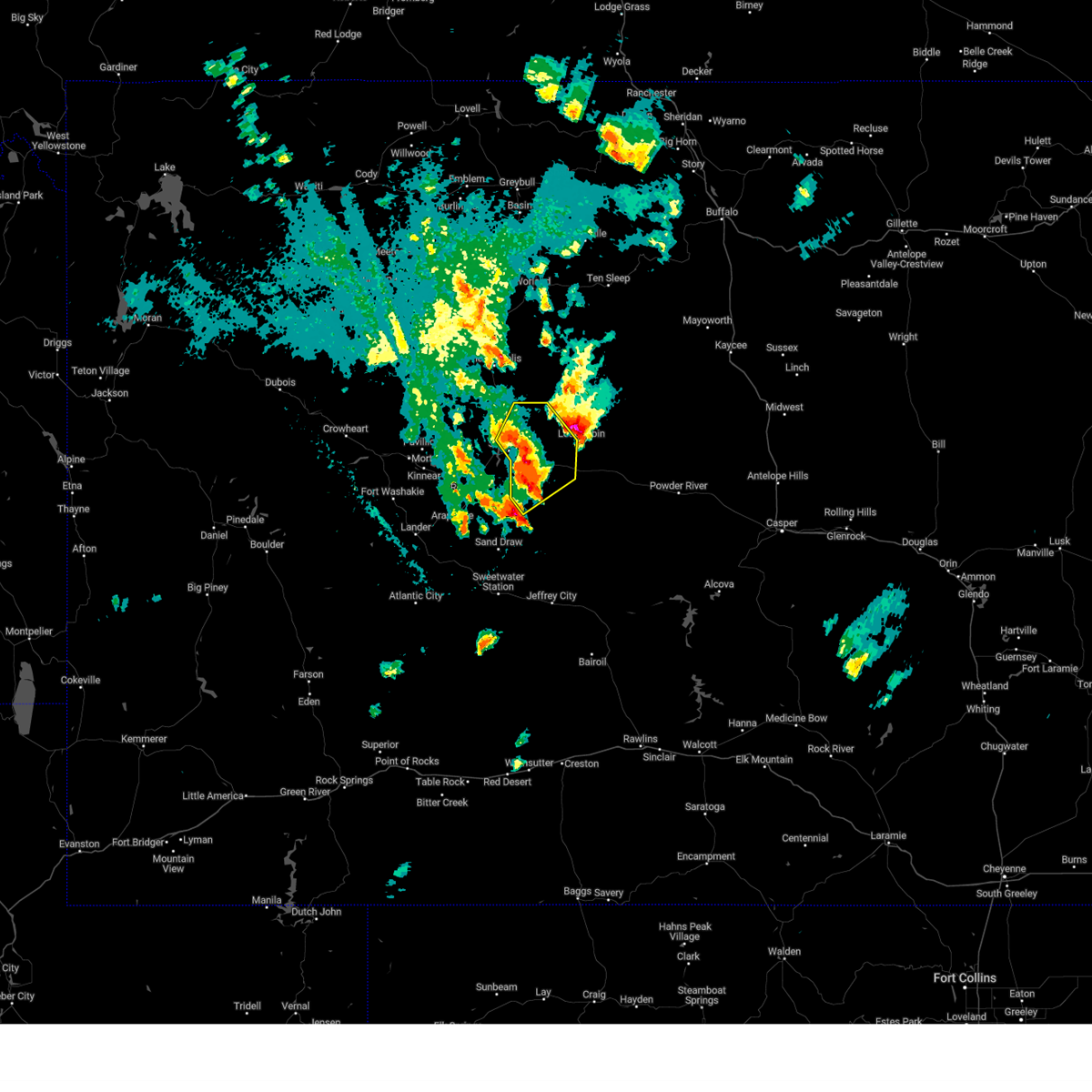
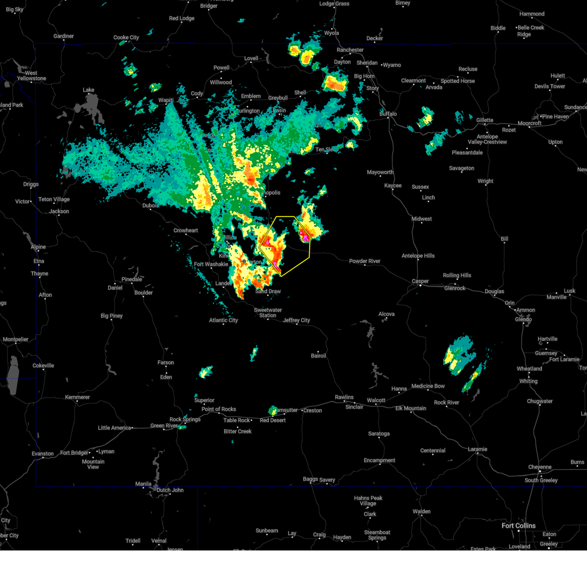
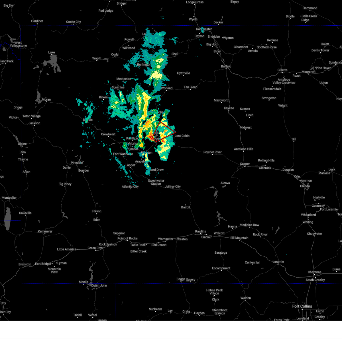
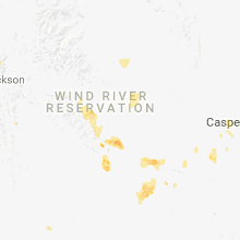
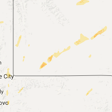
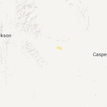
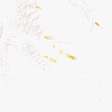
Hail Map for Shoshoni, WY
The Shoshoni, WY area has had 4 reports of on-the-ground hail by trained spotters, and has been under severe weather warnings 8 times during the past 12 months. Doppler radar has detected hail at or near Shoshoni, WY on 18 occasions, including 1 occasion during the past year.
| Name: | Shoshoni, WY |
| Where Located: | 19.9 miles NE of Riverton, WY |
| Map: | Google Map for Shoshoni, WY |
| Population: | 649 |
| Housing Units: | 337 |
| More Info: | Search Google for Shoshoni, WY |
0
The Top Recent Hail Date for Shoshoni, WY is Monday, August 26, 2024 (18th out of 18)

Hail and Wind Damage Spotted near Shoshoni, WY
| Date / Time | Report Details |
|---|---|
| 7/4/2025 3:58 PM MDT |
 Svrriw the national weather service in riverton has issued a * severe thunderstorm warning for, southeastern fremont county in central wyoming, * until 445 pm mdt. * at 358 pm mdt, a severe thunderstorm was located 7 miles south of hidden valley, which is 10 miles east of riverton, moving east at 45 mph (radar indicated). Hazards include 60 mph wind gusts. Expect damage to roofs, siding, and trees. This severe thunderstorm will remain over mainly rural areas of southeastern fremont county, including the following locations, bonneville. Svrriw the national weather service in riverton has issued a * severe thunderstorm warning for, southeastern fremont county in central wyoming, * until 445 pm mdt. * at 358 pm mdt, a severe thunderstorm was located 7 miles south of hidden valley, which is 10 miles east of riverton, moving east at 45 mph (radar indicated). Hazards include 60 mph wind gusts. Expect damage to roofs, siding, and trees. This severe thunderstorm will remain over mainly rural areas of southeastern fremont county, including the following locations, bonneville.
|
| 6/11/2025 5:53 PM MDT |
 The storms which prompted the warning have weakened below severe limits, and have exited the warned area. therefore, the warning will be allowed to expire. a severe thunderstorm watch remains in effect until 900 pm mdt for central wyoming. The storms which prompted the warning have weakened below severe limits, and have exited the warned area. therefore, the warning will be allowed to expire. a severe thunderstorm watch remains in effect until 900 pm mdt for central wyoming.
|
| 6/11/2025 5:46 PM MDT |
 At 546 pm mdt, severe thunderstorms were located along a line extending from 9 miles northwest of boysen state park to near hidden valley to near riverton, moving east at 35 mph (radar indicated). Hazards include 60 mph wind gusts and penny size hail. Expect damage to roofs, siding, and trees. Locations impacted include, shoshoni, hidden valley and boysen state park. At 546 pm mdt, severe thunderstorms were located along a line extending from 9 miles northwest of boysen state park to near hidden valley to near riverton, moving east at 35 mph (radar indicated). Hazards include 60 mph wind gusts and penny size hail. Expect damage to roofs, siding, and trees. Locations impacted include, shoshoni, hidden valley and boysen state park.
|
| 6/11/2025 5:27 PM MDT |
 Svrriw the national weather service in riverton has issued a * severe thunderstorm warning for, east central fremont county in central wyoming, * until 600 pm mdt. * at 526 pm mdt, severe thunderstorms were located along a line extending from 13 miles northeast of pavillion to 6 miles east of ocean lake to near arapahoe, moving east at 35 mph (radar indicated). Hazards include 60 mph wind gusts and penny size hail. Expect damage to roofs, siding, and trees. severe thunderstorms will be near, riverton and arapahoe around 530 pm mdt. boysen state park around 535 pm mdt. hidden valley around 540 pm mdt. Other locations in the path of these severe thunderstorms include shoshoni. Svrriw the national weather service in riverton has issued a * severe thunderstorm warning for, east central fremont county in central wyoming, * until 600 pm mdt. * at 526 pm mdt, severe thunderstorms were located along a line extending from 13 miles northeast of pavillion to 6 miles east of ocean lake to near arapahoe, moving east at 35 mph (radar indicated). Hazards include 60 mph wind gusts and penny size hail. Expect damage to roofs, siding, and trees. severe thunderstorms will be near, riverton and arapahoe around 530 pm mdt. boysen state park around 535 pm mdt. hidden valley around 540 pm mdt. Other locations in the path of these severe thunderstorms include shoshoni.
|
| 8/26/2024 9:29 AM MDT | Storm damage reported in fremont county WY, 13.7 miles SW of Shoshoni, WY |
| 8/26/2024 9:27 AM MDT |
 The storm which prompted the warning has weakened below severe limits, and has exited the warned area. therefore, the warning will be allowed to expire. however, small hail, gusty winds to around 45 mph, and heavy rain are still likely with this thunderstorm. The storm which prompted the warning has weakened below severe limits, and has exited the warned area. therefore, the warning will be allowed to expire. however, small hail, gusty winds to around 45 mph, and heavy rain are still likely with this thunderstorm.
|
| 8/26/2024 9:20 AM MDT |
 At 920 am mdt, a severe thunderstorm was located 8 miles west of lysite, which is 12 miles east of shoshoni, moving northeast at 40 mph (radar indicated). Hazards include 60 mph wind gusts. Expect damage to roofs, siding, and trees. Locations impacted include, shoshoni, moneta, and bonneville. At 920 am mdt, a severe thunderstorm was located 8 miles west of lysite, which is 12 miles east of shoshoni, moving northeast at 40 mph (radar indicated). Hazards include 60 mph wind gusts. Expect damage to roofs, siding, and trees. Locations impacted include, shoshoni, moneta, and bonneville.
|
| 8/26/2024 9:02 AM MDT |
 At 902 am mdt, a severe thunderstorm was located 8 miles southeast of shoshoni, moving northeast at 40 mph (radar indicated). Hazards include 60 mph wind gusts and quarter size hail. Hail damage to vehicles is expected. expect wind damage to roofs, siding, and trees. Locations impacted include, shoshoni, moneta, boysen state park, and bonneville. At 902 am mdt, a severe thunderstorm was located 8 miles southeast of shoshoni, moving northeast at 40 mph (radar indicated). Hazards include 60 mph wind gusts and quarter size hail. Hail damage to vehicles is expected. expect wind damage to roofs, siding, and trees. Locations impacted include, shoshoni, moneta, boysen state park, and bonneville.
|
| 8/26/2024 8:43 AM MDT |
 Svrriw the national weather service in riverton has issued a * severe thunderstorm warning for, east central fremont county in central wyoming, * until 930 am mdt. * at 843 am mdt, a severe thunderstorm was located 11 miles east of riverton, moving northeast at 40 mph (radar indicated). Hazards include ping pong ball size hail and 60 mph wind gusts. People and animals outdoors could be injured. expect hail damage to roofs, siding, windows, and vehicles. expect wind damage to roofs, siding, and trees. This severe thunderstorm will remain over mainly rural areas of east central fremont county, including the following locations, bonneville. Svrriw the national weather service in riverton has issued a * severe thunderstorm warning for, east central fremont county in central wyoming, * until 930 am mdt. * at 843 am mdt, a severe thunderstorm was located 11 miles east of riverton, moving northeast at 40 mph (radar indicated). Hazards include ping pong ball size hail and 60 mph wind gusts. People and animals outdoors could be injured. expect hail damage to roofs, siding, windows, and vehicles. expect wind damage to roofs, siding, and trees. This severe thunderstorm will remain over mainly rural areas of east central fremont county, including the following locations, bonneville.
|
| 8/7/2023 7:07 PM MDT |
 At 705 pm mdt, a severe thunderstorm was located near shoshoni, moving southeast at 20 mph (spotter observed. one inch hail was observed at the fastlane in shoshoni). Hazards include 60 mph wind gusts and quarter size hail. Hail damage to vehicles is expected. expect wind damage to roofs, siding, and trees. locations impacted include, shoshoni, moneta, and bonneville. hail threat, observed max hail size, 1. 00 in wind threat, radar indicated max wind gust, 60 mph. At 705 pm mdt, a severe thunderstorm was located near shoshoni, moving southeast at 20 mph (spotter observed. one inch hail was observed at the fastlane in shoshoni). Hazards include 60 mph wind gusts and quarter size hail. Hail damage to vehicles is expected. expect wind damage to roofs, siding, and trees. locations impacted include, shoshoni, moneta, and bonneville. hail threat, observed max hail size, 1. 00 in wind threat, radar indicated max wind gust, 60 mph.
|
| 8/7/2023 6:59 PM MDT | Quarter sized hail reported 0.5 miles W of Shoshoni, WY |
| 8/7/2023 6:57 PM MDT |
 At 656 pm mdt, a severe thunderstorm was located over shoshoni, moving east at 30 mph (radar indicated). Hazards include 60 mph wind gusts and quarter size hail. Hail damage to vehicles is expected. Expect wind damage to roofs, siding, and trees. At 656 pm mdt, a severe thunderstorm was located over shoshoni, moving east at 30 mph (radar indicated). Hazards include 60 mph wind gusts and quarter size hail. Hail damage to vehicles is expected. Expect wind damage to roofs, siding, and trees.
|
| 7/26/2023 3:12 PM MDT |
 At 310 pm mdt, severe thunderstorms were located along a line extending from near boysen state park to 6 miles east of shoshoni to 13 miles southwest of moneta, moving northeast at 55 mph (trained weather spotters and wind equipment. at 235 pm, 74 mph wind gusts was reported between lander and riverton. at 247 pm, 67 mph wind gusts were reported at the riverton airport). Hazards include 70 mph wind gusts and nickel size hail. Expect considerable tree damage. damage is likely to mobile homes, roofs, and outbuildings. severe thunderstorms will be near, shoshoni at 310 pm mdt. lysite and moneta around 325 pm mdt. lost cabin around 330 pm mdt. other locations in the path of these severe thunderstorms include hiland and cottonwood pass. thunderstorm damage threat, considerable hail threat, radar indicated max hail size, 0. 88 in wind threat, observed max wind gust, 70 mph. At 310 pm mdt, severe thunderstorms were located along a line extending from near boysen state park to 6 miles east of shoshoni to 13 miles southwest of moneta, moving northeast at 55 mph (trained weather spotters and wind equipment. at 235 pm, 74 mph wind gusts was reported between lander and riverton. at 247 pm, 67 mph wind gusts were reported at the riverton airport). Hazards include 70 mph wind gusts and nickel size hail. Expect considerable tree damage. damage is likely to mobile homes, roofs, and outbuildings. severe thunderstorms will be near, shoshoni at 310 pm mdt. lysite and moneta around 325 pm mdt. lost cabin around 330 pm mdt. other locations in the path of these severe thunderstorms include hiland and cottonwood pass. thunderstorm damage threat, considerable hail threat, radar indicated max hail size, 0. 88 in wind threat, observed max wind gust, 70 mph.
|
| 7/26/2023 2:58 PM MDT |
 At 256 pm mdt, severe thunderstorms were located along a line extending from 10 miles east of ocean lake to near hidden valley to 11 miles north of sand draw, moving east at 55 mph (trained weather spotters. at 250 pm, 70 mph was reported at several locations just west of riverton. 60 to 65 mph wind gusts were also reported at the riverton airport). Hazards include 70 mph wind gusts. Expect considerable tree damage. damage is likely to mobile homes, roofs, and outbuildings. these severe storms will be near, boysen state park and hidden valley around 300 pm mdt. other locations in the path of these severe thunderstorms include shoshoni. thunderstorm damage threat, considerable hail threat, radar indicated max hail size, <. 75 in wind threat, observed max wind gust, 70 mph. At 256 pm mdt, severe thunderstorms were located along a line extending from 10 miles east of ocean lake to near hidden valley to 11 miles north of sand draw, moving east at 55 mph (trained weather spotters. at 250 pm, 70 mph was reported at several locations just west of riverton. 60 to 65 mph wind gusts were also reported at the riverton airport). Hazards include 70 mph wind gusts. Expect considerable tree damage. damage is likely to mobile homes, roofs, and outbuildings. these severe storms will be near, boysen state park and hidden valley around 300 pm mdt. other locations in the path of these severe thunderstorms include shoshoni. thunderstorm damage threat, considerable hail threat, radar indicated max hail size, <. 75 in wind threat, observed max wind gust, 70 mph.
|
| 7/26/2023 2:41 PM MDT |
 At 240 pm mdt, severe thunderstorms were located along a line extending from near kinnear to near arapahoe, moving east at 40 mph (radar indicated). Hazards include 60 to 70 mph wind gusts. Expect damage to roofs, siding, and trees. severe thunderstorms will be near, riverton around 245 pm mdt. other locations in the path of these severe thunderstorms include shoshoni. hail threat, radar indicated max hail size, <. 75 in wind threat, observed max wind gust, 60 mph. At 240 pm mdt, severe thunderstorms were located along a line extending from near kinnear to near arapahoe, moving east at 40 mph (radar indicated). Hazards include 60 to 70 mph wind gusts. Expect damage to roofs, siding, and trees. severe thunderstorms will be near, riverton around 245 pm mdt. other locations in the path of these severe thunderstorms include shoshoni. hail threat, radar indicated max hail size, <. 75 in wind threat, observed max wind gust, 60 mph.
|
| 7/14/2023 7:00 PM MDT |
 At 700 pm mdt, a severe thunderstorm was located 9 miles west of moneta, which is also 10 miles east of shoshoni, moving southeast at 35 mph (radar indicated). Hazards include 60 mph wind gusts and quarter size hail. Hail damage to vehicles is expected. expect wind damage to roofs, siding, and trees. locations impacted include, moneta. hail threat, radar indicated max hail size, 1. 00 in wind threat, radar indicated max wind gust, 60 mph. At 700 pm mdt, a severe thunderstorm was located 9 miles west of moneta, which is also 10 miles east of shoshoni, moving southeast at 35 mph (radar indicated). Hazards include 60 mph wind gusts and quarter size hail. Hail damage to vehicles is expected. expect wind damage to roofs, siding, and trees. locations impacted include, moneta. hail threat, radar indicated max hail size, 1. 00 in wind threat, radar indicated max wind gust, 60 mph.
|
| 7/14/2023 6:47 PM MDT |
 At 647 pm mdt, a severe thunderstorm was located near shoshoni, moving southeast at 35 mph (radar indicated). Hazards include 60 mph wind gusts and quarter size hail. Hail damage to vehicles is expected. Expect wind damage to roofs, siding, and trees. At 647 pm mdt, a severe thunderstorm was located near shoshoni, moving southeast at 35 mph (radar indicated). Hazards include 60 mph wind gusts and quarter size hail. Hail damage to vehicles is expected. Expect wind damage to roofs, siding, and trees.
|
| 7/3/2023 5:20 PM MDT |
 At 519 pm mdt, severe thunderstorms were across eastern fremont county, moving east at 45 mph (radar indicated). Hazards include 70 mph wind gusts and quarter size hail. Hail damage to vehicles is expected. expect considerable tree damage. wind damage is also likely to mobile homes, roofs, and outbuildings. these severe thunderstorms will remain over mainly rural areas of southeastern fremont county, including the following locations, arapahoe elementary school, midvale, st stephens, bonneville, riverton landfill, fremont county fairgrounds and riverton regional airport. thunderstorm damage threat, considerable hail threat, radar indicated max hail size, 1. 00 in wind threat, observed max wind gust, 70 mph. At 519 pm mdt, severe thunderstorms were across eastern fremont county, moving east at 45 mph (radar indicated). Hazards include 70 mph wind gusts and quarter size hail. Hail damage to vehicles is expected. expect considerable tree damage. wind damage is also likely to mobile homes, roofs, and outbuildings. these severe thunderstorms will remain over mainly rural areas of southeastern fremont county, including the following locations, arapahoe elementary school, midvale, st stephens, bonneville, riverton landfill, fremont county fairgrounds and riverton regional airport. thunderstorm damage threat, considerable hail threat, radar indicated max hail size, 1. 00 in wind threat, observed max wind gust, 70 mph.
|
| 7/3/2023 5:15 PM MDT | Mesonet station fw5226 shoshon in fremont county WY, 0.5 miles W of Shoshoni, WY |
| 7/3/2023 5:14 PM MDT |
 At 511 pm mdt, severe thunderstorms were moving from fremont county into natrona county, moving east at 70 mph (radar indicated). Hazards include 70 mph wind gusts and penny size hail. Expect considerable tree damage. damage is likely to mobile homes, roofs, and outbuildings. severe thunderstorms will be near, split rock around 515 pm mdt. lysite and castle gardens around 525 pm mdt. devil`s gate, lost cabin and cottonwood pass around 530 pm mdt. other locations in the path of these severe thunderstorms include ervay, independence rock and red wall. thunderstorm damage threat, considerable hail threat, radar indicated max hail size, 0. 75 in wind threat, observed max wind gust, 70 mph. At 511 pm mdt, severe thunderstorms were moving from fremont county into natrona county, moving east at 70 mph (radar indicated). Hazards include 70 mph wind gusts and penny size hail. Expect considerable tree damage. damage is likely to mobile homes, roofs, and outbuildings. severe thunderstorms will be near, split rock around 515 pm mdt. lysite and castle gardens around 525 pm mdt. devil`s gate, lost cabin and cottonwood pass around 530 pm mdt. other locations in the path of these severe thunderstorms include ervay, independence rock and red wall. thunderstorm damage threat, considerable hail threat, radar indicated max hail size, 0. 75 in wind threat, observed max wind gust, 70 mph.
|
| 7/3/2023 4:57 PM MDT |
 At 455 pm mdt, severe thunderstorms were moving through the wind river basin, moving east at 45 mph (radar indicated). Hazards include 70 mph wind gusts and quarter size hail. Hail damage to vehicles is expected. expect considerable tree damage. wind damage is also likely to mobile homes, roofs, and outbuildings. these severe storms will be near, sand draw around 505 pm mdt. other locations in the path of these severe thunderstorms include boysen state park and hidden valley. thunderstorm damage threat, considerable hail threat, radar indicated max hail size, 1. 00 in wind threat, observed max wind gust, 70 mph. At 455 pm mdt, severe thunderstorms were moving through the wind river basin, moving east at 45 mph (radar indicated). Hazards include 70 mph wind gusts and quarter size hail. Hail damage to vehicles is expected. expect considerable tree damage. wind damage is also likely to mobile homes, roofs, and outbuildings. these severe storms will be near, sand draw around 505 pm mdt. other locations in the path of these severe thunderstorms include boysen state park and hidden valley. thunderstorm damage threat, considerable hail threat, radar indicated max hail size, 1. 00 in wind threat, observed max wind gust, 70 mph.
|
| 7/3/2023 4:48 PM MDT |
 At 447 pm mdt, severe thunderstorms were located along a line extending from 11 miles north of pavillion to 6 miles northwest of riverton to 10 miles west of sand draw, moving east at 45 mph (radar indicated). Hazards include 70 mph wind gusts. Expect considerable tree damage. damage is likely to mobile homes, roofs, and outbuildings. severe thunderstorms will be near, riverton around 450 pm mdt. sand draw around 500 pm mdt. other locations in the path of these severe thunderstorms include boysen state park and hidden valley. thunderstorm damage threat, considerable hail threat, radar indicated max hail size, <. 75 in wind threat, observed max wind gust, 70 mph. At 447 pm mdt, severe thunderstorms were located along a line extending from 11 miles north of pavillion to 6 miles northwest of riverton to 10 miles west of sand draw, moving east at 45 mph (radar indicated). Hazards include 70 mph wind gusts. Expect considerable tree damage. damage is likely to mobile homes, roofs, and outbuildings. severe thunderstorms will be near, riverton around 450 pm mdt. sand draw around 500 pm mdt. other locations in the path of these severe thunderstorms include boysen state park and hidden valley. thunderstorm damage threat, considerable hail threat, radar indicated max hail size, <. 75 in wind threat, observed max wind gust, 70 mph.
|
| 6/23/2023 12:57 PM MDT |
 At 1257 pm mdt, a severe thunderstorm was located near shoshoni, moving northeast at 30 mph (radar indicated). Hazards include ping pong ball size hail and 60 mph wind gusts. People and animals outdoors will be injured. expect hail damage to roofs, siding, windows, and vehicles. expect wind damage to roofs, siding, and trees. locations impacted include, shoshoni, lysite, moneta, boysen state park and bonneville. hail threat, observed max hail size, 1. 50 in wind threat, radar indicated max wind gust, 60 mph. At 1257 pm mdt, a severe thunderstorm was located near shoshoni, moving northeast at 30 mph (radar indicated). Hazards include ping pong ball size hail and 60 mph wind gusts. People and animals outdoors will be injured. expect hail damage to roofs, siding, windows, and vehicles. expect wind damage to roofs, siding, and trees. locations impacted include, shoshoni, lysite, moneta, boysen state park and bonneville. hail threat, observed max hail size, 1. 50 in wind threat, radar indicated max wind gust, 60 mph.
|
| 6/23/2023 12:45 PM MDT | Hen Egg sized hail reported 20.9 miles W of Shoshoni, WY |
| 6/23/2023 12:43 PM MDT |
 At 1243 pm mdt, a severe thunderstorm was located near shoshoni, moving northeast at 30 mph (radar indicated). Hazards include ping pong ball size hail. People and animals outdoors will be injured. expect damage to roofs, siding, windows, and vehicles. this severe thunderstorm will remain over mainly rural areas of east central fremont county, including the following locations, bonneville. hail threat, observed max hail size, 1. 50 in wind threat, radar indicated max wind gust, <50 mph. At 1243 pm mdt, a severe thunderstorm was located near shoshoni, moving northeast at 30 mph (radar indicated). Hazards include ping pong ball size hail. People and animals outdoors will be injured. expect damage to roofs, siding, windows, and vehicles. this severe thunderstorm will remain over mainly rural areas of east central fremont county, including the following locations, bonneville. hail threat, observed max hail size, 1. 50 in wind threat, radar indicated max wind gust, <50 mph.
|
| 6/23/2023 12:25 PM MDT |
 At 1224 pm mdt, a severe thunderstorm was located near hidden valley, which is also 9 miles northeast of riverton, moving northeast at 25 mph (trained weather spotters. multiple pictures of and reliable reports of golf-ball sized hail near riverton wy). Hazards include golf ball size hail. People and animals outdoors will be injured. expect damage to roofs, siding, windows, and vehicles. locations impacted include, eastern riverton, shoshoni, hidden valley, boysen state park and fremont county fairgrounds. thunderstorm damage threat, considerable hail threat, observed max hail size, 1. 75 in wind threat, radar indicated max wind gust, <50 mph. At 1224 pm mdt, a severe thunderstorm was located near hidden valley, which is also 9 miles northeast of riverton, moving northeast at 25 mph (trained weather spotters. multiple pictures of and reliable reports of golf-ball sized hail near riverton wy). Hazards include golf ball size hail. People and animals outdoors will be injured. expect damage to roofs, siding, windows, and vehicles. locations impacted include, eastern riverton, shoshoni, hidden valley, boysen state park and fremont county fairgrounds. thunderstorm damage threat, considerable hail threat, observed max hail size, 1. 75 in wind threat, radar indicated max wind gust, <50 mph.
|
| 6/23/2023 12:02 PM MDT |
 At 1202 pm mdt, a severe thunderstorm was located over southern riverton, moving northeast at 25 mph (trained weather spotters). Hazards include golf ball size hail and 60 mph wind gusts. People and animals outdoors will be injured. expect hail damage to roofs, siding, windows, and vehicles. Expect wind damage to roofs, siding, and trees. At 1202 pm mdt, a severe thunderstorm was located over southern riverton, moving northeast at 25 mph (trained weather spotters). Hazards include golf ball size hail and 60 mph wind gusts. People and animals outdoors will be injured. expect hail damage to roofs, siding, windows, and vehicles. Expect wind damage to roofs, siding, and trees.
|
| 6/20/2023 1:14 PM MDT |
 At 114 pm mdt, a severe thunderstorm capable of producing a tornado was located over boysen state park, which is also near shoshoni, moving northeast at 35 mph (radar indicated rotation). Hazards include tornado. Flying debris will be dangerous to those caught without shelter. mobile homes will be damaged or destroyed. damage to roofs, windows, and vehicles will occur. tree damage is likely. This tornadic thunderstorm will remain over mainly rural areas of southeastern hot springs and east central fremont counties, including the following locations, bonneville. At 114 pm mdt, a severe thunderstorm capable of producing a tornado was located over boysen state park, which is also near shoshoni, moving northeast at 35 mph (radar indicated rotation). Hazards include tornado. Flying debris will be dangerous to those caught without shelter. mobile homes will be damaged or destroyed. damage to roofs, windows, and vehicles will occur. tree damage is likely. This tornadic thunderstorm will remain over mainly rural areas of southeastern hot springs and east central fremont counties, including the following locations, bonneville.
|
| 6/20/2023 1:12 PM MDT |
 At 111 pm mdt, a severe thunderstorm was located over boysen state park, which is also near shoshoni, moving northeast at 40 mph (radar indicated). Hazards include 60 mph wind gusts and penny size hail. Expect damage to roofs, siding, and trees. This severe thunderstorm will be near, shoshoni around 115 pm mdt. At 111 pm mdt, a severe thunderstorm was located over boysen state park, which is also near shoshoni, moving northeast at 40 mph (radar indicated). Hazards include 60 mph wind gusts and penny size hail. Expect damage to roofs, siding, and trees. This severe thunderstorm will be near, shoshoni around 115 pm mdt.
|
| 9/10/2021 6:01 PM MDT |
 At 559 pm mdt, an outflow boundary with severe winds was located along a line extending from 9 miles northeast of boysen state park to 15 miles southwest of moneta, moving east at 40 mph (radar indicated). Hazards include 60 mph wind gusts. expect damage to roofs, siding, and trees At 559 pm mdt, an outflow boundary with severe winds was located along a line extending from 9 miles northeast of boysen state park to 15 miles southwest of moneta, moving east at 40 mph (radar indicated). Hazards include 60 mph wind gusts. expect damage to roofs, siding, and trees
|
| 9/10/2021 5:44 PM MDT |
 At 543 pm mdt, an outflow boundary with severe winds was located over hidden valley, or 9 miles southwest of shoshoni, moving northeast at 45 mph (radar indicated). Hazards include 70 mph wind gusts. Expect considerable tree damage. damage is likely to mobile homes, roofs, and outbuildings. locations impacted include, boysen state park and shoshoni. thunderstorm damage threat, considerable hail threat, radar indicated max hail size, <. 75 in wind threat, radar indicated max wind gust, 70 mph. At 543 pm mdt, an outflow boundary with severe winds was located over hidden valley, or 9 miles southwest of shoshoni, moving northeast at 45 mph (radar indicated). Hazards include 70 mph wind gusts. Expect considerable tree damage. damage is likely to mobile homes, roofs, and outbuildings. locations impacted include, boysen state park and shoshoni. thunderstorm damage threat, considerable hail threat, radar indicated max hail size, <. 75 in wind threat, radar indicated max wind gust, 70 mph.
|
| 9/10/2021 5:28 PM MDT |
 At 527 pm mdt, an outflow boundary with severe winds was located near riverton, moving northeast at 45 mph (radar indicated). Hazards include 70 mph wind gusts. Expect considerable tree damage. damage is likely to mobile homes, roofs, and outbuildings. this severe thunderstorm will be near, boysen state park and hidden valley around 545 pm mdt. other locations in the path of this severe thunderstorm include shoshoni. thunderstorm damage threat, considerable hail threat, radar indicated max hail size, <. 75 in wind threat, radar indicated max wind gust, 70 mph. At 527 pm mdt, an outflow boundary with severe winds was located near riverton, moving northeast at 45 mph (radar indicated). Hazards include 70 mph wind gusts. Expect considerable tree damage. damage is likely to mobile homes, roofs, and outbuildings. this severe thunderstorm will be near, boysen state park and hidden valley around 545 pm mdt. other locations in the path of this severe thunderstorm include shoshoni. thunderstorm damage threat, considerable hail threat, radar indicated max hail size, <. 75 in wind threat, radar indicated max wind gust, 70 mph.
|
| 9/2/2021 2:21 PM MDT |
 The severe thunderstorm warning for central fremont county will expire at 230 pm mdt, the storm which prompted the warning has weakened below severe limits, and has exited the warned area. therefore, the warning will be allowed to expire. The severe thunderstorm warning for central fremont county will expire at 230 pm mdt, the storm which prompted the warning has weakened below severe limits, and has exited the warned area. therefore, the warning will be allowed to expire.
|
| 9/2/2021 2:12 PM MDT |
 At 211 pm mdt, a severe thunderstorm was located near riverton, moving southeast at 40 mph (radar indicated). Hazards include 60 mph wind gusts and penny size hail. Expect damage to roofs, siding, and trees. this severe thunderstorm will remain over mainly rural areas of central fremont county, including the following locations, arapahoe elementary school, midvale, st stephens, bonneville, riverton landfill, fremont county fairgrounds and riverton regional airport. hail threat, radar indicated max hail size, 0. 75 in wind threat, radar indicated max wind gust, 60 mph. At 211 pm mdt, a severe thunderstorm was located near riverton, moving southeast at 40 mph (radar indicated). Hazards include 60 mph wind gusts and penny size hail. Expect damage to roofs, siding, and trees. this severe thunderstorm will remain over mainly rural areas of central fremont county, including the following locations, arapahoe elementary school, midvale, st stephens, bonneville, riverton landfill, fremont county fairgrounds and riverton regional airport. hail threat, radar indicated max hail size, 0. 75 in wind threat, radar indicated max wind gust, 60 mph.
|
| 9/2/2021 1:50 PM MDT |
 At 149 pm mdt, a severe thunderstorm was located near ocean lake, or 9 miles northwest of riverton, moving southeast at 40 mph (radar indicated). Hazards include 60 mph wind gusts and penny size hail. Expect damage to roofs, siding, and trees. this severe thunderstorm will be near, riverton and arapahoe around 200 pm mdt. other locations in the path of this severe thunderstorm include boysen state park. hail threat, radar indicated max hail size, 0. 75 in wind threat, radar indicated max wind gust, 60 mph. At 149 pm mdt, a severe thunderstorm was located near ocean lake, or 9 miles northwest of riverton, moving southeast at 40 mph (radar indicated). Hazards include 60 mph wind gusts and penny size hail. Expect damage to roofs, siding, and trees. this severe thunderstorm will be near, riverton and arapahoe around 200 pm mdt. other locations in the path of this severe thunderstorm include boysen state park. hail threat, radar indicated max hail size, 0. 75 in wind threat, radar indicated max wind gust, 60 mph.
|
| 7/5/2021 5:43 PM MDT |
 At 543 pm mdt, severe thunderstorms were located along a line extending from near hidden valley to 9 miles southeast of riverton to near sweetwater station, moving east at 20 mph (radar indicated). Hazards include 60 mph wind gusts and penny size hail. Expect damage to roofs, siding, and trees. Locations impacted include, boysen state park and shoshoni. At 543 pm mdt, severe thunderstorms were located along a line extending from near hidden valley to 9 miles southeast of riverton to near sweetwater station, moving east at 20 mph (radar indicated). Hazards include 60 mph wind gusts and penny size hail. Expect damage to roofs, siding, and trees. Locations impacted include, boysen state park and shoshoni.
|
| 7/5/2021 5:25 PM MDT |
 At 524 pm mdt, severe thunderstorms were located along a line extending from 7 miles northeast of pavillion to near hudson to 9 miles east of red canyon, moving east at 35 mph (radar indicated). Hazards include 60 mph wind gusts and nickel size hail. Expect damage to roofs, siding, and trees. severe thunderstorms will be near, riverton and arapahoe around 535 pm mdt. Other locations in the path of these severe thunderstorms include sweetwater station, hidden valley and shoshoni. At 524 pm mdt, severe thunderstorms were located along a line extending from 7 miles northeast of pavillion to near hudson to 9 miles east of red canyon, moving east at 35 mph (radar indicated). Hazards include 60 mph wind gusts and nickel size hail. Expect damage to roofs, siding, and trees. severe thunderstorms will be near, riverton and arapahoe around 535 pm mdt. Other locations in the path of these severe thunderstorms include sweetwater station, hidden valley and shoshoni.
|
| 7/23/2020 7:01 PM MDT |
 At 700 pm mdt, a severe thunderstorm was located near hidden valley, which is 8 miles northeast of riverton, moving northeast at 25 mph (radar indicated). Hazards include 60 mph wind gusts. Expect damage to roofs, siding, and trees. this severe storm will be near, boysen state park around 705 pm mdt. Hidden valley around 710 pm mdt. At 700 pm mdt, a severe thunderstorm was located near hidden valley, which is 8 miles northeast of riverton, moving northeast at 25 mph (radar indicated). Hazards include 60 mph wind gusts. Expect damage to roofs, siding, and trees. this severe storm will be near, boysen state park around 705 pm mdt. Hidden valley around 710 pm mdt.
|
| 7/23/2020 6:55 PM MDT |
 At 654 pm mdt, a severe thunderstorm was located just northeast of riverton, moving northeast at 25 mph (radar indicated). Hazards include 60 mph wind gusts. Expect damage to roofs, siding, and trees. This severe storm will be near, hidden valley and boysen state park around 710 pm mdt. At 654 pm mdt, a severe thunderstorm was located just northeast of riverton, moving northeast at 25 mph (radar indicated). Hazards include 60 mph wind gusts. Expect damage to roofs, siding, and trees. This severe storm will be near, hidden valley and boysen state park around 710 pm mdt.
|
| 7/23/2020 6:38 PM MDT |
 At 637 pm mdt, a severe thunderstorm was located near riverton, moving northeast at 25 mph (radar indicated). Hazards include 60 mph wind gusts. Expect damage to roofs, siding, and trees. this severe thunderstorm will be near, riverton around 640 pm mdt. boysen state park around 710 pm mdt. shoshoni and hidden valley around 715 pm mdt. Other locations impacted by this severe thunderstorm include arapahoe elementary school, st stephens, bonneville, fremont county fairgrounds and riverton regional airport. At 637 pm mdt, a severe thunderstorm was located near riverton, moving northeast at 25 mph (radar indicated). Hazards include 60 mph wind gusts. Expect damage to roofs, siding, and trees. this severe thunderstorm will be near, riverton around 640 pm mdt. boysen state park around 710 pm mdt. shoshoni and hidden valley around 715 pm mdt. Other locations impacted by this severe thunderstorm include arapahoe elementary school, st stephens, bonneville, fremont county fairgrounds and riverton regional airport.
|
| 6/28/2020 4:53 PM MDT |
 At 452 pm mdt, severe thunderstorms were located along a line extending from 7 miles east of riverton to 14 miles northeast of sand draw, moving northeast at 65 mph (radar indicated). Hazards include 60 mph wind gusts. Expect damage to roofs, siding, and trees. these severe storms will be near, shoshoni around 510 pm mdt. moneta around 515 pm mdt. lysite around 520 pm mdt. lost cabin around 525 pm mdt. Other locations impacted by these severe thunderstorms include riverton landfill and bonneville. At 452 pm mdt, severe thunderstorms were located along a line extending from 7 miles east of riverton to 14 miles northeast of sand draw, moving northeast at 65 mph (radar indicated). Hazards include 60 mph wind gusts. Expect damage to roofs, siding, and trees. these severe storms will be near, shoshoni around 510 pm mdt. moneta around 515 pm mdt. lysite around 520 pm mdt. lost cabin around 525 pm mdt. Other locations impacted by these severe thunderstorms include riverton landfill and bonneville.
|
| 6/28/2020 4:38 PM MDT |
 At 436 pm mdt, severe thunderstorms were located along a line extending from 11 miles southeast of hudson to 7 miles southeast of sand draw, moving northeast at 65 mph (radar indicated). Hazards include 60 mph wind gusts. Expect damage to roofs, siding, and trees. severe thunderstorms will be near, sand draw around 440 pm mdt. boysen state park and hidden valley around 500 pm mdt. shoshoni around 510 pm mdt. moneta around 515 pm mdt. other locations impacted by these severe thunderstorms include riverton landfill and bonneville. This severe thunderstorm warning replaces the previous severe thunderstorm warning that covered south pass. At 436 pm mdt, severe thunderstorms were located along a line extending from 11 miles southeast of hudson to 7 miles southeast of sand draw, moving northeast at 65 mph (radar indicated). Hazards include 60 mph wind gusts. Expect damage to roofs, siding, and trees. severe thunderstorms will be near, sand draw around 440 pm mdt. boysen state park and hidden valley around 500 pm mdt. shoshoni around 510 pm mdt. moneta around 515 pm mdt. other locations impacted by these severe thunderstorms include riverton landfill and bonneville. This severe thunderstorm warning replaces the previous severe thunderstorm warning that covered south pass.
|
| 6/6/2020 3:52 PM MDT |
 At 348 pm mdt, severe thunderstorms were located along a line extending from near ocean lake to 7 miles northeast of boysen state park to lysite, moving north at 65 mph (radar indicated. at 314 pm the weather sensor at red canyon recorded a gust of 65 mph). Hazards include 60 to 65 mph wind gusts. Expect damage to roofs, siding, and trees. These severe thunderstorms will remain over mainly rural areas of east central fremont county, including the following locations, riverton, arapahoe, midvale, st stephens, bonneville, fremont county fairgrounds and riverton regional airport. At 348 pm mdt, severe thunderstorms were located along a line extending from near ocean lake to 7 miles northeast of boysen state park to lysite, moving north at 65 mph (radar indicated. at 314 pm the weather sensor at red canyon recorded a gust of 65 mph). Hazards include 60 to 65 mph wind gusts. Expect damage to roofs, siding, and trees. These severe thunderstorms will remain over mainly rural areas of east central fremont county, including the following locations, riverton, arapahoe, midvale, st stephens, bonneville, fremont county fairgrounds and riverton regional airport.
|
| 6/6/2020 3:46 PM MDT | Storm damage reported in fremont county WY, 1.2 miles WSW of Shoshoni, WY |
| 6/6/2020 3:14 PM MDT |
 At 312 pm mdt, severe thunderstorms were located along a line extending from near milford to near castle gardens, moving northeast at 65 mph (radar indicated). Hazards include 60 to 65 mph wind gusts. Expect damage to roofs, siding, and trees. these severe thunderstorms will remain over mainly rural areas of east central fremont county, including the following locations, riverton, midvale, st stephens, bonneville, fremont county fairgrounds and riverton regional airport. Time, mot, loc 2112z 215deg 134kt 4289 10874 4290 10766. At 312 pm mdt, severe thunderstorms were located along a line extending from near milford to near castle gardens, moving northeast at 65 mph (radar indicated). Hazards include 60 to 65 mph wind gusts. Expect damage to roofs, siding, and trees. these severe thunderstorms will remain over mainly rural areas of east central fremont county, including the following locations, riverton, midvale, st stephens, bonneville, fremont county fairgrounds and riverton regional airport. Time, mot, loc 2112z 215deg 134kt 4289 10874 4290 10766.
|
| 6/6/2020 1:33 AM MDT |
 At 131 am mdt, a severe thunderstorm was located 8 miles east of ocean lake, which is 11 miles north of riverton, moving north at 30 mph (radar indicated. at 125 am, the riverton airport measured a 59 mph wind gust). Hazards include 60 mph wind gusts. Expect damage to roofs, siding, and trees. This severe thunderstorm will remain over mainly rural areas of central fremont county, including the following locations, midvale, shoshoni, and bonneville. At 131 am mdt, a severe thunderstorm was located 8 miles east of ocean lake, which is 11 miles north of riverton, moving north at 30 mph (radar indicated. at 125 am, the riverton airport measured a 59 mph wind gust). Hazards include 60 mph wind gusts. Expect damage to roofs, siding, and trees. This severe thunderstorm will remain over mainly rural areas of central fremont county, including the following locations, midvale, shoshoni, and bonneville.
|
| 6/6/2020 12:56 AM MDT |
 At 1255 am mdt, a severe thunderstorm was located near hudson, which is 10 miles south of riverton, moving north at 40 mph (radar indicated). Hazards include 60 mph wind gusts. Expect damage to roofs, siding, and trees. this severe thunderstorm will be near, riverton around 105 am mdt. ocean lake around 120 am mdt. Other locations impacted by this severe thunderstorm include arapahoe elementary school, midvale, st stephens, bonneville, riverton landfill, fremont county fairgrounds, riverton regional airport and lander hunt field. At 1255 am mdt, a severe thunderstorm was located near hudson, which is 10 miles south of riverton, moving north at 40 mph (radar indicated). Hazards include 60 mph wind gusts. Expect damage to roofs, siding, and trees. this severe thunderstorm will be near, riverton around 105 am mdt. ocean lake around 120 am mdt. Other locations impacted by this severe thunderstorm include arapahoe elementary school, midvale, st stephens, bonneville, riverton landfill, fremont county fairgrounds, riverton regional airport and lander hunt field.
|
| 5/30/2020 5:31 PM MDT |
 At 530 pm mdt, severe thunderstorms were located along a line extending from 6 miles southwest of hidden valley to near shoshoni, moving north at 10 mph (radar indicated). Hazards include 60 mph wind gusts and quarter size hail. Hail damage to vehicles is expected. expect wind damage to roofs, siding, and trees. Locations impacted include, shoshoni, hidden valley, boysen state park and bonneville. At 530 pm mdt, severe thunderstorms were located along a line extending from 6 miles southwest of hidden valley to near shoshoni, moving north at 10 mph (radar indicated). Hazards include 60 mph wind gusts and quarter size hail. Hail damage to vehicles is expected. expect wind damage to roofs, siding, and trees. Locations impacted include, shoshoni, hidden valley, boysen state park and bonneville.
|
| 5/30/2020 5:18 PM MDT |
 At 518 pm mdt, severe thunderstorms were located along a line extending from near riverton to near shoshoni, moving northwest at 10 mph (radar indicated). Hazards include 60 mph wind gusts and quarter size hail. Hail damage to vehicles is expected. Expect wind damage to roofs, siding, and trees. At 518 pm mdt, severe thunderstorms were located along a line extending from near riverton to near shoshoni, moving northwest at 10 mph (radar indicated). Hazards include 60 mph wind gusts and quarter size hail. Hail damage to vehicles is expected. Expect wind damage to roofs, siding, and trees.
|
| 8/21/2019 3:55 PM MDT | Ping Pong Ball sized hail reported 20.5 miles WNW of Shoshoni, WY, public report on highway 26. driver estimated... but did not stop to measure and said the hail left dents in his truck. |
| 7/29/2018 5:39 PM MDT |
 At 538 pm mdt, a severe thunderstorm was located near hidden valley, or near shoshoni, moving southeast at 40 mph (radar indicated). Hazards include 60 mph wind gusts and quarter size hail. Hail damage to vehicles is expected. expect wind damage to roofs, siding, and trees. This severe thunderstorm will remain over mainly rural areas of east central fremont county, including the following locations, bonneville. At 538 pm mdt, a severe thunderstorm was located near hidden valley, or near shoshoni, moving southeast at 40 mph (radar indicated). Hazards include 60 mph wind gusts and quarter size hail. Hail damage to vehicles is expected. expect wind damage to roofs, siding, and trees. This severe thunderstorm will remain over mainly rural areas of east central fremont county, including the following locations, bonneville.
|
| 7/29/2018 5:15 PM MDT |
 At 515 pm mdt, a severe thunderstorm was located 9 miles southwest of boysen state park headquarters, or 13 miles northwest of shoshoni, moving southeast at 40 mph (radar indicated). Hazards include ping pong ball size hail and 60 mph wind gusts. People and animals outdoors will be injured. expect hail damage to roofs, siding, windows, and vehicles. expect wind damage to roofs, siding, and trees. this severe thunderstorm will be near, shoshoni and hidden valley around 535 pm mdt. Other locations impacted by this severe thunderstorm include bonneville. At 515 pm mdt, a severe thunderstorm was located 9 miles southwest of boysen state park headquarters, or 13 miles northwest of shoshoni, moving southeast at 40 mph (radar indicated). Hazards include ping pong ball size hail and 60 mph wind gusts. People and animals outdoors will be injured. expect hail damage to roofs, siding, windows, and vehicles. expect wind damage to roofs, siding, and trees. this severe thunderstorm will be near, shoshoni and hidden valley around 535 pm mdt. Other locations impacted by this severe thunderstorm include bonneville.
|
| 5/17/2018 3:05 PM MDT |
 At 304 pm mdt, a severe thunderstorm was located 8 miles southeast of shoshoni, moving northeast at 35 mph (radar indicated). Hazards include 70 mph wind gusts and quarter size hail. Hail damage to vehicles is expected. expect considerable tree damage. wind damage is also likely to mobile homes, roofs, and outbuildings. This severe thunderstorm will south and east of shoshoni. At 304 pm mdt, a severe thunderstorm was located 8 miles southeast of shoshoni, moving northeast at 35 mph (radar indicated). Hazards include 70 mph wind gusts and quarter size hail. Hail damage to vehicles is expected. expect considerable tree damage. wind damage is also likely to mobile homes, roofs, and outbuildings. This severe thunderstorm will south and east of shoshoni.
|
| 5/17/2018 2:46 PM MDT |
 At 245 pm mdt, a severe thunderstorm was located 11 miles north of sand draw, which is 12 miles southeast of riverton, moving northeast at 25 mph (radar indicated). Hazards include 60 mph wind gusts and quarter size hail. Hail damage to vehicles is expected. expect wind damage to roofs, siding, and trees. this severe storm will be near, hidden valley around 250 pm mdt. Shoshoni around 255 pm mdt. At 245 pm mdt, a severe thunderstorm was located 11 miles north of sand draw, which is 12 miles southeast of riverton, moving northeast at 25 mph (radar indicated). Hazards include 60 mph wind gusts and quarter size hail. Hail damage to vehicles is expected. expect wind damage to roofs, siding, and trees. this severe storm will be near, hidden valley around 250 pm mdt. Shoshoni around 255 pm mdt.
|
| 5/17/2018 2:35 PM MDT |
 At 234 pm mdt, a severe thunderstorm was located 9 miles northwest of sand draw, which is 12 miles southeast of riverton, moving northeast at 30 mph (radar indicated). Hazards include 60 mph wind gusts and quarter size hail. Hail damage to vehicles is expected. expect wind damage to roofs, siding, and trees. This severe thunderstorm will impact areas to the southeast and east of riverton. At 234 pm mdt, a severe thunderstorm was located 9 miles northwest of sand draw, which is 12 miles southeast of riverton, moving northeast at 30 mph (radar indicated). Hazards include 60 mph wind gusts and quarter size hail. Hail damage to vehicles is expected. expect wind damage to roofs, siding, and trees. This severe thunderstorm will impact areas to the southeast and east of riverton.
|
| 6/20/2017 4:28 PM MDT |
 The severe thunderstorm warning for southeastern fremont county will expire at 430 pm mdt, the thunderstorm outflow wind which prompted the warning has decreased in intensity and below severe limits. the wind will remain gusty at 30 to 45 mph through about 5 pm mdt, but the wind no longer poses an immediate threat to life or property. therefore the warning will be allowed to expire. The severe thunderstorm warning for southeastern fremont county will expire at 430 pm mdt, the thunderstorm outflow wind which prompted the warning has decreased in intensity and below severe limits. the wind will remain gusty at 30 to 45 mph through about 5 pm mdt, but the wind no longer poses an immediate threat to life or property. therefore the warning will be allowed to expire.
|
| 6/20/2017 4:21 PM MDT |
 At 419 pm mdt, a severe thunderstorm was located 9 miles northeast of shoshoni, moving east at 40 mph (multiple locations have reported wind gusts of 50 to 57 mph, including the lander airport, riverton airport, and another location in the foothills west of milford). Hazards include 60 mph wind gusts. Expect damage to roofs, siding, and trees. This warning includes boysen state park. At 419 pm mdt, a severe thunderstorm was located 9 miles northeast of shoshoni, moving east at 40 mph (multiple locations have reported wind gusts of 50 to 57 mph, including the lander airport, riverton airport, and another location in the foothills west of milford). Hazards include 60 mph wind gusts. Expect damage to roofs, siding, and trees. This warning includes boysen state park.
|
| 6/20/2017 4:08 PM MDT |
 At 406 pm mdt, a severe thunderstorm was located near boysen state park, north of shoshoni, moving east at 40 mph (radar indicated). Hazards include 60 mph wind gusts. Expect damage to roofs, siding, and trees. wind gusts around 60 mph are possible across other portions of central fremont county through 430 pm. another surge of wind is expected along us highway 26 from morton to riverton before 420 pm. Reports of frequent wind gusts of 50 to 55 mph have been received from across central fremont county. At 406 pm mdt, a severe thunderstorm was located near boysen state park, north of shoshoni, moving east at 40 mph (radar indicated). Hazards include 60 mph wind gusts. Expect damage to roofs, siding, and trees. wind gusts around 60 mph are possible across other portions of central fremont county through 430 pm. another surge of wind is expected along us highway 26 from morton to riverton before 420 pm. Reports of frequent wind gusts of 50 to 55 mph have been received from across central fremont county.
|
| 6/20/2017 3:52 PM MDT |
 At 350 pm mdt, a severe thunderstorm was located 12 miles southwest of boysen state park headquarters, which is 15 miles west of shoshoni, moving east at 40 mph (radar indicated). Hazards include 60 mph wind gusts. Expect damage to roofs, siding, and trees. this severe thunderstorm will be near, boysen state park headquarters around 405 pm mdt. shoshoni around 410 pm mdt. wind gusts around 60 mph are possible across other portions of central fremont county through 430 pm. outflow wind is expected to come off the wind river range while additional outflow will flow down the wind river valley from crowheart. Riverton, fort washakie, and lander could all experience wind gusts around 60 mph. At 350 pm mdt, a severe thunderstorm was located 12 miles southwest of boysen state park headquarters, which is 15 miles west of shoshoni, moving east at 40 mph (radar indicated). Hazards include 60 mph wind gusts. Expect damage to roofs, siding, and trees. this severe thunderstorm will be near, boysen state park headquarters around 405 pm mdt. shoshoni around 410 pm mdt. wind gusts around 60 mph are possible across other portions of central fremont county through 430 pm. outflow wind is expected to come off the wind river range while additional outflow will flow down the wind river valley from crowheart. Riverton, fort washakie, and lander could all experience wind gusts around 60 mph.
|
| 6/11/2017 9:58 PM MDT |
 At 954 pm mdt, a severe thunderstorm was located over riverton, moving northeast at 30 mph. another severe thunderstorm was just east of shoshoni (radar indicated). Hazards include quarter size hail. Damage to vehicles is expected. The severe thunderstorm near riverton will continue to track northeast along highway 789 26, while the severe thunderstorm near shoshoni will remain along and east of highway 20 789. At 954 pm mdt, a severe thunderstorm was located over riverton, moving northeast at 30 mph. another severe thunderstorm was just east of shoshoni (radar indicated). Hazards include quarter size hail. Damage to vehicles is expected. The severe thunderstorm near riverton will continue to track northeast along highway 789 26, while the severe thunderstorm near shoshoni will remain along and east of highway 20 789.
|
| 6/11/2017 9:43 PM MDT |
 At 941 pm mdt, a severe thunderstorm was located near arapahoe, which is 8 miles southwest of riverton, moving northeast at 30 mph. another severe thunderstorm was just southeast of shoshoni moving northeast around 30 mph (radar indicated). Hazards include 60 mph wind gusts and quarter size hail. Hail damage to vehicles is expected. expect wind damage to roofs, siding, and trees. this severe storm will be near, riverton around 955 pm mdt. The other severe thunderstorm will impact areas just east of shoshoni between 945 pm and 10 pm. At 941 pm mdt, a severe thunderstorm was located near arapahoe, which is 8 miles southwest of riverton, moving northeast at 30 mph. another severe thunderstorm was just southeast of shoshoni moving northeast around 30 mph (radar indicated). Hazards include 60 mph wind gusts and quarter size hail. Hail damage to vehicles is expected. expect wind damage to roofs, siding, and trees. this severe storm will be near, riverton around 955 pm mdt. The other severe thunderstorm will impact areas just east of shoshoni between 945 pm and 10 pm.
|
| 6/11/2017 9:30 PM MDT |
 At 929 pm mdt, a severe thunderstorm was located near hudson, which is 12 miles east of lander, moving northeast at 30 mph. another severe thunderstorm near shoshoni (radar indicated). Hazards include 60 mph wind gusts and quarter size hail. Hail damage to vehicles is expected. expect wind damage to roofs, siding, and trees. this severe thunderstorm will be near, arapahoe around 945 pm mdt. riverton around 955 pm mdt. Hidden valley around 1015 pm mdt. At 929 pm mdt, a severe thunderstorm was located near hudson, which is 12 miles east of lander, moving northeast at 30 mph. another severe thunderstorm near shoshoni (radar indicated). Hazards include 60 mph wind gusts and quarter size hail. Hail damage to vehicles is expected. expect wind damage to roofs, siding, and trees. this severe thunderstorm will be near, arapahoe around 945 pm mdt. riverton around 955 pm mdt. Hidden valley around 1015 pm mdt.
|
| 6/12/2016 6:51 PM MDT |
 The severe thunderstorm warning for east central fremont and southeastern hot springs counties will expire at 700 pm mdt, the storm which prompted the warning has weakened below severe limits, and no longer pose an immediate threat to life or property. therefore the warning will be allowed to expire. The severe thunderstorm warning for east central fremont and southeastern hot springs counties will expire at 700 pm mdt, the storm which prompted the warning has weakened below severe limits, and no longer pose an immediate threat to life or property. therefore the warning will be allowed to expire.
|
| 6/12/2016 6:32 PM MDT |
 At 631 pm mdt, a severe thunderstorm was located 13 miles west of cottonwood pass, which is 21 miles southeast of thermopolis, moving northeast at 45 mph (radar indicated). Hazards include 60 mph wind gusts and quarter size hail. Hail damage to vehicles is expected. Expect wind damage to roofs, siding and trees. At 631 pm mdt, a severe thunderstorm was located 13 miles west of cottonwood pass, which is 21 miles southeast of thermopolis, moving northeast at 45 mph (radar indicated). Hazards include 60 mph wind gusts and quarter size hail. Hail damage to vehicles is expected. Expect wind damage to roofs, siding and trees.
|
| 6/12/2016 6:13 PM MDT |
 At 612 pm mdt, a severe thunderstorm was located near boysen state park headquarters, which is 8 miles northwest of shoshoni, moving northeast at 40 mph (radar indicated). Hazards include 60 mph wind gusts and quarter size hail. Hail damage to vehicles is expected. expect wind damage to roofs, siding and trees. This severe thunderstorm will remain over mainly rural areas of east central fremont and southeastern hot springs counties, including the following locations, boysen u s bureau of reclamation power plant, boysen state park, shoshoni municipal airport and bonneville. At 612 pm mdt, a severe thunderstorm was located near boysen state park headquarters, which is 8 miles northwest of shoshoni, moving northeast at 40 mph (radar indicated). Hazards include 60 mph wind gusts and quarter size hail. Hail damage to vehicles is expected. expect wind damage to roofs, siding and trees. This severe thunderstorm will remain over mainly rural areas of east central fremont and southeastern hot springs counties, including the following locations, boysen u s bureau of reclamation power plant, boysen state park, shoshoni municipal airport and bonneville.
|
| 6/12/2016 5:56 PM MDT |
 The severe thunderstorm warning for east central fremont county will expire at 600 pm mdt, the storm which prompted the warning has weakened below severe limits, and no longer pose an immediate threat to life or property. therefore the warning will be allowed to expire. however small hail and gusty winds are still expected with this thunderstorm. The severe thunderstorm warning for east central fremont county will expire at 600 pm mdt, the storm which prompted the warning has weakened below severe limits, and no longer pose an immediate threat to life or property. therefore the warning will be allowed to expire. however small hail and gusty winds are still expected with this thunderstorm.
|
| 6/12/2016 5:26 PM MDT |
 At 525 pm mdt, a severe thunderstorm was located near riverton, moving north at 60 mph (radar indicated). Hazards include 60 mph wind gusts and penny size hail. Expect damage to roofs. siding and trees. This severe thunderstorm will be near, boysen state park headquarters around 555 pm mdt. At 525 pm mdt, a severe thunderstorm was located near riverton, moving north at 60 mph (radar indicated). Hazards include 60 mph wind gusts and penny size hail. Expect damage to roofs. siding and trees. This severe thunderstorm will be near, boysen state park headquarters around 555 pm mdt.
|
| 4/14/2016 2:06 PM MDT |
 At 205 pm mdt, a severe thunderstorm was located north of riverton moving east-northeast around 55 mph (an automated sensor at the nws riverton office registered a peak wind to 59 mph around 2 pm). Hazards include 60 mph wind gusts. Expect damage to roofs. siding and trees. this severe storm will be near, hidden valley around 210 pm mdt. Shoshoni around 215 pm mdt. At 205 pm mdt, a severe thunderstorm was located north of riverton moving east-northeast around 55 mph (an automated sensor at the nws riverton office registered a peak wind to 59 mph around 2 pm). Hazards include 60 mph wind gusts. Expect damage to roofs. siding and trees. this severe storm will be near, hidden valley around 210 pm mdt. Shoshoni around 215 pm mdt.
|
| 4/14/2016 1:52 PM MDT |
 At 152 pm mdt, doppler radar indicated a line of thunderstorms located across the central wind river basin. this line of storms is moving northeast around 50 mph (the automated sensor at lander hunt field gusted to 62 mph shortly after 130 pm). Hazards include 60 to 65 mph wind gusts. Expect damage to roofs. siding and trees. this severe storm will be near, arapahoe and riverton around 155 to 205 pm mdt. Shoshoni and hidden valley around 215 pm mdt. At 152 pm mdt, doppler radar indicated a line of thunderstorms located across the central wind river basin. this line of storms is moving northeast around 50 mph (the automated sensor at lander hunt field gusted to 62 mph shortly after 130 pm). Hazards include 60 to 65 mph wind gusts. Expect damage to roofs. siding and trees. this severe storm will be near, arapahoe and riverton around 155 to 205 pm mdt. Shoshoni and hidden valley around 215 pm mdt.
|
| 4/14/2016 1:35 PM MDT |
 At 134 pm mdt, a severe thunderstorm was located near lander, moving northeast at 45 mph (the automated sensor at hunt field in lander reported a 62 mph wind gust). Hazards include 60 to 65 mph wind gusts. Expect damage to roofs. siding and trees. this severe thunderstorm will be near, arapahoe around 145 pm mdt. riverton around 150 pm mdt. hidden valley around 205 pm mdt. Shoshoni around 215 pm mdt. At 134 pm mdt, a severe thunderstorm was located near lander, moving northeast at 45 mph (the automated sensor at hunt field in lander reported a 62 mph wind gust). Hazards include 60 to 65 mph wind gusts. Expect damage to roofs. siding and trees. this severe thunderstorm will be near, arapahoe around 145 pm mdt. riverton around 150 pm mdt. hidden valley around 205 pm mdt. Shoshoni around 215 pm mdt.
|
| 7/27/2015 4:32 PM MDT |
 At 430 pm mdt, strong outflow winds were located in northeast fremont county around boysen reservoir and shoshoni, moving northeast at 55 mph (trained weather spotters). Hazards include 60 mph wind gusts. Expect damage to roofs. siding and trees. locations impacted include, thermopolis, shoshoni, lucerne, east thermopolis, lysite, moneta, hidden valley, boysen state park headquarters. At 430 pm mdt, strong outflow winds were located in northeast fremont county around boysen reservoir and shoshoni, moving northeast at 55 mph (trained weather spotters). Hazards include 60 mph wind gusts. Expect damage to roofs. siding and trees. locations impacted include, thermopolis, shoshoni, lucerne, east thermopolis, lysite, moneta, hidden valley, boysen state park headquarters.
|
| 7/27/2015 4:12 PM MDT |
 At 410 pm mdt, strong outflow winds were moving through riverton toward hidden valley, and south of shoshoni, moving northeast at 55 mph (trained weather spotters). Hazards include 60 mph wind gusts. Expect damage to roofs. Siding and trees. At 410 pm mdt, strong outflow winds were moving through riverton toward hidden valley, and south of shoshoni, moving northeast at 55 mph (trained weather spotters). Hazards include 60 mph wind gusts. Expect damage to roofs. Siding and trees.
|
| 7/15/2015 3:56 PM MDT |
 The severe thunderstorm warning for southeastern hot springs, central washakie and southeastern fremont counties will expire at 400 pm mdt, the storms which prompted the warning have weakened below severe limits, and no longer pose an immediate threat to life or property. therefore the warning will be allowed to expire. The severe thunderstorm warning for southeastern hot springs, central washakie and southeastern fremont counties will expire at 400 pm mdt, the storms which prompted the warning have weakened below severe limits, and no longer pose an immediate threat to life or property. therefore the warning will be allowed to expire.
|
| 7/15/2015 3:28 PM MDT |
 At 327 pm mdt, severe thunderstorms were located along a line extending from near lucerne to 7 miles northwest of sweetwater station, moving east at 40 mph (radar indicated). Hazards include 60 mph wind gusts. Expect damage to roofs. siding and trees. severe thunderstorms will be near, ice slough around 350 pm mdt. Other locations impacted by these severe thunderstorms include boysen state park, shoshoni municipal airport and bonneville. At 327 pm mdt, severe thunderstorms were located along a line extending from near lucerne to 7 miles northwest of sweetwater station, moving east at 40 mph (radar indicated). Hazards include 60 mph wind gusts. Expect damage to roofs. siding and trees. severe thunderstorms will be near, ice slough around 350 pm mdt. Other locations impacted by these severe thunderstorms include boysen state park, shoshoni municipal airport and bonneville.
|
| 7/15/2015 3:00 PM MDT |
 At 258 pm mdt, severe thunderstorms were located along a line extending from 12 miles east of maverik spring dome field to 6 miles southeast of lander, moving east at 30 mph (radar indicated). Hazards include 60 mph wind gusts. Expect damage to roofs. siding and trees. severe thunderstorms will be near, sand draw around 330 pm mdt. Other locations impacted by these severe thunderstorms include riverton regional airport, owl creek kampgrounds, beaver creek gasoline plant, rendezvous elementary school, trinity lutheran school, wind river rv park, central wyoming college, ashgrove elementary school, riverton middle school and arapahoe elementary school. At 258 pm mdt, severe thunderstorms were located along a line extending from 12 miles east of maverik spring dome field to 6 miles southeast of lander, moving east at 30 mph (radar indicated). Hazards include 60 mph wind gusts. Expect damage to roofs. siding and trees. severe thunderstorms will be near, sand draw around 330 pm mdt. Other locations impacted by these severe thunderstorms include riverton regional airport, owl creek kampgrounds, beaver creek gasoline plant, rendezvous elementary school, trinity lutheran school, wind river rv park, central wyoming college, ashgrove elementary school, riverton middle school and arapahoe elementary school.
|
| 6/5/2015 8:02 PM MDT | At 801 pm mdt, a severe thunderstorm was located 7 miles east of riverton, moving north at 30 mph (radar indicated). Hazards include 60 mph wind gusts and quarter size hail. Hail damage to vehicles is expected. expect wind damage to roofs, siding and trees. this severe storm will be near, hidden valley around 815 pm mdt. shoshoni around 830 pm mdt. |
| 6/5/2015 7:46 PM MDT | At 746 pm mdt, a severe thunderstorm was located 10 miles southeast of riverton, moving northwest at 25 mph (radar indicated). Hazards include 60 mph wind gusts and quarter size hail. Hail damage to vehicles is expected. expect wind damage to roofs, siding and trees. This severe thunderstorm will be near, riverton around 815 pm mdt. |
| 6/3/2015 7:24 PM MDT | The severe thunderstorm warning for south central hot springs and east central fremont counties will expire at 730 pm mdt, the storm which prompted the warning has weakened below severe limits, and no longer pose an immediate threat to life or property. therefore the warning will be allowed to expire. however small. |
| 6/3/2015 7:07 PM MDT | At 706 pm mdt, a severe thunderstorm was located near shoshoni, moving north at 20 mph (radar indicated). Hazards include 60 mph wind gusts and quarter size hail. Hail damage to vehicles is expected. expect wind damage to roofs, siding and trees. this severe storm will be near, boysen state park headquarters around 730 pm mdt. this storm has already produced quarter sized hail. A tornado watch remains in effect until 900 pm mdt for central wyoming. |
| 6/3/2015 6:51 PM MDT | Quarter sized hail reported 1 miles W of Shoshoni, WY, a trained spotter reported quarter size hail. |
| 6/3/2015 6:49 PM MDT | At 648 pm mdt, a severe thunderstorm was located over shoshoni, moving north at 20 mph (radar indicated). Hazards include ping pong ball size hail and 60 mph wind gusts. People and animals outdoors will be injured. expect hail damage to roofs, siding, windows and vehicles. expect wind damage to roofs, siding and trees. this severe thunderstorm will be near, shoshoni and boysen state park headquarters around 725 pm mdt. A tornado watch remains in effect until 900 pm mdt for central wyoming. |
| 7/11/2012 3:28 PM MDT | Lots of blowing dust in fremont county WY, 1 miles W of Shoshoni, WY |
Hail Maps for Shoshoni, WY


Connect with Interactive Hail Maps