

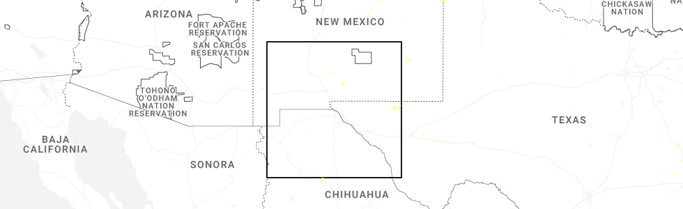
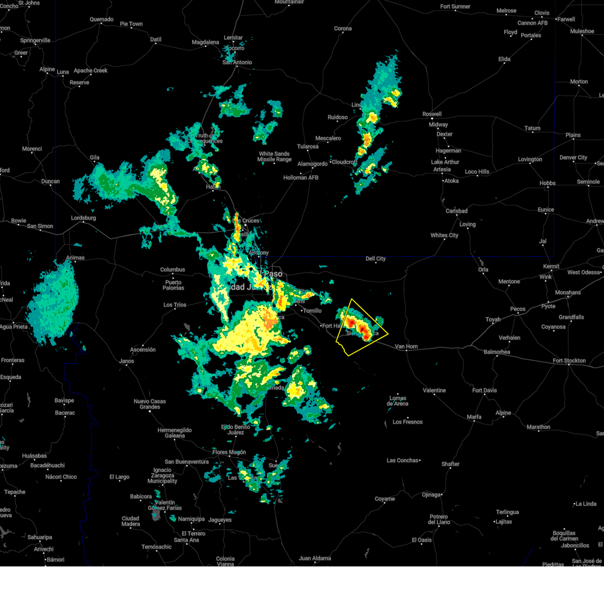
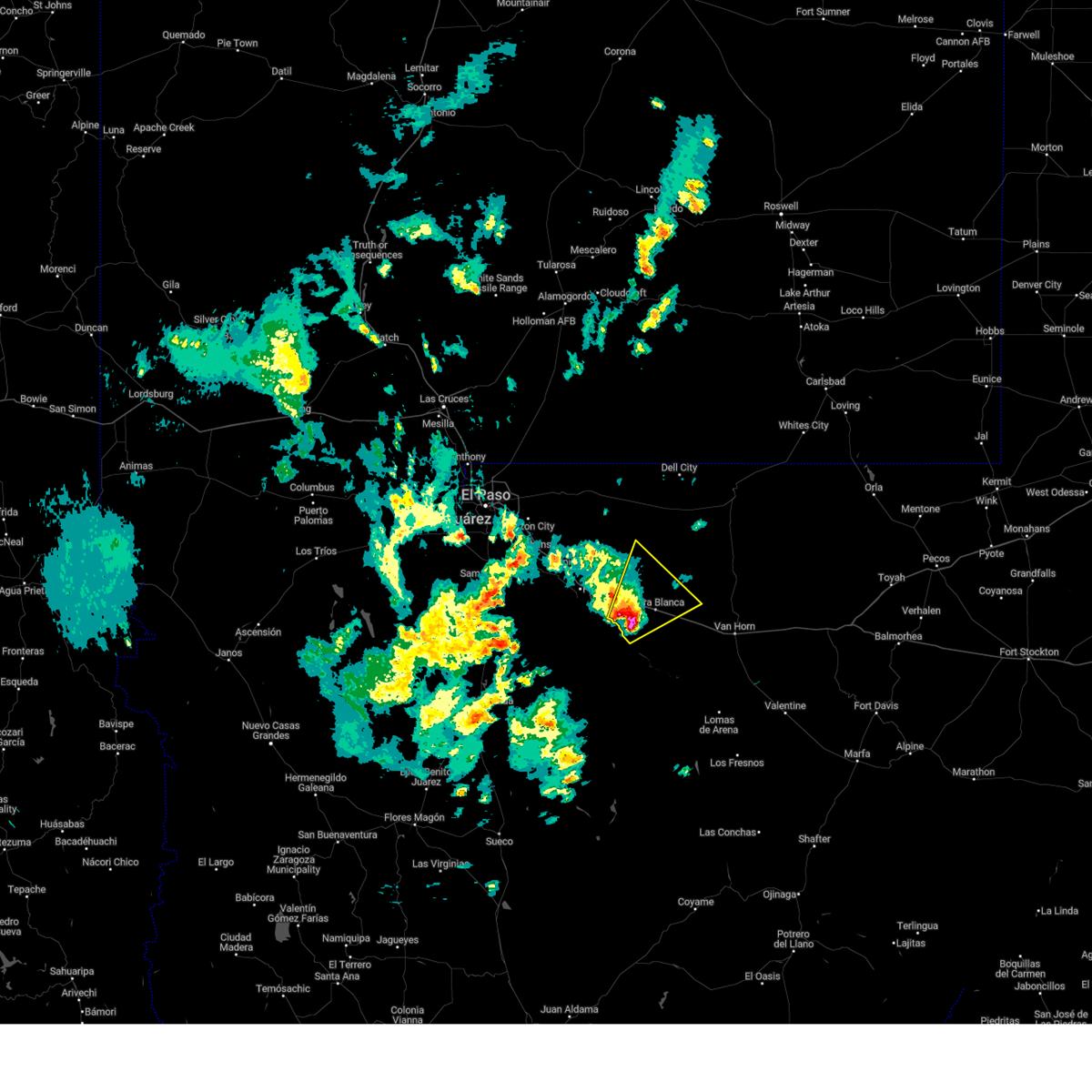
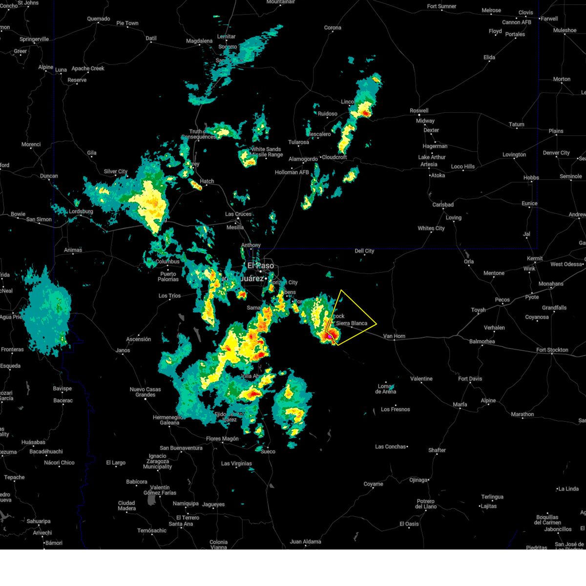
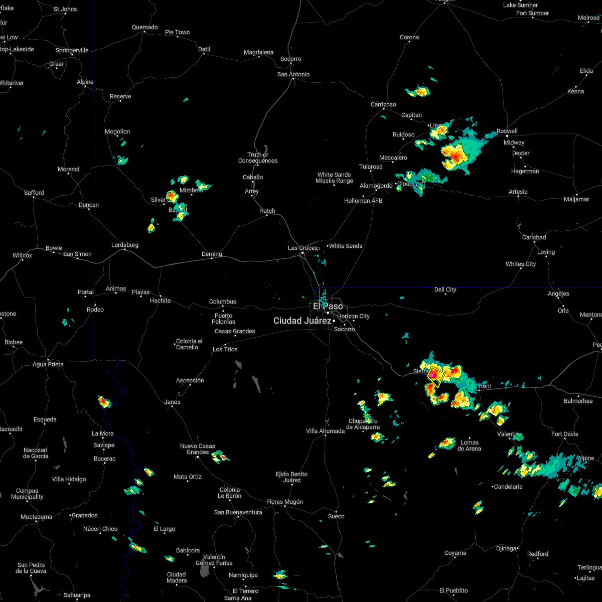
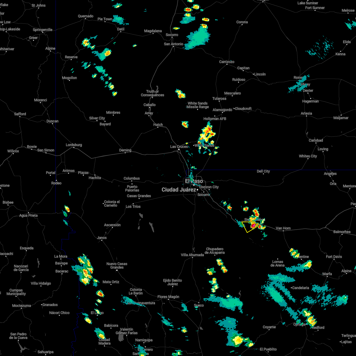
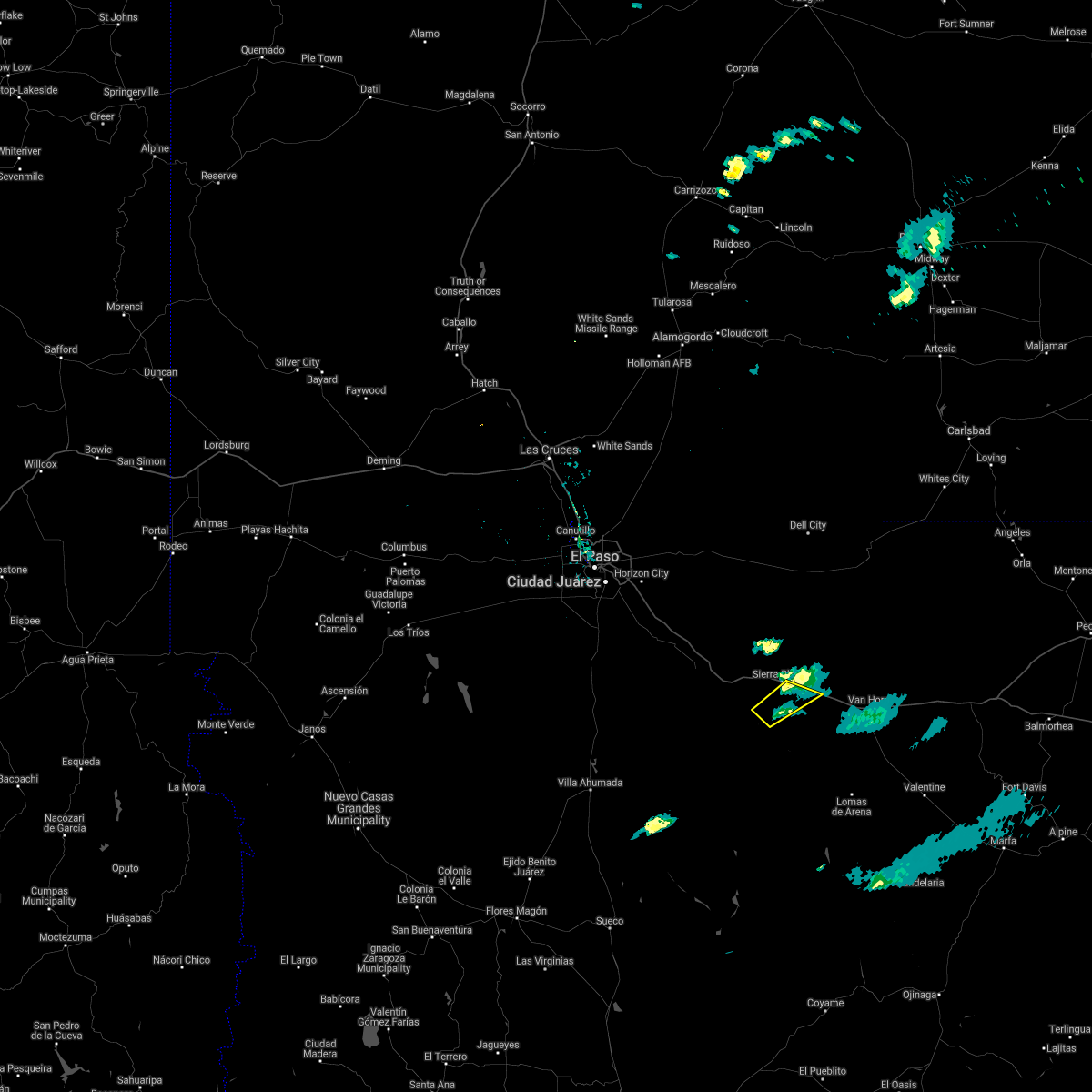
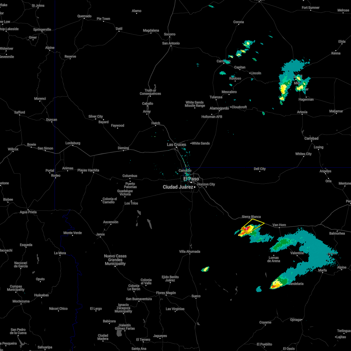
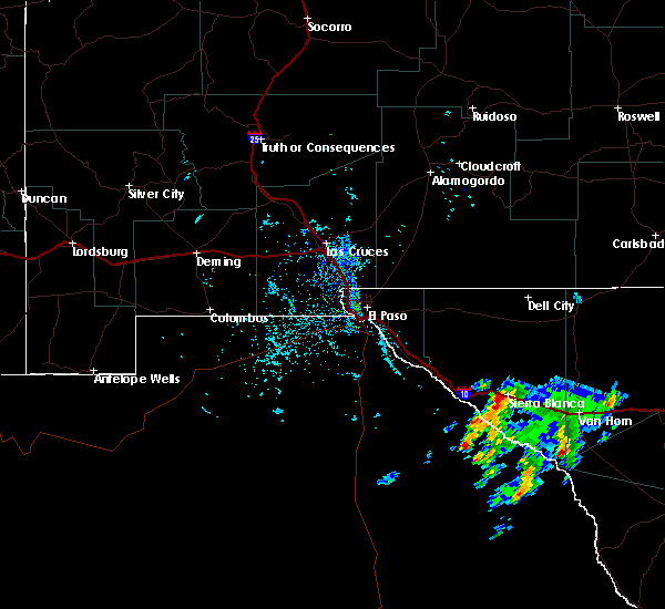
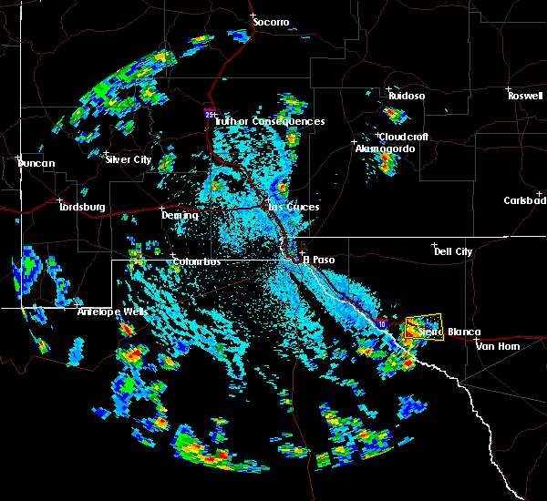
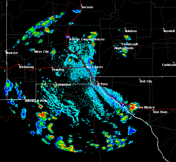
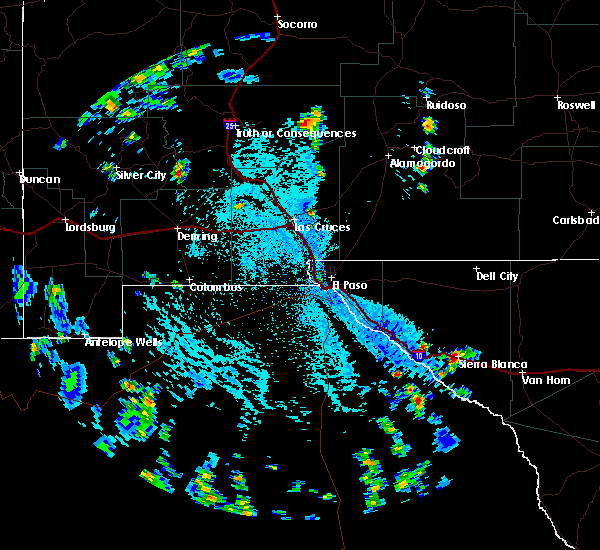
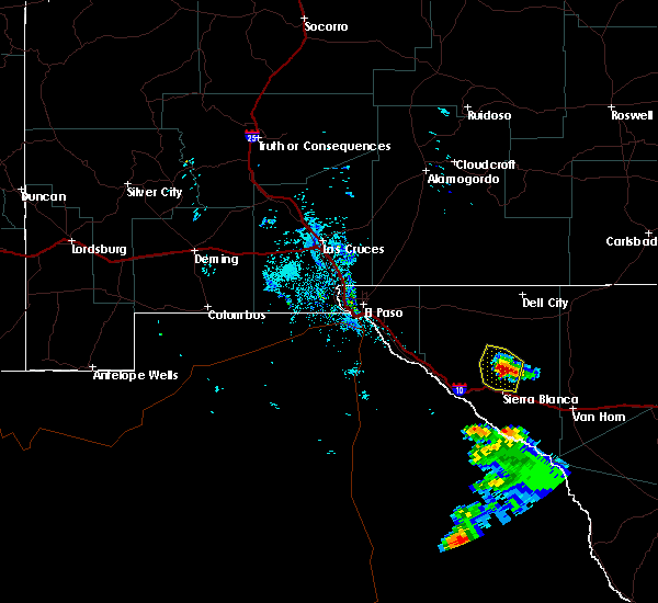
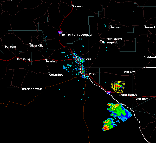
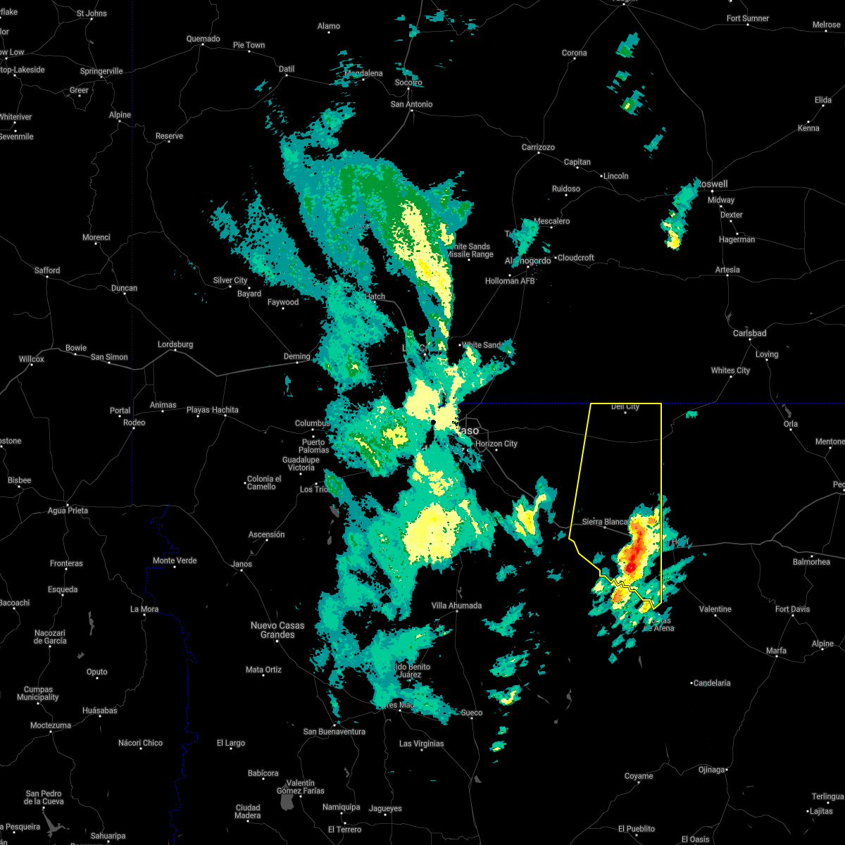
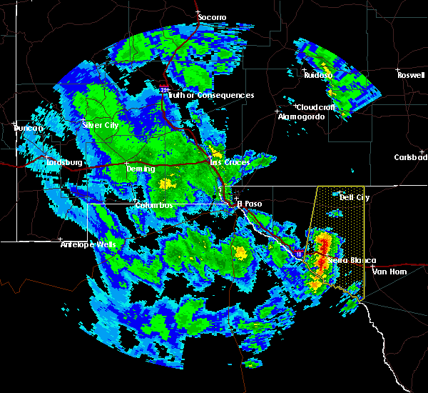
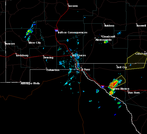
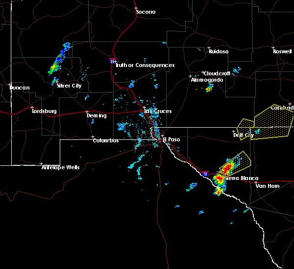
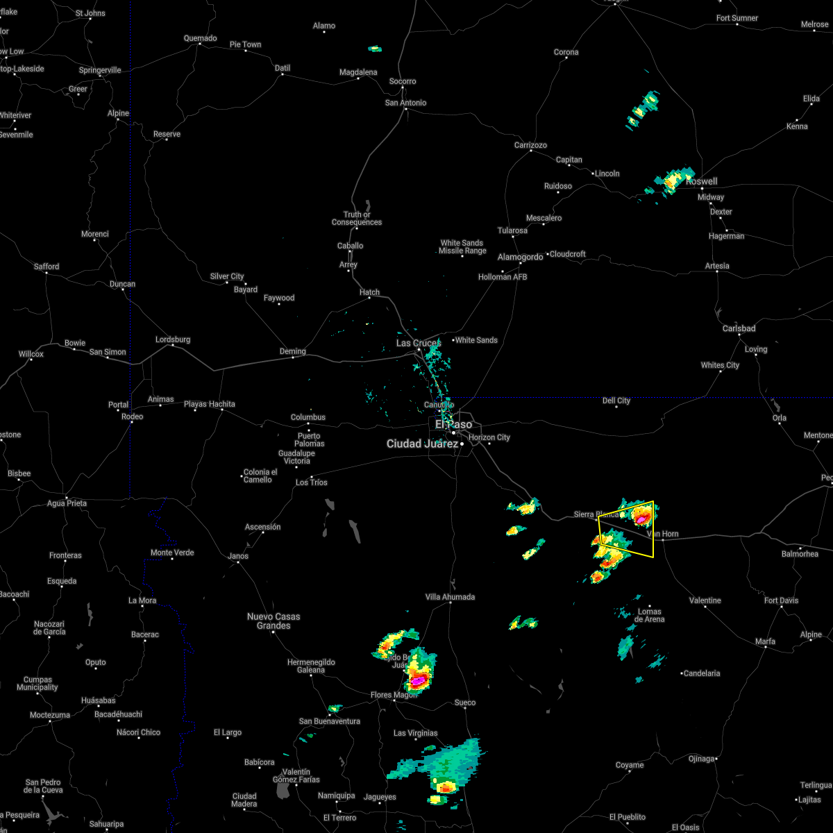
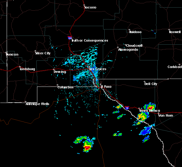
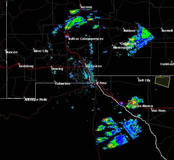
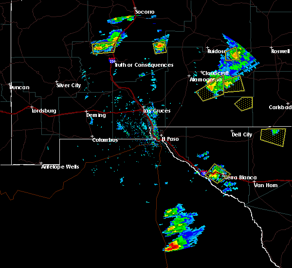
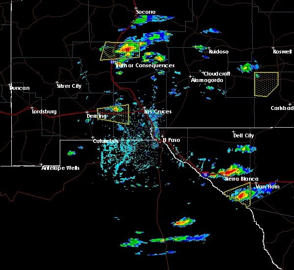
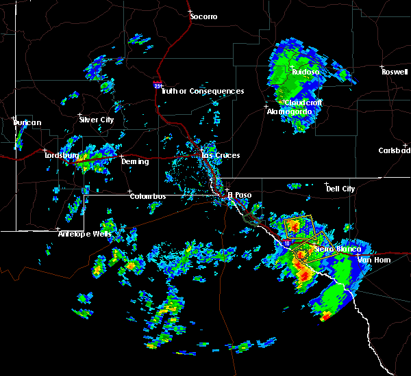
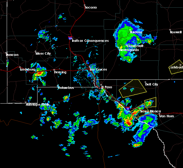
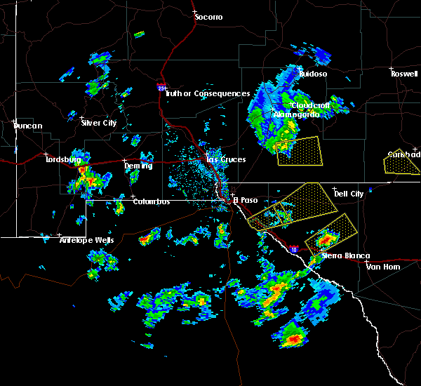
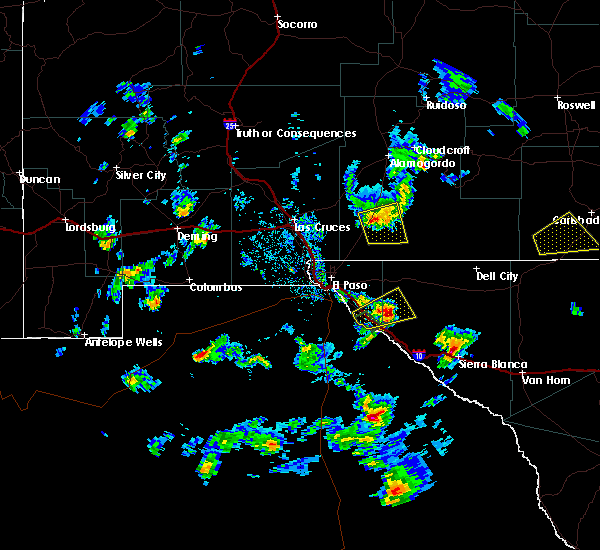
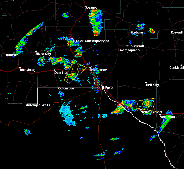
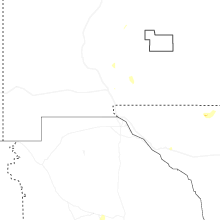
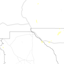
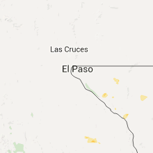
Hail Map for Sierra Blanca, TX
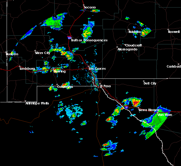
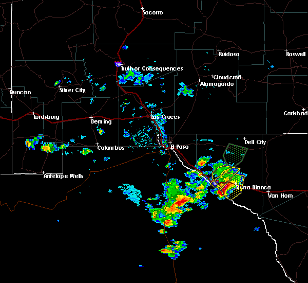
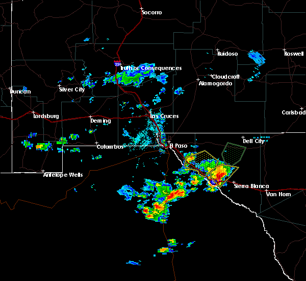
The Sierra Blanca, TX area has had 7 reports of on-the-ground hail by trained spotters, and has been under severe weather warnings 0 times during the past 12 months. Doppler radar has detected hail at or near Sierra Blanca, TX on 25 occasions, including 3 occasions during the past year.
| Name: | Sierra Blanca, TX |
| Where Located: | 77.6 miles ESE of El Paso, TX |
| Map: | Google Map for Sierra Blanca, TX |
| Population: | 553 |
| Housing Units: | 222 |
| More Info: | Search Google for Sierra Blanca, TX |
1
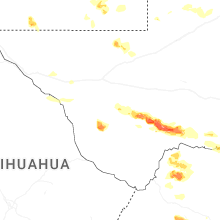
The Top Recent Hail Date for Sierra Blanca, TX is Monday, June 23, 2025 (6th out of 25)
Hail and Wind Damage Spotted near Sierra Blanca, TX
| Date / Time | Report Details |
|---|---|
| 10/24/2023 4:21 PM MDT |
 The severe thunderstorm warning for central hudspeth county will expire at 430 pm mdt, the storm which prompted the warning has weakened below severe limits, and no longer poses an immediate threat to life or property. therefore, the warning will be allowed to expire. however, heavy rain is still possible with this thunderstorm. The severe thunderstorm warning for central hudspeth county will expire at 430 pm mdt, the storm which prompted the warning has weakened below severe limits, and no longer poses an immediate threat to life or property. therefore, the warning will be allowed to expire. however, heavy rain is still possible with this thunderstorm.
|
| 10/24/2023 3:56 PM MDT |
 At 356 pm mdt, a severe thunderstorm was located 5 miles west of sierra blanca, moving northeast at 35 mph (radar indicated). Hazards include ping pong ball size hail. People and animals outdoors will be injured. expect damage to roofs, siding, windows, and vehicles. locations impacted include, sierra blanca, fort quitman, finlay, quitman canyon, sunset ranches, and round top mountain. this includes interstate 10 in texas between mile markers 88 and 115. hail threat, radar indicated max hail size, 1. 50 in wind threat, radar indicated max wind gust, <50 mph. At 356 pm mdt, a severe thunderstorm was located 5 miles west of sierra blanca, moving northeast at 35 mph (radar indicated). Hazards include ping pong ball size hail. People and animals outdoors will be injured. expect damage to roofs, siding, windows, and vehicles. locations impacted include, sierra blanca, fort quitman, finlay, quitman canyon, sunset ranches, and round top mountain. this includes interstate 10 in texas between mile markers 88 and 115. hail threat, radar indicated max hail size, 1. 50 in wind threat, radar indicated max wind gust, <50 mph.
|
| 10/24/2023 3:45 PM MDT |
 At 344 pm mdt, a severe thunderstorm was located 5 miles northeast of fort quitman, moving northeast at 35 mph (radar indicated). Hazards include quarter size hail. damage to vehicles is expected At 344 pm mdt, a severe thunderstorm was located 5 miles northeast of fort quitman, moving northeast at 35 mph (radar indicated). Hazards include quarter size hail. damage to vehicles is expected
|
| 8/29/2022 3:07 PM MDT |
 At 307 pm mdt, a severe thunderstorm was located near sierra blanca, moving southeast at 25 mph (radar indicated). Hazards include 60 mph wind gusts and quarter size hail. Hail damage to vehicles is expected. Expect wind damage to roofs, siding, and trees. At 307 pm mdt, a severe thunderstorm was located near sierra blanca, moving southeast at 25 mph (radar indicated). Hazards include 60 mph wind gusts and quarter size hail. Hail damage to vehicles is expected. Expect wind damage to roofs, siding, and trees.
|
| 8/4/2022 4:51 PM MDT |
 At 450 pm mdt, a severe thunderstorm was located 4 miles southwest of sierra blanca, moving west at 10 mph (radar indicated). Hazards include quarter size hail. damage to vehicles is expected At 450 pm mdt, a severe thunderstorm was located 4 miles southwest of sierra blanca, moving west at 10 mph (radar indicated). Hazards include quarter size hail. damage to vehicles is expected
|
| 5/30/2021 5:55 PM MDT |
 The severe thunderstorm warning for southeastern hudspeth county will expire at 600 pm mdt, the storm which prompted the warning has weakened below severe limits, and has exited the warned area. therefore, the warning will be allowed to expire. however gusty winds are still possible with this thunderstorm. The severe thunderstorm warning for southeastern hudspeth county will expire at 600 pm mdt, the storm which prompted the warning has weakened below severe limits, and has exited the warned area. therefore, the warning will be allowed to expire. however gusty winds are still possible with this thunderstorm.
|
| 5/30/2021 5:30 PM MDT |
 At 529 pm mdt, a severe thunderstorm was located 9 miles east of fort quitman, moving northeast at 30 mph (radar indicated). Hazards include ping pong ball size hail and 60 mph wind gusts. People and animals outdoors will be injured. expect hail damage to roofs, siding, windows, and vehicles. Expect wind damage to roofs, siding, and trees. At 529 pm mdt, a severe thunderstorm was located 9 miles east of fort quitman, moving northeast at 30 mph (radar indicated). Hazards include ping pong ball size hail and 60 mph wind gusts. People and animals outdoors will be injured. expect hail damage to roofs, siding, windows, and vehicles. Expect wind damage to roofs, siding, and trees.
|
| 9/29/2019 4:30 PM MDT |
 At 429 pm mdt, a severe thunderstorm was located 4 miles west of sierra blanca, moving northeast at 25 mph (radar indicated). Hazards include 60 mph wind gusts and quarter size hail. Hail damage to vehicles is expected. Expect wind damage to roofs, siding, and trees. At 429 pm mdt, a severe thunderstorm was located 4 miles west of sierra blanca, moving northeast at 25 mph (radar indicated). Hazards include 60 mph wind gusts and quarter size hail. Hail damage to vehicles is expected. Expect wind damage to roofs, siding, and trees.
|
| 8/27/2019 3:56 PM MDT |
 The severe thunderstorm warning for central hudspeth county will expire at 400 pm mdt, the storm which prompted the warning has weakened below severe limits, and no longer poses an immediate threat to life or property. therefore, the warning will be allowed to expire. however small hail is still possible with this thunderstorm. The severe thunderstorm warning for central hudspeth county will expire at 400 pm mdt, the storm which prompted the warning has weakened below severe limits, and no longer poses an immediate threat to life or property. therefore, the warning will be allowed to expire. however small hail is still possible with this thunderstorm.
|
| 8/27/2019 3:42 PM MDT |
 At 341 pm mdt, a severe thunderstorm was located 6 miles southwest of sierra blanca, moving east at 5 mph (radar indicated). Hazards include ping pong ball size hail. People and animals outdoors will be injured. expect damage to roofs, siding, windows, and vehicles. Locations impacted include, sierra blanca and quitman canyon. At 341 pm mdt, a severe thunderstorm was located 6 miles southwest of sierra blanca, moving east at 5 mph (radar indicated). Hazards include ping pong ball size hail. People and animals outdoors will be injured. expect damage to roofs, siding, windows, and vehicles. Locations impacted include, sierra blanca and quitman canyon.
|
| 8/27/2019 3:20 PM MDT |
 At 320 pm mdt, a severe thunderstorm was located near sierra blanca, moving east at 10 mph (radar indicated). Hazards include 60 mph wind gusts and half dollar size hail. Hail damage to vehicles is expected. Expect wind damage to roofs, siding, and trees. At 320 pm mdt, a severe thunderstorm was located near sierra blanca, moving east at 10 mph (radar indicated). Hazards include 60 mph wind gusts and half dollar size hail. Hail damage to vehicles is expected. Expect wind damage to roofs, siding, and trees.
|
| 6/2/2019 5:30 PM MDT | Quarter sized hail reported 0.8 miles N of Sierra Blanca, TX, sheriff's office reported quarter size hail in sierra blanca |
| 6/2/2019 5:14 PM MDT |
 At 512 pm mdt, a severe thunderstorm was located 7 miles north of frenchman canyon, moving northeast at 35 mph (radar indicated). Hazards include 60 mph wind gusts and half dollar size hail. Hail damage to vehicles is expected. Expect wind damage to roofs, siding, and trees. At 512 pm mdt, a severe thunderstorm was located 7 miles north of frenchman canyon, moving northeast at 35 mph (radar indicated). Hazards include 60 mph wind gusts and half dollar size hail. Hail damage to vehicles is expected. Expect wind damage to roofs, siding, and trees.
|
| 4/23/2019 4:43 PM MDT |
 At 442 pm mdt, a severe thunderstorm was located 9 miles north of sierra blanca, moving east to northeast at 10 mph (radar indicated). Hazards include 60 mph wind gusts and quarter size hail. Hail damage to vehicles is expected. Expect wind damage to roofs, siding, and trees. At 442 pm mdt, a severe thunderstorm was located 9 miles north of sierra blanca, moving east to northeast at 10 mph (radar indicated). Hazards include 60 mph wind gusts and quarter size hail. Hail damage to vehicles is expected. Expect wind damage to roofs, siding, and trees.
|
| 3/26/2019 8:27 PM MDT |
 At 825 pm mdt, a severe thunderstorm was located 12 miles east of sierra blanca, moving southeast at 25 mph. meanwhile, additional strong thunderstorms were moving northeast over the eagle mountains. additional thunderstorms are likely to develop along interstate 10 as these storms merge (radar indicated). Hazards include 60 mph wind gusts and quarter size hail. Hail damage to vehicles is expected. Expect wind damage to roofs, siding, and trees. At 825 pm mdt, a severe thunderstorm was located 12 miles east of sierra blanca, moving southeast at 25 mph. meanwhile, additional strong thunderstorms were moving northeast over the eagle mountains. additional thunderstorms are likely to develop along interstate 10 as these storms merge (radar indicated). Hazards include 60 mph wind gusts and quarter size hail. Hail damage to vehicles is expected. Expect wind damage to roofs, siding, and trees.
|
| 3/26/2019 8:16 PM MDT |
 At 816 pm mdt, a severe thunderstorm was located 9 miles northeast of sierra blanca, moving southeast at 15 mph (radar indicated). Hazards include 60 mph wind gusts and quarter size hail. Hail damage to vehicles is expected. expect wind damage to roofs, siding, and trees. Locations impacted include, sunset ranches. At 816 pm mdt, a severe thunderstorm was located 9 miles northeast of sierra blanca, moving southeast at 15 mph (radar indicated). Hazards include 60 mph wind gusts and quarter size hail. Hail damage to vehicles is expected. expect wind damage to roofs, siding, and trees. Locations impacted include, sunset ranches.
|
| 3/26/2019 7:59 PM MDT |
 At 759 pm mdt, a severe thunderstorm was located 9 miles north of sierra blanca, moving southeast at 20 mph (radar indicated). Hazards include 60 mph wind gusts and half dollar size hail. Hail damage to vehicles is expected. expect wind damage to roofs, siding, and trees. locations impacted include, sunset ranches, and round top mountain. portions of highway 1111 north of sierra blanca will also be impacted. Hail may accumulate on the road in places. At 759 pm mdt, a severe thunderstorm was located 9 miles north of sierra blanca, moving southeast at 20 mph (radar indicated). Hazards include 60 mph wind gusts and half dollar size hail. Hail damage to vehicles is expected. expect wind damage to roofs, siding, and trees. locations impacted include, sunset ranches, and round top mountain. portions of highway 1111 north of sierra blanca will also be impacted. Hail may accumulate on the road in places.
|
| 3/26/2019 7:42 PM MDT |
 At 741 pm mdt, a severe thunderstorm was located 15 miles north of sierra blanca, moving southeast at 15 mph (radar indicated). Hazards include 60 mph wind gusts and half dollar size hail. Hail damage to vehicles is expected. Expect wind damage to roofs, siding, and trees. At 741 pm mdt, a severe thunderstorm was located 15 miles north of sierra blanca, moving southeast at 15 mph (radar indicated). Hazards include 60 mph wind gusts and half dollar size hail. Hail damage to vehicles is expected. Expect wind damage to roofs, siding, and trees.
|
| 3/12/2019 5:13 PM MDT |
 The severe thunderstorm warning for hudspeth county will expire at 515 pm mdt, the storms which prompted the warning continue to push east across far eastern hudspeth county but most have weakened. therefore, the warning will be allowed to expire. however small hail and gusty winds are still possible with these with the remains storms that are tracking east just south of the interstate over rural locations. all thunderstorms should be ending, or moving out of hudspeth county by 530 pm mdt. The severe thunderstorm warning for hudspeth county will expire at 515 pm mdt, the storms which prompted the warning continue to push east across far eastern hudspeth county but most have weakened. therefore, the warning will be allowed to expire. however small hail and gusty winds are still possible with these with the remains storms that are tracking east just south of the interstate over rural locations. all thunderstorms should be ending, or moving out of hudspeth county by 530 pm mdt.
|
| 3/12/2019 4:31 PM MDT |
 At 427 pm mdt, severe thunderstorms were located along a line extending from 5 miles southwest of dell city to near sierra blanca to 15 miles west of indian hot springs, moving northeast at 40 mph. the strongest of these storms was located over interstate 10 about 5 miles west of sierra blanca. hudspeth sheriff reported hail covering the highway around mile marker 95. road conditions were icy. this wtorm will move into sierra blanca before 445 pm mdt (law enforcement). Hazards include 60 mph wind gusts and quarter size hail. Hail damage to vehicles is expected. expect wind damage to roofs, siding, and trees. Locations impacted include, dell city, sierra blanca, allamoore, indian hot springs, fort quitman, cornudas, frenchman canyon, indio mountains research station, green river, salt flat, bosque bonita, guadalupe mountains national park, quitman canyon, sunset ranches, far western portions of guadalupe mountains national park, round top mountain, little box, big box, and gypsum dunes at guadalupe national park. At 427 pm mdt, severe thunderstorms were located along a line extending from 5 miles southwest of dell city to near sierra blanca to 15 miles west of indian hot springs, moving northeast at 40 mph. the strongest of these storms was located over interstate 10 about 5 miles west of sierra blanca. hudspeth sheriff reported hail covering the highway around mile marker 95. road conditions were icy. this wtorm will move into sierra blanca before 445 pm mdt (law enforcement). Hazards include 60 mph wind gusts and quarter size hail. Hail damage to vehicles is expected. expect wind damage to roofs, siding, and trees. Locations impacted include, dell city, sierra blanca, allamoore, indian hot springs, fort quitman, cornudas, frenchman canyon, indio mountains research station, green river, salt flat, bosque bonita, guadalupe mountains national park, quitman canyon, sunset ranches, far western portions of guadalupe mountains national park, round top mountain, little box, big box, and gypsum dunes at guadalupe national park.
|
| 3/12/2019 4:20 PM MDT |
 At 418 pm mdt, severe thunderstorms were located along a line extending from 9 miles northeast of cornudas to 5 miles southwest of sierra blanca to 20 miles west of indian hot springs, moving northeast at 40 mph (radar indicated). Hazards include 60 mph wind gusts and quarter size hail. Hail damage to vehicles is expected. Expect wind damage to roofs, siding, and trees. At 418 pm mdt, severe thunderstorms were located along a line extending from 9 miles northeast of cornudas to 5 miles southwest of sierra blanca to 20 miles west of indian hot springs, moving northeast at 40 mph (radar indicated). Hazards include 60 mph wind gusts and quarter size hail. Hail damage to vehicles is expected. Expect wind damage to roofs, siding, and trees.
|
| 6/3/2018 6:18 PM MDT |
 At 617 pm mdt, a severe thunderstorm was located near sierra blanca, moving northeast at 25 mph (radar indicated). Hazards include golf ball size hail and 60 mph wind gusts. People and animals outdoors will be injured. expect hail damage to roofs, siding, windows, and vehicles. expect wind damage to roofs, siding, and trees. Locations impacted include, sierra blanca, fort quitman, quitman canyon and little box. At 617 pm mdt, a severe thunderstorm was located near sierra blanca, moving northeast at 25 mph (radar indicated). Hazards include golf ball size hail and 60 mph wind gusts. People and animals outdoors will be injured. expect hail damage to roofs, siding, windows, and vehicles. expect wind damage to roofs, siding, and trees. Locations impacted include, sierra blanca, fort quitman, quitman canyon and little box.
|
| 6/3/2018 5:57 PM MDT |
 At 556 pm mdt, a severe thunderstorm was located near fort quitman, or 11 miles southwest of sierra blanca, moving northeast at 25 mph (radar indicated). Hazards include golf ball size hail and 60 mph wind gusts. People and animals outdoors will be injured. expect hail damage to roofs, siding, windows, and vehicles. Expect wind damage to roofs, siding, and trees. At 556 pm mdt, a severe thunderstorm was located near fort quitman, or 11 miles southwest of sierra blanca, moving northeast at 25 mph (radar indicated). Hazards include golf ball size hail and 60 mph wind gusts. People and animals outdoors will be injured. expect hail damage to roofs, siding, windows, and vehicles. Expect wind damage to roofs, siding, and trees.
|
| 9/23/2017 5:59 PM MDT |
 At 559 pm mdt, a severe thunderstorm was located 9 miles southeast of sierra blanca, moving northeast at 35 mph (radar indicated). Hazards include 60 mph wind gusts and half dollar size hail. Hail damage to vehicles is expected. Expect wind damage to roofs, siding, and trees. At 559 pm mdt, a severe thunderstorm was located 9 miles southeast of sierra blanca, moving northeast at 35 mph (radar indicated). Hazards include 60 mph wind gusts and half dollar size hail. Hail damage to vehicles is expected. Expect wind damage to roofs, siding, and trees.
|
| 9/23/2017 5:34 PM MDT |
 At 534 pm mdt, a severe thunderstorm was located 15 miles northeast of sierra blanca, moving northeast at 30 mph (radar indicated). Hazards include 60 mph wind gusts and half dollar size hail. Hail damage to vehicles is expected. expect wind damage to roofs, siding, and trees. Locations impacted include, sierra blanca. At 534 pm mdt, a severe thunderstorm was located 15 miles northeast of sierra blanca, moving northeast at 30 mph (radar indicated). Hazards include 60 mph wind gusts and half dollar size hail. Hail damage to vehicles is expected. expect wind damage to roofs, siding, and trees. Locations impacted include, sierra blanca.
|
| 9/23/2017 5:18 PM MDT |
 At 518 pm mdt, a severe thunderstorm was located 6 miles north of sierra blanca, moving northeast at 25 mph (radar indicated). Hazards include ping pong ball size hail and 60 mph wind gusts. People and animals outdoors will be injured. expect hail damage to roofs, siding, windows, and vehicles. Expect wind damage to roofs, siding, and trees. At 518 pm mdt, a severe thunderstorm was located 6 miles north of sierra blanca, moving northeast at 25 mph (radar indicated). Hazards include ping pong ball size hail and 60 mph wind gusts. People and animals outdoors will be injured. expect hail damage to roofs, siding, windows, and vehicles. Expect wind damage to roofs, siding, and trees.
|
| 9/16/2017 3:12 PM MDT |
 The severe thunderstorm warning for east central hudspeth county will expire at 315 pm mdt, the storm which prompted the warning will be moving out of the area. therefore, the warning will be allowed to expire. The severe thunderstorm warning for east central hudspeth county will expire at 315 pm mdt, the storm which prompted the warning will be moving out of the area. therefore, the warning will be allowed to expire.
|
| 9/16/2017 3:01 PM MDT |
 At 301 pm mdt, a severe thunderstorm was located 10 miles west of allamoore, or 11 miles east of sierra blanca, moving east at 15 mph (radar indicated). Hazards include 60 mph wind gusts and quarter size hail. Hail damage to vehicles is expected. expect wind damage to roofs, siding, and trees. Locations impacted include, allamoore. At 301 pm mdt, a severe thunderstorm was located 10 miles west of allamoore, or 11 miles east of sierra blanca, moving east at 15 mph (radar indicated). Hazards include 60 mph wind gusts and quarter size hail. Hail damage to vehicles is expected. expect wind damage to roofs, siding, and trees. Locations impacted include, allamoore.
|
| 9/16/2017 2:43 PM MDT |
 At 243 pm mdt, a severe thunderstorm was located 8 miles southeast of sierra blanca, moving east at 15 mph (radar indicated). Hazards include 60 mph wind gusts and quarter size hail. Hail damage to vehicles is expected. Expect wind damage to roofs, siding, and trees. At 243 pm mdt, a severe thunderstorm was located 8 miles southeast of sierra blanca, moving east at 15 mph (radar indicated). Hazards include 60 mph wind gusts and quarter size hail. Hail damage to vehicles is expected. Expect wind damage to roofs, siding, and trees.
|
| 9/16/2017 2:21 PM MDT |
 At 219 pm mdt, a severe thunderstorm was located 7 miles east of fort quitman, or 8 miles southwest of sierra blanca, moving east at 15 mph. although the storm has shown some signs of slowly weakening, it still poses a threat for large hail and very strong winds (radar indicated). Hazards include two inch hail and 70 mph wind gusts. People and animals outdoors will be injured. expect hail damage to roofs, siding, windows, and vehicles. expect considerable tree damage. wind damage is also likely to mobile homes, roofs, and outbuildings. Locations impacted include, sierra blanca, fort quitman, quitman canyon, and little box. At 219 pm mdt, a severe thunderstorm was located 7 miles east of fort quitman, or 8 miles southwest of sierra blanca, moving east at 15 mph. although the storm has shown some signs of slowly weakening, it still poses a threat for large hail and very strong winds (radar indicated). Hazards include two inch hail and 70 mph wind gusts. People and animals outdoors will be injured. expect hail damage to roofs, siding, windows, and vehicles. expect considerable tree damage. wind damage is also likely to mobile homes, roofs, and outbuildings. Locations impacted include, sierra blanca, fort quitman, quitman canyon, and little box.
|
| 9/16/2017 1:54 PM MDT |
 At 154 pm mdt, a severe thunderstorm was located near fort quitman, or 13 miles southwest of sierra blanca, moving east at 15 mph (radar indicated). Hazards include two inch hail and 70 mph wind gusts. People and animals outdoors will be injured. expect hail damage to roofs, siding, windows, and vehicles. expect considerable tree damage. Wind damage is also likely to mobile homes, roofs, and outbuildings. At 154 pm mdt, a severe thunderstorm was located near fort quitman, or 13 miles southwest of sierra blanca, moving east at 15 mph (radar indicated). Hazards include two inch hail and 70 mph wind gusts. People and animals outdoors will be injured. expect hail damage to roofs, siding, windows, and vehicles. expect considerable tree damage. Wind damage is also likely to mobile homes, roofs, and outbuildings.
|
| 8/23/2017 1:24 PM MDT |
 At 123 pm mdt, a severe thunderstorm was located 4 miles northeast of sierra blanca, moving southwest at 15 mph (radar indicated). Hazards include 60 mph wind gusts and quarter size hail. Hail damage to vehicles is expected. Expect wind damage to roofs, siding, and trees. At 123 pm mdt, a severe thunderstorm was located 4 miles northeast of sierra blanca, moving southwest at 15 mph (radar indicated). Hazards include 60 mph wind gusts and quarter size hail. Hail damage to vehicles is expected. Expect wind damage to roofs, siding, and trees.
|
| 7/27/2017 1:22 PM MDT |
 The severe thunderstorm warning for southeastern hudspeth county will expire at 130 pm mdt, the storm which prompted the warning has weakened below severe limits, and no longer pose an immediate threat to life or property. therefore, the warning will be allowed to expire. however gusty winds and heavy rain are still possible with this thunderstorm. flash flooding is still possible. avoid travelling through flooded roads. The severe thunderstorm warning for southeastern hudspeth county will expire at 130 pm mdt, the storm which prompted the warning has weakened below severe limits, and no longer pose an immediate threat to life or property. therefore, the warning will be allowed to expire. however gusty winds and heavy rain are still possible with this thunderstorm. flash flooding is still possible. avoid travelling through flooded roads.
|
| 7/27/2017 12:38 PM MDT |
 At 1238 pm mdt, a severe thunderstorm was located 5 miles east of sierra blanca, moving southwest at 25 mph (radar indicated). Hazards include 60 mph wind gusts and quarter size hail. Hail damage to vehicles is expected. Expect wind damage to roofs, siding, and trees. At 1238 pm mdt, a severe thunderstorm was located 5 miles east of sierra blanca, moving southwest at 25 mph (radar indicated). Hazards include 60 mph wind gusts and quarter size hail. Hail damage to vehicles is expected. Expect wind damage to roofs, siding, and trees.
|
| 6/6/2017 7:39 PM MDT |
 The severe thunderstorm warning for central hudspeth county will expire at 745 pm mdt, the storm which prompted the warning has weakened below severe limits, and no longer pose an immediate threat to life or property. therefore, the warning will be allowed to expire. however small hail, gusty winds and heavy rain are still possible with this thunderstorm as it tracks south toward i-10 and the city of sierra blanca. to report severe weather, contact your nearest law enforcement agency. they will relay your report to the national weather service el paso. The severe thunderstorm warning for central hudspeth county will expire at 745 pm mdt, the storm which prompted the warning has weakened below severe limits, and no longer pose an immediate threat to life or property. therefore, the warning will be allowed to expire. however small hail, gusty winds and heavy rain are still possible with this thunderstorm as it tracks south toward i-10 and the city of sierra blanca. to report severe weather, contact your nearest law enforcement agency. they will relay your report to the national weather service el paso.
|
| 6/6/2017 7:03 PM MDT |
 At 702 pm mdt, a severe thunderstorm was located 15 miles northeast of fort hancock, or 16 miles northwest of sierra blanca, moving south at 15 mph (radar indicated). Hazards include 60 mph wind gusts and quarter size hail. Hail damage to vehicles is expected. Expect wind damage to roofs, siding, and trees. At 702 pm mdt, a severe thunderstorm was located 15 miles northeast of fort hancock, or 16 miles northwest of sierra blanca, moving south at 15 mph (radar indicated). Hazards include 60 mph wind gusts and quarter size hail. Hail damage to vehicles is expected. Expect wind damage to roofs, siding, and trees.
|
| 6/1/2017 3:28 PM MDT |
 At 327 pm mdt, a severe thunderstorm was located 5 miles west of sierra blanca, moving northeast at 10 mph (radar indicated). Hazards include 60 mph wind gusts and quarter size hail. Hail damage to vehicles is expected. Expect wind damage to roofs, siding, and trees. At 327 pm mdt, a severe thunderstorm was located 5 miles west of sierra blanca, moving northeast at 10 mph (radar indicated). Hazards include 60 mph wind gusts and quarter size hail. Hail damage to vehicles is expected. Expect wind damage to roofs, siding, and trees.
|
| 6/1/2017 3:07 PM MDT |
 At 246 pm mdt, a severe thunderstorm was located near fort quitman, or 12 miles southwest of sierra blanca, moving northeast at 10 mph (radar indicated). Hazards include 60 mph wind gusts and quarter size hail. Hail damage to vehicles is expected. Expect wind damage to roofs, siding, and trees. At 246 pm mdt, a severe thunderstorm was located near fort quitman, or 12 miles southwest of sierra blanca, moving northeast at 10 mph (radar indicated). Hazards include 60 mph wind gusts and quarter size hail. Hail damage to vehicles is expected. Expect wind damage to roofs, siding, and trees.
|
| 6/1/2017 2:46 PM MDT |
 At 246 pm mdt, a severe thunderstorm was located near fort quitman, or 12 miles southwest of sierra blanca, moving northeast at 10 mph (radar indicated). Hazards include 60 mph wind gusts and quarter size hail. Hail damage to vehicles is expected. Expect wind damage to roofs, siding, and trees. At 246 pm mdt, a severe thunderstorm was located near fort quitman, or 12 miles southwest of sierra blanca, moving northeast at 10 mph (radar indicated). Hazards include 60 mph wind gusts and quarter size hail. Hail damage to vehicles is expected. Expect wind damage to roofs, siding, and trees.
|
| 4/12/2017 4:47 PM MDT |
 At 445 pm mdt, severe thunderstorms were located from near allamoore west to round top mountain, moving east at 30 mph (radar indicated). Hazards include two inch hail and 60 mph wind gusts. People and animals outdoors will be injured. expect hail damage to roofs, siding, windows, and vehicles. Expect wind damage to roofs, siding, and trees. At 445 pm mdt, severe thunderstorms were located from near allamoore west to round top mountain, moving east at 30 mph (radar indicated). Hazards include two inch hail and 60 mph wind gusts. People and animals outdoors will be injured. expect hail damage to roofs, siding, windows, and vehicles. Expect wind damage to roofs, siding, and trees.
|
| 4/12/2017 4:07 PM MDT |
 At 405 pm mdt, severe thunderstorms were located around sierra blanca, moving northeast at 20 mph (radar and spotter indicated). Hazards include two inch hail and 60 mph wind gusts. People and animals outdoors will be injured. expect hail damage to roofs, siding, windows, and vehicles. Expect wind damage to roofs, siding, and trees. At 405 pm mdt, severe thunderstorms were located around sierra blanca, moving northeast at 20 mph (radar and spotter indicated). Hazards include two inch hail and 60 mph wind gusts. People and animals outdoors will be injured. expect hail damage to roofs, siding, windows, and vehicles. Expect wind damage to roofs, siding, and trees.
|
| 4/12/2017 3:55 PM MDT | Ping Pong Ball sized hail reported 0.8 miles N of Sierra Blanca, TX, 1.5 inch diameter hail falling. hail 3 inches deep. |
| 4/12/2017 3:43 PM MDT | Golf Ball sized hail reported 0.5 miles WNW of Sierra Blanca, TX, golf ball sized hail covering the ground. |
| 4/12/2017 3:40 PM MDT | Tennis Ball sized hail reported 0.8 miles N of Sierra Blanca, TX |
| 4/12/2017 3:38 PM MDT | Quarter sized hail reported 8.5 miles E of Sierra Blanca, TX |
| 4/12/2017 3:24 PM MDT |
 At 324 pm mdt, a severe thunderstorm was located near sierra blanca, moving northeast at 30 mph (radar indicated). Hazards include 60 mph wind gusts and quarter size hail. Hail damage to vehicles is expected. Expect wind damage to roofs, siding, and trees. At 324 pm mdt, a severe thunderstorm was located near sierra blanca, moving northeast at 30 mph (radar indicated). Hazards include 60 mph wind gusts and quarter size hail. Hail damage to vehicles is expected. Expect wind damage to roofs, siding, and trees.
|
| 4/12/2017 2:37 PM MDT |
 At 237 pm mdt, a severe thunderstorm was located 6 miles southeast of finlay, or 9 miles north of fort quitman, moving northeast at 30 mph (radar indicated). Hazards include 60 mph wind gusts and quarter size hail. Hail damage to vehicles is expected. Expect wind damage to roofs, siding, and trees. At 237 pm mdt, a severe thunderstorm was located 6 miles southeast of finlay, or 9 miles north of fort quitman, moving northeast at 30 mph (radar indicated). Hazards include 60 mph wind gusts and quarter size hail. Hail damage to vehicles is expected. Expect wind damage to roofs, siding, and trees.
|
| 9/15/2016 3:30 PM MDT |
 At 330 pm mdt, a severe thunderstorm was located 9 miles east of sierra blanca, moving east southeast at 15 mph (radar indicated). Hazards include 60 mph wind gusts and quarter size hail. Hail damage to vehicles is expected. Expect wind damage to roofs, siding, and trees. At 330 pm mdt, a severe thunderstorm was located 9 miles east of sierra blanca, moving east southeast at 15 mph (radar indicated). Hazards include 60 mph wind gusts and quarter size hail. Hail damage to vehicles is expected. Expect wind damage to roofs, siding, and trees.
|
| 10/7/2015 5:36 PM MDT |
 At 536 pm mdt, a severe thunderstorm was located 14 miles northeast of sierra blanca, moving northeast at 35 mph (radar indicated). Hazards include 60 mph wind gusts and quarter size hail. Hail damage to vehicles is expected. expect wind damage to roofs, siding and trees. Locations impacted include, sierra blanca, fort quitman, quitman canyon, little box. At 536 pm mdt, a severe thunderstorm was located 14 miles northeast of sierra blanca, moving northeast at 35 mph (radar indicated). Hazards include 60 mph wind gusts and quarter size hail. Hail damage to vehicles is expected. expect wind damage to roofs, siding and trees. Locations impacted include, sierra blanca, fort quitman, quitman canyon, little box.
|
| 10/7/2015 5:04 PM MDT |
 At 504 pm mdt, a severe thunderstorm was located 6 miles southwest of sierra blanca, moving northeast at 35 mph (radar indicated). Hazards include 60 mph wind gusts and quarter size hail. Hail damage to vehicles is expected. Expect wind damage to roofs, siding and trees. At 504 pm mdt, a severe thunderstorm was located 6 miles southwest of sierra blanca, moving northeast at 35 mph (radar indicated). Hazards include 60 mph wind gusts and quarter size hail. Hail damage to vehicles is expected. Expect wind damage to roofs, siding and trees.
|
| 10/7/2015 4:27 PM MDT |
 At 427 pm mdt, a severe thunderstorm was located 13 miles northeast of sierra blanca, moving northeast at 30 mph (radar indicated). Hazards include 60 mph wind gusts and quarter size hail. Hail damage to vehicles is expected. expect wind damage to roofs, siding and trees. Locations impacted include, sierra blanca. At 427 pm mdt, a severe thunderstorm was located 13 miles northeast of sierra blanca, moving northeast at 30 mph (radar indicated). Hazards include 60 mph wind gusts and quarter size hail. Hail damage to vehicles is expected. expect wind damage to roofs, siding and trees. Locations impacted include, sierra blanca.
|
| 10/7/2015 4:12 PM MDT | Golf Ball sized hail reported 7.3 miles E of Sierra Blanca, TX, trained spotter reports golfball sized hail at mile marker 95 along interstate 10 west of sierra blanca. |
| 10/7/2015 4:09 PM MDT |
 At 409 pm mdt, a severe thunderstorm was located 5 miles north of sierra blanca, moving northeast at 30 mph (radar indicated). Hazards include 60 mph wind gusts and quarter size hail. Hail damage to vehicles is expected. Expect wind damage to roofs, siding and trees. At 409 pm mdt, a severe thunderstorm was located 5 miles north of sierra blanca, moving northeast at 30 mph (radar indicated). Hazards include 60 mph wind gusts and quarter size hail. Hail damage to vehicles is expected. Expect wind damage to roofs, siding and trees.
|
| 10/6/2015 6:35 PM MDT |
 At 635 pm mdt, a severe thunderstorm was located 17 miles north of allamoore, or 19 miles north of van horn, moving east at 40 mph (radar indicated). Hazards include 60 mph wind gusts and quarter size hail. Hail damage to vehicles is expected. expect wind damage to roofs, siding and trees. This severe thunderstorm will remain over mainly rural areas of east central hudspeth county. At 635 pm mdt, a severe thunderstorm was located 17 miles north of allamoore, or 19 miles north of van horn, moving east at 40 mph (radar indicated). Hazards include 60 mph wind gusts and quarter size hail. Hail damage to vehicles is expected. expect wind damage to roofs, siding and trees. This severe thunderstorm will remain over mainly rural areas of east central hudspeth county.
|
| 10/6/2015 5:54 PM MDT |
 At 554 pm mdt, a severe thunderstorm was located 8 miles north of sierra blanca, moving east at 35 mph (radar indicated). Hazards include 60 mph wind gusts and quarter size hail. Hail damage to vehicles is expected. expect wind damage to roofs, siding and trees. This severe thunderstorm will remain over mainly rural areas of east central hudspeth county. At 554 pm mdt, a severe thunderstorm was located 8 miles north of sierra blanca, moving east at 35 mph (radar indicated). Hazards include 60 mph wind gusts and quarter size hail. Hail damage to vehicles is expected. expect wind damage to roofs, siding and trees. This severe thunderstorm will remain over mainly rural areas of east central hudspeth county.
|
| 7/7/2015 9:04 PM MDT | Tractor trailer blown over...multiple vehicles off road on interstate 10 w of sierra blanca texas in hudspeth county TX, 13.2 miles E of Sierra Blanca, TX |
| 7/7/2015 8:26 PM MDT |
 At 824 pm mdt, a severe thunderstorm was located just southwest of sierra blanca, moving southeast at 25 mph (radar indicated). Hazards include 60 mph wind gusts and quarter size hail. Hail damage to vehicles is expected. expect wind damage to roofs, siding and trees. locations impacted include, sierra blanca, fort quitman, quitman canyon, little box. the strongest portion of this storm will remain south of sierra blanca. Areas along the rio grande, including fort quitman and the river road, as well as quitman pass and red light draw, will be most impacted. At 824 pm mdt, a severe thunderstorm was located just southwest of sierra blanca, moving southeast at 25 mph (radar indicated). Hazards include 60 mph wind gusts and quarter size hail. Hail damage to vehicles is expected. expect wind damage to roofs, siding and trees. locations impacted include, sierra blanca, fort quitman, quitman canyon, little box. the strongest portion of this storm will remain south of sierra blanca. Areas along the rio grande, including fort quitman and the river road, as well as quitman pass and red light draw, will be most impacted.
|
| 7/7/2015 8:01 PM MDT |
 At 800 pm mdt, a severe thunderstorm was located 7 miles northeast of esperanza, or 13 miles west of sierra blanca, moving southeast at 25 mph (radar indicated). Hazards include 60 mph wind gusts and quarter size hail. Hail damage to vehicles is expected. Expect wind damage to roofs, siding and trees. At 800 pm mdt, a severe thunderstorm was located 7 miles northeast of esperanza, or 13 miles west of sierra blanca, moving southeast at 25 mph (radar indicated). Hazards include 60 mph wind gusts and quarter size hail. Hail damage to vehicles is expected. Expect wind damage to roofs, siding and trees.
|
| 6/2/2013 6:59 PM MDT | Electricity out and phones down at mr. bowens house due to weather...possible wind damage in hudspeth county TX, 0.5 miles WNW of Sierra Blanca, TX |
| 1/1/0001 12:00 AM | Golf Ball sized hail reported 1.8 miles WNW of Sierra Blanca, TX |
Hail Maps for Sierra Blanca, TX


Connect with Interactive Hail Maps