

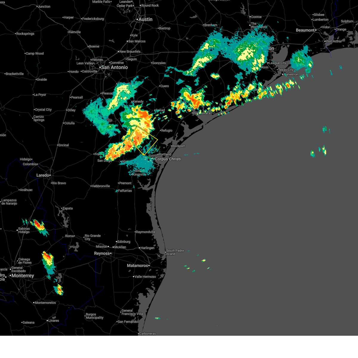
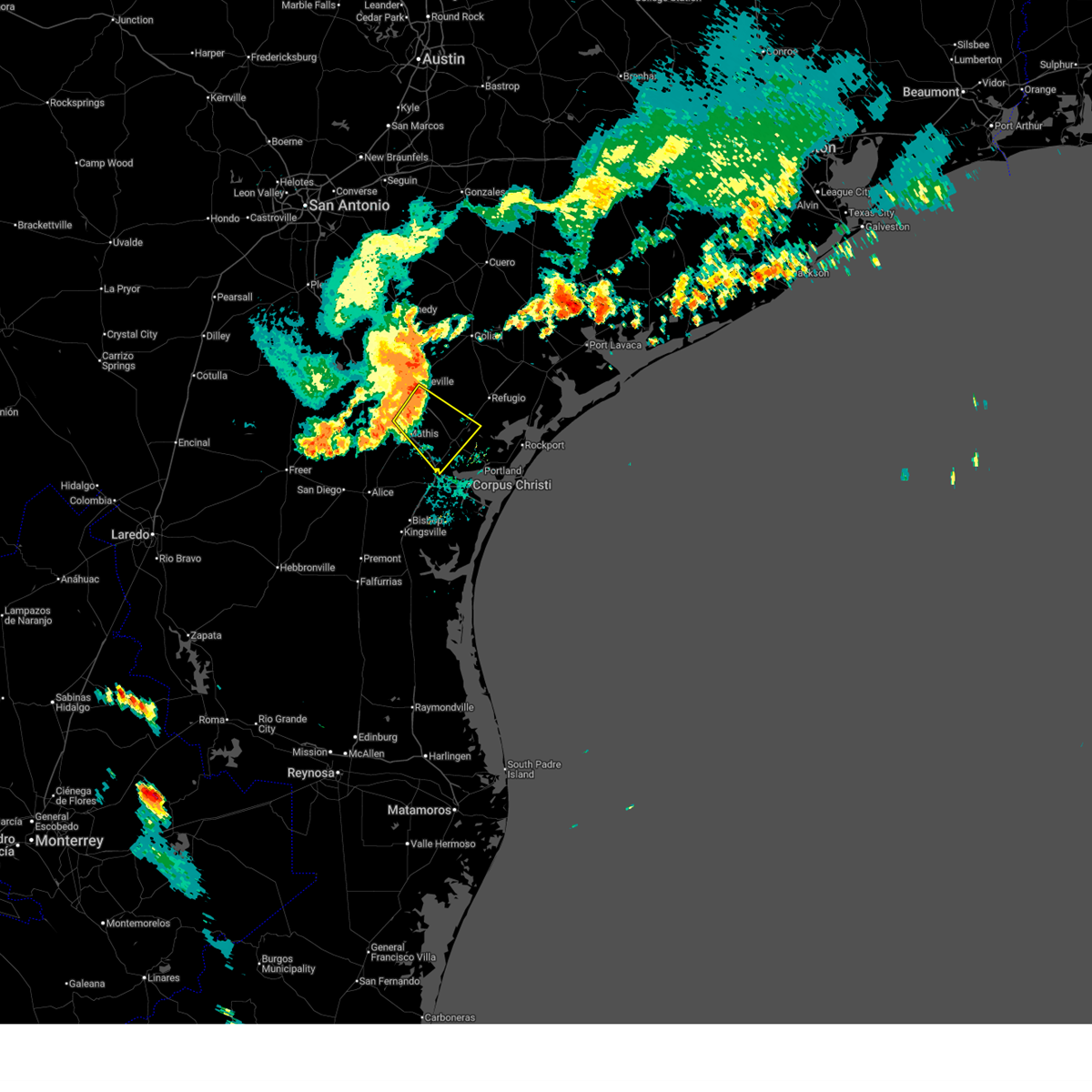
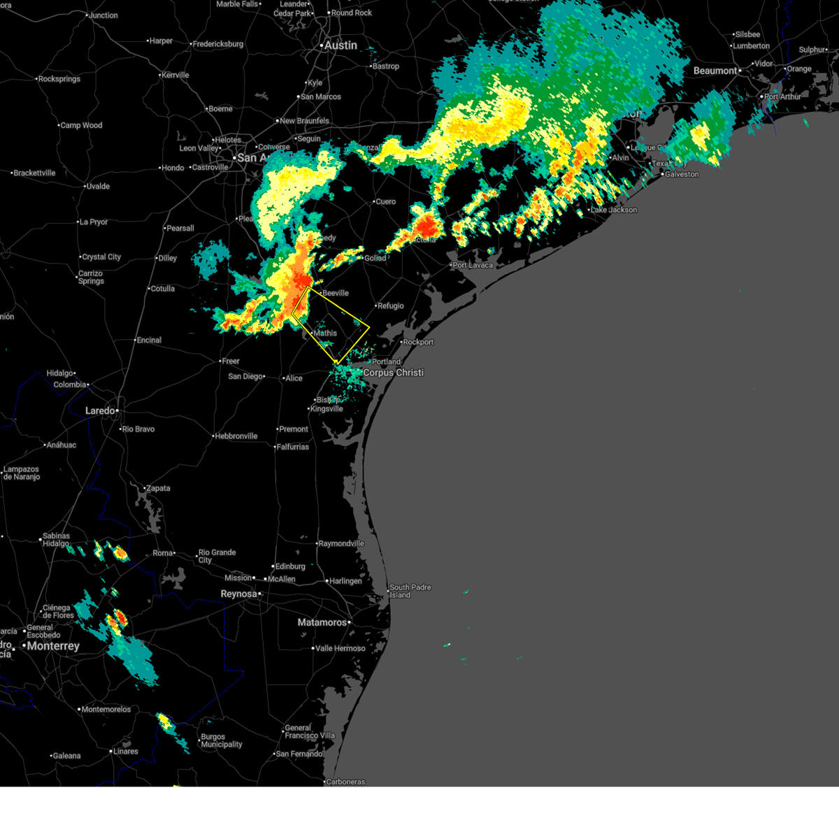
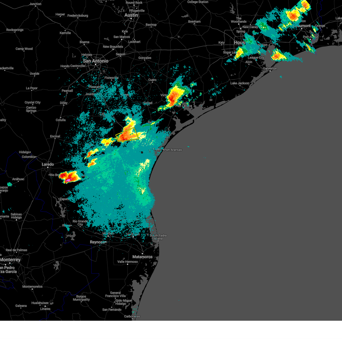
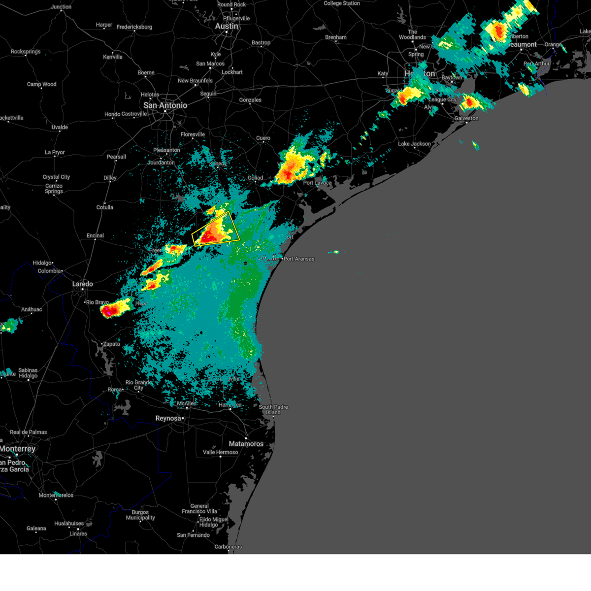
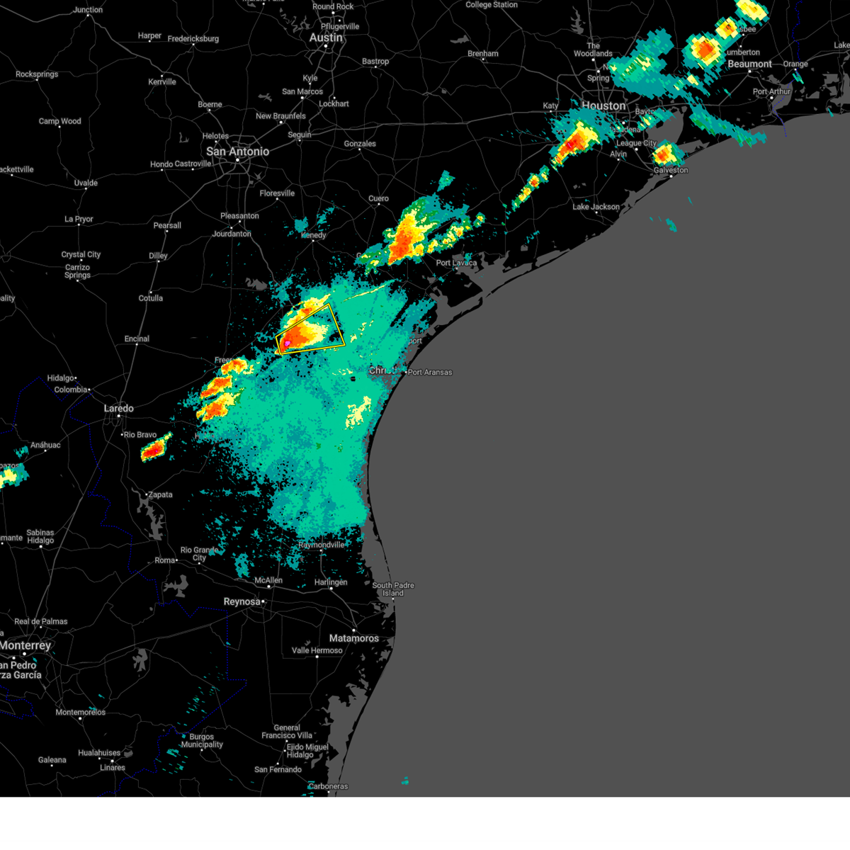
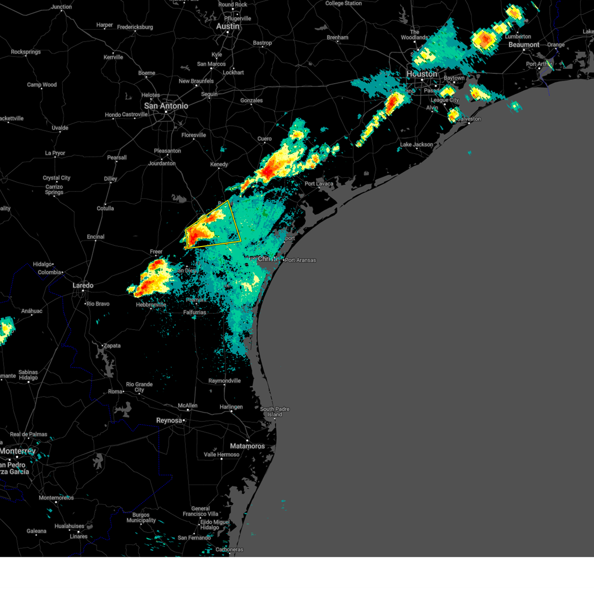
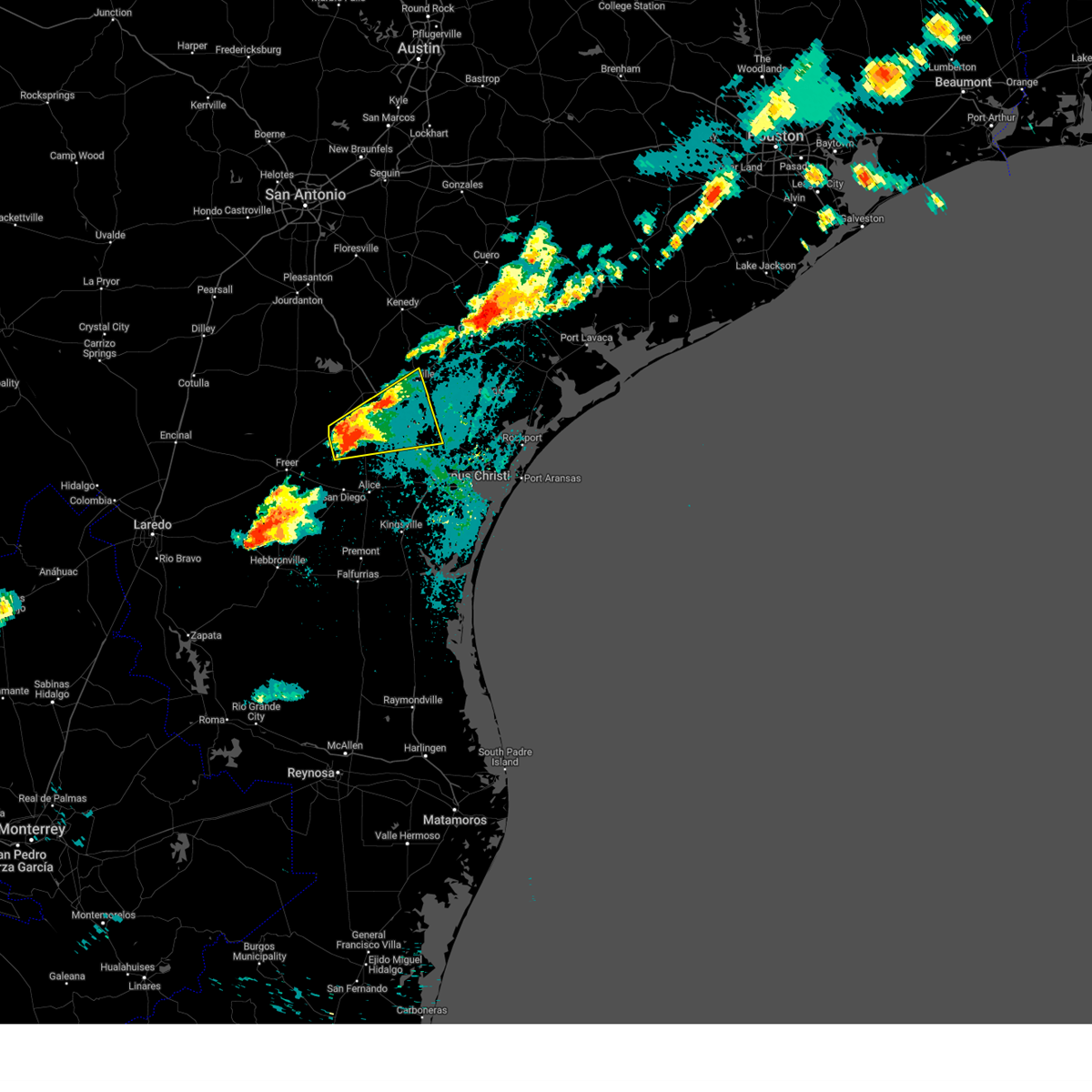
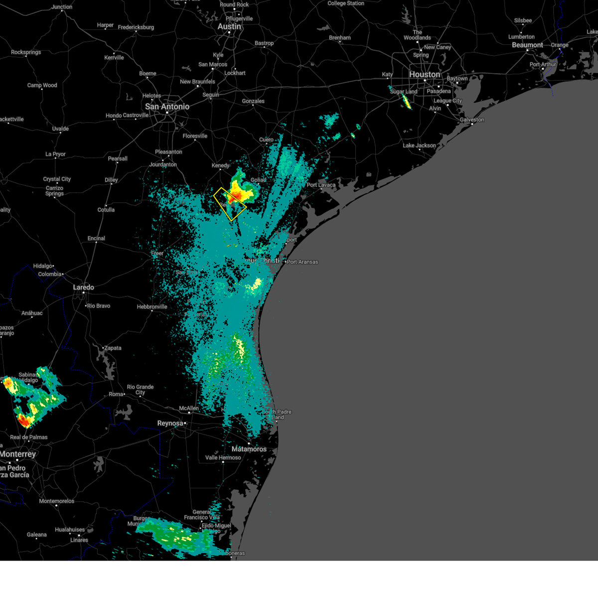
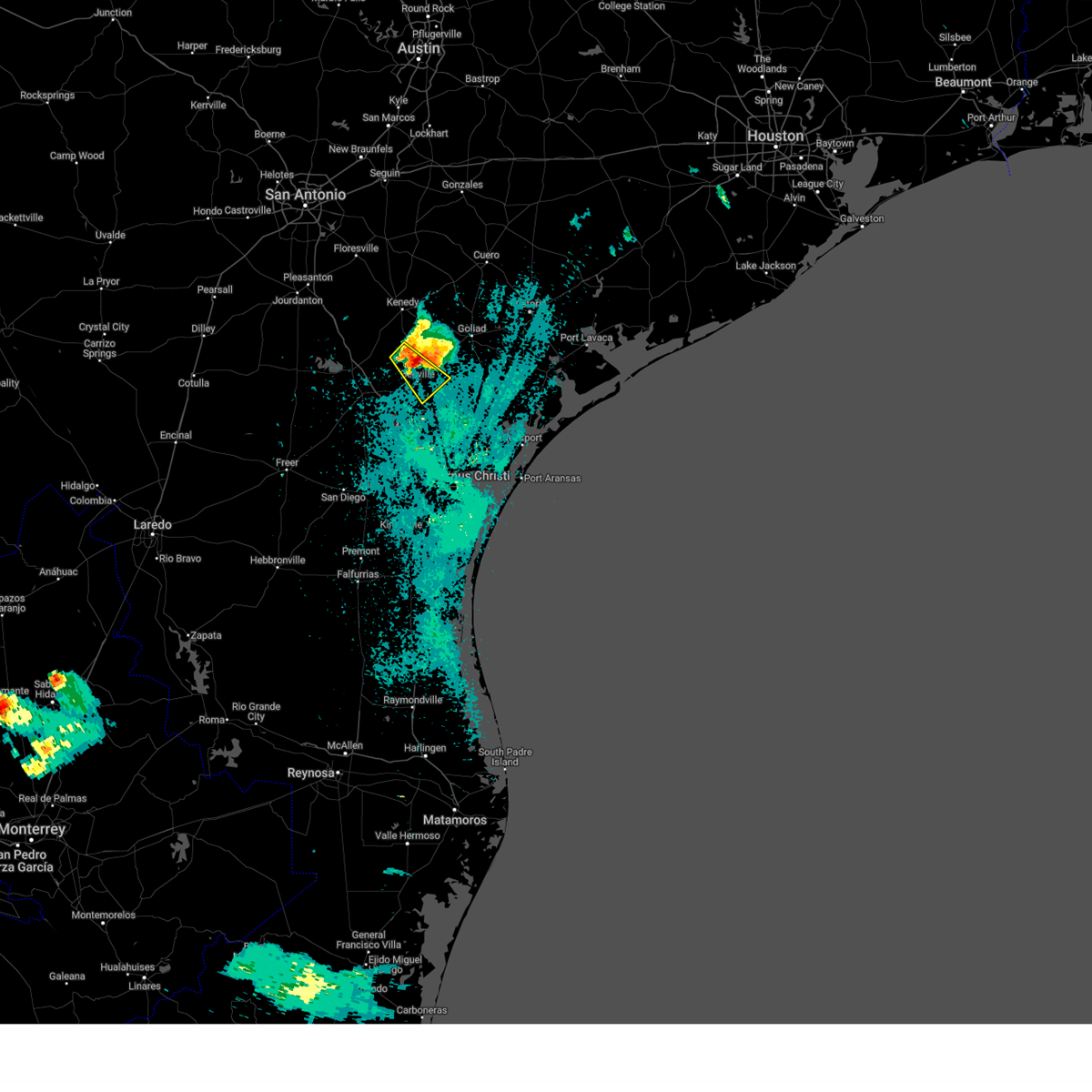
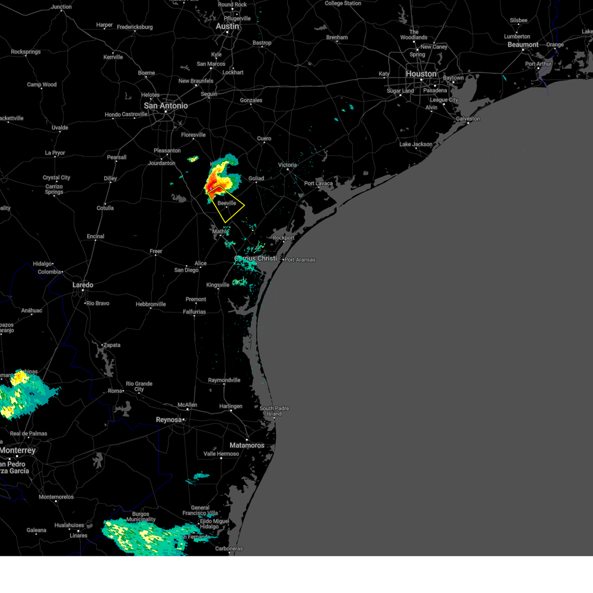
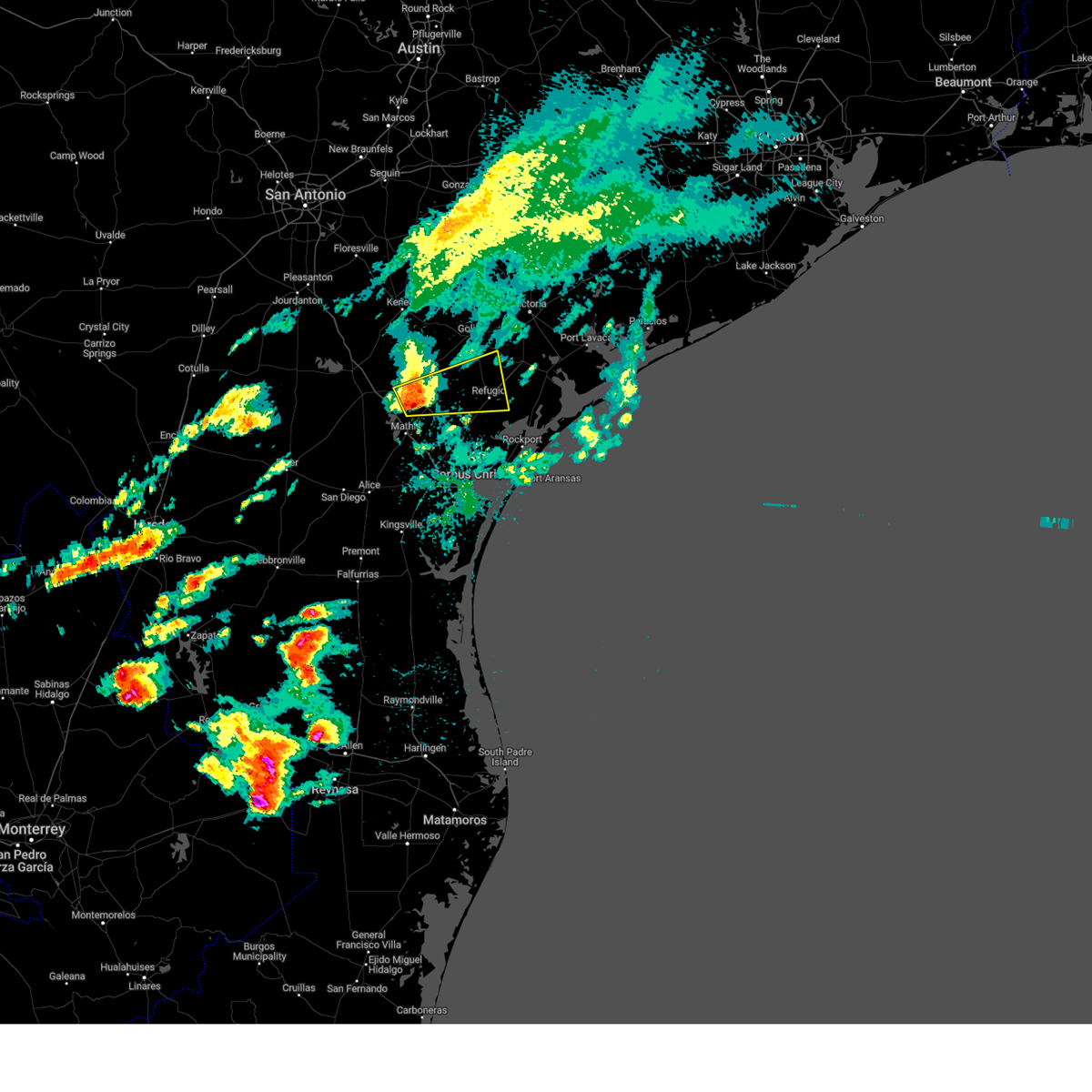
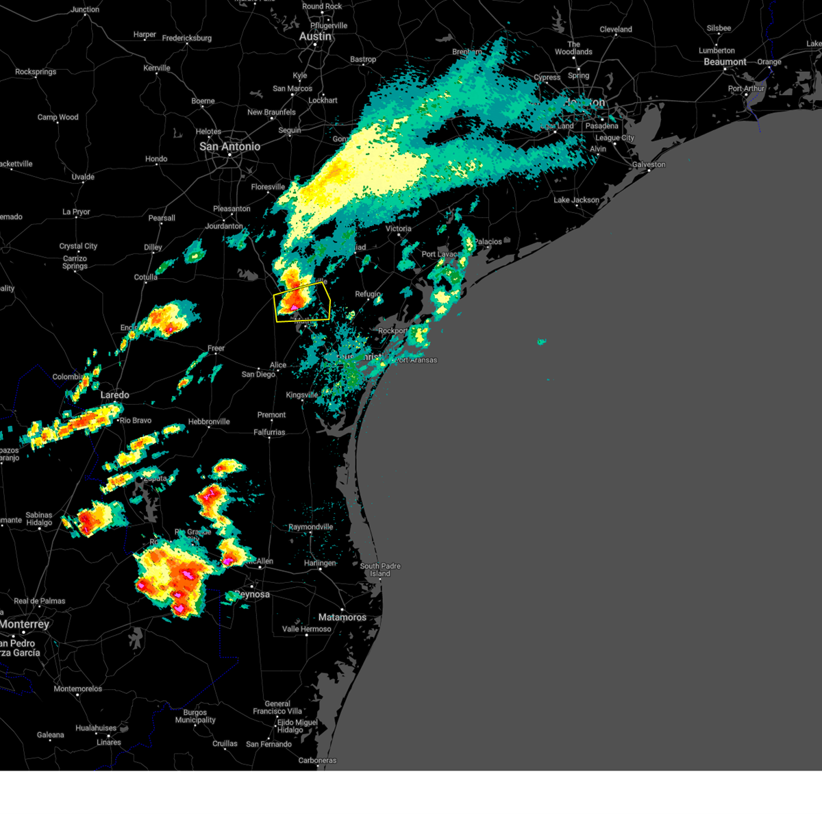
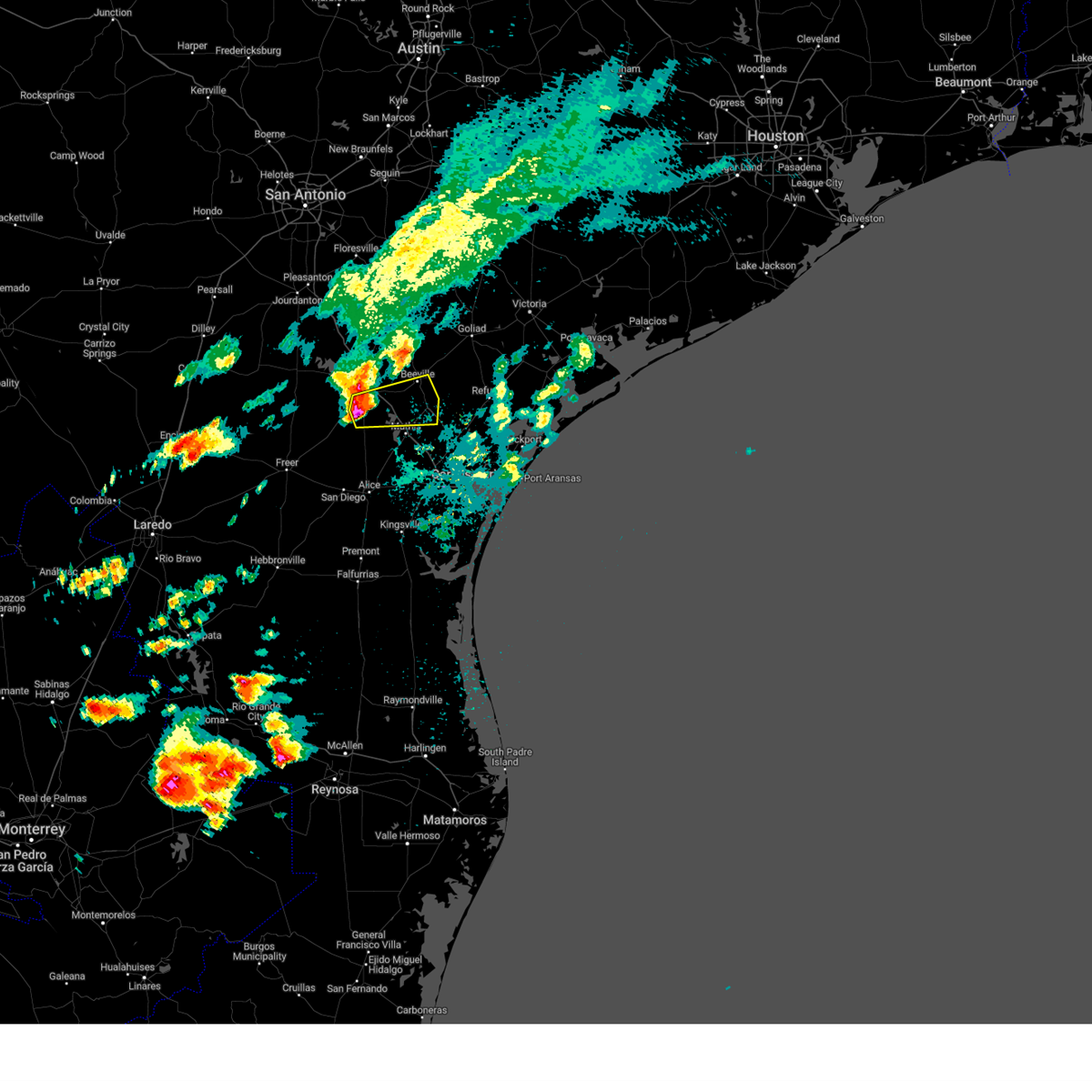
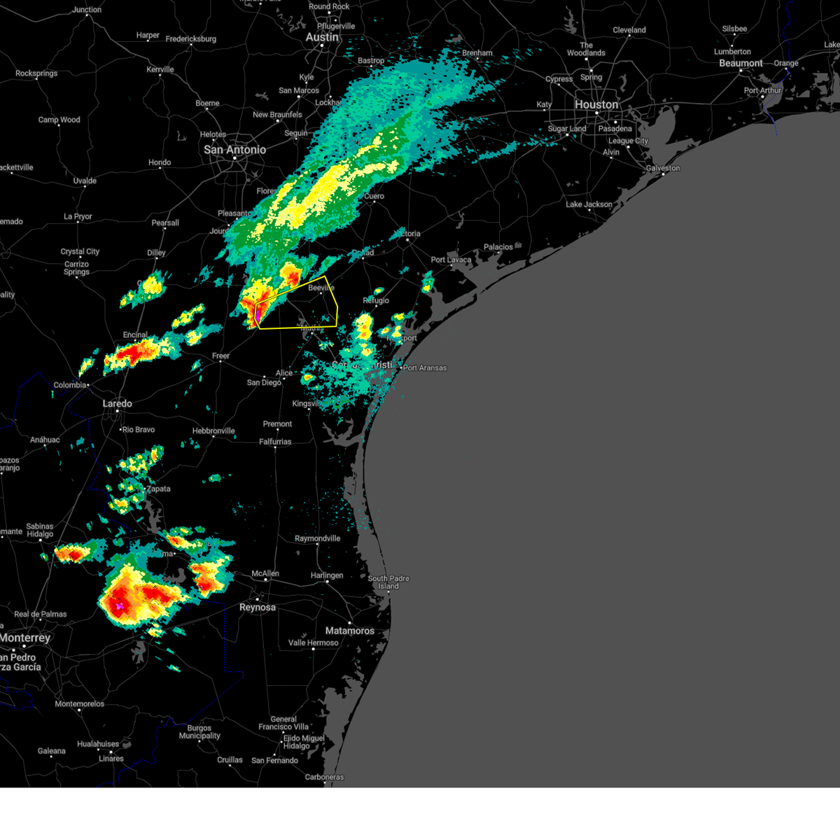
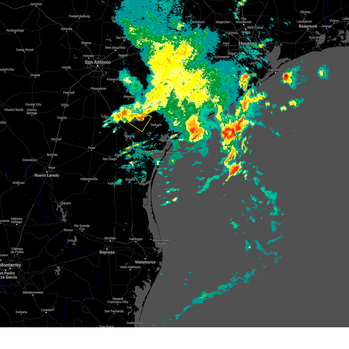
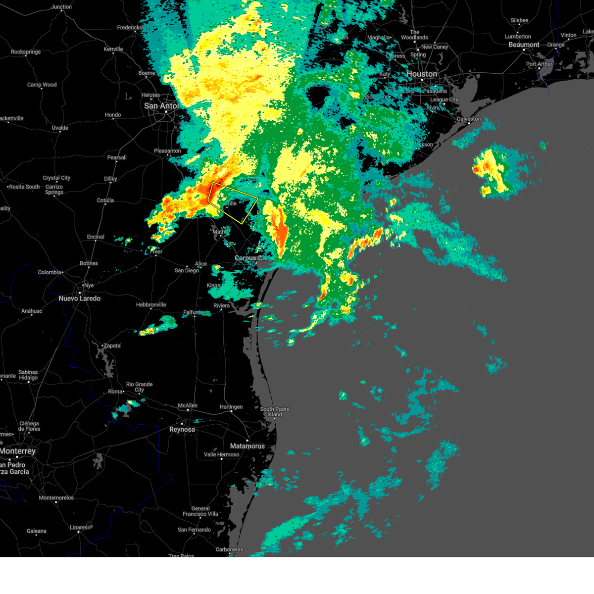
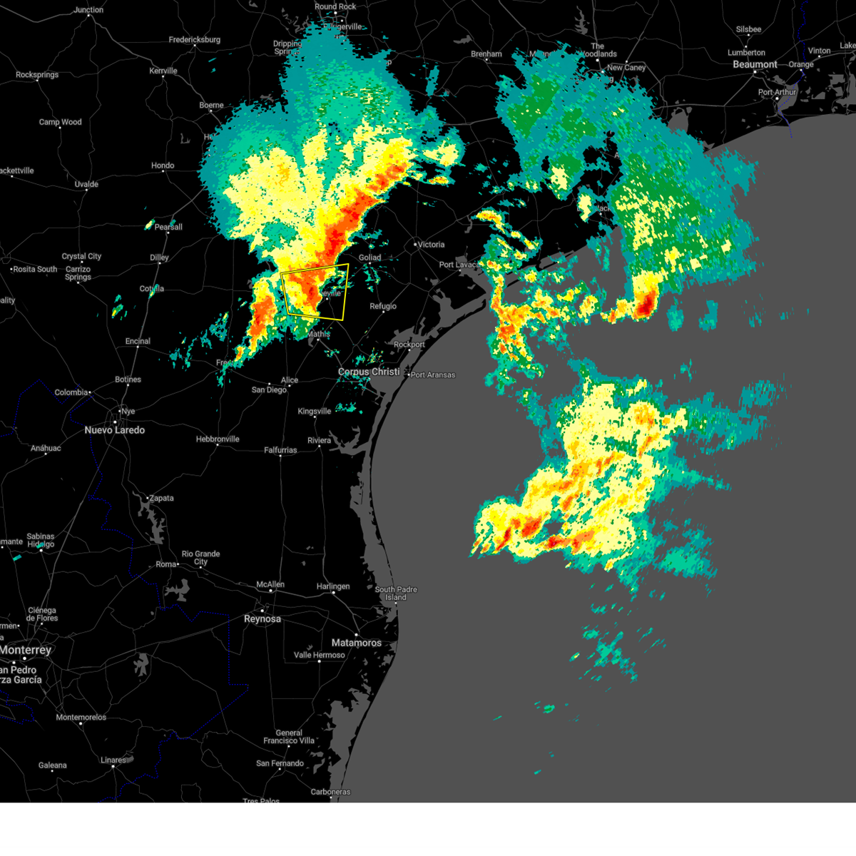
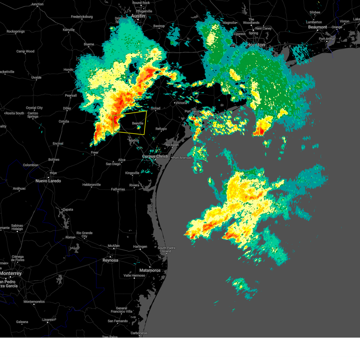
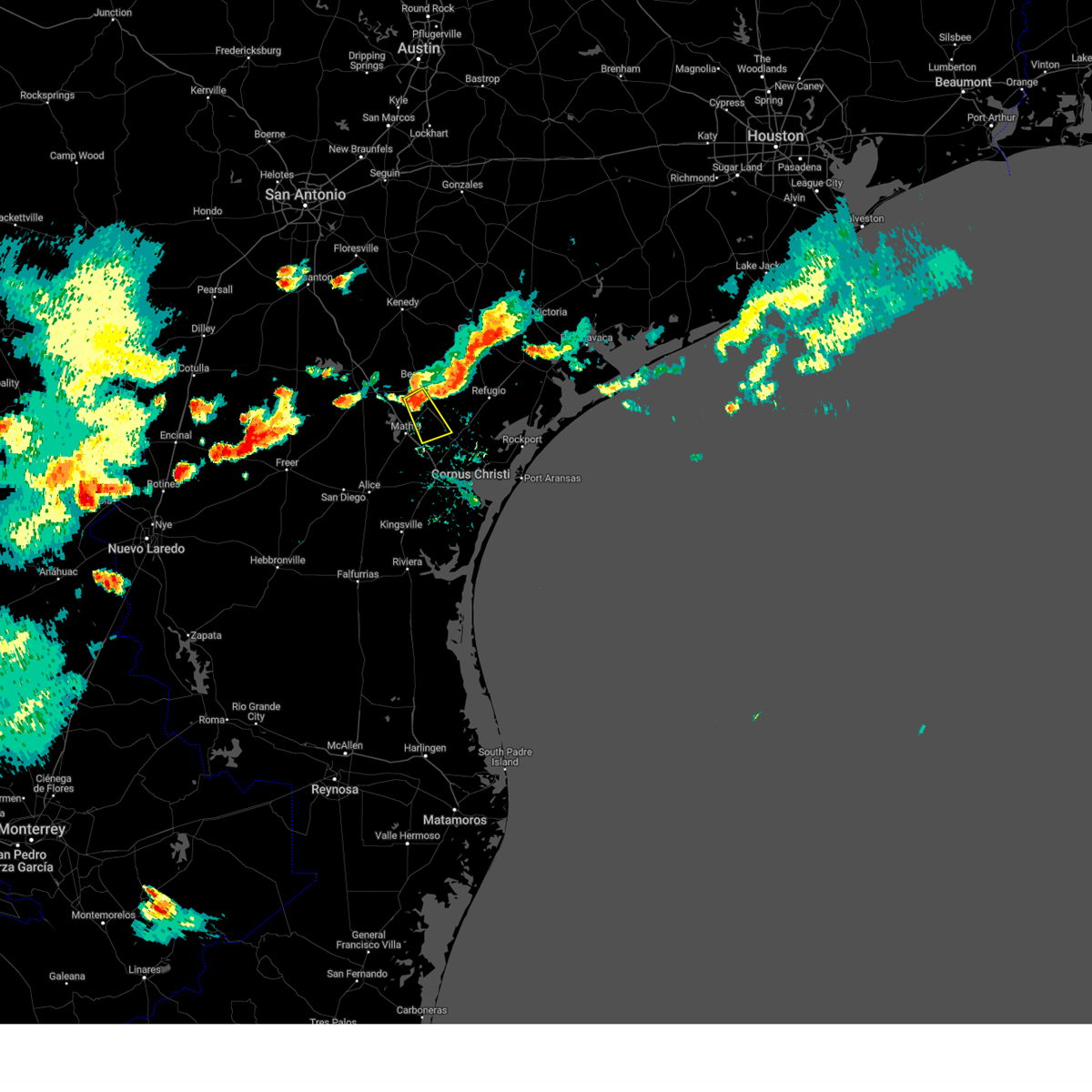
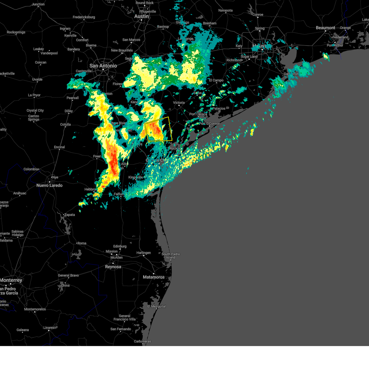
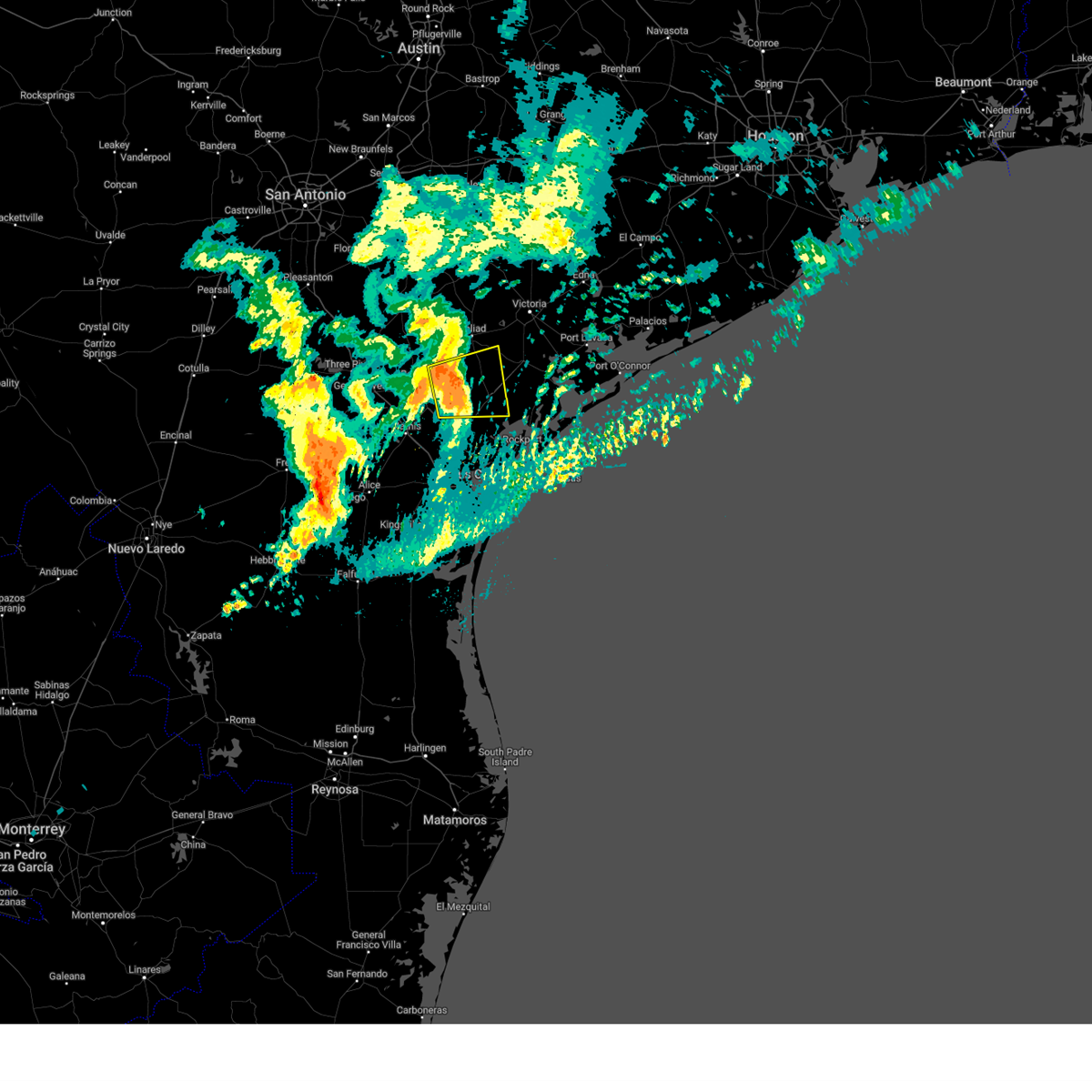
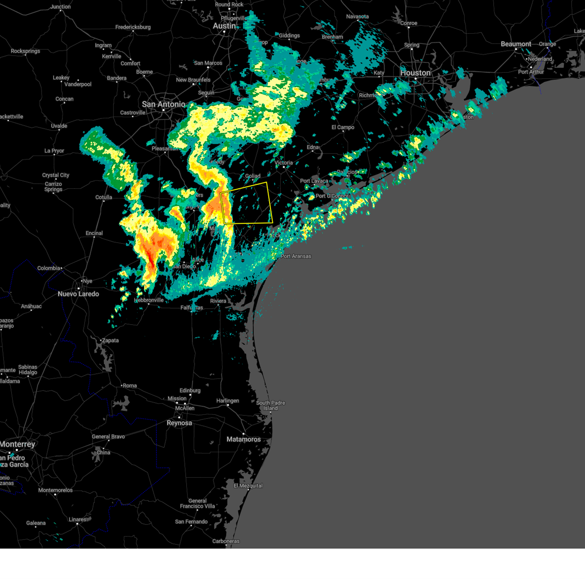
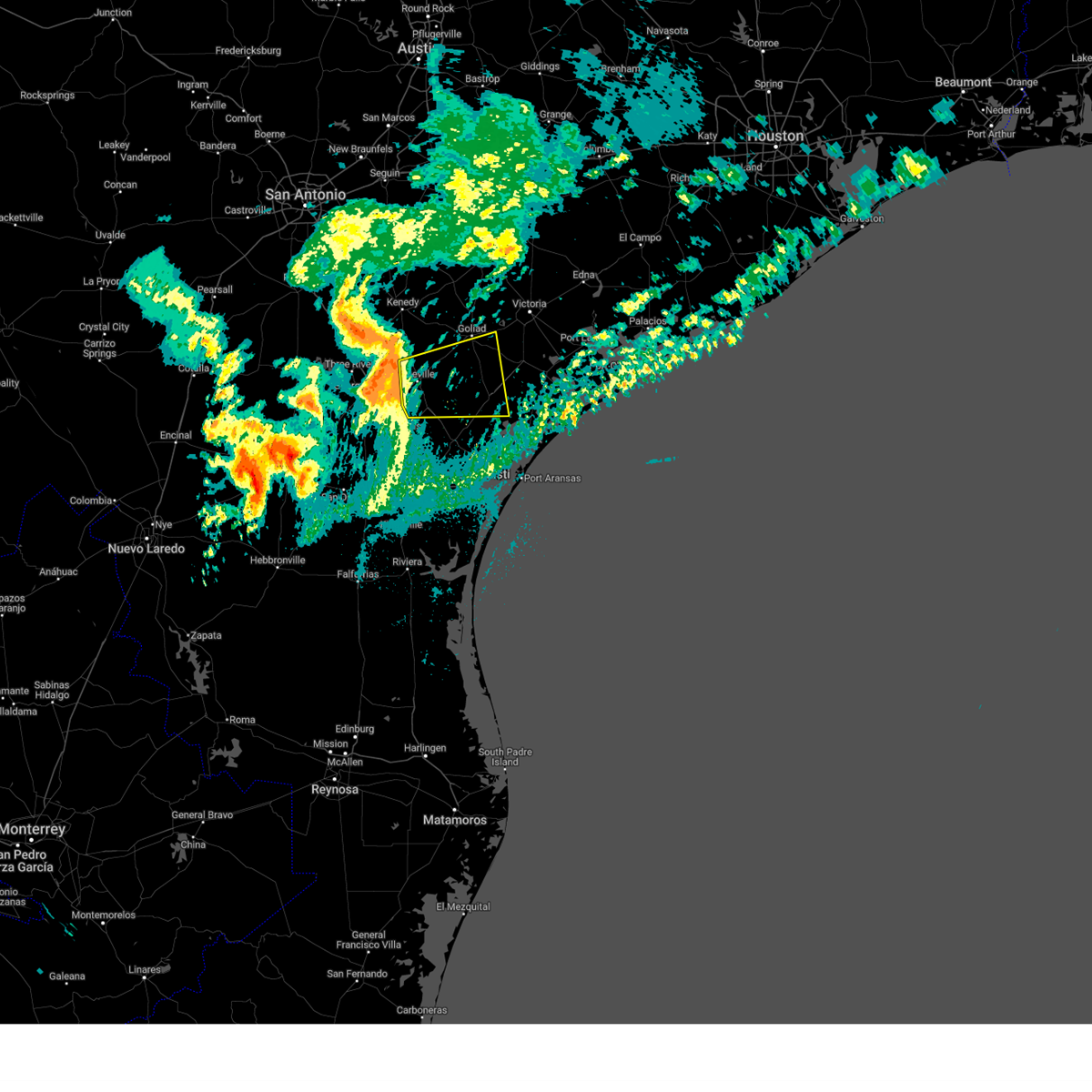
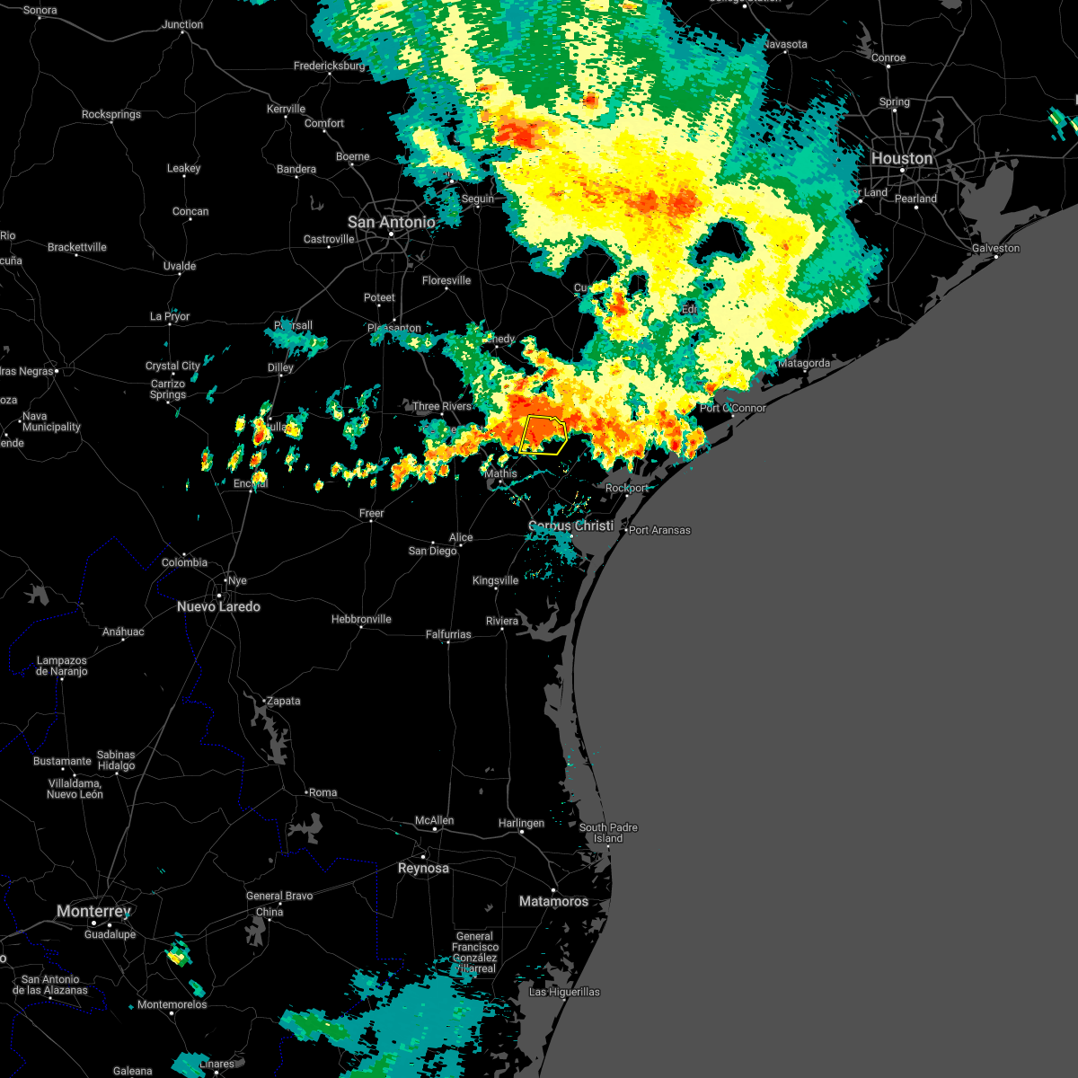
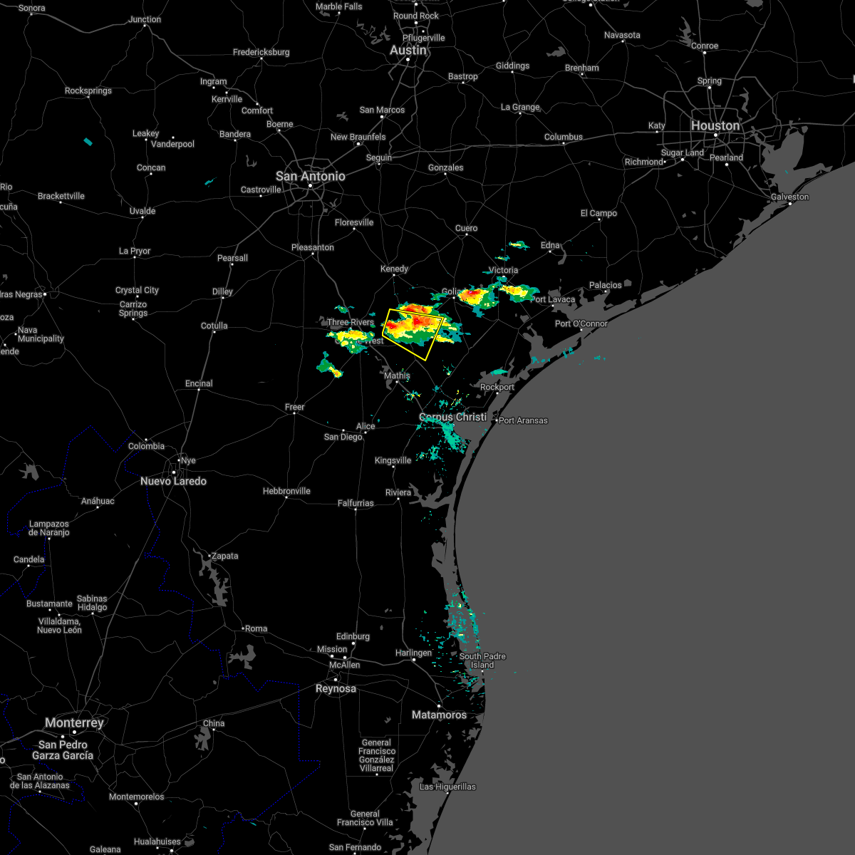
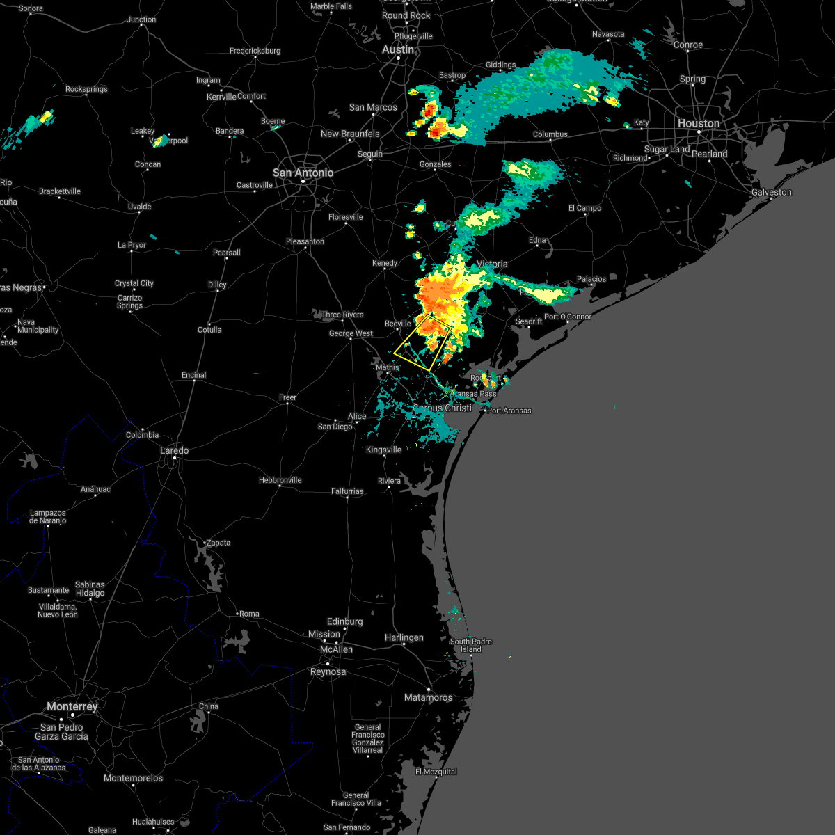
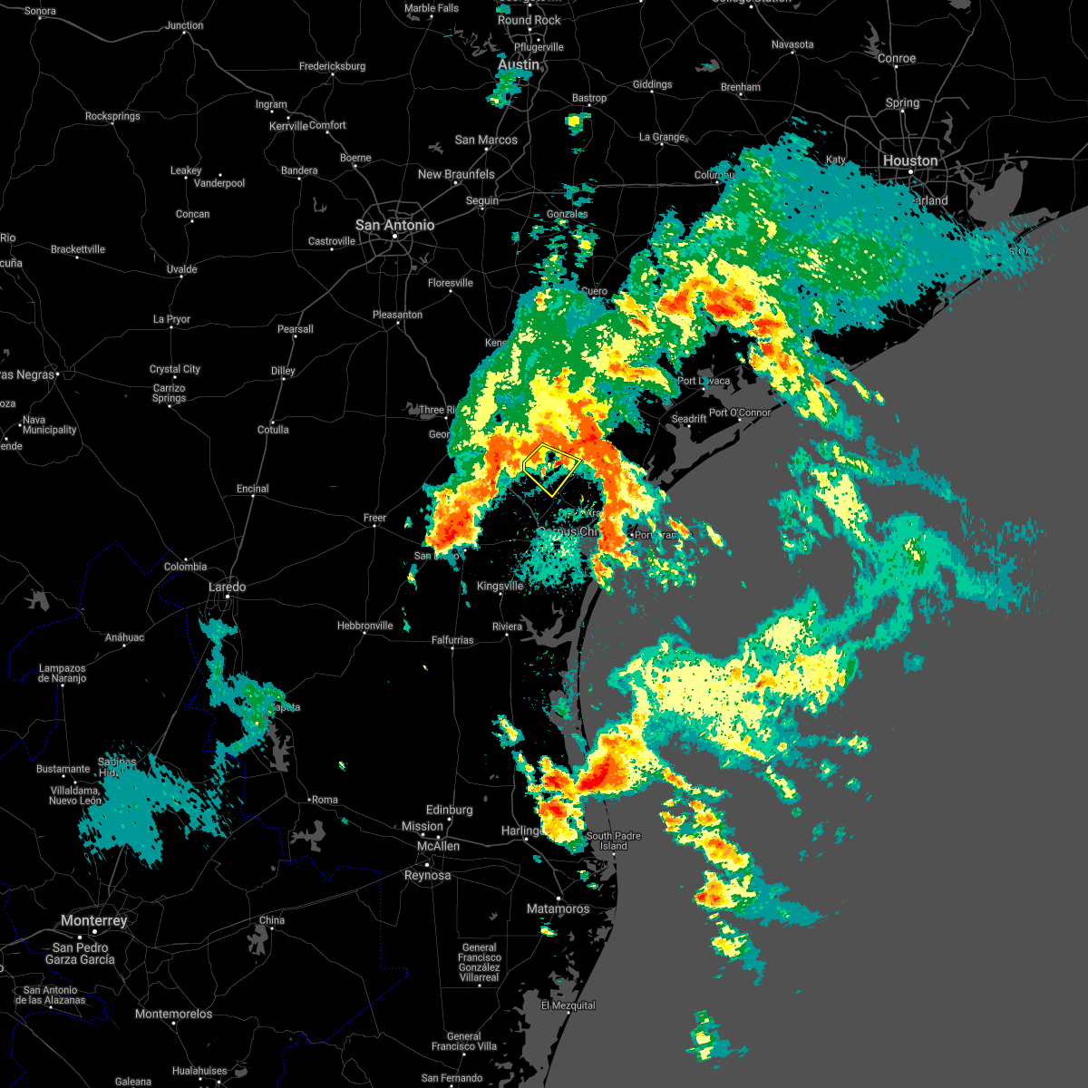
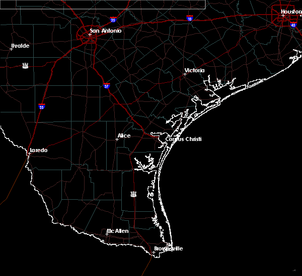
Hail Map for Skidmore, TX
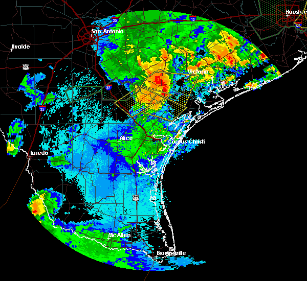
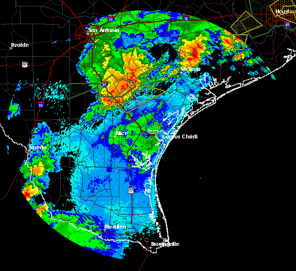
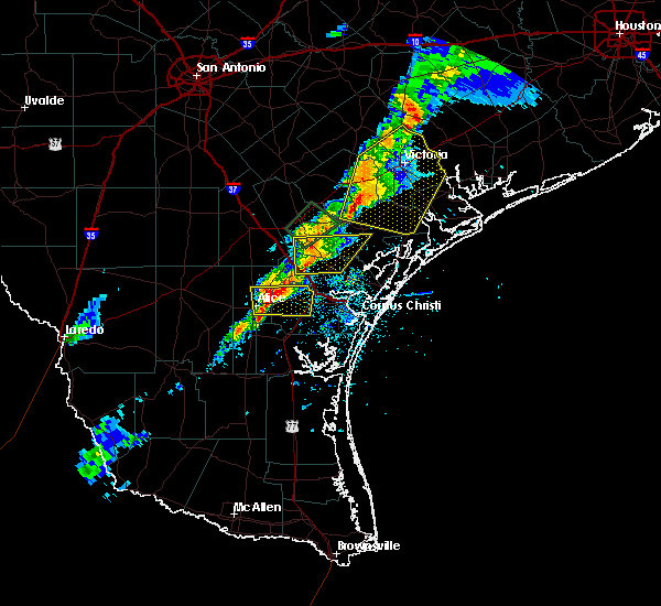
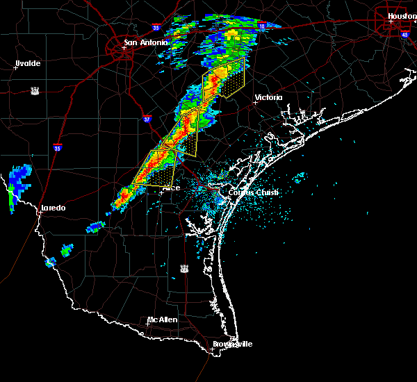
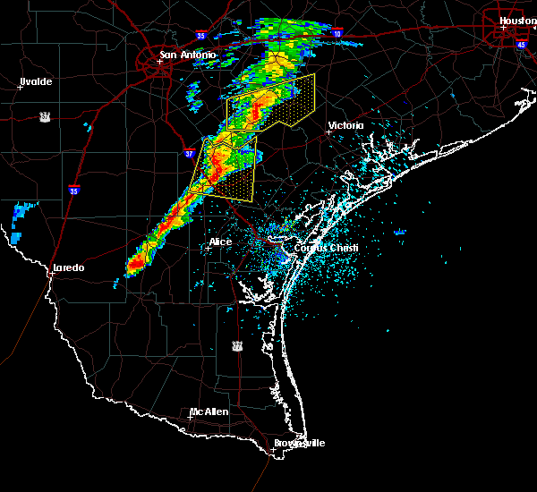
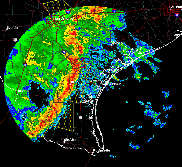
The Skidmore, TX area has had 0 reports of on-the-ground hail by trained spotters, and has been under severe weather warnings 12 times during the past 12 months. Doppler radar has detected hail at or near Skidmore, TX on 32 occasions, including 1 occasion during the past year.
| Name: | Skidmore, TX |
| Where Located: | 36.7 miles NNW of Corpus Christi, TX |
| Map: | Google Map for Skidmore, TX |
| Population: | 925 |
| Housing Units: | 407 |
| More Info: | Search Google for Skidmore, TX |
0
The Top Recent Hail Date for Skidmore, TX is Wednesday, July 10, 2024 (32nd out of 32)

Hail and Wind Damage Spotted near Skidmore, TX
| Date / Time | Report Details |
|---|---|
| 6/15/2025 9:15 PM CDT |
 the severe thunderstorm warning has been cancelled and is no longer in effect the severe thunderstorm warning has been cancelled and is no longer in effect
|
| 6/15/2025 8:49 PM CDT |
 At 848 pm cdt, a severe thunderstorm was located over tynan, or 7 miles southwest of skidmore, moving southeast at 30 mph (radar indicated). Hazards include 60 mph wind gusts. Expect damage to roofs, siding, and trees. locations impacted include, sinton, mathis, skidmore, odem, st. paul, west sinton, argenta, papalote, edroy, and tynan. this includes the following highways, interstate 37 between mile markers 16 and 43. us highway 181 between mile markers 596 and 624. Us highway 77 between mile markers 634 and 658. At 848 pm cdt, a severe thunderstorm was located over tynan, or 7 miles southwest of skidmore, moving southeast at 30 mph (radar indicated). Hazards include 60 mph wind gusts. Expect damage to roofs, siding, and trees. locations impacted include, sinton, mathis, skidmore, odem, st. paul, west sinton, argenta, papalote, edroy, and tynan. this includes the following highways, interstate 37 between mile markers 16 and 43. us highway 181 between mile markers 596 and 624. Us highway 77 between mile markers 634 and 658.
|
| 6/15/2025 8:33 PM CDT |
 Svrcrp the national weather service in corpus christi has issued a * severe thunderstorm warning for, western san patricio county in south central texas, southwestern refugio county in south central texas, southeastern live oak county in south central texas, southeastern bee county in south central texas, * until 930 pm cdt. * at 832 pm cdt, a severe thunderstorm was located near argenta, or 10 miles west of skidmore, moving southeast at 30 mph (radar indicated). Hazards include 60 mph wind gusts and penny size hail. expect damage to roofs, siding, and trees Svrcrp the national weather service in corpus christi has issued a * severe thunderstorm warning for, western san patricio county in south central texas, southwestern refugio county in south central texas, southeastern live oak county in south central texas, southeastern bee county in south central texas, * until 930 pm cdt. * at 832 pm cdt, a severe thunderstorm was located near argenta, or 10 miles west of skidmore, moving southeast at 30 mph (radar indicated). Hazards include 60 mph wind gusts and penny size hail. expect damage to roofs, siding, and trees
|
| 5/6/2025 9:20 PM CDT |
 At 920 pm cdt, a severe thunderstorm was located over tynan, or near mathis, moving east at 35 mph (radar indicated). Hazards include 60 mph wind gusts and quarter size hail. Hail damage to vehicles is expected. expect wind damage to roofs, siding, and trees. locations impacted include, mathis, skidmore, lake city, sandia, argenta, lagarto, tynan, west sinton, lakeside, lake corpus christi, and pernitas point. this includes the following highways, interstate 37 between mile markers 28 and 41. Us highway 181 near mile marker 604. At 920 pm cdt, a severe thunderstorm was located over tynan, or near mathis, moving east at 35 mph (radar indicated). Hazards include 60 mph wind gusts and quarter size hail. Hail damage to vehicles is expected. expect wind damage to roofs, siding, and trees. locations impacted include, mathis, skidmore, lake city, sandia, argenta, lagarto, tynan, west sinton, lakeside, lake corpus christi, and pernitas point. this includes the following highways, interstate 37 between mile markers 28 and 41. Us highway 181 near mile marker 604.
|
| 5/6/2025 9:11 PM CDT |
 At 910 pm cdt, a severe thunderstorm was located over argenta, or near mathis, moving east at 35 mph (radar indicated). Hazards include ping pong ball size hail and 60 mph wind gusts. People and animals outdoors will be injured. expect hail damage to roofs, siding, windows, and vehicles. expect wind damage to roofs, siding, and trees. locations impacted include, mathis, skidmore, lake city, midway, lagarto, tynan, sandia, west sinton, annarose, argenta, mount lucas, lakeside, lake corpus christi, and pernitas point. this includes the following highways, interstate 37 between mile markers 28 and 46. us highway 281 between mile markers 646 and 656. Us highway 181 between mile markers 600 and 604. At 910 pm cdt, a severe thunderstorm was located over argenta, or near mathis, moving east at 35 mph (radar indicated). Hazards include ping pong ball size hail and 60 mph wind gusts. People and animals outdoors will be injured. expect hail damage to roofs, siding, windows, and vehicles. expect wind damage to roofs, siding, and trees. locations impacted include, mathis, skidmore, lake city, midway, lagarto, tynan, sandia, west sinton, annarose, argenta, mount lucas, lakeside, lake corpus christi, and pernitas point. this includes the following highways, interstate 37 between mile markers 28 and 46. us highway 281 between mile markers 646 and 656. Us highway 181 between mile markers 600 and 604.
|
| 5/6/2025 8:56 PM CDT |
 At 855 pm cdt, a severe thunderstorm was located over lagarto, or 10 miles west of mathis, moving east at 35 mph. this is a destructive storm for northern jim wells and southeastern live oak (radar indicated). Hazards include baseball size hail and 60 mph wind gusts. People and animals outdoors will be severely injured. expect shattered windows, extensive damage to roofs, siding, and vehicles. locations impacted include, mathis, skidmore, lake city, midway, lagarto, tynan, sandia, west sinton, annarose, argenta, mount lucas, lakeside, lake corpus christi, and pernitas point. this includes the following highways, interstate 37 between mile markers 28 and 46. us highway 281 between mile markers 646 and 656. Us highway 181 between mile markers 600 and 604. At 855 pm cdt, a severe thunderstorm was located over lagarto, or 10 miles west of mathis, moving east at 35 mph. this is a destructive storm for northern jim wells and southeastern live oak (radar indicated). Hazards include baseball size hail and 60 mph wind gusts. People and animals outdoors will be severely injured. expect shattered windows, extensive damage to roofs, siding, and vehicles. locations impacted include, mathis, skidmore, lake city, midway, lagarto, tynan, sandia, west sinton, annarose, argenta, mount lucas, lakeside, lake corpus christi, and pernitas point. this includes the following highways, interstate 37 between mile markers 28 and 46. us highway 281 between mile markers 646 and 656. Us highway 181 between mile markers 600 and 604.
|
| 5/6/2025 8:47 PM CDT |
 the severe thunderstorm warning has been cancelled and is no longer in effect the severe thunderstorm warning has been cancelled and is no longer in effect
|
| 5/6/2025 8:47 PM CDT |
 At 846 pm cdt, a severe thunderstorm was located near midway, or 15 miles west of mathis, moving east at 35 mph (radar indicated). Hazards include ping pong ball size hail and 60 mph wind gusts. People and animals outdoors will be injured. expect hail damage to roofs, siding, windows, and vehicles. expect wind damage to roofs, siding, and trees. locations impacted include, beeville, mathis, skidmore, lake city, midway, lagarto, tynan, sandia, west sinton, annarose, argenta, rancho de la parita, mount lucas, dinero, lakeside, lake corpus christi, and pernitas point. this includes the following highways, interstate 37 between mile markers 28 and 54. us highway 281 between mile markers 638 and 656. us highway 181 between mile markers 588 and 606. Us highway 59 between mile markers 696 and 710. At 846 pm cdt, a severe thunderstorm was located near midway, or 15 miles west of mathis, moving east at 35 mph (radar indicated). Hazards include ping pong ball size hail and 60 mph wind gusts. People and animals outdoors will be injured. expect hail damage to roofs, siding, windows, and vehicles. expect wind damage to roofs, siding, and trees. locations impacted include, beeville, mathis, skidmore, lake city, midway, lagarto, tynan, sandia, west sinton, annarose, argenta, rancho de la parita, mount lucas, dinero, lakeside, lake corpus christi, and pernitas point. this includes the following highways, interstate 37 between mile markers 28 and 54. us highway 281 between mile markers 638 and 656. us highway 181 between mile markers 588 and 606. Us highway 59 between mile markers 696 and 710.
|
| 5/6/2025 8:41 PM CDT |
 Svrcrp the national weather service in corpus christi has issued a * severe thunderstorm warning for, northeastern duval county in south central texas, northwestern san patricio county in south central texas, northern jim wells county in south central texas, southern live oak county in south central texas, south central bee county in south central texas, * until 930 pm cdt. * at 841 pm cdt, a severe thunderstorm was located over annarose, or 17 miles south of george west, moving east at 35 mph (radar indicated). Hazards include 60 mph wind gusts and quarter size hail. Hail damage to vehicles is expected. Expect wind damage to roofs, siding, and trees. Svrcrp the national weather service in corpus christi has issued a * severe thunderstorm warning for, northeastern duval county in south central texas, northwestern san patricio county in south central texas, northern jim wells county in south central texas, southern live oak county in south central texas, south central bee county in south central texas, * until 930 pm cdt. * at 841 pm cdt, a severe thunderstorm was located over annarose, or 17 miles south of george west, moving east at 35 mph (radar indicated). Hazards include 60 mph wind gusts and quarter size hail. Hail damage to vehicles is expected. Expect wind damage to roofs, siding, and trees.
|
| 4/30/2025 9:04 PM CDT |
 the severe thunderstorm warning has been cancelled and is no longer in effect the severe thunderstorm warning has been cancelled and is no longer in effect
|
| 4/30/2025 8:47 PM CDT |
 At 847 pm cdt, a severe thunderstorm was located over beeville, moving southeast at 25 mph (law enforcement). Hazards include 60 mph wind gusts and half dollar size hail. Hail damage to vehicles is expected. expect wind damage to roofs, siding, and trees. locations impacted include, beeville, skidmore, mineral, normanna, tuleta, and pettus. this includes the following highways, us highway 181 between mile markers 578 and 600. Us highway 59 between mile markers 688 and 700. At 847 pm cdt, a severe thunderstorm was located over beeville, moving southeast at 25 mph (law enforcement). Hazards include 60 mph wind gusts and half dollar size hail. Hail damage to vehicles is expected. expect wind damage to roofs, siding, and trees. locations impacted include, beeville, skidmore, mineral, normanna, tuleta, and pettus. this includes the following highways, us highway 181 between mile markers 578 and 600. Us highway 59 between mile markers 688 and 700.
|
| 4/30/2025 8:28 PM CDT |
 Svrcrp the national weather service in corpus christi has issued a * severe thunderstorm warning for, central bee county in south central texas, * until 915 pm cdt. * at 827 pm cdt, a severe thunderstorm was located near mineral, or 9 miles northwest of beeville, moving southeast at 25 mph (law enforcement). Hazards include 60 mph wind gusts and half dollar size hail. Hail damage to vehicles is expected. Expect wind damage to roofs, siding, and trees. Svrcrp the national weather service in corpus christi has issued a * severe thunderstorm warning for, central bee county in south central texas, * until 915 pm cdt. * at 827 pm cdt, a severe thunderstorm was located near mineral, or 9 miles northwest of beeville, moving southeast at 25 mph (law enforcement). Hazards include 60 mph wind gusts and half dollar size hail. Hail damage to vehicles is expected. Expect wind damage to roofs, siding, and trees.
|
| 5/29/2024 1:05 AM CDT |
 the severe thunderstorm warning has been cancelled and is no longer in effect the severe thunderstorm warning has been cancelled and is no longer in effect
|
| 5/29/2024 1:05 AM CDT |
 At 105 am cdt, severe thunderstorms were located along a line extending from 7 miles west of dinero to near lake city to near alfred-south la paloma, moving east at 30 mph (radar indicated). Hazards include 60 mph wind gusts. Expect damage to roofs, siding, and trees. these severe storms will be near, mathis, lake city, san patricio, lagarto, mount lucas, dinero, and sandia around 110 am cdt. argenta and bluntzer around 115 am cdt. corpus christi and tynan around 120 am cdt. west sinton and edroy around 125 am cdt. odem and calallen around 135 am cdt. skidmore around 140 am cdt. other locations impacted by these severe thunderstorms include lake corpus christi, pernitas point, and lakeside. this includes the following highways, interstate 37 between mile markers 14 and 46. us highway 281 between mile markers 644 and 662. Us highway 77 between mile markers 656 and 658. At 105 am cdt, severe thunderstorms were located along a line extending from 7 miles west of dinero to near lake city to near alfred-south la paloma, moving east at 30 mph (radar indicated). Hazards include 60 mph wind gusts. Expect damage to roofs, siding, and trees. these severe storms will be near, mathis, lake city, san patricio, lagarto, mount lucas, dinero, and sandia around 110 am cdt. argenta and bluntzer around 115 am cdt. corpus christi and tynan around 120 am cdt. west sinton and edroy around 125 am cdt. odem and calallen around 135 am cdt. skidmore around 140 am cdt. other locations impacted by these severe thunderstorms include lake corpus christi, pernitas point, and lakeside. this includes the following highways, interstate 37 between mile markers 14 and 46. us highway 281 between mile markers 644 and 662. Us highway 77 between mile markers 656 and 658.
|
| 5/29/2024 12:57 AM CDT |
 Svrcrp the national weather service in corpus christi has issued a * severe thunderstorm warning for, northeastern duval county in south central texas, northwestern nueces county in south central texas, western san patricio county in south central texas, northern jim wells county in south central texas, southern live oak county in south central texas, south central bee county in south central texas, * until 145 am cdt. * at 1257 am cdt, severe thunderstorms were located along a line extending from 7 miles north of annarose to near lagarto to near alfred, moving east at 30 mph (radar indicated). Hazards include 70 mph wind gusts. Expect considerable tree damage. damage is likely to mobile homes, roofs, and outbuildings. severe thunderstorms will be near, orange grove, lake city, lagarto, sandia, and alfred-south la paloma around 100 am cdt. mathis and mount lucas around 105 am cdt. san patricio, dinero, and bluntzer around 110 am cdt. corpus christi and argenta around 115 am cdt. tynan around 120 am cdt. west sinton and edroy around 125 am cdt. calallen around 130 am cdt. odem around 135 am cdt. other locations impacted by these severe thunderstorms include lake corpus christi, pernitas point, and lakeside. this includes the following highways, interstate 37 between mile markers 14 and 46. us highway 281 between mile markers 644 and 664. Us highway 77 between mile markers 656 and 658. Svrcrp the national weather service in corpus christi has issued a * severe thunderstorm warning for, northeastern duval county in south central texas, northwestern nueces county in south central texas, western san patricio county in south central texas, northern jim wells county in south central texas, southern live oak county in south central texas, south central bee county in south central texas, * until 145 am cdt. * at 1257 am cdt, severe thunderstorms were located along a line extending from 7 miles north of annarose to near lagarto to near alfred, moving east at 30 mph (radar indicated). Hazards include 70 mph wind gusts. Expect considerable tree damage. damage is likely to mobile homes, roofs, and outbuildings. severe thunderstorms will be near, orange grove, lake city, lagarto, sandia, and alfred-south la paloma around 100 am cdt. mathis and mount lucas around 105 am cdt. san patricio, dinero, and bluntzer around 110 am cdt. corpus christi and argenta around 115 am cdt. tynan around 120 am cdt. west sinton and edroy around 125 am cdt. calallen around 130 am cdt. odem around 135 am cdt. other locations impacted by these severe thunderstorms include lake corpus christi, pernitas point, and lakeside. this includes the following highways, interstate 37 between mile markers 14 and 46. us highway 281 between mile markers 644 and 664. Us highway 77 between mile markers 656 and 658.
|
| 5/17/2024 7:27 AM CDT |
 Svrcrp the national weather service in corpus christi has issued a * severe thunderstorm warning for, southeastern goliad county in south central texas, northwestern refugio county in south central texas, southeastern bee county in south central texas, * until 815 am cdt. * at 726 am cdt, a severe thunderstorm was located near skidmore, moving east at 45 mph (radar indicated). Hazards include quarter size hail. damage to vehicles is expected Svrcrp the national weather service in corpus christi has issued a * severe thunderstorm warning for, southeastern goliad county in south central texas, northwestern refugio county in south central texas, southeastern bee county in south central texas, * until 815 am cdt. * at 726 am cdt, a severe thunderstorm was located near skidmore, moving east at 45 mph (radar indicated). Hazards include quarter size hail. damage to vehicles is expected
|
| 5/17/2024 7:14 AM CDT |
 At 712 am cdt, a severe thunderstorm was located over dinero, or 11 miles northwest of mathis, moving east at 45 mph (radar indicated). Hazards include golf ball size hail. People and animals outdoors will be injured. expect damage to roofs, siding, windows, and vehicles. this severe storm will be near, skidmore around 725 am cdt. this includes the following highways, interstate 37 between mile markers 39 and 58. us highway 181 between mile markers 592 and 608. Us highway 59 between mile markers 694 and 720. At 712 am cdt, a severe thunderstorm was located over dinero, or 11 miles northwest of mathis, moving east at 45 mph (radar indicated). Hazards include golf ball size hail. People and animals outdoors will be injured. expect damage to roofs, siding, windows, and vehicles. this severe storm will be near, skidmore around 725 am cdt. this includes the following highways, interstate 37 between mile markers 39 and 58. us highway 181 between mile markers 592 and 608. Us highway 59 between mile markers 694 and 720.
|
| 5/17/2024 6:56 AM CDT |
 At 656 am cdt, a severe thunderstorm was located near river creek acres, or near george west, moving east at 50 mph (radar indicated). Hazards include quarter size hail. Damage to vehicles is expected. this severe storm will be near, river creek acres and dinero around 700 am cdt. skidmore around 715 am cdt. this includes the following highways, interstate 37 between mile markers 39 and 57. us highway 281 between mile markers 632 and 644. us highway 181 between mile markers 592 and 608. Us highway 59 between mile markers 694 and 728. At 656 am cdt, a severe thunderstorm was located near river creek acres, or near george west, moving east at 50 mph (radar indicated). Hazards include quarter size hail. Damage to vehicles is expected. this severe storm will be near, river creek acres and dinero around 700 am cdt. skidmore around 715 am cdt. this includes the following highways, interstate 37 between mile markers 39 and 57. us highway 281 between mile markers 632 and 644. us highway 181 between mile markers 592 and 608. Us highway 59 between mile markers 694 and 728.
|
| 5/17/2024 6:45 AM CDT |
 Svrcrp the national weather service in corpus christi has issued a * severe thunderstorm warning for, northwestern san patricio county in south central texas, southern live oak county in south central texas, southwestern bee county in south central texas, * until 730 am cdt. * at 645 am cdt, a severe thunderstorm was located 7 miles northeast of clegg, or 9 miles southwest of george west, moving east at 50 mph (radar indicated). Hazards include quarter size hail. Damage to vehicles is expected. this severe thunderstorm will be near, river creek acres around 655 am cdt. dinero around 700 am cdt. skidmore around 715 am cdt. this includes the following highways, interstate 37 between mile markers 39 and 61. us highway 281 between mile markers 628 and 644. us highway 181 between mile markers 586 and 608. Us highway 59 between mile markers 692 and 738. Svrcrp the national weather service in corpus christi has issued a * severe thunderstorm warning for, northwestern san patricio county in south central texas, southern live oak county in south central texas, southwestern bee county in south central texas, * until 730 am cdt. * at 645 am cdt, a severe thunderstorm was located 7 miles northeast of clegg, or 9 miles southwest of george west, moving east at 50 mph (radar indicated). Hazards include quarter size hail. Damage to vehicles is expected. this severe thunderstorm will be near, river creek acres around 655 am cdt. dinero around 700 am cdt. skidmore around 715 am cdt. this includes the following highways, interstate 37 between mile markers 39 and 61. us highway 281 between mile markers 628 and 644. us highway 181 between mile markers 586 and 608. Us highway 59 between mile markers 692 and 738.
|
| 3/17/2024 4:07 AM CDT |
 The storm which prompted the warning has weakened below severe limits, and no longer poses an immediate threat to life or property. therefore, the warning will be allowed to expire. however, gusty winds are still possible with this thunderstorm. a severe thunderstorm watch remains in effect until 600 am cdt for south central texas. The storm which prompted the warning has weakened below severe limits, and no longer poses an immediate threat to life or property. therefore, the warning will be allowed to expire. however, gusty winds are still possible with this thunderstorm. a severe thunderstorm watch remains in effect until 600 am cdt for south central texas.
|
| 3/17/2024 3:23 AM CDT |
 Svrcrp the national weather service in corpus christi has issued a * severe thunderstorm warning for, southwestern goliad county in south central texas, central bee county in south central texas, * until 415 am cdt. * at 322 am cdt, a severe thunderstorm was located over mineral, or 12 miles northwest of beeville, moving east at 30 mph (radar indicated). Hazards include 60 mph wind gusts and penny size hail. expect damage to roofs, siding, and trees Svrcrp the national weather service in corpus christi has issued a * severe thunderstorm warning for, southwestern goliad county in south central texas, central bee county in south central texas, * until 415 am cdt. * at 322 am cdt, a severe thunderstorm was located over mineral, or 12 miles northwest of beeville, moving east at 30 mph (radar indicated). Hazards include 60 mph wind gusts and penny size hail. expect damage to roofs, siding, and trees
|
| 2/3/2024 4:36 AM CST |
 At 436 am cst, a severe thunderstorm was located over mineral, or 11 miles northwest of beeville, moving east at 40 mph (law enforcement). Hazards include 60 mph wind gusts and quarter size hail. Hail damage to vehicles is expected. expect wind damage to roofs, siding, and trees. locations impacted include, beeville, skidmore, mineral, berclair, karon, normanna, oakville, river creek acres, pettus, ray point, and tuleta. this includes the following highways, interstate 37 between mile markers 51 and 66. us highway 181 between mile markers 576 and 602. us highway 59 between mile markers 682 and 718. hail threat, observed max hail size, 1. 00 in wind threat, radar indicated max wind gust, 60 mph. At 436 am cst, a severe thunderstorm was located over mineral, or 11 miles northwest of beeville, moving east at 40 mph (law enforcement). Hazards include 60 mph wind gusts and quarter size hail. Hail damage to vehicles is expected. expect wind damage to roofs, siding, and trees. locations impacted include, beeville, skidmore, mineral, berclair, karon, normanna, oakville, river creek acres, pettus, ray point, and tuleta. this includes the following highways, interstate 37 between mile markers 51 and 66. us highway 181 between mile markers 576 and 602. us highway 59 between mile markers 682 and 718. hail threat, observed max hail size, 1. 00 in wind threat, radar indicated max wind gust, 60 mph.
|
| 2/3/2024 4:12 AM CST |
 At 412 am cst, a severe thunderstorm was located over three rivers, moving east at 40 mph (law enforcement). Hazards include 60 mph wind gusts and quarter size hail. Hail damage to vehicles is expected. Expect wind damage to roofs, siding, and trees. At 412 am cst, a severe thunderstorm was located over three rivers, moving east at 40 mph (law enforcement). Hazards include 60 mph wind gusts and quarter size hail. Hail damage to vehicles is expected. Expect wind damage to roofs, siding, and trees.
|
| 9/15/2023 7:40 PM CDT |
 At 740 pm cdt, a severe thunderstorm was located over skidmore, moving southeast at 20 mph (radar indicated). Hazards include 60 mph wind gusts and penny size hail. expect damage to roofs, siding, and trees At 740 pm cdt, a severe thunderstorm was located over skidmore, moving southeast at 20 mph (radar indicated). Hazards include 60 mph wind gusts and penny size hail. expect damage to roofs, siding, and trees
|
| 5/13/2023 5:03 AM CDT |
 At 502 am cdt, a severe thunderstorm was located near argenta, or 10 miles west of skidmore, moving northwest at 25 mph (radar indicated). Hazards include 60 mph wind gusts and penny size hail. Expect damage to roofs, siding, and trees. locations impacted include, beeville, mathis, skidmore, argenta, tynan and lakeside. this includes the following highways, interstate 37 between mile markers 30 and 41. us highway 59 between mile markers 698 and 704. hail threat, radar indicated max hail size, 0. 75 in wind threat, radar indicated max wind gust, 60 mph. At 502 am cdt, a severe thunderstorm was located near argenta, or 10 miles west of skidmore, moving northwest at 25 mph (radar indicated). Hazards include 60 mph wind gusts and penny size hail. Expect damage to roofs, siding, and trees. locations impacted include, beeville, mathis, skidmore, argenta, tynan and lakeside. this includes the following highways, interstate 37 between mile markers 30 and 41. us highway 59 between mile markers 698 and 704. hail threat, radar indicated max hail size, 0. 75 in wind threat, radar indicated max wind gust, 60 mph.
|
| 5/13/2023 4:39 AM CDT |
 At 439 am cdt, a severe thunderstorm was located over tynan, or near mathis, moving northwest at 25 mph (radar indicated). Hazards include 60 mph wind gusts. expect damage to roofs, siding, and trees At 439 am cdt, a severe thunderstorm was located over tynan, or near mathis, moving northwest at 25 mph (radar indicated). Hazards include 60 mph wind gusts. expect damage to roofs, siding, and trees
|
| 4/23/2023 10:11 AM CDT |
 The severe thunderstorm warning for northwestern san patricio, southeastern live oak and south central bee counties will expire at 1015 am cdt, the storms which prompted the warning have weakened below severe limits, and have exited the warned area. therefore, the warning will be allowed to expire. however small hail and gusty winds are still possible with these thunderstorms. a severe thunderstorm watch remains in effect until 200 pm cdt for south central texas. The severe thunderstorm warning for northwestern san patricio, southeastern live oak and south central bee counties will expire at 1015 am cdt, the storms which prompted the warning have weakened below severe limits, and have exited the warned area. therefore, the warning will be allowed to expire. however small hail and gusty winds are still possible with these thunderstorms. a severe thunderstorm watch remains in effect until 200 pm cdt for south central texas.
|
| 4/23/2023 9:49 AM CDT |
 At 948 am cdt, severe thunderstorms were located along a line extending from 6 miles southwest of beeville to near lake city to near westdale, moving east at 15 mph (radar indicated). Hazards include quarter size hail. Damage to vehicles is expected. locations impacted include, beeville, mathis, skidmore, lake city, argenta, lagarto, mount lucas, dinero, tynan, lakeside, lake corpus christi and pernitas point. this includes the following highways, interstate 37 between mile markers 31 and 53. us highway 181 between mile markers 592 and 600. us highway 59 between mile markers 694 and 708. hail threat, radar indicated max hail size, 1. 00 in wind threat, radar indicated max wind gust, <50 mph. At 948 am cdt, severe thunderstorms were located along a line extending from 6 miles southwest of beeville to near lake city to near westdale, moving east at 15 mph (radar indicated). Hazards include quarter size hail. Damage to vehicles is expected. locations impacted include, beeville, mathis, skidmore, lake city, argenta, lagarto, mount lucas, dinero, tynan, lakeside, lake corpus christi and pernitas point. this includes the following highways, interstate 37 between mile markers 31 and 53. us highway 181 between mile markers 592 and 600. us highway 59 between mile markers 694 and 708. hail threat, radar indicated max hail size, 1. 00 in wind threat, radar indicated max wind gust, <50 mph.
|
| 4/23/2023 9:29 AM CDT |
 At 929 am cdt, severe thunderstorms were located along a line extending from near beeville to near mount lucas to near midway, moving east at 40 mph (radar indicated). Hazards include quarter size hail. damage to vehicles is expected At 929 am cdt, severe thunderstorms were located along a line extending from near beeville to near mount lucas to near midway, moving east at 40 mph (radar indicated). Hazards include quarter size hail. damage to vehicles is expected
|
| 3/17/2023 4:39 AM CDT |
 The severe thunderstorm warning for southeastern goliad, northwestern refugio and southeastern bee counties will expire at 445 am cdt, the storm which prompted the warning has weakened below severe limits, and no longer poses an immediate threat to life or property. therefore, the warning will be allowed to expire. however gusty winds are still possible with this thunderstorm. The severe thunderstorm warning for southeastern goliad, northwestern refugio and southeastern bee counties will expire at 445 am cdt, the storm which prompted the warning has weakened below severe limits, and no longer poses an immediate threat to life or property. therefore, the warning will be allowed to expire. however gusty winds are still possible with this thunderstorm.
|
| 3/17/2023 4:29 AM CDT |
 At 428 am cdt, a severe thunderstorm was located over blanconia, or 10 miles northwest of refugio, moving east at 45 mph (radar indicated). Hazards include 60 mph wind gusts. Expect damage to roofs, siding, and trees. locations impacted include, refugio, woodsboro, skidmore and blanconia. this includes the following highways, us highway 183 between mile markers 650 and 668. us highway 59 near mile marker 688. us highway 77 between mile markers 614 and 630. hail threat, radar indicated max hail size, <. 75 in wind threat, radar indicated max wind gust, 60 mph. At 428 am cdt, a severe thunderstorm was located over blanconia, or 10 miles northwest of refugio, moving east at 45 mph (radar indicated). Hazards include 60 mph wind gusts. Expect damage to roofs, siding, and trees. locations impacted include, refugio, woodsboro, skidmore and blanconia. this includes the following highways, us highway 183 between mile markers 650 and 668. us highway 59 near mile marker 688. us highway 77 between mile markers 614 and 630. hail threat, radar indicated max hail size, <. 75 in wind threat, radar indicated max wind gust, 60 mph.
|
| 3/17/2023 4:10 AM CDT |
 At 410 am cdt, a severe thunderstorm was located 8 miles south of berclair, or 8 miles east of beeville, moving east at 45 mph (radar indicated). Hazards include 60 mph wind gusts. Expect damage to roofs, siding, and trees. locations impacted include, beeville, refugio, woodsboro, skidmore, berclair, blanconia and normanna. this includes the following highways, us highway 181 between mile markers 584 and 608. us highway 183 between mile markers 648 and 668. us highway 59 between mile markers 678 and 698. us highway 77 between mile markers 614 and 630. hail threat, radar indicated max hail size, <. 75 in wind threat, radar indicated max wind gust, 60 mph. At 410 am cdt, a severe thunderstorm was located 8 miles south of berclair, or 8 miles east of beeville, moving east at 45 mph (radar indicated). Hazards include 60 mph wind gusts. Expect damage to roofs, siding, and trees. locations impacted include, beeville, refugio, woodsboro, skidmore, berclair, blanconia and normanna. this includes the following highways, us highway 181 between mile markers 584 and 608. us highway 183 between mile markers 648 and 668. us highway 59 between mile markers 678 and 698. us highway 77 between mile markers 614 and 630. hail threat, radar indicated max hail size, <. 75 in wind threat, radar indicated max wind gust, 60 mph.
|
| 3/17/2023 3:56 AM CDT |
 At 355 am cdt, a severe thunderstorm was located over beeville, moving east at 50 mph (radar indicated). Hazards include 60 mph wind gusts and penny size hail. expect damage to roofs, siding, and trees At 355 am cdt, a severe thunderstorm was located over beeville, moving east at 50 mph (radar indicated). Hazards include 60 mph wind gusts and penny size hail. expect damage to roofs, siding, and trees
|
| 6/27/2022 7:41 PM CDT |
 The severe thunderstorm warning for southeastern bee county will expire at 745 pm cdt, the storm which prompted the warning has weakened below severe limits, and no longer poses an immediate threat to life or property. therefore, the warning will be allowed to expire. however small hail, gusty winds and heavy rain are still possible with this thunderstorm. The severe thunderstorm warning for southeastern bee county will expire at 745 pm cdt, the storm which prompted the warning has weakened below severe limits, and no longer poses an immediate threat to life or property. therefore, the warning will be allowed to expire. however small hail, gusty winds and heavy rain are still possible with this thunderstorm.
|
| 6/27/2022 7:14 PM CDT |
 At 714 pm cdt, a severe thunderstorm was located 9 miles west of blanconia, or 11 miles northeast of skidmore, and is nearly stationary (radar indicated). Hazards include 60 mph wind gusts and quarter size hail. Hail damage to vehicles is expected. Expect wind damage to roofs, siding, and trees. At 714 pm cdt, a severe thunderstorm was located 9 miles west of blanconia, or 11 miles northeast of skidmore, and is nearly stationary (radar indicated). Hazards include 60 mph wind gusts and quarter size hail. Hail damage to vehicles is expected. Expect wind damage to roofs, siding, and trees.
|
| 6/3/2022 6:54 PM CDT |
 At 654 pm cdt, a severe thunderstorm was located over beeville, moving east at 10 mph (radar indicated). Hazards include 60 mph wind gusts and quarter size hail. Hail damage to vehicles is expected. expect wind damage to roofs, siding, and trees. locations impacted include, beeville, skidmore, normanna, berclair and tuleta. this includes the following highways, us highway 181 between mile markers 580 and 600. us highway 59 between mile markers 680 and 702. hail threat, radar indicated max hail size, 1. 00 in wind threat, radar indicated max wind gust, 60 mph. At 654 pm cdt, a severe thunderstorm was located over beeville, moving east at 10 mph (radar indicated). Hazards include 60 mph wind gusts and quarter size hail. Hail damage to vehicles is expected. expect wind damage to roofs, siding, and trees. locations impacted include, beeville, skidmore, normanna, berclair and tuleta. this includes the following highways, us highway 181 between mile markers 580 and 600. us highway 59 between mile markers 680 and 702. hail threat, radar indicated max hail size, 1. 00 in wind threat, radar indicated max wind gust, 60 mph.
|
| 6/3/2022 6:41 PM CDT |
 At 640 pm cdt, a severe thunderstorm was located over beeville, moving east at 10 mph (radar indicated). Hazards include 60 mph wind gusts and quarter size hail. Hail damage to vehicles is expected. Expect wind damage to roofs, siding, and trees. At 640 pm cdt, a severe thunderstorm was located over beeville, moving east at 10 mph (radar indicated). Hazards include 60 mph wind gusts and quarter size hail. Hail damage to vehicles is expected. Expect wind damage to roofs, siding, and trees.
|
| 7/22/2021 3:22 PM CDT |
 At 321 pm cdt, a severe thunderstorm was located near skidmore, moving north at 25 mph (radar indicated). Hazards include 60 mph wind gusts and nickel size hail. Expect damage to roofs, siding, and trees. locations impacted include, beeville and skidmore. this includes the following highways, interstate 37 between mile markers 45 and 48. us highway 181 between mile markers 590 and 606. Us highway 59 between mile markers 692 and 710. At 321 pm cdt, a severe thunderstorm was located near skidmore, moving north at 25 mph (radar indicated). Hazards include 60 mph wind gusts and nickel size hail. Expect damage to roofs, siding, and trees. locations impacted include, beeville and skidmore. this includes the following highways, interstate 37 between mile markers 45 and 48. us highway 181 between mile markers 590 and 606. Us highway 59 between mile markers 692 and 710.
|
| 7/22/2021 3:06 PM CDT |
 At 306 pm cdt, a severe thunderstorm was located over tynan, or near skidmore, moving north at 25 mph (radar indicated). Hazards include 60 mph wind gusts and nickel size hail. expect damage to roofs, siding, and trees At 306 pm cdt, a severe thunderstorm was located over tynan, or near skidmore, moving north at 25 mph (radar indicated). Hazards include 60 mph wind gusts and nickel size hail. expect damage to roofs, siding, and trees
|
| 6/14/2021 6:16 PM CDT |
 At 615 pm cdt, a severe thunderstorm was located near blanconia, or 13 miles northwest of refugio, moving southwest at 20 mph (radar indicated). Hazards include 60 mph wind gusts and quarter size hail. Hail damage to vehicles is expected. Expect wind damage to roofs, siding, and trees. At 615 pm cdt, a severe thunderstorm was located near blanconia, or 13 miles northwest of refugio, moving southwest at 20 mph (radar indicated). Hazards include 60 mph wind gusts and quarter size hail. Hail damage to vehicles is expected. Expect wind damage to roofs, siding, and trees.
|
| 5/19/2021 1:13 AM CDT |
 At 113 am cdt, severe thunderstorms were located along a line extending from near crowther to near annarose, moving east at 35 mph (radar indicated). Hazards include 60 mph wind gusts and quarter size hail. Hail damage to vehicles is expected. expect wind damage to roofs, siding, and trees. locations impacted include, beeville, mathis, george west, three rivers, tilden, choke canyon, skidmore, lake city, midway, cross, river creek acres, tynan, calliham, annarose, argenta, karon, rancho de la parita, mount lucas, pawnee and simmons. this includes the following highways, interstate 37 between mile markers 36 and 83. us highway 281 between mile markers 618 and 656. Us highway 59 between mile markers 698 and 752. At 113 am cdt, severe thunderstorms were located along a line extending from near crowther to near annarose, moving east at 35 mph (radar indicated). Hazards include 60 mph wind gusts and quarter size hail. Hail damage to vehicles is expected. expect wind damage to roofs, siding, and trees. locations impacted include, beeville, mathis, george west, three rivers, tilden, choke canyon, skidmore, lake city, midway, cross, river creek acres, tynan, calliham, annarose, argenta, karon, rancho de la parita, mount lucas, pawnee and simmons. this includes the following highways, interstate 37 between mile markers 36 and 83. us highway 281 between mile markers 618 and 656. Us highway 59 between mile markers 698 and 752.
|
| 5/19/2021 1:01 AM CDT |
 At 1257 am cdt, severe thunderstorms were located along a line extending from cross to 9 miles east of seven sisters, moving northeast at 70 mph (radar indicated). Hazards include ping pong ball size hail and 60 mph wind gusts. People and animals outdoors will be injured. expect hail damage to roofs, siding, windows, and vehicles. Expect wind damage to roofs, siding, and trees. At 1257 am cdt, severe thunderstorms were located along a line extending from cross to 9 miles east of seven sisters, moving northeast at 70 mph (radar indicated). Hazards include ping pong ball size hail and 60 mph wind gusts. People and animals outdoors will be injured. expect hail damage to roofs, siding, windows, and vehicles. Expect wind damage to roofs, siding, and trees.
|
| 5/19/2021 12:58 AM CDT |
 At 1257 am cdt, severe thunderstorms were located along a line extending from cross to 9 miles east of seven sisters, moving northeast at 70 mph (radar indicated). Hazards include ping pong ball size hail and 60 mph wind gusts. People and animals outdoors will be injured. expect hail damage to roofs, siding, windows, and vehicles. Expect wind damage to roofs, siding, and trees. At 1257 am cdt, severe thunderstorms were located along a line extending from cross to 9 miles east of seven sisters, moving northeast at 70 mph (radar indicated). Hazards include ping pong ball size hail and 60 mph wind gusts. People and animals outdoors will be injured. expect hail damage to roofs, siding, windows, and vehicles. Expect wind damage to roofs, siding, and trees.
|
| 5/18/2021 2:40 AM CDT |
 At 240 am cdt, severe thunderstorms were located along a line extending from 7 miles east of beeville to 6 miles west of bonnie view to near gregory, moving east at 50 mph (radar indicated). Hazards include 60 mph wind gusts and penny size hail. Expect damage to roofs, siding, and trees. these severe thunderstorms will remain over mainly rural areas of northwestern nueces, san patricio, northeastern jim wells, southeastern live oak and south central bee counties, including the following locations, pernitas point, lake corpus christi, taft southwest and lakeside. this includes the following highways, interstate 37 between mile markers 11 and 49. us highway 281 between mile markers 644 and 646. us highway 181 between mile markers 600 and 630. Us highway 77 between mile markers 642 and 658. At 240 am cdt, severe thunderstorms were located along a line extending from 7 miles east of beeville to 6 miles west of bonnie view to near gregory, moving east at 50 mph (radar indicated). Hazards include 60 mph wind gusts and penny size hail. Expect damage to roofs, siding, and trees. these severe thunderstorms will remain over mainly rural areas of northwestern nueces, san patricio, northeastern jim wells, southeastern live oak and south central bee counties, including the following locations, pernitas point, lake corpus christi, taft southwest and lakeside. this includes the following highways, interstate 37 between mile markers 11 and 49. us highway 281 between mile markers 644 and 646. us highway 181 between mile markers 600 and 630. Us highway 77 between mile markers 642 and 658.
|
| 5/18/2021 2:16 AM CDT |
 At 216 am cdt, severe thunderstorms were located along a line extending from near dinero to west sinton to near annaville, moving northeast at 50 mph (radar indicated). Hazards include 60 mph wind gusts and penny size hail. Expect damage to roofs, siding, and trees. severe thunderstorms will be near, odem around 220 am cdt. st. paul, papalote and tynan around 225 am cdt. sinton, taft and skidmore around 230 am cdt. other locations impacted by these severe thunderstorms include pernitas point, lake corpus christi, north san pedro, taft southwest and lakeside. this includes the following highways, interstate 37 between mile markers 11 and 49. us highway 281 between mile markers 644 and 646. us highway 181 between mile markers 600 and 630. Us highway 77 between mile markers 642 and 658. At 216 am cdt, severe thunderstorms were located along a line extending from near dinero to west sinton to near annaville, moving northeast at 50 mph (radar indicated). Hazards include 60 mph wind gusts and penny size hail. Expect damage to roofs, siding, and trees. severe thunderstorms will be near, odem around 220 am cdt. st. paul, papalote and tynan around 225 am cdt. sinton, taft and skidmore around 230 am cdt. other locations impacted by these severe thunderstorms include pernitas point, lake corpus christi, north san pedro, taft southwest and lakeside. this includes the following highways, interstate 37 between mile markers 11 and 49. us highway 281 between mile markers 644 and 646. us highway 181 between mile markers 600 and 630. Us highway 77 between mile markers 642 and 658.
|
| 5/16/2021 10:42 AM CDT |
 At 1027 am cdt, a severe thunderstorm was located over skidmore, moving southeast at 15 mph (radar indicated). Hazards include 60 mph wind gusts and penny size hail. Expect damage to roofs, siding, and trees. this severe thunderstorm will be near, papalote around 1055 am cdt. st. paul around 1115 am cdt. This includes us highway 181 between mile markers 600 and 618. At 1027 am cdt, a severe thunderstorm was located over skidmore, moving southeast at 15 mph (radar indicated). Hazards include 60 mph wind gusts and penny size hail. Expect damage to roofs, siding, and trees. this severe thunderstorm will be near, papalote around 1055 am cdt. st. paul around 1115 am cdt. This includes us highway 181 between mile markers 600 and 618.
|
| 5/16/2021 10:28 AM CDT |
 At 1027 am cdt, a severe thunderstorm was located over skidmore, moving southeast at 15 mph (radar indicated). Hazards include 60 mph wind gusts and penny size hail. Expect damage to roofs, siding, and trees. this severe thunderstorm will be near, papalote around 1055 am cdt. st. paul around 1115 am cdt. This includes us highway 181 between mile markers 600 and 618. At 1027 am cdt, a severe thunderstorm was located over skidmore, moving southeast at 15 mph (radar indicated). Hazards include 60 mph wind gusts and penny size hail. Expect damage to roofs, siding, and trees. this severe thunderstorm will be near, papalote around 1055 am cdt. st. paul around 1115 am cdt. This includes us highway 181 between mile markers 600 and 618.
|
| 4/23/2021 8:28 PM CDT |
 At 827 pm cdt, a severe thunderstorm was located over tuleta, or 10 miles north of beeville, moving east at 55 mph (radar indicated). Hazards include golf ball size hail and 60 mph wind gusts. People and animals outdoors will be injured. expect hail damage to roofs, siding, windows, and vehicles. Expect wind damage to roofs, siding, and trees. At 827 pm cdt, a severe thunderstorm was located over tuleta, or 10 miles north of beeville, moving east at 55 mph (radar indicated). Hazards include golf ball size hail and 60 mph wind gusts. People and animals outdoors will be injured. expect hail damage to roofs, siding, windows, and vehicles. Expect wind damage to roofs, siding, and trees.
|
| 11/28/2020 3:23 AM CST |
 At 322 am cst, a severe thunderstorm was located near karon, or 11 miles northeast of george west, moving east at 40 mph (radar indicated). Hazards include 60 mph wind gusts and quarter size hail. Hail damage to vehicles is expected. Expect wind damage to roofs, siding, and trees. At 322 am cst, a severe thunderstorm was located near karon, or 11 miles northeast of george west, moving east at 40 mph (radar indicated). Hazards include 60 mph wind gusts and quarter size hail. Hail damage to vehicles is expected. Expect wind damage to roofs, siding, and trees.
|
| 8/18/2020 4:26 PM CDT |
 At 426 pm cdt, a severe thunderstorm was located near papalote, or 7 miles south of skidmore, moving southwest at 15 mph (radar indicated). Hazards include 60 mph wind gusts and quarter size hail. Hail damage to vehicles is expected. Expect wind damage to roofs, siding, and trees. At 426 pm cdt, a severe thunderstorm was located near papalote, or 7 miles south of skidmore, moving southwest at 15 mph (radar indicated). Hazards include 60 mph wind gusts and quarter size hail. Hail damage to vehicles is expected. Expect wind damage to roofs, siding, and trees.
|
| 6/26/2020 5:21 AM CDT |
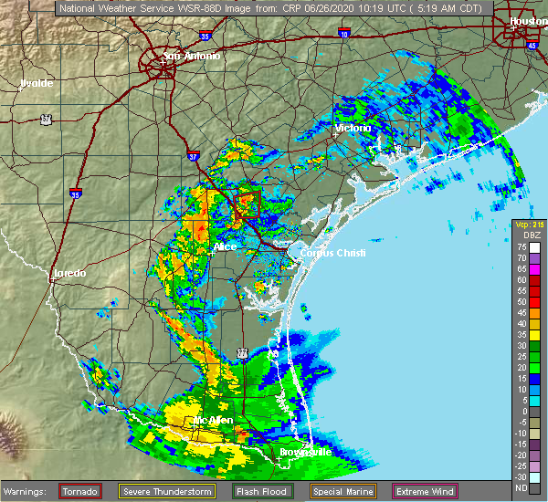 At 519 am cdt, a severe thunderstorm capable of producing a tornado was located 3 miles northwest of tynan, moving north at 20 mph (radar indicated rotation). Hazards include tornado. Flying debris will be dangerous to those caught without shelter. mobile homes will be damaged or destroyed. damage to roofs, windows, and vehicles will occur. tree damage is likely. This dangerous storm will be near, skidmore around 535 am cdt. At 519 am cdt, a severe thunderstorm capable of producing a tornado was located 3 miles northwest of tynan, moving north at 20 mph (radar indicated rotation). Hazards include tornado. Flying debris will be dangerous to those caught without shelter. mobile homes will be damaged or destroyed. damage to roofs, windows, and vehicles will occur. tree damage is likely. This dangerous storm will be near, skidmore around 535 am cdt.
|
| 6/26/2020 5:10 AM CDT |
 At 510 am cdt, a severe thunderstorm capable of producing a tornado was located over tynan, or near mathis, moving north at 20 mph (radar indicated rotation). Hazards include tornado. Flying debris will be dangerous to those caught without shelter. mobile homes will be damaged or destroyed. damage to roofs, windows, and vehicles will occur. tree damage is likely. This dangerous storm will be near, skidmore around 535 am cdt. At 510 am cdt, a severe thunderstorm capable of producing a tornado was located over tynan, or near mathis, moving north at 20 mph (radar indicated rotation). Hazards include tornado. Flying debris will be dangerous to those caught without shelter. mobile homes will be damaged or destroyed. damage to roofs, windows, and vehicles will occur. tree damage is likely. This dangerous storm will be near, skidmore around 535 am cdt.
|
| 5/28/2020 12:19 AM CDT |
 At 1219 am cdt, a severe thunderstorm was located near papalote, or 7 miles east of skidmore, moving southeast at 35 mph (radar indicated). Hazards include quarter size hail. Damage to vehicles is expected. locations impacted include, skidmore, st. Paul and papalote. At 1219 am cdt, a severe thunderstorm was located near papalote, or 7 miles east of skidmore, moving southeast at 35 mph (radar indicated). Hazards include quarter size hail. Damage to vehicles is expected. locations impacted include, skidmore, st. Paul and papalote.
|
| 5/28/2020 12:05 AM CDT |
 At 1204 am cdt, a severe thunderstorm was located 7 miles northeast of skidmore, moving southeast at 40 mph (radar indicated). Hazards include 60 mph wind gusts and quarter size hail. Hail damage to vehicles is expected. expect wind damage to roofs, siding, and trees. locations impacted include, refugio, woodsboro, skidmore, st. Paul and papalote. At 1204 am cdt, a severe thunderstorm was located 7 miles northeast of skidmore, moving southeast at 40 mph (radar indicated). Hazards include 60 mph wind gusts and quarter size hail. Hail damage to vehicles is expected. expect wind damage to roofs, siding, and trees. locations impacted include, refugio, woodsboro, skidmore, st. Paul and papalote.
|
| 5/27/2020 11:52 PM CDT |
 At 1152 pm cdt, a severe thunderstorm was located over beeville, moving southeast at 30 mph (radar indicated). Hazards include golf ball size hail and 60 mph wind gusts. People and animals outdoors will be injured. expect hail damage to roofs, siding, windows, and vehicles. Expect wind damage to roofs, siding, and trees. At 1152 pm cdt, a severe thunderstorm was located over beeville, moving southeast at 30 mph (radar indicated). Hazards include golf ball size hail and 60 mph wind gusts. People and animals outdoors will be injured. expect hail damage to roofs, siding, windows, and vehicles. Expect wind damage to roofs, siding, and trees.
|
| 5/16/2020 1:09 AM CDT |
 At 108 am cdt, severe thunderstorms were located along a line extending from near cuero to near papalote, moving east at 35 mph (radar indicated). Hazards include 60 mph wind gusts and penny size hail. expect damage to roofs, siding, and trees At 108 am cdt, severe thunderstorms were located along a line extending from near cuero to near papalote, moving east at 35 mph (radar indicated). Hazards include 60 mph wind gusts and penny size hail. expect damage to roofs, siding, and trees
|
| 5/16/2020 12:32 AM CDT |
 At 1232 am cdt, severe thunderstorms were located along a line extending from near kenedy to 7 miles southeast of karon to near clegg, moving east at 35 mph (radar indicated). Hazards include 60 mph wind gusts and penny size hail. expect damage to roofs, siding, and trees At 1232 am cdt, severe thunderstorms were located along a line extending from near kenedy to 7 miles southeast of karon to near clegg, moving east at 35 mph (radar indicated). Hazards include 60 mph wind gusts and penny size hail. expect damage to roofs, siding, and trees
|
| 3/20/2020 12:10 PM CDT |
 At 1209 pm cdt, a severe thunderstorm was located 7 miles northeast of dinero, or 10 miles southwest of beeville, moving northeast at 40 mph (radar indicated). Hazards include 60 mph wind gusts and quarter size hail. Hail damage to vehicles is expected. Expect wind damage to roofs, siding, and trees. At 1209 pm cdt, a severe thunderstorm was located 7 miles northeast of dinero, or 10 miles southwest of beeville, moving northeast at 40 mph (radar indicated). Hazards include 60 mph wind gusts and quarter size hail. Hail damage to vehicles is expected. Expect wind damage to roofs, siding, and trees.
|
| 6/6/2019 8:03 PM CDT |
 At 803 pm cdt, a severe thunderstorm was located 8 miles southwest of blanconia, or 11 miles east of skidmore, moving southeast at 35 mph (radar indicated). Hazards include 60 mph wind gusts and quarter size hail. Hail damage to vehicles is expected. expect wind damage to roofs, siding, and trees. Locations impacted include, skidmore, papalote and blanconia. At 803 pm cdt, a severe thunderstorm was located 8 miles southwest of blanconia, or 11 miles east of skidmore, moving southeast at 35 mph (radar indicated). Hazards include 60 mph wind gusts and quarter size hail. Hail damage to vehicles is expected. expect wind damage to roofs, siding, and trees. Locations impacted include, skidmore, papalote and blanconia.
|
| 6/6/2019 7:45 PM CDT |
 The national weather service in corpus christi has issued a * severe thunderstorm warning for. south central goliad county in south central texas. west central refugio county in south central texas. southeastern bee county in south central texas. Until 815 pm cdt. The national weather service in corpus christi has issued a * severe thunderstorm warning for. south central goliad county in south central texas. west central refugio county in south central texas. southeastern bee county in south central texas. Until 815 pm cdt.
|
| 5/9/2019 10:37 PM CDT |
 At 1037 pm cdt, severe thunderstorms were located along a line extending from 11 miles northeast of blanconia to near papalote, moving east at 30 mph (radar indicated). Hazards include 60 mph wind gusts and penny size hail. Expect damage to roofs, siding, and trees. Locations impacted include, refugio, woodsboro, skidmore, bayside, quintana, bonnie view and blanconia. At 1037 pm cdt, severe thunderstorms were located along a line extending from 11 miles northeast of blanconia to near papalote, moving east at 30 mph (radar indicated). Hazards include 60 mph wind gusts and penny size hail. Expect damage to roofs, siding, and trees. Locations impacted include, refugio, woodsboro, skidmore, bayside, quintana, bonnie view and blanconia.
|
| 5/9/2019 10:20 PM CDT |
 At 1020 pm cdt, severe thunderstorms were located along a line extending from 7 miles east of berclair to near tynan, moving east at 35 mph (radar indicated). Hazards include 60 mph wind gusts and penny size hail. expect damage to roofs, siding, and trees At 1020 pm cdt, severe thunderstorms were located along a line extending from 7 miles east of berclair to near tynan, moving east at 35 mph (radar indicated). Hazards include 60 mph wind gusts and penny size hail. expect damage to roofs, siding, and trees
|
| 5/9/2019 9:54 PM CDT |
 At 954 pm cdt, severe thunderstorms were located along a line extending from near pettus to near oakville, moving east at 40 mph (radar indicated). Hazards include 60 mph wind gusts and penny size hail. expect damage to roofs, siding, and trees At 954 pm cdt, severe thunderstorms were located along a line extending from near pettus to near oakville, moving east at 40 mph (radar indicated). Hazards include 60 mph wind gusts and penny size hail. expect damage to roofs, siding, and trees
|
| 5/3/2019 11:13 PM CDT |
 A severe thunderstorm warning remains in effect until 1130 pm cdt for northwestern calhoun. victoria. goliad. central live oak. northwestern refugio and bee counties. at 1113 pm cdt, severe thunderstorms were located along a line extending from near placedo to lagarto, moving southeast at 30 mph. hazard. 60 mph wind gusts and quarter size hail. A severe thunderstorm warning remains in effect until 1130 pm cdt for northwestern calhoun. victoria. goliad. central live oak. northwestern refugio and bee counties. at 1113 pm cdt, severe thunderstorms were located along a line extending from near placedo to lagarto, moving southeast at 30 mph. hazard. 60 mph wind gusts and quarter size hail.
|
| 5/3/2019 11:13 PM CDT |
 At 1113 pm cdt, severe thunderstorms were located along a line extending from near placedo to lagarto, moving southeast at 30 mph (radar indicated). Hazards include 60 mph wind gusts and quarter size hail. Hail damage to vehicles is expected. expect wind damage to roofs, siding, and trees. Locations impacted include, victoria, beeville, george west, goliad, three rivers, mcfaddin, skidmore, guadalupe, fannin, victoria colony creek country club, river creek acres, nursery, victoria riverside park, victoria college, victoria mall, saxet lakes, argenta, karon, mount lucas and salem. At 1113 pm cdt, severe thunderstorms were located along a line extending from near placedo to lagarto, moving southeast at 30 mph (radar indicated). Hazards include 60 mph wind gusts and quarter size hail. Hail damage to vehicles is expected. expect wind damage to roofs, siding, and trees. Locations impacted include, victoria, beeville, george west, goliad, three rivers, mcfaddin, skidmore, guadalupe, fannin, victoria colony creek country club, river creek acres, nursery, victoria riverside park, victoria college, victoria mall, saxet lakes, argenta, karon, mount lucas and salem.
|
| 5/3/2019 10:41 PM CDT |
 At 1041 pm cdt, severe thunderstorms were located along a line extending from near telferner to george west, moving southeast at 30 mph (radar indicated). Hazards include 60 mph wind gusts and quarter size hail. Hail damage to vehicles is expected. Expect wind damage to roofs, siding, and trees. At 1041 pm cdt, severe thunderstorms were located along a line extending from near telferner to george west, moving southeast at 30 mph (radar indicated). Hazards include 60 mph wind gusts and quarter size hail. Hail damage to vehicles is expected. Expect wind damage to roofs, siding, and trees.
|
| 5/3/2019 9:02 AM CDT |
 At 902 am cdt, a severe thunderstorm was located over annaville, or near robstown, moving northeast at 40 mph (radar indicated). Hazards include 70 mph wind gusts. Expect considerable tree damage. damage is likely to mobile homes, roofs, and outbuildings. locations impacted include, corpus christi, kingsville, alice, portland, robstown, sinton, mathis, port aransas, taft, driscoll, corpus christi international airport, skidmore, ingleside, aransas pass, bishop, odem, gregory, orange grove, st. Paul and ingleside on the bay. At 902 am cdt, a severe thunderstorm was located over annaville, or near robstown, moving northeast at 40 mph (radar indicated). Hazards include 70 mph wind gusts. Expect considerable tree damage. damage is likely to mobile homes, roofs, and outbuildings. locations impacted include, corpus christi, kingsville, alice, portland, robstown, sinton, mathis, port aransas, taft, driscoll, corpus christi international airport, skidmore, ingleside, aransas pass, bishop, odem, gregory, orange grove, st. Paul and ingleside on the bay.
|
| 5/3/2019 8:26 AM CDT |
 At 825 am cdt, a severe thunderstorm was located 8 miles southeast of alice, moving northeast at 40 mph. this is a very dangerous storm (radar indicated). Hazards include 80 mph wind gusts. Flying debris will be dangerous to those caught without shelter. mobile homes will be heavily damaged. expect considerable damage to roofs, windows, and vehicles. Extensive tree damage and power outages are likely. At 825 am cdt, a severe thunderstorm was located 8 miles southeast of alice, moving northeast at 40 mph. this is a very dangerous storm (radar indicated). Hazards include 80 mph wind gusts. Flying debris will be dangerous to those caught without shelter. mobile homes will be heavily damaged. expect considerable damage to roofs, windows, and vehicles. Extensive tree damage and power outages are likely.
|
| 4/24/2019 7:04 PM CDT |
 At 704 pm cdt, severe thunderstorms were located along a line extending from near blanconia to near mathis, moving east at 35 mph (radar indicated). Hazards include 60 mph wind gusts and nickel size hail. Expect damage to roofs, siding, and trees. locations impacted include, sinton, woodsboro, skidmore, st. Paul, west sinton, papalote and tynan. At 704 pm cdt, severe thunderstorms were located along a line extending from near blanconia to near mathis, moving east at 35 mph (radar indicated). Hazards include 60 mph wind gusts and nickel size hail. Expect damage to roofs, siding, and trees. locations impacted include, sinton, woodsboro, skidmore, st. Paul, west sinton, papalote and tynan.
|
| 4/24/2019 6:53 PM CDT |
 At 652 pm cdt, severe thunderstorms were located along a line extending from near schroeder to 9 miles northeast of papalote, moving east at 40 mph (radar indicated). Hazards include 60 mph wind gusts and quarter size hail. Hail damage to vehicles is expected. Expect wind damage to roofs, siding, and trees. At 652 pm cdt, severe thunderstorms were located along a line extending from near schroeder to 9 miles northeast of papalote, moving east at 40 mph (radar indicated). Hazards include 60 mph wind gusts and quarter size hail. Hail damage to vehicles is expected. Expect wind damage to roofs, siding, and trees.
|
| 4/24/2019 6:44 PM CDT |
 At 644 pm cdt, a severe thunderstorm was located near berclair, or 12 miles southwest of goliad, moving east at 30 mph (radar indicated). Hazards include 70 mph wind gusts and half dollar size hail. Hail damage to vehicles is expected. expect considerable tree damage. wind damage is also likely to mobile homes, roofs, and outbuildings. Locations impacted include, victoria, beeville, refugio, goliad, mcfaddin, skidmore, guadalupe, fannin, quintana, victoria colony creek country club, weesatche, weser, nursery, victoria riverside park, victoria college, victoria mall, saxet lakes, inez, salem and normanna. At 644 pm cdt, a severe thunderstorm was located near berclair, or 12 miles southwest of goliad, moving east at 30 mph (radar indicated). Hazards include 70 mph wind gusts and half dollar size hail. Hail damage to vehicles is expected. expect considerable tree damage. wind damage is also likely to mobile homes, roofs, and outbuildings. Locations impacted include, victoria, beeville, refugio, goliad, mcfaddin, skidmore, guadalupe, fannin, quintana, victoria colony creek country club, weesatche, weser, nursery, victoria riverside park, victoria college, victoria mall, saxet lakes, inez, salem and normanna.
|
| 4/24/2019 6:35 PM CDT |
 At 633 pm cdt, severe thunderstorms were located along a line extending from near beeville to near tecalote, moving east at 35 mph (radar indicated). Hazards include 70 mph wind gusts and quarter size hail. Hail damage to vehicles is expected. expect considerable tree damage. Wind damage is also likely to mobile homes, roofs, and outbuildings. At 633 pm cdt, severe thunderstorms were located along a line extending from near beeville to near tecalote, moving east at 35 mph (radar indicated). Hazards include 70 mph wind gusts and quarter size hail. Hail damage to vehicles is expected. expect considerable tree damage. Wind damage is also likely to mobile homes, roofs, and outbuildings.
|
| 4/24/2019 6:20 PM CDT |
 At 619 pm cdt, severe thunderstorms were located along a line extending from near weser to near beeville, moving east at 40 mph (radar indicated). Hazards include 60 mph wind gusts and quarter size hail. Hail damage to vehicles is expected. Expect wind damage to roofs, siding, and trees. At 619 pm cdt, severe thunderstorms were located along a line extending from near weser to near beeville, moving east at 40 mph (radar indicated). Hazards include 60 mph wind gusts and quarter size hail. Hail damage to vehicles is expected. Expect wind damage to roofs, siding, and trees.
|
| 4/24/2019 6:09 PM CDT |
 At 608 pm cdt, severe thunderstorms were located along a line extending from near tulsita to near dinero, moving east at 30 mph (radar indicated). Hazards include 60 mph wind gusts and nickel size hail. Expect damage to roofs, siding, and trees. Locations impacted include, beeville, skidmore, mineral, tulsita, normanna, pettus and tuleta. At 608 pm cdt, severe thunderstorms were located along a line extending from near tulsita to near dinero, moving east at 30 mph (radar indicated). Hazards include 60 mph wind gusts and nickel size hail. Expect damage to roofs, siding, and trees. Locations impacted include, beeville, skidmore, mineral, tulsita, normanna, pettus and tuleta.
|
| 4/24/2019 5:53 PM CDT |
 At 552 pm cdt, severe thunderstorms were located along a line extending from near tulsita to near dinero, moving east at 30 mph (radar indicated). Hazards include 60 mph wind gusts and quarter size hail. Hail damage to vehicles is expected. expect wind damage to roofs, siding, and trees. Locations impacted include, beeville, skidmore, mineral, tulsita, karon, normanna, pettus, pawnee and tuleta. At 552 pm cdt, severe thunderstorms were located along a line extending from near tulsita to near dinero, moving east at 30 mph (radar indicated). Hazards include 60 mph wind gusts and quarter size hail. Hail damage to vehicles is expected. expect wind damage to roofs, siding, and trees. Locations impacted include, beeville, skidmore, mineral, tulsita, karon, normanna, pettus, pawnee and tuleta.
|
| 4/24/2019 5:44 PM CDT |
 At 543 pm cdt, severe thunderstorms were located along a line extending from near pawnee to near river creek acres, moving east at 30 mph (radar indicated). Hazards include 60 mph wind gusts and half dollar size hail. Hail damage to vehicles is expected. Expect wind damage to roofs, siding, and trees. At 543 pm cdt, severe thunderstorms were located along a line extending from near pawnee to near river creek acres, moving east at 30 mph (radar indicated). Hazards include 60 mph wind gusts and half dollar size hail. Hail damage to vehicles is expected. Expect wind damage to roofs, siding, and trees.
|
| 4/7/2019 7:46 AM CDT |
 At 746 am cdt, severe thunderstorms were located along a line extending from 6 miles east of tuleta to 9 miles northeast of skidmore to st. paul to near robstown, moving east at 35 mph (radar indicated). Hazards include 60 mph wind gusts and quarter size hail. Hail damage to vehicles is expected. expect wind damage to roofs, siding, and trees. locations impacted include, corpus christi, portland, beeville, robstown, sinton, taft, refugio, goliad, woodsboro, corpus christi international airport, skidmore, odem, gregory, st. Paul, san patricio, corpus christi north beach, edroy, banquete, tynan and west sinton. At 746 am cdt, severe thunderstorms were located along a line extending from 6 miles east of tuleta to 9 miles northeast of skidmore to st. paul to near robstown, moving east at 35 mph (radar indicated). Hazards include 60 mph wind gusts and quarter size hail. Hail damage to vehicles is expected. expect wind damage to roofs, siding, and trees. locations impacted include, corpus christi, portland, beeville, robstown, sinton, taft, refugio, goliad, woodsboro, corpus christi international airport, skidmore, odem, gregory, st. Paul, san patricio, corpus christi north beach, edroy, banquete, tynan and west sinton.
|
| 4/7/2019 7:27 AM CDT |
 At 727 am cdt, severe thunderstorms were located along a line extending from near tuleta to near skidmore to near west sinton to near banquete, moving east at 35 mph (radar indicated). Hazards include 60 mph wind gusts and quarter size hail. Hail damage to vehicles is expected. Expect wind damage to roofs, siding, and trees. At 727 am cdt, severe thunderstorms were located along a line extending from near tuleta to near skidmore to near west sinton to near banquete, moving east at 35 mph (radar indicated). Hazards include 60 mph wind gusts and quarter size hail. Hail damage to vehicles is expected. Expect wind damage to roofs, siding, and trees.
|
| 4/7/2019 7:17 AM CDT |
 At 717 am cdt, a severe squall line capable of producing both tornadoes and extensive straight line wind damage was located 6 miles southwest of beeville, moving east at 35 mph (radar indicated rotation). Hazards include tornado and quarter size hail. Flying debris will be dangerous to those caught without shelter. mobile homes will be damaged or destroyed. damage to roofs, windows, and vehicles will occur. tree damage is likely. These dangerous storms will be near, beeville and skidmore around 725 am cdt. At 717 am cdt, a severe squall line capable of producing both tornadoes and extensive straight line wind damage was located 6 miles southwest of beeville, moving east at 35 mph (radar indicated rotation). Hazards include tornado and quarter size hail. Flying debris will be dangerous to those caught without shelter. mobile homes will be damaged or destroyed. damage to roofs, windows, and vehicles will occur. tree damage is likely. These dangerous storms will be near, beeville and skidmore around 725 am cdt.
|
| 4/7/2019 7:14 AM CDT |
 At 713 am cdt, severe thunderstorms were located along a line extending from argenta to 6 miles east of alice to premont, moving east at 40 mph (radar indicated). Hazards include 70 mph wind gusts and quarter size hail. Hail damage to vehicles is expected. expect considerable tree damage. wind damage is also likely to mobile homes, roofs, and outbuildings. Locations impacted include, kingsville, alice, robstown, mathis, san diego, premont, george west, driscoll, skidmore, bishop, orange grove, lake city, san patricio, midway, edroy, river creek acres, banquete, tynan, san jose and sandia. At 713 am cdt, severe thunderstorms were located along a line extending from argenta to 6 miles east of alice to premont, moving east at 40 mph (radar indicated). Hazards include 70 mph wind gusts and quarter size hail. Hail damage to vehicles is expected. expect considerable tree damage. wind damage is also likely to mobile homes, roofs, and outbuildings. Locations impacted include, kingsville, alice, robstown, mathis, san diego, premont, george west, driscoll, skidmore, bishop, orange grove, lake city, san patricio, midway, edroy, river creek acres, banquete, tynan, san jose and sandia.
|
| 4/7/2019 7:01 AM CDT |
 At 701 am cdt, a severe thunderstorm capable of producing a tornado was located near dinero, or 11 miles east of george west, moving east at 35 mph (radar indicated rotation). Hazards include tornado and quarter size hail. Flying debris will be dangerous to those caught without shelter. mobile homes will be damaged or destroyed. damage to roofs, windows, and vehicles will occur. tree damage is likely. This dangerous storm will be near, beeville and skidmore around 725 am cdt. At 701 am cdt, a severe thunderstorm capable of producing a tornado was located near dinero, or 11 miles east of george west, moving east at 35 mph (radar indicated rotation). Hazards include tornado and quarter size hail. Flying debris will be dangerous to those caught without shelter. mobile homes will be damaged or destroyed. damage to roofs, windows, and vehicles will occur. tree damage is likely. This dangerous storm will be near, beeville and skidmore around 725 am cdt.
|
| 4/7/2019 6:51 AM CDT |
 At 650 am cdt, severe thunderstorms were located along a line extending from near river creek acres to near tecalote to rios, moving east at 45 mph (radar indicated). Hazards include 60 mph wind gusts and nickel size hail. expect damage to roofs, siding, and trees At 650 am cdt, severe thunderstorms were located along a line extending from near river creek acres to near tecalote to rios, moving east at 45 mph (radar indicated). Hazards include 60 mph wind gusts and nickel size hail. expect damage to roofs, siding, and trees
|
| 4/14/2018 2:14 AM CDT |
 At 213 am cdt, severe thunderstorms were located along a line extending from point comfort to 9 miles west of blanconia to near san patricio, moving southeast at 50 mph (radar indicated). Hazards include 60 mph wind gusts. Expect damage to roofs, siding, and trees. locations impacted include, portland, port lavaca, rockport, sinton, mathis, taft, refugio, woodsboro, seadrift, skidmore, lamar, ingleside, aransas pass, gregory, st. Paul, point comfort, lake city, bayside, quintana and palm harbor. At 213 am cdt, severe thunderstorms were located along a line extending from point comfort to 9 miles west of blanconia to near san patricio, moving southeast at 50 mph (radar indicated). Hazards include 60 mph wind gusts. Expect damage to roofs, siding, and trees. locations impacted include, portland, port lavaca, rockport, sinton, mathis, taft, refugio, woodsboro, seadrift, skidmore, lamar, ingleside, aransas pass, gregory, st. Paul, point comfort, lake city, bayside, quintana and palm harbor.
|
| 4/14/2018 2:07 AM CDT |
 At 207 am cdt, severe thunderstorms were located along a line extending from near point comfort to 7 miles south of berclair to san patricio, moving southeast at 50 mph (radar indicated). Hazards include 60 mph wind gusts. Expect damage to roofs, siding, and trees. Locations impacted include, victoria, portland, beeville, port lavaca, rockport, sinton, mathis, taft, refugio, goliad, woodsboro, seadrift, mcfaddin, port oconnor, skidmore, guadalupe, lamar, fannin, ingleside and aransas pass. At 207 am cdt, severe thunderstorms were located along a line extending from near point comfort to 7 miles south of berclair to san patricio, moving southeast at 50 mph (radar indicated). Hazards include 60 mph wind gusts. Expect damage to roofs, siding, and trees. Locations impacted include, victoria, portland, beeville, port lavaca, rockport, sinton, mathis, taft, refugio, goliad, woodsboro, seadrift, mcfaddin, port oconnor, skidmore, guadalupe, lamar, fannin, ingleside and aransas pass.
|
| 4/14/2018 1:45 AM CDT |
 At 144 am cdt, severe thunderstorms were located along a line extending from near inez to pettus to near mount lucas, moving southeast at 50 mph (radar indicated). Hazards include 60 mph wind gusts and penny size hail. expect damage to roofs, siding, and trees At 144 am cdt, severe thunderstorms were located along a line extending from near inez to pettus to near mount lucas, moving southeast at 50 mph (radar indicated). Hazards include 60 mph wind gusts and penny size hail. expect damage to roofs, siding, and trees
|
| 3/29/2018 12:47 AM CDT |
 At 1247 am cdt, severe thunderstorms were located along a line extending from near schroeder to sinton to 9 miles east of ben bolt, moving east at 45 mph (radar indicated). Hazards include 70 mph wind gusts and penny size hail. Expect considerable tree damage. damage is likely to mobile homes, roofs, and outbuildings. Locations impacted include, corpus christi, victoria, portland, robstown, sinton, mathis, taft, refugio, goliad, woodsboro, driscoll, mcfaddin, corpus christi international airport, skidmore, guadalupe, fannin, bishop, odem, gregory and orange grove. At 1247 am cdt, severe thunderstorms were located along a line extending from near schroeder to sinton to 9 miles east of ben bolt, moving east at 45 mph (radar indicated). Hazards include 70 mph wind gusts and penny size hail. Expect considerable tree damage. damage is likely to mobile homes, roofs, and outbuildings. Locations impacted include, corpus christi, victoria, portland, robstown, sinton, mathis, taft, refugio, goliad, woodsboro, driscoll, mcfaddin, corpus christi international airport, skidmore, guadalupe, fannin, bishop, odem, gregory and orange grove.
|
| 3/29/2018 12:33 AM CDT |
 At 1232 am cdt, severe thunderstorms were located along a line extending from near weesatche to near west sinton to near alice acres, moving east at 45 mph (radar indicated). Hazards include 70 mph wind gusts and penny size hail. Expect considerable tree damage. damage is likely to mobile homes, roofs, and outbuildings. Locations impacted include, corpus christi, victoria, alice, portland, beeville, robstown, sinton, mathis, san diego, taft, refugio, george west, goliad, woodsboro, driscoll, mcfaddin, corpus christi international airport, skidmore, guadalupe and fannin. At 1232 am cdt, severe thunderstorms were located along a line extending from near weesatche to near west sinton to near alice acres, moving east at 45 mph (radar indicated). Hazards include 70 mph wind gusts and penny size hail. Expect considerable tree damage. damage is likely to mobile homes, roofs, and outbuildings. Locations impacted include, corpus christi, victoria, alice, portland, beeville, robstown, sinton, mathis, san diego, taft, refugio, george west, goliad, woodsboro, driscoll, mcfaddin, corpus christi international airport, skidmore, guadalupe and fannin.
|
| 3/29/2018 12:14 AM CDT |
 At 1213 am cdt, severe thunderstorms were located along a line extending from near charco to near sandia to near benavides, moving east at 45 mph (radar indicated). Hazards include 70 mph wind gusts. Expect considerable tree damage. Damage is likely to mobile homes, roofs, and outbuildings. At 1213 am cdt, severe thunderstorms were located along a line extending from near charco to near sandia to near benavides, moving east at 45 mph (radar indicated). Hazards include 70 mph wind gusts. Expect considerable tree damage. Damage is likely to mobile homes, roofs, and outbuildings.
|
| 3/29/2018 12:03 AM CDT |
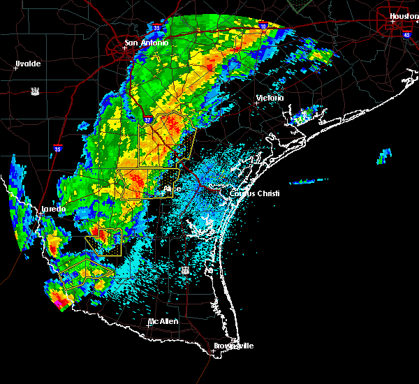 At 1202 am cdt, severe thunderstorms were located along a line extending from 7 miles east of kenedy to near annarose, moving east at 50 mph (radar indicated). Hazards include 70 mph wind gusts and penny size hail. Expect considerable tree damage. damage is likely to mobile homes, roofs, and outbuildings. Locations impacted include, beeville, george west, three rivers, choke canyon, skidmore, mineral, lagarto, river creek acres, tynan, tulsita, annarose, argenta, karon, mount lucas, normanna, oakville, pettus, pawnee, simmons and ray point. At 1202 am cdt, severe thunderstorms were located along a line extending from 7 miles east of kenedy to near annarose, moving east at 50 mph (radar indicated). Hazards include 70 mph wind gusts and penny size hail. Expect considerable tree damage. damage is likely to mobile homes, roofs, and outbuildings. Locations impacted include, beeville, george west, three rivers, choke canyon, skidmore, mineral, lagarto, river creek acres, tynan, tulsita, annarose, argenta, karon, mount lucas, normanna, oakville, pettus, pawnee, simmons and ray point.
|
| 3/28/2018 11:45 PM CDT |
 At 1122 pm cdt, severe thunderstorms were located along a line extending from near campbellton to near loma alta, moving east at 50 mph. in addition to this severe thunderstorm warning, a tornado warning is also currently in effect for souther mcmullen county (radar indicated). Hazards include ping pong ball size hail and 60 mph wind gusts. People and animals outdoors will be injured. expect hail damage to roofs, siding, windows, and vehicles. Expect wind damage to roofs, siding, and trees. At 1122 pm cdt, severe thunderstorms were located along a line extending from near campbellton to near loma alta, moving east at 50 mph. in addition to this severe thunderstorm warning, a tornado warning is also currently in effect for souther mcmullen county (radar indicated). Hazards include ping pong ball size hail and 60 mph wind gusts. People and animals outdoors will be injured. expect hail damage to roofs, siding, windows, and vehicles. Expect wind damage to roofs, siding, and trees.
|
| 3/28/2018 11:24 PM CDT |
 At 1122 pm cdt, severe thunderstorms were located along a line extending from near campbellton to near loma alta, moving east at 50 mph. in addition to this severe thunderstorm warning, a tornado warning is also currently in effect for souther mcmullen county (radar indicated). Hazards include ping pong ball size hail and 60 mph wind gusts. People and animals outdoors will be injured. expect hail damage to roofs, siding, windows, and vehicles. Expect wind damage to roofs, siding, and trees. At 1122 pm cdt, severe thunderstorms were located along a line extending from near campbellton to near loma alta, moving east at 50 mph. in addition to this severe thunderstorm warning, a tornado warning is also currently in effect for souther mcmullen county (radar indicated). Hazards include ping pong ball size hail and 60 mph wind gusts. People and animals outdoors will be injured. expect hail damage to roofs, siding, windows, and vehicles. Expect wind damage to roofs, siding, and trees.
|
| 6/4/2017 7:13 PM CDT |
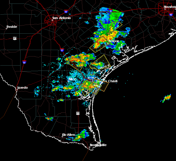 At 712 pm cdt, a severe thunderstorm was located near river creek acres, or 10 miles east of george west, moving southeast at 20 mph (radar indicated). Hazards include 60 mph wind gusts and quarter size hail. Hail damage to vehicles is expected. Expect wind damage to roofs, siding, and trees. At 712 pm cdt, a severe thunderstorm was located near river creek acres, or 10 miles east of george west, moving southeast at 20 mph (radar indicated). Hazards include 60 mph wind gusts and quarter size hail. Hail damage to vehicles is expected. Expect wind damage to roofs, siding, and trees.
|
| 5/23/2017 7:48 PM CDT |
 At 747 pm cdt, a severe thunderstorm was located near st. paul, or near sinton, moving southeast at 55 mph. this is a very dangerous storm (radar indicated). Hazards include 80 mph wind gusts and golf ball size hail. Flying debris will be dangerous to those caught without shelter. mobile homes will be heavily damaged. expect considerable damage to roofs, windows, and vehicles. Extensive tree damage and power outages are likely. At 747 pm cdt, a severe thunderstorm was located near st. paul, or near sinton, moving southeast at 55 mph. this is a very dangerous storm (radar indicated). Hazards include 80 mph wind gusts and golf ball size hail. Flying debris will be dangerous to those caught without shelter. mobile homes will be heavily damaged. expect considerable damage to roofs, windows, and vehicles. Extensive tree damage and power outages are likely.
|
| 5/23/2017 7:43 PM CDT |
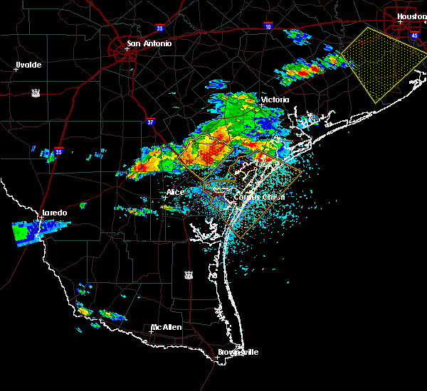 At 742 pm cdt, a severe thunderstorm was located near st. paul, moving southeast at 55 mph. this is a very dangerous storm (law enforcement). Hazards include 80 mph wind gusts and golf ball size hail. Flying debris will be dangerous to those caught without shelter. mobile homes will be heavily damaged. expect considerable damage to roofs, windows, and vehicles. extensive tree damage and power outages are likely. locations impacted include, beeville, mathis, skidmore, st. Paul, west sinton, argenta, papalote, tynan, blanconia and edroy. At 742 pm cdt, a severe thunderstorm was located near st. paul, moving southeast at 55 mph. this is a very dangerous storm (law enforcement). Hazards include 80 mph wind gusts and golf ball size hail. Flying debris will be dangerous to those caught without shelter. mobile homes will be heavily damaged. expect considerable damage to roofs, windows, and vehicles. extensive tree damage and power outages are likely. locations impacted include, beeville, mathis, skidmore, st. Paul, west sinton, argenta, papalote, tynan, blanconia and edroy.
|
| 5/23/2017 7:33 PM CDT | Video submitted of intense winds blowing over large trees near corrigan rd in skimore in bee county TX, 1.8 miles NNE of Skidmore, TX |
| 5/23/2017 7:28 PM CDT |
 At 727 pm cdt, a severe thunderstorm was located near skidmore, moving southeast at 60 mph. this is a very dangerous storm (radar indicated. at 721 pm cdt the beeville airport measured a wind gust of 81 mph). Hazards include 80 mph wind gusts and golf ball size hail. Flying debris will be dangerous to those caught without shelter. mobile homes will be heavily damaged. expect considerable damage to roofs, windows, and vehicles. extensive tree damage and power outages are likely. locations impacted include, beeville, mathis, skidmore, st. Paul, river creek acres, tynan, west sinton, argenta, papalote, dinero, blanconia, edroy and normanna. At 727 pm cdt, a severe thunderstorm was located near skidmore, moving southeast at 60 mph. this is a very dangerous storm (radar indicated. at 721 pm cdt the beeville airport measured a wind gust of 81 mph). Hazards include 80 mph wind gusts and golf ball size hail. Flying debris will be dangerous to those caught without shelter. mobile homes will be heavily damaged. expect considerable damage to roofs, windows, and vehicles. extensive tree damage and power outages are likely. locations impacted include, beeville, mathis, skidmore, st. Paul, river creek acres, tynan, west sinton, argenta, papalote, dinero, blanconia, edroy and normanna.
|
| 5/23/2017 7:14 PM CDT |
 At 714 pm cdt, a severe thunderstorm was located 8 miles west of beeville, moving southeast at 45 mph. this is a very dangerous storm (radar indicated). Hazards include 80 mph wind gusts and quarter size hail. Flying debris will be dangerous to those caught without shelter. mobile homes will be heavily damaged. expect considerable damage to roofs, windows, and vehicles. extensive tree damage and power outages are likely. locations impacted include, beeville, mathis, three rivers, skidmore, st. Paul, mineral, river creek acres, tynan, west sinton, tulsita, argenta, papalote, karon, normanna, oakville, pettus, ray point, dinero, tuleta and blanconia. At 714 pm cdt, a severe thunderstorm was located 8 miles west of beeville, moving southeast at 45 mph. this is a very dangerous storm (radar indicated). Hazards include 80 mph wind gusts and quarter size hail. Flying debris will be dangerous to those caught without shelter. mobile homes will be heavily damaged. expect considerable damage to roofs, windows, and vehicles. extensive tree damage and power outages are likely. locations impacted include, beeville, mathis, three rivers, skidmore, st. Paul, mineral, river creek acres, tynan, west sinton, tulsita, argenta, papalote, karon, normanna, oakville, pettus, ray point, dinero, tuleta and blanconia.
|
| 2/14/2017 6:37 AM CST |
 At 636 am cst, a severe thunderstorm capable of producing a tornado was located near papalote, or near skidmore, moving east at 50 mph (radar indicated rotation). Hazards include tornado. Flying debris will be dangerous to those caught without shelter. mobile homes will be damaged or destroyed. damage to roofs, windows, and vehicles will occur. tree damage is likely. this dangerous storm will be near, blanconia around 650 am cst. Woodsboro around 655 am cst. At 636 am cst, a severe thunderstorm capable of producing a tornado was located near papalote, or near skidmore, moving east at 50 mph (radar indicated rotation). Hazards include tornado. Flying debris will be dangerous to those caught without shelter. mobile homes will be damaged or destroyed. damage to roofs, windows, and vehicles will occur. tree damage is likely. this dangerous storm will be near, blanconia around 650 am cst. Woodsboro around 655 am cst.
|
| 2/14/2017 6:24 AM CST |
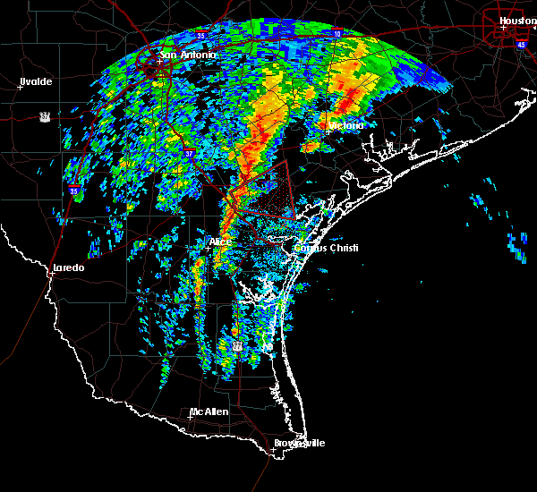 At 623 am cst, a thunderstorm capable of producing a tornado was located near tynan, or near skidmore, moving east at 50 mph (radar indicated rotation). Hazards include tornado. Flying debris will be dangerous to those caught without shelter. mobile homes will be damaged or destroyed. damage to roofs, windows, and vehicles will occur. tree damage is likely. this dangerous storm will be near, skidmore around 630 am cst. papalote around 635 am cst. blanconia around 650 am cst. Woodsboro around 655 am cst. At 623 am cst, a thunderstorm capable of producing a tornado was located near tynan, or near skidmore, moving east at 50 mph (radar indicated rotation). Hazards include tornado. Flying debris will be dangerous to those caught without shelter. mobile homes will be damaged or destroyed. damage to roofs, windows, and vehicles will occur. tree damage is likely. this dangerous storm will be near, skidmore around 630 am cst. papalote around 635 am cst. blanconia around 650 am cst. Woodsboro around 655 am cst.
|
| 5/31/2016 6:36 PM CDT |
 The severe thunderstorm warning for central live oak and bee counties will expire at 645 pm cdt, the storms which prompted the warning have weakened below severe limits, and no longer pose an immediate threat to life or property. therefore the warning will be allowed to expire. however small hail and gusty winds are still possible with these thunderstorms. The severe thunderstorm warning for central live oak and bee counties will expire at 645 pm cdt, the storms which prompted the warning have weakened below severe limits, and no longer pose an immediate threat to life or property. therefore the warning will be allowed to expire. however small hail and gusty winds are still possible with these thunderstorms.
|
| 5/31/2016 6:07 PM CDT |
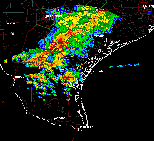 At 606 pm cdt, severe thunderstorms were located along a line extending from near pawnee to near mineral to oakville, moving southeast at 35 mph (radar indicated). Hazards include 60 mph wind gusts and quarter size hail. Hail damage to vehicles is expected. Expect wind damage to roofs, siding, and trees. At 606 pm cdt, severe thunderstorms were located along a line extending from near pawnee to near mineral to oakville, moving southeast at 35 mph (radar indicated). Hazards include 60 mph wind gusts and quarter size hail. Hail damage to vehicles is expected. Expect wind damage to roofs, siding, and trees.
|
| 2/23/2016 7:15 AM CST |
 At 713 am cst, a thunderstorm capable of producing a tornado was located near papalote, or near skidmore, moving southeast at 30 mph. this storm has lost its best circulation since 7 am, but could regain the circulation as it moves southeast. we will continue with the warning for now (radar indicated rotation). Hazards include possible tornado. Flying debris will be dangerous to those caught without shelter. mobile homes will be damaged or destroyed. damage to roofs, windows, and vehicles will occur. tree damage is likely. this dangerous storm will be near, st. Paul around 730 am cst. At 713 am cst, a thunderstorm capable of producing a tornado was located near papalote, or near skidmore, moving southeast at 30 mph. this storm has lost its best circulation since 7 am, but could regain the circulation as it moves southeast. we will continue with the warning for now (radar indicated rotation). Hazards include possible tornado. Flying debris will be dangerous to those caught without shelter. mobile homes will be damaged or destroyed. damage to roofs, windows, and vehicles will occur. tree damage is likely. this dangerous storm will be near, st. Paul around 730 am cst.
|
| 2/23/2016 6:58 AM CST |
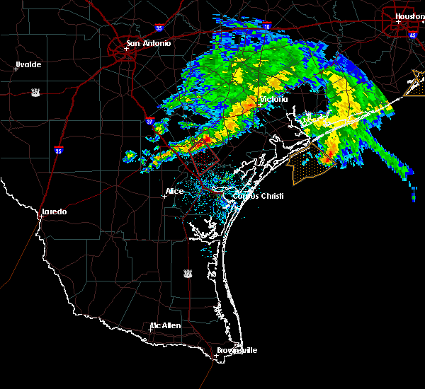 At 657 am cst, a thunderstorm capable of producing a tornado was located about 5 miles northwest of skidmore, moving southeast at 40 mph (radar indicated rotation). Hazards include tornado. Flying debris will be dangerous to those caught without shelter. mobile homes will be damaged or destroyed. damage to roofs, windows, and vehicles will occur. tree damage is likely. this dangerous storm will be near, st. Paul around 710 am cst. At 657 am cst, a thunderstorm capable of producing a tornado was located about 5 miles northwest of skidmore, moving southeast at 40 mph (radar indicated rotation). Hazards include tornado. Flying debris will be dangerous to those caught without shelter. mobile homes will be damaged or destroyed. damage to roofs, windows, and vehicles will occur. tree damage is likely. this dangerous storm will be near, st. Paul around 710 am cst.
|
| 10/24/2015 12:48 PM CDT |
 At 1247 pm cdt, severe thunderstorms were located along a line extending from near skidmore to near alfred, moving east at 25 mph (radar indicated). Hazards include 60 mph wind gusts. Expect damage to roofs. Siding and trees. At 1247 pm cdt, severe thunderstorms were located along a line extending from near skidmore to near alfred, moving east at 25 mph (radar indicated). Hazards include 60 mph wind gusts. Expect damage to roofs. Siding and trees.
|
| 5/11/2015 11:57 PM CDT | At 1156 pm cdt, doppler radar indicated a severe thunderstorm capable of producing quarter size hail and damaging winds in excess of 60 mph. this storm was located just west of tynan, or 6 miles southwest of skidmore, moving northeast at 15 mph. locations impacted include, beeville, mathis, skidmore, argenta, tynan and papalote. |
| 5/11/2015 11:38 PM CDT | At 1138 pm cdt, doppler radar indicated a severe thunderstorm capable of producing quarter size hail and damaging winds in excess of 60 mph. this storm was located over argenta, or near mathis, and moving east at 25 mph. |
| 4/17/2015 7:23 PM CDT | A tornado warning remains in effect until 745 pm cdt for south central goliad. west central refugio and southeastern bee counties. at 722 pm cdt. doppler radar indicated a severe thunderstorm capable of producing a tornado. this dangerous storm was located 7 miles west of blanconia. or 12 miles northeast of skidmore. Moving east at 25. |
| 4/17/2015 7:09 PM CDT | The national weather service in corpus christi has issued a * tornado warning for. south central goliad county in south central texas. west central refugio county in south central texas. southeastern bee county in south central texas. Until 745 pm cdt. |
| 4/14/2015 5:53 AM CDT | Powerlines down between skidmore and tynan in bee county TX, 4.4 miles NNE of Skidmore, TX |
| 4/14/2015 5:22 AM CDT | The national weather service in corpus christi has issued a * severe thunderstorm warning for. northwestern san patricio county in south central texas. south central bee county in south central texas. southeastern live oak county in south central texas. Until 600 am cdt. |
| 4/13/2015 7:27 PM CDT | A severe thunderstorm warning remains in effect until 745 pm cdt for south central bee and southeastern live oak counties. at 726 pm cdt. trained weather spotters reported a severe thunderstorm producing quarter size hail and damaging winds in excess of 60 mph. this storm was located near dinero. or 12 miles northwest of mathis. This storm was nearly stationary. |
| 4/13/2015 7:14 PM CDT | The national weather service in corpus christi has issued a * severe thunderstorm warning for. south central bee county in south central texas. southeastern live oak county in south central texas. until 745 pm cdt * at 713 pm cdt. Doppler radar indicated a severe thunderstorm. |
| 4/12/2015 11:51 PM CDT | The national weather service in corpus christi has issued a * severe thunderstorm warning for. central nueces county in south central texas. san patricio county in south central texas. southwestern aransas county in south central texas. Northeastern jim wells county in south central texas. |
| 2/6/2013 8:27 AM CST | Nws storm survey concluded that a microburst with winds up to 70 mph impacted a narrow corridor through the central portion of the city of skidmore. the axis of wind da in bee county TX, 2.9 miles N of Skidmore, TX |
| 2/6/2013 8:27 AM CST | Large pine tree blown down in bee county TX, 2.9 miles N of Skidmore, TX |
| 2/6/2013 8:27 AM CST | Portion of roof damaged on home near intersection of seventh street and mathis street. fence also blown down at skidmore/tynan high school baseball fiel in bee county TX, 2.9 miles N of Skidmore, TX |
Hail Maps for Skidmore, TX


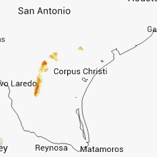
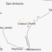


Connect with Interactive Hail Maps