

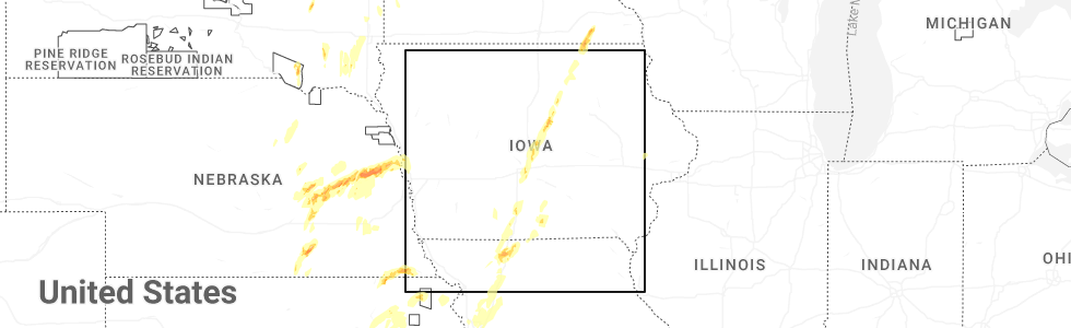
Hail Map for South Lineville, MO
The South Lineville, MO area has had 0 reports of on-the-ground hail by trained spotters, and has been under severe weather warnings 7 times during the past 12 months. Doppler radar has detected hail at or near South Lineville, MO on 55 occasions, including 1 occasion during the past year.
| Name: | South Lineville, MO |
| Where Located: | 69.9 miles S of Des Moines, IA |
| Map: | Google Map for South Lineville, MO |
| Population: | 28 |
| Housing Units: | 16 |
| More Info: | Search Google for South Lineville, MO |
2
The Top Recent Hail Date for South Lineville, MO is Monday, May 19, 2025 (21st out of 55)
Hail and Wind Damage Spotted near South Lineville, MO
| Date / Time | Report Details |
|---|---|
| 3/14/2025 5:01 PM CDT |
 Svrdmx the national weather service in des moines has issued a * severe thunderstorm warning for, lucas county in south central iowa, decatur county in south central iowa, madison county in south central iowa, southern marion county in south central iowa, union county in south central iowa, western wayne county in south central iowa, northeastern ringgold county in south central iowa, clarke county in south central iowa, warren county in south central iowa, * until 545 pm cdt. * at 500 pm cdt, severe thunderstorms were located along a line extending from 4 miles southwest of macksburg to 4 miles west of woodburn to near lineville, moving north at 65 mph (radar indicated). Hazards include 70 mph wind gusts and nickel size hail. Expect considerable tree damage. Damage is likely to mobile homes, roofs, and outbuildings. Svrdmx the national weather service in des moines has issued a * severe thunderstorm warning for, lucas county in south central iowa, decatur county in south central iowa, madison county in south central iowa, southern marion county in south central iowa, union county in south central iowa, western wayne county in south central iowa, northeastern ringgold county in south central iowa, clarke county in south central iowa, warren county in south central iowa, * until 545 pm cdt. * at 500 pm cdt, severe thunderstorms were located along a line extending from 4 miles southwest of macksburg to 4 miles west of woodburn to near lineville, moving north at 65 mph (radar indicated). Hazards include 70 mph wind gusts and nickel size hail. Expect considerable tree damage. Damage is likely to mobile homes, roofs, and outbuildings.
|
| 7/31/2024 9:07 PM CDT |
 The storm which prompted the warning has weakened below severe limits, and no longer poses an immediate threat to life or property. therefore, the warning will be allowed to expire. a severe thunderstorm watch remains in effect until 100 am cdt for north central missouri. The storm which prompted the warning has weakened below severe limits, and no longer poses an immediate threat to life or property. therefore, the warning will be allowed to expire. a severe thunderstorm watch remains in effect until 100 am cdt for north central missouri.
|
| 7/31/2024 8:59 PM CDT |
 The storms which prompted the warning have weakened below severe limits, and no longer pose an immediate threat to life or property. therefore, the warning will be allowed to expire. a severe thunderstorm watch remains in effect until 100 am cdt for south central and southeastern iowa. The storms which prompted the warning have weakened below severe limits, and no longer pose an immediate threat to life or property. therefore, the warning will be allowed to expire. a severe thunderstorm watch remains in effect until 100 am cdt for south central and southeastern iowa.
|
| 7/31/2024 8:47 PM CDT |
 At 845 pm cdt, severe thunderstorms were located along a line extending from 4 miles east of melcher-dallas to 6 miles east of millerton to near south lineville, moving east at 50 mph (radar indicated). Hazards include 60 mph wind gusts. Expect damage to roofs, siding, and trees. locations impacted include, oskaloosa, centerville, osceola, chariton, albia, leon, corydon, lamoni, melcher-dallas, eddyville, lake sundown, rathbun lake, seymour, moravia, moulton, russell, lovilia, allerton, humeston, and beacon. This includes interstate 35 between mile markers 1 and 30. At 845 pm cdt, severe thunderstorms were located along a line extending from 4 miles east of melcher-dallas to 6 miles east of millerton to near south lineville, moving east at 50 mph (radar indicated). Hazards include 60 mph wind gusts. Expect damage to roofs, siding, and trees. locations impacted include, oskaloosa, centerville, osceola, chariton, albia, leon, corydon, lamoni, melcher-dallas, eddyville, lake sundown, rathbun lake, seymour, moravia, moulton, russell, lovilia, allerton, humeston, and beacon. This includes interstate 35 between mile markers 1 and 30.
|
| 7/31/2024 8:47 PM CDT |
 the severe thunderstorm warning has been cancelled and is no longer in effect the severe thunderstorm warning has been cancelled and is no longer in effect
|
| 7/31/2024 8:30 PM CDT |
 Svreax the national weather service in pleasant hill has issued a * severe thunderstorm warning for, northwestern sullivan county in north central missouri, mercer county in north central missouri, western putnam county in north central missouri, northern harrison county in north central missouri, * until 915 pm cdt. * at 830 pm cdt, a severe thunderstorm was located near cainsville, or 16 miles south of leon, moving east at 45 mph (radar indicated). Hazards include 60 mph wind gusts and penny size hail. expect damage to roofs, siding, and trees Svreax the national weather service in pleasant hill has issued a * severe thunderstorm warning for, northwestern sullivan county in north central missouri, mercer county in north central missouri, western putnam county in north central missouri, northern harrison county in north central missouri, * until 915 pm cdt. * at 830 pm cdt, a severe thunderstorm was located near cainsville, or 16 miles south of leon, moving east at 45 mph (radar indicated). Hazards include 60 mph wind gusts and penny size hail. expect damage to roofs, siding, and trees
|
| 7/31/2024 8:21 PM CDT |
 Svrdmx the national weather service in des moines has issued a * severe thunderstorm warning for, monroe county in south central iowa, lucas county in south central iowa, decatur county in south central iowa, southeastern madison county in south central iowa, southern marion county in south central iowa, wayne county in south central iowa, southwestern mahaska county in south central iowa, southeastern ringgold county in south central iowa, appanoose county in south central iowa, clarke county in south central iowa, southern warren county in south central iowa, * until 900 pm cdt. * at 821 pm cdt, severe thunderstorms were located along a line extending from near otter creek county park to humeston to near nine eagles state park, moving east at 70 mph (radar indicated). Hazards include 60 mph wind gusts. lamoni airport gusted to 59 mph. expect damage to roofs, siding, and trees Svrdmx the national weather service in des moines has issued a * severe thunderstorm warning for, monroe county in south central iowa, lucas county in south central iowa, decatur county in south central iowa, southeastern madison county in south central iowa, southern marion county in south central iowa, wayne county in south central iowa, southwestern mahaska county in south central iowa, southeastern ringgold county in south central iowa, appanoose county in south central iowa, clarke county in south central iowa, southern warren county in south central iowa, * until 900 pm cdt. * at 821 pm cdt, severe thunderstorms were located along a line extending from near otter creek county park to humeston to near nine eagles state park, moving east at 70 mph (radar indicated). Hazards include 60 mph wind gusts. lamoni airport gusted to 59 mph. expect damage to roofs, siding, and trees
|
| 7/2/2024 5:22 PM CDT |
 Svreax the national weather service in pleasant hill has issued a * severe thunderstorm warning for, northwestern sullivan county in north central missouri, mercer county in north central missouri, western putnam county in north central missouri, east central harrison county in north central missouri, * until 615 pm cdt. * at 520 pm cdt, a severe thunderstorm was located near cainsville, or 15 miles northeast of bethany, moving northeast at 30 mph. additional severe thunderstorms were located near princeton in northeast mercer county and powersville in northwest putnam county (radar indicated). Hazards include 60 mph wind gusts and half dollar size hail. Hail damage to vehicles is expected. Expect wind damage to roofs, siding, and trees. Svreax the national weather service in pleasant hill has issued a * severe thunderstorm warning for, northwestern sullivan county in north central missouri, mercer county in north central missouri, western putnam county in north central missouri, east central harrison county in north central missouri, * until 615 pm cdt. * at 520 pm cdt, a severe thunderstorm was located near cainsville, or 15 miles northeast of bethany, moving northeast at 30 mph. additional severe thunderstorms were located near princeton in northeast mercer county and powersville in northwest putnam county (radar indicated). Hazards include 60 mph wind gusts and half dollar size hail. Hail damage to vehicles is expected. Expect wind damage to roofs, siding, and trees.
|
| 7/2/2024 5:15 PM CDT |
 At 514 pm cdt, a severe thunderstorm was located over cainsville, or 16 miles northeast of bethany, moving northeast at 30 mph. additional severe storms were located east of the cities of princeton and mercer, moving northeast at 30 mph (radar indicated). Hazards include 60 mph wind gusts and quarter size hail. Hail damage to vehicles is expected. expect wind damage to roofs, siding, and trees. Locations impacted include, princeton, ridgeway, mercer, cainsville, mount moriah, pleasanton, south lineville, modena, and mill grove. At 514 pm cdt, a severe thunderstorm was located over cainsville, or 16 miles northeast of bethany, moving northeast at 30 mph. additional severe storms were located east of the cities of princeton and mercer, moving northeast at 30 mph (radar indicated). Hazards include 60 mph wind gusts and quarter size hail. Hail damage to vehicles is expected. expect wind damage to roofs, siding, and trees. Locations impacted include, princeton, ridgeway, mercer, cainsville, mount moriah, pleasanton, south lineville, modena, and mill grove.
|
| 7/2/2024 5:03 PM CDT |
 At 502 pm cdt, a severe thunderstorm was located near ridgeway, or 10 miles northeast of bethany, moving northeast at 30 mph. additional severe thunderstorms are located near the cities of princeton and mercer moving northeast at 30 mph (radar indicated). Hazards include 60 mph wind gusts and quarter size hail. Hail damage to vehicles is expected. expect wind damage to roofs, siding, and trees. locations impacted include, bethany, princeton, ridgeway, mercer, eagleville, cainsville, blythedale, mount moriah, pleasanton, south lineville, modena, and mill grove. This includes interstate 35 in missouri between mile markers 89 and 114. At 502 pm cdt, a severe thunderstorm was located near ridgeway, or 10 miles northeast of bethany, moving northeast at 30 mph. additional severe thunderstorms are located near the cities of princeton and mercer moving northeast at 30 mph (radar indicated). Hazards include 60 mph wind gusts and quarter size hail. Hail damage to vehicles is expected. expect wind damage to roofs, siding, and trees. locations impacted include, bethany, princeton, ridgeway, mercer, eagleville, cainsville, blythedale, mount moriah, pleasanton, south lineville, modena, and mill grove. This includes interstate 35 in missouri between mile markers 89 and 114.
|
| 7/2/2024 4:42 PM CDT |
 At 440 pm cdt, a severe thunderstorm was located over bethany, moving northeast at 30 mph. additional severe thunderstorms were located near the city of mercer headed northeast at 30 mph (radar indicated). Hazards include 60 mph wind gusts and quarter size hail. Hail damage to vehicles is expected. expect wind damage to roofs, siding, and trees. locations impacted include, bethany, princeton, ridgeway, mercer, eagleville, new hampton, cainsville, blythedale, mount moriah, pleasanton, south lineville, modena, mill grove, and martinsville. This includes interstate 35 in missouri between mile markers 83 and 114. At 440 pm cdt, a severe thunderstorm was located over bethany, moving northeast at 30 mph. additional severe thunderstorms were located near the city of mercer headed northeast at 30 mph (radar indicated). Hazards include 60 mph wind gusts and quarter size hail. Hail damage to vehicles is expected. expect wind damage to roofs, siding, and trees. locations impacted include, bethany, princeton, ridgeway, mercer, eagleville, new hampton, cainsville, blythedale, mount moriah, pleasanton, south lineville, modena, mill grove, and martinsville. This includes interstate 35 in missouri between mile markers 83 and 114.
|
| 7/2/2024 4:42 PM CDT |
 the severe thunderstorm warning has been cancelled and is no longer in effect the severe thunderstorm warning has been cancelled and is no longer in effect
|
| 7/2/2024 4:28 PM CDT |
 Svreax the national weather service in pleasant hill has issued a * severe thunderstorm warning for, northeastern gentry county in northwestern missouri, mercer county in north central missouri, harrison county in north central missouri, * until 530 pm cdt. * at 427 pm cdt, a severe thunderstorms was located near new hampton, or 8 miles southwest of bethany, moving northeast at 30 mph. other strong to severe thunderstorms were located in portion of mercer county moving northeast at 30 mph (radar indicated). Hazards include 60 mph wind gusts and quarter size hail. Hail damage to vehicles is expected. Expect wind damage to roofs, siding, and trees. Svreax the national weather service in pleasant hill has issued a * severe thunderstorm warning for, northeastern gentry county in northwestern missouri, mercer county in north central missouri, harrison county in north central missouri, * until 530 pm cdt. * at 427 pm cdt, a severe thunderstorms was located near new hampton, or 8 miles southwest of bethany, moving northeast at 30 mph. other strong to severe thunderstorms were located in portion of mercer county moving northeast at 30 mph (radar indicated). Hazards include 60 mph wind gusts and quarter size hail. Hail damage to vehicles is expected. Expect wind damage to roofs, siding, and trees.
|
| 6/22/2024 8:07 PM CDT |
 At 807 pm cdt, a severe thunderstorm was located 10 miles south of corydon, moving east at 30 mph (radar indicated). Hazards include 60 mph wind gusts and penny size hail. Expect damage to roofs, siding, and trees. Locations impacted include, unionville, lineville, powersville, and south lineville. At 807 pm cdt, a severe thunderstorm was located 10 miles south of corydon, moving east at 30 mph (radar indicated). Hazards include 60 mph wind gusts and penny size hail. Expect damage to roofs, siding, and trees. Locations impacted include, unionville, lineville, powersville, and south lineville.
|
| 6/22/2024 8:01 PM CDT |
 the severe thunderstorm warning has been cancelled and is no longer in effect the severe thunderstorm warning has been cancelled and is no longer in effect
|
| 6/22/2024 8:01 PM CDT |
 At 801 pm cdt, a severe thunderstorm was located near clio, or 9 miles south of corydon, moving east at 35 mph (radar indicated). Hazards include 60 mph wind gusts. Expect damage to roofs, siding, and trees. Locations impacted include, seymour, allerton, lineville, clio, and south lineville. At 801 pm cdt, a severe thunderstorm was located near clio, or 9 miles south of corydon, moving east at 35 mph (radar indicated). Hazards include 60 mph wind gusts. Expect damage to roofs, siding, and trees. Locations impacted include, seymour, allerton, lineville, clio, and south lineville.
|
| 6/22/2024 7:52 PM CDT |
 Svreax the national weather service in pleasant hill has issued a * severe thunderstorm warning for, northeastern mercer county in north central missouri, northwestern putnam county in north central missouri, * until 845 pm cdt. * at 752 pm cdt, a severe thunderstorm was located 7 miles north of mercer, or 12 miles southwest of corydon, moving east at 30 mph (radar indicated). Hazards include 60 mph wind gusts and penny size hail. expect damage to roofs, siding, and trees Svreax the national weather service in pleasant hill has issued a * severe thunderstorm warning for, northeastern mercer county in north central missouri, northwestern putnam county in north central missouri, * until 845 pm cdt. * at 752 pm cdt, a severe thunderstorm was located 7 miles north of mercer, or 12 miles southwest of corydon, moving east at 30 mph (radar indicated). Hazards include 60 mph wind gusts and penny size hail. expect damage to roofs, siding, and trees
|
| 6/22/2024 7:46 PM CDT |
 Svrdmx the national weather service in des moines has issued a * severe thunderstorm warning for, southeastern decatur county in south central iowa, southern wayne county in south central iowa, * until 830 pm cdt. * at 746 pm cdt, a severe thunderstorm was located near clio, or 12 miles southwest of corydon, moving east at 35 mph (radar indicated). Hazards include 60 mph wind gusts. expect damage to roofs, siding, and trees Svrdmx the national weather service in des moines has issued a * severe thunderstorm warning for, southeastern decatur county in south central iowa, southern wayne county in south central iowa, * until 830 pm cdt. * at 746 pm cdt, a severe thunderstorm was located near clio, or 12 miles southwest of corydon, moving east at 35 mph (radar indicated). Hazards include 60 mph wind gusts. expect damage to roofs, siding, and trees
|
| 5/26/2024 9:25 PM CDT |
 The storm which prompted the warning has moved out of the area. therefore, the warning will be allowed to expire. The storm which prompted the warning has moved out of the area. therefore, the warning will be allowed to expire.
|
| 5/26/2024 8:44 PM CDT |
 Svreax the national weather service in pleasant hill has issued a * severe thunderstorm warning for, northwestern mercer county in north central missouri, * until 930 pm cdt. * at 843 pm cdt, a severe thunderstorm was located 9 miles northwest of mercer, or 10 miles southeast of leon, moving southeast at 25 mph (radar indicated). Hazards include 60 mph wind gusts and quarter size hail. Hail damage to vehicles is expected. Expect wind damage to roofs, siding, and trees. Svreax the national weather service in pleasant hill has issued a * severe thunderstorm warning for, northwestern mercer county in north central missouri, * until 930 pm cdt. * at 843 pm cdt, a severe thunderstorm was located 9 miles northwest of mercer, or 10 miles southeast of leon, moving southeast at 25 mph (radar indicated). Hazards include 60 mph wind gusts and quarter size hail. Hail damage to vehicles is expected. Expect wind damage to roofs, siding, and trees.
|
| 5/24/2024 2:27 AM CDT |
 Svreax the national weather service in pleasant hill has issued a * severe thunderstorm warning for, northwestern sullivan county in north central missouri, eastern mercer county in north central missouri, western putnam county in north central missouri, * until 315 am cdt. * at 227 am cdt, a severe thunderstorm was located near spickard, or 14 miles north of trenton, moving northeast at 25 mph (radar indicated). Hazards include 60 mph wind gusts and quarter size hail. Hail damage to vehicles is expected. Expect wind damage to roofs, siding, and trees. Svreax the national weather service in pleasant hill has issued a * severe thunderstorm warning for, northwestern sullivan county in north central missouri, eastern mercer county in north central missouri, western putnam county in north central missouri, * until 315 am cdt. * at 227 am cdt, a severe thunderstorm was located near spickard, or 14 miles north of trenton, moving northeast at 25 mph (radar indicated). Hazards include 60 mph wind gusts and quarter size hail. Hail damage to vehicles is expected. Expect wind damage to roofs, siding, and trees.
|
| 5/21/2024 5:06 PM CDT |
 The storm which prompted the warning has moved out of the area. therefore, the warning will be allowed to expire. a tornado watch remains in effect until 1000 pm cdt for north central missouri. The storm which prompted the warning has moved out of the area. therefore, the warning will be allowed to expire. a tornado watch remains in effect until 1000 pm cdt for north central missouri.
|
| 5/21/2024 4:53 PM CDT |
 Tordmx the national weather service in des moines has issued a * tornado warning for, southeastern lucas county in south central iowa, southwestern monroe county in south central iowa, wayne county in south central iowa, northwestern appanoose county in south central iowa, * until 545 pm cdt. * at 453 pm cdt, a severe thunderstorm capable of producing a tornado was located over south lineville, or 16 miles southwest of corydon, moving northeast at 55 mph (radar indicated rotation). Hazards include tornado and quarter size hail. Flying debris will be dangerous to those caught without shelter. mobile homes will be damaged or destroyed. damage to roofs, windows, and vehicles will occur. tree damage is likely. this dangerous storm will be near, allerton and clio around 500 pm cdt. corydon around 505 pm cdt. millerton around 515 pm cdt. rathbun lake around 520 pm cdt. melrose around 530 pm cdt. Other locations impacted by this tornadic thunderstorm include russell, melrose, red haw lake state park, honey creek state park, millerton, allerton, promise city, lineville, clio, and plano. Tordmx the national weather service in des moines has issued a * tornado warning for, southeastern lucas county in south central iowa, southwestern monroe county in south central iowa, wayne county in south central iowa, northwestern appanoose county in south central iowa, * until 545 pm cdt. * at 453 pm cdt, a severe thunderstorm capable of producing a tornado was located over south lineville, or 16 miles southwest of corydon, moving northeast at 55 mph (radar indicated rotation). Hazards include tornado and quarter size hail. Flying debris will be dangerous to those caught without shelter. mobile homes will be damaged or destroyed. damage to roofs, windows, and vehicles will occur. tree damage is likely. this dangerous storm will be near, allerton and clio around 500 pm cdt. corydon around 505 pm cdt. millerton around 515 pm cdt. rathbun lake around 520 pm cdt. melrose around 530 pm cdt. Other locations impacted by this tornadic thunderstorm include russell, melrose, red haw lake state park, honey creek state park, millerton, allerton, promise city, lineville, clio, and plano.
|
| 5/21/2024 4:51 PM CDT |
 Toreax the national weather service in pleasant hill has issued a * tornado warning for, northern mercer county in north central missouri, * until 515 pm cdt. * at 450 pm cdt, a severe thunderstorm capable of producing a tornado was located near mercer, or 17 miles southeast of leon, moving north at 50 mph (radar indicated rotation). Hazards include tornado. Flying debris will be dangerous to those caught without shelter. mobile homes will be damaged or destroyed. damage to roofs, windows, and vehicles will occur. Tree damage is likely. Toreax the national weather service in pleasant hill has issued a * tornado warning for, northern mercer county in north central missouri, * until 515 pm cdt. * at 450 pm cdt, a severe thunderstorm capable of producing a tornado was located near mercer, or 17 miles southeast of leon, moving north at 50 mph (radar indicated rotation). Hazards include tornado. Flying debris will be dangerous to those caught without shelter. mobile homes will be damaged or destroyed. damage to roofs, windows, and vehicles will occur. Tree damage is likely.
|
| 5/21/2024 4:46 PM CDT |
 Svreax the national weather service in pleasant hill has issued a * severe thunderstorm warning for, northern mercer county in north central missouri, * until 515 pm cdt. * at 446 pm cdt, a severe thunderstorm was located near princeton, or 21 miles south of leon, moving northeast at 65 mph (radar indicated). Hazards include 60 mph wind gusts and quarter size hail. Hail damage to vehicles is expected. Expect wind damage to roofs, siding, and trees. Svreax the national weather service in pleasant hill has issued a * severe thunderstorm warning for, northern mercer county in north central missouri, * until 515 pm cdt. * at 446 pm cdt, a severe thunderstorm was located near princeton, or 21 miles south of leon, moving northeast at 65 mph (radar indicated). Hazards include 60 mph wind gusts and quarter size hail. Hail damage to vehicles is expected. Expect wind damage to roofs, siding, and trees.
|
| 5/21/2024 4:09 PM CDT |
 Svreax the national weather service in pleasant hill has issued a * severe thunderstorm warning for, northwestern mercer county in north central missouri, southeastern harrison county in north central missouri, * until 445 pm cdt. * at 408 pm cdt, a severe thunderstorm was located near pattonsburg, or 11 miles south of bethany, moving northeast at 85 mph (radar indicated). Hazards include 60 mph wind gusts and quarter size hail. Hail damage to vehicles is expected. Expect wind damage to roofs, siding, and trees. Svreax the national weather service in pleasant hill has issued a * severe thunderstorm warning for, northwestern mercer county in north central missouri, southeastern harrison county in north central missouri, * until 445 pm cdt. * at 408 pm cdt, a severe thunderstorm was located near pattonsburg, or 11 miles south of bethany, moving northeast at 85 mph (radar indicated). Hazards include 60 mph wind gusts and quarter size hail. Hail damage to vehicles is expected. Expect wind damage to roofs, siding, and trees.
|
| 5/7/2024 1:02 AM CDT |
 the severe thunderstorm warning has been cancelled and is no longer in effect the severe thunderstorm warning has been cancelled and is no longer in effect
|
| 5/7/2024 1:02 AM CDT |
 At 101 am cdt, severe thunderstorms were located along a line extending from near lake ahquabi state park to near corydon, moving northeast at 50 mph (radar indicated). Hazards include 60 mph wind gusts and penny size hail. Expect damage to roofs, siding, and trees. Locations impacted include, chariton, corydon, allerton, humeston, new virginia, lineville, lucas, garden grove, woodburn, williamson, derby, clio, millerton, south lineville, le roy, red haw lake state park, and chariton municipal airport. At 101 am cdt, severe thunderstorms were located along a line extending from near lake ahquabi state park to near corydon, moving northeast at 50 mph (radar indicated). Hazards include 60 mph wind gusts and penny size hail. Expect damage to roofs, siding, and trees. Locations impacted include, chariton, corydon, allerton, humeston, new virginia, lineville, lucas, garden grove, woodburn, williamson, derby, clio, millerton, south lineville, le roy, red haw lake state park, and chariton municipal airport.
|
| 5/7/2024 12:51 AM CDT |
 At 1250 am cdt, severe thunderstorms were located along a line extending from 6 miles north of mercer to near wheeling, moving northeast at 45 mph (emergency management. a 57 mph wind gust was reported in trenton. numerous power outages have been reported in harrison county). Hazards include 60 mph wind gusts. Expect damage to roofs, siding, and trees. Locations impacted include, chillicothe, trenton, brookfield, marceline, milan, unionville, princeton, meadville, laclede, mercer, cainsville, linneus, wheeling, utica, browning, spickard, galt, chula, laredo, and purdin. At 1250 am cdt, severe thunderstorms were located along a line extending from 6 miles north of mercer to near wheeling, moving northeast at 45 mph (emergency management. a 57 mph wind gust was reported in trenton. numerous power outages have been reported in harrison county). Hazards include 60 mph wind gusts. Expect damage to roofs, siding, and trees. Locations impacted include, chillicothe, trenton, brookfield, marceline, milan, unionville, princeton, meadville, laclede, mercer, cainsville, linneus, wheeling, utica, browning, spickard, galt, chula, laredo, and purdin.
|
| 5/7/2024 12:51 AM CDT |
 the severe thunderstorm warning has been cancelled and is no longer in effect the severe thunderstorm warning has been cancelled and is no longer in effect
|
| 5/7/2024 12:33 AM CDT |
 Svrdmx the national weather service in des moines has issued a * severe thunderstorm warning for, lucas county in south central iowa, decatur county in south central iowa, southeastern madison county in south central iowa, wayne county in south central iowa, clarke county in south central iowa, southwestern warren county in south central iowa, * until 115 am cdt. * at 1232 am cdt, severe thunderstorms were located along a line extending from 5 miles south of murray roadside rest area to nine eagles state park, moving north at 65 mph (radar indicated). Hazards include 60 mph wind gusts and penny size hail. expect damage to roofs, siding, and trees Svrdmx the national weather service in des moines has issued a * severe thunderstorm warning for, lucas county in south central iowa, decatur county in south central iowa, southeastern madison county in south central iowa, wayne county in south central iowa, clarke county in south central iowa, southwestern warren county in south central iowa, * until 115 am cdt. * at 1232 am cdt, severe thunderstorms were located along a line extending from 5 miles south of murray roadside rest area to nine eagles state park, moving north at 65 mph (radar indicated). Hazards include 60 mph wind gusts and penny size hail. expect damage to roofs, siding, and trees
|
| 5/7/2024 12:21 AM CDT |
 Svreax the national weather service in pleasant hill has issued a * severe thunderstorm warning for, northwestern chariton county in north central missouri, eastern daviess county in north central missouri, linn county in north central missouri, grundy county in north central missouri, sullivan county in north central missouri, mercer county in north central missouri, western putnam county in north central missouri, harrison county in north central missouri, northeastern caldwell county in north central missouri, livingston county in north central missouri, * until 115 am cdt. * at 1220 am cdt, severe thunderstorms were located along a line extending from near eagleville to near braymer, moving northeast at 45 mph (radar indicated). Hazards include 60 mph wind gusts. expect damage to roofs, siding, and trees Svreax the national weather service in pleasant hill has issued a * severe thunderstorm warning for, northwestern chariton county in north central missouri, eastern daviess county in north central missouri, linn county in north central missouri, grundy county in north central missouri, sullivan county in north central missouri, mercer county in north central missouri, western putnam county in north central missouri, harrison county in north central missouri, northeastern caldwell county in north central missouri, livingston county in north central missouri, * until 115 am cdt. * at 1220 am cdt, severe thunderstorms were located along a line extending from near eagleville to near braymer, moving northeast at 45 mph (radar indicated). Hazards include 60 mph wind gusts. expect damage to roofs, siding, and trees
|
| 4/16/2024 12:23 PM CDT |
 The storm which prompted the warning has moved out of the area. therefore, the warning will be allowed to expire. a tornado watch remains in effect until 600 pm cdt for north central missouri. The storm which prompted the warning has moved out of the area. therefore, the warning will be allowed to expire. a tornado watch remains in effect until 600 pm cdt for north central missouri.
|
| 4/16/2024 12:18 PM CDT |
 Svrdmx the national weather service in des moines has issued a * severe thunderstorm warning for, southwestern lucas county in south central iowa, wayne county in south central iowa, * until 115 pm cdt. * at 1218 pm cdt, a severe thunderstorm was located over clio, or 10 miles southwest of corydon, moving north at 50 mph (radar indicated). Hazards include 60 mph wind gusts and quarter size hail. Hail damage to vehicles is expected. Expect wind damage to roofs, siding, and trees. Svrdmx the national weather service in des moines has issued a * severe thunderstorm warning for, southwestern lucas county in south central iowa, wayne county in south central iowa, * until 115 pm cdt. * at 1218 pm cdt, a severe thunderstorm was located over clio, or 10 miles southwest of corydon, moving north at 50 mph (radar indicated). Hazards include 60 mph wind gusts and quarter size hail. Hail damage to vehicles is expected. Expect wind damage to roofs, siding, and trees.
|
| 4/16/2024 12:03 PM CDT |
 Svreax the national weather service in pleasant hill has issued a * severe thunderstorm warning for, central mercer county in north central missouri, west central putnam county in north central missouri, * until 1230 pm cdt. * at 1203 pm cdt, a severe thunderstorm was located over princeton, or 20 miles north of trenton, moving northeast at 60 mph (radar indicated). Hazards include 60 mph wind gusts and quarter size hail. Hail damage to vehicles is expected. Expect wind damage to roofs, siding, and trees. Svreax the national weather service in pleasant hill has issued a * severe thunderstorm warning for, central mercer county in north central missouri, west central putnam county in north central missouri, * until 1230 pm cdt. * at 1203 pm cdt, a severe thunderstorm was located over princeton, or 20 miles north of trenton, moving northeast at 60 mph (radar indicated). Hazards include 60 mph wind gusts and quarter size hail. Hail damage to vehicles is expected. Expect wind damage to roofs, siding, and trees.
|
| 7/12/2023 8:36 AM CDT |
 At 836 am cdt, severe thunderstorms were located along a line extending from 11 miles southeast of corydon to 8 miles east of princeton to 6 miles east of bethany, moving southeast at 60 mph (radar indicated). Hazards include 60 mph wind gusts and penny size hail. Expect damage to roofs, siding, and trees. locations impacted include, princeton, mercer, cainsville, spickard, newtown, pollock, lucerne, harris, powersville, osgood, modena and mill grove. hail threat, radar indicated max hail size, 0. 75 in wind threat, radar indicated max wind gust, 60 mph. At 836 am cdt, severe thunderstorms were located along a line extending from 11 miles southeast of corydon to 8 miles east of princeton to 6 miles east of bethany, moving southeast at 60 mph (radar indicated). Hazards include 60 mph wind gusts and penny size hail. Expect damage to roofs, siding, and trees. locations impacted include, princeton, mercer, cainsville, spickard, newtown, pollock, lucerne, harris, powersville, osgood, modena and mill grove. hail threat, radar indicated max hail size, 0. 75 in wind threat, radar indicated max wind gust, 60 mph.
|
| 7/12/2023 8:31 AM CDT |
 At 831 am cdt, severe thunderstorms were located along a line extending from 9 miles south of corydon to 6 miles east of princeton to near bethany, moving southeast at 60 mph (radar indicated). Hazards include 60 mph wind gusts and penny size hail. Expect damage to roofs, siding, and trees. locations impacted include, princeton, ridgeway, mercer, cainsville, spickard, newtown, pollock, mount moriah, lucerne, tindall, harris, powersville, osgood, south lineville, modena and mill grove. this includes interstate 35 in missouri between mile markers 96 and 98. hail threat, radar indicated max hail size, 0. 75 in wind threat, radar indicated max wind gust, 60 mph. At 831 am cdt, severe thunderstorms were located along a line extending from 9 miles south of corydon to 6 miles east of princeton to near bethany, moving southeast at 60 mph (radar indicated). Hazards include 60 mph wind gusts and penny size hail. Expect damage to roofs, siding, and trees. locations impacted include, princeton, ridgeway, mercer, cainsville, spickard, newtown, pollock, mount moriah, lucerne, tindall, harris, powersville, osgood, south lineville, modena and mill grove. this includes interstate 35 in missouri between mile markers 96 and 98. hail threat, radar indicated max hail size, 0. 75 in wind threat, radar indicated max wind gust, 60 mph.
|
| 7/12/2023 8:24 AM CDT |
 At 824 am cdt, severe thunderstorms were located along a line extending from 6 miles southwest of corydon to near princeton to near bethany, moving southeast at 60 mph (radar indicated). Hazards include 60 mph wind gusts and penny size hail. Expect damage to roofs, siding, and trees. locations impacted include, princeton, ridgeway, mercer, eagleville, cainsville, spickard, blythedale, newtown, pollock, mount moriah, lucerne, tindall, harris, powersville, osgood, south lineville, modena and mill grove. this includes interstate 35 in missouri between mile markers 97 and 113. hail threat, radar indicated max hail size, 0. 75 in wind threat, radar indicated max wind gust, 60 mph. At 824 am cdt, severe thunderstorms were located along a line extending from 6 miles southwest of corydon to near princeton to near bethany, moving southeast at 60 mph (radar indicated). Hazards include 60 mph wind gusts and penny size hail. Expect damage to roofs, siding, and trees. locations impacted include, princeton, ridgeway, mercer, eagleville, cainsville, spickard, blythedale, newtown, pollock, mount moriah, lucerne, tindall, harris, powersville, osgood, south lineville, modena and mill grove. this includes interstate 35 in missouri between mile markers 97 and 113. hail threat, radar indicated max hail size, 0. 75 in wind threat, radar indicated max wind gust, 60 mph.
|
| 7/12/2023 8:07 AM CDT |
 At 807 am cdt, severe thunderstorms were located along a line extending from 6 miles northeast of leon to near lamoni to near grant city, moving southeast at 65 mph (radar indicated). Hazards include 60 mph wind gusts and penny size hail. expect damage to roofs, siding, and trees At 807 am cdt, severe thunderstorms were located along a line extending from 6 miles northeast of leon to near lamoni to near grant city, moving southeast at 65 mph (radar indicated). Hazards include 60 mph wind gusts and penny size hail. expect damage to roofs, siding, and trees
|
| 6/30/2023 7:54 AM CDT |
 At 753 am cdt, severe thunderstorms were located along a line extending from near millerton to near powersville, moving east at 45 mph (radar indicated). Hazards include 60 mph wind gusts and penny size hail. Expect damage to roofs, siding, and trees. severe thunderstorms will be near, seymour around 805 am cdt. rathbun lake around 810 am cdt. other locations in the path of these severe thunderstorms include melrose, numa, cincinnati, honey creek state park, centerville municipal airport, exline, rathbun, albia, moravia, albia municipal airport, lake sundown, moulton and unionville. hail threat, radar indicated max hail size, 0. 75 in wind threat, radar indicated max wind gust, 60 mph. At 753 am cdt, severe thunderstorms were located along a line extending from near millerton to near powersville, moving east at 45 mph (radar indicated). Hazards include 60 mph wind gusts and penny size hail. Expect damage to roofs, siding, and trees. severe thunderstorms will be near, seymour around 805 am cdt. rathbun lake around 810 am cdt. other locations in the path of these severe thunderstorms include melrose, numa, cincinnati, honey creek state park, centerville municipal airport, exline, rathbun, albia, moravia, albia municipal airport, lake sundown, moulton and unionville. hail threat, radar indicated max hail size, 0. 75 in wind threat, radar indicated max wind gust, 60 mph.
|
| 6/30/2023 7:38 AM CDT |
 At 737 am cdt, severe thunderstorms were located along a line extending from 14 miles southeast of leon to near mercer to near princeton, moving east at 55 mph (public). Hazards include 60 mph wind gusts. Expect damage to roofs, siding, and trees. locations impacted include, unionville, princeton, mercer, lucerne, powersville, south lineville and lemons. hail threat, radar indicated max hail size, <. 75 in wind threat, observed max wind gust, 60 mph. At 737 am cdt, severe thunderstorms were located along a line extending from 14 miles southeast of leon to near mercer to near princeton, moving east at 55 mph (public). Hazards include 60 mph wind gusts. Expect damage to roofs, siding, and trees. locations impacted include, unionville, princeton, mercer, lucerne, powersville, south lineville and lemons. hail threat, radar indicated max hail size, <. 75 in wind threat, observed max wind gust, 60 mph.
|
| 6/30/2023 7:25 AM CDT |
 At 725 am cdt, severe thunderstorms were located along a line extending from 9 miles east of lamoni to 11 miles east of eagleville to near cainsville, moving east at 45 mph (public). Hazards include 60 mph wind gusts. Expect damage to roofs, siding, and trees. locations impacted include, unionville, princeton, mercer, cainsville, newtown, pollock, mount moriah, lucerne, powersville, pleasanton, south lineville and lemons. hail threat, radar indicated max hail size, <. 75 in wind threat, observed max wind gust, 60 mph. At 725 am cdt, severe thunderstorms were located along a line extending from 9 miles east of lamoni to 11 miles east of eagleville to near cainsville, moving east at 45 mph (public). Hazards include 60 mph wind gusts. Expect damage to roofs, siding, and trees. locations impacted include, unionville, princeton, mercer, cainsville, newtown, pollock, mount moriah, lucerne, powersville, pleasanton, south lineville and lemons. hail threat, radar indicated max hail size, <. 75 in wind threat, observed max wind gust, 60 mph.
|
| 6/30/2023 7:21 AM CDT |
 At 720 am cdt, severe thunderstorms were located along a line extending from 8 miles southeast of lamoni to near cainsville to near ridgeway, moving east at 50 mph (radar indicated). Hazards include 60 mph wind gusts. expect damage to roofs, siding, and trees At 720 am cdt, severe thunderstorms were located along a line extending from 8 miles southeast of lamoni to near cainsville to near ridgeway, moving east at 50 mph (radar indicated). Hazards include 60 mph wind gusts. expect damage to roofs, siding, and trees
|
| 6/29/2023 9:08 AM CDT |
 At 906 am cdt, severe thunderstorms were located along a line extending from 8 miles northeast of mercer to near green city to browning, moving east at 50 mph (radar indicated). Hazards include 70 mph wind gusts. Expect considerable tree damage. Damage is likely to mobile homes, roofs, and outbuildings. At 906 am cdt, severe thunderstorms were located along a line extending from 8 miles northeast of mercer to near green city to browning, moving east at 50 mph (radar indicated). Hazards include 70 mph wind gusts. Expect considerable tree damage. Damage is likely to mobile homes, roofs, and outbuildings.
|
| 6/7/2022 9:23 PM CDT |
 At 922 pm cdt, a severe thunderstorm was located 7 miles southwest of corydon, moving east at 40 mph (radar indicated). Hazards include 60 mph wind gusts and half dollar size hail. Hail damage to vehicles is expected. expect wind damage to roofs, siding, and trees. locations impacted include, seymour. hail threat, radar indicated max hail size, 1. 25 in wind threat, radar indicated max wind gust, 60 mph. At 922 pm cdt, a severe thunderstorm was located 7 miles southwest of corydon, moving east at 40 mph (radar indicated). Hazards include 60 mph wind gusts and half dollar size hail. Hail damage to vehicles is expected. expect wind damage to roofs, siding, and trees. locations impacted include, seymour. hail threat, radar indicated max hail size, 1. 25 in wind threat, radar indicated max wind gust, 60 mph.
|
| 6/7/2022 9:02 PM CDT |
 At 901 pm cdt, a severe thunderstorm was located 7 miles east of leon, moving southeast at 40 mph (radar indicated). Hazards include 60 mph wind gusts and quarter size hail. Hail damage to vehicles is expected. expect wind damage to roofs, siding, and trees. this severe thunderstorm will be near, allerton and clio around 920 pm cdt. other locations in the path of this severe thunderstorm include corydon and seymour. hail threat, radar indicated max hail size, 1. 00 in wind threat, radar indicated max wind gust, 60 mph. At 901 pm cdt, a severe thunderstorm was located 7 miles east of leon, moving southeast at 40 mph (radar indicated). Hazards include 60 mph wind gusts and quarter size hail. Hail damage to vehicles is expected. expect wind damage to roofs, siding, and trees. this severe thunderstorm will be near, allerton and clio around 920 pm cdt. other locations in the path of this severe thunderstorm include corydon and seymour. hail threat, radar indicated max hail size, 1. 00 in wind threat, radar indicated max wind gust, 60 mph.
|
| 5/17/2022 4:50 PM CDT |
 At 450 pm cdt, a severe thunderstorm was located near mercer, or 16 miles southeast of leon, moving northeast at 20 mph (radar indicated). Hazards include 60 mph wind gusts and quarter size hail. Hail damage to vehicles is expected. Expect wind damage to roofs, siding, and trees. At 450 pm cdt, a severe thunderstorm was located near mercer, or 16 miles southeast of leon, moving northeast at 20 mph (radar indicated). Hazards include 60 mph wind gusts and quarter size hail. Hail damage to vehicles is expected. Expect wind damage to roofs, siding, and trees.
|
| 5/17/2022 4:40 PM CDT |
 At 440 pm cdt, a severe thunderstorm was located near cainsville, or 18 miles south of leon, moving northeast at 15 mph (radar indicated). Hazards include 60 mph wind gusts and quarter size hail. Hail damage to vehicles is expected. Expect wind damage to roofs, siding, and trees. At 440 pm cdt, a severe thunderstorm was located near cainsville, or 18 miles south of leon, moving northeast at 15 mph (radar indicated). Hazards include 60 mph wind gusts and quarter size hail. Hail damage to vehicles is expected. Expect wind damage to roofs, siding, and trees.
|
| 3/5/2022 5:24 PM CST |
 At 524 pm cst, a severe thunderstorm capable of producing a tornado was located 7 miles north of mercer, or 13 miles southeast of leon, moving northeast at 45 mph (radar indicated rotation). Hazards include tornado and golf ball size hail. Flying debris will be dangerous to those caught without shelter. mobile homes will be damaged or destroyed. damage to roofs, windows, and vehicles will occur. tree damage is likely. Locations impacted include, corydon, allerton, lineville, clio, millerton and south lineville. At 524 pm cst, a severe thunderstorm capable of producing a tornado was located 7 miles north of mercer, or 13 miles southeast of leon, moving northeast at 45 mph (radar indicated rotation). Hazards include tornado and golf ball size hail. Flying debris will be dangerous to those caught without shelter. mobile homes will be damaged or destroyed. damage to roofs, windows, and vehicles will occur. tree damage is likely. Locations impacted include, corydon, allerton, lineville, clio, millerton and south lineville.
|
| 3/5/2022 5:19 PM CST |
 At 519 pm cst, a severe thunderstorm capable of producing a tornado was located near mercer, or 13 miles southeast of leon, moving northeast at 45 mph (radar indicated rotation). Hazards include tornado and golf ball size hail. Flying debris will be dangerous to those caught without shelter. mobile homes will be damaged or destroyed. damage to roofs, windows, and vehicles will occur. tree damage is likely. Locations impacted include, pleasanton and south lineville. At 519 pm cst, a severe thunderstorm capable of producing a tornado was located near mercer, or 13 miles southeast of leon, moving northeast at 45 mph (radar indicated rotation). Hazards include tornado and golf ball size hail. Flying debris will be dangerous to those caught without shelter. mobile homes will be damaged or destroyed. damage to roofs, windows, and vehicles will occur. tree damage is likely. Locations impacted include, pleasanton and south lineville.
|
| 3/5/2022 5:16 PM CST |
 At 516 pm cst, a severe thunderstorm capable of producing a tornado was located 9 miles northwest of mercer, or 10 miles south of leon, moving northeast at 45 mph (radar indicated rotation). Hazards include tornado and golf ball size hail. Flying debris will be dangerous to those caught without shelter. mobile homes will be damaged or destroyed. damage to roofs, windows, and vehicles will occur. Tree damage is likely. At 516 pm cst, a severe thunderstorm capable of producing a tornado was located 9 miles northwest of mercer, or 10 miles south of leon, moving northeast at 45 mph (radar indicated rotation). Hazards include tornado and golf ball size hail. Flying debris will be dangerous to those caught without shelter. mobile homes will be damaged or destroyed. damage to roofs, windows, and vehicles will occur. Tree damage is likely.
|
| 3/5/2022 5:13 PM CST |
 At 512 pm cst, a severe thunderstorm was located 10 miles south of leon, moving northeast at 50 mph (radar indicated). Hazards include golf ball size hail and 60 mph wind gusts. People and animals outdoors will be injured. expect hail damage to roofs, siding, windows, and vehicles. Expect wind damage to roofs, siding, and trees. At 512 pm cst, a severe thunderstorm was located 10 miles south of leon, moving northeast at 50 mph (radar indicated). Hazards include golf ball size hail and 60 mph wind gusts. People and animals outdoors will be injured. expect hail damage to roofs, siding, windows, and vehicles. Expect wind damage to roofs, siding, and trees.
|
| 3/5/2022 5:13 PM CST |
 At 513 pm cst, a severe thunderstorm capable of producing a tornado was located 8 miles northeast of cainsville, or 13 miles south of leon, moving northeast at 45 mph (radar indicated rotation). Hazards include tornado and golf ball size hail. Flying debris will be dangerous to those caught without shelter. mobile homes will be damaged or destroyed. damage to roofs, windows, and vehicles will occur. Tree damage is likely. At 513 pm cst, a severe thunderstorm capable of producing a tornado was located 8 miles northeast of cainsville, or 13 miles south of leon, moving northeast at 45 mph (radar indicated rotation). Hazards include tornado and golf ball size hail. Flying debris will be dangerous to those caught without shelter. mobile homes will be damaged or destroyed. damage to roofs, windows, and vehicles will occur. Tree damage is likely.
|
| 6/24/2021 8:14 PM CDT |
 At 813 pm cdt, a severe thunderstorm was located over princeton, or 22 miles north of trenton, moving northeast at 20 mph (radar indicated). Hazards include 60 mph wind gusts and quarter size hail. Hail damage to vehicles is expected. Expect wind damage to roofs, siding, and trees. At 813 pm cdt, a severe thunderstorm was located over princeton, or 22 miles north of trenton, moving northeast at 20 mph (radar indicated). Hazards include 60 mph wind gusts and quarter size hail. Hail damage to vehicles is expected. Expect wind damage to roofs, siding, and trees.
|
| 6/20/2021 7:24 PM CDT |
 The severe thunderstorm warning for southern wayne county will expire at 730 pm cdt, the storm which prompted the warning has weakened below severe limits, and no longer poses an immediate threat to life or property. therefore, the warning will be allowed to expire. however heavy rain is still possible with this thunderstorm. a severe thunderstorm watch remains in effect until 1100 pm cdt for south central iowa. The severe thunderstorm warning for southern wayne county will expire at 730 pm cdt, the storm which prompted the warning has weakened below severe limits, and no longer poses an immediate threat to life or property. therefore, the warning will be allowed to expire. however heavy rain is still possible with this thunderstorm. a severe thunderstorm watch remains in effect until 1100 pm cdt for south central iowa.
|
| 6/20/2021 7:15 PM CDT |
 At 714 pm cdt, a severe thunderstorm was located near unionville, moving east at 40 mph (radar indicated). Hazards include 60 mph wind gusts and quarter size hail. Hail damage to vehicles is expected. expect wind damage to roofs, siding, and trees. Locations impacted include, corydon, seymour, allerton, lineville, clio and south lineville. At 714 pm cdt, a severe thunderstorm was located near unionville, moving east at 40 mph (radar indicated). Hazards include 60 mph wind gusts and quarter size hail. Hail damage to vehicles is expected. expect wind damage to roofs, siding, and trees. Locations impacted include, corydon, seymour, allerton, lineville, clio and south lineville.
|
| 6/20/2021 7:15 PM CDT |
 At 715 pm cdt, a severe thunderstorm was located near cainsville, or 18 miles northeast of bethany, moving east at 40 mph (radar indicated). Hazards include 60 mph wind gusts and half dollar size hail. Hail damage to vehicles is expected. expect wind damage to roofs, siding, and trees. this severe thunderstorm will be near, princeton around 725 pm cdt. spickard around 730 pm cdt. other locations in the path of this severe thunderstorm include milan. This includes interstate 35 in missouri between mile markers 91 and 98. At 715 pm cdt, a severe thunderstorm was located near cainsville, or 18 miles northeast of bethany, moving east at 40 mph (radar indicated). Hazards include 60 mph wind gusts and half dollar size hail. Hail damage to vehicles is expected. expect wind damage to roofs, siding, and trees. this severe thunderstorm will be near, princeton around 725 pm cdt. spickard around 730 pm cdt. other locations in the path of this severe thunderstorm include milan. This includes interstate 35 in missouri between mile markers 91 and 98.
|
| 6/20/2021 6:52 PM CDT |
 At 652 pm cdt, a severe thunderstorm was located near lamoni, or 13 miles south of leon, moving east at 30 mph (radar indicated). Hazards include 60 mph wind gusts and quarter size hail. Hail damage to vehicles is expected. expect wind damage to roofs, siding, and trees. this severe thunderstorm will be near, cainsville around 705 pm cdt. other locations in the path of this severe thunderstorm include mercer. This includes interstate 35 in missouri between mile markers 99 and 113. At 652 pm cdt, a severe thunderstorm was located near lamoni, or 13 miles south of leon, moving east at 30 mph (radar indicated). Hazards include 60 mph wind gusts and quarter size hail. Hail damage to vehicles is expected. expect wind damage to roofs, siding, and trees. this severe thunderstorm will be near, cainsville around 705 pm cdt. other locations in the path of this severe thunderstorm include mercer. This includes interstate 35 in missouri between mile markers 99 and 113.
|
| 6/20/2021 5:59 PM CDT |
 At 559 pm cdt, a severe thunderstorm was located near lamoni, or 9 miles southwest of leon, moving east at 35 mph (radar indicated). Hazards include 60 mph wind gusts and quarter size hail. Hail damage to vehicles is expected. expect wind damage to roofs, siding, and trees. this severe thunderstorm will remain over mainly rural areas of southern decatur and southwestern wayne counties, including the following locations, davis city, south lineville, nine eagles state park, decatur city, lamoni municipal airport, pleasanton, lineville and clio. This includes interstate 35 between mile markers 1 and 13. At 559 pm cdt, a severe thunderstorm was located near lamoni, or 9 miles southwest of leon, moving east at 35 mph (radar indicated). Hazards include 60 mph wind gusts and quarter size hail. Hail damage to vehicles is expected. expect wind damage to roofs, siding, and trees. this severe thunderstorm will remain over mainly rural areas of southern decatur and southwestern wayne counties, including the following locations, davis city, south lineville, nine eagles state park, decatur city, lamoni municipal airport, pleasanton, lineville and clio. This includes interstate 35 between mile markers 1 and 13.
|
| 8/10/2020 1:58 PM CDT |
 At 157 pm cdt, severe thunderstorms were located along a line extending from near spickard to 6 miles west of milan to 9 miles south of green city to 14 miles north of bucklin to near callao, moving northeast at 40 mph (radar indicated). Hazards include 60 mph wind gusts and penny size hail. expect damage to roofs, siding, and trees At 157 pm cdt, severe thunderstorms were located along a line extending from near spickard to 6 miles west of milan to 9 miles south of green city to 14 miles north of bucklin to near callao, moving northeast at 40 mph (radar indicated). Hazards include 60 mph wind gusts and penny size hail. expect damage to roofs, siding, and trees
|
| 8/10/2020 11:29 AM CDT |
 At 1128 am cdt, a severe thunderstorm gust front was located along a line extending from 7 miles northwest of mercer to near cainsville to near ridgeway to near bethany, moving east at 55 mph (automated surface observation). Hazards include 60 mph wind gusts. expect damage to roofs, siding, and trees At 1128 am cdt, a severe thunderstorm gust front was located along a line extending from 7 miles northwest of mercer to near cainsville to near ridgeway to near bethany, moving east at 55 mph (automated surface observation). Hazards include 60 mph wind gusts. expect damage to roofs, siding, and trees
|
| 6/26/2020 11:37 PM CDT |
 At 1136 pm cdt, a severe thunderstorm was located near mercer, or 15 miles southeast of leon, moving southeast at 35 mph (radar indicated). Hazards include 60 mph wind gusts and quarter size hail. Hail damage to vehicles is expected. Expect wind damage to roofs, siding, and trees. At 1136 pm cdt, a severe thunderstorm was located near mercer, or 15 miles southeast of leon, moving southeast at 35 mph (radar indicated). Hazards include 60 mph wind gusts and quarter size hail. Hail damage to vehicles is expected. Expect wind damage to roofs, siding, and trees.
|
| 5/25/2020 5:06 PM CDT |
 At 506 pm cdt, a severe thunderstorm was located near princeton, or 22 miles northwest of milan, moving north at 40 mph (radar indicated). Hazards include 60 mph wind gusts and nickel size hail. Expect damage to roofs, siding, and trees. Locations impacted include, princeton, mercer and south lineville. At 506 pm cdt, a severe thunderstorm was located near princeton, or 22 miles northwest of milan, moving north at 40 mph (radar indicated). Hazards include 60 mph wind gusts and nickel size hail. Expect damage to roofs, siding, and trees. Locations impacted include, princeton, mercer and south lineville.
|
| 5/25/2020 4:51 PM CDT |
 At 451 pm cdt, a severe thunderstorm was located near spickard, or 14 miles north of trenton, moving north at 40 mph (radar indicated). Hazards include 60 mph wind gusts and nickel size hail. expect damage to roofs, siding, and trees At 451 pm cdt, a severe thunderstorm was located near spickard, or 14 miles north of trenton, moving north at 40 mph (radar indicated). Hazards include 60 mph wind gusts and nickel size hail. expect damage to roofs, siding, and trees
|
| 9/27/2019 7:18 PM CDT |
 At 718 pm cdt, a severe thunderstorm was located near corydon, moving east at 45 mph (radar indicated). Hazards include 60 mph wind gusts and quarter size hail. Hail damage to vehicles is expected. expect wind damage to roofs, siding, and trees. Locations impacted include, corydon, rathbun lake, seymour, allerton, lineville, promise city, clio, millerton and south lineville. At 718 pm cdt, a severe thunderstorm was located near corydon, moving east at 45 mph (radar indicated). Hazards include 60 mph wind gusts and quarter size hail. Hail damage to vehicles is expected. expect wind damage to roofs, siding, and trees. Locations impacted include, corydon, rathbun lake, seymour, allerton, lineville, promise city, clio, millerton and south lineville.
|
| 9/27/2019 7:10 PM CDT |
 At 710 pm cdt, a severe thunderstorm was located over mercer, or 20 miles southeast of leon, moving east at 40 mph (radar indicated). Hazards include ping pong ball size hail and 60 mph wind gusts. People and animals outdoors will be injured. expect hail damage to roofs, siding, windows, and vehicles. Expect wind damage to roofs, siding, and trees. At 710 pm cdt, a severe thunderstorm was located over mercer, or 20 miles southeast of leon, moving east at 40 mph (radar indicated). Hazards include ping pong ball size hail and 60 mph wind gusts. People and animals outdoors will be injured. expect hail damage to roofs, siding, windows, and vehicles. Expect wind damage to roofs, siding, and trees.
|
| 9/27/2019 7:07 PM CDT |
 At 706 pm cdt, a severe thunderstorm was located near corydon, moving east at 40 mph (radar indicated). Hazards include 60 mph wind gusts and quarter size hail. Hail damage to vehicles is expected. expect wind damage to roofs, siding, and trees. Locations impacted include, leon, corydon, rathbun lake, seymour, allerton, lineville, garden grove, davis city, promise city, clio, pleasanton, millerton, south lineville and nine eagles state park. At 706 pm cdt, a severe thunderstorm was located near corydon, moving east at 40 mph (radar indicated). Hazards include 60 mph wind gusts and quarter size hail. Hail damage to vehicles is expected. expect wind damage to roofs, siding, and trees. Locations impacted include, leon, corydon, rathbun lake, seymour, allerton, lineville, garden grove, davis city, promise city, clio, pleasanton, millerton, south lineville and nine eagles state park.
|
| 9/27/2019 6:50 PM CDT |
 At 649 pm cdt, a severe thunderstorm was located 8 miles east of leon, moving east at 45 mph (radar indicated). Hazards include 60 mph wind gusts and quarter size hail. Hail damage to vehicles is expected. Expect wind damage to roofs, siding, and trees. At 649 pm cdt, a severe thunderstorm was located 8 miles east of leon, moving east at 45 mph (radar indicated). Hazards include 60 mph wind gusts and quarter size hail. Hail damage to vehicles is expected. Expect wind damage to roofs, siding, and trees.
|
| 6/28/2019 11:24 AM CDT |
 At 1123 am cdt, severe thunderstorms were located along a line extending from near leon to 10 miles southwest of centerville to 7 miles southwest of milton, moving south at 30 mph (radar indicated). Hazards include 60 mph wind gusts. expect damage to roofs, siding, and trees At 1123 am cdt, severe thunderstorms were located along a line extending from near leon to 10 miles southwest of centerville to 7 miles southwest of milton, moving south at 30 mph (radar indicated). Hazards include 60 mph wind gusts. expect damage to roofs, siding, and trees
|
| 6/25/2019 11:56 PM CDT |
 The severe thunderstorm warning for southern wayne county will expire at midnight cdt, the storm which prompted the warning has weakened below severe limits, and no longer poses an immediate threat to life or property. therefore, the warning will be allowed to expire. however small hail, gusty winds and heavy rain are still possible with this thunderstorm. a severe thunderstorm watch remains in effect until midnight cdt for south central iowa. to report severe weather, contact your nearest law enforcement agency. they will relay your report to the national weather service des moines. The severe thunderstorm warning for southern wayne county will expire at midnight cdt, the storm which prompted the warning has weakened below severe limits, and no longer poses an immediate threat to life or property. therefore, the warning will be allowed to expire. however small hail, gusty winds and heavy rain are still possible with this thunderstorm. a severe thunderstorm watch remains in effect until midnight cdt for south central iowa. to report severe weather, contact your nearest law enforcement agency. they will relay your report to the national weather service des moines.
|
| 6/25/2019 11:40 PM CDT |
 The severe thunderstorm warning for east central decatur and western wayne counties will expire at 1145 pm cdt, the storm which prompted the warning has moved out of the area. therefore, the warning will be allowed to expire. a severe thunderstorm watch remains in effect until midnight cdt for south central iowa. to report severe weather, contact your nearest law enforcement agency. they will relay your report to the national weather service des moines. remember, a severe thunderstorm warning still remains in effect for central and southern wayne county until midnight. The severe thunderstorm warning for east central decatur and western wayne counties will expire at 1145 pm cdt, the storm which prompted the warning has moved out of the area. therefore, the warning will be allowed to expire. a severe thunderstorm watch remains in effect until midnight cdt for south central iowa. to report severe weather, contact your nearest law enforcement agency. they will relay your report to the national weather service des moines. remember, a severe thunderstorm warning still remains in effect for central and southern wayne county until midnight.
|
| 6/25/2019 11:37 PM CDT |
 At 1137 pm cdt, a severe thunderstorm was located 10 miles southwest of corydon, moving southeast at 25 mph (radar indicated). Hazards include quarter size hail. damage to vehicles is expected At 1137 pm cdt, a severe thunderstorm was located 10 miles southwest of corydon, moving southeast at 25 mph (radar indicated). Hazards include quarter size hail. damage to vehicles is expected
|
| 6/25/2019 11:13 PM CDT |
 At 1112 pm cdt, a severe thunderstorm was located 10 miles west of corydon, moving southeast at 35 mph (radar indicated). Hazards include 60 mph wind gusts and quarter size hail. Hail damage to vehicles is expected. expect wind damage to roofs, siding, and trees. Locations impacted include, corydon, allerton, humeston, lineville, garden grove and clio. At 1112 pm cdt, a severe thunderstorm was located 10 miles west of corydon, moving southeast at 35 mph (radar indicated). Hazards include 60 mph wind gusts and quarter size hail. Hail damage to vehicles is expected. expect wind damage to roofs, siding, and trees. Locations impacted include, corydon, allerton, humeston, lineville, garden grove and clio.
|
| 6/25/2019 11:12 PM CDT |
 At 1111 pm cdt, a severe thunderstorm was located 10 miles south of leon, moving southeast at 30 mph (radar indicated). Hazards include 60 mph wind gusts and quarter size hail. Hail damage to vehicles is expected. Expect wind damage to roofs, siding, and trees. At 1111 pm cdt, a severe thunderstorm was located 10 miles south of leon, moving southeast at 30 mph (radar indicated). Hazards include 60 mph wind gusts and quarter size hail. Hail damage to vehicles is expected. Expect wind damage to roofs, siding, and trees.
|
| 6/25/2019 11:02 PM CDT |
 At 1102 pm cdt, a severe thunderstorm was located 9 miles east of leon, moving southeast at 35 mph (radar indicated). Hazards include 60 mph wind gusts and quarter size hail. Hail damage to vehicles is expected. Expect wind damage to roofs, siding, and trees. At 1102 pm cdt, a severe thunderstorm was located 9 miles east of leon, moving southeast at 35 mph (radar indicated). Hazards include 60 mph wind gusts and quarter size hail. Hail damage to vehicles is expected. Expect wind damage to roofs, siding, and trees.
|
| 6/25/2019 10:38 PM CDT |
 At 1038 pm cdt, a severe thunderstorm was located near lamoni, or 10 miles west of leon, moving southeast at 50 mph (radar indicated). Hazards include 60 mph wind gusts and quarter size hail. Hail damage to vehicles is expected. Expect wind damage to roofs, siding, and trees. At 1038 pm cdt, a severe thunderstorm was located near lamoni, or 10 miles west of leon, moving southeast at 50 mph (radar indicated). Hazards include 60 mph wind gusts and quarter size hail. Hail damage to vehicles is expected. Expect wind damage to roofs, siding, and trees.
|
| 6/25/2019 7:11 PM CDT |
 The severe thunderstorm warning for southeastern decatur and southwestern wayne counties will expire at 715 pm cdt, the storms which prompted the warning have moved out of the area. therefore, the warning will be allowed to expire. a severe thunderstorm watch remains in effect until 1000 pm cdt for south central iowa. The severe thunderstorm warning for southeastern decatur and southwestern wayne counties will expire at 715 pm cdt, the storms which prompted the warning have moved out of the area. therefore, the warning will be allowed to expire. a severe thunderstorm watch remains in effect until 1000 pm cdt for south central iowa.
|
| 6/25/2019 7:10 PM CDT |
 At 710 pm cdt, a severe thunderstorm was located 10 miles east of mercer, or 14 miles south of corydon, moving east at 50 mph (radar indicated). Hazards include 60 mph wind gusts and half dollar size hail. Hail damage to vehicles is expected. Expect wind damage to roofs, siding, and trees. At 710 pm cdt, a severe thunderstorm was located 10 miles east of mercer, or 14 miles south of corydon, moving east at 50 mph (radar indicated). Hazards include 60 mph wind gusts and half dollar size hail. Hail damage to vehicles is expected. Expect wind damage to roofs, siding, and trees.
|
| 6/25/2019 7:02 PM CDT |
 At 702 pm cdt, a severe thunderstorm was located near mercer, or 17 miles southwest of corydon, moving east at 60 mph (radar indicated). Hazards include 60 mph wind gusts and quarter size hail. Hail damage to vehicles is expected. expect wind damage to roofs, siding, and trees. Locations impacted include, princeton, mercer, cainsville and south lineville. At 702 pm cdt, a severe thunderstorm was located near mercer, or 17 miles southwest of corydon, moving east at 60 mph (radar indicated). Hazards include 60 mph wind gusts and quarter size hail. Hail damage to vehicles is expected. expect wind damage to roofs, siding, and trees. Locations impacted include, princeton, mercer, cainsville and south lineville.
|
| 6/25/2019 6:55 PM CDT |
 At 655 pm cdt, severe thunderstorms were located along a line extending from 10 miles southeast of leon to 8 miles northeast of cainsville, moving east at 45 mph (radar indicated). Hazards include 60 mph wind gusts and quarter size hail. Hail damage to vehicles is expected. Expect wind damage to roofs, siding, and trees. At 655 pm cdt, severe thunderstorms were located along a line extending from 10 miles southeast of leon to 8 miles northeast of cainsville, moving east at 45 mph (radar indicated). Hazards include 60 mph wind gusts and quarter size hail. Hail damage to vehicles is expected. Expect wind damage to roofs, siding, and trees.
|
| 6/25/2019 6:47 PM CDT |
 At 646 pm cdt, a severe thunderstorm was located 10 miles north of cainsville, or 10 miles south of leon, moving east at 60 mph (radar indicated). Hazards include 60 mph wind gusts and half dollar size hail. Hail damage to vehicles is expected. Expect wind damage to roofs, siding, and trees. At 646 pm cdt, a severe thunderstorm was located 10 miles north of cainsville, or 10 miles south of leon, moving east at 60 mph (radar indicated). Hazards include 60 mph wind gusts and half dollar size hail. Hail damage to vehicles is expected. Expect wind damage to roofs, siding, and trees.
|
| 6/22/2019 7:43 PM CDT |
 At 742 pm cdt, severe thunderstorms were located along a line extending from 8 miles northwest of mercer to near braymer, moving east at 40 mph (radar indicated). Hazards include 70 mph wind gusts and quarter size hail. Hail damage to vehicles is expected. expect considerable tree damage. Wind damage is also likely to mobile homes, roofs, and outbuildings. At 742 pm cdt, severe thunderstorms were located along a line extending from 8 miles northwest of mercer to near braymer, moving east at 40 mph (radar indicated). Hazards include 70 mph wind gusts and quarter size hail. Hail damage to vehicles is expected. expect considerable tree damage. Wind damage is also likely to mobile homes, roofs, and outbuildings.
|
| 5/28/2019 5:08 PM CDT |
 At 507 pm cdt, a severe thunderstorm was located near princeton, or 22 miles northeast of bethany, moving northeast at 55 mph (radar indicated). Hazards include golf ball size hail and 60 mph wind gusts. People and animals outdoors will be injured. expect hail damage to roofs, siding, windows, and vehicles. expect wind damage to roofs, siding, and trees. Locations impacted include, princeton, mercer, cainsville and south lineville. At 507 pm cdt, a severe thunderstorm was located near princeton, or 22 miles northeast of bethany, moving northeast at 55 mph (radar indicated). Hazards include golf ball size hail and 60 mph wind gusts. People and animals outdoors will be injured. expect hail damage to roofs, siding, windows, and vehicles. expect wind damage to roofs, siding, and trees. Locations impacted include, princeton, mercer, cainsville and south lineville.
|
| 5/28/2019 4:54 PM CDT |
 At 454 pm cdt, a severe thunderstorm was located near ridgeway, or 9 miles northeast of bethany, moving northeast at 55 mph (radar indicated). Hazards include golf ball size hail and 60 mph wind gusts. People and animals outdoors will be injured. expect hail damage to roofs, siding, windows, and vehicles. Expect wind damage to roofs, siding, and trees. At 454 pm cdt, a severe thunderstorm was located near ridgeway, or 9 miles northeast of bethany, moving northeast at 55 mph (radar indicated). Hazards include golf ball size hail and 60 mph wind gusts. People and animals outdoors will be injured. expect hail damage to roofs, siding, windows, and vehicles. Expect wind damage to roofs, siding, and trees.
|
| 5/28/2019 4:08 PM CDT |
 At 408 pm cdt, a severe thunderstorm was located 7 miles west of mercer, or 14 miles south of leon, moving northeast at 35 mph (radar indicated). Hazards include ping pong ball size hail. People and animals outdoors will be injured. expect damage to roofs, siding, windows, and vehicles. Locations impacted include, mercer, pleasanton and south lineville. At 408 pm cdt, a severe thunderstorm was located 7 miles west of mercer, or 14 miles south of leon, moving northeast at 35 mph (radar indicated). Hazards include ping pong ball size hail. People and animals outdoors will be injured. expect damage to roofs, siding, windows, and vehicles. Locations impacted include, mercer, pleasanton and south lineville.
|
| 5/28/2019 3:55 PM CDT |
 At 355 pm cdt, a severe thunderstorm was located over cainsville, or 17 miles northeast of bethany, moving northeast at 35 mph (radar indicated). Hazards include ping pong ball size hail. People and animals outdoors will be injured. Expect damage to roofs, siding, windows, and vehicles. At 355 pm cdt, a severe thunderstorm was located over cainsville, or 17 miles northeast of bethany, moving northeast at 35 mph (radar indicated). Hazards include ping pong ball size hail. People and animals outdoors will be injured. Expect damage to roofs, siding, windows, and vehicles.
|
| 5/25/2019 6:49 PM CDT |
 At 649 pm cdt, severe thunderstorms were located along a line extending from near ridgeway to near albany, moving east at 35 mph (radar indicated). Hazards include 60 mph wind gusts and quarter size hail. Hail damage to vehicles is expected. Expect wind damage to roofs, siding, and trees. At 649 pm cdt, severe thunderstorms were located along a line extending from near ridgeway to near albany, moving east at 35 mph (radar indicated). Hazards include 60 mph wind gusts and quarter size hail. Hail damage to vehicles is expected. Expect wind damage to roofs, siding, and trees.
|
| 10/9/2018 4:53 PM CDT |
 The tornado warning for central mercer county will expire at 500 pm cdt, the storm which prompted the warning has weakened below severe limits, and has exited the warned area. therefore, the warning will be allowed to expire. a tornado watch remains in effect until 900 pm cdt for north central missouri. The tornado warning for central mercer county will expire at 500 pm cdt, the storm which prompted the warning has weakened below severe limits, and has exited the warned area. therefore, the warning will be allowed to expire. a tornado watch remains in effect until 900 pm cdt for north central missouri.
|
| 10/9/2018 4:29 PM CDT |
 At 429 pm cdt, a severe thunderstorm capable of producing a tornado was located near princeton, or 18 miles north of trenton, moving north at 35 mph (radar indicated rotation). Hazards include tornado. Flying debris will be dangerous to those caught without shelter. mobile homes will be damaged or destroyed. damage to roofs, windows, and vehicles will occur. Tree damage is likely. At 429 pm cdt, a severe thunderstorm capable of producing a tornado was located near princeton, or 18 miles north of trenton, moving north at 35 mph (radar indicated rotation). Hazards include tornado. Flying debris will be dangerous to those caught without shelter. mobile homes will be damaged or destroyed. damage to roofs, windows, and vehicles will occur. Tree damage is likely.
|
| 8/28/2018 8:37 PM CDT |
 At 837 pm cdt, a severe thunderstorm was located 7 miles west of mercer, or 16 miles south of leon, moving east at 30 mph (radar indicated). Hazards include 60 mph wind gusts and quarter size hail. Hail damage to vehicles is expected. Expect wind damage to roofs, siding, and trees. At 837 pm cdt, a severe thunderstorm was located 7 miles west of mercer, or 16 miles south of leon, moving east at 30 mph (radar indicated). Hazards include 60 mph wind gusts and quarter size hail. Hail damage to vehicles is expected. Expect wind damage to roofs, siding, and trees.
|
| 8/28/2018 4:57 PM CDT |
 At 457 pm cdt, a severe thunderstorm was located 11 miles west of corydon, moving northeast at 45 mph (radar indicated). Hazards include ping pong ball size hail and 60 mph wind gusts. People and animals outdoors will be injured. expect hail damage to roofs, siding, windows, and vehicles. expect wind damage to roofs, siding, and trees. Locations impacted include, leon, allerton, humeston, lineville, davis city, clio, pleasanton, south lineville and nine eagles state park. At 457 pm cdt, a severe thunderstorm was located 11 miles west of corydon, moving northeast at 45 mph (radar indicated). Hazards include ping pong ball size hail and 60 mph wind gusts. People and animals outdoors will be injured. expect hail damage to roofs, siding, windows, and vehicles. expect wind damage to roofs, siding, and trees. Locations impacted include, leon, allerton, humeston, lineville, davis city, clio, pleasanton, south lineville and nine eagles state park.
|
| 8/28/2018 4:38 PM CDT |
 At 438 pm cdt, a severe thunderstorm was located 7 miles south of leon, moving northeast at 45 mph (radar indicated). Hazards include 60 mph wind gusts and half dollar size hail. Hail damage to vehicles is expected. Expect wind damage to roofs, siding, and trees. At 438 pm cdt, a severe thunderstorm was located 7 miles south of leon, moving northeast at 45 mph (radar indicated). Hazards include 60 mph wind gusts and half dollar size hail. Hail damage to vehicles is expected. Expect wind damage to roofs, siding, and trees.
|
| 6/28/2018 12:50 PM CDT |
 At 1250 pm cdt, severe thunderstorms were located along a line extending from near chariton to near corydon to 6 miles northwest of mercer, moving southeast at 50 mph. these are very dangerous storms (trained weather spotters. these storms have a history of widespread wind damage). Hazards include 80 mph wind gusts and nickel size hail. Flying debris will be dangerous to those caught without shelter. mobile homes will be heavily damaged. expect considerable damage to roofs, windows, and vehicles. extensive tree damage and power outages are likely. Locations impacted include, chariton, corydon, rathbun lake, seymour, russell, allerton, humeston, lineville, lucas, garden grove, woodburn, derby, promise city, clio, pleasanton, millerton, south lineville, le roy, red haw lake state park and chariton municipal airport. At 1250 pm cdt, severe thunderstorms were located along a line extending from near chariton to near corydon to 6 miles northwest of mercer, moving southeast at 50 mph. these are very dangerous storms (trained weather spotters. these storms have a history of widespread wind damage). Hazards include 80 mph wind gusts and nickel size hail. Flying debris will be dangerous to those caught without shelter. mobile homes will be heavily damaged. expect considerable damage to roofs, windows, and vehicles. extensive tree damage and power outages are likely. Locations impacted include, chariton, corydon, rathbun lake, seymour, russell, allerton, humeston, lineville, lucas, garden grove, woodburn, derby, promise city, clio, pleasanton, millerton, south lineville, le roy, red haw lake state park and chariton municipal airport.
|
| 6/28/2018 12:31 PM CDT |
 At 1230 pm cdt, severe thunderstorms were located along a line extending from 9 miles southwest of melcher-dallas to 7 miles west of chariton to near leon, moving east at 55 mph. these are very dangerous storms (trained weather spotters. a measured gust of 68 mph was reported in indianola at 1215pm. stronger winds to 80 mph are possible). Hazards include 80 mph wind gusts and nickel size hail. Flying debris will be dangerous to those caught without shelter. mobile homes will be heavily damaged. expect considerable damage to roofs, windows, and vehicles. extensive tree damage and power outages are likely. locations impacted include, osceola, chariton, leon, corydon, lamoni, lakeside casino, rathbun lake, seymour, russell, allerton, humeston, new virginia, van wert, lineville, lucas, garden grove, davis city, woodburn, decatur city and weldon. This includes interstate 35 between mile markers 1 and 51. At 1230 pm cdt, severe thunderstorms were located along a line extending from 9 miles southwest of melcher-dallas to 7 miles west of chariton to near leon, moving east at 55 mph. these are very dangerous storms (trained weather spotters. a measured gust of 68 mph was reported in indianola at 1215pm. stronger winds to 80 mph are possible). Hazards include 80 mph wind gusts and nickel size hail. Flying debris will be dangerous to those caught without shelter. mobile homes will be heavily damaged. expect considerable damage to roofs, windows, and vehicles. extensive tree damage and power outages are likely. locations impacted include, osceola, chariton, leon, corydon, lamoni, lakeside casino, rathbun lake, seymour, russell, allerton, humeston, new virginia, van wert, lineville, lucas, garden grove, davis city, woodburn, decatur city and weldon. This includes interstate 35 between mile markers 1 and 51.
|
| 6/28/2018 12:18 PM CDT |
 At 1217 pm cdt, severe thunderstorms were located along a line extending from 10 miles northeast of lakeside casino to 8 miles southeast of osceola to near lamoni, moving southeast at 50 mph (trained weather spotters. these storms have a history of producing widespread wind damage). Hazards include 70 mph wind gusts and nickel size hail. Expect considerable tree damage. damage is likely to mobile homes, roofs, and outbuildings. locations impacted include, osceola, chariton, leon, corydon, lamoni, lakeside casino, rathbun lake, murray, seymour, russell, allerton, humeston, new virginia, kellerton, grand river, van wert, lineville, lucas, garden grove and davis city. This includes interstate 35 between mile markers 1 and 51. At 1217 pm cdt, severe thunderstorms were located along a line extending from 10 miles northeast of lakeside casino to 8 miles southeast of osceola to near lamoni, moving southeast at 50 mph (trained weather spotters. these storms have a history of producing widespread wind damage). Hazards include 70 mph wind gusts and nickel size hail. Expect considerable tree damage. damage is likely to mobile homes, roofs, and outbuildings. locations impacted include, osceola, chariton, leon, corydon, lamoni, lakeside casino, rathbun lake, murray, seymour, russell, allerton, humeston, new virginia, kellerton, grand river, van wert, lineville, lucas, garden grove and davis city. This includes interstate 35 between mile markers 1 and 51.
|
| 6/28/2018 12:04 PM CDT |
 At 1202 pm cdt, severe thunderstorms were located along a line extending from 8 miles north of lakeside casino to 8 miles southwest of osceola to 7 miles east of mount ayr, moving southeast at 55 mph (trained weather spotters. these storms have produced widespread 60 to 70 mph wind gusts with widespread wind damage). Hazards include 70 mph wind gusts and nickel size hail. Expect considerable tree damage. Damage is likely to mobile homes, roofs, and outbuildings. At 1202 pm cdt, severe thunderstorms were located along a line extending from 8 miles north of lakeside casino to 8 miles southwest of osceola to 7 miles east of mount ayr, moving southeast at 55 mph (trained weather spotters. these storms have produced widespread 60 to 70 mph wind gusts with widespread wind damage). Hazards include 70 mph wind gusts and nickel size hail. Expect considerable tree damage. Damage is likely to mobile homes, roofs, and outbuildings.
|
| 6/11/2018 2:04 AM CDT |
 At 145 am cdt, severe thunderstorms were located along a line extending from 8 miles west of corydon to near cainsville, moving east at 35 mph (radar indicated). Hazards include 60 mph wind gusts and penny size hail. expect damage to roofs, siding, and trees At 145 am cdt, severe thunderstorms were located along a line extending from 8 miles west of corydon to near cainsville, moving east at 35 mph (radar indicated). Hazards include 60 mph wind gusts and penny size hail. expect damage to roofs, siding, and trees
|
| 6/11/2018 1:34 AM CDT |
 At 134 am cdt, severe thunderstorms were located along a line extending from 9 miles west of corydon to near lamoni to 6 miles south of mount ayr, moving south at 20 mph (radar indicated). Hazards include 70 mph wind gusts and quarter size hail. Hail damage to vehicles is expected. expect considerable tree damage. wind damage is also likely to mobile homes, roofs, and outbuildings. locations impacted include, bethany, princeton, ridgeway, mercer, eagleville, cainsville, blythedale, mount moriah and south lineville. This includes interstate 35 in missouri between mile markers 94 and 113. At 134 am cdt, severe thunderstorms were located along a line extending from 9 miles west of corydon to near lamoni to 6 miles south of mount ayr, moving south at 20 mph (radar indicated). Hazards include 70 mph wind gusts and quarter size hail. Hail damage to vehicles is expected. expect considerable tree damage. wind damage is also likely to mobile homes, roofs, and outbuildings. locations impacted include, bethany, princeton, ridgeway, mercer, eagleville, cainsville, blythedale, mount moriah and south lineville. This includes interstate 35 in missouri between mile markers 94 and 113.
|
| 6/11/2018 1:01 AM CDT |
 At 101 am cdt, severe thunderstorms were located along a line extending from 14 miles northwest of corydon to 9 miles west of leon to near mount ayr, moving south at 20 mph (radar indicated). Hazards include 70 mph wind gusts and quarter size hail. Hail damage to vehicles is expected. expect considerable tree damage. Wind damage is also likely to mobile homes, roofs, and outbuildings. At 101 am cdt, severe thunderstorms were located along a line extending from 14 miles northwest of corydon to 9 miles west of leon to near mount ayr, moving south at 20 mph (radar indicated). Hazards include 70 mph wind gusts and quarter size hail. Hail damage to vehicles is expected. expect considerable tree damage. Wind damage is also likely to mobile homes, roofs, and outbuildings.
|
| 6/2/2018 4:57 AM CDT |
 At 457 am cdt, a severe thunderstorm was located 14 miles northwest of milan, moving northeast at 35 mph (radar indicated). Hazards include 60 mph wind gusts. expect damage to roofs, siding, and trees At 457 am cdt, a severe thunderstorm was located 14 miles northwest of milan, moving northeast at 35 mph (radar indicated). Hazards include 60 mph wind gusts. expect damage to roofs, siding, and trees
|
| 6/2/2018 4:27 AM CDT |
 At 427 am cdt, a severe thunderstorm was located near princeton, or 19 miles northeast of bethany, moving east at 30 mph (radar indicated). Hazards include 60 mph wind gusts and quarter size hail. Hail damage to vehicles is expected. Expect wind damage to roofs, siding, and trees. At 427 am cdt, a severe thunderstorm was located near princeton, or 19 miles northeast of bethany, moving east at 30 mph (radar indicated). Hazards include 60 mph wind gusts and quarter size hail. Hail damage to vehicles is expected. Expect wind damage to roofs, siding, and trees.
|
| 5/14/2018 8:15 PM CDT |
 At 754 pm cdt, a severe thunderstorm was located 9 miles northeast of cainsville, or 13 miles south of leon, moving east at 15 mph (radar indicated). Hazards include ping pong ball size hail and 60 mph wind gusts. People and animals outdoors will be injured. expect hail damage to roofs, siding, windows, and vehicles. expect wind damage to roofs, siding, and trees. Locations impacted include, mercer and south lineville. At 754 pm cdt, a severe thunderstorm was located 9 miles northeast of cainsville, or 13 miles south of leon, moving east at 15 mph (radar indicated). Hazards include ping pong ball size hail and 60 mph wind gusts. People and animals outdoors will be injured. expect hail damage to roofs, siding, windows, and vehicles. expect wind damage to roofs, siding, and trees. Locations impacted include, mercer and south lineville.
|
| 5/14/2018 7:54 PM CDT |
 At 754 pm cdt, a severe thunderstorm was located 9 miles northeast of cainsville, or 13 miles south of leon, moving east at 15 mph (radar indicated). Hazards include ping pong ball size hail and 60 mph wind gusts. People and animals outdoors will be injured. expect hail damage to roofs, siding, windows, and vehicles. expect wind damage to roofs, siding, and trees. Locations impacted include, mercer and south lineville. At 754 pm cdt, a severe thunderstorm was located 9 miles northeast of cainsville, or 13 miles south of leon, moving east at 15 mph (radar indicated). Hazards include ping pong ball size hail and 60 mph wind gusts. People and animals outdoors will be injured. expect hail damage to roofs, siding, windows, and vehicles. expect wind damage to roofs, siding, and trees. Locations impacted include, mercer and south lineville.
|
| 5/14/2018 7:40 PM CDT |
 At 740 pm cdt, a severe thunderstorm was located 9 miles north of cainsville, or 11 miles south of leon, moving east at 15 mph (radar indicated). Hazards include 60 mph wind gusts and quarter size hail. Hail damage to vehicles is expected. Expect wind damage to roofs, siding, and trees. At 740 pm cdt, a severe thunderstorm was located 9 miles north of cainsville, or 11 miles south of leon, moving east at 15 mph (radar indicated). Hazards include 60 mph wind gusts and quarter size hail. Hail damage to vehicles is expected. Expect wind damage to roofs, siding, and trees.
|
| 6/16/2017 10:44 PM CDT |
 At 1043 pm cdt, severe thunderstorms were located along a line extending from near cainsville to 7 miles west of spickard to near pattonsburg, moving southeast at 40 mph (radar indicated). Hazards include 70 mph wind gusts. Expect considerable tree damage. Damage is likely to mobile homes, roofs, and outbuildings. At 1043 pm cdt, severe thunderstorms were located along a line extending from near cainsville to 7 miles west of spickard to near pattonsburg, moving southeast at 40 mph (radar indicated). Hazards include 70 mph wind gusts. Expect considerable tree damage. Damage is likely to mobile homes, roofs, and outbuildings.
|
| 6/14/2017 9:37 PM CDT |
 At 937 pm cdt, a severe thunderstorm was located 10 miles east of mercer, or 16 miles south of corydon, moving southeast at 30 mph (radar indicated). Hazards include 60 mph wind gusts and quarter size hail. Hail damage to vehicles is expected. Expect wind damage to roofs, siding, and trees. At 937 pm cdt, a severe thunderstorm was located 10 miles east of mercer, or 16 miles south of corydon, moving southeast at 30 mph (radar indicated). Hazards include 60 mph wind gusts and quarter size hail. Hail damage to vehicles is expected. Expect wind damage to roofs, siding, and trees.
|
| 3/6/2017 8:20 PM CST |
 The severe thunderstorm warning for eastern decatur and wayne counties will expire at 830 pm cst, the storm which prompted the warning has moved out of the area. therefore the warning will be allowed to expire. however gusty winds are still possible with this thunderstorm. a tornado watch remains in effect until 1000 pm cst for south central iowa. remember, a severe thunderstorm warning still remains in effect for portions of eastern wayne county. The severe thunderstorm warning for eastern decatur and wayne counties will expire at 830 pm cst, the storm which prompted the warning has moved out of the area. therefore the warning will be allowed to expire. however gusty winds are still possible with this thunderstorm. a tornado watch remains in effect until 1000 pm cst for south central iowa. remember, a severe thunderstorm warning still remains in effect for portions of eastern wayne county.
|
| 3/6/2017 8:02 PM CST |
 At 802 pm cst, a severe thunderstorm capable of producing a tornado was located over mercer, or 17 miles southeast of leon, moving northeast at 45 mph (radar indicated rotation). Hazards include tornado. Flying debris will be dangerous to those caught without shelter. mobile homes will be damaged or destroyed. damage to roofs, windows, and vehicles will occur. tree damage is likely. Locations impacted include, mercer, powersville and south lineville. At 802 pm cst, a severe thunderstorm capable of producing a tornado was located over mercer, or 17 miles southeast of leon, moving northeast at 45 mph (radar indicated rotation). Hazards include tornado. Flying debris will be dangerous to those caught without shelter. mobile homes will be damaged or destroyed. damage to roofs, windows, and vehicles will occur. tree damage is likely. Locations impacted include, mercer, powersville and south lineville.
|
| 3/6/2017 7:59 PM CST |
 At 758 pm cst, a severe thunderstorm was located 7 miles north of corydon, moving northeast at 60 mph (trained weather spotters. these storms have a history of producing winds in excess of 70 mph). Hazards include 60 mph wind gusts and quarter size hail. Hail damage to vehicles is expected. expect wind damage to roofs, siding, and trees. locations impacted include, corydon, rathbun lake, seymour, allerton, humeston, lineville, garden grove, promise city, clio, millerton, south lineville and le roy. A tornado watch remains in effect until 1000 pm cst for south central iowa. At 758 pm cst, a severe thunderstorm was located 7 miles north of corydon, moving northeast at 60 mph (trained weather spotters. these storms have a history of producing winds in excess of 70 mph). Hazards include 60 mph wind gusts and quarter size hail. Hail damage to vehicles is expected. expect wind damage to roofs, siding, and trees. locations impacted include, corydon, rathbun lake, seymour, allerton, humeston, lineville, garden grove, promise city, clio, millerton, south lineville and le roy. A tornado watch remains in effect until 1000 pm cst for south central iowa.
|
| 3/6/2017 7:56 PM CST |
 At 755 pm cst, a confirmed tornado was located over mercer, or 20 miles southeast of leon, moving northeast at 60 mph (weather spotters confirmed tornado). Hazards include damaging tornado and quarter size hail. Flying debris will be dangerous to those caught without shelter. mobile homes will be damaged or destroyed. damage to roofs, windows, and vehicles will occur. tree damage is likely. This tornadic thunderstorm will remain over mainly rural areas of southeastern wayne county, including the following locations: allerton, lineville, clio and south lineville. At 755 pm cst, a confirmed tornado was located over mercer, or 20 miles southeast of leon, moving northeast at 60 mph (weather spotters confirmed tornado). Hazards include damaging tornado and quarter size hail. Flying debris will be dangerous to those caught without shelter. mobile homes will be damaged or destroyed. damage to roofs, windows, and vehicles will occur. tree damage is likely. This tornadic thunderstorm will remain over mainly rural areas of southeastern wayne county, including the following locations: allerton, lineville, clio and south lineville.
|
| 3/6/2017 7:48 PM CST |
 At 748 pm cst, a severe thunderstorm capable of producing a tornado was located near cainsville, or 21 miles northeast of bethany, moving northeast at 45 mph (radar indicated rotation). Hazards include tornado. Flying debris will be dangerous to those caught without shelter. mobile homes will be damaged or destroyed. damage to roofs, windows, and vehicles will occur. Tree damage is likely. At 748 pm cst, a severe thunderstorm capable of producing a tornado was located near cainsville, or 21 miles northeast of bethany, moving northeast at 45 mph (radar indicated rotation). Hazards include tornado. Flying debris will be dangerous to those caught without shelter. mobile homes will be damaged or destroyed. damage to roofs, windows, and vehicles will occur. Tree damage is likely.
|
| 9/19/2016 7:14 PM CDT |
 At 714 pm cdt, a severe thunderstorm was located near mercer, or 16 miles south of corydon, moving south at 20 mph (radar indicated). Hazards include golf ball size hail and 60 mph wind gusts. People and animals outdoors will be injured. expect hail damage to roofs, siding, windows, and vehicles. expect wind damage to roofs, siding, and trees. locations impacted include, mercer, lucerne, powersville and south lineville. A tornado watch remains in effect until midnight cdt for north central missouri. At 714 pm cdt, a severe thunderstorm was located near mercer, or 16 miles south of corydon, moving south at 20 mph (radar indicated). Hazards include golf ball size hail and 60 mph wind gusts. People and animals outdoors will be injured. expect hail damage to roofs, siding, windows, and vehicles. expect wind damage to roofs, siding, and trees. locations impacted include, mercer, lucerne, powersville and south lineville. A tornado watch remains in effect until midnight cdt for north central missouri.
|
| 9/19/2016 6:55 PM CDT |
 At 654 pm cdt, a severe thunderstorm was located 8 miles northeast of mercer, or 11 miles southwest of corydon, moving south at 20 mph (radar indicated). Hazards include golf ball size hail and 60 mph wind gusts. People and animals outdoors will be injured. expect hail damage to roofs, siding, windows, and vehicles. Expect wind damage to roofs, siding, and trees. At 654 pm cdt, a severe thunderstorm was located 8 miles northeast of mercer, or 11 miles southwest of corydon, moving south at 20 mph (radar indicated). Hazards include golf ball size hail and 60 mph wind gusts. People and animals outdoors will be injured. expect hail damage to roofs, siding, windows, and vehicles. Expect wind damage to roofs, siding, and trees.
|
| 9/19/2016 6:37 PM CDT |
 At 636 pm cdt, a severe thunderstorm was located near corydon, moving south at 35 mph (radar indicated). Hazards include ping pong ball size hail and 60 mph wind gusts. People and animals outdoors will be injured. expect hail damage to roofs, siding, windows, and vehicles. Expect wind damage to roofs, siding, and trees. At 636 pm cdt, a severe thunderstorm was located near corydon, moving south at 35 mph (radar indicated). Hazards include ping pong ball size hail and 60 mph wind gusts. People and animals outdoors will be injured. expect hail damage to roofs, siding, windows, and vehicles. Expect wind damage to roofs, siding, and trees.
|
| 7/7/2016 5:17 AM CDT |
 At 517 am cdt, severe thunderstorms were located along a line extending from 8 miles southeast of lamoni to near cainsville to 6 miles west of spickard to 7 miles east of jamesport, moving east at 60 mph (radar indicated). Hazards include 60 mph wind gusts. Expect damage to roofs. siding. and trees. locations impacted include, trenton, princeton, jamesport, ridgeway, gilman city, mercer, cainsville, spickard, galt, chula, laredo, blythedale, mount moriah, tindall, brimson, south lineville, mill grove, modena and spring hill. This includes interstate 35 in missouri between mile markers 111 and 113. At 517 am cdt, severe thunderstorms were located along a line extending from 8 miles southeast of lamoni to near cainsville to 6 miles west of spickard to 7 miles east of jamesport, moving east at 60 mph (radar indicated). Hazards include 60 mph wind gusts. Expect damage to roofs. siding. and trees. locations impacted include, trenton, princeton, jamesport, ridgeway, gilman city, mercer, cainsville, spickard, galt, chula, laredo, blythedale, mount moriah, tindall, brimson, south lineville, mill grove, modena and spring hill. This includes interstate 35 in missouri between mile markers 111 and 113.
|
| 7/7/2016 4:26 AM CDT |
 At 426 am cdt, severe thunderstorms were located along a line extending from near irena to 8 miles south of grant city to near albany to near maysville, moving east at 50 mph (radar indicated). Hazards include 60 mph wind gusts. Expect damage to roofs. siding. And trees. At 426 am cdt, severe thunderstorms were located along a line extending from near irena to 8 miles south of grant city to near albany to near maysville, moving east at 50 mph (radar indicated). Hazards include 60 mph wind gusts. Expect damage to roofs. siding. And trees.
|
| 5/27/2016 7:53 PM CDT |
 The severe thunderstorm warning for northern mercer county will expire at 800 pm cdt, the storm which prompted the warning has weakened below severe limits, and no longer pose an immediate threat to life or property. therefore the warning will be allowed to expire. however heavy rain is still possible with this thunderstorm. to report severe weather, contact your nearest law enforcement agency. they will relay your report to the national weather service pleasant hill. The severe thunderstorm warning for northern mercer county will expire at 800 pm cdt, the storm which prompted the warning has weakened below severe limits, and no longer pose an immediate threat to life or property. therefore the warning will be allowed to expire. however heavy rain is still possible with this thunderstorm. to report severe weather, contact your nearest law enforcement agency. they will relay your report to the national weather service pleasant hill.
|
| 5/27/2016 7:46 PM CDT |
 At 745 pm cdt, a severe thunderstorm was located near mercer, or 16 miles southeast of leon, moving north at 30 mph. Hazards include 60 mph wind gusts and quarter size hail. Hail damage to vehicles is expected. expect wind damage to roofs, siding, and trees. Locations impacted include, princeton, mercer, cainsville, pleasanton and south lineville. At 745 pm cdt, a severe thunderstorm was located near mercer, or 16 miles southeast of leon, moving north at 30 mph. Hazards include 60 mph wind gusts and quarter size hail. Hail damage to vehicles is expected. expect wind damage to roofs, siding, and trees. Locations impacted include, princeton, mercer, cainsville, pleasanton and south lineville.
|
| 5/27/2016 7:30 PM CDT |
 At 729 pm cdt, a severe thunderstorm was located over princeton, or 22 miles south of leon, moving north at 30 mph (trained weather spotters). Hazards include 60 mph wind gusts and nickel size hail. Expect damage to roofs. siding. and trees. Locations impacted include, princeton, mercer, cainsville, pleasanton, south lineville, modena and mill grove. At 729 pm cdt, a severe thunderstorm was located over princeton, or 22 miles south of leon, moving north at 30 mph (trained weather spotters). Hazards include 60 mph wind gusts and nickel size hail. Expect damage to roofs. siding. and trees. Locations impacted include, princeton, mercer, cainsville, pleasanton, south lineville, modena and mill grove.
|
| 5/27/2016 7:14 PM CDT |
 At 714 pm cdt, a severe thunderstorm was located near princeton, or 17 miles north of trenton, moving north at 30 mph (trained weather spotters). Hazards include 60 mph wind gusts and nickel size hail. Expect damage to roofs. siding. and trees. Locations impacted include, princeton, mercer, cainsville, spickard, tindall, pleasanton, south lineville, mill grove and modena. At 714 pm cdt, a severe thunderstorm was located near princeton, or 17 miles north of trenton, moving north at 30 mph (trained weather spotters). Hazards include 60 mph wind gusts and nickel size hail. Expect damage to roofs. siding. and trees. Locations impacted include, princeton, mercer, cainsville, spickard, tindall, pleasanton, south lineville, mill grove and modena.
|
| 5/27/2016 7:13 PM CDT |
 At 714 pm cdt, a severe thunderstorm was located near princeton, or 17 miles north of trenton, moving north at 30 mph (trained weather spotters). Hazards include 60 mph wind gusts and nickel size hail. Expect damage to roofs. siding. and trees. Locations impacted include, princeton, mercer, cainsville, spickard, tindall, pleasanton, south lineville, mill grove and modena. At 714 pm cdt, a severe thunderstorm was located near princeton, or 17 miles north of trenton, moving north at 30 mph (trained weather spotters). Hazards include 60 mph wind gusts and nickel size hail. Expect damage to roofs. siding. and trees. Locations impacted include, princeton, mercer, cainsville, spickard, tindall, pleasanton, south lineville, mill grove and modena.
|
| 4/27/2016 6:27 PM CDT | The severe thunderstorm warning for mercer, western sullivan, western putnam, grundy and northwestern linn counties will expire at 630 pm cdt, the storms which prompted the warning have weakened below severe limits, and no longer pose an immediate threat to life or property. therefore the warning will be allowed to expire. however small hail and gusty winds are still possible with these thunderstorms. a tornado watch remains in effect until 900 pm cdt for north central missouri. |
| 4/27/2016 6:19 PM CDT |
 At 618 pm cdt, severe thunderstorms were located along a line extending from near mercer to near spickard to 11 miles south of galt, moving east at 30 mph (radar indicated). Hazards include 60 mph wind gusts and quarter size hail. Hail damage to vehicles is expected. expect wind damage to roofs, siding, and trees. locations impacted include, trenton, milan, princeton, mercer, browning, spickard, galt, laredo, newtown, humphreys, lucerne, tindall, harris, powersville, pleasanton, osgood, south lineville, mill grove, modena and reger. A tornado watch remains in effect until 900 pm cdt for north central missouri. At 618 pm cdt, severe thunderstorms were located along a line extending from near mercer to near spickard to 11 miles south of galt, moving east at 30 mph (radar indicated). Hazards include 60 mph wind gusts and quarter size hail. Hail damage to vehicles is expected. expect wind damage to roofs, siding, and trees. locations impacted include, trenton, milan, princeton, mercer, browning, spickard, galt, laredo, newtown, humphreys, lucerne, tindall, harris, powersville, pleasanton, osgood, south lineville, mill grove, modena and reger. A tornado watch remains in effect until 900 pm cdt for north central missouri.
|
| 4/27/2016 5:52 PM CDT |
 At 552 pm cdt, severe thunderstorms were located along a line extending from 6 miles southeast of lamoni to 7 miles west of spickard to 6 miles east of jamesport, moving east at 30 mph (radar indicated). Hazards include 60 mph wind gusts and quarter size hail. Hail damage to vehicles is expected. Expect wind damage to roofs, siding, and trees. At 552 pm cdt, severe thunderstorms were located along a line extending from 6 miles southeast of lamoni to 7 miles west of spickard to 6 miles east of jamesport, moving east at 30 mph (radar indicated). Hazards include 60 mph wind gusts and quarter size hail. Hail damage to vehicles is expected. Expect wind damage to roofs, siding, and trees.
|
| 3/15/2016 3:40 AM CDT |
 A severe thunderstorm warning remains in effect until 415 am cdt for mercer and northern grundy counties. at 340 am cdt. severe thunderstorms were located along a line extending from 7 miles southeast of lamoni to near princeton to 6 miles east of gilman city. moving east at 45 mph. hazard. 60 mph wind gusts and quarter size hail. A severe thunderstorm warning remains in effect until 415 am cdt for mercer and northern grundy counties. at 340 am cdt. severe thunderstorms were located along a line extending from 7 miles southeast of lamoni to near princeton to 6 miles east of gilman city. moving east at 45 mph. hazard. 60 mph wind gusts and quarter size hail.
|
| 3/15/2016 3:28 AM CDT |
 At 327 am cdt, severe thunderstorms were located along a line extending from near eagleville to near cainsville to near gilman city, moving east at 45 mph (radar indicated). Hazards include 60 mph wind gusts and quarter size hail. Hail damage to vehicles is expected. Expect wind damage to roofs, siding, and trees. At 327 am cdt, severe thunderstorms were located along a line extending from near eagleville to near cainsville to near gilman city, moving east at 45 mph (radar indicated). Hazards include 60 mph wind gusts and quarter size hail. Hail damage to vehicles is expected. Expect wind damage to roofs, siding, and trees.
|
| 11/11/2015 2:44 PM CST |
 At 244 pm cst, a severe thunderstorm capable of producing a tornado was located 4 miles east of mercer, or 17 miles south of corydon, moving northeast at 55 mph (radar indicated rotation). Hazards include tornado. Flying debris will be dangerous to those caught without shelter. mobile homes will be damaged or destroyed. damage to roofs, windows and vehicles will occur. tree damage is likely. this dangerous storm will be near, corydon around 305 pm cst. rathbun lake around 320 pm cst. Other locations impacted by this tornadic thunderstorm include clio, millerton, lineville, allerton, seymour, promise city and south lineville. At 244 pm cst, a severe thunderstorm capable of producing a tornado was located 4 miles east of mercer, or 17 miles south of corydon, moving northeast at 55 mph (radar indicated rotation). Hazards include tornado. Flying debris will be dangerous to those caught without shelter. mobile homes will be damaged or destroyed. damage to roofs, windows and vehicles will occur. tree damage is likely. this dangerous storm will be near, corydon around 305 pm cst. rathbun lake around 320 pm cst. Other locations impacted by this tornadic thunderstorm include clio, millerton, lineville, allerton, seymour, promise city and south lineville.
|
| 11/11/2015 2:38 PM CST |
 At 237 pm cst, a severe thunderstorm capable of producing a tornado was located near mercer, or 24 miles southwest of corydon, moving northeast at 50 mph (radar indicated rotation). Hazards include tornado. Flying debris will be dangerous to those caught without shelter. mobile homes will be damaged or destroyed. damage to roofs, windows and vehicles will occur. tree damage is likely. Locations impacted include, princeton, mercer, powersville and south lineville. At 237 pm cst, a severe thunderstorm capable of producing a tornado was located near mercer, or 24 miles southwest of corydon, moving northeast at 50 mph (radar indicated rotation). Hazards include tornado. Flying debris will be dangerous to those caught without shelter. mobile homes will be damaged or destroyed. damage to roofs, windows and vehicles will occur. tree damage is likely. Locations impacted include, princeton, mercer, powersville and south lineville.
|
| 11/11/2015 2:30 PM CST |
 At 230 pm cst, a severe thunderstorm capable of producing a tornado was located over princeton, or 21 miles north of trenton, moving northeast at 55 mph (radar indicated rotation). Hazards include tornado. Flying debris will be dangerous to those caught without shelter. mobile homes will be damaged or destroyed. damage to roofs, windows and vehicles will occur. Tree damage is likely. At 230 pm cst, a severe thunderstorm capable of producing a tornado was located over princeton, or 21 miles north of trenton, moving northeast at 55 mph (radar indicated rotation). Hazards include tornado. Flying debris will be dangerous to those caught without shelter. mobile homes will be damaged or destroyed. damage to roofs, windows and vehicles will occur. Tree damage is likely.
|
| 8/2/2015 8:00 PM CDT |
 At 759 pm cdt, severe thunderstorms were located along a line extending from 11 miles west of lancaster to 13 miles east of mercer, moving southeast at 35 mph (radar indicated). Hazards include 60 mph wind gusts and quarter size hail. Hail damage to vehicles is expected. expect wind damage to roofs, siding and trees. Locations impacted include, unionville, newtown, pollock, lucerne, worthington, livonia, harris, powersville, south lineville and lemons. At 759 pm cdt, severe thunderstorms were located along a line extending from 11 miles west of lancaster to 13 miles east of mercer, moving southeast at 35 mph (radar indicated). Hazards include 60 mph wind gusts and quarter size hail. Hail damage to vehicles is expected. expect wind damage to roofs, siding and trees. Locations impacted include, unionville, newtown, pollock, lucerne, worthington, livonia, harris, powersville, south lineville and lemons.
|
| 8/2/2015 7:40 PM CDT |
 At 740 pm cdt, severe thunderstorms were located along a line extending from near centerville to 8 miles northeast of mercer, moving southeast at 35 mph (radar indicated). Hazards include 60 mph wind gusts and quarter size hail. Hail damage to vehicles is expected. Expect wind damage to roofs, siding and trees. At 740 pm cdt, severe thunderstorms were located along a line extending from near centerville to 8 miles northeast of mercer, moving southeast at 35 mph (radar indicated). Hazards include 60 mph wind gusts and quarter size hail. Hail damage to vehicles is expected. Expect wind damage to roofs, siding and trees.
|
| 8/2/2015 7:36 PM CDT |
 At 736 pm cdt, severe thunderstorms were located along a line extending from 8 miles west of centerville to 6 miles southeast of corydon to 12 miles north of mercer, moving southeast at 45 mph (radar indicated). Hazards include 60 mph wind gusts and half dollar size hail. Hail damage to vehicles is expected. expect wind damage to roofs, siding and trees. Locations impacted include, corydon, rathbun lake, seymour, allerton, cincinnati, lineville, promise city, numa, clio, plano and south lineville. At 736 pm cdt, severe thunderstorms were located along a line extending from 8 miles west of centerville to 6 miles southeast of corydon to 12 miles north of mercer, moving southeast at 45 mph (radar indicated). Hazards include 60 mph wind gusts and half dollar size hail. Hail damage to vehicles is expected. expect wind damage to roofs, siding and trees. Locations impacted include, corydon, rathbun lake, seymour, allerton, cincinnati, lineville, promise city, numa, clio, plano and south lineville.
|
| 8/2/2015 7:28 PM CDT |
 At 728 pm cdt, severe thunderstorms were located along a line extending from 7 miles southwest of rathbun lake to corydon to 13 miles east of leon, moving southeast at 25 mph (radar indicated). Hazards include 60 mph wind gusts and half dollar size hail. Hail damage to vehicles is expected. expect wind damage to roofs, siding and trees. Locations impacted include, corydon, rathbun lake, seymour, allerton, humeston, cincinnati, lineville, garden grove, promise city, numa, clio, plano, millerton and south lineville. At 728 pm cdt, severe thunderstorms were located along a line extending from 7 miles southwest of rathbun lake to corydon to 13 miles east of leon, moving southeast at 25 mph (radar indicated). Hazards include 60 mph wind gusts and half dollar size hail. Hail damage to vehicles is expected. expect wind damage to roofs, siding and trees. Locations impacted include, corydon, rathbun lake, seymour, allerton, humeston, cincinnati, lineville, garden grove, promise city, numa, clio, plano, millerton and south lineville.
|
| 8/2/2015 7:19 PM CDT |
 At 719 pm cdt, severe thunderstorms were located along a line extending from 7 miles west of rathbun lake to 3 miles north of corydon to 12 miles east of leon, moving south at 25 mph (radar indicated). Hazards include 60 mph wind gusts and quarter size hail. Hail damage to vehicles is expected. Expect wind damage to roofs, siding and trees. At 719 pm cdt, severe thunderstorms were located along a line extending from 7 miles west of rathbun lake to 3 miles north of corydon to 12 miles east of leon, moving south at 25 mph (radar indicated). Hazards include 60 mph wind gusts and quarter size hail. Hail damage to vehicles is expected. Expect wind damage to roofs, siding and trees.
|
| 7/28/2015 9:55 PM CDT |
 At 955 pm cdt, severe thunderstorms were located along a line extending from 8 miles southwest of rathbun lake to 6 miles south of corydon to near mercer, moving southeast at 30 mph (radar indicated). Hazards include 60 mph wind gusts. Expect damage to roofs. siding and trees. Locations impacted include, unionville, princeton, mercer, lineville, lucerne, powersville, pleasanton and south lineville. At 955 pm cdt, severe thunderstorms were located along a line extending from 8 miles southwest of rathbun lake to 6 miles south of corydon to near mercer, moving southeast at 30 mph (radar indicated). Hazards include 60 mph wind gusts. Expect damage to roofs. siding and trees. Locations impacted include, unionville, princeton, mercer, lineville, lucerne, powersville, pleasanton and south lineville.
|
| 7/28/2015 9:53 PM CDT |
 At 953 pm cdt, severe thunderstorms were located along a line extending from 6 miles west of rathbun lake to 4 miles south of corydon to 7 miles northwest of mercer, moving southeast at 50 mph (radar indicated). Hazards include 60 mph wind gusts. Expect damage to roofs. siding and trees. Locations impacted include, leon, corydon, rathbun lake, seymour, allerton, humeston, lineville, garden grove, derby, promise city, clio, pleasanton, millerton, south lineville, le roy and nine eagles state park. At 953 pm cdt, severe thunderstorms were located along a line extending from 6 miles west of rathbun lake to 4 miles south of corydon to 7 miles northwest of mercer, moving southeast at 50 mph (radar indicated). Hazards include 60 mph wind gusts. Expect damage to roofs. siding and trees. Locations impacted include, leon, corydon, rathbun lake, seymour, allerton, humeston, lineville, garden grove, derby, promise city, clio, pleasanton, millerton, south lineville, le roy and nine eagles state park.
|
| 7/28/2015 9:40 PM CDT |
 At 940 pm cdt, severe thunderstorms were located along a line extending from near rathbun lake to near corydon to 9 miles south of leon, moving southeast at 30 mph (radar indicated). Hazards include 60 mph wind gusts. Expect damage to roofs. Siding and trees. At 940 pm cdt, severe thunderstorms were located along a line extending from near rathbun lake to near corydon to 9 miles south of leon, moving southeast at 30 mph (radar indicated). Hazards include 60 mph wind gusts. Expect damage to roofs. Siding and trees.
|
| 7/13/2015 4:58 PM CDT |
 A severe thunderstorm warning remains in effect until 530 pm cdt for southern wayne county. at 457 pm cdt. a severe thunderstorm was located 9 miles northeast of mercer. or 11 miles south of corydon. moving east at 35 mph. hazard. ping pong ball size hail and 60 mph wind gusts. source. trained weather spotters. At 450 pm half dollar sized hail. A severe thunderstorm warning remains in effect until 530 pm cdt for southern wayne county. at 457 pm cdt. a severe thunderstorm was located 9 miles northeast of mercer. or 11 miles south of corydon. moving east at 35 mph. hazard. ping pong ball size hail and 60 mph wind gusts. source. trained weather spotters. At 450 pm half dollar sized hail.
|
| 7/13/2015 4:48 PM CDT |
 At 442 pm cdt, a severe thunderstorm was located 6 miles north of mercer, or 13 miles southeast of leon, moving east at 35 mph (radar indicated). Hazards include 60 mph wind gusts and quarter size hail. Hail damage to vehicles is expected. Expect wind damage to roofs, siding and trees. At 442 pm cdt, a severe thunderstorm was located 6 miles north of mercer, or 13 miles southeast of leon, moving east at 35 mph (radar indicated). Hazards include 60 mph wind gusts and quarter size hail. Hail damage to vehicles is expected. Expect wind damage to roofs, siding and trees.
|
| 7/13/2015 4:42 PM CDT |
 At 442 pm cdt, a severe thunderstorm was located 6 miles north of mercer, or 13 miles southeast of leon, moving east at 35 mph (radar indicated). Hazards include 60 mph wind gusts and quarter size hail. Hail damage to vehicles is expected. Expect wind damage to roofs, siding and trees. At 442 pm cdt, a severe thunderstorm was located 6 miles north of mercer, or 13 miles southeast of leon, moving east at 35 mph (radar indicated). Hazards include 60 mph wind gusts and quarter size hail. Hail damage to vehicles is expected. Expect wind damage to roofs, siding and trees.
|
| 6/24/2015 9:49 PM CDT |
 At 946 pm cdt, severe thunderstorms were located along a line extending from 23 miles northeast of seymour to 7 miles north of seymour to 14 miles west of seymour, and moving southeast at 45 mph (radar indicated). Hazards include 70 mph wind gusts and quarter size hail. Hail damage to vehicles is expected. expect considerable tree damage. Wind damage is also likely to mobile homes, roofs and outbuildings. At 946 pm cdt, severe thunderstorms were located along a line extending from 23 miles northeast of seymour to 7 miles north of seymour to 14 miles west of seymour, and moving southeast at 45 mph (radar indicated). Hazards include 70 mph wind gusts and quarter size hail. Hail damage to vehicles is expected. expect considerable tree damage. Wind damage is also likely to mobile homes, roofs and outbuildings.
|
| 5/17/2015 1:03 AM CDT | At 101 am cdt, severe thunderstorms were located along a line extending from 5 miles northwest of cainsville to spickard, and moving northeast at 55 mph. at 1244 am, the public reported a 60 mph wind gust in jamesport (radar indicated). Hazards include 60 mph wind gusts. Expect damage to roofs. Siding and trees. |
Hail Maps for South Lineville, MO


Connect with Interactive Hail Maps