

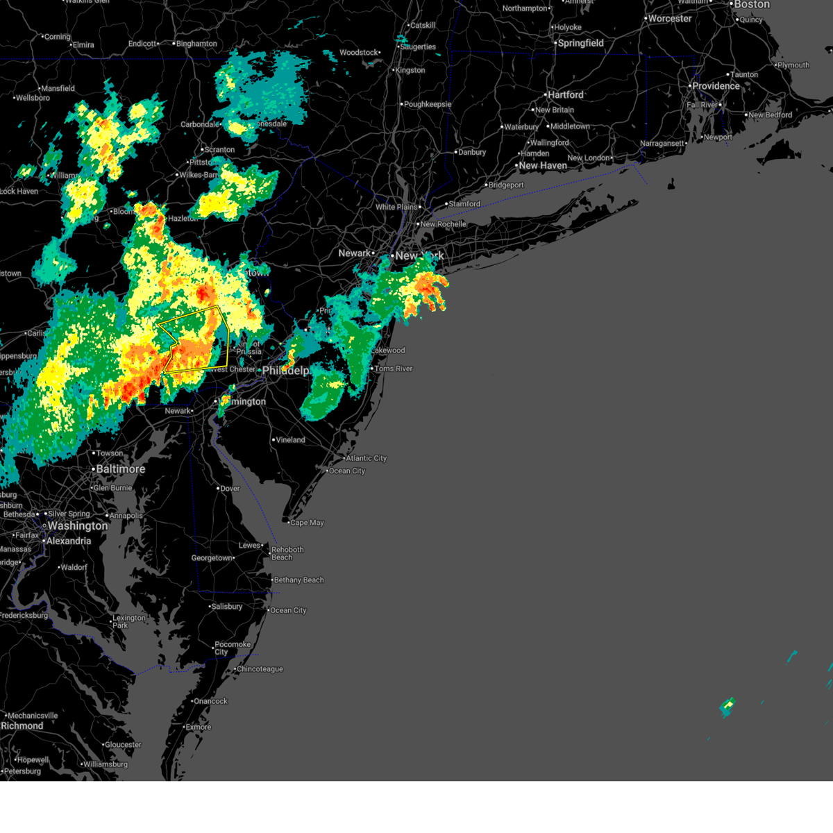
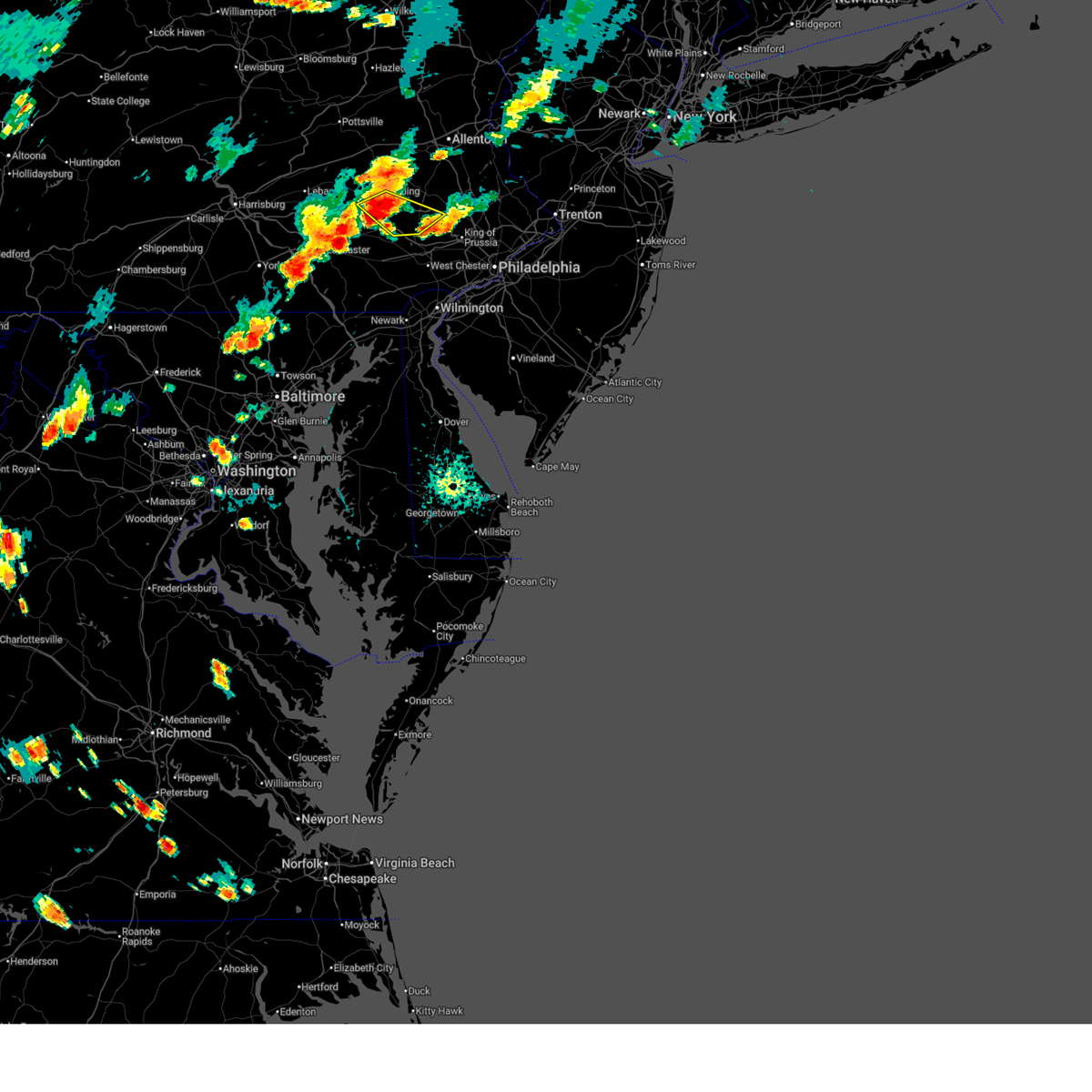
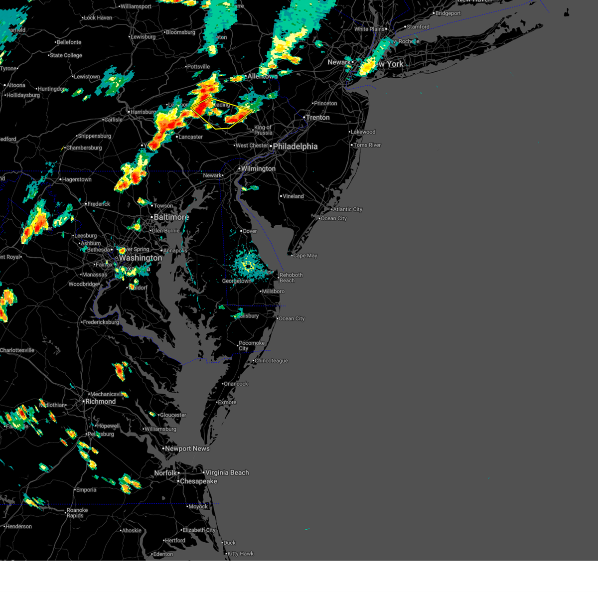
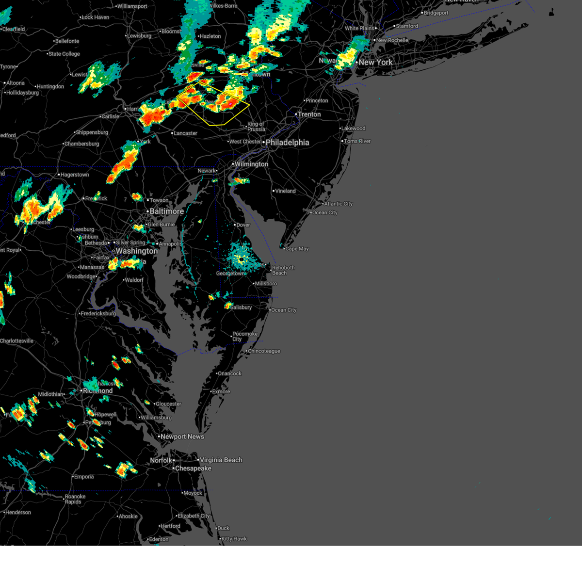
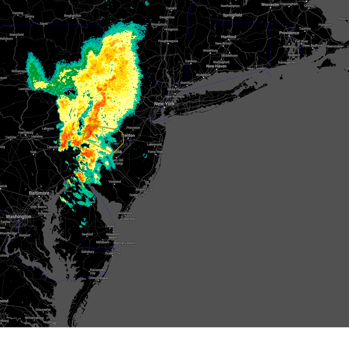
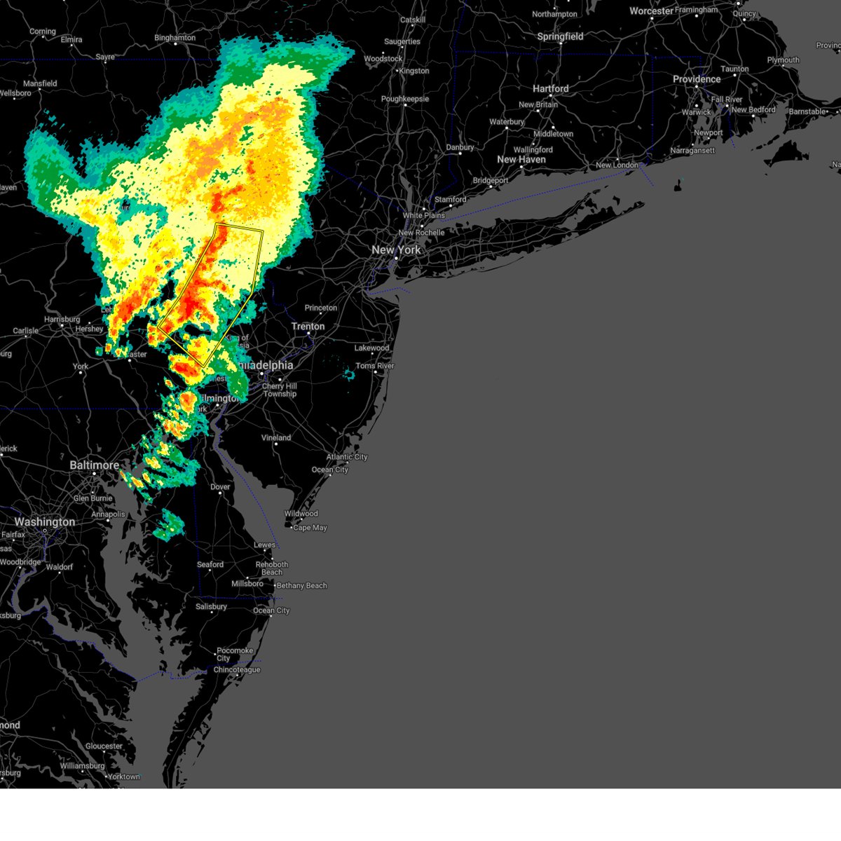
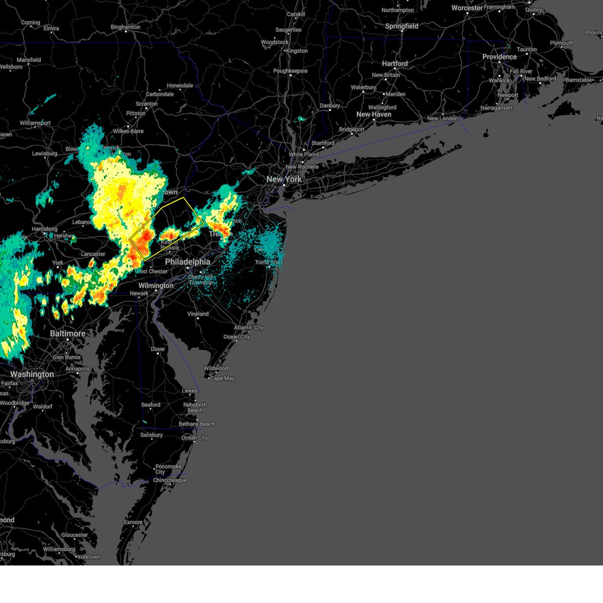
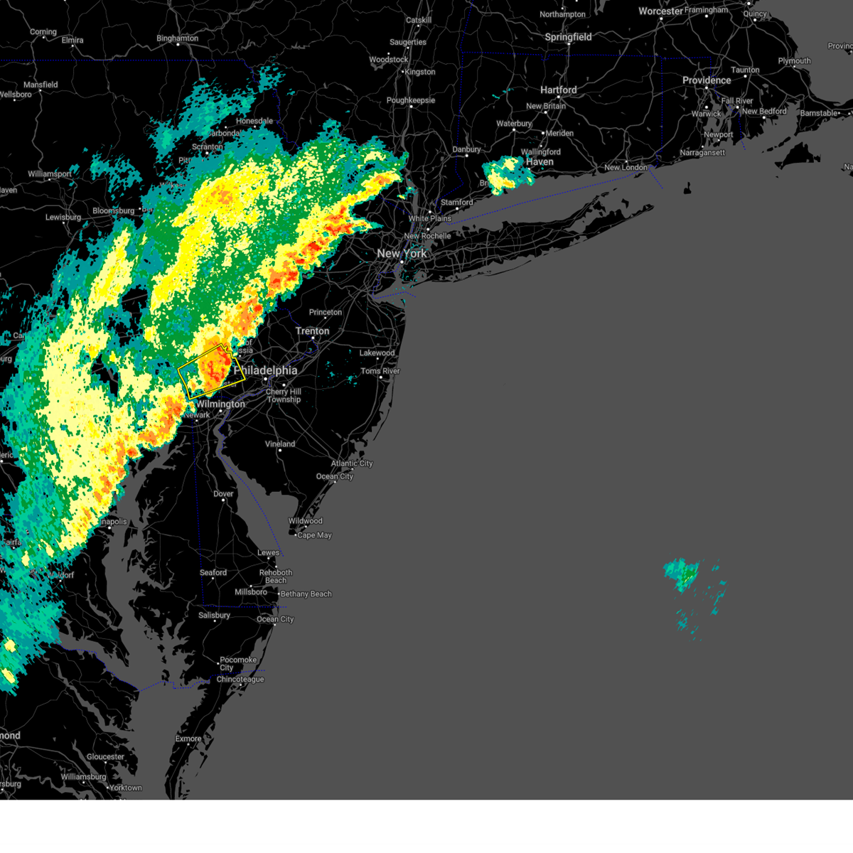
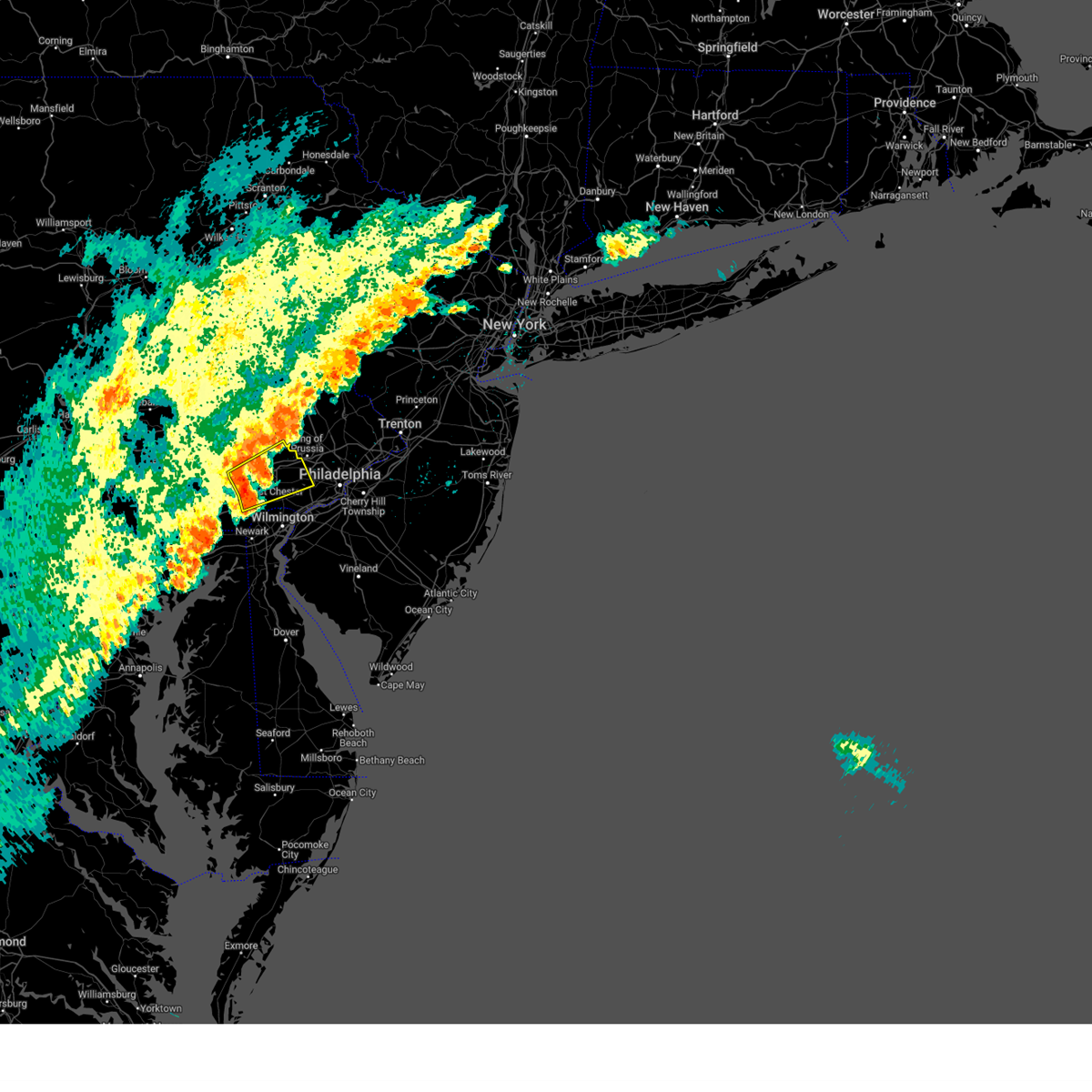
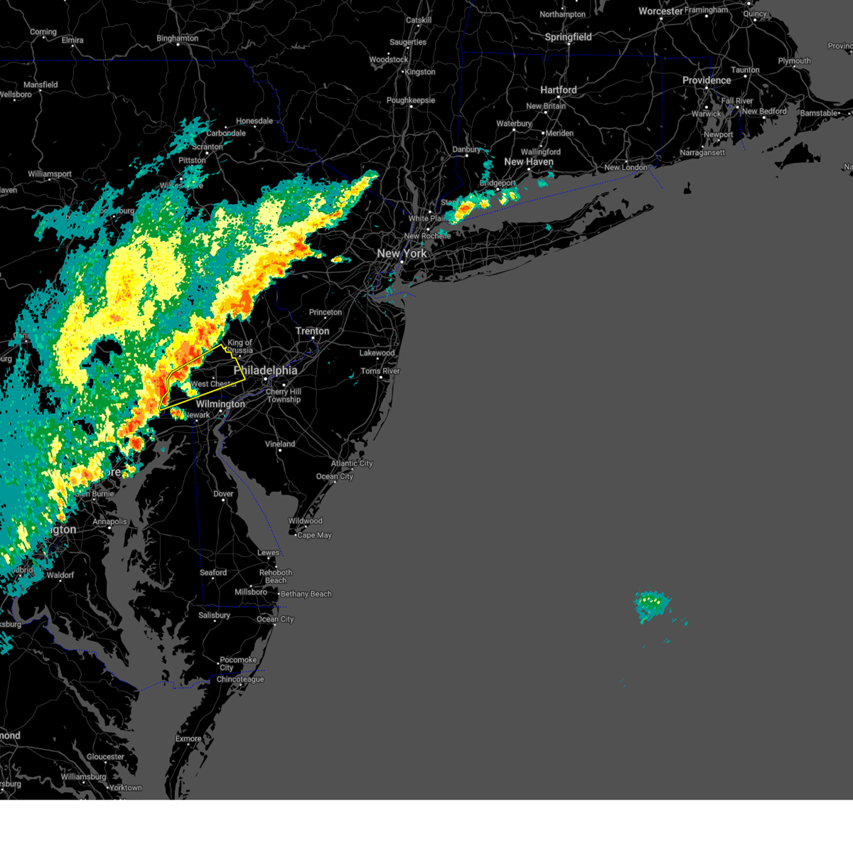
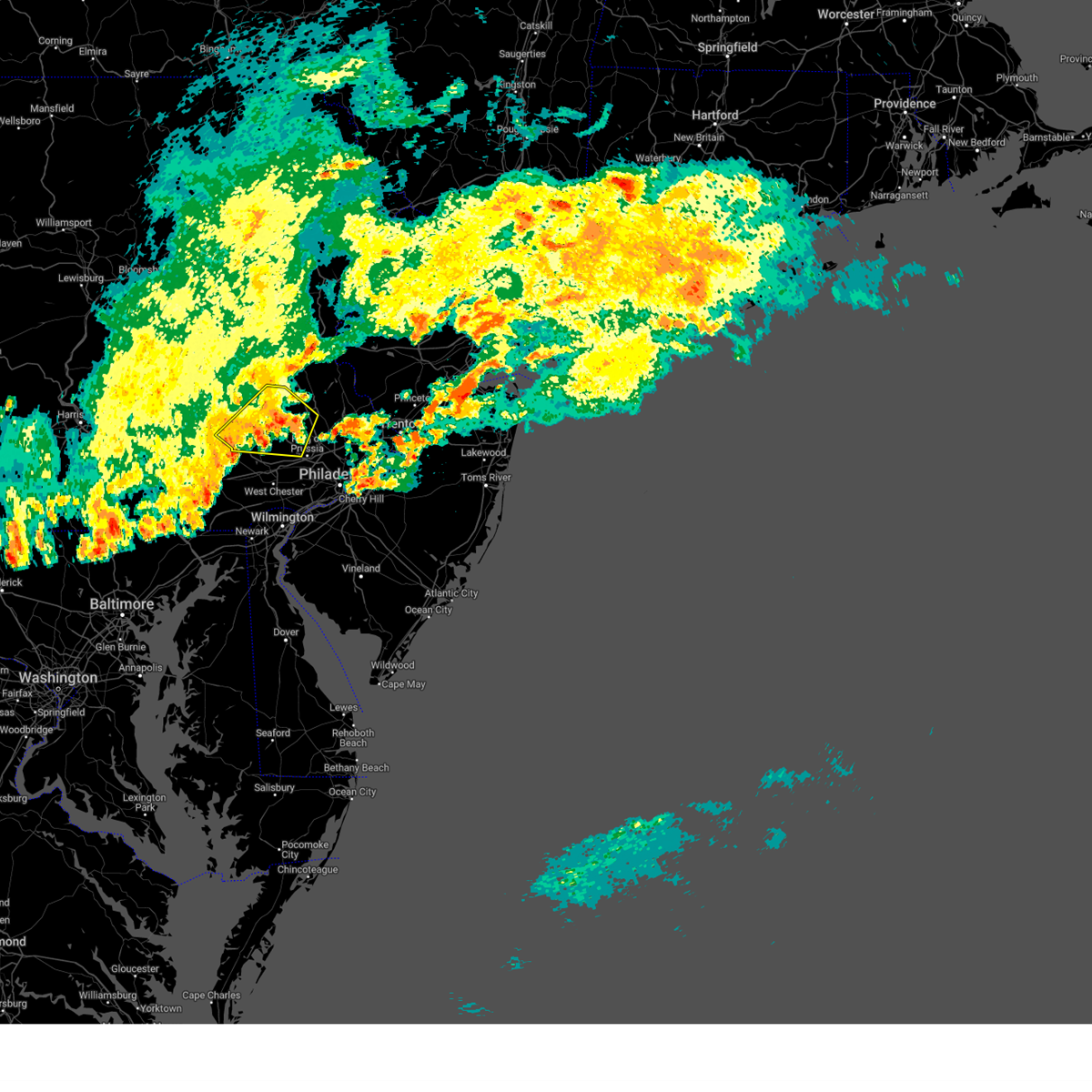
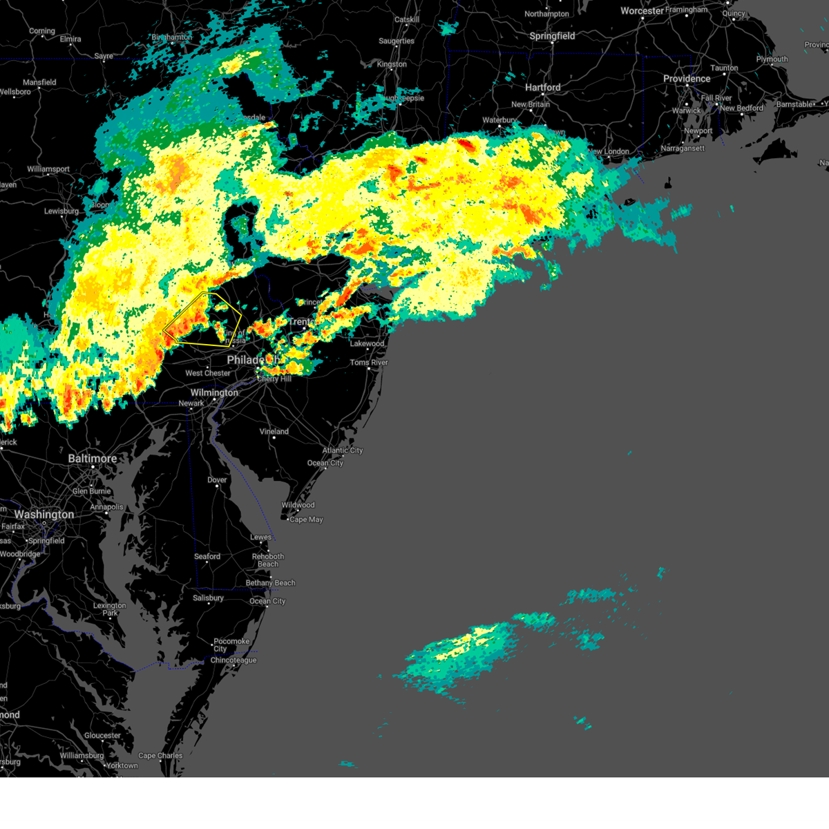
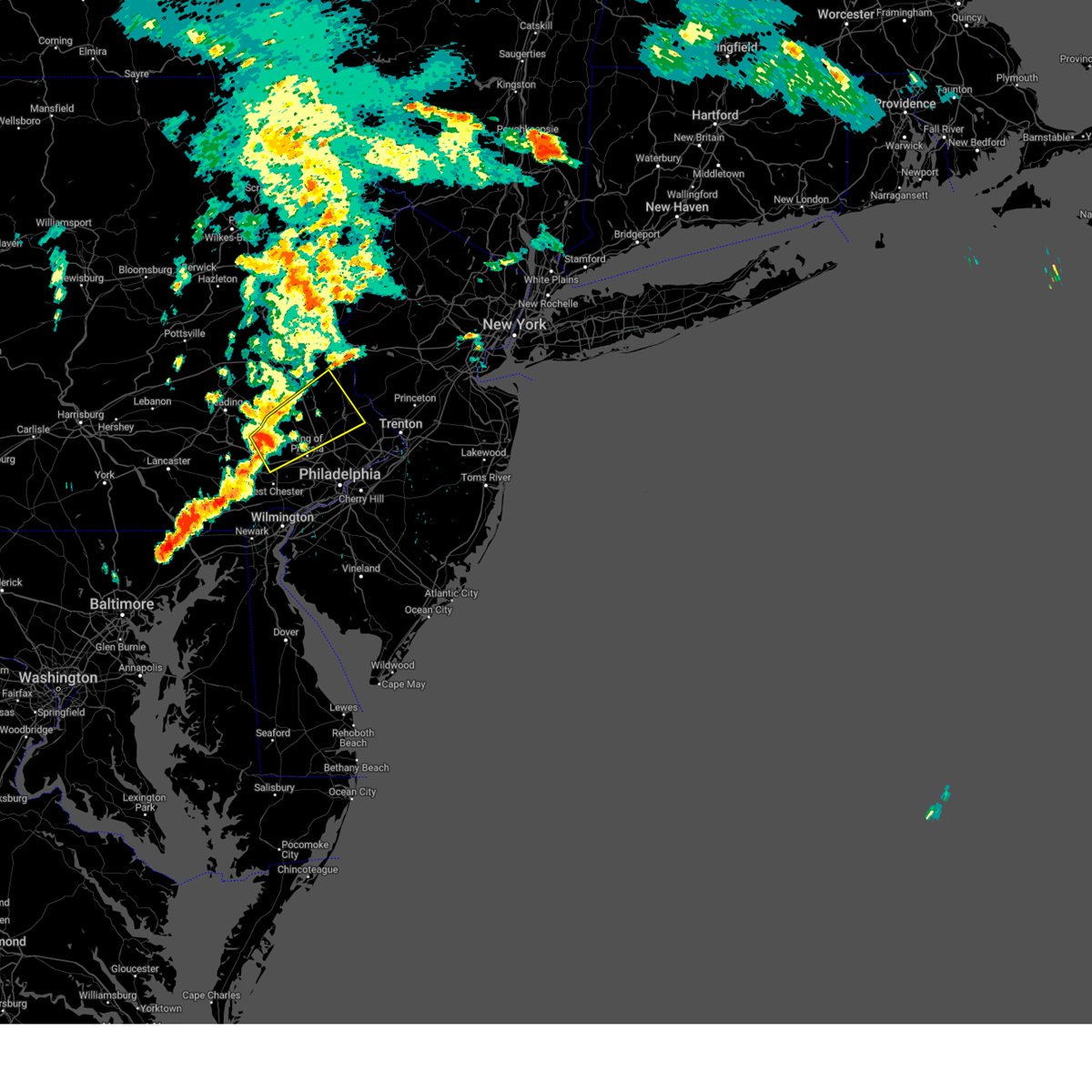
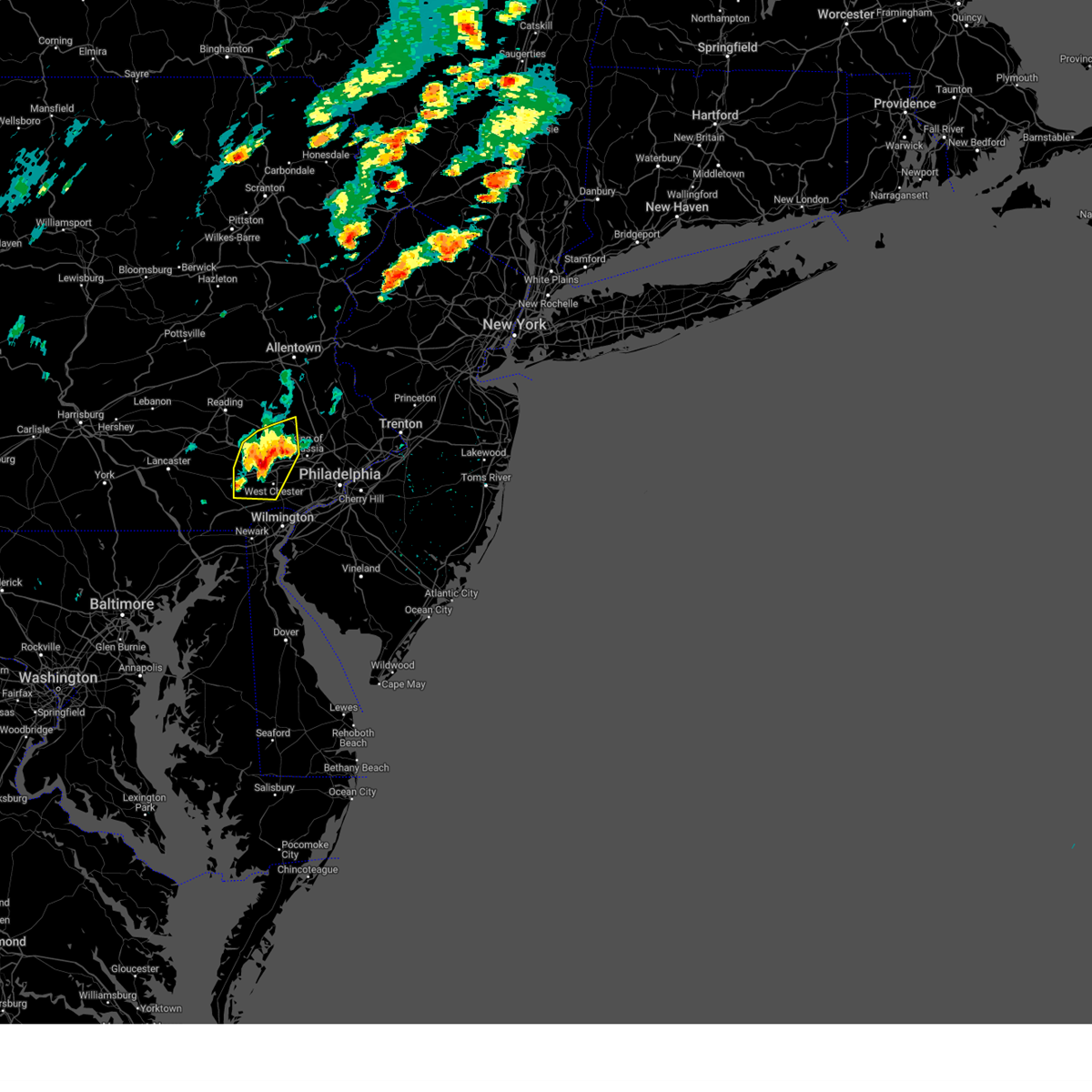
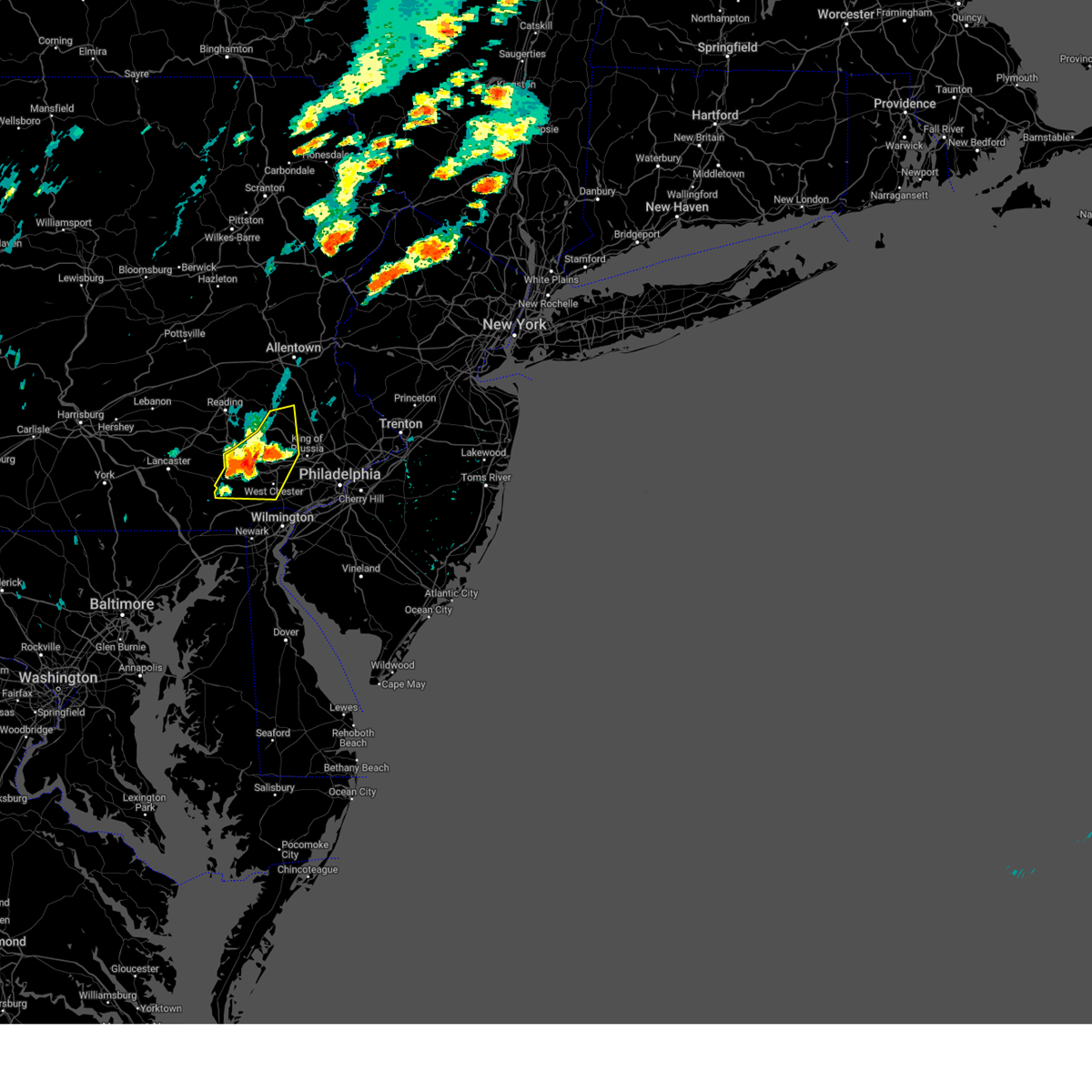
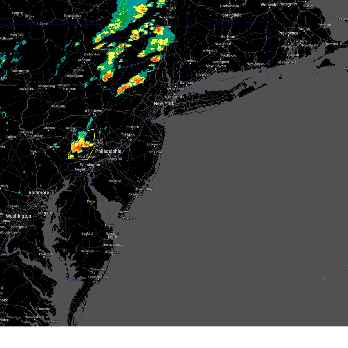
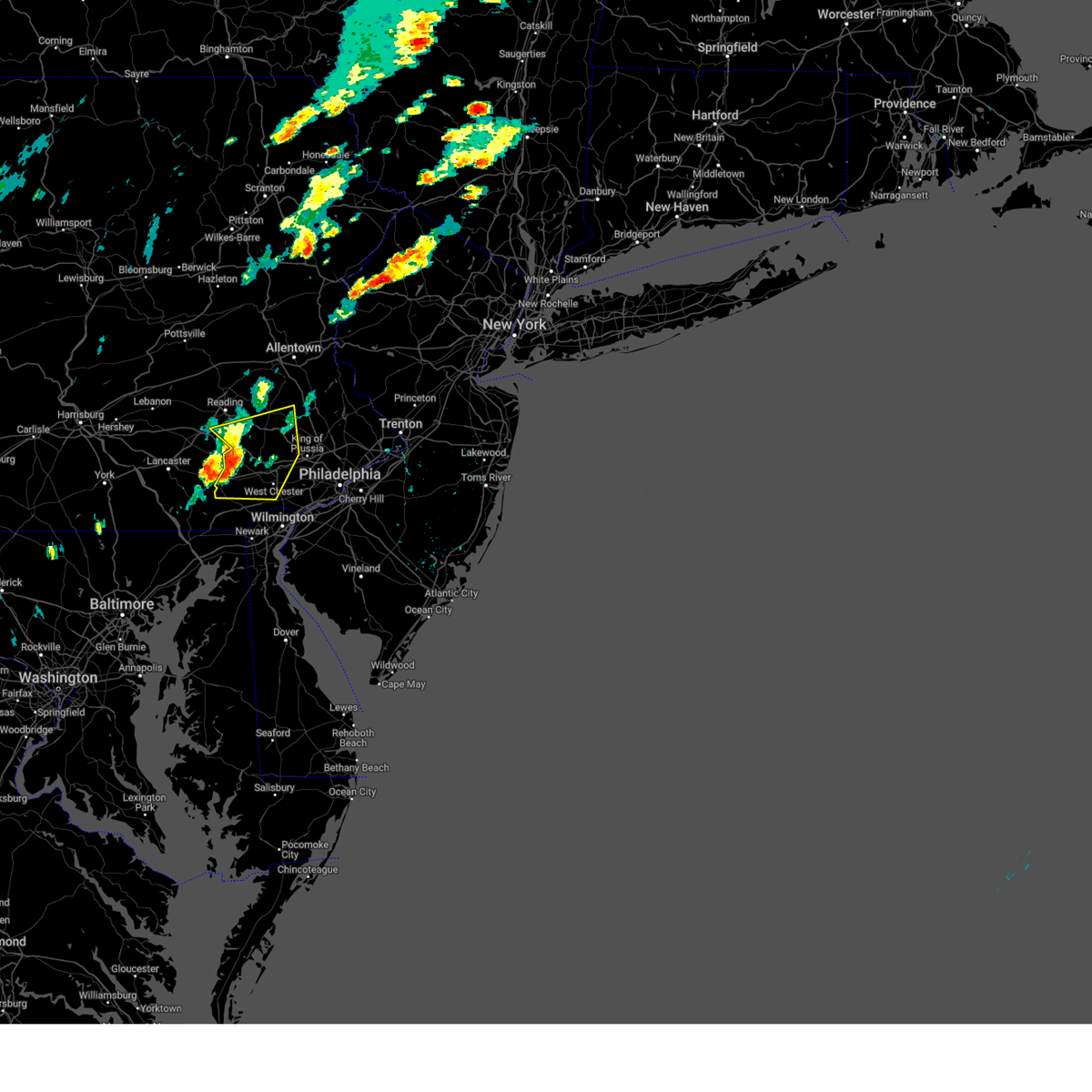
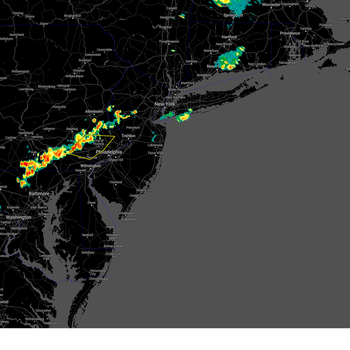
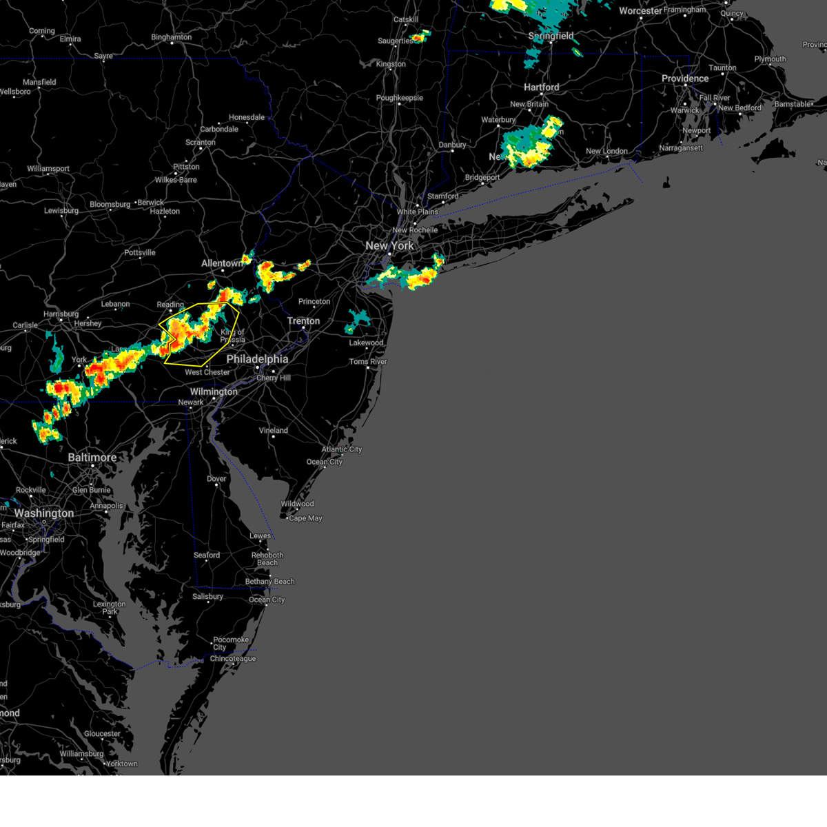
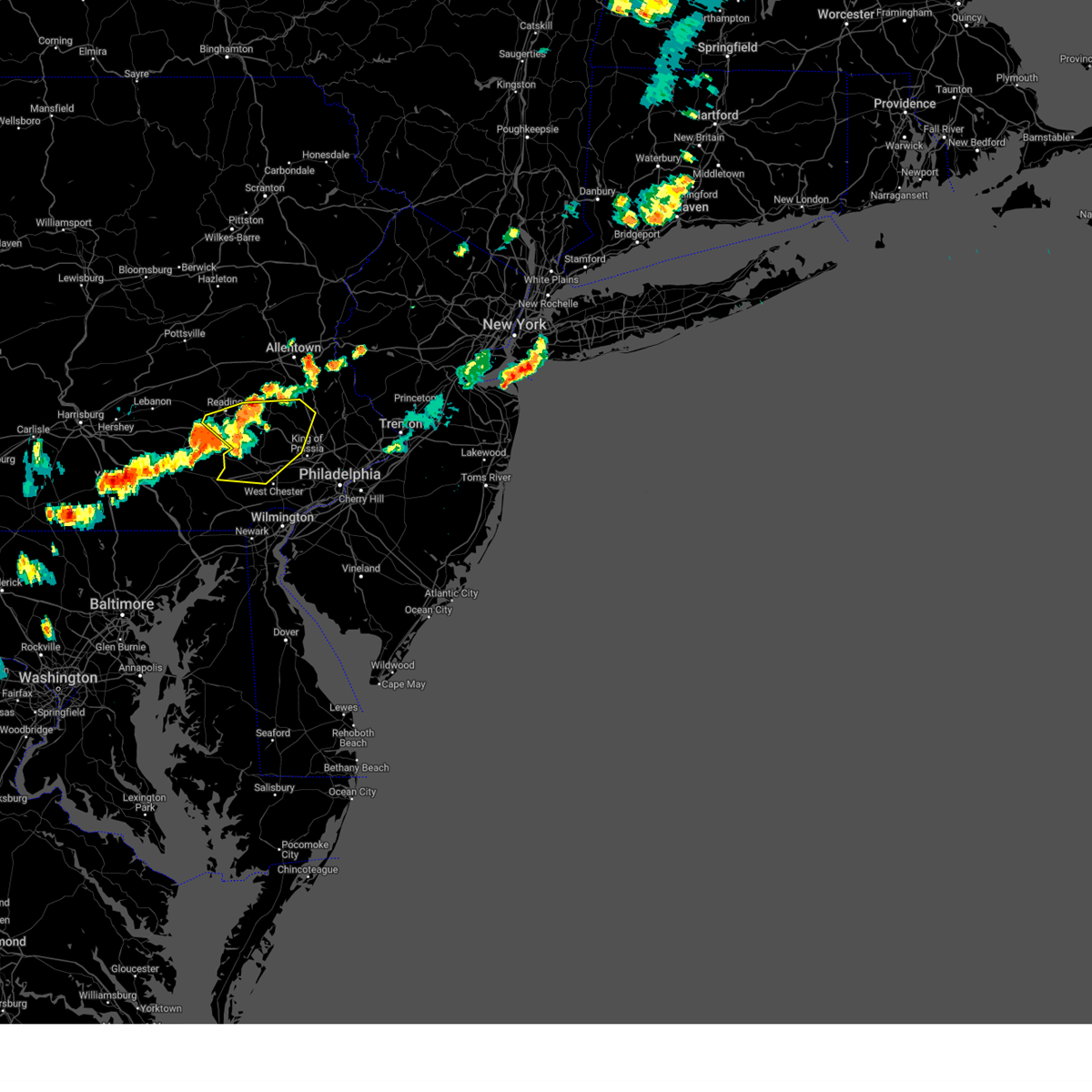
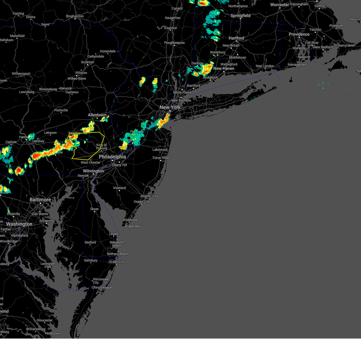
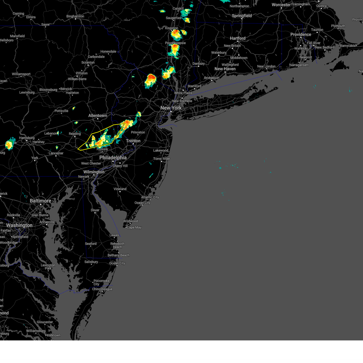
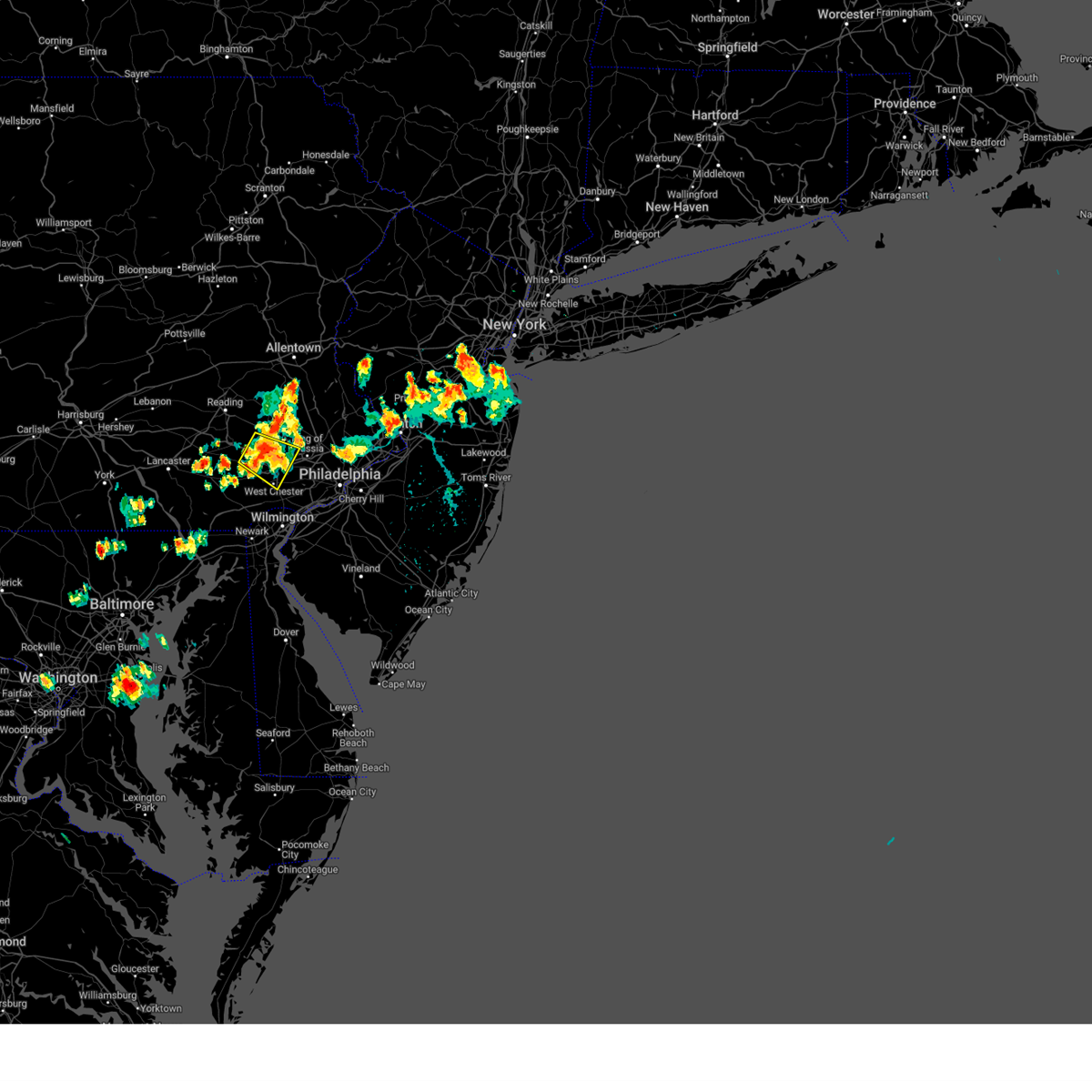
Hail Map for Spring City, PA
The Spring City, PA area has had 0 reports of on-the-ground hail by trained spotters, and has been under severe weather warnings 55 times during the past 12 months. Doppler radar has detected hail at or near Spring City, PA on 21 occasions, including 3 occasions during the past year.
| Name: | Spring City, PA |
| Where Located: | 83.4 miles NE of Baltimore, MD |
| Map: | Google Map for Spring City, PA |
| Population: | 3323 |
| Housing Units: | 1643 |
| More Info: | Search Google for Spring City, PA |
0
The Top Recent Hail Date for Spring City, PA is Sunday, August 18, 2024 (20th out of 21)

Hail and Wind Damage Spotted near Spring City, PA
| Date / Time | Report Details |
|---|---|
| 7/1/2025 12:28 AM EDT |
 The storms which prompted the warning have weakened below severe limits, and no longer pose an immediate threat to life or property. therefore, the warning will be allowed to expire. The storms which prompted the warning have weakened below severe limits, and no longer pose an immediate threat to life or property. therefore, the warning will be allowed to expire.
|
| 7/1/2025 12:11 AM EDT |
 the severe thunderstorm warning has been cancelled and is no longer in effect the severe thunderstorm warning has been cancelled and is no longer in effect
|
| 7/1/2025 12:11 AM EDT |
 At 1210 am edt, severe thunderstorms were located along a line extending from near birdsboro to elverson to coatesville, moving east at 30 mph (radar indicated). Hazards include 60 mph wind gusts. Damage to roofs, siding, trees, and power lines is possible. Locations impacted include, west chester, pottstown, phoenixville, coatesville, downingtown, birdsboro, collegeville, royersford, parkesburg, trappe, honey brook, schwenksville, elverson, new morgan, pughtown, spring mount, lionville-marchwood, valley forge, glenmoore, and paoli. At 1210 am edt, severe thunderstorms were located along a line extending from near birdsboro to elverson to coatesville, moving east at 30 mph (radar indicated). Hazards include 60 mph wind gusts. Damage to roofs, siding, trees, and power lines is possible. Locations impacted include, west chester, pottstown, phoenixville, coatesville, downingtown, birdsboro, collegeville, royersford, parkesburg, trappe, honey brook, schwenksville, elverson, new morgan, pughtown, spring mount, lionville-marchwood, valley forge, glenmoore, and paoli.
|
| 6/30/2025 11:47 PM EDT |
 Svrphi the national weather service in mount holly nj has issued a * severe thunderstorm warning for, southeastern berks county in eastern pennsylvania, northwestern montgomery county in southeastern pennsylvania, chester county in southeastern pennsylvania, west central delaware county in southeastern pennsylvania, * until 1230 am edt. * at 1146 pm edt, severe thunderstorms were located along a line extending from denver to near new holland to near gap, moving east at 45 mph (radar indicated). Hazards include 60 mph wind gusts and penny size hail. damage to roofs, siding, trees, and power lines is possible Svrphi the national weather service in mount holly nj has issued a * severe thunderstorm warning for, southeastern berks county in eastern pennsylvania, northwestern montgomery county in southeastern pennsylvania, chester county in southeastern pennsylvania, west central delaware county in southeastern pennsylvania, * until 1230 am edt. * at 1146 pm edt, severe thunderstorms were located along a line extending from denver to near new holland to near gap, moving east at 45 mph (radar indicated). Hazards include 60 mph wind gusts and penny size hail. damage to roofs, siding, trees, and power lines is possible
|
| 6/26/2025 6:31 PM EDT |
 The storms which prompted the warning have moved out of the area. therefore, the warning has been allowed to expire. a severe thunderstorm watch remains in effect until 1000 pm edt for eastern and southeastern pennsylvania. remember, a severe thunderstorm warning still remains in effect for berks, chester and montgomery counties until 715 pm. The storms which prompted the warning have moved out of the area. therefore, the warning has been allowed to expire. a severe thunderstorm watch remains in effect until 1000 pm edt for eastern and southeastern pennsylvania. remember, a severe thunderstorm warning still remains in effect for berks, chester and montgomery counties until 715 pm.
|
| 6/26/2025 6:29 PM EDT | Svrphi the national weather service in mount holly nj has issued a * severe thunderstorm warning for, southeastern berks county in eastern pennsylvania, southwestern montgomery county in southeastern pennsylvania, chester county in southeastern pennsylvania, central delaware county in southeastern pennsylvania, * until 715 pm edt. * at 629 pm edt, severe thunderstorms were located along a line extending from cedarville to near elverson to paradise, moving southeast at 30 mph (radar indicated). Hazards include 60 mph wind gusts and quarter size hail. Minor damage to vehicles is possible. Wind damage to roofs, siding, trees, and power lines is possible. |
| 6/26/2025 6:19 PM EDT |
 At 619 pm edt, severe thunderstorms were located along a line extending from near birdsboro to near new morgan to near ephrata, moving east at 25 mph (radar indicated). Hazards include 60 mph wind gusts and quarter size hail. Minor damage to vehicles is possible. wind damage to roofs, siding, trees, and power lines is possible. locations impacted include, reading, pottstown, wyomissing, birdsboro, royersford, elverson, new morgan, pughtown, cedarville, stowe, shillington, spring city, mount penn, mohnton, kenhorst, st. Lawrence, lorane, south pottstown, amity gardens, and kenilworth. At 619 pm edt, severe thunderstorms were located along a line extending from near birdsboro to near new morgan to near ephrata, moving east at 25 mph (radar indicated). Hazards include 60 mph wind gusts and quarter size hail. Minor damage to vehicles is possible. wind damage to roofs, siding, trees, and power lines is possible. locations impacted include, reading, pottstown, wyomissing, birdsboro, royersford, elverson, new morgan, pughtown, cedarville, stowe, shillington, spring city, mount penn, mohnton, kenhorst, st. Lawrence, lorane, south pottstown, amity gardens, and kenilworth.
|
| 6/26/2025 6:08 PM EDT |
 At 608 pm edt, severe thunderstorms were located along a line extending from near reading to near adamstown to ephrata, moving east at 25 mph (radar indicated). Hazards include 60 mph wind gusts and quarter size hail. Minor damage to vehicles is possible. wind damage to roofs, siding, trees, and power lines is possible. Locations impacted include, reading, pottstown, wyomissing, birdsboro, royersford, sinking spring, laureldale, wernersville, schwenksville, elverson, new morgan, spring ridge, pughtown, spring mount, gilbertsville, cedarville, stowe, shillington, west reading, and boyertown. At 608 pm edt, severe thunderstorms were located along a line extending from near reading to near adamstown to ephrata, moving east at 25 mph (radar indicated). Hazards include 60 mph wind gusts and quarter size hail. Minor damage to vehicles is possible. wind damage to roofs, siding, trees, and power lines is possible. Locations impacted include, reading, pottstown, wyomissing, birdsboro, royersford, sinking spring, laureldale, wernersville, schwenksville, elverson, new morgan, spring ridge, pughtown, spring mount, gilbertsville, cedarville, stowe, shillington, west reading, and boyertown.
|
| 6/26/2025 5:45 PM EDT |
 Svrphi the national weather service in mount holly nj has issued a * severe thunderstorm warning for, central berks county in eastern pennsylvania, northwestern montgomery county in southeastern pennsylvania, north central chester county in southeastern pennsylvania, * until 630 pm edt. * at 544 pm edt, severe thunderstorms were located along a line extending from laureldale to near adamstown to brickerville, moving southeast at 25 mph (radar indicated). Hazards include 60 mph wind gusts and quarter size hail. Minor damage to vehicles is possible. Wind damage to roofs, siding, trees, and power lines is possible. Svrphi the national weather service in mount holly nj has issued a * severe thunderstorm warning for, central berks county in eastern pennsylvania, northwestern montgomery county in southeastern pennsylvania, north central chester county in southeastern pennsylvania, * until 630 pm edt. * at 544 pm edt, severe thunderstorms were located along a line extending from laureldale to near adamstown to brickerville, moving southeast at 25 mph (radar indicated). Hazards include 60 mph wind gusts and quarter size hail. Minor damage to vehicles is possible. Wind damage to roofs, siding, trees, and power lines is possible.
|
| 6/25/2025 7:13 PM EDT | the severe thunderstorm warning has been cancelled and is no longer in effect |
| 6/25/2025 7:01 PM EDT | At 701 pm edt, a severe thunderstorm was located near royersford, or 19 miles north of west chester, moving southeast at 25 mph (radar indicated). Hazards include 60 mph wind gusts. Damage to roofs, siding, trees, and power lines is possible. Locations impacted include, pottstown, phoenixville, lansdale, west norriton, east norriton, collegeville, royersford, trappe, schwenksville, pughtown, spring mount, valley forge, chester springs, gilbertsville, cedarville, skippack, stowe, spring city, north wales, and harleysville. |
| 6/25/2025 7:01 PM EDT | the severe thunderstorm warning has been cancelled and is no longer in effect |
| 6/25/2025 6:41 PM EDT | Svrphi the national weather service in mount holly nj has issued a * severe thunderstorm warning for, southeastern berks county in eastern pennsylvania, northwestern montgomery county in southeastern pennsylvania, northeastern chester county in southeastern pennsylvania, * until 730 pm edt. * at 641 pm edt, a severe thunderstorm was located over gilbertsville, or 13 miles east of reading, moving southeast at 25 mph (radar indicated). Hazards include 60 mph wind gusts. damage to roofs, siding, trees, and power lines is possible |
| 5/16/2025 11:22 AM EDT |
 Svrphi the national weather service in mount holly nj has issued a * severe thunderstorm warning for, montgomery county in southeastern pennsylvania, central bucks county in southeastern pennsylvania, northeastern chester county in southeastern pennsylvania, northern philadelphia county in southeastern pennsylvania, * until 1215 pm edt. * at 1122 am edt, a severe thunderstorm was located near spring mount, or 21 miles east of reading, moving east at 35 mph. this storm has a history of producing wind damage in berks county (radar indicated). Hazards include 60 mph wind gusts and quarter size hail. Minor damage to vehicles is possible. Wind damage to roofs, siding, trees, and power lines is possible. Svrphi the national weather service in mount holly nj has issued a * severe thunderstorm warning for, montgomery county in southeastern pennsylvania, central bucks county in southeastern pennsylvania, northeastern chester county in southeastern pennsylvania, northern philadelphia county in southeastern pennsylvania, * until 1215 pm edt. * at 1122 am edt, a severe thunderstorm was located near spring mount, or 21 miles east of reading, moving east at 35 mph. this storm has a history of producing wind damage in berks county (radar indicated). Hazards include 60 mph wind gusts and quarter size hail. Minor damage to vehicles is possible. Wind damage to roofs, siding, trees, and power lines is possible.
|
| 5/16/2025 11:04 AM EDT |
 At 1103 am edt, severe thunderstorms were located along a line extending from near beersville to near ancient oaks to 6 miles northeast of birdsboro, moving east at 40 mph (law enforcement. at 1100 am edt, a downed tree and building collapse was reported in exeter township in berks county). Hazards include 60 mph wind gusts and quarter size hail. Minor damage to vehicles is possible. wind damage to roofs, siding, trees, and power lines is possible. Locations impacted include, allentown, reading, easton, bethlehem, pottstown, forks, emmaus, wyomissing, northampton, quakertown, wilson, downingtown, hellertown, nazareth, palmerton, bangor, birdsboro, kutztown, royersford, and slatington. At 1103 am edt, severe thunderstorms were located along a line extending from near beersville to near ancient oaks to 6 miles northeast of birdsboro, moving east at 40 mph (law enforcement. at 1100 am edt, a downed tree and building collapse was reported in exeter township in berks county). Hazards include 60 mph wind gusts and quarter size hail. Minor damage to vehicles is possible. wind damage to roofs, siding, trees, and power lines is possible. Locations impacted include, allentown, reading, easton, bethlehem, pottstown, forks, emmaus, wyomissing, northampton, quakertown, wilson, downingtown, hellertown, nazareth, palmerton, bangor, birdsboro, kutztown, royersford, and slatington.
|
| 5/16/2025 10:48 AM EDT |
 At 1048 am edt, severe thunderstorms were located along a line extending from near palmerton to near claussville to laureldale, moving east at 40 mph (radar indicated). Hazards include 60 mph wind gusts and quarter size hail. Minor damage to vehicles is possible. wind damage to roofs, siding, trees, and power lines is possible. Locations impacted include, allentown, reading, easton, lehighton, bethlehem, pottstown, forks, emmaus, wyomissing, northampton, quakertown, wilson, downingtown, hellertown, nazareth, palmerton, bangor, birdsboro, kutztown, and jim thorpe. At 1048 am edt, severe thunderstorms were located along a line extending from near palmerton to near claussville to laureldale, moving east at 40 mph (radar indicated). Hazards include 60 mph wind gusts and quarter size hail. Minor damage to vehicles is possible. wind damage to roofs, siding, trees, and power lines is possible. Locations impacted include, allentown, reading, easton, lehighton, bethlehem, pottstown, forks, emmaus, wyomissing, northampton, quakertown, wilson, downingtown, hellertown, nazareth, palmerton, bangor, birdsboro, kutztown, and jim thorpe.
|
| 5/16/2025 10:24 AM EDT |
 Svrphi the national weather service in mount holly nj has issued a * severe thunderstorm warning for, berks county in eastern pennsylvania, lehigh county in eastern pennsylvania, northwestern montgomery county in southeastern pennsylvania, carbon county in northeastern pennsylvania, northwestern bucks county in southeastern pennsylvania, north central chester county in southeastern pennsylvania, southwestern monroe county in northeastern pennsylvania, northampton county in eastern pennsylvania, * until 1130 am edt. * at 1024 am edt, severe thunderstorms were located along a line extending from near hazleton to near mckeansburg to near strausstown, moving east at 40 mph (radar indicated). Hazards include 60 mph wind gusts and quarter size hail. Minor damage to vehicles is possible. Wind damage to roofs, siding, trees, and power lines is possible. Svrphi the national weather service in mount holly nj has issued a * severe thunderstorm warning for, berks county in eastern pennsylvania, lehigh county in eastern pennsylvania, northwestern montgomery county in southeastern pennsylvania, carbon county in northeastern pennsylvania, northwestern bucks county in southeastern pennsylvania, north central chester county in southeastern pennsylvania, southwestern monroe county in northeastern pennsylvania, northampton county in eastern pennsylvania, * until 1130 am edt. * at 1024 am edt, severe thunderstorms were located along a line extending from near hazleton to near mckeansburg to near strausstown, moving east at 40 mph (radar indicated). Hazards include 60 mph wind gusts and quarter size hail. Minor damage to vehicles is possible. Wind damage to roofs, siding, trees, and power lines is possible.
|
| 5/3/2025 9:30 PM EDT |
 The storm which prompted the warning has weakened below severe limits, and has exited the warned area. therefore, the warning has been allowed to expire. however gusty winds are still possible with this thunderstorm. a severe thunderstorm watch remains in effect until 1100 pm edt for northwestern new jersey, and eastern and southeastern pennsylvania. to report severe weather, contact your nearest law enforcement agency. they will relay your report to the national weather service mount holly nj. The storm which prompted the warning has weakened below severe limits, and has exited the warned area. therefore, the warning has been allowed to expire. however gusty winds are still possible with this thunderstorm. a severe thunderstorm watch remains in effect until 1100 pm edt for northwestern new jersey, and eastern and southeastern pennsylvania. to report severe weather, contact your nearest law enforcement agency. they will relay your report to the national weather service mount holly nj.
|
| 5/3/2025 9:11 PM EDT |
 At 911 pm edt, a severe thunderstorm was located over cedarville, or 16 miles southeast of reading, moving northeast at 30 mph (radar indicated). Hazards include 60 mph wind gusts and quarter size hail. Minor damage to vehicles is possible. wind damage to roofs, siding, trees, and power lines is possible. locations impacted include, fricks, boyertown, pottsgrove, dublin, evansburg, hatfield, perkasie, pughtown, eagleville, stowe, pennsburg, spring mount, bechtelsville, lansdale, montgomeryville, doylestown, schwenksville, chalfont, phoenixville, and silverdale. this includes the following highways, pennsylvania turnpike between mile markers 306 and 316. Northeast extension between mile markers 27 and 49. At 911 pm edt, a severe thunderstorm was located over cedarville, or 16 miles southeast of reading, moving northeast at 30 mph (radar indicated). Hazards include 60 mph wind gusts and quarter size hail. Minor damage to vehicles is possible. wind damage to roofs, siding, trees, and power lines is possible. locations impacted include, fricks, boyertown, pottsgrove, dublin, evansburg, hatfield, perkasie, pughtown, eagleville, stowe, pennsburg, spring mount, bechtelsville, lansdale, montgomeryville, doylestown, schwenksville, chalfont, phoenixville, and silverdale. this includes the following highways, pennsylvania turnpike between mile markers 306 and 316. Northeast extension between mile markers 27 and 49.
|
| 5/3/2025 8:47 PM EDT |
 Svrphi the national weather service in mount holly nj has issued a * severe thunderstorm warning for, southeastern berks county in eastern pennsylvania, southeastern lehigh county in eastern pennsylvania, northwestern montgomery county in southeastern pennsylvania, northwestern bucks county in southeastern pennsylvania, northern chester county in southeastern pennsylvania, south central northampton county in eastern pennsylvania, * until 930 pm edt. * at 846 pm edt, a severe thunderstorm was located over glenmoore, or 13 miles east of new holland, moving northeast at 40 mph (radar indicated). Hazards include 60 mph wind gusts and quarter size hail. Minor damage to vehicles is possible. Wind damage to roofs, siding, trees, and power lines is possible. Svrphi the national weather service in mount holly nj has issued a * severe thunderstorm warning for, southeastern berks county in eastern pennsylvania, southeastern lehigh county in eastern pennsylvania, northwestern montgomery county in southeastern pennsylvania, northwestern bucks county in southeastern pennsylvania, northern chester county in southeastern pennsylvania, south central northampton county in eastern pennsylvania, * until 930 pm edt. * at 846 pm edt, a severe thunderstorm was located over glenmoore, or 13 miles east of new holland, moving northeast at 40 mph (radar indicated). Hazards include 60 mph wind gusts and quarter size hail. Minor damage to vehicles is possible. Wind damage to roofs, siding, trees, and power lines is possible.
|
| 4/15/2025 4:48 PM EDT |
 The storms which prompted the warning have weakened below severe limits, and no longer pose an immediate threat to life or property. therefore, the warning has been allowed to expire. however, a wind advisory remains in effect until 8 pm edt. strong westerly winds gusting up to 50 mph could result in some additional tree damage and isolated power outages through early evening. The storms which prompted the warning have weakened below severe limits, and no longer pose an immediate threat to life or property. therefore, the warning has been allowed to expire. however, a wind advisory remains in effect until 8 pm edt. strong westerly winds gusting up to 50 mph could result in some additional tree damage and isolated power outages through early evening.
|
| 4/15/2025 4:38 PM EDT |
 At 437 pm edt, an outflow boundary capable of producing damaging winds was located along a line extending from near frenchtown to near richboro to drexel hill, moving east at 55 mph (law enforcement reported wind damage. at 419 pm edt, a 56 mph wind gust was measured at the pottstown limerick airport). Hazards include 60 mph wind gusts. Damage to roofs, siding, trees, and power lines is possible. locations impacted include, fricks, modena, coffeetown, emmaus, evansburg, hatfield, blue bell, perkasie, maple glen, pughtown, bryn mawr, north catasauqua, ancient oaks, pennsburg, doylestown, gradyville, fountain hill, south coatesville, bethlehem, and souderton. this includes the following highways, pennsylvania turnpike between mile markers 300 and 339. northeast extension between mile markers 21 and 61. interstate 76 in pennsylvania between mile markers 327 and 335. interstate 78 in pennsylvania between mile markers 51 and 76. Interstate 476 in pennsylvania between mile markers 10 and 19. At 437 pm edt, an outflow boundary capable of producing damaging winds was located along a line extending from near frenchtown to near richboro to drexel hill, moving east at 55 mph (law enforcement reported wind damage. at 419 pm edt, a 56 mph wind gust was measured at the pottstown limerick airport). Hazards include 60 mph wind gusts. Damage to roofs, siding, trees, and power lines is possible. locations impacted include, fricks, modena, coffeetown, emmaus, evansburg, hatfield, blue bell, perkasie, maple glen, pughtown, bryn mawr, north catasauqua, ancient oaks, pennsburg, doylestown, gradyville, fountain hill, south coatesville, bethlehem, and souderton. this includes the following highways, pennsylvania turnpike between mile markers 300 and 339. northeast extension between mile markers 21 and 61. interstate 76 in pennsylvania between mile markers 327 and 335. interstate 78 in pennsylvania between mile markers 51 and 76. Interstate 476 in pennsylvania between mile markers 10 and 19.
|
| 4/15/2025 4:14 PM EDT |
 At 413 pm edt, showers and an outflow boundary producing severe wind gusts were located along a line extending from hellertown to spring mount to near lionville, moving east at 55 mph (emergency management. at 343 pm edt, a 62 mph wind gust was measured at the reading regional airport. several areas of wind damage have been reported across berks county). Hazards include 60 mph wind gusts and penny size hail. Damage to roofs, siding, trees, and power lines is possible. locations impacted include, fricks, modena, coffeetown, emmaus, evansburg, new morgan, hatfield, blue bell, perkasie, maple glen, pughtown, bryn mawr, north catasauqua, ancient oaks, pennsburg, doylestown, gradyville, fountain hill, south coatesville, and bethlehem. this includes the following highways, pennsylvania turnpike between mile markers 296 and 339. northeast extension between mile markers 21 and 61. interstate 76 in pennsylvania between mile markers 327 and 335. interstate 78 in pennsylvania between mile markers 37 and 76. interstate 476 in pennsylvania between mile markers 10 and 19. Interstate 176 in pennsylvania between mile markers 1 and 11. At 413 pm edt, showers and an outflow boundary producing severe wind gusts were located along a line extending from hellertown to spring mount to near lionville, moving east at 55 mph (emergency management. at 343 pm edt, a 62 mph wind gust was measured at the reading regional airport. several areas of wind damage have been reported across berks county). Hazards include 60 mph wind gusts and penny size hail. Damage to roofs, siding, trees, and power lines is possible. locations impacted include, fricks, modena, coffeetown, emmaus, evansburg, new morgan, hatfield, blue bell, perkasie, maple glen, pughtown, bryn mawr, north catasauqua, ancient oaks, pennsburg, doylestown, gradyville, fountain hill, south coatesville, and bethlehem. this includes the following highways, pennsylvania turnpike between mile markers 296 and 339. northeast extension between mile markers 21 and 61. interstate 76 in pennsylvania between mile markers 327 and 335. interstate 78 in pennsylvania between mile markers 37 and 76. interstate 476 in pennsylvania between mile markers 10 and 19. Interstate 176 in pennsylvania between mile markers 1 and 11.
|
| 4/15/2025 3:56 PM EDT |
 Svrphi the national weather service in mount holly nj has issued a * severe thunderstorm warning for, berks county in eastern pennsylvania, lehigh county in eastern pennsylvania, montgomery county in southeastern pennsylvania, northwestern bucks county in southeastern pennsylvania, northeastern chester county in southeastern pennsylvania, central delaware county in southeastern pennsylvania, southern northampton county in eastern pennsylvania, * until 445 pm edt. * at 353 pm edt, showers and an outflow boundary producing severe wind gusts were located along a line extending from near claussville to near birdsboro to churchtown, moving east at 55 mph (trained weather spotters. at 343 pm edt, a 62 mph wind gust was measured at the reading regional airport. several areas of wind damage have been reported across berks county). Hazards include 60 mph wind gusts. damage to roofs, siding, trees, and power lines is possible Svrphi the national weather service in mount holly nj has issued a * severe thunderstorm warning for, berks county in eastern pennsylvania, lehigh county in eastern pennsylvania, montgomery county in southeastern pennsylvania, northwestern bucks county in southeastern pennsylvania, northeastern chester county in southeastern pennsylvania, central delaware county in southeastern pennsylvania, southern northampton county in eastern pennsylvania, * until 445 pm edt. * at 353 pm edt, showers and an outflow boundary producing severe wind gusts were located along a line extending from near claussville to near birdsboro to churchtown, moving east at 55 mph (trained weather spotters. at 343 pm edt, a 62 mph wind gust was measured at the reading regional airport. several areas of wind damage have been reported across berks county). Hazards include 60 mph wind gusts. damage to roofs, siding, trees, and power lines is possible
|
| 3/31/2025 8:08 PM EDT |
 The storm which prompted the warning has weakened below severe limits, and no longer poses an immediate threat to life or property. therefore, the warning will be allowed to expire. however gusty winds and heavy rain are still possible with this thunderstorm. The storm which prompted the warning has weakened below severe limits, and no longer poses an immediate threat to life or property. therefore, the warning will be allowed to expire. however gusty winds and heavy rain are still possible with this thunderstorm.
|
| 3/31/2025 7:54 PM EDT |
 At 754 pm edt, a severe thunderstorm was located over coatesville, or 10 miles west of west chester, moving northeast at 40 mph (radar indicated). Hazards include 60 mph wind gusts and penny size hail. Damage to roofs, siding, trees, and power lines is possible. locations impacted include, west chester, modena, cheyney, thorndale, malvern, west goshen, westtown, marshallton, devon-berwyn, lionville-marchwood, downingtown, exton, gradyville, valley forge, south coatesville, broomall, coatesville, phoenixville, upper providence township, and paoli. This includes pennsylvania turnpike between mile markers 308 and 325. At 754 pm edt, a severe thunderstorm was located over coatesville, or 10 miles west of west chester, moving northeast at 40 mph (radar indicated). Hazards include 60 mph wind gusts and penny size hail. Damage to roofs, siding, trees, and power lines is possible. locations impacted include, west chester, modena, cheyney, thorndale, malvern, west goshen, westtown, marshallton, devon-berwyn, lionville-marchwood, downingtown, exton, gradyville, valley forge, south coatesville, broomall, coatesville, phoenixville, upper providence township, and paoli. This includes pennsylvania turnpike between mile markers 308 and 325.
|
| 3/31/2025 7:34 PM EDT |
 Svrphi the national weather service in mount holly nj has issued a * severe thunderstorm warning for, chester county in southeastern pennsylvania, central delaware county in southeastern pennsylvania, * until 815 pm edt. * at 734 pm edt, a severe thunderstorm was located over homeville, or 15 miles southeast of willow street, moving northeast at 40 mph (radar indicated). Hazards include 60 mph wind gusts and penny size hail. damage to roofs, siding, trees, and power lines is possible Svrphi the national weather service in mount holly nj has issued a * severe thunderstorm warning for, chester county in southeastern pennsylvania, central delaware county in southeastern pennsylvania, * until 815 pm edt. * at 734 pm edt, a severe thunderstorm was located over homeville, or 15 miles southeast of willow street, moving northeast at 40 mph (radar indicated). Hazards include 60 mph wind gusts and penny size hail. damage to roofs, siding, trees, and power lines is possible
|
| 8/6/2024 7:57 PM EDT |
 the severe thunderstorm warning has been cancelled and is no longer in effect the severe thunderstorm warning has been cancelled and is no longer in effect
|
| 8/6/2024 7:45 PM EDT |
 At 745 pm edt, a severe thunderstorm was located over cedarville, or 13 miles southeast of reading, moving east at 25 mph (radar indicated). Hazards include 60 mph wind gusts. Damage to roofs, siding, trees, and power lines is possible. locations impacted include, pottstown, phoenixville, west norriton, souderton, birdsboro, collegeville, royersford, trappe, east greenville, schwenksville, elverson, bally, bechtelsville, green lane, new morgan, pughtown, spring mount, geryville, gilbertsville, and cedarville. this includes the following highways, pennsylvania turnpike between mile markers 296 and 304. northeast extension between mile markers 30 and 38. Interstate 176 in pennsylvania between mile markers 1 and 8. At 745 pm edt, a severe thunderstorm was located over cedarville, or 13 miles southeast of reading, moving east at 25 mph (radar indicated). Hazards include 60 mph wind gusts. Damage to roofs, siding, trees, and power lines is possible. locations impacted include, pottstown, phoenixville, west norriton, souderton, birdsboro, collegeville, royersford, trappe, east greenville, schwenksville, elverson, bally, bechtelsville, green lane, new morgan, pughtown, spring mount, geryville, gilbertsville, and cedarville. this includes the following highways, pennsylvania turnpike between mile markers 296 and 304. northeast extension between mile markers 30 and 38. Interstate 176 in pennsylvania between mile markers 1 and 8.
|
| 8/6/2024 7:30 PM EDT | At 730 pm edt, a severe thunderstorm was located near birdsboro, or 10 miles east of reading, moving east at 25 mph (radar indicated). Hazards include 60 mph wind gusts. Damage to roofs, siding, trees, and power lines is possible. locations impacted include, reading, pottstown, phoenixville, west norriton, souderton, birdsboro, collegeville, royersford, trappe, east greenville, schwenksville, elverson, bally, bechtelsville, green lane, new morgan, pughtown, spring mount, geryville, and gilbertsville. this includes the following highways, pennsylvania turnpike between mile markers 296 and 304. northeast extension between mile markers 30 and 38. Interstate 176 in pennsylvania between mile markers 1 and 11. |
| 8/6/2024 7:20 PM EDT | At 720 pm edt, a severe thunderstorm was located over birdsboro, or 7 miles southeast of reading, moving east at 25 mph (radar indicated). Hazards include 60 mph wind gusts. Damage to roofs, siding, trees, and power lines is possible. locations impacted include, reading, pottstown, phoenixville, west norriton, wyomissing, souderton, birdsboro, collegeville, royersford, fleetwood, laureldale, trappe, east greenville, leesport, schwenksville, elverson, bally, bechtelsville, green lane, and new morgan. this includes the following highways, pennsylvania turnpike between mile markers 296 and 304. northeast extension between mile markers 30 and 38. Interstate 176 in pennsylvania between mile markers 1 and 11. |
| 8/6/2024 7:09 PM EDT |
 Svrphi the national weather service in mount holly nj has issued a * severe thunderstorm warning for, southeastern berks county in eastern pennsylvania, northwestern montgomery county in southeastern pennsylvania, northeastern chester county in southeastern pennsylvania, * until 815 pm edt. * at 708 pm edt, a severe thunderstorm was located near birdsboro, or near reading, moving east at 25 mph (radar indicated). Hazards include 60 mph wind gusts. damage to roofs, siding, trees, and power lines is possible Svrphi the national weather service in mount holly nj has issued a * severe thunderstorm warning for, southeastern berks county in eastern pennsylvania, northwestern montgomery county in southeastern pennsylvania, northeastern chester county in southeastern pennsylvania, * until 815 pm edt. * at 708 pm edt, a severe thunderstorm was located near birdsboro, or near reading, moving east at 25 mph (radar indicated). Hazards include 60 mph wind gusts. damage to roofs, siding, trees, and power lines is possible
|
| 8/6/2024 4:15 PM EDT |
 At 415 pm edt, a severe thunderstorm was located over chester springs, or 7 miles north of west chester, moving east at 20 mph (radar indicated). Hazards include 60 mph wind gusts. Damage to roofs, siding, trees, and power lines is possible. locations impacted include, philadelphia, west chester, norristown, phoenixville, lansdale, west norriton, east norriton, coatesville, yeadon, downingtown, conshohocken, ambler, collegeville, royersford, narberth, parkesburg, trappe, hatfield, east lansdowne, and honey brook. this includes the following highways, pennsylvania turnpike between mile markers 300 and 337. northeast extension between mile markers 21 and 31. interstate 76 in pennsylvania between mile markers 327 and 339, and mile marker 342 and near mile marker 346. Interstate 476 in pennsylvania between mile markers 5 and 19. At 415 pm edt, a severe thunderstorm was located over chester springs, or 7 miles north of west chester, moving east at 20 mph (radar indicated). Hazards include 60 mph wind gusts. Damage to roofs, siding, trees, and power lines is possible. locations impacted include, philadelphia, west chester, norristown, phoenixville, lansdale, west norriton, east norriton, coatesville, yeadon, downingtown, conshohocken, ambler, collegeville, royersford, narberth, parkesburg, trappe, hatfield, east lansdowne, and honey brook. this includes the following highways, pennsylvania turnpike between mile markers 300 and 337. northeast extension between mile markers 21 and 31. interstate 76 in pennsylvania between mile markers 327 and 339, and mile marker 342 and near mile marker 346. Interstate 476 in pennsylvania between mile markers 5 and 19.
|
| 8/6/2024 4:00 PM EDT |
 Svrphi the national weather service in mount holly nj has issued a * severe thunderstorm warning for, southwestern montgomery county in southeastern pennsylvania, central chester county in southeastern pennsylvania, western philadelphia county in southeastern pennsylvania, northeastern delaware county in southeastern pennsylvania, * until 500 pm edt. * at 400 pm edt, a severe thunderstorm was located over lionville, or near west chester, moving east at 15 mph (radar indicated). Hazards include 60 mph wind gusts and penny size hail. damage to roofs, siding, trees, and power lines is possible Svrphi the national weather service in mount holly nj has issued a * severe thunderstorm warning for, southwestern montgomery county in southeastern pennsylvania, central chester county in southeastern pennsylvania, western philadelphia county in southeastern pennsylvania, northeastern delaware county in southeastern pennsylvania, * until 500 pm edt. * at 400 pm edt, a severe thunderstorm was located over lionville, or near west chester, moving east at 15 mph (radar indicated). Hazards include 60 mph wind gusts and penny size hail. damage to roofs, siding, trees, and power lines is possible
|
| 8/2/2024 3:48 PM EDT |
 Svrphi the national weather service in mount holly nj has issued a * severe thunderstorm warning for, montgomery county in southeastern pennsylvania, northwestern bucks county in southeastern pennsylvania, northeastern chester county in southeastern pennsylvania, * until 430 pm edt. * at 347 pm edt, a severe thunderstorm was located over pughtown, or 16 miles north of west chester, moving northeast at 30 mph (radar indicated). Hazards include 60 mph wind gusts. damage to roofs, siding, trees, and power lines is possible Svrphi the national weather service in mount holly nj has issued a * severe thunderstorm warning for, montgomery county in southeastern pennsylvania, northwestern bucks county in southeastern pennsylvania, northeastern chester county in southeastern pennsylvania, * until 430 pm edt. * at 347 pm edt, a severe thunderstorm was located over pughtown, or 16 miles north of west chester, moving northeast at 30 mph (radar indicated). Hazards include 60 mph wind gusts. damage to roofs, siding, trees, and power lines is possible
|
| 7/17/2024 3:22 PM EDT |
 At 321 pm edt, a severe thunderstorm was located over king of prussia, or 12 miles northwest of philadelphia, moving east at 35 mph. this storm has a history of producing wind damage in chester county (trained weather spotters). Hazards include 60 mph wind gusts and quarter size hail. Minor damage to vehicles is possible. wind damage to roofs, siding, trees, and power lines is possible. locations impacted include, philadelphia, camden, west chester, gloucester city, cherry hill, bensalem, evesham, mount laurel, norristown, chester, voorhees, lindenwold, phoenixville, lansdale, west norriton, east norriton, bellmawr, yeadon, westtown, and woodbury. this includes the following highways, new jersey turnpike between exits 3 and 4. pennsylvania turnpike between mile markers 313 and 354. northeast extension between mile markers 21 and 30. interstate 95 in pennsylvania between mile markers 6 and 38. interstate 76 in pennsylvania between mile markers 327 and 351. interstate 76 in new jersey between mile markers 0 and 3. interstate 295 in new jersey between mile markers 21 and 41. interstate 676 in pennsylvania between mile markers 0 and 1. interstate 676 in new jersey between mile markers 0 and 4. Interstate 476 in pennsylvania between mile markers 0 and 19. At 321 pm edt, a severe thunderstorm was located over king of prussia, or 12 miles northwest of philadelphia, moving east at 35 mph. this storm has a history of producing wind damage in chester county (trained weather spotters). Hazards include 60 mph wind gusts and quarter size hail. Minor damage to vehicles is possible. wind damage to roofs, siding, trees, and power lines is possible. locations impacted include, philadelphia, camden, west chester, gloucester city, cherry hill, bensalem, evesham, mount laurel, norristown, chester, voorhees, lindenwold, phoenixville, lansdale, west norriton, east norriton, bellmawr, yeadon, westtown, and woodbury. this includes the following highways, new jersey turnpike between exits 3 and 4. pennsylvania turnpike between mile markers 313 and 354. northeast extension between mile markers 21 and 30. interstate 95 in pennsylvania between mile markers 6 and 38. interstate 76 in pennsylvania between mile markers 327 and 351. interstate 76 in new jersey between mile markers 0 and 3. interstate 295 in new jersey between mile markers 21 and 41. interstate 676 in pennsylvania between mile markers 0 and 1. interstate 676 in new jersey between mile markers 0 and 4. Interstate 476 in pennsylvania between mile markers 0 and 19.
|
| 7/17/2024 3:05 PM EDT |
 Svrphi the national weather service in mount holly nj has issued a * severe thunderstorm warning for, northwestern camden county in southern new jersey, north central gloucester county in southern new jersey, northwestern burlington county in southern new jersey, southern montgomery county in southeastern pennsylvania, south central bucks county in southeastern pennsylvania, northeastern chester county in southeastern pennsylvania, philadelphia county in southeastern pennsylvania, delaware county in southeastern pennsylvania, * until 400 pm edt. * at 305 pm edt, a severe thunderstorm was located near paoli, or 8 miles northeast of west chester, moving east at 35 mph (radar indicated). Hazards include 60 mph wind gusts and quarter size hail. Minor damage to vehicles is possible. Wind damage to roofs, siding, trees, and power lines is possible. Svrphi the national weather service in mount holly nj has issued a * severe thunderstorm warning for, northwestern camden county in southern new jersey, north central gloucester county in southern new jersey, northwestern burlington county in southern new jersey, southern montgomery county in southeastern pennsylvania, south central bucks county in southeastern pennsylvania, northeastern chester county in southeastern pennsylvania, philadelphia county in southeastern pennsylvania, delaware county in southeastern pennsylvania, * until 400 pm edt. * at 305 pm edt, a severe thunderstorm was located near paoli, or 8 miles northeast of west chester, moving east at 35 mph (radar indicated). Hazards include 60 mph wind gusts and quarter size hail. Minor damage to vehicles is possible. Wind damage to roofs, siding, trees, and power lines is possible.
|
| 7/17/2024 3:03 PM EDT |
 At 303 pm edt, a severe thunderstorm was located near chester springs, or 8 miles north of west chester, moving east at 35 mph (radar indicated). Hazards include 60 mph wind gusts and quarter size hail. Minor damage to vehicles is possible. wind damage to roofs, siding, trees, and power lines is possible. locations impacted include, west chester, pottstown, phoenixville, coatesville, downingtown, collegeville, royersford, trappe, schwenksville, pughtown, marshallton, spring mount, lionville-marchwood, valley forge, glenmoore, paoli, chester springs, lionville, cedarville, and west goshen. This includes pennsylvania turnpike between mile markers 302 and 323. At 303 pm edt, a severe thunderstorm was located near chester springs, or 8 miles north of west chester, moving east at 35 mph (radar indicated). Hazards include 60 mph wind gusts and quarter size hail. Minor damage to vehicles is possible. wind damage to roofs, siding, trees, and power lines is possible. locations impacted include, west chester, pottstown, phoenixville, coatesville, downingtown, collegeville, royersford, trappe, schwenksville, pughtown, marshallton, spring mount, lionville-marchwood, valley forge, glenmoore, paoli, chester springs, lionville, cedarville, and west goshen. This includes pennsylvania turnpike between mile markers 302 and 323.
|
| 7/17/2024 2:48 PM EDT |
 At 247 pm edt, a severe thunderstorm was located over downingtown, or 7 miles northwest of west chester, moving east at 30 mph (radar indicated). Hazards include 60 mph wind gusts and quarter size hail. Minor damage to vehicles is possible. wind damage to roofs, siding, trees, and power lines is possible. locations impacted include, west chester, pottstown, phoenixville, coatesville, downingtown, collegeville, royersford, parkesburg, trappe, honey brook, schwenksville, elverson, green lane, cochranville, pughtown, marshallton, spring mount, lionville-marchwood, valley forge, and glenmoore. This includes pennsylvania turnpike between mile markers 301 and 323. At 247 pm edt, a severe thunderstorm was located over downingtown, or 7 miles northwest of west chester, moving east at 30 mph (radar indicated). Hazards include 60 mph wind gusts and quarter size hail. Minor damage to vehicles is possible. wind damage to roofs, siding, trees, and power lines is possible. locations impacted include, west chester, pottstown, phoenixville, coatesville, downingtown, collegeville, royersford, parkesburg, trappe, honey brook, schwenksville, elverson, green lane, cochranville, pughtown, marshallton, spring mount, lionville-marchwood, valley forge, and glenmoore. This includes pennsylvania turnpike between mile markers 301 and 323.
|
| 7/17/2024 2:48 PM EDT |
 the severe thunderstorm warning has been cancelled and is no longer in effect the severe thunderstorm warning has been cancelled and is no longer in effect
|
| 7/17/2024 2:32 PM EDT |
 At 232 pm edt, severe thunderstorms were located along a line extending from elverson to near honey brook to parkesburg, moving east at 30 mph (radar indicated). Hazards include 60 mph wind gusts and quarter size hail. Minor damage to vehicles is possible. wind damage to roofs, siding, trees, and power lines is possible. locations impacted include, west chester, pottstown, phoenixville, coatesville, downingtown, birdsboro, collegeville, royersford, parkesburg, trappe, honey brook, schwenksville, elverson, green lane, new morgan, cochranville, pughtown, marshallton, spring mount, and lionville-marchwood. this includes the following highways, pennsylvania turnpike between mile markers 296 and 323. Interstate 176 in pennsylvania between mile markers 1 and 8. At 232 pm edt, severe thunderstorms were located along a line extending from elverson to near honey brook to parkesburg, moving east at 30 mph (radar indicated). Hazards include 60 mph wind gusts and quarter size hail. Minor damage to vehicles is possible. wind damage to roofs, siding, trees, and power lines is possible. locations impacted include, west chester, pottstown, phoenixville, coatesville, downingtown, birdsboro, collegeville, royersford, parkesburg, trappe, honey brook, schwenksville, elverson, green lane, new morgan, cochranville, pughtown, marshallton, spring mount, and lionville-marchwood. this includes the following highways, pennsylvania turnpike between mile markers 296 and 323. Interstate 176 in pennsylvania between mile markers 1 and 8.
|
| 7/17/2024 2:16 PM EDT |
 Svrphi the national weather service in mount holly nj has issued a * severe thunderstorm warning for, southeastern berks county in eastern pennsylvania, northwestern montgomery county in southeastern pennsylvania, chester county in southeastern pennsylvania, * until 315 pm edt. * at 215 pm edt, severe thunderstorms were located along a line extending from near terre hill to near new holland to near gap, moving east at 30 mph (radar indicated). Hazards include 60 mph wind gusts and quarter size hail. Minor damage to vehicles is possible. Wind damage to roofs, siding, trees, and power lines is possible. Svrphi the national weather service in mount holly nj has issued a * severe thunderstorm warning for, southeastern berks county in eastern pennsylvania, northwestern montgomery county in southeastern pennsylvania, chester county in southeastern pennsylvania, * until 315 pm edt. * at 215 pm edt, severe thunderstorms were located along a line extending from near terre hill to near new holland to near gap, moving east at 30 mph (radar indicated). Hazards include 60 mph wind gusts and quarter size hail. Minor damage to vehicles is possible. Wind damage to roofs, siding, trees, and power lines is possible.
|
| 7/16/2024 8:27 PM EDT |
 At 826 pm edt, severe thunderstorms were located along a line extending from lansdale to near conshohocken to near marshallton, moving east at 30 mph (radar indicated. at 8:16 pm edt, emergency management reported numerous trees and wires down across western chester county). Hazards include 70 mph wind gusts and quarter size hail. Minor damage to vehicles is possible. expect considerable tree damage. wind damage is also likely to mobile homes, roofs, and outbuildings. locations impacted include, west chester, norristown, phoenixville, lansdale, west norriton, east norriton, coatesville, westtown, downingtown, conshohocken, ambler, collegeville, royersford, parkesburg, trappe, schwenksville, cheyney, pughtown, bryn mawr, and marshallton. this includes the following highways, pennsylvania turnpike between mile markers 305 and 339. northeast extension between mile markers 21 and 31. interstate 76 in pennsylvania between mile markers 327 and 335. Interstate 476 in pennsylvania between mile markers 11 and 19. At 826 pm edt, severe thunderstorms were located along a line extending from lansdale to near conshohocken to near marshallton, moving east at 30 mph (radar indicated. at 8:16 pm edt, emergency management reported numerous trees and wires down across western chester county). Hazards include 70 mph wind gusts and quarter size hail. Minor damage to vehicles is possible. expect considerable tree damage. wind damage is also likely to mobile homes, roofs, and outbuildings. locations impacted include, west chester, norristown, phoenixville, lansdale, west norriton, east norriton, coatesville, westtown, downingtown, conshohocken, ambler, collegeville, royersford, parkesburg, trappe, schwenksville, cheyney, pughtown, bryn mawr, and marshallton. this includes the following highways, pennsylvania turnpike between mile markers 305 and 339. northeast extension between mile markers 21 and 31. interstate 76 in pennsylvania between mile markers 327 and 335. Interstate 476 in pennsylvania between mile markers 11 and 19.
|
| 7/16/2024 8:19 PM EDT |
 At 818 pm edt, severe thunderstorms were located along a line extending from near lansdale to near king of prussia to near coatesville, moving east at 30 mph (radar indicated). Hazards include 70 mph wind gusts and quarter size hail. Minor damage to vehicles is possible. expect considerable tree damage. wind damage is also likely to mobile homes, roofs, and outbuildings. locations impacted include, west chester, norristown, phoenixville, lansdale, west norriton, east norriton, coatesville, westtown, downingtown, conshohocken, ambler, collegeville, royersford, parkesburg, trappe, schwenksville, cheyney, pughtown, bryn mawr, and marshallton. this includes the following highways, pennsylvania turnpike between mile markers 305 and 339. northeast extension between mile markers 21 and 31. interstate 76 in pennsylvania between mile markers 327 and 335. Interstate 476 in pennsylvania between mile markers 11 and 19. At 818 pm edt, severe thunderstorms were located along a line extending from near lansdale to near king of prussia to near coatesville, moving east at 30 mph (radar indicated). Hazards include 70 mph wind gusts and quarter size hail. Minor damage to vehicles is possible. expect considerable tree damage. wind damage is also likely to mobile homes, roofs, and outbuildings. locations impacted include, west chester, norristown, phoenixville, lansdale, west norriton, east norriton, coatesville, westtown, downingtown, conshohocken, ambler, collegeville, royersford, parkesburg, trappe, schwenksville, cheyney, pughtown, bryn mawr, and marshallton. this includes the following highways, pennsylvania turnpike between mile markers 305 and 339. northeast extension between mile markers 21 and 31. interstate 76 in pennsylvania between mile markers 327 and 335. Interstate 476 in pennsylvania between mile markers 11 and 19.
|
| 7/16/2024 7:54 PM EDT |
 Svrphi the national weather service in mount holly nj has issued a * severe thunderstorm warning for, central montgomery county in southeastern pennsylvania, central bucks county in southeastern pennsylvania, northern chester county in southeastern pennsylvania, northwestern delaware county in southeastern pennsylvania, * until 900 pm edt. * at 754 pm edt, severe thunderstorms were located along a line extending from near royersford to near glenmoore to near honey brook, moving east at 30 mph (radar indicated). Hazards include 70 mph wind gusts and quarter size hail. Minor damage to vehicles is possible. expect considerable tree damage. Wind damage is also likely to mobile homes, roofs, and outbuildings. Svrphi the national weather service in mount holly nj has issued a * severe thunderstorm warning for, central montgomery county in southeastern pennsylvania, central bucks county in southeastern pennsylvania, northern chester county in southeastern pennsylvania, northwestern delaware county in southeastern pennsylvania, * until 900 pm edt. * at 754 pm edt, severe thunderstorms were located along a line extending from near royersford to near glenmoore to near honey brook, moving east at 30 mph (radar indicated). Hazards include 70 mph wind gusts and quarter size hail. Minor damage to vehicles is possible. expect considerable tree damage. Wind damage is also likely to mobile homes, roofs, and outbuildings.
|
| 7/16/2024 7:44 PM EDT |
 At 744 pm edt, severe thunderstorms were located along a line extending from near pottstown to near glenmoore to near gap, moving east at 30 mph (radar indicated). Hazards include 70 mph wind gusts and quarter size hail. Minor damage to vehicles is possible. expect considerable tree damage. wind damage is also likely to mobile homes, roofs, and outbuildings. locations impacted include, pottstown, phoenixville, coatesville, downingtown, souderton, birdsboro, collegeville, royersford, trappe, honey brook, schwenksville, elverson, bechtelsville, green lane, new morgan, pughtown, spring mount, gilbertsville, lionville-marchwood, and valley forge. this includes the following highways, pennsylvania turnpike between mile markers 296 and 322. northeast extension between mile markers 32 and 38. Interstate 176 in pennsylvania between mile markers 1 and 11. At 744 pm edt, severe thunderstorms were located along a line extending from near pottstown to near glenmoore to near gap, moving east at 30 mph (radar indicated). Hazards include 70 mph wind gusts and quarter size hail. Minor damage to vehicles is possible. expect considerable tree damage. wind damage is also likely to mobile homes, roofs, and outbuildings. locations impacted include, pottstown, phoenixville, coatesville, downingtown, souderton, birdsboro, collegeville, royersford, trappe, honey brook, schwenksville, elverson, bechtelsville, green lane, new morgan, pughtown, spring mount, gilbertsville, lionville-marchwood, and valley forge. this includes the following highways, pennsylvania turnpike between mile markers 296 and 322. northeast extension between mile markers 32 and 38. Interstate 176 in pennsylvania between mile markers 1 and 11.
|
| 7/16/2024 7:24 PM EDT |
 At 724 pm edt, severe thunderstorms were located along a line extending from near birdsboro to churchtown to near new holland, moving east at 25 mph (radar indicated). Hazards include 70 mph wind gusts and quarter size hail. Minor damage to vehicles is possible. expect considerable tree damage. wind damage is also likely to mobile homes, roofs, and outbuildings. locations impacted include, reading, pottstown, phoenixville, coatesville, wyomissing, downingtown, souderton, birdsboro, collegeville, royersford, sinking spring, trappe, honey brook, schwenksville, elverson, bechtelsville, green lane, new morgan, pughtown, and spring mount. this includes the following highways, pennsylvania turnpike between mile markers 296 and 322. northeast extension between mile markers 32 and 38. Interstate 176 in pennsylvania between mile markers 1 and 11. At 724 pm edt, severe thunderstorms were located along a line extending from near birdsboro to churchtown to near new holland, moving east at 25 mph (radar indicated). Hazards include 70 mph wind gusts and quarter size hail. Minor damage to vehicles is possible. expect considerable tree damage. wind damage is also likely to mobile homes, roofs, and outbuildings. locations impacted include, reading, pottstown, phoenixville, coatesville, wyomissing, downingtown, souderton, birdsboro, collegeville, royersford, sinking spring, trappe, honey brook, schwenksville, elverson, bechtelsville, green lane, new morgan, pughtown, and spring mount. this includes the following highways, pennsylvania turnpike between mile markers 296 and 322. northeast extension between mile markers 32 and 38. Interstate 176 in pennsylvania between mile markers 1 and 11.
|
| 7/16/2024 7:06 PM EDT |
 Svrphi the national weather service in mount holly nj has issued a * severe thunderstorm warning for, southeastern berks county in eastern pennsylvania, northwestern montgomery county in southeastern pennsylvania, northern chester county in southeastern pennsylvania, * until 800 pm edt. * at 706 pm edt, severe thunderstorms were located along a line extending from near reading to near churchtown to leacock, moving east at 30 mph (radar indicated). Hazards include 60 mph wind gusts. damage to roofs, siding, trees, and power lines is possible Svrphi the national weather service in mount holly nj has issued a * severe thunderstorm warning for, southeastern berks county in eastern pennsylvania, northwestern montgomery county in southeastern pennsylvania, northern chester county in southeastern pennsylvania, * until 800 pm edt. * at 706 pm edt, severe thunderstorms were located along a line extending from near reading to near churchtown to leacock, moving east at 30 mph (radar indicated). Hazards include 60 mph wind gusts. damage to roofs, siding, trees, and power lines is possible
|
| 7/16/2024 6:09 PM EDT |
 The storms which prompted the warning have weakened below severe limits, and no longer pose an immediate threat to life or property. therefore, the warning will be allowed to expire. however gusty winds and heavy rain are still possible with these thunderstorms. a severe thunderstorm watch remains in effect until 1000 pm edt for northwestern new jersey, and eastern and southeastern pennsylvania. to report severe weather, contact your nearest law enforcement agency. they will relay your report to the national weather service mount holly nj. remember, a severe thunderstorm warning still remains in effect for central hunterdon county until 6:30 pm edt. The storms which prompted the warning have weakened below severe limits, and no longer pose an immediate threat to life or property. therefore, the warning will be allowed to expire. however gusty winds and heavy rain are still possible with these thunderstorms. a severe thunderstorm watch remains in effect until 1000 pm edt for northwestern new jersey, and eastern and southeastern pennsylvania. to report severe weather, contact your nearest law enforcement agency. they will relay your report to the national weather service mount holly nj. remember, a severe thunderstorm warning still remains in effect for central hunterdon county until 6:30 pm edt.
|
| 7/16/2024 6:01 PM EDT |
 At 601 pm edt, severe thunderstorms were located along a line extending from near frenchtown to near schwenksville to near pughtown, moving east at 25 mph (radar indicated). Hazards include 60 mph wind gusts. Damage to roofs, siding, trees, and power lines is possible. locations impacted include, pottstown, lansdale, quakertown, perkasie, doylestown, byram, souderton, bedminster, collegeville, royersford, chalfont, tinicum, trappe, hatfield, dublin, schwenksville, frenchtown, elverson, green lane, and fricks. this includes the following highways, pennsylvania turnpike between mile markers 300 and 304. Northeast extension between mile markers 27 and 42. At 601 pm edt, severe thunderstorms were located along a line extending from near frenchtown to near schwenksville to near pughtown, moving east at 25 mph (radar indicated). Hazards include 60 mph wind gusts. Damage to roofs, siding, trees, and power lines is possible. locations impacted include, pottstown, lansdale, quakertown, perkasie, doylestown, byram, souderton, bedminster, collegeville, royersford, chalfont, tinicum, trappe, hatfield, dublin, schwenksville, frenchtown, elverson, green lane, and fricks. this includes the following highways, pennsylvania turnpike between mile markers 300 and 304. Northeast extension between mile markers 27 and 42.
|
| 7/16/2024 6:01 PM EDT |
 the severe thunderstorm warning has been cancelled and is no longer in effect the severe thunderstorm warning has been cancelled and is no longer in effect
|
| 7/16/2024 5:44 PM EDT |
 At 544 pm edt, severe thunderstorms were located along a line extending from revere to near souderton to near cedarville, moving east at 40 mph. this storm has a history of producing wind damage in berks county (public). Hazards include 60 mph wind gusts and penny size hail. Damage to roofs, siding, trees, and power lines is possible. locations impacted include, pottstown, lansdale, quakertown, perkasie, doylestown, byram, souderton, bedminster, birdsboro, collegeville, royersford, chalfont, tinicum, trappe, hatfield, east greenville, dublin, schwenksville, frenchtown, and elverson. this includes the following highways, pennsylvania turnpike between mile markers 296 and 304. northeast extension between mile markers 27 and 48. Interstate 176 in pennsylvania between mile markers 1 and 8. At 544 pm edt, severe thunderstorms were located along a line extending from revere to near souderton to near cedarville, moving east at 40 mph. this storm has a history of producing wind damage in berks county (public). Hazards include 60 mph wind gusts and penny size hail. Damage to roofs, siding, trees, and power lines is possible. locations impacted include, pottstown, lansdale, quakertown, perkasie, doylestown, byram, souderton, bedminster, birdsboro, collegeville, royersford, chalfont, tinicum, trappe, hatfield, east greenville, dublin, schwenksville, frenchtown, and elverson. this includes the following highways, pennsylvania turnpike between mile markers 296 and 304. northeast extension between mile markers 27 and 48. Interstate 176 in pennsylvania between mile markers 1 and 8.
|
| 7/16/2024 5:15 PM EDT |
 Svrphi the national weather service in mount holly nj has issued a * severe thunderstorm warning for, south central hunterdon county in northwestern new jersey, southeastern berks county in eastern pennsylvania, southeastern lehigh county in eastern pennsylvania, northwestern montgomery county in southeastern pennsylvania, northwestern bucks county in southeastern pennsylvania, north central chester county in southeastern pennsylvania, * until 615 pm edt. * at 514 pm edt, severe thunderstorms were located along a line extending from near zionsville to near gilbertsville to near new morgan, moving east at 35 mph. this storm has a history of producing wind damage across portions of berks county (public). Hazards include 60 mph wind gusts and penny size hail. damage to roofs, siding, trees, and power lines is possible Svrphi the national weather service in mount holly nj has issued a * severe thunderstorm warning for, south central hunterdon county in northwestern new jersey, southeastern berks county in eastern pennsylvania, southeastern lehigh county in eastern pennsylvania, northwestern montgomery county in southeastern pennsylvania, northwestern bucks county in southeastern pennsylvania, north central chester county in southeastern pennsylvania, * until 615 pm edt. * at 514 pm edt, severe thunderstorms were located along a line extending from near zionsville to near gilbertsville to near new morgan, moving east at 35 mph. this storm has a history of producing wind damage across portions of berks county (public). Hazards include 60 mph wind gusts and penny size hail. damage to roofs, siding, trees, and power lines is possible
|
| 7/14/2024 2:54 PM EDT |
 The storm which prompted the warning has moved out of the area. therefore, the warning will be allowed to expire. however gusty winds are still possible with this thunderstorm. a new severe thunderstorm warning was issued for portions of montgomery and chester county. refer to that bulletin for the updated information. The storm which prompted the warning has moved out of the area. therefore, the warning will be allowed to expire. however gusty winds are still possible with this thunderstorm. a new severe thunderstorm warning was issued for portions of montgomery and chester county. refer to that bulletin for the updated information.
|
| 7/14/2024 2:19 PM EDT |
 Svrphi the national weather service in mount holly nj has issued a * severe thunderstorm warning for, central montgomery county in southeastern pennsylvania, northeastern chester county in southeastern pennsylvania, * until 300 pm edt. * at 219 pm edt, a severe thunderstorm was located near glenmoore, or 12 miles northwest of west chester, moving southeast at 5 mph (radar indicated). Hazards include 60 mph wind gusts. damage to roofs, siding, trees, and power lines is possible Svrphi the national weather service in mount holly nj has issued a * severe thunderstorm warning for, central montgomery county in southeastern pennsylvania, northeastern chester county in southeastern pennsylvania, * until 300 pm edt. * at 219 pm edt, a severe thunderstorm was located near glenmoore, or 12 miles northwest of west chester, moving southeast at 5 mph (radar indicated). Hazards include 60 mph wind gusts. damage to roofs, siding, trees, and power lines is possible
|
| 6/30/2024 4:05 PM EDT |
 the severe thunderstorm warning has been cancelled and is no longer in effect the severe thunderstorm warning has been cancelled and is no longer in effect
|
| 6/30/2024 4:05 PM EDT |
 At 404 pm edt, a severe thunderstorm was located over chester springs, or 11 miles north of west chester, moving east at 25 mph (radar indicated). Hazards include 60 mph wind gusts and penny size hail. Damage to roofs, siding, trees, and power lines is possible. locations impacted include, philadelphia, west chester, norristown, pottstown, phoenixville, lansdale, west norriton, east norriton, coatesville, yeadon, downingtown, conshohocken, hatboro, ambler, collegeville, royersford, jenkintown, narberth, trappe, and east lansdowne. this includes the following highways, pennsylvania turnpike between mile markers 303 and 343. northeast extension between mile markers 21 and 30. interstate 76 in pennsylvania between mile markers 327 and 338. Interstate 476 in pennsylvania between mile markers 5 and 19. At 404 pm edt, a severe thunderstorm was located over chester springs, or 11 miles north of west chester, moving east at 25 mph (radar indicated). Hazards include 60 mph wind gusts and penny size hail. Damage to roofs, siding, trees, and power lines is possible. locations impacted include, philadelphia, west chester, norristown, pottstown, phoenixville, lansdale, west norriton, east norriton, coatesville, yeadon, downingtown, conshohocken, hatboro, ambler, collegeville, royersford, jenkintown, narberth, trappe, and east lansdowne. this includes the following highways, pennsylvania turnpike between mile markers 303 and 343. northeast extension between mile markers 21 and 30. interstate 76 in pennsylvania between mile markers 327 and 338. Interstate 476 in pennsylvania between mile markers 5 and 19.
|
| 6/30/2024 3:52 PM EDT |
 Svrphi the national weather service in mount holly nj has issued a * severe thunderstorm warning for, southeastern berks county in eastern pennsylvania, montgomery county in southeastern pennsylvania, northeastern chester county in southeastern pennsylvania, northeastern delaware county in southeastern pennsylvania, * until 430 pm edt. * at 352 pm edt, a severe thunderstorm was located over pughtown, or 15 miles north of west chester, moving east at 30 mph (radar indicated). Hazards include 60 mph wind gusts and penny size hail. damage to roofs, siding, trees, and power lines is possible Svrphi the national weather service in mount holly nj has issued a * severe thunderstorm warning for, southeastern berks county in eastern pennsylvania, montgomery county in southeastern pennsylvania, northeastern chester county in southeastern pennsylvania, northeastern delaware county in southeastern pennsylvania, * until 430 pm edt. * at 352 pm edt, a severe thunderstorm was located over pughtown, or 15 miles north of west chester, moving east at 30 mph (radar indicated). Hazards include 60 mph wind gusts and penny size hail. damage to roofs, siding, trees, and power lines is possible
|
| 6/30/2024 3:32 PM EDT |
 At 332 pm edt, a severe thunderstorm was located over adamstown, or 8 miles southwest of reading, moving east at 40 mph (radar indicated). Hazards include 60 mph wind gusts and quarter size hail. Minor damage to vehicles is possible. wind damage to roofs, siding, trees, and power lines is possible. locations impacted include, reading, pottstown, wyomissing, birdsboro, sinking spring, laureldale, wernersville, elverson, bally, bechtelsville, new morgan, spring ridge, pughtown, chester springs, gilbertsville, cedarville, stowe, shillington, west reading, and boyertown. this includes the following highways, pennsylvania turnpike between mile markers 296 and 306. Interstate 176 in pennsylvania between mile markers 1 and 11. At 332 pm edt, a severe thunderstorm was located over adamstown, or 8 miles southwest of reading, moving east at 40 mph (radar indicated). Hazards include 60 mph wind gusts and quarter size hail. Minor damage to vehicles is possible. wind damage to roofs, siding, trees, and power lines is possible. locations impacted include, reading, pottstown, wyomissing, birdsboro, sinking spring, laureldale, wernersville, elverson, bally, bechtelsville, new morgan, spring ridge, pughtown, chester springs, gilbertsville, cedarville, stowe, shillington, west reading, and boyertown. this includes the following highways, pennsylvania turnpike between mile markers 296 and 306. Interstate 176 in pennsylvania between mile markers 1 and 11.
|
| 6/30/2024 3:01 PM EDT |
 Svrphi the national weather service in mount holly nj has issued a * severe thunderstorm warning for, southern berks county in eastern pennsylvania, northwestern montgomery county in southeastern pennsylvania, northeastern chester county in southeastern pennsylvania, * until 400 pm edt. * at 300 pm edt, a severe thunderstorm was located near denver, or near ephrata, moving east at 50 mph (radar indicated). Hazards include 60 mph wind gusts and quarter size hail. Minor damage to vehicles is possible. Wind damage to roofs, siding, trees, and power lines is possible. Svrphi the national weather service in mount holly nj has issued a * severe thunderstorm warning for, southern berks county in eastern pennsylvania, northwestern montgomery county in southeastern pennsylvania, northeastern chester county in southeastern pennsylvania, * until 400 pm edt. * at 300 pm edt, a severe thunderstorm was located near denver, or near ephrata, moving east at 50 mph (radar indicated). Hazards include 60 mph wind gusts and quarter size hail. Minor damage to vehicles is possible. Wind damage to roofs, siding, trees, and power lines is possible.
|
| 6/29/2024 8:24 PM EDT |
 The storm which prompted the warning has moved out of the area. therefore, the warning will be allowed to expire. however gusty winds are still possible with this thunderstorm. a severe thunderstorm watch remains in effect until 1100 pm edt for eastern and southeastern pennsylvania. to report severe weather, contact your nearest law enforcement agency. they will relay your report to the national weather service mount holly nj. a new severe thunderstorm warning still remains in effect for northern montgomery county until 915 pm edt. refer to that bulletin for the updated information. The storm which prompted the warning has moved out of the area. therefore, the warning will be allowed to expire. however gusty winds are still possible with this thunderstorm. a severe thunderstorm watch remains in effect until 1100 pm edt for eastern and southeastern pennsylvania. to report severe weather, contact your nearest law enforcement agency. they will relay your report to the national weather service mount holly nj. a new severe thunderstorm warning still remains in effect for northern montgomery county until 915 pm edt. refer to that bulletin for the updated information.
|
| 6/29/2024 8:08 PM EDT |
 At 808 pm edt, a severe thunderstorm was located near birdsboro, or 10 miles southeast of reading, moving east at 25 mph (radar indicated). Hazards include 60 mph wind gusts. Damage to roofs, siding, trees, and power lines is possible. locations impacted include, norristown, pottstown, phoenixville, west norriton, east norriton, souderton, birdsboro, collegeville, royersford, trappe, schwenksville, bechtelsville, green lane, pughtown, spring mount, gilbertsville, cedarville, king of prussia, skippack, and stowe. This includes northeast extension between mile markers 27 and 38. At 808 pm edt, a severe thunderstorm was located near birdsboro, or 10 miles southeast of reading, moving east at 25 mph (radar indicated). Hazards include 60 mph wind gusts. Damage to roofs, siding, trees, and power lines is possible. locations impacted include, norristown, pottstown, phoenixville, west norriton, east norriton, souderton, birdsboro, collegeville, royersford, trappe, schwenksville, bechtelsville, green lane, pughtown, spring mount, gilbertsville, cedarville, king of prussia, skippack, and stowe. This includes northeast extension between mile markers 27 and 38.
|
| 6/29/2024 7:46 PM EDT |
 Svrphi the national weather service in mount holly nj has issued a * severe thunderstorm warning for, southeastern berks county in eastern pennsylvania, northwestern montgomery county in southeastern pennsylvania, northeastern chester county in southeastern pennsylvania, * until 830 pm edt. * at 746 pm edt, a severe thunderstorm was located near wyomissing, or near reading, moving east at 35 mph (radar indicated). Hazards include 60 mph wind gusts. damage to roofs, siding, trees, and power lines is possible Svrphi the national weather service in mount holly nj has issued a * severe thunderstorm warning for, southeastern berks county in eastern pennsylvania, northwestern montgomery county in southeastern pennsylvania, northeastern chester county in southeastern pennsylvania, * until 830 pm edt. * at 746 pm edt, a severe thunderstorm was located near wyomissing, or near reading, moving east at 35 mph (radar indicated). Hazards include 60 mph wind gusts. damage to roofs, siding, trees, and power lines is possible
|
| 9/7/2023 6:50 PM EDT |
 The severe thunderstorm warning for west central montgomery, eastern chester and west central delaware counties will expire at 700 pm edt, the storms which prompted the warning have weakened below severe limits, and no longer pose an immediate threat to life or property. therefore, the warning will be allowed to expire. a severe thunderstorm watch remains in effect until 900 pm edt for southeastern pennsylvania. to report severe weather, contact your nearest law enforcement agency. they will relay your report to the national weather service mount holly nj. The severe thunderstorm warning for west central montgomery, eastern chester and west central delaware counties will expire at 700 pm edt, the storms which prompted the warning have weakened below severe limits, and no longer pose an immediate threat to life or property. therefore, the warning will be allowed to expire. a severe thunderstorm watch remains in effect until 900 pm edt for southeastern pennsylvania. to report severe weather, contact your nearest law enforcement agency. they will relay your report to the national weather service mount holly nj.
|
| 9/7/2023 6:34 PM EDT |
 At 634 pm edt, severe thunderstorms were located along a line extending from pughtown to near kennett square, moving northeast at 30 mph (radar indicated). Hazards include 60 mph wind gusts and quarter size hail. Minor damage to vehicles is possible. wind damage to roofs, siding, trees, and power lines is possible. locations impacted include, west chester, phoenixville, west norriton, westtown, downingtown, kennett square, collegeville, royersford, trappe, schwenksville, cheyney, pughtown, marshallton, spring mount, lionville-marchwood, valley forge, paoli, chester springs, lionville and hockessin. this includes pennsylvania turnpike between mile markers 311 and 325. hail threat, radar indicated max hail size, 1. 00 in wind threat, radar indicated max wind gust, 60 mph. At 634 pm edt, severe thunderstorms were located along a line extending from pughtown to near kennett square, moving northeast at 30 mph (radar indicated). Hazards include 60 mph wind gusts and quarter size hail. Minor damage to vehicles is possible. wind damage to roofs, siding, trees, and power lines is possible. locations impacted include, west chester, phoenixville, west norriton, westtown, downingtown, kennett square, collegeville, royersford, trappe, schwenksville, cheyney, pughtown, marshallton, spring mount, lionville-marchwood, valley forge, paoli, chester springs, lionville and hockessin. this includes pennsylvania turnpike between mile markers 311 and 325. hail threat, radar indicated max hail size, 1. 00 in wind threat, radar indicated max wind gust, 60 mph.
|
| 9/7/2023 6:18 PM EDT |
 At 618 pm edt, severe thunderstorms were located along a line extending from near downingtown to north star, moving northeast at 25 mph (radar indicated). Hazards include 60 mph wind gusts and quarter size hail. Minor damage to vehicles is possible. Wind damage to roofs, siding, trees, and power lines is possible. At 618 pm edt, severe thunderstorms were located along a line extending from near downingtown to north star, moving northeast at 25 mph (radar indicated). Hazards include 60 mph wind gusts and quarter size hail. Minor damage to vehicles is possible. Wind damage to roofs, siding, trees, and power lines is possible.
|
| 8/13/2023 12:54 AM EDT |
 At 1254 am edt, severe thunderstorms were located along a line extending from near quakertown to fricks to near east norriton, moving east at 55 mph (radar indicated). Hazards include 70 mph wind gusts and penny size hail. Expect considerable tree damage. damage is likely to mobile homes, roofs, and outbuildings. locations impacted include, philadelphia, bensalem, ewing, norristown, lansdale, west norriton, east norriton, quakertown, perkasie, doylestown, byram, hatboro, souderton, bedminster, ambler, collegeville, royersford, jenkintown, chalfont and tinicum. this includes the following highways, pennsylvania turnpike between mile markers 334 and 356. northeast extension between mile markers 21 and 45. thunderstorm damage threat, considerable hail threat, radar indicated max hail size, 0. 75 in wind threat, radar indicated max wind gust, 70 mph. At 1254 am edt, severe thunderstorms were located along a line extending from near quakertown to fricks to near east norriton, moving east at 55 mph (radar indicated). Hazards include 70 mph wind gusts and penny size hail. Expect considerable tree damage. damage is likely to mobile homes, roofs, and outbuildings. locations impacted include, philadelphia, bensalem, ewing, norristown, lansdale, west norriton, east norriton, quakertown, perkasie, doylestown, byram, hatboro, souderton, bedminster, ambler, collegeville, royersford, jenkintown, chalfont and tinicum. this includes the following highways, pennsylvania turnpike between mile markers 334 and 356. northeast extension between mile markers 21 and 45. thunderstorm damage threat, considerable hail threat, radar indicated max hail size, 0. 75 in wind threat, radar indicated max wind gust, 70 mph.
|
| 8/13/2023 12:41 AM EDT |
 At 1241 am edt, severe thunderstorms were located along a line extending from near zionsville to green lane to near royersford, moving east at 55 mph (radar indicated). Hazards include 70 mph wind gusts and penny size hail. Expect considerable tree damage. damage is likely to mobile homes, roofs, and outbuildings. locations impacted include, philadelphia, bensalem, ewing, norristown, pottstown, phoenixville, lansdale, west norriton, east norriton, emmaus, quakertown, perkasie, doylestown, byram, hatboro, souderton, bedminster, ambler, collegeville and royersford. this includes the following highways, pennsylvania turnpike between mile markers 334 and 356. northeast extension between mile markers 21 and 51. thunderstorm damage threat, considerable hail threat, radar indicated max hail size, 0. 75 in wind threat, radar indicated max wind gust, 70 mph. At 1241 am edt, severe thunderstorms were located along a line extending from near zionsville to green lane to near royersford, moving east at 55 mph (radar indicated). Hazards include 70 mph wind gusts and penny size hail. Expect considerable tree damage. damage is likely to mobile homes, roofs, and outbuildings. locations impacted include, philadelphia, bensalem, ewing, norristown, pottstown, phoenixville, lansdale, west norriton, east norriton, emmaus, quakertown, perkasie, doylestown, byram, hatboro, souderton, bedminster, ambler, collegeville and royersford. this includes the following highways, pennsylvania turnpike between mile markers 334 and 356. northeast extension between mile markers 21 and 51. thunderstorm damage threat, considerable hail threat, radar indicated max hail size, 0. 75 in wind threat, radar indicated max wind gust, 70 mph.
|
| 8/13/2023 12:33 AM EDT |
 At 1233 am edt, severe thunderstorms were located along a line extending from lyons to gilbertsville to near elverson, moving east at 55 mph (radar indicated). Hazards include 70 mph wind gusts and penny size hail. Expect considerable tree damage. damage is likely to mobile homes, roofs, and outbuildings. locations impacted include, philadelphia, bensalem, ewing, norristown, pottstown, phoenixville, lansdale, west norriton, east norriton, emmaus, quakertown, perkasie, doylestown, byram, conshohocken, hatboro, souderton, bedminster, ambler and birdsboro. this includes the following highways, pennsylvania turnpike between mile markers 296 and 308, and between mile markers 316 and 355. northeast extension between mile markers 21 and 51. interstate 95 in pennsylvania near mile marker 27. interstate 76 in pennsylvania between mile markers 327 and 341. interstate 476 in pennsylvania between mile markers 12 and 19. interstate 176 in pennsylvania between mile markers 1 and 5. thunderstorm damage threat, considerable hail threat, radar indicated max hail size, 0. 75 in wind threat, radar indicated max wind gust, 70 mph. At 1233 am edt, severe thunderstorms were located along a line extending from lyons to gilbertsville to near elverson, moving east at 55 mph (radar indicated). Hazards include 70 mph wind gusts and penny size hail. Expect considerable tree damage. damage is likely to mobile homes, roofs, and outbuildings. locations impacted include, philadelphia, bensalem, ewing, norristown, pottstown, phoenixville, lansdale, west norriton, east norriton, emmaus, quakertown, perkasie, doylestown, byram, conshohocken, hatboro, souderton, bedminster, ambler and birdsboro. this includes the following highways, pennsylvania turnpike between mile markers 296 and 308, and between mile markers 316 and 355. northeast extension between mile markers 21 and 51. interstate 95 in pennsylvania near mile marker 27. interstate 76 in pennsylvania between mile markers 327 and 341. interstate 476 in pennsylvania between mile markers 12 and 19. interstate 176 in pennsylvania between mile markers 1 and 5. thunderstorm damage threat, considerable hail threat, radar indicated max hail size, 0. 75 in wind threat, radar indicated max wind gust, 70 mph.
|
| 8/13/2023 12:24 AM EDT |
 At 1224 am edt, severe thunderstorms were located along a line extending from near fleetwood to near birdsboro to near terre hill, moving east at 55 mph (radar indicated). Hazards include 60 mph wind gusts and penny size hail. damage to roofs, siding, trees, and power lines is possible At 1224 am edt, severe thunderstorms were located along a line extending from near fleetwood to near birdsboro to near terre hill, moving east at 55 mph (radar indicated). Hazards include 60 mph wind gusts and penny size hail. damage to roofs, siding, trees, and power lines is possible
|
| 8/12/2023 7:10 PM EDT |
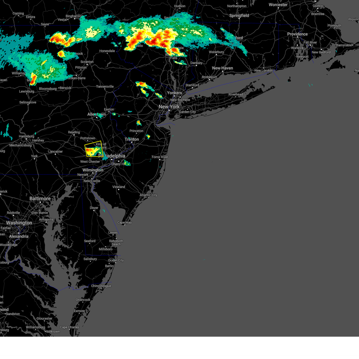 At 710 pm edt, a severe thunderstorm was located over chester springs, or 10 miles north of west chester, moving east at 15 mph (radar indicated). Hazards include 60 mph wind gusts and quarter size hail. Minor damage to vehicles is possible. wind damage to roofs, siding, trees, and power lines is possible. locations impacted include, phoenixville, west norriton, collegeville, royersford, trappe, valley forge, paoli, chester springs, pughtown, lionville, trout lake, radnor township, king of prussia, lionville-marchwood, skippack, spring city, malvern, exton, evansburg and audubon. this includes the following highways, pennsylvania turnpike between mile markers 311 and 329. interstate 76 in pennsylvania between mile markers 327 and 329. interstate 476 in pennsylvania between mile markers 11 and 13. hail threat, radar indicated max hail size, 1. 00 in wind threat, radar indicated max wind gust, 60 mph. At 710 pm edt, a severe thunderstorm was located over chester springs, or 10 miles north of west chester, moving east at 15 mph (radar indicated). Hazards include 60 mph wind gusts and quarter size hail. Minor damage to vehicles is possible. wind damage to roofs, siding, trees, and power lines is possible. locations impacted include, phoenixville, west norriton, collegeville, royersford, trappe, valley forge, paoli, chester springs, pughtown, lionville, trout lake, radnor township, king of prussia, lionville-marchwood, skippack, spring city, malvern, exton, evansburg and audubon. this includes the following highways, pennsylvania turnpike between mile markers 311 and 329. interstate 76 in pennsylvania between mile markers 327 and 329. interstate 476 in pennsylvania between mile markers 11 and 13. hail threat, radar indicated max hail size, 1. 00 in wind threat, radar indicated max wind gust, 60 mph.
|
| 8/12/2023 6:47 PM EDT |
 At 647 pm edt, a severe thunderstorm was located near lionville, or 9 miles northwest of west chester, moving east at 15 mph (radar indicated). Hazards include 60 mph wind gusts and quarter size hail. Minor damage to vehicles is possible. Wind damage to roofs, siding, trees, and power lines is possible. At 647 pm edt, a severe thunderstorm was located near lionville, or 9 miles northwest of west chester, moving east at 15 mph (radar indicated). Hazards include 60 mph wind gusts and quarter size hail. Minor damage to vehicles is possible. Wind damage to roofs, siding, trees, and power lines is possible.
|
| 8/12/2023 3:49 PM EDT |
 At 349 pm edt, a severe thunderstorm was located over reading, moving east at 30 mph (radar indicated). Hazards include 60 mph wind gusts and penny size hail. damage to roofs, siding, trees, and power lines is possible At 349 pm edt, a severe thunderstorm was located over reading, moving east at 30 mph (radar indicated). Hazards include 60 mph wind gusts and penny size hail. damage to roofs, siding, trees, and power lines is possible
|
| 8/7/2023 6:52 PM EDT |
 At 651 pm edt, severe thunderstorms were located along a line extending from spring mount to germantown to alloway, moving northeast at 55 mph (emergency management). Hazards include 70 mph wind gusts and nickel size hail. Expect considerable tree damage. damage is likely to mobile homes, roofs, and outbuildings. locations impacted include, philadelphia, trenton, camden, middletown, gloucester city, cherry hill, bensalem, evesham, mount laurel, ewing, norristown, chester, willingboro, deptford, voorhees, medford, pottstown, west deptford, glassboro and lindenwold. this includes the following highways, new jersey turnpike between exits 1 and 8. pennsylvania turnpike between mile markers 321 and 359. northeast extension between mile markers 21 and 39. interstate 95 in pennsylvania between mile markers 5 and 40. interstate 76 in pennsylvania between mile markers 327 and 351. interstate 76 in new jersey between mile markers 0 and 3. interstate 195 in new jersey between mile markers 0 and 7. interstate 295 in new jersey between mile markers 6 and 76. interstate 676 in pennsylvania between mile markers 0 and 1. interstate 676 in new jersey between mile markers 0 and 4. interstate 476 in pennsylvania between mile markers 0 and 4, and between mile markers 6 and 19. interstate 176 in pennsylvania near mile marker 3. atlantic city expressway between mile markers 32 and 44. thunderstorm damage threat, considerable hail threat, radar indicated max hail size, 0. 88 in wind threat, observed max wind gust, 70 mph. At 651 pm edt, severe thunderstorms were located along a line extending from spring mount to germantown to alloway, moving northeast at 55 mph (emergency management). Hazards include 70 mph wind gusts and nickel size hail. Expect considerable tree damage. damage is likely to mobile homes, roofs, and outbuildings. locations impacted include, philadelphia, trenton, camden, middletown, gloucester city, cherry hill, bensalem, evesham, mount laurel, ewing, norristown, chester, willingboro, deptford, voorhees, medford, pottstown, west deptford, glassboro and lindenwold. this includes the following highways, new jersey turnpike between exits 1 and 8. pennsylvania turnpike between mile markers 321 and 359. northeast extension between mile markers 21 and 39. interstate 95 in pennsylvania between mile markers 5 and 40. interstate 76 in pennsylvania between mile markers 327 and 351. interstate 76 in new jersey between mile markers 0 and 3. interstate 195 in new jersey between mile markers 0 and 7. interstate 295 in new jersey between mile markers 6 and 76. interstate 676 in pennsylvania between mile markers 0 and 1. interstate 676 in new jersey between mile markers 0 and 4. interstate 476 in pennsylvania between mile markers 0 and 4, and between mile markers 6 and 19. interstate 176 in pennsylvania near mile marker 3. atlantic city expressway between mile markers 32 and 44. thunderstorm damage threat, considerable hail threat, radar indicated max hail size, 0. 88 in wind threat, observed max wind gust, 70 mph.
|
| 8/7/2023 6:21 PM EDT |
 At 620 pm edt, severe thunderstorms were located along a line extending from near honey brook to near kennett square to near cecilton, moving northeast at 55 mph (emergency management). Hazards include 70 mph wind gusts and nickel size hail. Expect considerable tree damage. Damage is likely to mobile homes, roofs, and outbuildings. At 620 pm edt, severe thunderstorms were located along a line extending from near honey brook to near kennett square to near cecilton, moving northeast at 55 mph (emergency management). Hazards include 70 mph wind gusts and nickel size hail. Expect considerable tree damage. Damage is likely to mobile homes, roofs, and outbuildings.
|
| 8/7/2023 5:59 PM EDT |
 At 558 pm edt, severe thunderstorms were located along a line extending from near east petersburg to near blake, moving northeast at 55 mph (radar indicated). Hazards include 70 mph wind gusts and nickel size hail. Expect considerable tree damage. damage is likely to mobile homes, roofs, and outbuildings. locations impacted include, reading, west chester, pottstown, phoenixville, coatesville, westtown, wyomissing, downingtown, kennett square, birdsboro, oxford, sinking spring, laureldale, parkesburg, west grove, wernersville, honey brook, elverson, new morgan and glen roy. this includes the following highways, pennsylvania turnpike between mile markers 296 and 324. interstate 176 in pennsylvania between mile markers 1 and 11. thunderstorm damage threat, considerable hail threat, radar indicated max hail size, 0. 88 in wind threat, radar indicated max wind gust, 70 mph. At 558 pm edt, severe thunderstorms were located along a line extending from near east petersburg to near blake, moving northeast at 55 mph (radar indicated). Hazards include 70 mph wind gusts and nickel size hail. Expect considerable tree damage. damage is likely to mobile homes, roofs, and outbuildings. locations impacted include, reading, west chester, pottstown, phoenixville, coatesville, westtown, wyomissing, downingtown, kennett square, birdsboro, oxford, sinking spring, laureldale, parkesburg, west grove, wernersville, honey brook, elverson, new morgan and glen roy. this includes the following highways, pennsylvania turnpike between mile markers 296 and 324. interstate 176 in pennsylvania between mile markers 1 and 11. thunderstorm damage threat, considerable hail threat, radar indicated max hail size, 0. 88 in wind threat, radar indicated max wind gust, 70 mph.
|
| 8/7/2023 5:33 PM EDT |
 At 533 pm edt, a severe thunderstorm was located near sunnyburn, or 10 miles southeast of red lion, moving northeast at 55 mph (radar indicated). Hazards include 70 mph wind gusts and nickel size hail. Expect considerable tree damage. Damage is likely to mobile homes, roofs, and outbuildings. At 533 pm edt, a severe thunderstorm was located near sunnyburn, or 10 miles southeast of red lion, moving northeast at 55 mph (radar indicated). Hazards include 70 mph wind gusts and nickel size hail. Expect considerable tree damage. Damage is likely to mobile homes, roofs, and outbuildings.
|
| 7/25/2023 3:21 PM EDT |
 At 321 pm edt, severe thunderstorms were located along a line extending from near lansdale to near paoli to near coatesville, moving southeast at 10 mph (radar indicated). Hazards include 60 mph wind gusts and quarter size hail. Minor damage to vehicles is possible. Wind damage to roofs, siding, trees, and power lines is possible. At 321 pm edt, severe thunderstorms were located along a line extending from near lansdale to near paoli to near coatesville, moving southeast at 10 mph (radar indicated). Hazards include 60 mph wind gusts and quarter size hail. Minor damage to vehicles is possible. Wind damage to roofs, siding, trees, and power lines is possible.
|
| 7/25/2023 2:32 PM EDT |
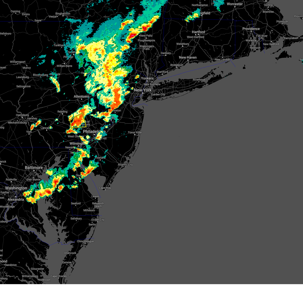 At 232 pm edt, a severe thunderstorm was located over royersford, or 16 miles north of west chester, moving east at 20 mph (radar indicated). Hazards include 60 mph wind gusts and penny size hail. Damage to roofs, siding, trees, and power lines is possible. locations impacted include, pottstown, phoenixville, west norriton, collegeville, royersford, trappe, schwenksville, green lane, pughtown, spring mount, valley forge, chester springs, cedarville, king of prussia, skippack, stowe, spring city, pottsgrove, south pottstown and evansburg. this includes pennsylvania turnpike near mile marker 309. hail threat, radar indicated max hail size, 0. 75 in wind threat, radar indicated max wind gust, 60 mph. At 232 pm edt, a severe thunderstorm was located over royersford, or 16 miles north of west chester, moving east at 20 mph (radar indicated). Hazards include 60 mph wind gusts and penny size hail. Damage to roofs, siding, trees, and power lines is possible. locations impacted include, pottstown, phoenixville, west norriton, collegeville, royersford, trappe, schwenksville, green lane, pughtown, spring mount, valley forge, chester springs, cedarville, king of prussia, skippack, stowe, spring city, pottsgrove, south pottstown and evansburg. this includes pennsylvania turnpike near mile marker 309. hail threat, radar indicated max hail size, 0. 75 in wind threat, radar indicated max wind gust, 60 mph.
|
| 7/25/2023 2:14 PM EDT |
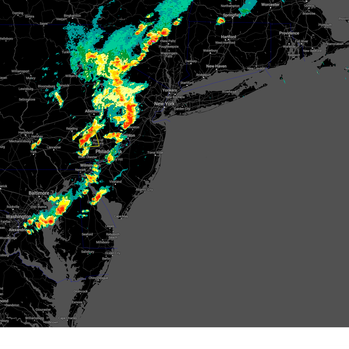 At 214 pm edt, a severe thunderstorm was located over pughtown, or 15 miles north of west chester, moving east at 20 mph (radar indicated). Hazards include 60 mph wind gusts and penny size hail. damage to roofs, siding, trees, and power lines is possible At 214 pm edt, a severe thunderstorm was located over pughtown, or 15 miles north of west chester, moving east at 20 mph (radar indicated). Hazards include 60 mph wind gusts and penny size hail. damage to roofs, siding, trees, and power lines is possible
|
| 7/25/2023 1:09 PM EDT |
 At 108 pm edt, a severe thunderstorm was located near royersford, or 17 miles north of west chester, moving northeast at 25 mph (public reported quarter size hail near green lane). Hazards include 60 mph wind gusts and quarter size hail. Minor damage to vehicles is possible. wind damage to roofs, siding, trees, and power lines is possible. locations impacted include, pottstown, perkasie, souderton, collegeville, royersford, trappe, east greenville, schwenksville, bally, green lane, spring mount, geryville, gilbertsville, cedarville, skippack, stowe, telford, sellersville, boyertown and pennsburg. this includes northeast extension between mile markers 31 and 42. hail threat, observed max hail size, 1. 00 in wind threat, radar indicated max wind gust, 60 mph. At 108 pm edt, a severe thunderstorm was located near royersford, or 17 miles north of west chester, moving northeast at 25 mph (public reported quarter size hail near green lane). Hazards include 60 mph wind gusts and quarter size hail. Minor damage to vehicles is possible. wind damage to roofs, siding, trees, and power lines is possible. locations impacted include, pottstown, perkasie, souderton, collegeville, royersford, trappe, east greenville, schwenksville, bally, green lane, spring mount, geryville, gilbertsville, cedarville, skippack, stowe, telford, sellersville, boyertown and pennsburg. this includes northeast extension between mile markers 31 and 42. hail threat, observed max hail size, 1. 00 in wind threat, radar indicated max wind gust, 60 mph.
|
| 7/25/2023 1:03 PM EDT |
 At 103 pm edt, a severe thunderstorm was located near pughtown, or 15 miles north of west chester, moving northeast at 25 mph (radar indicated). Hazards include 60 mph wind gusts and quarter size hail. Minor damage to vehicles is possible. Wind damage to roofs, siding, trees, and power lines is possible. At 103 pm edt, a severe thunderstorm was located near pughtown, or 15 miles north of west chester, moving northeast at 25 mph (radar indicated). Hazards include 60 mph wind gusts and quarter size hail. Minor damage to vehicles is possible. Wind damage to roofs, siding, trees, and power lines is possible.
|
| 7/21/2023 3:17 AM EDT |
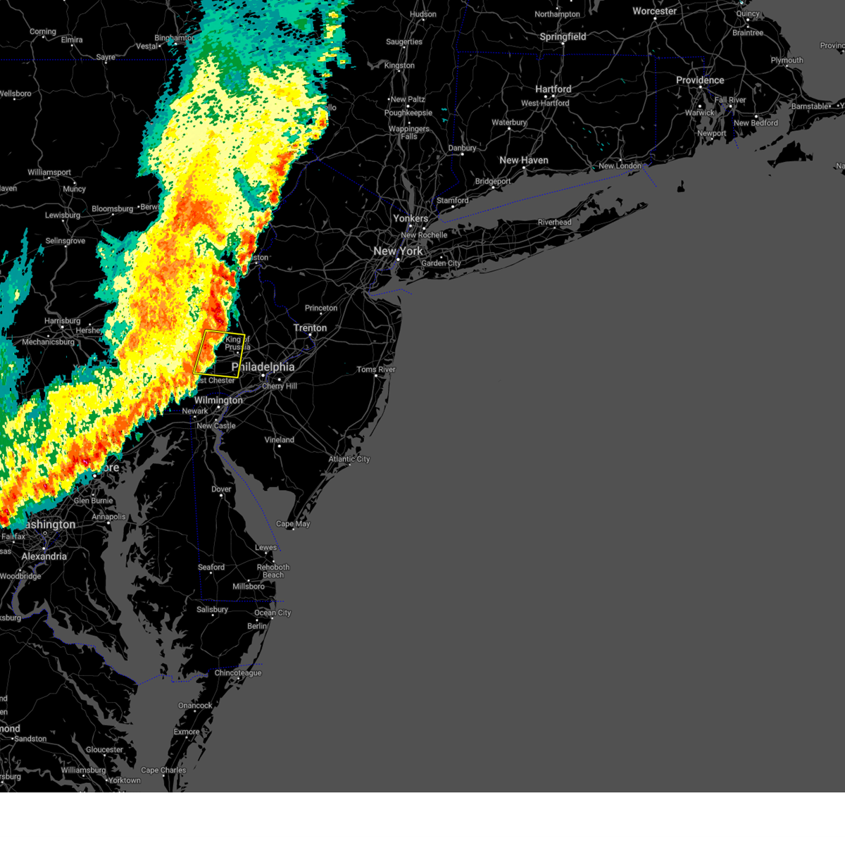 At 317 am edt, a severe thunderstorm was located over phoenixville, or 12 miles north of west chester, moving east at 30 mph (radar indicated). Hazards include 60 mph wind gusts and penny size hail. Damage to roofs, siding, trees, and power lines is possible. locations impacted include, west chester, norristown, pottstown, phoenixville, west norriton, east norriton, downingtown, collegeville, royersford, trappe, pughtown, radnor township, lionville-marchwood, valley forge, paoli, chester springs, newtown square, lionville, king of prussia and broomall. this includes the following highways, pennsylvania turnpike between mile markers 309 and 329. northeast extension near mile marker 28. Interstate 76 in pennsylvania between mile markers 327 and 329. At 317 am edt, a severe thunderstorm was located over phoenixville, or 12 miles north of west chester, moving east at 30 mph (radar indicated). Hazards include 60 mph wind gusts and penny size hail. Damage to roofs, siding, trees, and power lines is possible. locations impacted include, west chester, norristown, pottstown, phoenixville, west norriton, east norriton, downingtown, collegeville, royersford, trappe, pughtown, radnor township, lionville-marchwood, valley forge, paoli, chester springs, newtown square, lionville, king of prussia and broomall. this includes the following highways, pennsylvania turnpike between mile markers 309 and 329. northeast extension near mile marker 28. Interstate 76 in pennsylvania between mile markers 327 and 329.
|
| 7/21/2023 3:13 AM EDT |
 At 313 am edt, severe thunderstorms were located along a line extending from near lehigh university to schwenksville to near west chester, moving east at 40 mph (radar indicated). Hazards include 60 mph wind gusts and penny size hail. damage to roofs, siding, trees, and power lines is possible At 313 am edt, severe thunderstorms were located along a line extending from near lehigh university to schwenksville to near west chester, moving east at 40 mph (radar indicated). Hazards include 60 mph wind gusts and penny size hail. damage to roofs, siding, trees, and power lines is possible
|
| 7/21/2023 2:42 AM EDT |
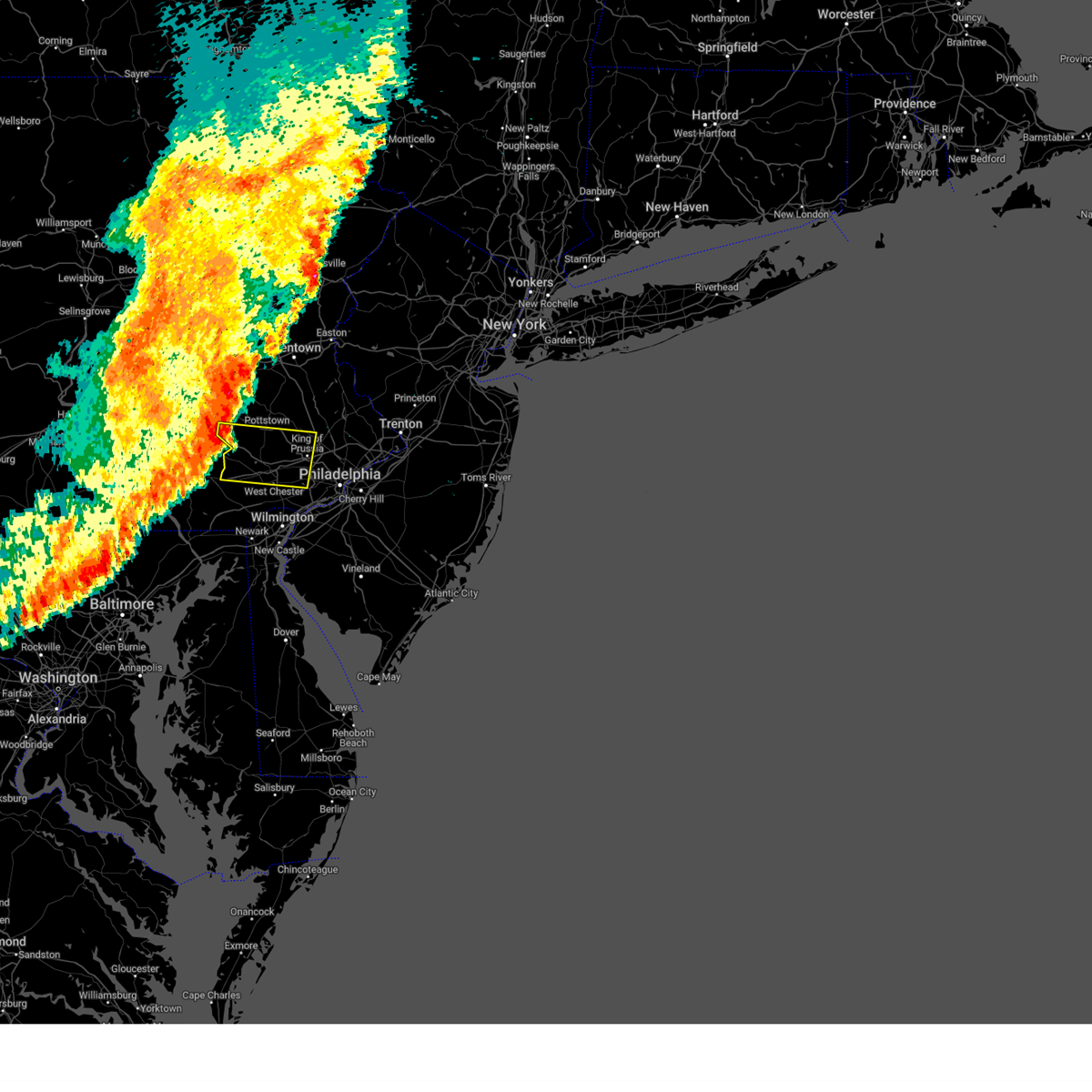 At 241 am edt, a severe thunderstorm was located over new morgan, or 11 miles northeast of new holland, moving east at 35 mph (radar indicated). Hazards include 60 mph wind gusts and penny size hail. damage to roofs, siding, trees, and power lines is possible At 241 am edt, a severe thunderstorm was located over new morgan, or 11 miles northeast of new holland, moving east at 35 mph (radar indicated). Hazards include 60 mph wind gusts and penny size hail. damage to roofs, siding, trees, and power lines is possible
|
| 7/7/2023 3:30 PM EDT |
 At 330 pm edt, severe thunderstorms were located along a line extending from near spring mount to valley forge to west chester, moving east at 15 mph (radar indicated). Hazards include 60 mph wind gusts. Damage to roofs, siding, trees, and power lines is possible. locations impacted include, west chester, norristown, phoenixville, lansdale, west norriton, east norriton, westtown, downingtown, conshohocken, collegeville, royersford, trappe, hatfield, schwenksville, green lane, cheyney, bryn mawr, marshallton, trout lake and radnor township. this includes the following highways, pennsylvania turnpike between mile markers 312 and 335. northeast extension between mile markers 21 and 34. interstate 76 in pennsylvania between mile markers 327 and 335. interstate 476 in pennsylvania between mile markers 10 and 19. hail threat, radar indicated max hail size, <. 75 in wind threat, radar indicated max wind gust, 60 mph. At 330 pm edt, severe thunderstorms were located along a line extending from near spring mount to valley forge to west chester, moving east at 15 mph (radar indicated). Hazards include 60 mph wind gusts. Damage to roofs, siding, trees, and power lines is possible. locations impacted include, west chester, norristown, phoenixville, lansdale, west norriton, east norriton, westtown, downingtown, conshohocken, collegeville, royersford, trappe, hatfield, schwenksville, green lane, cheyney, bryn mawr, marshallton, trout lake and radnor township. this includes the following highways, pennsylvania turnpike between mile markers 312 and 335. northeast extension between mile markers 21 and 34. interstate 76 in pennsylvania between mile markers 327 and 335. interstate 476 in pennsylvania between mile markers 10 and 19. hail threat, radar indicated max hail size, <. 75 in wind threat, radar indicated max wind gust, 60 mph.
|
| 7/7/2023 3:21 PM EDT |
 At 321 pm edt, severe thunderstorms were located along a line extending from green lane to near phoenixville to marshallton, moving east at 10 mph (radar indicated). Hazards include 60 mph wind gusts. damage to roofs, siding, trees, and power lines is possible At 321 pm edt, severe thunderstorms were located along a line extending from green lane to near phoenixville to marshallton, moving east at 10 mph (radar indicated). Hazards include 60 mph wind gusts. damage to roofs, siding, trees, and power lines is possible
|
| 6/27/2023 3:25 PM EDT |
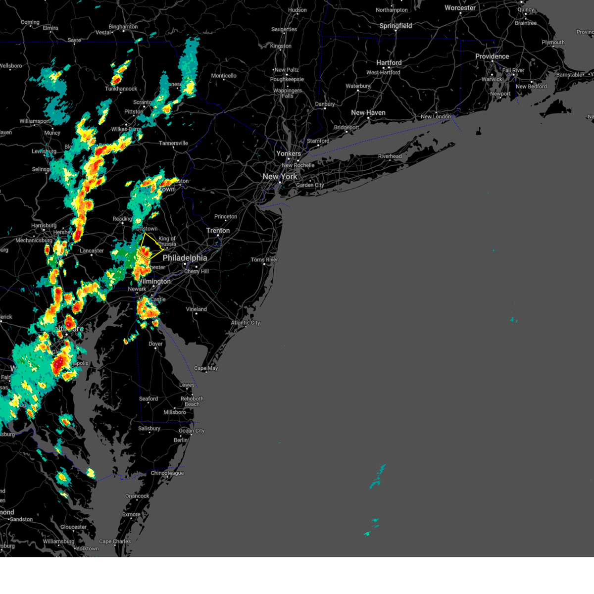 At 325 pm edt, a severe thunderstorm was located over lionville-marchwood, or 7 miles north of west chester, moving northeast at 15 mph (radar indicated). Hazards include 60 mph wind gusts and quarter size hail. Minor damage to vehicles is possible. Wind damage to roofs, siding, trees, and power lines is possible. At 325 pm edt, a severe thunderstorm was located over lionville-marchwood, or 7 miles north of west chester, moving northeast at 15 mph (radar indicated). Hazards include 60 mph wind gusts and quarter size hail. Minor damage to vehicles is possible. Wind damage to roofs, siding, trees, and power lines is possible.
|
| 6/26/2023 10:28 PM EDT |
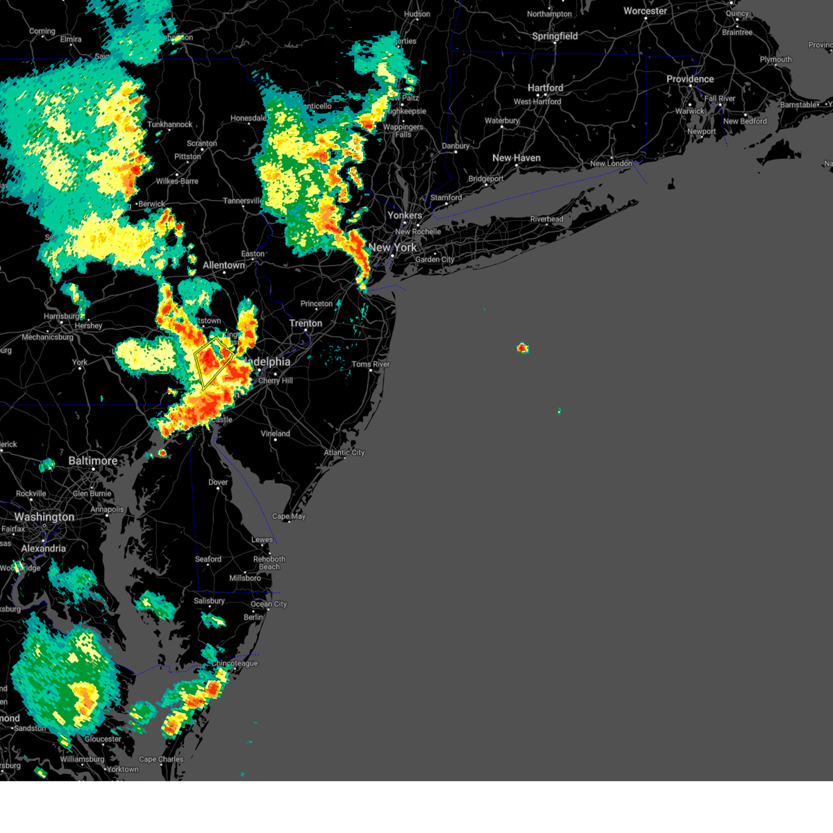 At 1028 pm edt, a severe thunderstorm was located near paoli, or near west chester, moving northeast at 35 mph (radar indicated). Hazards include 60 mph wind gusts. Damage to roofs, siding, trees, and power lines is possible. locations impacted include, west chester, phoenixville, westtown, downingtown, valley forge, paoli, chester springs, lionville, marshallton, lionville-marchwood, west goshen, spring city, malvern, exton, chesterbrook and devon-berwyn. this includes pennsylvania turnpike between mile markers 311 and 325. hail threat, radar indicated max hail size, <. 75 in wind threat, radar indicated max wind gust, 60 mph. At 1028 pm edt, a severe thunderstorm was located near paoli, or near west chester, moving northeast at 35 mph (radar indicated). Hazards include 60 mph wind gusts. Damage to roofs, siding, trees, and power lines is possible. locations impacted include, west chester, phoenixville, westtown, downingtown, valley forge, paoli, chester springs, lionville, marshallton, lionville-marchwood, west goshen, spring city, malvern, exton, chesterbrook and devon-berwyn. this includes pennsylvania turnpike between mile markers 311 and 325. hail threat, radar indicated max hail size, <. 75 in wind threat, radar indicated max wind gust, 60 mph.
|
| 6/26/2023 10:19 PM EDT |
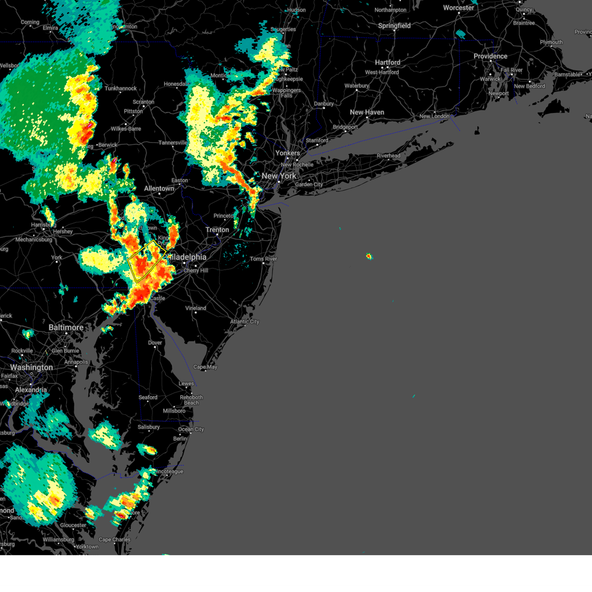 At 1019 pm edt, a severe thunderstorm was located near marshallton, or near west chester, moving northeast at 30 mph (radar indicated). Hazards include 60 mph wind gusts. Damage to roofs, siding, trees, and power lines is possible. locations impacted include, west chester, phoenixville, coatesville, westtown, downingtown, kennett square, valley forge, paoli, chester springs, lionville, marshallton, lionville-marchwood, hockessin, west goshen, spring city, malvern, south coatesville, avondale, modena and exton. this includes pennsylvania turnpike between mile markers 311 and 325. hail threat, radar indicated max hail size, <. 75 in wind threat, radar indicated max wind gust, 60 mph. At 1019 pm edt, a severe thunderstorm was located near marshallton, or near west chester, moving northeast at 30 mph (radar indicated). Hazards include 60 mph wind gusts. Damage to roofs, siding, trees, and power lines is possible. locations impacted include, west chester, phoenixville, coatesville, westtown, downingtown, kennett square, valley forge, paoli, chester springs, lionville, marshallton, lionville-marchwood, hockessin, west goshen, spring city, malvern, south coatesville, avondale, modena and exton. this includes pennsylvania turnpike between mile markers 311 and 325. hail threat, radar indicated max hail size, <. 75 in wind threat, radar indicated max wind gust, 60 mph.
|
| 6/26/2023 10:11 PM EDT |
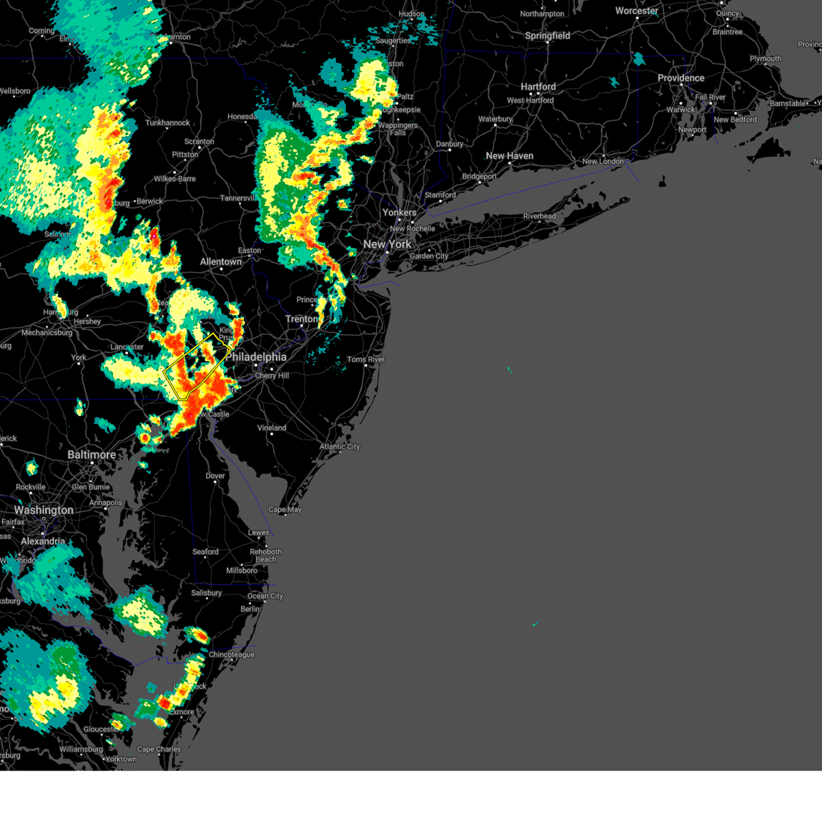 At 1011 pm edt, a severe thunderstorm was located over kennett square, or 8 miles southwest of west chester, moving northeast at 30 mph (radar indicated). Hazards include 60 mph wind gusts. Damage to roofs, siding, trees, and power lines is possible. locations impacted include, west chester, phoenixville, coatesville, westtown, downingtown, kennett square, west grove, cochranville, marshallton, lionville-marchwood, valley forge, landenberg, paoli, chester springs, lionville, kemblesville, hockessin, west goshen, spring city and malvern. this includes pennsylvania turnpike between mile markers 311 and 325. hail threat, radar indicated max hail size, <. 75 in wind threat, radar indicated max wind gust, 60 mph. At 1011 pm edt, a severe thunderstorm was located over kennett square, or 8 miles southwest of west chester, moving northeast at 30 mph (radar indicated). Hazards include 60 mph wind gusts. Damage to roofs, siding, trees, and power lines is possible. locations impacted include, west chester, phoenixville, coatesville, westtown, downingtown, kennett square, west grove, cochranville, marshallton, lionville-marchwood, valley forge, landenberg, paoli, chester springs, lionville, kemblesville, hockessin, west goshen, spring city and malvern. this includes pennsylvania turnpike between mile markers 311 and 325. hail threat, radar indicated max hail size, <. 75 in wind threat, radar indicated max wind gust, 60 mph.
|
| 6/26/2023 9:58 PM EDT |
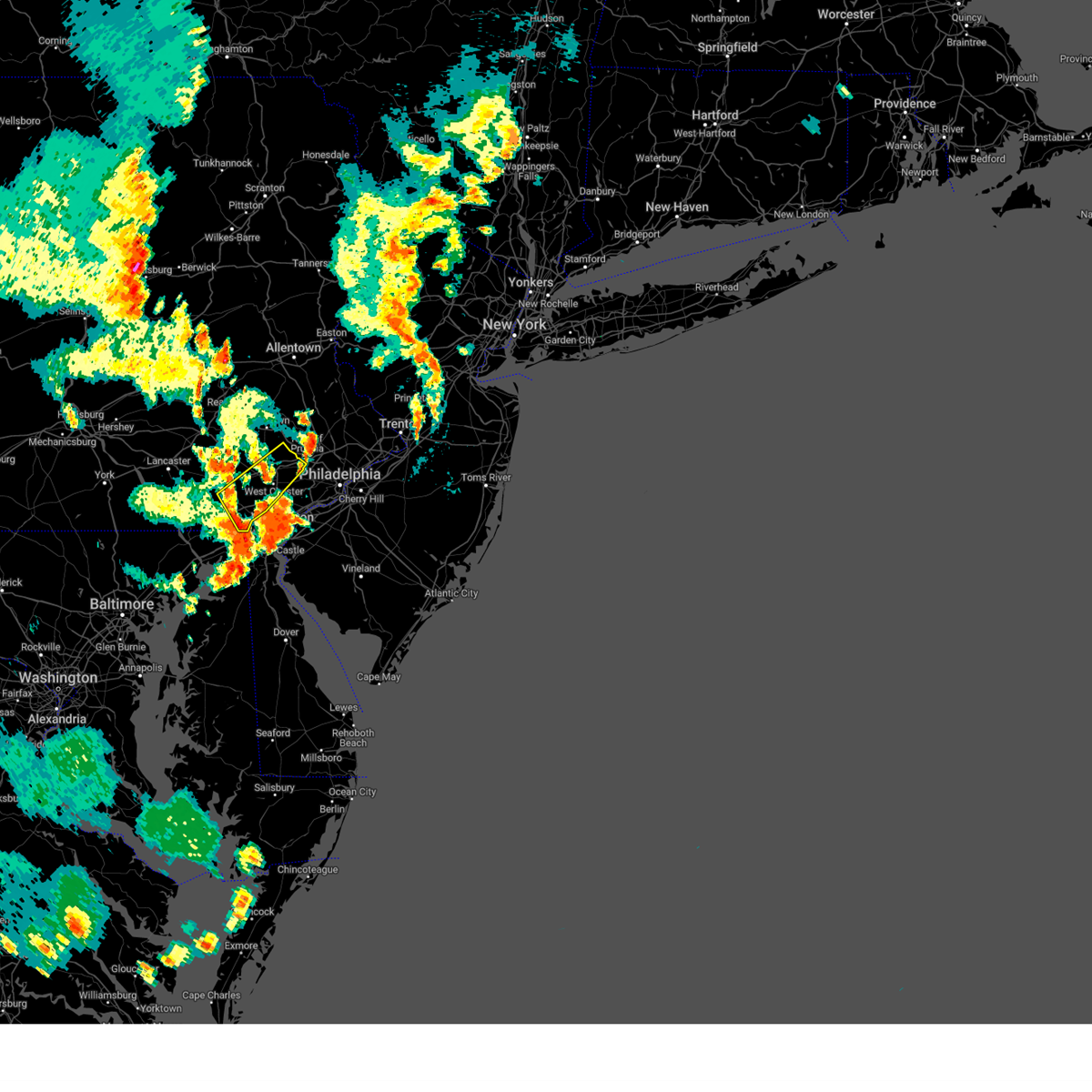 At 957 pm edt, a severe thunderstorm was located over west grove, or 8 miles north of newark, moving northeast at 30 mph (radar indicated). Hazards include 60 mph wind gusts. damage to roofs, siding, trees, and power lines is possible At 957 pm edt, a severe thunderstorm was located over west grove, or 8 miles north of newark, moving northeast at 30 mph (radar indicated). Hazards include 60 mph wind gusts. damage to roofs, siding, trees, and power lines is possible
|
| 6/25/2023 5:03 PM EDT | Tree down. time estimated from rada in chester county PA, 1.2 miles NNW of Spring City, PA |
| 6/16/2023 11:41 AM EDT |
 At 1141 am edt, severe thunderstorms were located along a line extending from pughtown to near west chester to near hockessin, moving east at 35 mph (radar indicated). Hazards include 60 mph wind gusts and quarter size hail. Minor damage to vehicles is possible. wind damage to roofs, siding, trees, and power lines is possible. locations impacted include, wilmington, west chester, norristown, chester, pottstown, phoenixville, west norriton, east norriton, westtown, downingtown, conshohocken, folcroft, swarthmore, kennett square, birdsboro, collegeville, royersford, narberth, trappe and schwenksville. this includes the following highways, pennsylvania turnpike between mile markers 306 and 335. northeast extension between mile markers 21 and 25. interstate 95 in pennsylvania between mile markers 0 and 10. interstate 95 in delaware between mile markers 15 and 23. interstate 76 in pennsylvania between mile markers 327 and 335. interstate 295 in new jersey between mile markers 10 and 15. Interstate 476 in pennsylvania between mile markers 0 and 19. At 1141 am edt, severe thunderstorms were located along a line extending from pughtown to near west chester to near hockessin, moving east at 35 mph (radar indicated). Hazards include 60 mph wind gusts and quarter size hail. Minor damage to vehicles is possible. wind damage to roofs, siding, trees, and power lines is possible. locations impacted include, wilmington, west chester, norristown, chester, pottstown, phoenixville, west norriton, east norriton, westtown, downingtown, conshohocken, folcroft, swarthmore, kennett square, birdsboro, collegeville, royersford, narberth, trappe and schwenksville. this includes the following highways, pennsylvania turnpike between mile markers 306 and 335. northeast extension between mile markers 21 and 25. interstate 95 in pennsylvania between mile markers 0 and 10. interstate 95 in delaware between mile markers 15 and 23. interstate 76 in pennsylvania between mile markers 327 and 335. interstate 295 in new jersey between mile markers 10 and 15. Interstate 476 in pennsylvania between mile markers 0 and 19.
|
| 6/16/2023 11:20 AM EDT |
 At 1119 am edt, severe thunderstorms were located along a line extending from elverson to near coatesville to near kemblesville, moving east at 35 mph (radar indicated). Hazards include 60 mph wind gusts and quarter size hail. Minor damage to vehicles is possible. Wind damage to roofs, siding, trees, and power lines is possible. At 1119 am edt, severe thunderstorms were located along a line extending from elverson to near coatesville to near kemblesville, moving east at 35 mph (radar indicated). Hazards include 60 mph wind gusts and quarter size hail. Minor damage to vehicles is possible. Wind damage to roofs, siding, trees, and power lines is possible.
|
| 4/1/2023 6:54 PM EDT |
 The severe thunderstorm warning for hunterdon, southwestern morris, southern warren, southeastern berks, southeastern lehigh, montgomery, northwestern bucks, northeastern chester and south central northampton counties will expire at 700 pm edt, the storms which prompted the warning have moved out of the area. therefore, the warning will be allowed to expire. however gusty winds are still possible through this evening. a tornado watch remains in effect until 1000 pm edt for northern and northwestern new jersey, and southeastern pennsylvania. a severe thunderstorm watch remains in effect until 800 pm edt for eastern pennsylvania. The severe thunderstorm warning for hunterdon, southwestern morris, southern warren, southeastern berks, southeastern lehigh, montgomery, northwestern bucks, northeastern chester and south central northampton counties will expire at 700 pm edt, the storms which prompted the warning have moved out of the area. therefore, the warning will be allowed to expire. however gusty winds are still possible through this evening. a tornado watch remains in effect until 1000 pm edt for northern and northwestern new jersey, and southeastern pennsylvania. a severe thunderstorm watch remains in effect until 800 pm edt for eastern pennsylvania.
|
| 4/1/2023 6:27 PM EDT |
 At 627 pm edt, severe thunderstorms were located along a line extending from long valley to frenchtown to near phoenixville, moving east at 50 mph (radar indicated). Hazards include 60 mph wind gusts and penny size hail. Damage to roofs, siding, trees, and power lines is possible. locations impacted include, norristown, pottstown, phoenixville, lansdale, west norriton, east norriton, quakertown, perkasie, doylestown, byram, souderton, bedminster, washington, birdsboro, collegeville, royersford, flemington, chalfont, tinicum and high bridge. this includes the following highways, pennsylvania turnpike between mile markers 296 and 303, and between mile markers 326 and 328. northeast extension between mile markers 23 and 46. interstate 76 in pennsylvania near mile marker 327. interstate 78 in new jersey between mile markers 1 and 26. interstate 176 in pennsylvania between mile markers 1 and 3. hail threat, radar indicated max hail size, 0. 75 in wind threat, radar indicated max wind gust, 60 mph. At 627 pm edt, severe thunderstorms were located along a line extending from long valley to frenchtown to near phoenixville, moving east at 50 mph (radar indicated). Hazards include 60 mph wind gusts and penny size hail. Damage to roofs, siding, trees, and power lines is possible. locations impacted include, norristown, pottstown, phoenixville, lansdale, west norriton, east norriton, quakertown, perkasie, doylestown, byram, souderton, bedminster, washington, birdsboro, collegeville, royersford, flemington, chalfont, tinicum and high bridge. this includes the following highways, pennsylvania turnpike between mile markers 296 and 303, and between mile markers 326 and 328. northeast extension between mile markers 23 and 46. interstate 76 in pennsylvania near mile marker 327. interstate 78 in new jersey between mile markers 1 and 26. interstate 176 in pennsylvania between mile markers 1 and 3. hail threat, radar indicated max hail size, 0. 75 in wind threat, radar indicated max wind gust, 60 mph.
|
| 4/1/2023 6:08 PM EDT |
 At 608 pm edt, severe thunderstorms were located along a line extending from pleasant valley to near cedarville, moving east at 45 mph (radar indicated). Hazards include 60 mph wind gusts and penny size hail. Damage to roofs, siding, trees, and power lines is possible. locations impacted include, allentown, easton, bethlehem, norristown, pottstown, phoenixville, lansdale, west norriton, forks, east norriton, emmaus, hackettstown, quakertown, perkasie, doylestown, byram, wilson, souderton, bedminster and washington. this includes the following highways, pennsylvania turnpike between mile markers 296 and 303, and between mile markers 326 and 328. northeast extension between mile markers 23 and 54. interstate 76 in pennsylvania near mile marker 327. interstate 78 in pennsylvania between mile markers 57 and 76. interstate 78 in new jersey between mile markers 0 and 26. interstate 176 in pennsylvania between mile markers 1 and 10. hail threat, radar indicated max hail size, 0. 75 in wind threat, radar indicated max wind gust, 60 mph. At 608 pm edt, severe thunderstorms were located along a line extending from pleasant valley to near cedarville, moving east at 45 mph (radar indicated). Hazards include 60 mph wind gusts and penny size hail. Damage to roofs, siding, trees, and power lines is possible. locations impacted include, allentown, easton, bethlehem, norristown, pottstown, phoenixville, lansdale, west norriton, forks, east norriton, emmaus, hackettstown, quakertown, perkasie, doylestown, byram, wilson, souderton, bedminster and washington. this includes the following highways, pennsylvania turnpike between mile markers 296 and 303, and between mile markers 326 and 328. northeast extension between mile markers 23 and 54. interstate 76 in pennsylvania near mile marker 327. interstate 78 in pennsylvania between mile markers 57 and 76. interstate 78 in new jersey between mile markers 0 and 26. interstate 176 in pennsylvania between mile markers 1 and 10. hail threat, radar indicated max hail size, 0. 75 in wind threat, radar indicated max wind gust, 60 mph.
|
| 4/1/2023 5:53 PM EDT |
 At 552 pm edt, severe thunderstorms were located along a line extending from tatamy to near emmaus to birdsboro, moving east at 50 mph (radar indicated). Hazards include 60 mph wind gusts and penny size hail. damage to roofs, siding, trees, and power lines is possible At 552 pm edt, severe thunderstorms were located along a line extending from tatamy to near emmaus to birdsboro, moving east at 50 mph (radar indicated). Hazards include 60 mph wind gusts and penny size hail. damage to roofs, siding, trees, and power lines is possible
|
| 8/4/2022 8:06 PM EDT |
 The severe thunderstorm warning for central montgomery and west central bucks counties will expire at 815 pm edt, the storm which prompted the warning has weakened below severe limits, and no longer poses an immediate threat to life or property. therefore, the warning will be allowed to expire. however, gusty winds and heavy rain are still possible with this thunderstorm. to report severe weather, contact your nearest law enforcement agency. they will relay your report to the national weather service mount holly nj. The severe thunderstorm warning for central montgomery and west central bucks counties will expire at 815 pm edt, the storm which prompted the warning has weakened below severe limits, and no longer poses an immediate threat to life or property. therefore, the warning will be allowed to expire. however, gusty winds and heavy rain are still possible with this thunderstorm. to report severe weather, contact your nearest law enforcement agency. they will relay your report to the national weather service mount holly nj.
|
| 8/4/2022 7:46 PM EDT |
 At 745 pm edt, a severe thunderstorm was located over schwenksville, or 20 miles north of west chester, moving northeast at 30 mph (radar indicated). Hazards include 60 mph wind gusts and penny size hail. Damage to roofs, siding, trees, and power lines is possible. locations impacted include, phoenixville, lansdale, perkasie, doylestown, souderton, collegeville, royersford, chalfont, trappe, hatfield, dublin, schwenksville, green lane, fricks, spring mount, skippack, telford, sellersville, spring city and new britain. This includes northeast extension between mile markers 28 and 39. At 745 pm edt, a severe thunderstorm was located over schwenksville, or 20 miles north of west chester, moving northeast at 30 mph (radar indicated). Hazards include 60 mph wind gusts and penny size hail. Damage to roofs, siding, trees, and power lines is possible. locations impacted include, phoenixville, lansdale, perkasie, doylestown, souderton, collegeville, royersford, chalfont, trappe, hatfield, dublin, schwenksville, green lane, fricks, spring mount, skippack, telford, sellersville, spring city and new britain. This includes northeast extension between mile markers 28 and 39.
|
| 8/4/2022 7:24 PM EDT |
 At 724 pm edt, a severe thunderstorm was located near royersford, or 17 miles north of west chester, moving northeast at 35 mph (radar indicated). Hazards include 60 mph wind gusts and penny size hail. damage to roofs, siding, trees, and power lines is possible At 724 pm edt, a severe thunderstorm was located near royersford, or 17 miles north of west chester, moving northeast at 35 mph (radar indicated). Hazards include 60 mph wind gusts and penny size hail. damage to roofs, siding, trees, and power lines is possible
|
| 6/1/2022 6:45 PM EDT |
 At 645 pm edt, a severe thunderstorm was located over valley forge, or 11 miles northeast of west chester, moving east at 10 mph (radar indicated). Hazards include 60 mph wind gusts and half dollar size hail. Minor damage to vehicles is possible. Wind damage to roofs, siding, trees, and power lines is possible. At 645 pm edt, a severe thunderstorm was located over valley forge, or 11 miles northeast of west chester, moving east at 10 mph (radar indicated). Hazards include 60 mph wind gusts and half dollar size hail. Minor damage to vehicles is possible. Wind damage to roofs, siding, trees, and power lines is possible.
|
| 5/27/2022 2:23 PM EDT |
 At 223 pm edt, a severe thunderstorm was located over gap, or 11 miles south of new holland, moving northeast at 40 mph (radar indicated). Hazards include 60 mph wind gusts and penny size hail. damage to roofs, siding, trees, and power lines is possible At 223 pm edt, a severe thunderstorm was located over gap, or 11 miles south of new holland, moving northeast at 40 mph (radar indicated). Hazards include 60 mph wind gusts and penny size hail. damage to roofs, siding, trees, and power lines is possible
|
| 5/22/2022 5:57 PM EDT |
 The severe thunderstorm warning for southern montgomery and chester counties will expire at 600 pm edt, the storms which prompted the warning have weakened below severe limits, and have exited the warned area. therefore, the warning will be allowed to expire. however, gusty winds and heavy rain are still possible with these thunderstorms. a severe thunderstorm watch remains in effect until 900 pm edt for northern delaware, and eastern and southeastern pennsylvania. The severe thunderstorm warning for southern montgomery and chester counties will expire at 600 pm edt, the storms which prompted the warning have weakened below severe limits, and have exited the warned area. therefore, the warning will be allowed to expire. however, gusty winds and heavy rain are still possible with these thunderstorms. a severe thunderstorm watch remains in effect until 900 pm edt for northern delaware, and eastern and southeastern pennsylvania.
|
| 5/22/2022 5:34 PM EDT |
 At 534 pm edt, severe thunderstorms were located along a line extending from spring mount to near cochranville, moving east at 30 mph (radar indicated). Hazards include 60 mph wind gusts and nickel size hail. Damage to roofs, siding, trees, and power lines is possible. locations impacted include, west chester, norristown, phoenixville, west norriton, east norriton, coatesville, westtown, downingtown, conshohocken, ambler, kennett square, collegeville, oxford, royersford, parkesburg, trappe, west grove, glen roy, pughtown and mount vernon. this includes the following highways, pennsylvania turnpike between mile markers 305 and 338. northeast extension between mile markers 21 and 26. interstate 76 in pennsylvania between mile markers 327 and 334. interstate 476 in pennsylvania between mile markers 15 and 19. hail threat, radar indicated max hail size, 0. 88 in wind threat, radar indicated max wind gust, 60 mph. At 534 pm edt, severe thunderstorms were located along a line extending from spring mount to near cochranville, moving east at 30 mph (radar indicated). Hazards include 60 mph wind gusts and nickel size hail. Damage to roofs, siding, trees, and power lines is possible. locations impacted include, west chester, norristown, phoenixville, west norriton, east norriton, coatesville, westtown, downingtown, conshohocken, ambler, kennett square, collegeville, oxford, royersford, parkesburg, trappe, west grove, glen roy, pughtown and mount vernon. this includes the following highways, pennsylvania turnpike between mile markers 305 and 338. northeast extension between mile markers 21 and 26. interstate 76 in pennsylvania between mile markers 327 and 334. interstate 476 in pennsylvania between mile markers 15 and 19. hail threat, radar indicated max hail size, 0. 88 in wind threat, radar indicated max wind gust, 60 mph.
|
| 5/22/2022 5:08 PM EDT |
 At 507 pm edt, severe thunderstorms were located along a line extending from elverson to near holtwood, moving east at 30 mph (radar indicated). Hazards include 60 mph wind gusts and nickel size hail. damage to roofs, siding, trees, and power lines is possible At 507 pm edt, severe thunderstorms were located along a line extending from elverson to near holtwood, moving east at 30 mph (radar indicated). Hazards include 60 mph wind gusts and nickel size hail. damage to roofs, siding, trees, and power lines is possible
|
| 5/22/2022 4:51 PM EDT |
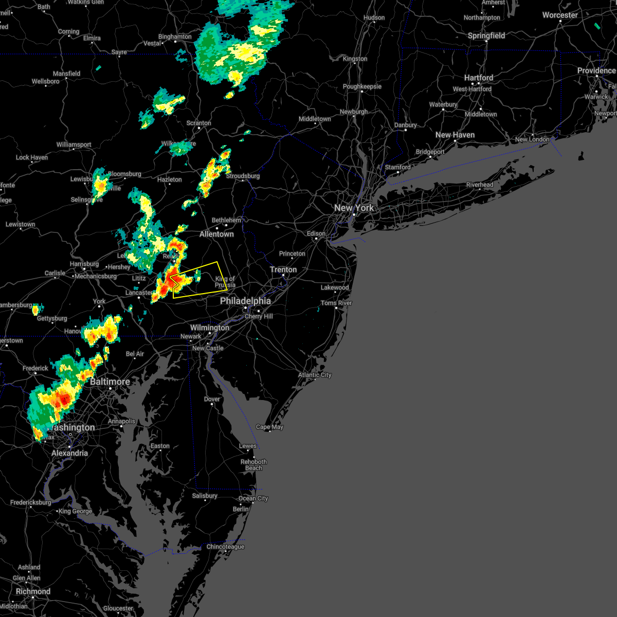 At 451 pm edt, a severe thunderstorm was located over elverson, or 12 miles southeast of reading, moving east at 25 mph (radar indicated). Hazards include 60 mph wind gusts and quarter size hail. Minor damage to vehicles is possible. wind damage to roofs, siding, trees, and power lines is possible. locations impacted include, pottstown, phoenixville, west norriton, collegeville, royersford, trappe, honey brook, schwenksville, elverson, new morgan, pughtown, spring mount, valley forge, glenmoore, chester springs, cedarville, king of prussia, stowe, spring city and pottsgrove. this includes the following highways, pennsylvania turnpike between mile markers 296 and 312. interstate 176 in pennsylvania between mile markers 1 and 5. hail threat, radar indicated max hail size, 1. 00 in wind threat, radar indicated max wind gust, 60 mph. At 451 pm edt, a severe thunderstorm was located over elverson, or 12 miles southeast of reading, moving east at 25 mph (radar indicated). Hazards include 60 mph wind gusts and quarter size hail. Minor damage to vehicles is possible. wind damage to roofs, siding, trees, and power lines is possible. locations impacted include, pottstown, phoenixville, west norriton, collegeville, royersford, trappe, honey brook, schwenksville, elverson, new morgan, pughtown, spring mount, valley forge, glenmoore, chester springs, cedarville, king of prussia, stowe, spring city and pottsgrove. this includes the following highways, pennsylvania turnpike between mile markers 296 and 312. interstate 176 in pennsylvania between mile markers 1 and 5. hail threat, radar indicated max hail size, 1. 00 in wind threat, radar indicated max wind gust, 60 mph.
|
| 5/22/2022 4:34 PM EDT |
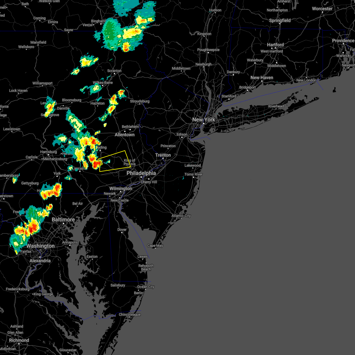 At 434 pm edt, a severe thunderstorm was located over churchtown, or 7 miles east of new holland, moving east at 25 mph (radar indicated). Hazards include 60 mph wind gusts and nickel size hail. damage to roofs, siding, trees, and power lines is possible At 434 pm edt, a severe thunderstorm was located over churchtown, or 7 miles east of new holland, moving east at 25 mph (radar indicated). Hazards include 60 mph wind gusts and nickel size hail. damage to roofs, siding, trees, and power lines is possible
|
| 5/20/2022 3:37 PM EDT |
 At 337 pm edt, severe thunderstorms were located along a line extending from near east norriton to newtown square to talleyville, moving east at 45 mph (radar indicated). Hazards include 60 mph wind gusts and quarter size hail. Minor damage to vehicles is possible. Wind damage to roofs, siding, trees, and power lines is possible. At 337 pm edt, severe thunderstorms were located along a line extending from near east norriton to newtown square to talleyville, moving east at 45 mph (radar indicated). Hazards include 60 mph wind gusts and quarter size hail. Minor damage to vehicles is possible. Wind damage to roofs, siding, trees, and power lines is possible.
|
| 5/16/2022 5:54 PM EDT |
 The severe thunderstorm warning for southeastern berks, northern montgomery and northeastern chester counties will expire at 600 pm edt, the storm which prompted the warning has weakened below severe limits, and no longer poses an immediate threat to life or property. therefore, the warning will be allowed to expire. however small hail, gusty winds and heavy rain are still possible with this thunderstorm. a severe thunderstorm watch remains in effect until 800 pm edt for southeastern pennsylvania. The severe thunderstorm warning for southeastern berks, northern montgomery and northeastern chester counties will expire at 600 pm edt, the storm which prompted the warning has weakened below severe limits, and no longer poses an immediate threat to life or property. therefore, the warning will be allowed to expire. however small hail, gusty winds and heavy rain are still possible with this thunderstorm. a severe thunderstorm watch remains in effect until 800 pm edt for southeastern pennsylvania.
|
| 5/16/2022 5:42 PM EDT |
 At 542 pm edt, a severe thunderstorm was located near pottstown, or 19 miles north of west chester, moving east at 45 mph (radar indicated). Hazards include 60 mph wind gusts and penny size hail. Damage to roofs, siding, trees, and power lines is possible. locations impacted include, pottstown, lansdale, souderton, collegeville, royersford, trappe, hatfield, east greenville, schwenksville, bally, bechtelsville, green lane, pughtown, spring mount, gilbertsville, cedarville, horsham, skippack, stowe and telford. this includes northeast extension between mile markers 26 and 38. hail threat, radar indicated max hail size, 0. 75 in wind threat, radar indicated max wind gust, 60 mph. At 542 pm edt, a severe thunderstorm was located near pottstown, or 19 miles north of west chester, moving east at 45 mph (radar indicated). Hazards include 60 mph wind gusts and penny size hail. Damage to roofs, siding, trees, and power lines is possible. locations impacted include, pottstown, lansdale, souderton, collegeville, royersford, trappe, hatfield, east greenville, schwenksville, bally, bechtelsville, green lane, pughtown, spring mount, gilbertsville, cedarville, horsham, skippack, stowe and telford. this includes northeast extension between mile markers 26 and 38. hail threat, radar indicated max hail size, 0. 75 in wind threat, radar indicated max wind gust, 60 mph.
|
| 5/16/2022 5:33 PM EDT |
 At 533 pm edt, a severe thunderstorm was located over cedarville, or 13 miles southeast of reading, moving east at 45 mph (radar indicated). Hazards include 60 mph wind gusts and quarter size hail. Minor damage to vehicles is possible. wind damage to roofs, siding, trees, and power lines is possible. locations impacted include, pottstown, lansdale, souderton, birdsboro, collegeville, royersford, trappe, hatfield, east greenville, schwenksville, elverson, bally, bechtelsville, green lane, pughtown, spring mount, gilbertsville, cedarville, horsham and skippack. this includes the following highways, pennsylvania turnpike between mile markers 301 and 303. northeast extension between mile markers 26 and 38. hail threat, radar indicated max hail size, 1. 00 in wind threat, radar indicated max wind gust, 60 mph. At 533 pm edt, a severe thunderstorm was located over cedarville, or 13 miles southeast of reading, moving east at 45 mph (radar indicated). Hazards include 60 mph wind gusts and quarter size hail. Minor damage to vehicles is possible. wind damage to roofs, siding, trees, and power lines is possible. locations impacted include, pottstown, lansdale, souderton, birdsboro, collegeville, royersford, trappe, hatfield, east greenville, schwenksville, elverson, bally, bechtelsville, green lane, pughtown, spring mount, gilbertsville, cedarville, horsham and skippack. this includes the following highways, pennsylvania turnpike between mile markers 301 and 303. northeast extension between mile markers 26 and 38. hail threat, radar indicated max hail size, 1. 00 in wind threat, radar indicated max wind gust, 60 mph.
|
| 5/16/2022 5:17 PM EDT |
 At 517 pm edt, a severe thunderstorm was located near new morgan, or 8 miles south of reading, moving east at 50 mph (radar indicated). Hazards include 60 mph wind gusts and quarter size hail. Minor damage to vehicles is possible. Wind damage to roofs, siding, trees, and power lines is possible. At 517 pm edt, a severe thunderstorm was located near new morgan, or 8 miles south of reading, moving east at 50 mph (radar indicated). Hazards include 60 mph wind gusts and quarter size hail. Minor damage to vehicles is possible. Wind damage to roofs, siding, trees, and power lines is possible.
|
| 4/14/2022 5:11 PM EDT |
 The severe thunderstorm warning for central montgomery and west central bucks counties will expire at 515 pm edt, the storm which prompted the warning has moved out of the area. therefore, the warning will be allowed to expire. The severe thunderstorm warning for central montgomery and west central bucks counties will expire at 515 pm edt, the storm which prompted the warning has moved out of the area. therefore, the warning will be allowed to expire.
|
| 4/14/2022 4:53 PM EDT |
 At 453 pm edt, a severe thunderstorm was located over lansdale, or 18 miles northwest of philadelphia, moving northeast at 35 mph (radar indicated). Hazards include 60 mph wind gusts and penny size hail. Damage to roofs, siding, trees, and power lines is possible. locations impacted include, phoenixville, lansdale, perkasie, doylestown, souderton, collegeville, royersford, chalfont, trappe, hatfield, dublin, schwenksville, fricks, spring mount, skippack, telford, sellersville, spring city, north wales and new britain. this includes northeast extension between mile markers 27 and 36. hail threat, radar indicated max hail size, 0. 75 in wind threat, radar indicated max wind gust, 60 mph. At 453 pm edt, a severe thunderstorm was located over lansdale, or 18 miles northwest of philadelphia, moving northeast at 35 mph (radar indicated). Hazards include 60 mph wind gusts and penny size hail. Damage to roofs, siding, trees, and power lines is possible. locations impacted include, phoenixville, lansdale, perkasie, doylestown, souderton, collegeville, royersford, chalfont, trappe, hatfield, dublin, schwenksville, fricks, spring mount, skippack, telford, sellersville, spring city, north wales and new britain. this includes northeast extension between mile markers 27 and 36. hail threat, radar indicated max hail size, 0. 75 in wind threat, radar indicated max wind gust, 60 mph.
|
| 4/14/2022 4:43 PM EDT |
 At 442 pm edt, a severe thunderstorm was located over spring mount, or 21 miles south of allentown, moving northeast at 35 mph (radar indicated). Hazards include 60 mph wind gusts and penny size hail. Damage to roofs, siding, trees, and power lines is possible. locations impacted include, phoenixville, lansdale, quakertown, perkasie, doylestown, souderton, collegeville, royersford, chalfont, trappe, hatfield, dublin, schwenksville, green lane, fricks, spring mount, gilbertsville, skippack, telford and sellersville. this includes northeast extension between mile markers 27 and 42. hail threat, radar indicated max hail size, 0. 75 in wind threat, radar indicated max wind gust, 60 mph. At 442 pm edt, a severe thunderstorm was located over spring mount, or 21 miles south of allentown, moving northeast at 35 mph (radar indicated). Hazards include 60 mph wind gusts and penny size hail. Damage to roofs, siding, trees, and power lines is possible. locations impacted include, phoenixville, lansdale, quakertown, perkasie, doylestown, souderton, collegeville, royersford, chalfont, trappe, hatfield, dublin, schwenksville, green lane, fricks, spring mount, gilbertsville, skippack, telford and sellersville. this includes northeast extension between mile markers 27 and 42. hail threat, radar indicated max hail size, 0. 75 in wind threat, radar indicated max wind gust, 60 mph.
|
| 4/14/2022 4:29 PM EDT |
 At 428 pm edt, a severe thunderstorm was located over royersford, or 17 miles north of west chester, moving northeast at 35 mph. another storm in central montgomery county crossing into bucks county may also turn severe (radar indicated). Hazards include 60 mph wind gusts and penny size hail. damage to roofs, siding, trees, and power lines is possible At 428 pm edt, a severe thunderstorm was located over royersford, or 17 miles north of west chester, moving northeast at 35 mph. another storm in central montgomery county crossing into bucks county may also turn severe (radar indicated). Hazards include 60 mph wind gusts and penny size hail. damage to roofs, siding, trees, and power lines is possible
|
| 3/31/2022 10:03 PM EDT |
 At 1003 pm edt, severe thunderstorms were located along a line extending from near califon to stockton to east norriton to kennett square, moving northeast at 45 mph (radar indicated). Hazards include 60 mph wind gusts and penny size hail. Damage to roofs, siding, trees, and power lines is possible. locations impacted include, philadelphia, trenton, camden, west chester, bensalem, bridgewater, ewing, norristown, dover, phoenixville, lansdale, west norriton, east norriton, yeadon, westtown, perkasie, doylestown, byram, downingtown and conshohocken. this includes the following highways, pennsylvania turnpike between mile markers 312 and 354. northeast extension between mile markers 21 and 33. interstate 95 in pennsylvania between mile markers 2 and 14, and between mile markers 21 and 28. interstate 76 in pennsylvania between mile markers 327 and 349. interstate 78 in new jersey between mile markers 7 and 32. interstate 295 in new jersey between mile markers 71 and 76. interstate 287 in new jersey between mile markers 19 and 24. interstate 676 in pennsylvania between mile markers 0 and 1. interstate 476 in pennsylvania between mile markers 0 and 19. hail threat, radar indicated max hail size, 0. 75 in wind threat, radar indicated max wind gust, 60 mph. At 1003 pm edt, severe thunderstorms were located along a line extending from near califon to stockton to east norriton to kennett square, moving northeast at 45 mph (radar indicated). Hazards include 60 mph wind gusts and penny size hail. Damage to roofs, siding, trees, and power lines is possible. locations impacted include, philadelphia, trenton, camden, west chester, bensalem, bridgewater, ewing, norristown, dover, phoenixville, lansdale, west norriton, east norriton, yeadon, westtown, perkasie, doylestown, byram, downingtown and conshohocken. this includes the following highways, pennsylvania turnpike between mile markers 312 and 354. northeast extension between mile markers 21 and 33. interstate 95 in pennsylvania between mile markers 2 and 14, and between mile markers 21 and 28. interstate 76 in pennsylvania between mile markers 327 and 349. interstate 78 in new jersey between mile markers 7 and 32. interstate 295 in new jersey between mile markers 71 and 76. interstate 287 in new jersey between mile markers 19 and 24. interstate 676 in pennsylvania between mile markers 0 and 1. interstate 476 in pennsylvania between mile markers 0 and 19. hail threat, radar indicated max hail size, 0. 75 in wind threat, radar indicated max wind gust, 60 mph.
|
| 3/31/2022 9:36 PM EDT |
 At 935 pm edt, severe thunderstorms were located along a line extending from old orchard to souderton to near lionville-marchwood to near oxford, moving east at 45 mph (radar indicated). Hazards include 60 mph wind gusts and penny size hail. damage to roofs, siding, trees, and power lines is possible At 935 pm edt, severe thunderstorms were located along a line extending from old orchard to souderton to near lionville-marchwood to near oxford, moving east at 45 mph (radar indicated). Hazards include 60 mph wind gusts and penny size hail. damage to roofs, siding, trees, and power lines is possible
|
| 3/31/2022 9:32 PM EDT |
 At 931 pm edt, severe thunderstorms were located along a line extending from springtown to quakertown to near souderton to phoenixville to oxford, moving northeast at 55 mph (radar indicated). Hazards include 60 mph wind gusts and penny size hail. Damage to roofs, siding, trees, and power lines is possible. locations impacted include, west chester, norristown, pottstown, phoenixville, lansdale, west norriton, east norriton, coatesville, westtown, quakertown, perkasie, doylestown, byram, downingtown, souderton, bedminster, kennett square, collegeville, oxford and royersford. this includes the following highways, pennsylvania turnpike between mile markers 303 and 332. northeast extension between mile markers 21 and 49. interstate 76 in pennsylvania between mile markers 327 and 329. interstate 78 in pennsylvania between mile markers 62 and 63. hail threat, radar indicated max hail size, 0. 75 in wind threat, radar indicated max wind gust, 60 mph. At 931 pm edt, severe thunderstorms were located along a line extending from springtown to quakertown to near souderton to phoenixville to oxford, moving northeast at 55 mph (radar indicated). Hazards include 60 mph wind gusts and penny size hail. Damage to roofs, siding, trees, and power lines is possible. locations impacted include, west chester, norristown, pottstown, phoenixville, lansdale, west norriton, east norriton, coatesville, westtown, quakertown, perkasie, doylestown, byram, downingtown, souderton, bedminster, kennett square, collegeville, oxford and royersford. this includes the following highways, pennsylvania turnpike between mile markers 303 and 332. northeast extension between mile markers 21 and 49. interstate 76 in pennsylvania between mile markers 327 and 329. interstate 78 in pennsylvania between mile markers 62 and 63. hail threat, radar indicated max hail size, 0. 75 in wind threat, radar indicated max wind gust, 60 mph.
|
| 3/31/2022 9:10 PM EDT |
 At 910 pm edt, severe thunderstorms were located along a line extending from near bally to near bechtelsville to cedarville to near honey brook to near glen roy, moving northeast at 50 mph (radar indicated). Hazards include 60 mph wind gusts and penny size hail. Damage to roofs, siding, trees, and power lines is possible. locations impacted include, west chester, norristown, pottstown, phoenixville, lansdale, west norriton, east norriton, coatesville, emmaus, westtown, quakertown, perkasie, doylestown, byram, downingtown, souderton, bedminster, kennett square, birdsboro and collegeville. this includes the following highways, pennsylvania turnpike between mile markers 299 and 332. northeast extension between mile markers 21 and 52. interstate 76 in pennsylvania between mile markers 327 and 329. interstate 78 in pennsylvania between mile markers 61 and 63. hail threat, radar indicated max hail size, 0. 75 in wind threat, radar indicated max wind gust, 60 mph. At 910 pm edt, severe thunderstorms were located along a line extending from near bally to near bechtelsville to cedarville to near honey brook to near glen roy, moving northeast at 50 mph (radar indicated). Hazards include 60 mph wind gusts and penny size hail. Damage to roofs, siding, trees, and power lines is possible. locations impacted include, west chester, norristown, pottstown, phoenixville, lansdale, west norriton, east norriton, coatesville, emmaus, westtown, quakertown, perkasie, doylestown, byram, downingtown, souderton, bedminster, kennett square, birdsboro and collegeville. this includes the following highways, pennsylvania turnpike between mile markers 299 and 332. northeast extension between mile markers 21 and 52. interstate 76 in pennsylvania between mile markers 327 and 329. interstate 78 in pennsylvania between mile markers 61 and 63. hail threat, radar indicated max hail size, 0. 75 in wind threat, radar indicated max wind gust, 60 mph.
|
| 3/31/2022 8:47 PM EDT |
 At 846 pm edt, severe thunderstorms were located along a line extending from near wyomissing to near churchtown to near strasburg to near wakefield, moving northeast at 50 mph (radar indicated). Hazards include 60 mph wind gusts and penny size hail. damage to roofs, siding, trees, and power lines is possible At 846 pm edt, severe thunderstorms were located along a line extending from near wyomissing to near churchtown to near strasburg to near wakefield, moving northeast at 50 mph (radar indicated). Hazards include 60 mph wind gusts and penny size hail. damage to roofs, siding, trees, and power lines is possible
|
| 3/7/2022 8:48 PM EST |
 At 847 pm est, severe showers and embedded thunderstorms were located along a line extending from near collegeville to pleasant hill, moving east at 50 mph. this line has a history or producing areas of wind damage (radar indicated). Hazards include 70 mph wind gusts. Expect considerable tree damage. damage is likely to mobile homes, roofs, and outbuildings. locations impacted include, philadelphia, camden, wilmington, west chester, bensalem, norristown, chester, phoenixville, west norriton, east norriton, coatesville, yeadon, westtown, carneys point, downingtown, conshohocken, palmyra, hatboro, folcroft and ambler. this includes the following highways, pennsylvania turnpike between mile markers 306 and 352. northeast extension between mile markers 21 and 25. interstate 95 in pennsylvania between mile markers 0 and 16, and between mile markers 19 and 35. interstate 95 in delaware between mile markers 12 and 23. interstate 76 in pennsylvania between mile markers 327 and 350. interstate 676 in pennsylvania between mile markers 0 and 1. interstate 476 in pennsylvania between mile markers 0 and 19. thunderstorm damage threat, considerable hail threat, radar indicated max hail size, <. 75 in wind threat, radar indicated max wind gust, 70 mph. At 847 pm est, severe showers and embedded thunderstorms were located along a line extending from near collegeville to pleasant hill, moving east at 50 mph. this line has a history or producing areas of wind damage (radar indicated). Hazards include 70 mph wind gusts. Expect considerable tree damage. damage is likely to mobile homes, roofs, and outbuildings. locations impacted include, philadelphia, camden, wilmington, west chester, bensalem, norristown, chester, phoenixville, west norriton, east norriton, coatesville, yeadon, westtown, carneys point, downingtown, conshohocken, palmyra, hatboro, folcroft and ambler. this includes the following highways, pennsylvania turnpike between mile markers 306 and 352. northeast extension between mile markers 21 and 25. interstate 95 in pennsylvania between mile markers 0 and 16, and between mile markers 19 and 35. interstate 95 in delaware between mile markers 12 and 23. interstate 76 in pennsylvania between mile markers 327 and 350. interstate 676 in pennsylvania between mile markers 0 and 1. interstate 476 in pennsylvania between mile markers 0 and 19. thunderstorm damage threat, considerable hail threat, radar indicated max hail size, <. 75 in wind threat, radar indicated max wind gust, 70 mph.
|
| 3/7/2022 8:46 PM EST |
 At 844 pm est, severe showers and embedded thunderstorms were located along a line extending from near vernon valley to near clinton to royersford, moving east at 50 mph. this line has a history of producing areas of wind damage (trained weather spotters). Hazards include 70 mph wind gusts. Expect considerable tree damage. damage is likely to mobile homes, roofs, and outbuildings. locations impacted include, easton, morristown, somerville, newton, bridgewater, pottstown, dover, lansdale, madison, hopatcong, florham park, east hanover, lincoln park, kinnelon, hackettstown, quakertown, perkasie, doylestown, byram and boonton. this includes the following highways, northeast extension between mile markers 25 and 45. interstate 78 in new jersey between mile markers 0 and 37. interstate 80 in new jersey between mile markers 12 and 47. interstate 287 in new jersey between mile markers 16 and 54. thunderstorm damage threat, considerable hail threat, radar indicated max hail size, <. 75 in wind threat, radar indicated max wind gust, 70 mph. At 844 pm est, severe showers and embedded thunderstorms were located along a line extending from near vernon valley to near clinton to royersford, moving east at 50 mph. this line has a history of producing areas of wind damage (trained weather spotters). Hazards include 70 mph wind gusts. Expect considerable tree damage. damage is likely to mobile homes, roofs, and outbuildings. locations impacted include, easton, morristown, somerville, newton, bridgewater, pottstown, dover, lansdale, madison, hopatcong, florham park, east hanover, lincoln park, kinnelon, hackettstown, quakertown, perkasie, doylestown, byram and boonton. this includes the following highways, northeast extension between mile markers 25 and 45. interstate 78 in new jersey between mile markers 0 and 37. interstate 80 in new jersey between mile markers 12 and 47. interstate 287 in new jersey between mile markers 16 and 54. thunderstorm damage threat, considerable hail threat, radar indicated max hail size, <. 75 in wind threat, radar indicated max wind gust, 70 mph.
|
| 3/7/2022 8:29 PM EST |
 At 826 pm est, severe showers and embedded thunderstorms were located along a line extending from near milford to alpha to near new morgan, moving east at 55 mph. this line has had a history of producing areas of wind damage (trained weather spotters. a 66 mph wind gust was measured in forks township in northampton county). Hazards include 70 mph wind gusts. Expect considerable tree damage. damage is likely to mobile homes, roofs, and outbuildings. locations impacted include, allentown, reading, easton, morristown, somerville, newton, montague, bethlehem, bridgewater, pottstown, dover, lansdale, madison, hopatcong, forks, florham park, emmaus, east hanover, lincoln park and wyomissing. this includes the following highways, pennsylvania turnpike between mile markers 295 and 303. northeast extension between mile markers 26 and 57. interstate 78 in pennsylvania between mile markers 54 and 76. interstate 78 in new jersey between mile markers 0 and 37. interstate 80 in pennsylvania between mile markers 310 and 314. interstate 80 in new jersey between mile markers 0 and 47. interstate 287 in new jersey between mile markers 16 and 54. interstate 176 in pennsylvania between mile markers 1 and 11. thunderstorm damage threat, considerable hail threat, radar indicated max hail size, <. 75 in wind threat, radar indicated max wind gust, 70 mph. At 826 pm est, severe showers and embedded thunderstorms were located along a line extending from near milford to alpha to near new morgan, moving east at 55 mph. this line has had a history of producing areas of wind damage (trained weather spotters. a 66 mph wind gust was measured in forks township in northampton county). Hazards include 70 mph wind gusts. Expect considerable tree damage. damage is likely to mobile homes, roofs, and outbuildings. locations impacted include, allentown, reading, easton, morristown, somerville, newton, montague, bethlehem, bridgewater, pottstown, dover, lansdale, madison, hopatcong, forks, florham park, emmaus, east hanover, lincoln park and wyomissing. this includes the following highways, pennsylvania turnpike between mile markers 295 and 303. northeast extension between mile markers 26 and 57. interstate 78 in pennsylvania between mile markers 54 and 76. interstate 78 in new jersey between mile markers 0 and 37. interstate 80 in pennsylvania between mile markers 310 and 314. interstate 80 in new jersey between mile markers 0 and 47. interstate 287 in new jersey between mile markers 16 and 54. interstate 176 in pennsylvania between mile markers 1 and 11. thunderstorm damage threat, considerable hail threat, radar indicated max hail size, <. 75 in wind threat, radar indicated max wind gust, 70 mph.
|
| 3/7/2022 8:21 PM EST |
 At 820 pm est, severe showers and embedded thunderstorms were located along a line extending from near lyons to near delta, moving east at 60 mph. this line has had a history of producing areas of wind damage (radar indicated). Hazards include 60 mph wind gusts. damage to roofs, siding, trees, and power lines is possible At 820 pm est, severe showers and embedded thunderstorms were located along a line extending from near lyons to near delta, moving east at 60 mph. this line has had a history of producing areas of wind damage (radar indicated). Hazards include 60 mph wind gusts. damage to roofs, siding, trees, and power lines is possible
|
| 3/7/2022 8:11 PM EST |
 At 810 pm est, severe showers and embedded thunderstorms were located along a line extending from blooming grove to near northampton to near denver, moving east at 55 mph (public). Hazards include 60 mph wind gusts. a 59 mph wind gust was reported in lehighton pennsylvania. Damage to roofs, siding, trees, and power lines is possible. locations impacted include, allentown, reading, easton, morristown, somerville, newton, montague, bethlehem, bridgewater, pottstown, dover, lansdale, madison, hopatcong, forks, florham park, emmaus, east hanover, lincoln park and wyomissing. this includes the following highways, pennsylvania turnpike between mile markers 295 and 303. northeast extension between mile markers 26 and 57. interstate 78 in pennsylvania between mile markers 54 and 76. interstate 78 in new jersey between mile markers 0 and 37. interstate 80 in pennsylvania between mile markers 308 and 314. interstate 80 in new jersey between mile markers 0 and 47. interstate 287 in new jersey between mile markers 16 and 54. interstate 176 in pennsylvania between mile markers 1 and 11. hail threat, radar indicated max hail size, <. 75 in wind threat, radar indicated max wind gust, 60 mph. At 810 pm est, severe showers and embedded thunderstorms were located along a line extending from blooming grove to near northampton to near denver, moving east at 55 mph (public). Hazards include 60 mph wind gusts. a 59 mph wind gust was reported in lehighton pennsylvania. Damage to roofs, siding, trees, and power lines is possible. locations impacted include, allentown, reading, easton, morristown, somerville, newton, montague, bethlehem, bridgewater, pottstown, dover, lansdale, madison, hopatcong, forks, florham park, emmaus, east hanover, lincoln park and wyomissing. this includes the following highways, pennsylvania turnpike between mile markers 295 and 303. northeast extension between mile markers 26 and 57. interstate 78 in pennsylvania between mile markers 54 and 76. interstate 78 in new jersey between mile markers 0 and 37. interstate 80 in pennsylvania between mile markers 308 and 314. interstate 80 in new jersey between mile markers 0 and 47. interstate 287 in new jersey between mile markers 16 and 54. interstate 176 in pennsylvania between mile markers 1 and 11. hail threat, radar indicated max hail size, <. 75 in wind threat, radar indicated max wind gust, 60 mph.
|
| 3/7/2022 8:05 PM EST |
 At 803 pm est, severe showers and embedded thunderstorms were located along a line extending from near hawley to kunkletown to wernersville, moving east at 50 mph. this line has had a history of producing areas of wind damage (radar indicated). Hazards include 60 mph wind gusts. damage to roofs, siding, trees, and power lines is possible At 803 pm est, severe showers and embedded thunderstorms were located along a line extending from near hawley to kunkletown to wernersville, moving east at 50 mph. this line has had a history of producing areas of wind damage (radar indicated). Hazards include 60 mph wind gusts. damage to roofs, siding, trees, and power lines is possible
|
| 12/11/2021 9:29 PM EST |
 At 929 pm est, severe thunderstorms were located along a line extending from annandale to glen westover, moving east at 35 mph (public). Hazards include 60 mph wind gusts. Damage to roofs, siding, trees, and power lines is possible. locations impacted include, philadelphia, wilmington, newark, west chester, norristown, chester, phoenixville, lansdale, west norriton, east norriton, pennsville, yeadon, westtown, perkasie, doylestown, byram, downingtown, conshohocken, hatboro and souderton. this includes the following highways, pennsylvania turnpike between mile markers 312 and 350. northeast extension between mile markers 21 and 37. interstate 95 in pennsylvania between mile markers 0 and 11. interstate 95 in delaware between mile markers 7 and 23. interstate 76 in pennsylvania between mile markers 327 and 346. interstate 295 in new jersey near mile marker 0. interstate 676 in pennsylvania near mile marker 0. Interstate 476 in pennsylvania between mile markers 0 and 19. At 929 pm est, severe thunderstorms were located along a line extending from annandale to glen westover, moving east at 35 mph (public). Hazards include 60 mph wind gusts. Damage to roofs, siding, trees, and power lines is possible. locations impacted include, philadelphia, wilmington, newark, west chester, norristown, chester, phoenixville, lansdale, west norriton, east norriton, pennsville, yeadon, westtown, perkasie, doylestown, byram, downingtown, conshohocken, hatboro and souderton. this includes the following highways, pennsylvania turnpike between mile markers 312 and 350. northeast extension between mile markers 21 and 37. interstate 95 in pennsylvania between mile markers 0 and 11. interstate 95 in delaware between mile markers 7 and 23. interstate 76 in pennsylvania between mile markers 327 and 346. interstate 295 in new jersey near mile marker 0. interstate 676 in pennsylvania near mile marker 0. Interstate 476 in pennsylvania between mile markers 0 and 19.
|
| 12/11/2021 9:01 PM EST |
 At 900 pm est, severe thunderstorms were located along a line extending from alpha to rising sun, moving east at 35 mph (radar indicated). Hazards include 60 mph wind gusts. damage to roofs, siding, trees, and power lines is possible At 900 pm est, severe thunderstorms were located along a line extending from alpha to rising sun, moving east at 35 mph (radar indicated). Hazards include 60 mph wind gusts. damage to roofs, siding, trees, and power lines is possible
|
| 10/25/2021 7:52 PM EDT | Downed trees and wires near half hill road. time estimated from rada in chester county PA, 5.6 miles ENE of Spring City, PA |
| 10/25/2021 7:39 PM EDT |
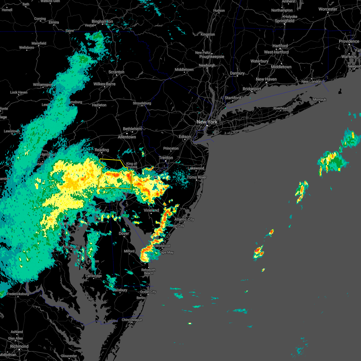 The severe thunderstorm warning for southern berks, chester and western delaware counties will expire at 745 pm edt, the storms which prompted the warning have weakened below severe limits, and no longer pose an immediate threat to life or property. therefore, the warning will be allowed to expire. however gusty winds are still possible with these thunderstorms. The severe thunderstorm warning for southern berks, chester and western delaware counties will expire at 745 pm edt, the storms which prompted the warning have weakened below severe limits, and no longer pose an immediate threat to life or property. therefore, the warning will be allowed to expire. however gusty winds are still possible with these thunderstorms.
|
| 10/25/2021 7:25 PM EDT |
 At 725 pm edt, severe thunderstorms were located along a line extending from near quarryville to marshallton, moving north at 45 mph (radar indicated). Hazards include 60 mph wind gusts. Damage to roofs, siding, trees, and power lines is possible. locations impacted include, west chester, chester, phoenixville, coatesville, westtown, downingtown, kennett square, parkesburg, honey brook, elverson, new morgan, cheyney, pughtown, elam, marshallton, chelsea, gradyville, newtown square, chester township and homeville. this includes the following highways, pennsylvania turnpike between mile markers 296 and 324. interstate 95 in pennsylvania between mile markers 2 and 3. interstate 176 in pennsylvania between mile markers 1 and 7. hail threat, radar indicated max hail size, <. 75 in wind threat, radar indicated max wind gust, 60 mph. At 725 pm edt, severe thunderstorms were located along a line extending from near quarryville to marshallton, moving north at 45 mph (radar indicated). Hazards include 60 mph wind gusts. Damage to roofs, siding, trees, and power lines is possible. locations impacted include, west chester, chester, phoenixville, coatesville, westtown, downingtown, kennett square, parkesburg, honey brook, elverson, new morgan, cheyney, pughtown, elam, marshallton, chelsea, gradyville, newtown square, chester township and homeville. this includes the following highways, pennsylvania turnpike between mile markers 296 and 324. interstate 95 in pennsylvania between mile markers 2 and 3. interstate 176 in pennsylvania between mile markers 1 and 7. hail threat, radar indicated max hail size, <. 75 in wind threat, radar indicated max wind gust, 60 mph.
|
| 10/25/2021 6:57 PM EDT |
 The national weather service in mount holly nj has issued a * severe thunderstorm warning for. northern new castle county in northern delaware. southern berks county in eastern pennsylvania. chester county in southeastern pennsylvania. Western delaware county in southeastern pennsylvania. The national weather service in mount holly nj has issued a * severe thunderstorm warning for. northern new castle county in northern delaware. southern berks county in eastern pennsylvania. chester county in southeastern pennsylvania. Western delaware county in southeastern pennsylvania.
|
| 10/25/2021 6:57 PM EDT |
 At 657 pm edt, severe thunderstorms were located along a line extending from near conowingo to barksdale, moving north at 45 mph (radar indicated). Hazards include 60 mph wind gusts. damage to roofs, siding, trees, and power lines is possible At 657 pm edt, severe thunderstorms were located along a line extending from near conowingo to barksdale, moving north at 45 mph (radar indicated). Hazards include 60 mph wind gusts. damage to roofs, siding, trees, and power lines is possible
|
| 9/23/2021 12:45 PM EDT |
 At 1245 pm edt, severe thunderstorms were located along a line extending from near gilbertsville to near spring mount to narberth, moving north at 45 mph (radar indicated). Hazards include 60 mph wind gusts. Damage to roofs, siding, trees, and power lines is possible. locations impacted include, philadelphia, norristown, chester, pottstown, phoenixville, west norriton, east norriton, yeadon, conshohocken, folcroft, swarthmore, collegeville, royersford, narberth, trappe, east lansdowne, schwenksville, green lane, darby township and morris park. this includes the following highways, pennsylvania turnpike between mile markers 326 and 337. northeast extension between mile markers 21 and 38. interstate 95 in pennsylvania between mile markers 1 and 9. interstate 76 in pennsylvania between mile markers 327 and 340. interstate 295 in new jersey between mile markers 10 and 11. Interstate 476 in pennsylvania between mile markers 0 and 11, and between mile markers 13 and 19. At 1245 pm edt, severe thunderstorms were located along a line extending from near gilbertsville to near spring mount to narberth, moving north at 45 mph (radar indicated). Hazards include 60 mph wind gusts. Damage to roofs, siding, trees, and power lines is possible. locations impacted include, philadelphia, norristown, chester, pottstown, phoenixville, west norriton, east norriton, yeadon, conshohocken, folcroft, swarthmore, collegeville, royersford, narberth, trappe, east lansdowne, schwenksville, green lane, darby township and morris park. this includes the following highways, pennsylvania turnpike between mile markers 326 and 337. northeast extension between mile markers 21 and 38. interstate 95 in pennsylvania between mile markers 1 and 9. interstate 76 in pennsylvania between mile markers 327 and 340. interstate 295 in new jersey between mile markers 10 and 11. Interstate 476 in pennsylvania between mile markers 0 and 11, and between mile markers 13 and 19.
|
| 9/23/2021 12:34 PM EDT |
 At 1234 pm edt, severe thunderstorms were located along a line extending from near pughtown to collegeville to darby township, moving north at 45 mph (radar indicated). Hazards include 60 mph wind gusts. Damage to roofs, siding, trees, and power lines is possible. locations impacted include, philadelphia, norristown, chester, pottstown, phoenixville, west norriton, east norriton, yeadon, carneys point, conshohocken, folcroft, swarthmore, collegeville, royersford, narberth, trappe, east lansdowne, schwenksville, green lane and pughtown. this includes the following highways, pennsylvania turnpike between mile markers 316 and 337. northeast extension between mile markers 21 and 38. interstate 95 in pennsylvania between mile markers 1 and 9. interstate 76 in pennsylvania between mile markers 327 and 340. interstate 295 in new jersey between mile markers 4 and 10. Interstate 476 in pennsylvania between mile markers 0 and 19. At 1234 pm edt, severe thunderstorms were located along a line extending from near pughtown to collegeville to darby township, moving north at 45 mph (radar indicated). Hazards include 60 mph wind gusts. Damage to roofs, siding, trees, and power lines is possible. locations impacted include, philadelphia, norristown, chester, pottstown, phoenixville, west norriton, east norriton, yeadon, carneys point, conshohocken, folcroft, swarthmore, collegeville, royersford, narberth, trappe, east lansdowne, schwenksville, green lane and pughtown. this includes the following highways, pennsylvania turnpike between mile markers 316 and 337. northeast extension between mile markers 21 and 38. interstate 95 in pennsylvania between mile markers 1 and 9. interstate 76 in pennsylvania between mile markers 327 and 340. interstate 295 in new jersey between mile markers 4 and 10. Interstate 476 in pennsylvania between mile markers 0 and 19.
|
| 9/23/2021 12:22 PM EDT |
 At 1221 pm edt, severe thunderstorms were located along a line extending from downingtown to near paoli to near chester township, moving northeast at 45 mph (radar indicated). Hazards include 60 mph wind gusts. Damage to roofs, siding, trees, and power lines is possible. locations impacted include, philadelphia, wilmington, west chester, norristown, chester, pottstown, phoenixville, lansdale, west norriton, east norriton, pennsville, yeadon, westtown, carneys point, downingtown, conshohocken, folcroft, swarthmore, penns grove and collegeville. this includes the following highways, pennsylvania turnpike between mile markers 309 and 337. northeast extension between mile markers 21 and 38. interstate 95 in pennsylvania between mile markers 0 and 9. interstate 95 in delaware between mile markers 17 and 23. interstate 76 in pennsylvania between mile markers 327 and 340. interstate 295 in new jersey between mile markers 2 and 10. Interstate 476 in pennsylvania between mile markers 0 and 19. At 1221 pm edt, severe thunderstorms were located along a line extending from downingtown to near paoli to near chester township, moving northeast at 45 mph (radar indicated). Hazards include 60 mph wind gusts. Damage to roofs, siding, trees, and power lines is possible. locations impacted include, philadelphia, wilmington, west chester, norristown, chester, pottstown, phoenixville, lansdale, west norriton, east norriton, pennsville, yeadon, westtown, carneys point, downingtown, conshohocken, folcroft, swarthmore, penns grove and collegeville. this includes the following highways, pennsylvania turnpike between mile markers 309 and 337. northeast extension between mile markers 21 and 38. interstate 95 in pennsylvania between mile markers 0 and 9. interstate 95 in delaware between mile markers 17 and 23. interstate 76 in pennsylvania between mile markers 327 and 340. interstate 295 in new jersey between mile markers 2 and 10. Interstate 476 in pennsylvania between mile markers 0 and 19.
|
| 9/23/2021 12:12 PM EDT |
 At 1212 pm edt, severe thunderstorms were located along a line extending from near marshallton to westtown to penns grove, moving north at 45 mph (radar indicated). Hazards include 60 mph wind gusts. damage to roofs, siding, trees, and power lines is possible At 1212 pm edt, severe thunderstorms were located along a line extending from near marshallton to westtown to penns grove, moving north at 45 mph (radar indicated). Hazards include 60 mph wind gusts. damage to roofs, siding, trees, and power lines is possible
|
| 9/1/2021 5:54 PM EDT |
 The severe thunderstorm warning for south central hunterdon, southwestern mercer, montgomery, southern bucks, northeastern chester, philadelphia and eastern delaware counties will expire at 600 pm edt, the storm which prompted the warning has weakened below severe limits, and no longer poses an immediate threat to life or property. therefore, the warning will be allowed to expire. a tornado watch remains in effect until 1000 pm edt for northern delaware, southern, central and northwestern new jersey, and southeastern pennsylvania. The severe thunderstorm warning for south central hunterdon, southwestern mercer, montgomery, southern bucks, northeastern chester, philadelphia and eastern delaware counties will expire at 600 pm edt, the storm which prompted the warning has weakened below severe limits, and no longer poses an immediate threat to life or property. therefore, the warning will be allowed to expire. a tornado watch remains in effect until 1000 pm edt for northern delaware, southern, central and northwestern new jersey, and southeastern pennsylvania.
|
| 9/1/2021 5:29 PM EDT |
 At 529 pm edt, a severe thunderstorm was located over jenkintown, or near philadelphia, moving northeast at 55 mph (radar indicated). Hazards include 60 mph wind gusts. Damage to roofs, siding, trees, and power lines is possible. locations impacted include, philadelphia, trenton, camden, bensalem, ewing, norristown, chester, phoenixville, lansdale, west norriton, east norriton, yeadon, bristol, doylestown, byram, conshohocken, palmyra, hatboro, souderton and folcroft. this includes the following highways, pennsylvania turnpike between mile markers 326 and 359. northeast extension between mile markers 21 and 33. interstate 95 in pennsylvania between mile markers 0 and 40. interstate 76 in pennsylvania between mile markers 327 and 351. interstate 195 in new jersey near mile marker 0. interstate 295 in new jersey near mile marker 60, and between mile markers 75 and 76. interstate 676 in pennsylvania between mile markers 0 and 1. Interstate 476 in pennsylvania between mile markers 0 and 19. At 529 pm edt, a severe thunderstorm was located over jenkintown, or near philadelphia, moving northeast at 55 mph (radar indicated). Hazards include 60 mph wind gusts. Damage to roofs, siding, trees, and power lines is possible. locations impacted include, philadelphia, trenton, camden, bensalem, ewing, norristown, chester, phoenixville, lansdale, west norriton, east norriton, yeadon, bristol, doylestown, byram, conshohocken, palmyra, hatboro, souderton and folcroft. this includes the following highways, pennsylvania turnpike between mile markers 326 and 359. northeast extension between mile markers 21 and 33. interstate 95 in pennsylvania between mile markers 0 and 40. interstate 76 in pennsylvania between mile markers 327 and 351. interstate 195 in new jersey near mile marker 0. interstate 295 in new jersey near mile marker 60, and between mile markers 75 and 76. interstate 676 in pennsylvania between mile markers 0 and 1. Interstate 476 in pennsylvania between mile markers 0 and 19.
|
| 9/1/2021 5:13 PM EDT |
 At 513 pm edt, a severe thunderstorm was located over newtown square, or 12 miles east of west chester, moving northeast at 55 mph (radar indicated). Hazards include 60 mph wind gusts. damage to roofs, siding, trees, and power lines is possible At 513 pm edt, a severe thunderstorm was located over newtown square, or 12 miles east of west chester, moving northeast at 55 mph (radar indicated). Hazards include 60 mph wind gusts. damage to roofs, siding, trees, and power lines is possible
|
| 8/11/2021 7:25 PM EDT |
 At 725 pm edt, severe thunderstorms were located along a line extending from near willow grove to beckett, moving east at 30 mph (radar indicated). Hazards include 60 mph wind gusts. Damage to roofs, siding, trees, and power lines is possible. locations impacted include, philadelphia, camden, wilmington, west chester, gloucester city, bensalem, norristown, chester, deptford, west deptford, glassboro, phoenixville, lansdale, west norriton, east norriton, bellmawr, yeadon, westtown, woodbury and pitman. this includes the following highways, new jersey turnpike between exits 2 and 3. pennsylvania turnpike between mile markers 316 and 354. northeast extension between mile markers 21 and 34. interstate 95 in pennsylvania between mile markers 0 and 36. interstate 95 in delaware between mile markers 16 and 23. interstate 76 in pennsylvania between mile markers 327 and 351. interstate 76 in new jersey between mile markers 0 and 3. interstate 295 in new jersey between mile markers 9 and 31. interstate 676 in pennsylvania between mile markers 0 and 1. interstate 676 in new jersey between mile markers 0 and 4. interstate 476 in pennsylvania between mile markers 0 and 19. hail threat, radar indicated max hail size, <. 75 in wind threat, observed max wind gust, 60 mph. At 725 pm edt, severe thunderstorms were located along a line extending from near willow grove to beckett, moving east at 30 mph (radar indicated). Hazards include 60 mph wind gusts. Damage to roofs, siding, trees, and power lines is possible. locations impacted include, philadelphia, camden, wilmington, west chester, gloucester city, bensalem, norristown, chester, deptford, west deptford, glassboro, phoenixville, lansdale, west norriton, east norriton, bellmawr, yeadon, westtown, woodbury and pitman. this includes the following highways, new jersey turnpike between exits 2 and 3. pennsylvania turnpike between mile markers 316 and 354. northeast extension between mile markers 21 and 34. interstate 95 in pennsylvania between mile markers 0 and 36. interstate 95 in delaware between mile markers 16 and 23. interstate 76 in pennsylvania between mile markers 327 and 351. interstate 76 in new jersey between mile markers 0 and 3. interstate 295 in new jersey between mile markers 9 and 31. interstate 676 in pennsylvania between mile markers 0 and 1. interstate 676 in new jersey between mile markers 0 and 4. interstate 476 in pennsylvania between mile markers 0 and 19. hail threat, radar indicated max hail size, <. 75 in wind threat, observed max wind gust, 60 mph.
|
| 8/11/2021 7:11 PM EDT |
 At 711 pm edt, severe thunderstorms were located along a line extending from near ambler to near arden, moving east at 30 mph (radar indicated. also, these storms have a history of producing wind damage in chester county). Hazards include 60 mph wind gusts and penny size hail. damage to roofs, siding, trees, and power lines is possible At 711 pm edt, severe thunderstorms were located along a line extending from near ambler to near arden, moving east at 30 mph (radar indicated. also, these storms have a history of producing wind damage in chester county). Hazards include 60 mph wind gusts and penny size hail. damage to roofs, siding, trees, and power lines is possible
|
| 8/11/2021 6:49 PM EDT |
 At 649 pm edt, severe thunderstorms were located along a line extending from trappe to kemblesville, moving east at 40 mph (radar indicated). Hazards include 60 mph wind gusts and penny size hail. Damage to roofs, siding, trees, and power lines is possible. locations impacted include, wilmington, west chester, norristown, pottstown, phoenixville, west norriton, east norriton, coatesville, westtown, downingtown, elsmere, kennett square, birdsboro, collegeville, oxford, royersford, parkesburg, trappe, west grove and honey brook. this includes the following highways, pennsylvania turnpike between mile markers 298 and 331. northeast extension between mile markers 24 and 27. interstate 95 in pennsylvania near mile marker 0. interstate 95 in delaware between mile markers 13 and 23. interstate 76 in pennsylvania between mile markers 327 and 330. interstate 476 in pennsylvania between mile markers 12 and 14. hail threat, radar indicated max hail size, 0. 75 in wind threat, radar indicated max wind gust, 60 mph. At 649 pm edt, severe thunderstorms were located along a line extending from trappe to kemblesville, moving east at 40 mph (radar indicated). Hazards include 60 mph wind gusts and penny size hail. Damage to roofs, siding, trees, and power lines is possible. locations impacted include, wilmington, west chester, norristown, pottstown, phoenixville, west norriton, east norriton, coatesville, westtown, downingtown, elsmere, kennett square, birdsboro, collegeville, oxford, royersford, parkesburg, trappe, west grove and honey brook. this includes the following highways, pennsylvania turnpike between mile markers 298 and 331. northeast extension between mile markers 24 and 27. interstate 95 in pennsylvania near mile marker 0. interstate 95 in delaware between mile markers 13 and 23. interstate 76 in pennsylvania between mile markers 327 and 330. interstate 476 in pennsylvania between mile markers 12 and 14. hail threat, radar indicated max hail size, 0. 75 in wind threat, radar indicated max wind gust, 60 mph.
|
| 8/11/2021 6:26 PM EDT |
 At 626 pm edt, severe thunderstorms were located along a line extending from near elverson to near rising sun, moving east at 40 mph (radar indicated). Hazards include 60 mph wind gusts and penny size hail. damage to roofs, siding, trees, and power lines is possible At 626 pm edt, severe thunderstorms were located along a line extending from near elverson to near rising sun, moving east at 40 mph (radar indicated). Hazards include 60 mph wind gusts and penny size hail. damage to roofs, siding, trees, and power lines is possible
|
| 8/10/2021 7:38 PM EDT |
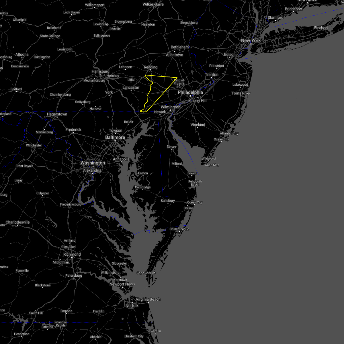 At 738 pm edt, severe thunderstorms were located along a line extending from near glenmoore to near delta, moving east at 15 mph (radar indicated). Hazards include 60 mph wind gusts and penny size hail. Damage to roofs, siding, trees, and power lines is possible. locations impacted include, phoenixville, coatesville, downingtown, collegeville, oxford, royersford, parkesburg, trappe, honey brook, elverson, new morgan, homeville, glen roy, cochranville, pughtown, mount vernon, lionville-marchwood, glenmoore, chester springs and lionville. this includes the following highways, pennsylvania turnpike between mile markers 296 and 315. interstate 176 in pennsylvania between mile markers 1 and 7. hail threat, radar indicated max hail size, 0. 75 in wind threat, radar indicated max wind gust, 60 mph. At 738 pm edt, severe thunderstorms were located along a line extending from near glenmoore to near delta, moving east at 15 mph (radar indicated). Hazards include 60 mph wind gusts and penny size hail. Damage to roofs, siding, trees, and power lines is possible. locations impacted include, phoenixville, coatesville, downingtown, collegeville, oxford, royersford, parkesburg, trappe, honey brook, elverson, new morgan, homeville, glen roy, cochranville, pughtown, mount vernon, lionville-marchwood, glenmoore, chester springs and lionville. this includes the following highways, pennsylvania turnpike between mile markers 296 and 315. interstate 176 in pennsylvania between mile markers 1 and 7. hail threat, radar indicated max hail size, 0. 75 in wind threat, radar indicated max wind gust, 60 mph.
|
| 8/10/2021 7:10 PM EDT |
 At 709 pm edt, severe thunderstorms were located along a line extending from churchtown to stewartstown, moving southeast at 15 mph (radar indicated). Hazards include 60 mph wind gusts and penny size hail. damage to roofs, siding, trees, and power lines is possible At 709 pm edt, severe thunderstorms were located along a line extending from churchtown to stewartstown, moving southeast at 15 mph (radar indicated). Hazards include 60 mph wind gusts and penny size hail. damage to roofs, siding, trees, and power lines is possible
|
| 8/10/2021 5:07 PM EDT |
 At 506 pm edt, severe thunderstorms were located along a line extending from nazareth to ottsville to near chester springs, moving east at 30 mph (radar indicated). Hazards include 60 mph wind gusts. Damage to roofs, siding, trees, and power lines is possible. locations impacted include, norristown, pottstown, phoenixville, lansdale, west norriton, east norriton, emmaus, quakertown, perkasie, souderton, bedminster, collegeville, royersford, chalfont, tinicum, trappe, hatfield, east greenville, dublin and honey brook. this includes the following highways, pennsylvania turnpike between mile markers 300 and 328. northeast extension between mile markers 24 and 51. interstate 76 in pennsylvania between mile markers 327 and 328. hail threat, radar indicated max hail size, <. 75 in wind threat, radar indicated max wind gust, 60 mph. At 506 pm edt, severe thunderstorms were located along a line extending from nazareth to ottsville to near chester springs, moving east at 30 mph (radar indicated). Hazards include 60 mph wind gusts. Damage to roofs, siding, trees, and power lines is possible. locations impacted include, norristown, pottstown, phoenixville, lansdale, west norriton, east norriton, emmaus, quakertown, perkasie, souderton, bedminster, collegeville, royersford, chalfont, tinicum, trappe, hatfield, east greenville, dublin and honey brook. this includes the following highways, pennsylvania turnpike between mile markers 300 and 328. northeast extension between mile markers 24 and 51. interstate 76 in pennsylvania between mile markers 327 and 328. hail threat, radar indicated max hail size, <. 75 in wind threat, radar indicated max wind gust, 60 mph.
|
| 8/10/2021 4:56 PM EDT |
 At 456 pm edt, severe thunderstorms were located along a line extending from near beersville to near pleasant valley to near chester springs, moving east at 30 mph (radar indicated). Hazards include 60 mph wind gusts. Damage to roofs, siding, trees, and power lines is possible. locations impacted include, allentown, easton, bethlehem, norristown, pottstown, phoenixville, lansdale, west norriton, forks, east norriton, emmaus, northampton, quakertown, perkasie, wilson, souderton, bedminster, hellertown, nazareth and palmerton. this includes the following highways, pennsylvania turnpike between mile markers 296 and 328. northeast extension between mile markers 24 and 51. interstate 76 in pennsylvania between mile markers 327 and 328. interstate 78 in pennsylvania between mile markers 57 and 76. interstate 176 in pennsylvania between mile markers 1 and 3. hail threat, radar indicated max hail size, <. 75 in wind threat, radar indicated max wind gust, 60 mph. At 456 pm edt, severe thunderstorms were located along a line extending from near beersville to near pleasant valley to near chester springs, moving east at 30 mph (radar indicated). Hazards include 60 mph wind gusts. Damage to roofs, siding, trees, and power lines is possible. locations impacted include, allentown, easton, bethlehem, norristown, pottstown, phoenixville, lansdale, west norriton, forks, east norriton, emmaus, northampton, quakertown, perkasie, wilson, souderton, bedminster, hellertown, nazareth and palmerton. this includes the following highways, pennsylvania turnpike between mile markers 296 and 328. northeast extension between mile markers 24 and 51. interstate 76 in pennsylvania between mile markers 327 and 328. interstate 78 in pennsylvania between mile markers 57 and 76. interstate 176 in pennsylvania between mile markers 1 and 3. hail threat, radar indicated max hail size, <. 75 in wind threat, radar indicated max wind gust, 60 mph.
|
| 8/10/2021 4:33 PM EDT |
 At 432 pm edt, severe thunderstorms were located along a line extending from palmerton to emmaus to elverson, moving east at 35 mph (radar indicated). Hazards include 60 mph wind gusts. damage to roofs, siding, trees, and power lines is possible At 432 pm edt, severe thunderstorms were located along a line extending from palmerton to emmaus to elverson, moving east at 35 mph (radar indicated). Hazards include 60 mph wind gusts. damage to roofs, siding, trees, and power lines is possible
|
| 7/21/2021 2:14 PM EDT |
 At 214 pm edt, a group of severe thunderstorms were located over gilbertsville, or 16 miles east of reading, moving east at 40 mph (radar indicated). Hazards include 60 mph wind gusts and quarter size hail. Minor damage to vehicles is possible. Wind damage to roofs, siding, trees, and power lines is possible. At 214 pm edt, a group of severe thunderstorms were located over gilbertsville, or 16 miles east of reading, moving east at 40 mph (radar indicated). Hazards include 60 mph wind gusts and quarter size hail. Minor damage to vehicles is possible. Wind damage to roofs, siding, trees, and power lines is possible.
|
| 7/17/2021 9:36 PM EDT |
 The severe thunderstorm warning for central chester county will expire at 945 pm edt, the storm which prompted the warning has moved out of the area. therefore, the warning will be allowed to expire. a severe thunderstorm watch remains in effect until 1100 pm edt for northern delaware, and southeastern pennsylvania. to report severe weather, contact your nearest law enforcement agency. they will relay your report to the national weather service mount holly nj. The severe thunderstorm warning for central chester county will expire at 945 pm edt, the storm which prompted the warning has moved out of the area. therefore, the warning will be allowed to expire. a severe thunderstorm watch remains in effect until 1100 pm edt for northern delaware, and southeastern pennsylvania. to report severe weather, contact your nearest law enforcement agency. they will relay your report to the national weather service mount holly nj.
|
| 7/17/2021 9:30 PM EDT |
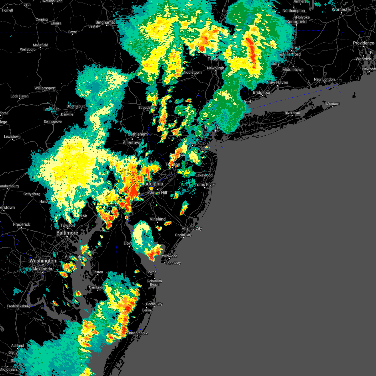 At 930 pm edt, a severe thunderstorm was located over lionville-marchwood, or near west chester, moving northeast at 30 mph (radar indicated). Hazards include 60 mph wind gusts. Damage to roofs, siding, trees, and power lines is possible. locations impacted include, west chester, phoenixville, westtown, downingtown, kennett square, royersford, west grove, pughtown, marshallton, lionville-marchwood, valley forge, paoli, chester springs, lionville, ladenberg, kemblesville, north star, west goshen, spring city and malvern. This includes pennsylvania turnpike between mile markers 311 and 324. At 930 pm edt, a severe thunderstorm was located over lionville-marchwood, or near west chester, moving northeast at 30 mph (radar indicated). Hazards include 60 mph wind gusts. Damage to roofs, siding, trees, and power lines is possible. locations impacted include, west chester, phoenixville, westtown, downingtown, kennett square, royersford, west grove, pughtown, marshallton, lionville-marchwood, valley forge, paoli, chester springs, lionville, ladenberg, kemblesville, north star, west goshen, spring city and malvern. This includes pennsylvania turnpike between mile markers 311 and 324.
|
| 7/17/2021 9:16 PM EDT |
 At 916 pm edt, a severe thunderstorm was located over downingtown, or near west chester, moving northeast at 30 mph (radar indicated). Hazards include 60 mph wind gusts. Damage to roofs, siding, trees, and power lines is possible. locations impacted include, west chester, phoenixville, coatesville, westtown, downingtown, kennett square, royersford, parkesburg, west grove, honey brook, cochranville, pughtown, marshallton, lionville-marchwood, valley forge, glenmoore, paoli, chester springs, lionville and ladenberg. This includes pennsylvania turnpike between mile markers 304 and 324. At 916 pm edt, a severe thunderstorm was located over downingtown, or near west chester, moving northeast at 30 mph (radar indicated). Hazards include 60 mph wind gusts. Damage to roofs, siding, trees, and power lines is possible. locations impacted include, west chester, phoenixville, coatesville, westtown, downingtown, kennett square, royersford, parkesburg, west grove, honey brook, cochranville, pughtown, marshallton, lionville-marchwood, valley forge, glenmoore, paoli, chester springs, lionville and ladenberg. This includes pennsylvania turnpike between mile markers 304 and 324.
|
| 7/17/2021 8:57 PM EDT |
 At 856 pm edt, a severe thunderstorm was located over cochranville, or 15 miles west of west chester, moving northeast at 30 mph (radar indicated). Hazards include 60 mph wind gusts and quarter size hail. Minor damage to vehicles is possible. Wind damage to roofs, siding, trees, and power lines is possible. At 856 pm edt, a severe thunderstorm was located over cochranville, or 15 miles west of west chester, moving northeast at 30 mph (radar indicated). Hazards include 60 mph wind gusts and quarter size hail. Minor damage to vehicles is possible. Wind damage to roofs, siding, trees, and power lines is possible.
|
| 7/6/2021 6:02 PM EDT |
 At 602 pm edt, a severe thunderstorm was located over valley forge, or 11 miles northeast of west chester, moving east at 30 mph (radar indicated). Hazards include 60 mph wind gusts and penny size hail. Damage to roofs, siding, trees, and power lines is possible. locations impacted include, philadelphia, west chester, norristown, phoenixville, west norriton, east norriton, yeadon, conshohocken, ambler, collegeville, royersford, narberth, trappe, east lansdowne, morris park, bryn mawr, trout lake, radnor township, gradyville and broomall. this includes the following highways, pennsylvania turnpike between mile markers 313 and 340. northeast extension between mile markers 21 and 26. interstate 95 in pennsylvania between mile markers 15 and 17. interstate 76 in pennsylvania between mile markers 327 and 350. interstate 676 in pennsylvania between mile markers 0 and 1. Interstate 476 in pennsylvania between mile markers 4 and 19. At 602 pm edt, a severe thunderstorm was located over valley forge, or 11 miles northeast of west chester, moving east at 30 mph (radar indicated). Hazards include 60 mph wind gusts and penny size hail. Damage to roofs, siding, trees, and power lines is possible. locations impacted include, philadelphia, west chester, norristown, phoenixville, west norriton, east norriton, yeadon, conshohocken, ambler, collegeville, royersford, narberth, trappe, east lansdowne, morris park, bryn mawr, trout lake, radnor township, gradyville and broomall. this includes the following highways, pennsylvania turnpike between mile markers 313 and 340. northeast extension between mile markers 21 and 26. interstate 95 in pennsylvania between mile markers 15 and 17. interstate 76 in pennsylvania between mile markers 327 and 350. interstate 676 in pennsylvania between mile markers 0 and 1. Interstate 476 in pennsylvania between mile markers 4 and 19.
|
| 7/6/2021 5:34 PM EDT |
 At 533 pm edt, trained spotters reported wind damage and quarter sized hail from severe thunderstorms located near ambler, or 11 miles northwest of philadelphia, moving east at 30 mph (trained weather spotters). Hazards include 60 mph wind gusts and quarter size hail. Minor damage to vehicles is possible. wind damage to roofs, siding, trees, and power lines is possible. locations impacted include, philadelphia, bensalem, norristown, phoenixville, lansdale, west norriton, east norriton, riverside, conshohocken, palmyra, hatboro, ambler, collegeville, royersford, jenkintown, narberth, trappe, beverly, rockledge and newtown. this includes the following highways, pennsylvania turnpike between mile markers 318 and 354. northeast extension between mile markers 21 and 29. interstate 95 in pennsylvania between mile markers 26 and 38. interstate 76 in pennsylvania between mile markers 327 and 341. Interstate 476 in pennsylvania between mile markers 9 and 19. At 533 pm edt, trained spotters reported wind damage and quarter sized hail from severe thunderstorms located near ambler, or 11 miles northwest of philadelphia, moving east at 30 mph (trained weather spotters). Hazards include 60 mph wind gusts and quarter size hail. Minor damage to vehicles is possible. wind damage to roofs, siding, trees, and power lines is possible. locations impacted include, philadelphia, bensalem, norristown, phoenixville, lansdale, west norriton, east norriton, riverside, conshohocken, palmyra, hatboro, ambler, collegeville, royersford, jenkintown, narberth, trappe, beverly, rockledge and newtown. this includes the following highways, pennsylvania turnpike between mile markers 318 and 354. northeast extension between mile markers 21 and 29. interstate 95 in pennsylvania between mile markers 26 and 38. interstate 76 in pennsylvania between mile markers 327 and 341. Interstate 476 in pennsylvania between mile markers 9 and 19.
|
| 7/6/2021 5:34 PM EDT |
 At 533 pm edt, a severe thunderstorm was located over glenmoore, or 11 miles northwest of west chester, moving east at 25 mph (radar indicated). Hazards include 60 mph wind gusts and penny size hail. damage to roofs, siding, trees, and power lines is possible At 533 pm edt, a severe thunderstorm was located over glenmoore, or 11 miles northwest of west chester, moving east at 25 mph (radar indicated). Hazards include 60 mph wind gusts and penny size hail. damage to roofs, siding, trees, and power lines is possible
|
| 7/6/2021 5:34 PM EDT |
 At 533 pm edt, trained spotters reported wind damage and quarter sized hail from severe thunderstorms located near ambler, or 11 miles northwest of philadelphia, moving east at 30 mph (trained weather spotters). Hazards include 60 mph wind gusts and quarter size hail. Minor damage to vehicles is possible. wind damage to roofs, siding, trees, and power lines is possible. locations impacted include, philadelphia, bensalem, norristown, phoenixville, lansdale, west norriton, east norriton, riverside, conshohocken, palmyra, hatboro, ambler, collegeville, royersford, jenkintown, narberth, trappe, beverly, rockledge and newtown. this includes the following highways, pennsylvania turnpike between mile markers 318 and 354. northeast extension between mile markers 21 and 29. interstate 95 in pennsylvania between mile markers 26 and 38. interstate 76 in pennsylvania between mile markers 327 and 341. Interstate 476 in pennsylvania between mile markers 9 and 19. At 533 pm edt, trained spotters reported wind damage and quarter sized hail from severe thunderstorms located near ambler, or 11 miles northwest of philadelphia, moving east at 30 mph (trained weather spotters). Hazards include 60 mph wind gusts and quarter size hail. Minor damage to vehicles is possible. wind damage to roofs, siding, trees, and power lines is possible. locations impacted include, philadelphia, bensalem, norristown, phoenixville, lansdale, west norriton, east norriton, riverside, conshohocken, palmyra, hatboro, ambler, collegeville, royersford, jenkintown, narberth, trappe, beverly, rockledge and newtown. this includes the following highways, pennsylvania turnpike between mile markers 318 and 354. northeast extension between mile markers 21 and 29. interstate 95 in pennsylvania between mile markers 26 and 38. interstate 76 in pennsylvania between mile markers 327 and 341. Interstate 476 in pennsylvania between mile markers 9 and 19.
|
| 7/6/2021 5:11 PM EDT |
 At 510 pm edt, a severe thunderstorm was located over valley forge, or 13 miles northeast of west chester, moving east at 30 mph (radar indicated). Hazards include 60 mph wind gusts and penny size hail. damage to roofs, siding, trees, and power lines is possible At 510 pm edt, a severe thunderstorm was located over valley forge, or 13 miles northeast of west chester, moving east at 30 mph (radar indicated). Hazards include 60 mph wind gusts and penny size hail. damage to roofs, siding, trees, and power lines is possible
|
| 7/6/2021 4:50 PM EDT |
 At 450 pm edt, a severe thunderstorm was located over chester springs, or 9 miles north of west chester, moving east at 25 mph (radar indicated). Hazards include 60 mph wind gusts and quarter size hail. Minor damage to vehicles is possible. wind damage to roofs, siding, trees, and power lines is possible. locations impacted include, phoenixville, downingtown, royersford, trappe, valley forge, paoli, chester springs, pughtown, lionville, lionville-marchwood, spring city, malvern, exton, chesterbrook and devon-berwyn. This includes pennsylvania turnpike between mile markers 307 and 323. At 450 pm edt, a severe thunderstorm was located over chester springs, or 9 miles north of west chester, moving east at 25 mph (radar indicated). Hazards include 60 mph wind gusts and quarter size hail. Minor damage to vehicles is possible. wind damage to roofs, siding, trees, and power lines is possible. locations impacted include, phoenixville, downingtown, royersford, trappe, valley forge, paoli, chester springs, pughtown, lionville, lionville-marchwood, spring city, malvern, exton, chesterbrook and devon-berwyn. This includes pennsylvania turnpike between mile markers 307 and 323.
|
| 7/6/2021 4:40 PM EDT |
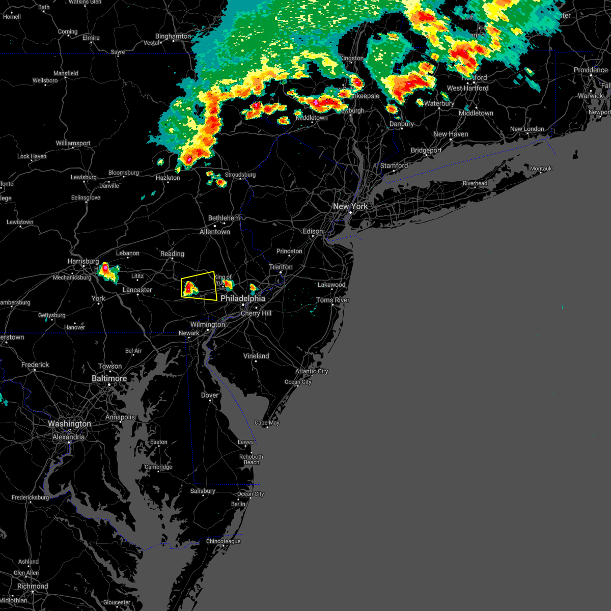 At 440 pm edt, a severe thunderstorm was located over glenmoore, or 11 miles northwest of west chester, moving east at 25 mph (radar indicated). Hazards include 60 mph wind gusts and quarter size hail. Minor damage to vehicles is possible. wind damage to roofs, siding, trees, and power lines is possible. locations impacted include, phoenixville, downingtown, royersford, trappe, elverson, valley forge, glenmoore, paoli, chester springs, pughtown, lionville, lionville-marchwood, spring city, malvern, exton, chesterbrook and devon-berwyn. This includes pennsylvania turnpike between mile markers 302 and 323. At 440 pm edt, a severe thunderstorm was located over glenmoore, or 11 miles northwest of west chester, moving east at 25 mph (radar indicated). Hazards include 60 mph wind gusts and quarter size hail. Minor damage to vehicles is possible. wind damage to roofs, siding, trees, and power lines is possible. locations impacted include, phoenixville, downingtown, royersford, trappe, elverson, valley forge, glenmoore, paoli, chester springs, pughtown, lionville, lionville-marchwood, spring city, malvern, exton, chesterbrook and devon-berwyn. This includes pennsylvania turnpike between mile markers 302 and 323.
|
| 7/6/2021 4:23 PM EDT |
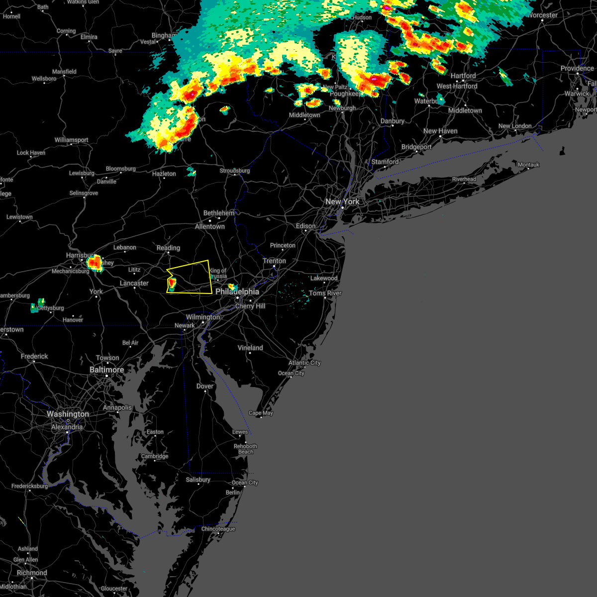 At 422 pm edt, a severe thunderstorm was located over honey brook, or 11 miles east of new holland, moving east at 25 mph (radar indicated). Hazards include 60 mph wind gusts and quarter size hail. Minor damage to vehicles is possible. Wind damage to roofs, siding, trees, and power lines is possible. At 422 pm edt, a severe thunderstorm was located over honey brook, or 11 miles east of new holland, moving east at 25 mph (radar indicated). Hazards include 60 mph wind gusts and quarter size hail. Minor damage to vehicles is possible. Wind damage to roofs, siding, trees, and power lines is possible.
|
| 7/1/2021 3:41 PM EDT |
 At 340 pm edt, severe thunderstorms were located along a line extending from quakertown to phoenixville to near cochranville, moving east at 35 mph. the most dangerous part of the storm was near chester springs (law enforcement. trees were reported downed in west caln township). Hazards include 60 mph wind gusts. Damage to roofs, siding, trees, and power lines is possible. locations impacted include, west chester, pottstown, phoenixville, lansdale, west norriton, east norriton, coatesville, quakertown, perkasie, downingtown, souderton, bedminster, kennett square, collegeville, oxford, royersford, parkesburg, trappe, hatfield and east greenville. this includes the following highways, pennsylvania turnpike between mile markers 300 and 326. Northeast extension between mile markers 25 and 47. At 340 pm edt, severe thunderstorms were located along a line extending from quakertown to phoenixville to near cochranville, moving east at 35 mph. the most dangerous part of the storm was near chester springs (law enforcement. trees were reported downed in west caln township). Hazards include 60 mph wind gusts. Damage to roofs, siding, trees, and power lines is possible. locations impacted include, west chester, pottstown, phoenixville, lansdale, west norriton, east norriton, coatesville, quakertown, perkasie, downingtown, souderton, bedminster, kennett square, collegeville, oxford, royersford, parkesburg, trappe, hatfield and east greenville. this includes the following highways, pennsylvania turnpike between mile markers 300 and 326. Northeast extension between mile markers 25 and 47.
|
| 7/1/2021 3:31 PM EDT |
 At 330 pm edt, severe thunderstorms were located along a line extending from geryville to near chester springs to homeville, moving east at 35 mph (radar indicated). Hazards include 60 mph wind gusts. Damage to roofs, siding, trees, and power lines is possible. locations impacted include, west chester, pottstown, phoenixville, lansdale, west norriton, east norriton, coatesville, quakertown, perkasie, downingtown, souderton, bedminster, kennett square, collegeville, oxford, royersford, parkesburg, trappe, hatfield and east greenville. this includes the following highways, pennsylvania turnpike between mile markers 300 and 326. Northeast extension between mile markers 25 and 47. At 330 pm edt, severe thunderstorms were located along a line extending from geryville to near chester springs to homeville, moving east at 35 mph (radar indicated). Hazards include 60 mph wind gusts. Damage to roofs, siding, trees, and power lines is possible. locations impacted include, west chester, pottstown, phoenixville, lansdale, west norriton, east norriton, coatesville, quakertown, perkasie, downingtown, souderton, bedminster, kennett square, collegeville, oxford, royersford, parkesburg, trappe, hatfield and east greenville. this includes the following highways, pennsylvania turnpike between mile markers 300 and 326. Northeast extension between mile markers 25 and 47.
|
| 7/1/2021 3:13 PM EDT |
 At 313 pm edt, severe thunderstorms were located along a line extending from bechtelsville to glenmoore to near quarryville, moving east at 35 mph (radar indicated). Hazards include 60 mph wind gusts. damage to roofs, siding, trees, and power lines is possible At 313 pm edt, severe thunderstorms were located along a line extending from bechtelsville to glenmoore to near quarryville, moving east at 35 mph (radar indicated). Hazards include 60 mph wind gusts. damage to roofs, siding, trees, and power lines is possible
|
| 5/26/2021 5:27 PM EDT |
 At 527 pm edt, severe thunderstorms were located along a line extending from milford to dublin to glenmoore, moving east at 30 mph (radar indicated). Hazards include 70 mph wind gusts and penny size hail. Expect considerable tree damage. Damage is likely to mobile homes, roofs, and outbuildings. At 527 pm edt, severe thunderstorms were located along a line extending from milford to dublin to glenmoore, moving east at 30 mph (radar indicated). Hazards include 70 mph wind gusts and penny size hail. Expect considerable tree damage. Damage is likely to mobile homes, roofs, and outbuildings.
|
| 5/26/2021 5:19 PM EDT |
 At 518 pm edt, severe thunderstorms were located along a line extending from springtown to near geryville to pughtown, moving east at 30 mph (radar indicated). Hazards include 70 mph wind gusts and penny size hail. Expect considerable tree damage. damage is likely to mobile homes, roofs, and outbuildings. locations impacted include, bethlehem, norristown, pottstown, phoenixville, lansdale, west norriton, east norriton, quakertown, perkasie, doylestown, souderton, bedminster, hellertown, collegeville, royersford, chalfont, tinicum, trappe, hatfield and east greenville. this includes the following highways, pennsylvania turnpike between mile markers 298 and 304, and between mile markers 330 and 333. northeast extension between mile markers 21 and 48. interstate 78 in pennsylvania between mile markers 66 and 72. Interstate 476 in pennsylvania between mile markers 18 and 19. At 518 pm edt, severe thunderstorms were located along a line extending from springtown to near geryville to pughtown, moving east at 30 mph (radar indicated). Hazards include 70 mph wind gusts and penny size hail. Expect considerable tree damage. damage is likely to mobile homes, roofs, and outbuildings. locations impacted include, bethlehem, norristown, pottstown, phoenixville, lansdale, west norriton, east norriton, quakertown, perkasie, doylestown, souderton, bedminster, hellertown, collegeville, royersford, chalfont, tinicum, trappe, hatfield and east greenville. this includes the following highways, pennsylvania turnpike between mile markers 298 and 304, and between mile markers 330 and 333. northeast extension between mile markers 21 and 48. interstate 78 in pennsylvania between mile markers 66 and 72. Interstate 476 in pennsylvania between mile markers 18 and 19.
|
| 5/26/2021 4:46 PM EDT |
 At 445 pm edt, severe thunderstorms were located along a line extending from near coffeetown to near bechtelsville to new morgan, moving east at 45 mph (radar indicated). Hazards include 70 mph wind gusts and penny size hail. Expect considerable tree damage. Damage is likely to mobile homes, roofs, and outbuildings. At 445 pm edt, severe thunderstorms were located along a line extending from near coffeetown to near bechtelsville to new morgan, moving east at 45 mph (radar indicated). Hazards include 70 mph wind gusts and penny size hail. Expect considerable tree damage. Damage is likely to mobile homes, roofs, and outbuildings.
|
| 11/15/2020 7:25 PM EST |
 At 724 pm est, intense showers and some embedded severe thunderstorms were located along a line extending from near schwenksville to west nottingham, moving east at 55 mph. this line may contain little or no lightning. do not wait until you hear thunder before taking cover (trained weather spotters). Hazards include 60 mph wind gusts. Damage to roofs, siding, trees, and power lines is possible. locations impacted include, philadelphia, camden, wilmington, newark, middletown, west chester, gloucester city, norristown, chester, deptford, pottstown, west deptford, phoenixville, west norriton, east norriton, pennsville, coatesville, bellmawr, yeadon and westtown. this includes the following highways, new jersey turnpike between exits 1 and 2. pennsylvania turnpike between mile markers 304 and 346. northeast extension between mile markers 21 and 23. interstate 95 in pennsylvania between mile markers 0 and 33. interstate 95 in delaware between mile markers 1 and 23. interstate 76 in pennsylvania between mile markers 327 and 351. interstate 76 in new jersey between mile markers 1 and 3. interstate 295 in new jersey between mile markers 0 and 27. interstate 676 in pennsylvania between mile markers 0 and 1. interstate 676 in new jersey between mile markers 0 and 4. Interstate 476 in pennsylvania between mile markers 0 and 19. At 724 pm est, intense showers and some embedded severe thunderstorms were located along a line extending from near schwenksville to west nottingham, moving east at 55 mph. this line may contain little or no lightning. do not wait until you hear thunder before taking cover (trained weather spotters). Hazards include 60 mph wind gusts. Damage to roofs, siding, trees, and power lines is possible. locations impacted include, philadelphia, camden, wilmington, newark, middletown, west chester, gloucester city, norristown, chester, deptford, pottstown, west deptford, phoenixville, west norriton, east norriton, pennsville, coatesville, bellmawr, yeadon and westtown. this includes the following highways, new jersey turnpike between exits 1 and 2. pennsylvania turnpike between mile markers 304 and 346. northeast extension between mile markers 21 and 23. interstate 95 in pennsylvania between mile markers 0 and 33. interstate 95 in delaware between mile markers 1 and 23. interstate 76 in pennsylvania between mile markers 327 and 351. interstate 76 in new jersey between mile markers 1 and 3. interstate 295 in new jersey between mile markers 0 and 27. interstate 676 in pennsylvania between mile markers 0 and 1. interstate 676 in new jersey between mile markers 0 and 4. Interstate 476 in pennsylvania between mile markers 0 and 19.
|
| 11/15/2020 7:24 PM EST | Downed tree on schuylkill road near reitnour road. time estimated from rada in chester county PA, 2.1 miles ESE of Spring City, PA |
| 11/15/2020 7:20 PM EST |
 At 718 pm est, intense showers and embedded severe thunderstorms were located along a line extending from near dingmans ferry to harmony to near ottsville to near pottstown, moving east at 60 mph. this line may contain little or no lightning. do not wait until you hear thunder before taking cover (radar indicated). Hazards include 60 mph wind gusts. Damage to roofs, siding, trees, and power lines is possible. locations impacted include, easton, newton, montague, bethlehem, pottstown, dover, phoenixville, lansdale, west norriton, hopatcong, forks, east norriton, east stroudsburg, hackettstown, quakertown, perkasie, doylestown, byram, wilson and hatboro. this includes the following highways, pennsylvania turnpike between mile markers 342 and 347. northeast extension between mile markers 23 and 48. interstate 78 in pennsylvania between mile markers 62 and 76. interstate 78 in new jersey between mile markers 0 and 25. interstate 80 in pennsylvania between mile markers 309 and 314. Interstate 80 in new jersey between mile markers 0 and 38. At 718 pm est, intense showers and embedded severe thunderstorms were located along a line extending from near dingmans ferry to harmony to near ottsville to near pottstown, moving east at 60 mph. this line may contain little or no lightning. do not wait until you hear thunder before taking cover (radar indicated). Hazards include 60 mph wind gusts. Damage to roofs, siding, trees, and power lines is possible. locations impacted include, easton, newton, montague, bethlehem, pottstown, dover, phoenixville, lansdale, west norriton, hopatcong, forks, east norriton, east stroudsburg, hackettstown, quakertown, perkasie, doylestown, byram, wilson and hatboro. this includes the following highways, pennsylvania turnpike between mile markers 342 and 347. northeast extension between mile markers 23 and 48. interstate 78 in pennsylvania between mile markers 62 and 76. interstate 78 in new jersey between mile markers 0 and 25. interstate 80 in pennsylvania between mile markers 309 and 314. Interstate 80 in new jersey between mile markers 0 and 38.
|
| 11/15/2020 6:53 PM EST |
 At 652 pm est, intense showers and some embedded severe thunderstorms were located along a line extending from near bechtelsville to near randallstown, moving east at 50 mph. this line may contain little or no lightning. do not wait until you hear thunder before taking cover (radar indicated). Hazards include 60 mph wind gusts. damage to roofs, siding, trees, and power lines is possible At 652 pm est, intense showers and some embedded severe thunderstorms were located along a line extending from near bechtelsville to near randallstown, moving east at 50 mph. this line may contain little or no lightning. do not wait until you hear thunder before taking cover (radar indicated). Hazards include 60 mph wind gusts. damage to roofs, siding, trees, and power lines is possible
|
| 11/15/2020 6:44 PM EST |
 At 643 pm est, intense showers and some embedded severe thunderstorms were located along a line extending from near sterling to near jordan valley to near fleetwood to near terre hill, moving northeast at 70 mph. this line may contain little or no lightning. do not wait until you hear thunder before taking cover (radar indicated). Hazards include 60 mph wind gusts. damage to roofs, siding, trees, and power lines is possible At 643 pm est, intense showers and some embedded severe thunderstorms were located along a line extending from near sterling to near jordan valley to near fleetwood to near terre hill, moving northeast at 70 mph. this line may contain little or no lightning. do not wait until you hear thunder before taking cover (radar indicated). Hazards include 60 mph wind gusts. damage to roofs, siding, trees, and power lines is possible
|
| 8/29/2020 7:49 PM EDT |
 At 749 pm edt, severe thunderstorms were located along a line extending from near clinton to royersford, moving southeast at 30 mph (radar indicated). Hazards include 60 mph wind gusts and penny size hail. Damage to roofs, siding, trees, and power lines is possible. locations impacted include, norristown, pottstown, phoenixville, lansdale, west norriton, east norriton, quakertown, perkasie, doylestown, byram, souderton, bedminster, collegeville, royersford, flemington, chalfont, tinicum, trappe, hatfield and clinton. this includes the following highways, pennsylvania turnpike between mile markers 326 and 328. northeast extension between mile markers 22 and 44. interstate 76 in pennsylvania near mile marker 327. Interstate 78 in new jersey between mile markers 8 and 18. At 749 pm edt, severe thunderstorms were located along a line extending from near clinton to royersford, moving southeast at 30 mph (radar indicated). Hazards include 60 mph wind gusts and penny size hail. Damage to roofs, siding, trees, and power lines is possible. locations impacted include, norristown, pottstown, phoenixville, lansdale, west norriton, east norriton, quakertown, perkasie, doylestown, byram, souderton, bedminster, collegeville, royersford, flemington, chalfont, tinicum, trappe, hatfield and clinton. this includes the following highways, pennsylvania turnpike between mile markers 326 and 328. northeast extension between mile markers 22 and 44. interstate 76 in pennsylvania near mile marker 327. Interstate 78 in new jersey between mile markers 8 and 18.
|
| 8/29/2020 7:16 PM EDT |
 At 716 pm edt, severe thunderstorms were located along a line extending from harmony to near birdsboro, moving southeast at 35 mph (radar indicated). Hazards include 60 mph wind gusts and quarter size hail. Minor damage to vehicles is possible. Wind damage to roofs, siding, trees, and power lines is possible. At 716 pm edt, severe thunderstorms were located along a line extending from harmony to near birdsboro, moving southeast at 35 mph (radar indicated). Hazards include 60 mph wind gusts and quarter size hail. Minor damage to vehicles is possible. Wind damage to roofs, siding, trees, and power lines is possible.
|
| 8/28/2020 4:10 PM EDT |
 At 410 pm edt, severe thunderstorms were located along a line extending from doylestown to collegeville, moving southeast at 45 mph (radar indicated). Hazards include 70 mph wind gusts and quarter size hail. Minor damage to vehicles is possible. expect considerable tree damage. wind damage is also likely to mobile homes, roofs, and outbuildings. locations impacted include, philadelphia, camden, west chester, bensalem, ewing, norristown, phoenixville, lansdale, west norriton, east norriton, yeadon, westtown, burlington, bristol, perkasie, doylestown, byram, conshohocken, palmyra and hatboro. this includes the following highways, pennsylvania turnpike between mile markers 321 and 358. northeast extension between mile markers 21 and 38. interstate 95 in pennsylvania between mile markers 10 and 40. interstate 76 in pennsylvania between mile markers 327 and 351. interstate 676 in pennsylvania between mile markers 0 and 1. Interstate 476 in pennsylvania between mile markers 4 and 19. At 410 pm edt, severe thunderstorms were located along a line extending from doylestown to collegeville, moving southeast at 45 mph (radar indicated). Hazards include 70 mph wind gusts and quarter size hail. Minor damage to vehicles is possible. expect considerable tree damage. wind damage is also likely to mobile homes, roofs, and outbuildings. locations impacted include, philadelphia, camden, west chester, bensalem, ewing, norristown, phoenixville, lansdale, west norriton, east norriton, yeadon, westtown, burlington, bristol, perkasie, doylestown, byram, conshohocken, palmyra and hatboro. this includes the following highways, pennsylvania turnpike between mile markers 321 and 358. northeast extension between mile markers 21 and 38. interstate 95 in pennsylvania between mile markers 10 and 40. interstate 76 in pennsylvania between mile markers 327 and 351. interstate 676 in pennsylvania between mile markers 0 and 1. Interstate 476 in pennsylvania between mile markers 4 and 19.
|
| 8/28/2020 3:56 PM EDT |
 At 355 pm edt, severe thunderstorms were located along a line extending from near perkasie to pottstown, moving southeast at 45 mph (radar indicated). Hazards include 60 mph wind gusts and quarter size hail. Minor damage to vehicles is possible. Wind damage to roofs, siding, trees, and power lines is possible. At 355 pm edt, severe thunderstorms were located along a line extending from near perkasie to pottstown, moving southeast at 45 mph (radar indicated). Hazards include 60 mph wind gusts and quarter size hail. Minor damage to vehicles is possible. Wind damage to roofs, siding, trees, and power lines is possible.
|
| 8/28/2020 3:47 PM EDT |
 At 346 pm edt, a severe thunderstorm was located near bally, or 14 miles southwest of allentown, moving southeast at 30 mph (radar indicated). Hazards include 60 mph wind gusts and quarter size hail. Minor damage to vehicles is possible. wind damage to roofs, siding, trees, and power lines is possible. locations impacted include, pottstown, quakertown, royersford, east greenville, topton, schwenksville, bally, bechtelsville, green lane, zionsville, spring mount, geryville, gilbertsville, cedarville, ancient oaks, stowe, boyertown, pennsburg, spring city and macungie. This includes northeast extension between mile markers 37 and 47. At 346 pm edt, a severe thunderstorm was located near bally, or 14 miles southwest of allentown, moving southeast at 30 mph (radar indicated). Hazards include 60 mph wind gusts and quarter size hail. Minor damage to vehicles is possible. wind damage to roofs, siding, trees, and power lines is possible. locations impacted include, pottstown, quakertown, royersford, east greenville, topton, schwenksville, bally, bechtelsville, green lane, zionsville, spring mount, geryville, gilbertsville, cedarville, ancient oaks, stowe, boyertown, pennsburg, spring city and macungie. This includes northeast extension between mile markers 37 and 47.
|
| 8/28/2020 3:22 PM EDT |
 At 322 pm edt, a severe thunderstorm was located near fleetwood, or 12 miles north of reading, moving southeast at 30 mph (radar indicated). Hazards include 60 mph wind gusts and quarter size hail. Minor damage to vehicles is possible. Wind damage to roofs, siding, trees, and power lines is possible. At 322 pm edt, a severe thunderstorm was located near fleetwood, or 12 miles north of reading, moving southeast at 30 mph (radar indicated). Hazards include 60 mph wind gusts and quarter size hail. Minor damage to vehicles is possible. Wind damage to roofs, siding, trees, and power lines is possible.
|
| 8/27/2020 8:45 PM EDT |
 At 845 pm edt, severe thunderstorms were located along a line extending from alpha to near pughtown, moving southeast at 50 mph (radar indicated. this storm has a history of producing wind gusts over 60 mph). Hazards include 60 mph wind gusts and quarter size hail. Minor damage to vehicles is possible. wind damage to roofs, siding, trees, and power lines is possible. locations impacted include, allentown, norristown, pottstown, phoenixville, lansdale, west norriton, east norriton, emmaus, quakertown, perkasie, doylestown, conshohocken, hatboro, souderton, bedminster, ambler, collegeville, royersford, chalfont and trappe. this includes the following highways, pennsylvania turnpike between mile markers 323 and 343. northeast extension between mile markers 21 and 52. interstate 76 in pennsylvania between mile markers 327 and 335. interstate 78 in pennsylvania between mile markers 59 and 63. Interstate 476 in pennsylvania between mile markers 14 and 19. At 845 pm edt, severe thunderstorms were located along a line extending from alpha to near pughtown, moving southeast at 50 mph (radar indicated. this storm has a history of producing wind gusts over 60 mph). Hazards include 60 mph wind gusts and quarter size hail. Minor damage to vehicles is possible. wind damage to roofs, siding, trees, and power lines is possible. locations impacted include, allentown, norristown, pottstown, phoenixville, lansdale, west norriton, east norriton, emmaus, quakertown, perkasie, doylestown, conshohocken, hatboro, souderton, bedminster, ambler, collegeville, royersford, chalfont and trappe. this includes the following highways, pennsylvania turnpike between mile markers 323 and 343. northeast extension between mile markers 21 and 52. interstate 76 in pennsylvania between mile markers 327 and 335. interstate 78 in pennsylvania between mile markers 59 and 63. Interstate 476 in pennsylvania between mile markers 14 and 19.
|
| 8/27/2020 8:26 PM EDT |
 At 826 pm edt, severe thunderstorms were located along a line extending from near beersville to near wyomissing, moving southeast at 50 mph (radar indicated. a wind gust of 58 mph was also recently reported at reading airport). Hazards include 60 mph wind gusts and quarter size hail. Minor damage to vehicles is possible. Wind damage to roofs, siding, trees, and power lines is possible. At 826 pm edt, severe thunderstorms were located along a line extending from near beersville to near wyomissing, moving southeast at 50 mph (radar indicated. a wind gust of 58 mph was also recently reported at reading airport). Hazards include 60 mph wind gusts and quarter size hail. Minor damage to vehicles is possible. Wind damage to roofs, siding, trees, and power lines is possible.
|
| 8/17/2020 5:58 PM EDT |
 At 556 pm edt, severe thunderstorms were located along a line extending from near glenmoore to near calvert, moving east at 25 mph (radar indicated). Hazards include 60 mph wind gusts and nickel size hail. Damage to roofs, siding, trees, and power lines is possible. locations impacted include, west chester, coatesville, downingtown, kennett square, oxford, parkesburg, west grove, honey brook, elverson, homeville, glen roy, cochranville, north star, pughtown, mount vernon, marshallton, pike creek, lionville-marchwood, glenmoore and chester springs. This includes pennsylvania turnpike between mile markers 300 and 316. At 556 pm edt, severe thunderstorms were located along a line extending from near glenmoore to near calvert, moving east at 25 mph (radar indicated). Hazards include 60 mph wind gusts and nickel size hail. Damage to roofs, siding, trees, and power lines is possible. locations impacted include, west chester, coatesville, downingtown, kennett square, oxford, parkesburg, west grove, honey brook, elverson, homeville, glen roy, cochranville, north star, pughtown, mount vernon, marshallton, pike creek, lionville-marchwood, glenmoore and chester springs. This includes pennsylvania turnpike between mile markers 300 and 316.
|
| 8/17/2020 5:38 PM EDT |
 At 537 pm edt, severe thunderstorms were located along a line extending from honey brook to near richardsmere, moving east at 30 mph (radar indicated). Hazards include 60 mph wind gusts and nickel size hail. damage to roofs, siding, trees, and power lines is possible At 537 pm edt, severe thunderstorms were located along a line extending from honey brook to near richardsmere, moving east at 30 mph (radar indicated). Hazards include 60 mph wind gusts and nickel size hail. damage to roofs, siding, trees, and power lines is possible
|
| 7/22/2020 5:29 PM EDT |
 At 528 pm edt, severe thunderstorms were located along a line extending from pleasant valley to near collegeville, moving east at 30 mph (law enforcement). Hazards include 60 mph wind gusts and penny size hail. Damage to roofs, siding, trees, and power lines is possible. locations impacted include, philadelphia, norristown, phoenixville, lansdale, west norriton, east norriton, quakertown, perkasie, doylestown, conshohocken, souderton, bedminster, ambler, collegeville, royersford, narberth, chalfont, tinicum, trappe and hatfield. this includes the following highways, pennsylvania turnpike between mile markers 312 and 339. northeast extension between mile markers 21 and 48. interstate 76 in pennsylvania between mile markers 327 and 339. Interstate 476 in pennsylvania between mile markers 12 and 19. At 528 pm edt, severe thunderstorms were located along a line extending from pleasant valley to near collegeville, moving east at 30 mph (law enforcement). Hazards include 60 mph wind gusts and penny size hail. Damage to roofs, siding, trees, and power lines is possible. locations impacted include, philadelphia, norristown, phoenixville, lansdale, west norriton, east norriton, quakertown, perkasie, doylestown, conshohocken, souderton, bedminster, ambler, collegeville, royersford, narberth, chalfont, tinicum, trappe and hatfield. this includes the following highways, pennsylvania turnpike between mile markers 312 and 339. northeast extension between mile markers 21 and 48. interstate 76 in pennsylvania between mile markers 327 and 339. Interstate 476 in pennsylvania between mile markers 12 and 19.
|
| 7/22/2020 5:09 PM EDT |
 The national weather service in mount holly nj has issued a * severe thunderstorm warning for. east central berks county in eastern pennsylvania. southeastern lehigh county in eastern pennsylvania. montgomery county in southeastern pennsylvania. Northwestern bucks county in southeastern pennsylvania. The national weather service in mount holly nj has issued a * severe thunderstorm warning for. east central berks county in eastern pennsylvania. southeastern lehigh county in eastern pennsylvania. montgomery county in southeastern pennsylvania. Northwestern bucks county in southeastern pennsylvania.
|
| 7/22/2020 5:02 PM EDT |
 At 501 pm edt, a severe thunderstorm was located over pottstown, or 16 miles east of reading, moving east at 40 mph (law enforcement. numerous reports of wind damage have been received in berks county, especially east of reading). Hazards include 70 mph wind gusts and penny size hail. Expect considerable tree damage. damage is likely to mobile homes, roofs, and outbuildings. locations impacted include, reading, pottstown, phoenixville, quakertown, birdsboro, collegeville, royersford, fleetwood, trappe, east greenville, schwenksville, elverson, bally, bechtelsville, green lane, lyons, new morgan, pughtown, spring mount and geryville. this includes the following highways, pennsylvania turnpike between mile markers 296 and 303. northeast extension between mile markers 34 and 46. Interstate 176 in pennsylvania between mile markers 1 and 11. At 501 pm edt, a severe thunderstorm was located over pottstown, or 16 miles east of reading, moving east at 40 mph (law enforcement. numerous reports of wind damage have been received in berks county, especially east of reading). Hazards include 70 mph wind gusts and penny size hail. Expect considerable tree damage. damage is likely to mobile homes, roofs, and outbuildings. locations impacted include, reading, pottstown, phoenixville, quakertown, birdsboro, collegeville, royersford, fleetwood, trappe, east greenville, schwenksville, elverson, bally, bechtelsville, green lane, lyons, new morgan, pughtown, spring mount and geryville. this includes the following highways, pennsylvania turnpike between mile markers 296 and 303. northeast extension between mile markers 34 and 46. Interstate 176 in pennsylvania between mile markers 1 and 11.
|
| 7/22/2020 4:38 PM EDT |
 At 424 pm edt, a severe thunderstorm was located over wyomissing, or near reading, moving east at 40 mph (radar indicated). Hazards include 60 mph wind gusts and nickel size hail. damage to roofs, siding, trees, and power lines is possible At 424 pm edt, a severe thunderstorm was located over wyomissing, or near reading, moving east at 40 mph (radar indicated). Hazards include 60 mph wind gusts and nickel size hail. damage to roofs, siding, trees, and power lines is possible
|
| 7/22/2020 4:25 PM EDT |
 At 424 pm edt, a severe thunderstorm was located over wyomissing, or near reading, moving east at 40 mph (radar indicated). Hazards include 60 mph wind gusts and nickel size hail. damage to roofs, siding, trees, and power lines is possible At 424 pm edt, a severe thunderstorm was located over wyomissing, or near reading, moving east at 40 mph (radar indicated). Hazards include 60 mph wind gusts and nickel size hail. damage to roofs, siding, trees, and power lines is possible
|
| 7/6/2020 6:18 PM EDT |
 At 618 pm edt, a severe thunderstorm was located over sinking spring, or near reading, moving southeast at 25 mph (radar indicated). Hazards include 60 mph wind gusts and half dollar size hail. Minor damage to vehicles is possible. Wind damage to roofs, siding, trees, and power lines is possible. At 618 pm edt, a severe thunderstorm was located over sinking spring, or near reading, moving southeast at 25 mph (radar indicated). Hazards include 60 mph wind gusts and half dollar size hail. Minor damage to vehicles is possible. Wind damage to roofs, siding, trees, and power lines is possible.
|
| 7/6/2020 5:53 PM EDT |
 At 553 pm edt, severe thunderstorms were located along a line extending from near green lane to fleetwood, moving southeast at 10 mph (radar indicated). Hazards include 60 mph wind gusts and quarter size hail. Minor damage to vehicles is possible. Wind damage to roofs, siding, trees, and power lines is possible. At 553 pm edt, severe thunderstorms were located along a line extending from near green lane to fleetwood, moving southeast at 10 mph (radar indicated). Hazards include 60 mph wind gusts and quarter size hail. Minor damage to vehicles is possible. Wind damage to roofs, siding, trees, and power lines is possible.
|
| 7/6/2020 4:29 PM EDT | Tree down in wires on valley park rd at pothouse rd. time estimated from rada in chester county PA, 0.5 miles NNE of Spring City, PA |
| 7/6/2020 3:52 PM EDT |
 At 352 pm edt, severe thunderstorms were located along a line extending from near royersford to valley forge to conshohocken, moving southeast at 5 mph (radar indicated). Hazards include 60 mph wind gusts and quarter size hail. Minor damage to vehicles is possible. Wind damage to roofs, siding, trees, and power lines is possible. At 352 pm edt, severe thunderstorms were located along a line extending from near royersford to valley forge to conshohocken, moving southeast at 5 mph (radar indicated). Hazards include 60 mph wind gusts and quarter size hail. Minor damage to vehicles is possible. Wind damage to roofs, siding, trees, and power lines is possible.
|
| 7/6/2020 3:34 PM EDT |
 At 334 pm edt, severe thunderstorms were located along a line extending from near royersford to conshohocken, and are nearly stationary (radar indicated). Hazards include 60 mph wind gusts and quarter size hail. Minor damage to vehicles is possible. wind damage to roofs, siding, trees, and power lines is possible. locations impacted include, philadelphia, norristown, phoenixville, west norriton, east norriton, conshohocken, collegeville, royersford, narberth, trappe, bryn mawr, trout lake, radnor township, valley forge, plymouth meeting, paoli, king of prussia, bridgeport, spring city and malvern. this includes the following highways, pennsylvania turnpike between mile markers 317 and 335. northeast extension between mile markers 21 and 26. interstate 76 in pennsylvania between mile markers 327 and 337. Interstate 476 in pennsylvania between mile markers 10 and 19. At 334 pm edt, severe thunderstorms were located along a line extending from near royersford to conshohocken, and are nearly stationary (radar indicated). Hazards include 60 mph wind gusts and quarter size hail. Minor damage to vehicles is possible. wind damage to roofs, siding, trees, and power lines is possible. locations impacted include, philadelphia, norristown, phoenixville, west norriton, east norriton, conshohocken, collegeville, royersford, narberth, trappe, bryn mawr, trout lake, radnor township, valley forge, plymouth meeting, paoli, king of prussia, bridgeport, spring city and malvern. this includes the following highways, pennsylvania turnpike between mile markers 317 and 335. northeast extension between mile markers 21 and 26. interstate 76 in pennsylvania between mile markers 327 and 337. Interstate 476 in pennsylvania between mile markers 10 and 19.
|
| 7/6/2020 3:11 PM EDT |
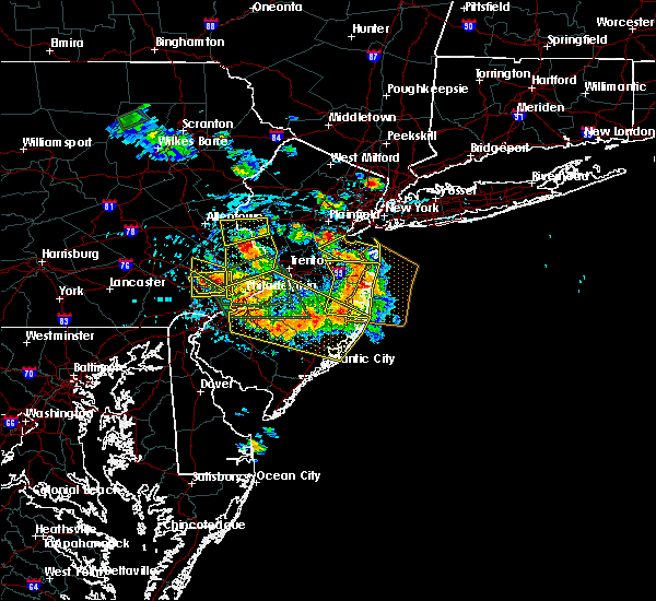 At 310 pm edt, severe thunderstorms were located along a line extending from phoenixville to plymouth meeting, moving south at 5 mph (radar indicated). Hazards include 60 mph wind gusts and quarter size hail. Minor damage to vehicles is possible. Wind damage to roofs, siding, trees, and power lines is possible. At 310 pm edt, severe thunderstorms were located along a line extending from phoenixville to plymouth meeting, moving south at 5 mph (radar indicated). Hazards include 60 mph wind gusts and quarter size hail. Minor damage to vehicles is possible. Wind damage to roofs, siding, trees, and power lines is possible.
|
| 6/4/2020 10:44 PM EDT |
 At 1030 pm edt, severe thunderstorms were located along a line extending from near cedarville to near west chester to near talleyville, moving northeast at 40 mph (radar indicated). Hazards include 60 mph wind gusts. damage to roofs, siding, trees, and power lines is possible At 1030 pm edt, severe thunderstorms were located along a line extending from near cedarville to near west chester to near talleyville, moving northeast at 40 mph (radar indicated). Hazards include 60 mph wind gusts. damage to roofs, siding, trees, and power lines is possible
|
| 6/4/2020 10:44 PM EDT |
 At 1043 pm edt, severe thunderstorms were located along a line extending from near spring mount to near valley forge to chester township, moving northeast at 40 mph. radar data shows an area of more focused damaging winds moving into far northern delaware county (radar indicated). Hazards include 60 mph wind gusts. Damage to roofs, siding, trees, and power lines is possible. locations impacted include, philadelphia, camden, wilmington, gloucester city, cherry hill, bensalem, mount laurel, norristown, chester, willingboro, pottstown, west deptford, phoenixville, lansdale, west norriton, east norriton, lumberton, florence, bellmawr and yeadon. this includes the following highways, interstate 295 in new jersey between mile markers 20 and 55. interstate 95 in pennsylvania between mile markers 0 and 40. new jersey turnpike between exits 4 and 6a. interstate 95 in delaware between mile markers 15 and 23. interstate 476 in pennsylvania between mile markers 0 and 19. pennsylvania turnpike between exits 320 and 353. northeast extension between exits a20 and a31. interstate 676 in new jersey between mile markers 0 and 4. interstate 676 in pennsylvania between mile markers 0 and 1. interstate 76 in new jersey between mile markers 0 and 3. Interstate 76 in pennsylvania between mile markers 327 and 351. At 1043 pm edt, severe thunderstorms were located along a line extending from near spring mount to near valley forge to chester township, moving northeast at 40 mph. radar data shows an area of more focused damaging winds moving into far northern delaware county (radar indicated). Hazards include 60 mph wind gusts. Damage to roofs, siding, trees, and power lines is possible. locations impacted include, philadelphia, camden, wilmington, gloucester city, cherry hill, bensalem, mount laurel, norristown, chester, willingboro, pottstown, west deptford, phoenixville, lansdale, west norriton, east norriton, lumberton, florence, bellmawr and yeadon. this includes the following highways, interstate 295 in new jersey between mile markers 20 and 55. interstate 95 in pennsylvania between mile markers 0 and 40. new jersey turnpike between exits 4 and 6a. interstate 95 in delaware between mile markers 15 and 23. interstate 476 in pennsylvania between mile markers 0 and 19. pennsylvania turnpike between exits 320 and 353. northeast extension between exits a20 and a31. interstate 676 in new jersey between mile markers 0 and 4. interstate 676 in pennsylvania between mile markers 0 and 1. interstate 76 in new jersey between mile markers 0 and 3. Interstate 76 in pennsylvania between mile markers 327 and 351.
|
| 6/4/2020 10:31 PM EDT |
 At 1030 pm edt, severe thunderstorms were located along a line extending from near cedarville to near west chester to near talleyville, moving northeast at 40 mph (radar indicated). Hazards include 60 mph wind gusts. damage to roofs, siding, trees, and power lines is possible At 1030 pm edt, severe thunderstorms were located along a line extending from near cedarville to near west chester to near talleyville, moving northeast at 40 mph (radar indicated). Hazards include 60 mph wind gusts. damage to roofs, siding, trees, and power lines is possible
|
| 6/3/2020 7:08 PM EDT |
 At 707 pm edt, severe thunderstorms were located along a line extending from near westtown to gradyville to norristown, moving southeast at 50 mph. these are very dangerous storms (emergency management). Hazards include 80 mph wind gusts and quarter size hail. Flying debris will be dangerous to those caught without shelter. mobile homes will be heavily damaged. expect considerable damage to roofs, windows, and vehicles. extensive tree damage and power outages are likely. locations impacted include, philadelphia, camden, wilmington, vineland, west chester, gloucester city, cherry hill, evesham, mount laurel, norristown, chester, deptford, voorhees, medford, west deptford, glassboro, lindenwold, phoenixville, west norriton and east norriton. this includes the following highways, atlantic city expressway between mile markers 30 and 44. interstate 295 in new jersey between mile markers 4 and 42. interstate 95 in pennsylvania between mile markers 0 and 32. new jersey turnpike between exits 1 and 4. interstate 95 in delaware between mile markers 15 and 23. interstate 476 in pennsylvania between mile markers 0 and 19. pennsylvania turnpike between exits 312 and 340. northeast extension near exit a20. interstate 676 in new jersey between mile markers 0 and 4. interstate 676 in pennsylvania between mile markers 0 and 1. interstate 76 in new jersey between mile markers 0 and 3. Interstate 76 in pennsylvania between mile markers 327 and 351. At 707 pm edt, severe thunderstorms were located along a line extending from near westtown to gradyville to norristown, moving southeast at 50 mph. these are very dangerous storms (emergency management). Hazards include 80 mph wind gusts and quarter size hail. Flying debris will be dangerous to those caught without shelter. mobile homes will be heavily damaged. expect considerable damage to roofs, windows, and vehicles. extensive tree damage and power outages are likely. locations impacted include, philadelphia, camden, wilmington, vineland, west chester, gloucester city, cherry hill, evesham, mount laurel, norristown, chester, deptford, voorhees, medford, west deptford, glassboro, lindenwold, phoenixville, west norriton and east norriton. this includes the following highways, atlantic city expressway between mile markers 30 and 44. interstate 295 in new jersey between mile markers 4 and 42. interstate 95 in pennsylvania between mile markers 0 and 32. new jersey turnpike between exits 1 and 4. interstate 95 in delaware between mile markers 15 and 23. interstate 476 in pennsylvania between mile markers 0 and 19. pennsylvania turnpike between exits 312 and 340. northeast extension near exit a20. interstate 676 in new jersey between mile markers 0 and 4. interstate 676 in pennsylvania between mile markers 0 and 1. interstate 76 in new jersey between mile markers 0 and 3. Interstate 76 in pennsylvania between mile markers 327 and 351.
|
| 6/3/2020 7:02 PM EDT |
 At 701 pm edt, severe thunderstorms were located along a line extending from marshallton to near paoli to near west norriton, moving southeast at 50 mph (emergency management). Hazards include 70 mph wind gusts and quarter size hail. Minor damage to vehicles is possible. expect considerable tree damage. Wind damage is also likely to mobile homes, roofs, and outbuildings. At 701 pm edt, severe thunderstorms were located along a line extending from marshallton to near paoli to near west norriton, moving southeast at 50 mph (emergency management). Hazards include 70 mph wind gusts and quarter size hail. Minor damage to vehicles is possible. expect considerable tree damage. Wind damage is also likely to mobile homes, roofs, and outbuildings.
|
| 6/3/2020 6:54 PM EDT |
 At 653 pm edt, severe thunderstorms were located along a line extending from near glenmoore to chester springs to phoenixville, moving southeast at 40 mph (emergency management). Hazards include 70 mph wind gusts. Expect considerable tree damage. damage is likely to mobile homes, roofs, and outbuildings. locations impacted include, west chester, norristown, pottstown, phoenixville, west norriton, coatesville, downingtown, collegeville, royersford, parkesburg, trappe, honey brook, elverson, cochranville, pughtown, marshallton, lionville-marchwood, valley forge, glenmoore and paoli. this includes the following highways, pennsylvania turnpike between exits 312 and 326. Interstate 76 in pennsylvania between mile markers 327 and 328. At 653 pm edt, severe thunderstorms were located along a line extending from near glenmoore to chester springs to phoenixville, moving southeast at 40 mph (emergency management). Hazards include 70 mph wind gusts. Expect considerable tree damage. damage is likely to mobile homes, roofs, and outbuildings. locations impacted include, west chester, norristown, pottstown, phoenixville, west norriton, coatesville, downingtown, collegeville, royersford, parkesburg, trappe, honey brook, elverson, cochranville, pughtown, marshallton, lionville-marchwood, valley forge, glenmoore and paoli. this includes the following highways, pennsylvania turnpike between exits 312 and 326. Interstate 76 in pennsylvania between mile markers 327 and 328.
|
| 6/3/2020 6:26 PM EDT |
 At 625 pm edt, severe thunderstorms were located along a line extending from adamstown to near birdsboro to 6 miles southwest of bechtelsville, moving southeast at 30 mph (radar indicated). Hazards include 70 mph wind gusts. Expect considerable tree damage. Damage is likely to mobile homes, roofs, and outbuildings. At 625 pm edt, severe thunderstorms were located along a line extending from adamstown to near birdsboro to 6 miles southwest of bechtelsville, moving southeast at 30 mph (radar indicated). Hazards include 70 mph wind gusts. Expect considerable tree damage. Damage is likely to mobile homes, roofs, and outbuildings.
|
| 6/3/2020 12:11 PM EDT | Large tree down on wall stree in chester county PA, 0.5 miles NNE of Spring City, PA |
| 6/3/2020 12:02 PM EDT |
 At 1200 pm edt, severe thunderstorms were located along a line extending from near springtown to near souderton to royersford, moving east at 70 mph. these are very dangerous storms (radar indicated). Hazards include 80 mph wind gusts and penny size hail. Flying debris will be dangerous to those caught without shelter. mobile homes will be heavily damaged. expect considerable damage to roofs, windows, and vehicles. extensive tree damage and power outages are likely. locations impacted include, allentown, reading, pottstown, lansdale, east norriton, emmaus, quakertown, perkasie, doylestown, byram, souderton, bedminster, hellertown, birdsboro, collegeville, royersford, flemington, chalfont, tinicum and trappe. this includes the following highways, interstate 78 in pennsylvania between mile markers 51 and 64. northeast extension between exits a31 and a56. Interstate 176 in pennsylvania between mile markers 6 and 11. At 1200 pm edt, severe thunderstorms were located along a line extending from near springtown to near souderton to royersford, moving east at 70 mph. these are very dangerous storms (radar indicated). Hazards include 80 mph wind gusts and penny size hail. Flying debris will be dangerous to those caught without shelter. mobile homes will be heavily damaged. expect considerable damage to roofs, windows, and vehicles. extensive tree damage and power outages are likely. locations impacted include, allentown, reading, pottstown, lansdale, east norriton, emmaus, quakertown, perkasie, doylestown, byram, souderton, bedminster, hellertown, birdsboro, collegeville, royersford, flemington, chalfont, tinicum and trappe. this includes the following highways, interstate 78 in pennsylvania between mile markers 51 and 64. northeast extension between exits a31 and a56. Interstate 176 in pennsylvania between mile markers 6 and 11.
|
| 6/3/2020 12:00 PM EDT | Numerous trees down in spring city. report via social media with photos. time estimated from rada in chester county PA, 0.4 miles SE of Spring City, PA |
| 6/3/2020 11:59 AM EDT | Multiple large trees snapped; one fell onto and destroyed a shed. report via social media with photos. time estimated from rada in chester county PA, 0.4 miles SE of Spring City, PA |
| 6/3/2020 11:59 AM EDT |
 At 1157 am edt, severe thunderstorms were located along a line extending from near ferndale to near trappe to near honey brook, moving east at 90 mph. these are very dangerous storms (radar indicated). Hazards include 80 mph wind gusts. reading airport measured an earlier wind gust of 83 mph with these storms. numerous reports of wind damage have been received. Flying debris will be dangerous to those caught without shelter. mobile homes will be heavily damaged. expect considerable damage to roofs, windows, and vehicles. Extensive tree damage and power outages are likely. At 1157 am edt, severe thunderstorms were located along a line extending from near ferndale to near trappe to near honey brook, moving east at 90 mph. these are very dangerous storms (radar indicated). Hazards include 80 mph wind gusts. reading airport measured an earlier wind gust of 83 mph with these storms. numerous reports of wind damage have been received. Flying debris will be dangerous to those caught without shelter. mobile homes will be heavily damaged. expect considerable damage to roofs, windows, and vehicles. Extensive tree damage and power outages are likely.
|
| 6/3/2020 11:55 AM EDT | Downed tree on pughtown road. time estimate in chester county PA, 5.7 miles ENE of Spring City, PA |
| 6/3/2020 11:54 AM EDT |
 At 1153 am edt, severe thunderstorms were located along a line extending from cedarville to near honey brook to near churchtown, moving southeast at 60 mph (radar indicated). Hazards include 70 mph wind gusts and penny size hail. Expect considerable tree damage. damage is likely to mobile homes, roofs, and outbuildings. locations impacted include, reading, pottstown, coatesville, wyomissing, birdsboro, collegeville, royersford, sinking spring, trappe, honey brook, elverson, new morgan, spring ridge, pughtown, glenmoore, cedarville, stowe, shillington, west reading and spring city. this includes the following highways, pennsylvania turnpike between exits 298 and 312. Interstate 176 in pennsylvania between mile markers 1 and 11. At 1153 am edt, severe thunderstorms were located along a line extending from cedarville to near honey brook to near churchtown, moving southeast at 60 mph (radar indicated). Hazards include 70 mph wind gusts and penny size hail. Expect considerable tree damage. damage is likely to mobile homes, roofs, and outbuildings. locations impacted include, reading, pottstown, coatesville, wyomissing, birdsboro, collegeville, royersford, sinking spring, trappe, honey brook, elverson, new morgan, spring ridge, pughtown, glenmoore, cedarville, stowe, shillington, west reading and spring city. this includes the following highways, pennsylvania turnpike between exits 298 and 312. Interstate 176 in pennsylvania between mile markers 1 and 11.
|
| 6/3/2020 11:38 AM EDT |
 At 1137 am edt, severe thunderstorms were located along a line extending from ancient oaks to fleetwood to near kleinfeltersville, moving east at 75 mph. these are very dangerous storms (radar indicated). Hazards include 80 mph wind gusts and penny size hail. a wind gust of 83 mph was recently measured at reading airport. Flying debris will be dangerous to those caught without shelter. mobile homes will be heavily damaged. expect considerable damage to roofs, windows, and vehicles. Extensive tree damage and power outages are likely. At 1137 am edt, severe thunderstorms were located along a line extending from ancient oaks to fleetwood to near kleinfeltersville, moving east at 75 mph. these are very dangerous storms (radar indicated). Hazards include 80 mph wind gusts and penny size hail. a wind gust of 83 mph was recently measured at reading airport. Flying debris will be dangerous to those caught without shelter. mobile homes will be heavily damaged. expect considerable damage to roofs, windows, and vehicles. Extensive tree damage and power outages are likely.
|
| 6/3/2020 11:29 AM EDT |
 At 1128 am edt, severe thunderstorms were located along a line extending from bernville to newmanstown to near schaefferstown, moving southeast at 50 mph (radar indicated). Hazards include 60 mph wind gusts and penny size hail. damage to roofs, siding, trees, and power lines is possible At 1128 am edt, severe thunderstorms were located along a line extending from bernville to newmanstown to near schaefferstown, moving southeast at 50 mph (radar indicated). Hazards include 60 mph wind gusts and penny size hail. damage to roofs, siding, trees, and power lines is possible
|
| 4/21/2020 1:17 PM EDT |
 At 116 pm edt, severe thunderstorms were located along a line extending from near glen gardner to souderton to near downingtown, moving east at 40 mph. the strongest winds with the storm are in montgomery and bucks counties (radar indicated). Hazards include 60 mph wind gusts. Damage to roofs, siding, trees, and power lines is possible. locations impacted include, philadelphia, west chester, norristown, pottstown, phoenixville, lansdale, west norriton, east norriton, coatesville, westtown, quakertown, perkasie, doylestown, byram, downingtown, conshohocken, hatboro, souderton, bedminster and washington. this includes the following highways, interstate 78 in new jersey between mile markers 1 and 27. interstate 476 in pennsylvania between mile markers 9 and 19. pennsylvania turnpike between exits 312 and 343. northeast extension between exits a20 and a31. Interstate 76 in pennsylvania between mile markers 327 and 336. At 116 pm edt, severe thunderstorms were located along a line extending from near glen gardner to souderton to near downingtown, moving east at 40 mph. the strongest winds with the storm are in montgomery and bucks counties (radar indicated). Hazards include 60 mph wind gusts. Damage to roofs, siding, trees, and power lines is possible. locations impacted include, philadelphia, west chester, norristown, pottstown, phoenixville, lansdale, west norriton, east norriton, coatesville, westtown, quakertown, perkasie, doylestown, byram, downingtown, conshohocken, hatboro, souderton, bedminster and washington. this includes the following highways, interstate 78 in new jersey between mile markers 1 and 27. interstate 476 in pennsylvania between mile markers 9 and 19. pennsylvania turnpike between exits 312 and 343. northeast extension between exits a20 and a31. Interstate 76 in pennsylvania between mile markers 327 and 336.
|
| 4/21/2020 1:04 PM EDT |
 At 103 pm edt, severe thunderstorms were located along a line extending from pleasant valley to near green lane to near parkesburg, moving east at 40 mph (radar indicated). Hazards include 60 mph wind gusts. damage to roofs, siding, trees, and power lines is possible At 103 pm edt, severe thunderstorms were located along a line extending from pleasant valley to near green lane to near parkesburg, moving east at 40 mph (radar indicated). Hazards include 60 mph wind gusts. damage to roofs, siding, trees, and power lines is possible
|
| 4/13/2020 1:51 PM EDT |
 The severe thunderstorm warning for chester county will expire at 200 pm edt, the storm which prompted the warning has weakened below severe limits, and no longer poses an immediate threat to life or property. therefore, the warning will be allowed to expire. however gusty winds are still possible with this thunderstorm. a tornado watch remains in effect until 600 pm edt for southeastern pennsylvania. to report severe weather, contact your nearest law enforcement agency. they will relay your report to the national weather service mount holly nj. The severe thunderstorm warning for chester county will expire at 200 pm edt, the storm which prompted the warning has weakened below severe limits, and no longer poses an immediate threat to life or property. therefore, the warning will be allowed to expire. however gusty winds are still possible with this thunderstorm. a tornado watch remains in effect until 600 pm edt for southeastern pennsylvania. to report severe weather, contact your nearest law enforcement agency. they will relay your report to the national weather service mount holly nj.
|
| 4/13/2020 1:46 PM EDT |
 At 145 pm edt, a severe thunderstorm was located over glenmoore, or 10 miles northwest of west chester, moving northeast at 45 mph (radar indicated). Hazards include 60 mph wind gusts. Damage to roofs, siding, trees, and power lines is possible. locations impacted include, west chester, pottstown, phoenixville, coatesville, downingtown, kennett square, oxford, royersford, parkesburg, west grove, honey brook, elverson, homeville, cochranville, pughtown, mount vernon, marshallton, lionville-marchwood, valley forge and glenmoore. This includes pennsylvania turnpike between exits 312 and 320. At 145 pm edt, a severe thunderstorm was located over glenmoore, or 10 miles northwest of west chester, moving northeast at 45 mph (radar indicated). Hazards include 60 mph wind gusts. Damage to roofs, siding, trees, and power lines is possible. locations impacted include, west chester, pottstown, phoenixville, coatesville, downingtown, kennett square, oxford, royersford, parkesburg, west grove, honey brook, elverson, homeville, cochranville, pughtown, mount vernon, marshallton, lionville-marchwood, valley forge and glenmoore. This includes pennsylvania turnpike between exits 312 and 320.
|
| 4/13/2020 1:27 PM EDT |
 At 127 pm edt, a severe thunderstorm was located over parkesburg, or 14 miles southeast of new holland, moving northeast at 45 mph (radar indicated). Hazards include 60 mph wind gusts. damage to roofs, siding, trees, and power lines is possible At 127 pm edt, a severe thunderstorm was located over parkesburg, or 14 miles southeast of new holland, moving northeast at 45 mph (radar indicated). Hazards include 60 mph wind gusts. damage to roofs, siding, trees, and power lines is possible
|
| 4/9/2020 2:07 PM EDT |
 The severe thunderstorm warning for montgomery, south central bucks, northeastern chester, western philadelphia and delaware counties will expire at 215 pm edt, the storm which prompted the warning has moved out of the area. therefore, the warning will be allowed to expire. however gusty winds are still possible and a wind advisory remains in effect. a severe thunderstorm watch remains in effect until 400 pm edt for southern new jersey, and southeastern pennsylvania. The severe thunderstorm warning for montgomery, south central bucks, northeastern chester, western philadelphia and delaware counties will expire at 215 pm edt, the storm which prompted the warning has moved out of the area. therefore, the warning will be allowed to expire. however gusty winds are still possible and a wind advisory remains in effect. a severe thunderstorm watch remains in effect until 400 pm edt for southern new jersey, and southeastern pennsylvania.
|
| 4/9/2020 1:50 PM EDT |
 At 149 pm edt, a severe thunderstorm was located over king of prussia, or 12 miles west of philadelphia, moving east at 55 mph (radar indicated). Hazards include 60 mph wind gusts. Damage to roofs, siding, trees, and power lines is possible. locations impacted include, philadelphia, west chester, norristown, chester, pottstown, phoenixville, lansdale, west norriton, east norriton, yeadon, westtown, downingtown, conshohocken, hatboro, folcroft, ambler, swarthmore, collegeville, royersford and jenkintown. people attending covid-19 drive through testing should seek safe shelter immediately! this includes the following highways, interstate 95 in pennsylvania between mile markers 7 and 16, and near mile marker 22. interstate 476 in pennsylvania between mile markers 0 and 19. pennsylvania turnpike between exits 312 and 343. northeast extension between exits a20 and a31. interstate 676 in pennsylvania between mile markers 0 and 1. Interstate 76 in pennsylvania between mile markers 327 and 350. At 149 pm edt, a severe thunderstorm was located over king of prussia, or 12 miles west of philadelphia, moving east at 55 mph (radar indicated). Hazards include 60 mph wind gusts. Damage to roofs, siding, trees, and power lines is possible. locations impacted include, philadelphia, west chester, norristown, chester, pottstown, phoenixville, lansdale, west norriton, east norriton, yeadon, westtown, downingtown, conshohocken, hatboro, folcroft, ambler, swarthmore, collegeville, royersford and jenkintown. people attending covid-19 drive through testing should seek safe shelter immediately! this includes the following highways, interstate 95 in pennsylvania between mile markers 7 and 16, and near mile marker 22. interstate 476 in pennsylvania between mile markers 0 and 19. pennsylvania turnpike between exits 312 and 343. northeast extension between exits a20 and a31. interstate 676 in pennsylvania between mile markers 0 and 1. Interstate 76 in pennsylvania between mile markers 327 and 350.
|
| 4/9/2020 1:37 PM EDT |
 At 137 pm edt, a severe thunderstorm was located near chester springs, or 9 miles north of west chester, moving east at 55 mph (radar indicated). Hazards include 60 mph wind gusts. Damage to roofs, siding, trees, and power lines is possible. locations impacted include, philadelphia, west chester, norristown, chester, pottstown, phoenixville, lansdale, west norriton, east norriton, coatesville, yeadon, westtown, downingtown, conshohocken, hatboro, folcroft, ambler, swarthmore, collegeville and royersford. people attending covid-19 drive through testing should seek safe shelter immediately! this includes the following highways, interstate 95 in pennsylvania between mile markers 7 and 16, and near mile marker 22. interstate 476 in pennsylvania between mile markers 0 and 19. pennsylvania turnpike between exits 312 and 343. northeast extension between exits a20 and a31. interstate 676 in pennsylvania between mile markers 0 and 1. Interstate 76 in pennsylvania between mile markers 327 and 350. At 137 pm edt, a severe thunderstorm was located near chester springs, or 9 miles north of west chester, moving east at 55 mph (radar indicated). Hazards include 60 mph wind gusts. Damage to roofs, siding, trees, and power lines is possible. locations impacted include, philadelphia, west chester, norristown, chester, pottstown, phoenixville, lansdale, west norriton, east norriton, coatesville, yeadon, westtown, downingtown, conshohocken, hatboro, folcroft, ambler, swarthmore, collegeville and royersford. people attending covid-19 drive through testing should seek safe shelter immediately! this includes the following highways, interstate 95 in pennsylvania between mile markers 7 and 16, and near mile marker 22. interstate 476 in pennsylvania between mile markers 0 and 19. pennsylvania turnpike between exits 312 and 343. northeast extension between exits a20 and a31. interstate 676 in pennsylvania between mile markers 0 and 1. Interstate 76 in pennsylvania between mile markers 327 and 350.
|
| 4/9/2020 1:26 PM EDT |
 At 125 pm edt, a severe thunderstorm was located over glenmoore, or 12 miles northwest of west chester, moving east at 55 mph (radar indicated). Hazards include 60 mph wind gusts. damage to roofs, siding, trees, and power lines is possible At 125 pm edt, a severe thunderstorm was located over glenmoore, or 12 miles northwest of west chester, moving east at 55 mph (radar indicated). Hazards include 60 mph wind gusts. damage to roofs, siding, trees, and power lines is possible
|
| 4/9/2020 1:05 PM EDT |
 The severe thunderstorm warning for central montgomery, northwestern bucks and central chester counties will expire at 115 pm edt, the storms which prompted the warning have moved out of the area. therefore, the warning will be allowed to expire. however, gusty winds are still possible with these thunderstorms. a severe thunderstorm watch remains in effect until 400 pm edt for southeastern pennsylvania. to report severe weather, contact your nearest law enforcement agency. they will relay your report to the national weather service mount holly nj. The severe thunderstorm warning for central montgomery, northwestern bucks and central chester counties will expire at 115 pm edt, the storms which prompted the warning have moved out of the area. therefore, the warning will be allowed to expire. however, gusty winds are still possible with these thunderstorms. a severe thunderstorm watch remains in effect until 400 pm edt for southeastern pennsylvania. to report severe weather, contact your nearest law enforcement agency. they will relay your report to the national weather service mount holly nj.
|
| 4/9/2020 12:52 PM EDT |
 At 1251 pm edt, severe thunderstorms were located along a line extending from quakertown to royersford to near coatesville, moving east at 50 mph (radar indicated). Hazards include 60 mph wind gusts and penny size hail. Damage to roofs, siding, trees, and power lines is possible. locations impacted include, west chester, norristown, pottstown, phoenixville, lansdale, west norriton, east norriton, coatesville, quakertown, perkasie, downingtown, souderton, bedminster, collegeville, royersford, chalfont, parkesburg, trappe, hatfield and dublin. this includes the following highways, pennsylvania turnpike between exits 312 and 326. northeast extension between exits a31 and a44. Interstate 76 in pennsylvania near mile marker 327. At 1251 pm edt, severe thunderstorms were located along a line extending from quakertown to royersford to near coatesville, moving east at 50 mph (radar indicated). Hazards include 60 mph wind gusts and penny size hail. Damage to roofs, siding, trees, and power lines is possible. locations impacted include, west chester, norristown, pottstown, phoenixville, lansdale, west norriton, east norriton, coatesville, quakertown, perkasie, downingtown, souderton, bedminster, collegeville, royersford, chalfont, parkesburg, trappe, hatfield and dublin. this includes the following highways, pennsylvania turnpike between exits 312 and 326. northeast extension between exits a31 and a44. Interstate 76 in pennsylvania near mile marker 327.
|
| 4/9/2020 12:23 PM EDT |
 At 1222 pm edt, severe thunderstorms were located along a line extending from laureldale to near adamstown to near strasburg, moving east at 55 mph (radar indicated). Hazards include 60 mph wind gusts and penny size hail. damage to roofs, siding, trees, and power lines is possible At 1222 pm edt, severe thunderstorms were located along a line extending from laureldale to near adamstown to near strasburg, moving east at 55 mph (radar indicated). Hazards include 60 mph wind gusts and penny size hail. damage to roofs, siding, trees, and power lines is possible
|
| 3/3/2020 9:20 PM EST |
 The severe thunderstorm warning for north central new castle, southeastern lehigh, montgomery, bucks, chester, northwestern delaware and southeastern northampton counties will expire at 930 pm est, the storms which prompted the warning have moved out of the area. therefore, the warning will be allowed to expire. however gusty winds are still possible with these thunderstorms. to report severe weather, contact your nearest law enforcement agency. they will relay your report to the national weather service mount holly nj. The severe thunderstorm warning for north central new castle, southeastern lehigh, montgomery, bucks, chester, northwestern delaware and southeastern northampton counties will expire at 930 pm est, the storms which prompted the warning have moved out of the area. therefore, the warning will be allowed to expire. however gusty winds are still possible with these thunderstorms. to report severe weather, contact your nearest law enforcement agency. they will relay your report to the national weather service mount holly nj.
|
| 3/3/2020 9:12 PM EST |
 At 911 pm est, severe thunderstorms were located along a line extending from alpha to lansdale to near marshallton, moving east at 45 mph (radar indicated). Hazards include 60 mph wind gusts. Damage to roofs, siding, trees, and power lines is possible. locations impacted include, easton, west chester, bethlehem, norristown, pottstown, phoenixville, lansdale, west norriton, forks, east norriton, coatesville, westtown, quakertown, perkasie, doylestown, byram, wilson, downingtown, conshohocken and hatboro. this includes the following highways, interstate 78 in pennsylvania between mile markers 64 and 76. interstate 476 in pennsylvania between mile markers 10 and 19. pennsylvania turnpike between exits 312 and 343. northeast extension between exits a20 and a44. Interstate 76 in pennsylvania between mile markers 327 and 335. At 911 pm est, severe thunderstorms were located along a line extending from alpha to lansdale to near marshallton, moving east at 45 mph (radar indicated). Hazards include 60 mph wind gusts. Damage to roofs, siding, trees, and power lines is possible. locations impacted include, easton, west chester, bethlehem, norristown, pottstown, phoenixville, lansdale, west norriton, forks, east norriton, coatesville, westtown, quakertown, perkasie, doylestown, byram, wilson, downingtown, conshohocken and hatboro. this includes the following highways, interstate 78 in pennsylvania between mile markers 64 and 76. interstate 476 in pennsylvania between mile markers 10 and 19. pennsylvania turnpike between exits 312 and 343. northeast extension between exits a20 and a44. Interstate 76 in pennsylvania between mile markers 327 and 335.
|
| 3/3/2020 8:39 PM EST |
 At 838 pm est, severe thunderstorms were located along a line extending from near schnecksville to near elverson to quarryville, moving east at 45 mph (radar indicated). Hazards include 60 mph wind gusts. damage to roofs, siding, trees, and power lines is possible At 838 pm est, severe thunderstorms were located along a line extending from near schnecksville to near elverson to quarryville, moving east at 45 mph (radar indicated). Hazards include 60 mph wind gusts. damage to roofs, siding, trees, and power lines is possible
|
| 2/7/2020 9:43 AM EST |
 At 942 am est, severe thunderstorms were located along a line extending from near bally to near lionville-marchwood, moving northeast at 45 mph (radar indicated). Hazards include 70 mph wind gusts and penny size hail. Expect considerable tree damage. Damage is likely to mobile homes, roofs, and outbuildings. At 942 am est, severe thunderstorms were located along a line extending from near bally to near lionville-marchwood, moving northeast at 45 mph (radar indicated). Hazards include 70 mph wind gusts and penny size hail. Expect considerable tree damage. Damage is likely to mobile homes, roofs, and outbuildings.
|
| 2/7/2020 9:22 AM EST |
 At 920 am est, severe thunderstorms were located along a line extending from reading to near parkesburg to near aberdeen proving ground, moving northeast at 65 mph. numerous trees have been reported down along with numerous power outages due to high winds along and ahead of this line of storms (radar indicated). Hazards include 70 mph wind gusts and penny size hail. Expect considerable tree damage. damage is likely to mobile homes, roofs, and outbuildings. locations impacted include, reading, wilmington, newark, middletown, west chester, elkton, calvert, pottstown, phoenixville, coatesville, westtown, wyomissing, downingtown, elsmere, kennett square, birdsboro, collegeville, oxford, kutztown and royersford. this includes the following highways, interstate 78 in pennsylvania between mile markers 43 and 44. interstate 95 in maryland between mile markers 91 and 109. interstate 95 in delaware between mile markers 0 and 11. pennsylvania turnpike between exits 298 and 320. Interstate 176 in pennsylvania between mile markers 1 and 11. At 920 am est, severe thunderstorms were located along a line extending from reading to near parkesburg to near aberdeen proving ground, moving northeast at 65 mph. numerous trees have been reported down along with numerous power outages due to high winds along and ahead of this line of storms (radar indicated). Hazards include 70 mph wind gusts and penny size hail. Expect considerable tree damage. damage is likely to mobile homes, roofs, and outbuildings. locations impacted include, reading, wilmington, newark, middletown, west chester, elkton, calvert, pottstown, phoenixville, coatesville, westtown, wyomissing, downingtown, elsmere, kennett square, birdsboro, collegeville, oxford, kutztown and royersford. this includes the following highways, interstate 78 in pennsylvania between mile markers 43 and 44. interstate 95 in maryland between mile markers 91 and 109. interstate 95 in delaware between mile markers 0 and 11. pennsylvania turnpike between exits 298 and 320. Interstate 176 in pennsylvania between mile markers 1 and 11.
|
| 2/7/2020 8:52 AM EST |
 At 851 am est, severe thunderstorms were located along a line extending from mountville to delta to essex, moving northeast at 60 mph. this storm has a history of producing wind damage across portions of maryland (radar indicated). Hazards include 70 mph wind gusts and penny size hail. Expect considerable tree damage. Damage is likely to mobile homes, roofs, and outbuildings. At 851 am est, severe thunderstorms were located along a line extending from mountville to delta to essex, moving northeast at 60 mph. this storm has a history of producing wind damage across portions of maryland (radar indicated). Hazards include 70 mph wind gusts and penny size hail. Expect considerable tree damage. Damage is likely to mobile homes, roofs, and outbuildings.
|
| 10/31/2019 11:15 PM EDT |
 At 1114 pm edt, severe thunderstorms were located along a line extending from riegelsville to newark, moving northeast at 60 mph (radar indicated). Hazards include 60 mph wind gusts. damage to roofs, siding, trees, and power lines is possible At 1114 pm edt, severe thunderstorms were located along a line extending from riegelsville to newark, moving northeast at 60 mph (radar indicated). Hazards include 60 mph wind gusts. damage to roofs, siding, trees, and power lines is possible
|
| 10/31/2019 11:01 PM EDT |
 At 1101 pm edt, severe thunderstorms were located along a line extending from near quakertown to west nottingham, moving northeast at 50 mph (radar indicated). Hazards include 60 mph wind gusts. Damage to roofs, siding, trees, and power lines is possible. locations impacted include, west chester, elkton, calvert, norristown, pottstown, phoenixville, lansdale, west norriton, east norriton, coatesville, westtown, quakertown, perkasie, doylestown, downingtown, conshohocken, souderton, bedminster, ambler and kennett square. this includes the following highways, interstate 95 in maryland between mile markers 91 and 109. Interstate 95 in delaware near mile marker 0. At 1101 pm edt, severe thunderstorms were located along a line extending from near quakertown to west nottingham, moving northeast at 50 mph (radar indicated). Hazards include 60 mph wind gusts. Damage to roofs, siding, trees, and power lines is possible. locations impacted include, west chester, elkton, calvert, norristown, pottstown, phoenixville, lansdale, west norriton, east norriton, coatesville, westtown, quakertown, perkasie, doylestown, downingtown, conshohocken, souderton, bedminster, ambler and kennett square. this includes the following highways, interstate 95 in maryland between mile markers 91 and 109. Interstate 95 in delaware near mile marker 0.
|
| 10/31/2019 10:23 PM EDT |
 At 1023 pm edt, severe thunderstorms were located along a line extending from east greenville to near aberdeen, moving northeast at 65 mph (radar indicated). Hazards include 60 mph wind gusts. damage to roofs, siding, trees, and power lines is possible At 1023 pm edt, severe thunderstorms were located along a line extending from east greenville to near aberdeen, moving northeast at 65 mph (radar indicated). Hazards include 60 mph wind gusts. damage to roofs, siding, trees, and power lines is possible
|
| 10/31/2019 10:02 PM EDT |
 At 1001 pm edt, severe thunderstorms were located along a line extending from near cedarville to near bel air north, moving northeast at 50 mph (radar indicated). Hazards include 60 mph wind gusts. Damage to roofs, siding, trees, and power lines is possible. locations impacted include, reading, calvert, pottstown, coatesville, wyomissing, downingtown, birdsboro, oxford, kutztown, royersford, fleetwood, laureldale, parkesburg, east greenville, west grove, rising sun, topton, honey brook, schwenksville and elverson. This includes interstate 95 in maryland between mile markers 91 and 98. At 1001 pm edt, severe thunderstorms were located along a line extending from near cedarville to near bel air north, moving northeast at 50 mph (radar indicated). Hazards include 60 mph wind gusts. Damage to roofs, siding, trees, and power lines is possible. locations impacted include, reading, calvert, pottstown, coatesville, wyomissing, downingtown, birdsboro, oxford, kutztown, royersford, fleetwood, laureldale, parkesburg, east greenville, west grove, rising sun, topton, honey brook, schwenksville and elverson. This includes interstate 95 in maryland between mile markers 91 and 98.
|
| 10/31/2019 9:35 PM EDT |
 At 934 pm edt, severe thunderstorms were located along a line extending from new holland to towson, moving northeast at 50 mph (radar indicated). Hazards include 60 mph wind gusts. damage to roofs, siding, trees, and power lines is possible At 934 pm edt, severe thunderstorms were located along a line extending from new holland to towson, moving northeast at 50 mph (radar indicated). Hazards include 60 mph wind gusts. damage to roofs, siding, trees, and power lines is possible
|
| 9/11/2019 7:48 PM EDT | Downed trees and power lines on hollow road northeast of birchrunville. time estimated from rada in chester county PA, 5.1 miles ENE of Spring City, PA |
| 8/21/2019 4:38 PM EDT |
 At 406 pm edt, a severe thunderstorm was located over phoenixville, or 14 miles north of west chester, moving east at 20 mph (radar indicated). Hazards include 60 mph wind gusts and quarter size hail. Minor damage to vehicles is possible. Wind damage to roofs, siding, trees, and power lines is possible. At 406 pm edt, a severe thunderstorm was located over phoenixville, or 14 miles north of west chester, moving east at 20 mph (radar indicated). Hazards include 60 mph wind gusts and quarter size hail. Minor damage to vehicles is possible. Wind damage to roofs, siding, trees, and power lines is possible.
|
| 8/21/2019 4:17 PM EDT |
 At 417 pm edt, a severe thunderstorm was located over west norriton, or 15 miles northeast of west chester, moving east at 20 mph (radar indicated). Hazards include 60 mph wind gusts and quarter size hail. Minor damage to vehicles is possible. wind damage to roofs, siding, trees, and power lines is possible. Locations impacted include, norristown, phoenixville, west norriton, east norriton, conshohocken, ambler, collegeville, royersford, trappe, schwenksville, bryn mawr, valley forge, plymouth meeting, king of prussia, radnor township, horsham, skippack, bridgeport, spring city and north wales. At 417 pm edt, a severe thunderstorm was located over west norriton, or 15 miles northeast of west chester, moving east at 20 mph (radar indicated). Hazards include 60 mph wind gusts and quarter size hail. Minor damage to vehicles is possible. wind damage to roofs, siding, trees, and power lines is possible. Locations impacted include, norristown, phoenixville, west norriton, east norriton, conshohocken, ambler, collegeville, royersford, trappe, schwenksville, bryn mawr, valley forge, plymouth meeting, king of prussia, radnor township, horsham, skippack, bridgeport, spring city and north wales.
|
| 8/21/2019 4:07 PM EDT |
 At 406 pm edt, a severe thunderstorm was located over phoenixville, or 14 miles north of west chester, moving east at 20 mph (radar indicated). Hazards include 60 mph wind gusts and quarter size hail. Minor damage to vehicles is possible. Wind damage to roofs, siding, trees, and power lines is possible. At 406 pm edt, a severe thunderstorm was located over phoenixville, or 14 miles north of west chester, moving east at 20 mph (radar indicated). Hazards include 60 mph wind gusts and quarter size hail. Minor damage to vehicles is possible. Wind damage to roofs, siding, trees, and power lines is possible.
|
| 8/21/2019 3:22 PM EDT |
 At 321 pm edt, a severe thunderstorm was located near birdsboro, or 10 miles southeast of reading, moving east at 20 mph (radar indicated). Hazards include 60 mph wind gusts and quarter size hail. Minor damage to vehicles is possible. wind damage to roofs, siding, trees, and power lines is possible. locations impacted include, pottstown, birdsboro, collegeville, royersford, trappe, east greenville, schwenksville, bally, bechtelsville, green lane, spring mount, gilbertsville, cedarville, stowe, boyertown, pennsburg, spring city, red hill, st. Lawrence and pottsgrove. At 321 pm edt, a severe thunderstorm was located near birdsboro, or 10 miles southeast of reading, moving east at 20 mph (radar indicated). Hazards include 60 mph wind gusts and quarter size hail. Minor damage to vehicles is possible. wind damage to roofs, siding, trees, and power lines is possible. locations impacted include, pottstown, birdsboro, collegeville, royersford, trappe, east greenville, schwenksville, bally, bechtelsville, green lane, spring mount, gilbertsville, cedarville, stowe, boyertown, pennsburg, spring city, red hill, st. Lawrence and pottsgrove.
|
| 8/21/2019 3:08 PM EDT |
 At 308 pm edt, a severe thunderstorm was located over birdsboro, or near reading, moving east at 20 mph (radar indicated). Hazards include 60 mph wind gusts and quarter size hail. Minor damage to vehicles is possible. Wind damage to roofs, siding, trees, and power lines is possible. At 308 pm edt, a severe thunderstorm was located over birdsboro, or near reading, moving east at 20 mph (radar indicated). Hazards include 60 mph wind gusts and quarter size hail. Minor damage to vehicles is possible. Wind damage to roofs, siding, trees, and power lines is possible.
|
| 7/31/2019 3:25 PM EDT |
 The severe thunderstorm warning for north central new castle, southeastern hunterdon, northwestern mercer, montgomery, central bucks, eastern chester, northwestern philadelphia and delaware counties will expire at 330 pm edt, a new severe thunderstorm warning is now in effect. please refer to warning 290 which is in effect until 4:15 pm. a severe thunderstorm watch remains in effect until 900 pm edt for northern delaware, central and northwestern new jersey, and southeastern pennsylvania. to report severe weather, contact your nearest law enforcement agency. they will relay your report to the national weather service mount holly nj. The severe thunderstorm warning for north central new castle, southeastern hunterdon, northwestern mercer, montgomery, central bucks, eastern chester, northwestern philadelphia and delaware counties will expire at 330 pm edt, a new severe thunderstorm warning is now in effect. please refer to warning 290 which is in effect until 4:15 pm. a severe thunderstorm watch remains in effect until 900 pm edt for northern delaware, central and northwestern new jersey, and southeastern pennsylvania. to report severe weather, contact your nearest law enforcement agency. they will relay your report to the national weather service mount holly nj.
|
| 7/31/2019 3:25 PM EDT |
 At 308 pm edt, severe thunderstorms were located along a line extending from near byram to valley forge to near west chester, moving east at 20 mph (radar indicated). Hazards include 60 mph wind gusts and penny size hail. Damage to roofs, siding, trees, and power lines is possible. Locations impacted include, philadelphia, wilmington, west chester, norristown, phoenixville, lansdale, west norriton, east norriton, westtown, perkasie, doylestown, byram, downingtown, conshohocken, hatboro, souderton, bedminster, ambler, swarthmore and kennett square. At 308 pm edt, severe thunderstorms were located along a line extending from near byram to valley forge to near west chester, moving east at 20 mph (radar indicated). Hazards include 60 mph wind gusts and penny size hail. Damage to roofs, siding, trees, and power lines is possible. Locations impacted include, philadelphia, wilmington, west chester, norristown, phoenixville, lansdale, west norriton, east norriton, westtown, perkasie, doylestown, byram, downingtown, conshohocken, hatboro, souderton, bedminster, ambler, swarthmore and kennett square.
|
| 7/31/2019 3:08 PM EDT |
 At 308 pm edt, severe thunderstorms were located along a line extending from near byram to valley forge to near west chester, moving east at 20 mph (radar indicated). Hazards include 60 mph wind gusts and penny size hail. Damage to roofs, siding, trees, and power lines is possible. Locations impacted include, philadelphia, wilmington, west chester, norristown, phoenixville, lansdale, west norriton, east norriton, westtown, perkasie, doylestown, byram, downingtown, conshohocken, hatboro, souderton, bedminster, ambler, swarthmore and kennett square. At 308 pm edt, severe thunderstorms were located along a line extending from near byram to valley forge to near west chester, moving east at 20 mph (radar indicated). Hazards include 60 mph wind gusts and penny size hail. Damage to roofs, siding, trees, and power lines is possible. Locations impacted include, philadelphia, wilmington, west chester, norristown, phoenixville, lansdale, west norriton, east norriton, westtown, perkasie, doylestown, byram, downingtown, conshohocken, hatboro, souderton, bedminster, ambler, swarthmore and kennett square.
|
| 7/31/2019 2:46 PM EDT |
 At 246 pm edt, severe thunderstorms were located along a line extending from ottsville to near phoenixville to near marshallton, moving east at 20 mph (radar indicated). Hazards include 60 mph wind gusts and penny size hail. damage to roofs, siding, trees, and power lines is possible At 246 pm edt, severe thunderstorms were located along a line extending from ottsville to near phoenixville to near marshallton, moving east at 20 mph (radar indicated). Hazards include 60 mph wind gusts and penny size hail. damage to roofs, siding, trees, and power lines is possible
|
| 7/21/2019 11:21 PM EDT |
 The severe thunderstorm warning for berks, northwestern montgomery and northeastern chester counties will expire at 1130 pm edt, the storms which prompted the warning are moving out of the area. therefore, the warning will be allowed to expire. to report severe weather, contact your nearest law enforcement agency. they will relay your report to the national weather service mount holly nj. The severe thunderstorm warning for berks, northwestern montgomery and northeastern chester counties will expire at 1130 pm edt, the storms which prompted the warning are moving out of the area. therefore, the warning will be allowed to expire. to report severe weather, contact your nearest law enforcement agency. they will relay your report to the national weather service mount holly nj.
|
| 7/21/2019 10:58 PM EDT |
 At 1058 pm edt, severe thunderstorms were located along a line extending from near strausstown to near laureldale to chester springs, moving northeast at 20 mph (radar indicated). Hazards include 60 mph wind gusts. Damage to roofs, siding, trees, and power lines is possible. Locations impacted include, reading, pottstown, phoenixville, wyomissing, souderton, birdsboro, collegeville, royersford, fleetwood, sinking spring, laureldale, trappe, womelsdorf, wernersville, newmanstown, robesonia, leesport, schwenksville, shoemakersville and bally. At 1058 pm edt, severe thunderstorms were located along a line extending from near strausstown to near laureldale to chester springs, moving northeast at 20 mph (radar indicated). Hazards include 60 mph wind gusts. Damage to roofs, siding, trees, and power lines is possible. Locations impacted include, reading, pottstown, phoenixville, wyomissing, souderton, birdsboro, collegeville, royersford, fleetwood, sinking spring, laureldale, trappe, womelsdorf, wernersville, newmanstown, robesonia, leesport, schwenksville, shoemakersville and bally.
|
| 7/21/2019 10:42 PM EDT |
 At 1042 pm edt, severe thunderstorms were located along a line extending from near strausstown to near lionville, moving northeast at 20 mph (radar indicated). Hazards include 60 mph wind gusts. damage to roofs, siding, trees, and power lines is possible At 1042 pm edt, severe thunderstorms were located along a line extending from near strausstown to near lionville, moving northeast at 20 mph (radar indicated). Hazards include 60 mph wind gusts. damage to roofs, siding, trees, and power lines is possible
|
| 7/17/2019 7:53 PM EDT |
 The severe thunderstorm warning for northeastern new castle, northwestern salem, northwestern gloucester, western montgomery, eastern chester and delaware counties will expire at 800 pm edt, the storms which prompted the warning have weakened below severe limits, and no longer pose an immediate threat to life or property. therefore, the warning will be allowed to expire. however gusty winds up to 40 mph and heavy rain are still possible with these thunderstorms. a severe thunderstorm watch remains in effect until 1000 pm edt for southern new jersey, and southeastern pennsylvania. a severe thunderstorm watch also remains in effect until midnight edt for northern delaware, and southern new jersey. The severe thunderstorm warning for northeastern new castle, northwestern salem, northwestern gloucester, western montgomery, eastern chester and delaware counties will expire at 800 pm edt, the storms which prompted the warning have weakened below severe limits, and no longer pose an immediate threat to life or property. therefore, the warning will be allowed to expire. however gusty winds up to 40 mph and heavy rain are still possible with these thunderstorms. a severe thunderstorm watch remains in effect until 1000 pm edt for southern new jersey, and southeastern pennsylvania. a severe thunderstorm watch also remains in effect until midnight edt for northern delaware, and southern new jersey.
|
| 7/17/2019 7:39 PM EDT |
 At 715 pm edt, severe thunderstorms were located along a line extending from near elverson to near glasgow, moving northeast at 30 mph (radar indicated). Hazards include 70 mph wind gusts. Expect considerable tree damage. Damage is likely to mobile homes, roofs, and outbuildings. At 715 pm edt, severe thunderstorms were located along a line extending from near elverson to near glasgow, moving northeast at 30 mph (radar indicated). Hazards include 70 mph wind gusts. Expect considerable tree damage. Damage is likely to mobile homes, roofs, and outbuildings.
|
| 7/17/2019 7:39 PM EDT |
 At 738 pm edt, severe thunderstorms were located along a line extending from royersford to near carneys point, moving northeast at 35 mph. this storm has a history of producing wind damage (law enforcement). Hazards include 70 mph wind gusts. Expect considerable tree damage. damage is likely to mobile homes, roofs, and outbuildings. Locations impacted include, wilmington, west chester, norristown, chester, pottstown, phoenixville, west norriton, east norriton, pennsville, westtown, carneys point, downingtown, folcroft, swarthmore, elsmere, paulsboro, kennett square, new castle, penns grove and collegeville. At 738 pm edt, severe thunderstorms were located along a line extending from royersford to near carneys point, moving northeast at 35 mph. this storm has a history of producing wind damage (law enforcement). Hazards include 70 mph wind gusts. Expect considerable tree damage. damage is likely to mobile homes, roofs, and outbuildings. Locations impacted include, wilmington, west chester, norristown, chester, pottstown, phoenixville, west norriton, east norriton, pennsville, westtown, carneys point, downingtown, folcroft, swarthmore, elsmere, paulsboro, kennett square, new castle, penns grove and collegeville.
|
| 7/17/2019 7:15 PM EDT |
 At 715 pm edt, severe thunderstorms were located along a line extending from near elverson to near glasgow, moving northeast at 30 mph (radar indicated). Hazards include 70 mph wind gusts. Expect considerable tree damage. Damage is likely to mobile homes, roofs, and outbuildings. At 715 pm edt, severe thunderstorms were located along a line extending from near elverson to near glasgow, moving northeast at 30 mph (radar indicated). Hazards include 70 mph wind gusts. Expect considerable tree damage. Damage is likely to mobile homes, roofs, and outbuildings.
|
| 7/2/2019 8:26 PM EDT |
 The severe thunderstorm warning for southwestern montgomery, northeastern chester, southwestern philadelphia and delaware counties will expire at 830 pm edt, the storm which prompted the warning has weakened below severe limits, and has exited the warned area. therefore, the warning will be allowed to expire. however gusty winds and heavy rain are still possible with this thunderstorm. remember, a severe thunderstorm warning still remains in effect for portions of the area. The severe thunderstorm warning for southwestern montgomery, northeastern chester, southwestern philadelphia and delaware counties will expire at 830 pm edt, the storm which prompted the warning has weakened below severe limits, and has exited the warned area. therefore, the warning will be allowed to expire. however gusty winds and heavy rain are still possible with this thunderstorm. remember, a severe thunderstorm warning still remains in effect for portions of the area.
|
| 7/2/2019 7:52 PM EDT |
 At 752 pm edt, a severe thunderstorm was located over paoli, or 8 miles northeast of west chester, moving southeast at 30 mph (radar indicated). Hazards include 60 mph wind gusts. Damage to roofs, siding, trees, and power lines is possible. Locations impacted include, philadelphia, camden, west chester, chester, phoenixville, west norriton, yeadon, westtown, conshohocken, folcroft, swarthmore, paulsboro, royersford, narberth, east lansdowne, darby township, cheyney, morris park, bryn mawr and trout lake. At 752 pm edt, a severe thunderstorm was located over paoli, or 8 miles northeast of west chester, moving southeast at 30 mph (radar indicated). Hazards include 60 mph wind gusts. Damage to roofs, siding, trees, and power lines is possible. Locations impacted include, philadelphia, camden, west chester, chester, phoenixville, west norriton, yeadon, westtown, conshohocken, folcroft, swarthmore, paulsboro, royersford, narberth, east lansdowne, darby township, cheyney, morris park, bryn mawr and trout lake.
|
| 7/2/2019 7:51 PM EDT |
 The severe thunderstorm warning for southeastern berks, southern montgomery, northeastern chester, philadelphia and delaware counties will expire at 800 pm edt, the storm which prompted the warning has weakened below severe limits, and no longer poses an immediate threat to life or property. therefore, the warning will be allowed to expire. however heavy rain is still possible with this thunderstorm. The severe thunderstorm warning for southeastern berks, southern montgomery, northeastern chester, philadelphia and delaware counties will expire at 800 pm edt, the storm which prompted the warning has weakened below severe limits, and no longer poses an immediate threat to life or property. therefore, the warning will be allowed to expire. however heavy rain is still possible with this thunderstorm.
|
| 7/2/2019 7:50 PM EDT |
 At 750 pm edt, a severe thunderstorm was located over drexel hill, or 10 miles southwest of philadelphia, moving southeast at 40 mph (radar indicated). Hazards include 60 mph wind gusts. damage to roofs, siding, trees, and power lines is possible At 750 pm edt, a severe thunderstorm was located over drexel hill, or 10 miles southwest of philadelphia, moving southeast at 40 mph (radar indicated). Hazards include 60 mph wind gusts. damage to roofs, siding, trees, and power lines is possible
|
| 7/2/2019 7:12 PM EDT |
 At 711 pm edt, a severe thunderstorm was located over pughtown, or 14 miles north of west chester, moving southeast at 40 mph (radar indicated). Hazards include 70 mph wind gusts. Expect considerable tree damage. Damage is likely to mobile homes, roofs, and outbuildings. At 711 pm edt, a severe thunderstorm was located over pughtown, or 14 miles north of west chester, moving southeast at 40 mph (radar indicated). Hazards include 70 mph wind gusts. Expect considerable tree damage. Damage is likely to mobile homes, roofs, and outbuildings.
|
| 6/29/2019 4:09 PM EDT |
 At 408 pm edt, severe thunderstorms were located along a line extending from near east norriton to near kennett square, moving southeast at 45 mph (public. widespread wind damage is occurring with these storms). Hazards include 70 mph wind gusts and quarter size hail. Minor damage to vehicles is possible. expect considerable tree damage. wind damage is also likely to mobile homes, roofs, and outbuildings. Locations impacted include, philadelphia, camden, west chester, norristown, chester, phoenixville, lansdale, west norriton, east norriton, yeadon, westtown, downingtown, conshohocken, hatboro, souderton, folcroft, ambler, swarthmore, paulsboro and kennett square. At 408 pm edt, severe thunderstorms were located along a line extending from near east norriton to near kennett square, moving southeast at 45 mph (public. widespread wind damage is occurring with these storms). Hazards include 70 mph wind gusts and quarter size hail. Minor damage to vehicles is possible. expect considerable tree damage. wind damage is also likely to mobile homes, roofs, and outbuildings. Locations impacted include, philadelphia, camden, west chester, norristown, chester, phoenixville, lansdale, west norriton, east norriton, yeadon, westtown, downingtown, conshohocken, hatboro, souderton, folcroft, ambler, swarthmore, paulsboro and kennett square.
|
| 6/29/2019 3:58 PM EDT | Downed tree on stony run road near schuylkill road in east vincent twp. time estimated from rada in chester county PA, 0.9 miles ENE of Spring City, PA |
| 6/29/2019 3:58 PM EDT | Downed tree in wires at the intersection of bethel church road and kolb road. lane closures required. time estimated from rada in chester county PA, 2.5 miles ESE of Spring City, PA |
| 6/29/2019 3:52 PM EDT |
 At 352 pm edt, severe thunderstorms were located along a line extending from near spring mount to near coatesville, moving southeast at 45 mph (public. several reports of wind damage and hail have been received from berks and chester counties in association with these storms). Hazards include 70 mph wind gusts and quarter size hail. Minor damage to vehicles is possible. expect considerable tree damage. Wind damage is also likely to mobile homes, roofs, and outbuildings. At 352 pm edt, severe thunderstorms were located along a line extending from near spring mount to near coatesville, moving southeast at 45 mph (public. several reports of wind damage and hail have been received from berks and chester counties in association with these storms). Hazards include 70 mph wind gusts and quarter size hail. Minor damage to vehicles is possible. expect considerable tree damage. Wind damage is also likely to mobile homes, roofs, and outbuildings.
|
| 6/28/2019 6:26 PM EDT |
 The severe thunderstorm warning for southeastern berks, northwestern montgomery and north central chester counties will expire at 630 pm edt, the storm which prompted the warning has weakened below severe limits, and no longer poses an immediate threat to life or property. therefore, the warning will be allowed to expire. however, heavy rain is still possible with this thunderstorm. to report severe weather, contact your nearest law enforcement agency. they will relay your report to the national weather service mount holly nj. The severe thunderstorm warning for southeastern berks, northwestern montgomery and north central chester counties will expire at 630 pm edt, the storm which prompted the warning has weakened below severe limits, and no longer poses an immediate threat to life or property. therefore, the warning will be allowed to expire. however, heavy rain is still possible with this thunderstorm. to report severe weather, contact your nearest law enforcement agency. they will relay your report to the national weather service mount holly nj.
|
| 6/28/2019 5:58 PM EDT |
 At 557 pm edt, a severe thunderstorm was located near birdsboro, or 7 miles east of reading, and is nearly stationary (radar indicated). Hazards include 60 mph wind gusts and quarter size hail. Minor damage to vehicles is possible. wind damage to roofs, siding, trees, and power lines is possible. locations impacted include, reading, pottstown, birdsboro, bally, bechtelsville, gilbertsville, cedarville, stowe, boyertown, spring city, mount penn, st. Lawrence, pottsgrove, lorane, south pottstown, reiffton, amity gardens, sanatoga, kenilworth and halfway house. At 557 pm edt, a severe thunderstorm was located near birdsboro, or 7 miles east of reading, and is nearly stationary (radar indicated). Hazards include 60 mph wind gusts and quarter size hail. Minor damage to vehicles is possible. wind damage to roofs, siding, trees, and power lines is possible. locations impacted include, reading, pottstown, birdsboro, bally, bechtelsville, gilbertsville, cedarville, stowe, boyertown, spring city, mount penn, st. Lawrence, pottsgrove, lorane, south pottstown, reiffton, amity gardens, sanatoga, kenilworth and halfway house.
|
| 6/28/2019 5:42 PM EDT |
 At 541 pm edt, a severe thunderstorm was located near birdsboro, or 7 miles east of reading, moving east at 10 mph. this replaces the previous severe thunderstorm warning in effect for the area (radar indicated). Hazards include 60 mph wind gusts and quarter size hail. Minor damage to vehicles is possible. Wind damage to roofs, siding, trees, and power lines is possible. At 541 pm edt, a severe thunderstorm was located near birdsboro, or 7 miles east of reading, moving east at 10 mph. this replaces the previous severe thunderstorm warning in effect for the area (radar indicated). Hazards include 60 mph wind gusts and quarter size hail. Minor damage to vehicles is possible. Wind damage to roofs, siding, trees, and power lines is possible.
|
| 6/2/2019 7:11 PM EDT |
 At 711 pm edt, a severe thunderstorm was located over pottstown, or 14 miles east of reading, moving east at 55 mph (radar indicated). Hazards include 60 mph wind gusts and quarter size hail. Minor damage to vehicles is possible. Wind damage to roofs, siding, trees, and power lines is possible. At 711 pm edt, a severe thunderstorm was located over pottstown, or 14 miles east of reading, moving east at 55 mph (radar indicated). Hazards include 60 mph wind gusts and quarter size hail. Minor damage to vehicles is possible. Wind damage to roofs, siding, trees, and power lines is possible.
|
| 5/29/2019 5:49 PM EDT |
 The national weather service in mount holly nj has issued a * severe thunderstorm warning for. northeastern new castle county in northern delaware. southeastern berks county in eastern pennsylvania. southern montgomery county in southeastern pennsylvania. Chester county in southeastern pennsylvania. The national weather service in mount holly nj has issued a * severe thunderstorm warning for. northeastern new castle county in northern delaware. southeastern berks county in eastern pennsylvania. southern montgomery county in southeastern pennsylvania. Chester county in southeastern pennsylvania.
|
| 5/29/2019 5:44 PM EDT |
 At 544 pm edt, severe thunderstorms were located along a line extending from near ramsey to robesonia, moving east at 55 mph (radar indicated). Hazards include 60 mph wind gusts and quarter size hail. Minor damage to vehicles is possible. wind damage to roofs, siding, trees, and power lines is possible. Locations impacted include, allentown, reading, bethlehem, pottstown, phoenixville, emmaus, wyomissing, quakertown, perkasie, souderton, bedminster, hellertown, birdsboro, collegeville, kutztown, royersford, fleetwood, sinking spring, laureldale and trappe. At 544 pm edt, severe thunderstorms were located along a line extending from near ramsey to robesonia, moving east at 55 mph (radar indicated). Hazards include 60 mph wind gusts and quarter size hail. Minor damage to vehicles is possible. wind damage to roofs, siding, trees, and power lines is possible. Locations impacted include, allentown, reading, bethlehem, pottstown, phoenixville, emmaus, wyomissing, quakertown, perkasie, souderton, bedminster, hellertown, birdsboro, collegeville, kutztown, royersford, fleetwood, sinking spring, laureldale and trappe.
|
| 5/29/2019 5:23 PM EDT |
 At 522 pm edt, severe thunderstorms were located along a line extending from near greendell to near birdsboro, moving east at 90 mph (radar indicated). Hazards include 60 mph wind gusts and quarter size hail. Minor damage to vehicles is possible. Wind damage to roofs, siding, trees, and power lines is possible. At 522 pm edt, severe thunderstorms were located along a line extending from near greendell to near birdsboro, moving east at 90 mph (radar indicated). Hazards include 60 mph wind gusts and quarter size hail. Minor damage to vehicles is possible. Wind damage to roofs, siding, trees, and power lines is possible.
|
| 5/29/2019 4:18 PM EDT |
 At 417 pm edt, a severe thunderstorm was located over laureldale, or near reading, moving east at 40 mph (radar indicated). Hazards include 70 mph wind gusts and ping pong ball size hail. People and animals outdoors will be injured. expect hail damage to roofs, siding, windows, and vehicles. expect considerable tree damage. Wind damage is also likely to mobile homes, roofs, and outbuildings. At 417 pm edt, a severe thunderstorm was located over laureldale, or near reading, moving east at 40 mph (radar indicated). Hazards include 70 mph wind gusts and ping pong ball size hail. People and animals outdoors will be injured. expect hail damage to roofs, siding, windows, and vehicles. expect considerable tree damage. Wind damage is also likely to mobile homes, roofs, and outbuildings.
|
| 5/26/2019 5:49 PM EDT |
 At 524 pm edt, severe thunderstorms were located along a line extending from near phoenixville to honey brook, moving east at 50 mph (radar indicated). Hazards include 60 mph wind gusts and quarter size hail. Minor damage to vehicles is possible. Wind damage to roofs, siding, trees, and power lines is possible. At 524 pm edt, severe thunderstorms were located along a line extending from near phoenixville to honey brook, moving east at 50 mph (radar indicated). Hazards include 60 mph wind gusts and quarter size hail. Minor damage to vehicles is possible. Wind damage to roofs, siding, trees, and power lines is possible.
|
| 5/26/2019 5:25 PM EDT |
 At 524 pm edt, severe thunderstorms were located along a line extending from near phoenixville to honey brook, moving east at 50 mph (radar indicated). Hazards include 60 mph wind gusts and quarter size hail. Minor damage to vehicles is possible. Wind damage to roofs, siding, trees, and power lines is possible. At 524 pm edt, severe thunderstorms were located along a line extending from near phoenixville to honey brook, moving east at 50 mph (radar indicated). Hazards include 60 mph wind gusts and quarter size hail. Minor damage to vehicles is possible. Wind damage to roofs, siding, trees, and power lines is possible.
|
| 5/19/2019 9:46 PM EDT |
 At 946 pm edt, severe thunderstorms were located along a line extending from alpha to hatfield to near elverson, moving east at 40 mph (radar indicated). Hazards include 60 mph wind gusts and quarter size hail. Minor damage to vehicles is possible. Wind damage to roofs, siding, trees, and power lines is possible. At 946 pm edt, severe thunderstorms were located along a line extending from alpha to hatfield to near elverson, moving east at 40 mph (radar indicated). Hazards include 60 mph wind gusts and quarter size hail. Minor damage to vehicles is possible. Wind damage to roofs, siding, trees, and power lines is possible.
|
| 5/19/2019 9:33 PM EDT |
 At 932 pm edt, severe thunderstorms were located along a line extending from near old orchard to spring mount to near new morgan, moving east at 40 mph (radar indicated). Hazards include 60 mph wind gusts and quarter size hail. Minor damage to vehicles is possible. wind damage to roofs, siding, trees, and power lines is possible. Locations impacted include, allentown, reading, easton, bethlehem, pottstown, forks, emmaus, quakertown, perkasie, wilson, souderton, bedminster, hellertown, birdsboro, royersford, tinicum, trappe, east greenville, dublin and topton. At 932 pm edt, severe thunderstorms were located along a line extending from near old orchard to spring mount to near new morgan, moving east at 40 mph (radar indicated). Hazards include 60 mph wind gusts and quarter size hail. Minor damage to vehicles is possible. wind damage to roofs, siding, trees, and power lines is possible. Locations impacted include, allentown, reading, easton, bethlehem, pottstown, forks, emmaus, quakertown, perkasie, wilson, souderton, bedminster, hellertown, birdsboro, royersford, tinicum, trappe, east greenville, dublin and topton.
|
| 5/19/2019 9:09 PM EDT |
 At 908 pm edt, severe thunderstorms were located along a line extending from near zionsville to near fleetwood to near terre hill, moving east at 30 mph (radar indicated). Hazards include 60 mph wind gusts and quarter size hail. Minor damage to vehicles is possible. Wind damage to roofs, siding, trees, and power lines is possible. At 908 pm edt, severe thunderstorms were located along a line extending from near zionsville to near fleetwood to near terre hill, moving east at 30 mph (radar indicated). Hazards include 60 mph wind gusts and quarter size hail. Minor damage to vehicles is possible. Wind damage to roofs, siding, trees, and power lines is possible.
|
| 4/26/2019 5:00 PM EDT |
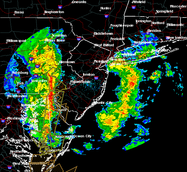 At 500 pm edt, a severe thunderstorm was located over green lane, or 19 miles south of allentown, moving northeast at 45 mph (radar indicated). Hazards include 60 mph wind gusts. Damage to roofs, siding, trees, and power lines is possible. locations impacted include, west chester, pottstown, phoenixville, westtown, downingtown, kennett square, birdsboro, royersford, bally, bechtelsville, pughtown, marshallton, lionville-marchwood, valley forge, glenmoore, paoli, chester springs, lionville, cedarville and radnor township. A tornado watch remains in effect until 900 pm edt for northern delaware, and eastern and southeastern pennsylvania. At 500 pm edt, a severe thunderstorm was located over green lane, or 19 miles south of allentown, moving northeast at 45 mph (radar indicated). Hazards include 60 mph wind gusts. Damage to roofs, siding, trees, and power lines is possible. locations impacted include, west chester, pottstown, phoenixville, westtown, downingtown, kennett square, birdsboro, royersford, bally, bechtelsville, pughtown, marshallton, lionville-marchwood, valley forge, glenmoore, paoli, chester springs, lionville, cedarville and radnor township. A tornado watch remains in effect until 900 pm edt for northern delaware, and eastern and southeastern pennsylvania.
|
| 4/26/2019 4:19 PM EDT |
 At 418 pm edt, a severe thunderstorm was located near gap, or near new holland, moving northeast at 45 mph (radar indicated). Hazards include 60 mph wind gusts. damage to roofs, siding, trees, and power lines is possible At 418 pm edt, a severe thunderstorm was located near gap, or near new holland, moving northeast at 45 mph (radar indicated). Hazards include 60 mph wind gusts. damage to roofs, siding, trees, and power lines is possible
|
| 3/15/2019 7:35 PM EDT |
 At 735 pm edt, a severe thunderstorm was located over pottstown, or 19 miles east of reading, moving east at 45 mph (radar indicated). Hazards include 60 mph wind gusts and penny size hail. Damage to roofs, siding, trees, and power lines is possible. Locations impacted include, pottstown, phoenixville, collegeville, royersford, trappe, pughtown, gilbertsville, cedarville, stowe, boyertown, spring city, pottsgrove, south pottstown, amity gardens, sanatoga, kenilworth and halfway house. At 735 pm edt, a severe thunderstorm was located over pottstown, or 19 miles east of reading, moving east at 45 mph (radar indicated). Hazards include 60 mph wind gusts and penny size hail. Damage to roofs, siding, trees, and power lines is possible. Locations impacted include, pottstown, phoenixville, collegeville, royersford, trappe, pughtown, gilbertsville, cedarville, stowe, boyertown, spring city, pottsgrove, south pottstown, amity gardens, sanatoga, kenilworth and halfway house.
|
| 3/15/2019 7:32 PM EDT |
 At 731 pm edt, a severe thunderstorm was located over pottstown, or 16 miles east of reading, moving east at 45 mph (radar indicated). Hazards include 60 mph wind gusts and nickel size hail. damage to roofs, siding, trees, and power lines is possible At 731 pm edt, a severe thunderstorm was located over pottstown, or 16 miles east of reading, moving east at 45 mph (radar indicated). Hazards include 60 mph wind gusts and nickel size hail. damage to roofs, siding, trees, and power lines is possible
|
| 3/15/2019 7:09 PM EDT |
 At 708 pm edt, a severe thunderstorm was located near new morgan, or 8 miles south of reading, moving east at 35 mph (radar indicated). Hazards include 60 mph wind gusts and nickel size hail. damage to roofs, siding, trees, and power lines is possible At 708 pm edt, a severe thunderstorm was located near new morgan, or 8 miles south of reading, moving east at 35 mph (radar indicated). Hazards include 60 mph wind gusts and nickel size hail. damage to roofs, siding, trees, and power lines is possible
|
| 11/2/2018 11:14 PM EDT |
 At 1114 pm edt, severe thunderstorms were located along a line extending from near green lane to north star, moving northeast at 35 mph (radar indicated). Hazards include 60 mph wind gusts and penny size hail. Damage to roofs, siding, trees, and power lines is possible. Locations impacted include, philadelphia, wilmington, newark, west chester, norristown, chester, pottstown, phoenixville, lansdale, west norriton, east norriton, yeadon, westtown, quakertown, perkasie, doylestown, byram, downingtown, conshohocken and souderton. At 1114 pm edt, severe thunderstorms were located along a line extending from near green lane to north star, moving northeast at 35 mph (radar indicated). Hazards include 60 mph wind gusts and penny size hail. Damage to roofs, siding, trees, and power lines is possible. Locations impacted include, philadelphia, wilmington, newark, west chester, norristown, chester, pottstown, phoenixville, lansdale, west norriton, east norriton, yeadon, westtown, quakertown, perkasie, doylestown, byram, downingtown, conshohocken and souderton.
|
| 11/2/2018 10:53 PM EDT |
 At 1052 pm edt, severe thunderstorms were located along a line extending from near pottstown to pleasant hill, moving northeast at 35 mph (radar indicated). Hazards include 60 mph wind gusts and penny size hail. damage to roofs, siding, trees, and power lines is possible At 1052 pm edt, severe thunderstorms were located along a line extending from near pottstown to pleasant hill, moving northeast at 35 mph (radar indicated). Hazards include 60 mph wind gusts and penny size hail. damage to roofs, siding, trees, and power lines is possible
|
| 11/2/2018 10:39 PM EDT |
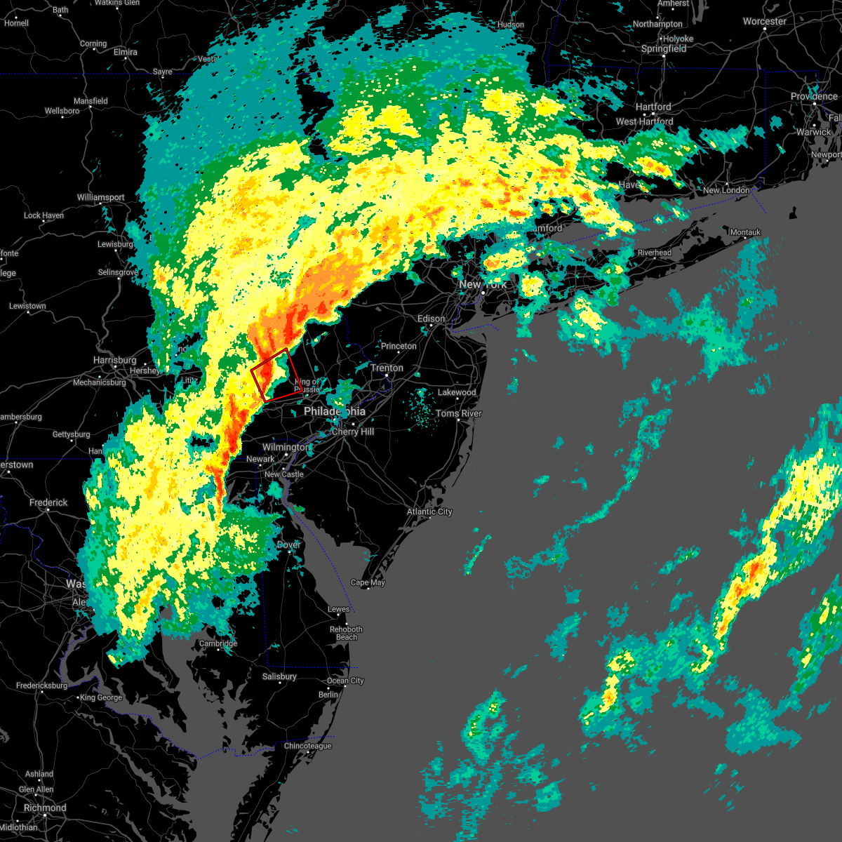 At 1038 pm edt, a severe thunderstorm capable of producing a tornado was located near pughtown, or 14 miles southeast of reading, moving northeast at 20 mph (radar indicated rotation). Hazards include tornado. Flying debris will be dangerous to those caught without shelter. mobile homes will be damaged or destroyed. damage to roofs, windows, and vehicles will occur. tree damage is likely. this dangerous storm will be near, pughtown, cedarville and chester springs around 1050 pm edt. pottstown, phoenixville, royersford and trappe around 1100 pm edt. Other locations impacted by this tornadic thunderstorm include amity gardens, spring city, stowe, boyertown, sanatoga, pottsgrove, kenilworth, south pottstown, halfway house and audubon. At 1038 pm edt, a severe thunderstorm capable of producing a tornado was located near pughtown, or 14 miles southeast of reading, moving northeast at 20 mph (radar indicated rotation). Hazards include tornado. Flying debris will be dangerous to those caught without shelter. mobile homes will be damaged or destroyed. damage to roofs, windows, and vehicles will occur. tree damage is likely. this dangerous storm will be near, pughtown, cedarville and chester springs around 1050 pm edt. pottstown, phoenixville, royersford and trappe around 1100 pm edt. Other locations impacted by this tornadic thunderstorm include amity gardens, spring city, stowe, boyertown, sanatoga, pottsgrove, kenilworth, south pottstown, halfway house and audubon.
|
| 11/2/2018 10:33 PM EDT |
 At 1033 pm edt, severe thunderstorms were located along a line extending from near cochranville to near woodlawn, moving northeast at 35 mph (radar indicated). Hazards include 60 mph wind gusts. Damage to roofs, siding, trees, and power lines is possible. Locations impacted include, wilmington, newark, west chester, elkton, calvert, pottstown, phoenixville, coatesville, westtown, carneys point, downingtown, elsmere, kennett square, new castle, oxford, royersford, parkesburg, north east, east greenville and west grove. At 1033 pm edt, severe thunderstorms were located along a line extending from near cochranville to near woodlawn, moving northeast at 35 mph (radar indicated). Hazards include 60 mph wind gusts. Damage to roofs, siding, trees, and power lines is possible. Locations impacted include, wilmington, newark, west chester, elkton, calvert, pottstown, phoenixville, coatesville, westtown, carneys point, downingtown, elsmere, kennett square, new castle, oxford, royersford, parkesburg, north east, east greenville and west grove.
|
| 11/2/2018 10:32 PM EDT |
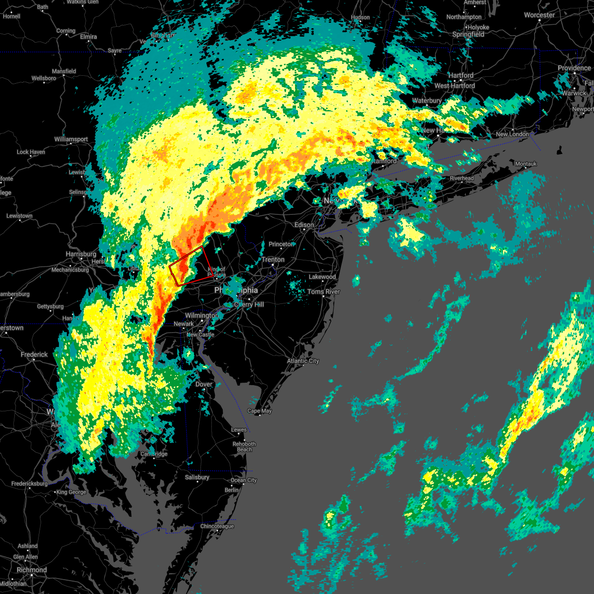 At 1031 pm edt, a severe thunderstorm capable of producing a tornado was located over elverson, or 14 miles southeast of reading, moving northeast at 20 mph (radar indicated rotation). Hazards include tornado. Flying debris will be dangerous to those caught without shelter. mobile homes will be damaged or destroyed. damage to roofs, windows, and vehicles will occur. tree damage is likely. this dangerous storm will be near, pughtown and chester springs around 1050 pm edt. cedarville around 1055 pm edt. pottstown, phoenixville, royersford and trappe around 1100 pm edt. Other locations impacted by this tornadic thunderstorm include amity gardens, spring city, stowe, boyertown, sanatoga, pottsgrove, kenilworth, south pottstown, halfway house and audubon. At 1031 pm edt, a severe thunderstorm capable of producing a tornado was located over elverson, or 14 miles southeast of reading, moving northeast at 20 mph (radar indicated rotation). Hazards include tornado. Flying debris will be dangerous to those caught without shelter. mobile homes will be damaged or destroyed. damage to roofs, windows, and vehicles will occur. tree damage is likely. this dangerous storm will be near, pughtown and chester springs around 1050 pm edt. cedarville around 1055 pm edt. pottstown, phoenixville, royersford and trappe around 1100 pm edt. Other locations impacted by this tornadic thunderstorm include amity gardens, spring city, stowe, boyertown, sanatoga, pottsgrove, kenilworth, south pottstown, halfway house and audubon.
|
| 11/2/2018 10:09 PM EDT |
 At 1008 pm edt, severe thunderstorms were located along a line extending from near wakefield to perryman, moving northeast at 50 mph (radar indicated). Hazards include 60 mph wind gusts. damage to roofs, siding, trees, and power lines is possible At 1008 pm edt, severe thunderstorms were located along a line extending from near wakefield to perryman, moving northeast at 50 mph (radar indicated). Hazards include 60 mph wind gusts. damage to roofs, siding, trees, and power lines is possible
|
| 9/26/2018 7:54 PM EDT |
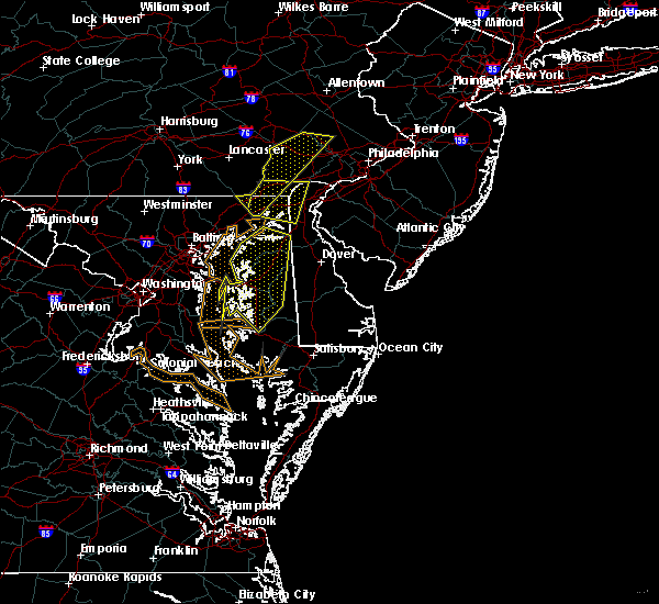 The severe thunderstorm warning for northwestern cecil, west central montgomery and chester counties will expire at 800 pm edt, the storms which prompted the warning have weakened below severe limits, and have exited the warned area. therefore, the warning will be allowed to expire. however gusty winds and heavy rain are still possible with these thunderstorms. a severe thunderstorm watch remains in effect until 1100 pm edt for northeastern maryland, and eastern and southeastern pennsylvania. to report severe weather, contact your nearest law enforcement agency. they will relay your report to the national weather service in mount holly nj. a new severe thunderstorm warning is now in effect for new castle county in delaware, cecil county in maryland, and for chester county in pennsylvania until 8:45 pm edt. The severe thunderstorm warning for northwestern cecil, west central montgomery and chester counties will expire at 800 pm edt, the storms which prompted the warning have weakened below severe limits, and have exited the warned area. therefore, the warning will be allowed to expire. however gusty winds and heavy rain are still possible with these thunderstorms. a severe thunderstorm watch remains in effect until 1100 pm edt for northeastern maryland, and eastern and southeastern pennsylvania. to report severe weather, contact your nearest law enforcement agency. they will relay your report to the national weather service in mount holly nj. a new severe thunderstorm warning is now in effect for new castle county in delaware, cecil county in maryland, and for chester county in pennsylvania until 8:45 pm edt.
|
| 9/26/2018 7:47 PM EDT |
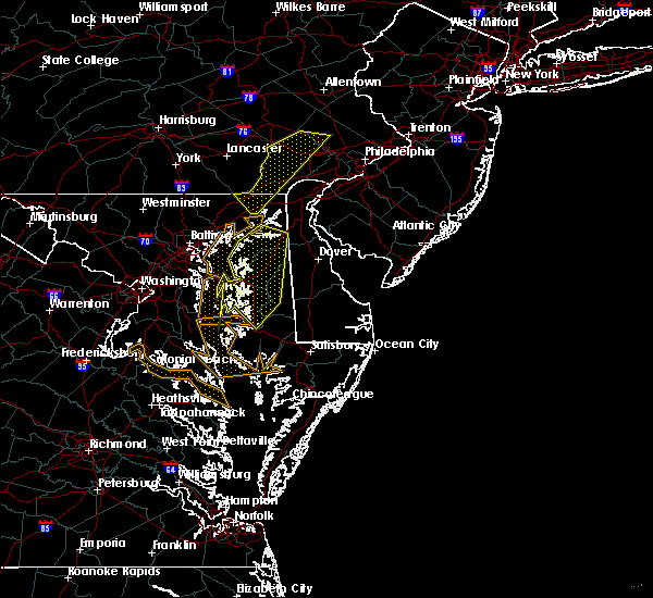 At 745 pm edt, severe thunderstorms were located along a line extending from near pottstown to near octoraro, moving east at 30 mph (radar indicated). Hazards include 60 mph wind gusts and penny size hail. Damage to roofs, siding, trees, and power lines is possible. Locations impacted include, calvert, pottstown, phoenixville, coatesville, downingtown, collegeville, oxford, royersford, parkesburg, trappe, west grove, rising sun, honey brook, elverson, glen roy, blake, west nottingham, pughtown, mount vernon and marshallton. At 745 pm edt, severe thunderstorms were located along a line extending from near pottstown to near octoraro, moving east at 30 mph (radar indicated). Hazards include 60 mph wind gusts and penny size hail. Damage to roofs, siding, trees, and power lines is possible. Locations impacted include, calvert, pottstown, phoenixville, coatesville, downingtown, collegeville, oxford, royersford, parkesburg, trappe, west grove, rising sun, honey brook, elverson, glen roy, blake, west nottingham, pughtown, mount vernon and marshallton.
|
| 9/26/2018 7:47 PM EDT |
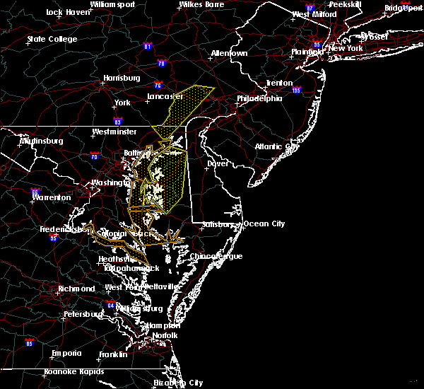 At 745 pm edt, severe thunderstorms were located along a line extending from near pottstown to near octoraro, moving east at 30 mph (radar indicated). Hazards include 60 mph wind gusts and penny size hail. Damage to roofs, siding, trees, and power lines is possible. Locations impacted include, calvert, pottstown, phoenixville, coatesville, downingtown, collegeville, oxford, royersford, parkesburg, trappe, west grove, rising sun, honey brook, elverson, glen roy, blake, west nottingham, pughtown, mount vernon and marshallton. At 745 pm edt, severe thunderstorms were located along a line extending from near pottstown to near octoraro, moving east at 30 mph (radar indicated). Hazards include 60 mph wind gusts and penny size hail. Damage to roofs, siding, trees, and power lines is possible. Locations impacted include, calvert, pottstown, phoenixville, coatesville, downingtown, collegeville, oxford, royersford, parkesburg, trappe, west grove, rising sun, honey brook, elverson, glen roy, blake, west nottingham, pughtown, mount vernon and marshallton.
|
| 9/26/2018 7:34 PM EDT |
 At 734 pm edt, severe thunderstorms were located along a line extending from pottstown to near octoraro, moving east at 20 mph (radar indicated). Hazards include 60 mph wind gusts and penny size hail. Damage to roofs, siding, trees, and power lines is possible. Locations impacted include, wilmington, newark, west chester, elkton, calvert, norristown, pottstown, phoenixville, lansdale, west norriton, east norriton, coatesville, westtown, downingtown, conshohocken, souderton, ambler, elsmere, kennett square and birdsboro. At 734 pm edt, severe thunderstorms were located along a line extending from pottstown to near octoraro, moving east at 20 mph (radar indicated). Hazards include 60 mph wind gusts and penny size hail. Damage to roofs, siding, trees, and power lines is possible. Locations impacted include, wilmington, newark, west chester, elkton, calvert, norristown, pottstown, phoenixville, lansdale, west norriton, east norriton, coatesville, westtown, downingtown, conshohocken, souderton, ambler, elsmere, kennett square and birdsboro.
|
| 9/26/2018 7:06 PM EDT |
 At 705 pm edt, severe thunderstorms were located along a line extending from near birdsboro to near delta, moving east at 30 mph (radar indicated). Hazards include 60 mph wind gusts and penny size hail. damage to roofs, siding, trees, and power lines is possible At 705 pm edt, severe thunderstorms were located along a line extending from near birdsboro to near delta, moving east at 30 mph (radar indicated). Hazards include 60 mph wind gusts and penny size hail. damage to roofs, siding, trees, and power lines is possible
|
| 8/17/2018 7:52 PM EDT |
 The severe thunderstorm warning for southeastern berks, northwestern montgomery, lehigh, southeastern carbon, northwestern bucks, northeastern chester, southwestern monroe and southwestern northampton counties will expire at 800 pm edt, the storms which prompted the warning have weakened below severe limits, and are exiting the warned area. therefore, the warning will be allowed to expire. however gusty winds and heavy rain are still possible with these thunderstorms. a severe thunderstorm watch remains in effect until 1100 pm edt for eastern and northeastern pennsylvania. to report severe weather, contact your nearest law enforcement agency. they will relay your report to the national weather service in mount holly nj. The severe thunderstorm warning for southeastern berks, northwestern montgomery, lehigh, southeastern carbon, northwestern bucks, northeastern chester, southwestern monroe and southwestern northampton counties will expire at 800 pm edt, the storms which prompted the warning have weakened below severe limits, and are exiting the warned area. therefore, the warning will be allowed to expire. however gusty winds and heavy rain are still possible with these thunderstorms. a severe thunderstorm watch remains in effect until 1100 pm edt for eastern and northeastern pennsylvania. to report severe weather, contact your nearest law enforcement agency. they will relay your report to the national weather service in mount holly nj.
|
| 8/17/2018 7:36 PM EDT |
 At 735 pm edt, severe thunderstorms were located along a line extending from meckesville to kunkletown to near emmaus to cedarville, moving northeast at 40 mph (public. several reports of downed trees have been received near reading during the past half hour). Hazards include 60 mph wind gusts. Damage to roofs, siding, trees, and power lines is possible. Locations impacted include, allentown, reading, bethlehem, pottstown, phoenixville, emmaus, wyomissing, northampton, quakertown, hellertown, nazareth, palmerton, birdsboro, kutztown, royersford, slatington, fleetwood, sinking spring, laureldale and trappe. At 735 pm edt, severe thunderstorms were located along a line extending from meckesville to kunkletown to near emmaus to cedarville, moving northeast at 40 mph (public. several reports of downed trees have been received near reading during the past half hour). Hazards include 60 mph wind gusts. Damage to roofs, siding, trees, and power lines is possible. Locations impacted include, allentown, reading, bethlehem, pottstown, phoenixville, emmaus, wyomissing, northampton, quakertown, hellertown, nazareth, palmerton, birdsboro, kutztown, royersford, slatington, fleetwood, sinking spring, laureldale and trappe.
|
| 8/17/2018 7:27 PM EDT |
 At 726 pm edt, severe thunderstorms were located along a line extending from near christmans to near danielsville to near ancient oaks to near new morgan, moving northeast at 35 mph (public. several reports of wind damage have been received from berks county during the past half hour). Hazards include 60 mph wind gusts. Damage to roofs, siding, trees, and power lines is possible. Locations impacted include, allentown, reading, lehighton, bethlehem, pottstown, phoenixville, emmaus, wyomissing, northampton, quakertown, hellertown, nazareth, palmerton, birdsboro, kutztown, jim thorpe, royersford, slatington, fleetwood and sinking spring. At 726 pm edt, severe thunderstorms were located along a line extending from near christmans to near danielsville to near ancient oaks to near new morgan, moving northeast at 35 mph (public. several reports of wind damage have been received from berks county during the past half hour). Hazards include 60 mph wind gusts. Damage to roofs, siding, trees, and power lines is possible. Locations impacted include, allentown, reading, lehighton, bethlehem, pottstown, phoenixville, emmaus, wyomissing, northampton, quakertown, hellertown, nazareth, palmerton, birdsboro, kutztown, jim thorpe, royersford, slatington, fleetwood and sinking spring.
|
| 8/17/2018 7:09 PM EDT |
 At 708 pm edt, severe thunderstorms were located along a line extending from lehighton to jordan valley to near fleetwood to terre hill, moving northeast at 35 mph (radar indicated). Hazards include 70 mph wind gusts. Expect considerable tree damage. Damage is likely to mobile homes, roofs, and outbuildings. At 708 pm edt, severe thunderstorms were located along a line extending from lehighton to jordan valley to near fleetwood to terre hill, moving northeast at 35 mph (radar indicated). Hazards include 70 mph wind gusts. Expect considerable tree damage. Damage is likely to mobile homes, roofs, and outbuildings.
|
| 7/3/2018 7:22 PM EDT |
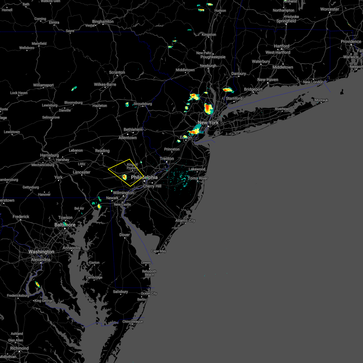 At 722 pm edt, severe thunderstorms were located along a line extending from near phoenixville to near newtown square, moving northwest at 10 mph (radar indicated). Hazards include 60 mph wind gusts and quarter size hail. Minor damage to vehicles is possible. Wind damage to roofs, siding, trees, and power lines is possible. At 722 pm edt, severe thunderstorms were located along a line extending from near phoenixville to near newtown square, moving northwest at 10 mph (radar indicated). Hazards include 60 mph wind gusts and quarter size hail. Minor damage to vehicles is possible. Wind damage to roofs, siding, trees, and power lines is possible.
|
| 6/18/2018 8:31 PM EDT |
 At 829 pm edt, severe thunderstorms were located along a line extending from near stockton in new jersey to near pottstown in pennsylvania, moving east at 35 mph (radar indicated). Hazards include 60 mph wind gusts. Damage to roofs, siding, trees, and power lines is possible. Locations impacted include, norristown, pottstown, phoenixville, lansdale, west norriton, east norriton, doylestown, conshohocken, souderton, ambler, collegeville, royersford, chalfont, trappe, hatfield, new hope, schwenksville, ivyland, stockton and fricks. At 829 pm edt, severe thunderstorms were located along a line extending from near stockton in new jersey to near pottstown in pennsylvania, moving east at 35 mph (radar indicated). Hazards include 60 mph wind gusts. Damage to roofs, siding, trees, and power lines is possible. Locations impacted include, norristown, pottstown, phoenixville, lansdale, west norriton, east norriton, doylestown, conshohocken, souderton, ambler, collegeville, royersford, chalfont, trappe, hatfield, new hope, schwenksville, ivyland, stockton and fricks.
|
| 6/18/2018 7:41 PM EDT |
 At 740 pm edt, severe thunderstorms were located along a line extending from near hellertown to near new morgan, moving east at 35 mph (radar indicated). Hazards include 60 mph wind gusts. damage to roofs, siding, trees, and power lines is possible At 740 pm edt, severe thunderstorms were located along a line extending from near hellertown to near new morgan, moving east at 35 mph (radar indicated). Hazards include 60 mph wind gusts. damage to roofs, siding, trees, and power lines is possible
|
| 5/15/2018 5:27 PM EDT |
 At 526 pm edt, severe thunderstorms were located along a line extending from near little neck to near paoli, moving east at 50 mph (radar indicated). Hazards include 70 mph wind gusts and quarter size hail. Minor damage to vehicles is possible. expect considerable tree damage. wind damage is also likely to mobile homes, roofs, and outbuildings. Locations impacted include, new brunswick, perth amboy, somerville, somerset, edison, east brunswick, bridgewater, south brunswick, sayreville, north brunswick, ewing, norristown, carteret, pottstown, phoenixville, lansdale, west norriton, middlesex, east norriton and princeton. At 526 pm edt, severe thunderstorms were located along a line extending from near little neck to near paoli, moving east at 50 mph (radar indicated). Hazards include 70 mph wind gusts and quarter size hail. Minor damage to vehicles is possible. expect considerable tree damage. wind damage is also likely to mobile homes, roofs, and outbuildings. Locations impacted include, new brunswick, perth amboy, somerville, somerset, edison, east brunswick, bridgewater, south brunswick, sayreville, north brunswick, ewing, norristown, carteret, pottstown, phoenixville, lansdale, west norriton, middlesex, east norriton and princeton.
|
| 5/15/2018 5:14 PM EDT | Report of trees and power lines down near the intersection of saylors mill rd and ebelhare rd in chester county PA, 3.3 miles ESE of Spring City, PA |
| 5/15/2018 5:10 PM EDT |
 At 510 pm edt, severe thunderstorms were located along a line extending from new york to near glenmoore, moving southeast at 25 mph (radar indicated). Hazards include 70 mph wind gusts and quarter size hail. Minor damage to vehicles is possible. expect considerable tree damage. wind damage is also likely to mobile homes, roofs, and outbuildings. Locations impacted include, allentown, reading, new brunswick, perth amboy, morristown, somerville, somerset, edison, bethlehem, east brunswick, bridgewater, south brunswick, sayreville, north brunswick, ewing, norristown, carteret, pottstown, dover and phoenixville. At 510 pm edt, severe thunderstorms were located along a line extending from new york to near glenmoore, moving southeast at 25 mph (radar indicated). Hazards include 70 mph wind gusts and quarter size hail. Minor damage to vehicles is possible. expect considerable tree damage. wind damage is also likely to mobile homes, roofs, and outbuildings. Locations impacted include, allentown, reading, new brunswick, perth amboy, morristown, somerville, somerset, edison, bethlehem, east brunswick, bridgewater, south brunswick, sayreville, north brunswick, ewing, norristown, carteret, pottstown, dover and phoenixville.
|
| 5/15/2018 4:41 PM EDT |
 At 441 pm edt, severe thunderstorms were located along a line extending from near hawthorne to spring ridge, moving east at 55 mph (radar indicated). Hazards include 70 mph wind gusts and quarter size hail. Minor damage to vehicles is possible. expect considerable tree damage. Wind damage is also likely to mobile homes, roofs, and outbuildings. At 441 pm edt, severe thunderstorms were located along a line extending from near hawthorne to spring ridge, moving east at 55 mph (radar indicated). Hazards include 70 mph wind gusts and quarter size hail. Minor damage to vehicles is possible. expect considerable tree damage. Wind damage is also likely to mobile homes, roofs, and outbuildings.
|
| 9/5/2017 6:13 PM EDT |
 The severe thunderstorm warning for southern berks, central montgomery and chester counties will expire at 615 pm edt, the storms which prompted the warning have weakened below severe limits, and no longer pose an immediate threat to life or property. therefore the warning will be allowed to expire. a severe thunderstorm watch remains in effect until 900 pm edt for eastern and southeastern pennsylvania. remember, a severe thunderstorm warning still remains in effect for parts of eastern berks county and northern montgomery county until 630 pm edt. The severe thunderstorm warning for southern berks, central montgomery and chester counties will expire at 615 pm edt, the storms which prompted the warning have weakened below severe limits, and no longer pose an immediate threat to life or property. therefore the warning will be allowed to expire. a severe thunderstorm watch remains in effect until 900 pm edt for eastern and southeastern pennsylvania. remember, a severe thunderstorm warning still remains in effect for parts of eastern berks county and northern montgomery county until 630 pm edt.
|
| 9/5/2017 5:35 PM EDT |
 At 534 pm edt, severe thunderstorms were located along a line extending from near laureldale to churchtown to near quarryville, moving east at 40 mph (radar indicated. this storm has a history of producing large hail and damaging winds over york and lancaster counties in southern pennsylvania). Hazards include 60 mph wind gusts and quarter size hail. Minor damage to vehicles is possible. expect damage to trees and power lines. these severe storms will be near, reading, wyomissing, laureldale, leesport, honey brook, new morgan, spring ridge and fairview hgts around 540 pm edt. fleetwood and elverson around 545 pm edt. birdsboro, lyons and glenmoore around 550 pm edt. parkesburg, topton, bechtelsville, cochranville and gilbertsville around 555 pm edt. pottstown, coatesville, west grove, bally, pughtown, cedarville and chester springs around 600 pm edt. phoenixville, kennett square, royersford and east greenville around 605 pm edt. downingtown, trappe, marshallton, geryville and valley forge around 610 pm edt. west chester, norristown, west norriton, east norriton, westtown, collegeville, schwenksville and spring mount around 615 pm edt. Other locations impacted by these severe thunderstorms include harleysville, west lawn, boyertown, west reading, modena, pottsgrove, lorane, kenhorst, south pottstown and thorndale. At 534 pm edt, severe thunderstorms were located along a line extending from near laureldale to churchtown to near quarryville, moving east at 40 mph (radar indicated. this storm has a history of producing large hail and damaging winds over york and lancaster counties in southern pennsylvania). Hazards include 60 mph wind gusts and quarter size hail. Minor damage to vehicles is possible. expect damage to trees and power lines. these severe storms will be near, reading, wyomissing, laureldale, leesport, honey brook, new morgan, spring ridge and fairview hgts around 540 pm edt. fleetwood and elverson around 545 pm edt. birdsboro, lyons and glenmoore around 550 pm edt. parkesburg, topton, bechtelsville, cochranville and gilbertsville around 555 pm edt. pottstown, coatesville, west grove, bally, pughtown, cedarville and chester springs around 600 pm edt. phoenixville, kennett square, royersford and east greenville around 605 pm edt. downingtown, trappe, marshallton, geryville and valley forge around 610 pm edt. west chester, norristown, west norriton, east norriton, westtown, collegeville, schwenksville and spring mount around 615 pm edt. Other locations impacted by these severe thunderstorms include harleysville, west lawn, boyertown, west reading, modena, pottsgrove, lorane, kenhorst, south pottstown and thorndale.
|
| 9/5/2017 5:19 PM EDT |
 At 518 pm edt, severe thunderstorms were located along a line extending from near womelsdorf to leola to sunnyburn, moving east at 40 mph (radar and spotter indicated. this storm has a history of producing large hail and damaging winds over york and lancaster counties in southern pennsylvania). Hazards include 60 mph wind gusts and quarter size hail. Minor damage to vehicles is possible. expect damage to trees and power lines. severe thunderstorms will be near, sinking spring, wernersville and robesonia around 525 pm edt. reading, wyomissing, leesport, spring ridge and fairview hgts around 530 pm edt. laureldale and honey brook around 535 pm edt. birdsboro, fleetwood, elverson, new morgan, mount vernon and glen roy around 540 pm edt. oxford, lyons, homeville and glenmoore around 545 pm edt. cochranville around 550 pm edt. pottstown, west grove, bally, bechtelsville, pughtown, gilbertsville, chester springs, cedarville, lionville-marchwood and lionville around 555 pm edt. royersford and east greenville around 600 pm edt. Other locations impacted by these severe thunderstorms include harleysville, west lawn, boyertown, west reading, modena, pottsgrove, lorane, kenhorst, south pottstown and thorndale. At 518 pm edt, severe thunderstorms were located along a line extending from near womelsdorf to leola to sunnyburn, moving east at 40 mph (radar and spotter indicated. this storm has a history of producing large hail and damaging winds over york and lancaster counties in southern pennsylvania). Hazards include 60 mph wind gusts and quarter size hail. Minor damage to vehicles is possible. expect damage to trees and power lines. severe thunderstorms will be near, sinking spring, wernersville and robesonia around 525 pm edt. reading, wyomissing, leesport, spring ridge and fairview hgts around 530 pm edt. laureldale and honey brook around 535 pm edt. birdsboro, fleetwood, elverson, new morgan, mount vernon and glen roy around 540 pm edt. oxford, lyons, homeville and glenmoore around 545 pm edt. cochranville around 550 pm edt. pottstown, west grove, bally, bechtelsville, pughtown, gilbertsville, chester springs, cedarville, lionville-marchwood and lionville around 555 pm edt. royersford and east greenville around 600 pm edt. Other locations impacted by these severe thunderstorms include harleysville, west lawn, boyertown, west reading, modena, pottsgrove, lorane, kenhorst, south pottstown and thorndale.
|
| 8/22/2017 10:42 PM EDT |
 At 1042 pm edt, severe thunderstorms were located along a line extending from near schwenksville to charlestown, moving east at 45 mph (radar indicated). Hazards include 60 mph wind gusts and quarter size hail. Minor damage to vehicles is possible. expect damage to trees and power lines. Locations impacted include, philadelphia, camden, wilmington, newark, middletown, west chester, elkton, gloucester city, calvert, bensalem, ewing, norristown, chester, deptford, pottstown, west deptford, phoenixville, lansdale, west norriton and east norriton. At 1042 pm edt, severe thunderstorms were located along a line extending from near schwenksville to charlestown, moving east at 45 mph (radar indicated). Hazards include 60 mph wind gusts and quarter size hail. Minor damage to vehicles is possible. expect damage to trees and power lines. Locations impacted include, philadelphia, camden, wilmington, newark, middletown, west chester, elkton, gloucester city, calvert, bensalem, ewing, norristown, chester, deptford, pottstown, west deptford, phoenixville, lansdale, west norriton and east norriton.
|
| 8/22/2017 10:07 PM EDT |
 At 1007 pm edt, severe thunderstorms were located along a line extending from near elverson to near pleasant hills, moving east at 55 mph (radar indicated). Hazards include 60 mph wind gusts and quarter size hail. Minor damage to vehicles is possible. Expect damage to trees and power lines. At 1007 pm edt, severe thunderstorms were located along a line extending from near elverson to near pleasant hills, moving east at 55 mph (radar indicated). Hazards include 60 mph wind gusts and quarter size hail. Minor damage to vehicles is possible. Expect damage to trees and power lines.
|
| 8/22/2017 9:58 PM EDT |
 At 958 pm edt, a severe thunderstorm was located over pottstown, or 16 miles east of reading, moving east at 40 mph (radar indicated). Hazards include 60 mph wind gusts and quarter size hail. Minor damage to vehicles is possible. expect damage to trees and power lines. Locations impacted include, pottstown, phoenixville, west norriton, birdsboro, collegeville, royersford, trappe, east greenville, honey brook, schwenksville, elverson, bally, bechtelsville, green lane, new morgan, pughtown, spring mount, gilbertsville, valley forge and glenmoore. At 958 pm edt, a severe thunderstorm was located over pottstown, or 16 miles east of reading, moving east at 40 mph (radar indicated). Hazards include 60 mph wind gusts and quarter size hail. Minor damage to vehicles is possible. expect damage to trees and power lines. Locations impacted include, pottstown, phoenixville, west norriton, birdsboro, collegeville, royersford, trappe, east greenville, honey brook, schwenksville, elverson, bally, bechtelsville, green lane, new morgan, pughtown, spring mount, gilbertsville, valley forge and glenmoore.
|
| 8/22/2017 9:34 PM EDT |
 At 933 pm edt, severe thunderstorms were located along a line extending from washington to ottsville to near bally, moving east at 50 mph. trees have been reported down in several locations in northampton county (radar indicated). Hazards include 70 mph wind gusts and quarter size hail. Minor damage to vehicles is possible. expect considerable tree damage. wind damage is also likely to mobile homes, roofs, and outbuildings. Locations impacted include, reading, easton, bethlehem, norristown, pottstown, phoenixville, lansdale, west norriton, east norriton, wyomissing, quakertown, perkasie, doylestown, byram, wilson, souderton, bedminster, washington, hellertown and birdsboro. At 933 pm edt, severe thunderstorms were located along a line extending from washington to ottsville to near bally, moving east at 50 mph. trees have been reported down in several locations in northampton county (radar indicated). Hazards include 70 mph wind gusts and quarter size hail. Minor damage to vehicles is possible. expect considerable tree damage. wind damage is also likely to mobile homes, roofs, and outbuildings. Locations impacted include, reading, easton, bethlehem, norristown, pottstown, phoenixville, lansdale, west norriton, east norriton, wyomissing, quakertown, perkasie, doylestown, byram, wilson, souderton, bedminster, washington, hellertown and birdsboro.
|
| 8/22/2017 9:23 PM EDT |
 At 922 pm edt, a severe thunderstorm was located over adamstown, or 7 miles southwest of reading, moving east at 40 mph (radar indicated). Hazards include 60 mph wind gusts and quarter size hail. Minor damage to vehicles is possible. Expect damage to trees and power lines. At 922 pm edt, a severe thunderstorm was located over adamstown, or 7 miles southwest of reading, moving east at 40 mph (radar indicated). Hazards include 60 mph wind gusts and quarter size hail. Minor damage to vehicles is possible. Expect damage to trees and power lines.
|
| 8/22/2017 9:12 PM EDT |
 At 912 pm edt, severe thunderstorms were located along a line extending from near belvidere to bechtelsville, moving east at 55 mph (radar indicated). Hazards include 70 mph wind gusts and quarter size hail. Minor damage to vehicles is possible. expect considerable tree damage. wind damage is also likely to mobile homes, roofs, and outbuildings. Locations impacted include, allentown, reading, easton, bethlehem, norristown, pottstown, phoenixville, lansdale, west norriton, forks, east norriton, emmaus, wyomissing, northampton, quakertown, perkasie, doylestown, byram, wilson and souderton. At 912 pm edt, severe thunderstorms were located along a line extending from near belvidere to bechtelsville, moving east at 55 mph (radar indicated). Hazards include 70 mph wind gusts and quarter size hail. Minor damage to vehicles is possible. expect considerable tree damage. wind damage is also likely to mobile homes, roofs, and outbuildings. Locations impacted include, allentown, reading, easton, bethlehem, norristown, pottstown, phoenixville, lansdale, west norriton, forks, east norriton, emmaus, wyomissing, northampton, quakertown, perkasie, doylestown, byram, wilson and souderton.
|
| 8/22/2017 8:58 PM EDT |
 At 845 pm edt, severe thunderstorms were located along a line extending from kunkletown to near spring ridge, moving east at 55 mph (radar indicated). Hazards include golf ball size hail and 70 mph wind gusts. People and animals outdoors will be injured. expect hail damage to roofs, siding, windows, and vehicles. expect considerable tree damage. Wind damage is also likely to mobile homes, roofs, and outbuildings. At 845 pm edt, severe thunderstorms were located along a line extending from kunkletown to near spring ridge, moving east at 55 mph (radar indicated). Hazards include golf ball size hail and 70 mph wind gusts. People and animals outdoors will be injured. expect hail damage to roofs, siding, windows, and vehicles. expect considerable tree damage. Wind damage is also likely to mobile homes, roofs, and outbuildings.
|
| 8/22/2017 8:58 PM EDT |
 At 856 pm edt, severe thunderstorms were located along a line extending from pen argyl to near laureldale, moving east at 55 mph (radar indicated. a report from social media showed dime size hail in kutztown). Hazards include 70 mph wind gusts and ping pong ball size hail. People and animals outdoors will be injured. expect hail damage to roofs, siding, windows, and vehicles. expect considerable tree damage. wind damage is also likely to mobile homes, roofs, and outbuildings. Locations impacted include, allentown, reading, easton, bethlehem, norristown, pottstown, phoenixville, lansdale, west norriton, forks, east norriton, emmaus, wyomissing, northampton, quakertown, perkasie, doylestown, byram, wilson and souderton. At 856 pm edt, severe thunderstorms were located along a line extending from pen argyl to near laureldale, moving east at 55 mph (radar indicated. a report from social media showed dime size hail in kutztown). Hazards include 70 mph wind gusts and ping pong ball size hail. People and animals outdoors will be injured. expect hail damage to roofs, siding, windows, and vehicles. expect considerable tree damage. wind damage is also likely to mobile homes, roofs, and outbuildings. Locations impacted include, allentown, reading, easton, bethlehem, norristown, pottstown, phoenixville, lansdale, west norriton, forks, east norriton, emmaus, wyomissing, northampton, quakertown, perkasie, doylestown, byram, wilson and souderton.
|
| 8/22/2017 8:45 PM EDT |
 At 845 pm edt, severe thunderstorms were located along a line extending from kunkletown to near spring ridge, moving east at 55 mph (radar indicated). Hazards include golf ball size hail and 70 mph wind gusts. People and animals outdoors will be injured. expect hail damage to roofs, siding, windows, and vehicles. expect considerable tree damage. Wind damage is also likely to mobile homes, roofs, and outbuildings. At 845 pm edt, severe thunderstorms were located along a line extending from kunkletown to near spring ridge, moving east at 55 mph (radar indicated). Hazards include golf ball size hail and 70 mph wind gusts. People and animals outdoors will be injured. expect hail damage to roofs, siding, windows, and vehicles. expect considerable tree damage. Wind damage is also likely to mobile homes, roofs, and outbuildings.
|
| 8/18/2017 5:13 PM EDT |
 At 512 pm edt, severe thunderstorms were located along a line extending from near cedarville to near mount vernon, moving east at 20 mph (radar indicated). Hazards include 60 mph wind gusts and nickel size hail. Expect damage to trees and power lines. Locations impacted include, calvert, pottstown, phoenixville, coatesville, downingtown, collegeville, oxford, royersford, parkesburg, trappe, west grove, rising sun, honey brook, schwenksville, elverson, glen roy, blake, pughtown, mount vernon and marshallton. At 512 pm edt, severe thunderstorms were located along a line extending from near cedarville to near mount vernon, moving east at 20 mph (radar indicated). Hazards include 60 mph wind gusts and nickel size hail. Expect damage to trees and power lines. Locations impacted include, calvert, pottstown, phoenixville, coatesville, downingtown, collegeville, oxford, royersford, parkesburg, trappe, west grove, rising sun, honey brook, schwenksville, elverson, glen roy, blake, pughtown, mount vernon and marshallton.
|
| 8/18/2017 5:13 PM EDT |
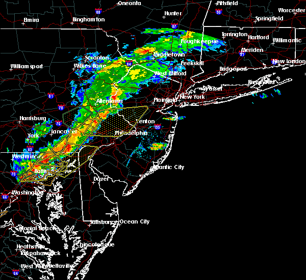 At 512 pm edt, severe thunderstorms were located along a line extending from near cedarville to near mount vernon, moving east at 20 mph (radar indicated). Hazards include 60 mph wind gusts and nickel size hail. Expect damage to trees and power lines. Locations impacted include, calvert, pottstown, phoenixville, coatesville, downingtown, collegeville, oxford, royersford, parkesburg, trappe, west grove, rising sun, honey brook, schwenksville, elverson, glen roy, blake, pughtown, mount vernon and marshallton. At 512 pm edt, severe thunderstorms were located along a line extending from near cedarville to near mount vernon, moving east at 20 mph (radar indicated). Hazards include 60 mph wind gusts and nickel size hail. Expect damage to trees and power lines. Locations impacted include, calvert, pottstown, phoenixville, coatesville, downingtown, collegeville, oxford, royersford, parkesburg, trappe, west grove, rising sun, honey brook, schwenksville, elverson, glen roy, blake, pughtown, mount vernon and marshallton.
|
| 8/18/2017 5:11 PM EDT |
 The national weather service in mount holly nj has issued a * severe thunderstorm warning for. southeastern hunterdon county in northwestern new jersey. northwestern mercer county in central new jersey. southwestern somerset county in northern new jersey. Montgomery county in southeastern pennsylvania. The national weather service in mount holly nj has issued a * severe thunderstorm warning for. southeastern hunterdon county in northwestern new jersey. northwestern mercer county in central new jersey. southwestern somerset county in northern new jersey. Montgomery county in southeastern pennsylvania.
|
| 8/18/2017 4:46 PM EDT |
 At 446 pm edt, severe thunderstorms were located along a line extending from near birdsboro to near wakefield, moving east at 20 mph (radar indicated). Hazards include 70 mph wind gusts and nickel size hail. Expect considerable tree damage. damage is likely to mobile homes, roofs, and outbuildings. Locations impacted include, reading, calvert, pottstown, phoenixville, coatesville, downingtown, birdsboro, collegeville, oxford, royersford, parkesburg, trappe, west grove, rising sun, honey brook, schwenksville, elverson, new morgan, glen roy and blake. At 446 pm edt, severe thunderstorms were located along a line extending from near birdsboro to near wakefield, moving east at 20 mph (radar indicated). Hazards include 70 mph wind gusts and nickel size hail. Expect considerable tree damage. damage is likely to mobile homes, roofs, and outbuildings. Locations impacted include, reading, calvert, pottstown, phoenixville, coatesville, downingtown, birdsboro, collegeville, oxford, royersford, parkesburg, trappe, west grove, rising sun, honey brook, schwenksville, elverson, new morgan, glen roy and blake.
|
| 8/18/2017 4:29 PM EDT |
 At 429 pm edt, severe thunderstorms were located along a line extending from near wyomissing to holtwood, moving east at 20 mph (radar indicated). Hazards include 60 mph wind gusts and quarter size hail. Minor damage to vehicles is possible. Expect damage to trees and power lines. At 429 pm edt, severe thunderstorms were located along a line extending from near wyomissing to holtwood, moving east at 20 mph (radar indicated). Hazards include 60 mph wind gusts and quarter size hail. Minor damage to vehicles is possible. Expect damage to trees and power lines.
|
| 8/5/2017 12:34 AM EDT |
 At 1234 am edt, severe thunderstorms were located along a line extending from near adamstown to near new morgan to near honey brook to gap, moving northeast at 40 mph (radar indicated). Hazards include 60 mph wind gusts. Expect damage to trees and power lines. Locations impacted include, reading, west chester, pottstown, phoenixville, coatesville, wyomissing, downingtown, kennett square, birdsboro, collegeville, royersford, sinking spring, parkesburg, trappe, east greenville, west grove, honey brook, schwenksville, elverson and bally. At 1234 am edt, severe thunderstorms were located along a line extending from near adamstown to near new morgan to near honey brook to gap, moving northeast at 40 mph (radar indicated). Hazards include 60 mph wind gusts. Expect damage to trees and power lines. Locations impacted include, reading, west chester, pottstown, phoenixville, coatesville, wyomissing, downingtown, kennett square, birdsboro, collegeville, royersford, sinking spring, parkesburg, trappe, east greenville, west grove, honey brook, schwenksville, elverson and bally.
|
| 8/5/2017 12:10 AM EDT |
 At 1209 am edt, severe thunderstorms were located along a line extending from near sinking spring to leola to near quarryville, moving northeast at 35 mph (radar indicated). Hazards include 60 mph wind gusts. expect damage to trees and power lines At 1209 am edt, severe thunderstorms were located along a line extending from near sinking spring to leola to near quarryville, moving northeast at 35 mph (radar indicated). Hazards include 60 mph wind gusts. expect damage to trees and power lines
|
| 7/24/2017 7:26 PM EDT |
 At 725 pm edt, a severe thunderstorm was located near pottstown, or 20 miles east of reading, moving east at 35 mph (radar indicated). Hazards include 60 mph wind gusts and penny size hail. expect damage to trees and power lines At 725 pm edt, a severe thunderstorm was located near pottstown, or 20 miles east of reading, moving east at 35 mph (radar indicated). Hazards include 60 mph wind gusts and penny size hail. expect damage to trees and power lines
|
| 7/22/2017 5:18 PM EDT |
 At 516 pm edt, severe thunderstorms were located along a line extending from near elverson to near parkesburg, moving southeast at 30 mph (doppler radar and emergency management. lancaster county 911 center reported downed trees when the storm moved through ephrata and new holland). Hazards include 60 mph wind gusts. expect damage to trees and power lines At 516 pm edt, severe thunderstorms were located along a line extending from near elverson to near parkesburg, moving southeast at 30 mph (doppler radar and emergency management. lancaster county 911 center reported downed trees when the storm moved through ephrata and new holland). Hazards include 60 mph wind gusts. expect damage to trees and power lines
|
| 7/13/2017 5:44 PM EDT |
 At 544 pm edt, a severe thunderstorm capable of producing a tornado was located near pottstown, or 11 miles east of reading, moving southeast at 30 mph (radar indicated rotation). Hazards include tornado. Flying debris will be dangerous to those caught without shelter. mobile homes will be damaged or destroyed. damage to roofs, windows, and vehicles will occur. tree damage is likely. this dangerous storm will be near, pottstown, cedarville and gilbertsville around 550 pm edt. royersford around 605 pm edt. phoenixville and spring mount around 610 pm edt. Other locations impacted by this tornadic thunderstorm include amity gardens, spring city, stowe, boyertown, sanatoga, pottsgrove, kenilworth, south pottstown, halfway house and lorane. At 544 pm edt, a severe thunderstorm capable of producing a tornado was located near pottstown, or 11 miles east of reading, moving southeast at 30 mph (radar indicated rotation). Hazards include tornado. Flying debris will be dangerous to those caught without shelter. mobile homes will be damaged or destroyed. damage to roofs, windows, and vehicles will occur. tree damage is likely. this dangerous storm will be near, pottstown, cedarville and gilbertsville around 550 pm edt. royersford around 605 pm edt. phoenixville and spring mount around 610 pm edt. Other locations impacted by this tornadic thunderstorm include amity gardens, spring city, stowe, boyertown, sanatoga, pottsgrove, kenilworth, south pottstown, halfway house and lorane.
|
| 7/13/2017 5:26 PM EDT |
 At 526 pm edt, a severe thunderstorm capable of producing a tornado was located near reading, moving southeast at 30 mph (radar indicated rotation). Hazards include tornado. Flying debris will be dangerous to those caught without shelter. mobile homes will be damaged or destroyed. damage to roofs, windows, and vehicles will occur. tree damage is likely. this dangerous storm will be near, birdsboro around 540 pm edt. pottstown, cedarville and gilbertsville around 550 pm edt. royersford around 605 pm edt. phoenixville and spring mount around 610 pm edt. Other locations impacted by this tornadic thunderstorm include boyertown, pottsgrove, lorane, mount penn, south pottstown, reiffton, amity gardens, spring city, stowe and sanatoga. At 526 pm edt, a severe thunderstorm capable of producing a tornado was located near reading, moving southeast at 30 mph (radar indicated rotation). Hazards include tornado. Flying debris will be dangerous to those caught without shelter. mobile homes will be damaged or destroyed. damage to roofs, windows, and vehicles will occur. tree damage is likely. this dangerous storm will be near, birdsboro around 540 pm edt. pottstown, cedarville and gilbertsville around 550 pm edt. royersford around 605 pm edt. phoenixville and spring mount around 610 pm edt. Other locations impacted by this tornadic thunderstorm include boyertown, pottsgrove, lorane, mount penn, south pottstown, reiffton, amity gardens, spring city, stowe and sanatoga.
|
| 7/1/2017 5:24 PM EDT |
 At 524 pm edt, severe thunderstorms were located along a line extending from near lansdale to delaware memorial bridge, moving east at 35 mph (trained weather spotters). Hazards include 60 mph wind gusts and penny size hail. Expect damage to trees and power lines. Locations impacted include, philadelphia, trenton, camden, wilmington, newark, west chester, gloucester city, cherry hill, bensalem, ewing, norristown, chester, deptford, west deptford, glassboro, lindenwold, phoenixville, lansdale, west norriton and east norriton. At 524 pm edt, severe thunderstorms were located along a line extending from near lansdale to delaware memorial bridge, moving east at 35 mph (trained weather spotters). Hazards include 60 mph wind gusts and penny size hail. Expect damage to trees and power lines. Locations impacted include, philadelphia, trenton, camden, wilmington, newark, west chester, gloucester city, cherry hill, bensalem, ewing, norristown, chester, deptford, west deptford, glassboro, lindenwold, phoenixville, lansdale, west norriton and east norriton.
|
| 7/1/2017 5:01 PM EDT |
 At 500 pm edt, severe thunderstorms were located along a line extending from spring mount to glen westover, moving east at 40 mph (radar indicated). Hazards include 60 mph wind gusts and nickel size hail. expect damage to trees and power lines At 500 pm edt, severe thunderstorms were located along a line extending from spring mount to glen westover, moving east at 40 mph (radar indicated). Hazards include 60 mph wind gusts and nickel size hail. expect damage to trees and power lines
|
| 7/1/2017 4:57 PM EDT |
 At 456 pm edt, severe thunderstorms were located along a line extending from bloomsbury to springtown to near marshallton, moving east at 40 mph (trained weather spotters). Hazards include 65 mph wind gusts and quarter size hail. Minor damage to vehicles is possible. expect damage to trees and power lines. Locations impacted include, allentown, easton, west chester, bethlehem, norristown, pottstown, phoenixville, lansdale, west norriton, forks, east norriton, coatesville, emmaus, westtown, northampton, quakertown, perkasie, doylestown, byram and wilson. At 456 pm edt, severe thunderstorms were located along a line extending from bloomsbury to springtown to near marshallton, moving east at 40 mph (trained weather spotters). Hazards include 65 mph wind gusts and quarter size hail. Minor damage to vehicles is possible. expect damage to trees and power lines. Locations impacted include, allentown, easton, west chester, bethlehem, norristown, pottstown, phoenixville, lansdale, west norriton, forks, east norriton, coatesville, emmaus, westtown, northampton, quakertown, perkasie, doylestown, byram and wilson.
|
| 7/1/2017 4:41 PM EDT |
 At 441 pm edt, severe thunderstorms were located along a line extending from old orchard to emmaus to cochranville, moving east at 40 mph (radar indicated). Hazards include 60 mph wind gusts and quarter size hail. Minor damage to vehicles is possible. expect damage to trees and power lines. Locations impacted include, allentown, easton, west chester, bethlehem, norristown, pottstown, phoenixville, lansdale, west norriton, forks, east norriton, coatesville, emmaus, westtown, northampton, quakertown, perkasie, doylestown, byram and wilson. At 441 pm edt, severe thunderstorms were located along a line extending from old orchard to emmaus to cochranville, moving east at 40 mph (radar indicated). Hazards include 60 mph wind gusts and quarter size hail. Minor damage to vehicles is possible. expect damage to trees and power lines. Locations impacted include, allentown, easton, west chester, bethlehem, norristown, pottstown, phoenixville, lansdale, west norriton, forks, east norriton, coatesville, emmaus, westtown, northampton, quakertown, perkasie, doylestown, byram and wilson.
|
| 7/1/2017 4:24 PM EDT |
 At 423 pm edt, severe thunderstorms were located along a line extending from near allentown to topton to near quarryville, moving east at 40 mph (radar indicated). Hazards include 60 mph wind gusts and quarter size hail. Minor damage to vehicles is possible. Expect damage to trees and power lines. At 423 pm edt, severe thunderstorms were located along a line extending from near allentown to topton to near quarryville, moving east at 40 mph (radar indicated). Hazards include 60 mph wind gusts and quarter size hail. Minor damage to vehicles is possible. Expect damage to trees and power lines.
|
| 6/23/2017 5:33 PM EDT |
 At 533 pm edt, a severe thunderstorm was located over adamstown, or near ephrata, moving east at 40 mph (radar indicated). Hazards include 60 mph wind gusts. expect damage to trees and power lines At 533 pm edt, a severe thunderstorm was located over adamstown, or near ephrata, moving east at 40 mph (radar indicated). Hazards include 60 mph wind gusts. expect damage to trees and power lines
|
| 6/21/2017 4:15 PM EDT |
 At 414 pm edt, severe thunderstorms were located along a line extending from near souderton to near schwenksville to chester springs, moving east at 35 mph (local fire department and trained weather spotter reported several trees and wires down in pottstown from the severe thunderstorm that moved through just after 4 pm). Hazards include 60 mph wind gusts. Expect damage to trees and power lines. Locations impacted include, norristown, phoenixville, lansdale, west norriton, east norriton, conshohocken, hatboro, souderton, ambler, collegeville, royersford, chalfont, trappe, hatfield, schwenksville, bryn athyn, ivyland, pughtown, spring mount and king of prussia. At 414 pm edt, severe thunderstorms were located along a line extending from near souderton to near schwenksville to chester springs, moving east at 35 mph (local fire department and trained weather spotter reported several trees and wires down in pottstown from the severe thunderstorm that moved through just after 4 pm). Hazards include 60 mph wind gusts. Expect damage to trees and power lines. Locations impacted include, norristown, phoenixville, lansdale, west norriton, east norriton, conshohocken, hatboro, souderton, ambler, collegeville, royersford, chalfont, trappe, hatfield, schwenksville, bryn athyn, ivyland, pughtown, spring mount and king of prussia.
|
| 6/21/2017 4:02 PM EDT |
 At 402 pm edt, severe thunderstorms were located along a line extending from near east greenville to near gilbertsville to near elverson, moving east at 35 mph (radar indicated). Hazards include 60 mph wind gusts. expect damage to trees and power lines At 402 pm edt, severe thunderstorms were located along a line extending from near east greenville to near gilbertsville to near elverson, moving east at 35 mph (radar indicated). Hazards include 60 mph wind gusts. expect damage to trees and power lines
|
| 6/19/2017 4:22 PM EDT |
 At 421 pm edt, severe thunderstorms were located along a line extending from near downingtown to near kennett square to ladenberg, moving northeast at 45 mph (radar indicated this storm was intensifying). Hazards include 60 mph wind gusts may be co9me widespread. Expect damage to trees and power lines. these severe storms will be near, downingtown around 425 pm edt. lionville, lionville-marchwood and marshallton around 430 pm edt. west chester and chester springs around 435 pm edt. phoenixville, royersford, elam and valley forge around 440 pm edt. norristown, west norriton, east norriton, westtown, collegeville, trappe, paoli, cheyney, concordville and gradyville around 445 pm edt. Other locations impacted by these severe thunderstorms include exton, south coatesville, modena, thorndale, chester heights, evansburg, malvern, west goshen, audubon and chesterbrook. At 421 pm edt, severe thunderstorms were located along a line extending from near downingtown to near kennett square to ladenberg, moving northeast at 45 mph (radar indicated this storm was intensifying). Hazards include 60 mph wind gusts may be co9me widespread. Expect damage to trees and power lines. these severe storms will be near, downingtown around 425 pm edt. lionville, lionville-marchwood and marshallton around 430 pm edt. west chester and chester springs around 435 pm edt. phoenixville, royersford, elam and valley forge around 440 pm edt. norristown, west norriton, east norriton, westtown, collegeville, trappe, paoli, cheyney, concordville and gradyville around 445 pm edt. Other locations impacted by these severe thunderstorms include exton, south coatesville, modena, thorndale, chester heights, evansburg, malvern, west goshen, audubon and chesterbrook.
|
| 6/19/2017 4:07 PM EDT |
 At 407 pm edt, severe thunderstorms were located along a line extending from parkesburg to near homeville to lombard, moving northeast at 45 mph (radar indicated). Hazards include 60 mph wind gusts. Expect damage to trees and power lines. severe thunderstorms will be near, parkesburg, west grove and cochranville around 410 pm edt. coatesville around 415 pm edt. ladenberg and kemblesville around 420 pm edt. downingtown, north star and pike creek around 425 pm edt. kennett square, lionville-marchwood, hockessin, lionville, marshallton, chester springs and ashland around 430 pm edt. west chester around 435 pm edt. phoenixville, royersford, elam and valley forge around 440 pm edt. norristown, west norriton, east norriton, westtown, collegeville, trappe, paoli, cheyney, concordville and gradyville around 445 pm edt. Other locations impacted by these severe thunderstorms include harleysville, exton, south coatesville, modena, thorndale, chester heights, evansburg, malvern, west goshen and audubon. At 407 pm edt, severe thunderstorms were located along a line extending from parkesburg to near homeville to lombard, moving northeast at 45 mph (radar indicated). Hazards include 60 mph wind gusts. Expect damage to trees and power lines. severe thunderstorms will be near, parkesburg, west grove and cochranville around 410 pm edt. coatesville around 415 pm edt. ladenberg and kemblesville around 420 pm edt. downingtown, north star and pike creek around 425 pm edt. kennett square, lionville-marchwood, hockessin, lionville, marshallton, chester springs and ashland around 430 pm edt. west chester around 435 pm edt. phoenixville, royersford, elam and valley forge around 440 pm edt. norristown, west norriton, east norriton, westtown, collegeville, trappe, paoli, cheyney, concordville and gradyville around 445 pm edt. Other locations impacted by these severe thunderstorms include harleysville, exton, south coatesville, modena, thorndale, chester heights, evansburg, malvern, west goshen and audubon.
|
| 6/19/2017 3:38 PM EDT |
 At 338 pm edt, severe thunderstorms were located along a line extending from near green lane to near royersford, moving east at 40 mph (radar indicated). Hazards include 60 mph wind gusts. Expect damage to trees and power lines. these severe storms will be near, east norriton around 355 pm edt. Other locations impacted by these severe thunderstorms include harleysville, evansburg, skippack, spring city, red hill and sanatoga. At 338 pm edt, severe thunderstorms were located along a line extending from near green lane to near royersford, moving east at 40 mph (radar indicated). Hazards include 60 mph wind gusts. Expect damage to trees and power lines. these severe storms will be near, east norriton around 355 pm edt. Other locations impacted by these severe thunderstorms include harleysville, evansburg, skippack, spring city, red hill and sanatoga.
|
| 6/19/2017 3:25 PM EDT |
 At 324 pm edt, severe thunderstorms were located along a line extending from near gilbertsville to near pughtown, moving east at 40 mph (radar indicated). Hazards include 60 mph wind gusts. Expect damage to trees and power lines. these severe storms will be near, gilbertsville around 330 pm edt. royersford and green lane around 340 pm edt. collegeville, trappe and schwenksville around 345 pm edt. spring mount around 350 pm edt. east norriton around 355 pm edt. Other locations impacted by these severe thunderstorms include harleysville, boyertown, pottsgrove, south pottstown, evansburg, spring city, stowe, sanatoga, kenilworth and halfway house. At 324 pm edt, severe thunderstorms were located along a line extending from near gilbertsville to near pughtown, moving east at 40 mph (radar indicated). Hazards include 60 mph wind gusts. Expect damage to trees and power lines. these severe storms will be near, gilbertsville around 330 pm edt. royersford and green lane around 340 pm edt. collegeville, trappe and schwenksville around 345 pm edt. spring mount around 350 pm edt. east norriton around 355 pm edt. Other locations impacted by these severe thunderstorms include harleysville, boyertown, pottsgrove, south pottstown, evansburg, spring city, stowe, sanatoga, kenilworth and halfway house.
|
| 6/19/2017 3:08 PM EDT |
 At 307 pm edt, severe thunderstorms were located along a line extending from near reading to near new morgan, moving east at 40 mph (radar indicated). Hazards include 60 mph wind gusts. Expect damage to trees and power lines. severe thunderstorms will be near, birdsboro around 315 pm edt. pottstown and pughtown around 325 pm edt. gilbertsville and cedarville around 330 pm edt. phoenixville and royersford around 335 pm edt. collegeville, trappe, schwenksville, green lane and spring mount around 345 pm edt. east norriton around 355 pm edt. Other locations impacted by these severe thunderstorms include harleysville, boyertown, pottsgrove, lorane, south pottstown, evansburg, amity gardens, spring city, stowe and sanatoga. At 307 pm edt, severe thunderstorms were located along a line extending from near reading to near new morgan, moving east at 40 mph (radar indicated). Hazards include 60 mph wind gusts. Expect damage to trees and power lines. severe thunderstorms will be near, birdsboro around 315 pm edt. pottstown and pughtown around 325 pm edt. gilbertsville and cedarville around 330 pm edt. phoenixville and royersford around 335 pm edt. collegeville, trappe, schwenksville, green lane and spring mount around 345 pm edt. east norriton around 355 pm edt. Other locations impacted by these severe thunderstorms include harleysville, boyertown, pottsgrove, lorane, south pottstown, evansburg, amity gardens, spring city, stowe and sanatoga.
|
| 4/29/2017 4:20 AM EDT |
 At 419 am edt, severe thunderstorms were located along a line extending from near souderton to near lansdale to king of prussia, moving east at 65 mph (radar indicated). Hazards include 60 mph wind gusts and penny size hail. expect damage to roofs, siding, and trees At 419 am edt, severe thunderstorms were located along a line extending from near souderton to near lansdale to king of prussia, moving east at 65 mph (radar indicated). Hazards include 60 mph wind gusts and penny size hail. expect damage to roofs, siding, and trees
|
| 3/1/2017 2:25 PM EST |
 At 225 pm est, severe thunderstorms were located along a line extending from shoemakersville to near reamstown, moving east at 60 mph (radar indicated). Hazards include 60 mph wind gusts. Expect damage to roofs, siding, and trees. these severe storms will be near, fleetwood, shoemakersville and lenhartsville around 230 pm est. kutztown, topton, elverson, lyons and new morgan around 235 pm est. birdsboro and claussville around 240 pm est. allentown, emmaus, ancient oaks, cedarville, coffeetown, zionsville and pughtown around 245 pm est. pottstown, northampton, royersford, bechtelsville and gilbertsville around 250 pm est. bethlehem, collegeville, trappe, schwenksville, bally, steuben, lehigh university and spring mount around 255 pm est. east greenville, green lane and geryville around 300 pm est. Other locations impacted by these severe thunderstorms include harleysville, west lawn, boyertown, west reading, pottsgrove, lorane, kenhorst, hokendauqua, south pottstown and thorndale. At 225 pm est, severe thunderstorms were located along a line extending from shoemakersville to near reamstown, moving east at 60 mph (radar indicated). Hazards include 60 mph wind gusts. Expect damage to roofs, siding, and trees. these severe storms will be near, fleetwood, shoemakersville and lenhartsville around 230 pm est. kutztown, topton, elverson, lyons and new morgan around 235 pm est. birdsboro and claussville around 240 pm est. allentown, emmaus, ancient oaks, cedarville, coffeetown, zionsville and pughtown around 245 pm est. pottstown, northampton, royersford, bechtelsville and gilbertsville around 250 pm est. bethlehem, collegeville, trappe, schwenksville, bally, steuben, lehigh university and spring mount around 255 pm est. east greenville, green lane and geryville around 300 pm est. Other locations impacted by these severe thunderstorms include harleysville, west lawn, boyertown, west reading, pottsgrove, lorane, kenhorst, hokendauqua, south pottstown and thorndale.
|
| 3/1/2017 2:09 PM EST |
 At 209 pm est, severe thunderstorms were located along a line extending from strausstown to columbia, moving east at 60 mph (radar indicated). Hazards include 60 mph wind gusts. expect damage to roofs, siding, and trees At 209 pm est, severe thunderstorms were located along a line extending from strausstown to columbia, moving east at 60 mph (radar indicated). Hazards include 60 mph wind gusts. expect damage to roofs, siding, and trees
|
| 2/25/2017 4:41 PM EST |
 At 441 pm est, severe thunderstorms were located along a line extending from near stormville to near belfast to pleasant valley to paoli, moving northeast at 70 mph (radar indicated). Hazards include 60 mph wind gusts and nickel size hail. Expect damage to roofs, siding, and trees. these severe storms will be near, hellertown, bangor, pen argyl, wind gap, ferndale, belfast, tatamy, east bangor, riegelsville and springtown around 445 pm est. easton, forks, east norriton, wilson, collegeville, trappe, belvidere, alpha, west easton and milford around 450 pm est. lansdale, ambler, blairstown, harmony, hope, bloomsbury and great meadows-vienna around 455 pm est. doylestown, souderton, washington, chalfont, hatfield, oxford, dublin, glen gardner, hampton and brass castle around 500 pm est. Other locations impacted by these severe thunderstorms include churchville, stockertown, evansburg, malvern, west goshen, fort washington, bridgeport, blue bell, maple glen and eagleville. At 441 pm est, severe thunderstorms were located along a line extending from near stormville to near belfast to pleasant valley to paoli, moving northeast at 70 mph (radar indicated). Hazards include 60 mph wind gusts and nickel size hail. Expect damage to roofs, siding, and trees. these severe storms will be near, hellertown, bangor, pen argyl, wind gap, ferndale, belfast, tatamy, east bangor, riegelsville and springtown around 445 pm est. easton, forks, east norriton, wilson, collegeville, trappe, belvidere, alpha, west easton and milford around 450 pm est. lansdale, ambler, blairstown, harmony, hope, bloomsbury and great meadows-vienna around 455 pm est. doylestown, souderton, washington, chalfont, hatfield, oxford, dublin, glen gardner, hampton and brass castle around 500 pm est. Other locations impacted by these severe thunderstorms include churchville, stockertown, evansburg, malvern, west goshen, fort washington, bridgeport, blue bell, maple glen and eagleville.
|
| 2/25/2017 4:17 PM EST |
 At 416 pm est, severe thunderstorms were located along a line extending from claussville to near topton to pottstown to near kennett square, moving northeast at 55 mph (radar indicated). Hazards include 60 mph wind gusts and nickel size hail. Expect damage to roofs, siding, and trees. severe thunderstorms will be near, royersford, trappe, topton, bally, bechtelsville, ancient oaks, claussville, coffeetown, gilbertsville and schnecksville around 420 pm est. allentown, emmaus, east greenville, schwenksville, green lane, spring mount and lionville around 425 pm est. westtown, northampton, souderton, hatfield, lehigh university, beersville, cheyney, gradyville, geryville and lionville-marchwood around 430 pm est. bethlehem, quakertown, perkasie, hellertown, bath, steuben, paoli, newtown square, valley forge and springtown around 435 pm est. west norriton, forks, wilson, bedminster, nazareth, dublin, belfast, west easton, tatamy and riegelsville around 440 pm est. easton, norristown, east norriton, conshohocken, narberth, tinicum, pen argyl, wind gap, alpha and ferndale around 445 pm est. byram, ambler, bangor, harmony, frenchtown, milford, east bangor, bloomsbury, stockton and erwinna around 450 pm est. washington, jenkintown, high bridge, belvidere, rockledge, oxford, abington, glen gardner, hampton and brass castle around 455 pm est. Other locations impacted by these severe thunderstorms include boyertown, churchville, pottsgrove, hokendauqua, thorndale, stockertown, evansburg, malvern, west goshen and fort washington. At 416 pm est, severe thunderstorms were located along a line extending from claussville to near topton to pottstown to near kennett square, moving northeast at 55 mph (radar indicated). Hazards include 60 mph wind gusts and nickel size hail. Expect damage to roofs, siding, and trees. severe thunderstorms will be near, royersford, trappe, topton, bally, bechtelsville, ancient oaks, claussville, coffeetown, gilbertsville and schnecksville around 420 pm est. allentown, emmaus, east greenville, schwenksville, green lane, spring mount and lionville around 425 pm est. westtown, northampton, souderton, hatfield, lehigh university, beersville, cheyney, gradyville, geryville and lionville-marchwood around 430 pm est. bethlehem, quakertown, perkasie, hellertown, bath, steuben, paoli, newtown square, valley forge and springtown around 435 pm est. west norriton, forks, wilson, bedminster, nazareth, dublin, belfast, west easton, tatamy and riegelsville around 440 pm est. easton, norristown, east norriton, conshohocken, narberth, tinicum, pen argyl, wind gap, alpha and ferndale around 445 pm est. byram, ambler, bangor, harmony, frenchtown, milford, east bangor, bloomsbury, stockton and erwinna around 450 pm est. washington, jenkintown, high bridge, belvidere, rockledge, oxford, abington, glen gardner, hampton and brass castle around 455 pm est. Other locations impacted by these severe thunderstorms include boyertown, churchville, pottsgrove, hokendauqua, thorndale, stockertown, evansburg, malvern, west goshen and fort washington.
|
| 2/12/2017 11:10 PM EST |
 At 1108 pm est, severe thunderstorms were located along a line extending from near plymouth meeting to near bel air north, moving east at 60 mph (radar indicated). Hazards include 60 mph wind gusts. expect damage to roofs, siding, and trees At 1108 pm est, severe thunderstorms were located along a line extending from near plymouth meeting to near bel air north, moving east at 60 mph (radar indicated). Hazards include 60 mph wind gusts. expect damage to roofs, siding, and trees
|
| 10/30/2016 5:42 PM EDT |
 The severe thunderstorm warning for northeastern chester county will expire at 545 pm edt, the storm which prompted the warning has moved out of the area. therefore, the warning will be allowed to expire. however, gusty winds and heavy rain are still possible with this thunderstorm. to report severe weather, contact your nearest law enforcement agency. they will relay your report to the national weather service mount holly nj. The severe thunderstorm warning for northeastern chester county will expire at 545 pm edt, the storm which prompted the warning has moved out of the area. therefore, the warning will be allowed to expire. however, gusty winds and heavy rain are still possible with this thunderstorm. to report severe weather, contact your nearest law enforcement agency. they will relay your report to the national weather service mount holly nj.
|
| 10/30/2016 5:36 PM EDT |
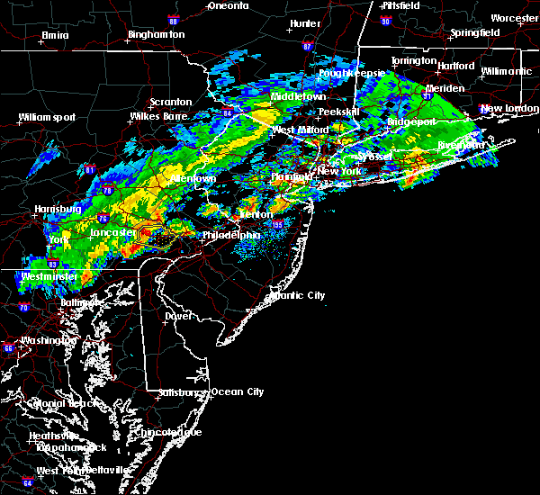 At 536 pm edt, a severe thunderstorm was located over lionville, or 8 miles north of west chester, moving east at 50 mph (radar indicated). Hazards include 60 mph wind gusts. Expect damage to roofs. siding. and trees. this severe storm will be near, phoenixville, paoli and valley forge around 545 pm edt. Other locations impacted by this severe thunderstorm include thorndale, devon-berwyn, exton, chesterbrook, spring city, west goshen and malvern. At 536 pm edt, a severe thunderstorm was located over lionville, or 8 miles north of west chester, moving east at 50 mph (radar indicated). Hazards include 60 mph wind gusts. Expect damage to roofs. siding. and trees. this severe storm will be near, phoenixville, paoli and valley forge around 545 pm edt. Other locations impacted by this severe thunderstorm include thorndale, devon-berwyn, exton, chesterbrook, spring city, west goshen and malvern.
|
| 10/30/2016 5:20 PM EDT |
 At 520 pm edt, a severe thunderstorm was located over honey brook, or 9 miles east of new holland, moving east at 50 mph (radar indicated). Hazards include 60 mph wind gusts. Expect damage to roofs. siding. and trees. this severe thunderstorm will be near, coatesville around 525 pm edt. glenmoore around 530 pm edt. downingtown and pughtown around 535 pm edt. west chester, lionville-marchwood, chester springs and lionville around 540 pm edt. phoenixville, paoli and valley forge around 545 pm edt. Other locations impacted by this severe thunderstorm include thorndale, devon-berwyn, exton, chesterbrook, spring city, west goshen, malvern and south coatesville. At 520 pm edt, a severe thunderstorm was located over honey brook, or 9 miles east of new holland, moving east at 50 mph (radar indicated). Hazards include 60 mph wind gusts. Expect damage to roofs. siding. and trees. this severe thunderstorm will be near, coatesville around 525 pm edt. glenmoore around 530 pm edt. downingtown and pughtown around 535 pm edt. west chester, lionville-marchwood, chester springs and lionville around 540 pm edt. phoenixville, paoli and valley forge around 545 pm edt. Other locations impacted by this severe thunderstorm include thorndale, devon-berwyn, exton, chesterbrook, spring city, west goshen, malvern and south coatesville.
|
| 8/16/2016 4:50 PM EDT |
 At 449 pm edt, severe thunderstorms were located along a line extending from near strausstown to near sinking spring to terre hill to leola, moving east at 40 mph (radar indicated). Hazards include 60 mph wind gusts. Expect damage to roofs. siding. and trees. Locations impacted include, reading, west chester, pottstown, phoenixville, coatesville, wyomissing, downingtown, birdsboro, kutztown, royersford, hamburg, fleetwood, sinking spring, laureldale, parkesburg, wernersville, leesport, honey brook, shoemakersville and elverson. At 449 pm edt, severe thunderstorms were located along a line extending from near strausstown to near sinking spring to terre hill to leola, moving east at 40 mph (radar indicated). Hazards include 60 mph wind gusts. Expect damage to roofs. siding. and trees. Locations impacted include, reading, west chester, pottstown, phoenixville, coatesville, wyomissing, downingtown, birdsboro, kutztown, royersford, hamburg, fleetwood, sinking spring, laureldale, parkesburg, wernersville, leesport, honey brook, shoemakersville and elverson.
|
| 8/16/2016 4:23 PM EDT |
 At 422 pm edt, severe thunderstorms were located along a line extending from near lickdale to near lancaster, moving east at 45 mph (radar indicated). Hazards include 60 mph wind gusts. Expect damage to roofs. siding. And trees. At 422 pm edt, severe thunderstorms were located along a line extending from near lickdale to near lancaster, moving east at 45 mph (radar indicated). Hazards include 60 mph wind gusts. Expect damage to roofs. siding. And trees.
|
| 8/12/2016 4:49 PM EDT |
 At 448 pm edt, a severe thunderstorm was located over lionville, or 7 miles north of west chester, moving east at 35 mph (radar indicated). Hazards include 60 mph wind gusts. Expect damage to roofs. siding. And trees. At 448 pm edt, a severe thunderstorm was located over lionville, or 7 miles north of west chester, moving east at 35 mph (radar indicated). Hazards include 60 mph wind gusts. Expect damage to roofs. siding. And trees.
|
| 7/28/2016 12:58 PM EDT |
 At 1255 pm edt, a severe thunderstorm was located over downingtown, or 7 miles northwest of west chester, moving east at 35 mph (radar indicated). Hazards include wind in excess of 58 mph. Expect damage to roofs. sidings. And trees. At 1255 pm edt, a severe thunderstorm was located over downingtown, or 7 miles northwest of west chester, moving east at 35 mph (radar indicated). Hazards include wind in excess of 58 mph. Expect damage to roofs. sidings. And trees.
|
| 6/8/2016 11:27 AM EDT |
 At 1127 am edt, severe thunderstorms were located along a line extending from collegeville to near gradyville to greenville, moving east at 45 mph (radar indicated). Hazards include 60 mph wind gusts. Expect damage to roofs. siding. and trees. severe thunderstorms will be near, norristown, west norriton, east norriton, newtown square, broomall, king of prussia, chester township and radnor township around 1135 am edt. chester, conshohocken, swarthmore, nether providence township, plymouth meeting, trout lake and bryn mawr around 1140 am edt. yeadon, folcroft, ambler, paulsboro, narberth, east lansdowne, beckett, darby township, drexel hill and morris park around 1145 am edt. jenkintown, national park, swedesboro, abington, willow grove, south philadelphia, gibbstown and germantown around 1150 am edt. camden, gloucester city, west deptford, bellmawr, woodbury, hatboro, westville, rockledge, brooklawn and bryn athyn around 1155 am edt. philadelphia, deptford, palmyra, magnolia, woodbury heights, feasterville, ashland, feasterville-trevose, erlton-ellisburg and golden triangle around 1200 pm edt. cherry hill, bensalem, voorhees, glassboro, lindenwold, pitman, riverside, beverly, langhorne and springdale around 1205 pm edt. evesham, mount laurel, willingboro, burlington, bristol, clayton, marlton, levittown and marlton lakes around 1210 pm edt. Other locations impacted by these severe thunderstorms include oreland, springfield, west conshohocken, colwyn, glenolden, cornwells heights-eddington, collingswood, darby, trooper and nws office. At 1127 am edt, severe thunderstorms were located along a line extending from collegeville to near gradyville to greenville, moving east at 45 mph (radar indicated). Hazards include 60 mph wind gusts. Expect damage to roofs. siding. and trees. severe thunderstorms will be near, norristown, west norriton, east norriton, newtown square, broomall, king of prussia, chester township and radnor township around 1135 am edt. chester, conshohocken, swarthmore, nether providence township, plymouth meeting, trout lake and bryn mawr around 1140 am edt. yeadon, folcroft, ambler, paulsboro, narberth, east lansdowne, beckett, darby township, drexel hill and morris park around 1145 am edt. jenkintown, national park, swedesboro, abington, willow grove, south philadelphia, gibbstown and germantown around 1150 am edt. camden, gloucester city, west deptford, bellmawr, woodbury, hatboro, westville, rockledge, brooklawn and bryn athyn around 1155 am edt. philadelphia, deptford, palmyra, magnolia, woodbury heights, feasterville, ashland, feasterville-trevose, erlton-ellisburg and golden triangle around 1200 pm edt. cherry hill, bensalem, voorhees, glassboro, lindenwold, pitman, riverside, beverly, langhorne and springdale around 1205 pm edt. evesham, mount laurel, willingboro, burlington, bristol, clayton, marlton, levittown and marlton lakes around 1210 pm edt. Other locations impacted by these severe thunderstorms include oreland, springfield, west conshohocken, colwyn, glenolden, cornwells heights-eddington, collingswood, darby, trooper and nws office.
|
| 6/5/2016 5:23 PM EDT |
 At 522 pm edt, severe thunderstorms were located along a line extending from near geryville to lionville to north star, moving east at 55 mph (radar indicated). Hazards include 60 mph wind gusts. Expect damage to roofs. siding. And trees. At 522 pm edt, severe thunderstorms were located along a line extending from near geryville to lionville to north star, moving east at 55 mph (radar indicated). Hazards include 60 mph wind gusts. Expect damage to roofs. siding. And trees.
|
| 6/5/2016 4:37 PM EDT |
 At 436 pm edt, severe thunderstorms were located along a line extending from rothsville to near delta to hampton, moving east at 45 mph (public). Hazards include 60 mph wind gusts. Expect damage to roofs. siding. And trees. At 436 pm edt, severe thunderstorms were located along a line extending from rothsville to near delta to hampton, moving east at 45 mph (public). Hazards include 60 mph wind gusts. Expect damage to roofs. siding. And trees.
|
| 10/9/2015 5:10 PM EDT |
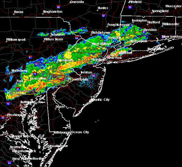 The tornado warning for northeastern chester and southwestern montgomery counties will expire at 515 pm edt, the tornadic thunderstorm which prompted the warning has weakened. therefore the warning will be allowed to expire. The tornado warning for northeastern chester and southwestern montgomery counties will expire at 515 pm edt, the tornadic thunderstorm which prompted the warning has weakened. therefore the warning will be allowed to expire.
|
| 10/9/2015 4:57 PM EDT |
 At 456 pm edt, doppler radar indicated a severe thunderstorm capable of producing damaging winds in excess of 65 mph. this storm was located near king of prussia, or 12 miles northeast of west chester, moving east at 45 mph. penny size hail may also accompany the damaging winds. locations impacted include, philadelphia, norristown, pottstown, phoenixville, lansdale, west norriton, east norriton, yeadon, conshohocken, hatboro, folcroft, ambler, swarthmore, collegeville, royersford, jenkintown, narberth, trappe, east lansdowne and rockledge. At 456 pm edt, doppler radar indicated a severe thunderstorm capable of producing damaging winds in excess of 65 mph. this storm was located near king of prussia, or 12 miles northeast of west chester, moving east at 45 mph. penny size hail may also accompany the damaging winds. locations impacted include, philadelphia, norristown, pottstown, phoenixville, lansdale, west norriton, east norriton, yeadon, conshohocken, hatboro, folcroft, ambler, swarthmore, collegeville, royersford, jenkintown, narberth, trappe, east lansdowne and rockledge.
|
| 10/9/2015 4:47 PM EDT |
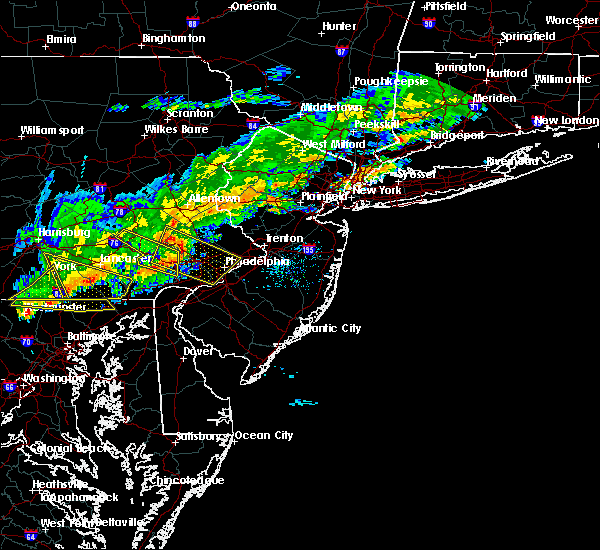 At 446 pm edt, doppler radar indicated a severe thunderstorm capable of producing a tornado. this dangerous storm was located over royersford, or 14 miles north of west chester, and moving east at 45 mph. At 446 pm edt, doppler radar indicated a severe thunderstorm capable of producing a tornado. this dangerous storm was located over royersford, or 14 miles north of west chester, and moving east at 45 mph.
|
| 10/9/2015 4:40 PM EDT | Wires down on hickory grove road. time estimated from rada in chester county PA, 2.2 miles ENE of Spring City, PA |
| 10/9/2015 4:39 PM EDT |
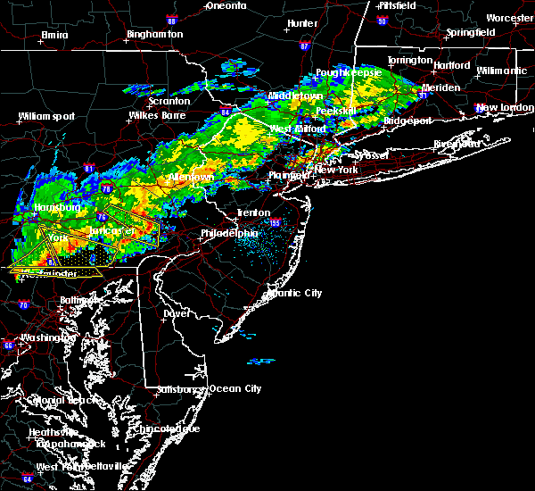 At 437 pm edt, doppler radar indicated a severe thunderstorm capable of producing damaging winds in excess of 65 mph. this storm was located over pughtown, or 12 miles north of west chester, and moving east at 45 mph. penny size hail may also accompany the damaging winds. At 437 pm edt, doppler radar indicated a severe thunderstorm capable of producing damaging winds in excess of 65 mph. this storm was located over pughtown, or 12 miles north of west chester, and moving east at 45 mph. penny size hail may also accompany the damaging winds.
|
| 7/9/2015 7:29 PM EDT |
 At 728 pm edt, doppler radar indicated a line of severe thunderstorms capable of producing damaging winds in excess of 60 mph. these storms were located along a line extending from near quakertown to near fricks to near lansdale to king of prussia to downingtown, moving northeast at 50 mph. these severe storms will be near, lansdale, quakertown, perkasie, doylestown, bedminster, chalfont, hatfield, dublin, gardenville and pipersville around 735 pm edt. byram, ambler, royersford, tinicum, ferndale, lumberville, revere and ottsville around 740 pm edt. philadelphia, hatboro, collegeville, trappe, new hope, newtown, bryn athyn, ivyland, willow grove and richboro around 745 pm edt. At 728 pm edt, doppler radar indicated a line of severe thunderstorms capable of producing damaging winds in excess of 60 mph. these storms were located along a line extending from near quakertown to near fricks to near lansdale to king of prussia to downingtown, moving northeast at 50 mph. these severe storms will be near, lansdale, quakertown, perkasie, doylestown, bedminster, chalfont, hatfield, dublin, gardenville and pipersville around 735 pm edt. byram, ambler, royersford, tinicum, ferndale, lumberville, revere and ottsville around 740 pm edt. philadelphia, hatboro, collegeville, trappe, new hope, newtown, bryn athyn, ivyland, willow grove and richboro around 745 pm edt.
|
| 7/9/2015 7:16 PM EDT |
 At 713 pm edt, doppler radar indicated a line of severe thunderstorms capable of producing damaging winds in excess of 60 mph. these storms were located along a line extending from bally to schwenksville to phoenixville to near coatesville to near parkesburg, moving east at 50 mph. doppler radar is indicating the strongest wind is across northern chester county and into northern montgomery county. this will move into portions of bucks county. these severe storms will be near, phoenixville, west norriton, collegeville, trappe, east greenville, schwenksville, green lane, geryville, valley forge and spring mount around 720 pm edt. norristown, lansdale, east norriton, conshohocken, souderton, hatfield, king of prussia, radnor township and chester springs around 725 pm edt. quakertown, chalfont, plymouth meeting and fricks around 730 pm edt. perkasie, doylestown, ambler, dublin and paoli around 735 pm edt. hatboro, bedminster, bryn athyn, ivyland, pipersville, willow grove, ottsville and revere around 740 pm edt. philadelphia, byram, tinicum, new hope, newtown, richboro, gardenville, lumberville, erwinna and woodside around 745 pm edt. At 713 pm edt, doppler radar indicated a line of severe thunderstorms capable of producing damaging winds in excess of 60 mph. these storms were located along a line extending from bally to schwenksville to phoenixville to near coatesville to near parkesburg, moving east at 50 mph. doppler radar is indicating the strongest wind is across northern chester county and into northern montgomery county. this will move into portions of bucks county. these severe storms will be near, phoenixville, west norriton, collegeville, trappe, east greenville, schwenksville, green lane, geryville, valley forge and spring mount around 720 pm edt. norristown, lansdale, east norriton, conshohocken, souderton, hatfield, king of prussia, radnor township and chester springs around 725 pm edt. quakertown, chalfont, plymouth meeting and fricks around 730 pm edt. perkasie, doylestown, ambler, dublin and paoli around 735 pm edt. hatboro, bedminster, bryn athyn, ivyland, pipersville, willow grove, ottsville and revere around 740 pm edt. philadelphia, byram, tinicum, new hope, newtown, richboro, gardenville, lumberville, erwinna and woodside around 745 pm edt.
|
| 7/9/2015 6:57 PM EDT |
 At 655 pm edt, doppler radar indicated a line of severe thunderstorms capable of producing damaging winds in excess of 60 mph. these storms were located along a line extending from near fleetwood to near cedarville to near glenmoore to parkesburg to quarryville, and moving northeast at 50 mph. this line of storms has had a history of wind damage. * severe thunderstorms will be near, pottstown around 700 pm edt. bally, bechtelsville, pughtown, gilbertsville and cedarville around 705 pm edt. downingtown, royersford, east greenville and green lane around 710 pm edt. trappe, schwenksville, lionville-marchwood, lionville and geryville around 715 pm edt. quakertown, spring mount and marshallton around 720 pm edt. phoenixville, souderton, hatfield and valley forge around 725 pm edt. west norriton, perkasie, collegeville, chester springs, ottsville and fricks around 730 pm edt. east norriton, dublin, ferndale, revere, erwinna, paoli and plymouth meeting around 735 pm edt. At 655 pm edt, doppler radar indicated a line of severe thunderstorms capable of producing damaging winds in excess of 60 mph. these storms were located along a line extending from near fleetwood to near cedarville to near glenmoore to parkesburg to quarryville, and moving northeast at 50 mph. this line of storms has had a history of wind damage. * severe thunderstorms will be near, pottstown around 700 pm edt. bally, bechtelsville, pughtown, gilbertsville and cedarville around 705 pm edt. downingtown, royersford, east greenville and green lane around 710 pm edt. trappe, schwenksville, lionville-marchwood, lionville and geryville around 715 pm edt. quakertown, spring mount and marshallton around 720 pm edt. phoenixville, souderton, hatfield and valley forge around 725 pm edt. west norriton, perkasie, collegeville, chester springs, ottsville and fricks around 730 pm edt. east norriton, dublin, ferndale, revere, erwinna, paoli and plymouth meeting around 735 pm edt.
|
| 6/30/2015 3:05 PM EDT |
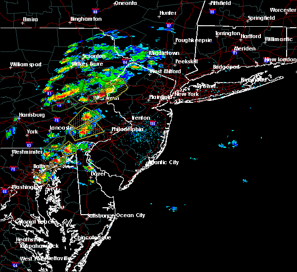 At 305 pm edt, doppler radar indicated a severe thunderstorm capable of producing quarter size hail and damaging winds in excess of 60 mph. this storm was located over lionville, or near west chester, moving northeast at 25 mph. locations impacted include, west chester, norristown, phoenixville, west norriton, east norriton, downingtown, conshohocken, collegeville, royersford, trappe, schwenksville, valley forge, marshallton, bryn mawr, king of prussia, chester springs, radnor township, paoli, lionville-marchwood and lionville. At 305 pm edt, doppler radar indicated a severe thunderstorm capable of producing quarter size hail and damaging winds in excess of 60 mph. this storm was located over lionville, or near west chester, moving northeast at 25 mph. locations impacted include, west chester, norristown, phoenixville, west norriton, east norriton, downingtown, conshohocken, collegeville, royersford, trappe, schwenksville, valley forge, marshallton, bryn mawr, king of prussia, chester springs, radnor township, paoli, lionville-marchwood and lionville.
|
| 6/30/2015 3:04 PM EDT |
 At 303 pm edt, doppler radar indicated a severe thunderstorm capable of producing quarter size hail and damaging winds in excess of 60 mph. this storm was located over gilbertsville, or 15 miles east of reading, moving northeast at 20 mph. this severe storm will be near, bechtelsville around 315 pm edt. bally around 320 pm edt. green lane around 325 pm edt. east greenville around 330 pm edt. other locations impacted by this severe thunderstorm include stowe, kenilworth, amity gardens, harleysville, pottsgrove, pennsburg, red hill, halfway house, south pottstown and boyertown. At 303 pm edt, doppler radar indicated a severe thunderstorm capable of producing quarter size hail and damaging winds in excess of 60 mph. this storm was located over gilbertsville, or 15 miles east of reading, moving northeast at 20 mph. this severe storm will be near, bechtelsville around 315 pm edt. bally around 320 pm edt. green lane around 325 pm edt. east greenville around 330 pm edt. other locations impacted by this severe thunderstorm include stowe, kenilworth, amity gardens, harleysville, pottsgrove, pennsburg, red hill, halfway house, south pottstown and boyertown.
|
| 6/30/2015 2:52 PM EDT |
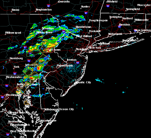 At 251 pm edt, doppler radar indicated a severe thunderstorm capable of producing quarter size hail and damaging winds in excess of 60 mph. this storm was located over coatesville, or 8 miles west of west chester, and moving northeast at 25 mph. At 251 pm edt, doppler radar indicated a severe thunderstorm capable of producing quarter size hail and damaging winds in excess of 60 mph. this storm was located over coatesville, or 8 miles west of west chester, and moving northeast at 25 mph.
|
| 6/30/2015 2:34 PM EDT |
 At 233 pm edt, doppler radar indicated a severe thunderstorm capable of producing quarter size hail and damaging winds in excess of 60 mph. this storm was located near elverson, or 12 miles southeast of reading, and moving northeast at 20 mph. * this severe thunderstorm will be near, pughtown around 240 pm edt. cedarville around 250 pm edt. pottstown around 255 pm edt. gilbertsville around 310 pm edt. bechtelsville around 315 pm edt. bally and spring mount around 320 pm edt. green lane around 325 pm edt. east greenville around 330 pm edt. other locations impacted by this severe thunderstorm include stowe, kenilworth, amity gardens, harleysville, pottsgrove, pennsburg, red hill, halfway house, south pottstown and boyertown. At 233 pm edt, doppler radar indicated a severe thunderstorm capable of producing quarter size hail and damaging winds in excess of 60 mph. this storm was located near elverson, or 12 miles southeast of reading, and moving northeast at 20 mph. * this severe thunderstorm will be near, pughtown around 240 pm edt. cedarville around 250 pm edt. pottstown around 255 pm edt. gilbertsville around 310 pm edt. bechtelsville around 315 pm edt. bally and spring mount around 320 pm edt. green lane around 325 pm edt. east greenville around 330 pm edt. other locations impacted by this severe thunderstorm include stowe, kenilworth, amity gardens, harleysville, pottsgrove, pennsburg, red hill, halfway house, south pottstown and boyertown.
|
| 6/23/2015 5:05 PM EDT |
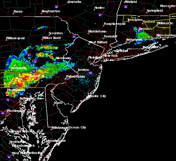 At 504 pm edt, doppler radar indicated a severe thunderstorm capable of producing damaging winds in excess of 60 mph. this storm was located near churchtown, or near new holland, and moving east at 45 mph. * this severe thunderstorm will be near, honey brook around 510 pm edt. elverson around 515 pm edt. coatesville and glenmoore around 520 pm edt. downingtown around 525 pm edt. lionville, lionville-marchwood, chester springs and pughtown around 530 pm edt. west chester around 535 pm edt. phoenixville, paoli and valley forge around 540 pm edt. west norriton, radnor township, king of prussia and gradyville around 545 pm edt. other locations impacted by this severe thunderstorm include south coatesville, west goshen, malvern, evansburg, modena, thorndale, devon-berwyn, exton, atglen and chesterbrook. At 504 pm edt, doppler radar indicated a severe thunderstorm capable of producing damaging winds in excess of 60 mph. this storm was located near churchtown, or near new holland, and moving east at 45 mph. * this severe thunderstorm will be near, honey brook around 510 pm edt. elverson around 515 pm edt. coatesville and glenmoore around 520 pm edt. downingtown around 525 pm edt. lionville, lionville-marchwood, chester springs and pughtown around 530 pm edt. west chester around 535 pm edt. phoenixville, paoli and valley forge around 540 pm edt. west norriton, radnor township, king of prussia and gradyville around 545 pm edt. other locations impacted by this severe thunderstorm include south coatesville, west goshen, malvern, evansburg, modena, thorndale, devon-berwyn, exton, atglen and chesterbrook.
|
| 6/23/2015 4:44 PM EDT |
 At 443 pm edt, doppler radar indicated a developing severe thunderstorm capable of producing quarter size hail and damaging winds in excess of 60 mph. this storm was located near adamstown, or 8 miles southwest of reading, and moving east at 35 mph. * this severe thunderstorm will be near, elverson and new morgan around 455 pm edt. birdsboro around 505 pm edt. pottstown, cedarville and pughtown around 515 pm edt. gilbertsville around 520 pm edt. royersford around 525 pm edt. collegeville, trappe, schwenksville, green lane and spring mount around 535 pm edt. other locations impacted by this severe thunderstorm include stowe, shillington, kenilworth, amity gardens, pottsgrove, pennsburg, st. lawrence, red hill, evansburg and halfway house. At 443 pm edt, doppler radar indicated a developing severe thunderstorm capable of producing quarter size hail and damaging winds in excess of 60 mph. this storm was located near adamstown, or 8 miles southwest of reading, and moving east at 35 mph. * this severe thunderstorm will be near, elverson and new morgan around 455 pm edt. birdsboro around 505 pm edt. pottstown, cedarville and pughtown around 515 pm edt. gilbertsville around 520 pm edt. royersford around 525 pm edt. collegeville, trappe, schwenksville, green lane and spring mount around 535 pm edt. other locations impacted by this severe thunderstorm include stowe, shillington, kenilworth, amity gardens, pottsgrove, pennsburg, st. lawrence, red hill, evansburg and halfway house.
|
| 6/14/2015 7:31 PM EDT |
 A severe thunderstorm warning remains in effect until 800 pm edt for northeastern chester. southeastern berks and northwestern montgomery counties. at 731 pm edt. doppler radar indicated a severe thunderstorm capable of producing quarter size hail and damaging winds in excess of 60 mph. this storm was located near cedarville. Moving northeast at 20. A severe thunderstorm warning remains in effect until 800 pm edt for northeastern chester. southeastern berks and northwestern montgomery counties. at 731 pm edt. doppler radar indicated a severe thunderstorm capable of producing quarter size hail and damaging winds in excess of 60 mph. this storm was located near cedarville. Moving northeast at 20.
|
| 6/14/2015 7:16 PM EDT |
 The national weather service in mount holly nj has issued a * severe thunderstorm warning for. northeastern chester county in southeastern pennsylvania. southeastern berks county in eastern pennsylvania. northwestern montgomery county in southeastern pennsylvania. Until 800 pm edt. The national weather service in mount holly nj has issued a * severe thunderstorm warning for. northeastern chester county in southeastern pennsylvania. southeastern berks county in eastern pennsylvania. northwestern montgomery county in southeastern pennsylvania. Until 800 pm edt.
|
| 6/12/2015 5:36 PM EDT |
 The severe thunderstorm warning for northeastern chester, southeastern berks and montgomery counties will expire at 545 pm edt, the severe thunderstorm which prompted the warning has weakened. therefore the warning will be allowed to expire. The severe thunderstorm warning for northeastern chester, southeastern berks and montgomery counties will expire at 545 pm edt, the severe thunderstorm which prompted the warning has weakened. therefore the warning will be allowed to expire.
|
| 6/12/2015 5:10 PM EDT |
 At 510 pm edt, doppler radar indicated a severe thunderstorm capable of producing damaging winds in excess of 60 mph. this storm was located near pughtown, or 13 miles north of west chester, moving northeast at 25 mph. locations impacted include, pottstown, phoenixville, lansdale, west norriton, east norriton, souderton, birdsboro, collegeville, royersford, trappe, hatfield, east greenville, schwenksville, elverson, bally, bechtelsville, green lane, glenmoore, cedarville and chester springs. At 510 pm edt, doppler radar indicated a severe thunderstorm capable of producing damaging winds in excess of 60 mph. this storm was located near pughtown, or 13 miles north of west chester, moving northeast at 25 mph. locations impacted include, pottstown, phoenixville, lansdale, west norriton, east norriton, souderton, birdsboro, collegeville, royersford, trappe, hatfield, east greenville, schwenksville, elverson, bally, bechtelsville, green lane, glenmoore, cedarville and chester springs.
|
| 6/12/2015 4:57 PM EDT |
 At 455 pm edt, doppler radar indicated a severe thunderstorm capable of producing damaging winds in excess of 60 mph. this storm was located over glenmoore, or 11 miles northwest of west chester, and moving east at 25 mph. At 455 pm edt, doppler radar indicated a severe thunderstorm capable of producing damaging winds in excess of 60 mph. this storm was located over glenmoore, or 11 miles northwest of west chester, and moving east at 25 mph.
|
| 6/8/2015 7:19 PM EDT | At 718 pm edt, doppler radar indicated a severe thunderstorm capable of producing quarter size hail and damaging winds in excess of 60 mph. this storm was located over pottstown, or 18 miles east of reading, and moving east at 45 mph. |
| 5/27/2015 5:32 PM EDT | At 531 pm edt, doppler radar indicated a severe thunderstorm capable of producing damaging winds in excess of 60 mph. this storm was located near collegeville, moving northeast at 35 mph. locations impacted include, norristown, phoenixville, lansdale, west norriton, east norriton, perkasie, doylestown, conshohocken, hatboro, souderton, ambler, collegeville, royersford, chalfont, trappe, hatfield, dublin, schwenksville, ivyland and valley forge. |
| 5/27/2015 5:07 PM EDT | At 506 pm edt, doppler radar indicated a severe thunderstorm capable of producing damaging winds in excess of 60 mph. this storm was located over lionville, and moving northeast at 35 mph. |
| 5/16/2015 6:50 PM EDT | At 649 pm edt, trained weather spotters reported a severe thunderstorm producing quarter size hail and damaging winds in excess of 60 mph. this storm was located over gilbertsville, or 18 miles east of reading, moving east at 20 mph. locations impacted include, pottstown, lansdale, emmaus, souderton, collegeville, royersford, trappe, hatfield, east greenville, schwenksville, bally, bechtelsville, green lane, geryville, zionsville, cedarville, spring mount, gilbertsville, pughtown and skippack. |
| 5/16/2015 6:31 PM EDT | At 630 pm edt, doppler radar indicated a severe thunderstorm capable of producing quarter size hail and damaging winds in excess of 60 mph. this storm was located near cedarville, or 11 miles east of reading, and moving east at 20 mph. |
| 6/29/2012 5:03 AM EDT | Storm damage reported in chester county PA, 0.4 miles SE of Spring City, PA |
Hail Maps for Spring City, PA


Connect with Interactive Hail Maps