

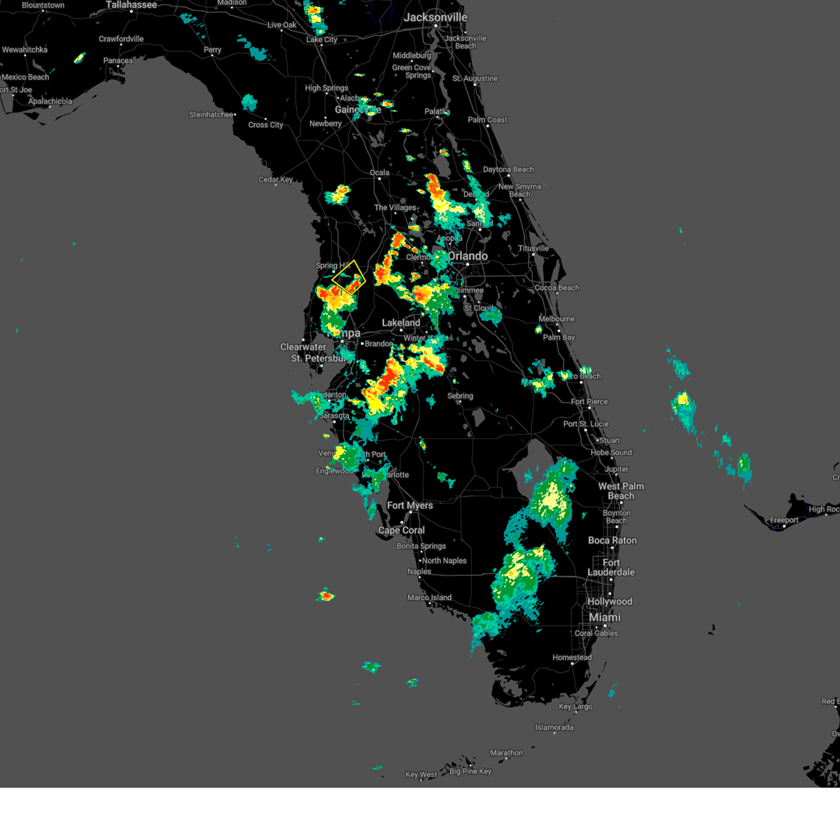
Hail Map for Spring Hill, FL
The Spring Hill, FL area has had 3 reports of on-the-ground hail by trained spotters, and has been under severe weather warnings 1 time during the past 12 months. Doppler radar has detected hail at or near Spring Hill, FL on 57 occasions, including 1 occasion during the past year.
| Name: | Spring Hill, FL |
| Where Located: | 71.8 miles W of Orlando, FL |
| Map: | Google Map for Spring Hill, FL |
| Population: | 98621 |
| Housing Units: | 44435 |
| More Info: | Search Google for Spring Hill, FL |
0
The Top Recent Hail Date for Spring Hill, FL is Sunday, March 30, 2025 (57th out of 57)

Hail and Wind Damage Spotted near Spring Hill, FL
| Date / Time | Report Details |
|---|---|
| 7/23/2024 6:21 PM EDT |
 Svrtbw the national weather service in ruskin has issued a * severe thunderstorm warning for, north central pasco county in west central florida, south central hernando county in west central florida, * until 645 pm edt. * at 621 pm edt, a severe thunderstorm was located near st. leo, or 9 miles west of dade city, moving northwest at 15 mph (radar indicated). Hazards include 60 mph wind gusts and quarter size hail. Hail damage to vehicles is expected. Expect wind damage to roofs, siding, and trees. Svrtbw the national weather service in ruskin has issued a * severe thunderstorm warning for, north central pasco county in west central florida, south central hernando county in west central florida, * until 645 pm edt. * at 621 pm edt, a severe thunderstorm was located near st. leo, or 9 miles west of dade city, moving northwest at 15 mph (radar indicated). Hazards include 60 mph wind gusts and quarter size hail. Hail damage to vehicles is expected. Expect wind damage to roofs, siding, and trees.
|
| 5/17/2024 9:35 AM EDT |
 the severe thunderstorm warning has been cancelled and is no longer in effect the severe thunderstorm warning has been cancelled and is no longer in effect
|
| 5/17/2024 8:42 AM EDT |
 Svrtbw the national weather service in ruskin has issued a * severe thunderstorm warning for, citrus county in west central florida, northwestern sumter county in central florida, central pasco county in west central florida, hernando county in west central florida, southeastern levy county in northern florida, * until 945 am edt. * at 841 am edt, a severe thunderstorm was located 15 miles west of pine island, or 20 miles northwest of hudson, moving east at 40 mph (radar indicated). Hazards include 60 mph wind gusts. expect damage to roofs, siding, and trees Svrtbw the national weather service in ruskin has issued a * severe thunderstorm warning for, citrus county in west central florida, northwestern sumter county in central florida, central pasco county in west central florida, hernando county in west central florida, southeastern levy county in northern florida, * until 945 am edt. * at 841 am edt, a severe thunderstorm was located 15 miles west of pine island, or 20 miles northwest of hudson, moving east at 40 mph (radar indicated). Hazards include 60 mph wind gusts. expect damage to roofs, siding, and trees
|
| 4/11/2024 12:30 PM EDT |
 Svrtbw the national weather service in ruskin has issued a * severe thunderstorm warning for, southeastern citrus county in west central florida, sumter county in central florida, pasco county in west central florida, hernando county in west central florida, northwestern manatee county in west central florida, pinellas county in west central florida, northwestern polk county in central florida, hillsborough county in west central florida, * until 115 pm edt. * at 1229 pm edt, severe thunderstorms were located along a line extending from near spring hill to 6 miles southwest of citrus park to 17 miles west of anna maria, moving east at 45 mph (radar indicated). Hazards include 60 mph wind gusts. expect damage to roofs, siding, and trees Svrtbw the national weather service in ruskin has issued a * severe thunderstorm warning for, southeastern citrus county in west central florida, sumter county in central florida, pasco county in west central florida, hernando county in west central florida, northwestern manatee county in west central florida, pinellas county in west central florida, northwestern polk county in central florida, hillsborough county in west central florida, * until 115 pm edt. * at 1229 pm edt, severe thunderstorms were located along a line extending from near spring hill to 6 miles southwest of citrus park to 17 miles west of anna maria, moving east at 45 mph (radar indicated). Hazards include 60 mph wind gusts. expect damage to roofs, siding, and trees
|
| 4/11/2024 11:47 AM EDT |
 Svrtbw the national weather service in ruskin has issued a * severe thunderstorm warning for, southern citrus county in west central florida, northwestern sumter county in central florida, pasco county in west central florida, hernando county in west central florida, pinellas county in west central florida, northwestern hillsborough county in west central florida, * until 1230 pm edt. * at 1146 am edt, severe thunderstorms were located along a line extending from 6 miles northwest of pine island to near hudson to near clearwater to 19 miles southwest of harbor bluffs, moving northeast at 50 mph (radar indicated). Hazards include 60 mph wind gusts. expect damage to roofs, siding, and trees Svrtbw the national weather service in ruskin has issued a * severe thunderstorm warning for, southern citrus county in west central florida, northwestern sumter county in central florida, pasco county in west central florida, hernando county in west central florida, pinellas county in west central florida, northwestern hillsborough county in west central florida, * until 1230 pm edt. * at 1146 am edt, severe thunderstorms were located along a line extending from 6 miles northwest of pine island to near hudson to near clearwater to 19 miles southwest of harbor bluffs, moving northeast at 50 mph (radar indicated). Hazards include 60 mph wind gusts. expect damage to roofs, siding, and trees
|
| 10/12/2023 11:00 AM EDT |
 At 1100 am edt, a radar indicated waterspout was located just offshore over pine island, or 8 miles northwest of spring hill, moving northeast at 40 mph (radar indicated rotation). Hazards include tornado. Flying debris will be dangerous to those caught without shelter. mobile homes will be damaged or destroyed. damage to roofs, windows, and vehicles will occur. tree damage is likely. this tornado will be near, spring hill, weeki wachee, pine island, north weeki wachee, and weeki wachee gardens around 1105 am edt. Other locations impacted by this tornadic thunderstorm include chassahowitzka refuge, royal highlands, chassahowitzka, high point, lake lindsey, suburban acres, glen lakes, heatherwood, floral city, and istachatta. At 1100 am edt, a radar indicated waterspout was located just offshore over pine island, or 8 miles northwest of spring hill, moving northeast at 40 mph (radar indicated rotation). Hazards include tornado. Flying debris will be dangerous to those caught without shelter. mobile homes will be damaged or destroyed. damage to roofs, windows, and vehicles will occur. tree damage is likely. this tornado will be near, spring hill, weeki wachee, pine island, north weeki wachee, and weeki wachee gardens around 1105 am edt. Other locations impacted by this tornadic thunderstorm include chassahowitzka refuge, royal highlands, chassahowitzka, high point, lake lindsey, suburban acres, glen lakes, heatherwood, floral city, and istachatta.
|
| 10/12/2023 2:44 AM EDT |
 At 244 am edt, a severe thunderstorm capable of producing a tornado was located 7 miles south of hernando county airport, or 10 miles southeast of spring hill, moving northeast at 30 mph (radar indicated rotation). Hazards include tornado. Flying debris will be dangerous to those caught without shelter. mobile homes will be damaged or destroyed. damage to roofs, windows, and vehicles will occur. tree damage is likely. this dangerous storm will be near, brooksville around 250 am edt. south brooksville and hill n dale around 255 am edt. Other locations impacted by this tornadic thunderstorm include darby, spring lake, garden grove, lacoochee, ridge manor, croom, masaryktown, blanton, and shady hills. At 244 am edt, a severe thunderstorm capable of producing a tornado was located 7 miles south of hernando county airport, or 10 miles southeast of spring hill, moving northeast at 30 mph (radar indicated rotation). Hazards include tornado. Flying debris will be dangerous to those caught without shelter. mobile homes will be damaged or destroyed. damage to roofs, windows, and vehicles will occur. tree damage is likely. this dangerous storm will be near, brooksville around 250 am edt. south brooksville and hill n dale around 255 am edt. Other locations impacted by this tornadic thunderstorm include darby, spring lake, garden grove, lacoochee, ridge manor, croom, masaryktown, blanton, and shady hills.
|
| 10/12/2023 2:34 AM EDT |
 At 234 am edt, a confirmed tornado was located 8 miles northwest of land o lakes, or 10 miles east of hudson, moving northeast at 30 mph (radar confirmed tornado). Hazards include damaging tornado. Flying debris will be dangerous to those caught without shelter. mobile homes will be damaged or destroyed. damage to roofs, windows, and vehicles will occur. tree damage is likely. Locations impacted include, spring hill, gowers corner, and shady hills. At 234 am edt, a confirmed tornado was located 8 miles northwest of land o lakes, or 10 miles east of hudson, moving northeast at 30 mph (radar confirmed tornado). Hazards include damaging tornado. Flying debris will be dangerous to those caught without shelter. mobile homes will be damaged or destroyed. damage to roofs, windows, and vehicles will occur. tree damage is likely. Locations impacted include, spring hill, gowers corner, and shady hills.
|
| 10/12/2023 2:26 AM EDT |
 At 226 am edt, a confirmed tornado was located 7 miles east of jasmine estates, or 8 miles east of new port richey, moving northeast at 35 mph (radar confirmed tornado). Hazards include damaging tornado. Flying debris will be dangerous to those caught without shelter. mobile homes will be damaged or destroyed. damage to roofs, windows, and vehicles will occur. tree damage is likely. Locations impacted include, spring hill, moon lake, jay b starkey wilderness park, gowers corner, and shady hills. At 226 am edt, a confirmed tornado was located 7 miles east of jasmine estates, or 8 miles east of new port richey, moving northeast at 35 mph (radar confirmed tornado). Hazards include damaging tornado. Flying debris will be dangerous to those caught without shelter. mobile homes will be damaged or destroyed. damage to roofs, windows, and vehicles will occur. tree damage is likely. Locations impacted include, spring hill, moon lake, jay b starkey wilderness park, gowers corner, and shady hills.
|
| 10/12/2023 2:22 AM EDT |
 At 221 am edt, a severe thunderstorm capable of producing a tornado was located over weeki wachee gardens, or near spring hill, moving northeast at 40 mph (radar indicated rotation). Hazards include tornado. Flying debris will be dangerous to those caught without shelter. mobile homes will be damaged or destroyed. damage to roofs, windows, and vehicles will occur. tree damage is likely. this dangerous storm will be near, spring hill, weeki wachee, north weeki wachee, and weeki wachee gardens around 225 am edt. Other locations impacted by this tornadic thunderstorm include weeki wachee acres. At 221 am edt, a severe thunderstorm capable of producing a tornado was located over weeki wachee gardens, or near spring hill, moving northeast at 40 mph (radar indicated rotation). Hazards include tornado. Flying debris will be dangerous to those caught without shelter. mobile homes will be damaged or destroyed. damage to roofs, windows, and vehicles will occur. tree damage is likely. this dangerous storm will be near, spring hill, weeki wachee, north weeki wachee, and weeki wachee gardens around 225 am edt. Other locations impacted by this tornadic thunderstorm include weeki wachee acres.
|
| 10/12/2023 2:13 AM EDT |
 At 212 am edt, a confirmed tornado was located near trinity, moving northeast at 30 mph (public confirmed tornado). Hazards include damaging tornado. Flying debris will be dangerous to those caught without shelter. mobile homes will be damaged or destroyed. damage to roofs, windows, and vehicles will occur. tree damage is likely. This tornadic thunderstorm will remain over mainly rural areas of central pasco and southwestern hernando counties, including the following locations, moon lake, jay b starkey wilderness park, gowers corner, trinity, shady hills, and odessa. At 212 am edt, a confirmed tornado was located near trinity, moving northeast at 30 mph (public confirmed tornado). Hazards include damaging tornado. Flying debris will be dangerous to those caught without shelter. mobile homes will be damaged or destroyed. damage to roofs, windows, and vehicles will occur. tree damage is likely. This tornadic thunderstorm will remain over mainly rural areas of central pasco and southwestern hernando counties, including the following locations, moon lake, jay b starkey wilderness park, gowers corner, trinity, shady hills, and odessa.
|
| 10/12/2023 1:58 AM EDT |
 At 158 am edt, a radar indicated waterspout was located just offshore near hudson, moving northeast at 40 mph (radar indicated rotation). Hazards include tornado. Flying debris will be dangerous to those caught without shelter. mobile homes will be damaged or destroyed. damage to roofs, windows, and vehicles will occur. tree damage is likely. this tornado will be near, spring hill, hudson, and timber pines around 205 am edt. weeki wachee and weeki wachee gardens around 210 am edt. pine island and north weeki wachee around 215 am edt. Other locations impacted by this tornadic thunderstorm include weeki wachee acres, bayonet point, and shady hills. At 158 am edt, a radar indicated waterspout was located just offshore near hudson, moving northeast at 40 mph (radar indicated rotation). Hazards include tornado. Flying debris will be dangerous to those caught without shelter. mobile homes will be damaged or destroyed. damage to roofs, windows, and vehicles will occur. tree damage is likely. this tornado will be near, spring hill, hudson, and timber pines around 205 am edt. weeki wachee and weeki wachee gardens around 210 am edt. pine island and north weeki wachee around 215 am edt. Other locations impacted by this tornadic thunderstorm include weeki wachee acres, bayonet point, and shady hills.
|
| 8/30/2023 4:23 AM EDT |
 At 423 am edt, a severe thunderstorm capable of producing a tornado was located near hernando county airport, or near brooksville, moving northeast at 35 mph (radar indicated rotation). Hazards include tornado. Flying debris will be dangerous to those caught without shelter. mobile homes will be damaged or destroyed. damage to roofs, windows, and vehicles will occur. tree damage is likely. this dangerous storm will be near, brooksville, south brooksville, north brooksville, and hill n dale around 430 am edt. Other locations impacted by this tornadic thunderstorm include spring lake, garden grove, nobleton, lake lindsey, suburban acres, inverness highlands, floral city, istachatta, wahoo, and croom. At 423 am edt, a severe thunderstorm capable of producing a tornado was located near hernando county airport, or near brooksville, moving northeast at 35 mph (radar indicated rotation). Hazards include tornado. Flying debris will be dangerous to those caught without shelter. mobile homes will be damaged or destroyed. damage to roofs, windows, and vehicles will occur. tree damage is likely. this dangerous storm will be near, brooksville, south brooksville, north brooksville, and hill n dale around 430 am edt. Other locations impacted by this tornadic thunderstorm include spring lake, garden grove, nobleton, lake lindsey, suburban acres, inverness highlands, floral city, istachatta, wahoo, and croom.
|
| 12/15/2022 10:56 AM EST |
 At 1055 am est, a severe thunderstorm capable of producing a tornado was located near hernando county airport, or near brooksville, moving northeast at 35 mph (radar indicated rotation). Hazards include tornado. Flying debris will be dangerous to those caught without shelter. mobile homes will be damaged or destroyed. damage to roofs, windows, and vehicles will occur. tree damage is likely. this dangerous storm will be near, hill n dale around 1110 am est. Other locations impacted by this tornadic thunderstorm include ridge manor, spring lake and croom. At 1055 am est, a severe thunderstorm capable of producing a tornado was located near hernando county airport, or near brooksville, moving northeast at 35 mph (radar indicated rotation). Hazards include tornado. Flying debris will be dangerous to those caught without shelter. mobile homes will be damaged or destroyed. damage to roofs, windows, and vehicles will occur. tree damage is likely. this dangerous storm will be near, hill n dale around 1110 am est. Other locations impacted by this tornadic thunderstorm include ridge manor, spring lake and croom.
|
| 12/15/2022 10:45 AM EST | Numerous trees dow in hernando county FL, 6.8 miles WNW of Spring Hill, FL |
| 12/15/2022 10:40 AM EST |
 At 1040 am est, severe thunderstorms were located along a line extending from hernando county airport to near beacon square to 10 miles west of palm harbor, moving northeast at 60 mph (radar indicated). Hazards include 60 mph wind gusts and penny size hail. expect damage to roofs, siding, and trees At 1040 am est, severe thunderstorms were located along a line extending from hernando county airport to near beacon square to 10 miles west of palm harbor, moving northeast at 60 mph (radar indicated). Hazards include 60 mph wind gusts and penny size hail. expect damage to roofs, siding, and trees
|
| 12/15/2022 10:08 AM EST |
 At 1008 am est, severe thunderstorms were located along a line extending from near weeki wachee gardens to 6 miles west of jasmine estates, moving northeast at 35 mph (radar indicated). Hazards include 60 mph wind gusts. expect damage to roofs, siding, and trees At 1008 am est, severe thunderstorms were located along a line extending from near weeki wachee gardens to 6 miles west of jasmine estates, moving northeast at 35 mph (radar indicated). Hazards include 60 mph wind gusts. expect damage to roofs, siding, and trees
|
| 8/9/2022 3:42 PM EDT |
 At 342 pm edt, a severe thunderstorm was located near hudson, moving northwest at 35 mph (radar indicated). Hazards include 60 mph wind gusts and nickel size hail. Expect damage to roofs, siding, and trees. locations impacted include, spring hill, new port richey, jasmine estates, holiday, new port richey east, bayonet point, elfers, hudson, timber pines and beacon square. hail threat, radar indicated max hail size, 0. 88 in wind threat, radar indicated max wind gust, 60 mph. At 342 pm edt, a severe thunderstorm was located near hudson, moving northwest at 35 mph (radar indicated). Hazards include 60 mph wind gusts and nickel size hail. Expect damage to roofs, siding, and trees. locations impacted include, spring hill, new port richey, jasmine estates, holiday, new port richey east, bayonet point, elfers, hudson, timber pines and beacon square. hail threat, radar indicated max hail size, 0. 88 in wind threat, radar indicated max wind gust, 60 mph.
|
| 8/9/2022 3:36 PM EDT |
 At 336 pm edt, a severe thunderstorm was located over jasmine estates, or near hudson, moving northwest at 35 mph (radar indicated). Hazards include 60 mph wind gusts and nickel size hail. Expect damage to roofs, siding, and trees. locations impacted include, spring hill, new port richey, palm harbor, jasmine estates, trinity, new port richey east, shady hills, elfers, hudson and moon lake. hail threat, radar indicated max hail size, 0. 88 in wind threat, radar indicated max wind gust, 60 mph. At 336 pm edt, a severe thunderstorm was located over jasmine estates, or near hudson, moving northwest at 35 mph (radar indicated). Hazards include 60 mph wind gusts and nickel size hail. Expect damage to roofs, siding, and trees. locations impacted include, spring hill, new port richey, palm harbor, jasmine estates, trinity, new port richey east, shady hills, elfers, hudson and moon lake. hail threat, radar indicated max hail size, 0. 88 in wind threat, radar indicated max wind gust, 60 mph.
|
| 8/9/2022 3:28 PM EDT |
 At 328 pm edt, a severe thunderstorm was located over new port richey east, or near new port richey, moving northwest at 35 mph (radar indicated). Hazards include 60 mph wind gusts and nickel size hail. expect damage to roofs, siding, and trees At 328 pm edt, a severe thunderstorm was located over new port richey east, or near new port richey, moving northwest at 35 mph (radar indicated). Hazards include 60 mph wind gusts and nickel size hail. expect damage to roofs, siding, and trees
|
| 5/30/2022 9:40 PM EDT |
 The severe thunderstorm warning for north central pasco and south central hernando counties will expire at 945 pm edt, the storm which prompted the warning has weakened below severe limits, and no longer poses an immediate threat to life or property. therefore, the warning will be allowed to expire. however small hail and gusty winds are still possible with this thunderstorm. The severe thunderstorm warning for north central pasco and south central hernando counties will expire at 945 pm edt, the storm which prompted the warning has weakened below severe limits, and no longer poses an immediate threat to life or property. therefore, the warning will be allowed to expire. however small hail and gusty winds are still possible with this thunderstorm.
|
| 5/30/2022 9:19 PM EDT |
 At 919 pm edt, a severe thunderstorm was located near hernando county airport, or near spring hill, and is nearly stationary (radar indicated). Hazards include 60 mph wind gusts and quarter size hail. Hail damage to vehicles is expected. Expect wind damage to roofs, siding, and trees. At 919 pm edt, a severe thunderstorm was located near hernando county airport, or near spring hill, and is nearly stationary (radar indicated). Hazards include 60 mph wind gusts and quarter size hail. Hail damage to vehicles is expected. Expect wind damage to roofs, siding, and trees.
|
| 3/12/2022 8:45 AM EST |
 At 843 am est, severe thunderstorms were located along a line extending from near the villages to near hill n dale to near new port richey to 30 miles west of bay pines, moving east at 45 mph (radar indicated). Hazards include 60 mph wind gusts. expect damage to roofs, siding, and trees At 843 am est, severe thunderstorms were located along a line extending from near the villages to near hill n dale to near new port richey to 30 miles west of bay pines, moving east at 45 mph (radar indicated). Hazards include 60 mph wind gusts. expect damage to roofs, siding, and trees
|
| 3/12/2022 8:35 AM EST |
 At 834 am est, severe thunderstorms were located along a line extending from near the villages to near hill n dale to near beacon square, moving east at 50 mph (radar indicated). Hazards include 60 mph wind gusts. Expect damage to roofs, siding, and trees. locations impacted include, spring hill, new port richey, brooksville, wildwood, lake panasoffkee, ridge manor, bushnell, coleman, new port richey east and shady hills. hail threat, radar indicated max hail size, <. 75 in wind threat, radar indicated max wind gust, 60 mph. At 834 am est, severe thunderstorms were located along a line extending from near the villages to near hill n dale to near beacon square, moving east at 50 mph (radar indicated). Hazards include 60 mph wind gusts. Expect damage to roofs, siding, and trees. locations impacted include, spring hill, new port richey, brooksville, wildwood, lake panasoffkee, ridge manor, bushnell, coleman, new port richey east and shady hills. hail threat, radar indicated max hail size, <. 75 in wind threat, radar indicated max wind gust, 60 mph.
|
| 3/12/2022 8:25 AM EST |
 The tornado warning for central hernando county will expire at 830 am est, the tornado threat has diminished and the tornado warning has been cancelled. however, damaging winds remain likely and a severe thunderstorm warning remains in effect for the area. a tornado watch remains in effect until 1100 am est for west central florida. The tornado warning for central hernando county will expire at 830 am est, the tornado threat has diminished and the tornado warning has been cancelled. however, damaging winds remain likely and a severe thunderstorm warning remains in effect for the area. a tornado watch remains in effect until 1100 am est for west central florida.
|
| 3/12/2022 8:13 AM EST |
 At 812 am est, a severe thunderstorm capable of producing a tornado was located over weeki wachee, or near spring hill, moving east at 50 mph (radar indicated rotation). Hazards include tornado. Flying debris will be dangerous to those caught without shelter. mobile homes will be damaged or destroyed. damage to roofs, windows, and vehicles will occur. tree damage is likely. this dangerous storm will be near, brooksville and south brooksville around 825 am est. north brooksville around 830 am est. hill n dale around 835 am est. Other locations impacted by this tornadic thunderstorm include brookridge, high point and lake lindsey. At 812 am est, a severe thunderstorm capable of producing a tornado was located over weeki wachee, or near spring hill, moving east at 50 mph (radar indicated rotation). Hazards include tornado. Flying debris will be dangerous to those caught without shelter. mobile homes will be damaged or destroyed. damage to roofs, windows, and vehicles will occur. tree damage is likely. this dangerous storm will be near, brooksville and south brooksville around 825 am est. north brooksville around 830 am est. hill n dale around 835 am est. Other locations impacted by this tornadic thunderstorm include brookridge, high point and lake lindsey.
|
| 3/12/2022 8:03 AM EST |
 At 802 am est, a radar indicated waterspout was located just offshore 7 miles southwest of weeki wachee gardens, or 8 miles north of hudson, moving east at 50 mph (radar indicated rotation). Hazards include tornado. Flying debris will be dangerous to those caught without shelter. mobile homes will be damaged or destroyed. damage to roofs, windows, and vehicles will occur. tree damage is likely. this tornado will be near, weeki wachee gardens and timber pines around 810 am est. weeki wachee and north weeki wachee around 815 am est. spring hill and hernando county airport around 820 am est. brooksville and south brooksville around 825 am est. north brooksville and hill n dale around 830 am est. Other locations impacted by this tornadic thunderstorm include spring lake, garden grove, high point, lake lindsey, glen lakes, brookridge, weeki wachee acres and floral city. At 802 am est, a radar indicated waterspout was located just offshore 7 miles southwest of weeki wachee gardens, or 8 miles north of hudson, moving east at 50 mph (radar indicated rotation). Hazards include tornado. Flying debris will be dangerous to those caught without shelter. mobile homes will be damaged or destroyed. damage to roofs, windows, and vehicles will occur. tree damage is likely. this tornado will be near, weeki wachee gardens and timber pines around 810 am est. weeki wachee and north weeki wachee around 815 am est. spring hill and hernando county airport around 820 am est. brooksville and south brooksville around 825 am est. north brooksville and hill n dale around 830 am est. Other locations impacted by this tornadic thunderstorm include spring lake, garden grove, high point, lake lindsey, glen lakes, brookridge, weeki wachee acres and floral city.
|
| 3/12/2022 7:55 AM EST |
 At 754 am est, severe thunderstorms were located along a line extending from 7 miles south of rainbow lakes estates to 17 miles northwest of beacon square, moving east at 40 mph (radar indicated). Hazards include 60 mph wind gusts. expect damage to roofs, siding, and trees At 754 am est, severe thunderstorms were located along a line extending from 7 miles south of rainbow lakes estates to 17 miles northwest of beacon square, moving east at 40 mph (radar indicated). Hazards include 60 mph wind gusts. expect damage to roofs, siding, and trees
|
| 7/12/2021 4:14 PM EDT |
 At 410 pm edt, a severe thunderstorm was located near timber pines, or 7 miles west of spring hill, moving northwest at 10 mph (radar indicated). Hazards include 60 mph wind gusts and quarter size hail. Hail damage to vehicles is expected. Expect wind damage to roofs, siding, and trees. At 410 pm edt, a severe thunderstorm was located near timber pines, or 7 miles west of spring hill, moving northwest at 10 mph (radar indicated). Hazards include 60 mph wind gusts and quarter size hail. Hail damage to vehicles is expected. Expect wind damage to roofs, siding, and trees.
|
| 4/11/2021 11:30 AM EDT | *** 1 fatal *** broadcast media is confirming a weather related fatality on evenglow ave in spring hill. a tree fell on a car and the occupant was electrocuted as they in hernando county FL, 2.3 miles WNW of Spring Hill, FL |
| 4/11/2021 11:09 AM EDT |
 At 1108 am edt, severe thunderstorms were located along a line extending from 15 miles west of weeki wachee gardens to 8 miles west of beacon square to 17 miles west of harbor bluffs, moving east at 35 mph (radar indicated). Hazards include 60 mph wind gusts and nickel size hail. expect damage to roofs, siding, and trees At 1108 am edt, severe thunderstorms were located along a line extending from 15 miles west of weeki wachee gardens to 8 miles west of beacon square to 17 miles west of harbor bluffs, moving east at 35 mph (radar indicated). Hazards include 60 mph wind gusts and nickel size hail. expect damage to roofs, siding, and trees
|
| 12/24/2020 6:24 PM EST |
 At 624 pm est, severe thunderstorms were located along a line extending from 16 miles west of homosassa to 18 miles west of beacon square to 25 miles west of harbor bluffs, moving east at 50 mph (radar indicated). Hazards include 60 mph wind gusts. expect damage to roofs, siding, and trees At 624 pm est, severe thunderstorms were located along a line extending from 16 miles west of homosassa to 18 miles west of beacon square to 25 miles west of harbor bluffs, moving east at 50 mph (radar indicated). Hazards include 60 mph wind gusts. expect damage to roofs, siding, and trees
|
| 4/24/2020 5:25 AM EDT |
 At 525 am edt, severe thunderstorms were located along a line extending from near wildwood to 15 miles southwest of harbor bluffs, moving east at 30 mph (radar indicated). Hazards include 60 mph wind gusts. Expect damage to roofs, siding, and trees. locations impacted include, tampa, spring hill, clearwater, largo, pinellas park, seminole, new port richey, brooksville, wildwood, dade city, bushnell, hudson, holiday, lutz, st. petersburg, st. pete beach, st. Leo, weeki wachee, palm harbor and new port richey east. At 525 am edt, severe thunderstorms were located along a line extending from near wildwood to 15 miles southwest of harbor bluffs, moving east at 30 mph (radar indicated). Hazards include 60 mph wind gusts. Expect damage to roofs, siding, and trees. locations impacted include, tampa, spring hill, clearwater, largo, pinellas park, seminole, new port richey, brooksville, wildwood, dade city, bushnell, hudson, holiday, lutz, st. petersburg, st. pete beach, st. Leo, weeki wachee, palm harbor and new port richey east.
|
| 4/24/2020 4:59 AM EDT |
 At 458 am edt, severe thunderstorms were located along a line extending from near inverness highlands north to 27 miles west of harbor bluffs, moving east at 30 mph (radar indicated). Hazards include 60 mph wind gusts. expect damage to roofs, siding, and trees At 458 am edt, severe thunderstorms were located along a line extending from near inverness highlands north to 27 miles west of harbor bluffs, moving east at 30 mph (radar indicated). Hazards include 60 mph wind gusts. expect damage to roofs, siding, and trees
|
| 4/15/2020 3:57 PM EDT |
 At 329 pm edt, a severe thunderstorm was located near weeki wachee, or near spring hill, moving east at 30 mph (radar indicated). Hazards include 60 mph wind gusts. expect damage to roofs, siding, and trees At 329 pm edt, a severe thunderstorm was located near weeki wachee, or near spring hill, moving east at 30 mph (radar indicated). Hazards include 60 mph wind gusts. expect damage to roofs, siding, and trees
|
| 4/15/2020 3:30 PM EDT |
 At 329 pm edt, a severe thunderstorm was located near weeki wachee, or near spring hill, moving east at 30 mph (radar indicated). Hazards include 60 mph wind gusts. expect damage to roofs, siding, and trees At 329 pm edt, a severe thunderstorm was located near weeki wachee, or near spring hill, moving east at 30 mph (radar indicated). Hazards include 60 mph wind gusts. expect damage to roofs, siding, and trees
|
| 2/6/2020 10:50 PM EST |
 At 1049 pm est, severe thunderstorms were located along a line extending from 9 miles northeast of inverness to near land o lakes to 25 miles southwest of anna maria, moving east at 35 mph (radar indicated). Hazards include 60 mph wind gusts. expect damage to roofs, siding, and trees At 1049 pm est, severe thunderstorms were located along a line extending from 9 miles northeast of inverness to near land o lakes to 25 miles southwest of anna maria, moving east at 35 mph (radar indicated). Hazards include 60 mph wind gusts. expect damage to roofs, siding, and trees
|
| 2/6/2020 10:28 PM EST |
 At 1026 pm est, severe thunderstorms were located along a line extending from near ocala airport to 7 miles south of homosassa springs to near new port richey to 23 miles west of anna maria, moving east at 35 mph (radar indicated). Hazards include 60 mph wind gusts. Expect damage to roofs, siding, and trees. locations impacted include, tampa, spring hill, clearwater, largo, pinellas park, seminole, new port richey, brooksville, inverness, wildwood, bushnell, downtown saint petersburg, hudson, beverly hills, holiday, homosassa springs, saint petersburg, lutz, fort desoto park and st. Petersburg. At 1026 pm est, severe thunderstorms were located along a line extending from near ocala airport to 7 miles south of homosassa springs to near new port richey to 23 miles west of anna maria, moving east at 35 mph (radar indicated). Hazards include 60 mph wind gusts. Expect damage to roofs, siding, and trees. locations impacted include, tampa, spring hill, clearwater, largo, pinellas park, seminole, new port richey, brooksville, inverness, wildwood, bushnell, downtown saint petersburg, hudson, beverly hills, holiday, homosassa springs, saint petersburg, lutz, fort desoto park and st. Petersburg.
|
| 2/6/2020 10:02 PM EST |
 At 1002 pm est, severe thunderstorms were located along a line extending from near williston to 8 miles southwest of homosassa to 36 miles southwest of harbor bluffs, moving east at 30 mph (radar indicated). Hazards include 60 mph wind gusts. expect damage to roofs, siding, and trees At 1002 pm est, severe thunderstorms were located along a line extending from near williston to 8 miles southwest of homosassa to 36 miles southwest of harbor bluffs, moving east at 30 mph (radar indicated). Hazards include 60 mph wind gusts. expect damage to roofs, siding, and trees
|
| 12/14/2019 4:41 AM EST |
 At 440 am est, a severe thunderstorm capable of producing a tornado was located over north weeki wachee, or 7 miles west of brooksville, moving east at 40 mph (radar indicated rotation). Hazards include tornado. Flying debris will be dangerous to those caught without shelter. mobile homes will be damaged or destroyed. damage to roofs, windows, and vehicles will occur. tree damage is likely. this dangerous storm will be near, brooksville and south brooksville around 450 am est. north brooksville around 455 am est. hill n dale around 500 am est. bushnell around 515 am est. Other locations impacted by this tornadic thunderstorm include royal highlands, high point, lake lindsey, suburban acres, wahoo, glen lakes, weeki wachee acres, garden grove, nobleton and floral city. At 440 am est, a severe thunderstorm capable of producing a tornado was located over north weeki wachee, or 7 miles west of brooksville, moving east at 40 mph (radar indicated rotation). Hazards include tornado. Flying debris will be dangerous to those caught without shelter. mobile homes will be damaged or destroyed. damage to roofs, windows, and vehicles will occur. tree damage is likely. this dangerous storm will be near, brooksville and south brooksville around 450 am est. north brooksville around 455 am est. hill n dale around 500 am est. bushnell around 515 am est. Other locations impacted by this tornadic thunderstorm include royal highlands, high point, lake lindsey, suburban acres, wahoo, glen lakes, weeki wachee acres, garden grove, nobleton and floral city.
|
| 5/5/2019 1:20 PM EDT | Large trees down causing damage to a roof. time estimated by rada in hernando county FL, 6.8 miles WNW of Spring Hill, FL |
| 4/19/2019 1:18 PM EDT |
 At 118 pm edt, severe thunderstorms were located along a line extending from 6 miles west of bushnell to keystone to 18 miles southwest of anna maria, moving northeast at 65 mph (radar indicated). Hazards include 60 mph wind gusts. expect damage to roofs, siding, and trees At 118 pm edt, severe thunderstorms were located along a line extending from 6 miles west of bushnell to keystone to 18 miles southwest of anna maria, moving northeast at 65 mph (radar indicated). Hazards include 60 mph wind gusts. expect damage to roofs, siding, and trees
|
| 4/19/2019 12:50 PM EDT |
 At 1249 pm edt, a severe thunderstorm was located near north brooksville, or near brooksville, moving northeast at 45 mph (radar indicated). Hazards include 60 mph wind gusts. expect damage to roofs, siding, and trees At 1249 pm edt, a severe thunderstorm was located near north brooksville, or near brooksville, moving northeast at 45 mph (radar indicated). Hazards include 60 mph wind gusts. expect damage to roofs, siding, and trees
|
| 4/19/2019 12:31 PM EDT |
 At 1230 pm edt, severe thunderstorms were located along a line extending from near hudson to 21 miles southwest of bay pines, moving east at 30 mph (radar indicated). Hazards include 60 mph wind gusts. expect damage to roofs, siding, and trees At 1230 pm edt, severe thunderstorms were located along a line extending from near hudson to 21 miles southwest of bay pines, moving east at 30 mph (radar indicated). Hazards include 60 mph wind gusts. expect damage to roofs, siding, and trees
|
| 4/19/2019 12:12 PM EDT |
 At 1212 pm edt, a severe thunderstorm was located near homosassa, or 8 miles southwest of homosassa springs, moving northeast at 60 mph (radar indicated). Hazards include 60 mph wind gusts. expect damage to roofs, siding, and trees At 1212 pm edt, a severe thunderstorm was located near homosassa, or 8 miles southwest of homosassa springs, moving northeast at 60 mph (radar indicated). Hazards include 60 mph wind gusts. expect damage to roofs, siding, and trees
|
| 1/24/2019 4:19 AM EST |
 At 418 am est, severe thunderstorms were located along a line extending from near homosassa to 5 miles west of weeki wachee gardens to 10 miles west of beacon square, moving northeast at 60 mph (radar indicated). Hazards include 60 mph wind gusts. expect damage to roofs, siding, and trees At 418 am est, severe thunderstorms were located along a line extending from near homosassa to 5 miles west of weeki wachee gardens to 10 miles west of beacon square, moving northeast at 60 mph (radar indicated). Hazards include 60 mph wind gusts. expect damage to roofs, siding, and trees
|
| 11/2/2018 3:22 PM EDT | Emergency manager reported two roofs blown off houses on larendale circle in spring hill. other homes in area had partial roof damag in hernando county FL, 0.8 miles NNE of Spring Hill, FL |
| 11/2/2018 3:15 PM EDT |
 At 315 pm edt, severe thunderstorms were located along a line extending from near hudson to near citrus park to near tierra verde, moving east at 45 mph (radar indicated). Hazards include 60 mph wind gusts. expect damage to roofs, siding, and trees At 315 pm edt, severe thunderstorms were located along a line extending from near hudson to near citrus park to near tierra verde, moving east at 45 mph (radar indicated). Hazards include 60 mph wind gusts. expect damage to roofs, siding, and trees
|
| 4/10/2018 9:33 AM EDT |
 At 933 am edt, a severe thunderstorm was located 9 miles west of hudson, moving east at 35 mph (radar indicated). Hazards include 60 mph wind gusts. expect damage to roofs, siding, and trees At 933 am edt, a severe thunderstorm was located 9 miles west of hudson, moving east at 35 mph (radar indicated). Hazards include 60 mph wind gusts. expect damage to roofs, siding, and trees
|
| 3/20/2018 2:04 PM EDT |
 At 202 pm edt, multiple severe thunderstorms was located in hernando and pasco counties moving northeast at 55 mph (radar indicated). Hazards include 60 mph wind gusts and quarter size hail. Hail damage to vehicles is expected. Expect wind damage to roofs, siding, and trees. At 202 pm edt, multiple severe thunderstorms was located in hernando and pasco counties moving northeast at 55 mph (radar indicated). Hazards include 60 mph wind gusts and quarter size hail. Hail damage to vehicles is expected. Expect wind damage to roofs, siding, and trees.
|
| 7/10/2017 6:11 PM EDT |
 The severe thunderstorm warning for northeastern pasco and south central hernando counties will expire at 615 pm edt, the storm which prompted the warning has weakened below severe limits, and no longer poses an immediate threat to life or property. therefore the warning will be allowed to expire. however gusty winds and heavy rain are still possible with this thunderstorm. The severe thunderstorm warning for northeastern pasco and south central hernando counties will expire at 615 pm edt, the storm which prompted the warning has weakened below severe limits, and no longer poses an immediate threat to life or property. therefore the warning will be allowed to expire. however gusty winds and heavy rain are still possible with this thunderstorm.
|
| 7/10/2017 5:52 PM EDT |
 At 552 pm edt, a severe thunderstorm was located near st. leo, or 7 miles northwest of dade city, moving northwest at 15 mph (radar indicated). Hazards include 60 mph wind gusts and quarter size hail. Hail damage to vehicles is expected. Expect wind damage to roofs, siding, and trees. At 552 pm edt, a severe thunderstorm was located near st. leo, or 7 miles northwest of dade city, moving northwest at 15 mph (radar indicated). Hazards include 60 mph wind gusts and quarter size hail. Hail damage to vehicles is expected. Expect wind damage to roofs, siding, and trees.
|
| 7/10/2017 5:43 PM EDT |
 At 542 pm edt, a severe thunderstorm was located over wesley chapel, or 10 miles southwest of dade city, moving northwest at 15 mph (radar indicated). Hazards include 60 mph wind gusts and quarter size hail. Hail damage to vehicles is expected. Expect wind damage to roofs, siding, and trees. At 542 pm edt, a severe thunderstorm was located over wesley chapel, or 10 miles southwest of dade city, moving northwest at 15 mph (radar indicated). Hazards include 60 mph wind gusts and quarter size hail. Hail damage to vehicles is expected. Expect wind damage to roofs, siding, and trees.
|
| 6/22/2017 7:25 PM EDT | Numerous trees were uprooted or snapped near the intersection of vancouver road and gaspar avenue in spring hill. additional damage included downed power pole in hernando county FL, 2.1 miles N of Spring Hill, FL |
| 1/22/2017 7:25 PM EST |
 At 725 pm est, severe thunderstorms were located along a line extending from near moss bluff to fruitland park to near bushnell to 7 miles southeast of hernando county airport, moving east at 45 mph (radar indicated). Hazards include 70 mph wind gusts. Expect considerable tree damage. damage is likely to mobile homes, roofs, and outbuildings. locations impacted include, spring hill, new port richey, zephyrhills, brooksville, wildwood, dade city, bushnell, hudson, holiday, st. leo, new port richey east, hill `n dale, zephyrhills west, land o lakes, hernando county airport, wesley chapel south, beacon square, jasmine estates, land o` lakes and south brooksville. A tornado watch remains in effect until 1000 pm est for central and west central florida. At 725 pm est, severe thunderstorms were located along a line extending from near moss bluff to fruitland park to near bushnell to 7 miles southeast of hernando county airport, moving east at 45 mph (radar indicated). Hazards include 70 mph wind gusts. Expect considerable tree damage. damage is likely to mobile homes, roofs, and outbuildings. locations impacted include, spring hill, new port richey, zephyrhills, brooksville, wildwood, dade city, bushnell, hudson, holiday, st. leo, new port richey east, hill `n dale, zephyrhills west, land o lakes, hernando county airport, wesley chapel south, beacon square, jasmine estates, land o` lakes and south brooksville. A tornado watch remains in effect until 1000 pm est for central and west central florida.
|
| 1/22/2017 6:42 PM EST |
 At 641 pm est, severe thunderstorms were located along a line extending from 6 miles northeast of inverness highlands north to 6 miles southwest of inverness highlands south to timber pines to 7 miles northwest of beacon square, moving east at 45 mph (radar indicated). Hazards include 60 to 70 mph wind gusts. Expect considerable tree damage. Damage is likely to mobile homes, roofs, and outbuildings. At 641 pm est, severe thunderstorms were located along a line extending from 6 miles northeast of inverness highlands north to 6 miles southwest of inverness highlands south to timber pines to 7 miles northwest of beacon square, moving east at 45 mph (radar indicated). Hazards include 60 to 70 mph wind gusts. Expect considerable tree damage. Damage is likely to mobile homes, roofs, and outbuildings.
|
| 1/22/2017 6:01 PM EST |
 At 601 pm est, a severe thunderstorm capable of producing a tornado was located near spring hill, moving northeast at 55 mph (radar indicated rotation). Hazards include tornado. Flying debris will be dangerous to those caught without shelter. mobile homes will be damaged or destroyed. damage to roofs, windows, and vehicles will occur. tree damage is likely. this dangerous storm will be near, spring hill and hernando county airport around 610 pm est. Other locations impacted by this tornadic thunderstorm include masaryktown, garden grove and shady hills. At 601 pm est, a severe thunderstorm capable of producing a tornado was located near spring hill, moving northeast at 55 mph (radar indicated rotation). Hazards include tornado. Flying debris will be dangerous to those caught without shelter. mobile homes will be damaged or destroyed. damage to roofs, windows, and vehicles will occur. tree damage is likely. this dangerous storm will be near, spring hill and hernando county airport around 610 pm est. Other locations impacted by this tornadic thunderstorm include masaryktown, garden grove and shady hills.
|
| 1/22/2017 5:59 PM EST |
 At 559 pm est, severe thunderstorms were located along a line extending from 11 miles west of homosassa to 17 miles west of weeki wachee gardens to 21 miles west of hudson, moving east at 45 mph (radar indicated). Hazards include 60 mph wind gusts and penny size hail. expect damage to roofs, siding, and trees At 559 pm est, severe thunderstorms were located along a line extending from 11 miles west of homosassa to 17 miles west of weeki wachee gardens to 21 miles west of hudson, moving east at 45 mph (radar indicated). Hazards include 60 mph wind gusts and penny size hail. expect damage to roofs, siding, and trees
|
| 1/22/2017 5:49 PM EST |
 At 549 pm est, a severe thunderstorm capable of producing a tornado was located over jasmine estates, or over new port richey, moving northeast at 50 mph (radar indicated rotation). Hazards include tornado. Flying debris will be dangerous to those caught without shelter. mobile homes will be damaged or destroyed. damage to roofs, windows, and vehicles will occur. tree damage is likely. this dangerous storm will be near, spring hill and hernando county airport around 615 pm est. Other locations impacted by this tornadic thunderstorm include garden grove, shady hills, elfers, bayonet point, moon lake, gowers corner and masaryktown. At 549 pm est, a severe thunderstorm capable of producing a tornado was located over jasmine estates, or over new port richey, moving northeast at 50 mph (radar indicated rotation). Hazards include tornado. Flying debris will be dangerous to those caught without shelter. mobile homes will be damaged or destroyed. damage to roofs, windows, and vehicles will occur. tree damage is likely. this dangerous storm will be near, spring hill and hernando county airport around 615 pm est. Other locations impacted by this tornadic thunderstorm include garden grove, shady hills, elfers, bayonet point, moon lake, gowers corner and masaryktown.
|
| 1/22/2017 5:42 PM EST |
 At 542 pm est, a severe thunderstorm capable of producing a tornado was located over beacon square, or near holiday, moving northeast at 60 mph (radar indicated rotation). Hazards include tornado. Flying debris will be dangerous to those caught without shelter. mobile homes will be damaged or destroyed. damage to roofs, windows, and vehicles will occur. tree damage is likely. this dangerous storm will be near, new port richey around 545 pm est. new port richey east and jasmine estates around 550 pm est. hudson around 555 pm est. weeki wachee and timber pines around 605 pm est. spring hill and hernando county airport around 610 pm est. Other locations impacted by this tornadic thunderstorm include garden grove, bayonet point, shady hills, elfers, moon lake, gowers corner, masaryktown and weeki wachee acres. At 542 pm est, a severe thunderstorm capable of producing a tornado was located over beacon square, or near holiday, moving northeast at 60 mph (radar indicated rotation). Hazards include tornado. Flying debris will be dangerous to those caught without shelter. mobile homes will be damaged or destroyed. damage to roofs, windows, and vehicles will occur. tree damage is likely. this dangerous storm will be near, new port richey around 545 pm est. new port richey east and jasmine estates around 550 pm est. hudson around 555 pm est. weeki wachee and timber pines around 605 pm est. spring hill and hernando county airport around 610 pm est. Other locations impacted by this tornadic thunderstorm include garden grove, bayonet point, shady hills, elfers, moon lake, gowers corner, masaryktown and weeki wachee acres.
|
| 9/1/2016 5:39 PM EDT |
 At 539 pm edt, a severe thunderstorm capable of producing a tornado was located near spring hill, moving north at 45 mph (radar indicated rotation). Hazards include tornado. Flying debris will be dangerous to those caught without shelter. mobile homes will be damaged or destroyed. damage to roofs, windows, and vehicles will occur. tree damage is likely. this dangerous storm will be near, hernando county airport around 550 pm edt. spring hill around 555 pm edt. Other locations impacted by this tornadic thunderstorm include masaryktown, gowers corner, garden grove and shady hills. At 539 pm edt, a severe thunderstorm capable of producing a tornado was located near spring hill, moving north at 45 mph (radar indicated rotation). Hazards include tornado. Flying debris will be dangerous to those caught without shelter. mobile homes will be damaged or destroyed. damage to roofs, windows, and vehicles will occur. tree damage is likely. this dangerous storm will be near, hernando county airport around 550 pm edt. spring hill around 555 pm edt. Other locations impacted by this tornadic thunderstorm include masaryktown, gowers corner, garden grove and shady hills.
|
| 9/1/2016 5:27 PM EDT |
 At 526 pm edt, a severe thunderstorm capable of producing a tornado was located near land o lakes, or near lutz, moving north at 45 mph (radar indicated rotation). Hazards include tornado. Flying debris will be dangerous to those caught without shelter. mobile homes will be damaged or destroyed. damage to roofs, windows, and vehicles will occur. tree damage is likely. this dangerous storm will be near, hernando county airport around 550 pm edt. spring hill around 555 pm edt. Other locations impacted by this tornadic thunderstorm include masaryktown, gowers corner, garden grove, shady hills, odessa and cheval. At 526 pm edt, a severe thunderstorm capable of producing a tornado was located near land o lakes, or near lutz, moving north at 45 mph (radar indicated rotation). Hazards include tornado. Flying debris will be dangerous to those caught without shelter. mobile homes will be damaged or destroyed. damage to roofs, windows, and vehicles will occur. tree damage is likely. this dangerous storm will be near, hernando county airport around 550 pm edt. spring hill around 555 pm edt. Other locations impacted by this tornadic thunderstorm include masaryktown, gowers corner, garden grove, shady hills, odessa and cheval.
|
| 9/1/2016 3:32 PM EDT |
 At 331 pm edt, a thunderstorm capable of producing a tornado was located over timber pines, or near spring hill, moving north at 45 mph (radar indicated rotation). Hazards include tornado. Flying debris will be dangerous to those caught without shelter. mobile homes will be damaged or destroyed. damage to roofs, windows, and vehicles will occur. tree damage is likely. Locations impacted include, spring hill, weeki wachee, timber pines, weeki wachee gardens, north weeki wachee and weeki wachee acres. At 331 pm edt, a thunderstorm capable of producing a tornado was located over timber pines, or near spring hill, moving north at 45 mph (radar indicated rotation). Hazards include tornado. Flying debris will be dangerous to those caught without shelter. mobile homes will be damaged or destroyed. damage to roofs, windows, and vehicles will occur. tree damage is likely. Locations impacted include, spring hill, weeki wachee, timber pines, weeki wachee gardens, north weeki wachee and weeki wachee acres.
|
| 9/1/2016 3:18 PM EDT |
 At 318 pm edt, a thunderstorm capable of producing a tornado was located over hudson, moving north at 45 mph (radar indicated rotation). Hazards include tornado. Flying debris will be dangerous to those caught without shelter. mobile homes will be damaged or destroyed. damage to roofs, windows, and vehicles will occur. Tree damage is likely. At 318 pm edt, a thunderstorm capable of producing a tornado was located over hudson, moving north at 45 mph (radar indicated rotation). Hazards include tornado. Flying debris will be dangerous to those caught without shelter. mobile homes will be damaged or destroyed. damage to roofs, windows, and vehicles will occur. Tree damage is likely.
|
| 5/4/2016 4:49 AM EDT |
 At 448 am edt, a severe thunderstorm was located near hill `n dale, or near brooksville, moving east at 25 mph (radar indicated). Hazards include 60 mph wind gusts and quarter size hail. Hail damage to vehicles is expected. expect wind damage to roofs, siding, and trees. Locations impacted include, spring hill, brooksville, bushnell, weeki wachee, hill `n dale, weeki wachee gardens, north weeki wachee, south brooksville, north brooksville, sugarmill woods, ridge manor, wahoo, brookridge, chassahowitzka refuge, royal highlands, nobleton, high point, lake lindsey, istachatta and glen lakes. At 448 am edt, a severe thunderstorm was located near hill `n dale, or near brooksville, moving east at 25 mph (radar indicated). Hazards include 60 mph wind gusts and quarter size hail. Hail damage to vehicles is expected. expect wind damage to roofs, siding, and trees. Locations impacted include, spring hill, brooksville, bushnell, weeki wachee, hill `n dale, weeki wachee gardens, north weeki wachee, south brooksville, north brooksville, sugarmill woods, ridge manor, wahoo, brookridge, chassahowitzka refuge, royal highlands, nobleton, high point, lake lindsey, istachatta and glen lakes.
|
| 5/4/2016 4:18 AM EDT |
 At 418 am edt, a severe thunderstorm was located near north weeki wachee, or 8 miles northwest of brooksville, moving east at 25 mph (radar indicated). Hazards include 60 mph wind gusts and quarter size hail. Hail damage to vehicles is expected. Expect wind damage to roofs, siding, and trees. At 418 am edt, a severe thunderstorm was located near north weeki wachee, or 8 miles northwest of brooksville, moving east at 25 mph (radar indicated). Hazards include 60 mph wind gusts and quarter size hail. Hail damage to vehicles is expected. Expect wind damage to roofs, siding, and trees.
|
| 9/12/2015 5:33 PM EDT |
 At 532 pm edt, doppler radar indicated a severe thunderstorm capable of producing damaging winds in excess of 60 mph. this storm was located near weeki wachee gardens, or 10 miles north of spring hill, moving east at 30 mph. locations impacted include, spring hill, brooksville, weeki wachee, weeki wachee gardens, north weeki wachee, south brooksville, north brooksville, timber pines, sugarmill woods, brookridge, chassahowitzka refuge, royal highlands, high point, lake lindsey, glen lakes, chassahowitzka and weeki wachee acres. At 532 pm edt, doppler radar indicated a severe thunderstorm capable of producing damaging winds in excess of 60 mph. this storm was located near weeki wachee gardens, or 10 miles north of spring hill, moving east at 30 mph. locations impacted include, spring hill, brooksville, weeki wachee, weeki wachee gardens, north weeki wachee, south brooksville, north brooksville, timber pines, sugarmill woods, brookridge, chassahowitzka refuge, royal highlands, high point, lake lindsey, glen lakes, chassahowitzka and weeki wachee acres.
|
| 9/12/2015 5:07 PM EDT |
 At 506 pm edt, doppler radar indicated a severe thunderstorm capable of producing damaging winds in excess of 60 mph. this storm was located 13 miles west of weeki wachee gardens, or 15 miles northwest of hudson, and moving east at 30 mph. At 506 pm edt, doppler radar indicated a severe thunderstorm capable of producing damaging winds in excess of 60 mph. this storm was located 13 miles west of weeki wachee gardens, or 15 miles northwest of hudson, and moving east at 30 mph.
|
| 6/15/2015 7:09 PM EDT |
 The severe thunderstorm warning for southwestern hernando and northwestern pasco counties will expire at 715 pm edt, the storms which prompted the warning have weakened below severe limits, and no longer poses an immediate threat to life or property. therefore the warning will be allowed to expire. however gusty winds and heavy rain are still possible with these thunderstorms. to report severe weather, contact your nearest law enforcement agency. they will relay your report to the national weather service ruskin. The severe thunderstorm warning for southwestern hernando and northwestern pasco counties will expire at 715 pm edt, the storms which prompted the warning have weakened below severe limits, and no longer poses an immediate threat to life or property. therefore the warning will be allowed to expire. however gusty winds and heavy rain are still possible with these thunderstorms. to report severe weather, contact your nearest law enforcement agency. they will relay your report to the national weather service ruskin.
|
| 6/15/2015 6:39 PM EDT |
 At 639 pm edt, doppler radar indicated a line of severe thunderstorms capable of producing quarter size hail and damaging winds in excess of 60 mph. these storms were located along a line extending from near north weeki wachee to near new port richey east, and moving west at 20 mph. At 639 pm edt, doppler radar indicated a line of severe thunderstorms capable of producing quarter size hail and damaging winds in excess of 60 mph. these storms were located along a line extending from near north weeki wachee to near new port richey east, and moving west at 20 mph.
|
| 5/25/2014 5:03 PM EDT | Half Dollar sized hail reported 6.8 miles WNW of Spring Hill, FL, pictures on social media of hail up to half dollar size. |
| 5/25/2014 5:03 PM EDT | Half Dollar sized hail reported 5 miles NNW of Spring Hill, FL, pictures of quarter to half dollar size hail near east linden estates along county line rd. |
| 4/30/2014 2:52 PM EDT | Asos station hernando county airport /bkv/ in hernando county FL, 5.9 miles W of Spring Hill, FL |
| 3/29/2014 11:40 AM EDT | Broadcast media relayed report of a tree down across shoal line road and cortez blv in hernando county FL, 5.3 miles ESE of Spring Hill, FL |
| 7/4/2013 5:33 PM EDT | Bay news 9 relayed pictures of trees downed onto a car in spring hill. radar estimated tim in hernando county FL, 2.8 miles N of Spring Hill, FL |
| 3/24/2013 2:05 PM EDT | Quarter sized hail reported 10.1 miles NNW of Spring Hill, FL, wtvt-tv relayed a viewer report of quarter-sized hail in fivay junction. |
| 3/24/2013 1:59 PM EDT | Hernando county sheriffs office has received numerous reports of trees down throughout hernando count in hernando county FL, 5.9 miles W of Spring Hill, FL |
| 7/22/2012 5:40 PM EDT | Spotter reports 6-8 inch tree limbs dow in hernando county FL, 2.5 miles SE of Spring Hill, FL |
| 7/7/2012 6:00 PM EDT | About 10 trees were knocked down or uprooted in the saint ives blvd and east linden dr area. time estimated from radar in hernando county FL, 3.9 miles NW of Spring Hill, FL |
| 1/1/0001 12:00 AM | Damage reported to two windows and garage door. exact location not known at this tim in hernando county FL, 2.8 miles N of Spring Hill, FL |
| 1/1/0001 12:00 AM | Numerous reports of trees and some power lines down in different parts of the county. mainly from south side of spring hill east northeast across hernando county airpor in hernando county FL, 6.5 miles W of Spring Hill, FL |
| 1/1/0001 12:00 AM | 50 knot wind gust reported at brooksville hernando county airpor in hernando county FL, 6.5 miles W of Spring Hill, FL |
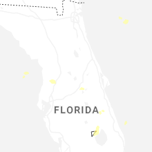
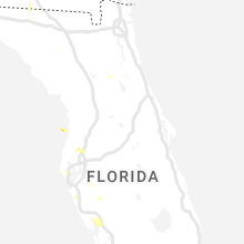
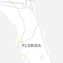
Hail Maps for Spring Hill, FL


Connect with Interactive Hail Maps