

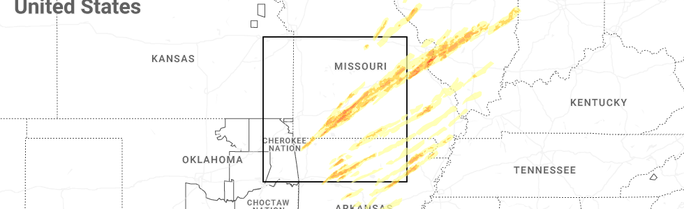
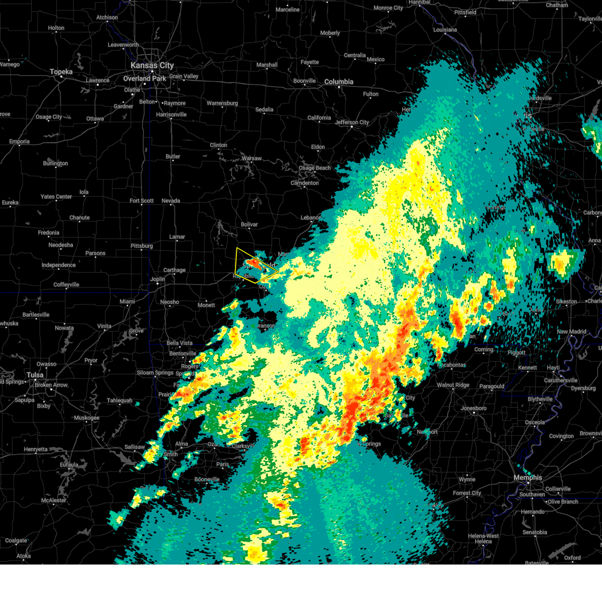
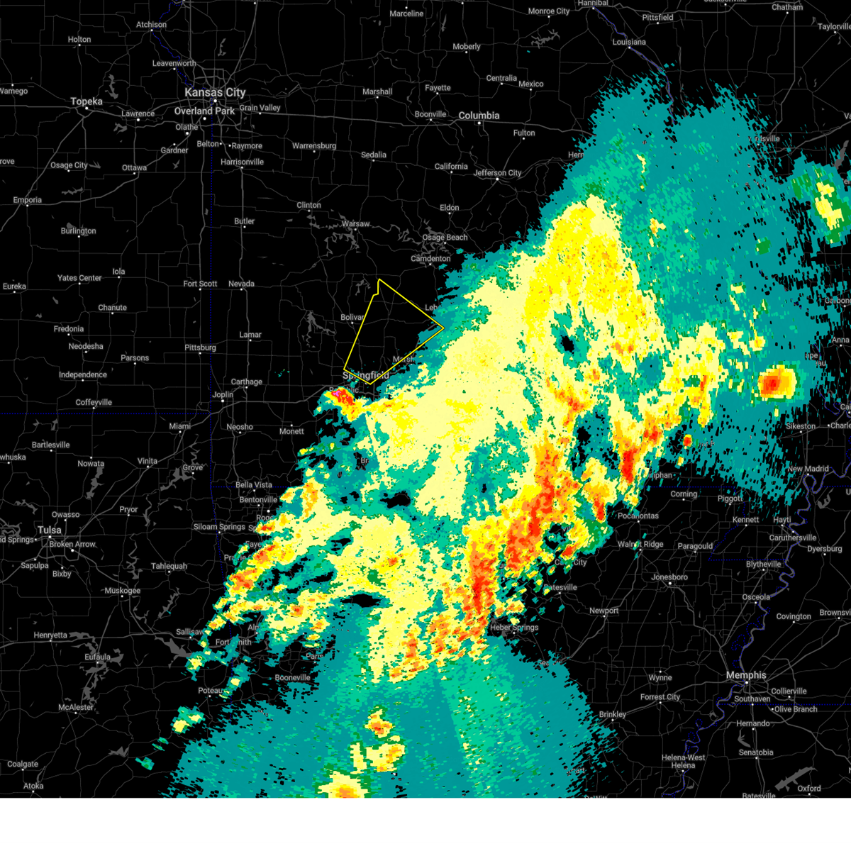
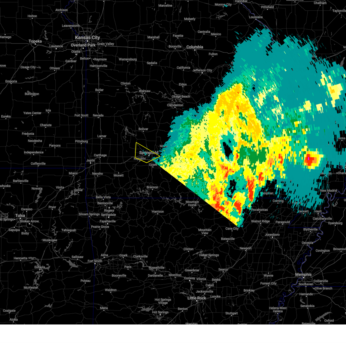
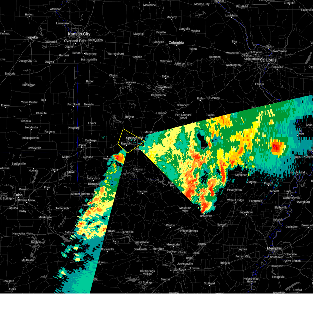
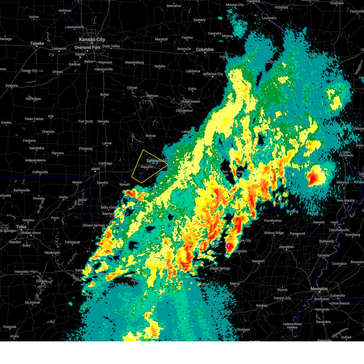
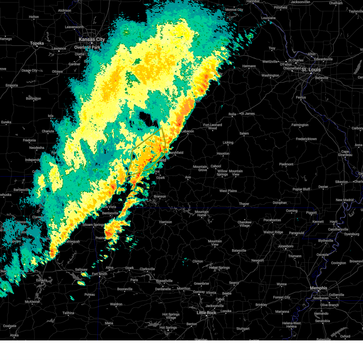
Hail Map for Springfield, MO
The Springfield, MO area has had 86 reports of on-the-ground hail by trained spotters, and has been under severe weather warnings 69 times during the past 12 months. Doppler radar has detected hail at or near Springfield, MO on 134 occasions, including 9 occasions during the past year.
| Name: | Springfield, MO |
| Where Located: | 2.1 miles S of Springfield, MO |
| Map: | Google Map for Springfield, MO |
| Population: | 159498 |
| Housing Units: | 77620 |
| More Info: | Search Google for Springfield, MO |
3
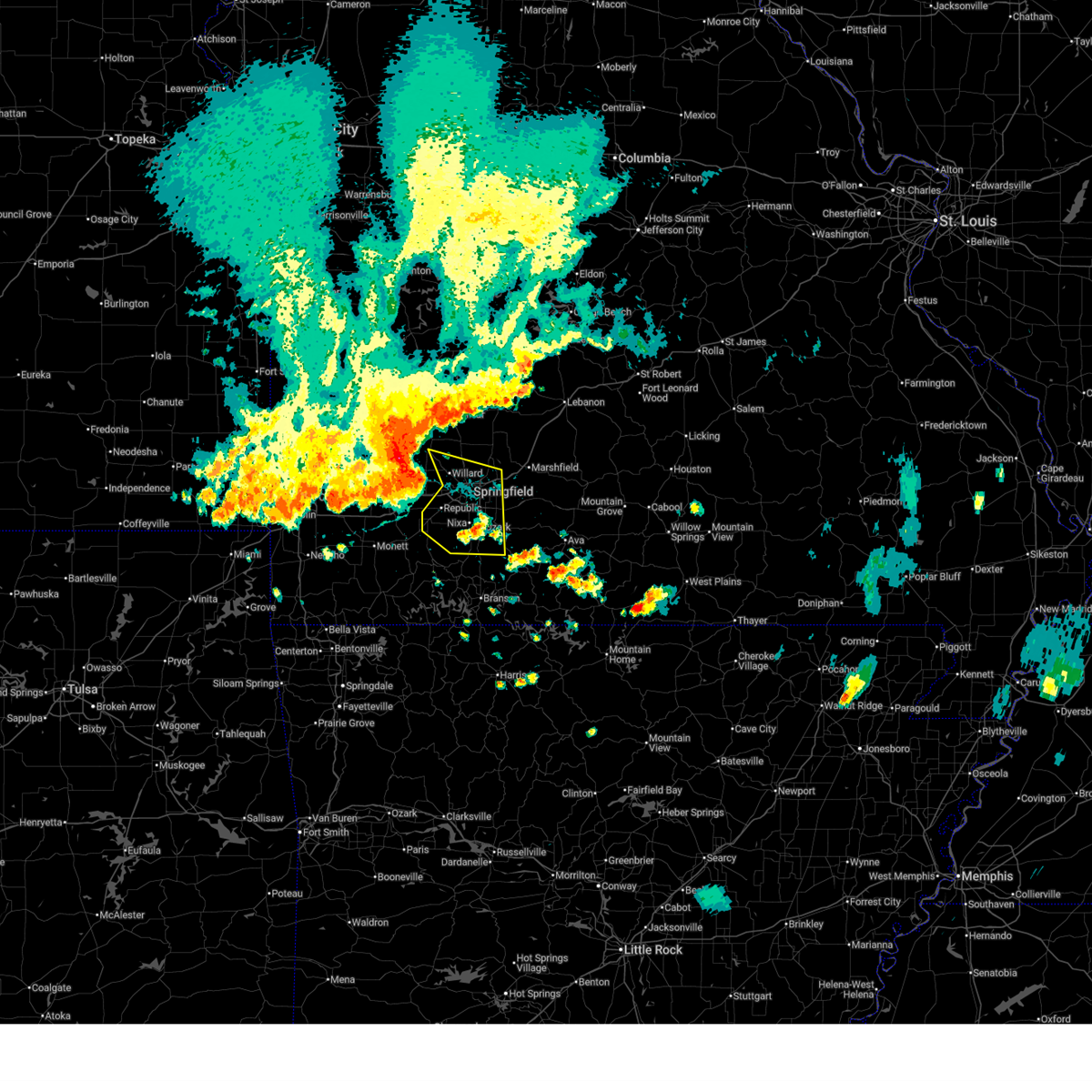
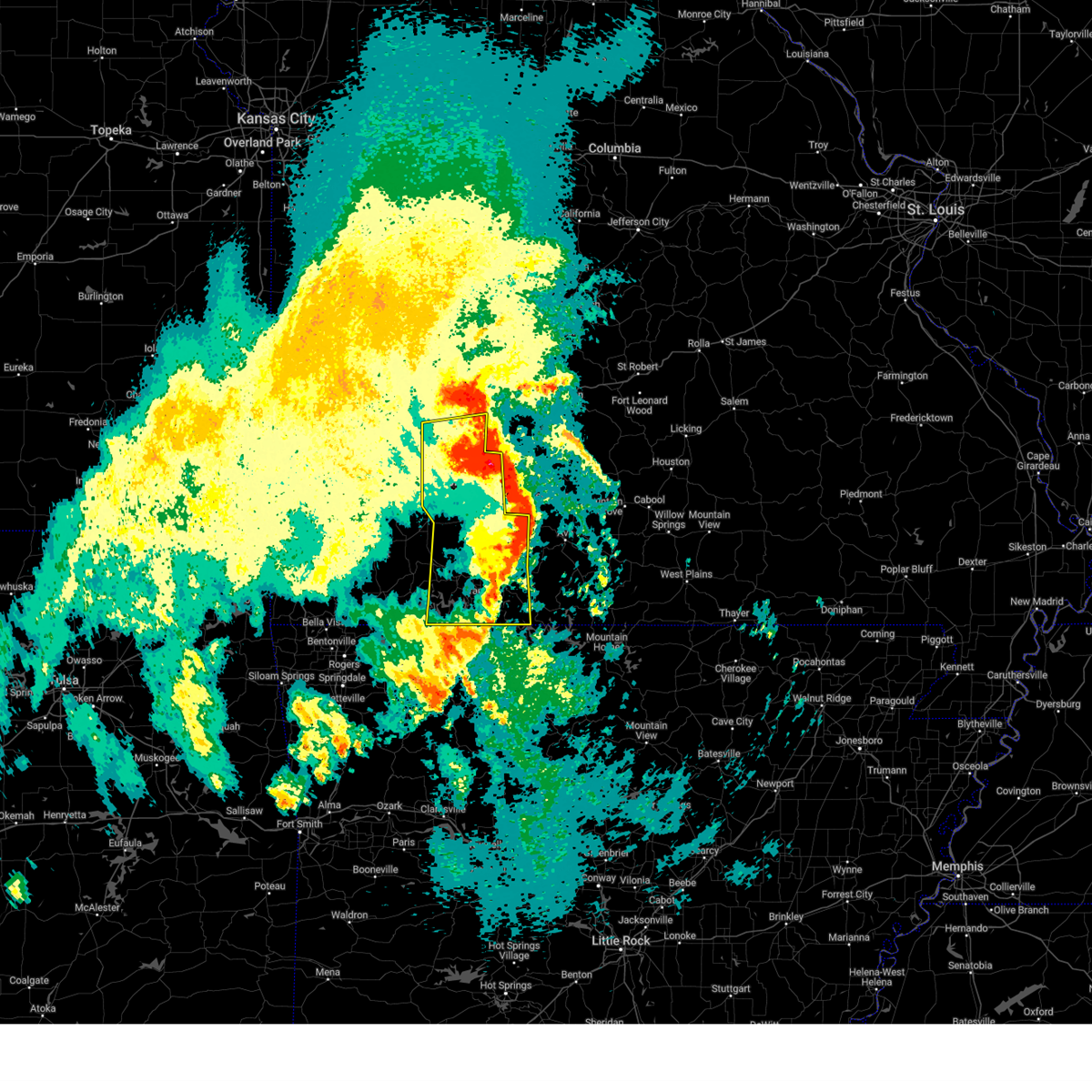
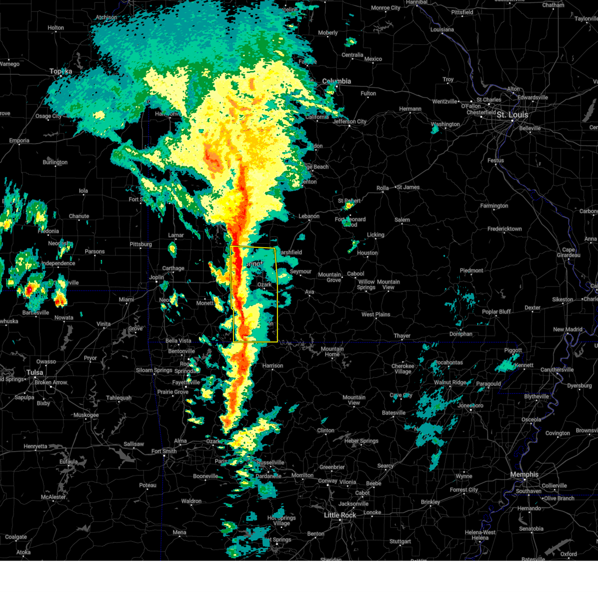
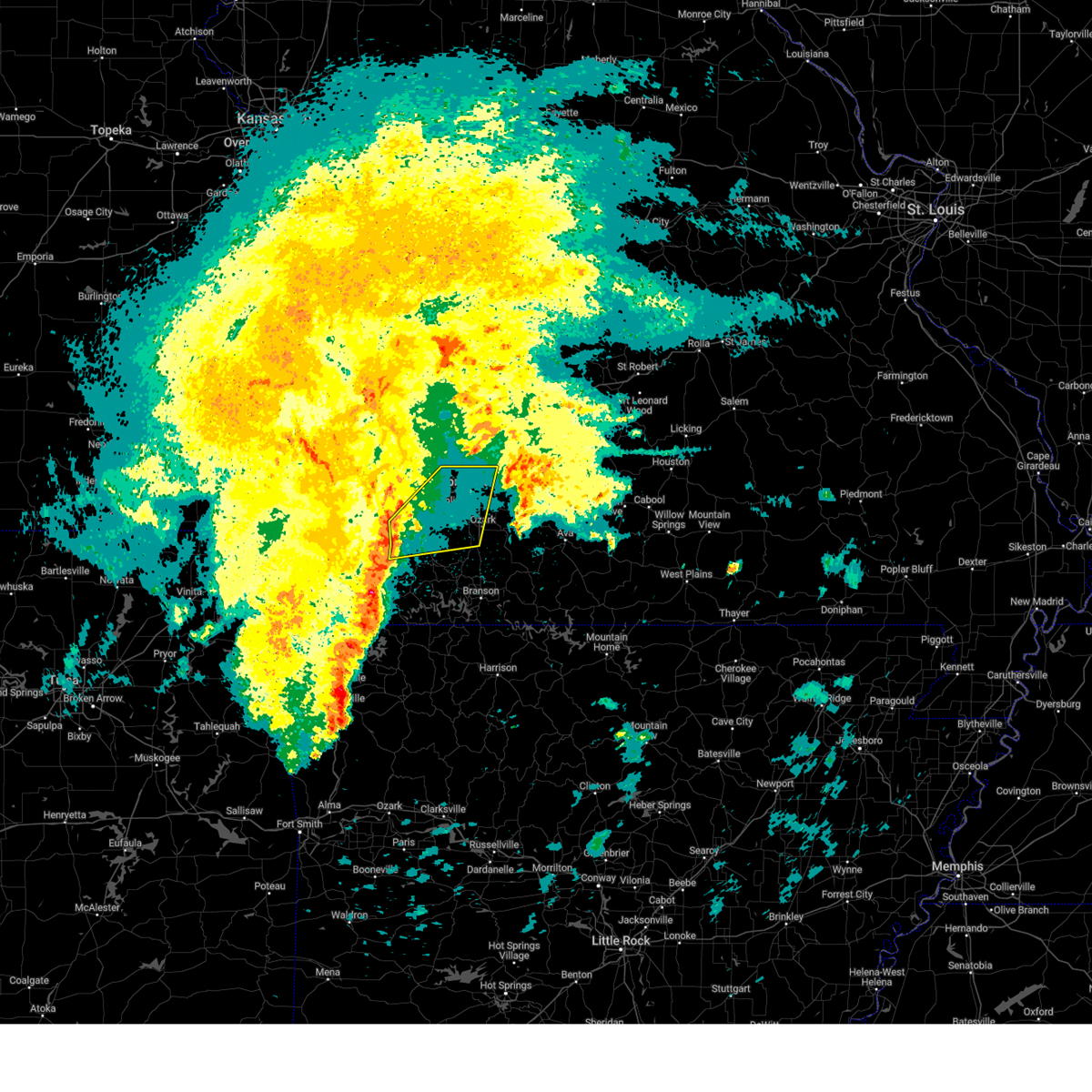
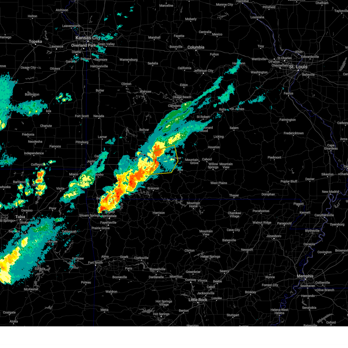
The Top Recent Hail Date for Springfield, MO is Friday, March 14, 2025 (9th out of 134)
Hail and Wind Damage Spotted near Springfield, MO
| Date / Time | Report Details |
|---|---|
| 6/29/2025 5:00 PM CDT | Some trees down and partial road blockag in greene county MO, 3.3 miles WNW of Springfield, MO |
| 6/29/2025 5:00 PM CDT | Trees down at golf cours in greene county MO, 6.5 miles NW of Springfield, MO |
| 6/29/2025 4:58 PM CDT | Large tree uprooted and large branches fell on house. via social media. time based on radar estimat in greene county MO, 1 miles SE of Springfield, MO |
| 6/29/2025 4:56 PM CDT | Large tree blocking road. time based on rada in greene county MO, 1.4 miles NNW of Springfield, MO |
| 6/29/2025 4:55 PM CDT | Power lines are down across the road... and a tree down. time based on radar estimat in greene county MO, 2.2 miles WNW of Springfield, MO |
| 6/29/2025 4:55 PM CDT | 6 inch tree limbs down. time based on radar estimat in greene county MO, 1.7 miles WNW of Springfield, MO |
| 6/29/2025 4:55 PM CDT | 1 mile south of cox south hospital has a significant sized tree limb on layfayette cour in greene county MO, 3.6 miles NNW of Springfield, MO |
| 6/29/2025 4:54 PM CDT | Trees dow in greene county MO, 2.3 miles E of Springfield, MO |
| 6/29/2025 4:54 PM CDT | Tree blocking part of road on s sunrise in a couple of locations... traffic lights out in several locations along kansas expressway. power lines down on scenic... acros in greene county MO, 4 miles NE of Springfield, MO |
| 6/29/2025 4:54 PM CDT | Trees down on power lines. time based on radar estimat in greene county MO, 2.7 miles WNW of Springfield, MO |
| 6/29/2025 4:54 PM CDT | 12 inch limbs dow in greene county MO, 4.5 miles NNE of Springfield, MO |
| 6/29/2025 4:54 PM CDT | Large tree down on road blocking traffi in greene county MO, 2.8 miles N of Springfield, MO |
| 6/29/2025 4:53 PM CDT | Branches blown off... roof damage. time based on rada in greene county MO, 2.8 miles NNE of Springfield, MO |
| 6/29/2025 4:53 PM CDT | Large tree broke near the base. older tree. time based on radar. shingles blown off of pawn shop off battlefield and kansa in greene county MO, 2.2 miles NE of Springfield, MO |
| 6/29/2025 4:48 PM CDT | 10 inch limb on house. across the street there are two uprooted trees on pickup and garag in greene county MO, 4.4 miles NE of Springfield, MO |
| 6/29/2025 4:45 PM CDT | Mocomagnet (university of missouri ag network) station near james river and interstate 4 in greene county MO, 7.9 miles E of Springfield, MO |
| 6/29/2025 4:45 PM CDT | Tree branch fell on fence cause damag in greene county MO, 2.7 miles ESE of Springfield, MO |
| 6/29/2025 4:45 PM CDT | Large branch on hous in greene county MO, 0.7 miles E of Springfield, MO |
| 6/29/2025 4:42 PM CDT | Whole intersection is blocked by a large tree in the roa in greene county MO, 3.5 miles NE of Springfield, MO |
| 6/29/2025 4:42 PM CDT | Branches and power lines down. time based on rada in greene county MO, 2.7 miles ESE of Springfield, MO |
| 6/29/2025 4:42 PM CDT | 2 power poles snapped... and partially leaning into the roa in greene county MO, 3.6 miles NE of Springfield, MO |
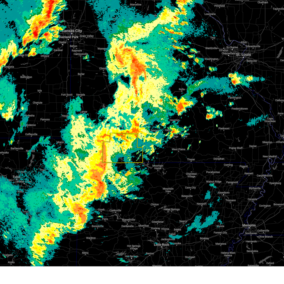
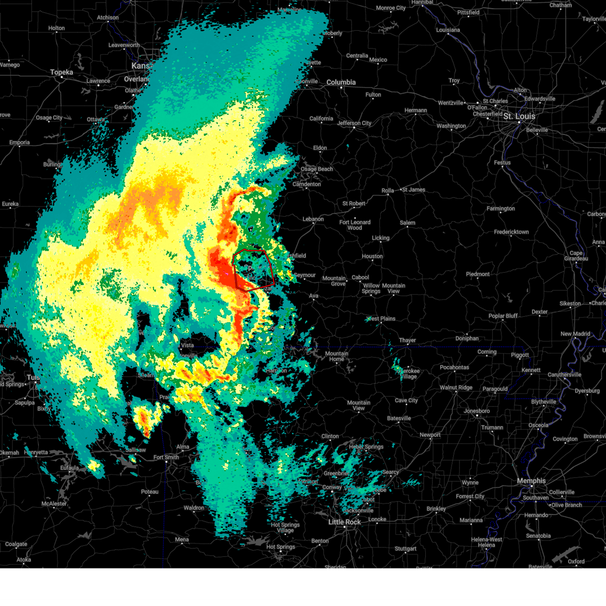
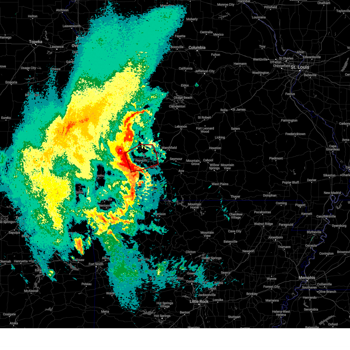
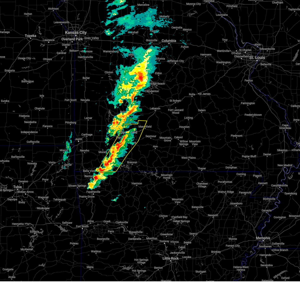
| 6/29/2025 4:41 PM CDT | At 439 pm cdt, severe thunderstorms were located along a line extending from near ash grove to republic to near marionville, moving southeast at 40 mph. these are destructive storms for green, northeast stone, and christian counties (law enforcement). Hazards include 80 mph wind gusts. Flying debris will be dangerous to those caught without shelter. mobile homes will be heavily damaged. expect considerable damage to roofs, windows, and vehicles. extensive tree damage and power outages are likely. locations impacted include, springfield, nixa, ozark, republic, battlefield, willard, strafford, clever, sparta, billings, highlandville, fremont hills, walnut grove, brookline, hurley, glidewell, turners, cave springs, linden, and sacville. This includes interstate 44 between mile markers 64 and 90. |
| 6/29/2025 4:36 PM CDT | Storm damage reported in greene county MO, 6.6 miles SE of Springfield, MO |
| 6/29/2025 4:36 PM CDT | Up to 16 inch diameter trees down mm 68 1/2 on i4 in greene county MO, 9 miles E of Springfield, MO |
| 6/29/2025 4:25 PM CDT |
 Svrsgf the national weather service in springfield has issued a * severe thunderstorm warning for, christian county in southwestern missouri, northeastern stone county in southwestern missouri, greene county in southwestern missouri, * until 515 pm cdt. * at 424 pm cdt, severe thunderstorms were located along a line extending from near everton to 7 miles south of ash grove to mount vernon, moving southeast at 40 mph. these are destructive storms for 80 mph winds (law enforcement reports trees are down across highway 160 along the greene and dade county border). Hazards include 80 mph wind gusts. Flying debris will be dangerous to those caught without shelter. mobile homes will be heavily damaged. expect considerable damage to roofs, windows, and vehicles. Extensive tree damage and power outages are likely. Svrsgf the national weather service in springfield has issued a * severe thunderstorm warning for, christian county in southwestern missouri, northeastern stone county in southwestern missouri, greene county in southwestern missouri, * until 515 pm cdt. * at 424 pm cdt, severe thunderstorms were located along a line extending from near everton to 7 miles south of ash grove to mount vernon, moving southeast at 40 mph. these are destructive storms for 80 mph winds (law enforcement reports trees are down across highway 160 along the greene and dade county border). Hazards include 80 mph wind gusts. Flying debris will be dangerous to those caught without shelter. mobile homes will be heavily damaged. expect considerable damage to roofs, windows, and vehicles. Extensive tree damage and power outages are likely.
|
| 5/19/2025 8:39 PM CDT | the severe thunderstorm warning has been cancelled and is no longer in effect |
| 5/19/2025 8:39 PM CDT | At 839 pm cdt, severe thunderstorms were located along a line extending from near rogersville to 9 miles southeast of forsyth, moving east at 65 mph (radar indicated). Hazards include 60 mph wind gusts. Expect damage to roofs, siding, and trees. Locations impacted include, nixa, ozark, branson, lake taneycomo, bull shoals lake, table rock lake, table rock state park, shepherd of the hills state park, hollister, forsyth, merriam woods, sparta, kissee mills, highlandville, rockaway beach, fremont hills, bull creek, taneyville, table rock, and kirbyville. |
| 5/19/2025 8:27 PM CDT | At 826 pm cdt, severe thunderstorms were located along a line extending from battlefield to near indian point, moving east at 45 mph (radar indicated). Hazards include 60 mph wind gusts. Expect damage to roofs, siding, and trees. Locations impacted include, nixa, ozark, branson, lake taneycomo, table rock lake, bull shoals lake, table rock state park, shepherd of the hills state park, hollister, silver dollar city, kimberling city, forsyth, clever, merriam woods, sparta, kissee mills, billings, reeds spring, highlandville, and rockaway beach. |
| 5/19/2025 8:27 PM CDT | the severe thunderstorm warning has been cancelled and is no longer in effect |
| 5/19/2025 8:07 PM CDT |
 Svrsgf the national weather service in springfield has issued a * severe thunderstorm warning for, taney county in southwestern missouri, christian county in southwestern missouri, stone county in southwestern missouri, eastern barry county in southwestern missouri, * until 900 pm cdt. * at 806 pm cdt, severe thunderstorms were located along a line extending from near marionville to near grandview, moving east at 45 mph (radar indicated). Hazards include 60 mph wind gusts. expect damage to roofs, siding, and trees Svrsgf the national weather service in springfield has issued a * severe thunderstorm warning for, taney county in southwestern missouri, christian county in southwestern missouri, stone county in southwestern missouri, eastern barry county in southwestern missouri, * until 900 pm cdt. * at 806 pm cdt, severe thunderstorms were located along a line extending from near marionville to near grandview, moving east at 45 mph (radar indicated). Hazards include 60 mph wind gusts. expect damage to roofs, siding, and trees
|
| 5/19/2025 7:18 PM CDT | At 717 pm cdt, severe thunderstorms were located along a line extending from near fair grove to near rogersville, moving east at 45 mph (radar indicated). Hazards include 60 mph wind gusts. Expect damage to roofs, siding, and trees. locations impacted include, springfield, strafford, fair grove, ebenezer, bassville, turners, and galloway. This includes interstate 44 between mile markers 76 and 90. |
| 5/19/2025 7:18 PM CDT | the severe thunderstorm warning has been cancelled and is no longer in effect |
| 5/19/2025 6:51 PM CDT | At 650 pm cdt, severe thunderstorms were located along a line extending from near walnut grove to republic, moving east at 40 mph (radar indicated). Hazards include 70 mph wind gusts. Expect considerable tree damage. damage is likely to mobile homes, roofs, and outbuildings. locations impacted include, springfield, republic, bolivar, stockton lake, battlefield, willard, strafford, ash grove, fair grove, walnut grove, pleasant hope, fair play, morrisville, brookline, aldrich, glidewell, turners, bois d'arc, cave springs, and eudora. This includes interstate 44 between mile markers 59 and 90. |
| 5/19/2025 6:40 PM CDT | Svrsgf the national weather service in springfield has issued a * severe thunderstorm warning for, southwestern polk county in southwestern missouri, greene county in southwestern missouri, * until 730 pm cdt. * at 640 pm cdt, severe thunderstorms were located along a line extending from near walnut grove to near billings, moving northeast at 65 mph (radar indicated). Hazards include 60 mph wind gusts. expect damage to roofs, siding, and trees |
| 5/19/2025 6:14 PM CDT | Svrsgf the national weather service in springfield has issued a * severe thunderstorm warning for, taney county in southwestern missouri, christian county in southwestern missouri, stone county in southwestern missouri, barry county in southwestern missouri, * until 715 pm cdt. * at 613 pm cdt, severe thunderstorms were located along a line extending from pierce city to near elkins, moving east at 65 mph (radar indicated). Hazards include 60 mph wind gusts and quarter size hail. Hail damage to vehicles is expected. Expect wind damage to roofs, siding, and trees. |
| 5/16/2025 12:11 PM CDT |
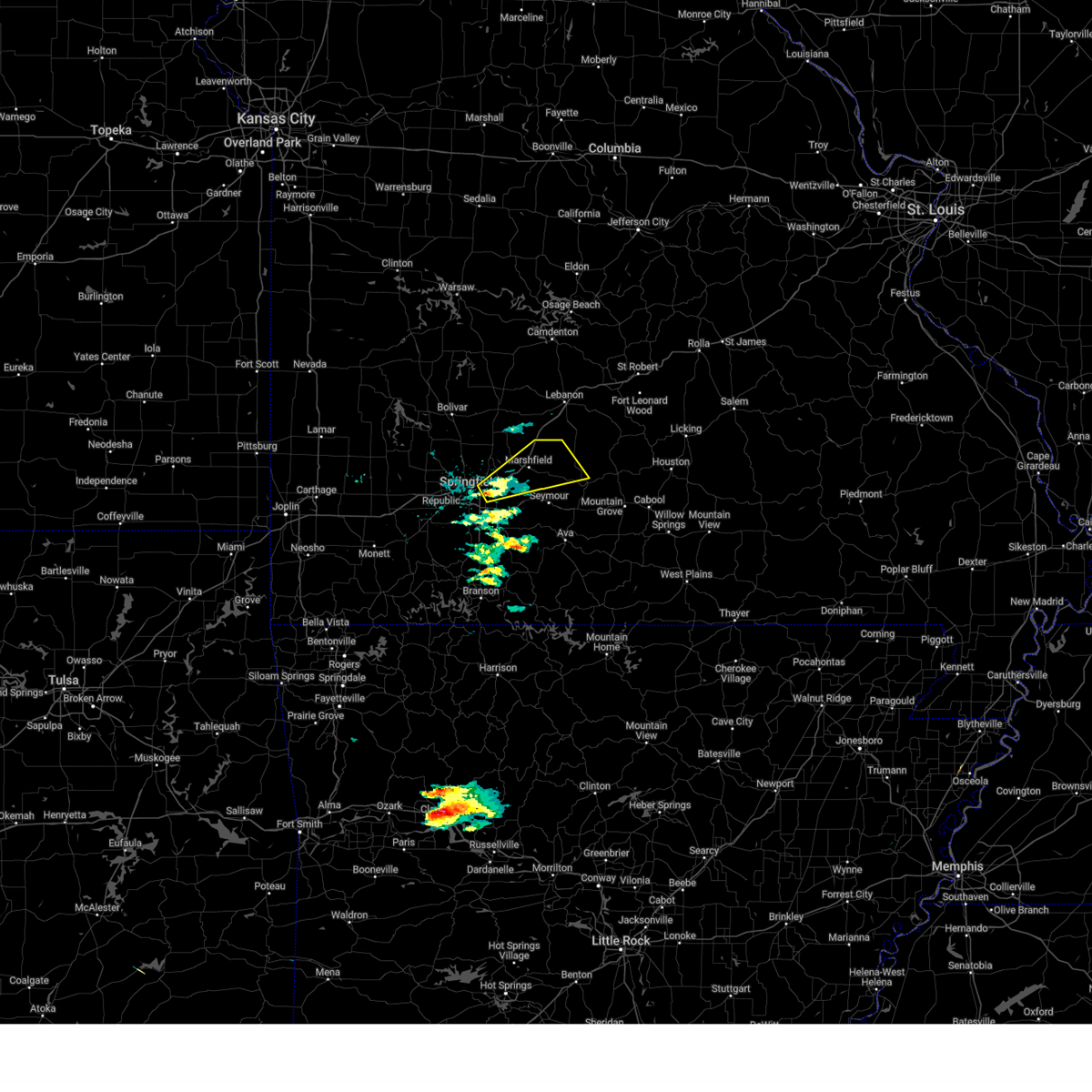 Svrsgf the national weather service in springfield has issued a * severe thunderstorm warning for, central webster county in southwestern missouri, northwestern wright county in southwestern missouri, southeastern greene county in southwestern missouri, * until 100 pm cdt. * at 1211 pm cdt, a severe thunderstorm was located near strafford, moving northeast at 45 mph (radar indicated). Hazards include 60 mph wind gusts and half dollar size hail. Hail damage to vehicles is expected. Expect wind damage to roofs, siding, and trees. Svrsgf the national weather service in springfield has issued a * severe thunderstorm warning for, central webster county in southwestern missouri, northwestern wright county in southwestern missouri, southeastern greene county in southwestern missouri, * until 100 pm cdt. * at 1211 pm cdt, a severe thunderstorm was located near strafford, moving northeast at 45 mph (radar indicated). Hazards include 60 mph wind gusts and half dollar size hail. Hail damage to vehicles is expected. Expect wind damage to roofs, siding, and trees.
|
| 4/29/2025 10:05 AM CDT |
 The storms which prompted the warning have moved out of the area. therefore, the warning will be allowed to expire. a severe thunderstorm watch remains in effect until 300 pm cdt for southwestern missouri. The storms which prompted the warning have moved out of the area. therefore, the warning will be allowed to expire. a severe thunderstorm watch remains in effect until 300 pm cdt for southwestern missouri.
|
| 4/29/2025 9:55 AM CDT | Tree over powerline in greene county MO, 0.8 miles SSW of Springfield, MO |
| 4/29/2025 9:51 AM CDT |
 At 951 am cdt, a confirmed tornado was located over fair grove, or near strafford, moving east at 50 mph (weather spotters confirmed tornado). Hazards include damaging tornado. Flying debris will be dangerous to those caught without shelter. mobile homes will be damaged or destroyed. damage to roofs, windows, and vehicles will occur. tree damage is likely. locations impacted include, elkland, strafford, bassville, fordland, niangua, marshfield, diggins, rogersville, fair grove, seymour, and northview. This includes interstate 44 between mile markers 84 and 109. At 951 am cdt, a confirmed tornado was located over fair grove, or near strafford, moving east at 50 mph (weather spotters confirmed tornado). Hazards include damaging tornado. Flying debris will be dangerous to those caught without shelter. mobile homes will be damaged or destroyed. damage to roofs, windows, and vehicles will occur. tree damage is likely. locations impacted include, elkland, strafford, bassville, fordland, niangua, marshfield, diggins, rogersville, fair grove, seymour, and northview. This includes interstate 44 between mile markers 84 and 109.
|
| 4/29/2025 9:51 AM CDT |
 the tornado warning has been cancelled and is no longer in effect the tornado warning has been cancelled and is no longer in effect
|
| 4/29/2025 9:40 AM CDT |
 Svrsgf the national weather service in springfield has issued a * severe thunderstorm warning for, webster county in southwestern missouri, southern dallas county in southwestern missouri, wright county in southwestern missouri, western douglas county in southwestern missouri, eastern christian county in southwestern missouri, southeastern polk county in southwestern missouri, laclede county in southwestern missouri, eastern greene county in southwestern missouri, * until 1045 am cdt. * at 940 am cdt, severe thunderstorms were located along a line extending from near morrisville to near strafford to near rogersville to near hollister, moving east at 55 mph. these are destructive storms for strafford and marshfield (emergency management). Hazards include 80 mph wind gusts and quarter size hail. Flying debris will be dangerous to those caught without shelter. mobile homes will be heavily damaged. expect considerable damage to roofs, windows, and vehicles. Extensive tree damage and power outages are likely. Svrsgf the national weather service in springfield has issued a * severe thunderstorm warning for, webster county in southwestern missouri, southern dallas county in southwestern missouri, wright county in southwestern missouri, western douglas county in southwestern missouri, eastern christian county in southwestern missouri, southeastern polk county in southwestern missouri, laclede county in southwestern missouri, eastern greene county in southwestern missouri, * until 1045 am cdt. * at 940 am cdt, severe thunderstorms were located along a line extending from near morrisville to near strafford to near rogersville to near hollister, moving east at 55 mph. these are destructive storms for strafford and marshfield (emergency management). Hazards include 80 mph wind gusts and quarter size hail. Flying debris will be dangerous to those caught without shelter. mobile homes will be heavily damaged. expect considerable damage to roofs, windows, and vehicles. Extensive tree damage and power outages are likely.
|
| 4/29/2025 9:36 AM CDT | 2-3 trees have feel over broadway... half the road is blocked. about 4 ft in diameter. time based on rada in greene county MO, 4.9 miles S of Springfield, MO |
| 4/29/2025 9:35 AM CDT | Branches up to 4 in down... and a large tree 5ft in diameter... in springfield. tree was split in half... and shingles blown off of roofs in the area. time based on rad in greene county MO, 2.8 miles S of Springfield, MO |
| 4/29/2025 9:34 AM CDT | Storm damage reported in greene county MO, 6.6 miles SE of Springfield, MO |
| 4/29/2025 9:34 AM CDT | Corrects previous tstm wnd dmg report from 3 wsw springfield. spotter report of a house tree over the house i previously reported on came down on house and collapsed pa in greene county MO, 1.9 miles ENE of Springfield, MO |
| 4/29/2025 9:33 AM CDT | Spotter reported semi truck laid over on the west bound lane of i-44 at the bridge at the 75.0 mile marker. time based on radar estimat in greene county MO, 5.6 miles SSE of Springfield, MO |
| 4/29/2025 9:33 AM CDT | Trees down at drury university. time based on radar estimat in greene county MO, 2.8 miles S of Springfield, MO |
| 4/29/2025 9:32 AM CDT | Large tree down covering roa in greene county MO, 5.5 miles S of Springfield, MO |
| 4/29/2025 9:32 AM CDT | Storm damage reported in greene county MO, 6.1 miles SE of Springfield, MO |
| 4/29/2025 9:32 AM CDT | Large tree dow in greene county MO, 4.9 miles S of Springfield, MO |
| 4/29/2025 9:32 AM CDT | Large tree down (rogers and pacific in greene county MO, 3.8 miles SSW of Springfield, MO |
| 4/29/2025 9:32 AM CDT | Multiple trees down. uprooted. multiple trees snapped. power line down... power poles snapped. structural and roof damage. time based on rada in greene county MO, 6 miles SSE of Springfield, MO |
| 4/29/2025 9:32 AM CDT | Multiple tree branches down with hole in roo in greene county MO, 2.9 miles NW of Springfield, MO |
| 4/29/2025 9:31 AM CDT | 2700 block of north glenstone... several utility poles and lines down across the road on the east side outer road near the steak and shake. time based on rada in greene county MO, 5.3 miles SSW of Springfield, MO |
| 4/29/2025 9:31 AM CDT | Fort and harrison tree down across the power lines. lots of tree damage at mt vernon and fort in springfield. time based on radar estimate in greene county MO, 1.5 miles SSE of Springfield, MO |
| 4/29/2025 9:30 AM CDT | 3ft diameter trees blown into parking lots. time based on radar estimat in greene county MO, 2.2 miles SSE of Springfield, MO |
| 4/29/2025 9:30 AM CDT | Roof damage on east divison about 300 to 400 yrds west from the airport... and kolor 10s studio. time based on rada in greene county MO, 3.5 miles SW of Springfield, MO |
| 4/29/2025 9:30 AM CDT | Large tree branches down and power line in greene county MO, 4.1 miles SSW of Springfield, MO |
| 4/29/2025 9:30 AM CDT | 5ft diameter tree fallen across road (kansas and i-44 in greene county MO, 4.9 miles S of Springfield, MO |
| 4/29/2025 9:30 AM CDT | Storm damage reported in greene county MO, 6.6 miles SE of Springfield, MO |
| 4/29/2025 9:30 AM CDT | Several tree limbs downed in north springfiel in greene county MO, 3.9 miles SSE of Springfield, MO |
| 4/29/2025 9:30 AM CDT | Spotter reported tree over power lines at portland and robberson in springfiel in greene county MO, 0.8 miles SSW of Springfield, MO |
| 4/29/2025 9:30 AM CDT | Structural damage roof hwy ab and e in greene county MO, 8.4 miles ESE of Springfield, MO |
| 4/29/2025 9:29 AM CDT |
 Torsgf the national weather service in springfield has issued a * tornado warning for, webster county in southwestern missouri, north central christian county in southwestern missouri, greene county in southwestern missouri, * until 1015 am cdt. * at 929 am cdt, a severe thunderstorm capable of producing a tornado was located near willard, or 8 miles north of republic, moving east at 55 mph (radar indicated rotation). Hazards include tornado. Flying debris will be dangerous to those caught without shelter. mobile homes will be damaged or destroyed. damage to roofs, windows, and vehicles will occur. Tree damage is likely. Torsgf the national weather service in springfield has issued a * tornado warning for, webster county in southwestern missouri, north central christian county in southwestern missouri, greene county in southwestern missouri, * until 1015 am cdt. * at 929 am cdt, a severe thunderstorm capable of producing a tornado was located near willard, or 8 miles north of republic, moving east at 55 mph (radar indicated rotation). Hazards include tornado. Flying debris will be dangerous to those caught without shelter. mobile homes will be damaged or destroyed. damage to roofs, windows, and vehicles will occur. Tree damage is likely.
|
| 4/29/2025 9:28 AM CDT | Storm damage reported in greene county MO, 5.7 miles SE of Springfield, MO |
| 4/29/2025 9:27 AM CDT |
 At 926 am cdt, severe thunderstorms capable of producing tornadoes were located along a line extending from ash grove to near willard to republic, moving east at 55 mph (radar indicated rotation). Hazards include tornado. Flying debris will be dangerous to those caught without shelter. mobile homes will be damaged or destroyed. damage to roofs, windows, and vehicles will occur. tree damage is likely. locations impacted include, sacville, glidewell, ash grove, ebenezer, turners, bois d'arc, willard, republic, brookline, cave springs, billings, springfield, galloway, battlefield, clever, and nixa. This includes interstate 44 between mile markers 60 and 84. At 926 am cdt, severe thunderstorms capable of producing tornadoes were located along a line extending from ash grove to near willard to republic, moving east at 55 mph (radar indicated rotation). Hazards include tornado. Flying debris will be dangerous to those caught without shelter. mobile homes will be damaged or destroyed. damage to roofs, windows, and vehicles will occur. tree damage is likely. locations impacted include, sacville, glidewell, ash grove, ebenezer, turners, bois d'arc, willard, republic, brookline, cave springs, billings, springfield, galloway, battlefield, clever, and nixa. This includes interstate 44 between mile markers 60 and 84.
|
| 4/29/2025 9:27 AM CDT |
 the tornado warning has been cancelled and is no longer in effect the tornado warning has been cancelled and is no longer in effect
|
| 4/29/2025 9:21 AM CDT | Photos sent via facebook messenger of small outbuilding blown down... section of chain link fence blown ove in greene county MO, 10.6 miles E of Springfield, MO |
| 4/29/2025 9:13 AM CDT |
 Torsgf the national weather service in springfield has issued a * tornado warning for, northwestern christian county in southwestern missouri, eastern lawrence county in southwestern missouri, greene county in southwestern missouri, southeastern dade county in southwestern missouri, * until 945 am cdt. * at 913 am cdt, severe thunderstorms capable of producing a tornado were located along a line extending from near miller to 6 miles northeast of mount vernon to near marionville, moving east at 55 mph (radar indicated rotation). Hazards include tornado. Flying debris will be dangerous to those caught without shelter. mobile homes will be damaged or destroyed. damage to roofs, windows, and vehicles will occur. Tree damage is likely. Torsgf the national weather service in springfield has issued a * tornado warning for, northwestern christian county in southwestern missouri, eastern lawrence county in southwestern missouri, greene county in southwestern missouri, southeastern dade county in southwestern missouri, * until 945 am cdt. * at 913 am cdt, severe thunderstorms capable of producing a tornado were located along a line extending from near miller to 6 miles northeast of mount vernon to near marionville, moving east at 55 mph (radar indicated rotation). Hazards include tornado. Flying debris will be dangerous to those caught without shelter. mobile homes will be damaged or destroyed. damage to roofs, windows, and vehicles will occur. Tree damage is likely.
|
| 4/29/2025 9:09 AM CDT |
 Svrsgf the national weather service in springfield has issued a * severe thunderstorm warning for, taney county in southwestern missouri, christian county in southwestern missouri, southern polk county in southwestern missouri, stone county in southwestern missouri, greene county in southwestern missouri, * until 1015 am cdt. * at 909 am cdt, severe thunderstorms were located along a line extending from near lockwood to near mount vernon to marionville to near beaver, moving east at 55 mph (radar indicated). Hazards include 70 mph wind gusts and half dollar size hail. Hail damage to vehicles is expected. expect considerable tree damage. Wind damage is also likely to mobile homes, roofs, and outbuildings. Svrsgf the national weather service in springfield has issued a * severe thunderstorm warning for, taney county in southwestern missouri, christian county in southwestern missouri, southern polk county in southwestern missouri, stone county in southwestern missouri, greene county in southwestern missouri, * until 1015 am cdt. * at 909 am cdt, severe thunderstorms were located along a line extending from near lockwood to near mount vernon to marionville to near beaver, moving east at 55 mph (radar indicated). Hazards include 70 mph wind gusts and half dollar size hail. Hail damage to vehicles is expected. expect considerable tree damage. Wind damage is also likely to mobile homes, roofs, and outbuildings.
|
| 4/20/2025 4:09 PM CDT |
 Svrsgf the national weather service in springfield has issued a * severe thunderstorm warning for, western ozark county in southwestern missouri, webster county in southwestern missouri, wright county in southwestern missouri, western douglas county in southwestern missouri, taney county in southwestern missouri, eastern christian county in southwestern missouri, eastern greene county in southwestern missouri, * until 515 pm cdt. * at 409 pm cdt, severe thunderstorms were located along a line extending from near pleasant hope to near highlandville to near carrollton, moving northeast at 55 mph (radar indicated). Hazards include 60 mph wind gusts and quarter size hail. Hail damage to vehicles is expected. Expect wind damage to roofs, siding, and trees. Svrsgf the national weather service in springfield has issued a * severe thunderstorm warning for, western ozark county in southwestern missouri, webster county in southwestern missouri, wright county in southwestern missouri, western douglas county in southwestern missouri, taney county in southwestern missouri, eastern christian county in southwestern missouri, eastern greene county in southwestern missouri, * until 515 pm cdt. * at 409 pm cdt, severe thunderstorms were located along a line extending from near pleasant hope to near highlandville to near carrollton, moving northeast at 55 mph (radar indicated). Hazards include 60 mph wind gusts and quarter size hail. Hail damage to vehicles is expected. Expect wind damage to roofs, siding, and trees.
|
| 4/20/2025 3:59 PM CDT |
 At 358 pm cdt, severe thunderstorms were located along a line extending from morrisville to battlefield to near roberson hollow, moving northeast at 60 mph (springfield airport (sgf) asos reported a 59 mph wind gust at 353 pm cdt). Hazards include 70 mph wind gusts and quarter size hail. Hail damage to vehicles is expected. expect considerable tree damage. wind damage is also likely to mobile homes, roofs, and outbuildings. locations impacted include, glidewell, turners, fair grove, chestnutridge, silver dollar city, crane, spokane, rockaway beach, kirbyville, cave springs, billings, chadwick, hurley, blue eye, nixa, sparta, ebenezer, strafford, table rock, and selmore. This includes interstate 44 between mile markers 59 and 90. At 358 pm cdt, severe thunderstorms were located along a line extending from morrisville to battlefield to near roberson hollow, moving northeast at 60 mph (springfield airport (sgf) asos reported a 59 mph wind gust at 353 pm cdt). Hazards include 70 mph wind gusts and quarter size hail. Hail damage to vehicles is expected. expect considerable tree damage. wind damage is also likely to mobile homes, roofs, and outbuildings. locations impacted include, glidewell, turners, fair grove, chestnutridge, silver dollar city, crane, spokane, rockaway beach, kirbyville, cave springs, billings, chadwick, hurley, blue eye, nixa, sparta, ebenezer, strafford, table rock, and selmore. This includes interstate 44 between mile markers 59 and 90.
|
| 4/20/2025 3:52 PM CDT | Asos station ksgf springfield asos measured 59mph wind gus in greene county MO, 5.7 miles SE of Springfield, MO |
| 4/20/2025 3:47 PM CDT |
 the severe thunderstorm warning has been cancelled and is no longer in effect the severe thunderstorm warning has been cancelled and is no longer in effect
|
| 4/20/2025 3:47 PM CDT |
 At 346 pm cdt, severe thunderstorms were located along a line extending from near ash grove to near clever to near green forest, moving northeast at 60 mph (radar indicated). Hazards include 70 mph wind gusts and quarter size hail. Hail damage to vehicles is expected. expect considerable tree damage. wind damage is also likely to mobile homes, roofs, and outbuildings. locations impacted include, glidewell, turners, fair grove, chestnutridge, silver dollar city, crane, spokane, rockaway beach, kirbyville, cave springs, billings, chadwick, hurley, blue eye, nixa, sparta, ebenezer, strafford, table rock, and selmore. This includes interstate 44 between mile markers 59 and 90. At 346 pm cdt, severe thunderstorms were located along a line extending from near ash grove to near clever to near green forest, moving northeast at 60 mph (radar indicated). Hazards include 70 mph wind gusts and quarter size hail. Hail damage to vehicles is expected. expect considerable tree damage. wind damage is also likely to mobile homes, roofs, and outbuildings. locations impacted include, glidewell, turners, fair grove, chestnutridge, silver dollar city, crane, spokane, rockaway beach, kirbyville, cave springs, billings, chadwick, hurley, blue eye, nixa, sparta, ebenezer, strafford, table rock, and selmore. This includes interstate 44 between mile markers 59 and 90.
|
| 4/20/2025 3:25 PM CDT |
 Svrsgf the national weather service in springfield has issued a * severe thunderstorm warning for, western taney county in southwestern missouri, christian county in southwestern missouri, stone county in southwestern missouri, eastern barry county in southwestern missouri, eastern lawrence county in southwestern missouri, greene county in southwestern missouri, * until 430 pm cdt. * at 324 pm cdt, severe thunderstorms were located along a line extending from near everton to aurora to near eureka springs, moving northeast at 60 mph (radar indicated). Hazards include 70 mph wind gusts and quarter size hail. Hail damage to vehicles is expected. expect considerable tree damage. Wind damage is also likely to mobile homes, roofs, and outbuildings. Svrsgf the national weather service in springfield has issued a * severe thunderstorm warning for, western taney county in southwestern missouri, christian county in southwestern missouri, stone county in southwestern missouri, eastern barry county in southwestern missouri, eastern lawrence county in southwestern missouri, greene county in southwestern missouri, * until 430 pm cdt. * at 324 pm cdt, severe thunderstorms were located along a line extending from near everton to aurora to near eureka springs, moving northeast at 60 mph (radar indicated). Hazards include 70 mph wind gusts and quarter size hail. Hail damage to vehicles is expected. expect considerable tree damage. Wind damage is also likely to mobile homes, roofs, and outbuildings.
|
| 4/20/2025 4:32 AM CDT |
 Svrsgf the national weather service in springfield has issued a * severe thunderstorm warning for, western webster county in southwestern missouri, dallas county in southwestern missouri, northwestern christian county in southwestern missouri, southeastern polk county in southwestern missouri, greene county in southwestern missouri, * until 530 am cdt. * at 432 am cdt, severe thunderstorms were located along a line extending from near morrisville to near willard to near crane, moving northeast at 40 mph (radar indicated). Hazards include 60 mph wind gusts. expect damage to roofs, siding, and trees Svrsgf the national weather service in springfield has issued a * severe thunderstorm warning for, western webster county in southwestern missouri, dallas county in southwestern missouri, northwestern christian county in southwestern missouri, southeastern polk county in southwestern missouri, greene county in southwestern missouri, * until 530 am cdt. * at 432 am cdt, severe thunderstorms were located along a line extending from near morrisville to near willard to near crane, moving northeast at 40 mph (radar indicated). Hazards include 60 mph wind gusts. expect damage to roofs, siding, and trees
|
| 4/20/2025 4:17 AM CDT |
 the severe thunderstorm warning has been cancelled and is no longer in effect the severe thunderstorm warning has been cancelled and is no longer in effect
|
| 4/20/2025 4:17 AM CDT |
 At 416 am cdt, severe thunderstorms were located along a line extending from 6 miles south of ash grove to near republic to near crane, moving northeast at 40 mph (radar indicated). Hazards include 60 mph wind gusts. Expect damage to roofs, siding, and trees. locations impacted include, glidewell, nixa, fremont hills, highlandville, bois d'arc, selmore, crane, willard, republic, brookline, clever, billings, springfield, hurley, boaz, galloway, ozark, battlefield, ebenezer, and turners. This includes interstate 44 between mile markers 59 and 86. At 416 am cdt, severe thunderstorms were located along a line extending from 6 miles south of ash grove to near republic to near crane, moving northeast at 40 mph (radar indicated). Hazards include 60 mph wind gusts. Expect damage to roofs, siding, and trees. locations impacted include, glidewell, nixa, fremont hills, highlandville, bois d'arc, selmore, crane, willard, republic, brookline, clever, billings, springfield, hurley, boaz, galloway, ozark, battlefield, ebenezer, and turners. This includes interstate 44 between mile markers 59 and 86.
|
| 4/20/2025 3:49 AM CDT |
 Svrsgf the national weather service in springfield has issued a * severe thunderstorm warning for, northwestern christian county in southwestern missouri, northern stone county in southwestern missouri, northeastern barry county in southwestern missouri, southeastern lawrence county in southwestern missouri, southern greene county in southwestern missouri, * until 445 am cdt. * at 349 am cdt, severe thunderstorms were located along a line extending from 6 miles west of aurora to verona to near purdy, moving northeast at 40 mph (radar indicated). Hazards include 60 mph wind gusts. expect damage to roofs, siding, and trees Svrsgf the national weather service in springfield has issued a * severe thunderstorm warning for, northwestern christian county in southwestern missouri, northern stone county in southwestern missouri, northeastern barry county in southwestern missouri, southeastern lawrence county in southwestern missouri, southern greene county in southwestern missouri, * until 445 am cdt. * at 349 am cdt, severe thunderstorms were located along a line extending from 6 miles west of aurora to verona to near purdy, moving northeast at 40 mph (radar indicated). Hazards include 60 mph wind gusts. expect damage to roofs, siding, and trees
|
| 4/18/2025 10:27 PM CDT |
 At 1027 pm cdt, severe thunderstorms were located along a line extending from near strafford to rogersville to sparta, moving east at 45 mph (radar indicated). Hazards include 60 mph wind gusts and penny size hail. Expect damage to roofs, siding, and trees. locations impacted include, sparta, oldfield, strafford, fordland, turners, elkhead, bruner, selmore, keltner, northview, christian center, chadwick, linden, marshfield, diggins, rogersville, dogwood, ozark, seymour, and niangua. This includes interstate 44 between mile markers 82 and 100. At 1027 pm cdt, severe thunderstorms were located along a line extending from near strafford to rogersville to sparta, moving east at 45 mph (radar indicated). Hazards include 60 mph wind gusts and penny size hail. Expect damage to roofs, siding, and trees. locations impacted include, sparta, oldfield, strafford, fordland, turners, elkhead, bruner, selmore, keltner, northview, christian center, chadwick, linden, marshfield, diggins, rogersville, dogwood, ozark, seymour, and niangua. This includes interstate 44 between mile markers 82 and 100.
|
| 4/18/2025 10:15 PM CDT |
 Torsgf the national weather service in springfield has issued a * tornado warning for, southwestern webster county in southwestern missouri, northeastern christian county in southwestern missouri, southeastern greene county in southwestern missouri, * until 1045 pm cdt. * at 1015 pm cdt, a severe thunderstorm capable of producing a tornado was located near ozark, moving east at 45 mph (radar indicated rotation). Hazards include tornado. Flying debris will be dangerous to those caught without shelter. mobile homes will be damaged or destroyed. damage to roofs, windows, and vehicles will occur. Tree damage is likely. Torsgf the national weather service in springfield has issued a * tornado warning for, southwestern webster county in southwestern missouri, northeastern christian county in southwestern missouri, southeastern greene county in southwestern missouri, * until 1045 pm cdt. * at 1015 pm cdt, a severe thunderstorm capable of producing a tornado was located near ozark, moving east at 45 mph (radar indicated rotation). Hazards include tornado. Flying debris will be dangerous to those caught without shelter. mobile homes will be damaged or destroyed. damage to roofs, windows, and vehicles will occur. Tree damage is likely.
|
| 4/18/2025 10:08 PM CDT |
 Svrsgf the national weather service in springfield has issued a * severe thunderstorm warning for, webster county in southwestern missouri, northwestern douglas county in southwestern missouri, northeastern christian county in southwestern missouri, southeastern greene county in southwestern missouri, * until 1045 pm cdt. * at 1007 pm cdt, severe thunderstorms were located along a line extending from springfield to nixa to near highlandville, moving east at 45 mph (radar indicated). Hazards include 60 mph wind gusts and penny size hail. expect damage to roofs, siding, and trees Svrsgf the national weather service in springfield has issued a * severe thunderstorm warning for, webster county in southwestern missouri, northwestern douglas county in southwestern missouri, northeastern christian county in southwestern missouri, southeastern greene county in southwestern missouri, * until 1045 pm cdt. * at 1007 pm cdt, severe thunderstorms were located along a line extending from springfield to nixa to near highlandville, moving east at 45 mph (radar indicated). Hazards include 60 mph wind gusts and penny size hail. expect damage to roofs, siding, and trees
|
| 4/4/2025 7:53 PM CDT |
 The storm which prompted the warning has moved out of the area. therefore, the warning will be allowed to expire. a severe thunderstorm watch remains in effect until midnight cdt for southwestern missouri. The storm which prompted the warning has moved out of the area. therefore, the warning will be allowed to expire. a severe thunderstorm watch remains in effect until midnight cdt for southwestern missouri.
|
| 4/4/2025 7:42 PM CDT |
 At 740 pm cdt, a severe thunderstorm was located near willard, or 8 miles north of springfield, moving northeast at 70 mph (trained weather spotters. at 724 pm, fire department reported ping pong ball sized hail west of republic). Hazards include ping pong ball size hail and 60 mph wind gusts. People and animals outdoors will be injured. expect hail damage to roofs, siding, windows, and vehicles. expect wind damage to roofs, siding, and trees. locations impacted include, windyville, elkland, glidewell, march, fair grove, pumpkin center, halfway, goodson, plad, long lane, buffalo, sacville, ebenezer, bassville, brighton, conway, willard, urbana, olive, and bennett spring state park. This includes interstate 44 between mile markers 74 and 84, and between mile markers 106 and 121. At 740 pm cdt, a severe thunderstorm was located near willard, or 8 miles north of springfield, moving northeast at 70 mph (trained weather spotters. at 724 pm, fire department reported ping pong ball sized hail west of republic). Hazards include ping pong ball size hail and 60 mph wind gusts. People and animals outdoors will be injured. expect hail damage to roofs, siding, windows, and vehicles. expect wind damage to roofs, siding, and trees. locations impacted include, windyville, elkland, glidewell, march, fair grove, pumpkin center, halfway, goodson, plad, long lane, buffalo, sacville, ebenezer, bassville, brighton, conway, willard, urbana, olive, and bennett spring state park. This includes interstate 44 between mile markers 74 and 84, and between mile markers 106 and 121.
|
| 4/4/2025 7:39 PM CDT | Half Dollar sized hail reported 7.8 miles SE of Springfield, MO, 1.25 inch hail. |
| 4/4/2025 7:38 PM CDT | Svrsgf the national weather service in springfield has issued a * severe thunderstorm warning for, northwestern webster county in southwestern missouri, dallas county in southwestern missouri, eastern polk county in southwestern missouri, southwestern laclede county in southwestern missouri, greene county in southwestern missouri, * until 830 pm cdt. * at 737 pm cdt, a severe thunderstorm was located near willard, or near springfield, moving northeast at 70 mph (trained spotter. at 735 pm, nws employees measured quarter sized hail northwest of springfield). Hazards include 60 mph wind gusts and half dollar size hail. Hail damage to vehicles is expected. Expect wind damage to roofs, siding, and trees. |
| 4/4/2025 7:35 PM CDT | Half Dollar sized hail reported 6.9 miles SSE of Springfield, MO, willard springfield area. picture provided by media of 1.25 inch hail. |
| 4/4/2025 7:33 PM CDT | Quarter sized hail reported 6.6 miles ESE of Springfield, MO, quarter size hail. lasted 5 minutes. |
| 4/4/2025 7:32 PM CDT |
 At 732 pm cdt, a severe thunderstorm was located over battlefield, moving northeast at 55 mph (radar indicated). Hazards include 60 mph wind gusts and half dollar size hail. Hail damage to vehicles is expected. expect wind damage to roofs, siding, and trees. locations impacted include, glidewell, brookline, walnut grove, cave springs, turners, springfield, bois d'arc, galloway, willard, battlefield, ash grove, and republic. This includes interstate 44 between mile markers 61 and 68, and between mile markers 70 and 84. At 732 pm cdt, a severe thunderstorm was located over battlefield, moving northeast at 55 mph (radar indicated). Hazards include 60 mph wind gusts and half dollar size hail. Hail damage to vehicles is expected. expect wind damage to roofs, siding, and trees. locations impacted include, glidewell, brookline, walnut grove, cave springs, turners, springfield, bois d'arc, galloway, willard, battlefield, ash grove, and republic. This includes interstate 44 between mile markers 61 and 68, and between mile markers 70 and 84.
|
| 4/4/2025 7:32 PM CDT |
 the severe thunderstorm warning has been cancelled and is no longer in effect the severe thunderstorm warning has been cancelled and is no longer in effect
|
| 4/4/2025 7:26 PM CDT |
 the severe thunderstorm warning has been cancelled and is no longer in effect the severe thunderstorm warning has been cancelled and is no longer in effect
|
| 4/4/2025 7:26 PM CDT |
 At 726 pm cdt, a severe thunderstorm was located over republic, moving northeast at 55 mph (radar indicated). Hazards include 60 mph wind gusts and half dollar size hail. Hail damage to vehicles is expected. expect wind damage to roofs, siding, and trees. locations impacted include, glidewell, ash grove, walnut grove, turners, bois d'arc, willard, republic, halltown, brookline, clever, cave springs, billings, springfield, boaz, galloway, battlefield, and nixa. This includes interstate 44 between mile markers 56 and 84. At 726 pm cdt, a severe thunderstorm was located over republic, moving northeast at 55 mph (radar indicated). Hazards include 60 mph wind gusts and half dollar size hail. Hail damage to vehicles is expected. expect wind damage to roofs, siding, and trees. locations impacted include, glidewell, ash grove, walnut grove, turners, bois d'arc, willard, republic, halltown, brookline, clever, cave springs, billings, springfield, boaz, galloway, battlefield, and nixa. This includes interstate 44 between mile markers 56 and 84.
|
| 4/4/2025 7:11 PM CDT |
 Svrsgf the national weather service in springfield has issued a * severe thunderstorm warning for, northwestern christian county in southwestern missouri, northwestern stone county in southwestern missouri, eastern lawrence county in southwestern missouri, greene county in southwestern missouri, * until 800 pm cdt. * at 711 pm cdt, a severe thunderstorm was located near crane, or near aurora, moving northeast at 55 mph (radar indicated). Hazards include 60 mph wind gusts and half dollar size hail. Hail damage to vehicles is expected. Expect wind damage to roofs, siding, and trees. Svrsgf the national weather service in springfield has issued a * severe thunderstorm warning for, northwestern christian county in southwestern missouri, northwestern stone county in southwestern missouri, eastern lawrence county in southwestern missouri, greene county in southwestern missouri, * until 800 pm cdt. * at 711 pm cdt, a severe thunderstorm was located near crane, or near aurora, moving northeast at 55 mph (radar indicated). Hazards include 60 mph wind gusts and half dollar size hail. Hail damage to vehicles is expected. Expect wind damage to roofs, siding, and trees.
|
| 4/2/2025 9:39 AM CDT | The storms which prompted the warning have weakened below severe limits, and no longer pose an immediate threat to life or property. therefore, the warning will be allowed to expire. however, gusty winds are still possible with these thunderstorms. a tornado watch remains in effect until noon cdt for southwestern missouri. |
| 4/2/2025 9:29 AM CDT | the severe thunderstorm warning has been cancelled and is no longer in effect |
| 4/2/2025 9:29 AM CDT | At 928 am cdt, severe thunderstorms were located along a line extending from macks creek to crane, moving northeast at 80 mph (radar indicated). Hazards include 60 mph wind gusts and quarter size hail. Hail damage to vehicles is expected. expect wind damage to roofs, siding, and trees. locations impacted include, glidewell, roaring river state park, chestnutridge, emerald beach, silver dollar city, crane, monett, spokane, aurora, cave springs, billings, mount vernon, eudora, pleasant ridge, wheaton, pennsboro, chain-o-lakes, seligman, hurley, and freistatt. This includes interstate 44 between mile markers 37 and 84. |
| 4/2/2025 9:17 AM CDT | At 917 am cdt, severe thunderstorms were located along a line extending from near urbana to 6 miles east of purdy, moving northeast at 80 mph (radar indicated). Hazards include 60 mph wind gusts and quarter size hail. Hail damage to vehicles is expected. expect wind damage to roofs, siding, and trees. locations impacted include, glidewell, sarcoxie, chestnutridge, emerald beach, silver dollar city, crane, spokane, aurora, cave springs, pleasant ridge, chain-o-lakes, goodson, morrisville, madry, nixa, cassville, ebenezer, red oak, marionville, and stark city. this includes the following highways, interstate 44 between mile markers 29 and 84. Interstate 49 near mile marker 2. |
| 4/2/2025 9:17 AM CDT | the severe thunderstorm warning has been cancelled and is no longer in effect |
| 4/2/2025 8:45 AM CDT |
 Svrsgf the national weather service in springfield has issued a * severe thunderstorm warning for, southeastern barton county in southwestern missouri, newton county in southwestern missouri, cedar county in southwestern missouri, western christian county in southwestern missouri, polk county in southwestern missouri, stone county in southwestern missouri, mcdonald county in southwestern missouri, barry county in southwestern missouri, lawrence county in southwestern missouri, greene county in southwestern missouri, eastern jasper county in southwestern missouri, dade county in southwestern missouri, * until 945 am cdt. * at 844 am cdt, severe thunderstorms were located along a line extending from 8 miles southwest of stockton to near lanagan, moving northeast at 80 mph (radar indicated). Hazards include 60 mph wind gusts and quarter size hail. Hail damage to vehicles is expected. Expect wind damage to roofs, siding, and trees. Svrsgf the national weather service in springfield has issued a * severe thunderstorm warning for, southeastern barton county in southwestern missouri, newton county in southwestern missouri, cedar county in southwestern missouri, western christian county in southwestern missouri, polk county in southwestern missouri, stone county in southwestern missouri, mcdonald county in southwestern missouri, barry county in southwestern missouri, lawrence county in southwestern missouri, greene county in southwestern missouri, eastern jasper county in southwestern missouri, dade county in southwestern missouri, * until 945 am cdt. * at 844 am cdt, severe thunderstorms were located along a line extending from 8 miles southwest of stockton to near lanagan, moving northeast at 80 mph (radar indicated). Hazards include 60 mph wind gusts and quarter size hail. Hail damage to vehicles is expected. Expect wind damage to roofs, siding, and trees.
|
| 3/14/2025 6:43 PM CDT |
 Svrsgf the national weather service in springfield has issued a * severe thunderstorm warning for, southern webster county in southwestern missouri, wright county in southwestern missouri, northwestern douglas county in southwestern missouri, northwestern taney county in southwestern missouri, christian county in southwestern missouri, southeastern laclede county in southwestern missouri, central stone county in southwestern missouri, northwestern texas county in south central missouri, southeastern greene county in southwestern missouri, * until 745 pm cdt. * at 643 pm cdt, a severe thunderstorm was located over sparta, or 9 miles east of ozark, moving northeast at 65 mph (trained weather spotters. at 630 pm, baseball sized hail was reported near highlandville). Hazards include tennis ball size hail and 70 mph wind gusts. People and animals outdoors will be injured. expect hail damage to roofs, siding, windows, and vehicles. expect considerable tree damage. Wind damage is also likely to mobile homes, roofs, and outbuildings. Svrsgf the national weather service in springfield has issued a * severe thunderstorm warning for, southern webster county in southwestern missouri, wright county in southwestern missouri, northwestern douglas county in southwestern missouri, northwestern taney county in southwestern missouri, christian county in southwestern missouri, southeastern laclede county in southwestern missouri, central stone county in southwestern missouri, northwestern texas county in south central missouri, southeastern greene county in southwestern missouri, * until 745 pm cdt. * at 643 pm cdt, a severe thunderstorm was located over sparta, or 9 miles east of ozark, moving northeast at 65 mph (trained weather spotters. at 630 pm, baseball sized hail was reported near highlandville). Hazards include tennis ball size hail and 70 mph wind gusts. People and animals outdoors will be injured. expect hail damage to roofs, siding, windows, and vehicles. expect considerable tree damage. Wind damage is also likely to mobile homes, roofs, and outbuildings.
|
| 3/14/2025 6:16 PM CDT |
 At 615 pm cdt, a severe thunderstorm was located near ozark, moving northeast at 60 mph (law enforcement. report of up to golfball sied hail at 612 pm cdt in ozark). Hazards include two inch hail and 70 mph wind gusts. People and animals outdoors will be injured. expect hail damage to roofs, siding, windows, and vehicles. expect considerable tree damage. wind damage is also likely to mobile homes, roofs, and outbuildings. Locations impacted include, mansfield, fremont hills, oldfield, highlandville, elkhead, chestnutridge, spokane, ponce de leon, chadwick, linden, hurley, seymour, nixa, sparta, fordland, bruner, selmore, keltner, christian center, and diggins. At 615 pm cdt, a severe thunderstorm was located near ozark, moving northeast at 60 mph (law enforcement. report of up to golfball sied hail at 612 pm cdt in ozark). Hazards include two inch hail and 70 mph wind gusts. People and animals outdoors will be injured. expect hail damage to roofs, siding, windows, and vehicles. expect considerable tree damage. wind damage is also likely to mobile homes, roofs, and outbuildings. Locations impacted include, mansfield, fremont hills, oldfield, highlandville, elkhead, chestnutridge, spokane, ponce de leon, chadwick, linden, hurley, seymour, nixa, sparta, fordland, bruner, selmore, keltner, christian center, and diggins.
|
| 3/14/2025 6:03 PM CDT |
 At 603 pm cdt, a severe thunderstorm capable of producing a tornado was located near springfield, moving northeast at 55 mph (radar indicated rotation). Hazards include tornado and ping pong ball size hail. Flying debris will be dangerous to those caught without shelter. mobile homes will be damaged or destroyed. damage to roofs, windows, and vehicles will occur. tree damage is likely. locations impacted include, fair grove, galloway, strafford, bassville, turners, and springfield. This includes interstate 44 between mile markers 78 and 91. At 603 pm cdt, a severe thunderstorm capable of producing a tornado was located near springfield, moving northeast at 55 mph (radar indicated rotation). Hazards include tornado and ping pong ball size hail. Flying debris will be dangerous to those caught without shelter. mobile homes will be damaged or destroyed. damage to roofs, windows, and vehicles will occur. tree damage is likely. locations impacted include, fair grove, galloway, strafford, bassville, turners, and springfield. This includes interstate 44 between mile markers 78 and 91.
|
| 3/14/2025 6:01 PM CDT | Quarter sized hail reported 1.7 miles SW of Springfield, MO, report from mping... quarter 1.00 in. |
| 3/14/2025 5:59 PM CDT |
 Svrsgf the national weather service in springfield has issued a * severe thunderstorm warning for, webster county in southwestern missouri, southwestern wright county in southwestern missouri, northwestern douglas county in southwestern missouri, christian county in southwestern missouri, northeastern stone county in southwestern missouri, southeastern greene county in southwestern missouri, * until 645 pm cdt. * at 558 pm cdt, a severe thunderstorm was located near highlandville, moving northeast at 60 mph (radar indicated). Hazards include golf ball size hail and 70 mph wind gusts. People and animals outdoors will be injured. expect hail damage to roofs, siding, windows, and vehicles. expect considerable tree damage. Wind damage is also likely to mobile homes, roofs, and outbuildings. Svrsgf the national weather service in springfield has issued a * severe thunderstorm warning for, webster county in southwestern missouri, southwestern wright county in southwestern missouri, northwestern douglas county in southwestern missouri, christian county in southwestern missouri, northeastern stone county in southwestern missouri, southeastern greene county in southwestern missouri, * until 645 pm cdt. * at 558 pm cdt, a severe thunderstorm was located near highlandville, moving northeast at 60 mph (radar indicated). Hazards include golf ball size hail and 70 mph wind gusts. People and animals outdoors will be injured. expect hail damage to roofs, siding, windows, and vehicles. expect considerable tree damage. Wind damage is also likely to mobile homes, roofs, and outbuildings.
|
| 3/14/2025 5:55 PM CDT |
 Torsgf the national weather service in springfield has issued a * tornado warning for, eastern greene county in southwestern missouri, * until 630 pm cdt. * at 555 pm cdt, a severe thunderstorm capable of producing a tornado was located over battlefield, moving northeast at 50 mph (radar indicated rotation). Hazards include tornado and ping pong ball size hail. Flying debris will be dangerous to those caught without shelter. mobile homes will be damaged or destroyed. damage to roofs, windows, and vehicles will occur. Tree damage is likely. Torsgf the national weather service in springfield has issued a * tornado warning for, eastern greene county in southwestern missouri, * until 630 pm cdt. * at 555 pm cdt, a severe thunderstorm capable of producing a tornado was located over battlefield, moving northeast at 50 mph (radar indicated rotation). Hazards include tornado and ping pong ball size hail. Flying debris will be dangerous to those caught without shelter. mobile homes will be damaged or destroyed. damage to roofs, windows, and vehicles will occur. Tree damage is likely.
|
| 3/14/2025 5:54 PM CDT | Half Dollar sized hail reported 2.1 miles SSW of Springfield, MO, report from mping... half dollar... 1.25 in. |
| 3/14/2025 5:40 PM CDT |
 Svrsgf the national weather service in springfield has issued a * severe thunderstorm warning for, northwestern webster county in southwestern missouri, western christian county in southwestern missouri, stone county in southwestern missouri, barry county in southwestern missouri, southeastern lawrence county in southwestern missouri, greene county in southwestern missouri, * until 645 pm cdt. * at 540 pm cdt, a severe thunderstorm was located 8 miles east of cassville, moving northeast at 65 mph (radar indicated). Hazards include 70 mph wind gusts and half dollar size hail. Hail damage to vehicles is expected. expect considerable tree damage. Wind damage is also likely to mobile homes, roofs, and outbuildings. Svrsgf the national weather service in springfield has issued a * severe thunderstorm warning for, northwestern webster county in southwestern missouri, western christian county in southwestern missouri, stone county in southwestern missouri, barry county in southwestern missouri, southeastern lawrence county in southwestern missouri, greene county in southwestern missouri, * until 645 pm cdt. * at 540 pm cdt, a severe thunderstorm was located 8 miles east of cassville, moving northeast at 65 mph (radar indicated). Hazards include 70 mph wind gusts and half dollar size hail. Hail damage to vehicles is expected. expect considerable tree damage. Wind damage is also likely to mobile homes, roofs, and outbuildings.
|
| 3/14/2025 5:22 PM CDT | I have a report of 2 large tree limbs down near high and roberson in springfield. one limb is blocking high... the other is on roberso in greene county MO, 4.2 miles S of Springfield, MO |
| 3/14/2025 5:14 PM CDT |
 the severe thunderstorm warning has been cancelled and is no longer in effect the severe thunderstorm warning has been cancelled and is no longer in effect
|
| 3/14/2025 5:14 PM CDT |
 At 513 pm cdt, a severe thunderstorm was located over wheatland, or near hermitage, moving northeast at 70 mph (radar indicated). Hazards include 70 mph wind gusts and quarter size hail. Hail damage to vehicles is expected. expect considerable tree damage. wind damage is also likely to mobile homes, roofs, and outbuildings. locations impacted include, vista, glidewell, flemington, palo pinto, pittsburg, truman state park, cane hill, fristoe, umber view heights, cave springs, mount vernon, eudora, racket, pennsboro, neola, goodson, morrisville, lincoln, nemo, and hastain. This includes interstate 44 between mile markers 33 and 79. At 513 pm cdt, a severe thunderstorm was located over wheatland, or near hermitage, moving northeast at 70 mph (radar indicated). Hazards include 70 mph wind gusts and quarter size hail. Hail damage to vehicles is expected. expect considerable tree damage. wind damage is also likely to mobile homes, roofs, and outbuildings. locations impacted include, vista, glidewell, flemington, palo pinto, pittsburg, truman state park, cane hill, fristoe, umber view heights, cave springs, mount vernon, eudora, racket, pennsboro, neola, goodson, morrisville, lincoln, nemo, and hastain. This includes interstate 44 between mile markers 33 and 79.
|
| 3/14/2025 4:43 PM CDT |
 Svrsgf the national weather service in springfield has issued a * severe thunderstorm warning for, hickory county in central missouri, cedar county in southwestern missouri, benton county in central missouri, polk county in southwestern missouri, lawrence county in southwestern missouri, greene county in southwestern missouri, st. clair county in west central missouri, eastern jasper county in southwestern missouri, dade county in southwestern missouri, * until 545 pm cdt. * at 442 pm cdt, a severe thunderstorm was located 9 miles north of greenfield, moving northeast at 70 mph (radar indicated). Hazards include 70 mph wind gusts and quarter size hail. Hail damage to vehicles is expected. expect considerable tree damage. Wind damage is also likely to mobile homes, roofs, and outbuildings. Svrsgf the national weather service in springfield has issued a * severe thunderstorm warning for, hickory county in central missouri, cedar county in southwestern missouri, benton county in central missouri, polk county in southwestern missouri, lawrence county in southwestern missouri, greene county in southwestern missouri, st. clair county in west central missouri, eastern jasper county in southwestern missouri, dade county in southwestern missouri, * until 545 pm cdt. * at 442 pm cdt, a severe thunderstorm was located 9 miles north of greenfield, moving northeast at 70 mph (radar indicated). Hazards include 70 mph wind gusts and quarter size hail. Hail damage to vehicles is expected. expect considerable tree damage. Wind damage is also likely to mobile homes, roofs, and outbuildings.
|
| 11/4/2024 6:33 PM CST |
 Svrsgf the national weather service in springfield has issued a * severe thunderstorm warning for, webster county in southwestern missouri, northwestern douglas county in southwestern missouri, christian county in southwestern missouri, southeastern greene county in southwestern missouri, * until 715 pm cst. * at 633 pm cst, severe thunderstorms were located along a line extending from near nixa to 7 miles south of highlandville, moving northeast at 55 mph (radar indicated). Hazards include 60 mph wind gusts. expect damage to roofs, siding, and trees Svrsgf the national weather service in springfield has issued a * severe thunderstorm warning for, webster county in southwestern missouri, northwestern douglas county in southwestern missouri, christian county in southwestern missouri, southeastern greene county in southwestern missouri, * until 715 pm cst. * at 633 pm cst, severe thunderstorms were located along a line extending from near nixa to 7 miles south of highlandville, moving northeast at 55 mph (radar indicated). Hazards include 60 mph wind gusts. expect damage to roofs, siding, and trees
|
| 10/31/2024 12:37 AM CDT |
 The storms which prompted the warning have weakened below severe limits, and no longer pose an immediate threat to life or property. therefore, the warning will be allowed to expire. however, gusty winds are still possible with these thunderstorms. a severe thunderstorm watch remains in effect until 400 am cdt for southwestern missouri. The storms which prompted the warning have weakened below severe limits, and no longer pose an immediate threat to life or property. therefore, the warning will be allowed to expire. however, gusty winds are still possible with these thunderstorms. a severe thunderstorm watch remains in effect until 400 am cdt for southwestern missouri.
|
| 10/31/2024 12:17 AM CDT |
 At 1217 am cdt, severe thunderstorms were located along a line extending from 8 miles northwest of walnut grove to near ash grove to near mount vernon, moving east at 50 mph (radar indicated). Hazards include 60 mph wind gusts and quarter size hail. Hail damage to vehicles is expected. expect wind damage to roofs, siding, and trees. locations impacted include, northwestern springfield, republic, bolivar, stockton lake, willard, mount vernon, ash grove, fair grove, walnut grove, pleasant hope, morrisville, everton, brookline, dadeville, halfway, halltown, aldrich, hoberg, chesapeake, and glidewell. This includes interstate 44 between mile markers 44 and 79. At 1217 am cdt, severe thunderstorms were located along a line extending from 8 miles northwest of walnut grove to near ash grove to near mount vernon, moving east at 50 mph (radar indicated). Hazards include 60 mph wind gusts and quarter size hail. Hail damage to vehicles is expected. expect wind damage to roofs, siding, and trees. locations impacted include, northwestern springfield, republic, bolivar, stockton lake, willard, mount vernon, ash grove, fair grove, walnut grove, pleasant hope, morrisville, everton, brookline, dadeville, halfway, halltown, aldrich, hoberg, chesapeake, and glidewell. This includes interstate 44 between mile markers 44 and 79.
|
| 10/30/2024 11:59 PM CDT |
 At 1159 pm cdt, severe thunderstorms were located along a line extending from near greenfield to near miller to near pierce city, moving east at 50 mph (radar indicated). Hazards include 70 mph wind gusts and half dollar size hail. Hail damage to vehicles is expected. expect considerable tree damage. wind damage is also likely to mobile homes, roofs, and outbuildings. locations impacted include, northwestern springfield, republic, bolivar, stockton lake, willard, mount vernon, ash grove, fair grove, greenfield, lockwood, miller, walnut grove, pleasant hope, morrisville, everton, brookline, dadeville, stotts city, halfway, and halltown. This includes interstate 44 between mile markers 37 and 79. At 1159 pm cdt, severe thunderstorms were located along a line extending from near greenfield to near miller to near pierce city, moving east at 50 mph (radar indicated). Hazards include 70 mph wind gusts and half dollar size hail. Hail damage to vehicles is expected. expect considerable tree damage. wind damage is also likely to mobile homes, roofs, and outbuildings. locations impacted include, northwestern springfield, republic, bolivar, stockton lake, willard, mount vernon, ash grove, fair grove, greenfield, lockwood, miller, walnut grove, pleasant hope, morrisville, everton, brookline, dadeville, stotts city, halfway, and halltown. This includes interstate 44 between mile markers 37 and 79.
|
| 10/30/2024 11:57 PM CDT |
 Svrsgf the national weather service in springfield has issued a * severe thunderstorm warning for, southwestern dallas county in southwestern missouri, polk county in southwestern missouri, central lawrence county in southwestern missouri, greene county in southwestern missouri, southeastern dade county in southwestern missouri, * until 1245 am cdt. * at 1156 pm cdt, severe thunderstorms were located along a line extending from near greenfield to near miller to near pierce city, moving northeast at 50 mph (radar indicated). Hazards include 60 mph wind gusts and half dollar size hail. Hail damage to vehicles is expected. Expect wind damage to roofs, siding, and trees. Svrsgf the national weather service in springfield has issued a * severe thunderstorm warning for, southwestern dallas county in southwestern missouri, polk county in southwestern missouri, central lawrence county in southwestern missouri, greene county in southwestern missouri, southeastern dade county in southwestern missouri, * until 1245 am cdt. * at 1156 pm cdt, severe thunderstorms were located along a line extending from near greenfield to near miller to near pierce city, moving northeast at 50 mph (radar indicated). Hazards include 60 mph wind gusts and half dollar size hail. Hail damage to vehicles is expected. Expect wind damage to roofs, siding, and trees.
|
| 9/21/2024 6:28 PM CDT | At 627 pm cdt, a severe thunderstorm was located near clever, or near nixa, moving east at 15 mph (radar indicated). Hazards include 70 mph wind gusts and half dollar size hail. Hail damage to vehicles is expected. expect considerable tree damage. wind damage is also likely to mobile homes, roofs, and outbuildings. Locations impacted include, nixa, ozark, clever, fremont hills, and boaz. |
| 9/21/2024 6:25 PM CDT | Svrsgf the national weather service in springfield has issued a * severe thunderstorm warning for, northwestern christian county in southwestern missouri, northeastern stone county in southwestern missouri, * until 700 pm cdt. * at 624 pm cdt, a severe thunderstorm was located near clever, or near nixa, moving southeast at 10 mph (radar indicated). Hazards include 60 mph wind gusts and half dollar size hail. Hail damage to vehicles is expected. Expect wind damage to roofs, siding, and trees. |
| 8/15/2024 9:11 PM CDT |
 At 911 pm cdt, severe thunderstorms were located along a line extending from 6 miles northwest of mansfield to near seymour to near sparta, moving east at 50 mph (radar indicated). Hazards include 60 mph wind gusts and nickel size hail. Expect damage to roofs, siding, and trees. locations impacted include, eastern springfield, nixa, ozark, rogersville, ava, strafford, seymour, sparta, highlandville, fremont hills, fordland, diggins, oldfield, turners, elkhead, bruner, selmore, keltner, northview, and christian center. This includes interstate 44 between mile markers 79 and 97. At 911 pm cdt, severe thunderstorms were located along a line extending from 6 miles northwest of mansfield to near seymour to near sparta, moving east at 50 mph (radar indicated). Hazards include 60 mph wind gusts and nickel size hail. Expect damage to roofs, siding, and trees. locations impacted include, eastern springfield, nixa, ozark, rogersville, ava, strafford, seymour, sparta, highlandville, fremont hills, fordland, diggins, oldfield, turners, elkhead, bruner, selmore, keltner, northview, and christian center. This includes interstate 44 between mile markers 79 and 97.
|
| 8/15/2024 8:40 PM CDT |
 Svrsgf the national weather service in springfield has issued a * severe thunderstorm warning for, webster county in southwestern missouri, northwestern douglas county in southwestern missouri, northern christian county in southwestern missouri, southern greene county in southwestern missouri, * until 945 pm cdt. * at 839 pm cdt, a severe thunderstorm was located near battlefield, moving east at 35 mph (emergency management. multiple reports of 60 mph winds have come out of republic). Hazards include 60 mph wind gusts and quarter size hail. Hail damage to vehicles is expected. Expect wind damage to roofs, siding, and trees. Svrsgf the national weather service in springfield has issued a * severe thunderstorm warning for, webster county in southwestern missouri, northwestern douglas county in southwestern missouri, northern christian county in southwestern missouri, southern greene county in southwestern missouri, * until 945 pm cdt. * at 839 pm cdt, a severe thunderstorm was located near battlefield, moving east at 35 mph (emergency management. multiple reports of 60 mph winds have come out of republic). Hazards include 60 mph wind gusts and quarter size hail. Hail damage to vehicles is expected. Expect wind damage to roofs, siding, and trees.
|
| 8/15/2024 8:35 PM CDT | 12 to 14 inch tree downe in greene county MO, 2.9 miles ENE of Springfield, MO |
| 8/15/2024 8:32 PM CDT |
 the severe thunderstorm warning has been cancelled and is no longer in effect the severe thunderstorm warning has been cancelled and is no longer in effect
|
| 8/15/2024 8:32 PM CDT |
 At 831 pm cdt, a severe thunderstorm was located over battlefield, moving east at 30 mph (radar indicated). Hazards include 60 mph wind gusts and quarter size hail. Hail damage to vehicles is expected. expect wind damage to roofs, siding, and trees. locations impacted include, springfield, nixa, republic, battlefield, willard, clever, billings, fremont hills, brookline, bois d'arc, and boaz. This includes interstate 44 between mile markers 61 and 75. At 831 pm cdt, a severe thunderstorm was located over battlefield, moving east at 30 mph (radar indicated). Hazards include 60 mph wind gusts and quarter size hail. Hail damage to vehicles is expected. expect wind damage to roofs, siding, and trees. locations impacted include, springfield, nixa, republic, battlefield, willard, clever, billings, fremont hills, brookline, bois d'arc, and boaz. This includes interstate 44 between mile markers 61 and 75.
|
| 8/15/2024 7:58 PM CDT |
 Svrsgf the national weather service in springfield has issued a * severe thunderstorm warning for, northwestern christian county in southwestern missouri, eastern lawrence county in southwestern missouri, southwestern greene county in southwestern missouri, * until 845 pm cdt. * at 758 pm cdt, a severe thunderstorm was located near mount vernon, moving northeast at 25 mph (radar indicated). Hazards include 60 mph wind gusts and quarter size hail. Hail damage to vehicles is expected. Expect wind damage to roofs, siding, and trees. Svrsgf the national weather service in springfield has issued a * severe thunderstorm warning for, northwestern christian county in southwestern missouri, eastern lawrence county in southwestern missouri, southwestern greene county in southwestern missouri, * until 845 pm cdt. * at 758 pm cdt, a severe thunderstorm was located near mount vernon, moving northeast at 25 mph (radar indicated). Hazards include 60 mph wind gusts and quarter size hail. Hail damage to vehicles is expected. Expect wind damage to roofs, siding, and trees.
|
| 7/8/2024 3:40 PM CDT |
 the severe thunderstorm warning has been cancelled and is no longer in effect the severe thunderstorm warning has been cancelled and is no longer in effect
|
| 7/8/2024 3:32 PM CDT |
 At 332 pm cdt, a severe thunderstorm was located near rogersville, or 8 miles northeast of ozark, moving north at 25 mph (radar indicated). Hazards include 60 mph wind gusts and penny size hail. Expect damage to roofs, siding, and trees. locations impacted include, springfield, nixa, ozark, rogersville, strafford, sparta, highlandville, fremont hills, turners, selmore, northview, linden, and galloway. This includes interstate 44 between mile markers 76 and 95. At 332 pm cdt, a severe thunderstorm was located near rogersville, or 8 miles northeast of ozark, moving north at 25 mph (radar indicated). Hazards include 60 mph wind gusts and penny size hail. Expect damage to roofs, siding, and trees. locations impacted include, springfield, nixa, ozark, rogersville, strafford, sparta, highlandville, fremont hills, turners, selmore, northview, linden, and galloway. This includes interstate 44 between mile markers 76 and 95.
|
| 7/8/2024 3:14 PM CDT | Svrsgf the national weather service in springfield has issued a * severe thunderstorm warning for, southwestern webster county in southwestern missouri, northeastern christian county in southwestern missouri, southeastern greene county in southwestern missouri, * until 400 pm cdt. * at 314 pm cdt, a severe thunderstorm was located over ozark, moving north at 20 mph (radar indicated). Hazards include 60 mph wind gusts and penny size hail. expect damage to roofs, siding, and trees |
| 7/4/2024 9:39 PM CDT |
 At 938 pm cdt, severe thunderstorms were located along a line extending from near willard to springfield to 7 miles east of battlefield, moving east at 35 mph (emergency management. at 930 pm, emergency management reported wind damage). Hazards include 60 mph wind gusts and quarter size hail. Hail damage to vehicles is expected. expect wind damage to roofs, siding, and trees. locations impacted include, springfield, nixa, ozark, republic, battlefield, willard, strafford, clever, fremont hills, brookline, glidewell, ebenezer, turners, bois d'arc, cave springs, boaz, and galloway. This includes interstate 44 between mile markers 59 and 86. At 938 pm cdt, severe thunderstorms were located along a line extending from near willard to springfield to 7 miles east of battlefield, moving east at 35 mph (emergency management. at 930 pm, emergency management reported wind damage). Hazards include 60 mph wind gusts and quarter size hail. Hail damage to vehicles is expected. expect wind damage to roofs, siding, and trees. locations impacted include, springfield, nixa, ozark, republic, battlefield, willard, strafford, clever, fremont hills, brookline, glidewell, ebenezer, turners, bois d'arc, cave springs, boaz, and galloway. This includes interstate 44 between mile markers 59 and 86.
|
| 7/4/2024 9:20 PM CDT |
 Svrsgf the national weather service in springfield has issued a * severe thunderstorm warning for, northwestern christian county in southwestern missouri, greene county in southwestern missouri, * until 1000 pm cdt. * at 919 pm cdt, severe thunderstorms were located along a line extending from 6 miles northwest of billings to republic to near battlefield, moving northeast at 35 mph (radar indicated). Hazards include 60 mph wind gusts and quarter size hail. Hail damage to vehicles is expected. Expect wind damage to roofs, siding, and trees. Svrsgf the national weather service in springfield has issued a * severe thunderstorm warning for, northwestern christian county in southwestern missouri, greene county in southwestern missouri, * until 1000 pm cdt. * at 919 pm cdt, severe thunderstorms were located along a line extending from 6 miles northwest of billings to republic to near battlefield, moving northeast at 35 mph (radar indicated). Hazards include 60 mph wind gusts and quarter size hail. Hail damage to vehicles is expected. Expect wind damage to roofs, siding, and trees.
|
| 6/26/2024 5:56 AM CDT |
 The storms which prompted the warning have weakened below severe limits, and no longer pose an immediate threat to life or property. therefore, the warning will be allowed to expire. however, gusty winds are still possible with these thunderstorms. a severe thunderstorm watch remains in effect until 900 am cdt for southwestern missouri. a severe thunderstorm watch also remains in effect until 1100 am cdt for southwestern missouri. The storms which prompted the warning have weakened below severe limits, and no longer pose an immediate threat to life or property. therefore, the warning will be allowed to expire. however, gusty winds are still possible with these thunderstorms. a severe thunderstorm watch remains in effect until 900 am cdt for southwestern missouri. a severe thunderstorm watch also remains in effect until 1100 am cdt for southwestern missouri.
|
| 6/26/2024 5:36 AM CDT |
 At 535 am cdt, severe thunderstorms were located along a line extending from 7 miles west of conway to willard to 6 miles northeast of mount vernon, moving southeast at 50 mph (law enforcement. multiple trees were report downed in the walnut grove area). Hazards include 70 mph wind gusts. Expect considerable tree damage. damage is likely to mobile homes, roofs, and outbuildings. locations impacted include, springfield, nixa, ozark, republic, stockton lake, marshfield, battlefield, willard, buffalo, rogersville, strafford, seymour, ash grove, fair grove, greenfield, mansfield, billings, fremont hills, fordland, and walnut grove. This includes interstate 44 between mile markers 53 and 105. At 535 am cdt, severe thunderstorms were located along a line extending from 7 miles west of conway to willard to 6 miles northeast of mount vernon, moving southeast at 50 mph (law enforcement. multiple trees were report downed in the walnut grove area). Hazards include 70 mph wind gusts. Expect considerable tree damage. damage is likely to mobile homes, roofs, and outbuildings. locations impacted include, springfield, nixa, ozark, republic, stockton lake, marshfield, battlefield, willard, buffalo, rogersville, strafford, seymour, ash grove, fair grove, greenfield, mansfield, billings, fremont hills, fordland, and walnut grove. This includes interstate 44 between mile markers 53 and 105.
|
| 6/26/2024 5:11 AM CDT |
 Svrsgf the national weather service in springfield has issued a * severe thunderstorm warning for, webster county in southwestern missouri, southwestern dallas county in southwestern missouri, southwestern wright county in southwestern missouri, northern christian county in southwestern missouri, southern polk county in southwestern missouri, northeastern lawrence county in southwestern missouri, greene county in southwestern missouri, southeastern dade county in southwestern missouri, * until 600 am cdt. * at 511 am cdt, severe thunderstorms were located along a line extending from near buffalo to near walnut grove to near lockwood, moving southeast at 60 mph (radar indicated). Hazards include 60 mph wind gusts. expect damage to roofs, siding, and trees Svrsgf the national weather service in springfield has issued a * severe thunderstorm warning for, webster county in southwestern missouri, southwestern dallas county in southwestern missouri, southwestern wright county in southwestern missouri, northern christian county in southwestern missouri, southern polk county in southwestern missouri, northeastern lawrence county in southwestern missouri, greene county in southwestern missouri, southeastern dade county in southwestern missouri, * until 600 am cdt. * at 511 am cdt, severe thunderstorms were located along a line extending from near buffalo to near walnut grove to near lockwood, moving southeast at 60 mph (radar indicated). Hazards include 60 mph wind gusts. expect damage to roofs, siding, and trees
|
| 6/14/2024 2:39 AM CDT |
 The storms which prompted the warning have weakened below severe limits, and no longer pose an immediate threat to life or property. therefore, the warning will be allowed to expire. however, gusty winds and heavy rain are still possible with these thunderstorms. The storms which prompted the warning have weakened below severe limits, and no longer pose an immediate threat to life or property. therefore, the warning will be allowed to expire. however, gusty winds and heavy rain are still possible with these thunderstorms.
|
| 6/14/2024 2:06 AM CDT |
 Svrsgf the national weather service in springfield has issued a * severe thunderstorm warning for, northern christian county in southwestern missouri, greene county in southwestern missouri, * until 245 am cdt. * at 206 am cdt, severe thunderstorms were located along a line extending from near ash grove to springfield to strafford, moving south at 30 mph (radar indicated). Hazards include 60 mph wind gusts. expect damage to roofs, siding, and trees Svrsgf the national weather service in springfield has issued a * severe thunderstorm warning for, northern christian county in southwestern missouri, greene county in southwestern missouri, * until 245 am cdt. * at 206 am cdt, severe thunderstorms were located along a line extending from near ash grove to springfield to strafford, moving south at 30 mph (radar indicated). Hazards include 60 mph wind gusts. expect damage to roofs, siding, and trees
|
| 6/9/2024 5:33 AM CDT |
 Svrsgf the national weather service in springfield has issued a * severe thunderstorm warning for, southwestern webster county in southwestern missouri, christian county in southwestern missouri, southern polk county in southwestern missouri, northeastern lawrence county in southwestern missouri, greene county in southwestern missouri, * until 615 am cdt. * at 533 am cdt, severe thunderstorms were located along a line extending from near walnut grove to 9 miles northwest of billings, moving east at 55 mph (radar indicated). Hazards include 60 mph wind gusts. expect damage to roofs, siding, and trees Svrsgf the national weather service in springfield has issued a * severe thunderstorm warning for, southwestern webster county in southwestern missouri, christian county in southwestern missouri, southern polk county in southwestern missouri, northeastern lawrence county in southwestern missouri, greene county in southwestern missouri, * until 615 am cdt. * at 533 am cdt, severe thunderstorms were located along a line extending from near walnut grove to 9 miles northwest of billings, moving east at 55 mph (radar indicated). Hazards include 60 mph wind gusts. expect damage to roofs, siding, and trees
|
| 6/9/2024 3:12 AM CDT |
 the severe thunderstorm warning has been cancelled and is no longer in effect the severe thunderstorm warning has been cancelled and is no longer in effect
|
| 6/9/2024 2:39 AM CDT |
 Svrsgf the national weather service in springfield has issued a * severe thunderstorm warning for, southwestern dallas county in southwestern missouri, southeastern polk county in southwestern missouri, northern greene county in southwestern missouri, * until 330 am cdt. * at 239 am cdt, a severe thunderstorm was located near willard, or 15 miles northwest of springfield, moving east at 25 mph (radar indicated). Hazards include 60 mph wind gusts and quarter size hail. Hail damage to vehicles is expected. Expect wind damage to roofs, siding, and trees. Svrsgf the national weather service in springfield has issued a * severe thunderstorm warning for, southwestern dallas county in southwestern missouri, southeastern polk county in southwestern missouri, northern greene county in southwestern missouri, * until 330 am cdt. * at 239 am cdt, a severe thunderstorm was located near willard, or 15 miles northwest of springfield, moving east at 25 mph (radar indicated). Hazards include 60 mph wind gusts and quarter size hail. Hail damage to vehicles is expected. Expect wind damage to roofs, siding, and trees.
|
| 6/8/2024 11:16 PM CDT |
 Svrsgf the national weather service in springfield has issued a * severe thunderstorm warning for, christian county in southwestern missouri, northeastern stone county in southwestern missouri, * until 1145 pm cdt. * at 1115 pm cdt, a severe thunderstorm was located over nixa, moving southeast at 35 mph (radar indicated). Hazards include 60 mph wind gusts and quarter size hail. Hail damage to vehicles is expected. Expect wind damage to roofs, siding, and trees. Svrsgf the national weather service in springfield has issued a * severe thunderstorm warning for, christian county in southwestern missouri, northeastern stone county in southwestern missouri, * until 1145 pm cdt. * at 1115 pm cdt, a severe thunderstorm was located over nixa, moving southeast at 35 mph (radar indicated). Hazards include 60 mph wind gusts and quarter size hail. Hail damage to vehicles is expected. Expect wind damage to roofs, siding, and trees.
|
| 6/8/2024 9:29 PM CDT |
 Svrsgf the national weather service in springfield has issued a * severe thunderstorm warning for, southwestern greene county in southwestern missouri, * until 1000 pm cdt. * at 928 pm cdt, a severe thunderstorm was located over ash grove, or 14 miles northwest of republic, moving southeast at 25 mph (radar indicated). Hazards include 60 mph wind gusts and quarter size hail. Hail damage to vehicles is expected. Expect wind damage to roofs, siding, and trees. Svrsgf the national weather service in springfield has issued a * severe thunderstorm warning for, southwestern greene county in southwestern missouri, * until 1000 pm cdt. * at 928 pm cdt, a severe thunderstorm was located over ash grove, or 14 miles northwest of republic, moving southeast at 25 mph (radar indicated). Hazards include 60 mph wind gusts and quarter size hail. Hail damage to vehicles is expected. Expect wind damage to roofs, siding, and trees.
|
| 6/8/2024 9:04 PM CDT |
 Svrsgf the national weather service in springfield has issued a * severe thunderstorm warning for, southern webster county in southwestern missouri, northeastern christian county in southwestern missouri, southeastern greene county in southwestern missouri, * until 930 pm cdt. * at 904 pm cdt, a severe thunderstorm was located near strafford, moving southeast at 35 mph (radar indicated). Hazards include 60 mph wind gusts and quarter size hail. Hail damage to vehicles is expected. Expect wind damage to roofs, siding, and trees. Svrsgf the national weather service in springfield has issued a * severe thunderstorm warning for, southern webster county in southwestern missouri, northeastern christian county in southwestern missouri, southeastern greene county in southwestern missouri, * until 930 pm cdt. * at 904 pm cdt, a severe thunderstorm was located near strafford, moving southeast at 35 mph (radar indicated). Hazards include 60 mph wind gusts and quarter size hail. Hail damage to vehicles is expected. Expect wind damage to roofs, siding, and trees.
|
| 6/8/2024 8:23 PM CDT |
 At 822 pm cdt, a severe thunderstorm was located near strafford, moving east at 30 mph (trained weather spotters. at 815 pm, a trained spotter reported quarter size hail near fair grove). Hazards include golf ball size hail and 60 mph wind gusts. People and animals outdoors will be injured. expect hail damage to roofs, siding, windows, and vehicles. expect wind damage to roofs, siding, and trees. locations impacted include, marshfield, rogersville, strafford, fair grove, fordland, bassville, and northview. This includes interstate 44 between mile markers 83 and 102. At 822 pm cdt, a severe thunderstorm was located near strafford, moving east at 30 mph (trained weather spotters. at 815 pm, a trained spotter reported quarter size hail near fair grove). Hazards include golf ball size hail and 60 mph wind gusts. People and animals outdoors will be injured. expect hail damage to roofs, siding, windows, and vehicles. expect wind damage to roofs, siding, and trees. locations impacted include, marshfield, rogersville, strafford, fair grove, fordland, bassville, and northview. This includes interstate 44 between mile markers 83 and 102.
|
| 6/8/2024 7:54 PM CDT |
 Svrsgf the national weather service in springfield has issued a * severe thunderstorm warning for, southern webster county in southwestern missouri, eastern greene county in southwestern missouri, * until 845 pm cdt. * at 754 pm cdt, a severe thunderstorm was located near fair grove, or 9 miles northwest of strafford, moving east at 25 mph (radar indicated). Hazards include 60 mph wind gusts and quarter size hail. Hail damage to vehicles is expected. Expect wind damage to roofs, siding, and trees. Svrsgf the national weather service in springfield has issued a * severe thunderstorm warning for, southern webster county in southwestern missouri, eastern greene county in southwestern missouri, * until 845 pm cdt. * at 754 pm cdt, a severe thunderstorm was located near fair grove, or 9 miles northwest of strafford, moving east at 25 mph (radar indicated). Hazards include 60 mph wind gusts and quarter size hail. Hail damage to vehicles is expected. Expect wind damage to roofs, siding, and trees.
|
| 5/26/2024 7:08 PM CDT |
 At 707 pm cdt, a severe thunderstorm was located near nixa, moving east at 40 mph (public. numerous reports of half-dollar sized hail in republic). Hazards include golf ball size hail and 60 mph wind gusts. People and animals outdoors will be injured. expect hail damage to roofs, siding, windows, and vehicles. expect wind damage to roofs, siding, and trees. Locations impacted include, springfield, nixa, ozark, battlefield, rogersville, sparta, fremont hills, brookline, turners, linden, and galloway. At 707 pm cdt, a severe thunderstorm was located near nixa, moving east at 40 mph (public. numerous reports of half-dollar sized hail in republic). Hazards include golf ball size hail and 60 mph wind gusts. People and animals outdoors will be injured. expect hail damage to roofs, siding, windows, and vehicles. expect wind damage to roofs, siding, and trees. Locations impacted include, springfield, nixa, ozark, battlefield, rogersville, sparta, fremont hills, brookline, turners, linden, and galloway.
|
| 5/26/2024 6:58 PM CDT |
 At 657 pm cdt, a severe thunderstorm was located over republic, moving east at 40 mph (trained weather spotters. at 656 pm, off-duty nws employee reported quarter sized hail one mile west of republic). Hazards include 60 mph wind gusts and half dollar size hail. Hail damage to vehicles is expected. expect wind damage to roofs, siding, and trees. locations impacted include, springfield, nixa, ozark, republic, battlefield, rogersville, sparta, billings, fremont hills, brookline, turners, linden, and galloway. This includes interstate 44 mile marker 65 and near mile marker 69. At 657 pm cdt, a severe thunderstorm was located over republic, moving east at 40 mph (trained weather spotters. at 656 pm, off-duty nws employee reported quarter sized hail one mile west of republic). Hazards include 60 mph wind gusts and half dollar size hail. Hail damage to vehicles is expected. expect wind damage to roofs, siding, and trees. locations impacted include, springfield, nixa, ozark, republic, battlefield, rogersville, sparta, billings, fremont hills, brookline, turners, linden, and galloway. This includes interstate 44 mile marker 65 and near mile marker 69.
|
| 5/26/2024 6:55 PM CDT |
 Svrsgf the national weather service in springfield has issued a * severe thunderstorm warning for, southwestern webster county in southwestern missouri, northern christian county in southwestern missouri, southern greene county in southwestern missouri, * until 745 pm cdt. * at 654 pm cdt, a severe thunderstorm was located over republic, moving east at 40 mph (radar indicated). Hazards include 60 mph wind gusts and quarter size hail. Hail damage to vehicles is expected. Expect wind damage to roofs, siding, and trees. Svrsgf the national weather service in springfield has issued a * severe thunderstorm warning for, southwestern webster county in southwestern missouri, northern christian county in southwestern missouri, southern greene county in southwestern missouri, * until 745 pm cdt. * at 654 pm cdt, a severe thunderstorm was located over republic, moving east at 40 mph (radar indicated). Hazards include 60 mph wind gusts and quarter size hail. Hail damage to vehicles is expected. Expect wind damage to roofs, siding, and trees.
|
| 5/26/2024 6:20 PM CDT |
 the severe thunderstorm warning has been cancelled and is no longer in effect the severe thunderstorm warning has been cancelled and is no longer in effect
|
| 5/26/2024 6:06 PM CDT |
 At 606 pm cdt, a severe thunderstorm was located over strafford, moving east at 35 mph (radar indicated). Hazards include 60 mph wind gusts and quarter size hail. Hail damage to vehicles is expected. expect wind damage to roofs, siding, and trees. locations impacted include, northeastern springfield, marshfield, strafford, bassville, and northview. This includes interstate 44 between mile markers 80 and 99. At 606 pm cdt, a severe thunderstorm was located over strafford, moving east at 35 mph (radar indicated). Hazards include 60 mph wind gusts and quarter size hail. Hail damage to vehicles is expected. expect wind damage to roofs, siding, and trees. locations impacted include, northeastern springfield, marshfield, strafford, bassville, and northview. This includes interstate 44 between mile markers 80 and 99.
|
| 5/26/2024 5:49 PM CDT |
 Svrsgf the national weather service in springfield has issued a * severe thunderstorm warning for, western webster county in southwestern missouri, northeastern greene county in southwestern missouri, * until 645 pm cdt. * at 548 pm cdt, a severe thunderstorm was located near willard, or near springfield, moving east at 35 mph (radar indicated). Hazards include golf ball size hail and 60 mph wind gusts. People and animals outdoors will be injured. expect hail damage to roofs, siding, windows, and vehicles. Expect wind damage to roofs, siding, and trees. Svrsgf the national weather service in springfield has issued a * severe thunderstorm warning for, western webster county in southwestern missouri, northeastern greene county in southwestern missouri, * until 645 pm cdt. * at 548 pm cdt, a severe thunderstorm was located near willard, or near springfield, moving east at 35 mph (radar indicated). Hazards include golf ball size hail and 60 mph wind gusts. People and animals outdoors will be injured. expect hail damage to roofs, siding, windows, and vehicles. Expect wind damage to roofs, siding, and trees.
|
| 5/26/2024 4:09 AM CDT |
 At 408 am cdt, severe thunderstorms were located along a line extending from near clever to reeds spring to 6 miles northeast of grandview, moving east at 60 mph (public). Hazards include two inch hail and 70 mph wind gusts. People and animals outdoors will be injured. expect hail damage to roofs, siding, windows, and vehicles. expect considerable tree damage. wind damage is also likely to mobile homes, roofs, and outbuildings. Locations impacted include, nixa, ozark, branson, lake taneycomo, table rock lake, bull shoals lake, roaring river state park, table rock state park, shepherd of the hills state park, hollister, silver dollar city, kimberling city, forsyth, clever, merriam woods, sparta, crane, shell knob, kissee mills, and billings. At 408 am cdt, severe thunderstorms were located along a line extending from near clever to reeds spring to 6 miles northeast of grandview, moving east at 60 mph (public). Hazards include two inch hail and 70 mph wind gusts. People and animals outdoors will be injured. expect hail damage to roofs, siding, windows, and vehicles. expect considerable tree damage. wind damage is also likely to mobile homes, roofs, and outbuildings. Locations impacted include, nixa, ozark, branson, lake taneycomo, table rock lake, bull shoals lake, roaring river state park, table rock state park, shepherd of the hills state park, hollister, silver dollar city, kimberling city, forsyth, clever, merriam woods, sparta, crane, shell knob, kissee mills, and billings.
|
| 5/26/2024 4:09 AM CDT |
 the severe thunderstorm warning has been cancelled and is no longer in effect the severe thunderstorm warning has been cancelled and is no longer in effect
|
| 5/26/2024 3:49 AM CDT |
 Svrsgf the national weather service in springfield has issued a * severe thunderstorm warning for, taney county in southwestern missouri, christian county in southwestern missouri, stone county in southwestern missouri, eastern barry county in southwestern missouri, southeastern lawrence county in southwestern missouri, * until 430 am cdt. * at 349 am cdt, severe thunderstorms were located along a line extending from near marionville to 9 miles west of galena to near beaver, moving east at 60 mph (radar indicated). Hazards include two inch hail and 70 mph wind gusts. People and animals outdoors will be injured. expect hail damage to roofs, siding, windows, and vehicles. expect considerable tree damage. Wind damage is also likely to mobile homes, roofs, and outbuildings. Svrsgf the national weather service in springfield has issued a * severe thunderstorm warning for, taney county in southwestern missouri, christian county in southwestern missouri, stone county in southwestern missouri, eastern barry county in southwestern missouri, southeastern lawrence county in southwestern missouri, * until 430 am cdt. * at 349 am cdt, severe thunderstorms were located along a line extending from near marionville to 9 miles west of galena to near beaver, moving east at 60 mph (radar indicated). Hazards include two inch hail and 70 mph wind gusts. People and animals outdoors will be injured. expect hail damage to roofs, siding, windows, and vehicles. expect considerable tree damage. Wind damage is also likely to mobile homes, roofs, and outbuildings.
|
| 5/26/2024 3:01 AM CDT |
 Svrsgf the national weather service in springfield has issued a * severe thunderstorm warning for, christian county in southwestern missouri, northeastern stone county in southwestern missouri, * until 345 am cdt. * at 300 am cdt, a severe thunderstorm was located near highlandville, moving northeast at 30 mph (radar indicated). Hazards include 60 mph wind gusts. expect damage to roofs, siding, and trees Svrsgf the national weather service in springfield has issued a * severe thunderstorm warning for, christian county in southwestern missouri, northeastern stone county in southwestern missouri, * until 345 am cdt. * at 300 am cdt, a severe thunderstorm was located near highlandville, moving northeast at 30 mph (radar indicated). Hazards include 60 mph wind gusts. expect damage to roofs, siding, and trees
|
| 5/24/2024 7:42 PM CDT |
 The storm which prompted the warning has weakened below severe limits, and no longer poses an immediate threat to life or property. therefore, the warning will be allowed to expire. however, small hail and heavy rain are still possible with this thunderstorm. a severe thunderstorm watch remains in effect until 1100 pm cdt for southwestern missouri. The storm which prompted the warning has weakened below severe limits, and no longer poses an immediate threat to life or property. therefore, the warning will be allowed to expire. however, small hail and heavy rain are still possible with this thunderstorm. a severe thunderstorm watch remains in effect until 1100 pm cdt for southwestern missouri.
|
| 5/24/2024 7:15 PM CDT |
 Svrsgf the national weather service in springfield has issued a * severe thunderstorm warning for, southern polk county in southwestern missouri, northern greene county in southwestern missouri, southeastern dade county in southwestern missouri, * until 745 pm cdt. * at 715 pm cdt, a severe thunderstorm was located over ash grove, or 13 miles southeast of greenfield, moving east at 15 mph (radar indicated). Hazards include 60 mph wind gusts and quarter size hail. Hail damage to vehicles is expected. Expect wind damage to roofs, siding, and trees. Svrsgf the national weather service in springfield has issued a * severe thunderstorm warning for, southern polk county in southwestern missouri, northern greene county in southwestern missouri, southeastern dade county in southwestern missouri, * until 745 pm cdt. * at 715 pm cdt, a severe thunderstorm was located over ash grove, or 13 miles southeast of greenfield, moving east at 15 mph (radar indicated). Hazards include 60 mph wind gusts and quarter size hail. Hail damage to vehicles is expected. Expect wind damage to roofs, siding, and trees.
|
| 5/24/2024 6:58 PM CDT |
 At 657 pm cdt, a severe thunderstorm was located near morrisville, or 11 miles south of bolivar, moving east at 25 mph (radar indicated). Hazards include 60 mph wind gusts and quarter size hail. Hail damage to vehicles is expected. expect wind damage to roofs, siding, and trees. locations impacted include, springfield, stockton lake, willard, strafford, ash grove, fair grove, walnut grove, pleasant hope, morrisville, everton, brookline, dadeville, south greenfield, aldrich, glidewell, turners, march, bois d'arc, cave springs, and eudora. This includes interstate 44 between mile markers 62 and 68, and between mile markers 70 and 87. At 657 pm cdt, a severe thunderstorm was located near morrisville, or 11 miles south of bolivar, moving east at 25 mph (radar indicated). Hazards include 60 mph wind gusts and quarter size hail. Hail damage to vehicles is expected. expect wind damage to roofs, siding, and trees. locations impacted include, springfield, stockton lake, willard, strafford, ash grove, fair grove, walnut grove, pleasant hope, morrisville, everton, brookline, dadeville, south greenfield, aldrich, glidewell, turners, march, bois d'arc, cave springs, and eudora. This includes interstate 44 between mile markers 62 and 68, and between mile markers 70 and 87.
|
| 5/24/2024 6:35 PM CDT |
 Svrsgf the national weather service in springfield has issued a * severe thunderstorm warning for, southwestern dallas county in southwestern missouri, southern polk county in southwestern missouri, northeastern lawrence county in southwestern missouri, greene county in southwestern missouri, southeastern dade county in southwestern missouri, * until 715 pm cdt. * at 635 pm cdt, a severe thunderstorm was located near walnut grove, or 12 miles southwest of bolivar, moving east at 25 mph (radar indicated). Hazards include 60 mph wind gusts and quarter size hail. Hail damage to vehicles is expected. Expect wind damage to roofs, siding, and trees. Svrsgf the national weather service in springfield has issued a * severe thunderstorm warning for, southwestern dallas county in southwestern missouri, southern polk county in southwestern missouri, northeastern lawrence county in southwestern missouri, greene county in southwestern missouri, southeastern dade county in southwestern missouri, * until 715 pm cdt. * at 635 pm cdt, a severe thunderstorm was located near walnut grove, or 12 miles southwest of bolivar, moving east at 25 mph (radar indicated). Hazards include 60 mph wind gusts and quarter size hail. Hail damage to vehicles is expected. Expect wind damage to roofs, siding, and trees.
|
| 5/8/2024 5:42 PM CDT |
 At 542 pm cdt, a severe thunderstorm was located over ozark, moving east at 30 mph (radar indicated). Hazards include tennis ball size hail and 60 mph wind gusts. People and animals outdoors will be injured. expect hail damage to roofs, siding, windows, and vehicles. expect wind damage to roofs, siding, and trees. Locations impacted include, southeastern springfield, nixa, ozark, rogersville, fremont hills, fordland, linden, and galloway. At 542 pm cdt, a severe thunderstorm was located over ozark, moving east at 30 mph (radar indicated). Hazards include tennis ball size hail and 60 mph wind gusts. People and animals outdoors will be injured. expect hail damage to roofs, siding, windows, and vehicles. expect wind damage to roofs, siding, and trees. Locations impacted include, southeastern springfield, nixa, ozark, rogersville, fremont hills, fordland, linden, and galloway.
|
| 5/8/2024 5:32 PM CDT |
 At 532 pm cdt, a severe thunderstorm was located over nixa, moving east at 30 mph (radar indicated). Hazards include two inch hail and 60 mph wind gusts. People and animals outdoors will be injured. expect hail damage to roofs, siding, windows, and vehicles. expect wind damage to roofs, siding, and trees. Locations impacted include, southeastern springfield, nixa, ozark, battlefield, rogersville, fremont hills, fordland, linden, galloway, and boaz. At 532 pm cdt, a severe thunderstorm was located over nixa, moving east at 30 mph (radar indicated). Hazards include two inch hail and 60 mph wind gusts. People and animals outdoors will be injured. expect hail damage to roofs, siding, windows, and vehicles. expect wind damage to roofs, siding, and trees. Locations impacted include, southeastern springfield, nixa, ozark, battlefield, rogersville, fremont hills, fordland, linden, galloway, and boaz.
|
| 5/8/2024 5:28 PM CDT |
 Svrsgf the national weather service in springfield has issued a * severe thunderstorm warning for, southwestern webster county in southwestern missouri, northeastern christian county in southwestern missouri, southeastern greene county in southwestern missouri, * until 615 pm cdt. * at 528 pm cdt, a severe thunderstorm was located over nixa, moving east at 30 mph (radar indicated). Hazards include golf ball size hail and 60 mph wind gusts. People and animals outdoors will be injured. expect hail damage to roofs, siding, windows, and vehicles. Expect wind damage to roofs, siding, and trees. Svrsgf the national weather service in springfield has issued a * severe thunderstorm warning for, southwestern webster county in southwestern missouri, northeastern christian county in southwestern missouri, southeastern greene county in southwestern missouri, * until 615 pm cdt. * at 528 pm cdt, a severe thunderstorm was located over nixa, moving east at 30 mph (radar indicated). Hazards include golf ball size hail and 60 mph wind gusts. People and animals outdoors will be injured. expect hail damage to roofs, siding, windows, and vehicles. Expect wind damage to roofs, siding, and trees.
|
| 5/7/2024 1:45 AM CDT |
 At 145 am cdt, severe thunderstorms were located along a line extending from 7 miles southeast of fordland to 7 miles northwest of merriam woods to 6 miles south of kimberling city, moving east at 60 mph (radar indicated). Hazards include 60 mph wind gusts and penny size hail. Expect damage to roofs, siding, and trees. Locations impacted include, nixa, ozark, branson, lake taneycomo, table rock lake, bull shoals lake, table rock state park, shepherd of the hills state park, hollister, silver dollar city, kimberling city, forsyth, merriam woods, sparta, shell knob, kissee mills, reeds spring, highlandville, rockaway beach, and fremont hills. At 145 am cdt, severe thunderstorms were located along a line extending from 7 miles southeast of fordland to 7 miles northwest of merriam woods to 6 miles south of kimberling city, moving east at 60 mph (radar indicated). Hazards include 60 mph wind gusts and penny size hail. Expect damage to roofs, siding, and trees. Locations impacted include, nixa, ozark, branson, lake taneycomo, table rock lake, bull shoals lake, table rock state park, shepherd of the hills state park, hollister, silver dollar city, kimberling city, forsyth, merriam woods, sparta, shell knob, kissee mills, reeds spring, highlandville, rockaway beach, and fremont hills.
|
| 5/7/2024 1:45 AM CDT |
 the severe thunderstorm warning has been cancelled and is no longer in effect the severe thunderstorm warning has been cancelled and is no longer in effect
|
| 5/7/2024 1:35 AM CDT |
 Svrsgf the national weather service in springfield has issued a * severe thunderstorm warning for, taney county in southwestern missouri, christian county in southwestern missouri, stone county in southwestern missouri, southeastern barry county in southwestern missouri, * until 230 am cdt. * at 135 am cdt, severe thunderstorms were located along a line extending from near clever to near galena to 7 miles north of grandview, moving east at 50 mph (radar indicated). Hazards include 60 mph wind gusts and penny size hail. expect damage to roofs, siding, and trees Svrsgf the national weather service in springfield has issued a * severe thunderstorm warning for, taney county in southwestern missouri, christian county in southwestern missouri, stone county in southwestern missouri, southeastern barry county in southwestern missouri, * until 230 am cdt. * at 135 am cdt, severe thunderstorms were located along a line extending from near clever to near galena to 7 miles north of grandview, moving east at 50 mph (radar indicated). Hazards include 60 mph wind gusts and penny size hail. expect damage to roofs, siding, and trees
|
| 5/7/2024 1:00 AM CDT |
 The storms which prompted the warning have moved out of the area. therefore, the warning has been allowed to expire. however, gusty winds and heavy rain are still possible with these thunderstorms. a tornado watch remains in effect until 400 am cdt for central, southwestern and west central missouri. The storms which prompted the warning have moved out of the area. therefore, the warning has been allowed to expire. however, gusty winds and heavy rain are still possible with these thunderstorms. a tornado watch remains in effect until 400 am cdt for central, southwestern and west central missouri.
|
| 5/7/2024 12:54 AM CDT | Report from mping 1-inch tree limbs broken... shingles blown off. time based on rada in greene county MO, 2.3 miles SSW of Springfield, MO |
| 5/7/2024 12:53 AM CDT |
 The storm which prompted the warning has moved out of the area. therefore, the warning will be allowed to expire. a tornado watch remains in effect until 400 am cdt for southwestern missouri. The storm which prompted the warning has moved out of the area. therefore, the warning will be allowed to expire. a tornado watch remains in effect until 400 am cdt for southwestern missouri.
|
| 5/7/2024 12:41 AM CDT | Springfield airport measured 60 mph gus in greene county MO, 6.1 miles SE of Springfield, MO |
| 5/7/2024 12:32 AM CDT |
 Torsgf the national weather service in springfield has issued a * tornado warning for, northern greene county in southwestern missouri, * until 100 am cdt. * at 1232 am cdt, a severe thunderstorm capable of producing a tornado was located near willard, or 13 miles north of republic, moving northeast at 50 mph (radar indicated rotation). Hazards include tornado. Flying debris will be dangerous to those caught without shelter. mobile homes will be damaged or destroyed. damage to roofs, windows, and vehicles will occur. Tree damage is likely. Torsgf the national weather service in springfield has issued a * tornado warning for, northern greene county in southwestern missouri, * until 100 am cdt. * at 1232 am cdt, a severe thunderstorm capable of producing a tornado was located near willard, or 13 miles north of republic, moving northeast at 50 mph (radar indicated rotation). Hazards include tornado. Flying debris will be dangerous to those caught without shelter. mobile homes will be damaged or destroyed. damage to roofs, windows, and vehicles will occur. Tree damage is likely.
|
| 5/7/2024 12:30 AM CDT | Report from mping... 1-inch tree limbs broken... shingles blown off. time based on rada in greene county MO, 6.3 miles S of Springfield, MO |
| 5/7/2024 12:07 AM CDT |
 Svrsgf the national weather service in springfield has issued a * severe thunderstorm warning for, hickory county in central missouri, northwestern taney county in southwestern missouri, christian county in southwestern missouri, southwestern benton county in central missouri, polk county in southwestern missouri, stone county in southwestern missouri, greene county in southwestern missouri, eastern st. clair county in west central missouri, * until 100 am cdt. * at 1207 am cdt, severe thunderstorms were located along a line extending from near schell city to near lockwood to near wheaton, moving northeast at 60 mph (radar indicated). Hazards include 70 mph wind gusts and quarter size hail. Hail damage to vehicles is expected. expect considerable tree damage. Wind damage is also likely to mobile homes, roofs, and outbuildings. Svrsgf the national weather service in springfield has issued a * severe thunderstorm warning for, hickory county in central missouri, northwestern taney county in southwestern missouri, christian county in southwestern missouri, southwestern benton county in central missouri, polk county in southwestern missouri, stone county in southwestern missouri, greene county in southwestern missouri, eastern st. clair county in west central missouri, * until 100 am cdt. * at 1207 am cdt, severe thunderstorms were located along a line extending from near schell city to near lockwood to near wheaton, moving northeast at 60 mph (radar indicated). Hazards include 70 mph wind gusts and quarter size hail. Hail damage to vehicles is expected. expect considerable tree damage. Wind damage is also likely to mobile homes, roofs, and outbuildings.
|
| 4/28/2024 9:06 PM CDT |
 The storm which prompted the warning has moved out of the area. therefore, the warning will be allowed to expire. remember, a tornado warning still remains in effect for far southeastern greene county. The storm which prompted the warning has moved out of the area. therefore, the warning will be allowed to expire. remember, a tornado warning still remains in effect for far southeastern greene county.
|
| 4/28/2024 8:59 PM CDT |
 At 859 pm cdt, a severe thunderstorm capable of producing a tornado was located near rogersville, or near ozark, moving northeast at 20 mph (radar indicated rotation). Hazards include tornado. Flying debris will be dangerous to those caught without shelter. mobile homes will be damaged or destroyed. damage to roofs, windows, and vehicles will occur. tree damage is likely. Locations impacted include, southeastern springfield, ozark, fremont hills, and galloway. At 859 pm cdt, a severe thunderstorm capable of producing a tornado was located near rogersville, or near ozark, moving northeast at 20 mph (radar indicated rotation). Hazards include tornado. Flying debris will be dangerous to those caught without shelter. mobile homes will be damaged or destroyed. damage to roofs, windows, and vehicles will occur. tree damage is likely. Locations impacted include, southeastern springfield, ozark, fremont hills, and galloway.
|
| 4/28/2024 8:57 PM CDT |
 Svrsgf the national weather service in springfield has issued a * severe thunderstorm warning for, western webster county in southwestern missouri, southern dallas county in southwestern missouri, northeastern christian county in southwestern missouri, southeastern polk county in southwestern missouri, eastern greene county in southwestern missouri, * until 945 pm cdt. * at 857 pm cdt, severe thunderstorms were located along a line extending from near pleasant hope to near strafford to near ozark, moving northeast at 20 mph (radar indicated). Hazards include 60 mph wind gusts. expect damage to roofs, siding, and trees Svrsgf the national weather service in springfield has issued a * severe thunderstorm warning for, western webster county in southwestern missouri, southern dallas county in southwestern missouri, northeastern christian county in southwestern missouri, southeastern polk county in southwestern missouri, eastern greene county in southwestern missouri, * until 945 pm cdt. * at 857 pm cdt, severe thunderstorms were located along a line extending from near pleasant hope to near strafford to near ozark, moving northeast at 20 mph (radar indicated). Hazards include 60 mph wind gusts. expect damage to roofs, siding, and trees
|
| 4/28/2024 8:50 PM CDT |
 At 850 pm cdt, a severe thunderstorm capable of producing a tornado was located over nixa, moving northeast at 20 mph (radar indicated rotation). Hazards include tornado. Flying debris will be dangerous to those caught without shelter. mobile homes will be damaged or destroyed. damage to roofs, windows, and vehicles will occur. tree damage is likely. Locations impacted include, southeastern springfield, nixa, ozark, fremont hills, galloway, and linden. At 850 pm cdt, a severe thunderstorm capable of producing a tornado was located over nixa, moving northeast at 20 mph (radar indicated rotation). Hazards include tornado. Flying debris will be dangerous to those caught without shelter. mobile homes will be damaged or destroyed. damage to roofs, windows, and vehicles will occur. tree damage is likely. Locations impacted include, southeastern springfield, nixa, ozark, fremont hills, galloway, and linden.
|
| 4/28/2024 8:41 PM CDT |
 Torsgf the national weather service in springfield has issued a * tornado warning for, north central christian county in southwestern missouri, southeastern greene county in southwestern missouri, * until 915 pm cdt. * at 841 pm cdt, a severe thunderstorm capable of producing a tornado was located over nixa, moving northeast at 20 mph (radar indicated rotation). Hazards include tornado. Flying debris will be dangerous to those caught without shelter. mobile homes will be damaged or destroyed. damage to roofs, windows, and vehicles will occur. Tree damage is likely. Torsgf the national weather service in springfield has issued a * tornado warning for, north central christian county in southwestern missouri, southeastern greene county in southwestern missouri, * until 915 pm cdt. * at 841 pm cdt, a severe thunderstorm capable of producing a tornado was located over nixa, moving northeast at 20 mph (radar indicated rotation). Hazards include tornado. Flying debris will be dangerous to those caught without shelter. mobile homes will be damaged or destroyed. damage to roofs, windows, and vehicles will occur. Tree damage is likely.
|
| 4/1/2024 11:01 PM CDT |
 The storms which prompted the warning have moved out of the area. therefore, the warning has been allowed to expire. however, gusty winds are still possible with these thunderstorms. a tornado watch remains in effect until 300 am cdt for southwestern missouri. remember, a severe thunderstorm warning still remains in effect for greene and dallas county. remember, a tornado warning still remains in effect for greene and dallas county. The storms which prompted the warning have moved out of the area. therefore, the warning has been allowed to expire. however, gusty winds are still possible with these thunderstorms. a tornado watch remains in effect until 300 am cdt for southwestern missouri. remember, a severe thunderstorm warning still remains in effect for greene and dallas county. remember, a tornado warning still remains in effect for greene and dallas county.
|
| 4/1/2024 10:52 PM CDT |
 The storm which prompted the warning has weakened below severe limits, and no longer appears capable of producing a tornado. therefore, the warning will be allowed to expire. however, gusty winds are still possible with this thunderstorm. a tornado watch remains in effect until 300 am cdt for southwestern missouri. remember, a severe thunderstorm warning still remains in effect for greene county! remember, a tornado warning still remains in effect for greene county!. The storm which prompted the warning has weakened below severe limits, and no longer appears capable of producing a tornado. therefore, the warning will be allowed to expire. however, gusty winds are still possible with this thunderstorm. a tornado watch remains in effect until 300 am cdt for southwestern missouri. remember, a severe thunderstorm warning still remains in effect for greene county! remember, a tornado warning still remains in effect for greene county!.
|
| 4/1/2024 10:41 PM CDT |
 Svrsgf the national weather service in springfield has issued a * severe thunderstorm warning for, webster county in southwestern missouri, southern dallas county in southwestern missouri, southwestern laclede county in southwestern missouri, southeastern polk county in southwestern missouri, eastern greene county in southwestern missouri, * until 1130 pm cdt. * at 1040 pm cdt, severe thunderstorms were located along a line extending from 8 miles northeast of bolivar to near willard, moving east at 40 mph (radar indicated). Hazards include two inch hail and 70 mph wind gusts. People and animals outdoors will be injured. expect hail damage to roofs, siding, windows, and vehicles. expect considerable tree damage. Wind damage is also likely to mobile homes, roofs, and outbuildings. Svrsgf the national weather service in springfield has issued a * severe thunderstorm warning for, webster county in southwestern missouri, southern dallas county in southwestern missouri, southwestern laclede county in southwestern missouri, southeastern polk county in southwestern missouri, eastern greene county in southwestern missouri, * until 1130 pm cdt. * at 1040 pm cdt, severe thunderstorms were located along a line extending from 8 miles northeast of bolivar to near willard, moving east at 40 mph (radar indicated). Hazards include two inch hail and 70 mph wind gusts. People and animals outdoors will be injured. expect hail damage to roofs, siding, windows, and vehicles. expect considerable tree damage. Wind damage is also likely to mobile homes, roofs, and outbuildings.
|
| 4/1/2024 10:37 PM CDT |
 the severe thunderstorm warning has been cancelled and is no longer in effect the severe thunderstorm warning has been cancelled and is no longer in effect
|
| 4/1/2024 10:37 PM CDT |
 At 1036 pm cdt, severe thunderstorms were located along a line extending from near morrisville to 6 miles east of walnut grove to near republic, moving east at 55 mph. these are destructive storms for morrisville, pleasant hope, northern springfield and ebenezer (radar indicated). Hazards include 80 mph wind gusts and tennis ball size hail. Flying debris will be dangerous to those caught without shelter. mobile homes will be heavily damaged. expect considerable damage to roofs, windows, and vehicles. extensive tree damage and power outages are likely. Locations impacted include, springfield, republic, battlefield, strafford, willard, rogersville, ash grove, fair grove, walnut grove, pleasant hope, morrisville, brookline, halltown, aldrich, glidewell, turners, march, bois d'arc, cave springs, and eudora. At 1036 pm cdt, severe thunderstorms were located along a line extending from near morrisville to 6 miles east of walnut grove to near republic, moving east at 55 mph. these are destructive storms for morrisville, pleasant hope, northern springfield and ebenezer (radar indicated). Hazards include 80 mph wind gusts and tennis ball size hail. Flying debris will be dangerous to those caught without shelter. mobile homes will be heavily damaged. expect considerable damage to roofs, windows, and vehicles. extensive tree damage and power outages are likely. Locations impacted include, springfield, republic, battlefield, strafford, willard, rogersville, ash grove, fair grove, walnut grove, pleasant hope, morrisville, brookline, halltown, aldrich, glidewell, turners, march, bois d'arc, cave springs, and eudora.
|
| 4/1/2024 10:31 PM CDT |
 the tornado warning has been cancelled and is no longer in effect the tornado warning has been cancelled and is no longer in effect
|
| 4/1/2024 10:31 PM CDT |
 At 1031 pm cdt, a confirmed tornado was located near willard, or 8 miles north of republic, moving east at 50 mph (law enforcement confirmed tornado). Hazards include damaging tornado and tennis ball size hail. Flying debris will be dangerous to those caught without shelter. mobile homes will be damaged or destroyed. damage to roofs, windows, and vehicles will occur. tree damage is likely. locations impacted include, springfield, republic, battlefield, willard, brookline, glidewell, and bois d'arc. This includes interstate 44 between mile markers 59 and 68, and between mile markers 70 and 81. At 1031 pm cdt, a confirmed tornado was located near willard, or 8 miles north of republic, moving east at 50 mph (law enforcement confirmed tornado). Hazards include damaging tornado and tennis ball size hail. Flying debris will be dangerous to those caught without shelter. mobile homes will be damaged or destroyed. damage to roofs, windows, and vehicles will occur. tree damage is likely. locations impacted include, springfield, republic, battlefield, willard, brookline, glidewell, and bois d'arc. This includes interstate 44 between mile markers 59 and 68, and between mile markers 70 and 81.
|
| 4/1/2024 10:27 PM CDT |
 At 1027 pm cdt, a confirmed tornado was located near ash grove, or 10 miles northwest of republic, moving east at 50 mph (weather spotters confirmed tornado). Hazards include damaging tornado and tennis ball size hail. Flying debris will be dangerous to those caught without shelter. mobile homes will be damaged or destroyed. damage to roofs, windows, and vehicles will occur. tree damage is likely. locations impacted include, springfield, republic, battlefield, willard, brookline, halltown, glidewell, and bois d'arc. This includes interstate 44 between mile markers 57 and 68, and between mile markers 70 and 81. At 1027 pm cdt, a confirmed tornado was located near ash grove, or 10 miles northwest of republic, moving east at 50 mph (weather spotters confirmed tornado). Hazards include damaging tornado and tennis ball size hail. Flying debris will be dangerous to those caught without shelter. mobile homes will be damaged or destroyed. damage to roofs, windows, and vehicles will occur. tree damage is likely. locations impacted include, springfield, republic, battlefield, willard, brookline, halltown, glidewell, and bois d'arc. This includes interstate 44 between mile markers 57 and 68, and between mile markers 70 and 81.
|
| 4/1/2024 10:24 PM CDT |
 Torsgf the national weather service in springfield has issued a * tornado warning for, northeastern lawrence county in southwestern missouri, central greene county in southwestern missouri, * until 1100 pm cdt. * at 1024 pm cdt, a severe thunderstorm capable of producing a tornado was located near ash grove, or 11 miles northwest of republic, moving east at 50 mph (radar indicated rotation). Hazards include tornado and tennis ball size hail. Flying debris will be dangerous to those caught without shelter. mobile homes will be damaged or destroyed. damage to roofs, windows, and vehicles will occur. Tree damage is likely. Torsgf the national weather service in springfield has issued a * tornado warning for, northeastern lawrence county in southwestern missouri, central greene county in southwestern missouri, * until 1100 pm cdt. * at 1024 pm cdt, a severe thunderstorm capable of producing a tornado was located near ash grove, or 11 miles northwest of republic, moving east at 50 mph (radar indicated rotation). Hazards include tornado and tennis ball size hail. Flying debris will be dangerous to those caught without shelter. mobile homes will be damaged or destroyed. damage to roofs, windows, and vehicles will occur. Tree damage is likely.
|
| 4/1/2024 10:18 PM CDT |
 Svrsgf the national weather service in springfield has issued a * severe thunderstorm warning for, southwestern dallas county in southwestern missouri, southern polk county in southwestern missouri, northeastern lawrence county in southwestern missouri, greene county in southwestern missouri, eastern dade county in southwestern missouri, * until 1100 pm cdt. * at 1017 pm cdt, severe thunderstorms were located along a line extending from 10 miles southwest of fair play to near everton to near miller, moving east at 55 mph. these are destructive storms for ash grove, northern springfield and pleasant hope (radar indicated). Hazards include 80 mph wind gusts and golf ball size hail. Flying debris will be dangerous to those caught without shelter. mobile homes will be heavily damaged. expect considerable damage to roofs, windows, and vehicles. Extensive tree damage and power outages are likely. Svrsgf the national weather service in springfield has issued a * severe thunderstorm warning for, southwestern dallas county in southwestern missouri, southern polk county in southwestern missouri, northeastern lawrence county in southwestern missouri, greene county in southwestern missouri, eastern dade county in southwestern missouri, * until 1100 pm cdt. * at 1017 pm cdt, severe thunderstorms were located along a line extending from 10 miles southwest of fair play to near everton to near miller, moving east at 55 mph. these are destructive storms for ash grove, northern springfield and pleasant hope (radar indicated). Hazards include 80 mph wind gusts and golf ball size hail. Flying debris will be dangerous to those caught without shelter. mobile homes will be heavily damaged. expect considerable damage to roofs, windows, and vehicles. Extensive tree damage and power outages are likely.
|
| 3/14/2024 3:44 PM CDT |
 Svrsgf the national weather service in springfield has issued a * severe thunderstorm warning for, western taney county in southwestern missouri, central christian county in southwestern missouri, eastern stone county in southwestern missouri, southeastern greene county in southwestern missouri, * until 415 pm cdt. * at 344 pm cdt, severe thunderstorms were located along a line extending from near willard to highlandville to 6 miles north of urbanette, moving east at 30 mph (radar indicated). Hazards include 60 mph wind gusts and quarter size hail. Hail damage to vehicles is expected. Expect wind damage to roofs, siding, and trees. Svrsgf the national weather service in springfield has issued a * severe thunderstorm warning for, western taney county in southwestern missouri, central christian county in southwestern missouri, eastern stone county in southwestern missouri, southeastern greene county in southwestern missouri, * until 415 pm cdt. * at 344 pm cdt, severe thunderstorms were located along a line extending from near willard to highlandville to 6 miles north of urbanette, moving east at 30 mph (radar indicated). Hazards include 60 mph wind gusts and quarter size hail. Hail damage to vehicles is expected. Expect wind damage to roofs, siding, and trees.
|
| 3/14/2024 3:31 PM CDT |
 At 331 pm cdt, severe thunderstorms were located along a line extending from springfield to near highlandville to near kimberling city, moving east at 50 mph (radar indicated). Hazards include 70 mph wind gusts and quarter size hail. Hail damage to vehicles is expected. expect considerable tree damage. wind damage is also likely to mobile homes, roofs, and outbuildings. locations impacted include, springfield, nixa, ozark, republic, branson, table rock lake, lake taneycomo, roaring river state park, table rock state park, shepherd of the hills state park, aurora, battlefield, rogersville, silver dollar city, kimberling city, strafford, marionville, clever, crane, and fair grove. This includes interstate 44 between mile markers 64 and 90. At 331 pm cdt, severe thunderstorms were located along a line extending from springfield to near highlandville to near kimberling city, moving east at 50 mph (radar indicated). Hazards include 70 mph wind gusts and quarter size hail. Hail damage to vehicles is expected. expect considerable tree damage. wind damage is also likely to mobile homes, roofs, and outbuildings. locations impacted include, springfield, nixa, ozark, republic, branson, table rock lake, lake taneycomo, roaring river state park, table rock state park, shepherd of the hills state park, aurora, battlefield, rogersville, silver dollar city, kimberling city, strafford, marionville, clever, crane, and fair grove. This includes interstate 44 between mile markers 64 and 90.
|
| 3/14/2024 3:16 PM CDT |
 At 315 pm cdt, severe thunderstorms were located along a line extending from 8 miles northwest of republic to crane to 10 miles east of cassville, moving east at 50 mph (radar indicated). Hazards include 70 mph wind gusts and quarter size hail. Hail damage to vehicles is expected. expect considerable tree damage. wind damage is also likely to mobile homes, roofs, and outbuildings. locations impacted include, springfield, nixa, ozark, republic, branson, table rock lake, lake taneycomo, roaring river state park, table rock state park, shepherd of the hills state park, aurora, battlefield, rogersville, silver dollar city, kimberling city, strafford, marionville, clever, crane, and fair grove. This includes interstate 44 between mile markers 64 and 90. At 315 pm cdt, severe thunderstorms were located along a line extending from 8 miles northwest of republic to crane to 10 miles east of cassville, moving east at 50 mph (radar indicated). Hazards include 70 mph wind gusts and quarter size hail. Hail damage to vehicles is expected. expect considerable tree damage. wind damage is also likely to mobile homes, roofs, and outbuildings. locations impacted include, springfield, nixa, ozark, republic, branson, table rock lake, lake taneycomo, roaring river state park, table rock state park, shepherd of the hills state park, aurora, battlefield, rogersville, silver dollar city, kimberling city, strafford, marionville, clever, crane, and fair grove. This includes interstate 44 between mile markers 64 and 90.
|
| 3/14/2024 2:59 PM CDT |
 At 258 pm cdt, severe thunderstorms were located along a line extending from mount vernon to 7 miles south of verona to near seligman, moving east at 45 mph (radar indicated). Hazards include 60 mph wind gusts and half dollar size hail. Hail damage to vehicles is expected. expect wind damage to roofs, siding, and trees. locations impacted include, springfield, nixa, ozark, republic, branson, table rock lake, lake taneycomo, roaring river state park, table rock state park, shepherd of the hills state park, aurora, battlefield, willard, mount vernon, cassville, rogersville, silver dollar city, kimberling city, strafford, and marionville. This includes interstate 44 between mile markers 40 and 90. At 258 pm cdt, severe thunderstorms were located along a line extending from mount vernon to 7 miles south of verona to near seligman, moving east at 45 mph (radar indicated). Hazards include 60 mph wind gusts and half dollar size hail. Hail damage to vehicles is expected. expect wind damage to roofs, siding, and trees. locations impacted include, springfield, nixa, ozark, republic, branson, table rock lake, lake taneycomo, roaring river state park, table rock state park, shepherd of the hills state park, aurora, battlefield, willard, mount vernon, cassville, rogersville, silver dollar city, kimberling city, strafford, and marionville. This includes interstate 44 between mile markers 40 and 90.
|
| 3/14/2024 2:51 PM CDT |
 Svrsgf the national weather service in springfield has issued a * severe thunderstorm warning for, northwestern taney county in southwestern missouri, central christian county in southwestern missouri, stone county in southwestern missouri, eastern barry county in southwestern missouri, southeastern lawrence county in southwestern missouri, greene county in southwestern missouri, * until 345 pm cdt. * at 251 pm cdt, severe thunderstorms were located along a line extending from near mount vernon to near purdy to near seligman, moving east at 50 mph (radar indicated). Hazards include 60 mph wind gusts and half dollar size hail. Hail damage to vehicles is expected. Expect wind damage to roofs, siding, and trees. Svrsgf the national weather service in springfield has issued a * severe thunderstorm warning for, northwestern taney county in southwestern missouri, central christian county in southwestern missouri, stone county in southwestern missouri, eastern barry county in southwestern missouri, southeastern lawrence county in southwestern missouri, greene county in southwestern missouri, * until 345 pm cdt. * at 251 pm cdt, severe thunderstorms were located along a line extending from near mount vernon to near purdy to near seligman, moving east at 50 mph (radar indicated). Hazards include 60 mph wind gusts and half dollar size hail. Hail damage to vehicles is expected. Expect wind damage to roofs, siding, and trees.
|
| 1/12/2024 12:31 AM CST |
 At 1230 am cst, severe thunderstorms were located along a line extending from near ozark to sparta to 7 miles northeast of taneyville to near diamond city, moving northeast at 65 mph (trained weather spotters. quarter size hail was reported in forsyth and near branson with this line of storms). Hazards include 60 mph wind gusts and quarter size hail. Hail damage to vehicles is expected. Expect wind damage to roofs, siding, and trees. At 1230 am cst, severe thunderstorms were located along a line extending from near ozark to sparta to 7 miles northeast of taneyville to near diamond city, moving northeast at 65 mph (trained weather spotters. quarter size hail was reported in forsyth and near branson with this line of storms). Hazards include 60 mph wind gusts and quarter size hail. Hail damage to vehicles is expected. Expect wind damage to roofs, siding, and trees.
|
| 9/23/2023 9:41 PM CDT |
 At 940 pm cdt, severe thunderstorms were located along a line extending from near strafford to near rogersville to ozark to near clever, moving southeast at 20 mph (emergency management. this line of storms has a history of downing trees and power lines). Hazards include 60 mph wind gusts and quarter size hail. Hail damage to vehicles is expected. expect wind damage to roofs, siding, and trees. locations impacted include, springfield, nixa, ozark, republic, battlefield, rogersville, strafford, sparta, highlandville, fremont hills, fordland, brookline, diggins, oldfield, turners, elkhead, bruner, selmore, keltner and northview. this includes interstate 44 near mile marker 69, and between mile markers 79 and 96. hail threat, radar indicated max hail size, 1. 00 in wind threat, radar indicated max wind gust, 60 mph. At 940 pm cdt, severe thunderstorms were located along a line extending from near strafford to near rogersville to ozark to near clever, moving southeast at 20 mph (emergency management. this line of storms has a history of downing trees and power lines). Hazards include 60 mph wind gusts and quarter size hail. Hail damage to vehicles is expected. expect wind damage to roofs, siding, and trees. locations impacted include, springfield, nixa, ozark, republic, battlefield, rogersville, strafford, sparta, highlandville, fremont hills, fordland, brookline, diggins, oldfield, turners, elkhead, bruner, selmore, keltner and northview. this includes interstate 44 near mile marker 69, and between mile markers 79 and 96. hail threat, radar indicated max hail size, 1. 00 in wind threat, radar indicated max wind gust, 60 mph.
|
| 9/23/2023 9:34 PM CDT | Report from mping: 1-inch tree limbs broken; shingles blown of in greene county MO, 5.8 miles NNW of Springfield, MO |
| 9/23/2023 9:16 PM CDT | Report from mping: 3-inch tree limbs broke in greene county MO, 2.3 miles SSW of Springfield, MO |
| 9/23/2023 9:08 PM CDT |
 At 907 pm cdt, severe thunderstorms were located along a line extending from near pleasant hope to near strafford to springfield to 7 miles northwest of republic, moving east at 30 mph (emergency management. this line of storms has a history of downing trees and power lines). Hazards include 60 mph wind gusts and quarter size hail. Hail damage to vehicles is expected. Expect wind damage to roofs, siding, and trees. At 907 pm cdt, severe thunderstorms were located along a line extending from near pleasant hope to near strafford to springfield to 7 miles northwest of republic, moving east at 30 mph (emergency management. this line of storms has a history of downing trees and power lines). Hazards include 60 mph wind gusts and quarter size hail. Hail damage to vehicles is expected. Expect wind damage to roofs, siding, and trees.
|
| 9/23/2023 8:38 PM CDT |
 At 837 pm cdt, severe thunderstorms were located along a line extending from 8 miles east of urbana to near pleasant hope to near ash grove, moving southeast at 30 mph (emergency management. 60 mph winds reported in walnut grove). Hazards include 70 mph wind gusts and quarter size hail. Hail damage to vehicles is expected. expect considerable tree damage. wind damage is also likely to mobile homes, roofs, and outbuildings. locations impacted include, springfield, republic, bennett spring state park, marshfield, battlefield, willard, buffalo, rogersville, strafford, ash grove, fair grove, conway, walnut grove, urbana, brookline, bennett springs, louisburg, windyville, elkland and glidewell. this includes interstate 44 between mile markers 59 and 111. thunderstorm damage threat, considerable hail threat, radar indicated max hail size, 1. 00 in wind threat, radar indicated max wind gust, 70 mph. At 837 pm cdt, severe thunderstorms were located along a line extending from 8 miles east of urbana to near pleasant hope to near ash grove, moving southeast at 30 mph (emergency management. 60 mph winds reported in walnut grove). Hazards include 70 mph wind gusts and quarter size hail. Hail damage to vehicles is expected. expect considerable tree damage. wind damage is also likely to mobile homes, roofs, and outbuildings. locations impacted include, springfield, republic, bennett spring state park, marshfield, battlefield, willard, buffalo, rogersville, strafford, ash grove, fair grove, conway, walnut grove, urbana, brookline, bennett springs, louisburg, windyville, elkland and glidewell. this includes interstate 44 between mile markers 59 and 111. thunderstorm damage threat, considerable hail threat, radar indicated max hail size, 1. 00 in wind threat, radar indicated max wind gust, 70 mph.
|
| 9/23/2023 8:31 PM CDT |
 At 831 pm cdt, severe thunderstorms were located along a line extending from 6 miles east of urbana to near morrisville to near ash grove, moving southeast at 30 mph (radar indicated). Hazards include 70 mph wind gusts and quarter size hail. Hail damage to vehicles is expected. expect considerable tree damage. wind damage is also likely to mobile homes, roofs, and outbuildings. locations impacted include, springfield, republic, bennett spring state park, marshfield, battlefield, willard, buffalo, rogersville, strafford, ash grove, fair grove, conway, walnut grove, urbana, brookline, bennett springs, louisburg, windyville, elkland and glidewell. this includes interstate 44 between mile markers 59 and 111. thunderstorm damage threat, considerable hail threat, radar indicated max hail size, 1. 00 in wind threat, radar indicated max wind gust, 70 mph. At 831 pm cdt, severe thunderstorms were located along a line extending from 6 miles east of urbana to near morrisville to near ash grove, moving southeast at 30 mph (radar indicated). Hazards include 70 mph wind gusts and quarter size hail. Hail damage to vehicles is expected. expect considerable tree damage. wind damage is also likely to mobile homes, roofs, and outbuildings. locations impacted include, springfield, republic, bennett spring state park, marshfield, battlefield, willard, buffalo, rogersville, strafford, ash grove, fair grove, conway, walnut grove, urbana, brookline, bennett springs, louisburg, windyville, elkland and glidewell. this includes interstate 44 between mile markers 59 and 111. thunderstorm damage threat, considerable hail threat, radar indicated max hail size, 1. 00 in wind threat, radar indicated max wind gust, 70 mph.
|
| 9/23/2023 8:17 PM CDT |
 At 816 pm cdt, severe thunderstorms were located along a line extending from near urbana to near morrisville to near everton, moving southeast at 25 mph (emergency management). Hazards include 60 mph wind gusts and quarter size hail. Hail damage to vehicles is expected. Expect wind damage to roofs, siding, and trees. At 816 pm cdt, severe thunderstorms were located along a line extending from near urbana to near morrisville to near everton, moving southeast at 25 mph (emergency management). Hazards include 60 mph wind gusts and quarter size hail. Hail damage to vehicles is expected. Expect wind damage to roofs, siding, and trees.
|
| 9/4/2023 2:50 PM CDT | Four broken utility poles and areas with power lines down in the northeast part of springfield per city utilities. tree limbs down at golf course in northeast springfie in greene county MO, 5.3 miles SW of Springfield, MO |
| 7/31/2023 12:12 AM CDT |
 At 1209 am cdt, severe thunderstorms were located along a line extending from near sparta to 10 miles west of ava to 11 miles southeast of taneyville to self, moving southeast at 45 mph (emergency management. multiple weather stations reporting 60 to 70 mph winds with tree damage). Hazards include 70 mph wind gusts. Expect considerable tree damage. damage is likely to mobile homes, roofs, and outbuildings. locations impacted include, nixa, ozark, branson, lake taneycomo, bull shoals lake, bryant creek state park, hollister, ava, forsyth, merriam woods, sparta, kissee mills, rockaway beach, fremont hills, gainesville, taneyville, theodosia, kirbyville, pontiac and wasola. thunderstorm damage threat, considerable hail threat, radar indicated max hail size, <. 75 in wind threat, radar indicated max wind gust, 70 mph. At 1209 am cdt, severe thunderstorms were located along a line extending from near sparta to 10 miles west of ava to 11 miles southeast of taneyville to self, moving southeast at 45 mph (emergency management. multiple weather stations reporting 60 to 70 mph winds with tree damage). Hazards include 70 mph wind gusts. Expect considerable tree damage. damage is likely to mobile homes, roofs, and outbuildings. locations impacted include, nixa, ozark, branson, lake taneycomo, bull shoals lake, bryant creek state park, hollister, ava, forsyth, merriam woods, sparta, kissee mills, rockaway beach, fremont hills, gainesville, taneyville, theodosia, kirbyville, pontiac and wasola. thunderstorm damage threat, considerable hail threat, radar indicated max hail size, <. 75 in wind threat, radar indicated max wind gust, 70 mph.
|
| 7/30/2023 11:59 PM CDT | On 60 and 65 there was damage to roofing and multiple limbs down. power outages. estimate 70 mp in greene county MO, 1.5 miles SSW of Springfield, MO |
| 7/30/2023 11:55 PM CDT | 6 inch and larger tree limbs with 2 to 3 large trees down blocking the 1700 block of lakewoo in greene county MO, 1.5 miles SSW of Springfield, MO |
| 7/30/2023 11:37 PM CDT |
 At 1136 pm cdt, severe thunderstorms were located along a line extending from near nixa to highlandville to reeds spring to near seligman, moving southeast at 50 mph (public. public weather stations reporting 60 to 70mph winds). Hazards include 70 mph wind gusts. Expect considerable tree damage. Damage is likely to mobile homes, roofs, and outbuildings. At 1136 pm cdt, severe thunderstorms were located along a line extending from near nixa to highlandville to reeds spring to near seligman, moving southeast at 50 mph (public. public weather stations reporting 60 to 70mph winds). Hazards include 70 mph wind gusts. Expect considerable tree damage. Damage is likely to mobile homes, roofs, and outbuildings.
|
| 7/30/2023 11:33 PM CDT |
 At 1132 pm cdt, severe thunderstorms were located along a line extending from near nixa to 7 miles southwest of highlandville to 6 miles northwest of kimberling city to near seligman, moving southeast at 50 mph (emergency management). Hazards include 70 mph wind gusts. Expect considerable tree damage. damage is likely to mobile homes, roofs, and outbuildings. locations impacted include, nixa, ozark, branson, lake taneycomo, table rock lake, roaring river state park, table rock state park, shepherd of the hills state park, hollister, cassville, silver dollar city, kimberling city, forsyth, clever, merriam woods, sparta, crane, shell knob, purdy and billings. thunderstorm damage threat, considerable hail threat, radar indicated max hail size, <. 75 in wind threat, observed max wind gust, 70 mph. At 1132 pm cdt, severe thunderstorms were located along a line extending from near nixa to 7 miles southwest of highlandville to 6 miles northwest of kimberling city to near seligman, moving southeast at 50 mph (emergency management). Hazards include 70 mph wind gusts. Expect considerable tree damage. damage is likely to mobile homes, roofs, and outbuildings. locations impacted include, nixa, ozark, branson, lake taneycomo, table rock lake, roaring river state park, table rock state park, shepherd of the hills state park, hollister, cassville, silver dollar city, kimberling city, forsyth, clever, merriam woods, sparta, crane, shell knob, purdy and billings. thunderstorm damage threat, considerable hail threat, radar indicated max hail size, <. 75 in wind threat, observed max wind gust, 70 mph.
|
| 7/30/2023 11:30 PM CDT | National and grand there are several trees dow in greene county MO, 1.5 miles SSW of Springfield, MO |
| 7/30/2023 11:30 PM CDT | Glenstone and independence there are reports of roof damage and small limbs dow in greene county MO, 3 miles WNW of Springfield, MO |
| 7/30/2023 11:30 PM CDT | Delayed report. several large tree branches and tree reported downed in southeastern springfiel in greene county MO, 3.5 miles NW of Springfield, MO |
| 7/30/2023 11:25 PM CDT |
 At 1125 pm cdt, severe thunderstorms were located along a line extending from 7 miles south of buffalo to near fair grove to near nixa, moving southeast at 35 mph (radar indicated). Hazards include 60 mph wind gusts. expect damage to roofs, siding, and trees At 1125 pm cdt, severe thunderstorms were located along a line extending from 7 miles south of buffalo to near fair grove to near nixa, moving southeast at 35 mph (radar indicated). Hazards include 60 mph wind gusts. expect damage to roofs, siding, and trees
|
| 7/30/2023 10:57 PM CDT |
 At 1057 pm cdt, severe thunderstorms were located along a line extending from near everton to 8 miles northwest of billings to near mount vernon to diamond, moving east at 45 mph (emergency management). Hazards include 70 mph wind gusts. Expect considerable tree damage. Damage is likely to mobile homes, roofs, and outbuildings. At 1057 pm cdt, severe thunderstorms were located along a line extending from near everton to 8 miles northwest of billings to near mount vernon to diamond, moving east at 45 mph (emergency management). Hazards include 70 mph wind gusts. Expect considerable tree damage. Damage is likely to mobile homes, roofs, and outbuildings.
|
| 7/30/2023 10:36 PM CDT |
 At 1034 pm cdt, severe thunderstorms were located along a line extending from near urbana to near bolivar to 8 miles southwest of fair play, moving southeast at 45 mph (law enforcement). Hazards include 70 mph wind gusts. Expect considerable tree damage. damage is likely to mobile homes, roofs, and outbuildings. severe thunderstorms will be near, buffalo, pleasant hope and morrisville around 1050 pm cdt. willard and fair grove around 1100 pm cdt. springfield and conway around 1110 pm cdt. marshfield around 1115 pm cdt. strafford and niangua around 1120 pm cdt. rogersville, seymour, fordland and diggins around 1130 pm cdt. other locations impacted by these severe thunderstorms include stockton lake, polk, brookline, dadeville, halfway, louisburg, aldrich, windyville, elkland and glidewell. this includes interstate 44 between mile markers 59 and 111. thunderstorm damage threat, considerable hail threat, radar indicated max hail size, <. 75 in wind threat, observed max wind gust, 70 mph. At 1034 pm cdt, severe thunderstorms were located along a line extending from near urbana to near bolivar to 8 miles southwest of fair play, moving southeast at 45 mph (law enforcement). Hazards include 70 mph wind gusts. Expect considerable tree damage. damage is likely to mobile homes, roofs, and outbuildings. severe thunderstorms will be near, buffalo, pleasant hope and morrisville around 1050 pm cdt. willard and fair grove around 1100 pm cdt. springfield and conway around 1110 pm cdt. marshfield around 1115 pm cdt. strafford and niangua around 1120 pm cdt. rogersville, seymour, fordland and diggins around 1130 pm cdt. other locations impacted by these severe thunderstorms include stockton lake, polk, brookline, dadeville, halfway, louisburg, aldrich, windyville, elkland and glidewell. this includes interstate 44 between mile markers 59 and 111. thunderstorm damage threat, considerable hail threat, radar indicated max hail size, <. 75 in wind threat, observed max wind gust, 70 mph.
|
| 7/17/2023 4:17 PM CDT |
 At 416 pm cdt, a severe thunderstorm was located over fordland, or 11 miles southeast of strafford, moving south at 30 mph (radar indicated). Hazards include ping pong ball size hail and 60 mph wind gusts. People and animals outdoors will be injured. expect hail damage to roofs, siding, windows, and vehicles. expect wind damage to roofs, siding, and trees. locations impacted include, northeastern springfield, rogersville, fordland and turners. hail threat, radar indicated max hail size, 1. 50 in wind threat, radar indicated max wind gust, 60 mph. At 416 pm cdt, a severe thunderstorm was located over fordland, or 11 miles southeast of strafford, moving south at 30 mph (radar indicated). Hazards include ping pong ball size hail and 60 mph wind gusts. People and animals outdoors will be injured. expect hail damage to roofs, siding, windows, and vehicles. expect wind damage to roofs, siding, and trees. locations impacted include, northeastern springfield, rogersville, fordland and turners. hail threat, radar indicated max hail size, 1. 50 in wind threat, radar indicated max wind gust, 60 mph.
|
| 7/17/2023 4:16 PM CDT |
 At 415 pm cdt, a severe thunderstorm was located over strafford, moving south at 30 mph (radar indicated). Hazards include 60 mph wind gusts and half dollar size hail. Hail damage to vehicles is expected. expect wind damage to roofs, siding, and trees. locations impacted include, northeastern springfield, strafford and bassville. this includes interstate 44 between mile markers 79 and 94. hail threat, radar indicated max hail size, 1. 25 in wind threat, radar indicated max wind gust, 60 mph. At 415 pm cdt, a severe thunderstorm was located over strafford, moving south at 30 mph (radar indicated). Hazards include 60 mph wind gusts and half dollar size hail. Hail damage to vehicles is expected. expect wind damage to roofs, siding, and trees. locations impacted include, northeastern springfield, strafford and bassville. this includes interstate 44 between mile markers 79 and 94. hail threat, radar indicated max hail size, 1. 25 in wind threat, radar indicated max wind gust, 60 mph.
|
| 7/17/2023 4:07 PM CDT |
 At 406 pm cdt, a severe thunderstorm was located near fair grove, or near strafford, moving south at 30 mph (radar indicated). Hazards include tennis ball size hail and 70 mph wind gusts. People and animals outdoors will be injured. expect hail damage to roofs, siding, windows, and vehicles. expect considerable tree damage. Wind damage is also likely to mobile homes, roofs, and outbuildings. At 406 pm cdt, a severe thunderstorm was located near fair grove, or near strafford, moving south at 30 mph (radar indicated). Hazards include tennis ball size hail and 70 mph wind gusts. People and animals outdoors will be injured. expect hail damage to roofs, siding, windows, and vehicles. expect considerable tree damage. Wind damage is also likely to mobile homes, roofs, and outbuildings.
|
| 7/17/2023 4:05 PM CDT |
 At 405 pm cdt, a severe thunderstorm was located near fair grove, or 7 miles northwest of strafford, moving south at 30 mph (radar indicated). Hazards include tennis ball size hail and 70 mph wind gusts. People and animals outdoors will be injured. expect hail damage to roofs, siding, windows, and vehicles. expect considerable tree damage. wind damage is also likely to mobile homes, roofs, and outbuildings. locations impacted include, northeastern springfield, strafford, fair grove, ebenezer and bassville. this includes interstate 44 between mile markers 77 and 94. thunderstorm damage threat, considerable hail threat, radar indicated max hail size, 2. 50 in wind threat, radar indicated max wind gust, 70 mph. At 405 pm cdt, a severe thunderstorm was located near fair grove, or 7 miles northwest of strafford, moving south at 30 mph (radar indicated). Hazards include tennis ball size hail and 70 mph wind gusts. People and animals outdoors will be injured. expect hail damage to roofs, siding, windows, and vehicles. expect considerable tree damage. wind damage is also likely to mobile homes, roofs, and outbuildings. locations impacted include, northeastern springfield, strafford, fair grove, ebenezer and bassville. this includes interstate 44 between mile markers 77 and 94. thunderstorm damage threat, considerable hail threat, radar indicated max hail size, 2. 50 in wind threat, radar indicated max wind gust, 70 mph.
|
| 7/17/2023 3:38 PM CDT |
 At 338 pm cdt, a severe thunderstorm was located near pleasant hope, or 8 miles southeast of bolivar, moving south at 30 mph (radar indicated). Hazards include tennis ball size hail and 70 mph wind gusts. People and animals outdoors will be injured. expect hail damage to roofs, siding, windows, and vehicles. expect considerable tree damage. Wind damage is also likely to mobile homes, roofs, and outbuildings. At 338 pm cdt, a severe thunderstorm was located near pleasant hope, or 8 miles southeast of bolivar, moving south at 30 mph (radar indicated). Hazards include tennis ball size hail and 70 mph wind gusts. People and animals outdoors will be injured. expect hail damage to roofs, siding, windows, and vehicles. expect considerable tree damage. Wind damage is also likely to mobile homes, roofs, and outbuildings.
|
| 7/14/2023 8:55 PM CDT |
 At 855 pm cdt, severe thunderstorms were located along a line extending from fair grove to near rogersville to 6 miles south of sparta, moving east at 25 mph (trained weather spotters). Hazards include 60 mph wind gusts and penny size hail. Expect damage to roofs, siding, and trees. locations impacted include, ozark, marshfield, rogersville, strafford, seymour, sparta, fordland, diggins, oldfield, bassville, turners, elkhead, bruner, selmore, keltner, northview, christian center, linden and dogwood. this includes interstate 44 between mile markers 83 and 100. hail threat, radar indicated max hail size, 0. 75 in wind threat, observed max wind gust, 60 mph. At 855 pm cdt, severe thunderstorms were located along a line extending from fair grove to near rogersville to 6 miles south of sparta, moving east at 25 mph (trained weather spotters). Hazards include 60 mph wind gusts and penny size hail. Expect damage to roofs, siding, and trees. locations impacted include, ozark, marshfield, rogersville, strafford, seymour, sparta, fordland, diggins, oldfield, bassville, turners, elkhead, bruner, selmore, keltner, northview, christian center, linden and dogwood. this includes interstate 44 between mile markers 83 and 100. hail threat, radar indicated max hail size, 0. 75 in wind threat, observed max wind gust, 60 mph.
|
| 7/14/2023 8:43 PM CDT |
 At 842 pm cdt, severe thunderstorms were located along a line extending from near pleasant hope to 6 miles south of strafford to near highlandville, moving east at 30 mph (trained weather spotters). Hazards include 60 mph wind gusts and penny size hail. Expect damage to roofs, siding, and trees. locations impacted include, springfield, nixa, ozark, marshfield, rogersville, strafford, seymour, sparta, fair grove, highlandville, fremont hills, fordland, niangua, diggins, glidewell, oldfield, turners, elkhead, linden and ebenezer. this includes interstate 44 between mile markers 75 and 105. hail threat, radar indicated max hail size, 0. 75 in wind threat, observed max wind gust, 60 mph. At 842 pm cdt, severe thunderstorms were located along a line extending from near pleasant hope to 6 miles south of strafford to near highlandville, moving east at 30 mph (trained weather spotters). Hazards include 60 mph wind gusts and penny size hail. Expect damage to roofs, siding, and trees. locations impacted include, springfield, nixa, ozark, marshfield, rogersville, strafford, seymour, sparta, fair grove, highlandville, fremont hills, fordland, niangua, diggins, glidewell, oldfield, turners, elkhead, linden and ebenezer. this includes interstate 44 between mile markers 75 and 105. hail threat, radar indicated max hail size, 0. 75 in wind threat, observed max wind gust, 60 mph.
|
| 7/14/2023 8:42 PM CDT | Report from mping: 1-inch tree limbs broken; shingles blown off. time based on rada in greene county MO, 3.2 miles W of Springfield, MO |
| 7/14/2023 8:39 PM CDT | Report from mping: 1-inch tree limbs broken; shingles blown off. time based on rada in greene county MO, 2.6 miles NW of Springfield, MO |
| 7/14/2023 8:37 PM CDT | Tree blocking roadway at national and seminol in greene county MO, 1 miles W of Springfield, MO |
| 7/14/2023 8:24 PM CDT |
 At 824 pm cdt, severe thunderstorms were located along a line extending from near morrisville to springfield to 6 miles west of highlandville, moving east at 25 mph (trained weather spotters). Hazards include 60 mph wind gusts and penny size hail. expect damage to roofs, siding, and trees At 824 pm cdt, severe thunderstorms were located along a line extending from near morrisville to springfield to 6 miles west of highlandville, moving east at 25 mph (trained weather spotters). Hazards include 60 mph wind gusts and penny size hail. expect damage to roofs, siding, and trees
|
| 7/14/2023 8:11 PM CDT |
 At 811 pm cdt, severe thunderstorms were located along a line extending from near fair play to near willard to near billings to galena to near kimberling city to near beaver, moving southeast at 40 mph (trained weather spotters). Hazards include 60 mph wind gusts and penny size hail. Expect damage to roofs, siding, and trees. locations impacted include, springfield, nixa, ozark, republic, branson, table rock lake, lake taneycomo, stockton lake, roaring river state park, table rock state park, shepherd of the hills state park, battlefield, willard, hollister, silver dollar city, kimberling city, strafford, clever, merriam woods and sparta. this includes interstate 44 between mile markers 59 and 90. hail threat, radar indicated max hail size, 0. 75 in wind threat, observed max wind gust, 60 mph. At 811 pm cdt, severe thunderstorms were located along a line extending from near fair play to near willard to near billings to galena to near kimberling city to near beaver, moving southeast at 40 mph (trained weather spotters). Hazards include 60 mph wind gusts and penny size hail. Expect damage to roofs, siding, and trees. locations impacted include, springfield, nixa, ozark, republic, branson, table rock lake, lake taneycomo, stockton lake, roaring river state park, table rock state park, shepherd of the hills state park, battlefield, willard, hollister, silver dollar city, kimberling city, strafford, clever, merriam woods and sparta. this includes interstate 44 between mile markers 59 and 90. hail threat, radar indicated max hail size, 0. 75 in wind threat, observed max wind gust, 60 mph.
|
| 7/14/2023 8:03 PM CDT |
 At 803 pm cdt, severe thunderstorms were located along a line extending from near stockton to near walnut grove to near billings to near galena to near kimberling city to near beaver, moving east at 45 mph (trained weather spotters). Hazards include 60 mph wind gusts and nickel size hail. Expect damage to roofs, siding, and trees. locations impacted include, springfield, nixa, ozark, republic, branson, table rock lake, lake taneycomo, stockton lake, roaring river state park, table rock state park, shepherd of the hills state park, aurora, battlefield, willard, hollister, cassville, silver dollar city, kimberling city, strafford and marionville. this includes interstate 44 between mile markers 53 and 90. hail threat, radar indicated max hail size, 0. 88 in wind threat, observed max wind gust, 60 mph. At 803 pm cdt, severe thunderstorms were located along a line extending from near stockton to near walnut grove to near billings to near galena to near kimberling city to near beaver, moving east at 45 mph (trained weather spotters). Hazards include 60 mph wind gusts and nickel size hail. Expect damage to roofs, siding, and trees. locations impacted include, springfield, nixa, ozark, republic, branson, table rock lake, lake taneycomo, stockton lake, roaring river state park, table rock state park, shepherd of the hills state park, aurora, battlefield, willard, hollister, cassville, silver dollar city, kimberling city, strafford and marionville. this includes interstate 44 between mile markers 53 and 90. hail threat, radar indicated max hail size, 0. 88 in wind threat, observed max wind gust, 60 mph.
|
| 7/14/2023 7:55 PM CDT |
 At 755 pm cdt, severe thunderstorms were located along a line extending from near stockton to near walnut grove to near marionville to 10 miles southwest of crane to near seligman, moving east at 40 mph (trained weather spotters). Hazards include 60 mph wind gusts and nickel size hail. Expect damage to roofs, siding, and trees. locations impacted include, springfield, nixa, ozark, republic, branson, bolivar, stockton lake, table rock lake, lake taneycomo, table rock state park, shepherd of the hills state park, roaring river state park, stockton state park, aurora, battlefield, willard, hollister, cassville, silver dollar city and kimberling city. this includes interstate 44 between mile markers 48 and 90. hail threat, radar indicated max hail size, 0. 88 in wind threat, observed max wind gust, 60 mph. At 755 pm cdt, severe thunderstorms were located along a line extending from near stockton to near walnut grove to near marionville to 10 miles southwest of crane to near seligman, moving east at 40 mph (trained weather spotters). Hazards include 60 mph wind gusts and nickel size hail. Expect damage to roofs, siding, and trees. locations impacted include, springfield, nixa, ozark, republic, branson, bolivar, stockton lake, table rock lake, lake taneycomo, table rock state park, shepherd of the hills state park, roaring river state park, stockton state park, aurora, battlefield, willard, hollister, cassville, silver dollar city and kimberling city. this includes interstate 44 between mile markers 48 and 90. hail threat, radar indicated max hail size, 0. 88 in wind threat, observed max wind gust, 60 mph.
|
| 7/14/2023 7:35 PM CDT |
 At 735 pm cdt, severe thunderstorms were located along a line extending from 7 miles south of el dorado springs to near greenfield to near mount vernon to near purdy to 7 miles northwest of washburn, moving southeast at 40 mph (trained weather spotters). Hazards include 70 mph wind gusts. Expect considerable tree damage. Damage is likely to mobile homes, roofs, and outbuildings. At 735 pm cdt, severe thunderstorms were located along a line extending from 7 miles south of el dorado springs to near greenfield to near mount vernon to near purdy to 7 miles northwest of washburn, moving southeast at 40 mph (trained weather spotters). Hazards include 70 mph wind gusts. Expect considerable tree damage. Damage is likely to mobile homes, roofs, and outbuildings.
|
| 7/13/2023 1:40 AM CDT |
 The severe thunderstorm warning for southern webster, southern wright and southern greene counties will expire at 145 am cdt, the storms which prompted the warning have weakened below severe limits, and no longer pose an immediate threat to life or property. therefore, the warning will be allowed to expire. however gusty winds are still possible with these thunderstorms. a severe thunderstorm watch remains in effect until 300 am cdt for south central and southwestern missouri. The severe thunderstorm warning for southern webster, southern wright and southern greene counties will expire at 145 am cdt, the storms which prompted the warning have weakened below severe limits, and no longer pose an immediate threat to life or property. therefore, the warning will be allowed to expire. however gusty winds are still possible with these thunderstorms. a severe thunderstorm watch remains in effect until 300 am cdt for south central and southwestern missouri.
|
| 7/13/2023 1:35 AM CDT |
 At 134 am cdt, severe thunderstorms were located along a line extending from near norwood to near seymour to near rogersville to near republic, moving southeast at 35 mph (radar indicated). Hazards include 60 mph wind gusts and penny size hail. Expect damage to roofs, siding, and trees. locations impacted include, springfield, republic, battlefield, willard, mountain grove, rogersville, seymour, ash grove, mansfield, fordland, norwood, hartville, brookline, diggins, turners, bois d`arc and galloway. This includes interstate 44 between mile markers 62 and 81. At 134 am cdt, severe thunderstorms were located along a line extending from near norwood to near seymour to near rogersville to near republic, moving southeast at 35 mph (radar indicated). Hazards include 60 mph wind gusts and penny size hail. Expect damage to roofs, siding, and trees. locations impacted include, springfield, republic, battlefield, willard, mountain grove, rogersville, seymour, ash grove, mansfield, fordland, norwood, hartville, brookline, diggins, turners, bois d`arc and galloway. This includes interstate 44 between mile markers 62 and 81.
|
| 7/13/2023 1:20 AM CDT |
 At 120 am cdt, severe thunderstorms were located along a line extending from near hartville to diggins to near rogersville to near ash grove, moving south at 35 mph (radar indicated). Hazards include 60 mph wind gusts and quarter size hail. Hail damage to vehicles is expected. expect wind damage to roofs, siding, and trees. locations impacted include, springfield, republic, marshfield, battlefield, willard, mountain grove, rogersville, strafford, seymour, ash grove, mansfield, fordland, norwood, hartville, duncan, brookline, diggins, glidewell, turners and bois d`arc. This includes interstate 44 between mile markers 62 and 100. At 120 am cdt, severe thunderstorms were located along a line extending from near hartville to diggins to near rogersville to near ash grove, moving south at 35 mph (radar indicated). Hazards include 60 mph wind gusts and quarter size hail. Hail damage to vehicles is expected. expect wind damage to roofs, siding, and trees. locations impacted include, springfield, republic, marshfield, battlefield, willard, mountain grove, rogersville, strafford, seymour, ash grove, mansfield, fordland, norwood, hartville, duncan, brookline, diggins, glidewell, turners and bois d`arc. This includes interstate 44 between mile markers 62 and 100.
|
| 7/13/2023 1:02 AM CDT |
 At 102 am cdt, severe thunderstorms were located along a line extending from 10 miles east of niangua to near marshfield to 6 miles west of strafford to near walnut grove, moving southeast at 20 mph (radar indicated). Hazards include 60 mph wind gusts and quarter size hail. Hail damage to vehicles is expected. Expect wind damage to roofs, siding, and trees. At 102 am cdt, severe thunderstorms were located along a line extending from 10 miles east of niangua to near marshfield to 6 miles west of strafford to near walnut grove, moving southeast at 20 mph (radar indicated). Hazards include 60 mph wind gusts and quarter size hail. Hail damage to vehicles is expected. Expect wind damage to roofs, siding, and trees.
|
| 7/13/2023 12:33 AM CDT |
 At 1233 am cdt, severe thunderstorms were located along a line extending from near buffalo to 6 miles northeast of pleasant hope to morrisville, moving southeast at 40 mph (radar indicated). Hazards include 60 mph wind gusts and quarter size hail. Hail damage to vehicles is expected. expect wind damage to roofs, siding, and trees. locations impacted include, marshfield, strafford, fair grove, pleasant hope, niangua, morrisville, elkland, ebenezer, bassville, brighton, march, northview, olive, foose and charity. this includes interstate 44 between mile markers 86 and 87, and between mile markers 92 and 107. hail threat, radar indicated max hail size, 1. 00 in wind threat, radar indicated max wind gust, 60 mph. At 1233 am cdt, severe thunderstorms were located along a line extending from near buffalo to 6 miles northeast of pleasant hope to morrisville, moving southeast at 40 mph (radar indicated). Hazards include 60 mph wind gusts and quarter size hail. Hail damage to vehicles is expected. expect wind damage to roofs, siding, and trees. locations impacted include, marshfield, strafford, fair grove, pleasant hope, niangua, morrisville, elkland, ebenezer, bassville, brighton, march, northview, olive, foose and charity. this includes interstate 44 between mile markers 86 and 87, and between mile markers 92 and 107. hail threat, radar indicated max hail size, 1. 00 in wind threat, radar indicated max wind gust, 60 mph.
|
| 7/13/2023 12:18 AM CDT |
 At 1218 am cdt, severe thunderstorms were located along a line extending from 6 miles southeast of urbana to 7 miles east of bolivar to near fair play, moving southeast at 40 mph (radar indicated). Hazards include 60 mph wind gusts and penny size hail. expect damage to roofs, siding, and trees At 1218 am cdt, severe thunderstorms were located along a line extending from 6 miles southeast of urbana to 7 miles east of bolivar to near fair play, moving southeast at 40 mph (radar indicated). Hazards include 60 mph wind gusts and penny size hail. expect damage to roofs, siding, and trees
|
| 7/7/2023 8:37 PM CDT |
 The severe thunderstorm warning for north central christian and southeastern greene counties will expire at 845 pm cdt, the storm which prompted the warning has weakened below severe limits, and no longer poses an immediate threat to life or property. therefore, the warning will be allowed to expire. however heavy rain is still possible with this thunderstorm. The severe thunderstorm warning for north central christian and southeastern greene counties will expire at 845 pm cdt, the storm which prompted the warning has weakened below severe limits, and no longer poses an immediate threat to life or property. therefore, the warning will be allowed to expire. however heavy rain is still possible with this thunderstorm.
|
| 7/7/2023 8:28 PM CDT |
 At 828 pm cdt, a severe thunderstorm was located near ozark, moving southeast at 15 mph (radar indicated). Hazards include 60 mph wind gusts and penny size hail. Expect damage to roofs, siding, and trees. locations impacted include, southeastern springfield, ozark, fremont hills, galloway and turners. hail threat, radar indicated max hail size, 0. 75 in wind threat, radar indicated max wind gust, 60 mph. At 828 pm cdt, a severe thunderstorm was located near ozark, moving southeast at 15 mph (radar indicated). Hazards include 60 mph wind gusts and penny size hail. Expect damage to roofs, siding, and trees. locations impacted include, southeastern springfield, ozark, fremont hills, galloway and turners. hail threat, radar indicated max hail size, 0. 75 in wind threat, radar indicated max wind gust, 60 mph.
|
| 7/7/2023 8:20 PM CDT |
 At 819 pm cdt, a severe thunderstorm was located over southeastern springfield, moving southeast at 10 mph (radar indicated). Hazards include 60 mph wind gusts and nickel size hail. expect damage to roofs, siding, and trees At 819 pm cdt, a severe thunderstorm was located over southeastern springfield, moving southeast at 10 mph (radar indicated). Hazards include 60 mph wind gusts and nickel size hail. expect damage to roofs, siding, and trees
|
| 7/7/2023 8:18 PM CDT | At least 50 mph winds. tree dow in greene county MO, 4.7 miles NW of Springfield, MO |
| 7/7/2023 7:40 PM CDT |
 The severe thunderstorm warning for southwestern webster, northeastern christian and southeastern greene counties will expire at 745 pm cdt, the storm which prompted the warning has weakened below severe limits, and no longer poses an immediate threat to life or property. therefore, the warning will be allowed to expire. however heavy rain is still possible with this thunderstorm. The severe thunderstorm warning for southwestern webster, northeastern christian and southeastern greene counties will expire at 745 pm cdt, the storm which prompted the warning has weakened below severe limits, and no longer poses an immediate threat to life or property. therefore, the warning will be allowed to expire. however heavy rain is still possible with this thunderstorm.
|
| 7/7/2023 7:31 PM CDT |
 At 730 pm cdt, a severe thunderstorm was located near rogersville, or 7 miles northeast of ozark, moving southeast at 10 mph (radar indicated). Hazards include 60 mph wind gusts and quarter size hail. Hail damage to vehicles is expected. expect wind damage to roofs, siding, and trees. locations impacted include, southeastern springfield, ozark, rogersville, galloway and turners. hail threat, radar indicated max hail size, 1. 00 in wind threat, radar indicated max wind gust, 60 mph. At 730 pm cdt, a severe thunderstorm was located near rogersville, or 7 miles northeast of ozark, moving southeast at 10 mph (radar indicated). Hazards include 60 mph wind gusts and quarter size hail. Hail damage to vehicles is expected. expect wind damage to roofs, siding, and trees. locations impacted include, southeastern springfield, ozark, rogersville, galloway and turners. hail threat, radar indicated max hail size, 1. 00 in wind threat, radar indicated max wind gust, 60 mph.
|
| 7/7/2023 7:07 PM CDT |
 At 707 pm cdt, a severe thunderstorm was located near springfield, moving east at 15 mph (radar indicated). Hazards include 60 mph wind gusts and quarter size hail. Hail damage to vehicles is expected. Expect wind damage to roofs, siding, and trees. At 707 pm cdt, a severe thunderstorm was located near springfield, moving east at 15 mph (radar indicated). Hazards include 60 mph wind gusts and quarter size hail. Hail damage to vehicles is expected. Expect wind damage to roofs, siding, and trees.
|
| 7/7/2023 7:05 PM CDT | Quarter sized hail reported 4.2 miles NW of Springfield, MO |
| 6/24/2023 12:52 PM CDT |
 At 1252 pm cdt, a severe thunderstorm was located 7 miles northwest of republic, moving east at 30 mph (radar indicated). Hazards include quarter size hail. Damage to vehicles is expected. locations impacted include, springfield, republic, battlefield, willard, brookline, halltown, glidewell and bois d`arc. this includes interstate 44 between mile markers 57 and 79. hail threat, radar indicated max hail size, 1. 00 in wind threat, radar indicated max wind gust, <50 mph. At 1252 pm cdt, a severe thunderstorm was located 7 miles northwest of republic, moving east at 30 mph (radar indicated). Hazards include quarter size hail. Damage to vehicles is expected. locations impacted include, springfield, republic, battlefield, willard, brookline, halltown, glidewell and bois d`arc. this includes interstate 44 between mile markers 57 and 79. hail threat, radar indicated max hail size, 1. 00 in wind threat, radar indicated max wind gust, <50 mph.
|
| 6/24/2023 12:38 PM CDT |
 At 1238 pm cdt, a severe thunderstorm was located 8 miles east of miller, or 9 miles northeast of mount vernon, moving east at 30 mph (radar indicated). Hazards include quarter size hail. damage to vehicles is expected At 1238 pm cdt, a severe thunderstorm was located 8 miles east of miller, or 9 miles northeast of mount vernon, moving east at 30 mph (radar indicated). Hazards include quarter size hail. damage to vehicles is expected
|
| 6/18/2023 4:25 AM CDT |
 The severe thunderstorm warning for dallas, cedar, polk and eastern greene counties will expire at 430 am cdt, the storms which prompted the warning have weakened below severe limits, and no longer pose an immediate threat to life or property. therefore, the warning will be allowed to expire. however gusty winds are still possible with these thunderstorms. a severe thunderstorm watch remains in effect until 600 am cdt for southwestern missouri. to report severe weather, contact your nearest law enforcement agency. they will relay your report to the national weather service springfield. The severe thunderstorm warning for dallas, cedar, polk and eastern greene counties will expire at 430 am cdt, the storms which prompted the warning have weakened below severe limits, and no longer pose an immediate threat to life or property. therefore, the warning will be allowed to expire. however gusty winds are still possible with these thunderstorms. a severe thunderstorm watch remains in effect until 600 am cdt for southwestern missouri. to report severe weather, contact your nearest law enforcement agency. they will relay your report to the national weather service springfield.
|
| 6/18/2023 4:07 AM CDT |
 At 402 am cdt, severe thunderstorms were located along a line extending from near el dorado springs to near bolivar to near fair grove, moving northeast at 45 mph (radar indicated). Hazards include 60 mph wind gusts. Expect damage to roofs, siding, and trees. these severe storms will be near, strafford around 405 am cdt. bolivar and fair grove around 410 am cdt. conway around 435 am cdt. other locations impacted by these severe thunderstorms include stockton lake, pomme de terre lake, stockton state park, bennett spring state park, polk, halfway, flemington, louisburg, aldrich and umber view heights. this includes interstate 44 between mile markers 75 and 90. hail threat, radar indicated max hail size, <. 75 in wind threat, radar indicated max wind gust, 60 mph. At 402 am cdt, severe thunderstorms were located along a line extending from near el dorado springs to near bolivar to near fair grove, moving northeast at 45 mph (radar indicated). Hazards include 60 mph wind gusts. Expect damage to roofs, siding, and trees. these severe storms will be near, strafford around 405 am cdt. bolivar and fair grove around 410 am cdt. conway around 435 am cdt. other locations impacted by these severe thunderstorms include stockton lake, pomme de terre lake, stockton state park, bennett spring state park, polk, halfway, flemington, louisburg, aldrich and umber view heights. this includes interstate 44 between mile markers 75 and 90. hail threat, radar indicated max hail size, <. 75 in wind threat, radar indicated max wind gust, 60 mph.
|
| 6/18/2023 3:41 AM CDT |
 At 340 am cdt, severe thunderstorms were located along a line extending from 9 miles east of sheldon to near walnut grove to near battlefield, moving northeast at 45 mph (radar indicated). Hazards include 60 mph wind gusts. Expect damage to roofs, siding, and trees. severe thunderstorms will be near, walnut grove around 345 am cdt. springfield and morrisville around 355 am cdt. el dorado springs and fair play around 400 am cdt. bolivar and strafford around 405 am cdt. fair grove around 410 am cdt. conway around 430 am cdt. other locations impacted by these severe thunderstorms include stockton lake, pomme de terre lake, stockton state park, bennett spring state park, polk, brookline, dadeville, jerico springs, halfway and flemington. this includes interstate 44 between mile markers 63 and 90. hail threat, radar indicated max hail size, <. 75 in wind threat, radar indicated max wind gust, 60 mph. At 340 am cdt, severe thunderstorms were located along a line extending from 9 miles east of sheldon to near walnut grove to near battlefield, moving northeast at 45 mph (radar indicated). Hazards include 60 mph wind gusts. Expect damage to roofs, siding, and trees. severe thunderstorms will be near, walnut grove around 345 am cdt. springfield and morrisville around 355 am cdt. el dorado springs and fair play around 400 am cdt. bolivar and strafford around 405 am cdt. fair grove around 410 am cdt. conway around 430 am cdt. other locations impacted by these severe thunderstorms include stockton lake, pomme de terre lake, stockton state park, bennett spring state park, polk, brookline, dadeville, jerico springs, halfway and flemington. this includes interstate 44 between mile markers 63 and 90. hail threat, radar indicated max hail size, <. 75 in wind threat, radar indicated max wind gust, 60 mph.
|
| 6/18/2023 3:30 AM CDT |
 At 330 am cdt, severe thunderstorms were located along a line extending from near lamar to near everton to near republic, moving east at 40 mph (radar indicated). Hazards include 60 mph wind gusts. Expect damage to roofs, siding, and trees. these severe storms will be near, republic and everton around 335 am cdt. battlefield around 340 am cdt. ash grove and walnut grove around 345 am cdt. willard around 355 am cdt. greenfield around 405 am cdt. springfield and pleasant hope around 410 am cdt. fair grove around 420 am cdt. strafford around 425 am cdt. other locations impacted by these severe thunderstorms include stockton lake, brookline, dadeville, lamar heights, halltown, south greenfield, aldrich, irwin, arcola and chesapeake. this includes the following highways, interstate 44 between mile markers 50 and 90. interstate 49 between mile markers 60 and 76. hail threat, radar indicated max hail size, <. 75 in wind threat, radar indicated max wind gust, 60 mph. At 330 am cdt, severe thunderstorms were located along a line extending from near lamar to near everton to near republic, moving east at 40 mph (radar indicated). Hazards include 60 mph wind gusts. Expect damage to roofs, siding, and trees. these severe storms will be near, republic and everton around 335 am cdt. battlefield around 340 am cdt. ash grove and walnut grove around 345 am cdt. willard around 355 am cdt. greenfield around 405 am cdt. springfield and pleasant hope around 410 am cdt. fair grove around 420 am cdt. strafford around 425 am cdt. other locations impacted by these severe thunderstorms include stockton lake, brookline, dadeville, lamar heights, halltown, south greenfield, aldrich, irwin, arcola and chesapeake. this includes the following highways, interstate 44 between mile markers 50 and 90. interstate 49 between mile markers 60 and 76. hail threat, radar indicated max hail size, <. 75 in wind threat, radar indicated max wind gust, 60 mph.
|
| 6/18/2023 3:27 AM CDT |
 At 323 am cdt, severe thunderstorms were located along a line extending from near republic to 8 miles northwest of taneyville to 8 miles west of price place, moving northeast at 65 mph (radar indicated). Hazards include 60 mph wind gusts. Expect damage to roofs, siding, and trees. severe thunderstorms will be near, gainesville around 340 am cdt. ava around 345 am cdt. mansfield around 355 am cdt. marshfield, norwood and niangua around 400 am cdt. mountain grove around 410 am cdt. other locations impacted by these severe thunderstorms include bull shoals lake, norfork lake, bryant creek state park, fremont hills, dawson, duncan, theodosia, pontiac, wasola and sundown. this includes interstate 44 between mile markers 91 and 109. hail threat, radar indicated max hail size, <. 75 in wind threat, radar indicated max wind gust, 60 mph. At 323 am cdt, severe thunderstorms were located along a line extending from near republic to 8 miles northwest of taneyville to 8 miles west of price place, moving northeast at 65 mph (radar indicated). Hazards include 60 mph wind gusts. Expect damage to roofs, siding, and trees. severe thunderstorms will be near, gainesville around 340 am cdt. ava around 345 am cdt. mansfield around 355 am cdt. marshfield, norwood and niangua around 400 am cdt. mountain grove around 410 am cdt. other locations impacted by these severe thunderstorms include bull shoals lake, norfork lake, bryant creek state park, fremont hills, dawson, duncan, theodosia, pontiac, wasola and sundown. this includes interstate 44 between mile markers 91 and 109. hail threat, radar indicated max hail size, <. 75 in wind threat, radar indicated max wind gust, 60 mph.
|
| 6/18/2023 3:06 AM CDT |
 At 305 am cdt, severe thunderstorms were located along a line extending from near crane to near branson west to 7 miles northeast of omaha, moving northeast at 40 mph (trained weather spotters. this line of storms has a long history of producing wind damage). Hazards include 60 mph wind gusts. Expect damage to roofs, siding, and trees. these severe storms will be near, forsyth, merriam woods and rockaway beach around 310 am cdt. clever around 320 am cdt. taneyville around 325 am cdt. highlandville around 330 am cdt. nixa around 335 am cdt. ozark and sparta around 340 am cdt. other locations impacted by these severe thunderstorms include lake taneycomo, table rock lake, bull shoals lake, table rock state park, shepherd of the hills state park, shell knob, kissee mills, fremont hills, bull creek and mccord bend. hail threat, radar indicated max hail size, <. 75 in wind threat, observed max wind gust, 60 mph. At 305 am cdt, severe thunderstorms were located along a line extending from near crane to near branson west to 7 miles northeast of omaha, moving northeast at 40 mph (trained weather spotters. this line of storms has a long history of producing wind damage). Hazards include 60 mph wind gusts. Expect damage to roofs, siding, and trees. these severe storms will be near, forsyth, merriam woods and rockaway beach around 310 am cdt. clever around 320 am cdt. taneyville around 325 am cdt. highlandville around 330 am cdt. nixa around 335 am cdt. ozark and sparta around 340 am cdt. other locations impacted by these severe thunderstorms include lake taneycomo, table rock lake, bull shoals lake, table rock state park, shepherd of the hills state park, shell knob, kissee mills, fremont hills, bull creek and mccord bend. hail threat, radar indicated max hail size, <. 75 in wind threat, observed max wind gust, 60 mph.
|
| 6/18/2023 2:46 AM CDT |
 At 245 am cdt, severe thunderstorms were located along a line extending from near oronogo to 6 miles north of pierce city to 9 miles east of purdy, moving northeast at 45 mph (trained weather spotters. these storms have a long history of producing wind damage). Hazards include 70 mph wind gusts. Expect considerable tree damage. damage is likely to mobile homes, roofs, and outbuildings. severe thunderstorms will be near, carthage and mount vernon around 255 am cdt. aurora around 300 am cdt. marionville, jasper and miller around 305 am cdt. republic, lamar and everton around 320 am cdt. ash grove around 325 am cdt. battlefield around 330 am cdt. walnut grove around 335 am cdt. willard around 340 am cdt. other locations impacted by these severe thunderstorms include stockton lake, table rock lake, prairie state park, shell knob, airport drive, nashville, brookline, carytown, fidelity and dadeville. this includes the following highways, interstate 44 between mile markers 7 and 90. interstate 49 between mile markers 32 and 76. thunderstorm damage threat, considerable hail threat, radar indicated max hail size, <. 75 in wind threat, observed max wind gust, 70 mph. At 245 am cdt, severe thunderstorms were located along a line extending from near oronogo to 6 miles north of pierce city to 9 miles east of purdy, moving northeast at 45 mph (trained weather spotters. these storms have a long history of producing wind damage). Hazards include 70 mph wind gusts. Expect considerable tree damage. damage is likely to mobile homes, roofs, and outbuildings. severe thunderstorms will be near, carthage and mount vernon around 255 am cdt. aurora around 300 am cdt. marionville, jasper and miller around 305 am cdt. republic, lamar and everton around 320 am cdt. ash grove around 325 am cdt. battlefield around 330 am cdt. walnut grove around 335 am cdt. willard around 340 am cdt. other locations impacted by these severe thunderstorms include stockton lake, table rock lake, prairie state park, shell knob, airport drive, nashville, brookline, carytown, fidelity and dadeville. this includes the following highways, interstate 44 between mile markers 7 and 90. interstate 49 between mile markers 32 and 76. thunderstorm damage threat, considerable hail threat, radar indicated max hail size, <. 75 in wind threat, observed max wind gust, 70 mph.
|
| 6/18/2023 2:33 AM CDT |
 At 231 am cdt, severe thunderstorms were located along a line extending from near cassville to near eureka springs to near clifty, moving northeast at 60 mph (trained weather spotters. these storms have a long history of producing damaging winds). Hazards include 60 mph wind gusts. Expect damage to roofs, siding, and trees. severe thunderstorms will be near, kimberling city, crane and galena around 255 am cdt. silver dollar city, reeds spring and branson west around 300 am cdt. branson and indian point around 305 am cdt. nixa, highlandville and hollister around 310 am cdt. ozark, forsyth, merriam woods and rockaway beach around 315 am cdt. sparta and taneyville around 320 am cdt. other locations impacted by these severe thunderstorms include lake taneycomo, table rock lake, bull shoals lake, table rock state park, shepherd of the hills state park, shell knob, kissee mills, fremont hills, bull creek and mccord bend. hail threat, radar indicated max hail size, <. 75 in wind threat, observed max wind gust, 60 mph. At 231 am cdt, severe thunderstorms were located along a line extending from near cassville to near eureka springs to near clifty, moving northeast at 60 mph (trained weather spotters. these storms have a long history of producing damaging winds). Hazards include 60 mph wind gusts. Expect damage to roofs, siding, and trees. severe thunderstorms will be near, kimberling city, crane and galena around 255 am cdt. silver dollar city, reeds spring and branson west around 300 am cdt. branson and indian point around 305 am cdt. nixa, highlandville and hollister around 310 am cdt. ozark, forsyth, merriam woods and rockaway beach around 315 am cdt. sparta and taneyville around 320 am cdt. other locations impacted by these severe thunderstorms include lake taneycomo, table rock lake, bull shoals lake, table rock state park, shepherd of the hills state park, shell knob, kissee mills, fremont hills, bull creek and mccord bend. hail threat, radar indicated max hail size, <. 75 in wind threat, observed max wind gust, 60 mph.
|
| 6/16/2023 2:42 PM CDT |
 The severe thunderstorm warning for southwestern webster and southeastern greene counties will expire at 245 pm cdt, the storm which prompted the warning has weakened below severe limits, and no longer poses an immediate threat to life or property. therefore, the warning will be allowed to expire. however gusty winds and heavy rain are still possible with this thunderstorm. to report severe weather, contact your nearest law enforcement agency. they will relay your report to the national weather service springfield. The severe thunderstorm warning for southwestern webster and southeastern greene counties will expire at 245 pm cdt, the storm which prompted the warning has weakened below severe limits, and no longer poses an immediate threat to life or property. therefore, the warning will be allowed to expire. however gusty winds and heavy rain are still possible with this thunderstorm. to report severe weather, contact your nearest law enforcement agency. they will relay your report to the national weather service springfield.
|
| 6/16/2023 2:19 PM CDT |
 At 219 pm cdt, a severe thunderstorm was located near strafford, and is nearly stationary (radar indicated). Hazards include 60 mph wind gusts and penny size hail. Expect damage to roofs, siding, and trees. locations impacted include, rogersville, strafford, fordland, turners and northview. this includes interstate 44 between mile markers 83 and 96. hail threat, radar indicated max hail size, 0. 75 in wind threat, radar indicated max wind gust, 60 mph. At 219 pm cdt, a severe thunderstorm was located near strafford, and is nearly stationary (radar indicated). Hazards include 60 mph wind gusts and penny size hail. Expect damage to roofs, siding, and trees. locations impacted include, rogersville, strafford, fordland, turners and northview. this includes interstate 44 between mile markers 83 and 96. hail threat, radar indicated max hail size, 0. 75 in wind threat, radar indicated max wind gust, 60 mph.
|
| 6/16/2023 1:54 PM CDT |
 At 154 pm cdt, a severe thunderstorm was located near strafford, moving north at 10 mph (radar indicated). Hazards include 60 mph wind gusts and quarter size hail. Hail damage to vehicles is expected. Expect wind damage to roofs, siding, and trees. At 154 pm cdt, a severe thunderstorm was located near strafford, moving north at 10 mph (radar indicated). Hazards include 60 mph wind gusts and quarter size hail. Hail damage to vehicles is expected. Expect wind damage to roofs, siding, and trees.
|
| 6/5/2023 1:23 PM CDT | 8 inch diameter tree limbs brought down by thunderstorm wind in greene county MO, 4.1 miles NE of Springfield, MO |
| 5/10/2023 3:38 PM CDT | Emergency manager sent pictures via email of a bent power pole and a few large trees that fell due to thunderstorm wind gust in greene county MO, 1.5 miles SSW of Springfield, MO |
| 5/9/2023 8:52 PM CDT |
 At 852 pm cdt, severe thunderstorms were located along a line extending from near fair grove to springfield to near nixa, moving east at 40 mph (radar indicated). Hazards include 60 mph wind gusts. Expect damage to roofs, siding, and trees. locations impacted include, springfield, nixa, ozark, republic, battlefield, willard, strafford, fremont hills, brookline, glidewell, ebenezer, bassville, turners and galloway. this includes interstate 44 near mile marker 69, and between mile markers 72 and 90. hail threat, radar indicated max hail size, <. 75 in wind threat, radar indicated max wind gust, 60 mph. At 852 pm cdt, severe thunderstorms were located along a line extending from near fair grove to springfield to near nixa, moving east at 40 mph (radar indicated). Hazards include 60 mph wind gusts. Expect damage to roofs, siding, and trees. locations impacted include, springfield, nixa, ozark, republic, battlefield, willard, strafford, fremont hills, brookline, glidewell, ebenezer, bassville, turners and galloway. this includes interstate 44 near mile marker 69, and between mile markers 72 and 90. hail threat, radar indicated max hail size, <. 75 in wind threat, radar indicated max wind gust, 60 mph.
|
| 5/9/2023 8:45 PM CDT | Several trees and limbs down across powerlines in multiple locations throughout springfiel in greene county MO, 1.5 miles SSW of Springfield, MO |
| 5/9/2023 8:45 PM CDT |
 At 845 pm cdt, severe thunderstorms were located along a line extending from near pleasant hope to springfield to near clever, moving east at 40 mph (radar indicated). Hazards include 70 mph wind gusts. Expect considerable tree damage. damage is likely to mobile homes, roofs, and outbuildings. locations impacted include, springfield, nixa, ozark, republic, battlefield, willard, strafford, fremont hills, brookline, glidewell, ebenezer, bassville, turners and galloway. this includes interstate 44 near mile marker 69, and between mile markers 72 and 90. thunderstorm damage threat, considerable hail threat, radar indicated max hail size, <. 75 in wind threat, radar indicated max wind gust, 70 mph. At 845 pm cdt, severe thunderstorms were located along a line extending from near pleasant hope to springfield to near clever, moving east at 40 mph (radar indicated). Hazards include 70 mph wind gusts. Expect considerable tree damage. damage is likely to mobile homes, roofs, and outbuildings. locations impacted include, springfield, nixa, ozark, republic, battlefield, willard, strafford, fremont hills, brookline, glidewell, ebenezer, bassville, turners and galloway. this includes interstate 44 near mile marker 69, and between mile markers 72 and 90. thunderstorm damage threat, considerable hail threat, radar indicated max hail size, <. 75 in wind threat, radar indicated max wind gust, 70 mph.
|
| 5/9/2023 8:36 PM CDT |
 At 835 pm cdt, severe thunderstorms were located along a line extending from near morrisville to near battlefield to near marionville, moving east at 40 mph. springfield airport gusted to 78 mph at 0830 pm cdt. these are destructive storms for springfield metro (radar indicated). Hazards include 80 mph wind gusts. Flying debris will be dangerous to those caught without shelter. mobile homes will be heavily damaged. expect considerable damage to roofs, windows, and vehicles. extensive tree damage and power outages are likely. locations impacted include, springfield, nixa, ozark, republic, battlefield, willard, strafford, fremont hills, brookline, glidewell, ebenezer, bassville, turners and galloway. this includes interstate 44 near mile marker 69, and between mile markers 72 and 90. thunderstorm damage threat, destructive hail threat, radar indicated max hail size, <. 75 in wind threat, radar indicated max wind gust, 80 mph. At 835 pm cdt, severe thunderstorms were located along a line extending from near morrisville to near battlefield to near marionville, moving east at 40 mph. springfield airport gusted to 78 mph at 0830 pm cdt. these are destructive storms for springfield metro (radar indicated). Hazards include 80 mph wind gusts. Flying debris will be dangerous to those caught without shelter. mobile homes will be heavily damaged. expect considerable damage to roofs, windows, and vehicles. extensive tree damage and power outages are likely. locations impacted include, springfield, nixa, ozark, republic, battlefield, willard, strafford, fremont hills, brookline, glidewell, ebenezer, bassville, turners and galloway. this includes interstate 44 near mile marker 69, and between mile markers 72 and 90. thunderstorm damage threat, destructive hail threat, radar indicated max hail size, <. 75 in wind threat, radar indicated max wind gust, 80 mph.
|
| 5/9/2023 8:32 PM CDT |
 At 832 pm cdt, severe thunderstorms were located along a line extending from near morrisville to near battlefield to near marionville, moving east at 40 mph. these are destructive storms for springfield metro (radar indicated). Hazards include 80 mph wind gusts. Flying debris will be dangerous to those caught without shelter. mobile homes will be heavily damaged. expect considerable damage to roofs, windows, and vehicles. Extensive tree damage and power outages are likely. At 832 pm cdt, severe thunderstorms were located along a line extending from near morrisville to near battlefield to near marionville, moving east at 40 mph. these are destructive storms for springfield metro (radar indicated). Hazards include 80 mph wind gusts. Flying debris will be dangerous to those caught without shelter. mobile homes will be heavily damaged. expect considerable damage to roofs, windows, and vehicles. Extensive tree damage and power outages are likely.
|
| 5/9/2023 8:31 PM CDT | Sgf asos measured 78 mph wind gust at springfield airpor in greene county MO, 6.6 miles ESE of Springfield, MO |
| 5/9/2023 8:06 PM CDT |
 At 806 pm cdt, severe thunderstorms were located along a line extending from 8 miles north of bolivar to 7 miles south of ash grove to near monett, moving southeast at 35 mph (radar indicated). Hazards include 60 mph wind gusts and quarter size hail. Hail damage to vehicles is expected. Expect wind damage to roofs, siding, and trees. At 806 pm cdt, severe thunderstorms were located along a line extending from 8 miles north of bolivar to 7 miles south of ash grove to near monett, moving southeast at 35 mph (radar indicated). Hazards include 60 mph wind gusts and quarter size hail. Hail damage to vehicles is expected. Expect wind damage to roofs, siding, and trees.
|
| 5/9/2023 7:46 PM CDT |
 At 746 pm cdt, a severe thunderstorm was located over nixa, moving north at 10 mph (radar indicated). Hazards include 60 mph wind gusts and quarter size hail. Hail damage to vehicles is expected. Expect wind damage to roofs, siding, and trees. At 746 pm cdt, a severe thunderstorm was located over nixa, moving north at 10 mph (radar indicated). Hazards include 60 mph wind gusts and quarter size hail. Hail damage to vehicles is expected. Expect wind damage to roofs, siding, and trees.
|
| 5/9/2023 7:29 PM CDT |
 At 729 pm cdt, a severe thunderstorm was located near billings, or near republic, moving north at 20 mph (radar indicated). Hazards include 60 mph wind gusts and quarter size hail. Hail damage to vehicles is expected. Expect wind damage to roofs, siding, and trees. At 729 pm cdt, a severe thunderstorm was located near billings, or near republic, moving north at 20 mph (radar indicated). Hazards include 60 mph wind gusts and quarter size hail. Hail damage to vehicles is expected. Expect wind damage to roofs, siding, and trees.
|
| 5/9/2023 3:12 PM CDT |
 At 311 pm cdt, a severe thunderstorm was located near walnut grove, or 15 miles south of bolivar, moving northeast at 20 mph (trained weather spotters). Hazards include 60 mph wind gusts and half dollar size hail. Hail damage to vehicles is expected. expect wind damage to roofs, siding, and trees. locations impacted include, northwestern springfield, stockton lake, willard, ash grove, fair grove, walnut grove, pleasant hope, fair play, morrisville, aldrich, sacville, glidewell, ebenezer, brighton, bois d`arc, cave springs and eudora. hail threat, radar indicated max hail size, 1. 25 in wind threat, radar indicated max wind gust, 60 mph. At 311 pm cdt, a severe thunderstorm was located near walnut grove, or 15 miles south of bolivar, moving northeast at 20 mph (trained weather spotters). Hazards include 60 mph wind gusts and half dollar size hail. Hail damage to vehicles is expected. expect wind damage to roofs, siding, and trees. locations impacted include, northwestern springfield, stockton lake, willard, ash grove, fair grove, walnut grove, pleasant hope, fair play, morrisville, aldrich, sacville, glidewell, ebenezer, brighton, bois d`arc, cave springs and eudora. hail threat, radar indicated max hail size, 1. 25 in wind threat, radar indicated max wind gust, 60 mph.
|
| 5/9/2023 3:05 PM CDT |
 At 305 pm cdt, a severe thunderstorm was located near walnut grove, or 15 miles northwest of springfield, moving northeast at 20 mph (radar indicated). Hazards include 60 mph wind gusts and quarter size hail. Hail damage to vehicles is expected. Expect wind damage to roofs, siding, and trees. At 305 pm cdt, a severe thunderstorm was located near walnut grove, or 15 miles northwest of springfield, moving northeast at 20 mph (radar indicated). Hazards include 60 mph wind gusts and quarter size hail. Hail damage to vehicles is expected. Expect wind damage to roofs, siding, and trees.
|
| 5/9/2023 2:52 PM CDT | Quarter sized hail reported 6.6 miles ESE of Springfield, MO, observed at the nws office by staff on duty. |
| 5/9/2023 2:27 PM CDT |
 At 226 pm cdt, a severe thunderstorm was located near republic, moving north at 20 mph (radar indicated). Hazards include 60 mph wind gusts and quarter size hail. Hail damage to vehicles is expected. Expect wind damage to roofs, siding, and trees. At 226 pm cdt, a severe thunderstorm was located near republic, moving north at 20 mph (radar indicated). Hazards include 60 mph wind gusts and quarter size hail. Hail damage to vehicles is expected. Expect wind damage to roofs, siding, and trees.
|
| 4/20/2023 2:26 PM CDT |
 The severe thunderstorm warning for western taney, central christian, stone and southeastern barry counties will expire at 230 pm cdt, the storms which prompted the warning have weakened below severe limits, and no longer pose an immediate threat to life or property. therefore, the warning will be allowed to expire. however small hail, gusty winds and heavy rain are still possible with these thunderstorms. a severe thunderstorm watch remains in effect until 800 pm cdt for southwestern missouri. to report severe weather, contact your nearest law enforcement agency. they will relay your report to the national weather service springfield. The severe thunderstorm warning for western taney, central christian, stone and southeastern barry counties will expire at 230 pm cdt, the storms which prompted the warning have weakened below severe limits, and no longer pose an immediate threat to life or property. therefore, the warning will be allowed to expire. however small hail, gusty winds and heavy rain are still possible with these thunderstorms. a severe thunderstorm watch remains in effect until 800 pm cdt for southwestern missouri. to report severe weather, contact your nearest law enforcement agency. they will relay your report to the national weather service springfield.
|
| 4/20/2023 2:16 PM CDT |
 At 216 pm cdt, severe thunderstorms were located along a line extending from near rogersville to 6 miles northeast of reeds spring to 6 miles north of grandview, moving east at 25 mph (radar indicated). Hazards include 60 mph wind gusts and quarter size hail. Hail damage to vehicles is expected. expect wind damage to roofs, siding, and trees. these severe storms will be near, ozark and sparta around 220 pm cdt. kimberling city around 250 pm cdt. silver dollar city and indian point around 305 pm cdt. branson around 310 pm cdt. hollister around 315 pm cdt. other locations impacted by these severe thunderstorms include table rock lake, lake taneycomo, table rock state park, shepherd of the hills state park, shell knob, fremont hills, bull creek, mccord bend, golden and table rock. hail threat, radar indicated max hail size, 1. 00 in wind threat, radar indicated max wind gust, 60 mph. At 216 pm cdt, severe thunderstorms were located along a line extending from near rogersville to 6 miles northeast of reeds spring to 6 miles north of grandview, moving east at 25 mph (radar indicated). Hazards include 60 mph wind gusts and quarter size hail. Hail damage to vehicles is expected. expect wind damage to roofs, siding, and trees. these severe storms will be near, ozark and sparta around 220 pm cdt. kimberling city around 250 pm cdt. silver dollar city and indian point around 305 pm cdt. branson around 310 pm cdt. hollister around 315 pm cdt. other locations impacted by these severe thunderstorms include table rock lake, lake taneycomo, table rock state park, shepherd of the hills state park, shell knob, fremont hills, bull creek, mccord bend, golden and table rock. hail threat, radar indicated max hail size, 1. 00 in wind threat, radar indicated max wind gust, 60 mph.
|
| 4/20/2023 2:13 PM CDT |
 The severe thunderstorm warning for western webster, southeastern dallas and southeastern greene counties will expire at 215 pm cdt, the storms which prompted the warning have moved out of the area. therefore, the warning will be allowed to expire. however small hail, gusty winds and heavy rain are still possible with these thunderstorms. a severe thunderstorm watch remains in effect until 800 pm cdt for southwestern missouri. remember, a severe thunderstorm warning still remains in effect for eastern webster county until 245 pm cdt. The severe thunderstorm warning for western webster, southeastern dallas and southeastern greene counties will expire at 215 pm cdt, the storms which prompted the warning have moved out of the area. therefore, the warning will be allowed to expire. however small hail, gusty winds and heavy rain are still possible with these thunderstorms. a severe thunderstorm watch remains in effect until 800 pm cdt for southwestern missouri. remember, a severe thunderstorm warning still remains in effect for eastern webster county until 245 pm cdt.
|
| 4/20/2023 2:01 PM CDT |
 At 200 pm cdt, severe thunderstorms were located along a line extending from near ozark to near galena to near beaver, moving northeast at 40 mph (radar indicated). Hazards include 60 mph wind gusts and quarter size hail. Hail damage to vehicles is expected. expect wind damage to roofs, siding, and trees. these severe storms will be near, ozark around 205 pm cdt. highlandville around 215 pm cdt. kimberling city around 225 pm cdt. sparta around 230 pm cdt. branson, silver dollar city, reeds spring, indian point and branson west around 235 pm cdt. hollister around 245 pm cdt. merriam woods and rockaway beach around 250 pm cdt. other locations impacted by these severe thunderstorms include table rock lake, lake taneycomo, table rock state park, shepherd of the hills state park, roaring river state park, shell knob, fremont hills, bull creek, mccord bend and golden. hail threat, radar indicated max hail size, 1. 00 in wind threat, radar indicated max wind gust, 60 mph. At 200 pm cdt, severe thunderstorms were located along a line extending from near ozark to near galena to near beaver, moving northeast at 40 mph (radar indicated). Hazards include 60 mph wind gusts and quarter size hail. Hail damage to vehicles is expected. expect wind damage to roofs, siding, and trees. these severe storms will be near, ozark around 205 pm cdt. highlandville around 215 pm cdt. kimberling city around 225 pm cdt. sparta around 230 pm cdt. branson, silver dollar city, reeds spring, indian point and branson west around 235 pm cdt. hollister around 245 pm cdt. merriam woods and rockaway beach around 250 pm cdt. other locations impacted by these severe thunderstorms include table rock lake, lake taneycomo, table rock state park, shepherd of the hills state park, roaring river state park, shell knob, fremont hills, bull creek, mccord bend and golden. hail threat, radar indicated max hail size, 1. 00 in wind threat, radar indicated max wind gust, 60 mph.
|
| 4/20/2023 1:58 PM CDT |
 At 158 pm cdt, severe thunderstorms were located along a line extending from near conway to near marshfield to near rogersville, moving east at 35 mph (radar indicated). Hazards include 60 mph wind gusts and quarter size hail. Hail damage to vehicles is expected. expect wind damage to roofs, siding, and trees. these severe storms will be near, marshfield and conway around 205 pm cdt. fordland around 220 pm cdt. other locations impacted by these severe thunderstorms include turners, northview and galloway. this includes interstate 44 between mile markers 86 and 111. hail threat, radar indicated max hail size, 1. 00 in wind threat, radar indicated max wind gust, 60 mph. At 158 pm cdt, severe thunderstorms were located along a line extending from near conway to near marshfield to near rogersville, moving east at 35 mph (radar indicated). Hazards include 60 mph wind gusts and quarter size hail. Hail damage to vehicles is expected. expect wind damage to roofs, siding, and trees. these severe storms will be near, marshfield and conway around 205 pm cdt. fordland around 220 pm cdt. other locations impacted by these severe thunderstorms include turners, northview and galloway. this includes interstate 44 between mile markers 86 and 111. hail threat, radar indicated max hail size, 1. 00 in wind threat, radar indicated max wind gust, 60 mph.
|
| 4/20/2023 1:46 PM CDT |
 At 145 pm cdt, severe thunderstorms were located along a line extending from near nixa to near galena to near beaver, moving northeast at 35 mph (radar indicated). Hazards include 60 mph wind gusts and quarter size hail. Hail damage to vehicles is expected. expect wind damage to roofs, siding, and trees. these severe storms will be near, nixa and ozark around 150 pm cdt. galena around 155 pm cdt. highlandville around 215 pm cdt. kimberling city around 225 pm cdt. indian point around 230 pm cdt. branson, silver dollar city, sparta, reeds spring and branson west around 235 pm cdt. hollister, merriam woods and rockaway beach around 245 pm cdt. other locations impacted by these severe thunderstorms include table rock lake, lake taneycomo, roaring river state park, table rock state park, shepherd of the hills state park, shell knob, fremont hills, bull creek, mccord bend and golden. hail threat, radar indicated max hail size, 1. 00 in wind threat, radar indicated max wind gust, 60 mph. At 145 pm cdt, severe thunderstorms were located along a line extending from near nixa to near galena to near beaver, moving northeast at 35 mph (radar indicated). Hazards include 60 mph wind gusts and quarter size hail. Hail damage to vehicles is expected. expect wind damage to roofs, siding, and trees. these severe storms will be near, nixa and ozark around 150 pm cdt. galena around 155 pm cdt. highlandville around 215 pm cdt. kimberling city around 225 pm cdt. indian point around 230 pm cdt. branson, silver dollar city, sparta, reeds spring and branson west around 235 pm cdt. hollister, merriam woods and rockaway beach around 245 pm cdt. other locations impacted by these severe thunderstorms include table rock lake, lake taneycomo, roaring river state park, table rock state park, shepherd of the hills state park, shell knob, fremont hills, bull creek, mccord bend and golden. hail threat, radar indicated max hail size, 1. 00 in wind threat, radar indicated max wind gust, 60 mph.
|
| 4/20/2023 1:44 PM CDT |
 At 143 pm cdt, severe thunderstorms were located along a line extending from 7 miles west of conway to strafford to springfield, moving east at 40 mph (trained weather spotters. a wind gust of 62 mph was recorded at the springfield airport with these storms). Hazards include 60 mph wind gusts and quarter size hail. Hail damage to vehicles is expected. expect wind damage to roofs, siding, and trees. these severe storms will be near, conway around 155 pm cdt. marshfield around 205 pm cdt. fordland around 215 pm cdt. other locations impacted by these severe thunderstorms include elkland, galloway, bassville, charity, turners and northview. this includes interstate 44 between mile markers 80 and 111. hail threat, radar indicated max hail size, 1. 00 in wind threat, observed max wind gust, 60 mph. At 143 pm cdt, severe thunderstorms were located along a line extending from 7 miles west of conway to strafford to springfield, moving east at 40 mph (trained weather spotters. a wind gust of 62 mph was recorded at the springfield airport with these storms). Hazards include 60 mph wind gusts and quarter size hail. Hail damage to vehicles is expected. expect wind damage to roofs, siding, and trees. these severe storms will be near, conway around 155 pm cdt. marshfield around 205 pm cdt. fordland around 215 pm cdt. other locations impacted by these severe thunderstorms include elkland, galloway, bassville, charity, turners and northview. this includes interstate 44 between mile markers 80 and 111. hail threat, radar indicated max hail size, 1. 00 in wind threat, observed max wind gust, 60 mph.
|
| 4/20/2023 1:34 PM CDT |
 At 133 pm cdt, severe thunderstorms were located along a line extending from near battlefield to 8 miles southwest of crane to seligman, moving northeast at 45 mph (radar indicated). Hazards include 60 mph wind gusts and quarter size hail. Hail damage to vehicles is expected. expect wind damage to roofs, siding, and trees. these severe storms will be near, nixa around 140 pm cdt. crane and galena around 145 pm cdt. highlandville around 205 pm cdt. kimberling city around 210 pm cdt. ozark around 215 pm cdt. silver dollar city, sparta, reeds spring and branson west around 220 pm cdt. other locations impacted by these severe thunderstorms include table rock lake, lake taneycomo, roaring river state park, table rock state park, shepherd of the hills state park, shell knob, fremont hills, bull creek, mccord bend and golden. hail threat, radar indicated max hail size, 1. 00 in wind threat, radar indicated max wind gust, 60 mph. At 133 pm cdt, severe thunderstorms were located along a line extending from near battlefield to 8 miles southwest of crane to seligman, moving northeast at 45 mph (radar indicated). Hazards include 60 mph wind gusts and quarter size hail. Hail damage to vehicles is expected. expect wind damage to roofs, siding, and trees. these severe storms will be near, nixa around 140 pm cdt. crane and galena around 145 pm cdt. highlandville around 205 pm cdt. kimberling city around 210 pm cdt. ozark around 215 pm cdt. silver dollar city, sparta, reeds spring and branson west around 220 pm cdt. other locations impacted by these severe thunderstorms include table rock lake, lake taneycomo, roaring river state park, table rock state park, shepherd of the hills state park, shell knob, fremont hills, bull creek, mccord bend and golden. hail threat, radar indicated max hail size, 1. 00 in wind threat, radar indicated max wind gust, 60 mph.
|
| 4/20/2023 1:31 PM CDT |
 At 131 pm cdt, severe thunderstorms were located along a line extending from near fair grove to near springfield to near battlefield, moving northeast at 35 mph (trained weather spotters. a wind gust of 62 mph was recorded at the springfield airport with these storms). Hazards include 60 mph wind gusts and quarter size hail. Hail damage to vehicles is expected. expect wind damage to roofs, siding, and trees. these severe storms will be near, strafford around 145 pm cdt. fair grove around 150 pm cdt. conway around 200 pm cdt. marshfield around 225 pm cdt. other locations impacted by these severe thunderstorms include brookline, olive, elkland, bassville, turners, march, galloway, charity and northview. this includes interstate 44 between mile markers 76 and 111. hail threat, radar indicated max hail size, 1. 00 in wind threat, observed max wind gust, 60 mph. At 131 pm cdt, severe thunderstorms were located along a line extending from near fair grove to near springfield to near battlefield, moving northeast at 35 mph (trained weather spotters. a wind gust of 62 mph was recorded at the springfield airport with these storms). Hazards include 60 mph wind gusts and quarter size hail. Hail damage to vehicles is expected. expect wind damage to roofs, siding, and trees. these severe storms will be near, strafford around 145 pm cdt. fair grove around 150 pm cdt. conway around 200 pm cdt. marshfield around 225 pm cdt. other locations impacted by these severe thunderstorms include brookline, olive, elkland, bassville, turners, march, galloway, charity and northview. this includes interstate 44 between mile markers 76 and 111. hail threat, radar indicated max hail size, 1. 00 in wind threat, observed max wind gust, 60 mph.
|
| 4/20/2023 1:28 PM CDT |
 At 128 pm cdt, severe thunderstorms were located along a line extending from near battlefield to 10 miles southwest of crane to seligman, moving northeast at 40 mph (radar indicated). Hazards include 60 mph wind gusts and quarter size hail. Hail damage to vehicles is expected. expect wind damage to roofs, siding, and trees. severe thunderstorms will be near, nixa around 135 pm cdt. crane and galena around 145 pm cdt. highlandville around 205 pm cdt. kimberling city around 210 pm cdt. ozark and silver dollar city around 215 pm cdt. sparta, reeds spring and branson west around 220 pm cdt. other locations impacted by these severe thunderstorms include table rock lake, lake taneycomo, roaring river state park, table rock state park, shepherd of the hills state park, shell knob, fremont hills, bull creek, mccord bend and golden. hail threat, radar indicated max hail size, 1. 00 in wind threat, radar indicated max wind gust, 60 mph. At 128 pm cdt, severe thunderstorms were located along a line extending from near battlefield to 10 miles southwest of crane to seligman, moving northeast at 40 mph (radar indicated). Hazards include 60 mph wind gusts and quarter size hail. Hail damage to vehicles is expected. expect wind damage to roofs, siding, and trees. severe thunderstorms will be near, nixa around 135 pm cdt. crane and galena around 145 pm cdt. highlandville around 205 pm cdt. kimberling city around 210 pm cdt. ozark and silver dollar city around 215 pm cdt. sparta, reeds spring and branson west around 220 pm cdt. other locations impacted by these severe thunderstorms include table rock lake, lake taneycomo, roaring river state park, table rock state park, shepherd of the hills state park, shell knob, fremont hills, bull creek, mccord bend and golden. hail threat, radar indicated max hail size, 1. 00 in wind threat, radar indicated max wind gust, 60 mph.
|
| 4/20/2023 1:22 PM CDT |
 At 122 pm cdt, severe thunderstorms were located along a line extending from near fair grove to springfield to republic, moving northeast at 35 mph (trained weather spotters. a wind gust of 62 mph was recorded at the springfield airport with these storms). Hazards include 60 mph wind gusts and quarter size hail. Hail damage to vehicles is expected. expect wind damage to roofs, siding, and trees. these severe storms will be near, strafford and fair grove around 145 pm cdt. conway around 200 pm cdt. marshfield around 225 pm cdt. other locations impacted by these severe thunderstorms include brookline, olive, elkland, glidewell, ebenezer, bassville, turners, march, galloway and charity. this includes interstate 44 between mile markers 69 and 111. hail threat, radar indicated max hail size, 1. 00 in wind threat, observed max wind gust, 60 mph. At 122 pm cdt, severe thunderstorms were located along a line extending from near fair grove to springfield to republic, moving northeast at 35 mph (trained weather spotters. a wind gust of 62 mph was recorded at the springfield airport with these storms). Hazards include 60 mph wind gusts and quarter size hail. Hail damage to vehicles is expected. expect wind damage to roofs, siding, and trees. these severe storms will be near, strafford and fair grove around 145 pm cdt. conway around 200 pm cdt. marshfield around 225 pm cdt. other locations impacted by these severe thunderstorms include brookline, olive, elkland, glidewell, ebenezer, bassville, turners, march, galloway and charity. this includes interstate 44 between mile markers 69 and 111. hail threat, radar indicated max hail size, 1. 00 in wind threat, observed max wind gust, 60 mph.
|
| 4/20/2023 1:21 PM CDT |
 At 120 pm cdt, severe thunderstorms were located along a line extending from near pleasant hope to springfield to republic, moving northeast at 35 mph (trained weather spotters. a wind gust of 62 mph was recorded at the springfield airport with these storms). Hazards include 60 mph wind gusts and quarter size hail. Hail damage to vehicles is expected. expect wind damage to roofs, siding, and trees. these severe storms will be near, fair grove around 130 pm cdt. strafford around 145 pm cdt. conway around 200 pm cdt. marshfield around 225 pm cdt. other locations impacted by these severe thunderstorms include brookline, olive, elkland, glidewell, ebenezer, bassville, turners, march, galloway and charity. this includes interstate 44 between mile markers 69 and 111. hail threat, radar indicated max hail size, 1. 00 in wind threat, radar indicated max wind gust, 60 mph. At 120 pm cdt, severe thunderstorms were located along a line extending from near pleasant hope to springfield to republic, moving northeast at 35 mph (trained weather spotters. a wind gust of 62 mph was recorded at the springfield airport with these storms). Hazards include 60 mph wind gusts and quarter size hail. Hail damage to vehicles is expected. expect wind damage to roofs, siding, and trees. these severe storms will be near, fair grove around 130 pm cdt. strafford around 145 pm cdt. conway around 200 pm cdt. marshfield around 225 pm cdt. other locations impacted by these severe thunderstorms include brookline, olive, elkland, glidewell, ebenezer, bassville, turners, march, galloway and charity. this includes interstate 44 between mile markers 69 and 111. hail threat, radar indicated max hail size, 1. 00 in wind threat, radar indicated max wind gust, 60 mph.
|
| 4/20/2023 1:14 PM CDT | Asos station ksgf springfield aso in greene county MO, 5.7 miles SE of Springfield, MO |
| 4/20/2023 1:13 PM CDT |
 At 113 pm cdt, severe thunderstorms were located along a line extending from near pleasant hope to near willard to near republic, moving northeast at 35 mph (radar indicated). Hazards include 60 mph wind gusts and quarter size hail. Hail damage to vehicles is expected. expect wind damage to roofs, siding, and trees. severe thunderstorms will be near, fair grove around 125 pm cdt. springfield around 130 pm cdt. strafford around 140 pm cdt. conway around 155 pm cdt. marshfield around 215 pm cdt. other locations impacted by these severe thunderstorms include brookline, olive, elkland, glidewell, ebenezer, bassville, turners, march, galloway and charity. this includes interstate 44 between mile markers 68 and 111. hail threat, radar indicated max hail size, 1. 00 in wind threat, radar indicated max wind gust, 60 mph. At 113 pm cdt, severe thunderstorms were located along a line extending from near pleasant hope to near willard to near republic, moving northeast at 35 mph (radar indicated). Hazards include 60 mph wind gusts and quarter size hail. Hail damage to vehicles is expected. expect wind damage to roofs, siding, and trees. severe thunderstorms will be near, fair grove around 125 pm cdt. springfield around 130 pm cdt. strafford around 140 pm cdt. conway around 155 pm cdt. marshfield around 215 pm cdt. other locations impacted by these severe thunderstorms include brookline, olive, elkland, glidewell, ebenezer, bassville, turners, march, galloway and charity. this includes interstate 44 between mile markers 68 and 111. hail threat, radar indicated max hail size, 1. 00 in wind threat, radar indicated max wind gust, 60 mph.
|
| 4/15/2023 4:10 PM CDT |
 At 409 pm cdt, a severe thunderstorm was located near strafford, moving northeast at 40 mph (radar indicated). Hazards include 60 mph wind gusts and quarter size hail. Hail damage to vehicles is expected. Expect wind damage to roofs, siding, and trees. At 409 pm cdt, a severe thunderstorm was located near strafford, moving northeast at 40 mph (radar indicated). Hazards include 60 mph wind gusts and quarter size hail. Hail damage to vehicles is expected. Expect wind damage to roofs, siding, and trees.
|
| 4/15/2023 4:04 PM CDT | Golf Ball sized hail reported 3 miles WSW of Springfield, MO, report from mping... golf ball... 1.75 in. |
| 4/15/2023 4:02 PM CDT | Quarter sized hail reported 5 miles ESE of Springfield, MO, report from mping... quarter... 1.00 in. |
| 4/15/2023 4:02 PM CDT | Quarter sized hail reported 2.3 miles SSW of Springfield, MO, report from mping... quarter... 1.00 in. |
| 4/15/2023 4:02 PM CDT | Quarter sized hail reported 0.1 miles ESE of Springfield, MO, report from mping... quarter... 1.00 in. |
| 4/15/2023 4:00 PM CDT | Quarter sized hail reported 0.7 miles E of Springfield, MO, report from mping... quarter... 1.00 in. |
| 4/15/2023 3:57 PM CDT | Quarter sized hail reported 3.2 miles ESE of Springfield, MO, report from mping... quarter... 1.00 in. |
| 4/15/2023 3:57 PM CDT |
 At 356 pm cdt, a severe thunderstorm was located near republic, moving northeast at 45 mph (radar indicated. at 354 pm, emergency management reported ping pong size hail 2 miles west of springfield). Hazards include ping pong ball size hail and 60 mph wind gusts. People and animals outdoors will be injured. expect hail damage to roofs, siding, windows, and vehicles. expect wind damage to roofs, siding, and trees. locations impacted include, springfield, battlefield, willard, brookline, glidewell, ebenezer and turners. this includes interstate 44 between mile markers 70 and 84. hail threat, observed max hail size, 1. 50 in wind threat, radar indicated max wind gust, 60 mph. At 356 pm cdt, a severe thunderstorm was located near republic, moving northeast at 45 mph (radar indicated. at 354 pm, emergency management reported ping pong size hail 2 miles west of springfield). Hazards include ping pong ball size hail and 60 mph wind gusts. People and animals outdoors will be injured. expect hail damage to roofs, siding, windows, and vehicles. expect wind damage to roofs, siding, and trees. locations impacted include, springfield, battlefield, willard, brookline, glidewell, ebenezer and turners. this includes interstate 44 between mile markers 70 and 84. hail threat, observed max hail size, 1. 50 in wind threat, radar indicated max wind gust, 60 mph.
|
| 4/15/2023 3:55 PM CDT | Ping Pong Ball sized hail reported 1.9 miles SE of Springfield, MO |
| 4/15/2023 3:54 PM CDT | Quarter sized hail reported 2.9 miles ENE of Springfield, MO, report from mping... quarter... 1.00 in. |
| 4/15/2023 3:53 PM CDT | Quarter sized hail reported 3.2 miles ESE of Springfield, MO, report from mping... quarter... 1.00 in. |
| 4/15/2023 3:51 PM CDT | Quarter sized hail reported 4 miles E of Springfield, MO, report from mping... quarter... 1.00 in. |
| 4/15/2023 3:43 PM CDT |
 At 342 pm cdt, a severe thunderstorm was located near billings, or 8 miles west of republic, moving northeast at 45 mph (radar indicated. at 341 pm, a national weather service employee reported two inch hail). Hazards include two inch hail and 60 mph wind gusts. People and animals outdoors will be injured. expect hail damage to roofs, siding, windows, and vehicles. expect wind damage to roofs, siding, and trees. locations impacted include, springfield, nixa, republic, battlefield, willard, clever, billings, brookline, glidewell, ebenezer, turners and galloway. this includes interstate 44 between mile markers 61 and 84. thunderstorm damage threat, considerable hail threat, radar indicated max hail size, 2. 00 in wind threat, radar indicated max wind gust, 60 mph. At 342 pm cdt, a severe thunderstorm was located near billings, or 8 miles west of republic, moving northeast at 45 mph (radar indicated. at 341 pm, a national weather service employee reported two inch hail). Hazards include two inch hail and 60 mph wind gusts. People and animals outdoors will be injured. expect hail damage to roofs, siding, windows, and vehicles. expect wind damage to roofs, siding, and trees. locations impacted include, springfield, nixa, republic, battlefield, willard, clever, billings, brookline, glidewell, ebenezer, turners and galloway. this includes interstate 44 between mile markers 61 and 84. thunderstorm damage threat, considerable hail threat, radar indicated max hail size, 2. 00 in wind threat, radar indicated max wind gust, 60 mph.
|
| 4/15/2023 3:28 PM CDT |
 At 327 pm cdt, a severe thunderstorm was located over verona, or near aurora, moving northeast at 45 mph (radar indicated). Hazards include 60 mph wind gusts and half dollar size hail. Hail damage to vehicles is expected. Expect wind damage to roofs, siding, and trees. At 327 pm cdt, a severe thunderstorm was located over verona, or near aurora, moving northeast at 45 mph (radar indicated). Hazards include 60 mph wind gusts and half dollar size hail. Hail damage to vehicles is expected. Expect wind damage to roofs, siding, and trees.
|
| 4/5/2023 5:52 AM CDT |
 At 552 am cdt, severe thunderstorms were located along a line extending from 8 miles north of fair grove to near strafford to near clever, moving northeast at 65 mph (radar indicated). Hazards include 60 mph wind gusts and quarter size hail. Hail damage to vehicles is expected. Expect wind damage to roofs, siding, and trees. At 552 am cdt, severe thunderstorms were located along a line extending from 8 miles north of fair grove to near strafford to near clever, moving northeast at 65 mph (radar indicated). Hazards include 60 mph wind gusts and quarter size hail. Hail damage to vehicles is expected. Expect wind damage to roofs, siding, and trees.
|
| 4/5/2023 5:40 AM CDT |
 At 539 am cdt, severe thunderstorms were located along a line extending from near morrisville to 7 miles southwest of fair grove to springfield, moving northeast at 65 mph (radar indicated). Hazards include 60 mph wind gusts and quarter size hail. Hail damage to vehicles is expected. expect wind damage to roofs, siding, and trees. locations impacted include, springfield, nixa, ozark, republic, battlefield, willard, rogersville, strafford, clever, ash grove, fair grove, billings, fremont hills, walnut grove, brookline, sacville, glidewell, ebenezer, bassville and turners. this includes interstate 44 between mile markers 60 and 91. hail threat, radar indicated max hail size, 1. 00 in wind threat, radar indicated max wind gust, 60 mph. At 539 am cdt, severe thunderstorms were located along a line extending from near morrisville to 7 miles southwest of fair grove to springfield, moving northeast at 65 mph (radar indicated). Hazards include 60 mph wind gusts and quarter size hail. Hail damage to vehicles is expected. expect wind damage to roofs, siding, and trees. locations impacted include, springfield, nixa, ozark, republic, battlefield, willard, rogersville, strafford, clever, ash grove, fair grove, billings, fremont hills, walnut grove, brookline, sacville, glidewell, ebenezer, bassville and turners. this includes interstate 44 between mile markers 60 and 91. hail threat, radar indicated max hail size, 1. 00 in wind threat, radar indicated max wind gust, 60 mph.
|
| 4/5/2023 5:30 AM CDT |
 At 530 am cdt, severe thunderstorms were located along a line extending from walnut grove to near willard to near clever, moving east at 65 mph (radar indicated). Hazards include 70 mph wind gusts and half dollar size hail. Hail damage to vehicles is expected. expect considerable tree damage. wind damage is also likely to mobile homes, roofs, and outbuildings. locations impacted include, springfield, nixa, ozark, republic, battlefield, willard, rogersville, strafford, clever, ash grove, fair grove, billings, fremont hills, walnut grove, brookline, sacville, glidewell, ebenezer, bassville and turners. this includes interstate 44 between mile markers 59 and 91. thunderstorm damage threat, considerable hail threat, radar indicated max hail size, 1. 25 in wind threat, radar indicated max wind gust, 70 mph. At 530 am cdt, severe thunderstorms were located along a line extending from walnut grove to near willard to near clever, moving east at 65 mph (radar indicated). Hazards include 70 mph wind gusts and half dollar size hail. Hail damage to vehicles is expected. expect considerable tree damage. wind damage is also likely to mobile homes, roofs, and outbuildings. locations impacted include, springfield, nixa, ozark, republic, battlefield, willard, rogersville, strafford, clever, ash grove, fair grove, billings, fremont hills, walnut grove, brookline, sacville, glidewell, ebenezer, bassville and turners. this includes interstate 44 between mile markers 59 and 91. thunderstorm damage threat, considerable hail threat, radar indicated max hail size, 1. 25 in wind threat, radar indicated max wind gust, 70 mph.
|
| 4/5/2023 5:25 AM CDT |
 At 525 am cdt, severe thunderstorms were located along a line extending from near walnut grove to near willard to clever, moving northeast at 60 mph (radar indicated). Hazards include 60 mph wind gusts and half dollar size hail. Hail damage to vehicles is expected. expect wind damage to roofs, siding, and trees. locations impacted include, springfield, nixa, ozark, republic, battlefield, willard, rogersville, strafford, clever, ash grove, fair grove, billings, fremont hills, walnut grove, brookline, sacville, glidewell, ebenezer, bassville and turners. this includes interstate 44 between mile markers 59 and 91. hail threat, radar indicated max hail size, 1. 25 in wind threat, radar indicated max wind gust, 60 mph. At 525 am cdt, severe thunderstorms were located along a line extending from near walnut grove to near willard to clever, moving northeast at 60 mph (radar indicated). Hazards include 60 mph wind gusts and half dollar size hail. Hail damage to vehicles is expected. expect wind damage to roofs, siding, and trees. locations impacted include, springfield, nixa, ozark, republic, battlefield, willard, rogersville, strafford, clever, ash grove, fair grove, billings, fremont hills, walnut grove, brookline, sacville, glidewell, ebenezer, bassville and turners. this includes interstate 44 between mile markers 59 and 91. hail threat, radar indicated max hail size, 1. 25 in wind threat, radar indicated max wind gust, 60 mph.
|
| 4/5/2023 5:14 AM CDT |
 At 514 am cdt, severe thunderstorms were located along a line extending from near miller to near mount vernon to near verona, moving northeast at 65 mph (radar indicated). Hazards include ping pong ball size hail and 60 mph wind gusts. People and animals outdoors will be injured. expect hail damage to roofs, siding, windows, and vehicles. Expect wind damage to roofs, siding, and trees. At 514 am cdt, severe thunderstorms were located along a line extending from near miller to near mount vernon to near verona, moving northeast at 65 mph (radar indicated). Hazards include ping pong ball size hail and 60 mph wind gusts. People and animals outdoors will be injured. expect hail damage to roofs, siding, windows, and vehicles. Expect wind damage to roofs, siding, and trees.
|
| 3/23/2023 9:41 PM CDT |
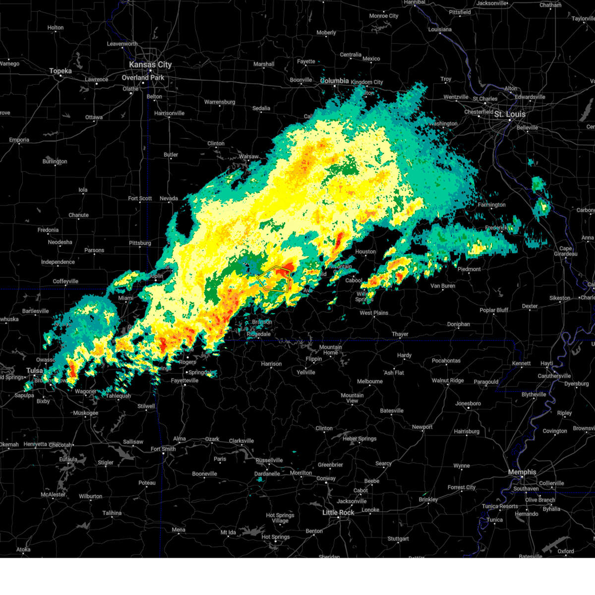 The severe thunderstorm warning for southwestern webster, northeastern christian and southeastern greene counties will expire at 945 pm cdt, the storm which prompted the warning has moved out of the area. therefore, the warning will be allowed to expire. a severe thunderstorm watch remains in effect until 1100 pm cdt for southwestern missouri. remember, a severe thunderstorm warning still remains in effect for southern webster county. The severe thunderstorm warning for southwestern webster, northeastern christian and southeastern greene counties will expire at 945 pm cdt, the storm which prompted the warning has moved out of the area. therefore, the warning will be allowed to expire. a severe thunderstorm watch remains in effect until 1100 pm cdt for southwestern missouri. remember, a severe thunderstorm warning still remains in effect for southern webster county.
|
| 3/23/2023 9:28 PM CDT |
 At 927 pm cdt, a severe thunderstorm was located near rogersville, or 9 miles east of ozark, moving northeast at 55 mph (trained weather spotters). Hazards include 60 mph wind gusts and quarter size hail. Hail damage to vehicles is expected. expect wind damage to roofs, siding, and trees. locations impacted include, southeastern springfield, ozark, rogersville, sparta, fordland, linden, elkhead and bruner. hail threat, observed max hail size, 1. 00 in wind threat, radar indicated max wind gust, 60 mph. At 927 pm cdt, a severe thunderstorm was located near rogersville, or 9 miles east of ozark, moving northeast at 55 mph (trained weather spotters). Hazards include 60 mph wind gusts and quarter size hail. Hail damage to vehicles is expected. expect wind damage to roofs, siding, and trees. locations impacted include, southeastern springfield, ozark, rogersville, sparta, fordland, linden, elkhead and bruner. hail threat, observed max hail size, 1. 00 in wind threat, radar indicated max wind gust, 60 mph.
|
| 3/23/2023 9:12 PM CDT |
 At 911 pm cdt, a severe thunderstorm was located over highlandville, moving northeast at 55 mph (radar indicated). Hazards include 60 mph wind gusts and quarter size hail. Hail damage to vehicles is expected. Expect wind damage to roofs, siding, and trees. At 911 pm cdt, a severe thunderstorm was located over highlandville, moving northeast at 55 mph (radar indicated). Hazards include 60 mph wind gusts and quarter size hail. Hail damage to vehicles is expected. Expect wind damage to roofs, siding, and trees.
|
| 3/23/2023 5:26 PM CDT |
 At 525 pm cdt, a severe thunderstorm was located near highlandville, moving northeast at 45 mph (radar indicated). Hazards include ping pong ball size hail and 60 mph wind gusts. People and animals outdoors will be injured. expect hail damage to roofs, siding, windows, and vehicles. expect wind damage to roofs, siding, and trees. locations impacted include, nixa, ozark, shepherd of the hills state park, ava, sparta, highlandville, fremont hills, spokane, oldfield, elkhead, chestnutridge, bruner, selmore, keltner, christian center, garrison, chadwick, linden, goodhope and dogwood. hail threat, radar indicated max hail size, 1. 50 in wind threat, radar indicated max wind gust, 60 mph. At 525 pm cdt, a severe thunderstorm was located near highlandville, moving northeast at 45 mph (radar indicated). Hazards include ping pong ball size hail and 60 mph wind gusts. People and animals outdoors will be injured. expect hail damage to roofs, siding, windows, and vehicles. expect wind damage to roofs, siding, and trees. locations impacted include, nixa, ozark, shepherd of the hills state park, ava, sparta, highlandville, fremont hills, spokane, oldfield, elkhead, chestnutridge, bruner, selmore, keltner, christian center, garrison, chadwick, linden, goodhope and dogwood. hail threat, radar indicated max hail size, 1. 50 in wind threat, radar indicated max wind gust, 60 mph.
|
| 3/23/2023 5:07 PM CDT |
 At 506 pm cdt, a severe thunderstorm was located near galena, or 11 miles north of kimberling city, moving northeast at 45 mph (radar indicated). Hazards include 60 mph wind gusts and quarter size hail. Hail damage to vehicles is expected. Expect wind damage to roofs, siding, and trees. At 506 pm cdt, a severe thunderstorm was located near galena, or 11 miles north of kimberling city, moving northeast at 45 mph (radar indicated). Hazards include 60 mph wind gusts and quarter size hail. Hail damage to vehicles is expected. Expect wind damage to roofs, siding, and trees.
|
| 2/27/2023 2:13 AM CST |
 At 213 am cst, severe thunderstorms were located along a line extending from 6 miles east of willard to springfield to near nixa, moving northeast at 55 mph (radar indicated). Hazards include 60 mph wind gusts. Expect damage to roofs, siding, and trees. locations impacted include, springfield, rogersville, strafford, fair grove, fordland, bassville, turners, galloway and northview. This includes interstate 44 between mile markers 74 and 97. At 213 am cst, severe thunderstorms were located along a line extending from 6 miles east of willard to springfield to near nixa, moving northeast at 55 mph (radar indicated). Hazards include 60 mph wind gusts. Expect damage to roofs, siding, and trees. locations impacted include, springfield, rogersville, strafford, fair grove, fordland, bassville, turners, galloway and northview. This includes interstate 44 between mile markers 74 and 97.
|
| 2/27/2023 2:01 AM CST |
 At 201 am cst, severe thunderstorms were located along a line extending from near walnut grove to near ash grove to 6 miles southwest of willard, moving northeast at 60 mph (radar indicated). Hazards include 60 mph wind gusts. Expect damage to roofs, siding, and trees. Locations impacted include, willard, ash grove, fair grove, walnut grove, sacville, glidewell, cave springs, ebenezer, eudora, brighton and bois d`arc. At 201 am cst, severe thunderstorms were located along a line extending from near walnut grove to near ash grove to 6 miles southwest of willard, moving northeast at 60 mph (radar indicated). Hazards include 60 mph wind gusts. Expect damage to roofs, siding, and trees. Locations impacted include, willard, ash grove, fair grove, walnut grove, sacville, glidewell, cave springs, ebenezer, eudora, brighton and bois d`arc.
|
| 2/27/2023 1:58 AM CST |
 At 158 am cst, severe thunderstorms were located along a line extending from 7 miles southwest of willard to near republic to near clever, moving northeast at 55 mph (radar indicated). Hazards include 60 mph wind gusts. expect damage to roofs, siding, and trees At 158 am cst, severe thunderstorms were located along a line extending from 7 miles southwest of willard to near republic to near clever, moving northeast at 55 mph (radar indicated). Hazards include 60 mph wind gusts. expect damage to roofs, siding, and trees
|
| 2/27/2023 1:42 AM CST |
 At 141 am cst, severe thunderstorms were located along a line extending from 11 miles south of lockwood to near miller to near mount vernon, moving northeast at 60 mph (radar indicated). Hazards include 60 mph wind gusts. expect damage to roofs, siding, and trees At 141 am cst, severe thunderstorms were located along a line extending from 11 miles south of lockwood to near miller to near mount vernon, moving northeast at 60 mph (radar indicated). Hazards include 60 mph wind gusts. expect damage to roofs, siding, and trees
|
| 10/12/2022 8:02 AM CDT |
 At 801 am cdt, a severe thunderstorm was located over nixa, moving northeast at 45 mph (radar indicated). Hazards include 60 mph wind gusts and quarter size hail. Hail damage to vehicles is expected. Expect wind damage to roofs, siding, and trees. At 801 am cdt, a severe thunderstorm was located over nixa, moving northeast at 45 mph (radar indicated). Hazards include 60 mph wind gusts and quarter size hail. Hail damage to vehicles is expected. Expect wind damage to roofs, siding, and trees.
|
| 8/29/2022 3:12 PM CDT |
 The severe thunderstorm warning for northwestern webster and east central greene counties will expire at 315 pm cdt, the storm which prompted the warning has weakened below severe limits, and no longer poses an immediate threat to life or property. therefore, the warning will be allowed to expire. however heavy rain is still possible with this thunderstorm. The severe thunderstorm warning for northwestern webster and east central greene counties will expire at 315 pm cdt, the storm which prompted the warning has weakened below severe limits, and no longer poses an immediate threat to life or property. therefore, the warning will be allowed to expire. however heavy rain is still possible with this thunderstorm.
|
| 8/29/2022 3:01 PM CDT |
 At 301 pm cdt, a severe thunderstorm was located over nixa, moving east at 10 mph (radar indicated). Hazards include 60 mph wind gusts and penny size hail. expect damage to roofs, siding, and trees At 301 pm cdt, a severe thunderstorm was located over nixa, moving east at 10 mph (radar indicated). Hazards include 60 mph wind gusts and penny size hail. expect damage to roofs, siding, and trees
|
| 8/29/2022 3:00 PM CDT | Delayed report: tree down on national by seminole southbound lane in greene county MO, 1.2 miles WNW of Springfield, MO |
| 8/29/2022 3:00 PM CDT | Delayed report: electrical damages from a downed tree near walnut lawn and campbel in greene county MO, 2.1 miles NNE of Springfield, MO |
| 8/29/2022 2:59 PM CDT |
 At 259 pm cdt, a severe thunderstorm was located near republic, moving northeast at 10 mph (radar indicated). Hazards include 60 mph wind gusts and penny size hail. expect damage to roofs, siding, and trees At 259 pm cdt, a severe thunderstorm was located near republic, moving northeast at 10 mph (radar indicated). Hazards include 60 mph wind gusts and penny size hail. expect damage to roofs, siding, and trees
|
| 8/29/2022 2:55 PM CDT | 4-6 inch tree limb down in north springfiel in greene county MO, 3.5 miles S of Springfield, MO |
| 8/29/2022 2:51 PM CDT |
 The severe thunderstorm warning for southwestern webster and southeastern greene counties will expire at 300 pm cdt, the storm which prompted the warning has weakened below severe limits, and no longer poses an immediate threat to life or property. therefore, the warning will be allowed to expire. however heavy rain is still possible with this thunderstorm. The severe thunderstorm warning for southwestern webster and southeastern greene counties will expire at 300 pm cdt, the storm which prompted the warning has weakened below severe limits, and no longer poses an immediate threat to life or property. therefore, the warning will be allowed to expire. however heavy rain is still possible with this thunderstorm.
|
| 8/29/2022 2:44 PM CDT | Report from mping. 1-inch tree limbs broken; shingles blown of in greene county MO, 1.7 miles SW of Springfield, MO |
| 8/29/2022 2:43 PM CDT | Tree down at south stewart... springfield m in greene county MO, 2.2 miles WSW of Springfield, MO |
| 8/29/2022 2:10 PM CDT | Tree down across sunshine and virgini in greene county MO, 1.5 miles SSW of Springfield, MO |
| 8/29/2022 2:09 PM CDT | At 208 pm cdt, a severe thunderstorm was located over northeastern springfield, moving northeast at 10 mph (radar indicated). Hazards include 60 mph wind gusts and penny size hail. expect damage to roofs, siding, and trees |
| 8/29/2022 1:55 PM CDT | At 155 pm cdt, a severe thunderstorm was located near southeast springfield, moving east at 5 mph (radar indicated). Hazards include 60 mph wind gusts and quarter size hail. Hail damage to vehicles is expected. Expect wind damage to roofs, siding, and trees. |
| 8/20/2022 7:07 PM CDT | Sgf asos measured a 51 knot peak wind gus in greene county MO, 6.6 miles SE of Springfield, MO |
| 8/8/2022 6:52 PM CDT |
 The severe thunderstorm warning for southern greene county will expire at 700 pm cdt, the storm which prompted the warning has weakened below severe limits, and has exited the warned area. therefore, the warning will be allowed to expire. however gusty winds and heavy rain are still possible with this thunderstorm. The severe thunderstorm warning for southern greene county will expire at 700 pm cdt, the storm which prompted the warning has weakened below severe limits, and has exited the warned area. therefore, the warning will be allowed to expire. however gusty winds and heavy rain are still possible with this thunderstorm.
|
| 8/8/2022 6:41 PM CDT |
 At 641 pm cdt, a severe thunderstorm was located near ozark, moving southeast at 15 mph (radar indicated). Hazards include 60 mph wind gusts and quarter size hail. Hail damage to vehicles is expected. expect wind damage to roofs, siding, and trees. locations impacted include, southern springfield, republic, battlefield, brookline, galloway, this includes interstate 44 near mile marker 69. hail threat, radar indicated max hail size, 1. 00 in wind threat, radar indicated max wind gust, 60 mph. At 641 pm cdt, a severe thunderstorm was located near ozark, moving southeast at 15 mph (radar indicated). Hazards include 60 mph wind gusts and quarter size hail. Hail damage to vehicles is expected. expect wind damage to roofs, siding, and trees. locations impacted include, southern springfield, republic, battlefield, brookline, galloway, this includes interstate 44 near mile marker 69. hail threat, radar indicated max hail size, 1. 00 in wind threat, radar indicated max wind gust, 60 mph.
|
| 8/8/2022 6:13 PM CDT |
 At 613 pm cdt, severe thunderstorms were located along a line extending from nixa to near marionville to near sarcoxie, moving southeast at 25 mph (radar indicated). Hazards include 60 mph wind gusts and nickel size hail. expect damage to roofs, siding, and trees At 613 pm cdt, severe thunderstorms were located along a line extending from nixa to near marionville to near sarcoxie, moving southeast at 25 mph (radar indicated). Hazards include 60 mph wind gusts and nickel size hail. expect damage to roofs, siding, and trees
|
| 8/8/2022 6:10 PM CDT |
 At 610 pm cdt, a severe thunderstorm was located near walnut grove, or 14 miles south of bolivar, moving southeast at 15 mph. additional severe storms were located over greene county (radar indicated). Hazards include 60 mph wind gusts and nickel size hail. expect damage to roofs, siding, and trees At 610 pm cdt, a severe thunderstorm was located near walnut grove, or 14 miles south of bolivar, moving southeast at 15 mph. additional severe storms were located over greene county (radar indicated). Hazards include 60 mph wind gusts and nickel size hail. expect damage to roofs, siding, and trees
|
| 8/8/2022 5:33 PM CDT |
 At 533 pm cdt, a severe thunderstorm was located 7 miles north of republic, moving east at 15 mph (radar indicated). Hazards include 60 mph wind gusts and nickel size hail. expect damage to roofs, siding, and trees At 533 pm cdt, a severe thunderstorm was located 7 miles north of republic, moving east at 15 mph (radar indicated). Hazards include 60 mph wind gusts and nickel size hail. expect damage to roofs, siding, and trees
|
| 8/5/2022 5:21 PM CDT |
 The severe thunderstorm warning for north central christian and southeastern greene counties will expire at 530 pm cdt, the storm which prompted the warning has weakened below severe limits. therefore, the warning will be allowed to expire. however heavy rain is still possible with this thunderstorm and a flash flood warning is still in effect for portions of greene county. The severe thunderstorm warning for north central christian and southeastern greene counties will expire at 530 pm cdt, the storm which prompted the warning has weakened below severe limits. therefore, the warning will be allowed to expire. however heavy rain is still possible with this thunderstorm and a flash flood warning is still in effect for portions of greene county.
|
| 8/5/2022 4:55 PM CDT | Severe thunderstorm wind gusts downed a tree at 1160 south virginia st. in central springfiel in greene county MO, 1.2 miles SW of Springfield, MO |
| 8/5/2022 4:55 PM CDT | Severe thunderstorm wind gusts downed a tree across the intersection of pythian and fremont street in greene county MO, 3.2 miles SSW of Springfield, MO |
| 8/5/2022 4:36 PM CDT |
 At 435 pm cdt, a severe thunderstorm was located over springfield, moving southeast at 10 mph (radar indicated). Hazards include 60 mph wind gusts and penny size hail. expect damage to roofs, siding, and trees At 435 pm cdt, a severe thunderstorm was located over springfield, moving southeast at 10 mph (radar indicated). Hazards include 60 mph wind gusts and penny size hail. expect damage to roofs, siding, and trees
|
| 7/27/2022 4:54 PM CDT |
 The severe thunderstorm warning for northwestern christian and northern stone counties will expire at 500 pm cdt, the storm which prompted the warning has weakened below severe limits, and no longer poses an immediate threat to life or property. therefore, the warning will be allowed to expire. however heavy rain is still possible with this thunderstorm. The severe thunderstorm warning for northwestern christian and northern stone counties will expire at 500 pm cdt, the storm which prompted the warning has weakened below severe limits, and no longer poses an immediate threat to life or property. therefore, the warning will be allowed to expire. however heavy rain is still possible with this thunderstorm.
|
| 7/27/2022 4:08 PM CDT |
 At 408 pm cdt, a severe thunderstorm was located near billings, or 9 miles east of aurora, moving northeast at 20 mph (radar indicated). Hazards include 60 mph wind gusts and quarter size hail. Hail damage to vehicles is expected. Expect wind damage to roofs, siding, and trees. At 408 pm cdt, a severe thunderstorm was located near billings, or 9 miles east of aurora, moving northeast at 20 mph (radar indicated). Hazards include 60 mph wind gusts and quarter size hail. Hail damage to vehicles is expected. Expect wind damage to roofs, siding, and trees.
|
| 5/19/2022 1:43 PM CDT |
 At 142 pm cdt, severe thunderstorms were located along a line extending from near strafford to 6 miles northwest of rogersville to springfield, moving east at 45 mph (radar indicated). Hazards include 60 mph wind gusts and quarter size hail. Hail damage to vehicles is expected. Expect wind damage to roofs, siding, and trees. At 142 pm cdt, severe thunderstorms were located along a line extending from near strafford to 6 miles northwest of rogersville to springfield, moving east at 45 mph (radar indicated). Hazards include 60 mph wind gusts and quarter size hail. Hail damage to vehicles is expected. Expect wind damage to roofs, siding, and trees.
|
| 5/19/2022 1:30 PM CDT | Large tree downe in greene county MO, 5.8 miles ESE of Springfield, MO |
| 5/19/2022 1:28 PM CDT |
 At 128 pm cdt, severe thunderstorms were located along a line extending from near fair grove to near springfield to near billings, moving east at 25 mph (radar indicated). Hazards include 60 mph wind gusts and quarter size hail. Hail damage to vehicles is expected. expect wind damage to roofs, siding, and trees. locations impacted include, springfield, nixa, ozark, republic, battlefield, willard, rogersville, strafford, clever, fair grove, billings, fremont hills, pleasant hope, brookline, glidewell, ebenezer, bassville, brighton, turners, march, this includes interstate 44 between mile markers 59 and 91. hail threat, radar indicated max hail size, 1. 00 in wind threat, radar indicated max wind gust, 60 mph. At 128 pm cdt, severe thunderstorms were located along a line extending from near fair grove to near springfield to near billings, moving east at 25 mph (radar indicated). Hazards include 60 mph wind gusts and quarter size hail. Hail damage to vehicles is expected. expect wind damage to roofs, siding, and trees. locations impacted include, springfield, nixa, ozark, republic, battlefield, willard, rogersville, strafford, clever, fair grove, billings, fremont hills, pleasant hope, brookline, glidewell, ebenezer, bassville, brighton, turners, march, this includes interstate 44 between mile markers 59 and 91. hail threat, radar indicated max hail size, 1. 00 in wind threat, radar indicated max wind gust, 60 mph.
|
| 5/19/2022 12:56 PM CDT |
 At 1255 pm cdt, severe thunderstorms were located along a line extending from near morrisville to near ash grove to near mount vernon, moving east at 20 mph (radar indicated). Hazards include 60 mph wind gusts. expect damage to roofs, siding, and trees At 1255 pm cdt, severe thunderstorms were located along a line extending from near morrisville to near ash grove to near mount vernon, moving east at 20 mph (radar indicated). Hazards include 60 mph wind gusts. expect damage to roofs, siding, and trees
|
| 4/11/2022 2:52 AM CDT |
 The severe thunderstorm warning for taney, christian and stone counties will expire at 300 am cdt, the storms which prompted the warning have weakened below severe limits, and no longer pose an immediate threat to life or property. therefore, the warning will be allowed to expire. 40 to 50 mph winds will still be possible. a severe thunderstorm watch remains in effect until 400 am cdt for southwestern missouri. The severe thunderstorm warning for taney, christian and stone counties will expire at 300 am cdt, the storms which prompted the warning have weakened below severe limits, and no longer pose an immediate threat to life or property. therefore, the warning will be allowed to expire. 40 to 50 mph winds will still be possible. a severe thunderstorm watch remains in effect until 400 am cdt for southwestern missouri.
|
| 4/11/2022 2:37 AM CDT |
 At 236 am cdt, severe thunderstorms were located along a line extending from near buffalo to 7 miles northeast of fair grove to strafford, moving northeast at 35 mph (radar indicated). Hazards include 60 mph wind gusts and quarter size hail. Hail damage to vehicles is expected. Expect wind damage to roofs, siding, and trees. At 236 am cdt, severe thunderstorms were located along a line extending from near buffalo to 7 miles northeast of fair grove to strafford, moving northeast at 35 mph (radar indicated). Hazards include 60 mph wind gusts and quarter size hail. Hail damage to vehicles is expected. Expect wind damage to roofs, siding, and trees.
|
| 4/11/2022 2:18 AM CDT |
 At 217 am cdt, severe thunderstorms were located along a line extending from 6 miles northwest of marionville to near aurora to near cassville to gateway, moving east at 60 mph (radar indicated). Hazards include 60 mph wind gusts and nickel size hail. expect damage to roofs, siding, and trees At 217 am cdt, severe thunderstorms were located along a line extending from 6 miles northwest of marionville to near aurora to near cassville to gateway, moving east at 60 mph (radar indicated). Hazards include 60 mph wind gusts and nickel size hail. expect damage to roofs, siding, and trees
|
| 3/18/2022 5:46 AM CDT |
 At 546 am cdt, severe thunderstorms were located along a line extending from near strafford to near fordland to 7 miles southwest of ava, moving east at 40 mph (radar indicated). Hazards include 60 mph wind gusts and nickel size hail. expect damage to roofs, siding, and trees At 546 am cdt, severe thunderstorms were located along a line extending from near strafford to near fordland to 7 miles southwest of ava, moving east at 40 mph (radar indicated). Hazards include 60 mph wind gusts and nickel size hail. expect damage to roofs, siding, and trees
|
| 3/18/2022 5:41 AM CDT |
 At 541 am cdt, severe thunderstorms were located along a line extending from near strafford to near rogersville to 9 miles east of sparta to 9 miles east of taneyville, moving northeast at 35 mph (radar indicated). Hazards include 60 mph wind gusts and nickel size hail. Expect damage to roofs, siding, and trees. locations impacted include, northern springfield, rogersville, strafford, seymour, fordland, diggins, turners, elkhead, bruner, keltner, northview, rome, goodhope, dogwood, this includes interstate 44 between mile markers 82 and 96. hail threat, radar indicated max hail size, 0. 88 in wind threat, radar indicated max wind gust, 60 mph. At 541 am cdt, severe thunderstorms were located along a line extending from near strafford to near rogersville to 9 miles east of sparta to 9 miles east of taneyville, moving northeast at 35 mph (radar indicated). Hazards include 60 mph wind gusts and nickel size hail. Expect damage to roofs, siding, and trees. locations impacted include, northern springfield, rogersville, strafford, seymour, fordland, diggins, turners, elkhead, bruner, keltner, northview, rome, goodhope, dogwood, this includes interstate 44 between mile markers 82 and 96. hail threat, radar indicated max hail size, 0. 88 in wind threat, radar indicated max wind gust, 60 mph.
|
| 3/18/2022 5:33 AM CDT |
 At 532 am cdt, severe thunderstorms were located along a line extending from near strafford to near rogersville to 8 miles southeast of sparta to 7 miles southeast of taneyville, moving northeast at 35 mph (radar indicated). Hazards include 60 mph wind gusts and nickel size hail. Expect damage to roofs, siding, and trees. locations impacted include, springfield, ozark, lake taneycomo, bull shoals lake, rogersville, strafford, forsyth, seymour, sparta, kissee mills, fordland, taneyville, diggins, oldfield, turners, elkhead, powersite, rome, chadwick, linden, this includes interstate 44 between mile markers 82 and 96. hail threat, radar indicated max hail size, 0. 88 in wind threat, radar indicated max wind gust, 60 mph. At 532 am cdt, severe thunderstorms were located along a line extending from near strafford to near rogersville to 8 miles southeast of sparta to 7 miles southeast of taneyville, moving northeast at 35 mph (radar indicated). Hazards include 60 mph wind gusts and nickel size hail. Expect damage to roofs, siding, and trees. locations impacted include, springfield, ozark, lake taneycomo, bull shoals lake, rogersville, strafford, forsyth, seymour, sparta, kissee mills, fordland, taneyville, diggins, oldfield, turners, elkhead, powersite, rome, chadwick, linden, this includes interstate 44 between mile markers 82 and 96. hail threat, radar indicated max hail size, 0. 88 in wind threat, radar indicated max wind gust, 60 mph.
|
| 3/18/2022 5:12 AM CDT |
 The severe thunderstorm warning for western taney, western christian, northern stone and south central greene counties will expire at 515 am cdt, the storms which prompted the warning have moved east of the area, where a new severe thunderstorm warning was issued. therefore, this warning will be allowed to expire. The severe thunderstorm warning for western taney, western christian, northern stone and south central greene counties will expire at 515 am cdt, the storms which prompted the warning have moved east of the area, where a new severe thunderstorm warning was issued. therefore, this warning will be allowed to expire.
|
| 3/18/2022 5:08 AM CDT |
 At 508 am cdt, severe thunderstorms were located along a line extending from near battlefield to near highlandville to near merriam woods to 7 miles southeast of hollister, moving northeast at 35 mph (radar indicated). Hazards include 60 mph wind gusts and nickel size hail. expect damage to roofs, siding, and trees At 508 am cdt, severe thunderstorms were located along a line extending from near battlefield to near highlandville to near merriam woods to 7 miles southeast of hollister, moving northeast at 35 mph (radar indicated). Hazards include 60 mph wind gusts and nickel size hail. expect damage to roofs, siding, and trees
|
| 3/18/2022 5:03 AM CDT |
 At 503 am cdt, severe thunderstorms were located along a line extending from republic to near highlandville to near merriam woods to near hollister, moving northeast at 35 mph (radar indicated). Hazards include 60 mph wind gusts and nickel size hail. Expect damage to roofs, siding, and trees. locations impacted include, nixa, republic, branson, lake taneycomo, table rock lake, table rock state park, battlefield, hollister, silver dollar city, forsyth, clever, merriam woods, kissee mills, billings, highlandville, rockaway beach, bull creek, indian point, branson west, brookline, this includes interstate 44 near mile marker 69. hail threat, radar indicated max hail size, 0. 88 in wind threat, radar indicated max wind gust, 60 mph. At 503 am cdt, severe thunderstorms were located along a line extending from republic to near highlandville to near merriam woods to near hollister, moving northeast at 35 mph (radar indicated). Hazards include 60 mph wind gusts and nickel size hail. Expect damage to roofs, siding, and trees. locations impacted include, nixa, republic, branson, lake taneycomo, table rock lake, table rock state park, battlefield, hollister, silver dollar city, forsyth, clever, merriam woods, kissee mills, billings, highlandville, rockaway beach, bull creek, indian point, branson west, brookline, this includes interstate 44 near mile marker 69. hail threat, radar indicated max hail size, 0. 88 in wind threat, radar indicated max wind gust, 60 mph.
|
| 3/18/2022 4:50 AM CDT |
 At 448 am cdt, severe thunderstorms were located along a line extending from billings to near galena to indian point to 7 miles southeast of kimberling city, moving northeast at 35 mph (radar indicated). Hazards include 60 mph wind gusts and nickel size hail. Expect damage to roofs, siding, and trees. locations impacted include, nixa, republic, branson, lake taneycomo, table rock lake, table rock state park, battlefield, hollister, silver dollar city, kimberling city, forsyth, marionville, clever, merriam woods, crane, kissee mills, billings, reeds spring, highlandville, rockaway beach, this includes interstate 44 near mile marker 69. hail threat, radar indicated max hail size, 0. 88 in wind threat, radar indicated max wind gust, 60 mph. At 448 am cdt, severe thunderstorms were located along a line extending from billings to near galena to indian point to 7 miles southeast of kimberling city, moving northeast at 35 mph (radar indicated). Hazards include 60 mph wind gusts and nickel size hail. Expect damage to roofs, siding, and trees. locations impacted include, nixa, republic, branson, lake taneycomo, table rock lake, table rock state park, battlefield, hollister, silver dollar city, kimberling city, forsyth, marionville, clever, merriam woods, crane, kissee mills, billings, reeds spring, highlandville, rockaway beach, this includes interstate 44 near mile marker 69. hail threat, radar indicated max hail size, 0. 88 in wind threat, radar indicated max wind gust, 60 mph.
|
| 3/18/2022 4:38 AM CDT |
 At 438 am cdt, severe thunderstorms were located along a line extending from 6 miles west of billings to galena to near kimberling city, moving northeast at 35 mph (radar indicated). Hazards include 60 mph wind gusts and quarter size hail. Hail damage to vehicles is expected. expect wind damage to roofs, siding, and trees. locations impacted include, nixa, republic, branson, lake taneycomo, table rock lake, table rock state park, aurora, battlefield, hollister, silver dollar city, kimberling city, forsyth, marionville, clever, merriam woods, crane, shell knob, kissee mills, billings, reeds spring, this includes interstate 44 near mile marker 69. hail threat, radar indicated max hail size, 1. 00 in wind threat, radar indicated max wind gust, 60 mph. At 438 am cdt, severe thunderstorms were located along a line extending from 6 miles west of billings to galena to near kimberling city, moving northeast at 35 mph (radar indicated). Hazards include 60 mph wind gusts and quarter size hail. Hail damage to vehicles is expected. expect wind damage to roofs, siding, and trees. locations impacted include, nixa, republic, branson, lake taneycomo, table rock lake, table rock state park, aurora, battlefield, hollister, silver dollar city, kimberling city, forsyth, marionville, clever, merriam woods, crane, shell knob, kissee mills, billings, reeds spring, this includes interstate 44 near mile marker 69. hail threat, radar indicated max hail size, 1. 00 in wind threat, radar indicated max wind gust, 60 mph.
|
| 3/18/2022 4:29 AM CDT |
 At 429 am cdt, severe thunderstorms were located along a line extending from near aurora to near galena to 6 miles southwest of kimberling city, moving northeast at 35 mph (radar indicated). Hazards include 60 mph wind gusts and quarter size hail. Hail damage to vehicles is expected. Expect wind damage to roofs, siding, and trees. At 429 am cdt, severe thunderstorms were located along a line extending from near aurora to near galena to 6 miles southwest of kimberling city, moving northeast at 35 mph (radar indicated). Hazards include 60 mph wind gusts and quarter size hail. Hail damage to vehicles is expected. Expect wind damage to roofs, siding, and trees.
|
| 12/10/2021 5:40 PM CST | Time estimated from rada in greene county MO, 3.1 miles NNW of Springfield, MO |
| 12/10/2021 5:40 PM CST | 2 utility poles snapped. time estimated from rada in greene county MO, 5.8 miles SSW of Springfield, MO |
| 11/10/2021 10:51 PM CST |
 The severe thunderstorm warning for polk and northern greene counties will expire at 1100 pm cst, the storms which prompted the warning have weakened below severe limits, and have exited the warned area. therefore, the warning will be allowed to expire. however gusty winds are still possible with these thunderstorms. The severe thunderstorm warning for polk and northern greene counties will expire at 1100 pm cst, the storms which prompted the warning have weakened below severe limits, and have exited the warned area. therefore, the warning will be allowed to expire. however gusty winds are still possible with these thunderstorms.
|
| 11/10/2021 10:23 PM CST |
 At 1023 pm cst, severe thunderstorms were located along a line extending from 6 miles east of humansville to near fair play to near walnut grove to near ash grove, moving northeast at 40 mph (radar indicated). Hazards include 60 mph wind gusts. Expect damage to roofs, siding, and trees. Locations impacted include, bolivar, pomme de terre lake, stockton lake, willard, ash grove, fair grove, walnut grove, polk, pleasant hope, fair play, morrisville, halfway, flemington, aldrich, sacville, glidewell, ebenezer, brighton, bois d`arc, cave springs,. At 1023 pm cst, severe thunderstorms were located along a line extending from 6 miles east of humansville to near fair play to near walnut grove to near ash grove, moving northeast at 40 mph (radar indicated). Hazards include 60 mph wind gusts. Expect damage to roofs, siding, and trees. Locations impacted include, bolivar, pomme de terre lake, stockton lake, willard, ash grove, fair grove, walnut grove, polk, pleasant hope, fair play, morrisville, halfway, flemington, aldrich, sacville, glidewell, ebenezer, brighton, bois d`arc, cave springs,.
|
| 11/10/2021 10:21 PM CST |
 At 1021 pm cst, severe thunderstorms were located along a line extending from 6 miles east of humansville to near fair play to near walnut grove to ash grove, moving northeast at 40 mph (radar indicated). Hazards include 60 mph wind gusts. expect damage to roofs, siding, and trees At 1021 pm cst, severe thunderstorms were located along a line extending from 6 miles east of humansville to near fair play to near walnut grove to ash grove, moving northeast at 40 mph (radar indicated). Hazards include 60 mph wind gusts. expect damage to roofs, siding, and trees
|
| 7/17/2021 6:16 PM CDT |
 At 616 pm cdt, a severe thunderstorm was located 6 miles southeast of ash grove, or 8 miles north of republic, moving east at 15 mph (radar indicated). Hazards include 60 mph wind gusts and quarter size hail. Hail damage to vehicles is expected. Expect wind damage to roofs, siding, and trees. At 616 pm cdt, a severe thunderstorm was located 6 miles southeast of ash grove, or 8 miles north of republic, moving east at 15 mph (radar indicated). Hazards include 60 mph wind gusts and quarter size hail. Hail damage to vehicles is expected. Expect wind damage to roofs, siding, and trees.
|
| 6/11/2021 7:41 PM CDT |
 At 741 pm cdt, severe thunderstorms were located along a line extending from 7 miles north of billings to 6 miles west of mansfield, moving south at 35 mph (radar indicated). Hazards include 70 mph wind gusts and quarter size hail. Hail damage to vehicles is expected. expect considerable tree damage. Wind damage is also likely to mobile homes, roofs, and outbuildings. At 741 pm cdt, severe thunderstorms were located along a line extending from 7 miles north of billings to 6 miles west of mansfield, moving south at 35 mph (radar indicated). Hazards include 70 mph wind gusts and quarter size hail. Hail damage to vehicles is expected. expect considerable tree damage. Wind damage is also likely to mobile homes, roofs, and outbuildings.
|
| 6/11/2021 7:35 PM CDT | Tree uprooted by the gust front on farm road 146 near wilsons creek. time based on rada in greene county MO, 2.4 miles ESE of Springfield, MO |
| 6/11/2021 7:04 PM CDT |
 At 703 pm cdt, severe thunderstorms were located along a line extending from near walnut grove to charity, moving south at 35 mph (radar indicated). Hazards include 70 mph wind gusts and half dollar size hail. Hail damage to vehicles is expected. expect considerable tree damage. Wind damage is also likely to mobile homes, roofs, and outbuildings. At 703 pm cdt, severe thunderstorms were located along a line extending from near walnut grove to charity, moving south at 35 mph (radar indicated). Hazards include 70 mph wind gusts and half dollar size hail. Hail damage to vehicles is expected. expect considerable tree damage. Wind damage is also likely to mobile homes, roofs, and outbuildings.
|
| 5/27/2021 12:42 PM CDT |
 At 1242 pm cdt, severe thunderstorms were located along a line extending from near conway to near strafford to near springfield, moving southeast at 30 mph (law enforcement). Hazards include 60 mph wind gusts and quarter size hail. Hail damage to vehicles is expected. expect wind damage to roofs, siding, and trees. Locations impacted include, northern springfield, willard, strafford, fair grove, elkland, glidewell, ebenezer, bassville, this includes interstate 44 between mile markers 73 and 95, and between mile markers 104 and 109. At 1242 pm cdt, severe thunderstorms were located along a line extending from near conway to near strafford to near springfield, moving southeast at 30 mph (law enforcement). Hazards include 60 mph wind gusts and quarter size hail. Hail damage to vehicles is expected. expect wind damage to roofs, siding, and trees. Locations impacted include, northern springfield, willard, strafford, fair grove, elkland, glidewell, ebenezer, bassville, this includes interstate 44 between mile markers 73 and 95, and between mile markers 104 and 109.
|
| 5/27/2021 12:28 PM CDT |
 At 1228 pm cdt, severe thunderstorms were located along a line extending from 7 miles southeast of buffalo to near fair grove to willard, moving southeast at 35 mph (law enforcement). Hazards include 70 mph wind gusts and quarter size hail. Hail damage to vehicles is expected. expect considerable tree damage. wind damage is also likely to mobile homes, roofs, and outbuildings. Locations impacted include, northern springfield, willard, strafford, fair grove, elkland, sacville, glidewell, ebenezer, bassville, cave springs, this includes interstate 44 between mile markers 73 and 95, and between mile markers 104 and 109. At 1228 pm cdt, severe thunderstorms were located along a line extending from 7 miles southeast of buffalo to near fair grove to willard, moving southeast at 35 mph (law enforcement). Hazards include 70 mph wind gusts and quarter size hail. Hail damage to vehicles is expected. expect considerable tree damage. wind damage is also likely to mobile homes, roofs, and outbuildings. Locations impacted include, northern springfield, willard, strafford, fair grove, elkland, sacville, glidewell, ebenezer, bassville, cave springs, this includes interstate 44 between mile markers 73 and 95, and between mile markers 104 and 109.
|
| 5/27/2021 12:07 PM CDT |
 At 1206 pm cdt, severe thunderstorms were located along a line extending from 9 miles west of buffalo to near morrisville to 6 miles north of walnut grove, moving southeast at 30 mph (law enforcement. there have been several reports of trees and powers lines down in polk county with these storms). Hazards include 70 mph wind gusts and quarter size hail. Hail damage to vehicles is expected. expect considerable tree damage. Wind damage is also likely to mobile homes, roofs, and outbuildings. At 1206 pm cdt, severe thunderstorms were located along a line extending from 9 miles west of buffalo to near morrisville to 6 miles north of walnut grove, moving southeast at 30 mph (law enforcement. there have been several reports of trees and powers lines down in polk county with these storms). Hazards include 70 mph wind gusts and quarter size hail. Hail damage to vehicles is expected. expect considerable tree damage. Wind damage is also likely to mobile homes, roofs, and outbuildings.
|
| 5/9/2021 4:54 AM CDT |
 The severe thunderstorm warning for northern webster, southern dallas, southern polk and greene counties will expire at 500 am cdt, the storm which prompted the warning has weakened below severe limits, and no longer poses an immediate threat to life or property. therefore, the warning will be allowed to expire. however gusty winds and heavy rain are still possible with this thunderstorm. The severe thunderstorm warning for northern webster, southern dallas, southern polk and greene counties will expire at 500 am cdt, the storm which prompted the warning has weakened below severe limits, and no longer poses an immediate threat to life or property. therefore, the warning will be allowed to expire. however gusty winds and heavy rain are still possible with this thunderstorm.
|
| 5/9/2021 4:09 AM CDT |
 At 408 am cdt, a severe thunderstorm was located near walnut grove, or 16 miles south of bolivar, moving east at 50 mph (radar indicated). Hazards include 60 mph wind gusts and half dollar size hail. Hail damage to vehicles is expected. Expect wind damage to roofs, siding, and trees. At 408 am cdt, a severe thunderstorm was located near walnut grove, or 16 miles south of bolivar, moving east at 50 mph (radar indicated). Hazards include 60 mph wind gusts and half dollar size hail. Hail damage to vehicles is expected. Expect wind damage to roofs, siding, and trees.
|
| 5/9/2021 3:22 AM CDT |
 At 321 am cdt, a severe thunderstorm was located near willard, or near springfield, moving east at 50 mph (radar indicated). Hazards include 60 mph wind gusts. expect damage to roofs, siding, and trees At 321 am cdt, a severe thunderstorm was located near willard, or near springfield, moving east at 50 mph (radar indicated). Hazards include 60 mph wind gusts. expect damage to roofs, siding, and trees
|
| 5/9/2021 3:20 AM CDT | Ksgf asos peak gus in greene county MO, 6.6 miles ESE of Springfield, MO |
| 4/7/2021 2:23 PM CDT |
 At 223 pm cdt, severe thunderstorms were located along a line extending from near bolivar to near willard to near republic, moving northeast at 50 mph (radar indicated). Hazards include 60 mph wind gusts and quarter size hail. Hail damage to vehicles is expected. expect wind damage to roofs, siding, and trees. Locations impacted include, springfield, nixa, ozark, republic, battlefield, willard, rogersville, strafford, clever, sparta, fair grove, highlandville, fremont hills, brookline, glidewell, turners, cave springs, linden, sacville, ebenezer, this includes interstate 44 between mile markers 66 and 91. At 223 pm cdt, severe thunderstorms were located along a line extending from near bolivar to near willard to near republic, moving northeast at 50 mph (radar indicated). Hazards include 60 mph wind gusts and quarter size hail. Hail damage to vehicles is expected. expect wind damage to roofs, siding, and trees. Locations impacted include, springfield, nixa, ozark, republic, battlefield, willard, rogersville, strafford, clever, sparta, fair grove, highlandville, fremont hills, brookline, glidewell, turners, cave springs, linden, sacville, ebenezer, this includes interstate 44 between mile markers 66 and 91.
|
| 4/7/2021 2:07 PM CDT |
 At 206 pm cdt, severe thunderstorms were located along a line extending from near walnut grove to near republic to near crane, moving northeast at 50 mph (radar indicated). Hazards include 60 mph wind gusts and quarter size hail. Hail damage to vehicles is expected. Expect wind damage to roofs, siding, and trees. At 206 pm cdt, severe thunderstorms were located along a line extending from near walnut grove to near republic to near crane, moving northeast at 50 mph (radar indicated). Hazards include 60 mph wind gusts and quarter size hail. Hail damage to vehicles is expected. Expect wind damage to roofs, siding, and trees.
|
| 3/17/2021 7:34 PM CDT |
 At 734 pm cdt, severe thunderstorms were located along a line extending from near strafford to 11 miles west of ava, moving northeast at 30 mph (radar indicated). Hazards include 60 mph wind gusts and quarter size hail. Hail damage to vehicles is expected. expect wind damage to roofs, siding, and trees. Locations impacted include, marshfield, rogersville, strafford, sparta, fordland, oldfield, turners, elkhead, bruner, keltner, northview, garrison, chadwick, this includes interstate 44 between mile markers 84 and 100. At 734 pm cdt, severe thunderstorms were located along a line extending from near strafford to 11 miles west of ava, moving northeast at 30 mph (radar indicated). Hazards include 60 mph wind gusts and quarter size hail. Hail damage to vehicles is expected. expect wind damage to roofs, siding, and trees. Locations impacted include, marshfield, rogersville, strafford, sparta, fordland, oldfield, turners, elkhead, bruner, keltner, northview, garrison, chadwick, this includes interstate 44 between mile markers 84 and 100.
|
| 3/17/2021 7:18 PM CDT |
 At 718 pm cdt, severe thunderstorms were located along a line extending from springfield to near rogersville to near sparta to 10 miles southeast of ozark, moving northeast at 35 mph (trained weather spotters). Hazards include 60 mph wind gusts and quarter size hail. Hail damage to vehicles is expected. expect wind damage to roofs, siding, and trees. Locations impacted include, nixa, ozark, sparta, fremont hills, christian center, oldfield, chadwick, linden, bruner, selmore,. At 718 pm cdt, severe thunderstorms were located along a line extending from springfield to near rogersville to near sparta to 10 miles southeast of ozark, moving northeast at 35 mph (trained weather spotters). Hazards include 60 mph wind gusts and quarter size hail. Hail damage to vehicles is expected. expect wind damage to roofs, siding, and trees. Locations impacted include, nixa, ozark, sparta, fremont hills, christian center, oldfield, chadwick, linden, bruner, selmore,.
|
| 3/17/2021 7:06 PM CDT |
 At 706 pm cdt, severe thunderstorms were located along a line extending from springfield to 6 miles northwest of taneyville, moving northeast at 30 mph (radar indicated). Hazards include 60 mph wind gusts and quarter size hail. Hail damage to vehicles is expected. Expect wind damage to roofs, siding, and trees. At 706 pm cdt, severe thunderstorms were located along a line extending from springfield to 6 miles northwest of taneyville, moving northeast at 30 mph (radar indicated). Hazards include 60 mph wind gusts and quarter size hail. Hail damage to vehicles is expected. Expect wind damage to roofs, siding, and trees.
|
| 3/17/2021 7:02 PM CDT |
 At 701 pm cdt, severe thunderstorms were located along a line extending from battlefield to nixa to near ozark to 7 miles southeast of highlandville, moving northeast at 35 mph (trained weather spotters. trained spotters reported 60 to 70 mph wind gusts in northeastern stone county with this line of storms). Hazards include 60 mph wind gusts and quarter size hail. Hail damage to vehicles is expected. expect wind damage to roofs, siding, and trees. Locations impacted include, nixa, ozark, clever, sparta, highlandville, fremont hills, spokane, oldfield, chestnutridge, bruner, selmore, christian center, chadwick, linden, boaz,. At 701 pm cdt, severe thunderstorms were located along a line extending from battlefield to nixa to near ozark to 7 miles southeast of highlandville, moving northeast at 35 mph (trained weather spotters. trained spotters reported 60 to 70 mph wind gusts in northeastern stone county with this line of storms). Hazards include 60 mph wind gusts and quarter size hail. Hail damage to vehicles is expected. expect wind damage to roofs, siding, and trees. Locations impacted include, nixa, ozark, clever, sparta, highlandville, fremont hills, spokane, oldfield, chestnutridge, bruner, selmore, christian center, chadwick, linden, boaz,.
|
| 3/17/2021 6:48 PM CDT |
 At 648 pm cdt, severe thunderstorms were located along a line extending from clever to near highlandville to near reeds spring, moving northeast at 35 mph (radar indicated). Hazards include 60 mph wind gusts and quarter size hail. Hail damage to vehicles is expected. Expect wind damage to roofs, siding, and trees. At 648 pm cdt, severe thunderstorms were located along a line extending from clever to near highlandville to near reeds spring, moving northeast at 35 mph (radar indicated). Hazards include 60 mph wind gusts and quarter size hail. Hail damage to vehicles is expected. Expect wind damage to roofs, siding, and trees.
|
| 1/30/2021 4:51 PM CST |
 At 451 pm cst, a severe thunderstorm was located near battlefield, moving northeast at 45 mph (radar indicated). Hazards include quarter size hail. Damage to vehicles is expected. Locations impacted include, springfield, republic, battlefield, willard, strafford, brookline, glidewell, ebenezer, this includes interstate 44 between mile markers 64 and 87. At 451 pm cst, a severe thunderstorm was located near battlefield, moving northeast at 45 mph (radar indicated). Hazards include quarter size hail. Damage to vehicles is expected. Locations impacted include, springfield, republic, battlefield, willard, strafford, brookline, glidewell, ebenezer, this includes interstate 44 between mile markers 64 and 87.
|
| 1/30/2021 4:34 PM CST |
 At 434 pm cst, a severe thunderstorm was located near billings, or near republic, moving northeast at 40 mph (radar indicated). Hazards include quarter size hail. damage to vehicles is expected At 434 pm cst, a severe thunderstorm was located near billings, or near republic, moving northeast at 40 mph (radar indicated). Hazards include quarter size hail. damage to vehicles is expected
|
| 11/14/2020 8:03 PM CST |
 At 803 pm cst, severe thunderstorms were located along a line extending from marshfield to highlandville, moving east at 60 mph (radar indicated). Hazards include 60 mph wind gusts and quarter size hail. Hail damage to vehicles is expected. expect wind damage to roofs, siding, and trees. Locations impacted include, nixa, ozark, sparta, highlandville, fremont hills, spokane, christian center, linden, chestnutridge, selmore,. At 803 pm cst, severe thunderstorms were located along a line extending from marshfield to highlandville, moving east at 60 mph (radar indicated). Hazards include 60 mph wind gusts and quarter size hail. Hail damage to vehicles is expected. expect wind damage to roofs, siding, and trees. Locations impacted include, nixa, ozark, sparta, highlandville, fremont hills, spokane, christian center, linden, chestnutridge, selmore,.
|
| 11/14/2020 7:48 PM CST |
 At 748 pm cst, severe thunderstorms were located along a line extending from near strafford to near crane, moving east at 60 mph (radar indicated). Hazards include 70 mph wind gusts and quarter size hail. Hail damage to vehicles is expected. expect considerable tree damage. wind damage is also likely to mobile homes, roofs, and outbuildings. Locations impacted include, springfield, nixa, ozark, republic, battlefield, strafford, clever, sparta, crane, fair grove, highlandville, fremont hills, galena, brookline, hurley, spokane, turners, chestnutridge, ponce de leon, linden, this includes interstate 44 near mile marker 69, and between mile markers 75 and 89. At 748 pm cst, severe thunderstorms were located along a line extending from near strafford to near crane, moving east at 60 mph (radar indicated). Hazards include 70 mph wind gusts and quarter size hail. Hail damage to vehicles is expected. expect considerable tree damage. wind damage is also likely to mobile homes, roofs, and outbuildings. Locations impacted include, springfield, nixa, ozark, republic, battlefield, strafford, clever, sparta, crane, fair grove, highlandville, fremont hills, galena, brookline, hurley, spokane, turners, chestnutridge, ponce de leon, linden, this includes interstate 44 near mile marker 69, and between mile markers 75 and 89.
|
| 11/14/2020 7:46 PM CST | 3 power poles down on glenstone near primrose. time estimated from rada in greene county MO, 1.5 miles SSW of Springfield, MO |
| 11/14/2020 7:38 PM CST | Ksgf aso in greene county MO, 7 miles SE of Springfield, MO |
| 11/14/2020 7:37 PM CST |
 At 737 pm cst, severe thunderstorms were located along a line extending from springfield to 6 miles southwest of crane, moving east at 60 mph (radar indicated). Hazards include 70 mph wind gusts and quarter size hail. Hail damage to vehicles is expected. expect considerable tree damage. wind damage is also likely to mobile homes, roofs, and outbuildings. Locations impacted include, springfield, nixa, ozark, republic, aurora, battlefield, willard, strafford, marionville, clever, sparta, crane, fair grove, billings, highlandville, fremont hills, verona, galena, brookline, hurley, this includes interstate 44 between mile markers 63 and 89. At 737 pm cst, severe thunderstorms were located along a line extending from springfield to 6 miles southwest of crane, moving east at 60 mph (radar indicated). Hazards include 70 mph wind gusts and quarter size hail. Hail damage to vehicles is expected. expect considerable tree damage. wind damage is also likely to mobile homes, roofs, and outbuildings. Locations impacted include, springfield, nixa, ozark, republic, aurora, battlefield, willard, strafford, marionville, clever, sparta, crane, fair grove, billings, highlandville, fremont hills, verona, galena, brookline, hurley, this includes interstate 44 between mile markers 63 and 89.
|
| 11/14/2020 7:23 PM CST |
 At 723 pm cst, severe thunderstorms were located along a line extending from near republic to near purdy, moving east at 60 mph (radar indicated). Hazards include 60 mph wind gusts and quarter size hail. Hail damage to vehicles is expected. Expect wind damage to roofs, siding, and trees. At 723 pm cst, severe thunderstorms were located along a line extending from near republic to near purdy, moving east at 60 mph (radar indicated). Hazards include 60 mph wind gusts and quarter size hail. Hail damage to vehicles is expected. Expect wind damage to roofs, siding, and trees.
|
| 11/14/2020 7:16 PM CST |
 At 716 pm cst, severe thunderstorms were located along a line extending from near pleasant hope to near verona, moving east at 30 mph (radar indicated). Hazards include 60 mph wind gusts and quarter size hail. Hail damage to vehicles is expected. expect wind damage to roofs, siding, and trees. Locations impacted include, northwestern springfield, monett, willard, ash grove, fair grove, pierce city, walnut grove, brookline, halltown, freistatt, chesapeake, sacville, glidewell, ebenezer, bassville, bois d`arc, cave springs, this includes interstate 44 between mile markers 48 and 68, and between mile markers 70 and 75. At 716 pm cst, severe thunderstorms were located along a line extending from near pleasant hope to near verona, moving east at 30 mph (radar indicated). Hazards include 60 mph wind gusts and quarter size hail. Hail damage to vehicles is expected. expect wind damage to roofs, siding, and trees. Locations impacted include, northwestern springfield, monett, willard, ash grove, fair grove, pierce city, walnut grove, brookline, halltown, freistatt, chesapeake, sacville, glidewell, ebenezer, bassville, bois d`arc, cave springs, this includes interstate 44 between mile markers 48 and 68, and between mile markers 70 and 75.
|
| 11/14/2020 6:49 PM CST |
 At 649 pm cst, a severe thunderstorm was located over everton, or 11 miles southeast of greenfield, moving east at 60 mph (radar indicated). Hazards include 60 mph wind gusts and quarter size hail. Hail damage to vehicles is expected. Expect wind damage to roofs, siding, and trees. At 649 pm cst, a severe thunderstorm was located over everton, or 11 miles southeast of greenfield, moving east at 60 mph (radar indicated). Hazards include 60 mph wind gusts and quarter size hail. Hail damage to vehicles is expected. Expect wind damage to roofs, siding, and trees.
|
| 8/29/2020 10:54 AM CDT | Sgf airport. 51kts at 1554 ut in greene county MO, 6.6 miles SE of Springfield, MO |
| 8/29/2020 10:54 AM CDT | Large maple tree snapped low on the trunk on north bristol ave. in northeastern springfield... mo. time estimated from rada in greene county MO, 6.1 miles WSW of Springfield, MO |
| 8/29/2020 10:32 AM CDT |
 At 1031 am cdt, severe thunderstorms were located along a line extending from 7 miles north of walnut grove to near willard to springfield to near highlandville, moving southeast at 60 mph (radar indicated). Hazards include 60 mph wind gusts. expect damage to roofs, siding, and trees At 1031 am cdt, severe thunderstorms were located along a line extending from 7 miles north of walnut grove to near willard to springfield to near highlandville, moving southeast at 60 mph (radar indicated). Hazards include 60 mph wind gusts. expect damage to roofs, siding, and trees
|
| 8/29/2020 10:27 AM CDT | Corrects previous tstm wnd gst report from 5 sse willard. sgf aso in greene county MO, 6.6 miles SE of Springfield, MO |
| 8/29/2020 10:24 AM CDT | Sgf aso in greene county MO, 6.6 miles SE of Springfield, MO |
| 7/19/2020 8:36 PM CDT |
 At 836 pm cdt, a severe thunderstorm was located over ash grove, or 14 miles east of greenfield, moving east at 10 mph (radar indicated). Hazards include 60 mph wind gusts and quarter size hail. Hail damage to vehicles is expected. expect wind damage to roofs, siding, and trees. Locations impacted include, willard, ash grove, walnut grove, morrisville, everton, sacville, cave springs, eudora,. At 836 pm cdt, a severe thunderstorm was located over ash grove, or 14 miles east of greenfield, moving east at 10 mph (radar indicated). Hazards include 60 mph wind gusts and quarter size hail. Hail damage to vehicles is expected. expect wind damage to roofs, siding, and trees. Locations impacted include, willard, ash grove, walnut grove, morrisville, everton, sacville, cave springs, eudora,.
|
| 7/19/2020 8:25 PM CDT |
 At 825 pm cdt, a severe thunderstorm was located near ash grove, or 12 miles east of greenfield, moving east at 15 mph (radar indicated). Hazards include 60 mph wind gusts and half dollar size hail. Hail damage to vehicles is expected. expect wind damage to roofs, siding, and trees. Locations impacted include, willard, ash grove, walnut grove, morrisville, everton, sacville, cave springs, eudora,. At 825 pm cdt, a severe thunderstorm was located near ash grove, or 12 miles east of greenfield, moving east at 15 mph (radar indicated). Hazards include 60 mph wind gusts and half dollar size hail. Hail damage to vehicles is expected. expect wind damage to roofs, siding, and trees. Locations impacted include, willard, ash grove, walnut grove, morrisville, everton, sacville, cave springs, eudora,.
|
| 7/19/2020 8:13 PM CDT |
 At 813 pm cdt, a severe thunderstorm was located near everton, or 10 miles east of greenfield, moving northeast at 20 mph (radar indicated). Hazards include 60 mph wind gusts and quarter size hail. Hail damage to vehicles is expected. Expect wind damage to roofs, siding, and trees. At 813 pm cdt, a severe thunderstorm was located near everton, or 10 miles east of greenfield, moving northeast at 20 mph (radar indicated). Hazards include 60 mph wind gusts and quarter size hail. Hail damage to vehicles is expected. Expect wind damage to roofs, siding, and trees.
|
| 6/4/2020 5:25 AM CDT |
 The severe thunderstorm warning for southeastern greene county will expire at 530 am cdt, the storms which prompted the warning have moved out of the area. therefore, the warning will be allowed to expire. a severe thunderstorm watch remains in effect until 800 am cdt for southwestern missouri. The severe thunderstorm warning for southeastern greene county will expire at 530 am cdt, the storms which prompted the warning have moved out of the area. therefore, the warning will be allowed to expire. a severe thunderstorm watch remains in effect until 800 am cdt for southwestern missouri.
|
| 6/4/2020 5:20 AM CDT |
 At 520 am cdt, severe thunderstorms were located along a line extending from 7 miles east of conway to near marshfield to near springfield, moving east at 60 mph (radar indicated). Hazards include 60 mph wind gusts. Expect damage to roofs, siding, and trees. Locations impacted include, southern springfield, republic, battlefield, rogersville, galloway, turners, this includes interstate 44 mile marker 69 and near mile marker 91. At 520 am cdt, severe thunderstorms were located along a line extending from 7 miles east of conway to near marshfield to near springfield, moving east at 60 mph (radar indicated). Hazards include 60 mph wind gusts. Expect damage to roofs, siding, and trees. Locations impacted include, southern springfield, republic, battlefield, rogersville, galloway, turners, this includes interstate 44 mile marker 69 and near mile marker 91.
|
| 6/4/2020 5:14 AM CDT | A tree was uprooted and fell onto a home and power line in greene county MO, 0.1 miles ESE of Springfield, MO |
| 6/4/2020 5:14 AM CDT |
 At 514 am cdt, severe thunderstorms were located along a line extending from near strafford to near crane, moving east at 70 mph (radar indicated). Hazards include 70 mph wind gusts. Expect considerable tree damage. damage is likely to mobile homes, roofs, and outbuildings. Locations impacted include, nixa, ozark, branson, table rock lake, clever, merriam woods, sparta, crane, billings, reeds spring, highlandville, fremont hills, bull creek, branson west, galena, mccord bend, hurley, spokane, oldfield, elkhead,. At 514 am cdt, severe thunderstorms were located along a line extending from near strafford to near crane, moving east at 70 mph (radar indicated). Hazards include 70 mph wind gusts. Expect considerable tree damage. damage is likely to mobile homes, roofs, and outbuildings. Locations impacted include, nixa, ozark, branson, table rock lake, clever, merriam woods, sparta, crane, billings, reeds spring, highlandville, fremont hills, bull creek, branson west, galena, mccord bend, hurley, spokane, oldfield, elkhead,.
|
| 6/4/2020 5:10 AM CDT | Storefront damage was reported to ace hardware on commercial street in springfield. a sign was ripped off and debris in roadwa in greene county MO, 3.5 miles S of Springfield, MO |
| 6/4/2020 5:10 AM CDT |
 At 510 am cdt, severe thunderstorms were located along a line extending from near strafford to near crane, moving east at 70 mph (radar indicated). Hazards include 60 mph wind gusts. expect damage to roofs, siding, and trees At 510 am cdt, severe thunderstorms were located along a line extending from near strafford to near crane, moving east at 70 mph (radar indicated). Hazards include 60 mph wind gusts. expect damage to roofs, siding, and trees
|
| 6/4/2020 5:08 AM CDT | Winds were estimated between 60 and 70 mp in greene county MO, 4.6 miles E of Springfield, MO |
| 6/4/2020 5:08 AM CDT | Severe thunderstorm wind gusts downed multiple power poles and lines in east springfiel in greene county MO, 4.2 miles SW of Springfield, MO |
| 6/4/2020 5:08 AM CDT |
 At 507 am cdt, severe thunderstorms were located along a line extending from near conway to near fair grove to 6 miles north of battlefield, moving east at 60 mph (at 5:04 am cdt, a 61 mph gust was measured by the sgf asos). Hazards include 60 mph wind gusts. Expect damage to roofs, siding, and trees. Locations impacted include, springfield, republic, battlefield, willard, rogersville, strafford, fair grove, brookline, glidewell, bassville, turners, galloway, this includes interstate 44 between mile markers 59 and 90. At 507 am cdt, severe thunderstorms were located along a line extending from near conway to near fair grove to 6 miles north of battlefield, moving east at 60 mph (at 5:04 am cdt, a 61 mph gust was measured by the sgf asos). Hazards include 60 mph wind gusts. Expect damage to roofs, siding, and trees. Locations impacted include, springfield, republic, battlefield, willard, rogersville, strafford, fair grove, brookline, glidewell, bassville, turners, galloway, this includes interstate 44 between mile markers 59 and 90.
|
| 6/4/2020 5:04 AM CDT | The asos at the springfield branson national airport measured a 61 mph wind gus in greene county MO, 6.6 miles SE of Springfield, MO |
| 6/4/2020 4:45 AM CDT |
 At 444 am cdt, severe thunderstorms were located along a line extending from 8 miles west of buffalo to morrisville to near everton, moving southeast at 60 mph (radar indicated). Hazards include 60 mph wind gusts. expect damage to roofs, siding, and trees At 444 am cdt, severe thunderstorms were located along a line extending from 8 miles west of buffalo to morrisville to near everton, moving southeast at 60 mph (radar indicated). Hazards include 60 mph wind gusts. expect damage to roofs, siding, and trees
|
| 5/26/2020 12:40 AM CDT |
 The severe thunderstorm warning for webster and northern greene counties will expire at 1245 am cdt, the storms which prompted the warning have weakened below severe limits, and have exited the warned area. therefore, the warning will be allowed to expire. The severe thunderstorm warning for webster and northern greene counties will expire at 1245 am cdt, the storms which prompted the warning have weakened below severe limits, and have exited the warned area. therefore, the warning will be allowed to expire.
|
| 5/26/2020 12:29 AM CDT |
 At 1229 am cdt, severe thunderstorms were located along a line extending from near willard to 6 miles northeast of diggins, moving north at 40 mph (radar indicated). Hazards include 60 mph wind gusts. Expect damage to roofs, siding, and trees. Locations impacted include, northern springfield, marshfield, willard, strafford, ash grove, fair grove, walnut grove, niangua, diggins, elkland, sacville, glidewell, ebenezer, bassville, bois d`arc, northview, cave springs, rader, this includes interstate 44 between mile markers 74 and 108. At 1229 am cdt, severe thunderstorms were located along a line extending from near willard to 6 miles northeast of diggins, moving north at 40 mph (radar indicated). Hazards include 60 mph wind gusts. Expect damage to roofs, siding, and trees. Locations impacted include, northern springfield, marshfield, willard, strafford, ash grove, fair grove, walnut grove, niangua, diggins, elkland, sacville, glidewell, ebenezer, bassville, bois d`arc, northview, cave springs, rader, this includes interstate 44 between mile markers 74 and 108.
|
| 5/26/2020 12:20 AM CDT |
 The severe thunderstorm warning for western douglas and christian counties will expire at 1230 am cdt, the storms which prompted the warning have weakened below severe limits, and no longer pose an immediate threat to life or property. therefore, the warning will be allowed to expire. however heavy rain is still possible with these thunderstorms. The severe thunderstorm warning for western douglas and christian counties will expire at 1230 am cdt, the storms which prompted the warning have weakened below severe limits, and no longer pose an immediate threat to life or property. therefore, the warning will be allowed to expire. however heavy rain is still possible with these thunderstorms.
|
| 5/26/2020 12:07 AM CDT |
 At 1207 am cdt, severe thunderstorms were located along a line extending from near republic to 6 miles southwest of seymour, moving north at 40 mph (radar indicated). Hazards include 60 mph wind gusts. expect damage to roofs, siding, and trees At 1207 am cdt, severe thunderstorms were located along a line extending from near republic to 6 miles southwest of seymour, moving north at 40 mph (radar indicated). Hazards include 60 mph wind gusts. expect damage to roofs, siding, and trees
|
| 5/25/2020 11:42 PM CDT |
 At 1141 pm cdt, severe thunderstorms were located along a line extending from 13 miles northeast of forsyth to near taneyville to near merriam woods, moving northwest at 50 mph (radar indicated). Hazards include 60 mph wind gusts. expect damage to roofs, siding, and trees At 1141 pm cdt, severe thunderstorms were located along a line extending from 13 miles northeast of forsyth to near taneyville to near merriam woods, moving northwest at 50 mph (radar indicated). Hazards include 60 mph wind gusts. expect damage to roofs, siding, and trees
|
| 5/24/2020 4:28 PM CDT |
 The severe thunderstorm warning for north central christian and eastern greene counties will expire at 430 pm cdt, the storm which prompted the warning has weakened below severe limits, and no longer poses an immediate threat to life or property. therefore, the warning will be allowed to expire. to report severe weather, contact your nearest law enforcement agency. they will relay your report to the national weather service springfield. The severe thunderstorm warning for north central christian and eastern greene counties will expire at 430 pm cdt, the storm which prompted the warning has weakened below severe limits, and no longer poses an immediate threat to life or property. therefore, the warning will be allowed to expire. to report severe weather, contact your nearest law enforcement agency. they will relay your report to the national weather service springfield.
|
| 5/24/2020 3:51 PM CDT | Quarter sized hail reported 4.2 miles NNW of Springfield, MO, mostly penny to some quarter size hail. |
| 5/24/2020 3:50 PM CDT | Quarter sized hail reported 4.2 miles NNW of Springfield, MO, corrects previous hail report from 3 wsw galloway. mostly penny to some quarter size hail. |
| 5/24/2020 3:50 PM CDT |
 At 350 pm cdt, a severe thunderstorm was located near nixa, moving northeast at 30 mph (radar indicated). Hazards include 60 mph wind gusts and quarter size hail. Hail damage to vehicles is expected. Expect wind damage to roofs, siding, and trees. At 350 pm cdt, a severe thunderstorm was located near nixa, moving northeast at 30 mph (radar indicated). Hazards include 60 mph wind gusts and quarter size hail. Hail damage to vehicles is expected. Expect wind damage to roofs, siding, and trees.
|
| 5/22/2020 11:05 AM CDT |
 The severe thunderstorm warning for christian, western taney, stone and greene counties will expire at 1115 am cdt, the storms which prompted the warning have weakened below severe limits, and no longer pose an immediate threat to life or property. therefore, the warning will be allowed to expire. however small hail and gusty winds are still possible with these thunderstorms. The severe thunderstorm warning for christian, western taney, stone and greene counties will expire at 1115 am cdt, the storms which prompted the warning have weakened below severe limits, and no longer pose an immediate threat to life or property. therefore, the warning will be allowed to expire. however small hail and gusty winds are still possible with these thunderstorms.
|
| 5/22/2020 10:55 AM CDT |
 At 1055 am cdt, severe thunderstorms were located along a line extending from near willard to near highlandville to near roberson hollow, moving east at 40 mph (radar indicated). Hazards include 60 mph wind gusts and quarter size hail. Hail damage to vehicles is expected. expect wind damage to roofs, siding, and trees. Locations impacted include, springfield, nixa, ozark, republic, branson, lake taneycomo, table rock lake, table rock state park, battlefield, willard, hollister, rogersville, silver dollar city, kimberling city, strafford, forsyth, clever, merriam woods, sparta, fair grove, this includes interstate 44 between mile markers 64 and 90. At 1055 am cdt, severe thunderstorms were located along a line extending from near willard to near highlandville to near roberson hollow, moving east at 40 mph (radar indicated). Hazards include 60 mph wind gusts and quarter size hail. Hail damage to vehicles is expected. expect wind damage to roofs, siding, and trees. Locations impacted include, springfield, nixa, ozark, republic, branson, lake taneycomo, table rock lake, table rock state park, battlefield, willard, hollister, rogersville, silver dollar city, kimberling city, strafford, forsyth, clever, merriam woods, sparta, fair grove, this includes interstate 44 between mile markers 64 and 90.
|
| 5/22/2020 10:28 AM CDT |
 At 1028 am cdt, severe thunderstorms were located along a line extending from near greenfield to marionville to 6 miles northeast of beaver, moving east at 40 mph (radar indicated). Hazards include 60 mph wind gusts and quarter size hail. Hail damage to vehicles is expected. Expect wind damage to roofs, siding, and trees. At 1028 am cdt, severe thunderstorms were located along a line extending from near greenfield to marionville to 6 miles northeast of beaver, moving east at 40 mph (radar indicated). Hazards include 60 mph wind gusts and quarter size hail. Hail damage to vehicles is expected. Expect wind damage to roofs, siding, and trees.
|
| 5/14/2020 4:19 PM CDT | Quarter sized hail reported 9.2 miles S of Springfield, MO, report from mping: quarter (1.00 in.). |
| 5/14/2020 4:06 PM CDT | Quarter sized hail reported 9.2 miles S of Springfield, MO |
| 5/14/2020 4:01 PM CDT |
 At 401 pm cdt, a severe thunderstorm was located over northwest springfield, moving northeast at 25 mph (radar indicated). Hazards include 60 mph wind gusts and half dollar size hail. Hail damage to vehicles is expected. Expect wind damage to roofs, siding, and trees. At 401 pm cdt, a severe thunderstorm was located over northwest springfield, moving northeast at 25 mph (radar indicated). Hazards include 60 mph wind gusts and half dollar size hail. Hail damage to vehicles is expected. Expect wind damage to roofs, siding, and trees.
|
| 5/14/2020 3:30 PM CDT | Quarter sized hail reported 4.3 miles WNW of Springfield, MO |
| 5/14/2020 3:27 PM CDT | Quarter sized hail reported 5.1 miles NW of Springfield, MO |
| 5/14/2020 3:21 PM CDT |
 At 320 pm cdt, a severe thunderstorm was located near springfield, moving northeast at 20 mph (public. at 320pm, golf ball sized hail was reported at evans road and highway 65). Hazards include golf ball size hail and 60 mph wind gusts. People and animals outdoors will be injured. expect hail damage to roofs, siding, windows, and vehicles. expect wind damage to roofs, siding, and trees. Locations impacted include, eastern springfield, strafford, fair grove, bassville, turners, galloway, northview, this includes interstate 44 between mile markers 81 and 98. At 320 pm cdt, a severe thunderstorm was located near springfield, moving northeast at 20 mph (public. at 320pm, golf ball sized hail was reported at evans road and highway 65). Hazards include golf ball size hail and 60 mph wind gusts. People and animals outdoors will be injured. expect hail damage to roofs, siding, windows, and vehicles. expect wind damage to roofs, siding, and trees. Locations impacted include, eastern springfield, strafford, fair grove, bassville, turners, galloway, northview, this includes interstate 44 between mile markers 81 and 98.
|
| 5/14/2020 3:17 PM CDT | Hen Egg sized hail reported 6 miles NW of Springfield, MO, photo of hail larger than golf balls at highland springs golf course. time estimated from radar. |
| 5/14/2020 3:08 PM CDT |
 At 308 pm cdt, a severe thunderstorm was located over southeast springfield, moving northeast at 25 mph (radar indicated). Hazards include 60 mph wind gusts and quarter size hail. Hail damage to vehicles is expected. Expect wind damage to roofs, siding, and trees. At 308 pm cdt, a severe thunderstorm was located over southeast springfield, moving northeast at 25 mph (radar indicated). Hazards include 60 mph wind gusts and quarter size hail. Hail damage to vehicles is expected. Expect wind damage to roofs, siding, and trees.
|
| 5/4/2020 12:20 PM CDT |
 At 1219 pm cdt, a severe thunderstorm was located over southeastern springfield, moving east at 50 mph (law enforcement). Hazards include golf ball size hail. People and animals outdoors will be injured. expect damage to roofs, siding, windows, and vehicles. Locations impacted include, southeastern springfield, rogersville, fordland, galloway, turners,. At 1219 pm cdt, a severe thunderstorm was located over southeastern springfield, moving east at 50 mph (law enforcement). Hazards include golf ball size hail. People and animals outdoors will be injured. expect damage to roofs, siding, windows, and vehicles. Locations impacted include, southeastern springfield, rogersville, fordland, galloway, turners,.
|
| 5/4/2020 12:19 PM CDT | Golf Ball sized hail reported 5.5 miles NW of Springfield, MO |
| 5/4/2020 12:17 PM CDT |
 At 1217 pm cdt, a severe thunderstorm was located over southeastern springfield, moving east at 50 mph (trained weather spotters). Hazards include half dollar size hail. Damage to vehicles is expected. Locations impacted include, southeastern springfield, ozark, battlefield, rogersville, fordland, turners, galloway,. At 1217 pm cdt, a severe thunderstorm was located over southeastern springfield, moving east at 50 mph (trained weather spotters). Hazards include half dollar size hail. Damage to vehicles is expected. Locations impacted include, southeastern springfield, ozark, battlefield, rogersville, fordland, turners, galloway,.
|
| 5/4/2020 12:16 PM CDT | Golf Ball sized hail reported 4.3 miles NW of Springfield, MO |
| 5/4/2020 12:14 PM CDT | Quarter sized hail reported 4.7 miles NNE of Springfield, MO |
| 5/4/2020 12:11 PM CDT |
 At 1211 pm cdt, a severe thunderstorm was located over battlefield, moving east at 40 mph (radar indicated). Hazards include half dollar size hail. damage to vehicles is expected At 1211 pm cdt, a severe thunderstorm was located over battlefield, moving east at 40 mph (radar indicated). Hazards include half dollar size hail. damage to vehicles is expected
|
| 5/3/2020 10:28 AM CDT |
 At 1025 am cdt, severe thunderstorms were located along a line from springfield through crane, moving southeast at 55 mph (radar indicated). Hazards include golf ball size hail and 70 mph wind gusts. People and animals outdoors will be injured. expect hail damage to roofs, siding, windows, and vehicles. expect considerable tree damage. wind damage is also likely to mobile homes, roofs, and outbuildings. Locations impacted include, springfield, nixa, ozark, republic, battlefield, willard, strafford, clever, sparta, crane, billings, highlandville, fremont hills, brookline, hurley, spokane, turners, bois d`arc, chestnutridge, ponce de leon, this includes interstate 44 between mile markers 59 and 90. At 1025 am cdt, severe thunderstorms were located along a line from springfield through crane, moving southeast at 55 mph (radar indicated). Hazards include golf ball size hail and 70 mph wind gusts. People and animals outdoors will be injured. expect hail damage to roofs, siding, windows, and vehicles. expect considerable tree damage. wind damage is also likely to mobile homes, roofs, and outbuildings. Locations impacted include, springfield, nixa, ozark, republic, battlefield, willard, strafford, clever, sparta, crane, billings, highlandville, fremont hills, brookline, hurley, spokane, turners, bois d`arc, chestnutridge, ponce de leon, this includes interstate 44 between mile markers 59 and 90.
|
| 5/3/2020 10:14 AM CDT |
 At 1013 am cdt, severe thunderstorms were located along a line extending from 9 miles northwest of billings to near marionville to near verona, moving southeast at 55 mph (radar indicated). Hazards include golf ball size hail and 70 mph wind gusts. People and animals outdoors will be injured. expect hail damage to roofs, siding, windows, and vehicles. expect considerable tree damage. Wind damage is also likely to mobile homes, roofs, and outbuildings. At 1013 am cdt, severe thunderstorms were located along a line extending from 9 miles northwest of billings to near marionville to near verona, moving southeast at 55 mph (radar indicated). Hazards include golf ball size hail and 70 mph wind gusts. People and animals outdoors will be injured. expect hail damage to roofs, siding, windows, and vehicles. expect considerable tree damage. Wind damage is also likely to mobile homes, roofs, and outbuildings.
|
| 4/28/2020 7:23 PM CDT |
 At 723 pm cdt, a severe thunderstorm capable of producing a tornado was located over ozark, moving east at 50 mph (radar indicated rotation). Hazards include tornado. Flying debris will be dangerous to those caught without shelter. mobile homes will be damaged or destroyed. damage to roofs, windows, and vehicles will occur. Tree damage is likely. At 723 pm cdt, a severe thunderstorm capable of producing a tornado was located over ozark, moving east at 50 mph (radar indicated rotation). Hazards include tornado. Flying debris will be dangerous to those caught without shelter. mobile homes will be damaged or destroyed. damage to roofs, windows, and vehicles will occur. Tree damage is likely.
|
| 4/28/2020 7:13 PM CDT | Tree down on power lin in greene county MO, 2.2 miles SSE of Springfield, MO |
| 4/28/2020 7:11 PM CDT | At springfield-branson national airpor in greene county MO, 7 miles SE of Springfield, MO |
| 4/28/2020 7:09 PM CDT |
 At 708 pm cdt, severe thunderstorms were located along a line extending from 6 miles east of greenfield to willard to clever to 7 miles southwest of galena, moving east at 60 mph (trained weather spotters. 60 mph winds were reported west of ash grove. 60 mph winds were reported bois d arc). Hazards include 70 mph wind gusts. Expect considerable tree damage. damage is likely to mobile homes, roofs, and outbuildings. Locations impacted include, springfield, nixa, ozark, republic, table rock lake, battlefield, willard, rogersville, strafford, clever, sparta, ash grove, crane, fair grove, greenfield, billings, lockwood, reeds spring, highlandville, fremont hills, this includes interstate 44 between mile markers 59 and 90. At 708 pm cdt, severe thunderstorms were located along a line extending from 6 miles east of greenfield to willard to clever to 7 miles southwest of galena, moving east at 60 mph (trained weather spotters. 60 mph winds were reported west of ash grove. 60 mph winds were reported bois d arc). Hazards include 70 mph wind gusts. Expect considerable tree damage. damage is likely to mobile homes, roofs, and outbuildings. Locations impacted include, springfield, nixa, ozark, republic, table rock lake, battlefield, willard, rogersville, strafford, clever, sparta, ash grove, crane, fair grove, greenfield, billings, lockwood, reeds spring, highlandville, fremont hills, this includes interstate 44 between mile markers 59 and 90.
|
| 4/28/2020 7:08 PM CDT | Large tree limbs down... 5-6 inch in diamete in greene county MO, 6.2 miles E of Springfield, MO |
| 4/28/2020 6:56 PM CDT |
 At 656 pm cdt, severe thunderstorms were located along a line extending from near golden city to near everton to near mount vernon to near purdy, moving east at 50 mph (radar indicated). Hazards include 70 mph wind gusts. Expect considerable tree damage. damage is likely to mobile homes, roofs, and outbuildings. Locations impacted include, springfield, nixa, ozark, republic, stockton lake, table rock lake, monett, aurora, battlefield, willard, mount vernon, rogersville, strafford, marionville, clever, sparta, ash grove, crane, fair grove, greenfield, this includes interstate 44 between mile markers 40 and 90. At 656 pm cdt, severe thunderstorms were located along a line extending from near golden city to near everton to near mount vernon to near purdy, moving east at 50 mph (radar indicated). Hazards include 70 mph wind gusts. Expect considerable tree damage. damage is likely to mobile homes, roofs, and outbuildings. Locations impacted include, springfield, nixa, ozark, republic, stockton lake, table rock lake, monett, aurora, battlefield, willard, mount vernon, rogersville, strafford, marionville, clever, sparta, ash grove, crane, fair grove, greenfield, this includes interstate 44 between mile markers 40 and 90.
|
| 4/28/2020 6:50 PM CDT |
 At 650 pm cdt, severe thunderstorms were located along a line extending from near golden city to near miller to near mount vernon to near purdy, moving east at 50 mph (radar indicated). Hazards include 60 mph wind gusts. expect damage to roofs, siding, and trees At 650 pm cdt, severe thunderstorms were located along a line extending from near golden city to near miller to near mount vernon to near purdy, moving east at 50 mph (radar indicated). Hazards include 60 mph wind gusts. expect damage to roofs, siding, and trees
|
| 4/24/2020 8:22 PM CDT |
 At 821 pm cdt, severe thunderstorms were located along a line extending from near everton to 7 miles east of miller to near mount vernon, moving east at 40 mph (radar indicated). Hazards include 60 mph wind gusts. Expect damage to roofs, siding, and trees. severe thunderstorms will be near, ash grove and walnut grove around 835 pm cdt. republic around 840 pm cdt. willard around 845 pm cdt. springfield around 905 pm cdt. fair grove around 910 pm cdt. strafford around 915 pm cdt. other locations impacted by these severe thunderstorms include brookline, sacville, glidewell, cave springs, ebenezer, bassville, turners and bois d`arc. This includes interstate 44 between mile markers 59 and 68, and between mile markers 70 and 89, and near mile marker 91. At 821 pm cdt, severe thunderstorms were located along a line extending from near everton to 7 miles east of miller to near mount vernon, moving east at 40 mph (radar indicated). Hazards include 60 mph wind gusts. Expect damage to roofs, siding, and trees. severe thunderstorms will be near, ash grove and walnut grove around 835 pm cdt. republic around 840 pm cdt. willard around 845 pm cdt. springfield around 905 pm cdt. fair grove around 910 pm cdt. strafford around 915 pm cdt. other locations impacted by these severe thunderstorms include brookline, sacville, glidewell, cave springs, ebenezer, bassville, turners and bois d`arc. This includes interstate 44 between mile markers 59 and 68, and between mile markers 70 and 89, and near mile marker 91.
|
| 3/27/2020 5:22 PM CDT |
 At 521 pm cdt, a severe thunderstorm was located near strafford, moving northeast at 60 mph (trained weather spotters. this storm has produced large hail over the last 20 minutes). Hazards include 60 mph wind gusts and quarter size hail. Hail damage to vehicles is expected. expect wind damage to roofs, siding, and trees. this severe storm will be near, strafford and fair grove around 530 pm cdt. other locations impacted by this severe thunderstorm include glidewell, ebenezer and bassville. This includes interstate 44 between mile markers 76 and 90. At 521 pm cdt, a severe thunderstorm was located near strafford, moving northeast at 60 mph (trained weather spotters. this storm has produced large hail over the last 20 minutes). Hazards include 60 mph wind gusts and quarter size hail. Hail damage to vehicles is expected. expect wind damage to roofs, siding, and trees. this severe storm will be near, strafford and fair grove around 530 pm cdt. other locations impacted by this severe thunderstorm include glidewell, ebenezer and bassville. This includes interstate 44 between mile markers 76 and 90.
|
| 3/27/2020 5:13 PM CDT |
 At 512 pm cdt, a severe thunderstorm was located near springfield, moving northeast at 60 mph (trained weather spotters. this storm has a history of producing quarter size hail). Hazards include 60 mph wind gusts and half dollar size hail. Hail damage to vehicles is expected. expect wind damage to roofs, siding, and trees. this severe storm will be near, strafford and fair grove around 530 pm cdt. other locations impacted by this severe thunderstorm include brookline, glidewell, ebenezer, bassville and turners. This includes interstate 44 between mile markers 67 and 68, and between mile markers 70 and 90. At 512 pm cdt, a severe thunderstorm was located near springfield, moving northeast at 60 mph (trained weather spotters. this storm has a history of producing quarter size hail). Hazards include 60 mph wind gusts and half dollar size hail. Hail damage to vehicles is expected. expect wind damage to roofs, siding, and trees. this severe storm will be near, strafford and fair grove around 530 pm cdt. other locations impacted by this severe thunderstorm include brookline, glidewell, ebenezer, bassville and turners. This includes interstate 44 between mile markers 67 and 68, and between mile markers 70 and 90.
|
| 3/27/2020 4:58 PM CDT | Quarter sized hail reported 4.3 miles W of Springfield, MO, report from mping: quarter (1.00 in.). |
| 3/27/2020 4:57 PM CDT |
 At 455 pm cdt, a severe thunderstorms were located from near wheaton through mount vernon and into south springfield, moving northeast at 60 mph (radar indicated). Hazards include 60 mph wind gusts and half dollar size hail. these storms have a history of producing large hail. Hail damage to vehicles is expected. Expect wind damage to roofs, siding, and trees. At 455 pm cdt, a severe thunderstorms were located from near wheaton through mount vernon and into south springfield, moving northeast at 60 mph (radar indicated). Hazards include 60 mph wind gusts and half dollar size hail. these storms have a history of producing large hail. Hail damage to vehicles is expected. Expect wind damage to roofs, siding, and trees.
|
| 3/27/2020 4:41 PM CDT |
 At 439 pm cdt, a severe thunderstorm was located over billings, or near republic, moving northeast at 55 mph. other severe thunderstorms were located near freistatt and in far eastern greene county. these storms were also moving northeast around 55 mph (public). Hazards include 60 mph wind gusts and half dollar size hail. Hail damage to vehicles is expected. expect wind damage to roofs, siding, and trees. Locations impacted include, springfield, nixa, ozark, republic, monett, aurora, battlefield, willard, mount vernon, rogersville, strafford, marionville, clever, crane, fair grove, pierce city, purdy, billings, fremont hills, wheaton, this includes interstate 44 between mile markers 39 and 89, and near mile marker 91. At 439 pm cdt, a severe thunderstorm was located over billings, or near republic, moving northeast at 55 mph. other severe thunderstorms were located near freistatt and in far eastern greene county. these storms were also moving northeast around 55 mph (public). Hazards include 60 mph wind gusts and half dollar size hail. Hail damage to vehicles is expected. expect wind damage to roofs, siding, and trees. Locations impacted include, springfield, nixa, ozark, republic, monett, aurora, battlefield, willard, mount vernon, rogersville, strafford, marionville, clever, crane, fair grove, pierce city, purdy, billings, fremont hills, wheaton, this includes interstate 44 between mile markers 39 and 89, and near mile marker 91.
|
| 3/27/2020 4:17 PM CDT |
 At 416 pm cdt, a severe thunderstorm was located over monett, moving northeast at 55 mph. golf ball size hail has been reported with this storm (public). Hazards include golf ball size hail and 60 mph wind gusts. People and animals outdoors will be injured. expect hail damage to roofs, siding, windows, and vehicles. expect wind damage to roofs, siding, and trees. Locations impacted include, springfield, nixa, ozark, republic, monett, aurora, battlefield, willard, mount vernon, rogersville, strafford, marionville, clever, crane, fair grove, pierce city, purdy, billings, fremont hills, wheaton, this includes interstate 44 between mile markers 39 and 89, and near mile marker 91. At 416 pm cdt, a severe thunderstorm was located over monett, moving northeast at 55 mph. golf ball size hail has been reported with this storm (public). Hazards include golf ball size hail and 60 mph wind gusts. People and animals outdoors will be injured. expect hail damage to roofs, siding, windows, and vehicles. expect wind damage to roofs, siding, and trees. Locations impacted include, springfield, nixa, ozark, republic, monett, aurora, battlefield, willard, mount vernon, rogersville, strafford, marionville, clever, crane, fair grove, pierce city, purdy, billings, fremont hills, wheaton, this includes interstate 44 between mile markers 39 and 89, and near mile marker 91.
|
| 3/27/2020 4:10 PM CDT |
 At 409 pm cdt, a severe thunderstorm was located near purdy, or near monett, moving northeast at 55 mph. other severe storms were located near billings moving northeast (radar indicated). Hazards include golf ball size hail and 60 mph wind gusts. People and animals outdoors will be injured. expect hail damage to roofs, siding, windows, and vehicles. expect wind damage to roofs, siding, and trees. Locations impacted include, springfield, nixa, ozark, republic, monett, aurora, battlefield, willard, mount vernon, rogersville, strafford, marionville, clever, crane, fair grove, pierce city, purdy, billings, fremont hills, wheaton, this includes interstate 44 between mile markers 39 and 89, and near mile marker 91. At 409 pm cdt, a severe thunderstorm was located near purdy, or near monett, moving northeast at 55 mph. other severe storms were located near billings moving northeast (radar indicated). Hazards include golf ball size hail and 60 mph wind gusts. People and animals outdoors will be injured. expect hail damage to roofs, siding, windows, and vehicles. expect wind damage to roofs, siding, and trees. Locations impacted include, springfield, nixa, ozark, republic, monett, aurora, battlefield, willard, mount vernon, rogersville, strafford, marionville, clever, crane, fair grove, pierce city, purdy, billings, fremont hills, wheaton, this includes interstate 44 between mile markers 39 and 89, and near mile marker 91.
|
| 3/27/2020 4:02 PM CDT |
 At 401 pm cdt, a severe thunderstorm was located over marionville, or near aurora, moving northeast at 55 mph. another severe storm near fairview will enter the area from the southwest (radar indicated). Hazards include 60 mph wind gusts and half dollar size hail. Hail damage to vehicles is expected. Expect wind damage to roofs, siding, and trees. At 401 pm cdt, a severe thunderstorm was located over marionville, or near aurora, moving northeast at 55 mph. another severe storm near fairview will enter the area from the southwest (radar indicated). Hazards include 60 mph wind gusts and half dollar size hail. Hail damage to vehicles is expected. Expect wind damage to roofs, siding, and trees.
|
| 3/2/2020 12:05 AM CST |
 The severe thunderstorm warning for central greene county will expire at 1215 am cst, the storm which prompted the warning has weakened below severe limits, and no longer poses an immediate threat to life or property. therefore, the warning will be allowed to expire. however small hail is still possible with this thunderstorm. The severe thunderstorm warning for central greene county will expire at 1215 am cst, the storm which prompted the warning has weakened below severe limits, and no longer poses an immediate threat to life or property. therefore, the warning will be allowed to expire. however small hail is still possible with this thunderstorm.
|
| 3/1/2020 11:35 PM CST |
 At 1135 pm cst, a severe thunderstorm was located 7 miles north of republic, moving east at 15 mph (radar indicated). Hazards include 60 mph wind gusts and quarter size hail. Hail damage to vehicles is expected. expect wind damage to roofs, siding, and trees. Locations impacted include, springfield, willard, brookline, glidewell, bois d`arc, ebenezer, this includes interstate 44 between mile markers 62 and 68, and between mile markers 70 and 83. At 1135 pm cst, a severe thunderstorm was located 7 miles north of republic, moving east at 15 mph (radar indicated). Hazards include 60 mph wind gusts and quarter size hail. Hail damage to vehicles is expected. expect wind damage to roofs, siding, and trees. Locations impacted include, springfield, willard, brookline, glidewell, bois d`arc, ebenezer, this includes interstate 44 between mile markers 62 and 68, and between mile markers 70 and 83.
|
| 3/1/2020 11:15 PM CST |
 At 1115 pm cst, a severe thunderstorm was located 7 miles south of ash grove, or 8 miles northwest of republic, moving east at 15 mph (radar indicated). Hazards include 60 mph wind gusts and quarter size hail. Hail damage to vehicles is expected. expect wind damage to roofs, siding, and trees. Locations impacted include, springfield, republic, battlefield, willard, ash grove, brookline, halltown, glidewell, ebenezer, bois d`arc, galloway, this includes interstate 44 between mile markers 54 and 68, and between mile markers 70 and 83. At 1115 pm cst, a severe thunderstorm was located 7 miles south of ash grove, or 8 miles northwest of republic, moving east at 15 mph (radar indicated). Hazards include 60 mph wind gusts and quarter size hail. Hail damage to vehicles is expected. expect wind damage to roofs, siding, and trees. Locations impacted include, springfield, republic, battlefield, willard, ash grove, brookline, halltown, glidewell, ebenezer, bois d`arc, galloway, this includes interstate 44 between mile markers 54 and 68, and between mile markers 70 and 83.
|
| 1/10/2020 5:57 PM CST | Quarter sized hail reported 4.2 miles SW of Springfield, MO, report from mping: quarter (1.00 in.). |
| 1/10/2020 5:47 PM CST |
 At 547 pm cst, a severe thunderstorm capable of producing a tornado was located over strafford, moving northeast at 55 mph (radar indicated rotation). Hazards include tornado and quarter size hail. Flying debris will be dangerous to those caught without shelter. mobile homes will be damaged or destroyed. damage to roofs, windows, and vehicles will occur. Tree damage is likely. At 547 pm cst, a severe thunderstorm capable of producing a tornado was located over strafford, moving northeast at 55 mph (radar indicated rotation). Hazards include tornado and quarter size hail. Flying debris will be dangerous to those caught without shelter. mobile homes will be damaged or destroyed. damage to roofs, windows, and vehicles will occur. Tree damage is likely.
|
| 1/10/2020 5:45 PM CST |
 At 545 pm cst, severe thunderstorms were located along a line extending from near fair grove to near strafford to near ozark, moving northeast at 55 mph (radar indicated). Hazards include 70 mph wind gusts and quarter size hail. Hail damage to vehicles is expected. expect considerable tree damage. Wind damage is also likely to mobile homes, roofs, and outbuildings. At 545 pm cst, severe thunderstorms were located along a line extending from near fair grove to near strafford to near ozark, moving northeast at 55 mph (radar indicated). Hazards include 70 mph wind gusts and quarter size hail. Hail damage to vehicles is expected. expect considerable tree damage. Wind damage is also likely to mobile homes, roofs, and outbuildings.
|
| 1/10/2020 5:43 PM CST | Quarter sized hail reported 4.7 miles SSW of Springfield, MO, quarter hail on glenstone avenue near i-44 in springfield. |
| 1/10/2020 5:43 PM CST |
 At 542 pm cst, severe thunderstorms were located along a line extending from near fair grove to near springfield to 6 miles west of rogersville, moving east at 50 mph (radar indicated). Hazards include 70 mph wind gusts and quarter size hail. Hail damage to vehicles is expected. expect considerable tree damage. wind damage is also likely to mobile homes, roofs, and outbuildings. Locations impacted include, springfield, battlefield, strafford, fair grove, glidewell, ebenezer, bassville, galloway, this includes interstate 44 between mile markers 75 and 87. At 542 pm cst, severe thunderstorms were located along a line extending from near fair grove to near springfield to 6 miles west of rogersville, moving east at 50 mph (radar indicated). Hazards include 70 mph wind gusts and quarter size hail. Hail damage to vehicles is expected. expect considerable tree damage. wind damage is also likely to mobile homes, roofs, and outbuildings. Locations impacted include, springfield, battlefield, strafford, fair grove, glidewell, ebenezer, bassville, galloway, this includes interstate 44 between mile markers 75 and 87.
|
| 1/10/2020 5:42 PM CST | Half Dollar sized hail reported 4.7 miles SSW of Springfield, MO, report of half dollar sized hail. |
| 1/10/2020 5:40 PM CST | Golf Ball sized hail reported 4.3 miles WSW of Springfield, MO, delayed report and picture of golf ball sized hail on east side of springfield. |
| 1/10/2020 5:38 PM CST |
 At 538 pm cst, severe thunderstorms were located along a line extending from ozark to near branson west to near silver dollar city to near hollister to near roberson hollow, moving east at 35 mph (radar indicated). Hazards include 60 mph wind gusts. Expect damage to roofs, siding, and trees. Locations impacted include, nixa, ozark, branson, lake taneycomo, table rock lake, table rock state park, hollister, silver dollar city, kimberling city, forsyth, clever, merriam woods, sparta, crane, shell knob, billings, reeds spring, highlandville, rockaway beach, fremont hills,. At 538 pm cst, severe thunderstorms were located along a line extending from ozark to near branson west to near silver dollar city to near hollister to near roberson hollow, moving east at 35 mph (radar indicated). Hazards include 60 mph wind gusts. Expect damage to roofs, siding, and trees. Locations impacted include, nixa, ozark, branson, lake taneycomo, table rock lake, table rock state park, hollister, silver dollar city, kimberling city, forsyth, clever, merriam woods, sparta, crane, shell knob, billings, reeds spring, highlandville, rockaway beach, fremont hills,.
|
| 1/10/2020 5:35 PM CST |
 At 534 pm cst, severe thunderstorms were located along a line extending from near willard to near battlefield to near clever, moving east at 40 mph (emergency management reported quarter-zise hail on the south side of springfield). Hazards include 60 mph wind gusts and quarter size hail. Hail damage to vehicles is expected. expect wind damage to roofs, siding, and trees. Locations impacted include, springfield, nixa, republic, battlefield, willard, strafford, clever, fair grove, brookline, glidewell, ebenezer, bassville, boaz, galloway, this includes interstate 44 between mile markers 64 and 87. At 534 pm cst, severe thunderstorms were located along a line extending from near willard to near battlefield to near clever, moving east at 40 mph (emergency management reported quarter-zise hail on the south side of springfield). Hazards include 60 mph wind gusts and quarter size hail. Hail damage to vehicles is expected. expect wind damage to roofs, siding, and trees. Locations impacted include, springfield, nixa, republic, battlefield, willard, strafford, clever, fair grove, brookline, glidewell, ebenezer, bassville, boaz, galloway, this includes interstate 44 between mile markers 64 and 87.
|
| 1/10/2020 5:34 PM CST | Quarter sized hail reported 2.7 miles ENE of Springfield, MO, report of quarter size hail near golden ave and scenic ave. |
| 1/10/2020 5:30 PM CST | Quarter sized hail reported 4 miles E of Springfield, MO, report from mping: quarter (1.00 in.). |
| 1/10/2020 5:29 PM CST | Quarter sized hail reported 4 miles ESE of Springfield, MO, public report of quarter size hail. |
| 1/10/2020 5:22 PM CST |
 At 521 pm cst, severe thunderstorms were located along a line extending from near republic to near clever to 6 miles east of crane, moving northeast at 40 mph (radar indicated). Hazards include 60 mph wind gusts. expect damage to roofs, siding, and trees At 521 pm cst, severe thunderstorms were located along a line extending from near republic to near clever to 6 miles east of crane, moving northeast at 40 mph (radar indicated). Hazards include 60 mph wind gusts. expect damage to roofs, siding, and trees
|
| 1/10/2020 4:54 PM CST |
 At 453 pm cst, severe thunderstorms were located along a line extending from near marionville to 12 miles southwest of crane to 8 miles east of cassville to 13 miles east of exeter to near beaver, moving east at 35 mph (radar indicated). Hazards include 60 mph wind gusts. expect damage to roofs, siding, and trees At 453 pm cst, severe thunderstorms were located along a line extending from near marionville to 12 miles southwest of crane to 8 miles east of cassville to 13 miles east of exeter to near beaver, moving east at 35 mph (radar indicated). Hazards include 60 mph wind gusts. expect damage to roofs, siding, and trees
|
| 11/26/2019 6:48 PM CST |
 At 647 pm cst, severe thunderstorms were located along a line extending from near pleasant hope to near republic to 6 miles southeast of mount vernon, moving northeast at 60 mph (trained weather spotters). Hazards include 60 mph wind gusts. expect damage to roofs, siding, and trees At 647 pm cst, severe thunderstorms were located along a line extending from near pleasant hope to near republic to 6 miles southeast of mount vernon, moving northeast at 60 mph (trained weather spotters). Hazards include 60 mph wind gusts. expect damage to roofs, siding, and trees
|
| 10/21/2019 1:20 AM CDT | Tree down and power poles snapped at fremont and madison avenue in springfield. time of event estimated by rada in greene county MO, 2.1 miles SW of Springfield, MO |
| 10/21/2019 1:18 AM CDT |
 At 118 am cdt, a severe thunderstorm was located near strafford, moving east at 55 mph (radar indicated). Hazards include 70 mph wind gusts and nickel size hail. Expect considerable tree damage. Damage is likely to mobile homes, roofs, and outbuildings. At 118 am cdt, a severe thunderstorm was located near strafford, moving east at 55 mph (radar indicated). Hazards include 70 mph wind gusts and nickel size hail. Expect considerable tree damage. Damage is likely to mobile homes, roofs, and outbuildings.
|
| 10/21/2019 1:17 AM CDT | Trees damaged. time estimated by rada in greene county MO, 6.1 miles WSW of Springfield, MO |
| 10/21/2019 1:16 AM CDT |
 At 115 am cdt, a confirmed tornado was located near springfield, moving northeast at 45 mph (radar confirmed tornado). Hazards include damaging tornado. Flying debris will be dangerous to those caught without shelter. mobile homes will be damaged or destroyed. damage to roofs, windows, and vehicles will occur. tree damage is likely. Locations impacted include, eastern springfield, rogersville, strafford, fordland, turners, galloway, northview, this includes interstate 44 between mile markers 80 and 97. At 115 am cdt, a confirmed tornado was located near springfield, moving northeast at 45 mph (radar confirmed tornado). Hazards include damaging tornado. Flying debris will be dangerous to those caught without shelter. mobile homes will be damaged or destroyed. damage to roofs, windows, and vehicles will occur. tree damage is likely. Locations impacted include, eastern springfield, rogersville, strafford, fordland, turners, galloway, northview, this includes interstate 44 between mile markers 80 and 97.
|
| 10/21/2019 1:12 AM CDT | Report from mping: 3-inch tree limbs broken; power poles broken. time estimated by rada in greene county MO, 2.3 miles SSW of Springfield, MO |
| 10/21/2019 1:10 AM CDT |
 At 110 am cdt, a severe thunderstorm capable of producing a tornado was located over southeastern springfield, moving northeast at 50 mph (radar indicated rotation). Hazards include tornado. Flying debris will be dangerous to those caught without shelter. mobile homes will be damaged or destroyed. damage to roofs, windows, and vehicles will occur. tree damage is likely. Locations impacted include, springfield, nixa, ozark, rogersville, strafford, fremont hills, fordland, turners, galloway, northview, this includes interstate 44 between mile markers 80 and 97. At 110 am cdt, a severe thunderstorm capable of producing a tornado was located over southeastern springfield, moving northeast at 50 mph (radar indicated rotation). Hazards include tornado. Flying debris will be dangerous to those caught without shelter. mobile homes will be damaged or destroyed. damage to roofs, windows, and vehicles will occur. tree damage is likely. Locations impacted include, springfield, nixa, ozark, rogersville, strafford, fremont hills, fordland, turners, galloway, northview, this includes interstate 44 between mile markers 80 and 97.
|
| 10/21/2019 1:05 AM CDT | Report from mping: 3-inch tree limbs broken; power poles broken. time estimated by rada in greene county MO, 2.1 miles SSW of Springfield, MO |
| 10/21/2019 1:05 AM CDT |
 At 105 am cdt, a confirmed tornado was located over battlefield, moving northeast at 45 mph (radar confirmed tornado). Hazards include damaging tornado. Flying debris will be dangerous to those caught without shelter. mobile homes will be damaged or destroyed. damage to roofs, windows, and vehicles will occur. tree damage is likely. Locations impacted include, springfield, nixa, ozark, republic, battlefield, rogersville, strafford, fremont hills, fordland, brookline, turners, northview, galloway, this includes interstate 44 between mile markers 69 and 71, and between mile markers 76 and 97. At 105 am cdt, a confirmed tornado was located over battlefield, moving northeast at 45 mph (radar confirmed tornado). Hazards include damaging tornado. Flying debris will be dangerous to those caught without shelter. mobile homes will be damaged or destroyed. damage to roofs, windows, and vehicles will occur. tree damage is likely. Locations impacted include, springfield, nixa, ozark, republic, battlefield, rogersville, strafford, fremont hills, fordland, brookline, turners, northview, galloway, this includes interstate 44 between mile markers 69 and 71, and between mile markers 76 and 97.
|
| 10/21/2019 12:59 AM CDT |
 At 1259 am cdt, a severe thunderstorm capable of producing a tornado was located near battlefield, moving northeast at 45 mph (radar indicated rotation). Hazards include tornado. Flying debris will be dangerous to those caught without shelter. mobile homes will be damaged or destroyed. damage to roofs, windows, and vehicles will occur. Tree damage is likely. At 1259 am cdt, a severe thunderstorm capable of producing a tornado was located near battlefield, moving northeast at 45 mph (radar indicated rotation). Hazards include tornado. Flying debris will be dangerous to those caught without shelter. mobile homes will be damaged or destroyed. damage to roofs, windows, and vehicles will occur. Tree damage is likely.
|
| 10/21/2019 12:55 AM CDT | Report from mping: trees uprooted or snapped; roof blown off - time adjusted by rada in greene county MO, 2.3 miles SSW of Springfield, MO |
| 10/21/2019 12:34 AM CDT |
 At 1234 am cdt, a severe thunderstorm was located near mount vernon, moving northeast at 55 mph (radar indicated). Hazards include 60 mph wind gusts and quarter size hail. Hail damage to vehicles is expected. Expect wind damage to roofs, siding, and trees. At 1234 am cdt, a severe thunderstorm was located near mount vernon, moving northeast at 55 mph (radar indicated). Hazards include 60 mph wind gusts and quarter size hail. Hail damage to vehicles is expected. Expect wind damage to roofs, siding, and trees.
|
| 8/26/2019 2:57 PM CDT |
 The national weather service in springfield has issued a * severe thunderstorm warning for. northwestern christian county in southwestern missouri. northwestern stone county in southwestern missouri. southeastern lawrence county in southwestern missouri. Southwestern greene county in southwestern missouri. The national weather service in springfield has issued a * severe thunderstorm warning for. northwestern christian county in southwestern missouri. northwestern stone county in southwestern missouri. southeastern lawrence county in southwestern missouri. Southwestern greene county in southwestern missouri.
|
| 8/26/2019 2:43 PM CDT |
 A severe thunderstorm warning remains in effect until 315 pm cdt for northwestern christian. northeastern lawrence. greene and southeastern dade counties. at 243 pm cdt, a severe thunderstorm was located near ash grove, or 8 miles northwest of republic, moving southeast at 35 mph. hazard. 60 mph wind gusts and quarter size hail. A severe thunderstorm warning remains in effect until 315 pm cdt for northwestern christian. northeastern lawrence. greene and southeastern dade counties. at 243 pm cdt, a severe thunderstorm was located near ash grove, or 8 miles northwest of republic, moving southeast at 35 mph. hazard. 60 mph wind gusts and quarter size hail.
|
| 8/26/2019 2:37 PM CDT |
 At 237 pm cdt, a severe thunderstorm was located near ash grove, or 11 miles northwest of republic, moving southeast at 35 mph (radar indicated). Hazards include 60 mph wind gusts and quarter size hail. Hail damage to vehicles is expected. expect wind damage to roofs, siding, and trees. Locations impacted include, springfield, nixa, republic, stockton lake, battlefield, willard, clever, ash grove, billings, walnut grove, everton, brookline, dadeville, halltown, sacville, glidewell, turners, bois d`arc, cave springs, eudora, this includes interstate 44 between mile markers 57 and 82. At 237 pm cdt, a severe thunderstorm was located near ash grove, or 11 miles northwest of republic, moving southeast at 35 mph (radar indicated). Hazards include 60 mph wind gusts and quarter size hail. Hail damage to vehicles is expected. expect wind damage to roofs, siding, and trees. Locations impacted include, springfield, nixa, republic, stockton lake, battlefield, willard, clever, ash grove, billings, walnut grove, everton, brookline, dadeville, halltown, sacville, glidewell, turners, bois d`arc, cave springs, eudora, this includes interstate 44 between mile markers 57 and 82.
|
| 8/26/2019 2:12 PM CDT |
 At 211 pm cdt, a severe thunderstorm was located near greenfield, moving southeast at 35 mph (radar indicated). Hazards include 60 mph wind gusts and quarter size hail. Hail damage to vehicles is expected. Expect wind damage to roofs, siding, and trees. At 211 pm cdt, a severe thunderstorm was located near greenfield, moving southeast at 35 mph (radar indicated). Hazards include 60 mph wind gusts and quarter size hail. Hail damage to vehicles is expected. Expect wind damage to roofs, siding, and trees.
|
| 8/20/2019 4:12 PM CDT | Multiple power poles and trees down at the intersection of farm road 219 and farm road 150. time estimated from rada in greene county MO, 8.2 miles W of Springfield, MO |
| 8/20/2019 4:02 PM CDT |
 At 401 pm cdt, a severe thunderstorm was located on the eastern edge of springfield, and is nearly stationary (radar indicated). Hazards include 60 mph wind gusts and quarter size hail. Hail damage to vehicles is expected. Expect wind damage to roofs, siding, and trees. At 401 pm cdt, a severe thunderstorm was located on the eastern edge of springfield, and is nearly stationary (radar indicated). Hazards include 60 mph wind gusts and quarter size hail. Hail damage to vehicles is expected. Expect wind damage to roofs, siding, and trees.
|
| 6/21/2019 3:07 PM CDT |
 At 303 pm cdt, a severe thunderstorm was located over marshfield, moving east at 25 mph (emergency management. this storm has recently produced quarter size hail and damage to tree limbs). Hazards include 60 mph wind gusts and quarter size hail. Hail damage to vehicles is expected. expect wind damage to roofs, siding, and trees. Locations impacted include, springfield, marshfield, rogersville, strafford, seymour, fair grove, fordland, niangua, duncan, diggins, elkland, bassville, turners, northview, rader, galloway, this includes interstate 44 between mile markers 79 and 109. At 303 pm cdt, a severe thunderstorm was located over marshfield, moving east at 25 mph (emergency management. this storm has recently produced quarter size hail and damage to tree limbs). Hazards include 60 mph wind gusts and quarter size hail. Hail damage to vehicles is expected. expect wind damage to roofs, siding, and trees. Locations impacted include, springfield, marshfield, rogersville, strafford, seymour, fair grove, fordland, niangua, duncan, diggins, elkland, bassville, turners, northview, rader, galloway, this includes interstate 44 between mile markers 79 and 109.
|
| 6/21/2019 2:54 PM CDT |
 At 252 pm cdt, a severe thunderstorm was located near strafford, moving east at 35 mph (emergency management). Hazards include 60 mph wind gusts and quarter size hail. emergency management and the public have reported quarter size hail and damage to tree limbs with this storm. Hail damage to vehicles is expected. expect wind damage to roofs, siding, and trees. Locations impacted include, springfield, republic, marshfield, battlefield, willard, rogersville, strafford, seymour, fair grove, fordland, conway, niangua, duncan, brookline, diggins, elkland, glidewell, turners, march, rader, this includes interstate 44 between mile markers 69 and 111. At 252 pm cdt, a severe thunderstorm was located near strafford, moving east at 35 mph (emergency management). Hazards include 60 mph wind gusts and quarter size hail. emergency management and the public have reported quarter size hail and damage to tree limbs with this storm. Hail damage to vehicles is expected. expect wind damage to roofs, siding, and trees. Locations impacted include, springfield, republic, marshfield, battlefield, willard, rogersville, strafford, seymour, fair grove, fordland, conway, niangua, duncan, brookline, diggins, elkland, glidewell, turners, march, rader, this includes interstate 44 between mile markers 69 and 111.
|
| 6/21/2019 2:38 PM CDT |
 At 237 pm cdt, a severe thunderstorm was located over marshfield, moving east at 25 mph. additional severe thunderstorms were developing over central greene county and also moving east around 25 mph (radar indicated). Hazards include 60 mph wind gusts and quarter size hail. Hail damage to vehicles is expected. Expect wind damage to roofs, siding, and trees. At 237 pm cdt, a severe thunderstorm was located over marshfield, moving east at 25 mph. additional severe thunderstorms were developing over central greene county and also moving east around 25 mph (radar indicated). Hazards include 60 mph wind gusts and quarter size hail. Hail damage to vehicles is expected. Expect wind damage to roofs, siding, and trees.
|
| 6/4/2019 4:09 PM CDT | Measured 62 mph wind gust at the springfield aso in greene county MO, 6.6 miles ESE of Springfield, MO |
| 6/4/2019 4:03 PM CDT |
 At 402 pm cdt, a severe thunderstorm was located over republic, moving northeast at 20 mph (radar indicated). Hazards include 60 mph wind gusts and quarter size hail. Hail damage to vehicles is expected. Expect wind damage to roofs, siding, and trees. At 402 pm cdt, a severe thunderstorm was located over republic, moving northeast at 20 mph (radar indicated). Hazards include 60 mph wind gusts and quarter size hail. Hail damage to vehicles is expected. Expect wind damage to roofs, siding, and trees.
|
| 5/23/2019 3:22 AM CDT |
 At 322 am cdt, a severe thunderstorm was located over fair grove, or 7 miles northwest of strafford, moving northeast at 40 mph (radar indicated). Hazards include 60 mph wind gusts and quarter size hail. Hail damage to vehicles is expected. expect wind damage to roofs, siding, and trees. Locations impacted include, springfield, republic, battlefield, willard, rogersville, strafford, ash grove, fair grove, walnut grove, pleasant hope, brookline, sacville, glidewell, ebenezer, bassville, brighton, turners, march, bois d`arc, olive, this includes interstate 44 between mile markers 59 and 89. At 322 am cdt, a severe thunderstorm was located over fair grove, or 7 miles northwest of strafford, moving northeast at 40 mph (radar indicated). Hazards include 60 mph wind gusts and quarter size hail. Hail damage to vehicles is expected. expect wind damage to roofs, siding, and trees. Locations impacted include, springfield, republic, battlefield, willard, rogersville, strafford, ash grove, fair grove, walnut grove, pleasant hope, brookline, sacville, glidewell, ebenezer, bassville, brighton, turners, march, bois d`arc, olive, this includes interstate 44 between mile markers 59 and 89.
|
| 5/23/2019 2:52 AM CDT |
 At 252 am cdt, a severe thunderstorm was located near willard, or 9 miles north of republic, moving northeast at 40 mph (radar indicated). Hazards include 60 mph wind gusts and quarter size hail. Hail damage to vehicles is expected. Expect wind damage to roofs, siding, and trees. At 252 am cdt, a severe thunderstorm was located near willard, or 9 miles north of republic, moving northeast at 40 mph (radar indicated). Hazards include 60 mph wind gusts and quarter size hail. Hail damage to vehicles is expected. Expect wind damage to roofs, siding, and trees.
|
| 5/21/2019 2:27 PM CDT |
 The severe thunderstorm warning for central christian county will expire at 230 pm cdt, the storm which prompted the warning has weakened below severe limits, and has exited the warned area. therefore, the warning will be allowed to expire. however small hail and gusty winds are still possible with this thunderstorm. a tornado watch remains in effect until 700 pm cdt for southwestern missouri. The severe thunderstorm warning for central christian county will expire at 230 pm cdt, the storm which prompted the warning has weakened below severe limits, and has exited the warned area. therefore, the warning will be allowed to expire. however small hail and gusty winds are still possible with this thunderstorm. a tornado watch remains in effect until 700 pm cdt for southwestern missouri.
|
| 5/21/2019 2:15 PM CDT |
 A severe thunderstorm warning remains in effect until 230 pm cdt for central christian county. at 215 pm cdt, a severe thunderstorm was located near ozark, moving northeast at 55 mph. hazard. 60 mph wind gusts and penny size hail. source. Radar indicated. A severe thunderstorm warning remains in effect until 230 pm cdt for central christian county. at 215 pm cdt, a severe thunderstorm was located near ozark, moving northeast at 55 mph. hazard. 60 mph wind gusts and penny size hail. source. Radar indicated.
|
| 5/21/2019 1:57 PM CDT |
 At 157 pm cdt, a severe thunderstorm was located over reeds spring, or 9 miles north of kimberling city, moving north at 50 mph (radar indicated). Hazards include 60 mph wind gusts and nickel size hail. expect damage to roofs, siding, and trees At 157 pm cdt, a severe thunderstorm was located over reeds spring, or 9 miles north of kimberling city, moving north at 50 mph (radar indicated). Hazards include 60 mph wind gusts and nickel size hail. expect damage to roofs, siding, and trees
|
| 5/21/2019 1:27 PM CDT |
 The severe thunderstorm warning for northwestern webster and northeastern greene counties will expire at 130 pm cdt, the storm which prompted the warning has moved out of the area. therefore, the warning will be allowed to expire. a tornado watch remains in effect until 700 pm cdt for southwestern missouri. The severe thunderstorm warning for northwestern webster and northeastern greene counties will expire at 130 pm cdt, the storm which prompted the warning has moved out of the area. therefore, the warning will be allowed to expire. a tornado watch remains in effect until 700 pm cdt for southwestern missouri.
|
| 5/21/2019 1:03 PM CDT |
 At 103 pm cdt, a severe thunderstorm was located near strafford, moving northeast at 50 mph (radar indicated). Hazards include 60 mph wind gusts and nickel size hail. Expect damage to roofs, siding, and trees. Locations impacted include, northeastern springfield, marshfield, strafford, fair grove, elkland, bassville, northview, this includes interstate 44 between mile markers 81 and 103. At 103 pm cdt, a severe thunderstorm was located near strafford, moving northeast at 50 mph (radar indicated). Hazards include 60 mph wind gusts and nickel size hail. Expect damage to roofs, siding, and trees. Locations impacted include, northeastern springfield, marshfield, strafford, fair grove, elkland, bassville, northview, this includes interstate 44 between mile markers 81 and 103.
|
| 5/21/2019 12:59 PM CDT |
 At 1259 pm cdt, a severe thunderstorm was located near strafford, moving northeast at 50 mph (radar indicated). Hazards include 60 mph wind gusts and nickel size hail. expect damage to roofs, siding, and trees At 1259 pm cdt, a severe thunderstorm was located near strafford, moving northeast at 50 mph (radar indicated). Hazards include 60 mph wind gusts and nickel size hail. expect damage to roofs, siding, and trees
|
| 5/21/2019 12:57 PM CDT | Top of tree snapped off in rountree neighborhood of springfield. picture via social medi in greene county MO, 2.1 miles SW of Springfield, MO |
| 5/20/2019 10:52 PM CDT |
 The severe thunderstorm warning for northwestern christian, southern polk and greene counties will expire at 1100 pm cdt, the storms which prompted the warning have moved out of the area. therefore, the warning will be allowed to expire. however gusty winds and heavy rain are still possible with these thunderstorms. a tornado watch remains in effect until 100 am cdt for southwestern missouri. The severe thunderstorm warning for northwestern christian, southern polk and greene counties will expire at 1100 pm cdt, the storms which prompted the warning have moved out of the area. therefore, the warning will be allowed to expire. however gusty winds and heavy rain are still possible with these thunderstorms. a tornado watch remains in effect until 100 am cdt for southwestern missouri.
|
| 5/20/2019 10:35 PM CDT |
 At 1034 pm cdt, a severe thunderstorm was located near fair grove, or 9 miles northwest of strafford, moving east at 55 mph (radar indicated). Hazards include 60 mph wind gusts and nickel size hail. expect damage to roofs, siding, and trees At 1034 pm cdt, a severe thunderstorm was located near fair grove, or 9 miles northwest of strafford, moving east at 55 mph (radar indicated). Hazards include 60 mph wind gusts and nickel size hail. expect damage to roofs, siding, and trees
|
| 5/20/2019 10:21 PM CDT |
 At 1020 pm cdt, severe thunderstorms were located along a line extending from near morrisville to near willard to near billings, moving east at 50 mph (trained weather spotters. trees down and minor structural damage reported in bois d arc). Hazards include 70 mph wind gusts and nickel size hail. Expect considerable tree damage. damage is likely to mobile homes, roofs, and outbuildings. Locations impacted include, springfield, nixa, ozark, republic, battlefield, willard, strafford, clever, sparta, ash grove, fair grove, billings, fremont hills, walnut grove, pleasant hope, brookline, glidewell, turners, bois d`arc, cave springs, this includes interstate 44 between mile markers 59 and 86. At 1020 pm cdt, severe thunderstorms were located along a line extending from near morrisville to near willard to near billings, moving east at 50 mph (trained weather spotters. trees down and minor structural damage reported in bois d arc). Hazards include 70 mph wind gusts and nickel size hail. Expect considerable tree damage. damage is likely to mobile homes, roofs, and outbuildings. Locations impacted include, springfield, nixa, ozark, republic, battlefield, willard, strafford, clever, sparta, ash grove, fair grove, billings, fremont hills, walnut grove, pleasant hope, brookline, glidewell, turners, bois d`arc, cave springs, this includes interstate 44 between mile markers 59 and 86.
|
| 5/20/2019 10:09 PM CDT |
 At 1009 pm cdt, severe thunderstorms were located along a line extending from near walnut grove to near ash grove to 7 miles northwest of billings, moving northeast at 60 mph (radar indicated). Hazards include 60 mph wind gusts and quarter size hail. Hail damage to vehicles is expected. Expect wind damage to roofs, siding, and trees. At 1009 pm cdt, severe thunderstorms were located along a line extending from near walnut grove to near ash grove to 7 miles northwest of billings, moving northeast at 60 mph (radar indicated). Hazards include 60 mph wind gusts and quarter size hail. Hail damage to vehicles is expected. Expect wind damage to roofs, siding, and trees.
|
| 5/19/2019 2:50 AM CDT |
 The severe thunderstorm warning for eastern greene county will expire at 300 am cdt, the storms which prompted the warning have weakened below severe limits, and have exited the warned area. therefore, the warning will be allowed to expire. to report severe weather, contact your nearest law enforcement agency. they will relay your report to the national weather service springfield. The severe thunderstorm warning for eastern greene county will expire at 300 am cdt, the storms which prompted the warning have weakened below severe limits, and have exited the warned area. therefore, the warning will be allowed to expire. to report severe weather, contact your nearest law enforcement agency. they will relay your report to the national weather service springfield.
|
| 5/19/2019 2:36 AM CDT |
 At 236 am cdt, severe thunderstorms were located along a line extending from near pleasant hope to near strafford to springfield, moving northeast at 60 mph (radar indicated). Hazards include 60 mph wind gusts. Expect damage to roofs, siding, and trees. Locations impacted include, springfield, strafford, fair grove, glidewell, bassville, ebenezer, turners, galloway, this includes interstate 44 between mile markers 76 and 89. At 236 am cdt, severe thunderstorms were located along a line extending from near pleasant hope to near strafford to springfield, moving northeast at 60 mph (radar indicated). Hazards include 60 mph wind gusts. Expect damage to roofs, siding, and trees. Locations impacted include, springfield, strafford, fair grove, glidewell, bassville, ebenezer, turners, galloway, this includes interstate 44 between mile markers 76 and 89.
|
| 5/19/2019 2:26 AM CDT | Severe thunderstorm wind gusts downed a tree into some power lines causing power loss to approximately 80 homes in west springfiel in greene county MO, 4.6 miles E of Springfield, MO |
| 5/19/2019 2:22 AM CDT |
 At 222 am cdt, severe thunderstorms were located along a line extending from near willard to near battlefield to near republic, moving northeast at 55 mph (radar indicated). Hazards include 60 mph wind gusts. expect damage to roofs, siding, and trees At 222 am cdt, severe thunderstorms were located along a line extending from near willard to near battlefield to near republic, moving northeast at 55 mph (radar indicated). Hazards include 60 mph wind gusts. expect damage to roofs, siding, and trees
|
| 5/18/2019 4:26 PM CDT |
 The severe thunderstorm warning for hickory, northern webster, dallas, northwestern wright, southeastern benton, western laclede, eastern polk, eastern greene and southwestern camden counties will expire at 430 pm cdt, the storms which prompted the warning have weakened below severe limits, and no longer pose an immediate threat to life or property. therefore, the warning will be allowed to expire. however gusty winds are still possible with these thunderstorms. a tornado watch remains in effect until 500 pm cdt for central and southwestern missouri. The severe thunderstorm warning for hickory, northern webster, dallas, northwestern wright, southeastern benton, western laclede, eastern polk, eastern greene and southwestern camden counties will expire at 430 pm cdt, the storms which prompted the warning have weakened below severe limits, and no longer pose an immediate threat to life or property. therefore, the warning will be allowed to expire. however gusty winds are still possible with these thunderstorms. a tornado watch remains in effect until 500 pm cdt for central and southwestern missouri.
|
| 5/18/2019 4:03 PM CDT |
 At 403 pm cdt, severe thunderstorms were located along a line extending from near wheatland to near urbana to near buffalo to near strafford, moving northeast at 50 mph (radar indicated). Hazards include 60 mph wind gusts. Expect damage to roofs, siding, and trees. Locations impacted include, northeastern springfield, lebanon, pomme de terre lake, pomme de terre state park, bennett spring state park, marshfield, buffalo, strafford, morgan, fair grove, pittsburg, conway, polk, hermitage, urbana, niangua, wheatland, macks creek, preston, cross timbers, this includes interstate 44 between mile markers 81 and 124. At 403 pm cdt, severe thunderstorms were located along a line extending from near wheatland to near urbana to near buffalo to near strafford, moving northeast at 50 mph (radar indicated). Hazards include 60 mph wind gusts. Expect damage to roofs, siding, and trees. Locations impacted include, northeastern springfield, lebanon, pomme de terre lake, pomme de terre state park, bennett spring state park, marshfield, buffalo, strafford, morgan, fair grove, pittsburg, conway, polk, hermitage, urbana, niangua, wheatland, macks creek, preston, cross timbers, this includes interstate 44 between mile markers 81 and 124.
|
| 5/18/2019 3:53 PM CDT |
 At 352 pm cdt, severe thunderstorms were located along a line extending from near nixa to near sparta to taneyville to diamond city, moving northeast at 55 mph (radar indicated). Hazards include 60 mph wind gusts. Expect damage to roofs, siding, and trees. Locations impacted include, southeastern springfield, nixa, ozark, branson, lake taneycomo, bull shoals lake, hollister, rogersville, ava, forsyth, seymour, merriam woods, sparta, kissee mills, highlandville, rockaway beach, fremont hills, fordland, gainesville, bull creek,. At 352 pm cdt, severe thunderstorms were located along a line extending from near nixa to near sparta to taneyville to diamond city, moving northeast at 55 mph (radar indicated). Hazards include 60 mph wind gusts. Expect damage to roofs, siding, and trees. Locations impacted include, southeastern springfield, nixa, ozark, branson, lake taneycomo, bull shoals lake, hollister, rogersville, ava, forsyth, seymour, merriam woods, sparta, kissee mills, highlandville, rockaway beach, fremont hills, fordland, gainesville, bull creek,.
|
| 5/18/2019 3:51 PM CDT |
 A severe thunderstorm warning remains in effect until 430 pm cdt for hickory. northern webster. dallas. northwestern wright. southeastern benton. western laclede. polk. eastern greene. southeastern st. clair and southwestern camden counties. At 350 pm cdt, severe thunderstorms were located along a line extending from weaubleau to 11 miles east of humansville to 7 miles. A severe thunderstorm warning remains in effect until 430 pm cdt for hickory. northern webster. dallas. northwestern wright. southeastern benton. western laclede. polk. eastern greene. southeastern st. clair and southwestern camden counties. At 350 pm cdt, severe thunderstorms were located along a line extending from weaubleau to 11 miles east of humansville to 7 miles.
|
| 5/18/2019 3:48 PM CDT | Report of a large tree... roughly 18-20 inches inches in diameter down over the road at farm road 205 and 13 in greene county MO, 7.4 miles WSW of Springfield, MO |
| 5/18/2019 3:41 PM CDT | Report of tree limbs down in a neighborhood near battlefield mal in greene county MO, 2.5 miles WNW of Springfield, MO |
| 5/18/2019 3:40 PM CDT |
 At 340 pm cdt, severe thunderstorms were located along a line extending from near clever to 8 miles northwest of merriam woods to near hollister to near willis, moving east at 50 mph (radar indicated). Hazards include 60 mph wind gusts. expect damage to roofs, siding, and trees At 340 pm cdt, severe thunderstorms were located along a line extending from near clever to 8 miles northwest of merriam woods to near hollister to near willis, moving east at 50 mph (radar indicated). Hazards include 60 mph wind gusts. expect damage to roofs, siding, and trees
|
| 5/18/2019 3:38 PM CDT |
 At 337 pm cdt, severe thunderstorms were located along a line extending from near humansville to near fair play to near morrisville to near pleasant hope to springfield, moving northeast at 50 mph (radar indicated). Hazards include 60 mph wind gusts. expect damage to roofs, siding, and trees At 337 pm cdt, severe thunderstorms were located along a line extending from near humansville to near fair play to near morrisville to near pleasant hope to springfield, moving northeast at 50 mph (radar indicated). Hazards include 60 mph wind gusts. expect damage to roofs, siding, and trees
|
| 5/18/2019 3:18 PM CDT |
 At 318 pm cdt, severe thunderstorms were located along a line extending from near stockton to 8 miles southwest of fair play to near walnut grove to near ash grove to billings, moving northeast at 45 mph (radar indicated). Hazards include 60 mph wind gusts and quarter size hail. Hail damage to vehicles is expected. Expect wind damage to roofs, siding, and trees. At 318 pm cdt, severe thunderstorms were located along a line extending from near stockton to 8 miles southwest of fair play to near walnut grove to near ash grove to billings, moving northeast at 45 mph (radar indicated). Hazards include 60 mph wind gusts and quarter size hail. Hail damage to vehicles is expected. Expect wind damage to roofs, siding, and trees.
|
| 4/18/2019 1:45 AM CDT |
 At 145 am cdt, severe thunderstorms were located along a line extending from 10 miles east of pleasant hope to near fair grove to near strafford, moving east at 60 mph (radar indicated). Hazards include 70 mph wind gusts and nickel size hail. Expect considerable tree damage. damage is likely to mobile homes, roofs, and outbuildings. Locations impacted include, northeastern springfield, marshfield, strafford, fair grove, conway, niangua, olive, elkland, rader, bassville, northview, this includes interstate 44 between mile markers 79 and 111. At 145 am cdt, severe thunderstorms were located along a line extending from 10 miles east of pleasant hope to near fair grove to near strafford, moving east at 60 mph (radar indicated). Hazards include 70 mph wind gusts and nickel size hail. Expect considerable tree damage. damage is likely to mobile homes, roofs, and outbuildings. Locations impacted include, northeastern springfield, marshfield, strafford, fair grove, conway, niangua, olive, elkland, rader, bassville, northview, this includes interstate 44 between mile markers 79 and 111.
|
| 4/18/2019 1:16 AM CDT |
 At 116 am cdt, severe thunderstorms were located along a line extending from ash grove to 6 miles northwest of republic, moving east at 60 mph (radar indicated). Hazards include 70 mph wind gusts and nickel size hail. Expect considerable tree damage. Damage is likely to mobile homes, roofs, and outbuildings. At 116 am cdt, severe thunderstorms were located along a line extending from ash grove to 6 miles northwest of republic, moving east at 60 mph (radar indicated). Hazards include 70 mph wind gusts and nickel size hail. Expect considerable tree damage. Damage is likely to mobile homes, roofs, and outbuildings.
|
| 2/23/2019 9:07 AM CST |
 The severe thunderstorm warning for northwestern greene county will expire at 915 am cst, the storm which prompted the warning has weakened below severe limits, and has exited the warned area. therefore, the warning will be allowed to expire. however heavy rain is still possible with this thunderstorm. The severe thunderstorm warning for northwestern greene county will expire at 915 am cst, the storm which prompted the warning has weakened below severe limits, and has exited the warned area. therefore, the warning will be allowed to expire. however heavy rain is still possible with this thunderstorm.
|
| 2/23/2019 8:46 AM CST |
 At 845 am cst, a severe thunderstorm was located 5 miles southwest of willard, or 7 miles northwest of republic, moving northeast at 55 mph (radar indicated). Hazards include quarter size hail. Damage to vehicles is expected. Locations impacted include, willard, sacville, bois d`arc, cave springs, this includes interstate 44 between mile markers 61 and 63. At 845 am cst, a severe thunderstorm was located 5 miles southwest of willard, or 7 miles northwest of republic, moving northeast at 55 mph (radar indicated). Hazards include quarter size hail. Damage to vehicles is expected. Locations impacted include, willard, sacville, bois d`arc, cave springs, this includes interstate 44 between mile markers 61 and 63.
|
| 2/23/2019 8:33 AM CST |
 At 832 am cst, a severe thunderstorm was located 3 miles northwest of billings, or 6 miles west of republic, moving northeast at 55 mph (radar indicated). Hazards include quarter size hail. damage to vehicles is expected At 832 am cst, a severe thunderstorm was located 3 miles northwest of billings, or 6 miles west of republic, moving northeast at 55 mph (radar indicated). Hazards include quarter size hail. damage to vehicles is expected
|
| 2/6/2019 11:55 PM CST |
 The severe thunderstorm warning for northwestern christian, stone, northern barry, lawrence and southwestern greene counties will expire at midnight cst, the storms which prompted the warning have moved out of the area. therefore, the warning will be allowed to expire. The severe thunderstorm warning for northwestern christian, stone, northern barry, lawrence and southwestern greene counties will expire at midnight cst, the storms which prompted the warning have moved out of the area. therefore, the warning will be allowed to expire.
|
| 2/6/2019 11:49 PM CST |
 At 1148 pm cst, a severe thunderstorm capable of producing a tornado was located near springfield, moving northeast at 70 mph (radar indicated rotation). Hazards include tornado and quarter size hail. Flying debris will be dangerous to those caught without shelter. mobile homes will be damaged or destroyed. damage to roofs, windows, and vehicles will occur. tree damage is likely. Locations impacted include, springfield, battlefield, strafford, fair grove, brookline, glidewell, ebenezer, bassville, turners, galloway, this includes interstate 44 between mile markers 70 and 90. At 1148 pm cst, a severe thunderstorm capable of producing a tornado was located near springfield, moving northeast at 70 mph (radar indicated rotation). Hazards include tornado and quarter size hail. Flying debris will be dangerous to those caught without shelter. mobile homes will be damaged or destroyed. damage to roofs, windows, and vehicles will occur. tree damage is likely. Locations impacted include, springfield, battlefield, strafford, fair grove, brookline, glidewell, ebenezer, bassville, turners, galloway, this includes interstate 44 between mile markers 70 and 90.
|
| 2/6/2019 11:45 PM CST | Report of a downed utility pole on a car from thunderstorm wind gus in greene county MO, 1.7 miles WSW of Springfield, MO |
| 2/6/2019 11:45 PM CST | A tree was downed across primrose st. west of national ave. time estimated from rada in greene county MO, 2.1 miles NNW of Springfield, MO |
| 2/6/2019 11:40 PM CST | 60 mph wind gust reported at sgf aso in greene county MO, 7 miles SE of Springfield, MO |
| 2/6/2019 11:36 PM CST |
 At 1135 pm cst, severe thunderstorms capable of producing a tornado were located along a line extending from republic to near galena, moving east at 65 mph (radar indicated rotation). Hazards include tornado. Flying debris will be dangerous to those caught without shelter. mobile homes will be damaged or destroyed. damage to roofs, windows, and vehicles will occur. Tree damage is likely. At 1135 pm cst, severe thunderstorms capable of producing a tornado were located along a line extending from republic to near galena, moving east at 65 mph (radar indicated rotation). Hazards include tornado. Flying debris will be dangerous to those caught without shelter. mobile homes will be damaged or destroyed. damage to roofs, windows, and vehicles will occur. Tree damage is likely.
|
| 2/6/2019 11:22 PM CST |
 At 1121 pm cst, a severe thunderstorm capable of producing a tornado was located near aurora, moving northeast at 85 mph (radar indicated rotation). Hazards include tornado and quarter size hail. Flying debris will be dangerous to those caught without shelter. mobile homes will be damaged or destroyed. damage to roofs, windows, and vehicles will occur. Tree damage is likely. At 1121 pm cst, a severe thunderstorm capable of producing a tornado was located near aurora, moving northeast at 85 mph (radar indicated rotation). Hazards include tornado and quarter size hail. Flying debris will be dangerous to those caught without shelter. mobile homes will be damaged or destroyed. damage to roofs, windows, and vehicles will occur. Tree damage is likely.
|
| 2/6/2019 10:59 PM CST |
 At 1059 pm cst, severe thunderstorms were located along a line extending from near diamond to 8 miles south of wheaton, moving northeast at 60 mph (radar indicated). Hazards include 60 mph wind gusts and nickel size hail. expect damage to roofs, siding, and trees At 1059 pm cst, severe thunderstorms were located along a line extending from near diamond to 8 miles south of wheaton, moving northeast at 60 mph (radar indicated). Hazards include 60 mph wind gusts and nickel size hail. expect damage to roofs, siding, and trees
|
| 2/6/2019 10:51 PM CST |
 The severe thunderstorm warning for southwestern dallas, southeastern polk and northeastern greene counties will expire at 1100 pm cst, the storm which prompted the warning has moved out of the area. therefore, the warning will be allowed to expire. a severe thunderstorm warning has been issued further northeast into dallas county. to report severe weather, contact your nearest law enforcement agency. they will relay your report to the national weather service springfield. The severe thunderstorm warning for southwestern dallas, southeastern polk and northeastern greene counties will expire at 1100 pm cst, the storm which prompted the warning has moved out of the area. therefore, the warning will be allowed to expire. a severe thunderstorm warning has been issued further northeast into dallas county. to report severe weather, contact your nearest law enforcement agency. they will relay your report to the national weather service springfield.
|
| 2/6/2019 10:40 PM CST | Quarter sized hail reported 10.4 miles S of Springfield, MO, report of quarter size hail north of springfield. |
| 2/6/2019 10:36 PM CST |
 At 1035 pm cst, a severe thunderstorm was located 7 miles north of springfield, moving northeast at 55 mph (public). Hazards include quarter size hail. Damage to vehicles is expected. Locations impacted include, willard, fair grove, pleasant hope, morrisville, olive, glidewell, ebenezer, bassville, brighton,. At 1035 pm cst, a severe thunderstorm was located 7 miles north of springfield, moving northeast at 55 mph (public). Hazards include quarter size hail. Damage to vehicles is expected. Locations impacted include, willard, fair grove, pleasant hope, morrisville, olive, glidewell, ebenezer, bassville, brighton,.
|
| 2/6/2019 10:26 PM CST |
 At 1025 pm cst, a severe thunderstorm was located near battlefield, moving northeast at 55 mph. quarter size hail has been reported in republic (public). Hazards include quarter size hail. Damage to vehicles is expected. Locations impacted include, springfield, republic, battlefield, willard, fair grove, pleasant hope, morrisville, brookline, sacville, glidewell, ebenezer, bassville, brighton, olive, cave springs, galloway, this includes interstate 44 between mile markers 65 and 68, and between mile markers 70 and 84. At 1025 pm cst, a severe thunderstorm was located near battlefield, moving northeast at 55 mph. quarter size hail has been reported in republic (public). Hazards include quarter size hail. Damage to vehicles is expected. Locations impacted include, springfield, republic, battlefield, willard, fair grove, pleasant hope, morrisville, brookline, sacville, glidewell, ebenezer, bassville, brighton, olive, cave springs, galloway, this includes interstate 44 between mile markers 65 and 68, and between mile markers 70 and 84.
|
| 2/6/2019 10:16 PM CST |
 At 1016 pm cst, a severe thunderstorm was located over republic, moving northeast at 55 mph (radar indicated). Hazards include quarter size hail. damage to vehicles is expected At 1016 pm cst, a severe thunderstorm was located over republic, moving northeast at 55 mph (radar indicated). Hazards include quarter size hail. damage to vehicles is expected
|
| 12/1/2018 1:26 AM CST |
 The tornado warning for western webster and northeastern greene counties will expire at 130 am cst, the storm which prompted the warning has moved out of the area. therefore, the warning will be allowed to expire. a tornado watch remains in effect until 500 am cst for southwestern missouri. remember, a tornado warning still remains in effect for northeastern greene county and northern webster counties. The tornado warning for western webster and northeastern greene counties will expire at 130 am cst, the storm which prompted the warning has moved out of the area. therefore, the warning will be allowed to expire. a tornado watch remains in effect until 500 am cst for southwestern missouri. remember, a tornado warning still remains in effect for northeastern greene county and northern webster counties.
|
| 12/1/2018 1:11 AM CST |
 At 111 am cst, a severe thunderstorm capable of producing a tornado was located near strafford, moving northeast at 45 mph (radar indicated rotation). Hazards include tornado and quarter size hail. Flying debris will be dangerous to those caught without shelter. mobile homes will be damaged or destroyed. damage to roofs, windows, and vehicles will occur. tree damage is likely. Locations impacted include, marshfield, rogersville, strafford, fair grove, fordland, bassville, northview, this includes interstate 44 between mile markers 83 and 101. At 111 am cst, a severe thunderstorm capable of producing a tornado was located near strafford, moving northeast at 45 mph (radar indicated rotation). Hazards include tornado and quarter size hail. Flying debris will be dangerous to those caught without shelter. mobile homes will be damaged or destroyed. damage to roofs, windows, and vehicles will occur. tree damage is likely. Locations impacted include, marshfield, rogersville, strafford, fair grove, fordland, bassville, northview, this includes interstate 44 between mile markers 83 and 101.
|
| 12/1/2018 1:05 AM CST | Reports of power poles down in springfield. numerous power outage in greene county MO, 6.6 miles SE of Springfield, MO |
| 12/1/2018 1:04 AM CST |
 At 104 am cst, a severe thunderstorm capable of producing a tornado was located over northeastern springfield, moving northeast at 45 mph (radar indicated rotation). Hazards include tornado and quarter size hail. Flying debris will be dangerous to those caught without shelter. mobile homes will be damaged or destroyed. damage to roofs, windows, and vehicles will occur. Tree damage is likely. At 104 am cst, a severe thunderstorm capable of producing a tornado was located over northeastern springfield, moving northeast at 45 mph (radar indicated rotation). Hazards include tornado and quarter size hail. Flying debris will be dangerous to those caught without shelter. mobile homes will be damaged or destroyed. damage to roofs, windows, and vehicles will occur. Tree damage is likely.
|
| 12/1/2018 12:52 AM CST |
 At 1252 am cst, a severe thunderstorm capable of producing a tornado was located over republic, moving northeast at 35 mph (radar indicated rotation). Hazards include tornado and quarter size hail. Flying debris will be dangerous to those caught without shelter. mobile homes will be damaged or destroyed. damage to roofs, windows, and vehicles will occur. tree damage is likely. Locations impacted include, springfield, nixa, republic, battlefield, brookline, galloway, this includes interstate 44 between mile markers 63 and 79. At 1252 am cst, a severe thunderstorm capable of producing a tornado was located over republic, moving northeast at 35 mph (radar indicated rotation). Hazards include tornado and quarter size hail. Flying debris will be dangerous to those caught without shelter. mobile homes will be damaged or destroyed. damage to roofs, windows, and vehicles will occur. tree damage is likely. Locations impacted include, springfield, nixa, republic, battlefield, brookline, galloway, this includes interstate 44 between mile markers 63 and 79.
|
| 12/1/2018 12:47 AM CST |
 At 1247 am cst, a severe thunderstorm capable of producing a tornado was located over billings, or over republic, moving northeast at 55 mph (radar indicated rotation). Hazards include tornado and quarter size hail. Flying debris will be dangerous to those caught without shelter. mobile homes will be damaged or destroyed. damage to roofs, windows, and vehicles will occur. Tree damage is likely. At 1247 am cst, a severe thunderstorm capable of producing a tornado was located over billings, or over republic, moving northeast at 55 mph (radar indicated rotation). Hazards include tornado and quarter size hail. Flying debris will be dangerous to those caught without shelter. mobile homes will be damaged or destroyed. damage to roofs, windows, and vehicles will occur. Tree damage is likely.
|
| 12/1/2018 12:36 AM CST |
 At 1236 am cst, severe thunderstorms were located along a line extending from 7 miles northwest of miller to near roberson hollow, moving northeast at 55 mph (radar indicated). Hazards include 70 mph wind gusts. Expect considerable tree damage. Damage is likely to mobile homes, roofs, and outbuildings. At 1236 am cst, severe thunderstorms were located along a line extending from 7 miles northwest of miller to near roberson hollow, moving northeast at 55 mph (radar indicated). Hazards include 70 mph wind gusts. Expect considerable tree damage. Damage is likely to mobile homes, roofs, and outbuildings.
|
| 8/30/2018 10:55 AM CDT | Quarter sized hail reported 5.3 miles SSW of Springfield, MO, 1 inch hail reported 4 nne of springfield. between chestnut and mm hwy exit on i44. |
| 8/30/2018 10:49 AM CDT |
 At 1048 am cdt, a severe thunderstorm was located over northwestern springfield, moving northeast at 25 mph (radar indicated). Hazards include quarter size hail. damage to vehicles is expected At 1048 am cdt, a severe thunderstorm was located over northwestern springfield, moving northeast at 25 mph (radar indicated). Hazards include quarter size hail. damage to vehicles is expected
|
| 8/19/2018 8:26 PM CDT |
 The severe thunderstorm warning for western webster, southern dallas, northeastern christian and eastern greene counties will expire at 830 pm cdt, the storms which prompted the warning have weakened below severe limits, and no longer pose an immediate threat to life or property. therefore, the warning will be allowed to expire. however gusty winds are still possible with these thunderstorms. a tornado watch remains in effect until 1100 pm cdt for southwestern missouri. to report severe weather, contact your nearest law enforcement agency. they will relay your report to the national weather service springfield. The severe thunderstorm warning for western webster, southern dallas, northeastern christian and eastern greene counties will expire at 830 pm cdt, the storms which prompted the warning have weakened below severe limits, and no longer pose an immediate threat to life or property. therefore, the warning will be allowed to expire. however gusty winds are still possible with these thunderstorms. a tornado watch remains in effect until 1100 pm cdt for southwestern missouri. to report severe weather, contact your nearest law enforcement agency. they will relay your report to the national weather service springfield.
|
| 8/19/2018 8:16 PM CDT |
 At 815 pm cdt, severe thunderstorms were located along a line extending from 9 miles south of buffalo to near marshfield to near nixa, moving east at 10 mph (radar indicated). Hazards include 60 mph wind gusts. Expect damage to roofs, siding, and trees. locations impacted include, southeastern springfield, nixa, ozark, marshfield, rogersville, strafford, sparta, fair grove, highlandville, fremont hills, fordland, niangua, elkland, oldfield, bassville, turners, selmore, northview, olive, christian center, this includes interstate 44 between mile markers 87 and 109. A tornado watch remains in effect until 1100 pm cdt for southwestern missouri. At 815 pm cdt, severe thunderstorms were located along a line extending from 9 miles south of buffalo to near marshfield to near nixa, moving east at 10 mph (radar indicated). Hazards include 60 mph wind gusts. Expect damage to roofs, siding, and trees. locations impacted include, southeastern springfield, nixa, ozark, marshfield, rogersville, strafford, sparta, fair grove, highlandville, fremont hills, fordland, niangua, elkland, oldfield, bassville, turners, selmore, northview, olive, christian center, this includes interstate 44 between mile markers 87 and 109. A tornado watch remains in effect until 1100 pm cdt for southwestern missouri.
|
| 8/19/2018 7:52 PM CDT |
 At 752 pm cdt, severe thunderstorms were located along a line extending from 7 miles south of urbana to 6 miles southeast of fair grove to 6 miles southeast of clever, moving east at 35 mph (trained weather spotters). Hazards include 60 mph wind gusts. Expect damage to roofs, siding, and trees. locations impacted include, springfield, nixa, ozark, republic, marshfield, battlefield, buffalo, rogersville, strafford, clever, sparta, fair grove, highlandville, fremont hills, fordland, niangua, brookline, hurley, louisburg, elkland, this includes interstate 44 near mile marker 69, and between mile markers 71 and 109. A tornado watch remains in effect until 900 pm cdt for southwestern missouri. At 752 pm cdt, severe thunderstorms were located along a line extending from 7 miles south of urbana to 6 miles southeast of fair grove to 6 miles southeast of clever, moving east at 35 mph (trained weather spotters). Hazards include 60 mph wind gusts. Expect damage to roofs, siding, and trees. locations impacted include, springfield, nixa, ozark, republic, marshfield, battlefield, buffalo, rogersville, strafford, clever, sparta, fair grove, highlandville, fremont hills, fordland, niangua, brookline, hurley, louisburg, elkland, this includes interstate 44 near mile marker 69, and between mile markers 71 and 109. A tornado watch remains in effect until 900 pm cdt for southwestern missouri.
|
| 8/19/2018 7:31 PM CDT |
 At 731 pm cdt, severe thunderstorms were located along a line extending from 7 miles north of bolivar to 7 miles southwest of fair grove to near marionville, moving east at 10 mph (radar indicated). Hazards include 60 mph wind gusts. expect damage to roofs, siding, and trees At 731 pm cdt, severe thunderstorms were located along a line extending from 7 miles north of bolivar to 7 miles southwest of fair grove to near marionville, moving east at 10 mph (radar indicated). Hazards include 60 mph wind gusts. expect damage to roofs, siding, and trees
|
| 8/19/2018 7:25 PM CDT |
 At 725 pm cdt, severe thunderstorms were located along a line extending from near wheatland to near bolivar to 7 miles north of springfield to near crane, moving east at 30 mph (radar indicated). Hazards include 60 mph wind gusts. Expect damage to roofs, siding, and trees. locations impacted include, springfield, nixa, ozark, republic, bolivar, pomme de terre lake, stockton lake, battlefield, willard, rogersville, strafford, clever, sparta, ash grove, crane, fair grove, humansville, billings, highlandville, fremont hills, this includes interstate 44 between mile markers 59 and 90. A tornado watch remains in effect until 900 pm cdt for central and southwestern missouri. At 725 pm cdt, severe thunderstorms were located along a line extending from near wheatland to near bolivar to 7 miles north of springfield to near crane, moving east at 30 mph (radar indicated). Hazards include 60 mph wind gusts. Expect damage to roofs, siding, and trees. locations impacted include, springfield, nixa, ozark, republic, bolivar, pomme de terre lake, stockton lake, battlefield, willard, rogersville, strafford, clever, sparta, ash grove, crane, fair grove, humansville, billings, highlandville, fremont hills, this includes interstate 44 between mile markers 59 and 90. A tornado watch remains in effect until 900 pm cdt for central and southwestern missouri.
|
| 8/19/2018 6:40 PM CDT |
 At 640 pm cdt, severe thunderstorms were located along a line extending from 6 miles west of fair play to 9 miles east of miller to near purdy, moving northeast at 45 mph (radar indicated). Hazards include 60 mph wind gusts. expect damage to roofs, siding, and trees At 640 pm cdt, severe thunderstorms were located along a line extending from 6 miles west of fair play to 9 miles east of miller to near purdy, moving northeast at 45 mph (radar indicated). Hazards include 60 mph wind gusts. expect damage to roofs, siding, and trees
|
| 8/16/2018 8:55 PM CDT |
 At 828 pm cdt, a severe thunderstorm was located near nixa, moving east at 25 mph (radar indicated). Hazards include 60 mph wind gusts and quarter size hail. Hail damage to vehicles is expected. expect wind damage to roofs, siding, and trees. Locations impacted include, nixa, ozark, fremont hills, boaz,. At 828 pm cdt, a severe thunderstorm was located near nixa, moving east at 25 mph (radar indicated). Hazards include 60 mph wind gusts and quarter size hail. Hail damage to vehicles is expected. expect wind damage to roofs, siding, and trees. Locations impacted include, nixa, ozark, fremont hills, boaz,.
|
| 8/16/2018 8:29 PM CDT |
 At 828 pm cdt, a severe thunderstorm was located near nixa, moving east at 25 mph (radar indicated). Hazards include 60 mph wind gusts and quarter size hail. Hail damage to vehicles is expected. expect wind damage to roofs, siding, and trees. Locations impacted include, nixa, ozark, fremont hills, boaz,. At 828 pm cdt, a severe thunderstorm was located near nixa, moving east at 25 mph (radar indicated). Hazards include 60 mph wind gusts and quarter size hail. Hail damage to vehicles is expected. expect wind damage to roofs, siding, and trees. Locations impacted include, nixa, ozark, fremont hills, boaz,.
|
| 8/16/2018 8:28 PM CDT |
 At 827 pm cdt, severe thunderstorms were located along a line extending from near morrisville to near nixa, moving east at 25 mph. this extends the previous warning (radar indicated). Hazards include 60 mph wind gusts and quarter size hail. Hail damage to vehicles is expected. Expect wind damage to roofs, siding, and trees. At 827 pm cdt, severe thunderstorms were located along a line extending from near morrisville to near nixa, moving east at 25 mph. this extends the previous warning (radar indicated). Hazards include 60 mph wind gusts and quarter size hail. Hail damage to vehicles is expected. Expect wind damage to roofs, siding, and trees.
|
| 8/16/2018 8:17 PM CDT |
 At 817 pm cdt, severe thunderstorms were located along a line extending from walnut grove to battlefield, moving east at 20 mph (radar indicated). Hazards include 60 mph wind gusts and quarter size hail. Hail damage to vehicles is expected. expect wind damage to roofs, siding, and trees. Locations impacted include, springfield, republic, battlefield, willard, strafford, ash grove, fair grove, walnut grove, brookline, sacville, glidewell, ebenezer, bassville, turners, bois d`arc, cave springs, galloway, this includes interstate 44 between mile markers 59 and 90. At 817 pm cdt, severe thunderstorms were located along a line extending from walnut grove to battlefield, moving east at 20 mph (radar indicated). Hazards include 60 mph wind gusts and quarter size hail. Hail damage to vehicles is expected. expect wind damage to roofs, siding, and trees. Locations impacted include, springfield, republic, battlefield, willard, strafford, ash grove, fair grove, walnut grove, brookline, sacville, glidewell, ebenezer, bassville, turners, bois d`arc, cave springs, galloway, this includes interstate 44 between mile markers 59 and 90.
|
| 8/16/2018 8:08 PM CDT |
 The national weather service in springfield has issued a * severe thunderstorm warning for. northwestern christian county in southwestern missouri. until 900 pm cdt. At 808 pm cdt, a severe thunderstorm was located over clever, or near republic, moving east at 25 mph. The national weather service in springfield has issued a * severe thunderstorm warning for. northwestern christian county in southwestern missouri. until 900 pm cdt. At 808 pm cdt, a severe thunderstorm was located over clever, or near republic, moving east at 25 mph.
|
| 8/16/2018 7:52 PM CDT |
 At 751 pm cdt, severe thunderstorms were located along a line extending from near ash grove to near republic to billings, moving east at 30 mph (radar indicated). Hazards include 60 mph wind gusts and quarter size hail. Hail damage to vehicles is expected. Expect wind damage to roofs, siding, and trees. At 751 pm cdt, severe thunderstorms were located along a line extending from near ash grove to near republic to billings, moving east at 30 mph (radar indicated). Hazards include 60 mph wind gusts and quarter size hail. Hail damage to vehicles is expected. Expect wind damage to roofs, siding, and trees.
|
| 8/10/2018 7:47 PM CDT | 36" diameter tree fell through roof of home on w farm road 18 in greene county MO, 4.5 miles NNE of Springfield, MO |
| 8/10/2018 7:40 PM CDT | Picture via social media of multiple 4-6 inch tree branches down near the intersection of e guinevere street and s king ave. timing estimated from rada in greene county MO, 1.7 miles NW of Springfield, MO |
| 8/10/2018 7:35 PM CDT | Golf Ball sized hail reported 0.7 miles E of Springfield, MO, spotter report of up to golf ball size hail along kansas expressway from battlefield road to sunshine street. timing estimated from radar. |
| 8/10/2018 7:35 PM CDT | Numerous reports of large trees and branches down in western and southern springfield. some tree damage to houses... as well. timing estimated from rada in greene county MO, 1.2 miles E of Springfield, MO |
| 8/10/2018 7:33 PM CDT |
 At 733 pm cdt, a severe thunderstorm was located over southern springfield, moving southeast at 25 mph (radar indicated). Hazards include 60 mph wind gusts and quarter size hail. Hail damage to vehicles is expected. Expect wind damage to roofs, siding, and trees. At 733 pm cdt, a severe thunderstorm was located over southern springfield, moving southeast at 25 mph (radar indicated). Hazards include 60 mph wind gusts and quarter size hail. Hail damage to vehicles is expected. Expect wind damage to roofs, siding, and trees.
|
| 8/10/2018 7:21 PM CDT |
 At 705 pm cdt, a severe thunderstorm was located over southeastern springfield, moving southeast at 25 mph (radar indicated). Hazards include 60 mph wind gusts and quarter size hail. Hail damage to vehicles is expected. Expect wind damage to roofs, siding, and trees. At 705 pm cdt, a severe thunderstorm was located over southeastern springfield, moving southeast at 25 mph (radar indicated). Hazards include 60 mph wind gusts and quarter size hail. Hail damage to vehicles is expected. Expect wind damage to roofs, siding, and trees.
|
| 8/10/2018 7:18 PM CDT | Quarter sized hail reported 0.1 miles ESE of Springfield, MO, media contact reports quarter size hail and small tree limbs down at ky3 studio off of sunshine street. |
| 8/10/2018 7:06 PM CDT |
 At 705 pm cdt, a severe thunderstorm was located over southeastern springfield, moving southeast at 25 mph (radar indicated). Hazards include 60 mph wind gusts and quarter size hail. Hail damage to vehicles is expected. Expect wind damage to roofs, siding, and trees. At 705 pm cdt, a severe thunderstorm was located over southeastern springfield, moving southeast at 25 mph (radar indicated). Hazards include 60 mph wind gusts and quarter size hail. Hail damage to vehicles is expected. Expect wind damage to roofs, siding, and trees.
|
| 7/19/2018 6:45 PM CDT |
 At 645 pm cdt, severe thunderstorms were located along a line extending from near fordland to near sparta to 7 miles northeast of reeds spring, moving southeast at 50 mph (radar indicated). Hazards include 70 mph wind gusts. Expect considerable tree damage. Damage is likely to mobile homes, roofs, and outbuildings. At 645 pm cdt, severe thunderstorms were located along a line extending from near fordland to near sparta to 7 miles northeast of reeds spring, moving southeast at 50 mph (radar indicated). Hazards include 70 mph wind gusts. Expect considerable tree damage. Damage is likely to mobile homes, roofs, and outbuildings.
|
| 7/19/2018 6:30 PM CDT | 2 trees 10ãƒâƒã‚â¢â€â in diameter snappe in greene county MO, 3.6 miles NE of Springfield, MO |
| 7/19/2018 6:30 PM CDT | Shingles blown off a house at village terrace & golden in spf in greene county MO, 4.1 miles NE of Springfield, MO |
| 7/19/2018 6:30 PM CDT | Picture via social media of large tree uprooted at intersection of walnut lawn and s campbell. timing estimated from rada in greene county MO, 2 miles N of Springfield, MO |
| 7/19/2018 6:30 PM CDT | Picture of large tree down on driveway off of university street. timing estimated from rada in greene county MO, 1 miles W of Springfield, MO |
| 7/19/2018 6:30 PM CDT | Report of a 2ãƒâƒã‚â¢â€â™ tree went through a house. no injuries... but roof has collapsed... and house is virtually destroyed. time based on rada in greene county MO, 4.5 miles NNE of Springfield, MO |
| 7/19/2018 6:25 PM CDT | Pictures via social media of large tree branch through roof of house near plainview rd and farm road 13 in greene county MO, 4.5 miles NNE of Springfield, MO |
| 7/19/2018 6:25 PM CDT | Report of a 12-24 inch tree snapped in half at sunshine & madrid streets in spf in greene county MO, 2.7 miles W of Springfield, MO |
| 7/19/2018 6:23 PM CDT | Asos sgf measured gus in greene county MO, 6.6 miles SE of Springfield, MO |
| 7/19/2018 6:16 PM CDT | Measured at sgf airport aso in greene county MO, 6.6 miles SE of Springfield, MO |
| 7/19/2018 6:15 PM CDT |
 At 615 pm cdt, severe thunderstorms were located along a line extending from 7 miles south of pleasant hope to 6 miles west of springfield to near billings, moving southeast at 65 mph (radar indicated). Hazards include 70 mph wind gusts. Expect considerable tree damage. damage is likely to mobile homes, roofs, and outbuildings. Locations impacted include, springfield, nixa, ozark, republic, aurora, battlefield, rogersville, strafford, marionville, clever, sparta, crane, purdy, billings, highlandville, fremont hills, fordland, brookline, hurley, spokane, this includes interstate 44 between mile markers 69 and 96. At 615 pm cdt, severe thunderstorms were located along a line extending from 7 miles south of pleasant hope to 6 miles west of springfield to near billings, moving southeast at 65 mph (radar indicated). Hazards include 70 mph wind gusts. Expect considerable tree damage. damage is likely to mobile homes, roofs, and outbuildings. Locations impacted include, springfield, nixa, ozark, republic, aurora, battlefield, rogersville, strafford, marionville, clever, sparta, crane, purdy, billings, highlandville, fremont hills, fordland, brookline, hurley, spokane, this includes interstate 44 between mile markers 69 and 96.
|
| 7/19/2018 6:07 PM CDT |
 At 606 pm cdt, severe thunderstorms were located along a line extending from morrisville to near ash grove to 6 miles southeast of miller, moving southeast at 65 mph (radar indicated). Hazards include 60 mph wind gusts. expect damage to roofs, siding, and trees At 606 pm cdt, severe thunderstorms were located along a line extending from morrisville to near ash grove to 6 miles southeast of miller, moving southeast at 65 mph (radar indicated). Hazards include 60 mph wind gusts. expect damage to roofs, siding, and trees
|
| 7/19/2018 5:45 PM CDT |
 At 545 pm cdt, severe thunderstorms were located along a line extending from near stockton to near jasper, moving southeast at 55 mph (radar indicated). Hazards include 60 mph wind gusts. Expect damage to roofs, siding, and trees. severe thunderstorms will be near, carthage around 550 pm cdt. fair play around 555 pm cdt. sarcoxie around 605 pm cdt. walnut grove around 610 pm cdt. ash grove and pierce city around 615 pm cdt. willard around 620 pm cdt. other locations impacted by these severe thunderstorms include stockton lake, stockton state park, brookline, carytown, fidelity, dadeville, stotts city, pioneer, halltown and freistatt. this includes the following highways, interstate 44 between mile markers 19 and 68. Interstate 49 between mile markers 36 and 56. At 545 pm cdt, severe thunderstorms were located along a line extending from near stockton to near jasper, moving southeast at 55 mph (radar indicated). Hazards include 60 mph wind gusts. Expect damage to roofs, siding, and trees. severe thunderstorms will be near, carthage around 550 pm cdt. fair play around 555 pm cdt. sarcoxie around 605 pm cdt. walnut grove around 610 pm cdt. ash grove and pierce city around 615 pm cdt. willard around 620 pm cdt. other locations impacted by these severe thunderstorms include stockton lake, stockton state park, brookline, carytown, fidelity, dadeville, stotts city, pioneer, halltown and freistatt. this includes the following highways, interstate 44 between mile markers 19 and 68. Interstate 49 between mile markers 36 and 56.
|
| 7/19/2018 4:51 PM CDT |
 The severe thunderstorm warning for western greene and southeastern dade counties will expire at 500 pm cdt, the storm which prompted the warning has weakened below severe limits, and no longer poses an immediate threat to life or property. therefore, the warning will be allowed to expire. however heavy rain is still possible with this thunderstorm. a severe thunderstorm watch remains in effect until 900 pm cdt for southwestern missouri. The severe thunderstorm warning for western greene and southeastern dade counties will expire at 500 pm cdt, the storm which prompted the warning has weakened below severe limits, and no longer poses an immediate threat to life or property. therefore, the warning will be allowed to expire. however heavy rain is still possible with this thunderstorm. a severe thunderstorm watch remains in effect until 900 pm cdt for southwestern missouri.
|
| 7/19/2018 4:46 PM CDT |
 At 446 pm cdt, a severe thunderstorm was located over ash grove, or 15 miles north of republic, moving south at 30 mph (radar indicated). Hazards include 60 mph wind gusts and penny size hail. Expect damage to roofs, siding, and trees. Locations impacted include, northwestern springfield, republic, willard, ash grove, walnut grove, brookline, sacville, glidewell, cave springs, bois d`arc, this includes interstate 44 between mile markers 59 and 68, and between mile markers 70 and 77. At 446 pm cdt, a severe thunderstorm was located over ash grove, or 15 miles north of republic, moving south at 30 mph (radar indicated). Hazards include 60 mph wind gusts and penny size hail. Expect damage to roofs, siding, and trees. Locations impacted include, northwestern springfield, republic, willard, ash grove, walnut grove, brookline, sacville, glidewell, cave springs, bois d`arc, this includes interstate 44 between mile markers 59 and 68, and between mile markers 70 and 77.
|
| 7/19/2018 4:38 PM CDT |
 At 437 pm cdt, severe thunderstorms were located along a line extending from near morrisville to near walnut grove to near greenfield, moving south at 30 mph (radar indicated). Hazards include 60 mph wind gusts and quarter size hail. Hail damage to vehicles is expected. expect wind damage to roofs, siding, and trees. Locations impacted include, northwestern springfield, republic, stockton lake, willard, ash grove, walnut grove, everton, brookline, dadeville, halltown, sacville, glidewell, bois d`arc, cave springs, eudora, pennsboro, this includes interstate 44 between mile markers 51 and 68, and between mile markers 70 and 77. At 437 pm cdt, severe thunderstorms were located along a line extending from near morrisville to near walnut grove to near greenfield, moving south at 30 mph (radar indicated). Hazards include 60 mph wind gusts and quarter size hail. Hail damage to vehicles is expected. expect wind damage to roofs, siding, and trees. Locations impacted include, northwestern springfield, republic, stockton lake, willard, ash grove, walnut grove, everton, brookline, dadeville, halltown, sacville, glidewell, bois d`arc, cave springs, eudora, pennsboro, this includes interstate 44 between mile markers 51 and 68, and between mile markers 70 and 77.
|
| 7/19/2018 4:24 PM CDT |
 At 424 pm cdt, severe thunderstorms were located along a line extending from 6 miles northwest of morrisville to 6 miles east of greenfield, moving south at 35 mph (radar indicated). Hazards include 70 mph wind gusts and quarter size hail. Hail damage to vehicles is expected. expect considerable tree damage. wind damage is also likely to mobile homes, roofs, and outbuildings. Locations impacted include, northwestern springfield, republic, stockton lake, willard, ash grove, greenfield, walnut grove, morrisville, everton, brookline, dadeville, halltown, south greenfield, aldrich, sacville, glidewell, ebenezer, bois d`arc, cave springs, eudora, this includes interstate 44 between mile markers 51 and 68, and between mile markers 70 and 77. At 424 pm cdt, severe thunderstorms were located along a line extending from 6 miles northwest of morrisville to 6 miles east of greenfield, moving south at 35 mph (radar indicated). Hazards include 70 mph wind gusts and quarter size hail. Hail damage to vehicles is expected. expect considerable tree damage. wind damage is also likely to mobile homes, roofs, and outbuildings. Locations impacted include, northwestern springfield, republic, stockton lake, willard, ash grove, greenfield, walnut grove, morrisville, everton, brookline, dadeville, halltown, south greenfield, aldrich, sacville, glidewell, ebenezer, bois d`arc, cave springs, eudora, this includes interstate 44 between mile markers 51 and 68, and between mile markers 70 and 77.
|
| 7/19/2018 4:18 PM CDT |
 At 418 pm cdt, severe thunderstorms were located along a line extending from near bolivar to 6 miles northeast of greenfield, moving south at 35 mph (radar indicated). Hazards include 70 mph wind gusts and quarter size hail. Hail damage to vehicles is expected. expect considerable tree damage. wind damage is also likely to mobile homes, roofs, and outbuildings. Locations impacted include, northern springfield, republic, bolivar, stockton lake, willard, ash grove, fair grove, greenfield, walnut grove, pleasant hope, morrisville, everton, brookline, dadeville, halltown, south greenfield, aldrich, glidewell, bois d`arc, cave springs, this includes interstate 44 between mile markers 51 and 68, and between mile markers 70 and 83. At 418 pm cdt, severe thunderstorms were located along a line extending from near bolivar to 6 miles northeast of greenfield, moving south at 35 mph (radar indicated). Hazards include 70 mph wind gusts and quarter size hail. Hail damage to vehicles is expected. expect considerable tree damage. wind damage is also likely to mobile homes, roofs, and outbuildings. Locations impacted include, northern springfield, republic, bolivar, stockton lake, willard, ash grove, fair grove, greenfield, walnut grove, pleasant hope, morrisville, everton, brookline, dadeville, halltown, south greenfield, aldrich, glidewell, bois d`arc, cave springs, this includes interstate 44 between mile markers 51 and 68, and between mile markers 70 and 83.
|
| 7/19/2018 4:00 PM CDT |
 The national weather service in springfield has issued a * severe thunderstorm warning for. southern polk county in southwestern missouri. northeastern lawrence county in southwestern missouri. greene county in southwestern missouri. Eastern dade county in southwestern missouri. The national weather service in springfield has issued a * severe thunderstorm warning for. southern polk county in southwestern missouri. northeastern lawrence county in southwestern missouri. greene county in southwestern missouri. Eastern dade county in southwestern missouri.
|
| 6/26/2018 5:18 PM CDT |
 At 517 pm cdt, severe thunderstorms were located along a line extending from near fair grove to ozark to near galena to near beaver, moving east at 30 mph (radar indicated). Hazards include 60 mph wind gusts and penny size hail. Expect damage to roofs, siding, and trees. Locations impacted include, eastern springfield, nixa, ozark, table rock lake, roaring river state park, strafford, crane, fair grove, shell knob, reeds spring, highlandville, fremont hills, galena, mccord bend, golden, emerald beach, eagle rock, hurley, spokane, chain-o-lakes, this includes interstate 44 between mile markers 80 and 90. At 517 pm cdt, severe thunderstorms were located along a line extending from near fair grove to ozark to near galena to near beaver, moving east at 30 mph (radar indicated). Hazards include 60 mph wind gusts and penny size hail. Expect damage to roofs, siding, and trees. Locations impacted include, eastern springfield, nixa, ozark, table rock lake, roaring river state park, strafford, crane, fair grove, shell knob, reeds spring, highlandville, fremont hills, galena, mccord bend, golden, emerald beach, eagle rock, hurley, spokane, chain-o-lakes, this includes interstate 44 between mile markers 80 and 90.
|
| 6/26/2018 5:00 PM CDT | Large tree down on w nichols s in greene county MO, 3 miles SSE of Springfield, MO |
| 6/26/2018 5:00 PM CDT | Carport blown over near the intersections of north campbell avenue and chestnut expresswa in greene county MO, 2.8 miles S of Springfield, MO |
| 6/26/2018 5:00 PM CDT | Corrects previous tstm wnd dmg report from 4 ne springfield. signs blown dow in greene county MO, 6 miles SW of Springfield, MO |
| 6/26/2018 4:57 PM CDT |
 At 456 pm cdt, severe thunderstorms were located along a line extending from bolivar to near willard to near marionville to near purdy, moving east at 25 mph (radar indicated). Hazards include 70 mph wind gusts and penny size hail. Expect considerable tree damage. damage is likely to mobile homes, roofs, and outbuildings. Locations impacted include, springfield, nixa, ozark, republic, table rock lake, roaring river state park, monett, aurora, battlefield, willard, cassville, strafford, marionville, clever, ash grove, crane, fair grove, shell knob, purdy, billings, this includes interstate 44 between mile markers 58 and 90. At 456 pm cdt, severe thunderstorms were located along a line extending from bolivar to near willard to near marionville to near purdy, moving east at 25 mph (radar indicated). Hazards include 70 mph wind gusts and penny size hail. Expect considerable tree damage. damage is likely to mobile homes, roofs, and outbuildings. Locations impacted include, springfield, nixa, ozark, republic, table rock lake, roaring river state park, monett, aurora, battlefield, willard, cassville, strafford, marionville, clever, ash grove, crane, fair grove, shell knob, purdy, billings, this includes interstate 44 between mile markers 58 and 90.
|
| 6/26/2018 4:56 PM CDT | Power line downed in the 1300 block of w. phelps st. in springfield. time estimated by rada in greene county MO, 2.2 miles SSE of Springfield, MO |
| 6/26/2018 4:55 PM CDT | Signs blown dow in greene county MO, 6 miles SW of Springfield, MO |
| 6/26/2018 4:47 PM CDT | 67 mph wind gust measured at springfield branson airpor in greene county MO, 7 miles SE of Springfield, MO |
| 6/26/2018 4:40 PM CDT |
 At 440 pm cdt, severe thunderstorms were located along a line extending from near fair play to near willard to near aurora to wheaton, moving east at 25 mph (radar indicated). Hazards include 60 mph wind gusts and penny size hail. expect damage to roofs, siding, and trees At 440 pm cdt, severe thunderstorms were located along a line extending from near fair play to near willard to near aurora to wheaton, moving east at 25 mph (radar indicated). Hazards include 60 mph wind gusts and penny size hail. expect damage to roofs, siding, and trees
|
| 6/26/2018 3:42 AM CDT |
 At 334 am cdt, a severe thunderstorm was located near strafford, moving northeast at 35 mph (radar indicated). Hazards include 60 mph wind gusts and quarter size hail. Hail damage to vehicles is expected. expect wind damage to roofs, siding, and trees. Locations impacted include, springfield, marshfield, battlefield, strafford, fair grove, niangua, glidewell, ebenezer, bassville, turners, northview, this includes interstate 44 between mile markers 73 and 107. At 334 am cdt, a severe thunderstorm was located near strafford, moving northeast at 35 mph (radar indicated). Hazards include 60 mph wind gusts and quarter size hail. Hail damage to vehicles is expected. expect wind damage to roofs, siding, and trees. Locations impacted include, springfield, marshfield, battlefield, strafford, fair grove, niangua, glidewell, ebenezer, bassville, turners, northview, this includes interstate 44 between mile markers 73 and 107.
|
| 6/26/2018 3:35 AM CDT |
 At 334 am cdt, a severe thunderstorm was located near strafford, moving northeast at 35 mph (radar indicated). Hazards include 60 mph wind gusts and quarter size hail. Hail damage to vehicles is expected. expect wind damage to roofs, siding, and trees. Locations impacted include, springfield, marshfield, battlefield, strafford, fair grove, niangua, glidewell, ebenezer, bassville, turners, northview, this includes interstate 44 between mile markers 73 and 107. At 334 am cdt, a severe thunderstorm was located near strafford, moving northeast at 35 mph (radar indicated). Hazards include 60 mph wind gusts and quarter size hail. Hail damage to vehicles is expected. expect wind damage to roofs, siding, and trees. Locations impacted include, springfield, marshfield, battlefield, strafford, fair grove, niangua, glidewell, ebenezer, bassville, turners, northview, this includes interstate 44 between mile markers 73 and 107.
|
| 6/26/2018 3:25 AM CDT |
 At 325 am cdt, a severe thunderstorm was located near strafford, moving east at 35 mph (radar indicated). Hazards include quarter size hail. damage to vehicles is expected At 325 am cdt, a severe thunderstorm was located near strafford, moving east at 35 mph (radar indicated). Hazards include quarter size hail. damage to vehicles is expected
|
| 6/14/2018 9:04 PM CDT | Golf Ball sized hail reported 2.7 miles W of Springfield, MO, golf ball hail ongoing 5 minutes at broadcast station. |
| 6/14/2018 9:02 PM CDT | Quarter sized hail reported 1.7 miles WNW of Springfield, MO, quarter size hail 1300 block of e. sunset st. springfield... mo. delayed report. via facebook. |
| 6/14/2018 8:57 PM CDT | Quarter sized hail reported 1.2 miles WNW of Springfield, MO, quarter size hail near national and seminole. delayed report. via facebook. |
| 6/14/2018 8:57 PM CDT |
 At 856 pm cdt, a severe thunderstorm was located over northern springfield, moving north at 20 mph (trained weather spotters). Hazards include golf ball size hail and 60 mph wind gusts. People and animals outdoors will be injured. expect hail damage to roofs, siding, windows, and vehicles. expect wind damage to roofs, siding, and trees. locations impacted include, springfield, battlefield, willard, strafford, fair grove, brookline, glidewell, ebenezer, bassville, turners, galloway, this includes interstate 44 between mile markers 71 and 87. Trees have been reported down in springfield along with golf ball hail. At 856 pm cdt, a severe thunderstorm was located over northern springfield, moving north at 20 mph (trained weather spotters). Hazards include golf ball size hail and 60 mph wind gusts. People and animals outdoors will be injured. expect hail damage to roofs, siding, windows, and vehicles. expect wind damage to roofs, siding, and trees. locations impacted include, springfield, battlefield, willard, strafford, fair grove, brookline, glidewell, ebenezer, bassville, turners, galloway, this includes interstate 44 between mile markers 71 and 87. Trees have been reported down in springfield along with golf ball hail.
|
| 6/14/2018 8:54 PM CDT | Quarter sized hail reported 1.9 miles SE of Springfield, MO, mping report. |
| 6/14/2018 8:53 PM CDT |
 At 852 pm cdt, a severe thunderstorm was located over southwestern springfield, moving north at 20 mph. golf ball size hail was reported with this storm in springfield (trained weather spotters). Hazards include golf ball size hail and 60 mph wind gusts. People and animals outdoors will be injured. expect hail damage to roofs, siding, windows, and vehicles. expect wind damage to roofs, siding, and trees. Locations impacted include, springfield, nixa, ozark, republic, battlefield, willard, strafford, fair grove, fremont hills, brookline, glidewell, ebenezer, bassville, turners, galloway, this includes interstate 44 between mile markers 69 and 88. At 852 pm cdt, a severe thunderstorm was located over southwestern springfield, moving north at 20 mph. golf ball size hail was reported with this storm in springfield (trained weather spotters). Hazards include golf ball size hail and 60 mph wind gusts. People and animals outdoors will be injured. expect hail damage to roofs, siding, windows, and vehicles. expect wind damage to roofs, siding, and trees. Locations impacted include, springfield, nixa, ozark, republic, battlefield, willard, strafford, fair grove, fremont hills, brookline, glidewell, ebenezer, bassville, turners, galloway, this includes interstate 44 between mile markers 69 and 88.
|
| 6/14/2018 8:52 PM CDT | Golf Ball sized hail reported 0.7 miles E of Springfield, MO |
| 6/14/2018 8:49 PM CDT | Half Dollar sized hail reported 4 miles NE of Springfield, MO, small limbs down as well along with half dollar hail. |
| 6/14/2018 8:46 PM CDT |
 At 846 pm cdt, a severe thunderstorm was located near battlefield, moving north at 20 mph (radar indicated). Hazards include 60 mph wind gusts and quarter size hail. Hail damage to vehicles is expected. Expect wind damage to roofs, siding, and trees. At 846 pm cdt, a severe thunderstorm was located near battlefield, moving north at 20 mph (radar indicated). Hazards include 60 mph wind gusts and quarter size hail. Hail damage to vehicles is expected. Expect wind damage to roofs, siding, and trees.
|
| 6/14/2018 8:33 PM CDT | Quarter sized hail reported 1.4 miles N of Springfield, MO, mping report. |
| 6/14/2018 8:21 PM CDT |
 At 821 pm cdt, a severe thunderstorm was located near nixa, moving northeast at 10 mph (radar indicated). Hazards include 60 mph wind gusts and quarter size hail. Hail damage to vehicles is expected. Expect wind damage to roofs, siding, and trees. At 821 pm cdt, a severe thunderstorm was located near nixa, moving northeast at 10 mph (radar indicated). Hazards include 60 mph wind gusts and quarter size hail. Hail damage to vehicles is expected. Expect wind damage to roofs, siding, and trees.
|
| 5/28/2018 5:12 PM CDT |
 At 512 pm cdt, a severe thunderstorm was located over republic, moving west at 25 mph (radar indicated). Hazards include 60 mph wind gusts and quarter size hail. Hail damage to vehicles is expected. Expect wind damage to roofs, siding, and trees. At 512 pm cdt, a severe thunderstorm was located over republic, moving west at 25 mph (radar indicated). Hazards include 60 mph wind gusts and quarter size hail. Hail damage to vehicles is expected. Expect wind damage to roofs, siding, and trees.
|
| 5/25/2018 4:42 PM CDT |
 At 441 pm cdt, a severe thunderstorm was located near ozark, moving east at 10 mph (trained weather spotters). Hazards include 60 mph wind gusts and quarter size hail. estimated winds of 50 to 60 mph and hail up to the size of nickels have been reported with these storms east of fremont hills. Hail damage to vehicles is expected. expect wind damage to roofs, siding, and trees. Locations impacted include, southeastern springfield, ozark, rogersville, sparta, fremont hills, linden, bruner, galloway,. At 441 pm cdt, a severe thunderstorm was located near ozark, moving east at 10 mph (trained weather spotters). Hazards include 60 mph wind gusts and quarter size hail. estimated winds of 50 to 60 mph and hail up to the size of nickels have been reported with these storms east of fremont hills. Hail damage to vehicles is expected. expect wind damage to roofs, siding, and trees. Locations impacted include, southeastern springfield, ozark, rogersville, sparta, fremont hills, linden, bruner, galloway,.
|
| 5/25/2018 4:23 PM CDT |
 At 423 pm cdt, a severe thunderstorm was located near ozark, moving east at 10 mph (radar indicated). Hazards include 60 mph wind gusts. expect damage to roofs, siding, and trees At 423 pm cdt, a severe thunderstorm was located near ozark, moving east at 10 mph (radar indicated). Hazards include 60 mph wind gusts. expect damage to roofs, siding, and trees
|
| 5/19/2018 12:42 PM CDT |
 At 1242 pm cdt, a severe thunderstorm was located near strafford, moving east at 40 mph (radar indicated). Hazards include 60 mph wind gusts and quarter size hail. Hail damage to vehicles is expected. Expect wind damage to roofs, siding, and trees. At 1242 pm cdt, a severe thunderstorm was located near strafford, moving east at 40 mph (radar indicated). Hazards include 60 mph wind gusts and quarter size hail. Hail damage to vehicles is expected. Expect wind damage to roofs, siding, and trees.
|
| 5/16/2018 7:52 PM CDT |
 At 751 pm cdt, a severe thunderstorm was located over republic, and is nearly stationary (radar indicated). Hazards include 60 mph wind gusts and quarter size hail. Hail damage to vehicles is expected. Expect wind damage to roofs, siding, and trees. At 751 pm cdt, a severe thunderstorm was located over republic, and is nearly stationary (radar indicated). Hazards include 60 mph wind gusts and quarter size hail. Hail damage to vehicles is expected. Expect wind damage to roofs, siding, and trees.
|
| 5/16/2018 7:32 PM CDT |
 At 731 pm cdt, a severe thunderstorm was located near clever, or near battlefield, moving southwest at 5 mph (radar indicated). Hazards include 60 mph wind gusts and quarter size hail. Hail damage to vehicles is expected. expect wind damage to roofs, siding, and trees. Locations impacted include, nixa, ozark, clever, highlandville, fremont hills, hurley, boaz,. At 731 pm cdt, a severe thunderstorm was located near clever, or near battlefield, moving southwest at 5 mph (radar indicated). Hazards include 60 mph wind gusts and quarter size hail. Hail damage to vehicles is expected. expect wind damage to roofs, siding, and trees. Locations impacted include, nixa, ozark, clever, highlandville, fremont hills, hurley, boaz,.
|
| 5/16/2018 7:26 PM CDT |
 At 724 pm cdt, a severe thunderstorm was located near nixa, moving southwest at 5 mph (radar indicated). Hazards include 60 mph wind gusts and quarter size hail. Hail damage to vehicles is expected. expect wind damage to roofs, siding, and trees. Locations impacted include, nixa, fremont hills, another severe thunderstorm warning will remain in effect for northwestern christian and northeastern stone counties until 8 pm. At 724 pm cdt, a severe thunderstorm was located near nixa, moving southwest at 5 mph (radar indicated). Hazards include 60 mph wind gusts and quarter size hail. Hail damage to vehicles is expected. expect wind damage to roofs, siding, and trees. Locations impacted include, nixa, fremont hills, another severe thunderstorm warning will remain in effect for northwestern christian and northeastern stone counties until 8 pm.
|
| 5/16/2018 7:14 PM CDT |
 At 714 pm cdt, a severe thunderstorm was located near nixa, and is nearly stationary (radar indicated). Hazards include 60 mph wind gusts and quarter size hail. Hail damage to vehicles is expected. Expect wind damage to roofs, siding, and trees. At 714 pm cdt, a severe thunderstorm was located near nixa, and is nearly stationary (radar indicated). Hazards include 60 mph wind gusts and quarter size hail. Hail damage to vehicles is expected. Expect wind damage to roofs, siding, and trees.
|
| 5/16/2018 7:05 PM CDT |
 At 705 pm cdt, a severe thunderstorm was located near battlefield, moving southwest at 5 mph (radar indicated). Hazards include 60 mph wind gusts and quarter size hail. Hail damage to vehicles is expected. expect wind damage to roofs, siding, and trees. Locations impacted include, southern springfield, nixa, battlefield, fremont hills,. At 705 pm cdt, a severe thunderstorm was located near battlefield, moving southwest at 5 mph (radar indicated). Hazards include 60 mph wind gusts and quarter size hail. Hail damage to vehicles is expected. expect wind damage to roofs, siding, and trees. Locations impacted include, southern springfield, nixa, battlefield, fremont hills,.
|
| 5/16/2018 6:39 PM CDT | Quarter sized hail reported 3.5 miles NW of Springfield, MO, pea to quarter size hail reported near primrose and jefferson by local radio media. |
| 5/16/2018 6:39 PM CDT |
 The national weather service in springfield has issued a * severe thunderstorm warning for. north central christian county in southwestern missouri. south central greene county in southwestern missouri. Until 730 pm cdt * at 638 pm cdt, a severe thunderstorm was located near battlefield,. The national weather service in springfield has issued a * severe thunderstorm warning for. north central christian county in southwestern missouri. south central greene county in southwestern missouri. Until 730 pm cdt * at 638 pm cdt, a severe thunderstorm was located near battlefield,.
|
| 5/3/2018 2:10 AM CDT |
 At 209 am cdt, a severe thunderstorm capable of producing a tornado was located near ozark, moving east at 30 mph (radar indicated rotation). Hazards include tornado. Flying debris will be dangerous to those caught without shelter. mobile homes will be damaged or destroyed. damage to roofs, windows, and vehicles will occur. Tree damage is likely. At 209 am cdt, a severe thunderstorm capable of producing a tornado was located near ozark, moving east at 30 mph (radar indicated rotation). Hazards include tornado. Flying debris will be dangerous to those caught without shelter. mobile homes will be damaged or destroyed. damage to roofs, windows, and vehicles will occur. Tree damage is likely.
|
| 5/3/2018 2:06 AM CDT |
 At 205 am cdt, severe thunderstorms were located along a line extending from near nixa to ozark to near highlandville, moving northeast at 50 mph (radar indicated). Hazards include 60 mph wind gusts. expect damage to roofs, siding, and trees At 205 am cdt, severe thunderstorms were located along a line extending from near nixa to ozark to near highlandville, moving northeast at 50 mph (radar indicated). Hazards include 60 mph wind gusts. expect damage to roofs, siding, and trees
|
| 12/4/2017 6:15 PM CST | Commercial dumpster blown over. some insulation blown in air. time estimate in greene county MO, 6.5 miles SW of Springfield, MO |
| 12/4/2017 6:09 PM CST |
 At 609 pm cst, a severe thunderstorm was located near springfield, moving east at 40 mph (radar indicated). Hazards include 60 mph wind gusts. Expect damage to roofs, siding, and trees. Locations impacted include, springfield, strafford, fair grove, bassville, turners, this includes interstate 44 between mile markers 76 and 89, and near mile marker 91. At 609 pm cst, a severe thunderstorm was located near springfield, moving east at 40 mph (radar indicated). Hazards include 60 mph wind gusts. Expect damage to roofs, siding, and trees. Locations impacted include, springfield, strafford, fair grove, bassville, turners, this includes interstate 44 between mile markers 76 and 89, and near mile marker 91.
|
| 12/4/2017 6:03 PM CST |
 At 603 pm cst, a severe thunderstorm was located near willard, or near springfield, moving east at 40 mph (radar indicated). Hazards include 60 mph wind gusts. expect damage to roofs, siding, and trees At 603 pm cst, a severe thunderstorm was located near willard, or near springfield, moving east at 40 mph (radar indicated). Hazards include 60 mph wind gusts. expect damage to roofs, siding, and trees
|
| 10/22/2017 1:13 AM CDT |
 At 113 am cdt, severe thunderstorms were located along a line extending from near fair grove to near ozark, moving east at 45 mph (radar indicated. a 52 mph wind gust was reported at the springfield airport with this storm). Hazards include 60 mph wind gusts. expect damage to roofs, siding, and trees At 113 am cdt, severe thunderstorms were located along a line extending from near fair grove to near ozark, moving east at 45 mph (radar indicated. a 52 mph wind gust was reported at the springfield airport with this storm). Hazards include 60 mph wind gusts. expect damage to roofs, siding, and trees
|
| 10/22/2017 12:42 AM CDT | Powerline down in springfield near missouri st. and kearne in greene county MO, 4.2 miles S of Springfield, MO |
| 8/20/2017 8:51 PM CDT |
 At 851 pm cdt, a severe thunderstorm was located over northwestern springfield, moving southeast at 10 mph (radar indicated). Hazards include 60 mph wind gusts. Expect damage to roofs, siding, and trees. Locations impacted include, springfield, republic, willard, brookline, this includes interstate 44 between mile markers 65 and 68, and between mile markers 70 and 82. At 851 pm cdt, a severe thunderstorm was located over northwestern springfield, moving southeast at 10 mph (radar indicated). Hazards include 60 mph wind gusts. Expect damage to roofs, siding, and trees. Locations impacted include, springfield, republic, willard, brookline, this includes interstate 44 between mile markers 65 and 68, and between mile markers 70 and 82.
|
| 8/20/2017 8:37 PM CDT |
 At 837 pm cdt, a severe thunderstorm was located over northwestern springfield, moving southeast at 10 mph (radar indicated). Hazards include 60 mph wind gusts. expect damage to roofs, siding, and trees At 837 pm cdt, a severe thunderstorm was located over northwestern springfield, moving southeast at 10 mph (radar indicated). Hazards include 60 mph wind gusts. expect damage to roofs, siding, and trees
|
| 8/5/2017 12:30 PM CDT |
 At 1230 pm cdt, severe thunderstorms were located along a line extending from 6 miles northeast of pleasant hope to fair grove to near strafford to springfield, moving east at 40 mph (radar indicated). Hazards include 60 mph wind gusts. Expect damage to roofs, siding, and trees. Locations impacted include, springfield, rogersville, strafford, fair grove, pleasant hope, bassville, turners, this includes interstate 44 between mile markers 76 and 90. At 1230 pm cdt, severe thunderstorms were located along a line extending from 6 miles northeast of pleasant hope to fair grove to near strafford to springfield, moving east at 40 mph (radar indicated). Hazards include 60 mph wind gusts. Expect damage to roofs, siding, and trees. Locations impacted include, springfield, rogersville, strafford, fair grove, pleasant hope, bassville, turners, this includes interstate 44 between mile markers 76 and 90.
|
| 8/5/2017 12:11 PM CDT |
 At 1211 pm cdt, severe thunderstorms were located along a line extending from near morrisville to 6 miles southwest of pleasant hope to willard to 6 miles north of republic, moving east at 45 mph (radar indicated). Hazards include 60 mph wind gusts. Expect damage to roofs, siding, and trees. Locations impacted include, springfield, bolivar, willard, rogersville, strafford, ash grove, fair grove, pleasant hope, morrisville, brookline, halfway, sacville, glidewell, ebenezer, bassville, brighton, turners, bois d`arc, cave springs, this includes interstate 44 between mile markers 59 and 68, and between mile markers 70 and 90. At 1211 pm cdt, severe thunderstorms were located along a line extending from near morrisville to 6 miles southwest of pleasant hope to willard to 6 miles north of republic, moving east at 45 mph (radar indicated). Hazards include 60 mph wind gusts. Expect damage to roofs, siding, and trees. Locations impacted include, springfield, bolivar, willard, rogersville, strafford, ash grove, fair grove, pleasant hope, morrisville, brookline, halfway, sacville, glidewell, ebenezer, bassville, brighton, turners, bois d`arc, cave springs, this includes interstate 44 between mile markers 59 and 68, and between mile markers 70 and 90.
|
| 8/5/2017 11:52 AM CDT |
 At 1152 am cdt, severe thunderstorms were located along a line extending from near fair play to near walnut grove to near ash grove to near everton, moving east at 40 mph (radar indicated). Hazards include 60 mph wind gusts. expect damage to roofs, siding, and trees At 1152 am cdt, severe thunderstorms were located along a line extending from near fair play to near walnut grove to near ash grove to near everton, moving east at 40 mph (radar indicated). Hazards include 60 mph wind gusts. expect damage to roofs, siding, and trees
|
| 7/24/2017 4:10 PM CDT |
 At 409 pm cdt, a severe thunderstorm was located near rogersville, or 7 miles south of strafford, moving south at 5 mph (radar indicated). Hazards include 60 mph wind gusts and penny size hail. Expect damage to roofs, siding, and trees. Locations impacted include, northeastern springfield, willard, rogersville, strafford, fair grove, sacville, glidewell, cave springs, ebenezer, bassville, turners, this includes interstate 44 between mile markers 74 and 93. At 409 pm cdt, a severe thunderstorm was located near rogersville, or 7 miles south of strafford, moving south at 5 mph (radar indicated). Hazards include 60 mph wind gusts and penny size hail. Expect damage to roofs, siding, and trees. Locations impacted include, northeastern springfield, willard, rogersville, strafford, fair grove, sacville, glidewell, cave springs, ebenezer, bassville, turners, this includes interstate 44 between mile markers 74 and 93.
|
| 7/24/2017 3:47 PM CDT |
 At 346 pm cdt, a severe thunderstorm was located near willard, or 13 miles north of springfield, moving south at 10 mph. another severe thunderstorm was located near turners and eastern portions of the city of springfield (radar indicated). Hazards include 60 mph wind gusts and nickel size hail. expect damage to roofs, siding, and trees At 346 pm cdt, a severe thunderstorm was located near willard, or 13 miles north of springfield, moving south at 10 mph. another severe thunderstorm was located near turners and eastern portions of the city of springfield (radar indicated). Hazards include 60 mph wind gusts and nickel size hail. expect damage to roofs, siding, and trees
|
| 6/30/2017 5:27 AM CDT | Minor roof damage reported to a few homes. roofing material blown into stree in greene county MO, 3.8 miles WSW of Springfield, MO |
| 6/30/2017 12:37 AM CDT |
 At 536 am cdt, severe thunderstorms were located along a line extending from 11 miles east of urbana to 6 miles southeast of buffalo to 6 miles northeast of fair grove to strafford to springfield, moving east at 45 mph (radar indicated). Hazards include 60 mph wind gusts. Expect damage to roofs, siding, and trees. Locations impacted include, springfield, republic, bennett spring state park, marshfield, battlefield, willard, buffalo, rogersville, strafford, fair grove, conway, pleasant hope, brookline, halfway, louisburg, windyville, elkland, glidewell, turners, march, this includes interstate 44 between mile markers 69 and 109. At 536 am cdt, severe thunderstorms were located along a line extending from 11 miles east of urbana to 6 miles southeast of buffalo to 6 miles northeast of fair grove to strafford to springfield, moving east at 45 mph (radar indicated). Hazards include 60 mph wind gusts. Expect damage to roofs, siding, and trees. Locations impacted include, springfield, republic, bennett spring state park, marshfield, battlefield, willard, buffalo, rogersville, strafford, fair grove, conway, pleasant hope, brookline, halfway, louisburg, windyville, elkland, glidewell, turners, march, this includes interstate 44 between mile markers 69 and 109.
|
| 6/30/2017 12:26 AM CDT |
 At 526 am cdt, severe thunderstorms were located along a line extending from 6 miles southeast of urbana to 6 miles south of buffalo to near pleasant hope to springfield to battlefield, moving east at 50 mph (radar indicated). Hazards include 60 mph wind gusts. Expect damage to roofs, siding, and trees. Locations impacted include, springfield, nixa, ozark, republic, bolivar, pomme de terre lake, bennett spring state park, marshfield, battlefield, willard, buffalo, rogersville, strafford, clever, fair grove, billings, fremont hills, conway, polk, pleasant hope, this includes interstate 44 between mile markers 61 and 109. At 526 am cdt, severe thunderstorms were located along a line extending from 6 miles southeast of urbana to 6 miles south of buffalo to near pleasant hope to springfield to battlefield, moving east at 50 mph (radar indicated). Hazards include 60 mph wind gusts. Expect damage to roofs, siding, and trees. Locations impacted include, springfield, nixa, ozark, republic, bolivar, pomme de terre lake, bennett spring state park, marshfield, battlefield, willard, buffalo, rogersville, strafford, clever, fair grove, billings, fremont hills, conway, polk, pleasant hope, this includes interstate 44 between mile markers 61 and 109.
|
| 6/30/2017 12:10 AM CDT |
 At 510 am cdt, severe thunderstorms were located along a line extending from near bolivar to willard to near billings, moving east at 45 mph (radar indicated). Hazards include 60 mph wind gusts. Expect damage to roofs, siding, and trees. Locations impacted include, springfield, nixa, ozark, republic, bolivar, pomme de terre lake, stockton lake, bennett spring state park, aurora, marshfield, battlefield, willard, buffalo, rogersville, strafford, marionville, clever, ash grove, fair grove, humansville, this includes interstate 44 between mile markers 53 and 109. At 510 am cdt, severe thunderstorms were located along a line extending from near bolivar to willard to near billings, moving east at 45 mph (radar indicated). Hazards include 60 mph wind gusts. Expect damage to roofs, siding, and trees. Locations impacted include, springfield, nixa, ozark, republic, bolivar, pomme de terre lake, stockton lake, bennett spring state park, aurora, marshfield, battlefield, willard, buffalo, rogersville, strafford, marionville, clever, ash grove, fair grove, humansville, this includes interstate 44 between mile markers 53 and 109.
|
| 6/30/2017 12:07 AM CDT |
 At 507 am cdt, severe thunderstorms were located along a line extending from near bolivar to near willard to near billings, moving east at 45 mph (radar indicated). Hazards include 60 mph wind gusts. expect damage to roofs, siding, and trees At 507 am cdt, severe thunderstorms were located along a line extending from near bolivar to near willard to near billings, moving east at 45 mph (radar indicated). Hazards include 60 mph wind gusts. expect damage to roofs, siding, and trees
|
| 6/23/2017 12:58 PM CDT |
 The severe thunderstorm warning for southwestern webster, eastern christian and southeastern greene counties will expire at 100 pm cdt, the storms which prompted the warning have weakened below severe limits, and no longer pose an immediate threat to life or property. therefore the warning will be allowed to expire. The severe thunderstorm warning for southwestern webster, eastern christian and southeastern greene counties will expire at 100 pm cdt, the storms which prompted the warning have weakened below severe limits, and no longer pose an immediate threat to life or property. therefore the warning will be allowed to expire.
|
| 6/23/2017 12:47 PM CDT |
 At 1246 pm cdt, severe thunderstorms were located along a line extending from near rogersville to ozark to near highlandville, moving southeast at 35 mph (trained weather spotters. 60 mph winds and large tree limbs downed have been reported in springfield). Hazards include 60 mph wind gusts. Expect damage to roofs, siding, and trees. Locations impacted include, southeastern springfield, nixa, ozark, rogersville, sparta, highlandville, fremont hills, fordland, selmore, christian center, linden, galloway, turners, this includes interstate 44 between mile markers 92 and 93. At 1246 pm cdt, severe thunderstorms were located along a line extending from near rogersville to ozark to near highlandville, moving southeast at 35 mph (trained weather spotters. 60 mph winds and large tree limbs downed have been reported in springfield). Hazards include 60 mph wind gusts. Expect damage to roofs, siding, and trees. Locations impacted include, southeastern springfield, nixa, ozark, rogersville, sparta, highlandville, fremont hills, fordland, selmore, christian center, linden, galloway, turners, this includes interstate 44 between mile markers 92 and 93.
|
| 6/23/2017 12:45 PM CDT | Limbs 2 inches in diameter downed by squal in greene county MO, 1.4 miles ENE of Springfield, MO |
| 6/23/2017 12:39 PM CDT | Storm damage reported in greene county MO, 7.4 miles WNW of Springfield, MO |
| 6/23/2017 12:38 PM CDT | Storm damage reported in greene county MO, 2.8 miles WSW of Springfield, MO |
| 6/23/2017 12:36 PM CDT | Large limbs around 3 inches in diameter downe in greene county MO, 4.3 miles NNE of Springfield, MO |
| 6/23/2017 12:30 PM CDT | A large tree was reported down on power lines near the intersection of battlefield road and jefferson avenu in greene county MO, 1.4 miles NNW of Springfield, MO |
| 6/23/2017 12:29 PM CDT | Three large tress down at 811 bellview road about 4 to 5 feet at the base... near the downtown airpor in greene county MO, 3.9 miles SW of Springfield, MO |
| 6/23/2017 12:26 PM CDT | Gusts continued for more than 20 minute in greene county MO, 6.6 miles SE of Springfield, MO |
| 6/23/2017 12:25 PM CDT | Several large limbs downed by squal in greene county MO, 5.9 miles SSW of Springfield, MO |
| 6/23/2017 12:25 PM CDT |
 At 1224 pm cdt, severe thunderstorms were located along a line extending from near strafford to near springfield to near republic, moving southeast at 30 mph (trained weather spotters. springfield nws office recorded 59 mph wind gust). Hazards include 60 mph wind gusts. Expect damage to roofs, siding, and trees. Locations impacted include, springfield, nixa, ozark, republic, battlefield, rogersville, strafford, clever, sparta, fair grove, highlandville, fremont hills, fordland, brookline, glidewell, bassville, turners, selmore, christian center, linden, this includes interstate 44 between mile markers 66 and 93. At 1224 pm cdt, severe thunderstorms were located along a line extending from near strafford to near springfield to near republic, moving southeast at 30 mph (trained weather spotters. springfield nws office recorded 59 mph wind gust). Hazards include 60 mph wind gusts. Expect damage to roofs, siding, and trees. Locations impacted include, springfield, nixa, ozark, republic, battlefield, rogersville, strafford, clever, sparta, fair grove, highlandville, fremont hills, fordland, brookline, glidewell, bassville, turners, selmore, christian center, linden, this includes interstate 44 between mile markers 66 and 93.
|
| 6/23/2017 12:19 PM CDT |
 At 1219 pm cdt, severe thunderstorms were located along a line extending from near fair grove to near springfield to near republic, moving southeast at 30 mph (radar indicated). Hazards include 60 mph wind gusts. expect damage to roofs, siding, and trees At 1219 pm cdt, severe thunderstorms were located along a line extending from near fair grove to near springfield to near republic, moving southeast at 30 mph (radar indicated). Hazards include 60 mph wind gusts. expect damage to roofs, siding, and trees
|
| 6/1/2017 7:15 PM CDT | Tree limbs down across from the humane societ in greene county MO, 5.4 miles SSE of Springfield, MO |
| 6/1/2017 7:14 PM CDT |
 At 714 pm cdt, a severe thunderstorm was located near springfield, moving northwest at 10 mph (radar indicated). Hazards include 60 mph wind gusts and quarter size hail. Hail damage to vehicles is expected. Expect wind damage to roofs, siding, and trees. At 714 pm cdt, a severe thunderstorm was located near springfield, moving northwest at 10 mph (radar indicated). Hazards include 60 mph wind gusts and quarter size hail. Hail damage to vehicles is expected. Expect wind damage to roofs, siding, and trees.
|
| 6/1/2017 7:13 PM CDT | Awning to caseys gas station partially blown of in greene county MO, 4.9 miles S of Springfield, MO |
| 6/1/2017 7:10 PM CDT | Three large trees down jean and lyon street 24" and large in greene county MO, 4.2 miles S of Springfield, MO |
| 6/1/2017 7:05 PM CDT | 12" tree broken off at entrance to the fairgrounds grant and norton. walking entrance has an even larger tree broken of in greene county MO, 4.9 miles S of Springfield, MO |
| 6/1/2017 6:53 PM CDT | Tree down across grant and kearney street. unknown size tre in greene county MO, 4.2 miles S of Springfield, MO |
| 5/27/2017 7:07 PM CDT |
 At 706 pm cdt, a severe thunderstorm was located near sparta, or 11 miles east of ozark, moving east at 50 mph (trained weather spotters). Hazards include 60 mph wind gusts and half dollar size hail. Hail damage to vehicles is expected. expect wind damage to roofs, siding, and trees. Locations impacted include, nixa, ozark, monett, aurora, marionville, clever, sparta, pierce city, billings, highlandville, fremont hills, verona, hurley, selmore, christian center, linden, boaz, a tornado watch remains in effect until 200 am cdt for southwestern missouri. At 706 pm cdt, a severe thunderstorm was located near sparta, or 11 miles east of ozark, moving east at 50 mph (trained weather spotters). Hazards include 60 mph wind gusts and half dollar size hail. Hail damage to vehicles is expected. expect wind damage to roofs, siding, and trees. Locations impacted include, nixa, ozark, monett, aurora, marionville, clever, sparta, pierce city, billings, highlandville, fremont hills, verona, hurley, selmore, christian center, linden, boaz, a tornado watch remains in effect until 200 am cdt for southwestern missouri.
|
| 5/27/2017 6:46 PM CDT |
 At 645 pm cdt, a severe thunderstorm was located over nixa, moving east at 35 mph (trained weather spotters. these storms have downed trees across the warned area). Hazards include 60 mph wind gusts and half dollar size hail. Hail damage to vehicles is expected. expect wind damage to roofs, siding, and trees. locations impacted include, springfield, nixa, ozark, republic, monett, aurora, battlefield, mount vernon, rogersville, strafford, marionville, clever, sparta, pierce city, billings, highlandville, fremont hills, miller, verona, brookline, this includes interstate 44 between mile markers 38 and 90. A tornado watch remains in effect until 700 pm cdt for southwestern missouri. At 645 pm cdt, a severe thunderstorm was located over nixa, moving east at 35 mph (trained weather spotters. these storms have downed trees across the warned area). Hazards include 60 mph wind gusts and half dollar size hail. Hail damage to vehicles is expected. expect wind damage to roofs, siding, and trees. locations impacted include, springfield, nixa, ozark, republic, monett, aurora, battlefield, mount vernon, rogersville, strafford, marionville, clever, sparta, pierce city, billings, highlandville, fremont hills, miller, verona, brookline, this includes interstate 44 between mile markers 38 and 90. A tornado watch remains in effect until 700 pm cdt for southwestern missouri.
|
| 5/27/2017 6:40 PM CDT |
 At 639 pm cdt, severe thunderstorms were located along a line extending from 6 miles east of strafford to near highlandville to near purdy, moving southeast at 55 mph. an addtional severe storm was located near exeter (radar indicated). Hazards include 60 mph wind gusts and quarter size hail. Hail damage to vehicles is expected. Expect wind damage to roofs, siding, and trees. At 639 pm cdt, severe thunderstorms were located along a line extending from 6 miles east of strafford to near highlandville to near purdy, moving southeast at 55 mph. an addtional severe storm was located near exeter (radar indicated). Hazards include 60 mph wind gusts and quarter size hail. Hail damage to vehicles is expected. Expect wind damage to roofs, siding, and trees.
|
| 5/27/2017 6:26 PM CDT |
 At 626 pm cdt, a severe thunderstorm was located over battlefield, moving east at 50 mph (trained weather spotters). Hazards include 60 mph wind gusts and half dollar size hail. Hail damage to vehicles is expected. expect wind damage to roofs, siding, and trees. locations impacted include, springfield, nixa, ozark, republic, monett, aurora, battlefield, mount vernon, rogersville, strafford, marionville, clever, sparta, pierce city, billings, highlandville, fremont hills, miller, verona, brookline, this includes interstate 44 between mile markers 38 and 90. A tornado watch remains in effect until 700 pm cdt for southwestern missouri. At 626 pm cdt, a severe thunderstorm was located over battlefield, moving east at 50 mph (trained weather spotters). Hazards include 60 mph wind gusts and half dollar size hail. Hail damage to vehicles is expected. expect wind damage to roofs, siding, and trees. locations impacted include, springfield, nixa, ozark, republic, monett, aurora, battlefield, mount vernon, rogersville, strafford, marionville, clever, sparta, pierce city, billings, highlandville, fremont hills, miller, verona, brookline, this includes interstate 44 between mile markers 38 and 90. A tornado watch remains in effect until 700 pm cdt for southwestern missouri.
|
| 5/27/2017 6:14 PM CDT |
 At 614 pm cdt, a severe thunderstorm was located near billings, or near republic, moving east at 50 mph (radar indicated). Hazards include 60 mph wind gusts and half dollar size hail. Hail damage to vehicles is expected. Expect wind damage to roofs, siding, and trees. At 614 pm cdt, a severe thunderstorm was located near billings, or near republic, moving east at 50 mph (radar indicated). Hazards include 60 mph wind gusts and half dollar size hail. Hail damage to vehicles is expected. Expect wind damage to roofs, siding, and trees.
|
| 5/27/2017 5:55 PM CDT |
 At 555 pm cdt, a severe thunderstorm was located near willard, or 10 miles north of republic, moving east at 35 mph (radar indicated). Hazards include 60 mph wind gusts and quarter size hail. Hail damage to vehicles is expected. Expect wind damage to roofs, siding, and trees. At 555 pm cdt, a severe thunderstorm was located near willard, or 10 miles north of republic, moving east at 35 mph (radar indicated). Hazards include 60 mph wind gusts and quarter size hail. Hail damage to vehicles is expected. Expect wind damage to roofs, siding, and trees.
|
| 5/27/2017 3:10 PM CDT | Quarter sized hail reported 4.7 miles SSW of Springfield, MO, reported at kearney and glenstone... springfield... mo. |
| 5/27/2017 3:00 PM CDT |
 At 300 pm cdt, severe thunderstorms were located along a line extending from near macks creek to near lebanon to 7 miles east of niangua to ozark, moving east at 55 mph (emergency management). Hazards include 60 mph wind gusts and half dollar size hail. Hail damage to vehicles is expected. Expect wind damage to roofs, siding, and trees. At 300 pm cdt, severe thunderstorms were located along a line extending from near macks creek to near lebanon to 7 miles east of niangua to ozark, moving east at 55 mph (emergency management). Hazards include 60 mph wind gusts and half dollar size hail. Hail damage to vehicles is expected. Expect wind damage to roofs, siding, and trees.
|
| 5/27/2017 2:59 PM CDT | Ping Pong Ball sized hail reported 4.2 miles S of Springfield, MO, dime and ping pong size hail near atlantic and kansas expressway. |
| 5/27/2017 2:55 PM CDT | Ping Pong Ball sized hail reported 4.9 miles S of Springfield, MO, reported at 1401 w norton rd... springfield... mo 65803. |
| 5/27/2017 2:50 PM CDT | Golf Ball sized hail reported 4.4 miles SSW of Springfield, MO, reported at kearney and pickwick... springfield... mo. golf ball sized hail. |
| 5/27/2017 2:50 PM CDT | Half Dollar sized hail reported 6.6 miles ESE of Springfield, MO, at the springfield nws office. |
| 5/27/2017 2:44 PM CDT |
 At 243 pm cdt, severe thunderstorms were located along a line extending from 10 miles northwest of lebanon to near battlefield, moving east at 40 mph (public. tree damage was reported with these storms in the pleasant hope area along the polk and greene county line). Hazards include 60 mph wind gusts and half dollar size hail. Hail damage to vehicles is expected. expect wind damage to roofs, siding, and trees. locations impacted include, springfield, republic, lebanon, bennett spring state park, marshfield, battlefield, willard, buffalo, rogersville, strafford, seymour, morgan, fair grove, fordland, conway, pleasant hope, niangua, brookline, diggins, phillipsburg, this includes interstate 44 between mile markers 64 and 140. A tornado watch remains in effect until 700 pm cdt for central and southwestern missouri. At 243 pm cdt, severe thunderstorms were located along a line extending from 10 miles northwest of lebanon to near battlefield, moving east at 40 mph (public. tree damage was reported with these storms in the pleasant hope area along the polk and greene county line). Hazards include 60 mph wind gusts and half dollar size hail. Hail damage to vehicles is expected. expect wind damage to roofs, siding, and trees. locations impacted include, springfield, republic, lebanon, bennett spring state park, marshfield, battlefield, willard, buffalo, rogersville, strafford, seymour, morgan, fair grove, fordland, conway, pleasant hope, niangua, brookline, diggins, phillipsburg, this includes interstate 44 between mile markers 64 and 140. A tornado watch remains in effect until 700 pm cdt for central and southwestern missouri.
|
| 5/27/2017 2:33 PM CDT |
 At 232 pm cdt, severe thunderstorms were located along a line extending from 11 miles northeast of buffalo to near republic, moving east at 40 mph (radar indicated). Hazards include 60 mph wind gusts and half dollar size hail. Hail damage to vehicles is expected. Expect wind damage to roofs, siding, and trees. At 232 pm cdt, severe thunderstorms were located along a line extending from 11 miles northeast of buffalo to near republic, moving east at 40 mph (radar indicated). Hazards include 60 mph wind gusts and half dollar size hail. Hail damage to vehicles is expected. Expect wind damage to roofs, siding, and trees.
|
| 5/19/2017 4:55 PM CDT |
 At 455 pm cdt, severe thunderstorms were located along a line extending from near fair grove to 6 miles northwest of roberson hollow, moving east at 25 mph (radar indicated). Hazards include 60 mph wind gusts. Expect damage to roofs, siding, and trees. locations impacted include, springfield, nixa, ozark, branson, lake taneycomo, bull shoals lake, table rock lake, table rock state park, hollister, rogersville, silver dollar city, kimberling city, strafford, forsyth, merriam woods, sparta, fair grove, kissee mills, reeds spring, highlandville, this includes interstate 44 between mile markers 77 and 90. A tornado watch remains in effect until 1000 pm cdt for southwestern missouri. At 455 pm cdt, severe thunderstorms were located along a line extending from near fair grove to 6 miles northwest of roberson hollow, moving east at 25 mph (radar indicated). Hazards include 60 mph wind gusts. Expect damage to roofs, siding, and trees. locations impacted include, springfield, nixa, ozark, branson, lake taneycomo, bull shoals lake, table rock lake, table rock state park, hollister, rogersville, silver dollar city, kimberling city, strafford, forsyth, merriam woods, sparta, fair grove, kissee mills, reeds spring, highlandville, this includes interstate 44 between mile markers 77 and 90. A tornado watch remains in effect until 1000 pm cdt for southwestern missouri.
|
| 5/19/2017 4:11 PM CDT |
 At 411 pm cdt, severe thunderstorms were located along a line extending from 7 miles south of ash grove to 6 miles north of grandview, moving northeast at 45 mph (radar indicated). Hazards include 60 mph wind gusts. expect damage to roofs, siding, and trees At 411 pm cdt, severe thunderstorms were located along a line extending from 7 miles south of ash grove to 6 miles north of grandview, moving northeast at 45 mph (radar indicated). Hazards include 60 mph wind gusts. expect damage to roofs, siding, and trees
|
| 5/19/2017 4:01 PM CDT |
 At 400 pm cdt, severe thunderstorms capable of producing both tornadoes and extensive straight line wind damage were located along a line extending from lockwood to 8 miles east of miller, moving northeast at 60 mph (radar indicated rotation). Hazards include tornado. Flying debris will be dangerous to those caught without shelter. mobile homes will be damaged or destroyed. damage to roofs, windows, and vehicles will occur. Tree damage is likely. At 400 pm cdt, severe thunderstorms capable of producing both tornadoes and extensive straight line wind damage were located along a line extending from lockwood to 8 miles east of miller, moving northeast at 60 mph (radar indicated rotation). Hazards include tornado. Flying debris will be dangerous to those caught without shelter. mobile homes will be damaged or destroyed. damage to roofs, windows, and vehicles will occur. Tree damage is likely.
|
| 5/19/2017 1:57 AM CDT | Multiple trees were reported down in the 6400 block of east skyline drive and ridgeline blocking road in greene county MO, 7.6 miles W of Springfield, MO |
| 5/19/2017 1:56 AM CDT | Large tree reported down near the intersection of state highway d and highway 12 in greene county MO, 7.6 miles W of Springfield, MO |
| 5/19/2017 1:54 AM CDT | Trees blown onto two homes causing damag in greene county MO, 7.7 miles W of Springfield, MO |
| 5/19/2017 1:47 AM CDT |
 At 147 am cdt, severe thunderstorms were located along a line extending from 6 miles southwest of fair grove to highlandville to near diamond city, moving northeast at 45 mph (radar indicated). Hazards include 60 mph wind gusts and penny size hail. expect damage to roofs, siding, and trees At 147 am cdt, severe thunderstorms were located along a line extending from 6 miles southwest of fair grove to highlandville to near diamond city, moving northeast at 45 mph (radar indicated). Hazards include 60 mph wind gusts and penny size hail. expect damage to roofs, siding, and trees
|
| 5/19/2017 1:39 AM CDT |
 At 135 am cdt, a severe squall line capable of producing both tornadoes and extensive straight line wind damage was located along a line extending from near reeds spring to 8 miles northeast of omaha, moving east at 50 mph (radar indicated rotation). Hazards include tornado. Flying debris will be dangerous to those caught without shelter. mobile homes will be damaged or destroyed. damage to roofs, windows, and vehicles will occur. tree damage is likely. Locations impacted include, nixa, ozark, branson, lake taneycomo, bull shoals lake, table rock lake, table rock state park, hollister, forsyth, merriam woods, kissee mills, highlandville, rockaway beach, fremont hills, bull creek, taneyville, table rock, kirbyville, spokane, chestnutridge,. At 135 am cdt, a severe squall line capable of producing both tornadoes and extensive straight line wind damage was located along a line extending from near reeds spring to 8 miles northeast of omaha, moving east at 50 mph (radar indicated rotation). Hazards include tornado. Flying debris will be dangerous to those caught without shelter. mobile homes will be damaged or destroyed. damage to roofs, windows, and vehicles will occur. tree damage is likely. Locations impacted include, nixa, ozark, branson, lake taneycomo, bull shoals lake, table rock lake, table rock state park, hollister, forsyth, merriam woods, kissee mills, highlandville, rockaway beach, fremont hills, bull creek, taneyville, table rock, kirbyville, spokane, chestnutridge,.
|
| 5/19/2017 1:36 AM CDT | Report of 6 " diameter tree down on cox road across from wanda gray elementar in greene county MO, 4.3 miles NNE of Springfield, MO |
| 5/19/2017 1:16 AM CDT |
 At 115 am cdt, severe thunderstorms capable of producing both tornadoes and extensive straight line wind damage were located along a line extending from 8 miles southwest of crane to 7 miles south of kimberling city, moving northeast at 40 mph (radar indicated rotation). Hazards include tornado. Flying debris will be dangerous to those caught without shelter. mobile homes will be damaged or destroyed. damage to roofs, windows, and vehicles will occur. Tree damage is likely. At 115 am cdt, severe thunderstorms capable of producing both tornadoes and extensive straight line wind damage were located along a line extending from 8 miles southwest of crane to 7 miles south of kimberling city, moving northeast at 40 mph (radar indicated rotation). Hazards include tornado. Flying debris will be dangerous to those caught without shelter. mobile homes will be damaged or destroyed. damage to roofs, windows, and vehicles will occur. Tree damage is likely.
|
| 5/11/2017 5:21 PM CDT |
 At 521 pm cdt, severe thunderstorms were located along a line extending from near strafford to 8 miles north of taneyville, moving east at 35 mph (radar indicated). Hazards include 60 mph wind gusts and penny size hail. expect damage to roofs, siding, and trees At 521 pm cdt, severe thunderstorms were located along a line extending from near strafford to 8 miles north of taneyville, moving east at 35 mph (radar indicated). Hazards include 60 mph wind gusts and penny size hail. expect damage to roofs, siding, and trees
|
| 5/11/2017 4:30 PM CDT |
 At 430 pm cdt, a severe thunderstorm capable of producing a tornado was located over marionville, or 7 miles northeast of aurora, moving east at 30 mph (radar indicated rotation). Hazards include tornado and half dollar size hail. Flying debris will be dangerous to those caught without shelter. mobile homes will be damaged or destroyed. damage to roofs, windows, and vehicles will occur. Tree damage is likely. At 430 pm cdt, a severe thunderstorm capable of producing a tornado was located over marionville, or 7 miles northeast of aurora, moving east at 30 mph (radar indicated rotation). Hazards include tornado and half dollar size hail. Flying debris will be dangerous to those caught without shelter. mobile homes will be damaged or destroyed. damage to roofs, windows, and vehicles will occur. Tree damage is likely.
|
| 5/11/2017 4:27 PM CDT |
 At 426 pm cdt, severe thunderstorms were located along a line extending from marionville to near crane, moving northeast at 35 mph (radar indicated). Hazards include 60 mph wind gusts and quarter size hail. Hail damage to vehicles is expected. Expect wind damage to roofs, siding, and trees. At 426 pm cdt, severe thunderstorms were located along a line extending from marionville to near crane, moving northeast at 35 mph (radar indicated). Hazards include 60 mph wind gusts and quarter size hail. Hail damage to vehicles is expected. Expect wind damage to roofs, siding, and trees.
|
| 5/11/2017 12:19 PM CDT |
 At 1219 pm cdt, a severe thunderstorm was located near ozark, moving east at 30 mph (public). Hazards include 60 mph wind gusts and quarter size hail. Hail damage to vehicles is expected. Expect wind damage to roofs, siding, and trees. At 1219 pm cdt, a severe thunderstorm was located near ozark, moving east at 30 mph (public). Hazards include 60 mph wind gusts and quarter size hail. Hail damage to vehicles is expected. Expect wind damage to roofs, siding, and trees.
|
| 5/11/2017 12:30 AM CDT | Quarter sized hail reported 11.1 miles S of Springfield, MO, mping. |
| 4/26/2017 1:55 AM CDT | Reports of multiple trees down across springfield and greene county. a few blocking roadway in greene county MO, 2.1 miles SSW of Springfield, MO |
| 4/4/2017 8:10 PM CDT |
 At 810 pm cdt, severe thunderstorms were located along a line extending from walnut grove to 6 miles south of willard to near marionville, moving northeast at 50 mph (radar indicated). Hazards include 60 mph wind gusts and quarter size hail. Hail damage to vehicles is expected. expect wind damage to roofs, siding, and trees. Locations impacted include, springfield, nixa, ozark, republic, battlefield, willard, rogersville, strafford, clever, ash grove, fair grove, billings, fremont hills, walnut grove, brookline, glidewell, turners, bois d`arc, cave springs, linden, this includes interstate 44 between mile markers 59 and 90. At 810 pm cdt, severe thunderstorms were located along a line extending from walnut grove to 6 miles south of willard to near marionville, moving northeast at 50 mph (radar indicated). Hazards include 60 mph wind gusts and quarter size hail. Hail damage to vehicles is expected. expect wind damage to roofs, siding, and trees. Locations impacted include, springfield, nixa, ozark, republic, battlefield, willard, rogersville, strafford, clever, ash grove, fair grove, billings, fremont hills, walnut grove, brookline, glidewell, turners, bois d`arc, cave springs, linden, this includes interstate 44 between mile markers 59 and 90.
|
| 4/4/2017 7:42 PM CDT |
 At 742 pm cdt, severe thunderstorms were located along a line extending from 6 miles north of miller to mount vernon to verona, moving northeast at 45 mph (radar indicated). Hazards include 60 mph wind gusts and quarter size hail. Hail damage to vehicles is expected. Expect wind damage to roofs, siding, and trees. At 742 pm cdt, severe thunderstorms were located along a line extending from 6 miles north of miller to mount vernon to verona, moving northeast at 45 mph (radar indicated). Hazards include 60 mph wind gusts and quarter size hail. Hail damage to vehicles is expected. Expect wind damage to roofs, siding, and trees.
|
| 3/21/2017 10:30 AM CDT |
 At 1029 am cdt, a severe thunderstorm was located 1 mile north of marionville, moving east at 30 mph (radar indicated). Hazards include quarter size hail. damage to vehicles is expected At 1029 am cdt, a severe thunderstorm was located 1 mile north of marionville, moving east at 30 mph (radar indicated). Hazards include quarter size hail. damage to vehicles is expected
|
| 3/9/2017 5:35 PM CST | Half Dollar sized hail reported 1.5 miles SSW of Springfield, MO, via facebook. |
| 3/9/2017 5:15 PM CST | Shingles blown off roof north of payne stewart golf course. privacy fence blown ove in greene county MO, 6.1 miles SSW of Springfield, MO |
| 3/9/2017 5:11 PM CST |
 At 510 pm cst, a severe thunderstorm was located near niangua, or near marshfield, moving east at 45 mph (radar indicated). Hazards include 60 mph wind gusts and quarter size hail. Hail damage to vehicles is expected. expect wind damage to roofs, siding, and trees. Locations impacted include, northeastern springfield, marshfield, strafford, seymour, fair grove, fordland, conway, niangua, diggins, elkland, bassville, turners, northview, rader, this includes interstate 44 between mile markers 79 and 109, and between mile markers 112 and 114. At 510 pm cst, a severe thunderstorm was located near niangua, or near marshfield, moving east at 45 mph (radar indicated). Hazards include 60 mph wind gusts and quarter size hail. Hail damage to vehicles is expected. expect wind damage to roofs, siding, and trees. Locations impacted include, northeastern springfield, marshfield, strafford, seymour, fair grove, fordland, conway, niangua, diggins, elkland, bassville, turners, northview, rader, this includes interstate 44 between mile markers 79 and 109, and between mile markers 112 and 114.
|
| 3/9/2017 4:43 PM CST |
 At 443 pm cst, a severe thunderstorm was located over fair grove, or 8 miles north of strafford, moving east at 45 mph (radar indicated). Hazards include 60 mph wind gusts and quarter size hail. Hail damage to vehicles is expected. Expect wind damage to roofs, siding, and trees. At 443 pm cst, a severe thunderstorm was located over fair grove, or 8 miles north of strafford, moving east at 45 mph (radar indicated). Hazards include 60 mph wind gusts and quarter size hail. Hail damage to vehicles is expected. Expect wind damage to roofs, siding, and trees.
|
| 3/6/2017 11:40 PM CST | Reported at national and chestnut... springfield... mo.large tree reported on corner of national/chestnut... storm spotter confirmed tree is dow in greene county MO, 2.3 miles SSW of Springfield, MO |
| 3/6/2017 11:40 PM CST | Residence with tree on roo in greene county MO, 2.9 miles SSE of Springfield, MO |
| 3/6/2017 11:39 PM CST | Confirmed report of partial roof collapse. commercial building with unknown occupancy at this tim in greene county MO, 2.1 miles SSW of Springfield, MO |
| 3/6/2017 11:37 PM CST |
 At 1137 pm cst, severe thunderstorms were located along a line extending from 16 miles southwest of fort leonard wood to 7 miles southeast of seymour, moving east at 55 mph (radar indicated). Hazards include 70 mph wind gusts and quarter size hail. Hail damage to vehicles is expected. expect considerable tree damage. wind damage is also likely to mobile homes, roofs, and outbuildings. locations impacted include, springfield, nixa, ozark, fort leonard wood, lebanon, marshfield, battlefield, waynesville, mountain grove, rogersville, strafford, clever, seymour, sparta, morgan, mansfield, fremont hills, fordland, conway, dawson, this includes interstate 44 between mile markers 81 and 109, near mile marker 112, between mile markers 120 and 121, and between mile markers 141 and 153. A tornado watch remains in effect until 300 am cst for central, south central, southwestern and east central missouri. At 1137 pm cst, severe thunderstorms were located along a line extending from 16 miles southwest of fort leonard wood to 7 miles southeast of seymour, moving east at 55 mph (radar indicated). Hazards include 70 mph wind gusts and quarter size hail. Hail damage to vehicles is expected. expect considerable tree damage. wind damage is also likely to mobile homes, roofs, and outbuildings. locations impacted include, springfield, nixa, ozark, fort leonard wood, lebanon, marshfield, battlefield, waynesville, mountain grove, rogersville, strafford, clever, seymour, sparta, morgan, mansfield, fremont hills, fordland, conway, dawson, this includes interstate 44 between mile markers 81 and 109, near mile marker 112, between mile markers 120 and 121, and between mile markers 141 and 153. A tornado watch remains in effect until 300 am cst for central, south central, southwestern and east central missouri.
|
| 3/6/2017 11:25 PM CST | Reported at colgate and division... springfield... mo. large tree down with power outage at colgate and division in springfield per ham radi in greene county MO, 4.2 miles SSE of Springfield, MO |
| 3/6/2017 11:17 PM CST | Reports of a tree several feet thick has fallen on chestnut/ and national and sign on the square has blown dow in greene county MO, 1.5 miles SSW of Springfield, MO |
| 3/6/2017 11:15 PM CST | Shingles blown off... possible gutter damage. dry-wall dusting within hallways. submitted via internet. time based on rada in greene county MO, 2.1 miles SSW of Springfield, MO |
| 3/6/2017 11:02 PM CST |
 At 1102 pm cst, severe thunderstorms were located along a line extending from 7 miles north of conway to springfield, moving east at 55 mph (public. numerous reports of wind damage, trees down, and power outages have been reported with these storms). Hazards include 70 mph wind gusts and quarter size hail. Hail damage to vehicles is expected. expect considerable tree damage. Wind damage is also likely to mobile homes, roofs, and outbuildings. At 1102 pm cst, severe thunderstorms were located along a line extending from 7 miles north of conway to springfield, moving east at 55 mph (public. numerous reports of wind damage, trees down, and power outages have been reported with these storms). Hazards include 70 mph wind gusts and quarter size hail. Hail damage to vehicles is expected. expect considerable tree damage. Wind damage is also likely to mobile homes, roofs, and outbuildings.
|
| 3/6/2017 11:00 PM CST | Several buildings in downtown springfield were damaged with roof blown of in greene county MO, 1.5 miles SSW of Springfield, MO |
| 3/6/2017 10:50 PM CST | A piece of roofing and siding blown off at an apartment complex off west bypass and kearney ave. time was estimated by radar and picture was on social medi in greene county MO, 4 miles SE of Springfield, MO |
| 3/6/2017 10:46 PM CST |
 At 1045 pm cst, severe thunderstorms were located along a line extending from buffalo to near willard, moving east at 65 mph (law enforcement. the springfield airport just measured a 65 mph wind gusts with these storms. numerous reports of wind damage to structures and trees down with these storms). Hazards include 70 mph wind gusts and quarter size hail. Hail damage to vehicles is expected. expect considerable tree damage. wind damage is also likely to mobile homes, roofs, and outbuildings. locations impacted include, springfield, nixa, ozark, republic, lebanon, bolivar, bennett spring state park, marshfield, battlefield, willard, buffalo, strafford, clever, ash grove, fair grove, billings, fremont hills, conway, polk, pleasant hope, this includes interstate 44 between mile markers 53 and 142. A tornado watch remains in effect until 300 am cst for central and southwestern missouri. At 1045 pm cst, severe thunderstorms were located along a line extending from buffalo to near willard, moving east at 65 mph (law enforcement. the springfield airport just measured a 65 mph wind gusts with these storms. numerous reports of wind damage to structures and trees down with these storms). Hazards include 70 mph wind gusts and quarter size hail. Hail damage to vehicles is expected. expect considerable tree damage. wind damage is also likely to mobile homes, roofs, and outbuildings. locations impacted include, springfield, nixa, ozark, republic, lebanon, bolivar, bennett spring state park, marshfield, battlefield, willard, buffalo, strafford, clever, ash grove, fair grove, billings, fremont hills, conway, polk, pleasant hope, this includes interstate 44 between mile markers 53 and 142. A tornado watch remains in effect until 300 am cst for central and southwestern missouri.
|
| 3/6/2017 10:43 PM CST | Springfield asos reported wind gust in greene county MO, 6.6 miles ESE of Springfield, MO |
| 3/6/2017 10:19 PM CST |
 At 1019 pm cst, severe thunderstorms were located along a line extending from humansville to 6 miles south of greenfield, moving east at 60 mph (radar indicated). Hazards include 70 mph wind gusts and quarter size hail. Hail damage to vehicles is expected. expect considerable tree damage. Wind damage is also likely to mobile homes, roofs, and outbuildings. At 1019 pm cst, severe thunderstorms were located along a line extending from humansville to 6 miles south of greenfield, moving east at 60 mph (radar indicated). Hazards include 70 mph wind gusts and quarter size hail. Hail damage to vehicles is expected. expect considerable tree damage. Wind damage is also likely to mobile homes, roofs, and outbuildings.
|
| 3/1/2017 1:55 AM CST |
 The severe thunderstorm warning for greene county will expire at 200 am cst, the storms which prompted the warning have moved out of the area. therefore the warning will be allowed to expire. a tornado watch remains in effect until 400 am cst for southwestern missouri. to report severe weather, contact your nearest law enforcement agency. they will relay your report to the national weather service springfield. The severe thunderstorm warning for greene county will expire at 200 am cst, the storms which prompted the warning have moved out of the area. therefore the warning will be allowed to expire. a tornado watch remains in effect until 400 am cst for southwestern missouri. to report severe weather, contact your nearest law enforcement agency. they will relay your report to the national weather service springfield.
|
| 3/1/2017 1:08 AM CST |
 At 108 am cst, a severe thunderstorm was located over marionville, or near aurora, moving east at 65 mph (radar indicated). Hazards include 60 mph wind gusts and quarter size hail. Hail damage to vehicles is expected. expect wind damage to roofs, siding, and trees. this severe thunderstorm will be near, billings around 115 am cst. clever around 120 am cst. nixa around 130 am cst. ozark around 135 am cst. other locations impacted by this severe thunderstorm include fremont hills, boaz and linden. A tornado watch remains in effect until 400 am cst for southwestern missouri. At 108 am cst, a severe thunderstorm was located over marionville, or near aurora, moving east at 65 mph (radar indicated). Hazards include 60 mph wind gusts and quarter size hail. Hail damage to vehicles is expected. expect wind damage to roofs, siding, and trees. this severe thunderstorm will be near, billings around 115 am cst. clever around 120 am cst. nixa around 130 am cst. ozark around 135 am cst. other locations impacted by this severe thunderstorm include fremont hills, boaz and linden. A tornado watch remains in effect until 400 am cst for southwestern missouri.
|
| 3/1/2017 12:54 AM CST |
 At 1253 am cst, severe thunderstorms were located along a line extending from near ash grove to near pierce city, moving east at 70 mph (radar indicated). Hazards include 60 mph wind gusts and quarter size hail. Hail damage to vehicles is expected. expect wind damage to roofs, siding, and trees. severe thunderstorms will be near, ash grove and walnut grove around 100 am cst. willard around 105 am cst. republic and fair grove around 120 am cst. battlefield around 125 am cst. rogersville around 140 am cst. other locations impacted by these severe thunderstorms include brookline, sacville, glidewell, cave springs, ebenezer, bassville, turners, bois d`arc and galloway. this includes interstate 44 between mile markers 59 and 89, and near mile marker 91. A tornado watch remains in effect until 400 am cst for southwestern missouri. At 1253 am cst, severe thunderstorms were located along a line extending from near ash grove to near pierce city, moving east at 70 mph (radar indicated). Hazards include 60 mph wind gusts and quarter size hail. Hail damage to vehicles is expected. expect wind damage to roofs, siding, and trees. severe thunderstorms will be near, ash grove and walnut grove around 100 am cst. willard around 105 am cst. republic and fair grove around 120 am cst. battlefield around 125 am cst. rogersville around 140 am cst. other locations impacted by these severe thunderstorms include brookline, sacville, glidewell, cave springs, ebenezer, bassville, turners, bois d`arc and galloway. this includes interstate 44 between mile markers 59 and 89, and near mile marker 91. A tornado watch remains in effect until 400 am cst for southwestern missouri.
|
| 2/28/2017 4:11 PM CST |
 At 411 pm cst, a severe thunderstorm was located near ozark, moving northeast at 65 mph (trained weather spotters). Hazards include 60 mph wind gusts and quarter size hail. Hail damage to vehicles is expected. expect wind damage to roofs, siding, and trees. Locations impacted include, southeastern springfield, nixa, ozark, rogersville, sparta, highlandville, fremont hills, spokane, oldfield, turners, selmore, christian center, linden, galloway, chadwick, a tornado watch remains in effect until 900 pm cst for southwestern missouri. At 411 pm cst, a severe thunderstorm was located near ozark, moving northeast at 65 mph (trained weather spotters). Hazards include 60 mph wind gusts and quarter size hail. Hail damage to vehicles is expected. expect wind damage to roofs, siding, and trees. Locations impacted include, southeastern springfield, nixa, ozark, rogersville, sparta, highlandville, fremont hills, spokane, oldfield, turners, selmore, christian center, linden, galloway, chadwick, a tornado watch remains in effect until 900 pm cst for southwestern missouri.
|
| 2/28/2017 4:05 PM CST |
 At 404 pm cst, a severe thunderstorm was located over highlandville, moving northeast at 65 mph (trained weather spotters). Hazards include 60 mph wind gusts and quarter size hail. Hail damage to vehicles is expected. expect wind damage to roofs, siding, and trees. locations impacted include, springfield, nixa, ozark, battlefield, rogersville, strafford, sparta, highlandville, fremont hills, spokane, oldfield, turners, selmore, christian center, chadwick, linden, boaz, galloway, this includes interstate 44 between mile markers 83 and 90. A tornado watch remains in effect until 900 pm cst for southwestern missouri. At 404 pm cst, a severe thunderstorm was located over highlandville, moving northeast at 65 mph (trained weather spotters). Hazards include 60 mph wind gusts and quarter size hail. Hail damage to vehicles is expected. expect wind damage to roofs, siding, and trees. locations impacted include, springfield, nixa, ozark, battlefield, rogersville, strafford, sparta, highlandville, fremont hills, spokane, oldfield, turners, selmore, christian center, chadwick, linden, boaz, galloway, this includes interstate 44 between mile markers 83 and 90. A tornado watch remains in effect until 900 pm cst for southwestern missouri.
|
| 2/28/2017 3:40 PM CST |
 At 340 pm cst, a severe thunderstorm was located near crane, or 12 miles west of highlandville, moving northeast at 60 mph (radar indicated). Hazards include 60 mph wind gusts and half dollar size hail. Hail damage to vehicles is expected. Expect wind damage to roofs, siding, and trees. At 340 pm cst, a severe thunderstorm was located near crane, or 12 miles west of highlandville, moving northeast at 60 mph (radar indicated). Hazards include 60 mph wind gusts and half dollar size hail. Hail damage to vehicles is expected. Expect wind damage to roofs, siding, and trees.
|
| 9/9/2016 6:42 PM CDT |
 At 641 pm cdt, a severe thunderstorm was located near billings, or near republic, moving east at 30 mph (radar indicated). Hazards include 60 mph wind gusts and quarter size hail. Hail damage to vehicles is expected. Expect wind damage to roofs, siding, and trees. At 641 pm cdt, a severe thunderstorm was located near billings, or near republic, moving east at 30 mph (radar indicated). Hazards include 60 mph wind gusts and quarter size hail. Hail damage to vehicles is expected. Expect wind damage to roofs, siding, and trees.
|
| 7/8/2016 1:57 AM CDT | The severe thunderstorm warning for central christian. northwestern taney. barry and stone counties will expire at 200 am cdt. the storms which prompted the warning have weakened below severe limits. and have exited the warned area. therefore the warning will be allowed to expire. However gusty winds and heavy rain are still. |
| 7/8/2016 1:49 AM CDT |
 At 148 am cdt, severe thunderstorms were located along a line extending from 7 miles north of merriam woods to kimberling city to near washburn, moving southeast at 50 mph (radar indicated). Hazards include 60 mph wind gusts. Expect damage to roofs. siding. and trees. Locations impacted include, nixa, ozark, branson, lake taneycomo, table rock lake, table rock state park, roaring river state park, hollister, cassville, silver dollar city, kimberling city, forsyth, merriam woods, sparta, shell knob, reeds spring, highlandville, seligman, rockaway beach, fremont hills,. At 148 am cdt, severe thunderstorms were located along a line extending from 7 miles north of merriam woods to kimberling city to near washburn, moving southeast at 50 mph (radar indicated). Hazards include 60 mph wind gusts. Expect damage to roofs. siding. and trees. Locations impacted include, nixa, ozark, branson, lake taneycomo, table rock lake, table rock state park, roaring river state park, hollister, cassville, silver dollar city, kimberling city, forsyth, merriam woods, sparta, shell knob, reeds spring, highlandville, seligman, rockaway beach, fremont hills,.
|
| 7/8/2016 1:42 AM CDT | The severe thunderstorm warning for greene and polk counties will expire at 145 am cdt, the storms which prompted the warning have weakened below severe limits, and have exited the warned area. therefore the warning will be allowed to expire. however gusty winds and heavy rain are still possible with these thunderstorms. to report severe weather, contact your nearest law enforcement agency. they will relay your report to the national weather service springfield. |
| 7/8/2016 1:14 AM CDT |
 At 113 am cdt, severe thunderstorms were located along a line extending from near billings to near verona to near neosho, moving southeast at 50 mph (trained weather spotters. these storms have a long history of downing trees and powerlines across western missouri). Hazards include 60 mph wind gusts. Expect damage to roofs. siding. and trees. Locations impacted include, nixa, ozark, branson, lake taneycomo, table rock lake, table rock state park, big sugar creek state park, roaring river state park, hollister, cassville, silver dollar city, kimberling city, forsyth, clever, anderson, noel, merriam woods, sparta, dodge, crane,. At 113 am cdt, severe thunderstorms were located along a line extending from near billings to near verona to near neosho, moving southeast at 50 mph (trained weather spotters. these storms have a long history of downing trees and powerlines across western missouri). Hazards include 60 mph wind gusts. Expect damage to roofs. siding. and trees. Locations impacted include, nixa, ozark, branson, lake taneycomo, table rock lake, table rock state park, big sugar creek state park, roaring river state park, hollister, cassville, silver dollar city, kimberling city, forsyth, clever, anderson, noel, merriam woods, sparta, dodge, crane,.
|
| 7/8/2016 1:09 AM CDT |
 At 108 am cdt, severe thunderstorms were located along a line extending from 7 miles northwest of bolivar to walnut grove to near mount vernon, moving east at 40 mph (trained weather spotters. these storms have a long history of downing trees and powerlines across western missouri). Hazards include 60 mph wind gusts. Expect damage to roofs. siding. and trees. Locations impacted include, springfield, republic, bolivar, pomme de terre lake, stockton lake, battlefield, willard, strafford, ash grove, fair grove, humansville, walnut grove, polk, pleasant hope, fair play, morrisville, brookline, halfway, flemington, aldrich, this includes interstate 44 between mile markers 59 and 90. At 108 am cdt, severe thunderstorms were located along a line extending from 7 miles northwest of bolivar to walnut grove to near mount vernon, moving east at 40 mph (trained weather spotters. these storms have a long history of downing trees and powerlines across western missouri). Hazards include 60 mph wind gusts. Expect damage to roofs. siding. and trees. Locations impacted include, springfield, republic, bolivar, pomme de terre lake, stockton lake, battlefield, willard, strafford, ash grove, fair grove, humansville, walnut grove, polk, pleasant hope, fair play, morrisville, brookline, halfway, flemington, aldrich, this includes interstate 44 between mile markers 59 and 90.
|
| 7/8/2016 12:58 AM CDT |
 At 1257 am cdt, severe thunderstorms were located along a line extending from near miller to near pierce city to near shoal creek drive, moving southeast at 50 mph (emergency management. these storms have a long history of producing wind damage across western missouri). Hazards include 60 mph wind gusts and nickel size hail. Expect damage to roofs. siding. And trees. At 1257 am cdt, severe thunderstorms were located along a line extending from near miller to near pierce city to near shoal creek drive, moving southeast at 50 mph (emergency management. these storms have a long history of producing wind damage across western missouri). Hazards include 60 mph wind gusts and nickel size hail. Expect damage to roofs. siding. And trees.
|
| 7/8/2016 12:41 AM CDT |
 At 1240 am cdt, severe thunderstorms were located along a line extending from near stockton to 8 miles north of greenfield to near lockwood, moving east at 35 mph (emergency management. these storms have a long history of downing trees and powerlines across western missouri). Hazards include 60 mph wind gusts and nickel size hail. Expect damage to roofs. siding. And trees. At 1240 am cdt, severe thunderstorms were located along a line extending from near stockton to 8 miles north of greenfield to near lockwood, moving east at 35 mph (emergency management. these storms have a long history of downing trees and powerlines across western missouri). Hazards include 60 mph wind gusts and nickel size hail. Expect damage to roofs. siding. And trees.
|
| 6/30/2016 7:44 PM CDT |
 At 744 pm cdt, severe thunderstorms were located along a line extending from near ava to near clever, moving southeast at 40 mph (radar indicated). Hazards include 60 mph wind gusts and penny size hail. Expect damage to roofs. siding. and trees. Locations impacted include, southeastern springfield, nixa, ozark, republic, battlefield, rogersville, ava, clever, seymour, sparta, billings, highlandville, fremont hills, hurley, spokane, galloway, boaz, chestnutridge, garrison, bruner, this includes interstate 44 near mile marker 69. At 744 pm cdt, severe thunderstorms were located along a line extending from near ava to near clever, moving southeast at 40 mph (radar indicated). Hazards include 60 mph wind gusts and penny size hail. Expect damage to roofs. siding. and trees. Locations impacted include, southeastern springfield, nixa, ozark, republic, battlefield, rogersville, ava, clever, seymour, sparta, billings, highlandville, fremont hills, hurley, spokane, galloway, boaz, chestnutridge, garrison, bruner, this includes interstate 44 near mile marker 69.
|
| 6/30/2016 7:23 PM CDT |
 At 723 pm cdt, severe thunderstorms were located along a line extending from near fordland to 6 miles east of mount vernon, moving south at 20 mph (radar indicated). Hazards include 60 mph wind gusts and quarter size hail. Hail damage to vehicles is expected. Expect wind damage to roofs, siding, and trees. At 723 pm cdt, severe thunderstorms were located along a line extending from near fordland to 6 miles east of mount vernon, moving south at 20 mph (radar indicated). Hazards include 60 mph wind gusts and quarter size hail. Hail damage to vehicles is expected. Expect wind damage to roofs, siding, and trees.
|
| 6/30/2016 6:51 PM CDT | Several limbs down near chestnut and 65 near springfiel in greene county MO, 4 miles WSW of Springfield, MO |
| 6/30/2016 6:42 PM CDT |
 At 642 pm cdt, a severe thunderstorm was located near ebenezer, or 7 miles north of springfield, moving southeast at 25 mph (radar indicated). Hazards include 60 mph wind gusts. Expect damage to roofs. siding. and trees. Locations impacted include, northeastern springfield, willard, strafford, fair grove, bassville, turners, glidewell, ebenezer, galloway, this includes interstate 44 between mile markers 74 and 89. At 642 pm cdt, a severe thunderstorm was located near ebenezer, or 7 miles north of springfield, moving southeast at 25 mph (radar indicated). Hazards include 60 mph wind gusts. Expect damage to roofs. siding. and trees. Locations impacted include, northeastern springfield, willard, strafford, fair grove, bassville, turners, glidewell, ebenezer, galloway, this includes interstate 44 between mile markers 74 and 89.
|
| 6/30/2016 6:19 PM CDT |
 At 619 pm cdt, a severe thunderstorm was located over willard, or 9 miles northwest of springfield, moving southeast at 45 mph (radar indicated). Hazards include 60 mph wind gusts. Expect damage to roofs. siding. And trees. At 619 pm cdt, a severe thunderstorm was located over willard, or 9 miles northwest of springfield, moving southeast at 45 mph (radar indicated). Hazards include 60 mph wind gusts. Expect damage to roofs. siding. And trees.
|
| 6/29/2016 5:13 PM CDT |
 At 513 pm cdt, a severe thunderstorm was located near battlefield, moving east at 10 mph (radar indicated). Hazards include 60 mph wind gusts. Expect damage to roofs. siding. and trees. Locations impacted include, southern springfield, nixa, republic, battlefield, fremont hills, this includes interstate 44 near mile marker 69. At 513 pm cdt, a severe thunderstorm was located near battlefield, moving east at 10 mph (radar indicated). Hazards include 60 mph wind gusts. Expect damage to roofs. siding. and trees. Locations impacted include, southern springfield, nixa, republic, battlefield, fremont hills, this includes interstate 44 near mile marker 69.
|
| 6/29/2016 4:55 PM CDT |
 At 455 pm cdt, a severe thunderstorm was located over republic, moving east at 15 mph (radar indicated). Hazards include 60 mph wind gusts. Expect damage to roofs. siding. And trees. At 455 pm cdt, a severe thunderstorm was located over republic, moving east at 15 mph (radar indicated). Hazards include 60 mph wind gusts. Expect damage to roofs. siding. And trees.
|
| 6/26/2016 6:57 PM CDT |
 At 656 pm cdt, a severe thunderstorm was located 1 mile north of freemont hills, moving southeast at 5 mph (radar indicated). Hazards include 60 mph wind gusts. Expect damage to roofs. siding. and trees. Locations impacted include, southeastern springfield, nixa, ozark, fremont hills, galloway,. At 656 pm cdt, a severe thunderstorm was located 1 mile north of freemont hills, moving southeast at 5 mph (radar indicated). Hazards include 60 mph wind gusts. Expect damage to roofs. siding. and trees. Locations impacted include, southeastern springfield, nixa, ozark, fremont hills, galloway,.
|
| 6/26/2016 6:37 PM CDT |
 At 637 pm cdt, a severe thunderstorm was located over far south springfield, moving southeast at 5 mph (radar indicated). Hazards include 60 mph wind gusts. Expect damage to roofs. siding. And trees. At 637 pm cdt, a severe thunderstorm was located over far south springfield, moving southeast at 5 mph (radar indicated). Hazards include 60 mph wind gusts. Expect damage to roofs. siding. And trees.
|
| 6/23/2016 7:25 PM CDT | Tree down near sw springfiel in greene county MO, 4.4 miles NE of Springfield, MO |
| 6/23/2016 6:51 PM CDT | Tree down in yar in greene county MO, 4.8 miles N of Springfield, MO |
| 6/23/2016 6:39 PM CDT |
 At 639 pm cdt, a severe thunderstorm was located over southeastern springfield, and is nearly stationary (radar indicated). Hazards include 60 mph wind gusts. Expect damage to roofs. siding. And trees. At 639 pm cdt, a severe thunderstorm was located over southeastern springfield, and is nearly stationary (radar indicated). Hazards include 60 mph wind gusts. Expect damage to roofs. siding. And trees.
|
| 4/27/2016 2:10 AM CDT |
 At 209 am cdt, severe thunderstorms were located along a line extending from near strafford to near omaha, moving east at 40 mph (radar indicated). Hazards include 60 mph wind gusts and penny size hail. Expect damage to roofs. siding. And trees. At 209 am cdt, severe thunderstorms were located along a line extending from near strafford to near omaha, moving east at 40 mph (radar indicated). Hazards include 60 mph wind gusts and penny size hail. Expect damage to roofs. siding. And trees.
|
| 4/27/2016 1:55 AM CDT | Moderate roof damage to mulitple homes off of shawnee drive and village terrace drive in greene county MO, 4.5 miles NE of Springfield, MO |
| 4/27/2016 1:30 AM CDT |
 At 129 am cdt, severe thunderstorms were located along a line extending from 9 miles west of humansville to 7 miles northeast of beaver, moving east at 40 mph (radar indicated). Hazards include 60 mph wind gusts and penny size hail. Expect damage to roofs. siding. And trees. At 129 am cdt, severe thunderstorms were located along a line extending from 9 miles west of humansville to 7 miles northeast of beaver, moving east at 40 mph (radar indicated). Hazards include 60 mph wind gusts and penny size hail. Expect damage to roofs. siding. And trees.
|
| 3/13/2016 5:27 PM CDT |
 At 524 pm cdt, a severe thunderstorm was located over southern springfield, moving north at 20 mph. additional strong storms were redeveloping farther south toward the christian county border (trained weather spotters. quarter hail was reported at scenic and weaver). Hazards include quarter size hail. Damage to vehicles is expected. Locations impacted include, springfield, battlefield, this includes interstate 44 near mile marker 72. At 524 pm cdt, a severe thunderstorm was located over southern springfield, moving north at 20 mph. additional strong storms were redeveloping farther south toward the christian county border (trained weather spotters. quarter hail was reported at scenic and weaver). Hazards include quarter size hail. Damage to vehicles is expected. Locations impacted include, springfield, battlefield, this includes interstate 44 near mile marker 72.
|
| 3/13/2016 5:20 PM CDT | Quarter sized hail reported 4.5 miles NNE of Springfield, MO, quarter size hail at weaver and scenic per broadcast media |
| 3/13/2016 5:05 PM CDT |
 At 503 pm cdt, a severe thunderstorm had entered southern sections of springfield, moving north at 20 mph. dime size hail has been reported with this storm at campbell and plainview road (radar indicated). Hazards include quarter size hail. Damage to vehicles is expected. Locations impacted include, springfield, republic, battlefield, brookline, this includes interstate 44 between mile markers 70 and 73. At 503 pm cdt, a severe thunderstorm had entered southern sections of springfield, moving north at 20 mph. dime size hail has been reported with this storm at campbell and plainview road (radar indicated). Hazards include quarter size hail. Damage to vehicles is expected. Locations impacted include, springfield, republic, battlefield, brookline, this includes interstate 44 between mile markers 70 and 73.
|
| 3/13/2016 4:54 PM CDT |
 At 453 pm cdt, a severe thunderstorm was located over battlefield, moving north at 20 mph (radar indicated). Hazards include quarter size hail. damage to vehicles is expected At 453 pm cdt, a severe thunderstorm was located over battlefield, moving north at 20 mph (radar indicated). Hazards include quarter size hail. damage to vehicles is expected
|
| 11/17/2015 6:45 AM CST |
 At 644 am cst, severe thunderstorms were located along a line extending from near weaubleau to 6 miles southeast of ash grove, moving east at 35 mph (radar indicated). Hazards include 60 mph wind gusts. Expect damage to roofs. siding and trees. Locations impacted include, bolivar, pomme de terre lake, pomme de terre state park, willard, ash grove, pittsburg, walnut grove, polk, pleasant hope, morrisville, halfway, flemington, bois d`arc, brighton, eudora, goodson, ebenezer, elkton, nemo, sacville,. At 644 am cst, severe thunderstorms were located along a line extending from near weaubleau to 6 miles southeast of ash grove, moving east at 35 mph (radar indicated). Hazards include 60 mph wind gusts. Expect damage to roofs. siding and trees. Locations impacted include, bolivar, pomme de terre lake, pomme de terre state park, willard, ash grove, pittsburg, walnut grove, polk, pleasant hope, morrisville, halfway, flemington, bois d`arc, brighton, eudora, goodson, ebenezer, elkton, nemo, sacville,.
|
| 11/17/2015 6:13 AM CST |
 At 612 am cst, severe thunderstorms were located along a line extending from near stockton to near mount vernon, moving east at 35 mph (radar indicated). Hazards include 60 mph wind gusts. Expect damage to roofs. Siding and trees. At 612 am cst, severe thunderstorms were located along a line extending from near stockton to near mount vernon, moving east at 35 mph (radar indicated). Hazards include 60 mph wind gusts. Expect damage to roofs. Siding and trees.
|
| 8/23/2015 4:22 AM CDT |
 At 422 am cdt, severe thunderstorms were located along a line extending from 6 miles west of commerce to near diamond to near mount vernon to near morrisville to 6 miles northeast of bolivar, moving southeast at 45 mph (radar indicated). Hazards include 60 mph wind gusts. Expect damage to roofs. Siding and trees. At 422 am cdt, severe thunderstorms were located along a line extending from 6 miles west of commerce to near diamond to near mount vernon to near morrisville to 6 miles northeast of bolivar, moving southeast at 45 mph (radar indicated). Hazards include 60 mph wind gusts. Expect damage to roofs. Siding and trees.
|
| 8/23/2015 3:48 AM CDT |
 At 348 am cdt, severe thunderstorms were located along a line extending from humansville to near lockwood to 8 miles south of mindenmines to near altamont, moving southeast at 40 mph (radar indicated). Hazards include 60 mph wind gusts. Expect damage to roofs. Siding and trees. At 348 am cdt, severe thunderstorms were located along a line extending from humansville to near lockwood to 8 miles south of mindenmines to near altamont, moving southeast at 40 mph (radar indicated). Hazards include 60 mph wind gusts. Expect damage to roofs. Siding and trees.
|
| 8/18/2015 10:41 PM CDT |
 At 1041 pm cdt, a severe thunderstorm was located over nixa, moving east at 25 mph (radar indicated). Hazards include 60 mph wind gusts. Expect damage to roofs. Siding and trees. At 1041 pm cdt, a severe thunderstorm was located over nixa, moving east at 25 mph (radar indicated). Hazards include 60 mph wind gusts. Expect damage to roofs. Siding and trees.
|
| 8/18/2015 10:27 PM CDT |
 At 1026 pm cdt, severe thunderstorms were located along a line extending from near battlefield to near crane, moving east at 30 mph (radar indicated). Hazards include 60 mph wind gusts. Expect damage to roofs. siding and trees. Locations impacted include, springfield, nixa, ozark, republic, battlefield, rogersville, strafford, clever, sparta, billings, highlandville, fremont hills, brookline, hurley, galloway, linden, selmore, boaz, christian center, turners, this includes interstate 44 between mile markers 59 and 85, and near mile marker 91. At 1026 pm cdt, severe thunderstorms were located along a line extending from near battlefield to near crane, moving east at 30 mph (radar indicated). Hazards include 60 mph wind gusts. Expect damage to roofs. siding and trees. Locations impacted include, springfield, nixa, ozark, republic, battlefield, rogersville, strafford, clever, sparta, billings, highlandville, fremont hills, brookline, hurley, galloway, linden, selmore, boaz, christian center, turners, this includes interstate 44 between mile markers 59 and 85, and near mile marker 91.
|
| 8/18/2015 10:07 PM CDT |
 At 1006 pm cdt, a severe thunderstorm was located near billings, or 8 miles northeast of aurora, moving east at 25 mph (radar indicated). Hazards include 60 mph wind gusts. Expect damage to roofs. Siding and trees. At 1006 pm cdt, a severe thunderstorm was located near billings, or 8 miles northeast of aurora, moving east at 25 mph (radar indicated). Hazards include 60 mph wind gusts. Expect damage to roofs. Siding and trees.
|
| 8/10/2015 2:34 AM CDT |
 At 234 am cdt, severe thunderstorms were located along a line extending from near morrisville to near walnut grove to 6 miles northeast of greenfield, moving southeast at 30 mph (radar indicated). Hazards include 60 mph wind gusts and penny size hail. Expect damage to roofs. siding and trees. Locations impacted include, northwestern springfield, bolivar, stockton lake, willard, ash grove, fair grove, walnut grove, pleasant hope, morrisville, dadeville, aldrich, bassville, bois d`arc, brighton, eudora, olive, ebenezer, sacville, cave springs, glidewell, this includes interstate 44 between mile markers 74 and 76. At 234 am cdt, severe thunderstorms were located along a line extending from near morrisville to near walnut grove to 6 miles northeast of greenfield, moving southeast at 30 mph (radar indicated). Hazards include 60 mph wind gusts and penny size hail. Expect damage to roofs. siding and trees. Locations impacted include, northwestern springfield, bolivar, stockton lake, willard, ash grove, fair grove, walnut grove, pleasant hope, morrisville, dadeville, aldrich, bassville, bois d`arc, brighton, eudora, olive, ebenezer, sacville, cave springs, glidewell, this includes interstate 44 between mile markers 74 and 76.
|
| 8/10/2015 2:18 AM CDT |
 At 217 am cdt, severe thunderstorms were located along a line extending from fair play to 10 miles northeast of greenfield to 10 miles southwest of stockton, moving southeast at 30 mph (radar indicated). Hazards include 60 mph wind gusts and penny size hail. Expect damage to roofs. Siding and trees. At 217 am cdt, severe thunderstorms were located along a line extending from fair play to 10 miles northeast of greenfield to 10 miles southwest of stockton, moving southeast at 30 mph (radar indicated). Hazards include 60 mph wind gusts and penny size hail. Expect damage to roofs. Siding and trees.
|
| 8/8/2015 10:27 AM CDT |
 At 1026 am cdt, severe thunderstorms were located along a line extending from fair grove to near strafford to near ozark, moving southeast at 30 mph (trained weather spotters). Hazards include 60 mph wind gusts. Expect damage to roofs. siding and trees. Locations impacted include, springfield, nixa, ozark, battlefield, rogersville, strafford, sparta, fair grove, highlandville, fremont hills, fordland, spokane, bassville, galloway, chestnutridge, bruner, oldfield, turners, chadwick, elkhead, this includes interstate 44 between mile markers 81 and 96. At 1026 am cdt, severe thunderstorms were located along a line extending from fair grove to near strafford to near ozark, moving southeast at 30 mph (trained weather spotters). Hazards include 60 mph wind gusts. Expect damage to roofs. siding and trees. Locations impacted include, springfield, nixa, ozark, battlefield, rogersville, strafford, sparta, fair grove, highlandville, fremont hills, fordland, spokane, bassville, galloway, chestnutridge, bruner, oldfield, turners, chadwick, elkhead, this includes interstate 44 between mile markers 81 and 96.
|
| 8/8/2015 10:20 AM CDT | Severe thunderstorm wind gusts damaged trees south of fellows lak in greene county MO, 8.3 miles SW of Springfield, MO |
| 8/8/2015 10:12 AM CDT | Nws survey team determined that maximum straight line thunderstorm winds of 95 to 100 mph caused considerable damage to trees and a couple of structures just west of fe in greene county MO, 10.4 miles SSW of Springfield, MO |
| 8/8/2015 10:12 AM CDT | At least two barns damaged and one destroyed near farm rd 66 and 174 are in greene county MO, 6.9 miles S of Springfield, MO |
| 8/8/2015 10:11 AM CDT |
 At 1010 am cdt, severe thunderstorms were located along a line extending from near fair grove to near springfield to near clever to near verona, moving southeast at 35 mph (trained weather spotters). Hazards include 60 mph wind gusts. Expect damage to roofs. siding and trees. Locations impacted include, springfield, nixa, ozark, republic, aurora, battlefield, rogersville, strafford, marionville, clever, sparta, crane, fair grove, billings, highlandville, fremont hills, fordland, verona, galena, brookline, this includes interstate 44 near mile marker 69, and between mile markers 81 and 96. At 1010 am cdt, severe thunderstorms were located along a line extending from near fair grove to near springfield to near clever to near verona, moving southeast at 35 mph (trained weather spotters). Hazards include 60 mph wind gusts. Expect damage to roofs. siding and trees. Locations impacted include, springfield, nixa, ozark, republic, aurora, battlefield, rogersville, strafford, marionville, clever, sparta, crane, fair grove, billings, highlandville, fremont hills, fordland, verona, galena, brookline, this includes interstate 44 near mile marker 69, and between mile markers 81 and 96.
|
| 8/8/2015 10:05 AM CDT | Powerlines dow in greene county MO, 4.9 miles S of Springfield, MO |
| 8/8/2015 9:59 AM CDT |
 At 958 am cdt, severe thunderstorms were located along a line extending from near morrisville to willard to near republic, moving east at 35 mph (radar indicated). Hazards include 60 mph wind gusts. Expect damage to roofs. Siding and trees. At 958 am cdt, severe thunderstorms were located along a line extending from near morrisville to willard to near republic, moving east at 35 mph (radar indicated). Hazards include 60 mph wind gusts. Expect damage to roofs. Siding and trees.
|
| 8/8/2015 9:51 AM CDT |
 At 950 am cdt, severe thunderstorms were located along a line extending from near morrisville to 7 miles southwest of pleasant hope to near willard to near mount vernon, moving southeast at 35 mph (radar indicated). Hazards include 60 mph wind gusts. Expect damage to roofs. Siding and trees. At 950 am cdt, severe thunderstorms were located along a line extending from near morrisville to 7 miles southwest of pleasant hope to near willard to near mount vernon, moving southeast at 35 mph (radar indicated). Hazards include 60 mph wind gusts. Expect damage to roofs. Siding and trees.
|
| 8/8/2015 9:39 AM CDT |
 At 939 am cdt, severe thunderstorms were located along a line extending from near fair play to near willard to near ash grove, moving southeast at 40 mph (radar indicated). Hazards include 60 mph wind gusts. Expect damage to roofs. siding and trees. locations impacted include, northwestern springfield, bolivar, stockton lake, willard, ash grove, walnut grove, pleasant hope, fair play, morrisville, brookline, halfway, aldrich, bois d`arc, brighton, eudora, dunnegan, ebenezer, sacville, cave springs, glidewell, this includes interstate 44 between mile markers 61 and 63, between mile markers 65 and 68, and between mile markers 70 and 80. These storms have a history of producing 50 mph wind gusts near walnut grove. At 939 am cdt, severe thunderstorms were located along a line extending from near fair play to near willard to near ash grove, moving southeast at 40 mph (radar indicated). Hazards include 60 mph wind gusts. Expect damage to roofs. siding and trees. locations impacted include, northwestern springfield, bolivar, stockton lake, willard, ash grove, walnut grove, pleasant hope, fair play, morrisville, brookline, halfway, aldrich, bois d`arc, brighton, eudora, dunnegan, ebenezer, sacville, cave springs, glidewell, this includes interstate 44 between mile markers 61 and 63, between mile markers 65 and 68, and between mile markers 70 and 80. These storms have a history of producing 50 mph wind gusts near walnut grove.
|
| 8/8/2015 9:12 AM CDT |
 At 911 am cdt, severe thunderstorms were located along a line extending from near humansville to near fair play to 9 miles north of everton to greenfield, moving southeast at 45 mph (radar indicated). Hazards include 60 mph wind gusts. Expect damage to roofs. Siding and trees. At 911 am cdt, severe thunderstorms were located along a line extending from near humansville to near fair play to 9 miles north of everton to greenfield, moving southeast at 45 mph (radar indicated). Hazards include 60 mph wind gusts. Expect damage to roofs. Siding and trees.
|
| 7/24/2015 8:58 PM CDT | The severe thunderstorm warning for western wright, webster and greene counties will expire at 900 pm cdt, the line of storms which prompted the warning has moved out of the warned area. however, heavy rain is still possible with these thunderstorms. a severe thunderstorm watch remains in effect until midnight cdt saturday morning for southwest missouri. |
| 7/24/2015 8:42 PM CDT |
 At 839 pm cdt, severe thunderstorms were located along a line extending from rogersville to ava, and moving southwest at 35 mph (radar indicated). Hazards include 60 mph wind gusts. Expect damage to roofs. Siding and trees. At 839 pm cdt, severe thunderstorms were located along a line extending from rogersville to ava, and moving southwest at 35 mph (radar indicated). Hazards include 60 mph wind gusts. Expect damage to roofs. Siding and trees.
|
| 7/24/2015 8:40 PM CDT | Large tree on roadway at 6600 block and e fr 13 in greene county MO, 7.8 miles W of Springfield, MO |
| 7/24/2015 8:39 PM CDT | Tree down at krbk in east springfield. limbs fallen on power lines in greene county MO, 1.5 miles SSW of Springfield, MO |
| 7/24/2015 7:59 PM CDT |
 At 757 pm cdt, severe thunderstorms were located along a line extending from 20 miles north of fair grove to 10 miles northwest of niangua to 16 miles northeast of niangua, and moving south at 40 mph (emergency management. these storms have a history of producing wind damage in the lebanon area). Hazards include 70 mph wind gusts and nickel size hail. Expect considerable tree damage. Damage is likely to mobile homes, roofs and outbuildings. At 757 pm cdt, severe thunderstorms were located along a line extending from 20 miles north of fair grove to 10 miles northwest of niangua to 16 miles northeast of niangua, and moving south at 40 mph (emergency management. these storms have a history of producing wind damage in the lebanon area). Hazards include 70 mph wind gusts and nickel size hail. Expect considerable tree damage. Damage is likely to mobile homes, roofs and outbuildings.
|
| 7/14/2015 11:47 AM CDT |
 At 1143 am cdt, severe thunderstorms were located along a line extending from conway to rogersville, and moving east at 45 mph (trained weather spotters. several large trees have been reported down in greene and polk counties. winds were estimated to be around 60 mph). Hazards include 60 mph wind gusts and nickel size hail. Expect damage to roofs. Siding and trees. At 1143 am cdt, severe thunderstorms were located along a line extending from conway to rogersville, and moving east at 45 mph (trained weather spotters. several large trees have been reported down in greene and polk counties. winds were estimated to be around 60 mph). Hazards include 60 mph wind gusts and nickel size hail. Expect damage to roofs. Siding and trees.
|
| 7/14/2015 11:20 AM CDT |
 At 1117 am cdt, severe thunderstorms were located along a line extending from 7 miles east of pleasant hope to northwestern springfield, and moving southeast at 35 mph (radar indicated). Hazards include 60 mph wind gusts and nickel size hail. Expect damage to roofs. siding and trees. locations impacted include, bassville, bolivar, brighton, cave springs, charity, diggins, ebenezer, elkland, fair grove, foose, fordland, glidewell, march, marshfield, morrisville, niangua, northern springfield, northview, olive, pleasant hope, rader, sacville, strafford, turners and willard. Interstate 44 between mile markers 70 and 108 will also be impacted by severe thunderstorms. At 1117 am cdt, severe thunderstorms were located along a line extending from 7 miles east of pleasant hope to northwestern springfield, and moving southeast at 35 mph (radar indicated). Hazards include 60 mph wind gusts and nickel size hail. Expect damage to roofs. siding and trees. locations impacted include, bassville, bolivar, brighton, cave springs, charity, diggins, ebenezer, elkland, fair grove, foose, fordland, glidewell, march, marshfield, morrisville, niangua, northern springfield, northview, olive, pleasant hope, rader, sacville, strafford, turners and willard. Interstate 44 between mile markers 70 and 108 will also be impacted by severe thunderstorms.
|
| 7/14/2015 11:08 AM CDT |
 At 1105 am cdt, severe thunderstorms were located along a line extending from 6 miles north of pleasant hope to willard, and moving southeast at 35 mph (radar indicated). Hazards include 60 mph wind gusts and nickel size hail. Expect damage to roofs. Siding and trees. At 1105 am cdt, severe thunderstorms were located along a line extending from 6 miles north of pleasant hope to willard, and moving southeast at 35 mph (radar indicated). Hazards include 60 mph wind gusts and nickel size hail. Expect damage to roofs. Siding and trees.
|
| 7/2/2015 1:23 AM CDT |
 At 119 am cdt, a severe thunderstorm was located 6 miles northwest of diggins, and moving southeast at 30 mph (radar indicated). Hazards include 60 mph wind gusts and nickel size hail. Expect damage to roofs. siding and trees. locations impacted include, diggins, extreme northeastern springfield, fordland, marshfield, niangua, rogersville, seymour and strafford. interstate 44 between mile markers 84 and 104 will also be impacted by the severe thunderstorm. A severe thunderstorm watch remains in effect until 400 am cdt thursday morning for southeast kansas and southwestern missouri. At 119 am cdt, a severe thunderstorm was located 6 miles northwest of diggins, and moving southeast at 30 mph (radar indicated). Hazards include 60 mph wind gusts and nickel size hail. Expect damage to roofs. siding and trees. locations impacted include, diggins, extreme northeastern springfield, fordland, marshfield, niangua, rogersville, seymour and strafford. interstate 44 between mile markers 84 and 104 will also be impacted by the severe thunderstorm. A severe thunderstorm watch remains in effect until 400 am cdt thursday morning for southeast kansas and southwestern missouri.
|
| 7/2/2015 12:45 AM CDT |
 At 1242 am cdt, a severe thunderstorm was located near fair grove, and moving southeast at 35 mph (radar indicated). Hazards include 60 mph wind gusts and nickel size hail. Expect damage to roofs. Siding and trees. At 1242 am cdt, a severe thunderstorm was located near fair grove, and moving southeast at 35 mph (radar indicated). Hazards include 60 mph wind gusts and nickel size hail. Expect damage to roofs. Siding and trees.
|
| 7/1/2015 5:06 AM CDT |
 The severe thunderstorm warning for southern dallas, northern wright, webster, southern laclede and eastern greene counties will expire at 515 am cdt, the line of storms which prompted the warning has weakened below severe limits, and no longer poses an immediate threat to life or property. however, gusty winds are still possible with these thunderstorms. The severe thunderstorm warning for southern dallas, northern wright, webster, southern laclede and eastern greene counties will expire at 515 am cdt, the line of storms which prompted the warning has weakened below severe limits, and no longer poses an immediate threat to life or property. however, gusty winds are still possible with these thunderstorms.
|
| 7/1/2015 4:48 AM CDT |
 At 445 am cdt, severe thunderstorms were located along a line extending from 15 miles north of hartville to strafford, and moving southeast at 45 mph (radar indicated). Hazards include 60 mph wind gusts. Expect damage to roofs. siding and trees. locations impacted include, conway, diggins, fair grove, fordland, hartville, marshfield, niangua, northeastern springfield, rogersville and strafford. Interstate 44 between mile markers 76 and 121 will also be impacted by severe thunderstorms. At 445 am cdt, severe thunderstorms were located along a line extending from 15 miles north of hartville to strafford, and moving southeast at 45 mph (radar indicated). Hazards include 60 mph wind gusts. Expect damage to roofs. siding and trees. locations impacted include, conway, diggins, fair grove, fordland, hartville, marshfield, niangua, northeastern springfield, rogersville and strafford. Interstate 44 between mile markers 76 and 121 will also be impacted by severe thunderstorms.
|
| 7/1/2015 4:28 AM CDT |
 At 426 am cdt, severe thunderstorms were located along a line extending from 12 miles northeast of conway to 7 miles west of fair grove, and moving southeast at 45 mph (radar indicated). Hazards include 60 mph wind gusts. Expect damage to roofs. Siding and trees. At 426 am cdt, severe thunderstorms were located along a line extending from 12 miles northeast of conway to 7 miles west of fair grove, and moving southeast at 45 mph (radar indicated). Hazards include 60 mph wind gusts. Expect damage to roofs. Siding and trees.
|
| 6/13/2015 3:53 PM CDT |
 The severe thunderstorm warning for western greene county will expire at 400 pm cdt, the storm which prompted the warning has weakened and is moving out of the warned area. however, gusty winds to 40 mph are still possible with this thunderstorm. The severe thunderstorm warning for western greene county will expire at 400 pm cdt, the storm which prompted the warning has weakened and is moving out of the warned area. however, gusty winds to 40 mph are still possible with this thunderstorm.
|
| 6/13/2015 3:38 PM CDT |
 At 336 pm cdt, a severe thunderstorm was located near willard, and moving northeast at 45 mph (radar indicated). Hazards include 60 mph wind gusts. Expect damage to roofs. siding and trees. locations impacted include, bois d`arc, cave springs, extreme northwestern springfield, sacville, walnut grove and willard. Interstate 44 between mile markers 62 and 72 will also be impacted by the severe thunderstorm. At 336 pm cdt, a severe thunderstorm was located near willard, and moving northeast at 45 mph (radar indicated). Hazards include 60 mph wind gusts. Expect damage to roofs. siding and trees. locations impacted include, bois d`arc, cave springs, extreme northwestern springfield, sacville, walnut grove and willard. Interstate 44 between mile markers 62 and 72 will also be impacted by the severe thunderstorm.
|
| 6/13/2015 3:19 PM CDT |
 At 317 pm cdt, a severe thunderstorm was located near billings, and moving northeast at 45 mph (radar indicated). Hazards include 60 mph wind gusts. Expect damage to roofs. Siding and trees. At 317 pm cdt, a severe thunderstorm was located near billings, and moving northeast at 45 mph (radar indicated). Hazards include 60 mph wind gusts. Expect damage to roofs. Siding and trees.
|
| 5/29/2015 6:26 PM CDT | At 623 pm cdt, severe thunderstorms were located along a line extending from willard to extreme northwestern springfield to republic, and moving northeast at 30 mph (emergency management. 70mph winds reported one mile east of bois darc). Hazards include 70 mph wind gusts. Expect considerable tree damage. damage is likely to mobile homes, roofs and outbuildings. locations impacted include, ash grove, bois d`arc, cave springs, ebenezer, glidewell, republic, sacville, springfield, walnut grove and willard. interstate 44 between mile markers 62 and 84 will also be impacted by severe thunderstorms. A tornado watch remains in effect until 700 pm cdt friday evening for southwest missouri. |
| 5/29/2015 6:13 PM CDT | At 609 pm cdt, a severe squall line capable of producing tornadoes that may not be visible due to heavy rain was located near republic, and moving northeast at 25 mph (radar indicated rotation). Hazards include tornado. Flying debris will be dangerous to those caught without shelter. mobile homes will be damaged or destroyed. damage to roofs, windows and vehicles will occur. Tree damage is likely. |
| 5/29/2015 5:42 PM CDT | At 540 pm cdt, severe thunderstorms were located along a line extending from 10 miles northwest of billings to 6 miles northwest of billings to marionville, and moving northeast at 30 mph (radar indicated). Hazards include 60 mph wind gusts and penny size hail. Expect damage to roofs. Siding and trees. |
| 5/17/2015 2:31 AM CDT | At 228 am cdt, severe thunderstorms were located along a line extending from 16 miles north of pleasant hope to pleasant hope to strafford to highlandville, and moving northeast at 60 mph (radar indicated). Hazards include 60 mph wind gusts. Expect damage to roofs. siding and trees. locations impacted include, eastern springfield, fair grove, highlandville, marshfield, nixa, ozark, pleasant hope, rogersville, sparta and strafford. interstate 44 between mile markers 76 and 107 will also be impacted by severe thunderstorms. a severe thunderstorm watch remains in effect until 700 am cdt sunday morning for southern missouri. 75in. |
| 5/17/2015 2:22 AM CDT | At 220 am cdt, severe thunderstorms were located along a line extending from 11 miles north of pleasant hope to 7 miles northeast of willard to northeastern springfield to 8 miles southwest of highlandville, and moving northeast at 60 mph (radar indicated). Hazards include 60 mph wind gusts. Expect damage to roofs. siding and trees. locations impacted include, battlefield, clever, fair grove, highlandville, marshfield, morrisville, nixa, ozark, pleasant hope, republic, rogersville, sparta, springfield, strafford and willard. interstate 44 between mile markers 66 and 109 will also be impacted by severe thunderstorms. in addition, a tornado warning is in effect for central greene county through 245 am cdt. a tornado watch remains in effect until 500 am cdt sunday morning for southwestern missouri. a severe thunderstorm watch also remains in effect until 700 am cdt sunday morning for southern missouri. Possible. |
| 5/17/2015 2:20 AM CDT | At 217 am cdt, a severe thunderstorm capable of producing a tornado was located near willard, and moving northeast at 30 mph (radar indicated rotation). Hazards include tornado. Flying debris will be dangerous to those caught without shelter. mobile homes will be damaged or destroyed. damage to roofs, windows and vehicles will occur. tree damage is likely. locations impacted include, northwestern springfield and willard. interstate 44 between mile markers 71 and 79 will also be impacted by this dangerous storm. a tornado watch remains in effect until 500 am cdt sunday morning for southwestern missouri. Radar indicated. |
| 5/17/2015 2:10 AM CDT | At 209 am cdt, a severe thunderstorm capable of producing a tornado was located 7 miles southwest of willard, and moving northeast at 30 mph (radar indicated rotation). Hazards include tornado. Flying debris will be dangerous to those caught without shelter. mobile homes will be damaged or destroyed. damage to roofs, windows and vehicles will occur. Tree damage is likely. |
| 5/17/2015 2:08 AM CDT | At 203 am cdt, severe thunderstorms were located along a line extending from walnut grove to ash grove to republic to 10 miles southwest of galena, and moving northeast at 60 mph (emergency management. several reports of tree and power line damage with these storms). Hazards include 60 mph wind gusts. Expect damage to roofs. Siding and trees. |
| 5/17/2015 1:44 AM CDT | At 142 am cdt, severe thunderstorms were located along a line extending from miller to verona to cassville to seligman, and moving east at 60 mph (trained weather spotters. tree damage has been reported with these storms in the monett area). Hazards include 60 mph wind gusts. Expect damage to roofs. Siding and trees. |
| 4/21/2015 7:26 PM CDT | At 724 pm cdt, a severe thunderstorm was located near battlefield, and moving southeast at 40 mph (radar indicated). Hazards include 60 mph wind gusts and quarter size hail. Hail damage to vehicles is expected. expect wind damage to roofs, siding and trees. locations impacted include, battlefield, fremont hills, galloway, linden, nixa, ozark, republic, rogersville, selmore and southern springfield. 1. 00in. |
| 4/21/2015 7:18 PM CDT | Large tree limbs blown down in east springfield near hwy 65 and catalpa. report from social medi in greene county MO, 4.4 miles W of Springfield, MO |
| 4/21/2015 7:15 PM CDT | Amateur radio reports tree down that is 21/2 feet in diamete in greene county MO, 3.5 miles E of Springfield, MO |
| 4/21/2015 7:13 PM CDT | Small trees blown down. reported on social medi in greene county MO, 2.7 miles ESE of Springfield, MO |
| 4/21/2015 7:10 PM CDT | At 707 pm cdt, a severe thunderstorm was located 6 miles northwest of republic, and moving east at 45 mph (radar indicated). Hazards include 60 mph wind gusts and quarter size hail. Hail damage to vehicles is expected. Expect wind damage to roofs, siding and trees. |
| 4/3/2015 3:43 AM CDT | The national weather service in springfield has issued a * severe thunderstorm warning for. northeastern barry county in southwest missouri. christian county in southwest missouri. southeastern lawrence county in southwest missouri. Northern stone county in southwest missouri. |
| 4/2/2015 10:12 PM CDT | A severe thunderstorm warning remains in effect for northern greene county until 1045 pm cdt. at 1011 pm cdt. a severe thunderstorm was located near ash grove. and moving east at 25 mph. hazard. quarter size hail. source. Radar indicated. |
| 4/2/2015 9:58 PM CDT | The national weather service in springfield has issued a * severe thunderstorm warning for. southeastern dade county in southwest missouri. northern greene county in southwest missouri. northeastern lawrence county in southwest missouri. Until 1045 pm cdt. |
| 4/1/2015 1:45 PM CST | Quarter sized hail reported 8.1 miles SW of Springfield, MO |
| 4/1/2015 2:44 PM CDT | The national weather service in springfield has issued a * severe thunderstorm warning for. northeastern greene county in southwest missouri. northwestern webster county in southwest missouri. until 330 pm cdt * at 243 pm cdt. A severe thunderstorm was located near strafford. |
| 3/25/2015 5:22 PM CDT | The severe thunderstorm warning for southeastern lawrence. northern stone. northeastern barry. southern greene and western christian counties will expire at 530 pm cdt. the line of storms which prompted the warning has weakened and moved out of the warned area. A severe thunderstorm watch remains in effect until 1000 pm cdt. |
| 3/25/2015 5:14 PM CDT | A severe thunderstorm warning remains in effect for southeastern lawrence. northern stone. northeastern barry. southern greene and western christian counties until 530 pm cdt. at 511 pm cdt. severe thunderstorms were located along a line extending from battlefield to galena. and moving east at 75 mph. hazard. Quarter size hail. |
| 3/25/2015 4:45 PM CDT | The national weather service in springfield has issued a * severe thunderstorm warning for. northern barry county in southwest missouri. western christian county in southwest missouri. southeastern dade county in southwest missouri. Greene county in southwest missouri. |
| 3/25/2015 1:22 PM CDT | A severe thunderstorm warning remains in effect for southern dallas. northwestern webster and eastern greene counties until 145 pm cdt. at 115 pm cdt. a severe thunderstorm was located near fair grove. and moving northeast at 35 mph. This storm has a history of producing large hail. |
| 3/25/2015 1:02 PM CDT | A severe thunderstorm warning remains in effect for southern dallas. western webster. southeastern polk and eastern greene counties until 145 pm cdt. at 1255 pm cdt. a severe thunderstorm was located 7 miles northwest of springfield. and moving northeast at 35 mph. hazard. half dollar size hail. This storm produced quarter to half. |
| 3/25/2015 12:00 PM CST | Ping Pong Ball sized hail reported 1.5 miles SSW of Springfield, MO, much of the hail was dime to nickel sized. |
| 3/25/2015 11:53 AM CST | Half Dollar sized hail reported 6.1 miles SE of Springfield, MO, half dollar sized hail at the nws office. |
| 3/25/2015 12:51 PM CDT | The national weather service in springfield has issued a * severe thunderstorm warning for. southern dallas county in southwest missouri. eastern greene county in southwest missouri. southeastern polk county in southwest missouri. Western webster county in southwest missouri. |
| 3/25/2015 12:48 PM CDT | A severe thunderstorm warning remains in effect for western greene county until 115 pm cdt. at 1245 pm cdt. a severe thunderstorm was located 6 miles north of republic. and moving northeast at 35 mph. hazard. quarter size hail. Law enforcement reported quarter size hail just to the northwest of republic with this storm. |
| 3/25/2015 12:28 PM CDT | The national weather service in springfield has issued a * severe thunderstorm warning for. greene county in southwest missouri. northeastern lawrence county in southwest missouri. until 115 pm cdt * at 1225 pm cdt. A severe thunderstorm was located 11 miles west of. |
| 3/24/2015 6:20 PM CDT | A severe thunderstorm warning remains in effect for taney. stone and christian counties until 645 pm cdt. at 618 pm cdt. severe thunderstorms were located along a line extending from nixa to branson west. and moving east at 55 mph. hazard. half dollar size hail. source. Radar indicated. |
| 3/24/2015 6:09 PM CDT | A severe thunderstorm warning remains in effect for greene county until 645 pm cdt. at 607 pm cdt. a severe thunderstorm was located on the north side of springfield. and moving east at 55 mph. hazard. quarter size hail. source. Radar indicated. |
| 3/24/2015 5:58 PM CDT | A severe thunderstorm warning remains in effect for greene county until 645 pm cdt. at 554 pm cdt. a severe thunderstorm was located 6 miles southwest of willard. and moving east at 50 mph. hazard. quarter size hail. source. Radar indicated. |
| 3/24/2015 5:44 PM CDT | The national weather service in springfield has issued a * severe thunderstorm warning for. christian county in southwest missouri. northern stone county in southwest missouri. northern taney county in southwest missouri. Until 645 pm cdt. |
| 3/24/2015 5:38 PM CDT | The national weather service in springfield has issued a * severe thunderstorm warning for. southeastern dade county in southwest missouri. greene county in southwest missouri. until 645 pm cdt * at 536 pm cdt. A severe thunderstorm was located 14 miles. |
| 10/2/2014 4:32 PM CDT | Several large tree limbs down around farm roads 66...125..and 68 in the vicinity of hwy in greene county MO, 9 miles S of Springfield, MO |
| 9/1/2014 5:00 AM CDT | Tree down on mobile home on kearney street in greene county MO, 3.5 miles S of Springfield, MO |
| 9/1/2014 5:00 AM CDT | Power pole and power lines down near pythian street and glenston avenue in greene county MO, 2.1 miles SW of Springfield, MO |
| 9/1/2014 4:55 AM CDT | Tree down at intersection of broadway and della streets in northwest part of springfiel in greene county MO, 2.9 miles SSE of Springfield, MO |
| 7/8/2014 2:24 AM CDT | Power lines down at fort and nichol in greene county MO, 1.5 miles SSW of Springfield, MO |
| 7/8/2014 2:19 AM CDT | 6-inch tree limb blown dow in greene county MO, 1.5 miles SSW of Springfield, MO |
| 6/5/2014 10:22 AM CDT | Several trees down in chesterfield villag in greene county MO, 2.7 miles ENE of Springfield, MO |
| 5/26/2014 2:40 PM CDT | Large tree banches were blown down and damaged a wooden fence in southeast springfield near the nature center. picture of damage sent in from local tv station in greene county MO, 5.6 miles NW of Springfield, MO |
| 4/24/2014 5:35 PM CDT | Half Dollar sized hail reported 0.7 miles S of Springfield, MO, picture from twitter of hail slightly larger than quarters. |
| 4/24/2014 5:31 PM CDT | Half Dollar sized hail reported 4.4 miles SSW of Springfield, MO, quarter to half dollar size hail at kearney and national. |
| 4/24/2014 5:27 PM CDT | Quarter sized hail reported 4.4 miles SW of Springfield, MO, quarter size hail was reported to be covering the ground at the intersection of kearney and kansas expy in springfield. |
| 8/5/2013 6:56 PM CDT | Quarter sized hail reported 2.1 miles W of Springfield, MO, mostly dime sized hail with an occasional quarter size. |
| 8/3/2013 4:40 AM CDT | Several mature trees reported down or uprooted near the intersection of farm road 199 and missouri highway in greene county MO, 4.4 miles W of Springfield, MO |
| 7/21/2013 7:18 PM CDT | Trees and power lines down with a few windows blown out. a storm survey will be conducted on this damage this evenin in greene county MO, 3 miles WSW of Springfield, MO |
| 7/4/2013 6:17 PM CDT | Quarter sized hail reported 5.1 miles WSW of Springfield, MO, quarter size hail reported at sunshine and 65. |
| 7/3/2013 10:35 PM CDT | Quarter sized hail reported 1.5 miles SSW of Springfield, MO |
| 6/28/2013 1:55 AM CDT | Several trees and power lines down across cit in greene county MO, 1.5 miles SSW of Springfield, MO |
| 6/28/2013 1:53 AM CDT | Modot road sensor at i-44 and hwy 65 measured a 58 mph wind gus in greene county MO, 4.4 miles SW of Springfield, MO |
| 6/28/2013 1:53 AM CDT | Wind gusts 50 to 60 mph reported. near sunset and kansas expw in greene county MO, 0.7 miles N of Springfield, MO |
| 6/28/2013 1:48 AM CDT | Three very large limbs down near james river freeway and hwy f in greene county MO, 4 miles ENE of Springfield, MO |
| 6/15/2013 12:33 PM CDT | Tree down blocking weaver roa in greene county MO, 4.8 miles N of Springfield, MO |
| 6/15/2013 12:29 PM CDT | Quarter sized hail reported 4.8 miles N of Springfield, MO |
| 6/15/2013 12:00 PM CDT | Quarter sized hail reported 4.1 miles N of Springfield, MO, reported at national and plainview. |
| 6/15/2013 11:56 AM CDT | Quarter sized hail reported 4.1 miles N of Springfield, MO, quarter sized hail reported at freement and republic rd. |
| 6/15/2013 11:42 AM CDT | Quarter sized hail reported 4.3 miles WNW of Springfield, MO |
| 6/15/2013 11:28 AM CDT | Golf Ball sized hail reported 5.8 miles NNE of Springfield, MO |
| 5/20/2013 7:50 PM CDT | Delayed report of a tree down near campbell road and nottingham roa in greene county MO, 4.8 miles N of Springfield, MO |
| 3/17/2013 3:49 PM CDT | Quarter sized hail reported 1.5 miles NNE of Springfield, MO, along james river expressway |
| 1/29/2013 1:39 PM CST | A duplex near grand and fort street substained roof damage. wood frame roof partial blown off and power lines knocked dow in greene county MO, 0.7 miles S of Springfield, MO |
| 10/17/2012 2:41 PM CDT | Large limbs down on page stree in greene county MO, 1.4 miles ENE of Springfield, MO |
| 10/17/2012 2:40 PM CDT | Storm damage reported in greene county MO, 6.5 miles SW of Springfield, MO |
| 10/17/2012 2:33 PM CDT | Estimated wind gusts up to 65 mph on the west side of springfield in greene county MO, 1.9 miles SE of Springfield, MO |
| 10/17/2012 2:33 PM CDT | Tree blown into house and estimated wind gusts up to 65 mph on the west side of springfield in greene county MO, 1.9 miles SE of Springfield, MO |
| 10/17/2012 2:30 PM CDT | Reports of damage in the area of alliance and ee hwy just southeast of the springfield airport. damage to trailers and metal buildings. damage to siding panels and a tr in greene county MO, 4.8 miles SE of Springfield, MO |
| 10/17/2012 2:29 PM CDT | Small buidlings blown down and 70 mph winds estimate in greene county MO, 8.5 miles SSE of Springfield, MO |
| 10/17/2012 2:18 PM CDT | Winds reported at exit 69 on interstate 4 in greene county MO, 4.7 miles ESE of Springfield, MO |
| 9/21/2012 1:57 AM CDT | Quarter sized hail reported 6.5 miles SW of Springfield, MO, quarter sized hail reported at i-44/u.s. 65 intersection in northeastern springfield. |
| 9/21/2012 1:51 AM CDT | Quarter sized hail reported 3.1 miles SE of Springfield, MO |
| 9/21/2012 1:47 AM CDT | Quarter sized hail reported 4.4 miles SW of Springfield, MO |
| 9/7/2012 5:30 PM CDT | 2 inch diameter limb down on missouri state university. wind estimated at 70 to 75 mp in greene county MO, 1.5 miles SSW of Springfield, MO |
| 9/7/2012 4:59 PM CDT | Large tree reported down on highway in greene county MO, 4.2 miles S of Springfield, MO |
| 9/7/2012 4:53 PM CDT | Tree across farm road 145 near farm road 92. farm road 145 reported completely blocke in greene county MO, 8.3 miles S of Springfield, MO |
| 9/7/2012 4:50 PM CDT | Measured at battlefield and golden s in greene county MO, 1.5 miles SSW of Springfield, MO |
| 9/7/2012 4:30 PM CDT | 2 inch diameter limb down on missouri state university. wind estimated at 70 to 75 mph. corrected tim in greene county MO, 1.5 miles SSW of Springfield, MO |
| 8/16/2012 6:20 PM CDT | Quarter sized hail reported 4.2 miles NNW of Springfield, MO, quarter hail 1n of greene county line on campbell ave. |
| 8/16/2012 6:20 PM CDT | Quarter sized hail reported 3.6 miles NNE of Springfield, MO, south portion of springfield. |
| 8/16/2012 5:34 PM CDT | Quarter sized hail reported 3.6 miles NNE of Springfield, MO, south portion of springfield. |
| 8/8/2012 3:30 PM CDT | Several power lines down across the city with power outage in greene county MO, 1.5 miles SSW of Springfield, MO |
| 8/8/2012 3:30 PM CDT | Tree down near walnut and kansas expresswa in greene county MO, 2.7 miles ESE of Springfield, MO |
| 8/4/2012 8:12 PM CDT | Storm spotter estimated wind gust up to 70 mph on the northwest side of town near i-44 and kearney in greene county MO, 4 miles SE of Springfield, MO |
| 8/4/2012 8:05 PM CDT | Large tree blown down on golf course off chestnut expresswa in greene county MO, 4.7 miles ESE of Springfield, MO |
| 8/4/2012 7:58 PM CDT | Signal light down on the north side of the cit in greene county MO, 1.5 miles SSW of Springfield, MO |
| 8/4/2012 7:50 PM CDT | Flatbed trailer blown 20 yds at the ozark empire fair ground in greene county MO, 3.5 miles S of Springfield, MO |
| 7/7/2012 2:39 PM CDT | Large piece of satellite tower fell into parking lot at tv studi in greene county MO, 1.5 miles SSW of Springfield, MO |
| 7/7/2012 2:36 PM CDT | Twelve inch tree down on delaware street north of kearne in greene county MO, 1.5 miles SSW of Springfield, MO |
| 7/7/2012 2:30 PM CDT | Trees down. trees on the roofs of some homes. several barns damaged or destoye in greene county MO, 6 miles W of Springfield, MO |
| 7/7/2012 2:30 PM CDT | Trees down. trees on the roofs of some homes. several barns damaged or destroye in greene county MO, 6 miles W of Springfield, MO |
| 6/11/2012 9:28 AM CDT | Trees and power lines down by measured winds up to 68 mp in greene county MO, 1.5 miles SSW of Springfield, MO |
| 6/11/2012 9:19 AM CDT | 61 mph wind gust at the nws office in springfiel in greene county MO, 1.5 miles SSW of Springfield, MO |
| 1/1/0001 12:00 AM | Nws employee reports a business sign blown down in greene county MO, 4.8 miles N of Springfield, MO |
| 1/1/0001 12:00 AM | A window was blown out of a business...a traffic sign was partially detached from its mounting...and numerous power outages knocked out traffic signals. time of event e in greene county MO, 1.4 miles N of Springfield, MO |
| 1/1/0001 12:00 AM | 70 mph wind gust measured at springfield asos in greene county MO, 6.6 miles SE of Springfield, MO |
| 1/1/0001 12:00 AM | Vinyl siding ripped from house. home weather equipment measured a 68 mph wind gus in greene county MO, 1.5 miles SSW of Springfield, MO |
| 1/1/0001 12:00 AM | Golf Ball sized hail reported 1.5 miles SSW of Springfield, MO, spotter reported golf ball sized hail at walnut and kansas expressway. |
| 1/1/0001 12:00 AM | Half Dollar sized hail reported 1.4 miles S of Springfield, MO |
| 1/1/0001 12:00 AM | 63 mph gust measured at division and 65. winds also estimated 60-65 mph at 104 mile marker on i-4 in greene county MO, 4.2 miles S of Springfield, MO |
| 1/1/0001 12:00 AM | 63 mph gust measured at division and 65. winds also estimated 60-65 mph at 104 mile marker on i-4 in greene county MO, 4.2 miles S of Springfield, MO |
| 1/1/0001 12:00 AM | Three inch limbs down near fort and walnu in greene county MO, 2.2 miles SSE of Springfield, MO |
| 1/1/0001 12:00 AM | Three inch limbs down near fort and walnu in greene county MO, 2.2 miles SSE of Springfield, MO |
| 1/1/0001 12:00 AM | 2 to 3 inch tree limbs down and fr159 and hwy aa in greene county MO, 6.9 miles S of Springfield, MO |
| 1/1/0001 12:00 AM | Quarter sized hail reported 1.5 miles SSW of Springfield, MO, campbell and james river |
| 1/1/0001 12:00 AM | Quarter sized hail reported 1.5 miles SSW of Springfield, MO, farm road 94 and hwy h |
| 1/1/0001 12:00 AM | Quarter sized hail reported 4.2 miles S of Springfield, MO, along i-44 in north springfield |
| 1/1/0001 12:00 AM | Quarter sized hail reported 1.5 miles SSW of Springfield, MO, hail at wfo |
| 1/1/0001 12:00 AM | Power line down near rogers and fremon in greene county MO, 2.6 miles NW of Springfield, MO |
| 1/1/0001 12:00 AM | At battlefield and golden in greene county MO, 1.5 miles NNE of Springfield, MO |
| 1/1/0001 12:00 AM | Quarter sized hail reported 6.1 miles WNW of Springfield, MO, reported at battlefield and u.s. 65 in springfield. |
| 1/1/0001 12:00 AM | Quarter sized hail reported 6.5 miles SW of Springfield, MO |
| 1/1/0001 12:00 AM | Quarter sized hail reported 2.6 miles SW of Springfield, MO, i44 at 79 mile marker. |
| 1/1/0001 12:00 AM | Quarter sized hail reported 1.5 miles SSW of Springfield, MO |
Hail Maps for Springfield, MO
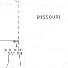
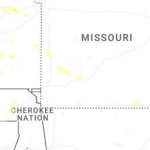


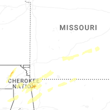


Connect with Interactive Hail Maps