

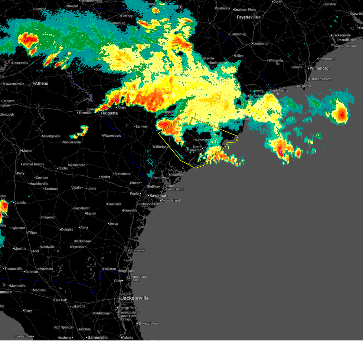
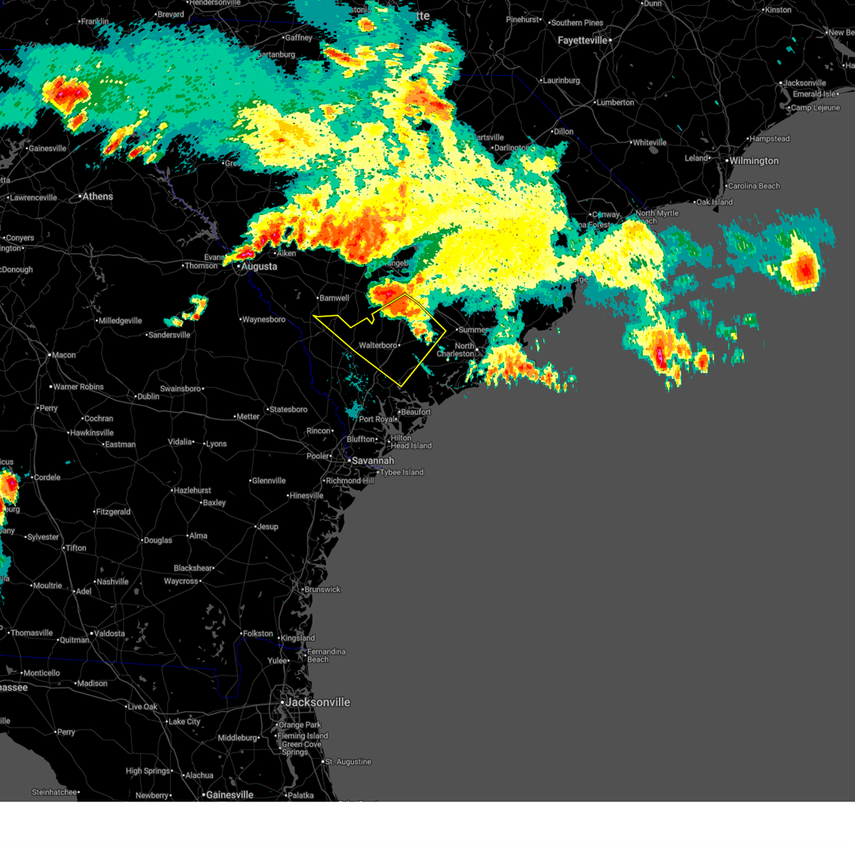
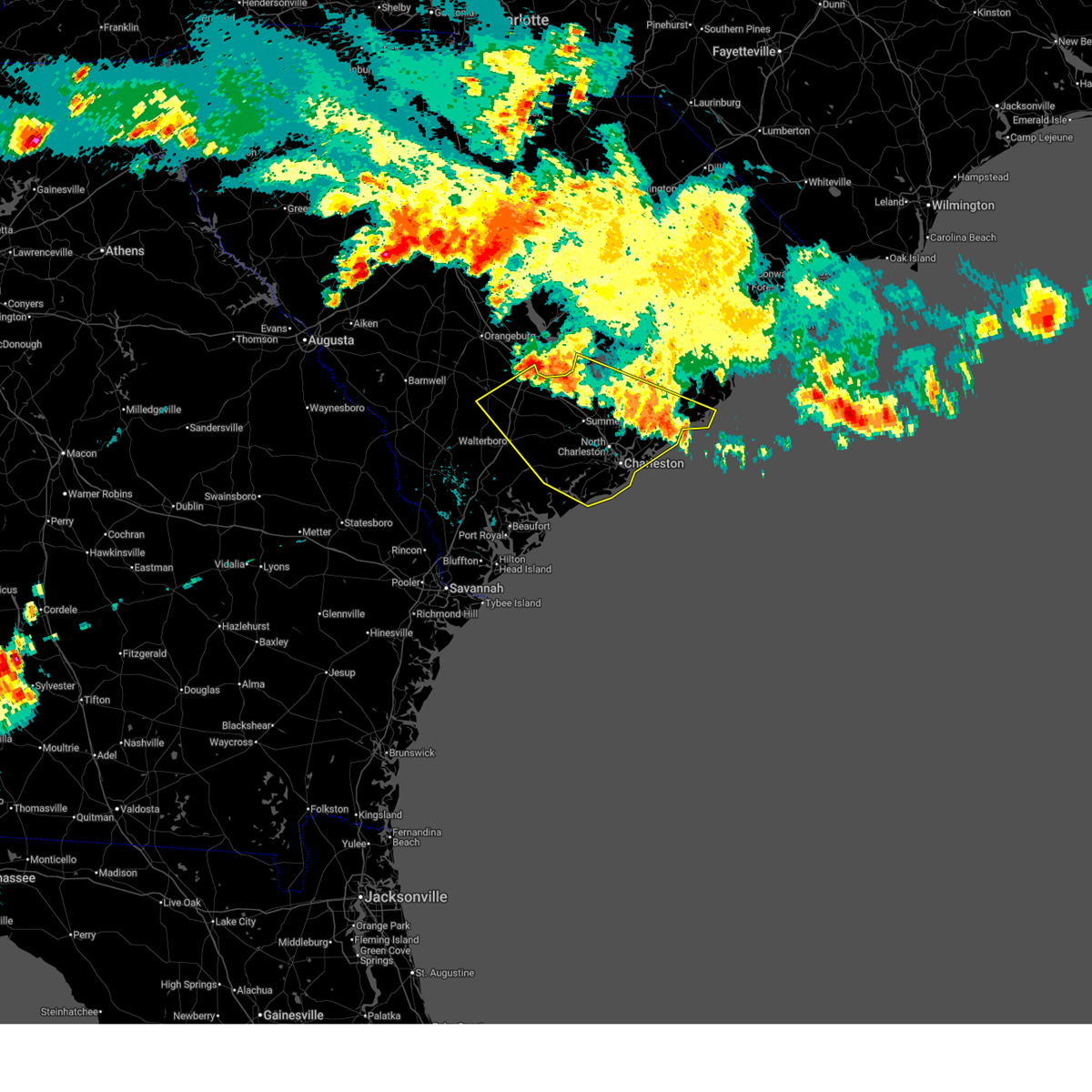
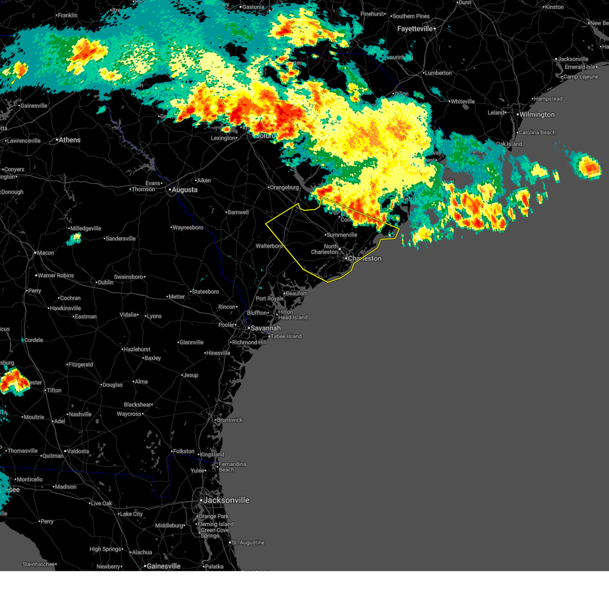
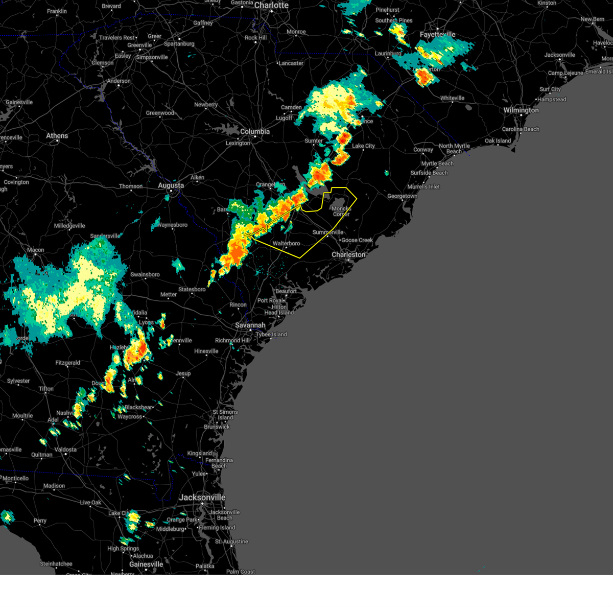
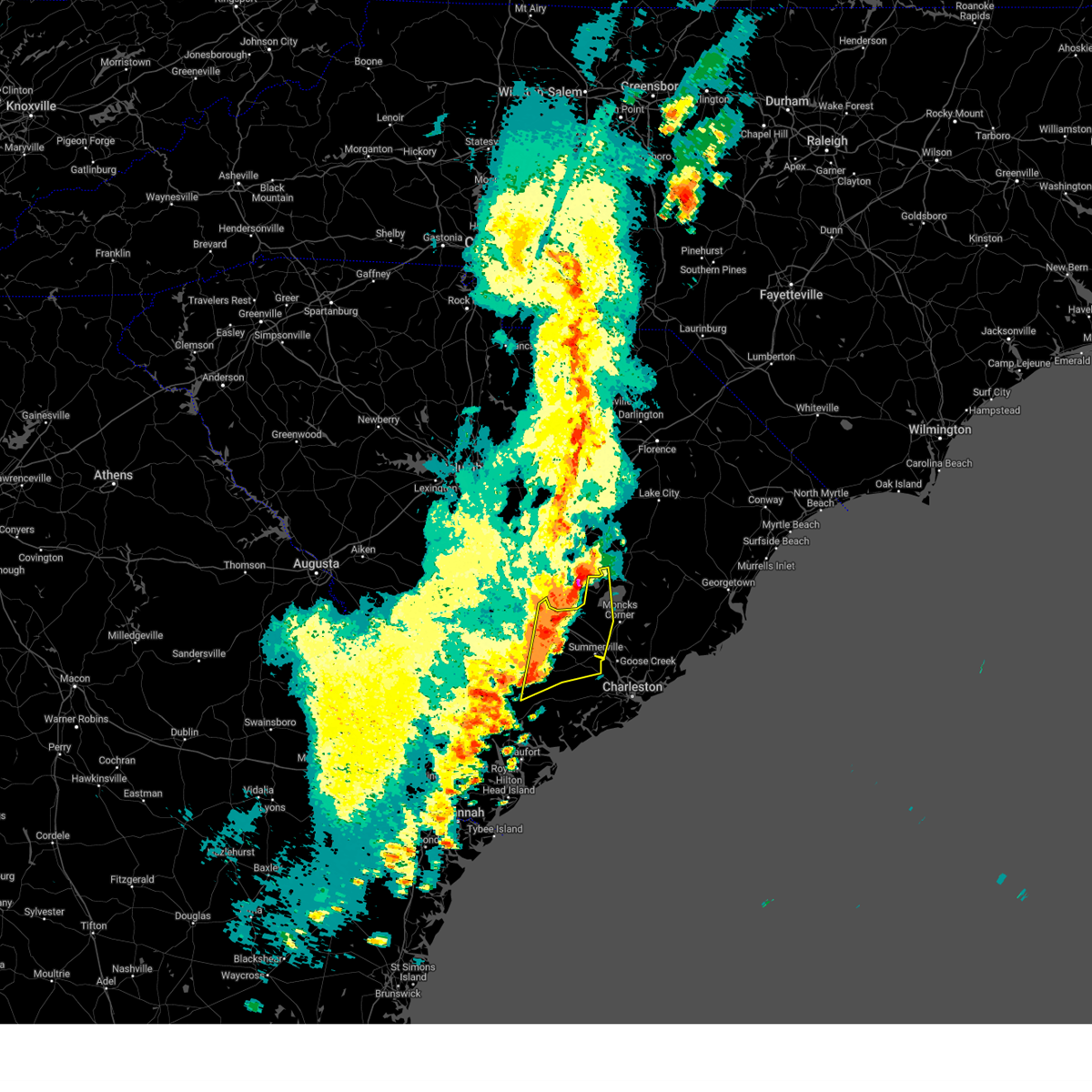
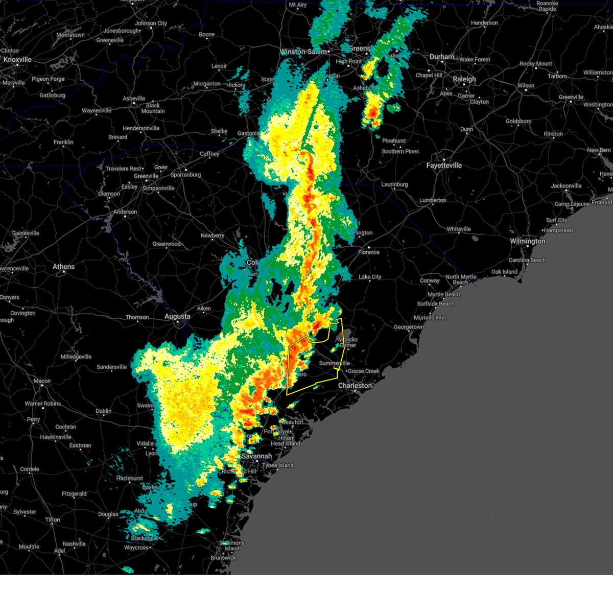
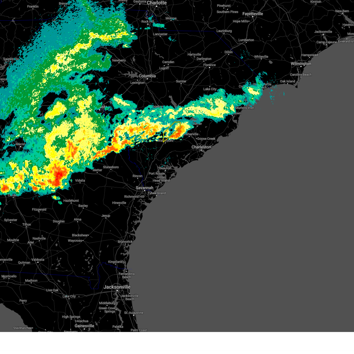
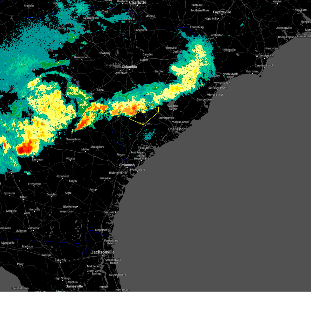
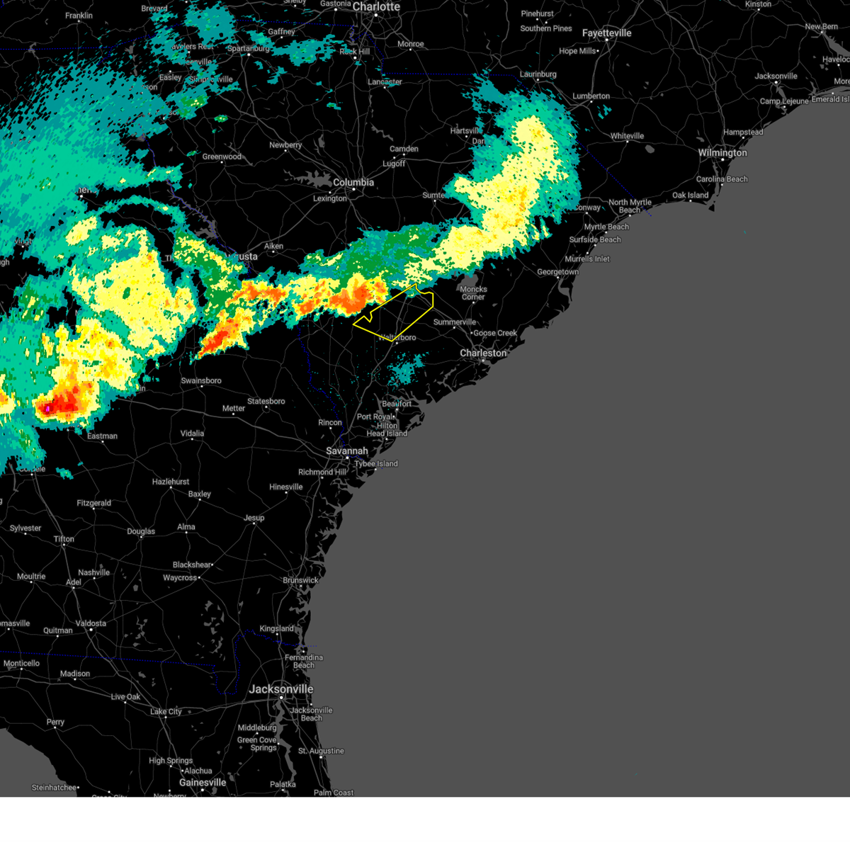
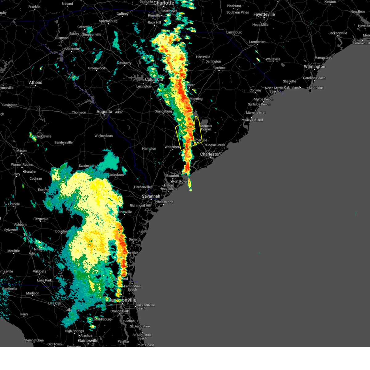
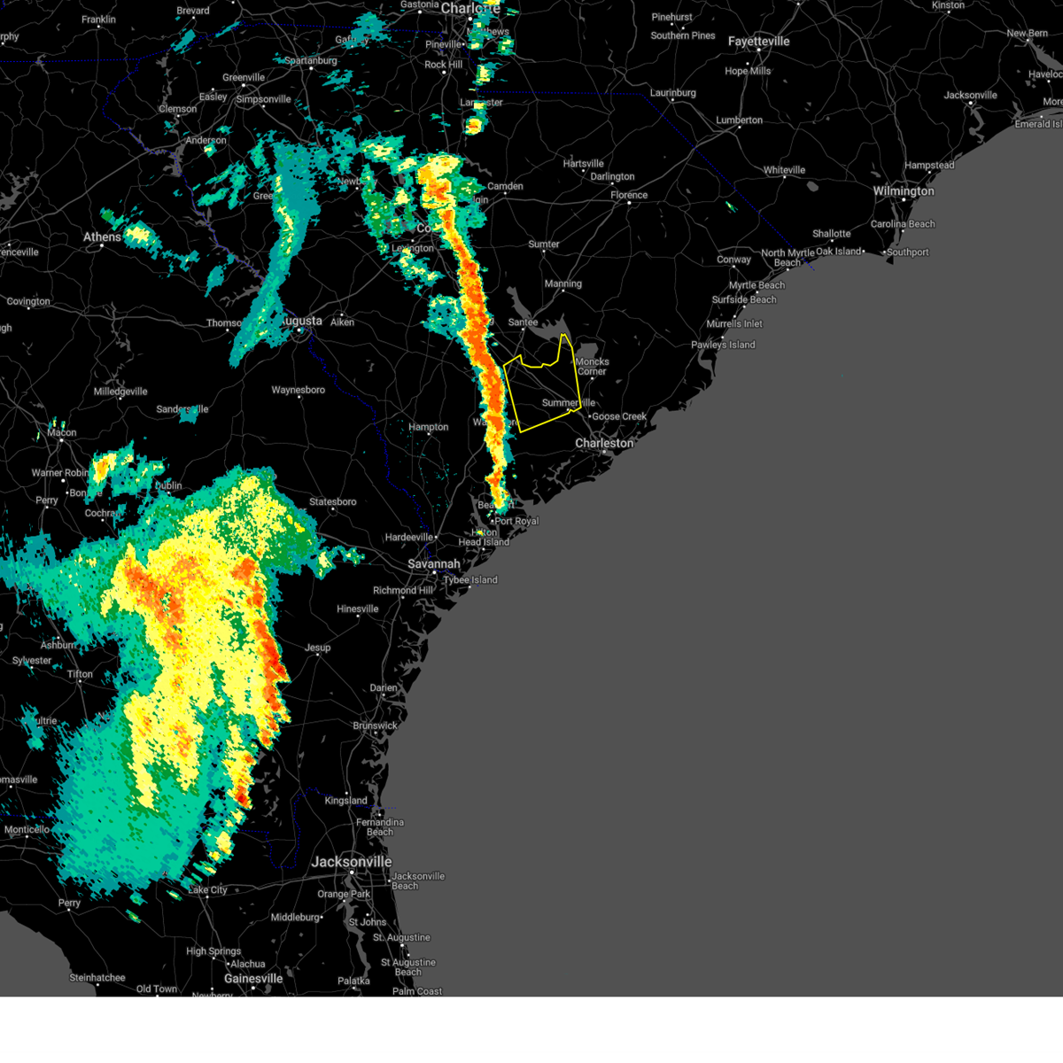
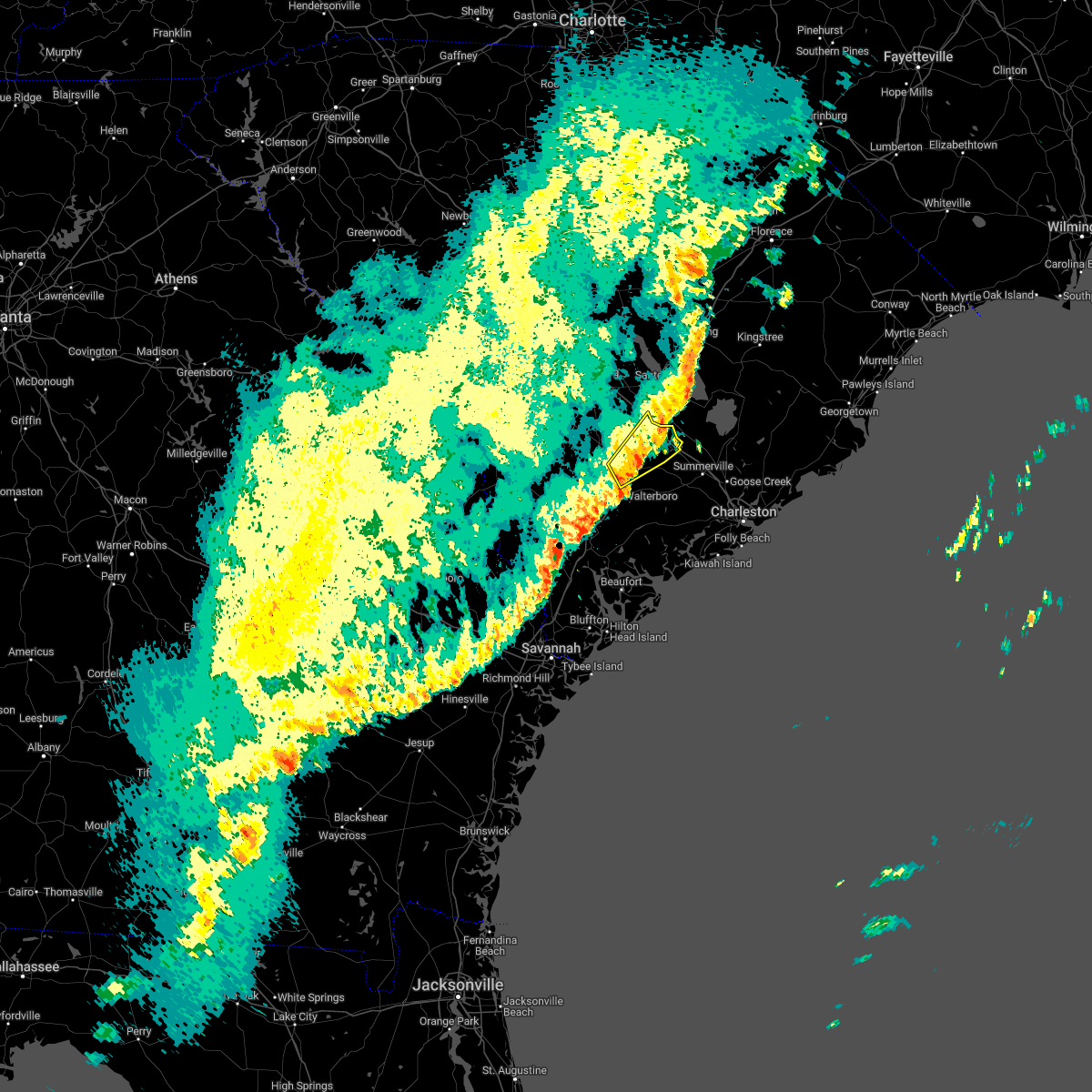
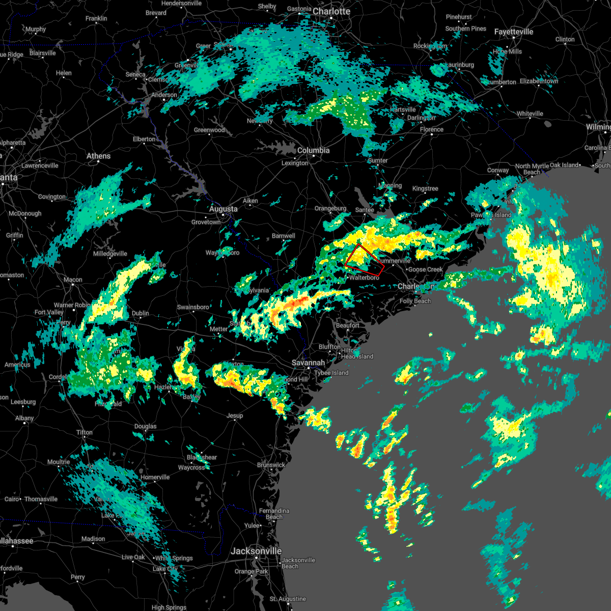
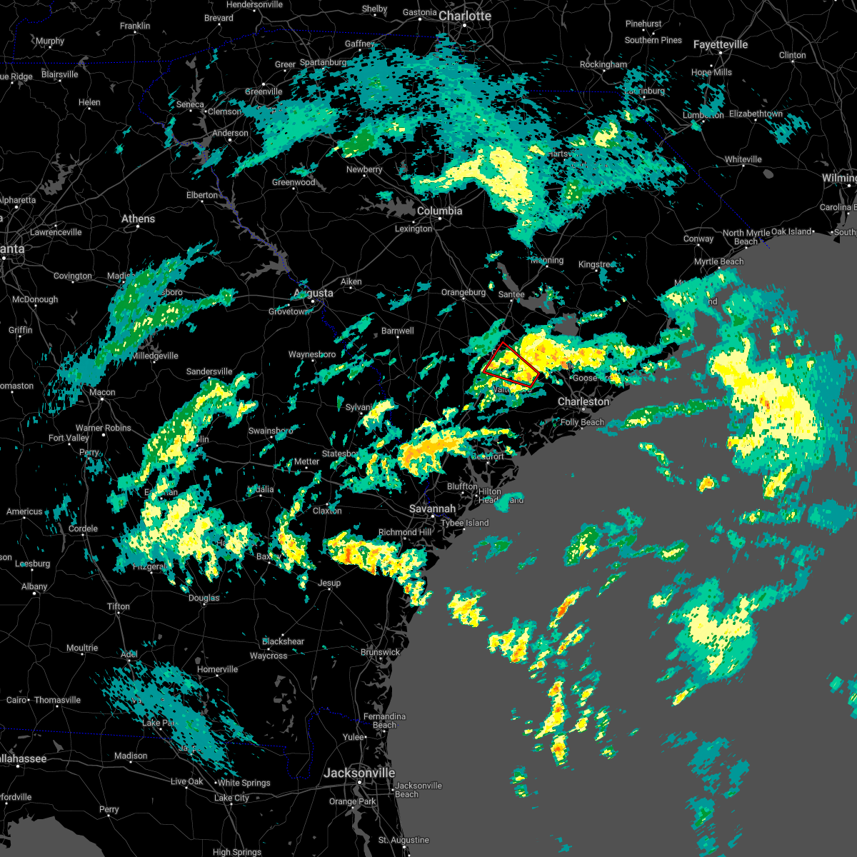
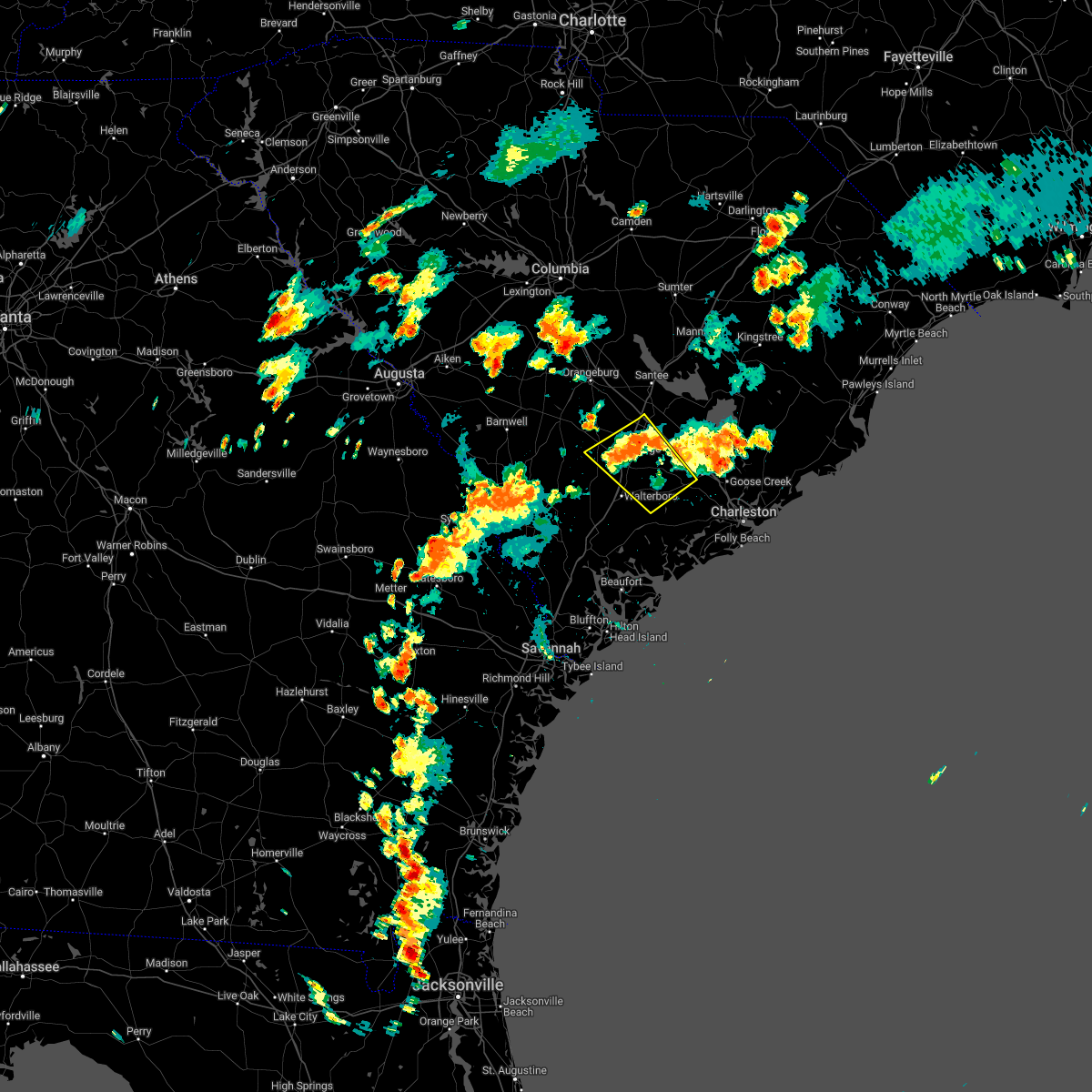
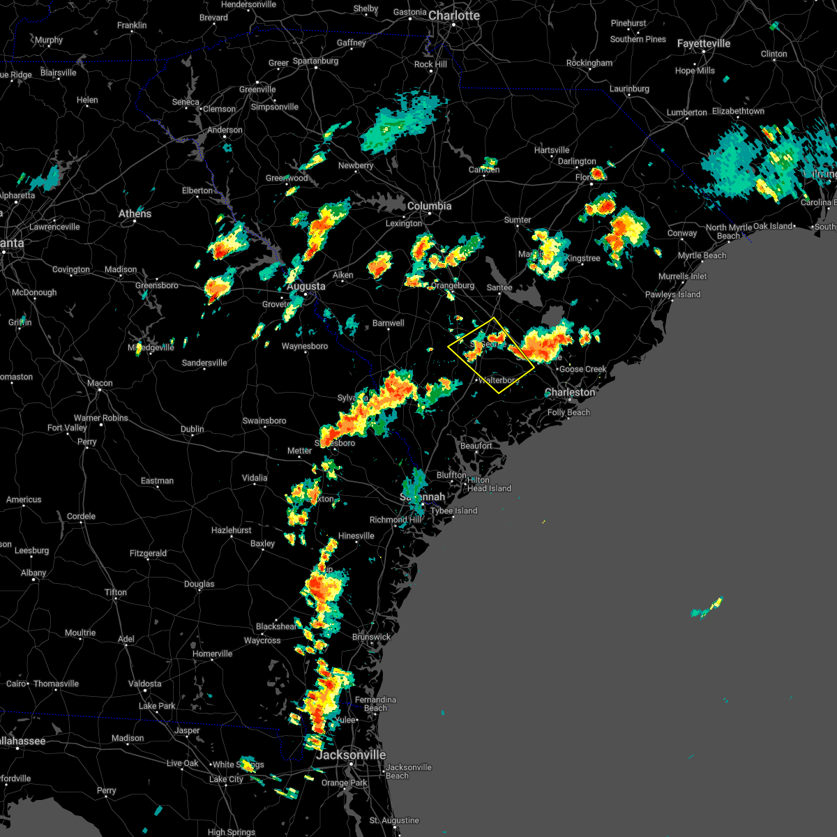
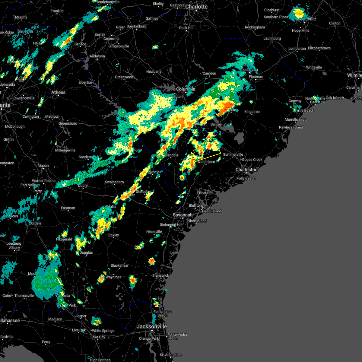
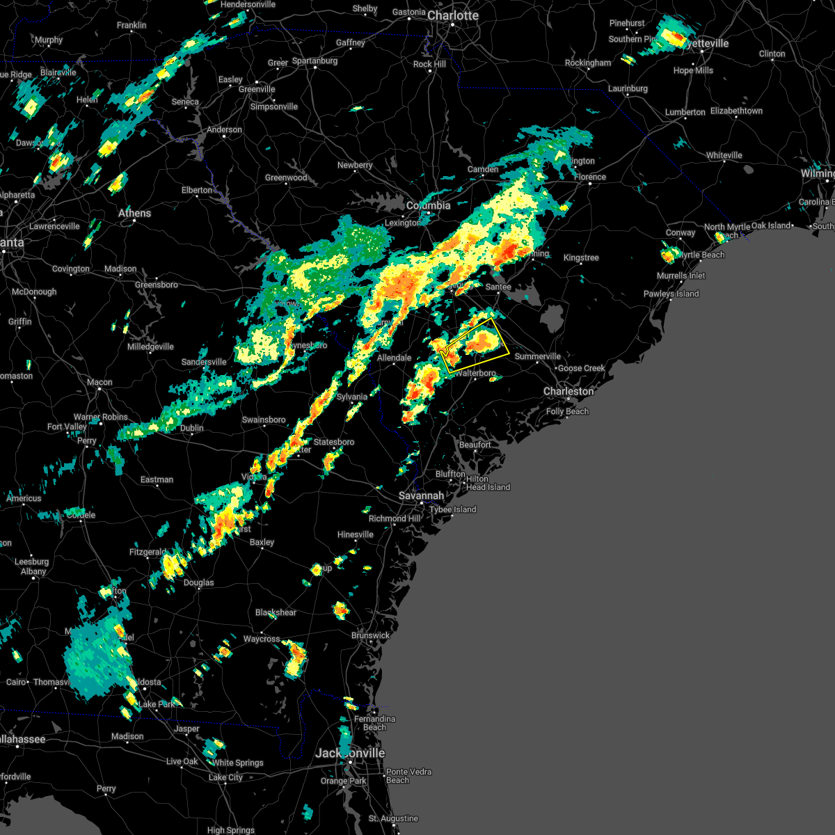
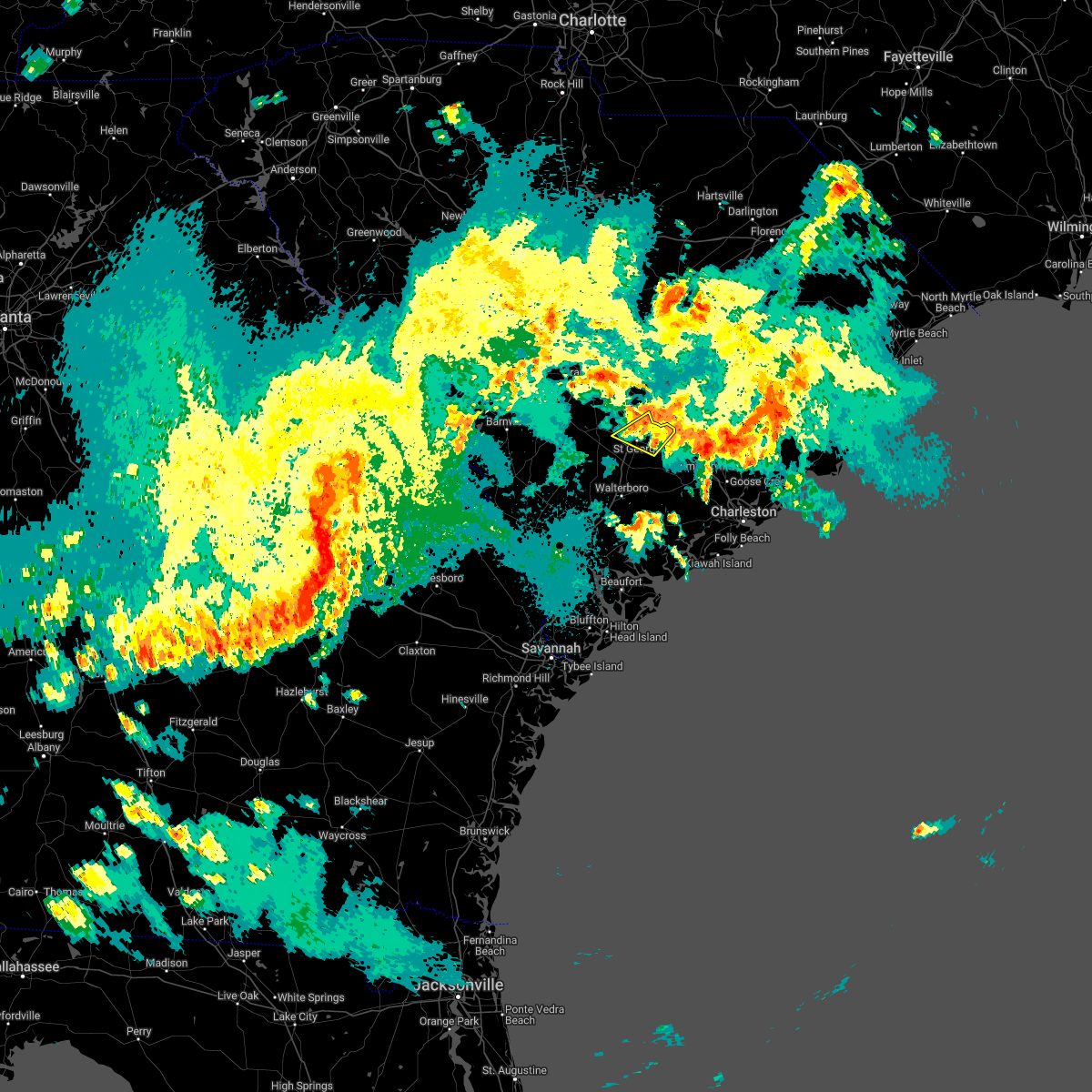
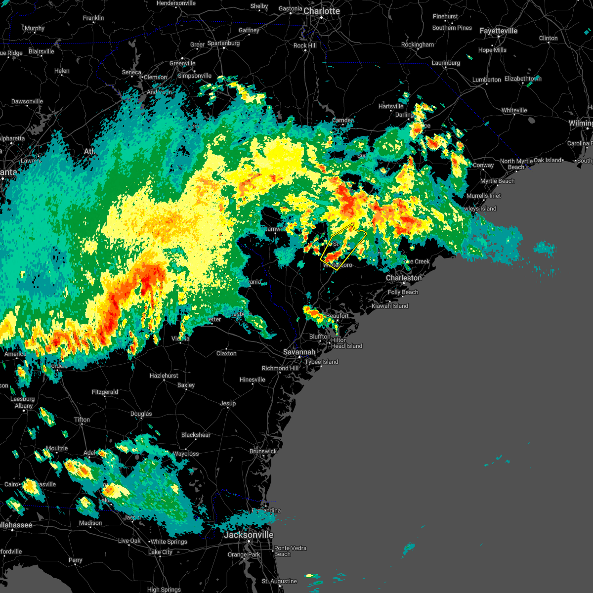
Hail Map for St. George, SC
The St. George, SC area has had 2 reports of on-the-ground hail by trained spotters, and has been under severe weather warnings 10 times during the past 12 months. Doppler radar has detected hail at or near St. George, SC on 44 occasions, including 4 occasions during the past year.
| Name: | St. George, SC |
| Where Located: | 33.4 miles W of Charleston, SC |
| Map: | Google Map for St. George, SC |
| Population: | 2084 |
| Housing Units: | 883 |
| More Info: | Search Google for St. George, SC |
0
The Top Recent Hail Date for St. George, SC is Wednesday, June 25, 2025 (38th out of 44)

Hail and Wind Damage Spotted near St. George, SC
| Date / Time | Report Details |
|---|---|
| 6/25/2025 9:40 PM EDT |
 The severe thunderstorm warning that was previously in effect has been reissued for colleton and dorchester counties and is in effect until 1030 pm edt. please refer to that bulletin for the latest severe weather information. a severe thunderstorm watch remains in effect until 1200 am edt for a portion of southeast south carolina. The severe thunderstorm warning that was previously in effect has been reissued for colleton and dorchester counties and is in effect until 1030 pm edt. please refer to that bulletin for the latest severe weather information. a severe thunderstorm watch remains in effect until 1200 am edt for a portion of southeast south carolina.
|
| 6/25/2025 9:33 PM EDT |
 Svrchs the national weather service in charleston has issued a * severe thunderstorm warning for portions of, allendale county in southeastern south carolina, beaufort county in southeastern south carolina, colleton county in southeastern south carolina, dorchester county in southeastern south carolina, hampton county in southeastern south carolina, * until 1030 pm edt. * at 933 pm edt, severe thunderstorms were located along a line from over cottageville to 12 miles north of lodge, moving southwest at 25 mph (radar indicated). Hazards include 60 mph wind gusts. expect damage to roofs, siding, and trees Svrchs the national weather service in charleston has issued a * severe thunderstorm warning for portions of, allendale county in southeastern south carolina, beaufort county in southeastern south carolina, colleton county in southeastern south carolina, dorchester county in southeastern south carolina, hampton county in southeastern south carolina, * until 1030 pm edt. * at 933 pm edt, severe thunderstorms were located along a line from over cottageville to 12 miles north of lodge, moving southwest at 25 mph (radar indicated). Hazards include 60 mph wind gusts. expect damage to roofs, siding, and trees
|
| 6/25/2025 9:06 PM EDT |
 At 906 pm edt, a combination of a severe wind shift and severe thunderstorms were located along a line from 7 miles southeast of capers inlet to over reevesville, moving southwest at 25 mph (trained spotters reported. at 855 pm, wind gust to 58 mph was observed at the charleston harbor pilot office in downtown charleston). Hazards include 60 mph wind gusts. Expect damage to roofs, siding, and trees. locations impacted include, moncks corner, mcclellanville, goose creek, ladson, hanahan, north charleston, mount pleasant, summerville, saint george and walterboro. this includes the following highways, i-26 between mile markers 171 and 221. i-526 between mile markers 11 and 31. I-95 in south carolina between mile markers 59 and 85. At 906 pm edt, a combination of a severe wind shift and severe thunderstorms were located along a line from 7 miles southeast of capers inlet to over reevesville, moving southwest at 25 mph (trained spotters reported. at 855 pm, wind gust to 58 mph was observed at the charleston harbor pilot office in downtown charleston). Hazards include 60 mph wind gusts. Expect damage to roofs, siding, and trees. locations impacted include, moncks corner, mcclellanville, goose creek, ladson, hanahan, north charleston, mount pleasant, summerville, saint george and walterboro. this includes the following highways, i-26 between mile markers 171 and 221. i-526 between mile markers 11 and 31. I-95 in south carolina between mile markers 59 and 85.
|
| 6/25/2025 8:38 PM EDT |
 Svrchs the national weather service in charleston has issued a * severe thunderstorm warning for portions of, berkeley county in southeastern south carolina, charleston county in southeastern south carolina, colleton county in southeastern south carolina, dorchester county in southeastern south carolina, * until 945 pm edt. * at 838 pm edt, severe thunderstorms were located along a line from near awendaw to 5 miles northeast of harleyville, moving southwest at 40 mph (law enforcement reported. at 835 pm, law enforcement continued to report wind damage occurring across northern and central berkeley county). Hazards include 60 mph wind gusts. expect damage to roofs, siding, and trees Svrchs the national weather service in charleston has issued a * severe thunderstorm warning for portions of, berkeley county in southeastern south carolina, charleston county in southeastern south carolina, colleton county in southeastern south carolina, dorchester county in southeastern south carolina, * until 945 pm edt. * at 838 pm edt, severe thunderstorms were located along a line from near awendaw to 5 miles northeast of harleyville, moving southwest at 40 mph (law enforcement reported. at 835 pm, law enforcement continued to report wind damage occurring across northern and central berkeley county). Hazards include 60 mph wind gusts. expect damage to roofs, siding, and trees
|
| 6/8/2025 12:22 PM EDT | Tree reported down in the 1700 block of highway 15. time estimated from rada in dorchester county SC, 4.3 miles SW of St. George, SC |
| 6/8/2025 12:19 PM EDT | Tree reported down along charleston highway at shannon loop. time estimated from rada in dorchester county SC, 5.4 miles SSW of St. George, SC |
| 6/8/2025 12:10 PM EDT |
 Svrchs the national weather service in charleston has issued a * severe thunderstorm warning for portions of, allendale county in southeastern south carolina, berkeley county in southeastern south carolina, colleton county in southeastern south carolina, dorchester county in southeastern south carolina, * until 115 pm edt. * at 1210 pm edt, severe thunderstorms were located along a line from 14 miles north of harleyville to over colleton, moving east at 40 mph (radar indicated). Hazards include 60 mph wind gusts and small hail. expect damage to roofs, siding, and trees Svrchs the national weather service in charleston has issued a * severe thunderstorm warning for portions of, allendale county in southeastern south carolina, berkeley county in southeastern south carolina, colleton county in southeastern south carolina, dorchester county in southeastern south carolina, * until 115 pm edt. * at 1210 pm edt, severe thunderstorms were located along a line from 14 miles north of harleyville to over colleton, moving east at 40 mph (radar indicated). Hazards include 60 mph wind gusts and small hail. expect damage to roofs, siding, and trees
|
| 5/30/2025 6:18 PM EDT |
 Svrchs the national weather service in charleston has issued a * severe thunderstorm warning for portions of, berkeley county in southeastern south carolina, dorchester county in southeastern south carolina, * until 715 pm edt. * at 618 pm edt, a severe thunderstorm was located 9 miles north of ridgeville, moving east at 60 mph (radar indicated). Hazards include 60 mph wind gusts. expect damage to roofs, siding, and trees Svrchs the national weather service in charleston has issued a * severe thunderstorm warning for portions of, berkeley county in southeastern south carolina, dorchester county in southeastern south carolina, * until 715 pm edt. * at 618 pm edt, a severe thunderstorm was located 9 miles north of ridgeville, moving east at 60 mph (radar indicated). Hazards include 60 mph wind gusts. expect damage to roofs, siding, and trees
|
| 5/19/2025 5:01 PM EDT | One tree down at wire rd and murray cemetery r in dorchester county SC, 6.6 miles NNW of St. George, SC |
| 5/19/2025 4:57 PM EDT | *** 1 inj *** two trees fell across seven acres rd at hwy 15s. two trucks either struck the trees or were hit by the falling trees. one injury. dime size hail nearb in dorchester county SC, 3.7 miles N of St. George, SC |
| 5/9/2025 5:39 AM EDT |
 At 539 am edt, a severe thunderstorm was located 5 miles southeast of saint george, moving east at 25 mph (radar indicated). Hazards include 60 mph wind gusts and small hail. Expect damage to roofs, siding, and trees. locations impacted include, saint george, givhans ferry state park, dorchester, harleyville, reevesville, canadys, texas, grover, byrd and pregnall. this includes the following highways, i-26 between mile markers 171 and 186. I-95 in south carolina between mile markers 64 and 84. At 539 am edt, a severe thunderstorm was located 5 miles southeast of saint george, moving east at 25 mph (radar indicated). Hazards include 60 mph wind gusts and small hail. Expect damage to roofs, siding, and trees. locations impacted include, saint george, givhans ferry state park, dorchester, harleyville, reevesville, canadys, texas, grover, byrd and pregnall. this includes the following highways, i-26 between mile markers 171 and 186. I-95 in south carolina between mile markers 64 and 84.
|
| 5/9/2025 5:08 AM EDT |
 Svrchs the national weather service in charleston has issued a * severe thunderstorm warning for portions of, colleton county in southeastern south carolina, dorchester county in southeastern south carolina, * until 615 am edt. * at 508 am edt, a severe thunderstorm was located near smoaks, moving east at 25 mph (radar indicated). Hazards include 60 mph wind gusts and quarter size hail. Hail damage to vehicles is expected. Expect wind damage to roofs, siding, and trees. Svrchs the national weather service in charleston has issued a * severe thunderstorm warning for portions of, colleton county in southeastern south carolina, dorchester county in southeastern south carolina, * until 615 am edt. * at 508 am edt, a severe thunderstorm was located near smoaks, moving east at 25 mph (radar indicated). Hazards include 60 mph wind gusts and quarter size hail. Hail damage to vehicles is expected. Expect wind damage to roofs, siding, and trees.
|
| 3/31/2025 5:53 PM EDT |
 At 553 pm edt, severe thunderstorms were located along a line from 10 miles north of harleyville to 5 miles southeast of cottageville, moving east at 45 mph (radar indicated). Hazards include 60 mph wind gusts and quarter size hail. Hail damage to vehicles is expected. expect wind damage to roofs, siding, and trees. locations impacted include, north charleston, summerville, saint george, givhans ferry state park, ladson, dorchester, ridgeville, cottageville, harleyville and givhans. This includes i-26 between mile markers 171 and 202. At 553 pm edt, severe thunderstorms were located along a line from 10 miles north of harleyville to 5 miles southeast of cottageville, moving east at 45 mph (radar indicated). Hazards include 60 mph wind gusts and quarter size hail. Hail damage to vehicles is expected. expect wind damage to roofs, siding, and trees. locations impacted include, north charleston, summerville, saint george, givhans ferry state park, ladson, dorchester, ridgeville, cottageville, harleyville and givhans. This includes i-26 between mile markers 171 and 202.
|
| 3/31/2025 5:38 PM EDT |
 Svrchs the national weather service in charleston has issued a * severe thunderstorm warning for portions of, berkeley county in southeastern south carolina, colleton county in southeastern south carolina, dorchester county in southeastern south carolina, * until 645 pm edt. * at 538 pm edt, severe thunderstorms were located along a line from 8 miles northeast of reevesville to over ritter, moving east at 45 mph (radar indicated). Hazards include 60 mph wind gusts and small hail. expect damage to roofs, siding, and trees Svrchs the national weather service in charleston has issued a * severe thunderstorm warning for portions of, berkeley county in southeastern south carolina, colleton county in southeastern south carolina, dorchester county in southeastern south carolina, * until 645 pm edt. * at 538 pm edt, severe thunderstorms were located along a line from 8 miles northeast of reevesville to over ritter, moving east at 45 mph (radar indicated). Hazards include 60 mph wind gusts and small hail. expect damage to roofs, siding, and trees
|
| 9/27/2024 12:58 AM EDT | Dorchester county emergency management reported a tree down on highway 15 between grover and the edisto rive in dorchester county SC, 7.8 miles N of St. George, SC |
| 5/9/2024 1:23 PM EDT |
 The storms which prompted the warning have weakened below severe limits, and no longer pose an immediate threat to life or property. therefore, the warning will be allowed to expire. however, gusty winds are still possible with these thunderstorms. a tornado watch remains in effect until 700 pm edt for southeastern south carolina. to report severe weather, contact your nearest law enforcement agency. they will relay your report to the national weather service charleston. The storms which prompted the warning have weakened below severe limits, and no longer pose an immediate threat to life or property. therefore, the warning will be allowed to expire. however, gusty winds are still possible with these thunderstorms. a tornado watch remains in effect until 700 pm edt for southeastern south carolina. to report severe weather, contact your nearest law enforcement agency. they will relay your report to the national weather service charleston.
|
| 5/9/2024 1:16 PM EDT |
 At 116 pm edt, severe thunderstorms were located along a line extending from near harleyville to near dorchester to near canadys, moving east at 40 mph (radar indicated). Hazards include 70 mph wind gusts and penny size hail. Expect considerable tree damage. damage is likely to mobile homes, roofs, and outbuildings. locations impacted include: saint george, harleyville, and canadys. this warning includes the following interstates: i-26 between mile markers 176 and 184. I-95 in south carolina between mile markers 59 and 72. At 116 pm edt, severe thunderstorms were located along a line extending from near harleyville to near dorchester to near canadys, moving east at 40 mph (radar indicated). Hazards include 70 mph wind gusts and penny size hail. Expect considerable tree damage. damage is likely to mobile homes, roofs, and outbuildings. locations impacted include: saint george, harleyville, and canadys. this warning includes the following interstates: i-26 between mile markers 176 and 184. I-95 in south carolina between mile markers 59 and 72.
|
| 5/9/2024 12:35 PM EDT |
 At 1235 pm edt, severe thunderstorms were located along a line extending from branchville to near smoaks to lodge, moving east at 40 mph (radar indicated). Hazards include 70 mph wind gusts and penny size hail. Expect considerable tree damage. damage is likely to mobile homes, roofs, and outbuildings. locations impacted include: saint george, colleton, harleyville, reevesville, smoaks, lodge, williams, ruffin, padgetts, ashton, and canadys. this warning includes the following interstates: i-26 between mile markers 171 and 184. I-95 in south carolina between mile markers 59 and 85. At 1235 pm edt, severe thunderstorms were located along a line extending from branchville to near smoaks to lodge, moving east at 40 mph (radar indicated). Hazards include 70 mph wind gusts and penny size hail. Expect considerable tree damage. damage is likely to mobile homes, roofs, and outbuildings. locations impacted include: saint george, colleton, harleyville, reevesville, smoaks, lodge, williams, ruffin, padgetts, ashton, and canadys. this warning includes the following interstates: i-26 between mile markers 171 and 184. I-95 in south carolina between mile markers 59 and 85.
|
| 5/9/2024 12:25 PM EDT |
 Svrchs the national weather service in charleston has issued a * severe thunderstorm warning for portions of, colleton county in southeastern south carolina, dorchester county in southeastern south carolina, * until 130 pm edt. * at 1225 pm edt, severe thunderstorms were located along a line extending from 6 miles west of branchville to 8 miles north of lodge to 6 miles north of rivers bridge state park, moving east at 40 mph (radar indicated). Hazards include 60 mph wind gusts and penny size hail. Expect damage to trees and powerlines. locations impacted include: saint george, colleton, harleyville, reevesville, smoaks, lodge, williams, ruffin, padgetts, ashton, and canadys. this warning includes the following interstates: i-26 between mile markers 171 and 184. I-95 in south carolina between mile markers 59 and 85. Svrchs the national weather service in charleston has issued a * severe thunderstorm warning for portions of, colleton county in southeastern south carolina, dorchester county in southeastern south carolina, * until 130 pm edt. * at 1225 pm edt, severe thunderstorms were located along a line extending from 6 miles west of branchville to 8 miles north of lodge to 6 miles north of rivers bridge state park, moving east at 40 mph (radar indicated). Hazards include 60 mph wind gusts and penny size hail. Expect damage to trees and powerlines. locations impacted include: saint george, colleton, harleyville, reevesville, smoaks, lodge, williams, ruffin, padgetts, ashton, and canadys. this warning includes the following interstates: i-26 between mile markers 171 and 184. I-95 in south carolina between mile markers 59 and 85.
|
| 1/9/2024 4:09 PM EST | Tree down near the intersection of overhill dr and old bell r in dorchester county SC, 5.9 miles NNW of St. George, SC |
| 1/9/2024 4:07 PM EST | Tree down along the 3300 block of wire r in dorchester county SC, 6.4 miles N of St. George, SC |
| 1/9/2024 3:28 PM EST |
 At 328 pm est, severe thunderstorms were located along a line extending from near smoaks to near tarboro, moving northeast at 55 mph (radar indicated). Hazards include 60 mph wind gusts. Expect damage to trees and powerlines. locations impacted include: beaufort, walterboro, ridgeland, saint george, yemassee, givhans ferry state park, dorchester, cottageville, harleyville, reevesville, smoaks, williams, coosawhatchie, ruffin, and gardens corner. this warning includes the following interstates: i-26 between mile markers 171 and 186. i-95 in south carolina between mile markers 23 and 85. hail threat, radar indicated max hail size, <. 75 in wind threat, radar indicated max wind gust, 60 mph. At 328 pm est, severe thunderstorms were located along a line extending from near smoaks to near tarboro, moving northeast at 55 mph (radar indicated). Hazards include 60 mph wind gusts. Expect damage to trees and powerlines. locations impacted include: beaufort, walterboro, ridgeland, saint george, yemassee, givhans ferry state park, dorchester, cottageville, harleyville, reevesville, smoaks, williams, coosawhatchie, ruffin, and gardens corner. this warning includes the following interstates: i-26 between mile markers 171 and 186. i-95 in south carolina between mile markers 23 and 85. hail threat, radar indicated max hail size, <. 75 in wind threat, radar indicated max wind gust, 60 mph.
|
| 1/9/2024 3:25 PM EST |
 At 325 pm est, severe thunderstorms were located along a line extending from near smoaks to near tarboro, moving northeast at 55 mph (radar indicated). Hazards include 60 mph wind gusts and quarter size hail. Minor hail damage to vehicles is possible. expect wind damage to trees and powerlines. locations impacted include: beaufort, walterboro, ridgeland, saint george, yemassee, givhans ferry state park, dorchester, cottageville, harleyville, reevesville, smoaks, williams, coosawhatchie, ruffin, and gardens corner. this warning includes the following interstates: i-26 between mile markers 171 and 186. i-95 in south carolina between mile markers 23 and 85. hail threat, radar indicated max hail size, 1. 00 in wind threat, radar indicated max wind gust, 60 mph. At 325 pm est, severe thunderstorms were located along a line extending from near smoaks to near tarboro, moving northeast at 55 mph (radar indicated). Hazards include 60 mph wind gusts and quarter size hail. Minor hail damage to vehicles is possible. expect wind damage to trees and powerlines. locations impacted include: beaufort, walterboro, ridgeland, saint george, yemassee, givhans ferry state park, dorchester, cottageville, harleyville, reevesville, smoaks, williams, coosawhatchie, ruffin, and gardens corner. this warning includes the following interstates: i-26 between mile markers 171 and 186. i-95 in south carolina between mile markers 23 and 85. hail threat, radar indicated max hail size, 1. 00 in wind threat, radar indicated max wind gust, 60 mph.
|
| 9/11/2023 4:19 PM EDT | 1 tree down at intersection of second texas rd and gum branch r in dorchester county SC, 7.2 miles NNW of St. George, SC |
| 9/11/2023 4:09 PM EDT | 1 tree down on westbury rd in dorchester county SC, 4.4 miles N of St. George, SC |
| 9/11/2023 4:06 PM EDT |
 At 406 pm edt, severe thunderstorms were located along a line extending from near canadys to near harleyville, moving southeast at 15 mph (radar indicated). Hazards include 60 mph wind gusts and penny size hail. Expect damage to trees and powerlines. locations impacted include: summerville, walterboro, saint george, givhans ferry state park, ladson, dorchester, ridgeville, cottageville, harleyville, givhans, jedburg, canadys, ritter, round o, and sangaree. this warning includes the following interstates: i-26 between mile markers 178 and 202. i-95 in south carolina between mile markers 56 and 74. hail threat, radar indicated max hail size, 0. 75 in wind threat, radar indicated max wind gust, 60 mph. At 406 pm edt, severe thunderstorms were located along a line extending from near canadys to near harleyville, moving southeast at 15 mph (radar indicated). Hazards include 60 mph wind gusts and penny size hail. Expect damage to trees and powerlines. locations impacted include: summerville, walterboro, saint george, givhans ferry state park, ladson, dorchester, ridgeville, cottageville, harleyville, givhans, jedburg, canadys, ritter, round o, and sangaree. this warning includes the following interstates: i-26 between mile markers 178 and 202. i-95 in south carolina between mile markers 56 and 74. hail threat, radar indicated max hail size, 0. 75 in wind threat, radar indicated max wind gust, 60 mph.
|
| 8/7/2023 8:26 PM EDT |
 At 825 pm edt, severe thunderstorms were located along a line extending from near ridgeville to near round o to yemassee, moving east at 50 mph (emergency management. at 800 pm edt, colleton county emergency management reported several trees down in the county). Hazards include 60 mph wind gusts. Expect damage to trees and powerlines. locations impacted include: walterboro, saint george, givhans ferry state park, dorchester, cottageville, harleyville, reevesville, canadys, ritter, hendersonville, round o, green pond, early branch, ashepoo, and white hall. this warning includes the following interstates: i-26 between mile markers 171 and 187. i-95 in south carolina between mile markers 41 and 85. hail threat, radar indicated max hail size, <. 75 in wind threat, radar indicated max wind gust, 60 mph. At 825 pm edt, severe thunderstorms were located along a line extending from near ridgeville to near round o to yemassee, moving east at 50 mph (emergency management. at 800 pm edt, colleton county emergency management reported several trees down in the county). Hazards include 60 mph wind gusts. Expect damage to trees and powerlines. locations impacted include: walterboro, saint george, givhans ferry state park, dorchester, cottageville, harleyville, reevesville, canadys, ritter, hendersonville, round o, green pond, early branch, ashepoo, and white hall. this warning includes the following interstates: i-26 between mile markers 171 and 187. i-95 in south carolina between mile markers 41 and 85. hail threat, radar indicated max hail size, <. 75 in wind threat, radar indicated max wind gust, 60 mph.
|
| 8/7/2023 7:49 PM EDT |
 At 749 pm edt, severe thunderstorms were located along a line extending from near reevesville to near smoaks to almeda intersection, moving east at 35 mph (radar indicated). Hazards include 60 mph wind gusts. Expect damage to trees and powerlines. locations impacted include: walterboro, hampton, saint george, givhans ferry state park, dorchester, colleton, varnville, cottageville, harleyville, reevesville, smoaks, williams, ruffin, hendersonville, and round o. this warning includes the following interstates: i-26 between mile markers 171 and 187. i-95 in south carolina between mile markers 41 and 85. hail threat, radar indicated max hail size, <. 75 in wind threat, radar indicated max wind gust, 60 mph. At 749 pm edt, severe thunderstorms were located along a line extending from near reevesville to near smoaks to almeda intersection, moving east at 35 mph (radar indicated). Hazards include 60 mph wind gusts. Expect damage to trees and powerlines. locations impacted include: walterboro, hampton, saint george, givhans ferry state park, dorchester, colleton, varnville, cottageville, harleyville, reevesville, smoaks, williams, ruffin, hendersonville, and round o. this warning includes the following interstates: i-26 between mile markers 171 and 187. i-95 in south carolina between mile markers 41 and 85. hail threat, radar indicated max hail size, <. 75 in wind threat, radar indicated max wind gust, 60 mph.
|
| 7/31/2023 10:15 PM EDT |
 At 1015 pm edt, severe thunderstorms were located along a line extending from ruffin to near canadys to near harleyville, moving southeast at 25 mph (law enforcement. at 1012 pm, the dorchester county 911 center reported trees down in the northern part of the county). Hazards include 60 mph wind gusts. Expect damage to trees and powerlines. locations impacted include: walterboro, saint george, givhans ferry state park, dorchester, colleton, ridgeville, cottageville, harleyville, reevesville, smoaks, lodge, williams, ruffin, canadys, and hendersonville. this warning includes the following interstates: i-26 between mile markers 171 and 192. i-95 in south carolina between mile markers 42 and 85. hail threat, radar indicated max hail size, <. 75 in wind threat, observed max wind gust, 60 mph. At 1015 pm edt, severe thunderstorms were located along a line extending from ruffin to near canadys to near harleyville, moving southeast at 25 mph (law enforcement. at 1012 pm, the dorchester county 911 center reported trees down in the northern part of the county). Hazards include 60 mph wind gusts. Expect damage to trees and powerlines. locations impacted include: walterboro, saint george, givhans ferry state park, dorchester, colleton, ridgeville, cottageville, harleyville, reevesville, smoaks, lodge, williams, ruffin, canadys, and hendersonville. this warning includes the following interstates: i-26 between mile markers 171 and 192. i-95 in south carolina between mile markers 42 and 85. hail threat, radar indicated max hail size, <. 75 in wind threat, observed max wind gust, 60 mph.
|
| 7/31/2023 10:06 PM EDT |
 At 1005 pm edt, severe thunderstorms were located along a line extending from williams to near canadys to near harleyville, moving southeast at 30 mph (radar indicated). Hazards include 60 mph wind gusts. Expect damage to trees and powerlines. locations impacted include: walterboro, saint george, givhans ferry state park, dorchester, colleton, ridgeville, cottageville, harleyville, reevesville, smoaks, lodge, williams, ruffin, canadys, and hendersonville. this warning includes the following interstates: i-26 between mile markers 171 and 192. i-95 in south carolina between mile markers 42 and 85. hail threat, radar indicated max hail size, <. 75 in wind threat, radar indicated max wind gust, 60 mph. At 1005 pm edt, severe thunderstorms were located along a line extending from williams to near canadys to near harleyville, moving southeast at 30 mph (radar indicated). Hazards include 60 mph wind gusts. Expect damage to trees and powerlines. locations impacted include: walterboro, saint george, givhans ferry state park, dorchester, colleton, ridgeville, cottageville, harleyville, reevesville, smoaks, lodge, williams, ruffin, canadys, and hendersonville. this warning includes the following interstates: i-26 between mile markers 171 and 192. i-95 in south carolina between mile markers 42 and 85. hail threat, radar indicated max hail size, <. 75 in wind threat, radar indicated max wind gust, 60 mph.
|
| 7/31/2023 9:56 PM EDT | A dorchester county emergency manager reported power lines down along the 1000 block of highway 1 in dorchester county SC, 3.1 miles NNW of St. George, SC |
| 7/31/2023 9:52 PM EDT | A dorchester county emergency manager reported a tree and power lines down along the 100 block of quaker stree in dorchester county SC, 1 miles NNW of St. George, SC |
| 7/31/2023 9:52 PM EDT | A dorchester county emergency manager reported a tree down along the 5200 block of east jim bilton boulevar in dorchester county SC, 1.9 miles WNW of St. George, SC |
| 7/31/2023 9:52 PM EDT | A dorchester county emergency manager reported a tree down on a house along the 100 block of st james roa in dorchester county SC, 1.7 miles WSW of St. George, SC |
| 7/31/2023 9:51 PM EDT | A dorchester county emergency manager reported a tree down on a house along the 100 block of davis terrac in dorchester county SC, 1.3 miles SSW of St. George, SC |
| 7/31/2023 9:48 PM EDT | A dorchester county emergency manager reported a tree down along the 100 block of rebecca roa in dorchester county SC, 1.7 miles SE of St. George, SC |
| 7/31/2023 9:44 PM EDT |
 At 944 pm edt, severe thunderstorms were located along a line extending from near padgetts to reevesville to 7 miles west of holly hill, moving southeast at 15 mph (radar indicated). Hazards include 60 mph wind gusts and penny size hail. Expect damage to trees and powerlines. locations impacted include: walterboro, saint george, givhans ferry state park, dorchester, colleton, ridgeville, cottageville, harleyville, reevesville, smoaks, lodge, williams, ruffin, canadys, and hendersonville. this warning includes the following interstates: i-26 between mile markers 171 and 192. i-95 in south carolina between mile markers 42 and 85. hail threat, radar indicated max hail size, 0. 75 in wind threat, radar indicated max wind gust, 60 mph. At 944 pm edt, severe thunderstorms were located along a line extending from near padgetts to reevesville to 7 miles west of holly hill, moving southeast at 15 mph (radar indicated). Hazards include 60 mph wind gusts and penny size hail. Expect damage to trees and powerlines. locations impacted include: walterboro, saint george, givhans ferry state park, dorchester, colleton, ridgeville, cottageville, harleyville, reevesville, smoaks, lodge, williams, ruffin, canadys, and hendersonville. this warning includes the following interstates: i-26 between mile markers 171 and 192. i-95 in south carolina between mile markers 42 and 85. hail threat, radar indicated max hail size, 0. 75 in wind threat, radar indicated max wind gust, 60 mph.
|
| 7/31/2023 9:48 AM EDT | A dorchester county emergency manager reported a tree down along the 100 block of rebecca roa in dorchester county SC, 1.7 miles SE of St. George, SC |
| 7/20/2023 10:24 PM EDT | Tree reported down along highway 15 at cherry lane. time estimated from rada in dorchester county SC, 4.7 miles SW of St. George, SC |
| 7/20/2023 10:10 PM EDT |
 At 1010 pm edt, severe thunderstorms were located along a line extending from near islandton to 6 miles northeast of bowman, moving east at 40 mph (radar indicated). Hazards include 60 mph wind gusts and quarter size hail. Minor hail damage to vehicles is possible. expect wind damage to trees and powerlines. locations impacted include: summerville, walterboro, saint george, givhans ferry state park, dorchester, ridgeville, cottageville, harleyville, reevesville, smoaks, williams, givhans, ruffin, jedburg, and canadys. this warning includes the following interstates: i-26 between mile markers 171 and 189. i-95 in south carolina between mile markers 45 and 85. hail threat, radar indicated max hail size, 1. 00 in wind threat, radar indicated max wind gust, 60 mph. At 1010 pm edt, severe thunderstorms were located along a line extending from near islandton to 6 miles northeast of bowman, moving east at 40 mph (radar indicated). Hazards include 60 mph wind gusts and quarter size hail. Minor hail damage to vehicles is possible. expect wind damage to trees and powerlines. locations impacted include: summerville, walterboro, saint george, givhans ferry state park, dorchester, ridgeville, cottageville, harleyville, reevesville, smoaks, williams, givhans, ruffin, jedburg, and canadys. this warning includes the following interstates: i-26 between mile markers 171 and 189. i-95 in south carolina between mile markers 45 and 85. hail threat, radar indicated max hail size, 1. 00 in wind threat, radar indicated max wind gust, 60 mph.
|
| 6/19/2023 12:26 PM EDT |
 The severe thunderstorm warning for portions of colleton, berkeley and dorchester counties will expire at 1230 pm edt, the storms which prompted the warning have weakened below severe limits. therefore, the warning will be allowed to expire. however, gusty winds and heavy rain are still possible with these thunderstorms. The severe thunderstorm warning for portions of colleton, berkeley and dorchester counties will expire at 1230 pm edt, the storms which prompted the warning have weakened below severe limits. therefore, the warning will be allowed to expire. however, gusty winds and heavy rain are still possible with these thunderstorms.
|
| 6/19/2023 11:28 AM EDT |
 At 1128 am edt, severe thunderstorms were located along a line extending from near reevesville to near canadys to near walterboro, moving northeast at 25 mph (radar indicated). Hazards include 60 mph wind gusts. Expect damage to trees and powerlines. locations impacted include: summerville, saint george, givhans ferry state park, ladson, dorchester, ridgeville, cottageville, harleyville, givhans, cross, jedburg, sangaree, knightsville, and eastern lake marion. this warning includes the following interstates: i-26 between mile markers 171 and 202. i-95 in south carolina between mile markers 79 and 85. hail threat, radar indicated max hail size, <. 75 in wind threat, radar indicated max wind gust, 60 mph. At 1128 am edt, severe thunderstorms were located along a line extending from near reevesville to near canadys to near walterboro, moving northeast at 25 mph (radar indicated). Hazards include 60 mph wind gusts. Expect damage to trees and powerlines. locations impacted include: summerville, saint george, givhans ferry state park, ladson, dorchester, ridgeville, cottageville, harleyville, givhans, cross, jedburg, sangaree, knightsville, and eastern lake marion. this warning includes the following interstates: i-26 between mile markers 171 and 202. i-95 in south carolina between mile markers 79 and 85. hail threat, radar indicated max hail size, <. 75 in wind threat, radar indicated max wind gust, 60 mph.
|
| 6/19/2023 11:16 AM EDT |
 At 1116 am edt, severe thunderstorms were located along a line extending from near reevesville to near gardens corner, moving east at 20 mph (radar indicated). Hazards include 60 mph wind gusts. Expect damage to trees and powerlines. locations impacted include: walterboro, saint george, reevesville, smoaks, ruffin, gardens corner, jacksonboro, canadys, ritter, hendersonville, round o, green pond, ashepoo, and white hall. this warning includes i-95 in south carolina between mile markers 46 and 79. hail threat, radar indicated max hail size, <. 75 in wind threat, radar indicated max wind gust, 60 mph. At 1116 am edt, severe thunderstorms were located along a line extending from near reevesville to near gardens corner, moving east at 20 mph (radar indicated). Hazards include 60 mph wind gusts. Expect damage to trees and powerlines. locations impacted include: walterboro, saint george, reevesville, smoaks, ruffin, gardens corner, jacksonboro, canadys, ritter, hendersonville, round o, green pond, ashepoo, and white hall. this warning includes i-95 in south carolina between mile markers 46 and 79. hail threat, radar indicated max hail size, <. 75 in wind threat, radar indicated max wind gust, 60 mph.
|
| 6/19/2023 10:58 AM EDT |
 At 1058 am edt, severe thunderstorms were located along a line extending from near smoaks to sheldon, moving east at 20 mph (radar indicated). Hazards include 60 mph wind gusts. Expect damage to trees and powerlines. locations impacted include: walterboro, saint george, yemassee, colleton, reevesville, smoaks, williams, ruffin, gardens corner, jacksonboro, canadys, ritter, hendersonville, round o, and green pond. this warning includes i-95 in south carolina between mile markers 42 and 79. hail threat, radar indicated max hail size, <. 75 in wind threat, radar indicated max wind gust, 60 mph. At 1058 am edt, severe thunderstorms were located along a line extending from near smoaks to sheldon, moving east at 20 mph (radar indicated). Hazards include 60 mph wind gusts. Expect damage to trees and powerlines. locations impacted include: walterboro, saint george, yemassee, colleton, reevesville, smoaks, williams, ruffin, gardens corner, jacksonboro, canadys, ritter, hendersonville, round o, and green pond. this warning includes i-95 in south carolina between mile markers 42 and 79. hail threat, radar indicated max hail size, <. 75 in wind threat, radar indicated max wind gust, 60 mph.
|
| 6/19/2023 10:44 AM EDT |
 At 1043 am edt, severe thunderstorms were located along a line extending from 7 miles north of lodge to near sheldon, moving northeast at 25 mph (radar indicated). Hazards include 60 mph wind gusts. Expect damage to trees and powerlines. locations impacted include: walterboro, saint george, yemassee, colleton, reevesville, smoaks, lodge, williams, ruffin, gardens corner, ashton, hendersonville, round o, green pond, and padgetts. this warning includes i-95 in south carolina between mile markers 32 and 79. hail threat, radar indicated max hail size, <. 75 in wind threat, radar indicated max wind gust, 60 mph. At 1043 am edt, severe thunderstorms were located along a line extending from 7 miles north of lodge to near sheldon, moving northeast at 25 mph (radar indicated). Hazards include 60 mph wind gusts. Expect damage to trees and powerlines. locations impacted include: walterboro, saint george, yemassee, colleton, reevesville, smoaks, lodge, williams, ruffin, gardens corner, ashton, hendersonville, round o, green pond, and padgetts. this warning includes i-95 in south carolina between mile markers 32 and 79. hail threat, radar indicated max hail size, <. 75 in wind threat, radar indicated max wind gust, 60 mph.
|
| 6/11/2023 5:03 PM EDT |
 At 502 pm edt, severe thunderstorms were located along a line extending from near reevesville to mcphersonville to near ebenezer, moving east at 45 mph (law enforcement. at 502 pm, colleton county officials reported trees blown down in multiple locations across the county). Hazards include 60 mph wind gusts and penny size hail. Expect damage to trees and powerlines. locations impacted include: bluffton, beaufort, port royal, walterboro, ridgeland, springfield, saint george, givhans ferry state park, dorchester, clarendon, jasper, rincon, hardeeville, ridgeville, and cottageville. this warning includes the following interstates: i-26 between mile markers 172 and 191. i-95 in south carolina between mile markers 6 and 28. hail threat, radar indicated max hail size, 0. 75 in wind threat, radar indicated max wind gust, 60 mph. At 502 pm edt, severe thunderstorms were located along a line extending from near reevesville to mcphersonville to near ebenezer, moving east at 45 mph (law enforcement. at 502 pm, colleton county officials reported trees blown down in multiple locations across the county). Hazards include 60 mph wind gusts and penny size hail. Expect damage to trees and powerlines. locations impacted include: bluffton, beaufort, port royal, walterboro, ridgeland, springfield, saint george, givhans ferry state park, dorchester, clarendon, jasper, rincon, hardeeville, ridgeville, and cottageville. this warning includes the following interstates: i-26 between mile markers 172 and 191. i-95 in south carolina between mile markers 6 and 28. hail threat, radar indicated max hail size, 0. 75 in wind threat, radar indicated max wind gust, 60 mph.
|
| 6/11/2023 4:50 PM EDT |
 At 450 pm edt, severe thunderstorms were located along a line extending from near smoaks to near pineland, moving east at 30 mph (radar indicated). Hazards include 60 mph wind gusts and penny size hail. Expect damage to trees and powerlines. locations impacted include: walterboro, hampton, saint george, yemassee, colleton, varnville, furman, reevesville, smoaks, lodge, williams, coosawhatchie, ruffin, gardens corner, and miley. this warning includes i-95 in south carolina between mile markers 28 and 85. hail threat, radar indicated max hail size, 0. 75 in wind threat, radar indicated max wind gust, 60 mph. At 450 pm edt, severe thunderstorms were located along a line extending from near smoaks to near pineland, moving east at 30 mph (radar indicated). Hazards include 60 mph wind gusts and penny size hail. Expect damage to trees and powerlines. locations impacted include: walterboro, hampton, saint george, yemassee, colleton, varnville, furman, reevesville, smoaks, lodge, williams, coosawhatchie, ruffin, gardens corner, and miley. this warning includes i-95 in south carolina between mile markers 28 and 85. hail threat, radar indicated max hail size, 0. 75 in wind threat, radar indicated max wind gust, 60 mph.
|
| 6/11/2023 4:30 PM EDT |
 At 430 pm edt, severe thunderstorms were located along a line extending from near lodge to robertville, moving northeast at 35 mph (radar indicated). Hazards include 60 mph wind gusts and penny size hail. Expect damage to trees and powerlines. locations impacted include: walterboro, hampton, saint george, yemassee, lake warren state park, colleton, varnville, estill, brunson, furman, scotia, reevesville, luray, smoaks, and lodge. this warning includes i-95 in south carolina between mile markers 28 and 85. hail threat, radar indicated max hail size, 0. 75 in wind threat, radar indicated max wind gust, 60 mph. At 430 pm edt, severe thunderstorms were located along a line extending from near lodge to robertville, moving northeast at 35 mph (radar indicated). Hazards include 60 mph wind gusts and penny size hail. Expect damage to trees and powerlines. locations impacted include: walterboro, hampton, saint george, yemassee, lake warren state park, colleton, varnville, estill, brunson, furman, scotia, reevesville, luray, smoaks, and lodge. this warning includes i-95 in south carolina between mile markers 28 and 85. hail threat, radar indicated max hail size, 0. 75 in wind threat, radar indicated max wind gust, 60 mph.
|
| 1/4/2023 12:11 PM EST |
 The severe thunderstorm warning for portions of colleton and dorchester counties will expire at 1215 pm est, the storm which prompted the warning has weakened below severe limits, and no longer poses an immediate threat to life or property. therefore, the warning will be allowed to expire. The severe thunderstorm warning for portions of colleton and dorchester counties will expire at 1215 pm est, the storm which prompted the warning has weakened below severe limits, and no longer poses an immediate threat to life or property. therefore, the warning will be allowed to expire.
|
| 1/4/2023 12:03 PM EST |
 At 1203 pm est, a severe thunderstorm was located near dorchester, moving east at 45 mph (radar indicated). Hazards include 60 mph wind gusts. Expect damage to trees and powerlines. locations impacted include: saint george, dorchester, harleyville and canadys. this warning includes the following interstates: i-26 between mile markers 171 and 188. i-95 in south carolina between mile markers 61 and 82. hail threat, radar indicated max hail size, <. 75 in wind threat, radar indicated max wind gust, 60 mph. At 1203 pm est, a severe thunderstorm was located near dorchester, moving east at 45 mph (radar indicated). Hazards include 60 mph wind gusts. Expect damage to trees and powerlines. locations impacted include: saint george, dorchester, harleyville and canadys. this warning includes the following interstates: i-26 between mile markers 171 and 188. i-95 in south carolina between mile markers 61 and 82. hail threat, radar indicated max hail size, <. 75 in wind threat, radar indicated max wind gust, 60 mph.
|
| 1/4/2023 11:34 AM EST |
 At 1133 am est, a severe thunderstorm was located over reevesville, moving east at 40 mph (radar indicated). Hazards include 60 mph wind gusts. Expect damage to trees and powerlines. locations impacted include: saint george, dorchester, colleton, harleyville, reevesville, smoaks, lodge, williams, ruffin, ashton, canadys, islandton and padgetts. this warning includes the following interstates: i-26 between mile markers 171 and 188. i-95 in south carolina between mile markers 60 and 85. hail threat, radar indicated max hail size, <. 75 in wind threat, radar indicated max wind gust, 60 mph. At 1133 am est, a severe thunderstorm was located over reevesville, moving east at 40 mph (radar indicated). Hazards include 60 mph wind gusts. Expect damage to trees and powerlines. locations impacted include: saint george, dorchester, colleton, harleyville, reevesville, smoaks, lodge, williams, ruffin, ashton, canadys, islandton and padgetts. this warning includes the following interstates: i-26 between mile markers 171 and 188. i-95 in south carolina between mile markers 60 and 85. hail threat, radar indicated max hail size, <. 75 in wind threat, radar indicated max wind gust, 60 mph.
|
| 11/10/2022 5:42 PM EST |
 The tornado warning for portions of colleton and dorchester counties will expire at 545 pm est, the storm which prompted the warning has weakened below severe limits, and no longer appears capable of producing a tornado. therefore, the warning will be allowed to expire. The tornado warning for portions of colleton and dorchester counties will expire at 545 pm est, the storm which prompted the warning has weakened below severe limits, and no longer appears capable of producing a tornado. therefore, the warning will be allowed to expire.
|
| 11/10/2022 5:28 PM EST |
 At 528 pm est, a severe thunderstorm capable of producing a tornado was located over givhans ferry state park, moving northwest at 40 mph (radar indicated rotation). Hazards include tornado. Flying debris will be dangerous to those caught without shelter. mobile homes will be damaged or destroyed. damage to roofs, windows, and vehicles will occur. tree damage is likely. locations impacted include: saint george, givhans ferry state park, givhans and canadys. This warning includes i-95 in south carolina between mile markers 65 and 68. At 528 pm est, a severe thunderstorm capable of producing a tornado was located over givhans ferry state park, moving northwest at 40 mph (radar indicated rotation). Hazards include tornado. Flying debris will be dangerous to those caught without shelter. mobile homes will be damaged or destroyed. damage to roofs, windows, and vehicles will occur. tree damage is likely. locations impacted include: saint george, givhans ferry state park, givhans and canadys. This warning includes i-95 in south carolina between mile markers 65 and 68.
|
| 11/10/2022 5:18 PM EST |
 At 517 pm est, a severe thunderstorm capable of producing a tornado was located near knightsville, moving northwest at 45 mph (radar indicated rotation). Hazards include tornado. Flying debris will be dangerous to those caught without shelter. mobile homes will be damaged or destroyed. damage to roofs, windows, and vehicles will occur. tree damage is likely. locations impacted include: summerville, saint george, givhans ferry state park, cottageville, givhans, canadys and knightsville. This warning includes i-95 in south carolina between mile markers 64 and 68. At 517 pm est, a severe thunderstorm capable of producing a tornado was located near knightsville, moving northwest at 45 mph (radar indicated rotation). Hazards include tornado. Flying debris will be dangerous to those caught without shelter. mobile homes will be damaged or destroyed. damage to roofs, windows, and vehicles will occur. tree damage is likely. locations impacted include: summerville, saint george, givhans ferry state park, cottageville, givhans, canadys and knightsville. This warning includes i-95 in south carolina between mile markers 64 and 68.
|
| 8/3/2022 4:16 PM EDT | Tree down at 1st texas street and alonzo roa in dorchester county SC, 4.3 miles NNW of St. George, SC |
| 8/3/2022 4:13 PM EDT | Tree down at second texas street and alonzo roa in dorchester county SC, 4.9 miles NNW of St. George, SC |
| 8/3/2022 4:09 PM EDT |
 At 408 pm edt, severe thunderstorms were located along a line extending from near saint george to near givhans ferry state park, moving northwest at 10 mph (county warning point reported trees down). Hazards include 60 mph wind gusts and half dollar size hail. Minor hail damage to vehicles is possible. expect wind damage to trees and powerlines. locations impacted include: summerville, saint george, givhans ferry state park, dorchester, ridgeville, cottageville, harleyville, reevesville, smoaks, givhans, canadys, round o and knightsville. this warning includes the following interstates: i-26 between mile markers 171 and 178. i-95 in south carolina between mile markers 61 and 85. hail threat, radar indicated max hail size, 1. 25 in wind threat, radar indicated max wind gust, 60 mph. At 408 pm edt, severe thunderstorms were located along a line extending from near saint george to near givhans ferry state park, moving northwest at 10 mph (county warning point reported trees down). Hazards include 60 mph wind gusts and half dollar size hail. Minor hail damage to vehicles is possible. expect wind damage to trees and powerlines. locations impacted include: summerville, saint george, givhans ferry state park, dorchester, ridgeville, cottageville, harleyville, reevesville, smoaks, givhans, canadys, round o and knightsville. this warning includes the following interstates: i-26 between mile markers 171 and 178. i-95 in south carolina between mile markers 61 and 85. hail threat, radar indicated max hail size, 1. 25 in wind threat, radar indicated max wind gust, 60 mph.
|
| 8/3/2022 3:48 PM EDT |
 At 348 pm edt, severe thunderstorms were located along a line extending from near dorchester to near knightsville, moving west at 5 mph (radar indicated). Hazards include 60 mph wind gusts and quarter size hail. Minor hail damage to vehicles is possible. expect wind damage to trees and powerlines. locations impacted include: summerville, saint george, givhans ferry state park, dorchester, ridgeville, cottageville, harleyville, reevesville, smoaks, givhans, canadys, round o and knightsville. this warning includes the following interstates: i-26 between mile markers 171 and 178. i-95 in south carolina between mile markers 61 and 85. hail threat, radar indicated max hail size, 1. 00 in wind threat, radar indicated max wind gust, 60 mph. At 348 pm edt, severe thunderstorms were located along a line extending from near dorchester to near knightsville, moving west at 5 mph (radar indicated). Hazards include 60 mph wind gusts and quarter size hail. Minor hail damage to vehicles is possible. expect wind damage to trees and powerlines. locations impacted include: summerville, saint george, givhans ferry state park, dorchester, ridgeville, cottageville, harleyville, reevesville, smoaks, givhans, canadys, round o and knightsville. this warning includes the following interstates: i-26 between mile markers 171 and 178. i-95 in south carolina between mile markers 61 and 85. hail threat, radar indicated max hail size, 1. 00 in wind threat, radar indicated max wind gust, 60 mph.
|
| 7/13/2022 2:10 PM EDT |
 The severe thunderstorm warning for portions of colleton and dorchester counties will expire at 215 pm edt, the storm which prompted the warning has weakened below severe limits, and no longer poses an immediate threat to life or property. therefore, the warning will be allowed to expire. however, gusty winds of 40 to 50 mph are still possible with this thunderstorm. The severe thunderstorm warning for portions of colleton and dorchester counties will expire at 215 pm edt, the storm which prompted the warning has weakened below severe limits, and no longer poses an immediate threat to life or property. therefore, the warning will be allowed to expire. however, gusty winds of 40 to 50 mph are still possible with this thunderstorm.
|
| 7/13/2022 1:57 PM EDT |
 At 156 pm edt, a severe thunderstorm was located near canadys, moving northeast at 25 mph (radar indicated). Hazards include 60 mph wind gusts and quarter size hail. Minor hail damage to vehicles is possible. expect wind damage to trees and powerlines. locations impacted include: saint george, colleton, reevesville, smoaks, williams, ruffin, padgetts and canadys. this warning includes i-95 in south carolina between mile markers 64 and 85. hail threat, radar indicated max hail size, 1. 00 in wind threat, radar indicated max wind gust, 60 mph. At 156 pm edt, a severe thunderstorm was located near canadys, moving northeast at 25 mph (radar indicated). Hazards include 60 mph wind gusts and quarter size hail. Minor hail damage to vehicles is possible. expect wind damage to trees and powerlines. locations impacted include: saint george, colleton, reevesville, smoaks, williams, ruffin, padgetts and canadys. this warning includes i-95 in south carolina between mile markers 64 and 85. hail threat, radar indicated max hail size, 1. 00 in wind threat, radar indicated max wind gust, 60 mph.
|
| 7/13/2022 1:30 PM EDT |
 At 130 pm edt, a severe thunderstorm was located over williams, moving northeast at 25 mph (radar indicated). Hazards include 60 mph wind gusts and quarter size hail. Minor hail damage to vehicles is possible. expect wind damage to trees and powerlines. locations impacted include: saint george, colleton, reevesville, smoaks, williams, ruffin, padgetts and canadys. this warning includes i-95 in south carolina between mile markers 64 and 85. hail threat, radar indicated max hail size, 1. 00 in wind threat, radar indicated max wind gust, 60 mph. At 130 pm edt, a severe thunderstorm was located over williams, moving northeast at 25 mph (radar indicated). Hazards include 60 mph wind gusts and quarter size hail. Minor hail damage to vehicles is possible. expect wind damage to trees and powerlines. locations impacted include: saint george, colleton, reevesville, smoaks, williams, ruffin, padgetts and canadys. this warning includes i-95 in south carolina between mile markers 64 and 85. hail threat, radar indicated max hail size, 1. 00 in wind threat, radar indicated max wind gust, 60 mph.
|
| 6/17/2022 8:54 PM EDT |
 At 853 pm edt, a severe thunderstorm was located near ritter, moving southeast at 35 mph (radar indicated). Hazards include 60 mph wind gusts and penny size hail. Expect damage to trees and powerlines. locations impacted include: north charleston, summerville, walterboro, saint george, givhans ferry state park, ladson, dorchester, colleton, ridgeville, cottageville, harleyville, reevesville, smoaks, lodge and williams. this warning includes the following interstates: i-26 between mile markers 171 and 189. i-95 in south carolina between mile markers 43 and 85. hail threat, radar indicated max hail size, 0. 75 in wind threat, radar indicated max wind gust, 60 mph. At 853 pm edt, a severe thunderstorm was located near ritter, moving southeast at 35 mph (radar indicated). Hazards include 60 mph wind gusts and penny size hail. Expect damage to trees and powerlines. locations impacted include: north charleston, summerville, walterboro, saint george, givhans ferry state park, ladson, dorchester, colleton, ridgeville, cottageville, harleyville, reevesville, smoaks, lodge and williams. this warning includes the following interstates: i-26 between mile markers 171 and 189. i-95 in south carolina between mile markers 43 and 85. hail threat, radar indicated max hail size, 0. 75 in wind threat, radar indicated max wind gust, 60 mph.
|
| 6/17/2022 8:15 PM EDT |
 At 815 pm edt, severe thunderstorms were located along a line extending from near bowman to near lodge, moving southeast at 20 mph (radar indicated). Hazards include 60 mph wind gusts and nickel size hail. Expect damage to trees and powerlines. locations impacted include: north charleston, summerville, walterboro, saint george, givhans ferry state park, ladson, dorchester, colleton, ridgeville, cottageville, harleyville, reevesville, smoaks, lodge and williams. this warning includes the following interstates: i-26 between mile markers 171 and 189. i-95 in south carolina between mile markers 43 and 85. hail threat, radar indicated max hail size, 0. 88 in wind threat, radar indicated max wind gust, 60 mph. At 815 pm edt, severe thunderstorms were located along a line extending from near bowman to near lodge, moving southeast at 20 mph (radar indicated). Hazards include 60 mph wind gusts and nickel size hail. Expect damage to trees and powerlines. locations impacted include: north charleston, summerville, walterboro, saint george, givhans ferry state park, ladson, dorchester, colleton, ridgeville, cottageville, harleyville, reevesville, smoaks, lodge and williams. this warning includes the following interstates: i-26 between mile markers 171 and 189. i-95 in south carolina between mile markers 43 and 85. hail threat, radar indicated max hail size, 0. 88 in wind threat, radar indicated max wind gust, 60 mph.
|
| 6/16/2022 7:45 PM EDT |
 At 744 pm edt, a severe thunderstorm was located near holly hill, moving south at 35 mph (radar indicated). Hazards include 60 mph wind gusts. Expect damage to trees and powerlines. locations impacted include: moncks corner, saint george, dorchester, ridgeville, saint stephen, harleyville, bonneau, reevesville, smoaks, cross, northern lake moultrie, old santee canal state park, eastern lake marion, canadys and pinopolis. this warning includes the following interstates: i-26 between mile markers 171 and 194. i-95 in south carolina between mile markers 68 and 85. hail threat, radar indicated max hail size, <. 75 in wind threat, radar indicated max wind gust, 60 mph. At 744 pm edt, a severe thunderstorm was located near holly hill, moving south at 35 mph (radar indicated). Hazards include 60 mph wind gusts. Expect damage to trees and powerlines. locations impacted include: moncks corner, saint george, dorchester, ridgeville, saint stephen, harleyville, bonneau, reevesville, smoaks, cross, northern lake moultrie, old santee canal state park, eastern lake marion, canadys and pinopolis. this warning includes the following interstates: i-26 between mile markers 171 and 194. i-95 in south carolina between mile markers 68 and 85. hail threat, radar indicated max hail size, <. 75 in wind threat, radar indicated max wind gust, 60 mph.
|
| 5/23/2022 7:11 PM EDT |
 At 710 pm edt, severe thunderstorms were located along a line extending from near holly hill to near round o to near hendersonville, moving east at 40 mph (radar indicated. also, these thunderstorms have a history of blowing down trees). Hazards include 60 mph wind gusts. Expect damage to trees and powerlines. locations impacted include: walterboro, saint george, cottageville, reevesville, round o, green pond, canadys, ritter, white hall and hendersonville. this warning includes i-95 in south carolina between mile markers 69 and 82. hail threat, radar indicated max hail size, <. 75 in wind threat, radar indicated max wind gust, 60 mph. At 710 pm edt, severe thunderstorms were located along a line extending from near holly hill to near round o to near hendersonville, moving east at 40 mph (radar indicated. also, these thunderstorms have a history of blowing down trees). Hazards include 60 mph wind gusts. Expect damage to trees and powerlines. locations impacted include: walterboro, saint george, cottageville, reevesville, round o, green pond, canadys, ritter, white hall and hendersonville. this warning includes i-95 in south carolina between mile markers 69 and 82. hail threat, radar indicated max hail size, <. 75 in wind threat, radar indicated max wind gust, 60 mph.
|
| 5/23/2022 7:00 PM EDT |
 At 659 pm edt, severe thunderstorms were located along a line extending from near reevesville to near round o to near yemassee, moving east at 50 mph (law enforcement reported trees down in eastern hampton county and western colleton county). Hazards include 60 mph wind gusts. Expect damage to trees and powerlines. locations impacted include: walterboro, saint george, cottageville, reevesville, smoaks, hendersonville, round o, green pond, canadys, ritter and white hall. this warning includes i-95 in south carolina between mile markers 42 and 82. hail threat, radar indicated max hail size, <. 75 in wind threat, radar indicated max wind gust, 60 mph. At 659 pm edt, severe thunderstorms were located along a line extending from near reevesville to near round o to near yemassee, moving east at 50 mph (law enforcement reported trees down in eastern hampton county and western colleton county). Hazards include 60 mph wind gusts. Expect damage to trees and powerlines. locations impacted include: walterboro, saint george, cottageville, reevesville, smoaks, hendersonville, round o, green pond, canadys, ritter and white hall. this warning includes i-95 in south carolina between mile markers 42 and 82. hail threat, radar indicated max hail size, <. 75 in wind threat, radar indicated max wind gust, 60 mph.
|
| 5/23/2022 6:55 PM EDT | Dorcheser county 911 dispatch reported a tree was blown down across quaker road in saint george. a motorist had a collision with the tree as it fell. the driver was not in dorchester county SC, 1 miles NNW of St. George, SC |
| 5/23/2022 6:26 PM EDT |
 At 626 pm edt, severe thunderstorms were located along a line extending from lodge to gillisonville, moving northeast at 40 mph (radar indicated). Hazards include 60 mph wind gusts. Expect damage to trees and powerlines. locations impacted include: walterboro, saint george, yemassee, colleton, varnville, cottageville, reevesville, smoaks, lodge, williams, ruffin, miley, grays, ashton and hendersonville. this warning includes i-95 in south carolina between mile markers 35 and 82. hail threat, radar indicated max hail size, <. 75 in wind threat, radar indicated max wind gust, 60 mph. At 626 pm edt, severe thunderstorms were located along a line extending from lodge to gillisonville, moving northeast at 40 mph (radar indicated). Hazards include 60 mph wind gusts. Expect damage to trees and powerlines. locations impacted include: walterboro, saint george, yemassee, colleton, varnville, cottageville, reevesville, smoaks, lodge, williams, ruffin, miley, grays, ashton and hendersonville. this warning includes i-95 in south carolina between mile markers 35 and 82. hail threat, radar indicated max hail size, <. 75 in wind threat, radar indicated max wind gust, 60 mph.
|
| 5/6/2022 6:10 PM EDT |
 At 610 pm edt, severe thunderstorms were located along a line extending from eadytown to near cross, moving east at 60 mph (radar indicated). Hazards include 60 mph wind gusts. Expect damage to trees and powerlines. locations impacted include: moncks corner, saint george, dorchester, ridgeville, saint stephen, harleyville, bonneau, reevesville, cross, northern lake moultrie, old santee canal state park, eastern lake marion, pinopolis, southern lake moultrie and eadytown. this warning includes the following interstates: i-26 between mile markers 171 and 196. i-95 in south carolina between mile markers 72 and 85. hail threat, radar indicated max hail size, <. 75 in wind threat, radar indicated max wind gust, 60 mph. At 610 pm edt, severe thunderstorms were located along a line extending from eadytown to near cross, moving east at 60 mph (radar indicated). Hazards include 60 mph wind gusts. Expect damage to trees and powerlines. locations impacted include: moncks corner, saint george, dorchester, ridgeville, saint stephen, harleyville, bonneau, reevesville, cross, northern lake moultrie, old santee canal state park, eastern lake marion, pinopolis, southern lake moultrie and eadytown. this warning includes the following interstates: i-26 between mile markers 171 and 196. i-95 in south carolina between mile markers 72 and 85. hail threat, radar indicated max hail size, <. 75 in wind threat, radar indicated max wind gust, 60 mph.
|
| 5/6/2022 5:44 PM EDT |
 At 544 pm edt, severe thunderstorms were located along a line extending from 7 miles east of bowman to near reevesville, moving east at 50 mph (radar indicated). Hazards include 60 mph wind gusts and nickel size hail. Expect damage to trees and powerlines. locations impacted include: moncks corner, saint george, dorchester, ridgeville, saint stephen, harleyville, bonneau, reevesville, cross, northern lake moultrie, jedburg, old santee canal state park, eastern lake marion, pinopolis and southern lake moultrie. this warning includes the following interstates: i-26 between mile markers 171 and 198. i-95 in south carolina between mile markers 70 and 85. hail threat, radar indicated max hail size, 0. 88 in wind threat, radar indicated max wind gust, 60 mph. At 544 pm edt, severe thunderstorms were located along a line extending from 7 miles east of bowman to near reevesville, moving east at 50 mph (radar indicated). Hazards include 60 mph wind gusts and nickel size hail. Expect damage to trees and powerlines. locations impacted include: moncks corner, saint george, dorchester, ridgeville, saint stephen, harleyville, bonneau, reevesville, cross, northern lake moultrie, jedburg, old santee canal state park, eastern lake marion, pinopolis and southern lake moultrie. this warning includes the following interstates: i-26 between mile markers 171 and 198. i-95 in south carolina between mile markers 70 and 85. hail threat, radar indicated max hail size, 0. 88 in wind threat, radar indicated max wind gust, 60 mph.
|
| 4/6/2022 11:14 PM EDT |
 At 1113 pm edt, severe thunderstorms were located along a line extending from near saint george to near seabrook island, moving east at 50 mph (the beaufort warning point reported numerous trees and powerlines down). Hazards include 60 mph wind gusts. Expect damage to trees and powerlines. locations impacted include: north charleston, mount pleasant, summerville, goose creek, hanahan, moncks corner, walterboro, saint george, edisto beach, fort sumter, downtown charleston, west ashley, daniel island, givhans ferry state park and naval weapons station charleston. this warning includes the following interstates: i-26 between mile markers 171 and 221. i-526 between mile markers 11 and 31. i-95 in south carolina between mile markers 61 and 85. hail threat, radar indicated max hail size, <. 75 in wind threat, radar indicated max wind gust, 60 mph. At 1113 pm edt, severe thunderstorms were located along a line extending from near saint george to near seabrook island, moving east at 50 mph (the beaufort warning point reported numerous trees and powerlines down). Hazards include 60 mph wind gusts. Expect damage to trees and powerlines. locations impacted include: north charleston, mount pleasant, summerville, goose creek, hanahan, moncks corner, walterboro, saint george, edisto beach, fort sumter, downtown charleston, west ashley, daniel island, givhans ferry state park and naval weapons station charleston. this warning includes the following interstates: i-26 between mile markers 171 and 221. i-526 between mile markers 11 and 31. i-95 in south carolina between mile markers 61 and 85. hail threat, radar indicated max hail size, <. 75 in wind threat, radar indicated max wind gust, 60 mph.
|
| 4/6/2022 10:53 PM EDT |
 At 1053 pm edt, severe thunderstorms were located along a line extending from smoaks to near bennetts point, moving east at 50 mph (radar indicated). Hazards include 60 mph wind gusts and penny size hail. Expect damage to trees and powerlines. locations impacted include: north charleston, mount pleasant, summerville, goose creek, hanahan, moncks corner, walterboro, saint george, edisto beach, fort sumter, downtown charleston, west ashley, daniel island, givhans ferry state park and naval weapons station charleston. this warning includes the following interstates: i-26 between mile markers 171 and 221. i-526 between mile markers 11 and 31. i-95 in south carolina between mile markers 48 and 85. hail threat, radar indicated max hail size, 0. 75 in wind threat, radar indicated max wind gust, 60 mph. At 1053 pm edt, severe thunderstorms were located along a line extending from smoaks to near bennetts point, moving east at 50 mph (radar indicated). Hazards include 60 mph wind gusts and penny size hail. Expect damage to trees and powerlines. locations impacted include: north charleston, mount pleasant, summerville, goose creek, hanahan, moncks corner, walterboro, saint george, edisto beach, fort sumter, downtown charleston, west ashley, daniel island, givhans ferry state park and naval weapons station charleston. this warning includes the following interstates: i-26 between mile markers 171 and 221. i-526 between mile markers 11 and 31. i-95 in south carolina between mile markers 48 and 85. hail threat, radar indicated max hail size, 0. 75 in wind threat, radar indicated max wind gust, 60 mph.
|
| 4/6/2022 8:32 PM EDT |
 At 832 pm edt, a severe thunderstorm was located near harleyville, moving northeast at 30 mph (radar indicated). Hazards include 60 mph wind gusts and penny size hail. Expect damage to trees and powerlines. locations impacted include: saint george, harleyville and reevesville. this warning includes the following interstates: i-26 between mile markers 171 and 182. i-95 in south carolina between mile markers 76 and 85. hail threat, radar indicated max hail size, 0. 75 in wind threat, radar indicated max wind gust, 60 mph. At 832 pm edt, a severe thunderstorm was located near harleyville, moving northeast at 30 mph (radar indicated). Hazards include 60 mph wind gusts and penny size hail. Expect damage to trees and powerlines. locations impacted include: saint george, harleyville and reevesville. this warning includes the following interstates: i-26 between mile markers 171 and 182. i-95 in south carolina between mile markers 76 and 85. hail threat, radar indicated max hail size, 0. 75 in wind threat, radar indicated max wind gust, 60 mph.
|
| 4/6/2022 8:11 PM EDT |
 At 811 pm edt, a severe thunderstorm was located near saint george, moving northeast at 45 mph (radar indicated). Hazards include 60 mph wind gusts and quarter size hail. Minor hail damage to vehicles is possible. expect wind damage to trees and powerlines. locations impacted include: saint george, harleyville, reevesville and canadys. this warning includes the following interstates: i-26 between mile markers 171 and 182. i-95 in south carolina between mile markers 65 and 85. hail threat, radar indicated max hail size, 1. 00 in wind threat, radar indicated max wind gust, 60 mph. At 811 pm edt, a severe thunderstorm was located near saint george, moving northeast at 45 mph (radar indicated). Hazards include 60 mph wind gusts and quarter size hail. Minor hail damage to vehicles is possible. expect wind damage to trees and powerlines. locations impacted include: saint george, harleyville, reevesville and canadys. this warning includes the following interstates: i-26 between mile markers 171 and 182. i-95 in south carolina between mile markers 65 and 85. hail threat, radar indicated max hail size, 1. 00 in wind threat, radar indicated max wind gust, 60 mph.
|
| 4/6/2022 7:55 PM EDT |
 At 755 pm edt, a severe thunderstorm was located near ruffin, moving northeast at 25 mph (radar indicated). Hazards include 60 mph wind gusts and quarter size hail. Minor hail damage to vehicles is possible. expect wind damage to trees and powerlines. locations impacted include: walterboro, saint george, harleyville, reevesville, smoaks, williams, ruffin and canadys. this warning includes the following interstates: i-26 between mile markers 171 and 182. i-95 in south carolina between mile markers 58 and 85. hail threat, radar indicated max hail size, 1. 00 in wind threat, radar indicated max wind gust, 60 mph. At 755 pm edt, a severe thunderstorm was located near ruffin, moving northeast at 25 mph (radar indicated). Hazards include 60 mph wind gusts and quarter size hail. Minor hail damage to vehicles is possible. expect wind damage to trees and powerlines. locations impacted include: walterboro, saint george, harleyville, reevesville, smoaks, williams, ruffin and canadys. this warning includes the following interstates: i-26 between mile markers 171 and 182. i-95 in south carolina between mile markers 58 and 85. hail threat, radar indicated max hail size, 1. 00 in wind threat, radar indicated max wind gust, 60 mph.
|
| 4/6/2022 7:31 PM EDT |
 At 730 pm edt, a severe thunderstorm was located over reevesville, moving northeast at 20 mph (radar indicated). Hazards include 60 mph wind gusts and penny size hail. Expect damage to trees and powerlines. locations impacted include: saint george, harleyville and reevesville. this warning includes the following interstates: i-26 between mile markers 171 and 179. i-95 in south carolina between mile markers 72 and 85. hail threat, radar indicated max hail size, 0. 75 in wind threat, radar indicated max wind gust, 60 mph. At 730 pm edt, a severe thunderstorm was located over reevesville, moving northeast at 20 mph (radar indicated). Hazards include 60 mph wind gusts and penny size hail. Expect damage to trees and powerlines. locations impacted include: saint george, harleyville and reevesville. this warning includes the following interstates: i-26 between mile markers 171 and 179. i-95 in south carolina between mile markers 72 and 85. hail threat, radar indicated max hail size, 0. 75 in wind threat, radar indicated max wind gust, 60 mph.
|
| 4/6/2022 7:07 PM EDT |
 At 706 pm edt, a severe thunderstorm was located near reevesville, moving northeast at 35 mph (radar indicated). Hazards include 60 mph wind gusts and nickel size hail. Expect damage to trees and powerlines. locations impacted include: saint george, harleyville and reevesville. this warning includes the following interstates: i-26 between mile markers 171 and 179. i-95 in south carolina between mile markers 72 and 85. hail threat, radar indicated max hail size, 0. 88 in wind threat, radar indicated max wind gust, 60 mph. At 706 pm edt, a severe thunderstorm was located near reevesville, moving northeast at 35 mph (radar indicated). Hazards include 60 mph wind gusts and nickel size hail. Expect damage to trees and powerlines. locations impacted include: saint george, harleyville and reevesville. this warning includes the following interstates: i-26 between mile markers 171 and 179. i-95 in south carolina between mile markers 72 and 85. hail threat, radar indicated max hail size, 0. 88 in wind threat, radar indicated max wind gust, 60 mph.
|
| 4/6/2022 6:57 PM EDT |
 The severe thunderstorm warning for portions of dorchester county will expire at 700 pm edt, the storm which prompted the warning has weakened below severe limits, and no longer poses an immediate threat to life or property. therefore, the warning will be allowed to expire. The severe thunderstorm warning for portions of dorchester county will expire at 700 pm edt, the storm which prompted the warning has weakened below severe limits, and no longer poses an immediate threat to life or property. therefore, the warning will be allowed to expire.
|
| 4/6/2022 6:21 PM EDT |
 At 621 pm edt, a severe thunderstorm was located over saint george, moving northeast at 30 mph (radar indicated). Hazards include 60 mph wind gusts and quarter size hail. Minor hail damage to vehicles is possible. expect wind damage to trees and powerlines. locations impacted include: saint george, harleyville and reevesville. this warning includes the following interstates: i-26 between mile markers 171 and 178. i-95 in south carolina between mile markers 72 and 85. hail threat, radar indicated max hail size, 1. 00 in wind threat, radar indicated max wind gust, 60 mph. At 621 pm edt, a severe thunderstorm was located over saint george, moving northeast at 30 mph (radar indicated). Hazards include 60 mph wind gusts and quarter size hail. Minor hail damage to vehicles is possible. expect wind damage to trees and powerlines. locations impacted include: saint george, harleyville and reevesville. this warning includes the following interstates: i-26 between mile markers 171 and 178. i-95 in south carolina between mile markers 72 and 85. hail threat, radar indicated max hail size, 1. 00 in wind threat, radar indicated max wind gust, 60 mph.
|
| 4/5/2022 7:25 PM EDT | South carolina highway patrol reported a tree down on interstate 95 near mile marker 73n in dorchester county SC, 4.4 miles NNE of St. George, SC |
| 4/5/2022 7:18 PM EDT | Dorchester warning point reported tree down at 1800 block of highway 15 sout in dorchester county SC, 5.7 miles N of St. George, SC |
| 4/5/2022 7:16 PM EDT | Dorchester warning point reported tree down at enoch lane at wagers driv in dorchester county SC, 4.7 miles SW of St. George, SC |
| 4/5/2022 7:15 PM EDT | Dorchester warning point reported tree down at 500 block of mount zion roa in dorchester county SC, 1.9 miles SSW of St. George, SC |
| 4/5/2022 7:15 PM EDT | Dorchester warning point reported tree down at 100 block of gum branch roa in dorchester county SC, 4.3 miles WNW of St. George, SC |
| 4/5/2022 7:14 PM EDT |
 At 713 pm edt, severe thunderstorms were located along a line extending from 6 miles northeast of round o to cottageville to green pond, moving east at 60 mph (radar indicated). Hazards include 60 mph wind gusts and penny size hail. Expect damage to trees and powerlines. locations impacted include: north charleston, summerville, goose creek, hanahan, beaufort, walterboro, saint george, west ashley, daniel island, givhans ferry state park, naval weapons station charleston, ladson, i-26/i-526 interchange, downtown charleston and johns island. this warning includes the following interstates: i-26 between mile markers 171 and 219. i-526 between mile markers 11 and 26. i-95 in south carolina between mile markers 58 and 85. hail threat, radar indicated max hail size, 0. 75 in wind threat, radar indicated max wind gust, 60 mph. At 713 pm edt, severe thunderstorms were located along a line extending from 6 miles northeast of round o to cottageville to green pond, moving east at 60 mph (radar indicated). Hazards include 60 mph wind gusts and penny size hail. Expect damage to trees and powerlines. locations impacted include: north charleston, summerville, goose creek, hanahan, beaufort, walterboro, saint george, west ashley, daniel island, givhans ferry state park, naval weapons station charleston, ladson, i-26/i-526 interchange, downtown charleston and johns island. this warning includes the following interstates: i-26 between mile markers 171 and 219. i-526 between mile markers 11 and 26. i-95 in south carolina between mile markers 58 and 85. hail threat, radar indicated max hail size, 0. 75 in wind threat, radar indicated max wind gust, 60 mph.
|
| 4/5/2022 6:52 PM EDT |
 At 651 pm edt, a severe thunderstorm capable of producing a tornado was located near canadys, moving northeast at 45 mph (radar indicated rotation). Hazards include tornado. Flying debris will be dangerous to those caught without shelter. mobile homes will be damaged or destroyed. damage to roofs, windows, and vehicles will occur. tree damage is likely. locations impacted include: saint george, harleyville, reevesville, smoaks, williams, ruffin and canadys. this warning includes the following interstates: i-26 between mile markers 172 and 174. I-95 in south carolina between mile markers 61 and 82. At 651 pm edt, a severe thunderstorm capable of producing a tornado was located near canadys, moving northeast at 45 mph (radar indicated rotation). Hazards include tornado. Flying debris will be dangerous to those caught without shelter. mobile homes will be damaged or destroyed. damage to roofs, windows, and vehicles will occur. tree damage is likely. locations impacted include: saint george, harleyville, reevesville, smoaks, williams, ruffin and canadys. this warning includes the following interstates: i-26 between mile markers 172 and 174. I-95 in south carolina between mile markers 61 and 82.
|
| 4/5/2022 6:32 PM EDT |
 At 632 pm edt, a severe thunderstorm capable of producing a tornado was located near islandton, moving northeast at 45 mph (radar indicated rotation). Hazards include tornado. Flying debris will be dangerous to those caught without shelter. mobile homes will be damaged or destroyed. damage to roofs, windows, and vehicles will occur. tree damage is likely. locations impacted include: saint george, colleton, harleyville, reevesville, smoaks, lodge, williams, islandton, ruffin, padgetts, ashton and canadys. this warning includes the following interstates: i-26 between mile markers 172 and 174. I-95 in south carolina between mile markers 60 and 82. At 632 pm edt, a severe thunderstorm capable of producing a tornado was located near islandton, moving northeast at 45 mph (radar indicated rotation). Hazards include tornado. Flying debris will be dangerous to those caught without shelter. mobile homes will be damaged or destroyed. damage to roofs, windows, and vehicles will occur. tree damage is likely. locations impacted include: saint george, colleton, harleyville, reevesville, smoaks, lodge, williams, islandton, ruffin, padgetts, ashton and canadys. this warning includes the following interstates: i-26 between mile markers 172 and 174. I-95 in south carolina between mile markers 60 and 82.
|
| 4/5/2022 6:27 PM EDT |
 At 627 pm edt, a tornado producing storm was located over miley, moving northeast at 45 mph (radar confirmed tornado). Hazards include damaging tornado. Flying debris will be dangerous to those caught without shelter. mobile homes will be damaged or destroyed. damage to roofs, windows, and vehicles will occur. tree damage is likely. locations impacted include: saint george, colleton, harleyville, reevesville, smoaks, lodge, williams, crocketville, ruffin, miley, ashton, canadys, islandton, padgetts and almeda intersection. this warning includes the following interstates: i-26 between mile markers 172 and 174. I-95 in south carolina between mile markers 60 and 82. At 627 pm edt, a tornado producing storm was located over miley, moving northeast at 45 mph (radar confirmed tornado). Hazards include damaging tornado. Flying debris will be dangerous to those caught without shelter. mobile homes will be damaged or destroyed. damage to roofs, windows, and vehicles will occur. tree damage is likely. locations impacted include: saint george, colleton, harleyville, reevesville, smoaks, lodge, williams, crocketville, ruffin, miley, ashton, canadys, islandton, padgetts and almeda intersection. this warning includes the following interstates: i-26 between mile markers 172 and 174. I-95 in south carolina between mile markers 60 and 82.
|
| 4/5/2022 5:49 PM EDT |
 At 548 pm edt, a severe thunderstorm capable of producing a tornado was located near reevesville, moving northeast at 35 mph (radar indicated rotation). Hazards include tornado. Flying debris will be dangerous to those caught without shelter. mobile homes will be damaged or destroyed. damage to roofs, windows, and vehicles will occur. tree damage is likely. locations impacted include: saint george and reevesville. this warning includes the following interstates: i-26 between mile markers 171 and 177. I-95 in south carolina between mile markers 76 and 85. At 548 pm edt, a severe thunderstorm capable of producing a tornado was located near reevesville, moving northeast at 35 mph (radar indicated rotation). Hazards include tornado. Flying debris will be dangerous to those caught without shelter. mobile homes will be damaged or destroyed. damage to roofs, windows, and vehicles will occur. tree damage is likely. locations impacted include: saint george and reevesville. this warning includes the following interstates: i-26 between mile markers 171 and 177. I-95 in south carolina between mile markers 76 and 85.
|
| 4/5/2022 5:34 PM EDT |
 At 534 pm edt, a severe thunderstorm capable of producing a tornado was located near branchville, moving northeast at 35 mph (radar indicated rotation). Hazards include tornado. Flying debris will be dangerous to those caught without shelter. mobile homes will be damaged or destroyed. damage to roofs, windows, and vehicles will occur. tree damage is likely. locations impacted include: saint george, reevesville and smoaks. this warning includes the following interstates: i-26 between mile markers 171 and 177. I-95 in south carolina between mile markers 76 and 85. At 534 pm edt, a severe thunderstorm capable of producing a tornado was located near branchville, moving northeast at 35 mph (radar indicated rotation). Hazards include tornado. Flying debris will be dangerous to those caught without shelter. mobile homes will be damaged or destroyed. damage to roofs, windows, and vehicles will occur. tree damage is likely. locations impacted include: saint george, reevesville and smoaks. this warning includes the following interstates: i-26 between mile markers 171 and 177. I-95 in south carolina between mile markers 76 and 85.
|
| 4/5/2022 5:17 PM EDT |
 At 516 pm edt, a severe thunderstorm capable of producing a tornado was located over lodge, moving northeast at 35 mph (radar indicated rotation). Hazards include tornado. Flying debris will be dangerous to those caught without shelter. mobile homes will be damaged or destroyed. damage to roofs, windows, and vehicles will occur. tree damage is likely. locations impacted include: saint george, reevesville, smoaks, lodge, padgetts and ashton. this warning includes the following interstates: i-26 between mile markers 171 and 177. I-95 in south carolina between mile markers 76 and 85. At 516 pm edt, a severe thunderstorm capable of producing a tornado was located over lodge, moving northeast at 35 mph (radar indicated rotation). Hazards include tornado. Flying debris will be dangerous to those caught without shelter. mobile homes will be damaged or destroyed. damage to roofs, windows, and vehicles will occur. tree damage is likely. locations impacted include: saint george, reevesville, smoaks, lodge, padgetts and ashton. this warning includes the following interstates: i-26 between mile markers 171 and 177. I-95 in south carolina between mile markers 76 and 85.
|
| 5/4/2021 7:23 PM EDT |
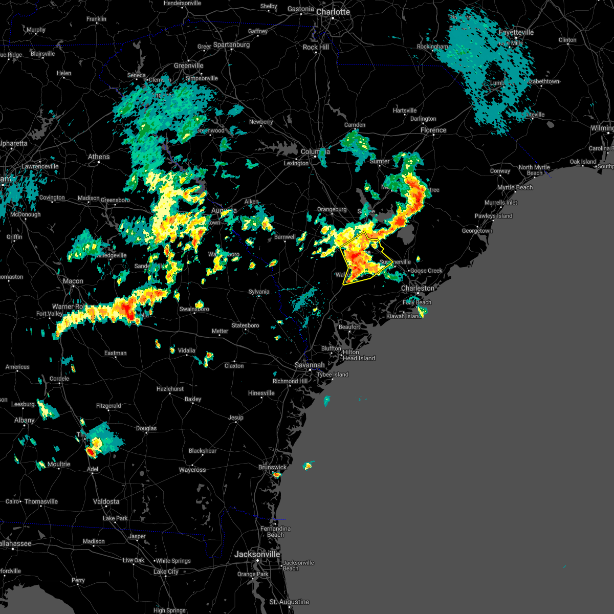 At 722 pm edt, severe thunderstorms were located along a line extending from near reevesville to near canadys to walterboro, moving northeast at 40 mph (radar indicated. these storms have a history of producing tree damage across portions of colleton county). Hazards include 60 mph wind gusts and penny size hail. Expect damage to trees and powerlines. locations impacted include, walterboro, saint george, givhans ferry state park, dorchester, ridgeville, cottageville, harleyville, reevesville, round o, givhans, jedburg and canadys. this warning includes, i-26 between mile markers 171 and 189. I-95 in south carolina between mile markers 53 and 85. At 722 pm edt, severe thunderstorms were located along a line extending from near reevesville to near canadys to walterboro, moving northeast at 40 mph (radar indicated. these storms have a history of producing tree damage across portions of colleton county). Hazards include 60 mph wind gusts and penny size hail. Expect damage to trees and powerlines. locations impacted include, walterboro, saint george, givhans ferry state park, dorchester, ridgeville, cottageville, harleyville, reevesville, round o, givhans, jedburg and canadys. this warning includes, i-26 between mile markers 171 and 189. I-95 in south carolina between mile markers 53 and 85.
|
| 5/4/2021 7:06 PM EDT |
 At 705 pm edt, severe thunderstorms were located along a line extending from near padgetts to near ruffin to near cottageville, moving northeast at 25 mph (radar indicated). Hazards include 60 mph wind gusts and half dollar size hail. Minor hail damage to vehicles is possible. expect wind damage to trees and powerlines. locations impacted include, walterboro, saint george, givhans ferry state park, dorchester, colleton, ridgeville, cottageville, harleyville, reevesville, smoaks, lodge, williams, givhans, ruffin and jedburg. this warning includes, i-26 between mile markers 171 and 189. I-95 in south carolina between mile markers 53 and 85. At 705 pm edt, severe thunderstorms were located along a line extending from near padgetts to near ruffin to near cottageville, moving northeast at 25 mph (radar indicated). Hazards include 60 mph wind gusts and half dollar size hail. Minor hail damage to vehicles is possible. expect wind damage to trees and powerlines. locations impacted include, walterboro, saint george, givhans ferry state park, dorchester, colleton, ridgeville, cottageville, harleyville, reevesville, smoaks, lodge, williams, givhans, ruffin and jedburg. this warning includes, i-26 between mile markers 171 and 189. I-95 in south carolina between mile markers 53 and 85.
|
| 5/4/2021 6:59 PM EDT |
 At 659 pm edt, severe thunderstorms were located along a line extending from near lodge to near walterboro, moving northeast at 35 mph (radar indicated). Hazards include 60 mph wind gusts and quarter size hail. Minor hail damage to vehicles is possible. Expect wind damage to trees and powerlines. At 659 pm edt, severe thunderstorms were located along a line extending from near lodge to near walterboro, moving northeast at 35 mph (radar indicated). Hazards include 60 mph wind gusts and quarter size hail. Minor hail damage to vehicles is possible. Expect wind damage to trees and powerlines.
|
| 5/3/2021 7:37 PM EDT |
 The severe thunderstorm warning for colleton and dorchester counties will expire at 745 pm edt, strong thunderstorms will remain possible for the next 1 to 2 hours. The severe thunderstorm warning for colleton and dorchester counties will expire at 745 pm edt, strong thunderstorms will remain possible for the next 1 to 2 hours.
|
| 5/3/2021 7:21 PM EDT | A tree was reported down near westburry road and wire roa in dorchester county SC, 4.5 miles NNE of St. George, SC |
| 5/3/2021 7:13 PM EDT |
 At 713 pm edt, a severe thunderstorm was located near canadys, moving east at 40 mph (radar indicated). Hazards include 60 mph wind gusts and nickel size hail. Expect damage to trees and powerlines. locations impacted include, saint george, givhans ferry state park, dorchester, colleton, ridgeville, harleyville, reevesville, smoaks, lodge, williams, ruffin, ashton, canadys and padgetts. this warning includes, i-26 between mile markers 171 and 185. I-95 in south carolina between mile markers 64 and 85. At 713 pm edt, a severe thunderstorm was located near canadys, moving east at 40 mph (radar indicated). Hazards include 60 mph wind gusts and nickel size hail. Expect damage to trees and powerlines. locations impacted include, saint george, givhans ferry state park, dorchester, colleton, ridgeville, harleyville, reevesville, smoaks, lodge, williams, ruffin, ashton, canadys and padgetts. this warning includes, i-26 between mile markers 171 and 185. I-95 in south carolina between mile markers 64 and 85.
|
| 5/3/2021 6:59 PM EDT |
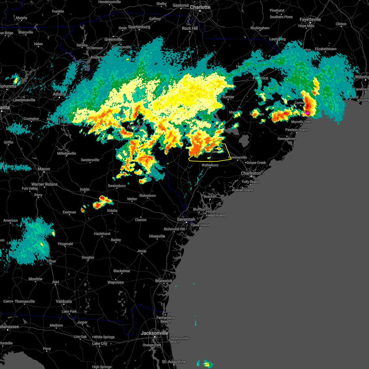 At 658 pm edt, a severe thunderstorm was located near smoaks, moving east at 40 mph (radar indicated). Hazards include 60 mph wind gusts and nickel size hail. Expect damage to trees and powerlines. locations impacted include, saint george, givhans ferry state park, dorchester, colleton, ridgeville, harleyville, reevesville, smoaks, lodge, williams, ruffin, ashton, canadys and padgetts. this warning includes, i-26 between mile markers 171 and 185. I-95 in south carolina between mile markers 64 and 85. At 658 pm edt, a severe thunderstorm was located near smoaks, moving east at 40 mph (radar indicated). Hazards include 60 mph wind gusts and nickel size hail. Expect damage to trees and powerlines. locations impacted include, saint george, givhans ferry state park, dorchester, colleton, ridgeville, harleyville, reevesville, smoaks, lodge, williams, ruffin, ashton, canadys and padgetts. this warning includes, i-26 between mile markers 171 and 185. I-95 in south carolina between mile markers 64 and 85.
|
| 5/3/2021 6:43 PM EDT |
 At 643 pm edt, a severe thunderstorm was located over lodge, moving east at 40 mph (radar indicated). Hazards include 60 mph wind gusts and quarter size hail. Minor hail damage to vehicles is possible. Expect wind damage to trees and powerlines. At 643 pm edt, a severe thunderstorm was located over lodge, moving east at 40 mph (radar indicated). Hazards include 60 mph wind gusts and quarter size hail. Minor hail damage to vehicles is possible. Expect wind damage to trees and powerlines.
|
| 3/31/2021 6:21 PM EDT |
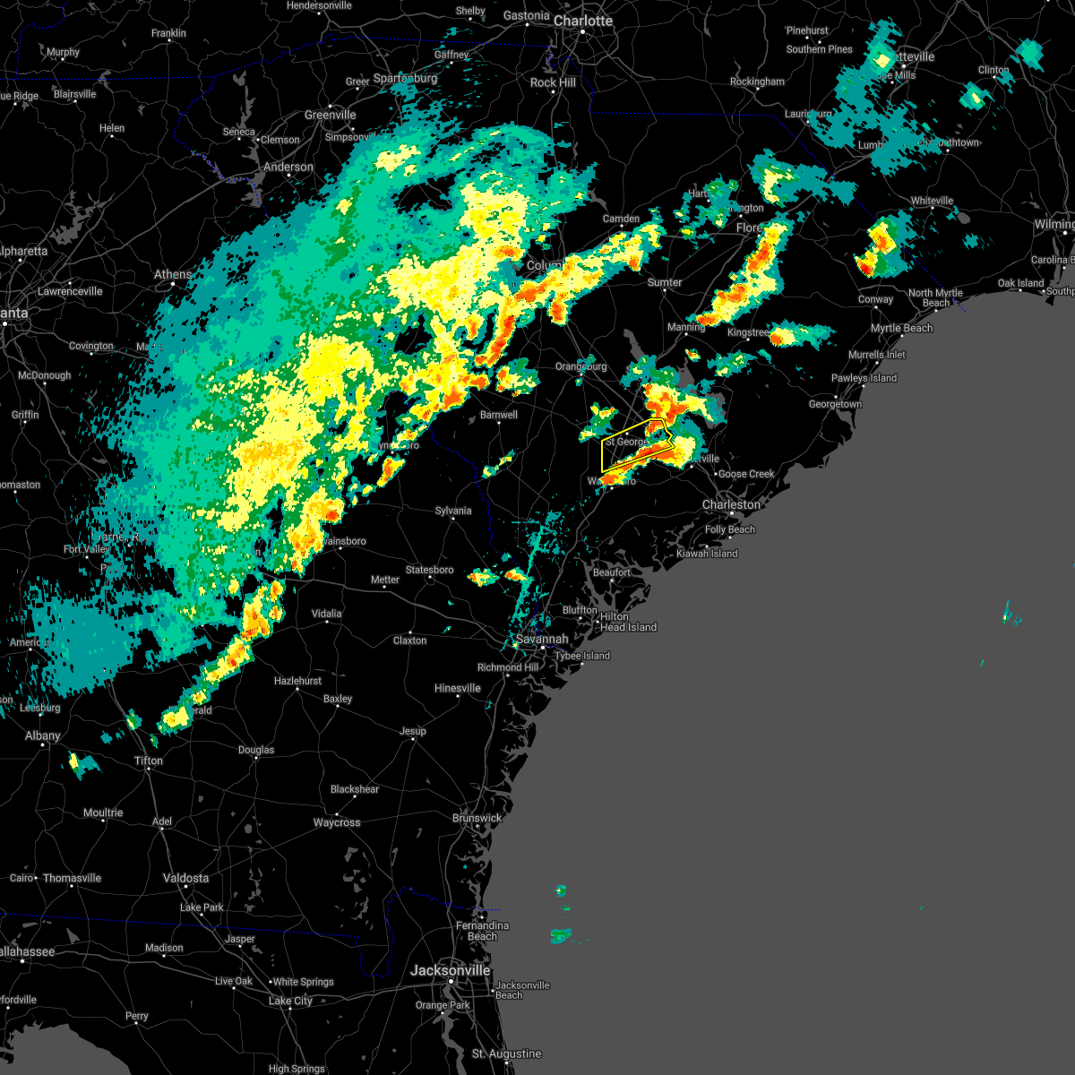 The severe thunderstorm warning for colleton and dorchester counties will expire at 630 pm edt, the storm which prompted the warning has weakened below severe limits, and no longer pose an immediate threat to life or property. therefore the warning will be allowed to expire. The severe thunderstorm warning for colleton and dorchester counties will expire at 630 pm edt, the storm which prompted the warning has weakened below severe limits, and no longer pose an immediate threat to life or property. therefore the warning will be allowed to expire.
|
| 3/31/2021 6:00 PM EDT |
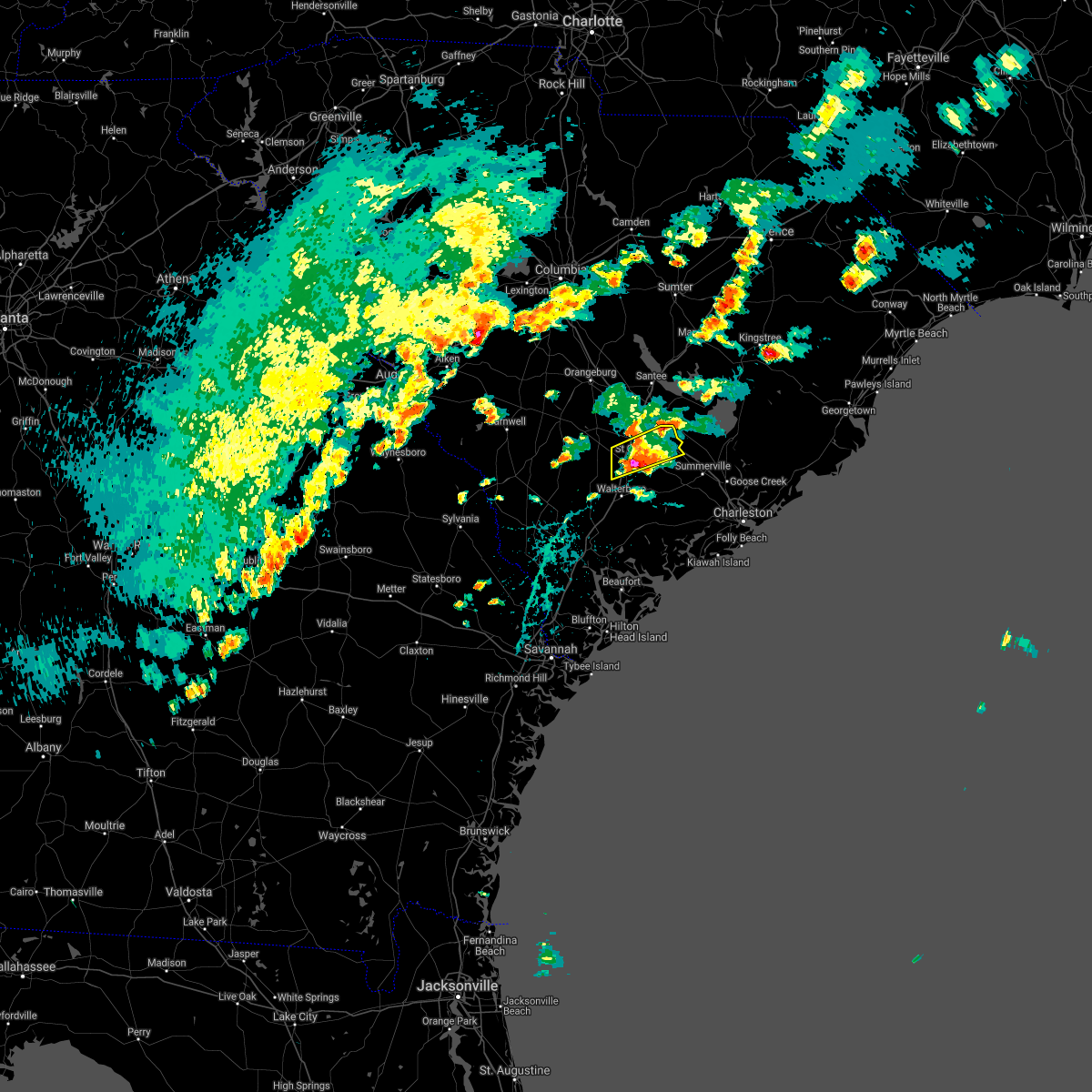 At 559 pm edt, a severe thunderstorm was located over canadys, moving east at 25 mph (radar indicated. at 554 pm edt quarter sized hail was reported near canadys). Hazards include 60 mph wind gusts and half dollar size hail. Minor hail damage to vehicles is possible. expect wind damage to trees and powerlines. locations impacted include, saint george, dorchester, harleyville and canadys. this warning includes, i-26 between mile markers 177 and 188. I-95 in south carolina between mile markers 64 and 77. At 559 pm edt, a severe thunderstorm was located over canadys, moving east at 25 mph (radar indicated. at 554 pm edt quarter sized hail was reported near canadys). Hazards include 60 mph wind gusts and half dollar size hail. Minor hail damage to vehicles is possible. expect wind damage to trees and powerlines. locations impacted include, saint george, dorchester, harleyville and canadys. this warning includes, i-26 between mile markers 177 and 188. I-95 in south carolina between mile markers 64 and 77.
|
| 3/31/2021 5:44 PM EDT |
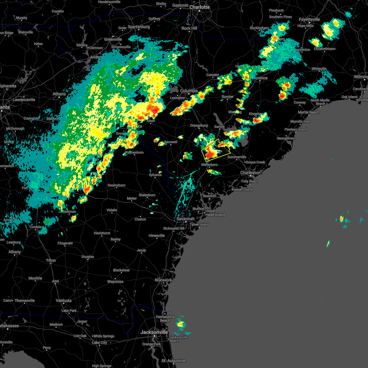 At 544 pm edt, a severe thunderstorm was located near canadys, moving northeast at 30 mph (radar indicated). Hazards include 60 mph wind gusts and quarter size hail. Minor hail damage to vehicles is possible. expect wind damage to trees and powerlines. locations impacted include, saint george, dorchester, harleyville, reevesville and canadys. this warning includes, i-26 between mile markers 171 and 188. I-95 in south carolina between mile markers 64 and 85. At 544 pm edt, a severe thunderstorm was located near canadys, moving northeast at 30 mph (radar indicated). Hazards include 60 mph wind gusts and quarter size hail. Minor hail damage to vehicles is possible. expect wind damage to trees and powerlines. locations impacted include, saint george, dorchester, harleyville, reevesville and canadys. this warning includes, i-26 between mile markers 171 and 188. I-95 in south carolina between mile markers 64 and 85.
|
| 3/31/2021 5:32 PM EDT |
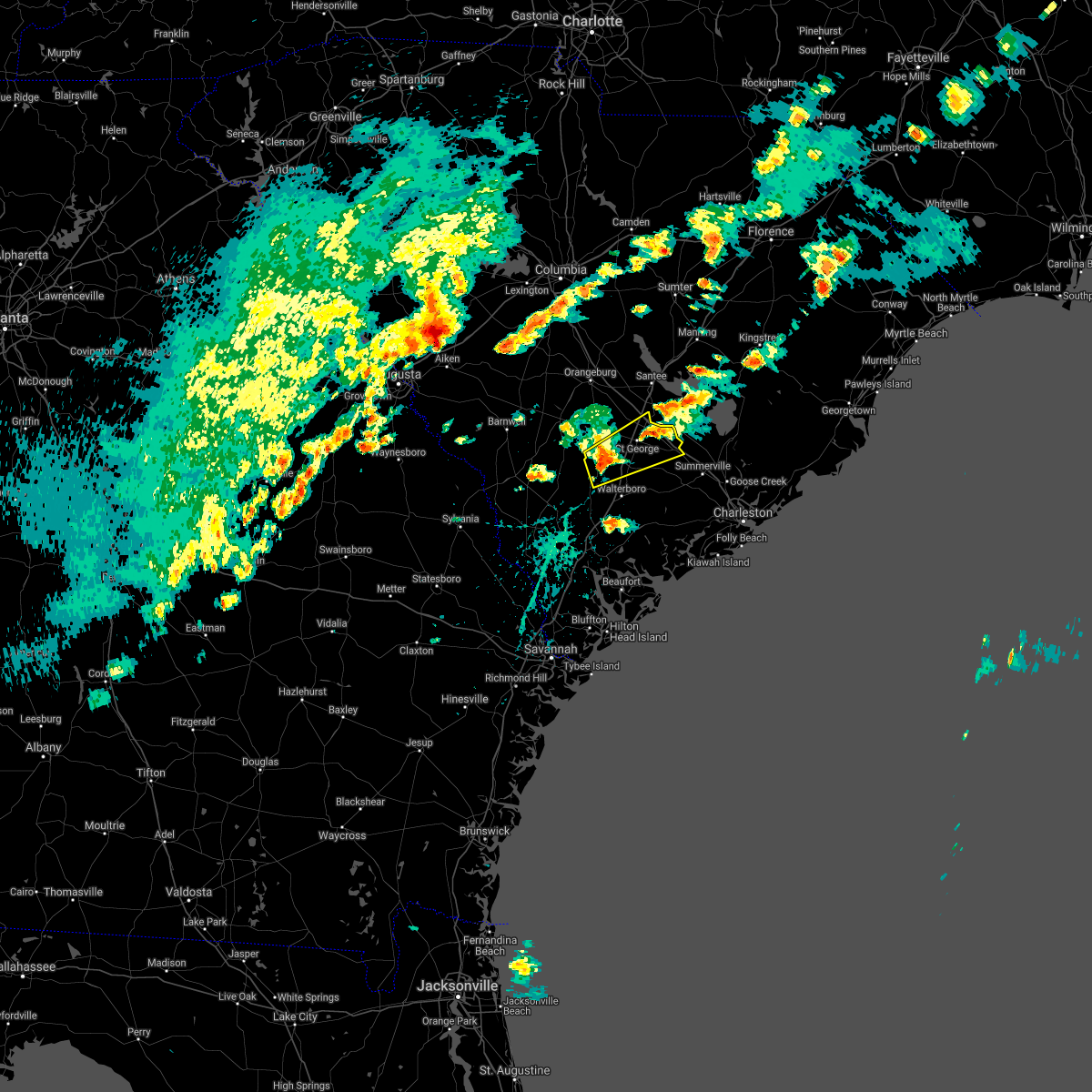 At 532 pm edt, a severe thunderstorm was located over smoaks, moving northeast at 30 mph (radar indicated). Hazards include 60 mph wind gusts and quarter size hail. Minor hail damage to vehicles is possible. Expect wind damage to trees and powerlines. At 532 pm edt, a severe thunderstorm was located over smoaks, moving northeast at 30 mph (radar indicated). Hazards include 60 mph wind gusts and quarter size hail. Minor hail damage to vehicles is possible. Expect wind damage to trees and powerlines.
|
| 6/30/2020 8:00 PM EDT | Tree in roadway at wire road and second texas road. time was estimated from rada in dorchester county SC, 8.4 miles NNW of St. George, SC |
| 6/23/2020 7:32 PM EDT |
 At 732 pm edt, severe thunderstorms were located along a line extending from 6 miles north of saint george to near canadys, moving east at 20 mph (radar indicated). Hazards include 60 mph wind gusts. Expect damage to trees and powerlines. locations impacted include, saint george, dorchester, harleyville, reevesville and canadys. this warning includes, i-26 between mile markers 170 and 183. I-95 in south carolina between mile markers 68 and 86. At 732 pm edt, severe thunderstorms were located along a line extending from 6 miles north of saint george to near canadys, moving east at 20 mph (radar indicated). Hazards include 60 mph wind gusts. Expect damage to trees and powerlines. locations impacted include, saint george, dorchester, harleyville, reevesville and canadys. this warning includes, i-26 between mile markers 170 and 183. I-95 in south carolina between mile markers 68 and 86.
|
| 6/23/2020 7:30 PM EDT | The south carolina highway patrol reported a tree down near the intersection of first texas road and highway 1 in dorchester county SC, 2.5 miles NNW of St. George, SC |
| 6/23/2020 7:13 PM EDT |
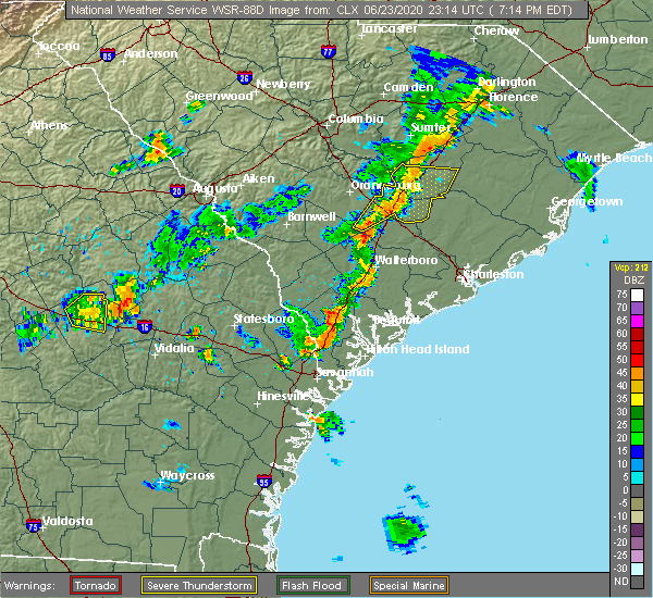 At 713 pm edt, severe thunderstorms were located along a line extending from near branchville to smoaks, moving east at 25 mph (radar indicated). Hazards include 60 mph wind gusts and penny size hail. expect damage to trees and powerlines At 713 pm edt, severe thunderstorms were located along a line extending from near branchville to smoaks, moving east at 25 mph (radar indicated). Hazards include 60 mph wind gusts and penny size hail. expect damage to trees and powerlines
|
| 4/13/2020 6:22 AM EDT |
 At 622 am edt, severe thunderstorms were located along a line extending from near lodge to egypt, moving east at 30 mph (radar indicated). Hazards include 60 mph wind gusts and penny size hail. expect damage to trees and powerlines At 622 am edt, severe thunderstorms were located along a line extending from near lodge to egypt, moving east at 30 mph (radar indicated). Hazards include 60 mph wind gusts and penny size hail. expect damage to trees and powerlines
|
| 7/4/2019 4:19 PM EDT |
 At 419 pm edt, a severe thunderstorm was located near givhans ferry state park, moving east at 15 mph (radar indicated). Hazards include 60 mph wind gusts and quarter size hail. Minor hail damage to vehicles is possible. expect wind damage to trees and powerlines. locations impacted include, summerville, indian field, slands bridge, givhans ferry state park, saint george, ladson, dorchester and st. george. this warning includes, i-26 between mile markers 171 and 201. I-95 in south carolina between mile markers 65 and 85. At 419 pm edt, a severe thunderstorm was located near givhans ferry state park, moving east at 15 mph (radar indicated). Hazards include 60 mph wind gusts and quarter size hail. Minor hail damage to vehicles is possible. expect wind damage to trees and powerlines. locations impacted include, summerville, indian field, slands bridge, givhans ferry state park, saint george, ladson, dorchester and st. george. this warning includes, i-26 between mile markers 171 and 201. I-95 in south carolina between mile markers 65 and 85.
|
| 7/4/2019 3:54 PM EDT |
 At 354 pm edt, a severe thunderstorm was located near givhans ferry state park, moving northwest at 5 mph (radar indicated). Hazards include 60 mph wind gusts and quarter size hail. Minor hail damage to vehicles is possible. Expect wind damage to trees and powerlines. At 354 pm edt, a severe thunderstorm was located near givhans ferry state park, moving northwest at 5 mph (radar indicated). Hazards include 60 mph wind gusts and quarter size hail. Minor hail damage to vehicles is possible. Expect wind damage to trees and powerlines.
|
| 7/3/2019 9:00 PM EDT | South carolina state highway patrol reported a tree down on wire road. time of event was estimated from radar dat in dorchester county SC, 6.4 miles N of St. George, SC |
| 7/3/2019 8:45 PM EDT |
 At 845 pm edt, a severe thunderstorm was located over saint george, and is nearly stationary (radar indicated). Hazards include 60 mph wind gusts and half dollar size hail. Minor hail damage to vehicles is possible. expect wind damage to trees and powerlines. locations impacted include, saint george, indian field, dorchester, st. george, harleyville and reevesville. this warning includes, i-26 between mile markers 170 and 189. I-95 in south carolina between mile markers 77 and 86. At 845 pm edt, a severe thunderstorm was located over saint george, and is nearly stationary (radar indicated). Hazards include 60 mph wind gusts and half dollar size hail. Minor hail damage to vehicles is possible. expect wind damage to trees and powerlines. locations impacted include, saint george, indian field, dorchester, st. george, harleyville and reevesville. this warning includes, i-26 between mile markers 170 and 189. I-95 in south carolina between mile markers 77 and 86.
|
| 7/3/2019 8:36 PM EDT | South carolina highway patrol reported a tree down on second texas road near the lorraine drive intersection. time of event was estimated from radar dat in dorchester county SC, 3.1 miles NNW of St. George, SC |
| 7/3/2019 8:33 PM EDT |
 At 833 pm edt, a severe thunderstorm was located near indian field, moving northwest at 10 mph (radar indicated). Hazards include 60 mph wind gusts and quarter size hail. Minor hail damage to vehicles is possible. expect wind damage to trees and powerlines. locations impacted include, saint george, indian field, dorchester, st. george, harleyville and reevesville. this warning includes, i-26 between mile markers 170 and 189. I-95 in south carolina between mile markers 77 and 86. At 833 pm edt, a severe thunderstorm was located near indian field, moving northwest at 10 mph (radar indicated). Hazards include 60 mph wind gusts and quarter size hail. Minor hail damage to vehicles is possible. expect wind damage to trees and powerlines. locations impacted include, saint george, indian field, dorchester, st. george, harleyville and reevesville. this warning includes, i-26 between mile markers 170 and 189. I-95 in south carolina between mile markers 77 and 86.
|
| 7/3/2019 8:30 PM EDT | South carolina state highway patrol reported a tree down on the intersection of raysor and sears streets in saint george. time of event was estimated from radar dat in dorchester county SC, 0.5 miles WNW of St. George, SC |
| 7/3/2019 8:16 PM EDT |
 At 816 pm edt, a severe thunderstorm was located near indian field, moving northwest at 10 mph (radar indicated). Hazards include 60 mph wind gusts and quarter size hail. Minor hail damage to vehicles is possible. Expect wind damage to trees and powerlines. At 816 pm edt, a severe thunderstorm was located near indian field, moving northwest at 10 mph (radar indicated). Hazards include 60 mph wind gusts and quarter size hail. Minor hail damage to vehicles is possible. Expect wind damage to trees and powerlines.
|
| 6/22/2019 6:15 PM EDT | Schp reports a tree down on sears st at memorial blv in dorchester county SC, 0.5 miles WNW of St. George, SC |
| 6/22/2019 5:21 AM EDT |
 At 520 am edt, severe thunderstorms were located along a line extending from 12 miles southeast of bamberg to 6 miles northwest of allendale, moving east at 35 mph (radar indicated). Hazards include 60 mph wind gusts and quarter size hail. Minor hail damage to vehicles is possible. expect wind damage to trees and powerlines. locations impacted include, walterboro, allendale, hampton, lake warren state park, indian field, saint george, givhans ferry state park and dorchester. this warning includes, i-26 between mile markers 171 and 189. I-95 in south carolina between mile markers 51 and 85. At 520 am edt, severe thunderstorms were located along a line extending from 12 miles southeast of bamberg to 6 miles northwest of allendale, moving east at 35 mph (radar indicated). Hazards include 60 mph wind gusts and quarter size hail. Minor hail damage to vehicles is possible. expect wind damage to trees and powerlines. locations impacted include, walterboro, allendale, hampton, lake warren state park, indian field, saint george, givhans ferry state park and dorchester. this warning includes, i-26 between mile markers 171 and 189. I-95 in south carolina between mile markers 51 and 85.
|
| 6/22/2019 4:51 AM EDT |
 At 450 am edt, severe thunderstorms were located along a line extending from 6 miles south of denmark to near plant vogtle, moving east at 35 mph (radar indicated). Hazards include 60 mph wind gusts and quarter size hail. Minor hail damage to vehicles is possible. Expect wind damage to trees and powerlines. At 450 am edt, severe thunderstorms were located along a line extending from 6 miles south of denmark to near plant vogtle, moving east at 35 mph (radar indicated). Hazards include 60 mph wind gusts and quarter size hail. Minor hail damage to vehicles is possible. Expect wind damage to trees and powerlines.
|
| 6/20/2019 7:09 PM EDT |
 At 709 pm edt, severe thunderstorms were located along a line extending from 14 miles east of indian field to 11 miles east of hampton, moving east at 35 mph (radar indicated). Hazards include 60 mph wind gusts. Expect damage to trees and powerlines. locations impacted include, summerville, goose creek, walterboro, slands bridge, givhans ferry state park, saint george, ladson and dorchester. this warning includes, i-26 between mile markers 177 and 204. I-95 in south carolina between mile markers 42 and 77. At 709 pm edt, severe thunderstorms were located along a line extending from 14 miles east of indian field to 11 miles east of hampton, moving east at 35 mph (radar indicated). Hazards include 60 mph wind gusts. Expect damage to trees and powerlines. locations impacted include, summerville, goose creek, walterboro, slands bridge, givhans ferry state park, saint george, ladson and dorchester. this warning includes, i-26 between mile markers 177 and 204. I-95 in south carolina between mile markers 42 and 77.
|
| 6/20/2019 6:35 PM EDT |
 At 634 pm edt, severe thunderstorms were located along a line extending from 10 miles northeast of indian field to 13 miles south of bamberg, moving southeast at 45 mph (radar indicated). Hazards include 60 mph wind gusts. expect damage to trees and powerlines At 634 pm edt, severe thunderstorms were located along a line extending from 10 miles northeast of indian field to 13 miles south of bamberg, moving southeast at 45 mph (radar indicated). Hazards include 60 mph wind gusts. expect damage to trees and powerlines
|
| 6/20/2019 5:03 PM EDT |
 At 503 pm edt, severe thunderstorms were located along a line extending from 11 miles south of manning to 9 miles northwest of indian field, moving east at 50 mph (radar indicated). Hazards include 60 mph wind gusts and quarter size hail. Minor hail damage to vehicles is possible. Expect wind damage to trees and powerlines. At 503 pm edt, severe thunderstorms were located along a line extending from 11 miles south of manning to 9 miles northwest of indian field, moving east at 50 mph (radar indicated). Hazards include 60 mph wind gusts and quarter size hail. Minor hail damage to vehicles is possible. Expect wind damage to trees and powerlines.
|
| 4/19/2019 2:02 PM EDT |
 At 201 pm edt, severe thunderstorms were located along a line extending from 13 miles north of indian field to near givhans ferry state park to 14 miles northwest of edisto beach, moving northeast at 50 mph (radar indicated. these thunderstorms have a history of producing wind damage). Hazards include 70 mph wind gusts. Expect considerable tree damage. damage is likely to mobile homes, roofs, and outbuildings. locations impacted include, charleston, north charleston, mount pleasant, summerville, goose creek, hanahan, moncks corner and walterboro. this warning includes, i-26 between mile markers 171 and 221. i-526 between mile markers 11 and 31. I-95 in south carolina between mile markers 69 and 85. At 201 pm edt, severe thunderstorms were located along a line extending from 13 miles north of indian field to near givhans ferry state park to 14 miles northwest of edisto beach, moving northeast at 50 mph (radar indicated. these thunderstorms have a history of producing wind damage). Hazards include 70 mph wind gusts. Expect considerable tree damage. damage is likely to mobile homes, roofs, and outbuildings. locations impacted include, charleston, north charleston, mount pleasant, summerville, goose creek, hanahan, moncks corner and walterboro. this warning includes, i-26 between mile markers 171 and 221. i-526 between mile markers 11 and 31. I-95 in south carolina between mile markers 69 and 85.
|
| 4/19/2019 1:55 PM EDT | Public reported their greenhouse and several large bird houses were destroyed on woodberrys ln. possible tornad in dorchester county SC, 6.4 miles NNW of St. George, SC |
| 4/19/2019 1:40 PM EDT |
 At 138 pm edt, severe thunderstorms were located along a line extending from 7 miles southeast of bamberg to 14 miles northwest of edisto beach, moving northeast at 90 mph (radar indicated. these thunderstorms have a history of producing wind damage). Hazards include 70 mph wind gusts. Expect considerable tree damage. Damage is likely to mobile homes, roofs, and outbuildings. At 138 pm edt, severe thunderstorms were located along a line extending from 7 miles southeast of bamberg to 14 miles northwest of edisto beach, moving northeast at 90 mph (radar indicated. these thunderstorms have a history of producing wind damage). Hazards include 70 mph wind gusts. Expect considerable tree damage. Damage is likely to mobile homes, roofs, and outbuildings.
|
| 4/14/2019 6:29 PM EDT |
 At 629 pm edt, severe thunderstorms were located along a line extending from 6 miles northwest of indian field to 6 miles south of saint george to 9 miles northwest of yemassee, moving northeast at 60 mph (radar indicated). Hazards include 60 mph wind gusts and penny size hail. Expect damage to trees and powerlines. locations impacted include, summerville, walterboro, hampton, yemassee, slands bridge, givhans ferry state park, indian field and saint george. This warning includes i-95 in south carolina between mile markers 39 and 85. At 629 pm edt, severe thunderstorms were located along a line extending from 6 miles northwest of indian field to 6 miles south of saint george to 9 miles northwest of yemassee, moving northeast at 60 mph (radar indicated). Hazards include 60 mph wind gusts and penny size hail. Expect damage to trees and powerlines. locations impacted include, summerville, walterboro, hampton, yemassee, slands bridge, givhans ferry state park, indian field and saint george. This warning includes i-95 in south carolina between mile markers 39 and 85.
|
| 4/14/2019 6:11 PM EDT |
 At 611 pm edt, severe thunderstorms were located along a line extending from 15 miles southeast of bamberg to 9 miles northwest of walterboro to 11 miles south of lake warren state park, moving northeast at 50 mph (radar indicated). Hazards include 60 mph wind gusts and penny size hail. Expect damage to trees and powerlines. locations impacted include, summerville, walterboro, hampton, yemassee, lake warren state park, indian field, saint george and slands bridge. This warning includes i-95 in south carolina between mile markers 28 and 85. At 611 pm edt, severe thunderstorms were located along a line extending from 15 miles southeast of bamberg to 9 miles northwest of walterboro to 11 miles south of lake warren state park, moving northeast at 50 mph (radar indicated). Hazards include 60 mph wind gusts and penny size hail. Expect damage to trees and powerlines. locations impacted include, summerville, walterboro, hampton, yemassee, lake warren state park, indian field, saint george and slands bridge. This warning includes i-95 in south carolina between mile markers 28 and 85.
|
| 4/14/2019 5:48 PM EDT |
 At 548 pm edt, severe thunderstorms were located along a line extending from near hampton to 9 miles southeast of lake warren state park, moving northeast at 70 mph (radar indicated). Hazards include 60 mph wind gusts and penny size hail. expect damage to trees and powerlines At 548 pm edt, severe thunderstorms were located along a line extending from near hampton to 9 miles southeast of lake warren state park, moving northeast at 70 mph (radar indicated). Hazards include 60 mph wind gusts and penny size hail. expect damage to trees and powerlines
|
| 8/18/2018 7:59 PM EDT |
 At 758 pm edt, severe thunderstorms were located along a line extending from indian field to near slands bridge, moving northeast at 25 mph. these storms have blown down a tree on powerlines in the reevesville area (radar indicated). Hazards include 60 mph wind gusts and penny size hail. Expect damage to trees and powerlines. locations impacted include, north charleston, summerville, middleton place, indian field, archdale, slands bridge, givhans ferry state park and saint george. this warning includes, i-26 between mile markers 171 and 188. I-95 in south carolina between mile markers 75 and 82. At 758 pm edt, severe thunderstorms were located along a line extending from indian field to near slands bridge, moving northeast at 25 mph. these storms have blown down a tree on powerlines in the reevesville area (radar indicated). Hazards include 60 mph wind gusts and penny size hail. Expect damage to trees and powerlines. locations impacted include, north charleston, summerville, middleton place, indian field, archdale, slands bridge, givhans ferry state park and saint george. this warning includes, i-26 between mile markers 171 and 188. I-95 in south carolina between mile markers 75 and 82.
|
| 8/18/2018 7:38 PM EDT |
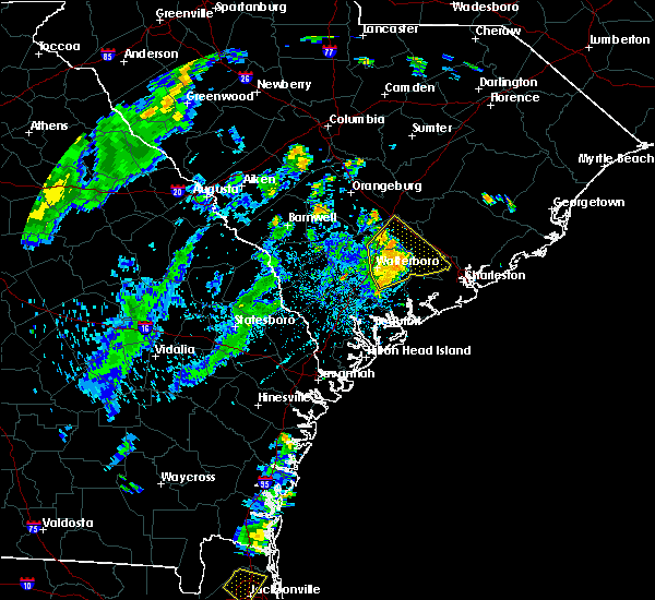 At 738 pm edt, severe thunderstorms were located along a line extending from near saint george to 8 miles south of givhans ferry state park, moving northeast at 30 mph (radar indicated). Hazards include 60 mph wind gusts and penny size hail. Expect damage to trees and powerlines. locations impacted include, north charleston, summerville, walterboro, middleton place, indian field, archdale, slands bridge and givhans ferry state park. this warning includes, i-26 between mile markers 171 and 189. I-95 in south carolina between mile markers 57 and 82. At 738 pm edt, severe thunderstorms were located along a line extending from near saint george to 8 miles south of givhans ferry state park, moving northeast at 30 mph (radar indicated). Hazards include 60 mph wind gusts and penny size hail. Expect damage to trees and powerlines. locations impacted include, north charleston, summerville, walterboro, middleton place, indian field, archdale, slands bridge and givhans ferry state park. this warning includes, i-26 between mile markers 171 and 189. I-95 in south carolina between mile markers 57 and 82.
|
| 8/18/2018 7:24 PM EDT |
 At 724 pm edt, severe thunderstorms were located along a line extending from 13 miles southwest of saint george to 6 miles southeast of walterboro, moving northeast at 20 mph (radar indicated). Hazards include 60 mph wind gusts. Minor hail damage to vehicles is possible. Expect wind damage to trees and powerlines. At 724 pm edt, severe thunderstorms were located along a line extending from 13 miles southwest of saint george to 6 miles southeast of walterboro, moving northeast at 20 mph (radar indicated). Hazards include 60 mph wind gusts. Minor hail damage to vehicles is possible. Expect wind damage to trees and powerlines.
|
| 8/9/2018 7:35 PM EDT | South carolina highway patrol reported a tree down on highway 15 near wire roa in dorchester county SC, 6.4 miles N of St. George, SC |
| 6/24/2018 11:41 PM EDT |
 At 1141 pm edt, severe thunderstorms were located along a line extending from near givhans ferry state park to 9 miles southeast of sylvania, moving south at 35 mph (radar indicated). Hazards include 60 mph wind gusts. Expect damage to trees and powerlines. locations impacted include, walterboro, hampton, yemassee, lake warren state park, indian field, saint george, colleton and varnville. this warning includes, i-26 between mile markers 171 and 175. I-95 in south carolina between mile markers 38 and 85. At 1141 pm edt, severe thunderstorms were located along a line extending from near givhans ferry state park to 9 miles southeast of sylvania, moving south at 35 mph (radar indicated). Hazards include 60 mph wind gusts. Expect damage to trees and powerlines. locations impacted include, walterboro, hampton, yemassee, lake warren state park, indian field, saint george, colleton and varnville. this warning includes, i-26 between mile markers 171 and 175. I-95 in south carolina between mile markers 38 and 85.
|
| 6/24/2018 11:41 PM EDT |
 At 1107 pm edt, severe thunderstorms were located along a line extending from near indian field to near allendale, moving southeast at 35 mph (radar indicated). Hazards include 60 mph wind gusts. expect damage to trees and powerlines At 1107 pm edt, severe thunderstorms were located along a line extending from near indian field to near allendale, moving southeast at 35 mph (radar indicated). Hazards include 60 mph wind gusts. expect damage to trees and powerlines
|
| 6/24/2018 11:08 PM EDT |
 At 1107 pm edt, severe thunderstorms were located along a line extending from near indian field to near allendale, moving southeast at 35 mph (radar indicated). Hazards include 60 mph wind gusts. expect damage to trees and powerlines At 1107 pm edt, severe thunderstorms were located along a line extending from near indian field to near allendale, moving southeast at 35 mph (radar indicated). Hazards include 60 mph wind gusts. expect damage to trees and powerlines
|
| 7/8/2017 8:59 PM EDT |
 At 859 pm edt, severe thunderstorms were located along a line extending from near indian field to 7 miles northwest of walterboro, moving east at 30 mph (radar indicated). Hazards include 60 mph wind gusts and penny size hail. expect damage to trees and powerlines At 859 pm edt, severe thunderstorms were located along a line extending from near indian field to 7 miles northwest of walterboro, moving east at 30 mph (radar indicated). Hazards include 60 mph wind gusts and penny size hail. expect damage to trees and powerlines
|
| 7/7/2017 6:29 PM EDT |
 At 629 pm edt, severe thunderstorms were located along a line extending from 7 miles east of indian field to near saint george, moving southeast at 15 mph (radar indicated). Hazards include 60 mph wind gusts and penny size hail. Expect damage to trees and powerlines. locations impacted include, indian field, saint george, dorchester, st. george, ridgeville, harleyville, reevesville and canadys. this warning includes, i-26 between mile markers 176 and 194. I-95 in south carolina between mile markers 70 and 80. At 629 pm edt, severe thunderstorms were located along a line extending from 7 miles east of indian field to near saint george, moving southeast at 15 mph (radar indicated). Hazards include 60 mph wind gusts and penny size hail. Expect damage to trees and powerlines. locations impacted include, indian field, saint george, dorchester, st. george, ridgeville, harleyville, reevesville and canadys. this warning includes, i-26 between mile markers 176 and 194. I-95 in south carolina between mile markers 70 and 80.
|
| 7/7/2017 6:15 PM EDT |
 At 615 pm edt, severe thunderstorms were located along a line extending from 11 miles north of givhans ferry state park to near saint george, moving southeast at 15 mph (radar indicated). Hazards include 60 mph wind gusts and penny size hail. Expect damage to trees and powerlines. locations impacted include, moncks corner, indian field, saint george, dorchester, st. george, ridgeville, harleyville and reevesville. this warning includes, i-26 between mile markers 176 and 194. I-95 in south carolina between mile markers 68 and 81. At 615 pm edt, severe thunderstorms were located along a line extending from 11 miles north of givhans ferry state park to near saint george, moving southeast at 15 mph (radar indicated). Hazards include 60 mph wind gusts and penny size hail. Expect damage to trees and powerlines. locations impacted include, moncks corner, indian field, saint george, dorchester, st. george, ridgeville, harleyville and reevesville. this warning includes, i-26 between mile markers 176 and 194. I-95 in south carolina between mile markers 68 and 81.
|
| 7/7/2017 5:57 PM EDT |
 At 557 pm edt, severe thunderstorms were located along a line extending from 7 miles east of indian field to 8 miles west of saint george, moving east at 15 mph (radar indicated). Hazards include 60 mph wind gusts and penny size hail. Expect damage to trees and powerlines. locations impacted include, moncks corner, indian field, saint george, dorchester, st. george, ridgeville, harleyville and reevesville. this warning includes, i-26 between mile markers 174 and 194. I-95 in south carolina between mile markers 68 and 83. At 557 pm edt, severe thunderstorms were located along a line extending from 7 miles east of indian field to 8 miles west of saint george, moving east at 15 mph (radar indicated). Hazards include 60 mph wind gusts and penny size hail. Expect damage to trees and powerlines. locations impacted include, moncks corner, indian field, saint george, dorchester, st. george, ridgeville, harleyville and reevesville. this warning includes, i-26 between mile markers 174 and 194. I-95 in south carolina between mile markers 68 and 83.
|
| 7/7/2017 5:40 PM EDT |
 At 540 pm edt, severe thunderstorms were located along a line extending from near indian field to 12 miles west of saint george, moving southeast at 15 mph (radar indicated). Hazards include 60 mph wind gusts. expect damage to trees and powerlines At 540 pm edt, severe thunderstorms were located along a line extending from near indian field to 12 miles west of saint george, moving southeast at 15 mph (radar indicated). Hazards include 60 mph wind gusts. expect damage to trees and powerlines
|
| 5/4/2017 8:41 PM EDT |
 At 841 pm edt, a severe thunderstorm capable of producing a tornado was located near indian field, moving northeast at 35 mph (radar indicated rotation). Hazards include tornado. Flying debris will be dangerous to those caught without shelter. mobile homes will be damaged or destroyed. damage to roofs, windows, and vehicles will occur. tree damage is likely. locations impacted include, saint george, indian field, st. george and harleyville. this warning includes, i-26 between mile markers 171 and 181. I-95 in south carolina between mile markers 79 and 85. At 841 pm edt, a severe thunderstorm capable of producing a tornado was located near indian field, moving northeast at 35 mph (radar indicated rotation). Hazards include tornado. Flying debris will be dangerous to those caught without shelter. mobile homes will be damaged or destroyed. damage to roofs, windows, and vehicles will occur. tree damage is likely. locations impacted include, saint george, indian field, st. george and harleyville. this warning includes, i-26 between mile markers 171 and 181. I-95 in south carolina between mile markers 79 and 85.
|
| 5/4/2017 8:35 PM EDT |
 At 833 pm edt, a severe thunderstorm capable of producing a tornado was located 4 miles south of saint george, moving northeast at 35 mph (radar indicated rotation). Hazards include tornado. Flying debris will be dangerous to those caught without shelter. mobile homes will be damaged or destroyed. damage to roofs, windows, and vehicles will occur. tree damage is likely. locations impacted include, saint george, indian field, st. george and harleyville. this warning includes, i-26 between mile markers 171 and 181. I-95 in south carolina between mile markers 71 and 85. At 833 pm edt, a severe thunderstorm capable of producing a tornado was located 4 miles south of saint george, moving northeast at 35 mph (radar indicated rotation). Hazards include tornado. Flying debris will be dangerous to those caught without shelter. mobile homes will be damaged or destroyed. damage to roofs, windows, and vehicles will occur. tree damage is likely. locations impacted include, saint george, indian field, st. george and harleyville. this warning includes, i-26 between mile markers 171 and 181. I-95 in south carolina between mile markers 71 and 85.
|
| 5/4/2017 8:32 PM EDT | Tree down on car reported in grover. possible tornad in dorchester county SC, 5.7 miles N of St. George, SC |
| 5/4/2017 8:24 PM EDT |
 At 824 pm edt, a severe thunderstorm capable of producing a tornado was located 9 miles south of saint george, moving northeast at 35 mph (radar indicated rotation). Hazards include tornado. Flying debris will be dangerous to those caught without shelter. mobile homes will be damaged or destroyed. damage to roofs, windows, and vehicles will occur. Tree damage is likely. At 824 pm edt, a severe thunderstorm capable of producing a tornado was located 9 miles south of saint george, moving northeast at 35 mph (radar indicated rotation). Hazards include tornado. Flying debris will be dangerous to those caught without shelter. mobile homes will be damaged or destroyed. damage to roofs, windows, and vehicles will occur. Tree damage is likely.
|
| 4/5/2017 3:38 PM EDT |
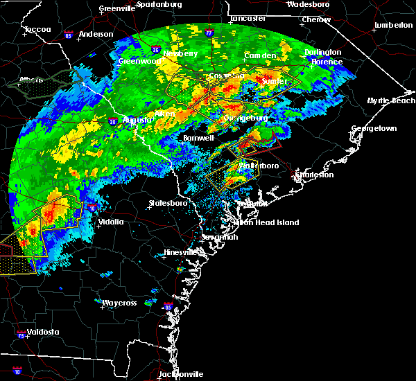 At 338 pm edt, a severe thunderstorm capable of producing a tornado was located over saint george, moving northeast at 35 mph (radar indicated rotation). Hazards include tornado. Flying debris will be dangerous to those caught without shelter. mobile homes will be damaged or destroyed. damage to roofs, windows, and vehicles will occur. Tree damage is likely. At 338 pm edt, a severe thunderstorm capable of producing a tornado was located over saint george, moving northeast at 35 mph (radar indicated rotation). Hazards include tornado. Flying debris will be dangerous to those caught without shelter. mobile homes will be damaged or destroyed. damage to roofs, windows, and vehicles will occur. Tree damage is likely.
|
| 4/5/2017 3:30 PM EDT |
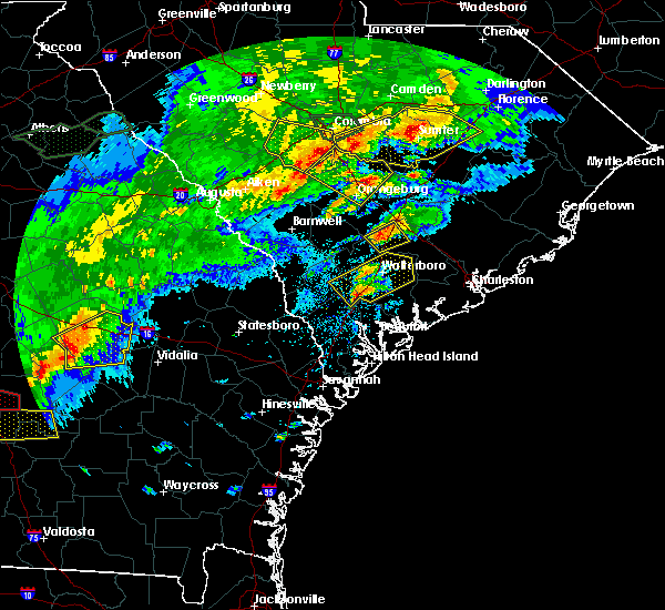 At 330 pm edt, a severe thunderstorm was located 7 miles west of saint george, moving northeast at 30 mph (radar indicated). Hazards include 60 mph wind gusts and quarter size hail. Hail damage to vehicles is expected. expect wind damage to roofs, siding, and trees. locations impacted include, saint george, indian field, st. george and reevesville. A tornado watch remains in effect until 800 pm edt for southeastern south carolina. At 330 pm edt, a severe thunderstorm was located 7 miles west of saint george, moving northeast at 30 mph (radar indicated). Hazards include 60 mph wind gusts and quarter size hail. Hail damage to vehicles is expected. expect wind damage to roofs, siding, and trees. locations impacted include, saint george, indian field, st. george and reevesville. A tornado watch remains in effect until 800 pm edt for southeastern south carolina.
|
| 4/5/2017 3:13 PM EDT |
 At 313 pm edt, a severe thunderstorm was located 14 miles west of saint george, moving northeast at 40 mph (radar indicated). Hazards include 60 mph wind gusts and quarter size hail. Hail damage to vehicles is expected. expect wind damage to roofs, siding, and trees. locations impacted include, indian field, saint george, st. george, reevesville, smoaks, williams and padgetts. A tornado watch remains in effect until 800 pm edt for southeastern south carolina. At 313 pm edt, a severe thunderstorm was located 14 miles west of saint george, moving northeast at 40 mph (radar indicated). Hazards include 60 mph wind gusts and quarter size hail. Hail damage to vehicles is expected. expect wind damage to roofs, siding, and trees. locations impacted include, indian field, saint george, st. george, reevesville, smoaks, williams and padgetts. A tornado watch remains in effect until 800 pm edt for southeastern south carolina.
|
| 4/5/2017 2:57 PM EDT |
 At 257 pm edt, a severe thunderstorm was located 15 miles south of bamberg, moving northeast at 40 mph (radar indicated). Hazards include 60 mph wind gusts and quarter size hail. Hail damage to vehicles is expected. expect wind damage to roofs, siding, and trees. locations impacted include, indian field, saint george, colleton, st. george, reevesville, smoaks, lodge and williams. A tornado watch remains in effect until 800 pm edt for southeastern south carolina. At 257 pm edt, a severe thunderstorm was located 15 miles south of bamberg, moving northeast at 40 mph (radar indicated). Hazards include 60 mph wind gusts and quarter size hail. Hail damage to vehicles is expected. expect wind damage to roofs, siding, and trees. locations impacted include, indian field, saint george, colleton, st. george, reevesville, smoaks, lodge and williams. A tornado watch remains in effect until 800 pm edt for southeastern south carolina.
|
| 4/5/2017 2:46 PM EDT |
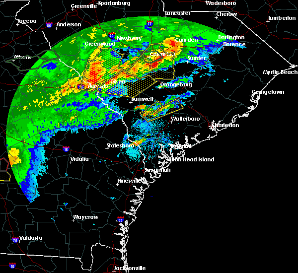 At 246 pm edt, a severe thunderstorm was located 10 miles north of hampton, moving northeast at 40 mph (radar indicated). Hazards include 60 mph wind gusts and quarter size hail. Hail damage to vehicles is expected. Expect wind damage to roofs, siding, and trees. At 246 pm edt, a severe thunderstorm was located 10 miles north of hampton, moving northeast at 40 mph (radar indicated). Hazards include 60 mph wind gusts and quarter size hail. Hail damage to vehicles is expected. Expect wind damage to roofs, siding, and trees.
|
| 4/3/2017 5:46 PM EDT |
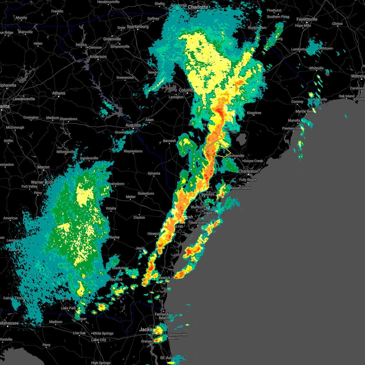 At 546 pm edt, a severe thunderstorm was located 7 miles south of saint george, moving northeast at 40 mph (radar indicated). Hazards include 60 mph wind gusts and quarter size hail. Hail damage to vehicles is expected. Expect wind damage to roofs, siding, and trees. At 546 pm edt, a severe thunderstorm was located 7 miles south of saint george, moving northeast at 40 mph (radar indicated). Hazards include 60 mph wind gusts and quarter size hail. Hail damage to vehicles is expected. Expect wind damage to roofs, siding, and trees.
|
| 2/15/2017 12:09 PM EST |
 At 1208 pm est, a severe squall line capable of producing both tornadoes and extensive straight line wind damage was located 15 miles north of givhans ferry state park, moving east at 55 mph (radar indicated rotation). Hazards include tornado and half dollar size hail. Flying debris will be dangerous to those caught without shelter. mobile homes will be damaged or destroyed. damage to roofs, windows, and vehicles will occur. tree damage is likely. locations impacted include, saint george, dorchester, st. George, harleyville and cross. At 1208 pm est, a severe squall line capable of producing both tornadoes and extensive straight line wind damage was located 15 miles north of givhans ferry state park, moving east at 55 mph (radar indicated rotation). Hazards include tornado and half dollar size hail. Flying debris will be dangerous to those caught without shelter. mobile homes will be damaged or destroyed. damage to roofs, windows, and vehicles will occur. tree damage is likely. locations impacted include, saint george, dorchester, st. George, harleyville and cross.
|
| 2/15/2017 11:57 AM EST |
 At 1156 am est, a severe thunderstorm capable of producing a tornado was located near indian field, moving east at 55 mph (radar indicated rotation). Hazards include tornado and quarter size hail. Flying debris will be dangerous to those caught without shelter. mobile homes will be damaged or destroyed. damage to roofs, windows, and vehicles will occur. Tree damage is likely. At 1156 am est, a severe thunderstorm capable of producing a tornado was located near indian field, moving east at 55 mph (radar indicated rotation). Hazards include tornado and quarter size hail. Flying debris will be dangerous to those caught without shelter. mobile homes will be damaged or destroyed. damage to roofs, windows, and vehicles will occur. Tree damage is likely.
|
| 2/15/2017 11:45 AM EST |
 At 1144 am est, severe thunderstorms were located along a line extending from 18 miles north of saint george to 6 miles northwest of indian field to 12 miles southeast of bamberg, moving east at 105 mph (radar indicated). Hazards include 60 mph wind gusts and quarter size hail. Hail damage to vehicles is expected. Expect wind damage to roofs, siding, and trees. At 1144 am est, severe thunderstorms were located along a line extending from 18 miles north of saint george to 6 miles northwest of indian field to 12 miles southeast of bamberg, moving east at 105 mph (radar indicated). Hazards include 60 mph wind gusts and quarter size hail. Hail damage to vehicles is expected. Expect wind damage to roofs, siding, and trees.
|
| 1/21/2017 4:38 PM EST |
 The severe thunderstorm warning for beaufort, charleston, colleton, berkeley, dorchester and jasper counties will expire at 445 pm est, the storms which prompted the warning have weakened below severe limits, and no longer pose an immediate threat to life or property. therefore the warning will be allowed to expire. however gusty winds are still possible with these thunderstorms. The severe thunderstorm warning for beaufort, charleston, colleton, berkeley, dorchester and jasper counties will expire at 445 pm est, the storms which prompted the warning have weakened below severe limits, and no longer pose an immediate threat to life or property. therefore the warning will be allowed to expire. however gusty winds are still possible with these thunderstorms.
|
| 1/21/2017 4:12 PM EST |
 At 411 pm est, severe thunderstorms were located along a line extending from near saint george to 14 miles southwest of slands bridge to 6 miles east of beaufort, moving east at 45 mph (radar indicated). Hazards include 60 mph wind gusts. Expect damage to roofs, siding, and trees. locations impacted include, charleston, north charleston, summerville, goose creek, hanahan, beaufort, port royal and moncks corner. A tornado watch remains in effect until 700 pm est for southeastern south carolina. At 411 pm est, severe thunderstorms were located along a line extending from near saint george to 14 miles southwest of slands bridge to 6 miles east of beaufort, moving east at 45 mph (radar indicated). Hazards include 60 mph wind gusts. Expect damage to roofs, siding, and trees. locations impacted include, charleston, north charleston, summerville, goose creek, hanahan, beaufort, port royal and moncks corner. A tornado watch remains in effect until 700 pm est for southeastern south carolina.
|
| 1/21/2017 3:56 PM EST |
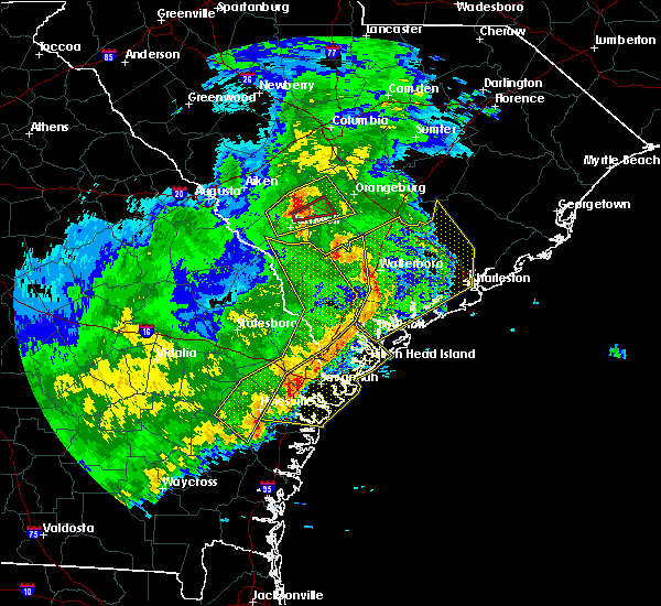 At 356 pm est, severe thunderstorms were located along a line extending from 16 miles southeast of bamberg to 10 miles south of walterboro to near port royal, moving east at 65 mph (radar indicated). Hazards include 60 mph wind gusts. expect damage to roofs, siding, and trees At 356 pm est, severe thunderstorms were located along a line extending from 16 miles southeast of bamberg to 10 miles south of walterboro to near port royal, moving east at 65 mph (radar indicated). Hazards include 60 mph wind gusts. expect damage to roofs, siding, and trees
|
| 8/18/2016 5:57 PM EDT |
 At 557 pm edt, severe thunderstorms were located along a line extending from 16 miles south of kingstree to 6 miles southwest of saint george, moving southeast at 20 mph (radar indicated). Hazards include 60 mph wind gusts and quarter size hail. Hail damage to vehicles is expected. Expect wind damage to roofs, siding, and trees. At 557 pm edt, severe thunderstorms were located along a line extending from 16 miles south of kingstree to 6 miles southwest of saint george, moving southeast at 20 mph (radar indicated). Hazards include 60 mph wind gusts and quarter size hail. Hail damage to vehicles is expected. Expect wind damage to roofs, siding, and trees.
|
| 7/21/2016 4:24 PM EDT |
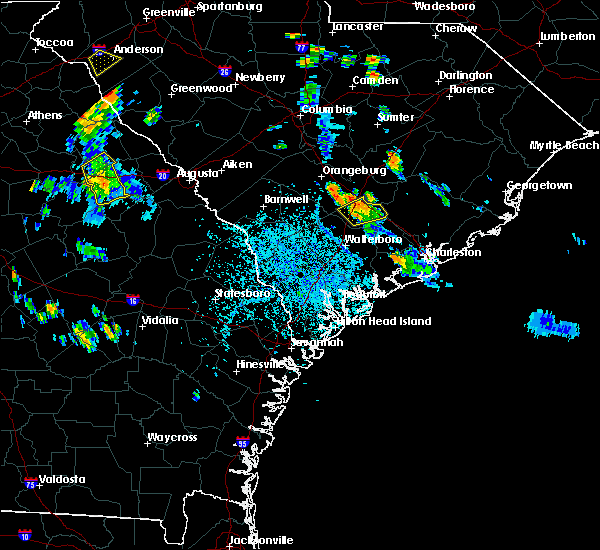 The severe thunderstorm warning for dorchester county will expire at 430 pm edt, the storms which prompted the warning have weakened below severe limits, and no longer pose an immediate threat to life or property. therefore the warning will be allowed to expire. however heavy rain is still possible with these thunderstorms. to report severe weather, contact your nearest law enforcement agency. they will relay your report to the national weather service charleston. The severe thunderstorm warning for dorchester county will expire at 430 pm edt, the storms which prompted the warning have weakened below severe limits, and no longer pose an immediate threat to life or property. therefore the warning will be allowed to expire. however heavy rain is still possible with these thunderstorms. to report severe weather, contact your nearest law enforcement agency. they will relay your report to the national weather service charleston.
|
| 7/21/2016 4:18 PM EDT |
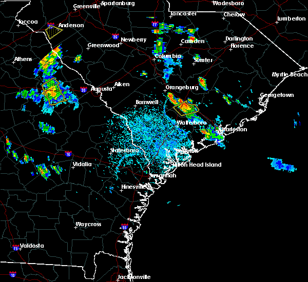 At 417 pm edt, severe thunderstorms were located along a line extending from near indian field to near saint george, and are nearly stationary. around 410 pm south carolina highway patrol reported a tree down near the intersection of route 15 and interstate 26 (radar indicated). Hazards include 60 mph wind gusts. Expect damage to roofs. siding. and trees. locations impacted include, saint george, indian field, dorchester, st. George, harleyville and reevesville. At 417 pm edt, severe thunderstorms were located along a line extending from near indian field to near saint george, and are nearly stationary. around 410 pm south carolina highway patrol reported a tree down near the intersection of route 15 and interstate 26 (radar indicated). Hazards include 60 mph wind gusts. Expect damage to roofs. siding. and trees. locations impacted include, saint george, indian field, dorchester, st. George, harleyville and reevesville.
|
| 7/21/2016 4:06 PM EDT |
 At 406 pm edt, a severe thunderstorm was located near saint george, moving southeast at 15 mph (radar indicated). Hazards include 60 mph wind gusts and quarter size hail. Hail damage to vehicles is expected. expect wind damage to roofs, siding, and trees. locations impacted include, saint george, indian field, dorchester, st. George, harleyville and reevesville. At 406 pm edt, a severe thunderstorm was located near saint george, moving southeast at 15 mph (radar indicated). Hazards include 60 mph wind gusts and quarter size hail. Hail damage to vehicles is expected. expect wind damage to roofs, siding, and trees. locations impacted include, saint george, indian field, dorchester, st. George, harleyville and reevesville.
|
| 7/21/2016 3:58 PM EDT |
 At 358 pm edt, a severe thunderstorm was located near indian field, moving south at 5 mph (radar indicated). Hazards include 60 mph wind gusts and quarter size hail. Hail damage to vehicles is expected. expect wind damage to roofs, siding, and trees. locations impacted include, summerville, slands bridge, indian field, givhans ferry state park, ladson, dorchester and st. George. At 358 pm edt, a severe thunderstorm was located near indian field, moving south at 5 mph (radar indicated). Hazards include 60 mph wind gusts and quarter size hail. Hail damage to vehicles is expected. expect wind damage to roofs, siding, and trees. locations impacted include, summerville, slands bridge, indian field, givhans ferry state park, ladson, dorchester and st. George.
|
| 7/21/2016 3:50 PM EDT |
 At 350 pm edt, a severe thunderstorm was located over indian field, and is nearly stationary (radar indicated). Hazards include 60 mph wind gusts and quarter size hail. Hail damage to vehicles is expected. expect wind damage to roofs, siding, and trees. Locations impacted include, summerville, walterboro, saint george, slands bridge, indian field, givhans ferry state park, ladson and dorchester. At 350 pm edt, a severe thunderstorm was located over indian field, and is nearly stationary (radar indicated). Hazards include 60 mph wind gusts and quarter size hail. Hail damage to vehicles is expected. expect wind damage to roofs, siding, and trees. Locations impacted include, summerville, walterboro, saint george, slands bridge, indian field, givhans ferry state park, ladson and dorchester.
|
| 7/21/2016 3:38 PM EDT |
 At 338 pm edt, a severe thunderstorm was located near indian field, moving south at 5 mph (radar indicated). Hazards include 60 mph wind gusts and quarter size hail. Hail damage to vehicles is expected. expect wind damage to roofs, siding, and trees. Locations impacted include, summerville, walterboro, saint george, slands bridge, indian field, givhans ferry state park, ladson and dorchester. At 338 pm edt, a severe thunderstorm was located near indian field, moving south at 5 mph (radar indicated). Hazards include 60 mph wind gusts and quarter size hail. Hail damage to vehicles is expected. expect wind damage to roofs, siding, and trees. Locations impacted include, summerville, walterboro, saint george, slands bridge, indian field, givhans ferry state park, ladson and dorchester.
|
| 7/21/2016 3:22 PM EDT |
 At 322 pm edt, a severe thunderstorm was located near indian field, moving southeast at 15 mph (radar indicated). Hazards include 60 mph wind gusts and quarter size hail. Hail damage to vehicles is expected. Expect wind damage to roofs, siding, and trees. At 322 pm edt, a severe thunderstorm was located near indian field, moving southeast at 15 mph (radar indicated). Hazards include 60 mph wind gusts and quarter size hail. Hail damage to vehicles is expected. Expect wind damage to roofs, siding, and trees.
|
| 7/9/2016 1:22 AM EDT |
 At 120 am edt, severe thunderstorms were located along a line extending from 6 miles east of indian field to near allendale, moving southeast at 40 mph (radar indicated). Hazards include 60 mph wind gusts and nickel size hail. Expect damage to roofs. siding. and trees. Locations impacted include, walterboro, allendale, hampton, saint george, indian field, lake warren state park, williams. At 120 am edt, severe thunderstorms were located along a line extending from 6 miles east of indian field to near allendale, moving southeast at 40 mph (radar indicated). Hazards include 60 mph wind gusts and nickel size hail. Expect damage to roofs. siding. and trees. Locations impacted include, walterboro, allendale, hampton, saint george, indian field, lake warren state park, williams.
|
| 7/9/2016 12:53 AM EDT |
 At 1252 am edt, a severe thunderstorm was located 11 miles south of savannah river site, moving southeast at 45 mph (radar indicated). Hazards include 60 mph wind gusts and nickel size hail. Expect damage to roofs. siding. And trees. At 1252 am edt, a severe thunderstorm was located 11 miles south of savannah river site, moving southeast at 45 mph (radar indicated). Hazards include 60 mph wind gusts and nickel size hail. Expect damage to roofs. siding. And trees.
|
| 6/17/2016 4:40 PM EDT | The severe thunderstorm warning for dorchester, berkeley and colleton counties will expire at 445 pm edt, the storms which prompted the warning have weakened below severe limits, and no longer pose an immediate threat to life or property. therefore the warning will be allowed to expire. a severe thunderstorm watch remains in effect until 1000 pm edt for southeastern south carolina. to report severe weather, contact your nearest law enforcement agency. they will relay your report to the national weather service charleston. |
| 6/17/2016 4:14 PM EDT |
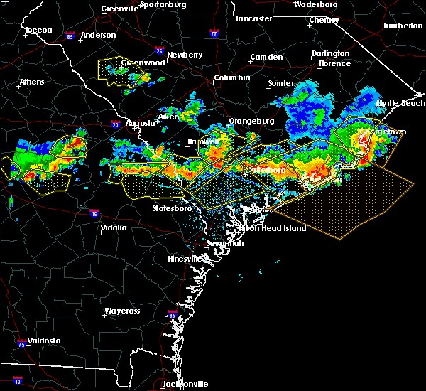 At 414 pm edt, severe thunderstorms were located along a line extending from 7 miles north of walterboro to 11 miles northeast of givhans ferry state park, moving southeast at 30 mph (radar indicated). Hazards include 60 mph wind gusts and quarter size hail. Hail damage to vehicles is expected. expect wind damage to roofs, siding, and trees. locations impacted include, saint george, indian field, dorchester, st. George, harleyville, reevesville, canadys and southern lake moultrie. At 414 pm edt, severe thunderstorms were located along a line extending from 7 miles north of walterboro to 11 miles northeast of givhans ferry state park, moving southeast at 30 mph (radar indicated). Hazards include 60 mph wind gusts and quarter size hail. Hail damage to vehicles is expected. expect wind damage to roofs, siding, and trees. locations impacted include, saint george, indian field, dorchester, st. George, harleyville, reevesville, canadys and southern lake moultrie.
|
| 6/17/2016 3:44 PM EDT |
 At 344 pm edt, severe thunderstorms were located along a line extending from 6 miles southwest of saint george to 14 miles northeast of moncks corner, moving southeast at 30 mph (radar indicated). Hazards include 60 mph wind gusts and quarter size hail. Hail damage to vehicles is expected. Expect wind damage to roofs, siding, and trees. At 344 pm edt, severe thunderstorms were located along a line extending from 6 miles southwest of saint george to 14 miles northeast of moncks corner, moving southeast at 30 mph (radar indicated). Hazards include 60 mph wind gusts and quarter size hail. Hail damage to vehicles is expected. Expect wind damage to roofs, siding, and trees.
|
| 6/17/2016 3:19 PM EDT |
 At 318 pm edt, severe thunderstorms were located along a line extending from 7 miles north of moncks corner to 6 miles south of saint george, moving southeast at 30 mph (radar indicated. at 307 pm...at least one tree was reported down just west of cross). Hazards include 60 mph wind gusts and quarter size hail. Hail damage to vehicles is expected. expect wind damage to roofs, siding, and trees. Locations impacted include, north charleston, summerville, goose creek, hanahan, moncks corner, saint george, slands bridge and indian field. At 318 pm edt, severe thunderstorms were located along a line extending from 7 miles north of moncks corner to 6 miles south of saint george, moving southeast at 30 mph (radar indicated. at 307 pm...at least one tree was reported down just west of cross). Hazards include 60 mph wind gusts and quarter size hail. Hail damage to vehicles is expected. expect wind damage to roofs, siding, and trees. Locations impacted include, north charleston, summerville, goose creek, hanahan, moncks corner, saint george, slands bridge and indian field.
|
| 6/17/2016 3:08 PM EDT |
 At 306 pm edt, severe thunderstorms were located along a line extending from 12 miles north of moncks corner to near saint george, moving southeast at 30 mph (radar indicated). Hazards include 60 mph wind gusts and quarter size hail. Hail damage to vehicles is expected. expect wind damage to roofs, siding, and trees. Locations impacted include, north charleston, summerville, goose creek, hanahan, moncks corner, saint george, slands bridge, harleyville, ebenezer, saint stephen, lake moultrie, and indian field. At 306 pm edt, severe thunderstorms were located along a line extending from 12 miles north of moncks corner to near saint george, moving southeast at 30 mph (radar indicated). Hazards include 60 mph wind gusts and quarter size hail. Hail damage to vehicles is expected. expect wind damage to roofs, siding, and trees. Locations impacted include, north charleston, summerville, goose creek, hanahan, moncks corner, saint george, slands bridge, harleyville, ebenezer, saint stephen, lake moultrie, and indian field.
|
| 6/17/2016 2:51 PM EDT |
 At 250 pm edt, severe thunderstorms were located along a line extending from 15 miles northwest of moncks corner to 10 miles west of saint george, moving southeast at 45 mph (radar indicated). Hazards include 60 mph wind gusts and quarter size hail. Hail damage to vehicles is expected. Expect wind damage to roofs, siding, and trees. At 250 pm edt, severe thunderstorms were located along a line extending from 15 miles northwest of moncks corner to 10 miles west of saint george, moving southeast at 45 mph (radar indicated). Hazards include 60 mph wind gusts and quarter size hail. Hail damage to vehicles is expected. Expect wind damage to roofs, siding, and trees.
|
| 7/18/2015 9:01 PM EDT |
 At 901 pm edt, severe thunderstorms were located along a line extending from 17 miles south of manning to 21 miles northwest of moncks corner to 6 miles east of indian field to saint george, moving southeast at 15 mph (radar indicated). Hazards include 60 mph wind gusts. Expect damage to roofs. siding and trees. locations impacted include, saint george, indian field, dorchester, st. George, ridgeville, harleyville, bonneau and reevesville. At 901 pm edt, severe thunderstorms were located along a line extending from 17 miles south of manning to 21 miles northwest of moncks corner to 6 miles east of indian field to saint george, moving southeast at 15 mph (radar indicated). Hazards include 60 mph wind gusts. Expect damage to roofs. siding and trees. locations impacted include, saint george, indian field, dorchester, st. George, ridgeville, harleyville, bonneau and reevesville.
|
| 7/18/2015 8:38 PM EDT |
 At 838 pm edt, severe thunderstorms were located along a line extending from 16 miles south of manning to 6 miles northwest of indian field, moving east at 25 mph (radar indicated). Hazards include 60 mph wind gusts. Expect damage to roofs. Siding and trees. At 838 pm edt, severe thunderstorms were located along a line extending from 16 miles south of manning to 6 miles northwest of indian field, moving east at 25 mph (radar indicated). Hazards include 60 mph wind gusts. Expect damage to roofs. Siding and trees.
|
| 7/3/2015 2:07 PM EDT |
 At 206 pm edt, severe thunderstorms were located along a line extending from 7 miles southeast of islandton to southern lake moultrie, moving east at 35 mph (radar indicated). Hazards include 60 mph wind gusts. Expect damage to roofs. siding and trees. Locations impacted include, summerville, moncks corner, walterboro and givhans ferry state park, harleyville, smoaks, canadys, cat hole, williams and islandton. At 206 pm edt, severe thunderstorms were located along a line extending from 7 miles southeast of islandton to southern lake moultrie, moving east at 35 mph (radar indicated). Hazards include 60 mph wind gusts. Expect damage to roofs. siding and trees. Locations impacted include, summerville, moncks corner, walterboro and givhans ferry state park, harleyville, smoaks, canadys, cat hole, williams and islandton.
|
| 7/3/2015 1:59 PM EDT |
 At 159 pm edt, severe thunderstorms were located along a line extending from near islandton to near southern lake moultrie, moving east at 35 mph (radar indicated). Hazards include 60 mph wind gusts. Expect damage to roofs. siding and trees. Locations impacted include, islandton, canadys, cat hole, harleyville, smoaks, summerville, moncks corner, walterboro, saint george, givhans ferry state park and indian field. At 159 pm edt, severe thunderstorms were located along a line extending from near islandton to near southern lake moultrie, moving east at 35 mph (radar indicated). Hazards include 60 mph wind gusts. Expect damage to roofs. siding and trees. Locations impacted include, islandton, canadys, cat hole, harleyville, smoaks, summerville, moncks corner, walterboro, saint george, givhans ferry state park and indian field.
|
| 7/3/2015 1:47 PM EDT |
 At 146 pm edt, severe thunderstorms were located along a line extending from near ashton to 6 miles southwest of cross, moving east at 40 mph (radar indicated). Hazards include 60 mph wind gusts. Expect damage to roofs. siding and trees. Locations impacted include, harleyville, smoaks, canadys, cat hole, , williams, ruffin, islandton, summerville, moncks corner, walterboro, saint george, givhans ferry state park and indian field. At 146 pm edt, severe thunderstorms were located along a line extending from near ashton to 6 miles southwest of cross, moving east at 40 mph (radar indicated). Hazards include 60 mph wind gusts. Expect damage to roofs. siding and trees. Locations impacted include, harleyville, smoaks, canadys, cat hole, , williams, ruffin, islandton, summerville, moncks corner, walterboro, saint george, givhans ferry state park and indian field.
|
| 7/3/2015 1:30 PM EDT |
 At 130 pm edt, severe thunderstorms were located along a line extending from 6 miles northwest of lodge to near holly hill, moving east at 35 mph (radar indicated). Hazards include 60 mph wind gusts. Expect damage to roofs. siding and trees. Locations impacted include, harleyville, smoaks, canadys, summerville, moncks corner, walterboro, saint george, givhans ferry state park and indian field. At 130 pm edt, severe thunderstorms were located along a line extending from 6 miles northwest of lodge to near holly hill, moving east at 35 mph (radar indicated). Hazards include 60 mph wind gusts. Expect damage to roofs. siding and trees. Locations impacted include, harleyville, smoaks, canadys, summerville, moncks corner, walterboro, saint george, givhans ferry state park and indian field.
|
| 7/3/2015 1:17 PM EDT |
 At 116 pm edt, severe thunderstorms were located along a line extending from near ulmer to 6 miles north of indian field, moving east at 35 mph (radar indicated). Hazards include 60 mph wind gusts. Expect damage to roofs. Siding and trees. At 116 pm edt, severe thunderstorms were located along a line extending from near ulmer to 6 miles north of indian field, moving east at 35 mph (radar indicated). Hazards include 60 mph wind gusts. Expect damage to roofs. Siding and trees.
|
| 7/2/2015 6:53 PM EDT |
 At 652 pm edt, severe thunderstorms were located along a line extending from eadytown to 6 miles east of canadys, moving east at 50 mph (radar indicated). Hazards include 60 mph wind gusts. Expect damage to roofs. siding and trees. Locations impacted include, eadytown, moncks corner, saint george, givhans ferry state park, dorchester, ridgeville and indian field. At 652 pm edt, severe thunderstorms were located along a line extending from eadytown to 6 miles east of canadys, moving east at 50 mph (radar indicated). Hazards include 60 mph wind gusts. Expect damage to roofs. siding and trees. Locations impacted include, eadytown, moncks corner, saint george, givhans ferry state park, dorchester, ridgeville and indian field.
|
| 7/2/2015 6:50 PM EDT | Tree down at the intersection of seven acres rd and cypress grove ln in dorchester county SC, 4.6 miles NNW of St. George, SC |
| 7/2/2015 6:28 PM EDT | A tree was blown down onto power lines and a power pole was snapped at the intersection of reed street and south parler avenu in dorchester county SC, 1 miles NNW of St. George, SC |
| 7/2/2015 6:28 PM EDT |
 At 627 pm edt, severe thunderstorms were located along a line extending from near holly hill to near smoaks, moving east at 45 mph (radar indicated). Hazards include 60 mph wind gusts. Expect damage to roofs. Siding and trees. At 627 pm edt, severe thunderstorms were located along a line extending from near holly hill to near smoaks, moving east at 45 mph (radar indicated). Hazards include 60 mph wind gusts. Expect damage to roofs. Siding and trees.
|
| 6/30/2015 6:03 PM EDT |
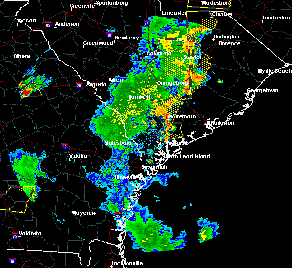 At 602 pm edt, severe thunderstorms were located along a line extending from near indian field to green pond, moving east at 25 mph (radar indicated). Hazards include 60 mph wind gusts and penny size hail. Expect damage to roofs. siding and trees. Locations impacted include, walterboro, indian field and saint george. At 602 pm edt, severe thunderstorms were located along a line extending from near indian field to green pond, moving east at 25 mph (radar indicated). Hazards include 60 mph wind gusts and penny size hail. Expect damage to roofs. siding and trees. Locations impacted include, walterboro, indian field and saint george.
|
| 6/30/2015 5:49 PM EDT |
 At 548 pm edt, severe thunderstorms were scattered along a line extending from near reevesville to near white hall, moving east at 30 mph (radar indicated). Hazards include 60 mph wind gusts and penny size hail. Expect damage to roofs. siding and trees. Locations impacted include, walterboro, yemassee, saint george and indian field. At 548 pm edt, severe thunderstorms were scattered along a line extending from near reevesville to near white hall, moving east at 30 mph (radar indicated). Hazards include 60 mph wind gusts and penny size hail. Expect damage to roofs. siding and trees. Locations impacted include, walterboro, yemassee, saint george and indian field.
|
| 6/30/2015 5:26 PM EDT |
 At 526 pm edt, severe thunderstorms were located along a line extending from near branchville to almeda intersection, moving east at 25 mph (radar indicated). Hazards include 60 mph wind gusts. Expect damage to roofs. Siding and trees. At 526 pm edt, severe thunderstorms were located along a line extending from near branchville to almeda intersection, moving east at 25 mph (radar indicated). Hazards include 60 mph wind gusts. Expect damage to roofs. Siding and trees.
|
| 6/25/2015 12:11 AM EDT |
 At 1211 am edt, severe thunderstorms were located along a line extending from near indian field to ladson, moving south at 5 mph (radar indicated). Hazards include 60 mph wind gusts and penny size hail. Expect damage to roofs. Siding and trees. At 1211 am edt, severe thunderstorms were located along a line extending from near indian field to ladson, moving south at 5 mph (radar indicated). Hazards include 60 mph wind gusts and penny size hail. Expect damage to roofs. Siding and trees.
|
| 6/22/2015 5:56 PM EDT | The severe thunderstorm warning for dorchester and berkeley counties will expire at 600 pm edt, the storm which prompted the warning has weakened below severe limits, and no longer pose an immediate threat to life or property. therefore the warning will be allowed to expire. however gusty winds and heavy rain are still possible with this thunderstorm. |
| 6/22/2015 5:32 PM EDT |
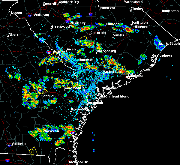 At 532 pm edt, a severe thunderstorm was located over harleyville, or near indian field, moving east at 5 mph (radar indicated). Hazards include 60 mph wind gusts and penny size hail. Expect damage to roofs. siding and trees. Locations impacted include, indian field and saint george. At 532 pm edt, a severe thunderstorm was located over harleyville, or near indian field, moving east at 5 mph (radar indicated). Hazards include 60 mph wind gusts and penny size hail. Expect damage to roofs. siding and trees. Locations impacted include, indian field and saint george.
|
| 6/22/2015 5:14 PM EDT |
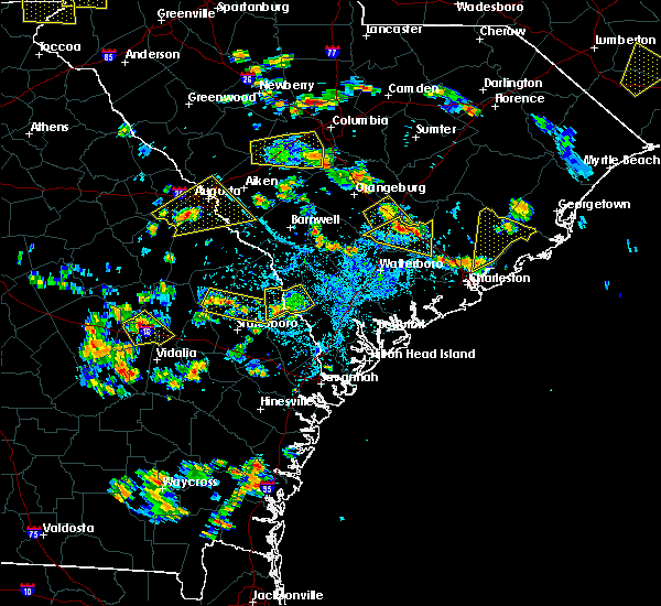 At 514 pm edt, a severe thunderstorm was located over harleyville, or near indian field, moving east at 10 mph (radar indicated). Hazards include 60 mph wind gusts and quarter size hail. Hail damage to vehicles is expected. expect wind damage to roofs, siding and trees. Locations impacted include, indian field and saint george. At 514 pm edt, a severe thunderstorm was located over harleyville, or near indian field, moving east at 10 mph (radar indicated). Hazards include 60 mph wind gusts and quarter size hail. Hail damage to vehicles is expected. expect wind damage to roofs, siding and trees. Locations impacted include, indian field and saint george.
|
| 6/22/2015 4:58 PM EDT |
 At 458 pm edt, a severe thunderstorm was located over indian field, moving east at 5 mph (radar indicated). Hazards include 60 mph wind gusts and quarter size hail. Hail damage to vehicles is expected. Expect wind damage to roofs, siding and trees. At 458 pm edt, a severe thunderstorm was located over indian field, moving east at 5 mph (radar indicated). Hazards include 60 mph wind gusts and quarter size hail. Hail damage to vehicles is expected. Expect wind damage to roofs, siding and trees.
|
| 6/9/2015 3:32 PM EDT |
 At 330 pm edt, severe thunderstorms were located along a line extending from 6 miles south of lambert to 7 miles northeast of goose creek to smoaks, moving east at 15 mph (radar indicated). Hazards include 60 mph wind gusts and quarter size hail. Hail damage to vehicles is expected. expect wind damage to roofs, siding and trees. Locations impacted include, summerville, goose creek, moncks corner, saint george, givhans ferry state park and ladson. At 330 pm edt, severe thunderstorms were located along a line extending from 6 miles south of lambert to 7 miles northeast of goose creek to smoaks, moving east at 15 mph (radar indicated). Hazards include 60 mph wind gusts and quarter size hail. Hail damage to vehicles is expected. expect wind damage to roofs, siding and trees. Locations impacted include, summerville, goose creek, moncks corner, saint george, givhans ferry state park and ladson.
|
| 6/9/2015 3:15 PM EDT |
 At 314 pm edt, severe thunderstorms were located along a line extending from near old santee canal state park to near canadys, moving east at 25 mph (radar indicated). Hazards include 60 mph wind gusts and quarter size hail. Hail damage to vehicles is expected. Expect wind damage to roofs, siding and trees. At 314 pm edt, severe thunderstorms were located along a line extending from near old santee canal state park to near canadys, moving east at 25 mph (radar indicated). Hazards include 60 mph wind gusts and quarter size hail. Hail damage to vehicles is expected. Expect wind damage to roofs, siding and trees.
|
| 4/19/2015 6:12 PM EDT | The severe thunderstorm warning for colleton and dorchester counties will expire at 615 pm edt, the line of storms which prompted the warning have moved out of the area. therefore the warning will be allowed to expire. however gusty winds are still possible with these thunderstorms. another severe thunderstorm warning remains in effect for portions of dorchester county until 7 pm. a tornado watch remains in effect until 800 pm edt for southeastern south carolina. |
| 4/19/2015 5:53 PM EDT | At 552 pm edt, severe thunderstorms were located along a line extending from near indian field to jacksonboro, moving northeast at 35 mph (radar indicated. several reports of trees down have also been reported with this line across colleton county). Hazards include 60 mph wind gusts. Expect damage to roofs. siding and trees. locations impacted include, indian field and saint george. a tornado watch remains in effect until 800 pm edt for southeastern south carolina. 75in. |
| 4/19/2015 5:40 PM EDT | At 539 pm edt, severe thunderstorms were located along a line extending from near indian field to 6 miles south of ashepoo, moving northeast at 40 mph (radar indicated). Hazards include 60 mph wind gusts. Expect damage to roofs. siding and trees. locations impacted include, walterboro, indian field and saint george. a tornado watch remains in effect until 800 pm edt for southeastern south carolina. 75in. |
| 4/19/2015 5:15 PM EDT | At 514 pm edt, severe thunderstorms were located along a line extending from near smoaks to pocotaligo, moving northeast at 40 mph (radar indicated. this line of storms has a history of producing damaging winds). Hazards include 60 mph wind gusts. Expect damage to roofs. Siding and trees. |
| 6/22/2014 2:20 PM EDT | Power lines down on augusta highway at interstate 9 in colleton county SC, 8.6 miles NNE of St. George, SC |
| 6/9/2014 10:46 PM EDT | Ping Pong Ball sized hail reported 4.8 miles WNW of St. George, SC, trained spotter relayed report of 1.5 inch hail. |
| 6/4/2013 3:40 PM EDT | Nws columbia damage survey team reported trees down along duncan chapel road just inside the dorchester county line. this damage was possibly caused by the ef-1 tornado in dorchester county SC, 7.6 miles SSW of St. George, SC |
| 5/20/2013 5:26 PM EDT | South carolina highway patrol reported 2 trees down on indian field circle. time estimated by rada in dorchester county SC, 3.4 miles SW of St. George, SC |
| 3/18/2013 10:41 PM EDT | Tree down on dukes stree in dorchester county SC, 1 miles NNW of St. George, SC |
| 8/2/2012 5:31 PM EDT | Tree reported down on us hwy 78 between st george and byr in dorchester county SC, 2.4 miles WNW of St. George, SC |
| 7/30/2012 5:52 PM EDT | One tree down near the intersection of gum branch road and mt. moriah roa in dorchester county SC, 4.9 miles NW of St. George, SC |
| 7/29/2012 3:23 PM EDT | Powerlines down on 2nd texas road. time estimated based on rada in dorchester county SC, 5.5 miles NNW of St. George, SC |
| 7/10/2012 2:55 PM EDT | Sc highway patrol reports a tree down at the intersection of us-15 and indian field circl in dorchester county SC, 3.4 miles SW of St. George, SC |
| 7/1/2012 7:05 PM EDT | Law enforcement reported one tree down on raysor stree in dorchester county SC, 0.5 miles WNW of St. George, SC |
| 3/16/2012 5:05 PM EDT | Quarter sized hail reported 0.5 miles WNW of St. George, SC |
| 1/1/0001 12:00 AM | Law enforcement reported powerlines down in saint georg in dorchester county SC, 1 miles NNW of St. George, SC |
| 1/1/0001 12:00 AM | County warning point reports a tree down in st. georg in dorchester county SC, 0.5 miles WNW of St. George, SC |
| 1/1/0001 12:00 AM | Quarter size hail and one oak tree blown down on harts roa in dorchester county SC, 7.7 miles SSW of St. George, SC |
| 1/1/0001 12:00 AM | Several branches down 2 inches in diamete in dorchester county SC, 8.6 miles N of St. George, SC |
Hail Maps for St. George, SC
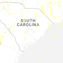
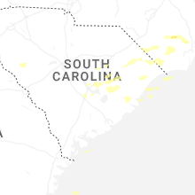
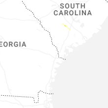


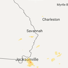


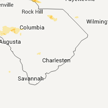


Connect with Interactive Hail Maps