

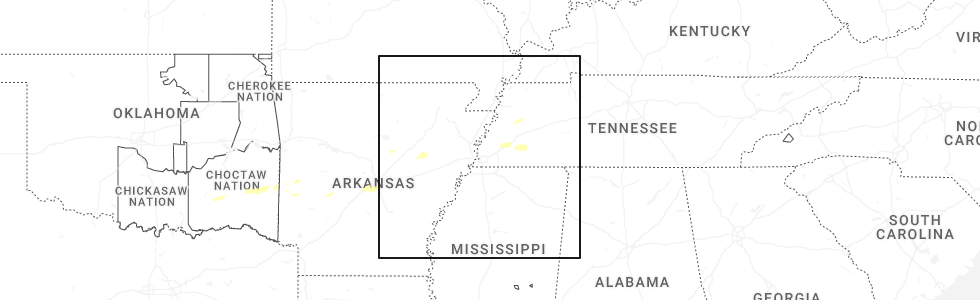
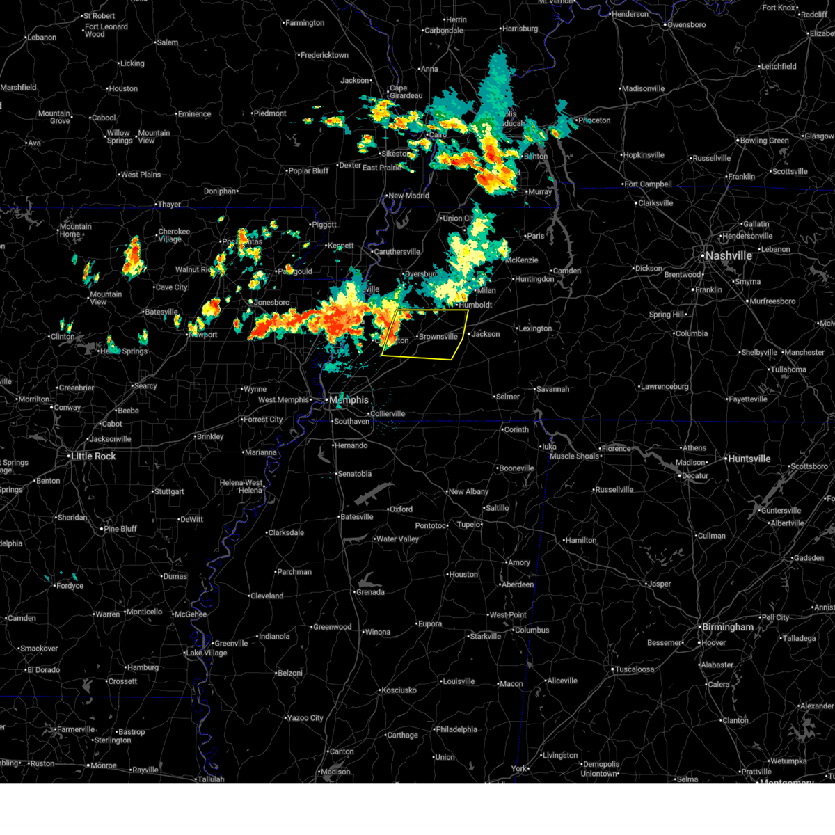
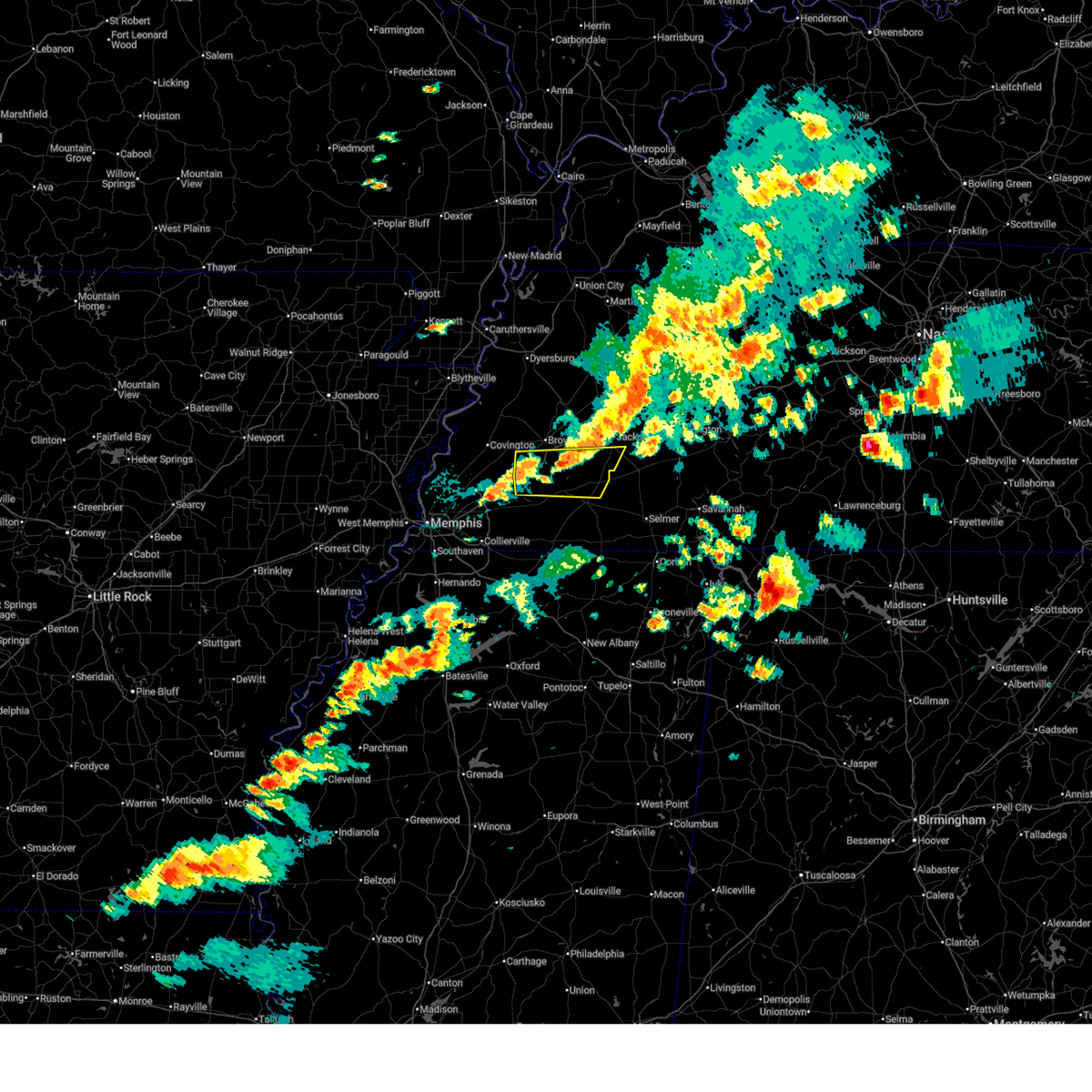
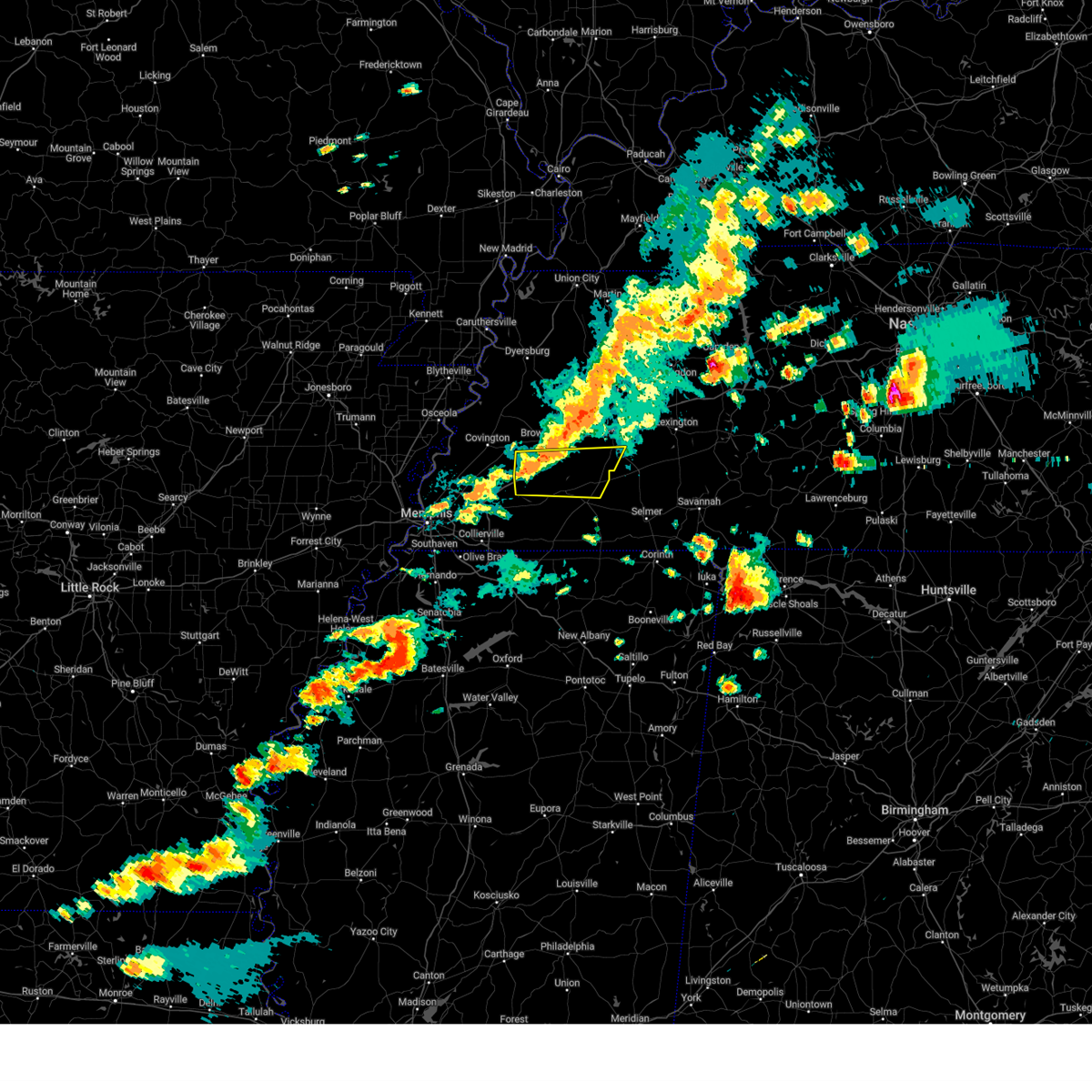
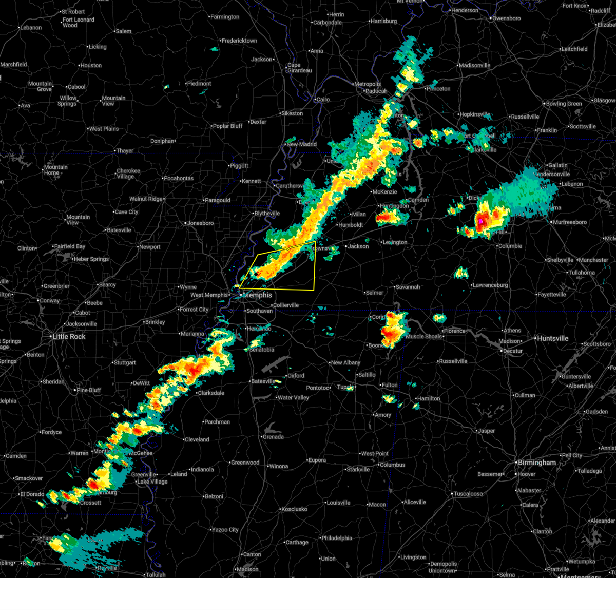
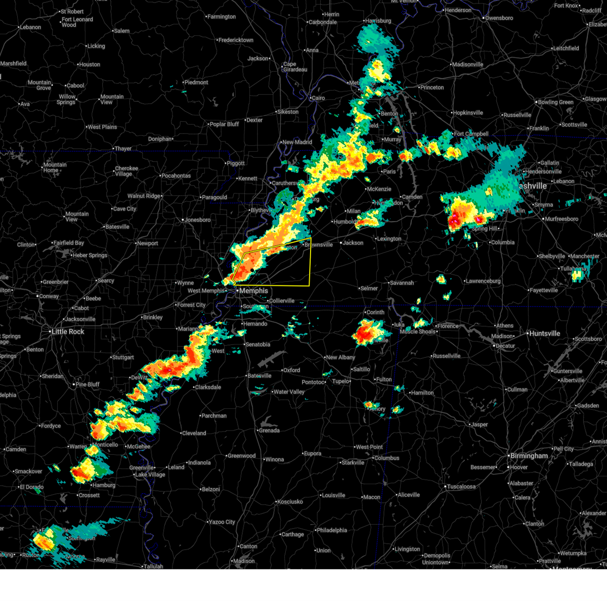
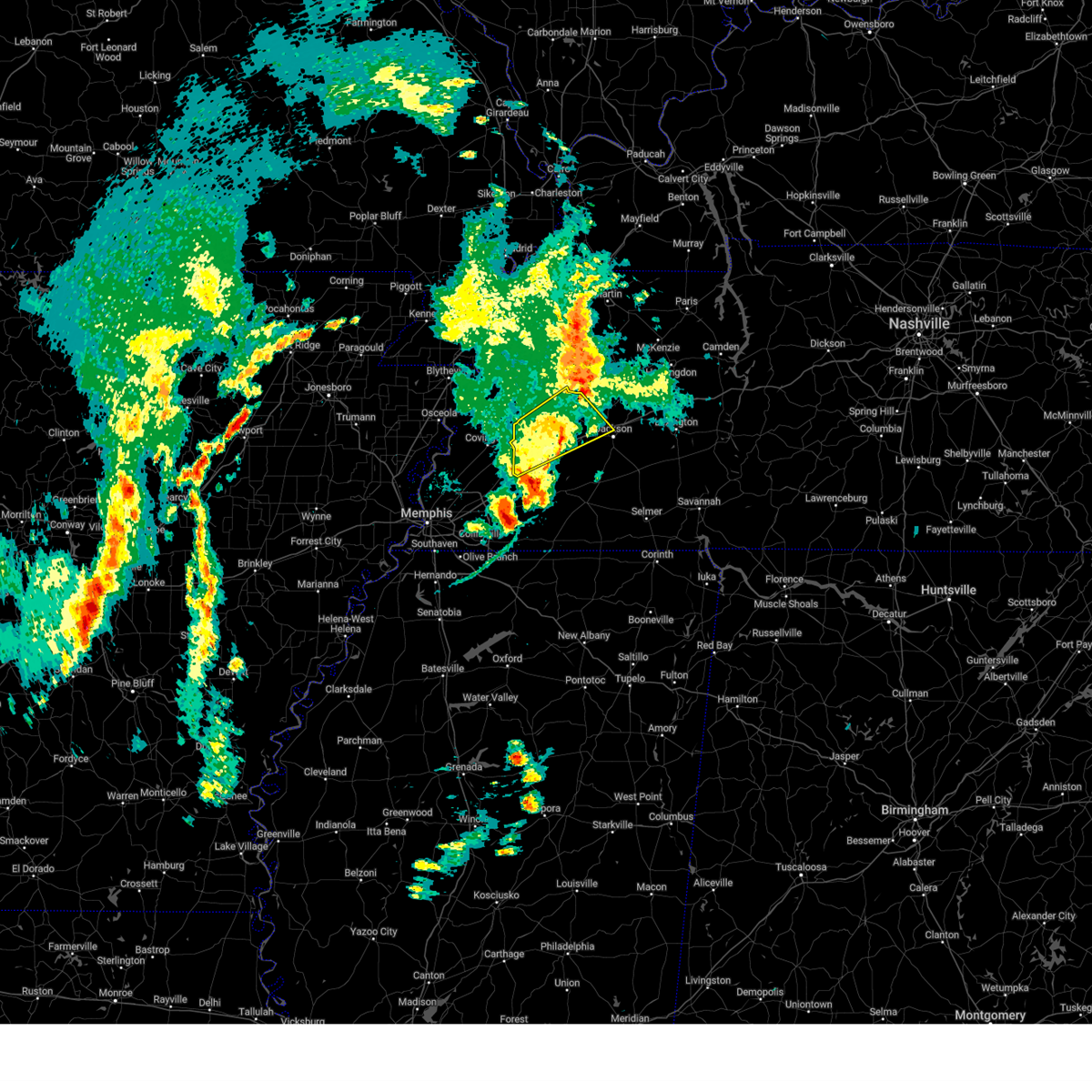
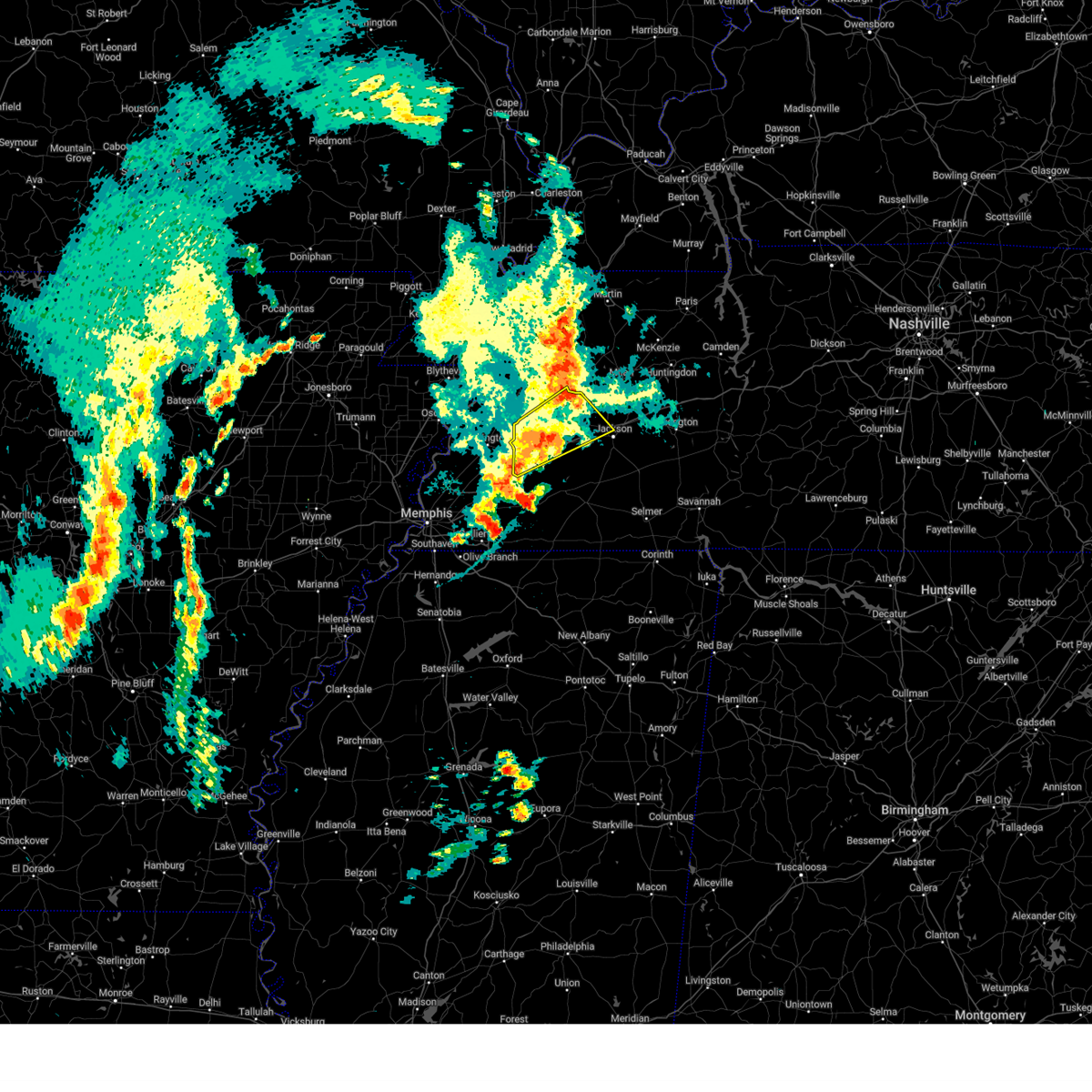
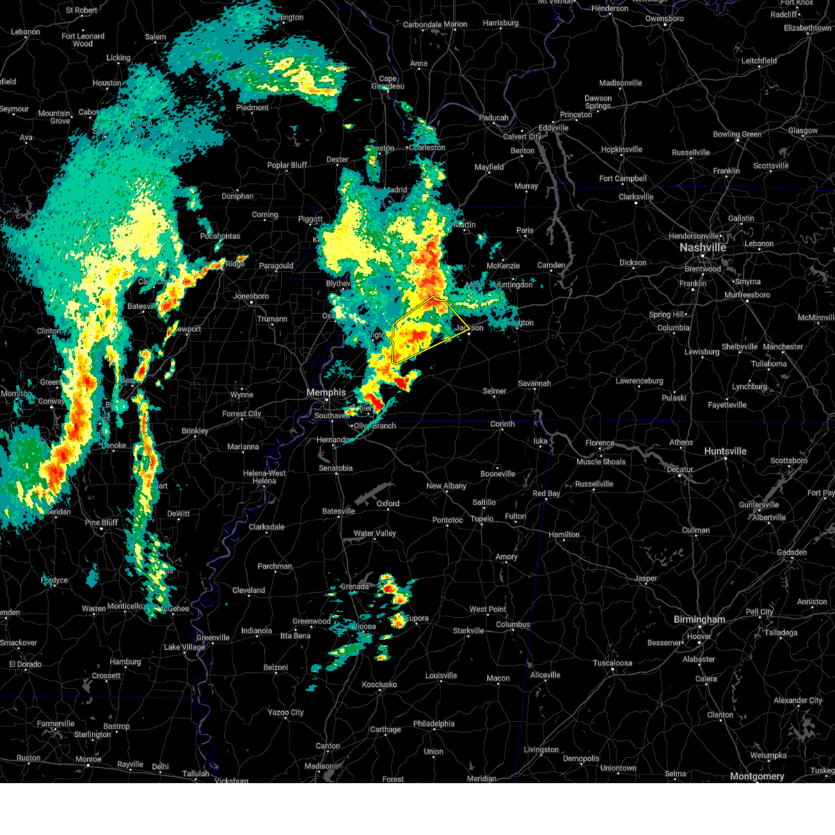
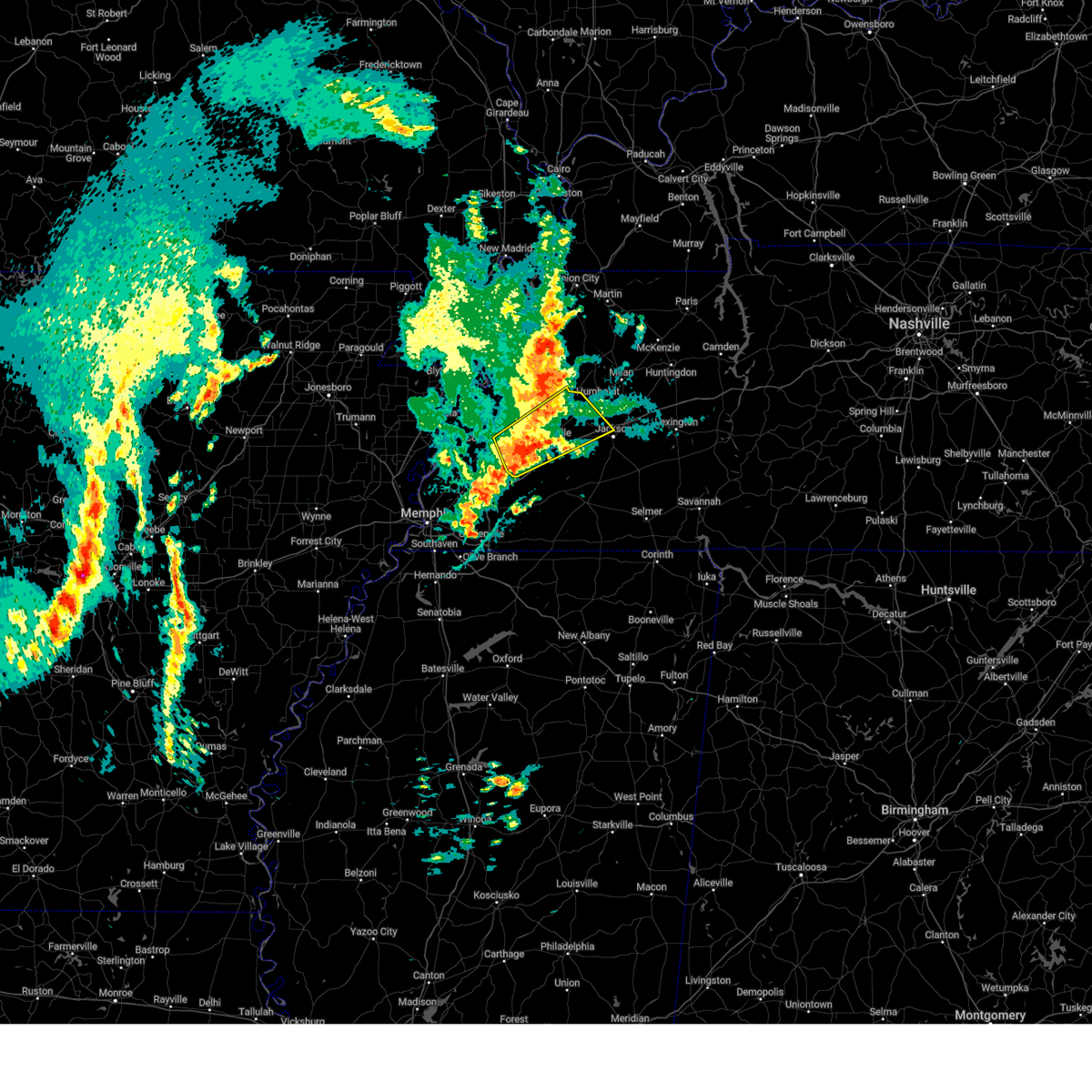
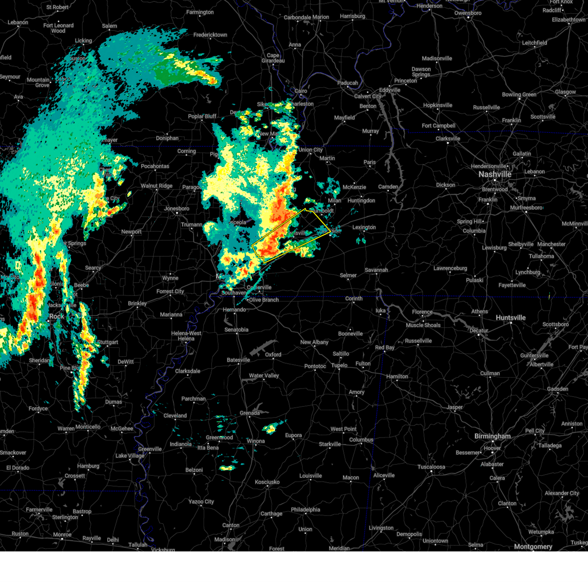
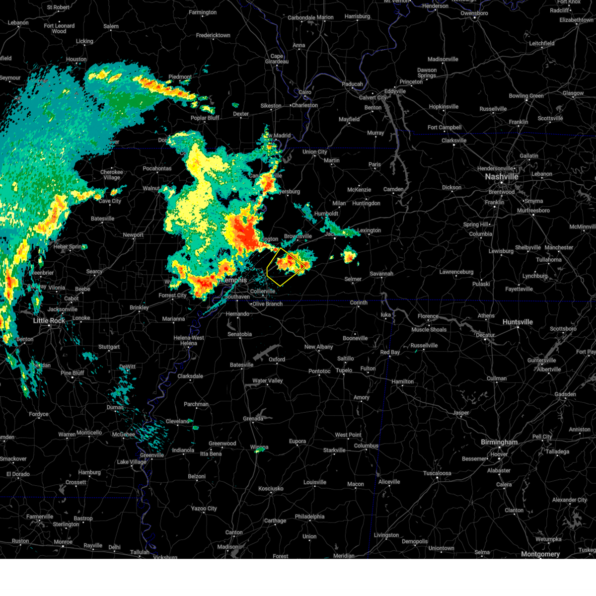
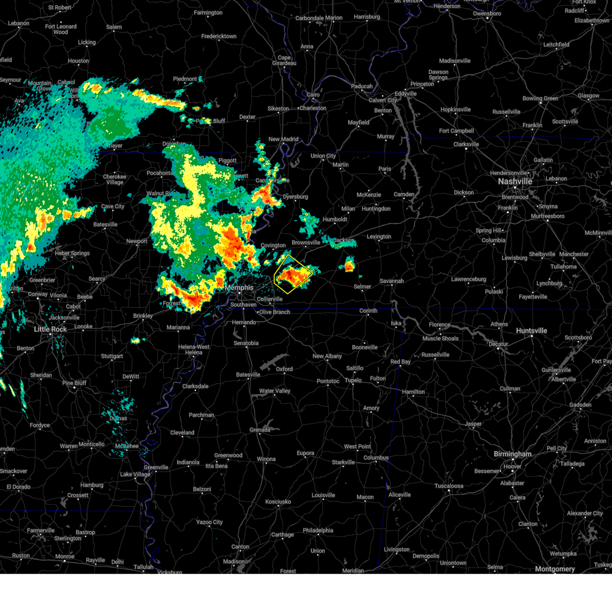
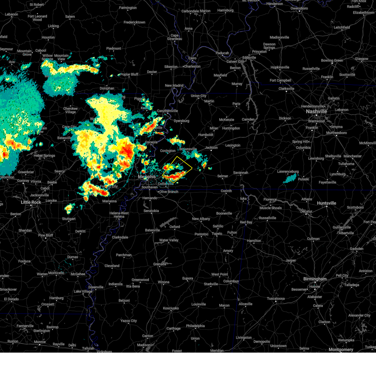
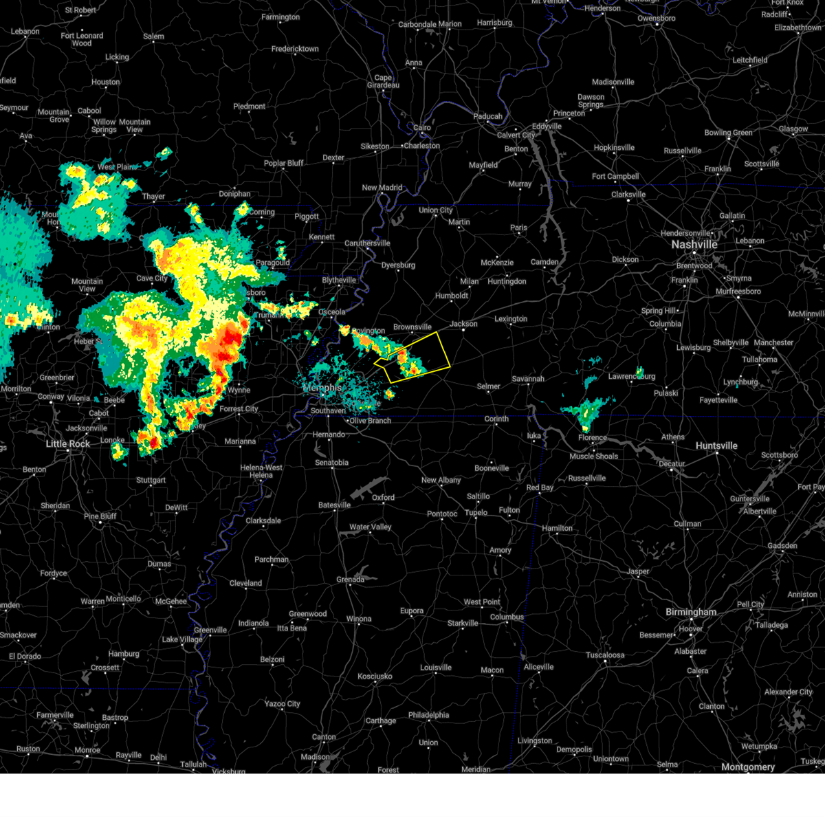
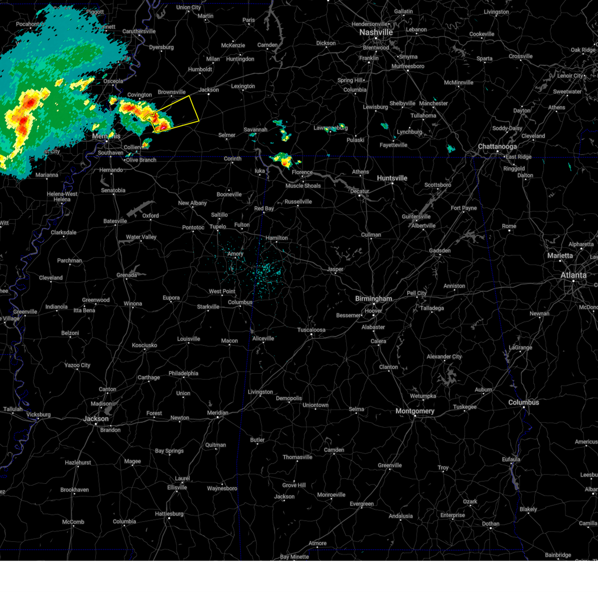
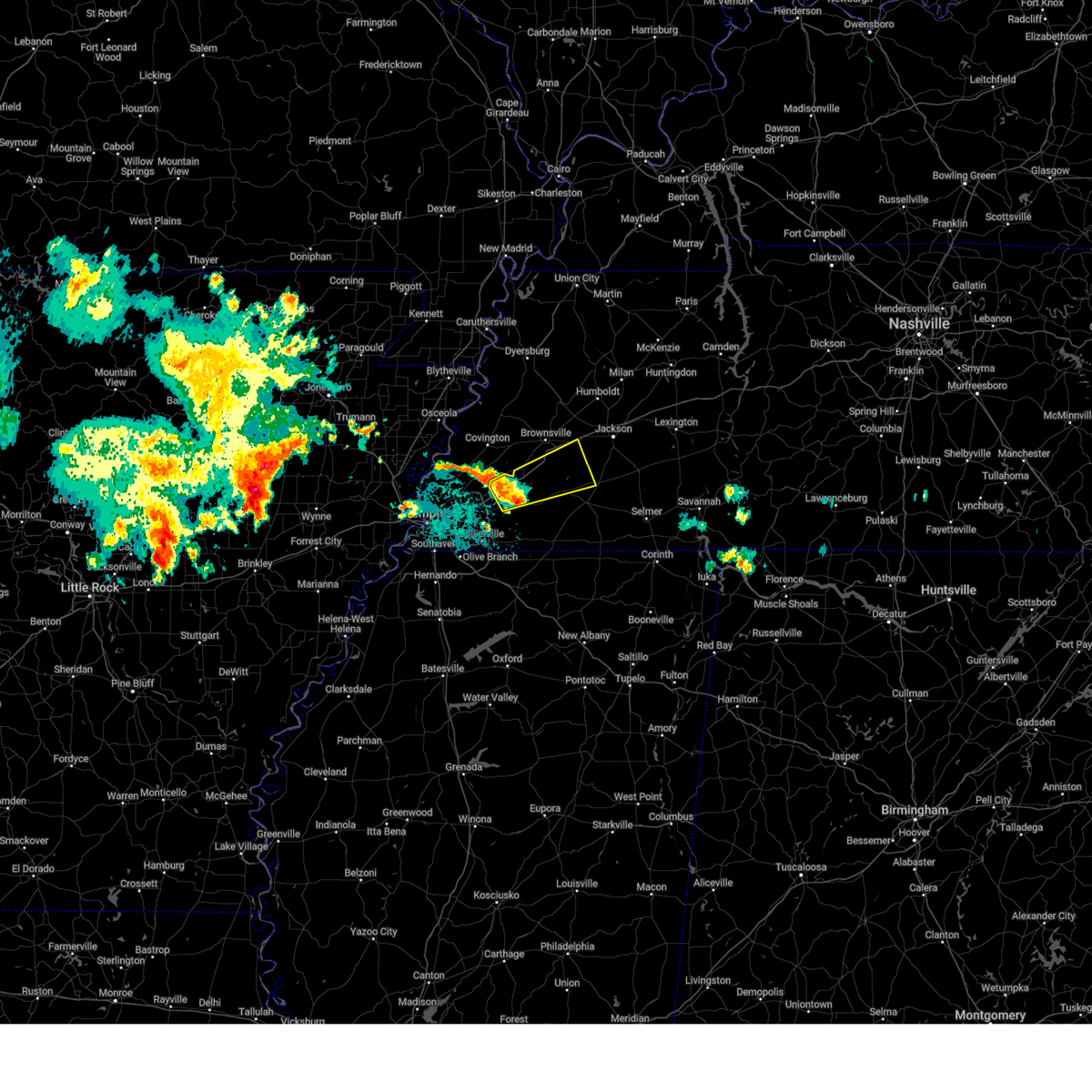
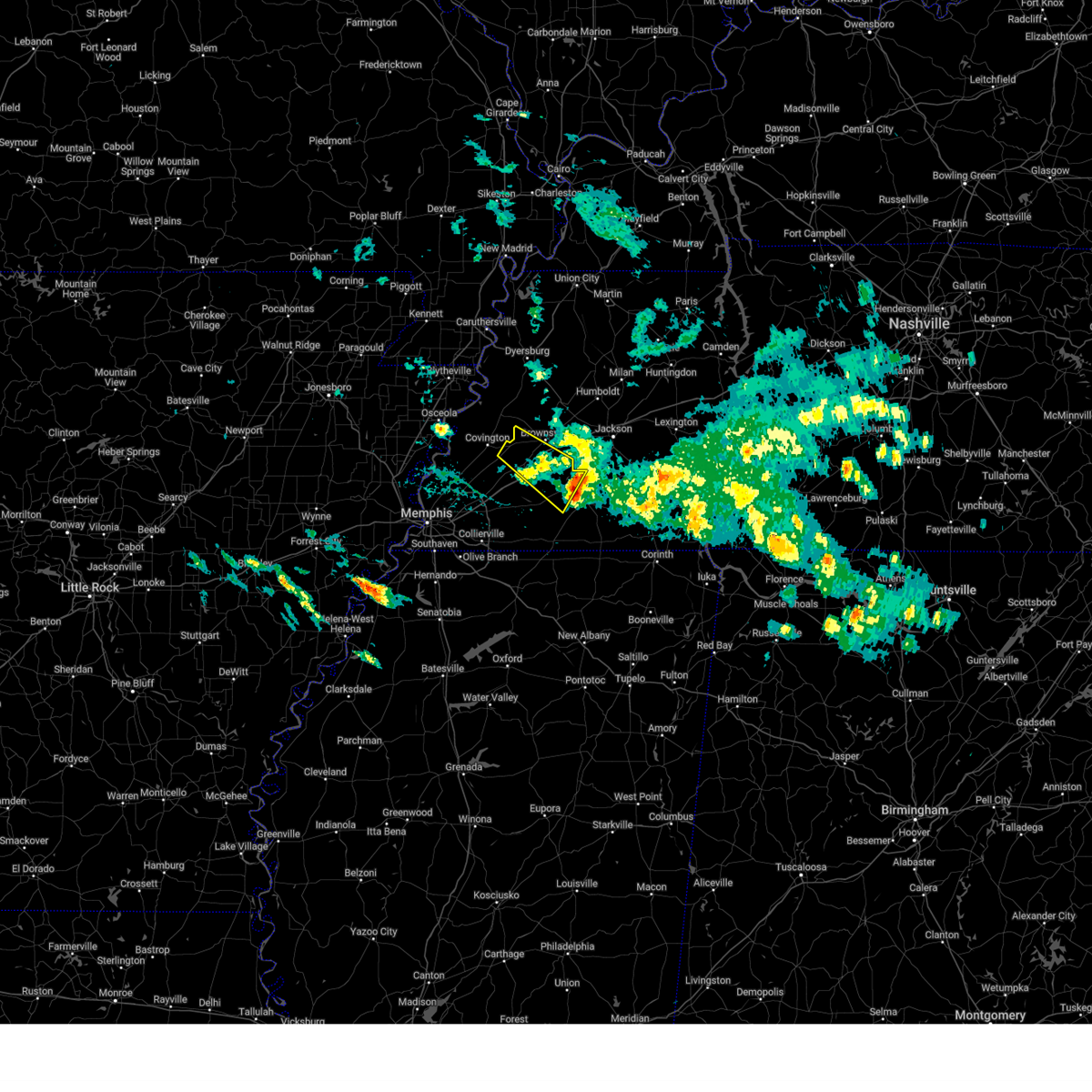
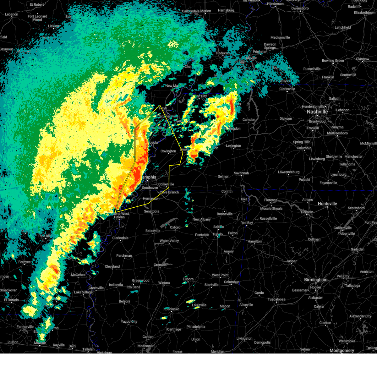
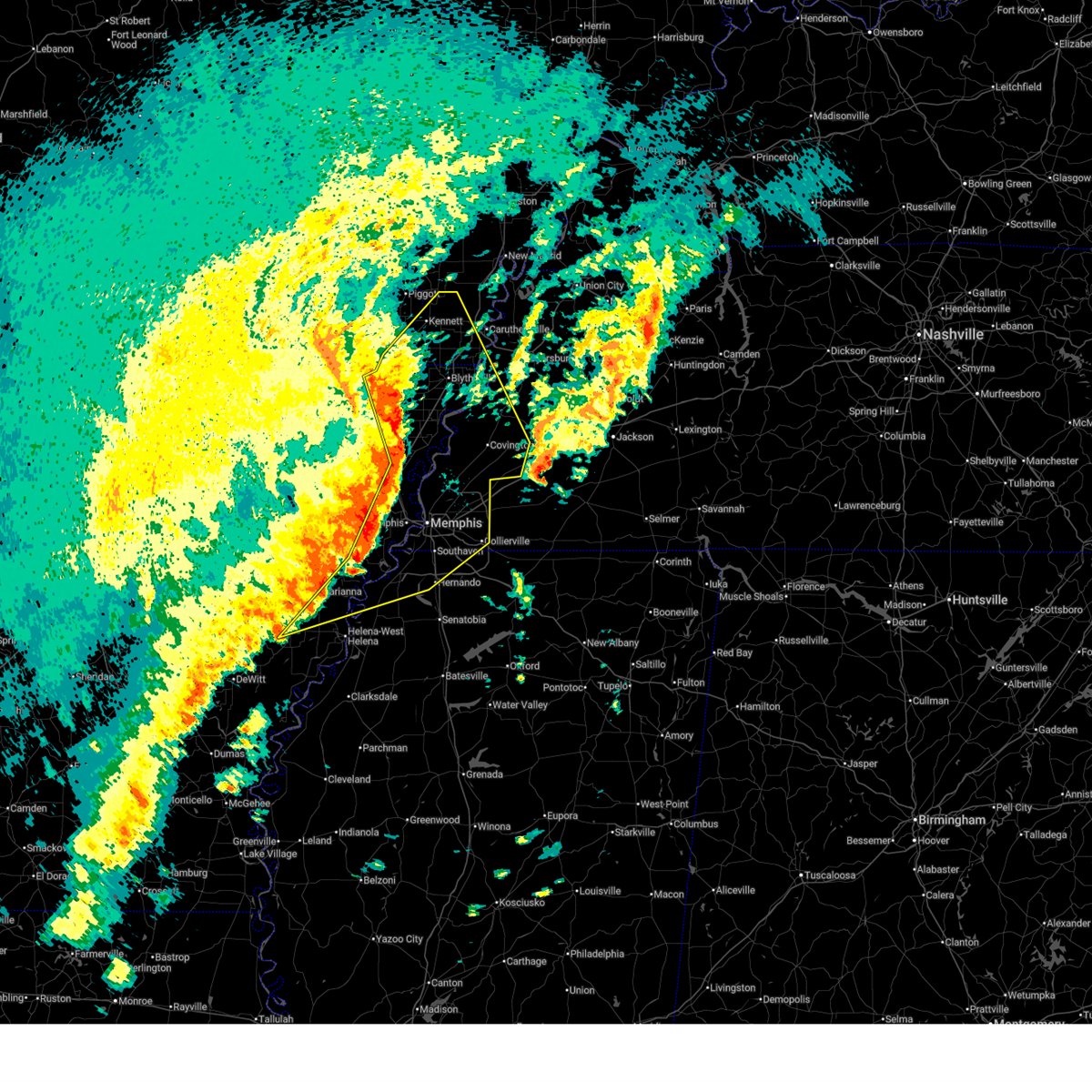
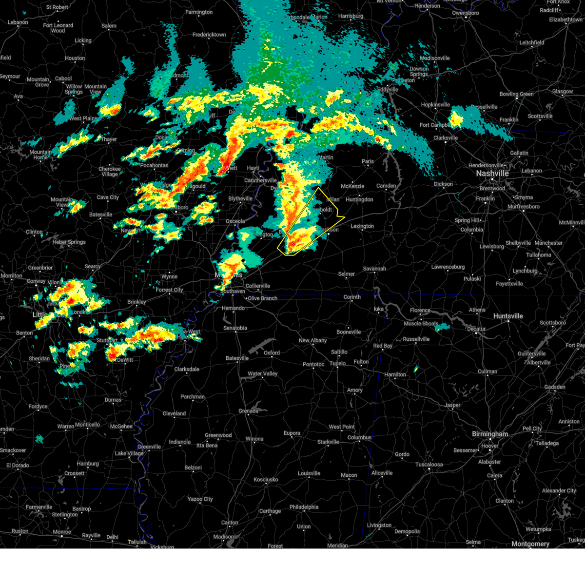
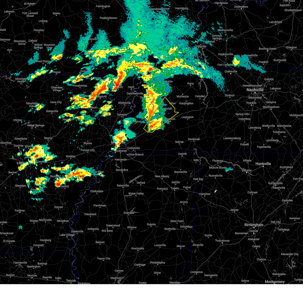
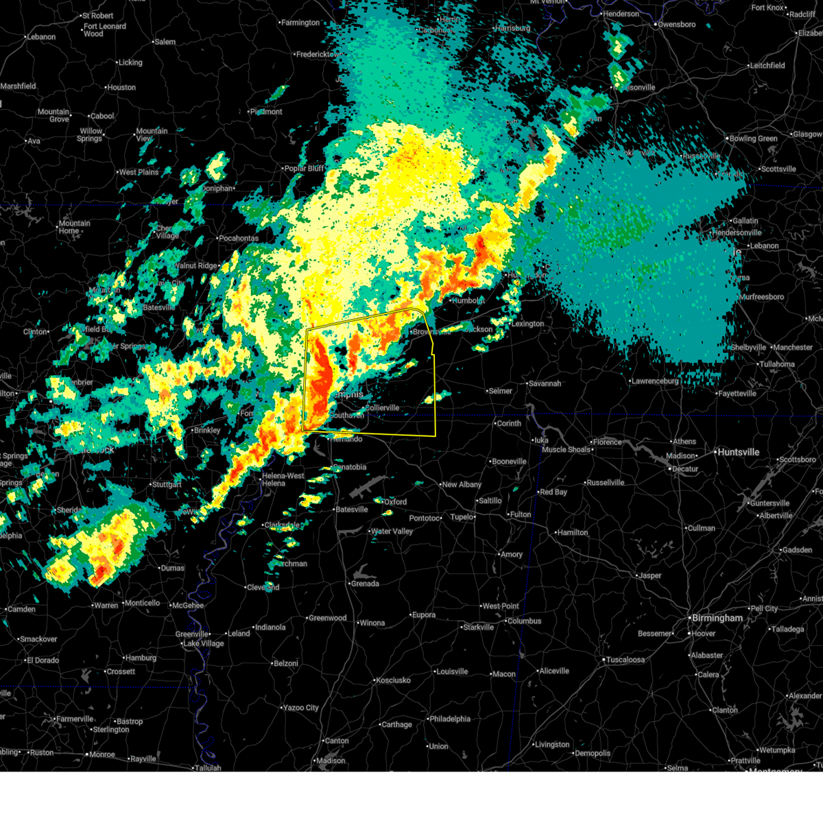
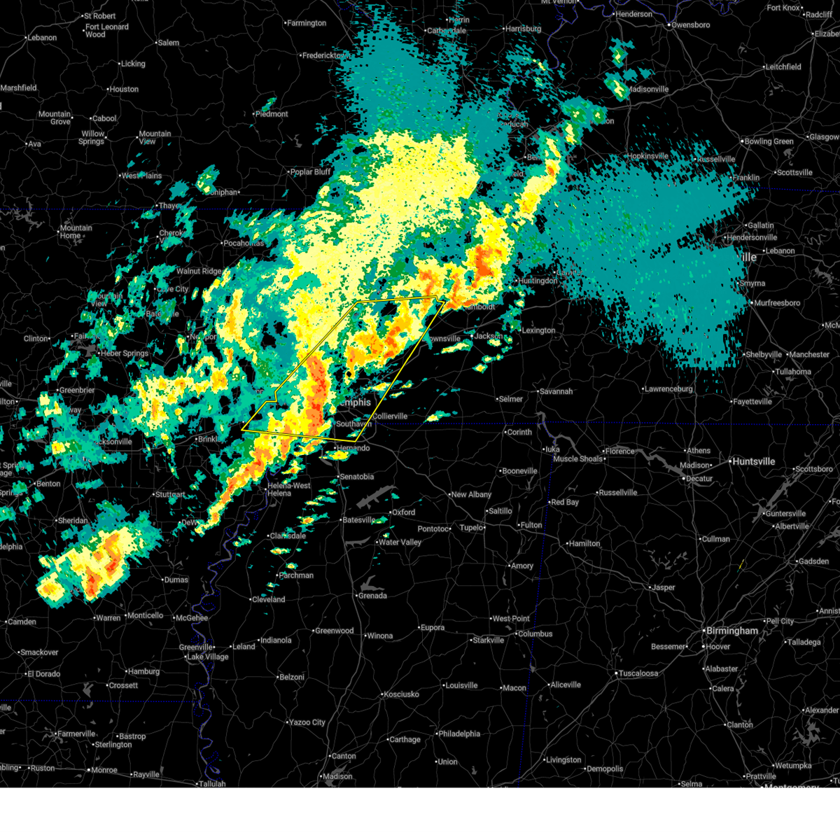
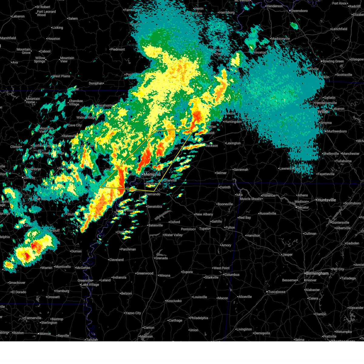
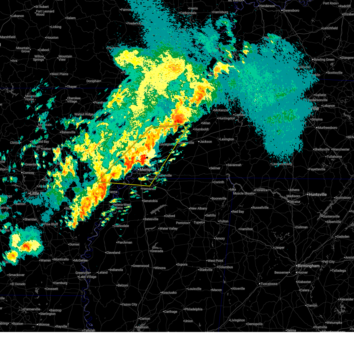
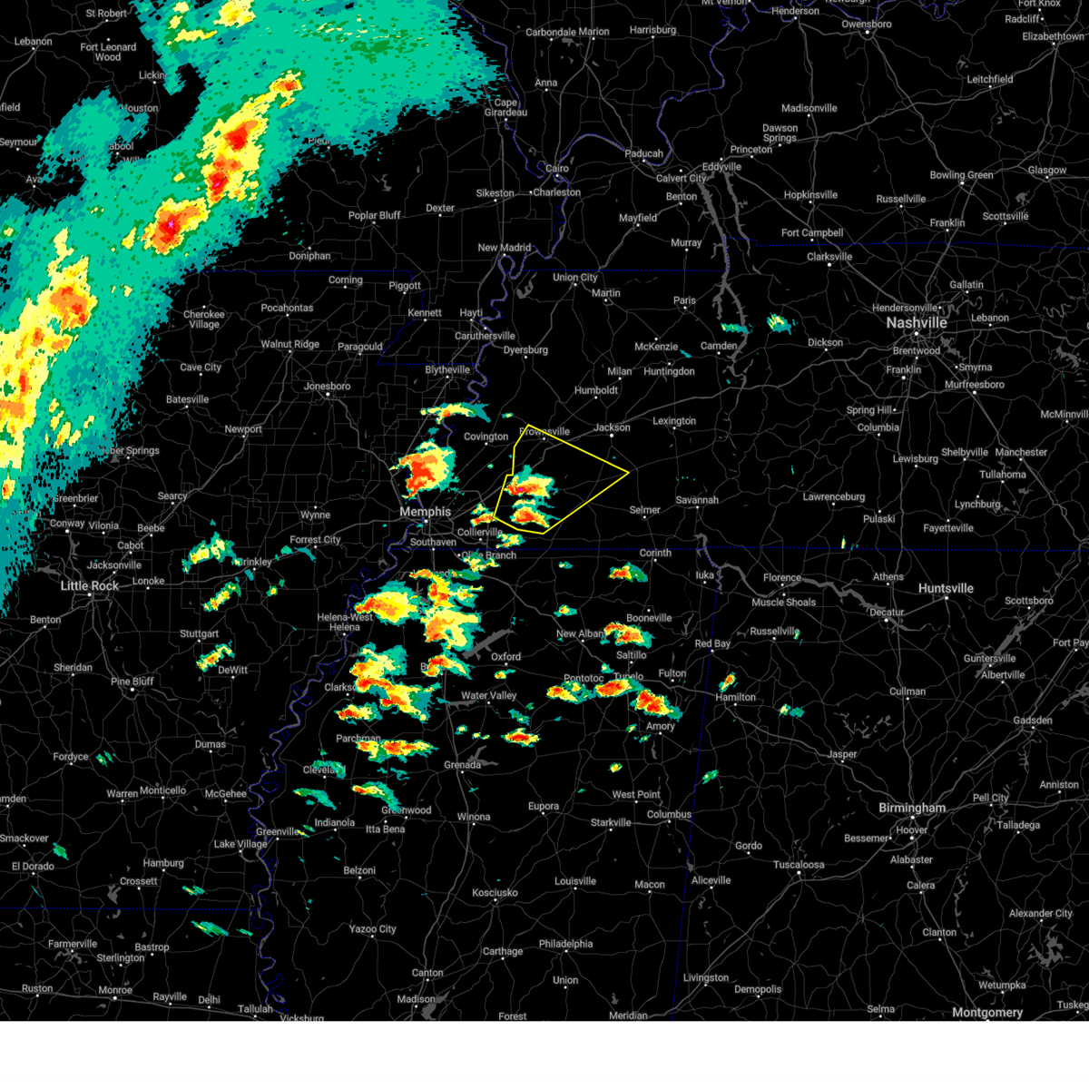
Hail Map for Stanton, TN
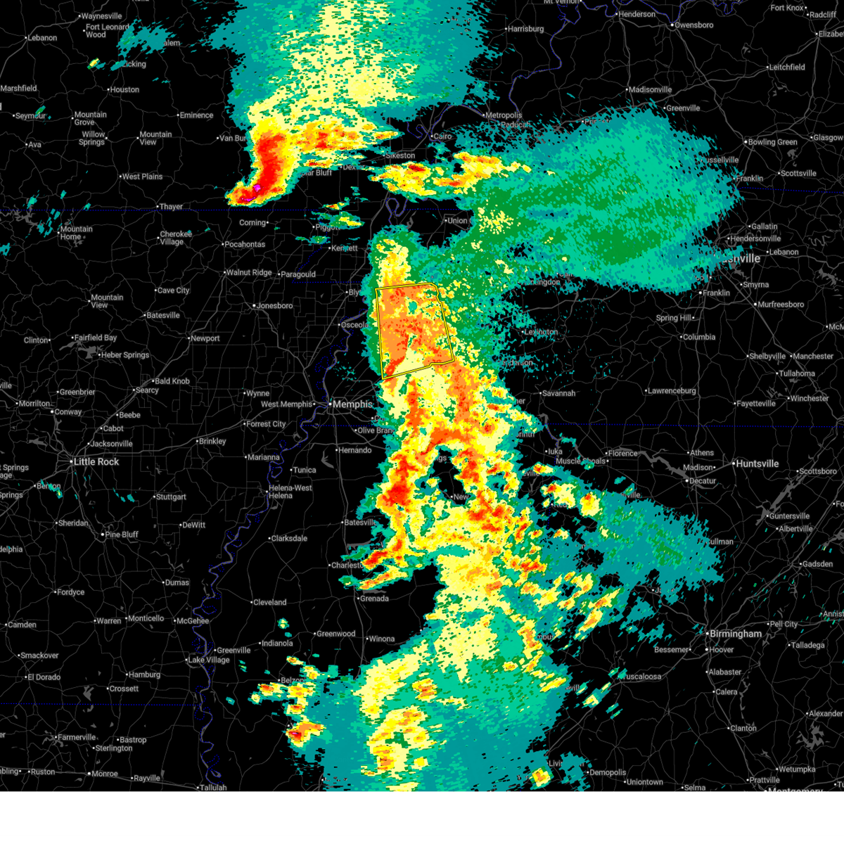
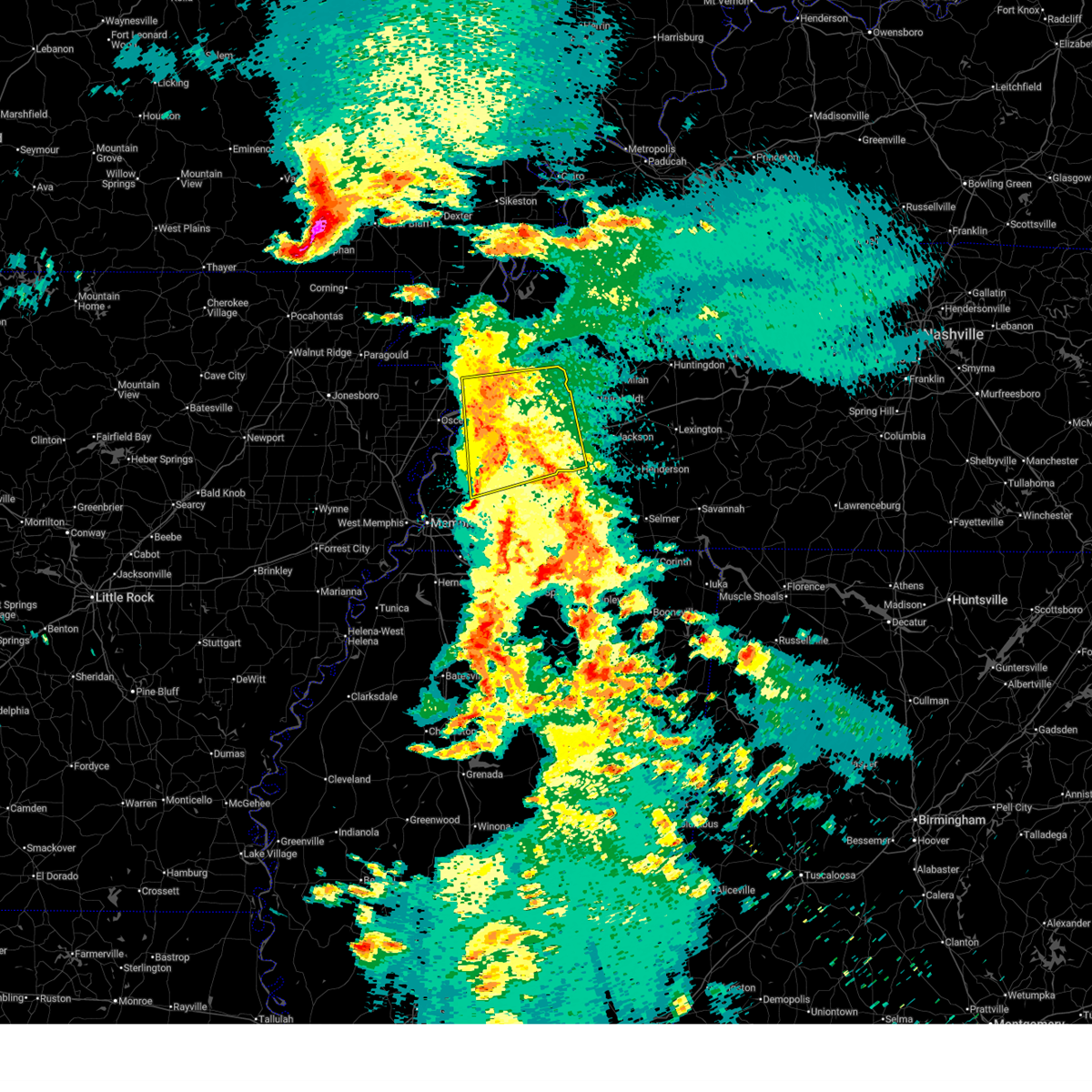
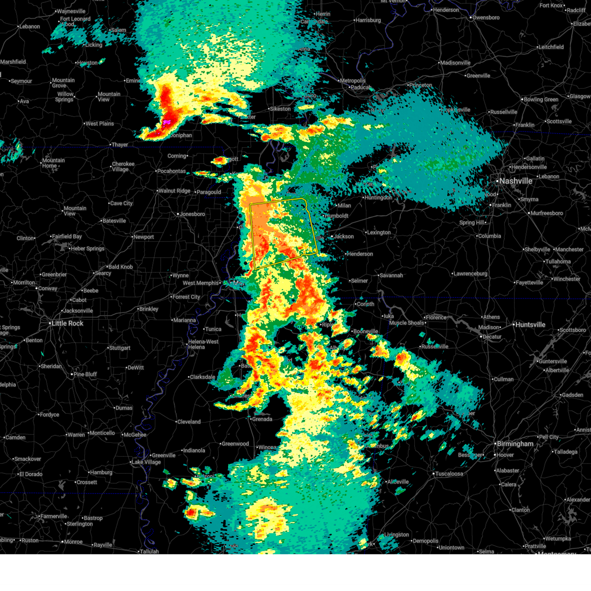
The Stanton, TN area has had 2 reports of on-the-ground hail by trained spotters, and has been under severe weather warnings 12 times during the past 12 months. Doppler radar has detected hail at or near Stanton, TN on 61 occasions, including 1 occasion during the past year.
| Name: | Stanton, TN |
| Where Located: | 42.5 miles ENE of Memphis, TN |
| Map: | Google Map for Stanton, TN |
| Population: | 452 |
| Housing Units: | 248 |
| More Info: | Search Google for Stanton, TN |
0
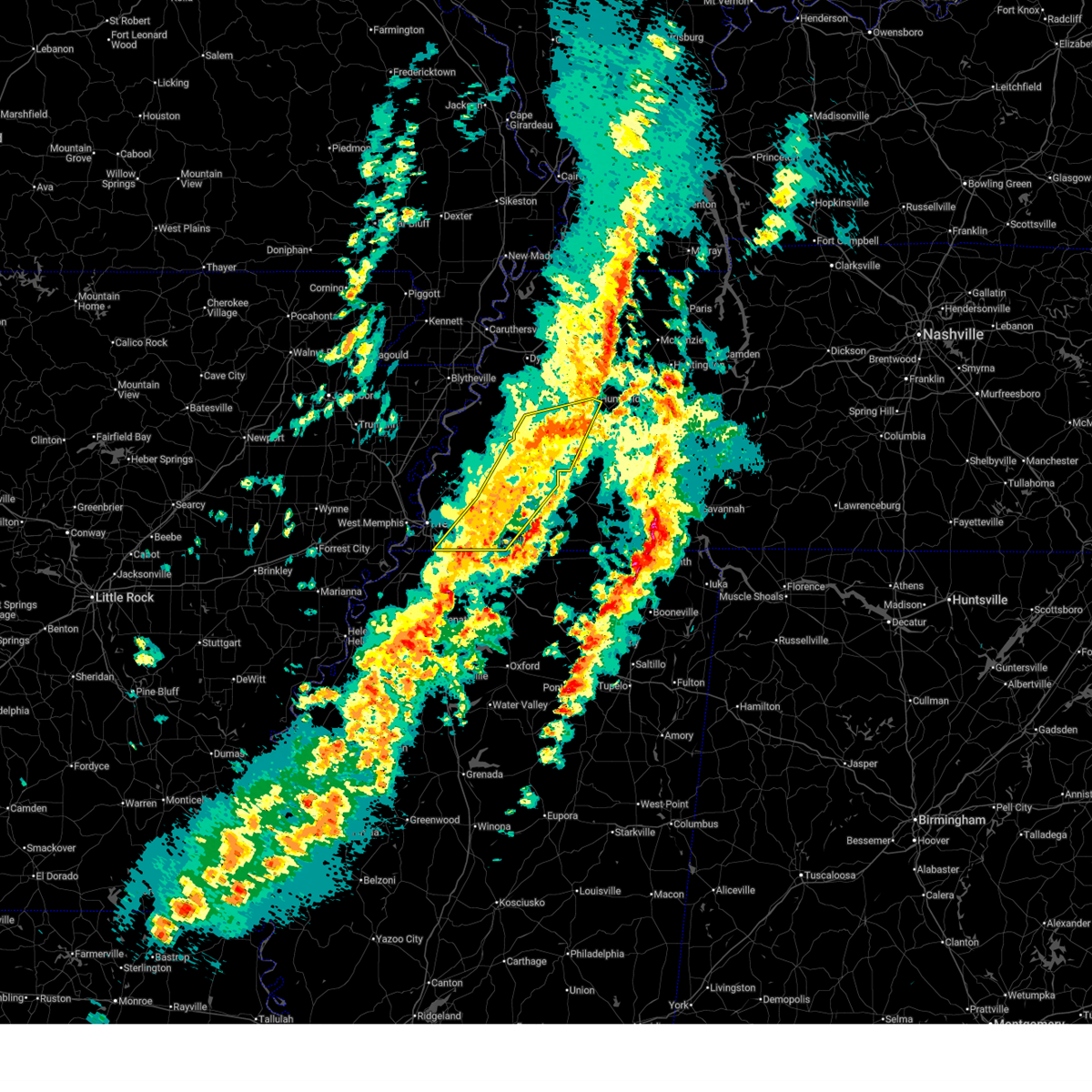
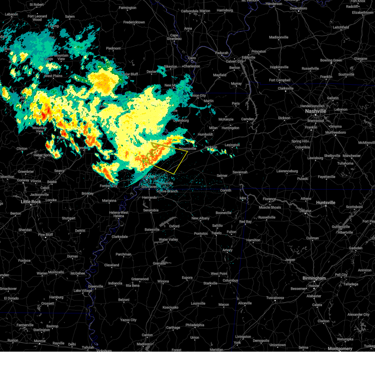
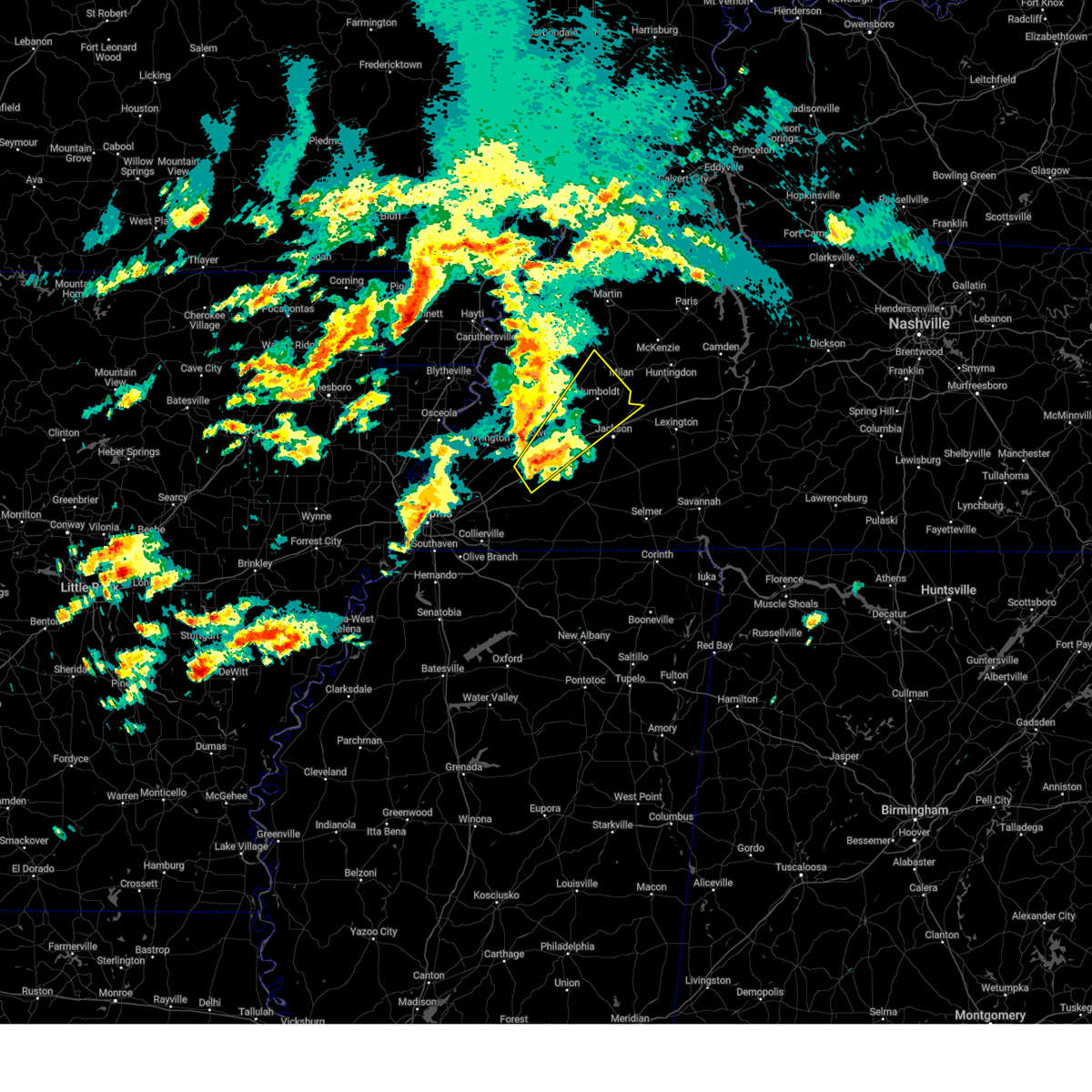
The Top Recent Hail Date for Stanton, TN is Tuesday, May 5, 2026 (26th out of 61)
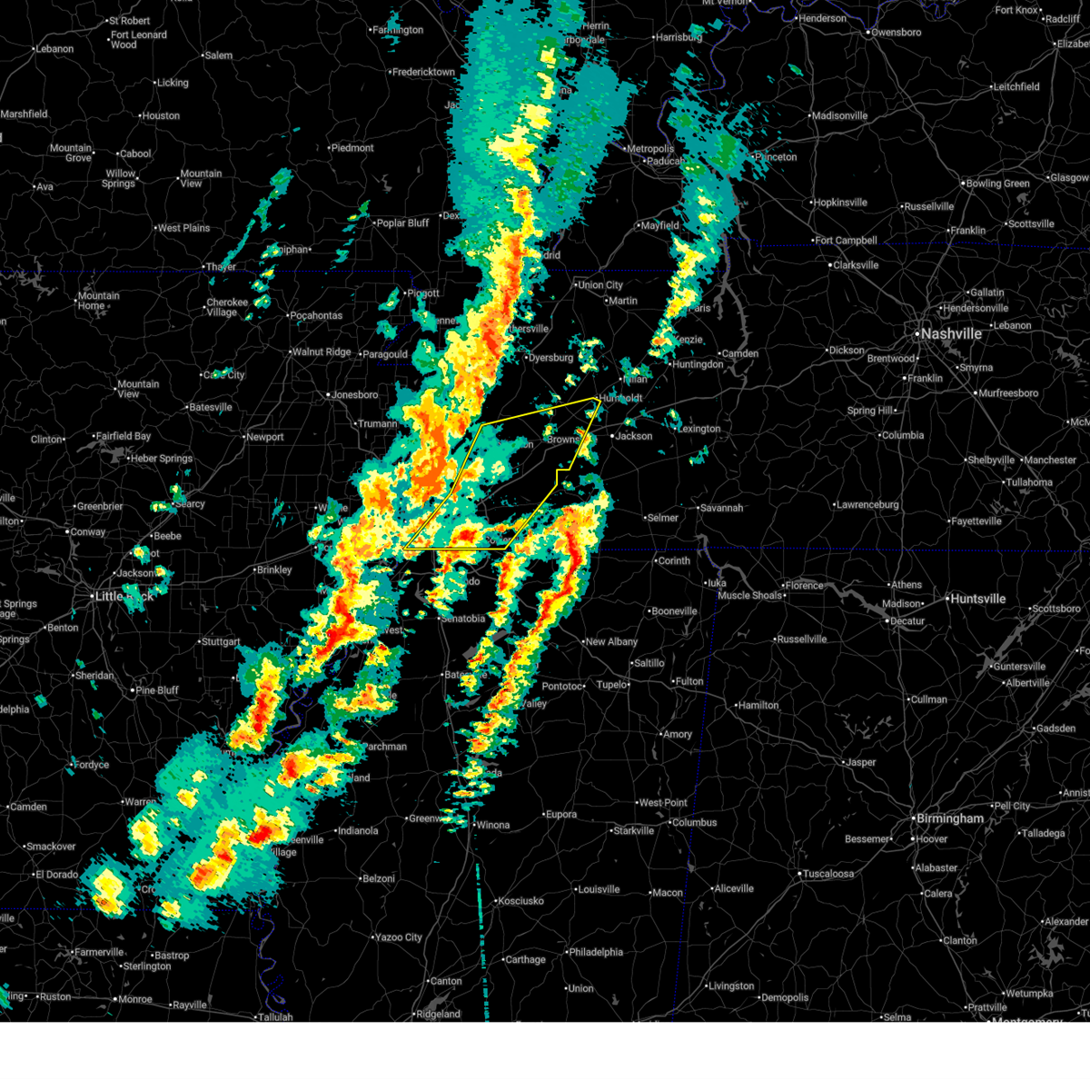
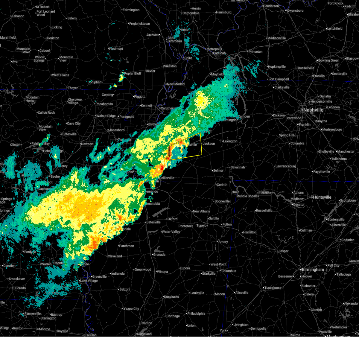
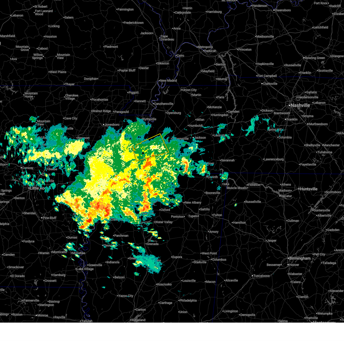
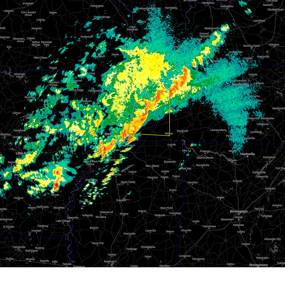
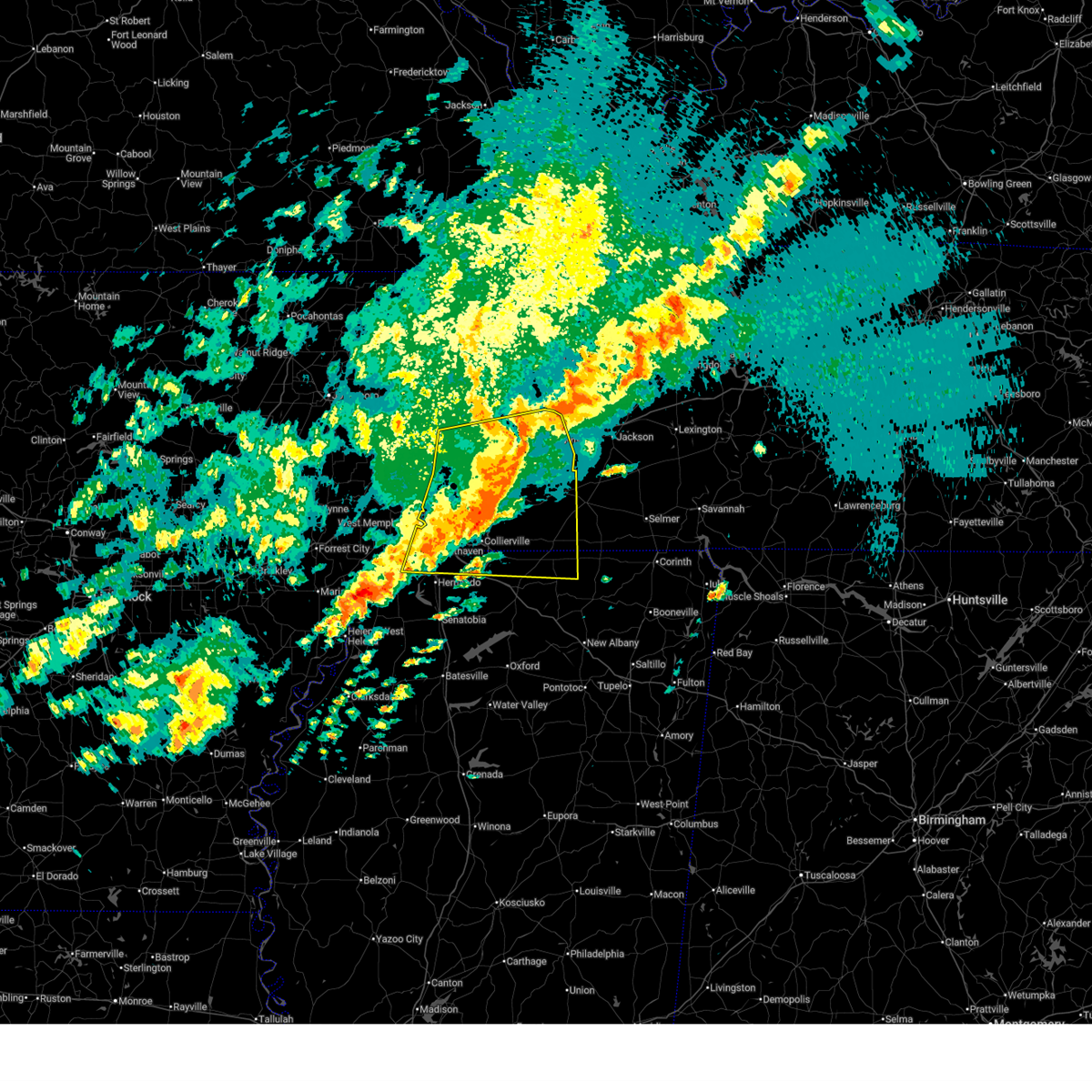
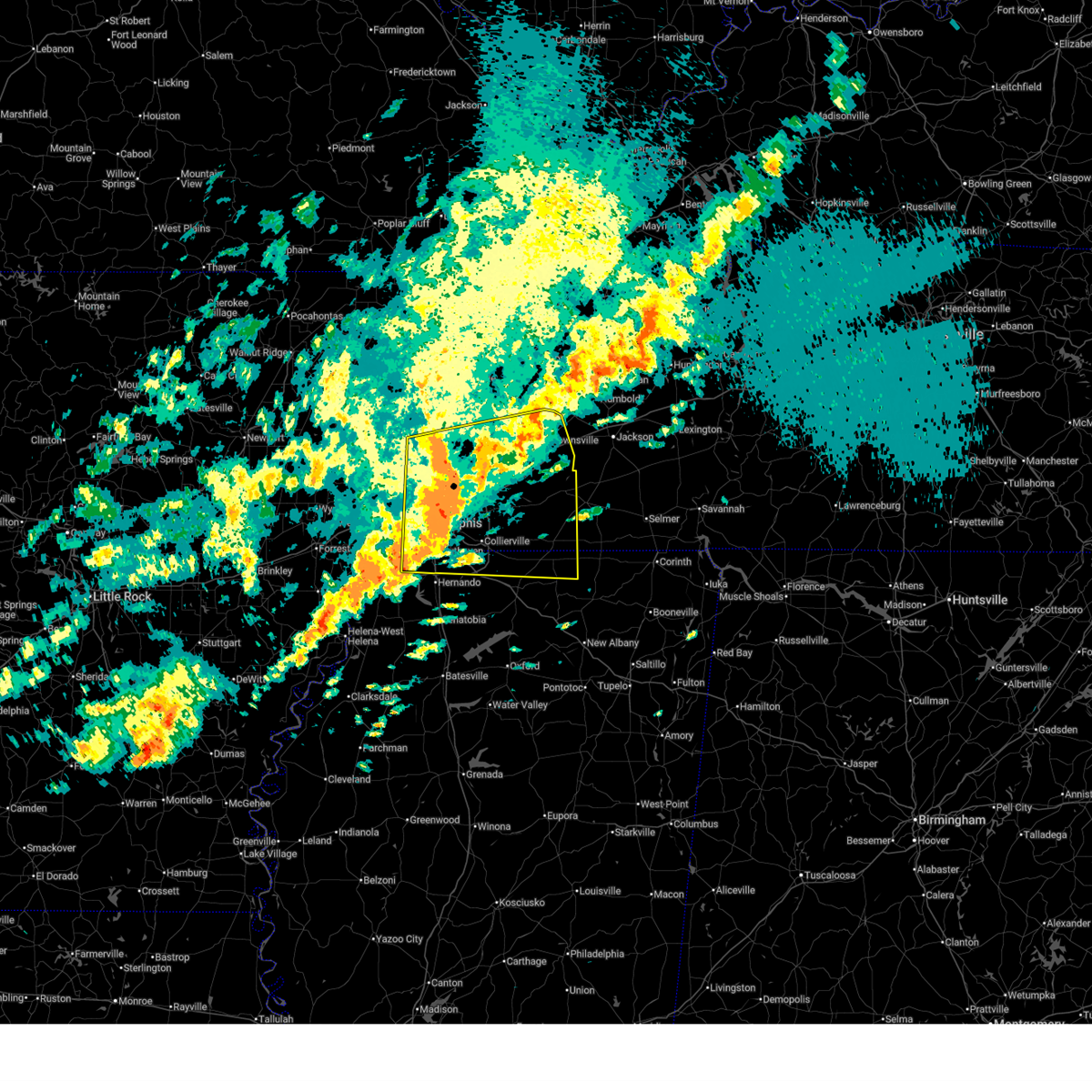
Hail and Wind Damage Spotted near Stanton, TN
| Date / Time | Report Details |
|---|---|
| 4/28/2026 4:58 PM CDT |
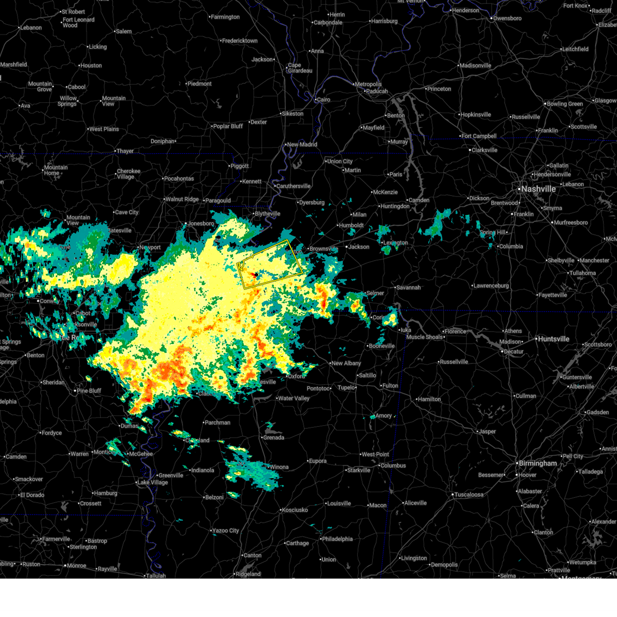
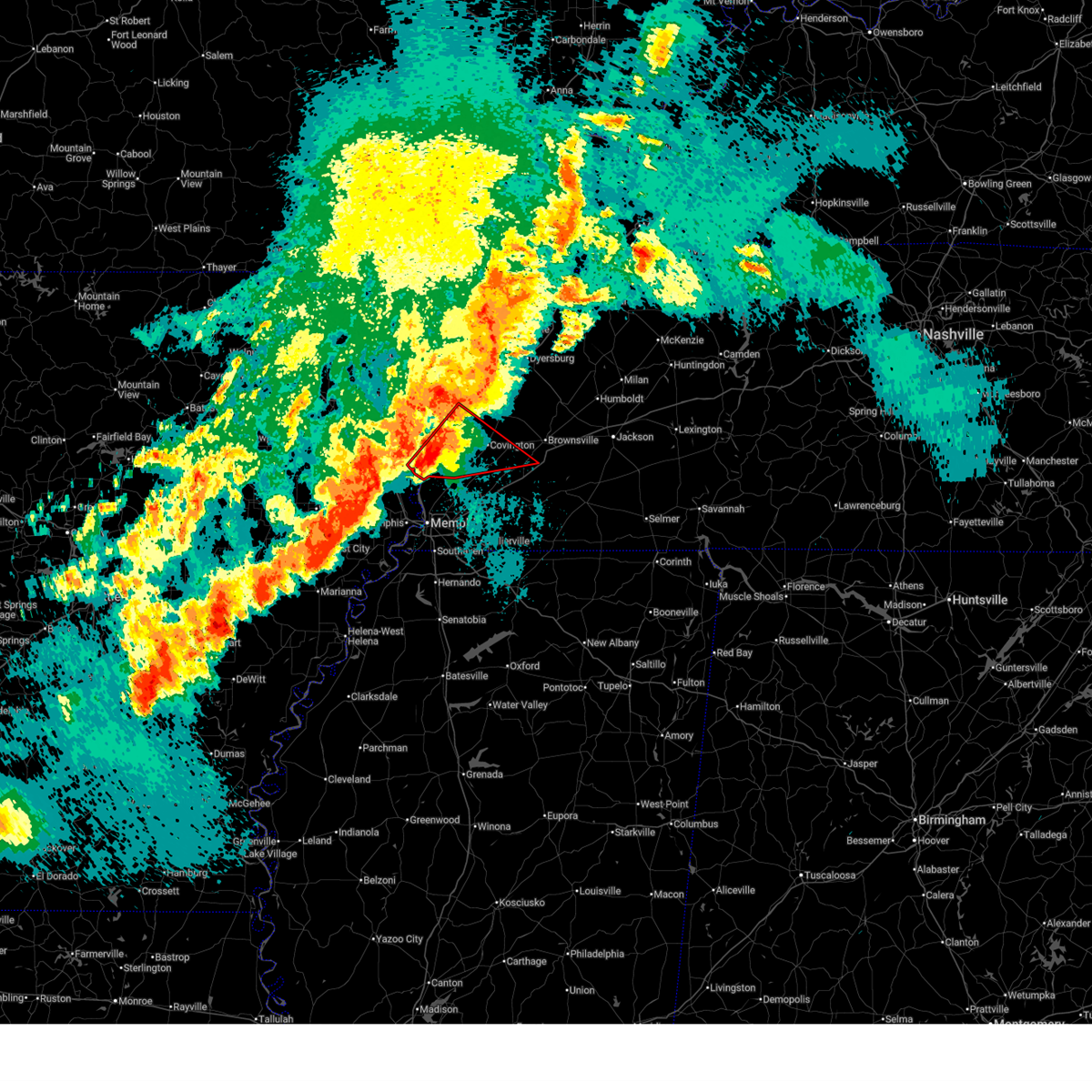
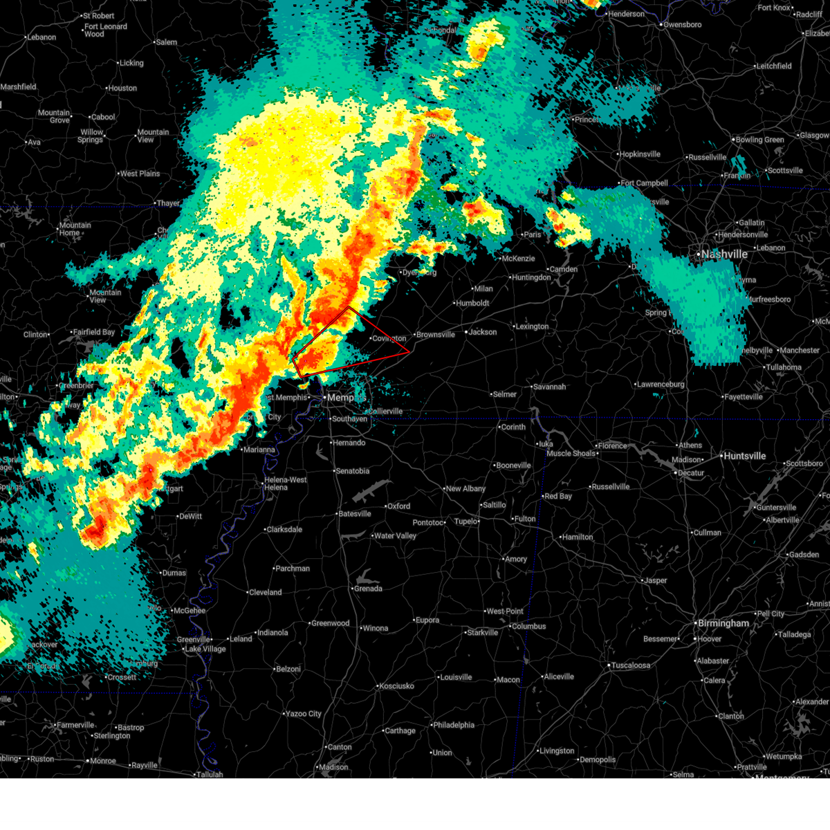
 At 458 pm cdt, a severe thunderstorm was located near belle eagle, or near brownsville, moving east at 45 mph (radar indicated). Hazards include 60 mph wind gusts and penny size hail. Expect damage to roofs, siding, and trees. locations impacted include, brownsville, covington, ripley, alamo, bells, halls, nutbush, forked deer, hillville, chestnut bluff, belle eagle, holly grove, unionville, dancyville, mercer, mason, henning, gallaway, maury city, and friendship. This includes interstate 40 in tennessee between mile markers 33 and 69. At 458 pm cdt, a severe thunderstorm was located near belle eagle, or near brownsville, moving east at 45 mph (radar indicated). Hazards include 60 mph wind gusts and penny size hail. Expect damage to roofs, siding, and trees. locations impacted include, brownsville, covington, ripley, alamo, bells, halls, nutbush, forked deer, hillville, chestnut bluff, belle eagle, holly grove, unionville, dancyville, mercer, mason, henning, gallaway, maury city, and friendship. This includes interstate 40 in tennessee between mile markers 33 and 69.
|
| 4/28/2026 4:46 PM CDT |
 At 446 pm cdt, a severe thunderstorm was located 7 miles southwest of nutbush, or 9 miles east of covington, moving east at 45 mph (radar indicated). Hazards include 60 mph wind gusts and penny size hail. Expect damage to roofs, siding, and trees. locations impacted include, brownsville, covington, ripley, arlington, munford, brighton, alamo, bells, halls, hillville, chestnut bluff, unionville, dancyville, ashport, ft pillow, mercer, nutbush, forked deer, belle eagle, and holly grove. This includes interstate 40 in tennessee between mile markers 33 and 69. At 446 pm cdt, a severe thunderstorm was located 7 miles southwest of nutbush, or 9 miles east of covington, moving east at 45 mph (radar indicated). Hazards include 60 mph wind gusts and penny size hail. Expect damage to roofs, siding, and trees. locations impacted include, brownsville, covington, ripley, arlington, munford, brighton, alamo, bells, halls, hillville, chestnut bluff, unionville, dancyville, ashport, ft pillow, mercer, nutbush, forked deer, belle eagle, and holly grove. This includes interstate 40 in tennessee between mile markers 33 and 69.
|
| 4/28/2026 4:35 PM CDT |
 Svrmeg the national weather service in memphis has issued a * severe thunderstorm warning for, northeastern mississippi county in eastern arkansas, crockett county in west tennessee, eastern tipton county in west tennessee, southern dyer county in west tennessee, northwestern fayette county in west tennessee, lauderdale county in west tennessee, haywood county in west tennessee, southwestern madison county in west tennessee, northeastern shelby county in west tennessee, * until 515 pm cdt. * at 435 pm cdt, a severe thunderstorm was located over covington, moving east at 45 mph (radar indicated). Hazards include 60 mph wind gusts and penny size hail. expect damage to roofs, siding, and trees Svrmeg the national weather service in memphis has issued a * severe thunderstorm warning for, northeastern mississippi county in eastern arkansas, crockett county in west tennessee, eastern tipton county in west tennessee, southern dyer county in west tennessee, northwestern fayette county in west tennessee, lauderdale county in west tennessee, haywood county in west tennessee, southwestern madison county in west tennessee, northeastern shelby county in west tennessee, * until 515 pm cdt. * at 435 pm cdt, a severe thunderstorm was located over covington, moving east at 45 mph (radar indicated). Hazards include 60 mph wind gusts and penny size hail. expect damage to roofs, siding, and trees
|
| 3/15/2026 8:19 PM CDT |
 At 818 pm cdt, severe thunderstorms were located along a line extending from near parkers crossroads to near jacks creek to 7 miles southeast of bolivar, moving east at 105 mph (radar indicated). Hazards include 60 mph wind gusts and penny size hail. Expect damage to roofs, siding, and trees. locations impacted include, bartlett, collierville, germantown, brownsville, humboldt, cordova, memphis, lakeland, arlington, somerville, alamo, bells, nutbush, hillville, belle eagle, holly grove, southeast memphis, adair, eads, and dancyville. this includes the following highways, interstate 40 in tennessee between mile markers 15 and 71. Interstate 240 between mile markers 14 and 19. At 818 pm cdt, severe thunderstorms were located along a line extending from near parkers crossroads to near jacks creek to 7 miles southeast of bolivar, moving east at 105 mph (radar indicated). Hazards include 60 mph wind gusts and penny size hail. Expect damage to roofs, siding, and trees. locations impacted include, bartlett, collierville, germantown, brownsville, humboldt, cordova, memphis, lakeland, arlington, somerville, alamo, bells, nutbush, hillville, belle eagle, holly grove, southeast memphis, adair, eads, and dancyville. this includes the following highways, interstate 40 in tennessee between mile markers 15 and 71. Interstate 240 between mile markers 14 and 19.
|
| 3/15/2026 8:19 PM CDT |
 the severe thunderstorm warning has been cancelled and is no longer in effect the severe thunderstorm warning has been cancelled and is no longer in effect
|
| 3/15/2026 7:36 PM CDT |
 At 736 pm cdt, severe thunderstorms were located along a line extending from near ft pillow to near millington to near walls, moving east at 60 mph (radar indicated). Hazards include 70 mph wind gusts and nickel size hail. Expect considerable tree damage. damage is likely to mobile homes, roofs, and outbuildings. locations impacted include, bartlett, collierville, germantown, brownsville, millington, covington, humboldt, t o fuller state park, cordova, memphis, lakeland, arlington, munford, somerville, brighton, alamo, bells, southwest memphis, hillville, and whitehaven. this includes the following highways, interstate 40 in tennessee near mile marker 1, and between mile markers 4 and 71. interstate 240 between mile markers 12 and 30. Interstate 55 in tennessee between mile markers 1 and 12. At 736 pm cdt, severe thunderstorms were located along a line extending from near ft pillow to near millington to near walls, moving east at 60 mph (radar indicated). Hazards include 70 mph wind gusts and nickel size hail. Expect considerable tree damage. damage is likely to mobile homes, roofs, and outbuildings. locations impacted include, bartlett, collierville, germantown, brownsville, millington, covington, humboldt, t o fuller state park, cordova, memphis, lakeland, arlington, munford, somerville, brighton, alamo, bells, southwest memphis, hillville, and whitehaven. this includes the following highways, interstate 40 in tennessee near mile marker 1, and between mile markers 4 and 71. interstate 240 between mile markers 12 and 30. Interstate 55 in tennessee between mile markers 1 and 12.
|
| 3/15/2026 7:30 PM CDT |
 Svrmeg the national weather service in memphis has issued a * severe thunderstorm warning for, southern crockett county in west tennessee, eastern tipton county in west tennessee, fayette county in west tennessee, southeastern lauderdale county in west tennessee, haywood county in west tennessee, northwestern madison county in west tennessee, shelby county in west tennessee, * until 830 pm cdt. * at 730 pm cdt, severe thunderstorms were located along a line extending from near ft pillow to near millington to anthonyville, moving east at 105 mph (radar indicated). Hazards include 70 mph wind gusts and nickel size hail. Expect considerable tree damage. Damage is likely to mobile homes, roofs, and outbuildings. Svrmeg the national weather service in memphis has issued a * severe thunderstorm warning for, southern crockett county in west tennessee, eastern tipton county in west tennessee, fayette county in west tennessee, southeastern lauderdale county in west tennessee, haywood county in west tennessee, northwestern madison county in west tennessee, shelby county in west tennessee, * until 830 pm cdt. * at 730 pm cdt, severe thunderstorms were located along a line extending from near ft pillow to near millington to anthonyville, moving east at 105 mph (radar indicated). Hazards include 70 mph wind gusts and nickel size hail. Expect considerable tree damage. Damage is likely to mobile homes, roofs, and outbuildings.
|
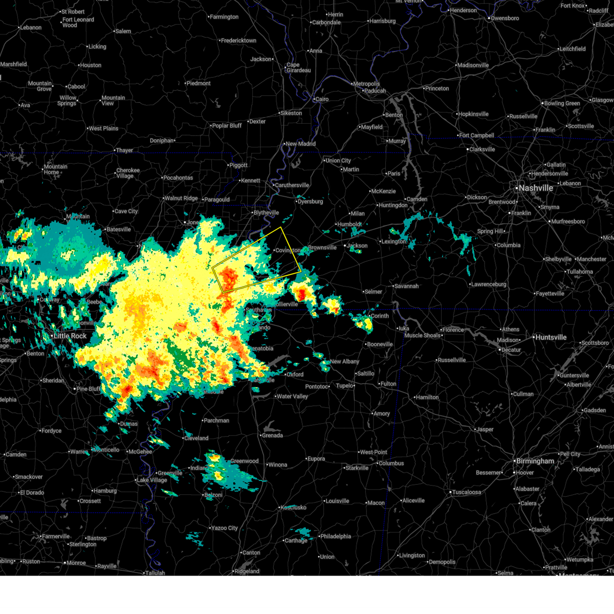
| 3/11/2026 10:47 AM CDT |
 Svrmeg the national weather service in memphis has issued a * severe thunderstorm warning for, southeastern crockett county in west tennessee, northeastern fayette county in west tennessee, northwestern hardeman county in west tennessee, haywood county in west tennessee, western madison county in west tennessee, * until 1130 am cdt. * at 1047 am cdt, a severe thunderstorm was located 8 miles northwest of dancyville, or 12 miles southwest of brownsville, moving east at 50 mph (radar indicated). Hazards include 60 mph wind gusts and penny size hail. expect damage to roofs, siding, and trees Svrmeg the national weather service in memphis has issued a * severe thunderstorm warning for, southeastern crockett county in west tennessee, northeastern fayette county in west tennessee, northwestern hardeman county in west tennessee, haywood county in west tennessee, western madison county in west tennessee, * until 1130 am cdt. * at 1047 am cdt, a severe thunderstorm was located 8 miles northwest of dancyville, or 12 miles southwest of brownsville, moving east at 50 mph (radar indicated). Hazards include 60 mph wind gusts and penny size hail. expect damage to roofs, siding, and trees
|
| 3/9/2026 2:01 PM CDT |
 the severe thunderstorm warning has been cancelled and is no longer in effect the severe thunderstorm warning has been cancelled and is no longer in effect
|
| 3/9/2026 1:45 PM CDT |
 the severe thunderstorm warning has been cancelled and is no longer in effect the severe thunderstorm warning has been cancelled and is no longer in effect
|
| 3/9/2026 1:45 PM CDT |
 At 145 pm cdt, a severe thunderstorm was located over millington, moving east at 45 mph (radar indicated). Hazards include 60 mph wind gusts and nickel size hail. Expect damage to roofs, siding, and trees. locations impacted include, bartlett, millington, covington, meeman shelby forest state park, memphis, lakeland, arlington, munford, brighton, dixonville, tipton, atoka, mason, gallaway, gilt edge, stanton, burlison, garland, braden, and belmont. This includes interstate 40 in tennessee between mile markers 30 and 44. At 145 pm cdt, a severe thunderstorm was located over millington, moving east at 45 mph (radar indicated). Hazards include 60 mph wind gusts and nickel size hail. Expect damage to roofs, siding, and trees. locations impacted include, bartlett, millington, covington, meeman shelby forest state park, memphis, lakeland, arlington, munford, brighton, dixonville, tipton, atoka, mason, gallaway, gilt edge, stanton, burlison, garland, braden, and belmont. This includes interstate 40 in tennessee between mile markers 30 and 44.
|
| 3/9/2026 1:24 PM CDT |
 Svrmeg the national weather service in memphis has issued a * severe thunderstorm warning for, southwestern mississippi county in eastern arkansas, northeastern crittenden county in eastern arkansas, tipton county in west tennessee, northwestern fayette county in west tennessee, southern lauderdale county in west tennessee, southwestern haywood county in west tennessee, northern shelby county in west tennessee, * until 215 pm cdt. * at 124 pm cdt, a severe thunderstorm was located near jericho, or 7 miles west of meeman shelby forest state park, moving northeast at 50 mph (radar indicated). Hazards include 60 mph wind gusts and nickel size hail. expect damage to roofs, siding, and trees Svrmeg the national weather service in memphis has issued a * severe thunderstorm warning for, southwestern mississippi county in eastern arkansas, northeastern crittenden county in eastern arkansas, tipton county in west tennessee, northwestern fayette county in west tennessee, southern lauderdale county in west tennessee, southwestern haywood county in west tennessee, northern shelby county in west tennessee, * until 215 pm cdt. * at 124 pm cdt, a severe thunderstorm was located near jericho, or 7 miles west of meeman shelby forest state park, moving northeast at 50 mph (radar indicated). Hazards include 60 mph wind gusts and nickel size hail. expect damage to roofs, siding, and trees
|
| 6/19/2025 1:19 AM CDT |
 At 119 am cdt, a severe thunderstorm was located near hillville, or 7 miles south of brownsville, moving east at 30 mph (radar indicated). Hazards include 60 mph wind gusts and quarter size hail. Hail damage to vehicles is expected. expect wind damage to roofs, siding, and trees. Locations impacted include, brownsville, covington, whiteville, holly grove, hillville, dancyville, mason, henning, stanton, asbury, yum yum, allens, belmont, huntersville, hickory point, taylor chapel, shepp, turnpike, leighton, and meux corner. At 119 am cdt, a severe thunderstorm was located near hillville, or 7 miles south of brownsville, moving east at 30 mph (radar indicated). Hazards include 60 mph wind gusts and quarter size hail. Hail damage to vehicles is expected. expect wind damage to roofs, siding, and trees. Locations impacted include, brownsville, covington, whiteville, holly grove, hillville, dancyville, mason, henning, stanton, asbury, yum yum, allens, belmont, huntersville, hickory point, taylor chapel, shepp, turnpike, leighton, and meux corner.
|
| 6/19/2025 12:52 AM CDT |
 Svrmeg the national weather service in memphis has issued a * severe thunderstorm warning for, northeastern tipton county in west tennessee, northeastern fayette county in west tennessee, northwestern hardeman county in west tennessee, southeastern lauderdale county in west tennessee, haywood county in west tennessee, west central madison county in west tennessee, * until 130 am cdt. * at 1251 am cdt, a severe thunderstorm was located 10 miles south of nutbush, or 10 miles east of covington, moving east at 30 mph (radar indicated). Hazards include 60 mph wind gusts and quarter size hail. Hail damage to vehicles is expected. Expect wind damage to roofs, siding, and trees. Svrmeg the national weather service in memphis has issued a * severe thunderstorm warning for, northeastern tipton county in west tennessee, northeastern fayette county in west tennessee, northwestern hardeman county in west tennessee, southeastern lauderdale county in west tennessee, haywood county in west tennessee, west central madison county in west tennessee, * until 130 am cdt. * at 1251 am cdt, a severe thunderstorm was located 10 miles south of nutbush, or 10 miles east of covington, moving east at 30 mph (radar indicated). Hazards include 60 mph wind gusts and quarter size hail. Hail damage to vehicles is expected. Expect wind damage to roofs, siding, and trees.
|
| 6/19/2025 12:20 AM CDT |
 Svrmeg the national weather service in memphis has issued a * severe thunderstorm warning for, southern crockett county in west tennessee, east central tipton county in west tennessee, southeastern lauderdale county in west tennessee, haywood county in west tennessee, western madison county in west tennessee, * until 100 am cdt. * at 1219 am cdt, severe thunderstorms were located along a line extending from nutbush to 8 miles west of brownsville to 10 miles east of covington, moving east at 40 mph (radar indicated). Hazards include 60 mph wind gusts and nickel size hail. expect damage to roofs, siding, and trees Svrmeg the national weather service in memphis has issued a * severe thunderstorm warning for, southern crockett county in west tennessee, east central tipton county in west tennessee, southeastern lauderdale county in west tennessee, haywood county in west tennessee, western madison county in west tennessee, * until 100 am cdt. * at 1219 am cdt, severe thunderstorms were located along a line extending from nutbush to 8 miles west of brownsville to 10 miles east of covington, moving east at 40 mph (radar indicated). Hazards include 60 mph wind gusts and nickel size hail. expect damage to roofs, siding, and trees
|
| 5/24/2025 2:05 AM CDT |
 the severe thunderstorm warning has been cancelled and is no longer in effect the severe thunderstorm warning has been cancelled and is no longer in effect
|
| 5/24/2025 1:54 AM CDT |
 the severe thunderstorm warning has been cancelled and is no longer in effect the severe thunderstorm warning has been cancelled and is no longer in effect
|
| 5/24/2025 1:54 AM CDT |
 At 154 am cdt, a severe thunderstorm was located near munford, or 7 miles south of fort pillow state park, moving east at 45 mph (radar indicated). Hazards include 60 mph wind gusts and penny size hail. Expect damage to roofs, siding, and trees. Locations impacted include, burlison, stanton, belmont, covington, atoka, randolph, orysa, tipton, keeling, lambert, gainesville, tabernacle, mason, clopton, bolton, fulton, fort pillow state park, munford, barretville, and egypt. At 154 am cdt, a severe thunderstorm was located near munford, or 7 miles south of fort pillow state park, moving east at 45 mph (radar indicated). Hazards include 60 mph wind gusts and penny size hail. Expect damage to roofs, siding, and trees. Locations impacted include, burlison, stanton, belmont, covington, atoka, randolph, orysa, tipton, keeling, lambert, gainesville, tabernacle, mason, clopton, bolton, fulton, fort pillow state park, munford, barretville, and egypt.
|
| 5/24/2025 1:38 AM CDT |
 Svrmeg the national weather service in memphis has issued a * severe thunderstorm warning for, southwestern mississippi county in eastern arkansas, tipton county in west tennessee, northwestern fayette county in west tennessee, southern lauderdale county in west tennessee, southwestern haywood county in west tennessee, northeastern shelby county in west tennessee, * until 230 am cdt. * at 138 am cdt, a severe thunderstorm was located over wilson, moving east at 45 mph (radar indicated). Hazards include 60 mph wind gusts and penny size hail. expect damage to roofs, siding, and trees Svrmeg the national weather service in memphis has issued a * severe thunderstorm warning for, southwestern mississippi county in eastern arkansas, tipton county in west tennessee, northwestern fayette county in west tennessee, southern lauderdale county in west tennessee, southwestern haywood county in west tennessee, northeastern shelby county in west tennessee, * until 230 am cdt. * at 138 am cdt, a severe thunderstorm was located over wilson, moving east at 45 mph (radar indicated). Hazards include 60 mph wind gusts and penny size hail. expect damage to roofs, siding, and trees
|
| 5/20/2025 4:55 PM CDT |
 A tornado watch remains in effect until 800 pm cdt for west tennessee. a severe thunderstorm warning still remains in effect for madison county. A tornado watch remains in effect until 800 pm cdt for west tennessee. a severe thunderstorm warning still remains in effect for madison county.
|
| 5/20/2025 4:29 PM CDT |
 Svrmeg the national weather service in memphis has issued a * severe thunderstorm warning for, northeastern fayette county in west tennessee, northern hardeman county in west tennessee, southern haywood county in west tennessee, southwestern madison county in west tennessee, * until 500 pm cdt. * at 428 pm cdt, severe thunderstorms were located along a line extending from near brownsville to 8 miles northwest of somerville, moving east at 55 mph (radar indicated). Hazards include 60 mph wind gusts and quarter size hail. Hail damage to vehicles is expected. Expect wind damage to roofs, siding, and trees. Svrmeg the national weather service in memphis has issued a * severe thunderstorm warning for, northeastern fayette county in west tennessee, northern hardeman county in west tennessee, southern haywood county in west tennessee, southwestern madison county in west tennessee, * until 500 pm cdt. * at 428 pm cdt, severe thunderstorms were located along a line extending from near brownsville to 8 miles northwest of somerville, moving east at 55 mph (radar indicated). Hazards include 60 mph wind gusts and quarter size hail. Hail damage to vehicles is expected. Expect wind damage to roofs, siding, and trees.
|
| 5/20/2025 4:06 PM CDT |
 At 406 pm cdt, a severe thunderstorm was located 7 miles north of arlington, or 12 miles east of millington, moving east at 50 mph (radar indicated). Hazards include 60 mph wind gusts and quarter size hail. Hail damage to vehicles is expected. expect wind damage to roofs, siding, and trees. Locations impacted include, yum yum, stanton, brownsville, belmont, ellendale, oakland, woodstock, atoka, sloanville, arlington, brunswick, laconia, tipton, sunnyhill, keeling, frayser, lambert, gainesville, tabernacle, and mason. At 406 pm cdt, a severe thunderstorm was located 7 miles north of arlington, or 12 miles east of millington, moving east at 50 mph (radar indicated). Hazards include 60 mph wind gusts and quarter size hail. Hail damage to vehicles is expected. expect wind damage to roofs, siding, and trees. Locations impacted include, yum yum, stanton, brownsville, belmont, ellendale, oakland, woodstock, atoka, sloanville, arlington, brunswick, laconia, tipton, sunnyhill, keeling, frayser, lambert, gainesville, tabernacle, and mason.
|
| 5/20/2025 3:52 PM CDT |
 Svrmeg the national weather service in memphis has issued a * severe thunderstorm warning for, tipton county in west tennessee, northern fayette county in west tennessee, southern haywood county in west tennessee, northeastern shelby county in west tennessee, * until 430 pm cdt. * at 351 pm cdt, a severe thunderstorm was located over millington, moving east at 50 mph (radar indicated). Hazards include 60 mph wind gusts and quarter size hail. Hail damage to vehicles is expected. Expect wind damage to roofs, siding, and trees. Svrmeg the national weather service in memphis has issued a * severe thunderstorm warning for, tipton county in west tennessee, northern fayette county in west tennessee, southern haywood county in west tennessee, northeastern shelby county in west tennessee, * until 430 pm cdt. * at 351 pm cdt, a severe thunderstorm was located over millington, moving east at 50 mph (radar indicated). Hazards include 60 mph wind gusts and quarter size hail. Hail damage to vehicles is expected. Expect wind damage to roofs, siding, and trees.
|
| 5/2/2025 9:52 AM CDT |
 The storm which prompted the warning has moved out of the area. therefore, the warning will be allowed to expire. The storm which prompted the warning has moved out of the area. therefore, the warning will be allowed to expire.
|
| 5/2/2025 9:45 AM CDT |
 At 944 am cdt, a severe thunderstorm was located over holly grove, or 8 miles northeast of brownsville, moving northeast at 55 mph (radar indicated). Hazards include 60 mph wind gusts and quarter size hail. Hail damage to vehicles is expected. expect wind damage to roofs, siding, and trees. Locations impacted include, asbury, quincy, allens, stanton, huntersville, brownsville, christmasville, nutbush, jackson, jones, belle eagle, shepp, mason grove, turnpike, holly grove, leighton, coxville, meux corner, alamo, and bells. At 944 am cdt, a severe thunderstorm was located over holly grove, or 8 miles northeast of brownsville, moving northeast at 55 mph (radar indicated). Hazards include 60 mph wind gusts and quarter size hail. Hail damage to vehicles is expected. expect wind damage to roofs, siding, and trees. Locations impacted include, asbury, quincy, allens, stanton, huntersville, brownsville, christmasville, nutbush, jackson, jones, belle eagle, shepp, mason grove, turnpike, holly grove, leighton, coxville, meux corner, alamo, and bells.
|
| 5/2/2025 9:45 AM CDT |
 the severe thunderstorm warning has been cancelled and is no longer in effect the severe thunderstorm warning has been cancelled and is no longer in effect
|
| 5/2/2025 9:34 AM CDT |
 At 934 am cdt, a severe thunderstorm was located over brownsville, moving northeast at 55 mph (radar indicated). Hazards include 60 mph wind gusts and quarter size hail. Hail damage to vehicles is expected. expect wind damage to roofs, siding, and trees. Locations impacted include, asbury, quincy, allens, stanton, huntersville, brownsville, christmasville, nutbush, jackson, jones, belle eagle, shepp, mason grove, turnpike, holly grove, leighton, coxville, meux corner, alamo, and bells. At 934 am cdt, a severe thunderstorm was located over brownsville, moving northeast at 55 mph (radar indicated). Hazards include 60 mph wind gusts and quarter size hail. Hail damage to vehicles is expected. expect wind damage to roofs, siding, and trees. Locations impacted include, asbury, quincy, allens, stanton, huntersville, brownsville, christmasville, nutbush, jackson, jones, belle eagle, shepp, mason grove, turnpike, holly grove, leighton, coxville, meux corner, alamo, and bells.
|
| 5/2/2025 9:34 AM CDT |
 the severe thunderstorm warning has been cancelled and is no longer in effect the severe thunderstorm warning has been cancelled and is no longer in effect
|
| 5/2/2025 9:15 AM CDT |
 Svrmeg the national weather service in memphis has issued a * severe thunderstorm warning for, southern crockett county in west tennessee, eastern tipton county in west tennessee, northwestern fayette county in west tennessee, southeastern lauderdale county in west tennessee, haywood county in west tennessee, northwestern madison county in west tennessee, * until 1000 am cdt. * at 915 am cdt, a severe thunderstorm was located 7 miles southeast of covington, moving northeast at 55 mph (radar indicated). Hazards include 60 mph wind gusts and quarter size hail. Hail damage to vehicles is expected. Expect wind damage to roofs, siding, and trees. Svrmeg the national weather service in memphis has issued a * severe thunderstorm warning for, southern crockett county in west tennessee, eastern tipton county in west tennessee, northwestern fayette county in west tennessee, southeastern lauderdale county in west tennessee, haywood county in west tennessee, northwestern madison county in west tennessee, * until 1000 am cdt. * at 915 am cdt, a severe thunderstorm was located 7 miles southeast of covington, moving northeast at 55 mph (radar indicated). Hazards include 60 mph wind gusts and quarter size hail. Hail damage to vehicles is expected. Expect wind damage to roofs, siding, and trees.
|
| 5/2/2025 8:44 AM CDT |
 The storm which prompted the warning has weakened below severe limits, and no longer poses an immediate threat to life or property. therefore, the warning will be allowed to expire. however, small hail is still possible with this thunderstorm. The storm which prompted the warning has weakened below severe limits, and no longer poses an immediate threat to life or property. therefore, the warning will be allowed to expire. however, small hail is still possible with this thunderstorm.
|
| 5/2/2025 8:27 AM CDT |
 At 826 am cdt, a severe thunderstorm was located 7 miles northwest of somerville, or 18 miles northeast of cordova, moving northeast at 15 mph (radar indicated). Hazards include quarter size hail. Damage to vehicles is expected. Locations impacted include, yum yum, macon, stanton, belmont, oakland, longtown, moorman, braden, taylor chapel, keeling, lambert, warren, gallaway, mason, miller, hickory withe, powers, griffen, somerville, and meux corner. At 826 am cdt, a severe thunderstorm was located 7 miles northwest of somerville, or 18 miles northeast of cordova, moving northeast at 15 mph (radar indicated). Hazards include quarter size hail. Damage to vehicles is expected. Locations impacted include, yum yum, macon, stanton, belmont, oakland, longtown, moorman, braden, taylor chapel, keeling, lambert, warren, gallaway, mason, miller, hickory withe, powers, griffen, somerville, and meux corner.
|
| 5/2/2025 8:27 AM CDT |
 the severe thunderstorm warning has been cancelled and is no longer in effect the severe thunderstorm warning has been cancelled and is no longer in effect
|
| 5/2/2025 8:02 AM CDT |
 Svrmeg the national weather service in memphis has issued a * severe thunderstorm warning for, southeastern tipton county in west tennessee, northern fayette county in west tennessee, southwestern haywood county in west tennessee, east central shelby county in west tennessee, * until 845 am cdt. * at 802 am cdt, a severe thunderstorm was located near eads, or 13 miles east of cordova, moving northeast at 15 mph (radar indicated). Hazards include quarter size hail. damage to vehicles is expected Svrmeg the national weather service in memphis has issued a * severe thunderstorm warning for, southeastern tipton county in west tennessee, northern fayette county in west tennessee, southwestern haywood county in west tennessee, east central shelby county in west tennessee, * until 845 am cdt. * at 802 am cdt, a severe thunderstorm was located near eads, or 13 miles east of cordova, moving northeast at 15 mph (radar indicated). Hazards include quarter size hail. damage to vehicles is expected
|
| 5/2/2025 7:20 AM CDT |
 the severe thunderstorm warning has been cancelled and is no longer in effect the severe thunderstorm warning has been cancelled and is no longer in effect
|
| 5/2/2025 7:07 AM CDT |
 At 706 am cdt, a severe thunderstorm was located near dancyville, or 18 miles southwest of brownsville, moving east at 35 mph (radar indicated). Hazards include quarter size hail. Damage to vehicles is expected. Locations impacted include, asbury, yum yum, belmont, hickory point, taylor chapel, warren, whiteville, leighton, meux corner, fayette corners, laconia, hillville, cedar chapel, vildo, hatchie, longtown, moorman, braden, morton hill, and dancyville. At 706 am cdt, a severe thunderstorm was located near dancyville, or 18 miles southwest of brownsville, moving east at 35 mph (radar indicated). Hazards include quarter size hail. Damage to vehicles is expected. Locations impacted include, asbury, yum yum, belmont, hickory point, taylor chapel, warren, whiteville, leighton, meux corner, fayette corners, laconia, hillville, cedar chapel, vildo, hatchie, longtown, moorman, braden, morton hill, and dancyville.
|
| 5/2/2025 6:54 AM CDT |
 Svrmeg the national weather service in memphis has issued a * severe thunderstorm warning for, northern fayette county in west tennessee, northwestern hardeman county in west tennessee, southern haywood county in west tennessee, southwestern madison county in west tennessee, * until 745 am cdt. * at 653 am cdt, a severe thunderstorm was located 9 miles northwest of somerville, or 18 miles northeast of cordova, moving east at 35 mph (radar indicated). Hazards include quarter size hail. damage to vehicles is expected Svrmeg the national weather service in memphis has issued a * severe thunderstorm warning for, northern fayette county in west tennessee, northwestern hardeman county in west tennessee, southern haywood county in west tennessee, southwestern madison county in west tennessee, * until 745 am cdt. * at 653 am cdt, a severe thunderstorm was located 9 miles northwest of somerville, or 18 miles northeast of cordova, moving east at 35 mph (radar indicated). Hazards include quarter size hail. damage to vehicles is expected
|
| 4/10/2025 4:55 PM CDT |
 The storm which prompted the warning has moved out of the area. therefore, the warning will be allowed to expire. a severe thunderstorm watch remains in effect until 900 pm cdt for west tennessee. remember, a severe thunderstorm warning still remains in effect for portions of hardeman county. The storm which prompted the warning has moved out of the area. therefore, the warning will be allowed to expire. a severe thunderstorm watch remains in effect until 900 pm cdt for west tennessee. remember, a severe thunderstorm warning still remains in effect for portions of hardeman county.
|
| 4/10/2025 4:31 PM CDT |
 At 431 pm cdt, a severe thunderstorm was located near dancyville, or 9 miles south of brownsville, moving southeast at 45 mph (radar indicated). Hazards include 60 mph wind gusts and quarter size hail. Hail damage to vehicles is expected. expect wind damage to roofs, siding, and trees. Locations impacted include, asbury, fayette corners, laconia, hillville, stanton, cedar chapel, cotton lake, vildo, hickory point, sunnyhill, taylor chapel, keeling, morton hill, dancyville, shepp, cloverport, whiteville, miller, turnpike, and meux corner. At 431 pm cdt, a severe thunderstorm was located near dancyville, or 9 miles south of brownsville, moving southeast at 45 mph (radar indicated). Hazards include 60 mph wind gusts and quarter size hail. Hail damage to vehicles is expected. expect wind damage to roofs, siding, and trees. Locations impacted include, asbury, fayette corners, laconia, hillville, stanton, cedar chapel, cotton lake, vildo, hickory point, sunnyhill, taylor chapel, keeling, morton hill, dancyville, shepp, cloverport, whiteville, miller, turnpike, and meux corner.
|
| 4/10/2025 4:31 PM CDT |
 the severe thunderstorm warning has been cancelled and is no longer in effect the severe thunderstorm warning has been cancelled and is no longer in effect
|
| 4/10/2025 4:20 PM CDT | At 419 pm cdt, a severe thunderstorm was located 9 miles southwest of brownsville, moving southeast at 45 mph (radar indicated). Hazards include 60 mph wind gusts and quarter size hail. Hail damage to vehicles is expected. expect wind damage to roofs, siding, and trees. Locations impacted include, asbury, stanton, hickory point, taylor chapel, shepp, whiteville, turnpike, meux corner, fayette corners, laconia, hillville, cedar chapel, cotton lake, vildo, orysa, hatchie, sunnyhill, durhamville, keeling, and morton hill. |
| 4/10/2025 4:09 PM CDT | Svrmeg the national weather service in memphis has issued a * severe thunderstorm warning for, northeastern tipton county in west tennessee, northeastern fayette county in west tennessee, northwestern hardeman county in west tennessee, southeastern lauderdale county in west tennessee, southern haywood county in west tennessee, southwestern madison county in west tennessee, * until 500 pm cdt. * at 409 pm cdt, a severe thunderstorm was located near covington, moving southeast at 45 mph (radar indicated). Hazards include 60 mph wind gusts and quarter size hail. Hail damage to vehicles is expected. Expect wind damage to roofs, siding, and trees. |
| 4/10/2025 3:54 PM CDT | At 353 pm cdt, a severe thunderstorm was located over ft pillow, or 7 miles northeast of fort pillow state park, moving southeast at 50 mph (radar indicated). Hazards include 60 mph wind gusts and half dollar size hail. Hail damage to vehicles is expected. expect wind damage to roofs, siding, and trees. Locations impacted include, fort pillow state park, burlison, stanton, egypt, belmont, o'donnell bend, tomato, rosa, covington, luckett, shepp, luxora, turnpike, idaville, keyes port, meux corner, rialto, brighton, cotton lake, and canaan grove. |
| 4/10/2025 3:33 PM CDT |
 At 333 pm cdt, a severe thunderstorm was located over ashport, or 7 miles northeast of fort pillow state park, moving southeast at 45 mph (radar indicated). Hazards include 60 mph wind gusts and half dollar size hail. Hail damage to vehicles is expected. expect wind damage to roofs, siding, and trees. Locations impacted include, burlison, dearman, stanton, belmont, o'donnell bend, tomato, covington, luckett, osceola, chilson, little river, victoria, roseland, orysa, lens ford, durhamville, keeling, gainesville, tabernacle, and mason. At 333 pm cdt, a severe thunderstorm was located over ashport, or 7 miles northeast of fort pillow state park, moving southeast at 45 mph (radar indicated). Hazards include 60 mph wind gusts and half dollar size hail. Hail damage to vehicles is expected. expect wind damage to roofs, siding, and trees. Locations impacted include, burlison, dearman, stanton, belmont, o'donnell bend, tomato, covington, luckett, osceola, chilson, little river, victoria, roseland, orysa, lens ford, durhamville, keeling, gainesville, tabernacle, and mason.
|
| 4/10/2025 3:29 PM CDT |
 Svrmeg the national weather service in memphis has issued a * severe thunderstorm warning for, northern mississippi county in eastern arkansas, tipton county in west tennessee, northwestern fayette county in west tennessee, central lauderdale county in west tennessee, southwestern haywood county in west tennessee, northeastern shelby county in west tennessee, * until 415 pm cdt. * at 328 pm cdt, a severe thunderstorm was located over ashport, or near luxora, moving southeast at 45 mph (radar indicated). Hazards include 60 mph wind gusts and quarter size hail. Hail damage to vehicles is expected. Expect wind damage to roofs, siding, and trees. Svrmeg the national weather service in memphis has issued a * severe thunderstorm warning for, northern mississippi county in eastern arkansas, tipton county in west tennessee, northwestern fayette county in west tennessee, central lauderdale county in west tennessee, southwestern haywood county in west tennessee, northeastern shelby county in west tennessee, * until 415 pm cdt. * at 328 pm cdt, a severe thunderstorm was located over ashport, or near luxora, moving southeast at 45 mph (radar indicated). Hazards include 60 mph wind gusts and quarter size hail. Hail damage to vehicles is expected. Expect wind damage to roofs, siding, and trees.
|
| 4/5/2025 2:16 PM CDT |
 At 215 pm cdt, severe thunderstorms were located along a line extending from near bradleytown to 10 miles south of nutbush to near collierville, moving east at 55 mph (radar indicated). Hazards include 60 mph wind gusts and nickel size hail. Expect damage to roofs, siding, and trees. Locations impacted include, dyer, newbern, stanton, lapata, covington, rohoboth, currie, kirk, arlington, elmore park, poplar grove, laconia, parker, fruitland, lane, brims corner, sunnyhill, durhamville, nauvoo, and clopton. At 215 pm cdt, severe thunderstorms were located along a line extending from near bradleytown to 10 miles south of nutbush to near collierville, moving east at 55 mph (radar indicated). Hazards include 60 mph wind gusts and nickel size hail. Expect damage to roofs, siding, and trees. Locations impacted include, dyer, newbern, stanton, lapata, covington, rohoboth, currie, kirk, arlington, elmore park, poplar grove, laconia, parker, fruitland, lane, brims corner, sunnyhill, durhamville, nauvoo, and clopton.
|
| 4/5/2025 2:16 PM CDT |
 the severe thunderstorm warning has been cancelled and is no longer in effect the severe thunderstorm warning has been cancelled and is no longer in effect
|
| 4/5/2025 2:08 PM CDT |
 The severe thunderstorm warning has been replaced by a new warning. a tornado watch remains in effect until 700 pm cdt for eastern arkansas, northwestern mississippi, and west tennessee. remember, a severe thunderstorm warning still remains in effect. The severe thunderstorm warning has been replaced by a new warning. a tornado watch remains in effect until 700 pm cdt for eastern arkansas, northwestern mississippi, and west tennessee. remember, a severe thunderstorm warning still remains in effect.
|
| 4/5/2025 2:06 PM CDT |
 At 206 pm cdt, severe thunderstorms were located along a line extending from near heloise to near covington to near southeast memphis, moving northeast at 60 mph (radar indicated). Hazards include 60 mph wind gusts and quarter size hail. Hail damage to vehicles is expected. expect wind damage to roofs, siding, and trees. Locations impacted include, dyer, burlison, newbern, stanton, lapata, covington, rohoboth, currie, kirk, arlington, elmore park, poplar grove, laconia, parker, fruitland, lane, brims corner, sunnyhill, durhamville, and nauvoo. At 206 pm cdt, severe thunderstorms were located along a line extending from near heloise to near covington to near southeast memphis, moving northeast at 60 mph (radar indicated). Hazards include 60 mph wind gusts and quarter size hail. Hail damage to vehicles is expected. expect wind damage to roofs, siding, and trees. Locations impacted include, dyer, burlison, newbern, stanton, lapata, covington, rohoboth, currie, kirk, arlington, elmore park, poplar grove, laconia, parker, fruitland, lane, brims corner, sunnyhill, durhamville, and nauvoo.
|
| 4/5/2025 2:01 PM CDT |
 At 201 pm cdt, severe thunderstorms were located along a line extending from near cooter to covington to horn lake, moving east at 55 mph (radar indicated). Hazards include 70 mph wind gusts and quarter size hail. Hail damage to vehicles is expected. expect considerable tree damage. wind damage is also likely to mobile homes, roofs, and outbuildings. Locations impacted include, burlison, southwest memphis, horn lake, covington, presidents island, atoka, arlington, elmore park, brunswick, alden, orysa, whitehaven, southaven, durhamville, keeling, gainesville, tabernacle, mason, clopton, and armorel. At 201 pm cdt, severe thunderstorms were located along a line extending from near cooter to covington to horn lake, moving east at 55 mph (radar indicated). Hazards include 70 mph wind gusts and quarter size hail. Hail damage to vehicles is expected. expect considerable tree damage. wind damage is also likely to mobile homes, roofs, and outbuildings. Locations impacted include, burlison, southwest memphis, horn lake, covington, presidents island, atoka, arlington, elmore park, brunswick, alden, orysa, whitehaven, southaven, durhamville, keeling, gainesville, tabernacle, mason, clopton, and armorel.
|
| 4/5/2025 2:01 PM CDT |
 the severe thunderstorm warning has been cancelled and is no longer in effect the severe thunderstorm warning has been cancelled and is no longer in effect
|
| 4/5/2025 1:59 PM CDT |
 Svrmeg the national weather service in memphis has issued a * severe thunderstorm warning for, eastern mississippi county in eastern arkansas, crockett county in west tennessee, tipton county in west tennessee, dyer county in west tennessee, western gibson county in west tennessee, fayette county in west tennessee, lauderdale county in west tennessee, haywood county in west tennessee, northwestern madison county in west tennessee, shelby county in west tennessee, * until 245 pm cdt. * at 158 pm cdt, severe thunderstorms were located along a line extending from 7 miles southeast of cooter to near covington to whitehaven, moving northeast at 60 mph (radar indicated). Hazards include 70 mph wind gusts and quarter size hail. Hail damage to vehicles is expected. expect considerable tree damage. Wind damage is also likely to mobile homes, roofs, and outbuildings. Svrmeg the national weather service in memphis has issued a * severe thunderstorm warning for, eastern mississippi county in eastern arkansas, crockett county in west tennessee, tipton county in west tennessee, dyer county in west tennessee, western gibson county in west tennessee, fayette county in west tennessee, lauderdale county in west tennessee, haywood county in west tennessee, northwestern madison county in west tennessee, shelby county in west tennessee, * until 245 pm cdt. * at 158 pm cdt, severe thunderstorms were located along a line extending from 7 miles southeast of cooter to near covington to whitehaven, moving northeast at 60 mph (radar indicated). Hazards include 70 mph wind gusts and quarter size hail. Hail damage to vehicles is expected. expect considerable tree damage. Wind damage is also likely to mobile homes, roofs, and outbuildings.
|
| 4/5/2025 1:51 PM CDT |
 the severe thunderstorm warning has been cancelled and is no longer in effect the severe thunderstorm warning has been cancelled and is no longer in effect
|
| 4/5/2025 1:51 PM CDT |
 At 151 pm cdt, severe thunderstorms were located along a line extending from near blytheville to near fort pillow state park to near eudora, moving east at 50 mph (radar indicated). Hazards include 70 mph wind gusts and quarter size hail. Hail damage to vehicles is expected. expect considerable tree damage. wind damage is also likely to mobile homes, roofs, and outbuildings. Locations impacted include, burlison, calumet, horn lake, louise, covington, edmondson, osceola, presidents island, glover, locke, arlington, elmore park, alden, durhamville, gilestown, clopton, lightfoot, arp, norfolk, and wapanocca national wildlife refuge. At 151 pm cdt, severe thunderstorms were located along a line extending from near blytheville to near fort pillow state park to near eudora, moving east at 50 mph (radar indicated). Hazards include 70 mph wind gusts and quarter size hail. Hail damage to vehicles is expected. expect considerable tree damage. wind damage is also likely to mobile homes, roofs, and outbuildings. Locations impacted include, burlison, calumet, horn lake, louise, covington, edmondson, osceola, presidents island, glover, locke, arlington, elmore park, alden, durhamville, gilestown, clopton, lightfoot, arp, norfolk, and wapanocca national wildlife refuge.
|
| 4/5/2025 1:38 PM CDT |
 At 138 pm cdt, severe thunderstorms were located along a line extending from near hornersville to near wilson to near horseshoe lake, moving east at 50 mph (radar indicated). Hazards include 70 mph wind gusts and quarter size hail. Hail damage to vehicles is expected. expect considerable tree damage. wind damage is also likely to mobile homes, roofs, and outbuildings. Locations impacted include, burlison, calumet, new survey, horn lake, louise, gobler, covington, edmondson, osceola, presidents island, beck, glover, locke, arlington, elmore park, alden, milligan ridge, roseland, julius, and steele. At 138 pm cdt, severe thunderstorms were located along a line extending from near hornersville to near wilson to near horseshoe lake, moving east at 50 mph (radar indicated). Hazards include 70 mph wind gusts and quarter size hail. Hail damage to vehicles is expected. expect considerable tree damage. wind damage is also likely to mobile homes, roofs, and outbuildings. Locations impacted include, burlison, calumet, new survey, horn lake, louise, gobler, covington, edmondson, osceola, presidents island, beck, glover, locke, arlington, elmore park, alden, milligan ridge, roseland, julius, and steele.
|
| 4/5/2025 1:38 PM CDT |
 the severe thunderstorm warning has been cancelled and is no longer in effect the severe thunderstorm warning has been cancelled and is no longer in effect
|
| 4/5/2025 1:29 PM CDT |
 At 129 pm cdt, severe thunderstorms were located along a line extending from leachville to marie to near hughes, moving east at 50 mph. these are destructive storms for the memphis metro area (radar indicated). Hazards include 80 mph wind gusts and quarter size hail. Flying debris will be dangerous to those caught without shelter. mobile homes will be heavily damaged. expect considerable damage to roofs, windows, and vehicles. extensive tree damage and power outages are likely. Locations impacted include, cody, burlison, paulding, scobeville, calumet, new survey, horn lake, haleside, louise, gobler, covington, edmondson, osceola, presidents island, beck, glover, locke, ball point, arlington, and tongin. At 129 pm cdt, severe thunderstorms were located along a line extending from leachville to marie to near hughes, moving east at 50 mph. these are destructive storms for the memphis metro area (radar indicated). Hazards include 80 mph wind gusts and quarter size hail. Flying debris will be dangerous to those caught without shelter. mobile homes will be heavily damaged. expect considerable damage to roofs, windows, and vehicles. extensive tree damage and power outages are likely. Locations impacted include, cody, burlison, paulding, scobeville, calumet, new survey, horn lake, haleside, louise, gobler, covington, edmondson, osceola, presidents island, beck, glover, locke, ball point, arlington, and tongin.
|
| 4/5/2025 1:29 PM CDT |
 the severe thunderstorm warning has been cancelled and is no longer in effect the severe thunderstorm warning has been cancelled and is no longer in effect
|
| 4/5/2025 1:21 PM CDT |
 Svrmeg the national weather service in memphis has issued a * severe thunderstorm warning for, eastern craighead county in eastern arkansas, eastern st. francis county in eastern arkansas, mississippi county in eastern arkansas, crittenden county in eastern arkansas, southeastern clay county in eastern arkansas, greene county in eastern arkansas, eastern lee county in eastern arkansas, eastern poinsett county in eastern arkansas, northern phillips county in eastern arkansas, desoto county in northwestern mississippi, northwestern tate county in northwestern mississippi, northern tunica county in northwestern mississippi, dunklin county in southeastern missouri, pemiscot county in southeastern missouri, lauderdale county in west tennessee, southwestern haywood county in west tennessee, shelby county in west tennessee, tipton county in west tennessee, southwestern dyer county in west tennessee, * until 215 pm cdt. * at 120 pm cdt, severe thunderstorms were located along a line extending from evening star to joiner to near hughes to near marvell, moving east at 55 mph. this storm system is moving over areas already impacted earlier in the week. these are destructive storms for shelby, mississippi, and desoto (radar indicated). Hazards include 80 mph wind gusts and quarter size hail. Flying debris will be dangerous to those caught without shelter. mobile homes will be heavily damaged. expect considerable damage to roofs, windows, and vehicles. Extensive tree damage and power outages are likely. Svrmeg the national weather service in memphis has issued a * severe thunderstorm warning for, eastern craighead county in eastern arkansas, eastern st. francis county in eastern arkansas, mississippi county in eastern arkansas, crittenden county in eastern arkansas, southeastern clay county in eastern arkansas, greene county in eastern arkansas, eastern lee county in eastern arkansas, eastern poinsett county in eastern arkansas, northern phillips county in eastern arkansas, desoto county in northwestern mississippi, northwestern tate county in northwestern mississippi, northern tunica county in northwestern mississippi, dunklin county in southeastern missouri, pemiscot county in southeastern missouri, lauderdale county in west tennessee, southwestern haywood county in west tennessee, shelby county in west tennessee, tipton county in west tennessee, southwestern dyer county in west tennessee, * until 215 pm cdt. * at 120 pm cdt, severe thunderstorms were located along a line extending from evening star to joiner to near hughes to near marvell, moving east at 55 mph. this storm system is moving over areas already impacted earlier in the week. these are destructive storms for shelby, mississippi, and desoto (radar indicated). Hazards include 80 mph wind gusts and quarter size hail. Flying debris will be dangerous to those caught without shelter. mobile homes will be heavily damaged. expect considerable damage to roofs, windows, and vehicles. Extensive tree damage and power outages are likely.
|
| 4/3/2025 8:13 PM CDT |
 At 813 pm cdt, a severe thunderstorm was located near brownsville, moving northeast at 50 mph (radar indicated). Hazards include ping pong ball size hail and 60 mph wind gusts. People and animals outdoors will be injured. expect hail damage to roofs, siding, windows, and vehicles. expect wind damage to roofs, siding, and trees. Locations impacted include, gibson wells, stanton, huntersville, brownsville, humboldt, fairview, medina, mason grove, brazil, georgetown, laneview, fruitvale, hillville, fruitland, roberts, brims corner, sunnyhill, moores chapel, three way, and asbury. At 813 pm cdt, a severe thunderstorm was located near brownsville, moving northeast at 50 mph (radar indicated). Hazards include ping pong ball size hail and 60 mph wind gusts. People and animals outdoors will be injured. expect hail damage to roofs, siding, windows, and vehicles. expect wind damage to roofs, siding, and trees. Locations impacted include, gibson wells, stanton, huntersville, brownsville, humboldt, fairview, medina, mason grove, brazil, georgetown, laneview, fruitvale, hillville, fruitland, roberts, brims corner, sunnyhill, moores chapel, three way, and asbury.
|
| 4/3/2025 8:13 PM CDT |
 the severe thunderstorm warning has been cancelled and is no longer in effect the severe thunderstorm warning has been cancelled and is no longer in effect
|
| 4/3/2025 8:09 PM CDT |
 Svrmeg the national weather service in memphis has issued a * severe thunderstorm warning for, southeastern crockett county in west tennessee, southern gibson county in west tennessee, north central fayette county in west tennessee, haywood county in west tennessee, northern madison county in west tennessee, * until 900 pm cdt. * at 809 pm cdt, a severe thunderstorm was located near dancyville, or 7 miles south of brownsville, moving northeast at 55 mph (radar indicated). Hazards include 60 mph wind gusts and quarter size hail. Hail damage to vehicles is expected. Expect wind damage to roofs, siding, and trees. Svrmeg the national weather service in memphis has issued a * severe thunderstorm warning for, southeastern crockett county in west tennessee, southern gibson county in west tennessee, north central fayette county in west tennessee, haywood county in west tennessee, northern madison county in west tennessee, * until 900 pm cdt. * at 809 pm cdt, a severe thunderstorm was located near dancyville, or 7 miles south of brownsville, moving northeast at 55 mph (radar indicated). Hazards include 60 mph wind gusts and quarter size hail. Hail damage to vehicles is expected. Expect wind damage to roofs, siding, and trees.
|
| 4/2/2025 10:31 PM CDT |
 At 1030 pm cdt, a severe thunderstorm was located near bells, or 10 miles northeast of brownsville, moving northeast at 55 mph. this is a destructive storm for holly grove, mercer, and whiteville (radar indicated). Hazards include 80 mph wind gusts and quarter size hail. Flying debris will be dangerous to those caught without shelter. mobile homes will be heavily damaged. expect considerable damage to roofs, windows, and vehicles. extensive tree damage and power outages are likely. Locations impacted include, tuckers corner, neely, yum yum, selmer, atwood, stanton, huntersville, masseyville, belmont, cades, christmasville, westover, madison hall, uptonville, silerton, maury junction, gann, georgetown, pinson mounds state archaeological park, and laneview. At 1030 pm cdt, a severe thunderstorm was located near bells, or 10 miles northeast of brownsville, moving northeast at 55 mph. this is a destructive storm for holly grove, mercer, and whiteville (radar indicated). Hazards include 80 mph wind gusts and quarter size hail. Flying debris will be dangerous to those caught without shelter. mobile homes will be heavily damaged. expect considerable damage to roofs, windows, and vehicles. extensive tree damage and power outages are likely. Locations impacted include, tuckers corner, neely, yum yum, selmer, atwood, stanton, huntersville, masseyville, belmont, cades, christmasville, westover, madison hall, uptonville, silerton, maury junction, gann, georgetown, pinson mounds state archaeological park, and laneview.
|
| 4/2/2025 10:29 PM CDT |
 Svrmeg the national weather service in memphis has issued a * severe thunderstorm warning for, crockett county in west tennessee, southeastern tipton county in west tennessee, northwestern henderson county in west tennessee, southern gibson county in west tennessee, northern fayette county in west tennessee, northern hardeman county in west tennessee, northwestern mcnairy county in west tennessee, southeastern lauderdale county in west tennessee, western carroll county in west tennessee, haywood county in west tennessee, madison county in west tennessee, chester county in west tennessee, * until 1115 pm cdt. * at 1027 pm cdt, a severe thunderstorm was located near belle eagle, or 8 miles northeast of brownsville, moving northeast at 55 mph. this is a destructive storm for holly grove, mercer, and whiteville (radar indicated). Hazards include 80 mph wind gusts and quarter size hail. Flying debris will be dangerous to those caught without shelter. mobile homes will be heavily damaged. expect considerable damage to roofs, windows, and vehicles. Extensive tree damage and power outages are likely. Svrmeg the national weather service in memphis has issued a * severe thunderstorm warning for, crockett county in west tennessee, southeastern tipton county in west tennessee, northwestern henderson county in west tennessee, southern gibson county in west tennessee, northern fayette county in west tennessee, northern hardeman county in west tennessee, northwestern mcnairy county in west tennessee, southeastern lauderdale county in west tennessee, western carroll county in west tennessee, haywood county in west tennessee, madison county in west tennessee, chester county in west tennessee, * until 1115 pm cdt. * at 1027 pm cdt, a severe thunderstorm was located near belle eagle, or 8 miles northeast of brownsville, moving northeast at 55 mph. this is a destructive storm for holly grove, mercer, and whiteville (radar indicated). Hazards include 80 mph wind gusts and quarter size hail. Flying debris will be dangerous to those caught without shelter. mobile homes will be heavily damaged. expect considerable damage to roofs, windows, and vehicles. Extensive tree damage and power outages are likely.
|
| 4/2/2025 10:13 PM CDT |
 At 1013 pm cdt, a severe thunderstorm was located 10 miles northwest of somerville, or 17 miles southeast of covington, moving east at 65 mph (radar indicated). Hazards include 70 mph wind gusts and half dollar size hail. Hail damage to vehicles is expected. expect considerable tree damage. wind damage is also likely to mobile homes, roofs, and outbuildings. Locations impacted include, ghost river state natural area, brody, yum yum, burlison, southwest memphis, stanton, horn lake, belmont, christmasville, covington, kirk, glover, atoka, locke, rossville, arlington, elmore park, brunswick, laconia, and alden. At 1013 pm cdt, a severe thunderstorm was located 10 miles northwest of somerville, or 17 miles southeast of covington, moving east at 65 mph (radar indicated). Hazards include 70 mph wind gusts and half dollar size hail. Hail damage to vehicles is expected. expect considerable tree damage. wind damage is also likely to mobile homes, roofs, and outbuildings. Locations impacted include, ghost river state natural area, brody, yum yum, burlison, southwest memphis, stanton, horn lake, belmont, christmasville, covington, kirk, glover, atoka, locke, rossville, arlington, elmore park, brunswick, laconia, and alden.
|
| 4/2/2025 10:13 PM CDT |
 the severe thunderstorm warning has been cancelled and is no longer in effect the severe thunderstorm warning has been cancelled and is no longer in effect
|
| 4/2/2025 9:56 PM CDT |
 At 956 pm cdt, a severe thunderstorm was located near ellendale, or near millington, moving east at 65 mph (radar indicated). Hazards include 60 mph wind gusts and half dollar size hail. Hail damage to vehicles is expected. expect wind damage to roofs, siding, and trees. Locations impacted include, ghost river state natural area, burlison, stanton, horn lake, covington, presidents island, kirk, glover, locke, arlington, elmore park, laconia, alden, hudsonville, sunnyhill, durhamville, gilestown, clopton, asbury, and mound city. At 956 pm cdt, a severe thunderstorm was located near ellendale, or near millington, moving east at 65 mph (radar indicated). Hazards include 60 mph wind gusts and half dollar size hail. Hail damage to vehicles is expected. expect wind damage to roofs, siding, and trees. Locations impacted include, ghost river state natural area, burlison, stanton, horn lake, covington, presidents island, kirk, glover, locke, arlington, elmore park, laconia, alden, hudsonville, sunnyhill, durhamville, gilestown, clopton, asbury, and mound city.
|
| 4/2/2025 9:54 PM CDT |
 Svrmeg the national weather service in memphis has issued a * severe thunderstorm warning for, southwestern mississippi county in eastern arkansas, northeastern crittenden county in eastern arkansas, northern desoto county in northwestern mississippi, northern marshall county in northwestern mississippi, northern benton county in northeastern mississippi, tipton county in west tennessee, fayette county in west tennessee, western hardeman county in west tennessee, southern lauderdale county in west tennessee, haywood county in west tennessee, shelby county in west tennessee, * until 1045 pm cdt. * at 954 pm cdt, a severe thunderstorm was located near millington, moving east at 65 mph (radar indicated). Hazards include 60 mph wind gusts and quarter size hail. Hail damage to vehicles is expected. Expect wind damage to roofs, siding, and trees. Svrmeg the national weather service in memphis has issued a * severe thunderstorm warning for, southwestern mississippi county in eastern arkansas, northeastern crittenden county in eastern arkansas, northern desoto county in northwestern mississippi, northern marshall county in northwestern mississippi, northern benton county in northeastern mississippi, tipton county in west tennessee, fayette county in west tennessee, western hardeman county in west tennessee, southern lauderdale county in west tennessee, haywood county in west tennessee, shelby county in west tennessee, * until 1045 pm cdt. * at 954 pm cdt, a severe thunderstorm was located near millington, moving east at 65 mph (radar indicated). Hazards include 60 mph wind gusts and quarter size hail. Hail damage to vehicles is expected. Expect wind damage to roofs, siding, and trees.
|
| 4/2/2025 9:47 PM CDT |
 the severe thunderstorm warning has been cancelled and is no longer in effect the severe thunderstorm warning has been cancelled and is no longer in effect
|
| 4/2/2025 9:47 PM CDT |
 At 947 pm cdt, a severe thunderstorm was located near chestnut bluff, or 8 miles south of dyersburg, moving northeast at 65 mph (radar indicated). Hazards include ping pong ball size hail and 60 mph wind gusts. People and animals outdoors will be injured. expect hail damage to roofs, siding, windows, and vehicles. expect wind damage to roofs, siding, and trees. Locations impacted include, burlison, stanton, horn lake, louise, covington, edmondson, presidents island, beck, glover, locke, arlington, elmore park, alden, julius, brims corner, durhamville, gilestown, clopton, clarks corner, and lightfoot. At 947 pm cdt, a severe thunderstorm was located near chestnut bluff, or 8 miles south of dyersburg, moving northeast at 65 mph (radar indicated). Hazards include ping pong ball size hail and 60 mph wind gusts. People and animals outdoors will be injured. expect hail damage to roofs, siding, windows, and vehicles. expect wind damage to roofs, siding, and trees. Locations impacted include, burlison, stanton, horn lake, louise, covington, edmondson, presidents island, beck, glover, locke, arlington, elmore park, alden, julius, brims corner, durhamville, gilestown, clopton, clarks corner, and lightfoot.
|
| 4/2/2025 9:28 PM CDT |
 At 928 pm cdt, a severe thunderstorm was located near ripley, moving northeast at 65 mph (radar indicated). Hazards include ping pong ball size hail and 60 mph wind gusts. People and animals outdoors will be injured. expect hail damage to roofs, siding, windows, and vehicles. expect wind damage to roofs, siding, and trees. Locations impacted include, burlison, stanton, horn lake, louise, new castle, covington, edmondson, presidents island, beck, glover, locke, arlington, elmore park, alden, julius, brims corner, durhamville, gilestown, clopton, and clarks corner. At 928 pm cdt, a severe thunderstorm was located near ripley, moving northeast at 65 mph (radar indicated). Hazards include ping pong ball size hail and 60 mph wind gusts. People and animals outdoors will be injured. expect hail damage to roofs, siding, windows, and vehicles. expect wind damage to roofs, siding, and trees. Locations impacted include, burlison, stanton, horn lake, louise, new castle, covington, edmondson, presidents island, beck, glover, locke, arlington, elmore park, alden, julius, brims corner, durhamville, gilestown, clopton, and clarks corner.
|
| 4/2/2025 9:10 PM CDT |
 Svrmeg the national weather service in memphis has issued a * severe thunderstorm warning for, eastern st. francis county in eastern arkansas, southern mississippi county in eastern arkansas, crittenden county in eastern arkansas, southeastern cross county in eastern arkansas, northern desoto county in northwestern mississippi, southwestern crockett county in west tennessee, tipton county in west tennessee, northwestern fayette county in west tennessee, lauderdale county in west tennessee, northwestern haywood county in west tennessee, shelby county in west tennessee, * until 1000 pm cdt. * at 910 pm cdt, a severe thunderstorm was located over munford, or 10 miles north of millington, moving northeast at 65 mph (radar indicated). Hazards include 60 mph wind gusts and quarter size hail. Hail damage to vehicles is expected. Expect wind damage to roofs, siding, and trees. Svrmeg the national weather service in memphis has issued a * severe thunderstorm warning for, eastern st. francis county in eastern arkansas, southern mississippi county in eastern arkansas, crittenden county in eastern arkansas, southeastern cross county in eastern arkansas, northern desoto county in northwestern mississippi, southwestern crockett county in west tennessee, tipton county in west tennessee, northwestern fayette county in west tennessee, lauderdale county in west tennessee, northwestern haywood county in west tennessee, shelby county in west tennessee, * until 1000 pm cdt. * at 910 pm cdt, a severe thunderstorm was located over munford, or 10 miles north of millington, moving northeast at 65 mph (radar indicated). Hazards include 60 mph wind gusts and quarter size hail. Hail damage to vehicles is expected. Expect wind damage to roofs, siding, and trees.
|
| 4/2/2025 8:08 PM CDT |
 the tornado warning has been cancelled and is no longer in effect the tornado warning has been cancelled and is no longer in effect
|
| 4/2/2025 8:08 PM CDT |
 At 808 pm cdt, a severe thunderstorm capable of producing a tornado was located near dixonville, or near meeman shelby forest state park, moving east at 60 mph (radar indicated rotation). Hazards include tornado and baseball size hail. Flying debris will be dangerous to those caught without shelter. mobile homes will be damaged or destroyed. damage to roofs, windows, and vehicles will occur. tree damage is likely. Locations impacted include, fulton, fort pillow state park, burlison, munford, stanton, egypt, driver, grider, quito, golden lake, rosa, covington, hampson archaeological museum state park, rotan, idaville, atoka, dixonville, beaver, keyes port, and randolph. At 808 pm cdt, a severe thunderstorm capable of producing a tornado was located near dixonville, or near meeman shelby forest state park, moving east at 60 mph (radar indicated rotation). Hazards include tornado and baseball size hail. Flying debris will be dangerous to those caught without shelter. mobile homes will be damaged or destroyed. damage to roofs, windows, and vehicles will occur. tree damage is likely. Locations impacted include, fulton, fort pillow state park, burlison, munford, stanton, egypt, driver, grider, quito, golden lake, rosa, covington, hampson archaeological museum state park, rotan, idaville, atoka, dixonville, beaver, keyes port, and randolph.
|
| 4/2/2025 8:05 PM CDT |
 At 804 pm cdt, a severe thunderstorm capable of producing a tornado was located near meeman shelby forest state park, moving east at 60 mph (radar indicated rotation). Hazards include tornado and baseball size hail. Flying debris will be dangerous to those caught without shelter. mobile homes will be damaged or destroyed. damage to roofs, windows, and vehicles will occur. tree damage is likely. Locations impacted include, burlison, dimple, stanton, evadale, menesha, grider, covington, hampson archaeological museum state park, carson lake, rotan, atoka, randolph, sloanville, delpro, meeman shelby forest state park, tipton, bassett, stacy, tabernacle, and clopton. At 804 pm cdt, a severe thunderstorm capable of producing a tornado was located near meeman shelby forest state park, moving east at 60 mph (radar indicated rotation). Hazards include tornado and baseball size hail. Flying debris will be dangerous to those caught without shelter. mobile homes will be damaged or destroyed. damage to roofs, windows, and vehicles will occur. tree damage is likely. Locations impacted include, burlison, dimple, stanton, evadale, menesha, grider, covington, hampson archaeological museum state park, carson lake, rotan, atoka, randolph, sloanville, delpro, meeman shelby forest state park, tipton, bassett, stacy, tabernacle, and clopton.
|
| 4/2/2025 7:58 PM CDT |
 Tormeg the national weather service in memphis has issued a * tornado warning for, southwestern mississippi county in eastern arkansas, northeastern crittenden county in eastern arkansas, tipton county in west tennessee, southwestern lauderdale county in west tennessee, southwestern haywood county in west tennessee, north central shelby county in west tennessee, * until 845 pm cdt. * at 758 pm cdt, a severe thunderstorm capable of producing a tornado was located near jericho, or 7 miles west of meeman shelby forest state park, moving east at 55 mph (radar indicated rotation). Hazards include tornado and golf ball size hail. Flying debris will be dangerous to those caught without shelter. mobile homes will be damaged or destroyed. damage to roofs, windows, and vehicles will occur. Tree damage is likely. Tormeg the national weather service in memphis has issued a * tornado warning for, southwestern mississippi county in eastern arkansas, northeastern crittenden county in eastern arkansas, tipton county in west tennessee, southwestern lauderdale county in west tennessee, southwestern haywood county in west tennessee, north central shelby county in west tennessee, * until 845 pm cdt. * at 758 pm cdt, a severe thunderstorm capable of producing a tornado was located near jericho, or 7 miles west of meeman shelby forest state park, moving east at 55 mph (radar indicated rotation). Hazards include tornado and golf ball size hail. Flying debris will be dangerous to those caught without shelter. mobile homes will be damaged or destroyed. damage to roofs, windows, and vehicles will occur. Tree damage is likely.
|
| 4/2/2025 3:48 PM CDT |
 At 348 pm cdt, a severe thunderstorm was located near whiteville, or 9 miles northwest of bolivar, moving northeast at 55 mph (radar indicated). Hazards include 60 mph wind gusts and quarter size hail. Hail damage to vehicles is expected. expect wind damage to roofs, siding, and trees. Locations impacted include, asbury, yum yum, stanton, brownsville, belmont, hickory point, chickasaw state forest, uptonville, taylor chapel, warren, shepp, teague, whiteville, bolivar, pattersonville, somerville, meux corner, fayette corners, laconia, and hillville. At 348 pm cdt, a severe thunderstorm was located near whiteville, or 9 miles northwest of bolivar, moving northeast at 55 mph (radar indicated). Hazards include 60 mph wind gusts and quarter size hail. Hail damage to vehicles is expected. expect wind damage to roofs, siding, and trees. Locations impacted include, asbury, yum yum, stanton, brownsville, belmont, hickory point, chickasaw state forest, uptonville, taylor chapel, warren, shepp, teague, whiteville, bolivar, pattersonville, somerville, meux corner, fayette corners, laconia, and hillville.
|
| 4/2/2025 3:31 PM CDT |
 At 331 pm cdt, a severe thunderstorm was located near somerville, or 17 miles west of bolivar, moving northeast at 55 mph (radar indicated). Hazards include golf ball size hail and 60 mph wind gusts. People and animals outdoors will be injured. expect hail damage to roofs, siding, windows, and vehicles. expect wind damage to roofs, siding, and trees. Locations impacted include, asbury, yum yum, stanton, brownsville, belmont, hickory point, chickasaw state forest, uptonville, taylor chapel, warren, shepp, teague, whiteville, bolivar, pattersonville, somerville, meux corner, fayette corners, laconia, and hillville. At 331 pm cdt, a severe thunderstorm was located near somerville, or 17 miles west of bolivar, moving northeast at 55 mph (radar indicated). Hazards include golf ball size hail and 60 mph wind gusts. People and animals outdoors will be injured. expect hail damage to roofs, siding, windows, and vehicles. expect wind damage to roofs, siding, and trees. Locations impacted include, asbury, yum yum, stanton, brownsville, belmont, hickory point, chickasaw state forest, uptonville, taylor chapel, warren, shepp, teague, whiteville, bolivar, pattersonville, somerville, meux corner, fayette corners, laconia, and hillville.
|
| 4/2/2025 3:28 PM CDT |
 At 328 pm cdt, a severe thunderstorm was located near somerville, or 20 miles west of bolivar, moving northeast at 55 mph (radar indicated). Hazards include ping pong ball size hail and 60 mph wind gusts. People and animals outdoors will be injured. expect hail damage to roofs, siding, windows, and vehicles. expect wind damage to roofs, siding, and trees. Locations impacted include, asbury, yum yum, stanton, brownsville, belmont, hickory point, oakland, chickasaw state forest, uptonville, taylor chapel, warren, shepp, teague, whiteville, bolivar, pattersonville, somerville, meux corner, fayette corners, and laconia. At 328 pm cdt, a severe thunderstorm was located near somerville, or 20 miles west of bolivar, moving northeast at 55 mph (radar indicated). Hazards include ping pong ball size hail and 60 mph wind gusts. People and animals outdoors will be injured. expect hail damage to roofs, siding, windows, and vehicles. expect wind damage to roofs, siding, and trees. Locations impacted include, asbury, yum yum, stanton, brownsville, belmont, hickory point, oakland, chickasaw state forest, uptonville, taylor chapel, warren, shepp, teague, whiteville, bolivar, pattersonville, somerville, meux corner, fayette corners, and laconia.
|
| 4/2/2025 3:28 PM CDT |
 the severe thunderstorm warning has been cancelled and is no longer in effect the severe thunderstorm warning has been cancelled and is no longer in effect
|
| 4/2/2025 3:21 PM CDT |
 Svrmeg the national weather service in memphis has issued a * severe thunderstorm warning for, southeastern tipton county in west tennessee, fayette county in west tennessee, northern hardeman county in west tennessee, haywood county in west tennessee, southwestern madison county in west tennessee, west central chester county in west tennessee, * until 415 pm cdt. * at 321 pm cdt, a severe thunderstorm was located 10 miles south of somerville, or 15 miles east of collierville, moving northeast at 55 mph (radar indicated). Hazards include 60 mph wind gusts and half dollar size hail. Hail damage to vehicles is expected. Expect wind damage to roofs, siding, and trees. Svrmeg the national weather service in memphis has issued a * severe thunderstorm warning for, southeastern tipton county in west tennessee, fayette county in west tennessee, northern hardeman county in west tennessee, haywood county in west tennessee, southwestern madison county in west tennessee, west central chester county in west tennessee, * until 415 pm cdt. * at 321 pm cdt, a severe thunderstorm was located 10 miles south of somerville, or 15 miles east of collierville, moving northeast at 55 mph (radar indicated). Hazards include 60 mph wind gusts and half dollar size hail. Hail damage to vehicles is expected. Expect wind damage to roofs, siding, and trees.
|
| 3/15/2025 9:20 AM CDT |
 The storm which prompted the warning has weakened below severe limits, and has exited the warned area. therefore, the warning will be allowed to expire. however, small hail and gusty winds are still possible with this thunderstorm. a tornado watch remains in effect until 100 pm cdt for northeastern and northwestern mississippi, and west tennessee. The storm which prompted the warning has weakened below severe limits, and has exited the warned area. therefore, the warning will be allowed to expire. however, small hail and gusty winds are still possible with this thunderstorm. a tornado watch remains in effect until 100 pm cdt for northeastern and northwestern mississippi, and west tennessee.
|
| 3/15/2025 9:19 AM CDT |
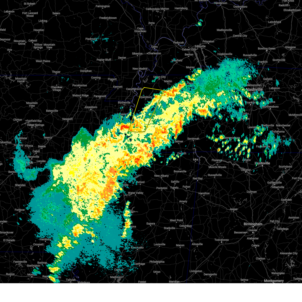 Svrmeg the national weather service in memphis has issued a * severe thunderstorm warning for, northwestern crockett county in west tennessee, eastern tipton county in west tennessee, dyer county in west tennessee, northwestern gibson county in west tennessee, southwestern obion county in west tennessee, eastern lauderdale county in west tennessee, western haywood county in west tennessee, * until 1000 am cdt. * at 919 am cdt, a severe thunderstorm was located near covington, moving north at 65 mph (radar indicated). Hazards include 60 mph wind gusts and quarter size hail. Hail damage to vehicles is expected. Expect wind damage to roofs, siding, and trees. Svrmeg the national weather service in memphis has issued a * severe thunderstorm warning for, northwestern crockett county in west tennessee, eastern tipton county in west tennessee, dyer county in west tennessee, northwestern gibson county in west tennessee, southwestern obion county in west tennessee, eastern lauderdale county in west tennessee, western haywood county in west tennessee, * until 1000 am cdt. * at 919 am cdt, a severe thunderstorm was located near covington, moving north at 65 mph (radar indicated). Hazards include 60 mph wind gusts and quarter size hail. Hail damage to vehicles is expected. Expect wind damage to roofs, siding, and trees.
|
| 3/15/2025 9:02 AM CDT |
 At 902 am cdt, a severe thunderstorm was located near arlington, or 10 miles northeast of bartlett, moving north at 50 mph (radar indicated). Hazards include 60 mph wind gusts and quarter size hail. Hail damage to vehicles is expected. expect wind damage to roofs, siding, and trees. Locations impacted include, ghost river state natural area, burlison, stanton, huntersville, masseyville, westover, covington, silerton, kirk, arlington, elmore park, laconia, lisbon, hudsonville, brims corner, sunnyhill, durhamville, montezuma, clopton, and lightfoot. At 902 am cdt, a severe thunderstorm was located near arlington, or 10 miles northeast of bartlett, moving north at 50 mph (radar indicated). Hazards include 60 mph wind gusts and quarter size hail. Hail damage to vehicles is expected. expect wind damage to roofs, siding, and trees. Locations impacted include, ghost river state natural area, burlison, stanton, huntersville, masseyville, westover, covington, silerton, kirk, arlington, elmore park, laconia, lisbon, hudsonville, brims corner, sunnyhill, durhamville, montezuma, clopton, and lightfoot.
|
| 3/15/2025 8:39 AM CDT |
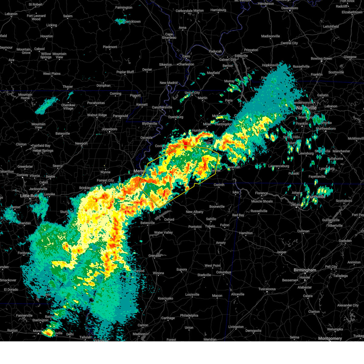 The severe thunderstorm which prompted the warning has moved out of the warned area. therefore, the warning will be allowed to expire. a tornado watch remains in effect until 100 pm cdt for northeastern and northwestern mississippi, and west tennessee. The severe thunderstorm which prompted the warning has moved out of the warned area. therefore, the warning will be allowed to expire. a tornado watch remains in effect until 100 pm cdt for northeastern and northwestern mississippi, and west tennessee.
|
| 3/15/2025 8:38 AM CDT |
 Svrmeg the national weather service in memphis has issued a * severe thunderstorm warning for, northeastern desoto county in northwestern mississippi, northern marshall county in northwestern mississippi, northern benton county in northeastern mississippi, fayette county in west tennessee, hardeman county in west tennessee, eastern lauderdale county in west tennessee, haywood county in west tennessee, madison county in west tennessee, shelby county in west tennessee, chester county in west tennessee, southern crockett county in west tennessee, tipton county in west tennessee, northwestern mcnairy county in west tennessee, * until 930 am cdt. * at 838 am cdt, a severe thunderstorm was located over germantown, moving northeast at 40 mph (radar indicated). Hazards include 60 mph wind gusts and quarter size hail. Hail damage to vehicles is expected. Expect wind damage to roofs, siding, and trees. Svrmeg the national weather service in memphis has issued a * severe thunderstorm warning for, northeastern desoto county in northwestern mississippi, northern marshall county in northwestern mississippi, northern benton county in northeastern mississippi, fayette county in west tennessee, hardeman county in west tennessee, eastern lauderdale county in west tennessee, haywood county in west tennessee, madison county in west tennessee, shelby county in west tennessee, chester county in west tennessee, southern crockett county in west tennessee, tipton county in west tennessee, northwestern mcnairy county in west tennessee, * until 930 am cdt. * at 838 am cdt, a severe thunderstorm was located over germantown, moving northeast at 40 mph (radar indicated). Hazards include 60 mph wind gusts and quarter size hail. Hail damage to vehicles is expected. Expect wind damage to roofs, siding, and trees.
|
| 3/15/2025 8:13 AM CDT |
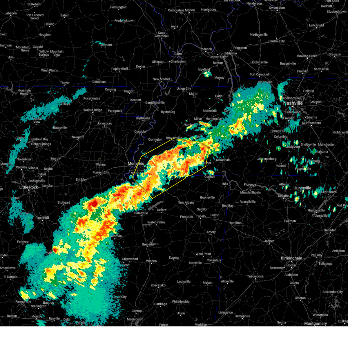 At 813 am cdt, a severe thunderstorm was located near dancyville, or 15 miles south of brownsville, moving northeast at 75 mph (radar indicated). Hazards include 60 mph wind gusts and quarter size hail. Hail damage to vehicles is expected. expect wind damage to roofs, siding, and trees. Locations impacted include, ghost river state natural area, neely, brody, yum yum, selmer, southwest memphis, stanton, horn lake, masseyville, belmont, madison hall, bright, uptonville, chulahoma, silerton, kirk, rossville, arlington, pinson mounds state archaeological park, and rogers springs. At 813 am cdt, a severe thunderstorm was located near dancyville, or 15 miles south of brownsville, moving northeast at 75 mph (radar indicated). Hazards include 60 mph wind gusts and quarter size hail. Hail damage to vehicles is expected. expect wind damage to roofs, siding, and trees. Locations impacted include, ghost river state natural area, neely, brody, yum yum, selmer, southwest memphis, stanton, horn lake, masseyville, belmont, madison hall, bright, uptonville, chulahoma, silerton, kirk, rossville, arlington, pinson mounds state archaeological park, and rogers springs.
|
| 3/15/2025 7:53 AM CDT |
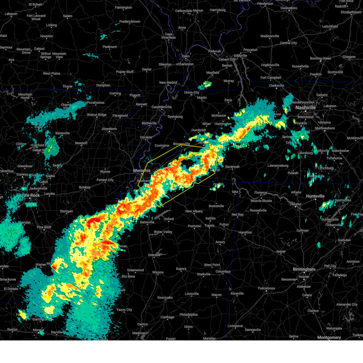 Svrmeg the national weather service in memphis has issued a * severe thunderstorm warning for, northeastern desoto county in northwestern mississippi, marshall county in northwestern mississippi, northeastern tate county in northwestern mississippi, northern benton county in northeastern mississippi, southeastern tipton county in west tennessee, fayette county in west tennessee, hardeman county in west tennessee, northwestern mcnairy county in west tennessee, southern haywood county in west tennessee, southern madison county in west tennessee, shelby county in west tennessee, chester county in west tennessee, * until 845 am cdt. * at 753 am cdt, a severe thunderstorm was located 9 miles west of lagrange, or 17 miles east of collierville, moving northeast at 50 mph (radar indicated). Hazards include 60 mph wind gusts and quarter size hail. Hail damage to vehicles is expected. Expect wind damage to roofs, siding, and trees. Svrmeg the national weather service in memphis has issued a * severe thunderstorm warning for, northeastern desoto county in northwestern mississippi, marshall county in northwestern mississippi, northeastern tate county in northwestern mississippi, northern benton county in northeastern mississippi, southeastern tipton county in west tennessee, fayette county in west tennessee, hardeman county in west tennessee, northwestern mcnairy county in west tennessee, southern haywood county in west tennessee, southern madison county in west tennessee, shelby county in west tennessee, chester county in west tennessee, * until 845 am cdt. * at 753 am cdt, a severe thunderstorm was located 9 miles west of lagrange, or 17 miles east of collierville, moving northeast at 50 mph (radar indicated). Hazards include 60 mph wind gusts and quarter size hail. Hail damage to vehicles is expected. Expect wind damage to roofs, siding, and trees.
|
| 2/15/2025 7:10 PM CST |
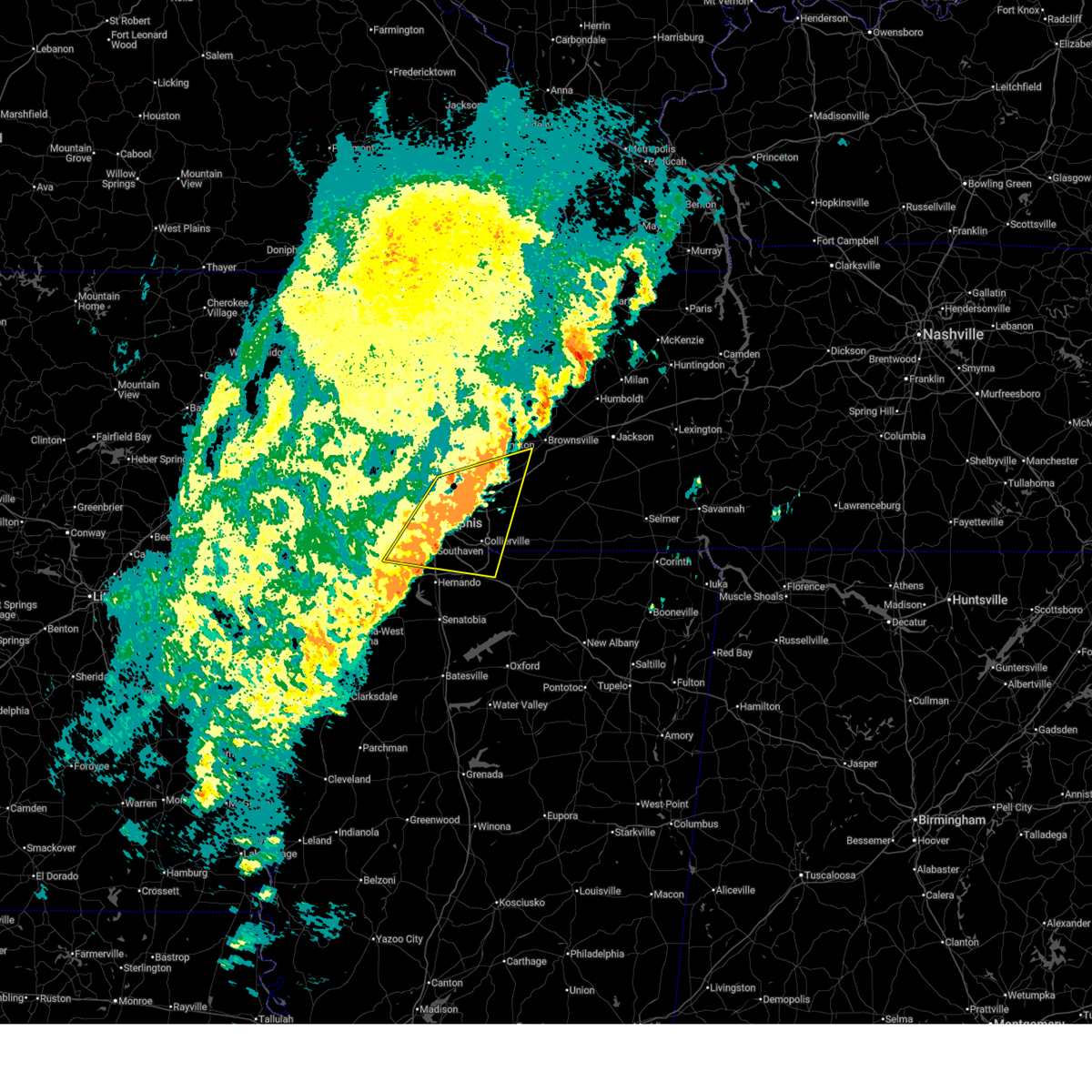 The storm which prompted the warning has weakened below severe limits, and no longer poses an immediate threat to life or property. therefore, the warning will be allowed to expire. however, small hail and gusty winds are still possible with this thunderstorm. a tornado watch remains in effect until 1000 pm cst for northwestern mississippi, and west tennessee. to report severe weather, contact your nearest law enforcement agency. they will relay your report to the national weather service memphis. The storm which prompted the warning has weakened below severe limits, and no longer poses an immediate threat to life or property. therefore, the warning will be allowed to expire. however, small hail and gusty winds are still possible with this thunderstorm. a tornado watch remains in effect until 1000 pm cst for northwestern mississippi, and west tennessee. to report severe weather, contact your nearest law enforcement agency. they will relay your report to the national weather service memphis.
|
| 2/15/2025 6:55 PM CST |
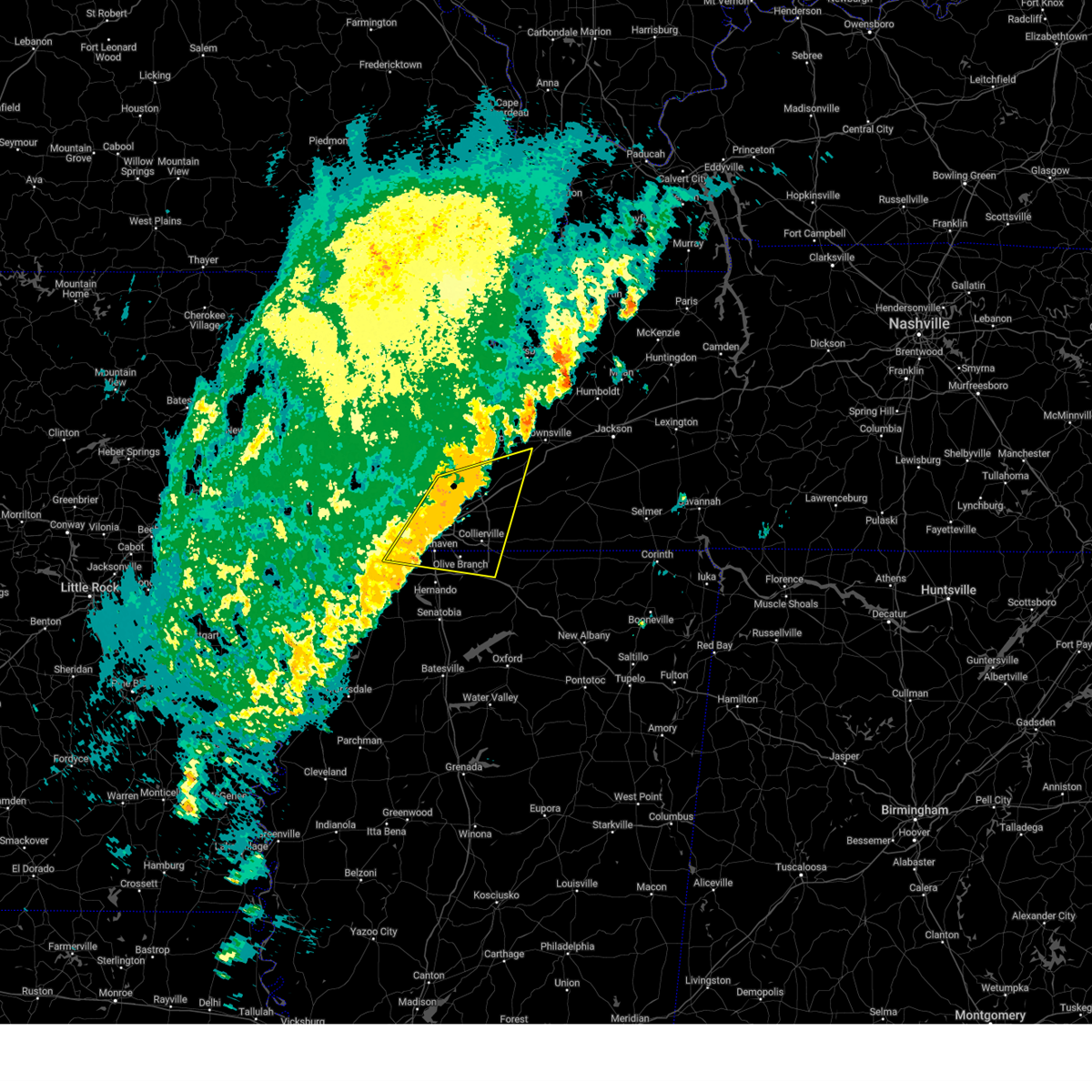 At 655 pm cst, a severe thunderstorm was located near olive branch, moving east at 55 mph (radar indicated). Hazards include 60 mph wind gusts and quarter size hail. Hail damage to vehicles is expected. expect wind damage to roofs, siding, and trees. Locations impacted include, bartlett, southaven, collierville, germantown, olive branch, west memphis, horn lake, millington, t o fuller state park, cordova, memphis, lakeland, arlington, munford, byhalia, walls, southwest memphis, ellendale, whitehaven, and frayser. At 655 pm cst, a severe thunderstorm was located near olive branch, moving east at 55 mph (radar indicated). Hazards include 60 mph wind gusts and quarter size hail. Hail damage to vehicles is expected. expect wind damage to roofs, siding, and trees. Locations impacted include, bartlett, southaven, collierville, germantown, olive branch, west memphis, horn lake, millington, t o fuller state park, cordova, memphis, lakeland, arlington, munford, byhalia, walls, southwest memphis, ellendale, whitehaven, and frayser.
|
| 2/15/2025 6:33 PM CST |
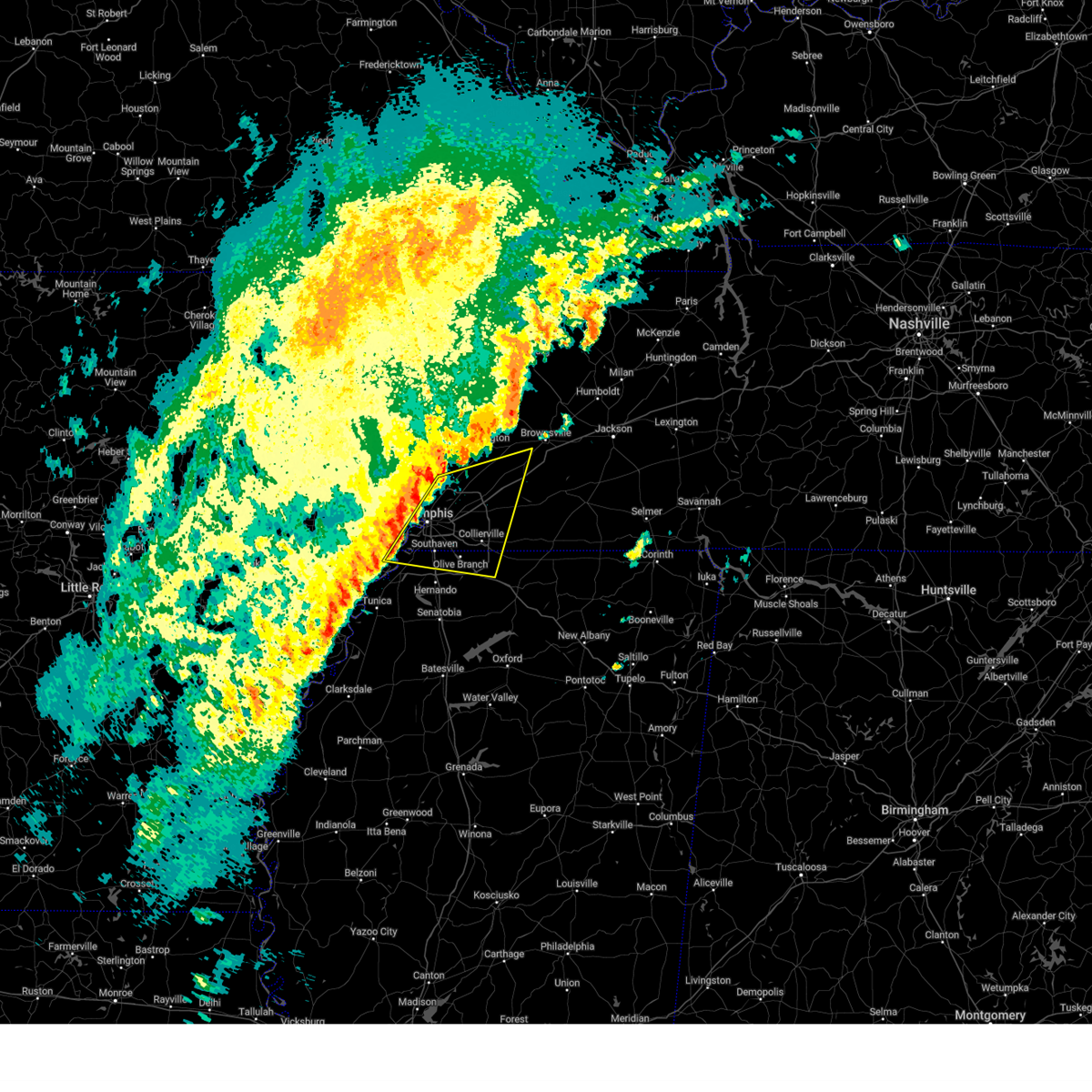 Svrmeg the national weather service in memphis has issued a * severe thunderstorm warning for, southeastern crittenden county in eastern arkansas, northern desoto county in northwestern mississippi, northwestern marshall county in northwestern mississippi, southeastern tipton county in west tennessee, western fayette county in west tennessee, southwestern haywood county in west tennessee, shelby county in west tennessee, * until 715 pm cst. * at 633 pm cst, a severe thunderstorm was located near t o fuller state park, moving east at 55 mph (radar indicated). Hazards include 60 mph wind gusts and quarter size hail. Hail damage to vehicles is expected. Expect wind damage to roofs, siding, and trees. Svrmeg the national weather service in memphis has issued a * severe thunderstorm warning for, southeastern crittenden county in eastern arkansas, northern desoto county in northwestern mississippi, northwestern marshall county in northwestern mississippi, southeastern tipton county in west tennessee, western fayette county in west tennessee, southwestern haywood county in west tennessee, shelby county in west tennessee, * until 715 pm cst. * at 633 pm cst, a severe thunderstorm was located near t o fuller state park, moving east at 55 mph (radar indicated). Hazards include 60 mph wind gusts and quarter size hail. Hail damage to vehicles is expected. Expect wind damage to roofs, siding, and trees.
|
| 8/17/2024 3:54 AM CDT |
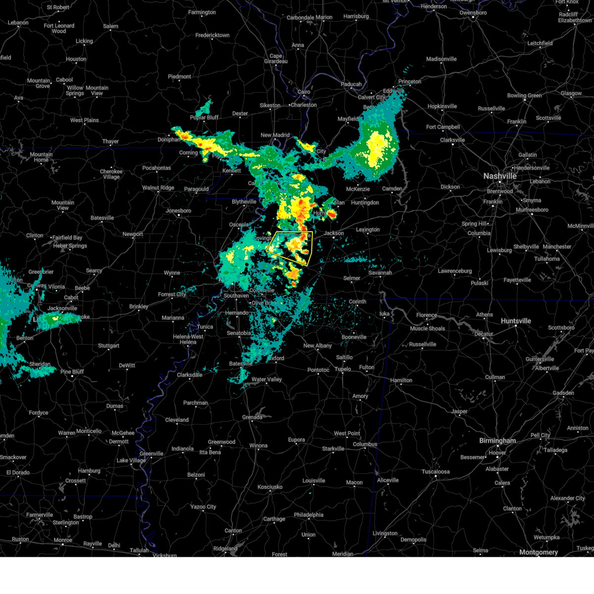 The storm which prompted the warning has weakened below severe limits, and no longer poses an immediate threat to life or property. therefore, the warning will be allowed to expire. however, small hail and gusty winds are still possible with this thunderstorm. The storm which prompted the warning has weakened below severe limits, and no longer poses an immediate threat to life or property. therefore, the warning will be allowed to expire. however, small hail and gusty winds are still possible with this thunderstorm.
|
| 8/17/2024 3:36 AM CDT |
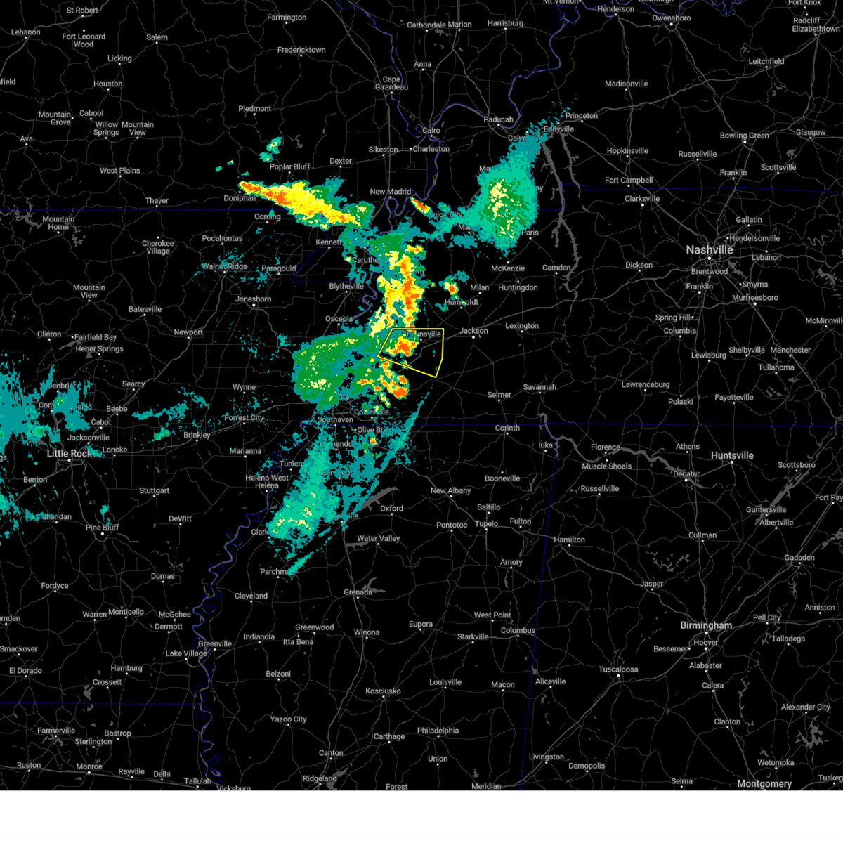 At 336 am cdt, a severe thunderstorm was located near dancyville, or 9 miles southwest of brownsville, moving east at 40 mph (radar indicated). Hazards include 60 mph wind gusts and quarter size hail. Hail damage to vehicles is expected. expect wind damage to roofs, siding, and trees. Locations impacted include, brownsville, whiteville, hillville, dancyville, holly grove, stanton, asbury, fayette corners, allens, cedar chapel, cotton lake, hickory point, orysa, sunnyhill, durhamville, keeling, morton hill, gift, shepp, and oakview. At 336 am cdt, a severe thunderstorm was located near dancyville, or 9 miles southwest of brownsville, moving east at 40 mph (radar indicated). Hazards include 60 mph wind gusts and quarter size hail. Hail damage to vehicles is expected. expect wind damage to roofs, siding, and trees. Locations impacted include, brownsville, whiteville, hillville, dancyville, holly grove, stanton, asbury, fayette corners, allens, cedar chapel, cotton lake, hickory point, orysa, sunnyhill, durhamville, keeling, morton hill, gift, shepp, and oakview.
|
| 8/17/2024 3:16 AM CDT |
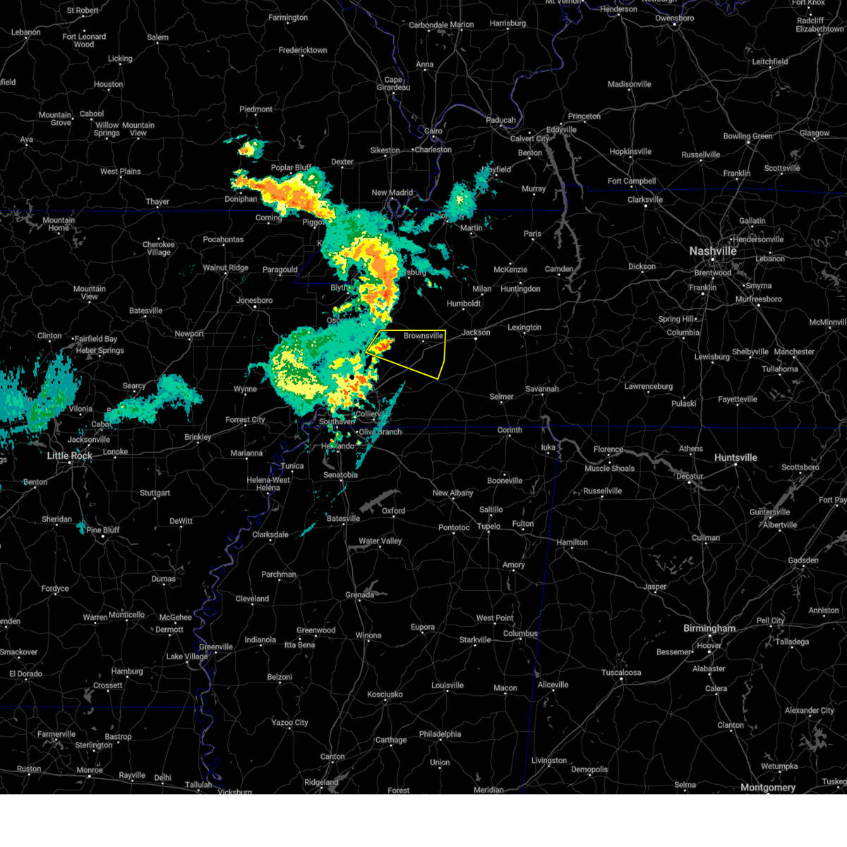 Svrmeg the national weather service in memphis has issued a * severe thunderstorm warning for, northeastern tipton county in west tennessee, northeastern fayette county in west tennessee, northwestern hardeman county in west tennessee, southeastern lauderdale county in west tennessee, haywood county in west tennessee, * until 400 am cdt. * at 316 am cdt, a severe thunderstorm was located near covington, moving east at 40 mph (radar indicated). Hazards include 60 mph wind gusts and quarter size hail. Hail damage to vehicles is expected. Expect wind damage to roofs, siding, and trees. Svrmeg the national weather service in memphis has issued a * severe thunderstorm warning for, northeastern tipton county in west tennessee, northeastern fayette county in west tennessee, northwestern hardeman county in west tennessee, southeastern lauderdale county in west tennessee, haywood county in west tennessee, * until 400 am cdt. * at 316 am cdt, a severe thunderstorm was located near covington, moving east at 40 mph (radar indicated). Hazards include 60 mph wind gusts and quarter size hail. Hail damage to vehicles is expected. Expect wind damage to roofs, siding, and trees.
|
| 7/8/2024 2:00 PM CDT |
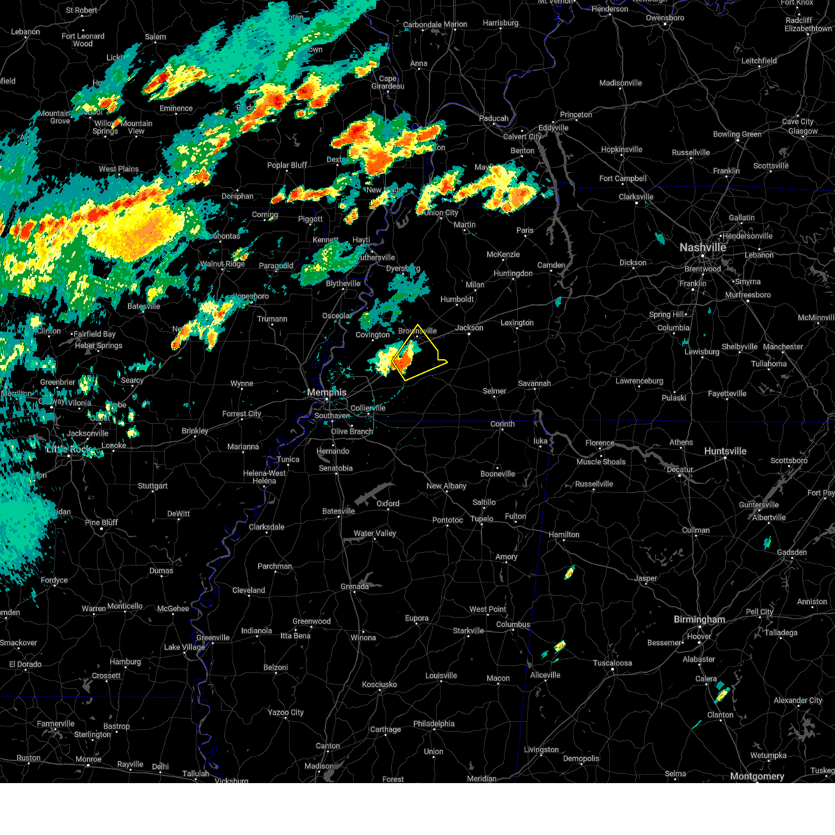 Svrmeg the national weather service in memphis has issued a * severe thunderstorm warning for, northeastern fayette county in west tennessee, northwestern hardeman county in west tennessee, southern haywood county in west tennessee, * until 245 pm cdt. * at 200 pm cdt, a severe thunderstorm was located near dancyville, or 14 miles southwest of brownsville, moving northeast at 15 mph (radar indicated). Hazards include 60 mph wind gusts and quarter size hail. Hail damage to vehicles is expected. Expect wind damage to roofs, siding, and trees. Svrmeg the national weather service in memphis has issued a * severe thunderstorm warning for, northeastern fayette county in west tennessee, northwestern hardeman county in west tennessee, southern haywood county in west tennessee, * until 245 pm cdt. * at 200 pm cdt, a severe thunderstorm was located near dancyville, or 14 miles southwest of brownsville, moving northeast at 15 mph (radar indicated). Hazards include 60 mph wind gusts and quarter size hail. Hail damage to vehicles is expected. Expect wind damage to roofs, siding, and trees.
|
| 5/22/2024 2:36 PM CDT |
 At 235 pm cdt, a severe thunderstorm was located near dancyville, or 8 miles south of brownsville, moving east at 40 mph (radar indicated). Hazards include 60 mph wind gusts and penny size hail. Expect damage to roofs, siding, and trees. Locations impacted include, brownsville, bolivar, arlington, whiteville, somerville, holly grove, hillville, dancyville, warren, oakland, mason, gallaway, stanton, braden, asbury, yum yum, allens, belmont, hickory point, and taylor chapel. At 235 pm cdt, a severe thunderstorm was located near dancyville, or 8 miles south of brownsville, moving east at 40 mph (radar indicated). Hazards include 60 mph wind gusts and penny size hail. Expect damage to roofs, siding, and trees. Locations impacted include, brownsville, bolivar, arlington, whiteville, somerville, holly grove, hillville, dancyville, warren, oakland, mason, gallaway, stanton, braden, asbury, yum yum, allens, belmont, hickory point, and taylor chapel.
|
| 5/22/2024 2:11 PM CDT |
 Svrmeg the national weather service in memphis has issued a * severe thunderstorm warning for, southeastern tipton county in west tennessee, northern fayette county in west tennessee, northwestern hardeman county in west tennessee, haywood county in west tennessee, southwestern madison county in west tennessee, northeastern shelby county in west tennessee, * until 300 pm cdt. * at 211 pm cdt, a severe thunderstorm was located 10 miles east of brighton, or 11 miles southeast of covington, moving east at 40 mph (radar indicated). Hazards include 60 mph wind gusts and penny size hail. expect damage to roofs, siding, and trees Svrmeg the national weather service in memphis has issued a * severe thunderstorm warning for, southeastern tipton county in west tennessee, northern fayette county in west tennessee, northwestern hardeman county in west tennessee, haywood county in west tennessee, southwestern madison county in west tennessee, northeastern shelby county in west tennessee, * until 300 pm cdt. * at 211 pm cdt, a severe thunderstorm was located 10 miles east of brighton, or 11 miles southeast of covington, moving east at 40 mph (radar indicated). Hazards include 60 mph wind gusts and penny size hail. expect damage to roofs, siding, and trees
|
| 5/9/2024 1:48 AM CDT |
 The storms which prompted the warning have weakened below severe limits, and no longer pose an immediate threat to life or property. therefore, the warning has been allowed to expire. a tornado watch remains in effect until 300 am cdt for northeastern mississippi, and west tennessee. The storms which prompted the warning have weakened below severe limits, and no longer pose an immediate threat to life or property. therefore, the warning has been allowed to expire. a tornado watch remains in effect until 300 am cdt for northeastern mississippi, and west tennessee.
|
| 5/9/2024 1:31 AM CDT |
 At 131 am cdt, severe thunderstorms were located along a line extending from near belle eagle to 6 miles northeast of somerville to near mt pleasant, moving east at 50 mph (radar indicated). Hazards include 70 mph wind gusts. Expect considerable tree damage. damage is likely to mobile homes, roofs, and outbuildings. Locations impacted include, bartlett, collierville, germantown, brownsville, millington, cordova, memphis, lakeland, arlington, whiteville, somerville, bells, ellendale, hillville, lagrange, belle eagle, holly grove, southeast memphis, eads, and dancyville. At 131 am cdt, severe thunderstorms were located along a line extending from near belle eagle to 6 miles northeast of somerville to near mt pleasant, moving east at 50 mph (radar indicated). Hazards include 70 mph wind gusts. Expect considerable tree damage. damage is likely to mobile homes, roofs, and outbuildings. Locations impacted include, bartlett, collierville, germantown, brownsville, millington, cordova, memphis, lakeland, arlington, whiteville, somerville, bells, ellendale, hillville, lagrange, belle eagle, holly grove, southeast memphis, eads, and dancyville.
|
| 5/9/2024 1:31 AM CDT |
 the severe thunderstorm warning has been cancelled and is no longer in effect the severe thunderstorm warning has been cancelled and is no longer in effect
|
| 5/9/2024 1:06 AM CDT |
 Svrmeg the national weather service in memphis has issued a * severe thunderstorm warning for, southwestern crockett county in west tennessee, tipton county in west tennessee, fayette county in west tennessee, western hardeman county in west tennessee, southern lauderdale county in west tennessee, haywood county in west tennessee, eastern shelby county in west tennessee, * until 145 am cdt. * at 105 am cdt, severe thunderstorms were located along a line extending from near ft pillow to arlington to near southaven, moving east at 50 mph (radar indicated). Hazards include 70 mph wind gusts. Expect considerable tree damage. Damage is likely to mobile homes, roofs, and outbuildings. Svrmeg the national weather service in memphis has issued a * severe thunderstorm warning for, southwestern crockett county in west tennessee, tipton county in west tennessee, fayette county in west tennessee, western hardeman county in west tennessee, southern lauderdale county in west tennessee, haywood county in west tennessee, eastern shelby county in west tennessee, * until 145 am cdt. * at 105 am cdt, severe thunderstorms were located along a line extending from near ft pillow to arlington to near southaven, moving east at 50 mph (radar indicated). Hazards include 70 mph wind gusts. Expect considerable tree damage. Damage is likely to mobile homes, roofs, and outbuildings.
|
| 5/9/2024 1:00 AM CDT |
 At 1259 am cdt, a severe thunderstorm was located over brownsville, moving east at 50 mph (radar indicated). Hazards include 60 mph wind gusts and quarter size hail. Hail damage to vehicles is expected. expect wind damage to roofs, siding, and trees. Locations impacted include, jackson, brownsville, covington, ripley, bemis, nutbush, belle eagle, holly grove, forked deer, hillville, dancyville, ft pillow, mercer, henning, stanton, asbury, neely, allens, huntersville, and christmasville. At 1259 am cdt, a severe thunderstorm was located over brownsville, moving east at 50 mph (radar indicated). Hazards include 60 mph wind gusts and quarter size hail. Hail damage to vehicles is expected. expect wind damage to roofs, siding, and trees. Locations impacted include, jackson, brownsville, covington, ripley, bemis, nutbush, belle eagle, holly grove, forked deer, hillville, dancyville, ft pillow, mercer, henning, stanton, asbury, neely, allens, huntersville, and christmasville.
|
| 5/9/2024 12:37 AM CDT |
 Svrmeg the national weather service in memphis has issued a * severe thunderstorm warning for, northeastern tipton county in west tennessee, southeastern lauderdale county in west tennessee, haywood county in west tennessee, southwestern madison county in west tennessee, * until 115 am cdt. * at 1236 am cdt, a severe thunderstorm was located near covington, moving east at 60 mph (radar indicated). Hazards include 60 mph wind gusts and quarter size hail. Hail damage to vehicles is expected. Expect wind damage to roofs, siding, and trees. Svrmeg the national weather service in memphis has issued a * severe thunderstorm warning for, northeastern tipton county in west tennessee, southeastern lauderdale county in west tennessee, haywood county in west tennessee, southwestern madison county in west tennessee, * until 115 am cdt. * at 1236 am cdt, a severe thunderstorm was located near covington, moving east at 60 mph (radar indicated). Hazards include 60 mph wind gusts and quarter size hail. Hail damage to vehicles is expected. Expect wind damage to roofs, siding, and trees.
|
| 4/2/2024 8:48 AM CDT |
 the severe thunderstorm warning has been cancelled and is no longer in effect the severe thunderstorm warning has been cancelled and is no longer in effect
|
| 4/2/2024 8:31 AM CDT |
 At 830 am cdt, a severe thunderstorm was located near covington, moving northeast at 55 mph (radar indicated). Hazards include 60 mph wind gusts and penny size hail. Expect damage to roofs, siding, and trees. Locations impacted include, millington, covington, fort pillow state park, munford, brighton, fulton, dancyville, tipton, atoka, mason, gallaway, gilt edge, stanton, burlison, garland, braden, asbury, barretville, egypt, and belmont. At 830 am cdt, a severe thunderstorm was located near covington, moving northeast at 55 mph (radar indicated). Hazards include 60 mph wind gusts and penny size hail. Expect damage to roofs, siding, and trees. Locations impacted include, millington, covington, fort pillow state park, munford, brighton, fulton, dancyville, tipton, atoka, mason, gallaway, gilt edge, stanton, burlison, garland, braden, asbury, barretville, egypt, and belmont.
|
| 4/2/2024 8:12 AM CDT |
 Svrmeg the national weather service in memphis has issued a * severe thunderstorm warning for, tipton county in west tennessee, western fayette county in west tennessee, southwestern lauderdale county in west tennessee, southwestern haywood county in west tennessee, northeastern shelby county in west tennessee, * until 900 am cdt. * at 812 am cdt, a severe thunderstorm was located near millington, moving northeast at 55 mph (radar indicated). Hazards include 60 mph wind gusts and penny size hail. expect damage to roofs, siding, and trees Svrmeg the national weather service in memphis has issued a * severe thunderstorm warning for, tipton county in west tennessee, western fayette county in west tennessee, southwestern lauderdale county in west tennessee, southwestern haywood county in west tennessee, northeastern shelby county in west tennessee, * until 900 am cdt. * at 812 am cdt, a severe thunderstorm was located near millington, moving northeast at 55 mph (radar indicated). Hazards include 60 mph wind gusts and penny size hail. expect damage to roofs, siding, and trees
|
| 8/9/2023 11:40 AM CDT |
 At 1140 am cdt, a severe thunderstorm was located over cordova, moving northeast at 45 mph (radar indicated). Hazards include 60 mph wind gusts and quarter size hail. Hail damage to vehicles is expected. Expect wind damage to roofs, siding, and trees. At 1140 am cdt, a severe thunderstorm was located over cordova, moving northeast at 45 mph (radar indicated). Hazards include 60 mph wind gusts and quarter size hail. Hail damage to vehicles is expected. Expect wind damage to roofs, siding, and trees.
|
| 8/9/2023 11:36 AM CDT |
 At 1136 am cdt, a severe thunderstorm was located near cordova, moving northeast at 45 mph (radar indicated). Hazards include 60 mph wind gusts and quarter size hail. Hail damage to vehicles is expected. Expect wind damage to roofs, siding, and trees. At 1136 am cdt, a severe thunderstorm was located near cordova, moving northeast at 45 mph (radar indicated). Hazards include 60 mph wind gusts and quarter size hail. Hail damage to vehicles is expected. Expect wind damage to roofs, siding, and trees.
|
| 8/5/2023 5:04 PM CDT |
 At 503 pm cdt, a severe thunderstorm was located 7 miles east of arlington, or 16 miles northeast of cordova, moving east at 35 mph (radar indicated). Hazards include 60 mph wind gusts and quarter size hail. Hail damage to vehicles is expected. expect wind damage to roofs, siding, and trees. locations impacted include, bartlett, cordova, lakeland, arlington, somerville, eads, warren, macon, oakland, mason, piperton, gallaway, stanton, braden, asbury, lenow, yum yum, belmont, shepp and hickory withe. hail threat, radar indicated max hail size, 1. 00 in wind threat, radar indicated max wind gust, 60 mph. At 503 pm cdt, a severe thunderstorm was located 7 miles east of arlington, or 16 miles northeast of cordova, moving east at 35 mph (radar indicated). Hazards include 60 mph wind gusts and quarter size hail. Hail damage to vehicles is expected. expect wind damage to roofs, siding, and trees. locations impacted include, bartlett, cordova, lakeland, arlington, somerville, eads, warren, macon, oakland, mason, piperton, gallaway, stanton, braden, asbury, lenow, yum yum, belmont, shepp and hickory withe. hail threat, radar indicated max hail size, 1. 00 in wind threat, radar indicated max wind gust, 60 mph.
|
| 8/5/2023 4:39 PM CDT |
 At 439 pm cdt, a severe thunderstorm was located near munford, or 7 miles northeast of millington, moving east at 30 mph (radar indicated). Hazards include 60 mph wind gusts. expect damage to roofs, siding, and trees At 439 pm cdt, a severe thunderstorm was located near munford, or 7 miles northeast of millington, moving east at 30 mph (radar indicated). Hazards include 60 mph wind gusts. expect damage to roofs, siding, and trees
|
| 7/21/2023 2:23 PM CDT |
 At 220 pm cdt, severe thunderstorms were located along a line extending from near nutbush to 6 miles east of somerville to near slayden, moving east at 50 mph (public). Hazards include 60 mph wind gusts. Expect damage to roofs, siding, and trees. locations impacted include, jackson, brownsville, henderson, bolivar, selmer, chickasaw state forest, big hill pond state park, chickasaw state park, whiteville, somerville, silerton, mt pleasant, masseyville, hillville, michigan city, pocahontas, bemis, lagrange, dancyville and cloverport. hail threat, radar indicated max hail size, <. 75 in wind threat, radar indicated max wind gust, 60 mph. At 220 pm cdt, severe thunderstorms were located along a line extending from near nutbush to 6 miles east of somerville to near slayden, moving east at 50 mph (public). Hazards include 60 mph wind gusts. Expect damage to roofs, siding, and trees. locations impacted include, jackson, brownsville, henderson, bolivar, selmer, chickasaw state forest, big hill pond state park, chickasaw state park, whiteville, somerville, silerton, mt pleasant, masseyville, hillville, michigan city, pocahontas, bemis, lagrange, dancyville and cloverport. hail threat, radar indicated max hail size, <. 75 in wind threat, radar indicated max wind gust, 60 mph.
|
| 7/21/2023 2:16 PM CDT | Trees down across haywood count in haywood county TN, 0.6 miles WNW of Stanton, TN |
| 7/21/2023 2:11 PM CDT | Powerline down on greenleaf cemetery roa in haywood county TN, 3.7 miles ENE of Stanton, TN |
| 7/21/2023 2:07 PM CDT |
 At 207 pm cdt, severe thunderstorms were located along a line extending from 6 miles southwest of ripley to near somerville to near mt pleasant, moving east at 65 mph (public). Hazards include 60 mph wind gusts and penny size hail. expect damage to roofs, siding, and trees At 207 pm cdt, severe thunderstorms were located along a line extending from 6 miles southwest of ripley to near somerville to near mt pleasant, moving east at 65 mph (public). Hazards include 60 mph wind gusts and penny size hail. expect damage to roofs, siding, and trees
|
| 6/25/2023 6:48 PM CDT |
 At 648 pm cdt, a severe thunderstorm was located over millington, moving southeast at 55 mph (radar indicated). Hazards include 70 mph wind gusts. Expect considerable tree damage. Damage is likely to mobile homes, roofs, and outbuildings. At 648 pm cdt, a severe thunderstorm was located over millington, moving southeast at 55 mph (radar indicated). Hazards include 70 mph wind gusts. Expect considerable tree damage. Damage is likely to mobile homes, roofs, and outbuildings.
|
| 6/18/2023 6:25 AM CDT |
 The severe thunderstorm warning for southeastern tipton, fayette, western hardeman, southern haywood and eastern shelby counties will expire at 630 am cdt, the storms which prompted the warning have weakened below severe limits, and no longer pose an immediate threat to life or property. therefore, the warning will be allowed to expire. however gusty winds are still possible with these thunderstorms. a severe thunderstorm watch remains in effect until 1000 am cdt for northwestern mississippi, and west tennessee. The severe thunderstorm warning for southeastern tipton, fayette, western hardeman, southern haywood and eastern shelby counties will expire at 630 am cdt, the storms which prompted the warning have weakened below severe limits, and no longer pose an immediate threat to life or property. therefore, the warning will be allowed to expire. however gusty winds are still possible with these thunderstorms. a severe thunderstorm watch remains in effect until 1000 am cdt for northwestern mississippi, and west tennessee.
|
| 6/18/2023 5:43 AM CDT |
 At 543 am cdt, severe thunderstorms were located along a line extending from near munford to near eads to near collierville, moving east at 50 mph (radar indicated). Hazards include 60 mph wind gusts and penny size hail. expect damage to roofs, siding, and trees At 543 am cdt, severe thunderstorms were located along a line extending from near munford to near eads to near collierville, moving east at 50 mph (radar indicated). Hazards include 60 mph wind gusts and penny size hail. expect damage to roofs, siding, and trees
|
| 6/11/2023 7:50 PM CDT |
 The severe thunderstorm warning for northeastern fayette, northwestern hardeman and southern haywood counties will expire at 800 pm cdt, the storm which prompted the warning has weakened below severe limits, and no longer poses an immediate threat to life or property. therefore, the warning will be allowed to expire. however small hail is still possible with this thunderstorm. a severe thunderstorm watch remains in effect until 1000 pm cdt for west tennessee. The severe thunderstorm warning for northeastern fayette, northwestern hardeman and southern haywood counties will expire at 800 pm cdt, the storm which prompted the warning has weakened below severe limits, and no longer poses an immediate threat to life or property. therefore, the warning will be allowed to expire. however small hail is still possible with this thunderstorm. a severe thunderstorm watch remains in effect until 1000 pm cdt for west tennessee.
|
| 6/11/2023 7:39 PM CDT |
 At 739 pm cdt, a severe thunderstorm was located near dancyville, or 14 miles southwest of brownsville, moving east at 35 mph (radar indicated). Hazards include 60 mph wind gusts and quarter size hail. Hail damage to vehicles is expected. expect wind damage to roofs, siding, and trees. locations impacted include, whiteville, hillville, dancyville, stanton, asbury, yum yum, fayette corners, laconia, cedar chapel, belmont, hickory point, moorman, sunnyhill, taylor chapel, morton hill, shepp, miller, meux corner and keeling. hail threat, radar indicated max hail size, 1. 00 in wind threat, radar indicated max wind gust, 60 mph. At 739 pm cdt, a severe thunderstorm was located near dancyville, or 14 miles southwest of brownsville, moving east at 35 mph (radar indicated). Hazards include 60 mph wind gusts and quarter size hail. Hail damage to vehicles is expected. expect wind damage to roofs, siding, and trees. locations impacted include, whiteville, hillville, dancyville, stanton, asbury, yum yum, fayette corners, laconia, cedar chapel, belmont, hickory point, moorman, sunnyhill, taylor chapel, morton hill, shepp, miller, meux corner and keeling. hail threat, radar indicated max hail size, 1. 00 in wind threat, radar indicated max wind gust, 60 mph.
|
| 6/11/2023 7:27 PM CDT |
 At 727 pm cdt, a severe thunderstorm was located 11 miles west of dancyville, or 12 miles southeast of covington, moving east at 35 mph (radar indicated). Hazards include 60 mph wind gusts and quarter size hail. Hail damage to vehicles is expected. Expect wind damage to roofs, siding, and trees. At 727 pm cdt, a severe thunderstorm was located 11 miles west of dancyville, or 12 miles southeast of covington, moving east at 35 mph (radar indicated). Hazards include 60 mph wind gusts and quarter size hail. Hail damage to vehicles is expected. Expect wind damage to roofs, siding, and trees.
|
| 6/11/2023 7:17 PM CDT |
 At 717 pm cdt, a severe thunderstorm was located 10 miles southeast of brighton, or 12 miles south of covington, moving east at 35 mph (radar indicated). Hazards include 60 mph wind gusts and quarter size hail. Hail damage to vehicles is expected. expect wind damage to roofs, siding, and trees. locations impacted include, arlington, somerville, brighton, dancyville, warren, oakland, mason, gallaway, stanton, braden, asbury, yum yum, belmont, hickory point, redwood, shepp, idaville, meux corner, canaan grove and longtown. hail threat, radar indicated max hail size, 1. 00 in wind threat, radar indicated max wind gust, 60 mph. At 717 pm cdt, a severe thunderstorm was located 10 miles southeast of brighton, or 12 miles south of covington, moving east at 35 mph (radar indicated). Hazards include 60 mph wind gusts and quarter size hail. Hail damage to vehicles is expected. expect wind damage to roofs, siding, and trees. locations impacted include, arlington, somerville, brighton, dancyville, warren, oakland, mason, gallaway, stanton, braden, asbury, yum yum, belmont, hickory point, redwood, shepp, idaville, meux corner, canaan grove and longtown. hail threat, radar indicated max hail size, 1. 00 in wind threat, radar indicated max wind gust, 60 mph.
|
| 6/11/2023 7:04 PM CDT |
 At 703 pm cdt, a severe thunderstorm was located near brighton, or 9 miles southwest of covington, moving east at 35 mph (radar indicated). Hazards include 60 mph wind gusts and quarter size hail. Hail damage to vehicles is expected. Expect wind damage to roofs, siding, and trees. At 703 pm cdt, a severe thunderstorm was located near brighton, or 9 miles southwest of covington, moving east at 35 mph (radar indicated). Hazards include 60 mph wind gusts and quarter size hail. Hail damage to vehicles is expected. Expect wind damage to roofs, siding, and trees.
|
| 6/11/2023 5:44 PM CDT |
 At 543 pm cdt, a severe thunderstorm was located near dancyville, or 8 miles southwest of brownsville, moving southeast at 35 mph (radar indicated). Hazards include 60 mph wind gusts and quarter size hail. Hail damage to vehicles is expected. Expect wind damage to roofs, siding, and trees. At 543 pm cdt, a severe thunderstorm was located near dancyville, or 8 miles southwest of brownsville, moving southeast at 35 mph (radar indicated). Hazards include 60 mph wind gusts and quarter size hail. Hail damage to vehicles is expected. Expect wind damage to roofs, siding, and trees.
|
| 4/15/2023 9:31 PM CDT |
 At 931 pm cdt, severe thunderstorms were located along a line extending from dancyville to 6 miles east of collierville to near phillipp, moving east at 40 mph. strong outflow winds will precede this line of thunderstorms (radar indicated). Hazards include 60 mph wind gusts. Expect damage to roofs, siding, and trees. locations impacted include, bartlett, southaven, collierville, germantown, olive branch, horn lake, hernando, senatobia, holly springs, bolivar, chickasaw state forest, cordova, memphis, lamar, lakeland, arlington, whiteville, somerville, coldwater and byhalia. hail threat, radar indicated max hail size, <. 75 in wind threat, radar indicated max wind gust, 60 mph. At 931 pm cdt, severe thunderstorms were located along a line extending from dancyville to 6 miles east of collierville to near phillipp, moving east at 40 mph. strong outflow winds will precede this line of thunderstorms (radar indicated). Hazards include 60 mph wind gusts. Expect damage to roofs, siding, and trees. locations impacted include, bartlett, southaven, collierville, germantown, olive branch, horn lake, hernando, senatobia, holly springs, bolivar, chickasaw state forest, cordova, memphis, lamar, lakeland, arlington, whiteville, somerville, coldwater and byhalia. hail threat, radar indicated max hail size, <. 75 in wind threat, radar indicated max wind gust, 60 mph.
|
| 4/15/2023 9:10 PM CDT |
 At 908 pm cdt, severe thunderstorms were located along a line extending from 9 miles southeast of covington to germantown to robinsonville, moving east at 50 mph. strong outflow winds will precede this line of thunderstorms (radar indicated). Hazards include 60 mph wind gusts and penny size hail. expect damage to roofs, siding, and trees At 908 pm cdt, severe thunderstorms were located along a line extending from 9 miles southeast of covington to germantown to robinsonville, moving east at 50 mph. strong outflow winds will precede this line of thunderstorms (radar indicated). Hazards include 60 mph wind gusts and penny size hail. expect damage to roofs, siding, and trees
|
| 4/15/2023 8:52 PM CDT |
 At 852 pm cdt, severe thunderstorms were located along a line extending from near ripley to near covington to near meeman shelby forest state park, moving east at 55 mph (radar indicated). Hazards include 60 mph wind gusts. Expect damage to roofs, siding, and trees. locations impacted include, bartlett, brownsville, millington, covington, ripley, osceola, luxora, wilson, keiser, meeman shelby forest state park, fort pillow state park, lakeland, arlington, munford, brighton, joiner, gilmore, bassett, jericho and marie. hail threat, radar indicated max hail size, <. 75 in wind threat, radar indicated max wind gust, 60 mph. At 852 pm cdt, severe thunderstorms were located along a line extending from near ripley to near covington to near meeman shelby forest state park, moving east at 55 mph (radar indicated). Hazards include 60 mph wind gusts. Expect damage to roofs, siding, and trees. locations impacted include, bartlett, brownsville, millington, covington, ripley, osceola, luxora, wilson, keiser, meeman shelby forest state park, fort pillow state park, lakeland, arlington, munford, brighton, joiner, gilmore, bassett, jericho and marie. hail threat, radar indicated max hail size, <. 75 in wind threat, radar indicated max wind gust, 60 mph.
|
| 4/15/2023 8:26 PM CDT |
 At 826 pm cdt, severe thunderstorms were located along a line extending from near burdette to near wilson to near earle, moving east at 55 mph (radar indicated). Hazards include 60 mph wind gusts. expect damage to roofs, siding, and trees At 826 pm cdt, severe thunderstorms were located along a line extending from near burdette to near wilson to near earle, moving east at 55 mph (radar indicated). Hazards include 60 mph wind gusts. expect damage to roofs, siding, and trees
|
| 2/15/2023 10:06 PM CST |
 At 1005 pm cst, a severe thunderstorm was located 7 miles west of somerville, or 17 miles northeast of cordova, moving northeast at 45 mph (radar indicated). Hazards include 60 mph wind gusts and quarter size hail. Hail damage to vehicles is expected. expect wind damage to roofs, siding, and trees. locations impacted include, somerville, warren, oakland, stanton, yum yum, belmont, longtown, moorman, taylor chapel, lambert, hickory withe, powers, griffen, meux corner and keeling. hail threat, radar indicated max hail size, 1. 00 in wind threat, radar indicated max wind gust, 60 mph. At 1005 pm cst, a severe thunderstorm was located 7 miles west of somerville, or 17 miles northeast of cordova, moving northeast at 45 mph (radar indicated). Hazards include 60 mph wind gusts and quarter size hail. Hail damage to vehicles is expected. expect wind damage to roofs, siding, and trees. locations impacted include, somerville, warren, oakland, stanton, yum yum, belmont, longtown, moorman, taylor chapel, lambert, hickory withe, powers, griffen, meux corner and keeling. hail threat, radar indicated max hail size, 1. 00 in wind threat, radar indicated max wind gust, 60 mph.
|
| 2/15/2023 9:56 PM CST |
 At 956 pm cst, a severe thunderstorm was located near eads, or 10 miles east of cordova, moving northeast at 45 mph (radar indicated). Hazards include 60 mph wind gusts and quarter size hail. Hail damage to vehicles is expected. expect wind damage to roofs, siding, and trees. locations impacted include, arlington, somerville, eads, warren, oakland, stanton, braden, yum yum, fisherville, belmont, canadaville, longtown, moorman, taylor chapel, lambert, hickory withe, powers, griffen, meux corner and keeling. hail threat, radar indicated max hail size, 1. 00 in wind threat, radar indicated max wind gust, 60 mph. At 956 pm cst, a severe thunderstorm was located near eads, or 10 miles east of cordova, moving northeast at 45 mph (radar indicated). Hazards include 60 mph wind gusts and quarter size hail. Hail damage to vehicles is expected. expect wind damage to roofs, siding, and trees. locations impacted include, arlington, somerville, eads, warren, oakland, stanton, braden, yum yum, fisherville, belmont, canadaville, longtown, moorman, taylor chapel, lambert, hickory withe, powers, griffen, meux corner and keeling. hail threat, radar indicated max hail size, 1. 00 in wind threat, radar indicated max wind gust, 60 mph.
|
| 2/15/2023 9:40 PM CST |
 At 940 pm cst, a severe thunderstorm was located over germantown, moving northeast at 45 mph (radar indicated). Hazards include 60 mph wind gusts and quarter size hail. Hail damage to vehicles is expected. Expect wind damage to roofs, siding, and trees. At 940 pm cst, a severe thunderstorm was located over germantown, moving northeast at 45 mph (radar indicated). Hazards include 60 mph wind gusts and quarter size hail. Hail damage to vehicles is expected. Expect wind damage to roofs, siding, and trees.
|
| 11/29/2022 8:23 PM CST |
 The severe thunderstorm warning for southern crockett, east central tipton, south central gibson, northeastern fayette, northwestern hardeman, haywood and madison counties will expire at 830 pm cst, the storm which prompted the warning has weakened below severe limits, and no longer poses an immediate threat to life or property. therefore, the warning will be allowed to expire. however small hail is still possible with this thunderstorm. to report severe weather, contact your nearest law enforcement agency. they will relay your report to the national weather service memphis. The severe thunderstorm warning for southern crockett, east central tipton, south central gibson, northeastern fayette, northwestern hardeman, haywood and madison counties will expire at 830 pm cst, the storm which prompted the warning has weakened below severe limits, and no longer poses an immediate threat to life or property. therefore, the warning will be allowed to expire. however small hail is still possible with this thunderstorm. to report severe weather, contact your nearest law enforcement agency. they will relay your report to the national weather service memphis.
|
| 11/29/2022 8:06 PM CST |
 At 805 pm cst, a severe thunderstorm was located near dancyville, or near brownsville, moving northeast at 60 mph (radar indicated). Hazards include quarter size hail. damage to vehicles is expected At 805 pm cst, a severe thunderstorm was located near dancyville, or near brownsville, moving northeast at 60 mph (radar indicated). Hazards include quarter size hail. damage to vehicles is expected
|
| 11/29/2022 7:36 PM CST |
 At 735 pm cst, a severe thunderstorm was located over eads, or near cordova, moving northeast at 60 mph (radar indicated). Hazards include 60 mph wind gusts and quarter size hail. Hail damage to vehicles is expected. Expect wind damage to roofs, siding, and trees. At 735 pm cst, a severe thunderstorm was located over eads, or near cordova, moving northeast at 60 mph (radar indicated). Hazards include 60 mph wind gusts and quarter size hail. Hail damage to vehicles is expected. Expect wind damage to roofs, siding, and trees.
|
| 5/15/2022 6:25 PM CDT |
 At 624 pm cdt, severe thunderstorms were located along a line extending from near dancyville to near somerville to near mt pleasant, moving east at 25 mph (radar indicated). Hazards include 60 mph wind gusts and quarter size hail. Hail damage to vehicles is expected. Expect wind damage to roofs, siding, and trees. At 624 pm cdt, severe thunderstorms were located along a line extending from near dancyville to near somerville to near mt pleasant, moving east at 25 mph (radar indicated). Hazards include 60 mph wind gusts and quarter size hail. Hail damage to vehicles is expected. Expect wind damage to roofs, siding, and trees.
|
| 5/15/2022 6:18 PM CDT |
 At 618 pm cdt, severe thunderstorms were located along a line extending from near nutbush to 6 miles southwest of brownsville to near dancyville, moving east at 25 mph (radar indicated). Hazards include 60 mph wind gusts and quarter size hail. Hail damage to vehicles is expected. expect wind damage to roofs, siding, and trees. locations impacted include, brownsville, somerville, dancyville, oakland, mason, gallaway, stanton, braden, asbury, yum yum, belmont, hickory point, taylor chapel, shepp, turnpike, meux corner, cotton lake, longtown, moorman and sunnyhill. hail threat, radar indicated max hail size, 1. 00 in wind threat, radar indicated max wind gust, 60 mph. At 618 pm cdt, severe thunderstorms were located along a line extending from near nutbush to 6 miles southwest of brownsville to near dancyville, moving east at 25 mph (radar indicated). Hazards include 60 mph wind gusts and quarter size hail. Hail damage to vehicles is expected. expect wind damage to roofs, siding, and trees. locations impacted include, brownsville, somerville, dancyville, oakland, mason, gallaway, stanton, braden, asbury, yum yum, belmont, hickory point, taylor chapel, shepp, turnpike, meux corner, cotton lake, longtown, moorman and sunnyhill. hail threat, radar indicated max hail size, 1. 00 in wind threat, radar indicated max wind gust, 60 mph.
|
| 5/15/2022 5:59 PM CDT |
 At 558 pm cdt, severe thunderstorms were located along a line extending from near nutbush to 11 miles southwest of brownsville to 9 miles west of dancyville, moving east at 25 mph (radar indicated). Hazards include 60 mph wind gusts and quarter size hail. Hail damage to vehicles is expected. Expect wind damage to roofs, siding, and trees. At 558 pm cdt, severe thunderstorms were located along a line extending from near nutbush to 11 miles southwest of brownsville to 9 miles west of dancyville, moving east at 25 mph (radar indicated). Hazards include 60 mph wind gusts and quarter size hail. Hail damage to vehicles is expected. Expect wind damage to roofs, siding, and trees.
|
| 5/15/2022 5:32 PM CDT |
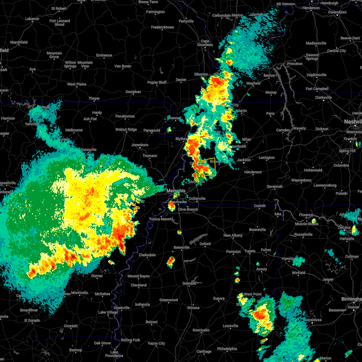 At 532 pm cdt, a severe thunderstorm was located near covington, moving east at 25 mph (radar indicated). Hazards include quarter size hail. damage to vehicles is expected At 532 pm cdt, a severe thunderstorm was located near covington, moving east at 25 mph (radar indicated). Hazards include quarter size hail. damage to vehicles is expected
|
| 5/15/2022 5:25 PM CDT |
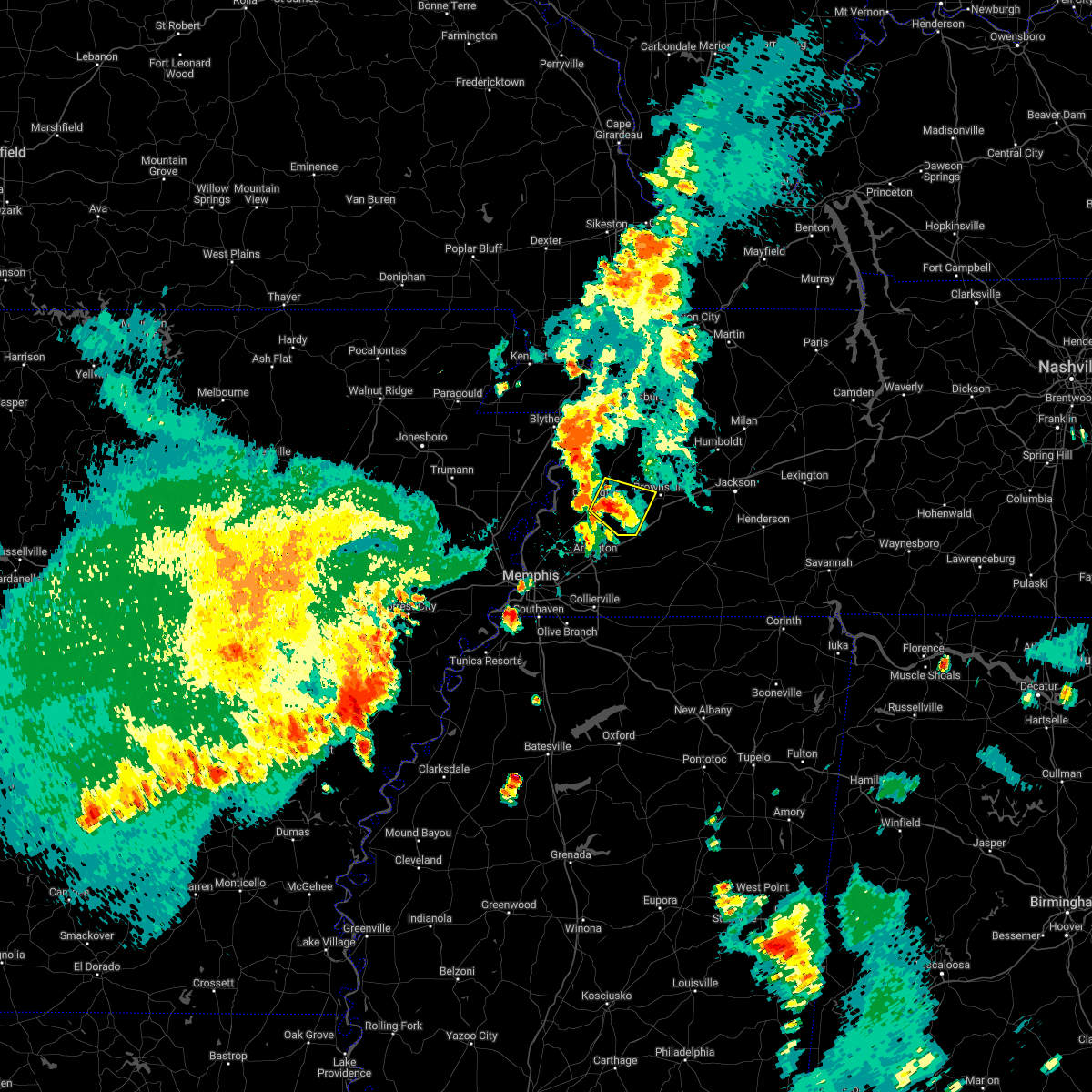 The severe thunderstorm warning for northeastern tipton, southeastern lauderdale and southwestern haywood counties will expire at 530 pm cdt, the storm which prompted the warning has weakened below severe limits, and no longer poses an immediate threat to life or property. therefore, the warning will be allowed to expire. a severe thunderstorm watch remains in effect until 900 pm cdt for west tennessee. The severe thunderstorm warning for northeastern tipton, southeastern lauderdale and southwestern haywood counties will expire at 530 pm cdt, the storm which prompted the warning has weakened below severe limits, and no longer poses an immediate threat to life or property. therefore, the warning will be allowed to expire. a severe thunderstorm watch remains in effect until 900 pm cdt for west tennessee.
|
| 5/15/2022 5:11 PM CDT |
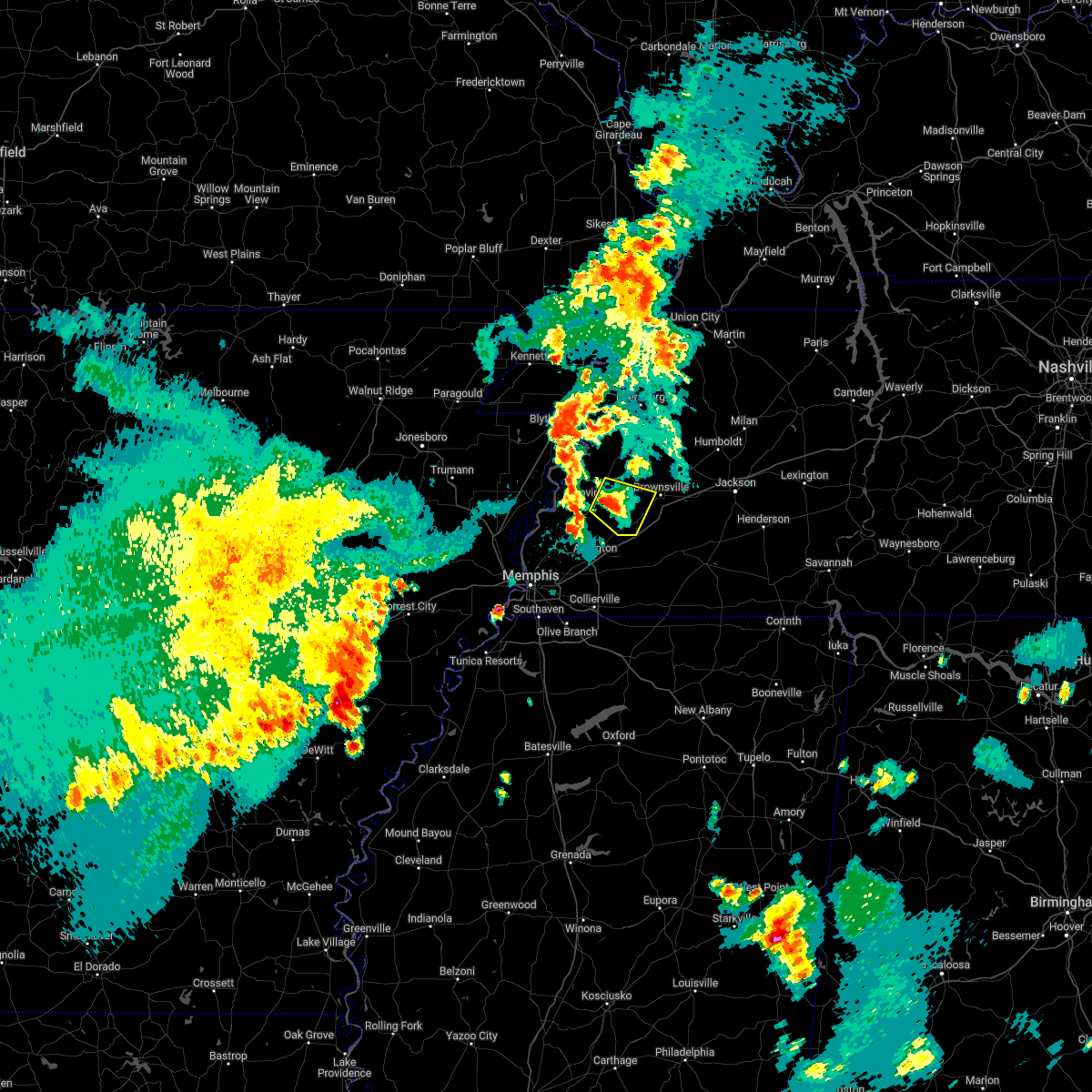 At 511 pm cdt, a severe thunderstorm was located near covington, moving southeast at 20 mph (radar indicated). Hazards include quarter size hail. Damage to vehicles is expected. locations impacted include, brownsville, covington, mason, henning, stanton, cotton lake, orysa, keeling, gift, tabernacle, turnpike, meux corner and rialto. hail threat, radar indicated max hail size, 1. 00 in wind threat, radar indicated max wind gust, <50 mph. At 511 pm cdt, a severe thunderstorm was located near covington, moving southeast at 20 mph (radar indicated). Hazards include quarter size hail. Damage to vehicles is expected. locations impacted include, brownsville, covington, mason, henning, stanton, cotton lake, orysa, keeling, gift, tabernacle, turnpike, meux corner and rialto. hail threat, radar indicated max hail size, 1. 00 in wind threat, radar indicated max wind gust, <50 mph.
|
| 5/15/2022 5:07 PM CDT |
 At 507 pm cdt, a severe thunderstorm was located near covington, moving southeast at 20 mph (radar indicated). Hazards include quarter size hail. Damage to vehicles is expected. locations impacted include, brownsville, covington, mason, henning, stanton, cotton lake, orysa, keeling, gift, tabernacle, turnpike, meux corner, rialto and canaan grove. hail threat, radar indicated max hail size, 1. 00 in wind threat, radar indicated max wind gust, <50 mph. At 507 pm cdt, a severe thunderstorm was located near covington, moving southeast at 20 mph (radar indicated). Hazards include quarter size hail. Damage to vehicles is expected. locations impacted include, brownsville, covington, mason, henning, stanton, cotton lake, orysa, keeling, gift, tabernacle, turnpike, meux corner, rialto and canaan grove. hail threat, radar indicated max hail size, 1. 00 in wind threat, radar indicated max wind gust, <50 mph.
|
| 5/15/2022 4:43 PM CDT |
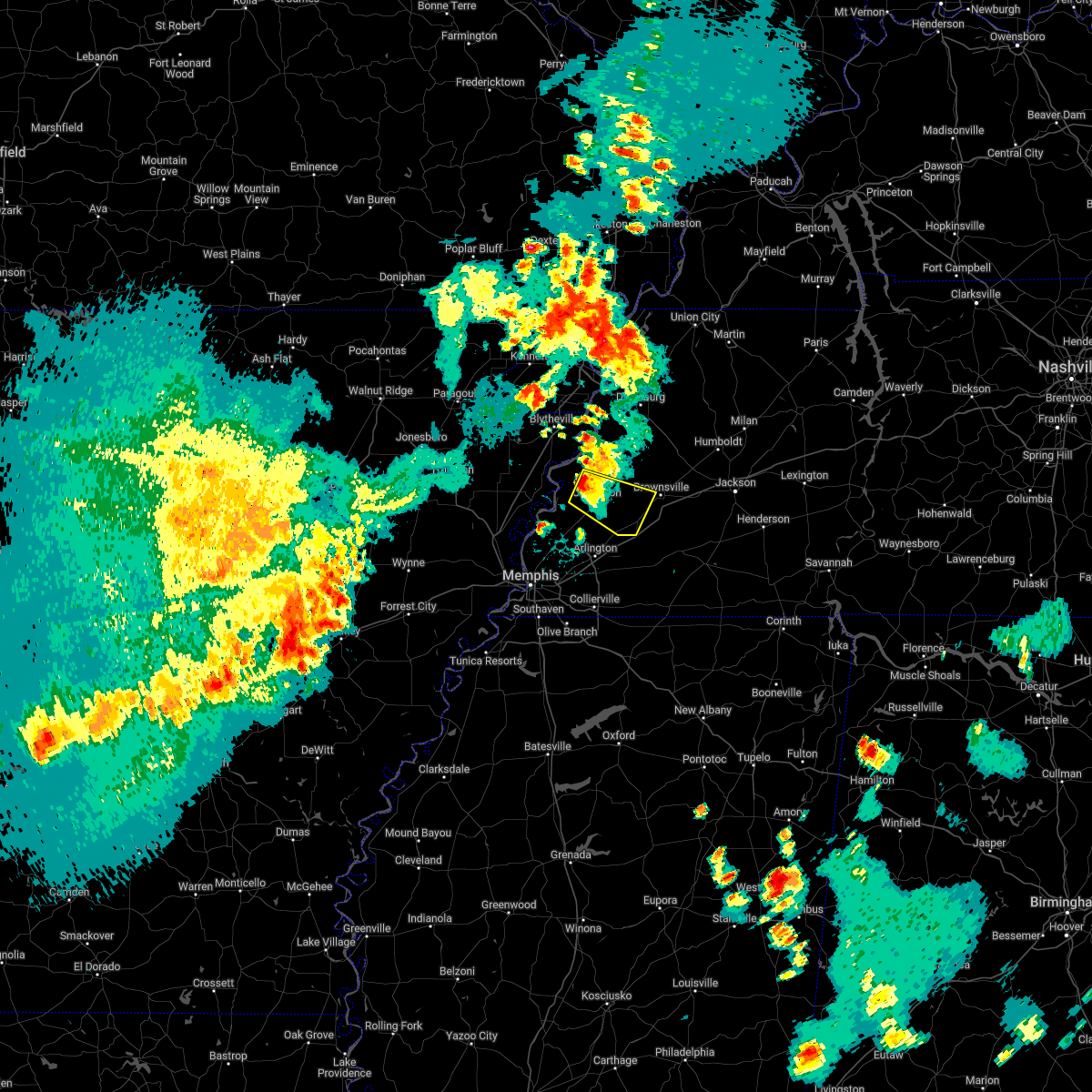 At 443 pm cdt, a severe thunderstorm was located near covington, moving southeast at 20 mph (radar indicated). Hazards include quarter size hail. damage to vehicles is expected At 443 pm cdt, a severe thunderstorm was located near covington, moving southeast at 20 mph (radar indicated). Hazards include quarter size hail. damage to vehicles is expected
|
| 4/15/2022 10:05 PM CDT |
 At 1005 pm cdt, a severe thunderstorm was located near brighton, or near covington, moving east at 40 mph (radar indicated). Hazards include 60 mph wind gusts and quarter size hail. Hail damage to vehicles is expected. Expect wind damage to roofs, siding, and trees. At 1005 pm cdt, a severe thunderstorm was located near brighton, or near covington, moving east at 40 mph (radar indicated). Hazards include 60 mph wind gusts and quarter size hail. Hail damage to vehicles is expected. Expect wind damage to roofs, siding, and trees.
|
| 4/13/2022 5:13 PM CDT |
 At 511 pm cdt, a severe thunderstorm was located near dancyville, or 8 miles southwest of brownsville, moving northeast at 45 mph (radar indicated). Hazards include 60 mph wind gusts. expect damage to roofs, siding, and trees At 511 pm cdt, a severe thunderstorm was located near dancyville, or 8 miles southwest of brownsville, moving northeast at 45 mph (radar indicated). Hazards include 60 mph wind gusts. expect damage to roofs, siding, and trees
|
| 4/13/2022 4:16 PM CDT |
 At 416 pm cdt, a severe thunderstorm was located over nutbush, or 9 miles east of ripley, moving northeast at 65 mph (radar indicated). Hazards include 60 mph wind gusts. Expect damage to roofs, siding, and trees. locations impacted include, brownsville, covington, ripley, munford, brighton, alamo, bells, halls, nutbush, forked deer, hillville, chestnut bluff, belle eagle, holly grove, dixonville, eaton, dancyville, ft pillow, tipton and atoka. hail threat, radar indicated max hail size, <. 75 in wind threat, radar indicated max wind gust, 60 mph. At 416 pm cdt, a severe thunderstorm was located over nutbush, or 9 miles east of ripley, moving northeast at 65 mph (radar indicated). Hazards include 60 mph wind gusts. Expect damage to roofs, siding, and trees. locations impacted include, brownsville, covington, ripley, munford, brighton, alamo, bells, halls, nutbush, forked deer, hillville, chestnut bluff, belle eagle, holly grove, dixonville, eaton, dancyville, ft pillow, tipton and atoka. hail threat, radar indicated max hail size, <. 75 in wind threat, radar indicated max wind gust, 60 mph.
|
| 4/13/2022 4:00 PM CDT |
 At 400 pm cdt, a severe thunderstorm was located over covington, moving northeast at 65 mph (radar indicated). Hazards include 60 mph wind gusts and penny size hail. expect damage to roofs, siding, and trees At 400 pm cdt, a severe thunderstorm was located over covington, moving northeast at 65 mph (radar indicated). Hazards include 60 mph wind gusts and penny size hail. expect damage to roofs, siding, and trees
|
| 3/30/2022 5:40 PM CDT |
 At 539 pm cdt, severe thunderstorms were located along a line extending from near dancyville to lagrange to gravestown, moving east at 55 mph (radar indicated). Hazards include 70 mph wind gusts. Expect considerable tree damage. damage is likely to mobile homes, roofs, and outbuildings. Locations impacted include, brownsville, holly springs, bolivar, ripley, lamar, lakeland, arlington, whiteville, somerville, blue mountain, jumpertown, snow lake shores, hillville, bethlehem, canaan, lagrange, eads, dancyville, slayden and michigan city. At 539 pm cdt, severe thunderstorms were located along a line extending from near dancyville to lagrange to gravestown, moving east at 55 mph (radar indicated). Hazards include 70 mph wind gusts. Expect considerable tree damage. damage is likely to mobile homes, roofs, and outbuildings. Locations impacted include, brownsville, holly springs, bolivar, ripley, lamar, lakeland, arlington, whiteville, somerville, blue mountain, jumpertown, snow lake shores, hillville, bethlehem, canaan, lagrange, eads, dancyville, slayden and michigan city.
|
| 3/30/2022 5:12 PM CDT |
 At 512 pm cdt, severe thunderstorms were located along a line extending from 7 miles south of munford to near byhalia to wall doxey state park, moving east at 55 mph (radar indicated). Hazards include 70 mph wind gusts. Expect considerable tree damage. Damage is likely to mobile homes, roofs, and outbuildings. At 512 pm cdt, severe thunderstorms were located along a line extending from 7 miles south of munford to near byhalia to wall doxey state park, moving east at 55 mph (radar indicated). Hazards include 70 mph wind gusts. Expect considerable tree damage. Damage is likely to mobile homes, roofs, and outbuildings.
|
| 2/17/2022 1:51 PM CST |
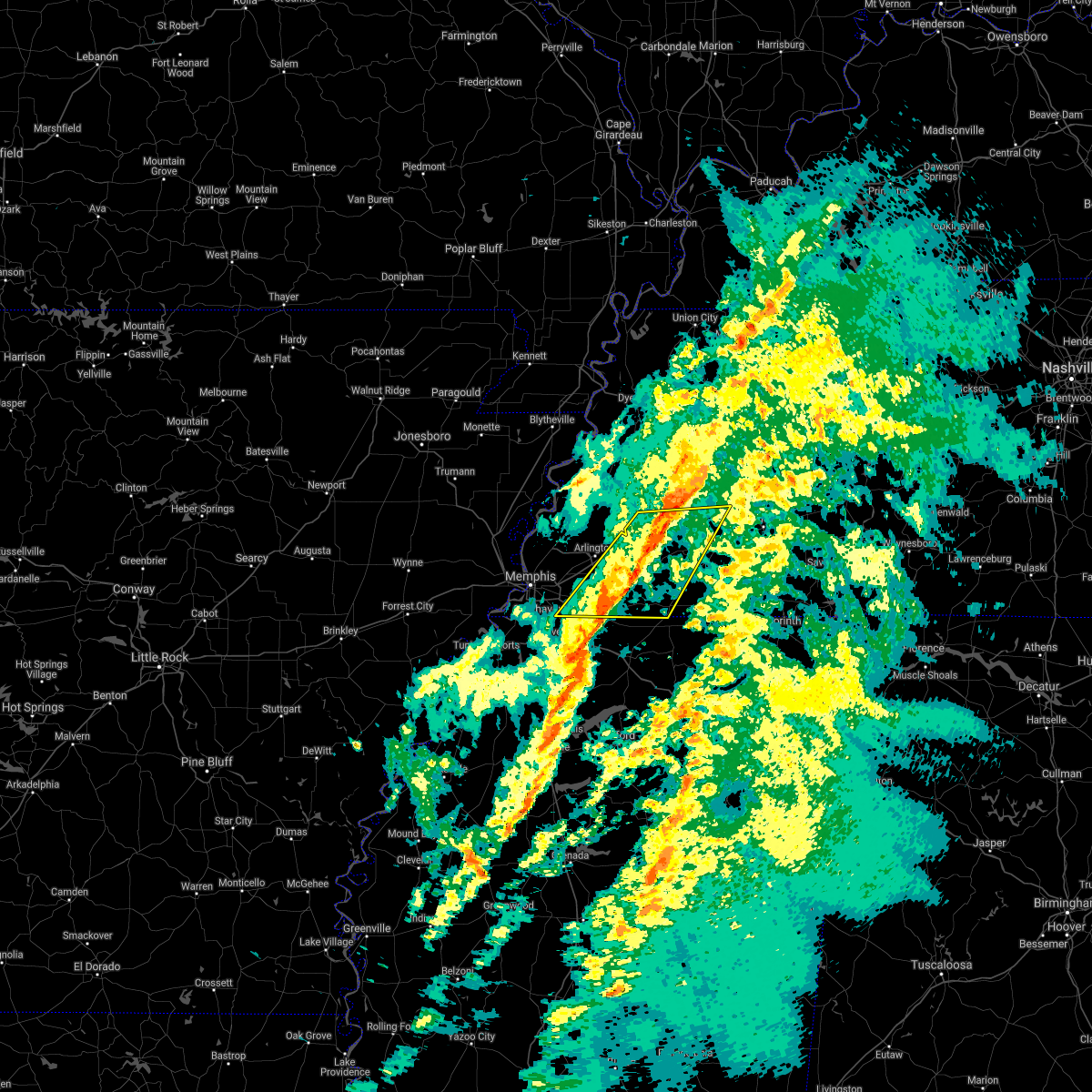 The severe thunderstorm warning for fayette, northwestern hardeman, southern haywood, southwestern madison and southeastern shelby counties will expire at 200 pm cst, the storms which prompted the warning have moved out of the area. therefore, the warning will be allowed to expire. a tornado watch remains in effect until 600 pm cst for northeastern and northwestern mississippi, and western tennessee. The severe thunderstorm warning for fayette, northwestern hardeman, southern haywood, southwestern madison and southeastern shelby counties will expire at 200 pm cst, the storms which prompted the warning have moved out of the area. therefore, the warning will be allowed to expire. a tornado watch remains in effect until 600 pm cst for northeastern and northwestern mississippi, and western tennessee.
|
| 2/17/2022 1:41 PM CST |
 At 141 pm cst, severe thunderstorms were located along a line extending from near dancyville to 6 miles east of collierville, moving east at 40 mph (radar indicated). Hazards include 60 mph wind gusts. Expect damage to roofs, siding, and trees. locations impacted include, collierville, germantown, bolivar, memphis, arlington, whiteville, somerville, hillville, lagrange, eads, dancyville, cloverport, mercer, warren, macon, oakland, piperton, rossville, moscow and stanton. hail threat, radar indicated max hail size, <. 75 in wind threat, radar indicated max wind gust, 60 mph. At 141 pm cst, severe thunderstorms were located along a line extending from near dancyville to 6 miles east of collierville, moving east at 40 mph (radar indicated). Hazards include 60 mph wind gusts. Expect damage to roofs, siding, and trees. locations impacted include, collierville, germantown, bolivar, memphis, arlington, whiteville, somerville, hillville, lagrange, eads, dancyville, cloverport, mercer, warren, macon, oakland, piperton, rossville, moscow and stanton. hail threat, radar indicated max hail size, <. 75 in wind threat, radar indicated max wind gust, 60 mph.
|
| 2/17/2022 1:17 PM CST |
 At 117 pm cst, severe thunderstorms were located along a line extending from 8 miles southeast of covington to southeast memphis, moving east at 55 mph (radar indicated). Hazards include 60 mph wind gusts. expect damage to roofs, siding, and trees At 117 pm cst, severe thunderstorms were located along a line extending from 8 miles southeast of covington to southeast memphis, moving east at 55 mph (radar indicated). Hazards include 60 mph wind gusts. expect damage to roofs, siding, and trees
|
| 12/11/2021 12:30 AM CST |
 At 1230 am cst, a severe thunderstorm was located near arlington, or 15 miles northeast of cordova, moving northeast at 65 mph (radar indicated). Hazards include 60 mph wind gusts and quarter size hail. Hail damage to vehicles is expected. Expect wind damage to roofs, siding, and trees. At 1230 am cst, a severe thunderstorm was located near arlington, or 15 miles northeast of cordova, moving northeast at 65 mph (radar indicated). Hazards include 60 mph wind gusts and quarter size hail. Hail damage to vehicles is expected. Expect wind damage to roofs, siding, and trees.
|
| 7/11/2021 12:57 AM CDT |
 At 1257 am cdt, severe thunderstorms were located along a line extending from near belle eagle to 6 miles northeast of arlington to near sunset, moving southeast at 40 mph (radar indicated). Hazards include 60 mph wind gusts. Expect damage to roofs, siding, and trees. Locations impacted include, bartlett, southaven, collierville, germantown, west memphis, marion, brownsville, millington, covington, ripley, t o fuller state park, meeman shelby forest state park, cordova, memphis, lakeland, arlington, munford, somerville, brighton and alamo. At 1257 am cdt, severe thunderstorms were located along a line extending from near belle eagle to 6 miles northeast of arlington to near sunset, moving southeast at 40 mph (radar indicated). Hazards include 60 mph wind gusts. Expect damage to roofs, siding, and trees. Locations impacted include, bartlett, southaven, collierville, germantown, west memphis, marion, brownsville, millington, covington, ripley, t o fuller state park, meeman shelby forest state park, cordova, memphis, lakeland, arlington, munford, somerville, brighton and alamo.
|
| 7/11/2021 12:24 AM CDT |
 At 1224 am cdt, severe thunderstorms were located along a line extending from 9 miles southwest of unionville to near fulton to near gilmore, moving southeast at 40 mph (radar indicated). Hazards include 60 mph wind gusts. expect damage to roofs, siding, and trees At 1224 am cdt, severe thunderstorms were located along a line extending from 9 miles southwest of unionville to near fulton to near gilmore, moving southeast at 40 mph (radar indicated). Hazards include 60 mph wind gusts. expect damage to roofs, siding, and trees
|
| 4/9/2021 6:10 PM CDT |
 At 609 pm cdt, a severe thunderstorm was located 8 miles east of somerville, or 12 miles west of bolivar, moving northeast at 30 mph (radar indicated). Hazards include 60 mph wind gusts and quarter size hail. Hail damage to vehicles is expected. Expect wind damage to roofs, siding, and trees. At 609 pm cdt, a severe thunderstorm was located 8 miles east of somerville, or 12 miles west of bolivar, moving northeast at 30 mph (radar indicated). Hazards include 60 mph wind gusts and quarter size hail. Hail damage to vehicles is expected. Expect wind damage to roofs, siding, and trees.
|
| 4/9/2021 5:42 PM CDT |
 At 541 pm cdt, a severe thunderstorm was located 8 miles south of nutbush, or 9 miles west of brownsville, moving northeast at 30 mph (radar indicated). Hazards include ping pong ball size hail and 60 mph wind gusts. People and animals outdoors will be injured. expect hail damage to roofs, siding, windows, and vehicles. expect wind damage to roofs, siding, and trees. Locations impacted include, brownsville, alamo, bells, belle eagle, holly grove, fruitvale, quincy, allens, huntersville, christmasville, roberts, rudolph, brims corner, tibbs, sunnyhill, jones, shepp, johnsons grove, oakview and turnpike. At 541 pm cdt, a severe thunderstorm was located 8 miles south of nutbush, or 9 miles west of brownsville, moving northeast at 30 mph (radar indicated). Hazards include ping pong ball size hail and 60 mph wind gusts. People and animals outdoors will be injured. expect hail damage to roofs, siding, windows, and vehicles. expect wind damage to roofs, siding, and trees. Locations impacted include, brownsville, alamo, bells, belle eagle, holly grove, fruitvale, quincy, allens, huntersville, christmasville, roberts, rudolph, brims corner, tibbs, sunnyhill, jones, shepp, johnsons grove, oakview and turnpike.
|
| 4/9/2021 5:39 PM CDT | Quarter sized hail reported 0.1 miles N of Stanton, TN |
| 4/9/2021 5:34 PM CDT |
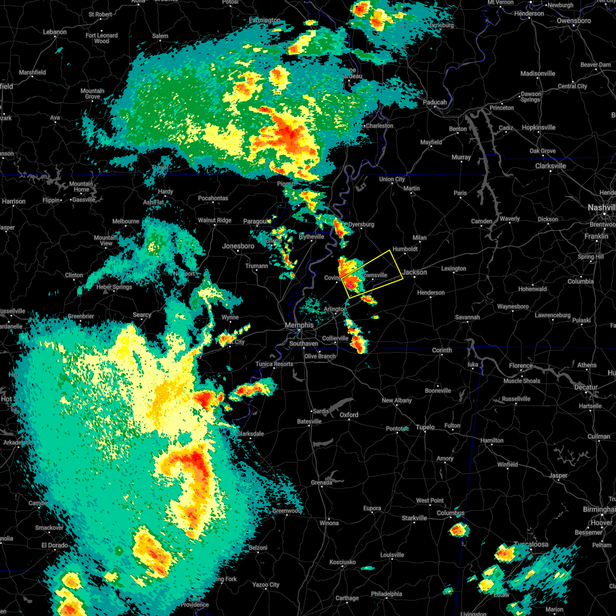 At 534 pm cdt, a severe thunderstorm was located 9 miles east of covington, moving northeast at 30 mph (radar indicated). Hazards include ping pong ball size hail and 60 mph wind gusts. People and animals outdoors will be injured. expect hail damage to roofs, siding, windows, and vehicles. Expect wind damage to roofs, siding, and trees. At 534 pm cdt, a severe thunderstorm was located 9 miles east of covington, moving northeast at 30 mph (radar indicated). Hazards include ping pong ball size hail and 60 mph wind gusts. People and animals outdoors will be injured. expect hail damage to roofs, siding, windows, and vehicles. Expect wind damage to roofs, siding, and trees.
|
| 3/27/2021 10:58 PM CDT |
 At 1058 pm cdt, severe thunderstorms were located along a line extending from 7 miles east of covington to holly springs, moving east at 50 mph (radar indicated). Hazards include 60 mph wind gusts. Expect damage to roofs, siding, and trees. Locations impacted include, brownsville, lamar, whiteville, somerville, byhalia, mt pleasant, hillville, michigan city, canaan, lagrange, belle eagle, dancyville, slayden, warren, macon, oakland, piperton, gallaway, rossville and moscow. At 1058 pm cdt, severe thunderstorms were located along a line extending from 7 miles east of covington to holly springs, moving east at 50 mph (radar indicated). Hazards include 60 mph wind gusts. Expect damage to roofs, siding, and trees. Locations impacted include, brownsville, lamar, whiteville, somerville, byhalia, mt pleasant, hillville, michigan city, canaan, lagrange, belle eagle, dancyville, slayden, warren, macon, oakland, piperton, gallaway, rossville and moscow.
|
| 3/27/2021 10:39 PM CDT |
 At 1039 pm cdt, severe thunderstorms were located along a line extending from near brighton to near independence, moving east at 50 mph (radar indicated). Hazards include 60 mph wind gusts. expect damage to roofs, siding, and trees At 1039 pm cdt, severe thunderstorms were located along a line extending from near brighton to near independence, moving east at 50 mph (radar indicated). Hazards include 60 mph wind gusts. expect damage to roofs, siding, and trees
|
| 3/27/2021 9:50 PM CDT |
 At 950 pm cdt, severe thunderstorms were located along a line extending from near brownsville to near collierville, moving northeast at 40 mph (radar indicated). Hazards include 60 mph wind gusts. Expect damage to roofs, siding, and trees. Locations impacted include, bolivar, whiteville, somerville, hillville, dancyville, cloverport, mercer, warren, macon, oakland, piperton, stanton, williston, asbury, yum yum, hickory point, uptonville, taylor chapel, shepp and kirk. At 950 pm cdt, severe thunderstorms were located along a line extending from near brownsville to near collierville, moving northeast at 40 mph (radar indicated). Hazards include 60 mph wind gusts. Expect damage to roofs, siding, and trees. Locations impacted include, bolivar, whiteville, somerville, hillville, dancyville, cloverport, mercer, warren, macon, oakland, piperton, stanton, williston, asbury, yum yum, hickory point, uptonville, taylor chapel, shepp and kirk.
|
| 3/27/2021 9:32 PM CDT |
 At 931 pm cdt, severe thunderstorms were located along a line extending from 7 miles northwest of dancyville to near olive branch, moving northeast at 40 mph (radar indicated). Hazards include 60 mph wind gusts. expect damage to roofs, siding, and trees At 931 pm cdt, severe thunderstorms were located along a line extending from 7 miles northwest of dancyville to near olive branch, moving northeast at 40 mph (radar indicated). Hazards include 60 mph wind gusts. expect damage to roofs, siding, and trees
|
| 3/17/2021 1:36 PM CDT |
 At 135 pm cdt, severe thunderstorms were located along a line extending from near brownsville to near whiteville to near somerville, moving east at 55 mph (radar indicated). Hazards include 60 mph wind gusts and penny size hail. Expect damage to roofs, siding, and trees. Locations impacted include, jackson, brownsville, bolivar, chickasaw state forest, chickasaw state park, whiteville, somerville, silerton, hillville, bemis, holly grove, dancyville, cloverport, mercer, warren, carroll, oakland, toone, medon and neely. At 135 pm cdt, severe thunderstorms were located along a line extending from near brownsville to near whiteville to near somerville, moving east at 55 mph (radar indicated). Hazards include 60 mph wind gusts and penny size hail. Expect damage to roofs, siding, and trees. Locations impacted include, jackson, brownsville, bolivar, chickasaw state forest, chickasaw state park, whiteville, somerville, silerton, hillville, bemis, holly grove, dancyville, cloverport, mercer, warren, carroll, oakland, toone, medon and neely.
|
| 3/17/2021 1:18 PM CDT |
 At 118 pm cdt, severe thunderstorms were located along a line extending from 9 miles east of covington to 6 miles northwest of somerville to near eads, moving east at 50 mph (radar indicated). Hazards include 60 mph wind gusts. expect damage to roofs, siding, and trees At 118 pm cdt, severe thunderstorms were located along a line extending from 9 miles east of covington to 6 miles northwest of somerville to near eads, moving east at 50 mph (radar indicated). Hazards include 60 mph wind gusts. expect damage to roofs, siding, and trees
|
| 2/28/2021 6:51 PM CST |
 At 650 pm cst, a severe thunderstorm was located near somerville, or 20 miles northeast of cordova, moving east at 45 mph (radar indicated). Hazards include 60 mph wind gusts and quarter size hail. Hail damage to vehicles is expected. expect wind damage to roofs, siding, and trees. Locations impacted include, somerville, warren, oakland, mason, gallaway, stanton, braden, asbury, yum yum, belmont, canaan grove, longtown, moorman, taylor chapel, keeling, lambert, gainesville, hickory withe, powers and griffen. At 650 pm cst, a severe thunderstorm was located near somerville, or 20 miles northeast of cordova, moving east at 45 mph (radar indicated). Hazards include 60 mph wind gusts and quarter size hail. Hail damage to vehicles is expected. expect wind damage to roofs, siding, and trees. Locations impacted include, somerville, warren, oakland, mason, gallaway, stanton, braden, asbury, yum yum, belmont, canaan grove, longtown, moorman, taylor chapel, keeling, lambert, gainesville, hickory withe, powers and griffen.
|
| 2/28/2021 6:37 PM CST |
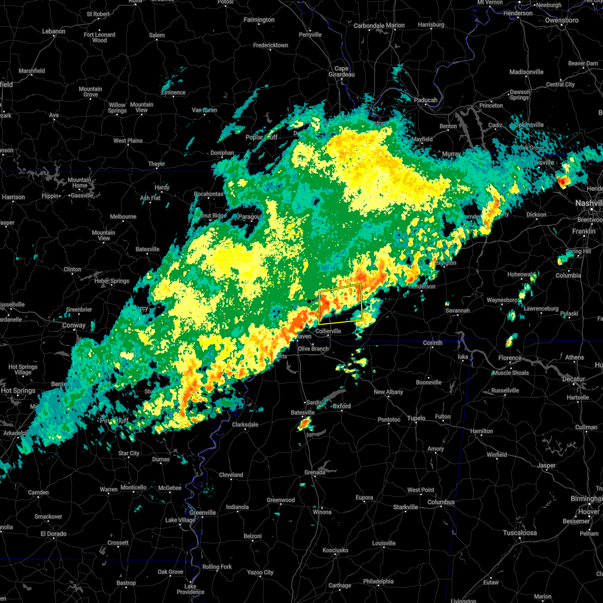 At 636 pm cst, a severe thunderstorm was located over arlington, or 10 miles east of bartlett, moving east at 45 mph (radar indicated). Hazards include 60 mph wind gusts and quarter size hail. Hail damage to vehicles is expected. Expect wind damage to roofs, siding, and trees. At 636 pm cst, a severe thunderstorm was located over arlington, or 10 miles east of bartlett, moving east at 45 mph (radar indicated). Hazards include 60 mph wind gusts and quarter size hail. Hail damage to vehicles is expected. Expect wind damage to roofs, siding, and trees.
|
| 8/28/2020 5:55 AM CDT |
 At 554 am cdt, doppler radar indicated a severe thunderstorm producing a tornado was located 7 miles southwest of brownsville, moving northeast at 40 mph (radar indicated rotation). Hazards include tornado. Flying debris will be dangerous to those caught without shelter. mobile homes will be damaged or destroyed. damage to roofs, windows, and vehicles will occur. Tree damage is likely. At 554 am cdt, doppler radar indicated a severe thunderstorm producing a tornado was located 7 miles southwest of brownsville, moving northeast at 40 mph (radar indicated rotation). Hazards include tornado. Flying debris will be dangerous to those caught without shelter. mobile homes will be damaged or destroyed. damage to roofs, windows, and vehicles will occur. Tree damage is likely.
|
| 5/4/2020 4:16 PM CDT |
 At 416 pm cdt, a severe thunderstorm was located over brighton, or 7 miles southwest of covington, moving east at 50 mph (radar indicated). Hazards include 60 mph wind gusts and quarter size hail. Hail damage to vehicles is expected. Expect wind damage to roofs, siding, and trees. At 416 pm cdt, a severe thunderstorm was located over brighton, or 7 miles southwest of covington, moving east at 50 mph (radar indicated). Hazards include 60 mph wind gusts and quarter size hail. Hail damage to vehicles is expected. Expect wind damage to roofs, siding, and trees.
|
| 5/3/2020 3:56 PM CDT |
 The severe thunderstorm warning for southeastern crockett, henderson, southeastern gibson, northern fayette, northern hardeman, southern benton, carroll, southern haywood, madison and chester counties will expire at 400 pm cdt, the storms which prompted the warning have moved out of the area. therefore, the warning will be allowed to expire. however gusty winds and heavy rain are still possible with severe thunderstorms from northeastern hardeman to decatur county. a severe thunderstorm watch remains in effect until 600 pm cdt for western tennessee. The severe thunderstorm warning for southeastern crockett, henderson, southeastern gibson, northern fayette, northern hardeman, southern benton, carroll, southern haywood, madison and chester counties will expire at 400 pm cdt, the storms which prompted the warning have moved out of the area. therefore, the warning will be allowed to expire. however gusty winds and heavy rain are still possible with severe thunderstorms from northeastern hardeman to decatur county. a severe thunderstorm watch remains in effect until 600 pm cdt for western tennessee.
|
| 5/3/2020 3:23 PM CDT |
 At 323 pm cdt, severe thunderstorms were located along a line extending from near huntingdon to 7 miles east of jackson to 6 miles north of somerville, moving east at 55 mph (radar indicated). Hazards include 70 mph wind gusts and nickel size hail. Expect considerable tree damage. damage is likely to mobile homes, roofs, and outbuildings. Locations impacted include, jackson, brownsville, humboldt, milan, lexington, henderson, bolivar, huntingdon, camden, natchez trace state park, chickasaw state park, natchez trace state forest, chickasaw state forest, fairview, whiteville, three way, bruceton, atwood, silerton and masseyville. At 323 pm cdt, severe thunderstorms were located along a line extending from near huntingdon to 7 miles east of jackson to 6 miles north of somerville, moving east at 55 mph (radar indicated). Hazards include 70 mph wind gusts and nickel size hail. Expect considerable tree damage. damage is likely to mobile homes, roofs, and outbuildings. Locations impacted include, jackson, brownsville, humboldt, milan, lexington, henderson, bolivar, huntingdon, camden, natchez trace state park, chickasaw state park, natchez trace state forest, chickasaw state forest, fairview, whiteville, three way, bruceton, atwood, silerton and masseyville.
|
| 5/3/2020 3:18 PM CDT |
 At 317 pm cdt, severe thunderstorms were located along a line extending from near atwood to 6 miles southeast of dixonville, moving east at 45 mph (radar indicated). Hazards include 70 mph wind gusts and nickel size hail. Expect considerable tree damage. damage is likely to mobile homes, roofs, and outbuildings. Locations impacted include, brownsville, millington, covington, humboldt, milan, lakeland, arlington, munford, brighton, alamo, bells, belle eagle, holly grove, tipton, atoka, medina, mason, gallaway, gadsden and stanton. At 317 pm cdt, severe thunderstorms were located along a line extending from near atwood to 6 miles southeast of dixonville, moving east at 45 mph (radar indicated). Hazards include 70 mph wind gusts and nickel size hail. Expect considerable tree damage. damage is likely to mobile homes, roofs, and outbuildings. Locations impacted include, brownsville, millington, covington, humboldt, milan, lakeland, arlington, munford, brighton, alamo, bells, belle eagle, holly grove, tipton, atoka, medina, mason, gallaway, gadsden and stanton.
|
| 5/3/2020 3:10 PM CDT |
 At 310 pm cdt, severe thunderstorms were located along a line extending from near huntingdon to near adair to 6 miles northeast of arlington, moving east at 55 mph (radar indicated). Hazards include 70 mph wind gusts and quarter size hail. Hail damage to vehicles is expected. expect considerable tree damage. Wind damage is also likely to mobile homes, roofs, and outbuildings. At 310 pm cdt, severe thunderstorms were located along a line extending from near huntingdon to near adair to 6 miles northeast of arlington, moving east at 55 mph (radar indicated). Hazards include 70 mph wind gusts and quarter size hail. Hail damage to vehicles is expected. expect considerable tree damage. Wind damage is also likely to mobile homes, roofs, and outbuildings.
|
| 5/3/2020 3:01 PM CDT |
 At 301 pm cdt, severe thunderstorms were located along a line extending from near trenton to munford, moving east at 60 mph (radar indicated). Hazards include 70 mph wind gusts and nickel size hail. Expect considerable tree damage. damage is likely to mobile homes, roofs, and outbuildings. Locations impacted include, brownsville, millington, covington, humboldt, ripley, milan, trenton, lakeland, arlington, munford, brighton, alamo, bells, chestnut bluff, dixonville, nutbush, forked deer, belle eagle, holly grove and tipton. At 301 pm cdt, severe thunderstorms were located along a line extending from near trenton to munford, moving east at 60 mph (radar indicated). Hazards include 70 mph wind gusts and nickel size hail. Expect considerable tree damage. damage is likely to mobile homes, roofs, and outbuildings. Locations impacted include, brownsville, millington, covington, humboldt, ripley, milan, trenton, lakeland, arlington, munford, brighton, alamo, bells, chestnut bluff, dixonville, nutbush, forked deer, belle eagle, holly grove and tipton.
|
| 5/3/2020 2:48 PM CDT |
 At 247 pm cdt, severe thunderstorms were located along a line extending from 9 miles southwest of dyer to near wilson, moving east at 45 mph (radar indicated). Hazards include 70 mph wind gusts and quarter size hail. Hail damage to vehicles is expected. expect considerable tree damage. Wind damage is also likely to mobile homes, roofs, and outbuildings. At 247 pm cdt, severe thunderstorms were located along a line extending from 9 miles southwest of dyer to near wilson, moving east at 45 mph (radar indicated). Hazards include 70 mph wind gusts and quarter size hail. Hail damage to vehicles is expected. expect considerable tree damage. Wind damage is also likely to mobile homes, roofs, and outbuildings.
|
| 4/12/2020 11:23 PM CDT |
 The severe thunderstorm warning for southeastern tipton, fayette, hardeman, southern haywood and southwestern madison counties will expire at 1130 pm cdt, the storms which prompted the warning have moved out of the area. therefore, the warning will be allowed to expire. a severe thunderstorm watch remains in effect until 100 am cdt for northeastern mississippi, and western tennessee. The severe thunderstorm warning for southeastern tipton, fayette, hardeman, southern haywood and southwestern madison counties will expire at 1130 pm cdt, the storms which prompted the warning have moved out of the area. therefore, the warning will be allowed to expire. a severe thunderstorm watch remains in effect until 100 am cdt for northeastern mississippi, and western tennessee.
|
| 4/12/2020 11:02 PM CDT |
 At 1101 pm cdt, severe thunderstorms were located along a line extending from 8 miles northeast of arlington to 9 miles east of somerville to 8 miles northeast of canaan, moving northeast at 70 mph (radar indicated). Hazards include 60 mph wind gusts. Expect damage to roofs, siding, and trees. Locations impacted include, brownsville, bolivar, whiteville, somerville, hillville, pocahontas, lagrange, dancyville, cloverport, mercer, warren, oakland, mason, middleton, gallaway, stanton, williston, toone, grand junction and hornsby. At 1101 pm cdt, severe thunderstorms were located along a line extending from 8 miles northeast of arlington to 9 miles east of somerville to 8 miles northeast of canaan, moving northeast at 70 mph (radar indicated). Hazards include 60 mph wind gusts. Expect damage to roofs, siding, and trees. Locations impacted include, brownsville, bolivar, whiteville, somerville, hillville, pocahontas, lagrange, dancyville, cloverport, mercer, warren, oakland, mason, middleton, gallaway, stanton, williston, toone, grand junction and hornsby.
|
| 4/12/2020 10:52 PM CDT |
 At 1051 pm cdt, severe thunderstorms were located along a line extending from near eads to 8 miles north of slayden to near snow lake shores, moving northeast at 65 mph (radar indicated). Hazards include 60 mph wind gusts. Expect damage to roofs, siding, and trees. Locations impacted include, brownsville, bolivar, whiteville, somerville, hillville, pocahontas, lagrange, dancyville, cloverport, mercer, warren, macon, oakland, mason, piperton, middleton, gallaway, rossville, moscow and stanton. At 1051 pm cdt, severe thunderstorms were located along a line extending from near eads to 8 miles north of slayden to near snow lake shores, moving northeast at 65 mph (radar indicated). Hazards include 60 mph wind gusts. Expect damage to roofs, siding, and trees. Locations impacted include, brownsville, bolivar, whiteville, somerville, hillville, pocahontas, lagrange, dancyville, cloverport, mercer, warren, macon, oakland, mason, piperton, middleton, gallaway, rossville, moscow and stanton.
|
| 4/12/2020 10:39 PM CDT |
 At 1039 pm cdt, severe thunderstorms were located along a line extending from near cordova to mt pleasant to near holly springs, moving northeast at 65 mph (radar indicated). Hazards include 60 mph wind gusts. expect damage to roofs, siding, and trees At 1039 pm cdt, severe thunderstorms were located along a line extending from near cordova to mt pleasant to near holly springs, moving northeast at 65 mph (radar indicated). Hazards include 60 mph wind gusts. expect damage to roofs, siding, and trees
|
| 3/28/2020 8:07 PM CDT |
 The severe thunderstorm warning for tipton, crockett, southeastern dyer, southwestern gibson and haywood counties will expire at 815 pm cdt, the storms which prompted the warning have weakened below severe limits, and no longer pose an immediate threat to life or property. therefore, the warning will be allowed to expire. however heavy rain is still possible with these thunderstorms. a tornado watch remains in effect until 200 am cdt for western tennessee. remember, a severe thunderstorm warning still remains in effect for lauderdale, tipton and dyer counties. The severe thunderstorm warning for tipton, crockett, southeastern dyer, southwestern gibson and haywood counties will expire at 815 pm cdt, the storms which prompted the warning have weakened below severe limits, and no longer pose an immediate threat to life or property. therefore, the warning will be allowed to expire. however heavy rain is still possible with these thunderstorms. a tornado watch remains in effect until 200 am cdt for western tennessee. remember, a severe thunderstorm warning still remains in effect for lauderdale, tipton and dyer counties.
|
| 3/28/2020 8:06 PM CDT |
 At 806 pm cdt, severe thunderstorms were located along a line extending from dyersburg to near dixonville, moving northeast at 50 mph (radar indicated). Hazards include 60 mph wind gusts and quarter size hail. Hail damage to vehicles is expected. Expect wind damage to roofs, siding, and trees. At 806 pm cdt, severe thunderstorms were located along a line extending from dyersburg to near dixonville, moving northeast at 50 mph (radar indicated). Hazards include 60 mph wind gusts and quarter size hail. Hail damage to vehicles is expected. Expect wind damage to roofs, siding, and trees.
|
| 3/28/2020 8:02 PM CDT |
 At 801 pm cdt, severe thunderstorms were located along a line extending from 10 miles southwest of dyer to 9 miles west of dancyville, moving east at 65 mph (radar indicated). Hazards include 60 mph wind gusts and quarter size hail. Hail damage to vehicles is expected. expect wind damage to roofs, siding, and trees. Locations impacted include, dyersburg, brownsville, covington, trenton, munford, brighton, alamo, bells, nutbush, forked deer, chestnut bluff, belle eagle, holly grove, unionville, dancyville, tipton, atoka, mason, maury city and friendship. At 801 pm cdt, severe thunderstorms were located along a line extending from 10 miles southwest of dyer to 9 miles west of dancyville, moving east at 65 mph (radar indicated). Hazards include 60 mph wind gusts and quarter size hail. Hail damage to vehicles is expected. expect wind damage to roofs, siding, and trees. Locations impacted include, dyersburg, brownsville, covington, trenton, munford, brighton, alamo, bells, nutbush, forked deer, chestnut bluff, belle eagle, holly grove, unionville, dancyville, tipton, atoka, mason, maury city and friendship.
|
| 3/28/2020 7:40 PM CDT |
 At 740 pm cdt, severe thunderstorms were located along a line extending from near unionville to near millington, moving east at 65 mph (radar indicated). Hazards include 60 mph wind gusts and quarter size hail. Hail damage to vehicles is expected. Expect wind damage to roofs, siding, and trees. At 740 pm cdt, severe thunderstorms were located along a line extending from near unionville to near millington, moving east at 65 mph (radar indicated). Hazards include 60 mph wind gusts and quarter size hail. Hail damage to vehicles is expected. Expect wind damage to roofs, siding, and trees.
|
| 1/11/2020 3:23 AM CST |
 At 323 am cst, a severe thunderstorm was located over wilson, moving northeast at 45 mph (radar indicated). Hazards include 60 mph wind gusts. expect damage to roofs, siding, and trees At 323 am cst, a severe thunderstorm was located over wilson, moving northeast at 45 mph (radar indicated). Hazards include 60 mph wind gusts. expect damage to roofs, siding, and trees
|
| 10/21/2019 7:01 AM CDT |
 At 701 am cdt, severe thunderstorms were located along a line extending from 9 miles northeast of arlington to near lewisburg, moving east at 45 mph (radar indicated). Hazards include 60 mph wind gusts. expect damage to roofs, siding, and trees At 701 am cdt, severe thunderstorms were located along a line extending from 9 miles northeast of arlington to near lewisburg, moving east at 45 mph (radar indicated). Hazards include 60 mph wind gusts. expect damage to roofs, siding, and trees
|
| 10/21/2019 7:01 AM CDT |
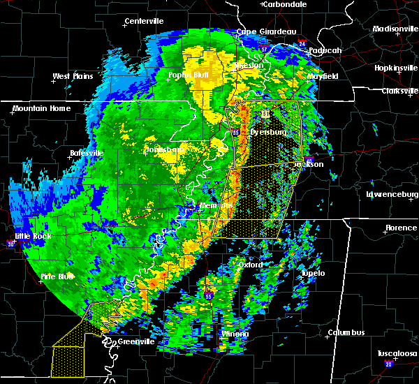 At 701 am cdt, severe thunderstorms were located along a line extending from 9 miles northeast of arlington to near lewisburg, moving east at 45 mph (radar indicated). Hazards include 60 mph wind gusts. expect damage to roofs, siding, and trees At 701 am cdt, severe thunderstorms were located along a line extending from 9 miles northeast of arlington to near lewisburg, moving east at 45 mph (radar indicated). Hazards include 60 mph wind gusts. expect damage to roofs, siding, and trees
|
| 6/20/2019 12:30 AM CDT |
 At 1228 am cdt, severe thunderstorms were located along a line extending from near ripley to near holly springs, moving east at 50 mph (airport weather observation). Hazards include 70 mph wind gusts. Expect considerable tree damage. damage is likely to mobile homes, roofs, and outbuildings. Locations impacted include, brownsville, covington, ripley, somerville, nutbush, forked deer, hillville, belle eagle, holly grove, dancyville, warren, macon, oakland, mason, henning, gallaway, stanton, williston, braden and yum yum. At 1228 am cdt, severe thunderstorms were located along a line extending from near ripley to near holly springs, moving east at 50 mph (airport weather observation). Hazards include 70 mph wind gusts. Expect considerable tree damage. damage is likely to mobile homes, roofs, and outbuildings. Locations impacted include, brownsville, covington, ripley, somerville, nutbush, forked deer, hillville, belle eagle, holly grove, dancyville, warren, macon, oakland, mason, henning, gallaway, stanton, williston, braden and yum yum.
|
| 6/20/2019 12:06 AM CDT |
 At 1205 am cdt, severe thunderstorms were located along a line extending from near ashport to near lewisburg, moving east at 50 mph (airport weather observation). Hazards include 70 mph wind gusts. Expect considerable tree damage. damage is likely to mobile homes, roofs, and outbuildings. Locations impacted include, bartlett, southaven, collierville, germantown, olive branch, horn lake, brownsville, millington, covington, ripley, osceola, luxora, wilson, keiser, cordova, meeman shelby forest state park, fort pillow state park, memphis, lakeland and arlington. At 1205 am cdt, severe thunderstorms were located along a line extending from near ashport to near lewisburg, moving east at 50 mph (airport weather observation). Hazards include 70 mph wind gusts. Expect considerable tree damage. damage is likely to mobile homes, roofs, and outbuildings. Locations impacted include, bartlett, southaven, collierville, germantown, olive branch, horn lake, brownsville, millington, covington, ripley, osceola, luxora, wilson, keiser, cordova, meeman shelby forest state park, fort pillow state park, memphis, lakeland and arlington.
|
| 6/19/2019 11:58 PM CDT |
 At 1158 pm cdt, severe thunderstorms were located along a line extending from near luxora to near hernando, moving east at 50 mph (radar indicated). Hazards include 60 mph wind gusts. expect damage to roofs, siding, and trees At 1158 pm cdt, severe thunderstorms were located along a line extending from near luxora to near hernando, moving east at 50 mph (radar indicated). Hazards include 60 mph wind gusts. expect damage to roofs, siding, and trees
|
| 7/5/2018 10:24 PM CDT |
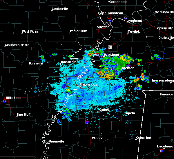 The severe thunderstorm warning for southern haywood and southwestern madison counties will expire at 1030 pm cdt, the storm which prompted the warning has weakened below severe limits, and no longer poses an immediate threat to life or property. therefore, the warning will be allowed to expire. however gusty winds are still possible with this thunderstorm. The severe thunderstorm warning for southern haywood and southwestern madison counties will expire at 1030 pm cdt, the storm which prompted the warning has weakened below severe limits, and no longer poses an immediate threat to life or property. therefore, the warning will be allowed to expire. however gusty winds are still possible with this thunderstorm.
|
| 7/5/2018 9:45 PM CDT |
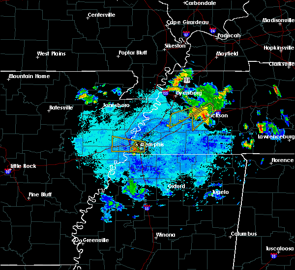 At 945 pm cdt, a severe thunderstorm was located near holly grove, or 11 miles east of brownsville, moving southwest at 30 mph (radar indicated). Hazards include 60 mph wind gusts and quarter size hail. Hail damage to vehicles is expected. Expect wind damage to roofs, siding, and trees. At 945 pm cdt, a severe thunderstorm was located near holly grove, or 11 miles east of brownsville, moving southwest at 30 mph (radar indicated). Hazards include 60 mph wind gusts and quarter size hail. Hail damage to vehicles is expected. Expect wind damage to roofs, siding, and trees.
|
| 6/28/2018 10:13 PM CDT |
 At 1012 pm cdt, a severe thunderstorm was located 10 miles south of heloise, or 12 miles northwest of ripley, moving southwest at 45 mph (radar indicated). Hazards include 60 mph wind gusts and quarter size hail. Hail damage to vehicles is expected. Expect wind damage to roofs, siding, and trees. At 1012 pm cdt, a severe thunderstorm was located 10 miles south of heloise, or 12 miles northwest of ripley, moving southwest at 45 mph (radar indicated). Hazards include 60 mph wind gusts and quarter size hail. Hail damage to vehicles is expected. Expect wind damage to roofs, siding, and trees.
|
| 6/1/2018 5:47 AM CDT |
 At 547 am cdt, a severe thunderstorm was located 7 miles northwest of ripley, moving east at 45 mph (radar indicated). Hazards include 60 mph wind gusts. expect damage to roofs, siding, and trees At 547 am cdt, a severe thunderstorm was located 7 miles northwest of ripley, moving east at 45 mph (radar indicated). Hazards include 60 mph wind gusts. expect damage to roofs, siding, and trees
|
| 6/1/2018 2:08 AM CDT |
 At 207 am cdt, a severe thunderstorm was located near holly grove, or 7 miles east of brownsville, moving southeast at 60 mph (radar indicated). Hazards include 60 mph wind gusts. expect damage to roofs, siding, and trees At 207 am cdt, a severe thunderstorm was located near holly grove, or 7 miles east of brownsville, moving southeast at 60 mph (radar indicated). Hazards include 60 mph wind gusts. expect damage to roofs, siding, and trees
|
| 6/1/2018 1:50 AM CDT |
 At 150 am cdt, a severe thunderstorm was located near forked deer, or 11 miles north of brownsville, moving east at 50 mph (radar indicated). Hazards include 60 mph wind gusts and quarter size hail. Hail damage to vehicles is expected. expect wind damage to roofs, siding, and trees. Locations impacted include, jackson, dyersburg, brownsville, covington, humboldt, ripley, milan, trenton, fairview, munford, newbern, brighton, alamo, bells, dyer, halls, three way, rutherford, bradford and hillville. At 150 am cdt, a severe thunderstorm was located near forked deer, or 11 miles north of brownsville, moving east at 50 mph (radar indicated). Hazards include 60 mph wind gusts and quarter size hail. Hail damage to vehicles is expected. expect wind damage to roofs, siding, and trees. Locations impacted include, jackson, dyersburg, brownsville, covington, humboldt, ripley, milan, trenton, fairview, munford, newbern, brighton, alamo, bells, dyer, halls, three way, rutherford, bradford and hillville.
|
| 6/1/2018 1:23 AM CDT |
 At 123 am cdt, a severe thunderstorm was located near trenton, moving southeast at 40 mph (radar indicated). Hazards include 60 mph wind gusts and quarter size hail. Hail damage to vehicles is expected. Expect wind damage to roofs, siding, and trees. At 123 am cdt, a severe thunderstorm was located near trenton, moving southeast at 40 mph (radar indicated). Hazards include 60 mph wind gusts and quarter size hail. Hail damage to vehicles is expected. Expect wind damage to roofs, siding, and trees.
|
| 5/19/2018 6:10 PM CDT |
 At 610 pm cdt, a severe thunderstorm was located near millington, moving east at 25 mph (radar indicated). Hazards include 60 mph wind gusts and quarter size hail. Hail damage to vehicles is expected. Expect wind damage to roofs, siding, and trees. At 610 pm cdt, a severe thunderstorm was located near millington, moving east at 25 mph (radar indicated). Hazards include 60 mph wind gusts and quarter size hail. Hail damage to vehicles is expected. Expect wind damage to roofs, siding, and trees.
|
| 2/24/2018 7:26 PM CST |
 At 726 pm cst, severe thunderstorms were located along a line extending from near covington to near bartlett, moving east at 65 mph (radar indicated). Hazards include 60 mph wind gusts. expect damage to roofs, siding, and trees At 726 pm cst, severe thunderstorms were located along a line extending from near covington to near bartlett, moving east at 65 mph (radar indicated). Hazards include 60 mph wind gusts. expect damage to roofs, siding, and trees
|
| 5/27/2017 10:43 PM CDT |
 At 1042 pm cdt, a severe thunderstorm was located near ft pillow, or near covington, moving southeast at 65 mph. this is a very dangerous storm (radar indicated). Hazards include 80 mph wind gusts and quarter size hail. Flying debris will be dangerous to those caught without shelter. mobile homes will be heavily damaged. expect considerable damage to roofs, windows, and vehicles. extensive tree damage and power outages are likely. locations impacted include, bartlett, west memphis, marion, millington, covington, ripley, osceola, marked tree, earle, luxora, parkin, wilson, tyronza, keiser, meeman shelby forest state park, fort pillow state park, memphis, lakeland, arlington and munford. a tornado watch remains in effect until 200 am cdt for eastern arkansas. A tornado watch also remains in effect until 500 am cdt for eastern arkansas, and western and west tennessee. At 1042 pm cdt, a severe thunderstorm was located near ft pillow, or near covington, moving southeast at 65 mph. this is a very dangerous storm (radar indicated). Hazards include 80 mph wind gusts and quarter size hail. Flying debris will be dangerous to those caught without shelter. mobile homes will be heavily damaged. expect considerable damage to roofs, windows, and vehicles. extensive tree damage and power outages are likely. locations impacted include, bartlett, west memphis, marion, millington, covington, ripley, osceola, marked tree, earle, luxora, parkin, wilson, tyronza, keiser, meeman shelby forest state park, fort pillow state park, memphis, lakeland, arlington and munford. a tornado watch remains in effect until 200 am cdt for eastern arkansas. A tornado watch also remains in effect until 500 am cdt for eastern arkansas, and western and west tennessee.
|
| 5/27/2017 10:29 PM CDT |
 At 1029 pm cdt, a severe thunderstorm was located over luxora, moving southeast at 65 mph (radar indicated). Hazards include 70 mph wind gusts and quarter size hail. Hail damage to vehicles is expected. expect considerable tree damage. Wind damage is also likely to mobile homes, roofs, and outbuildings. At 1029 pm cdt, a severe thunderstorm was located over luxora, moving southeast at 65 mph (radar indicated). Hazards include 70 mph wind gusts and quarter size hail. Hail damage to vehicles is expected. expect considerable tree damage. Wind damage is also likely to mobile homes, roofs, and outbuildings.
|
| 4/3/2017 2:06 PM CDT |
 At 205 pm cdt, a severe thunderstorm was located near dancyville, or 13 miles southwest of brownsville, moving northeast at 50 mph (radar indicated). Hazards include 60 mph wind gusts. expect damage to roofs, siding, and trees At 205 pm cdt, a severe thunderstorm was located near dancyville, or 13 miles southwest of brownsville, moving northeast at 50 mph (radar indicated). Hazards include 60 mph wind gusts. expect damage to roofs, siding, and trees
|
| 3/27/2017 12:19 PM CDT |
 At 1219 pm cdt, a severe thunderstorm was located 8 miles west of dancyville, or 15 miles southeast of covington, moving northeast at 35 mph (radar indicated). Hazards include quarter size hail. Damage to vehicles is expected. Locations impacted include, somerville, dancyville, warren, oakland, stanton, asbury, yum yum, belmont, longtown, moorman, taylor chapel, lambert, miller, powers, griffen, meux corner and keeling. At 1219 pm cdt, a severe thunderstorm was located 8 miles west of dancyville, or 15 miles southeast of covington, moving northeast at 35 mph (radar indicated). Hazards include quarter size hail. Damage to vehicles is expected. Locations impacted include, somerville, dancyville, warren, oakland, stanton, asbury, yum yum, belmont, longtown, moorman, taylor chapel, lambert, miller, powers, griffen, meux corner and keeling.
|
| 3/27/2017 12:01 PM CDT |
 At 1201 pm cdt, a severe thunderstorm was located near arlington, or 15 miles northeast of cordova, moving northeast at 35 mph (radar indicated). Hazards include quarter size hail. Damage to vehicles is expected. Locations impacted include, arlington, somerville, dancyville, warren, oakland, mason, piperton, gallaway, stanton, braden, asbury, yum yum, belmont, taylor chapel, kirk, hickory withe, meux corner, elba, canadaville and canaan grove. At 1201 pm cdt, a severe thunderstorm was located near arlington, or 15 miles northeast of cordova, moving northeast at 35 mph (radar indicated). Hazards include quarter size hail. Damage to vehicles is expected. Locations impacted include, arlington, somerville, dancyville, warren, oakland, mason, piperton, gallaway, stanton, braden, asbury, yum yum, belmont, taylor chapel, kirk, hickory withe, meux corner, elba, canadaville and canaan grove.
|
| 3/27/2017 11:39 AM CDT |
 At 1139 am cdt, a severe thunderstorm was located near cordova, moving northeast at 35 mph (radar indicated). Hazards include quarter size hail. damage to vehicles is expected At 1139 am cdt, a severe thunderstorm was located near cordova, moving northeast at 35 mph (radar indicated). Hazards include quarter size hail. damage to vehicles is expected
|
| 3/1/2017 7:11 AM CST |
 At 711 am cst, a severe thunderstorm was located near arlington, or 12 miles northeast of bartlett, moving east at 65 mph (trained weather spotters). Hazards include 60 mph wind gusts and quarter size hail. Hail damage to vehicles is expected. Expect wind damage to roofs, siding, and trees. At 711 am cst, a severe thunderstorm was located near arlington, or 12 miles northeast of bartlett, moving east at 65 mph (trained weather spotters). Hazards include 60 mph wind gusts and quarter size hail. Hail damage to vehicles is expected. Expect wind damage to roofs, siding, and trees.
|
| 3/1/2017 5:25 AM CST |
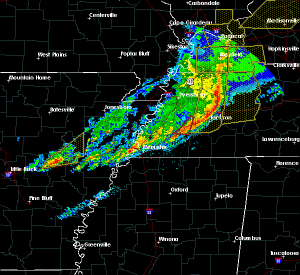 The tornado warning for southeastern haywood county will expire at 530 am cst, the storms which prompted the warning have moved out of the area. therefore the warning will be allowed to expire. however gusty winds are still possible with these thunderstorms. a tornado watch remains in effect until 800 am cst for western tennessee. The tornado warning for southeastern haywood county will expire at 530 am cst, the storms which prompted the warning have moved out of the area. therefore the warning will be allowed to expire. however gusty winds are still possible with these thunderstorms. a tornado watch remains in effect until 800 am cst for western tennessee.
|
| 3/1/2017 5:19 AM CST |
 At 519 am cst, a severe squall line producing both tornadoes and extensive straight line wind damage was located along a line extending from near greenfield to near humboldt to near dancyville, moving east at 65 mph (radar indicated rotation). Hazards include tornado. Flying debris will be dangerous to those caught without shelter. mobile homes will be damaged or destroyed. damage to roofs, windows, and vehicles will occur. tree damage is likely. Locations impacted include, brownsville, holly grove, dancyville, stanton, asbury, jones, shepp, allens, hickory point, meux corner, sunnyhill and morton hill. At 519 am cst, a severe squall line producing both tornadoes and extensive straight line wind damage was located along a line extending from near greenfield to near humboldt to near dancyville, moving east at 65 mph (radar indicated rotation). Hazards include tornado. Flying debris will be dangerous to those caught without shelter. mobile homes will be damaged or destroyed. damage to roofs, windows, and vehicles will occur. tree damage is likely. Locations impacted include, brownsville, holly grove, dancyville, stanton, asbury, jones, shepp, allens, hickory point, meux corner, sunnyhill and morton hill.
|
| 3/1/2017 5:17 AM CST |
 At 516 am cst, a severe squall line producing both tornadoes and extensive straight line wind damage was located along a line extending from near rutherford to near humboldt to dancyville, moving east at 65 mph (radar indicated rotation). Hazards include tornado. Flying debris will be dangerous to those caught without shelter. mobile homes will be damaged or destroyed. damage to roofs, windows, and vehicles will occur. tree damage is likely. Locations impacted include, brownsville, alamo, bells, dyer, kenton, rutherford, belle eagle, holly grove, dancyville, maury city, stanton, yorkville, asbury, quincy, allens, hickory point, central, jones, shepp and currie. At 516 am cst, a severe squall line producing both tornadoes and extensive straight line wind damage was located along a line extending from near rutherford to near humboldt to dancyville, moving east at 65 mph (radar indicated rotation). Hazards include tornado. Flying debris will be dangerous to those caught without shelter. mobile homes will be damaged or destroyed. damage to roofs, windows, and vehicles will occur. tree damage is likely. Locations impacted include, brownsville, alamo, bells, dyer, kenton, rutherford, belle eagle, holly grove, dancyville, maury city, stanton, yorkville, asbury, quincy, allens, hickory point, central, jones, shepp and currie.
|
| 3/1/2017 4:59 AM CST |
 At 459 am cst, a severe squall line producing both tornadoes and extensive straight line wind damage was located along a line extending from near newbern to near chestnut bluff to 7 miles east of dixonville, moving east at 65 mph (radar indicated rotation). Hazards include tornado. Flying debris will be dangerous to those caught without shelter. mobile homes will be damaged or destroyed. damage to roofs, windows, and vehicles will occur. tree damage is likely. Locations impacted include, dyersburg, brownsville, newbern, alamo, bells, dyer, halls, kenton, rutherford, nutbush, forked deer, chestnut bluff, belle eagle, holly grove, dancyville, mason, maury city, friendship, gates and trimble. At 459 am cst, a severe squall line producing both tornadoes and extensive straight line wind damage was located along a line extending from near newbern to near chestnut bluff to 7 miles east of dixonville, moving east at 65 mph (radar indicated rotation). Hazards include tornado. Flying debris will be dangerous to those caught without shelter. mobile homes will be damaged or destroyed. damage to roofs, windows, and vehicles will occur. tree damage is likely. Locations impacted include, dyersburg, brownsville, newbern, alamo, bells, dyer, halls, kenton, rutherford, nutbush, forked deer, chestnut bluff, belle eagle, holly grove, dancyville, mason, maury city, friendship, gates and trimble.
|
| 3/1/2017 4:43 AM CST |
 At 443 am cst, severe thunderstorms producing both tornadoes and extensive straight line wind damage were located along a line extending from miston to near ripley to near munford, moving east at 65 mph (radar indicated rotation). Hazards include tornado. Flying debris will be dangerous to those caught without shelter. mobile homes will be damaged or destroyed. damage to roofs, windows, and vehicles will occur. tree damage is likely. these dangerous storms will be near, dyersburg, halls and forked deer around 450 am cst. newbern and chestnut bluff around 455 am cst. alamo around 505 am cst. bells, dyer, kenton and rutherford around 510 am cst. dancyville around 515 am cst. Other locations impacted by these tornadic storms include fowlkes, stanton, lapata, christmasville, bonicord, central, locust grove, maxey, rohoboth and currie. At 443 am cst, severe thunderstorms producing both tornadoes and extensive straight line wind damage were located along a line extending from miston to near ripley to near munford, moving east at 65 mph (radar indicated rotation). Hazards include tornado. Flying debris will be dangerous to those caught without shelter. mobile homes will be damaged or destroyed. damage to roofs, windows, and vehicles will occur. tree damage is likely. these dangerous storms will be near, dyersburg, halls and forked deer around 450 am cst. newbern and chestnut bluff around 455 am cst. alamo around 505 am cst. bells, dyer, kenton and rutherford around 510 am cst. dancyville around 515 am cst. Other locations impacted by these tornadic storms include fowlkes, stanton, lapata, christmasville, bonicord, central, locust grove, maxey, rohoboth and currie.
|
| 12/28/2016 2:51 PM CST |
 At 250 pm cst, a severe thunderstorm was located near dancyville, or 9 miles south of brownsville, moving northeast at 55 mph (radar indicated). Hazards include 60 mph wind gusts and quarter size hail. Hail damage to vehicles is expected. expect wind damage to roofs, siding, and trees. Locations impacted include, dancyville, hillville, stanton, morton hill, meux corner, taylor chapel, shepp, fayette corners, keeling, hickory point, miller, yum yum and asbury. At 250 pm cst, a severe thunderstorm was located near dancyville, or 9 miles south of brownsville, moving northeast at 55 mph (radar indicated). Hazards include 60 mph wind gusts and quarter size hail. Hail damage to vehicles is expected. expect wind damage to roofs, siding, and trees. Locations impacted include, dancyville, hillville, stanton, morton hill, meux corner, taylor chapel, shepp, fayette corners, keeling, hickory point, miller, yum yum and asbury.
|
| 12/28/2016 2:41 PM CST |
 At 241 pm cst, a severe thunderstorm was located 7 miles west of dancyville, or 16 miles southwest of brownsville, moving northeast at 55 mph (radar indicated). Hazards include quarter size hail. Damage to vehicles is expected. Locations impacted include, dancyville, hillville, mason, stanton, braden, moorman, keeling, belmont, yum yum, asbury, morton hill, meux corner, taylor chapel, shepp, lambert, fayette corners, hickory point, longtown and miller. At 241 pm cst, a severe thunderstorm was located 7 miles west of dancyville, or 16 miles southwest of brownsville, moving northeast at 55 mph (radar indicated). Hazards include quarter size hail. Damage to vehicles is expected. Locations impacted include, dancyville, hillville, mason, stanton, braden, moorman, keeling, belmont, yum yum, asbury, morton hill, meux corner, taylor chapel, shepp, lambert, fayette corners, hickory point, longtown and miller.
|
| 12/28/2016 2:28 PM CST |
 At 228 pm cst, a severe thunderstorm was located near arlington, or 14 miles northeast of cordova, moving northeast at 55 mph (radar indicated). Hazards include quarter size hail. damage to vehicles is expected At 228 pm cst, a severe thunderstorm was located near arlington, or 14 miles northeast of cordova, moving northeast at 55 mph (radar indicated). Hazards include quarter size hail. damage to vehicles is expected
|
| 11/18/2016 5:56 PM CST |
 At 556 pm cst, severe thunderstorms were located along a line extending from 6 miles southwest of brownsville to near dancyville to near somerville, moving east at 50 mph (radar indicated). Hazards include 60 mph wind gusts. Expect damage to roofs. siding. And trees. At 556 pm cst, severe thunderstorms were located along a line extending from 6 miles southwest of brownsville to near dancyville to near somerville, moving east at 50 mph (radar indicated). Hazards include 60 mph wind gusts. Expect damage to roofs. siding. And trees.
|
| 11/18/2016 5:34 PM CST |
 At 534 pm cst, a severe thunderstorm was located 8 miles northeast of arlington, or 16 miles southeast of covington, moving east at 55 mph (radar indicated). Hazards include 60 mph wind gusts. Expect damage to roofs. siding. and trees. Locations impacted include, somerville, dancyville, warren, oakland, mason, gallaway, stanton, braden, gainesville, keeling, belmont, laconia, yum yum, asbury, meux corner, shepp, canaan grove, longtown, moorman and powers. At 534 pm cst, a severe thunderstorm was located 8 miles northeast of arlington, or 16 miles southeast of covington, moving east at 55 mph (radar indicated). Hazards include 60 mph wind gusts. Expect damage to roofs. siding. and trees. Locations impacted include, somerville, dancyville, warren, oakland, mason, gallaway, stanton, braden, gainesville, keeling, belmont, laconia, yum yum, asbury, meux corner, shepp, canaan grove, longtown, moorman and powers.
|
| 11/18/2016 5:25 PM CST |
 At 525 pm cst, a severe thunderstorm was located over arlington, or 11 miles northeast of bartlett, moving east at 55 mph (radar indicated). Hazards include 60 mph wind gusts. Expect damage to roofs. siding. And trees. At 525 pm cst, a severe thunderstorm was located over arlington, or 11 miles northeast of bartlett, moving east at 55 mph (radar indicated). Hazards include 60 mph wind gusts. Expect damage to roofs. siding. And trees.
|
| 7/14/2016 9:22 AM CDT |
 The severe thunderstorm warning for southeastern tipton and southwestern haywood counties will expire at 930 am cdt, the storm which prompted the warning has weakened below severe limits, and no longer pose an immediate threat to life or property. therefore, the warning will be allowed to expire. The severe thunderstorm warning for southeastern tipton and southwestern haywood counties will expire at 930 am cdt, the storm which prompted the warning has weakened below severe limits, and no longer pose an immediate threat to life or property. therefore, the warning will be allowed to expire.
|
| 7/14/2016 9:11 AM CDT |
 At 911 am cdt, a severe thunderstorm was located 8 miles northwest of dancyville, or 12 miles southwest of brownsville, moving northeast at 25 mph (radar indicated). Hazards include 60 mph wind gusts. Expect damage to roofs. siding. and trees. Locations impacted include, brownsville, dancyville, mason, stanton, oakview, gift, gainesville, keeling, cotton lake, asbury, morton hill, meux corner, shepp, canaan grove, tabernacle, hickory point and turnpike. At 911 am cdt, a severe thunderstorm was located 8 miles northwest of dancyville, or 12 miles southwest of brownsville, moving northeast at 25 mph (radar indicated). Hazards include 60 mph wind gusts. Expect damage to roofs. siding. and trees. Locations impacted include, brownsville, dancyville, mason, stanton, oakview, gift, gainesville, keeling, cotton lake, asbury, morton hill, meux corner, shepp, canaan grove, tabernacle, hickory point and turnpike.
|
| 7/14/2016 8:49 AM CDT |
 At 849 am cdt, a severe thunderstorm was located 8 miles east of dixonville, or 11 miles south of covington, moving northeast at 25 mph (radar indicated). Hazards include 60 mph wind gusts. Expect damage to roofs. siding. And trees. At 849 am cdt, a severe thunderstorm was located 8 miles east of dixonville, or 11 miles south of covington, moving northeast at 25 mph (radar indicated). Hazards include 60 mph wind gusts. Expect damage to roofs. siding. And trees.
|
| 5/1/2016 2:38 PM CDT |
 At 237 pm cdt, a severe thunderstorm was located near brownsville, moving east at 25 mph (radar indicated). Hazards include 60 mph wind gusts and quarter size hail. Hail damage to vehicles is expected. expect wind damage to roofs, siding, and trees. Locations impacted include, brownsville, mercer, hillville, holly grove, adair, stanton, jones, oakview, neely, roberts, morton hill, shepp, sunnyhill, huntersville, uptonville, denmark, leighton, hatchie and allens. At 237 pm cdt, a severe thunderstorm was located near brownsville, moving east at 25 mph (radar indicated). Hazards include 60 mph wind gusts and quarter size hail. Hail damage to vehicles is expected. expect wind damage to roofs, siding, and trees. Locations impacted include, brownsville, mercer, hillville, holly grove, adair, stanton, jones, oakview, neely, roberts, morton hill, shepp, sunnyhill, huntersville, uptonville, denmark, leighton, hatchie and allens.
|
| 5/1/2016 2:16 PM CDT |
 At 216 pm cdt, a severe thunderstorm was located near brownsville, moving east at 20 mph (radar indicated). Hazards include 60 mph wind gusts and quarter size hail. Hail damage to vehicles is expected. Expect wind damage to roofs, siding, and trees. At 216 pm cdt, a severe thunderstorm was located near brownsville, moving east at 20 mph (radar indicated). Hazards include 60 mph wind gusts and quarter size hail. Hail damage to vehicles is expected. Expect wind damage to roofs, siding, and trees.
|
| 3/31/2016 2:11 PM CDT |
 At 211 pm cdt, a severe thunderstorm was located near hillville, or near brownsville, moving east at 40 mph (radar indicated). Hazards include two inch hail and 70 mph wind gusts. People and animals outdoors will be injured. expect hail damage to roofs, siding, windows, and vehicles. expect considerable tree damage. Wind damage is also likely to mobile homes, roofs, and outbuildings. At 211 pm cdt, a severe thunderstorm was located near hillville, or near brownsville, moving east at 40 mph (radar indicated). Hazards include two inch hail and 70 mph wind gusts. People and animals outdoors will be injured. expect hail damage to roofs, siding, windows, and vehicles. expect considerable tree damage. Wind damage is also likely to mobile homes, roofs, and outbuildings.
|
| 3/31/2016 1:46 PM CDT |
 At 146 pm cdt, a severe thunderstorm was located 11 miles west of dancyville, or 12 miles southeast of covington, moving east at 35 mph (radar indicated). Hazards include 60 mph wind gusts and half dollar size hail. Hail damage to vehicles is expected. expect wind damage to roofs, siding, and trees. Locations impacted include, brownsville, covington, munford, brighton, hillville, dancyville, holly grove, atoka, mason, gallaway, stanton, braden, crosstown, jones, oakview, gift, gainesville, rosemark, keeling and belmont. At 146 pm cdt, a severe thunderstorm was located 11 miles west of dancyville, or 12 miles southeast of covington, moving east at 35 mph (radar indicated). Hazards include 60 mph wind gusts and half dollar size hail. Hail damage to vehicles is expected. expect wind damage to roofs, siding, and trees. Locations impacted include, brownsville, covington, munford, brighton, hillville, dancyville, holly grove, atoka, mason, gallaway, stanton, braden, crosstown, jones, oakview, gift, gainesville, rosemark, keeling and belmont.
|
| 3/31/2016 1:26 PM CDT |
 At 126 pm cdt, a severe thunderstorm was located near dixonville, or 10 miles south of covington, moving east at 45 mph (radar indicated). Hazards include 60 mph wind gusts and half dollar size hail. Hail damage to vehicles is expected. Expect wind damage to roofs, siding, and trees. At 126 pm cdt, a severe thunderstorm was located near dixonville, or 10 miles south of covington, moving east at 45 mph (radar indicated). Hazards include 60 mph wind gusts and half dollar size hail. Hail damage to vehicles is expected. Expect wind damage to roofs, siding, and trees.
|
| 3/15/2016 10:26 PM CDT |
 At 1026 pm cdt, a severe thunderstorm was located near covington, moving east at 60 mph (radar indicated). Hazards include 60 mph wind gusts and quarter size hail. Hail damage to vehicles is expected. Expect wind damage to roofs, siding, and trees. At 1026 pm cdt, a severe thunderstorm was located near covington, moving east at 60 mph (radar indicated). Hazards include 60 mph wind gusts and quarter size hail. Hail damage to vehicles is expected. Expect wind damage to roofs, siding, and trees.
|
| 12/23/2015 4:26 PM CST | At 426 pm cst, a severe thunderstorm was located near dancyville, or 8 miles southwest of brownsville, moving northeast at 65 mph (radar indicated). Hazards include 70 mph wind gusts and quarter size hail. Hail damage to vehicles is expected. expect considerable tree damage. wind damage is also likely to mobile homes, roofs and outbuildings. locations impacted include, brownsville, dancyville, hillville, stanton, oakview, belmont, vildo, christmasville, asbury, morton hill, meux corner, shepp, sunnyhill, cedar chapel, hickory point, turnpike, keeling and hatchie. A tornado watch remains in effect until 800 pm cst for western tennessee. |
| 12/23/2015 4:10 PM CST | At 410 pm cst, a severe thunderstorm was located near arlington, or 14 miles south of covington, moving northeast at 65 mph (radar indicated). Hazards include 70 mph wind gusts and quarter size hail. Hail damage to vehicles is expected. expect considerable tree damage. Wind damage is also likely to mobile homes, roofs and outbuildings. |
| 8/5/2015 5:04 PM CDT |
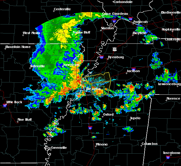 At 503 pm cdt, a severe thunderstorm was located 7 miles northwest of dancyville, or 13 miles southwest of brownsville, moving northeast at 25 mph (radar indicated). Hazards include 70 mph wind gusts. Expect considerable tree damage. Damage is likely to mobile homes, roofs and outbuildings. At 503 pm cdt, a severe thunderstorm was located 7 miles northwest of dancyville, or 13 miles southwest of brownsville, moving northeast at 25 mph (radar indicated). Hazards include 70 mph wind gusts. Expect considerable tree damage. Damage is likely to mobile homes, roofs and outbuildings.
|
| 8/5/2015 4:23 PM CDT |
 At 423 pm cdt, a severe thunderstorm was located near meeman shelby forest state park, moving east at 45 mph (radar indicated). Hazards include 70 mph wind gusts. Expect considerable tree damage. Damage is likely to mobile homes, roofs and outbuildings. At 423 pm cdt, a severe thunderstorm was located near meeman shelby forest state park, moving east at 45 mph (radar indicated). Hazards include 70 mph wind gusts. Expect considerable tree damage. Damage is likely to mobile homes, roofs and outbuildings.
|
| 7/14/2015 4:16 PM CDT |
 At 414 pm cdt, a severe thunderstorm was located over eads, or near cordova, moving southeast at 50 mph (trained weather spotters). Hazards include 70 mph wind gusts. Expect considerable tree damage. damage is likely to mobile homes, roofs and outbuildings. Locations impacted include, bartlett, southaven, collierville, germantown, olive branch, west memphis, horn lake, marion, millington, covington, wilson, meeman shelby forest state park, fort pillow state park, t o fuller state park, cordova, lakeland, arlington, munford, somerville and brighton. At 414 pm cdt, a severe thunderstorm was located over eads, or near cordova, moving southeast at 50 mph (trained weather spotters). Hazards include 70 mph wind gusts. Expect considerable tree damage. damage is likely to mobile homes, roofs and outbuildings. Locations impacted include, bartlett, southaven, collierville, germantown, olive branch, west memphis, horn lake, marion, millington, covington, wilson, meeman shelby forest state park, fort pillow state park, t o fuller state park, cordova, lakeland, arlington, munford, somerville and brighton.
|
| 7/14/2015 3:52 PM CDT |
 At 351 pm cdt, a severe thunderstorm was located near millington, moving southeast at 50 mph (trained weather spotters). Hazards include 70 mph wind gusts. Expect considerable tree damage. Damage is likely to mobile homes, roofs and outbuildings. At 351 pm cdt, a severe thunderstorm was located near millington, moving southeast at 50 mph (trained weather spotters). Hazards include 70 mph wind gusts. Expect considerable tree damage. Damage is likely to mobile homes, roofs and outbuildings.
|
| 6/8/2015 6:56 PM CDT | The severe thunderstorm warning for southern haywood county will expire at 700 pm cdt, the storm which prompted the warning has moved out of the area. therefore the warning will be allowed to expire. however heavy rain is still possible with this thunderstorm. a severe thunderstorm watch remains in effect until 800 pm cdt for western tennessee. |
| 6/8/2015 6:24 PM CDT | At 624 pm cdt, a severe thunderstorm was located over dancyville, or 10 miles south of brownsville, moving southeast at 25 mph (radar indicated). Hazards include 60 mph wind gusts and quarter size hail. Hail damage to vehicles is expected. Expect wind damage to roofs, siding and trees. |
| 5/30/2015 12:58 PM CDT | At 1258 pm cdt, a severe thunderstorm was located over covington, moving northeast at 30 mph (radar indicated). Hazards include 60 mph wind gusts. Expect damage to roofs. siding and trees. Locations impacted include, brownsville, ripley, alamo, dyer, halls, belle eagle, chestnut bluff, nutbush, unionville, forked deer, henning, maury city, friendship, gates, stanton, edith, oakview, bishop, currie and nankipoo. |
| 5/30/2015 12:39 PM CDT | At 1239 pm cdt, a severe thunderstorm was located over brighton, or 7 miles southwest of covington, moving northeast at 30 mph (radar indicated). Hazards include 60 mph wind gusts and penny size hail. Expect damage to roofs. Siding and trees. |
| 4/1/2015 5:39 PM CDT | The severe thunderstorm warning for southwestern lauderdale. tipton. southwestern haywood. northern fayette and northeastern shelby counties will expire at 545 pm cdt. the storm which prompted the warning has weakened below severe limits. and no longer pose an immediate threat to life or property. therefore the warning will be allowed to expire. However small hail. |
| 4/1/2015 5:19 PM CDT | A severe thunderstorm warning remains in effect until 545 pm cdt for southwestern lauderdale. tipton. southwestern haywood. northern fayette and northeastern shelby counties. at 518 pm cdt. a severe thunderstorm was located 8 miles northeast of arlington. or 14 miles south of covington. Moving northeast at 20 mph. |
| 4/1/2015 5:00 PM CDT | The national weather service in memphis has issued a * severe thunderstorm warning for. southwestern lauderdale county in southwestern tennessee. tipton county in southwestern tennessee. southwestern haywood county in southwestern tennessee. Northern fayette county in southwestern tennessee. |
| 3/31/2015 8:39 PM CDT | The national weather service in memphis has issued a * severe thunderstorm warning for. southeastern lauderdale county in southwestern tennessee. tipton county in southwestern tennessee. southwestern haywood county in southwestern tennessee. Northeastern fayette county in southwestern tennessee. |
| 3/31/2015 8:01 PM CDT | The national weather service in memphis has issued a * severe thunderstorm warning for. southern lauderdale county in southwestern tennessee. northeastern tipton county in southwestern tennessee. southwestern haywood county in southwestern tennessee. Until 845 pm cdt. |
| 4/27/2013 11:35 PM CDT | Fayette county animal rescue reports 140 dogs and 3 horses on the loose near belmont road after barn was destroyed. possible tornado damag in fayette county TN, 4.6 miles NNE of Stanton, TN |
| 4/27/2013 10:30 PM CDT | People who had been trapped by downed power lines have been rescued. multiple power lines power poles and trees down around the area. some homes have received damage an in fayette county TN, 4.6 miles NNE of Stanton, TN |
| 4/27/2013 9:48 PM CDT | Structual damage reported near belmont road and sinai dr. north of interstate 40. possible tornado damag in fayette county TN, 4.6 miles NNE of Stanton, TN |
| 4/27/2013 9:40 PM CDT | Quarter sized hail reported 6.3 miles WNW of Stanton, TN, quarter size hail reported on highway 76 and dancyville. |
| 4/27/2013 9:15 PM CDT | A church was lifted off its foundation at intersection of belmont road and old 59. a mobile home was also destroyed one mile east of belmon in fayette county TN, 4.6 miles NNE of Stanton, TN |
| 4/27/2013 9:15 PM CDT | Fayette county animal rescue reports 140 dogs and 3 horses on the loose near belmont road after barn was destroyed. possible tornado damag in fayette county TN, 4.6 miles NNE of Stanton, TN |
| 4/27/2013 9:15 PM CDT | People who had been trapped by downed power lines have been rescued. minor injuries and no fatalities reported. multiple power lines power poles and trees down around t in fayette county TN, 4.6 miles NNE of Stanton, TN |
| 4/27/2013 9:15 PM CDT | People who had been trapped by downed power lines have been rescued. multiple power lines power poles and trees down around the area. some homes have received damage an in fayette county TN, 4.6 miles NNE of Stanton, TN |
| 4/27/2013 9:15 PM CDT | Structual damage reported near belmont road and sinai dr. north of interstate 40. possible tornado damag in fayette county TN, 4.6 miles NNE of Stanton, TN |
| 1/1/0001 12:00 AM | Nws employee reported large trees down on interstate 40 between mile markers 43 and 45. time is estimate in haywood county TN, 3.4 miles NNW of Stanton, TN |
Hail Maps for Stanton, TN
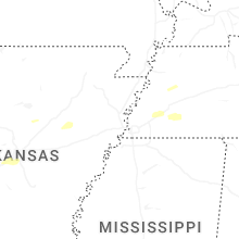
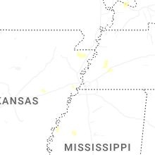
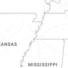
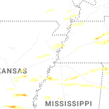


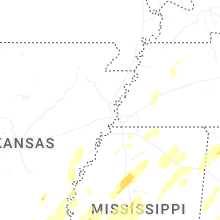


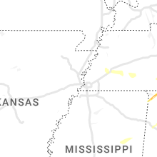


Connect with Interactive Hail Maps