

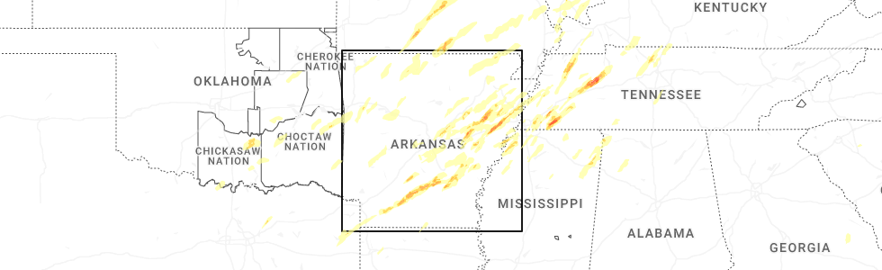
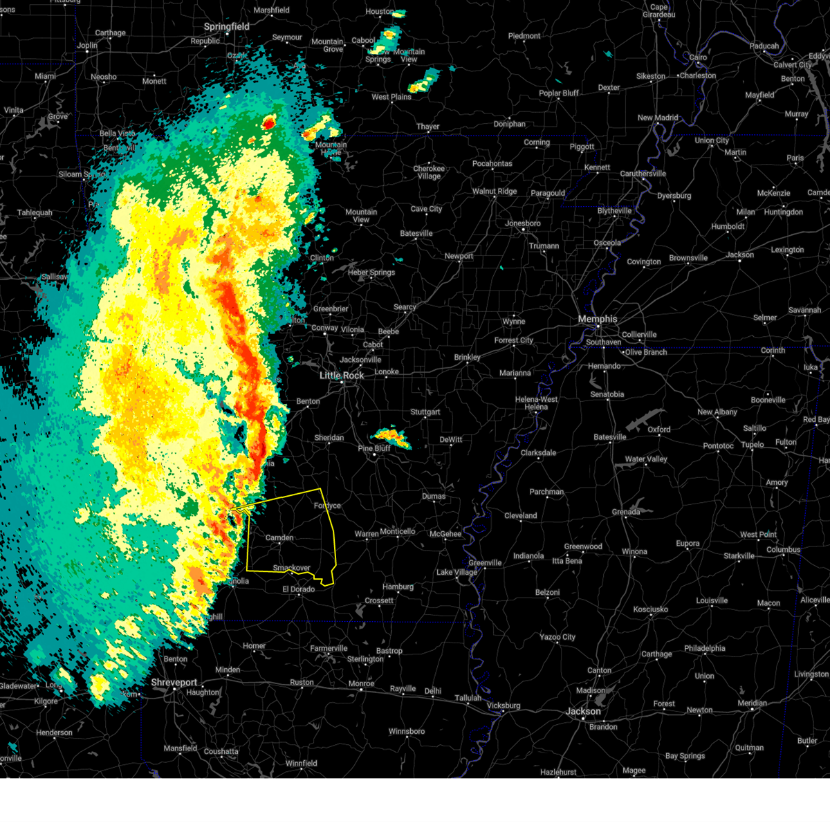
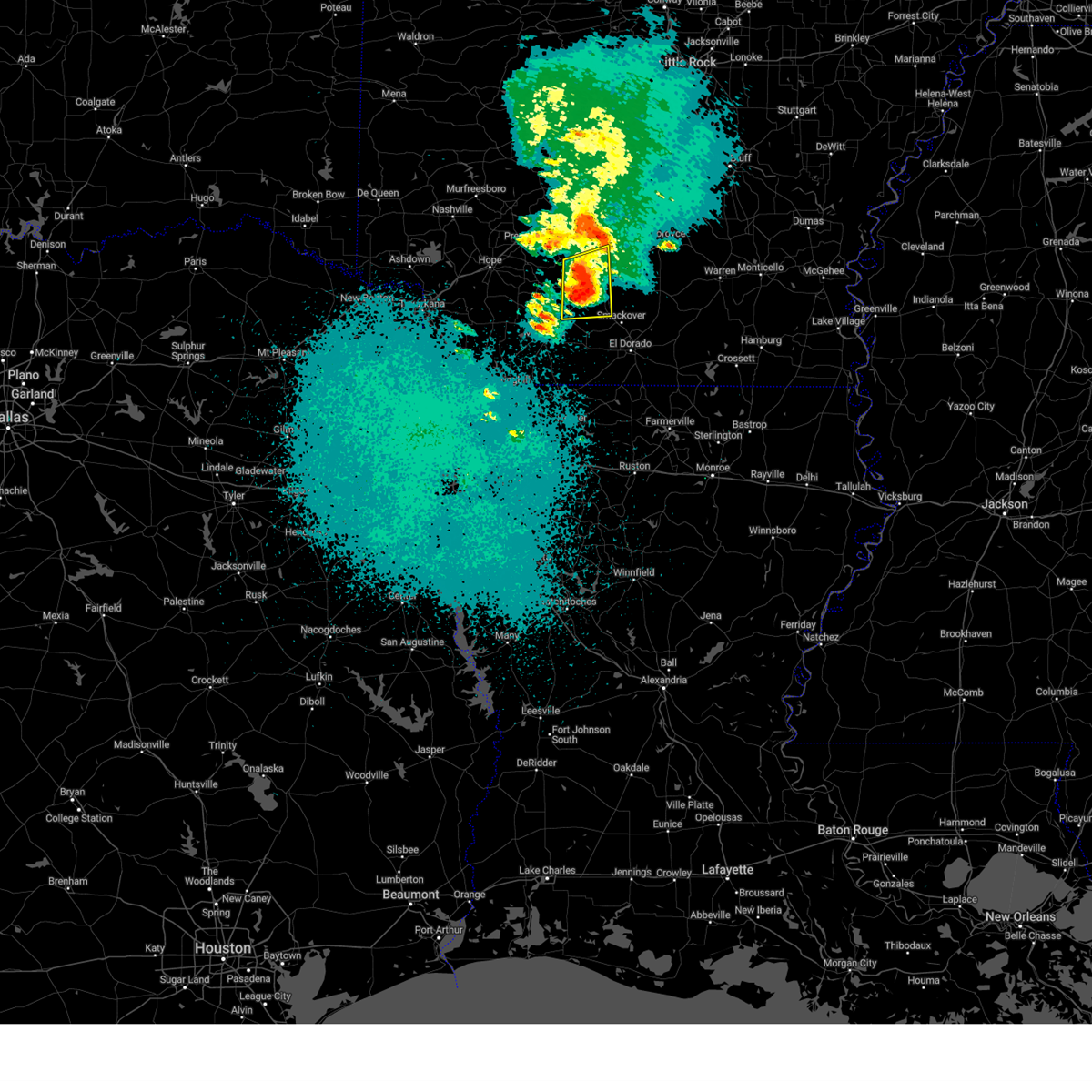
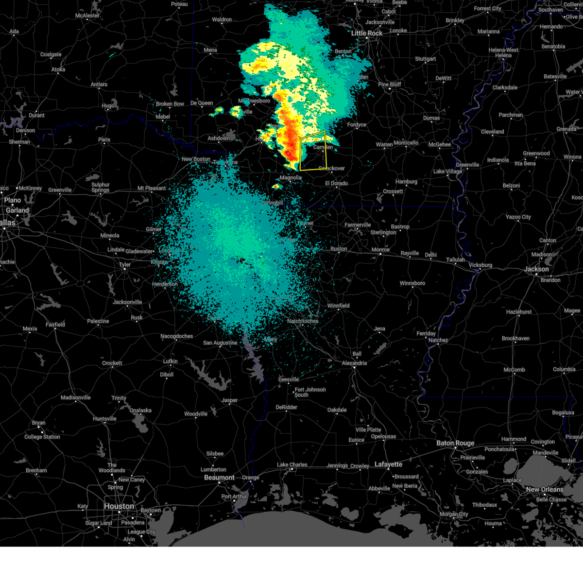
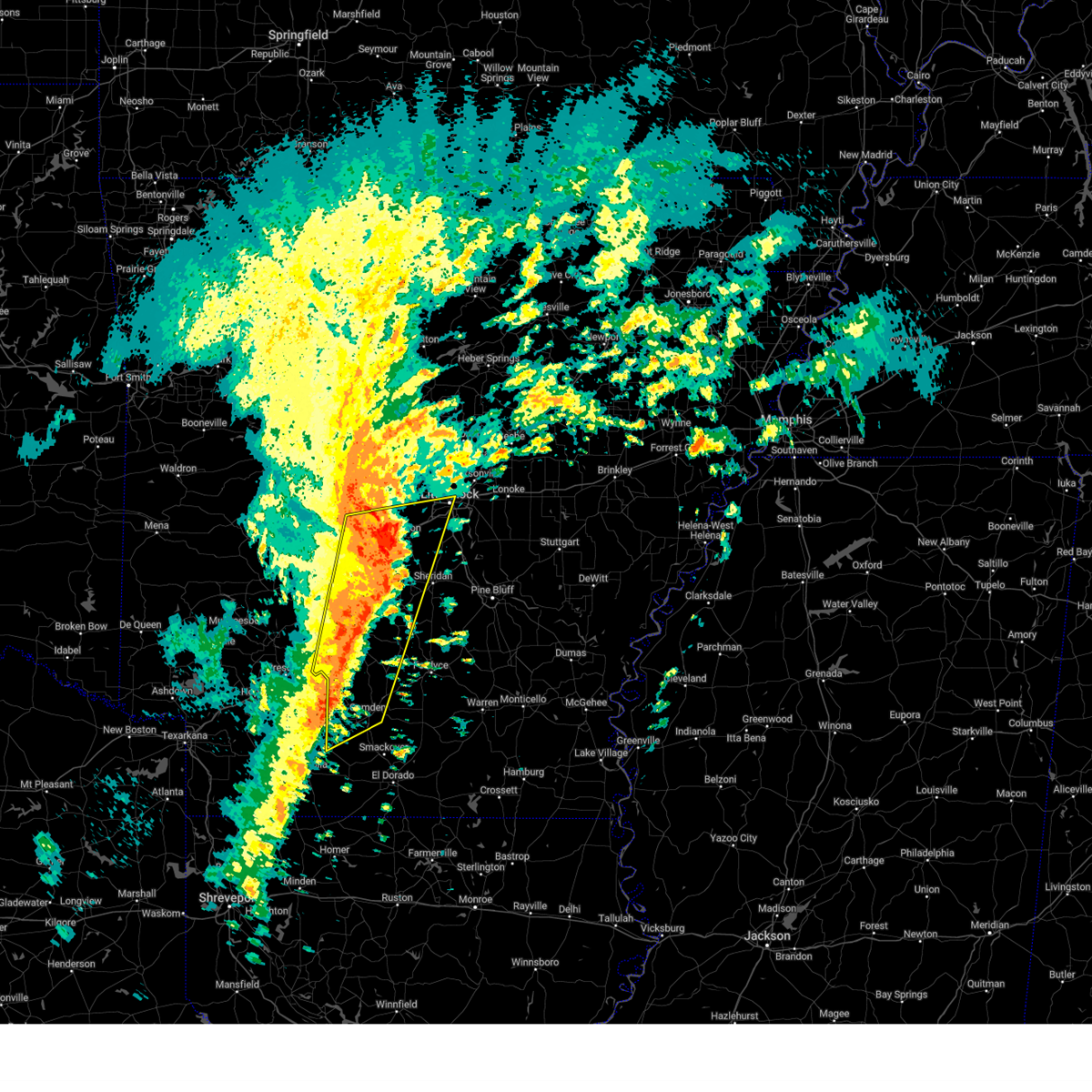
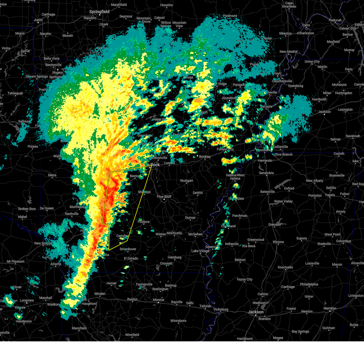
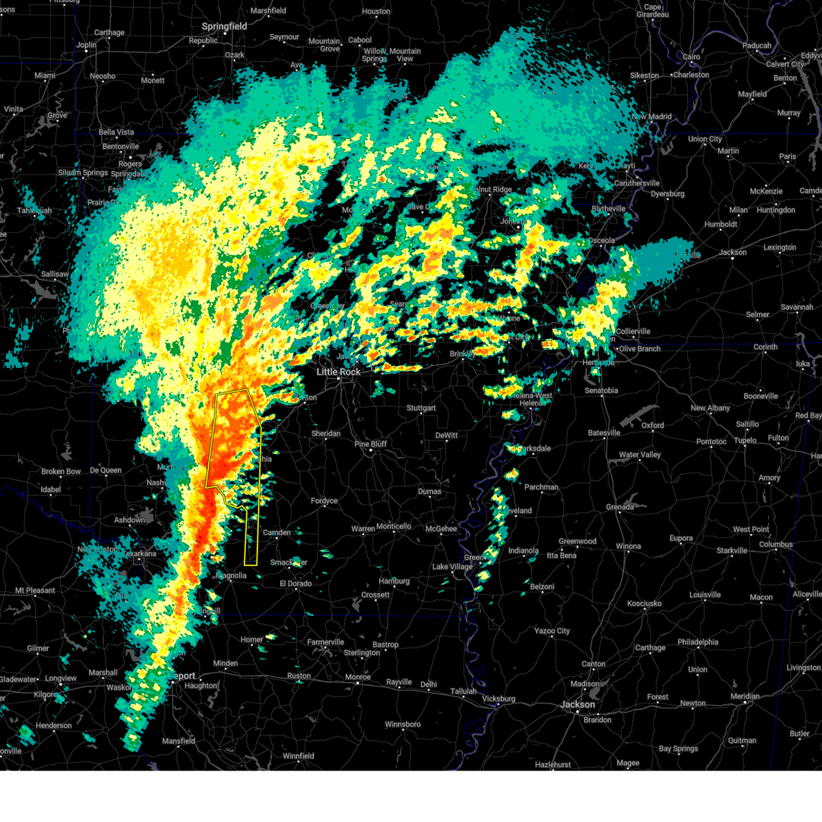
Hail Map for Stephens, AR
The Stephens, AR area has had 0 reports of on-the-ground hail by trained spotters, and has been under severe weather warnings 37 times during the past 12 months. Doppler radar has detected hail at or near Stephens, AR on 44 occasions, including 2 occasions during the past year.
| Name: | Stephens, AR |
| Where Located: | 57.7 miles SE of Nashville, AR |
| Map: | Google Map for Stephens, AR |
| Population: | 891 |
| Housing Units: | 470 |
| More Info: | Search Google for Stephens, AR |
0
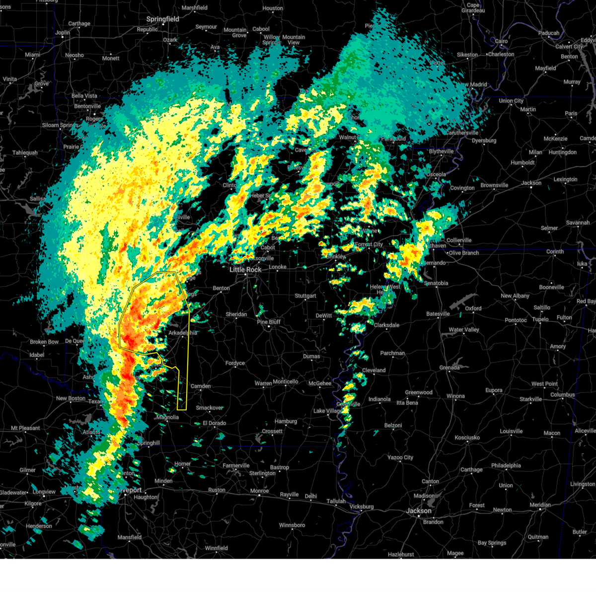
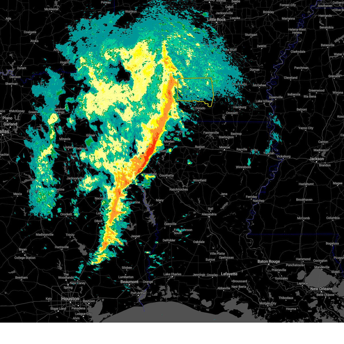
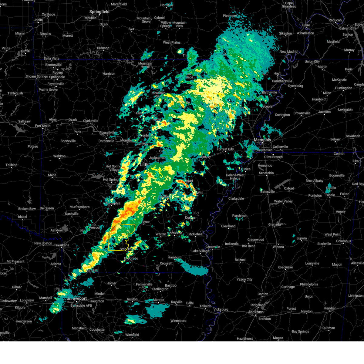
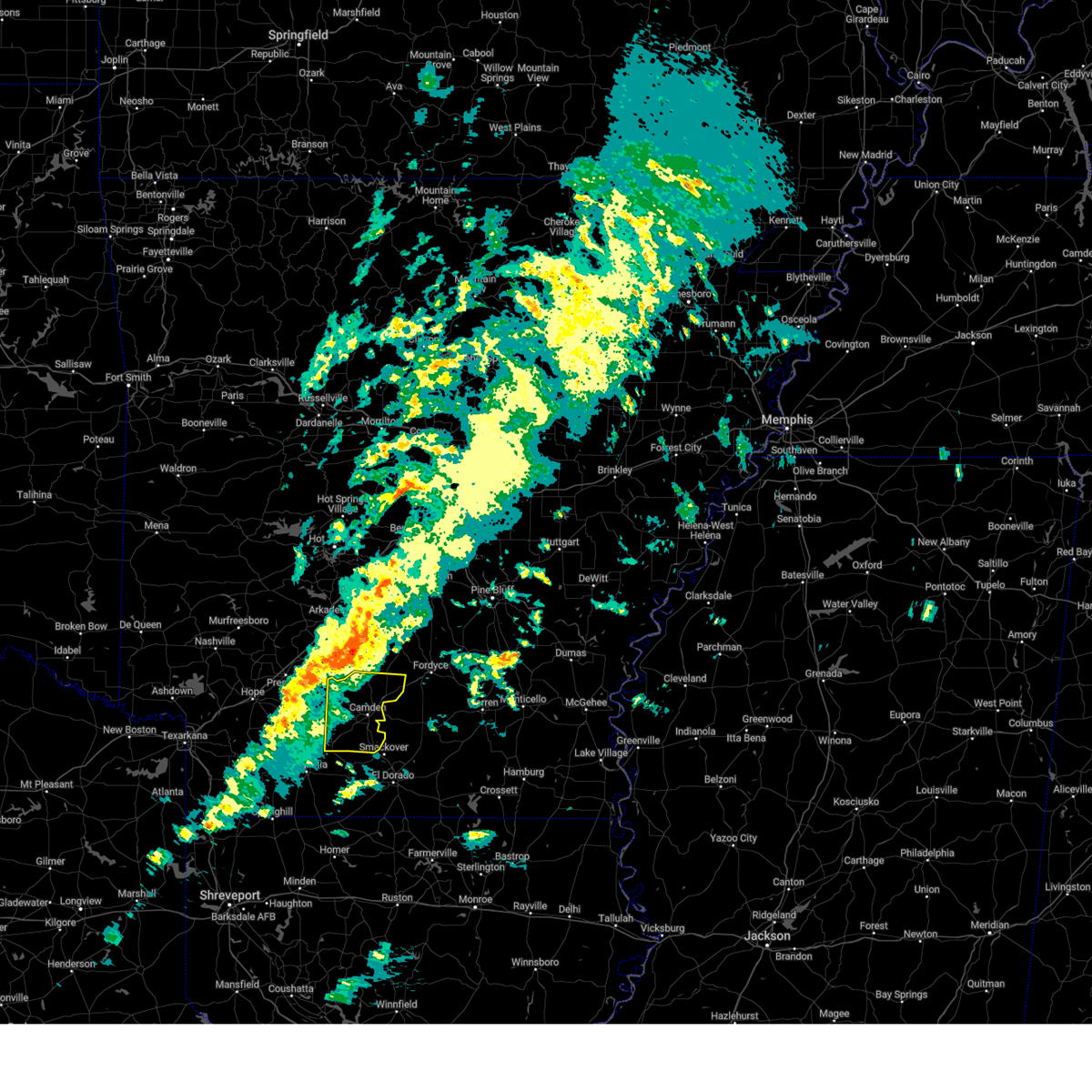
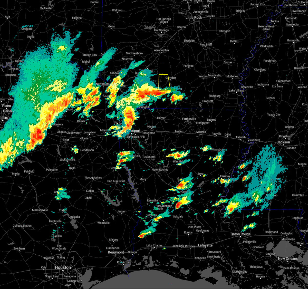
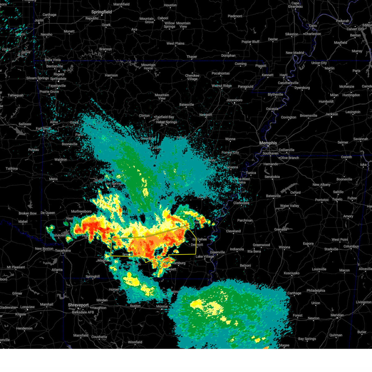
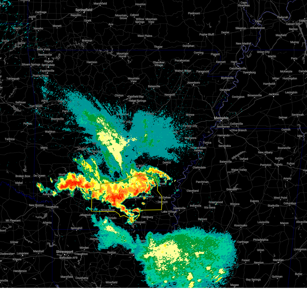
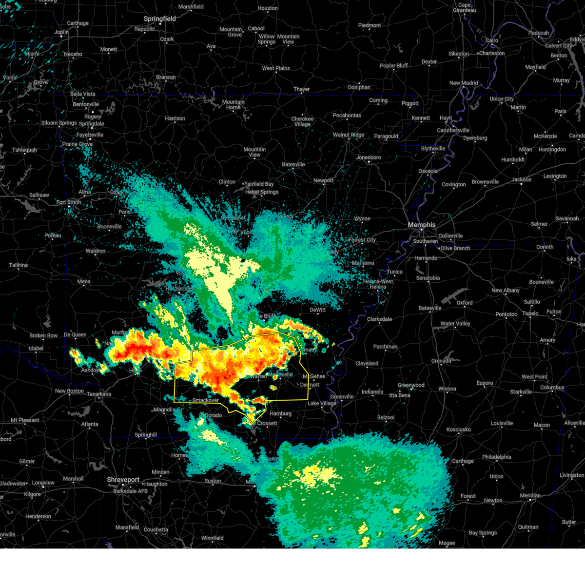
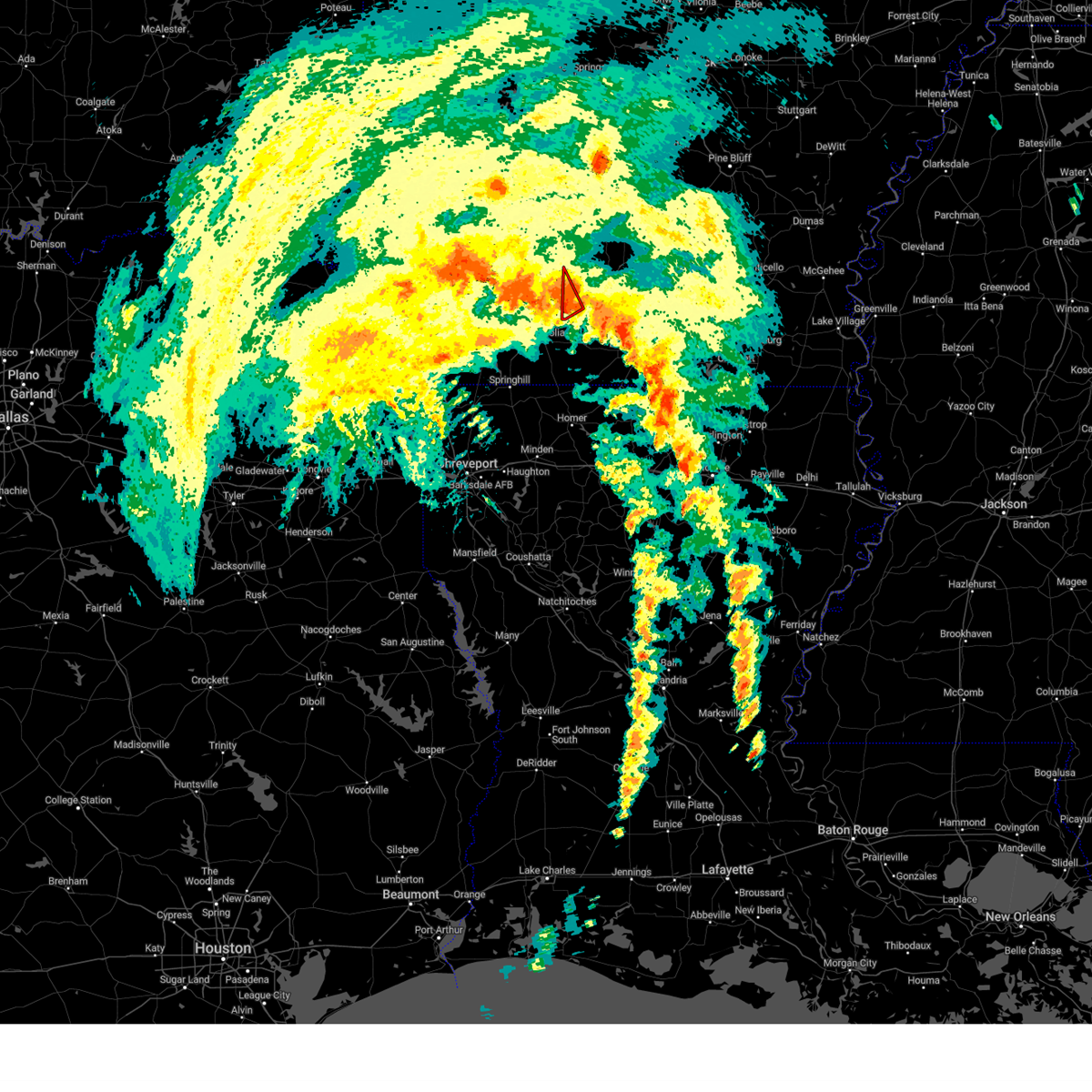
The Top Recent Hail Date for Stephens, AR is Wednesday, April 2, 2025 (22nd out of 44)
Hail and Wind Damage Spotted near Stephens, AR
| Date / Time | Report Details |
|---|---|
| 4/30/2025 4:32 PM CDT |
 Svrlzk the national weather service in little rock has issued a * severe thunderstorm warning for, southeastern clark county in southwestern arkansas, calhoun county in southwestern arkansas, southern dallas county in southwestern arkansas, ouachita county in southwestern arkansas, * until 530 pm cdt. * at 431 pm cdt, a severe thunderstorm was located near rosston, or 17 miles north of mcneil, moving northeast at 50 mph (radar indicated). Hazards include 60 mph wind gusts. expect damage to roofs, siding, and trees Svrlzk the national weather service in little rock has issued a * severe thunderstorm warning for, southeastern clark county in southwestern arkansas, calhoun county in southwestern arkansas, southern dallas county in southwestern arkansas, ouachita county in southwestern arkansas, * until 530 pm cdt. * at 431 pm cdt, a severe thunderstorm was located near rosston, or 17 miles north of mcneil, moving northeast at 50 mph (radar indicated). Hazards include 60 mph wind gusts. expect damage to roofs, siding, and trees
|
| 4/26/2025 9:56 PM CDT |
 The storm which prompted the warning has weakened below severe limits, and no longer poses an immediate threat to life or property. therefore, the warning will be allowed to expire. however small hail and gusty winds are still possible with this thunderstorm. a tornado watch remains in effect until 1000 pm cdt for southwestern arkansas. The storm which prompted the warning has weakened below severe limits, and no longer poses an immediate threat to life or property. therefore, the warning will be allowed to expire. however small hail and gusty winds are still possible with this thunderstorm. a tornado watch remains in effect until 1000 pm cdt for southwestern arkansas.
|
| 4/26/2025 9:10 PM CDT |
 Svrlzk the national weather service in little rock has issued a * severe thunderstorm warning for, ouachita county in southwestern arkansas, * until 1000 pm cdt. * at 908 pm cdt, a severe thunderstorm was located near willisville, or 13 miles north of waldo, moving east at 30 mph (radar indicated). Hazards include 60 mph wind gusts and quarter size hail. Hail damage to vehicles is expected. Expect wind damage to roofs, siding, and trees. Svrlzk the national weather service in little rock has issued a * severe thunderstorm warning for, ouachita county in southwestern arkansas, * until 1000 pm cdt. * at 908 pm cdt, a severe thunderstorm was located near willisville, or 13 miles north of waldo, moving east at 30 mph (radar indicated). Hazards include 60 mph wind gusts and quarter size hail. Hail damage to vehicles is expected. Expect wind damage to roofs, siding, and trees.
|
| 4/5/2025 11:04 AM CDT |
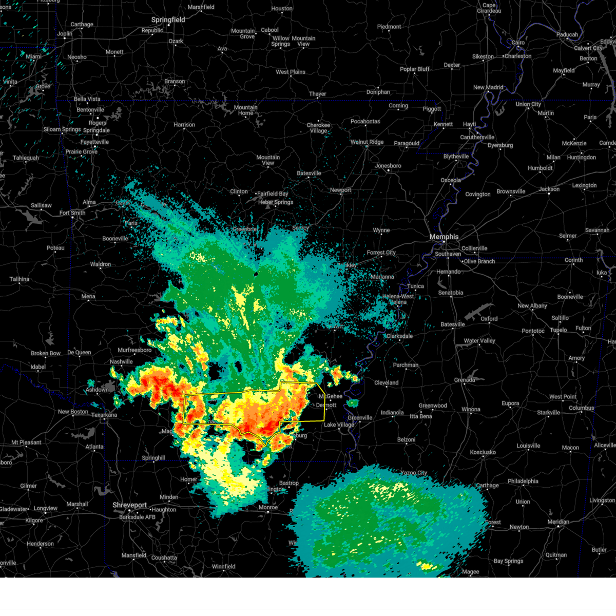
 Svrlzk the national weather service in little rock has issued a * severe thunderstorm warning for, northwestern cleveland county in southeastern arkansas, southeastern clark county in southwestern arkansas, southeastern grant county in central arkansas, central calhoun county in southwestern arkansas, dallas county in southwestern arkansas, ouachita county in southwestern arkansas, southwestern jefferson county in southeastern arkansas, * until 1145 am cdt. * at 1103 am cdt, severe thunderstorms were located along a line extending from 6 miles west of carthage to near stephens, moving east at 35 mph (radar indicated). Hazards include 60 mph wind gusts and penny size hail. expect damage to roofs, siding, and trees Svrlzk the national weather service in little rock has issued a * severe thunderstorm warning for, northwestern cleveland county in southeastern arkansas, southeastern clark county in southwestern arkansas, southeastern grant county in central arkansas, central calhoun county in southwestern arkansas, dallas county in southwestern arkansas, ouachita county in southwestern arkansas, southwestern jefferson county in southeastern arkansas, * until 1145 am cdt. * at 1103 am cdt, severe thunderstorms were located along a line extending from 6 miles west of carthage to near stephens, moving east at 35 mph (radar indicated). Hazards include 60 mph wind gusts and penny size hail. expect damage to roofs, siding, and trees
|
| 4/5/2025 11:01 AM CDT |
 At 1101 am cdt, severe thunderstorms were located along a line extending from near otter creek to 9 miles north of camden, moving east at 45 mph (radar indicated). Hazards include 60 mph wind gusts and nickel size hail. Expect damage to roofs, siding, and trees. Locations impacted include, lono, otter creek, magnet cove, tulip, east camden, traskwood, harmony grove, ouachita, vaden, gifford, malvern, glen rose, carthage, white oak lake state park, bauxite, jenkins ferry state park, belfast, quapaw quarter, hillcrest neighborhood, dalark,. At 1101 am cdt, severe thunderstorms were located along a line extending from near otter creek to 9 miles north of camden, moving east at 45 mph (radar indicated). Hazards include 60 mph wind gusts and nickel size hail. Expect damage to roofs, siding, and trees. Locations impacted include, lono, otter creek, magnet cove, tulip, east camden, traskwood, harmony grove, ouachita, vaden, gifford, malvern, glen rose, carthage, white oak lake state park, bauxite, jenkins ferry state park, belfast, quapaw quarter, hillcrest neighborhood, dalark,.
|
| 4/5/2025 10:47 AM CDT |
 At 1047 am cdt, severe thunderstorms were located along a line extending from near salem in saline county to near poison springs state park, moving east at 45 mph (radar indicated). Hazards include 60 mph wind gusts and nickel size hail. Expect damage to roofs, siding, and trees. Locations impacted include, otter creek, traskwood, ouachita, jenkins ferry state park, de roche, quapaw quarter, hillcrest neighborhood, dalark, haskell, buena vista, bryant, camden, red oak, princeton, social hill, holly springs, whelen springs, baseline, congo, troy,. At 1047 am cdt, severe thunderstorms were located along a line extending from near salem in saline county to near poison springs state park, moving east at 45 mph (radar indicated). Hazards include 60 mph wind gusts and nickel size hail. Expect damage to roofs, siding, and trees. Locations impacted include, otter creek, traskwood, ouachita, jenkins ferry state park, de roche, quapaw quarter, hillcrest neighborhood, dalark, haskell, buena vista, bryant, camden, red oak, princeton, social hill, holly springs, whelen springs, baseline, congo, troy,.
|
| 4/5/2025 10:27 AM CDT |
 Svrlzk the national weather service in little rock has issued a * severe thunderstorm warning for, eastern clark county in southwestern arkansas, western grant county in central arkansas, western calhoun county in southwestern arkansas, dallas county in southwestern arkansas, ouachita county in southwestern arkansas, southeastern garland county in central arkansas, saline county in central arkansas, hot spring county in southwestern arkansas, central pulaski county in central arkansas, * until 1115 am cdt. * at 1026 am cdt, severe thunderstorms were located along a line extending from near lonsdale to rosston, moving east at 45 mph (radar indicated). Hazards include 60 mph wind gusts and nickel size hail. expect damage to roofs, siding, and trees Svrlzk the national weather service in little rock has issued a * severe thunderstorm warning for, eastern clark county in southwestern arkansas, western grant county in central arkansas, western calhoun county in southwestern arkansas, dallas county in southwestern arkansas, ouachita county in southwestern arkansas, southeastern garland county in central arkansas, saline county in central arkansas, hot spring county in southwestern arkansas, central pulaski county in central arkansas, * until 1115 am cdt. * at 1026 am cdt, severe thunderstorms were located along a line extending from near lonsdale to rosston, moving east at 45 mph (radar indicated). Hazards include 60 mph wind gusts and nickel size hail. expect damage to roofs, siding, and trees
|
| 4/5/2025 10:12 AM CDT |
 the severe thunderstorm warning has been cancelled and is no longer in effect the severe thunderstorm warning has been cancelled and is no longer in effect
|
| 4/5/2025 10:12 AM CDT |
 At 1011 am cdt, severe thunderstorms were located along a line extending from near lofton to near emmet, moving east at 45 mph (radar indicated). Hazards include 60 mph wind gusts and penny size hail. Expect damage to roofs, siding, and trees. Locations impacted include, hot springs memorial field, gum springs in clark county, poison springs state park, oaklawn racetrack, curtis, mountain pine, bonnerdale, reader, sunshine, caddo valley, royal, white oak lake state park, friendship, gurdon, de roche, point cedar, halfway, gulpha gorge, okolona, antoine,. At 1011 am cdt, severe thunderstorms were located along a line extending from near lofton to near emmet, moving east at 45 mph (radar indicated). Hazards include 60 mph wind gusts and penny size hail. Expect damage to roofs, siding, and trees. Locations impacted include, hot springs memorial field, gum springs in clark county, poison springs state park, oaklawn racetrack, curtis, mountain pine, bonnerdale, reader, sunshine, caddo valley, royal, white oak lake state park, friendship, gurdon, de roche, point cedar, halfway, gulpha gorge, okolona, antoine,.
|
| 4/5/2025 10:05 AM CDT |
 At 1005 am cdt, severe thunderstorms were located along a line extending from near lofton to near bodcaw, moving northeast at 50 mph (radar indicated). Hazards include 60 mph wind gusts and penny size hail. Expect damage to roofs, siding, and trees. Locations impacted include, gum springs in clark county, murfreesboro, oaklawn racetrack, curtis, bonnerdale, mt tabor, caddo valley, lena landing rec area, white oak lake state park, de roche, pisgah, okolona, antoine, daisy state park, crater of diamonds state park, bear creek public use area, burtsell, narrows dam, red oak, amity,. At 1005 am cdt, severe thunderstorms were located along a line extending from near lofton to near bodcaw, moving northeast at 50 mph (radar indicated). Hazards include 60 mph wind gusts and penny size hail. Expect damage to roofs, siding, and trees. Locations impacted include, gum springs in clark county, murfreesboro, oaklawn racetrack, curtis, bonnerdale, mt tabor, caddo valley, lena landing rec area, white oak lake state park, de roche, pisgah, okolona, antoine, daisy state park, crater of diamonds state park, bear creek public use area, burtsell, narrows dam, red oak, amity,.
|
| 4/5/2025 9:43 AM CDT |
 Svrlzk the national weather service in little rock has issued a * severe thunderstorm warning for, clark county in southwestern arkansas, pike county in southwestern arkansas, western ouachita county in southwestern arkansas, garland county in central arkansas, southwestern hot spring county in southwestern arkansas, eastern montgomery county in western arkansas, * until 1045 am cdt. * at 942 am cdt, severe thunderstorms were located along a line extending from 6 miles southeast of mount ida to near washington, moving northeast at 45 mph (radar indicated). Hazards include 60 mph wind gusts and quarter size hail. Hail damage to vehicles is expected. Expect wind damage to roofs, siding, and trees. Svrlzk the national weather service in little rock has issued a * severe thunderstorm warning for, clark county in southwestern arkansas, pike county in southwestern arkansas, western ouachita county in southwestern arkansas, garland county in central arkansas, southwestern hot spring county in southwestern arkansas, eastern montgomery county in western arkansas, * until 1045 am cdt. * at 942 am cdt, severe thunderstorms were located along a line extending from 6 miles southeast of mount ida to near washington, moving northeast at 45 mph (radar indicated). Hazards include 60 mph wind gusts and quarter size hail. Hail damage to vehicles is expected. Expect wind damage to roofs, siding, and trees.
|
| 4/3/2025 5:49 PM CDT |
 the severe thunderstorm warning has been cancelled and is no longer in effect the severe thunderstorm warning has been cancelled and is no longer in effect
|
| 4/3/2025 5:43 PM CDT |
 the severe thunderstorm warning has been cancelled and is no longer in effect the severe thunderstorm warning has been cancelled and is no longer in effect
|
| 4/3/2025 5:43 PM CDT |
 At 543 pm cdt, a severe thunderstorm was located near camden, moving northeast at 45 mph (radar indicated). Hazards include 60 mph wind gusts and quarter size hail. Hail damage to vehicles is expected. expect wind damage to roofs, siding, and trees. Locations impacted include, poison springs state park, cullendale, east camden, sparkman, harmony grove, ouachita, reader, vaden, locust bayou, fairview in ouachita county, white oak lake state park, warner, harlow, thornton, hopeville, dalark, millville, ramsey, buena vista, camden,. At 543 pm cdt, a severe thunderstorm was located near camden, moving northeast at 45 mph (radar indicated). Hazards include 60 mph wind gusts and quarter size hail. Hail damage to vehicles is expected. expect wind damage to roofs, siding, and trees. Locations impacted include, poison springs state park, cullendale, east camden, sparkman, harmony grove, ouachita, reader, vaden, locust bayou, fairview in ouachita county, white oak lake state park, warner, harlow, thornton, hopeville, dalark, millville, ramsey, buena vista, camden,.
|
| 4/3/2025 5:30 PM CDT |
 At 529 pm cdt, a severe thunderstorm was located over poison springs state park, or 11 miles northwest of camden, moving northeast at 55 mph (radar indicated). Hazards include 60 mph wind gusts and quarter size hail. Hail damage to vehicles is expected. expect wind damage to roofs, siding, and trees. Locations impacted include, gum springs in clark county, poison springs state park, cullendale, east camden, curtis, sparkman, harmony grove, ouachita, reader, vaden, frenchport, elliot, locust bayou, fairview in ouachita county, white oak lake state park, gurdon, warner, harlow, thornton, hopeville,. At 529 pm cdt, a severe thunderstorm was located over poison springs state park, or 11 miles northwest of camden, moving northeast at 55 mph (radar indicated). Hazards include 60 mph wind gusts and quarter size hail. Hail damage to vehicles is expected. expect wind damage to roofs, siding, and trees. Locations impacted include, gum springs in clark county, poison springs state park, cullendale, east camden, curtis, sparkman, harmony grove, ouachita, reader, vaden, frenchport, elliot, locust bayou, fairview in ouachita county, white oak lake state park, gurdon, warner, harlow, thornton, hopeville,.
|
| 4/3/2025 5:16 PM CDT |
 Svrlzk the national weather service in little rock has issued a * severe thunderstorm warning for, southeastern clark county in southwestern arkansas, northern calhoun county in southwestern arkansas, western dallas county in southwestern arkansas, ouachita county in southwestern arkansas, south central hot spring county in southwestern arkansas, * until 600 pm cdt. * at 515 pm cdt, a severe thunderstorm was located over rosston, or 16 miles north of waldo, moving northeast at 60 mph (radar indicated). Hazards include 60 mph wind gusts and quarter size hail. Hail damage to vehicles is expected. Expect wind damage to roofs, siding, and trees. Svrlzk the national weather service in little rock has issued a * severe thunderstorm warning for, southeastern clark county in southwestern arkansas, northern calhoun county in southwestern arkansas, western dallas county in southwestern arkansas, ouachita county in southwestern arkansas, south central hot spring county in southwestern arkansas, * until 600 pm cdt. * at 515 pm cdt, a severe thunderstorm was located over rosston, or 16 miles north of waldo, moving northeast at 60 mph (radar indicated). Hazards include 60 mph wind gusts and quarter size hail. Hail damage to vehicles is expected. Expect wind damage to roofs, siding, and trees.
|
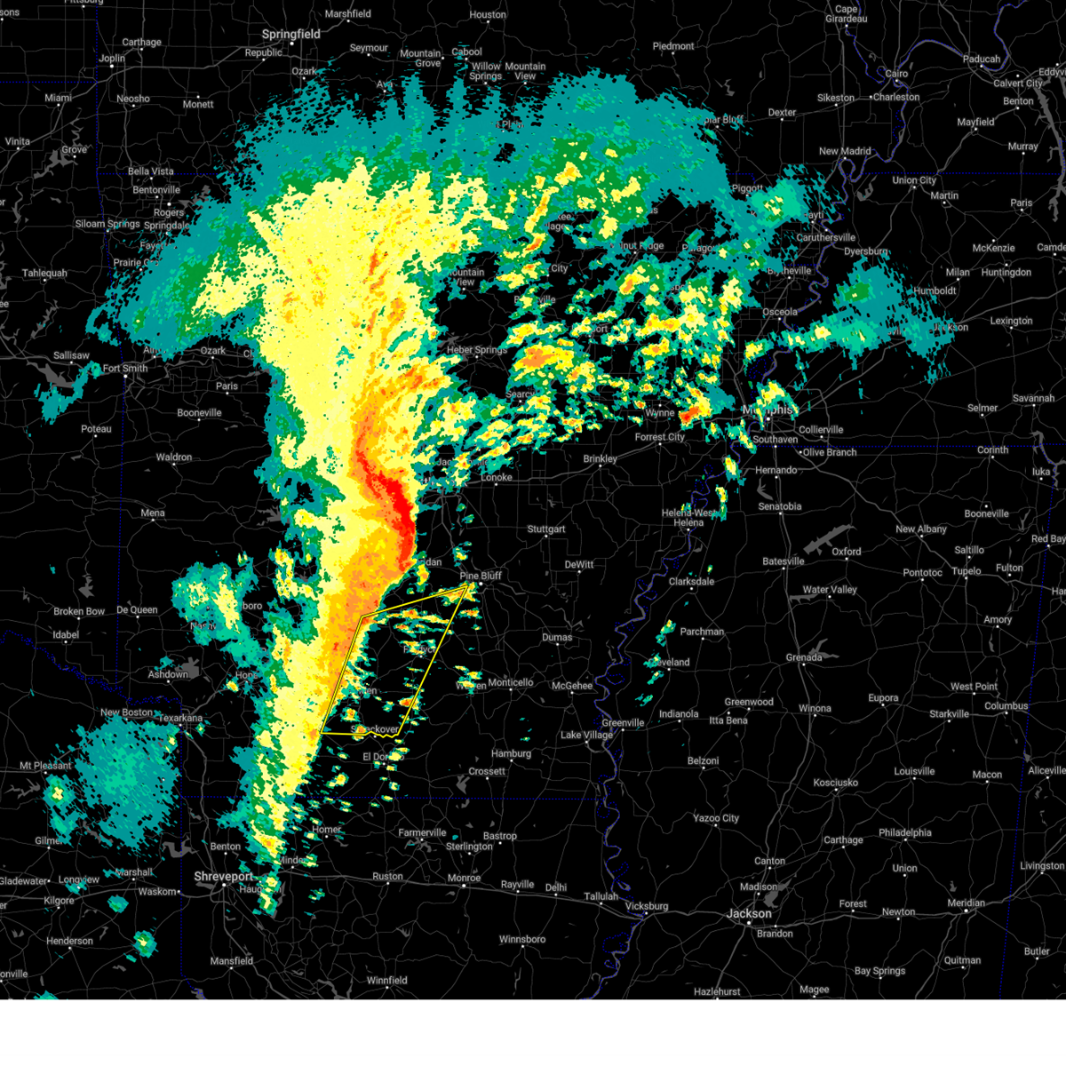
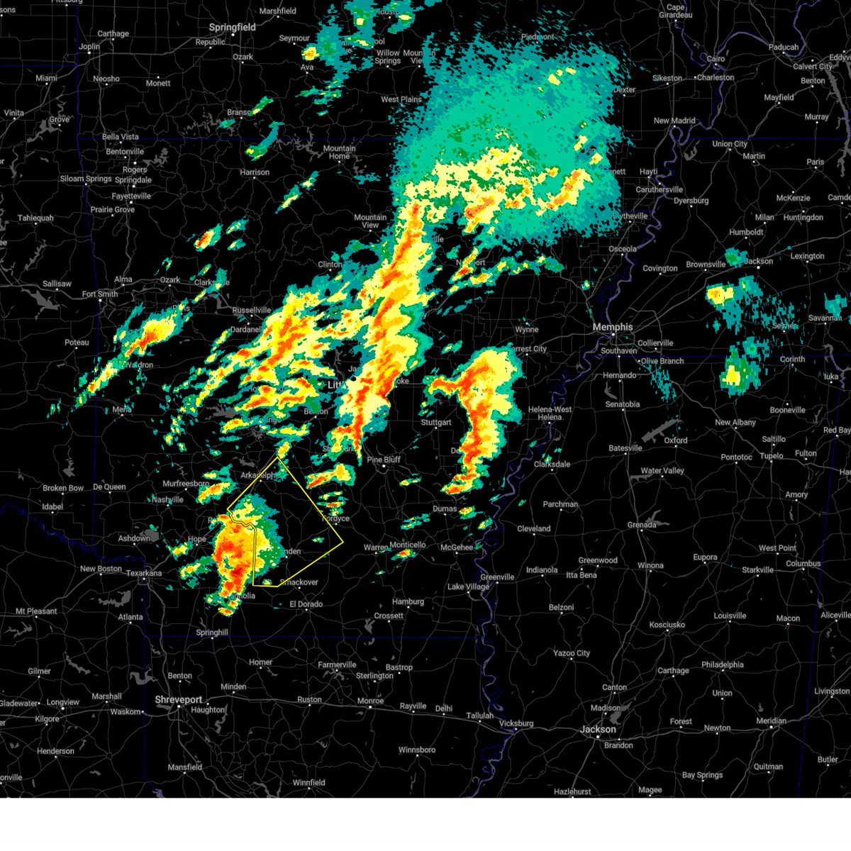
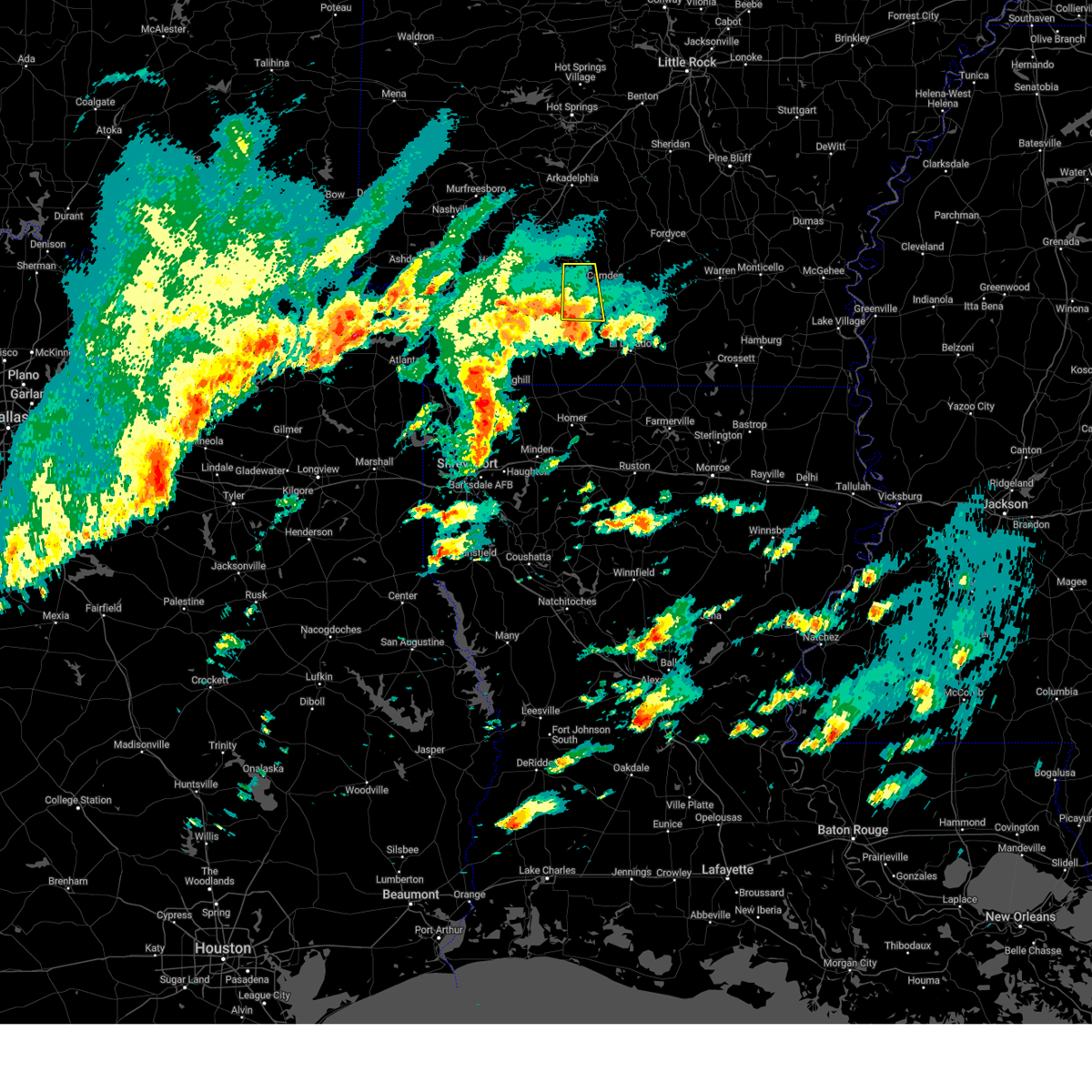
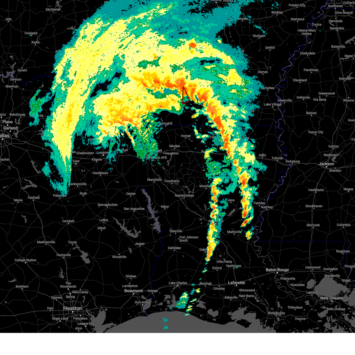
| 4/2/2025 8:19 PM CDT | At 819 pm cdt, a severe thunderstorm capable of producing a tornado was located near camden, moving northeast at 40 mph (radar indicated rotation). Hazards include tornado and quarter size hail. Flying debris will be dangerous to those caught without shelter. mobile homes will be damaged or destroyed. damage to roofs, windows, and vehicles will occur. tree damage is likely. Locations impacted include, camden, poison springs state park, cullendale, east camden, harmony grove, amy, locust bayou, troy, fairview in ouachita county, warner, bragg city, buena vista, highland industrial park, stephens,. |
| 4/2/2025 7:49 PM CDT | At 749 pm cdt, a severe thunderstorm capable of producing a tornado was located near mcneil, moving northeast at 45 mph (radar indicated rotation). Hazards include tornado. Flying debris will be dangerous to those caught without shelter. mobile homes will be damaged or destroyed. damage to roofs, windows, and vehicles will occur. tree damage is likely. Locations impacted include, stephens, troy,. |
| 4/2/2025 7:46 PM CDT | Torlzk the national weather service in little rock has issued a * tornado warning for, west central calhoun county in southwestern arkansas, ouachita county in southwestern arkansas, * until 830 pm cdt. * at 746 pm cdt, a severe thunderstorm capable of producing a tornado was located over mcneil, moving northeast at 50 mph (radar indicated rotation). Hazards include tornado. Flying debris will be dangerous to those caught without shelter. mobile homes will be damaged or destroyed. damage to roofs, windows, and vehicles will occur. Tree damage is likely. |
| 4/2/2025 7:36 PM CDT | Torlzk the national weather service in little rock has issued a * tornado warning for, southwestern ouachita county in southwestern arkansas, * until 800 pm cdt. * at 736 pm cdt, a confirmed tornado was located over waldo, moving northeast at 45 mph (emergency management confirmed tornado). Hazards include damaging tornado. Flying debris will be dangerous to those caught without shelter. mobile homes will be damaged or destroyed. damage to roofs, windows, and vehicles will occur. Tree damage is likely. |
| 3/4/2025 9:37 AM CST |
 Svrlzk the national weather service in little rock has issued a * severe thunderstorm warning for, calhoun county in southwestern arkansas, ouachita county in southwestern arkansas, * until 1030 am cst. * at 937 am cst, severe thunderstorms were located along a line extending from near whelen springs to 7 miles southeast of willisville to 6 miles west of emerson, moving east at 55 mph (radar indicated). Hazards include 60 mph wind gusts and penny size hail. expect damage to roofs, siding, and trees Svrlzk the national weather service in little rock has issued a * severe thunderstorm warning for, calhoun county in southwestern arkansas, ouachita county in southwestern arkansas, * until 1030 am cst. * at 937 am cst, severe thunderstorms were located along a line extending from near whelen springs to 7 miles southeast of willisville to 6 miles west of emerson, moving east at 55 mph (radar indicated). Hazards include 60 mph wind gusts and penny size hail. expect damage to roofs, siding, and trees
|
| 1/5/2025 11:54 AM CST |
 At 1154 am cst, a severe thunderstorm was located over poison springs state park, or 8 miles northwest of camden, moving east at 40 mph (radar indicated). Hazards include 60 mph wind gusts. Expect damage to roofs, siding, and trees. Locations impacted include, camden, bearden, stephens, chidester, louann, poison springs state park, cullendale, white oak lake state park, east camden, amy, eagle mills, harmony grove, kirkland, frenchport, elliot, troy, fairview in ouachita county, warner, tates bluff, bragg city,. At 1154 am cst, a severe thunderstorm was located over poison springs state park, or 8 miles northwest of camden, moving east at 40 mph (radar indicated). Hazards include 60 mph wind gusts. Expect damage to roofs, siding, and trees. Locations impacted include, camden, bearden, stephens, chidester, louann, poison springs state park, cullendale, white oak lake state park, east camden, amy, eagle mills, harmony grove, kirkland, frenchport, elliot, troy, fairview in ouachita county, warner, tates bluff, bragg city,.
|
| 1/5/2025 11:28 AM CST |
 Svrlzk the national weather service in little rock has issued a * severe thunderstorm warning for, ouachita county in southwestern arkansas, * until 1230 pm cst. * at 1127 am cst, a severe thunderstorm was located over willisville, or 13 miles north of waldo, moving northeast at 30 mph (radar indicated). Hazards include 60 mph wind gusts. expect damage to roofs, siding, and trees Svrlzk the national weather service in little rock has issued a * severe thunderstorm warning for, ouachita county in southwestern arkansas, * until 1230 pm cst. * at 1127 am cst, a severe thunderstorm was located over willisville, or 13 miles north of waldo, moving northeast at 30 mph (radar indicated). Hazards include 60 mph wind gusts. expect damage to roofs, siding, and trees
|
| 12/28/2024 8:11 AM CST |
 the severe thunderstorm warning has been cancelled and is no longer in effect the severe thunderstorm warning has been cancelled and is no longer in effect
|
| 12/28/2024 7:57 AM CST |
 Svrlzk the national weather service in little rock has issued a * severe thunderstorm warning for, southwestern ouachita county in southwestern arkansas, * until 845 am cst. * at 756 am cst, a severe thunderstorm was located near mcneil, moving north at 35 mph (radar indicated). Hazards include 60 mph wind gusts and quarter size hail. Hail damage to vehicles is expected. Expect wind damage to roofs, siding, and trees. Svrlzk the national weather service in little rock has issued a * severe thunderstorm warning for, southwestern ouachita county in southwestern arkansas, * until 845 am cst. * at 756 am cst, a severe thunderstorm was located near mcneil, moving north at 35 mph (radar indicated). Hazards include 60 mph wind gusts and quarter size hail. Hail damage to vehicles is expected. Expect wind damage to roofs, siding, and trees.
|
| 8/18/2024 10:35 PM CDT |
 At 1035 pm cdt, severe thunderstorms were located along a line extending from 8 miles east of monticello to near ingalls to near lisbon, moving southeast at 60 mph (radar indicated). Hazards include 60 mph wind gusts. Expect damage to roofs, siding, and trees. Locations impacted include, camden, monticello, warren, hampton, stephens, hermitage, wilmar, harrell, louann, ingalls, plantersville, hampton municipal airport, moro bay, weeks, poison springs state park, cullendale, ellisville, hilo, ladelle, green hill,. At 1035 pm cdt, severe thunderstorms were located along a line extending from 8 miles east of monticello to near ingalls to near lisbon, moving southeast at 60 mph (radar indicated). Hazards include 60 mph wind gusts. Expect damage to roofs, siding, and trees. Locations impacted include, camden, monticello, warren, hampton, stephens, hermitage, wilmar, harrell, louann, ingalls, plantersville, hampton municipal airport, moro bay, weeks, poison springs state park, cullendale, ellisville, hilo, ladelle, green hill,.
|
| 8/18/2024 10:35 PM CDT |
 the severe thunderstorm warning has been cancelled and is no longer in effect the severe thunderstorm warning has been cancelled and is no longer in effect
|
| 8/18/2024 10:30 PM CDT |
 the severe thunderstorm warning has been cancelled and is no longer in effect the severe thunderstorm warning has been cancelled and is no longer in effect
|
| 8/18/2024 10:30 PM CDT |
 At 1030 pm cdt, severe thunderstorms were located along a line extending from 7 miles east of monticello to ingalls to near lisbon, moving southeast at 60 mph (radar indicated). Hazards include 60 mph wind gusts. Expect damage to roofs, siding, and trees. Locations impacted include, camden, monticello, warren, hampton, stephens, hermitage, wilmar, harrell, louann, ingalls, plantersville, hampton municipal airport, moro bay, weeks, poison springs state park, cullendale, ellisville, hilo, ladelle, green hill,. At 1030 pm cdt, severe thunderstorms were located along a line extending from 7 miles east of monticello to ingalls to near lisbon, moving southeast at 60 mph (radar indicated). Hazards include 60 mph wind gusts. Expect damage to roofs, siding, and trees. Locations impacted include, camden, monticello, warren, hampton, stephens, hermitage, wilmar, harrell, louann, ingalls, plantersville, hampton municipal airport, moro bay, weeks, poison springs state park, cullendale, ellisville, hilo, ladelle, green hill,.
|
| 8/18/2024 10:20 PM CDT |
 At 1020 pm cdt, severe thunderstorms were located along a line extending from 8 miles northeast of monticello to hermitage to near louann, moving south at 60 mph (radar indicated). Hazards include 60 mph wind gusts. Expect damage to roofs, siding, and trees. Locations impacted include, camden, monticello, warren, fordyce, star city, rison, hampton, bearden, stephens, hermitage, wilmar, grady, kingsland, sparkman, thornton, chidester, harrell, louann, whitefield, weeks,. At 1020 pm cdt, severe thunderstorms were located along a line extending from 8 miles northeast of monticello to hermitage to near louann, moving south at 60 mph (radar indicated). Hazards include 60 mph wind gusts. Expect damage to roofs, siding, and trees. Locations impacted include, camden, monticello, warren, fordyce, star city, rison, hampton, bearden, stephens, hermitage, wilmar, grady, kingsland, sparkman, thornton, chidester, harrell, louann, whitefield, weeks,.
|
| 8/18/2024 10:20 PM CDT |
 the severe thunderstorm warning has been cancelled and is no longer in effect the severe thunderstorm warning has been cancelled and is no longer in effect
|
| 8/18/2024 10:10 PM CDT |
 At 1010 pm cdt, severe thunderstorms were located along a line extending from near cane creek state park to near lanark to 7 miles east of stephens, moving south at 50 mph (radar indicated). Hazards include 70 mph wind gusts and nickel size hail. Expect considerable tree damage. damage is likely to mobile homes, roofs, and outbuildings. Locations impacted include, camden, monticello, warren, fordyce, star city, rison, hampton, bearden, stephens, hermitage, wilmar, grady, kingsland, sparkman, thornton, chidester, harrell, louann, whelen springs, whitefield,. At 1010 pm cdt, severe thunderstorms were located along a line extending from near cane creek state park to near lanark to 7 miles east of stephens, moving south at 50 mph (radar indicated). Hazards include 70 mph wind gusts and nickel size hail. Expect considerable tree damage. damage is likely to mobile homes, roofs, and outbuildings. Locations impacted include, camden, monticello, warren, fordyce, star city, rison, hampton, bearden, stephens, hermitage, wilmar, grady, kingsland, sparkman, thornton, chidester, harrell, louann, whelen springs, whitefield,.
|
| 8/18/2024 9:54 PM CDT |
 Svrlzk the national weather service in little rock has issued a * severe thunderstorm warning for, bradley county in southeastern arkansas, cleveland county in southeastern arkansas, southeastern clark county in southwestern arkansas, west central desha county in southeastern arkansas, calhoun county in southwestern arkansas, southern dallas county in southwestern arkansas, ouachita county in southwestern arkansas, drew county in southeastern arkansas, southwestern jefferson county in southeastern arkansas, lincoln county in southeastern arkansas, * until 1045 pm cdt. * at 953 pm cdt, severe thunderstorms were located along a line extending from 6 miles northwest of feenyville to near fordyce to near bluff city, moving southeast at 60 mph (radar indicated). Hazards include 70 mph wind gusts and nickel size hail. Expect considerable tree damage. Damage is likely to mobile homes, roofs, and outbuildings. Svrlzk the national weather service in little rock has issued a * severe thunderstorm warning for, bradley county in southeastern arkansas, cleveland county in southeastern arkansas, southeastern clark county in southwestern arkansas, west central desha county in southeastern arkansas, calhoun county in southwestern arkansas, southern dallas county in southwestern arkansas, ouachita county in southwestern arkansas, drew county in southeastern arkansas, southwestern jefferson county in southeastern arkansas, lincoln county in southeastern arkansas, * until 1045 pm cdt. * at 953 pm cdt, severe thunderstorms were located along a line extending from 6 miles northwest of feenyville to near fordyce to near bluff city, moving southeast at 60 mph (radar indicated). Hazards include 70 mph wind gusts and nickel size hail. Expect considerable tree damage. Damage is likely to mobile homes, roofs, and outbuildings.
|
| 8/18/2024 8:19 PM CDT | the severe thunderstorm warning has been cancelled and is no longer in effect |
| 8/18/2024 8:05 PM CDT |
 Svrlzk the national weather service in little rock has issued a * severe thunderstorm warning for, western ouachita county in southwestern arkansas, * until 845 pm cdt. * at 805 pm cdt, a severe thunderstorm was located near chidester, or 11 miles northwest of camden, moving south at 25 mph (radar indicated). Hazards include 60 mph wind gusts and quarter size hail. Hail damage to vehicles is expected. Expect wind damage to roofs, siding, and trees. Svrlzk the national weather service in little rock has issued a * severe thunderstorm warning for, western ouachita county in southwestern arkansas, * until 845 pm cdt. * at 805 pm cdt, a severe thunderstorm was located near chidester, or 11 miles northwest of camden, moving south at 25 mph (radar indicated). Hazards include 60 mph wind gusts and quarter size hail. Hail damage to vehicles is expected. Expect wind damage to roofs, siding, and trees.
|
| 7/8/2024 8:13 PM CDT |
 The storm which prompted the warning has weakened below severe limits, and has exited the warned area. therefore, the warning will be allowed to expire. however gusty winds are still possible with this thunderstorm. a tornado watch remains in effect until midnight cdt for southwestern arkansas. The storm which prompted the warning has weakened below severe limits, and has exited the warned area. therefore, the warning will be allowed to expire. however gusty winds are still possible with this thunderstorm. a tornado watch remains in effect until midnight cdt for southwestern arkansas.
|
| 7/8/2024 7:54 PM CDT |
 Torlzk the national weather service in little rock has issued a * tornado warning for, southwestern ouachita county in southwestern arkansas, * until 815 pm cdt. * at 753 pm cdt, a severe thunderstorm capable of producing a tornado was located near stephens, or 10 miles northeast of mcneil, moving northwest at 35 mph (radar indicated rotation). Hazards include tornado. Flying debris will be dangerous to those caught without shelter. mobile homes will be damaged or destroyed. damage to roofs, windows, and vehicles will occur. Tree damage is likely. Torlzk the national weather service in little rock has issued a * tornado warning for, southwestern ouachita county in southwestern arkansas, * until 815 pm cdt. * at 753 pm cdt, a severe thunderstorm capable of producing a tornado was located near stephens, or 10 miles northeast of mcneil, moving northwest at 35 mph (radar indicated rotation). Hazards include tornado. Flying debris will be dangerous to those caught without shelter. mobile homes will be damaged or destroyed. damage to roofs, windows, and vehicles will occur. Tree damage is likely.
|
| 4/28/2024 8:18 PM CDT |
 Svrlzk the national weather service in little rock has issued a * severe thunderstorm warning for, southeastern clark county in southwestern arkansas, calhoun county in southwestern arkansas, southwestern dallas county in southwestern arkansas, ouachita county in southwestern arkansas, * until 900 pm cdt. * at 818 pm cdt, severe thunderstorms were located along a line extending from 7 miles southwest of bodcaw to near village to near atlanta to near homer, moving northeast at 50 mph (radar indicated). Hazards include 60 mph wind gusts and quarter size hail. Hail damage to vehicles is expected. Expect wind damage to roofs, siding, and trees. Svrlzk the national weather service in little rock has issued a * severe thunderstorm warning for, southeastern clark county in southwestern arkansas, calhoun county in southwestern arkansas, southwestern dallas county in southwestern arkansas, ouachita county in southwestern arkansas, * until 900 pm cdt. * at 818 pm cdt, severe thunderstorms were located along a line extending from 7 miles southwest of bodcaw to near village to near atlanta to near homer, moving northeast at 50 mph (radar indicated). Hazards include 60 mph wind gusts and quarter size hail. Hail damage to vehicles is expected. Expect wind damage to roofs, siding, and trees.
|
| 9/6/2023 5:11 PM CDT |
 At 510 pm cdt, a severe thunderstorm was located over chidester, or 12 miles northwest of camden, moving southeast at 30 mph (radar indicated). Hazards include 60 mph wind gusts and quarter size hail. Hail damage to vehicles is expected. Expect wind damage to roofs, siding, and trees. At 510 pm cdt, a severe thunderstorm was located over chidester, or 12 miles northwest of camden, moving southeast at 30 mph (radar indicated). Hazards include 60 mph wind gusts and quarter size hail. Hail damage to vehicles is expected. Expect wind damage to roofs, siding, and trees.
|
| 7/16/2023 4:07 PM CDT |
 The severe thunderstorm warning for southwestern bradley, southern calhoun and southern ouachita counties will expire at 415 pm cdt, the storms which prompted the warning have weakened below severe limits, and no longer pose an immediate threat to life or property. therefore, the warning will be allowed to expire. however gusty winds and heavy rain are still possible with these thunderstorms. The severe thunderstorm warning for southwestern bradley, southern calhoun and southern ouachita counties will expire at 415 pm cdt, the storms which prompted the warning have weakened below severe limits, and no longer pose an immediate threat to life or property. therefore, the warning will be allowed to expire. however gusty winds and heavy rain are still possible with these thunderstorms.
|
| 7/16/2023 3:36 PM CDT |
 At 335 pm cdt, severe thunderstorms were located along a line extending from near stephens to near cooley, moving east at 45 mph (radar indicated). Hazards include 60 mph wind gusts and nickel size hail. Expect damage to roofs, siding, and trees. locations impacted include, stephens, louann, elliot, buena vista, kirkland, hail threat, radar indicated max hail size, 0. 88 in wind threat, radar indicated max wind gust, 60 mph. At 335 pm cdt, severe thunderstorms were located along a line extending from near stephens to near cooley, moving east at 45 mph (radar indicated). Hazards include 60 mph wind gusts and nickel size hail. Expect damage to roofs, siding, and trees. locations impacted include, stephens, louann, elliot, buena vista, kirkland, hail threat, radar indicated max hail size, 0. 88 in wind threat, radar indicated max wind gust, 60 mph.
|
| 7/16/2023 3:35 PM CDT |
 At 335 pm cdt, severe thunderstorms were located along a line extending from stephens to near bernice, moving east at 45 mph (radar indicated). Hazards include 60 mph wind gusts and penny size hail. expect damage to roofs, siding, and trees At 335 pm cdt, severe thunderstorms were located along a line extending from stephens to near bernice, moving east at 45 mph (radar indicated). Hazards include 60 mph wind gusts and penny size hail. expect damage to roofs, siding, and trees
|
| 7/16/2023 3:12 PM CDT |
 At 311 pm cdt, severe thunderstorms were located along a line extending from near willisville to 7 miles west of homer, moving east at 45 mph (radar indicated). Hazards include 60 mph wind gusts and nickel size hail. Expect damage to roofs, siding, and trees. locations impacted include, camden, stephens, chidester, louann, poison springs state park, cullendale, white oak lake state park, kirkland, elliot, fairview in ouachita county, troy, bragg city, buena vista, reader, hail threat, radar indicated max hail size, 0. 88 in wind threat, radar indicated max wind gust, 60 mph. At 311 pm cdt, severe thunderstorms were located along a line extending from near willisville to 7 miles west of homer, moving east at 45 mph (radar indicated). Hazards include 60 mph wind gusts and nickel size hail. Expect damage to roofs, siding, and trees. locations impacted include, camden, stephens, chidester, louann, poison springs state park, cullendale, white oak lake state park, kirkland, elliot, fairview in ouachita county, troy, bragg city, buena vista, reader, hail threat, radar indicated max hail size, 0. 88 in wind threat, radar indicated max wind gust, 60 mph.
|
| 7/16/2023 2:47 PM CDT |
 At 247 pm cdt, severe thunderstorms were located along a line extending from 6 miles north of stamps to cotton valley, moving east at 45 mph (radar indicated). Hazards include 60 mph wind gusts and nickel size hail. expect damage to roofs, siding, and trees At 247 pm cdt, severe thunderstorms were located along a line extending from 6 miles north of stamps to cotton valley, moving east at 45 mph (radar indicated). Hazards include 60 mph wind gusts and nickel size hail. expect damage to roofs, siding, and trees
|
| 7/15/2023 6:28 PM CDT |
 The severe thunderstorm warning for west central calhoun and southwestern ouachita counties will expire at 630 pm cdt, the storm which prompted the warning has moved out of the area. therefore, the warning will be allowed to expire. The severe thunderstorm warning for west central calhoun and southwestern ouachita counties will expire at 630 pm cdt, the storm which prompted the warning has moved out of the area. therefore, the warning will be allowed to expire.
|
| 7/15/2023 6:07 PM CDT |
 At 606 pm cdt, a severe thunderstorm was located near cullendale, or near camden, moving southeast at 30 mph (law enforcement). Hazards include 60 mph wind gusts and half dollar size hail. trees have been reported down in ouachita county. Hail damage to vehicles is expected. expect wind damage to roofs, siding, and trees. locations impacted include, camden, stephens, cullendale, poison springs state park, east camden, kirkland, harmony grove, frenchport, elliot, fairview in ouachita county, locust bayou, warner, bragg city, buena vista, hail threat, radar indicated max hail size, 1. 25 in wind threat, observed max wind gust, 60 mph. At 606 pm cdt, a severe thunderstorm was located near cullendale, or near camden, moving southeast at 30 mph (law enforcement). Hazards include 60 mph wind gusts and half dollar size hail. trees have been reported down in ouachita county. Hail damage to vehicles is expected. expect wind damage to roofs, siding, and trees. locations impacted include, camden, stephens, cullendale, poison springs state park, east camden, kirkland, harmony grove, frenchport, elliot, fairview in ouachita county, locust bayou, warner, bragg city, buena vista, hail threat, radar indicated max hail size, 1. 25 in wind threat, observed max wind gust, 60 mph.
|
| 7/15/2023 5:48 PM CDT |
 At 548 pm cdt, a severe thunderstorm was located near poison springs state park, or near camden, moving southeast at 30 mph (radar indicated). Hazards include ping pong ball size hail and 60 mph wind gusts. People and animals outdoors will be injured. expect hail damage to roofs, siding, windows, and vehicles. expect wind damage to roofs, siding, and trees. locations impacted include, camden, stephens, chidester, poison springs state park, cullendale, highland industrial park, east camden, kirkland, harmony grove, frenchport, elliot, fairview in ouachita county, troy, locust bayou, warner, bragg city, buena vista, hail threat, radar indicated max hail size, 1. 50 in wind threat, radar indicated max wind gust, 60 mph. At 548 pm cdt, a severe thunderstorm was located near poison springs state park, or near camden, moving southeast at 30 mph (radar indicated). Hazards include ping pong ball size hail and 60 mph wind gusts. People and animals outdoors will be injured. expect hail damage to roofs, siding, windows, and vehicles. expect wind damage to roofs, siding, and trees. locations impacted include, camden, stephens, chidester, poison springs state park, cullendale, highland industrial park, east camden, kirkland, harmony grove, frenchport, elliot, fairview in ouachita county, troy, locust bayou, warner, bragg city, buena vista, hail threat, radar indicated max hail size, 1. 50 in wind threat, radar indicated max wind gust, 60 mph.
|
| 7/15/2023 5:38 PM CDT |
 At 538 pm cdt, a severe thunderstorm was located over poison springs state park, or 10 miles west of camden, moving southeast at 30 mph (radar indicated). Hazards include 60 mph wind gusts and quarter size hail. Hail damage to vehicles is expected. Expect wind damage to roofs, siding, and trees. At 538 pm cdt, a severe thunderstorm was located over poison springs state park, or 10 miles west of camden, moving southeast at 30 mph (radar indicated). Hazards include 60 mph wind gusts and quarter size hail. Hail damage to vehicles is expected. Expect wind damage to roofs, siding, and trees.
|
| 6/26/2023 2:31 AM CDT |
 At 231 am cdt, severe thunderstorms were located along a line extending from thornton to 8 miles southwest of poison springs state park, moving southeast at 40 mph (radar indicated). Hazards include 60 mph wind gusts and quarter size hail. Hail damage to vehicles is expected. Expect wind damage to roofs, siding, and trees. At 231 am cdt, severe thunderstorms were located along a line extending from thornton to 8 miles southwest of poison springs state park, moving southeast at 40 mph (radar indicated). Hazards include 60 mph wind gusts and quarter size hail. Hail damage to vehicles is expected. Expect wind damage to roofs, siding, and trees.
|
| 6/18/2023 5:31 AM CDT |
 At 531 am cdt, severe thunderstorms were located along a line extending from near willisville to near mcneil to near macedonia, moving east at 40 mph (radar indicated). Hazards include 60 mph wind gusts and penny size hail. expect damage to roofs, siding, and trees At 531 am cdt, severe thunderstorms were located along a line extending from near willisville to near mcneil to near macedonia, moving east at 40 mph (radar indicated). Hazards include 60 mph wind gusts and penny size hail. expect damage to roofs, siding, and trees
|
| 6/18/2023 2:15 AM CDT |
 At 214 am cdt, severe thunderstorms were located along a line extending from arkadelphia to 8 miles northeast of chidester to 6 miles north of stephens, moving east at 60 mph (radar indicated). Hazards include 70 mph wind gusts and penny size hail. Expect considerable tree damage. Damage is likely to mobile homes, roofs, and outbuildings. At 214 am cdt, severe thunderstorms were located along a line extending from arkadelphia to 8 miles northeast of chidester to 6 miles north of stephens, moving east at 60 mph (radar indicated). Hazards include 70 mph wind gusts and penny size hail. Expect considerable tree damage. Damage is likely to mobile homes, roofs, and outbuildings.
|
| 6/14/2023 5:53 PM CDT |
 At 553 pm cdt, a severe thunderstorm was located 8 miles north of stephens, or 14 miles northeast of mcneil, moving east at 55 mph (radar indicated). Hazards include 60 mph wind gusts and quarter size hail. Hail damage to vehicles is expected. Expect wind damage to roofs, siding, and trees. At 553 pm cdt, a severe thunderstorm was located 8 miles north of stephens, or 14 miles northeast of mcneil, moving east at 55 mph (radar indicated). Hazards include 60 mph wind gusts and quarter size hail. Hail damage to vehicles is expected. Expect wind damage to roofs, siding, and trees.
|
| 6/10/2023 1:15 PM CDT |
 At 115 pm cdt, a severe thunderstorm was located 8 miles southwest of cullendale, or 9 miles southwest of camden, moving northeast at 10 mph (radar indicated). Hazards include 60 mph wind gusts and quarter size hail. Hail damage to vehicles is expected. Expect wind damage to roofs, siding, and trees. At 115 pm cdt, a severe thunderstorm was located 8 miles southwest of cullendale, or 9 miles southwest of camden, moving northeast at 10 mph (radar indicated). Hazards include 60 mph wind gusts and quarter size hail. Hail damage to vehicles is expected. Expect wind damage to roofs, siding, and trees.
|
| 4/15/2023 5:00 PM CDT |
 At 500 pm cdt, a severe thunderstorm was located near stephens, or 9 miles northeast of mcneil, moving east at 30 mph (radar indicated). Hazards include 60 mph wind gusts and quarter size hail. Hail damage to vehicles is expected. Expect wind damage to roofs, siding, and trees. At 500 pm cdt, a severe thunderstorm was located near stephens, or 9 miles northeast of mcneil, moving east at 30 mph (radar indicated). Hazards include 60 mph wind gusts and quarter size hail. Hail damage to vehicles is expected. Expect wind damage to roofs, siding, and trees.
|
| 3/12/2023 12:11 AM CDT |
 At 1111 pm cst, a severe thunderstorm was located over poison springs state park, or 12 miles west of camden, moving southeast at 45 mph (radar indicated). Hazards include 60 mph wind gusts and quarter size hail. Hail damage to vehicles is expected. Expect wind damage to roofs, siding, and trees. At 1111 pm cst, a severe thunderstorm was located over poison springs state park, or 12 miles west of camden, moving southeast at 45 mph (radar indicated). Hazards include 60 mph wind gusts and quarter size hail. Hail damage to vehicles is expected. Expect wind damage to roofs, siding, and trees.
|
| 3/3/2023 12:01 AM CST |
 At 1201 am cst, severe thunderstorms were located along a line extending from near rosston to 6 miles west of stephens to magnolia, moving east at 40 mph (radar indicated). Hazards include 60 mph wind gusts and penny size hail. expect damage to roofs, siding, and trees At 1201 am cst, severe thunderstorms were located along a line extending from near rosston to 6 miles west of stephens to magnolia, moving east at 40 mph (radar indicated). Hazards include 60 mph wind gusts and penny size hail. expect damage to roofs, siding, and trees
|
| 1/18/2023 11:06 AM CST |
 At 1106 am cst, a severe thunderstorm was located 8 miles north of stephens, or 13 miles northeast of mcneil, moving northeast at 35 mph (radar indicated). Hazards include 60 mph wind gusts and quarter size hail. Hail damage to vehicles is expected. Expect wind damage to roofs, siding, and trees. At 1106 am cst, a severe thunderstorm was located 8 miles north of stephens, or 13 miles northeast of mcneil, moving northeast at 35 mph (radar indicated). Hazards include 60 mph wind gusts and quarter size hail. Hail damage to vehicles is expected. Expect wind damage to roofs, siding, and trees.
|
| 12/13/2022 4:46 PM CST |
 At 445 pm cst, a severe thunderstorm was located 8 miles east of stephens, or 10 miles southwest of camden, moving northeast at 45 mph (radar indicated). Hazards include 60 mph wind gusts and quarter size hail. Hail damage to vehicles is expected. expect wind damage to roofs, siding, and trees. locations impacted include, camden, hampton, stephens, louann, cullendale, highland industrial park, hampton municipal airport, east camden, artesian, delhi, kirkland, harmony grove, millers bluff, frenchport, elliot, cross roads in ouachita county, fairview in ouachita county, locust bayou, warner, standard umpstead, hail threat, radar indicated max hail size, 1. 00 in wind threat, radar indicated max wind gust, 60 mph. At 445 pm cst, a severe thunderstorm was located 8 miles east of stephens, or 10 miles southwest of camden, moving northeast at 45 mph (radar indicated). Hazards include 60 mph wind gusts and quarter size hail. Hail damage to vehicles is expected. expect wind damage to roofs, siding, and trees. locations impacted include, camden, hampton, stephens, louann, cullendale, highland industrial park, hampton municipal airport, east camden, artesian, delhi, kirkland, harmony grove, millers bluff, frenchport, elliot, cross roads in ouachita county, fairview in ouachita county, locust bayou, warner, standard umpstead, hail threat, radar indicated max hail size, 1. 00 in wind threat, radar indicated max wind gust, 60 mph.
|
| 12/13/2022 4:42 PM CST |
 At 442 pm cst, a severe thunderstorm was located near stephens, or 13 miles southwest of camden, moving northeast at 45 mph (radar indicated). Hazards include 60 mph wind gusts. Expect damage to roofs, siding, and trees. locations impacted include, camden, hampton, stephens, louann, cullendale, highland industrial park, hampton municipal airport, east camden, artesian, delhi, kirkland, harmony grove, millers bluff, frenchport, elliot, cross roads in ouachita county, fairview in ouachita county, locust bayou, warner, standard umpstead, hail threat, radar indicated max hail size, <. 75 in wind threat, radar indicated max wind gust, 60 mph. At 442 pm cst, a severe thunderstorm was located near stephens, or 13 miles southwest of camden, moving northeast at 45 mph (radar indicated). Hazards include 60 mph wind gusts. Expect damage to roofs, siding, and trees. locations impacted include, camden, hampton, stephens, louann, cullendale, highland industrial park, hampton municipal airport, east camden, artesian, delhi, kirkland, harmony grove, millers bluff, frenchport, elliot, cross roads in ouachita county, fairview in ouachita county, locust bayou, warner, standard umpstead, hail threat, radar indicated max hail size, <. 75 in wind threat, radar indicated max wind gust, 60 mph.
|
| 12/13/2022 4:35 PM CST |
 At 435 pm cst, a severe thunderstorm was located over stephens, or 9 miles east of mcneil, moving northeast at 45 mph (radar indicated). Hazards include 60 mph wind gusts. Expect damage to roofs, siding, and trees. locations impacted include, camden, hampton, stephens, louann, cullendale, highland industrial park, hampton municipal airport, east camden, artesian, delhi, kirkland, harmony grove, millers bluff, frenchport, elliot, cross roads in ouachita county, fairview in ouachita county, troy, locust bayou, warner, hail threat, radar indicated max hail size, <. 75 in wind threat, radar indicated max wind gust, 60 mph. At 435 pm cst, a severe thunderstorm was located over stephens, or 9 miles east of mcneil, moving northeast at 45 mph (radar indicated). Hazards include 60 mph wind gusts. Expect damage to roofs, siding, and trees. locations impacted include, camden, hampton, stephens, louann, cullendale, highland industrial park, hampton municipal airport, east camden, artesian, delhi, kirkland, harmony grove, millers bluff, frenchport, elliot, cross roads in ouachita county, fairview in ouachita county, troy, locust bayou, warner, hail threat, radar indicated max hail size, <. 75 in wind threat, radar indicated max wind gust, 60 mph.
|
| 12/13/2022 4:22 PM CST |
 At 421 pm cst, severe thunderstorms were located along a line extending from mcneil to magnolia to near macedonia, moving northeast at 45 mph (radar indicated). Hazards include 60 mph wind gusts. expect damage to roofs, siding, and trees At 421 pm cst, severe thunderstorms were located along a line extending from mcneil to magnolia to near macedonia, moving northeast at 45 mph (radar indicated). Hazards include 60 mph wind gusts. expect damage to roofs, siding, and trees
|
| 6/10/2022 7:55 AM CDT |
 At 755 am cdt, a severe thunderstorm was located 7 miles south of sparkman, or 16 miles north of camden, moving southeast at 60 mph (radar indicated). Hazards include 60 mph wind gusts. expect damage to roofs, siding, and trees At 755 am cdt, a severe thunderstorm was located 7 miles south of sparkman, or 16 miles north of camden, moving southeast at 60 mph (radar indicated). Hazards include 60 mph wind gusts. expect damage to roofs, siding, and trees
|
| 5/21/2022 11:37 PM CDT |
 At 1137 pm cdt, severe thunderstorms were located along a line extending from near gillett to 10 miles southwest of mills to near warren to near harrell to cullendale, moving southeast at 30 mph (radar indicated). Hazards include 60 mph wind gusts and penny size hail. Expect damage to roofs, siding, and trees. locations impacted include, camden, monticello, warren, dumas, star city, hampton, rohwer, bearden, stephens, gould, hermitage, gillett, wilmar, calion, grady, thornton, mitchellville, chidester, harrell, tillar, hail threat, radar indicated max hail size, 0. 75 in wind threat, radar indicated max wind gust, 60 mph. At 1137 pm cdt, severe thunderstorms were located along a line extending from near gillett to 10 miles southwest of mills to near warren to near harrell to cullendale, moving southeast at 30 mph (radar indicated). Hazards include 60 mph wind gusts and penny size hail. Expect damage to roofs, siding, and trees. locations impacted include, camden, monticello, warren, dumas, star city, hampton, rohwer, bearden, stephens, gould, hermitage, gillett, wilmar, calion, grady, thornton, mitchellville, chidester, harrell, tillar, hail threat, radar indicated max hail size, 0. 75 in wind threat, radar indicated max wind gust, 60 mph.
|
| 5/21/2022 11:05 PM CDT |
 At 1104 pm cdt, severe thunderstorms were located along a line extending from 9 miles southwest of almyra to near nebo to near hebron to near harlow to near chidester, moving southeast at 30 mph (radar indicated). Hazards include 60 mph wind gusts and quarter size hail. Hail damage to vehicles is expected. Expect wind damage to roofs, siding, and trees. At 1104 pm cdt, severe thunderstorms were located along a line extending from 9 miles southwest of almyra to near nebo to near hebron to near harlow to near chidester, moving southeast at 30 mph (radar indicated). Hazards include 60 mph wind gusts and quarter size hail. Hail damage to vehicles is expected. Expect wind damage to roofs, siding, and trees.
|
| 5/21/2022 10:31 PM CDT |
 At 1031 pm cdt, severe thunderstorms were located along a line extending from near lamont to near fordyce to near chidester, moving southeast at 45 mph (radar indicated). Hazards include 60 mph wind gusts and quarter size hail. Hail damage to vehicles is expected. expect wind damage to roofs, siding, and trees. locations impacted include, camden, fordyce, rison, gurdon, bearden, stephens, kingsland, sparkman, thornton, carthage, chidester, whelen springs, beirne, white oak lake state park, tipton, poison springs state park, cullendale, ellisville, lamont, harlow, this includes interstate 30 between mile markers 53 and 60. hail threat, radar indicated max hail size, 1. 00 in wind threat, radar indicated max wind gust, 60 mph. At 1031 pm cdt, severe thunderstorms were located along a line extending from near lamont to near fordyce to near chidester, moving southeast at 45 mph (radar indicated). Hazards include 60 mph wind gusts and quarter size hail. Hail damage to vehicles is expected. expect wind damage to roofs, siding, and trees. locations impacted include, camden, fordyce, rison, gurdon, bearden, stephens, kingsland, sparkman, thornton, carthage, chidester, whelen springs, beirne, white oak lake state park, tipton, poison springs state park, cullendale, ellisville, lamont, harlow, this includes interstate 30 between mile markers 53 and 60. hail threat, radar indicated max hail size, 1. 00 in wind threat, radar indicated max wind gust, 60 mph.
|
| 5/21/2022 10:10 PM CDT |
 At 1010 pm cdt, severe thunderstorms were located along a line extending from sheridan to near carthage to near beirne, moving southeast at 30 mph (radar indicated). Hazards include 60 mph wind gusts and quarter size hail. Hail damage to vehicles is expected. Expect wind damage to roofs, siding, and trees. At 1010 pm cdt, severe thunderstorms were located along a line extending from sheridan to near carthage to near beirne, moving southeast at 30 mph (radar indicated). Hazards include 60 mph wind gusts and quarter size hail. Hail damage to vehicles is expected. Expect wind damage to roofs, siding, and trees.
|
| 4/30/2022 8:08 PM CDT |
 At 807 pm cdt, a severe thunderstorm was located over stephens, or 9 miles northeast of mcneil, moving east at 15 mph (radar indicated). Hazards include 60 mph wind gusts and quarter size hail. Hail damage to vehicles is expected. Expect wind damage to roofs, siding, and trees. At 807 pm cdt, a severe thunderstorm was located over stephens, or 9 miles northeast of mcneil, moving east at 15 mph (radar indicated). Hazards include 60 mph wind gusts and quarter size hail. Hail damage to vehicles is expected. Expect wind damage to roofs, siding, and trees.
|
| 5/9/2021 6:11 PM CDT |
 At 610 pm cdt, a severe thunderstorm was located 7 miles southeast of rosston, or 13 miles north of mcneil, moving east at 35 mph (radar indicated). Hazards include 60 mph wind gusts and half dollar size hail. Hail damage to vehicles is expected. Expect wind damage to roofs, siding, and trees. At 610 pm cdt, a severe thunderstorm was located 7 miles southeast of rosston, or 13 miles north of mcneil, moving east at 35 mph (radar indicated). Hazards include 60 mph wind gusts and half dollar size hail. Hail damage to vehicles is expected. Expect wind damage to roofs, siding, and trees.
|
| 4/10/2021 12:47 AM CDT |
 At 1246 am cdt, severe thunderstorms were located along a line extending from near sparkman to louann to near atlanta, moving east at 65 mph (radar indicated). Hazards include 60 mph wind gusts and quarter size hail. Hail damage to vehicles is expected. expect wind damage to roofs, siding, and trees. Locations impacted include, camden, arkadelphia, gurdon, bearden, stephens, caddo valley, sparkman, carthage, chidester, louann, whelen springs, gum springs in clark county, white oak lake state park, poison springs state park, cullendale, harlow, richwoods, highland industrial park, degray lake state park, east camden, this includes interstate 30 between mile markers 63 and 80. At 1246 am cdt, severe thunderstorms were located along a line extending from near sparkman to louann to near atlanta, moving east at 65 mph (radar indicated). Hazards include 60 mph wind gusts and quarter size hail. Hail damage to vehicles is expected. expect wind damage to roofs, siding, and trees. Locations impacted include, camden, arkadelphia, gurdon, bearden, stephens, caddo valley, sparkman, carthage, chidester, louann, whelen springs, gum springs in clark county, white oak lake state park, poison springs state park, cullendale, harlow, richwoods, highland industrial park, degray lake state park, east camden, this includes interstate 30 between mile markers 63 and 80.
|
| 4/10/2021 12:30 AM CDT |
 At 1229 am cdt, severe thunderstorms were located along a line extending from gum springs in clark county to 7 miles southwest of poison springs state park to near emerson, moving southeast at 60 mph. this line of storms has a history of producing 60 mph wind gusts (radar indicated). Hazards include 60 mph wind gusts and quarter size hail. Hail damage to vehicles is expected. expect wind damage to roofs, siding, and trees. Locations impacted include, camden, arkadelphia, gurdon, bearden, stephens, amity, caddo valley, sparkman, carthage, chidester, louann, okolona, whelen springs, beirne, gum springs in clark county, white oak lake state park, degray lake state park, poison springs state park, cullendale, harlow, this includes interstate 30 between mile markers 53 and 80. At 1229 am cdt, severe thunderstorms were located along a line extending from gum springs in clark county to 7 miles southwest of poison springs state park to near emerson, moving southeast at 60 mph. this line of storms has a history of producing 60 mph wind gusts (radar indicated). Hazards include 60 mph wind gusts and quarter size hail. Hail damage to vehicles is expected. expect wind damage to roofs, siding, and trees. Locations impacted include, camden, arkadelphia, gurdon, bearden, stephens, amity, caddo valley, sparkman, carthage, chidester, louann, okolona, whelen springs, beirne, gum springs in clark county, white oak lake state park, degray lake state park, poison springs state park, cullendale, harlow, this includes interstate 30 between mile markers 53 and 80.
|
| 4/10/2021 12:14 AM CDT |
 At 1212 am cdt, severe thunderstorms were located along a line extending from 7 miles southeast of amity to 6 miles southeast of emmet to near smithland, moving southeast at 65 mph. this line of storms does have a history of producing 60 mph wind gusts (radar indicated). Hazards include 60 mph wind gusts and quarter size hail. Hail damage to vehicles is expected. Expect wind damage to roofs, siding, and trees. At 1212 am cdt, severe thunderstorms were located along a line extending from 7 miles southeast of amity to 6 miles southeast of emmet to near smithland, moving southeast at 65 mph. this line of storms does have a history of producing 60 mph wind gusts (radar indicated). Hazards include 60 mph wind gusts and quarter size hail. Hail damage to vehicles is expected. Expect wind damage to roofs, siding, and trees.
|
| 4/9/2021 3:00 PM CDT |
 At 300 pm cdt, severe thunderstorms were located along a line extending from near poison springs state park to near lisbon, moving east at 35 mph (radar indicated). Hazards include 60 mph wind gusts and quarter size hail. Hail damage to vehicles is expected. expect wind damage to roofs, siding, and trees. Locations impacted include, camden, stephens, chidester, louann, poison springs state park, cullendale, white oak lake state park, east camden, amy, kirkland, harmony grove, frenchport, elliot, cross roads in ouachita county, fairview in ouachita county, troy, warner, bragg city, buena vista, reader,. At 300 pm cdt, severe thunderstorms were located along a line extending from near poison springs state park to near lisbon, moving east at 35 mph (radar indicated). Hazards include 60 mph wind gusts and quarter size hail. Hail damage to vehicles is expected. expect wind damage to roofs, siding, and trees. Locations impacted include, camden, stephens, chidester, louann, poison springs state park, cullendale, white oak lake state park, east camden, amy, kirkland, harmony grove, frenchport, elliot, cross roads in ouachita county, fairview in ouachita county, troy, warner, bragg city, buena vista, reader,.
|
| 4/9/2021 2:37 PM CDT |
 At 237 pm cdt, severe thunderstorms were located along a line extending from 6 miles south of white oak lake state park to 7 miles southwest of village, moving east at 35 mph (radar indicated). Hazards include 60 mph wind gusts and quarter size hail. Hail damage to vehicles is expected. Expect wind damage to roofs, siding, and trees. At 237 pm cdt, severe thunderstorms were located along a line extending from 6 miles south of white oak lake state park to 7 miles southwest of village, moving east at 35 mph (radar indicated). Hazards include 60 mph wind gusts and quarter size hail. Hail damage to vehicles is expected. Expect wind damage to roofs, siding, and trees.
|
| 3/27/2021 8:51 PM CDT |
 At 850 pm cdt, severe thunderstorms were located along a line extending from near camden to near cullendale to near stephens, moving east at 45 mph (radar indicated). Hazards include tennis ball size hail and 70 mph wind gusts. People and animals outdoors will be injured. expect hail damage to roofs, siding, windows, and vehicles. expect considerable tree damage. wind damage is also likely to mobile homes, roofs, and outbuildings. Locations impacted include, camden, bearden, stephens, louann, poison springs state park, cullendale, highland industrial park, east camden, delhi, eagle mills, kirkland, harmony grove, frenchport, elliot, cross roads in ouachita county, fairview in ouachita county, locust bayou, troy, warner, millville,. At 850 pm cdt, severe thunderstorms were located along a line extending from near camden to near cullendale to near stephens, moving east at 45 mph (radar indicated). Hazards include tennis ball size hail and 70 mph wind gusts. People and animals outdoors will be injured. expect hail damage to roofs, siding, windows, and vehicles. expect considerable tree damage. wind damage is also likely to mobile homes, roofs, and outbuildings. Locations impacted include, camden, bearden, stephens, louann, poison springs state park, cullendale, highland industrial park, east camden, delhi, eagle mills, kirkland, harmony grove, frenchport, elliot, cross roads in ouachita county, fairview in ouachita county, locust bayou, troy, warner, millville,.
|
| 3/27/2021 8:20 PM CDT |
 At 820 pm cdt, severe thunderstorms were located along a line extending from near rosston to near mcneil to near waldo, moving northeast at 40 mph (radar indicated). Hazards include 60 mph wind gusts and quarter size hail. Hail damage to vehicles is expected. Expect wind damage to roofs, siding, and trees. At 820 pm cdt, severe thunderstorms were located along a line extending from near rosston to near mcneil to near waldo, moving northeast at 40 mph (radar indicated). Hazards include 60 mph wind gusts and quarter size hail. Hail damage to vehicles is expected. Expect wind damage to roofs, siding, and trees.
|
| 3/27/2021 4:22 PM CDT |
 At 422 pm cdt, a severe thunderstorm was located near stephens, or 12 miles northeast of mcneil, moving northeast at 45 mph (radar indicated). Hazards include 60 mph wind gusts and quarter size hail. Hail damage to vehicles is expected. expect wind damage to roofs, siding, and trees. Locations impacted include, camden, stephens, chidester, poison springs state park, cullendale, white oak lake state park, east camden, amy, eagle mills, harmony grove, reader, fairview in ouachita county, troy, warner, tates bluff, bragg city, buena vista,. At 422 pm cdt, a severe thunderstorm was located near stephens, or 12 miles northeast of mcneil, moving northeast at 45 mph (radar indicated). Hazards include 60 mph wind gusts and quarter size hail. Hail damage to vehicles is expected. expect wind damage to roofs, siding, and trees. Locations impacted include, camden, stephens, chidester, poison springs state park, cullendale, white oak lake state park, east camden, amy, eagle mills, harmony grove, reader, fairview in ouachita county, troy, warner, tates bluff, bragg city, buena vista,.
|
| 3/27/2021 4:14 PM CDT |
 At 414 pm cdt, a severe thunderstorm was located over stephens, or 7 miles east of mcneil, moving northeast at 45 mph (radar indicated). Hazards include 60 mph wind gusts and quarter size hail. Hail damage to vehicles is expected. expect wind damage to roofs, siding, and trees. Locations impacted include, camden, stephens, chidester, poison springs state park, cullendale, white oak lake state park, east camden, amy, eagle mills, harmony grove, reader, fairview in ouachita county, troy, warner, tates bluff, bragg city, buena vista,. At 414 pm cdt, a severe thunderstorm was located over stephens, or 7 miles east of mcneil, moving northeast at 45 mph (radar indicated). Hazards include 60 mph wind gusts and quarter size hail. Hail damage to vehicles is expected. expect wind damage to roofs, siding, and trees. Locations impacted include, camden, stephens, chidester, poison springs state park, cullendale, white oak lake state park, east camden, amy, eagle mills, harmony grove, reader, fairview in ouachita county, troy, warner, tates bluff, bragg city, buena vista,.
|
| 3/27/2021 4:06 PM CDT |
 At 406 pm cdt, a severe thunderstorm was located near mcneil, moving northeast at 45 mph (radar indicated). Hazards include 60 mph wind gusts and quarter size hail. Hail damage to vehicles is expected. Expect wind damage to roofs, siding, and trees. At 406 pm cdt, a severe thunderstorm was located near mcneil, moving northeast at 45 mph (radar indicated). Hazards include 60 mph wind gusts and quarter size hail. Hail damage to vehicles is expected. Expect wind damage to roofs, siding, and trees.
|
| 2/25/2021 11:23 PM CST |
 At 1123 pm cst, severe thunderstorms were located along a line extending from 6 miles south of prescott to 6 miles east of willisville to near smithland, moving east at 60 mph (radar indicated). Hazards include 60 mph wind gusts and quarter size hail. Hail damage to vehicles is expected. Expect wind damage to roofs, siding, and trees. At 1123 pm cst, severe thunderstorms were located along a line extending from 6 miles south of prescott to 6 miles east of willisville to near smithland, moving east at 60 mph (radar indicated). Hazards include 60 mph wind gusts and quarter size hail. Hail damage to vehicles is expected. Expect wind damage to roofs, siding, and trees.
|
| 4/29/2020 12:26 AM CDT |
 At 1226 am cdt, severe thunderstorms were located along a line extending from near feenyville to kingsland to near bearden to near highland industrial park to near louann, moving southeast at 35 mph (radar indicated). Hazards include 60 mph wind gusts and quarter size hail. Hail damage to vehicles is expected. expect wind damage to roofs, siding, and trees. Locations impacted include, camden, warren, fordyce, star city, rison, hampton, bearden, stephens, kingsland, thornton, chidester, harrell, plantersville, hampton municipal airport, weeks, tipton, herbine, poison springs state park, feenyville, cullendale,. At 1226 am cdt, severe thunderstorms were located along a line extending from near feenyville to kingsland to near bearden to near highland industrial park to near louann, moving southeast at 35 mph (radar indicated). Hazards include 60 mph wind gusts and quarter size hail. Hail damage to vehicles is expected. expect wind damage to roofs, siding, and trees. Locations impacted include, camden, warren, fordyce, star city, rison, hampton, bearden, stephens, kingsland, thornton, chidester, harrell, plantersville, hampton municipal airport, weeks, tipton, herbine, poison springs state park, feenyville, cullendale,.
|
| 4/29/2020 12:16 AM CDT |
 At 1216 am cdt, severe thunderstorms were located along a line extending from near cullendale to 7 miles northwest of louann to 7 miles east of stephens to near mount holly, moving southeast at 45 mph (radar indicated). Hazards include 60 mph wind gusts and quarter size hail. Hail damage to vehicles is expected. Expect wind damage to roofs, siding, and trees. At 1216 am cdt, severe thunderstorms were located along a line extending from near cullendale to 7 miles northwest of louann to 7 miles east of stephens to near mount holly, moving southeast at 45 mph (radar indicated). Hazards include 60 mph wind gusts and quarter size hail. Hail damage to vehicles is expected. Expect wind damage to roofs, siding, and trees.
|
| 4/28/2020 11:55 PM CDT |
 At 1155 pm cdt, severe thunderstorms were located along a line extending from near lamont to near carthage to near sparkman to near beirne, moving southeast at 35 mph (radar indicated). Hazards include 60 mph wind gusts and quarter size hail. Hail damage to vehicles is expected. Expect wind damage to roofs, siding, and trees. At 1155 pm cdt, severe thunderstorms were located along a line extending from near lamont to near carthage to near sparkman to near beirne, moving southeast at 35 mph (radar indicated). Hazards include 60 mph wind gusts and quarter size hail. Hail damage to vehicles is expected. Expect wind damage to roofs, siding, and trees.
|
| 4/12/2020 7:18 PM CDT |
 At 717 pm cdt, a severe thunderstorm was located over stephens, or 10 miles northeast of mcneil, moving east at 50 mph (radar indicated). Hazards include 60 mph wind gusts and quarter size hail. Hail damage to vehicles is expected. Expect wind damage to roofs, siding, and trees. At 717 pm cdt, a severe thunderstorm was located over stephens, or 10 miles northeast of mcneil, moving east at 50 mph (radar indicated). Hazards include 60 mph wind gusts and quarter size hail. Hail damage to vehicles is expected. Expect wind damage to roofs, siding, and trees.
|
| 1/11/2020 12:44 AM CST |
 At 1243 am cst, severe thunderstorms were located along a line extending from 6 miles east of carthage to near harlow to near highland industrial park to stephens, moving east at 15 mph (radar indicated). Hazards include 60 mph wind gusts. expect damage to roofs, siding, and trees At 1243 am cst, severe thunderstorms were located along a line extending from 6 miles east of carthage to near harlow to near highland industrial park to stephens, moving east at 15 mph (radar indicated). Hazards include 60 mph wind gusts. expect damage to roofs, siding, and trees
|
| 10/21/2019 4:54 AM CDT |
 At 454 am cdt, severe thunderstorms were located along a line extending from near sparkman to near willisville, moving east at 50 mph (radar indicated). Hazards include 60 mph wind gusts. expect damage to roofs, siding, and trees At 454 am cdt, severe thunderstorms were located along a line extending from near sparkman to near willisville, moving east at 50 mph (radar indicated). Hazards include 60 mph wind gusts. expect damage to roofs, siding, and trees
|
| 6/19/2019 9:10 PM CDT |
 The severe thunderstorm warning for northwestern calhoun and ouachita counties will expire at 915 pm cdt, the storms which prompted the warning have moved well into calhoun county and east of the warned area. therefore, the warning will be allowed to expire. a tornado watch remains in effect until midnight cdt for southwestern arkansas. &&. The severe thunderstorm warning for northwestern calhoun and ouachita counties will expire at 915 pm cdt, the storms which prompted the warning have moved well into calhoun county and east of the warned area. therefore, the warning will be allowed to expire. a tornado watch remains in effect until midnight cdt for southwestern arkansas. &&.
|
| 6/19/2019 9:02 PM CDT | Storm damage reported in ouachita county AR, 0.9 miles NNE of Stephens, AR |
| 6/19/2019 8:33 PM CDT |
 At 833 pm cdt, severe thunderstorms were located along a line extending from near white oak lake state park to near poison springs state park to near mcneil, moving east at 60 mph (radar indicated). Hazards include 70 mph wind gusts and nickel size hail. Expect considerable tree damage. damage is likely to mobile homes, roofs, and outbuildings. Locations impacted include, camden, stephens, chidester, louann, poison springs state park, cullendale, white oak lake state park, highland industrial park, east camden, delhi, harmony grove, millers bluff, frenchport, elliot, fairview in ouachita county, locust bayou, warner, standard umpstead, millville, buena vista, a tornado watch remains in effect until midnight cdt for southwestern arkansas. At 833 pm cdt, severe thunderstorms were located along a line extending from near white oak lake state park to near poison springs state park to near mcneil, moving east at 60 mph (radar indicated). Hazards include 70 mph wind gusts and nickel size hail. Expect considerable tree damage. damage is likely to mobile homes, roofs, and outbuildings. Locations impacted include, camden, stephens, chidester, louann, poison springs state park, cullendale, white oak lake state park, highland industrial park, east camden, delhi, harmony grove, millers bluff, frenchport, elliot, fairview in ouachita county, locust bayou, warner, standard umpstead, millville, buena vista, a tornado watch remains in effect until midnight cdt for southwestern arkansas.
|
| 6/19/2019 8:18 PM CDT |
 At 817 pm cdt, severe thunderstorms were located along a line extending from 6 miles northwest of rosston to near willisville to buckner, moving east at 60 mph (radar indicated). Hazards include 70 mph wind gusts and nickel size hail. Expect considerable tree damage. Damage is likely to mobile homes, roofs, and outbuildings. At 817 pm cdt, severe thunderstorms were located along a line extending from 6 miles northwest of rosston to near willisville to buckner, moving east at 60 mph (radar indicated). Hazards include 70 mph wind gusts and nickel size hail. Expect considerable tree damage. Damage is likely to mobile homes, roofs, and outbuildings.
|
| 5/8/2019 4:34 PM CDT |
 At 434 pm cdt, a severe thunderstorm was located near camden, moving northeast at 40 mph (radar indicated). Hazards include 60 mph wind gusts. Expect damage to roofs, siding, and trees. Locations impacted include, camden, bearden, stephens, chidester, louann, poison springs state park, cullendale, white oak lake state park, harlow, highland industrial park, east camden, amy, delhi, harmony grove, reader, millers bluff, frenchport, elliot, fairview in ouachita county, locust bayou,. At 434 pm cdt, a severe thunderstorm was located near camden, moving northeast at 40 mph (radar indicated). Hazards include 60 mph wind gusts. Expect damage to roofs, siding, and trees. Locations impacted include, camden, bearden, stephens, chidester, louann, poison springs state park, cullendale, white oak lake state park, harlow, highland industrial park, east camden, amy, delhi, harmony grove, reader, millers bluff, frenchport, elliot, fairview in ouachita county, locust bayou,.
|
| 5/8/2019 4:21 PM CDT |
 At 421 pm cdt, a severe thunderstorm was located over poison springs state park, or 8 miles west of camden, moving northeast at 40 mph (radar indicated). Hazards include 60 mph wind gusts. expect damage to roofs, siding, and trees At 421 pm cdt, a severe thunderstorm was located over poison springs state park, or 8 miles west of camden, moving northeast at 40 mph (radar indicated). Hazards include 60 mph wind gusts. expect damage to roofs, siding, and trees
|
| 12/14/2018 5:22 AM CST |
 At 521 am cst, a severe thunderstorm was located near louann, or 10 miles west of smackover, moving north at 30 mph (radar indicated). Hazards include quarter size hail. Damage to vehicles is expected. Locations impacted include, camden, stephens, louann, poison springs state park, cullendale, white oak lake state park, east camden, kirkland, frenchport, elliot, fairview in ouachita county, troy, warner, bragg city, buena vista,. At 521 am cst, a severe thunderstorm was located near louann, or 10 miles west of smackover, moving north at 30 mph (radar indicated). Hazards include quarter size hail. Damage to vehicles is expected. Locations impacted include, camden, stephens, louann, poison springs state park, cullendale, white oak lake state park, east camden, kirkland, frenchport, elliot, fairview in ouachita county, troy, warner, bragg city, buena vista,.
|
| 12/14/2018 5:01 AM CST |
 At 501 am cst, a severe thunderstorm was located over lisbon, or 10 miles southwest of smackover, moving north at 30 mph (radar indicated). Hazards include quarter size hail. damage to vehicles is expected At 501 am cst, a severe thunderstorm was located over lisbon, or 10 miles southwest of smackover, moving north at 30 mph (radar indicated). Hazards include quarter size hail. damage to vehicles is expected
|
| 8/11/2017 3:41 PM CDT |
 At 341 pm cdt, a severe thunderstorm was located near cullendale, or 7 miles southwest of camden, moving east at 25 mph (radar indicated). Hazards include 60 mph wind gusts and quarter size hail. Hail damage to vehicles is expected. expect wind damage to roofs, siding, and trees. Locations impacted include, camden, stephens, louann, cullendale, kirkland, elliot, buena vista, fairview in ouachita county, frenchport,. At 341 pm cdt, a severe thunderstorm was located near cullendale, or 7 miles southwest of camden, moving east at 25 mph (radar indicated). Hazards include 60 mph wind gusts and quarter size hail. Hail damage to vehicles is expected. expect wind damage to roofs, siding, and trees. Locations impacted include, camden, stephens, louann, cullendale, kirkland, elliot, buena vista, fairview in ouachita county, frenchport,.
|
| 8/11/2017 3:26 PM CDT |
 At 326 pm cdt, a severe thunderstorm was located 7 miles northeast of stephens, or 10 miles southwest of camden, moving southeast at 25 mph (radar indicated). Hazards include 60 mph wind gusts and quarter size hail. Hail damage to vehicles is expected. Expect wind damage to roofs, siding, and trees. At 326 pm cdt, a severe thunderstorm was located 7 miles northeast of stephens, or 10 miles southwest of camden, moving southeast at 25 mph (radar indicated). Hazards include 60 mph wind gusts and quarter size hail. Hail damage to vehicles is expected. Expect wind damage to roofs, siding, and trees.
|
| 5/21/2017 1:19 AM CDT |
 At 119 am cdt, a severe thunderstorm was located 3 miles east of stephens, or 12 miles southwest of camden, moving northeast at 25 mph (radar indicated). Hazards include ping pong ball size hail. People and animals outdoors will be injured. expect damage to roofs, siding, windows, and vehicles. Locations impacted include, camden, stephens, frenchport, elliot, buena vista, fairview in ouachita county,. At 119 am cdt, a severe thunderstorm was located 3 miles east of stephens, or 12 miles southwest of camden, moving northeast at 25 mph (radar indicated). Hazards include ping pong ball size hail. People and animals outdoors will be injured. expect damage to roofs, siding, windows, and vehicles. Locations impacted include, camden, stephens, frenchport, elliot, buena vista, fairview in ouachita county,.
|
| 5/21/2017 12:55 AM CDT |
 At 1254 am cdt, a severe thunderstorm was located near 3 miles southwest of stephens, moving northeast at 25 mph (radar indicated). Hazards include half dollar size hail. damage to vehicles is expected At 1254 am cdt, a severe thunderstorm was located near 3 miles southwest of stephens, moving northeast at 25 mph (radar indicated). Hazards include half dollar size hail. damage to vehicles is expected
|
| 4/29/2017 5:59 PM CDT |
 At 559 pm cdt, a severe thunderstorm was located near stephens, or 11 miles east of mcneil, moving northeast at 30 mph (radar indicated). Hazards include 60 mph wind gusts and quarter size hail. Hail damage to vehicles is expected. Expect wind damage to roofs, siding, and trees. At 559 pm cdt, a severe thunderstorm was located near stephens, or 11 miles east of mcneil, moving northeast at 30 mph (radar indicated). Hazards include 60 mph wind gusts and quarter size hail. Hail damage to vehicles is expected. Expect wind damage to roofs, siding, and trees.
|
| 7/14/2016 6:35 PM CDT |
 At 634 pm cdt, a severe thunderstorm was located near highland industrial park, or near camden, moving southeast at 30 mph (radar indicated). Hazards include 60 mph wind gusts. Expect damage to roofs. siding. And trees. At 634 pm cdt, a severe thunderstorm was located near highland industrial park, or near camden, moving southeast at 30 mph (radar indicated). Hazards include 60 mph wind gusts. Expect damage to roofs. siding. And trees.
|
| 4/30/2016 1:23 AM CDT |
 At 123 am cdt, a severe thunderstorm was located near stephens, or 7 miles northeast of mcneil, moving northeast at 40 mph (radar indicated). Hazards include 60 mph wind gusts and penny size hail. Expect damage to roofs. siding. And trees. At 123 am cdt, a severe thunderstorm was located near stephens, or 7 miles northeast of mcneil, moving northeast at 40 mph (radar indicated). Hazards include 60 mph wind gusts and penny size hail. Expect damage to roofs. siding. And trees.
|
| 4/11/2016 1:29 PM CDT |
 At 126 pm cdt, severe thunderstorms were located along a line extending from near chidester to near cullendale to near village, moving east at 50 mph (radar indicated). Hazards include 70 mph wind gusts and nickel size hail. Expect considerable tree damage. damage is likely to mobile homes, roofs, and outbuildings. Locations impacted include, camden, hampton, bearden, stephens, thornton, chidester, harrell, louann, poison springs state, highland industrial , cullendale, harlow, hampton municipal ai, east camden, amy, artesian, millers bluff, warner, frenchport, millville,. At 126 pm cdt, severe thunderstorms were located along a line extending from near chidester to near cullendale to near village, moving east at 50 mph (radar indicated). Hazards include 70 mph wind gusts and nickel size hail. Expect considerable tree damage. damage is likely to mobile homes, roofs, and outbuildings. Locations impacted include, camden, hampton, bearden, stephens, thornton, chidester, harrell, louann, poison springs state, highland industrial , cullendale, harlow, hampton municipal ai, east camden, amy, artesian, millers bluff, warner, frenchport, millville,.
|
| 4/11/2016 1:10 PM CDT |
 At 110 pm cdt, severe thunderstorms were located along a line extending from near bluff city to 7 miles east of willisville to magnolia, moving east at 50 mph (radar indicated). Hazards include 70 mph wind gusts and nickel size hail. Expect considerable tree damage. Damage is likely to mobile homes, roofs, and outbuildings. At 110 pm cdt, severe thunderstorms were located along a line extending from near bluff city to 7 miles east of willisville to magnolia, moving east at 50 mph (radar indicated). Hazards include 70 mph wind gusts and nickel size hail. Expect considerable tree damage. Damage is likely to mobile homes, roofs, and outbuildings.
|
| 12/25/2015 1:08 AM CST |
 At 107 am cst, a severe thunderstorm was located near stephens, or 12 miles northeast of mcneil, moving northeast at 45 mph (radar indicated). Hazards include 60 mph wind gusts and quarter size hail. Hail damage to vehicles is expected. Expect wind damage to roofs, siding, and trees. At 107 am cst, a severe thunderstorm was located near stephens, or 12 miles northeast of mcneil, moving northeast at 45 mph (radar indicated). Hazards include 60 mph wind gusts and quarter size hail. Hail damage to vehicles is expected. Expect wind damage to roofs, siding, and trees.
|
| 5/29/2015 6:12 PM CDT | At 611 pm cdt, a severe thunderstorm was located 7 miles south of stephens, and moving north at 30 mph (radar indicated). Hazards include 60 mph wind gusts and quarter size hail. Hail damage to vehicles is expected. Expect wind damage to roofs, siding and trees. |
| 5/25/2015 8:24 PM CDT | At 820 pm cdt, severe thunderstorms were located along a line extending from 7 miles southeast of sparkman to 8 miles east of stephens, and moving northeast at 45 mph (radar indicated). Hazards include 60 mph wind gusts and penny size hail. Expect damage to roofs. Siding and trees. |
| 5/25/2015 7:57 PM CDT | At 754 pm cdt, severe thunderstorms were located along a line extending from sparkman to 5 miles west of louann, and moving northeast at 50 mph (radar indicated). Hazards include 60 mph wind gusts and quarter size hail. Hail damage to vehicles is expected. Expect wind damage to roofs, siding and trees. |
| 4/9/2015 3:32 PM CDT | The national weather service in little rock has issued a * severe thunderstorm warning for. west central calhoun county in southwest arkansas. extreme southeastern clark county in southwest arkansas. southwestern dallas county in southwest arkansas. Ouachita county in southwest arkansas. |
| 2/20/2014 12:33 PM CST | The brick storefront of an old unoccupied store was blown down on chert street. the street was blocked by bricks that fell out into the street. no injuries were reporte in ouachita county AR, 0.9 miles NNE of Stephens, AR |
| 6/12/2012 12:25 AM CDT | Trees were blown dow in ouachita county AR, 0.3 miles NE of Stephens, AR |
| 1/1/0001 12:00 AM | Trees down across highway 82 at the columbia and union county line in columbia county AR, 11.9 miles NNW of Stephens, AR |
| 1/1/0001 12:00 AM | Trees down across highway 82 at the columbia and union county line in columbia county AR, 11.9 miles NNW of Stephens, AR |
| 1/1/0001 12:00 AM | Trees down across highway 82 at the columbia and union county line in columbia county AR, 11.9 miles NNW of Stephens, AR |
Hail Maps for Stephens, AR


Connect with Interactive Hail Maps