

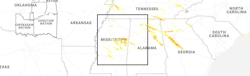
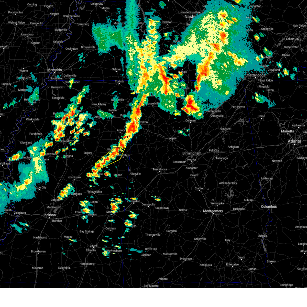
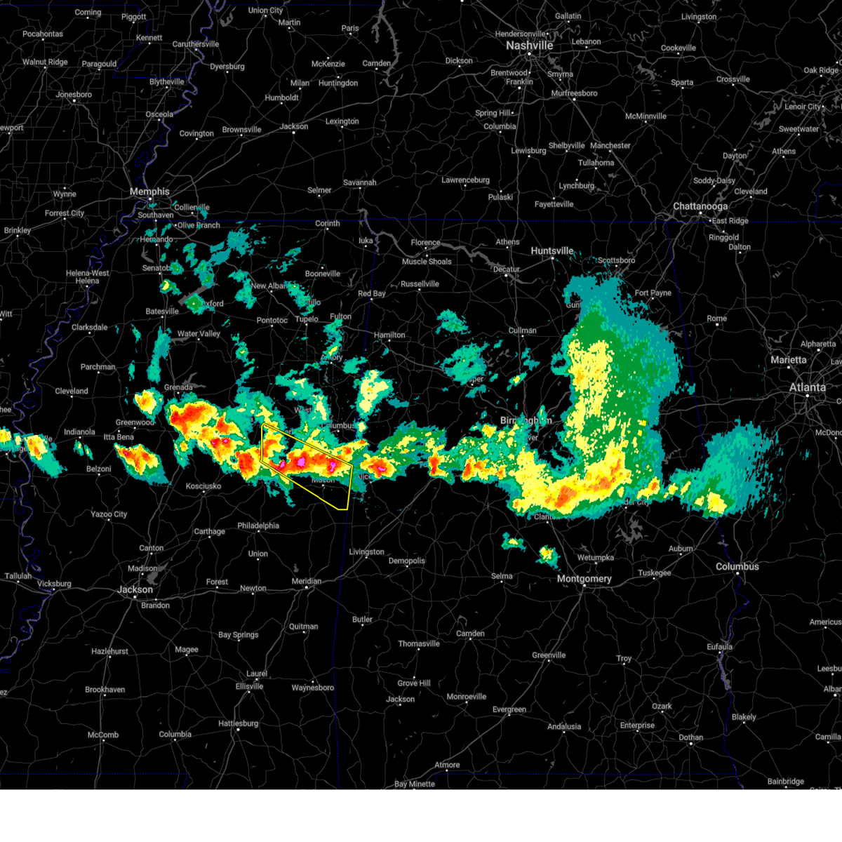
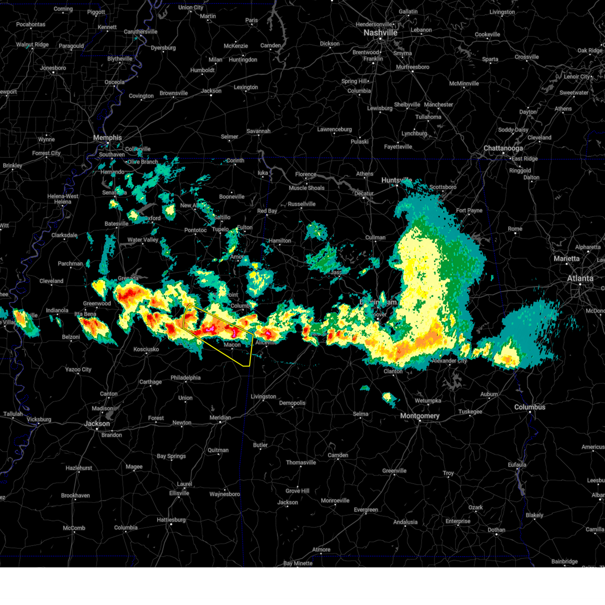
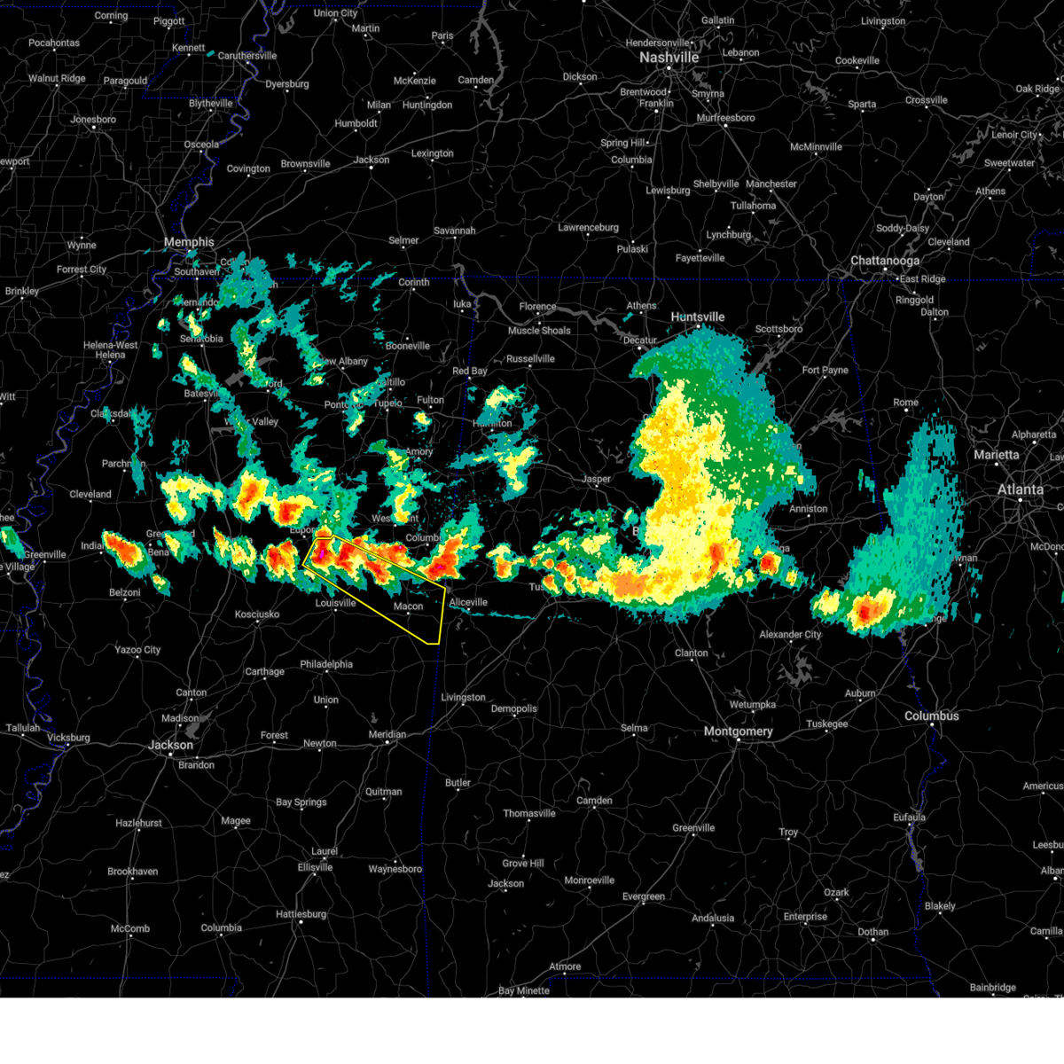
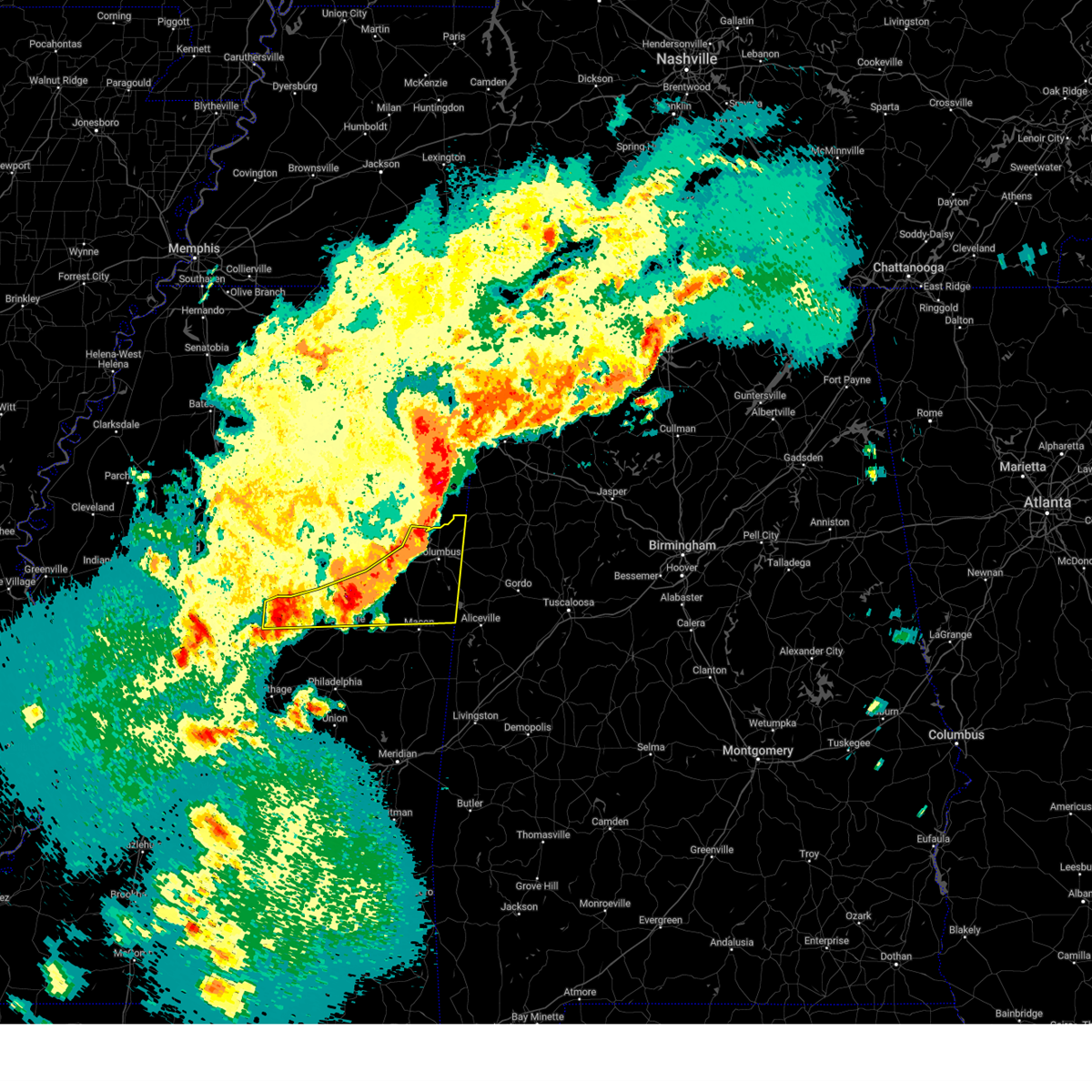
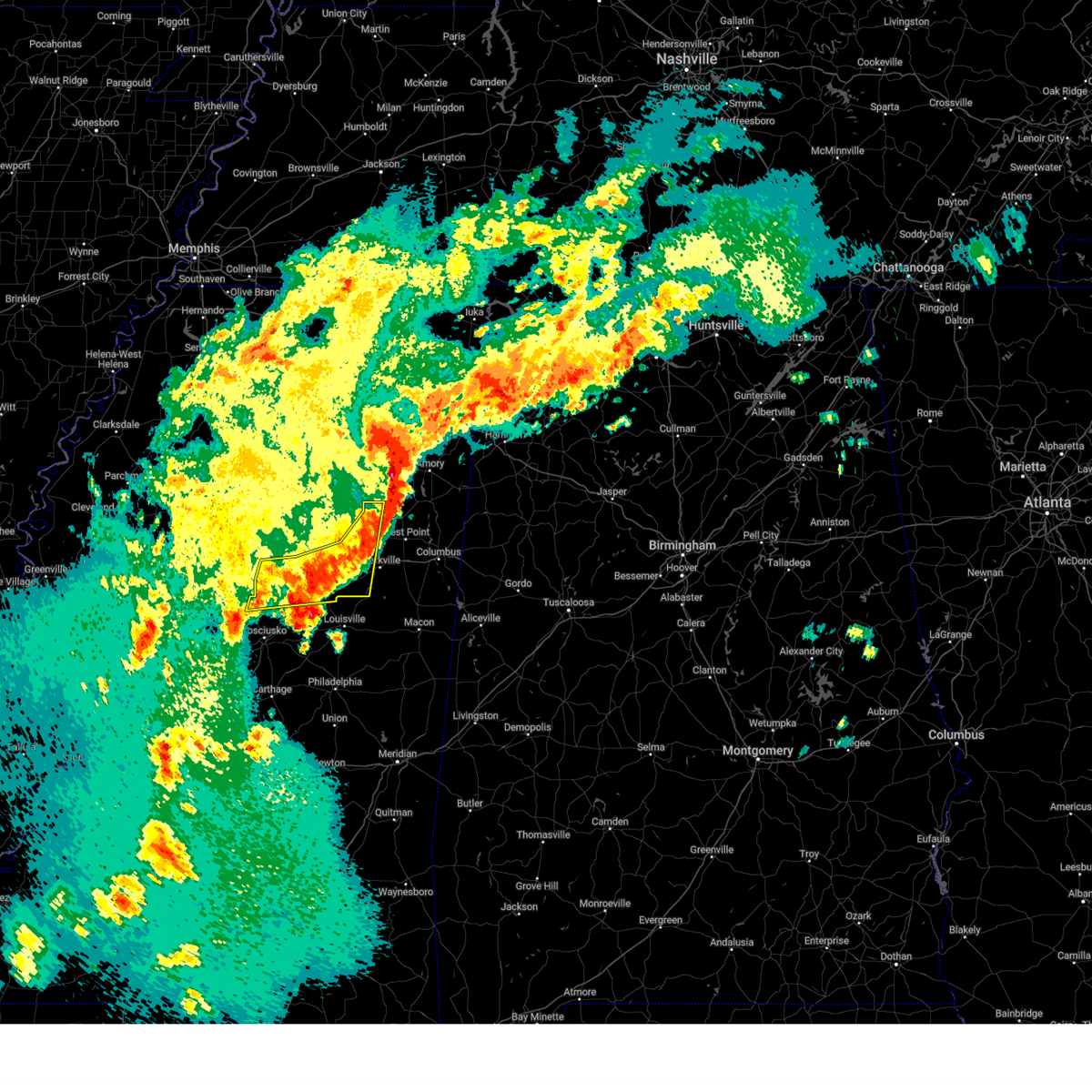
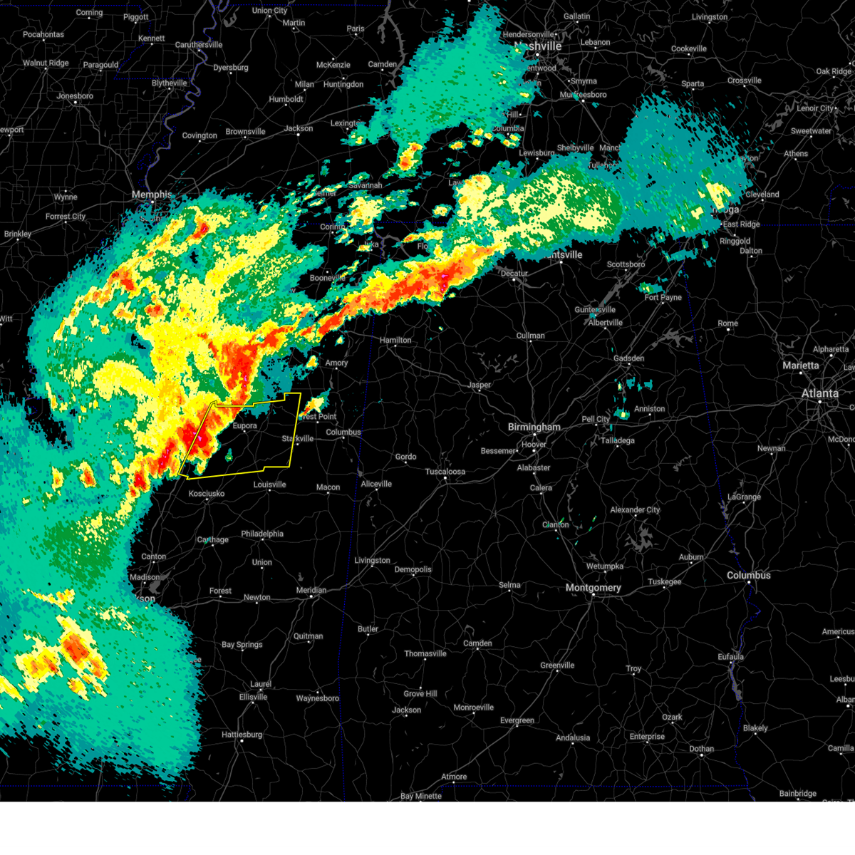
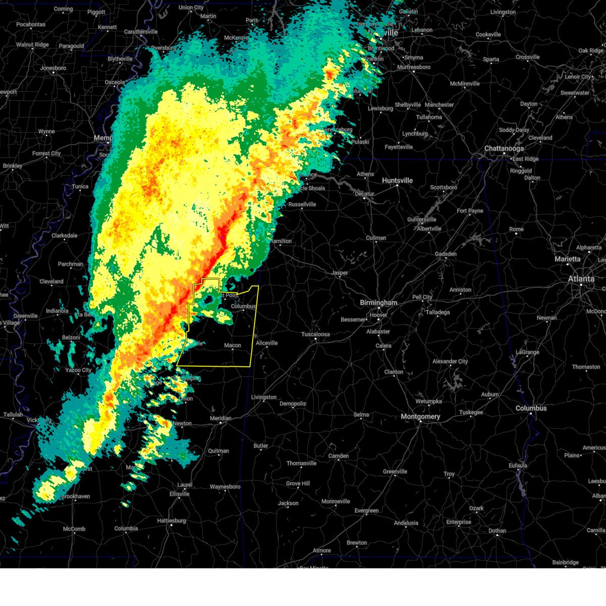
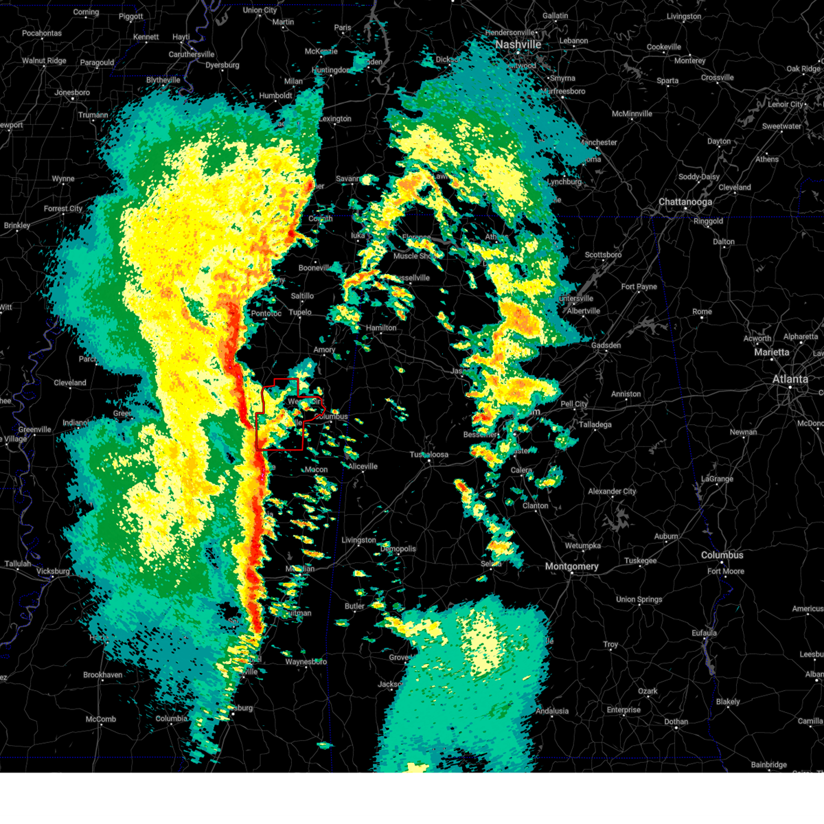
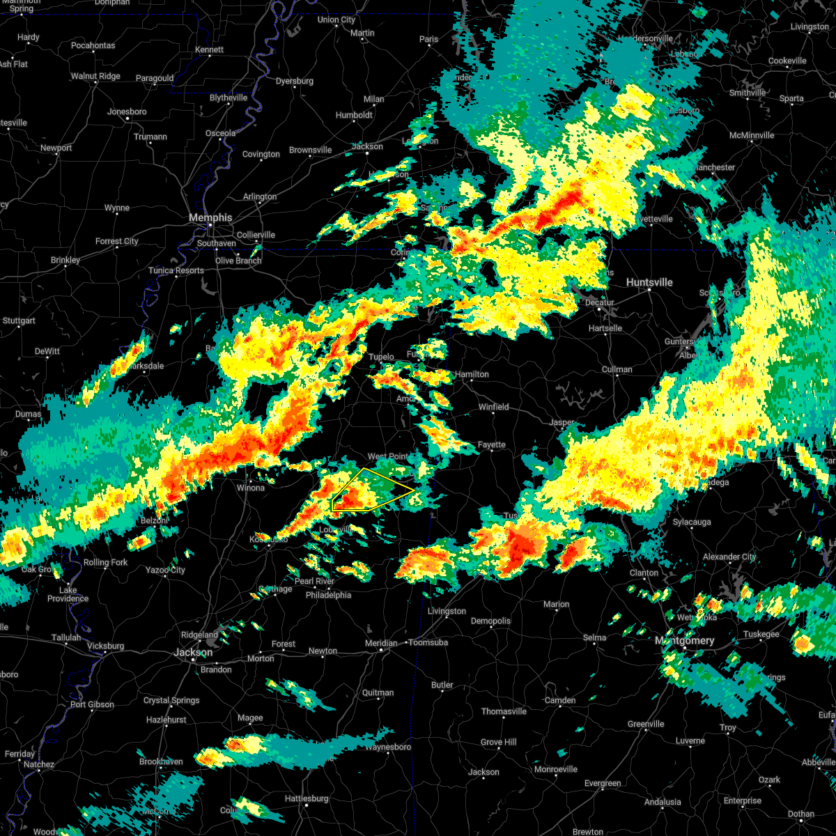
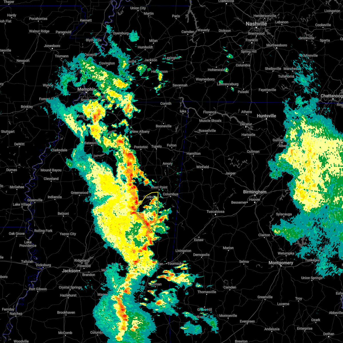
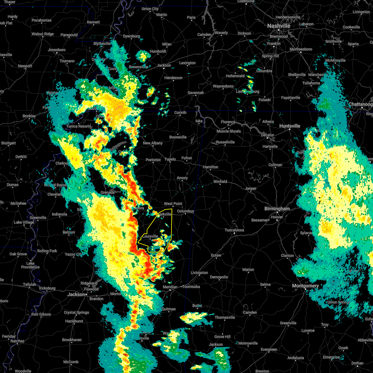
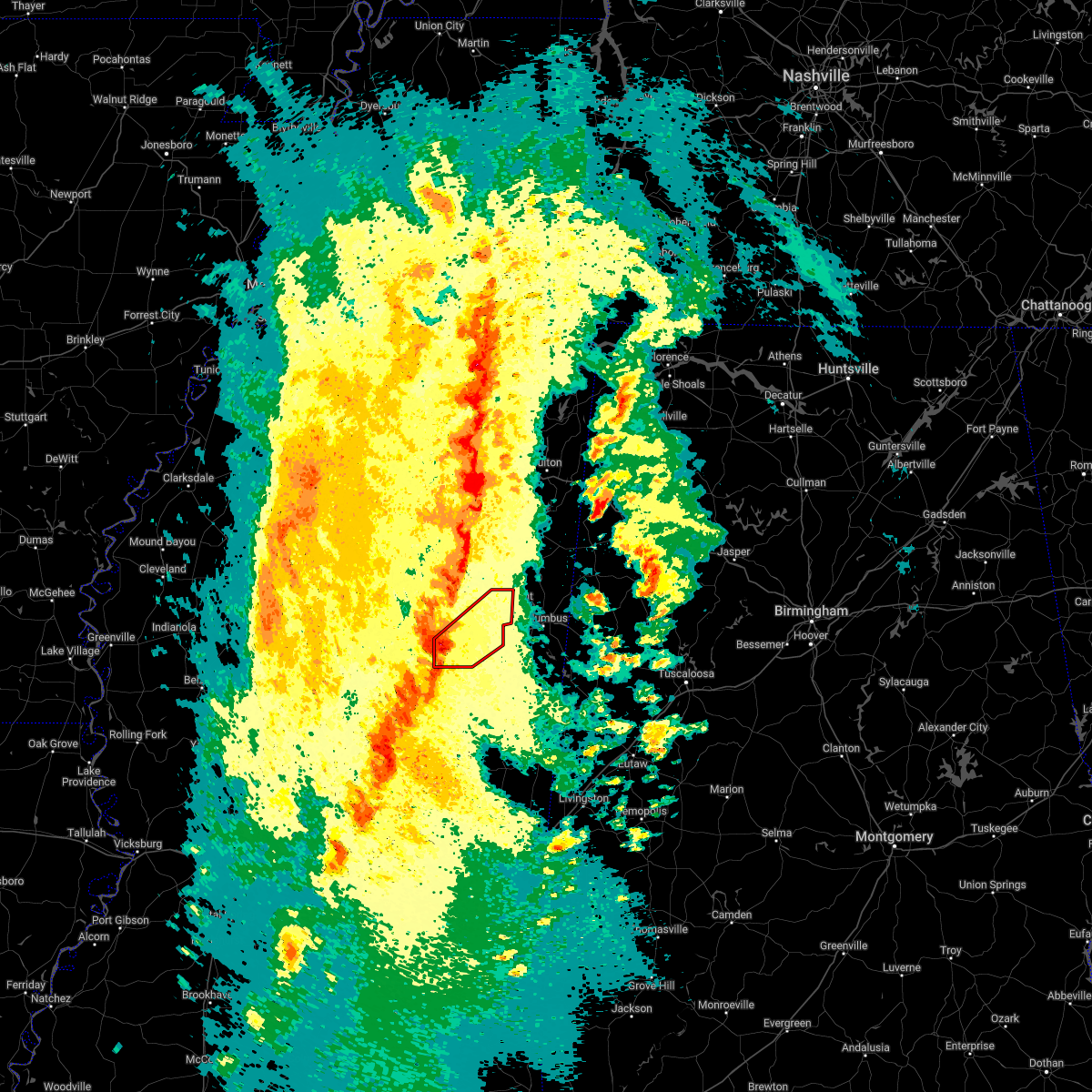
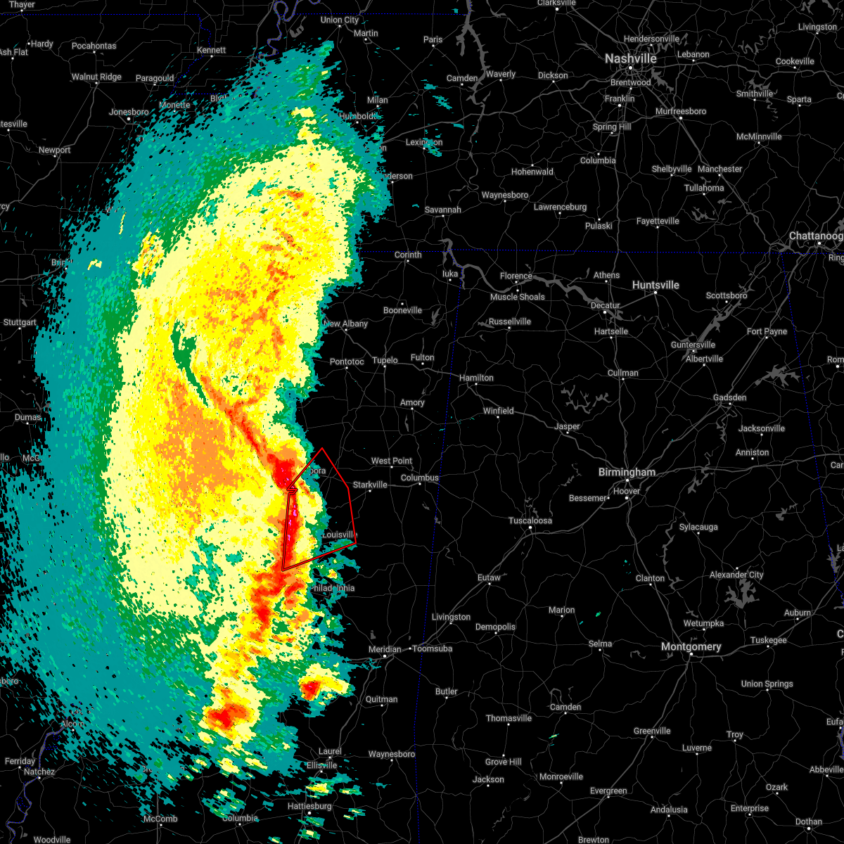
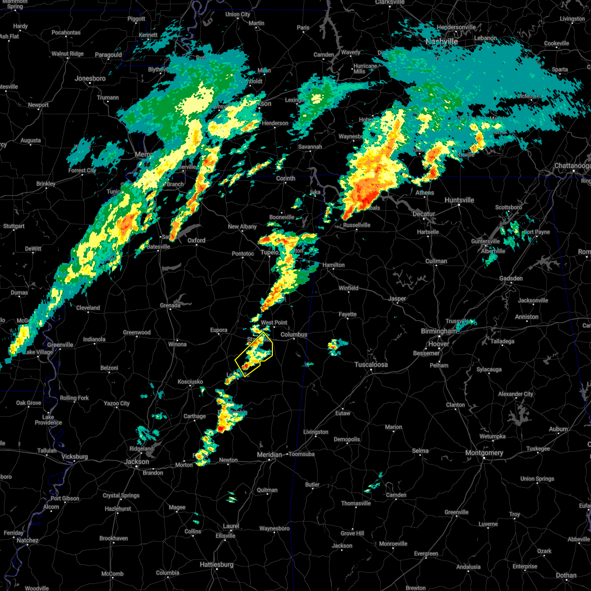
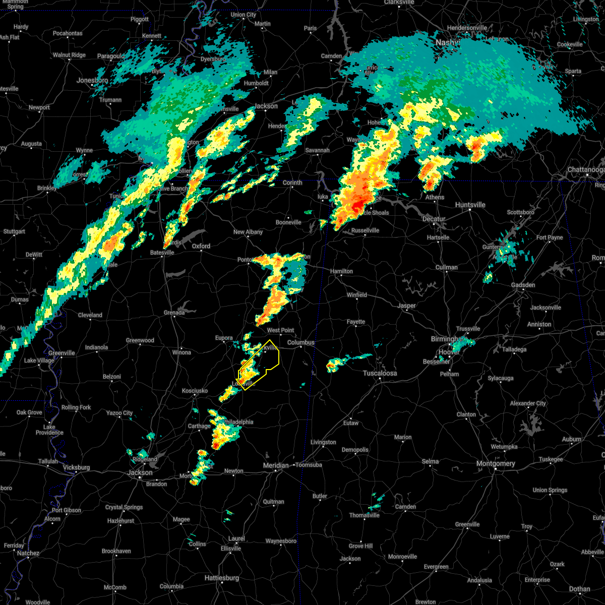
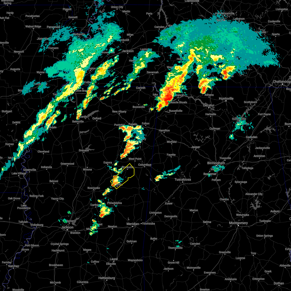
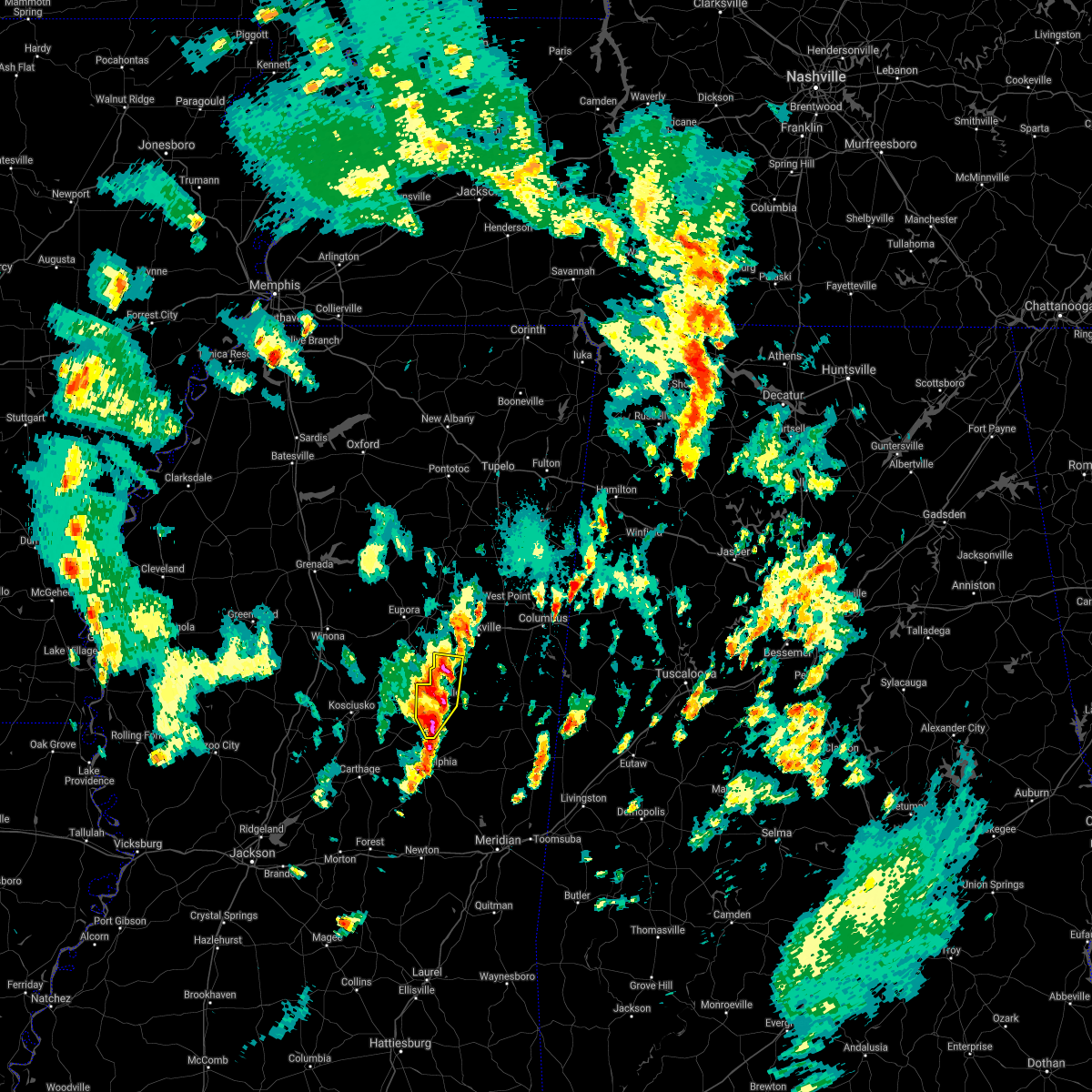
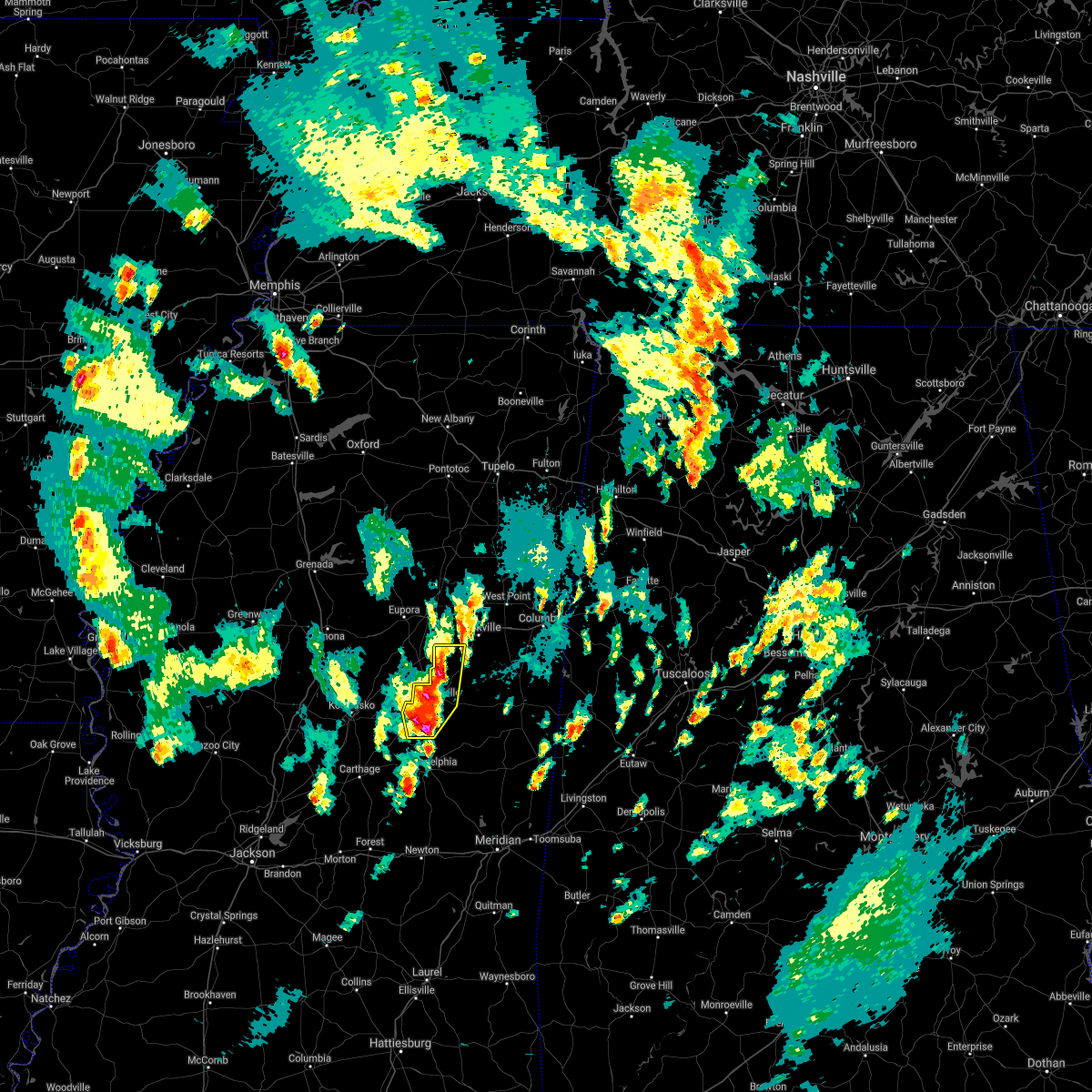
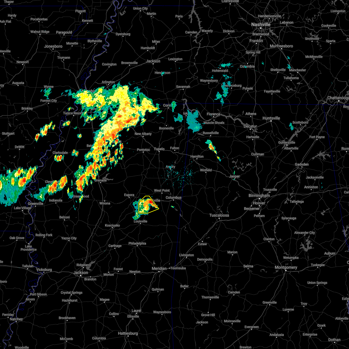
Hail Map for Sturgis, MS
The Sturgis, MS area has had 2 reports of on-the-ground hail by trained spotters, and has been under severe weather warnings 18 times during the past 12 months. Doppler radar has detected hail at or near Sturgis, MS on 49 occasions, including 4 occasions during the past year.
| Name: | Sturgis, MS |
| Where Located: | 15.9 miles WSW of Starkville, MS |
| Map: | Google Map for Sturgis, MS |
| Population: | 254 |
| Housing Units: | 133 |
| More Info: | Search Google for Sturgis, MS |
5
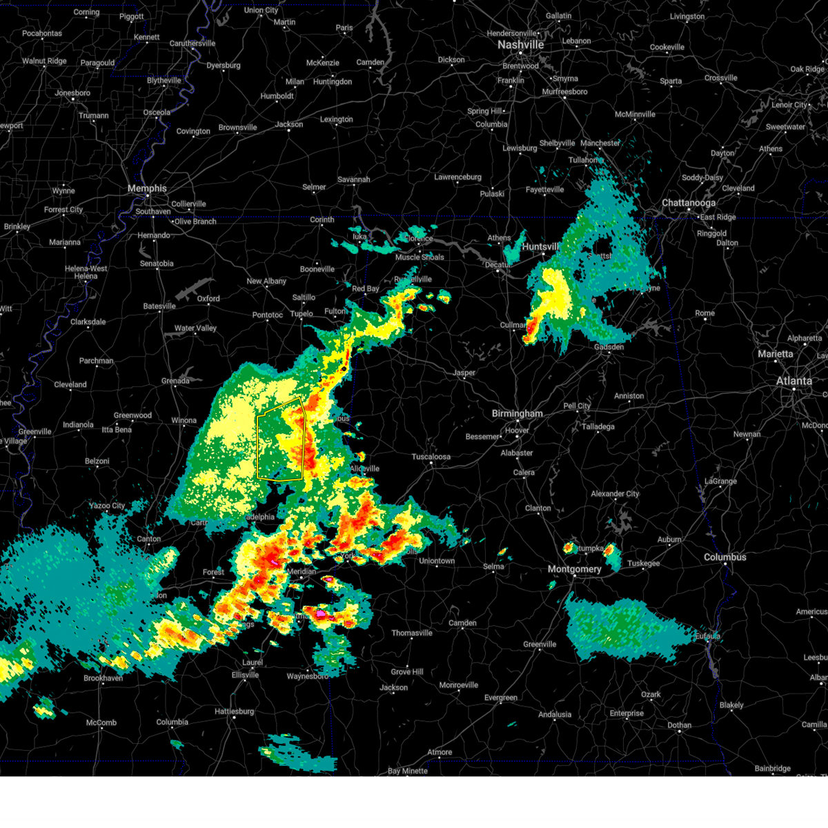
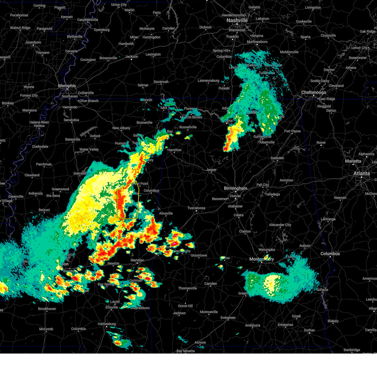
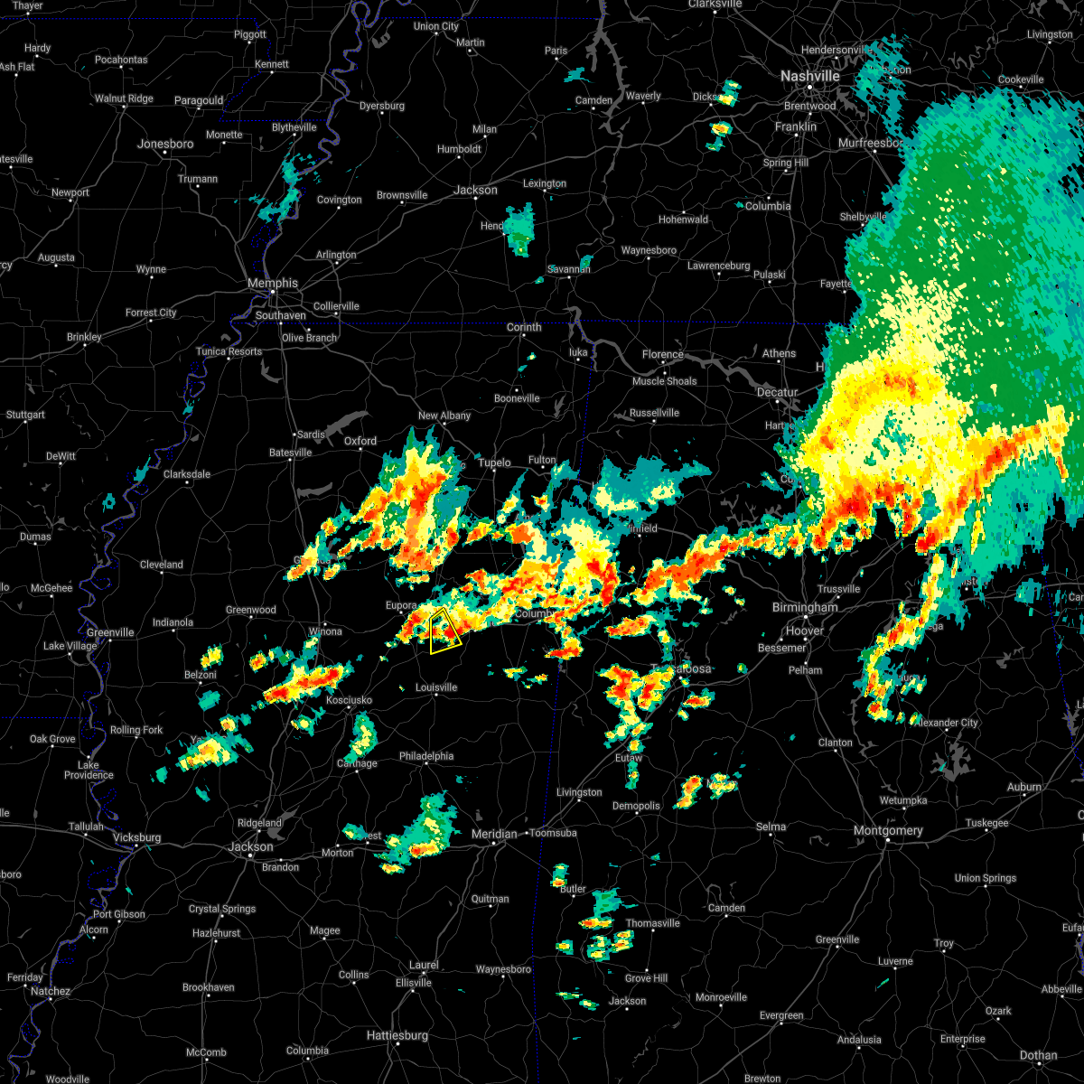
The Top Recent Hail Date for Sturgis, MS is Thursday, April 10, 2025 (3rd out of 49)
Hail and Wind Damage Spotted near Sturgis, MS
| Date / Time | Report Details |
|---|---|
| 5/25/2025 7:57 PM CDT | Svrjan the national weather service in jackson has issued a * severe thunderstorm warning for, northern leake county in central mississippi, southeastern choctaw county in central mississippi, southern holmes county in central mississippi, western oktibbeha county in northeastern mississippi, attala county in central mississippi, winston county in east central mississippi, northeastern yazoo county in central mississippi, northern neshoba county in east central mississippi, northeastern madison county in central mississippi, * until 915 pm cdt. * at 757 pm cdt, severe thunderstorms were located along a line extending from 8 miles east of kilmichael to near lexington to near belzoni, moving southeast at 45 mph (radar indicated). Hazards include 60 mph wind gusts and penny size hail. expect damage to roofs, siding, and trees |
| 5/24/2025 5:43 PM CDT |
 the severe thunderstorm warning has been cancelled and is no longer in effect the severe thunderstorm warning has been cancelled and is no longer in effect
|
| 5/24/2025 5:06 PM CDT |
 the severe thunderstorm warning has been cancelled and is no longer in effect the severe thunderstorm warning has been cancelled and is no longer in effect
|
| 5/24/2025 5:06 PM CDT |
 At 505 pm cdt, severe thunderstorms were located along a line extending from maben to near craig springs to louisville, moving east at 35 mph (radar indicated). Hazards include 60 mph wind gusts and penny size hail. Expect damage to roofs, siding, and trees. Locations impacted include, starkville, louisville, longview, sturgis, pheba, sessums, betheden, craig springs, millcreek, oktoc, griffith, and muldrow. At 505 pm cdt, severe thunderstorms were located along a line extending from maben to near craig springs to louisville, moving east at 35 mph (radar indicated). Hazards include 60 mph wind gusts and penny size hail. Expect damage to roofs, siding, and trees. Locations impacted include, starkville, louisville, longview, sturgis, pheba, sessums, betheden, craig springs, millcreek, oktoc, griffith, and muldrow.
|
| 5/24/2025 4:41 PM CDT |
 Svrjan the national weather service in jackson has issued a * severe thunderstorm warning for, eastern choctaw county in central mississippi, northwestern noxubee county in east central mississippi, oktibbeha county in northeastern mississippi, winston county in east central mississippi, southeastern webster county in north central mississippi, southwestern clay county in northeastern mississippi, * until 600 pm cdt. * at 441 pm cdt, severe thunderstorms were located along a line extending from eupora to ackerman to near zama, moving east at 35 mph (radar indicated). Hazards include 60 mph wind gusts and quarter size hail. Hail damage to vehicles is expected. Expect wind damage to roofs, siding, and trees. Svrjan the national weather service in jackson has issued a * severe thunderstorm warning for, eastern choctaw county in central mississippi, northwestern noxubee county in east central mississippi, oktibbeha county in northeastern mississippi, winston county in east central mississippi, southeastern webster county in north central mississippi, southwestern clay county in northeastern mississippi, * until 600 pm cdt. * at 441 pm cdt, severe thunderstorms were located along a line extending from eupora to ackerman to near zama, moving east at 35 mph (radar indicated). Hazards include 60 mph wind gusts and quarter size hail. Hail damage to vehicles is expected. Expect wind damage to roofs, siding, and trees.
|
| 5/2/2025 2:40 PM CDT |
 At 240 pm cdt, severe thunderstorms were located along a line extending from near west point to near sturgis, moving east at 15 mph (radar indicated). Hazards include 60 mph wind gusts and quarter size hail. Hail damage to vehicles is expected. expect wind damage to roofs, siding, and trees. Locations impacted include, sessums, craig springs, longview, artesia, bent oak, starkville, sturgis, kolola springs, waverly, tibbee, west point, muldrow, and columbus afb. At 240 pm cdt, severe thunderstorms were located along a line extending from near west point to near sturgis, moving east at 15 mph (radar indicated). Hazards include 60 mph wind gusts and quarter size hail. Hail damage to vehicles is expected. expect wind damage to roofs, siding, and trees. Locations impacted include, sessums, craig springs, longview, artesia, bent oak, starkville, sturgis, kolola springs, waverly, tibbee, west point, muldrow, and columbus afb.
|
| 5/2/2025 2:06 PM CDT | Svrjan the national weather service in jackson has issued a * severe thunderstorm warning for, oktibbeha county in northeastern mississippi, southern clay county in northeastern mississippi, northwestern lowndes county in northeastern mississippi, * until 300 pm cdt. * at 206 pm cdt, a severe thunderstorm was located near starkville, moving northeast at 30 mph (radar indicated). Hazards include 60 mph wind gusts and quarter size hail. Hail damage to vehicles is expected. expect wind damage to roofs, siding, and trees. this severe thunderstorm will be near, muldrow, griffith, and starkville around 210 pm cdt. tibbee and west point around 215 pm cdt. waverly around 235 pm cdt. Columbus afb around 240 pm cdt. |
| 4/10/2025 9:37 PM CDT |
 the severe thunderstorm warning has been cancelled and is no longer in effect the severe thunderstorm warning has been cancelled and is no longer in effect
|
| 4/10/2025 9:37 PM CDT |
 At 937 pm cdt, a severe thunderstorm was located near brooksville, or 10 miles northwest of macon, moving southeast at 55 mph (radar indicated). Hazards include 60 mph wind gusts and quarter size hail. Hail damage to vehicles is expected. expect wind damage to roofs, siding, and trees. this severe storm will be near, deerbrook, brooksville, and macon around 945 pm cdt. prairie point around 950 pm cdt. Cooksville and paulette around 955 pm cdt. At 937 pm cdt, a severe thunderstorm was located near brooksville, or 10 miles northwest of macon, moving southeast at 55 mph (radar indicated). Hazards include 60 mph wind gusts and quarter size hail. Hail damage to vehicles is expected. expect wind damage to roofs, siding, and trees. this severe storm will be near, deerbrook, brooksville, and macon around 945 pm cdt. prairie point around 950 pm cdt. Cooksville and paulette around 955 pm cdt.
|
| 4/10/2025 9:32 PM CDT |
 At 932 pm cdt, a severe thunderstorm was located near oktoc, or 12 miles south of starkville, moving southeast at 50 mph (radar indicated). Hazards include 60 mph wind gusts and quarter size hail. Hail damage to vehicles is expected. expect wind damage to roofs, siding, and trees. this severe storm will be near, crawford, brooksville, and macon around 940 pm cdt. deerbrook around 945 pm cdt. prairie point around 950 pm cdt. Cooksville and paulette around 1000 pm cdt. At 932 pm cdt, a severe thunderstorm was located near oktoc, or 12 miles south of starkville, moving southeast at 50 mph (radar indicated). Hazards include 60 mph wind gusts and quarter size hail. Hail damage to vehicles is expected. expect wind damage to roofs, siding, and trees. this severe storm will be near, crawford, brooksville, and macon around 940 pm cdt. deerbrook around 945 pm cdt. prairie point around 950 pm cdt. Cooksville and paulette around 1000 pm cdt.
|
| 4/10/2025 9:12 PM CDT |
 Svrjan the national weather service in jackson has issued a * severe thunderstorm warning for, northeastern choctaw county in central mississippi, noxubee county in east central mississippi, oktibbeha county in northeastern mississippi, northeastern winston county in east central mississippi, southwestern lowndes county in northeastern mississippi, * until 1015 pm cdt. * at 912 pm cdt, a severe thunderstorm was located near reform, or 10 miles northeast of ackerman, moving southeast at 55 mph (radar indicated). Hazards include 60 mph wind gusts and quarter size hail. Hail damage to vehicles is expected. expect wind damage to roofs, siding, and trees. this severe thunderstorm will be near, sturgis and longview around 915 pm cdt. craig springs and starkville around 920 pm cdt. crawford around 935 pm cdt. brooksville around 940 pm cdt. deerbrook and macon around 945 pm cdt. prairie point around 950 pm cdt. Cooksville and paulette around 1000 pm cdt. Svrjan the national weather service in jackson has issued a * severe thunderstorm warning for, northeastern choctaw county in central mississippi, noxubee county in east central mississippi, oktibbeha county in northeastern mississippi, northeastern winston county in east central mississippi, southwestern lowndes county in northeastern mississippi, * until 1015 pm cdt. * at 912 pm cdt, a severe thunderstorm was located near reform, or 10 miles northeast of ackerman, moving southeast at 55 mph (radar indicated). Hazards include 60 mph wind gusts and quarter size hail. Hail damage to vehicles is expected. expect wind damage to roofs, siding, and trees. this severe thunderstorm will be near, sturgis and longview around 915 pm cdt. craig springs and starkville around 920 pm cdt. crawford around 935 pm cdt. brooksville around 940 pm cdt. deerbrook and macon around 945 pm cdt. prairie point around 950 pm cdt. Cooksville and paulette around 1000 pm cdt.
|
| 3/31/2025 5:58 AM CDT |
 At 557 am cdt, severe thunderstorms were located along a line extending from columbus afb to near ethel, moving east at 50 mph (radar indicated). Hazards include 60 mph wind gusts and quarter size hail. Hail damage to vehicles is expected. expect wind damage to roofs, siding, and trees. these severe storms will be near, waverly, tibbee, sessums, columbus afb, oktoc, steens, bent oak, craig springs, starkville, and artesia around 605 am cdt. betheden and louisville around 610 am cdt. crawford and millcreek around 615 am cdt. brooksville around 625 am cdt. deerbrook around 630 am cdt. bigbee valley around 635 am cdt. Prairie point around 645 am cdt. At 557 am cdt, severe thunderstorms were located along a line extending from columbus afb to near ethel, moving east at 50 mph (radar indicated). Hazards include 60 mph wind gusts and quarter size hail. Hail damage to vehicles is expected. expect wind damage to roofs, siding, and trees. these severe storms will be near, waverly, tibbee, sessums, columbus afb, oktoc, steens, bent oak, craig springs, starkville, and artesia around 605 am cdt. betheden and louisville around 610 am cdt. crawford and millcreek around 615 am cdt. brooksville around 625 am cdt. deerbrook around 630 am cdt. bigbee valley around 635 am cdt. Prairie point around 645 am cdt.
|
| 3/31/2025 5:32 AM CDT |
 the severe thunderstorm warning has been cancelled and is no longer in effect the severe thunderstorm warning has been cancelled and is no longer in effect
|
| 3/31/2025 5:32 AM CDT |
 At 532 am cdt, a severe thunderstorm was located near griffith, or 8 miles north of starkville, moving east at 45 mph (radar indicated). Hazards include 60 mph wind gusts and quarter size hail. Hail damage to vehicles is expected. expect wind damage to roofs, siding, and trees. This severe thunderstorm will remain over mainly rural areas of choctaw, western oktibbeha, northeastern attala, southern webster, southeastern montgomery and western clay counties. At 532 am cdt, a severe thunderstorm was located near griffith, or 8 miles north of starkville, moving east at 45 mph (radar indicated). Hazards include 60 mph wind gusts and quarter size hail. Hail damage to vehicles is expected. expect wind damage to roofs, siding, and trees. This severe thunderstorm will remain over mainly rural areas of choctaw, western oktibbeha, northeastern attala, southern webster, southeastern montgomery and western clay counties.
|
| 3/31/2025 5:20 AM CDT | Svrjan the national weather service in jackson has issued a * severe thunderstorm warning for, central choctaw county in central mississippi, northern noxubee county in east central mississippi, oktibbeha county in northeastern mississippi, northeastern attala county in central mississippi, northern winston county in east central mississippi, clay county in northeastern mississippi, lowndes county in northeastern mississippi, * until 615 am cdt. * at 519 am cdt, a severe thunderstorm was located near pheba, or 16 miles northwest of starkville, moving east at 45 mph (radar indicated). Hazards include 60 mph wind gusts and quarter size hail. Hail damage to vehicles is expected. expect wind damage to roofs, siding, and trees. this severe thunderstorm will be near, griffith and pala alto around 525 am cdt. muldrow and west point around 535 am cdt. waverly, kolola springs, and columbus afb around 550 am cdt. columbus around 555 am cdt. caledonia around 600 am cdt. Steens around 605 am cdt. |
| 3/31/2025 4:45 AM CDT |
 Svrjan the national weather service in jackson has issued a * severe thunderstorm warning for, choctaw county in central mississippi, southeastern carroll county in north central mississippi, southeastern grenada county in north central mississippi, western oktibbeha county in northeastern mississippi, northeastern attala county in central mississippi, webster county in north central mississippi, montgomery county in north central mississippi, western clay county in northeastern mississippi, * until 545 am cdt. * at 445 am cdt, a severe thunderstorm was located near lodi, or 12 miles west of eupora, moving east at 45 mph (radar indicated). Hazards include 60 mph wind gusts and quarter size hail. Hail damage to vehicles is expected. expect wind damage to roofs, siding, and trees. this severe thunderstorm will be near, eupora, walthall, bellefontaine, and embry around 450 am cdt. clarkson around 500 am cdt. cumberland, maben, sherwood, and mathiston around 505 am cdt. pheba around 515 am cdt. Griffith around 525 am cdt. Svrjan the national weather service in jackson has issued a * severe thunderstorm warning for, choctaw county in central mississippi, southeastern carroll county in north central mississippi, southeastern grenada county in north central mississippi, western oktibbeha county in northeastern mississippi, northeastern attala county in central mississippi, webster county in north central mississippi, montgomery county in north central mississippi, western clay county in northeastern mississippi, * until 545 am cdt. * at 445 am cdt, a severe thunderstorm was located near lodi, or 12 miles west of eupora, moving east at 45 mph (radar indicated). Hazards include 60 mph wind gusts and quarter size hail. Hail damage to vehicles is expected. expect wind damage to roofs, siding, and trees. this severe thunderstorm will be near, eupora, walthall, bellefontaine, and embry around 450 am cdt. clarkson around 500 am cdt. cumberland, maben, sherwood, and mathiston around 505 am cdt. pheba around 515 am cdt. Griffith around 525 am cdt.
|
| 2/15/2025 10:25 PM CST |
 Svrjan the national weather service in jackson has issued a * severe thunderstorm warning for, noxubee county in east central mississippi, oktibbeha county in northeastern mississippi, winston county in east central mississippi, clay county in northeastern mississippi, lowndes county in northeastern mississippi, * until 1130 pm cst. * at 1025 pm cst, severe thunderstorms were located along a line extending from near trebloc to near smyrna, moving east at 70 mph (radar indicated). Hazards include 70 mph wind gusts. Expect considerable tree damage. damage is likely to mobile homes, roofs, and outbuildings. severe thunderstorms will be near, sturgis, griffith, pheba, and pala alto around 1030 pm cst. louisville, starkville, craig springs, longview, mcmillan, and west point around 1035 pm cst. muldrow and betheden around 1040 pm cst. millcreek, tibbee, sessums, oktoc, and noxapater around 1045 pm cst. waverly, kolola springs, columbus afb, and artesia around 1050 pm cst. crawford, bent oak, columbus, mashulaville, and caledonia around 1055 pm cst. steens and brooksville around 1100 pm cst. Deerbrook and macon around 1105 pm cst. Svrjan the national weather service in jackson has issued a * severe thunderstorm warning for, noxubee county in east central mississippi, oktibbeha county in northeastern mississippi, winston county in east central mississippi, clay county in northeastern mississippi, lowndes county in northeastern mississippi, * until 1130 pm cst. * at 1025 pm cst, severe thunderstorms were located along a line extending from near trebloc to near smyrna, moving east at 70 mph (radar indicated). Hazards include 70 mph wind gusts. Expect considerable tree damage. damage is likely to mobile homes, roofs, and outbuildings. severe thunderstorms will be near, sturgis, griffith, pheba, and pala alto around 1030 pm cst. louisville, starkville, craig springs, longview, mcmillan, and west point around 1035 pm cst. muldrow and betheden around 1040 pm cst. millcreek, tibbee, sessums, oktoc, and noxapater around 1045 pm cst. waverly, kolola springs, columbus afb, and artesia around 1050 pm cst. crawford, bent oak, columbus, mashulaville, and caledonia around 1055 pm cst. steens and brooksville around 1100 pm cst. Deerbrook and macon around 1105 pm cst.
|
| 12/28/2024 8:27 PM CST |
 Torjan the national weather service in jackson has issued a * tornado warning for, oktibbeha county in northeastern mississippi, clay county in northeastern mississippi, * until 930 pm cst. * at 827 pm cst, a severe thunderstorm capable of producing a tornado was located near longview, or 11 miles west of starkville, moving northeast at 70 mph (radar indicated rotation). Hazards include tornado. Flying debris will be dangerous to those caught without shelter. mobile homes will be damaged or destroyed. damage to roofs, windows, and vehicles will occur. tree damage is likely. this dangerous storm will be near, pheba, starkville, and longview around 830 pm cst. griffith around 835 pm cst. Muldrow, pala alto, and west point around 840 pm cst. Torjan the national weather service in jackson has issued a * tornado warning for, oktibbeha county in northeastern mississippi, clay county in northeastern mississippi, * until 930 pm cst. * at 827 pm cst, a severe thunderstorm capable of producing a tornado was located near longview, or 11 miles west of starkville, moving northeast at 70 mph (radar indicated rotation). Hazards include tornado. Flying debris will be dangerous to those caught without shelter. mobile homes will be damaged or destroyed. damage to roofs, windows, and vehicles will occur. tree damage is likely. this dangerous storm will be near, pheba, starkville, and longview around 830 pm cst. griffith around 835 pm cst. Muldrow, pala alto, and west point around 840 pm cst.
|
| 1/12/2024 9:17 AM CST |
 At 916 am cst, a severe thunderstorm was located near pheba, or 8 miles west of starkville, moving east at 60 mph (radar indicated). Hazards include 70 mph wind gusts. Expect considerable tree damage. damage is likely to mobile homes, roofs, and outbuildings. this severe storm will be near, starkville and longview around 920 am cst. west point, muldrow, tibbee, and sessums around 925 am cst. waverly around 935 am cst. thunderstorm damage threat, considerable hail threat, radar indicated max hail size, <. 75 in wind threat, radar indicated max wind gust, 70 mph. At 916 am cst, a severe thunderstorm was located near pheba, or 8 miles west of starkville, moving east at 60 mph (radar indicated). Hazards include 70 mph wind gusts. Expect considerable tree damage. damage is likely to mobile homes, roofs, and outbuildings. this severe storm will be near, starkville and longview around 920 am cst. west point, muldrow, tibbee, and sessums around 925 am cst. waverly around 935 am cst. thunderstorm damage threat, considerable hail threat, radar indicated max hail size, <. 75 in wind threat, radar indicated max wind gust, 70 mph.
|
| 1/12/2024 8:56 AM CST |
 At 856 am cst, severe thunderstorms were located along a line extending from near bellefontaine to 6 miles northwest of chester to ethel, moving northeast at 60 mph (radar indicated). Hazards include 70 mph wind gusts. Expect considerable tree damage. damage is likely to mobile homes, roofs, and outbuildings. these severe storms will be near, weir, chester, sherwood, and reform around 900 am cst. ackerman and maben around 905 am cst. sturgis, pheba, and montpelier around 910 am cst. starkville, longview, griffith, pala alto, and craig springs around 920 am cst. west point and muldrow around 930 am cst. tibbee, sessums, and oktoc around 935 am cst. waverly around 945 am cst. thunderstorm damage threat, considerable hail threat, radar indicated max hail size, <. 75 in wind threat, radar indicated max wind gust, 70 mph. At 856 am cst, severe thunderstorms were located along a line extending from near bellefontaine to 6 miles northwest of chester to ethel, moving northeast at 60 mph (radar indicated). Hazards include 70 mph wind gusts. Expect considerable tree damage. damage is likely to mobile homes, roofs, and outbuildings. these severe storms will be near, weir, chester, sherwood, and reform around 900 am cst. ackerman and maben around 905 am cst. sturgis, pheba, and montpelier around 910 am cst. starkville, longview, griffith, pala alto, and craig springs around 920 am cst. west point and muldrow around 930 am cst. tibbee, sessums, and oktoc around 935 am cst. waverly around 945 am cst. thunderstorm damage threat, considerable hail threat, radar indicated max hail size, <. 75 in wind threat, radar indicated max wind gust, 70 mph.
|
| 1/12/2024 8:47 AM CST |
 At 847 am cst, severe thunderstorms were located along a line extending from embry to 6 miles north of french camp to kosciusko, moving northeast at 60 mph (radar indicated). Hazards include 60 mph wind gusts. Expect damage to roofs, siding, and trees. severe thunderstorms will be near, weir and chester around 855 am cst. ackerman, sherwood, and reform around 900 am cst. maben around 905 am cst. sturgis, pheba, montpelier, and mcmillan around 910 am cst. longview around 915 am cst. starkville, griffith, pala alto, and craig springs around 920 am cst. west point, muldrow, sessums, and oktoc around 930 am cst. tibbee around 935 am cst. hail threat, radar indicated max hail size, <. 75 in wind threat, radar indicated max wind gust, 60 mph. At 847 am cst, severe thunderstorms were located along a line extending from embry to 6 miles north of french camp to kosciusko, moving northeast at 60 mph (radar indicated). Hazards include 60 mph wind gusts. Expect damage to roofs, siding, and trees. severe thunderstorms will be near, weir and chester around 855 am cst. ackerman, sherwood, and reform around 900 am cst. maben around 905 am cst. sturgis, pheba, montpelier, and mcmillan around 910 am cst. longview around 915 am cst. starkville, griffith, pala alto, and craig springs around 920 am cst. west point, muldrow, sessums, and oktoc around 930 am cst. tibbee around 935 am cst. hail threat, radar indicated max hail size, <. 75 in wind threat, radar indicated max wind gust, 60 mph.
|
| 6/11/2023 9:43 PM CDT |
 At 943 pm cdt, a severe thunderstorm was located near mantee, or 7 miles southwest of houston, moving southeast at 45 mph (radar indicated). Hazards include 60 mph wind gusts and quarter size hail. Hail damage to vehicles is expected. expect wind damage to roofs, siding, and trees. this severe thunderstorm will be near, montpelier around 955 pm cdt. pheba, griffith and pala alto around 1005 pm cdt. muldrow around 1020 pm cdt. tibbee around 1025 pm cdt. hail threat, radar indicated max hail size, 1. 00 in wind threat, radar indicated max wind gust, 60 mph. At 943 pm cdt, a severe thunderstorm was located near mantee, or 7 miles southwest of houston, moving southeast at 45 mph (radar indicated). Hazards include 60 mph wind gusts and quarter size hail. Hail damage to vehicles is expected. expect wind damage to roofs, siding, and trees. this severe thunderstorm will be near, montpelier around 955 pm cdt. pheba, griffith and pala alto around 1005 pm cdt. muldrow around 1020 pm cdt. tibbee around 1025 pm cdt. hail threat, radar indicated max hail size, 1. 00 in wind threat, radar indicated max wind gust, 60 mph.
|
| 5/11/2023 3:52 PM CDT |
 At 352 pm cdt, severe thunderstorms were located along a line extending from near slate springs to near ackerman to stallo, moving northeast at 45 mph (radar indicated). Hazards include 60 mph wind gusts. Expect damage to roofs, siding, and trees. severe thunderstorms will be near, sturgis around 400 pm cdt. craig springs and betheden around 405 pm cdt. longview around 410 pm cdt. starkville around 415 pm cdt. mashulaville and oktoc around 420 pm cdt. sessums around 425 pm cdt. artesia around 430 pm cdt. macon, brooksville and tibbee around 435 pm cdt. hail threat, radar indicated max hail size, <. 75 in wind threat, observed max wind gust, 60 mph. At 352 pm cdt, severe thunderstorms were located along a line extending from near slate springs to near ackerman to stallo, moving northeast at 45 mph (radar indicated). Hazards include 60 mph wind gusts. Expect damage to roofs, siding, and trees. severe thunderstorms will be near, sturgis around 400 pm cdt. craig springs and betheden around 405 pm cdt. longview around 410 pm cdt. starkville around 415 pm cdt. mashulaville and oktoc around 420 pm cdt. sessums around 425 pm cdt. artesia around 430 pm cdt. macon, brooksville and tibbee around 435 pm cdt. hail threat, radar indicated max hail size, <. 75 in wind threat, observed max wind gust, 60 mph.
|
| 1/3/2023 7:07 PM CST |
 At 707 pm cst, a severe thunderstorm was located near ackerman, or 18 miles north of louisville, moving northeast at 50 mph (radar indicated). Hazards include 60 mph wind gusts and quarter size hail. Hail damage to vehicles is expected. expect wind damage to roofs, siding, and trees. this severe thunderstorm will be near, sherwood around 715 pm cst. pheba around 730 pm cst. griffith around 740 pm cst. pala alto around 745 pm cst. west point around 750 pm cst. other locations impacted by this severe thunderstorm include sturgis. hail threat, radar indicated max hail size, 1. 00 in wind threat, radar indicated max wind gust, 60 mph. At 707 pm cst, a severe thunderstorm was located near ackerman, or 18 miles north of louisville, moving northeast at 50 mph (radar indicated). Hazards include 60 mph wind gusts and quarter size hail. Hail damage to vehicles is expected. expect wind damage to roofs, siding, and trees. this severe thunderstorm will be near, sherwood around 715 pm cst. pheba around 730 pm cst. griffith around 740 pm cst. pala alto around 745 pm cst. west point around 750 pm cst. other locations impacted by this severe thunderstorm include sturgis. hail threat, radar indicated max hail size, 1. 00 in wind threat, radar indicated max wind gust, 60 mph.
|
| 1/3/2023 6:17 PM CST |
 At 617 pm cst, a severe thunderstorm was located near zama, or 10 miles east of kosciusko, moving northeast at 40 mph (radar indicated). Hazards include 60 mph wind gusts and half dollar size hail. Hail damage to vehicles is expected. expect wind damage to roofs, siding, and trees. this severe thunderstorm will be near, ackerman and chester around 655 pm cst. other locations impacted by this severe thunderstorm include mccool, weir and ethel. hail threat, radar indicated max hail size, 1. 25 in wind threat, radar indicated max wind gust, 60 mph. At 617 pm cst, a severe thunderstorm was located near zama, or 10 miles east of kosciusko, moving northeast at 40 mph (radar indicated). Hazards include 60 mph wind gusts and half dollar size hail. Hail damage to vehicles is expected. expect wind damage to roofs, siding, and trees. this severe thunderstorm will be near, ackerman and chester around 655 pm cst. other locations impacted by this severe thunderstorm include mccool, weir and ethel. hail threat, radar indicated max hail size, 1. 25 in wind threat, radar indicated max wind gust, 60 mph.
|
| 11/29/2022 10:17 PM CST |
 At 1017 pm cst, a severe thunderstorm capable of producing a tornado was located over craig springs, or 10 miles southwest of starkville, moving northeast at 55 mph (radar indicated rotation). Hazards include tornado and quarter size hail. Flying debris will be dangerous to those caught without shelter. mobile homes will be damaged or destroyed. damage to roofs, windows, and vehicles will occur. tree damage is likely. this dangerous storm will be near, starkville and oktoc around 1025 pm cst. sessums around 1030 pm cst. muldrow around 1035 pm cst. bent oak and tibbee around 1040 pm cst. columbus and waverly around 1050 pm cst. columbus afb and kolola springs around 1055 pm cst. caledonia and steens around 1100 pm cst. Other locations impacted by this tornadic thunderstorm include artesia. At 1017 pm cst, a severe thunderstorm capable of producing a tornado was located over craig springs, or 10 miles southwest of starkville, moving northeast at 55 mph (radar indicated rotation). Hazards include tornado and quarter size hail. Flying debris will be dangerous to those caught without shelter. mobile homes will be damaged or destroyed. damage to roofs, windows, and vehicles will occur. tree damage is likely. this dangerous storm will be near, starkville and oktoc around 1025 pm cst. sessums around 1030 pm cst. muldrow around 1035 pm cst. bent oak and tibbee around 1040 pm cst. columbus and waverly around 1050 pm cst. columbus afb and kolola springs around 1055 pm cst. caledonia and steens around 1100 pm cst. Other locations impacted by this tornadic thunderstorm include artesia.
|
| 11/29/2022 10:14 PM CST |
 At 1014 pm cst, a severe thunderstorm was located over craig springs, or 11 miles southwest of starkville, moving northeast at 50 mph (radar indicated). Hazards include 60 mph wind gusts and quarter size hail. Hail damage to vehicles is expected. expect wind damage to roofs, siding, and trees. this severe storm will be near, starkville and oktoc around 1025 pm cst. sessums around 1030 pm cst. bent oak around 1045 pm cst. Other locations impacted by this severe thunderstorm include sturgis and artesia. At 1014 pm cst, a severe thunderstorm was located over craig springs, or 11 miles southwest of starkville, moving northeast at 50 mph (radar indicated). Hazards include 60 mph wind gusts and quarter size hail. Hail damage to vehicles is expected. expect wind damage to roofs, siding, and trees. this severe storm will be near, starkville and oktoc around 1025 pm cst. sessums around 1030 pm cst. bent oak around 1045 pm cst. Other locations impacted by this severe thunderstorm include sturgis and artesia.
|
| 11/29/2022 9:58 PM CST |
 At 958 pm cst, a severe thunderstorm was located near mcmillan, or 8 miles northwest of louisville, moving northeast at 50 mph (radar indicated). Hazards include 60 mph wind gusts and quarter size hail. Hail damage to vehicles is expected. expect wind damage to roofs, siding, and trees. this severe thunderstorm will be near, craig springs around 1015 pm cst. longview around 1020 pm cst. starkville and oktoc around 1025 pm cst. sessums around 1035 pm cst. bent oak around 1045 pm cst. Other locations impacted by this severe thunderstorm include sturgis and artesia. At 958 pm cst, a severe thunderstorm was located near mcmillan, or 8 miles northwest of louisville, moving northeast at 50 mph (radar indicated). Hazards include 60 mph wind gusts and quarter size hail. Hail damage to vehicles is expected. expect wind damage to roofs, siding, and trees. this severe thunderstorm will be near, craig springs around 1015 pm cst. longview around 1020 pm cst. starkville and oktoc around 1025 pm cst. sessums around 1035 pm cst. bent oak around 1045 pm cst. Other locations impacted by this severe thunderstorm include sturgis and artesia.
|
| 11/29/2022 4:50 PM CST |
 At 449 pm cst, a severe thunderstorm was located near kilmichael, or 15 miles east of winona, moving east at 60 mph (radar indicated). Hazards include ping pong ball size hail and 60 mph wind gusts. People and animals outdoors will be injured. expect hail damage to roofs, siding, windows, and vehicles. expect wind damage to roofs, siding, and trees. this severe thunderstorm will be near, eupora around 500 pm cst. chester around 505 pm cst. mathiston, sherwood and reform around 510 pm cst. maben around 515 pm cst. pheba around 520 pm cst. starkville and longview around 525 pm cst. muldrow and sessums around 535 pm cst. Other locations impacted by this severe thunderstorm include walthall. At 449 pm cst, a severe thunderstorm was located near kilmichael, or 15 miles east of winona, moving east at 60 mph (radar indicated). Hazards include ping pong ball size hail and 60 mph wind gusts. People and animals outdoors will be injured. expect hail damage to roofs, siding, windows, and vehicles. expect wind damage to roofs, siding, and trees. this severe thunderstorm will be near, eupora around 500 pm cst. chester around 505 pm cst. mathiston, sherwood and reform around 510 pm cst. maben around 515 pm cst. pheba around 520 pm cst. starkville and longview around 525 pm cst. muldrow and sessums around 535 pm cst. Other locations impacted by this severe thunderstorm include walthall.
|
| 5/25/2022 1:59 PM CDT |
 At 158 pm cdt, severe thunderstorms were located along a line extending from near montpelier to near longview, moving northeast at 45 mph (radar indicated). Hazards include 60 mph wind gusts. Expect damage to roofs, siding, and trees. these severe storms will be near, montpelier around 205 pm cdt. griffith around 225 pm cdt. pala alto around 230 pm cdt. other locations impacted by these severe thunderstorms include mantee and sturgis. hail threat, radar indicated max hail size, <. 75 in wind threat, radar indicated max wind gust, 60 mph. At 158 pm cdt, severe thunderstorms were located along a line extending from near montpelier to near longview, moving northeast at 45 mph (radar indicated). Hazards include 60 mph wind gusts. Expect damage to roofs, siding, and trees. these severe storms will be near, montpelier around 205 pm cdt. griffith around 225 pm cdt. pala alto around 230 pm cdt. other locations impacted by these severe thunderstorms include mantee and sturgis. hail threat, radar indicated max hail size, <. 75 in wind threat, radar indicated max wind gust, 60 mph.
|
| 5/25/2022 1:58 PM CDT |
 At 158 pm cdt, a severe thunderstorm was located near betheden, or 12 miles northeast of louisville, moving northeast at 45 mph (radar indicated). Hazards include 60 mph wind gusts. Expect damage to roofs, siding, and trees. this severe storm will be near, starkville and oktoc around 210 pm cdt. sessums around 220 pm cdt. muldrow around 225 pm cdt. hail threat, radar indicated max hail size, <. 75 in wind threat, radar indicated max wind gust, 60 mph. At 158 pm cdt, a severe thunderstorm was located near betheden, or 12 miles northeast of louisville, moving northeast at 45 mph (radar indicated). Hazards include 60 mph wind gusts. Expect damage to roofs, siding, and trees. this severe storm will be near, starkville and oktoc around 210 pm cdt. sessums around 220 pm cdt. muldrow around 225 pm cdt. hail threat, radar indicated max hail size, <. 75 in wind threat, radar indicated max wind gust, 60 mph.
|
| 5/25/2022 1:48 PM CDT |
 At 148 pm cdt, severe thunderstorms were located along a line extending from clarkson to near ackerman, moving northeast at 40 mph (radar indicated). Hazards include 60 mph wind gusts. Expect damage to roofs, siding, and trees. these severe storms will be near, cumberland around 155 pm cdt. montpelier around 205 pm cdt. pheba around 215 pm cdt. griffith around 225 pm cdt. pala alto around 230 pm cdt. other locations impacted by these severe thunderstorms include mantee and sturgis. hail threat, radar indicated max hail size, <. 75 in wind threat, radar indicated max wind gust, 60 mph. At 148 pm cdt, severe thunderstorms were located along a line extending from clarkson to near ackerman, moving northeast at 40 mph (radar indicated). Hazards include 60 mph wind gusts. Expect damage to roofs, siding, and trees. these severe storms will be near, cumberland around 155 pm cdt. montpelier around 205 pm cdt. pheba around 215 pm cdt. griffith around 225 pm cdt. pala alto around 230 pm cdt. other locations impacted by these severe thunderstorms include mantee and sturgis. hail threat, radar indicated max hail size, <. 75 in wind threat, radar indicated max wind gust, 60 mph.
|
| 5/25/2022 1:47 PM CDT |
 At 146 pm cdt, a severe thunderstorm was located near millcreek, or near louisville, moving northeast at 45 mph (radar indicated). Hazards include 60 mph wind gusts. Expect damage to roofs, siding, and trees. this severe storm will be near, millcreek around 150 pm cdt. betheden around 155 pm cdt. craig springs around 205 pm cdt. starkville and oktoc around 215 pm cdt. sessums around 220 pm cdt. Muldrow around 230 pm cdt. At 146 pm cdt, a severe thunderstorm was located near millcreek, or near louisville, moving northeast at 45 mph (radar indicated). Hazards include 60 mph wind gusts. Expect damage to roofs, siding, and trees. this severe storm will be near, millcreek around 150 pm cdt. betheden around 155 pm cdt. craig springs around 205 pm cdt. starkville and oktoc around 215 pm cdt. sessums around 220 pm cdt. Muldrow around 230 pm cdt.
|
| 5/25/2022 1:34 PM CDT |
 At 134 pm cdt, a severe thunderstorm was located near sherwood, or 22 miles southwest of montpelier, moving northeast at 45 mph (radar indicated). Hazards include 60 mph wind gusts. Expect damage to roofs, siding, and trees. this severe thunderstorm will be near, maben and mathiston around 145 pm cdt. cumberland and clarkson around 150 pm cdt. pheba around 155 pm cdt. montpelier around 205 pm cdt. other locations impacted by this severe thunderstorm include mantee, sturgis and walthall. hail threat, radar indicated max hail size, <. 75 in wind threat, radar indicated max wind gust, 60 mph. At 134 pm cdt, a severe thunderstorm was located near sherwood, or 22 miles southwest of montpelier, moving northeast at 45 mph (radar indicated). Hazards include 60 mph wind gusts. Expect damage to roofs, siding, and trees. this severe thunderstorm will be near, maben and mathiston around 145 pm cdt. cumberland and clarkson around 150 pm cdt. pheba around 155 pm cdt. montpelier around 205 pm cdt. other locations impacted by this severe thunderstorm include mantee, sturgis and walthall. hail threat, radar indicated max hail size, <. 75 in wind threat, radar indicated max wind gust, 60 mph.
|
| 5/25/2022 1:30 PM CDT |
 At 130 pm cdt, a severe thunderstorm was located near stallo, or 8 miles southwest of louisville, moving northeast at 45 mph (radar indicated). Hazards include 60 mph wind gusts. Expect damage to roofs, siding, and trees. this severe thunderstorm will be near, louisville and mcmillan around 140 pm cdt. millcreek around 150 pm cdt. betheden around 155 pm cdt. craig springs around 200 pm cdt. starkville and oktoc around 210 pm cdt. sessums around 215 pm cdt. muldrow around 225 pm cdt. Other locations impacted by this severe thunderstorm include noxapater. At 130 pm cdt, a severe thunderstorm was located near stallo, or 8 miles southwest of louisville, moving northeast at 45 mph (radar indicated). Hazards include 60 mph wind gusts. Expect damage to roofs, siding, and trees. this severe thunderstorm will be near, louisville and mcmillan around 140 pm cdt. millcreek around 150 pm cdt. betheden around 155 pm cdt. craig springs around 200 pm cdt. starkville and oktoc around 210 pm cdt. sessums around 215 pm cdt. muldrow around 225 pm cdt. Other locations impacted by this severe thunderstorm include noxapater.
|
| 4/13/2022 8:23 PM CDT |
 At 822 pm cdt, severe thunderstorms were located along a line extending from near montpelier to near cumberland to 8 miles southwest of chester, moving east at 50 mph (radar indicated). Hazards include 60 mph wind gusts. Expect damage to roofs, siding, and trees. severe thunderstorms will be near, montpelier and pheba around 830 pm cdt. griffith around 840 pm cdt. pala alto around 845 pm cdt. west point and muldrow around 850 pm cdt. craig springs, longview and tibbee around 855 pm cdt. starkville and waverly around 900 pm cdt. oktoc around 905 pm cdt. sessums around 910 pm cdt. other locations impacted by these severe thunderstorms include sturgis. hail threat, radar indicated max hail size, <. 75 in wind threat, radar indicated max wind gust, 60 mph. At 822 pm cdt, severe thunderstorms were located along a line extending from near montpelier to near cumberland to 8 miles southwest of chester, moving east at 50 mph (radar indicated). Hazards include 60 mph wind gusts. Expect damage to roofs, siding, and trees. severe thunderstorms will be near, montpelier and pheba around 830 pm cdt. griffith around 840 pm cdt. pala alto around 845 pm cdt. west point and muldrow around 850 pm cdt. craig springs, longview and tibbee around 855 pm cdt. starkville and waverly around 900 pm cdt. oktoc around 905 pm cdt. sessums around 910 pm cdt. other locations impacted by these severe thunderstorms include sturgis. hail threat, radar indicated max hail size, <. 75 in wind threat, radar indicated max wind gust, 60 mph.
|
| 3/30/2022 6:45 PM CDT | Tree down along hwy 25 near the oktibbeha/winston county lin in winston county MS, 9.4 miles WNW of Sturgis, MS |
| 3/30/2022 6:34 PM CDT |
 At 634 pm cdt, severe thunderstorms were located along a line extending from near plantersville to near craig springs, moving northeast at 60 mph (radar indicated). Hazards include 60 mph wind gusts. Expect damage to roofs, siding, and trees. these severe storms will be near, muldrow around 650 pm cdt. west point and tibbee around 655 pm cdt. Other locations impacted by these severe thunderstorms include sturgis. At 634 pm cdt, severe thunderstorms were located along a line extending from near plantersville to near craig springs, moving northeast at 60 mph (radar indicated). Hazards include 60 mph wind gusts. Expect damage to roofs, siding, and trees. these severe storms will be near, muldrow around 650 pm cdt. west point and tibbee around 655 pm cdt. Other locations impacted by these severe thunderstorms include sturgis.
|
| 3/30/2022 6:17 PM CDT |
 At 617 pm cdt, a severe thunderstorm capable of producing a tornado was located near craig springs, or 14 miles north of louisville, moving northeast at 50 mph (radar indicated rotation). Hazards include tornado. Flying debris will be dangerous to those caught without shelter. mobile homes will be damaged or destroyed. damage to roofs, windows, and vehicles will occur. tree damage is likely. this dangerous storm will be near, craig springs around 620 pm cdt. longview around 625 pm cdt. starkville around 630 pm cdt. sessums around 640 pm cdt. muldrow around 645 pm cdt. tibbee around 650 pm cdt. west point around 655 pm cdt. Other locations impacted by this tornadic thunderstorm include sturgis. At 617 pm cdt, a severe thunderstorm capable of producing a tornado was located near craig springs, or 14 miles north of louisville, moving northeast at 50 mph (radar indicated rotation). Hazards include tornado. Flying debris will be dangerous to those caught without shelter. mobile homes will be damaged or destroyed. damage to roofs, windows, and vehicles will occur. tree damage is likely. this dangerous storm will be near, craig springs around 620 pm cdt. longview around 625 pm cdt. starkville around 630 pm cdt. sessums around 640 pm cdt. muldrow around 645 pm cdt. tibbee around 650 pm cdt. west point around 655 pm cdt. Other locations impacted by this tornadic thunderstorm include sturgis.
|
| 3/30/2022 6:05 PM CDT |
 At 605 pm cdt, severe thunderstorms were located along a line extending from near houston to 7 miles west of center ridge, moving northeast at 60 mph (radar indicated). Hazards include 60 mph wind gusts. Expect damage to roofs, siding, and trees. severe thunderstorms will be near, millcreek around 620 pm cdt. betheden around 625 pm cdt. craig springs around 630 pm cdt. oktoc and longview around 635 pm cdt. starkville around 640 pm cdt. sessums around 645 pm cdt. tibbee and muldrow around 650 pm cdt. west point around 655 pm cdt. Other locations impacted by these severe thunderstorms include mantee and sturgis. At 605 pm cdt, severe thunderstorms were located along a line extending from near houston to 7 miles west of center ridge, moving northeast at 60 mph (radar indicated). Hazards include 60 mph wind gusts. Expect damage to roofs, siding, and trees. severe thunderstorms will be near, millcreek around 620 pm cdt. betheden around 625 pm cdt. craig springs around 630 pm cdt. oktoc and longview around 635 pm cdt. starkville around 640 pm cdt. sessums around 645 pm cdt. tibbee and muldrow around 650 pm cdt. west point around 655 pm cdt. Other locations impacted by these severe thunderstorms include mantee and sturgis.
|
| 3/22/2022 2:04 PM CDT |
 At 204 pm cdt, severe thunderstorms capable of producing tornadoes were located along a line extending from near bellefontaine to near mathiston to 6 miles south of ackerman, moving northeast at 50 mph (radar indicated rotation). Hazards include tornado. Flying debris will be dangerous to those caught without shelter. mobile homes will be damaged or destroyed. damage to roofs, windows, and vehicles will occur. tree damage is likely. these dangerous storms will be near, maben, mathiston and clarkson around 210 pm cdt. Other locations impacted by these tornadic storms include sturgis and walthall. At 204 pm cdt, severe thunderstorms capable of producing tornadoes were located along a line extending from near bellefontaine to near mathiston to 6 miles south of ackerman, moving northeast at 50 mph (radar indicated rotation). Hazards include tornado. Flying debris will be dangerous to those caught without shelter. mobile homes will be damaged or destroyed. damage to roofs, windows, and vehicles will occur. tree damage is likely. these dangerous storms will be near, maben, mathiston and clarkson around 210 pm cdt. Other locations impacted by these tornadic storms include sturgis and walthall.
|
| 3/22/2022 1:45 PM CDT |
 At 145 pm cdt, severe thunderstorms capable of producing tornadoes were located along a line extending from 7 miles southeast of lodi to 8 miles west of chester to near zama, moving northeast at 50 mph (radar indicated rotation). Hazards include tornado. Flying debris will be dangerous to those caught without shelter. mobile homes will be damaged or destroyed. damage to roofs, windows, and vehicles will occur. tree damage is likely. these dangerous storms will be near, chester around 155 pm cdt. eupora and reform around 200 pm cdt. sherwood around 205 pm cdt. louisville, maben, mathiston, clarkson and mcmillan around 210 pm cdt. millcreek around 215 pm cdt. Other locations impacted by these tornadic storms include mccool, walthall, ethel, french camp, sturgis and weir. At 145 pm cdt, severe thunderstorms capable of producing tornadoes were located along a line extending from 7 miles southeast of lodi to 8 miles west of chester to near zama, moving northeast at 50 mph (radar indicated rotation). Hazards include tornado. Flying debris will be dangerous to those caught without shelter. mobile homes will be damaged or destroyed. damage to roofs, windows, and vehicles will occur. tree damage is likely. these dangerous storms will be near, chester around 155 pm cdt. eupora and reform around 200 pm cdt. sherwood around 205 pm cdt. louisville, maben, mathiston, clarkson and mcmillan around 210 pm cdt. millcreek around 215 pm cdt. Other locations impacted by these tornadic storms include mccool, walthall, ethel, french camp, sturgis and weir.
|
| 3/22/2022 1:23 PM CDT |
 At 123 pm cdt, severe thunderstorms capable of producing a tornado were located along a line extending from 6 miles southeast of vaiden to hesterville to near thomastown, moving northeast at 50 mph (radar indicated rotation). Hazards include tornado. Flying debris will be dangerous to those caught without shelter. mobile homes will be damaged or destroyed. damage to roofs, windows, and vehicles will occur. tree damage is likely. these dangerous storms will be near, poplar creek around 135 pm cdt. smyrna around 140 pm cdt. zama around 145 pm cdt. ackerman and chester around 155 pm cdt. eupora and reform around 200 pm cdt. mathiston and sherwood around 205 pm cdt. louisville, maben, mcmillan and clarkson around 210 pm cdt. millcreek around 215 pm cdt. Other locations impacted by these tornadic storms include mccool, walthall, ethel, french camp, sturgis and weir. At 123 pm cdt, severe thunderstorms capable of producing a tornado were located along a line extending from 6 miles southeast of vaiden to hesterville to near thomastown, moving northeast at 50 mph (radar indicated rotation). Hazards include tornado. Flying debris will be dangerous to those caught without shelter. mobile homes will be damaged or destroyed. damage to roofs, windows, and vehicles will occur. tree damage is likely. these dangerous storms will be near, poplar creek around 135 pm cdt. smyrna around 140 pm cdt. zama around 145 pm cdt. ackerman and chester around 155 pm cdt. eupora and reform around 200 pm cdt. mathiston and sherwood around 205 pm cdt. louisville, maben, mcmillan and clarkson around 210 pm cdt. millcreek around 215 pm cdt. Other locations impacted by these tornadic storms include mccool, walthall, ethel, french camp, sturgis and weir.
|
| 2/17/2022 2:34 PM CST |
 At 234 pm cst, a severe thunderstorm was located near louisville, moving northeast at 60 mph (radar indicated). Hazards include 60 mph wind gusts. Expect damage to roofs, siding, and trees. this severe storm will be near, betheden and millcreek around 245 pm cst. craig springs around 250 pm cst. other locations impacted by this severe thunderstorm include noxapater, sturgis and weir. hail threat, radar indicated max hail size, <. 75 in wind threat, radar indicated max wind gust, 60 mph. At 234 pm cst, a severe thunderstorm was located near louisville, moving northeast at 60 mph (radar indicated). Hazards include 60 mph wind gusts. Expect damage to roofs, siding, and trees. this severe storm will be near, betheden and millcreek around 245 pm cst. craig springs around 250 pm cst. other locations impacted by this severe thunderstorm include noxapater, sturgis and weir. hail threat, radar indicated max hail size, <. 75 in wind threat, radar indicated max wind gust, 60 mph.
|
| 2/17/2022 2:20 PM CST |
 At 220 pm cst, a severe thunderstorm was located 7 miles north of zama, or 14 miles east of kosciusko, moving northeast at 65 mph (radar indicated). Hazards include 60 mph wind gusts. Expect damage to roofs, siding, and trees. this severe thunderstorm will be near, louisville and mcmillan around 235 pm cst. millcreek around 240 pm cst. betheden around 245 pm cst. craig springs around 250 pm cst. other locations impacted by this severe thunderstorm include noxapater, mccool, ethel, french camp, sturgis and weir. hail threat, radar indicated max hail size, <. 75 in wind threat, radar indicated max wind gust, 60 mph. At 220 pm cst, a severe thunderstorm was located 7 miles north of zama, or 14 miles east of kosciusko, moving northeast at 65 mph (radar indicated). Hazards include 60 mph wind gusts. Expect damage to roofs, siding, and trees. this severe thunderstorm will be near, louisville and mcmillan around 235 pm cst. millcreek around 240 pm cst. betheden around 245 pm cst. craig springs around 250 pm cst. other locations impacted by this severe thunderstorm include noxapater, mccool, ethel, french camp, sturgis and weir. hail threat, radar indicated max hail size, <. 75 in wind threat, radar indicated max wind gust, 60 mph.
|
| 1/1/2022 5:07 PM CST |
 At 507 pm cst, a severe thunderstorm was located over craig springs, or 12 miles southwest of starkville, moving northeast at 45 mph (radar indicated). Hazards include 60 mph wind gusts and penny size hail. Expect damage to roofs, siding, and trees. this severe storm will be near, longview around 515 pm cst. starkville and oktoc around 520 pm cst. Sessums around 525 pm cst. At 507 pm cst, a severe thunderstorm was located over craig springs, or 12 miles southwest of starkville, moving northeast at 45 mph (radar indicated). Hazards include 60 mph wind gusts and penny size hail. Expect damage to roofs, siding, and trees. this severe storm will be near, longview around 515 pm cst. starkville and oktoc around 520 pm cst. Sessums around 525 pm cst.
|
| 1/1/2022 4:57 PM CST |
 At 457 pm cst, a severe thunderstorm was located near betheden, or 8 miles north of louisville, moving northeast at 45 mph (radar indicated). Hazards include 60 mph wind gusts and penny size hail. Expect damage to roofs, siding, and trees. this severe storm will be near, betheden around 500 pm cst. craig springs around 510 pm cst. longview around 515 pm cst. starkville and oktoc around 520 pm cst. Sessums around 525 pm cst. At 457 pm cst, a severe thunderstorm was located near betheden, or 8 miles north of louisville, moving northeast at 45 mph (radar indicated). Hazards include 60 mph wind gusts and penny size hail. Expect damage to roofs, siding, and trees. this severe storm will be near, betheden around 500 pm cst. craig springs around 510 pm cst. longview around 515 pm cst. starkville and oktoc around 520 pm cst. Sessums around 525 pm cst.
|
| 1/1/2022 4:53 PM CST |
 At 453 pm cst, a severe thunderstorm was located near louisville, moving northeast at 45 mph (radar indicated). Hazards include 60 mph wind gusts and penny size hail. Expect damage to roofs, siding, and trees. this severe thunderstorm will be near, betheden around 500 pm cst. craig springs around 510 pm cst. longview around 515 pm cst. starkville and oktoc around 520 pm cst. sessums around 530 pm cst. Other locations impacted by this severe thunderstorm include sturgis. At 453 pm cst, a severe thunderstorm was located near louisville, moving northeast at 45 mph (radar indicated). Hazards include 60 mph wind gusts and penny size hail. Expect damage to roofs, siding, and trees. this severe thunderstorm will be near, betheden around 500 pm cst. craig springs around 510 pm cst. longview around 515 pm cst. starkville and oktoc around 520 pm cst. sessums around 530 pm cst. Other locations impacted by this severe thunderstorm include sturgis.
|
| 10/5/2021 6:29 PM CDT |
 At 628 pm cdt, severe thunderstorms were located along a line extending from near betheden to near vernon to forestdale, moving east at 15 mph (radar indicated). Hazards include 60 mph wind gusts and half dollar size hail. Hail damage to vehicles is expected. expect wind damage to roofs, siding, and trees. severe thunderstorms will be near, gholson and oktoc around 655 pm cdt. mashulaville around 700 pm cdt. other locations impacted by these severe thunderstorms include noxapater and sturgis. hail threat, radar indicated max hail size, 1. 25 in wind threat, radar indicated max wind gust, 60 mph. At 628 pm cdt, severe thunderstorms were located along a line extending from near betheden to near vernon to forestdale, moving east at 15 mph (radar indicated). Hazards include 60 mph wind gusts and half dollar size hail. Hail damage to vehicles is expected. expect wind damage to roofs, siding, and trees. severe thunderstorms will be near, gholson and oktoc around 655 pm cdt. mashulaville around 700 pm cdt. other locations impacted by these severe thunderstorms include noxapater and sturgis. hail threat, radar indicated max hail size, 1. 25 in wind threat, radar indicated max wind gust, 60 mph.
|
| 10/5/2021 6:11 PM CDT |
 At 611 pm cdt, a severe thunderstorm was located near center ridge, or 8 miles south of louisville, moving northeast at 10 mph (radar indicated). Hazards include 60 mph wind gusts and half dollar size hail. Hail damage to vehicles is expected. expect wind damage to roofs, siding, and trees. locations impacted include, louisville, betheden, craig springs, millcreek, noxapater and sturgis. hail threat, radar indicated max hail size, 1. 25 in wind threat, radar indicated max wind gust, 60 mph. At 611 pm cdt, a severe thunderstorm was located near center ridge, or 8 miles south of louisville, moving northeast at 10 mph (radar indicated). Hazards include 60 mph wind gusts and half dollar size hail. Hail damage to vehicles is expected. expect wind damage to roofs, siding, and trees. locations impacted include, louisville, betheden, craig springs, millcreek, noxapater and sturgis. hail threat, radar indicated max hail size, 1. 25 in wind threat, radar indicated max wind gust, 60 mph.
|
| 10/5/2021 5:56 PM CDT |
 At 556 pm cdt, a severe thunderstorm was located near stallo, or 10 miles southwest of louisville, moving east at 10 mph (radar indicated). Hazards include 60 mph wind gusts and half dollar size hail. Hail damage to vehicles is expected. expect wind damage to roofs, siding, and trees. this severe thunderstorm will remain over mainly rural areas of southwestern oktibbeha and central winston counties, including the following locations, noxapater and sturgis. hail threat, radar indicated max hail size, 1. 25 in wind threat, radar indicated max wind gust, 60 mph. At 556 pm cdt, a severe thunderstorm was located near stallo, or 10 miles southwest of louisville, moving east at 10 mph (radar indicated). Hazards include 60 mph wind gusts and half dollar size hail. Hail damage to vehicles is expected. expect wind damage to roofs, siding, and trees. this severe thunderstorm will remain over mainly rural areas of southwestern oktibbeha and central winston counties, including the following locations, noxapater and sturgis. hail threat, radar indicated max hail size, 1. 25 in wind threat, radar indicated max wind gust, 60 mph.
|
| 10/5/2021 5:45 PM CDT |
 At 545 pm cdt, a severe thunderstorm was located near betheden, or 9 miles north of louisville, moving south at 10 mph (radar indicated). Hazards include 60 mph wind gusts and quarter size hail. Hail damage to vehicles is expected. expect wind damage to roofs, siding, and trees. this severe thunderstorm will be near, betheden around 600 pm cdt. mcmillan around 620 pm cdt. louisville and millcreek around 625 pm cdt. other locations impacted by this severe thunderstorm include noxapater and sturgis. hail threat, radar indicated max hail size, 1. 00 in wind threat, radar indicated max wind gust, 60 mph. At 545 pm cdt, a severe thunderstorm was located near betheden, or 9 miles north of louisville, moving south at 10 mph (radar indicated). Hazards include 60 mph wind gusts and quarter size hail. Hail damage to vehicles is expected. expect wind damage to roofs, siding, and trees. this severe thunderstorm will be near, betheden around 600 pm cdt. mcmillan around 620 pm cdt. louisville and millcreek around 625 pm cdt. other locations impacted by this severe thunderstorm include noxapater and sturgis. hail threat, radar indicated max hail size, 1. 00 in wind threat, radar indicated max wind gust, 60 mph.
|
| 6/8/2021 10:57 PM CDT |
 The severe thunderstorm warning for oktibbeha county will expire at 1100 pm cdt, the storm which prompted the warning has weakened below severe limits, and no longer poses an immediate threat to life or property. therefore, the warning will be allowed to expire. however gusty winds are still possible with this thunderstorm. to report severe weather, contact your nearest law enforcement agency. they will relay your report to the national weather service jackson. The severe thunderstorm warning for oktibbeha county will expire at 1100 pm cdt, the storm which prompted the warning has weakened below severe limits, and no longer poses an immediate threat to life or property. therefore, the warning will be allowed to expire. however gusty winds are still possible with this thunderstorm. to report severe weather, contact your nearest law enforcement agency. they will relay your report to the national weather service jackson.
|
| 6/8/2021 10:27 PM CDT |
 At 1027 pm cdt, a severe thunderstorm was located near longview, or 11 miles west of starkville, moving northeast at 35 mph (radar indicated). Hazards include 60 mph wind gusts and quarter size hail. Hail damage to vehicles is expected. expect wind damage to roofs, siding, and trees. this severe storm will be near, longview around 1035 pm cdt. starkville around 1040 pm cdt. Other locations impacted by this severe thunderstorm include sturgis. At 1027 pm cdt, a severe thunderstorm was located near longview, or 11 miles west of starkville, moving northeast at 35 mph (radar indicated). Hazards include 60 mph wind gusts and quarter size hail. Hail damage to vehicles is expected. expect wind damage to roofs, siding, and trees. this severe storm will be near, longview around 1035 pm cdt. starkville around 1040 pm cdt. Other locations impacted by this severe thunderstorm include sturgis.
|
| 6/8/2021 9:58 PM CDT |
 At 958 pm cdt, a severe thunderstorm was located near chester, or 17 miles northwest of louisville, moving northeast at 35 mph (radar indicated). Hazards include 60 mph wind gusts and quarter size hail. Hail damage to vehicles is expected. expect wind damage to roofs, siding, and trees. this severe thunderstorm will be near, ackerman around 1005 pm cdt. reform around 1015 pm cdt. sherwood around 1020 pm cdt. longview around 1035 pm cdt. starkville around 1045 pm cdt. Other locations impacted by this severe thunderstorm include sturgis and weir. At 958 pm cdt, a severe thunderstorm was located near chester, or 17 miles northwest of louisville, moving northeast at 35 mph (radar indicated). Hazards include 60 mph wind gusts and quarter size hail. Hail damage to vehicles is expected. expect wind damage to roofs, siding, and trees. this severe thunderstorm will be near, ackerman around 1005 pm cdt. reform around 1015 pm cdt. sherwood around 1020 pm cdt. longview around 1035 pm cdt. starkville around 1045 pm cdt. Other locations impacted by this severe thunderstorm include sturgis and weir.
|
| 5/6/2021 7:21 PM CDT |
 At 712 pm cdt, severe thunderstorms were located along a line extending from kennedy to near muldrow to near maben, moving south at 35 mph (radar indicated). Hazards include 60 mph wind gusts. Expect damage to roofs, siding, and trees. these severe storms will be near, sessums around 725 pm cdt. oktoc around 730 pm cdt. crawford and longview around 740 pm cdt. craig springs around 745 pm cdt. Other locations impacted by these severe thunderstorms include sturgis and artesia. At 712 pm cdt, severe thunderstorms were located along a line extending from kennedy to near muldrow to near maben, moving south at 35 mph (radar indicated). Hazards include 60 mph wind gusts. Expect damage to roofs, siding, and trees. these severe storms will be near, sessums around 725 pm cdt. oktoc around 730 pm cdt. crawford and longview around 740 pm cdt. craig springs around 745 pm cdt. Other locations impacted by these severe thunderstorms include sturgis and artesia.
|
| 5/6/2021 7:12 PM CDT |
 At 712 pm cdt, severe thunderstorms were located along a line extending from kennedy to near muldrow to near maben, moving south at 35 mph (radar indicated). Hazards include 60 mph wind gusts. Expect damage to roofs, siding, and trees. these severe storms will be near, sessums around 725 pm cdt. oktoc around 730 pm cdt. crawford and longview around 740 pm cdt. craig springs around 745 pm cdt. Other locations impacted by these severe thunderstorms include sturgis and artesia. At 712 pm cdt, severe thunderstorms were located along a line extending from kennedy to near muldrow to near maben, moving south at 35 mph (radar indicated). Hazards include 60 mph wind gusts. Expect damage to roofs, siding, and trees. these severe storms will be near, sessums around 725 pm cdt. oktoc around 730 pm cdt. crawford and longview around 740 pm cdt. craig springs around 745 pm cdt. Other locations impacted by these severe thunderstorms include sturgis and artesia.
|
| 5/6/2021 6:30 PM CDT |
 At 629 pm cdt, severe thunderstorms were located along a line extending from near sulligent to near trebloc to near pittsboro, moving south at 35 mph (radar indicated). Hazards include 60 mph wind gusts. Expect damage to roofs, siding, and trees. severe thunderstorms will be near, montpelier around 645 pm cdt. griffith and pala alto around 655 pm cdt. west point around 700 pm cdt. clarkson around 705 pm cdt. cumberland and muldrow around 710 pm cdt. maben and tibbee around 715 pm cdt. sessums around 720 pm cdt. crawford, oktoc and longview around 730 pm cdt. Other locations impacted by these severe thunderstorms include mantee, sturgis and artesia. At 629 pm cdt, severe thunderstorms were located along a line extending from near sulligent to near trebloc to near pittsboro, moving south at 35 mph (radar indicated). Hazards include 60 mph wind gusts. Expect damage to roofs, siding, and trees. severe thunderstorms will be near, montpelier around 645 pm cdt. griffith and pala alto around 655 pm cdt. west point around 700 pm cdt. clarkson around 705 pm cdt. cumberland and muldrow around 710 pm cdt. maben and tibbee around 715 pm cdt. sessums around 720 pm cdt. crawford, oktoc and longview around 730 pm cdt. Other locations impacted by these severe thunderstorms include mantee, sturgis and artesia.
|
| 5/4/2021 3:28 PM CDT |
 At 328 pm cdt, severe thunderstorms were located along a line extending from near craig springs to near louisville, moving east at 65 mph (radar indicated). Hazards include 60 mph wind gusts. Expect damage to roofs, siding, and trees. these severe storms will be near, starkville around 335 pm cdt. sessums and oktoc around 340 pm cdt. other locations impacted by these severe thunderstorms include noxapater and sturgis. A tornado watch remains in effect until 400 pm cdt for central, northeastern and east central mississippi. At 328 pm cdt, severe thunderstorms were located along a line extending from near craig springs to near louisville, moving east at 65 mph (radar indicated). Hazards include 60 mph wind gusts. Expect damage to roofs, siding, and trees. these severe storms will be near, starkville around 335 pm cdt. sessums and oktoc around 340 pm cdt. other locations impacted by these severe thunderstorms include noxapater and sturgis. A tornado watch remains in effect until 400 pm cdt for central, northeastern and east central mississippi.
|
| 5/4/2021 3:20 PM CDT | Tree downed on sturgis maben r in oktibbeha county MS, 4.6 miles S of Sturgis, MS |
| 5/4/2021 3:03 PM CDT |
 At 303 pm cdt, severe thunderstorms were located along a line extending from 9 miles southwest of chester to near smyrna, moving east at 70 mph (radar indicated). Hazards include 70 mph wind gusts. Expect considerable tree damage. damage is likely to mobile homes, roofs, and outbuildings. severe thunderstorms will be near, chester around 310 pm cdt. ackerman around 315 pm cdt. louisville, craig springs and mcmillan around 325 pm cdt. starkville and longview around 330 pm cdt. oktoc and millcreek around 335 pm cdt. sessums around 340 pm cdt. other locations impacted by these severe thunderstorms include noxapater, sturgis and weir. A tornado watch remains in effect until 400 pm cdt for central, north central, northeastern and east central mississippi. At 303 pm cdt, severe thunderstorms were located along a line extending from 9 miles southwest of chester to near smyrna, moving east at 70 mph (radar indicated). Hazards include 70 mph wind gusts. Expect considerable tree damage. damage is likely to mobile homes, roofs, and outbuildings. severe thunderstorms will be near, chester around 310 pm cdt. ackerman around 315 pm cdt. louisville, craig springs and mcmillan around 325 pm cdt. starkville and longview around 330 pm cdt. oktoc and millcreek around 335 pm cdt. sessums around 340 pm cdt. other locations impacted by these severe thunderstorms include noxapater, sturgis and weir. A tornado watch remains in effect until 400 pm cdt for central, north central, northeastern and east central mississippi.
|
| 5/4/2021 10:38 AM CDT |
 The severe thunderstorm warning for northwestern oktibbeha county will expire at 1045 am cdt, the storm which prompted the warning has weakened below severe limits, and no longer poses an immediate threat to life or property. therefore, the warning will be allowed to expire. a tornado watch remains in effect until 400 pm cdt for central and northeastern mississippi. The severe thunderstorm warning for northwestern oktibbeha county will expire at 1045 am cdt, the storm which prompted the warning has weakened below severe limits, and no longer poses an immediate threat to life or property. therefore, the warning will be allowed to expire. a tornado watch remains in effect until 400 pm cdt for central and northeastern mississippi.
|
| 5/4/2021 10:28 AM CDT |
 At 1028 am cdt, a severe thunderstorm was located near reform, or 13 miles west of starkville, moving northeast at 30 mph (radar indicated). Hazards include 60 mph wind gusts and penny size hail. Expect damage to roofs, siding, and trees. this severe storm will be near, longview around 1040 am cdt. other locations impacted by this severe thunderstorm include sturgis. A tornado watch remains in effect until 400 pm cdt for central and northeastern mississippi. At 1028 am cdt, a severe thunderstorm was located near reform, or 13 miles west of starkville, moving northeast at 30 mph (radar indicated). Hazards include 60 mph wind gusts and penny size hail. Expect damage to roofs, siding, and trees. this severe storm will be near, longview around 1040 am cdt. other locations impacted by this severe thunderstorm include sturgis. A tornado watch remains in effect until 400 pm cdt for central and northeastern mississippi.
|
| 5/4/2021 10:16 AM CDT |
 At 1016 am cdt, a severe thunderstorm was located near ackerman, or 18 miles north of louisville, moving east at 25 mph (radar indicated). Hazards include 60 mph wind gusts and half dollar size hail. Hail damage to vehicles is expected. expect wind damage to roofs, siding, and trees. this severe storm will be near, reform around 1020 am cdt. sherwood around 1025 am cdt. longview around 1050 am cdt. other locations impacted by this severe thunderstorm include sturgis. A tornado watch remains in effect until 400 pm cdt for central and northeastern mississippi. At 1016 am cdt, a severe thunderstorm was located near ackerman, or 18 miles north of louisville, moving east at 25 mph (radar indicated). Hazards include 60 mph wind gusts and half dollar size hail. Hail damage to vehicles is expected. expect wind damage to roofs, siding, and trees. this severe storm will be near, reform around 1020 am cdt. sherwood around 1025 am cdt. longview around 1050 am cdt. other locations impacted by this severe thunderstorm include sturgis. A tornado watch remains in effect until 400 pm cdt for central and northeastern mississippi.
|
| 5/4/2021 10:02 AM CDT |
 The national weather service in jackson has issued a * severe thunderstorm warning for. northeastern choctaw county in central mississippi. northwestern oktibbeha county in northeastern mississippi. until 1045 am cdt. At 1002 am cdt, a severe thunderstorm was located over chester, or. The national weather service in jackson has issued a * severe thunderstorm warning for. northeastern choctaw county in central mississippi. northwestern oktibbeha county in northeastern mississippi. until 1045 am cdt. At 1002 am cdt, a severe thunderstorm was located over chester, or.
|
| 3/17/2021 6:52 PM CDT | Trees downed blocking both lanes of ms highway 12 near the oktibbeha/choctaw county lin in oktibbeha county MS, 2.6 miles E of Sturgis, MS |
| 3/17/2021 6:42 PM CDT |
 At 642 pm cdt, severe thunderstorms were located along a line extending from 7 miles southeast of lodi to 6 miles south of ackerman to near burnside, moving northeast at 55 mph (radar indicated). Hazards include 60 mph wind gusts. Expect damage to roofs, siding, and trees. severe thunderstorms will be near, eupora around 650 pm cdt. nanih waiya and betheden around 655 pm cdt. mathiston, craig springs, clarkson and sherwood around 700 pm cdt. preston, maben, cumberland and longview around 705 pm cdt. starkville, oktoc, gholson and pheba around 710 pm cdt. montpelier, sessums and mashulaville around 715 pm cdt. griffith around 720 pm cdt. macon, bent oak, pala alto and tibbee around 725 pm cdt. other locations impacted by these severe thunderstorms include shuqualak, sturgis and artesia. a tornado watch remains in effect until 700 pm cdt for central, northeastern and east central mississippi. A tornado watch also remains in effect until 700 pm cdt for north central mississippi. At 642 pm cdt, severe thunderstorms were located along a line extending from 7 miles southeast of lodi to 6 miles south of ackerman to near burnside, moving northeast at 55 mph (radar indicated). Hazards include 60 mph wind gusts. Expect damage to roofs, siding, and trees. severe thunderstorms will be near, eupora around 650 pm cdt. nanih waiya and betheden around 655 pm cdt. mathiston, craig springs, clarkson and sherwood around 700 pm cdt. preston, maben, cumberland and longview around 705 pm cdt. starkville, oktoc, gholson and pheba around 710 pm cdt. montpelier, sessums and mashulaville around 715 pm cdt. griffith around 720 pm cdt. macon, bent oak, pala alto and tibbee around 725 pm cdt. other locations impacted by these severe thunderstorms include shuqualak, sturgis and artesia. a tornado watch remains in effect until 700 pm cdt for central, northeastern and east central mississippi. A tornado watch also remains in effect until 700 pm cdt for north central mississippi.
|
| 8/16/2020 2:08 PM CDT |
 The severe thunderstorm warning for northeastern choctaw and oktibbeha counties will expire at 215 pm cdt, the storms which prompted the warning have moved out of the area. therefore, the warning will be allowed to expire. The severe thunderstorm warning for northeastern choctaw and oktibbeha counties will expire at 215 pm cdt, the storms which prompted the warning have moved out of the area. therefore, the warning will be allowed to expire.
|
| 8/16/2020 1:52 PM CDT | Social media report of a tree down in the sturgis are in oktibbeha county MS, 0.4 miles NE of Sturgis, MS |
| 8/16/2020 1:41 PM CDT |
 At 139 pm cdt, severe thunderstorms were located along a line extending from near chester to starkville, moving south at 25 mph (radar indicated). Hazards include 60 mph wind gusts. Expect damage to roofs, siding, and trees. these severe storms will be near, starkville and longview around 145 pm cdt. craig springs around 200 pm cdt. ackerman and oktoc around 205 pm cdt. Other locations impacted by these severe thunderstorms include sturgis. At 139 pm cdt, severe thunderstorms were located along a line extending from near chester to starkville, moving south at 25 mph (radar indicated). Hazards include 60 mph wind gusts. Expect damage to roofs, siding, and trees. these severe storms will be near, starkville and longview around 145 pm cdt. craig springs around 200 pm cdt. ackerman and oktoc around 205 pm cdt. Other locations impacted by these severe thunderstorms include sturgis.
|
| 8/16/2020 1:18 PM CDT |
 At 117 pm cdt, severe thunderstorms were located along a line extending from eupora to near griffith, moving south at 30 mph (radar indicated). Hazards include 60 mph wind gusts and quarter size hail. Hail damage to vehicles is expected. expect wind damage to roofs, siding, and trees. severe thunderstorms will be near, reform around 135 pm cdt. starkville around 140 pm cdt. chester and longview around 145 pm cdt. ackerman around 155 pm cdt. oktoc and craig springs around 200 pm cdt. Other locations impacted by these severe thunderstorms include sturgis. At 117 pm cdt, severe thunderstorms were located along a line extending from eupora to near griffith, moving south at 30 mph (radar indicated). Hazards include 60 mph wind gusts and quarter size hail. Hail damage to vehicles is expected. expect wind damage to roofs, siding, and trees. severe thunderstorms will be near, reform around 135 pm cdt. starkville around 140 pm cdt. chester and longview around 145 pm cdt. ackerman around 155 pm cdt. oktoc and craig springs around 200 pm cdt. Other locations impacted by these severe thunderstorms include sturgis.
|
| 7/31/2020 5:11 PM CDT |
 At 510 pm cdt, a severe thunderstorm was located near reform, or 15 miles west of starkville, moving east at 55 mph (radar indicated). Hazards include 60 mph wind gusts. Expect damage to roofs, siding, and trees. this severe thunderstorm will be near, longview around 520 pm cdt. starkville around 525 pm cdt. sessums around 535 pm cdt. tibbee and muldrow around 540 pm cdt. west point around 545 pm cdt. waverly around 550 pm cdt. Other locations impacted by this severe thunderstorm include sturgis. At 510 pm cdt, a severe thunderstorm was located near reform, or 15 miles west of starkville, moving east at 55 mph (radar indicated). Hazards include 60 mph wind gusts. Expect damage to roofs, siding, and trees. this severe thunderstorm will be near, longview around 520 pm cdt. starkville around 525 pm cdt. sessums around 535 pm cdt. tibbee and muldrow around 540 pm cdt. west point around 545 pm cdt. waverly around 550 pm cdt. Other locations impacted by this severe thunderstorm include sturgis.
|
| 6/5/2020 4:58 PM CDT | A tree was blown down in sturgis. relayed via social medi in oktibbeha county MS, 0.5 miles SSE of Sturgis, MS |
| 6/5/2020 4:46 PM CDT |
 At 446 pm cdt, severe thunderstorms were located along a line extending from 7 miles northeast of steens to oktoc to near chester, moving southeast at 45 mph (radar indicated). Hazards include 60 mph wind gusts and quarter size hail. Hail damage to vehicles is expected. expect wind damage to roofs, siding, and trees. these severe storms will be near, oktoc around 450 pm cdt. crawford around 455 pm cdt. Other locations impacted by these severe thunderstorms include french camp, sturgis and artesia. At 446 pm cdt, severe thunderstorms were located along a line extending from 7 miles northeast of steens to oktoc to near chester, moving southeast at 45 mph (radar indicated). Hazards include 60 mph wind gusts and quarter size hail. Hail damage to vehicles is expected. expect wind damage to roofs, siding, and trees. these severe storms will be near, oktoc around 450 pm cdt. crawford around 455 pm cdt. Other locations impacted by these severe thunderstorms include french camp, sturgis and artesia.
|
| 6/5/2020 3:42 PM CDT |
 At 342 pm cdt, severe thunderstorms were located along a line extending from near fulton to 6 miles northeast of houston to 6 miles west of pittsboro, moving southeast at 35 mph (radar indicated). Hazards include 70 mph wind gusts and quarter size hail. Hail damage to vehicles is expected. expect considerable tree damage. wind damage is also likely to mobile homes, roofs, and outbuildings. severe thunderstorms will be near, bellefontaine, pala alto and embry around 415 pm cdt. griffith around 420 pm cdt. west point and clarkson around 425 pm cdt. eupora around 430 pm cdt. mathiston and muldrow around 435 pm cdt. tibbee and sherwood around 440 pm cdt. reform and sessums around 445 pm cdt. chester and bent oak around 450 pm cdt. Other locations impacted by these severe thunderstorms include walthall, french camp, mantee, sturgis and artesia. At 342 pm cdt, severe thunderstorms were located along a line extending from near fulton to 6 miles northeast of houston to 6 miles west of pittsboro, moving southeast at 35 mph (radar indicated). Hazards include 70 mph wind gusts and quarter size hail. Hail damage to vehicles is expected. expect considerable tree damage. wind damage is also likely to mobile homes, roofs, and outbuildings. severe thunderstorms will be near, bellefontaine, pala alto and embry around 415 pm cdt. griffith around 420 pm cdt. west point and clarkson around 425 pm cdt. eupora around 430 pm cdt. mathiston and muldrow around 435 pm cdt. tibbee and sherwood around 440 pm cdt. reform and sessums around 445 pm cdt. chester and bent oak around 450 pm cdt. Other locations impacted by these severe thunderstorms include walthall, french camp, mantee, sturgis and artesia.
|
| 4/12/2020 11:10 PM CDT |
 At 1110 pm cdt, severe thunderstorms were located along a line extending from near west point to near center ridge, moving east at 45 mph (radar indicated). Hazards include 60 mph wind gusts. Expect damage to roofs, siding, and trees. these severe storms will be near, waverly around 1115 pm cdt. columbus afb around 1120 pm cdt. columbus, kolola springs and millcreek around 1125 pm cdt. caledonia and steens around 1130 pm cdt. mashulaville around 1145 pm cdt. Other locations impacted by these severe thunderstorms include artesia. At 1110 pm cdt, severe thunderstorms were located along a line extending from near west point to near center ridge, moving east at 45 mph (radar indicated). Hazards include 60 mph wind gusts. Expect damage to roofs, siding, and trees. these severe storms will be near, waverly around 1115 pm cdt. columbus afb around 1120 pm cdt. columbus, kolola springs and millcreek around 1125 pm cdt. caledonia and steens around 1130 pm cdt. mashulaville around 1145 pm cdt. Other locations impacted by these severe thunderstorms include artesia.
|
| 4/12/2020 10:40 PM CDT |
 At 1040 pm cdt, severe thunderstorms were located along a line extending from near pyland to near eupora to near poplar creek, moving east at 65 mph (radar indicated). Hazards include 60 mph wind gusts. Expect damage to roofs, siding, and trees. severe thunderstorms will be near, maben around 1045 pm cdt. ackerman, pheba and chester around 1055 pm cdt. griffith around 1100 pm cdt. muldrow and pala alto around 1105 pm cdt. west point, craig springs, tibbee, longview and betheden around 1110 pm cdt. waverly around 1115 pm cdt. columbus, columbus afb, oktoc, kolola springs and sessums around 1120 pm cdt. caledonia, crawford and steens around 1125 pm cdt. Other locations impacted by these severe thunderstorms include sturgis, weir and artesia. At 1040 pm cdt, severe thunderstorms were located along a line extending from near pyland to near eupora to near poplar creek, moving east at 65 mph (radar indicated). Hazards include 60 mph wind gusts. Expect damage to roofs, siding, and trees. severe thunderstorms will be near, maben around 1045 pm cdt. ackerman, pheba and chester around 1055 pm cdt. griffith around 1100 pm cdt. muldrow and pala alto around 1105 pm cdt. west point, craig springs, tibbee, longview and betheden around 1110 pm cdt. waverly around 1115 pm cdt. columbus, columbus afb, oktoc, kolola springs and sessums around 1120 pm cdt. caledonia, crawford and steens around 1125 pm cdt. Other locations impacted by these severe thunderstorms include sturgis, weir and artesia.
|
| 4/12/2020 3:05 PM CDT |
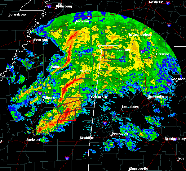 At 305 pm cdt, a severe thunderstorm capable of producing a tornado was located near louisville, moving east at 35 mph (radar indicated rotation). Hazards include tornado. Flying debris will be dangerous to those caught without shelter. mobile homes will be damaged or destroyed. damage to roofs, windows, and vehicles will occur. tree damage is likely. this dangerous storm will be near, betheden around 315 pm cdt. craig springs around 320 pm cdt. oktoc around 330 pm cdt. Other locations impacted by this tornadic thunderstorm include sturgis. At 305 pm cdt, a severe thunderstorm capable of producing a tornado was located near louisville, moving east at 35 mph (radar indicated rotation). Hazards include tornado. Flying debris will be dangerous to those caught without shelter. mobile homes will be damaged or destroyed. damage to roofs, windows, and vehicles will occur. tree damage is likely. this dangerous storm will be near, betheden around 315 pm cdt. craig springs around 320 pm cdt. oktoc around 330 pm cdt. Other locations impacted by this tornadic thunderstorm include sturgis.
|
| 4/12/2020 2:51 PM CDT |
 At 250 pm cdt, a confirmed tornado was located near ackerman, or 13 miles northwest of louisville, moving east at 45 mph (radar confirmed tornado). Hazards include damaging tornado. Flying debris will be dangerous to those caught without shelter. mobile homes will be damaged or destroyed. damage to roofs, windows, and vehicles will occur. tree damage is likely. this tornadic storm will be near, ackerman around 300 pm cdt. craig springs and betheden around 315 pm cdt. longview around 320 pm cdt. starkville around 325 pm cdt. oktoc around 330 pm cdt. sessums around 335 pm cdt. Other locations impacted by this tornadic thunderstorm include sturgis and weir. At 250 pm cdt, a confirmed tornado was located near ackerman, or 13 miles northwest of louisville, moving east at 45 mph (radar confirmed tornado). Hazards include damaging tornado. Flying debris will be dangerous to those caught without shelter. mobile homes will be damaged or destroyed. damage to roofs, windows, and vehicles will occur. tree damage is likely. this tornadic storm will be near, ackerman around 300 pm cdt. craig springs and betheden around 315 pm cdt. longview around 320 pm cdt. starkville around 325 pm cdt. oktoc around 330 pm cdt. sessums around 335 pm cdt. Other locations impacted by this tornadic thunderstorm include sturgis and weir.
|
| 2/10/2020 12:21 PM CST |
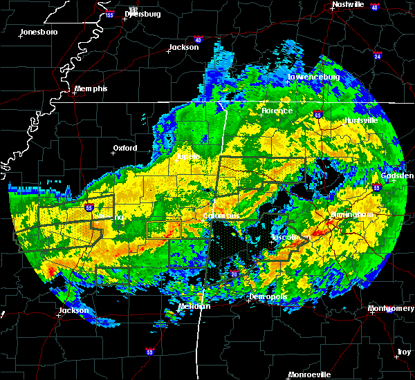 The severe thunderstorm warning for oktibbeha county will expire at 1230 pm cst, the storm which prompted the warning has weakened below severe limits, and no longer poses an immediate threat to life or property. therefore, the warning will be allowed to expire. The severe thunderstorm warning for oktibbeha county will expire at 1230 pm cst, the storm which prompted the warning has weakened below severe limits, and no longer poses an immediate threat to life or property. therefore, the warning will be allowed to expire.
|
| 2/10/2020 12:05 PM CST |
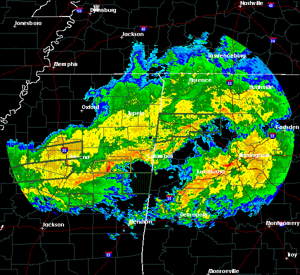 At 1204 pm cst, a severe thunderstorm was located over longview, or 8 miles southwest of starkville, moving east at 50 mph (radar indicated). Hazards include 60 mph wind gusts. Expect damage to roofs, siding, and trees. this severe storm will be near, starkville around 1210 pm cst. sessums and oktoc around 1220 pm cst. Other locations impacted by this severe thunderstorm include sturgis. At 1204 pm cst, a severe thunderstorm was located over longview, or 8 miles southwest of starkville, moving east at 50 mph (radar indicated). Hazards include 60 mph wind gusts. Expect damage to roofs, siding, and trees. this severe storm will be near, starkville around 1210 pm cst. sessums and oktoc around 1220 pm cst. Other locations impacted by this severe thunderstorm include sturgis.
|
| 2/10/2020 11:49 AM CST |
 At 1149 am cst, a severe thunderstorm was located over reform, or 20 miles north of louisville, moving east at 50 mph (radar indicated). Hazards include 60 mph wind gusts. Expect damage to roofs, siding, and trees. this severe thunderstorm will be near, starkville, longview and craig springs around 1210 pm cst. sessums and oktoc around 1220 pm cst. Other locations impacted by this severe thunderstorm include sturgis. At 1149 am cst, a severe thunderstorm was located over reform, or 20 miles north of louisville, moving east at 50 mph (radar indicated). Hazards include 60 mph wind gusts. Expect damage to roofs, siding, and trees. this severe thunderstorm will be near, starkville, longview and craig springs around 1210 pm cst. sessums and oktoc around 1220 pm cst. Other locations impacted by this severe thunderstorm include sturgis.
|
| 2/5/2020 5:31 PM CST |
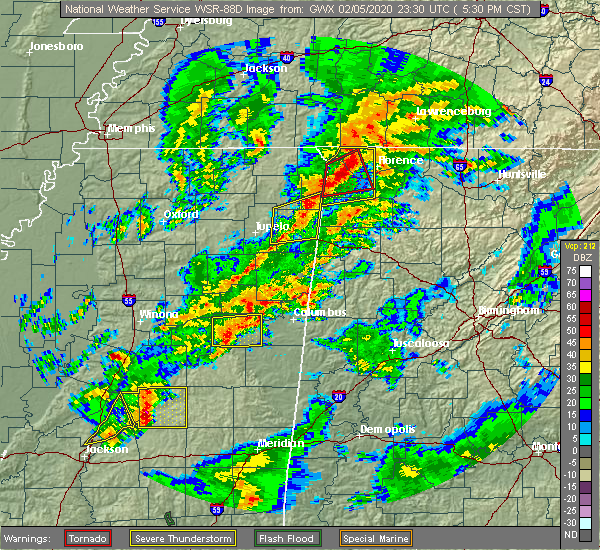 At 531 pm cst, a severe thunderstorm was located over longview, or 7 miles southwest of starkville, moving northeast at 60 mph (radar indicated). Hazards include 60 mph wind gusts and penny size hail. Expect damage to roofs, siding, and trees. this severe thunderstorm will be near, starkville around 535 pm cst. sessums around 540 pm cst. muldrow around 550 pm cst. other locations impacted by this severe thunderstorm include sturgis. A tornado watch remains in effect until 600 pm cst for central and northeastern mississippi. At 531 pm cst, a severe thunderstorm was located over longview, or 7 miles southwest of starkville, moving northeast at 60 mph (radar indicated). Hazards include 60 mph wind gusts and penny size hail. Expect damage to roofs, siding, and trees. this severe thunderstorm will be near, starkville around 535 pm cst. sessums around 540 pm cst. muldrow around 550 pm cst. other locations impacted by this severe thunderstorm include sturgis. A tornado watch remains in effect until 600 pm cst for central and northeastern mississippi.
|
| 2/5/2020 5:10 PM CST |
 At 509 pm cst, a severe thunderstorm was located near longview, or 10 miles west of starkville, moving northeast at 55 mph (radar indicated). Hazards include 60 mph wind gusts and penny size hail. Expect damage to roofs, siding, and trees. this severe thunderstorm will be near, starkville around 515 pm cst. muldrow around 530 pm cst. other locations impacted by this severe thunderstorm include sturgis. A tornado watch remains in effect until 600 pm cst for central, northeastern and east central mississippi. At 509 pm cst, a severe thunderstorm was located near longview, or 10 miles west of starkville, moving northeast at 55 mph (radar indicated). Hazards include 60 mph wind gusts and penny size hail. Expect damage to roofs, siding, and trees. this severe thunderstorm will be near, starkville around 515 pm cst. muldrow around 530 pm cst. other locations impacted by this severe thunderstorm include sturgis. A tornado watch remains in effect until 600 pm cst for central, northeastern and east central mississippi.
|
| 1/11/2020 10:01 AM CST |
 At 1000 am cst, severe thunderstorms were located along a line extending from near ackerman to near louisville to near vernon, moving northeast at 90 mph (radar indicated). Hazards include 60 mph wind gusts and nickel size hail. Expect damage to roofs, siding, and trees. severe thunderstorms will be near, betheden and reform around 1005 am cst. craig springs, longview and sherwood around 1010 am cst. starkville, maben, pheba, sessums and oktoc around 1015 am cst. crawford, muldrow, griffith and tibbee around 1020 am cst. west point, bent oak and pala alto around 1025 am cst. columbus and waverly around 1030 am cst. columbus afb, steens and kolola springs around 1035 am cst. caledonia around 1040 am cst. other locations impacted by these severe thunderstorms include noxapater, sturgis and artesia. A tornado watch remains in effect until 400 pm cst for northeastern and east central mississippi. At 1000 am cst, severe thunderstorms were located along a line extending from near ackerman to near louisville to near vernon, moving northeast at 90 mph (radar indicated). Hazards include 60 mph wind gusts and nickel size hail. Expect damage to roofs, siding, and trees. severe thunderstorms will be near, betheden and reform around 1005 am cst. craig springs, longview and sherwood around 1010 am cst. starkville, maben, pheba, sessums and oktoc around 1015 am cst. crawford, muldrow, griffith and tibbee around 1020 am cst. west point, bent oak and pala alto around 1025 am cst. columbus and waverly around 1030 am cst. columbus afb, steens and kolola springs around 1035 am cst. caledonia around 1040 am cst. other locations impacted by these severe thunderstorms include noxapater, sturgis and artesia. A tornado watch remains in effect until 400 pm cst for northeastern and east central mississippi.
|
| 1/11/2020 9:38 AM CST | Trees dow in winston county MS, 7.8 miles NW of Sturgis, MS |
| 1/11/2020 8:57 AM CST |
 At 857 am cst, severe thunderstorms were located along a line extending from near longview to near zama, moving northeast at 25 mph (radar indicated). Hazards include 60 mph wind gusts. Expect damage to roofs, siding, and trees. severe thunderstorms will be near, longview around 905 am cst. starkville around 915 am cst. sessums around 930 am cst. louisville and mcmillan around 935 am cst. millcreek around 950 am cst. betheden around 955 am cst. other locations impacted by these severe thunderstorms include noxapater, shuqualak, sturgis and artesia. a tornado watch remains in effect until 1100 am cst for central mississippi. A tornado watch also remains in effect until 400 pm cst for northeastern and east central mississippi. At 857 am cst, severe thunderstorms were located along a line extending from near longview to near zama, moving northeast at 25 mph (radar indicated). Hazards include 60 mph wind gusts. Expect damage to roofs, siding, and trees. severe thunderstorms will be near, longview around 905 am cst. starkville around 915 am cst. sessums around 930 am cst. louisville and mcmillan around 935 am cst. millcreek around 950 am cst. betheden around 955 am cst. other locations impacted by these severe thunderstorms include noxapater, shuqualak, sturgis and artesia. a tornado watch remains in effect until 1100 am cst for central mississippi. A tornado watch also remains in effect until 400 pm cst for northeastern and east central mississippi.
|
| 1/11/2020 8:26 AM CST |
 At 826 am cst, severe thunderstorms were located along a line extending from near maben to 6 miles northeast of zama, moving northeast at 40 mph (radar indicated). Hazards include 60 mph wind gusts. Expect damage to roofs, siding, and trees. these severe storms will be near, louisville and mcmillan around 850 am cst. millcreek and betheden around 900 am cst. other locations impacted by these severe thunderstorms include noxapater, mccool, sturgis and weir. a tornado watch remains in effect until 900 am cst for central mississippi. A tornado watch also remains in effect until 400 pm cst for northeastern and east central mississippi. At 826 am cst, severe thunderstorms were located along a line extending from near maben to 6 miles northeast of zama, moving northeast at 40 mph (radar indicated). Hazards include 60 mph wind gusts. Expect damage to roofs, siding, and trees. these severe storms will be near, louisville and mcmillan around 850 am cst. millcreek and betheden around 900 am cst. other locations impacted by these severe thunderstorms include noxapater, mccool, sturgis and weir. a tornado watch remains in effect until 900 am cst for central mississippi. A tornado watch also remains in effect until 400 pm cst for northeastern and east central mississippi.
|
| 1/11/2020 8:15 AM CST |
 At 814 am cst, severe thunderstorms were located along a line extending from sherwood to 10 miles west of center ridge, moving northeast at 80 mph (radar indicated). Hazards include 60 mph wind gusts. Expect damage to roofs, siding, and trees. severe thunderstorms will be near, betheden and millcreek around 830 am cst. oktoc around 840 am cst. other locations impacted by these severe thunderstorms include noxapater, mccool, sturgis and weir. a tornado watch remains in effect until 900 am cst for central mississippi. A tornado watch also remains in effect until 400 pm cst for northeastern and east central mississippi. At 814 am cst, severe thunderstorms were located along a line extending from sherwood to 10 miles west of center ridge, moving northeast at 80 mph (radar indicated). Hazards include 60 mph wind gusts. Expect damage to roofs, siding, and trees. severe thunderstorms will be near, betheden and millcreek around 830 am cst. oktoc around 840 am cst. other locations impacted by these severe thunderstorms include noxapater, mccool, sturgis and weir. a tornado watch remains in effect until 900 am cst for central mississippi. A tornado watch also remains in effect until 400 pm cst for northeastern and east central mississippi.
|
| 12/29/2019 4:33 PM CST |
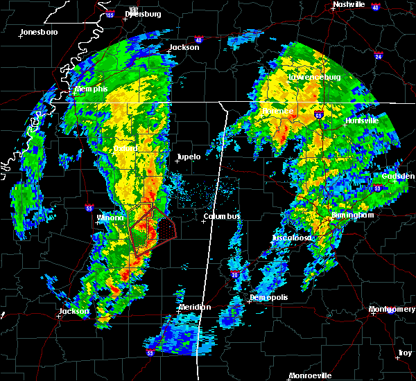 At 432 pm cst, a severe thunderstorm capable of producing a tornado was located near longview, or 9 miles west of starkville, moving northeast at 65 mph (radar indicated rotation). Hazards include tornado and quarter size hail. Flying debris will be dangerous to those caught without shelter. mobile homes will be damaged or destroyed. damage to roofs, windows, and vehicles will occur. tree damage is likely. This tornadic thunderstorm will remain over mainly rural areas of oktibbeha and southwestern clay counties, including the following locations, sturgis. At 432 pm cst, a severe thunderstorm capable of producing a tornado was located near longview, or 9 miles west of starkville, moving northeast at 65 mph (radar indicated rotation). Hazards include tornado and quarter size hail. Flying debris will be dangerous to those caught without shelter. mobile homes will be damaged or destroyed. damage to roofs, windows, and vehicles will occur. tree damage is likely. This tornadic thunderstorm will remain over mainly rural areas of oktibbeha and southwestern clay counties, including the following locations, sturgis.
|
| 12/29/2019 4:19 PM CST |
 At 418 pm cst, a severe thunderstorm capable of producing a tornado was located over ackerman, or 15 miles northwest of louisville, moving northeast at 55 mph (radar indicated rotation). Hazards include tornado and quarter size hail. Flying debris will be dangerous to those caught without shelter. mobile homes will be damaged or destroyed. damage to roofs, windows, and vehicles will occur. tree damage is likely. this dangerous storm will be near, reform around 425 pm cst. sherwood around 430 pm cst. longview around 435 pm cst. starkville around 440 pm cst. pheba around 445 pm cst. Other locations impacted by this tornadic thunderstorm include sturgis. At 418 pm cst, a severe thunderstorm capable of producing a tornado was located over ackerman, or 15 miles northwest of louisville, moving northeast at 55 mph (radar indicated rotation). Hazards include tornado and quarter size hail. Flying debris will be dangerous to those caught without shelter. mobile homes will be damaged or destroyed. damage to roofs, windows, and vehicles will occur. tree damage is likely. this dangerous storm will be near, reform around 425 pm cst. sherwood around 430 pm cst. longview around 435 pm cst. starkville around 440 pm cst. pheba around 445 pm cst. Other locations impacted by this tornadic thunderstorm include sturgis.
|
| 12/29/2019 4:02 PM CST |
 At 402 pm cst, a severe thunderstorm capable of producing a tornado was located 13 miles northeast of kosciusko, moving northeast at 65 mph (radar indicated rotation). Hazards include tornado and quarter size hail. Flying debris will be dangerous to those caught without shelter. mobile homes will be damaged or destroyed. damage to roofs, windows, and vehicles will occur. tree damage is likely. this dangerous storm will be near, ackerman and chester around 415 pm cst. reform around 420 pm cst. longview around 430 pm cst. starkville and pheba around 435 pm cst. Other locations impacted by this tornadic thunderstorm include mccool, french camp, sturgis and weir. At 402 pm cst, a severe thunderstorm capable of producing a tornado was located 13 miles northeast of kosciusko, moving northeast at 65 mph (radar indicated rotation). Hazards include tornado and quarter size hail. Flying debris will be dangerous to those caught without shelter. mobile homes will be damaged or destroyed. damage to roofs, windows, and vehicles will occur. tree damage is likely. this dangerous storm will be near, ackerman and chester around 415 pm cst. reform around 420 pm cst. longview around 430 pm cst. starkville and pheba around 435 pm cst. Other locations impacted by this tornadic thunderstorm include mccool, french camp, sturgis and weir.
|
| 10/26/2019 10:05 AM CDT |
 At 1005 am cdt, a severe thunderstorm was located 8 miles south of pyland, or 10 miles west of montpelier, moving north at 60 mph (radar indicated). Hazards include 60 mph wind gusts. Expect damage to roofs, siding, and trees. This severe thunderstorm will remain over mainly rural areas of choctaw, western oktibbeha, webster, southeastern montgomery and western clay counties, including the following locations, walthall, mantee, sturgis and weir. At 1005 am cdt, a severe thunderstorm was located 8 miles south of pyland, or 10 miles west of montpelier, moving north at 60 mph (radar indicated). Hazards include 60 mph wind gusts. Expect damage to roofs, siding, and trees. This severe thunderstorm will remain over mainly rural areas of choctaw, western oktibbeha, webster, southeastern montgomery and western clay counties, including the following locations, walthall, mantee, sturgis and weir.
|
| 10/26/2019 9:38 AM CDT |
 At 938 am cdt, a severe thunderstorm was located near chester, or 23 miles northwest of louisville, moving north at 60 mph (radar indicated). Hazards include 60 mph wind gusts. Expect damage to roofs, siding, and trees. this severe thunderstorm will be near, sherwood around 945 am cdt. eupora and mathiston around 950 am cdt. maben, clarkson, cumberland and bellefontaine around 955 am cdt. Other locations impacted by this severe thunderstorm include mccool, walthall, french camp, mantee, sturgis and weir. At 938 am cdt, a severe thunderstorm was located near chester, or 23 miles northwest of louisville, moving north at 60 mph (radar indicated). Hazards include 60 mph wind gusts. Expect damage to roofs, siding, and trees. this severe thunderstorm will be near, sherwood around 945 am cdt. eupora and mathiston around 950 am cdt. maben, clarkson, cumberland and bellefontaine around 955 am cdt. Other locations impacted by this severe thunderstorm include mccool, walthall, french camp, mantee, sturgis and weir.
|
| 7/15/2019 5:45 PM CDT |
 At 544 pm cdt, a severe thunderstorm was located 13 miles north of zama, or 15 miles northeast of kosciusko, moving northeast at 40 mph (radar indicated). Hazards include 60 mph wind gusts. Expect damage to roofs, siding, and trees. this severe thunderstorm will be near, ackerman and chester around 605 pm cdt. reform around 615 pm cdt. sherwood around 620 pm cdt. mathiston around 625 pm cdt. maben around 630 pm cdt. Other locations impacted by this severe thunderstorm include mccool, french camp, sturgis and weir. At 544 pm cdt, a severe thunderstorm was located 13 miles north of zama, or 15 miles northeast of kosciusko, moving northeast at 40 mph (radar indicated). Hazards include 60 mph wind gusts. Expect damage to roofs, siding, and trees. this severe thunderstorm will be near, ackerman and chester around 605 pm cdt. reform around 615 pm cdt. sherwood around 620 pm cdt. mathiston around 625 pm cdt. maben around 630 pm cdt. Other locations impacted by this severe thunderstorm include mccool, french camp, sturgis and weir.
|
| 7/7/2019 4:27 PM CDT |
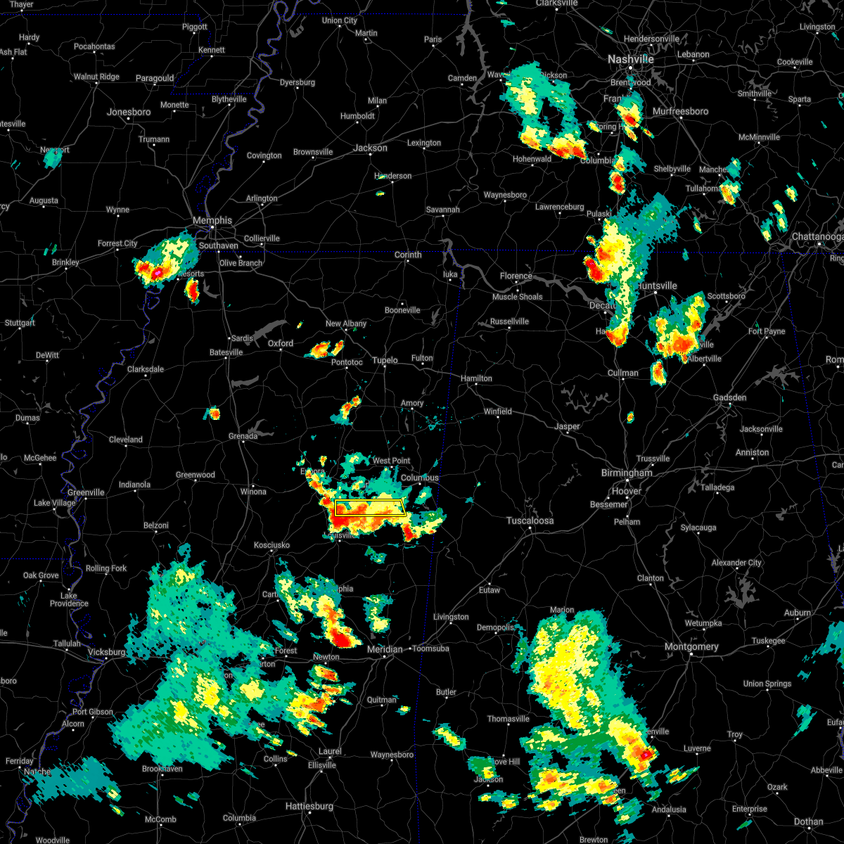 The severe thunderstorm warning for southern oktibbeha and southwestern lowndes counties will expire at 430 pm cdt, the storm which prompted the warning has moved out of the area. therefore, the warning will be allowed to expire. The severe thunderstorm warning for southern oktibbeha and southwestern lowndes counties will expire at 430 pm cdt, the storm which prompted the warning has moved out of the area. therefore, the warning will be allowed to expire.
|
| 7/7/2019 4:14 PM CDT |
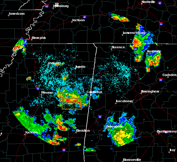 At 414 pm cdt, a severe thunderstorm was located near longview, or near starkville, moving south at 20 mph (radar indicated). Hazards include 60 mph wind gusts and nickel size hail. Expect damage to roofs, siding, and trees. this severe storm will be near, craig springs and oktoc around 425 pm cdt. Other locations impacted by this severe thunderstorm include sturgis. At 414 pm cdt, a severe thunderstorm was located near longview, or near starkville, moving south at 20 mph (radar indicated). Hazards include 60 mph wind gusts and nickel size hail. Expect damage to roofs, siding, and trees. this severe storm will be near, craig springs and oktoc around 425 pm cdt. Other locations impacted by this severe thunderstorm include sturgis.
|
| 7/7/2019 3:45 PM CDT |
 At 345 pm cdt, a severe thunderstorm was located near starkville, moving south at 20 mph (radar indicated). Hazards include 60 mph wind gusts and quarter size hail. Hail damage to vehicles is expected. expect wind damage to roofs, siding, and trees. this severe thunderstorm will be near, starkville around 400 pm cdt. longview around 405 pm cdt. craig springs and oktoc around 425 pm cdt. Other locations impacted by this severe thunderstorm include sturgis and artesia. At 345 pm cdt, a severe thunderstorm was located near starkville, moving south at 20 mph (radar indicated). Hazards include 60 mph wind gusts and quarter size hail. Hail damage to vehicles is expected. expect wind damage to roofs, siding, and trees. this severe thunderstorm will be near, starkville around 400 pm cdt. longview around 405 pm cdt. craig springs and oktoc around 425 pm cdt. Other locations impacted by this severe thunderstorm include sturgis and artesia.
|
| 6/24/2019 5:23 AM CDT |
 At 523 am cdt, a severe thunderstorm was located over kosciusko, moving northeast at 55 mph (radar indicated). Hazards include 60 mph wind gusts. Expect damage to roofs, siding, and trees. this severe thunderstorm will be near, ackerman and chester around 555 am cdt. reform around 605 am cdt. Other locations impacted by this severe thunderstorm include mccool, ethel, sallis, french camp, sturgis and weir. At 523 am cdt, a severe thunderstorm was located over kosciusko, moving northeast at 55 mph (radar indicated). Hazards include 60 mph wind gusts. Expect damage to roofs, siding, and trees. this severe thunderstorm will be near, ackerman and chester around 555 am cdt. reform around 605 am cdt. Other locations impacted by this severe thunderstorm include mccool, ethel, sallis, french camp, sturgis and weir.
|
| 6/20/2019 1:05 AM CDT |
 The severe thunderstorm warning for eastern choctaw, western oktibbeha, east central attala, central winston, northeastern webster and western clay counties will expire at 115 am cdt, the storms which prompted the warning have moved out of the area. therefore, the warning will be allowed to expire. a severe thunderstorm watch remains in effect until 600 am cdt for central, north central, northeastern and east central mississippi. The severe thunderstorm warning for eastern choctaw, western oktibbeha, east central attala, central winston, northeastern webster and western clay counties will expire at 115 am cdt, the storms which prompted the warning have moved out of the area. therefore, the warning will be allowed to expire. a severe thunderstorm watch remains in effect until 600 am cdt for central, north central, northeastern and east central mississippi.
|
| 6/20/2019 12:43 AM CDT |
 At 1242 am cdt, severe thunderstorms were located along a line extending from near montpelier to near craig springs to 6 miles northeast of zama, moving east at 45 mph (radar indicated). Hazards include 60 mph wind gusts and quarter size hail. Hail damage to vehicles is expected. expect wind damage to roofs, siding, and trees. these severe storms will be near, starkville, montpelier, craig springs and longview around 1250 am cdt. louisville around 100 am cdt. Other locations impacted by these severe thunderstorms include sturgis. At 1242 am cdt, severe thunderstorms were located along a line extending from near montpelier to near craig springs to 6 miles northeast of zama, moving east at 45 mph (radar indicated). Hazards include 60 mph wind gusts and quarter size hail. Hail damage to vehicles is expected. expect wind damage to roofs, siding, and trees. these severe storms will be near, starkville, montpelier, craig springs and longview around 1250 am cdt. louisville around 100 am cdt. Other locations impacted by these severe thunderstorms include sturgis.
|
| 6/20/2019 12:11 AM CDT |
 At 1210 am cdt, severe thunderstorms were located along a line extending from near sabougla to 8 miles southeast of poplar creek to near mcadams, moving east at 45 mph (radar indicated). Hazards include 60 mph wind gusts and quarter size hail. Hail damage to vehicles is expected. expect wind damage to roofs, siding, and trees. severe thunderstorms will be near, embry around 1215 am cdt. bellefontaine around 1220 am cdt. chester around 1225 am cdt. ackerman and clarkson around 1230 am cdt. montpelier and betheden around 1245 am cdt. craig springs and longview around 1250 am cdt. starkville around 1255 am cdt. louisville around 100 am cdt. Other locations impacted by these severe thunderstorms include ethel, sallis, french camp, mantee, mccool, walthall, sturgis and weir. At 1210 am cdt, severe thunderstorms were located along a line extending from near sabougla to 8 miles southeast of poplar creek to near mcadams, moving east at 45 mph (radar indicated). Hazards include 60 mph wind gusts and quarter size hail. Hail damage to vehicles is expected. expect wind damage to roofs, siding, and trees. severe thunderstorms will be near, embry around 1215 am cdt. bellefontaine around 1220 am cdt. chester around 1225 am cdt. ackerman and clarkson around 1230 am cdt. montpelier and betheden around 1245 am cdt. craig springs and longview around 1250 am cdt. starkville around 1255 am cdt. louisville around 100 am cdt. Other locations impacted by these severe thunderstorms include ethel, sallis, french camp, mantee, mccool, walthall, sturgis and weir.
|
| 4/13/2019 9:55 PM CDT |
 At 955 pm cdt, severe thunderstorms were located along a line extending from pheba to near millcreek, moving northeast at 40 mph (radar indicated). Hazards include 60 mph wind gusts and nickel size hail. Expect damage to roofs, siding, and trees. these severe storms will be near, pheba around 1000 pm cdt. griffith around 1005 pm cdt. pala alto around 1010 pm cdt. oktoc around 1015 pm cdt. crawford around 1020 pm cdt. sessums around 1025 pm cdt. bent oak around 1035 pm cdt. tibbee around 1040 pm cdt. other locations impacted by these severe thunderstorms include sturgis and artesia. A tornado watch remains in effect until 300 am cdt for central, north central, northeastern and east central mississippi. At 955 pm cdt, severe thunderstorms were located along a line extending from pheba to near millcreek, moving northeast at 40 mph (radar indicated). Hazards include 60 mph wind gusts and nickel size hail. Expect damage to roofs, siding, and trees. these severe storms will be near, pheba around 1000 pm cdt. griffith around 1005 pm cdt. pala alto around 1010 pm cdt. oktoc around 1015 pm cdt. crawford around 1020 pm cdt. sessums around 1025 pm cdt. bent oak around 1035 pm cdt. tibbee around 1040 pm cdt. other locations impacted by these severe thunderstorms include sturgis and artesia. A tornado watch remains in effect until 300 am cdt for central, north central, northeastern and east central mississippi.
|
| 4/13/2019 9:46 PM CDT |
 At 946 pm cdt, severe thunderstorms were located along a line extending from near sherwood to near vernon, moving northeast at 40 mph (radar indicated). Hazards include 60 mph wind gusts and nickel size hail. Expect damage to roofs, siding, and trees. these severe storms will be near, pheba around 1000 pm cdt. betheden around 1005 pm cdt. griffith around 1010 pm cdt. pala alto around 1020 pm cdt. oktoc around 1025 pm cdt. crawford and sessums around 1030 pm cdt. bent oak and tibbee around 1045 pm cdt. other locations impacted by these severe thunderstorms include sturgis and artesia. A tornado watch remains in effect until 300 am cdt for central, north central, northeastern and east central mississippi. At 946 pm cdt, severe thunderstorms were located along a line extending from near sherwood to near vernon, moving northeast at 40 mph (radar indicated). Hazards include 60 mph wind gusts and nickel size hail. Expect damage to roofs, siding, and trees. these severe storms will be near, pheba around 1000 pm cdt. betheden around 1005 pm cdt. griffith around 1010 pm cdt. pala alto around 1020 pm cdt. oktoc around 1025 pm cdt. crawford and sessums around 1030 pm cdt. bent oak and tibbee around 1045 pm cdt. other locations impacted by these severe thunderstorms include sturgis and artesia. A tornado watch remains in effect until 300 am cdt for central, north central, northeastern and east central mississippi.
|
| 4/13/2019 9:38 PM CDT |
 At 938 pm cdt, severe thunderstorms were located along a line extending from near reform to near stallo, moving northeast at 40 mph (radar indicated). Hazards include 60 mph wind gusts and nickel size hail. Expect damage to roofs, siding, and trees. severe thunderstorms will be near, sherwood and reform around 945 pm cdt. millcreek around 955 pm cdt. pheba and betheden around 1000 pm cdt. mashulaville around 1005 pm cdt. griffith around 1010 pm cdt. pala alto and oktoc around 1020 pm cdt. crawford around 1025 pm cdt. sessums around 1030 pm cdt. other locations impacted by these severe thunderstorms include noxapater, sturgis and artesia. A tornado watch remains in effect until 300 am cdt for central, north central, northeastern and east central mississippi. At 938 pm cdt, severe thunderstorms were located along a line extending from near reform to near stallo, moving northeast at 40 mph (radar indicated). Hazards include 60 mph wind gusts and nickel size hail. Expect damage to roofs, siding, and trees. severe thunderstorms will be near, sherwood and reform around 945 pm cdt. millcreek around 955 pm cdt. pheba and betheden around 1000 pm cdt. mashulaville around 1005 pm cdt. griffith around 1010 pm cdt. pala alto and oktoc around 1020 pm cdt. crawford around 1025 pm cdt. sessums around 1030 pm cdt. other locations impacted by these severe thunderstorms include noxapater, sturgis and artesia. A tornado watch remains in effect until 300 am cdt for central, north central, northeastern and east central mississippi.
|
| 4/13/2019 8:58 PM CDT |
 At 858 pm cdt, a severe thunderstorm was located over reform, or 19 miles west of starkville, moving northeast at 50 mph (radar indicated). Hazards include 60 mph wind gusts and nickel size hail. Expect damage to roofs, siding, and trees. this severe storm will be near, mathiston around 905 pm cdt. maben and clarkson around 910 pm cdt. cumberland and pheba around 915 pm cdt. montpelier around 925 pm cdt. other locations impacted by this severe thunderstorm include mantee and sturgis. A tornado watch remains in effect until 300 am cdt for central, north central, northeastern and east central mississippi. At 858 pm cdt, a severe thunderstorm was located over reform, or 19 miles west of starkville, moving northeast at 50 mph (radar indicated). Hazards include 60 mph wind gusts and nickel size hail. Expect damage to roofs, siding, and trees. this severe storm will be near, mathiston around 905 pm cdt. maben and clarkson around 910 pm cdt. cumberland and pheba around 915 pm cdt. montpelier around 925 pm cdt. other locations impacted by this severe thunderstorm include mantee and sturgis. A tornado watch remains in effect until 300 am cdt for central, north central, northeastern and east central mississippi.
|
| 4/13/2019 8:40 PM CDT |
 At 840 pm cdt, a severe thunderstorm was located 7 miles southwest of chester, or 17 miles northwest of louisville, moving northeast at 50 mph (radar indicated). Hazards include 60 mph wind gusts and nickel size hail. Expect damage to roofs, siding, and trees. this severe thunderstorm will be near, ackerman and chester around 850 pm cdt. reform around 900 pm cdt. mathiston and sherwood around 905 pm cdt. maben around 910 pm cdt. cumberland, pheba and clarkson around 915 pm cdt. montpelier around 925 pm cdt. other locations impacted by this severe thunderstorm include french camp, mantee, sturgis and weir. a tornado watch remains in effect until midnight cdt for central mississippi. A tornado watch also remains in effect until 300 am cdt for central, north central, northeastern and east central mississippi. At 840 pm cdt, a severe thunderstorm was located 7 miles southwest of chester, or 17 miles northwest of louisville, moving northeast at 50 mph (radar indicated). Hazards include 60 mph wind gusts and nickel size hail. Expect damage to roofs, siding, and trees. this severe thunderstorm will be near, ackerman and chester around 850 pm cdt. reform around 900 pm cdt. mathiston and sherwood around 905 pm cdt. maben around 910 pm cdt. cumberland, pheba and clarkson around 915 pm cdt. montpelier around 925 pm cdt. other locations impacted by this severe thunderstorm include french camp, mantee, sturgis and weir. a tornado watch remains in effect until midnight cdt for central mississippi. A tornado watch also remains in effect until 300 am cdt for central, north central, northeastern and east central mississippi.
|
| 4/13/2019 8:08 PM CDT |
 At 808 pm cdt, a severe thunderstorm was located 8 miles southwest of ackerman, or 16 miles northwest of louisville, moving northeast at 50 mph (radar indicated). Hazards include 60 mph wind gusts and nickel size hail. Expect damage to roofs, siding, and trees. this severe thunderstorm will be near, ackerman and chester around 820 pm cdt. reform around 825 pm cdt. sherwood around 830 pm cdt. maben around 840 pm cdt. other locations impacted by this severe thunderstorm include mccool, french camp, sturgis and weir. a tornado watch remains in effect until 900 pm cdt for central mississippi. A tornado watch also remains in effect until 300 am cdt for central, north central, northeastern and east central mississippi. At 808 pm cdt, a severe thunderstorm was located 8 miles southwest of ackerman, or 16 miles northwest of louisville, moving northeast at 50 mph (radar indicated). Hazards include 60 mph wind gusts and nickel size hail. Expect damage to roofs, siding, and trees. this severe thunderstorm will be near, ackerman and chester around 820 pm cdt. reform around 825 pm cdt. sherwood around 830 pm cdt. maben around 840 pm cdt. other locations impacted by this severe thunderstorm include mccool, french camp, sturgis and weir. a tornado watch remains in effect until 900 pm cdt for central mississippi. A tornado watch also remains in effect until 300 am cdt for central, north central, northeastern and east central mississippi.
|
| 4/6/2019 6:00 PM CDT |
 At 600 pm cdt, severe thunderstorms were located along a line extending from near embry to near sherwood to 7 miles east of ackerman, moving northeast at 60 mph (radar indicated). Hazards include 60 mph wind gusts and quarter size hail. Hail damage to vehicles is expected. expect wind damage to roofs, siding, and trees. these severe storms will be near, maben and mathiston around 605 pm cdt. cumberland and clarkson around 610 pm cdt. pheba around 615 pm cdt. montpelier around 620 pm cdt. Other locations impacted by these severe thunderstorms include mantee, sturgis and walthall. At 600 pm cdt, severe thunderstorms were located along a line extending from near embry to near sherwood to 7 miles east of ackerman, moving northeast at 60 mph (radar indicated). Hazards include 60 mph wind gusts and quarter size hail. Hail damage to vehicles is expected. expect wind damage to roofs, siding, and trees. these severe storms will be near, maben and mathiston around 605 pm cdt. cumberland and clarkson around 610 pm cdt. pheba around 615 pm cdt. montpelier around 620 pm cdt. Other locations impacted by these severe thunderstorms include mantee, sturgis and walthall.
|
| 4/6/2019 5:38 PM CDT |
 At 538 pm cdt, severe thunderstorms were located along a line extending from near kilmichael to 9 miles southeast of poplar creek to 9 miles northeast of zama, moving northeast at 60 mph (radar indicated). Hazards include 60 mph wind gusts and quarter size hail. Hail damage to vehicles is expected. expect wind damage to roofs, siding, and trees. severe thunderstorms will be near, lodi and chester around 550 pm cdt. eupora, ackerman and reform around 555 pm cdt. mathiston, embry and sherwood around 600 pm cdt. maben, bellefontaine and clarkson around 605 pm cdt. cumberland and pheba around 610 pm cdt. montpelier around 620 pm cdt. Other locations impacted by these severe thunderstorms include mccool, walthall, french camp, mantee, sturgis and weir. At 538 pm cdt, severe thunderstorms were located along a line extending from near kilmichael to 9 miles southeast of poplar creek to 9 miles northeast of zama, moving northeast at 60 mph (radar indicated). Hazards include 60 mph wind gusts and quarter size hail. Hail damage to vehicles is expected. expect wind damage to roofs, siding, and trees. severe thunderstorms will be near, lodi and chester around 550 pm cdt. eupora, ackerman and reform around 555 pm cdt. mathiston, embry and sherwood around 600 pm cdt. maben, bellefontaine and clarkson around 605 pm cdt. cumberland and pheba around 610 pm cdt. montpelier around 620 pm cdt. Other locations impacted by these severe thunderstorms include mccool, walthall, french camp, mantee, sturgis and weir.
|
| 3/14/2019 1:09 PM CDT |
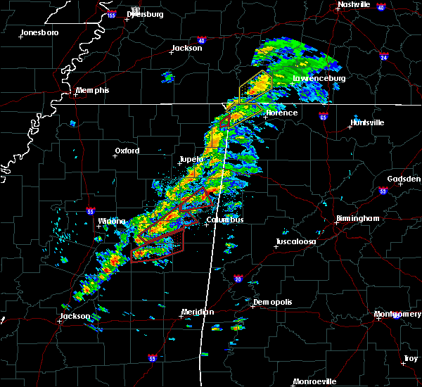 At 108 pm cdt, a severe thunderstorm capable of producing a tornado was located near longview, or 10 miles west of starkville, moving northeast at 50 mph (radar indicated rotation). Hazards include tornado. Flying debris will be dangerous to those caught without shelter. mobile homes will be damaged or destroyed. damage to roofs, windows, and vehicles will occur. tree damage is likely. this dangerous storm will be near, starkville around 115 pm cdt. pheba around 120 pm cdt. muldrow and griffith around 130 pm cdt. west point, tibbee and pala alto around 135 pm cdt. Other locations impacted by this tornadic thunderstorm include sturgis. At 108 pm cdt, a severe thunderstorm capable of producing a tornado was located near longview, or 10 miles west of starkville, moving northeast at 50 mph (radar indicated rotation). Hazards include tornado. Flying debris will be dangerous to those caught without shelter. mobile homes will be damaged or destroyed. damage to roofs, windows, and vehicles will occur. tree damage is likely. this dangerous storm will be near, starkville around 115 pm cdt. pheba around 120 pm cdt. muldrow and griffith around 130 pm cdt. west point, tibbee and pala alto around 135 pm cdt. Other locations impacted by this tornadic thunderstorm include sturgis.
|
| 3/14/2019 12:59 PM CDT |
 At 1259 pm cdt, a severe thunderstorm capable of producing a tornado was located near reform, or 17 miles north of louisville, moving northeast at 40 mph (radar indicated rotation). Hazards include tornado. Flying debris will be dangerous to those caught without shelter. mobile homes will be damaged or destroyed. damage to roofs, windows, and vehicles will occur. tree damage is likely. this dangerous storm will be near, longview around 115 pm cdt. starkville around 120 pm cdt. pheba around 125 pm cdt. griffith around 135 pm cdt. muldrow and pala alto around 140 pm cdt. west point and tibbee around 145 pm cdt. Other locations impacted by this tornadic thunderstorm include sturgis. At 1259 pm cdt, a severe thunderstorm capable of producing a tornado was located near reform, or 17 miles north of louisville, moving northeast at 40 mph (radar indicated rotation). Hazards include tornado. Flying debris will be dangerous to those caught without shelter. mobile homes will be damaged or destroyed. damage to roofs, windows, and vehicles will occur. tree damage is likely. this dangerous storm will be near, longview around 115 pm cdt. starkville around 120 pm cdt. pheba around 125 pm cdt. griffith around 135 pm cdt. muldrow and pala alto around 140 pm cdt. west point and tibbee around 145 pm cdt. Other locations impacted by this tornadic thunderstorm include sturgis.
|
| 3/9/2019 7:41 PM CDT |
 The severe thunderstorm warning for oktibbeha county will expire at 645 pm cst, the storm which prompted the warning has moved out of the area. therefore, the warning will be allowed to expire. a tornado watch remains in effect until 900 pm cst for central and northeastern mississippi. The severe thunderstorm warning for oktibbeha county will expire at 645 pm cst, the storm which prompted the warning has moved out of the area. therefore, the warning will be allowed to expire. a tornado watch remains in effect until 900 pm cst for central and northeastern mississippi.
|
| 3/9/2019 7:09 PM CDT |
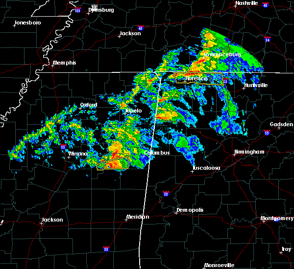 At 609 pm cst, a severe thunderstorm capable of producing a tornado was located near craig springs, or 12 miles north of louisville, moving east at 45 mph (radar indicated rotation). Hazards include tornado. Flying debris will be dangerous to those caught without shelter. mobile homes will be damaged or destroyed. damage to roofs, windows, and vehicles will occur. tree damage is likely. this dangerous storm will be near, craig springs around 620 pm cst. oktoc around 630 pm cst. sessums around 635 pm cst. Other locations impacted by this tornadic thunderstorm include sturgis. At 609 pm cst, a severe thunderstorm capable of producing a tornado was located near craig springs, or 12 miles north of louisville, moving east at 45 mph (radar indicated rotation). Hazards include tornado. Flying debris will be dangerous to those caught without shelter. mobile homes will be damaged or destroyed. damage to roofs, windows, and vehicles will occur. tree damage is likely. this dangerous storm will be near, craig springs around 620 pm cst. oktoc around 630 pm cst. sessums around 635 pm cst. Other locations impacted by this tornadic thunderstorm include sturgis.
|
| 3/9/2019 5:58 PM CST |
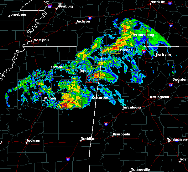 At 558 pm cst, a severe thunderstorm was located near ackerman, or 14 miles north of louisville, moving east at 50 mph (radar indicated). Hazards include 60 mph wind gusts and quarter size hail. Hail damage to vehicles is expected. expect wind damage to roofs, siding, and trees. this severe storm will be near, craig springs and longview around 610 pm cst. starkville around 615 pm cst. oktoc around 620 pm cst. sessums around 625 pm cst. other locations impacted by this severe thunderstorm include sturgis. A tornado watch remains in effect until 900 pm cst for central and northeastern mississippi. At 558 pm cst, a severe thunderstorm was located near ackerman, or 14 miles north of louisville, moving east at 50 mph (radar indicated). Hazards include 60 mph wind gusts and quarter size hail. Hail damage to vehicles is expected. expect wind damage to roofs, siding, and trees. this severe storm will be near, craig springs and longview around 610 pm cst. starkville around 615 pm cst. oktoc around 620 pm cst. sessums around 625 pm cst. other locations impacted by this severe thunderstorm include sturgis. A tornado watch remains in effect until 900 pm cst for central and northeastern mississippi.
|
| 3/9/2019 5:47 PM CST |
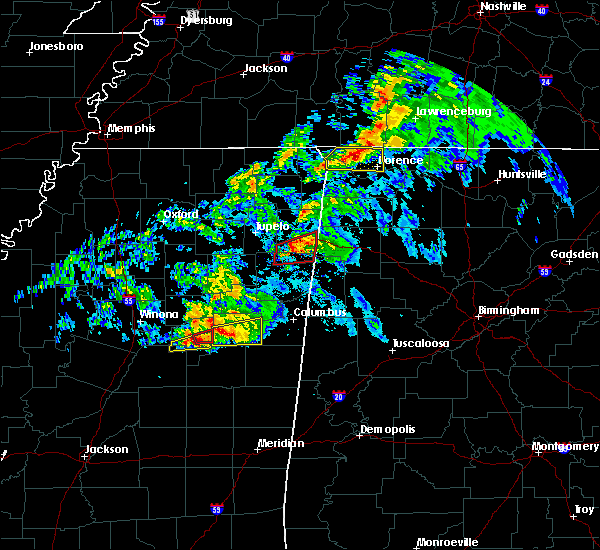 At 547 pm cst, a severe thunderstorm was located near longview, or 13 miles southwest of starkville, moving east at 45 mph (radar indicated). Hazards include 60 mph wind gusts. Expect damage to roofs, siding, and trees. this severe storm will be near, longview and craig springs around 555 pm cst. starkville around 600 pm cst. sessums and oktoc around 610 pm cst. other locations impacted by this severe thunderstorm include sturgis. A tornado watch remains in effect until 900 pm cst for central and northeastern mississippi. At 547 pm cst, a severe thunderstorm was located near longview, or 13 miles southwest of starkville, moving east at 45 mph (radar indicated). Hazards include 60 mph wind gusts. Expect damage to roofs, siding, and trees. this severe storm will be near, longview and craig springs around 555 pm cst. starkville around 600 pm cst. sessums and oktoc around 610 pm cst. other locations impacted by this severe thunderstorm include sturgis. A tornado watch remains in effect until 900 pm cst for central and northeastern mississippi.
|
| 3/9/2019 5:43 PM CST |
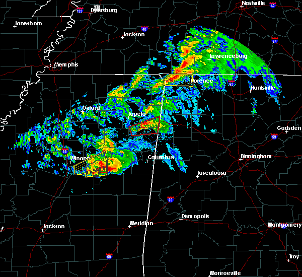 At 543 pm cst, a severe thunderstorm was located near ackerman, or 16 miles north of louisville, moving east at 45 mph (radar indicated). Hazards include 60 mph wind gusts. Expect damage to roofs, siding, and trees. this severe thunderstorm will be near, longview and craig springs around 555 pm cst. starkville around 600 pm cst. oktoc around 610 pm cst. sessums around 615 pm cst. other locations impacted by this severe thunderstorm include sturgis. A tornado watch remains in effect until 900 pm cst for central and northeastern mississippi. At 543 pm cst, a severe thunderstorm was located near ackerman, or 16 miles north of louisville, moving east at 45 mph (radar indicated). Hazards include 60 mph wind gusts. Expect damage to roofs, siding, and trees. this severe thunderstorm will be near, longview and craig springs around 555 pm cst. starkville around 600 pm cst. oktoc around 610 pm cst. sessums around 615 pm cst. other locations impacted by this severe thunderstorm include sturgis. A tornado watch remains in effect until 900 pm cst for central and northeastern mississippi.
|
| 2/23/2019 4:08 PM CST |
 The national weather service in jackson has issued a * severe thunderstorm warning for. oktibbeha county in northeastern mississippi. until 515 pm cst. At 407 pm cst, a severe thunderstorm was located near ackerman, or 16 miles north of louisville, moving northeast at 30 mph. The national weather service in jackson has issued a * severe thunderstorm warning for. oktibbeha county in northeastern mississippi. until 515 pm cst. At 407 pm cst, a severe thunderstorm was located near ackerman, or 16 miles north of louisville, moving northeast at 30 mph.
|
| 1/19/2019 8:03 AM CST |
 At 803 am cst, a severe thunderstorm was located near longview, or 12 miles southwest of starkville, moving northeast at 60 mph (radar indicated). Hazards include 60 mph wind gusts. Expect damage to roofs, siding, and trees. this severe thunderstorm will remain over mainly rural areas of east central choctaw, southwestern oktibbeha and northeastern winston counties, including the following locations, sturgis. A tornado watch remains in effect until 100 pm cst for central, northeastern and east central mississippi. At 803 am cst, a severe thunderstorm was located near longview, or 12 miles southwest of starkville, moving northeast at 60 mph (radar indicated). Hazards include 60 mph wind gusts. Expect damage to roofs, siding, and trees. this severe thunderstorm will remain over mainly rural areas of east central choctaw, southwestern oktibbeha and northeastern winston counties, including the following locations, sturgis. A tornado watch remains in effect until 100 pm cst for central, northeastern and east central mississippi.
|
| 1/19/2019 7:55 AM CST |
 At 754 am cst, a severe thunderstorm was located 8 miles south of ackerman, or 10 miles northwest of louisville, moving northeast at 40 mph (radar indicated). Hazards include 60 mph wind gusts. Expect damage to roofs, siding, and trees. this severe storm will be near, louisville around 800 am cst. ackerman around 805 am cst. craig springs around 815 am cst. other locations impacted by this severe thunderstorm include sturgis. A tornado watch remains in effect until 100 pm cst for central, northeastern and east central mississippi. At 754 am cst, a severe thunderstorm was located 8 miles south of ackerman, or 10 miles northwest of louisville, moving northeast at 40 mph (radar indicated). Hazards include 60 mph wind gusts. Expect damage to roofs, siding, and trees. this severe storm will be near, louisville around 800 am cst. ackerman around 805 am cst. craig springs around 815 am cst. other locations impacted by this severe thunderstorm include sturgis. A tornado watch remains in effect until 100 pm cst for central, northeastern and east central mississippi.
|
| 1/19/2019 7:40 AM CST |
 At 740 am cst, a severe thunderstorm was located 10 miles north of zama, or 15 miles west of louisville, moving northeast at 45 mph (radar indicated). Hazards include 60 mph wind gusts. Expect damage to roofs, siding, and trees. this severe thunderstorm will be near, louisville and mcmillan around 755 am cst. ackerman around 800 am cst. betheden around 810 am cst. craig springs around 815 am cst. other locations impacted by this severe thunderstorm include mccool, sturgis and weir. A tornado watch remains in effect until 100 pm cst for central, northeastern and east central mississippi. At 740 am cst, a severe thunderstorm was located 10 miles north of zama, or 15 miles west of louisville, moving northeast at 45 mph (radar indicated). Hazards include 60 mph wind gusts. Expect damage to roofs, siding, and trees. this severe thunderstorm will be near, louisville and mcmillan around 755 am cst. ackerman around 800 am cst. betheden around 810 am cst. craig springs around 815 am cst. other locations impacted by this severe thunderstorm include mccool, sturgis and weir. A tornado watch remains in effect until 100 pm cst for central, northeastern and east central mississippi.
|
| 11/6/2018 12:51 AM CST |
 At 1251 am cst, a severe thunderstorm was located over ackerman, or 15 miles northwest of louisville, moving east at 45 mph (radar indicated). Hazards include 60 mph wind gusts. Expect damage to roofs, siding, and trees. this severe storm will be near, craig springs and longview around 115 am cst. Other locations impacted by this severe thunderstorm include sturgis and weir. At 1251 am cst, a severe thunderstorm was located over ackerman, or 15 miles northwest of louisville, moving east at 45 mph (radar indicated). Hazards include 60 mph wind gusts. Expect damage to roofs, siding, and trees. this severe storm will be near, craig springs and longview around 115 am cst. Other locations impacted by this severe thunderstorm include sturgis and weir.
|
| 11/6/2018 12:36 AM CST |
 At 1235 am cst, a severe thunderstorm was located 9 miles southeast of poplar creek, or 19 miles northeast of kosciusko, moving east at 50 mph (radar indicated). Hazards include 60 mph wind gusts. Expect damage to roofs, siding, and trees. this severe thunderstorm will be near, ackerman and chester around 1250 am cst. longview and craig springs around 110 am cst. Other locations impacted by this severe thunderstorm include french camp, sturgis and weir. At 1235 am cst, a severe thunderstorm was located 9 miles southeast of poplar creek, or 19 miles northeast of kosciusko, moving east at 50 mph (radar indicated). Hazards include 60 mph wind gusts. Expect damage to roofs, siding, and trees. this severe thunderstorm will be near, ackerman and chester around 1250 am cst. longview and craig springs around 110 am cst. Other locations impacted by this severe thunderstorm include french camp, sturgis and weir.
|
| 8/17/2018 6:06 PM CDT |
 At 605 pm cdt, a severe thunderstorm was located near reform, or 17 miles north of louisville, moving east at 15 mph (radar indicated). Hazards include 60 mph wind gusts. Expect damage to roofs, siding, and trees. this severe storm will be near, longview and craig springs around 630 pm cdt. other locations impacted by this severe thunderstorm include sturgis. those attending the sturgis motorcycle rally are in the path of this storm and should prepare for imminent dangerous weather conditions. Seek shelter now!. At 605 pm cdt, a severe thunderstorm was located near reform, or 17 miles north of louisville, moving east at 15 mph (radar indicated). Hazards include 60 mph wind gusts. Expect damage to roofs, siding, and trees. this severe storm will be near, longview and craig springs around 630 pm cdt. other locations impacted by this severe thunderstorm include sturgis. those attending the sturgis motorcycle rally are in the path of this storm and should prepare for imminent dangerous weather conditions. Seek shelter now!.
|
| 8/17/2018 5:37 PM CDT |
 At 537 pm cdt, severe thunderstorms were located along a line extending from 8 miles west of reform to near chester, moving east at 15 mph (radar indicated). Hazards include 60 mph wind gusts and nickel size hail. Expect damage to roofs, siding, and trees. severe thunderstorms will be near, chester around 545 pm cdt. ackerman around 550 pm cdt. reform around 605 pm cdt. sherwood around 615 pm cdt. longview and craig springs around 630 pm cdt. other locations impacted by these severe thunderstorms include sturgis and weir. those attending the sturgis motorcycle rally are in the path of these storms and should prepare for imminent dangerous weather conditions. Seek shelter now!. At 537 pm cdt, severe thunderstorms were located along a line extending from 8 miles west of reform to near chester, moving east at 15 mph (radar indicated). Hazards include 60 mph wind gusts and nickel size hail. Expect damage to roofs, siding, and trees. severe thunderstorms will be near, chester around 545 pm cdt. ackerman around 550 pm cdt. reform around 605 pm cdt. sherwood around 615 pm cdt. longview and craig springs around 630 pm cdt. other locations impacted by these severe thunderstorms include sturgis and weir. those attending the sturgis motorcycle rally are in the path of these storms and should prepare for imminent dangerous weather conditions. Seek shelter now!.
|
| 7/6/2018 5:06 PM CDT |
 At 505 pm cdt, severe thunderstorms were located along a line extending from 6 miles south of eupora to 6 miles east of reform, moving southwest at 40 mph (radar indicated). Hazards include 60 mph wind gusts. Expect damage to roofs, siding, and trees. severe thunderstorms will be near, ackerman and chester around 525 pm cdt. poplar creek around 530 pm cdt. Other locations impacted by these severe thunderstorms include mccool, french camp, sturgis and weir. At 505 pm cdt, severe thunderstorms were located along a line extending from 6 miles south of eupora to 6 miles east of reform, moving southwest at 40 mph (radar indicated). Hazards include 60 mph wind gusts. Expect damage to roofs, siding, and trees. severe thunderstorms will be near, ackerman and chester around 525 pm cdt. poplar creek around 530 pm cdt. Other locations impacted by these severe thunderstorms include mccool, french camp, sturgis and weir.
|
| 4/14/2018 9:55 AM CDT | Tree downed across loakfoma rd near ms hwy 2 in winston county MS, 9.9 miles WNW of Sturgis, MS |
| 4/14/2018 9:45 AM CDT |
 At 945 am cdt, severe thunderstorms were located along a line extending from 6 miles west of craig springs to near millcreek, moving northeast at 40 mph (radar indicated). Hazards include 60 mph wind gusts. Expect damage to roofs, siding, and trees. these severe storms will be near, craig springs around 950 am cdt. longview around 955 am cdt. starkville around 1000 am cdt. other locations impacted by these severe thunderstorms include sturgis. A tornado watch remains in effect until 200 pm cdt for central, northeastern and east central mississippi. At 945 am cdt, severe thunderstorms were located along a line extending from 6 miles west of craig springs to near millcreek, moving northeast at 40 mph (radar indicated). Hazards include 60 mph wind gusts. Expect damage to roofs, siding, and trees. these severe storms will be near, craig springs around 950 am cdt. longview around 955 am cdt. starkville around 1000 am cdt. other locations impacted by these severe thunderstorms include sturgis. A tornado watch remains in effect until 200 pm cdt for central, northeastern and east central mississippi.
|
| 4/14/2018 9:16 AM CDT |
 At 915 am cdt, severe thunderstorms were located along a line extending from near reform to near pearl river, moving east at 25 mph (radar indicated). Hazards include 60 mph wind gusts. Expect damage to roofs, siding, and trees. severe thunderstorms will be near, reform around 925 am cdt. sherwood and burnside around 930 am cdt. maben and stallo around 935 am cdt. nanih waiya and longview around 955 am cdt. starkville around 1005 am cdt. other locations impacted by these severe thunderstorms include noxapater and sturgis. A tornado watch remains in effect until 200 pm cdt for central, northeastern and east central mississippi. At 915 am cdt, severe thunderstorms were located along a line extending from near reform to near pearl river, moving east at 25 mph (radar indicated). Hazards include 60 mph wind gusts. Expect damage to roofs, siding, and trees. severe thunderstorms will be near, reform around 925 am cdt. sherwood and burnside around 930 am cdt. maben and stallo around 935 am cdt. nanih waiya and longview around 955 am cdt. starkville around 1005 am cdt. other locations impacted by these severe thunderstorms include noxapater and sturgis. A tornado watch remains in effect until 200 pm cdt for central, northeastern and east central mississippi.
|
| 4/3/2018 9:33 PM CDT |
 At 933 pm cdt, severe thunderstorms were located along a line extending from near west point to near noxapater, moving southeast at 45 mph (emergency management. these storms have a history of downing trees and power lines across central mississippi). Hazards include 60 mph wind gusts. Expect damage to roofs, siding, and trees. Locations impacted include, starkville, west point, louisville, sessums, betheden, craig springs, millcreek, longview, oktoc, waverly, tibbee, muldrow and noxapater. At 933 pm cdt, severe thunderstorms were located along a line extending from near west point to near noxapater, moving southeast at 45 mph (emergency management. these storms have a history of downing trees and power lines across central mississippi). Hazards include 60 mph wind gusts. Expect damage to roofs, siding, and trees. Locations impacted include, starkville, west point, louisville, sessums, betheden, craig springs, millcreek, longview, oktoc, waverly, tibbee, muldrow and noxapater.
|
| 4/3/2018 9:07 PM CDT |
 At 906 pm cdt, severe thunderstorms were located along a line extending from near montpelier to near zama, moving east at 60 mph (emergency management. at 849 pm, a tree was blown down on a house in eupora). Hazards include 60 mph wind gusts. Expect damage to roofs, siding, and trees. Locations impacted include, starkville, west point, louisville, montpelier, maben, sessums, betheden, craig springs, millcreek, longview, oktoc, griffith, waverly, pheba, tibbee, muldrow, pala alto, noxapater and sturgis. At 906 pm cdt, severe thunderstorms were located along a line extending from near montpelier to near zama, moving east at 60 mph (emergency management. at 849 pm, a tree was blown down on a house in eupora). Hazards include 60 mph wind gusts. Expect damage to roofs, siding, and trees. Locations impacted include, starkville, west point, louisville, montpelier, maben, sessums, betheden, craig springs, millcreek, longview, oktoc, griffith, waverly, pheba, tibbee, muldrow, pala alto, noxapater and sturgis.
|
| 4/3/2018 8:55 PM CDT |
 At 854 pm cdt, severe thunderstorms were located along a line extending from 6 miles west of montpelier to smyrna, moving east at 55 mph (radar indicated). Hazards include 60 mph wind gusts. expect damage to roofs, siding, and trees At 854 pm cdt, severe thunderstorms were located along a line extending from 6 miles west of montpelier to smyrna, moving east at 55 mph (radar indicated). Hazards include 60 mph wind gusts. expect damage to roofs, siding, and trees
|
| 9/5/2017 4:23 PM CDT |
 At 423 pm cdt, severe thunderstorms were located along a line extending from near muldrow to near poplar creek, moving southeast at 20 mph (radar indicated). Hazards include 60 mph wind gusts and quarter size hail. Hail damage to vehicles is expected. expect wind damage to roofs, siding, and trees. these severe storms will be near, muldrow around 430 pm cdt. tibbee around 440 pm cdt. sessums and bent oak around 445 pm cdt. Other locations impacted by these severe thunderstorms include french camp, sturgis and artesia. At 423 pm cdt, severe thunderstorms were located along a line extending from near muldrow to near poplar creek, moving southeast at 20 mph (radar indicated). Hazards include 60 mph wind gusts and quarter size hail. Hail damage to vehicles is expected. expect wind damage to roofs, siding, and trees. these severe storms will be near, muldrow around 430 pm cdt. tibbee around 440 pm cdt. sessums and bent oak around 445 pm cdt. Other locations impacted by these severe thunderstorms include french camp, sturgis and artesia.
|
| 9/5/2017 4:09 PM CDT |
 At 409 pm cdt, severe thunderstorms were located along a line extending from near steens to 7 miles southeast of lodi, moving southeast at 20 mph (radar indicated). Hazards include 60 mph wind gusts and quarter size hail. Hail damage to vehicles is expected. expect wind damage to roofs, siding, and trees. these severe storms will be near, columbus, columbus afb and kolola springs around 415 pm cdt. steens around 420 pm cdt. chester around 445 pm cdt. Other locations impacted by these severe thunderstorms include french camp, sturgis and artesia. At 409 pm cdt, severe thunderstorms were located along a line extending from near steens to 7 miles southeast of lodi, moving southeast at 20 mph (radar indicated). Hazards include 60 mph wind gusts and quarter size hail. Hail damage to vehicles is expected. expect wind damage to roofs, siding, and trees. these severe storms will be near, columbus, columbus afb and kolola springs around 415 pm cdt. steens around 420 pm cdt. chester around 445 pm cdt. Other locations impacted by these severe thunderstorms include french camp, sturgis and artesia.
|
| 9/5/2017 3:44 PM CDT |
 At 344 pm cdt, severe thunderstorms were located along a line extending from near kolola springs to near lodi, moving south at 15 mph (radar indicated). Hazards include 60 mph wind gusts and quarter size hail. Hail damage to vehicles is expected. expect wind damage to roofs, siding, and trees. severe thunderstorms will be near, caledonia and kolola springs around 400 pm cdt. columbus afb around 410 pm cdt. columbus and steens around 425 pm cdt. chester around 445 pm cdt. Other locations impacted by these severe thunderstorms include walthall, french camp, sturgis and artesia. At 344 pm cdt, severe thunderstorms were located along a line extending from near kolola springs to near lodi, moving south at 15 mph (radar indicated). Hazards include 60 mph wind gusts and quarter size hail. Hail damage to vehicles is expected. expect wind damage to roofs, siding, and trees. severe thunderstorms will be near, caledonia and kolola springs around 400 pm cdt. columbus afb around 410 pm cdt. columbus and steens around 425 pm cdt. chester around 445 pm cdt. Other locations impacted by these severe thunderstorms include walthall, french camp, sturgis and artesia.
|
| 8/7/2017 4:49 AM CDT |
 At 448 am cdt, a severe thunderstorm was located 7 miles southeast of reform, or 13 miles west of starkville, moving east at 20 mph (radar indicated). Hazards include 60 mph wind gusts. Expect damage to roofs, siding, and trees. This severe thunderstorm will remain over mainly rural areas of western oktibbeha county. At 448 am cdt, a severe thunderstorm was located 7 miles southeast of reform, or 13 miles west of starkville, moving east at 20 mph (radar indicated). Hazards include 60 mph wind gusts. Expect damage to roofs, siding, and trees. This severe thunderstorm will remain over mainly rural areas of western oktibbeha county.
|
| 8/7/2017 4:41 AM CDT |
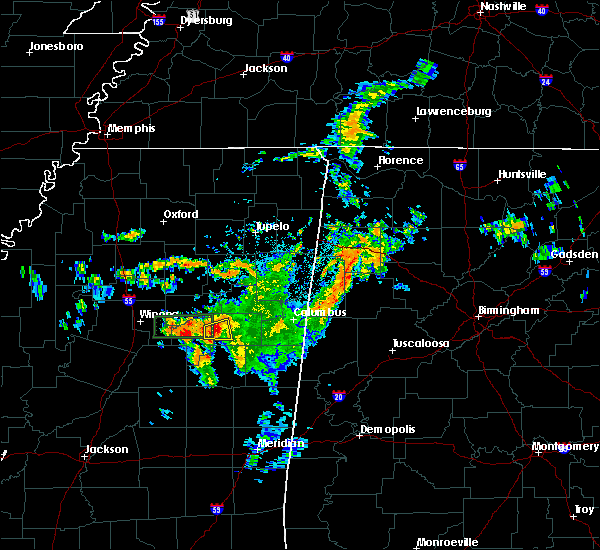 At 441 am cdt, a severe thunderstorm was located near reform, or 15 miles west of starkville, moving east at 20 mph (radar indicated). Hazards include 60 mph wind gusts. Expect damage to roofs, siding, and trees. This severe thunderstorm will remain over mainly rural areas of northeastern choctaw and western oktibbeha counties. At 441 am cdt, a severe thunderstorm was located near reform, or 15 miles west of starkville, moving east at 20 mph (radar indicated). Hazards include 60 mph wind gusts. Expect damage to roofs, siding, and trees. This severe thunderstorm will remain over mainly rural areas of northeastern choctaw and western oktibbeha counties.
|
| 8/7/2017 4:30 AM CDT |
 At 429 am cdt, a severe thunderstorm was located over reform, or 20 miles west of starkville, moving east at 20 mph (radar indicated). Hazards include 60 mph wind gusts. Expect damage to roofs, siding, and trees. this severe thunderstorm will be near, sherwood around 440 am cdt. Other locations impacted by this severe thunderstorm include sturgis. At 429 am cdt, a severe thunderstorm was located over reform, or 20 miles west of starkville, moving east at 20 mph (radar indicated). Hazards include 60 mph wind gusts. Expect damage to roofs, siding, and trees. this severe thunderstorm will be near, sherwood around 440 am cdt. Other locations impacted by this severe thunderstorm include sturgis.
|
| 6/16/2017 5:31 PM CDT |
 At 530 pm cdt, severe thunderstorms were located along a line extending from near oktoc to near stallo, moving east at 40 mph (radar indicated). Hazards include 60 mph wind gusts and quarter size hail. Hail damage to vehicles is expected. expect wind damage to roofs, siding, and trees. these severe storms will be near, oktoc around 535 pm cdt. Other locations impacted by these severe thunderstorms include noxapater and sturgis. At 530 pm cdt, severe thunderstorms were located along a line extending from near oktoc to near stallo, moving east at 40 mph (radar indicated). Hazards include 60 mph wind gusts and quarter size hail. Hail damage to vehicles is expected. expect wind damage to roofs, siding, and trees. these severe storms will be near, oktoc around 535 pm cdt. Other locations impacted by these severe thunderstorms include noxapater and sturgis.
|
| 6/16/2017 5:08 PM CDT |
 At 507 pm cdt, severe thunderstorms were located along a line extending from 6 miles west of craig springs to 6 miles northeast of zama, moving east at 40 mph (radar indicated). Hazards include 60 mph wind gusts and quarter size hail. Hail damage to vehicles is expected. expect wind damage to roofs, siding, and trees. severe thunderstorms will be near, craig springs around 515 pm cdt. betheden around 520 pm cdt. oktoc around 530 pm cdt. Other locations impacted by these severe thunderstorms include noxapater, mccool, sturgis and weir. At 507 pm cdt, severe thunderstorms were located along a line extending from 6 miles west of craig springs to 6 miles northeast of zama, moving east at 40 mph (radar indicated). Hazards include 60 mph wind gusts and quarter size hail. Hail damage to vehicles is expected. expect wind damage to roofs, siding, and trees. severe thunderstorms will be near, craig springs around 515 pm cdt. betheden around 520 pm cdt. oktoc around 530 pm cdt. Other locations impacted by these severe thunderstorms include noxapater, mccool, sturgis and weir.
|
| 4/26/2017 10:39 PM CDT |
 At 1039 pm cdt, a severe thunderstorm was located near craig springs, or 12 miles north of louisville, moving northeast at 55 mph (radar indicated). Hazards include 60 mph wind gusts and quarter size hail. Hail damage to vehicles is expected. expect wind damage to roofs, siding, and trees. this severe thunderstorm will be near, craig springs around 1045 pm cdt. longview around 1050 pm cdt. starkville and oktoc around 1055 pm cdt. sessums around 1100 pm cdt. muldrow around 1105 pm cdt. tibbee and bent oak around 1110 pm cdt. waverly around 1120 pm cdt. columbus and columbus afb around 1125 pm cdt. Other locations impacted by this severe thunderstorm include sturgis and artesia. At 1039 pm cdt, a severe thunderstorm was located near craig springs, or 12 miles north of louisville, moving northeast at 55 mph (radar indicated). Hazards include 60 mph wind gusts and quarter size hail. Hail damage to vehicles is expected. expect wind damage to roofs, siding, and trees. this severe thunderstorm will be near, craig springs around 1045 pm cdt. longview around 1050 pm cdt. starkville and oktoc around 1055 pm cdt. sessums around 1100 pm cdt. muldrow around 1105 pm cdt. tibbee and bent oak around 1110 pm cdt. waverly around 1120 pm cdt. columbus and columbus afb around 1125 pm cdt. Other locations impacted by this severe thunderstorm include sturgis and artesia.
|
| 3/9/2017 6:57 PM CST |
 At 656 pm cst, a severe thunderstorm was located near maben, or 13 miles west of starkville, moving southeast at 25 mph (radar indicated). Hazards include 60 mph wind gusts and half dollar size hail. Hail damage to vehicles is expected. expect wind damage to roofs, siding, and trees. this severe storm will be near, longview around 715 pm cst. Other locations impacted by this severe thunderstorm include sturgis. At 656 pm cst, a severe thunderstorm was located near maben, or 13 miles west of starkville, moving southeast at 25 mph (radar indicated). Hazards include 60 mph wind gusts and half dollar size hail. Hail damage to vehicles is expected. expect wind damage to roofs, siding, and trees. this severe storm will be near, longview around 715 pm cst. Other locations impacted by this severe thunderstorm include sturgis.
|
| 3/9/2017 6:36 PM CST |
 At 635 pm cst, a severe thunderstorm was located over mathiston, or 17 miles southwest of montpelier, moving southeast at 30 mph (radar indicated). Hazards include golf ball size hail and 60 mph wind gusts. People and animals outdoors will be injured. expect hail damage to roofs, siding, windows, and vehicles. expect wind damage to roofs, siding, and trees. this severe thunderstorm will be near, sherwood and reform around 640 pm cst. maben around 645 pm cst. longview around 705 pm cst. starkville around 715 pm cst. Other locations impacted by this severe thunderstorm include sturgis. At 635 pm cst, a severe thunderstorm was located over mathiston, or 17 miles southwest of montpelier, moving southeast at 30 mph (radar indicated). Hazards include golf ball size hail and 60 mph wind gusts. People and animals outdoors will be injured. expect hail damage to roofs, siding, windows, and vehicles. expect wind damage to roofs, siding, and trees. this severe thunderstorm will be near, sherwood and reform around 640 pm cst. maben around 645 pm cst. longview around 705 pm cst. starkville around 715 pm cst. Other locations impacted by this severe thunderstorm include sturgis.
|
| 11/28/2016 4:23 PM CST |
 At 423 pm cst, severe thunderstorms were located along a line extending from near trebloc to 6 miles west of craig springs, moving east at 50 mph (radar indicated). Hazards include 60 mph wind gusts. Expect damage to roofs. siding. and trees. severe thunderstorms will be near, starkville around 435 pm cst. oktoc around 440 pm cst. sessums around 445 pm cst. crawford around 450 pm cst. tibbee around 455 pm cst. bent oak around 500 pm cst. waverly around 505 pm cst. other locations impacted by these severe thunderstorms include artesia and sturgis. A tornado watch remains in effect until 900 pm cst for northeastern and central mississippi. At 423 pm cst, severe thunderstorms were located along a line extending from near trebloc to 6 miles west of craig springs, moving east at 50 mph (radar indicated). Hazards include 60 mph wind gusts. Expect damage to roofs. siding. and trees. severe thunderstorms will be near, starkville around 435 pm cst. oktoc around 440 pm cst. sessums around 445 pm cst. crawford around 450 pm cst. tibbee around 455 pm cst. bent oak around 500 pm cst. waverly around 505 pm cst. other locations impacted by these severe thunderstorms include artesia and sturgis. A tornado watch remains in effect until 900 pm cst for northeastern and central mississippi.
|
| 11/28/2016 4:13 PM CST |
 At 413 pm cst, severe thunderstorms were located along a line extending from near pheba to near smyrna, moving east at 50 mph (radar indicated). Hazards include 60 mph wind gusts. Expect damage to roofs. siding. and trees. these severe thunderstorms will remain over mainly rural areas of southeastern attala, western oktibbeha, southeastern choctaw and western winston counties, including the following locations: sturgis. A tornado watch remains in effect until 900 pm cst for northeastern, east central and central mississippi. At 413 pm cst, severe thunderstorms were located along a line extending from near pheba to near smyrna, moving east at 50 mph (radar indicated). Hazards include 60 mph wind gusts. Expect damage to roofs. siding. and trees. these severe thunderstorms will remain over mainly rural areas of southeastern attala, western oktibbeha, southeastern choctaw and western winston counties, including the following locations: sturgis. A tornado watch remains in effect until 900 pm cst for northeastern, east central and central mississippi.
|
| 11/28/2016 3:46 PM CST |
 At 346 pm cst, severe thunderstorms were located along a line extending from near eupora to near newport, moving east at 55 mph (radar indicated). Hazards include 60 mph wind gusts. Expect damage to roofs. siding. and trees. severe thunderstorms will be near, reform and mcadams around 355 pm cst. kosciusko and sherwood around 400 pm cst. maben around 405 pm cst. smyrna around 410 pm cst. zama around 415 pm cst. other locations impacted by these severe thunderstorms include weir, french camp, mccool, ethel and sturgis. A tornado watch remains in effect until 900 pm cst for north central, northeastern, east central and central mississippi. At 346 pm cst, severe thunderstorms were located along a line extending from near eupora to near newport, moving east at 55 mph (radar indicated). Hazards include 60 mph wind gusts. Expect damage to roofs. siding. and trees. severe thunderstorms will be near, reform and mcadams around 355 pm cst. kosciusko and sherwood around 400 pm cst. maben around 405 pm cst. smyrna around 410 pm cst. zama around 415 pm cst. other locations impacted by these severe thunderstorms include weir, french camp, mccool, ethel and sturgis. A tornado watch remains in effect until 900 pm cst for north central, northeastern, east central and central mississippi.
|
| 8/14/2016 2:36 PM CDT |
 The severe thunderstorm warning for western oktibbeha and northeastern choctaw counties will expire at 245 pm cdt, the storm which prompted the warning has weakened below severe limits, and no longer pose an immediate threat to life or property. therefore the warning will be allowed to expire. however, gusty winds around 40 mph are still possible with this thunderstorm. The severe thunderstorm warning for western oktibbeha and northeastern choctaw counties will expire at 245 pm cdt, the storm which prompted the warning has weakened below severe limits, and no longer pose an immediate threat to life or property. therefore the warning will be allowed to expire. however, gusty winds around 40 mph are still possible with this thunderstorm.
|
| 8/14/2016 2:25 PM CDT |
 At 225 pm cdt, a severe thunderstorm was located over sherwood, or 16 miles west of starkville, moving north at 50 mph (radar indicated). Hazards include 60 mph wind gusts. Expect damage to roofs. siding. and trees. this severe storm will be near, maben around 235 pm cdt. Other locations impacted by this severe thunderstorm include sturgis. At 225 pm cdt, a severe thunderstorm was located over sherwood, or 16 miles west of starkville, moving north at 50 mph (radar indicated). Hazards include 60 mph wind gusts. Expect damage to roofs. siding. and trees. this severe storm will be near, maben around 235 pm cdt. Other locations impacted by this severe thunderstorm include sturgis.
|
| 8/14/2016 2:19 PM CDT |
 At 219 pm cdt, a severe thunderstorm was located near ackerman, or 15 miles north of louisville, moving north at 30 mph (radar indicated). Hazards include 60 mph wind gusts. Expect damage to roofs. siding. and trees. this severe storm will be near, reform around 230 pm cdt. sherwood around 240 pm cdt. maben around 245 pm cdt. Other locations impacted by this severe thunderstorm include weir and sturgis. At 219 pm cdt, a severe thunderstorm was located near ackerman, or 15 miles north of louisville, moving north at 30 mph (radar indicated). Hazards include 60 mph wind gusts. Expect damage to roofs. siding. and trees. this severe storm will be near, reform around 230 pm cdt. sherwood around 240 pm cdt. maben around 245 pm cdt. Other locations impacted by this severe thunderstorm include weir and sturgis.
|
| 8/14/2016 1:51 PM CDT |
 At 150 pm cdt, a severe thunderstorm was located near center ridge, or near louisville, moving north at 40 mph (radar indicated). Hazards include 60 mph wind gusts. Expect damage to roofs. siding. and trees. this severe thunderstorm will be near, ackerman around 215 pm cdt. chester around 220 pm cdt. reform around 230 pm cdt. sherwood around 235 pm cdt. maben around 240 pm cdt. Other locations impacted by this severe thunderstorm include weir, noxapater and sturgis. At 150 pm cdt, a severe thunderstorm was located near center ridge, or near louisville, moving north at 40 mph (radar indicated). Hazards include 60 mph wind gusts. Expect damage to roofs. siding. and trees. this severe thunderstorm will be near, ackerman around 215 pm cdt. chester around 220 pm cdt. reform around 230 pm cdt. sherwood around 235 pm cdt. maben around 240 pm cdt. Other locations impacted by this severe thunderstorm include weir, noxapater and sturgis.
|
| 6/17/2016 3:02 PM CDT |
 At 301 pm cdt, severe thunderstorms were located along a line extending from near reform to near crawford to near pickensville, moving southeast at 40 mph (radar indicated). Hazards include 60 mph wind gusts and quarter size hail. Hail damage to vehicles is expected. expect wind damage to roofs, siding, and trees. these severe storms will be near, crawford around 305 pm cdt. craig springs around 320 pm cdt. Other locations impacted by these severe thunderstorms include artesia and sturgis. At 301 pm cdt, severe thunderstorms were located along a line extending from near reform to near crawford to near pickensville, moving southeast at 40 mph (radar indicated). Hazards include 60 mph wind gusts and quarter size hail. Hail damage to vehicles is expected. expect wind damage to roofs, siding, and trees. these severe storms will be near, crawford around 305 pm cdt. craig springs around 320 pm cdt. Other locations impacted by these severe thunderstorms include artesia and sturgis.
|
| 6/17/2016 2:26 PM CDT |
 At 225 pm cdt, severe thunderstorms were located along a line extending from slate springs to near pheba to columbus afb, moving southeast at 40 mph (radar indicated). Hazards include 60 mph wind gusts and quarter size hail. Hail damage to vehicles is expected. expect wind damage to roofs, siding, and trees. severe thunderstorms will be near, columbus afb and waverly around 230 pm cdt. columbus around 235 pm cdt. muldrow around 240 pm cdt. sessums and tibbee around 250 pm cdt. maben around 255 pm cdt. bent oak around 300 pm cdt. crawford around 305 pm cdt. starkville and longview around 315 pm cdt. Other locations impacted by these severe thunderstorms include artesia and sturgis. At 225 pm cdt, severe thunderstorms were located along a line extending from slate springs to near pheba to columbus afb, moving southeast at 40 mph (radar indicated). Hazards include 60 mph wind gusts and quarter size hail. Hail damage to vehicles is expected. expect wind damage to roofs, siding, and trees. severe thunderstorms will be near, columbus afb and waverly around 230 pm cdt. columbus around 235 pm cdt. muldrow around 240 pm cdt. sessums and tibbee around 250 pm cdt. maben around 255 pm cdt. bent oak around 300 pm cdt. crawford around 305 pm cdt. starkville and longview around 315 pm cdt. Other locations impacted by these severe thunderstorms include artesia and sturgis.
|
| 3/31/2016 5:06 PM CDT |
 At 506 pm cdt, a severe thunderstorm was located over chester, or 19 miles northwest of louisville, moving northeast at 40 mph (radar indicated). Hazards include 60 mph wind gusts and quarter size hail. Hail damage to vehicles is expected. expect wind damage to roofs, siding and trees. this severe thunderstorm will be near, reform around 515 pm cdt. mathiston and sherwood around 525 pm cdt. maben around 530 pm cdt. cumberland around 535 pm cdt. pheba around 540 pm cdt. montpelier and griffith around 555 pm cdt. pala alto around 600 pm cdt. other locations impacted by this severe thunderstorm include mantee and sturgis. A tornado watch remains in effect until 1000 pm cdt for northeastern mississippi. At 506 pm cdt, a severe thunderstorm was located over chester, or 19 miles northwest of louisville, moving northeast at 40 mph (radar indicated). Hazards include 60 mph wind gusts and quarter size hail. Hail damage to vehicles is expected. expect wind damage to roofs, siding and trees. this severe thunderstorm will be near, reform around 515 pm cdt. mathiston and sherwood around 525 pm cdt. maben around 530 pm cdt. cumberland around 535 pm cdt. pheba around 540 pm cdt. montpelier and griffith around 555 pm cdt. pala alto around 600 pm cdt. other locations impacted by this severe thunderstorm include mantee and sturgis. A tornado watch remains in effect until 1000 pm cdt for northeastern mississippi.
|
| 2/23/2016 10:16 PM CST |
 At 1016 pm cst, severe thunderstorms were located along a line extending from near chester to near edinburg, moving northeast at 45 mph (radar indicated). Hazards include 60 mph wind gusts. Expect damage to roofs. siding and trees. these severe storms will be near, chester around 1020 pm cst. reform around 1030 pm cst. sherwood around 1035 pm cst. maben around 1040 pm cst. Other locations impacted by these severe thunderstorms include weir, noxapater and sturgis. At 1016 pm cst, severe thunderstorms were located along a line extending from near chester to near edinburg, moving northeast at 45 mph (radar indicated). Hazards include 60 mph wind gusts. Expect damage to roofs. siding and trees. these severe storms will be near, chester around 1020 pm cst. reform around 1030 pm cst. sherwood around 1035 pm cst. maben around 1040 pm cst. Other locations impacted by these severe thunderstorms include weir, noxapater and sturgis.
|
| 2/23/2016 10:05 PM CST |
 At 1004 pm cst, severe thunderstorms were located along a line extending from 7 miles east of poplar creek to near edinburg, moving northeast at 50 mph (radar indicated). Hazards include 60 mph wind gusts. Expect damage to roofs. siding and trees. severe thunderstorms will be near, chester around 1015 pm cst. reform around 1025 pm cst. sherwood and stallo around 1030 pm cst. maben around 1035 pm cst. millcreek around 1045 pm cst. Other locations impacted by these severe thunderstorms include weir, french camp, noxapater, mccool, ethel and sturgis. At 1004 pm cst, severe thunderstorms were located along a line extending from 7 miles east of poplar creek to near edinburg, moving northeast at 50 mph (radar indicated). Hazards include 60 mph wind gusts. Expect damage to roofs. siding and trees. severe thunderstorms will be near, chester around 1015 pm cst. reform around 1025 pm cst. sherwood and stallo around 1030 pm cst. maben around 1035 pm cst. millcreek around 1045 pm cst. Other locations impacted by these severe thunderstorms include weir, french camp, noxapater, mccool, ethel and sturgis.
|
| 2/2/2016 2:15 PM CST |
 At 215 pm cst, a severe thunderstorm capable of producing a tornado was located over ackerman, or 16 miles north of louisville, moving northeast at 55 mph (radar indicated rotation). Hazards include tornado and quarter size hail. Flying debris will be dangerous to those caught without shelter. mobile homes will be damaged or destroyed. damage to roofs, windows and vehicles will occur. tree damage is likely. this dangerous storm will be near, sherwood around 225 pm cst. maben and longview around 230 pm cst. Other locations impacted by this tornadic thunderstorm include sturgis. At 215 pm cst, a severe thunderstorm capable of producing a tornado was located over ackerman, or 16 miles north of louisville, moving northeast at 55 mph (radar indicated rotation). Hazards include tornado and quarter size hail. Flying debris will be dangerous to those caught without shelter. mobile homes will be damaged or destroyed. damage to roofs, windows and vehicles will occur. tree damage is likely. this dangerous storm will be near, sherwood around 225 pm cst. maben and longview around 230 pm cst. Other locations impacted by this tornadic thunderstorm include sturgis.
|
| 2/2/2016 2:04 PM CST |
 At 204 pm cst, a severe thunderstorm capable of producing a tornado was located near ackerman, or 13 miles northwest of louisville, moving northeast at 45 mph (radar indicated rotation). Hazards include tornado and quarter size hail. Flying debris will be dangerous to those caught without shelter. mobile homes will be damaged or destroyed. damage to roofs, windows and vehicles will occur. tree damage is likely. this dangerous storm will be near, ackerman and chester around 210 pm cst. reform around 220 pm cst. sherwood around 225 pm cst. longview around 230 pm cst. maben around 235 pm cst. Other locations impacted by this tornadic thunderstorm include weir and sturgis. At 204 pm cst, a severe thunderstorm capable of producing a tornado was located near ackerman, or 13 miles northwest of louisville, moving northeast at 45 mph (radar indicated rotation). Hazards include tornado and quarter size hail. Flying debris will be dangerous to those caught without shelter. mobile homes will be damaged or destroyed. damage to roofs, windows and vehicles will occur. tree damage is likely. this dangerous storm will be near, ackerman and chester around 210 pm cst. reform around 220 pm cst. sherwood around 225 pm cst. longview around 230 pm cst. maben around 235 pm cst. Other locations impacted by this tornadic thunderstorm include weir and sturgis.
|
| 12/28/2015 7:50 AM CST |
 At 750 am cst, severe thunderstorms were located along a line extending from maben to vernon, moving northeast at 35 mph (radar indicated). Hazards include 60 mph wind gusts. Expect damage to roofs. siding and trees. severe thunderstorms will be near, maben around 755 am cst. oktoc around 830 am cst. other locations impacted by these severe thunderstorms include sturgis. A tornado watch remains in effect until 1000 am cst for northeastern mississippi. At 750 am cst, severe thunderstorms were located along a line extending from maben to vernon, moving northeast at 35 mph (radar indicated). Hazards include 60 mph wind gusts. Expect damage to roofs. siding and trees. severe thunderstorms will be near, maben around 755 am cst. oktoc around 830 am cst. other locations impacted by these severe thunderstorms include sturgis. A tornado watch remains in effect until 1000 am cst for northeastern mississippi.
|
| 11/18/2015 1:19 AM CST |
 At 118 am cst, a severe thunderstorm capable of producing a tornado was located near craig springs, or 13 miles southwest of starkville, moving northeast at 35 mph (radar indicated rotation). Hazards include tornado. Flying debris will be dangerous to those caught without shelter. mobile homes will be damaged or destroyed. damage to roofs, windows and vehicles will occur. tree damage is likely. Locations impacted include, craig springs, betheden and sturgis. At 118 am cst, a severe thunderstorm capable of producing a tornado was located near craig springs, or 13 miles southwest of starkville, moving northeast at 35 mph (radar indicated rotation). Hazards include tornado. Flying debris will be dangerous to those caught without shelter. mobile homes will be damaged or destroyed. damage to roofs, windows and vehicles will occur. tree damage is likely. Locations impacted include, craig springs, betheden and sturgis.
|
| 11/18/2015 1:08 AM CST |
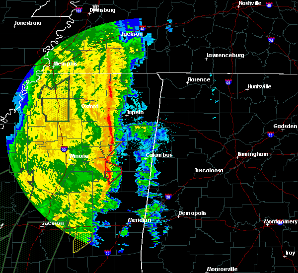 At 107 am cst, a severe thunderstorm capable of producing a tornado was located near craig springs, or 13 miles north of louisville, moving northeast at 50 mph (radar indicated rotation). Hazards include tornado. Flying debris will be dangerous to those caught without shelter. mobile homes will be damaged or destroyed. damage to roofs, windows and vehicles will occur. tree damage is likely. This tornadic thunderstorm will remain over mainly rural areas of southwestern oktibbeha and northeastern winston counties, including the following locations, sturgis. At 107 am cst, a severe thunderstorm capable of producing a tornado was located near craig springs, or 13 miles north of louisville, moving northeast at 50 mph (radar indicated rotation). Hazards include tornado. Flying debris will be dangerous to those caught without shelter. mobile homes will be damaged or destroyed. damage to roofs, windows and vehicles will occur. tree damage is likely. This tornadic thunderstorm will remain over mainly rural areas of southwestern oktibbeha and northeastern winston counties, including the following locations, sturgis.
|
| 11/18/2015 1:00 AM CST |
 At 1259 am cst, a severe thunderstorm capable of producing a tornado was located near ackerman, or 8 miles northwest of louisville, moving northeast at 45 mph (radar indicated rotation). Hazards include tornado. Flying debris will be dangerous to those caught without shelter. mobile homes will be damaged or destroyed. damage to roofs, windows and vehicles will occur. tree damage is likely. this dangerous storm will be near, craig springs around 115 am cst. Other locations impacted by this tornadic thunderstorm include sturgis. At 1259 am cst, a severe thunderstorm capable of producing a tornado was located near ackerman, or 8 miles northwest of louisville, moving northeast at 45 mph (radar indicated rotation). Hazards include tornado. Flying debris will be dangerous to those caught without shelter. mobile homes will be damaged or destroyed. damage to roofs, windows and vehicles will occur. tree damage is likely. this dangerous storm will be near, craig springs around 115 am cst. Other locations impacted by this tornadic thunderstorm include sturgis.
|
| 11/18/2015 12:46 AM CST |
 At 1246 am cst, a severe thunderstorm capable of producing a tornado was located 8 miles west of center ridge, or 9 miles west of louisville, moving northeast at 50 mph (radar indicated rotation). Hazards include tornado. Flying debris will be dangerous to those caught without shelter. mobile homes will be damaged or destroyed. damage to roofs, windows and vehicles will occur. tree damage is likely. this dangerous storm will be near, louisville around 1255 am cst. ackerman around 105 am cst. craig springs around 115 am cst. Other locations impacted by this tornadic thunderstorm include sturgis. At 1246 am cst, a severe thunderstorm capable of producing a tornado was located 8 miles west of center ridge, or 9 miles west of louisville, moving northeast at 50 mph (radar indicated rotation). Hazards include tornado. Flying debris will be dangerous to those caught without shelter. mobile homes will be damaged or destroyed. damage to roofs, windows and vehicles will occur. tree damage is likely. this dangerous storm will be near, louisville around 1255 am cst. ackerman around 105 am cst. craig springs around 115 am cst. Other locations impacted by this tornadic thunderstorm include sturgis.
|
| 7/29/2015 4:11 PM CDT |
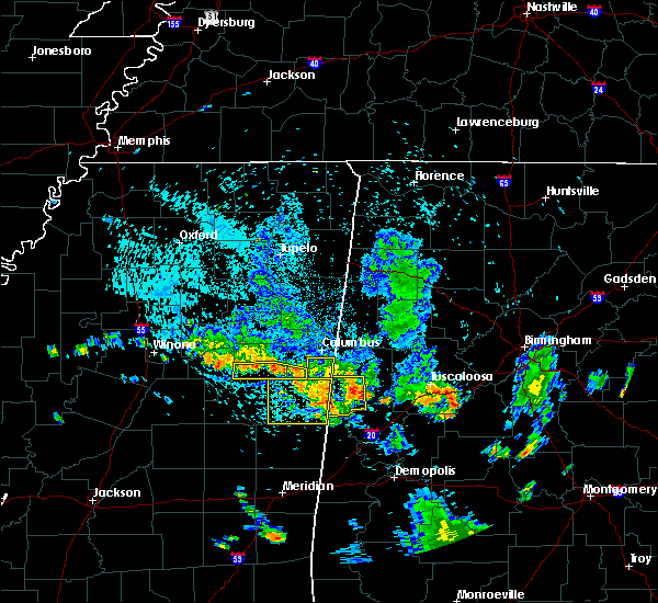 At 410 pm cdt, a band of strong to severe thunderstorms was located across southern oktibbeha and southwest lowndes counties, moving south at 25 mph (radar indicated). Hazards include 60 mph wind gusts. Expect damage to roofs. siding and trees. Locations impacted include, crawford, craig springs, longview, oktoc and sturgis. At 410 pm cdt, a band of strong to severe thunderstorms was located across southern oktibbeha and southwest lowndes counties, moving south at 25 mph (radar indicated). Hazards include 60 mph wind gusts. Expect damage to roofs. siding and trees. Locations impacted include, crawford, craig springs, longview, oktoc and sturgis.
|
| 7/29/2015 3:52 PM CDT |
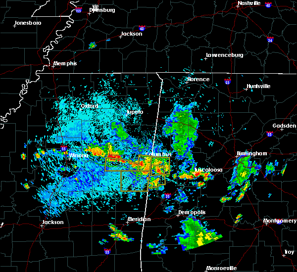 At 352 pm cdt, a severe thunderstorm was located near longview, or 7 miles west of starkville, moving south at 20 mph (radar indicated). Hazards include 60 mph wind gusts. Expect damage to roofs. Siding and trees. At 352 pm cdt, a severe thunderstorm was located near longview, or 7 miles west of starkville, moving south at 20 mph (radar indicated). Hazards include 60 mph wind gusts. Expect damage to roofs. Siding and trees.
|
| 7/15/2015 6:06 PM CDT |
 At 605 pm cdt, a severe thunderstorm was located over cumberland, or 12 miles southwest of montpelier, moving south at 45 mph (radar indicated). Hazards include 60 mph wind gusts and nickel size hail. Expect damage to roofs. siding and trees. this severe thunderstorm will be near, mathiston around 610 pm cdt. sherwood around 615 pm cdt. reform around 620 pm cdt. ackerman and chester around 630 pm cdt. Other locations impacted by this severe thunderstorm include weir, french camp and sturgis. At 605 pm cdt, a severe thunderstorm was located over cumberland, or 12 miles southwest of montpelier, moving south at 45 mph (radar indicated). Hazards include 60 mph wind gusts and nickel size hail. Expect damage to roofs. siding and trees. this severe thunderstorm will be near, mathiston around 610 pm cdt. sherwood around 615 pm cdt. reform around 620 pm cdt. ackerman and chester around 630 pm cdt. Other locations impacted by this severe thunderstorm include weir, french camp and sturgis.
|
| 5/30/2015 3:40 PM CDT | At 340 pm cdt, a severe thunderstorm was located near craig springs, or 14 miles north of louisville, moving north at 25 mph (radar indicated). Hazards include 60 mph wind gusts and quarter size hail. Hail damage to vehicles is expected. expect wind damage to roofs, siding and trees. this severe thunderstorm will be near, longview around 400 pm cdt. starkville around 405 pm cdt. Other locations impacted by this severe thunderstorm include sturgis. |
| 5/25/2015 11:22 AM CDT | The severe thunderstorm warning for north central winston and western oktibbeha counties will expire at 1130 am cdt, the storm which prompted the warning has weakened below severe limits, and no longer poses an immediate threat to life or property. therefore the warning will be allowed to expire. |
| 5/25/2015 11:10 AM CDT | At 1110 am cdt, a severe thunderstorm was located near betheden, or 10 miles north of louisville, moving northeast at 20 mph (radar indicated). Hazards include 60 mph wind gusts. Expect damage to roofs. siding and trees. this severe storm will be near, craig springs and longview around 1130 am cdt. Other locations impacted by this severe thunderstorm include sturgis. |
| 5/25/2015 10:48 AM CDT | At 1048 am cdt, a severe thunderstorm was located near louisville, moving northeast at 20 mph (radar indicated). Hazards include 60 mph wind gusts. Expect damage to roofs. siding and trees. this severe thunderstorm will be near, betheden around 1110 am cdt. craig springs and longview around 1130 am cdt. Other locations impacted by this severe thunderstorm include sturgis. |
| 1/3/2015 3:45 PM CST | Multiple trees down in sturgis. report relayed via social medi in oktibbeha county MS, 0.4 miles NE of Sturgis, MS |
| 9/18/2014 1:35 PM CDT | Quarter sized hail reported 9.3 miles N of Sturgis, MS, quarter size hail reported. |
| 6/8/2014 6:00 PM CDT | Quarter sized hail reported 9.9 miles NNW of Sturgis, MS, reported along bluff lake rd northeast of louisville |
| 7/10/2013 8:40 PM CDT | Trees blown down...report via social medi in oktibbeha county MS, 3.1 miles NW of Sturgis, MS |
| 4/18/2013 9:00 PM CDT | Scattered trees down on powerlines in western part of count in oktibbeha county MS, 0.4 miles NE of Sturgis, MS |
| 1/1/0001 12:00 AM | Tree down on a car and a home. also...tree down blocking highway 12 north of sturgis in oktibbeha county MS, 0.4 miles NE of Sturgis, MS |
Hail Maps for Sturgis, MS
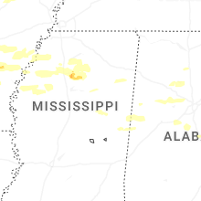

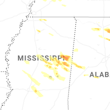


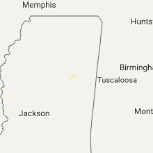


Connect with Interactive Hail Maps