

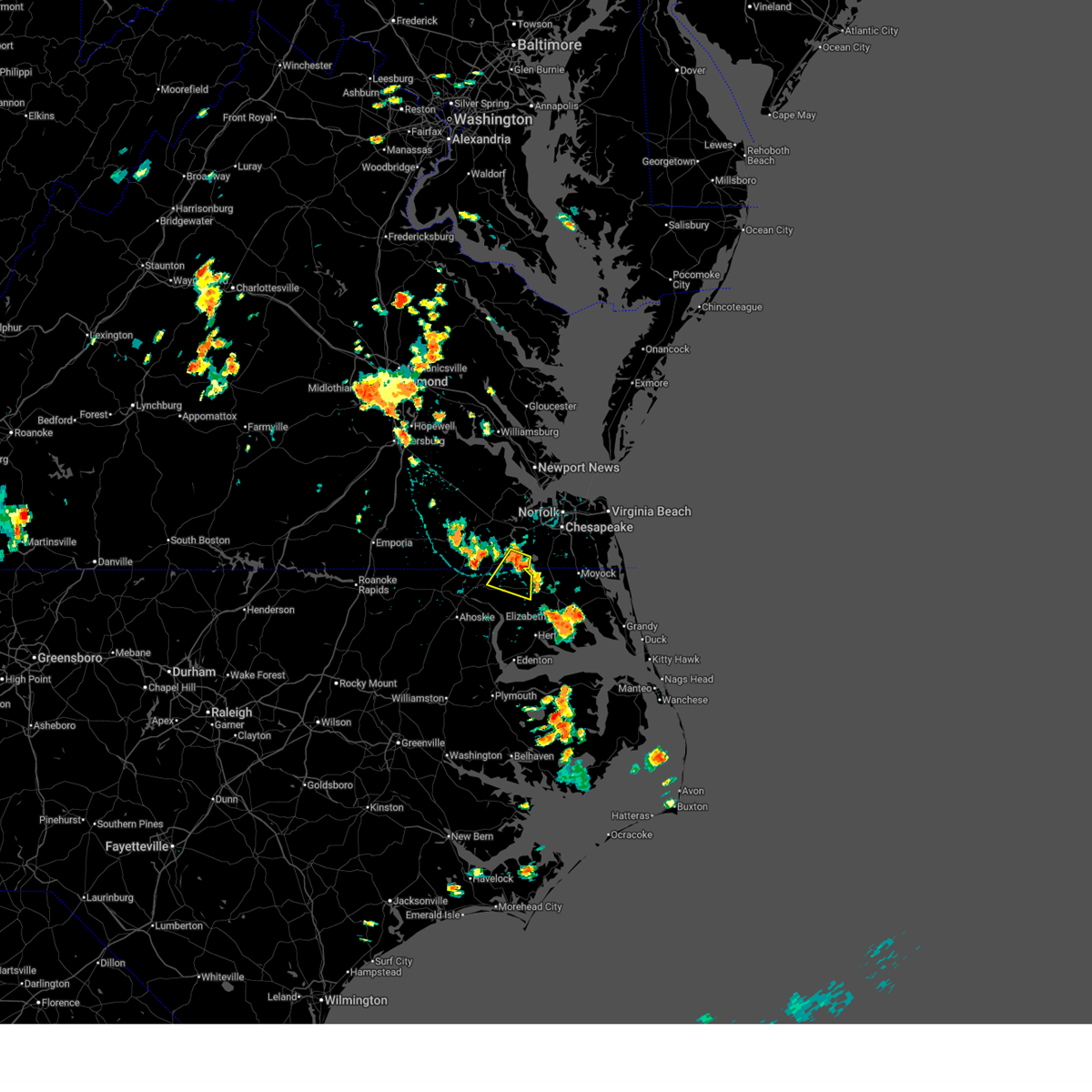
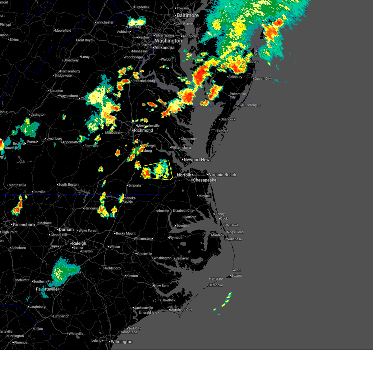
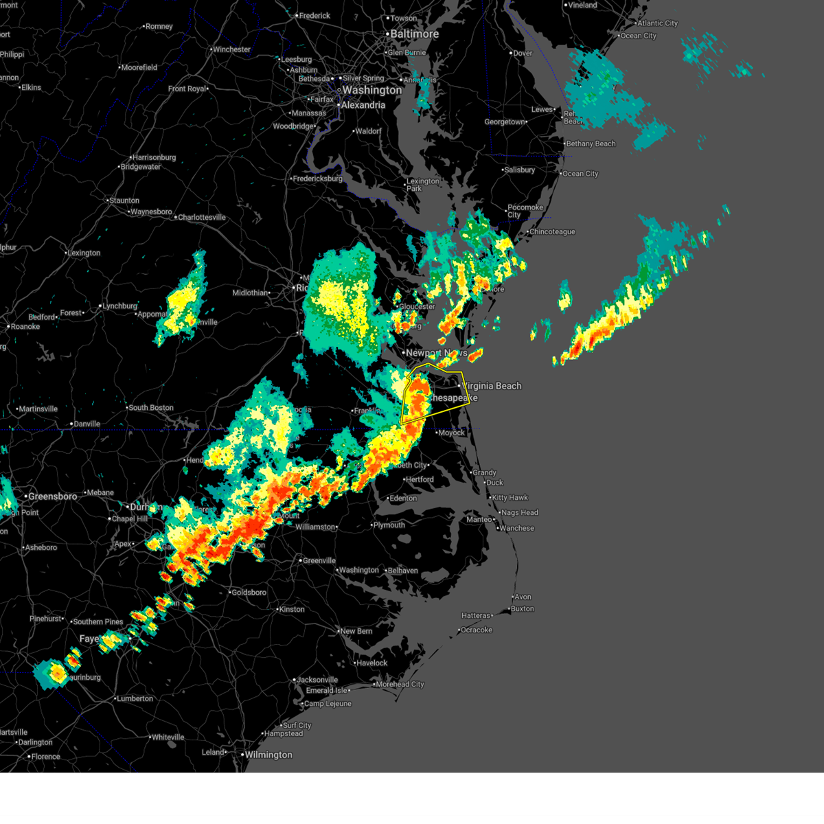
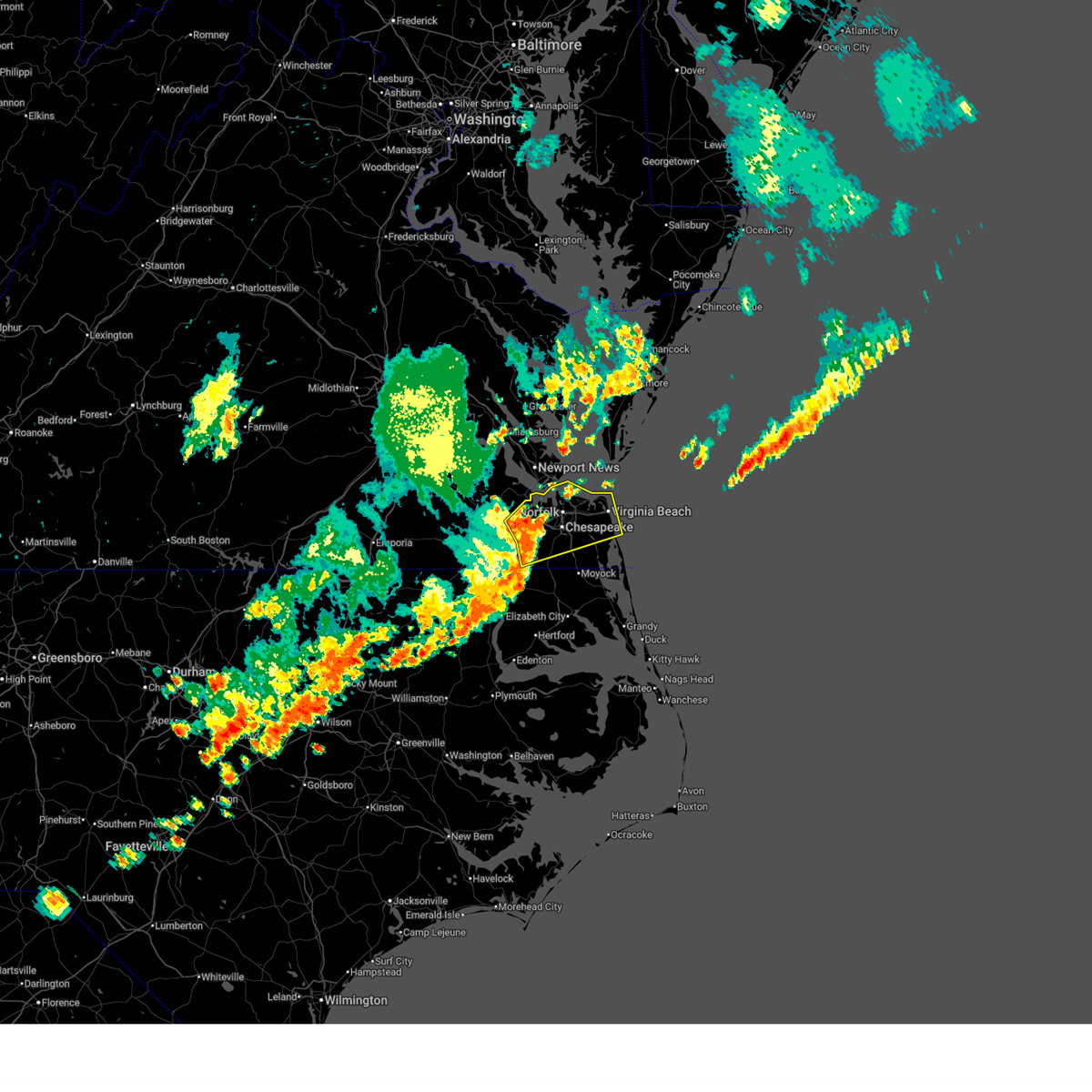
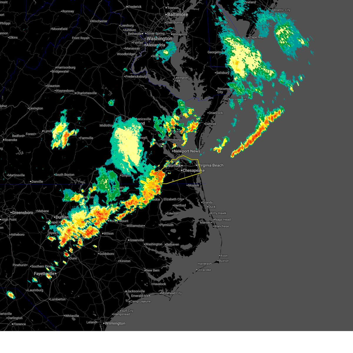
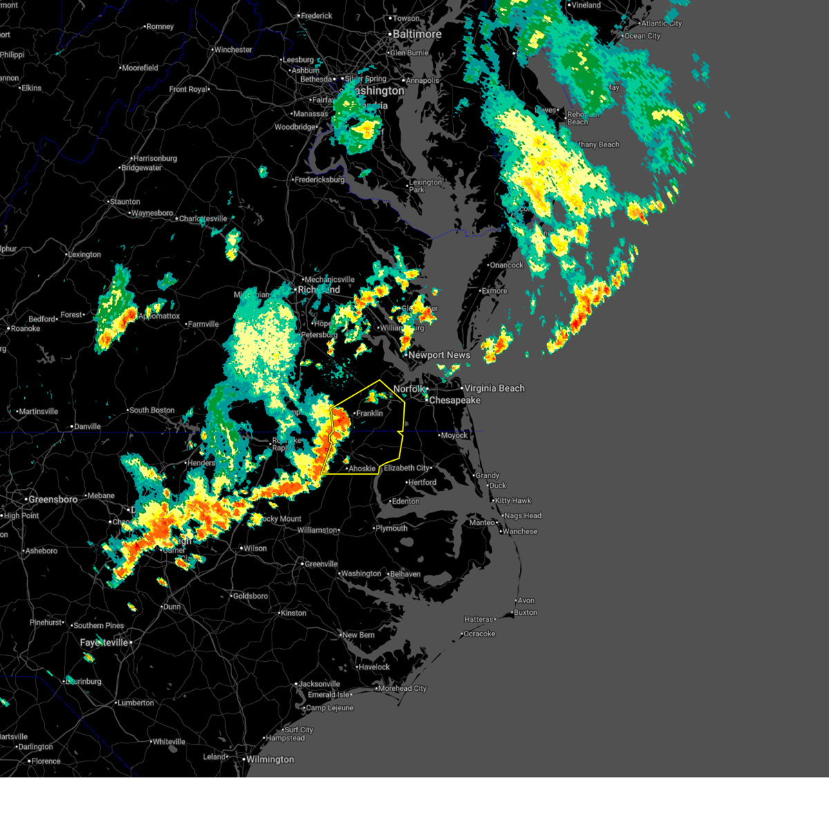
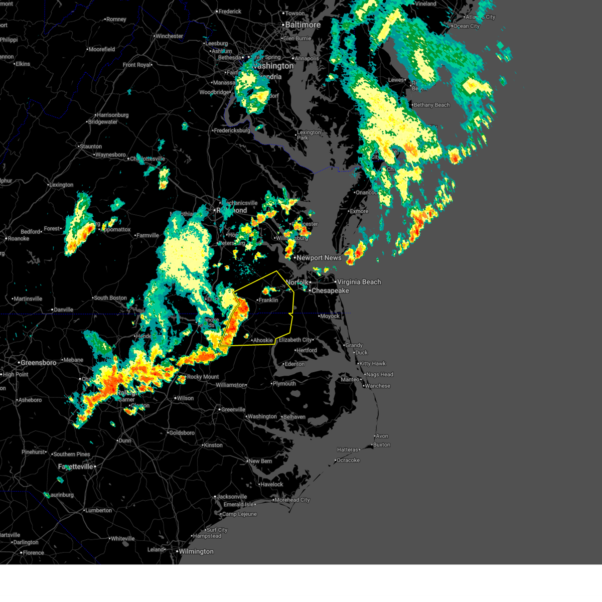
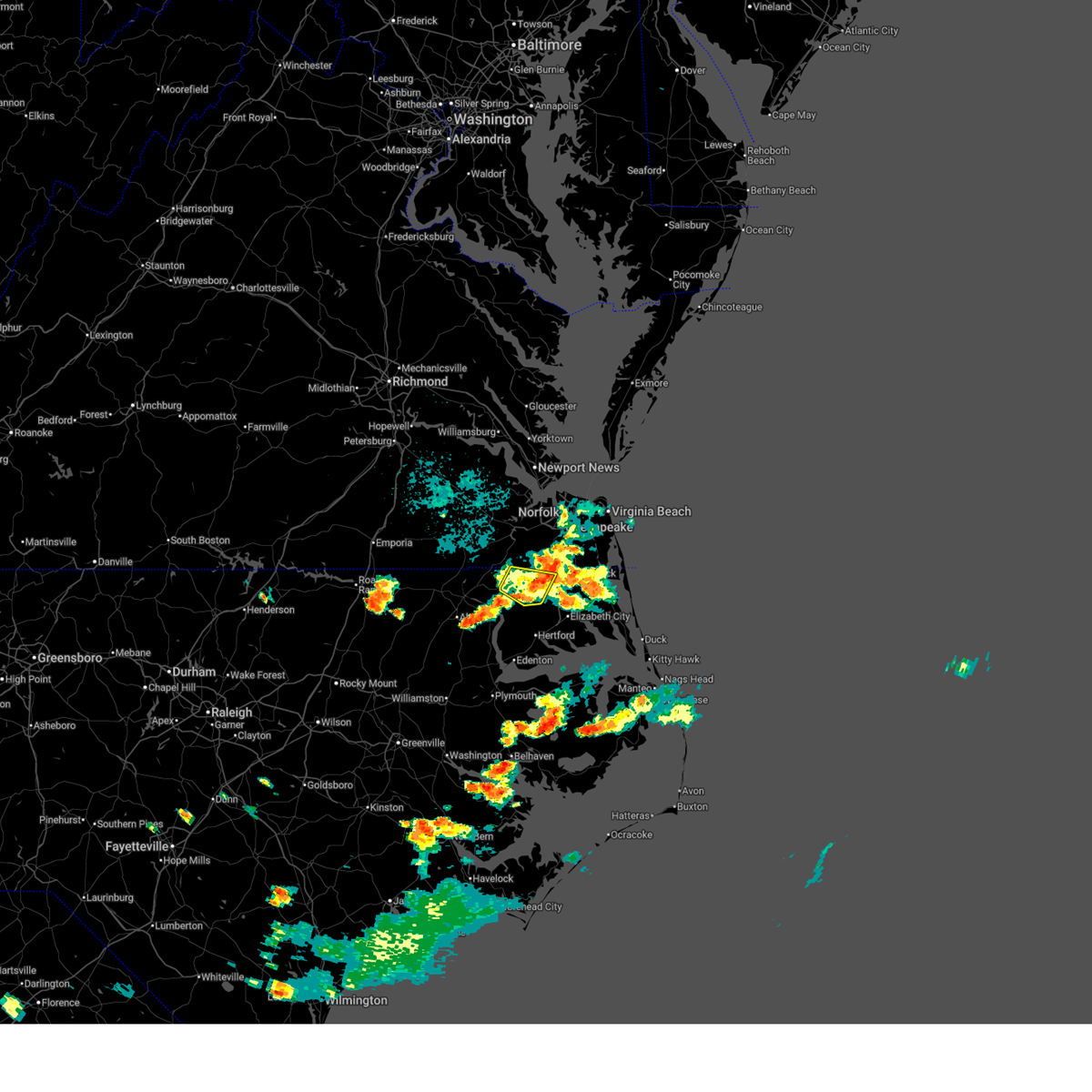
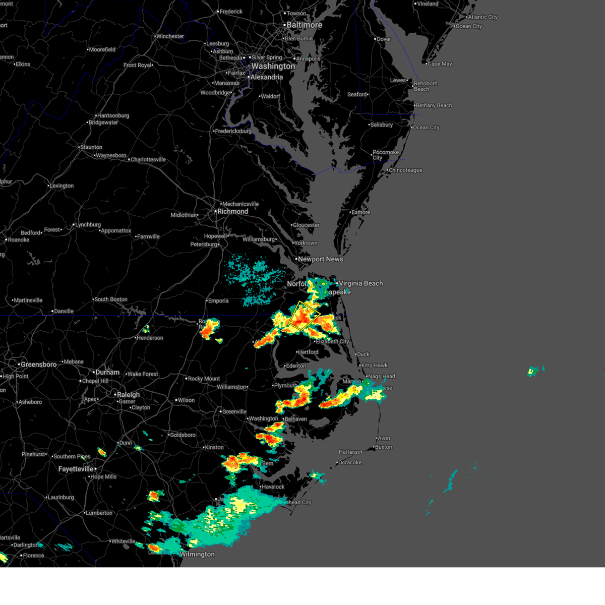
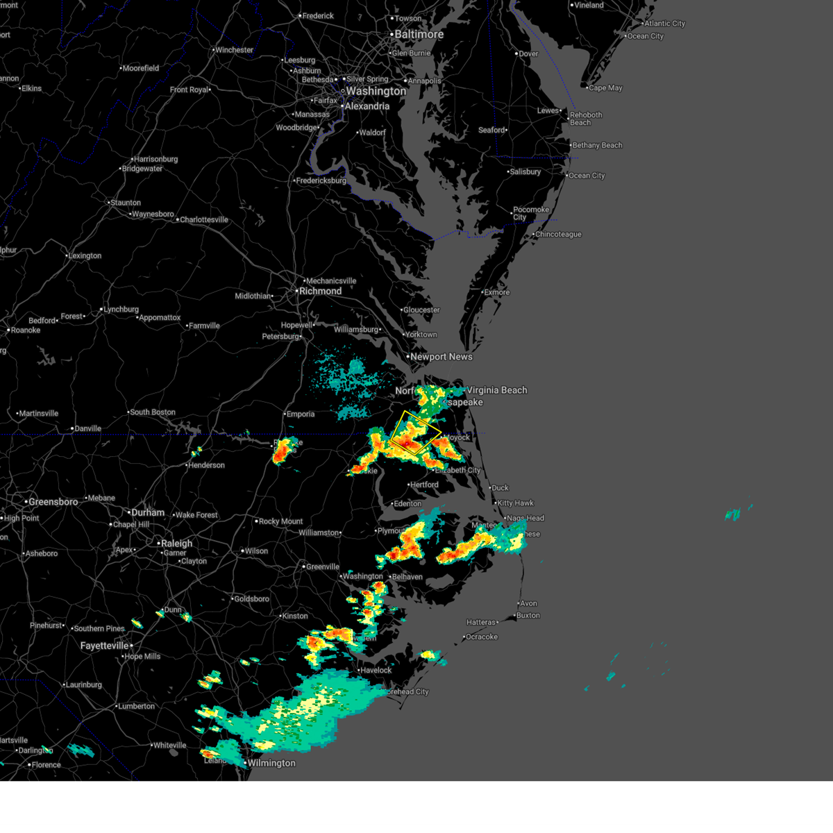
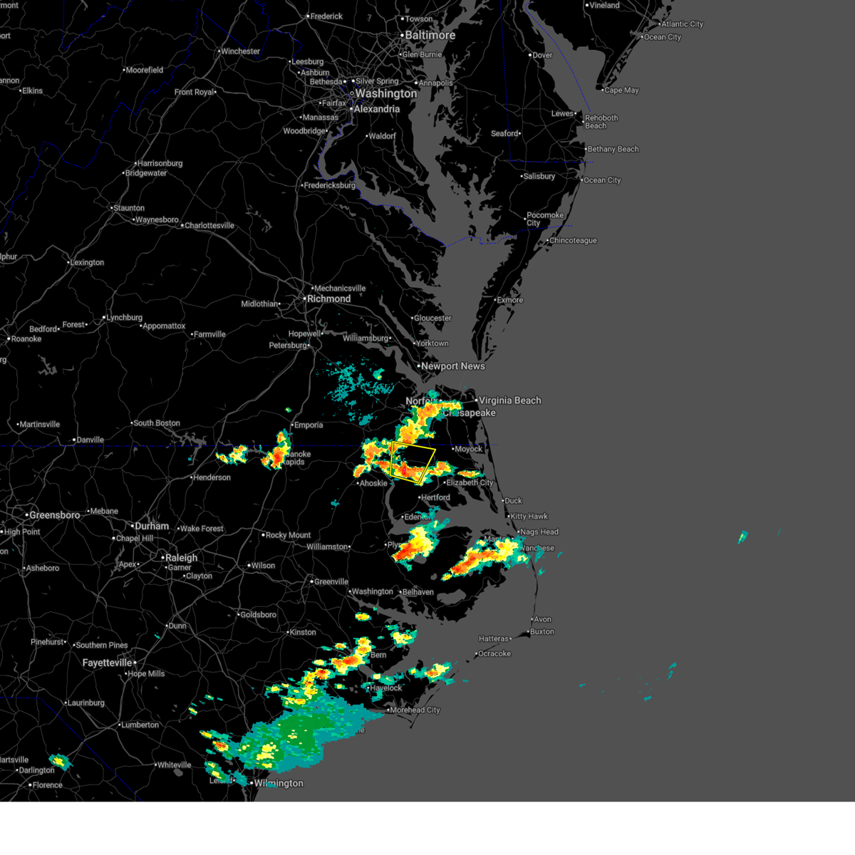
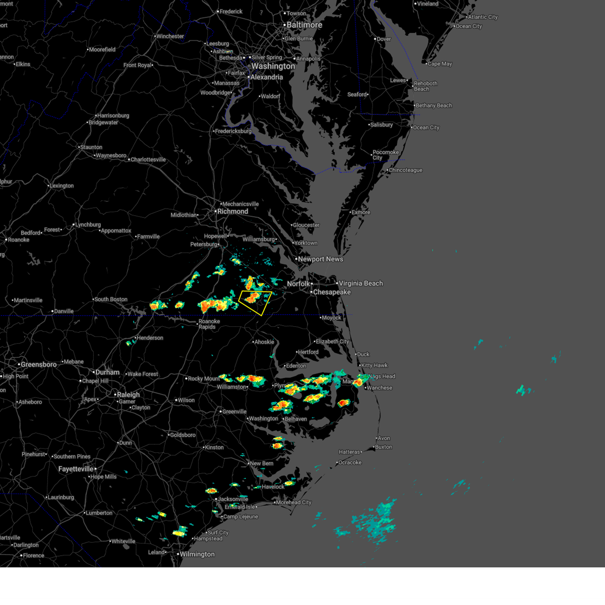
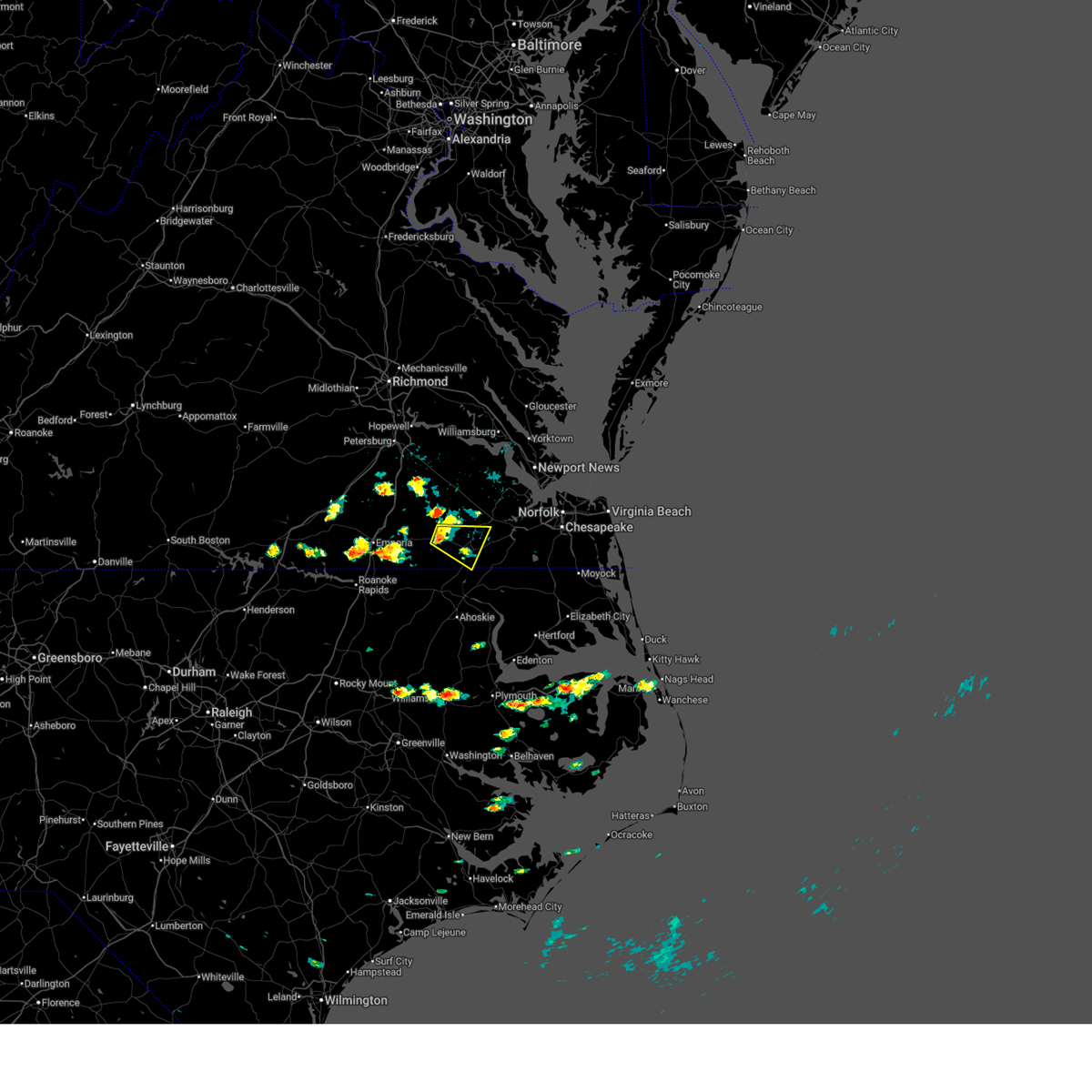
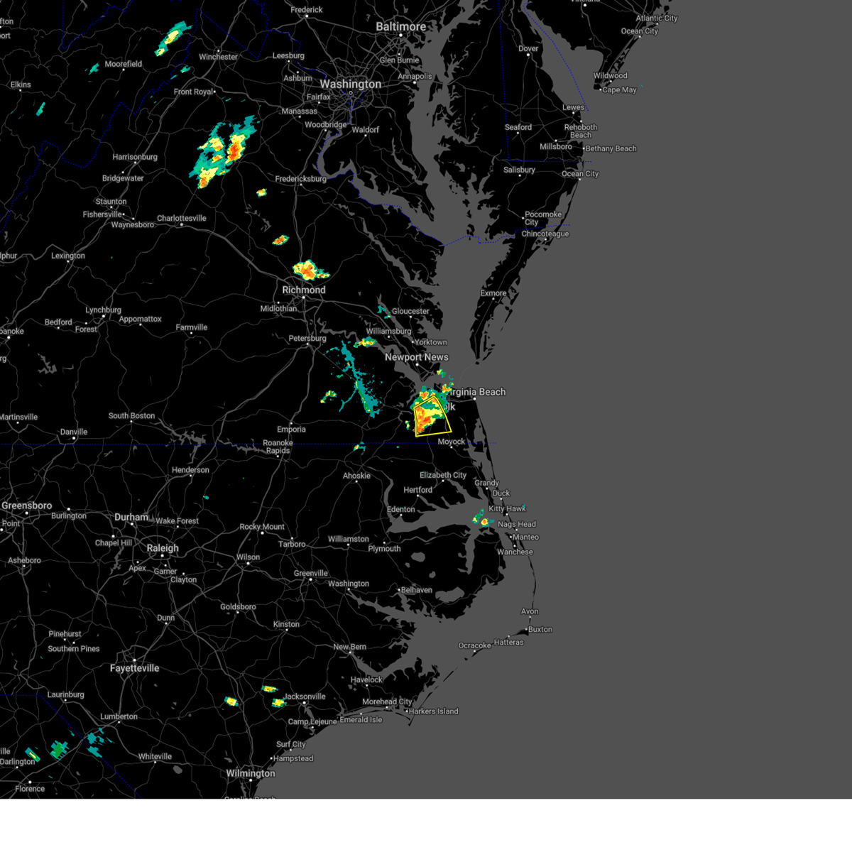
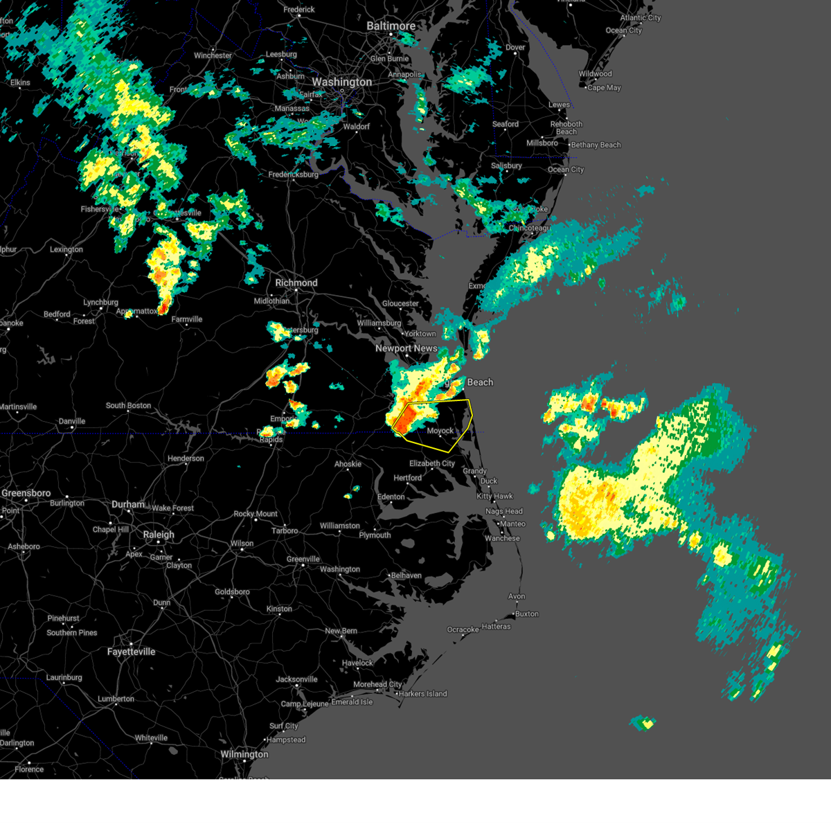
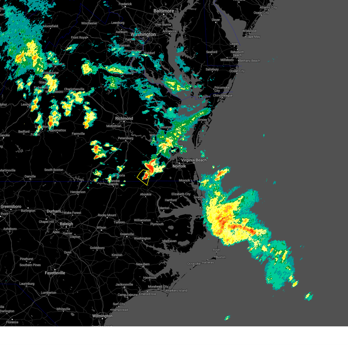
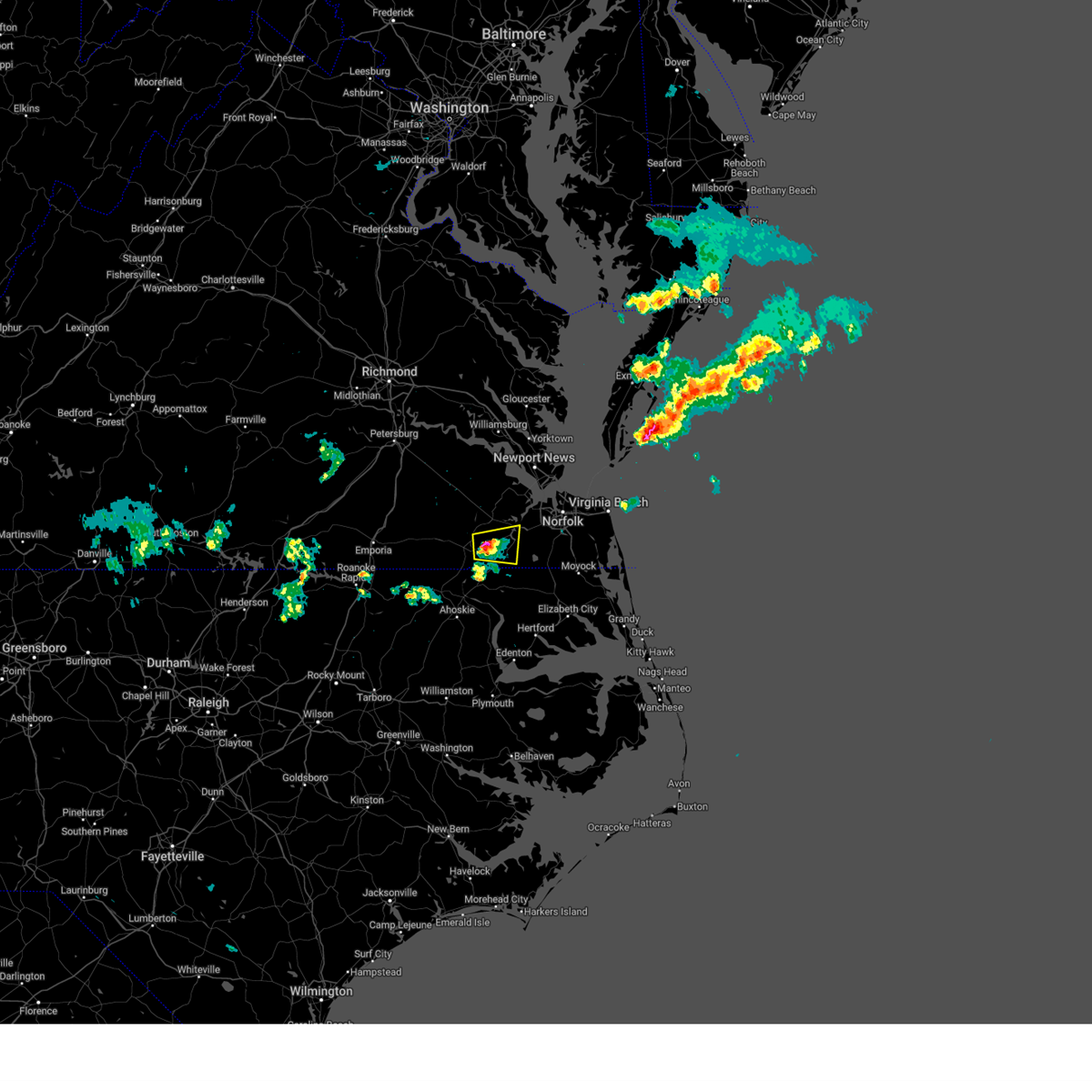
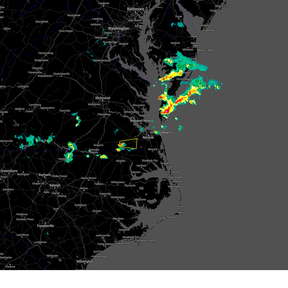
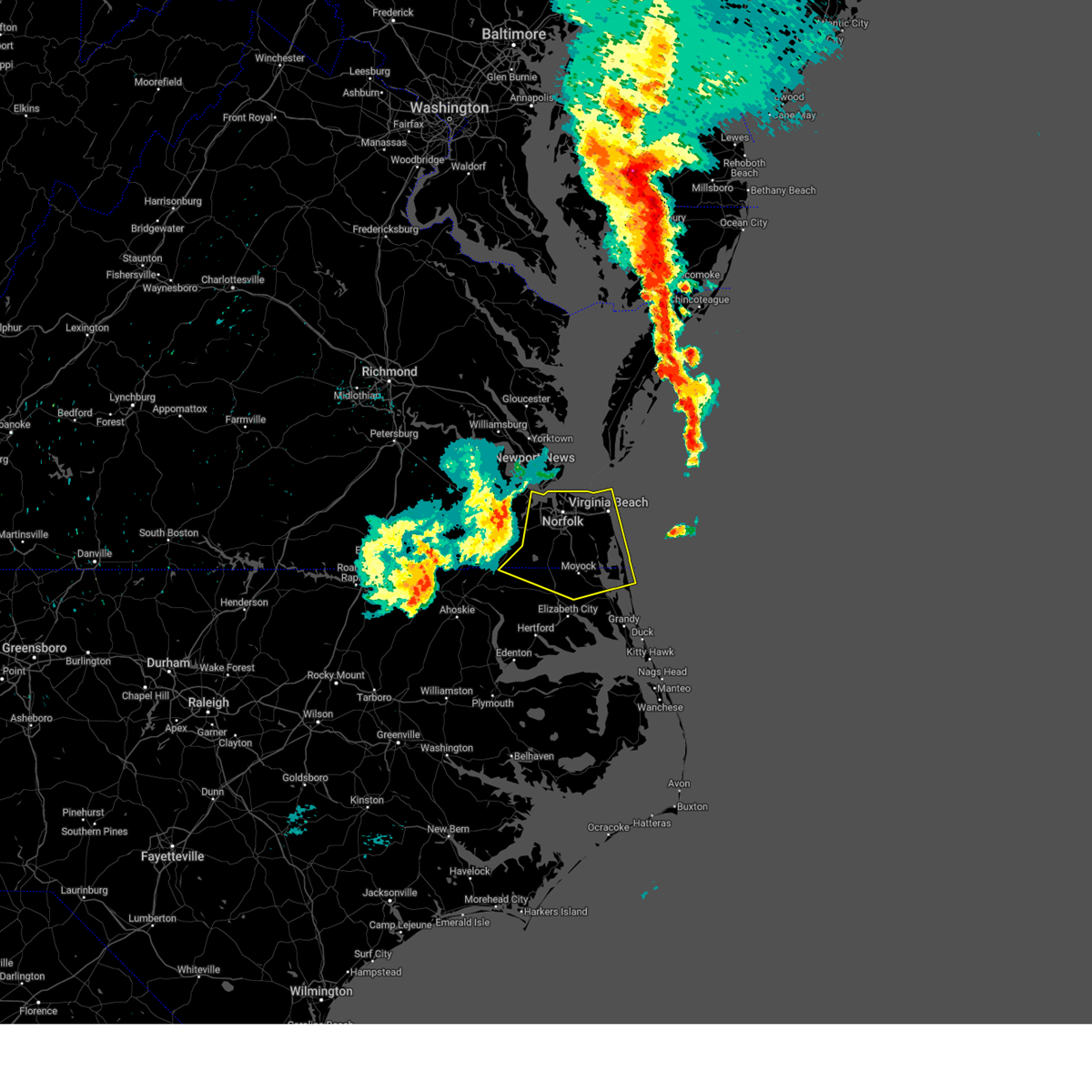
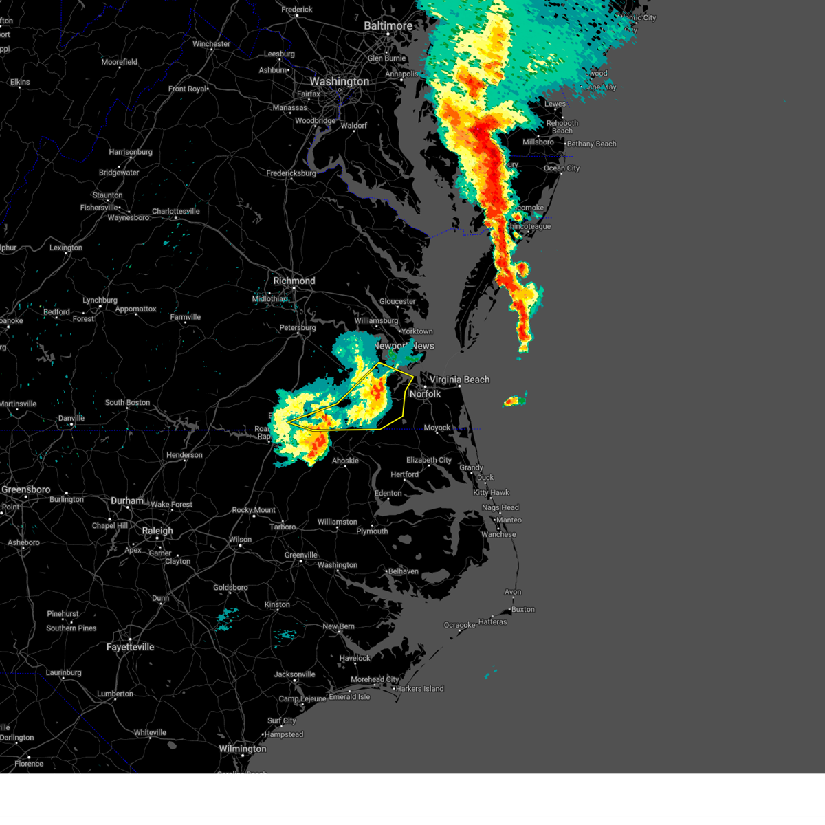
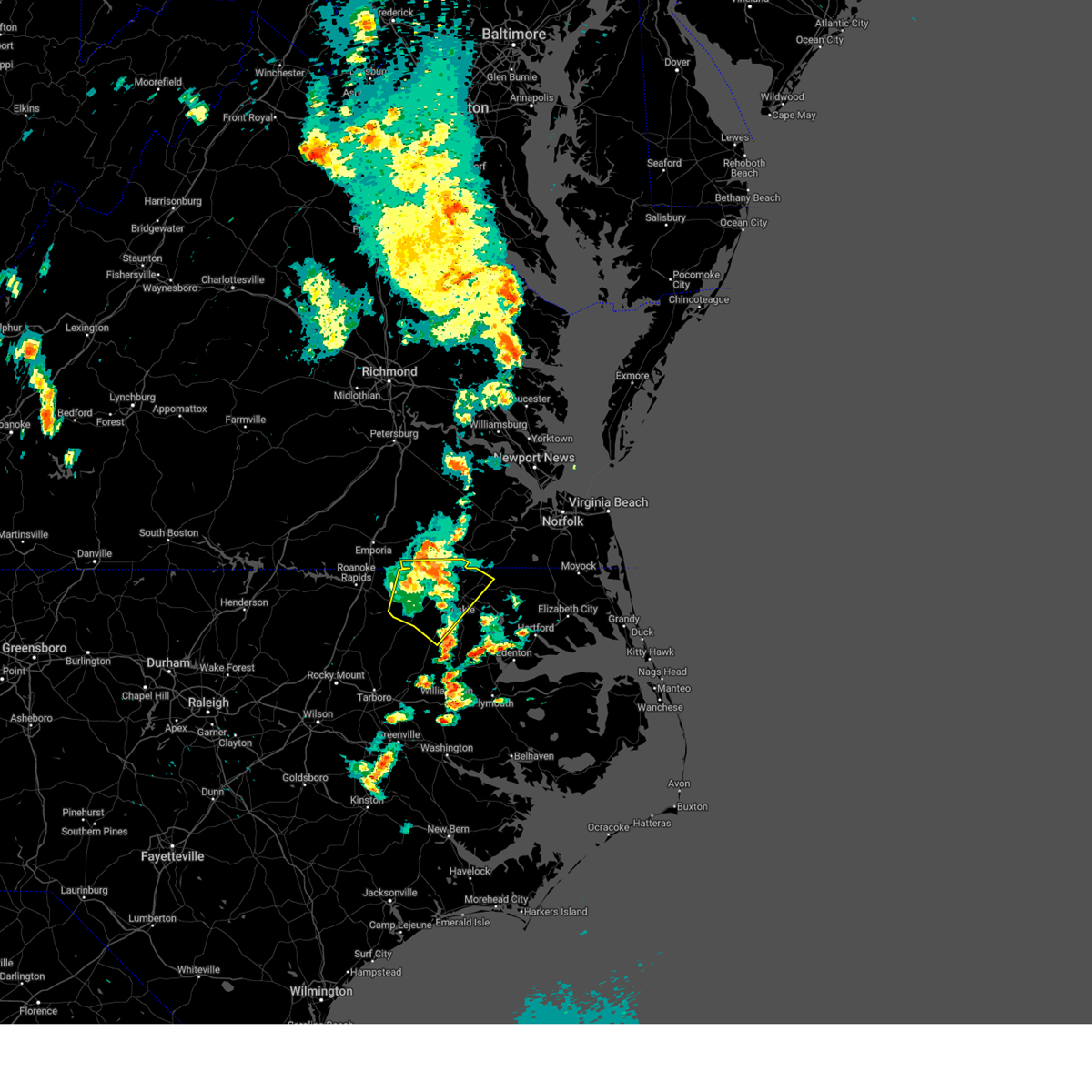
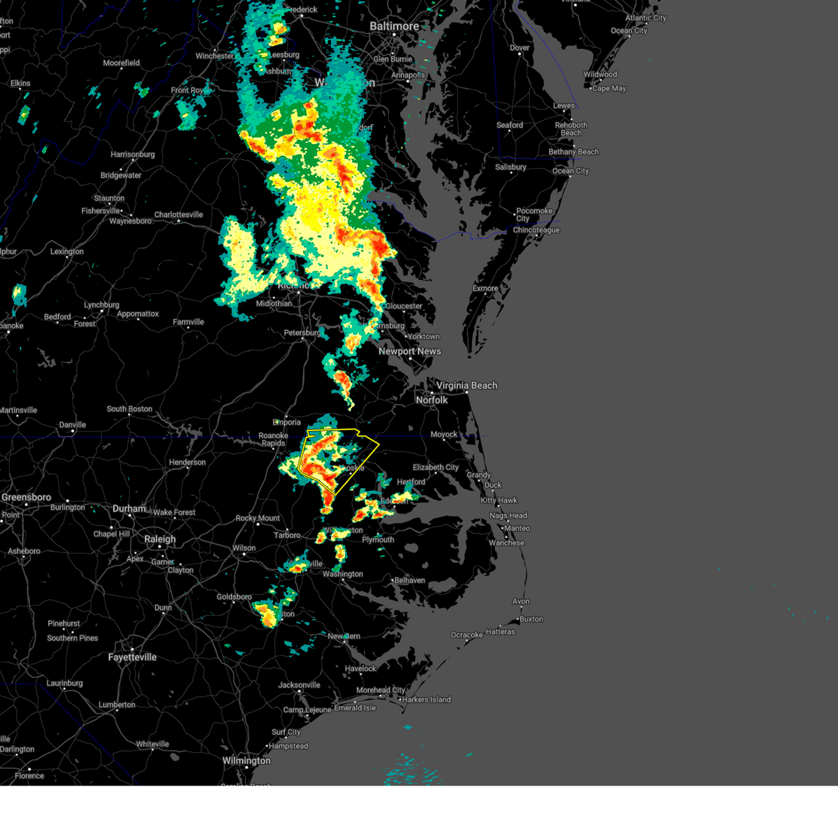
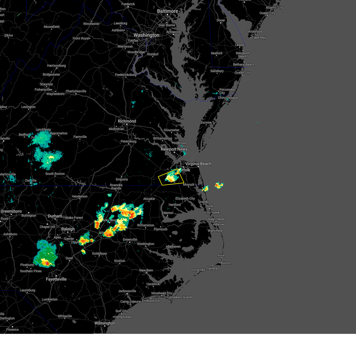
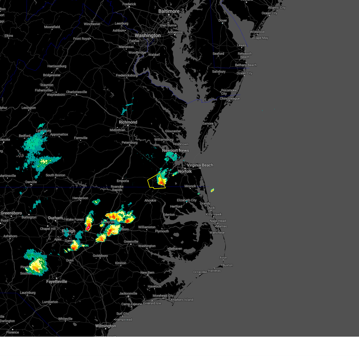
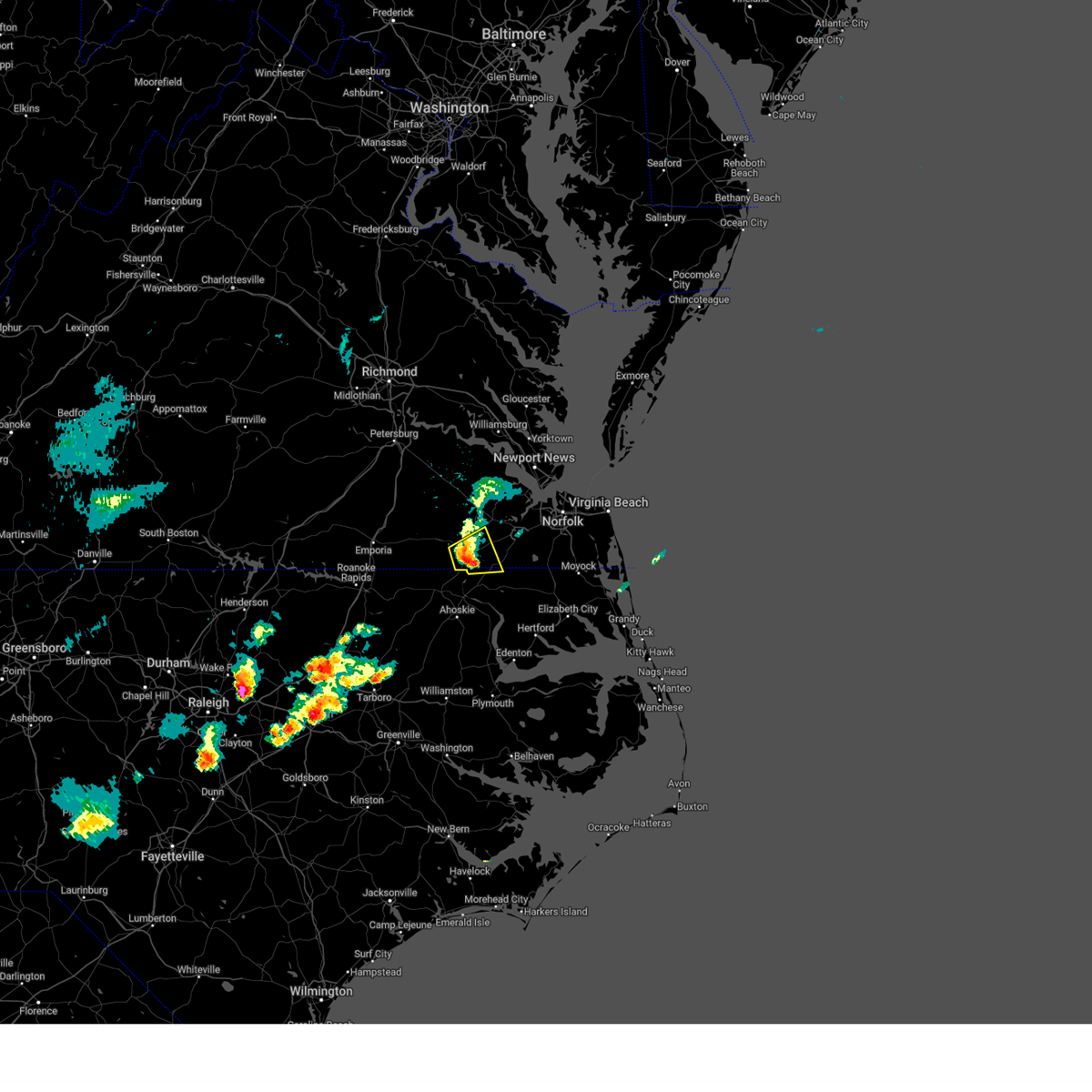
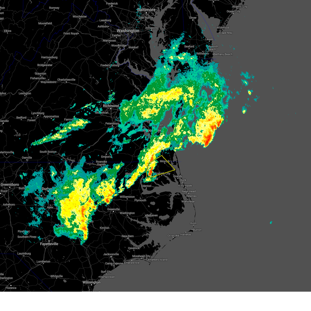
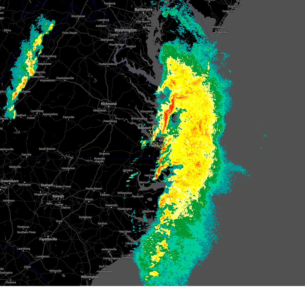
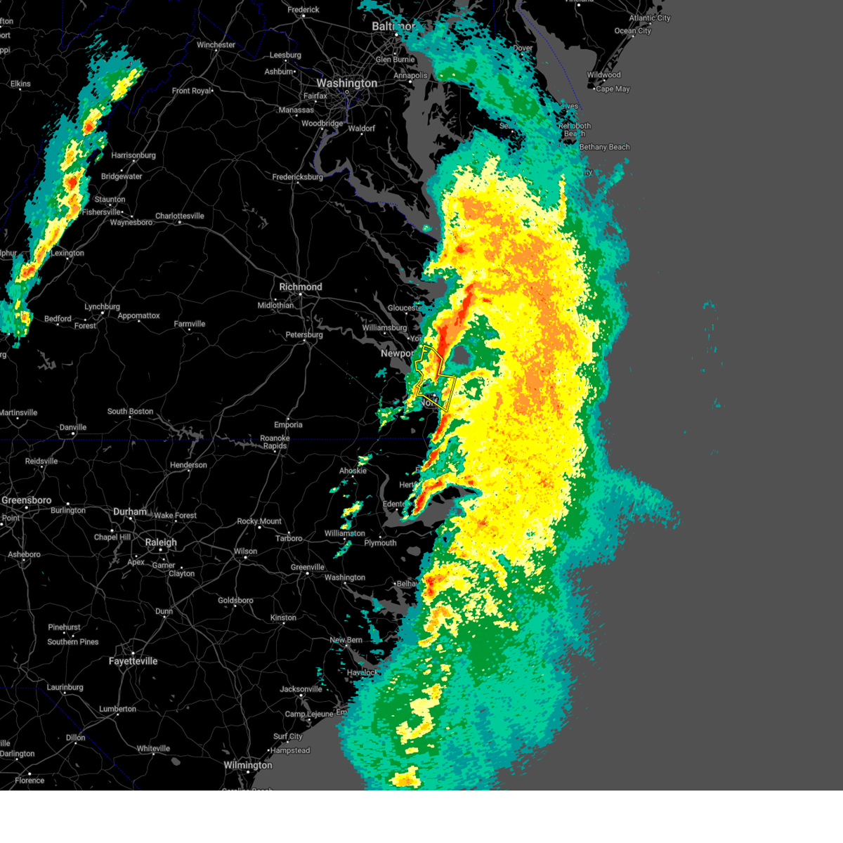
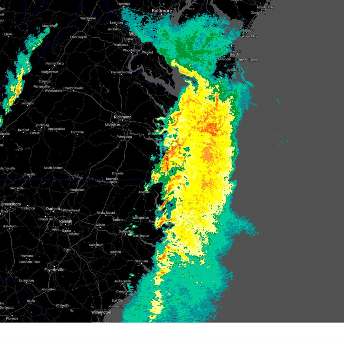
Hail Map for Suffolk, VA
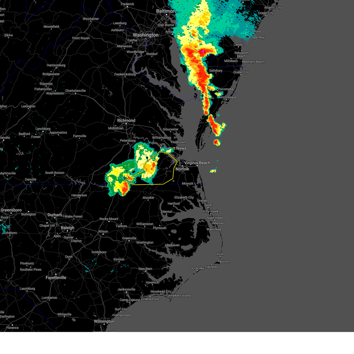
The Suffolk, VA area has had 12 reports of on-the-ground hail by trained spotters, and has been under severe weather warnings 140 times during the past 12 months. Doppler radar has detected hail at or near Suffolk, VA on 137 occasions, including 4 occasions during the past year.
| Name: | Suffolk, VA |
| Where Located: | 36.5 miles W of Virginia Beach, VA |
| Map: | Google Map for Suffolk, VA |
| Population: | 84585 |
| Housing Units: | 33035 |
| More Info: | Search Google for Suffolk, VA |
2
The Top Recent Hail Date for Suffolk, VA is Thursday, May 22, 2025 (9th out of 137)

Hail and Wind Damage Spotted near Suffolk, VA
| Date / Time | Report Details |
|---|---|
| 7/12/2025 2:02 PM EDT |
 Svrakq the national weather service in wakefield has issued a * severe thunderstorm warning for, northeastern gates county in northeastern north carolina, the south central city of suffolk in southeastern virginia, * until 245 pm edt. * at 202 pm edt, a severe thunderstorm was located over corapeake, or 8 miles north of sunbury, moving southwest at 10 mph (radar indicated). Hazards include 60 mph wind gusts. Expect damage to trees and powerlines. this severe thunderstorm will be near, suffolk and corapeake around 210 pm edt. Other locations impacted by this severe thunderstorm include hazelton, buckland, easons crossroads, nurney, acorn hill, and savage. Svrakq the national weather service in wakefield has issued a * severe thunderstorm warning for, northeastern gates county in northeastern north carolina, the south central city of suffolk in southeastern virginia, * until 245 pm edt. * at 202 pm edt, a severe thunderstorm was located over corapeake, or 8 miles north of sunbury, moving southwest at 10 mph (radar indicated). Hazards include 60 mph wind gusts. Expect damage to trees and powerlines. this severe thunderstorm will be near, suffolk and corapeake around 210 pm edt. Other locations impacted by this severe thunderstorm include hazelton, buckland, easons crossroads, nurney, acorn hill, and savage.
|
| 7/10/2025 7:24 PM EDT |
 The storm which prompted the warning has weakened below severe limits, and no longer poses an immediate threat to life or property. therefore, the warning will be allowed to expire. however, gusty winds are still possible with this thunderstorm. The storm which prompted the warning has weakened below severe limits, and no longer poses an immediate threat to life or property. therefore, the warning will be allowed to expire. however, gusty winds are still possible with this thunderstorm.
|
| 7/10/2025 7:16 PM EDT |
 At 716 pm edt, a severe thunderstorm was located over kings fork, or near windsor, moving southeast at 10 mph (radar indicated). Hazards include 60 mph wind gusts. Expect damage to trees and powerlines. this severe storm will be near, suffolk and kings fork around 720 pm edt. downtown suffolk around 725 pm edt. Other locations impacted by this severe thunderstorm include collosse, wilroy, lummis, kilby, suffolk airport, boaz, magnolia, and indika. At 716 pm edt, a severe thunderstorm was located over kings fork, or near windsor, moving southeast at 10 mph (radar indicated). Hazards include 60 mph wind gusts. Expect damage to trees and powerlines. this severe storm will be near, suffolk and kings fork around 720 pm edt. downtown suffolk around 725 pm edt. Other locations impacted by this severe thunderstorm include collosse, wilroy, lummis, kilby, suffolk airport, boaz, magnolia, and indika.
|
| 7/10/2025 6:49 PM EDT |
 Svrakq the national weather service in wakefield has issued a * severe thunderstorm warning for, central isle of wight county in southeastern virginia, the central city of suffolk in southeastern virginia, * until 730 pm edt. * at 649 pm edt, a severe thunderstorm was located over windsor, moving southeast at 10 mph (radar indicated). Hazards include 60 mph wind gusts. Expect damage to trees and powerlines. this severe thunderstorm will be near, windsor and suffolk around 655 pm edt. kings fork around 705 pm edt. Other locations impacted by this severe thunderstorm include longview, lummis, suffolk airport, wills corner, magnolia, chuckatuck, indika, central hill, whitley, and collosse. Svrakq the national weather service in wakefield has issued a * severe thunderstorm warning for, central isle of wight county in southeastern virginia, the central city of suffolk in southeastern virginia, * until 730 pm edt. * at 649 pm edt, a severe thunderstorm was located over windsor, moving southeast at 10 mph (radar indicated). Hazards include 60 mph wind gusts. Expect damage to trees and powerlines. this severe thunderstorm will be near, windsor and suffolk around 655 pm edt. kings fork around 705 pm edt. Other locations impacted by this severe thunderstorm include longview, lummis, suffolk airport, wills corner, magnolia, chuckatuck, indika, central hill, whitley, and collosse.
|
| 7/8/2025 8:29 PM EDT |
 The storm which prompted the warning has weakened below severe limits, and no longer poses an immediate threat to life or property. therefore, the warning will be allowed to expire. however, gusty winds are still possible with this thunderstorm. a severe thunderstorm watch remains in effect until 900 pm edt for southeastern virginia. The storm which prompted the warning has weakened below severe limits, and no longer poses an immediate threat to life or property. therefore, the warning will be allowed to expire. however, gusty winds are still possible with this thunderstorm. a severe thunderstorm watch remains in effect until 900 pm edt for southeastern virginia.
|
| 7/8/2025 8:19 PM EDT |
 At 819 pm edt, a severe thunderstorm was located 7 miles northwest of sedley, or 9 miles north of courtland, moving east at 25 mph (radar indicated). Hazards include 60 mph wind gusts. Expect damage to trees and powerlines. this severe storm will be near, ivor around 835 pm edt. zuni around 845 pm edt. Other locations impacted by this severe thunderstorm include vicksville, booth fork, pons, berlin, bethel church, lumberton, ellis fork, manry, delk crossroads, and indika. At 819 pm edt, a severe thunderstorm was located 7 miles northwest of sedley, or 9 miles north of courtland, moving east at 25 mph (radar indicated). Hazards include 60 mph wind gusts. Expect damage to trees and powerlines. this severe storm will be near, ivor around 835 pm edt. zuni around 845 pm edt. Other locations impacted by this severe thunderstorm include vicksville, booth fork, pons, berlin, bethel church, lumberton, ellis fork, manry, delk crossroads, and indika.
|
| 7/8/2025 8:08 PM EDT |
 At 808 pm edt, a severe thunderstorm was located near wakefield, moving east at 20 mph (radar indicated). Hazards include 60 mph wind gusts. Expect damage to trees and powerlines. this severe storm will be near, ivor around 815 pm edt. isle of wight around 855 pm edt. Other locations impacted by this severe thunderstorm include vicksville, booth fork, pons, newville, berlin, bethel church, lumberton, ellis fork, manry, and delk crossroads. At 808 pm edt, a severe thunderstorm was located near wakefield, moving east at 20 mph (radar indicated). Hazards include 60 mph wind gusts. Expect damage to trees and powerlines. this severe storm will be near, ivor around 815 pm edt. isle of wight around 855 pm edt. Other locations impacted by this severe thunderstorm include vicksville, booth fork, pons, newville, berlin, bethel church, lumberton, ellis fork, manry, and delk crossroads.
|
| 7/8/2025 7:42 PM EDT |
 Svrakq the national weather service in wakefield has issued a * severe thunderstorm warning for, northeastern southampton county in southeastern virginia, northwestern isle of wight county in southeastern virginia, northeastern sussex county in southeastern virginia, central surry county in southeastern virginia, * until 830 pm edt. * at 742 pm edt, a severe thunderstorm was located near wakefield, moving east at 20 mph (radar indicated). Hazards include 60 mph wind gusts. Expect damage to trees and powerlines. this severe thunderstorm will be near, wakefield around 745 pm edt. ivor around 750 pm edt. Other locations impacted by this severe thunderstorm include vicksville, booth fork, pons, newville, berlin, bethel church, lumberton, ellis fork, manry, and delk crossroads. Svrakq the national weather service in wakefield has issued a * severe thunderstorm warning for, northeastern southampton county in southeastern virginia, northwestern isle of wight county in southeastern virginia, northeastern sussex county in southeastern virginia, central surry county in southeastern virginia, * until 830 pm edt. * at 742 pm edt, a severe thunderstorm was located near wakefield, moving east at 20 mph (radar indicated). Hazards include 60 mph wind gusts. Expect damage to trees and powerlines. this severe thunderstorm will be near, wakefield around 745 pm edt. ivor around 750 pm edt. Other locations impacted by this severe thunderstorm include vicksville, booth fork, pons, newville, berlin, bethel church, lumberton, ellis fork, manry, and delk crossroads.
|
| 6/19/2025 9:47 PM EDT |
 the severe thunderstorm warning has been cancelled and is no longer in effect the severe thunderstorm warning has been cancelled and is no longer in effect
|
| 6/19/2025 9:47 PM EDT |
 At 946 pm edt, a severe thunderstorm was located near kempsville, moving east at 55 mph (radar indicated). Hazards include 60 mph wind gusts and penny size hail. Expect damage to trees and powerlines. this severe storm will be near, virginia beach around 950 pm edt. Other locations impacted by this severe thunderstorm include south norfolk, rudee heights, portlock, mount pleasant, princess anne plaza, sigma, sandbridge beach, herberts corner, oceana nas, and macons corner. At 946 pm edt, a severe thunderstorm was located near kempsville, moving east at 55 mph (radar indicated). Hazards include 60 mph wind gusts and penny size hail. Expect damage to trees and powerlines. this severe storm will be near, virginia beach around 950 pm edt. Other locations impacted by this severe thunderstorm include south norfolk, rudee heights, portlock, mount pleasant, princess anne plaza, sigma, sandbridge beach, herberts corner, oceana nas, and macons corner.
|
| 6/19/2025 9:35 PM EDT |
 At 934 pm edt, a severe thunderstorm was located over cradock, or near deep creek, moving east at 55 mph (radar indicated). Hazards include 60 mph wind gusts and penny size hail. Expect damage to trees and powerlines. this severe storm will be near, virginia beach, regent university, kempsville, norfolk, and chesapeake around 940 pm edt. Other locations impacted by this severe thunderstorm include south norfolk, rudee heights, portlock, princess anne plaza, sigma, huntersville, chuckatuck, pungo, greenbrier, and bayside. At 934 pm edt, a severe thunderstorm was located over cradock, or near deep creek, moving east at 55 mph (radar indicated). Hazards include 60 mph wind gusts and penny size hail. Expect damage to trees and powerlines. this severe storm will be near, virginia beach, regent university, kempsville, norfolk, and chesapeake around 940 pm edt. Other locations impacted by this severe thunderstorm include south norfolk, rudee heights, portlock, princess anne plaza, sigma, huntersville, chuckatuck, pungo, greenbrier, and bayside.
|
| 6/19/2025 9:25 PM EDT | Tree down along us-46 in city of suffolk county VA, 5.9 miles SSW of Suffolk, VA |
| 6/19/2025 9:24 PM EDT | Tree branches knocked down powerline in city of suffolk county VA, 4.2 miles W of Suffolk, VA |
| 6/19/2025 9:17 PM EDT | Tree down across holland rd & chapel d in city of suffolk county VA, 1.2 miles NNW of Suffolk, VA |
| 6/19/2025 9:16 PM EDT |
 Svrakq the national weather service in wakefield has issued a * severe thunderstorm warning for, the city of norfolk in southeastern virginia, the city of chesapeake in southeastern virginia, the city of portsmouth in southeastern virginia, the city of suffolk in southeastern virginia, the city of virginia beach in southeastern virginia, * until 1000 pm edt. * at 916 pm edt, a severe thunderstorm was located over downtown suffolk, moving east at 55 mph (radar indicated). Hazards include 60 mph wind gusts and penny size hail. Expect damage to trees and powerlines. this severe thunderstorm will be near, chesapeake and suffolk around 920 pm edt. portsmouth and bowers hill around 925 pm edt. deep creek and cradock around 930 pm edt. virginia beach, regent university, and norfolk around 935 pm edt. kempsville around 940 pm edt. Other locations impacted by this severe thunderstorm include south norfolk, rudee heights, portlock, princess anne plaza, sigma, suffolk airport, huntersville, chuckatuck, pungo, and greenbrier. Svrakq the national weather service in wakefield has issued a * severe thunderstorm warning for, the city of norfolk in southeastern virginia, the city of chesapeake in southeastern virginia, the city of portsmouth in southeastern virginia, the city of suffolk in southeastern virginia, the city of virginia beach in southeastern virginia, * until 1000 pm edt. * at 916 pm edt, a severe thunderstorm was located over downtown suffolk, moving east at 55 mph (radar indicated). Hazards include 60 mph wind gusts and penny size hail. Expect damage to trees and powerlines. this severe thunderstorm will be near, chesapeake and suffolk around 920 pm edt. portsmouth and bowers hill around 925 pm edt. deep creek and cradock around 930 pm edt. virginia beach, regent university, and norfolk around 935 pm edt. kempsville around 940 pm edt. Other locations impacted by this severe thunderstorm include south norfolk, rudee heights, portlock, princess anne plaza, sigma, suffolk airport, huntersville, chuckatuck, pungo, and greenbrier.
|
| 6/19/2025 9:00 PM EDT |
 At 900 pm edt, severe thunderstorms were located along a line extending from 6 miles northwest of courtland to franklin to 7 miles northeast of como to near chowan university, moving east at 55 mph (radar indicated). Hazards include 60 mph wind gusts and nickel size hail. Expect damage to trees and powerlines. these severe storms will be near, franklin, holland, suffolk, gates, winton, cofield, sedley, carrsville, and roduco around 905 pm edt. whaleyville around 910 pm edt. windsor and gatesville around 915 pm edt. downtown suffolk, kings fork, and corapeake around 920 pm edt. sunbury around 925 pm edt. Other locations impacted by these severe thunderstorms include tunis, earleys, menola, newsome store, savage, chowan beach, topsy, carter, dort, and wilroy. At 900 pm edt, severe thunderstorms were located along a line extending from 6 miles northwest of courtland to franklin to 7 miles northeast of como to near chowan university, moving east at 55 mph (radar indicated). Hazards include 60 mph wind gusts and nickel size hail. Expect damage to trees and powerlines. these severe storms will be near, franklin, holland, suffolk, gates, winton, cofield, sedley, carrsville, and roduco around 905 pm edt. whaleyville around 910 pm edt. windsor and gatesville around 915 pm edt. downtown suffolk, kings fork, and corapeake around 920 pm edt. sunbury around 925 pm edt. Other locations impacted by these severe thunderstorms include tunis, earleys, menola, newsome store, savage, chowan beach, topsy, carter, dort, and wilroy.
|
| 6/19/2025 8:52 PM EDT |
 At 852 pm edt, severe thunderstorms were located along a line extending from 8 miles northwest of courtland to near hunterdale to near como to near chowan university, moving east at 50 mph (radar indicated). Hazards include 60 mph wind gusts and nickel size hail. Expect damage to trees and powerlines. these severe storms will be near, franklin, murfreesboro, courtland, chowan university, suffolk, como, hunterdale, and sedley around 855 pm edt. winton and carrsville around 900 pm edt. holland, gates, cofield, roduco, and whaleyville around 905 pm edt. windsor and gatesville around 910 pm edt. downtown suffolk, kings fork, and zuni around 915 pm edt. corapeake around 920 pm edt. sunbury and isle of wight around 925 pm edt. Other locations impacted by these severe thunderstorms include eagletown, vicksville, milwaukee, tunis, earleys, menola, newsome store, savage, chowan beach, and topsy. At 852 pm edt, severe thunderstorms were located along a line extending from 8 miles northwest of courtland to near hunterdale to near como to near chowan university, moving east at 50 mph (radar indicated). Hazards include 60 mph wind gusts and nickel size hail. Expect damage to trees and powerlines. these severe storms will be near, franklin, murfreesboro, courtland, chowan university, suffolk, como, hunterdale, and sedley around 855 pm edt. winton and carrsville around 900 pm edt. holland, gates, cofield, roduco, and whaleyville around 905 pm edt. windsor and gatesville around 910 pm edt. downtown suffolk, kings fork, and zuni around 915 pm edt. corapeake around 920 pm edt. sunbury and isle of wight around 925 pm edt. Other locations impacted by these severe thunderstorms include eagletown, vicksville, milwaukee, tunis, earleys, menola, newsome store, savage, chowan beach, and topsy.
|
| 6/19/2025 8:39 PM EDT |
 Svrakq the national weather service in wakefield has issued a * severe thunderstorm warning for, eastern northampton county in northeastern north carolina, hertford county in northeastern north carolina, gates county in northeastern north carolina, the city of franklin in southeastern virginia, southampton county in southeastern virginia, isle of wight county in southeastern virginia, the city of suffolk in southeastern virginia, * until 930 pm edt. * at 839 pm edt, severe thunderstorms were located along a line extending from near green plain to near boykins to near conway to 6 miles northwest of rich square, moving east at 50 mph (radar indicated). Hazards include 60 mph wind gusts and quarter size hail. Minor damage to vehicles is possible. expect wind damage to trees and powerlines. severe thunderstorms will be near, murfreesboro, chowan university, conway, woodland, newsoms, and como around 845 pm edt. courtland and suffolk around 850 pm edt. franklin and hunterdale around 855 pm edt. winton and sedley around 900 pm edt. holland, gates, cofield, carrsville, and roduco around 905 pm edt. whaleyville around 910 pm edt. windsor, gatesville, and zuni around 915 pm edt. downtown suffolk, kings fork, and corapeake around 920 pm edt. Other locations impacted by these severe thunderstorms include eagletown, vicksville, milwaukee, tunis, pons, earleys, longview, menola, newsome store, and savage. Svrakq the national weather service in wakefield has issued a * severe thunderstorm warning for, eastern northampton county in northeastern north carolina, hertford county in northeastern north carolina, gates county in northeastern north carolina, the city of franklin in southeastern virginia, southampton county in southeastern virginia, isle of wight county in southeastern virginia, the city of suffolk in southeastern virginia, * until 930 pm edt. * at 839 pm edt, severe thunderstorms were located along a line extending from near green plain to near boykins to near conway to 6 miles northwest of rich square, moving east at 50 mph (radar indicated). Hazards include 60 mph wind gusts and quarter size hail. Minor damage to vehicles is possible. expect wind damage to trees and powerlines. severe thunderstorms will be near, murfreesboro, chowan university, conway, woodland, newsoms, and como around 845 pm edt. courtland and suffolk around 850 pm edt. franklin and hunterdale around 855 pm edt. winton and sedley around 900 pm edt. holland, gates, cofield, carrsville, and roduco around 905 pm edt. whaleyville around 910 pm edt. windsor, gatesville, and zuni around 915 pm edt. downtown suffolk, kings fork, and corapeake around 920 pm edt. Other locations impacted by these severe thunderstorms include eagletown, vicksville, milwaukee, tunis, pons, earleys, longview, menola, newsome store, and savage.
|
| 6/19/2025 8:22 PM EDT |
 Svrakq the national weather service in wakefield has issued a * severe thunderstorm warning for, northampton county in northeastern north carolina, northwestern hertford county in northeastern north carolina, south central southampton county in southeastern virginia, * until 845 pm edt. * at 822 pm edt, a severe thunderstorm was located near garysburg, moving east at 40 mph (radar indicated). Hazards include 60 mph wind gusts. Expect damage to trees and powerlines. this severe thunderstorm will be near, conway around 840 pm edt. woodland around 845 pm edt. Other locations impacted by this severe thunderstorm include mud castle, milwaukee, tunis, pendleton, potecasi, menola, lasker, mapleton, jackson, and riddicksville. Svrakq the national weather service in wakefield has issued a * severe thunderstorm warning for, northampton county in northeastern north carolina, northwestern hertford county in northeastern north carolina, south central southampton county in southeastern virginia, * until 845 pm edt. * at 822 pm edt, a severe thunderstorm was located near garysburg, moving east at 40 mph (radar indicated). Hazards include 60 mph wind gusts. Expect damage to trees and powerlines. this severe thunderstorm will be near, conway around 840 pm edt. woodland around 845 pm edt. Other locations impacted by this severe thunderstorm include mud castle, milwaukee, tunis, pendleton, potecasi, menola, lasker, mapleton, jackson, and riddicksville.
|
| 6/15/2025 6:45 PM EDT |
 the severe thunderstorm warning has been cancelled and is no longer in effect the severe thunderstorm warning has been cancelled and is no longer in effect
|
| 6/15/2025 6:45 PM EDT |
 At 645 pm edt, severe thunderstorms were located along a line extending from 8 miles east of green plain to near ahoskie, moving east at 30 mph (radar indicated). Hazards include 60 mph wind gusts. Expect damage to trees and powerlines. these severe storms will be near, ahoskie, murfreesboro, boykins, chowan university, winton, cofield, newsoms, and como around 650 pm edt. courtland around 705 pm edt. Other locations impacted by these severe thunderstorms include milwaukee, tunis, adams grove, earleys, menola, chowan beach, topsy, mapleton, dort, and worrell. At 645 pm edt, severe thunderstorms were located along a line extending from 8 miles east of green plain to near ahoskie, moving east at 30 mph (radar indicated). Hazards include 60 mph wind gusts. Expect damage to trees and powerlines. these severe storms will be near, ahoskie, murfreesboro, boykins, chowan university, winton, cofield, newsoms, and como around 650 pm edt. courtland around 705 pm edt. Other locations impacted by these severe thunderstorms include milwaukee, tunis, adams grove, earleys, menola, chowan beach, topsy, mapleton, dort, and worrell.
|
| 6/15/2025 6:29 PM EDT |
 Svrakq the national weather service in wakefield has issued a * severe thunderstorm warning for, northeastern northampton county in northeastern north carolina, hertford county in northeastern north carolina, western gates county in northeastern north carolina, southeastern greensville county in southeastern virginia, southampton county in southeastern virginia, south central sussex county in southeastern virginia, * until 700 pm edt. * at 629 pm edt, severe thunderstorms were located along a line extending from near green plain to near aulander, moving northeast at 30 mph (radar indicated). Hazards include 60 mph wind gusts. Expect damage to trees and powerlines. severe thunderstorms will be near, ahoskie, murfreesboro, boykins, chowan university, and conway around 635 pm edt. newsoms around 650 pm edt. Other locations impacted by these severe thunderstorms include milwaukee, tunis, adams grove, grizzard, earleys, menola, chowan beach, topsy, mapleton, and bryants corner. Svrakq the national weather service in wakefield has issued a * severe thunderstorm warning for, northeastern northampton county in northeastern north carolina, hertford county in northeastern north carolina, western gates county in northeastern north carolina, southeastern greensville county in southeastern virginia, southampton county in southeastern virginia, south central sussex county in southeastern virginia, * until 700 pm edt. * at 629 pm edt, severe thunderstorms were located along a line extending from near green plain to near aulander, moving northeast at 30 mph (radar indicated). Hazards include 60 mph wind gusts. Expect damage to trees and powerlines. severe thunderstorms will be near, ahoskie, murfreesboro, boykins, chowan university, and conway around 635 pm edt. newsoms around 650 pm edt. Other locations impacted by these severe thunderstorms include milwaukee, tunis, adams grove, grizzard, earleys, menola, chowan beach, topsy, mapleton, and bryants corner.
|
| 6/14/2025 6:26 PM EDT |
 the severe thunderstorm warning has been cancelled and is no longer in effect the severe thunderstorm warning has been cancelled and is no longer in effect
|
| 6/14/2025 6:09 PM EDT |
 At 609 pm edt, a severe thunderstorm was located near downtown suffolk, moving east at 15 mph (radar indicated). Hazards include 60 mph wind gusts. Expect damage to trees and powerlines. this severe storm will be near, chesapeake, suffolk, and driver around 615 pm edt. bowers hill around 625 pm edt. portsmouth around 630 pm edt. western branch around 635 pm edt. Other locations impacted by this severe thunderstorm include hobson, wilroy, kilby, huntersville, deanes, magnolia, chuckatuck, and wills corner. At 609 pm edt, a severe thunderstorm was located near downtown suffolk, moving east at 15 mph (radar indicated). Hazards include 60 mph wind gusts. Expect damage to trees and powerlines. this severe storm will be near, chesapeake, suffolk, and driver around 615 pm edt. bowers hill around 625 pm edt. portsmouth around 630 pm edt. western branch around 635 pm edt. Other locations impacted by this severe thunderstorm include hobson, wilroy, kilby, huntersville, deanes, magnolia, chuckatuck, and wills corner.
|
| 6/14/2025 6:09 PM EDT |
 the severe thunderstorm warning has been cancelled and is no longer in effect the severe thunderstorm warning has been cancelled and is no longer in effect
|
| 6/14/2025 6:08 PM EDT | Multiple trees knocked down along us-58 east. time estimated from rada in city of suffolk county VA, 13.4 miles WSW of Suffolk, VA |
| 6/14/2025 5:53 PM EDT |
 Svrakq the national weather service in wakefield has issued a * severe thunderstorm warning for, the northwestern city of chesapeake in southeastern virginia, the western city of portsmouth in southeastern virginia, central isle of wight county in southeastern virginia, the northeastern city of suffolk in southeastern virginia, * until 645 pm edt. * at 553 pm edt, a severe thunderstorm was located over kings fork, or over downtown suffolk, moving east at 15 mph (radar indicated). Hazards include 60 mph wind gusts. Expect damage to trees and powerlines. this severe thunderstorm will be near, downtown suffolk and suffolk around 600 pm edt. driver around 610 pm edt. chesapeake around 615 pm edt. bowers hill around 625 pm edt. Other locations impacted by this severe thunderstorm include hobson, wilroy, longview, kilby, huntersville, wills corner, deanes, magnolia, chuckatuck, and indika. Svrakq the national weather service in wakefield has issued a * severe thunderstorm warning for, the northwestern city of chesapeake in southeastern virginia, the western city of portsmouth in southeastern virginia, central isle of wight county in southeastern virginia, the northeastern city of suffolk in southeastern virginia, * until 645 pm edt. * at 553 pm edt, a severe thunderstorm was located over kings fork, or over downtown suffolk, moving east at 15 mph (radar indicated). Hazards include 60 mph wind gusts. Expect damage to trees and powerlines. this severe thunderstorm will be near, downtown suffolk and suffolk around 600 pm edt. driver around 610 pm edt. chesapeake around 615 pm edt. bowers hill around 625 pm edt. Other locations impacted by this severe thunderstorm include hobson, wilroy, longview, kilby, huntersville, wills corner, deanes, magnolia, chuckatuck, and indika.
|
| 6/11/2025 2:59 PM EDT |
 The storm which prompted the warning has moved out of the area. therefore, the warning will be allowed to expire. to report severe weather, contact your nearest law enforcement agency. they will relay your report to the national weather service wakefield. The storm which prompted the warning has moved out of the area. therefore, the warning will be allowed to expire. to report severe weather, contact your nearest law enforcement agency. they will relay your report to the national weather service wakefield.
|
| 6/11/2025 2:51 PM EDT |
 At 251 pm edt, a severe thunderstorm was located near corapeake, or 8 miles northeast of sunbury, moving northeast at 15 mph (law enforcement). Hazards include 70 mph wind gusts and quarter size hail. Hail damage to vehicles is expected. expect considerable tree damage. wind damage is also likely to mobile homes, roofs, and outbuildings. Locations impacted include, chesapeake, northwest, horseshoe, lynchs corner, sharon, and lilly. At 251 pm edt, a severe thunderstorm was located near corapeake, or 8 miles northeast of sunbury, moving northeast at 15 mph (law enforcement). Hazards include 70 mph wind gusts and quarter size hail. Hail damage to vehicles is expected. expect considerable tree damage. wind damage is also likely to mobile homes, roofs, and outbuildings. Locations impacted include, chesapeake, northwest, horseshoe, lynchs corner, sharon, and lilly.
|
| 6/11/2025 2:41 PM EDT |
 Svrakq the national weather service in wakefield has issued a * severe thunderstorm warning for, northwestern camden county in northeastern north carolina, northwestern pasquotank county in northeastern north carolina, northeastern gates county in northeastern north carolina, northwestern currituck county in northeastern north carolina, the southwestern city of chesapeake in southeastern virginia, the southeastern city of suffolk in southeastern virginia, * until 330 pm edt. * at 241 pm edt, a severe thunderstorm was located near corapeake, or near sunbury, moving northeast at 15 mph (radar indicated). Hazards include 70 mph wind gusts and ping pong ball size hail. People and animals outdoors will be injured. expect hail damage to roofs, siding, windows, and vehicles. expect considerable tree damage. Wind damage is also likely to mobile homes, roofs, and outbuildings. Svrakq the national weather service in wakefield has issued a * severe thunderstorm warning for, northwestern camden county in northeastern north carolina, northwestern pasquotank county in northeastern north carolina, northeastern gates county in northeastern north carolina, northwestern currituck county in northeastern north carolina, the southwestern city of chesapeake in southeastern virginia, the southeastern city of suffolk in southeastern virginia, * until 330 pm edt. * at 241 pm edt, a severe thunderstorm was located near corapeake, or near sunbury, moving northeast at 15 mph (radar indicated). Hazards include 70 mph wind gusts and ping pong ball size hail. People and animals outdoors will be injured. expect hail damage to roofs, siding, windows, and vehicles. expect considerable tree damage. Wind damage is also likely to mobile homes, roofs, and outbuildings.
|
| 6/11/2025 2:33 PM EDT |
 At 233 pm edt, a severe thunderstorm was located near sunbury, moving northeast at 20 mph (radar indicated). Hazards include 60 mph wind gusts and half dollar size hail. Hail damage to vehicles is expected. expect wind damage to roofs, siding, and trees. Locations impacted include, sunbury, corapeake, horseshoe, lynchs corner, easons crossroads, savage, acorn hill, and sandy cross. At 233 pm edt, a severe thunderstorm was located near sunbury, moving northeast at 20 mph (radar indicated). Hazards include 60 mph wind gusts and half dollar size hail. Hail damage to vehicles is expected. expect wind damage to roofs, siding, and trees. Locations impacted include, sunbury, corapeake, horseshoe, lynchs corner, easons crossroads, savage, acorn hill, and sandy cross.
|
| 6/11/2025 2:33 PM EDT |
 the severe thunderstorm warning has been cancelled and is no longer in effect the severe thunderstorm warning has been cancelled and is no longer in effect
|
| 6/11/2025 2:17 PM EDT |
 Svrakq the national weather service in wakefield has issued a * severe thunderstorm warning for, northwestern camden county in northeastern north carolina, northwestern pasquotank county in northeastern north carolina, northwestern perquimans county in northeastern north carolina, eastern gates county in northeastern north carolina, north central chowan county in northeastern north carolina, the south central city of suffolk in southeastern virginia, * until 300 pm edt. * at 217 pm edt, a severe thunderstorm was located over hobbsville, or near sunbury, moving north at 15 mph (radar indicated). Hazards include 60 mph wind gusts and quarter size hail. Hail damage to vehicles is expected. Expect wind damage to roofs, siding, and trees. Svrakq the national weather service in wakefield has issued a * severe thunderstorm warning for, northwestern camden county in northeastern north carolina, northwestern pasquotank county in northeastern north carolina, northwestern perquimans county in northeastern north carolina, eastern gates county in northeastern north carolina, north central chowan county in northeastern north carolina, the south central city of suffolk in southeastern virginia, * until 300 pm edt. * at 217 pm edt, a severe thunderstorm was located over hobbsville, or near sunbury, moving north at 15 mph (radar indicated). Hazards include 60 mph wind gusts and quarter size hail. Hail damage to vehicles is expected. Expect wind damage to roofs, siding, and trees.
|
| 6/11/2025 12:14 PM EDT |
 the severe thunderstorm warning has been cancelled and is no longer in effect the severe thunderstorm warning has been cancelled and is no longer in effect
|
| 6/11/2025 11:49 AM EDT |
 Svrakq the national weather service in wakefield has issued a * severe thunderstorm warning for, northwestern gates county in northeastern north carolina, the city of franklin in southeastern virginia, southeastern southampton county in southeastern virginia, southwestern isle of wight county in southeastern virginia, the southwestern city of suffolk in southeastern virginia, * until 1230 pm edt. * at 1149 am edt, a severe thunderstorm was located over courtland, moving east at 10 mph (radar indicated). Hazards include 60 mph wind gusts and quarter size hail. Hail damage to vehicles is expected. Expect wind damage to roofs, siding, and trees. Svrakq the national weather service in wakefield has issued a * severe thunderstorm warning for, northwestern gates county in northeastern north carolina, the city of franklin in southeastern virginia, southeastern southampton county in southeastern virginia, southwestern isle of wight county in southeastern virginia, the southwestern city of suffolk in southeastern virginia, * until 1230 pm edt. * at 1149 am edt, a severe thunderstorm was located over courtland, moving east at 10 mph (radar indicated). Hazards include 60 mph wind gusts and quarter size hail. Hail damage to vehicles is expected. Expect wind damage to roofs, siding, and trees.
|
| 6/9/2025 6:20 PM EDT |
 Svrakq the national weather service in wakefield has issued a * severe thunderstorm warning for, the western city of chesapeake in southeastern virginia, the city of portsmouth in southeastern virginia, the east central city of suffolk in southeastern virginia, * until 645 pm edt. * at 620 pm edt, severe thunderstorms were located along a line extending from bowers hill to near deep creek to 8 miles southwest of chesapeake, moving east at 20 mph (radar indicated). Hazards include 60 mph wind gusts. expect damage to trees and powerlines Svrakq the national weather service in wakefield has issued a * severe thunderstorm warning for, the western city of chesapeake in southeastern virginia, the city of portsmouth in southeastern virginia, the east central city of suffolk in southeastern virginia, * until 645 pm edt. * at 620 pm edt, severe thunderstorms were located along a line extending from bowers hill to near deep creek to 8 miles southwest of chesapeake, moving east at 20 mph (radar indicated). Hazards include 60 mph wind gusts. expect damage to trees and powerlines
|
| 6/8/2025 8:32 AM EDT |
 Svrakq the national weather service in wakefield has issued a * severe thunderstorm warning for, northwestern camden county in northeastern north carolina, northwestern currituck county in northeastern north carolina, the city of chesapeake in southeastern virginia, the southeastern city of suffolk in southeastern virginia, the southern city of virginia beach in southeastern virginia, * until 915 am edt. * at 832 am edt, severe thunderstorms were located along a line extending from near deep creek to 8 miles southwest of chesapeake to near corapeake, moving east at 30 mph (radar indicated). Hazards include 60 mph wind gusts and quarter size hail. Minor damage to vehicles is possible. expect wind damage to trees and powerlines. severe thunderstorms will be near, great bridge and chesapeake around 840 am edt. fentress around 845 am edt. virginia beach and northwest around 850 am edt. princess anne around 900 am edt. Other locations impacted by these severe thunderstorms include snowden, mount pleasant, sigma, sandbridge beach, tar corner, herberts corner, sharon, munden, pungo, and sligo. Svrakq the national weather service in wakefield has issued a * severe thunderstorm warning for, northwestern camden county in northeastern north carolina, northwestern currituck county in northeastern north carolina, the city of chesapeake in southeastern virginia, the southeastern city of suffolk in southeastern virginia, the southern city of virginia beach in southeastern virginia, * until 915 am edt. * at 832 am edt, severe thunderstorms were located along a line extending from near deep creek to 8 miles southwest of chesapeake to near corapeake, moving east at 30 mph (radar indicated). Hazards include 60 mph wind gusts and quarter size hail. Minor damage to vehicles is possible. expect wind damage to trees and powerlines. severe thunderstorms will be near, great bridge and chesapeake around 840 am edt. fentress around 845 am edt. virginia beach and northwest around 850 am edt. princess anne around 900 am edt. Other locations impacted by these severe thunderstorms include snowden, mount pleasant, sigma, sandbridge beach, tar corner, herberts corner, sharon, munden, pungo, and sligo.
|
| 6/8/2025 7:26 AM EDT |
 The storm which prompted the warning has weakened below severe limits, and has exited the warned area. therefore, the warning will be allowed to expire. The storm which prompted the warning has weakened below severe limits, and has exited the warned area. therefore, the warning will be allowed to expire.
|
| 6/8/2025 7:17 AM EDT |
 At 717 am edt, a severe thunderstorm was located near newsoms, or near boykins, moving east at 20 mph (radar indicated). Hazards include 60 mph wind gusts and quarter size hail. Minor damage to vehicles is possible. expect wind damage to trees and powerlines. this severe storm will be near, como around 730 am edt. Other locations impacted by this severe thunderstorm include sunbeam, story, handsom, and riverdale. At 717 am edt, a severe thunderstorm was located near newsoms, or near boykins, moving east at 20 mph (radar indicated). Hazards include 60 mph wind gusts and quarter size hail. Minor damage to vehicles is possible. expect wind damage to trees and powerlines. this severe storm will be near, como around 730 am edt. Other locations impacted by this severe thunderstorm include sunbeam, story, handsom, and riverdale.
|
| 6/8/2025 6:55 AM EDT |
 Svrakq the national weather service in wakefield has issued a * severe thunderstorm warning for, north central hertford county in northeastern north carolina, the city of franklin in southeastern virginia, southeastern southampton county in southeastern virginia, * until 730 am edt. * at 655 am edt, a severe thunderstorm was located near boykins, moving southeast at 20 mph (radar indicated). Hazards include 60 mph wind gusts and quarter size hail. Minor damage to vehicles is possible. expect wind damage to trees and powerlines. this severe thunderstorm will be near, boykins and newsoms around 700 am edt. Other locations impacted by this severe thunderstorm include sunbeam, handsom, riverdale, shiloh, story, worrell, and capron. Svrakq the national weather service in wakefield has issued a * severe thunderstorm warning for, north central hertford county in northeastern north carolina, the city of franklin in southeastern virginia, southeastern southampton county in southeastern virginia, * until 730 am edt. * at 655 am edt, a severe thunderstorm was located near boykins, moving southeast at 20 mph (radar indicated). Hazards include 60 mph wind gusts and quarter size hail. Minor damage to vehicles is possible. expect wind damage to trees and powerlines. this severe thunderstorm will be near, boykins and newsoms around 700 am edt. Other locations impacted by this severe thunderstorm include sunbeam, handsom, riverdale, shiloh, story, worrell, and capron.
|
| 5/22/2025 8:25 PM EDT |
 Svrakq the national weather service in wakefield has issued a * severe thunderstorm warning for, the southwestern city of chesapeake in southeastern virginia, the southeastern city of suffolk in southeastern virginia, * until 900 pm edt. * at 825 pm edt, a severe thunderstorm was located over suffolk, or near downtown suffolk, moving east at 40 mph (radar indicated). Hazards include golf ball size hail and 60 mph wind gusts. People and animals outdoors will be injured. expect hail damage to roofs, siding, windows, and vehicles. expect wind damage to trees and powerlines. this severe thunderstorm will be near, chesapeake and suffolk around 830 pm edt. Other locations impacted by this severe thunderstorm include suffolk airport, herberts corner, saunders, nurney, and chesapeake airport. Svrakq the national weather service in wakefield has issued a * severe thunderstorm warning for, the southwestern city of chesapeake in southeastern virginia, the southeastern city of suffolk in southeastern virginia, * until 900 pm edt. * at 825 pm edt, a severe thunderstorm was located over suffolk, or near downtown suffolk, moving east at 40 mph (radar indicated). Hazards include golf ball size hail and 60 mph wind gusts. People and animals outdoors will be injured. expect hail damage to roofs, siding, windows, and vehicles. expect wind damage to trees and powerlines. this severe thunderstorm will be near, chesapeake and suffolk around 830 pm edt. Other locations impacted by this severe thunderstorm include suffolk airport, herberts corner, saunders, nurney, and chesapeake airport.
|
| 5/22/2025 8:20 PM EDT |
 the severe thunderstorm warning has been cancelled and is no longer in effect the severe thunderstorm warning has been cancelled and is no longer in effect
|
| 5/22/2025 8:20 PM EDT |
 At 820 pm edt, a severe thunderstorm was located over suffolk, or near downtown suffolk, moving east at 40 mph (broadcast media). Hazards include golf ball size hail and 60 mph wind gusts. People and animals outdoors will be injured. expect hail damage to roofs, siding, windows, and vehicles. expect wind damage to trees and powerlines. this severe storm will be near, downtown suffolk and suffolk around 825 pm edt. Other locations impacted by this severe thunderstorm include suffolk airport, lummis, nurney, and kilby. At 820 pm edt, a severe thunderstorm was located over suffolk, or near downtown suffolk, moving east at 40 mph (broadcast media). Hazards include golf ball size hail and 60 mph wind gusts. People and animals outdoors will be injured. expect hail damage to roofs, siding, windows, and vehicles. expect wind damage to trees and powerlines. this severe storm will be near, downtown suffolk and suffolk around 825 pm edt. Other locations impacted by this severe thunderstorm include suffolk airport, lummis, nurney, and kilby.
|
| 5/22/2025 8:11 PM EDT |
 the severe thunderstorm warning has been cancelled and is no longer in effect the severe thunderstorm warning has been cancelled and is no longer in effect
|
| 5/22/2025 8:11 PM EDT |
 At 810 pm edt, a severe thunderstorm was located over holland, moving east at 40 mph (radar indicated). Hazards include golf ball size hail and 60 mph wind gusts. People and animals outdoors will be injured. expect hail damage to roofs, siding, windows, and vehicles. expect wind damage to trees and powerlines. this severe storm will be near, suffolk around 815 pm edt. downtown suffolk around 820 pm edt. Other locations impacted by this severe thunderstorm include suffolk airport, boaz, elwood, lummis, nurney, and kilby. At 810 pm edt, a severe thunderstorm was located over holland, moving east at 40 mph (radar indicated). Hazards include golf ball size hail and 60 mph wind gusts. People and animals outdoors will be injured. expect hail damage to roofs, siding, windows, and vehicles. expect wind damage to trees and powerlines. this severe storm will be near, suffolk around 815 pm edt. downtown suffolk around 820 pm edt. Other locations impacted by this severe thunderstorm include suffolk airport, boaz, elwood, lummis, nurney, and kilby.
|
| 5/22/2025 7:59 PM EDT |
 Svrakq the national weather service in wakefield has issued a * severe thunderstorm warning for, the city of franklin in southeastern virginia, southeastern southampton county in southeastern virginia, southwestern isle of wight county in southeastern virginia, the southwestern city of suffolk in southeastern virginia, * until 830 pm edt. * at 758 pm edt, a severe thunderstorm was located over franklin, moving east at 40 mph (radar indicated). Hazards include 60 mph wind gusts and half dollar size hail. Minor damage to vehicles is possible. expect wind damage to trees and powerlines. this severe thunderstorm will be near, holland, suffolk, and carrsville around 805 pm edt. Other locations impacted by this severe thunderstorm include lees mill, lummis, nurney, kilby, suffolk airport, boaz, elwood, and cleopus. Svrakq the national weather service in wakefield has issued a * severe thunderstorm warning for, the city of franklin in southeastern virginia, southeastern southampton county in southeastern virginia, southwestern isle of wight county in southeastern virginia, the southwestern city of suffolk in southeastern virginia, * until 830 pm edt. * at 758 pm edt, a severe thunderstorm was located over franklin, moving east at 40 mph (radar indicated). Hazards include 60 mph wind gusts and half dollar size hail. Minor damage to vehicles is possible. expect wind damage to trees and powerlines. this severe thunderstorm will be near, holland, suffolk, and carrsville around 805 pm edt. Other locations impacted by this severe thunderstorm include lees mill, lummis, nurney, kilby, suffolk airport, boaz, elwood, and cleopus.
|
| 5/16/2025 11:14 PM EDT | Report of wires down. time estimate in city of suffolk county VA, 9.9 miles SW of Suffolk, VA |
| 5/16/2025 7:37 PM EDT | the severe thunderstorm warning has been cancelled and is no longer in effect |
| 5/16/2025 7:24 PM EDT | the severe thunderstorm warning has been cancelled and is no longer in effect |
| 5/16/2025 7:24 PM EDT | At 724 pm edt, a severe thunderstorm was located over chesapeake, or over great bridge, moving east at 50 mph (radar indicated). Hazards include 60 mph wind gusts and penny size hail. Expect damage to trees and powerlines. this severe storm will be near, virginia beach, chesapeake, and fentress around 730 pm edt. back bay around 735 pm edt. Other locations impacted by this severe thunderstorm include south norfolk, rudee heights, portlock, pierceville, princess anne plaza, sigma, tar corner, sharon, pungo, and greenbrier. |
| 5/16/2025 7:04 PM EDT | Report of wires down. time estimate in city of suffolk county VA, 15.1 miles SW of Suffolk, VA |
| 5/16/2025 7:03 PM EDT |
 Svrakq the national weather service in wakefield has issued a * severe thunderstorm warning for, northwestern camden county in northeastern north carolina, northwestern pasquotank county in northeastern north carolina, northeastern gates county in northeastern north carolina, northern currituck county in northeastern north carolina, the city of norfolk in southeastern virginia, the city of chesapeake in southeastern virginia, the city of portsmouth in southeastern virginia, the eastern city of suffolk in southeastern virginia, the city of virginia beach in southeastern virginia, * until 800 pm edt. * at 702 pm edt, severe thunderstorms were located along a line extending from near rescue to suffolk to boykins, moving east at 50 mph (radar indicated). Hazards include 70 mph wind gusts and quarter size hail. Minor damage to vehicles is possible. expect considerable tree damage. wind damage is also likely to mobile homes, roofs, and outbuildings. severe thunderstorms will be near, churchland, chesapeake, portsmouth, suffolk, bowers hill, driver, crittenden, and western branch around 710 pm edt. deep creek, old dominion university, norfolk, norfolk nas, ghent, and cradock around 715 pm edt. downtown norfolk, ocean view, downtown portsmouth, norfolk state university, norview, and corapeake around 720 pm edt. virginia beach, great bridge, regent university, kempsville, virginia wesleyan university, and norfolk international around 725 pm edt. northwest and fentress around 730 pm edt. princess anne around 735 pm edt. back bay around 740 pm edt. south mills and moyock around 745 pm edt. Other locations impacted by these severe thunderstorms include south norfolk, horseshoe, rudee heights, portlock, pierceville, princess anne plaza, sigma, huntersville, tar corner, and sharon. Svrakq the national weather service in wakefield has issued a * severe thunderstorm warning for, northwestern camden county in northeastern north carolina, northwestern pasquotank county in northeastern north carolina, northeastern gates county in northeastern north carolina, northern currituck county in northeastern north carolina, the city of norfolk in southeastern virginia, the city of chesapeake in southeastern virginia, the city of portsmouth in southeastern virginia, the eastern city of suffolk in southeastern virginia, the city of virginia beach in southeastern virginia, * until 800 pm edt. * at 702 pm edt, severe thunderstorms were located along a line extending from near rescue to suffolk to boykins, moving east at 50 mph (radar indicated). Hazards include 70 mph wind gusts and quarter size hail. Minor damage to vehicles is possible. expect considerable tree damage. wind damage is also likely to mobile homes, roofs, and outbuildings. severe thunderstorms will be near, churchland, chesapeake, portsmouth, suffolk, bowers hill, driver, crittenden, and western branch around 710 pm edt. deep creek, old dominion university, norfolk, norfolk nas, ghent, and cradock around 715 pm edt. downtown norfolk, ocean view, downtown portsmouth, norfolk state university, norview, and corapeake around 720 pm edt. virginia beach, great bridge, regent university, kempsville, virginia wesleyan university, and norfolk international around 725 pm edt. northwest and fentress around 730 pm edt. princess anne around 735 pm edt. back bay around 740 pm edt. south mills and moyock around 745 pm edt. Other locations impacted by these severe thunderstorms include south norfolk, horseshoe, rudee heights, portlock, pierceville, princess anne plaza, sigma, huntersville, tar corner, and sharon.
|
| 5/16/2025 7:02 PM EDT | Report of wires down. time estimate in city of suffolk county VA, 7 miles W of Suffolk, VA |
| 5/16/2025 7:02 PM EDT | Report of wires down. time estimate in city of suffolk county VA, 6.5 miles W of Suffolk, VA |
| 5/16/2025 7:00 PM EDT | Report of wires down. time estimate in city of suffolk county VA, 9.4 miles SW of Suffolk, VA |
| 5/16/2025 7:00 PM EDT | Tree down in suffolk near the intersection of us-460 and and us-58. time estimate in city of suffolk county VA, 7.4 miles WSW of Suffolk, VA |
| 5/16/2025 6:59 PM EDT | Report of wires down. time estimate in city of suffolk county VA, 6.9 miles SW of Suffolk, VA |
| 5/16/2025 6:59 PM EDT | Report of wires down. time estimate in city of suffolk county VA, 10.2 miles N of Suffolk, VA |
| 5/16/2025 6:58 PM EDT |
 At 657 pm edt, severe thunderstorms were located along a line extending from smithfield to near suffolk to near boykins, moving east at 50 mph (radar indicated). Hazards include 70 mph wind gusts and quarter size hail. Minor damage to vehicles is possible. expect considerable tree damage. wind damage is also likely to mobile homes, roofs, and outbuildings. these severe storms will be near, downtown suffolk, suffolk, driver, whaleyville, and crittenden around 705 pm edt. Other locations impacted by these severe thunderstorms include carrollton, longview, benns church, suffolk airport, huntersville, bethel church, bryants corner, chuckatuck, wilroy, and sunbeam. At 657 pm edt, severe thunderstorms were located along a line extending from smithfield to near suffolk to near boykins, moving east at 50 mph (radar indicated). Hazards include 70 mph wind gusts and quarter size hail. Minor damage to vehicles is possible. expect considerable tree damage. wind damage is also likely to mobile homes, roofs, and outbuildings. these severe storms will be near, downtown suffolk, suffolk, driver, whaleyville, and crittenden around 705 pm edt. Other locations impacted by these severe thunderstorms include carrollton, longview, benns church, suffolk airport, huntersville, bethel church, bryants corner, chuckatuck, wilroy, and sunbeam.
|
| 5/16/2025 6:58 PM EDT |
 the severe thunderstorm warning has been cancelled and is no longer in effect the severe thunderstorm warning has been cancelled and is no longer in effect
|
| 5/16/2025 6:53 PM EDT | Reports of wires down. time estimate in city of suffolk county VA, 4.1 miles ENE of Suffolk, VA |
| 5/16/2025 6:47 PM EDT |
 At 647 pm edt, severe thunderstorms were located along a line extending from 7 miles northwest of isle of wight to carrsville to near claresville, moving east at 60 mph (radar indicated). Hazards include 70 mph wind gusts and quarter size hail. Minor damage to vehicles is possible. expect considerable tree damage. wind damage is also likely to mobile homes, roofs, and outbuildings. these severe storms will be near, franklin, smithfield, windsor, boykins, holland, suffolk, newsoms, rescue, kings fork, and carrsville around 655 pm edt. downtown suffolk, driver, and crittenden around 700 pm edt. whaleyville around 705 pm edt. Other locations impacted by these severe thunderstorms include vicksville, pons, carrollton, longview, benns church, suffolk airport, huntersville, bethel church, bryants corner, and chuckatuck. At 647 pm edt, severe thunderstorms were located along a line extending from 7 miles northwest of isle of wight to carrsville to near claresville, moving east at 60 mph (radar indicated). Hazards include 70 mph wind gusts and quarter size hail. Minor damage to vehicles is possible. expect considerable tree damage. wind damage is also likely to mobile homes, roofs, and outbuildings. these severe storms will be near, franklin, smithfield, windsor, boykins, holland, suffolk, newsoms, rescue, kings fork, and carrsville around 655 pm edt. downtown suffolk, driver, and crittenden around 700 pm edt. whaleyville around 705 pm edt. Other locations impacted by these severe thunderstorms include vicksville, pons, carrollton, longview, benns church, suffolk airport, huntersville, bethel church, bryants corner, and chuckatuck.
|
| 5/16/2025 6:47 PM EDT |
 the severe thunderstorm warning has been cancelled and is no longer in effect the severe thunderstorm warning has been cancelled and is no longer in effect
|
| 5/16/2025 6:28 PM EDT | Svrakq the national weather service in wakefield has issued a * severe thunderstorm warning for, southeastern greensville county in southeastern virginia, the city of franklin in southeastern virginia, southampton county in southeastern virginia, isle of wight county in southeastern virginia, the city of suffolk in southeastern virginia, east central sussex county in southeastern virginia, southeastern surry county in southeastern virginia, * until 715 pm edt. * at 628 pm edt, severe thunderstorms were located along a line extending from near waverly to 6 miles south of sussex to 6 miles northwest of dahlia, moving east at 50 mph (radar indicated). Hazards include 60 mph wind gusts and quarter size hail. Minor damage to vehicles is possible. expect wind damage to trees and powerlines. severe thunderstorms will be near, wakefield, dendron, and elberon around 635 pm edt. courtland, ivor, and sedley around 640 pm edt. boykins, newsoms, and zuni around 645 pm edt. franklin, smithfield, isle of wight, and hunterdale around 650 pm edt. windsor, suffolk, rescue, and carrsville around 655 pm edt. holland, kings fork, and crittenden around 700 pm edt. Other locations impacted by these severe thunderstorms include vicksville, pons, carrollton, longview, huntersville, chuckatuck, wilroy, dory, lees mill, and riverdale. |
| 5/14/2025 7:32 PM EDT |
 The storm which prompted the warning has weakened below severe limits, and has exited the warned area. therefore, the warning has been allowed to expire. however, heavy rain is still possible with this thunderstorm. The storm which prompted the warning has weakened below severe limits, and has exited the warned area. therefore, the warning has been allowed to expire. however, heavy rain is still possible with this thunderstorm.
|
| 5/14/2025 7:06 PM EDT |
 the severe thunderstorm warning has been cancelled and is no longer in effect the severe thunderstorm warning has been cancelled and is no longer in effect
|
| 5/14/2025 7:06 PM EDT |
 At 706 pm edt, a severe thunderstorm was located over northampton, or over hampton, moving northeast at 20 mph (radar indicated). Hazards include 60 mph wind gusts. Expect damage to trees and powerlines. this severe storm will be near, hampton, hampton university, and langley afb around 710 pm edt. buckroe beach around 715 pm edt. grand view around 720 pm edt. Other locations impacted by this severe thunderstorm include fox hill, phoebus, langley view, oriana, maryus, hilton village, raleigh terrace, dare, newport news golf course, and severn. At 706 pm edt, a severe thunderstorm was located over northampton, or over hampton, moving northeast at 20 mph (radar indicated). Hazards include 60 mph wind gusts. Expect damage to trees and powerlines. this severe storm will be near, hampton, hampton university, and langley afb around 710 pm edt. buckroe beach around 715 pm edt. grand view around 720 pm edt. Other locations impacted by this severe thunderstorm include fox hill, phoebus, langley view, oriana, maryus, hilton village, raleigh terrace, dare, newport news golf course, and severn.
|
| 5/14/2025 6:47 PM EDT |
 Svrakq the national weather service in wakefield has issued a * severe thunderstorm warning for, the northern city of norfolk in southeastern virginia, the city of poquoson in southeastern virginia, southeastern gloucester county in eastern virginia, the northwestern city of portsmouth in southeastern virginia, northeastern isle of wight county in southeastern virginia, the northeastern city of suffolk in southeastern virginia, southeastern york county in southeastern virginia, the city of hampton in southeastern virginia, the city of newport news in southeastern virginia, * until 730 pm edt. * at 647 pm edt, a severe thunderstorm was located near rescue, or near christopher newport university, moving northeast at 20 mph (radar indicated). Hazards include 60 mph wind gusts. Expect damage to trees and powerlines. this severe thunderstorm will be near, newport news and hampton around 650 pm edt. northampton around 655 pm edt. beaconsdale around 700 pm edt. hampton university and langley afb around 705 pm edt. grand view and buckroe beach around 720 pm edt. Other locations impacted by this severe thunderstorm include carrollton, benns church, oriana, huntersville, hilton village, newport news golf course, wards corner, oyster point, messick, and mogarts beach. Svrakq the national weather service in wakefield has issued a * severe thunderstorm warning for, the northern city of norfolk in southeastern virginia, the city of poquoson in southeastern virginia, southeastern gloucester county in eastern virginia, the northwestern city of portsmouth in southeastern virginia, northeastern isle of wight county in southeastern virginia, the northeastern city of suffolk in southeastern virginia, southeastern york county in southeastern virginia, the city of hampton in southeastern virginia, the city of newport news in southeastern virginia, * until 730 pm edt. * at 647 pm edt, a severe thunderstorm was located near rescue, or near christopher newport university, moving northeast at 20 mph (radar indicated). Hazards include 60 mph wind gusts. Expect damage to trees and powerlines. this severe thunderstorm will be near, newport news and hampton around 650 pm edt. northampton around 655 pm edt. beaconsdale around 700 pm edt. hampton university and langley afb around 705 pm edt. grand view and buckroe beach around 720 pm edt. Other locations impacted by this severe thunderstorm include carrollton, benns church, oriana, huntersville, hilton village, newport news golf course, wards corner, oyster point, messick, and mogarts beach.
|
| 5/5/2025 7:19 PM EDT |
 the severe thunderstorm warning has been cancelled and is no longer in effect the severe thunderstorm warning has been cancelled and is no longer in effect
|
| 5/5/2025 6:56 PM EDT |
 Svrakq the national weather service in wakefield has issued a * severe thunderstorm warning for, north central bertie county in northeastern north carolina, eastern northampton county in northeastern north carolina, hertford county in northeastern north carolina, northwestern gates county in northeastern north carolina, south central southampton county in southeastern virginia, * until 730 pm edt. * at 656 pm edt, severe thunderstorms were located along a line extending from 8 miles northwest of rich square to near woodland to aulander, moving northeast at 40 mph (radar indicated). Hazards include 60 mph wind gusts and quarter size hail. Minor damage to vehicles is possible. expect wind damage to trees and powerlines. severe thunderstorms will be near, ahoskie, murfreesboro, chowan university, and conway around 700 pm edt. winton, cofield, and como around 710 pm edt. boykins around 715 pm edt. Other locations impacted by these severe thunderstorms include eagletown, milwaukee, tunis, earleys, menola, chowan beach, topsy, mapleton, buckland, and dort. Svrakq the national weather service in wakefield has issued a * severe thunderstorm warning for, north central bertie county in northeastern north carolina, eastern northampton county in northeastern north carolina, hertford county in northeastern north carolina, northwestern gates county in northeastern north carolina, south central southampton county in southeastern virginia, * until 730 pm edt. * at 656 pm edt, severe thunderstorms were located along a line extending from 8 miles northwest of rich square to near woodland to aulander, moving northeast at 40 mph (radar indicated). Hazards include 60 mph wind gusts and quarter size hail. Minor damage to vehicles is possible. expect wind damage to trees and powerlines. severe thunderstorms will be near, ahoskie, murfreesboro, chowan university, and conway around 700 pm edt. winton, cofield, and como around 710 pm edt. boykins around 715 pm edt. Other locations impacted by these severe thunderstorms include eagletown, milwaukee, tunis, earleys, menola, chowan beach, topsy, mapleton, buckland, and dort.
|
| 4/22/2025 6:34 PM EDT |
 the severe thunderstorm warning has been cancelled and is no longer in effect the severe thunderstorm warning has been cancelled and is no longer in effect
|
| 4/22/2025 6:14 PM EDT |
 The storm which prompted the warning has moved out of the area. therefore, the warning will be allowed to expire. remember, a severe thunderstorm warning still remains in effect for portions of the city of suffolk until 700 pm. The storm which prompted the warning has moved out of the area. therefore, the warning will be allowed to expire. remember, a severe thunderstorm warning still remains in effect for portions of the city of suffolk until 700 pm.
|
| 4/22/2025 6:13 PM EDT | Quarter sized hail reported 9 miles NNW of Suffolk, VA, quarter-sized hail and estimated 60 mph winds. time radar-estimated. |
| 4/22/2025 6:07 PM EDT |
 Svrakq the national weather service in wakefield has issued a * severe thunderstorm warning for, the western city of chesapeake in southeastern virginia, the southeastern city of suffolk in southeastern virginia, * until 700 pm edt. * at 607 pm edt, a severe thunderstorm was located near whaleyville, or near holland, moving east at 35 mph (radar indicated). Hazards include 60 mph wind gusts and quarter size hail. Minor damage to vehicles is possible. expect wind damage to trees and powerlines. this severe thunderstorm will be near, whaleyville and suffolk around 610 pm edt. chesapeake around 630 pm edt. Other locations impacted by this severe thunderstorm include lummis, nurney, kilby, suffolk airport, saunders, magnolia, and chesapeake airport. Svrakq the national weather service in wakefield has issued a * severe thunderstorm warning for, the western city of chesapeake in southeastern virginia, the southeastern city of suffolk in southeastern virginia, * until 700 pm edt. * at 607 pm edt, a severe thunderstorm was located near whaleyville, or near holland, moving east at 35 mph (radar indicated). Hazards include 60 mph wind gusts and quarter size hail. Minor damage to vehicles is possible. expect wind damage to trees and powerlines. this severe thunderstorm will be near, whaleyville and suffolk around 610 pm edt. chesapeake around 630 pm edt. Other locations impacted by this severe thunderstorm include lummis, nurney, kilby, suffolk airport, saunders, magnolia, and chesapeake airport.
|
| 4/22/2025 6:05 PM EDT | Trees downed along pittmantown road. time radar-estimate in city of suffolk county VA, 11.4 miles NNE of Suffolk, VA |
| 4/22/2025 5:55 PM EDT | Quarter sized hail reported 10.5 miles NE of Suffolk, VA, time radar estimated. |
| 4/22/2025 5:54 PM EDT |
 At 554 pm edt, a severe thunderstorm was located near franklin, moving east at 30 mph (radar indicated). Hazards include 60 mph wind gusts and half dollar size hail. Minor damage to vehicles is possible. expect wind damage to trees and powerlines. this severe storm will be near, suffolk around 600 pm edt. Other locations impacted by this severe thunderstorm include lees mill, handsom, riverdale, wyanoke, drum hill, cleopus, elwood, dort, reynoldson, and somerton. At 554 pm edt, a severe thunderstorm was located near franklin, moving east at 30 mph (radar indicated). Hazards include 60 mph wind gusts and half dollar size hail. Minor damage to vehicles is possible. expect wind damage to trees and powerlines. this severe storm will be near, suffolk around 600 pm edt. Other locations impacted by this severe thunderstorm include lees mill, handsom, riverdale, wyanoke, drum hill, cleopus, elwood, dort, reynoldson, and somerton.
|
| 4/22/2025 5:54 PM EDT |
 the severe thunderstorm warning has been cancelled and is no longer in effect the severe thunderstorm warning has been cancelled and is no longer in effect
|
| 4/22/2025 5:47 PM EDT |
 At 547 pm edt, a severe thunderstorm was located near como, or 7 miles south of franklin, moving east at 30 mph (radar indicated). Hazards include 60 mph wind gusts and quarter size hail. Minor damage to vehicles is possible. expect wind damage to trees and powerlines. this severe storm will be near, suffolk around 550 pm edt. Other locations impacted by this severe thunderstorm include handsom, topsy, drum hill, hazelton, cleopus, dort, somerton, riddicksville, collosse, and sunbeam. At 547 pm edt, a severe thunderstorm was located near como, or 7 miles south of franklin, moving east at 30 mph (radar indicated). Hazards include 60 mph wind gusts and quarter size hail. Minor damage to vehicles is possible. expect wind damage to trees and powerlines. this severe storm will be near, suffolk around 550 pm edt. Other locations impacted by this severe thunderstorm include handsom, topsy, drum hill, hazelton, cleopus, dort, somerton, riddicksville, collosse, and sunbeam.
|
| 4/22/2025 5:36 PM EDT |
 Svrakq the national weather service in wakefield has issued a * severe thunderstorm warning for, north central hertford county in northeastern north carolina, northwestern gates county in northeastern north carolina, the city of franklin in southeastern virginia, southeastern southampton county in southeastern virginia, southwestern isle of wight county in southeastern virginia, the southwestern city of suffolk in southeastern virginia, * until 615 pm edt. * at 535 pm edt, a severe thunderstorm was located near newsoms, or near boykins, moving east at 30 mph (radar indicated). Hazards include 60 mph wind gusts and quarter size hail. Minor damage to vehicles is possible. expect wind damage to trees and powerlines. this severe thunderstorm will be near, suffolk around 545 pm edt. franklin around 555 pm edt. Other locations impacted by this severe thunderstorm include handsom, topsy, drum hill, hazelton, cleopus, dort, somerton, riddicksville, sunbeam, and lees mill. Svrakq the national weather service in wakefield has issued a * severe thunderstorm warning for, north central hertford county in northeastern north carolina, northwestern gates county in northeastern north carolina, the city of franklin in southeastern virginia, southeastern southampton county in southeastern virginia, southwestern isle of wight county in southeastern virginia, the southwestern city of suffolk in southeastern virginia, * until 615 pm edt. * at 535 pm edt, a severe thunderstorm was located near newsoms, or near boykins, moving east at 30 mph (radar indicated). Hazards include 60 mph wind gusts and quarter size hail. Minor damage to vehicles is possible. expect wind damage to trees and powerlines. this severe thunderstorm will be near, suffolk around 545 pm edt. franklin around 555 pm edt. Other locations impacted by this severe thunderstorm include handsom, topsy, drum hill, hazelton, cleopus, dort, somerton, riddicksville, sunbeam, and lees mill.
|
| 4/7/2025 3:26 PM EDT |
 At 325 pm edt, a severe thunderstorm was located 7 miles west of morgans corner, or 8 miles southeast of sunbury, moving east at 55 mph (radar indicated). Hazards include 60 mph wind gusts. Expect damage to trees and powerlines. this severe storm will be near, morgans corner and south mills around 330 pm edt. moyock around 345 pm edt. Other locations impacted by this severe thunderstorm include horseshoe, pierceville, peach, parkville, tar corner, nicanor, gregory, sharon, barco, and spences corner. At 325 pm edt, a severe thunderstorm was located 7 miles west of morgans corner, or 8 miles southeast of sunbury, moving east at 55 mph (radar indicated). Hazards include 60 mph wind gusts. Expect damage to trees and powerlines. this severe storm will be near, morgans corner and south mills around 330 pm edt. moyock around 345 pm edt. Other locations impacted by this severe thunderstorm include horseshoe, pierceville, peach, parkville, tar corner, nicanor, gregory, sharon, barco, and spences corner.
|
| 4/7/2025 3:26 PM EDT |
 the severe thunderstorm warning has been cancelled and is no longer in effect the severe thunderstorm warning has been cancelled and is no longer in effect
|
| 3/5/2025 5:36 PM EST |
 The storms which prompted the warning have weakened below severe limits, and have exited the warned area. therefore, the warning will be allowed to expire. a tornado watch remains in effect until 800 pm est for southeastern virginia. The storms which prompted the warning have weakened below severe limits, and have exited the warned area. therefore, the warning will be allowed to expire. a tornado watch remains in effect until 800 pm est for southeastern virginia.
|
| 3/5/2025 5:23 PM EST |
 the severe thunderstorm warning has been cancelled and is no longer in effect the severe thunderstorm warning has been cancelled and is no longer in effect
|
| 3/5/2025 5:23 PM EST |
 At 523 pm est, severe thunderstorms were located along a line extending from 7 miles west of cape charles to cradock, moving northeast at 30 mph (radar indicated). Hazards include 60 mph wind gusts. Expect damage to trees and powerlines. these severe storms will be near, regent university, ghent, virginia beach, downtown norfolk, norview, norfolk, portsmouth, norfolk international, virginia wesleyan university, and chesapeake around 530 pm est. kempsville around 535 pm est. Other locations impacted by these severe thunderstorms include greenbrier, south norfolk, bayside, fox hill, phoebus, langley view, wards corner, messick, willoughby spit, and plum tree island refuge. At 523 pm est, severe thunderstorms were located along a line extending from 7 miles west of cape charles to cradock, moving northeast at 30 mph (radar indicated). Hazards include 60 mph wind gusts. Expect damage to trees and powerlines. these severe storms will be near, regent university, ghent, virginia beach, downtown norfolk, norview, norfolk, portsmouth, norfolk international, virginia wesleyan university, and chesapeake around 530 pm est. kempsville around 535 pm est. Other locations impacted by these severe thunderstorms include greenbrier, south norfolk, bayside, fox hill, phoebus, langley view, wards corner, messick, willoughby spit, and plum tree island refuge.
|
| 3/5/2025 5:03 PM EST |
 Svrakq the national weather service in wakefield has issued a * severe thunderstorm warning for, the city of poquoson in southeastern virginia, the city of norfolk in southeastern virginia, the north central city of chesapeake in southeastern virginia, the city of portsmouth in southeastern virginia, the northeastern city of suffolk in southeastern virginia, the northwestern city of virginia beach in southeastern virginia, the city of hampton in southeastern virginia, the southern city of newport news in southeastern virginia, * until 545 pm est. * at 502 pm est, severe thunderstorms were located along a line extending from near grand view to 7 miles southwest of deep creek, moving northeast at 30 mph (radar indicated). Hazards include 60 mph wind gusts. Expect damage to trees and powerlines. severe thunderstorms will be near, hampton university, norfolk nas, grand view, ghent, fort monroe, downtown norfolk, buckroe beach, churchland, norfolk, and portsmouth around 510 pm est. norview and norfolk state university around 515 pm est. virginia beach around 520 pm est. norfolk international and virginia wesleyan university around 525 pm est. regent university around 530 pm est. Other locations impacted by these severe thunderstorms include south norfolk, fox hill, phoebus, langley view, huntersville, hilton village, chuckatuck, raleigh terrace, greenbrier, and hobson. Svrakq the national weather service in wakefield has issued a * severe thunderstorm warning for, the city of poquoson in southeastern virginia, the city of norfolk in southeastern virginia, the north central city of chesapeake in southeastern virginia, the city of portsmouth in southeastern virginia, the northeastern city of suffolk in southeastern virginia, the northwestern city of virginia beach in southeastern virginia, the city of hampton in southeastern virginia, the southern city of newport news in southeastern virginia, * until 545 pm est. * at 502 pm est, severe thunderstorms were located along a line extending from near grand view to 7 miles southwest of deep creek, moving northeast at 30 mph (radar indicated). Hazards include 60 mph wind gusts. Expect damage to trees and powerlines. severe thunderstorms will be near, hampton university, norfolk nas, grand view, ghent, fort monroe, downtown norfolk, buckroe beach, churchland, norfolk, and portsmouth around 510 pm est. norview and norfolk state university around 515 pm est. virginia beach around 520 pm est. norfolk international and virginia wesleyan university around 525 pm est. regent university around 530 pm est. Other locations impacted by these severe thunderstorms include south norfolk, fox hill, phoebus, langley view, huntersville, hilton village, chuckatuck, raleigh terrace, greenbrier, and hobson.
|
| 3/5/2025 4:32 PM EST |
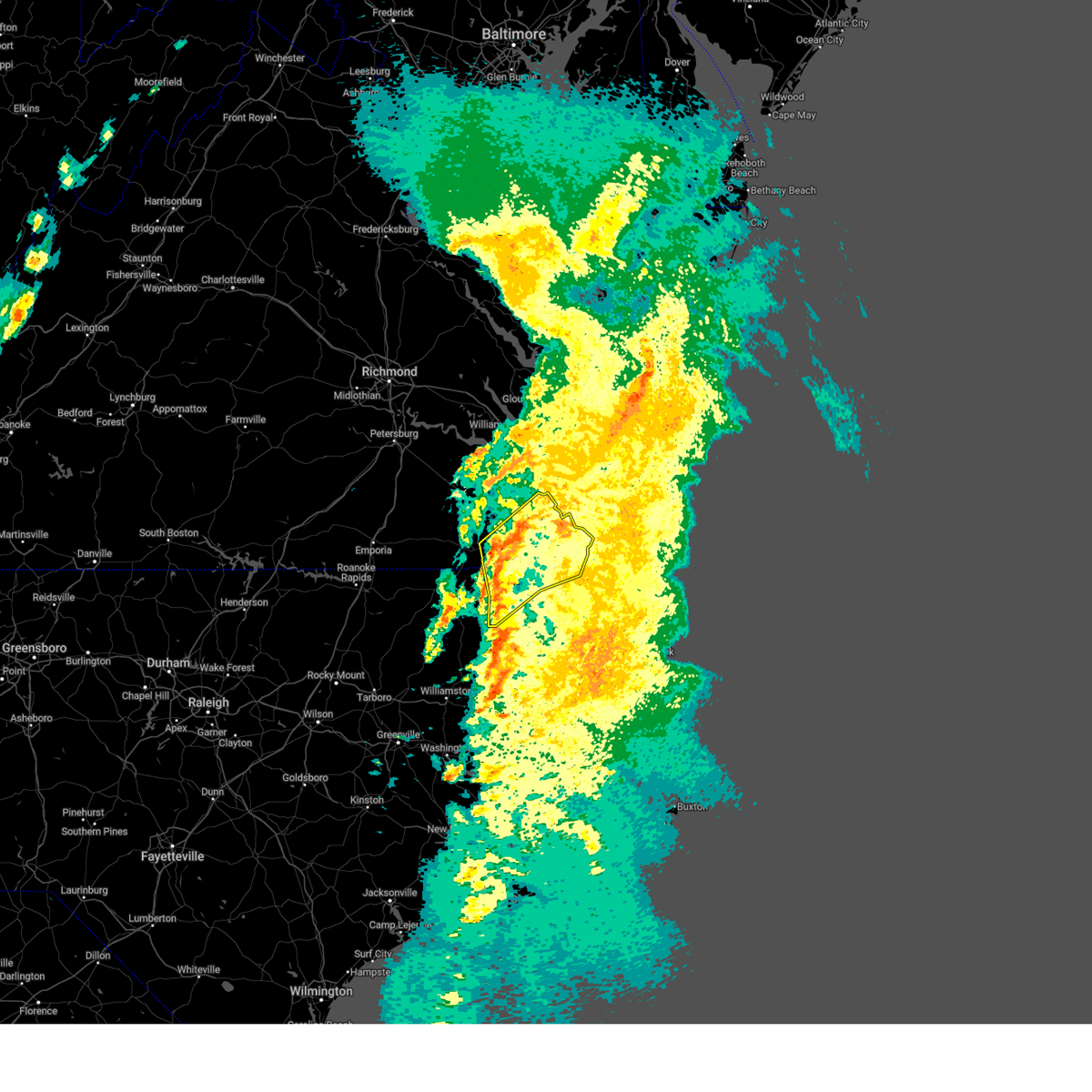 Svrakq the national weather service in wakefield has issued a * severe thunderstorm warning for, northwestern camden county in northeastern north carolina, northwestern pasquotank county in northeastern north carolina, southeastern hertford county in northeastern north carolina, gates county in northeastern north carolina, northwestern currituck county in northeastern north carolina, northwestern chowan county in northeastern north carolina, the city of chesapeake in southeastern virginia, the city of portsmouth in southeastern virginia, the city of suffolk in southeastern virginia, * until 515 pm est. * at 432 pm est, severe thunderstorms were located along a line extending from near holland to near gatesville to near ryland, moving northeast at 55 mph (radar indicated). Hazards include 60 mph wind gusts. Expect damage to trees and powerlines. severe thunderstorms will be near, downtown suffolk, kings fork, corapeake, hobbsville, sunbury, and suffolk around 440 pm est. driver and chesapeake around 445 pm est. bowers hill, churchland, portsmouth, and western branch around 450 pm est. deep creek, norfolk, and cradock around 455 pm est. great bridge and downtown portsmouth around 500 pm est. fentress around 505 pm est. Other locations impacted by these severe thunderstorms include south norfolk, horseshoe, portlock, newsome store, savage, suffolk airport, huntersville, tar corner, buckland, and sharon. Svrakq the national weather service in wakefield has issued a * severe thunderstorm warning for, northwestern camden county in northeastern north carolina, northwestern pasquotank county in northeastern north carolina, southeastern hertford county in northeastern north carolina, gates county in northeastern north carolina, northwestern currituck county in northeastern north carolina, northwestern chowan county in northeastern north carolina, the city of chesapeake in southeastern virginia, the city of portsmouth in southeastern virginia, the city of suffolk in southeastern virginia, * until 515 pm est. * at 432 pm est, severe thunderstorms were located along a line extending from near holland to near gatesville to near ryland, moving northeast at 55 mph (radar indicated). Hazards include 60 mph wind gusts. Expect damage to trees and powerlines. severe thunderstorms will be near, downtown suffolk, kings fork, corapeake, hobbsville, sunbury, and suffolk around 440 pm est. driver and chesapeake around 445 pm est. bowers hill, churchland, portsmouth, and western branch around 450 pm est. deep creek, norfolk, and cradock around 455 pm est. great bridge and downtown portsmouth around 500 pm est. fentress around 505 pm est. Other locations impacted by these severe thunderstorms include south norfolk, horseshoe, portlock, newsome store, savage, suffolk airport, huntersville, tar corner, buckland, and sharon.
|
| 3/5/2025 4:21 PM EST |
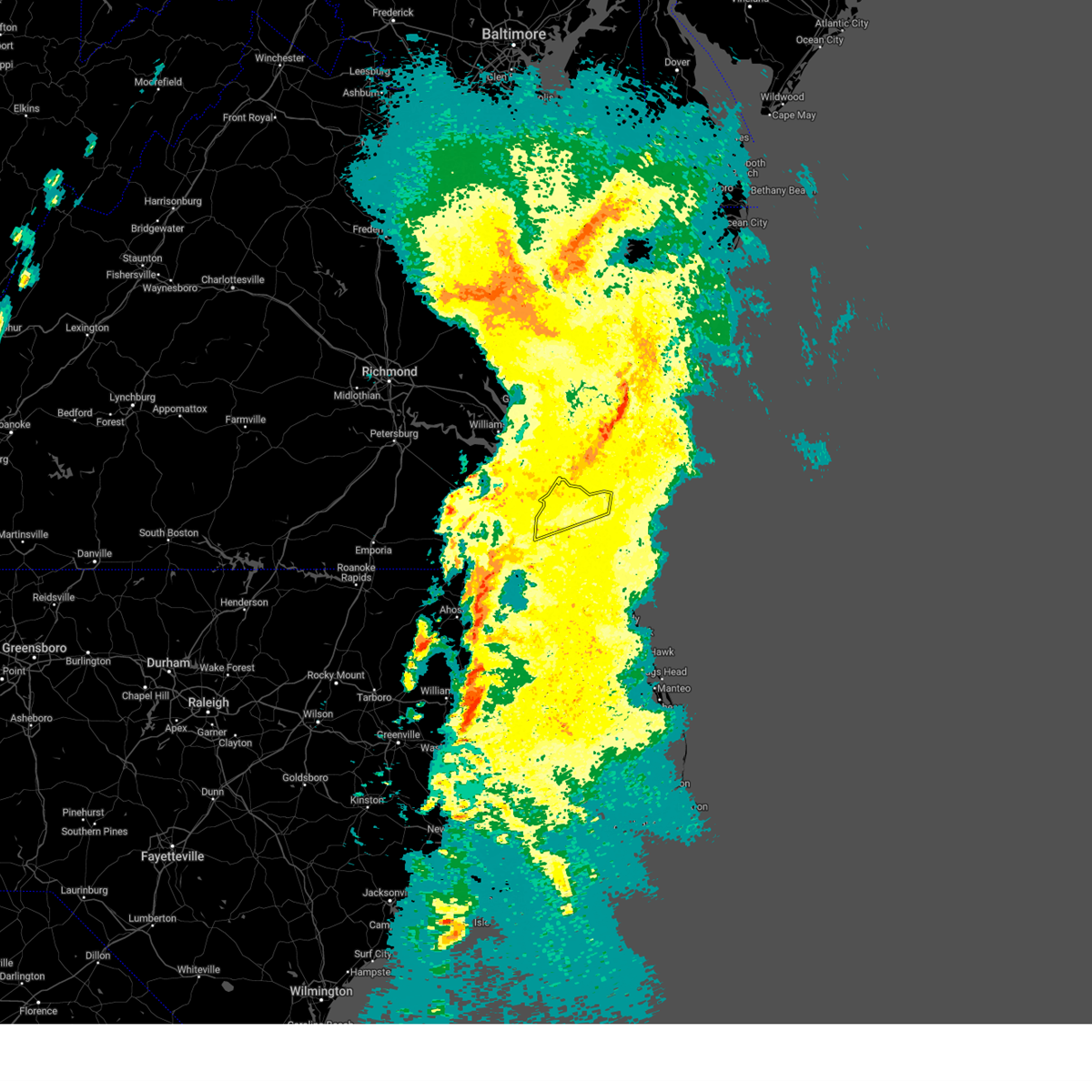 The storms which prompted the warning have weakened below severe limits, and no longer pose an immediate threat to life or property. therefore, the warning will be allowed to expire. however, gusty winds and heavy rain are still possible with these thunderstorms. a tornado watch remains in effect until 800 pm est for southeastern virginia. The storms which prompted the warning have weakened below severe limits, and no longer pose an immediate threat to life or property. therefore, the warning will be allowed to expire. however, gusty winds and heavy rain are still possible with these thunderstorms. a tornado watch remains in effect until 800 pm est for southeastern virginia.
|
| 3/5/2025 4:04 PM EST |
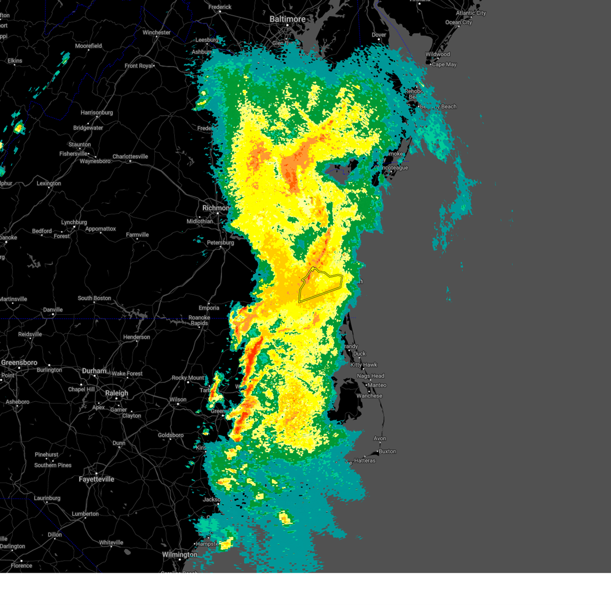 the severe thunderstorm warning has been cancelled and is no longer in effect the severe thunderstorm warning has been cancelled and is no longer in effect
|
| 3/5/2025 4:04 PM EST |
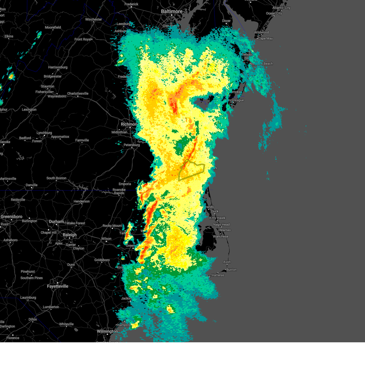 At 403 pm est, severe thunderstorms were located along a line extending from 7 miles northwest of cheriton to 6 miles northeast of grand view to cradock, moving northeast at 50 mph (radar indicated). Hazards include 60 mph wind gusts. Expect damage to trees and powerlines. these severe storms will be near, regent university, virginia beach, downtown norfolk, norview, kempsville, norfolk, norfolk international, virginia wesleyan university, chesapeake, and ocean view around 410 pm est. Other locations impacted by these severe thunderstorms include greenbrier, south norfolk, bayside, oceana, portlock, wards corner, princess anne plaza, north virginia beach, gallups corner, and willoughby spit. At 403 pm est, severe thunderstorms were located along a line extending from 7 miles northwest of cheriton to 6 miles northeast of grand view to cradock, moving northeast at 50 mph (radar indicated). Hazards include 60 mph wind gusts. Expect damage to trees and powerlines. these severe storms will be near, regent university, virginia beach, downtown norfolk, norview, kempsville, norfolk, norfolk international, virginia wesleyan university, chesapeake, and ocean view around 410 pm est. Other locations impacted by these severe thunderstorms include greenbrier, south norfolk, bayside, oceana, portlock, wards corner, princess anne plaza, north virginia beach, gallups corner, and willoughby spit.
|
| 3/5/2025 3:47 PM EST |
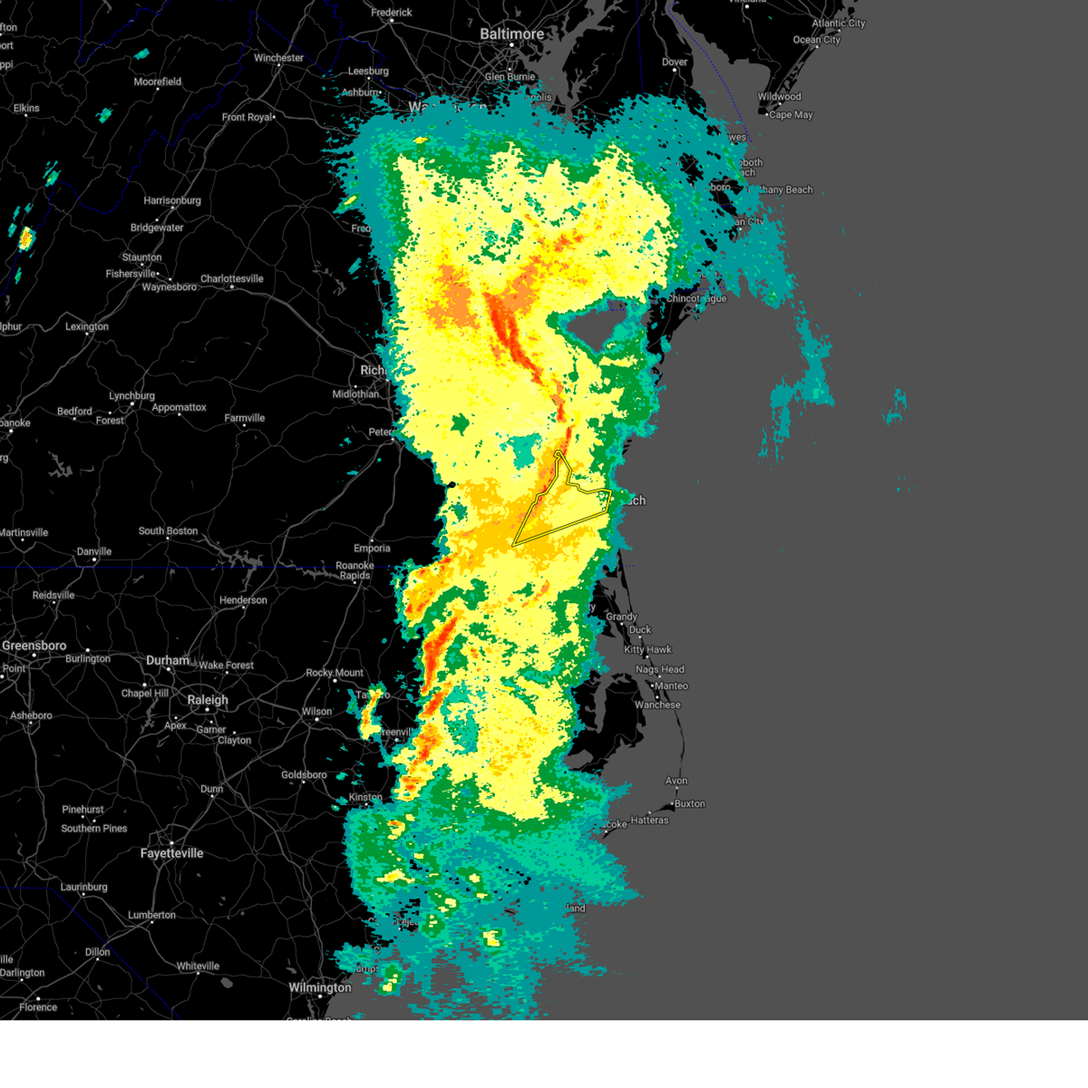 Svrakq the national weather service in wakefield has issued a * severe thunderstorm warning for, the city of norfolk in southeastern virginia, the northwestern city of chesapeake in southeastern virginia, the city of portsmouth in southeastern virginia, the northeastern city of suffolk in southeastern virginia, the northwestern city of virginia beach in southeastern virginia, the city of hampton in southeastern virginia, * until 430 pm est. * at 347 pm est, severe thunderstorms were located along a line extending from near bavon to hampton to near downtown suffolk, moving northeast at 50 mph (radar indicated). Hazards include 70 mph wind gusts. Expect considerable tree damage. damage is likely to mobile homes, roofs, and outbuildings. severe thunderstorms will be near, bowers hill, norfolk nas, grand view, driver, fort monroe, buckroe beach, churchland, norfolk, portsmouth, and old dominion university around 350 pm est. ghent, deep creek, downtown norfolk, cradock, ocean view, and downtown portsmouth around 355 pm est. norview and norfolk state university around 400 pm est. virginia beach, norfolk international, and virginia wesleyan university around 405 pm est. regent university and kempsville around 410 pm est. Other locations impacted by these severe thunderstorms include south norfolk, fox hill, portlock, princess anne plaza, huntersville, magnolia, greenbrier, bayside, oceana, and wards corner. Svrakq the national weather service in wakefield has issued a * severe thunderstorm warning for, the city of norfolk in southeastern virginia, the northwestern city of chesapeake in southeastern virginia, the city of portsmouth in southeastern virginia, the northeastern city of suffolk in southeastern virginia, the northwestern city of virginia beach in southeastern virginia, the city of hampton in southeastern virginia, * until 430 pm est. * at 347 pm est, severe thunderstorms were located along a line extending from near bavon to hampton to near downtown suffolk, moving northeast at 50 mph (radar indicated). Hazards include 70 mph wind gusts. Expect considerable tree damage. damage is likely to mobile homes, roofs, and outbuildings. severe thunderstorms will be near, bowers hill, norfolk nas, grand view, driver, fort monroe, buckroe beach, churchland, norfolk, portsmouth, and old dominion university around 350 pm est. ghent, deep creek, downtown norfolk, cradock, ocean view, and downtown portsmouth around 355 pm est. norview and norfolk state university around 400 pm est. virginia beach, norfolk international, and virginia wesleyan university around 405 pm est. regent university and kempsville around 410 pm est. Other locations impacted by these severe thunderstorms include south norfolk, fox hill, portlock, princess anne plaza, huntersville, magnolia, greenbrier, bayside, oceana, and wards corner.
|
| 3/5/2025 3:39 PM EST |
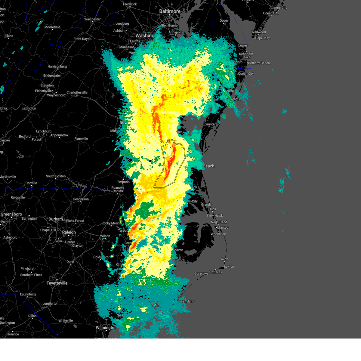 At 338 pm est, severe thunderstorms were located along a line extending from achilles to near tabb to near northampton to near downtown suffolk, moving east at 55 mph (radar indicated). Hazards include 70 mph wind gusts. Expect considerable tree damage. damage is likely to mobile homes, roofs, and outbuildings. these severe storms will be near, hampton university, newport news, langley afb, portsmouth, suffolk, and hampton around 345 pm est. Other locations impacted by these severe thunderstorms include rushmere, carrollton, lackey, chippokes state park, longview, benns church, suffolk airport, oriana, huntersville, and bethel church. At 338 pm est, severe thunderstorms were located along a line extending from achilles to near tabb to near northampton to near downtown suffolk, moving east at 55 mph (radar indicated). Hazards include 70 mph wind gusts. Expect considerable tree damage. damage is likely to mobile homes, roofs, and outbuildings. these severe storms will be near, hampton university, newport news, langley afb, portsmouth, suffolk, and hampton around 345 pm est. Other locations impacted by these severe thunderstorms include rushmere, carrollton, lackey, chippokes state park, longview, benns church, suffolk airport, oriana, huntersville, and bethel church.
|
| 3/5/2025 3:39 PM EST |
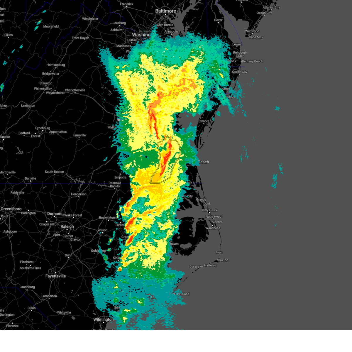 the severe thunderstorm warning has been cancelled and is no longer in effect the severe thunderstorm warning has been cancelled and is no longer in effect
|
| 3/5/2025 3:27 PM EST |
 At 326 pm est, severe thunderstorms were located along a line extending from near lee hall to near rescue to near isle of wight to holland, moving northeast at 60 mph (radar indicated). Hazards include 60 mph wind gusts. Expect damage to trees and powerlines. these severe storms will be near, downtown suffolk, virginia institute for marine sciences, christopher newport university, gloucester point, rescue, tabb, kings fork, newport news, lee hall, and patrick henry field around 330 pm est. northampton, driver, and langley afb around 335 pm est. hampton university and portsmouth around 340 pm est. Other locations impacted by these severe thunderstorms include pons, carrollton, lackey, chippokes state park, longview, oriana, huntersville, chuckatuck, wilroy, and lees mill. At 326 pm est, severe thunderstorms were located along a line extending from near lee hall to near rescue to near isle of wight to holland, moving northeast at 60 mph (radar indicated). Hazards include 60 mph wind gusts. Expect damage to trees and powerlines. these severe storms will be near, downtown suffolk, virginia institute for marine sciences, christopher newport university, gloucester point, rescue, tabb, kings fork, newport news, lee hall, and patrick henry field around 330 pm est. northampton, driver, and langley afb around 335 pm est. hampton university and portsmouth around 340 pm est. Other locations impacted by these severe thunderstorms include pons, carrollton, lackey, chippokes state park, longview, oriana, huntersville, chuckatuck, wilroy, and lees mill.
|
| 3/5/2025 3:27 PM EST |
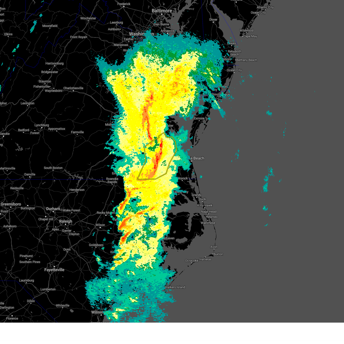 the severe thunderstorm warning has been cancelled and is no longer in effect the severe thunderstorm warning has been cancelled and is no longer in effect
|
| 3/5/2025 3:05 PM EST |
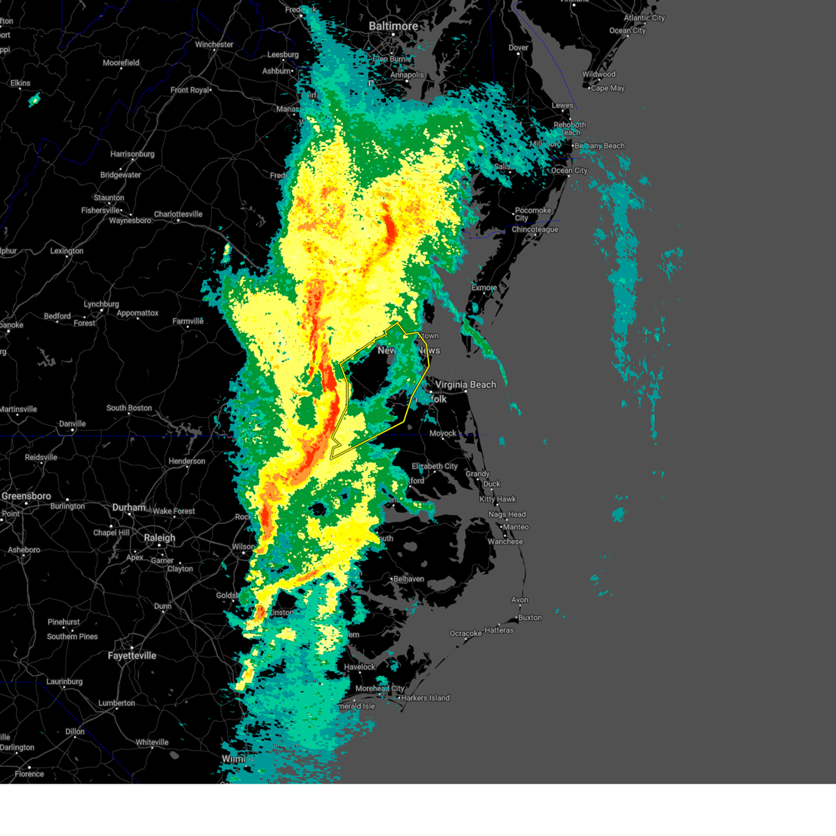 Svrakq the national weather service in wakefield has issued a * severe thunderstorm warning for, northwestern gates county in northeastern north carolina, northwestern hertford county in northeastern north carolina, the city of poquoson in southeastern virginia, isle of wight county in southeastern virginia, eastern southampton county in southeastern virginia, york county in southeastern virginia, the city of hampton in southeastern virginia, the city of newport news in southeastern virginia, east central sussex county in southeastern virginia, southeastern james city county in southeastern virginia, the city of franklin in southeastern virginia, the city of suffolk in southeastern virginia, central surry county in southeastern virginia, * until 400 pm est. * at 304 pm est, severe thunderstorms were located along a line extending from near waverly to near wakefield to near sedley to near como, moving northeast at 50 mph (radar indicated). Hazards include 60 mph wind gusts. Expect damage to trees and powerlines. severe thunderstorms will be near, ivor, franklin, hunterdale, dendron, zuni, carrsville, elberon, and suffolk around 310 pm est. isle of wight, windsor, holland, and surry around 315 pm est. scotland and smithfield around 320 pm est. kings fork and newport news around 325 pm est. grove, williamsburg, fort eustis, rescue, york terrace, lee hall, denbigh, carver gardens, crittenden, and busch gardens around 330 pm est. downtown suffolk, northampton, virginia institute for marine sciences, driver, christopher newport university, gloucester point, tabb, patrick henry field, beaconsdale, and hampton around 335 pm est. langley afb, portsmouth, and seaford around 340 pm est. hampton university around 345 pm est. Other locations impacted by these severe thunderstorms include pons, carrollton, lackey, chippokes state park, longview, topsy, oriana, huntersville, dort, and chuckatuck. Svrakq the national weather service in wakefield has issued a * severe thunderstorm warning for, northwestern gates county in northeastern north carolina, northwestern hertford county in northeastern north carolina, the city of poquoson in southeastern virginia, isle of wight county in southeastern virginia, eastern southampton county in southeastern virginia, york county in southeastern virginia, the city of hampton in southeastern virginia, the city of newport news in southeastern virginia, east central sussex county in southeastern virginia, southeastern james city county in southeastern virginia, the city of franklin in southeastern virginia, the city of suffolk in southeastern virginia, central surry county in southeastern virginia, * until 400 pm est. * at 304 pm est, severe thunderstorms were located along a line extending from near waverly to near wakefield to near sedley to near como, moving northeast at 50 mph (radar indicated). Hazards include 60 mph wind gusts. Expect damage to trees and powerlines. severe thunderstorms will be near, ivor, franklin, hunterdale, dendron, zuni, carrsville, elberon, and suffolk around 310 pm est. isle of wight, windsor, holland, and surry around 315 pm est. scotland and smithfield around 320 pm est. kings fork and newport news around 325 pm est. grove, williamsburg, fort eustis, rescue, york terrace, lee hall, denbigh, carver gardens, crittenden, and busch gardens around 330 pm est. downtown suffolk, northampton, virginia institute for marine sciences, driver, christopher newport university, gloucester point, tabb, patrick henry field, beaconsdale, and hampton around 335 pm est. langley afb, portsmouth, and seaford around 340 pm est. hampton university around 345 pm est. Other locations impacted by these severe thunderstorms include pons, carrollton, lackey, chippokes state park, longview, topsy, oriana, huntersville, dort, and chuckatuck.
|
| 2/16/2025 11:27 AM EST |
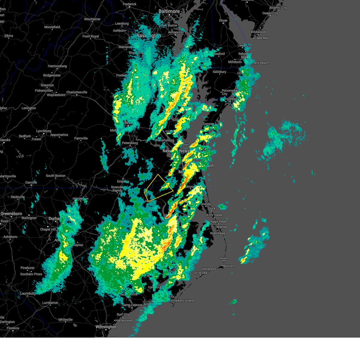 The storm which prompted the warning has weakened below severe limits, and has exited the warned area. therefore, the warning will be allowed to expire. a severe thunderstorm watch remains in effect until 300 pm est for northeastern north carolina, and southeastern virginia. The storm which prompted the warning has weakened below severe limits, and has exited the warned area. therefore, the warning will be allowed to expire. a severe thunderstorm watch remains in effect until 300 pm est for northeastern north carolina, and southeastern virginia.
|
| 2/16/2025 11:11 AM EST |
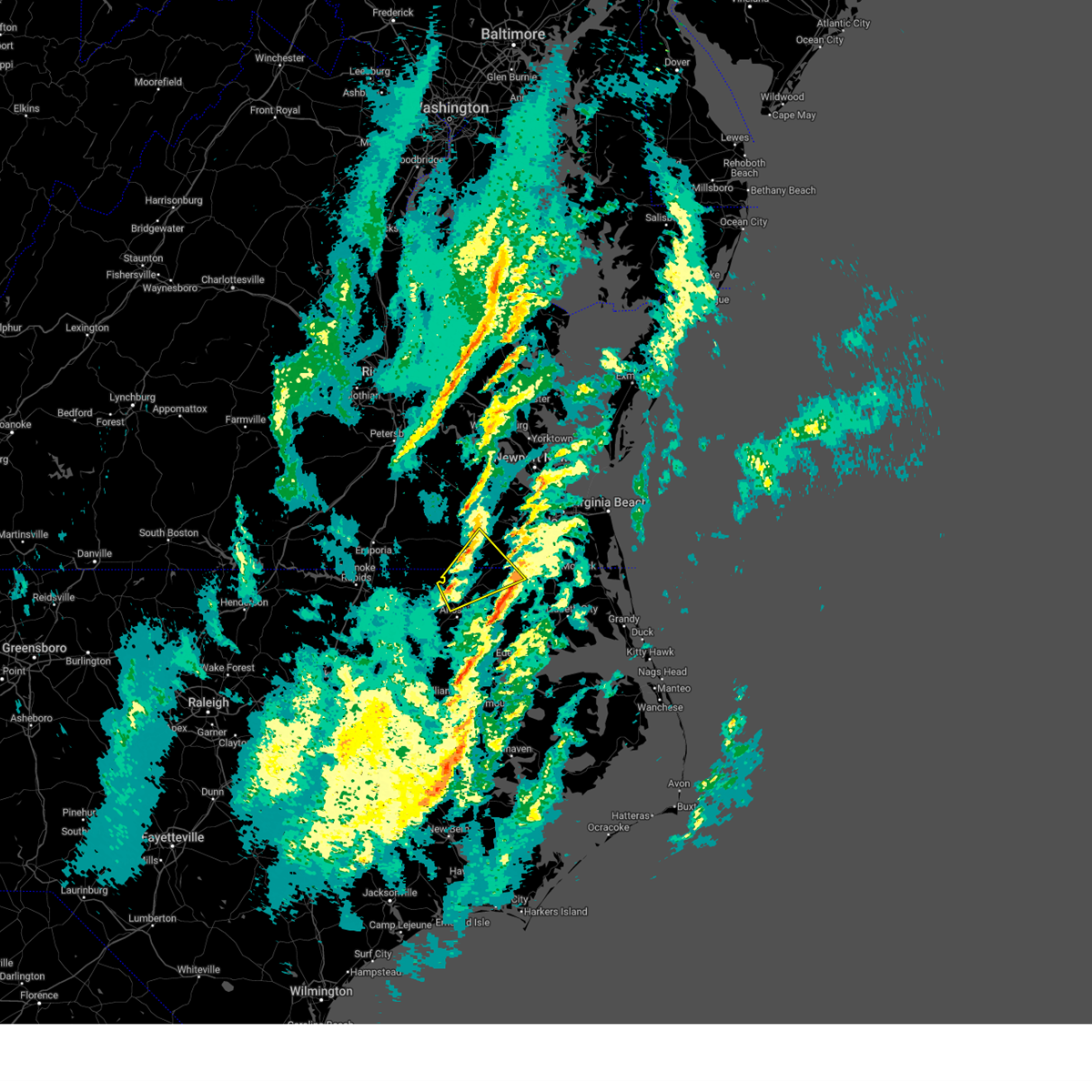 At 1111 am est, a severe thunderstorm was located near winton, or near murfreesboro, moving northeast at 60 mph (radar indicated). Hazards include 60 mph wind gusts. Expect damage to trees and powerlines. this severe storm will be near, como and winton around 1115 am est. roduco, gates, and suffolk around 1120 am est. whaleyville around 1130 am est. Other locations impacted by this severe thunderstorm include tunis, eure, easons crossroads, savage, chowan beach, topsy, mapleton, drum hill, hazelton, and buckland. At 1111 am est, a severe thunderstorm was located near winton, or near murfreesboro, moving northeast at 60 mph (radar indicated). Hazards include 60 mph wind gusts. Expect damage to trees and powerlines. this severe storm will be near, como and winton around 1115 am est. roduco, gates, and suffolk around 1120 am est. whaleyville around 1130 am est. Other locations impacted by this severe thunderstorm include tunis, eure, easons crossroads, savage, chowan beach, topsy, mapleton, drum hill, hazelton, and buckland.
|
| 2/16/2025 11:11 AM EST |
 the severe thunderstorm warning has been cancelled and is no longer in effect the severe thunderstorm warning has been cancelled and is no longer in effect
|
| 2/16/2025 11:10 AM EST | Minor structural damage and tree limbs downed along holland rd... us-5 in city of suffolk county VA, 4.4 miles NE of Suffolk, VA |
| 2/16/2025 10:59 AM EST |
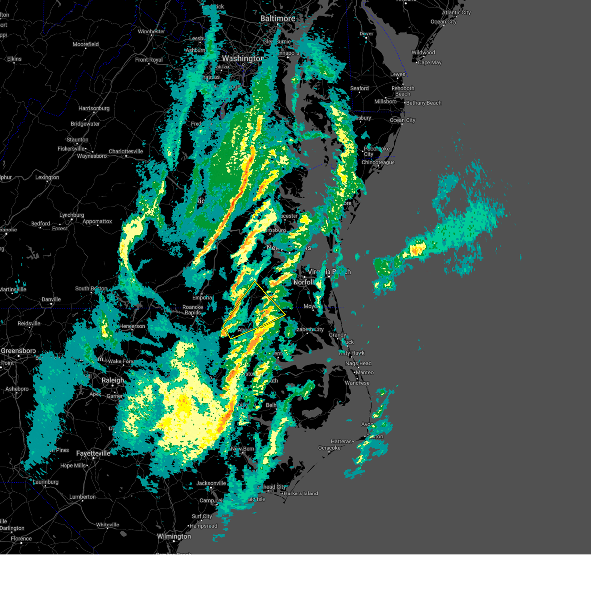 At 1059 am est, a severe thunderstorm was located over woodland, or 7 miles southwest of chowan university, moving northeast at 60 mph (radar indicated). Hazards include 60 mph wind gusts. Expect damage to trees and powerlines. this severe storm will be near, chowan university and murfreesboro around 1105 am est. como and winton around 1110 am est. roduco, gates, and suffolk around 1120 am est. whaleyville around 1130 am est. Other locations impacted by this severe thunderstorm include milwaukee, tunis, menola, savage, chowan beach, topsy, mapleton, buckland, dort, and union. At 1059 am est, a severe thunderstorm was located over woodland, or 7 miles southwest of chowan university, moving northeast at 60 mph (radar indicated). Hazards include 60 mph wind gusts. Expect damage to trees and powerlines. this severe storm will be near, chowan university and murfreesboro around 1105 am est. como and winton around 1110 am est. roduco, gates, and suffolk around 1120 am est. whaleyville around 1130 am est. Other locations impacted by this severe thunderstorm include milwaukee, tunis, menola, savage, chowan beach, topsy, mapleton, buckland, dort, and union.
|
| 2/16/2025 10:47 AM EST |
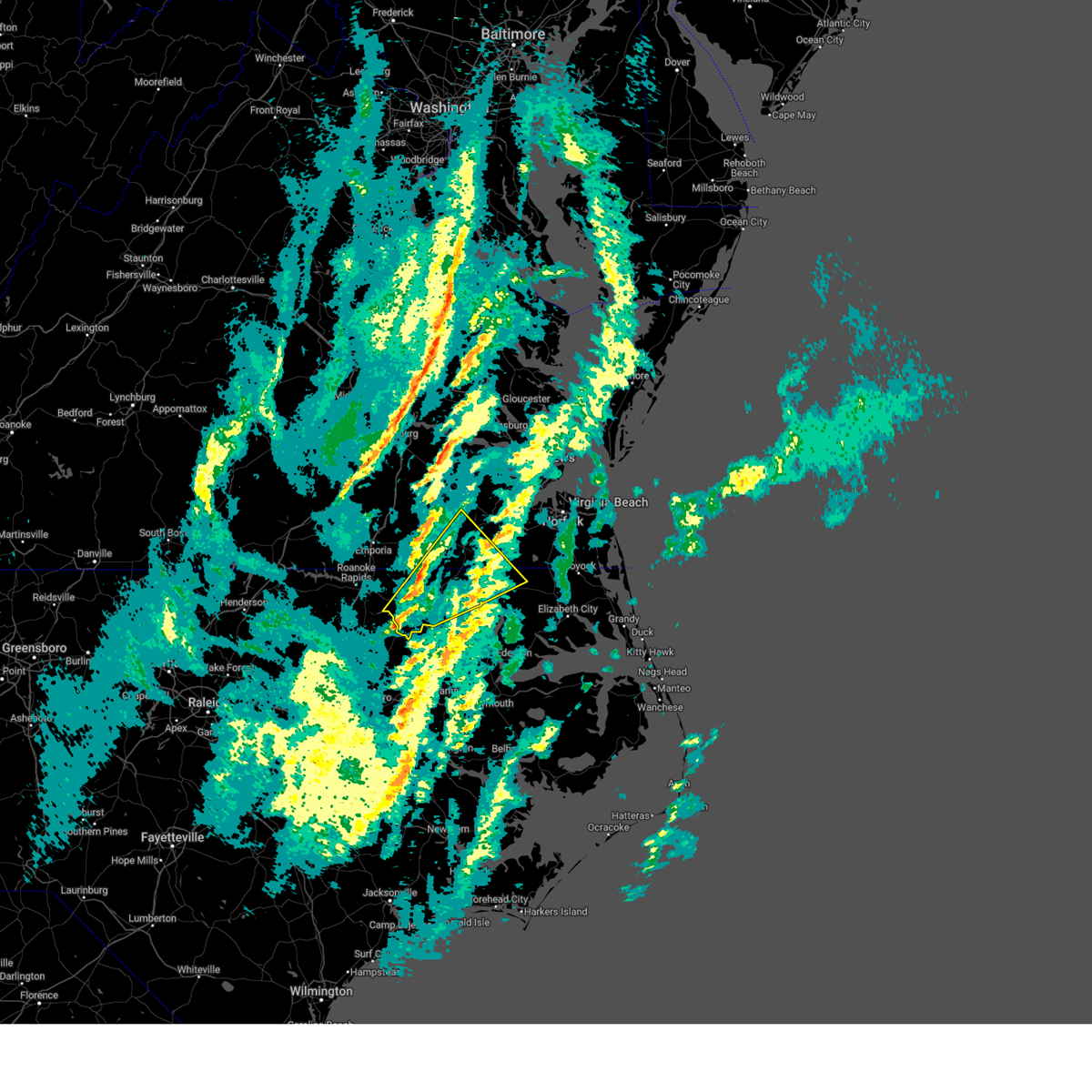 Svrakq the national weather service in wakefield has issued a * severe thunderstorm warning for, eastern northampton county in northeastern north carolina, hertford county in northeastern north carolina, gates county in northeastern north carolina, the city of franklin in southeastern virginia, southwestern isle of wight county in southeastern virginia, southeastern southampton county in southeastern virginia, the southwestern city of suffolk in southeastern virginia, * until 1130 am est. * at 1047 am est, a severe thunderstorm was located near rich square, moving northeast at 60 mph (radar indicated). Hazards include 60 mph wind gusts. Expect damage to trees and powerlines. this severe thunderstorm will be near, woodland and rich square around 1050 am est. chowan university and murfreesboro around 1105 am est. como and winton around 1110 am est. roduco, gates, and suffolk around 1120 am est. Other locations impacted by this severe thunderstorm include eagletown, milwaukee, tunis, menola, savage, chowan beach, topsy, mapleton, buckland, and dort. Svrakq the national weather service in wakefield has issued a * severe thunderstorm warning for, eastern northampton county in northeastern north carolina, hertford county in northeastern north carolina, gates county in northeastern north carolina, the city of franklin in southeastern virginia, southwestern isle of wight county in southeastern virginia, southeastern southampton county in southeastern virginia, the southwestern city of suffolk in southeastern virginia, * until 1130 am est. * at 1047 am est, a severe thunderstorm was located near rich square, moving northeast at 60 mph (radar indicated). Hazards include 60 mph wind gusts. Expect damage to trees and powerlines. this severe thunderstorm will be near, woodland and rich square around 1050 am est. chowan university and murfreesboro around 1105 am est. como and winton around 1110 am est. roduco, gates, and suffolk around 1120 am est. Other locations impacted by this severe thunderstorm include eagletown, milwaukee, tunis, menola, savage, chowan beach, topsy, mapleton, buckland, and dort.
|
| 12/11/2024 4:43 PM EST |
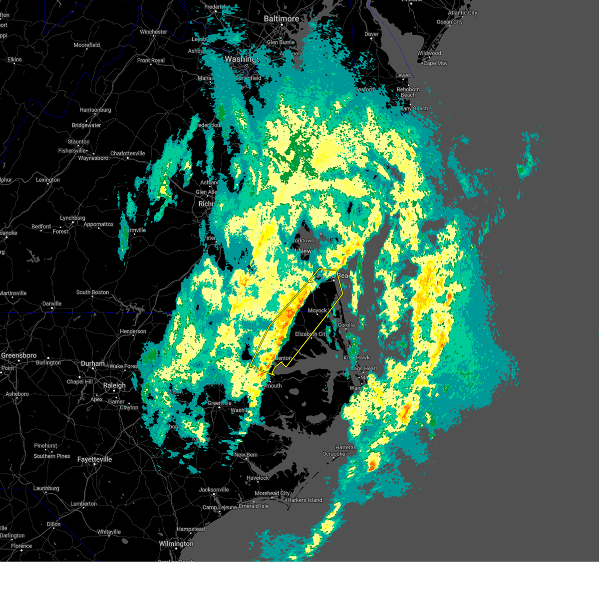 The storms which prompted the warning have weakened below severe limits, and no longer pose an immediate threat to life or property. therefore, the warning will be allowed to expire. The storms which prompted the warning have weakened below severe limits, and no longer pose an immediate threat to life or property. therefore, the warning will be allowed to expire.
|
| 12/11/2024 4:24 PM EST |
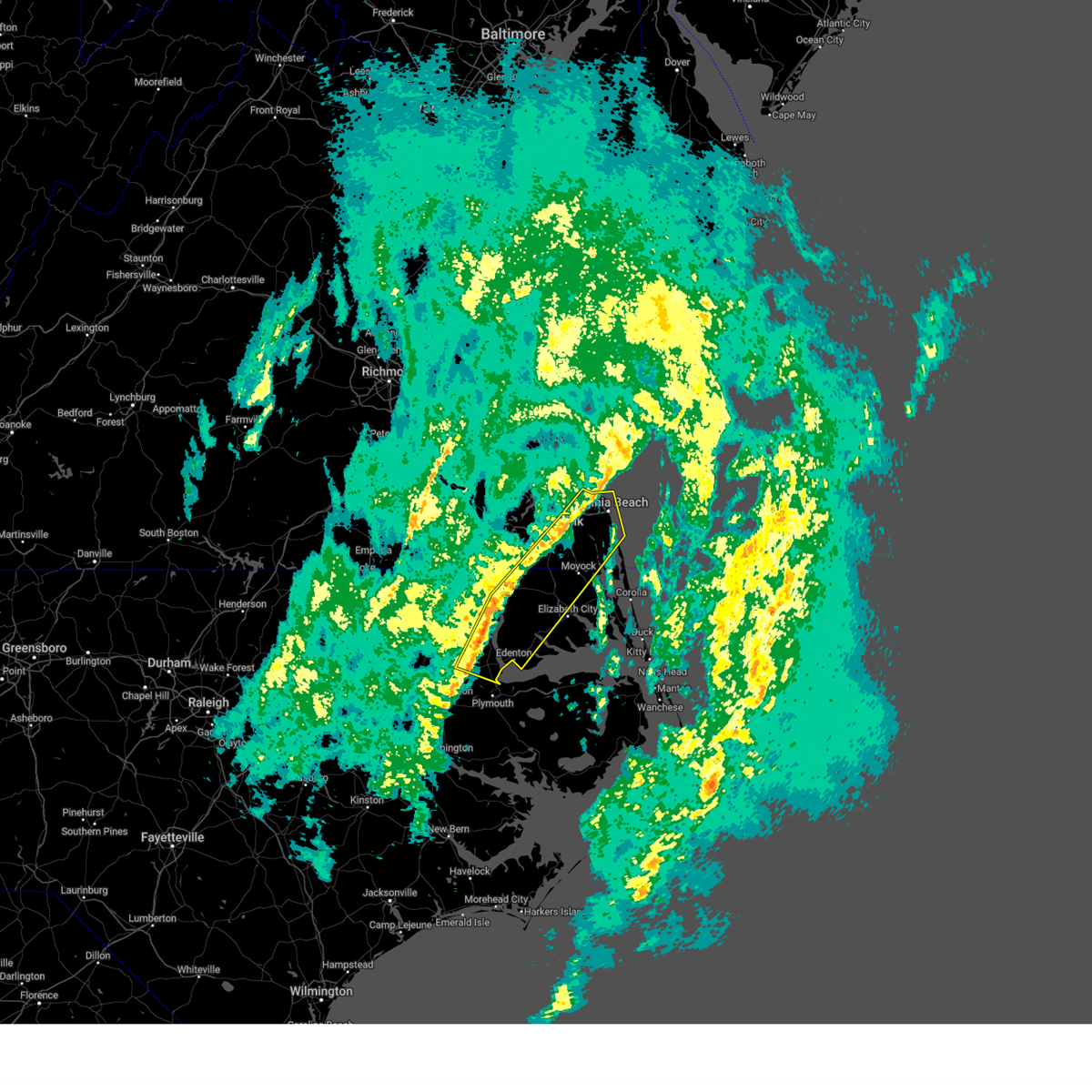 At 422 pm est, severe thunderstorms were located along a line extending from 14 miles south of cape charles to near chesapeake to 6 miles southeast of powellsville, moving east at 20 mph (radar indicated). Hazards include 60 mph wind gusts. Expect damage to trees and powerlines. these severe storms will be near, great bridge, virginia beach, rockyhock, tyner, kempsville, fentress, colerain, chesapeake, ryland, and hobbsville around 430 pm est. belvidere and princess anne around 440 pm est. morgans corner, valhalla, northwest, and south mills around 445 pm est. back bay, hertford, and winfall around 500 pm est. moyock and chapanoke around 510 pm est. Other locations impacted by these severe thunderstorms include goose pond, south norfolk, whites crossroads, rudee heights, portlock, pierceville, newsome store, savage, arrowhead beach, and parkville. At 422 pm est, severe thunderstorms were located along a line extending from 14 miles south of cape charles to near chesapeake to 6 miles southeast of powellsville, moving east at 20 mph (radar indicated). Hazards include 60 mph wind gusts. Expect damage to trees and powerlines. these severe storms will be near, great bridge, virginia beach, rockyhock, tyner, kempsville, fentress, colerain, chesapeake, ryland, and hobbsville around 430 pm est. belvidere and princess anne around 440 pm est. morgans corner, valhalla, northwest, and south mills around 445 pm est. back bay, hertford, and winfall around 500 pm est. moyock and chapanoke around 510 pm est. Other locations impacted by these severe thunderstorms include goose pond, south norfolk, whites crossroads, rudee heights, portlock, pierceville, newsome store, savage, arrowhead beach, and parkville.
|
| 12/11/2024 4:06 PM EST |
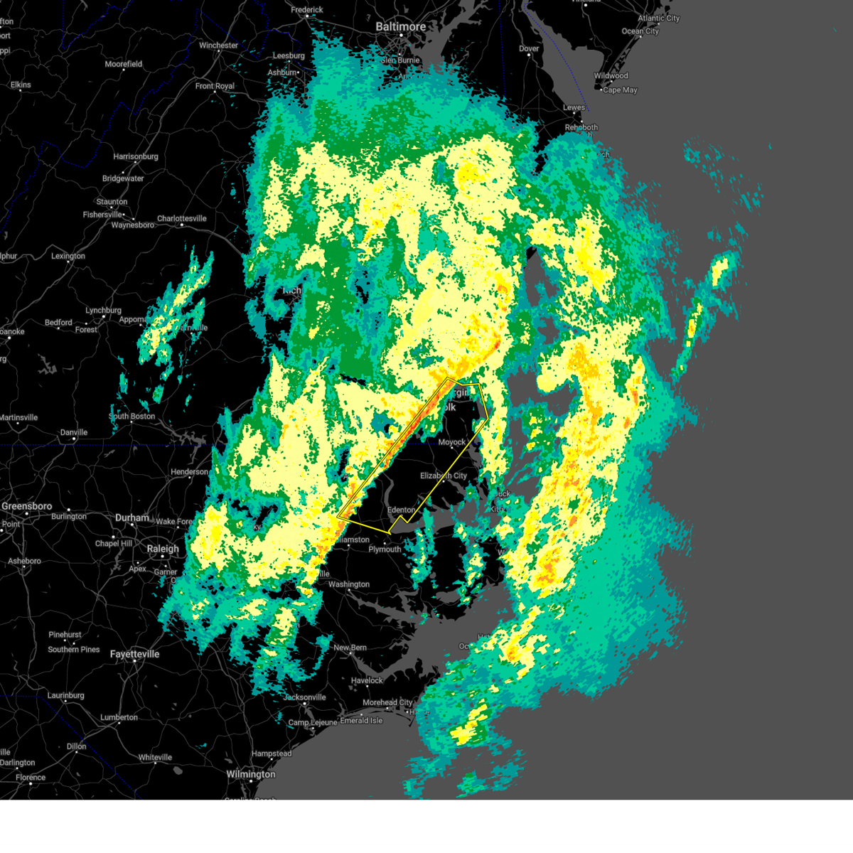 At 406 pm est, severe thunderstorms were located along a line extending from 13 miles east of grand view to near deep creek to near powellsville, moving east at 20 mph (radar indicated). Hazards include 60 mph wind gusts. Expect damage to trees and powerlines. these severe storms will be near, regent university, great bridge, harrellsville, virginia beach, deep creek, kempsville, norfolk, colerain, virginia wesleyan university, and chesapeake around 410 pm est. hobbsville around 415 pm est. ryland around 420 pm est. tyner and fentress around 425 pm est. rockyhock around 430 pm est. princess anne around 435 pm est. valhalla and belvidere around 440 pm est. morgans corner, northwest, and south mills around 445 pm est. Other locations impacted by these severe thunderstorms include goose pond, south norfolk, whites crossroads, rudee heights, portlock, pierceville, newsome store, savage, arrowhead beach, and parkville. At 406 pm est, severe thunderstorms were located along a line extending from 13 miles east of grand view to near deep creek to near powellsville, moving east at 20 mph (radar indicated). Hazards include 60 mph wind gusts. Expect damage to trees and powerlines. these severe storms will be near, regent university, great bridge, harrellsville, virginia beach, deep creek, kempsville, norfolk, colerain, virginia wesleyan university, and chesapeake around 410 pm est. hobbsville around 415 pm est. ryland around 420 pm est. tyner and fentress around 425 pm est. rockyhock around 430 pm est. princess anne around 435 pm est. valhalla and belvidere around 440 pm est. morgans corner, northwest, and south mills around 445 pm est. Other locations impacted by these severe thunderstorms include goose pond, south norfolk, whites crossroads, rudee heights, portlock, pierceville, newsome store, savage, arrowhead beach, and parkville.
|
| 12/11/2024 3:45 PM EST |
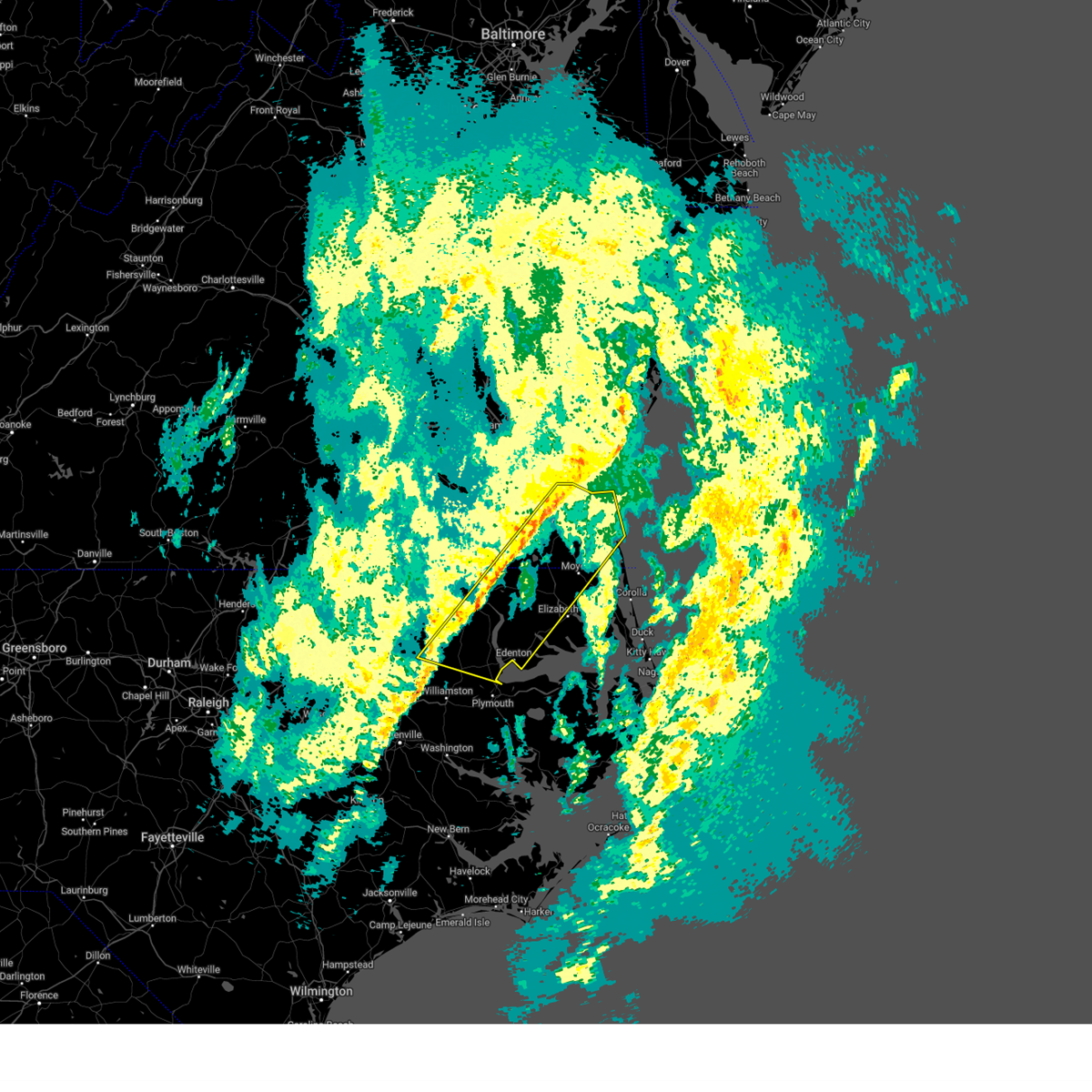 Svrakq the national weather service in wakefield has issued a * severe thunderstorm warning for, northern bertie county in northeastern north carolina, gates county in northeastern north carolina, northwestern currituck county in northeastern north carolina, chowan county in northeastern north carolina, northwestern camden county in northeastern north carolina, northwestern pasquotank county in northeastern north carolina, perquimans county in northeastern north carolina, southeastern hertford county in northeastern north carolina, the city of norfolk in southeastern virginia, the city of chesapeake in southeastern virginia, the city of portsmouth in southeastern virginia, the southeastern city of suffolk in southeastern virginia, the city of virginia beach in southeastern virginia, * until 445 pm est. * at 344 pm est, severe winds along a line of showers with a few embedded thunderstorms were located along a line extending from 7 miles east of grand view to near downtown suffolk to 6 miles southeast of aulander, moving east at 20 mph (radar indicated). Hazards include 60 mph wind gusts. Expect damage to trees and powerlines. severe winds with showers and a few embedded thunderstorms will be near, harrellsville, ghent, virginia beach, deep creek, downtown norfolk, norview, norfolk, corapeake, powellsville, and portsmouth around 350 pm est. sunbury around 355 pm est. regent university around 400 pm est. kempsville around 405 pm est. great bridge, colerain, and hobbsville around 410 pm est. ryland around 420 pm est. rockyhock, tyner, and fentress around 425 pm est. Other locations impacted by these severe thunderstorms include goose pond, south norfolk, whites crossroads, tunis, rudee heights, portlock, earleys, pierceville, newsome store, and savage. Svrakq the national weather service in wakefield has issued a * severe thunderstorm warning for, northern bertie county in northeastern north carolina, gates county in northeastern north carolina, northwestern currituck county in northeastern north carolina, chowan county in northeastern north carolina, northwestern camden county in northeastern north carolina, northwestern pasquotank county in northeastern north carolina, perquimans county in northeastern north carolina, southeastern hertford county in northeastern north carolina, the city of norfolk in southeastern virginia, the city of chesapeake in southeastern virginia, the city of portsmouth in southeastern virginia, the southeastern city of suffolk in southeastern virginia, the city of virginia beach in southeastern virginia, * until 445 pm est. * at 344 pm est, severe winds along a line of showers with a few embedded thunderstorms were located along a line extending from 7 miles east of grand view to near downtown suffolk to 6 miles southeast of aulander, moving east at 20 mph (radar indicated). Hazards include 60 mph wind gusts. Expect damage to trees and powerlines. severe winds with showers and a few embedded thunderstorms will be near, harrellsville, ghent, virginia beach, deep creek, downtown norfolk, norview, norfolk, corapeake, powellsville, and portsmouth around 350 pm est. sunbury around 355 pm est. regent university around 400 pm est. kempsville around 405 pm est. great bridge, colerain, and hobbsville around 410 pm est. ryland around 420 pm est. rockyhock, tyner, and fentress around 425 pm est. Other locations impacted by these severe thunderstorms include goose pond, south norfolk, whites crossroads, tunis, rudee heights, portlock, earleys, pierceville, newsome store, and savage.
|
| 9/27/2024 5:56 PM EDT |
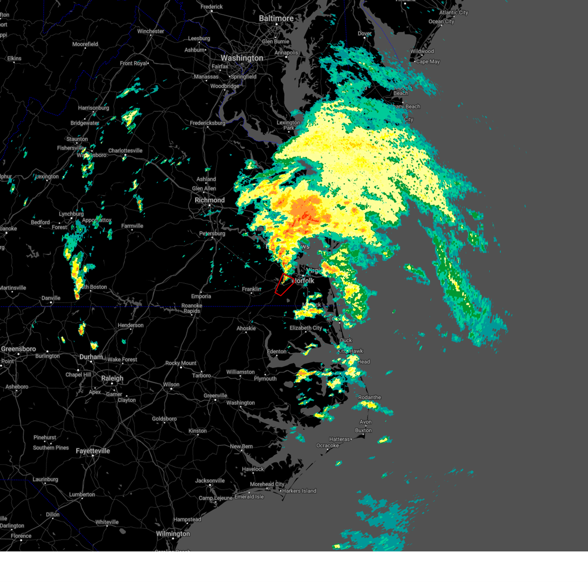 The tornadic thunderstorm which prompted the warning has weakened. therefore, the warning will be allowed to expire. a tornado watch remains in effect until 800 pm edt for southeastern virginia. The tornadic thunderstorm which prompted the warning has weakened. therefore, the warning will be allowed to expire. a tornado watch remains in effect until 800 pm edt for southeastern virginia.
|
| 9/27/2024 5:55 PM EDT |
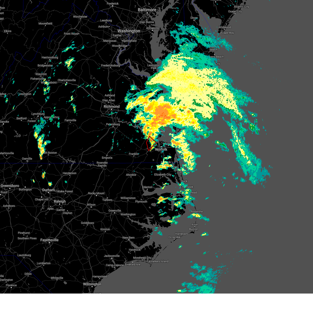 The storms which prompted the warning have weakened below severe limits, and no longer appear capable of producing a tornado. therefore, the warning will be allowed to expire. however, heavy rain is still possible with these thunderstorms. a tornado watch remains in effect until 800 pm edt for southeastern virginia. The storms which prompted the warning have weakened below severe limits, and no longer appear capable of producing a tornado. therefore, the warning will be allowed to expire. however, heavy rain is still possible with these thunderstorms. a tornado watch remains in effect until 800 pm edt for southeastern virginia.
|
| 9/27/2024 5:46 PM EDT |
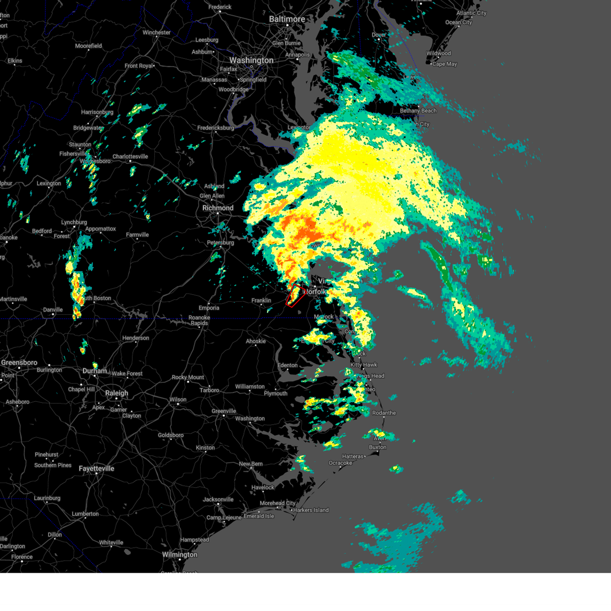 At 546 pm edt, a severe thunderstorm capable of producing a tornado was located near driver, or near downtown suffolk, moving north at 30 mph (radar indicated rotation). Hazards include tornado. Flying debris will be dangerous to those caught without shelter. mobile homes will be damaged or destroyed. damage to roofs, windows, and vehicles will occur. tree damage is likely. this dangerous storm will be near, chesapeake, suffolk, and driver around 550 pm edt. Other locations impacted by this tornadic thunderstorm include suffolk airport, deanes, wilroy, and magnolia. At 546 pm edt, a severe thunderstorm capable of producing a tornado was located near driver, or near downtown suffolk, moving north at 30 mph (radar indicated rotation). Hazards include tornado. Flying debris will be dangerous to those caught without shelter. mobile homes will be damaged or destroyed. damage to roofs, windows, and vehicles will occur. tree damage is likely. this dangerous storm will be near, chesapeake, suffolk, and driver around 550 pm edt. Other locations impacted by this tornadic thunderstorm include suffolk airport, deanes, wilroy, and magnolia.
|
| 9/27/2024 5:40 PM EDT |
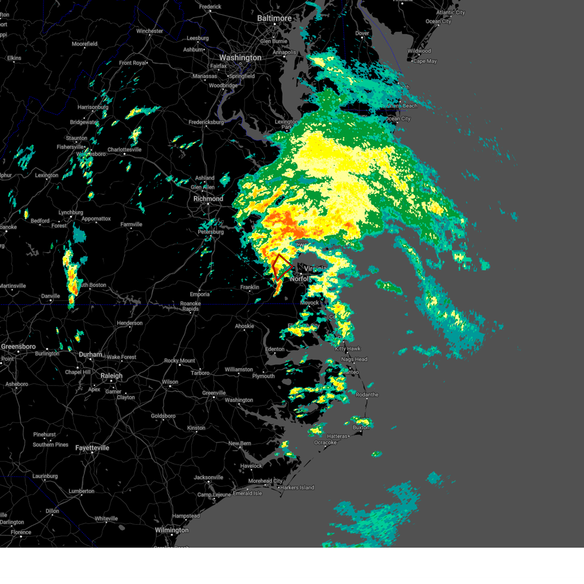 At 540 pm edt, severe thunderstorms capable of producing tornadoes were located along a line extending from near smithfield to near driver, moving northeast at 30 mph (radar indicated rotation). Hazards include tornado. Flying debris will be dangerous to those caught without shelter. mobile homes will be damaged or destroyed. damage to roofs, windows, and vehicles will occur. tree damage is likely. these dangerous storms will be near, smithfield, suffolk, rescue, and crittenden around 545 pm edt. Other locations impacted by these tornadic storms include wills corner, hobson, carrollton, longview, benns church, and chuckatuck. At 540 pm edt, severe thunderstorms capable of producing tornadoes were located along a line extending from near smithfield to near driver, moving northeast at 30 mph (radar indicated rotation). Hazards include tornado. Flying debris will be dangerous to those caught without shelter. mobile homes will be damaged or destroyed. damage to roofs, windows, and vehicles will occur. tree damage is likely. these dangerous storms will be near, smithfield, suffolk, rescue, and crittenden around 545 pm edt. Other locations impacted by these tornadic storms include wills corner, hobson, carrollton, longview, benns church, and chuckatuck.
|
| 9/27/2024 5:32 PM EDT |
 Torakq the national weather service in wakefield has issued a * tornado warning for, east central isle of wight county in southeastern virginia, the northeastern city of suffolk in southeastern virginia, * until 600 pm edt. * at 531 pm edt, a severe thunderstorm capable of producing a tornado was located over kings fork, or near downtown suffolk, moving northeast at 25 mph. a second area capable of producing a tornado was located near the isle of wight and city of suffolk line, about 10 miles to the northwest (radar indicated rotation). Hazards include tornado. Flying debris will be dangerous to those caught without shelter. mobile homes will be damaged or destroyed. damage to roofs, windows, and vehicles will occur. tree damage is likely. this dangerous storm will be near, suffolk around 535 pm edt. crittenden around 550 pm edt. Other locations impacted by this tornadic thunderstorm include hobson, carrollton, longview, benns church, wills corner, chuckatuck, and kilby. Torakq the national weather service in wakefield has issued a * tornado warning for, east central isle of wight county in southeastern virginia, the northeastern city of suffolk in southeastern virginia, * until 600 pm edt. * at 531 pm edt, a severe thunderstorm capable of producing a tornado was located over kings fork, or near downtown suffolk, moving northeast at 25 mph. a second area capable of producing a tornado was located near the isle of wight and city of suffolk line, about 10 miles to the northwest (radar indicated rotation). Hazards include tornado. Flying debris will be dangerous to those caught without shelter. mobile homes will be damaged or destroyed. damage to roofs, windows, and vehicles will occur. tree damage is likely. this dangerous storm will be near, suffolk around 535 pm edt. crittenden around 550 pm edt. Other locations impacted by this tornadic thunderstorm include hobson, carrollton, longview, benns church, wills corner, chuckatuck, and kilby.
|
| 9/27/2024 5:29 PM EDT |
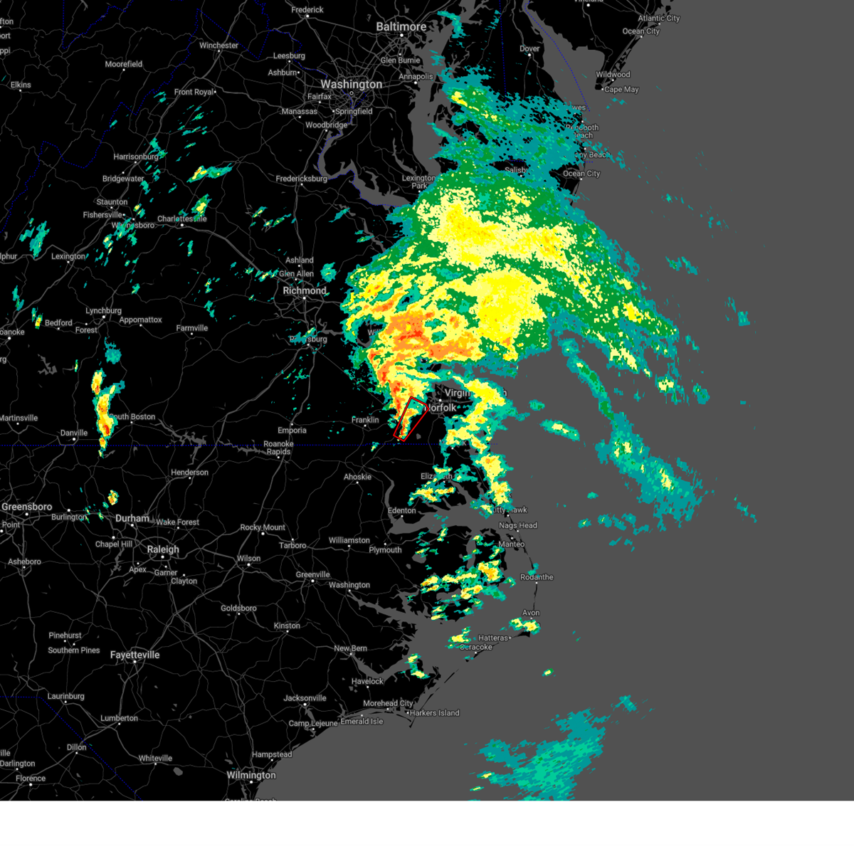 Torakq the national weather service in wakefield has issued a * tornado warning for, the northwestern city of chesapeake in southeastern virginia, the eastern city of suffolk in southeastern virginia, * until 600 pm edt. * at 529 pm edt, a severe thunderstorm capable of producing a tornado was located near suffolk, or near downtown suffolk, moving northeast at 25 mph (radar indicated rotation). Hazards include tornado. Flying debris will be dangerous to those caught without shelter. mobile homes will be damaged or destroyed. damage to roofs, windows, and vehicles will occur. tree damage is likely. this dangerous storm will be near, downtown suffolk and suffolk around 535 pm edt. chesapeake around 540 pm edt. driver around 545 pm edt. bowers hill around 550 pm edt. Other locations impacted by this tornadic thunderstorm include suffolk airport, deanes, wilroy, saunders, magnolia, and nurney. Torakq the national weather service in wakefield has issued a * tornado warning for, the northwestern city of chesapeake in southeastern virginia, the eastern city of suffolk in southeastern virginia, * until 600 pm edt. * at 529 pm edt, a severe thunderstorm capable of producing a tornado was located near suffolk, or near downtown suffolk, moving northeast at 25 mph (radar indicated rotation). Hazards include tornado. Flying debris will be dangerous to those caught without shelter. mobile homes will be damaged or destroyed. damage to roofs, windows, and vehicles will occur. tree damage is likely. this dangerous storm will be near, downtown suffolk and suffolk around 535 pm edt. chesapeake around 540 pm edt. driver around 545 pm edt. bowers hill around 550 pm edt. Other locations impacted by this tornadic thunderstorm include suffolk airport, deanes, wilroy, saunders, magnolia, and nurney.
|
| 9/27/2024 5:17 PM EDT |
 At 516 pm edt, a severe thunderstorm capable of producing a tornado was located over whaleyville, or 8 miles south of downtown suffolk, moving northeast at 35 mph (radar indicated rotation). Hazards include tornado. Flying debris will be dangerous to those caught without shelter. mobile homes will be damaged or destroyed. damage to roofs, windows, and vehicles will occur. tree damage is likely. this dangerous storm will be near, suffolk around 520 pm edt. Other locations impacted by this tornadic thunderstorm include suffolk airport, saunders, lummis, and nurney. At 516 pm edt, a severe thunderstorm capable of producing a tornado was located over whaleyville, or 8 miles south of downtown suffolk, moving northeast at 35 mph (radar indicated rotation). Hazards include tornado. Flying debris will be dangerous to those caught without shelter. mobile homes will be damaged or destroyed. damage to roofs, windows, and vehicles will occur. tree damage is likely. this dangerous storm will be near, suffolk around 520 pm edt. Other locations impacted by this tornadic thunderstorm include suffolk airport, saunders, lummis, and nurney.
|
| 9/27/2024 5:17 PM EDT |
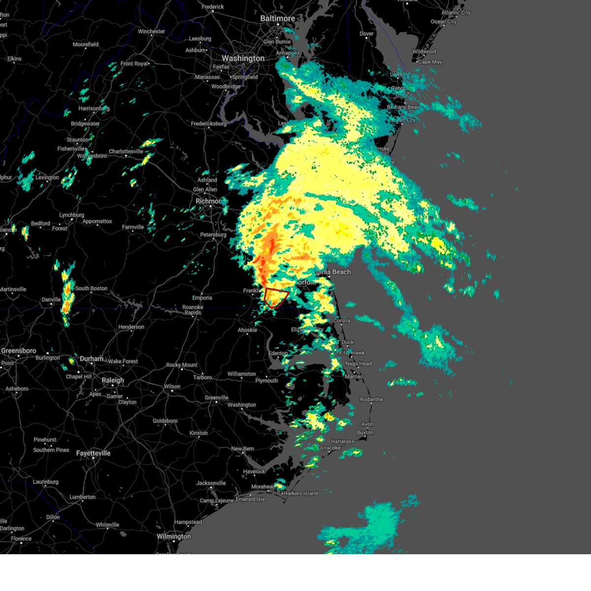 the tornado warning has been cancelled and is no longer in effect the tornado warning has been cancelled and is no longer in effect
|
| 9/27/2024 5:00 PM EDT |
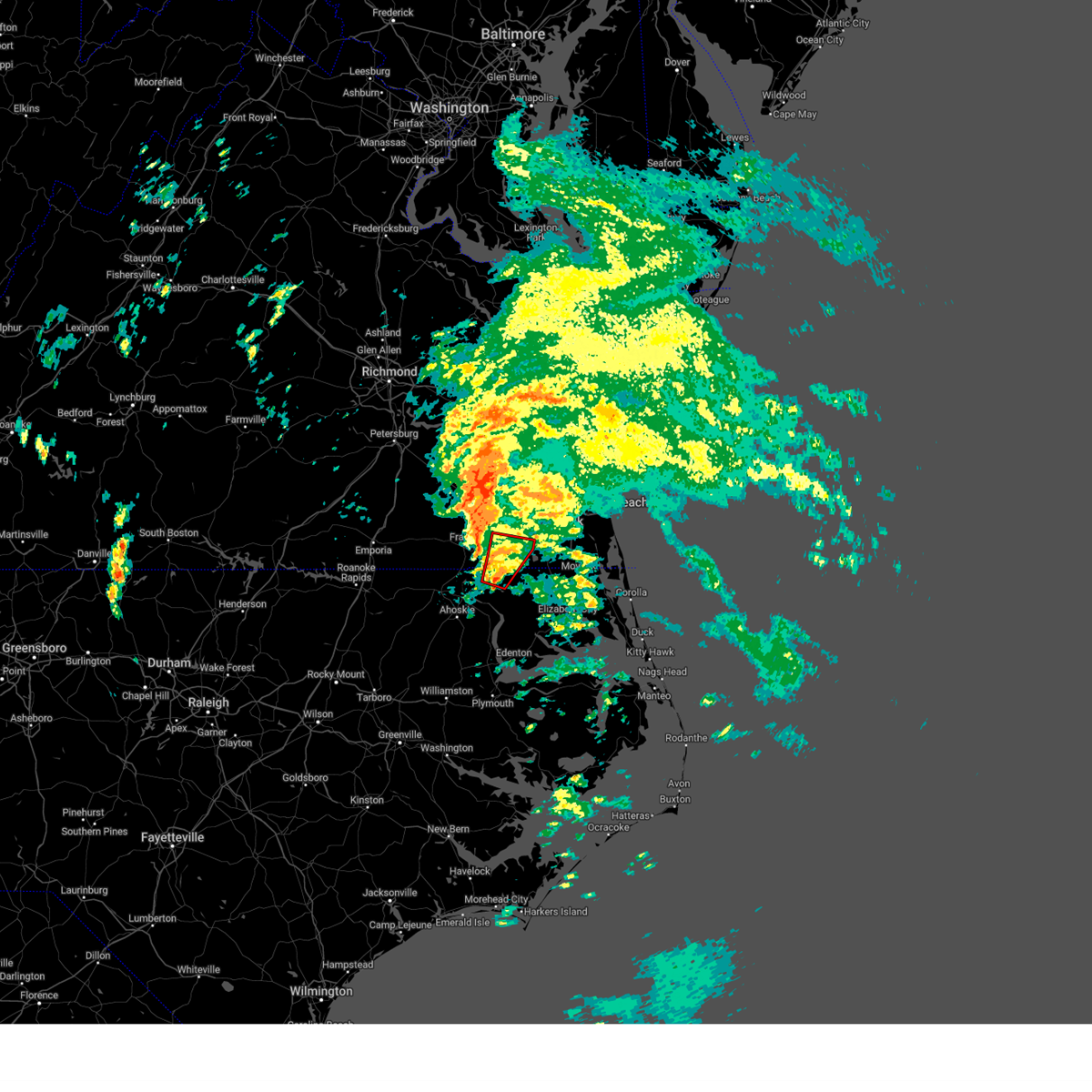 Torakq the national weather service in wakefield has issued a * tornado warning for, north central gates county in northeastern north carolina, the southeastern city of suffolk in southeastern virginia, * until 530 pm edt. * at 459 pm edt, a severe thunderstorm capable of producing a tornado was located over gates, or near gatesville, moving northeast at 35 mph (radar indicated rotation). Hazards include tornado. Flying debris will be dangerous to those caught without shelter. mobile homes will be damaged or destroyed. damage to roofs, windows, and vehicles will occur. tree damage is likely. this dangerous storm will be near, suffolk and whaleyville around 505 pm edt. Other locations impacted by this tornadic thunderstorm include easons crossroads, lummis, nurney, suffolk airport, drum hill, hazelton, buckland, saunders, reynoldson, and somerton. Torakq the national weather service in wakefield has issued a * tornado warning for, north central gates county in northeastern north carolina, the southeastern city of suffolk in southeastern virginia, * until 530 pm edt. * at 459 pm edt, a severe thunderstorm capable of producing a tornado was located over gates, or near gatesville, moving northeast at 35 mph (radar indicated rotation). Hazards include tornado. Flying debris will be dangerous to those caught without shelter. mobile homes will be damaged or destroyed. damage to roofs, windows, and vehicles will occur. tree damage is likely. this dangerous storm will be near, suffolk and whaleyville around 505 pm edt. Other locations impacted by this tornadic thunderstorm include easons crossroads, lummis, nurney, suffolk airport, drum hill, hazelton, buckland, saunders, reynoldson, and somerton.
|
| 9/1/2024 6:35 PM EDT |
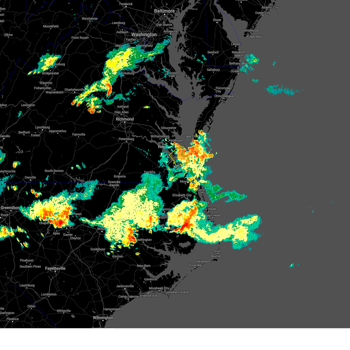 The storm which prompted the warning has moved out of the area. therefore, the warning will be allowed to expire. to report severe weather, contact your nearest law enforcement agency. they will relay your report to the national weather service wakefield. The storm which prompted the warning has moved out of the area. therefore, the warning will be allowed to expire. to report severe weather, contact your nearest law enforcement agency. they will relay your report to the national weather service wakefield.
|
| 9/1/2024 6:07 PM EDT |
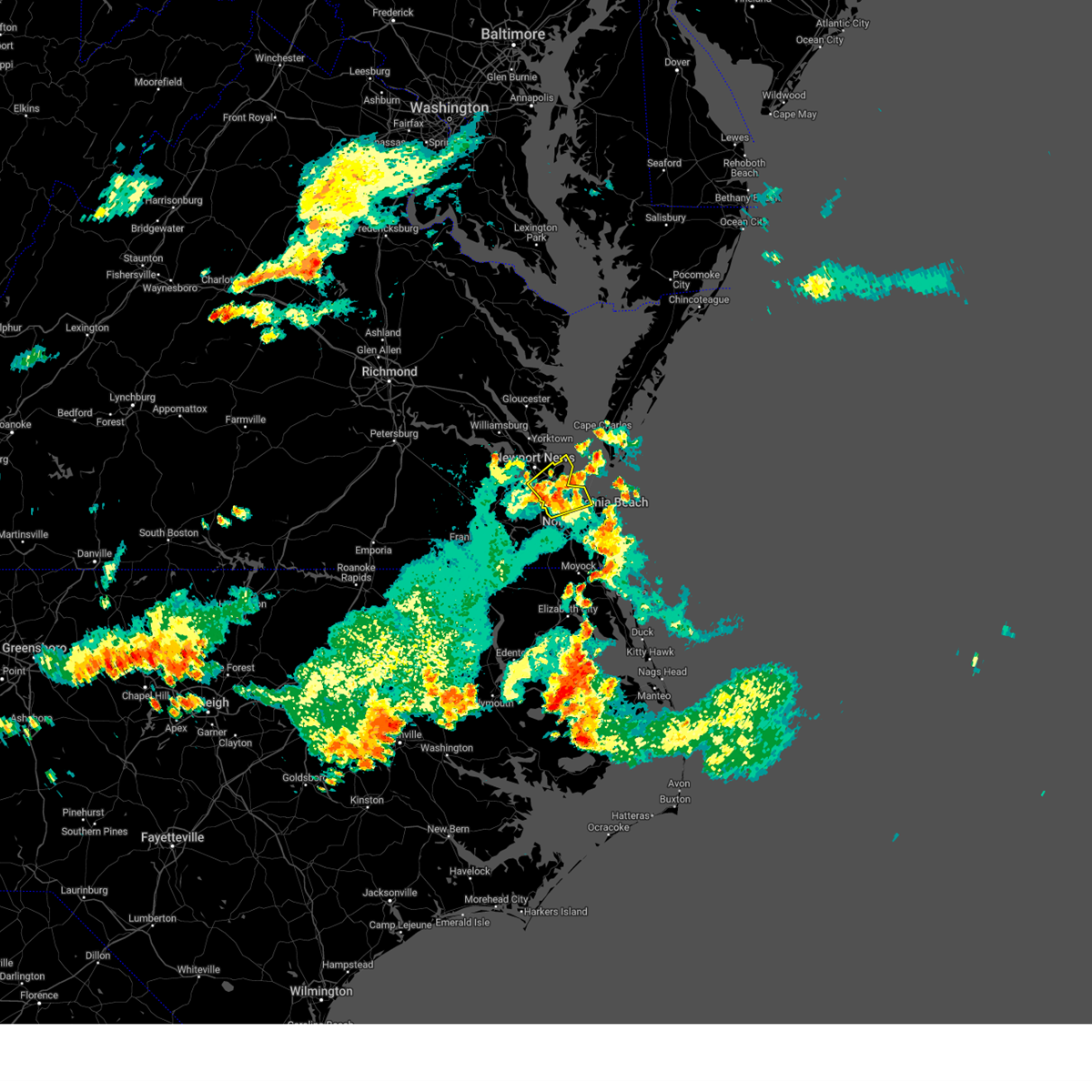 At 607 pm edt, a severe thunderstorm was located near crittenden, or near churchland, moving northeast at 15 mph (radar indicated). Hazards include 60 mph wind gusts. Expect damage to trees and powerlines. Locations impacted include, newport news, hampton, virginia wesleyan university, hampton university, langley afb, old dominion university, downtown norfolk, ocean view, downtown portsmouth, churchland, norfolk state university, norfolk, portsmouth, northampton, buckroe beach, norfolk international, ghent, norfolk nas, norview, and grand view. At 607 pm edt, a severe thunderstorm was located near crittenden, or near churchland, moving northeast at 15 mph (radar indicated). Hazards include 60 mph wind gusts. Expect damage to trees and powerlines. Locations impacted include, newport news, hampton, virginia wesleyan university, hampton university, langley afb, old dominion university, downtown norfolk, ocean view, downtown portsmouth, churchland, norfolk state university, norfolk, portsmouth, northampton, buckroe beach, norfolk international, ghent, norfolk nas, norview, and grand view.
|
| 9/1/2024 6:07 PM EDT |
 the severe thunderstorm warning has been cancelled and is no longer in effect the severe thunderstorm warning has been cancelled and is no longer in effect
|
| 9/1/2024 6:01 PM EDT |
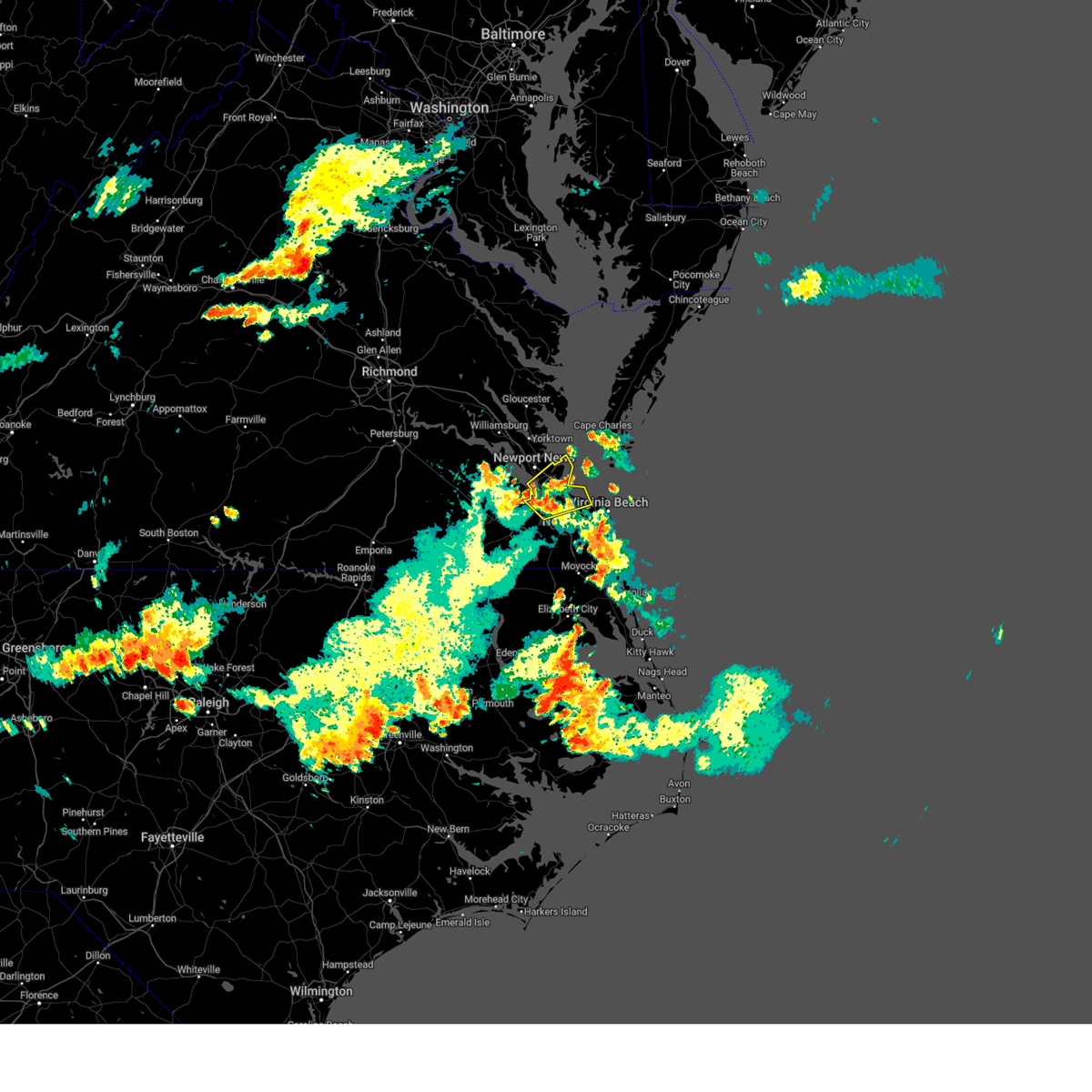 Svrakq the national weather service in wakefield has issued a * severe thunderstorm warning for, the city of norfolk in southeastern virginia, the northwestern city of chesapeake in southeastern virginia, the city of portsmouth in southeastern virginia, the northeastern city of suffolk in southeastern virginia, the northwestern city of virginia beach in southeastern virginia, the city of hampton in southeastern virginia, the southern city of newport news in southeastern virginia, * until 645 pm edt. * at 601 pm edt, a severe thunderstorm was located near crittenden, or near churchland, moving northeast at 20 mph (radar indicated). Hazards include 60 mph wind gusts. expect damage to trees and powerlines Svrakq the national weather service in wakefield has issued a * severe thunderstorm warning for, the city of norfolk in southeastern virginia, the northwestern city of chesapeake in southeastern virginia, the city of portsmouth in southeastern virginia, the northeastern city of suffolk in southeastern virginia, the northwestern city of virginia beach in southeastern virginia, the city of hampton in southeastern virginia, the southern city of newport news in southeastern virginia, * until 645 pm edt. * at 601 pm edt, a severe thunderstorm was located near crittenden, or near churchland, moving northeast at 20 mph (radar indicated). Hazards include 60 mph wind gusts. expect damage to trees and powerlines
|
| 9/1/2024 5:24 PM EDT |
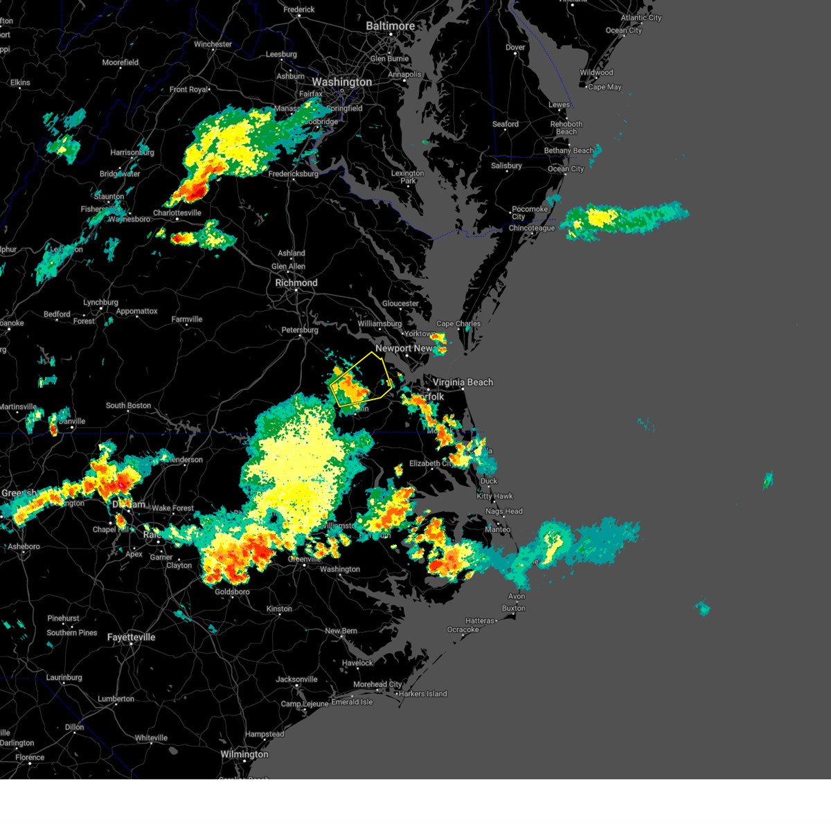 The storm which prompted the warning has weakened below severe limits, and no longer poses an immediate threat to life or property. therefore, the warning will be allowed to expire. however, gusty winds to 40 mph and heavy rainfall are still possible with this thunderstorm. to report severe weather, contact your nearest law enforcement agency. they will relay your report to the national weather service wakefield. The storm which prompted the warning has weakened below severe limits, and no longer poses an immediate threat to life or property. therefore, the warning will be allowed to expire. however, gusty winds to 40 mph and heavy rainfall are still possible with this thunderstorm. to report severe weather, contact your nearest law enforcement agency. they will relay your report to the national weather service wakefield.
|
| 9/1/2024 4:59 PM EDT |
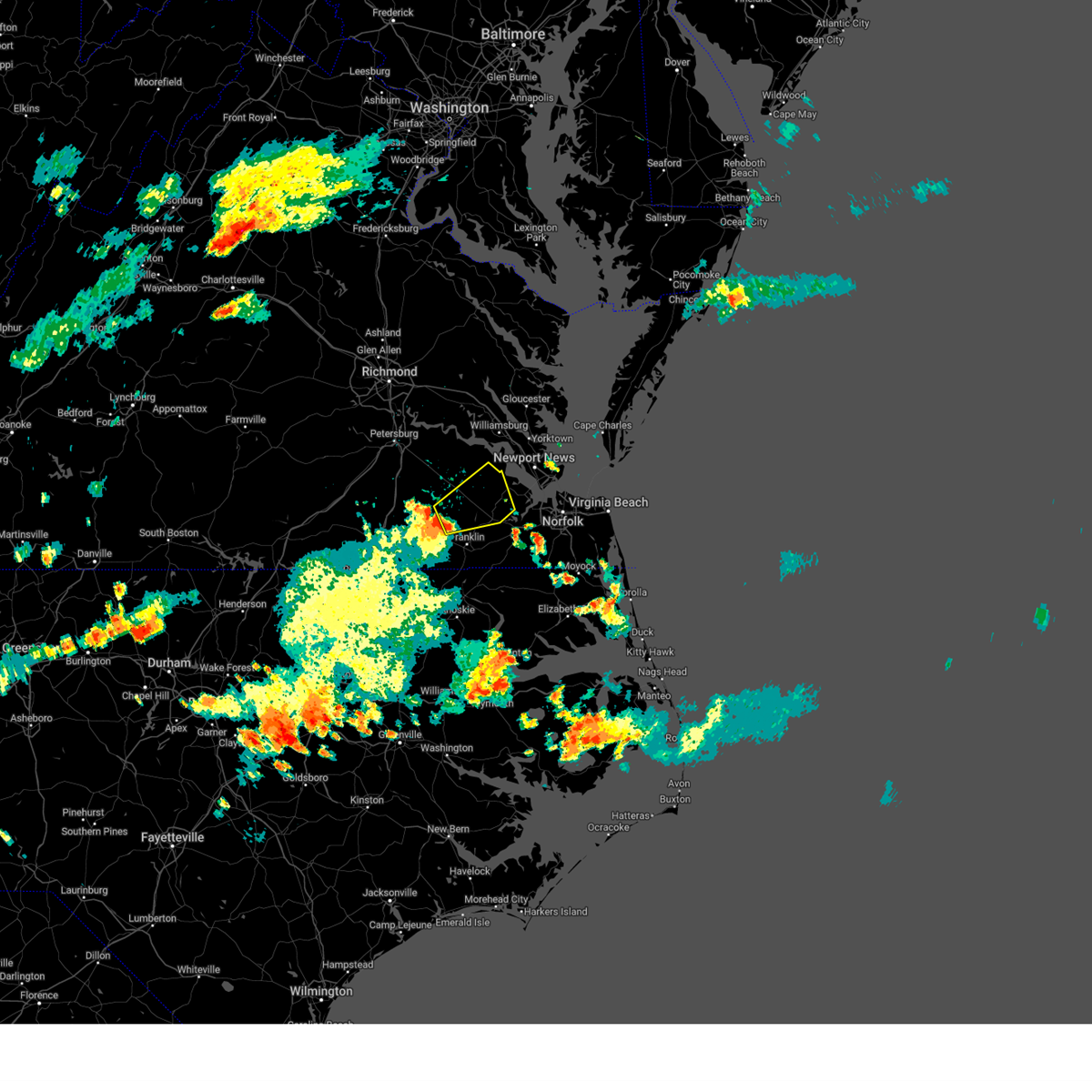 Svrakq the national weather service in wakefield has issued a * severe thunderstorm warning for, isle of wight county in southeastern virginia, northeastern southampton county in southeastern virginia, east central sussex county in southeastern virginia, southeastern surry county in southeastern virginia, * until 530 pm edt. * at 458 pm edt, a severe thunderstorm was located near sedley, or 8 miles north of courtland, moving northeast at 35 mph (radar indicated). Hazards include 60 mph wind gusts. expect damage to trees and powerlines Svrakq the national weather service in wakefield has issued a * severe thunderstorm warning for, isle of wight county in southeastern virginia, northeastern southampton county in southeastern virginia, east central sussex county in southeastern virginia, southeastern surry county in southeastern virginia, * until 530 pm edt. * at 458 pm edt, a severe thunderstorm was located near sedley, or 8 miles north of courtland, moving northeast at 35 mph (radar indicated). Hazards include 60 mph wind gusts. expect damage to trees and powerlines
|
| 8/9/2024 6:57 AM EDT |
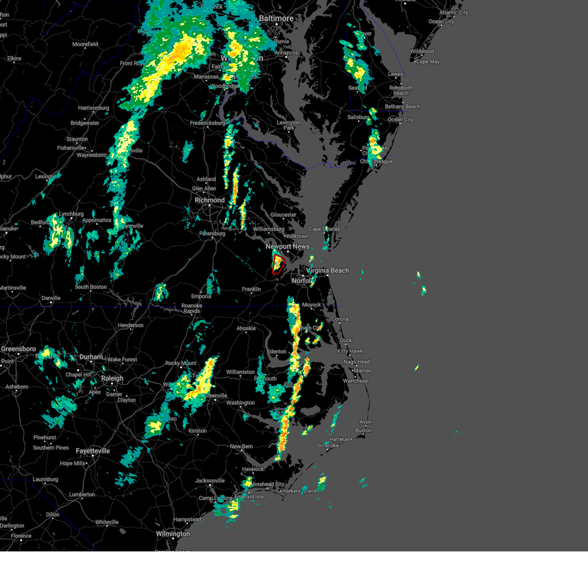 The storm which prompted the warning has weakened below severe limits, and has exited the warned area. therefore, the warning will be allowed to expire. a tornado watch remains in effect until 700 am edt for southeastern virginia. The storm which prompted the warning has weakened below severe limits, and has exited the warned area. therefore, the warning will be allowed to expire. a tornado watch remains in effect until 700 am edt for southeastern virginia.
|
| 8/9/2024 6:50 AM EDT |
 the tornado warning has been cancelled and is no longer in effect the tornado warning has been cancelled and is no longer in effect
|
| 8/9/2024 6:50 AM EDT |
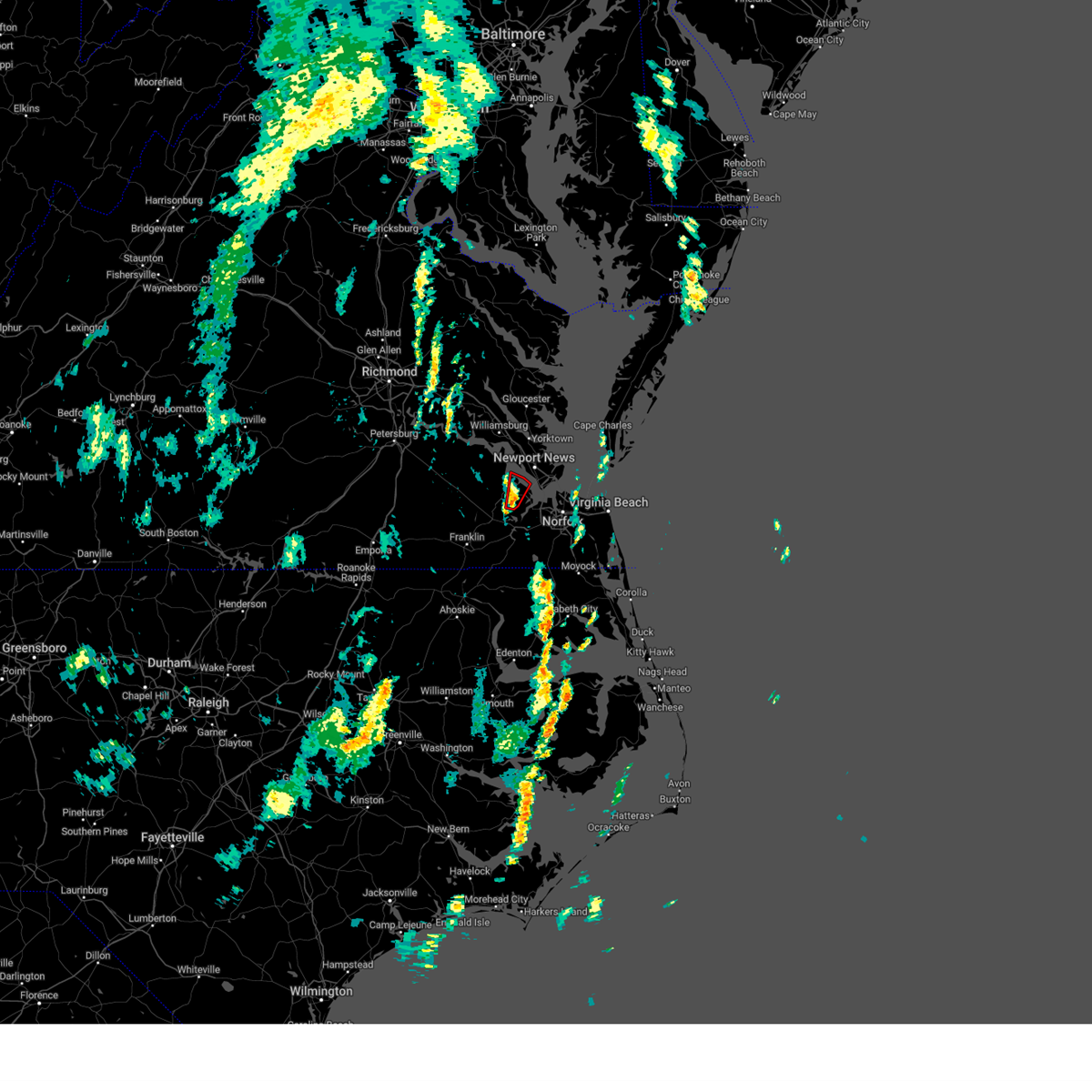 At 649 am edt, a severe thunderstorm capable of producing a tornado was located near isle of wight, or near smithfield, moving north at 40 mph (radar indicated rotation). Hazards include tornado. Flying debris will be dangerous to those caught without shelter. mobile homes will be damaged or destroyed. damage to roofs, windows, and vehicles will occur. tree damage is likely. this dangerous storm will be near, smithfield and rescue around 655 am edt. Other locations impacted by this tornadic thunderstorm include wills corner, mogarts beach, carrollton, longview, benns church, and lawson. At 649 am edt, a severe thunderstorm capable of producing a tornado was located near isle of wight, or near smithfield, moving north at 40 mph (radar indicated rotation). Hazards include tornado. Flying debris will be dangerous to those caught without shelter. mobile homes will be damaged or destroyed. damage to roofs, windows, and vehicles will occur. tree damage is likely. this dangerous storm will be near, smithfield and rescue around 655 am edt. Other locations impacted by this tornadic thunderstorm include wills corner, mogarts beach, carrollton, longview, benns church, and lawson.
|
| 8/9/2024 6:43 AM EDT |
 At 643 am edt, a severe thunderstorm capable of producing a tornado was located near kings fork, or near windsor, moving north at 40 mph (radar indicated rotation). Hazards include tornado. Flying debris will be dangerous to those caught without shelter. mobile homes will be damaged or destroyed. damage to roofs, windows, and vehicles will occur. tree damage is likely. this dangerous storm will be near, smithfield around 650 am edt. rescue around 655 am edt. Other locations impacted by this tornadic thunderstorm include carrollton, longview, benns church, wills corner, mogarts beach, chuckatuck, indika, lawson, and rushmere. At 643 am edt, a severe thunderstorm capable of producing a tornado was located near kings fork, or near windsor, moving north at 40 mph (radar indicated rotation). Hazards include tornado. Flying debris will be dangerous to those caught without shelter. mobile homes will be damaged or destroyed. damage to roofs, windows, and vehicles will occur. tree damage is likely. this dangerous storm will be near, smithfield around 650 am edt. rescue around 655 am edt. Other locations impacted by this tornadic thunderstorm include carrollton, longview, benns church, wills corner, mogarts beach, chuckatuck, indika, lawson, and rushmere.
|
| 8/9/2024 6:35 AM EDT |
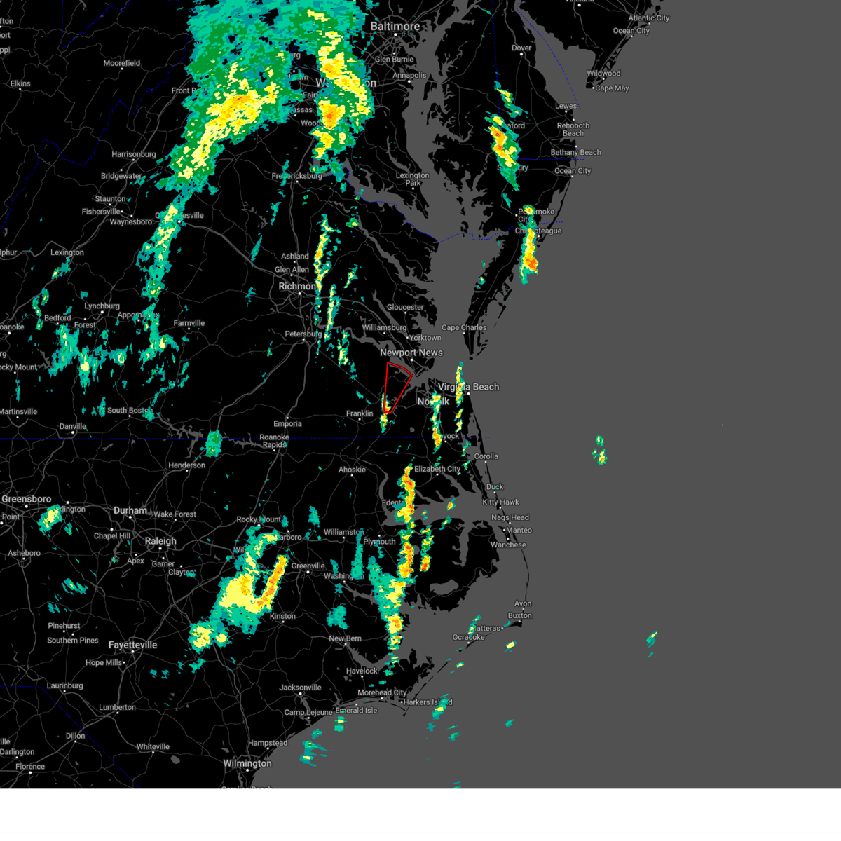 Torakq the national weather service in wakefield has issued a * tornado warning for, northeastern isle of wight county in southeastern virginia, the north central city of suffolk in southeastern virginia, * until 700 am edt. * at 635 am edt, a severe thunderstorm capable of producing a tornado was located over kings fork, or near windsor, moving north at 40 mph (radar indicated rotation). Hazards include tornado. Flying debris will be dangerous to those caught without shelter. mobile homes will be damaged or destroyed. damage to roofs, windows, and vehicles will occur. tree damage is likely. this dangerous storm will be near, suffolk and kings fork around 640 am edt. smithfield around 650 am edt. rescue around 655 am edt. Other locations impacted by this tornadic thunderstorm include carrollton, longview, benns church, wills corner, mogarts beach, chuckatuck, indika, lawson, and rushmere. Torakq the national weather service in wakefield has issued a * tornado warning for, northeastern isle of wight county in southeastern virginia, the north central city of suffolk in southeastern virginia, * until 700 am edt. * at 635 am edt, a severe thunderstorm capable of producing a tornado was located over kings fork, or near windsor, moving north at 40 mph (radar indicated rotation). Hazards include tornado. Flying debris will be dangerous to those caught without shelter. mobile homes will be damaged or destroyed. damage to roofs, windows, and vehicles will occur. tree damage is likely. this dangerous storm will be near, suffolk and kings fork around 640 am edt. smithfield around 650 am edt. rescue around 655 am edt. Other locations impacted by this tornadic thunderstorm include carrollton, longview, benns church, wills corner, mogarts beach, chuckatuck, indika, lawson, and rushmere.
|
| 8/8/2024 3:54 PM EDT |
 At 354 pm edt, a severe thunderstorm capable of producing a tornado was located near isle of wight, or near smithfield, moving north northwest at 35 mph (radar indicated rotation). Hazards include tornado. Flying debris will be dangerous to those caught without shelter. mobile homes will be damaged or destroyed. damage to roofs, windows, and vehicles will occur. tree damage is likely. this dangerous storm will be near, smithfield around 400 pm edt. Other locations impacted by this tornadic thunderstorm include pons, comet, longview, moonlight, wills corner, bethel church, lawson, and rushmere. At 354 pm edt, a severe thunderstorm capable of producing a tornado was located near isle of wight, or near smithfield, moving north northwest at 35 mph (radar indicated rotation). Hazards include tornado. Flying debris will be dangerous to those caught without shelter. mobile homes will be damaged or destroyed. damage to roofs, windows, and vehicles will occur. tree damage is likely. this dangerous storm will be near, smithfield around 400 pm edt. Other locations impacted by this tornadic thunderstorm include pons, comet, longview, moonlight, wills corner, bethel church, lawson, and rushmere.
|
| 8/8/2024 3:54 PM EDT |
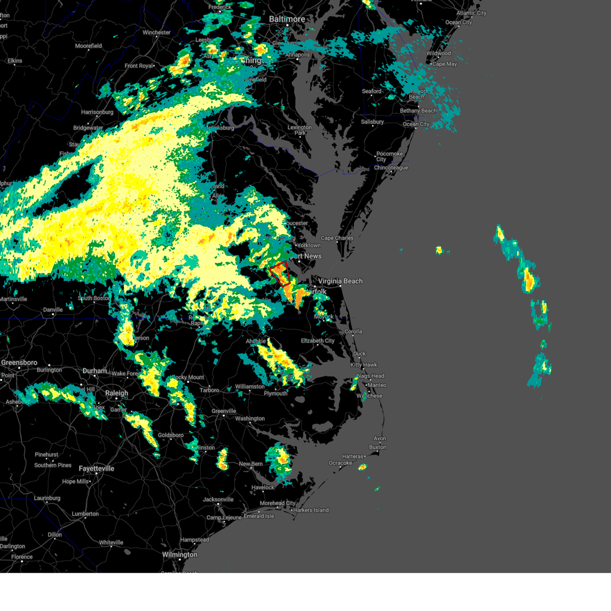 the tornado warning has been cancelled and is no longer in effect the tornado warning has been cancelled and is no longer in effect
|
| 8/8/2024 3:46 PM EDT |
 The tornado warning that was previously in effect has been reissued for the city of suffolk and isle of wight counties and is in effect until 415 pm. please refer to that bulletin for the latest severe weather information. a tornado watch remains in effect until 800 pm edt for southeastern virginia. The tornado warning that was previously in effect has been reissued for the city of suffolk and isle of wight counties and is in effect until 415 pm. please refer to that bulletin for the latest severe weather information. a tornado watch remains in effect until 800 pm edt for southeastern virginia.
|
| 8/8/2024 3:44 PM EDT |
 Torakq the national weather service in wakefield has issued a * tornado warning for, central isle of wight county in southeastern virginia, the north central city of suffolk in southeastern virginia, * until 415 pm edt. * at 343 pm edt, a severe thunderstorm capable of producing a tornado was located over kings fork, or near downtown suffolk, moving north northwest at 35 mph (radar indicated rotation). Hazards include tornado. Flying debris will be dangerous to those caught without shelter. mobile homes will be damaged or destroyed. damage to roofs, windows, and vehicles will occur. tree damage is likely. this dangerous storm will be near, isle of wight around 350 pm edt. smithfield around 355 pm edt. Other locations impacted by this tornadic thunderstorm include pons, comet, longview, moonlight, wills corner, bethel church, chuckatuck, lawson, benns church, and central hill. Torakq the national weather service in wakefield has issued a * tornado warning for, central isle of wight county in southeastern virginia, the north central city of suffolk in southeastern virginia, * until 415 pm edt. * at 343 pm edt, a severe thunderstorm capable of producing a tornado was located over kings fork, or near downtown suffolk, moving north northwest at 35 mph (radar indicated rotation). Hazards include tornado. Flying debris will be dangerous to those caught without shelter. mobile homes will be damaged or destroyed. damage to roofs, windows, and vehicles will occur. tree damage is likely. this dangerous storm will be near, isle of wight around 350 pm edt. smithfield around 355 pm edt. Other locations impacted by this tornadic thunderstorm include pons, comet, longview, moonlight, wills corner, bethel church, chuckatuck, lawson, benns church, and central hill.
|
| 8/8/2024 3:41 PM EDT | Large trees down on pruden blvd north of suffolk. possible tornado based on radar dat in city of suffolk county VA, 6.9 miles WSW of Suffolk, VA |
| 8/8/2024 3:38 PM EDT | *** 2 inj *** corrects previous tstm wnd dmg report from 1 se kings fork. large trees down on pruden blvd north of suffolk. 2 minor injuries and one tree down on a vehi in city of suffolk county VA, 7.4 miles WSW of Suffolk, VA |
| 8/8/2024 3:37 PM EDT |
 At 337 pm edt, a severe thunderstorm capable of producing a tornado was located over kings fork, or near downtown suffolk, moving north northwest at 35 mph (radar indicated rotation). Hazards include tornado. Flying debris will be dangerous to those caught without shelter. mobile homes will be damaged or destroyed. damage to roofs, windows, and vehicles will occur. tree damage is likely. This dangerous storm will be near, suffolk and kings fork around 340 pm edt. At 337 pm edt, a severe thunderstorm capable of producing a tornado was located over kings fork, or near downtown suffolk, moving north northwest at 35 mph (radar indicated rotation). Hazards include tornado. Flying debris will be dangerous to those caught without shelter. mobile homes will be damaged or destroyed. damage to roofs, windows, and vehicles will occur. tree damage is likely. This dangerous storm will be near, suffolk and kings fork around 340 pm edt.
|
| 8/8/2024 3:27 PM EDT |
 At 327 pm edt, a severe thunderstorm capable of producing a tornado was located over downtown suffolk, moving north northwest at 35 mph (radar indicated rotation). Hazards include tornado. Flying debris will be dangerous to those caught without shelter. mobile homes will be damaged or destroyed. damage to roofs, windows, and vehicles will occur. tree damage is likely. this dangerous storm will be near, downtown suffolk, suffolk, and kings fork around 330 pm edt. Other locations impacted by this tornadic thunderstorm include suffolk airport, saunders, nurney, and kilby. At 327 pm edt, a severe thunderstorm capable of producing a tornado was located over downtown suffolk, moving north northwest at 35 mph (radar indicated rotation). Hazards include tornado. Flying debris will be dangerous to those caught without shelter. mobile homes will be damaged or destroyed. damage to roofs, windows, and vehicles will occur. tree damage is likely. this dangerous storm will be near, downtown suffolk, suffolk, and kings fork around 330 pm edt. Other locations impacted by this tornadic thunderstorm include suffolk airport, saunders, nurney, and kilby.
|
| 8/8/2024 3:25 PM EDT |
 The storm which prompted the warning has weakened below severe limits, and no longer appears capable of producing a tornado. therefore, the warning will be allowed to expire. however, heavy rain is still possible with this thunderstorm. remember, another tornado warning remains in effect for suffolk until 345 pm. a tornado watch remains in effect until 800 pm edt for southeastern virginia. The storm which prompted the warning has weakened below severe limits, and no longer appears capable of producing a tornado. therefore, the warning will be allowed to expire. however, heavy rain is still possible with this thunderstorm. remember, another tornado warning remains in effect for suffolk until 345 pm. a tornado watch remains in effect until 800 pm edt for southeastern virginia.
|
| 8/8/2024 3:18 PM EDT |
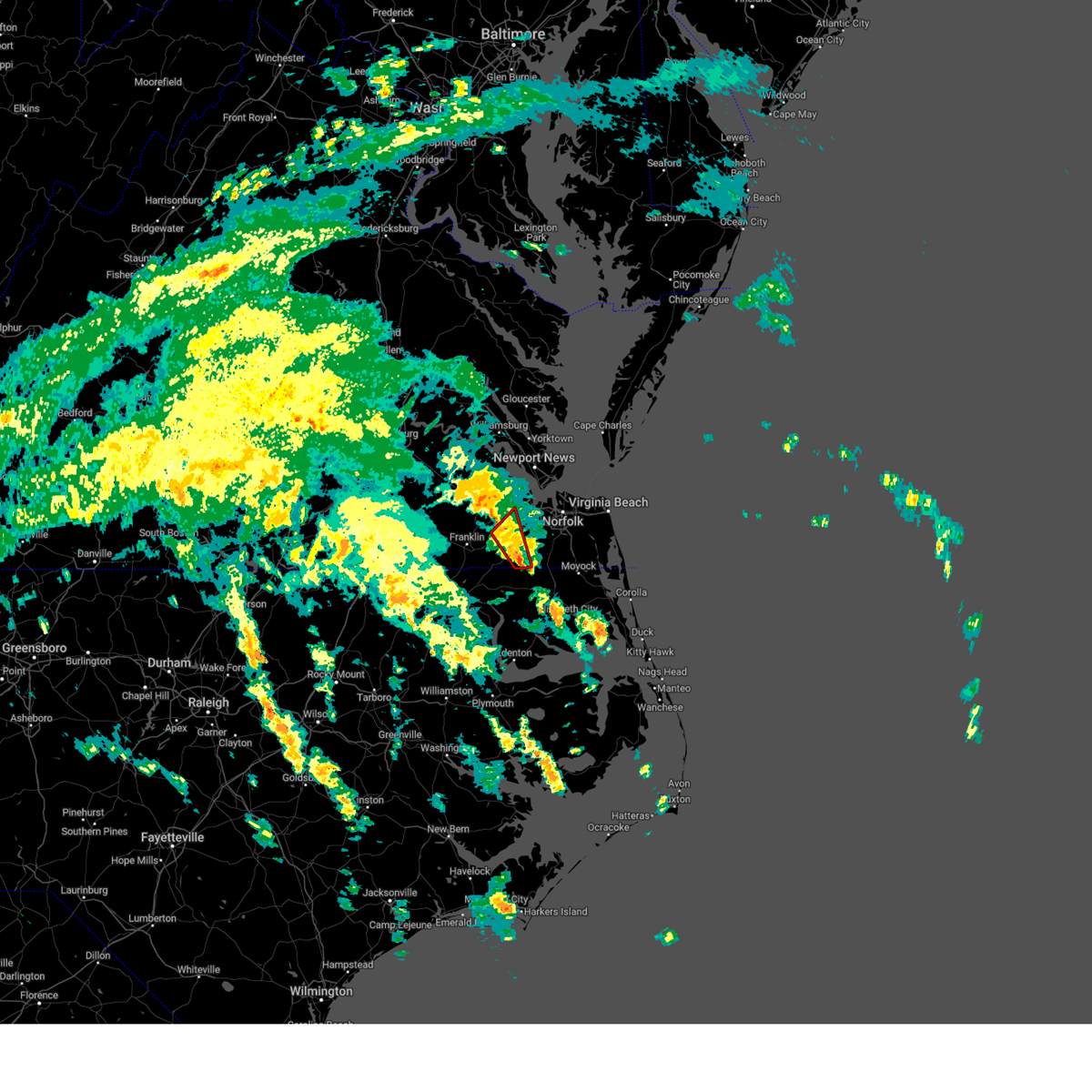 At 317 pm edt, a severe thunderstorm capable of producing a tornado was located about 5 miles south of downtown suffolk, moving north northwest at 35 mph (radar indicated rotation). Hazards include tornado. Flying debris will be dangerous to those caught without shelter. mobile homes will be damaged or destroyed. damage to roofs, windows, and vehicles will occur. tree damage is likely. this dangerous storm will be near, downtown suffolk and suffolk around 320 pm edt. kings fork around 330 pm edt. Other locations impacted by this tornadic thunderstorm include suffolk airport, saunders, lummis, nurney, and kilby. At 317 pm edt, a severe thunderstorm capable of producing a tornado was located about 5 miles south of downtown suffolk, moving north northwest at 35 mph (radar indicated rotation). Hazards include tornado. Flying debris will be dangerous to those caught without shelter. mobile homes will be damaged or destroyed. damage to roofs, windows, and vehicles will occur. tree damage is likely. this dangerous storm will be near, downtown suffolk and suffolk around 320 pm edt. kings fork around 330 pm edt. Other locations impacted by this tornadic thunderstorm include suffolk airport, saunders, lummis, nurney, and kilby.
|
| 8/8/2024 3:18 PM EDT |
 the tornado warning has been cancelled and is no longer in effect the tornado warning has been cancelled and is no longer in effect
|
| 8/8/2024 3:09 PM EDT |
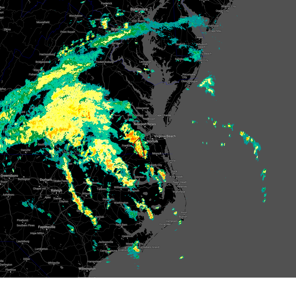 Torakq the national weather service in wakefield has issued a * tornado warning for, northwestern camden county in northeastern north carolina, northeastern gates county in northeastern north carolina, the eastern city of suffolk in southeastern virginia, * until 345 pm edt. * at 308 pm edt, a severe thunderstorm capable of producing a tornado was located over corapeake, or 8 miles northeast of sunbury, moving north northwest at 40 mph (radar indicated rotation). Hazards include tornado. Flying debris will be dangerous to those caught without shelter. mobile homes will be damaged or destroyed. damage to roofs, windows, and vehicles will occur. tree damage is likely. this dangerous storm will be near, suffolk around 315 pm edt. downtown suffolk around 325 pm edt. kings fork around 330 pm edt. Other locations impacted by this tornadic thunderstorm include suffolk airport, saunders, lummis, nurney, kilby, and boaz. Torakq the national weather service in wakefield has issued a * tornado warning for, northwestern camden county in northeastern north carolina, northeastern gates county in northeastern north carolina, the eastern city of suffolk in southeastern virginia, * until 345 pm edt. * at 308 pm edt, a severe thunderstorm capable of producing a tornado was located over corapeake, or 8 miles northeast of sunbury, moving north northwest at 40 mph (radar indicated rotation). Hazards include tornado. Flying debris will be dangerous to those caught without shelter. mobile homes will be damaged or destroyed. damage to roofs, windows, and vehicles will occur. tree damage is likely. this dangerous storm will be near, suffolk around 315 pm edt. downtown suffolk around 325 pm edt. kings fork around 330 pm edt. Other locations impacted by this tornadic thunderstorm include suffolk airport, saunders, lummis, nurney, kilby, and boaz.
|
| 8/8/2024 3:00 PM EDT |
 The tornado warning that was previously in effect has been reissued for the city of suffolk and isle of wight counties until 330 pm. please refer to that bulletin for the latest severe weather information. a tornado watch remains in effect until 800 pm edt for southeastern virginia. The tornado warning that was previously in effect has been reissued for the city of suffolk and isle of wight counties until 330 pm. please refer to that bulletin for the latest severe weather information. a tornado watch remains in effect until 800 pm edt for southeastern virginia.
|
| 8/8/2024 2:59 PM EDT |
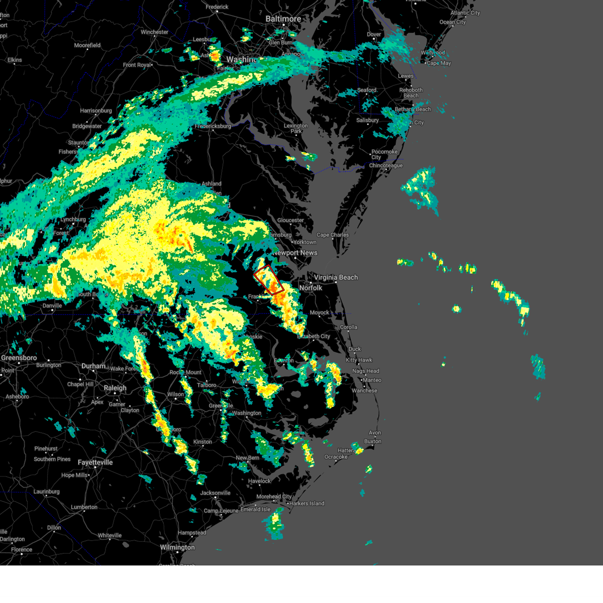 Torakq the national weather service in wakefield has issued a * tornado warning for, southwestern isle of wight county in southeastern virginia, northeastern southampton county in southeastern virginia, the central city of suffolk in southeastern virginia, * until 330 pm edt. * at 258 pm edt, a severe thunderstorm capable of producing a tornado was located over windsor, moving northwest at 35 mph (radar indicated rotation). Hazards include tornado. Flying debris will be dangerous to those caught without shelter. mobile homes will be damaged or destroyed. damage to roofs, windows, and vehicles will occur. tree damage is likely. this dangerous storm will be near, zuni around 305 pm edt. ivor around 310 pm edt. Other locations impacted by this tornadic thunderstorm include central hill, whitley, boaz, pons, raynor, and indika. Torakq the national weather service in wakefield has issued a * tornado warning for, southwestern isle of wight county in southeastern virginia, northeastern southampton county in southeastern virginia, the central city of suffolk in southeastern virginia, * until 330 pm edt. * at 258 pm edt, a severe thunderstorm capable of producing a tornado was located over windsor, moving northwest at 35 mph (radar indicated rotation). Hazards include tornado. Flying debris will be dangerous to those caught without shelter. mobile homes will be damaged or destroyed. damage to roofs, windows, and vehicles will occur. tree damage is likely. this dangerous storm will be near, zuni around 305 pm edt. ivor around 310 pm edt. Other locations impacted by this tornadic thunderstorm include central hill, whitley, boaz, pons, raynor, and indika.
|
| 8/8/2024 2:59 PM EDT |
 The storm which prompted the warning has moved out of the area. therefore, the warning will be allowed to expire. a tornado watch remains in effect until 800 pm edt for northeastern north carolina, and southeastern virginia. The storm which prompted the warning has moved out of the area. therefore, the warning will be allowed to expire. a tornado watch remains in effect until 800 pm edt for northeastern north carolina, and southeastern virginia.
|
| 8/8/2024 2:45 PM EDT |
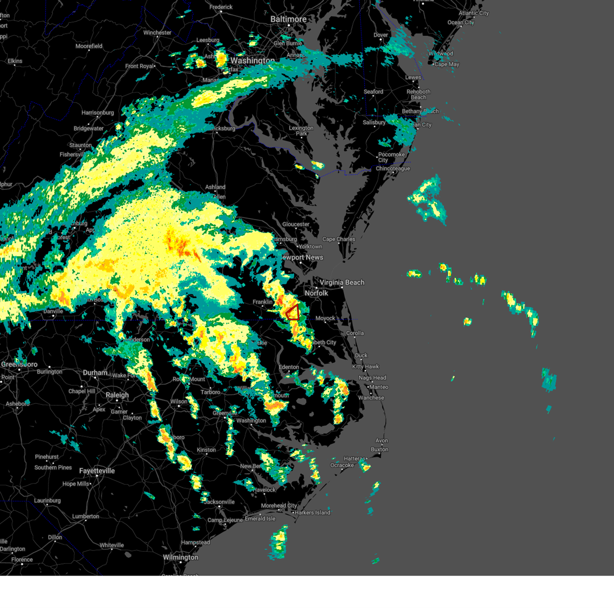 the tornado warning has been cancelled and is no longer in effect the tornado warning has been cancelled and is no longer in effect
|
| 8/8/2024 2:45 PM EDT |
 At 245 pm edt, a severe thunderstorm capable of producing a tornado was located near corapeake, or 9 miles south of downtown suffolk, moving north northwest at 35 mph (radar indicated rotation). Hazards include tornado. Flying debris will be dangerous to those caught without shelter. mobile homes will be damaged or destroyed. damage to roofs, windows, and vehicles will occur. tree damage is likely. this dangerous storm will be near, suffolk around 250 pm edt. Other locations impacted by this tornadic thunderstorm include saunders. At 245 pm edt, a severe thunderstorm capable of producing a tornado was located near corapeake, or 9 miles south of downtown suffolk, moving north northwest at 35 mph (radar indicated rotation). Hazards include tornado. Flying debris will be dangerous to those caught without shelter. mobile homes will be damaged or destroyed. damage to roofs, windows, and vehicles will occur. tree damage is likely. this dangerous storm will be near, suffolk around 250 pm edt. Other locations impacted by this tornadic thunderstorm include saunders.
|
| 8/8/2024 2:42 PM EDT |
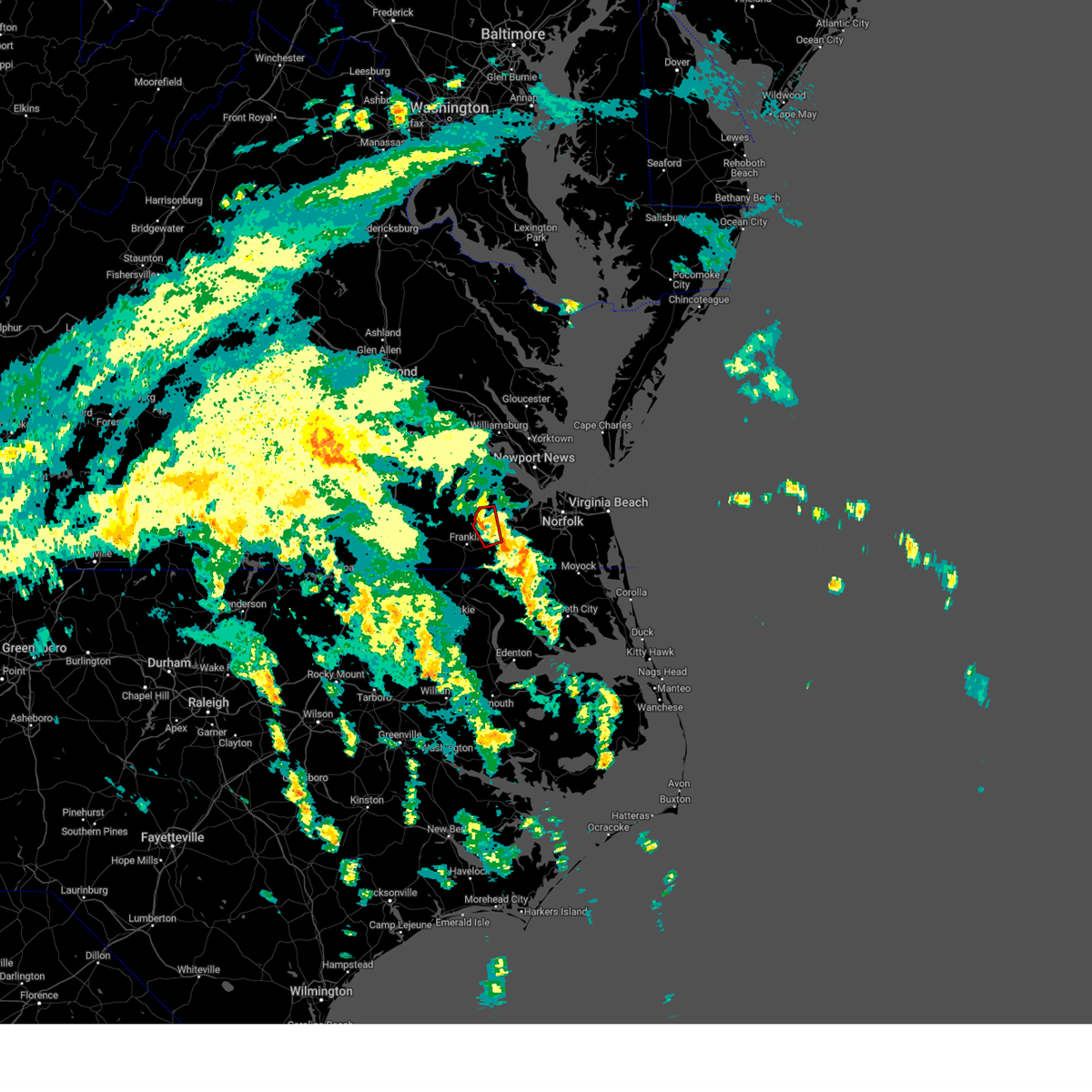 The storm which prompted the warning has weakened below severe limits, and no longer appears capable of producing a tornado. therefore, the warning will be allowed to expire. remember, another tornado warning remains in effect for eastern portions of isle of wight county and much of the city of suffolk until 3 pm. a tornado watch remains in effect until 800 pm edt for southeastern virginia. The storm which prompted the warning has weakened below severe limits, and no longer appears capable of producing a tornado. therefore, the warning will be allowed to expire. remember, another tornado warning remains in effect for eastern portions of isle of wight county and much of the city of suffolk until 3 pm. a tornado watch remains in effect until 800 pm edt for southeastern virginia.
|
| 8/8/2024 2:42 PM EDT |
 At 242 pm edt, a severe thunderstorm capable of producing a tornado was located over suffolk, or near downtown suffolk, moving north northwest at 30 mph (radar indicated rotation). Hazards include tornado. Flying debris will be dangerous to those caught without shelter. mobile homes will be damaged or destroyed. damage to roofs, windows, and vehicles will occur. tree damage is likely. this dangerous storm will be near, suffolk and kings fork around 250 pm edt. windsor around 255 pm edt. Other locations impacted by this tornadic thunderstorm include suffolk airport, saunders, indika, lummis, nurney, and kilby. At 242 pm edt, a severe thunderstorm capable of producing a tornado was located over suffolk, or near downtown suffolk, moving north northwest at 30 mph (radar indicated rotation). Hazards include tornado. Flying debris will be dangerous to those caught without shelter. mobile homes will be damaged or destroyed. damage to roofs, windows, and vehicles will occur. tree damage is likely. this dangerous storm will be near, suffolk and kings fork around 250 pm edt. windsor around 255 pm edt. Other locations impacted by this tornadic thunderstorm include suffolk airport, saunders, indika, lummis, nurney, and kilby.
|
| 8/8/2024 2:35 PM EDT |
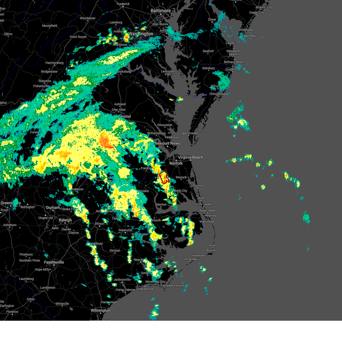 Torakq the national weather service in wakefield has issued a * tornado warning for, northwestern camden county in northeastern north carolina, northeastern gates county in northeastern north carolina, the southeastern city of suffolk in southeastern virginia, * until 300 pm edt. * at 235 pm edt, a severe thunderstorm capable of producing a tornado was located near corapeake, or near sunbury, moving north at 35 mph (radar indicated rotation). Hazards include tornado. Flying debris will be dangerous to those caught without shelter. mobile homes will be damaged or destroyed. damage to roofs, windows, and vehicles will occur. tree damage is likely. this dangerous storm will be near, suffolk and corapeake around 240 pm edt. Other locations impacted by this tornadic thunderstorm include saunders. Torakq the national weather service in wakefield has issued a * tornado warning for, northwestern camden county in northeastern north carolina, northeastern gates county in northeastern north carolina, the southeastern city of suffolk in southeastern virginia, * until 300 pm edt. * at 235 pm edt, a severe thunderstorm capable of producing a tornado was located near corapeake, or near sunbury, moving north at 35 mph (radar indicated rotation). Hazards include tornado. Flying debris will be dangerous to those caught without shelter. mobile homes will be damaged or destroyed. damage to roofs, windows, and vehicles will occur. tree damage is likely. this dangerous storm will be near, suffolk and corapeake around 240 pm edt. Other locations impacted by this tornadic thunderstorm include saunders.
|
| 8/8/2024 2:29 PM EDT |
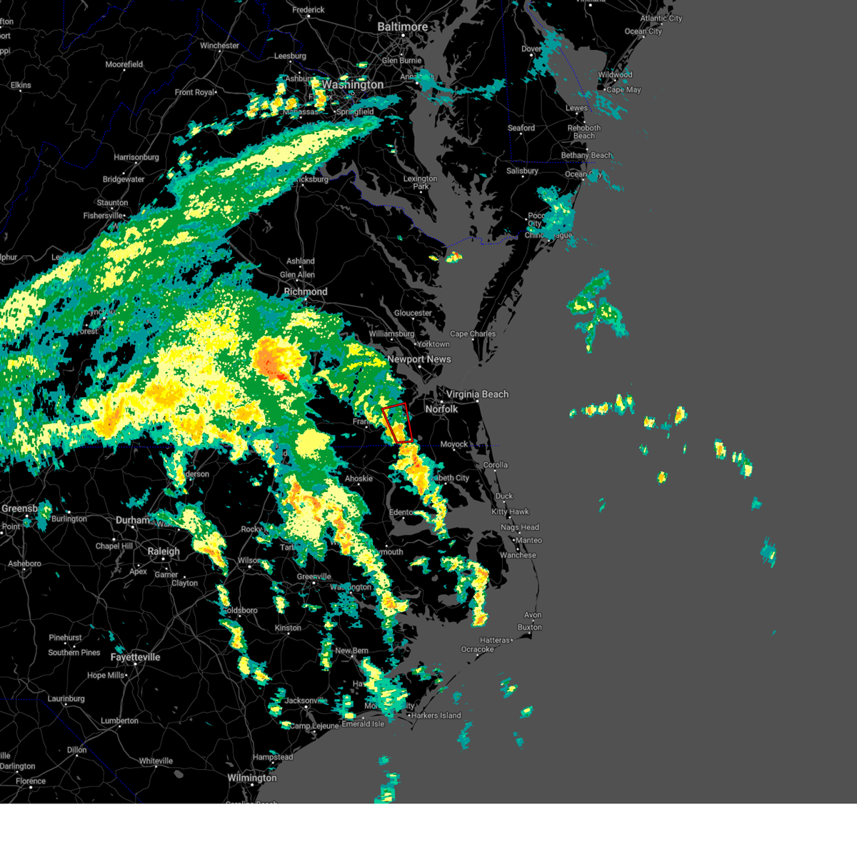 Torakq the national weather service in wakefield has issued a * tornado warning for, south central isle of wight county in southeastern virginia, the central city of suffolk in southeastern virginia, * until 300 pm edt. * at 229 pm edt, a tornado producing storm was located near whaleyville, or 7 miles south of downtown suffolk, moving north at 35 mph (radar confirmed tornado). Hazards include tornado. Flying debris will be dangerous to those caught without shelter. mobile homes will be damaged or destroyed. damage to roofs, windows, and vehicles will occur. tree damage is likely. this tornadic storm will be near, suffolk around 235 pm edt. downtown suffolk around 240 pm edt. kings fork around 245 pm edt. windsor around 250 pm edt. Other locations impacted by this tornadic thunderstorm include suffolk airport, saunders, indika, lummis, nurney, and kilby. Torakq the national weather service in wakefield has issued a * tornado warning for, south central isle of wight county in southeastern virginia, the central city of suffolk in southeastern virginia, * until 300 pm edt. * at 229 pm edt, a tornado producing storm was located near whaleyville, or 7 miles south of downtown suffolk, moving north at 35 mph (radar confirmed tornado). Hazards include tornado. Flying debris will be dangerous to those caught without shelter. mobile homes will be damaged or destroyed. damage to roofs, windows, and vehicles will occur. tree damage is likely. this tornadic storm will be near, suffolk around 235 pm edt. downtown suffolk around 240 pm edt. kings fork around 245 pm edt. windsor around 250 pm edt. Other locations impacted by this tornadic thunderstorm include suffolk airport, saunders, indika, lummis, nurney, and kilby.
|
| 8/8/2024 2:28 PM EDT |
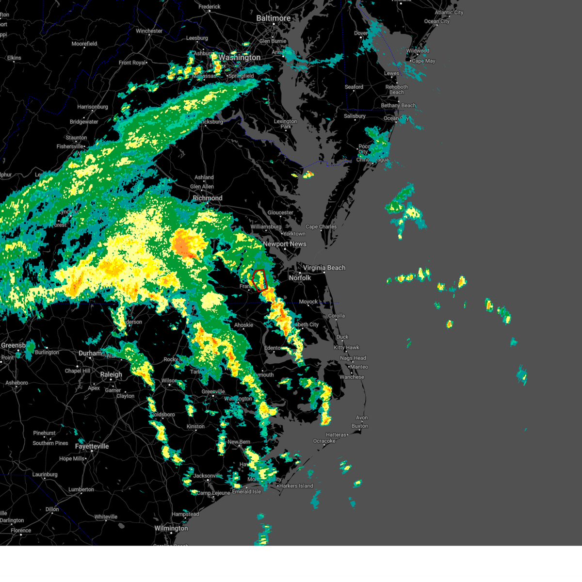 At 228 pm edt, a severe thunderstorm capable of producing a tornado was located over holland, moving northwest at 30 mph (radar indicated rotation). Hazards include tornado. Flying debris will be dangerous to those caught without shelter. mobile homes will be damaged or destroyed. damage to roofs, windows, and vehicles will occur. tree damage is likely. this dangerous storm will be near, windsor and carrsville around 235 pm edt. zuni around 245 pm edt. Other locations impacted by this tornadic thunderstorm include walters, collosse, boaz, and lummis. At 228 pm edt, a severe thunderstorm capable of producing a tornado was located over holland, moving northwest at 30 mph (radar indicated rotation). Hazards include tornado. Flying debris will be dangerous to those caught without shelter. mobile homes will be damaged or destroyed. damage to roofs, windows, and vehicles will occur. tree damage is likely. this dangerous storm will be near, windsor and carrsville around 235 pm edt. zuni around 245 pm edt. Other locations impacted by this tornadic thunderstorm include walters, collosse, boaz, and lummis.
|
| 8/8/2024 2:22 PM EDT |
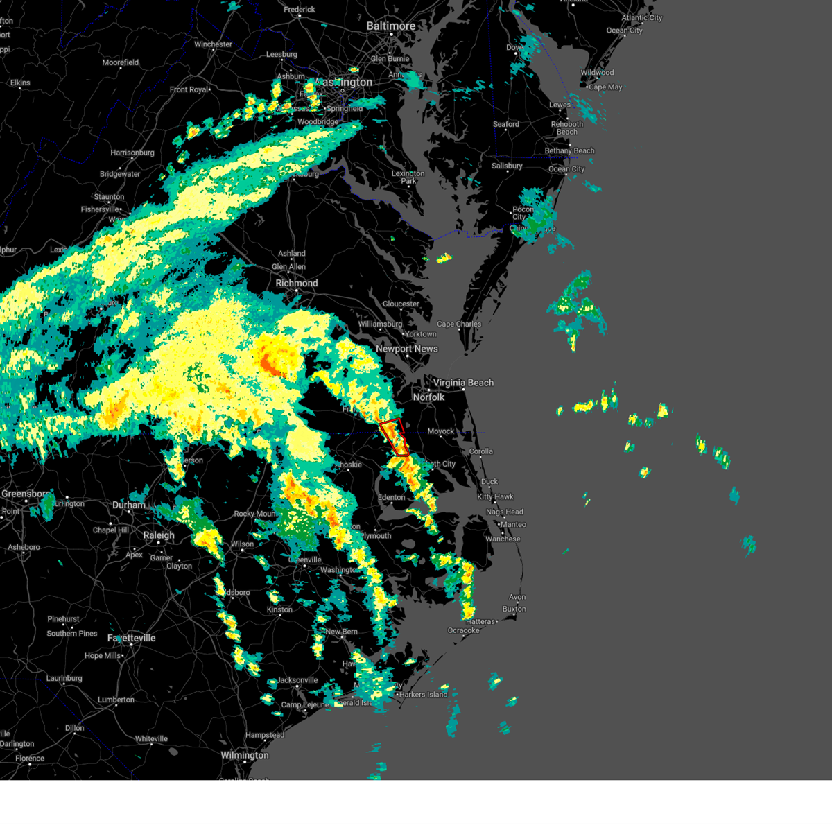 At 221 pm edt, a severe thunderstorm capable of producing a tornado was located over corapeake, or 7 miles north of sunbury, moving north northwest at 35 mph. in addition, another severe storm capable of producing a tornado is located 5 miles southeast of sunbury (radar indicated rotation). Hazards include tornado. Flying debris will be dangerous to those caught without shelter. mobile homes will be damaged or destroyed. damage to roofs, windows, and vehicles will occur. tree damage is likely. this dangerous storm will be near, suffolk and whaleyville around 225 pm edt. Other locations impacted by this tornadic thunderstorm include acorn hill, savage, and saunders. At 221 pm edt, a severe thunderstorm capable of producing a tornado was located over corapeake, or 7 miles north of sunbury, moving north northwest at 35 mph. in addition, another severe storm capable of producing a tornado is located 5 miles southeast of sunbury (radar indicated rotation). Hazards include tornado. Flying debris will be dangerous to those caught without shelter. mobile homes will be damaged or destroyed. damage to roofs, windows, and vehicles will occur. tree damage is likely. this dangerous storm will be near, suffolk and whaleyville around 225 pm edt. Other locations impacted by this tornadic thunderstorm include acorn hill, savage, and saunders.
|
| 8/8/2024 2:20 PM EDT | Reports of a few trees down on power lines and limbs down in the corapeake area. may have been a possible brief touchdown according to radar - time estimated from radar in gates county NC, 14.9 miles NNW of Suffolk, VA |
| 8/8/2024 2:13 PM EDT |
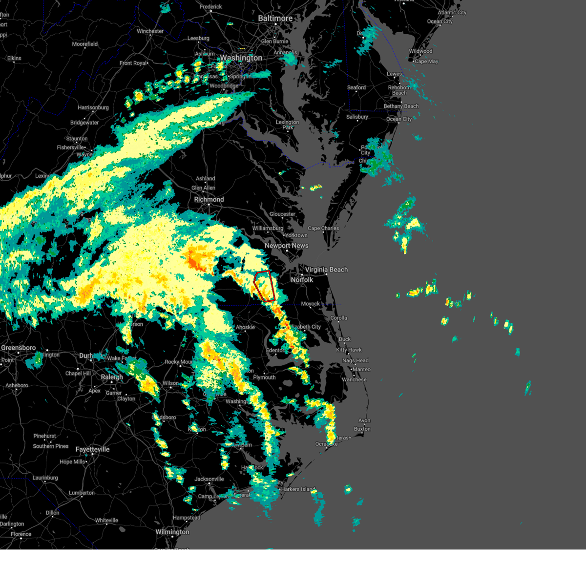 Torakq the national weather service in wakefield has issued a * tornado warning for, southwestern isle of wight county in southeastern virginia, the southwestern city of suffolk in southeastern virginia, * until 245 pm edt. * at 213 pm edt, a severe thunderstorm capable of producing a tornado was located over whaleyville, or near holland, moving north at 40 mph (radar indicated rotation). Hazards include tornado. Flying debris will be dangerous to those caught without shelter. mobile homes will be damaged or destroyed. damage to roofs, windows, and vehicles will occur. tree damage is likely. this dangerous storm will be near, holland and suffolk around 220 pm edt. windsor around 230 pm edt. zuni around 235 pm edt. Other locations impacted by this tornadic thunderstorm include walters, collosse, boaz, indika, and lummis. Torakq the national weather service in wakefield has issued a * tornado warning for, southwestern isle of wight county in southeastern virginia, the southwestern city of suffolk in southeastern virginia, * until 245 pm edt. * at 213 pm edt, a severe thunderstorm capable of producing a tornado was located over whaleyville, or near holland, moving north at 40 mph (radar indicated rotation). Hazards include tornado. Flying debris will be dangerous to those caught without shelter. mobile homes will be damaged or destroyed. damage to roofs, windows, and vehicles will occur. tree damage is likely. this dangerous storm will be near, holland and suffolk around 220 pm edt. windsor around 230 pm edt. zuni around 235 pm edt. Other locations impacted by this tornadic thunderstorm include walters, collosse, boaz, indika, and lummis.
|
| 8/8/2024 2:07 PM EDT |
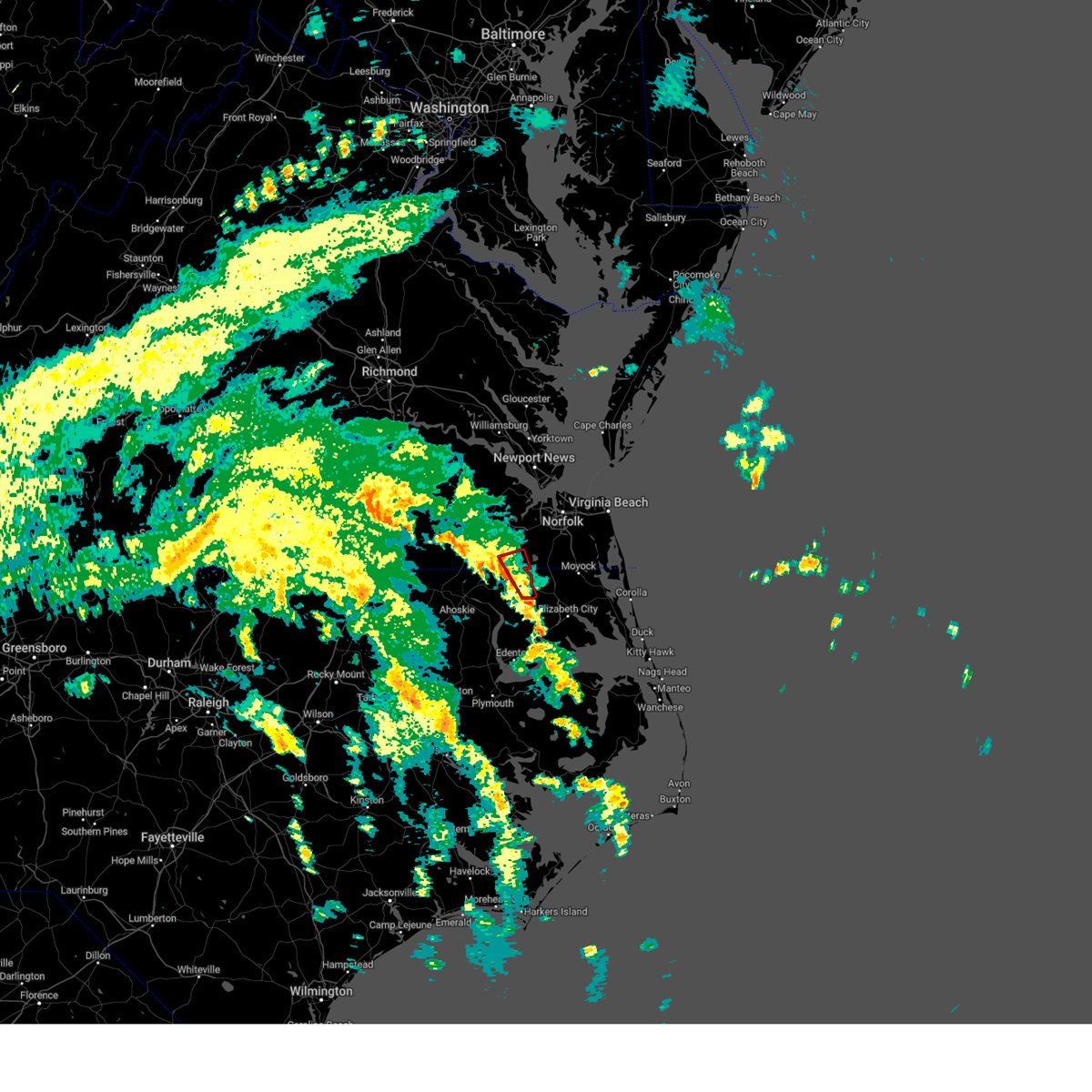 Torakq the national weather service in wakefield has issued a * tornado warning for, northeastern gates county in northeastern north carolina, the south central city of suffolk in southeastern virginia, * until 230 pm edt. * at 206 pm edt, a severe thunderstorm capable of producing a tornado was located near sunbury, moving north at 40 mph (radar indicated rotation). Hazards include tornado. Flying debris will be dangerous to those caught without shelter. mobile homes will be damaged or destroyed. damage to roofs, windows, and vehicles will occur. tree damage is likely. this dangerous storm will be near, corapeake around 210 pm edt. suffolk around 215 pm edt. Other locations impacted by this tornadic thunderstorm include acorn hill, savage, and saunders. Torakq the national weather service in wakefield has issued a * tornado warning for, northeastern gates county in northeastern north carolina, the south central city of suffolk in southeastern virginia, * until 230 pm edt. * at 206 pm edt, a severe thunderstorm capable of producing a tornado was located near sunbury, moving north at 40 mph (radar indicated rotation). Hazards include tornado. Flying debris will be dangerous to those caught without shelter. mobile homes will be damaged or destroyed. damage to roofs, windows, and vehicles will occur. tree damage is likely. this dangerous storm will be near, corapeake around 210 pm edt. suffolk around 215 pm edt. Other locations impacted by this tornadic thunderstorm include acorn hill, savage, and saunders.
|
| 8/8/2024 2:01 PM EDT |
 At 201 pm edt, a severe thunderstorm capable of producing a tornado was located near whaleyville, or near sunbury, moving north at 40 mph (radar indicated rotation). Hazards include tornado. Flying debris will be dangerous to those caught without shelter. mobile homes will be damaged or destroyed. damage to roofs, windows, and vehicles will occur. tree damage is likely. this dangerous storm will be near, suffolk and whaleyville around 205 pm edt. Other locations impacted by this tornadic thunderstorm include drum hill, hazelton, and somerton. At 201 pm edt, a severe thunderstorm capable of producing a tornado was located near whaleyville, or near sunbury, moving north at 40 mph (radar indicated rotation). Hazards include tornado. Flying debris will be dangerous to those caught without shelter. mobile homes will be damaged or destroyed. damage to roofs, windows, and vehicles will occur. tree damage is likely. this dangerous storm will be near, suffolk and whaleyville around 205 pm edt. Other locations impacted by this tornadic thunderstorm include drum hill, hazelton, and somerton.
|
| 8/8/2024 1:48 PM EDT |
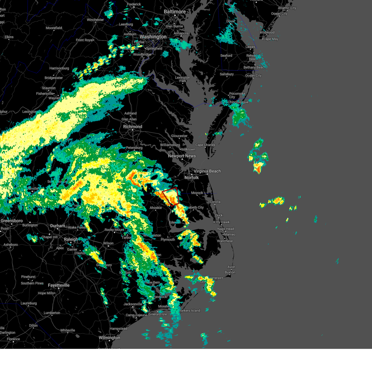 At 147 pm edt, a severe thunderstorm capable of producing a tornado was located over sunbury, moving north at 40 mph (at 145 pm edt, the public reported a funnel cloud just north of the gates county line). Hazards include tornado. Flying debris will be dangerous to those caught without shelter. mobile homes will be damaged or destroyed. damage to roofs, windows, and vehicles will occur. tree damage is likely. this dangerous storm will be near, suffolk around 155 pm edt. whaleyville around 200 pm edt. Other locations impacted by this tornadic thunderstorm include easons crossroads, acorn hill, savage, drum hill, hazelton, buckland, carter, reynoldson, and somerton. At 147 pm edt, a severe thunderstorm capable of producing a tornado was located over sunbury, moving north at 40 mph (at 145 pm edt, the public reported a funnel cloud just north of the gates county line). Hazards include tornado. Flying debris will be dangerous to those caught without shelter. mobile homes will be damaged or destroyed. damage to roofs, windows, and vehicles will occur. tree damage is likely. this dangerous storm will be near, suffolk around 155 pm edt. whaleyville around 200 pm edt. Other locations impacted by this tornadic thunderstorm include easons crossroads, acorn hill, savage, drum hill, hazelton, buckland, carter, reynoldson, and somerton.
|
| 8/8/2024 1:38 PM EDT |
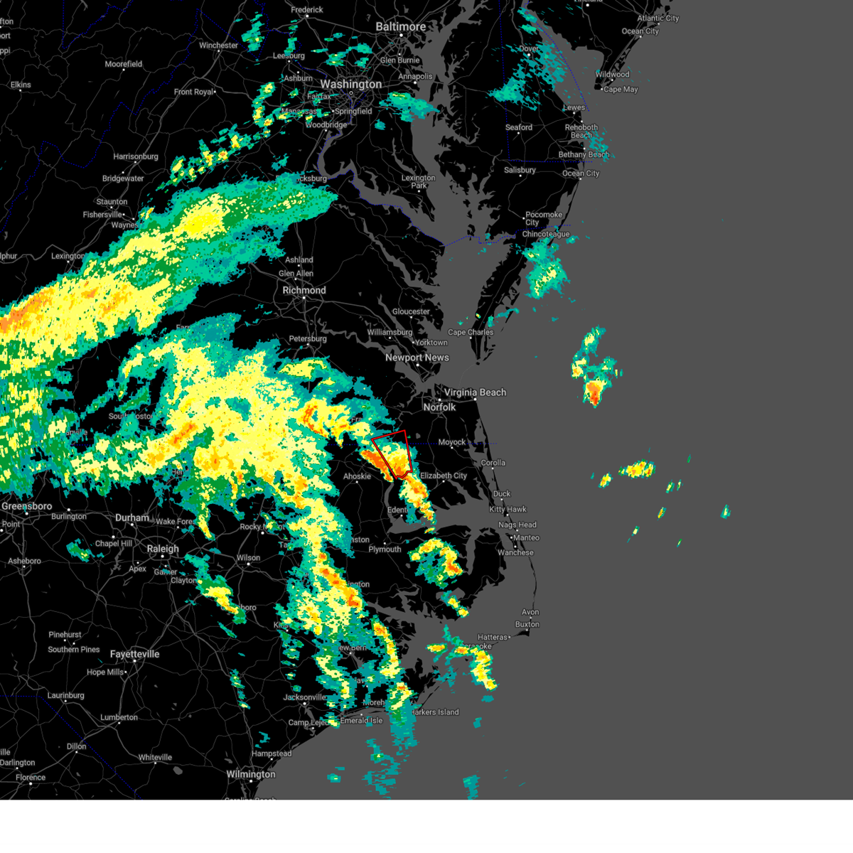 Torakq the national weather service in wakefield has issued a * tornado warning for, central gates county in northeastern north carolina, the south central city of suffolk in southeastern virginia, * until 215 pm edt. * at 138 pm edt, a severe thunderstorm capable of producing a tornado was located over hobbsville, or near ryland, moving north at 45 mph (radar indicated rotation). Hazards include tornado. Flying debris will be dangerous to those caught without shelter. mobile homes will be damaged or destroyed. damage to roofs, windows, and vehicles will occur. tree damage is likely. this dangerous storm will be near, sunbury around 145 pm edt. suffolk around 155 pm edt. whaleyville around 200 pm edt. Other locations impacted by this tornadic thunderstorm include easons crossroads, acorn hill, savage, drum hill, hazelton, buckland, sandy cross, carter, reynoldson, and somerton. Torakq the national weather service in wakefield has issued a * tornado warning for, central gates county in northeastern north carolina, the south central city of suffolk in southeastern virginia, * until 215 pm edt. * at 138 pm edt, a severe thunderstorm capable of producing a tornado was located over hobbsville, or near ryland, moving north at 45 mph (radar indicated rotation). Hazards include tornado. Flying debris will be dangerous to those caught without shelter. mobile homes will be damaged or destroyed. damage to roofs, windows, and vehicles will occur. tree damage is likely. this dangerous storm will be near, sunbury around 145 pm edt. suffolk around 155 pm edt. whaleyville around 200 pm edt. Other locations impacted by this tornadic thunderstorm include easons crossroads, acorn hill, savage, drum hill, hazelton, buckland, sandy cross, carter, reynoldson, and somerton.
|
| 8/4/2024 6:23 PM EDT |
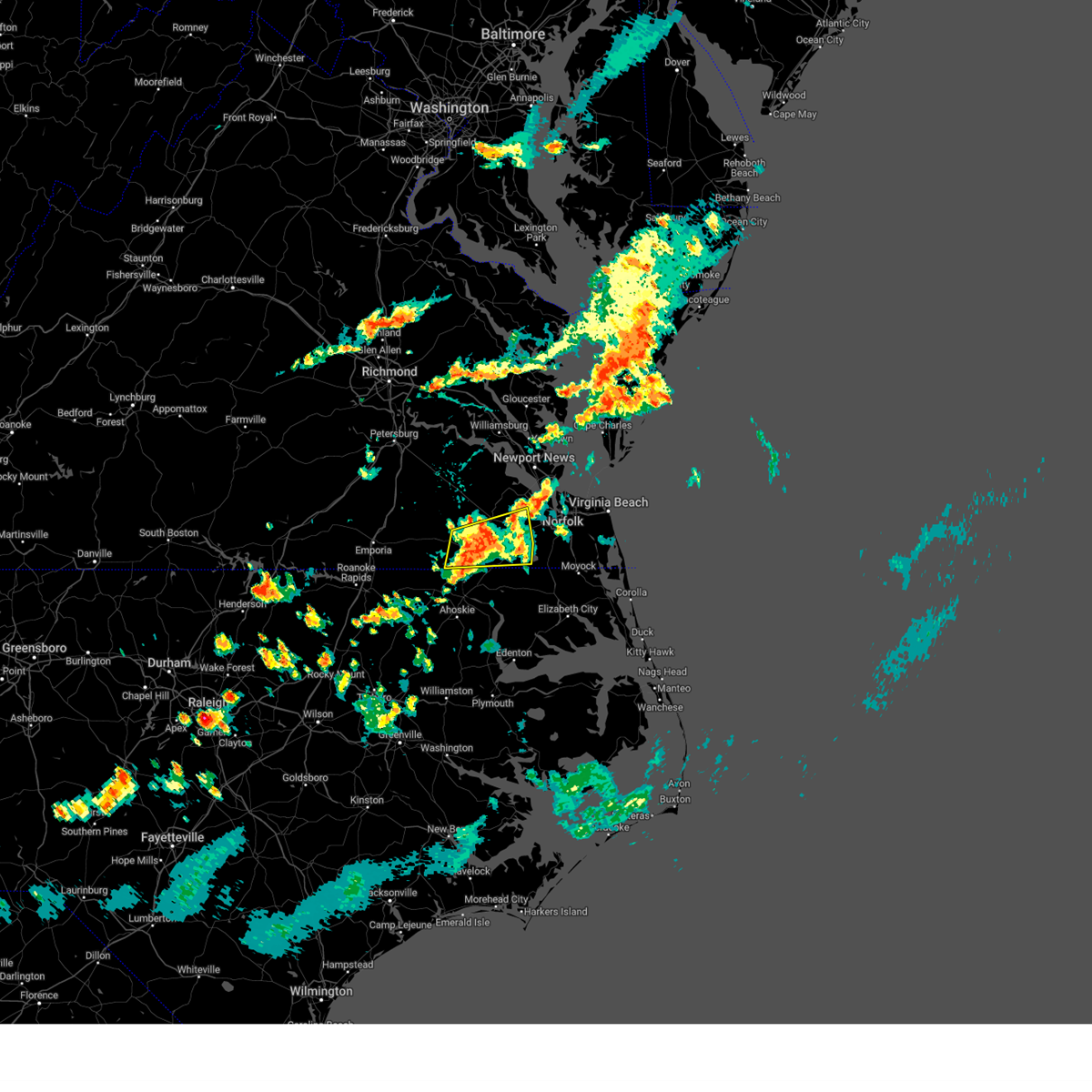 the severe thunderstorm warning has been cancelled and is no longer in effect the severe thunderstorm warning has been cancelled and is no longer in effect
|
| 8/4/2024 6:04 PM EDT |
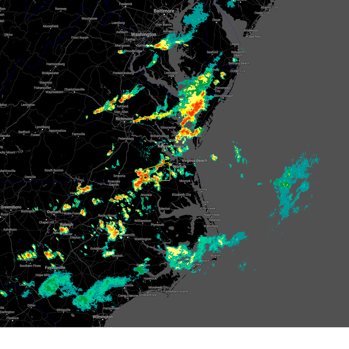 Svrakq the national weather service in wakefield has issued a * severe thunderstorm warning for, the city of franklin in southeastern virginia, southwestern isle of wight county in southeastern virginia, southeastern southampton county in southeastern virginia, the city of suffolk in southeastern virginia, * until 645 pm edt. * at 604 pm edt, a severe thunderstorm was located over franklin, moving east at 25 mph (radar indicated). Hazards include 60 mph wind gusts. Expect damage to trees and powerlines. this severe thunderstorm will be near, suffolk and carrsville around 610 pm edt. holland around 615 pm edt. Other locations impacted by this severe thunderstorm include handsom, lummis, suffolk airport, saunders, cleopus, magnolia, indika, somerton, collosse, and wilroy. Svrakq the national weather service in wakefield has issued a * severe thunderstorm warning for, the city of franklin in southeastern virginia, southwestern isle of wight county in southeastern virginia, southeastern southampton county in southeastern virginia, the city of suffolk in southeastern virginia, * until 645 pm edt. * at 604 pm edt, a severe thunderstorm was located over franklin, moving east at 25 mph (radar indicated). Hazards include 60 mph wind gusts. Expect damage to trees and powerlines. this severe thunderstorm will be near, suffolk and carrsville around 610 pm edt. holland around 615 pm edt. Other locations impacted by this severe thunderstorm include handsom, lummis, suffolk airport, saunders, cleopus, magnolia, indika, somerton, collosse, and wilroy.
|
| 8/3/2024 5:15 PM EDT |
 the severe thunderstorm warning has been cancelled and is no longer in effect the severe thunderstorm warning has been cancelled and is no longer in effect
|
| 8/3/2024 5:15 PM EDT |
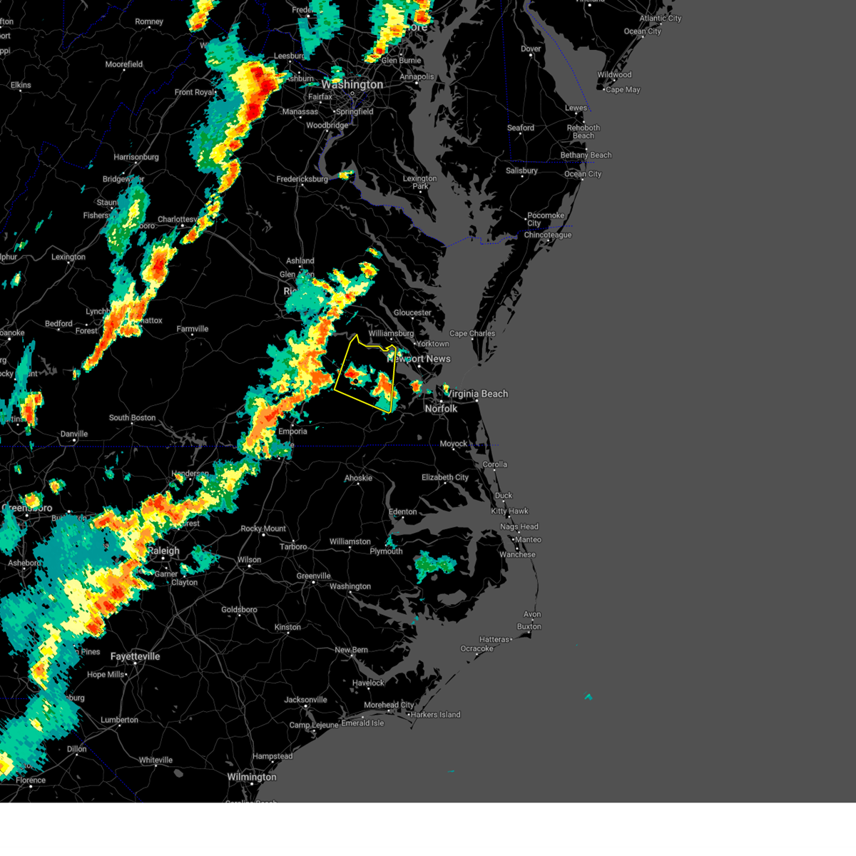 At 515 pm edt, severe thunderstorms were located along a line extending from waverly to near dendron to isle of wight, moving northeast at 40 mph (radar indicated). Hazards include 60 mph wind gusts. Expect damage to trees and powerlines. these severe storms will be near, dendron and elberon around 520 pm edt. surry and cabin point around 525 pm edt. claremont and scotland around 530 pm edt. Other locations impacted by these severe thunderstorms include taylors corner, booth fork, carsley, pons, chippokes state park, spring grove, bethel church, ellis fork, poolesville, and gwaltney corner. At 515 pm edt, severe thunderstorms were located along a line extending from waverly to near dendron to isle of wight, moving northeast at 40 mph (radar indicated). Hazards include 60 mph wind gusts. Expect damage to trees and powerlines. these severe storms will be near, dendron and elberon around 520 pm edt. surry and cabin point around 525 pm edt. claremont and scotland around 530 pm edt. Other locations impacted by these severe thunderstorms include taylors corner, booth fork, carsley, pons, chippokes state park, spring grove, bethel church, ellis fork, poolesville, and gwaltney corner.
|
| 8/3/2024 4:52 PM EDT |
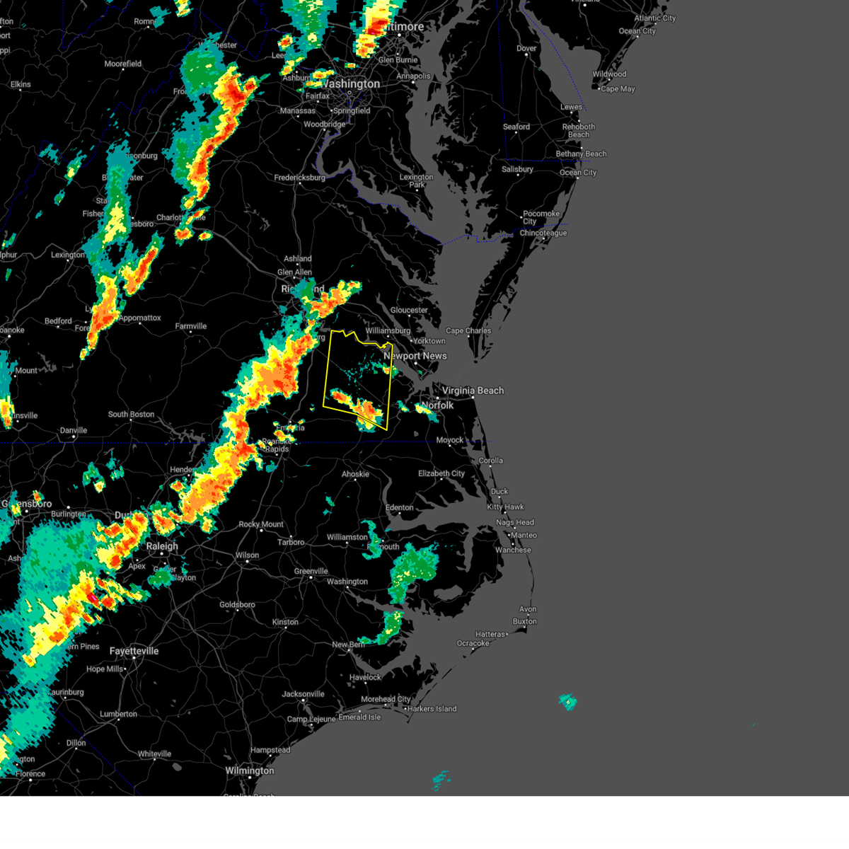 Svrakq the national weather service in wakefield has issued a * severe thunderstorm warning for, western isle of wight county in southeastern virginia, northeastern southampton county in southeastern virginia, northeastern prince george county in south central virginia, the southwestern city of suffolk in southeastern virginia, eastern sussex county in southeastern virginia, surry county in southeastern virginia, * until 530 pm edt. * at 451 pm edt, severe thunderstorms were located along a line extending from 6 miles south of homeville to sedley to carrsville, moving north at 45 mph (radar indicated). Hazards include 60 mph wind gusts. Expect damage to trees and powerlines. severe thunderstorms will be near, homeville around 455 pm edt. wakefield, ivor, and zuni around 500 pm edt. waverly around 505 pm edt. dendron around 510 pm edt. elberon around 515 pm edt. surry and cabin point around 520 pm edt. burrowsville around 525 pm edt. Other locations impacted by these severe thunderstorms include vicksville, taylors corner, booth fork, carsley, pons, chippokes state park, spring grove, bethel church, lumberton, and ellis fork. Svrakq the national weather service in wakefield has issued a * severe thunderstorm warning for, western isle of wight county in southeastern virginia, northeastern southampton county in southeastern virginia, northeastern prince george county in south central virginia, the southwestern city of suffolk in southeastern virginia, eastern sussex county in southeastern virginia, surry county in southeastern virginia, * until 530 pm edt. * at 451 pm edt, severe thunderstorms were located along a line extending from 6 miles south of homeville to sedley to carrsville, moving north at 45 mph (radar indicated). Hazards include 60 mph wind gusts. Expect damage to trees and powerlines. severe thunderstorms will be near, homeville around 455 pm edt. wakefield, ivor, and zuni around 500 pm edt. waverly around 505 pm edt. dendron around 510 pm edt. elberon around 515 pm edt. surry and cabin point around 520 pm edt. burrowsville around 525 pm edt. Other locations impacted by these severe thunderstorms include vicksville, taylors corner, booth fork, carsley, pons, chippokes state park, spring grove, bethel church, lumberton, and ellis fork.
|
| 7/18/2024 5:05 PM EDT |
 Svrakq the national weather service in wakefield has issued a * severe thunderstorm warning for, north central camden county in northeastern north carolina, northern currituck county in northeastern north carolina, the southern city of norfolk in southeastern virginia, the city of chesapeake in southeastern virginia, the city of portsmouth in southeastern virginia, the city of virginia beach in southeastern virginia, * until 600 pm edt. * at 505 pm edt, severe thunderstorms were located along a line extending from bowers hill to near chesapeake to 7 miles north of south mills, moving east at 30 mph (radar indicated). Hazards include 60 mph wind gusts. Expect damage to trees and powerlines. severe thunderstorms will be near, deep creek, chesapeake, portsmouth, bowers hill, cradock, and western branch around 510 pm edt. great bridge, downtown portsmouth, norfolk, and northwest around 515 pm edt. virginia beach, downtown norfolk, norfolk state university, and fentress around 520 pm edt. regent university and ghent around 525 pm edt. kempsville and virginia wesleyan university around 530 pm edt. back bay and princess anne around 535 pm edt. Other locations impacted by these severe thunderstorms include south norfolk, rudee heights, portlock, mount pleasant, princess anne plaza, sigma, sandbridge beach, herberts corner, oceana nas, and sharon. Svrakq the national weather service in wakefield has issued a * severe thunderstorm warning for, north central camden county in northeastern north carolina, northern currituck county in northeastern north carolina, the southern city of norfolk in southeastern virginia, the city of chesapeake in southeastern virginia, the city of portsmouth in southeastern virginia, the city of virginia beach in southeastern virginia, * until 600 pm edt. * at 505 pm edt, severe thunderstorms were located along a line extending from bowers hill to near chesapeake to 7 miles north of south mills, moving east at 30 mph (radar indicated). Hazards include 60 mph wind gusts. Expect damage to trees and powerlines. severe thunderstorms will be near, deep creek, chesapeake, portsmouth, bowers hill, cradock, and western branch around 510 pm edt. great bridge, downtown portsmouth, norfolk, and northwest around 515 pm edt. virginia beach, downtown norfolk, norfolk state university, and fentress around 520 pm edt. regent university and ghent around 525 pm edt. kempsville and virginia wesleyan university around 530 pm edt. back bay and princess anne around 535 pm edt. Other locations impacted by these severe thunderstorms include south norfolk, rudee heights, portlock, mount pleasant, princess anne plaza, sigma, sandbridge beach, herberts corner, oceana nas, and sharon.
|
| 7/18/2024 4:47 PM EDT |
 At 447 pm edt, a severe thunderstorm was located near downtown suffolk, moving east at 25 mph (radar indicated). Hazards include 60 mph wind gusts. Expect damage to trees and powerlines. this severe storm will be near, chesapeake and suffolk around 450 pm edt. Other locations impacted by this severe thunderstorm include wilroy, lummis, nurney, kilby, suffolk airport, herberts corner, saunders, magnolia, and chesapeake airport. At 447 pm edt, a severe thunderstorm was located near downtown suffolk, moving east at 25 mph (radar indicated). Hazards include 60 mph wind gusts. Expect damage to trees and powerlines. this severe storm will be near, chesapeake and suffolk around 450 pm edt. Other locations impacted by this severe thunderstorm include wilroy, lummis, nurney, kilby, suffolk airport, herberts corner, saunders, magnolia, and chesapeake airport.
|
| 7/18/2024 4:26 PM EDT |
 Svrakq the national weather service in wakefield has issued a * severe thunderstorm warning for, the southwestern city of chesapeake in southeastern virginia, the city of suffolk in southeastern virginia, * until 515 pm edt. * at 426 pm edt, a severe thunderstorm was located near suffolk, or near holland, moving east at 25 mph (radar indicated). Hazards include 60 mph wind gusts and penny size hail. Expect damage to trees and powerlines. this severe thunderstorm will be near, suffolk around 430 pm edt. downtown suffolk around 435 pm edt. chesapeake around 445 pm edt. Other locations impacted by this severe thunderstorm include wilroy, lummis, nurney, kilby, suffolk airport, herberts corner, saunders, magnolia, somerton, and chesapeake airport. Svrakq the national weather service in wakefield has issued a * severe thunderstorm warning for, the southwestern city of chesapeake in southeastern virginia, the city of suffolk in southeastern virginia, * until 515 pm edt. * at 426 pm edt, a severe thunderstorm was located near suffolk, or near holland, moving east at 25 mph (radar indicated). Hazards include 60 mph wind gusts and penny size hail. Expect damage to trees and powerlines. this severe thunderstorm will be near, suffolk around 430 pm edt. downtown suffolk around 435 pm edt. chesapeake around 445 pm edt. Other locations impacted by this severe thunderstorm include wilroy, lummis, nurney, kilby, suffolk airport, herberts corner, saunders, magnolia, somerton, and chesapeake airport.
|
| 7/18/2024 3:55 PM EDT | At 354 pm edt, severe thunderstorms were located along a line extending from near sedley to 6 miles northwest of boykins to near gaston, moving east at 30 mph (radar indicated). Hazards include 60 mph wind gusts and quarter size hail. Minor damage to vehicles is possible. expect wind damage to trees and powerlines. these severe storms will be near, franklin, courtland, garysburg, boykins, seaboard, newsoms, hunterdale, and sedley around 400 pm edt. windsor around 405 pm edt. suffolk and carrsville around 410 pm edt. holland and kings fork around 420 pm edt. conway around 430 pm edt. Other locations impacted by these severe thunderstorms include vicksville, milwaukee, gum forks, jackson, worrell, dory, pleasant grove, sunbeam, lees mill, and creeksville. |
| 7/18/2024 3:37 PM EDT |
 Svrakq the national weather service in wakefield has issued a * severe thunderstorm warning for, northampton county in northeastern north carolina, northwestern hertford county in northeastern north carolina, southeastern greensville county in southeastern virginia, the city of franklin in southeastern virginia, southwestern isle of wight county in southeastern virginia, southampton county in southeastern virginia, the southwestern city of suffolk in southeastern virginia, * until 430 pm edt. * at 337 pm edt, severe thunderstorms were located along a line extending from 7 miles south of sussex to claresville to near barley, moving east at 30 mph (radar indicated). Hazards include 60 mph wind gusts and quarter size hail. Minor damage to vehicles is possible. expect wind damage to trees and powerlines. severe thunderstorms will be near, roanoke rapids and gaston around 340 pm edt. garysburg and seaboard around 350 pm edt. courtland and boykins around 355 pm edt. newsoms and sedley around 400 pm edt. franklin and hunterdale around 410 pm edt. Other locations impacted by these severe thunderstorms include vicksville, milwaukee, gum forks, jackson, worrell, dory, pleasant grove, sunbeam, lees mill, and creeksville. Svrakq the national weather service in wakefield has issued a * severe thunderstorm warning for, northampton county in northeastern north carolina, northwestern hertford county in northeastern north carolina, southeastern greensville county in southeastern virginia, the city of franklin in southeastern virginia, southwestern isle of wight county in southeastern virginia, southampton county in southeastern virginia, the southwestern city of suffolk in southeastern virginia, * until 430 pm edt. * at 337 pm edt, severe thunderstorms were located along a line extending from 7 miles south of sussex to claresville to near barley, moving east at 30 mph (radar indicated). Hazards include 60 mph wind gusts and quarter size hail. Minor damage to vehicles is possible. expect wind damage to trees and powerlines. severe thunderstorms will be near, roanoke rapids and gaston around 340 pm edt. garysburg and seaboard around 350 pm edt. courtland and boykins around 355 pm edt. newsoms and sedley around 400 pm edt. franklin and hunterdale around 410 pm edt. Other locations impacted by these severe thunderstorms include vicksville, milwaukee, gum forks, jackson, worrell, dory, pleasant grove, sunbeam, lees mill, and creeksville.
|
| 7/5/2024 8:04 PM EDT |
 the severe thunderstorm warning has been cancelled and is no longer in effect the severe thunderstorm warning has been cancelled and is no longer in effect
|
| 7/5/2024 8:04 PM EDT |
 At 803 pm edt, severe thunderstorms were located along a line extending from beaconsdale to northampton to near crittenden, moving northeast at 20 mph (radar indicated). Hazards include 60 mph wind gusts. Expect damage to trees and powerlines. these severe storms will be near, newport news, hampton, hampton university, langley afb, and buckroe beach around 810 pm edt. grand view around 815 pm edt. Other locations impacted by these severe thunderstorms include fox hill, phoebus, langley view, oyster point, messick, hilton village, menchville, raleigh terrace, and dare. At 803 pm edt, severe thunderstorms were located along a line extending from beaconsdale to northampton to near crittenden, moving northeast at 20 mph (radar indicated). Hazards include 60 mph wind gusts. Expect damage to trees and powerlines. these severe storms will be near, newport news, hampton, hampton university, langley afb, and buckroe beach around 810 pm edt. grand view around 815 pm edt. Other locations impacted by these severe thunderstorms include fox hill, phoebus, langley view, oyster point, messick, hilton village, menchville, raleigh terrace, and dare.
|
| 7/5/2024 7:35 PM EDT |
 Svrakq the national weather service in wakefield has issued a * severe thunderstorm warning for, the southwestern city of poquoson in southeastern virginia, northeastern isle of wight county in southeastern virginia, the northeastern city of suffolk in southeastern virginia, southeastern york county in southeastern virginia, the city of hampton in southeastern virginia, the southern city of newport news in southeastern virginia, * until 815 pm edt. * at 735 pm edt, severe thunderstorms were located along a line extending from rescue to near smithfield to near crittenden, moving northeast at 20 mph (radar indicated). Hazards include 60 mph wind gusts. Expect damage to trees and powerlines. severe thunderstorms will be near, newport news, christopher newport university, suffolk, rescue, and crittenden around 740 pm edt. hampton and beaconsdale around 745 pm edt. northampton around 750 pm edt. Other locations impacted by these severe thunderstorms include fox hill, carrollton, phoebus, langley view, longview, benns church, huntersville, wills corner, hilton village, and chuckatuck. Svrakq the national weather service in wakefield has issued a * severe thunderstorm warning for, the southwestern city of poquoson in southeastern virginia, northeastern isle of wight county in southeastern virginia, the northeastern city of suffolk in southeastern virginia, southeastern york county in southeastern virginia, the city of hampton in southeastern virginia, the southern city of newport news in southeastern virginia, * until 815 pm edt. * at 735 pm edt, severe thunderstorms were located along a line extending from rescue to near smithfield to near crittenden, moving northeast at 20 mph (radar indicated). Hazards include 60 mph wind gusts. Expect damage to trees and powerlines. severe thunderstorms will be near, newport news, christopher newport university, suffolk, rescue, and crittenden around 740 pm edt. hampton and beaconsdale around 745 pm edt. northampton around 750 pm edt. Other locations impacted by these severe thunderstorms include fox hill, carrollton, phoebus, langley view, longview, benns church, huntersville, wills corner, hilton village, and chuckatuck.
|
| 6/24/2024 1:06 PM EDT |
 At 106 pm edt, severe thunderstorms were located along a line extending from 10 miles northeast of princess anne to 8 miles southeast of downtown suffolk, moving east at 25 mph (radar indicated). Hazards include 60 mph wind gusts and nickel size hail. Expect damage to trees and powerlines. these severe storms will be near, virginia beach, great bridge, chesapeake, fentress, and princess anne around 110 pm edt. back bay around 125 pm edt. Other locations impacted by these severe thunderstorms include south norfolk, rudee heights, portlock, mount pleasant, princess anne plaza, sigma, sandbridge beach, herberts corner, saunders, and oceana nas. At 106 pm edt, severe thunderstorms were located along a line extending from 10 miles northeast of princess anne to 8 miles southeast of downtown suffolk, moving east at 25 mph (radar indicated). Hazards include 60 mph wind gusts and nickel size hail. Expect damage to trees and powerlines. these severe storms will be near, virginia beach, great bridge, chesapeake, fentress, and princess anne around 110 pm edt. back bay around 125 pm edt. Other locations impacted by these severe thunderstorms include south norfolk, rudee heights, portlock, mount pleasant, princess anne plaza, sigma, sandbridge beach, herberts corner, saunders, and oceana nas.
|
| 6/24/2024 1:06 PM EDT |
 the severe thunderstorm warning has been cancelled and is no longer in effect the severe thunderstorm warning has been cancelled and is no longer in effect
|
| 6/24/2024 12:41 PM EDT |
 Svrakq the national weather service in wakefield has issued a * severe thunderstorm warning for, the city of norfolk in southeastern virginia, the city of chesapeake in southeastern virginia, the city of portsmouth in southeastern virginia, the southeastern city of suffolk in southeastern virginia, the city of virginia beach in southeastern virginia, * until 145 pm edt. * at 1241 pm edt, severe thunderstorms were located along a line extending from 7 miles east of norfolk international to near downtown suffolk, moving east at 30 mph (radar indicated). Hazards include 60 mph wind gusts and nickel size hail. Expect damage to trees and powerlines. severe thunderstorms will be near, virginia beach, regent university, deep creek, kempsville, virginia wesleyan university, norfolk state university, norfolk, chesapeake, portsmouth, and suffolk around 1245 pm edt. great bridge around 1255 pm edt. fentress around 100 pm edt. princess anne around 105 pm edt. back bay around 120 pm edt. Other locations impacted by these severe thunderstorms include south norfolk, rudee heights, portlock, princess anne plaza, sigma, suffolk airport, pungo, greenbrier, bayside, and wilroy. Svrakq the national weather service in wakefield has issued a * severe thunderstorm warning for, the city of norfolk in southeastern virginia, the city of chesapeake in southeastern virginia, the city of portsmouth in southeastern virginia, the southeastern city of suffolk in southeastern virginia, the city of virginia beach in southeastern virginia, * until 145 pm edt. * at 1241 pm edt, severe thunderstorms were located along a line extending from 7 miles east of norfolk international to near downtown suffolk, moving east at 30 mph (radar indicated). Hazards include 60 mph wind gusts and nickel size hail. Expect damage to trees and powerlines. severe thunderstorms will be near, virginia beach, regent university, deep creek, kempsville, virginia wesleyan university, norfolk state university, norfolk, chesapeake, portsmouth, and suffolk around 1245 pm edt. great bridge around 1255 pm edt. fentress around 100 pm edt. princess anne around 105 pm edt. back bay around 120 pm edt. Other locations impacted by these severe thunderstorms include south norfolk, rudee heights, portlock, princess anne plaza, sigma, suffolk airport, pungo, greenbrier, bayside, and wilroy.
|
| 5/27/2024 6:02 PM EDT |
 The storm which prompted the warning has weakened below severe limits, and no longer poses an immediate threat to life or property. therefore, the warning will be allowed to expire. however, gusty winds are still possible with this thunderstorm. a tornado watch remains in effect until 1100 pm edt for southeastern virginia. The storm which prompted the warning has weakened below severe limits, and no longer poses an immediate threat to life or property. therefore, the warning will be allowed to expire. however, gusty winds are still possible with this thunderstorm. a tornado watch remains in effect until 1100 pm edt for southeastern virginia.
|
| 5/27/2024 6:02 PM EDT |
 Svrakq the national weather service in wakefield has issued a * severe thunderstorm warning for, the southeastern city of poquoson in southeastern virginia, the city of norfolk in southeastern virginia, the northwestern city of chesapeake in southeastern virginia, the city of portsmouth in southeastern virginia, the northeastern city of suffolk in southeastern virginia, the northwestern city of virginia beach in southeastern virginia, the city of hampton in southeastern virginia, the southern city of newport news in southeastern virginia, * until 645 pm edt. * at 602 pm edt, severe thunderstorms were located along a line extending from langley afb to near old dominion university to near bowers hill, moving northeast at 25 mph (radar indicated). Hazards include 60 mph wind gusts. Expect damage to trees and powerlines. severe thunderstorms will be near, hampton, hampton university, downtown norfolk, langley afb, old dominion university, ocean view, downtown portsmouth, norfolk state university, norfolk, and chesapeake around 605 pm edt. virginia beach around 610 pm edt. virginia wesleyan university and norfolk international around 615 pm edt. regent university around 620 pm edt. kempsville around 625 pm edt. Other locations impacted by these severe thunderstorms include south norfolk, rudee heights, fox hill, portlock, phoebus, langley view, princess anne plaza, huntersville, hilton village, and oceana nas. Svrakq the national weather service in wakefield has issued a * severe thunderstorm warning for, the southeastern city of poquoson in southeastern virginia, the city of norfolk in southeastern virginia, the northwestern city of chesapeake in southeastern virginia, the city of portsmouth in southeastern virginia, the northeastern city of suffolk in southeastern virginia, the northwestern city of virginia beach in southeastern virginia, the city of hampton in southeastern virginia, the southern city of newport news in southeastern virginia, * until 645 pm edt. * at 602 pm edt, severe thunderstorms were located along a line extending from langley afb to near old dominion university to near bowers hill, moving northeast at 25 mph (radar indicated). Hazards include 60 mph wind gusts. Expect damage to trees and powerlines. severe thunderstorms will be near, hampton, hampton university, downtown norfolk, langley afb, old dominion university, ocean view, downtown portsmouth, norfolk state university, norfolk, and chesapeake around 605 pm edt. virginia beach around 610 pm edt. virginia wesleyan university and norfolk international around 615 pm edt. regent university around 620 pm edt. kempsville around 625 pm edt. Other locations impacted by these severe thunderstorms include south norfolk, rudee heights, fox hill, portlock, phoebus, langley view, princess anne plaza, huntersville, hilton village, and oceana nas.
|
| 5/27/2024 5:44 PM EDT |
 At 544 pm edt, a severe thunderstorm was located over rescue, or near smithfield, moving northeast at 25 mph (radar indicated). Hazards include 60 mph wind gusts. Expect damage to trees and powerlines. this severe storm will be near, newport news and hampton around 550 pm edt. northampton around 555 pm edt. hampton university around 600 pm edt. fort monroe around 605 pm edt. langley afb, grand view, and buckroe beach around 610 pm edt. Other locations impacted by this severe thunderstorm include fox hill, carrollton, phoebus, langley view, longview, benns church, wills corner, hilton village, chuckatuck, and lawson. At 544 pm edt, a severe thunderstorm was located over rescue, or near smithfield, moving northeast at 25 mph (radar indicated). Hazards include 60 mph wind gusts. Expect damage to trees and powerlines. this severe storm will be near, newport news and hampton around 550 pm edt. northampton around 555 pm edt. hampton university around 600 pm edt. fort monroe around 605 pm edt. langley afb, grand view, and buckroe beach around 610 pm edt. Other locations impacted by this severe thunderstorm include fox hill, carrollton, phoebus, langley view, longview, benns church, wills corner, hilton village, chuckatuck, and lawson.
|
| 5/27/2024 5:20 PM EDT |
 Svrakq the national weather service in wakefield has issued a * severe thunderstorm warning for, the city of poquoson in southeastern virginia, central isle of wight county in southeastern virginia, the north central city of suffolk in southeastern virginia, southeastern york county in southeastern virginia, the city of hampton in southeastern virginia, the city of newport news in southeastern virginia, * until 600 pm edt. * at 519 pm edt, a severe thunderstorm was located over isle of wight, or near windsor, moving northeast at 30 mph (radar indicated). Hazards include 60 mph wind gusts. Expect damage to trees and powerlines. this severe thunderstorm will be near, smithfield and isle of wight around 525 pm edt. rescue around 535 pm edt. newport news, hampton, christopher newport university, and beaconsdale around 550 pm edt. Other locations impacted by this severe thunderstorm include pons, carrollton, longview, benns church, oriana, bethel church, hilton village, chuckatuck, oyster point, and messick. Svrakq the national weather service in wakefield has issued a * severe thunderstorm warning for, the city of poquoson in southeastern virginia, central isle of wight county in southeastern virginia, the north central city of suffolk in southeastern virginia, southeastern york county in southeastern virginia, the city of hampton in southeastern virginia, the city of newport news in southeastern virginia, * until 600 pm edt. * at 519 pm edt, a severe thunderstorm was located over isle of wight, or near windsor, moving northeast at 30 mph (radar indicated). Hazards include 60 mph wind gusts. Expect damage to trees and powerlines. this severe thunderstorm will be near, smithfield and isle of wight around 525 pm edt. rescue around 535 pm edt. newport news, hampton, christopher newport university, and beaconsdale around 550 pm edt. Other locations impacted by this severe thunderstorm include pons, carrollton, longview, benns church, oriana, bethel church, hilton village, chuckatuck, oyster point, and messick.
|
| 5/27/2024 4:58 PM EDT |
 Svrakq the national weather service in wakefield has issued a * severe thunderstorm warning for, the city of franklin in southeastern virginia, southwestern isle of wight county in southeastern virginia, northeastern southampton county in southeastern virginia, * until 545 pm edt. * at 458 pm edt, a severe thunderstorm was located over courtland, moving northeast at 25 mph (radar indicated). Hazards include 60 mph wind gusts and penny size hail. Expect damage to trees and powerlines. this severe thunderstorm will be near, sedley around 505 pm edt. ivor around 535 pm edt. Other locations impacted by this severe thunderstorm include vicksville, berlin, bethel church, manry, central hill, whitley, collosse, dory, walters, and boaz. Svrakq the national weather service in wakefield has issued a * severe thunderstorm warning for, the city of franklin in southeastern virginia, southwestern isle of wight county in southeastern virginia, northeastern southampton county in southeastern virginia, * until 545 pm edt. * at 458 pm edt, a severe thunderstorm was located over courtland, moving northeast at 25 mph (radar indicated). Hazards include 60 mph wind gusts and penny size hail. Expect damage to trees and powerlines. this severe thunderstorm will be near, sedley around 505 pm edt. ivor around 535 pm edt. Other locations impacted by this severe thunderstorm include vicksville, berlin, bethel church, manry, central hill, whitley, collosse, dory, walters, and boaz.
|
| 5/27/2024 1:47 PM EDT |
 the severe thunderstorm warning has been cancelled and is no longer in effect the severe thunderstorm warning has been cancelled and is no longer in effect
|
| 5/27/2024 1:35 PM EDT |
 At 134 pm edt, a severe thunderstorm was located 7 miles northwest of south mills, moving northeast at 60 mph (radar indicated). Hazards include 60 mph wind gusts and penny size hail. Expect damage to trees and powerlines. this severe storm will be near, chesapeake around 140 pm edt. virginia beach, great bridge, and fentress around 150 pm edt. princess anne around 155 pm edt. Other locations impacted by this severe thunderstorm include greenbrier, mount pleasant, princess anne plaza, sigma, sandbridge beach, herberts corner, gallups corner, hickory, chesapeake airport, and pungo. At 134 pm edt, a severe thunderstorm was located 7 miles northwest of south mills, moving northeast at 60 mph (radar indicated). Hazards include 60 mph wind gusts and penny size hail. Expect damage to trees and powerlines. this severe storm will be near, chesapeake around 140 pm edt. virginia beach, great bridge, and fentress around 150 pm edt. princess anne around 155 pm edt. Other locations impacted by this severe thunderstorm include greenbrier, mount pleasant, princess anne plaza, sigma, sandbridge beach, herberts corner, gallups corner, hickory, chesapeake airport, and pungo.
|
| 5/27/2024 1:35 PM EDT |
 the severe thunderstorm warning has been cancelled and is no longer in effect the severe thunderstorm warning has been cancelled and is no longer in effect
|
| 5/27/2024 1:20 PM EDT |
 Svrakq the national weather service in wakefield has issued a * severe thunderstorm warning for, northwestern camden county in northeastern north carolina, northwestern pasquotank county in northeastern north carolina, northwestern perquimans county in northeastern north carolina, eastern gates county in northeastern north carolina, northwestern currituck county in northeastern north carolina, north central chowan county in northeastern north carolina, the city of chesapeake in southeastern virginia, the city of virginia beach in southeastern virginia, * until 200 pm edt. * at 119 pm edt, a severe thunderstorm was located over sunbury, moving northeast at 60 mph (radar indicated). Hazards include 60 mph wind gusts and quarter size hail. Minor damage to vehicles is possible. expect wind damage to trees and powerlines. this severe thunderstorm will be near, chesapeake around 130 pm edt. northwest around 145 pm edt. virginia beach and fentress around 150 pm edt. princess anne around 155 pm edt. Other locations impacted by this severe thunderstorm include gliden, horseshoe, pierceville, princess anne plaza, sigma, savage, peach, tar corner, sharon, and carter. Svrakq the national weather service in wakefield has issued a * severe thunderstorm warning for, northwestern camden county in northeastern north carolina, northwestern pasquotank county in northeastern north carolina, northwestern perquimans county in northeastern north carolina, eastern gates county in northeastern north carolina, northwestern currituck county in northeastern north carolina, north central chowan county in northeastern north carolina, the city of chesapeake in southeastern virginia, the city of virginia beach in southeastern virginia, * until 200 pm edt. * at 119 pm edt, a severe thunderstorm was located over sunbury, moving northeast at 60 mph (radar indicated). Hazards include 60 mph wind gusts and quarter size hail. Minor damage to vehicles is possible. expect wind damage to trees and powerlines. this severe thunderstorm will be near, chesapeake around 130 pm edt. northwest around 145 pm edt. virginia beach and fentress around 150 pm edt. princess anne around 155 pm edt. Other locations impacted by this severe thunderstorm include gliden, horseshoe, pierceville, princess anne plaza, sigma, savage, peach, tar corner, sharon, and carter.
|
| 5/26/2024 3:20 PM EDT |
 At 320 pm edt, a severe thunderstorm was located over chesapeake, or near deep creek, moving south at 5 mph (radar indicated). Hazards include 70 mph wind gusts and half dollar size hail. Minor damage to vehicles is possible. expect considerable tree damage. wind damage is also likely to mobile homes, roofs, and outbuildings. Locations impacted include, great bridge, chesapeake, northwest, herberts corner, hickory, and chesapeake airport. At 320 pm edt, a severe thunderstorm was located over chesapeake, or near deep creek, moving south at 5 mph (radar indicated). Hazards include 70 mph wind gusts and half dollar size hail. Minor damage to vehicles is possible. expect considerable tree damage. wind damage is also likely to mobile homes, roofs, and outbuildings. Locations impacted include, great bridge, chesapeake, northwest, herberts corner, hickory, and chesapeake airport.
|
| 5/26/2024 3:17 PM EDT |
 Svrakq the national weather service in wakefield has issued a * severe thunderstorm warning for, the city of chesapeake in southeastern virginia, * until 400 pm edt. * at 317 pm edt, a severe thunderstorm was located over chesapeake, or near deep creek, moving south at 5 mph (radar indicated). Hazards include 60 mph wind gusts and penny size hail. expect damage to trees and powerlines Svrakq the national weather service in wakefield has issued a * severe thunderstorm warning for, the city of chesapeake in southeastern virginia, * until 400 pm edt. * at 317 pm edt, a severe thunderstorm was located over chesapeake, or near deep creek, moving south at 5 mph (radar indicated). Hazards include 60 mph wind gusts and penny size hail. expect damage to trees and powerlines
|
| 5/26/2024 3:14 PM EDT |
 Svrakq the national weather service in wakefield has issued a * severe thunderstorm warning for, the city of chesapeake in southeastern virginia, * until 400 pm edt. * at 314 pm edt, a severe thunderstorm was located over chesapeake, or near deep creek, moving south at 5 mph (radar indicated). Hazards include 60 mph wind gusts and penny size hail. expect damage to trees and powerlines Svrakq the national weather service in wakefield has issued a * severe thunderstorm warning for, the city of chesapeake in southeastern virginia, * until 400 pm edt. * at 314 pm edt, a severe thunderstorm was located over chesapeake, or near deep creek, moving south at 5 mph (radar indicated). Hazards include 60 mph wind gusts and penny size hail. expect damage to trees and powerlines
|
| 5/26/2024 2:50 PM EDT |
 the severe thunderstorm warning has been cancelled and is no longer in effect the severe thunderstorm warning has been cancelled and is no longer in effect
|
| 5/26/2024 2:50 PM EDT |
 At 250 pm edt, a severe thunderstorm was located over deep creek, and is nearly stationary (radar indicated). Hazards include 60 mph wind gusts and quarter size hail. Minor damage to vehicles is possible. expect wind damage to trees and powerlines. Locations impacted include, great bridge, deep creek, chesapeake, portsmouth, cradock, fentress, south norfolk, portlock, herberts corner, hickory, and chesapeake airport. At 250 pm edt, a severe thunderstorm was located over deep creek, and is nearly stationary (radar indicated). Hazards include 60 mph wind gusts and quarter size hail. Minor damage to vehicles is possible. expect wind damage to trees and powerlines. Locations impacted include, great bridge, deep creek, chesapeake, portsmouth, cradock, fentress, south norfolk, portlock, herberts corner, hickory, and chesapeake airport.
|
| 5/26/2024 2:37 PM EDT |
 At 237 pm edt, a severe thunderstorm was located over cradock, or over downtown portsmouth, and is nearly stationary (radar indicated). Hazards include 60 mph wind gusts and penny size hail. Expect damage to trees and powerlines. Locations impacted include, virginia beach, norfolk state university, regent university, great bridge, kempsville, deep creek, downtown portsmouth, norfolk, chesapeake, portsmouth, fentress, cradock, south norfolk, portlock, mount pleasant, herberts corner, greenbrier, gallups corner, hickory, and chesapeake airport. At 237 pm edt, a severe thunderstorm was located over cradock, or over downtown portsmouth, and is nearly stationary (radar indicated). Hazards include 60 mph wind gusts and penny size hail. Expect damage to trees and powerlines. Locations impacted include, virginia beach, norfolk state university, regent university, great bridge, kempsville, deep creek, downtown portsmouth, norfolk, chesapeake, portsmouth, fentress, cradock, south norfolk, portlock, mount pleasant, herberts corner, greenbrier, gallups corner, hickory, and chesapeake airport.
|
| 5/26/2024 2:22 PM EDT |
 Svrakq the national weather service in wakefield has issued a * severe thunderstorm warning for, the southeastern city of norfolk in southeastern virginia, the central city of chesapeake in southeastern virginia, the southern city of portsmouth in southeastern virginia, the west central city of virginia beach in southeastern virginia, * until 315 pm edt. * at 222 pm edt, a severe thunderstorm was located over norfolk state university, moving south at 5 mph (radar indicated). Hazards include 70 mph wind gusts and half dollar size hail. Minor damage to vehicles is possible. expect considerable tree damage. wind damage is also likely to mobile homes, roofs, and outbuildings. this severe thunderstorm will be near, virginia beach, regent university, chesapeake, portsmouth, and cradock around 225 pm edt. Other locations impacted by this severe thunderstorm include greenbrier, south norfolk, portlock, mount pleasant, herberts corner, gallups corner, hickory, and chesapeake airport. Svrakq the national weather service in wakefield has issued a * severe thunderstorm warning for, the southeastern city of norfolk in southeastern virginia, the central city of chesapeake in southeastern virginia, the southern city of portsmouth in southeastern virginia, the west central city of virginia beach in southeastern virginia, * until 315 pm edt. * at 222 pm edt, a severe thunderstorm was located over norfolk state university, moving south at 5 mph (radar indicated). Hazards include 70 mph wind gusts and half dollar size hail. Minor damage to vehicles is possible. expect considerable tree damage. wind damage is also likely to mobile homes, roofs, and outbuildings. this severe thunderstorm will be near, virginia beach, regent university, chesapeake, portsmouth, and cradock around 225 pm edt. Other locations impacted by this severe thunderstorm include greenbrier, south norfolk, portlock, mount pleasant, herberts corner, gallups corner, hickory, and chesapeake airport.
|
| 5/26/2024 2:06 PM EDT |
 At 206 pm edt, a severe thunderstorm was located over norfolk state university, and is nearly stationary (radar indicated). Hazards include 60 mph wind gusts and quarter size hail. Minor damage to vehicles is possible. expect wind damage to trees and powerlines. Locations impacted include, virginia beach, virginia wesleyan university, old dominion university, norfolk state university, downtown norfolk, regent university, ocean view, kempsville, downtown portsmouth, norfolk, chesapeake, portsmouth, norfolk international, ghent, norfolk nas, cradock, norview, south norfolk, princess anne plaza, and bayside. At 206 pm edt, a severe thunderstorm was located over norfolk state university, and is nearly stationary (radar indicated). Hazards include 60 mph wind gusts and quarter size hail. Minor damage to vehicles is possible. expect wind damage to trees and powerlines. Locations impacted include, virginia beach, virginia wesleyan university, old dominion university, norfolk state university, downtown norfolk, regent university, ocean view, kempsville, downtown portsmouth, norfolk, chesapeake, portsmouth, norfolk international, ghent, norfolk nas, cradock, norview, south norfolk, princess anne plaza, and bayside.
|
| 5/26/2024 1:43 PM EDT |
 Svrakq the national weather service in wakefield has issued a * severe thunderstorm warning for, the city of norfolk in southeastern virginia, the north central city of chesapeake in southeastern virginia, the city of portsmouth in southeastern virginia, the northwestern city of virginia beach in southeastern virginia, * until 230 pm edt. * at 142 pm edt, a severe thunderstorm was located over ocean view, and is nearly stationary (radar indicated). Hazards include 60 mph wind gusts and penny size hail. expect damage to trees and powerlines Svrakq the national weather service in wakefield has issued a * severe thunderstorm warning for, the city of norfolk in southeastern virginia, the north central city of chesapeake in southeastern virginia, the city of portsmouth in southeastern virginia, the northwestern city of virginia beach in southeastern virginia, * until 230 pm edt. * at 142 pm edt, a severe thunderstorm was located over ocean view, and is nearly stationary (radar indicated). Hazards include 60 mph wind gusts and penny size hail. expect damage to trees and powerlines
|
| 4/12/2024 12:22 AM EDT | Svrakq the national weather service in wakefield has issued a * severe thunderstorm warning for, northwestern camden county in northeastern north carolina, northwestern pasquotank county in northeastern north carolina, northeastern gates county in northeastern north carolina, northwestern currituck county in northeastern north carolina, the city of norfolk in southeastern virginia, the city of chesapeake in southeastern virginia, the city of portsmouth in southeastern virginia, the southeastern city of suffolk in southeastern virginia, the city of virginia beach in southeastern virginia, * until 100 am edt. * at 1221 am edt, a severe thunderstorm was located near northwest, or 8 miles north of south mills, moving northeast at 60 mph (radar indicated). Hazards include 60 mph wind gusts. Expect damage to trees and powerlines. this severe thunderstorm will be near, great bridge, deep creek, chesapeake, northwest, and fentress around 1225 am edt. virginia beach, regent university, and portsmouth around 1230 am edt. kempsville, virginia wesleyan university, norfolk state university, norfolk, cradock, and princess anne around 1235 am edt. norview and norfolk international around 1240 am edt. Other locations impacted by this severe thunderstorm include south norfolk, horseshoe, rudee heights, portlock, pierceville, princess anne plaza, tar corner, sharon, pungo, and greenbrier. |
| 1/9/2024 9:02 PM EST |
 At 901 pm est, severe thunderstorms were located along a line extending from near churchland to near hobbsville, moving northeast at 45 mph (radar indicated). Hazards include 60 mph wind gusts. Expect damage to trees and powerlines. these severe storms will be near, hampton, deep creek, downtown norfolk, churchland, old dominion university, downtown portsmouth, norfolk, chesapeake, portsmouth, and ghent around 905 pm est. hampton university, ocean view, norfolk state university, morgans corner, norview, and buckroe beach around 910 pm est. virginia beach, great bridge, south mills, and norfolk international around 915 pm est. regent university, virginia wesleyan university, and grand view around 920 pm est. kempsville, northwest, and fentress around 925 pm est. other locations impacted by these severe thunderstorms include south norfolk, gliden, horseshoe, portlock, pierceville, savage, peach, huntersville, tar corner, and nicanor. hail threat, radar indicated max hail size, <. 75 in wind threat, radar indicated max wind gust, 60 mph. At 901 pm est, severe thunderstorms were located along a line extending from near churchland to near hobbsville, moving northeast at 45 mph (radar indicated). Hazards include 60 mph wind gusts. Expect damage to trees and powerlines. these severe storms will be near, hampton, deep creek, downtown norfolk, churchland, old dominion university, downtown portsmouth, norfolk, chesapeake, portsmouth, and ghent around 905 pm est. hampton university, ocean view, norfolk state university, morgans corner, norview, and buckroe beach around 910 pm est. virginia beach, great bridge, south mills, and norfolk international around 915 pm est. regent university, virginia wesleyan university, and grand view around 920 pm est. kempsville, northwest, and fentress around 925 pm est. other locations impacted by these severe thunderstorms include south norfolk, gliden, horseshoe, portlock, pierceville, savage, peach, huntersville, tar corner, and nicanor. hail threat, radar indicated max hail size, <. 75 in wind threat, radar indicated max wind gust, 60 mph.
|
| 1/9/2024 8:39 PM EST |
 At 838 pm est, severe thunderstorms were located along a line extending from near fort eustis to near isle of wight to near holland, moving northeast at 60 mph (radar indicated). Hazards include 60 mph wind gusts. Expect damage to trees and powerlines. these severe storms will be near, newport news, smithfield, windsor, suffolk, fort eustis, rescue, kings fork, and denbigh around 845 pm est. hampton, christopher newport university, patrick henry field, tabb, beaconsdale, and crittenden around 850 pm est. seaford and northampton around 855 pm est. other locations impacted by these severe thunderstorms include rushmere, pons, carrollton, longview, benns church, oriana, bethel church, hilton village, chuckatuck, and lees mill. hail threat, radar indicated max hail size, <. 75 in wind threat, radar indicated max wind gust, 60 mph. At 838 pm est, severe thunderstorms were located along a line extending from near fort eustis to near isle of wight to near holland, moving northeast at 60 mph (radar indicated). Hazards include 60 mph wind gusts. Expect damage to trees and powerlines. these severe storms will be near, newport news, smithfield, windsor, suffolk, fort eustis, rescue, kings fork, and denbigh around 845 pm est. hampton, christopher newport university, patrick henry field, tabb, beaconsdale, and crittenden around 850 pm est. seaford and northampton around 855 pm est. other locations impacted by these severe thunderstorms include rushmere, pons, carrollton, longview, benns church, oriana, bethel church, hilton village, chuckatuck, and lees mill. hail threat, radar indicated max hail size, <. 75 in wind threat, radar indicated max wind gust, 60 mph.
|
| 1/9/2024 8:31 PM EST |
 At 831 pm est, severe thunderstorms were located along a line extending from near whaleyville to 8 miles south of colerain, moving northeast at 50 mph (radar indicated). Hazards include 60 mph wind gusts. Expect damage to trees and powerlines. severe thunderstorms will be near, gatesville, suffolk, gates, colerain, harrellsville, rockyhock, and whaleyville around 835 pm est. downtown suffolk, ryland, sunbury, tyner, valhalla, and hobbsville around 840 pm est. kings fork and corapeake around 845 pm est. chesapeake, driver, and belvidere around 850 pm est. portsmouth, bowers hill, and crittenden around 855 pm est. churchland and western branch around 900 pm est. newport news, hampton, deep creek, old dominion university, norfolk, and cradock around 905 pm est. hampton university, downtown norfolk, south mills, downtown portsmouth, ghent, norfolk nas, morgans corner, and fort monroe around 910 pm est. other locations impacted by these severe thunderstorms include goose pond, south norfolk, portlock, pierceville, newsome store, savage, arrowhead beach, huntersville, mount gould, and carter. hail threat, radar indicated max hail size, <. 75 in wind threat, radar indicated max wind gust, 60 mph. At 831 pm est, severe thunderstorms were located along a line extending from near whaleyville to 8 miles south of colerain, moving northeast at 50 mph (radar indicated). Hazards include 60 mph wind gusts. Expect damage to trees and powerlines. severe thunderstorms will be near, gatesville, suffolk, gates, colerain, harrellsville, rockyhock, and whaleyville around 835 pm est. downtown suffolk, ryland, sunbury, tyner, valhalla, and hobbsville around 840 pm est. kings fork and corapeake around 845 pm est. chesapeake, driver, and belvidere around 850 pm est. portsmouth, bowers hill, and crittenden around 855 pm est. churchland and western branch around 900 pm est. newport news, hampton, deep creek, old dominion university, norfolk, and cradock around 905 pm est. hampton university, downtown norfolk, south mills, downtown portsmouth, ghent, norfolk nas, morgans corner, and fort monroe around 910 pm est. other locations impacted by these severe thunderstorms include goose pond, south norfolk, portlock, pierceville, newsome store, savage, arrowhead beach, huntersville, mount gould, and carter. hail threat, radar indicated max hail size, <. 75 in wind threat, radar indicated max wind gust, 60 mph.
|
| 1/9/2024 8:15 PM EST |
 At 813 pm est, severe thunderstorms were located along a line extending from 6 miles southwest of wakefield to near courtland to near chowan university, moving northeast at 60 mph (radar indicated). Hazards include 60 mph wind gusts. Expect damage to trees and powerlines. severe thunderstorms will be near, franklin, murfreesboro, suffolk, ivor, como, hunterdale, and sedley around 820 pm est. zuni and carrsville around 825 pm est. windsor, holland, and isle of wight around 830 pm est. smithfield around 835 pm est. newport news and fort eustis around 840 pm est. rescue, kings fork, and denbigh around 845 pm est. hampton, christopher newport university, patrick henry field, tabb, beaconsdale, and crittenden around 850 pm est. other locations impacted by these severe thunderstorms include eagletown, vicksville, pons, carrollton, longview, menola, oriana, dort, chuckatuck, and dory. hail threat, radar indicated max hail size, <. 75 in wind threat, radar indicated max wind gust, 60 mph. At 813 pm est, severe thunderstorms were located along a line extending from 6 miles southwest of wakefield to near courtland to near chowan university, moving northeast at 60 mph (radar indicated). Hazards include 60 mph wind gusts. Expect damage to trees and powerlines. severe thunderstorms will be near, franklin, murfreesboro, suffolk, ivor, como, hunterdale, and sedley around 820 pm est. zuni and carrsville around 825 pm est. windsor, holland, and isle of wight around 830 pm est. smithfield around 835 pm est. newport news and fort eustis around 840 pm est. rescue, kings fork, and denbigh around 845 pm est. hampton, christopher newport university, patrick henry field, tabb, beaconsdale, and crittenden around 850 pm est. other locations impacted by these severe thunderstorms include eagletown, vicksville, pons, carrollton, longview, menola, oriana, dort, chuckatuck, and dory. hail threat, radar indicated max hail size, <. 75 in wind threat, radar indicated max wind gust, 60 mph.
|
| 9/9/2023 3:13 PM EDT |
 At 313 pm edt, a severe thunderstorm was located near carrsville, or 7 miles northeast of franklin, moving northwest at 30 mph (radar indicated). Hazards include 60 mph wind gusts. Expect damage to trees and powerlines. this severe thunderstorm will remain over mainly rural areas of southwestern isle of wight, and east central southampton counties, the city of franklin and the west central city of suffolk, including the following locations, walters, boaz, collosse, burdette, lees mill, and elwood. hail threat, radar indicated max hail size, <. 75 in wind threat, radar indicated max wind gust, 60 mph. At 313 pm edt, a severe thunderstorm was located near carrsville, or 7 miles northeast of franklin, moving northwest at 30 mph (radar indicated). Hazards include 60 mph wind gusts. Expect damage to trees and powerlines. this severe thunderstorm will remain over mainly rural areas of southwestern isle of wight, and east central southampton counties, the city of franklin and the west central city of suffolk, including the following locations, walters, boaz, collosse, burdette, lees mill, and elwood. hail threat, radar indicated max hail size, <. 75 in wind threat, radar indicated max wind gust, 60 mph.
|
| 9/9/2023 3:00 PM EDT | Trees were reported down near the holland bypass on highway 5 in city of suffolk county VA, 4 miles NE of Suffolk, VA |
| 9/9/2023 2:57 PM EDT |
 At 256 pm edt, a severe thunderstorm was located over holland, moving northwest at 25 mph (radar indicated). Hazards include 60 mph wind gusts. Expect damage to trees and powerlines. this severe storm will be near, holland, suffolk, and carrsville around 300 pm edt. zuni around 325 pm edt. other locations impacted by this severe thunderstorm include whitley, collosse, lees mill, lummis, walters, boaz, burdette, cleopus, elwood, and indika. hail threat, radar indicated max hail size, <. 75 in wind threat, radar indicated max wind gust, 60 mph. At 256 pm edt, a severe thunderstorm was located over holland, moving northwest at 25 mph (radar indicated). Hazards include 60 mph wind gusts. Expect damage to trees and powerlines. this severe storm will be near, holland, suffolk, and carrsville around 300 pm edt. zuni around 325 pm edt. other locations impacted by this severe thunderstorm include whitley, collosse, lees mill, lummis, walters, boaz, burdette, cleopus, elwood, and indika. hail threat, radar indicated max hail size, <. 75 in wind threat, radar indicated max wind gust, 60 mph.
|
| 9/9/2023 2:44 PM EDT | Wires were reported down on little fork road. time estimated from rada in city of suffolk county VA, 9.5 miles N of Suffolk, VA |
| 9/9/2023 2:44 PM EDT |
 At 244 pm edt, a severe thunderstorm was located over whaleyville, or 7 miles southeast of holland, moving north at 25 mph (radar indicated). Hazards include 60 mph wind gusts. Expect damage to trees and powerlines. this severe thunderstorm will be near, suffolk around 250 pm edt. holland around 255 pm edt. windsor around 310 pm edt. other locations impacted by this severe thunderstorm include lummis, drum hill, hazelton, buckland, cleopus, indika, somerton, whitley, collosse, and lees mill. hail threat, radar indicated max hail size, <. 75 in wind threat, radar indicated max wind gust, 60 mph. At 244 pm edt, a severe thunderstorm was located over whaleyville, or 7 miles southeast of holland, moving north at 25 mph (radar indicated). Hazards include 60 mph wind gusts. Expect damage to trees and powerlines. this severe thunderstorm will be near, suffolk around 250 pm edt. holland around 255 pm edt. windsor around 310 pm edt. other locations impacted by this severe thunderstorm include lummis, drum hill, hazelton, buckland, cleopus, indika, somerton, whitley, collosse, and lees mill. hail threat, radar indicated max hail size, <. 75 in wind threat, radar indicated max wind gust, 60 mph.
|
| 9/9/2023 1:33 PM EDT |
 At 132 pm edt, severe thunderstorms were located along a line extending from near windsor to near smithfield, moving northwest at 20 mph (radar indicated). Hazards include 60 mph wind gusts and penny size hail. Expect damage to trees and powerlines. these severe storms will be near, smithfield, isle of wight, and zuni around 140 pm edt. ivor around 145 pm edt. other locations impacted by these severe thunderstorms include pons, longview, benns church, wills corner, bethel church, indika, lawson, central hill, whitley, and comet. hail threat, radar indicated max hail size, 0. 75 in wind threat, radar indicated max wind gust, 60 mph. At 132 pm edt, severe thunderstorms were located along a line extending from near windsor to near smithfield, moving northwest at 20 mph (radar indicated). Hazards include 60 mph wind gusts and penny size hail. Expect damage to trees and powerlines. these severe storms will be near, smithfield, isle of wight, and zuni around 140 pm edt. ivor around 145 pm edt. other locations impacted by these severe thunderstorms include pons, longview, benns church, wills corner, bethel church, indika, lawson, central hill, whitley, and comet. hail threat, radar indicated max hail size, 0. 75 in wind threat, radar indicated max wind gust, 60 mph.
|
| 9/9/2023 1:19 PM EDT |
 At 119 pm edt, a severe thunderstorm was located near windsor, moving north at 15 mph (radar indicated). Hazards include 60 mph wind gusts. Expect damage to trees and powerlines. this severe thunderstorm will be near, windsor and isle of wight around 125 pm edt. other locations impacted by this severe thunderstorm include pons, longview, benns church, wills corner, bethel church, chuckatuck, indika, lawson, central hill, and whitley. hail threat, radar indicated max hail size, <. 75 in wind threat, radar indicated max wind gust, 60 mph. At 119 pm edt, a severe thunderstorm was located near windsor, moving north at 15 mph (radar indicated). Hazards include 60 mph wind gusts. Expect damage to trees and powerlines. this severe thunderstorm will be near, windsor and isle of wight around 125 pm edt. other locations impacted by this severe thunderstorm include pons, longview, benns church, wills corner, bethel church, chuckatuck, indika, lawson, central hill, and whitley. hail threat, radar indicated max hail size, <. 75 in wind threat, radar indicated max wind gust, 60 mph.
|
| 9/8/2023 6:30 PM EDT |
 At 630 pm edt, a severe thunderstorm was located over chowan university, moving north at 30 mph (radar indicated). Hazards include 60 mph wind gusts and quarter size hail. Minor damage to vehicles is possible. expect wind damage to trees and powerlines. this severe thunderstorm will be near, murfreesboro, chowan university, and como around 635 pm edt. franklin around 700 pm edt. courtland and hunterdale around 705 pm edt. other locations impacted by this severe thunderstorm include pendleton, handsom, mapleton, riddicksville, sunbeam, lees mill, severn, bartonsville, riverdale, and wyanoke. hail threat, radar indicated max hail size, 1. 00 in wind threat, radar indicated max wind gust, 60 mph. At 630 pm edt, a severe thunderstorm was located over chowan university, moving north at 30 mph (radar indicated). Hazards include 60 mph wind gusts and quarter size hail. Minor damage to vehicles is possible. expect wind damage to trees and powerlines. this severe thunderstorm will be near, murfreesboro, chowan university, and como around 635 pm edt. franklin around 700 pm edt. courtland and hunterdale around 705 pm edt. other locations impacted by this severe thunderstorm include pendleton, handsom, mapleton, riddicksville, sunbeam, lees mill, severn, bartonsville, riverdale, and wyanoke. hail threat, radar indicated max hail size, 1. 00 in wind threat, radar indicated max wind gust, 60 mph.
|
| 8/15/2023 5:39 PM EDT |
 The severe thunderstorm warning for , the city of norfolk, the city of chesapeake, the city of portsmouth, the eastern city of suffolk and the northwestern city of virginia beach will expire at 545 pm edt, the storms which prompted the warning have moved out of the area. therefore, the warning will be allowed to expire. a severe thunderstorm watch remains in effect until 900 pm edt for northeastern north carolina, and southeastern virginia. The severe thunderstorm warning for , the city of norfolk, the city of chesapeake, the city of portsmouth, the eastern city of suffolk and the northwestern city of virginia beach will expire at 545 pm edt, the storms which prompted the warning have moved out of the area. therefore, the warning will be allowed to expire. a severe thunderstorm watch remains in effect until 900 pm edt for northeastern north carolina, and southeastern virginia.
|
| 8/15/2023 5:06 PM EDT |
 At 505 pm edt, severe thunderstorms were located along a line extending from near crittenden to near bowers hill to near corapeake, moving east at 30 mph (radar indicated). Hazards include 70 mph wind gusts and penny size hail. Expect considerable tree damage. damage is likely to mobile homes, roofs, and outbuildings. these severe storms will be near, churchland, chesapeake, portsmouth, suffolk, bowers hill, and western branch around 510 pm edt. deep creek, norfolk, and cradock around 515 pm edt. downtown norfolk, old dominion university, downtown portsmouth, and ghent around 520 pm edt. great bridge, norfolk state university, norfolk nas, and norview around 525 pm edt. virginia beach, regent university, ocean view, and norfolk international around 530 pm edt. kempsville, virginia wesleyan university, and fentress around 535 pm edt. other locations impacted by these severe thunderstorms include south norfolk, portlock, huntersville, herberts corner, saunders, magnolia, chuckatuck, greenbrier, hobson, and wilroy. thunderstorm damage threat, considerable hail threat, radar indicated max hail size, 0. 75 in wind threat, radar indicated max wind gust, 70 mph. At 505 pm edt, severe thunderstorms were located along a line extending from near crittenden to near bowers hill to near corapeake, moving east at 30 mph (radar indicated). Hazards include 70 mph wind gusts and penny size hail. Expect considerable tree damage. damage is likely to mobile homes, roofs, and outbuildings. these severe storms will be near, churchland, chesapeake, portsmouth, suffolk, bowers hill, and western branch around 510 pm edt. deep creek, norfolk, and cradock around 515 pm edt. downtown norfolk, old dominion university, downtown portsmouth, and ghent around 520 pm edt. great bridge, norfolk state university, norfolk nas, and norview around 525 pm edt. virginia beach, regent university, ocean view, and norfolk international around 530 pm edt. kempsville, virginia wesleyan university, and fentress around 535 pm edt. other locations impacted by these severe thunderstorms include south norfolk, portlock, huntersville, herberts corner, saunders, magnolia, chuckatuck, greenbrier, hobson, and wilroy. thunderstorm damage threat, considerable hail threat, radar indicated max hail size, 0. 75 in wind threat, radar indicated max wind gust, 70 mph.
|
| 8/15/2023 5:04 PM EDT | Multiple trees knocked down along us-58/portsmouth blvd. time estimated from rada in city of suffolk county VA, 11.1 miles WSW of Suffolk, VA |
| 8/15/2023 4:56 PM EDT |
 At 456 pm edt, a severe thunderstorm was located over christopher newport university, moving northeast at 25 mph (radar indicated). Hazards include 60 mph wind gusts. Expect damage to trees and powerlines. this severe storm will be near, newport news, hampton, christopher newport university, northampton, and beaconsdale around 500 pm edt. langley afb and tabb around 505 pm edt. other locations impacted by this severe thunderstorm include dare, newport news golf course, langley view, oyster point, oriana, messick, hornsbyville, hilton village, harris grove, and menchville. hail threat, radar indicated max hail size, <. 75 in wind threat, radar indicated max wind gust, 60 mph. At 456 pm edt, a severe thunderstorm was located over christopher newport university, moving northeast at 25 mph (radar indicated). Hazards include 60 mph wind gusts. Expect damage to trees and powerlines. this severe storm will be near, newport news, hampton, christopher newport university, northampton, and beaconsdale around 500 pm edt. langley afb and tabb around 505 pm edt. other locations impacted by this severe thunderstorm include dare, newport news golf course, langley view, oyster point, oriana, messick, hornsbyville, hilton village, harris grove, and menchville. hail threat, radar indicated max hail size, <. 75 in wind threat, radar indicated max wind gust, 60 mph.
|
| 8/15/2023 4:54 PM EDT |
 At 453 pm edt, severe thunderstorms were located along a line extending from near kings fork to downtown suffolk to near gates, moving east at 30 mph (radar indicated). Hazards include 70 mph wind gusts and penny size hail. Expect considerable tree damage. damage is likely to mobile homes, roofs, and outbuildings. severe thunderstorms will be near, chesapeake, suffolk, driver, and corapeake around 500 pm edt. bowers hill around 505 pm edt. portsmouth and western branch around 510 pm edt. deep creek and churchland around 515 pm edt. downtown portsmouth, norfolk, and cradock around 520 pm edt. great bridge, downtown norfolk, old dominion university, norfolk state university, and ghent around 525 pm edt. virginia beach, regent university, and norview around 530 pm edt. fentress around 535 pm edt. other locations impacted by these severe thunderstorms include south norfolk, portlock, suffolk airport, huntersville, sharon, chuckatuck, greenbrier, wilroy, wards corner, and nurney. thunderstorm damage threat, considerable hail threat, radar indicated max hail size, 0. 75 in wind threat, radar indicated max wind gust, 70 mph. At 453 pm edt, severe thunderstorms were located along a line extending from near kings fork to downtown suffolk to near gates, moving east at 30 mph (radar indicated). Hazards include 70 mph wind gusts and penny size hail. Expect considerable tree damage. damage is likely to mobile homes, roofs, and outbuildings. severe thunderstorms will be near, chesapeake, suffolk, driver, and corapeake around 500 pm edt. bowers hill around 505 pm edt. portsmouth and western branch around 510 pm edt. deep creek and churchland around 515 pm edt. downtown portsmouth, norfolk, and cradock around 520 pm edt. great bridge, downtown norfolk, old dominion university, norfolk state university, and ghent around 525 pm edt. virginia beach, regent university, and norview around 530 pm edt. fentress around 535 pm edt. other locations impacted by these severe thunderstorms include south norfolk, portlock, suffolk airport, huntersville, sharon, chuckatuck, greenbrier, wilroy, wards corner, and nurney. thunderstorm damage threat, considerable hail threat, radar indicated max hail size, 0. 75 in wind threat, radar indicated max wind gust, 70 mph.
|
| 8/15/2023 4:51 PM EDT |
 At 450 pm edt, severe thunderstorms were located along a line extending from near kings fork to near whaleyville to near harrellsville, moving east at 35 mph (radar indicated). Hazards include 70 mph wind gusts and nickel size hail. Expect considerable tree damage. damage is likely to mobile homes, roofs, and outbuildings. these severe storms will be near, gatesville, downtown suffolk, suffolk, harrellsville, kings fork, and whaleyville around 455 pm edt. corapeake around 500 pm edt. other locations impacted by these severe thunderstorms include tunis, savage, chowan beach, topsy, suffolk airport, buckland, carter, dort, union, and nurney. thunderstorm damage threat, considerable hail threat, radar indicated max hail size, 0. 88 in wind threat, radar indicated max wind gust, 70 mph. At 450 pm edt, severe thunderstorms were located along a line extending from near kings fork to near whaleyville to near harrellsville, moving east at 35 mph (radar indicated). Hazards include 70 mph wind gusts and nickel size hail. Expect considerable tree damage. damage is likely to mobile homes, roofs, and outbuildings. these severe storms will be near, gatesville, downtown suffolk, suffolk, harrellsville, kings fork, and whaleyville around 455 pm edt. corapeake around 500 pm edt. other locations impacted by these severe thunderstorms include tunis, savage, chowan beach, topsy, suffolk airport, buckland, carter, dort, union, and nurney. thunderstorm damage threat, considerable hail threat, radar indicated max hail size, 0. 88 in wind threat, radar indicated max wind gust, 70 mph.
|
| 8/15/2023 4:43 PM EDT |
 At 442 pm edt, severe thunderstorms were located along a line extending from near carrsville to near holland to near ahoskie, moving east at 35 mph (radar indicated). Hazards include 60 mph wind gusts and nickel size hail. Expect damage to trees and powerlines. these severe storms will be near, gatesville, suffolk, gates, harrellsville, roduco, and whaleyville around 450 pm edt. downtown suffolk and kings fork around 455 pm edt. corapeake around 500 pm edt. other locations impacted by these severe thunderstorms include tunis, menola, savage, chowan beach, topsy, suffolk airport, mapleton, buckland, carter, and dort. hail threat, radar indicated max hail size, 0. 88 in wind threat, radar indicated max wind gust, 60 mph. At 442 pm edt, severe thunderstorms were located along a line extending from near carrsville to near holland to near ahoskie, moving east at 35 mph (radar indicated). Hazards include 60 mph wind gusts and nickel size hail. Expect damage to trees and powerlines. these severe storms will be near, gatesville, suffolk, gates, harrellsville, roduco, and whaleyville around 450 pm edt. downtown suffolk and kings fork around 455 pm edt. corapeake around 500 pm edt. other locations impacted by these severe thunderstorms include tunis, menola, savage, chowan beach, topsy, suffolk airport, mapleton, buckland, carter, and dort. hail threat, radar indicated max hail size, 0. 88 in wind threat, radar indicated max wind gust, 60 mph.
|
| 8/15/2023 4:37 PM EDT |
 At 437 pm edt, a severe thunderstorm was located over smithfield, moving northeast at 25 mph (radar indicated). Hazards include 60 mph wind gusts. Expect damage to trees and powerlines. this severe thunderstorm will be near, smithfield and rescue around 440 pm edt. newport news and christopher newport university around 450 pm edt. beaconsdale around 455 pm edt. hampton, patrick henry field, and denbigh around 500 pm edt. tabb around 505 pm edt. other locations impacted by this severe thunderstorm include carrollton, lackey, langley view, longview, benns church, oriana, wills corner, bethel church, hilton village, and chuckatuck. hail threat, radar indicated max hail size, <. 75 in wind threat, radar indicated max wind gust, 60 mph. At 437 pm edt, a severe thunderstorm was located over smithfield, moving northeast at 25 mph (radar indicated). Hazards include 60 mph wind gusts. Expect damage to trees and powerlines. this severe thunderstorm will be near, smithfield and rescue around 440 pm edt. newport news and christopher newport university around 450 pm edt. beaconsdale around 455 pm edt. hampton, patrick henry field, and denbigh around 500 pm edt. tabb around 505 pm edt. other locations impacted by this severe thunderstorm include carrollton, lackey, langley view, longview, benns church, oriana, wills corner, bethel church, hilton village, and chuckatuck. hail threat, radar indicated max hail size, <. 75 in wind threat, radar indicated max wind gust, 60 mph.
|
| 8/15/2023 4:31 PM EDT |
 At 431 pm edt, severe thunderstorms were located along a line extending from near hunterdale to near franklin to near ahoskie, moving east at 40 mph (radar indicated). Hazards include 60 mph wind gusts and nickel size hail. Expect damage to trees and powerlines. these severe storms will be near, ahoskie, holland, suffolk, winton, cofield, and carrsville around 435 pm edt. windsor, gates, and roduco around 440 pm edt. gatesville and whaleyville around 445 pm edt. downtown suffolk, harrellsville, and kings fork around 450 pm edt. corapeake around 500 pm edt. other locations impacted by these severe thunderstorms include eagletown, tunis, menola, savage, chowan beach, topsy, suffolk airport, mapleton, buckland, and carter. hail threat, radar indicated max hail size, 0. 88 in wind threat, radar indicated max wind gust, 60 mph. At 431 pm edt, severe thunderstorms were located along a line extending from near hunterdale to near franklin to near ahoskie, moving east at 40 mph (radar indicated). Hazards include 60 mph wind gusts and nickel size hail. Expect damage to trees and powerlines. these severe storms will be near, ahoskie, holland, suffolk, winton, cofield, and carrsville around 435 pm edt. windsor, gates, and roduco around 440 pm edt. gatesville and whaleyville around 445 pm edt. downtown suffolk, harrellsville, and kings fork around 450 pm edt. corapeake around 500 pm edt. other locations impacted by these severe thunderstorms include eagletown, tunis, menola, savage, chowan beach, topsy, suffolk airport, mapleton, buckland, and carter. hail threat, radar indicated max hail size, 0. 88 in wind threat, radar indicated max wind gust, 60 mph.
|
| 8/15/2023 4:12 PM EDT |
 At 412 pm edt, severe thunderstorms were located along a line extending from near courtland to near boykins to near woodland, moving east at 35 mph (radar indicated). Hazards include 60 mph wind gusts and nickel size hail. Expect damage to trees and powerlines. severe thunderstorms will be near, murfreesboro, courtland, chowan university, conway, woodland, newsoms, and como around 415 pm edt. franklin, suffolk, and hunterdale around 425 pm edt. ahoskie around 430 pm edt. winton, cofield, and carrsville around 435 pm edt. holland, gates, and roduco around 440 pm edt. gatesville and whaleyville around 450 pm edt. other locations impacted by these severe thunderstorms include eagletown, milwaukee, tunis, menola, savage, chowan beach, topsy, jackson, carter, and dort. hail threat, radar indicated max hail size, 0. 88 in wind threat, radar indicated max wind gust, 60 mph. At 412 pm edt, severe thunderstorms were located along a line extending from near courtland to near boykins to near woodland, moving east at 35 mph (radar indicated). Hazards include 60 mph wind gusts and nickel size hail. Expect damage to trees and powerlines. severe thunderstorms will be near, murfreesboro, courtland, chowan university, conway, woodland, newsoms, and como around 415 pm edt. franklin, suffolk, and hunterdale around 425 pm edt. ahoskie around 430 pm edt. winton, cofield, and carrsville around 435 pm edt. holland, gates, and roduco around 440 pm edt. gatesville and whaleyville around 450 pm edt. other locations impacted by these severe thunderstorms include eagletown, milwaukee, tunis, menola, savage, chowan beach, topsy, jackson, carter, and dort. hail threat, radar indicated max hail size, 0. 88 in wind threat, radar indicated max wind gust, 60 mph.
|
| 8/7/2023 8:47 PM EDT |
 At 847 pm edt, severe thunderstorms were located along a line extending from 9 miles southeast of littleton to near halifax to near tarboro, moving northeast at 55 mph (radar indicated). Hazards include 60 mph wind gusts. Expect damage to trees and powerlines. these severe storms will be near, garysburg, rich square, woodland, and roxobel around 900 pm edt. conway, seaboard, and lewiston woodville around 905 pm edt. murfreesboro, aulander, and chowan university around 910 pm edt. ahoskie around 915 pm edt. windsor, boykins, winton, powellsville, and como around 920 pm edt. suffolk and cofield around 925 pm edt. newsoms, harrellsville, and roduco around 930 pm edt. gatesville, gates, and colerain around 935 pm edt. other locations impacted by these severe thunderstorms include goose pond, eagletown, milwaukee, whites crossroads, tunis, kelford, earleys, gum forks, menola, and newsome store. hail threat, radar indicated max hail size, <. 75 in wind threat, radar indicated max wind gust, 60 mph. At 847 pm edt, severe thunderstorms were located along a line extending from 9 miles southeast of littleton to near halifax to near tarboro, moving northeast at 55 mph (radar indicated). Hazards include 60 mph wind gusts. Expect damage to trees and powerlines. these severe storms will be near, garysburg, rich square, woodland, and roxobel around 900 pm edt. conway, seaboard, and lewiston woodville around 905 pm edt. murfreesboro, aulander, and chowan university around 910 pm edt. ahoskie around 915 pm edt. windsor, boykins, winton, powellsville, and como around 920 pm edt. suffolk and cofield around 925 pm edt. newsoms, harrellsville, and roduco around 930 pm edt. gatesville, gates, and colerain around 935 pm edt. other locations impacted by these severe thunderstorms include goose pond, eagletown, milwaukee, whites crossroads, tunis, kelford, earleys, gum forks, menola, and newsome store. hail threat, radar indicated max hail size, <. 75 in wind threat, radar indicated max wind gust, 60 mph.
|
| 8/7/2023 8:29 PM EDT |
 At 829 pm edt, severe thunderstorms were located along a line extending from 12 miles southeast of warrenton to 13 miles southwest of halifax to near elm city, moving northeast at 55 mph (radar indicated). Hazards include 60 mph wind gusts. Expect damage to trees and powerlines. severe thunderstorms will be near, garysburg and rich square around 855 pm edt. conway, woodland, and roxobel around 900 pm edt. aulander, seaboard, and lewiston woodville around 905 pm edt. murfreesboro and chowan university around 910 pm edt. ahoskie and como around 915 pm edt. windsor, boykins, winton, cofield, and powellsville around 920 pm edt. other locations impacted by these severe thunderstorms include goose pond, eagletown, milwaukee, whites crossroads, tunis, kelford, earleys, gum forks, menola, and newsome store. hail threat, radar indicated max hail size, <. 75 in wind threat, radar indicated max wind gust, 60 mph. At 829 pm edt, severe thunderstorms were located along a line extending from 12 miles southeast of warrenton to 13 miles southwest of halifax to near elm city, moving northeast at 55 mph (radar indicated). Hazards include 60 mph wind gusts. Expect damage to trees and powerlines. severe thunderstorms will be near, garysburg and rich square around 855 pm edt. conway, woodland, and roxobel around 900 pm edt. aulander, seaboard, and lewiston woodville around 905 pm edt. murfreesboro and chowan university around 910 pm edt. ahoskie and como around 915 pm edt. windsor, boykins, winton, cofield, and powellsville around 920 pm edt. other locations impacted by these severe thunderstorms include goose pond, eagletown, milwaukee, whites crossroads, tunis, kelford, earleys, gum forks, menola, and newsome store. hail threat, radar indicated max hail size, <. 75 in wind threat, radar indicated max wind gust, 60 mph.
|
| 7/19/2023 3:57 PM EDT |
 At 356 pm edt, a severe thunderstorm capable of producing a tornado was located near deep creek, moving east at 25 mph (radar indicated rotation). Hazards include tornado. Flying debris will be dangerous to those caught without shelter. mobile homes will be damaged or destroyed. damage to roofs, windows, and vehicles will occur. tree damage is likely. This dangerous storm will be near, chesapeake around 405 pm edt. At 356 pm edt, a severe thunderstorm capable of producing a tornado was located near deep creek, moving east at 25 mph (radar indicated rotation). Hazards include tornado. Flying debris will be dangerous to those caught without shelter. mobile homes will be damaged or destroyed. damage to roofs, windows, and vehicles will occur. tree damage is likely. This dangerous storm will be near, chesapeake around 405 pm edt.
|
| 7/19/2023 3:39 PM EDT |
 At 339 pm edt, a severe thunderstorm capable of producing a tornado was located near suffolk, or near downtown suffolk, moving northeast at 25 mph (radar indicated rotation). Hazards include tornado. Flying debris will be dangerous to those caught without shelter. mobile homes will be damaged or destroyed. damage to roofs, windows, and vehicles will occur. tree damage is likely. this dangerous storm will be near, bowers hill around 405 pm edt. chesapeake around 410 pm edt. Other locations impacted by this tornadic thunderstorm include suffolk airport, nurney and saunders. At 339 pm edt, a severe thunderstorm capable of producing a tornado was located near suffolk, or near downtown suffolk, moving northeast at 25 mph (radar indicated rotation). Hazards include tornado. Flying debris will be dangerous to those caught without shelter. mobile homes will be damaged or destroyed. damage to roofs, windows, and vehicles will occur. tree damage is likely. this dangerous storm will be near, bowers hill around 405 pm edt. chesapeake around 410 pm edt. Other locations impacted by this tornadic thunderstorm include suffolk airport, nurney and saunders.
|
| 7/19/2023 3:05 PM EDT |
 At 305 pm edt, a severe thunderstorm was located near crittenden, or near smithfield, moving northeast at 30 mph (radar indicated). Hazards include 60 mph wind gusts. Expect damage to trees and powerlines. this severe storm will be near, crittenden around 310 pm edt. rescue around 315 pm edt. other locations impacted by this severe thunderstorm include central hill, hobson, carrollton, longview, benns church, wills corner, bethel church, mogarts beach, chuckatuck and lawson. hail threat, radar indicated max hail size, <. 75 in wind threat, radar indicated max wind gust, 60 mph. At 305 pm edt, a severe thunderstorm was located near crittenden, or near smithfield, moving northeast at 30 mph (radar indicated). Hazards include 60 mph wind gusts. Expect damage to trees and powerlines. this severe storm will be near, crittenden around 310 pm edt. rescue around 315 pm edt. other locations impacted by this severe thunderstorm include central hill, hobson, carrollton, longview, benns church, wills corner, bethel church, mogarts beach, chuckatuck and lawson. hail threat, radar indicated max hail size, <. 75 in wind threat, radar indicated max wind gust, 60 mph.
|
| 7/19/2023 2:48 PM EDT |
 At 248 pm edt, a severe thunderstorm was located near isle of wight, or near windsor, moving northeast at 35 mph (radar indicated). Hazards include 60 mph wind gusts. Expect damage to trees and powerlines. this severe thunderstorm will be near, smithfield around 300 pm edt. suffolk and crittenden around 305 pm edt. rescue around 310 pm edt. Other locations impacted by this severe thunderstorm include central hill, hobson, carrollton, longview, benns church, wills corner, bethel church, mogarts beach, chuckatuck and lawson. At 248 pm edt, a severe thunderstorm was located near isle of wight, or near windsor, moving northeast at 35 mph (radar indicated). Hazards include 60 mph wind gusts. Expect damage to trees and powerlines. this severe thunderstorm will be near, smithfield around 300 pm edt. suffolk and crittenden around 305 pm edt. rescue around 310 pm edt. Other locations impacted by this severe thunderstorm include central hill, hobson, carrollton, longview, benns church, wills corner, bethel church, mogarts beach, chuckatuck and lawson.
|
| 7/19/2023 2:30 PM EDT |
 At 230 pm edt, a severe thunderstorm was located over hunterdale, or over franklin, moving northeast at 20 mph (radar indicated). Hazards include 60 mph wind gusts. Expect damage to trees and powerlines. this severe storm will be near, sedley around 235 pm edt. carrsville around 240 pm edt. windsor, ivor and zuni around 310 pm edt. Other locations impacted by this severe thunderstorm include handsom, berlin, indika, whitley, collosse, sunbeam, lees mill, riverdale, walters and boaz. At 230 pm edt, a severe thunderstorm was located over hunterdale, or over franklin, moving northeast at 20 mph (radar indicated). Hazards include 60 mph wind gusts. Expect damage to trees and powerlines. this severe storm will be near, sedley around 235 pm edt. carrsville around 240 pm edt. windsor, ivor and zuni around 310 pm edt. Other locations impacted by this severe thunderstorm include handsom, berlin, indika, whitley, collosse, sunbeam, lees mill, riverdale, walters and boaz.
|
| 7/19/2023 2:12 PM EDT |
 At 212 pm edt, a severe thunderstorm was located near franklin, moving northeast at 25 mph (radar indicated). Hazards include 60 mph wind gusts. Expect damage to trees and powerlines. this severe thunderstorm will be near, franklin and hunterdale around 220 pm edt. sedley around 230 pm edt. carrsville around 235 pm edt. windsor around 250 pm edt. ivor and zuni around 255 pm edt. Other locations impacted by this severe thunderstorm include handsom, berlin, indika, whitley, collosse, sunbeam, lees mill, riverdale, walters and boaz. At 212 pm edt, a severe thunderstorm was located near franklin, moving northeast at 25 mph (radar indicated). Hazards include 60 mph wind gusts. Expect damage to trees and powerlines. this severe thunderstorm will be near, franklin and hunterdale around 220 pm edt. sedley around 230 pm edt. carrsville around 235 pm edt. windsor around 250 pm edt. ivor and zuni around 255 pm edt. Other locations impacted by this severe thunderstorm include handsom, berlin, indika, whitley, collosse, sunbeam, lees mill, riverdale, walters and boaz.
|
| 7/3/2023 4:48 PM EDT |
 At 447 pm edt, severe thunderstorms were located along a line extending from near ocean view to near kempsville to back bay, moving east at 45 mph (radar indicated). Hazards include 70 mph wind gusts. Expect considerable tree damage. damage is likely to mobile homes, roofs, and outbuildings. these severe thunderstorms will remain over mainly rural areas of , the city of norfolk, the northeastern city of chesapeake, the city of portsmouth and the city of virginia beach, including the following locations, south norfolk, rudee heights, portlock, mount pleasant, princess anne plaza, sigma, sandbridge beach, oceana nas, macons corner and pungo. thunderstorm damage threat, considerable hail threat, radar indicated max hail size, <. 75 in wind threat, radar indicated max wind gust, 70 mph. At 447 pm edt, severe thunderstorms were located along a line extending from near ocean view to near kempsville to back bay, moving east at 45 mph (radar indicated). Hazards include 70 mph wind gusts. Expect considerable tree damage. damage is likely to mobile homes, roofs, and outbuildings. these severe thunderstorms will remain over mainly rural areas of , the city of norfolk, the northeastern city of chesapeake, the city of portsmouth and the city of virginia beach, including the following locations, south norfolk, rudee heights, portlock, mount pleasant, princess anne plaza, sigma, sandbridge beach, oceana nas, macons corner and pungo. thunderstorm damage threat, considerable hail threat, radar indicated max hail size, <. 75 in wind threat, radar indicated max wind gust, 70 mph.
|
| 7/3/2023 4:27 PM EDT |
 At 427 pm edt, severe thunderstorms were located along a line extending from near crittenden to near deep creek to 6 miles north of south mills, moving northeast at 30 mph (radar indicated). Hazards include 70 mph wind gusts and quarter size hail. Minor damage to vehicles is possible. expect considerable tree damage. wind damage is also likely to mobile homes, roofs, and outbuildings. these severe storms will be near, deep creek, chesapeake and cradock around 435 pm edt. downtown portsmouth and great bridge around 440 pm edt. norfolk state university, downtown norfolk, churchland, old dominion university, christopher newport university, northwest and ghent around 445 pm edt. regent university, norview and beaconsdale around 450 pm edt. kempsville, virginia wesleyan university, portsmouth, northampton, norfolk international and fentress around 455 pm edt. hampton university, langley afb, norfolk, fort monroe and norfolk nas around 500 pm edt. ocean view, back bay and buckroe beach around 505 pm edt. grand view and princess anne around 510 pm edt. other locations impacted by these severe thunderstorms include south norfolk, rudee heights, carrollton, portlock, longview, benns church, princess anne plaza, sigma, huntersville and hilton village. thunderstorm damage threat, considerable hail threat, radar indicated max hail size, 1. 00 in wind threat, radar indicated max wind gust, 70 mph. At 427 pm edt, severe thunderstorms were located along a line extending from near crittenden to near deep creek to 6 miles north of south mills, moving northeast at 30 mph (radar indicated). Hazards include 70 mph wind gusts and quarter size hail. Minor damage to vehicles is possible. expect considerable tree damage. wind damage is also likely to mobile homes, roofs, and outbuildings. these severe storms will be near, deep creek, chesapeake and cradock around 435 pm edt. downtown portsmouth and great bridge around 440 pm edt. norfolk state university, downtown norfolk, churchland, old dominion university, christopher newport university, northwest and ghent around 445 pm edt. regent university, norview and beaconsdale around 450 pm edt. kempsville, virginia wesleyan university, portsmouth, northampton, norfolk international and fentress around 455 pm edt. hampton university, langley afb, norfolk, fort monroe and norfolk nas around 500 pm edt. ocean view, back bay and buckroe beach around 505 pm edt. grand view and princess anne around 510 pm edt. other locations impacted by these severe thunderstorms include south norfolk, rudee heights, carrollton, portlock, longview, benns church, princess anne plaza, sigma, huntersville and hilton village. thunderstorm damage threat, considerable hail threat, radar indicated max hail size, 1. 00 in wind threat, radar indicated max wind gust, 70 mph.
|
| 7/3/2023 4:25 PM EDT |
 The severe thunderstorm warning for northwestern camden, western pasquotank, perquimans, northeastern bertie, southeastern hertford, eastern gates, and chowan counties and the southwestern city of chesapeake will expire at 430 pm edt, the storm which prompted the warning has weakened below severe limits, and no longer poses an immediate threat to life or property. therefore, the warning will be allowed to expire. however heavy rain is still possible with this thunderstorm. a severe thunderstorm watch remains in effect until 1000 pm edt for northeastern north carolina, and southeastern virginia. The severe thunderstorm warning for northwestern camden, western pasquotank, perquimans, northeastern bertie, southeastern hertford, eastern gates, and chowan counties and the southwestern city of chesapeake will expire at 430 pm edt, the storm which prompted the warning has weakened below severe limits, and no longer poses an immediate threat to life or property. therefore, the warning will be allowed to expire. however heavy rain is still possible with this thunderstorm. a severe thunderstorm watch remains in effect until 1000 pm edt for northeastern north carolina, and southeastern virginia.
|
| 7/3/2023 4:12 PM EDT |
 At 412 pm edt, severe thunderstorms were located along a line extending from near windsor to near downtown suffolk to 6 miles east of corapeake, moving northeast at 30 mph (radar indicated). Hazards include 70 mph wind gusts and quarter size hail. Minor damage to vehicles is possible. expect considerable tree damage. wind damage is also likely to mobile homes, roofs, and outbuildings. these severe storms will be near, smithfield and bowers hill around 425 pm edt. deep creek, chesapeake, western branch and driver around 430 pm edt. crittenden, cradock and rescue around 435 pm edt. downtown portsmouth, great bridge, old dominion university, suffolk and ghent around 440 pm edt. norfolk state university, downtown norfolk, churchland, christopher newport university and northwest around 445 pm edt. regent university, portsmouth, northampton, norview and beaconsdale around 450 pm edt. kempsville, virginia wesleyan university, norfolk, norfolk nas, norfolk international and fentress around 455 pm edt. virginia beach, hampton university, ocean view, langley afb, fort monroe, buckroe beach, back bay, grand view and princess anne around 500 pm edt. other locations impacted by these severe thunderstorms include south norfolk, rudee heights, carrollton, portlock, longview, benns church, princess anne plaza, savage, sigma and suffolk airport. thunderstorm damage threat, considerable hail threat, radar indicated max hail size, 1. 00 in wind threat, radar indicated max wind gust, 70 mph. At 412 pm edt, severe thunderstorms were located along a line extending from near windsor to near downtown suffolk to 6 miles east of corapeake, moving northeast at 30 mph (radar indicated). Hazards include 70 mph wind gusts and quarter size hail. Minor damage to vehicles is possible. expect considerable tree damage. wind damage is also likely to mobile homes, roofs, and outbuildings. these severe storms will be near, smithfield and bowers hill around 425 pm edt. deep creek, chesapeake, western branch and driver around 430 pm edt. crittenden, cradock and rescue around 435 pm edt. downtown portsmouth, great bridge, old dominion university, suffolk and ghent around 440 pm edt. norfolk state university, downtown norfolk, churchland, christopher newport university and northwest around 445 pm edt. regent university, portsmouth, northampton, norview and beaconsdale around 450 pm edt. kempsville, virginia wesleyan university, norfolk, norfolk nas, norfolk international and fentress around 455 pm edt. virginia beach, hampton university, ocean view, langley afb, fort monroe, buckroe beach, back bay, grand view and princess anne around 500 pm edt. other locations impacted by these severe thunderstorms include south norfolk, rudee heights, carrollton, portlock, longview, benns church, princess anne plaza, savage, sigma and suffolk airport. thunderstorm damage threat, considerable hail threat, radar indicated max hail size, 1. 00 in wind threat, radar indicated max wind gust, 70 mph.
|
| 7/3/2023 4:05 PM EDT |
 At 405 pm edt, severe thunderstorms were located along a line extending from windsor to near downtown suffolk to near corapeake, moving northeast at 30 mph (radar indicated). Hazards include 60 mph wind gusts. Expect damage to trees and powerlines. severe thunderstorms will be near, smithfield around 420 pm edt. bowers hill around 425 pm edt. deep creek, chesapeake, western branch and driver around 430 pm edt. suffolk, crittenden, cradock and rescue around 435 pm edt. downtown portsmouth, downtown norfolk, great bridge, churchland, northwest and ghent around 440 pm edt. norfolk state university around 445 pm edt. regent university, virginia wesleyan university, old dominion university, portsmouth, northampton, fentress and norview around 450 pm edt. kempsville, hampton university, norfolk, norfolk nas and norfolk international around 455 pm edt. other locations impacted by these severe thunderstorms include south norfolk, rudee heights, carrollton, portlock, longview, savage, huntersville, chuckatuck, pungo and bayside. hail threat, radar indicated max hail size, <. 75 in wind threat, radar indicated max wind gust, 60 mph. At 405 pm edt, severe thunderstorms were located along a line extending from windsor to near downtown suffolk to near corapeake, moving northeast at 30 mph (radar indicated). Hazards include 60 mph wind gusts. Expect damage to trees and powerlines. severe thunderstorms will be near, smithfield around 420 pm edt. bowers hill around 425 pm edt. deep creek, chesapeake, western branch and driver around 430 pm edt. suffolk, crittenden, cradock and rescue around 435 pm edt. downtown portsmouth, downtown norfolk, great bridge, churchland, northwest and ghent around 440 pm edt. norfolk state university around 445 pm edt. regent university, virginia wesleyan university, old dominion university, portsmouth, northampton, fentress and norview around 450 pm edt. kempsville, hampton university, norfolk, norfolk nas and norfolk international around 455 pm edt. other locations impacted by these severe thunderstorms include south norfolk, rudee heights, carrollton, portlock, longview, savage, huntersville, chuckatuck, pungo and bayside. hail threat, radar indicated max hail size, <. 75 in wind threat, radar indicated max wind gust, 60 mph.
|
| 7/3/2023 4:02 PM EDT |
 At 402 pm edt, a severe thunderstorm was located over hobbsville, or near ryland, moving northeast at 30 mph (radar indicated). Hazards include 60 mph wind gusts. Expect damage to trees and powerlines. this severe storm will be near, morgans corner around 425 pm edt. other locations impacted by this severe thunderstorm include goose pond, whites crossroads, gliden, horseshoe, newsome store, savage, arrowhead beach, peach, parkville and mount gould. hail threat, radar indicated max hail size, <. 75 in wind threat, radar indicated max wind gust, 60 mph. At 402 pm edt, a severe thunderstorm was located over hobbsville, or near ryland, moving northeast at 30 mph (radar indicated). Hazards include 60 mph wind gusts. Expect damage to trees and powerlines. this severe storm will be near, morgans corner around 425 pm edt. other locations impacted by this severe thunderstorm include goose pond, whites crossroads, gliden, horseshoe, newsome store, savage, arrowhead beach, peach, parkville and mount gould. hail threat, radar indicated max hail size, <. 75 in wind threat, radar indicated max wind gust, 60 mph.
|
| 7/3/2023 3:39 PM EDT |
 At 338 pm edt, a severe thunderstorm was located over harrellsville, or 8 miles west of ryland, moving northeast at 30 mph (radar indicated). Hazards include 60 mph wind gusts. Expect damage to trees and powerlines. this severe thunderstorm will be near, gatesville and tyner around 350 pm edt. ryland around 355 pm edt. hobbsville and belvidere around 400 pm edt. sunbury around 405 pm edt. morgans corner around 430 pm edt. other locations impacted by this severe thunderstorm include goose pond, whites crossroads, gliden, horseshoe, newsome store, savage, arrowhead beach, peach, parkville and republican. hail threat, radar indicated max hail size, <. 75 in wind threat, radar indicated max wind gust, 60 mph. At 338 pm edt, a severe thunderstorm was located over harrellsville, or 8 miles west of ryland, moving northeast at 30 mph (radar indicated). Hazards include 60 mph wind gusts. Expect damage to trees and powerlines. this severe thunderstorm will be near, gatesville and tyner around 350 pm edt. ryland around 355 pm edt. hobbsville and belvidere around 400 pm edt. sunbury around 405 pm edt. morgans corner around 430 pm edt. other locations impacted by this severe thunderstorm include goose pond, whites crossroads, gliden, horseshoe, newsome store, savage, arrowhead beach, peach, parkville and republican. hail threat, radar indicated max hail size, <. 75 in wind threat, radar indicated max wind gust, 60 mph.
|
| 7/3/2023 3:00 PM EDT |
 At 259 pm edt, a severe thunderstorm was located 8 miles southwest of chesapeake, or 10 miles north of south mills, moving east at 20 mph (radar indicated). Hazards include 60 mph wind gusts. Expect damage to trees and powerlines. this severe storm will be near, great bridge and northwest around 330 pm edt. fentress around 335 pm edt. other locations impacted by this severe thunderstorm include mount pleasant, hickory, chesapeake airport and sharon. hail threat, radar indicated max hail size, <. 75 in wind threat, radar indicated max wind gust, 60 mph. At 259 pm edt, a severe thunderstorm was located 8 miles southwest of chesapeake, or 10 miles north of south mills, moving east at 20 mph (radar indicated). Hazards include 60 mph wind gusts. Expect damage to trees and powerlines. this severe storm will be near, great bridge and northwest around 330 pm edt. fentress around 335 pm edt. other locations impacted by this severe thunderstorm include mount pleasant, hickory, chesapeake airport and sharon. hail threat, radar indicated max hail size, <. 75 in wind threat, radar indicated max wind gust, 60 mph.
|
| 7/3/2023 2:44 PM EDT |
 At 244 pm edt, a severe thunderstorm was located near corapeake, or 10 miles northeast of sunbury, moving east at 25 mph (radar indicated). Hazards include 60 mph wind gusts. Expect damage to trees and powerlines. this severe thunderstorm will be near, deep creek around 315 pm edt. northwest around 325 pm edt. great bridge and fentress around 330 pm edt. other locations impacted by this severe thunderstorm include greenbrier, portlock, mount pleasant, tar corner, herberts corner, sharon, lilly, hickory and chesapeake airport. hail threat, radar indicated max hail size, <. 75 in wind threat, radar indicated max wind gust, 60 mph. At 244 pm edt, a severe thunderstorm was located near corapeake, or 10 miles northeast of sunbury, moving east at 25 mph (radar indicated). Hazards include 60 mph wind gusts. Expect damage to trees and powerlines. this severe thunderstorm will be near, deep creek around 315 pm edt. northwest around 325 pm edt. great bridge and fentress around 330 pm edt. other locations impacted by this severe thunderstorm include greenbrier, portlock, mount pleasant, tar corner, herberts corner, sharon, lilly, hickory and chesapeake airport. hail threat, radar indicated max hail size, <. 75 in wind threat, radar indicated max wind gust, 60 mph.
|
| 6/27/2023 2:01 AM EDT |
 At 159 am edt, a severe thunderstorm was located near kempsville, moving northeast at 50 mph. additional strong to severe storms were located near fentress in chesapeake and near oceana in virginia beach (public. around 145 am edt, quarter size hail was reported in great bridge). Hazards include 60 mph wind gusts and quarter size hail. Minor damage to vehicles is possible. expect wind damage to trees and powerlines. this severe thunderstorm will remain over mainly rural areas of , the city of norfolk, the city of chesapeake, the city of portsmouth, the east central city of suffolk and the city of virginia beach, including the following locations, south norfolk, rudee heights, portlock, mount pleasant, princess anne plaza, sigma, sandbridge beach, herberts corner, oceana nas and munden. hail threat, observed max hail size, 1. 00 in wind threat, radar indicated max wind gust, 60 mph. At 159 am edt, a severe thunderstorm was located near kempsville, moving northeast at 50 mph. additional strong to severe storms were located near fentress in chesapeake and near oceana in virginia beach (public. around 145 am edt, quarter size hail was reported in great bridge). Hazards include 60 mph wind gusts and quarter size hail. Minor damage to vehicles is possible. expect wind damage to trees and powerlines. this severe thunderstorm will remain over mainly rural areas of , the city of norfolk, the city of chesapeake, the city of portsmouth, the east central city of suffolk and the city of virginia beach, including the following locations, south norfolk, rudee heights, portlock, mount pleasant, princess anne plaza, sigma, sandbridge beach, herberts corner, oceana nas and munden. hail threat, observed max hail size, 1. 00 in wind threat, radar indicated max wind gust, 60 mph.
|
| 6/27/2023 1:48 AM EDT | Tree down on the median of us-13 in suffolk. time estimated from rada in city of suffolk county VA, 12.8 miles WSW of Suffolk, VA |
| 6/27/2023 1:46 AM EDT |
 At 145 am edt, severe thunderstorms were located along a line extending from near grand view to norfolk international to near bowers hill, moving southeast at 45 mph (radar indicated). Hazards include 60 mph wind gusts and quarter size hail. Minor damage to vehicles is possible. expect wind damage to trees and powerlines. severe thunderstorms will be near, virginia wesleyan university, chesapeake and norfolk international around 150 am edt. kempsville and regent university around 155 am edt. great bridge around 200 am edt. princess anne and fentress around 205 am edt. virginia beach around 210 am edt. other locations impacted by these severe thunderstorms include south norfolk, rudee heights, portlock, mount pleasant, princess anne plaza, sigma, sandbridge beach, herberts corner, oceana nas and munden. hail threat, radar indicated max hail size, 1. 00 in wind threat, radar indicated max wind gust, 60 mph. At 145 am edt, severe thunderstorms were located along a line extending from near grand view to norfolk international to near bowers hill, moving southeast at 45 mph (radar indicated). Hazards include 60 mph wind gusts and quarter size hail. Minor damage to vehicles is possible. expect wind damage to trees and powerlines. severe thunderstorms will be near, virginia wesleyan university, chesapeake and norfolk international around 150 am edt. kempsville and regent university around 155 am edt. great bridge around 200 am edt. princess anne and fentress around 205 am edt. virginia beach around 210 am edt. other locations impacted by these severe thunderstorms include south norfolk, rudee heights, portlock, mount pleasant, princess anne plaza, sigma, sandbridge beach, herberts corner, oceana nas and munden. hail threat, radar indicated max hail size, 1. 00 in wind threat, radar indicated max wind gust, 60 mph.
|
| 6/27/2023 1:32 AM EDT |
 At 132 am edt, severe thunderstorms were located along a line extending from near tabb to northampton to crittenden, moving east at 45 mph (radar indicated). Hazards include 60 mph wind gusts and nickel size hail. Expect damage to trees and powerlines. these severe storms will be near, hampton, hampton university and langley afb around 135 am edt. buckroe beach, fort monroe and grand view around 140 am edt. old dominion university, downtown portsmouth, portsmouth, norfolk nas and ghent around 145 am edt. downtown norfolk, norfolk state university, ocean view and norview around 150 am edt. norfolk around 155 am edt. other locations impacted by these severe thunderstorms include fox hill, carrollton, phoebus, langley view, longview, benns church, oriana, huntersville, wills corner and hilton village. hail threat, radar indicated max hail size, 0. 88 in wind threat, radar indicated max wind gust, 60 mph. At 132 am edt, severe thunderstorms were located along a line extending from near tabb to northampton to crittenden, moving east at 45 mph (radar indicated). Hazards include 60 mph wind gusts and nickel size hail. Expect damage to trees and powerlines. these severe storms will be near, hampton, hampton university and langley afb around 135 am edt. buckroe beach, fort monroe and grand view around 140 am edt. old dominion university, downtown portsmouth, portsmouth, norfolk nas and ghent around 145 am edt. downtown norfolk, norfolk state university, ocean view and norview around 150 am edt. norfolk around 155 am edt. other locations impacted by these severe thunderstorms include fox hill, carrollton, phoebus, langley view, longview, benns church, oriana, huntersville, wills corner and hilton village. hail threat, radar indicated max hail size, 0. 88 in wind threat, radar indicated max wind gust, 60 mph.
|
| 6/27/2023 1:23 AM EDT |
 At 123 am edt, severe thunderstorms were located along a line extending from near fort eustis to near smithfield to near isle of wight, moving east at 35 mph (radar indicated). Hazards include 60 mph wind gusts and nickel size hail. Expect damage to trees and powerlines. these severe storms will be near, newport news and rescue around 130 am edt. patrick henry field and denbigh around 135 am edt. christopher newport university, crittenden, beaconsdale and tabb around 140 am edt. hampton and northampton around 145 am edt. langley afb, hampton university, portsmouth and fort monroe around 150 am edt. old dominion university and norfolk nas around 155 am edt. downtown norfolk, ocean view, norfolk state university, downtown portsmouth, grand view, ghent, norview and buckroe beach around 200 am edt. norfolk around 205 am edt. other locations impacted by these severe thunderstorms include rushmere, pons, carrollton, chippokes state park, longview, benns church, oriana, huntersville, bethel church and hilton village. hail threat, radar indicated max hail size, 0. 88 in wind threat, radar indicated max wind gust, 60 mph. At 123 am edt, severe thunderstorms were located along a line extending from near fort eustis to near smithfield to near isle of wight, moving east at 35 mph (radar indicated). Hazards include 60 mph wind gusts and nickel size hail. Expect damage to trees and powerlines. these severe storms will be near, newport news and rescue around 130 am edt. patrick henry field and denbigh around 135 am edt. christopher newport university, crittenden, beaconsdale and tabb around 140 am edt. hampton and northampton around 145 am edt. langley afb, hampton university, portsmouth and fort monroe around 150 am edt. old dominion university and norfolk nas around 155 am edt. downtown norfolk, ocean view, norfolk state university, downtown portsmouth, grand view, ghent, norview and buckroe beach around 200 am edt. norfolk around 205 am edt. other locations impacted by these severe thunderstorms include rushmere, pons, carrollton, chippokes state park, longview, benns church, oriana, huntersville, bethel church and hilton village. hail threat, radar indicated max hail size, 0. 88 in wind threat, radar indicated max wind gust, 60 mph.
|
| 6/27/2023 1:14 AM EDT |
 At 113 am edt, severe thunderstorms were located along a line extending from near scotland to near smithfield to near isle of wight, moving east at 35 mph (radar indicated). Hazards include 60 mph wind gusts. Expect damage to trees and powerlines. severe thunderstorms will be near, smithfield around 120 am edt. fort eustis around 125 am edt. newport news and rescue around 130 am edt. patrick henry field and denbigh around 135 am edt. christopher newport university, suffolk, crittenden, beaconsdale and tabb around 140 am edt. hampton and northampton around 145 am edt. langley afb, churchland, hampton university, portsmouth and fort monroe around 150 am edt. old dominion university, norfolk nas and buckroe beach around 155 am edt. other locations impacted by these severe thunderstorms include rushmere, pons, carrollton, chippokes state park, longview, benns church, oriana, huntersville, bethel church and hilton village. hail threat, radar indicated max hail size, <. 75 in wind threat, radar indicated max wind gust, 60 mph. At 113 am edt, severe thunderstorms were located along a line extending from near scotland to near smithfield to near isle of wight, moving east at 35 mph (radar indicated). Hazards include 60 mph wind gusts. Expect damage to trees and powerlines. severe thunderstorms will be near, smithfield around 120 am edt. fort eustis around 125 am edt. newport news and rescue around 130 am edt. patrick henry field and denbigh around 135 am edt. christopher newport university, suffolk, crittenden, beaconsdale and tabb around 140 am edt. hampton and northampton around 145 am edt. langley afb, churchland, hampton university, portsmouth and fort monroe around 150 am edt. old dominion university, norfolk nas and buckroe beach around 155 am edt. other locations impacted by these severe thunderstorms include rushmere, pons, carrollton, chippokes state park, longview, benns church, oriana, huntersville, bethel church and hilton village. hail threat, radar indicated max hail size, <. 75 in wind threat, radar indicated max wind gust, 60 mph.
|
| 6/22/2023 2:25 PM EDT |
 At 224 pm edt, severe thunderstorms were located along a line extending from near whaleyville to near boykins, moving north at 35 mph (radar indicated). Hazards include 60 mph wind gusts and penny size hail. Expect damage to trees and powerlines. these severe thunderstorms will remain over mainly rural areas of southampton county and the city of franklin, including the following locations, vicksville, handsom, berlin, manry, worrell, dory, sunbeam, riverdale, sebrell and branchville. hail threat, radar indicated max hail size, 0. 75 in wind threat, radar indicated max wind gust, 60 mph. At 224 pm edt, severe thunderstorms were located along a line extending from near whaleyville to near boykins, moving north at 35 mph (radar indicated). Hazards include 60 mph wind gusts and penny size hail. Expect damage to trees and powerlines. these severe thunderstorms will remain over mainly rural areas of southampton county and the city of franklin, including the following locations, vicksville, handsom, berlin, manry, worrell, dory, sunbeam, riverdale, sebrell and branchville. hail threat, radar indicated max hail size, 0. 75 in wind threat, radar indicated max wind gust, 60 mph.
|
| 6/22/2023 2:18 PM EDT |
 At 218 pm edt, severe thunderstorms were located along a line extending from whaleyville to near boykins, moving north at 35 mph (radar indicated). Hazards include 60 mph wind gusts and penny size hail. Expect damage to trees and powerlines. these severe storms will be near, holland around 230 pm edt. downtown suffolk and carrsville around 235 pm edt. windsor and kings fork around 245 pm edt. zuni around 255 pm edt. isle of wight around 300 pm edt. other locations impacted by these severe thunderstorms include vicksville, longview, benns church, suffolk airport, worrell, chuckatuck, dory, sunbeam, lees mill and riverdale. hail threat, radar indicated max hail size, 0. 75 in wind threat, radar indicated max wind gust, 60 mph. At 218 pm edt, severe thunderstorms were located along a line extending from whaleyville to near boykins, moving north at 35 mph (radar indicated). Hazards include 60 mph wind gusts and penny size hail. Expect damage to trees and powerlines. these severe storms will be near, holland around 230 pm edt. downtown suffolk and carrsville around 235 pm edt. windsor and kings fork around 245 pm edt. zuni around 255 pm edt. isle of wight around 300 pm edt. other locations impacted by these severe thunderstorms include vicksville, longview, benns church, suffolk airport, worrell, chuckatuck, dory, sunbeam, lees mill and riverdale. hail threat, radar indicated max hail size, 0. 75 in wind threat, radar indicated max wind gust, 60 mph.
|
| 6/22/2023 2:02 PM EDT |
 At 202 pm edt, severe thunderstorms were located along a line extending from near gatesville to near conway, moving north at 35 mph (radar indicated). Hazards include 60 mph wind gusts and penny size hail. Expect damage to trees and powerlines. severe thunderstorms will be near, boykins around 215 pm edt. newsoms and whaleyville around 220 pm edt. holland around 230 pm edt. downtown suffolk and carrsville around 235 pm edt. windsor, isle of wight, kings fork and zuni around 245 pm edt. other locations impacted by these severe thunderstorms include vicksville, milwaukee, longview, savage, chowan beach, topsy, dort, chuckatuck, dory and lees mill. hail threat, radar indicated max hail size, 0. 75 in wind threat, radar indicated max wind gust, 60 mph. At 202 pm edt, severe thunderstorms were located along a line extending from near gatesville to near conway, moving north at 35 mph (radar indicated). Hazards include 60 mph wind gusts and penny size hail. Expect damage to trees and powerlines. severe thunderstorms will be near, boykins around 215 pm edt. newsoms and whaleyville around 220 pm edt. holland around 230 pm edt. downtown suffolk and carrsville around 235 pm edt. windsor, isle of wight, kings fork and zuni around 245 pm edt. other locations impacted by these severe thunderstorms include vicksville, milwaukee, longview, savage, chowan beach, topsy, dort, chuckatuck, dory and lees mill. hail threat, radar indicated max hail size, 0. 75 in wind threat, radar indicated max wind gust, 60 mph.
|
| 6/16/2023 6:35 PM EDT |
 At 635 pm edt, severe thunderstorms were located along a line extending from 7 miles northeast of knotts island to near morgans corner, moving southeast at 30 mph (radar indicated). Hazards include 60 mph wind gusts. Expect damage to trees and powerlines. these severe storms will be near, knotts island around 640 pm edt. other locations impacted by these severe thunderstorms include burnt mills, horseshoe, snowden, pierceville, sigma, sandbridge beach, tar corner, sharon, munden and pungo. hail threat, radar indicated max hail size, <. 75 in wind threat, radar indicated max wind gust, 60 mph. At 635 pm edt, severe thunderstorms were located along a line extending from 7 miles northeast of knotts island to near morgans corner, moving southeast at 30 mph (radar indicated). Hazards include 60 mph wind gusts. Expect damage to trees and powerlines. these severe storms will be near, knotts island around 640 pm edt. other locations impacted by these severe thunderstorms include burnt mills, horseshoe, snowden, pierceville, sigma, sandbridge beach, tar corner, sharon, munden and pungo. hail threat, radar indicated max hail size, <. 75 in wind threat, radar indicated max wind gust, 60 mph.
|
| 6/16/2023 6:12 PM EDT |
 At 611 pm edt, severe thunderstorms were located along a line extending from 6 miles east of virginia beach to 6 miles northeast of corapeake, moving east at 35 mph (radar indicated). Hazards include 60 mph wind gusts. Expect damage to trees and powerlines. severe thunderstorms will be near, south mills around 630 pm edt. northwest around 640 pm edt. moyock around 645 pm edt. currituck and knotts island around 700 pm edt. other locations impacted by these severe thunderstorms include burnt mills, horseshoe, snowden, pierceville, mount pleasant, sigma, sandbridge beach, tar corner, herberts corner and saunders. hail threat, radar indicated max hail size, <. 75 in wind threat, radar indicated max wind gust, 60 mph. At 611 pm edt, severe thunderstorms were located along a line extending from 6 miles east of virginia beach to 6 miles northeast of corapeake, moving east at 35 mph (radar indicated). Hazards include 60 mph wind gusts. Expect damage to trees and powerlines. severe thunderstorms will be near, south mills around 630 pm edt. northwest around 640 pm edt. moyock around 645 pm edt. currituck and knotts island around 700 pm edt. other locations impacted by these severe thunderstorms include burnt mills, horseshoe, snowden, pierceville, mount pleasant, sigma, sandbridge beach, tar corner, herberts corner and saunders. hail threat, radar indicated max hail size, <. 75 in wind threat, radar indicated max wind gust, 60 mph.
|
| 6/16/2023 5:47 PM EDT |
 At 546 pm edt, a severe thunderstorm was located over suffolk, or over downtown suffolk, moving east at 40 mph (radar indicated). Hazards include 60 mph wind gusts and quarter size hail. Minor damage to vehicles is possible. expect wind damage to trees and powerlines. this severe storm will be near, downtown suffolk around 550 pm edt. driver around 600 pm edt. chesapeake, bowers hill and western branch around 605 pm edt. deep creek around 610 pm edt. downtown portsmouth, downtown norfolk and cradock around 615 pm edt. great bridge around 620 pm edt. other locations impacted by this severe thunderstorm include south norfolk, portlock, lummis, suffolk airport, herberts corner, saunders, magnolia, wilroy, nurney and kilby. hail threat, radar indicated max hail size, 1. 00 in wind threat, radar indicated max wind gust, 60 mph. At 546 pm edt, a severe thunderstorm was located over suffolk, or over downtown suffolk, moving east at 40 mph (radar indicated). Hazards include 60 mph wind gusts and quarter size hail. Minor damage to vehicles is possible. expect wind damage to trees and powerlines. this severe storm will be near, downtown suffolk around 550 pm edt. driver around 600 pm edt. chesapeake, bowers hill and western branch around 605 pm edt. deep creek around 610 pm edt. downtown portsmouth, downtown norfolk and cradock around 615 pm edt. great bridge around 620 pm edt. other locations impacted by this severe thunderstorm include south norfolk, portlock, lummis, suffolk airport, herberts corner, saunders, magnolia, wilroy, nurney and kilby. hail threat, radar indicated max hail size, 1. 00 in wind threat, radar indicated max wind gust, 60 mph.
|
| 6/16/2023 5:38 PM EDT | Quarter sized hail reported 5.1 miles ENE of Suffolk, VA |
| 6/16/2023 5:36 PM EDT |
 At 535 pm edt, a severe thunderstorm was located over holland, moving east at 40 mph (radar indicated). Hazards include 60 mph wind gusts and quarter size hail. Minor damage to vehicles is possible. expect wind damage to trees and powerlines. this severe thunderstorm will be near, downtown suffolk and kings fork around 550 pm edt. driver around 600 pm edt. chesapeake, bowers hill and western branch around 605 pm edt. deep creek and cradock around 610 pm edt. downtown portsmouth, downtown norfolk and great bridge around 615 pm edt. other locations impacted by this severe thunderstorm include south norfolk, portlock, lummis, suffolk airport, herberts corner, saunders, magnolia, collosse, wilroy and nurney. hail threat, radar indicated max hail size, 1. 00 in wind threat, radar indicated max wind gust, 60 mph. At 535 pm edt, a severe thunderstorm was located over holland, moving east at 40 mph (radar indicated). Hazards include 60 mph wind gusts and quarter size hail. Minor damage to vehicles is possible. expect wind damage to trees and powerlines. this severe thunderstorm will be near, downtown suffolk and kings fork around 550 pm edt. driver around 600 pm edt. chesapeake, bowers hill and western branch around 605 pm edt. deep creek and cradock around 610 pm edt. downtown portsmouth, downtown norfolk and great bridge around 615 pm edt. other locations impacted by this severe thunderstorm include south norfolk, portlock, lummis, suffolk airport, herberts corner, saunders, magnolia, collosse, wilroy and nurney. hail threat, radar indicated max hail size, 1. 00 in wind threat, radar indicated max wind gust, 60 mph.
|
| 6/16/2023 5:19 PM EDT |
 At 518 pm edt, severe thunderstorms were located along a line extending from 8 miles northeast of grand view to ocean view to western branch, moving southeast at 35 mph. in addition, this storm has a history of producing a brief tornado near carrollton and funnel clouds have been spotted (radar indicated). Hazards include 70 mph wind gusts and ping pong ball size hail. People and animals outdoors will be injured. expect hail damage to roofs, siding, windows, and vehicles. expect considerable tree damage. wind damage is also likely to mobile homes, roofs, and outbuildings. these severe storms will be near, virginia wesleyan university, chesapeake and norfolk international around 525 pm edt. regent university around 535 pm edt. virginia beach and kempsville around 540 pm edt. princess anne around 555 pm edt. Other locations impacted by these severe thunderstorms include rudee heights, princess anne plaza, sigma, sandbridge beach, oceana nas, macons corner, bayside, oceana, wards corner and north virginia beach. At 518 pm edt, severe thunderstorms were located along a line extending from 8 miles northeast of grand view to ocean view to western branch, moving southeast at 35 mph. in addition, this storm has a history of producing a brief tornado near carrollton and funnel clouds have been spotted (radar indicated). Hazards include 70 mph wind gusts and ping pong ball size hail. People and animals outdoors will be injured. expect hail damage to roofs, siding, windows, and vehicles. expect considerable tree damage. wind damage is also likely to mobile homes, roofs, and outbuildings. these severe storms will be near, virginia wesleyan university, chesapeake and norfolk international around 525 pm edt. regent university around 535 pm edt. virginia beach and kempsville around 540 pm edt. princess anne around 555 pm edt. Other locations impacted by these severe thunderstorms include rudee heights, princess anne plaza, sigma, sandbridge beach, oceana nas, macons corner, bayside, oceana, wards corner and north virginia beach.
|
| 6/16/2023 5:14 PM EDT |
 At 514 pm edt, severe thunderstorms were located along a line extending from 7 miles northeast of grand view to ocean view to western branch, moving southeast at 30 mph (radar indicated). Hazards include 70 mph wind gusts and ping pong ball size hail. People and animals outdoors will be injured. expect hail damage to roofs, siding, windows, and vehicles. expect considerable tree damage. wind damage is also likely to mobile homes, roofs, and outbuildings. these severe storms will be near, chesapeake and norview around 520 pm edt. virginia wesleyan university, norfolk and norfolk international around 525 pm edt. norfolk state university and downtown norfolk around 530 pm edt. regent university and kempsville around 540 pm edt. virginia beach around 545 pm edt. princess anne around 555 pm edt. other locations impacted by these severe thunderstorms include rudee heights, princess anne plaza, sigma, sandbridge beach, oceana nas, macons corner, bayside, oceana, wards corner and north virginia beach. thunderstorm damage threat, considerable hail threat, radar indicated max hail size, 1. 50 in wind threat, radar indicated max wind gust, 70 mph. At 514 pm edt, severe thunderstorms were located along a line extending from 7 miles northeast of grand view to ocean view to western branch, moving southeast at 30 mph (radar indicated). Hazards include 70 mph wind gusts and ping pong ball size hail. People and animals outdoors will be injured. expect hail damage to roofs, siding, windows, and vehicles. expect considerable tree damage. wind damage is also likely to mobile homes, roofs, and outbuildings. these severe storms will be near, chesapeake and norview around 520 pm edt. virginia wesleyan university, norfolk and norfolk international around 525 pm edt. norfolk state university and downtown norfolk around 530 pm edt. regent university and kempsville around 540 pm edt. virginia beach around 545 pm edt. princess anne around 555 pm edt. other locations impacted by these severe thunderstorms include rudee heights, princess anne plaza, sigma, sandbridge beach, oceana nas, macons corner, bayside, oceana, wards corner and north virginia beach. thunderstorm damage threat, considerable hail threat, radar indicated max hail size, 1. 50 in wind threat, radar indicated max wind gust, 70 mph.
|
| 6/16/2023 5:07 PM EDT |
 At 505 pm edt, a tornado producing storm was located over crittenden, or near churchland, moving east at 25 mph. this storm likely produced a brief tornado near carrollton (radar confirmed tornado). Hazards include tornado and quarter size hail. Flying debris will be dangerous to those caught without shelter. mobile homes will be damaged or destroyed. damage to roofs, windows, and vehicles will occur. tree damage is likely. this tornado will be near, churchland around 515 pm edt. portsmouth around 520 pm edt. old dominion university, ghent and norfolk nas around 525 pm edt. norfolk around 540 pm edt. Other locations impacted by this tornadic thunderstorm include huntersville. At 505 pm edt, a tornado producing storm was located over crittenden, or near churchland, moving east at 25 mph. this storm likely produced a brief tornado near carrollton (radar confirmed tornado). Hazards include tornado and quarter size hail. Flying debris will be dangerous to those caught without shelter. mobile homes will be damaged or destroyed. damage to roofs, windows, and vehicles will occur. tree damage is likely. this tornado will be near, churchland around 515 pm edt. portsmouth around 520 pm edt. old dominion university, ghent and norfolk nas around 525 pm edt. norfolk around 540 pm edt. Other locations impacted by this tornadic thunderstorm include huntersville.
|
| 6/16/2023 5:04 PM EDT |
 At 504 pm edt, severe thunderstorms were located along a line extending from 7 miles north of grand view to fort monroe to driver, moving southeast at 35 mph (radar indicated). Hazards include 60 mph wind gusts and quarter size hail. Minor damage to vehicles is possible. expect wind damage to trees and powerlines. severe thunderstorms will be near, ocean view around 510 pm edt. norfolk, chesapeake, norfolk international and norview around 515 pm edt. downtown portsmouth, virginia wesleyan university, downtown norfolk, old dominion university and ghent around 520 pm edt. norfolk state university around 525 pm edt. regent university around 530 pm edt. virginia beach and kempsville around 535 pm edt. princess anne around 545 pm edt. other locations impacted by these severe thunderstorms include south norfolk, rudee heights, princess anne plaza, sigma, sandbridge beach, huntersville, oceana nas, macons corner, pungo and greenbrier. hail threat, radar indicated max hail size, 1. 00 in wind threat, radar indicated max wind gust, 60 mph. At 504 pm edt, severe thunderstorms were located along a line extending from 7 miles north of grand view to fort monroe to driver, moving southeast at 35 mph (radar indicated). Hazards include 60 mph wind gusts and quarter size hail. Minor damage to vehicles is possible. expect wind damage to trees and powerlines. severe thunderstorms will be near, ocean view around 510 pm edt. norfolk, chesapeake, norfolk international and norview around 515 pm edt. downtown portsmouth, virginia wesleyan university, downtown norfolk, old dominion university and ghent around 520 pm edt. norfolk state university around 525 pm edt. regent university around 530 pm edt. virginia beach and kempsville around 535 pm edt. princess anne around 545 pm edt. other locations impacted by these severe thunderstorms include south norfolk, rudee heights, princess anne plaza, sigma, sandbridge beach, huntersville, oceana nas, macons corner, pungo and greenbrier. hail threat, radar indicated max hail size, 1. 00 in wind threat, radar indicated max wind gust, 60 mph.
|
| 6/16/2023 5:01 PM EDT |
 At 501 pm edt, a severe thunderstorm was located near langley afb, moving east at 30 mph (radar indicated). Hazards include 70 mph wind gusts and half dollar size hail. Minor damage to vehicles is possible. expect considerable tree damage. wind damage is also likely to mobile homes, roofs, and outbuildings. this severe storm will be near, hampton around 505 pm edt. hampton university around 510 pm edt. grand view and buckroe beach around 515 pm edt. other locations impacted by this severe thunderstorm include fox hill, carrollton, phoebus, langley view, oriana, hilton village, raleigh terrace, dare, oyster point and messick. thunderstorm damage threat, considerable hail threat, radar indicated max hail size, 1. 25 in wind threat, radar indicated max wind gust, 70 mph. At 501 pm edt, a severe thunderstorm was located near langley afb, moving east at 30 mph (radar indicated). Hazards include 70 mph wind gusts and half dollar size hail. Minor damage to vehicles is possible. expect considerable tree damage. wind damage is also likely to mobile homes, roofs, and outbuildings. this severe storm will be near, hampton around 505 pm edt. hampton university around 510 pm edt. grand view and buckroe beach around 515 pm edt. other locations impacted by this severe thunderstorm include fox hill, carrollton, phoebus, langley view, oriana, hilton village, raleigh terrace, dare, oyster point and messick. thunderstorm damage threat, considerable hail threat, radar indicated max hail size, 1. 25 in wind threat, radar indicated max wind gust, 70 mph.
|
| 6/16/2023 4:56 PM EDT |
 At 455 pm edt, a confirmed tornado was located over crittenden, or near carrolton, moving east at 25 mph (public confirmed tornado). Hazards include damaging tornado and quarter size hail. Flying debris will be dangerous to those caught without shelter. mobile homes will be damaged or destroyed. damage to roofs, windows, and vehicles will occur. tree damage is likely. the tornado will be near, crittenden around 500 pm edt. churchland around 515 pm edt. portsmouth around 520 pm edt. old dominion university and norfolk nas around 525 pm edt. norfolk and ghent around 530 pm edt. Other locations impacted by this tornadic thunderstorm include huntersville, hobson and carrollton. At 455 pm edt, a confirmed tornado was located over crittenden, or near carrolton, moving east at 25 mph (public confirmed tornado). Hazards include damaging tornado and quarter size hail. Flying debris will be dangerous to those caught without shelter. mobile homes will be damaged or destroyed. damage to roofs, windows, and vehicles will occur. tree damage is likely. the tornado will be near, crittenden around 500 pm edt. churchland around 515 pm edt. portsmouth around 520 pm edt. old dominion university and norfolk nas around 525 pm edt. norfolk and ghent around 530 pm edt. Other locations impacted by this tornadic thunderstorm include huntersville, hobson and carrollton.
|
| 6/16/2023 4:47 PM EDT |
 At 447 pm edt, a severe thunderstorm was located over denbigh, or over patrick henry field, moving east at 30 mph (radar indicated). Hazards include 70 mph wind gusts and ping pong ball size hail. People and animals outdoors will be injured. expect hail damage to roofs, siding, windows, and vehicles. expect considerable tree damage. wind damage is also likely to mobile homes, roofs, and outbuildings. this severe storm will be near, patrick henry field and christopher newport university around 450 pm edt. seaford, tabb and beaconsdale around 455 pm edt. hampton and northampton around 500 pm edt. langley afb around 505 pm edt. hampton university around 510 pm edt. grand view and buckroe beach around 515 pm edt. other locations impacted by this severe thunderstorm include fox hill, carrollton, lackey, phoebus, langley view, oriana, hilton village, lawson, raleigh terrace and dare. thunderstorm damage threat, considerable hail threat, radar indicated max hail size, 1. 50 in wind threat, radar indicated max wind gust, 70 mph. At 447 pm edt, a severe thunderstorm was located over denbigh, or over patrick henry field, moving east at 30 mph (radar indicated). Hazards include 70 mph wind gusts and ping pong ball size hail. People and animals outdoors will be injured. expect hail damage to roofs, siding, windows, and vehicles. expect considerable tree damage. wind damage is also likely to mobile homes, roofs, and outbuildings. this severe storm will be near, patrick henry field and christopher newport university around 450 pm edt. seaford, tabb and beaconsdale around 455 pm edt. hampton and northampton around 500 pm edt. langley afb around 505 pm edt. hampton university around 510 pm edt. grand view and buckroe beach around 515 pm edt. other locations impacted by this severe thunderstorm include fox hill, carrollton, lackey, phoebus, langley view, oriana, hilton village, lawson, raleigh terrace and dare. thunderstorm damage threat, considerable hail threat, radar indicated max hail size, 1. 50 in wind threat, radar indicated max wind gust, 70 mph.
|
| 6/16/2023 4:44 PM EDT |
 At 443 pm edt, a severe thunderstorm capable of producing a tornado was located over smithfield, moving east at 25 mph (radar indicated rotation). Hazards include tornado and quarter size hail. Flying debris will be dangerous to those caught without shelter. mobile homes will be damaged or destroyed. damage to roofs, windows, and vehicles will occur. tree damage is likely. This tornadic thunderstorm will remain over mainly rural areas of east central isle of wight , the northeastern city of suffolk, the city of hampton and the southern city of newport news, including the following locations, benns church and carrollton. At 443 pm edt, a severe thunderstorm capable of producing a tornado was located over smithfield, moving east at 25 mph (radar indicated rotation). Hazards include tornado and quarter size hail. Flying debris will be dangerous to those caught without shelter. mobile homes will be damaged or destroyed. damage to roofs, windows, and vehicles will occur. tree damage is likely. This tornadic thunderstorm will remain over mainly rural areas of east central isle of wight , the northeastern city of suffolk, the city of hampton and the southern city of newport news, including the following locations, benns church and carrollton.
|
| 6/16/2023 4:36 PM EDT |
 At 436 pm edt, a severe thunderstorm capable of producing a tornado was located over smithfield, moving east at 25 mph (radar indicated rotation). Hazards include tornado and quarter size hail. Flying debris will be dangerous to those caught without shelter. mobile homes will be damaged or destroyed. damage to roofs, windows, and vehicles will occur. tree damage is likely. this dangerous storm will be near, smithfield around 440 pm edt. rescue around 450 pm edt. Other locations impacted by this tornadic thunderstorm include mogarts beach, carrollton, benns church, lawson, hilton village and rushmere. At 436 pm edt, a severe thunderstorm capable of producing a tornado was located over smithfield, moving east at 25 mph (radar indicated rotation). Hazards include tornado and quarter size hail. Flying debris will be dangerous to those caught without shelter. mobile homes will be damaged or destroyed. damage to roofs, windows, and vehicles will occur. tree damage is likely. this dangerous storm will be near, smithfield around 440 pm edt. rescue around 450 pm edt. Other locations impacted by this tornadic thunderstorm include mogarts beach, carrollton, benns church, lawson, hilton village and rushmere.
|
| 6/16/2023 4:30 PM EDT |
 At 430 pm edt, a severe thunderstorm was located near busch gardens, or near williamsburg, moving east at 30 mph (radar indicated). Hazards include 60 mph wind gusts and quarter size hail. Minor damage to vehicles is possible. expect wind damage to trees and powerlines. this severe thunderstorm will be near, grove around 435 pm edt. lee hall and fort eustis around 440 pm edt. newport news around 445 pm edt. patrick henry field, virginia institute for marine sciences and denbigh around 450 pm edt. seaford, christopher newport university, tabb and beaconsdale around 455 pm edt. northampton around 500 pm edt. hampton and langley afb around 505 pm edt. hampton university around 510 pm edt. other locations impacted by this severe thunderstorm include rushmere, carrollton, lackey, oriana, hilton village, newport news golf course, poolesville, oyster point, hog island game reserve and messick. hail threat, radar indicated max hail size, 1. 00 in wind threat, radar indicated max wind gust, 60 mph. At 430 pm edt, a severe thunderstorm was located near busch gardens, or near williamsburg, moving east at 30 mph (radar indicated). Hazards include 60 mph wind gusts and quarter size hail. Minor damage to vehicles is possible. expect wind damage to trees and powerlines. this severe thunderstorm will be near, grove around 435 pm edt. lee hall and fort eustis around 440 pm edt. newport news around 445 pm edt. patrick henry field, virginia institute for marine sciences and denbigh around 450 pm edt. seaford, christopher newport university, tabb and beaconsdale around 455 pm edt. northampton around 500 pm edt. hampton and langley afb around 505 pm edt. hampton university around 510 pm edt. other locations impacted by this severe thunderstorm include rushmere, carrollton, lackey, oriana, hilton village, newport news golf course, poolesville, oyster point, hog island game reserve and messick. hail threat, radar indicated max hail size, 1. 00 in wind threat, radar indicated max wind gust, 60 mph.
|
| 6/16/2023 2:43 PM EDT |
 At 243 pm edt, a severe thunderstorm was located over portsmouth, or over old dominion university, moving east at 25 mph (radar indicated). Hazards include 70 mph wind gusts and ping pong ball size hail. People and animals outdoors will be injured. expect hail damage to roofs, siding, windows, and vehicles. expect considerable tree damage. wind damage is also likely to mobile homes, roofs, and outbuildings. this severe storm will be near, downtown norfolk and norfolk state university around 250 pm edt. ocean view and norview around 255 pm edt. regent university and norfolk international around 300 pm edt. virginia wesleyan university, kempsville and norfolk around 305 pm edt. virginia beach around 315 pm edt. other locations impacted by this severe thunderstorm include greenbrier, south norfolk, bayside, portlock, wards corner, gallups corner and willoughby spit. thunderstorm damage threat, considerable hail threat, radar indicated max hail size, 1. 50 in wind threat, radar indicated max wind gust, 70 mph. At 243 pm edt, a severe thunderstorm was located over portsmouth, or over old dominion university, moving east at 25 mph (radar indicated). Hazards include 70 mph wind gusts and ping pong ball size hail. People and animals outdoors will be injured. expect hail damage to roofs, siding, windows, and vehicles. expect considerable tree damage. wind damage is also likely to mobile homes, roofs, and outbuildings. this severe storm will be near, downtown norfolk and norfolk state university around 250 pm edt. ocean view and norview around 255 pm edt. regent university and norfolk international around 300 pm edt. virginia wesleyan university, kempsville and norfolk around 305 pm edt. virginia beach around 315 pm edt. other locations impacted by this severe thunderstorm include greenbrier, south norfolk, bayside, portlock, wards corner, gallups corner and willoughby spit. thunderstorm damage threat, considerable hail threat, radar indicated max hail size, 1. 50 in wind threat, radar indicated max wind gust, 70 mph.
|
| 6/16/2023 2:35 PM EDT |
 At 235 pm edt, a severe thunderstorm was located over churchland, moving east at 35 mph (radar indicated). Hazards include 60 mph wind gusts and quarter size hail. Minor damage to vehicles is possible. expect wind damage to trees and powerlines. this severe storm will be near, chesapeake around 240 pm edt. downtown norfolk, downtown portsmouth, old dominion university, ghent, cradock and norfolk nas around 245 pm edt. norfolk state university, ocean view and norview around 250 pm edt. virginia wesleyan university, regent university, norfolk and norfolk international around 255 pm edt. kempsville around 300 pm edt. virginia beach around 315 pm edt. other locations impacted by this severe thunderstorm include greenbrier, south norfolk, bayside, portlock, wards corner, gallups corner and willoughby spit. hail threat, radar indicated max hail size, 1. 00 in wind threat, radar indicated max wind gust, 60 mph. At 235 pm edt, a severe thunderstorm was located over churchland, moving east at 35 mph (radar indicated). Hazards include 60 mph wind gusts and quarter size hail. Minor damage to vehicles is possible. expect wind damage to trees and powerlines. this severe storm will be near, chesapeake around 240 pm edt. downtown norfolk, downtown portsmouth, old dominion university, ghent, cradock and norfolk nas around 245 pm edt. norfolk state university, ocean view and norview around 250 pm edt. virginia wesleyan university, regent university, norfolk and norfolk international around 255 pm edt. kempsville around 300 pm edt. virginia beach around 315 pm edt. other locations impacted by this severe thunderstorm include greenbrier, south norfolk, bayside, portlock, wards corner, gallups corner and willoughby spit. hail threat, radar indicated max hail size, 1. 00 in wind threat, radar indicated max wind gust, 60 mph.
|
| 6/16/2023 2:21 PM EDT |
 At 221 pm edt, a severe thunderstorm was located near driver, or 8 miles north of downtown suffolk, moving east at 25 mph (radar indicated). Hazards include 60 mph wind gusts and quarter size hail. Minor damage to vehicles is possible. expect wind damage to trees and powerlines. this severe thunderstorm will be near, driver and crittenden around 230 pm edt. bowers hill around 240 pm edt. churchland, chesapeake and western branch around 245 pm edt. deep creek and portsmouth around 250 pm edt. downtown portsmouth, old dominion university, cradock, ghent and norfolk nas around 255 pm edt. norfolk state university, downtown norfolk, regent university, virginia wesleyan university, kempsville, norview and norfolk international around 300 pm edt. other locations impacted by this severe thunderstorm include south norfolk, portlock, longview, benns church, huntersville, wills corner, chuckatuck, greenbrier, hobson and bayside. hail threat, radar indicated max hail size, 1. 00 in wind threat, radar indicated max wind gust, 60 mph. At 221 pm edt, a severe thunderstorm was located near driver, or 8 miles north of downtown suffolk, moving east at 25 mph (radar indicated). Hazards include 60 mph wind gusts and quarter size hail. Minor damage to vehicles is possible. expect wind damage to trees and powerlines. this severe thunderstorm will be near, driver and crittenden around 230 pm edt. bowers hill around 240 pm edt. churchland, chesapeake and western branch around 245 pm edt. deep creek and portsmouth around 250 pm edt. downtown portsmouth, old dominion university, cradock, ghent and norfolk nas around 255 pm edt. norfolk state university, downtown norfolk, regent university, virginia wesleyan university, kempsville, norview and norfolk international around 300 pm edt. other locations impacted by this severe thunderstorm include south norfolk, portlock, longview, benns church, huntersville, wills corner, chuckatuck, greenbrier, hobson and bayside. hail threat, radar indicated max hail size, 1. 00 in wind threat, radar indicated max wind gust, 60 mph.
|
| 4/30/2023 5:20 PM EDT |
 At 520 pm edt, a severe thunderstorm was located near great bridge, moving northeast at 40 mph (radar indicated). Hazards include 60 mph wind gusts and nickel size hail. Expect damage to trees and powerlines. This severe thunderstorm will remain over mainly rural areas of , the northwestern city of chesapeake, the southern city of portsmouth and the east central city of suffolk, including the following locations, herberts corner and portlock. At 520 pm edt, a severe thunderstorm was located near great bridge, moving northeast at 40 mph (radar indicated). Hazards include 60 mph wind gusts and nickel size hail. Expect damage to trees and powerlines. This severe thunderstorm will remain over mainly rural areas of , the northwestern city of chesapeake, the southern city of portsmouth and the east central city of suffolk, including the following locations, herberts corner and portlock.
|
| 4/30/2023 5:02 PM EDT |
 At 501 pm edt, a severe thunderstorm was located near chesapeake, or 7 miles southwest of deep creek, moving northeast at 30 mph (radar indicated). Hazards include 60 mph wind gusts and nickel size hail. Expect damage to trees and powerlines. this severe storm will be near, deep creek and bowers hill around 515 pm edt. great bridge and chesapeake around 520 pm edt. cradock around 525 pm edt. Other locations impacted by this severe thunderstorm include deanes, herberts corner, portlock and chesapeake airport. At 501 pm edt, a severe thunderstorm was located near chesapeake, or 7 miles southwest of deep creek, moving northeast at 30 mph (radar indicated). Hazards include 60 mph wind gusts and nickel size hail. Expect damage to trees and powerlines. this severe storm will be near, deep creek and bowers hill around 515 pm edt. great bridge and chesapeake around 520 pm edt. cradock around 525 pm edt. Other locations impacted by this severe thunderstorm include deanes, herberts corner, portlock and chesapeake airport.
|
| 4/30/2023 4:45 PM EDT |
 At 444 pm edt, a severe thunderstorm was located near corapeake, or 10 miles northeast of sunbury, moving northeast at 30 mph (radar indicated). Hazards include 60 mph wind gusts and nickel size hail. Expect damage to trees and powerlines. this severe thunderstorm will be near, deep creek and bowers hill around 515 pm edt. great bridge and chesapeake around 520 pm edt. cradock and fentress around 525 pm edt. Other locations impacted by this severe thunderstorm include deanes, herberts corner, portlock, mount pleasant, hickory and chesapeake airport. At 444 pm edt, a severe thunderstorm was located near corapeake, or 10 miles northeast of sunbury, moving northeast at 30 mph (radar indicated). Hazards include 60 mph wind gusts and nickel size hail. Expect damage to trees and powerlines. this severe thunderstorm will be near, deep creek and bowers hill around 515 pm edt. great bridge and chesapeake around 520 pm edt. cradock and fentress around 525 pm edt. Other locations impacted by this severe thunderstorm include deanes, herberts corner, portlock, mount pleasant, hickory and chesapeake airport.
|
| 4/22/2023 3:08 PM EDT |
 At 308 pm edt, a severe thunderstorm was located near isle of wight, or 7 miles south of smithfield, moving northeast at 30 mph (radar indicated). Hazards include 60 mph wind gusts and quarter size hail. Minor damage to vehicles is possible. expect wind damage to trees and powerlines. this severe thunderstorm will be near, smithfield and crittenden around 320 pm edt. rescue around 325 pm edt. christopher newport university around 335 pm edt. northampton, beaconsdale and denbigh around 340 pm edt. hampton, patrick henry field, langley afb and tabb around 345 pm edt. newport news around 350 pm edt. seaford and virginia institute for marine sciences around 355 pm edt. other locations impacted by this severe thunderstorm include fox hill, carrollton, langley view, longview, benns church, oriana, wills corner, hilton village, chuckatuck and raleigh terrace. hail threat, radar indicated max hail size, 1. 00 in wind threat, radar indicated max wind gust, 60 mph. At 308 pm edt, a severe thunderstorm was located near isle of wight, or 7 miles south of smithfield, moving northeast at 30 mph (radar indicated). Hazards include 60 mph wind gusts and quarter size hail. Minor damage to vehicles is possible. expect wind damage to trees and powerlines. this severe thunderstorm will be near, smithfield and crittenden around 320 pm edt. rescue around 325 pm edt. christopher newport university around 335 pm edt. northampton, beaconsdale and denbigh around 340 pm edt. hampton, patrick henry field, langley afb and tabb around 345 pm edt. newport news around 350 pm edt. seaford and virginia institute for marine sciences around 355 pm edt. other locations impacted by this severe thunderstorm include fox hill, carrollton, langley view, longview, benns church, oriana, wills corner, hilton village, chuckatuck and raleigh terrace. hail threat, radar indicated max hail size, 1. 00 in wind threat, radar indicated max wind gust, 60 mph.
|
| 1/4/2023 2:28 PM EST |
 At 228 pm est, a severe thunderstorm was located near claresville, or 8 miles east of dahlia, moving northeast at 50 mph (radar indicated). Hazards include 60 mph wind gusts. Expect damage to trees and powerlines. this severe storm will be near, boykins around 240 pm est. newsoms around 245 pm est. courtland around 250 pm est. franklin around 255 pm est. sedley around 300 pm est. Other locations impacted by this severe thunderstorm include pendleton, handsom, bryants corner, worrell, pleasant grove, sunbeam, severn, margarettsville, riverdale and branchville. At 228 pm est, a severe thunderstorm was located near claresville, or 8 miles east of dahlia, moving northeast at 50 mph (radar indicated). Hazards include 60 mph wind gusts. Expect damage to trees and powerlines. this severe storm will be near, boykins around 240 pm est. newsoms around 245 pm est. courtland around 250 pm est. franklin around 255 pm est. sedley around 300 pm est. Other locations impacted by this severe thunderstorm include pendleton, handsom, bryants corner, worrell, pleasant grove, sunbeam, severn, margarettsville, riverdale and branchville.
|
| 1/4/2023 2:14 PM EST |
 At 214 pm est, a severe thunderstorm was located over garysburg, moving northeast at 50 mph (radar indicated). Hazards include 60 mph wind gusts. Expect damage to trees and powerlines. this severe thunderstorm will be near, seaboard and claresville around 225 pm est. boykins around 240 pm est. newsoms around 245 pm est. courtland around 250 pm est. franklin around 255 pm est. sedley around 300 pm est. other locations impacted by this severe thunderstorm include pendleton, gum forks, handsom, bryants corner, worrell, pleasant grove, pleasant hill, sunbeam, severn and margarettsville. hail threat, radar indicated max hail size, <. 75 in wind threat, radar indicated max wind gust, 60 mph. At 214 pm est, a severe thunderstorm was located over garysburg, moving northeast at 50 mph (radar indicated). Hazards include 60 mph wind gusts. Expect damage to trees and powerlines. this severe thunderstorm will be near, seaboard and claresville around 225 pm est. boykins around 240 pm est. newsoms around 245 pm est. courtland around 250 pm est. franklin around 255 pm est. sedley around 300 pm est. other locations impacted by this severe thunderstorm include pendleton, gum forks, handsom, bryants corner, worrell, pleasant grove, pleasant hill, sunbeam, severn and margarettsville. hail threat, radar indicated max hail size, <. 75 in wind threat, radar indicated max wind gust, 60 mph.
|
| 11/11/2022 3:21 PM EST |
 The tornado warning for the south central city of suffolk will expire at 330 pm est, the storm which prompted the warning has weakened below severe limits, and no longer appears capable of producing a tornado. therefore, the warning will be allowed to expire. a tornado watch remains in effect until 600 pm est for southeastern virginia. The tornado warning for the south central city of suffolk will expire at 330 pm est, the storm which prompted the warning has weakened below severe limits, and no longer appears capable of producing a tornado. therefore, the warning will be allowed to expire. a tornado watch remains in effect until 600 pm est for southeastern virginia.
|
| 11/11/2022 3:08 PM EST |
 At 308 pm est, a severe thunderstorm capable of producing a tornado was located near whaleyville, or near holland, moving north at 30 mph (radar indicated rotation). Hazards include tornado. Flying debris will be dangerous to those caught without shelter. mobile homes will be damaged or destroyed. damage to roofs, windows, and vehicles will occur. tree damage is likely. this dangerous storm will be near, holland around 315 pm est. Other locations impacted by this tornadic thunderstorm include lummis. At 308 pm est, a severe thunderstorm capable of producing a tornado was located near whaleyville, or near holland, moving north at 30 mph (radar indicated rotation). Hazards include tornado. Flying debris will be dangerous to those caught without shelter. mobile homes will be damaged or destroyed. damage to roofs, windows, and vehicles will occur. tree damage is likely. this dangerous storm will be near, holland around 315 pm est. Other locations impacted by this tornadic thunderstorm include lummis.
|
| 11/11/2022 2:58 PM EST |
 At 258 pm est, a severe thunderstorm capable of producing a tornado was located over gates, or 8 miles north of gatesville, moving north at 30 mph (radar indicated rotation). Hazards include tornado. Flying debris will be dangerous to those caught without shelter. mobile homes will be damaged or destroyed. damage to roofs, windows, and vehicles will occur. tree damage is likely. this dangerous storm will be near, whaleyville around 310 pm est. holland around 320 pm est. Other locations impacted by this tornadic thunderstorm include drum hill, lummis, somerton and reynoldson. At 258 pm est, a severe thunderstorm capable of producing a tornado was located over gates, or 8 miles north of gatesville, moving north at 30 mph (radar indicated rotation). Hazards include tornado. Flying debris will be dangerous to those caught without shelter. mobile homes will be damaged or destroyed. damage to roofs, windows, and vehicles will occur. tree damage is likely. this dangerous storm will be near, whaleyville around 310 pm est. holland around 320 pm est. Other locations impacted by this tornadic thunderstorm include drum hill, lummis, somerton and reynoldson.
|
| 11/11/2022 2:49 PM EST |
 At 249 pm est, a severe thunderstorm capable of producing a tornado was located over roduco, or near gatesville, moving northeast at 35 mph (radar indicated rotation). Hazards include tornado. Flying debris will be dangerous to those caught without shelter. mobile homes will be damaged or destroyed. damage to roofs, windows, and vehicles will occur. tree damage is likely. this dangerous storm will be near, gates around 255 pm est. whaleyville around 310 pm est. Other locations impacted by this tornadic thunderstorm include drum hill, buckland, cleopus, somerton and reynoldson. At 249 pm est, a severe thunderstorm capable of producing a tornado was located over roduco, or near gatesville, moving northeast at 35 mph (radar indicated rotation). Hazards include tornado. Flying debris will be dangerous to those caught without shelter. mobile homes will be damaged or destroyed. damage to roofs, windows, and vehicles will occur. tree damage is likely. this dangerous storm will be near, gates around 255 pm est. whaleyville around 310 pm est. Other locations impacted by this tornadic thunderstorm include drum hill, buckland, cleopus, somerton and reynoldson.
|
| 11/11/2022 2:35 PM EST |
 At 235 pm est, a severe thunderstorm capable of producing a tornado was located over cofield, or 7 miles southwest of gatesville, moving northeast at 35 mph (radar indicated rotation). Hazards include tornado. Flying debris will be dangerous to those caught without shelter. mobile homes will be damaged or destroyed. damage to roofs, windows, and vehicles will occur. tree damage is likely. this dangerous storm will be near, gatesville around 245 pm est. roduco around 250 pm est. gates around 255 pm est. whaleyville around 300 pm est. Other locations impacted by this tornadic thunderstorm include tunis, eure, rays beach, topsy, drum hill, hazelton, buckland, cleopus, somerton and reynoldson. At 235 pm est, a severe thunderstorm capable of producing a tornado was located over cofield, or 7 miles southwest of gatesville, moving northeast at 35 mph (radar indicated rotation). Hazards include tornado. Flying debris will be dangerous to those caught without shelter. mobile homes will be damaged or destroyed. damage to roofs, windows, and vehicles will occur. tree damage is likely. this dangerous storm will be near, gatesville around 245 pm est. roduco around 250 pm est. gates around 255 pm est. whaleyville around 300 pm est. Other locations impacted by this tornadic thunderstorm include tunis, eure, rays beach, topsy, drum hill, hazelton, buckland, cleopus, somerton and reynoldson.
|
| 10/17/2022 6:10 PM EDT |
 The severe thunderstorm warning for the southwestern city of suffolk will expire at 615 pm edt, the storm which prompted the warning has weakened below severe limits, and no longer poses an immediate threat to life or property. therefore, the warning will be allowed to expire. however small hail and gusty winds are still possible with this thunderstorm. The severe thunderstorm warning for the southwestern city of suffolk will expire at 615 pm edt, the storm which prompted the warning has weakened below severe limits, and no longer poses an immediate threat to life or property. therefore, the warning will be allowed to expire. however small hail and gusty winds are still possible with this thunderstorm.
|
| 10/17/2022 6:00 PM EDT |
 At 600 pm edt, a severe thunderstorm was located near franklin, moving northeast at 35 mph (radar indicated). Hazards include 60 mph wind gusts and quarter size hail. Minor damage to vehicles is possible. expect wind damage to trees and powerlines. this severe thunderstorm will remain over mainly rural areas of the southwestern city of suffolk, including the following locations, elwood, somerton and cleopus. hail threat, radar indicated max hail size, 1. 00 in wind threat, radar indicated max wind gust, 60 mph. At 600 pm edt, a severe thunderstorm was located near franklin, moving northeast at 35 mph (radar indicated). Hazards include 60 mph wind gusts and quarter size hail. Minor damage to vehicles is possible. expect wind damage to trees and powerlines. this severe thunderstorm will remain over mainly rural areas of the southwestern city of suffolk, including the following locations, elwood, somerton and cleopus. hail threat, radar indicated max hail size, 1. 00 in wind threat, radar indicated max wind gust, 60 mph.
|
| 10/17/2022 5:45 PM EDT |
 At 544 pm edt, a severe thunderstorm was located near como, or 8 miles north of murfreesboro, moving northeast at 35 mph (radar indicated). Hazards include 60 mph wind gusts and quarter size hail. Minor damage to vehicles is possible. expect wind damage to trees and powerlines. this severe storm will be near, franklin around 555 pm edt. carrsville around 610 pm edt. other locations impacted by this severe thunderstorm include riddicksville, sunbeam, lees mill, handsom, riverdale, wyanoke, drum hill, cleopus, elwood and dort. hail threat, radar indicated max hail size, 1. 00 in wind threat, radar indicated max wind gust, 60 mph. At 544 pm edt, a severe thunderstorm was located near como, or 8 miles north of murfreesboro, moving northeast at 35 mph (radar indicated). Hazards include 60 mph wind gusts and quarter size hail. Minor damage to vehicles is possible. expect wind damage to trees and powerlines. this severe storm will be near, franklin around 555 pm edt. carrsville around 610 pm edt. other locations impacted by this severe thunderstorm include riddicksville, sunbeam, lees mill, handsom, riverdale, wyanoke, drum hill, cleopus, elwood and dort. hail threat, radar indicated max hail size, 1. 00 in wind threat, radar indicated max wind gust, 60 mph.
|
| 10/17/2022 5:31 PM EDT |
 At 530 pm edt, a severe thunderstorm was located near boykins, moving northeast at 35 mph (radar indicated). Hazards include 60 mph wind gusts and half dollar size hail. Minor damage to vehicles is possible. expect wind damage to trees and powerlines. this severe thunderstorm will be near, como around 545 pm edt. franklin around 600 pm edt. carrsville around 610 pm edt. other locations impacted by this severe thunderstorm include pendleton, handsom, drum hill, cleopus, dort, somerton, riddicksville, sunbeam, lees mill and severn. hail threat, radar indicated max hail size, 1. 25 in wind threat, radar indicated max wind gust, 60 mph. At 530 pm edt, a severe thunderstorm was located near boykins, moving northeast at 35 mph (radar indicated). Hazards include 60 mph wind gusts and half dollar size hail. Minor damage to vehicles is possible. expect wind damage to trees and powerlines. this severe thunderstorm will be near, como around 545 pm edt. franklin around 600 pm edt. carrsville around 610 pm edt. other locations impacted by this severe thunderstorm include pendleton, handsom, drum hill, cleopus, dort, somerton, riddicksville, sunbeam, lees mill and severn. hail threat, radar indicated max hail size, 1. 25 in wind threat, radar indicated max wind gust, 60 mph.
|
| 8/10/2022 7:09 PM EDT |
 At 708 pm edt, a severe thunderstorm was located over courtland, moving east at 15 mph (radar indicated). Hazards include 60 mph wind gusts. Expect damage to trees and powerlines. this severe thunderstorm will be near, franklin around 720 pm edt. hunterdale around 725 pm edt. sedley around 730 pm edt. carrsville around 755 pm edt. other locations impacted by this severe thunderstorm include vicksville, handsom, berlin, worrell, dory, lees mill, walters, sebrell, burdette and drewryville. hail threat, radar indicated max hail size, <. 75 in wind threat, radar indicated max wind gust, 60 mph. At 708 pm edt, a severe thunderstorm was located over courtland, moving east at 15 mph (radar indicated). Hazards include 60 mph wind gusts. Expect damage to trees and powerlines. this severe thunderstorm will be near, franklin around 720 pm edt. hunterdale around 725 pm edt. sedley around 730 pm edt. carrsville around 755 pm edt. other locations impacted by this severe thunderstorm include vicksville, handsom, berlin, worrell, dory, lees mill, walters, sebrell, burdette and drewryville. hail threat, radar indicated max hail size, <. 75 in wind threat, radar indicated max wind gust, 60 mph.
|
| 8/10/2022 5:28 PM EDT |
 At 527 pm edt, a severe thunderstorm was located near sedley, or 8 miles north of franklin, moving southeast at 10 mph (radar indicated). Hazards include 60 mph wind gusts. Expect damage to trees and powerlines. this severe storm will be near, zuni around 535 pm edt. windsor and carrsville around 600 pm edt. holland around 615 pm edt. other locations impacted by this severe thunderstorm include walters, collosse, boaz, burdette and indika. hail threat, radar indicated max hail size, <. 75 in wind threat, radar indicated max wind gust, 60 mph. At 527 pm edt, a severe thunderstorm was located near sedley, or 8 miles north of franklin, moving southeast at 10 mph (radar indicated). Hazards include 60 mph wind gusts. Expect damage to trees and powerlines. this severe storm will be near, zuni around 535 pm edt. windsor and carrsville around 600 pm edt. holland around 615 pm edt. other locations impacted by this severe thunderstorm include walters, collosse, boaz, burdette and indika. hail threat, radar indicated max hail size, <. 75 in wind threat, radar indicated max wind gust, 60 mph.
|
| 8/10/2022 5:15 PM EDT |
 At 515 pm edt, a severe thunderstorm was located near sedley, or 8 miles north of franklin, moving southeast at 15 mph (radar indicated). Hazards include 60 mph wind gusts and penny size hail. Expect damage to trees and powerlines. this severe thunderstorm will be near, zuni around 525 pm edt. carrsville around 540 pm edt. windsor around 545 pm edt. holland around 555 pm edt. other locations impacted by this severe thunderstorm include vicksville, collosse, berlin, walters, boaz, burdette and indika. hail threat, radar indicated max hail size, 0. 75 in wind threat, radar indicated max wind gust, 60 mph. At 515 pm edt, a severe thunderstorm was located near sedley, or 8 miles north of franklin, moving southeast at 15 mph (radar indicated). Hazards include 60 mph wind gusts and penny size hail. Expect damage to trees and powerlines. this severe thunderstorm will be near, zuni around 525 pm edt. carrsville around 540 pm edt. windsor around 545 pm edt. holland around 555 pm edt. other locations impacted by this severe thunderstorm include vicksville, collosse, berlin, walters, boaz, burdette and indika. hail threat, radar indicated max hail size, 0. 75 in wind threat, radar indicated max wind gust, 60 mph.
|
| 7/26/2022 3:46 PM EDT |
 At 344 pm edt, a severe thunderstorm was located over norfolk state university, moving east at 45 mph (radar indicated). Hazards include 60 mph wind gusts. Expect damage to trees and powerlines. this severe storm will be near, kempsville around 350 pm edt. princess anne around 400 pm edt. virginia beach around 405 pm edt. Other locations impacted by this severe thunderstorm include south norfolk, rudee heights, portlock, princess anne plaza, sigma, sandbridge beach, oceana nas, macons corner, pungo and greenbrier. At 344 pm edt, a severe thunderstorm was located over norfolk state university, moving east at 45 mph (radar indicated). Hazards include 60 mph wind gusts. Expect damage to trees and powerlines. this severe storm will be near, kempsville around 350 pm edt. princess anne around 400 pm edt. virginia beach around 405 pm edt. Other locations impacted by this severe thunderstorm include south norfolk, rudee heights, portlock, princess anne plaza, sigma, sandbridge beach, oceana nas, macons corner, pungo and greenbrier.
|
| 7/26/2022 3:33 PM EDT | Tree reported down on a vehicle along bennetts pasture rd. time estimated via rada in city of suffolk county VA, 15.1 miles SW of Suffolk, VA |
| 7/26/2022 3:30 PM EDT |
 At 330 pm edt, a severe thunderstorm was located over churchland, moving east at 45 mph (radar indicated). Hazards include 60 mph wind gusts. Expect damage to trees and powerlines. this severe thunderstorm will be near, chesapeake and portsmouth around 335 pm edt. downtown norfolk, old dominion university, downtown portsmouth, ghent, norfolk nas and cradock around 340 pm edt. norfolk state university, ocean view and norview around 345 pm edt. virginia wesleyan university, kempsville, regent university, norfolk and norfolk international around 350 pm edt. princess anne around 400 pm edt. virginia beach around 405 pm edt. Other locations impacted by this severe thunderstorm include south norfolk, rudee heights, portlock, princess anne plaza, sigma, sandbridge beach, huntersville, oceana nas, macons corner and pungo. At 330 pm edt, a severe thunderstorm was located over churchland, moving east at 45 mph (radar indicated). Hazards include 60 mph wind gusts. Expect damage to trees and powerlines. this severe thunderstorm will be near, chesapeake and portsmouth around 335 pm edt. downtown norfolk, old dominion university, downtown portsmouth, ghent, norfolk nas and cradock around 340 pm edt. norfolk state university, ocean view and norview around 345 pm edt. virginia wesleyan university, kempsville, regent university, norfolk and norfolk international around 350 pm edt. princess anne around 400 pm edt. virginia beach around 405 pm edt. Other locations impacted by this severe thunderstorm include south norfolk, rudee heights, portlock, princess anne plaza, sigma, sandbridge beach, huntersville, oceana nas, macons corner and pungo.
|
| 7/9/2022 1:32 PM EDT |
 At 132 pm edt, a severe thunderstorm was located near churchland, moving east at 35 mph (radar indicated). Hazards include 60 mph wind gusts. Expect damage to trees and powerlines. this severe thunderstorm will be near, chesapeake and portsmouth around 135 pm edt. old dominion university, downtown norfolk, downtown portsmouth, norfolk nas, ghent and cradock around 140 pm edt. ocean view, norfolk state university and norview around 145 pm edt. virginia wesleyan university, regent university, norfolk and norfolk international around 150 pm edt. kempsville around 155 pm edt. virginia beach around 205 pm edt. other locations impacted by this severe thunderstorm include south norfolk, rudee heights, portlock, princess anne plaza, sigma, sandbridge beach, huntersville, oceana nas, macons corner and raleigh terrace. hail threat, radar indicated max hail size, <. 75 in wind threat, radar indicated max wind gust, 60 mph. At 132 pm edt, a severe thunderstorm was located near churchland, moving east at 35 mph (radar indicated). Hazards include 60 mph wind gusts. Expect damage to trees and powerlines. this severe thunderstorm will be near, chesapeake and portsmouth around 135 pm edt. old dominion university, downtown norfolk, downtown portsmouth, norfolk nas, ghent and cradock around 140 pm edt. ocean view, norfolk state university and norview around 145 pm edt. virginia wesleyan university, regent university, norfolk and norfolk international around 150 pm edt. kempsville around 155 pm edt. virginia beach around 205 pm edt. other locations impacted by this severe thunderstorm include south norfolk, rudee heights, portlock, princess anne plaza, sigma, sandbridge beach, huntersville, oceana nas, macons corner and raleigh terrace. hail threat, radar indicated max hail size, <. 75 in wind threat, radar indicated max wind gust, 60 mph.
|
| 7/6/2022 6:25 PM EDT |
 At 625 pm edt, a severe thunderstorm was located 7 miles west of courtland, moving southeast at 20 mph (radar indicated). Hazards include 60 mph wind gusts and penny size hail. Expect damage to trees and powerlines. this severe thunderstorm will be near, courtland around 640 pm edt. boykins and newsoms around 650 pm edt. hunterdale around 655 pm edt. franklin around 700 pm edt. other locations impacted by this severe thunderstorm include sunbeam, handsom, riverdale, sebrell, branchville, drewryville, joyner, shiloh, story and little texas. hail threat, radar indicated max hail size, 0. 75 in wind threat, radar indicated max wind gust, 60 mph. At 625 pm edt, a severe thunderstorm was located 7 miles west of courtland, moving southeast at 20 mph (radar indicated). Hazards include 60 mph wind gusts and penny size hail. Expect damage to trees and powerlines. this severe thunderstorm will be near, courtland around 640 pm edt. boykins and newsoms around 650 pm edt. hunterdale around 655 pm edt. franklin around 700 pm edt. other locations impacted by this severe thunderstorm include sunbeam, handsom, riverdale, sebrell, branchville, drewryville, joyner, shiloh, story and little texas. hail threat, radar indicated max hail size, 0. 75 in wind threat, radar indicated max wind gust, 60 mph.
|
| 7/3/2022 4:43 PM EDT |
 At 443 pm edt, a severe thunderstorm was located 8 miles east of corapeake, or 9 miles northwest of south mills, moving southeast at 15 mph (radar indicated). Hazards include 60 mph wind gusts. Expect damage to trees and powerlines. this severe thunderstorm will be near, south mills around 525 pm edt. morgans corner around 530 pm edt. other locations impacted by this severe thunderstorm include burnt mills, horseshoe, lynchs corner, snowden, pierceville, tar corner, sharon, lilly, lambs corner and johnsons corner. hail threat, radar indicated max hail size, <. 75 in wind threat, radar indicated max wind gust, 60 mph. At 443 pm edt, a severe thunderstorm was located 8 miles east of corapeake, or 9 miles northwest of south mills, moving southeast at 15 mph (radar indicated). Hazards include 60 mph wind gusts. Expect damage to trees and powerlines. this severe thunderstorm will be near, south mills around 525 pm edt. morgans corner around 530 pm edt. other locations impacted by this severe thunderstorm include burnt mills, horseshoe, lynchs corner, snowden, pierceville, tar corner, sharon, lilly, lambs corner and johnsons corner. hail threat, radar indicated max hail size, <. 75 in wind threat, radar indicated max wind gust, 60 mph.
|
| 6/17/2022 7:31 PM EDT |
 At 730 pm edt, severe thunderstorms were located along a line extending from near courtland to near conway to near tarboro, moving southeast at 45 mph (radar indicated). Hazards include 60 mph wind gusts. Expect damage to trees and powerlines. severe thunderstorms will be near, aulander around 745 pm edt. ahoskie and como around 750 pm edt. winton around 755 pm edt. cofield around 800 pm edt. other locations impacted by these severe thunderstorms include eagletown, milwaukee, kelford, earleys, menola, chowan beach, mapleton, republican, jackson and burden. hail threat, radar indicated max hail size, <. 75 in wind threat, radar indicated max wind gust, 60 mph. At 730 pm edt, severe thunderstorms were located along a line extending from near courtland to near conway to near tarboro, moving southeast at 45 mph (radar indicated). Hazards include 60 mph wind gusts. Expect damage to trees and powerlines. severe thunderstorms will be near, aulander around 745 pm edt. ahoskie and como around 750 pm edt. winton around 755 pm edt. cofield around 800 pm edt. other locations impacted by these severe thunderstorms include eagletown, milwaukee, kelford, earleys, menola, chowan beach, mapleton, republican, jackson and burden. hail threat, radar indicated max hail size, <. 75 in wind threat, radar indicated max wind gust, 60 mph.
|
| 6/17/2022 6:54 PM EDT |
 The severe thunderstorm warning for northeastern northampton, northwestern hertford and southwestern southampton counties will expire at 700 pm edt, the storm which prompted the warning has weakened below severe limits, and no longer poses an immediate threat to life or property. therefore, the warning will be allowed to expire. however gusty winds are still possible with this thunderstorm. a severe thunderstorm watch remains in effect until 800 pm edt for northeastern north carolina, and southeastern virginia. The severe thunderstorm warning for northeastern northampton, northwestern hertford and southwestern southampton counties will expire at 700 pm edt, the storm which prompted the warning has weakened below severe limits, and no longer poses an immediate threat to life or property. therefore, the warning will be allowed to expire. however gusty winds are still possible with this thunderstorm. a severe thunderstorm watch remains in effect until 800 pm edt for northeastern north carolina, and southeastern virginia.
|
| 6/17/2022 6:34 PM EDT |
 At 634 pm edt, a severe thunderstorm was located near boykins, moving southeast at 40 mph (radar indicated). Hazards include 60 mph wind gusts and quarter size hail. Minor damage to vehicles is possible. expect wind damage to trees and powerlines. this severe storm will be near, newsoms around 640 pm edt. murfreesboro and como around 655 pm edt. other locations impacted by this severe thunderstorm include pendleton, handsom, mapleton, worrell, riddicksville, sunbeam, severn, bartonsville, riverdale and branchville. hail threat, radar indicated max hail size, 1. 00 in wind threat, radar indicated max wind gust, 60 mph. At 634 pm edt, a severe thunderstorm was located near boykins, moving southeast at 40 mph (radar indicated). Hazards include 60 mph wind gusts and quarter size hail. Minor damage to vehicles is possible. expect wind damage to trees and powerlines. this severe storm will be near, newsoms around 640 pm edt. murfreesboro and como around 655 pm edt. other locations impacted by this severe thunderstorm include pendleton, handsom, mapleton, worrell, riddicksville, sunbeam, severn, bartonsville, riverdale and branchville. hail threat, radar indicated max hail size, 1. 00 in wind threat, radar indicated max wind gust, 60 mph.
|
| 6/17/2022 6:26 PM EDT |
 At 625 pm edt, a severe thunderstorm was located 7 miles east of green plain, or 9 miles northwest of boykins, moving southeast at 30 mph (radar indicated). Hazards include golf ball size hail and 60 mph wind gusts. People and animals outdoors will be injured. expect hail damage to roofs, siding, windows, and vehicles. expect wind damage to trees and powerlines. this severe storm will be near, boykins and newsoms around 645 pm edt. murfreesboro, chowan university and conway around 700 pm edt. other locations impacted by this severe thunderstorm include milwaukee, adams grove, grizzard, mapleton, bryants corner, worrell, sunbeam, creeksville, bartonsville and riverdale. thunderstorm damage threat, considerable hail threat, observed max hail size, 1. 75 in wind threat, radar indicated max wind gust, 60 mph. At 625 pm edt, a severe thunderstorm was located 7 miles east of green plain, or 9 miles northwest of boykins, moving southeast at 30 mph (radar indicated). Hazards include golf ball size hail and 60 mph wind gusts. People and animals outdoors will be injured. expect hail damage to roofs, siding, windows, and vehicles. expect wind damage to trees and powerlines. this severe storm will be near, boykins and newsoms around 645 pm edt. murfreesboro, chowan university and conway around 700 pm edt. other locations impacted by this severe thunderstorm include milwaukee, adams grove, grizzard, mapleton, bryants corner, worrell, sunbeam, creeksville, bartonsville and riverdale. thunderstorm damage threat, considerable hail threat, observed max hail size, 1. 75 in wind threat, radar indicated max wind gust, 60 mph.
|
| 6/17/2022 6:22 PM EDT |
 At 621 pm edt, a severe thunderstorm was located near green plain, or 10 miles northwest of boykins, moving southeast at 30 mph (radar indicated). Hazards include golf ball size hail and 60 mph wind gusts. People and animals outdoors will be injured. expect hail damage to roofs, siding, windows, and vehicles. expect wind damage to trees and powerlines. this severe storm will be near, newsoms around 640 pm edt. boykins around 645 pm edt. conway around 700 pm edt. murfreesboro and chowan university around 710 pm edt. other locations impacted by this severe thunderstorm include milwaukee, adams grove, grizzard, mapleton, bryants corner, worrell, sunbeam, creeksville, bartonsville and riverdale. thunderstorm damage threat, considerable hail threat, radar indicated max hail size, 1. 75 in wind threat, radar indicated max wind gust, 60 mph. At 621 pm edt, a severe thunderstorm was located near green plain, or 10 miles northwest of boykins, moving southeast at 30 mph (radar indicated). Hazards include golf ball size hail and 60 mph wind gusts. People and animals outdoors will be injured. expect hail damage to roofs, siding, windows, and vehicles. expect wind damage to trees and powerlines. this severe storm will be near, newsoms around 640 pm edt. boykins around 645 pm edt. conway around 700 pm edt. murfreesboro and chowan university around 710 pm edt. other locations impacted by this severe thunderstorm include milwaukee, adams grove, grizzard, mapleton, bryants corner, worrell, sunbeam, creeksville, bartonsville and riverdale. thunderstorm damage threat, considerable hail threat, radar indicated max hail size, 1. 75 in wind threat, radar indicated max wind gust, 60 mph.
|
| 6/17/2022 6:11 PM EDT |
 At 610 pm edt, a severe thunderstorm was located near green plain, or 8 miles east of emporia, moving southeast at 30 mph (radar indicated). Hazards include 60 mph wind gusts and quarter size hail. Minor damage to vehicles is possible. expect wind damage to trees and powerlines. this severe thunderstorm will be near, claresville around 620 pm edt. boykins around 640 pm edt. conway around 655 pm edt. murfreesboro and chowan university around 700 pm edt. other locations impacted by this severe thunderstorm include milwaukee, adams grove, grizzard, yale, mapleton, bryants corner, worrell, hilda, sunbeam and creeksville. hail threat, radar indicated max hail size, 1. 00 in wind threat, radar indicated max wind gust, 60 mph. At 610 pm edt, a severe thunderstorm was located near green plain, or 8 miles east of emporia, moving southeast at 30 mph (radar indicated). Hazards include 60 mph wind gusts and quarter size hail. Minor damage to vehicles is possible. expect wind damage to trees and powerlines. this severe thunderstorm will be near, claresville around 620 pm edt. boykins around 640 pm edt. conway around 655 pm edt. murfreesboro and chowan university around 700 pm edt. other locations impacted by this severe thunderstorm include milwaukee, adams grove, grizzard, yale, mapleton, bryants corner, worrell, hilda, sunbeam and creeksville. hail threat, radar indicated max hail size, 1. 00 in wind threat, radar indicated max wind gust, 60 mph.
|
| 5/27/2022 12:47 PM EDT |
 At 1246 pm edt, severe thunderstorms were located along a line extending from franklin to near holland to near whaleyville, moving north at 50 mph (radar indicated). Hazards include 60 mph wind gusts. Expect damage to trees and powerlines. these severe storms will be near, holland around 1250 pm edt. downtown suffolk and carrsville around 1255 pm edt. windsor and kings fork around 100 pm edt. suffolk around 115 pm edt. other locations impacted by these severe thunderstorms include lummis, suffolk airport, saunders, cleopus, magnolia, somerton, collosse, sunbeam, lees mill and riverdale. hail threat, radar indicated max hail size, <. 75 in wind threat, radar indicated max wind gust, 60 mph. At 1246 pm edt, severe thunderstorms were located along a line extending from franklin to near holland to near whaleyville, moving north at 50 mph (radar indicated). Hazards include 60 mph wind gusts. Expect damage to trees and powerlines. these severe storms will be near, holland around 1250 pm edt. downtown suffolk and carrsville around 1255 pm edt. windsor and kings fork around 100 pm edt. suffolk around 115 pm edt. other locations impacted by these severe thunderstorms include lummis, suffolk airport, saunders, cleopus, magnolia, somerton, collosse, sunbeam, lees mill and riverdale. hail threat, radar indicated max hail size, <. 75 in wind threat, radar indicated max wind gust, 60 mph.
|
| 5/27/2022 12:40 PM EDT | Trees and large down near gate in gates county NC, 15.3 miles NNE of Suffolk, VA |
| 5/27/2022 12:19 PM EDT |
 At 1219 pm edt, severe thunderstorms were located along a line extending from near chowan university to near cofield to 8 miles northeast of windsor, moving northeast at 45 mph (radar indicated). Hazards include 60 mph wind gusts. Expect damage to trees and powerlines. severe thunderstorms will be near, murfreesboro, chowan university, winton, cofield and harrellsville around 1225 pm edt. gatesville, como and roduco around 1235 pm edt. gates and tyner around 1240 pm edt. ryland around 1245 pm edt. franklin, hobbsville and whaleyville around 1250 pm edt. holland and carrsville around 1255 pm edt. windsor, sunbury, downtown suffolk, kings fork and corapeake around 100 pm edt. other locations impacted by these severe thunderstorms include goose pond, whites crossroads, tunis, newsome store, savage, arrowhead beach, chowan beach, topsy, mount gould and carter. hail threat, radar indicated max hail size, <. 75 in wind threat, radar indicated max wind gust, 60 mph. At 1219 pm edt, severe thunderstorms were located along a line extending from near chowan university to near cofield to 8 miles northeast of windsor, moving northeast at 45 mph (radar indicated). Hazards include 60 mph wind gusts. Expect damage to trees and powerlines. severe thunderstorms will be near, murfreesboro, chowan university, winton, cofield and harrellsville around 1225 pm edt. gatesville, como and roduco around 1235 pm edt. gates and tyner around 1240 pm edt. ryland around 1245 pm edt. franklin, hobbsville and whaleyville around 1250 pm edt. holland and carrsville around 1255 pm edt. windsor, sunbury, downtown suffolk, kings fork and corapeake around 100 pm edt. other locations impacted by these severe thunderstorms include goose pond, whites crossroads, tunis, newsome store, savage, arrowhead beach, chowan beach, topsy, mount gould and carter. hail threat, radar indicated max hail size, <. 75 in wind threat, radar indicated max wind gust, 60 mph.
|
| 5/21/2022 8:03 PM EDT |
 At 803 pm edt, a severe thunderstorm was located near hunterdale, or near franklin, moving north at 30 mph (radar indicated). Hazards include 60 mph wind gusts and nickel size hail. Expect damage to trees and powerlines. this severe thunderstorm will be near, ivor around 830 pm edt. wakefield around 835 pm edt. dendron around 845 pm edt. other locations impacted by this severe thunderstorm include vicksville, booth fork, lees mill, handsom, berlin, walters, ellis fork, burdette, manry and runnymede. hail threat, radar indicated max hail size, 0. 88 in wind threat, radar indicated max wind gust, 60 mph. At 803 pm edt, a severe thunderstorm was located near hunterdale, or near franklin, moving north at 30 mph (radar indicated). Hazards include 60 mph wind gusts and nickel size hail. Expect damage to trees and powerlines. this severe thunderstorm will be near, ivor around 830 pm edt. wakefield around 835 pm edt. dendron around 845 pm edt. other locations impacted by this severe thunderstorm include vicksville, booth fork, lees mill, handsom, berlin, walters, ellis fork, burdette, manry and runnymede. hail threat, radar indicated max hail size, 0. 88 in wind threat, radar indicated max wind gust, 60 mph.
|
| 5/16/2022 2:02 PM EDT |
 At 202 pm edt, a severe thunderstorm was located over cradock, or over downtown portsmouth, moving east at 40 mph (radar indicated). Hazards include 60 mph wind gusts and quarter size hail. Minor damage to vehicles is possible. expect wind damage to trees and powerlines. this severe thunderstorm will be near, downtown portsmouth and old dominion university around 205 pm edt. norfolk state university, downtown norfolk and ghent around 210 pm edt. virginia wesleyan university, kempsville, regent university, norfolk international and norview around 215 pm edt. norfolk around 220 pm edt. virginia beach around 235 pm edt. other locations impacted by this severe thunderstorm include south norfolk, rudee heights, portlock, princess anne plaza, oceana nas, macons corner, greenbrier, bayside, oceana and wards corner. hail threat, radar indicated max hail size, 1. 00 in wind threat, radar indicated max wind gust, 60 mph. At 202 pm edt, a severe thunderstorm was located over cradock, or over downtown portsmouth, moving east at 40 mph (radar indicated). Hazards include 60 mph wind gusts and quarter size hail. Minor damage to vehicles is possible. expect wind damage to trees and powerlines. this severe thunderstorm will be near, downtown portsmouth and old dominion university around 205 pm edt. norfolk state university, downtown norfolk and ghent around 210 pm edt. virginia wesleyan university, kempsville, regent university, norfolk international and norview around 215 pm edt. norfolk around 220 pm edt. virginia beach around 235 pm edt. other locations impacted by this severe thunderstorm include south norfolk, rudee heights, portlock, princess anne plaza, oceana nas, macons corner, greenbrier, bayside, oceana and wards corner. hail threat, radar indicated max hail size, 1. 00 in wind threat, radar indicated max wind gust, 60 mph.
|
| 5/16/2022 1:52 PM EDT |
 At 152 pm edt, a severe thunderstorm was located near hampton university, moving northeast at 40 mph (radar indicated). Hazards include 60 mph wind gusts and quarter size hail. Minor damage to vehicles is possible. expect wind damage to trees and powerlines. this severe storm will be near, old dominion university around 155 pm edt. hampton university, langley afb, fort monroe and norfolk nas around 200 pm edt. ocean view, buckroe beach and grand view around 205 pm edt. other locations impacted by this severe thunderstorm include hobson, fox hill, phoebus, langley view, wards corner, huntersville, deanes, messick, hilton village and willoughby spit. hail threat, radar indicated max hail size, 1. 00 in wind threat, radar indicated max wind gust, 60 mph. At 152 pm edt, a severe thunderstorm was located near hampton university, moving northeast at 40 mph (radar indicated). Hazards include 60 mph wind gusts and quarter size hail. Minor damage to vehicles is possible. expect wind damage to trees and powerlines. this severe storm will be near, old dominion university around 155 pm edt. hampton university, langley afb, fort monroe and norfolk nas around 200 pm edt. ocean view, buckroe beach and grand view around 205 pm edt. other locations impacted by this severe thunderstorm include hobson, fox hill, phoebus, langley view, wards corner, huntersville, deanes, messick, hilton village and willoughby spit. hail threat, radar indicated max hail size, 1. 00 in wind threat, radar indicated max wind gust, 60 mph.
|
| 5/16/2022 1:35 PM EDT | Trees down between longview and wills corne in isle of wight county VA, 13.5 miles SSW of Suffolk, VA |
| 5/16/2022 1:35 PM EDT |
 The severe thunderstorm warning for southwestern isle of wight, and east central southampton counties, the city of franklin and the west central city of suffolk will expire at 145 pm edt, the storm which prompted the warning has moved out of the area. therefore, the warning will be allowed to expire. a severe thunderstorm watch remains in effect until 900 pm edt for southeastern virginia. The severe thunderstorm warning for southwestern isle of wight, and east central southampton counties, the city of franklin and the west central city of suffolk will expire at 145 pm edt, the storm which prompted the warning has moved out of the area. therefore, the warning will be allowed to expire. a severe thunderstorm watch remains in effect until 900 pm edt for southeastern virginia.
|
| 5/16/2022 1:32 PM EDT |
 At 132 pm edt, a severe thunderstorm was located near isle of wight, or 7 miles northeast of windsor, moving northeast at 40 mph (radar indicated). Hazards include 60 mph wind gusts and quarter size hail. Minor damage to vehicles is possible. expect wind damage to trees and powerlines. this severe thunderstorm will be near, smithfield around 135 pm edt. driver around 140 pm edt. crittenden and rescue around 145 pm edt. churchland around 150 pm edt. northampton and beaconsdale around 155 pm edt. old dominion university, portsmouth and norfolk nas around 200 pm edt. hampton university, ocean view, langley afb, fort monroe and buckroe beach around 205 pm edt. norfolk and grand view around 210 pm edt. other locations impacted by this severe thunderstorm include fox hill, carrollton, phoebus, langley view, longview, benns church, huntersville, wills corner, bethel church and hilton village. hail threat, radar indicated max hail size, 1. 00 in wind threat, radar indicated max wind gust, 60 mph. At 132 pm edt, a severe thunderstorm was located near isle of wight, or 7 miles northeast of windsor, moving northeast at 40 mph (radar indicated). Hazards include 60 mph wind gusts and quarter size hail. Minor damage to vehicles is possible. expect wind damage to trees and powerlines. this severe thunderstorm will be near, smithfield around 135 pm edt. driver around 140 pm edt. crittenden and rescue around 145 pm edt. churchland around 150 pm edt. northampton and beaconsdale around 155 pm edt. old dominion university, portsmouth and norfolk nas around 200 pm edt. hampton university, ocean view, langley afb, fort monroe and buckroe beach around 205 pm edt. norfolk and grand view around 210 pm edt. other locations impacted by this severe thunderstorm include fox hill, carrollton, phoebus, langley view, longview, benns church, huntersville, wills corner, bethel church and hilton village. hail threat, radar indicated max hail size, 1. 00 in wind threat, radar indicated max wind gust, 60 mph.
|
| 5/16/2022 1:06 PM EDT |
 At 106 pm edt, a severe thunderstorm was located over hunterdale, or near franklin, moving northeast at 40 mph (radar indicated). Hazards include 60 mph wind gusts and quarter size hail. Minor damage to vehicles is possible. expect wind damage to trees and powerlines. this severe storm will be near, carrsville around 115 pm edt. windsor and zuni around 125 pm edt. suffolk around 155 pm edt. other locations impacted by this severe thunderstorm include walters, collosse, boaz, burdette, lees mill and story. hail threat, radar indicated max hail size, 1. 00 in wind threat, radar indicated max wind gust, 60 mph. At 106 pm edt, a severe thunderstorm was located over hunterdale, or near franklin, moving northeast at 40 mph (radar indicated). Hazards include 60 mph wind gusts and quarter size hail. Minor damage to vehicles is possible. expect wind damage to trees and powerlines. this severe storm will be near, carrsville around 115 pm edt. windsor and zuni around 125 pm edt. suffolk around 155 pm edt. other locations impacted by this severe thunderstorm include walters, collosse, boaz, burdette, lees mill and story. hail threat, radar indicated max hail size, 1. 00 in wind threat, radar indicated max wind gust, 60 mph.
|
| 5/16/2022 12:56 PM EDT |
 At 1256 pm edt, a severe thunderstorm was located over newsoms, or near courtland, moving northeast at 30 mph (radar indicated). Hazards include 60 mph wind gusts and quarter size hail. Minor damage to vehicles is possible. expect wind damage to trees and powerlines. this severe thunderstorm will be near, courtland around 105 pm edt. franklin and hunterdale around 110 pm edt. sedley around 115 pm edt. carrsville around 125 pm edt. zuni around 135 pm edt. windsor around 140 pm edt. other locations impacted by this severe thunderstorm include collosse, lees mill, handsom, walters, boaz, burdette and story. hail threat, radar indicated max hail size, 1. 00 in wind threat, radar indicated max wind gust, 60 mph. At 1256 pm edt, a severe thunderstorm was located over newsoms, or near courtland, moving northeast at 30 mph (radar indicated). Hazards include 60 mph wind gusts and quarter size hail. Minor damage to vehicles is possible. expect wind damage to trees and powerlines. this severe thunderstorm will be near, courtland around 105 pm edt. franklin and hunterdale around 110 pm edt. sedley around 115 pm edt. carrsville around 125 pm edt. zuni around 135 pm edt. windsor around 140 pm edt. other locations impacted by this severe thunderstorm include collosse, lees mill, handsom, walters, boaz, burdette and story. hail threat, radar indicated max hail size, 1. 00 in wind threat, radar indicated max wind gust, 60 mph.
|
| 5/14/2022 4:51 PM EDT |
 At 451 pm edt, a severe thunderstorm was located near courtland, moving east at 20 mph (radar indicated). Hazards include 60 mph wind gusts and quarter size hail. Minor damage to vehicles is possible. expect wind damage to trees and powerlines. this severe storm will be near, courtland around 455 pm edt. franklin and sedley around 510 pm edt. hunterdale around 515 pm edt. other locations impacted by this severe thunderstorm include vicksville, dory, sunbeam, handsom, berlin, riverdale, sebrell, manry, shiloh and story. hail threat, radar indicated max hail size, 1. 00 in wind threat, radar indicated max wind gust, 60 mph. At 451 pm edt, a severe thunderstorm was located near courtland, moving east at 20 mph (radar indicated). Hazards include 60 mph wind gusts and quarter size hail. Minor damage to vehicles is possible. expect wind damage to trees and powerlines. this severe storm will be near, courtland around 455 pm edt. franklin and sedley around 510 pm edt. hunterdale around 515 pm edt. other locations impacted by this severe thunderstorm include vicksville, dory, sunbeam, handsom, berlin, riverdale, sebrell, manry, shiloh and story. hail threat, radar indicated max hail size, 1. 00 in wind threat, radar indicated max wind gust, 60 mph.
|
| 5/14/2022 4:24 PM EDT |
 At 424 pm edt, a severe thunderstorm was located near boykins, moving east at 20 mph (radar indicated). Hazards include 60 mph wind gusts and quarter size hail. Minor damage to vehicles is possible. expect wind damage to trees and powerlines. this severe thunderstorm will be near, newsoms around 445 pm edt. courtland around 455 pm edt. sedley around 510 pm edt. franklin and hunterdale around 515 pm edt. other locations impacted by this severe thunderstorm include vicksville, handsom, berlin, manry, worrell, dory, sunbeam, riverdale, sebrell and branchville. hail threat, radar indicated max hail size, 1. 00 in wind threat, radar indicated max wind gust, 60 mph. At 424 pm edt, a severe thunderstorm was located near boykins, moving east at 20 mph (radar indicated). Hazards include 60 mph wind gusts and quarter size hail. Minor damage to vehicles is possible. expect wind damage to trees and powerlines. this severe thunderstorm will be near, newsoms around 445 pm edt. courtland around 455 pm edt. sedley around 510 pm edt. franklin and hunterdale around 515 pm edt. other locations impacted by this severe thunderstorm include vicksville, handsom, berlin, manry, worrell, dory, sunbeam, riverdale, sebrell and branchville. hail threat, radar indicated max hail size, 1. 00 in wind threat, radar indicated max wind gust, 60 mph.
|
| 5/6/2022 7:45 PM EDT |
 At 745 pm edt, a severe thunderstorm was located near corapeake, or 9 miles northeast of sunbury, moving northeast at 40 mph (radar indicated). Hazards include 60 mph wind gusts and quarter size hail. Minor damage to vehicles is possible. expect wind damage to trees and powerlines. this severe thunderstorm will be near, northwest around 805 pm edt. great bridge around 810 pm edt. fentress around 815 pm edt. Other locations impacted by this severe thunderstorm include horseshoe, lynchs corner, pierceville, mount pleasant, tar corner, herberts corner, sharon, lilly, hickory and chesapeake airport. At 745 pm edt, a severe thunderstorm was located near corapeake, or 9 miles northeast of sunbury, moving northeast at 40 mph (radar indicated). Hazards include 60 mph wind gusts and quarter size hail. Minor damage to vehicles is possible. expect wind damage to trees and powerlines. this severe thunderstorm will be near, northwest around 805 pm edt. great bridge around 810 pm edt. fentress around 815 pm edt. Other locations impacted by this severe thunderstorm include horseshoe, lynchs corner, pierceville, mount pleasant, tar corner, herberts corner, sharon, lilly, hickory and chesapeake airport.
|
| 5/6/2022 6:46 PM EDT |
 At 646 pm edt, severe thunderstorms were located along a line extending from near como to near ahoskie, moving northeast at 45 mph (radar indicated). Hazards include 60 mph wind gusts and quarter size hail. Minor damage to vehicles is possible. Expect wind damage to trees and powerlines. At 646 pm edt, severe thunderstorms were located along a line extending from near como to near ahoskie, moving northeast at 45 mph (radar indicated). Hazards include 60 mph wind gusts and quarter size hail. Minor damage to vehicles is possible. Expect wind damage to trees and powerlines.
|
| 5/6/2022 5:25 PM EDT |
 At 524 pm edt, a severe thunderstorm was located over zuni, or 8 miles northwest of windsor, moving northeast at 40 mph (radar indicated). Hazards include 60 mph wind gusts and quarter size hail. Minor damage to vehicles is possible. expect wind damage to trees and powerlines. this severe thunderstorm will be near, isle of wight around 530 pm edt. smithfield around 540 pm edt. surry around 545 pm edt. fort eustis and scotland around 555 pm edt. patrick henry field, kings point, denbigh and jamestown around 600 pm edt. newport news, college of william and mary, grove, lee hall, busch gardens, carver gardens and york terrace around 605 pm edt. queens lake around 610 pm edt. other locations impacted by this severe thunderstorm include rushmere, pons, carrollton, lackey, chippokes state park, longview, benns church, oriana, bethel church and ewell. hail threat, radar indicated max hail size, 1. 00 in wind threat, radar indicated max wind gust, 60 mph. At 524 pm edt, a severe thunderstorm was located over zuni, or 8 miles northwest of windsor, moving northeast at 40 mph (radar indicated). Hazards include 60 mph wind gusts and quarter size hail. Minor damage to vehicles is possible. expect wind damage to trees and powerlines. this severe thunderstorm will be near, isle of wight around 530 pm edt. smithfield around 540 pm edt. surry around 545 pm edt. fort eustis and scotland around 555 pm edt. patrick henry field, kings point, denbigh and jamestown around 600 pm edt. newport news, college of william and mary, grove, lee hall, busch gardens, carver gardens and york terrace around 605 pm edt. queens lake around 610 pm edt. other locations impacted by this severe thunderstorm include rushmere, pons, carrollton, lackey, chippokes state park, longview, benns church, oriana, bethel church and ewell. hail threat, radar indicated max hail size, 1. 00 in wind threat, radar indicated max wind gust, 60 mph.
|
| 5/6/2022 5:09 PM EDT |
 At 507 pm edt, a severe thunderstorm was located near sedley, or near franklin, moving north at 35 mph (public. at 5:02 pm, quarter sized hail was reported in franklin, virginia). Hazards include 70 mph wind gusts and quarter size hail. Minor damage to vehicles is possible. expect considerable tree damage. wind damage is also likely to mobile homes, roofs, and outbuildings. this severe storm will be near, ivor and zuni around 525 pm edt. other locations impacted by this severe thunderstorm include vicksville, handsom, berlin, manry, cleopus, littleton, central hill, whitley, collosse and dory. thunderstorm damage threat, considerable hail threat, observed max hail size, 1. 00 in wind threat, radar indicated max wind gust, 70 mph. At 507 pm edt, a severe thunderstorm was located near sedley, or near franklin, moving north at 35 mph (public. at 5:02 pm, quarter sized hail was reported in franklin, virginia). Hazards include 70 mph wind gusts and quarter size hail. Minor damage to vehicles is possible. expect considerable tree damage. wind damage is also likely to mobile homes, roofs, and outbuildings. this severe storm will be near, ivor and zuni around 525 pm edt. other locations impacted by this severe thunderstorm include vicksville, handsom, berlin, manry, cleopus, littleton, central hill, whitley, collosse and dory. thunderstorm damage threat, considerable hail threat, observed max hail size, 1. 00 in wind threat, radar indicated max wind gust, 70 mph.
|
| 5/6/2022 4:49 PM EDT |
 At 449 pm edt, a severe thunderstorm was located near franklin, moving north at 35 mph (radar indicated). Hazards include 70 mph wind gusts and quarter size hail. Minor damage to vehicles is possible. expect considerable tree damage. wind damage is also likely to mobile homes, roofs, and outbuildings. this severe storm will be near, franklin, courtland and hunterdale around 500 pm edt. carrsville around 505 pm edt. sedley around 510 pm edt. zuni around 520 pm edt. ivor around 525 pm edt. other locations impacted by this severe thunderstorm include vicksville, chowan beach, topsy, mapleton, dort, dory, sunbeam, lees mill, bartonsville and riverdale. thunderstorm damage threat, considerable hail threat, radar indicated max hail size, 1. 00 in wind threat, radar indicated max wind gust, 70 mph. At 449 pm edt, a severe thunderstorm was located near franklin, moving north at 35 mph (radar indicated). Hazards include 70 mph wind gusts and quarter size hail. Minor damage to vehicles is possible. expect considerable tree damage. wind damage is also likely to mobile homes, roofs, and outbuildings. this severe storm will be near, franklin, courtland and hunterdale around 500 pm edt. carrsville around 505 pm edt. sedley around 510 pm edt. zuni around 520 pm edt. ivor around 525 pm edt. other locations impacted by this severe thunderstorm include vicksville, chowan beach, topsy, mapleton, dort, dory, sunbeam, lees mill, bartonsville and riverdale. thunderstorm damage threat, considerable hail threat, radar indicated max hail size, 1. 00 in wind threat, radar indicated max wind gust, 70 mph.
|
| 5/6/2022 4:41 PM EDT |
 At 441 pm edt, a severe thunderstorm was located over como, or 8 miles northeast of murfreesboro, moving north at 40 mph (radar indicated). Hazards include 60 mph wind gusts and penny size hail. Expect damage to trees and powerlines. this severe thunderstorm will be near, newsoms around 450 pm edt. franklin around 455 pm edt. courtland and hunterdale around 500 pm edt. sedley and carrsville around 505 pm edt. zuni around 520 pm edt. ivor around 525 pm edt. other locations impacted by this severe thunderstorm include vicksville, chowan beach, topsy, mapleton, dort, dory, sunbeam, lees mill, bartonsville and riverdale. hail threat, radar indicated max hail size, 0. 75 in wind threat, radar indicated max wind gust, 60 mph. At 441 pm edt, a severe thunderstorm was located over como, or 8 miles northeast of murfreesboro, moving north at 40 mph (radar indicated). Hazards include 60 mph wind gusts and penny size hail. Expect damage to trees and powerlines. this severe thunderstorm will be near, newsoms around 450 pm edt. franklin around 455 pm edt. courtland and hunterdale around 500 pm edt. sedley and carrsville around 505 pm edt. zuni around 520 pm edt. ivor around 525 pm edt. other locations impacted by this severe thunderstorm include vicksville, chowan beach, topsy, mapleton, dort, dory, sunbeam, lees mill, bartonsville and riverdale. hail threat, radar indicated max hail size, 0. 75 in wind threat, radar indicated max wind gust, 60 mph.
|
| 5/6/2022 4:28 PM EDT |
 At 428 pm edt, a severe thunderstorm was located near winton, or near murfreesboro, moving northeast at 45 mph (radar indicated). Hazards include 60 mph wind gusts and penny size hail. Expect damage to trees and powerlines. this severe storm will be near, roduco around 435 pm edt. other locations impacted by this severe thunderstorm include tunis, eure, menola, chowan beach, topsy, mapleton, buckland, dort, union and riddicksville. hail threat, radar indicated max hail size, 0. 75 in wind threat, radar indicated max wind gust, 60 mph. At 428 pm edt, a severe thunderstorm was located near winton, or near murfreesboro, moving northeast at 45 mph (radar indicated). Hazards include 60 mph wind gusts and penny size hail. Expect damage to trees and powerlines. this severe storm will be near, roduco around 435 pm edt. other locations impacted by this severe thunderstorm include tunis, eure, menola, chowan beach, topsy, mapleton, buckland, dort, union and riddicksville. hail threat, radar indicated max hail size, 0. 75 in wind threat, radar indicated max wind gust, 60 mph.
|
| 5/6/2022 4:13 PM EDT |
 At 413 pm edt, a severe thunderstorm was located near aulander, moving northeast at 45 mph (radar indicated). Hazards include 60 mph wind gusts and quarter size hail. Minor damage to vehicles is possible. expect wind damage to trees and powerlines. this severe thunderstorm will be near, murfreesboro, chowan university and cofield around 425 pm edt. winton around 430 pm edt. como around 435 pm edt. roduco around 440 pm edt. gates around 445 pm edt. other locations impacted by this severe thunderstorm include tunis, eure, earleys, menola, chowan beach, connaritsa, topsy, mapleton, buckland and dort. hail threat, radar indicated max hail size, 1. 00 in wind threat, radar indicated max wind gust, 60 mph. At 413 pm edt, a severe thunderstorm was located near aulander, moving northeast at 45 mph (radar indicated). Hazards include 60 mph wind gusts and quarter size hail. Minor damage to vehicles is possible. expect wind damage to trees and powerlines. this severe thunderstorm will be near, murfreesboro, chowan university and cofield around 425 pm edt. winton around 430 pm edt. como around 435 pm edt. roduco around 440 pm edt. gates around 445 pm edt. other locations impacted by this severe thunderstorm include tunis, eure, earleys, menola, chowan beach, connaritsa, topsy, mapleton, buckland and dort. hail threat, radar indicated max hail size, 1. 00 in wind threat, radar indicated max wind gust, 60 mph.
|
| 4/26/2022 6:22 PM EDT |
 At 621 pm edt, severe thunderstorms were located along a line extending from rescue to near churchland to near downtown suffolk, moving east at 40 mph (radar indicated). Hazards include 60 mph wind gusts and quarter size hail. Minor damage to vehicles is possible. expect wind damage to trees and powerlines. these severe storms will be near, churchland and western branch around 625 pm edt. old dominion university, downtown portsmouth, chesapeake, portsmouth, northampton, ghent and bowers hill around 630 pm edt. hampton, deep creek, downtown norfolk and norfolk nas around 635 pm edt. hampton university, norfolk, fort monroe and cradock around 640 pm edt. other locations impacted by these severe thunderstorms include wilroy, phoebus, nurney, huntersville, suffolk airport, deanes, hilton village, saunders, magnolia and raleigh terrace. hail threat, radar indicated max hail size, 1. 00 in wind threat, radar indicated max wind gust, 60 mph. At 621 pm edt, severe thunderstorms were located along a line extending from rescue to near churchland to near downtown suffolk, moving east at 40 mph (radar indicated). Hazards include 60 mph wind gusts and quarter size hail. Minor damage to vehicles is possible. expect wind damage to trees and powerlines. these severe storms will be near, churchland and western branch around 625 pm edt. old dominion university, downtown portsmouth, chesapeake, portsmouth, northampton, ghent and bowers hill around 630 pm edt. hampton, deep creek, downtown norfolk and norfolk nas around 635 pm edt. hampton university, norfolk, fort monroe and cradock around 640 pm edt. other locations impacted by these severe thunderstorms include wilroy, phoebus, nurney, huntersville, suffolk airport, deanes, hilton village, saunders, magnolia and raleigh terrace. hail threat, radar indicated max hail size, 1. 00 in wind threat, radar indicated max wind gust, 60 mph.
|
| 4/26/2022 6:06 PM EDT | Tree through house at 296 burnetts way in suffol in city of suffolk county VA, 8.8 miles WSW of Suffolk, VA |
| 4/26/2022 6:00 PM EDT | Multiple large trees dow in city of suffolk county VA, 3.6 miles W of Suffolk, VA |
| 4/26/2022 5:59 PM EDT |
 At 559 pm edt, severe thunderstorms were located along a line extending from 6 miles west of smithfield to near isle of wight to near holland, moving east at 45 mph (radar indicated). Hazards include 60 mph wind gusts and quarter size hail. Minor damage to vehicles is possible. expect wind damage to trees and powerlines. severe thunderstorms will be near, smithfield around 605 pm edt. downtown suffolk, rescue and kings fork around 610 pm edt. crittenden around 615 pm edt. churchland, northampton and driver around 620 pm edt. hampton, old dominion university, chesapeake, portsmouth, bowers hill, western branch and ghent around 625 pm edt. hampton university, deep creek, downtown portsmouth, downtown norfolk, norfolk, cradock, norfolk nas and fort monroe around 630 pm edt. other locations impacted by these severe thunderstorms include carrollton, longview, benns church, huntersville, suffolk airport, bethel church, hilton village, chuckatuck, wilroy and nurney. hail threat, radar indicated max hail size, 1. 00 in wind threat, radar indicated max wind gust, 60 mph. At 559 pm edt, severe thunderstorms were located along a line extending from 6 miles west of smithfield to near isle of wight to near holland, moving east at 45 mph (radar indicated). Hazards include 60 mph wind gusts and quarter size hail. Minor damage to vehicles is possible. expect wind damage to trees and powerlines. severe thunderstorms will be near, smithfield around 605 pm edt. downtown suffolk, rescue and kings fork around 610 pm edt. crittenden around 615 pm edt. churchland, northampton and driver around 620 pm edt. hampton, old dominion university, chesapeake, portsmouth, bowers hill, western branch and ghent around 625 pm edt. hampton university, deep creek, downtown portsmouth, downtown norfolk, norfolk, cradock, norfolk nas and fort monroe around 630 pm edt. other locations impacted by these severe thunderstorms include carrollton, longview, benns church, huntersville, suffolk airport, bethel church, hilton village, chuckatuck, wilroy and nurney. hail threat, radar indicated max hail size, 1. 00 in wind threat, radar indicated max wind gust, 60 mph.
|
| 4/7/2022 6:47 PM EDT |
 At 647 pm edt, severe thunderstorms were located along a line extending from near deep creek to near hertford, moving east at 45 mph (radar indicated). Hazards include two inch hail and 70 mph wind gusts. People and animals outdoors will be injured. expect hail damage to roofs, siding, windows, and vehicles. expect considerable tree damage. wind damage is also likely to mobile homes, roofs, and outbuildings. these severe storms will be near, chesapeake around 650 pm edt. chapanoke around 700 pm edt. elizabeth city and nixonton around 710 pm edt. elizabeth city state university around 715 pm edt. Other locations impacted by these severe thunderstorms include gliden, horseshoe, pierceville, savage, arrowhead beach, peach, suffolk airport, parkville, tar corner and mount gould. At 647 pm edt, severe thunderstorms were located along a line extending from near deep creek to near hertford, moving east at 45 mph (radar indicated). Hazards include two inch hail and 70 mph wind gusts. People and animals outdoors will be injured. expect hail damage to roofs, siding, windows, and vehicles. expect considerable tree damage. wind damage is also likely to mobile homes, roofs, and outbuildings. these severe storms will be near, chesapeake around 650 pm edt. chapanoke around 700 pm edt. elizabeth city and nixonton around 710 pm edt. elizabeth city state university around 715 pm edt. Other locations impacted by these severe thunderstorms include gliden, horseshoe, pierceville, savage, arrowhead beach, peach, suffolk airport, parkville, tar corner and mount gould.
|
| 4/7/2022 6:47 PM EDT |
 At 647 pm edt, a severe thunderstorm was located over downtown norfolk, moving east at 35 mph (radar indicated). Hazards include 60 mph wind gusts and quarter size hail. Minor damage to vehicles is possible. expect wind damage to trees and powerlines. this severe storm will be near, ocean view and norview around 650 pm edt. virginia wesleyan university, regent university and norfolk international around 655 pm edt. kempsville around 700 pm edt. virginia beach around 715 pm edt. other locations impacted by this severe thunderstorm include greenbrier, south norfolk, bayside, portlock, wards corner, mount pleasant, herberts corner, gallups corner and willoughby spit. hail threat, radar indicated max hail size, 1. 00 in wind threat, radar indicated max wind gust, 60 mph. At 647 pm edt, a severe thunderstorm was located over downtown norfolk, moving east at 35 mph (radar indicated). Hazards include 60 mph wind gusts and quarter size hail. Minor damage to vehicles is possible. expect wind damage to trees and powerlines. this severe storm will be near, ocean view and norview around 650 pm edt. virginia wesleyan university, regent university and norfolk international around 655 pm edt. kempsville around 700 pm edt. virginia beach around 715 pm edt. other locations impacted by this severe thunderstorm include greenbrier, south norfolk, bayside, portlock, wards corner, mount pleasant, herberts corner, gallups corner and willoughby spit. hail threat, radar indicated max hail size, 1. 00 in wind threat, radar indicated max wind gust, 60 mph.
|
| 4/7/2022 6:34 PM EDT |
 At 634 pm edt, severe thunderstorms were located along a line extending from near downtown suffolk to valhalla, moving east at 30 mph (radar indicated). Hazards include two inch hail and 60 mph wind gusts. People and animals outdoors will be injured. expect hail damage to roofs, siding, windows, and vehicles. expect wind damage to trees and powerlines. these severe storms will be near, chesapeake around 655 pm edt. hertford and winfall around 700 pm edt. chapanoke around 710 pm edt. nixonton around 720 pm edt. elizabeth city state university around 725 pm edt. Other locations impacted by these severe thunderstorms include goose pond, whites crossroads, tunis, pierceville, newsome store, savage, arrowhead beach, chowan beach, topsy and parkville. At 634 pm edt, severe thunderstorms were located along a line extending from near downtown suffolk to valhalla, moving east at 30 mph (radar indicated). Hazards include two inch hail and 60 mph wind gusts. People and animals outdoors will be injured. expect hail damage to roofs, siding, windows, and vehicles. expect wind damage to trees and powerlines. these severe storms will be near, chesapeake around 655 pm edt. hertford and winfall around 700 pm edt. chapanoke around 710 pm edt. nixonton around 720 pm edt. elizabeth city state university around 725 pm edt. Other locations impacted by these severe thunderstorms include goose pond, whites crossroads, tunis, pierceville, newsome store, savage, arrowhead beach, chowan beach, topsy and parkville.
|
| 4/7/2022 6:33 PM EDT |
 At 632 pm edt, a severe thunderstorm was located over western branch, or near churchland, moving east at 35 mph (radar indicated). Hazards include 60 mph wind gusts and quarter size hail. Minor damage to vehicles is possible. expect wind damage to trees and powerlines. this severe storm will be near, deep creek and chesapeake around 640 pm edt. downtown portsmouth, old dominion university, portsmouth, ghent and cradock around 645 pm edt. norfolk state university, downtown norfolk, norview and norfolk nas around 650 pm edt. virginia wesleyan university, regent university, ocean view and norfolk international around 655 pm edt. kempsville and norfolk around 700 pm edt. virginia beach around 715 pm edt. other locations impacted by this severe thunderstorm include south norfolk, portlock, mount pleasant, huntersville, herberts corner, greenbrier, hobson, bayside, wilroy and wards corner. hail threat, radar indicated max hail size, 1. 00 in wind threat, radar indicated max wind gust, 60 mph. At 632 pm edt, a severe thunderstorm was located over western branch, or near churchland, moving east at 35 mph (radar indicated). Hazards include 60 mph wind gusts and quarter size hail. Minor damage to vehicles is possible. expect wind damage to trees and powerlines. this severe storm will be near, deep creek and chesapeake around 640 pm edt. downtown portsmouth, old dominion university, portsmouth, ghent and cradock around 645 pm edt. norfolk state university, downtown norfolk, norview and norfolk nas around 650 pm edt. virginia wesleyan university, regent university, ocean view and norfolk international around 655 pm edt. kempsville and norfolk around 700 pm edt. virginia beach around 715 pm edt. other locations impacted by this severe thunderstorm include south norfolk, portlock, mount pleasant, huntersville, herberts corner, greenbrier, hobson, bayside, wilroy and wards corner. hail threat, radar indicated max hail size, 1. 00 in wind threat, radar indicated max wind gust, 60 mph.
|
| 4/7/2022 6:21 PM EDT |
 At 619 pm edt, severe thunderstorms were located along a line extending from suffolk to 6 miles southwest of colerain, moving east at 45 mph (radar indicated). Hazards include two inch hail and 60 mph wind gusts. People and animals outdoors will be injured. expect hail damage to roofs, siding, windows, and vehicles. expect wind damage to trees and powerlines. these severe storms will be near, tyner around 635 pm edt. chesapeake around 640 pm edt. belvidere around 645 pm edt. hertford and winfall around 650 pm edt. chapanoke around 655 pm edt. elizabeth city and nixonton around 705 pm edt. elizabeth city state university around 710 pm edt. other locations impacted by these severe thunderstorms include goose pond, whites crossroads, tunis, pierceville, newsome store, savage, arrowhead beach, chowan beach, topsy and parkville. thunderstorm damage threat, considerable hail threat, radar indicated max hail size, 2. 00 in wind threat, radar indicated max wind gust, 60 mph. At 619 pm edt, severe thunderstorms were located along a line extending from suffolk to 6 miles southwest of colerain, moving east at 45 mph (radar indicated). Hazards include two inch hail and 60 mph wind gusts. People and animals outdoors will be injured. expect hail damage to roofs, siding, windows, and vehicles. expect wind damage to trees and powerlines. these severe storms will be near, tyner around 635 pm edt. chesapeake around 640 pm edt. belvidere around 645 pm edt. hertford and winfall around 650 pm edt. chapanoke around 655 pm edt. elizabeth city and nixonton around 705 pm edt. elizabeth city state university around 710 pm edt. other locations impacted by these severe thunderstorms include goose pond, whites crossroads, tunis, pierceville, newsome store, savage, arrowhead beach, chowan beach, topsy and parkville. thunderstorm damage threat, considerable hail threat, radar indicated max hail size, 2. 00 in wind threat, radar indicated max wind gust, 60 mph.
|
| 4/7/2022 6:21 PM EDT |
 At 621 pm edt, a severe thunderstorm was located over northampton, or near christopher newport university, moving east at 35 mph (radar indicated). Hazards include 60 mph wind gusts and penny size hail. Expect damage to trees and powerlines. this severe storm will be near, hampton around 625 pm edt. langley afb, hampton university and fort monroe around 630 pm edt. grand view and buckroe beach around 635 pm edt. other locations impacted by this severe thunderstorm include rushmere, pons, carrollton, chippokes state park, longview, benns church, oriana, bethel church, ellis fork and hilton village. hail threat, radar indicated max hail size, 0. 75 in wind threat, radar indicated max wind gust, 60 mph. At 621 pm edt, a severe thunderstorm was located over northampton, or near christopher newport university, moving east at 35 mph (radar indicated). Hazards include 60 mph wind gusts and penny size hail. Expect damage to trees and powerlines. this severe storm will be near, hampton around 625 pm edt. langley afb, hampton university and fort monroe around 630 pm edt. grand view and buckroe beach around 635 pm edt. other locations impacted by this severe thunderstorm include rushmere, pons, carrollton, chippokes state park, longview, benns church, oriana, bethel church, ellis fork and hilton village. hail threat, radar indicated max hail size, 0. 75 in wind threat, radar indicated max wind gust, 60 mph.
|
| 4/7/2022 6:12 PM EDT |
 At 612 pm edt, severe thunderstorms were located along a line extending from near holland to 7 miles north of windsor, moving east at 40 mph (radar indicated). Hazards include ping pong ball size hail and 60 mph wind gusts. People and animals outdoors will be injured. expect hail damage to roofs, siding, windows, and vehicles. expect wind damage to trees and powerlines. severe thunderstorms will be near, holland and whaleyville around 615 pm edt. colerain around 625 pm edt. valhalla and rockyhock around 630 pm edt. tyner around 635 pm edt. chesapeake around 640 pm edt. belvidere around 645 pm edt. hertford and winfall around 650 pm edt. chapanoke around 655 pm edt. other locations impacted by these severe thunderstorms include goose pond, whites crossroads, tunis, pierceville, newsome store, savage, arrowhead beach, chowan beach, topsy and parkville. hail threat, radar indicated max hail size, 1. 50 in wind threat, radar indicated max wind gust, 60 mph. At 612 pm edt, severe thunderstorms were located along a line extending from near holland to 7 miles north of windsor, moving east at 40 mph (radar indicated). Hazards include ping pong ball size hail and 60 mph wind gusts. People and animals outdoors will be injured. expect hail damage to roofs, siding, windows, and vehicles. expect wind damage to trees and powerlines. severe thunderstorms will be near, holland and whaleyville around 615 pm edt. colerain around 625 pm edt. valhalla and rockyhock around 630 pm edt. tyner around 635 pm edt. chesapeake around 640 pm edt. belvidere around 645 pm edt. hertford and winfall around 650 pm edt. chapanoke around 655 pm edt. other locations impacted by these severe thunderstorms include goose pond, whites crossroads, tunis, pierceville, newsome store, savage, arrowhead beach, chowan beach, topsy and parkville. hail threat, radar indicated max hail size, 1. 50 in wind threat, radar indicated max wind gust, 60 mph.
|
| 4/7/2022 6:09 PM EDT |
 At 608 pm edt, a severe thunderstorm was located over windsor, moving east at 35 mph (radar indicated). Hazards include 60 mph wind gusts and quarter size hail. Minor damage to vehicles is possible. expect wind damage to trees and powerlines. this severe thunderstorm will be near, kings fork around 615 pm edt. downtown suffolk around 620 pm edt. suffolk, driver and crittenden around 630 pm edt. chesapeake, western branch and bowers hill around 635 pm edt. churchland and deep creek around 640 pm edt. downtown portsmouth, old dominion university, portsmouth, ghent and cradock around 645 pm edt. norfolk state university, downtown norfolk, norview and norfolk nas around 650 pm edt. virginia wesleyan university, regent university, ocean view and norfolk international around 655 pm edt. other locations impacted by this severe thunderstorm include south norfolk, portlock, longview, mount pleasant, lummis, suffolk airport, huntersville, wills corner, herberts corner and magnolia. hail threat, radar indicated max hail size, 1. 00 in wind threat, radar indicated max wind gust, 60 mph. At 608 pm edt, a severe thunderstorm was located over windsor, moving east at 35 mph (radar indicated). Hazards include 60 mph wind gusts and quarter size hail. Minor damage to vehicles is possible. expect wind damage to trees and powerlines. this severe thunderstorm will be near, kings fork around 615 pm edt. downtown suffolk around 620 pm edt. suffolk, driver and crittenden around 630 pm edt. chesapeake, western branch and bowers hill around 635 pm edt. churchland and deep creek around 640 pm edt. downtown portsmouth, old dominion university, portsmouth, ghent and cradock around 645 pm edt. norfolk state university, downtown norfolk, norview and norfolk nas around 650 pm edt. virginia wesleyan university, regent university, ocean view and norfolk international around 655 pm edt. other locations impacted by this severe thunderstorm include south norfolk, portlock, longview, mount pleasant, lummis, suffolk airport, huntersville, wills corner, herberts corner and magnolia. hail threat, radar indicated max hail size, 1. 00 in wind threat, radar indicated max wind gust, 60 mph.
|
| 4/7/2022 5:57 PM EDT |
 At 556 pm edt, a severe thunderstorm was located near murfreesboro, moving east at 45 mph (public). Hazards include golf ball size hail and 60 mph wind gusts. People and animals outdoors will be injured. expect hail damage to roofs, siding, windows, and vehicles. expect wind damage to trees and powerlines. this severe storm will be near, winton and cofield around 605 pm edt. gatesville, gates and roduco around 615 pm edt. other locations impacted by this severe thunderstorm include milwaukee, tunis, menola, chowan beach, topsy, mapleton, buckland, dort, sunbeam and george. thunderstorm damage threat, considerable hail threat, observed max hail size, 1. 75 in wind threat, radar indicated max wind gust, 60 mph. At 556 pm edt, a severe thunderstorm was located near murfreesboro, moving east at 45 mph (public). Hazards include golf ball size hail and 60 mph wind gusts. People and animals outdoors will be injured. expect hail damage to roofs, siding, windows, and vehicles. expect wind damage to trees and powerlines. this severe storm will be near, winton and cofield around 605 pm edt. gatesville, gates and roduco around 615 pm edt. other locations impacted by this severe thunderstorm include milwaukee, tunis, menola, chowan beach, topsy, mapleton, buckland, dort, sunbeam and george. thunderstorm damage threat, considerable hail threat, observed max hail size, 1. 75 in wind threat, radar indicated max wind gust, 60 mph.
|
| 4/7/2022 5:50 PM EDT |
 At 550 pm edt, a severe thunderstorm was located near ivor, or 8 miles east of wakefield, moving east at 50 mph (radar indicated). Hazards include 60 mph wind gusts and penny size hail. Expect damage to trees and powerlines. this severe thunderstorm will be near, isle of wight around 555 pm edt. smithfield around 600 pm edt. rescue and fort eustis around 610 pm edt. christopher newport university, patrick henry field, beaconsdale and denbigh around 615 pm edt. hampton, northampton and tabb around 620 pm edt. langley afb, hampton university, buckroe beach and fort monroe around 625 pm edt. grand view around 630 pm edt. other locations impacted by this severe thunderstorm include rushmere, pons, carrollton, chippokes state park, longview, benns church, oriana, bethel church, ellis fork and hilton village. hail threat, radar indicated max hail size, 0. 75 in wind threat, radar indicated max wind gust, 60 mph. At 550 pm edt, a severe thunderstorm was located near ivor, or 8 miles east of wakefield, moving east at 50 mph (radar indicated). Hazards include 60 mph wind gusts and penny size hail. Expect damage to trees and powerlines. this severe thunderstorm will be near, isle of wight around 555 pm edt. smithfield around 600 pm edt. rescue and fort eustis around 610 pm edt. christopher newport university, patrick henry field, beaconsdale and denbigh around 615 pm edt. hampton, northampton and tabb around 620 pm edt. langley afb, hampton university, buckroe beach and fort monroe around 625 pm edt. grand view around 630 pm edt. other locations impacted by this severe thunderstorm include rushmere, pons, carrollton, chippokes state park, longview, benns church, oriana, bethel church, ellis fork and hilton village. hail threat, radar indicated max hail size, 0. 75 in wind threat, radar indicated max wind gust, 60 mph.
|
| 4/7/2022 5:41 PM EDT |
 At 538 pm edt, a severe thunderstorm was located over conway, or near chowan university, moving northeast at 40 mph. quarter size hail was reported in rich square, nc (public). Hazards include golf ball size hail and 60 mph wind gusts. People and animals outdoors will be injured. expect hail damage to roofs, siding, windows, and vehicles. expect wind damage to trees and powerlines. this severe storm will be near, murfreesboro and chowan university around 550 pm edt. como around 600 pm edt. roduco around 610 pm edt. gates around 615 pm edt. holland around 620 pm edt. other locations impacted by this severe thunderstorm include milwaukee, tunis, menola, chowan beach, topsy, mapleton, buckland, jackson, dort and bryantown. thunderstorm damage threat, considerable hail threat, observed max hail size, 1. 75 in wind threat, radar indicated max wind gust, 60 mph. At 538 pm edt, a severe thunderstorm was located over conway, or near chowan university, moving northeast at 40 mph. quarter size hail was reported in rich square, nc (public). Hazards include golf ball size hail and 60 mph wind gusts. People and animals outdoors will be injured. expect hail damage to roofs, siding, windows, and vehicles. expect wind damage to trees and powerlines. this severe storm will be near, murfreesboro and chowan university around 550 pm edt. como around 600 pm edt. roduco around 610 pm edt. gates around 615 pm edt. holland around 620 pm edt. other locations impacted by this severe thunderstorm include milwaukee, tunis, menola, chowan beach, topsy, mapleton, buckland, jackson, dort and bryantown. thunderstorm damage threat, considerable hail threat, observed max hail size, 1. 75 in wind threat, radar indicated max wind gust, 60 mph.
|
| 4/7/2022 5:29 PM EDT |
 At 529 pm edt, a severe thunderstorm was located 7 miles southwest of conway, or 7 miles north of rich square, moving northeast at 40 mph (radar indicated). Hazards include golf ball size hail and 60 mph wind gusts. People and animals outdoors will be injured. expect hail damage to roofs, siding, windows, and vehicles. expect wind damage to trees and powerlines. this severe thunderstorm will be near, woodland around 535 pm edt. conway around 540 pm edt. murfreesboro and chowan university around 550 pm edt. como around 600 pm edt. roduco around 610 pm edt. holland and gates around 615 pm edt. other locations impacted by this severe thunderstorm include milwaukee, tunis, menola, chowan beach, topsy, mapleton, buckland, jackson, dort and bryantown. thunderstorm damage threat, considerable hail threat, radar indicated max hail size, 1. 75 in wind threat, radar indicated max wind gust, 60 mph. At 529 pm edt, a severe thunderstorm was located 7 miles southwest of conway, or 7 miles north of rich square, moving northeast at 40 mph (radar indicated). Hazards include golf ball size hail and 60 mph wind gusts. People and animals outdoors will be injured. expect hail damage to roofs, siding, windows, and vehicles. expect wind damage to trees and powerlines. this severe thunderstorm will be near, woodland around 535 pm edt. conway around 540 pm edt. murfreesboro and chowan university around 550 pm edt. como around 600 pm edt. roduco around 610 pm edt. holland and gates around 615 pm edt. other locations impacted by this severe thunderstorm include milwaukee, tunis, menola, chowan beach, topsy, mapleton, buckland, jackson, dort and bryantown. thunderstorm damage threat, considerable hail threat, radar indicated max hail size, 1. 75 in wind threat, radar indicated max wind gust, 60 mph.
|
| 3/12/2022 9:32 AM EST |
 At 932 am est, severe thunderstorms were located along a line extending from near corapeake to 7 miles southwest of colerain, moving northeast at 50 mph (radar indicated). Hazards include 60 mph wind gusts. Expect damage to trees and powerlines. these severe storms will be near, corapeake around 935 am est. rockyhock and valhalla around 945 am est. great bridge, ryland and tyner around 955 am est. fentress and belvidere around 1000 am est. hertford and winfall around 1005 am est. Other locations impacted by these severe thunderstorms include goose pond, whites crossroads, gliden, horseshoe, pierceville, newsome store, savage, arrowhead beach, peach and tar corner. At 932 am est, severe thunderstorms were located along a line extending from near corapeake to 7 miles southwest of colerain, moving northeast at 50 mph (radar indicated). Hazards include 60 mph wind gusts. Expect damage to trees and powerlines. these severe storms will be near, corapeake around 935 am est. rockyhock and valhalla around 945 am est. great bridge, ryland and tyner around 955 am est. fentress and belvidere around 1000 am est. hertford and winfall around 1005 am est. Other locations impacted by these severe thunderstorms include goose pond, whites crossroads, gliden, horseshoe, pierceville, newsome store, savage, arrowhead beach, peach and tar corner.
|
| 3/12/2022 9:11 AM EST |
 At 910 am est, severe thunderstorms were located along a line extending from gates to 6 miles southeast of lewiston woodville, moving east at 50 mph (radar indicated). Hazards include 60 mph wind gusts. Expect damage to trees and powerlines. severe thunderstorms will be near, gates and roduco around 915 am est. sunbury and whaleyville around 920 am est. corapeake around 925 am est. colerain around 940 am est. rockyhock and valhalla around 945 am est. tyner around 950 am est. great bridge and ryland around 955 am est. hertford, winfall, fentress and belvidere around 1000 am est. Other locations impacted by these severe thunderstorms include goose pond, whites crossroads, tunis, pierceville, newsome store, savage, arrowhead beach, republican, mount gould and burden. At 910 am est, severe thunderstorms were located along a line extending from gates to 6 miles southeast of lewiston woodville, moving east at 50 mph (radar indicated). Hazards include 60 mph wind gusts. Expect damage to trees and powerlines. severe thunderstorms will be near, gates and roduco around 915 am est. sunbury and whaleyville around 920 am est. corapeake around 925 am est. colerain around 940 am est. rockyhock and valhalla around 945 am est. tyner around 950 am est. great bridge and ryland around 955 am est. hertford, winfall, fentress and belvidere around 1000 am est. Other locations impacted by these severe thunderstorms include goose pond, whites crossroads, tunis, pierceville, newsome store, savage, arrowhead beach, republican, mount gould and burden.
|
| 8/30/2021 9:41 PM EDT |
 At 940 pm edt, severe thunderstorms were located along a line extending from churchland to downtown suffolk to near como, moving east at 25 mph (radar indicated). Hazards include 60 mph wind gusts. expect damage to trees and powerlines At 940 pm edt, severe thunderstorms were located along a line extending from churchland to downtown suffolk to near como, moving east at 25 mph (radar indicated). Hazards include 60 mph wind gusts. expect damage to trees and powerlines
|
| 8/30/2021 9:17 PM EDT |
 At 916 pm edt, severe thunderstorms were located along a line extending from windsor to near franklin to near newsoms to near seaboard, moving east at 25 mph (radar indicated). Hazards include 60 mph wind gusts. expect damage to trees and powerlines At 916 pm edt, severe thunderstorms were located along a line extending from windsor to near franklin to near newsoms to near seaboard, moving east at 25 mph (radar indicated). Hazards include 60 mph wind gusts. expect damage to trees and powerlines
|
| 8/29/2021 1:51 AM EDT |
 The severe thunderstorm warning for southwestern isle of wight, northeastern southampton and east central sussex counties will expire at 200 am edt, the storm which prompted the warning has weakened below severe limits, and no longer poses an immediate threat to life or property. therefore, the warning will be allowed to expire. The severe thunderstorm warning for southwestern isle of wight, northeastern southampton and east central sussex counties will expire at 200 am edt, the storm which prompted the warning has weakened below severe limits, and no longer poses an immediate threat to life or property. therefore, the warning will be allowed to expire.
|
| 8/29/2021 1:28 AM EDT |
 At 128 am edt, a severe thunderstorm was located near sedley, or 7 miles south of wakefield, moving southeast at 20 mph (radar indicated). Hazards include 60 mph wind gusts. expect damage to trees and powerlines At 128 am edt, a severe thunderstorm was located near sedley, or 7 miles south of wakefield, moving southeast at 20 mph (radar indicated). Hazards include 60 mph wind gusts. expect damage to trees and powerlines
|
| 8/14/2021 7:49 PM EDT |
 At 749 pm edt, severe thunderstorms were located along a line extending from western branch to near deep creek to 9 miles northwest of south mills, moving southeast at 25 mph (radar indicated). Hazards include 60 mph wind gusts. Expect damage to trees and powerlines. locations impacted include, deep creek, chesapeake, portsmouth, bowers hill, western branch and chesapeake airport. hail threat, radar indicated max hail size, <. 75 in wind threat, radar indicated max wind gust, 60 mph. At 749 pm edt, severe thunderstorms were located along a line extending from western branch to near deep creek to 9 miles northwest of south mills, moving southeast at 25 mph (radar indicated). Hazards include 60 mph wind gusts. Expect damage to trees and powerlines. locations impacted include, deep creek, chesapeake, portsmouth, bowers hill, western branch and chesapeake airport. hail threat, radar indicated max hail size, <. 75 in wind threat, radar indicated max wind gust, 60 mph.
|
| 8/14/2021 7:32 PM EDT |
 At 732 pm edt, severe thunderstorms were located along a line extending from near smithfield to driver to 6 miles southeast of downtown suffolk, moving southeast at 20 mph (radar indicated). Hazards include 60 mph wind gusts and penny size hail. Expect damage to trees and powerlines. locations impacted include, churchland, downtown suffolk, deep creek, chesapeake, portsmouth, suffolk, driver, bowers hill, crittenden, western branch, huntersville, saunders, magnolia, chuckatuck, hobson, wilroy, deanes, chesapeake airport and wills corner. hail threat, radar indicated max hail size, 0. 75 in wind threat, radar indicated max wind gust, 60 mph. At 732 pm edt, severe thunderstorms were located along a line extending from near smithfield to driver to 6 miles southeast of downtown suffolk, moving southeast at 20 mph (radar indicated). Hazards include 60 mph wind gusts and penny size hail. Expect damage to trees and powerlines. locations impacted include, churchland, downtown suffolk, deep creek, chesapeake, portsmouth, suffolk, driver, bowers hill, crittenden, western branch, huntersville, saunders, magnolia, chuckatuck, hobson, wilroy, deanes, chesapeake airport and wills corner. hail threat, radar indicated max hail size, 0. 75 in wind threat, radar indicated max wind gust, 60 mph.
|
| 8/14/2021 7:25 PM EDT |
 The severe thunderstorm warning for central isle of wight and the central city of suffolk will expire at 730 pm edt, the storm which prompted the warning has moved out of the area. therefore, the warning will be allowed to expire. to report severe weather, contact your nearest law enforcement agency. they will relay your report to the national weather service wakefield. The severe thunderstorm warning for central isle of wight and the central city of suffolk will expire at 730 pm edt, the storm which prompted the warning has moved out of the area. therefore, the warning will be allowed to expire. to report severe weather, contact your nearest law enforcement agency. they will relay your report to the national weather service wakefield.
|
| 8/14/2021 7:20 PM EDT | Trees down and power issues throughout the cit in city of suffolk county VA, 7 miles W of Suffolk, VA |
| 8/14/2021 7:16 PM EDT |
 At 716 pm edt, a severe thunderstorm was located over isle of wight, or near windsor, moving northeast at 10 mph (radar indicated). Hazards include 60 mph wind gusts and penny size hail. Expect damage to trees and powerlines. locations impacted include, windsor, suffolk, isle of wight, central hill, whitley, bethel church and indika. hail threat, radar indicated max hail size, 0. 75 in wind threat, radar indicated max wind gust, 60 mph. At 716 pm edt, a severe thunderstorm was located over isle of wight, or near windsor, moving northeast at 10 mph (radar indicated). Hazards include 60 mph wind gusts and penny size hail. Expect damage to trees and powerlines. locations impacted include, windsor, suffolk, isle of wight, central hill, whitley, bethel church and indika. hail threat, radar indicated max hail size, 0. 75 in wind threat, radar indicated max wind gust, 60 mph.
|
| 8/14/2021 7:15 PM EDT |
 At 715 pm edt, severe thunderstorms were located along a line extending from 6 miles northwest of smithfield to near isle of wight to near downtown suffolk, moving east at 15 mph (radar indicated). Hazards include 60 mph wind gusts and penny size hail. expect damage to trees and powerlines At 715 pm edt, severe thunderstorms were located along a line extending from 6 miles northwest of smithfield to near isle of wight to near downtown suffolk, moving east at 15 mph (radar indicated). Hazards include 60 mph wind gusts and penny size hail. expect damage to trees and powerlines
|
| 8/14/2021 6:56 PM EDT |
 The severe thunderstorm warning for northeastern isle of wight , the city of norfolk, the northern city of portsmouth, the northeastern city of suffolk, the city of hampton and the southern city of newport news will expire at 700 pm edt, the storm which prompted the warning has weakened below severe limits, and no longer poses an immediate threat to life or property. therefore, the warning will be allowed to expire. however heavy rain is still possible with this thunderstorm. The severe thunderstorm warning for northeastern isle of wight , the city of norfolk, the northern city of portsmouth, the northeastern city of suffolk, the city of hampton and the southern city of newport news will expire at 700 pm edt, the storm which prompted the warning has weakened below severe limits, and no longer poses an immediate threat to life or property. therefore, the warning will be allowed to expire. however heavy rain is still possible with this thunderstorm.
|
| 8/14/2021 6:56 PM EDT |
 At 656 pm edt, a severe thunderstorm was located over zuni, or near windsor, moving northeast at 15 mph (radar indicated). Hazards include 60 mph wind gusts and penny size hail. Expect damage to trees and powerlines. locations impacted include, windsor, suffolk, isle of wight, ivor, zuni, bethel church, indika, central hill, whitley, collosse, comet, walters, raynor and burdette. hail threat, radar indicated max hail size, 0. 75 in wind threat, radar indicated max wind gust, 60 mph. At 656 pm edt, a severe thunderstorm was located over zuni, or near windsor, moving northeast at 15 mph (radar indicated). Hazards include 60 mph wind gusts and penny size hail. Expect damage to trees and powerlines. locations impacted include, windsor, suffolk, isle of wight, ivor, zuni, bethel church, indika, central hill, whitley, collosse, comet, walters, raynor and burdette. hail threat, radar indicated max hail size, 0. 75 in wind threat, radar indicated max wind gust, 60 mph.
|
| 8/14/2021 6:45 PM EDT |
 At 644 pm edt, a severe thunderstorm was located near sedley, or 8 miles west of windsor, moving northeast at 10 mph (radar indicated). Hazards include 60 mph wind gusts and penny size hail. expect damage to trees and powerlines At 644 pm edt, a severe thunderstorm was located near sedley, or 8 miles west of windsor, moving northeast at 10 mph (radar indicated). Hazards include 60 mph wind gusts and penny size hail. expect damage to trees and powerlines
|
| 8/14/2021 6:25 PM EDT |
 At 625 pm edt, a severe thunderstorm was located over rescue, or near smithfield, moving east at 10 mph (radar indicated). Hazards include 60 mph wind gusts. Expect damage to trees and powerlines. locations impacted include, newport news, hampton, smithfield, hampton university, old dominion university, ocean view, norfolk, portsmouth, northampton, rescue, buckroe beach, ghent, norfolk nas, norview, crittenden, fort monroe, carrollton, benns church, huntersville and hilton village. hail threat, radar indicated max hail size, <. 75 in wind threat, radar indicated max wind gust, 60 mph. At 625 pm edt, a severe thunderstorm was located over rescue, or near smithfield, moving east at 10 mph (radar indicated). Hazards include 60 mph wind gusts. Expect damage to trees and powerlines. locations impacted include, newport news, hampton, smithfield, hampton university, old dominion university, ocean view, norfolk, portsmouth, northampton, rescue, buckroe beach, ghent, norfolk nas, norview, crittenden, fort monroe, carrollton, benns church, huntersville and hilton village. hail threat, radar indicated max hail size, <. 75 in wind threat, radar indicated max wind gust, 60 mph.
|
| 8/14/2021 6:11 PM EDT |
 At 611 pm edt, a severe thunderstorm was located over smithfield, moving east at 10 mph (radar indicated). Hazards include 60 mph wind gusts. expect damage to trees and powerlines At 611 pm edt, a severe thunderstorm was located over smithfield, moving east at 10 mph (radar indicated). Hazards include 60 mph wind gusts. expect damage to trees and powerlines
|
| 8/1/2021 7:27 AM EDT |
 The severe thunderstorm warning for southwestern isle of wight and northeastern southampton counties will expire at 730 am edt, the storm which prompted the warning has weakened below severe limits, and no longer poses an immediate threat to life or property. therefore, the warning will be allowed to expire. The severe thunderstorm warning for southwestern isle of wight and northeastern southampton counties will expire at 730 am edt, the storm which prompted the warning has weakened below severe limits, and no longer poses an immediate threat to life or property. therefore, the warning will be allowed to expire.
|
| 8/1/2021 7:07 AM EDT |
 At 706 am edt, a severe thunderstorm was located near ivor, or 7 miles south of wakefield, moving east at 30 mph (radar indicated). Hazards include 60 mph wind gusts and penny size hail. Expect damage to trees and powerlines. this severe storm will be near, ivor around 710 am edt. zuni around 725 am edt. windsor around 730 am edt. Other locations impacted by this severe thunderstorm include central hill, vicksville, whitley, collosse, dory, berlin, walters, bethel church, manry and raynor. At 706 am edt, a severe thunderstorm was located near ivor, or 7 miles south of wakefield, moving east at 30 mph (radar indicated). Hazards include 60 mph wind gusts and penny size hail. Expect damage to trees and powerlines. this severe storm will be near, ivor around 710 am edt. zuni around 725 am edt. windsor around 730 am edt. Other locations impacted by this severe thunderstorm include central hill, vicksville, whitley, collosse, dory, berlin, walters, bethel church, manry and raynor.
|
| 8/1/2021 6:44 AM EDT |
 At 644 am edt, a severe thunderstorm was located near homeville, or 9 miles south of waverly, moving east at 30 mph (radar indicated). Hazards include 60 mph wind gusts and penny size hail. Expect damage to trees and powerlines. this severe thunderstorm will be near, wakefield around 700 am edt. ivor around 710 am edt. zuni around 720 am edt. windsor around 730 am edt. Other locations impacted by this severe thunderstorm include vicksville, booth fork, pons, berlin, bethel church, lumberton, ellis fork, manry, littleton and central hill. At 644 am edt, a severe thunderstorm was located near homeville, or 9 miles south of waverly, moving east at 30 mph (radar indicated). Hazards include 60 mph wind gusts and penny size hail. Expect damage to trees and powerlines. this severe thunderstorm will be near, wakefield around 700 am edt. ivor around 710 am edt. zuni around 720 am edt. windsor around 730 am edt. Other locations impacted by this severe thunderstorm include vicksville, booth fork, pons, berlin, bethel church, lumberton, ellis fork, manry, littleton and central hill.
|
| 7/29/2021 8:54 PM EDT |
 The severe thunderstorm warning for york, and southeastern james city counties, the city of poquoson, the city of hampton, the city of newport news and the city of williamsburg will expire at 900 pm edt, the storm which prompted the warning has weakened below severe limits, and has exited the warned area. therefore, the warning will be allowed to expire. however gusty winds and heavy rain are still possible with this thunderstorm. to report severe weather, contact your nearest law enforcement agency. they will relay your report to the national weather service wakefield. The severe thunderstorm warning for york, and southeastern james city counties, the city of poquoson, the city of hampton, the city of newport news and the city of williamsburg will expire at 900 pm edt, the storm which prompted the warning has weakened below severe limits, and has exited the warned area. therefore, the warning will be allowed to expire. however gusty winds and heavy rain are still possible with this thunderstorm. to report severe weather, contact your nearest law enforcement agency. they will relay your report to the national weather service wakefield.
|
| 7/29/2021 8:13 PM EDT |
 At 813 pm edt, a severe thunderstorm was located over grove, or near queens lake, moving southeast at 30 mph (radar indicated). Hazards include 60 mph wind gusts and quarter size hail. Minor damage to vehicles is possible. Expect wind damage to trees and powerlines. At 813 pm edt, a severe thunderstorm was located over grove, or near queens lake, moving southeast at 30 mph (radar indicated). Hazards include 60 mph wind gusts and quarter size hail. Minor damage to vehicles is possible. Expect wind damage to trees and powerlines.
|
| 7/28/2021 2:01 PM EDT |
 At 200 pm edt, a severe thunderstorm was located over driver, or near churchland, moving south at 15 mph (radar indicated). Hazards include 60 mph wind gusts and quarter size hail. Minor damage to vehicles is possible. expect wind damage to trees and powerlines. this severe storm will be near, suffolk around 205 pm edt. chesapeake around 210 pm edt. bowers hill around 215 pm edt. Other locations impacted by this severe thunderstorm include huntersville, hobson, deanes, wilroy, magnolia and chuckatuck. At 200 pm edt, a severe thunderstorm was located over driver, or near churchland, moving south at 15 mph (radar indicated). Hazards include 60 mph wind gusts and quarter size hail. Minor damage to vehicles is possible. expect wind damage to trees and powerlines. this severe storm will be near, suffolk around 205 pm edt. chesapeake around 210 pm edt. bowers hill around 215 pm edt. Other locations impacted by this severe thunderstorm include huntersville, hobson, deanes, wilroy, magnolia and chuckatuck.
|
| 7/28/2021 1:45 PM EDT | Trees down along kings highway. lots of debris in the road from high win in city of suffolk county VA, 13 miles SW of Suffolk, VA |
| 7/28/2021 1:38 PM EDT |
 At 137 pm edt, a severe thunderstorm was located over crittenden, or near churchland, moving south at 15 mph (radar indicated). Hazards include 60 mph wind gusts and quarter size hail. Minor damage to vehicles is possible. expect wind damage to trees and powerlines. this severe thunderstorm will be near, suffolk around 145 pm edt. churchland and driver around 155 pm edt. western branch around 205 pm edt. chesapeake around 210 pm edt. bowers hill around 215 pm edt. Other locations impacted by this severe thunderstorm include hobson, wilroy, carrollton, longview, benns church, huntersville, wills corner, deanes, magnolia and chuckatuck. At 137 pm edt, a severe thunderstorm was located over crittenden, or near churchland, moving south at 15 mph (radar indicated). Hazards include 60 mph wind gusts and quarter size hail. Minor damage to vehicles is possible. expect wind damage to trees and powerlines. this severe thunderstorm will be near, suffolk around 145 pm edt. churchland and driver around 155 pm edt. western branch around 205 pm edt. chesapeake around 210 pm edt. bowers hill around 215 pm edt. Other locations impacted by this severe thunderstorm include hobson, wilroy, carrollton, longview, benns church, huntersville, wills corner, deanes, magnolia and chuckatuck.
|
| 7/18/2021 8:14 PM EDT |
 At 814 pm edt, a severe thunderstorm was located over holland, moving east at 30 mph (radar indicated). Hazards include 60 mph wind gusts and quarter size hail. Minor damage to vehicles is possible. expect wind damage to trees and powerlines. This severe thunderstorm will remain over mainly rural areas of southwestern isle of wight, and southeastern southampton counties, the city of franklin and the southwestern city of suffolk, including the following locations, boaz, cleopus, lees mill, elwood, story and handsom. At 814 pm edt, a severe thunderstorm was located over holland, moving east at 30 mph (radar indicated). Hazards include 60 mph wind gusts and quarter size hail. Minor damage to vehicles is possible. expect wind damage to trees and powerlines. This severe thunderstorm will remain over mainly rural areas of southwestern isle of wight, and southeastern southampton counties, the city of franklin and the southwestern city of suffolk, including the following locations, boaz, cleopus, lees mill, elwood, story and handsom.
|
| 7/18/2021 7:55 PM EDT |
 At 754 pm edt, a severe thunderstorm was located near hunterdale, or near courtland, moving east at 25 mph (radar indicated). Hazards include 60 mph wind gusts and quarter size hail. Minor damage to vehicles is possible. expect wind damage to trees and powerlines. this severe thunderstorm will be near, franklin and hunterdale around 800 pm edt. carrsville around 815 pm edt. holland around 825 pm edt. Other locations impacted by this severe thunderstorm include sunbeam, lees mill, handsom, riverdale, boaz, cleopus, elwood and story. At 754 pm edt, a severe thunderstorm was located near hunterdale, or near courtland, moving east at 25 mph (radar indicated). Hazards include 60 mph wind gusts and quarter size hail. Minor damage to vehicles is possible. expect wind damage to trees and powerlines. this severe thunderstorm will be near, franklin and hunterdale around 800 pm edt. carrsville around 815 pm edt. holland around 825 pm edt. Other locations impacted by this severe thunderstorm include sunbeam, lees mill, handsom, riverdale, boaz, cleopus, elwood and story.
|
| 7/8/2021 7:16 PM EDT |
 At 716 pm edt, a severe thunderstorm capable of producing a tornado was located over kings fork, or near downtown suffolk, moving north at 45 mph (radar indicated rotation). Hazards include tornado. Flying debris will be dangerous to those caught without shelter. mobile homes will be damaged or destroyed. damage to roofs, windows, and vehicles will occur. tree damage is likely. this dangerous storm will be near, isle of wight around 725 pm edt. suffolk around 735 pm edt. Other locations impacted by this tornadic thunderstorm include central hill, whitley, longview, benns church, kilby, wills corner, bethel church, raynor, chuckatuck and indika. At 716 pm edt, a severe thunderstorm capable of producing a tornado was located over kings fork, or near downtown suffolk, moving north at 45 mph (radar indicated rotation). Hazards include tornado. Flying debris will be dangerous to those caught without shelter. mobile homes will be damaged or destroyed. damage to roofs, windows, and vehicles will occur. tree damage is likely. this dangerous storm will be near, isle of wight around 725 pm edt. suffolk around 735 pm edt. Other locations impacted by this tornadic thunderstorm include central hill, whitley, longview, benns church, kilby, wills corner, bethel church, raynor, chuckatuck and indika.
|
| 7/8/2021 7:06 PM EDT |
 At 706 pm edt, a severe thunderstorm capable of producing a tornado was located over holland, moving north at 45 mph (radar indicated rotation). Hazards include tornado. Flying debris will be dangerous to those caught without shelter. mobile homes will be damaged or destroyed. damage to roofs, windows, and vehicles will occur. tree damage is likely. this dangerous storm will be near, kings fork around 715 pm edt. windsor around 720 pm edt. isle of wight around 730 pm edt. Other locations impacted by this tornadic thunderstorm include central hill, whitley, longview, benns church, kilby, lummis, wills corner, boaz, bethel church and raynor. At 706 pm edt, a severe thunderstorm capable of producing a tornado was located over holland, moving north at 45 mph (radar indicated rotation). Hazards include tornado. Flying debris will be dangerous to those caught without shelter. mobile homes will be damaged or destroyed. damage to roofs, windows, and vehicles will occur. tree damage is likely. this dangerous storm will be near, kings fork around 715 pm edt. windsor around 720 pm edt. isle of wight around 730 pm edt. Other locations impacted by this tornadic thunderstorm include central hill, whitley, longview, benns church, kilby, lummis, wills corner, boaz, bethel church and raynor.
|
| 7/8/2021 6:58 PM EDT |
 At 657 pm edt, a severe thunderstorm capable of producing a tornado was located near whaleyville, or near holland, moving north at 45 mph (radar indicated rotation). Hazards include tornado. Flying debris will be dangerous to those caught without shelter. mobile homes will be damaged or destroyed. damage to roofs, windows, and vehicles will occur. tree damage is likely. this dangerous storm will be near, holland around 705 pm edt. Other locations impacted by this tornadic thunderstorm include elwood, somerton and cleopus. At 657 pm edt, a severe thunderstorm capable of producing a tornado was located near whaleyville, or near holland, moving north at 45 mph (radar indicated rotation). Hazards include tornado. Flying debris will be dangerous to those caught without shelter. mobile homes will be damaged or destroyed. damage to roofs, windows, and vehicles will occur. tree damage is likely. this dangerous storm will be near, holland around 705 pm edt. Other locations impacted by this tornadic thunderstorm include elwood, somerton and cleopus.
|
| 7/8/2021 6:50 PM EDT |
 At 650 pm edt, a severe thunderstorm capable of producing a tornado was located over gates, or near gatesville, moving north at 45 mph (radar indicated rotation). Hazards include tornado. Flying debris will be dangerous to those caught without shelter. mobile homes will be damaged or destroyed. damage to roofs, windows, and vehicles will occur. tree damage is likely. this dangerous storm will be near, whaleyville around 700 pm edt. holland around 705 pm edt. Other locations impacted by this tornadic thunderstorm include easons crossroads, nurney, drum hill, hazelton, buckland, cleopus, elwood, reynoldson and somerton. At 650 pm edt, a severe thunderstorm capable of producing a tornado was located over gates, or near gatesville, moving north at 45 mph (radar indicated rotation). Hazards include tornado. Flying debris will be dangerous to those caught without shelter. mobile homes will be damaged or destroyed. damage to roofs, windows, and vehicles will occur. tree damage is likely. this dangerous storm will be near, whaleyville around 700 pm edt. holland around 705 pm edt. Other locations impacted by this tornadic thunderstorm include easons crossroads, nurney, drum hill, hazelton, buckland, cleopus, elwood, reynoldson and somerton.
|
| 7/8/2021 6:43 PM EDT |
 At 643 pm edt, a severe thunderstorm capable of producing a tornado was located over gatesville, moving north at 45 mph (radar indicated rotation). Hazards include tornado. Flying debris will be dangerous to those caught without shelter. mobile homes will be damaged or destroyed. damage to roofs, windows, and vehicles will occur. tree damage is likely. this dangerous storm will be near, whaleyville around 700 pm edt. holland around 705 pm edt. Other locations impacted by this tornadic thunderstorm include eure, easons crossroads, topsy, drum hill, hazelton, buckland, cleopus, carter, dort and somerton. At 643 pm edt, a severe thunderstorm capable of producing a tornado was located over gatesville, moving north at 45 mph (radar indicated rotation). Hazards include tornado. Flying debris will be dangerous to those caught without shelter. mobile homes will be damaged or destroyed. damage to roofs, windows, and vehicles will occur. tree damage is likely. this dangerous storm will be near, whaleyville around 700 pm edt. holland around 705 pm edt. Other locations impacted by this tornadic thunderstorm include eure, easons crossroads, topsy, drum hill, hazelton, buckland, cleopus, carter, dort and somerton.
|
| 7/8/2021 6:17 PM EDT |
 At 617 pm edt, a severe thunderstorm capable of producing a tornado was located near driver, or near downtown suffolk, moving north at 55 mph (radar indicated rotation). Hazards include tornado. Flying debris will be dangerous to those caught without shelter. mobile homes will be damaged or destroyed. damage to roofs, windows, and vehicles will occur. tree damage is likely. this dangerous storm will be near, smithfield and rescue around 630 pm edt. fort eustis and denbigh around 640 pm edt. newport news around 645 pm edt. Other locations impacted by this tornadic thunderstorm include rushmere, carrollton, chippokes state park, longview, benns church, oriana, wills corner, chuckatuck, lawson and bacons castle. At 617 pm edt, a severe thunderstorm capable of producing a tornado was located near driver, or near downtown suffolk, moving north at 55 mph (radar indicated rotation). Hazards include tornado. Flying debris will be dangerous to those caught without shelter. mobile homes will be damaged or destroyed. damage to roofs, windows, and vehicles will occur. tree damage is likely. this dangerous storm will be near, smithfield and rescue around 630 pm edt. fort eustis and denbigh around 640 pm edt. newport news around 645 pm edt. Other locations impacted by this tornadic thunderstorm include rushmere, carrollton, chippokes state park, longview, benns church, oriana, wills corner, chuckatuck, lawson and bacons castle.
|
| 7/8/2021 5:58 PM EDT |
 At 558 pm edt, a severe thunderstorm capable of producing a tornado was located near corapeake, or 9 miles south of downtown suffolk, moving north at 40 mph (radar indicated rotation). Hazards include tornado. Flying debris will be dangerous to those caught without shelter. mobile homes will be damaged or destroyed. damage to roofs, windows, and vehicles will occur. tree damage is likely. this dangerous storm will be near, downtown suffolk around 615 pm edt. chesapeake around 620 pm edt. suffolk around 630 pm edt. Other locations impacted by this tornadic thunderstorm include suffolk airport, magnolia and saunders. At 558 pm edt, a severe thunderstorm capable of producing a tornado was located near corapeake, or 9 miles south of downtown suffolk, moving north at 40 mph (radar indicated rotation). Hazards include tornado. Flying debris will be dangerous to those caught without shelter. mobile homes will be damaged or destroyed. damage to roofs, windows, and vehicles will occur. tree damage is likely. this dangerous storm will be near, downtown suffolk around 615 pm edt. chesapeake around 620 pm edt. suffolk around 630 pm edt. Other locations impacted by this tornadic thunderstorm include suffolk airport, magnolia and saunders.
|
| 7/8/2021 5:39 PM EDT |
 At 539 pm edt, a severe thunderstorm capable of producing a tornado was located near sunbury, moving north at 50 mph (radar indicated rotation). Hazards include tornado. Flying debris will be dangerous to those caught without shelter. mobile homes will be damaged or destroyed. damage to roofs, windows, and vehicles will occur. tree damage is likely. this dangerous storm will be near, corapeake around 550 pm edt. downtown suffolk around 605 pm edt. chesapeake around 610 pm edt. suffolk around 615 pm edt. Other locations impacted by this tornadic thunderstorm include kilby, savage, acorn hill, nurney, suffolk airport, saunders, sandy cross and magnolia. At 539 pm edt, a severe thunderstorm capable of producing a tornado was located near sunbury, moving north at 50 mph (radar indicated rotation). Hazards include tornado. Flying debris will be dangerous to those caught without shelter. mobile homes will be damaged or destroyed. damage to roofs, windows, and vehicles will occur. tree damage is likely. this dangerous storm will be near, corapeake around 550 pm edt. downtown suffolk around 605 pm edt. chesapeake around 610 pm edt. suffolk around 615 pm edt. Other locations impacted by this tornadic thunderstorm include kilby, savage, acorn hill, nurney, suffolk airport, saunders, sandy cross and magnolia.
|
| 7/8/2021 4:19 PM EDT |
 At 418 pm edt, a severe thunderstorm capable of producing a tornado was located near franklin, moving north at 40 mph (radar indicated rotation). Hazards include tornado. Flying debris will be dangerous to those caught without shelter. mobile homes will be damaged or destroyed. damage to roofs, windows, and vehicles will occur. tree damage is likely. this dangerous storm will be near, hunterdale and carrsville around 425 pm edt. sedley around 435 pm edt. Other locations impacted by this tornadic thunderstorm include collosse, lees mill, riverdale, walters, boaz, burdette, cleopus, elwood, story and somerton. At 418 pm edt, a severe thunderstorm capable of producing a tornado was located near franklin, moving north at 40 mph (radar indicated rotation). Hazards include tornado. Flying debris will be dangerous to those caught without shelter. mobile homes will be damaged or destroyed. damage to roofs, windows, and vehicles will occur. tree damage is likely. this dangerous storm will be near, hunterdale and carrsville around 425 pm edt. sedley around 435 pm edt. Other locations impacted by this tornadic thunderstorm include collosse, lees mill, riverdale, walters, boaz, burdette, cleopus, elwood, story and somerton.
|
| 7/8/2021 4:13 PM EDT |
 At 413 pm edt, a severe thunderstorm capable of producing a tornado was located 7 miles southeast of franklin, moving north at 40 mph (radar indicated rotation). Hazards include tornado. Flying debris will be dangerous to those caught without shelter. mobile homes will be damaged or destroyed. damage to roofs, windows, and vehicles will occur. tree damage is likely. this dangerous storm will be near, holland around 420 pm edt. franklin, hunterdale and carrsville around 425 pm edt. sedley around 435 pm edt. Other locations impacted by this tornadic thunderstorm include cleopus, dort, somerton, collosse, lees mill, riverdale, walters, boaz, wyanoke and burdette. At 413 pm edt, a severe thunderstorm capable of producing a tornado was located 7 miles southeast of franklin, moving north at 40 mph (radar indicated rotation). Hazards include tornado. Flying debris will be dangerous to those caught without shelter. mobile homes will be damaged or destroyed. damage to roofs, windows, and vehicles will occur. tree damage is likely. this dangerous storm will be near, holland around 420 pm edt. franklin, hunterdale and carrsville around 425 pm edt. sedley around 435 pm edt. Other locations impacted by this tornadic thunderstorm include cleopus, dort, somerton, collosse, lees mill, riverdale, walters, boaz, wyanoke and burdette.
|
| 7/8/2021 4:00 PM EDT |
 At 359 pm edt, a severe thunderstorm capable of producing a tornado was located over roduco, or near gatesville, moving north at 40 mph (radar indicated rotation). Hazards include tornado. Flying debris will be dangerous to those caught without shelter. mobile homes will be damaged or destroyed. damage to roofs, windows, and vehicles will occur. tree damage is likely. this dangerous storm will be near, franklin, holland and carrsville around 425 pm edt. hunterdale and sedley around 430 pm edt. Other locations impacted by this tornadic thunderstorm include handsom, topsy, cleopus, dort, somerton, riddicksville, collosse, lees mill, riverdale and walters. At 359 pm edt, a severe thunderstorm capable of producing a tornado was located over roduco, or near gatesville, moving north at 40 mph (radar indicated rotation). Hazards include tornado. Flying debris will be dangerous to those caught without shelter. mobile homes will be damaged or destroyed. damage to roofs, windows, and vehicles will occur. tree damage is likely. this dangerous storm will be near, franklin, holland and carrsville around 425 pm edt. hunterdale and sedley around 430 pm edt. Other locations impacted by this tornadic thunderstorm include handsom, topsy, cleopus, dort, somerton, riddicksville, collosse, lees mill, riverdale and walters.
|
| 6/22/2021 2:37 PM EDT |
 At 236 pm edt, severe thunderstorms were located along a line extending from near cheriton to 12 miles east of grand view to near norfolk nas, moving east at 45 mph (radar indicated). Hazards include 60 mph wind gusts. Expect damage to trees and powerlines. these severe storms will be near, cheriton and bay view around 240 pm edt. kempsville and regent university around 245 pm edt. virginia beach and princess anne around 255 pm edt. Other locations impacted by these severe thunderstorms include capeville, south norfolk, kiptopeke state park, rudee heights, portlock, princess anne plaza, sigma, eastville, pungo and greenbrier. At 236 pm edt, severe thunderstorms were located along a line extending from near cheriton to 12 miles east of grand view to near norfolk nas, moving east at 45 mph (radar indicated). Hazards include 60 mph wind gusts. Expect damage to trees and powerlines. these severe storms will be near, cheriton and bay view around 240 pm edt. kempsville and regent university around 245 pm edt. virginia beach and princess anne around 255 pm edt. Other locations impacted by these severe thunderstorms include capeville, south norfolk, kiptopeke state park, rudee heights, portlock, princess anne plaza, sigma, eastville, pungo and greenbrier.
|
| 6/22/2021 2:23 PM EDT |
 At 222 pm edt, severe thunderstorms were located along a line extending from 6 miles northeast of bavon to near grand view to near christopher newport university, moving east at 40 mph (radar indicated). Hazards include 60 mph wind gusts. Expect damage to trees and powerlines. severe thunderstorms will be near, grand view around 235 pm edt. cape charles, ocean view, old dominion university, cheriton, bay view and ghent around 240 pm edt. norfolk international and norview around 245 pm edt. virginia wesleyan university and norfolk around 250 pm edt. virginia beach around 300 pm edt. Other locations impacted by these severe thunderstorms include capeville, south norfolk, kiptopeke state park, rudee heights, carrollton, portlock, princess anne plaza, sigma, eastville and hilton village. At 222 pm edt, severe thunderstorms were located along a line extending from 6 miles northeast of bavon to near grand view to near christopher newport university, moving east at 40 mph (radar indicated). Hazards include 60 mph wind gusts. Expect damage to trees and powerlines. severe thunderstorms will be near, grand view around 235 pm edt. cape charles, ocean view, old dominion university, cheriton, bay view and ghent around 240 pm edt. norfolk international and norview around 245 pm edt. virginia wesleyan university and norfolk around 250 pm edt. virginia beach around 300 pm edt. Other locations impacted by these severe thunderstorms include capeville, south norfolk, kiptopeke state park, rudee heights, carrollton, portlock, princess anne plaza, sigma, eastville and hilton village.
|
| 6/4/2021 6:53 PM EDT |
 The severe thunderstorm warning for northeastern isle of wight , the city of poquoson, the city of hampton and the city of newport news will expire at 700 pm edt, the storms which prompted the warning have weakened. therefore, the warning will be allowed to expire. however gusty winds to 45 mph and heavy rain are still possible with these thunderstorms. a severe thunderstorm watch remains in effect until 900 pm edt for southeastern virginia. The severe thunderstorm warning for northeastern isle of wight , the city of poquoson, the city of hampton and the city of newport news will expire at 700 pm edt, the storms which prompted the warning have weakened. therefore, the warning will be allowed to expire. however gusty winds to 45 mph and heavy rain are still possible with these thunderstorms. a severe thunderstorm watch remains in effect until 900 pm edt for southeastern virginia.
|
| 6/4/2021 6:36 PM EDT |
 At 635 pm edt, severe thunderstorms were located along a line extending from langley afb to christopher newport university to near smithfield, moving east at 15 mph (radar indicated). Hazards include 60 mph wind gusts. Expect damage to trees and powerlines. these severe storms will be near, hampton, christopher newport university, langley afb, patrick henry field and beaconsdale around 640 pm edt. northampton around 650 pm edt. grand view around 655 pm edt. hampton university around 710 pm edt. buckroe beach and fort monroe around 720 pm edt. Other locations impacted by these severe thunderstorms include rushmere, fox hill, carrollton, phoebus, langley view, benns church, oriana, hilton village, lawson and raleigh terrace. At 635 pm edt, severe thunderstorms were located along a line extending from langley afb to christopher newport university to near smithfield, moving east at 15 mph (radar indicated). Hazards include 60 mph wind gusts. Expect damage to trees and powerlines. these severe storms will be near, hampton, christopher newport university, langley afb, patrick henry field and beaconsdale around 640 pm edt. northampton around 650 pm edt. grand view around 655 pm edt. hampton university around 710 pm edt. buckroe beach and fort monroe around 720 pm edt. Other locations impacted by these severe thunderstorms include rushmere, fox hill, carrollton, phoebus, langley view, benns church, oriana, hilton village, lawson and raleigh terrace.
|
| 6/4/2021 6:09 PM EDT |
 At 609 pm edt, severe thunderstorms were located along a line extending from near seaford to denbigh to near surry, moving southeast at 25 mph (radar indicated). Hazards include 60 mph wind gusts. Expect damage to trees and powerlines. these severe storms will be near, newport news, seaford, patrick henry field, virginia institute for marine sciences and denbigh around 615 pm edt. tabb around 620 pm edt. christopher newport university and beaconsdale around 625 pm edt. hampton, smithfield and northampton around 630 pm edt. langley afb around 635 pm edt. rescue and grand view around 640 pm edt. hampton university and buckroe beach around 645 pm edt. fort monroe around 650 pm edt. Other locations impacted by these severe thunderstorms include rushmere, carrollton, chippokes state park, lackey, benns church, oriana, hilton village, newport news golf course, poolesville and oyster point. At 609 pm edt, severe thunderstorms were located along a line extending from near seaford to denbigh to near surry, moving southeast at 25 mph (radar indicated). Hazards include 60 mph wind gusts. Expect damage to trees and powerlines. these severe storms will be near, newport news, seaford, patrick henry field, virginia institute for marine sciences and denbigh around 615 pm edt. tabb around 620 pm edt. christopher newport university and beaconsdale around 625 pm edt. hampton, smithfield and northampton around 630 pm edt. langley afb around 635 pm edt. rescue and grand view around 640 pm edt. hampton university and buckroe beach around 645 pm edt. fort monroe around 650 pm edt. Other locations impacted by these severe thunderstorms include rushmere, carrollton, chippokes state park, lackey, benns church, oriana, hilton village, newport news golf course, poolesville and oyster point.
|
| 6/4/2021 5:59 PM EDT |
 At 558 pm edt, severe thunderstorms were located along a line extending from wicomico to near busch gardens to surry, moving southeast at 15 mph (radar indicated). Hazards include 60 mph wind gusts. Expect damage to trees and powerlines. severe thunderstorms will be near, gloucester point around 605 pm edt. virginia institute for marine sciences and lee hall around 610 pm edt. newport news and fort eustis around 615 pm edt. denbigh around 625 pm edt. seaford and patrick henry field around 630 pm edt. tabb around 635 pm edt. christopher newport university and beaconsdale around 645 pm edt. hampton and smithfield around 650 pm edt. Other locations impacted by these severe thunderstorms include rushmere, carrollton, chippokes state park, lackey, benns church, oriana, hilton village, newport news golf course, poolesville and oyster point. At 558 pm edt, severe thunderstorms were located along a line extending from wicomico to near busch gardens to surry, moving southeast at 15 mph (radar indicated). Hazards include 60 mph wind gusts. Expect damage to trees and powerlines. severe thunderstorms will be near, gloucester point around 605 pm edt. virginia institute for marine sciences and lee hall around 610 pm edt. newport news and fort eustis around 615 pm edt. denbigh around 625 pm edt. seaford and patrick henry field around 630 pm edt. tabb around 635 pm edt. christopher newport university and beaconsdale around 645 pm edt. hampton and smithfield around 650 pm edt. Other locations impacted by these severe thunderstorms include rushmere, carrollton, chippokes state park, lackey, benns church, oriana, hilton village, newport news golf course, poolesville and oyster point.
|
| 5/29/2021 2:25 PM EDT |
 The severe thunderstorm warning for , the central city of norfolk, the northern city of portsmouth and the northeastern city of suffolk will expire at 230 pm edt, the storm which prompted the warning has weakened below severe limits, and no longer poses an immediate threat to life or property. therefore, the warning will be allowed to expire. The severe thunderstorm warning for , the central city of norfolk, the northern city of portsmouth and the northeastern city of suffolk will expire at 230 pm edt, the storm which prompted the warning has weakened below severe limits, and no longer poses an immediate threat to life or property. therefore, the warning will be allowed to expire.
|
| 5/29/2021 2:07 PM EDT |
 At 207 pm edt, a severe thunderstorm was located near churchland, moving east at 35 mph (radar indicated). Hazards include 60 mph wind gusts. Expect damage to trees and powerlines. this severe storm will be near, norfolk nas around 215 pm edt. ocean view and norview around 220 pm edt. norfolk around 225 pm edt. Other locations impacted by this severe thunderstorm include wards corner and willoughby spit. At 207 pm edt, a severe thunderstorm was located near churchland, moving east at 35 mph (radar indicated). Hazards include 60 mph wind gusts. Expect damage to trees and powerlines. this severe storm will be near, norfolk nas around 215 pm edt. ocean view and norview around 220 pm edt. norfolk around 225 pm edt. Other locations impacted by this severe thunderstorm include wards corner and willoughby spit.
|
| 5/29/2021 1:53 PM EDT |
 At 153 pm edt, a severe thunderstorm was located over driver, or near churchland, moving east at 35 mph (radar indicated). Hazards include 60 mph wind gusts. Expect damage to trees and powerlines. this severe thunderstorm will be near, churchland around 205 pm edt. portsmouth around 210 pm edt. old dominion university, norfolk nas and ghent around 215 pm edt. ocean view and norview around 220 pm edt. norfolk around 225 pm edt. Other locations impacted by this severe thunderstorm include huntersville, hobson, deanes, wards corner, willoughby spit and chuckatuck. At 153 pm edt, a severe thunderstorm was located over driver, or near churchland, moving east at 35 mph (radar indicated). Hazards include 60 mph wind gusts. Expect damage to trees and powerlines. this severe thunderstorm will be near, churchland around 205 pm edt. portsmouth around 210 pm edt. old dominion university, norfolk nas and ghent around 215 pm edt. ocean view and norview around 220 pm edt. norfolk around 225 pm edt. Other locations impacted by this severe thunderstorm include huntersville, hobson, deanes, wards corner, willoughby spit and chuckatuck.
|
| 5/4/2021 7:15 PM EDT |
 At 715 pm edt, a severe thunderstorm was located near corapeake, or 9 miles northeast of sunbury, moving east at 30 mph (radar indicated). Hazards include 60 mph wind gusts and quarter size hail. Minor damage to vehicles is possible. expect wind damage to trees and powerlines. this severe thunderstorm will be near, northwest around 745 pm edt. Other locations impacted by this severe thunderstorm include horseshoe, pierceville, tar corner, sharon, lilly, hickory and chesapeake airport. At 715 pm edt, a severe thunderstorm was located near corapeake, or 9 miles northeast of sunbury, moving east at 30 mph (radar indicated). Hazards include 60 mph wind gusts and quarter size hail. Minor damage to vehicles is possible. expect wind damage to trees and powerlines. this severe thunderstorm will be near, northwest around 745 pm edt. Other locations impacted by this severe thunderstorm include horseshoe, pierceville, tar corner, sharon, lilly, hickory and chesapeake airport.
|
| 5/4/2021 7:11 PM EDT |
 At 711 pm edt, severe thunderstorms were located along a line extending from near hayes to near seaford to near crittenden, moving east at 45 mph (radar indicated). Hazards include 60 mph wind gusts. Expect damage to trees and powerlines. severe thunderstorms will be near, old dominion university around 720 pm edt. hampton university, fort monroe and norfolk nas around 725 pm edt. ocean view, norfolk, buckroe beach and grand view around 730 pm edt. Other locations impacted by these severe thunderstorms include carrollton, lackey, benns church, oriana, huntersville, hilton village, chuckatuck, newport news golf course, wards corner and oyster point. At 711 pm edt, severe thunderstorms were located along a line extending from near hayes to near seaford to near crittenden, moving east at 45 mph (radar indicated). Hazards include 60 mph wind gusts. Expect damage to trees and powerlines. severe thunderstorms will be near, old dominion university around 720 pm edt. hampton university, fort monroe and norfolk nas around 725 pm edt. ocean view, norfolk, buckroe beach and grand view around 730 pm edt. Other locations impacted by these severe thunderstorms include carrollton, lackey, benns church, oriana, huntersville, hilton village, chuckatuck, newport news golf course, wards corner and oyster point.
|
| 5/4/2021 6:58 PM EDT |
 At 658 pm edt, severe thunderstorms were located along a line extending from college of william and mary to fort eustis to isle of wight, moving east at 45 mph (radar indicated). Hazards include 60 mph wind gusts. Expect damage to trees and powerlines. these severe storms will be near, newport news, patrick henry field, christopher newport university, denbigh, beaconsdale and lee hall around 705 pm edt. hampton, seaford and tabb around 710 pm edt. gloucester point and langley afb around 715 pm edt. northampton around 720 pm edt. hampton university around 725 pm edt. buckroe beach, fort monroe and grand view around 730 pm edt. Other locations impacted by these severe thunderstorms include rushmere, carrollton, chippokes state park, lackey, longview, benns church, oriana, huntersville, bethel church and hilton village. At 658 pm edt, severe thunderstorms were located along a line extending from college of william and mary to fort eustis to isle of wight, moving east at 45 mph (radar indicated). Hazards include 60 mph wind gusts. Expect damage to trees and powerlines. these severe storms will be near, newport news, patrick henry field, christopher newport university, denbigh, beaconsdale and lee hall around 705 pm edt. hampton, seaford and tabb around 710 pm edt. gloucester point and langley afb around 715 pm edt. northampton around 720 pm edt. hampton university around 725 pm edt. buckroe beach, fort monroe and grand view around 730 pm edt. Other locations impacted by these severe thunderstorms include rushmere, carrollton, chippokes state park, lackey, longview, benns church, oriana, huntersville, bethel church and hilton village.
|
| 5/4/2021 6:39 PM EDT |
 At 639 pm edt, severe thunderstorms were located along a line extending from claremont to near elberon to near ivor, moving east at 45 mph (radar indicated). Hazards include 60 mph wind gusts. Expect damage to trees and powerlines. severe thunderstorms will be near, scotland around 650 pm edt. isle of wight, fort eustis, kings point and jamestown around 655 pm edt. williamsburg, smithfield, christopher newport university, denbigh, york terrace, carver gardens, busch gardens and lee hall around 700 pm edt. newport news, patrick henry field, tabb, beaconsdale and grove around 705 pm edt. hampton, seaford, langley afb, suffolk, crittenden and rescue around 710 pm edt. gloucester point, hampton university, northampton and grand view around 715 pm edt. Other locations impacted by these severe thunderstorms include rushmere, pons, carrollton, chippokes state park, lackey, longview, benns church, oriana, huntersville and bethel church. At 639 pm edt, severe thunderstorms were located along a line extending from claremont to near elberon to near ivor, moving east at 45 mph (radar indicated). Hazards include 60 mph wind gusts. Expect damage to trees and powerlines. severe thunderstorms will be near, scotland around 650 pm edt. isle of wight, fort eustis, kings point and jamestown around 655 pm edt. williamsburg, smithfield, christopher newport university, denbigh, york terrace, carver gardens, busch gardens and lee hall around 700 pm edt. newport news, patrick henry field, tabb, beaconsdale and grove around 705 pm edt. hampton, seaford, langley afb, suffolk, crittenden and rescue around 710 pm edt. gloucester point, hampton university, northampton and grand view around 715 pm edt. Other locations impacted by these severe thunderstorms include rushmere, pons, carrollton, chippokes state park, lackey, longview, benns church, oriana, huntersville and bethel church.
|
| 4/9/2021 6:25 PM EDT |
 The severe thunderstorm warning for , the northwestern city of chesapeake and the southern city of portsmouth will expire at 630 pm edt, the storm which prompted the warning has weakened below severe limits, and no longer poses an immediate threat to life or property. therefore, the warning will be allowed to expire. however heavy rain is still possible with this thunderstorm and minor flooding is possible in the previously warned area. a severe thunderstorm watch remains in effect until midnight edt for southeastern virginia. The severe thunderstorm warning for , the northwestern city of chesapeake and the southern city of portsmouth will expire at 630 pm edt, the storm which prompted the warning has weakened below severe limits, and no longer poses an immediate threat to life or property. therefore, the warning will be allowed to expire. however heavy rain is still possible with this thunderstorm and minor flooding is possible in the previously warned area. a severe thunderstorm watch remains in effect until midnight edt for southeastern virginia.
|
| 4/9/2021 6:03 PM EDT |
 At 602 pm edt, a severe thunderstorm was located over deep creek, moving east at 15 mph (public reports of hail around quarter size at 600 pm). Hazards include 60 mph wind gusts and quarter size hail. Minor damage to vehicles is possible. expect wind damage to trees and powerlines. this severe storm will be near, chesapeake around 610 pm edt. great bridge around 625 pm edt. Other locations impacted by this severe thunderstorm include south norfolk, herberts corner, portlock and hickory. At 602 pm edt, a severe thunderstorm was located over deep creek, moving east at 15 mph (public reports of hail around quarter size at 600 pm). Hazards include 60 mph wind gusts and quarter size hail. Minor damage to vehicles is possible. expect wind damage to trees and powerlines. this severe storm will be near, chesapeake around 610 pm edt. great bridge around 625 pm edt. Other locations impacted by this severe thunderstorm include south norfolk, herberts corner, portlock and hickory.
|
| 4/9/2021 5:53 PM EDT |
 The severe thunderstorm warning for northeastern isle of wight , the northwestern city of portsmouth, the northeastern city of suffolk, the city of hampton and the southern city of newport news will expire at 600 pm edt, the storm which prompted the warning has weakened below severe limits, and no longer poses an immediate threat to life or property. therefore, the warning will be allowed to expire. however gusty winds and heavy rain are still possible with this thunderstorm. a severe thunderstorm watch remains in effect until midnight edt for southeastern virginia. The severe thunderstorm warning for northeastern isle of wight , the northwestern city of portsmouth, the northeastern city of suffolk, the city of hampton and the southern city of newport news will expire at 600 pm edt, the storm which prompted the warning has weakened below severe limits, and no longer poses an immediate threat to life or property. therefore, the warning will be allowed to expire. however gusty winds and heavy rain are still possible with this thunderstorm. a severe thunderstorm watch remains in effect until midnight edt for southeastern virginia.
|
| 4/9/2021 5:40 PM EDT |
 At 539 pm edt, a severe thunderstorm was located near crittenden, or near churchland, moving east at 25 mph (radar indicated). Hazards include 60 mph wind gusts and quarter size hail. Minor damage to vehicles is possible. expect wind damage to trees and powerlines. this severe storm will be near, churchland around 545 pm edt. hampton university around 550 pm edt. portsmouth around 555 pm edt. Other locations impacted by this severe thunderstorm include huntersville, hobson and raleigh terrace. At 539 pm edt, a severe thunderstorm was located near crittenden, or near churchland, moving east at 25 mph (radar indicated). Hazards include 60 mph wind gusts and quarter size hail. Minor damage to vehicles is possible. expect wind damage to trees and powerlines. this severe storm will be near, churchland around 545 pm edt. hampton university around 550 pm edt. portsmouth around 555 pm edt. Other locations impacted by this severe thunderstorm include huntersville, hobson and raleigh terrace.
|
| 4/9/2021 5:39 PM EDT |
 At 538 pm edt, a severe thunderstorm was located over bowers hill, or near deep creek, moving east at 15 mph (radar indicated). Hazards include 60 mph wind gusts and quarter size hail. Minor damage to vehicles is possible. expect wind damage to trees and powerlines. this severe thunderstorm will be near, chesapeake around 550 pm edt. deep creek around 600 pm edt. cradock around 610 pm edt. great bridge around 625 pm edt. Other locations impacted by this severe thunderstorm include south norfolk, herberts corner, portlock and hickory. At 538 pm edt, a severe thunderstorm was located over bowers hill, or near deep creek, moving east at 15 mph (radar indicated). Hazards include 60 mph wind gusts and quarter size hail. Minor damage to vehicles is possible. expect wind damage to trees and powerlines. this severe thunderstorm will be near, chesapeake around 550 pm edt. deep creek around 600 pm edt. cradock around 610 pm edt. great bridge around 625 pm edt. Other locations impacted by this severe thunderstorm include south norfolk, herberts corner, portlock and hickory.
|
| 4/9/2021 5:23 PM EDT |
 At 523 pm edt, a severe thunderstorm was located near rescue, or near christopher newport university, moving east at 20 mph (radar indicated). Hazards include 60 mph wind gusts and quarter size hail. Minor damage to vehicles is possible. expect wind damage to trees and powerlines. this severe storm will be near, churchland around 540 pm edt. hampton university and portsmouth around 550 pm edt. Other locations impacted by this severe thunderstorm include huntersville, hobson, carrollton, benns church and raleigh terrace. At 523 pm edt, a severe thunderstorm was located near rescue, or near christopher newport university, moving east at 20 mph (radar indicated). Hazards include 60 mph wind gusts and quarter size hail. Minor damage to vehicles is possible. expect wind damage to trees and powerlines. this severe storm will be near, churchland around 540 pm edt. hampton university and portsmouth around 550 pm edt. Other locations impacted by this severe thunderstorm include huntersville, hobson, carrollton, benns church and raleigh terrace.
|
| 4/9/2021 5:07 PM EDT |
 At 507 pm edt, a severe thunderstorm was located over rescue, or near smithfield, moving east at 25 mph (radar indicated). Hazards include 60 mph wind gusts and quarter size hail. Minor damage to vehicles is possible. expect wind damage to trees and powerlines. this severe thunderstorm will be near, crittenden around 515 pm edt. hampton university and churchland around 535 pm edt. portsmouth around 540 pm edt. Other locations impacted by this severe thunderstorm include hobson, carrollton, longview, benns church, huntersville, wills corner, hilton village, lawson and raleigh terrace. At 507 pm edt, a severe thunderstorm was located over rescue, or near smithfield, moving east at 25 mph (radar indicated). Hazards include 60 mph wind gusts and quarter size hail. Minor damage to vehicles is possible. expect wind damage to trees and powerlines. this severe thunderstorm will be near, crittenden around 515 pm edt. hampton university and churchland around 535 pm edt. portsmouth around 540 pm edt. Other locations impacted by this severe thunderstorm include hobson, carrollton, longview, benns church, huntersville, wills corner, hilton village, lawson and raleigh terrace.
|
| 4/9/2021 4:38 PM EDT |
 At 438 pm edt, a severe thunderstorm was located over kings fork, or over downtown suffolk, moving east at 15 mph (radar indicated). Hazards include 60 mph wind gusts and quarter size hail. Minor damage to vehicles is possible. expect wind damage to trees and powerlines. Locations impacted include, downtown suffolk, suffolk, driver, kings fork, wilroy, kilby and magnolia. At 438 pm edt, a severe thunderstorm was located over kings fork, or over downtown suffolk, moving east at 15 mph (radar indicated). Hazards include 60 mph wind gusts and quarter size hail. Minor damage to vehicles is possible. expect wind damage to trees and powerlines. Locations impacted include, downtown suffolk, suffolk, driver, kings fork, wilroy, kilby and magnolia.
|
| 4/9/2021 4:30 PM EDT | Quarter sized hail reported 3.1 miles W of Suffolk, VA, mainly dime size hail but a few stones are larger. |
| 4/9/2021 4:28 PM EDT |
 At 428 pm edt, a severe thunderstorm was located near suffolk, or near downtown suffolk, moving east at 10 mph (radar indicated). Hazards include 60 mph wind gusts and quarter size hail. Minor damage to vehicles is possible. Expect wind damage to trees and powerlines. At 428 pm edt, a severe thunderstorm was located near suffolk, or near downtown suffolk, moving east at 10 mph (radar indicated). Hazards include 60 mph wind gusts and quarter size hail. Minor damage to vehicles is possible. Expect wind damage to trees and powerlines.
|
| 2/22/2021 3:11 PM EST |
 At 311 pm est, severe thunderstorms were located along a line extending from 8 miles northwest of south mills to 9 miles north of robersonville, moving east at 60 mph (radar indicated). Hazards include 60 mph wind gusts. Expect damage to trees and powerlines. these severe storms will be near, south mills around 320 pm est. windsor around 325 pm est. moyock around 330 pm est. currituck around 335 pm est. knotts island around 340 pm est. Other locations impacted by these severe thunderstorms include goose pond, whites crossroads, tunis, kelford, earleys, pierceville, newsome store, savage, arrowhead beach and chowan beach. At 311 pm est, severe thunderstorms were located along a line extending from 8 miles northwest of south mills to 9 miles north of robersonville, moving east at 60 mph (radar indicated). Hazards include 60 mph wind gusts. Expect damage to trees and powerlines. these severe storms will be near, south mills around 320 pm est. windsor around 325 pm est. moyock around 330 pm est. currituck around 335 pm est. knotts island around 340 pm est. Other locations impacted by these severe thunderstorms include goose pond, whites crossroads, tunis, kelford, earleys, pierceville, newsome store, savage, arrowhead beach and chowan beach.
|
| 2/22/2021 3:01 PM EST |
 At 300 pm est, severe thunderstorms were located along a line extending from 9 miles south of cape charles to corapeake, moving east at 35 mph (radar indicated. trees have been reported down across the peninsula. in addition, a gust to 54 mph was reported at langley afb). Hazards include 60 mph wind gusts. Expect damage to trees and powerlines. Locations impacted include, virginia beach, ocean view, kempsville, virginia wesleyan university, old dominion university, downtown norfolk, regent university, great bridge, downtown suffolk, deep creek, downtown portsmouth, churchland, norfolk state university, norfolk, chesapeake, portsmouth, suffolk, fentress, bowers hill and cradock. At 300 pm est, severe thunderstorms were located along a line extending from 9 miles south of cape charles to corapeake, moving east at 35 mph (radar indicated. trees have been reported down across the peninsula. in addition, a gust to 54 mph was reported at langley afb). Hazards include 60 mph wind gusts. Expect damage to trees and powerlines. Locations impacted include, virginia beach, ocean view, kempsville, virginia wesleyan university, old dominion university, downtown norfolk, regent university, great bridge, downtown suffolk, deep creek, downtown portsmouth, churchland, norfolk state university, norfolk, chesapeake, portsmouth, suffolk, fentress, bowers hill and cradock.
|
| 2/22/2021 2:41 PM EST | Trees down near harborview and downtow in city of suffolk county VA, 8.1 miles SW of Suffolk, VA |
| 2/22/2021 2:39 PM EST |
 At 239 pm est, severe thunderstorms were located along a line extending from 7 miles northeast of como to 6 miles east of rocky mount, moving east at 40 mph (radar indicated). Hazards include 60 mph wind gusts. Expect damage to trees and powerlines. severe thunderstorms will be near, roduco around 245 pm est. gates around 250 pm est. corapeake around 305 pm est. lewiston woodville around 325 pm est. windsor around 340 pm est. Other locations impacted by these severe thunderstorms include eagletown, tunis, kelford, pierceville, newsome store, savage, arrowhead beach, chowan beach, parkville and republican. At 239 pm est, severe thunderstorms were located along a line extending from 7 miles northeast of como to 6 miles east of rocky mount, moving east at 40 mph (radar indicated). Hazards include 60 mph wind gusts. Expect damage to trees and powerlines. severe thunderstorms will be near, roduco around 245 pm est. gates around 250 pm est. corapeake around 305 pm est. lewiston woodville around 325 pm est. windsor around 340 pm est. Other locations impacted by these severe thunderstorms include eagletown, tunis, kelford, pierceville, newsome store, savage, arrowhead beach, chowan beach, parkville and republican.
|
| 2/22/2021 2:34 PM EST |
 At 234 pm est, severe thunderstorms were located along a line extending from near grand view to 7 miles northeast of como, moving east at 60 mph (radar indicated. at 230pm edt, a 55 mph gust was reported at patrick henry airport). Hazards include 60 mph wind gusts. expect damage to trees and powerlines At 234 pm est, severe thunderstorms were located along a line extending from near grand view to 7 miles northeast of como, moving east at 60 mph (radar indicated. at 230pm edt, a 55 mph gust was reported at patrick henry airport). Hazards include 60 mph wind gusts. expect damage to trees and powerlines
|
| 2/22/2021 2:21 PM EST |
 At 221 pm est, severe thunderstorms were located along a line extending from near bavon to near conway, moving east at 40 mph (radar indicated). Hazards include 60 mph wind gusts. Expect damage to trees and powerlines. these severe storms will be near, murfreesboro and chowan university around 240 pm est. ahoskie, winton and cofield around 250 pm est. roduco around 300 pm est. gates around 305 pm est. Other locations impacted by these severe thunderstorms include eagletown, vicksville, milwaukee, tunis, pons, carrollton, lackey, longview, chowan beach and oriana. At 221 pm est, severe thunderstorms were located along a line extending from near bavon to near conway, moving east at 40 mph (radar indicated). Hazards include 60 mph wind gusts. Expect damage to trees and powerlines. these severe storms will be near, murfreesboro and chowan university around 240 pm est. ahoskie, winton and cofield around 250 pm est. roduco around 300 pm est. gates around 305 pm est. Other locations impacted by these severe thunderstorms include eagletown, vicksville, milwaukee, tunis, pons, carrollton, lackey, longview, chowan beach and oriana.
|
| 2/22/2021 1:57 PM EST |
 The national weather service in wakefield has issued a * severe thunderstorm warning for. northampton county in northeastern north carolina. northwestern gates county in northeastern north carolina. hertford county in northeastern north carolina. The city of poquoson in southeastern virginia. The national weather service in wakefield has issued a * severe thunderstorm warning for. northampton county in northeastern north carolina. northwestern gates county in northeastern north carolina. hertford county in northeastern north carolina. The city of poquoson in southeastern virginia.
|
| 12/24/2020 11:49 PM EST |
 At 1148 pm est, a severe thunderstorm capable of producing a tornado was located over driver, or near churchland, moving northeast at 55 mph (radar indicated rotation). Hazards include tornado. Flying debris will be dangerous to those caught without shelter. mobile homes will be damaged or destroyed. damage to roofs, windows, and vehicles will occur. tree damage is likely. this dangerous storm will be near, downtown portsmouth around 1155 pm est. portsmouth around 1200 am est. Other locations impacted by this tornadic thunderstorm include huntersville, hobson and deanes. At 1148 pm est, a severe thunderstorm capable of producing a tornado was located over driver, or near churchland, moving northeast at 55 mph (radar indicated rotation). Hazards include tornado. Flying debris will be dangerous to those caught without shelter. mobile homes will be damaged or destroyed. damage to roofs, windows, and vehicles will occur. tree damage is likely. this dangerous storm will be near, downtown portsmouth around 1155 pm est. portsmouth around 1200 am est. Other locations impacted by this tornadic thunderstorm include huntersville, hobson and deanes.
|
| 12/24/2020 11:43 PM EST |
 At 1142 pm est, severe thunderstorms were located along a line extending from queens lake to near rescue to near kings fork, moving east at 50 mph (radar indicated). Hazards include 60 mph wind gusts. Expect damage to trees and powerlines. these severe storms will be near, christopher newport university, gloucester point, patrick henry field and beaconsdale around 1150 pm est. hampton, virginia institute for marine sciences, northampton, achilles, hayes and tabb around 1155 pm est. langley afb around 1200 am est. Other locations impacted by these severe thunderstorms include carrollton, lackey, beulah, longview, benns church, camp peary, glass, naxera, oriana and hilton village. At 1142 pm est, severe thunderstorms were located along a line extending from queens lake to near rescue to near kings fork, moving east at 50 mph (radar indicated). Hazards include 60 mph wind gusts. Expect damage to trees and powerlines. these severe storms will be near, christopher newport university, gloucester point, patrick henry field and beaconsdale around 1150 pm est. hampton, virginia institute for marine sciences, northampton, achilles, hayes and tabb around 1155 pm est. langley afb around 1200 am est. Other locations impacted by these severe thunderstorms include carrollton, lackey, beulah, longview, benns church, camp peary, glass, naxera, oriana and hilton village.
|
| 12/24/2020 11:38 PM EST |
 At 1138 pm est, a severe thunderstorm capable of producing a tornado was located over downtown suffolk, moving northeast at 50 mph (radar indicated rotation). Hazards include tornado. Flying debris will be dangerous to those caught without shelter. mobile homes will be damaged or destroyed. damage to roofs, windows, and vehicles will occur. tree damage is likely. this dangerous storm will be near, driver and bowers hill around 1150 pm est. churchland, chesapeake, suffolk, western branch and crittenden around 1155 pm est. downtown portsmouth and cradock around 1200 am est. portsmouth around 1205 am est. Other locations impacted by this tornadic thunderstorm include hobson, south norfolk, wilroy, kilby, huntersville, deanes and magnolia. At 1138 pm est, a severe thunderstorm capable of producing a tornado was located over downtown suffolk, moving northeast at 50 mph (radar indicated rotation). Hazards include tornado. Flying debris will be dangerous to those caught without shelter. mobile homes will be damaged or destroyed. damage to roofs, windows, and vehicles will occur. tree damage is likely. this dangerous storm will be near, driver and bowers hill around 1150 pm est. churchland, chesapeake, suffolk, western branch and crittenden around 1155 pm est. downtown portsmouth and cradock around 1200 am est. portsmouth around 1205 am est. Other locations impacted by this tornadic thunderstorm include hobson, south norfolk, wilroy, kilby, huntersville, deanes and magnolia.
|
| 12/24/2020 11:31 PM EST |
 At 1131 pm est, a confirmed tornado was located near holland, moving northeast at 70 mph (radar confirmed tornado). Hazards include damaging tornado. Flying debris will be dangerous to those caught without shelter. mobile homes will be damaged or destroyed. damage to roofs, windows, and vehicles will occur. tree damage is likely. this tornado will be near, downtown suffolk around 1135 pm est. kings fork around 1140 pm est. chesapeake, driver, western branch and bowers hill around 1145 pm est. churchland, suffolk and crittenden around 1150 pm est. portsmouth around 1155 pm est. Other locations impacted by this tornadic thunderstorm include hobson, south norfolk, wilroy, kilby, lummis, huntersville, suffolk airport, deanes, magnolia and chuckatuck. At 1131 pm est, a confirmed tornado was located near holland, moving northeast at 70 mph (radar confirmed tornado). Hazards include damaging tornado. Flying debris will be dangerous to those caught without shelter. mobile homes will be damaged or destroyed. damage to roofs, windows, and vehicles will occur. tree damage is likely. this tornado will be near, downtown suffolk around 1135 pm est. kings fork around 1140 pm est. chesapeake, driver, western branch and bowers hill around 1145 pm est. churchland, suffolk and crittenden around 1150 pm est. portsmouth around 1155 pm est. Other locations impacted by this tornadic thunderstorm include hobson, south norfolk, wilroy, kilby, lummis, huntersville, suffolk airport, deanes, magnolia and chuckatuck.
|
| 12/24/2020 11:30 PM EST |
 At 1130 pm est, severe thunderstorms were located along a line extending from near jamestown to near isle of wight to near holland, moving northeast at 50 mph (radar indicated). Hazards include 60 mph wind gusts. Expect damage to trees and powerlines. severe thunderstorms will be near, williamsburg, smithfield, college of william and mary, kings point, jamestown and scotland around 1135 pm est. queens lake, york terrace, carver gardens, rescue, busch gardens and grove around 1140 pm est. fort eustis and wicomico around 1145 pm est. newport news, gloucester courthouse, patrick henry field, christopher newport university, gloucester point, northampton, hayes, denbigh, beaconsdale and crittenden around 1150 pm est. hampton, seaford, langley afb, suffolk and tabb around 1155 pm est. Other locations impacted by these severe thunderstorms include pons, carrollton, chippokes state park, lackey, beulah, longview, camp peary, naxera, oriana and chuckatuck. At 1130 pm est, severe thunderstorms were located along a line extending from near jamestown to near isle of wight to near holland, moving northeast at 50 mph (radar indicated). Hazards include 60 mph wind gusts. Expect damage to trees and powerlines. severe thunderstorms will be near, williamsburg, smithfield, college of william and mary, kings point, jamestown and scotland around 1135 pm est. queens lake, york terrace, carver gardens, rescue, busch gardens and grove around 1140 pm est. fort eustis and wicomico around 1145 pm est. newport news, gloucester courthouse, patrick henry field, christopher newport university, gloucester point, northampton, hayes, denbigh, beaconsdale and crittenden around 1150 pm est. hampton, seaford, langley afb, suffolk and tabb around 1155 pm est. Other locations impacted by these severe thunderstorms include pons, carrollton, chippokes state park, lackey, beulah, longview, camp peary, naxera, oriana and chuckatuck.
|
| 12/24/2020 11:29 PM EST |
 At 1129 pm est, a severe thunderstorm capable of producing a tornado was located over holland, moving northeast at 70 mph (radar indicated rotation). Hazards include tornado. Flying debris will be dangerous to those caught without shelter. mobile homes will be damaged or destroyed. damage to roofs, windows, and vehicles will occur. tree damage is likely. this dangerous storm will be near, downtown suffolk around 1135 pm est. kings fork around 1140 pm est. chesapeake, driver and bowers hill around 1145 pm est. churchland, suffolk, crittenden and western branch around 1150 pm est. portsmouth around 1155 pm est. Other locations impacted by this tornadic thunderstorm include hobson, south norfolk, wilroy, kilby, lummis, huntersville, suffolk airport, deanes, magnolia and chuckatuck. At 1129 pm est, a severe thunderstorm capable of producing a tornado was located over holland, moving northeast at 70 mph (radar indicated rotation). Hazards include tornado. Flying debris will be dangerous to those caught without shelter. mobile homes will be damaged or destroyed. damage to roofs, windows, and vehicles will occur. tree damage is likely. this dangerous storm will be near, downtown suffolk around 1135 pm est. kings fork around 1140 pm est. chesapeake, driver and bowers hill around 1145 pm est. churchland, suffolk, crittenden and western branch around 1150 pm est. portsmouth around 1155 pm est. Other locations impacted by this tornadic thunderstorm include hobson, south norfolk, wilroy, kilby, lummis, huntersville, suffolk airport, deanes, magnolia and chuckatuck.
|
| 12/24/2020 11:18 PM EST |
 At 1118 pm est, severe thunderstorms were located along a line extending from near wakefield to near ivor to near franklin, moving northeast at 60 mph (radar indicated). Hazards include 60 mph wind gusts. Expect damage to trees and powerlines. these severe storms will be near, dendron and elberon around 1125 pm est. surry around 1130 pm est. isle of wight and scotland around 1135 pm est. suffolk around 1145 pm est. Other locations impacted by these severe thunderstorms include booth fork, pons, berlin, bethel church, ellis fork, delk crossroads, central hill, bacons castle, whitley and collosse. At 1118 pm est, severe thunderstorms were located along a line extending from near wakefield to near ivor to near franklin, moving northeast at 60 mph (radar indicated). Hazards include 60 mph wind gusts. Expect damage to trees and powerlines. these severe storms will be near, dendron and elberon around 1125 pm est. surry around 1130 pm est. isle of wight and scotland around 1135 pm est. suffolk around 1145 pm est. Other locations impacted by these severe thunderstorms include booth fork, pons, berlin, bethel church, ellis fork, delk crossroads, central hill, bacons castle, whitley and collosse.
|
| 12/24/2020 11:04 PM EST |
 At 1103 pm est, severe thunderstorms were located along a line extending from 7 miles southeast of homeville to courtland to near como, moving northeast at 60 mph (radar indicated). Hazards include 60 mph wind gusts. Expect damage to trees and powerlines. severe thunderstorms will be near, sedley around 1110 pm est. wakefield around 1115 pm est. holland, ivor, dendron, carrsville and zuni around 1120 pm est. elberon around 1125 pm est. windsor, surry, isle of wight and scotland around 1130 pm est. other locations impacted by these severe thunderstorms include vicksville, booth fork, pons, bethel church, ellis fork, dory, sunbeam, lees mill, poolesville and riverdale. A tornado watch remains in effect until 300 am est for northeastern north carolina. At 1103 pm est, severe thunderstorms were located along a line extending from 7 miles southeast of homeville to courtland to near como, moving northeast at 60 mph (radar indicated). Hazards include 60 mph wind gusts. Expect damage to trees and powerlines. severe thunderstorms will be near, sedley around 1110 pm est. wakefield around 1115 pm est. holland, ivor, dendron, carrsville and zuni around 1120 pm est. elberon around 1125 pm est. windsor, surry, isle of wight and scotland around 1130 pm est. other locations impacted by these severe thunderstorms include vicksville, booth fork, pons, bethel church, ellis fork, dory, sunbeam, lees mill, poolesville and riverdale. A tornado watch remains in effect until 300 am est for northeastern north carolina.
|
| 9/29/2020 11:07 PM EDT |
 At 1106 pm edt, a severe thunderstorm capable of producing a tornado was located near isle of wight, or near smithfield, moving northeast at 35 mph (radar indicated rotation). Hazards include tornado. Flying debris will be dangerous to those caught without shelter. mobile homes will be damaged or destroyed. damage to roofs, windows, and vehicles will occur. tree damage is likely. this dangerous storm will be near, smithfield around 1110 pm edt. crittenden around 1115 pm edt. rescue around 1120 pm edt. Other locations impacted by this tornadic thunderstorm include wills corner, hobson, carrollton, longview and benns church. At 1106 pm edt, a severe thunderstorm capable of producing a tornado was located near isle of wight, or near smithfield, moving northeast at 35 mph (radar indicated rotation). Hazards include tornado. Flying debris will be dangerous to those caught without shelter. mobile homes will be damaged or destroyed. damage to roofs, windows, and vehicles will occur. tree damage is likely. this dangerous storm will be near, smithfield around 1110 pm edt. crittenden around 1115 pm edt. rescue around 1120 pm edt. Other locations impacted by this tornadic thunderstorm include wills corner, hobson, carrollton, longview and benns church.
|
| 9/29/2020 10:58 PM EDT |
 At 1058 pm edt, a severe thunderstorm capable of producing a tornado was located near windsor, moving northeast at 35 mph (radar indicated rotation). Hazards include tornado. Flying debris will be dangerous to those caught without shelter. mobile homes will be damaged or destroyed. damage to roofs, windows, and vehicles will occur. tree damage is likely. this dangerous storm will be near, smithfield around 1110 pm edt. suffolk, crittenden and rescue around 1120 pm edt. Other locations impacted by this tornadic thunderstorm include hobson, carrollton, longview, benns church, wills corner, chuckatuck and indika. At 1058 pm edt, a severe thunderstorm capable of producing a tornado was located near windsor, moving northeast at 35 mph (radar indicated rotation). Hazards include tornado. Flying debris will be dangerous to those caught without shelter. mobile homes will be damaged or destroyed. damage to roofs, windows, and vehicles will occur. tree damage is likely. this dangerous storm will be near, smithfield around 1110 pm edt. suffolk, crittenden and rescue around 1120 pm edt. Other locations impacted by this tornadic thunderstorm include hobson, carrollton, longview, benns church, wills corner, chuckatuck and indika.
|
| 8/27/2020 11:34 PM EDT |
 At 1134 pm edt, severe thunderstorms were located along a line extending from near bowers hill to near northwest to 13 miles northeast of knotts island, moving southeast at 30 mph (radar indicated). Hazards include 60 mph wind gusts. Expect damage to trees and powerlines. Locations impacted include, virginia beach, great bridge, deep creek, chesapeake, portsmouth, back bay, fentress, northwest, cradock, bowers hill, princess anne, western branch, portlock, mount pleasant, sigma, sandbridge beach, herberts corner, munden, pungo and hickory. At 1134 pm edt, severe thunderstorms were located along a line extending from near bowers hill to near northwest to 13 miles northeast of knotts island, moving southeast at 30 mph (radar indicated). Hazards include 60 mph wind gusts. Expect damage to trees and powerlines. Locations impacted include, virginia beach, great bridge, deep creek, chesapeake, portsmouth, back bay, fentress, northwest, cradock, bowers hill, princess anne, western branch, portlock, mount pleasant, sigma, sandbridge beach, herberts corner, munden, pungo and hickory.
|
| 8/27/2020 11:15 PM EDT |
 At 1115 pm edt, severe thunderstorms were located along a line extending from near driver to near great bridge to 10 miles east of virginia beach, moving southeast at 35 mph (radar indicated). Hazards include 60 mph wind gusts. expect damage to trees and powerlines At 1115 pm edt, severe thunderstorms were located along a line extending from near driver to near great bridge to 10 miles east of virginia beach, moving southeast at 35 mph (radar indicated). Hazards include 60 mph wind gusts. expect damage to trees and powerlines
|
| 8/27/2020 10:57 PM EDT |
 At 1056 pm edt, a severe thunderstorm was located 13 miles east of back bay, or 13 miles east of virginia beach, moving east at 50 mph (radar indicated). Hazards include 60 mph wind gusts and nickel size hail. Expect damage to trees and powerlines. This severe thunderstorm will remain over mainly rural areas of east central isle of wight , the city of norfolk, the city of chesapeake, the city of portsmouth, the northeastern city of suffolk, the city of virginia beach and the southern city of newport news, including the following locations, south norfolk, rudee heights, carrollton, portlock, longview, benns church, princess anne plaza, sigma, huntersville and bethel church. At 1056 pm edt, a severe thunderstorm was located 13 miles east of back bay, or 13 miles east of virginia beach, moving east at 50 mph (radar indicated). Hazards include 60 mph wind gusts and nickel size hail. Expect damage to trees and powerlines. This severe thunderstorm will remain over mainly rural areas of east central isle of wight , the city of norfolk, the city of chesapeake, the city of portsmouth, the northeastern city of suffolk, the city of virginia beach and the southern city of newport news, including the following locations, south norfolk, rudee heights, carrollton, portlock, longview, benns church, princess anne plaza, sigma, huntersville and bethel church.
|
| 8/27/2020 10:20 PM EDT |
 At 1018 pm edt, severe thunderstorms were located along a line extending from near bavon to near tabb to near elberon, moving southeast at 30 mph (radar indicated). Hazards include 60 mph wind gusts and nickel size hail. Expect damage to trees and powerlines. these severe storms will be near, hampton, seaford, patrick henry field, tabb, beaconsdale and denbigh around 1025 pm edt. langley afb and northampton around 1030 pm edt. hampton university, grand view, buckroe beach and fort monroe around 1040 pm edt. smithfield around 1050 pm edt. rescue around 1100 pm edt. Other locations impacted by these severe thunderstorms include rushmere, capeville, kiptopeke state park, carsley, pons, carrollton, chippokes state park, benns church, oriana and bethel church. At 1018 pm edt, severe thunderstorms were located along a line extending from near bavon to near tabb to near elberon, moving southeast at 30 mph (radar indicated). Hazards include 60 mph wind gusts and nickel size hail. Expect damage to trees and powerlines. these severe storms will be near, hampton, seaford, patrick henry field, tabb, beaconsdale and denbigh around 1025 pm edt. langley afb and northampton around 1030 pm edt. hampton university, grand view, buckroe beach and fort monroe around 1040 pm edt. smithfield around 1050 pm edt. rescue around 1100 pm edt. Other locations impacted by these severe thunderstorms include rushmere, capeville, kiptopeke state park, carsley, pons, carrollton, chippokes state park, benns church, oriana and bethel church.
|
| 8/27/2020 10:11 PM EDT |
 At 1011 pm edt, a severe thunderstorm was located over hampton, moving southeast at 50 mph (radar indicated). Hazards include 60 mph wind gusts and nickel size hail. Expect damage to trees and powerlines. this severe thunderstorm will be near, fort monroe around 1015 pm edt. ocean view, old dominion university, portsmouth and norfolk nas around 1020 pm edt. norfolk state university, downtown norfolk, norfolk, norfolk international, norview and ghent around 1025 pm edt. virginia wesleyan university, kempsville and regent university around 1030 pm edt. virginia beach around 1035 pm edt. princess anne around 1040 pm edt. Other locations impacted by this severe thunderstorm include south norfolk, rudee heights, carrollton, portlock, longview, benns church, princess anne plaza, sigma, huntersville and bethel church. At 1011 pm edt, a severe thunderstorm was located over hampton, moving southeast at 50 mph (radar indicated). Hazards include 60 mph wind gusts and nickel size hail. Expect damage to trees and powerlines. this severe thunderstorm will be near, fort monroe around 1015 pm edt. ocean view, old dominion university, portsmouth and norfolk nas around 1020 pm edt. norfolk state university, downtown norfolk, norfolk, norfolk international, norview and ghent around 1025 pm edt. virginia wesleyan university, kempsville and regent university around 1030 pm edt. virginia beach around 1035 pm edt. princess anne around 1040 pm edt. Other locations impacted by this severe thunderstorm include south norfolk, rudee heights, carrollton, portlock, longview, benns church, princess anne plaza, sigma, huntersville and bethel church.
|
| 8/27/2020 9:50 PM EDT |
 At 949 pm edt, severe thunderstorms were located along a line extending from hayes to york terrace to near burrowsville, moving southeast at 30 mph (radar indicated). Hazards include 60 mph wind gusts and nickel size hail. Expect damage to trees and powerlines. severe thunderstorms will be near, williamsburg, gloucester courthouse, queens lake, gloucester point, college of william and mary, grove, busch gardens, hayes, carver gardens and york terrace around 955 pm edt. wicomico around 1000 pm edt. newport news, virginia institute for marine sciences, lee hall, achilles, mobjack and fort eustis around 1005 pm edt. denbigh around 1010 pm edt. seaford, patrick henry field and bavon around 1015 pm edt. christopher newport university, dendron, elberon, tabb and beaconsdale around 1020 pm edt. hampton, surry, northampton and scotland around 1025 pm edt. langley afb, hampton university, grand view, buckroe beach and fort monroe around 1030 pm edt. Other locations impacted by these severe thunderstorms include pons, carrollton, chippokes state park, lackey, beulah, camp peary, naxera, oriana, ewell and poolesville. At 949 pm edt, severe thunderstorms were located along a line extending from hayes to york terrace to near burrowsville, moving southeast at 30 mph (radar indicated). Hazards include 60 mph wind gusts and nickel size hail. Expect damage to trees and powerlines. severe thunderstorms will be near, williamsburg, gloucester courthouse, queens lake, gloucester point, college of william and mary, grove, busch gardens, hayes, carver gardens and york terrace around 955 pm edt. wicomico around 1000 pm edt. newport news, virginia institute for marine sciences, lee hall, achilles, mobjack and fort eustis around 1005 pm edt. denbigh around 1010 pm edt. seaford, patrick henry field and bavon around 1015 pm edt. christopher newport university, dendron, elberon, tabb and beaconsdale around 1020 pm edt. hampton, surry, northampton and scotland around 1025 pm edt. langley afb, hampton university, grand view, buckroe beach and fort monroe around 1030 pm edt. Other locations impacted by these severe thunderstorms include pons, carrollton, chippokes state park, lackey, beulah, camp peary, naxera, oriana, ewell and poolesville.
|
| 8/4/2020 4:19 AM EDT |
 At 419 am edt, a severe thunderstorm capable of producing a tornado was located over churchland, moving north at 70 mph (radar indicated rotation). Hazards include tornado. Flying debris will be dangerous to those caught without shelter. mobile homes will be damaged or destroyed. damage to roofs, windows, and vehicles will occur. tree damage is likely. This tornadic thunderstorm will remain over mainly rural areas of , the western city of norfolk, the northwestern city of chesapeake, the city of portsmouth and the northeastern city of suffolk, including the following locations, huntersville and deanes. At 419 am edt, a severe thunderstorm capable of producing a tornado was located over churchland, moving north at 70 mph (radar indicated rotation). Hazards include tornado. Flying debris will be dangerous to those caught without shelter. mobile homes will be damaged or destroyed. damage to roofs, windows, and vehicles will occur. tree damage is likely. This tornadic thunderstorm will remain over mainly rural areas of , the western city of norfolk, the northwestern city of chesapeake, the city of portsmouth and the northeastern city of suffolk, including the following locations, huntersville and deanes.
|
| 8/4/2020 4:12 AM EDT |
 At 411 am edt, a severe thunderstorm capable of producing a tornado was located near isle of wight, or near smithfield, moving north at 65 mph (radar indicated rotation). Hazards include tornado. Flying debris will be dangerous to those caught without shelter. mobile homes will be damaged or destroyed. damage to roofs, windows, and vehicles will occur. tree damage is likely. This tornadic thunderstorm will remain over mainly rural areas of central isle of wight county, including the following locations, central hill, rushmere, whitley, pons, comet, longview, moonlight, bethel church, raynor and lawson. At 411 am edt, a severe thunderstorm capable of producing a tornado was located near isle of wight, or near smithfield, moving north at 65 mph (radar indicated rotation). Hazards include tornado. Flying debris will be dangerous to those caught without shelter. mobile homes will be damaged or destroyed. damage to roofs, windows, and vehicles will occur. tree damage is likely. This tornadic thunderstorm will remain over mainly rural areas of central isle of wight county, including the following locations, central hill, rushmere, whitley, pons, comet, longview, moonlight, bethel church, raynor and lawson.
|
| 8/4/2020 4:08 AM EDT |
 At 408 am edt, a severe thunderstorm capable of producing a tornado was located over chesapeake, or near great bridge, moving north at 70 mph (radar indicated rotation). Hazards include tornado. Flying debris will be dangerous to those caught without shelter. mobile homes will be damaged or destroyed. damage to roofs, windows, and vehicles will occur. tree damage is likely. this dangerous storm will be near, downtown portsmouth, downtown norfolk, norfolk state university, western branch and bowers hill around 415 am edt. churchland, old dominion university, portsmouth, ghent, norfolk nas and norview around 420 am edt. suffolk around 425 am edt. Other locations impacted by this tornadic thunderstorm include south norfolk, portlock, wards corner, huntersville, deanes, herberts corner, willoughby spit, hickory and chesapeake airport. At 408 am edt, a severe thunderstorm capable of producing a tornado was located over chesapeake, or near great bridge, moving north at 70 mph (radar indicated rotation). Hazards include tornado. Flying debris will be dangerous to those caught without shelter. mobile homes will be damaged or destroyed. damage to roofs, windows, and vehicles will occur. tree damage is likely. this dangerous storm will be near, downtown portsmouth, downtown norfolk, norfolk state university, western branch and bowers hill around 415 am edt. churchland, old dominion university, portsmouth, ghent, norfolk nas and norview around 420 am edt. suffolk around 425 am edt. Other locations impacted by this tornadic thunderstorm include south norfolk, portlock, wards corner, huntersville, deanes, herberts corner, willoughby spit, hickory and chesapeake airport.
|
| 8/4/2020 4:05 AM EDT |
 The tornado warning for northeastern gates and the southeastern city of suffolk will expire at 415 am edt, the storm which prompted the warning has moved out of the area. therefore, the warning will be allowed to expire. a tornado watch remains in effect until 600 am edt for northeastern north carolina, and southeastern virginia. The tornado warning for northeastern gates and the southeastern city of suffolk will expire at 415 am edt, the storm which prompted the warning has moved out of the area. therefore, the warning will be allowed to expire. a tornado watch remains in effect until 600 am edt for northeastern north carolina, and southeastern virginia.
|
| 8/4/2020 3:59 AM EDT |
 The national weather service in wakefield has issued a * tornado warning for. central isle of wight county in southeastern virginia. the central city of suffolk in southeastern virginia. until 430 am edt. At 358 am edt, a severe thunderstorm capable of producing a tornado. The national weather service in wakefield has issued a * tornado warning for. central isle of wight county in southeastern virginia. the central city of suffolk in southeastern virginia. until 430 am edt. At 358 am edt, a severe thunderstorm capable of producing a tornado.
|
| 8/4/2020 3:43 AM EDT |
 At 342 am edt, a severe thunderstorm capable of producing a tornado was located over corapeake, or near sunbury, moving north at 40 mph (radar indicated rotation). Hazards include tornado. Flying debris will be dangerous to those caught without shelter. mobile homes will be damaged or destroyed. damage to roofs, windows, and vehicles will occur. tree damage is likely. this dangerous storm will be near, whaleyville around 350 am edt. downtown suffolk around 405 am edt. Other locations impacted by this tornadic thunderstorm include lummis, nurney, kilby, suffolk airport, saunders, magnolia and savage. At 342 am edt, a severe thunderstorm capable of producing a tornado was located over corapeake, or near sunbury, moving north at 40 mph (radar indicated rotation). Hazards include tornado. Flying debris will be dangerous to those caught without shelter. mobile homes will be damaged or destroyed. damage to roofs, windows, and vehicles will occur. tree damage is likely. this dangerous storm will be near, whaleyville around 350 am edt. downtown suffolk around 405 am edt. Other locations impacted by this tornadic thunderstorm include lummis, nurney, kilby, suffolk airport, saunders, magnolia and savage.
|
| 8/4/2020 3:38 AM EDT |
 At 337 am edt, a severe thunderstorm capable of producing a tornado was located near isle of wight, or near smithfield, moving north at 35 mph (radar indicated rotation). Hazards include tornado. Flying debris will be dangerous to those caught without shelter. mobile homes will be damaged or destroyed. damage to roofs, windows, and vehicles will occur. tree damage is likely. This tornadic thunderstorm will remain over mainly rural areas of central isle of wight county, including the following locations, carrollton, comet, longview, benns church, moonlight, wills corner, bethel church, mogarts beach, indika and lawson. At 337 am edt, a severe thunderstorm capable of producing a tornado was located near isle of wight, or near smithfield, moving north at 35 mph (radar indicated rotation). Hazards include tornado. Flying debris will be dangerous to those caught without shelter. mobile homes will be damaged or destroyed. damage to roofs, windows, and vehicles will occur. tree damage is likely. This tornadic thunderstorm will remain over mainly rural areas of central isle of wight county, including the following locations, carrollton, comet, longview, benns church, moonlight, wills corner, bethel church, mogarts beach, indika and lawson.
|
| 8/4/2020 3:25 AM EDT |
 At 324 am edt, a tornado producing storm was located over kings fork, or just north of downtown suffolk, moving north at 35 mph (radar confirmed tornado). Hazards include damaging tornado. Flying debris will be dangerous to those caught without shelter. mobile homes will be damaged or destroyed. damage to roofs, windows, and vehicles will occur. tree damage is likely. this tornadic storm will be near, suffolk and crittenden around 335 am edt. isle of wight around 340 am edt. smithfield and rescue around 345 am edt. Other locations impacted by this tornadic thunderstorm include carrollton, longview, benns church, wills corner, bethel church, chuckatuck, indika, lawson, hobson and comet. At 324 am edt, a tornado producing storm was located over kings fork, or just north of downtown suffolk, moving north at 35 mph (radar confirmed tornado). Hazards include damaging tornado. Flying debris will be dangerous to those caught without shelter. mobile homes will be damaged or destroyed. damage to roofs, windows, and vehicles will occur. tree damage is likely. this tornadic storm will be near, suffolk and crittenden around 335 am edt. isle of wight around 340 am edt. smithfield and rescue around 345 am edt. Other locations impacted by this tornadic thunderstorm include carrollton, longview, benns church, wills corner, bethel church, chuckatuck, indika, lawson, hobson and comet.
|
| 8/4/2020 3:11 AM EDT |
 At 311 am edt, a severe thunderstorm capable of producing a tornado was located over carrsville, or near holland, moving north at 40 mph (radar indicated rotation). Hazards include tornado. Flying debris will be dangerous to those caught without shelter. mobile homes will be damaged or destroyed. damage to roofs, windows, and vehicles will occur. tree damage is likely. this dangerous storm will be near, zuni around 320 am edt. ivor around 330 am edt. Other locations impacted by this tornadic thunderstorm include central hill, walters, whitley, boaz, collosse and burdette. At 311 am edt, a severe thunderstorm capable of producing a tornado was located over carrsville, or near holland, moving north at 40 mph (radar indicated rotation). Hazards include tornado. Flying debris will be dangerous to those caught without shelter. mobile homes will be damaged or destroyed. damage to roofs, windows, and vehicles will occur. tree damage is likely. this dangerous storm will be near, zuni around 320 am edt. ivor around 330 am edt. Other locations impacted by this tornadic thunderstorm include central hill, walters, whitley, boaz, collosse and burdette.
|
| 8/4/2020 3:05 AM EDT |
 At 304 am edt, a confirmed large and extremely dangerous tornado was located near corapeake, or 10 miles southeast of downtown suffolk, moving north at 40 mph. this is a particularly dangerous situation. take cover now! (radar confirmed tornado). Hazards include damaging tornado. You are in a life-threatening situation. flying debris may be deadly to those caught without shelter. mobile homes will be destroyed. considerable damage to homes, businesses, and vehicles is likely and complete destruction is possible. the tornado will be near, downtown suffolk around 320 am edt. kings fork and driver around 325 am edt. windsor around 330 am edt. Other locations impacted by this tornadic thunderstorm include wilroy, nurney, kilby, suffolk airport, deanes, saunders, magnolia, indika and lummis. At 304 am edt, a confirmed large and extremely dangerous tornado was located near corapeake, or 10 miles southeast of downtown suffolk, moving north at 40 mph. this is a particularly dangerous situation. take cover now! (radar confirmed tornado). Hazards include damaging tornado. You are in a life-threatening situation. flying debris may be deadly to those caught without shelter. mobile homes will be destroyed. considerable damage to homes, businesses, and vehicles is likely and complete destruction is possible. the tornado will be near, downtown suffolk around 320 am edt. kings fork and driver around 325 am edt. windsor around 330 am edt. Other locations impacted by this tornadic thunderstorm include wilroy, nurney, kilby, suffolk airport, deanes, saunders, magnolia, indika and lummis.
|
| 8/4/2020 2:57 AM EDT |
 At 257 am edt, a confirmed large and extremely dangerous tornado was located near corapeake, or 8 miles northeast of sunbury, moving north at 40 mph. this is a particularly dangerous situation. take cover now! (radar confirmed tornado). Hazards include damaging tornado. You are in a life-threatening situation. flying debris may be deadly to those caught without shelter. mobile homes will be destroyed. considerable damage to homes, businesses, and vehicles is likely and complete destruction is possible. the tornado will be near, corapeake around 305 am edt. downtown suffolk around 320 am edt. windsor, kings fork and driver around 330 am edt. Other locations impacted by this tornadic thunderstorm include wilroy, horseshoe, lummis, nurney, acorn hill, kilby, suffolk airport, deanes, saunders and magnolia. At 257 am edt, a confirmed large and extremely dangerous tornado was located near corapeake, or 8 miles northeast of sunbury, moving north at 40 mph. this is a particularly dangerous situation. take cover now! (radar confirmed tornado). Hazards include damaging tornado. You are in a life-threatening situation. flying debris may be deadly to those caught without shelter. mobile homes will be destroyed. considerable damage to homes, businesses, and vehicles is likely and complete destruction is possible. the tornado will be near, corapeake around 305 am edt. downtown suffolk around 320 am edt. windsor, kings fork and driver around 330 am edt. Other locations impacted by this tornadic thunderstorm include wilroy, horseshoe, lummis, nurney, acorn hill, kilby, suffolk airport, deanes, saunders and magnolia.
|
| 8/4/2020 2:55 AM EDT |
 At 255 am edt, a severe thunderstorm capable of producing a tornado was located near whaleyville, or near holland, moving north at 40 mph (radar indicated rotation). Hazards include tornado. Flying debris will be dangerous to those caught without shelter. mobile homes will be damaged or destroyed. damage to roofs, windows, and vehicles will occur. tree damage is likely. this dangerous storm will be near, holland and carrsville around 305 am edt. windsor around 315 am edt. zuni around 320 am edt. ivor around 330 am edt. Other locations impacted by this tornadic thunderstorm include central hill, whitley, collosse, lees mill, lummis, walters, boaz, burdette and elwood. At 255 am edt, a severe thunderstorm capable of producing a tornado was located near whaleyville, or near holland, moving north at 40 mph (radar indicated rotation). Hazards include tornado. Flying debris will be dangerous to those caught without shelter. mobile homes will be damaged or destroyed. damage to roofs, windows, and vehicles will occur. tree damage is likely. this dangerous storm will be near, holland and carrsville around 305 am edt. windsor around 315 am edt. zuni around 320 am edt. ivor around 330 am edt. Other locations impacted by this tornadic thunderstorm include central hill, whitley, collosse, lees mill, lummis, walters, boaz, burdette and elwood.
|
| 8/4/2020 2:53 AM EDT |
 At 253 am edt, a confirmed tornado was located near courtland, moving northwest at 35 mph (radar confirmed tornado). Hazards include damaging tornado. Flying debris will be dangerous to those caught without shelter. mobile homes will be damaged or destroyed. damage to roofs, windows, and vehicles will occur. tree damage is likely. this tornado will be near, sedley around 300 am edt. Other locations impacted by this tornadic thunderstorm include vicksville, dory, sunbeam, lees mill, handsom, berlin, riverdale, sebrell, manry and story. At 253 am edt, a confirmed tornado was located near courtland, moving northwest at 35 mph (radar confirmed tornado). Hazards include damaging tornado. Flying debris will be dangerous to those caught without shelter. mobile homes will be damaged or destroyed. damage to roofs, windows, and vehicles will occur. tree damage is likely. this tornado will be near, sedley around 300 am edt. Other locations impacted by this tornadic thunderstorm include vicksville, dory, sunbeam, lees mill, handsom, berlin, riverdale, sebrell, manry and story.
|
| 8/4/2020 2:49 AM EDT |
 At 249 am edt, a severe thunderstorm capable of producing a tornado was located near gates, or 9 miles south of holland, moving north at 45 mph (radar indicated rotation). Hazards include tornado. Flying debris will be dangerous to those caught without shelter. mobile homes will be damaged or destroyed. damage to roofs, windows, and vehicles will occur. tree damage is likely. This tornadic thunderstorm will remain over mainly rural areas of north central gates and the southwestern city of suffolk, including the following locations, drum hill, hazelton, buckland, cleopus, reynoldson and somerton. At 249 am edt, a severe thunderstorm capable of producing a tornado was located near gates, or 9 miles south of holland, moving north at 45 mph (radar indicated rotation). Hazards include tornado. Flying debris will be dangerous to those caught without shelter. mobile homes will be damaged or destroyed. damage to roofs, windows, and vehicles will occur. tree damage is likely. This tornadic thunderstorm will remain over mainly rural areas of north central gates and the southwestern city of suffolk, including the following locations, drum hill, hazelton, buckland, cleopus, reynoldson and somerton.
|
| 8/4/2020 2:48 AM EDT |
 At 248 am edt, a severe thunderstorm capable of producing a tornado was located near morgans corner, or near south mills, moving north at 45 mph (radar indicated rotation). Hazards include tornado. Flying debris will be dangerous to those caught without shelter. mobile homes will be damaged or destroyed. damage to roofs, windows, and vehicles will occur. tree damage is likely. this dangerous storm will be near, corapeake around 300 am edt. Other locations impacted by this tornadic thunderstorm include horseshoe, lynchs corner, nurney, acorn hill, suffolk airport, nicanor, saunders, chesapeake airport and sharon. At 248 am edt, a severe thunderstorm capable of producing a tornado was located near morgans corner, or near south mills, moving north at 45 mph (radar indicated rotation). Hazards include tornado. Flying debris will be dangerous to those caught without shelter. mobile homes will be damaged or destroyed. damage to roofs, windows, and vehicles will occur. tree damage is likely. this dangerous storm will be near, corapeake around 300 am edt. Other locations impacted by this tornadic thunderstorm include horseshoe, lynchs corner, nurney, acorn hill, suffolk airport, nicanor, saunders, chesapeake airport and sharon.
|
| 8/4/2020 2:45 AM EDT |
 At 245 am edt, a severe thunderstorm capable of producing a tornado was located near franklin, moving north at 50 mph (radar indicated rotation). Hazards include tornado. Flying debris will be dangerous to those caught without shelter. mobile homes will be damaged or destroyed. damage to roofs, windows, and vehicles will occur. tree damage is likely. this dangerous storm will be near, hunterdale around 250 am edt. courtland and sedley around 255 am edt. Other locations impacted by this tornadic thunderstorm include vicksville, dory, sunbeam, lees mill, handsom, berlin, riverdale, sebrell, manry and story. At 245 am edt, a severe thunderstorm capable of producing a tornado was located near franklin, moving north at 50 mph (radar indicated rotation). Hazards include tornado. Flying debris will be dangerous to those caught without shelter. mobile homes will be damaged or destroyed. damage to roofs, windows, and vehicles will occur. tree damage is likely. this dangerous storm will be near, hunterdale around 250 am edt. courtland and sedley around 255 am edt. Other locations impacted by this tornadic thunderstorm include vicksville, dory, sunbeam, lees mill, handsom, berlin, riverdale, sebrell, manry and story.
|
| 8/4/2020 2:37 AM EDT |
 At 236 am edt, a severe thunderstorm capable of producing a tornado was located over chapanoke, or near winfall, moving north at 45 mph (radar indicated rotation). Hazards include tornado. Flying debris will be dangerous to those caught without shelter. mobile homes will be damaged or destroyed. damage to roofs, windows, and vehicles will occur. tree damage is likely. this dangerous storm will be near, south mills and morgans corner around 250 am edt. corapeake around 300 am edt. Other locations impacted by this tornadic thunderstorm include horseshoe, lynchs corner, nurney, acorn hill, suffolk airport, whiteston, parkville, nicanor, saunders and chesapeake airport. At 236 am edt, a severe thunderstorm capable of producing a tornado was located over chapanoke, or near winfall, moving north at 45 mph (radar indicated rotation). Hazards include tornado. Flying debris will be dangerous to those caught without shelter. mobile homes will be damaged or destroyed. damage to roofs, windows, and vehicles will occur. tree damage is likely. this dangerous storm will be near, south mills and morgans corner around 250 am edt. corapeake around 300 am edt. Other locations impacted by this tornadic thunderstorm include horseshoe, lynchs corner, nurney, acorn hill, suffolk airport, whiteston, parkville, nicanor, saunders and chesapeake airport.
|
| 8/4/2020 2:34 AM EDT |
 At 233 am edt, a severe thunderstorm capable of producing a tornado was located near hobbsville, or near sunbury, moving north at 45 mph (radar indicated rotation). Hazards include tornado. Flying debris will be dangerous to those caught without shelter. mobile homes will be damaged or destroyed. damage to roofs, windows, and vehicles will occur. tree damage is likely. this dangerous storm will be near, gates, roduco and corapeake around 245 am edt. whaleyville around 250 am edt. Other locations impacted by this tornadic thunderstorm include gliden, easons crossroads, savage, peach, acorn hill, suffolk airport, whiteston, drum hill, hazelton and buckland. At 233 am edt, a severe thunderstorm capable of producing a tornado was located near hobbsville, or near sunbury, moving north at 45 mph (radar indicated rotation). Hazards include tornado. Flying debris will be dangerous to those caught without shelter. mobile homes will be damaged or destroyed. damage to roofs, windows, and vehicles will occur. tree damage is likely. this dangerous storm will be near, gates, roduco and corapeake around 245 am edt. whaleyville around 250 am edt. Other locations impacted by this tornadic thunderstorm include gliden, easons crossroads, savage, peach, acorn hill, suffolk airport, whiteston, drum hill, hazelton and buckland.
|
| 8/4/2020 2:18 AM EDT |
 At 217 am edt, a severe thunderstorm capable of producing a tornado was located over cofield, or near ahoskie, moving northwest at 50 mph. another tornadic storm was over harrellsville, moving northwest at 50 mph (radar indicated rotation). Hazards include tornado. Flying debris will be dangerous to those caught without shelter. mobile homes will be damaged or destroyed. damage to roofs, windows, and vehicles will occur. tree damage is likely. this dangerous storm will be near, roduco around 225 am edt. murfreesboro and como around 235 am edt. Other locations impacted by this tornadic thunderstorm include tunis, eure, chowan beach, topsy, mapleton, buckland, cleopus, dort, riddicksville and sunbeam. At 217 am edt, a severe thunderstorm capable of producing a tornado was located over cofield, or near ahoskie, moving northwest at 50 mph. another tornadic storm was over harrellsville, moving northwest at 50 mph (radar indicated rotation). Hazards include tornado. Flying debris will be dangerous to those caught without shelter. mobile homes will be damaged or destroyed. damage to roofs, windows, and vehicles will occur. tree damage is likely. this dangerous storm will be near, roduco around 225 am edt. murfreesboro and como around 235 am edt. Other locations impacted by this tornadic thunderstorm include tunis, eure, chowan beach, topsy, mapleton, buckland, cleopus, dort, riddicksville and sunbeam.
|
| 8/4/2020 1:40 AM EDT |
 At 139 am edt, a severe thunderstorm capable of producing a tornado was located over fort monroe, or over hampton university, moving north at 30 mph (radar indicated rotation). Hazards include tornado. Flying debris will be dangerous to those caught without shelter. mobile homes will be damaged or destroyed. damage to roofs, windows, and vehicles will occur. tree damage is likely. this dangerous storm will be near, langley afb, northampton and grand view around 150 am edt. hampton around 155 am edt. tabb around 200 am edt. seaford around 210 am edt. Other locations impacted by this tornadic thunderstorm include dare, fox hill, phoebus, langley view, messick, hornsbyville, hilton village, plum tree island refuge, raleigh terrace and harris grove. At 139 am edt, a severe thunderstorm capable of producing a tornado was located over fort monroe, or over hampton university, moving north at 30 mph (radar indicated rotation). Hazards include tornado. Flying debris will be dangerous to those caught without shelter. mobile homes will be damaged or destroyed. damage to roofs, windows, and vehicles will occur. tree damage is likely. this dangerous storm will be near, langley afb, northampton and grand view around 150 am edt. hampton around 155 am edt. tabb around 200 am edt. seaford around 210 am edt. Other locations impacted by this tornadic thunderstorm include dare, fox hill, phoebus, langley view, messick, hornsbyville, hilton village, plum tree island refuge, raleigh terrace and harris grove.
|
| 8/4/2020 1:31 AM EDT |
 At 130 am edt, a severe thunderstorm capable of producing a tornado was located over norfolk nas, or over ocean view, moving north at 35 mph (radar indicated rotation). Hazards include tornado. Flying debris will be dangerous to those caught without shelter. mobile homes will be damaged or destroyed. damage to roofs, windows, and vehicles will occur. tree damage is likely. this dangerous storm will be near, hampton university, fort monroe and buckroe beach around 140 am edt. northampton and grand view around 145 am edt. hampton and langley afb around 150 am edt. tabb around 155 am edt. seaford and patrick henry field around 200 am edt. Other locations impacted by this tornadic thunderstorm include dare, fox hill, phoebus, langley view, wards corner, messick, willoughby spit, plum tree island refuge, raleigh terrace and hornsbyville. At 130 am edt, a severe thunderstorm capable of producing a tornado was located over norfolk nas, or over ocean view, moving north at 35 mph (radar indicated rotation). Hazards include tornado. Flying debris will be dangerous to those caught without shelter. mobile homes will be damaged or destroyed. damage to roofs, windows, and vehicles will occur. tree damage is likely. this dangerous storm will be near, hampton university, fort monroe and buckroe beach around 140 am edt. northampton and grand view around 145 am edt. hampton and langley afb around 150 am edt. tabb around 155 am edt. seaford and patrick henry field around 200 am edt. Other locations impacted by this tornadic thunderstorm include dare, fox hill, phoebus, langley view, wards corner, messick, willoughby spit, plum tree island refuge, raleigh terrace and hornsbyville.
|
| 8/4/2020 1:24 AM EDT |
 At 124 am edt, a severe thunderstorm capable of producing a tornado was located over norfolk, or over old dominion university, moving north at 35 mph (radar indicated rotation). Hazards include tornado. Flying debris will be dangerous to those caught without shelter. mobile homes will be damaged or destroyed. damage to roofs, windows, and vehicles will occur. tree damage is likely. this dangerous storm will be near, ocean view and norfolk nas around 130 am edt. hampton university and fort monroe around 140 am edt. northampton, buckroe beach and grand view around 145 am edt. langley afb and beaconsdale around 150 am edt. hampton around 155 am edt. seaford, patrick henry field and tabb around 200 am edt. Other locations impacted by this tornadic thunderstorm include fox hill, phoebus, langley view, raleigh terrace, dare, bayside, wards corner, messick, willoughby spit and plum tree island refuge. At 124 am edt, a severe thunderstorm capable of producing a tornado was located over norfolk, or over old dominion university, moving north at 35 mph (radar indicated rotation). Hazards include tornado. Flying debris will be dangerous to those caught without shelter. mobile homes will be damaged or destroyed. damage to roofs, windows, and vehicles will occur. tree damage is likely. this dangerous storm will be near, ocean view and norfolk nas around 130 am edt. hampton university and fort monroe around 140 am edt. northampton, buckroe beach and grand view around 145 am edt. langley afb and beaconsdale around 150 am edt. hampton around 155 am edt. seaford, patrick henry field and tabb around 200 am edt. Other locations impacted by this tornadic thunderstorm include fox hill, phoebus, langley view, raleigh terrace, dare, bayside, wards corner, messick, willoughby spit and plum tree island refuge.
|
| 8/4/2020 12:59 AM EDT |
 At 1259 am edt, a severe thunderstorm capable of producing a tornado was located over fentress, or over great bridge, moving north at 40 mph (radar indicated rotation). Hazards include tornado. Flying debris will be dangerous to those caught without shelter. mobile homes will be damaged or destroyed. damage to roofs, windows, and vehicles will occur. tree damage is likely. this dangerous storm will be near, regent university, kempsville and cradock around 110 am edt. norfolk state university, downtown norfolk, downtown portsmouth and virginia wesleyan university around 115 am edt. old dominion university, churchland, norfolk, norview, ghent and norfolk international around 120 am edt. ocean view, portsmouth and norfolk nas around 125 am edt. Other locations impacted by this tornadic thunderstorm include greenbrier, south norfolk, portlock, wards corner, herberts corner, willoughby spit and hickory. At 1259 am edt, a severe thunderstorm capable of producing a tornado was located over fentress, or over great bridge, moving north at 40 mph (radar indicated rotation). Hazards include tornado. Flying debris will be dangerous to those caught without shelter. mobile homes will be damaged or destroyed. damage to roofs, windows, and vehicles will occur. tree damage is likely. this dangerous storm will be near, regent university, kempsville and cradock around 110 am edt. norfolk state university, downtown norfolk, downtown portsmouth and virginia wesleyan university around 115 am edt. old dominion university, churchland, norfolk, norview, ghent and norfolk international around 120 am edt. ocean view, portsmouth and norfolk nas around 125 am edt. Other locations impacted by this tornadic thunderstorm include greenbrier, south norfolk, portlock, wards corner, herberts corner, willoughby spit and hickory.
|
| 8/4/2020 12:49 AM EDT |
 At 1248 am edt, a severe thunderstorm capable of producing a tornado was located near northwest, or 7 miles southeast of great bridge, moving north at 40 mph (radar indicated rotation). Hazards include tornado. Flying debris will be dangerous to those caught without shelter. mobile homes will be damaged or destroyed. damage to roofs, windows, and vehicles will occur. tree damage is likely. this dangerous storm will be near, fentress around 1255 am edt. great bridge around 100 am edt. deep creek around 105 am edt. regent university, kempsville and cradock around 110 am edt. norfolk state university, downtown norfolk, downtown portsmouth, old dominion university, virginia wesleyan university, ocean view, churchland, norfolk, portsmouth and ghent around 115 am edt. Other locations impacted by this tornadic thunderstorm include greenbrier, bayside, south norfolk, portlock, wards corner, mount pleasant, herberts corner, gallups corner, willoughby spit and hickory. At 1248 am edt, a severe thunderstorm capable of producing a tornado was located near northwest, or 7 miles southeast of great bridge, moving north at 40 mph (radar indicated rotation). Hazards include tornado. Flying debris will be dangerous to those caught without shelter. mobile homes will be damaged or destroyed. damage to roofs, windows, and vehicles will occur. tree damage is likely. this dangerous storm will be near, fentress around 1255 am edt. great bridge around 100 am edt. deep creek around 105 am edt. regent university, kempsville and cradock around 110 am edt. norfolk state university, downtown norfolk, downtown portsmouth, old dominion university, virginia wesleyan university, ocean view, churchland, norfolk, portsmouth and ghent around 115 am edt. Other locations impacted by this tornadic thunderstorm include greenbrier, bayside, south norfolk, portlock, wards corner, mount pleasant, herberts corner, gallups corner, willoughby spit and hickory.
|
| 8/4/2020 12:21 AM EDT |
 At 1221 am edt, a severe thunderstorm capable of producing a tornado was located near chapanoke, or 7 miles north of winfall, moving northwest at 35 mph (radar indicated rotation). Hazards include tornado. Flying debris will be dangerous to those caught without shelter. mobile homes will be damaged or destroyed. damage to roofs, windows, and vehicles will occur. tree damage is likely. this dangerous storm will be near, morgans corner around 1230 am edt. sunbury and corapeake around 1245 am edt. Other locations impacted by this tornadic thunderstorm include horseshoe, lynchs corner, savage, acorn hill, whiteston, parkville, nicanor and sandy cross. At 1221 am edt, a severe thunderstorm capable of producing a tornado was located near chapanoke, or 7 miles north of winfall, moving northwest at 35 mph (radar indicated rotation). Hazards include tornado. Flying debris will be dangerous to those caught without shelter. mobile homes will be damaged or destroyed. damage to roofs, windows, and vehicles will occur. tree damage is likely. this dangerous storm will be near, morgans corner around 1230 am edt. sunbury and corapeake around 1245 am edt. Other locations impacted by this tornadic thunderstorm include horseshoe, lynchs corner, savage, acorn hill, whiteston, parkville, nicanor and sandy cross.
|
| 8/4/2020 12:16 AM EDT |
 At 1216 am edt, a severe thunderstorm capable of producing a tornado was located near northwest, or near south mills, moving northwest at 30 mph (radar indicated rotation). Hazards include tornado. Flying debris will be dangerous to those caught without shelter. mobile homes will be damaged or destroyed. damage to roofs, windows, and vehicles will occur. tree damage is likely. this dangerous storm will be near, chesapeake around 1245 am edt. Other locations impacted by this tornadic thunderstorm include pierceville, tar corner, sharon, lilly, johnsons corner, chesapeake airport and hickory. At 1216 am edt, a severe thunderstorm capable of producing a tornado was located near northwest, or near south mills, moving northwest at 30 mph (radar indicated rotation). Hazards include tornado. Flying debris will be dangerous to those caught without shelter. mobile homes will be damaged or destroyed. damage to roofs, windows, and vehicles will occur. tree damage is likely. this dangerous storm will be near, chesapeake around 1245 am edt. Other locations impacted by this tornadic thunderstorm include pierceville, tar corner, sharon, lilly, johnsons corner, chesapeake airport and hickory.
|
| 7/1/2020 5:16 PM EDT |
 At 515 pm edt, a severe thunderstorm was located near crittenden, or near christopher newport university, moving southeast at 25 mph (radar indicated). Hazards include ping pong ball size hail and 60 mph wind gusts. People and animals outdoors will be injured. expect hail damage to roofs, siding, windows, and vehicles. expect wind damage to trees and powerlines. this severe storm will be near, hampton university around 525 pm edt. fort monroe around 530 pm edt. Other locations impacted by this severe thunderstorm include hilton village, phoebus, langley view and raleigh terrace. At 515 pm edt, a severe thunderstorm was located near crittenden, or near christopher newport university, moving southeast at 25 mph (radar indicated). Hazards include ping pong ball size hail and 60 mph wind gusts. People and animals outdoors will be injured. expect hail damage to roofs, siding, windows, and vehicles. expect wind damage to trees and powerlines. this severe storm will be near, hampton university around 525 pm edt. fort monroe around 530 pm edt. Other locations impacted by this severe thunderstorm include hilton village, phoebus, langley view and raleigh terrace.
|
| 7/1/2020 4:53 PM EDT |
 At 453 pm edt, a severe thunderstorm was located near rescue, or near smithfield, moving southeast at 25 mph (radar indicated). Hazards include ping pong ball size hail and 60 mph wind gusts. People and animals outdoors will be injured. expect hail damage to roofs, siding, windows, and vehicles. expect wind damage to trees and powerlines. this severe thunderstorm will be near, christopher newport university, rescue and beaconsdale around 505 pm edt. northampton around 515 pm edt. hampton university around 525 pm edt. fort monroe around 530 pm edt. Other locations impacted by this severe thunderstorm include carrollton, phoebus, langley view, oyster point, mogarts beach, hilton village, menchville, lawson and raleigh terrace. At 453 pm edt, a severe thunderstorm was located near rescue, or near smithfield, moving southeast at 25 mph (radar indicated). Hazards include ping pong ball size hail and 60 mph wind gusts. People and animals outdoors will be injured. expect hail damage to roofs, siding, windows, and vehicles. expect wind damage to trees and powerlines. this severe thunderstorm will be near, christopher newport university, rescue and beaconsdale around 505 pm edt. northampton around 515 pm edt. hampton university around 525 pm edt. fort monroe around 530 pm edt. Other locations impacted by this severe thunderstorm include carrollton, phoebus, langley view, oyster point, mogarts beach, hilton village, menchville, lawson and raleigh terrace.
|
| 6/25/2020 2:29 PM EDT |
 At 229 pm edt, a severe thunderstorm was located near sedley, or 9 miles south of wakefield, moving east at 15 mph (radar indicated). Hazards include 60 mph wind gusts. Expect damage to trees and powerlines. this severe thunderstorm will be near, zuni around 300 pm edt. carrsville around 310 pm edt. windsor around 315 pm edt. Other locations impacted by this severe thunderstorm include vicksville, collosse, berlin, lummis, walters, boaz, burdette, elwood and indika. At 229 pm edt, a severe thunderstorm was located near sedley, or 9 miles south of wakefield, moving east at 15 mph (radar indicated). Hazards include 60 mph wind gusts. Expect damage to trees and powerlines. this severe thunderstorm will be near, zuni around 300 pm edt. carrsville around 310 pm edt. windsor around 315 pm edt. Other locations impacted by this severe thunderstorm include vicksville, collosse, berlin, lummis, walters, boaz, burdette, elwood and indika.
|
| 6/22/2020 4:52 PM EDT |
 The severe thunderstorm warning for , the city of norfolk, the city of portsmouth and the northwestern city of virginia beach will expire at 500 pm edt, the storm which prompted the warning has weakened below severe limits, and has exited the warned area. therefore, the warning will be allowed to expire. The severe thunderstorm warning for , the city of norfolk, the city of portsmouth and the northwestern city of virginia beach will expire at 500 pm edt, the storm which prompted the warning has weakened below severe limits, and has exited the warned area. therefore, the warning will be allowed to expire.
|
| 6/22/2020 4:32 PM EDT |
 At 432 pm edt, a severe thunderstorm was located over ocean view, moving east at 30 mph. a wind gust to 57 mph was recently reported at the lafayette river sensor near norfolk (radar indicated). Hazards include 60 mph wind gusts. Expect damage to trees and powerlines. this severe storm will be near, virginia wesleyan university around 435 pm edt. virginia beach around 455 pm edt. Other locations impacted by this severe thunderstorm include bayside, oceana, wards corner, princess anne plaza, north virginia beach, willoughby spit and london bridge. At 432 pm edt, a severe thunderstorm was located over ocean view, moving east at 30 mph. a wind gust to 57 mph was recently reported at the lafayette river sensor near norfolk (radar indicated). Hazards include 60 mph wind gusts. Expect damage to trees and powerlines. this severe storm will be near, virginia wesleyan university around 435 pm edt. virginia beach around 455 pm edt. Other locations impacted by this severe thunderstorm include bayside, oceana, wards corner, princess anne plaza, north virginia beach, willoughby spit and london bridge.
|
| 6/22/2020 4:32 PM EDT |
 At 431 pm edt, a severe thunderstorm was located near corapeake, or 9 miles northwest of south mills, moving east at 30 mph (radar indicated). Hazards include 60 mph wind gusts and penny size hail. Expect damage to trees and powerlines. this severe storm will be near, south mills around 445 pm edt. Other locations impacted by this severe thunderstorm include horseshoe, lynchs corner, pierceville, savage, acorn hill, tar corner, herberts corner, saunders, sharon and sandy cross. At 431 pm edt, a severe thunderstorm was located near corapeake, or 9 miles northwest of south mills, moving east at 30 mph (radar indicated). Hazards include 60 mph wind gusts and penny size hail. Expect damage to trees and powerlines. this severe storm will be near, south mills around 445 pm edt. Other locations impacted by this severe thunderstorm include horseshoe, lynchs corner, pierceville, savage, acorn hill, tar corner, herberts corner, saunders, sharon and sandy cross.
|
| 6/22/2020 4:26 PM EDT | Tree and power lines dow in gates county NC, 14.3 miles NNW of Suffolk, VA |
| 6/22/2020 4:24 PM EDT |
 At 423 pm edt, a severe thunderstorm was located over norfolk nas, or over old dominion university, moving east at 30 mph. a wind gust to 53 mph was recently reported at the lafayette river (radar indicated). Hazards include 60 mph wind gusts. Expect damage to trees and powerlines. this severe thunderstorm will be near, ocean view around 430 pm edt. virginia wesleyan university and norfolk international around 435 pm edt. virginia beach around 455 pm edt. Other locations impacted by this severe thunderstorm include bayside, oceana, wards corner, princess anne plaza, north virginia beach, willoughby spit and london bridge. At 423 pm edt, a severe thunderstorm was located over norfolk nas, or over old dominion university, moving east at 30 mph. a wind gust to 53 mph was recently reported at the lafayette river (radar indicated). Hazards include 60 mph wind gusts. Expect damage to trees and powerlines. this severe thunderstorm will be near, ocean view around 430 pm edt. virginia wesleyan university and norfolk international around 435 pm edt. virginia beach around 455 pm edt. Other locations impacted by this severe thunderstorm include bayside, oceana, wards corner, princess anne plaza, north virginia beach, willoughby spit and london bridge.
|
| 6/22/2020 4:16 PM EDT |
 At 415 pm edt, a severe thunderstorm was located near corapeake, or near sunbury, moving east at 30 mph (radar indicated). Hazards include 60 mph wind gusts and penny size hail. Expect damage to trees and powerlines. this severe thunderstorm will be near, corapeake around 420 pm edt. south mills around 445 pm edt. Other locations impacted by this severe thunderstorm include horseshoe, lynchs corner, easons crossroads, pierceville, savage, acorn hill, drum hill, hazelton, tar corner and buckland. At 415 pm edt, a severe thunderstorm was located near corapeake, or near sunbury, moving east at 30 mph (radar indicated). Hazards include 60 mph wind gusts and penny size hail. Expect damage to trees and powerlines. this severe thunderstorm will be near, corapeake around 420 pm edt. south mills around 445 pm edt. Other locations impacted by this severe thunderstorm include horseshoe, lynchs corner, easons crossroads, pierceville, savage, acorn hill, drum hill, hazelton, tar corner and buckland.
|
| 6/22/2020 4:05 PM EDT |
 The severe thunderstorm warning for isle of wight, northeastern southampton and southeastern surry counties and the north central city of suffolk will expire at 415 pm edt, the storms which prompted the warning have weakened below severe limits, and have exited the warned area. therefore, the warning will be allowed to expire. The severe thunderstorm warning for isle of wight, northeastern southampton and southeastern surry counties and the north central city of suffolk will expire at 415 pm edt, the storms which prompted the warning have weakened below severe limits, and have exited the warned area. therefore, the warning will be allowed to expire.
|
| 6/22/2020 3:45 PM EDT |
 At 345 pm edt, severe thunderstorms were located along a line extending from near elberon to near isle of wight to near carrsville, moving east at 20 mph (radar indicated). Hazards include 60 mph wind gusts. Expect damage to trees and powerlines. these severe storms will be near, isle of wight around 350 pm edt. smithfield around 400 pm edt. suffolk around 425 pm edt. Other locations impacted by these severe thunderstorms include rushmere, booth fork, pons, chippokes state park, longview, benns church, bethel church, ellis fork, delk crossroads and indika. At 345 pm edt, severe thunderstorms were located along a line extending from near elberon to near isle of wight to near carrsville, moving east at 20 mph (radar indicated). Hazards include 60 mph wind gusts. Expect damage to trees and powerlines. these severe storms will be near, isle of wight around 350 pm edt. smithfield around 400 pm edt. suffolk around 425 pm edt. Other locations impacted by these severe thunderstorms include rushmere, booth fork, pons, chippokes state park, longview, benns church, bethel church, ellis fork, delk crossroads and indika.
|
| 6/22/2020 3:27 PM EDT |
 At 327 pm edt, severe thunderstorms were located along a line extending from near dendron to zuni to near hunterdale, moving northeast at 30 mph (radar indicated). Hazards include 60 mph wind gusts. Expect damage to trees and powerlines. severe thunderstorms will be near, dendron and zuni around 330 pm edt. windsor around 350 pm edt. isle of wight around 405 pm edt. smithfield around 415 pm edt. Other locations impacted by these severe thunderstorms include vicksville, rushmere, booth fork, pons, chippokes state park, longview, benns church, bethel church, ellis fork and dory. At 327 pm edt, severe thunderstorms were located along a line extending from near dendron to zuni to near hunterdale, moving northeast at 30 mph (radar indicated). Hazards include 60 mph wind gusts. Expect damage to trees and powerlines. severe thunderstorms will be near, dendron and zuni around 330 pm edt. windsor around 350 pm edt. isle of wight around 405 pm edt. smithfield around 415 pm edt. Other locations impacted by these severe thunderstorms include vicksville, rushmere, booth fork, pons, chippokes state park, longview, benns church, bethel church, ellis fork and dory.
|
| 5/30/2020 3:56 PM EDT |
 The severe thunderstorm warning for east central isle of wight and the northeastern city of suffolk will expire at 400 pm edt, the storm which prompted the warning has weakened to just below severe limits. therefore, the warning will be allowed to expire. however gusty winds and heavy rain are still possible with this thunderstorm. The severe thunderstorm warning for east central isle of wight and the northeastern city of suffolk will expire at 400 pm edt, the storm which prompted the warning has weakened to just below severe limits. therefore, the warning will be allowed to expire. however gusty winds and heavy rain are still possible with this thunderstorm.
|
| 5/30/2020 3:50 PM EDT | Tree down reported near the intersection of nansemond parkway and hargrove landing. time estimated from rada in city of suffolk county VA, 14.9 miles WSW of Suffolk, VA |
| 5/30/2020 3:48 PM EDT |
 At 348 pm edt, a severe thunderstorm was located over crittenden, or 7 miles southeast of smithfield, moving east at 20 mph (radar indicated). Hazards include 60 mph wind gusts. Expect damage to trees and powerlines. Locations impacted include, suffolk, driver, crittenden, hobson, wilroy, carrollton, longview, benns church, huntersville, wills corner, deanes and chuckatuck. At 348 pm edt, a severe thunderstorm was located over crittenden, or 7 miles southeast of smithfield, moving east at 20 mph (radar indicated). Hazards include 60 mph wind gusts. Expect damage to trees and powerlines. Locations impacted include, suffolk, driver, crittenden, hobson, wilroy, carrollton, longview, benns church, huntersville, wills corner, deanes and chuckatuck.
|
| 5/30/2020 3:33 PM EDT |
 At 332 pm edt, a severe thunderstorm was located near isle of wight, or about 5 miles south of smithfield, moving east at 20 mph (radar indicated). Hazards include 60 mph wind gusts. Expect damage to trees and powerlines. this severe storm will be near, rescue around 345 pm edt. crittenden and driver around 355 pm edt. Other locations impacted by this severe thunderstorm include carrollton, longview, benns church, huntersville, wills corner, bethel church, chuckatuck, indika, central hill and whitley. At 332 pm edt, a severe thunderstorm was located near isle of wight, or about 5 miles south of smithfield, moving east at 20 mph (radar indicated). Hazards include 60 mph wind gusts. Expect damage to trees and powerlines. this severe storm will be near, rescue around 345 pm edt. crittenden and driver around 355 pm edt. Other locations impacted by this severe thunderstorm include carrollton, longview, benns church, huntersville, wills corner, bethel church, chuckatuck, indika, central hill and whitley.
|
| 5/30/2020 3:18 PM EDT |
 At 317 pm edt, a severe thunderstorm was located over isle of wight, or 7 miles north of windsor, moving east at 20 mph (radar indicated). Hazards include 60 mph wind gusts. Expect damage to trees and powerlines. this severe thunderstorm will be near, smithfield around 330 pm edt. rescue around 350 pm edt. driver around 355 pm edt. suffolk and crittenden around 400 pm edt. other locations impacted by this severe thunderstorm include carrollton, longview, benns church, huntersville, wills corner, bethel church, chuckatuck, indika, lawson and central hill. People at belle harbour hospital should seek safe shelter immediately!. At 317 pm edt, a severe thunderstorm was located over isle of wight, or 7 miles north of windsor, moving east at 20 mph (radar indicated). Hazards include 60 mph wind gusts. Expect damage to trees and powerlines. this severe thunderstorm will be near, smithfield around 330 pm edt. rescue around 350 pm edt. driver around 355 pm edt. suffolk and crittenden around 400 pm edt. other locations impacted by this severe thunderstorm include carrollton, longview, benns church, huntersville, wills corner, bethel church, chuckatuck, indika, lawson and central hill. People at belle harbour hospital should seek safe shelter immediately!.
|
| 4/24/2020 6:22 PM EDT |
 The severe thunderstorm warning for central isle of wight , the northeastern city of suffolk and the city of newport news will expire at 630 pm edt, the storm which prompted the warning has weakened below severe limits, and has exited the warned area. therefore, the warning will be allowed to expire. The severe thunderstorm warning for central isle of wight , the northeastern city of suffolk and the city of newport news will expire at 630 pm edt, the storm which prompted the warning has weakened below severe limits, and has exited the warned area. therefore, the warning will be allowed to expire.
|
| 4/24/2020 6:06 PM EDT |
 At 605 pm edt, a severe thunderstorm was located over smithfield, moving southeast at 35 mph (radar indicated). Hazards include 60 mph wind gusts. Expect damage to trees and powerlines. this severe storm will be near, christopher newport university and rescue around 610 pm edt. suffolk and crittenden around 620 pm edt. Other locations impacted by this severe thunderstorm include rushmere, carrollton, longview, benns church, oriana, wills corner, bethel church, hilton village, chuckatuck and indika. At 605 pm edt, a severe thunderstorm was located over smithfield, moving southeast at 35 mph (radar indicated). Hazards include 60 mph wind gusts. Expect damage to trees and powerlines. this severe storm will be near, christopher newport university and rescue around 610 pm edt. suffolk and crittenden around 620 pm edt. Other locations impacted by this severe thunderstorm include rushmere, carrollton, longview, benns church, oriana, wills corner, bethel church, hilton village, chuckatuck and indika.
|
| 4/24/2020 5:48 PM EDT |
 At 548 pm edt, a severe thunderstorm was located near elberon, or near surry, moving southeast at 35 mph (radar indicated). Hazards include 60 mph wind gusts and nickel size hail. Expect damage to trees and powerlines. this severe thunderstorm will be near, smithfield and isle of wight around 605 pm edt. christopher newport university and rescue around 615 pm edt. suffolk and crittenden around 625 pm edt. other locations impacted by this severe thunderstorm include rushmere, pons, carrollton, chippokes state park, longview, benns church, oriana, bethel church, ellis fork and hilton village. People at port warwick, obici hospital, belle harbour hospital, and bon secours mary immaculate should seek safe shelter immediately!. At 548 pm edt, a severe thunderstorm was located near elberon, or near surry, moving southeast at 35 mph (radar indicated). Hazards include 60 mph wind gusts and nickel size hail. Expect damage to trees and powerlines. this severe thunderstorm will be near, smithfield and isle of wight around 605 pm edt. christopher newport university and rescue around 615 pm edt. suffolk and crittenden around 625 pm edt. other locations impacted by this severe thunderstorm include rushmere, pons, carrollton, chippokes state park, longview, benns church, oriana, bethel church, ellis fork and hilton village. People at port warwick, obici hospital, belle harbour hospital, and bon secours mary immaculate should seek safe shelter immediately!.
|
| 4/7/2020 3:47 PM EDT |
 At 346 pm edt, a severe thunderstorm was located near boykins, moving east at 30 mph (radar indicated). Hazards include 60 mph wind gusts and quarter size hail. Minor damage to vehicles is possible. expect wind damage to trees and powerlines. this severe storm will be near, boykins around 355 pm edt. newsoms around 400 pm edt. murfreesboro and chowan university around 410 pm edt. como around 415 pm edt. Other locations impacted by this severe thunderstorm include pendleton, mapleton, riddicksville, sunbeam, oak villa, severn, margarettsville, bartonsville, riverdale and branchville. At 346 pm edt, a severe thunderstorm was located near boykins, moving east at 30 mph (radar indicated). Hazards include 60 mph wind gusts and quarter size hail. Minor damage to vehicles is possible. expect wind damage to trees and powerlines. this severe storm will be near, boykins around 355 pm edt. newsoms around 400 pm edt. murfreesboro and chowan university around 410 pm edt. como around 415 pm edt. Other locations impacted by this severe thunderstorm include pendleton, mapleton, riddicksville, sunbeam, oak villa, severn, margarettsville, bartonsville, riverdale and branchville.
|
| 4/7/2020 3:34 PM EDT |
 At 334 pm edt, a severe thunderstorm was located near claresville, or 8 miles east of dahlia, moving east at 30 mph (radar indicated). Hazards include 60 mph wind gusts and quarter size hail. Minor damage to vehicles is possible. expect wind damage to trees and powerlines. this severe thunderstorm will be near, boykins around 355 pm edt. newsoms around 400 pm edt. murfreesboro and chowan university around 410 pm edt. como around 415 pm edt. Other locations impacted by this severe thunderstorm include adams grove, pendleton, mapleton, bryants corner, riddicksville, sunbeam, oak villa, severn, margarettsville and bartonsville. At 334 pm edt, a severe thunderstorm was located near claresville, or 8 miles east of dahlia, moving east at 30 mph (radar indicated). Hazards include 60 mph wind gusts and quarter size hail. Minor damage to vehicles is possible. expect wind damage to trees and powerlines. this severe thunderstorm will be near, boykins around 355 pm edt. newsoms around 400 pm edt. murfreesboro and chowan university around 410 pm edt. como around 415 pm edt. Other locations impacted by this severe thunderstorm include adams grove, pendleton, mapleton, bryants corner, riddicksville, sunbeam, oak villa, severn, margarettsville and bartonsville.
|
| 2/7/2020 9:07 AM EST |
 At 906 am est, showers with severe winds were located along a line extending from near lee hall to near churchland to near corapeake, moving northeast at 60 mph (radar indicated). Hazards include 60 mph wind gusts. Expect damage to trees and powerlines. severe storms will be near, virginia institute for marine sciences, old dominion university, seaford, downtown norfolk, gloucester point, norfolk state university, downtown portsmouth, hampton university, patrick henry field and portsmouth around 910 am est. ocean view, virginia wesleyan university, norfolk, achilles, norfolk international, fort monroe and buckroe beach around 915 am est. deep creek and mobjack around 920 am est. great bridge and bavon around 925 am est. regent university and fentress around 930 am est. kempsville, princess anne and back bay around 935 am est. cheriton around 940 am est. virginia beach around 945 am est. Other locations impacted by these severe thunderstorms include south norfolk, rudee heights, portlock, lackey, laban, eastville, naxera, franktown, pungo and bayside. At 906 am est, showers with severe winds were located along a line extending from near lee hall to near churchland to near corapeake, moving northeast at 60 mph (radar indicated). Hazards include 60 mph wind gusts. Expect damage to trees and powerlines. severe storms will be near, virginia institute for marine sciences, old dominion university, seaford, downtown norfolk, gloucester point, norfolk state university, downtown portsmouth, hampton university, patrick henry field and portsmouth around 910 am est. ocean view, virginia wesleyan university, norfolk, achilles, norfolk international, fort monroe and buckroe beach around 915 am est. deep creek and mobjack around 920 am est. great bridge and bavon around 925 am est. regent university and fentress around 930 am est. kempsville, princess anne and back bay around 935 am est. cheriton around 940 am est. virginia beach around 945 am est. Other locations impacted by these severe thunderstorms include south norfolk, rudee heights, portlock, lackey, laban, eastville, naxera, franktown, pungo and bayside.
|
| 2/6/2020 3:58 PM EST |
 At 358 pm est, severe thunderstorms were located along a line extending from near driver to ryland, moving east at 65 mph (radar indicated). Hazards include 60 mph wind gusts. Expect damage to trees and powerlines. these severe storms will be near, deep creek and chesapeake around 405 pm est. chapanoke around 410 pm est. elizabeth city and morgans corner around 415 pm est. south mills around 420 pm est. Other locations impacted by these severe thunderstorms include goose pond, whites crossroads, gliden, horseshoe, pierceville, newsome store, savage, arrowhead beach, peach and parkville. At 358 pm est, severe thunderstorms were located along a line extending from near driver to ryland, moving east at 65 mph (radar indicated). Hazards include 60 mph wind gusts. Expect damage to trees and powerlines. these severe storms will be near, deep creek and chesapeake around 405 pm est. chapanoke around 410 pm est. elizabeth city and morgans corner around 415 pm est. south mills around 420 pm est. Other locations impacted by these severe thunderstorms include goose pond, whites crossroads, gliden, horseshoe, pierceville, newsome store, savage, arrowhead beach, peach and parkville.
|
| 2/6/2020 3:52 PM EST |
 At 350 pm est, severe thunderstorms were located along a line extending from near northampton to near western branch to near downtown suffolk, moving east at 50 mph (radar indicated). Hazards include 60 mph wind gusts. Expect damage to trees and powerlines. these severe storms will be near, hampton, hampton university, langley afb, northampton, buckroe beach and fort monroe around 355 pm est. old dominion university, downtown norfolk, norfolk state university, chesapeake, portsmouth, ghent, grand view and norfolk nas around 400 pm est. virginia wesleyan university, ocean view, cradock, norfolk international and norview around 405 pm est. downtown portsmouth and norfolk around 410 pm est. virginia beach, regent university and kempsville around 415 pm est. Other locations impacted by these severe thunderstorms include south norfolk, rudee heights, portlock, princess anne plaza, huntersville, greenbrier, bayside, wilroy, wards corner and kilby. At 350 pm est, severe thunderstorms were located along a line extending from near northampton to near western branch to near downtown suffolk, moving east at 50 mph (radar indicated). Hazards include 60 mph wind gusts. Expect damage to trees and powerlines. these severe storms will be near, hampton, hampton university, langley afb, northampton, buckroe beach and fort monroe around 355 pm est. old dominion university, downtown norfolk, norfolk state university, chesapeake, portsmouth, ghent, grand view and norfolk nas around 400 pm est. virginia wesleyan university, ocean view, cradock, norfolk international and norview around 405 pm est. downtown portsmouth and norfolk around 410 pm est. virginia beach, regent university and kempsville around 415 pm est. Other locations impacted by these severe thunderstorms include south norfolk, rudee heights, portlock, princess anne plaza, huntersville, greenbrier, bayside, wilroy, wards corner and kilby.
|
| 2/6/2020 3:42 PM EST | Tree down on union branch rd. time estimated by rada in gates county NC, 14.2 miles NNW of Suffolk, VA |
| 2/6/2020 3:41 PM EST |
 At 340 pm est, severe thunderstorms were located along a line extending from holland to near powellsville, moving east at 65 mph (radar indicated). Hazards include 60 mph wind gusts. Expect damage to trees and powerlines. these severe storms will be near, holland around 345 pm est. downtown suffolk and harrellsville around 350 pm est. rockyhock around 355 pm est. ryland, tyner and hobbsville around 400 pm est. winfall, deep creek, chesapeake and belvidere around 405 pm est. chapanoke around 410 pm est. elizabeth city, south mills and morgans corner around 415 pm est. Other locations impacted by these severe thunderstorms include goose pond, whites crossroads, tunis, earleys, pierceville, newsome store, savage, arrowhead beach, chowan beach and topsy. At 340 pm est, severe thunderstorms were located along a line extending from holland to near powellsville, moving east at 65 mph (radar indicated). Hazards include 60 mph wind gusts. Expect damage to trees and powerlines. these severe storms will be near, holland around 345 pm est. downtown suffolk and harrellsville around 350 pm est. rockyhock around 355 pm est. ryland, tyner and hobbsville around 400 pm est. winfall, deep creek, chesapeake and belvidere around 405 pm est. chapanoke around 410 pm est. elizabeth city, south mills and morgans corner around 415 pm est. Other locations impacted by these severe thunderstorms include goose pond, whites crossroads, tunis, earleys, pierceville, newsome store, savage, arrowhead beach, chowan beach and topsy.
|
| 2/6/2020 3:26 PM EST |
 At 325 pm est, severe thunderstorms were located along a line extending from near isle of wight to near windsor to carrsville, moving east at 55 mph (radar indicated). Hazards include 60 mph wind gusts and quarter size hail. Minor damage to vehicles is possible. expect wind damage to trees and powerlines. severe thunderstorms will be near, smithfield and isle of wight around 330 pm est. kings fork around 335 pm est. downtown suffolk, suffolk and rescue around 340 pm est. christopher newport university, northampton, driver, beaconsdale and crittenden around 345 pm est. hampton, churchland, hampton university, langley afb, bowers hill and western branch around 350 pm est. old dominion university, downtown norfolk, deep creek, chesapeake, portsmouth, buckroe beach, ghent, grand view, fort monroe and norfolk nas around 355 pm est. downtown portsmouth, norfolk state university, ocean view, norview, cradock and norfolk international around 400 pm est. regent university and norfolk around 405 pm est. other locations impacted by these severe thunderstorms include south norfolk, rudee heights, portlock, carrollton, longview, benns church, princess anne plaza, huntersville, bethel church and hilton village. A tornado watch remains in effect until 700 pm est for southeastern virginia. At 325 pm est, severe thunderstorms were located along a line extending from near isle of wight to near windsor to carrsville, moving east at 55 mph (radar indicated). Hazards include 60 mph wind gusts and quarter size hail. Minor damage to vehicles is possible. expect wind damage to trees and powerlines. severe thunderstorms will be near, smithfield and isle of wight around 330 pm est. kings fork around 335 pm est. downtown suffolk, suffolk and rescue around 340 pm est. christopher newport university, northampton, driver, beaconsdale and crittenden around 345 pm est. hampton, churchland, hampton university, langley afb, bowers hill and western branch around 350 pm est. old dominion university, downtown norfolk, deep creek, chesapeake, portsmouth, buckroe beach, ghent, grand view, fort monroe and norfolk nas around 355 pm est. downtown portsmouth, norfolk state university, ocean view, norview, cradock and norfolk international around 400 pm est. regent university and norfolk around 405 pm est. other locations impacted by these severe thunderstorms include south norfolk, rudee heights, portlock, carrollton, longview, benns church, princess anne plaza, huntersville, bethel church and hilton village. A tornado watch remains in effect until 700 pm est for southeastern virginia.
|
| 2/6/2020 3:24 PM EST |
 At 324 pm est, severe thunderstorms were located along a line extending from near newsoms to near lewiston woodville, moving east at 65 mph (radar indicated). Hazards include 60 mph wind gusts and penny size hail. Expect damage to trees and powerlines. severe thunderstorms will be near, franklin and como around 330 pm est. ahoskie, holland and powellsville around 340 pm est. downtown suffolk, colerain, harrellsville and rockyhock around 350 pm est. ryland and tyner around 355 pm est. chesapeake, belvidere and hobbsville around 400 pm est. winfall and deep creek around 405 pm est. chapanoke around 410 pm est. elizabeth city, south mills and morgans corner around 415 pm est. other locations impacted by these severe thunderstorms include goose pond, whites crossroads, tunis, kelford, earleys, pierceville, menola, newsome store, savage and arrowhead beach. A tornado watch remains in effect until 700 pm est for northeastern north carolina, and southeastern virginia. At 324 pm est, severe thunderstorms were located along a line extending from near newsoms to near lewiston woodville, moving east at 65 mph (radar indicated). Hazards include 60 mph wind gusts and penny size hail. Expect damage to trees and powerlines. severe thunderstorms will be near, franklin and como around 330 pm est. ahoskie, holland and powellsville around 340 pm est. downtown suffolk, colerain, harrellsville and rockyhock around 350 pm est. ryland and tyner around 355 pm est. chesapeake, belvidere and hobbsville around 400 pm est. winfall and deep creek around 405 pm est. chapanoke around 410 pm est. elizabeth city, south mills and morgans corner around 415 pm est. other locations impacted by these severe thunderstorms include goose pond, whites crossroads, tunis, kelford, earleys, pierceville, menola, newsome store, savage and arrowhead beach. A tornado watch remains in effect until 700 pm est for northeastern north carolina, and southeastern virginia.
|
| 11/1/2019 12:49 AM EDT |
 At 1247 am edt, a severe thunderstorm capable of producing a tornado was located near deep creek, moving east at 40 mph (radar indicated rotation). Hazards include tornado. Flying debris will be dangerous to those caught without shelter. mobile homes will be damaged or destroyed. damage to roofs, windows, and vehicles will occur. tree damage is likely. this dangerous storm will be near, deep creek around 1255 am edt. great bridge around 105 am edt. regent university and fentress around 110 am edt. Other locations impacted by this tornadic thunderstorm include greenbrier, south norfolk, herberts corner, portlock, hickory and chesapeake airport. At 1247 am edt, a severe thunderstorm capable of producing a tornado was located near deep creek, moving east at 40 mph (radar indicated rotation). Hazards include tornado. Flying debris will be dangerous to those caught without shelter. mobile homes will be damaged or destroyed. damage to roofs, windows, and vehicles will occur. tree damage is likely. this dangerous storm will be near, deep creek around 1255 am edt. great bridge around 105 am edt. regent university and fentress around 110 am edt. Other locations impacted by this tornadic thunderstorm include greenbrier, south norfolk, herberts corner, portlock, hickory and chesapeake airport.
|
| 11/1/2019 12:36 AM EDT |
 At 1234 am edt, severe thunderstorms were located along a line extending from downtown suffolk to 8 miles southwest of powellsville, moving east at 40 mph (radar indicated). Hazards include 70 mph wind gusts. Expect considerable tree damage. damage is likely to mobile homes, roofs, and outbuildings. these severe storms will be near, downtown suffolk around 1240 am edt. chesapeake around 1250 am edt. deep creek and colerain around 1255 am edt. valhalla and rockyhock around 100 am edt. Other locations impacted by these severe thunderstorms include goose pond, whites crossroads, tunis, earleys, newsome store, savage, arrowhead beach, chowan beach, topsy and parkville. At 1234 am edt, severe thunderstorms were located along a line extending from downtown suffolk to 8 miles southwest of powellsville, moving east at 40 mph (radar indicated). Hazards include 70 mph wind gusts. Expect considerable tree damage. damage is likely to mobile homes, roofs, and outbuildings. these severe storms will be near, downtown suffolk around 1240 am edt. chesapeake around 1250 am edt. deep creek and colerain around 1255 am edt. valhalla and rockyhock around 100 am edt. Other locations impacted by these severe thunderstorms include goose pond, whites crossroads, tunis, earleys, newsome store, savage, arrowhead beach, chowan beach, topsy and parkville.
|
| 11/1/2019 12:31 AM EDT |
 At 1231 am edt, a severe thunderstorm capable of producing a tornado was located near whaleyville, or near downtown suffolk, moving east at 45 mph (radar indicated rotation). Hazards include tornado. Flying debris will be dangerous to those caught without shelter. mobile homes will be damaged or destroyed. damage to roofs, windows, and vehicles will occur. tree damage is likely. this dangerous storm will be near, deep creek around 1255 am edt. great bridge around 100 am edt. regent university and fentress around 105 am edt. Other locations impacted by this tornadic thunderstorm include greenbrier, south norfolk, portlock, nurney, suffolk airport, herberts corner, saunders, hickory and chesapeake airport. At 1231 am edt, a severe thunderstorm capable of producing a tornado was located near whaleyville, or near downtown suffolk, moving east at 45 mph (radar indicated rotation). Hazards include tornado. Flying debris will be dangerous to those caught without shelter. mobile homes will be damaged or destroyed. damage to roofs, windows, and vehicles will occur. tree damage is likely. this dangerous storm will be near, deep creek around 1255 am edt. great bridge around 100 am edt. regent university and fentress around 105 am edt. Other locations impacted by this tornadic thunderstorm include greenbrier, south norfolk, portlock, nurney, suffolk airport, herberts corner, saunders, hickory and chesapeake airport.
|
| 11/1/2019 12:16 AM EDT |
 At 1214 am edt, severe thunderstorms were located along a line extending from near carrsville to near roxobel, moving east at 35 mph (radar indicated). Hazards include 70 mph wind gusts. Expect considerable tree damage. damage is likely to mobile homes, roofs, and outbuildings. severe thunderstorms will be near, holland and carrsville around 1220 am edt. downtown suffolk around 1240 am edt. powellsville around 1245 am edt. chesapeake and harrellsville around 100 am edt. deep creek and colerain around 105 am edt. rockyhock and valhalla around 110 am edt. ryland, tyner and belvidere around 115 am edt. Other locations impacted by these severe thunderstorms include goose pond, whites crossroads, tunis, kelford, earleys, menola, newsome store, savage, arrowhead beach and chowan beach. At 1214 am edt, severe thunderstorms were located along a line extending from near carrsville to near roxobel, moving east at 35 mph (radar indicated). Hazards include 70 mph wind gusts. Expect considerable tree damage. damage is likely to mobile homes, roofs, and outbuildings. severe thunderstorms will be near, holland and carrsville around 1220 am edt. downtown suffolk around 1240 am edt. powellsville around 1245 am edt. chesapeake and harrellsville around 100 am edt. deep creek and colerain around 105 am edt. rockyhock and valhalla around 110 am edt. ryland, tyner and belvidere around 115 am edt. Other locations impacted by these severe thunderstorms include goose pond, whites crossroads, tunis, kelford, earleys, menola, newsome store, savage, arrowhead beach and chowan beach.
|
| 10/31/2019 11:58 PM EDT |
 The national weather service in wakefield has issued a * severe thunderstorm warning for. the city of poquoson in southeastern virginia. the city of norfolk in southeastern virginia. the northwestern city of chesapeake in southeastern virginia. Isle of wight county in southeastern virginia. The national weather service in wakefield has issued a * severe thunderstorm warning for. the city of poquoson in southeastern virginia. the city of norfolk in southeastern virginia. the northwestern city of chesapeake in southeastern virginia. Isle of wight county in southeastern virginia.
|
| 9/8/2019 5:33 PM EDT | Power lines downed along gates bank r in gates county NC, 15.2 miles N of Suffolk, VA |
| 8/22/2019 7:20 PM EDT |
 At 719 pm edt, a severe thunderstorm was located over western branch, or near churchland, moving northeast at 15 mph (radar indicated). Hazards include 60 mph wind gusts. Expect damage to trees and powerlines. this severe thunderstorm will be near, chesapeake and cradock around 725 pm edt. downtown portsmouth, old dominion university and portsmouth around 735 pm edt. downtown norfolk, norfolk state university and ghent around 740 pm edt. norfolk nas around 745 pm edt. regent university and norview around 750 pm edt. ocean view around 755 pm edt. virginia wesleyan university, kempsville, norfolk and norfolk international around 800 pm edt. Other locations impacted by this severe thunderstorm include south norfolk, portlock, princess anne plaza, huntersville, herberts corner, oceana nas, macons corner, greenbrier, bayside and wards corner. At 719 pm edt, a severe thunderstorm was located over western branch, or near churchland, moving northeast at 15 mph (radar indicated). Hazards include 60 mph wind gusts. Expect damage to trees and powerlines. this severe thunderstorm will be near, chesapeake and cradock around 725 pm edt. downtown portsmouth, old dominion university and portsmouth around 735 pm edt. downtown norfolk, norfolk state university and ghent around 740 pm edt. norfolk nas around 745 pm edt. regent university and norview around 750 pm edt. ocean view around 755 pm edt. virginia wesleyan university, kempsville, norfolk and norfolk international around 800 pm edt. Other locations impacted by this severe thunderstorm include south norfolk, portlock, princess anne plaza, huntersville, herberts corner, oceana nas, macons corner, greenbrier, bayside and wards corner.
|
| 8/22/2019 6:10 PM EDT |
 The national weather service in wakefield has issued a * severe thunderstorm warning for. the city of franklin in southeastern virginia. southwestern isle of wight county in southeastern virginia. eastern southampton county in southeastern virginia. The west central city of suffolk in southeastern virginia. The national weather service in wakefield has issued a * severe thunderstorm warning for. the city of franklin in southeastern virginia. southwestern isle of wight county in southeastern virginia. eastern southampton county in southeastern virginia. The west central city of suffolk in southeastern virginia.
|
| 8/20/2019 6:42 PM EDT |
 The severe thunderstorm warning for southwestern isle of wight, and southeastern southampton counties, the city of franklin and the southwestern city of suffolk will expire at 645 pm edt, the storms which prompted the warning have weakened below severe limits, and no longer pose an immediate threat to life or property. therefore, the warning will be allowed to expire. however gusty winds and heavy rain are still possible with these thunderstorms. The severe thunderstorm warning for southwestern isle of wight, and southeastern southampton counties, the city of franklin and the southwestern city of suffolk will expire at 645 pm edt, the storms which prompted the warning have weakened below severe limits, and no longer pose an immediate threat to life or property. therefore, the warning will be allowed to expire. however gusty winds and heavy rain are still possible with these thunderstorms.
|
| 8/20/2019 6:31 PM EDT |
 A severe thunderstorm warning remains in effect until 645 pm edt for southwestern isle of wight. and southeastern southampton counties. the city of franklin and the southwestern city of suffolk. At 631 pm edt, severe thunderstorms were located along a line extending from franklin to near holland to near whaleyville, moving. A severe thunderstorm warning remains in effect until 645 pm edt for southwestern isle of wight. and southeastern southampton counties. the city of franklin and the southwestern city of suffolk. At 631 pm edt, severe thunderstorms were located along a line extending from franklin to near holland to near whaleyville, moving.
|
| 8/20/2019 5:57 PM EDT |
 The national weather service in wakefield has issued a * severe thunderstorm warning for. the city of franklin in southeastern virginia. southwestern isle of wight county in southeastern virginia. southeastern southampton county in southeastern virginia. The southwestern city of suffolk in southeastern virginia. The national weather service in wakefield has issued a * severe thunderstorm warning for. the city of franklin in southeastern virginia. southwestern isle of wight county in southeastern virginia. southeastern southampton county in southeastern virginia. The southwestern city of suffolk in southeastern virginia.
|
| 8/20/2019 5:39 PM EDT |
 A severe thunderstorm warning remains in effect until 600 pm edt for southwestern isle of wight and the southern city of suffolk. at 539 pm edt, severe thunderstorms were located along a line extending from near carrsville to near holland to near whaleyville, moving east at 10 mph. hazard. 60 mph wind gusts and quarter size hail. A severe thunderstorm warning remains in effect until 600 pm edt for southwestern isle of wight and the southern city of suffolk. at 539 pm edt, severe thunderstorms were located along a line extending from near carrsville to near holland to near whaleyville, moving east at 10 mph. hazard. 60 mph wind gusts and quarter size hail.
|
| 8/20/2019 5:15 PM EDT |
 At 515 pm edt, severe thunderstorms were located along a line extending from near franklin to carrsville to near holland, and are nearly stationary (radar indicated). Hazards include 60 mph wind gusts and quarter size hail. Minor damage to vehicles is possible. expect wind damage to trees and powerlines. severe thunderstorms will be near, carrsville around 555 pm edt. franklin around 600 pm edt. Other locations impacted by these severe thunderstorms include collosse, lummis, nurney, kilby, suffolk airport, walters, boaz, saunders and elwood. At 515 pm edt, severe thunderstorms were located along a line extending from near franklin to carrsville to near holland, and are nearly stationary (radar indicated). Hazards include 60 mph wind gusts and quarter size hail. Minor damage to vehicles is possible. expect wind damage to trees and powerlines. severe thunderstorms will be near, carrsville around 555 pm edt. franklin around 600 pm edt. Other locations impacted by these severe thunderstorms include collosse, lummis, nurney, kilby, suffolk airport, walters, boaz, saunders and elwood.
|
| 8/20/2019 5:01 PM EDT |
 At 501 pm edt, a severe thunderstorm was located near windsor, moving northeast at 20 mph (radar indicated). Hazards include 60 mph wind gusts and penny size hail. Expect damage to trees and powerlines. this severe storm will be near, windsor around 510 pm edt. kings fork around 515 pm edt. Other locations impacted by this severe thunderstorm include walters, boaz, collosse and elwood. At 501 pm edt, a severe thunderstorm was located near windsor, moving northeast at 20 mph (radar indicated). Hazards include 60 mph wind gusts and penny size hail. Expect damage to trees and powerlines. this severe storm will be near, windsor around 510 pm edt. kings fork around 515 pm edt. Other locations impacted by this severe thunderstorm include walters, boaz, collosse and elwood.
|
| 8/20/2019 4:49 PM EDT |
 A severe thunderstorm warning remains in effect until 515 pm edt for southern isle of wight and the central city of suffolk. at 449 pm edt, a severe thunderstorm was located over carrsville, or near holland, moving northeast at 10 mph. hazard. 60 mph wind gusts and quarter size hail. source. Radar indicated. A severe thunderstorm warning remains in effect until 515 pm edt for southern isle of wight and the central city of suffolk. at 449 pm edt, a severe thunderstorm was located over carrsville, or near holland, moving northeast at 10 mph. hazard. 60 mph wind gusts and quarter size hail. source. Radar indicated.
|
| 8/20/2019 4:28 PM EDT |
 The national weather service in wakefield has issued a * severe thunderstorm warning for. southern isle of wight county in southeastern virginia. the central city of suffolk in southeastern virginia. until 515 pm edt. At 428 pm edt, a severe thunderstorm was located over carrsville,. The national weather service in wakefield has issued a * severe thunderstorm warning for. southern isle of wight county in southeastern virginia. the central city of suffolk in southeastern virginia. until 515 pm edt. At 428 pm edt, a severe thunderstorm was located over carrsville,.
|
| 8/15/2019 4:39 PM EDT |
 The national weather service in wakefield has issued a * severe thunderstorm warning for. northwestern camden county in northeastern north carolina. the southwestern city of chesapeake in southeastern virginia. the southeastern city of suffolk in southeastern virginia. Until 530 pm edt. The national weather service in wakefield has issued a * severe thunderstorm warning for. northwestern camden county in northeastern north carolina. the southwestern city of chesapeake in southeastern virginia. the southeastern city of suffolk in southeastern virginia. Until 530 pm edt.
|
| 8/15/2019 4:35 PM EDT |
 At 435 pm edt, a severe thunderstorm was located 9 miles southeast of downtown suffolk, moving southeast at 20 mph (emergency management). Hazards include 60 mph wind gusts and half dollar size hail. Minor damage to vehicles is possible. expect wind damage to trees and powerlines. Locations impacted include, chesapeake and suffolk. At 435 pm edt, a severe thunderstorm was located 9 miles southeast of downtown suffolk, moving southeast at 20 mph (emergency management). Hazards include 60 mph wind gusts and half dollar size hail. Minor damage to vehicles is possible. expect wind damage to trees and powerlines. Locations impacted include, chesapeake and suffolk.
|
| 8/15/2019 4:20 PM EDT |
 At 419 pm edt, a severe thunderstorm was located near downtown suffolk, moving southeast at 20 mph (emergency management). Hazards include 60 mph wind gusts and half dollar size hail. Minor damage to vehicles is possible. expect wind damage to trees and powerlines. This severe thunderstorm will remain over mainly rural areas of , the west central city of chesapeake and the southeastern city of suffolk, including the following locations, suffolk airport, wilroy, saunders, magnolia and nurney. At 419 pm edt, a severe thunderstorm was located near downtown suffolk, moving southeast at 20 mph (emergency management). Hazards include 60 mph wind gusts and half dollar size hail. Minor damage to vehicles is possible. expect wind damage to trees and powerlines. This severe thunderstorm will remain over mainly rural areas of , the west central city of chesapeake and the southeastern city of suffolk, including the following locations, suffolk airport, wilroy, saunders, magnolia and nurney.
|
| 8/15/2019 4:10 PM EDT |
 At 349 pm edt, a severe thunderstorm was located over kings fork, or near windsor, moving east at 20 mph (emergency management). Hazards include 60 mph wind gusts and half dollar size hail. Minor damage to vehicles is possible. expect wind damage to trees and powerlines. This severe thunderstorm will remain over mainly rural areas of south central isle of wight and the central city of suffolk, including the following locations, indika, lummis and kilby. At 349 pm edt, a severe thunderstorm was located over kings fork, or near windsor, moving east at 20 mph (emergency management). Hazards include 60 mph wind gusts and half dollar size hail. Minor damage to vehicles is possible. expect wind damage to trees and powerlines. This severe thunderstorm will remain over mainly rural areas of south central isle of wight and the central city of suffolk, including the following locations, indika, lummis and kilby.
|
| 8/15/2019 4:06 PM EDT | Trees down across west washington s in city of suffolk county VA, 6.4 miles W of Suffolk, VA |
| 8/15/2019 4:01 PM EDT |
 At 401 pm edt, a severe thunderstorm was located over suffolk, or over downtown suffolk, moving southeast at 20 mph (emergency management). Hazards include 60 mph wind gusts and half dollar size hail. Minor damage to vehicles is possible. expect wind damage to trees and powerlines. this severe thunderstorm will be near, downtown suffolk around 410 pm edt. Other locations impacted by this severe thunderstorm include wilroy, lummis, nurney, kilby, suffolk airport, saunders and magnolia. At 401 pm edt, a severe thunderstorm was located over suffolk, or over downtown suffolk, moving southeast at 20 mph (emergency management). Hazards include 60 mph wind gusts and half dollar size hail. Minor damage to vehicles is possible. expect wind damage to trees and powerlines. this severe thunderstorm will be near, downtown suffolk around 410 pm edt. Other locations impacted by this severe thunderstorm include wilroy, lummis, nurney, kilby, suffolk airport, saunders and magnolia.
|
| 8/15/2019 3:50 PM EDT |
 At 349 pm edt, a severe thunderstorm was located over kings fork, or near windsor, moving east at 20 mph (emergency management). Hazards include 60 mph wind gusts and half dollar size hail. Minor damage to vehicles is possible. expect wind damage to trees and powerlines. This severe thunderstorm will remain over mainly rural areas of south central isle of wight and the central city of suffolk, including the following locations, indika, lummis and kilby. At 349 pm edt, a severe thunderstorm was located over kings fork, or near windsor, moving east at 20 mph (emergency management). Hazards include 60 mph wind gusts and half dollar size hail. Minor damage to vehicles is possible. expect wind damage to trees and powerlines. This severe thunderstorm will remain over mainly rural areas of south central isle of wight and the central city of suffolk, including the following locations, indika, lummis and kilby.
|
| 8/15/2019 3:36 PM EDT |
 The national weather service in wakefield has issued a * severe thunderstorm warning for. southeastern isle of wight county in southeastern virginia. the central city of suffolk in southeastern virginia. until 415 pm edt. At 336 pm edt, a severe thunderstorm was located over windsor,. The national weather service in wakefield has issued a * severe thunderstorm warning for. southeastern isle of wight county in southeastern virginia. the central city of suffolk in southeastern virginia. until 415 pm edt. At 336 pm edt, a severe thunderstorm was located over windsor,.
|
| 8/9/2019 6:16 PM EDT | A few trees dow in city of suffolk county VA, 6.9 miles W of Suffolk, VA |
| 8/9/2019 5:50 PM EDT |
 At 550 pm edt, a severe thunderstorm was located near south mills, moving southeast at 25 mph (radar indicated). Hazards include 60 mph wind gusts and quarter size hail. Minor damage to vehicles is possible. expect wind damage to trees and powerlines. this severe storm will be near, south mills and morgans corner around 605 pm edt. elizabeth city around 625 pm edt. Other locations impacted by this severe thunderstorm include burnt mills, horseshoe, lynchs corner, snowden, pierceville, tar corner, spences corner, sligo, sharon and lilly. At 550 pm edt, a severe thunderstorm was located near south mills, moving southeast at 25 mph (radar indicated). Hazards include 60 mph wind gusts and quarter size hail. Minor damage to vehicles is possible. expect wind damage to trees and powerlines. this severe storm will be near, south mills and morgans corner around 605 pm edt. elizabeth city around 625 pm edt. Other locations impacted by this severe thunderstorm include burnt mills, horseshoe, lynchs corner, snowden, pierceville, tar corner, spences corner, sligo, sharon and lilly.
|
| 8/9/2019 5:43 PM EDT |
 The national weather service in wakefield has issued a * severe thunderstorm warning for. northwestern camden county in northeastern north carolina. northwestern pasquotank county in northeastern north carolina. northeastern gates county in northeastern north carolina. Northwestern currituck county in northeastern north carolina. The national weather service in wakefield has issued a * severe thunderstorm warning for. northwestern camden county in northeastern north carolina. northwestern pasquotank county in northeastern north carolina. northeastern gates county in northeastern north carolina. Northwestern currituck county in northeastern north carolina.
|
| 8/9/2019 5:43 PM EDT |
 At 543 pm edt, a severe thunderstorm was located 8 miles northwest of south mills, moving southeast at 25 mph (radar indicated). Hazards include 60 mph wind gusts and quarter size hail. Minor damage to vehicles is possible. expect wind damage to trees and powerlines. this severe thunderstorm will be near, south mills and morgans corner around 605 pm edt. moyock around 615 pm edt. elizabeth city around 625 pm edt. Other locations impacted by this severe thunderstorm include burnt mills, horseshoe, lynchs corner, snowden, pierceville, tar corner, spences corner, sligo, sharon and lilly. At 543 pm edt, a severe thunderstorm was located 8 miles northwest of south mills, moving southeast at 25 mph (radar indicated). Hazards include 60 mph wind gusts and quarter size hail. Minor damage to vehicles is possible. expect wind damage to trees and powerlines. this severe thunderstorm will be near, south mills and morgans corner around 605 pm edt. moyock around 615 pm edt. elizabeth city around 625 pm edt. Other locations impacted by this severe thunderstorm include burnt mills, horseshoe, lynchs corner, snowden, pierceville, tar corner, spences corner, sligo, sharon and lilly.
|
| 8/9/2019 5:29 PM EDT |
 At 529 pm edt, a severe thunderstorm was located 8 miles northeast of corapeake, or 8 miles southeast of downtown suffolk, moving southeast at 25 mph (radar indicated). Hazards include 60 mph wind gusts and quarter size hail. Minor damage to vehicles is possible. expect wind damage to trees and powerlines. Locations impacted include, chesapeake, suffolk, horseshoe, saunders, hickory and chesapeake airport. At 529 pm edt, a severe thunderstorm was located 8 miles northeast of corapeake, or 8 miles southeast of downtown suffolk, moving southeast at 25 mph (radar indicated). Hazards include 60 mph wind gusts and quarter size hail. Minor damage to vehicles is possible. expect wind damage to trees and powerlines. Locations impacted include, chesapeake, suffolk, horseshoe, saunders, hickory and chesapeake airport.
|
| 8/9/2019 5:16 PM EDT | Corrects previous tstm wnd dmg report from downtown suffolk. a few trees dow in city of suffolk county VA, 6.9 miles W of Suffolk, VA |
| 8/9/2019 5:15 PM EDT |
 At 515 pm edt, a severe thunderstorm was located near downtown suffolk, moving southeast at 30 mph (radar indicated). Hazards include 60 mph wind gusts and quarter size hail. Minor damage to vehicles is possible. Expect wind damage to trees and powerlines. At 515 pm edt, a severe thunderstorm was located near downtown suffolk, moving southeast at 30 mph (radar indicated). Hazards include 60 mph wind gusts and quarter size hail. Minor damage to vehicles is possible. Expect wind damage to trees and powerlines.
|
| 8/7/2019 5:15 PM EDT |
 At 515 pm edt, severe thunderstorms were located along a line extending from princess anne to near south mills, moving east at 30 mph (radar indicated). Hazards include 60 mph wind gusts and quarter size hail. Minor damage to vehicles is possible. expect wind damage to trees and powerlines. Locations impacted include, great bridge, chesapeake, northwest, fentress, mount pleasant, herberts corner, hickory and chesapeake airport. At 515 pm edt, severe thunderstorms were located along a line extending from princess anne to near south mills, moving east at 30 mph (radar indicated). Hazards include 60 mph wind gusts and quarter size hail. Minor damage to vehicles is possible. expect wind damage to trees and powerlines. Locations impacted include, great bridge, chesapeake, northwest, fentress, mount pleasant, herberts corner, hickory and chesapeake airport.
|
| 8/7/2019 5:13 PM EDT |
 The severe thunderstorm warning for , the city of norfolk, the northwestern city of chesapeake, the city of portsmouth and the northwestern city of virginia beach will expire at 515 pm edt, the storms which prompted the warning have moved out of the area. therefore, the warning will be allowed to expire. however gusty winds to 40 mph are still possible through 545 pm. a severe thunderstorm watch remains in effect until 800 pm edt for southeastern virginia. remember, another severe thunderstorm warning still remains in effect for virginia beach until 530 pm. The severe thunderstorm warning for , the city of norfolk, the northwestern city of chesapeake, the city of portsmouth and the northwestern city of virginia beach will expire at 515 pm edt, the storms which prompted the warning have moved out of the area. therefore, the warning will be allowed to expire. however gusty winds to 40 mph are still possible through 545 pm. a severe thunderstorm watch remains in effect until 800 pm edt for southeastern virginia. remember, another severe thunderstorm warning still remains in effect for virginia beach until 530 pm.
|
| 8/7/2019 4:59 PM EDT |
 At 458 pm edt, severe thunderstorms were located along a line extending from near regent university to 7 miles north of south mills, moving east at 40 mph (radar indicated). Hazards include 60 mph wind gusts and quarter size hail. Minor damage to vehicles is possible. Expect wind damage to trees and powerlines. At 458 pm edt, severe thunderstorms were located along a line extending from near regent university to 7 miles north of south mills, moving east at 40 mph (radar indicated). Hazards include 60 mph wind gusts and quarter size hail. Minor damage to vehicles is possible. Expect wind damage to trees and powerlines.
|
| 8/7/2019 4:38 PM EDT |
 At 437 pm edt, severe thunderstorms were located along a line extending from cradock to 6 miles northwest of windsor, moving east at 25 mph (radar indicated). Hazards include 60 mph wind gusts. Expect damage to trees and powerlines. Locations impacted include, elizabeth city, ahoskie, windsor, hertford, aulander, winfall, gatesville, ryland, great bridge, south mills, deep creek, sunbury, downtown suffolk, chesapeake, suffolk, gates, winton, lewiston woodville, cofield and powellsville. At 437 pm edt, severe thunderstorms were located along a line extending from cradock to 6 miles northwest of windsor, moving east at 25 mph (radar indicated). Hazards include 60 mph wind gusts. Expect damage to trees and powerlines. Locations impacted include, elizabeth city, ahoskie, windsor, hertford, aulander, winfall, gatesville, ryland, great bridge, south mills, deep creek, sunbury, downtown suffolk, chesapeake, suffolk, gates, winton, lewiston woodville, cofield and powellsville.
|
| 8/7/2019 4:29 PM EDT |
 The severe thunderstorm warning for eastern isle of wight and the northeastern city of suffolk will expire at 430 pm edt, the storm which prompted the warning has moved out of the area. therefore, the warning will be allowed to expire. a severe thunderstorm watch remains in effect until 800 pm edt for southeastern virginia. gusty winds are possible in the area, especially across suffolk. remember, a severe thunderstorm warning remains in effect for the southern half of the city of suffolk. The severe thunderstorm warning for eastern isle of wight and the northeastern city of suffolk will expire at 430 pm edt, the storm which prompted the warning has moved out of the area. therefore, the warning will be allowed to expire. a severe thunderstorm watch remains in effect until 800 pm edt for southeastern virginia. gusty winds are possible in the area, especially across suffolk. remember, a severe thunderstorm warning remains in effect for the southern half of the city of suffolk.
|
| 8/7/2019 4:25 PM EDT | Trees down near gate in gates county NC, 14.6 miles NNE of Suffolk, VA |
| 8/7/2019 4:23 PM EDT |
 At 422 pm edt, severe thunderstorms were located along a line extending from hampton university to near deep creek, moving east at 35 mph (radar indicated). Hazards include 60 mph wind gusts and quarter size hail. Minor damage to vehicles is possible. expect wind damage to trees and powerlines. Locations impacted include, virginia beach, virginia wesleyan university, old dominion university, downtown norfolk, regent university, ocean view, kempsville, downtown portsmouth, churchland, norfolk state university, norfolk, chesapeake, portsmouth, norfolk international, ghent, norfolk nas, bowers hill, norview, cradock and western branch. At 422 pm edt, severe thunderstorms were located along a line extending from hampton university to near deep creek, moving east at 35 mph (radar indicated). Hazards include 60 mph wind gusts and quarter size hail. Minor damage to vehicles is possible. expect wind damage to trees and powerlines. Locations impacted include, virginia beach, virginia wesleyan university, old dominion university, downtown norfolk, regent university, ocean view, kempsville, downtown portsmouth, churchland, norfolk state university, norfolk, chesapeake, portsmouth, norfolk international, ghent, norfolk nas, bowers hill, norview, cradock and western branch.
|
| 8/7/2019 4:17 PM EDT |
 At 416 pm edt, severe thunderstorms were located along a line extending from near driver to near lewiston woodville, moving east at 25 mph (radar indicated). Hazards include 60 mph wind gusts. expect damage to trees and powerlines At 416 pm edt, severe thunderstorms were located along a line extending from near driver to near lewiston woodville, moving east at 25 mph (radar indicated). Hazards include 60 mph wind gusts. expect damage to trees and powerlines
|
| 8/7/2019 4:15 PM EDT | Tree dow in city of suffolk county VA, 16.8 miles SW of Suffolk, VA |
| 8/7/2019 4:11 PM EDT |
 At 411 pm edt, a severe thunderstorm was located over crittenden, or near smithfield, moving east at 20 mph (radar indicated). Hazards include 60 mph wind gusts and penny size hail. Expect damage to trees and powerlines. this severe storm will be near, crittenden around 420 pm edt. Other locations impacted by this severe thunderstorm include carrollton, longview, benns church, huntersville, wills corner, bethel church, chuckatuck, indika, lawson and hobson. At 411 pm edt, a severe thunderstorm was located over crittenden, or near smithfield, moving east at 20 mph (radar indicated). Hazards include 60 mph wind gusts and penny size hail. Expect damage to trees and powerlines. this severe storm will be near, crittenden around 420 pm edt. Other locations impacted by this severe thunderstorm include carrollton, longview, benns church, huntersville, wills corner, bethel church, chuckatuck, indika, lawson and hobson.
|
| 8/7/2019 4:08 PM EDT |
 At 408 pm edt, severe thunderstorms were located along a line extending from near rescue to downtown suffolk, moving east at 20 mph. an additional severe thunderstorm was near the norfolk airport, moving north at 20 mph (radar indicated). Hazards include 60 mph wind gusts and quarter size hail. Minor damage to vehicles is possible. Expect wind damage to trees and powerlines. At 408 pm edt, severe thunderstorms were located along a line extending from near rescue to downtown suffolk, moving east at 20 mph. an additional severe thunderstorm was near the norfolk airport, moving north at 20 mph (radar indicated). Hazards include 60 mph wind gusts and quarter size hail. Minor damage to vehicles is possible. Expect wind damage to trees and powerlines.
|
| 8/7/2019 3:50 PM EDT |
 At 350 pm edt, a severe thunderstorm was located over isle of wight, or near windsor, moving northeast at 20 mph (radar indicated). Hazards include 60 mph wind gusts and quarter size hail. Minor damage to vehicles is possible. expect wind damage to trees and powerlines. this severe thunderstorm will be near, smithfield around 400 pm edt. crittenden and rescue around 415 pm edt. suffolk around 420 pm edt. Other locations impacted by this severe thunderstorm include carrollton, longview, benns church, huntersville, wills corner, bethel church, chuckatuck, indika, lawson and central hill. At 350 pm edt, a severe thunderstorm was located over isle of wight, or near windsor, moving northeast at 20 mph (radar indicated). Hazards include 60 mph wind gusts and quarter size hail. Minor damage to vehicles is possible. expect wind damage to trees and powerlines. this severe thunderstorm will be near, smithfield around 400 pm edt. crittenden and rescue around 415 pm edt. suffolk around 420 pm edt. Other locations impacted by this severe thunderstorm include carrollton, longview, benns church, huntersville, wills corner, bethel church, chuckatuck, indika, lawson and central hill.
|
| 8/4/2019 5:00 PM EDT |
 At 459 pm edt, severe thunderstorms were located along a line extending from near norfolk international to norfolk nas to near western branch, moving east at 15 mph (radar indicated). Hazards include 60 mph wind gusts and penny size hail. Expect damage to trees and powerlines. Locations impacted include, virginia beach, hampton, virginia wesleyan university, hampton university, old dominion university, downtown norfolk, regent university, ocean view, deep creek, downtown portsmouth, churchland, norfolk state university, norfolk, chesapeake, portsmouth, suffolk, driver, norfolk international, ghent and norfolk nas. At 459 pm edt, severe thunderstorms were located along a line extending from near norfolk international to norfolk nas to near western branch, moving east at 15 mph (radar indicated). Hazards include 60 mph wind gusts and penny size hail. Expect damage to trees and powerlines. Locations impacted include, virginia beach, hampton, virginia wesleyan university, hampton university, old dominion university, downtown norfolk, regent university, ocean view, deep creek, downtown portsmouth, churchland, norfolk state university, norfolk, chesapeake, portsmouth, suffolk, driver, norfolk international, ghent and norfolk nas.
|
| 8/4/2019 4:47 PM EDT |
 At 447 pm edt, severe thunderstorms were located along a line extending from near ocean view to near norfolk nas to driver, moving east at 15 mph (radar indicated). Hazards include 60 mph wind gusts and penny size hail. Expect damage to trees and powerlines. Locations impacted include, virginia beach, newport news, hampton, virginia wesleyan university, hampton university, langley afb, old dominion university, downtown norfolk, regent university, ocean view, deep creek, downtown portsmouth, churchland, norfolk state university, norfolk, chesapeake, portsmouth, suffolk, northampton and driver. At 447 pm edt, severe thunderstorms were located along a line extending from near ocean view to near norfolk nas to driver, moving east at 15 mph (radar indicated). Hazards include 60 mph wind gusts and penny size hail. Expect damage to trees and powerlines. Locations impacted include, virginia beach, newport news, hampton, virginia wesleyan university, hampton university, langley afb, old dominion university, downtown norfolk, regent university, ocean view, deep creek, downtown portsmouth, churchland, norfolk state university, norfolk, chesapeake, portsmouth, suffolk, northampton and driver.
|
| 8/4/2019 4:30 PM EDT |
 At 430 pm edt, severe thunderstorms were located along a line extending from near grand view to near northampton to near driver, moving east at 15 mph (radar indicated). Hazards include 60 mph wind gusts. Expect damage to trees and powerlines. severe thunderstorms will be near, hampton and langley afb around 435 pm edt. grand view and buckroe beach around 440 pm edt. hampton university around 445 pm edt. portsmouth and fort monroe around 450 pm edt. old dominion university and norfolk nas around 500 pm edt. churchland and ghent around 505 pm edt. ocean view, downtown norfolk, chesapeake, western branch and bowers hill around 510 pm edt. virginia wesleyan university, deep creek, norfolk state university, downtown portsmouth, regent university, norfolk, norview, norfolk international and cradock around 515 pm edt. Other locations impacted by these severe thunderstorms include south norfolk, fox hill, portlock, carrollton, phoebus, langley view, longview, benns church, huntersville and wills corner. At 430 pm edt, severe thunderstorms were located along a line extending from near grand view to near northampton to near driver, moving east at 15 mph (radar indicated). Hazards include 60 mph wind gusts. Expect damage to trees and powerlines. severe thunderstorms will be near, hampton and langley afb around 435 pm edt. grand view and buckroe beach around 440 pm edt. hampton university around 445 pm edt. portsmouth and fort monroe around 450 pm edt. old dominion university and norfolk nas around 500 pm edt. churchland and ghent around 505 pm edt. ocean view, downtown norfolk, chesapeake, western branch and bowers hill around 510 pm edt. virginia wesleyan university, deep creek, norfolk state university, downtown portsmouth, regent university, norfolk, norview, norfolk international and cradock around 515 pm edt. Other locations impacted by these severe thunderstorms include south norfolk, fox hill, portlock, carrollton, phoebus, langley view, longview, benns church, huntersville and wills corner.
|
| 7/23/2019 1:09 PM EDT |
 At 109 pm edt, a severe thunderstorm was located near south mills, moving east at 25 mph (radar indicated). Hazards include 60 mph wind gusts and quarter size hail. Minor damage to vehicles is possible. expect wind damage to trees and powerlines. this severe storm will be near, northwest and moyock around 130 pm edt. Other locations impacted by this severe thunderstorm include horseshoe, lynchs corner, snowden, pierceville, tar corner, herberts corner, sharon, lilly, johnsons corner and chesapeake airport. At 109 pm edt, a severe thunderstorm was located near south mills, moving east at 25 mph (radar indicated). Hazards include 60 mph wind gusts and quarter size hail. Minor damage to vehicles is possible. expect wind damage to trees and powerlines. this severe storm will be near, northwest and moyock around 130 pm edt. Other locations impacted by this severe thunderstorm include horseshoe, lynchs corner, snowden, pierceville, tar corner, herberts corner, sharon, lilly, johnsons corner and chesapeake airport.
|
| 7/23/2019 12:53 PM EDT |
 A severe thunderstorm warning remains in effect until 130 pm edt for northwestern camden. northwestern pasquotank. eastern gates. and northwestern currituck counties. the southwestern city of chesapeake and the southeastern city of suffolk. At 1252 pm edt, a severe thunderstorm was located 7 miles northwest of south mills, moving northeast at 25 mph. A severe thunderstorm warning remains in effect until 130 pm edt for northwestern camden. northwestern pasquotank. eastern gates. and northwestern currituck counties. the southwestern city of chesapeake and the southeastern city of suffolk. At 1252 pm edt, a severe thunderstorm was located 7 miles northwest of south mills, moving northeast at 25 mph.
|
| 7/23/2019 12:53 PM EDT |
 At 1252 pm edt, a severe thunderstorm was located 7 miles northwest of south mills, moving northeast at 25 mph (radar indicated). Hazards include 60 mph wind gusts and quarter size hail. Minor damage to vehicles is possible. expect wind damage to trees and powerlines. this severe storm will be near, south mills around 100 pm edt. northwest around 125 pm edt. Other locations impacted by this severe thunderstorm include horseshoe, lynchs corner, snowden, pierceville, savage, acorn hill, tar corner, herberts corner, sharon and sandy cross. At 1252 pm edt, a severe thunderstorm was located 7 miles northwest of south mills, moving northeast at 25 mph (radar indicated). Hazards include 60 mph wind gusts and quarter size hail. Minor damage to vehicles is possible. expect wind damage to trees and powerlines. this severe storm will be near, south mills around 100 pm edt. northwest around 125 pm edt. Other locations impacted by this severe thunderstorm include horseshoe, lynchs corner, snowden, pierceville, savage, acorn hill, tar corner, herberts corner, sharon and sandy cross.
|
| 7/23/2019 12:40 PM EDT |
 The national weather service in wakefield has issued a * severe thunderstorm warning for. northwestern camden county in northeastern north carolina. northwestern pasquotank county in northeastern north carolina. eastern gates county in northeastern north carolina. Northwestern currituck county in northeastern north carolina. The national weather service in wakefield has issued a * severe thunderstorm warning for. northwestern camden county in northeastern north carolina. northwestern pasquotank county in northeastern north carolina. eastern gates county in northeastern north carolina. Northwestern currituck county in northeastern north carolina.
|
| 7/22/2019 9:26 PM EDT |
 The severe thunderstorm warning for east central isle of wight , the city of norfolk, the northwestern city of chesapeake, the city of portsmouth and the northeastern city of suffolk will expire at 930 pm edt, the storm which prompted the warning has moved out of the area. therefore, the warning will be allowed to expire. however gusty winds and heavy rain are still possible with this thunderstorm. to report severe weather, contact your nearest law enforcement agency. they will relay your report to the national weather service wakefield. The severe thunderstorm warning for east central isle of wight , the city of norfolk, the northwestern city of chesapeake, the city of portsmouth and the northeastern city of suffolk will expire at 930 pm edt, the storm which prompted the warning has moved out of the area. therefore, the warning will be allowed to expire. however gusty winds and heavy rain are still possible with this thunderstorm. to report severe weather, contact your nearest law enforcement agency. they will relay your report to the national weather service wakefield.
|
| 7/22/2019 9:12 PM EDT |
 At 912 pm edt, a severe thunderstorm was located over driver, or near churchland, moving northeast at 45 mph (radar indicated). Hazards include 60 mph wind gusts. Expect damage to trees and powerlines. this severe storm will be near, churchland and chesapeake around 915 pm edt. downtown portsmouth around 920 pm edt. old dominion university, downtown norfolk, norfolk state university, portsmouth, norfolk nas and ghent around 925 pm edt. ocean view, norfolk, norview and norfolk international around 930 pm edt. Other locations impacted by this severe thunderstorm include hobson, south norfolk, wilroy, wards corner, huntersville, wills corner, deanes, magnolia, willoughby spit and chuckatuck. At 912 pm edt, a severe thunderstorm was located over driver, or near churchland, moving northeast at 45 mph (radar indicated). Hazards include 60 mph wind gusts. Expect damage to trees and powerlines. this severe storm will be near, churchland and chesapeake around 915 pm edt. downtown portsmouth around 920 pm edt. old dominion university, downtown norfolk, norfolk state university, portsmouth, norfolk nas and ghent around 925 pm edt. ocean view, norfolk, norview and norfolk international around 930 pm edt. Other locations impacted by this severe thunderstorm include hobson, south norfolk, wilroy, wards corner, huntersville, wills corner, deanes, magnolia, willoughby spit and chuckatuck.
|
| 7/22/2019 9:05 PM EDT | Trees down along va-632 in suffol in city of suffolk county VA, 3.8 miles SSW of Suffolk, VA |
| 7/22/2019 8:58 PM EDT |
 At 858 pm edt, a severe thunderstorm was located over kings fork, or near downtown suffolk, moving northeast at 40 mph (radar indicated). Hazards include 60 mph wind gusts. Expect damage to trees and powerlines. this severe thunderstorm will be near, driver around 905 pm edt. chesapeake, western branch, crittenden and bowers hill around 910 pm edt. churchland and cradock around 915 pm edt. old dominion university, downtown norfolk, downtown portsmouth, norfolk state university, portsmouth and ghent around 920 pm edt. norfolk nas and norview around 925 pm edt. ocean view, virginia wesleyan university, norfolk and norfolk international around 930 pm edt. Other locations impacted by this severe thunderstorm include south norfolk, longview, huntersville, suffolk airport, wills corner, magnolia, chuckatuck, indika, hobson and wilroy. At 858 pm edt, a severe thunderstorm was located over kings fork, or near downtown suffolk, moving northeast at 40 mph (radar indicated). Hazards include 60 mph wind gusts. Expect damage to trees and powerlines. this severe thunderstorm will be near, driver around 905 pm edt. chesapeake, western branch, crittenden and bowers hill around 910 pm edt. churchland and cradock around 915 pm edt. old dominion university, downtown norfolk, downtown portsmouth, norfolk state university, portsmouth and ghent around 920 pm edt. norfolk nas and norview around 925 pm edt. ocean view, virginia wesleyan university, norfolk and norfolk international around 930 pm edt. Other locations impacted by this severe thunderstorm include south norfolk, longview, huntersville, suffolk airport, wills corner, magnolia, chuckatuck, indika, hobson and wilroy.
|
| 7/22/2019 8:48 PM EDT |
 At 847 pm edt, a severe thunderstorm was located near suffolk, or near holland, moving northeast at 40 mph (radar indicated). Hazards include 60 mph wind gusts. Expect damage to trees and powerlines. this severe storm will be near, windsor around 850 pm edt. downtown suffolk around 855 pm edt. kings fork around 900 pm edt. Other locations impacted by this severe thunderstorm include collosse, wilroy, lees mill, lummis, kilby, suffolk airport, boaz, cleopus, elwood and magnolia. At 847 pm edt, a severe thunderstorm was located near suffolk, or near holland, moving northeast at 40 mph (radar indicated). Hazards include 60 mph wind gusts. Expect damage to trees and powerlines. this severe storm will be near, windsor around 850 pm edt. downtown suffolk around 855 pm edt. kings fork around 900 pm edt. Other locations impacted by this severe thunderstorm include collosse, wilroy, lees mill, lummis, kilby, suffolk airport, boaz, cleopus, elwood and magnolia.
|
| 7/22/2019 8:45 PM EDT | 2 powerlines downed by numerous large tree limbs. several other large trees downed in the are in isle of wight county VA, 5.9 miles E of Suffolk, VA |
| 7/22/2019 8:31 PM EDT |
 At 831 pm edt, a severe thunderstorm was located near franklin, moving northeast at 40 mph (radar indicated). Hazards include 60 mph wind gusts and nickel size hail. Expect damage to trees and powerlines. this severe thunderstorm will be near, holland and carrsville around 840 pm edt. windsor around 850 pm edt. downtown suffolk and kings fork around 855 pm edt. Other locations impacted by this severe thunderstorm include collosse, wilroy, lees mill, lummis, kilby, suffolk airport, boaz, cleopus, elwood and magnolia. At 831 pm edt, a severe thunderstorm was located near franklin, moving northeast at 40 mph (radar indicated). Hazards include 60 mph wind gusts and nickel size hail. Expect damage to trees and powerlines. this severe thunderstorm will be near, holland and carrsville around 840 pm edt. windsor around 850 pm edt. downtown suffolk and kings fork around 855 pm edt. Other locations impacted by this severe thunderstorm include collosse, wilroy, lees mill, lummis, kilby, suffolk airport, boaz, cleopus, elwood and magnolia.
|
| 7/16/2019 5:10 PM EDT |
 The severe thunderstorm warning for central isle of wight and the central city of suffolk will expire at 515 pm edt, the storm which prompted the warning has weakened below severe limits, and no longer poses an immediate threat to life or property. therefore, the warning will be allowed to expire. however gusty winds and heavy rain are still possible with this thunderstorm. The severe thunderstorm warning for central isle of wight and the central city of suffolk will expire at 515 pm edt, the storm which prompted the warning has weakened below severe limits, and no longer poses an immediate threat to life or property. therefore, the warning will be allowed to expire. however gusty winds and heavy rain are still possible with this thunderstorm.
|
| 7/16/2019 5:03 PM EDT |
 At 503 pm edt, a severe thunderstorm was located over kings fork, or near windsor, moving northeast at 10 mph (radar indicated). Hazards include 60 mph wind gusts and quarter size hail. Minor damage to vehicles is possible. expect wind damage to trees and powerlines. This severe thunderstorm will remain over mainly rural areas of central isle of wight and the central city of suffolk, including the following locations, chuckatuck, indika and kilby. At 503 pm edt, a severe thunderstorm was located over kings fork, or near windsor, moving northeast at 10 mph (radar indicated). Hazards include 60 mph wind gusts and quarter size hail. Minor damage to vehicles is possible. expect wind damage to trees and powerlines. This severe thunderstorm will remain over mainly rural areas of central isle of wight and the central city of suffolk, including the following locations, chuckatuck, indika and kilby.
|
| 7/16/2019 4:47 PM EDT |
 At 446 pm edt, a severe thunderstorm was located over windsor, moving north at 5 mph (radar indicated). Hazards include 60 mph wind gusts and quarter size hail. Minor damage to vehicles is possible. expect wind damage to trees and powerlines. this severe thunderstorm will be near, windsor around 505 pm edt. Other locations impacted by this severe thunderstorm include boaz, chuckatuck, indika, lummis and kilby. At 446 pm edt, a severe thunderstorm was located over windsor, moving north at 5 mph (radar indicated). Hazards include 60 mph wind gusts and quarter size hail. Minor damage to vehicles is possible. expect wind damage to trees and powerlines. this severe thunderstorm will be near, windsor around 505 pm edt. Other locations impacted by this severe thunderstorm include boaz, chuckatuck, indika, lummis and kilby.
|
| 6/20/2019 5:36 PM EDT |
 At 536 pm edt, severe thunderstorms were located along a line extending from cradock to near northwest to near morgans corner, moving east at 55 mph (radar indicated). Hazards include 70 mph wind gusts. Expect considerable tree damage. damage is likely to mobile homes, roofs, and outbuildings. these severe storms will be near, northwest around 540 pm edt. Other locations impacted by these severe thunderstorms include gliden, horseshoe, pierceville, savage, arrowhead beach, peach, huntersville, suffolk airport, parkville and tar corner. At 536 pm edt, severe thunderstorms were located along a line extending from cradock to near northwest to near morgans corner, moving east at 55 mph (radar indicated). Hazards include 70 mph wind gusts. Expect considerable tree damage. damage is likely to mobile homes, roofs, and outbuildings. these severe storms will be near, northwest around 540 pm edt. Other locations impacted by these severe thunderstorms include gliden, horseshoe, pierceville, savage, arrowhead beach, peach, huntersville, suffolk airport, parkville and tar corner.
|
| 6/20/2019 5:33 PM EDT |
 At 533 pm edt, severe thunderstorms were located along a line extending from western branch to near northwest, moving east at 55 mph (radar indicated). Hazards include 70 mph wind gusts. Expect considerable tree damage. damage is likely to mobile homes, roofs, and outbuildings. severe thunderstorms will be near, northwest around 540 pm edt. regent university, kempsville, virginia wesleyan university, norfolk international, back bay and fentress around 545 pm edt. princess anne around 555 pm edt. virginia beach around 600 pm edt. Other locations impacted by these severe thunderstorms include south norfolk, rudee heights, portlock, mount pleasant, princess anne plaza, sigma, sandbridge beach, herberts corner, oceana nas and munden. At 533 pm edt, severe thunderstorms were located along a line extending from western branch to near northwest, moving east at 55 mph (radar indicated). Hazards include 70 mph wind gusts. Expect considerable tree damage. damage is likely to mobile homes, roofs, and outbuildings. severe thunderstorms will be near, northwest around 540 pm edt. regent university, kempsville, virginia wesleyan university, norfolk international, back bay and fentress around 545 pm edt. princess anne around 555 pm edt. virginia beach around 600 pm edt. Other locations impacted by these severe thunderstorms include south norfolk, rudee heights, portlock, mount pleasant, princess anne plaza, sigma, sandbridge beach, herberts corner, oceana nas and munden.
|
| 6/20/2019 5:17 PM EDT |
 At 517 pm edt, severe thunderstorms were located along a line extending from kings fork to near corapeake to near hobbsville, moving east at 55 mph (radar indicated). Hazards include 70 mph wind gusts and penny size hail. Expect considerable tree damage. damage is likely to mobile homes, roofs, and outbuildings. these severe storms will be near, driver around 525 pm edt. chesapeake, bowers hill, western branch, chapanoke and morgans corner around 530 pm edt. elizabeth city, deep creek and northwest around 535 pm edt. Other locations impacted by these severe thunderstorms include tunis, pierceville, newsome store, savage, arrowhead beach, chowan beach, huntersville, topsy, parkville and carter. At 517 pm edt, severe thunderstorms were located along a line extending from kings fork to near corapeake to near hobbsville, moving east at 55 mph (radar indicated). Hazards include 70 mph wind gusts and penny size hail. Expect considerable tree damage. damage is likely to mobile homes, roofs, and outbuildings. these severe storms will be near, driver around 525 pm edt. chesapeake, bowers hill, western branch, chapanoke and morgans corner around 530 pm edt. elizabeth city, deep creek and northwest around 535 pm edt. Other locations impacted by these severe thunderstorms include tunis, pierceville, newsome store, savage, arrowhead beach, chowan beach, huntersville, topsy, parkville and carter.
|
| 6/20/2019 5:14 PM EDT | Multiple trees and large branches down and blocking roads. report via social medi in city of suffolk county VA, 9 miles NNW of Suffolk, VA |
| 6/20/2019 4:55 PM EDT |
 At 455 pm edt, severe thunderstorms were located along a line extending from hunterdale to near roduco to near powellsville, moving east at 55 mph (radar indicated). Hazards include 70 mph wind gusts and penny size hail. Expect considerable tree damage. damage is likely to mobile homes, roofs, and outbuildings. severe thunderstorms will be near, gates around 500 pm edt. gatesville, holland, carrsville and whaleyville around 505 pm edt. windsor, ryland, sunbury, corapeake and tyner around 510 pm edt. kings fork, hobbsville and belvidere around 515 pm edt. downtown suffolk around 520 pm edt. driver and chapanoke around 525 pm edt. elizabeth city, south mills, chesapeake, bowers hill, western branch and morgans corner around 530 pm edt. deep creek and northwest around 535 pm edt. Other locations impacted by these severe thunderstorms include tunis, pierceville, newsome store, savage, arrowhead beach, chowan beach, huntersville, topsy, parkville and carter. At 455 pm edt, severe thunderstorms were located along a line extending from hunterdale to near roduco to near powellsville, moving east at 55 mph (radar indicated). Hazards include 70 mph wind gusts and penny size hail. Expect considerable tree damage. damage is likely to mobile homes, roofs, and outbuildings. severe thunderstorms will be near, gates around 500 pm edt. gatesville, holland, carrsville and whaleyville around 505 pm edt. windsor, ryland, sunbury, corapeake and tyner around 510 pm edt. kings fork, hobbsville and belvidere around 515 pm edt. downtown suffolk around 520 pm edt. driver and chapanoke around 525 pm edt. elizabeth city, south mills, chesapeake, bowers hill, western branch and morgans corner around 530 pm edt. deep creek and northwest around 535 pm edt. Other locations impacted by these severe thunderstorms include tunis, pierceville, newsome store, savage, arrowhead beach, chowan beach, huntersville, topsy, parkville and carter.
|
| 6/20/2019 4:44 PM EDT |
 At 443 pm edt, severe thunderstorms were located along a line extending from near newsoms to near como to near aulander, moving east at 50 mph (radar indicated). Hazards include 70 mph wind gusts. Expect considerable tree damage. damage is likely to mobile homes, roofs, and outbuildings. these severe storms will be near, franklin, ahoskie, winton, cofield and hunterdale around 455 pm edt. gatesville, holland, gates, roduco and carrsville around 500 pm edt. Other locations impacted by these severe thunderstorms include eagletown, vicksville, milwaukee, tunis, earleys, menola, chowan beach, topsy, jackson and dort. At 443 pm edt, severe thunderstorms were located along a line extending from near newsoms to near como to near aulander, moving east at 50 mph (radar indicated). Hazards include 70 mph wind gusts. Expect considerable tree damage. damage is likely to mobile homes, roofs, and outbuildings. these severe storms will be near, franklin, ahoskie, winton, cofield and hunterdale around 455 pm edt. gatesville, holland, gates, roduco and carrsville around 500 pm edt. Other locations impacted by these severe thunderstorms include eagletown, vicksville, milwaukee, tunis, earleys, menola, chowan beach, topsy, jackson and dort.
|
| 6/20/2019 4:38 PM EDT |
 At 437 pm edt, severe thunderstorms were located along a line extending from 6 miles south of sussex to near boykins to near woodland, moving east at 50 mph (radar indicated). Hazards include 70 mph wind gusts. Expect considerable tree damage. damage is likely to mobile homes, roofs, and outbuildings. these severe storms will be near, como around 445 pm edt. franklin, murfreesboro and sedley around 455 pm edt. ahoskie, holland, gates, winton, cofield, ivor, zuni and carrsville around 500 pm edt. Other locations impacted by these severe thunderstorms include eagletown, vicksville, milwaukee, tunis, grizzard, earleys, menola, chowan beach, topsy and yale. At 437 pm edt, severe thunderstorms were located along a line extending from 6 miles south of sussex to near boykins to near woodland, moving east at 50 mph (radar indicated). Hazards include 70 mph wind gusts. Expect considerable tree damage. damage is likely to mobile homes, roofs, and outbuildings. these severe storms will be near, como around 445 pm edt. franklin, murfreesboro and sedley around 455 pm edt. ahoskie, holland, gates, winton, cofield, ivor, zuni and carrsville around 500 pm edt. Other locations impacted by these severe thunderstorms include eagletown, vicksville, milwaukee, tunis, grizzard, earleys, menola, chowan beach, topsy and yale.
|
| 6/20/2019 4:17 PM EDT |
 At 416 pm edt, severe thunderstorms were located along a line extending from near purdy to seaboard to near halifax, moving east at 50 mph (radar indicated). Hazards include 70 mph wind gusts. Expect considerable tree damage. damage is likely to mobile homes, roofs, and outbuildings. severe thunderstorms will be near, seaboard, green plain and claresville around 420 pm edt. jarratt around 425 pm edt. conway around 430 pm edt. rich square and boykins around 435 pm edt. woodland and newsoms around 440 pm edt. como around 445 pm edt. franklin, murfreesboro and chowan university around 450 pm edt. sedley around 455 pm edt. Other locations impacted by these severe thunderstorms include eagletown, vicksville, milwaukee, tunis, grizzard, earleys, menola, chowan beach, topsy and yale. At 416 pm edt, severe thunderstorms were located along a line extending from near purdy to seaboard to near halifax, moving east at 50 mph (radar indicated). Hazards include 70 mph wind gusts. Expect considerable tree damage. damage is likely to mobile homes, roofs, and outbuildings. severe thunderstorms will be near, seaboard, green plain and claresville around 420 pm edt. jarratt around 425 pm edt. conway around 430 pm edt. rich square and boykins around 435 pm edt. woodland and newsoms around 440 pm edt. como around 445 pm edt. franklin, murfreesboro and chowan university around 450 pm edt. sedley around 455 pm edt. Other locations impacted by these severe thunderstorms include eagletown, vicksville, milwaukee, tunis, grizzard, earleys, menola, chowan beach, topsy and yale.
|
| 6/17/2019 6:55 PM EDT |
 At 654 pm edt, a severe thunderstorm was located near suffolk, or near downtown suffolk, moving east at 20 mph (radar indicated). Hazards include 60 mph wind gusts and quarter size hail. Minor damage to vehicles is possible. expect wind damage to trees and powerlines. this severe storm will be near, downtown suffolk around 710 pm edt. Other locations impacted by this severe thunderstorm include wilroy, lummis, nurney, kilby, suffolk airport, saunders and magnolia. At 654 pm edt, a severe thunderstorm was located near suffolk, or near downtown suffolk, moving east at 20 mph (radar indicated). Hazards include 60 mph wind gusts and quarter size hail. Minor damage to vehicles is possible. expect wind damage to trees and powerlines. this severe storm will be near, downtown suffolk around 710 pm edt. Other locations impacted by this severe thunderstorm include wilroy, lummis, nurney, kilby, suffolk airport, saunders and magnolia.
|
| 6/17/2019 6:46 PM EDT |
 At 646 pm edt, a severe thunderstorm was located near suffolk, or near holland, moving east at 25 mph (radar indicated). Hazards include 60 mph wind gusts and quarter size hail. Minor damage to vehicles is possible. expect wind damage to trees and powerlines. this severe storm will be near, kings fork around 655 pm edt. downtown suffolk around 700 pm edt. Other locations impacted by this severe thunderstorm include collosse, wilroy, lummis, nurney, kilby, suffolk airport, boaz, saunders, cleopus and elwood. At 646 pm edt, a severe thunderstorm was located near suffolk, or near holland, moving east at 25 mph (radar indicated). Hazards include 60 mph wind gusts and quarter size hail. Minor damage to vehicles is possible. expect wind damage to trees and powerlines. this severe storm will be near, kings fork around 655 pm edt. downtown suffolk around 700 pm edt. Other locations impacted by this severe thunderstorm include collosse, wilroy, lummis, nurney, kilby, suffolk airport, boaz, saunders, cleopus and elwood.
|
| 6/17/2019 6:36 PM EDT | Quarter sized hail reported 4.7 miles E of Suffolk, VA, also estimated winds to 60 mph. |
| 6/17/2019 6:33 PM EDT |
 At 632 pm edt, a severe thunderstorm was located over holland, moving east at 25 mph (radar indicated). Hazards include 60 mph wind gusts and quarter size hail. Minor damage to vehicles is possible. expect wind damage to trees and powerlines. this severe thunderstorm will be near, whaleyville around 645 pm edt. kings fork around 655 pm edt. downtown suffolk around 700 pm edt. Other locations impacted by this severe thunderstorm include lummis, suffolk airport, saunders, cleopus, magnolia, somerton, collosse, wilroy, nurney and kilby. At 632 pm edt, a severe thunderstorm was located over holland, moving east at 25 mph (radar indicated). Hazards include 60 mph wind gusts and quarter size hail. Minor damage to vehicles is possible. expect wind damage to trees and powerlines. this severe thunderstorm will be near, whaleyville around 645 pm edt. kings fork around 655 pm edt. downtown suffolk around 700 pm edt. Other locations impacted by this severe thunderstorm include lummis, suffolk airport, saunders, cleopus, magnolia, somerton, collosse, wilroy, nurney and kilby.
|
| 6/5/2019 6:38 PM EDT |
 At 638 pm edt, severe thunderstorms were located along a line extending from near northampton to near bowers hill to near corapeake, moving east at 35 mph (radar indicated). Hazards include 60 mph wind gusts. Expect damage to trees and powerlines. these severe storms will be near, deep creek, churchland, chesapeake, portsmouth and cradock around 645 pm edt. downtown portsmouth, downtown norfolk, norfolk nas and ghent around 650 pm edt. great bridge, norfolk state university, ocean view and norview around 655 pm edt. regent university, virginia wesleyan university, norfolk and norfolk international around 700 pm edt. kempsville around 705 pm edt. princess anne and northwest around 710 pm edt. virginia beach and fentress around 715 pm edt. Other locations impacted by these severe thunderstorms include capeville, south norfolk, kiptopeke state park, rudee heights, portlock, princess anne plaza, sigma, huntersville, suffolk airport and pungo. At 638 pm edt, severe thunderstorms were located along a line extending from near northampton to near bowers hill to near corapeake, moving east at 35 mph (radar indicated). Hazards include 60 mph wind gusts. Expect damage to trees and powerlines. these severe storms will be near, deep creek, churchland, chesapeake, portsmouth and cradock around 645 pm edt. downtown portsmouth, downtown norfolk, norfolk nas and ghent around 650 pm edt. great bridge, norfolk state university, ocean view and norview around 655 pm edt. regent university, virginia wesleyan university, norfolk and norfolk international around 700 pm edt. kempsville around 705 pm edt. princess anne and northwest around 710 pm edt. virginia beach and fentress around 715 pm edt. Other locations impacted by these severe thunderstorms include capeville, south norfolk, kiptopeke state park, rudee heights, portlock, princess anne plaza, sigma, huntersville, suffolk airport and pungo.
|
| 6/5/2019 6:26 PM EDT |
 At 626 pm edt, severe thunderstorms were located along a line extending from rescue to near downtown suffolk to near whaleyville, moving east at 35 mph (radar indicated). Hazards include 60 mph wind gusts. Expect damage to trees and powerlines. these severe storms will be near, christopher newport university, crittenden and driver around 630 pm edt. bowers hill and beaconsdale around 635 pm edt. chesapeake, northampton and western branch around 640 pm edt. deep creek, langley afb, portsmouth and cradock around 645 pm edt. hampton university, downtown portsmouth, old dominion university, downtown norfolk, fort monroe, buckroe beach and norfolk nas around 650 pm edt. great bridge, ocean view, norfolk state university, grand view and norview around 655 pm edt. regent university, virginia wesleyan university, fentress and norfolk international around 700 pm edt. kempsville and norfolk around 705 pm edt. Other locations impacted by these severe thunderstorms include south norfolk, rudee heights, portlock, carrollton, longview, huntersville, chuckatuck, pungo, bayside and wilroy. At 626 pm edt, severe thunderstorms were located along a line extending from rescue to near downtown suffolk to near whaleyville, moving east at 35 mph (radar indicated). Hazards include 60 mph wind gusts. Expect damage to trees and powerlines. these severe storms will be near, christopher newport university, crittenden and driver around 630 pm edt. bowers hill and beaconsdale around 635 pm edt. chesapeake, northampton and western branch around 640 pm edt. deep creek, langley afb, portsmouth and cradock around 645 pm edt. hampton university, downtown portsmouth, old dominion university, downtown norfolk, fort monroe, buckroe beach and norfolk nas around 650 pm edt. great bridge, ocean view, norfolk state university, grand view and norview around 655 pm edt. regent university, virginia wesleyan university, fentress and norfolk international around 700 pm edt. kempsville and norfolk around 705 pm edt. Other locations impacted by these severe thunderstorms include south norfolk, rudee heights, portlock, carrollton, longview, huntersville, chuckatuck, pungo, bayside and wilroy.
|
| 6/5/2019 6:09 PM EDT |
 At 609 pm edt, severe thunderstorms were located along a line extending from near smithfield to suffolk to near gates, moving east at 35 mph (radar indicated). Hazards include 60 mph wind gusts. Expect damage to trees and powerlines. severe thunderstorms will be near, smithfield, downtown suffolk and kings fork around 615 pm edt. rescue, driver and crittenden around 625 pm edt. christopher newport university, suffolk and beaconsdale around 630 pm edt. chesapeake, northampton, bowers hill and western branch around 635 pm edt. hampton, deep creek, churchland and portsmouth around 640 pm edt. hampton university, downtown portsmouth, langley afb, old dominion university, cradock, fort monroe, ghent and norfolk nas around 645 pm edt. norfolk state university, downtown norfolk, ocean view, buckroe beach, grand view and norview around 650 pm edt. regent university, virginia wesleyan university and norfolk international around 655 pm edt. Other locations impacted by these severe thunderstorms include south norfolk, rudee heights, portlock, carrollton, longview, huntersville, chuckatuck, pungo, bayside and wilroy. At 609 pm edt, severe thunderstorms were located along a line extending from near smithfield to suffolk to near gates, moving east at 35 mph (radar indicated). Hazards include 60 mph wind gusts. Expect damage to trees and powerlines. severe thunderstorms will be near, smithfield, downtown suffolk and kings fork around 615 pm edt. rescue, driver and crittenden around 625 pm edt. christopher newport university, suffolk and beaconsdale around 630 pm edt. chesapeake, northampton, bowers hill and western branch around 635 pm edt. hampton, deep creek, churchland and portsmouth around 640 pm edt. hampton university, downtown portsmouth, langley afb, old dominion university, cradock, fort monroe, ghent and norfolk nas around 645 pm edt. norfolk state university, downtown norfolk, ocean view, buckroe beach, grand view and norview around 650 pm edt. regent university, virginia wesleyan university and norfolk international around 655 pm edt. Other locations impacted by these severe thunderstorms include south norfolk, rudee heights, portlock, carrollton, longview, huntersville, chuckatuck, pungo, bayside and wilroy.
|
| 6/5/2019 6:02 PM EDT |
 At 602 pm edt, severe thunderstorms were located along a line extending from near newport news to near crittenden to near suffolk, moving northeast at 50 mph (radar indicated). Hazards include 60 mph wind gusts. Expect damage to trees and powerlines. these severe storms will be near, christopher newport university, churchland, northampton, crittenden and beaconsdale around 610 pm edt. hampton, langley afb, hampton university, old dominion university, portsmouth, norfolk nas, fort monroe, bowers hill and buckroe beach around 615 pm edt. Other locations impacted by these severe thunderstorms include carrollton, longview, benns church, huntersville, suffolk airport, bethel church, hilton village, chuckatuck, wilroy and lees mill. At 602 pm edt, severe thunderstorms were located along a line extending from near newport news to near crittenden to near suffolk, moving northeast at 50 mph (radar indicated). Hazards include 60 mph wind gusts. Expect damage to trees and powerlines. these severe storms will be near, christopher newport university, churchland, northampton, crittenden and beaconsdale around 610 pm edt. hampton, langley afb, hampton university, old dominion university, portsmouth, norfolk nas, fort monroe, bowers hill and buckroe beach around 615 pm edt. Other locations impacted by these severe thunderstorms include carrollton, longview, benns church, huntersville, suffolk airport, bethel church, hilton village, chuckatuck, wilroy and lees mill.
|
| 6/5/2019 5:41 PM EDT |
 At 540 pm edt, severe thunderstorms were located along a line extending from garysburg to 7 miles northeast of halifax to 8 miles northwest of scotland neck, moving northeast at 45 mph (radar indicated). Hazards include 60 mph wind gusts. Expect damage to trees and powerlines. severe thunderstorms will be near, seaboard around 550 pm edt. conway around 555 pm edt. rich square and roxobel around 600 pm edt. woodland around 605 pm edt. boykins around 610 pm edt. murfreesboro, chowan university and como around 615 pm edt. Other locations impacted by these severe thunderstorms include eagletown, milwaukee, kelford, menola, mapleton, jackson, union, bryantown, boones crossroads and pleasant grove. At 540 pm edt, severe thunderstorms were located along a line extending from garysburg to 7 miles northeast of halifax to 8 miles northwest of scotland neck, moving northeast at 45 mph (radar indicated). Hazards include 60 mph wind gusts. Expect damage to trees and powerlines. severe thunderstorms will be near, seaboard around 550 pm edt. conway around 555 pm edt. rich square and roxobel around 600 pm edt. woodland around 605 pm edt. boykins around 610 pm edt. murfreesboro, chowan university and como around 615 pm edt. Other locations impacted by these severe thunderstorms include eagletown, milwaukee, kelford, menola, mapleton, jackson, union, bryantown, boones crossroads and pleasant grove.
|
| 6/5/2019 5:31 PM EDT |
 At 530 pm edt, severe thunderstorms were located along a line extending from near wakefield to sedley to near newsoms, moving northeast at 50 mph (radar indicated). Hazards include 60 mph wind gusts. Expect damage to trees and powerlines. severe thunderstorms will be near, ivor and sedley around 535 pm edt. franklin and zuni around 545 pm edt. windsor around 550 pm edt. smithfield, holland, isle of wight and carrsville around 555 pm edt. rescue around 600 pm edt. christopher newport university and crittenden around 605 pm edt. downtown suffolk, churchland, suffolk, northampton, kings fork and beaconsdale around 610 pm edt. hampton, langley afb, hampton university, old dominion university, chesapeake, portsmouth, driver, norfolk nas, fort monroe and bowers hill around 615 pm edt. Other locations impacted by these severe thunderstorms include vicksville, south norfolk, carrollton, longview, benns church, huntersville, suffolk airport, bethel church, hilton village and chuckatuck. At 530 pm edt, severe thunderstorms were located along a line extending from near wakefield to sedley to near newsoms, moving northeast at 50 mph (radar indicated). Hazards include 60 mph wind gusts. Expect damage to trees and powerlines. severe thunderstorms will be near, ivor and sedley around 535 pm edt. franklin and zuni around 545 pm edt. windsor around 550 pm edt. smithfield, holland, isle of wight and carrsville around 555 pm edt. rescue around 600 pm edt. christopher newport university and crittenden around 605 pm edt. downtown suffolk, churchland, suffolk, northampton, kings fork and beaconsdale around 610 pm edt. hampton, langley afb, hampton university, old dominion university, chesapeake, portsmouth, driver, norfolk nas, fort monroe and bowers hill around 615 pm edt. Other locations impacted by these severe thunderstorms include vicksville, south norfolk, carrollton, longview, benns church, huntersville, suffolk airport, bethel church, hilton village and chuckatuck.
|
| 5/31/2019 8:22 PM EDT |
 The severe thunderstorm warning for isle of wight and northeastern southampton counties will expire at 830 pm edt, the storm which prompted the warning has weakened below severe limits, and no longer poses an immediate threat to life or property. therefore, the warning will be allowed to expire. however small hail and gusty winds are still possible with this thunderstorm. a severe thunderstorm watch remains in effect until 1100 pm edt for southeastern virginia. The severe thunderstorm warning for isle of wight and northeastern southampton counties will expire at 830 pm edt, the storm which prompted the warning has weakened below severe limits, and no longer poses an immediate threat to life or property. therefore, the warning will be allowed to expire. however small hail and gusty winds are still possible with this thunderstorm. a severe thunderstorm watch remains in effect until 1100 pm edt for southeastern virginia.
|
| 5/31/2019 8:13 PM EDT |
 At 812 pm edt, a severe thunderstorm was located over isle of wight, or near windsor, moving northeast at 20 mph (radar indicated). Hazards include 60 mph wind gusts and quarter size hail. Minor damage to vehicles is possible. expect wind damage to trees and powerlines. this severe storm will be near, isle of wight around 820 pm edt. smithfield around 830 pm edt. Other locations impacted by this severe thunderstorm include pons, bethel church, lawson, central hill, whitley, collosse, comet, moonlight, walters and boaz. At 812 pm edt, a severe thunderstorm was located over isle of wight, or near windsor, moving northeast at 20 mph (radar indicated). Hazards include 60 mph wind gusts and quarter size hail. Minor damage to vehicles is possible. expect wind damage to trees and powerlines. this severe storm will be near, isle of wight around 820 pm edt. smithfield around 830 pm edt. Other locations impacted by this severe thunderstorm include pons, bethel church, lawson, central hill, whitley, collosse, comet, moonlight, walters and boaz.
|
| 5/31/2019 7:39 PM EDT |
 At 739 pm edt, a severe thunderstorm was located over sedley, or near franklin, moving north at 20 mph (radar indicated). Hazards include golf ball size hail and 70 mph wind gusts. People and animals outdoors will be injured. expect hail damage to roofs, siding, windows, and vehicles. expect considerable tree damage. wind damage is also likely to mobile homes, roofs, and outbuildings. this severe thunderstorm will be near, zuni around 800 pm edt. ivor around 810 pm edt. wakefield around 815 pm edt. dendron and elberon around 830 pm edt. Other locations impacted by this severe thunderstorm include vicksville, booth fork, pons, carsley, berlin, bethel church, ellis fork, manry, delk crossroads and lawson. At 739 pm edt, a severe thunderstorm was located over sedley, or near franklin, moving north at 20 mph (radar indicated). Hazards include golf ball size hail and 70 mph wind gusts. People and animals outdoors will be injured. expect hail damage to roofs, siding, windows, and vehicles. expect considerable tree damage. wind damage is also likely to mobile homes, roofs, and outbuildings. this severe thunderstorm will be near, zuni around 800 pm edt. ivor around 810 pm edt. wakefield around 815 pm edt. dendron and elberon around 830 pm edt. Other locations impacted by this severe thunderstorm include vicksville, booth fork, pons, carsley, berlin, bethel church, ellis fork, manry, delk crossroads and lawson.
|
| 5/31/2019 7:27 PM EDT |
 At 725 pm edt, a severe thunderstorm was located over courtland, moving north at 25 mph (radar indicated. at 720 pm ping pong ball size hail was reported on route 58 between courtland and franklin. this storm has a history of producing up to baseball size hail in murfressboro, nc). Hazards include two inch hail and 70 mph wind gusts. People and animals outdoors will be injured. expect hail damage to roofs, siding, windows, and vehicles. expect considerable tree damage. wind damage is also likely to mobile homes, roofs, and outbuildings. this severe storm will be near, courtland and hunterdale around 730 pm edt. sedley around 745 pm edt. Other locations impacted by this severe thunderstorm include vicksville, handsom, topsy, cleopus, dort, worrell, riddicksville, collosse, sunbeam and lees mill. At 725 pm edt, a severe thunderstorm was located over courtland, moving north at 25 mph (radar indicated. at 720 pm ping pong ball size hail was reported on route 58 between courtland and franklin. this storm has a history of producing up to baseball size hail in murfressboro, nc). Hazards include two inch hail and 70 mph wind gusts. People and animals outdoors will be injured. expect hail damage to roofs, siding, windows, and vehicles. expect considerable tree damage. wind damage is also likely to mobile homes, roofs, and outbuildings. this severe storm will be near, courtland and hunterdale around 730 pm edt. sedley around 745 pm edt. Other locations impacted by this severe thunderstorm include vicksville, handsom, topsy, cleopus, dort, worrell, riddicksville, collosse, sunbeam and lees mill.
|
| 5/31/2019 7:09 PM EDT |
 At 708 pm edt, a severe thunderstorm was located near newsoms, or near boykins, moving north at 25 mph (radar indicated. at 658 pm, baseball sized hail was reported in murfreesboro). Hazards include two inch hail and 70 mph wind gusts. People and animals outdoors will be injured. expect hail damage to roofs, siding, windows, and vehicles. expect considerable tree damage. wind damage is also likely to mobile homes, roofs, and outbuildings. this severe storm will be near, newsoms around 720 pm edt. franklin around 730 pm edt. courtland and hunterdale around 735 pm edt. sedley around 745 pm edt. Other locations impacted by this severe thunderstorm include vicksville, handsom, topsy, cleopus, dort, worrell, riddicksville, collosse, sunbeam and lees mill. At 708 pm edt, a severe thunderstorm was located near newsoms, or near boykins, moving north at 25 mph (radar indicated. at 658 pm, baseball sized hail was reported in murfreesboro). Hazards include two inch hail and 70 mph wind gusts. People and animals outdoors will be injured. expect hail damage to roofs, siding, windows, and vehicles. expect considerable tree damage. wind damage is also likely to mobile homes, roofs, and outbuildings. this severe storm will be near, newsoms around 720 pm edt. franklin around 730 pm edt. courtland and hunterdale around 735 pm edt. sedley around 745 pm edt. Other locations impacted by this severe thunderstorm include vicksville, handsom, topsy, cleopus, dort, worrell, riddicksville, collosse, sunbeam and lees mill.
|
| 5/31/2019 6:59 PM EDT |
 At 659 pm edt, a severe thunderstorm was located near murfreesboro, moving north at 25 mph (radar indicated). Hazards include golf ball size hail and 70 mph wind gusts. People and animals outdoors will be injured. expect hail damage to roofs, siding, windows, and vehicles. expect considerable tree damage. wind damage is also likely to mobile homes, roofs, and outbuildings. this severe thunderstorm will be near, boykins around 710 pm edt. newsoms around 720 pm edt. franklin around 730 pm edt. courtland and hunterdale around 735 pm edt. sedley around 745 pm edt. Other locations impacted by this severe thunderstorm include vicksville, handsom, topsy, cleopus, dort, worrell, riddicksville, collosse, sunbeam and lees mill. At 659 pm edt, a severe thunderstorm was located near murfreesboro, moving north at 25 mph (radar indicated). Hazards include golf ball size hail and 70 mph wind gusts. People and animals outdoors will be injured. expect hail damage to roofs, siding, windows, and vehicles. expect considerable tree damage. wind damage is also likely to mobile homes, roofs, and outbuildings. this severe thunderstorm will be near, boykins around 710 pm edt. newsoms around 720 pm edt. franklin around 730 pm edt. courtland and hunterdale around 735 pm edt. sedley around 745 pm edt. Other locations impacted by this severe thunderstorm include vicksville, handsom, topsy, cleopus, dort, worrell, riddicksville, collosse, sunbeam and lees mill.
|
| 5/31/2019 12:20 AM EDT |
 At 1203 am edt, severe thunderstorms were located along a line extending from 8 miles southwest of cape charles to churchland to downtown suffolk, moving east at 40 mph (radar indicated). Hazards include 60 mph wind gusts. Expect damage to trees and powerlines. these severe storms will be near, ocean view and norview around 1215 am edt. virginia wesleyan university, kempsville, regent university and norfolk international around 1220 am edt. deep creek, virginia beach, and fentress around 1225 am edt. Other locations impacted by these severe thunderstorms include capeville, south norfolk, kiptopeke state park, rudee heights, portlock, princess anne plaza, sigma, huntersville, pungo and greenbrier. At 1203 am edt, severe thunderstorms were located along a line extending from 8 miles southwest of cape charles to churchland to downtown suffolk, moving east at 40 mph (radar indicated). Hazards include 60 mph wind gusts. Expect damage to trees and powerlines. these severe storms will be near, ocean view and norview around 1215 am edt. virginia wesleyan university, kempsville, regent university and norfolk international around 1220 am edt. deep creek, virginia beach, and fentress around 1225 am edt. Other locations impacted by these severe thunderstorms include capeville, south norfolk, kiptopeke state park, rudee heights, portlock, princess anne plaza, sigma, huntersville, pungo and greenbrier.
|
| 5/31/2019 12:05 AM EDT |
 At 1203 am edt, severe thunderstorms were located along a line extending from 8 miles southwest of cape charles to churchland to downtown suffolk, moving east at 40 mph (radar indicated). Hazards include 60 mph wind gusts. Expect damage to trees and powerlines. these severe storms will be near, ocean view and norview around 1215 am edt. virginia wesleyan university, kempsville, regent university and norfolk international around 1220 am edt. deep creek, virginia beach, and fentress around 1225 am edt. Other locations impacted by these severe thunderstorms include capeville, south norfolk, kiptopeke state park, rudee heights, portlock, princess anne plaza, sigma, huntersville, pungo and greenbrier. At 1203 am edt, severe thunderstorms were located along a line extending from 8 miles southwest of cape charles to churchland to downtown suffolk, moving east at 40 mph (radar indicated). Hazards include 60 mph wind gusts. Expect damage to trees and powerlines. these severe storms will be near, ocean view and norview around 1215 am edt. virginia wesleyan university, kempsville, regent university and norfolk international around 1220 am edt. deep creek, virginia beach, and fentress around 1225 am edt. Other locations impacted by these severe thunderstorms include capeville, south norfolk, kiptopeke state park, rudee heights, portlock, princess anne plaza, sigma, huntersville, pungo and greenbrier.
|
| 5/30/2019 11:55 PM EDT | Tree down on w constance road. time estimated from rada in city of suffolk county VA, 7 miles W of Suffolk, VA |
| 5/30/2019 11:41 PM EDT |
 At 1140 pm edt, severe thunderstorms were located along a line extending from near seaford to near isle of wight to near carrsville, moving east at 40 mph (radar indicated). Hazards include 60 mph wind gusts. Expect damage to trees and powerlines. severe thunderstorms will be near, hampton, langley afb, seaford and tabb around 1145 pm edt. grand view around 1150 pm edt. suffolk, crittenden and driver around 1155 pm edt. downtown suffolk, churchland, portsmouth and western branch around 1205 am edt. old dominion university, downtown norfolk, downtown portsmouth, ghent and norfolk nas around 1210 am edt. norfolk state university, ocean view, norview and bowers hill around 1215 am edt. virginia wesleyan university, kempsville, regent university, norfolk, chesapeake and norfolk international around 1220 am edt. deep creek and cradock around 1225 am edt. Other locations impacted by these severe thunderstorms include south norfolk, rudee heights, portlock, longview, huntersville, oriana, chuckatuck, pungo, bayside and wilroy. At 1140 pm edt, severe thunderstorms were located along a line extending from near seaford to near isle of wight to near carrsville, moving east at 40 mph (radar indicated). Hazards include 60 mph wind gusts. Expect damage to trees and powerlines. severe thunderstorms will be near, hampton, langley afb, seaford and tabb around 1145 pm edt. grand view around 1150 pm edt. suffolk, crittenden and driver around 1155 pm edt. downtown suffolk, churchland, portsmouth and western branch around 1205 am edt. old dominion university, downtown norfolk, downtown portsmouth, ghent and norfolk nas around 1210 am edt. norfolk state university, ocean view, norview and bowers hill around 1215 am edt. virginia wesleyan university, kempsville, regent university, norfolk, chesapeake and norfolk international around 1220 am edt. deep creek and cradock around 1225 am edt. Other locations impacted by these severe thunderstorms include south norfolk, rudee heights, portlock, longview, huntersville, oriana, chuckatuck, pungo, bayside and wilroy.
|
| 5/11/2019 7:20 PM EDT |
 At 718 pm edt, the possible tornado was located over bowers hill, or near deep creek, moving east at 15 mph. confirmed damage has been reported in suffolk earlier (public confirmed tornado). Hazards include damaging tornado and quarter size hail. Flying debris will be dangerous to those caught without shelter. mobile homes will be damaged or destroyed. damage to roofs, windows, and vehicles will occur. tree damage is likely. this tornado will be near, chesapeake around 725 pm edt. deep creek, downtown portsmouth, great bridge and cradock around 730 pm edt. Other locations impacted by this tornadic thunderstorm include south norfolk, herberts corner, portlock, hickory and chesapeake airport. At 718 pm edt, the possible tornado was located over bowers hill, or near deep creek, moving east at 15 mph. confirmed damage has been reported in suffolk earlier (public confirmed tornado). Hazards include damaging tornado and quarter size hail. Flying debris will be dangerous to those caught without shelter. mobile homes will be damaged or destroyed. damage to roofs, windows, and vehicles will occur. tree damage is likely. this tornado will be near, chesapeake around 725 pm edt. deep creek, downtown portsmouth, great bridge and cradock around 730 pm edt. Other locations impacted by this tornadic thunderstorm include south norfolk, herberts corner, portlock, hickory and chesapeake airport.
|
| 5/11/2019 6:51 PM EDT |
 At 651 pm edt, a severe thunderstorm capable of producing a tornado was located over downtown suffolk, moving east at 15 mph (radar indicated rotation). Hazards include tornado and quarter size hail. Flying debris will be dangerous to those caught without shelter. mobile homes will be damaged or destroyed. damage to roofs, windows, and vehicles will occur. tree damage is likely. this dangerous storm will be near, bowers hill around 720 pm edt. chesapeake and western branch around 725 pm edt. deep creek, downtown portsmouth and cradock around 730 pm edt. Other locations impacted by this tornadic thunderstorm include south norfolk, wilroy, portlock, suffolk airport, herberts corner, magnolia, hickory and chesapeake airport. At 651 pm edt, a severe thunderstorm capable of producing a tornado was located over downtown suffolk, moving east at 15 mph (radar indicated rotation). Hazards include tornado and quarter size hail. Flying debris will be dangerous to those caught without shelter. mobile homes will be damaged or destroyed. damage to roofs, windows, and vehicles will occur. tree damage is likely. this dangerous storm will be near, bowers hill around 720 pm edt. chesapeake and western branch around 725 pm edt. deep creek, downtown portsmouth and cradock around 730 pm edt. Other locations impacted by this tornadic thunderstorm include south norfolk, wilroy, portlock, suffolk airport, herberts corner, magnolia, hickory and chesapeake airport.
|
| 5/11/2019 6:45 PM EDT | Trees down on constance rd in downtown suffolk. possible tornado. time estimated from rada in city of suffolk county VA, 7.1 miles WSW of Suffolk, VA |
| 5/11/2019 6:16 PM EDT |
 At 615 pm edt, severe thunderstorms were located along a line extending from zuni to near windsor to carrsville, moving northeast at 15 mph (radar indicated). Hazards include 60 mph wind gusts and quarter size hail. Minor damage to vehicles is possible. expect wind damage to trees and powerlines. these severe storms will be near, windsor around 625 pm edt. smithfield and isle of wight around 645 pm edt. Other locations impacted by these severe thunderstorms include walters, whitley, boaz, collosse, indika and central hill. At 615 pm edt, severe thunderstorms were located along a line extending from zuni to near windsor to carrsville, moving northeast at 15 mph (radar indicated). Hazards include 60 mph wind gusts and quarter size hail. Minor damage to vehicles is possible. expect wind damage to trees and powerlines. these severe storms will be near, windsor around 625 pm edt. smithfield and isle of wight around 645 pm edt. Other locations impacted by these severe thunderstorms include walters, whitley, boaz, collosse, indika and central hill.
|
| 5/11/2019 5:57 PM EDT |
 At 557 pm edt, severe thunderstorms were located along a line extending from near ivor to near carrsville to near franklin, moving northeast at 15 mph (radar indicated). Hazards include 60 mph wind gusts and half dollar size hail. Minor damage to vehicles is possible. expect wind damage to trees and powerlines. severe thunderstorms will be near, ivor around 610 pm edt. zuni around 615 pm edt. windsor around 635 pm edt. isle of wight around 640 pm edt. smithfield around 645 pm edt. Other locations impacted by these severe thunderstorms include berlin, bethel church, indika, central hill, whitley, collosse, lees mill, comet, walters and boaz. At 557 pm edt, severe thunderstorms were located along a line extending from near ivor to near carrsville to near franklin, moving northeast at 15 mph (radar indicated). Hazards include 60 mph wind gusts and half dollar size hail. Minor damage to vehicles is possible. expect wind damage to trees and powerlines. severe thunderstorms will be near, ivor around 610 pm edt. zuni around 615 pm edt. windsor around 635 pm edt. isle of wight around 640 pm edt. smithfield around 645 pm edt. Other locations impacted by these severe thunderstorms include berlin, bethel church, indika, central hill, whitley, collosse, lees mill, comet, walters and boaz.
|
| 4/26/2019 3:49 PM EDT |
 At 348 pm edt, a severe thunderstorm was located over crittenden, or near churchland, moving northeast at 35 mph (radar indicated). Hazards include 60 mph wind gusts and quarter size hail. Minor damage to vehicles is possible. expect wind damage to trees and powerlines. this severe storm will be near, northampton and norfolk nas around 400 pm edt. hampton, hampton university, langley afb, ocean view and fort monroe around 405 pm edt. buckroe beach around 410 pm edt. grand view around 415 pm edt. Other locations impacted by this severe thunderstorm include fox hill, phoebus, langley view, messick, hilton village, willoughby spit, plum tree island refuge and raleigh terrace. At 348 pm edt, a severe thunderstorm was located over crittenden, or near churchland, moving northeast at 35 mph (radar indicated). Hazards include 60 mph wind gusts and quarter size hail. Minor damage to vehicles is possible. expect wind damage to trees and powerlines. this severe storm will be near, northampton and norfolk nas around 400 pm edt. hampton, hampton university, langley afb, ocean view and fort monroe around 405 pm edt. buckroe beach around 410 pm edt. grand view around 415 pm edt. Other locations impacted by this severe thunderstorm include fox hill, phoebus, langley view, messick, hilton village, willoughby spit, plum tree island refuge and raleigh terrace.
|
| 4/26/2019 3:46 PM EDT | Mesonet station dw5558 suffol in city of suffolk county VA, 7.5 miles W of Suffolk, VA |
| 4/26/2019 3:41 PM EDT | Quarter sized hail reported 17.9 miles SW of Suffolk, VA |
| 4/26/2019 3:37 PM EDT |
 At 336 pm edt, a severe thunderstorm was located near driver, or 8 miles west of churchland, moving northeast at 35 mph (radar indicated). Hazards include 60 mph wind gusts and quarter size hail. Minor damage to vehicles is possible. expect wind damage to trees and powerlines. this severe thunderstorm will be near, crittenden around 345 pm edt. portsmouth around 355 pm edt. northampton and norfolk nas around 400 pm edt. hampton university, ocean view and fort monroe around 405 pm edt. hampton, langley afb and buckroe beach around 410 pm edt. grand view around 415 pm edt. Other locations impacted by this severe thunderstorm include fox hill, phoebus, langley view, longview, huntersville, wills corner, hilton village, chuckatuck, raleigh terrace and hobson. At 336 pm edt, a severe thunderstorm was located near driver, or 8 miles west of churchland, moving northeast at 35 mph (radar indicated). Hazards include 60 mph wind gusts and quarter size hail. Minor damage to vehicles is possible. expect wind damage to trees and powerlines. this severe thunderstorm will be near, crittenden around 345 pm edt. portsmouth around 355 pm edt. northampton and norfolk nas around 400 pm edt. hampton university, ocean view and fort monroe around 405 pm edt. hampton, langley afb and buckroe beach around 410 pm edt. grand view around 415 pm edt. Other locations impacted by this severe thunderstorm include fox hill, phoebus, langley view, longview, huntersville, wills corner, hilton village, chuckatuck, raleigh terrace and hobson.
|
| 4/26/2019 12:23 PM EDT |
 At 1223 pm edt, severe thunderstorms were located along a line extending from old dominion university to 6 miles northwest of south mills to near sunbury, moving northeast at 55 mph (radar indicated). Hazards include 60 mph wind gusts and quarter size hail. Minor damage to vehicles is possible. expect wind damage to trees and powerlines. severe thunderstorms will be near, ocean view, virginia wesleyan university, old dominion university, norfolk state university, downtown norfolk, norfolk, portsmouth, norfolk international, norview and norfolk nas around 1230 pm edt. northwest and moyock around 1240 pm edt. fentress around 100 pm edt. back bay around 105 pm edt. princess anne around 110 pm edt. Other locations impacted by these severe thunderstorms include south norfolk, rudee heights, portlock, pierceville, newsome store, savage, huntersville, carter, pungo and bayside. At 1223 pm edt, severe thunderstorms were located along a line extending from old dominion university to 6 miles northwest of south mills to near sunbury, moving northeast at 55 mph (radar indicated). Hazards include 60 mph wind gusts and quarter size hail. Minor damage to vehicles is possible. expect wind damage to trees and powerlines. severe thunderstorms will be near, ocean view, virginia wesleyan university, old dominion university, norfolk state university, downtown norfolk, norfolk, portsmouth, norfolk international, norview and norfolk nas around 1230 pm edt. northwest and moyock around 1240 pm edt. fentress around 100 pm edt. back bay around 105 pm edt. princess anne around 110 pm edt. Other locations impacted by these severe thunderstorms include south norfolk, rudee heights, portlock, pierceville, newsome store, savage, huntersville, carter, pungo and bayside.
|
| 4/26/2019 12:20 PM EDT | Trees down carolina rd and routree rd. more reports of trees down across southern suffol in city of suffolk county VA, 10.6 miles NW of Suffolk, VA |
| 4/26/2019 12:12 PM EDT |
 At 1211 pm edt, severe thunderstorms were located along a line extending from near isle of wight to near kings fork to corapeake, moving northeast at 45 mph (radar indicated). Hazards include 60 mph wind gusts and penny size hail. Expect damage to trees and powerlines. these severe storms will be near, smithfield and driver around 1215 pm edt. crittenden and rescue around 1220 pm edt. churchland around 1225 pm edt. newport news, christopher newport university, hampton university, deep creek, portsmouth, northampton, denbigh, fort eustis, beaconsdale and fort monroe around 1230 pm edt. Other locations impacted by these severe thunderstorms include south norfolk, portlock, carrollton, longview, benns church, savage, huntersville, suffolk airport, bethel church and buckland. At 1211 pm edt, severe thunderstorms were located along a line extending from near isle of wight to near kings fork to corapeake, moving northeast at 45 mph (radar indicated). Hazards include 60 mph wind gusts and penny size hail. Expect damage to trees and powerlines. these severe storms will be near, smithfield and driver around 1215 pm edt. crittenden and rescue around 1220 pm edt. churchland around 1225 pm edt. newport news, christopher newport university, hampton university, deep creek, portsmouth, northampton, denbigh, fort eustis, beaconsdale and fort monroe around 1230 pm edt. Other locations impacted by these severe thunderstorms include south norfolk, portlock, carrollton, longview, benns church, savage, huntersville, suffolk airport, bethel church and buckland.
|
| 4/26/2019 12:00 PM EDT | Trees down on water plant rd. in gates... nc. time estimated from rada in gates county NC, 14.7 miles NNE of Suffolk, VA |
| 4/26/2019 11:51 AM EDT |
 At 1151 am edt, severe thunderstorms were located along a line extending from near sedley to near holland to near cofield, moving northeast at 50 mph (radar indicated). Hazards include 60 mph wind gusts and quarter size hail. Minor damage to vehicles is possible. expect wind damage to trees and powerlines. severe thunderstorms will be near, holland and carrsville around 1155 am edt. zuni around 1200 pm edt. windsor, downtown suffolk and isle of wight around 1205 pm edt. kings fork, whaleyville and corapeake around 1210 pm edt. smithfield and driver around 1215 pm edt. crittenden and rescue around 1220 pm edt. christopher newport university, churchland, suffolk, denbigh, fort eustis and beaconsdale around 1225 pm edt. newport news, hampton, hampton university, deep creek, chesapeake, portsmouth, northampton, bowers hill, fort monroe and western branch around 1230 pm edt. Other locations impacted by these severe thunderstorms include south norfolk, portlock, carrollton, longview, savage, huntersville, topsy, dort, chuckatuck and wilroy. At 1151 am edt, severe thunderstorms were located along a line extending from near sedley to near holland to near cofield, moving northeast at 50 mph (radar indicated). Hazards include 60 mph wind gusts and quarter size hail. Minor damage to vehicles is possible. expect wind damage to trees and powerlines. severe thunderstorms will be near, holland and carrsville around 1155 am edt. zuni around 1200 pm edt. windsor, downtown suffolk and isle of wight around 1205 pm edt. kings fork, whaleyville and corapeake around 1210 pm edt. smithfield and driver around 1215 pm edt. crittenden and rescue around 1220 pm edt. christopher newport university, churchland, suffolk, denbigh, fort eustis and beaconsdale around 1225 pm edt. newport news, hampton, hampton university, deep creek, chesapeake, portsmouth, northampton, bowers hill, fort monroe and western branch around 1230 pm edt. Other locations impacted by these severe thunderstorms include south norfolk, portlock, carrollton, longview, savage, huntersville, topsy, dort, chuckatuck and wilroy.
|
| 4/26/2019 11:39 AM EDT |
 At 1138 am edt, severe thunderstorms were located along a line extending from newsoms to como to near aulander, moving northeast at 35 mph (radar indicated). Hazards include 60 mph wind gusts and quarter size hail. Minor damage to vehicles is possible. expect wind damage to trees and powerlines. these severe storms will be near, newsoms and como around 1145 am edt. courtland around 1150 am edt. franklin around 1155 am edt. winton, cofield and hunterdale around 1200 pm edt. Other locations impacted by these severe thunderstorms include tunis, eure, handsom, chowan beach, topsy, mapleton, cleopus, dort, union and riddicksville. At 1138 am edt, severe thunderstorms were located along a line extending from newsoms to como to near aulander, moving northeast at 35 mph (radar indicated). Hazards include 60 mph wind gusts and quarter size hail. Minor damage to vehicles is possible. expect wind damage to trees and powerlines. these severe storms will be near, newsoms and como around 1145 am edt. courtland around 1150 am edt. franklin around 1155 am edt. winton, cofield and hunterdale around 1200 pm edt. Other locations impacted by these severe thunderstorms include tunis, eure, handsom, chowan beach, topsy, mapleton, cleopus, dort, union and riddicksville.
|
| 4/26/2019 11:18 AM EDT |
 At 1117 am edt, severe thunderstorms were located along a line extending from 6 miles northwest of conway to near woodland to near lewiston woodville, moving northeast at 40 mph (radar indicated). Hazards include 60 mph wind gusts and quarter size hail. Minor damage to vehicles is possible. expect wind damage to trees and powerlines. severe thunderstorms will be near, boykins and chowan university around 1130 am edt. murfreesboro around 1135 am edt. newsoms around 1140 am edt. powellsville and como around 1145 am edt. ahoskie and courtland around 1150 am edt. franklin around 1155 am edt. winton, cofield, harrellsville and hunterdale around 1200 pm edt. Other locations impacted by these severe thunderstorms include eagletown, milwaukee, tunis, kelford, earleys, menola, chowan beach, topsy, mapleton and dort. At 1117 am edt, severe thunderstorms were located along a line extending from 6 miles northwest of conway to near woodland to near lewiston woodville, moving northeast at 40 mph (radar indicated). Hazards include 60 mph wind gusts and quarter size hail. Minor damage to vehicles is possible. expect wind damage to trees and powerlines. severe thunderstorms will be near, boykins and chowan university around 1130 am edt. murfreesboro around 1135 am edt. newsoms around 1140 am edt. powellsville and como around 1145 am edt. ahoskie and courtland around 1150 am edt. franklin around 1155 am edt. winton, cofield, harrellsville and hunterdale around 1200 pm edt. Other locations impacted by these severe thunderstorms include eagletown, milwaukee, tunis, kelford, earleys, menola, chowan beach, topsy, mapleton and dort.
|
| 4/19/2019 9:58 PM EDT |
 The severe thunderstorm warning for camden, pasquotank, southeastern perquimans, and currituck counties, the southeastern city of norfolk, the city of chesapeake and the city of virginia beach will expire at 1000 pm edt, the storms which prompted the warning have weakened below severe limits, and no longer pose an immediate threat to life or property. therefore, the warning will be allowed to expire. however gusty winds and heavy rain are still possible with these thunderstorms. a tornado watch remains in effect until midnight edt for northeastern north carolina, and southeastern virginia. The severe thunderstorm warning for camden, pasquotank, southeastern perquimans, and currituck counties, the southeastern city of norfolk, the city of chesapeake and the city of virginia beach will expire at 1000 pm edt, the storms which prompted the warning have weakened below severe limits, and no longer pose an immediate threat to life or property. therefore, the warning will be allowed to expire. however gusty winds and heavy rain are still possible with these thunderstorms. a tornado watch remains in effect until midnight edt for northeastern north carolina, and southeastern virginia.
|
| 4/19/2019 9:19 PM EDT |
 At 919 pm edt, severe thunderstorms were located along a line extending from crittenden to churchland to bowers hill, moving northeast at 50 mph (radar indicated). Hazards include 60 mph wind gusts. Expect damage to trees and powerlines. these severe storms will be near, hampton, old dominion university, downtown norfolk, norfolk state university, ocean view, ghent, norfolk nas, fort monroe and norview around 930 pm edt. other locations impacted by these severe thunderstorms include hobson, wards corner, huntersville, wills corner, deanes, willoughby spit and chuckatuck. A tornado watch remains in effect until midnight edt for southeastern virginia. At 919 pm edt, severe thunderstorms were located along a line extending from crittenden to churchland to bowers hill, moving northeast at 50 mph (radar indicated). Hazards include 60 mph wind gusts. Expect damage to trees and powerlines. these severe storms will be near, hampton, old dominion university, downtown norfolk, norfolk state university, ocean view, ghent, norfolk nas, fort monroe and norview around 930 pm edt. other locations impacted by these severe thunderstorms include hobson, wards corner, huntersville, wills corner, deanes, willoughby spit and chuckatuck. A tornado watch remains in effect until midnight edt for southeastern virginia.
|
| 4/19/2019 9:06 PM EDT |
 At 906 pm edt, severe thunderstorms were located along a line extending from 10 miles east of corapeake to near south mills to 7 miles south of nixonton, moving northeast at 50 mph (radar indicated). Hazards include 60 mph wind gusts. Expect damage to trees and powerlines. severe thunderstorms will be near, south mills around 910 pm edt. moyock around 915 pm edt. great bridge, deep creek, elizabeth city state university and northwest around 920 pm edt. camden, shiloh, whitehall shores, old trap and fentress around 925 pm edt. regent university, kempsville, back bay and indiantown around 930 pm edt. virginia wesleyan university, norfolk, norfolk international and princess anne around 935 pm edt. currituck around 940 pm edt. virginia beach and corolla around 945 pm edt. other locations impacted by these severe thunderstorms include south norfolk, rudee heights, portlock, poplar branch, pierceville, pungo, bayside, jacocks, spences corner and goose creek. A tornado watch remains in effect until midnight edt for northeastern north carolina, and southeastern virginia. At 906 pm edt, severe thunderstorms were located along a line extending from 10 miles east of corapeake to near south mills to 7 miles south of nixonton, moving northeast at 50 mph (radar indicated). Hazards include 60 mph wind gusts. Expect damage to trees and powerlines. severe thunderstorms will be near, south mills around 910 pm edt. moyock around 915 pm edt. great bridge, deep creek, elizabeth city state university and northwest around 920 pm edt. camden, shiloh, whitehall shores, old trap and fentress around 925 pm edt. regent university, kempsville, back bay and indiantown around 930 pm edt. virginia wesleyan university, norfolk, norfolk international and princess anne around 935 pm edt. currituck around 940 pm edt. virginia beach and corolla around 945 pm edt. other locations impacted by these severe thunderstorms include south norfolk, rudee heights, portlock, poplar branch, pierceville, pungo, bayside, jacocks, spences corner and goose creek. A tornado watch remains in effect until midnight edt for northeastern north carolina, and southeastern virginia.
|
| 4/19/2019 8:55 PM EDT |
 At 854 pm edt, severe thunderstorms were located along a line extending from near holland to near whaleyville to near sunbury, moving northeast at 50 mph (radar indicated). Hazards include 60 mph wind gusts. Expect damage to trees and powerlines. severe thunderstorms will be near, downtown suffolk and kings fork around 905 pm edt. driver around 910 pm edt. churchland, deep creek, suffolk, crittenden and bowers hill around 915 pm edt. chesapeake, portsmouth, western branch, cradock and rescue around 920 pm edt. old dominion university, downtown norfolk, downtown portsmouth, norfolk state university, ghent and fort monroe around 925 pm edt. hampton, ocean view, norfolk, buckroe beach, norfolk nas and norview around 930 pm edt. other locations impacted by these severe thunderstorms include carrollton, longview, benns church, lummis, savage, huntersville, suffolk airport, wills corner, saunders and magnolia. A tornado watch remains in effect until midnight edt for northeastern north carolina, and southeastern virginia. At 854 pm edt, severe thunderstorms were located along a line extending from near holland to near whaleyville to near sunbury, moving northeast at 50 mph (radar indicated). Hazards include 60 mph wind gusts. Expect damage to trees and powerlines. severe thunderstorms will be near, downtown suffolk and kings fork around 905 pm edt. driver around 910 pm edt. churchland, deep creek, suffolk, crittenden and bowers hill around 915 pm edt. chesapeake, portsmouth, western branch, cradock and rescue around 920 pm edt. old dominion university, downtown norfolk, downtown portsmouth, norfolk state university, ghent and fort monroe around 925 pm edt. hampton, ocean view, norfolk, buckroe beach, norfolk nas and norview around 930 pm edt. other locations impacted by these severe thunderstorms include carrollton, longview, benns church, lummis, savage, huntersville, suffolk airport, wills corner, saunders and magnolia. A tornado watch remains in effect until midnight edt for northeastern north carolina, and southeastern virginia.
|
| 4/19/2019 8:49 PM EDT |
 At 848 pm edt, severe thunderstorms were located along a line extending from 6 miles southeast of bavon to near crittenden, moving northeast at 65 mph (radar indicated. at 845 pm edt, law enforcement reported numerous trees down in the city of newport news). Hazards include 60 mph wind gusts. Expect damage to trees and powerlines. these severe thunderstorms will remain over mainly rural areas of east central isle of wight, and southeastern york counties, the city of poquoson, the city of hampton and the southern city of newport news, including the following locations, fox hill, carrollton, phoebus, langley view, longview, benns church, hilton village, raleigh terrace, dare and oyster point. A tornado watch remains in effect until midnight edt for eastern and southeastern virginia. At 848 pm edt, severe thunderstorms were located along a line extending from 6 miles southeast of bavon to near crittenden, moving northeast at 65 mph (radar indicated. at 845 pm edt, law enforcement reported numerous trees down in the city of newport news). Hazards include 60 mph wind gusts. Expect damage to trees and powerlines. these severe thunderstorms will remain over mainly rural areas of east central isle of wight, and southeastern york counties, the city of poquoson, the city of hampton and the southern city of newport news, including the following locations, fox hill, carrollton, phoebus, langley view, longview, benns church, hilton village, raleigh terrace, dare and oyster point. A tornado watch remains in effect until midnight edt for eastern and southeastern virginia.
|
| 4/19/2019 8:44 PM EDT |
 At 844 pm edt, a severe thunderstorm was located over driver, or 7 miles west of churchland, moving northeast at 50 mph (radar indicated). Hazards include 60 mph wind gusts. Expect damage to trees and powerlines. locations impacted include, churchland, downtown suffolk, chesapeake, portsmouth, suffolk, driver, bowers hill, kings fork, crittenden, western branch, huntersville, wills corner, magnolia, chuckatuck, hobson, wilroy, kilby and deanes. A tornado watch remains in effect until midnight edt for southeastern virginia. At 844 pm edt, a severe thunderstorm was located over driver, or 7 miles west of churchland, moving northeast at 50 mph (radar indicated). Hazards include 60 mph wind gusts. Expect damage to trees and powerlines. locations impacted include, churchland, downtown suffolk, chesapeake, portsmouth, suffolk, driver, bowers hill, kings fork, crittenden, western branch, huntersville, wills corner, magnolia, chuckatuck, hobson, wilroy, kilby and deanes. A tornado watch remains in effect until midnight edt for southeastern virginia.
|
| 4/19/2019 8:30 PM EDT |
 At 830 pm edt, severe thunderstorms were located along a line extending from near bavon to near crittenden, moving northeast at 50 mph (radar indicated). Hazards include 60 mph wind gusts. Expect damage to trees and powerlines. severe thunderstorms will be near, hampton, grand view, buckroe beach and tabb around 845 pm edt. other locations impacted by these severe thunderstorms include fox hill, carrollton, phoebus, langley view, longview, benns church, hilton village, raleigh terrace, dare and oyster point. A tornado watch remains in effect until midnight edt for eastern and southeastern virginia. At 830 pm edt, severe thunderstorms were located along a line extending from near bavon to near crittenden, moving northeast at 50 mph (radar indicated). Hazards include 60 mph wind gusts. Expect damage to trees and powerlines. severe thunderstorms will be near, hampton, grand view, buckroe beach and tabb around 845 pm edt. other locations impacted by these severe thunderstorms include fox hill, carrollton, phoebus, langley view, longview, benns church, hilton village, raleigh terrace, dare and oyster point. A tornado watch remains in effect until midnight edt for eastern and southeastern virginia.
|
| 4/19/2019 8:28 PM EDT |
 At 826 pm edt, a severe thunderstorm capable of producing a tornado was located over sunbury, moving north to northeast at around 45 mph (radar indicated rotation). Hazards include tornado. Flying debris will be dangerous to those caught without shelter. mobile homes will be damaged or destroyed. damage to roofs, windows, and vehicles will occur. tree damage is likely. this dangerous storm will be near, corapeake around 835 pm edt. Other locations impacted by this tornadic thunderstorm include suffolk airport, saunders, savage, nurney, acorn hill and chesapeake airport. At 826 pm edt, a severe thunderstorm capable of producing a tornado was located over sunbury, moving north to northeast at around 45 mph (radar indicated rotation). Hazards include tornado. Flying debris will be dangerous to those caught without shelter. mobile homes will be damaged or destroyed. damage to roofs, windows, and vehicles will occur. tree damage is likely. this dangerous storm will be near, corapeake around 835 pm edt. Other locations impacted by this tornadic thunderstorm include suffolk airport, saunders, savage, nurney, acorn hill and chesapeake airport.
|
| 4/19/2019 8:16 PM EDT |
 At 816 pm edt, severe thunderstorms were located along a line extending from near kings fork to near downtown suffolk, moving northeast at 50 mph (radar indicated). Hazards include 60 mph wind gusts and quarter size hail. Minor damage to vehicles is possible. expect wind damage to trees and powerlines. severe thunderstorms will be near, chesapeake, driver and bowers hill around 830 pm edt. churchland, suffolk, crittenden and western branch around 835 pm edt. portsmouth around 840 pm edt. other locations impacted by these severe thunderstorms include hobson, wilroy, kilby, huntersville, wills corner, deanes, magnolia and chuckatuck. A tornado watch remains in effect until midnight edt for southeastern virginia. At 816 pm edt, severe thunderstorms were located along a line extending from near kings fork to near downtown suffolk, moving northeast at 50 mph (radar indicated). Hazards include 60 mph wind gusts and quarter size hail. Minor damage to vehicles is possible. expect wind damage to trees and powerlines. severe thunderstorms will be near, chesapeake, driver and bowers hill around 830 pm edt. churchland, suffolk, crittenden and western branch around 835 pm edt. portsmouth around 840 pm edt. other locations impacted by these severe thunderstorms include hobson, wilroy, kilby, huntersville, wills corner, deanes, magnolia and chuckatuck. A tornado watch remains in effect until midnight edt for southeastern virginia.
|
| 4/19/2019 8:10 PM EDT |
 At 810 pm edt, a severe thunderstorm capable of producing a tornado was located over ryland, moving north at 45 mph (radar indicated rotation). Hazards include tornado. Flying debris will be dangerous to those caught without shelter. mobile homes will be damaged or destroyed. damage to roofs, windows, and vehicles will occur. tree damage is likely. this dangerous storm will be near, hobbsville around 820 pm edt. sunbury around 825 pm edt. corapeake around 835 pm edt. Other locations impacted by this tornadic thunderstorm include gliden, savage, acorn hill, arrowhead beach, suffolk airport, saunders, carter, icaria, nurney and sign pine. At 810 pm edt, a severe thunderstorm capable of producing a tornado was located over ryland, moving north at 45 mph (radar indicated rotation). Hazards include tornado. Flying debris will be dangerous to those caught without shelter. mobile homes will be damaged or destroyed. damage to roofs, windows, and vehicles will occur. tree damage is likely. this dangerous storm will be near, hobbsville around 820 pm edt. sunbury around 825 pm edt. corapeake around 835 pm edt. Other locations impacted by this tornadic thunderstorm include gliden, savage, acorn hill, arrowhead beach, suffolk airport, saunders, carter, icaria, nurney and sign pine.
|
| 4/19/2019 8:04 PM EDT |
 At 803 pm edt, a severe squall line capable of producing both tornadoes and extensive straight line wind damage was located over newport news, moving northeast at 70 mph. this line extends southward into smithfield. anywhere along the line has the potenial for a tornado (radar indicated rotation). Hazards include tornado. Flying debris will be dangerous to those caught without shelter. mobile homes will be damaged or destroyed. damage to roofs, windows, and vehicles will occur. tree damage is likely. these dangerous storms will be near, hampton and seaford around 810 pm edt. Other locations impacted by this tornadic thunderstorm include fox hill, carrollton, phoebus, langley view, longview, benns church, oriana, wills corner, hilton village and lawson. At 803 pm edt, a severe squall line capable of producing both tornadoes and extensive straight line wind damage was located over newport news, moving northeast at 70 mph. this line extends southward into smithfield. anywhere along the line has the potenial for a tornado (radar indicated rotation). Hazards include tornado. Flying debris will be dangerous to those caught without shelter. mobile homes will be damaged or destroyed. damage to roofs, windows, and vehicles will occur. tree damage is likely. these dangerous storms will be near, hampton and seaford around 810 pm edt. Other locations impacted by this tornadic thunderstorm include fox hill, carrollton, phoebus, langley view, longview, benns church, oriana, wills corner, hilton village and lawson.
|
| 4/19/2019 7:55 PM EDT |
 At 755 pm edt, a severe thunderstorm capable of producing a tornado was located over smithfield, moving northeast at 50 mph (radar indicated rotation). Hazards include tornado. Flying debris will be dangerous to those caught without shelter. mobile homes will be damaged or destroyed. damage to roofs, windows, and vehicles will occur. tree damage is likely. this dangerous storm will be near, christopher newport university, beaconsdale, denbigh and fort eustis around 805 pm edt. patrick henry field, hampton university, northampton and tabb around 810 pm edt. hampton, langley afb, seaford and buckroe beach around 815 pm edt. grand view around 820 pm edt. Other locations impacted by this tornadic thunderstorm include fox hill, carrollton, phoebus, langley view, longview, benns church, oriana, wills corner, hilton village and lawson. At 755 pm edt, a severe thunderstorm capable of producing a tornado was located over smithfield, moving northeast at 50 mph (radar indicated rotation). Hazards include tornado. Flying debris will be dangerous to those caught without shelter. mobile homes will be damaged or destroyed. damage to roofs, windows, and vehicles will occur. tree damage is likely. this dangerous storm will be near, christopher newport university, beaconsdale, denbigh and fort eustis around 805 pm edt. patrick henry field, hampton university, northampton and tabb around 810 pm edt. hampton, langley afb, seaford and buckroe beach around 815 pm edt. grand view around 820 pm edt. Other locations impacted by this tornadic thunderstorm include fox hill, carrollton, phoebus, langley view, longview, benns church, oriana, wills corner, hilton village and lawson.
|
| 4/19/2019 7:50 PM EDT |
 At 749 pm edt, a severe squall line capable of producing both tornadoes and extensive straight line wind damage was located along a line extending from 7 miles northwest of smithfield to near isle of wight to near carrsville, moving northeast at 55 mph (radar indicated rotation). Hazards include tornado. Flying debris will be dangerous to those caught without shelter. mobile homes will be damaged or destroyed. damage to roofs, windows, and vehicles will occur. tree damage is likely. these dangerous storms will be near, smithfield around 755 pm edt. rescue around 800 pm edt. Other locations impacted by these tornadic storms include pons, carrollton, longview, benns church, wills corner, bethel church, indika, lawson, central hill and whitley. At 749 pm edt, a severe squall line capable of producing both tornadoes and extensive straight line wind damage was located along a line extending from 7 miles northwest of smithfield to near isle of wight to near carrsville, moving northeast at 55 mph (radar indicated rotation). Hazards include tornado. Flying debris will be dangerous to those caught without shelter. mobile homes will be damaged or destroyed. damage to roofs, windows, and vehicles will occur. tree damage is likely. these dangerous storms will be near, smithfield around 755 pm edt. rescue around 800 pm edt. Other locations impacted by these tornadic storms include pons, carrollton, longview, benns church, wills corner, bethel church, indika, lawson, central hill and whitley.
|
| 4/19/2019 7:50 PM EDT |
 At 749 pm edt, severe thunderstorms were located along a line extending from near carrsville to near gates to 8 miles east of lewiston woodville, moving northeast at 50 mph (radar indicated). Hazards include 60 mph wind gusts. Expect damage to trees and powerlines. these severe storms will be near, gates and whaleyville around 755 pm edt. holland around 800 pm edt. ahoskie and colerain around 805 pm edt. cofield and harrellsville around 810 pm edt. gatesville, suffolk and roduco around 815 pm edt. other locations impacted by these severe thunderstorms include goose pond, whites crossroads, tunis, earleys, newsome store, chowan beach, topsy, republican, buckland and mount gould. A tornado watch remains in effect until midnight edt for northeastern north carolina, and southeastern virginia. At 749 pm edt, severe thunderstorms were located along a line extending from near carrsville to near gates to 8 miles east of lewiston woodville, moving northeast at 50 mph (radar indicated). Hazards include 60 mph wind gusts. Expect damage to trees and powerlines. these severe storms will be near, gates and whaleyville around 755 pm edt. holland around 800 pm edt. ahoskie and colerain around 805 pm edt. cofield and harrellsville around 810 pm edt. gatesville, suffolk and roduco around 815 pm edt. other locations impacted by these severe thunderstorms include goose pond, whites crossroads, tunis, earleys, newsome store, chowan beach, topsy, republican, buckland and mount gould. A tornado watch remains in effect until midnight edt for northeastern north carolina, and southeastern virginia.
|
| 4/19/2019 7:35 PM EDT |
 At 734 pm edt, severe thunderstorms were located along a line extending from 6 miles northeast of como to near winton to near aulander, moving northeast at 60 mph (radar indicated). Hazards include 60 mph wind gusts. Expect damage to trees and powerlines. severe thunderstorms will be near, harrellsville around 750 pm edt. gatesville and holland around 755 pm edt. gates and roduco around 800 pm edt. whaleyville around 810 pm edt. suffolk around 815 pm edt. other locations impacted by these severe thunderstorms include goose pond, whites crossroads, tunis, earleys, newsome store, chowan beach, topsy, republican, buckland and mount gould. A tornado watch remains in effect until midnight edt for northeastern north carolina, and southeastern virginia. At 734 pm edt, severe thunderstorms were located along a line extending from 6 miles northeast of como to near winton to near aulander, moving northeast at 60 mph (radar indicated). Hazards include 60 mph wind gusts. Expect damage to trees and powerlines. severe thunderstorms will be near, harrellsville around 750 pm edt. gatesville and holland around 755 pm edt. gates and roduco around 800 pm edt. whaleyville around 810 pm edt. suffolk around 815 pm edt. other locations impacted by these severe thunderstorms include goose pond, whites crossroads, tunis, earleys, newsome store, chowan beach, topsy, republican, buckland and mount gould. A tornado watch remains in effect until midnight edt for northeastern north carolina, and southeastern virginia.
|
| 4/19/2019 7:31 PM EDT |
 At 730 pm edt, a severe thunderstorm capable of producing a tornado was located near zuni, or near windsor, moving northeast at 70 mph (radar indicated rotation). Hazards include tornado. Flying debris will be dangerous to those caught without shelter. mobile homes will be damaged or destroyed. damage to roofs, windows, and vehicles will occur. tree damage is likely. this dangerous storm will be near, isle of wight around 740 pm edt. smithfield around 745 pm edt. Other locations impacted by this tornadic thunderstorm include pons, carrollton, longview, benns church, wills corner, bethel church, indika, lawson, central hill and whitley. At 730 pm edt, a severe thunderstorm capable of producing a tornado was located near zuni, or near windsor, moving northeast at 70 mph (radar indicated rotation). Hazards include tornado. Flying debris will be dangerous to those caught without shelter. mobile homes will be damaged or destroyed. damage to roofs, windows, and vehicles will occur. tree damage is likely. this dangerous storm will be near, isle of wight around 740 pm edt. smithfield around 745 pm edt. Other locations impacted by this tornadic thunderstorm include pons, carrollton, longview, benns church, wills corner, bethel church, indika, lawson, central hill and whitley.
|
| 4/19/2019 7:16 PM EDT |
 At 715 pm edt, a severe squall line capable of producing both tornadoes and extensive straight line wind damage was located along a line extending from 7 miles southeast of sussex to near como, moving northeast at 55 mph. the strongest storm was located just southwest of sebrell, but anywhere along this line has the potential for a tornado (radar indicated rotation). Hazards include tornado. Flying debris will be dangerous to those caught without shelter. mobile homes will be damaged or destroyed. damage to roofs, windows, and vehicles will occur. tree damage is likely. these dangerous storms will be near, franklin and hunterdale around 725 pm edt. holland, ivor and carrsville around 730 pm edt. Other locations impacted by these tornadic storms include vicksville, berlin, handsom, manry, cleopus, collosse, dory, sunbeam, lees mill and riverdale. At 715 pm edt, a severe squall line capable of producing both tornadoes and extensive straight line wind damage was located along a line extending from 7 miles southeast of sussex to near como, moving northeast at 55 mph. the strongest storm was located just southwest of sebrell, but anywhere along this line has the potential for a tornado (radar indicated rotation). Hazards include tornado. Flying debris will be dangerous to those caught without shelter. mobile homes will be damaged or destroyed. damage to roofs, windows, and vehicles will occur. tree damage is likely. these dangerous storms will be near, franklin and hunterdale around 725 pm edt. holland, ivor and carrsville around 730 pm edt. Other locations impacted by these tornadic storms include vicksville, berlin, handsom, manry, cleopus, collosse, dory, sunbeam, lees mill and riverdale.
|
| 4/19/2019 7:05 PM EDT |
 At 705 pm edt, severe thunderstorms capable of producing both tornadoes and extensive straight line wind damage were located along a line extending from 7 miles northeast of green plain to near murfreesboro, moving northeast at 55 mph (radar indicated rotation). Hazards include tornado. Flying debris will be dangerous to those caught without shelter. mobile homes will be damaged or destroyed. damage to roofs, windows, and vehicles will occur. tree damage is likely. these dangerous storms will be near, franklin around 720 pm edt. hunterdale around 725 pm edt. holland and carrsville around 730 pm edt. Other locations impacted by these tornadic storms include vicksville, berlin, handsom, manry, cleopus, collosse, dory, sunbeam, lees mill and riverdale. At 705 pm edt, severe thunderstorms capable of producing both tornadoes and extensive straight line wind damage were located along a line extending from 7 miles northeast of green plain to near murfreesboro, moving northeast at 55 mph (radar indicated rotation). Hazards include tornado. Flying debris will be dangerous to those caught without shelter. mobile homes will be damaged or destroyed. damage to roofs, windows, and vehicles will occur. tree damage is likely. these dangerous storms will be near, franklin around 720 pm edt. hunterdale around 725 pm edt. holland and carrsville around 730 pm edt. Other locations impacted by these tornadic storms include vicksville, berlin, handsom, manry, cleopus, collosse, dory, sunbeam, lees mill and riverdale.
|
| 4/19/2019 4:56 PM EDT |
 The tornado warning for , the southwestern city of norfolk, the northwestern city of chesapeake, the city of portsmouth and the east central city of suffolk will expire at 500 pm edt, the storm which prompted the warning has weakened below severe limits, and has exited the warned area. therefore, the warning will be allowed to expire. however gusty winds are still possible with this thunderstorm. a tornado watch remains in effect until midnight edt for southeastern virginia. The tornado warning for , the southwestern city of norfolk, the northwestern city of chesapeake, the city of portsmouth and the east central city of suffolk will expire at 500 pm edt, the storm which prompted the warning has weakened below severe limits, and has exited the warned area. therefore, the warning will be allowed to expire. however gusty winds are still possible with this thunderstorm. a tornado watch remains in effect until midnight edt for southeastern virginia.
|
| 4/19/2019 4:41 PM EDT |
 At 439 pm edt, a severe thunderstorm capable of producing a tornado was located over bowers hill, or near deep creek, moving northeast at 40 mph (radar indicated rotation). Hazards include tornado. Flying debris will be dangerous to those caught without shelter. mobile homes will be damaged or destroyed. damage to roofs, windows, and vehicles will occur. tree damage is likely. this dangerous storm will be near, western branch around 445 pm edt. churchland, downtown portsmouth, downtown norfolk and norfolk state university around 450 pm edt. old dominion university and ghent around 455 pm edt. portsmouth around 500 pm edt. Other locations impacted by this tornadic thunderstorm include huntersville and deanes. At 439 pm edt, a severe thunderstorm capable of producing a tornado was located over bowers hill, or near deep creek, moving northeast at 40 mph (radar indicated rotation). Hazards include tornado. Flying debris will be dangerous to those caught without shelter. mobile homes will be damaged or destroyed. damage to roofs, windows, and vehicles will occur. tree damage is likely. this dangerous storm will be near, western branch around 445 pm edt. churchland, downtown portsmouth, downtown norfolk and norfolk state university around 450 pm edt. old dominion university and ghent around 455 pm edt. portsmouth around 500 pm edt. Other locations impacted by this tornadic thunderstorm include huntersville and deanes.
|
| 4/19/2019 4:26 PM EDT |
 At 425 pm edt, a severe thunderstorm capable of producing a tornado was located 7 miles southeast of downtown suffolk, moving northeast at 25 mph (radar indicated rotation). Hazards include tornado. Flying debris will be dangerous to those caught without shelter. mobile homes will be damaged or destroyed. damage to roofs, windows, and vehicles will occur. tree damage is likely. this dangerous storm will be near, deep creek and bowers hill around 450 pm edt. chesapeake, western branch and cradock around 455 pm edt. churchland, downtown portsmouth, old dominion university, downtown norfolk, norfolk state university, portsmouth and ghent around 500 pm edt. Other locations impacted by this tornadic thunderstorm include huntersville, greenbrier, south norfolk, deanes, herberts corner and portlock. At 425 pm edt, a severe thunderstorm capable of producing a tornado was located 7 miles southeast of downtown suffolk, moving northeast at 25 mph (radar indicated rotation). Hazards include tornado. Flying debris will be dangerous to those caught without shelter. mobile homes will be damaged or destroyed. damage to roofs, windows, and vehicles will occur. tree damage is likely. this dangerous storm will be near, deep creek and bowers hill around 450 pm edt. chesapeake, western branch and cradock around 455 pm edt. churchland, downtown portsmouth, old dominion university, downtown norfolk, norfolk state university, portsmouth and ghent around 500 pm edt. Other locations impacted by this tornadic thunderstorm include huntersville, greenbrier, south norfolk, deanes, herberts corner and portlock.
|
| 4/15/2019 4:29 AM EDT |
 At 429 am edt, severe thunderstorms were located along a line extending from 11 miles east of grand view to 9 miles northwest of south mills, moving east at 40 mph (radar indicated). Hazards include 60 mph wind gusts and quarter size hail. Minor damage to vehicles is possible. expect wind damage to trees and powerlines. severe thunderstorms will be near, northwest around 445 am edt. great bridge and fentress around 450 am edt. back bay and princess anne around 505 am edt. other locations impacted by these severe thunderstorms include south norfolk, rudee heights, portlock, mount pleasant, princess anne plaza, sigma, sandbridge beach, herberts corner, oceana nas and macons corner. A tornado watch remains in effect until 700 am edt for northeastern north carolina, and southeastern virginia. At 429 am edt, severe thunderstorms were located along a line extending from 11 miles east of grand view to 9 miles northwest of south mills, moving east at 40 mph (radar indicated). Hazards include 60 mph wind gusts and quarter size hail. Minor damage to vehicles is possible. expect wind damage to trees and powerlines. severe thunderstorms will be near, northwest around 445 am edt. great bridge and fentress around 450 am edt. back bay and princess anne around 505 am edt. other locations impacted by these severe thunderstorms include south norfolk, rudee heights, portlock, mount pleasant, princess anne plaza, sigma, sandbridge beach, herberts corner, oceana nas and macons corner. A tornado watch remains in effect until 700 am edt for northeastern north carolina, and southeastern virginia.
|
| 4/15/2019 4:20 AM EDT |
 At 420 am edt, severe thunderstorms were located along a line extending from near cape charles to 9 miles east of grand view to near bowers hill, moving northeast at 80 mph (radar indicated). Hazards include 60 mph wind gusts and quarter size hail. Minor damage to vehicles is possible. expect wind damage to trees and powerlines. these severe storms will be near, old dominion university, regent university, virginia wesleyan college, kempsville, ocean view, norfolk, portsmouth, norview, norfolk international and norfolk nas around 430 am edt. other locations impacted by these severe thunderstorms include south norfolk, fox hill, portlock, phoebus, huntersville, magnolia, raleigh terrace, greenbrier, bayside and wards corner. A tornado watch remains in effect until 700 am edt for southeastern virginia. At 420 am edt, severe thunderstorms were located along a line extending from near cape charles to 9 miles east of grand view to near bowers hill, moving northeast at 80 mph (radar indicated). Hazards include 60 mph wind gusts and quarter size hail. Minor damage to vehicles is possible. expect wind damage to trees and powerlines. these severe storms will be near, old dominion university, regent university, virginia wesleyan college, kempsville, ocean view, norfolk, portsmouth, norview, norfolk international and norfolk nas around 430 am edt. other locations impacted by these severe thunderstorms include south norfolk, fox hill, portlock, phoebus, huntersville, magnolia, raleigh terrace, greenbrier, bayside and wards corner. A tornado watch remains in effect until 700 am edt for southeastern virginia.
|
| 4/15/2019 4:04 AM EDT |
 At 403 am edt, severe thunderstorms were located along a line extending from 6 miles east of bavon to near grand view to driver, moving northeast at 55 mph (observed. an nws employee in smithfield reported wind gusts to 60 mph with this line of storms). Hazards include 60 mph wind gusts and quarter size hail. Minor damage to vehicles is possible. expect wind damage to trees and powerlines. these severe storms will be near, ocean view, virginia wesleyan college, hampton university, norview, norfolk international and fort monroe around 420 am edt. norfolk around 425 am edt. other locations impacted by these severe thunderstorms include south norfolk, carrollton, portlock, longview, benns church, oriana, suffolk airport, huntersville, hilton village and chuckatuck. A tornado watch remains in effect until 700 am edt for eastern and southeastern virginia. At 403 am edt, severe thunderstorms were located along a line extending from 6 miles east of bavon to near grand view to driver, moving northeast at 55 mph (observed. an nws employee in smithfield reported wind gusts to 60 mph with this line of storms). Hazards include 60 mph wind gusts and quarter size hail. Minor damage to vehicles is possible. expect wind damage to trees and powerlines. these severe storms will be near, ocean view, virginia wesleyan college, hampton university, norview, norfolk international and fort monroe around 420 am edt. norfolk around 425 am edt. other locations impacted by these severe thunderstorms include south norfolk, carrollton, portlock, longview, benns church, oriana, suffolk airport, huntersville, hilton village and chuckatuck. A tornado watch remains in effect until 700 am edt for eastern and southeastern virginia.
|
| 4/15/2019 4:00 AM EDT | Mesonet station dw5558 suffol in city of suffolk county VA, 7.5 miles W of Suffolk, VA |
| 4/15/2019 3:46 AM EDT |
 At 345 am edt, severe thunderstorms were located along a line extending from near achilles to christopher newport university to near holland, moving northeast at 55 mph (radar indicated). Hazards include 60 mph wind gusts and quarter size hail. Minor damage to vehicles is possible. expect wind damage to trees and powerlines. severe thunderstorms will be near, christopher newport university, patrick henry field, seaford, virginia institute for marine sciences, gloucester point, northampton, beaconsdale, tabb and denbigh around 350 am edt. hampton, langley afb, hampton university and buckroe beach around 355 am edt. grand view around 400 am edt. driver, bowers hill and crittenden around 405 am edt. churchland, chesapeake, suffolk, western branch and cradock around 410 am edt. old dominion university, downtown norfolk, downtown portsmouth, norfolk state university, portsmouth and ghent around 415 am edt. ocean view, virginia wesleyan college, norview, norfolk nas, norfolk international and fort monroe around 420 am edt. norfolk around 425 am edt. other locations impacted by these severe thunderstorms include south norfolk, carrollton, portlock, lackey, longview, benns church, oriana, suffolk airport, huntersville and hilton village. A tornado watch remains in effect until 700 am edt for eastern and southeastern virginia. At 345 am edt, severe thunderstorms were located along a line extending from near achilles to christopher newport university to near holland, moving northeast at 55 mph (radar indicated). Hazards include 60 mph wind gusts and quarter size hail. Minor damage to vehicles is possible. expect wind damage to trees and powerlines. severe thunderstorms will be near, christopher newport university, patrick henry field, seaford, virginia institute for marine sciences, gloucester point, northampton, beaconsdale, tabb and denbigh around 350 am edt. hampton, langley afb, hampton university and buckroe beach around 355 am edt. grand view around 400 am edt. driver, bowers hill and crittenden around 405 am edt. churchland, chesapeake, suffolk, western branch and cradock around 410 am edt. old dominion university, downtown norfolk, downtown portsmouth, norfolk state university, portsmouth and ghent around 415 am edt. ocean view, virginia wesleyan college, norview, norfolk nas, norfolk international and fort monroe around 420 am edt. norfolk around 425 am edt. other locations impacted by these severe thunderstorms include south norfolk, carrollton, portlock, lackey, longview, benns church, oriana, suffolk airport, huntersville and hilton village. A tornado watch remains in effect until 700 am edt for eastern and southeastern virginia.
|
| 4/15/2019 3:36 AM EDT |
 At 335 am edt, severe thunderstorms were located along a line extending from carrsville to 7 miles south of franklin, moving northeast at 60 mph (radar indicated). Hazards include 60 mph wind gusts and quarter size hail. Minor damage to vehicles is possible. expect wind damage to trees and powerlines. severe thunderstorms will be near, holland around 345 am edt. downtown suffolk and kings fork around 355 am edt. suffolk and driver around 400 am edt. other locations impacted by these severe thunderstorms include lummis, suffolk airport, saunders, cleopus, magnolia, somerton, wilroy, lees mill, nurney and riverdale. A tornado watch remains in effect until 700 am edt for northeastern north carolina, and southeastern virginia. At 335 am edt, severe thunderstorms were located along a line extending from carrsville to 7 miles south of franklin, moving northeast at 60 mph (radar indicated). Hazards include 60 mph wind gusts and quarter size hail. Minor damage to vehicles is possible. expect wind damage to trees and powerlines. severe thunderstorms will be near, holland around 345 am edt. downtown suffolk and kings fork around 355 am edt. suffolk and driver around 400 am edt. other locations impacted by these severe thunderstorms include lummis, suffolk airport, saunders, cleopus, magnolia, somerton, wilroy, lees mill, nurney and riverdale. A tornado watch remains in effect until 700 am edt for northeastern north carolina, and southeastern virginia.
|
| 4/15/2019 3:06 AM EDT |
 At 305 am edt, severe thunderstorms were located along a line extending from dendron to near zuni to hunterdale, moving northeast at 80 mph (radar indicated). Hazards include 60 mph wind gusts. Expect damage to trees and powerlines. severe thunderstorms will be near, dendron and elberon around 310 am edt. windsor, surry and scotland around 315 am edt. williamsburg, isle of wight, kings point, jamestown, york terrace and carver gardens around 320 am edt. smithfield, lee hall, grove and busch gardens around 325 am edt. newport news and rescue around 330 am edt. gloucester point, patrick henry field, christopher newport university, fort eustis, denbigh, tabb and beaconsdale around 335 am edt. virginia institute for marine sciences and seaford around 340 am edt. other locations impacted by these severe thunderstorms include vicksville, pons, carrollton, chippokes state park, lackey, longview, oriana, chuckatuck, dory and lees mill. A tornado watch remains in effect until 700 am edt for northeastern north carolina, and eastern and southeastern virginia. At 305 am edt, severe thunderstorms were located along a line extending from dendron to near zuni to hunterdale, moving northeast at 80 mph (radar indicated). Hazards include 60 mph wind gusts. Expect damage to trees and powerlines. severe thunderstorms will be near, dendron and elberon around 310 am edt. windsor, surry and scotland around 315 am edt. williamsburg, isle of wight, kings point, jamestown, york terrace and carver gardens around 320 am edt. smithfield, lee hall, grove and busch gardens around 325 am edt. newport news and rescue around 330 am edt. gloucester point, patrick henry field, christopher newport university, fort eustis, denbigh, tabb and beaconsdale around 335 am edt. virginia institute for marine sciences and seaford around 340 am edt. other locations impacted by these severe thunderstorms include vicksville, pons, carrollton, chippokes state park, lackey, longview, oriana, chuckatuck, dory and lees mill. A tornado watch remains in effect until 700 am edt for northeastern north carolina, and eastern and southeastern virginia.
|
| 4/15/2019 2:51 AM EDT |
 At 251 am edt, severe thunderstorms were located along a line extending from near sussex to near courtland to near como, moving northeast at 75 mph (radar indicated). Hazards include 60 mph wind gusts. Expect damage to trees and powerlines. these severe storms will be near, franklin, hunterdale and carrsville around 300 am edt. other locations impacted by these severe thunderstorms include milwaukee, mapleton, bryants corner, jackson, bryantown, boones crossroads, pleasant grove, sunbeam, george and lees mill. A tornado watch remains in effect until 700 am edt for northeastern north carolina, and southeastern virginia. At 251 am edt, severe thunderstorms were located along a line extending from near sussex to near courtland to near como, moving northeast at 75 mph (radar indicated). Hazards include 60 mph wind gusts. Expect damage to trees and powerlines. these severe storms will be near, franklin, hunterdale and carrsville around 300 am edt. other locations impacted by these severe thunderstorms include milwaukee, mapleton, bryants corner, jackson, bryantown, boones crossroads, pleasant grove, sunbeam, george and lees mill. A tornado watch remains in effect until 700 am edt for northeastern north carolina, and southeastern virginia.
|
| 4/15/2019 2:32 AM EDT |
 At 232 am edt, severe thunderstorms were located along a line extending from near dahlia to near seaboard to near rich square, moving northeast at 75 mph (radar indicated). Hazards include 60 mph wind gusts and penny size hail. Expect damage to trees and powerlines. severe thunderstorms will be near, claresville around 235 am edt. boykins and conway around 240 am edt. murfreesboro, chowan university and newsoms around 245 am edt. courtland and como around 250 am edt. franklin around 255 am edt. hunterdale and carrsville around 300 am edt. other locations impacted by these severe thunderstorms include milwaukee, gum forks, mapleton, slates corner, bryants corner, jackson, bryantown, boones crossroads, pleasant grove and sunbeam. A tornado watch remains in effect until 700 am edt for northeastern north carolina, and south central and southeastern virginia. At 232 am edt, severe thunderstorms were located along a line extending from near dahlia to near seaboard to near rich square, moving northeast at 75 mph (radar indicated). Hazards include 60 mph wind gusts and penny size hail. Expect damage to trees and powerlines. severe thunderstorms will be near, claresville around 235 am edt. boykins and conway around 240 am edt. murfreesboro, chowan university and newsoms around 245 am edt. courtland and como around 250 am edt. franklin around 255 am edt. hunterdale and carrsville around 300 am edt. other locations impacted by these severe thunderstorms include milwaukee, gum forks, mapleton, slates corner, bryants corner, jackson, bryantown, boones crossroads, pleasant grove and sunbeam. A tornado watch remains in effect until 700 am edt for northeastern north carolina, and south central and southeastern virginia.
|
| 10/11/2018 5:45 PM EDT |
 At 544 pm edt, a severe thunderstorm capable of producing a tornado was located over whaleyville, or near holland, moving north at 45 mph (radar indicated rotation). Hazards include tornado. Flying debris will be dangerous to those caught without shelter. mobile homes will be damaged or destroyed. damage to roofs, windows, and vehicles will occur. tree damage is likely. this dangerous storm will be near, holland around 550 pm edt. downtown suffolk and carrsville around 555 pm edt. kings fork around 600 pm edt. windsor around 605 pm edt. isle of wight and zuni around 610 pm edt. smithfield around 615 pm edt. Other locations impacted by this tornadic thunderstorm include carrollton, longview, benns church, lummis, suffolk airport, wills corner, bethel church, saunders, cleopus and chuckatuck. At 544 pm edt, a severe thunderstorm capable of producing a tornado was located over whaleyville, or near holland, moving north at 45 mph (radar indicated rotation). Hazards include tornado. Flying debris will be dangerous to those caught without shelter. mobile homes will be damaged or destroyed. damage to roofs, windows, and vehicles will occur. tree damage is likely. this dangerous storm will be near, holland around 550 pm edt. downtown suffolk and carrsville around 555 pm edt. kings fork around 600 pm edt. windsor around 605 pm edt. isle of wight and zuni around 610 pm edt. smithfield around 615 pm edt. Other locations impacted by this tornadic thunderstorm include carrollton, longview, benns church, lummis, suffolk airport, wills corner, bethel church, saunders, cleopus and chuckatuck.
|
| 10/11/2018 3:50 PM EDT |
 The tornado warning for central isle of wight and the central city of suffolk will expire at 400 pm edt, the storm which prompted the warning has weakened below severe limits, and no longer appears capable of producing a tornado. therefore, the warning will be allowed to expire. a tornado watch remains in effect until 900 pm edt for southeastern virginia. The tornado warning for central isle of wight and the central city of suffolk will expire at 400 pm edt, the storm which prompted the warning has weakened below severe limits, and no longer appears capable of producing a tornado. therefore, the warning will be allowed to expire. a tornado watch remains in effect until 900 pm edt for southeastern virginia.
|
| 10/11/2018 3:45 PM EDT |
 At 345 pm edt, a severe thunderstorm capable of producing a tornado was located over suffolk, or over downtown suffolk, moving north at 35 mph (radar indicated rotation). Hazards include tornado. Flying debris will be dangerous to those caught without shelter. mobile homes will be damaged or destroyed. damage to roofs, windows, and vehicles will occur. tree damage is likely. This tornadic thunderstorm will remain over mainly rural areas of central isle of wight and the central city of suffolk, including the following locations, wills corner, longview, chuckatuck, indika and kilby. At 345 pm edt, a severe thunderstorm capable of producing a tornado was located over suffolk, or over downtown suffolk, moving north at 35 mph (radar indicated rotation). Hazards include tornado. Flying debris will be dangerous to those caught without shelter. mobile homes will be damaged or destroyed. damage to roofs, windows, and vehicles will occur. tree damage is likely. This tornadic thunderstorm will remain over mainly rural areas of central isle of wight and the central city of suffolk, including the following locations, wills corner, longview, chuckatuck, indika and kilby.
|
| 10/11/2018 3:26 PM EDT |
 At 326 pm edt, a severe thunderstorm capable of producing a tornado was located near whaleyville, or 9 miles south of downtown suffolk, moving north at 45 mph (radar indicated rotation). Hazards include tornado. Flying debris will be dangerous to those caught without shelter. mobile homes will be damaged or destroyed. damage to roofs, windows, and vehicles will occur. tree damage is likely. this dangerous storm will be near, downtown suffolk around 340 pm edt. windsor and kings fork around 345 pm edt. Other locations impacted by this tornadic thunderstorm include hobson, wilroy, longview, nurney, kilby, suffolk airport, wills corner, saunders, magnolia and chuckatuck. At 326 pm edt, a severe thunderstorm capable of producing a tornado was located near whaleyville, or 9 miles south of downtown suffolk, moving north at 45 mph (radar indicated rotation). Hazards include tornado. Flying debris will be dangerous to those caught without shelter. mobile homes will be damaged or destroyed. damage to roofs, windows, and vehicles will occur. tree damage is likely. this dangerous storm will be near, downtown suffolk around 340 pm edt. windsor and kings fork around 345 pm edt. Other locations impacted by this tornadic thunderstorm include hobson, wilroy, longview, nurney, kilby, suffolk airport, wills corner, saunders, magnolia and chuckatuck.
|
| 7/22/2018 3:40 PM EDT | Trees and wires down in the eclispe sectio in city of suffolk county VA, 18.3 miles SW of Suffolk, VA |
| 7/22/2018 3:30 PM EDT | Trees and wires down just east of the downtown are in city of suffolk county VA, 7 miles W of Suffolk, VA |
| 7/22/2018 2:52 PM EDT |
 At 252 pm edt, a severe thunderstorm was located 7 miles southwest of holland, moving north at 45 mph (radar indicated). Hazards include 60 mph wind gusts and quarter size hail. Minor damage to vehicles is possible. expect wind damage to trees and powerlines. this severe storm will be near, franklin, holland and hunterdale around 300 pm edt. carrsville around 305 pm edt. Other locations impacted by this severe thunderstorm include eure, handsom, lummis, chowan beach, topsy, cleopus, dort, somerton, riddicksville and collosse. At 252 pm edt, a severe thunderstorm was located 7 miles southwest of holland, moving north at 45 mph (radar indicated). Hazards include 60 mph wind gusts and quarter size hail. Minor damage to vehicles is possible. expect wind damage to trees and powerlines. this severe storm will be near, franklin, holland and hunterdale around 300 pm edt. carrsville around 305 pm edt. Other locations impacted by this severe thunderstorm include eure, handsom, lummis, chowan beach, topsy, cleopus, dort, somerton, riddicksville and collosse.
|
| 7/22/2018 2:35 PM EDT |
 At 235 pm edt, a severe thunderstorm was located near gatesville, moving north at 30 mph (radar indicated). Hazards include 60 mph wind gusts and quarter size hail. Minor damage to vehicles is possible. expect wind damage to trees and powerlines. this severe thunderstorm will be near, roduco around 245 pm edt. gates around 250 pm edt. holland around 310 pm edt. franklin, carrsville and hunterdale around 315 pm edt. Other locations impacted by this severe thunderstorm include tunis, earleys, chowan beach, topsy, mapleton, buckland, dort, union, sunbeam and lees mill. At 235 pm edt, a severe thunderstorm was located near gatesville, moving north at 30 mph (radar indicated). Hazards include 60 mph wind gusts and quarter size hail. Minor damage to vehicles is possible. expect wind damage to trees and powerlines. this severe thunderstorm will be near, roduco around 245 pm edt. gates around 250 pm edt. holland around 310 pm edt. franklin, carrsville and hunterdale around 315 pm edt. Other locations impacted by this severe thunderstorm include tunis, earleys, chowan beach, topsy, mapleton, buckland, dort, union, sunbeam and lees mill.
|
| 7/22/2018 2:08 PM EDT |
 At 207 pm edt, a severe thunderstorm was located over sedley, or near franklin, moving north at 20 mph. an additional strong storm was located 5 miles south of sunbeam, moving north at 20 mph (radar indicated). Hazards include 60 mph wind gusts and quarter size hail. Minor damage to vehicles is possible. expect wind damage to trees and powerlines. Locations impacted include, franklin, courtland, hunterdale, sedley, vicksville, handsom, berlin, dory, sunbeam, lees mill, walters, sebrell, burdette and story. At 207 pm edt, a severe thunderstorm was located over sedley, or near franklin, moving north at 20 mph. an additional strong storm was located 5 miles south of sunbeam, moving north at 20 mph (radar indicated). Hazards include 60 mph wind gusts and quarter size hail. Minor damage to vehicles is possible. expect wind damage to trees and powerlines. Locations impacted include, franklin, courtland, hunterdale, sedley, vicksville, handsom, berlin, dory, sunbeam, lees mill, walters, sebrell, burdette and story.
|
| 7/22/2018 1:50 PM EDT |
 At 149 pm edt, a severe thunderstorm was located near franklin, moving north at 20 mph (radar indicated). Hazards include 60 mph wind gusts and quarter size hail. Minor damage to vehicles is possible. Expect wind damage to trees and powerlines. At 149 pm edt, a severe thunderstorm was located near franklin, moving north at 20 mph (radar indicated). Hazards include 60 mph wind gusts and quarter size hail. Minor damage to vehicles is possible. Expect wind damage to trees and powerlines.
|
| 6/24/2018 7:37 PM EDT |
 At 736 pm edt, severe thunderstorms were located along a line extending from rescue to isle of wight to near zuni, moving southeast at 40 mph (radar indicated). Hazards include 60 mph wind gusts. Expect damage to trees and powerlines. Locations impacted include, smithfield, windsor, downtown suffolk, suffolk, isle of wight, ivor, rescue, driver, crittenden, kings fork, zuni, rushmere, pons, carrollton, longview, benns church, bethel church, chuckatuck, wilroy and dory. At 736 pm edt, severe thunderstorms were located along a line extending from rescue to isle of wight to near zuni, moving southeast at 40 mph (radar indicated). Hazards include 60 mph wind gusts. Expect damage to trees and powerlines. Locations impacted include, smithfield, windsor, downtown suffolk, suffolk, isle of wight, ivor, rescue, driver, crittenden, kings fork, zuni, rushmere, pons, carrollton, longview, benns church, bethel church, chuckatuck, wilroy and dory.
|
| 6/24/2018 7:25 PM EDT |
 At 725 pm edt, severe thunderstorms were located along a line extending from near smithfield to near isle of wight to near ivor, moving east at 40 mph (radar indicated). Hazards include 60 mph wind gusts. Expect damage to trees and powerlines. Locations impacted include, smithfield, windsor, wakefield, surry, downtown suffolk, suffolk, isle of wight, ivor, dendron, rescue, elberon, driver, crittenden, kings fork, zuni, pons, carrollton, chippokes state park, longview and chuckatuck. At 725 pm edt, severe thunderstorms were located along a line extending from near smithfield to near isle of wight to near ivor, moving east at 40 mph (radar indicated). Hazards include 60 mph wind gusts. Expect damage to trees and powerlines. Locations impacted include, smithfield, windsor, wakefield, surry, downtown suffolk, suffolk, isle of wight, ivor, dendron, rescue, elberon, driver, crittenden, kings fork, zuni, pons, carrollton, chippokes state park, longview and chuckatuck.
|
| 6/24/2018 6:58 PM EDT |
 At 658 pm edt, severe thunderstorms were located along a line extending from near claremont to waverly to near sussex, moving southeast at 40 mph (radar indicated). Hazards include 60 mph wind gusts. Expect damage to trees and powerlines. severe thunderstorms will be near, wakefield and elberon around 705 pm edt. surry and dendron around 710 pm edt. ivor around 725 pm edt. smithfield, isle of wight and rescue around 730 pm edt. zuni around 735 pm edt. windsor around 740 pm edt. suffolk, driver, crittenden and kings fork around 745 pm edt. Other locations impacted by these severe thunderstorms include rushmere, booth fork, carsley, pons, carrollton, chippokes state park, longview, benns church, spring grove and bethel church. At 658 pm edt, severe thunderstorms were located along a line extending from near claremont to waverly to near sussex, moving southeast at 40 mph (radar indicated). Hazards include 60 mph wind gusts. Expect damage to trees and powerlines. severe thunderstorms will be near, wakefield and elberon around 705 pm edt. surry and dendron around 710 pm edt. ivor around 725 pm edt. smithfield, isle of wight and rescue around 730 pm edt. zuni around 735 pm edt. windsor around 740 pm edt. suffolk, driver, crittenden and kings fork around 745 pm edt. Other locations impacted by these severe thunderstorms include rushmere, booth fork, carsley, pons, carrollton, chippokes state park, longview, benns church, spring grove and bethel church.
|
| 6/23/2018 3:53 PM EDT |
 The severe thunderstorm warning for northeastern gates and the southeastern city of suffolk will expire at 400 pm edt, the storm which prompted the warning has weakened below severe limits, and has exited the warned area. therefore, the warning will be allowed to expire. however heavy rain and gusty winds to 40 mph are still possible with this thunderstorm. a severe thunderstorm watch remains in effect for northeastern north carolina, and southeastern virginia until 8:00 pm edt. to report severe weather, contact your nearest law enforcement agency. they will relay your report to the national weather service wakefield. The severe thunderstorm warning for northeastern gates and the southeastern city of suffolk will expire at 400 pm edt, the storm which prompted the warning has weakened below severe limits, and has exited the warned area. therefore, the warning will be allowed to expire. however heavy rain and gusty winds to 40 mph are still possible with this thunderstorm. a severe thunderstorm watch remains in effect for northeastern north carolina, and southeastern virginia until 8:00 pm edt. to report severe weather, contact your nearest law enforcement agency. they will relay your report to the national weather service wakefield.
|
| 6/23/2018 3:47 PM EDT |
 At 347 pm edt, a severe thunderstorm was located over corapeake, or 9 miles north of sunbury, moving east at 30 mph (radar indicated). Hazards include 60 mph wind gusts. Expect damage to trees and powerlines. Locations impacted include, suffolk, whaleyville, corapeake, saunders, savage and nurney. At 347 pm edt, a severe thunderstorm was located over corapeake, or 9 miles north of sunbury, moving east at 30 mph (radar indicated). Hazards include 60 mph wind gusts. Expect damage to trees and powerlines. Locations impacted include, suffolk, whaleyville, corapeake, saunders, savage and nurney.
|
| 6/23/2018 3:33 PM EDT |
 At 333 pm edt, a severe thunderstorm was located over gates, or 9 miles north of gatesville, moving east at 30 mph (radar indicated). Hazards include 60 mph wind gusts and quarter size hail. Minor damage to vehicles is possible. expect wind damage to trees and powerlines. this severe storm will be near, whaleyville around 345 pm edt. corapeake around 355 pm edt. Other locations impacted by this severe thunderstorm include savage, nurney, drum hill, hazelton, buckland, saunders, dort, reynoldson and somerton. At 333 pm edt, a severe thunderstorm was located over gates, or 9 miles north of gatesville, moving east at 30 mph (radar indicated). Hazards include 60 mph wind gusts and quarter size hail. Minor damage to vehicles is possible. expect wind damage to trees and powerlines. this severe storm will be near, whaleyville around 345 pm edt. corapeake around 355 pm edt. Other locations impacted by this severe thunderstorm include savage, nurney, drum hill, hazelton, buckland, saunders, dort, reynoldson and somerton.
|
| 6/23/2018 3:22 PM EDT |
 At 322 pm edt, a severe thunderstorm was located near roduco, or 10 miles northwest of gatesville, moving east at 30 mph (radar indicated). Hazards include 60 mph wind gusts and quarter size hail. Minor damage to vehicles is possible. expect wind damage to trees and powerlines. this severe thunderstorm will be near, roduco around 325 pm edt. gates around 335 pm edt. whaleyville around 345 pm edt. corapeake around 355 pm edt. Other locations impacted by this severe thunderstorm include savage, nurney, topsy, wyanoke, drum hill, hazelton, buckland, saunders, dort and reynoldson. At 322 pm edt, a severe thunderstorm was located near roduco, or 10 miles northwest of gatesville, moving east at 30 mph (radar indicated). Hazards include 60 mph wind gusts and quarter size hail. Minor damage to vehicles is possible. expect wind damage to trees and powerlines. this severe thunderstorm will be near, roduco around 325 pm edt. gates around 335 pm edt. whaleyville around 345 pm edt. corapeake around 355 pm edt. Other locations impacted by this severe thunderstorm include savage, nurney, topsy, wyanoke, drum hill, hazelton, buckland, saunders, dort and reynoldson.
|
| 6/22/2018 9:11 PM EDT |
 The severe thunderstorm warning for , the northwestern city of chesapeake and the city of portsmouth will expire at 915 pm edt, the storms which prompted the warning have moved out of the area. therefore, the warning will be allowed to expire. however heavy rain is still possible with these thunderstorms. to report severe weather, contact your nearest law enforcement agency. they will relay your report to the national weather service wakefield. The severe thunderstorm warning for , the northwestern city of chesapeake and the city of portsmouth will expire at 915 pm edt, the storms which prompted the warning have moved out of the area. therefore, the warning will be allowed to expire. however heavy rain is still possible with these thunderstorms. to report severe weather, contact your nearest law enforcement agency. they will relay your report to the national weather service wakefield.
|
| 6/22/2018 9:01 PM EDT |
 At 900 pm edt, severe thunderstorms were located along a line extending from norfolk nas to old dominion university to bowers hill, moving east at 35 mph (radar indicated). Hazards include 60 mph wind gusts. Expect damage to trees and powerlines. Locations impacted include, churchland, downtown portsmouth, chesapeake, portsmouth, cradock, bowers hill, western branch and south norfolk. At 900 pm edt, severe thunderstorms were located along a line extending from norfolk nas to old dominion university to bowers hill, moving east at 35 mph (radar indicated). Hazards include 60 mph wind gusts. Expect damage to trees and powerlines. Locations impacted include, churchland, downtown portsmouth, chesapeake, portsmouth, cradock, bowers hill, western branch and south norfolk.
|
| 6/22/2018 8:54 PM EDT |
 The severe thunderstorm warning for northeastern isle of wight, southeastern james city and northeastern surry counties, the city of hampton and the city of newport news will expire at 900 pm edt, the storms which prompted the warning have moved out of the warned area. therefore, the warning will be allowed to expire. to report severe weather, contact your nearest law enforcement agency. they will relay your report to the national weather service wakefield. The severe thunderstorm warning for northeastern isle of wight, southeastern james city and northeastern surry counties, the city of hampton and the city of newport news will expire at 900 pm edt, the storms which prompted the warning have moved out of the warned area. therefore, the warning will be allowed to expire. to report severe weather, contact your nearest law enforcement agency. they will relay your report to the national weather service wakefield.
|
| 6/22/2018 8:40 PM EDT | 90 foot pine tree down in yard. time estimated by rada in city of suffolk county VA, 16.5 miles SW of Suffolk, VA |
| 6/22/2018 8:25 PM EDT |
 At 824 pm edt, severe thunderstorms were located along a line extending from near smithfield to near isle of wight to near windsor, moving east at 30 mph (radar indicated). Hazards include 60 mph wind gusts. Expect damage to trees and powerlines. severe thunderstorms will be near, crittenden around 845 pm edt. driver around 855 pm edt. churchland, chesapeake and western branch around 905 pm edt. downtown portsmouth and portsmouth around 915 pm edt. Other locations impacted by these severe thunderstorms include hobson, south norfolk, wilroy, carrollton, longview, benns church, huntersville, wills corner, deanes and chuckatuck. At 824 pm edt, severe thunderstorms were located along a line extending from near smithfield to near isle of wight to near windsor, moving east at 30 mph (radar indicated). Hazards include 60 mph wind gusts. Expect damage to trees and powerlines. severe thunderstorms will be near, crittenden around 845 pm edt. driver around 855 pm edt. churchland, chesapeake and western branch around 905 pm edt. downtown portsmouth and portsmouth around 915 pm edt. Other locations impacted by these severe thunderstorms include hobson, south norfolk, wilroy, carrollton, longview, benns church, huntersville, wills corner, deanes and chuckatuck.
|
| 6/22/2018 8:14 PM EDT |
 At 813 pm edt, severe thunderstorms were located along a line extending from near surry to 8 miles southwest of fort eustis to near smithfield, moving east at 30 mph (radar indicated). Hazards include 60 mph wind gusts. Expect damage to trees and powerlines. severe thunderstorms will be near, smithfield around 820 pm edt. rescue, busch gardens and grove around 830 pm edt. fort eustis and lee hall around 835 pm edt. newport news, christopher newport university, beaconsdale and denbigh around 840 pm edt. patrick henry field and northampton around 845 pm edt. hampton around 855 pm edt. Other locations impacted by these severe thunderstorms include rushmere, carrollton, chippokes state park, benns church, oriana, wills corner, hilton village, lawson, bacons castle and newport news golf course. At 813 pm edt, severe thunderstorms were located along a line extending from near surry to 8 miles southwest of fort eustis to near smithfield, moving east at 30 mph (radar indicated). Hazards include 60 mph wind gusts. Expect damage to trees and powerlines. severe thunderstorms will be near, smithfield around 820 pm edt. rescue, busch gardens and grove around 830 pm edt. fort eustis and lee hall around 835 pm edt. newport news, christopher newport university, beaconsdale and denbigh around 840 pm edt. patrick henry field and northampton around 845 pm edt. hampton around 855 pm edt. Other locations impacted by these severe thunderstorms include rushmere, carrollton, chippokes state park, benns church, oriana, wills corner, hilton village, lawson, bacons castle and newport news golf course.
|
| 6/22/2018 7:40 PM EDT |
 At 739 pm edt, severe thunderstorms were located along a line extending from near waverly to near wakefield to near sedley, moving northeast at 35 mph (radar indicated). Hazards include 60 mph wind gusts. Expect damage to trees and powerlines. these severe storms will be near, dendron and elberon around 750 pm edt. ivor around 755 pm edt. surry and zuni around 80 pm edt. scotland around 805 pm edt. smithfield and isle of wight around 810 pm edt. Other locations impacted by these severe thunderstorms include vicksville, rushmere, booth fork, carsley, pons, chippokes state park, longview, benns church, spring grove and bethel church. At 739 pm edt, severe thunderstorms were located along a line extending from near waverly to near wakefield to near sedley, moving northeast at 35 mph (radar indicated). Hazards include 60 mph wind gusts. Expect damage to trees and powerlines. these severe storms will be near, dendron and elberon around 750 pm edt. ivor around 755 pm edt. surry and zuni around 80 pm edt. scotland around 805 pm edt. smithfield and isle of wight around 810 pm edt. Other locations impacted by these severe thunderstorms include vicksville, rushmere, booth fork, carsley, pons, chippokes state park, longview, benns church, spring grove and bethel church.
|
| 6/22/2018 7:18 PM EDT |
 At 716 pm edt, severe thunderstorms were located along a line extending from near sussex to sebrell to jsut west of courtland, moving northeast at 35 mph (radar indicated). Hazards include 60 mph wind gusts and penny size hail. Expect damage to trees and powerlines. severe thunderstorms will be near, homeville around 720 pm edt. waverly around 735 pm edt. wakefield around 740 pm edt. sedley around 745 pm edt. dendron around 750 pm edt. elberon around 755 pm edt. surry and ivor around 800 pm edt. scotland and zuni around 805 pm edt. Other locations impacted by these severe thunderstorms include vicksville, rushmere, booth fork, carsley, pons, chippokes state park, longview, benns church, booker and spring grove. At 716 pm edt, severe thunderstorms were located along a line extending from near sussex to sebrell to jsut west of courtland, moving northeast at 35 mph (radar indicated). Hazards include 60 mph wind gusts and penny size hail. Expect damage to trees and powerlines. severe thunderstorms will be near, homeville around 720 pm edt. waverly around 735 pm edt. wakefield around 740 pm edt. sedley around 745 pm edt. dendron around 750 pm edt. elberon around 755 pm edt. surry and ivor around 800 pm edt. scotland and zuni around 805 pm edt. Other locations impacted by these severe thunderstorms include vicksville, rushmere, booth fork, carsley, pons, chippokes state park, longview, benns church, booker and spring grove.
|
| 5/14/2018 9:08 PM EDT |
 At 906 pm edt, severe thunderstorms were located along a line extending from 6 miles east of seaford to near smithfield, moving southeast at 40 mph. strong winds are occurring well ahead of the thunderstorms. at 851 pm, patrick henry airport reported 53 mph winds well ahead of the line of storms (radar indicated). Hazards include 60 mph wind gusts and quarter size hail. Minor damage to vehicles is possible. expect wind damage to trees and powerlines. severe thunderstorms will be near, suffolk and crittenden around 925 pm edt. churchland, chesapeake, portsmouth and western branch around 935 pm edt. old dominion university, ghent and norfolk nas around 940 pm edt. norfolk state university, downtown norfolk, downtown portsmouth, virginia wesleyan college, regent university, kempsville, norfolk, norview, norfolk international and cradock around 945 pm edt. Other locations impacted by these severe thunderstorms include south norfolk, portlock, longview, princess anne plaza, huntersville, wills corner, herberts corner, chuckatuck, greenbrier and hobson. At 906 pm edt, severe thunderstorms were located along a line extending from 6 miles east of seaford to near smithfield, moving southeast at 40 mph. strong winds are occurring well ahead of the thunderstorms. at 851 pm, patrick henry airport reported 53 mph winds well ahead of the line of storms (radar indicated). Hazards include 60 mph wind gusts and quarter size hail. Minor damage to vehicles is possible. expect wind damage to trees and powerlines. severe thunderstorms will be near, suffolk and crittenden around 925 pm edt. churchland, chesapeake, portsmouth and western branch around 935 pm edt. old dominion university, ghent and norfolk nas around 940 pm edt. norfolk state university, downtown norfolk, downtown portsmouth, virginia wesleyan college, regent university, kempsville, norfolk, norview, norfolk international and cradock around 945 pm edt. Other locations impacted by these severe thunderstorms include south norfolk, portlock, longview, princess anne plaza, huntersville, wills corner, herberts corner, chuckatuck, greenbrier and hobson.
|
| 4/16/2018 2:51 AM EDT |
 At 251 am edt, severe thunderstorms were located along a line extending from near college of william and mary to holland, moving north at 50 mph (radar indicated). Hazards include 60 mph wind gusts. Expect damage to trees and powerlines. these severe storms will be near, williamsburg, college of william and mary, queens lake, kings point, jamestown, york terrace and carver gardens around 255 am edt. norge around 300 am edt. kings fork and zuni around 305 am edt. isle of wight around 310 am edt. smithfield and glenns around 315 am edt. Other locations impacted by these severe thunderstorms include pons, carrollton, croaker, chippokes state park, lackey, longview, camp peary, chuckatuck, ewell and wilroy. At 251 am edt, severe thunderstorms were located along a line extending from near college of william and mary to holland, moving north at 50 mph (radar indicated). Hazards include 60 mph wind gusts. Expect damage to trees and powerlines. these severe storms will be near, williamsburg, college of william and mary, queens lake, kings point, jamestown, york terrace and carver gardens around 255 am edt. norge around 300 am edt. kings fork and zuni around 305 am edt. isle of wight around 310 am edt. smithfield and glenns around 315 am edt. Other locations impacted by these severe thunderstorms include pons, carrollton, croaker, chippokes state park, lackey, longview, camp peary, chuckatuck, ewell and wilroy.
|
| 4/16/2018 2:37 AM EDT |
 At 237 am edt, severe thunderstorms were located along a line extending from surry to near gates, moving north at 50 mph (radar indicated). Hazards include 60 mph wind gusts. Expect damage to trees and powerlines. severe thunderstorms will be near, surry and scotland around 240 am edt. jamestown around 245 am edt. williamsburg, college of william and mary, queens lake, carrsville, kings point, york terrace and carver gardens around 250 am edt. norge around 255 am edt. windsor, kings fork and zuni around 300 am edt. isle of wight around 305 am edt. smithfield, glenns and rescue around 315 am edt. Other locations impacted by these severe thunderstorms include pons, carrollton, croaker, chippokes state park, lackey, longview, camp peary, chuckatuck, ewell and wilroy. At 237 am edt, severe thunderstorms were located along a line extending from surry to near gates, moving north at 50 mph (radar indicated). Hazards include 60 mph wind gusts. Expect damage to trees and powerlines. severe thunderstorms will be near, surry and scotland around 240 am edt. jamestown around 245 am edt. williamsburg, college of william and mary, queens lake, carrsville, kings point, york terrace and carver gardens around 250 am edt. norge around 255 am edt. windsor, kings fork and zuni around 300 am edt. isle of wight around 305 am edt. smithfield, glenns and rescue around 315 am edt. Other locations impacted by these severe thunderstorms include pons, carrollton, croaker, chippokes state park, lackey, longview, camp peary, chuckatuck, ewell and wilroy.
|
| 8/23/2017 5:03 PM EDT |
 At 503 pm edt, severe thunderstorms were located along a line extending from near norfolk nas to downtown portsmouth to deep creek, moving east at 30 mph (radar indicated). Hazards include 60 mph wind gusts. Expect damage to trees and powerlines. Locations impacted include, newport news, hampton, hampton university, old dominion university, downtown norfolk, deep creek, downtown portsmouth, churchland, norfolk state university, norfolk, chesapeake, portsmouth, norfolk international, ghent, norfolk nas, bowers hill, norview, cradock, western branch and south norfolk. At 503 pm edt, severe thunderstorms were located along a line extending from near norfolk nas to downtown portsmouth to deep creek, moving east at 30 mph (radar indicated). Hazards include 60 mph wind gusts. Expect damage to trees and powerlines. Locations impacted include, newport news, hampton, hampton university, old dominion university, downtown norfolk, deep creek, downtown portsmouth, churchland, norfolk state university, norfolk, chesapeake, portsmouth, norfolk international, ghent, norfolk nas, bowers hill, norview, cradock, western branch and south norfolk.
|
| 8/23/2017 4:48 PM EDT |
 At 447 pm edt, severe thunderstorms were located along a line extending from near rescue to driver to downtown suffolk, moving east at 15 mph (radar indicated). Hazards include 70 mph wind gusts. Expect considerable tree damage. damage is likely to mobile homes, roofs, and outbuildings. Locations impacted include, smithfield, downtown suffolk, suffolk, rescue, driver, kings fork, crittenden, carrollton, longview, benns church, wills corner, magnolia, chuckatuck, indika, hobson, wilroy, kilby and deanes. At 447 pm edt, severe thunderstorms were located along a line extending from near rescue to driver to downtown suffolk, moving east at 15 mph (radar indicated). Hazards include 70 mph wind gusts. Expect considerable tree damage. damage is likely to mobile homes, roofs, and outbuildings. Locations impacted include, smithfield, downtown suffolk, suffolk, rescue, driver, kings fork, crittenden, carrollton, longview, benns church, wills corner, magnolia, chuckatuck, indika, hobson, wilroy, kilby and deanes.
|
| 8/23/2017 4:41 PM EDT |
 At 440 pm edt, severe thunderstorms were located along a line extending from near rescue to near driver to near downtown suffolk, moving east at 30 mph (radar indicated). Hazards include 70 mph wind gusts and quarter size hail. Minor damage to vehicles is possible. expect considerable tree damage. wind damage is also likely to mobile homes, roofs, and outbuildings. severe thunderstorms will be near, churchland, chesapeake, northampton and western branch around 450 pm edt. bowers hill around 455 pm edt. downtown portsmouth, downtown norfolk, old dominion university, hampton university, portsmouth and ghent around 500 pm edt. norfolk state university, deep creek, norfolk nas, norview and cradock around 505 pm edt. virginia wesleyan college and norfolk international around 510 pm edt. norfolk around 515 pm edt. Other locations impacted by these severe thunderstorms include south norfolk, fox hill, portlock, phoebus, langley view, wards corner, herberts corner, hilton village and raleigh terrace. At 440 pm edt, severe thunderstorms were located along a line extending from near rescue to near driver to near downtown suffolk, moving east at 30 mph (radar indicated). Hazards include 70 mph wind gusts and quarter size hail. Minor damage to vehicles is possible. expect considerable tree damage. wind damage is also likely to mobile homes, roofs, and outbuildings. severe thunderstorms will be near, churchland, chesapeake, northampton and western branch around 450 pm edt. bowers hill around 455 pm edt. downtown portsmouth, downtown norfolk, old dominion university, hampton university, portsmouth and ghent around 500 pm edt. norfolk state university, deep creek, norfolk nas, norview and cradock around 505 pm edt. virginia wesleyan college and norfolk international around 510 pm edt. norfolk around 515 pm edt. Other locations impacted by these severe thunderstorms include south norfolk, fox hill, portlock, phoebus, langley view, wards corner, herberts corner, hilton village and raleigh terrace.
|
| 8/23/2017 4:30 PM EDT |
 At 430 pm edt, severe thunderstorms were located along a line extending from smithfield to near kings fork to suffolk, moving east at 30 mph (radar indicated). Hazards include 70 mph wind gusts. Expect considerable tree damage. damage is likely to mobile homes, roofs, and outbuildings. these severe storms will be near, downtown suffolk and driver around 440 pm edt. crittenden around 445 pm edt. Other locations impacted by these severe thunderstorms include pons, carrollton, longview, benns church, wills corner, bethel church, magnolia, chuckatuck, indika and lawson. At 430 pm edt, severe thunderstorms were located along a line extending from smithfield to near kings fork to suffolk, moving east at 30 mph (radar indicated). Hazards include 70 mph wind gusts. Expect considerable tree damage. damage is likely to mobile homes, roofs, and outbuildings. these severe storms will be near, downtown suffolk and driver around 440 pm edt. crittenden around 445 pm edt. Other locations impacted by these severe thunderstorms include pons, carrollton, longview, benns church, wills corner, bethel church, magnolia, chuckatuck, indika and lawson.
|
| 8/23/2017 4:15 PM EDT |
 At 414 pm edt, severe thunderstorms were located along a line extending from 6 miles northwest of isle of wight to near zuni to near carrsville, moving east at 25 mph (radar indicated). Hazards include 70 mph wind gusts. Expect considerable tree damage. damage is likely to mobile homes, roofs, and outbuildings. severe thunderstorms will be near, isle of wight around 420 pm edt. windsor around 425 pm edt. smithfield around 430 pm edt. kings fork and rescue around 440 pm edt. downtown suffolk, driver and crittenden around 450 pm edt. suffolk around 455 pm edt. Other locations impacted by these severe thunderstorms include pons, carrollton, longview, benns church, wills corner, bethel church, magnolia, chuckatuck, indika and lawson. At 414 pm edt, severe thunderstorms were located along a line extending from 6 miles northwest of isle of wight to near zuni to near carrsville, moving east at 25 mph (radar indicated). Hazards include 70 mph wind gusts. Expect considerable tree damage. damage is likely to mobile homes, roofs, and outbuildings. severe thunderstorms will be near, isle of wight around 420 pm edt. windsor around 425 pm edt. smithfield around 430 pm edt. kings fork and rescue around 440 pm edt. downtown suffolk, driver and crittenden around 450 pm edt. suffolk around 455 pm edt. Other locations impacted by these severe thunderstorms include pons, carrollton, longview, benns church, wills corner, bethel church, magnolia, chuckatuck, indika and lawson.
|
| 8/23/2017 4:06 PM EDT |
 At 405 pm edt, severe thunderstorms were located along a line extending from near elberon to zuni to sedley, moving east at 20 mph (radar indicated). Hazards include 70 mph wind gusts and penny size hail. Expect considerable tree damage. damage is likely to mobile homes, roofs, and outbuildings. these severe storms will be near, zuni around 410 pm edt. smithfield, windsor, isle of wight and carrsville around 415 pm edt. Other locations impacted by these severe thunderstorms include vicksville, booth fork, pons, longview, benns church, bethel church, ellis fork, dory, walters and runnymede. At 405 pm edt, severe thunderstorms were located along a line extending from near elberon to zuni to sedley, moving east at 20 mph (radar indicated). Hazards include 70 mph wind gusts and penny size hail. Expect considerable tree damage. damage is likely to mobile homes, roofs, and outbuildings. these severe storms will be near, zuni around 410 pm edt. smithfield, windsor, isle of wight and carrsville around 415 pm edt. Other locations impacted by these severe thunderstorms include vicksville, booth fork, pons, longview, benns church, bethel church, ellis fork, dory, walters and runnymede.
|
| 8/23/2017 3:51 PM EDT |
 At 350 pm edt, severe thunderstorms were located along a line extending from near elberon to ivor to 6 miles north of courtland, moving east at 25 mph (radar indicated). Hazards include 60 mph wind gusts and penny size hail. Expect damage to trees and powerlines. these severe storms will be near, ivor and elberon around 355 pm edt. zuni around 400 pm edt. windsor and isle of wight around 410 pm edt. smithfield and carrsville around 415 pm edt. Other locations impacted by these severe thunderstorms include vicksville, booth fork, pons, longview, benns church, bethel church, ellis fork, dory, walters and runnymede. At 350 pm edt, severe thunderstorms were located along a line extending from near elberon to ivor to 6 miles north of courtland, moving east at 25 mph (radar indicated). Hazards include 60 mph wind gusts and penny size hail. Expect damage to trees and powerlines. these severe storms will be near, ivor and elberon around 355 pm edt. zuni around 400 pm edt. windsor and isle of wight around 410 pm edt. smithfield and carrsville around 415 pm edt. Other locations impacted by these severe thunderstorms include vicksville, booth fork, pons, longview, benns church, bethel church, ellis fork, dory, walters and runnymede.
|
| 8/23/2017 3:19 PM EDT |
 At 317 pm edt, severe thunderstorms were located along a line extending from near waverly to near homeville to near sussex, moving east at 30 mph (radar indicated). Hazards include 60 mph wind gusts and quarter size hail. Minor damage to vehicles is possible. expect wind damage to trees and powerlines. severe thunderstorms will be near, wakefield around 330 pm edt. dendron around 335 pm edt. ivor and elberon around 340 pm edt. sedley around 350 pm edt. zuni around 355 pm edt. windsor and isle of wight around 405 pm edt. smithfield and carrsville around 410 pm edt. Other locations impacted by these severe thunderstorms include vicksville, booth fork, pons, longview, benns church, bethel church, ellis fork, dory, walters and runnymede. At 317 pm edt, severe thunderstorms were located along a line extending from near waverly to near homeville to near sussex, moving east at 30 mph (radar indicated). Hazards include 60 mph wind gusts and quarter size hail. Minor damage to vehicles is possible. expect wind damage to trees and powerlines. severe thunderstorms will be near, wakefield around 330 pm edt. dendron around 335 pm edt. ivor and elberon around 340 pm edt. sedley around 350 pm edt. zuni around 355 pm edt. windsor and isle of wight around 405 pm edt. smithfield and carrsville around 410 pm edt. Other locations impacted by these severe thunderstorms include vicksville, booth fork, pons, longview, benns church, bethel church, ellis fork, dory, walters and runnymede.
|
| 7/14/2017 7:46 PM EDT |
 At 746 pm edt, a severe thunderstorm was located over hunterdale, or near franklin, moving east at 35 mph (radar indicated). Hazards include 60 mph wind gusts and penny size hail. Expect damage to trees and powerlines. this severe storm will be near, carrsville around 755 pm edt. windsor and holland around 800 pm edt. Other locations impacted by this severe thunderstorm include vicksville, collosse, lees mill, handsom, lummis, walters, boaz, burdette, cleopus and elwood. At 746 pm edt, a severe thunderstorm was located over hunterdale, or near franklin, moving east at 35 mph (radar indicated). Hazards include 60 mph wind gusts and penny size hail. Expect damage to trees and powerlines. this severe storm will be near, carrsville around 755 pm edt. windsor and holland around 800 pm edt. Other locations impacted by this severe thunderstorm include vicksville, collosse, lees mill, handsom, lummis, walters, boaz, burdette, cleopus and elwood.
|
| 7/14/2017 7:19 PM EDT |
 At 719 pm edt, a severe thunderstorm was located near newsoms, or near boykins, moving east at 35 mph (radar indicated). Hazards include 60 mph wind gusts and quarter size hail. Minor damage to vehicles is possible. expect wind damage to trees and powerlines. this severe thunderstorm will be near, newsoms around 725 pm edt. courtland around 735 pm edt. franklin and sedley around 740 pm edt. hunterdale around 745 pm edt. carrsville around 755 pm edt. windsor and holland around 800 pm edt. Other locations impacted by this severe thunderstorm include vicksville, handsom, lummis, cleopus, worrell, indika, collosse, sunbeam, lees mill and walters. At 719 pm edt, a severe thunderstorm was located near newsoms, or near boykins, moving east at 35 mph (radar indicated). Hazards include 60 mph wind gusts and quarter size hail. Minor damage to vehicles is possible. expect wind damage to trees and powerlines. this severe thunderstorm will be near, newsoms around 725 pm edt. courtland around 735 pm edt. franklin and sedley around 740 pm edt. hunterdale around 745 pm edt. carrsville around 755 pm edt. windsor and holland around 800 pm edt. Other locations impacted by this severe thunderstorm include vicksville, handsom, lummis, cleopus, worrell, indika, collosse, sunbeam, lees mill and walters.
|
| 6/19/2017 5:31 PM EDT |
 At 530 pm edt, severe thunderstorms were located along a line extending from near newsoms to franklin to near whaleyville, moving northeast at 35 mph (radar indicated). Hazards include 60 mph wind gusts. expect damage to trees and powerlines At 530 pm edt, severe thunderstorms were located along a line extending from near newsoms to franklin to near whaleyville, moving northeast at 35 mph (radar indicated). Hazards include 60 mph wind gusts. expect damage to trees and powerlines
|
| 6/4/2017 10:40 PM EDT |
 The severe thunderstorm warning for , the city of norfolk, the city of portsmouth, the northwestern city of virginia beach, the city of hampton and the southern city of newport news will expire at 1045 pm edt, the storm which prompted the warning has moved out of the area. therefore the warning will be allowed to expire. The severe thunderstorm warning for , the city of norfolk, the city of portsmouth, the northwestern city of virginia beach, the city of hampton and the southern city of newport news will expire at 1045 pm edt, the storm which prompted the warning has moved out of the area. therefore the warning will be allowed to expire.
|
| 6/4/2017 10:26 PM EDT |
 At 1026 pm edt, a severe thunderstorm was located over norfolk, or over old dominion university, moving east at 30 mph (radar indicated). Hazards include 60 to 70 mph wind gusts and penny size hail. Expect damage to trees and powerlines. this severe storm will be near, virginia wesleyan college, regent university and norfolk international around 1035 pm edt. virginia beach around 1045 pm edt. Other locations impacted by this severe thunderstorm include wards corner, willoughby spit and raleigh terrace. At 1026 pm edt, a severe thunderstorm was located over norfolk, or over old dominion university, moving east at 30 mph (radar indicated). Hazards include 60 to 70 mph wind gusts and penny size hail. Expect damage to trees and powerlines. this severe storm will be near, virginia wesleyan college, regent university and norfolk international around 1035 pm edt. virginia beach around 1045 pm edt. Other locations impacted by this severe thunderstorm include wards corner, willoughby spit and raleigh terrace.
|
| 6/4/2017 10:14 PM EDT |
 At 1014 pm edt, a severe thunderstorm was located over churchland, moving east at 30 mph (radar indicated). Hazards include 60 mph wind gusts and penny size hail. Expect damage to trees and powerlines. this severe storm will be near, old dominion university, chesapeake and cradock around 1020 pm edt. downtown norfolk, norfolk state university, downtown portsmouth, norfolk nas, ghent and fort monroe around 1025 pm edt. ocean view and norview around 1030 pm edt. virginia wesleyan college, regent university, norfolk and norfolk international around 1035 pm edt. virginia beach around 1045 pm edt. Other locations impacted by this severe thunderstorm include greenbrier, hobson, south norfolk, portlock, wards corner, huntersville, deanes, willoughby spit and raleigh terrace. At 1014 pm edt, a severe thunderstorm was located over churchland, moving east at 30 mph (radar indicated). Hazards include 60 mph wind gusts and penny size hail. Expect damage to trees and powerlines. this severe storm will be near, old dominion university, chesapeake and cradock around 1020 pm edt. downtown norfolk, norfolk state university, downtown portsmouth, norfolk nas, ghent and fort monroe around 1025 pm edt. ocean view and norview around 1030 pm edt. virginia wesleyan college, regent university, norfolk and norfolk international around 1035 pm edt. virginia beach around 1045 pm edt. Other locations impacted by this severe thunderstorm include greenbrier, hobson, south norfolk, portlock, wards corner, huntersville, deanes, willoughby spit and raleigh terrace.
|
| 6/4/2017 9:53 PM EDT |
 At 953 pm edt, a severe thunderstorm was located near isle of wight, or near smithfield, moving east at 30 mph (radar indicated). Hazards include 60 mph wind gusts and nickel size hail. Expect damage to trees and powerlines. this severe thunderstorm will be near, crittenden and driver around 1005 pm edt. churchland, chesapeake and western branch around 1015 pm edt. portsmouth and cradock around 1020 pm edt. old dominion university, downtown norfolk, downtown portsmouth, ghent, norfolk nas and fort monroe around 1025 pm edt. ocean view, norfolk state university and norview around 1030 pm edt. virginia wesleyan college, regent university, norfolk and norfolk international around 1035 pm edt. virginia beach around 1045 pm edt. Other locations impacted by this severe thunderstorm include south norfolk, carrollton, portlock, longview, benns church, huntersville, wills corner, bethel church, chuckatuck and indika. At 953 pm edt, a severe thunderstorm was located near isle of wight, or near smithfield, moving east at 30 mph (radar indicated). Hazards include 60 mph wind gusts and nickel size hail. Expect damage to trees and powerlines. this severe thunderstorm will be near, crittenden and driver around 1005 pm edt. churchland, chesapeake and western branch around 1015 pm edt. portsmouth and cradock around 1020 pm edt. old dominion university, downtown norfolk, downtown portsmouth, ghent, norfolk nas and fort monroe around 1025 pm edt. ocean view, norfolk state university and norview around 1030 pm edt. virginia wesleyan college, regent university, norfolk and norfolk international around 1035 pm edt. virginia beach around 1045 pm edt. Other locations impacted by this severe thunderstorm include south norfolk, carrollton, portlock, longview, benns church, huntersville, wills corner, bethel church, chuckatuck and indika.
|
| 5/31/2017 5:00 PM EDT |
 At 500 pm edt, a severe thunderstorm was located near norfolk nas, or near old dominion university, moving southeast at 30 mph (radar indicated). Hazards include 60 mph wind gusts and penny size hail. Expect damage to trees and powerlines. this severe thunderstorm will be near, portsmouth and norfolk nas around 505 pm edt. old dominion university, ocean view and ghent around 510 pm edt. norfolk state university, downtown norfolk, downtown portsmouth, norfolk, norview and norfolk international around 515 pm edt. virginia wesleyan college around 520 pm edt. regent university and kempsville around 525 pm edt. Other locations impacted by this severe thunderstorm include greenbrier, south norfolk, bayside, portlock, wards corner and willoughby spit. At 500 pm edt, a severe thunderstorm was located near norfolk nas, or near old dominion university, moving southeast at 30 mph (radar indicated). Hazards include 60 mph wind gusts and penny size hail. Expect damage to trees and powerlines. this severe thunderstorm will be near, portsmouth and norfolk nas around 505 pm edt. old dominion university, ocean view and ghent around 510 pm edt. norfolk state university, downtown norfolk, downtown portsmouth, norfolk, norview and norfolk international around 515 pm edt. virginia wesleyan college around 520 pm edt. regent university and kempsville around 525 pm edt. Other locations impacted by this severe thunderstorm include greenbrier, south norfolk, bayside, portlock, wards corner and willoughby spit.
|
| 5/27/2017 8:30 PM EDT |
 At 829 pm edt, a severe thunderstorm was located near como, or near murfreesboro, moving southeast at 45 mph (radar indicated). Hazards include 60 mph wind gusts and quarter size hail. Minor damage to vehicles is possible. expect wind damage to trees and powerlines. this severe storm will be near, winton and cofield around 840 pm edt. gatesville and roduco around 845 pm edt. Other locations impacted by this severe thunderstorm include tunis, chowan beach, topsy, mapleton, buckland, dort, union, sunbeam, bartonsville and riverdale. At 829 pm edt, a severe thunderstorm was located near como, or near murfreesboro, moving southeast at 45 mph (radar indicated). Hazards include 60 mph wind gusts and quarter size hail. Minor damage to vehicles is possible. expect wind damage to trees and powerlines. this severe storm will be near, winton and cofield around 840 pm edt. gatesville and roduco around 845 pm edt. Other locations impacted by this severe thunderstorm include tunis, chowan beach, topsy, mapleton, buckland, dort, union, sunbeam, bartonsville and riverdale.
|
| 5/27/2017 8:01 PM EDT |
 At 801 pm edt, a severe thunderstorm was located near boykins, moving southeast at 35 mph (radar indicated). Hazards include 60 mph wind gusts and quarter size hail. Minor damage to vehicles is possible. expect wind damage to trees and powerlines. this severe thunderstorm will be near, chowan university around 810 pm edt. murfreesboro and como around 815 pm edt. winton and cofield around 830 pm edt. gates and roduco around 835 pm edt. gatesville around 845 pm edt. Other locations impacted by this severe thunderstorm include tunis, adams grove, grizzard, lanes corner, chowan beach, topsy, mapleton, buckland, bryants corner and dort. At 801 pm edt, a severe thunderstorm was located near boykins, moving southeast at 35 mph (radar indicated). Hazards include 60 mph wind gusts and quarter size hail. Minor damage to vehicles is possible. expect wind damage to trees and powerlines. this severe thunderstorm will be near, chowan university around 810 pm edt. murfreesboro and como around 815 pm edt. winton and cofield around 830 pm edt. gates and roduco around 835 pm edt. gatesville around 845 pm edt. Other locations impacted by this severe thunderstorm include tunis, adams grove, grizzard, lanes corner, chowan beach, topsy, mapleton, buckland, bryants corner and dort.
|
| 5/22/2017 3:09 PM EDT |
 At 309 pm edt, severe thunderstorms were located along a line extending from near northampton to downtown portsmouth to near northwest, moving northeast at 25 mph (radar indicated). Hazards include 60 mph wind gusts. Expect damage to trees and powerlines. these severe storms will be near, hampton, hampton university, norfolk state university, downtown norfolk, ghent and norfolk nas around 315 pm edt. regent university, langley afb and norview around 320 pm edt. virginia wesleyan college, kempsville, ocean view, great bridge, buckroe beach and norfolk international around 325 pm edt. norfolk, grand view and fentress around 330 pm edt. Other locations impacted by these severe thunderstorms include south norfolk, fox hill, portlock, phoebus, langley view, mount pleasant, princess anne plaza, huntersville, herberts corner and hilton village. At 309 pm edt, severe thunderstorms were located along a line extending from near northampton to downtown portsmouth to near northwest, moving northeast at 25 mph (radar indicated). Hazards include 60 mph wind gusts. Expect damage to trees and powerlines. these severe storms will be near, hampton, hampton university, norfolk state university, downtown norfolk, ghent and norfolk nas around 315 pm edt. regent university, langley afb and norview around 320 pm edt. virginia wesleyan college, kempsville, ocean view, great bridge, buckroe beach and norfolk international around 325 pm edt. norfolk, grand view and fentress around 330 pm edt. Other locations impacted by these severe thunderstorms include south norfolk, fox hill, portlock, phoebus, langley view, mount pleasant, princess anne plaza, huntersville, herberts corner and hilton village.
|
| 5/22/2017 2:46 PM EDT |
 At 245 pm edt, severe thunderstorms were located along a line extending from near crittenden to near bowers hill to 6 miles east of corapeake, moving east at 25 mph (radar indicated). Hazards include 70 mph wind gusts and penny size hail. Expect considerable tree damage. damage is likely to mobile homes, roofs, and outbuildings. severe thunderstorms will be near, chesapeake, crittenden and bowers hill around 255 pm edt. deep creek, churchland and western branch around 300 pm edt. cradock around 305 pm edt. downtown portsmouth and northampton around 310 pm edt. downtown norfolk, old dominion university, portsmouth and ghent around 315 pm edt. norfolk state university, hampton university, norfolk nas and northwest around 320 pm edt. regent university, great bridge, langley afb and norview around 325 pm edt. virginia wesleyan college, kempsville, ocean view, norfolk, fentress, buckroe beach, norfolk international and grand view around 330 pm edt. Other locations impacted by these severe thunderstorms include south norfolk, carrollton, portlock, princess anne plaza, huntersville, hilton village, greenbrier, bayside, wards corner and messick. At 245 pm edt, severe thunderstorms were located along a line extending from near crittenden to near bowers hill to 6 miles east of corapeake, moving east at 25 mph (radar indicated). Hazards include 70 mph wind gusts and penny size hail. Expect considerable tree damage. damage is likely to mobile homes, roofs, and outbuildings. severe thunderstorms will be near, chesapeake, crittenden and bowers hill around 255 pm edt. deep creek, churchland and western branch around 300 pm edt. cradock around 305 pm edt. downtown portsmouth and northampton around 310 pm edt. downtown norfolk, old dominion university, portsmouth and ghent around 315 pm edt. norfolk state university, hampton university, norfolk nas and northwest around 320 pm edt. regent university, great bridge, langley afb and norview around 325 pm edt. virginia wesleyan college, kempsville, ocean view, norfolk, fentress, buckroe beach, norfolk international and grand view around 330 pm edt. Other locations impacted by these severe thunderstorms include south norfolk, carrollton, portlock, princess anne plaza, huntersville, hilton village, greenbrier, bayside, wards corner and messick.
|
| 5/22/2017 2:39 PM EDT |
 At 239 pm edt, severe thunderstorms were located along a line extending from near driver to 8 miles northeast of corapeake to belvidere, moving east at 35 mph (radar indicated). Hazards include 60 mph wind gusts and penny size hail. Expect damage to trees and powerlines. these severe storms will be near, bowers hill around 245 pm edt. chesapeake and western branch around 250 pm edt. portsmouth and morgans corner around 300 pm edt. Other locations impacted by these severe thunderstorms include gliden, horseshoe, savage, peach, huntersville, suffolk airport, parkville, nicanor, sharon and carter. At 239 pm edt, severe thunderstorms were located along a line extending from near driver to 8 miles northeast of corapeake to belvidere, moving east at 35 mph (radar indicated). Hazards include 60 mph wind gusts and penny size hail. Expect damage to trees and powerlines. these severe storms will be near, bowers hill around 245 pm edt. chesapeake and western branch around 250 pm edt. portsmouth and morgans corner around 300 pm edt. Other locations impacted by these severe thunderstorms include gliden, horseshoe, savage, peach, huntersville, suffolk airport, parkville, nicanor, sharon and carter.
|
| 5/22/2017 2:30 PM EDT |
 At 230 pm edt, severe thunderstorms were located along a line extending from near kings fork to near corapeake to ryland, moving east at 25 mph (radar indicated). Hazards include 60 mph wind gusts and penny size hail. Expect damage to trees and powerlines. these severe storms will be near, driver around 245 pm edt. chesapeake, western branch and bowers hill around 255 pm edt. deep creek, portsmouth and chapanoke around 300 pm edt. Other locations impacted by these severe thunderstorms include gliden, horseshoe, savage, peach, huntersville, suffolk airport, parkville, buckland, nicanor and sharon. At 230 pm edt, severe thunderstorms were located along a line extending from near kings fork to near corapeake to ryland, moving east at 25 mph (radar indicated). Hazards include 60 mph wind gusts and penny size hail. Expect damage to trees and powerlines. these severe storms will be near, driver around 245 pm edt. chesapeake, western branch and bowers hill around 255 pm edt. deep creek, portsmouth and chapanoke around 300 pm edt. Other locations impacted by these severe thunderstorms include gliden, horseshoe, savage, peach, huntersville, suffolk airport, parkville, buckland, nicanor and sharon.
|
| 5/22/2017 2:30 PM EDT |
 At 218 pm edt, severe thunderstorms were located along a line extending from near suffolk to near corapeake to near ryland, moving east at 35 mph (radar indicated). Hazards include 60 mph wind gusts and quarter size hail. Minor damage to vehicles is possible. expect wind damage to trees and powerlines. severe thunderstorms will be near, corapeake around 225 pm edt. downtown suffolk around 230 pm edt. belvidere around 235 pm edt. driver around 240 pm edt. bowers hill around 245 pm edt. chesapeake, western branch and chapanoke around 250 pm edt. deep creek, south mills and morgans corner around 255 pm edt. Other locations impacted by these severe thunderstorms include gliden, horseshoe, savage, peach, huntersville, suffolk airport, parkville, buckland, nicanor and sharon. At 218 pm edt, severe thunderstorms were located along a line extending from near suffolk to near corapeake to near ryland, moving east at 35 mph (radar indicated). Hazards include 60 mph wind gusts and quarter size hail. Minor damage to vehicles is possible. expect wind damage to trees and powerlines. severe thunderstorms will be near, corapeake around 225 pm edt. downtown suffolk around 230 pm edt. belvidere around 235 pm edt. driver around 240 pm edt. bowers hill around 245 pm edt. chesapeake, western branch and chapanoke around 250 pm edt. deep creek, south mills and morgans corner around 255 pm edt. Other locations impacted by these severe thunderstorms include gliden, horseshoe, savage, peach, huntersville, suffolk airport, parkville, buckland, nicanor and sharon.
|
| 5/22/2017 2:19 PM EDT |
 At 218 pm edt, severe thunderstorms were located along a line extending from near suffolk to near corapeake to near ryland, moving east at 35 mph (radar indicated). Hazards include 60 mph wind gusts and quarter size hail. Minor damage to vehicles is possible. expect wind damage to trees and powerlines. severe thunderstorms will be near, corapeake around 225 pm edt. downtown suffolk around 230 pm edt. belvidere around 235 pm edt. driver around 240 pm edt. bowers hill around 245 pm edt. chesapeake, western branch and chapanoke around 250 pm edt. deep creek, south mills and morgans corner around 255 pm edt. Other locations impacted by these severe thunderstorms include gliden, horseshoe, savage, peach, huntersville, suffolk airport, parkville, buckland, nicanor and sharon. At 218 pm edt, severe thunderstorms were located along a line extending from near suffolk to near corapeake to near ryland, moving east at 35 mph (radar indicated). Hazards include 60 mph wind gusts and quarter size hail. Minor damage to vehicles is possible. expect wind damage to trees and powerlines. severe thunderstorms will be near, corapeake around 225 pm edt. downtown suffolk around 230 pm edt. belvidere around 235 pm edt. driver around 240 pm edt. bowers hill around 245 pm edt. chesapeake, western branch and chapanoke around 250 pm edt. deep creek, south mills and morgans corner around 255 pm edt. Other locations impacted by these severe thunderstorms include gliden, horseshoe, savage, peach, huntersville, suffolk airport, parkville, buckland, nicanor and sharon.
|
| 5/19/2017 5:13 PM EDT |
 At 513 pm edt, a severe thunderstorm was located near windsor, moving east at 10 mph (radar indicated). Hazards include 60 mph wind gusts and quarter size hail. Minor damage to vehicles is possible. expect wind damage to trees and powerlines. this severe thunderstorm will be near, windsor around 525 pm edt. holland around 535 pm edt. kings fork around 600 pm edt. Other locations impacted by this severe thunderstorm include collosse, lummis, walters, boaz, indika, kilby and elwood. At 513 pm edt, a severe thunderstorm was located near windsor, moving east at 10 mph (radar indicated). Hazards include 60 mph wind gusts and quarter size hail. Minor damage to vehicles is possible. expect wind damage to trees and powerlines. this severe thunderstorm will be near, windsor around 525 pm edt. holland around 535 pm edt. kings fork around 600 pm edt. Other locations impacted by this severe thunderstorm include collosse, lummis, walters, boaz, indika, kilby and elwood.
|
| 5/5/2017 8:08 AM EDT |
 At 808 am edt, a severe thunderstorm was located over sunbury, moving north at 45 mph (radar indicated). Hazards include 60 mph wind gusts. Expect damage to roofs, siding, and trees. this severe thunderstorm will be near, corapeake around 815 am edt. downtown suffolk around 835 am edt. deep creek around 840 am edt. chesapeake, bowers hill, driver and cradock around 845 am edt. suffolk around 855 am edt. portsmouth around 900 am edt. other locations impacted by this severe thunderstorm include south norfolk, wilroy, portlock, savage, acorn hill, nurney, suffolk airport, herberts corner, saunders and sandy cross. A tornado watch remains in effect until 100 pm edt for northeastern north carolina, and southeastern virginia. At 808 am edt, a severe thunderstorm was located over sunbury, moving north at 45 mph (radar indicated). Hazards include 60 mph wind gusts. Expect damage to roofs, siding, and trees. this severe thunderstorm will be near, corapeake around 815 am edt. downtown suffolk around 835 am edt. deep creek around 840 am edt. chesapeake, bowers hill, driver and cradock around 845 am edt. suffolk around 855 am edt. portsmouth around 900 am edt. other locations impacted by this severe thunderstorm include south norfolk, wilroy, portlock, savage, acorn hill, nurney, suffolk airport, herberts corner, saunders and sandy cross. A tornado watch remains in effect until 100 pm edt for northeastern north carolina, and southeastern virginia.
|
| 4/22/2017 4:40 PM EDT |
 At 439 pm edt, a severe thunderstorm was located near gates, or 8 miles south of holland, moving east at 40 mph (radar indicated). Hazards include ping pong ball size hail and 60 mph wind gusts. People and animals outdoors will be injured. expect hail damage to roofs, siding, windows, and vehicles. expect wind damage to roofs, siding, and trees. this severe thunderstorm will remain over mainly rural areas of northwestern gates and the southwestern city of suffolk, including the following locations: easons crossroads, topsy, drum hill, hazelton, buckland, cleopus, dort, somerton and reynoldson. precautionary/preparedness actions, for your protection move to an interior room on the lowest floor of a building. please send your reports of hail and or wind damage, including trees or large limbs downed, by calling noaa`s national weather service in wakefield at , 7 5 7, 8 9 9, 2 4 1 5. At 439 pm edt, a severe thunderstorm was located near gates, or 8 miles south of holland, moving east at 40 mph (radar indicated). Hazards include ping pong ball size hail and 60 mph wind gusts. People and animals outdoors will be injured. expect hail damage to roofs, siding, windows, and vehicles. expect wind damage to roofs, siding, and trees. this severe thunderstorm will remain over mainly rural areas of northwestern gates and the southwestern city of suffolk, including the following locations: easons crossroads, topsy, drum hill, hazelton, buckland, cleopus, dort, somerton and reynoldson. precautionary/preparedness actions, for your protection move to an interior room on the lowest floor of a building. please send your reports of hail and or wind damage, including trees or large limbs downed, by calling noaa`s national weather service in wakefield at , 7 5 7, 8 9 9, 2 4 1 5.
|
| 4/22/2017 4:26 PM EDT |
 At 425 pm edt, a severe thunderstorm was located near como, or 10 miles northeast of murfreesboro, moving east at 40 mph (radar indicated). Hazards include ping pong ball size hail and 60 mph wind gusts. People and animals outdoors will be injured. expect hail damage to roofs, siding, windows, and vehicles. expect wind damage to roofs, siding, and trees. this severe thunderstorm will be near, roduco around 435 pm edt. gates around 440 pm edt. Other locations impacted by this severe thunderstorm include easons crossroads, topsy, drum hill, hazelton, buckland, cleopus, dort, somerton, riddicksville and bartonsville. At 425 pm edt, a severe thunderstorm was located near como, or 10 miles northeast of murfreesboro, moving east at 40 mph (radar indicated). Hazards include ping pong ball size hail and 60 mph wind gusts. People and animals outdoors will be injured. expect hail damage to roofs, siding, windows, and vehicles. expect wind damage to roofs, siding, and trees. this severe thunderstorm will be near, roduco around 435 pm edt. gates around 440 pm edt. Other locations impacted by this severe thunderstorm include easons crossroads, topsy, drum hill, hazelton, buckland, cleopus, dort, somerton, riddicksville and bartonsville.
|
| 4/22/2017 4:16 PM EDT |
 At 416 pm edt, a severe thunderstorm was located over como, or 7 miles northeast of murfreesboro, moving east at 40 mph (radar indicated). Hazards include 60 mph wind gusts and half dollar size hail. Hail damage to vehicles is expected. expect wind damage to roofs, siding, and trees. this severe thunderstorm will remain over mainly rural areas of northeastern northampton, northwestern hertford and southeastern southampton counties, including the following locations: riddicksville, wyanoke, barretts crossroad, sunbeam, bartonsville and riverdale. precautionary/preparedness actions, for your protection move to an interior room on the lowest floor of a building. please send your reports of hail and or wind damage, including trees or large limbs downed, by calling noaa`s national weather service in wakefield at , 7 5 7, 8 9 9, 2 4 1 5. At 416 pm edt, a severe thunderstorm was located over como, or 7 miles northeast of murfreesboro, moving east at 40 mph (radar indicated). Hazards include 60 mph wind gusts and half dollar size hail. Hail damage to vehicles is expected. expect wind damage to roofs, siding, and trees. this severe thunderstorm will remain over mainly rural areas of northeastern northampton, northwestern hertford and southeastern southampton counties, including the following locations: riddicksville, wyanoke, barretts crossroad, sunbeam, bartonsville and riverdale. precautionary/preparedness actions, for your protection move to an interior room on the lowest floor of a building. please send your reports of hail and or wind damage, including trees or large limbs downed, by calling noaa`s national weather service in wakefield at , 7 5 7, 8 9 9, 2 4 1 5.
|
| 4/22/2017 4:06 PM EDT |
 At 405 pm edt, a severe thunderstorm was located near murfreesboro, moving east at 40 mph (radar indicated). Hazards include 60 mph wind gusts and quarter size hail. Hail damage to vehicles is expected. expect wind damage to roofs, siding, and trees. this severe thunderstorm will be near, como around 415 pm edt. Other locations impacted by this severe thunderstorm include riddicksville, pendleton, sunbeam, severn, bartonsville, riverdale, wyanoke and barretts crossroad. At 405 pm edt, a severe thunderstorm was located near murfreesboro, moving east at 40 mph (radar indicated). Hazards include 60 mph wind gusts and quarter size hail. Hail damage to vehicles is expected. expect wind damage to roofs, siding, and trees. this severe thunderstorm will be near, como around 415 pm edt. Other locations impacted by this severe thunderstorm include riddicksville, pendleton, sunbeam, severn, bartonsville, riverdale, wyanoke and barretts crossroad.
|
| 3/31/2017 7:47 PM EDT |
 At 746 pm edt, a severe thunderstorm was located over chesapeake, or over great bridge, moving east at 40 mph (radar indicated). Hazards include 60 mph wind gusts and quarter size hail. Hail damage to vehicles is expected. expect wind damage to roofs, siding, and trees. this severe thunderstorm will remain over mainly rural areas of the southwestern city of chesapeake, including the following locations: herberts corner and chesapeake airport. precautionary/preparedness actions, a tornado watch remains in effect for the warned area. tornadoes can develop quickly from severe thunderstorms. although a tornado is not immediately likely, if one is spotted act quickly and move to a place of safety inside a sturdy structure, such as a basement or small interior room. for your protection move to an interior room on the lowest floor of a building. please send your reports of hail and or wind damage, including trees or large limbs downed, by calling noaa`s national weather service in wakefield at , 7 5 7, 8 9 9, 2 4 1 5. A tornado watch remains in effect until 1000 pm edt for southeastern virginia. At 746 pm edt, a severe thunderstorm was located over chesapeake, or over great bridge, moving east at 40 mph (radar indicated). Hazards include 60 mph wind gusts and quarter size hail. Hail damage to vehicles is expected. expect wind damage to roofs, siding, and trees. this severe thunderstorm will remain over mainly rural areas of the southwestern city of chesapeake, including the following locations: herberts corner and chesapeake airport. precautionary/preparedness actions, a tornado watch remains in effect for the warned area. tornadoes can develop quickly from severe thunderstorms. although a tornado is not immediately likely, if one is spotted act quickly and move to a place of safety inside a sturdy structure, such as a basement or small interior room. for your protection move to an interior room on the lowest floor of a building. please send your reports of hail and or wind damage, including trees or large limbs downed, by calling noaa`s national weather service in wakefield at , 7 5 7, 8 9 9, 2 4 1 5. A tornado watch remains in effect until 1000 pm edt for southeastern virginia.
|
| 3/31/2017 7:29 PM EDT |
 At 728 pm edt, a severe thunderstorm was located near deep creek, moving east at 40 mph (radar indicated). Hazards include 60 mph wind gusts and quarter size hail. Hail damage to vehicles is expected. expect wind damage to roofs, siding, and trees. this severe storm will be near, deep creek around 735 pm edt. other locations impacted by this severe thunderstorm include suffolk airport, herberts corner, saunders, magnolia, nurney and chesapeake airport. precautionary/preparedness actions, remain alert for a possible tornado! tornadoes can develop quickly from severe thunderstorms. if you spot a tornado go at once into the basement or small central room in a sturdy structure. for your protection move to an interior room on the lowest floor of a building. please send your reports of hail and or wind damage, including trees or large limbs downed, by calling noaa`s national weather service in wakefield at , 7 5 7, 8 9 9, 2 4 1 5. A tornado watch remains in effect until 1000 pm edt for southeastern virginia. At 728 pm edt, a severe thunderstorm was located near deep creek, moving east at 40 mph (radar indicated). Hazards include 60 mph wind gusts and quarter size hail. Hail damage to vehicles is expected. expect wind damage to roofs, siding, and trees. this severe storm will be near, deep creek around 735 pm edt. other locations impacted by this severe thunderstorm include suffolk airport, herberts corner, saunders, magnolia, nurney and chesapeake airport. precautionary/preparedness actions, remain alert for a possible tornado! tornadoes can develop quickly from severe thunderstorms. if you spot a tornado go at once into the basement or small central room in a sturdy structure. for your protection move to an interior room on the lowest floor of a building. please send your reports of hail and or wind damage, including trees or large limbs downed, by calling noaa`s national weather service in wakefield at , 7 5 7, 8 9 9, 2 4 1 5. A tornado watch remains in effect until 1000 pm edt for southeastern virginia.
|
| 3/31/2017 7:18 PM EDT |
 At 717 pm edt, severe thunderstorms were located along a line extending from rescue to crittenden to near driver to near downtown suffolk to near sunbury, moving east at 45 mph (radar indicated). Hazards include 60 mph wind gusts and quarter size hail. Hail damage to vehicles is expected. expect wind damage to roofs, siding, and trees. locations impacted include, smithfield, windsor, downtown suffolk, suffolk, isle of wight, gates, whaleyville, kings fork, suffolk airport, topsy, bethel church, dort, nurney, kilby, reynoldson, lummis, drum hill, hazelton, indika and somerton. precautionary/preparedness actions, remain alert for a possible tornado! tornadoes can develop quickly from severe thunderstorms. if you spot a tornado go at once into the basement or small central room in a sturdy structure. for your protection move to an interior room on the lowest floor of a building. please send your reports of hail and or wind damage, including trees or large limbs downed, by calling noaa`s national weather service in wakefield at , 7 5 7, 8 9 9, 2 4 1 5. A tornado watch remains in effect until 1000 pm edt for northeastern north carolina, and southeastern virginia. At 717 pm edt, severe thunderstorms were located along a line extending from rescue to crittenden to near driver to near downtown suffolk to near sunbury, moving east at 45 mph (radar indicated). Hazards include 60 mph wind gusts and quarter size hail. Hail damage to vehicles is expected. expect wind damage to roofs, siding, and trees. locations impacted include, smithfield, windsor, downtown suffolk, suffolk, isle of wight, gates, whaleyville, kings fork, suffolk airport, topsy, bethel church, dort, nurney, kilby, reynoldson, lummis, drum hill, hazelton, indika and somerton. precautionary/preparedness actions, remain alert for a possible tornado! tornadoes can develop quickly from severe thunderstorms. if you spot a tornado go at once into the basement or small central room in a sturdy structure. for your protection move to an interior room on the lowest floor of a building. please send your reports of hail and or wind damage, including trees or large limbs downed, by calling noaa`s national weather service in wakefield at , 7 5 7, 8 9 9, 2 4 1 5. A tornado watch remains in effect until 1000 pm edt for northeastern north carolina, and southeastern virginia.
|
| 3/31/2017 7:13 PM EDT |
 At 712 pm edt, a severe thunderstorm was located near downtown suffolk, moving east at 45 mph. this storm has a history of producing funnel clouds near carrsville (radar indicated). Hazards include 60 mph wind gusts and quarter size hail. Hail damage to vehicles is expected. expect wind damage to roofs, siding, and trees. this severe thunderstorm will be near, deep creek around 735 pm edt. other locations impacted by this severe thunderstorm include lummis, nurney, kilby, suffolk airport, herberts corner, saunders, magnolia, chesapeake airport and boaz. A tornado watch remains in effect until 1000 pm edt for southeastern virginia. At 712 pm edt, a severe thunderstorm was located near downtown suffolk, moving east at 45 mph. this storm has a history of producing funnel clouds near carrsville (radar indicated). Hazards include 60 mph wind gusts and quarter size hail. Hail damage to vehicles is expected. expect wind damage to roofs, siding, and trees. this severe thunderstorm will be near, deep creek around 735 pm edt. other locations impacted by this severe thunderstorm include lummis, nurney, kilby, suffolk airport, herberts corner, saunders, magnolia, chesapeake airport and boaz. A tornado watch remains in effect until 1000 pm edt for southeastern virginia.
|
| 3/31/2017 7:08 PM EDT |
 At 708 pm edt, severe thunderstorms were located along a line extending from near gates to aulander, moving east at 40 mph (radar indicated). Hazards include 60 mph wind gusts and quarter size hail. Hail damage to vehicles is expected. expect wind damage to roofs, siding, and trees. severe thunderstorms will be near, gates and whaleyville around 715 pm edt. sunbury and corapeake around 725 pm edt. harrellsville around 730 pm edt. colerain around 735 pm edt. rockyhock around 740 pm edt. ryland, tyner and belvidere around 745 pm edt. other locations impacted by these severe thunderstorms include goose pond, tunis, gliden, earleys, newsome store, savage, peach, arrowhead beach, chowan beach and topsy. A tornado watch remains in effect until 1000 pm edt for northeastern north carolina, and southeastern virginia. At 708 pm edt, severe thunderstorms were located along a line extending from near gates to aulander, moving east at 40 mph (radar indicated). Hazards include 60 mph wind gusts and quarter size hail. Hail damage to vehicles is expected. expect wind damage to roofs, siding, and trees. severe thunderstorms will be near, gates and whaleyville around 715 pm edt. sunbury and corapeake around 725 pm edt. harrellsville around 730 pm edt. colerain around 735 pm edt. rockyhock around 740 pm edt. ryland, tyner and belvidere around 745 pm edt. other locations impacted by these severe thunderstorms include goose pond, tunis, gliden, earleys, newsome store, savage, peach, arrowhead beach, chowan beach and topsy. A tornado watch remains in effect until 1000 pm edt for northeastern north carolina, and southeastern virginia.
|
| 3/31/2017 7:07 PM EDT |
 At 707 pm edt, severe thunderstorms were located along a line extending from near smithfield to near isle of wight to kings fork to near whaleyville to gates, moving east at 45 mph (radar indicated). Hazards include 60 mph wind gusts and quarter size hail. Hail damage to vehicles is expected. expect wind damage to roofs, siding, and trees. locations impacted include, franklin, smithfield, windsor, downtown suffolk, holland, suffolk, isle of wight, gates, ivor, carrsville, whaleyville, kings fork, zuni, suffolk airport, topsy, bethel church, dort, lees mill, nurney and kilby. precautionary/preparedness actions, remain alert for a possible tornado! tornadoes can develop quickly from severe thunderstorms. if you spot a tornado go at once into the basement or small central room in a sturdy structure. for your protection move to an interior room on the lowest floor of a building. please send your reports of hail and or wind damage, including trees or large limbs downed, by calling noaa`s national weather service in wakefield at , 7 5 7, 8 9 9, 2 4 1 5. A tornado watch remains in effect until 1000 pm edt for northeastern north carolina, and southeastern virginia. At 707 pm edt, severe thunderstorms were located along a line extending from near smithfield to near isle of wight to kings fork to near whaleyville to gates, moving east at 45 mph (radar indicated). Hazards include 60 mph wind gusts and quarter size hail. Hail damage to vehicles is expected. expect wind damage to roofs, siding, and trees. locations impacted include, franklin, smithfield, windsor, downtown suffolk, holland, suffolk, isle of wight, gates, ivor, carrsville, whaleyville, kings fork, zuni, suffolk airport, topsy, bethel church, dort, lees mill, nurney and kilby. precautionary/preparedness actions, remain alert for a possible tornado! tornadoes can develop quickly from severe thunderstorms. if you spot a tornado go at once into the basement or small central room in a sturdy structure. for your protection move to an interior room on the lowest floor of a building. please send your reports of hail and or wind damage, including trees or large limbs downed, by calling noaa`s national weather service in wakefield at , 7 5 7, 8 9 9, 2 4 1 5. A tornado watch remains in effect until 1000 pm edt for northeastern north carolina, and southeastern virginia.
|
| 3/31/2017 7:04 PM EDT |
 At 703 pm edt, law enforcement reported a funnel cloud near carrsville, moving east at 45 mph (law enforcement reported a funnel cloud). Hazards include tornado. Flying debris will be dangerous to those caught without shelter. mobile homes will be damaged or destroyed. damage to roofs, windows, and vehicles will occur. tree damage is likely. this dangerous storm will be near, downtown suffolk around 715 pm edt. other locations impacted by this tornadic thunderstorm include lummis, nurney, kilby, suffolk airport, saunders, cleopus, elwood and magnolia. precautionary/preparedness actions, take cover now! move to a basement or an interior room on the lowest floor of a sturdy building. avoid windows. if you are outdoors, in a mobile home, or in a vehicle, move to the closest substantial shelter and protect yourself from flying debris. please send your reports of hail and or wind damage, including trees or large limbs downed, by calling noaa`s national weather service in wakefield at , 7 5 7, 8 9 9, 2 4 1 5. At 703 pm edt, law enforcement reported a funnel cloud near carrsville, moving east at 45 mph (law enforcement reported a funnel cloud). Hazards include tornado. Flying debris will be dangerous to those caught without shelter. mobile homes will be damaged or destroyed. damage to roofs, windows, and vehicles will occur. tree damage is likely. this dangerous storm will be near, downtown suffolk around 715 pm edt. other locations impacted by this tornadic thunderstorm include lummis, nurney, kilby, suffolk airport, saunders, cleopus, elwood and magnolia. precautionary/preparedness actions, take cover now! move to a basement or an interior room on the lowest floor of a sturdy building. avoid windows. if you are outdoors, in a mobile home, or in a vehicle, move to the closest substantial shelter and protect yourself from flying debris. please send your reports of hail and or wind damage, including trees or large limbs downed, by calling noaa`s national weather service in wakefield at , 7 5 7, 8 9 9, 2 4 1 5.
|
| 3/31/2017 6:52 PM EDT |
 At 652 pm edt, a severe thunderstorm capable of producing a tornado was located near franklin, moving east at 50 mph (law enforcement reported funnel cloud). Hazards include tornado. Flying debris will be dangerous to those caught without shelter. mobile homes will be damaged or destroyed. damage to roofs, windows, and vehicles will occur. tree damage is likely. this dangerous storm will be near, carrsville around 655 pm edt. holland around 700 pm edt. whaleyville around 705 pm edt. downtown suffolk around 710 pm edt. Other locations impacted by this tornadic thunderstorm include lees mill, lummis, nurney, kilby, suffolk airport, saunders, cleopus, elwood and magnolia. At 652 pm edt, a severe thunderstorm capable of producing a tornado was located near franklin, moving east at 50 mph (law enforcement reported funnel cloud). Hazards include tornado. Flying debris will be dangerous to those caught without shelter. mobile homes will be damaged or destroyed. damage to roofs, windows, and vehicles will occur. tree damage is likely. this dangerous storm will be near, carrsville around 655 pm edt. holland around 700 pm edt. whaleyville around 705 pm edt. downtown suffolk around 710 pm edt. Other locations impacted by this tornadic thunderstorm include lees mill, lummis, nurney, kilby, suffolk airport, saunders, cleopus, elwood and magnolia.
|
| 3/31/2017 6:42 PM EDT |
 At 642 pm edt, severe thunderstorms were located along a line extending from near wakefield to near ivor to sedley to near newsoms to near murfreesboro, moving east at 45 mph (radar indicated). Hazards include 60 mph wind gusts and quarter size hail. Hail damage to vehicles is expected. expect wind damage to roofs, siding, and trees. severe thunderstorms will be near, franklin and hunterdale around 645 pm edt. ivor and carrsville around 650 pm edt. zuni around 655 pm edt. windsor, holland and isle of wight around 700 pm edt. kings fork and whaleyville around 705 pm edt. smithfield, downtown suffolk and gates around 710 pm edt. suffolk around 720 pm edt. other locations impacted by these severe thunderstorms include vicksville, booth fork, suffolk airport, topsy, bethel church, dort, dory, sunbeam, lees mill and riverdale. A tornado watch remains in effect until 1000 pm edt for northeastern north carolina, and southeastern virginia. At 642 pm edt, severe thunderstorms were located along a line extending from near wakefield to near ivor to sedley to near newsoms to near murfreesboro, moving east at 45 mph (radar indicated). Hazards include 60 mph wind gusts and quarter size hail. Hail damage to vehicles is expected. expect wind damage to roofs, siding, and trees. severe thunderstorms will be near, franklin and hunterdale around 645 pm edt. ivor and carrsville around 650 pm edt. zuni around 655 pm edt. windsor, holland and isle of wight around 700 pm edt. kings fork and whaleyville around 705 pm edt. smithfield, downtown suffolk and gates around 710 pm edt. suffolk around 720 pm edt. other locations impacted by these severe thunderstorms include vicksville, booth fork, suffolk airport, topsy, bethel church, dort, dory, sunbeam, lees mill and riverdale. A tornado watch remains in effect until 1000 pm edt for northeastern north carolina, and southeastern virginia.
|
| 3/31/2017 6:36 PM EDT |
 At 635 pm edt, a severe thunderstorm capable of producing a tornado was located near corapeake, or 8 miles south of downtown suffolk, moving east at 50 mph (radar indicated rotation). Hazards include tornado and ping pong ball size hail. Flying debris will be dangerous to those caught without shelter. mobile homes will be damaged or destroyed. damage to roofs, windows, and vehicles will occur. tree damage is likely. this dangerous storm will be near, deep creek around 650 pm edt. great bridge around 700 pm edt. other locations impacted by this tornadic thunderstorm include south norfolk, portlock, nurney, suffolk airport, herberts corner, saunders, hickory and chesapeake airport. precautionary/preparedness actions, take cover now! move to a basement or an interior room on the lowest floor of a sturdy building. avoid windows. if you are outdoors, in a mobile home, or in a vehicle, move to the closest substantial shelter and protect yourself from flying debris. please send your reports of hail and or wind damage, including trees or large limbs downed, by calling noaa`s national weather service in wakefield at , 7 5 7, 8 9 9, 2 4 1 5. At 635 pm edt, a severe thunderstorm capable of producing a tornado was located near corapeake, or 8 miles south of downtown suffolk, moving east at 50 mph (radar indicated rotation). Hazards include tornado and ping pong ball size hail. Flying debris will be dangerous to those caught without shelter. mobile homes will be damaged or destroyed. damage to roofs, windows, and vehicles will occur. tree damage is likely. this dangerous storm will be near, deep creek around 650 pm edt. great bridge around 700 pm edt. other locations impacted by this tornadic thunderstorm include south norfolk, portlock, nurney, suffolk airport, herberts corner, saunders, hickory and chesapeake airport. precautionary/preparedness actions, take cover now! move to a basement or an interior room on the lowest floor of a sturdy building. avoid windows. if you are outdoors, in a mobile home, or in a vehicle, move to the closest substantial shelter and protect yourself from flying debris. please send your reports of hail and or wind damage, including trees or large limbs downed, by calling noaa`s national weather service in wakefield at , 7 5 7, 8 9 9, 2 4 1 5.
|
| 3/31/2017 6:31 PM EDT |
 At 630 pm edt, a severe thunderstorm capable of producing a tornado was located near corapeake, or 7 miles south of downtown suffolk, moving east at 50 mph (radar indicated rotation). Hazards include tornado and ping pong ball size hail. Flying debris will be dangerous to those caught without shelter. mobile homes will be damaged or destroyed. damage to roofs, windows, and vehicles will occur. tree damage is likely. this dangerous storm will be near, deep creek around 645 pm edt. great bridge around 650 pm edt. Other locations impacted by this tornadic thunderstorm include south norfolk, portlock, nurney, suffolk airport, herberts corner, saunders, hickory and chesapeake airport. At 630 pm edt, a severe thunderstorm capable of producing a tornado was located near corapeake, or 7 miles south of downtown suffolk, moving east at 50 mph (radar indicated rotation). Hazards include tornado and ping pong ball size hail. Flying debris will be dangerous to those caught without shelter. mobile homes will be damaged or destroyed. damage to roofs, windows, and vehicles will occur. tree damage is likely. this dangerous storm will be near, deep creek around 645 pm edt. great bridge around 650 pm edt. Other locations impacted by this tornadic thunderstorm include south norfolk, portlock, nurney, suffolk airport, herberts corner, saunders, hickory and chesapeake airport.
|
| 3/31/2017 6:14 PM EDT |
 At 614 pm edt, a severe thunderstorm was located near gates, or 7 miles south of holland, moving east at 35 mph (radar indicated). Hazards include 60 mph wind gusts and quarter size hail. Hail damage to vehicles is expected. expect wind damage to roofs, siding, and trees. this severe thunderstorm will be near, whaleyville around 625 pm edt. corapeake around 635 pm edt. other locations impacted by this severe thunderstorm include lummis, nurney, suffolk airport, drum hill, hazelton, saunders, cleopus, reynoldson and somerton. A tornado watch remains in effect until 1000 pm edt for northeastern north carolina, and southeastern virginia. At 614 pm edt, a severe thunderstorm was located near gates, or 7 miles south of holland, moving east at 35 mph (radar indicated). Hazards include 60 mph wind gusts and quarter size hail. Hail damage to vehicles is expected. expect wind damage to roofs, siding, and trees. this severe thunderstorm will be near, whaleyville around 625 pm edt. corapeake around 635 pm edt. other locations impacted by this severe thunderstorm include lummis, nurney, suffolk airport, drum hill, hazelton, saunders, cleopus, reynoldson and somerton. A tornado watch remains in effect until 1000 pm edt for northeastern north carolina, and southeastern virginia.
|
| 3/31/2017 5:43 PM EDT |
 At 541 pm edt, a confirmed large and extremely dangerous tornado was located near downtown suffolk, moving east at 25 mph. this is a particularly dangerous situation. take cover now! (radar confirmed tornado). Hazards include damaging tornado. You are in a life-threatening situation. flying debris may be deadly to those caught without shelter. mobile homes will be destroyed. considerable damage to homes, businesses, and vehicles is likely and complete destruction is possible. the tornado will be near, bowers hill around 555 pm edt. chesapeake around 600 pm edt. other locations impacted by this tornadic thunderstorm include suffolk airport, saunders, magnolia, nurney, chesapeake airport and kilby. precautionary/preparedness actions, to repeat, a large, extremely dangerous and potentially deadly tornado is on the ground. to protect your life, take cover now! move to a basement or an interior room on the lowest floor of a sturdy building. avoid windows. if you are outdoors, in a mobile home, or in a vehicle, move to the closest substantial shelter and protect yourself from flying debris. please send your reports of hail and or wind damage, including trees or large limbs downed, by calling noaa`s national weather service in wakefield at , 7 5 7, 8 9 9, 2 4 1 5. At 541 pm edt, a confirmed large and extremely dangerous tornado was located near downtown suffolk, moving east at 25 mph. this is a particularly dangerous situation. take cover now! (radar confirmed tornado). Hazards include damaging tornado. You are in a life-threatening situation. flying debris may be deadly to those caught without shelter. mobile homes will be destroyed. considerable damage to homes, businesses, and vehicles is likely and complete destruction is possible. the tornado will be near, bowers hill around 555 pm edt. chesapeake around 600 pm edt. other locations impacted by this tornadic thunderstorm include suffolk airport, saunders, magnolia, nurney, chesapeake airport and kilby. precautionary/preparedness actions, to repeat, a large, extremely dangerous and potentially deadly tornado is on the ground. to protect your life, take cover now! move to a basement or an interior room on the lowest floor of a sturdy building. avoid windows. if you are outdoors, in a mobile home, or in a vehicle, move to the closest substantial shelter and protect yourself from flying debris. please send your reports of hail and or wind damage, including trees or large limbs downed, by calling noaa`s national weather service in wakefield at , 7 5 7, 8 9 9, 2 4 1 5.
|
| 3/31/2017 5:41 PM EDT |
 The national weather service in wakefield has issued a * severe thunderstorm warning for. northeastern northampton county in northeastern north carolina. northwestern hertford county in northeastern north carolina. northwestern gates county in northeastern north carolina. Southeastern southampton county in southeastern virginia. The national weather service in wakefield has issued a * severe thunderstorm warning for. northeastern northampton county in northeastern north carolina. northwestern hertford county in northeastern north carolina. northwestern gates county in northeastern north carolina. Southeastern southampton county in southeastern virginia.
|
| 3/31/2017 5:41 PM EDT |
 At 540 pm edt, a severe thunderstorm was located near boykins, moving east at 35 mph (radar indicated). Hazards include 60 mph wind gusts and quarter size hail. Hail damage to vehicles is expected. expect wind damage to roofs, siding, and trees. this severe thunderstorm will be near, como around 550 pm edt. holland around 620 pm edt. whaleyville around 625 pm edt. other locations impacted by this severe thunderstorm include topsy, drum hill, hazelton, cleopus, dort, somerton, riddicksville, sunbeam, riverdale and wyanoke. A tornado watch remains in effect until 1000 pm edt for northeastern north carolina, and southeastern virginia. At 540 pm edt, a severe thunderstorm was located near boykins, moving east at 35 mph (radar indicated). Hazards include 60 mph wind gusts and quarter size hail. Hail damage to vehicles is expected. expect wind damage to roofs, siding, and trees. this severe thunderstorm will be near, como around 550 pm edt. holland around 620 pm edt. whaleyville around 625 pm edt. other locations impacted by this severe thunderstorm include topsy, drum hill, hazelton, cleopus, dort, somerton, riddicksville, sunbeam, riverdale and wyanoke. A tornado watch remains in effect until 1000 pm edt for northeastern north carolina, and southeastern virginia.
|
| 3/31/2017 5:34 PM EDT |
 At 533 pm edt, a severe thunderstorm capable of producing a tornado was located over downtown suffolk, moving east at 35 mph (radar indicated rotation). Hazards include tornado and ping pong ball size hail. Flying debris will be dangerous to those caught without shelter. mobile homes will be damaged or destroyed. damage to roofs, windows, and vehicles will occur. tree damage is likely. this dangerous storm will be near, bowers hill around 550 pm edt. chesapeake around 555 pm edt. Other locations impacted by this tornadic thunderstorm include suffolk airport, saunders, magnolia, nurney, chesapeake airport and kilby. At 533 pm edt, a severe thunderstorm capable of producing a tornado was located over downtown suffolk, moving east at 35 mph (radar indicated rotation). Hazards include tornado and ping pong ball size hail. Flying debris will be dangerous to those caught without shelter. mobile homes will be damaged or destroyed. damage to roofs, windows, and vehicles will occur. tree damage is likely. this dangerous storm will be near, bowers hill around 550 pm edt. chesapeake around 555 pm edt. Other locations impacted by this tornadic thunderstorm include suffolk airport, saunders, magnolia, nurney, chesapeake airport and kilby.
|
| 3/31/2017 5:19 PM EDT |
 At 518 pm edt, a severe thunderstorm was located over carrsville, or over holland, moving east at 25 mph (trained weather spotters). Hazards include 70 mph wind gusts and ping pong ball size hail. People and animals outdoors will be injured. expect hail damage to roofs, siding, windows, and vehicles. expect considerable tree damage. wind damage is also likely to mobile homes, roofs, and outbuildings. this severe thunderstorm will remain over mainly rural areas of southwestern isle of wight and the southwestern city of suffolk, including the following locations: walters, collosse, cleopus, elwood and lees mill. A tornado watch remains in effect until 1000 pm edt for southeastern virginia. At 518 pm edt, a severe thunderstorm was located over carrsville, or over holland, moving east at 25 mph (trained weather spotters). Hazards include 70 mph wind gusts and ping pong ball size hail. People and animals outdoors will be injured. expect hail damage to roofs, siding, windows, and vehicles. expect considerable tree damage. wind damage is also likely to mobile homes, roofs, and outbuildings. this severe thunderstorm will remain over mainly rural areas of southwestern isle of wight and the southwestern city of suffolk, including the following locations: walters, collosse, cleopus, elwood and lees mill. A tornado watch remains in effect until 1000 pm edt for southeastern virginia.
|
| 3/31/2017 5:06 PM EDT |
 At 505 pm edt, a severe thunderstorm was located over carrsville, or near holland, moving east at 35 mph (trained weather spotters. ping pong size hail was reported in franklin at 5 pm). Hazards include 70 mph wind gusts and ping pong ball size hail. People and animals outdoors will be injured. expect hail damage to roofs, siding, windows, and vehicles. expect considerable tree damage. wind damage is also likely to mobile homes, roofs, and outbuildings. this severe thunderstorm will be near, windsor around 515 pm edt. downtown suffolk and kings fork around 530 pm edt. driver around 540 pm edt. other locations impacted by this severe thunderstorm include wilroy, lummis, nurney, kilby, suffolk airport, boaz, deanes, saunders, magnolia and chuckatuck. A tornado watch remains in effect until 1000 pm edt for southeastern virginia. At 505 pm edt, a severe thunderstorm was located over carrsville, or near holland, moving east at 35 mph (trained weather spotters. ping pong size hail was reported in franklin at 5 pm). Hazards include 70 mph wind gusts and ping pong ball size hail. People and animals outdoors will be injured. expect hail damage to roofs, siding, windows, and vehicles. expect considerable tree damage. wind damage is also likely to mobile homes, roofs, and outbuildings. this severe thunderstorm will be near, windsor around 515 pm edt. downtown suffolk and kings fork around 530 pm edt. driver around 540 pm edt. other locations impacted by this severe thunderstorm include wilroy, lummis, nurney, kilby, suffolk airport, boaz, deanes, saunders, magnolia and chuckatuck. A tornado watch remains in effect until 1000 pm edt for southeastern virginia.
|
| 3/31/2017 5:00 PM EDT |
 At 459 pm edt, a severe thunderstorm was located over franklin, moving east at 30 mph (trained weather spotters. at 5 pm edt ping pong size hail was reported in franklin). Hazards include 70 mph wind gusts and ping pong ball size hail. People and animals outdoors will be injured. expect hail damage to roofs, siding, windows, and vehicles. expect considerable tree damage. wind damage is also likely to mobile homes, roofs, and outbuildings. this severe storm will be near, holland and carrsville around 510 pm edt. other locations impacted by this severe thunderstorm include collosse, sunbeam, lees mill, handsom, walters, burdette, cleopus, elwood and story. precautionary/preparedness actions, remain alert for a possible tornado! tornadoes can develop quickly from severe thunderstorms. if you spot a tornado go at once into the basement or small central room in a sturdy structure. for your protection move to an interior room on the lowest floor of a building. please send your reports of hail and or wind damage, including trees or large limbs downed, by calling noaa`s national weather service in wakefield at , 7 5 7, 8 9 9, 2 4 1 5. A tornado watch remains in effect until 1000 pm edt for southeastern virginia. At 459 pm edt, a severe thunderstorm was located over franklin, moving east at 30 mph (trained weather spotters. at 5 pm edt ping pong size hail was reported in franklin). Hazards include 70 mph wind gusts and ping pong ball size hail. People and animals outdoors will be injured. expect hail damage to roofs, siding, windows, and vehicles. expect considerable tree damage. wind damage is also likely to mobile homes, roofs, and outbuildings. this severe storm will be near, holland and carrsville around 510 pm edt. other locations impacted by this severe thunderstorm include collosse, sunbeam, lees mill, handsom, walters, burdette, cleopus, elwood and story. precautionary/preparedness actions, remain alert for a possible tornado! tornadoes can develop quickly from severe thunderstorms. if you spot a tornado go at once into the basement or small central room in a sturdy structure. for your protection move to an interior room on the lowest floor of a building. please send your reports of hail and or wind damage, including trees or large limbs downed, by calling noaa`s national weather service in wakefield at , 7 5 7, 8 9 9, 2 4 1 5. A tornado watch remains in effect until 1000 pm edt for southeastern virginia.
|
| 3/31/2017 4:50 PM EDT |
 At 449 pm edt, a severe thunderstorm was located near hunterdale, or near courtland, moving east at 30 mph (radar indicated). Hazards include 70 mph wind gusts and ping pong ball size hail. People and animals outdoors will be injured. expect hail damage to roofs, siding, windows, and vehicles. expect considerable tree damage. wind damage is also likely to mobile homes, roofs, and outbuildings. this severe storm will be near, franklin, hunterdale and sedley around 455 pm edt. carrsville around 510 pm edt. holland around 515 pm edt. other locations impacted by this severe thunderstorm include collosse, sunbeam, lees mill, handsom, walters, burdette, cleopus, elwood, shiloh and story. precautionary/preparedness actions, remain alert for a possible tornado! tornadoes can develop quickly from severe thunderstorms. if you spot a tornado go at once into the basement or small central room in a sturdy structure. for your protection move to an interior room on the lowest floor of a building. please send your reports of hail and or wind damage, including trees or large limbs downed, by calling noaa`s national weather service in wakefield at , 7 5 7, 8 9 9, 2 4 1 5. A tornado watch remains in effect until 1000 pm edt for southeastern virginia. At 449 pm edt, a severe thunderstorm was located near hunterdale, or near courtland, moving east at 30 mph (radar indicated). Hazards include 70 mph wind gusts and ping pong ball size hail. People and animals outdoors will be injured. expect hail damage to roofs, siding, windows, and vehicles. expect considerable tree damage. wind damage is also likely to mobile homes, roofs, and outbuildings. this severe storm will be near, franklin, hunterdale and sedley around 455 pm edt. carrsville around 510 pm edt. holland around 515 pm edt. other locations impacted by this severe thunderstorm include collosse, sunbeam, lees mill, handsom, walters, burdette, cleopus, elwood, shiloh and story. precautionary/preparedness actions, remain alert for a possible tornado! tornadoes can develop quickly from severe thunderstorms. if you spot a tornado go at once into the basement or small central room in a sturdy structure. for your protection move to an interior room on the lowest floor of a building. please send your reports of hail and or wind damage, including trees or large limbs downed, by calling noaa`s national weather service in wakefield at , 7 5 7, 8 9 9, 2 4 1 5. A tornado watch remains in effect until 1000 pm edt for southeastern virginia.
|
| 3/31/2017 4:39 PM EDT |
 At 438 pm edt, a severe thunderstorm was located over newsoms, or near courtland, moving east at 30 mph (radar indicated). Hazards include 70 mph wind gusts and ping pong ball size hail. People and animals outdoors will be injured. expect hail damage to roofs, siding, windows, and vehicles. expect considerable tree damage. Wind damage is also likely to mobile homes, roofs, and outbuildings. At 438 pm edt, a severe thunderstorm was located over newsoms, or near courtland, moving east at 30 mph (radar indicated). Hazards include 70 mph wind gusts and ping pong ball size hail. People and animals outdoors will be injured. expect hail damage to roofs, siding, windows, and vehicles. expect considerable tree damage. Wind damage is also likely to mobile homes, roofs, and outbuildings.
|
| 3/31/2017 12:19 PM EDT |
 At 1219 pm edt, severe thunderstorms were located along a line extending from 8 miles southeast of downtown suffolk to 8 miles west of columbia, moving northeast at 50 mph (radar indicated). Hazards include 60 mph wind gusts. expect damage to roofs, siding, and trees At 1219 pm edt, severe thunderstorms were located along a line extending from 8 miles southeast of downtown suffolk to 8 miles west of columbia, moving northeast at 50 mph (radar indicated). Hazards include 60 mph wind gusts. expect damage to roofs, siding, and trees
|
| 7/19/2016 7:41 PM EDT |
 At 740 pm edt, a severe thunderstorm was located over whaleyville, or 9 miles southeast of holland, moving southeast at 30 mph (radar indicated). Hazards include 60 mph wind gusts and quarter size hail. Hail damage to vehicles is expected. expect wind damage to roofs, siding, and trees. this severe storm will be near, corapeake around 750 pm edt. sunbury around 755 pm edt. other locations impacted by this severe thunderstorm include hazelton, suffolk airport, magnolia, wyanoke, wilroy, carter, drum hill, boaz, cleopus and dort. precautionary/preparedness actions, for your protection move to an interior room on the lowest floor of a building. please send your reports of hail and or wind damage, including trees or large limbs downed, by calling noaa`s national weather service in wakefield at , 7 5 7, 8 9 9, 2 4 1 5. At 740 pm edt, a severe thunderstorm was located over whaleyville, or 9 miles southeast of holland, moving southeast at 30 mph (radar indicated). Hazards include 60 mph wind gusts and quarter size hail. Hail damage to vehicles is expected. expect wind damage to roofs, siding, and trees. this severe storm will be near, corapeake around 750 pm edt. sunbury around 755 pm edt. other locations impacted by this severe thunderstorm include hazelton, suffolk airport, magnolia, wyanoke, wilroy, carter, drum hill, boaz, cleopus and dort. precautionary/preparedness actions, for your protection move to an interior room on the lowest floor of a building. please send your reports of hail and or wind damage, including trees or large limbs downed, by calling noaa`s national weather service in wakefield at , 7 5 7, 8 9 9, 2 4 1 5.
|
| 7/19/2016 7:18 PM EDT |
 At 717 pm edt, a severe thunderstorm was located over holland, moving southeast at 30 mph (radar indicated). Hazards include 60 mph wind gusts and quarter size hail. Hail damage to vehicles is expected. expect wind damage to roofs, siding, and trees. this severe thunderstorm will be near, downtown suffolk around 730 pm edt. whaleyville around 735 pm edt. corapeake around 750 pm edt. Other locations impacted by this severe thunderstorm include hazelton, suffolk airport, wyanoke, lees mill, indika, collosse, carter, boaz, drum hill and cleopus. At 717 pm edt, a severe thunderstorm was located over holland, moving southeast at 30 mph (radar indicated). Hazards include 60 mph wind gusts and quarter size hail. Hail damage to vehicles is expected. expect wind damage to roofs, siding, and trees. this severe thunderstorm will be near, downtown suffolk around 730 pm edt. whaleyville around 735 pm edt. corapeake around 750 pm edt. Other locations impacted by this severe thunderstorm include hazelton, suffolk airport, wyanoke, lees mill, indika, collosse, carter, boaz, drum hill and cleopus.
|
| 7/19/2016 6:38 PM EDT |
 At 638 pm edt, a severe thunderstorm was located near wakefield, moving southeast at 30 mph (radar indicated). Hazards include 70 mph wind gusts and quarter size hail. Hail damage to vehicles is expected. expect considerable tree damage. wind damage is also likely to mobile homes, roofs, and outbuildings. this severe thunderstorm will be near, ivor around 650 pm edt. sedley and zuni around 700 pm edt. hunterdale around 710 pm edt. windsor around 715 pm edt. carrsville around 720 pm edt. Other locations impacted by this severe thunderstorm include indika, lees mill, raynor, newville, collosse, sebrell, story, vicksville, burdette and runnymede. At 638 pm edt, a severe thunderstorm was located near wakefield, moving southeast at 30 mph (radar indicated). Hazards include 70 mph wind gusts and quarter size hail. Hail damage to vehicles is expected. expect considerable tree damage. wind damage is also likely to mobile homes, roofs, and outbuildings. this severe thunderstorm will be near, ivor around 650 pm edt. sedley and zuni around 700 pm edt. hunterdale around 710 pm edt. windsor around 715 pm edt. carrsville around 720 pm edt. Other locations impacted by this severe thunderstorm include indika, lees mill, raynor, newville, collosse, sebrell, story, vicksville, burdette and runnymede.
|
| 7/1/2016 7:28 PM EDT |
 At 728 pm edt, a severe thunderstorm was located over roduco, or 7 miles northwest of gatesville, moving southeast at 15 mph (radar indicated). Hazards include 60 mph wind gusts and quarter size hail. Hail damage to vehicles is expected. expect wind damage to roofs, siding, and trees. this severe thunderstorm will be near, roduco around 735 pm edt. gates around 740 pm edt. gatesville around 800 pm edt. Other locations impacted by this severe thunderstorm include hazelton, eure, suffolk airport, drum hill, cleopus, dort, reynoldson, saunders, lummis and easons crossroads. At 728 pm edt, a severe thunderstorm was located over roduco, or 7 miles northwest of gatesville, moving southeast at 15 mph (radar indicated). Hazards include 60 mph wind gusts and quarter size hail. Hail damage to vehicles is expected. expect wind damage to roofs, siding, and trees. this severe thunderstorm will be near, roduco around 735 pm edt. gates around 740 pm edt. gatesville around 800 pm edt. Other locations impacted by this severe thunderstorm include hazelton, eure, suffolk airport, drum hill, cleopus, dort, reynoldson, saunders, lummis and easons crossroads.
|
| 7/1/2016 7:19 PM EDT |
 At 719 pm edt, a severe thunderstorm was located over whaleyville, or 7 miles southeast of holland, moving east at 25 mph (radar indicated). Hazards include ping pong ball size hail and 60 mph wind gusts. People and animals outdoors will be injured. expect hail damage to roofs, siding, windows, and vehicles. expect wind damage to roofs, siding, and trees. this severe storm will be near, corapeake around 730 pm edt. other locations impacted by this severe thunderstorm include hazelton, suffolk airport, wyanoke, drum hill, cleopus, dort, reynoldson, saunders, lummis and elwood. precautionary/preparedness actions, for your protection move to an interior room on the lowest floor of a building. please send your reports of hail and or wind damage, including trees or large limbs downed, by calling noaa`s national weather service in wakefield at , 7 5 7, 8 9 9, 2 4 1 5. At 719 pm edt, a severe thunderstorm was located over whaleyville, or 7 miles southeast of holland, moving east at 25 mph (radar indicated). Hazards include ping pong ball size hail and 60 mph wind gusts. People and animals outdoors will be injured. expect hail damage to roofs, siding, windows, and vehicles. expect wind damage to roofs, siding, and trees. this severe storm will be near, corapeake around 730 pm edt. other locations impacted by this severe thunderstorm include hazelton, suffolk airport, wyanoke, drum hill, cleopus, dort, reynoldson, saunders, lummis and elwood. precautionary/preparedness actions, for your protection move to an interior room on the lowest floor of a building. please send your reports of hail and or wind damage, including trees or large limbs downed, by calling noaa`s national weather service in wakefield at , 7 5 7, 8 9 9, 2 4 1 5.
|
| 7/1/2016 6:51 PM EDT |
 At 651 pm edt, a severe thunderstorm was located near franklin, moving east at 25 mph (radar indicated). Hazards include 60 mph wind gusts and quarter size hail. Hail damage to vehicles is expected. expect wind damage to roofs, siding, and trees. this severe thunderstorm will be near, holland and gates around 710 pm edt. whaleyville around 725 pm edt. corapeake around 730 pm edt. Other locations impacted by this severe thunderstorm include hazelton, suffolk airport, bartonsville, riverdale, wyanoke, lees mill, drum hill, riddicksville, cleopus and dort. At 651 pm edt, a severe thunderstorm was located near franklin, moving east at 25 mph (radar indicated). Hazards include 60 mph wind gusts and quarter size hail. Hail damage to vehicles is expected. expect wind damage to roofs, siding, and trees. this severe thunderstorm will be near, holland and gates around 710 pm edt. whaleyville around 725 pm edt. corapeake around 730 pm edt. Other locations impacted by this severe thunderstorm include hazelton, suffolk airport, bartonsville, riverdale, wyanoke, lees mill, drum hill, riddicksville, cleopus and dort.
|
| 7/1/2016 5:57 PM EDT |
 At 556 pm edt, a severe thunderstorm was located near deep creek, moving east at 10 mph (radar indicated). Hazards include 60 mph wind gusts and quarter size hail. Hail damage to vehicles is expected. expect wind damage to roofs, siding, and trees. this severe thunderstorm will be near, deep creek around 610 pm edt. great bridge around 640 pm edt. regent university and fentress around 645 pm edt. Other locations impacted by this severe thunderstorm include oceana nas, mount pleasant, chesapeake airport, pungo, london bridge, hickory, greenbrier, portlock, gallups corner and herberts corner. At 556 pm edt, a severe thunderstorm was located near deep creek, moving east at 10 mph (radar indicated). Hazards include 60 mph wind gusts and quarter size hail. Hail damage to vehicles is expected. expect wind damage to roofs, siding, and trees. this severe thunderstorm will be near, deep creek around 610 pm edt. great bridge around 640 pm edt. regent university and fentress around 645 pm edt. Other locations impacted by this severe thunderstorm include oceana nas, mount pleasant, chesapeake airport, pungo, london bridge, hickory, greenbrier, portlock, gallups corner and herberts corner.
|
| 6/30/2016 9:57 PM EDT |
 At 952 pm edt, a severe thunderstorm was located over holland, moving east at 15 mph (radar indicated). Hazards include 60 mph wind gusts and quarter size hail. Hail damage to vehicles is expected. expect wind damage to roofs, siding, and trees. this severe storm will be near, whaleyville around 1015 pm edt. other locations impacted by this severe thunderstorm include cleopus, suffolk airport, saunders, magnolia, lummis, elwood, lees mill, kilby, somerton and nurney. precautionary/preparedness actions, for your protection move to an interior room on the lowest floor of a building. please send your reports of hail and or wind damage, including trees or large limbs downed, by calling noaa`s national weather service in wakefield at , 7 5 7, 8 9 9, 2 4 1 5. At 952 pm edt, a severe thunderstorm was located over holland, moving east at 15 mph (radar indicated). Hazards include 60 mph wind gusts and quarter size hail. Hail damage to vehicles is expected. expect wind damage to roofs, siding, and trees. this severe storm will be near, whaleyville around 1015 pm edt. other locations impacted by this severe thunderstorm include cleopus, suffolk airport, saunders, magnolia, lummis, elwood, lees mill, kilby, somerton and nurney. precautionary/preparedness actions, for your protection move to an interior room on the lowest floor of a building. please send your reports of hail and or wind damage, including trees or large limbs downed, by calling noaa`s national weather service in wakefield at , 7 5 7, 8 9 9, 2 4 1 5.
|
| 6/30/2016 9:35 PM EDT |
 At 935 pm edt, a severe thunderstorm was located over franklin, moving east at 15 mph (radar indicated). Hazards include 60 mph wind gusts and quarter size hail. Hail damage to vehicles is expected. expect wind damage to roofs, siding, and trees. this severe thunderstorm will be near, carrsville around 945 pm edt. holland around 955 pm edt. whaleyville around 1015 pm edt. Other locations impacted by this severe thunderstorm include hazelton, suffolk airport, magnolia, riverdale, lees mill, drum hill, boaz, cleopus, reynoldson and saunders. At 935 pm edt, a severe thunderstorm was located over franklin, moving east at 15 mph (radar indicated). Hazards include 60 mph wind gusts and quarter size hail. Hail damage to vehicles is expected. expect wind damage to roofs, siding, and trees. this severe thunderstorm will be near, carrsville around 945 pm edt. holland around 955 pm edt. whaleyville around 1015 pm edt. Other locations impacted by this severe thunderstorm include hazelton, suffolk airport, magnolia, riverdale, lees mill, drum hill, boaz, cleopus, reynoldson and saunders.
|
| 6/30/2016 9:06 PM EDT |
 At 905 pm edt, a severe thunderstorm was located near carrsville, or near franklin, moving east at 10 mph (radar indicated). Hazards include 60 mph wind gusts and quarter size hail. Hail damage to vehicles is expected. expect wind damage to roofs, siding, and trees. this severe storm will be near, carrsville around 920 pm edt. windsor around 930 pm edt. other locations impacted by this severe thunderstorm include indika, lees mill, lawson, chuckatuck, collosse, raynor, moonlight, benns church, boaz and story. precautionary/preparedness actions, for your protection move to an interior room on the lowest floor of a building. please send your reports of hail and or wind damage, including trees or large limbs downed, by calling noaa`s national weather service in wakefield at , 7 5 7, 8 9 9, 2 4 1 5. At 905 pm edt, a severe thunderstorm was located near carrsville, or near franklin, moving east at 10 mph (radar indicated). Hazards include 60 mph wind gusts and quarter size hail. Hail damage to vehicles is expected. expect wind damage to roofs, siding, and trees. this severe storm will be near, carrsville around 920 pm edt. windsor around 930 pm edt. other locations impacted by this severe thunderstorm include indika, lees mill, lawson, chuckatuck, collosse, raynor, moonlight, benns church, boaz and story. precautionary/preparedness actions, for your protection move to an interior room on the lowest floor of a building. please send your reports of hail and or wind damage, including trees or large limbs downed, by calling noaa`s national weather service in wakefield at , 7 5 7, 8 9 9, 2 4 1 5.
|
| 6/30/2016 8:43 PM EDT |
 At 842 pm edt, a severe thunderstorm was located near zuni, or 7 miles west of windsor, moving east at 25 mph (radar indicated). Hazards include 60 mph wind gusts and quarter size hail. Hail damage to vehicles is expected. expect wind damage to roofs, siding, and trees. this severe thunderstorm will be near, zuni around 850 pm edt. windsor around 855 pm edt. isle of wight around 910 pm edt. smithfield around 920 pm edt. suffolk around 930 pm edt. Other locations impacted by this severe thunderstorm include indika, lees mill, lawson, chuckatuck, raynor, collosse, moonlight, benns church, boaz and story. At 842 pm edt, a severe thunderstorm was located near zuni, or 7 miles west of windsor, moving east at 25 mph (radar indicated). Hazards include 60 mph wind gusts and quarter size hail. Hail damage to vehicles is expected. expect wind damage to roofs, siding, and trees. this severe thunderstorm will be near, zuni around 850 pm edt. windsor around 855 pm edt. isle of wight around 910 pm edt. smithfield around 920 pm edt. suffolk around 930 pm edt. Other locations impacted by this severe thunderstorm include indika, lees mill, lawson, chuckatuck, raynor, collosse, moonlight, benns church, boaz and story.
|
| 6/12/2016 7:12 PM EDT | Tree uprooted in city of suffolk county VA, 9.6 miles NE of Suffolk, VA |
| 6/12/2016 7:08 PM EDT |
 At 707 pm edt, a severe thunderstorm was located near holland, moving south at 30 mph (radar indicated). Hazards include 60 mph wind gusts and quarter size hail. Hail damage to vehicles is possible. expect wind damage to roofs, siding, and trees. this severe thunderstorm will be near, whaleyville around 720 pm edt. gates around 725 pm edt. roduco around 730 pm edt. gatesville and sunbury around 740 pm edt. harrellsville and hobbsville around 745 pm edt. Other locations impacted by this severe thunderstorm include hazelton, eure, carter, rays beach, drum hill, cleopus, dort, reynoldson, elwood and easons crossroads. At 707 pm edt, a severe thunderstorm was located near holland, moving south at 30 mph (radar indicated). Hazards include 60 mph wind gusts and quarter size hail. Hail damage to vehicles is possible. expect wind damage to roofs, siding, and trees. this severe thunderstorm will be near, whaleyville around 720 pm edt. gates around 725 pm edt. roduco around 730 pm edt. gatesville and sunbury around 740 pm edt. harrellsville and hobbsville around 745 pm edt. Other locations impacted by this severe thunderstorm include hazelton, eure, carter, rays beach, drum hill, cleopus, dort, reynoldson, elwood and easons crossroads.
|
| 6/5/2016 8:54 PM EDT |
 At 854 pm edt, a severe thunderstorm was located over portsmouth, or over downtown portsmouth, moving east at 35 mph (radar indicated). Hazards include 60 mph wind gusts. Expect damage to roofs. siding. and trees. this severe thunderstorm will be near, norfolk state university, ocean view and norview around 900 pm edt. virginia wesleyan college, regent university and norfolk international around 905 pm edt. kempsville and norfolk around 910 pm edt. princess anne around 920 pm edt. virginia beach around 925 pm edt. Other locations impacted by this severe thunderstorm include south norfolk, oceana, mount pleasant, chesapeake airport, north virginia beach, princess anne plaza, pungo, london bridge, dam neck and portlock. At 854 pm edt, a severe thunderstorm was located over portsmouth, or over downtown portsmouth, moving east at 35 mph (radar indicated). Hazards include 60 mph wind gusts. Expect damage to roofs. siding. and trees. this severe thunderstorm will be near, norfolk state university, ocean view and norview around 900 pm edt. virginia wesleyan college, regent university and norfolk international around 905 pm edt. kempsville and norfolk around 910 pm edt. princess anne around 920 pm edt. virginia beach around 925 pm edt. Other locations impacted by this severe thunderstorm include south norfolk, oceana, mount pleasant, chesapeake airport, north virginia beach, princess anne plaza, pungo, london bridge, dam neck and portlock.
|
| 6/5/2016 8:44 PM EDT |
 At 844 pm edt, a severe thunderstorm was located over driver, or near churchland, moving east at 35 mph (law enforcement). Hazards include 60 mph wind gusts. Expect damage to roofs. siding. and trees. this severe storm will be near, churchland and chesapeake around 850 pm edt. deep creek, portsmouth and cradock around 855 pm edt. downtown portsmouth, downtown norfolk, norfolk state university, old dominion university, ocean view, ghent, norview and norfolk nas around 900 pm edt. other locations impacted by this severe thunderstorm include south norfolk, magnolia, raleigh terrace, chesapeake airport, chuckatuck, wilroy, portlock, langley view, wards corner and herberts corner. precautionary/preparedness actions, for your protection move to an interior room on the lowest floor of a building. please send your reports of hail and or wind damage, including trees or large limbs downed, by calling noaa`s national weather service in wakefield at , 7 5 7, 8 9 9, 2 4 1 5. At 844 pm edt, a severe thunderstorm was located over driver, or near churchland, moving east at 35 mph (law enforcement). Hazards include 60 mph wind gusts. Expect damage to roofs. siding. and trees. this severe storm will be near, churchland and chesapeake around 850 pm edt. deep creek, portsmouth and cradock around 855 pm edt. downtown portsmouth, downtown norfolk, norfolk state university, old dominion university, ocean view, ghent, norview and norfolk nas around 900 pm edt. other locations impacted by this severe thunderstorm include south norfolk, magnolia, raleigh terrace, chesapeake airport, chuckatuck, wilroy, portlock, langley view, wards corner and herberts corner. precautionary/preparedness actions, for your protection move to an interior room on the lowest floor of a building. please send your reports of hail and or wind damage, including trees or large limbs downed, by calling noaa`s national weather service in wakefield at , 7 5 7, 8 9 9, 2 4 1 5.
|
| 6/5/2016 8:23 PM EDT |
 At 822 pm edt, a severe thunderstorm was located over windsor, moving east at 40 mph (radar indicated). Hazards include 60 mph wind gusts. Expect damage to roofs. siding. and trees. this severe thunderstorm will be near, kings fork around 830 pm edt. downtown suffolk around 835 pm edt. driver around 845 pm edt. suffolk and crittenden around 850 pm edt. western branch and bowers hill around 855 pm edt. churchland, downtown portsmouth, old dominion university, downtown norfolk, norfolk state university, deep creek, chesapeake, portsmouth, cradock and ghent around 900 pm edt. Other locations impacted by this severe thunderstorm include suffolk airport, south norfolk, indika, lees mill, lawson, chuckatuck, raynor, collosse, langley view and benns church. At 822 pm edt, a severe thunderstorm was located over windsor, moving east at 40 mph (radar indicated). Hazards include 60 mph wind gusts. Expect damage to roofs. siding. and trees. this severe thunderstorm will be near, kings fork around 830 pm edt. downtown suffolk around 835 pm edt. driver around 845 pm edt. suffolk and crittenden around 850 pm edt. western branch and bowers hill around 855 pm edt. churchland, downtown portsmouth, old dominion university, downtown norfolk, norfolk state university, deep creek, chesapeake, portsmouth, cradock and ghent around 900 pm edt. Other locations impacted by this severe thunderstorm include suffolk airport, south norfolk, indika, lees mill, lawson, chuckatuck, raynor, collosse, langley view and benns church.
|
| 5/2/2016 8:32 PM EDT |
 At 831 pm edt, a severe thunderstorm was located over portsmouth, or over churchland, moving northeast at 30 mph (radar indicated). Hazards include quarter size hail. Damage to vehicles is expected. this severe storm will be near, downtown portsmout and downtown norfolk around 835 pm edt. old dominion university, norfolk state university and ghent around 840 pm edt. virginia wesleyan college, norfolk nas and norview around 845 pm edt. virginia beach, ocean view, norfolk and norfolk international arpt around 850 pm edt. other locations impacted by this severe thunderstorm include south norfolk, willoughby spit and wards corner. precautionary/preparedness actions, for your protection move to an interior room on the lowest floor of a building. please send your reports of hail and or wind damage, including trees or large limbs downed, by calling noaa`s national weather service in wakefield at , 7 5 7, 8 9 9, 2 4 1 5. At 831 pm edt, a severe thunderstorm was located over portsmouth, or over churchland, moving northeast at 30 mph (radar indicated). Hazards include quarter size hail. Damage to vehicles is expected. this severe storm will be near, downtown portsmout and downtown norfolk around 835 pm edt. old dominion university, norfolk state university and ghent around 840 pm edt. virginia wesleyan college, norfolk nas and norview around 845 pm edt. virginia beach, ocean view, norfolk and norfolk international arpt around 850 pm edt. other locations impacted by this severe thunderstorm include south norfolk, willoughby spit and wards corner. precautionary/preparedness actions, for your protection move to an interior room on the lowest floor of a building. please send your reports of hail and or wind damage, including trees or large limbs downed, by calling noaa`s national weather service in wakefield at , 7 5 7, 8 9 9, 2 4 1 5.
|
| 5/2/2016 8:22 PM EDT |
 At 822 pm edt, a severe thunderstorm was located near isle of wight, or near smithfield, moving northeast at 45 mph (radar indicated). Hazards include 60 mph wind gusts and quarter size hail. Hail damage to vehicles is expected. expect wind damage to roofs, siding, and trees. this severe thunderstorm will be near, smithfield around 825 pm edt. rescue around 830 pm edt. christopher newport university, northampton, fort eustis and beaconsdale around 840 pm edt. newport news, hampton, patrick henry field, denbigh, tabb and lee hall around 845 pm edt. Other locations impacted by this severe thunderstorm include newport news golf course, oyster point, longview, indika, lawson, raynor, moonlight, benns church, comet and rushmere. At 822 pm edt, a severe thunderstorm was located near isle of wight, or near smithfield, moving northeast at 45 mph (radar indicated). Hazards include 60 mph wind gusts and quarter size hail. Hail damage to vehicles is expected. expect wind damage to roofs, siding, and trees. this severe thunderstorm will be near, smithfield around 825 pm edt. rescue around 830 pm edt. christopher newport university, northampton, fort eustis and beaconsdale around 840 pm edt. newport news, hampton, patrick henry field, denbigh, tabb and lee hall around 845 pm edt. Other locations impacted by this severe thunderstorm include newport news golf course, oyster point, longview, indika, lawson, raynor, moonlight, benns church, comet and rushmere.
|
| 5/2/2016 8:14 PM EDT |
 At 814 pm edt, a severe thunderstorm was located over bowers hill, or near deep creek, moving northeast at 30 mph (radar indicated). Hazards include quarter size hail. Damage to vehicles is expected. this severe thunderstorm will be near, deep creek around 820 pm edt. western branch around 825 pm edt. churchland, chesapeake and cradock around 830 pm edt. downtown portsmout and portsmouth around 835 pm edt. old dominion university, downtown norfolk, norfolk state university and ghent around 840 pm edt. virginia wesleyan college, norfolk nas and norview around 845 pm edt. ocean view and norfolk international arpt around 850 pm edt. virginia beach and norfolk around 855 pm edt. Other locations impacted by this severe thunderstorm include south norfolk, huntersville, deanes, willoughby spit, wards corner and portlock. At 814 pm edt, a severe thunderstorm was located over bowers hill, or near deep creek, moving northeast at 30 mph (radar indicated). Hazards include quarter size hail. Damage to vehicles is expected. this severe thunderstorm will be near, deep creek around 820 pm edt. western branch around 825 pm edt. churchland, chesapeake and cradock around 830 pm edt. downtown portsmout and portsmouth around 835 pm edt. old dominion university, downtown norfolk, norfolk state university and ghent around 840 pm edt. virginia wesleyan college, norfolk nas and norview around 845 pm edt. ocean view and norfolk international arpt around 850 pm edt. virginia beach and norfolk around 855 pm edt. Other locations impacted by this severe thunderstorm include south norfolk, huntersville, deanes, willoughby spit, wards corner and portlock.
|
| 4/28/2016 10:22 PM EDT |
 At 1022 pm edt, a severe thunderstorm was located over churchland, moving northeast at 20 mph (radar indicated). Hazards include 60 mph wind gusts and quarter size hail. Hail damage to vehicles is expected. expect wind damage to roofs, siding, and trees. this severe thunderstorm will be near, old dominion university and ghent around 1030 pm edt. norfolk nas and norview around 1040 pm edt. ocean view, norfolk, fort monroe and norfolk international arpt around 1045 pm edt. Other locations impacted by this severe thunderstorm include willoughby spit and wards corner. At 1022 pm edt, a severe thunderstorm was located over churchland, moving northeast at 20 mph (radar indicated). Hazards include 60 mph wind gusts and quarter size hail. Hail damage to vehicles is expected. expect wind damage to roofs, siding, and trees. this severe thunderstorm will be near, old dominion university and ghent around 1030 pm edt. norfolk nas and norview around 1040 pm edt. ocean view, norfolk, fort monroe and norfolk international arpt around 1045 pm edt. Other locations impacted by this severe thunderstorm include willoughby spit and wards corner.
|
| 4/28/2016 10:15 PM EDT |
 At 1012 pm edt, a severe thunderstorm was located over deep creek, moving east at 20 mph (radar indicated). Hazards include 60 mph wind gusts and quarter size hail. Hail damage to vehicles is expected. expect wind damage to roofs, siding, and trees. this severe storm will be near, great bridge around 1030 pm edt. other locations impacted by this severe thunderstorm include chesapeake airport and herberts corner. precautionary/preparedness actions, for your protection move to an interior room on the lowest floor of a building. please send your reports of hail and or wind damage, including trees or large limbs downed, by calling noaa`s national weather service in wakefield at , 7 5 7, 8 9 9, 2 4 1 5. At 1012 pm edt, a severe thunderstorm was located over deep creek, moving east at 20 mph (radar indicated). Hazards include 60 mph wind gusts and quarter size hail. Hail damage to vehicles is expected. expect wind damage to roofs, siding, and trees. this severe storm will be near, great bridge around 1030 pm edt. other locations impacted by this severe thunderstorm include chesapeake airport and herberts corner. precautionary/preparedness actions, for your protection move to an interior room on the lowest floor of a building. please send your reports of hail and or wind damage, including trees or large limbs downed, by calling noaa`s national weather service in wakefield at , 7 5 7, 8 9 9, 2 4 1 5.
|
| 4/28/2016 9:57 PM EDT |
 At 956 pm edt, a severe thunderstorm was located near bowers hill, or near deep creek, moving northeast at 20 mph (radar indicated). Hazards include 60 mph wind gusts and quarter size hail. Hail damage to vehicles is expected. expect wind damage to roofs, siding, and trees. this severe thunderstorm will be near, bowers hill around 1005 pm edt. deep creek and western branch around 1010 pm edt. chesapeake around 1015 pm edt. great bridge and cradock around 1020 pm edt. Other locations impacted by this severe thunderstorm include chesapeake airport, herberts corner and magnolia. At 956 pm edt, a severe thunderstorm was located near bowers hill, or near deep creek, moving northeast at 20 mph (radar indicated). Hazards include 60 mph wind gusts and quarter size hail. Hail damage to vehicles is expected. expect wind damage to roofs, siding, and trees. this severe thunderstorm will be near, bowers hill around 1005 pm edt. deep creek and western branch around 1010 pm edt. chesapeake around 1015 pm edt. great bridge and cradock around 1020 pm edt. Other locations impacted by this severe thunderstorm include chesapeake airport, herberts corner and magnolia.
|
| 3/16/2016 8:28 PM EDT |
 At 828 pm edt, doppler radar indicated a severe thunderstorm capable of producing quarter size hail and damaging winds in excess of 60 mph. this storm was located over downtown suffolk, and moving east at 30 mph. * this severe thunderstorm will be near, deep creek around 855 pm edt. great bridge around 905 pm edt. other locations impacted by this severe thunderstorm include suffolk airport, saunders, magnolia, chesapeake airport, wilroy, portlock, nurney and herberts corner. At 828 pm edt, doppler radar indicated a severe thunderstorm capable of producing quarter size hail and damaging winds in excess of 60 mph. this storm was located over downtown suffolk, and moving east at 30 mph. * this severe thunderstorm will be near, deep creek around 855 pm edt. great bridge around 905 pm edt. other locations impacted by this severe thunderstorm include suffolk airport, saunders, magnolia, chesapeake airport, wilroy, portlock, nurney and herberts corner.
|
| 3/16/2016 8:21 PM EDT |
 At 820 pm edt, doppler radar indicated a severe thunderstorm capable of producing quarter size hail and damaging winds in excess of 60 mph. this storm was located over suffolk, or near holland, moving east at 30 mph. this severe storm will be near, kings fork around 825 pm edt. downtown suffolk around 830 pm edt. other locations impacted by this severe thunderstorm include kilby, suffolk airport, lummis, nurney and boaz. At 820 pm edt, doppler radar indicated a severe thunderstorm capable of producing quarter size hail and damaging winds in excess of 60 mph. this storm was located over suffolk, or near holland, moving east at 30 mph. this severe storm will be near, kings fork around 825 pm edt. downtown suffolk around 830 pm edt. other locations impacted by this severe thunderstorm include kilby, suffolk airport, lummis, nurney and boaz.
|
| 3/16/2016 8:10 PM EDT |
 At 809 pm edt, doppler radar indicated a severe thunderstorm capable of producing quarter size hail and damaging winds in excess of 60 mph. this storm was located over carrsville, or near holland, and moving east at 30 mph. * this severe thunderstorm will be near, kings fork around 825 pm edt. downtown suffolk around 835 pm edt. other locations impacted by this severe thunderstorm include kilby, suffolk airport, collosse, lummis, nurney and boaz. At 809 pm edt, doppler radar indicated a severe thunderstorm capable of producing quarter size hail and damaging winds in excess of 60 mph. this storm was located over carrsville, or near holland, and moving east at 30 mph. * this severe thunderstorm will be near, kings fork around 825 pm edt. downtown suffolk around 835 pm edt. other locations impacted by this severe thunderstorm include kilby, suffolk airport, collosse, lummis, nurney and boaz.
|
| 2/24/2016 9:07 PM EST |
 At 907 pm est, doppler radar indicated a severe thunderstorm capable of producing a tornado. this dangerous storm was located near gates, or 8 miles south of holland, moving northeast at 60 mph. this dangerous storm will be near, whaleyville around 910 pm est. holland around 915 pm est. other locations impacted by this tornadic thunderstorm include cleopus, dort, reynoldson, elwood, lummis, somerton, drum hill, boaz and topsy. At 907 pm est, doppler radar indicated a severe thunderstorm capable of producing a tornado. this dangerous storm was located near gates, or 8 miles south of holland, moving northeast at 60 mph. this dangerous storm will be near, whaleyville around 910 pm est. holland around 915 pm est. other locations impacted by this tornadic thunderstorm include cleopus, dort, reynoldson, elwood, lummis, somerton, drum hill, boaz and topsy.
|
| 2/24/2016 9:00 PM EST |
 At 859 pm est, doppler radar indicated a severe thunderstorm capable of producing a tornado. this dangerous storm was located near roduco, or 8 miles northwest of gatesville, moving northeast at 60 mph. this dangerous storm will be near, gates around 905 pm est. whaleyville around 910 pm est. holland around 915 pm est. other locations impacted by this tornadic thunderstorm include hazelton, bartonsville, riverdale, wyanoke, chowan beach, drum hill, riddicksville, cleopus, dort and reynoldson. At 859 pm est, doppler radar indicated a severe thunderstorm capable of producing a tornado. this dangerous storm was located near roduco, or 8 miles northwest of gatesville, moving northeast at 60 mph. this dangerous storm will be near, gates around 905 pm est. whaleyville around 910 pm est. holland around 915 pm est. other locations impacted by this tornadic thunderstorm include hazelton, bartonsville, riverdale, wyanoke, chowan beach, drum hill, riddicksville, cleopus, dort and reynoldson.
|
| 2/24/2016 8:45 PM EST |
 At 845 pm est, doppler radar indicated a tornado. this dangerous storm was located near ahoskie, and moving northeast at 60 mph. in addition, hail of 1.00 inch diameter or larger is possible with this storm. * this dangerous storm will be near, winton, cofield and como around 855 pm est. roduco around 900 pm est. gates around 905 pm est. holland and whaleyville around 915 pm est. other locations impacted by this tornadic thunderstorm include hazelton, eure, bartonsville, riverdale, wyanoke, oak villa, saint john, union, mapleton and chowan beach. At 845 pm est, doppler radar indicated a tornado. this dangerous storm was located near ahoskie, and moving northeast at 60 mph. in addition, hail of 1.00 inch diameter or larger is possible with this storm. * this dangerous storm will be near, winton, cofield and como around 855 pm est. roduco around 900 pm est. gates around 905 pm est. holland and whaleyville around 915 pm est. other locations impacted by this tornadic thunderstorm include hazelton, eure, bartonsville, riverdale, wyanoke, oak villa, saint john, union, mapleton and chowan beach.
|
| 2/24/2016 8:33 PM EST |
 At 832 pm est, doppler radar indicated severe thunderstorms capable of producing tornadoes. these dangerous storms were located along a line extending from near churchland to near suffolk, moving northeast at 70 mph. these dangerous storms will be near, portsmouth and norfolk nas around 840 pm est. churchland and suffolk around 845 pm est. other locations impacted by these tornadic storms include chuckatuck, deanes, huntersville, willoughby spit, wilroy and hobson. At 832 pm est, doppler radar indicated severe thunderstorms capable of producing tornadoes. these dangerous storms were located along a line extending from near churchland to near suffolk, moving northeast at 70 mph. these dangerous storms will be near, portsmouth and norfolk nas around 840 pm est. churchland and suffolk around 845 pm est. other locations impacted by these tornadic storms include chuckatuck, deanes, huntersville, willoughby spit, wilroy and hobson.
|
| 2/24/2016 8:28 PM EST |
 At 828 pm est, doppler radar indicated severe thunderstorms capable of producing tornadoes. these dangerous storms were located along a line extending from churchland to near suffolk, moving northeast at 70 mph. these dangerous storms will be near, ocean view, old dominion university, portsmouth, norfolk nas and ghent around 835 pm est. chesapeake around 840 pm est. churchland, suffolk, crittenden and western branch around 845 pm est. other locations impacted by these tornadic storms include huntersville, magnolia, hobson, kilby, chuckatuck, deanes, willoughby spit, wilroy, wards corner and lummis. At 828 pm est, doppler radar indicated severe thunderstorms capable of producing tornadoes. these dangerous storms were located along a line extending from churchland to near suffolk, moving northeast at 70 mph. these dangerous storms will be near, ocean view, old dominion university, portsmouth, norfolk nas and ghent around 835 pm est. chesapeake around 840 pm est. churchland, suffolk, crittenden and western branch around 845 pm est. other locations impacted by these tornadic storms include huntersville, magnolia, hobson, kilby, chuckatuck, deanes, willoughby spit, wilroy, wards corner and lummis.
|
| 2/24/2016 8:15 PM EST | Quarter sized hail reported 7 miles W of Suffolk, VA, quarter size hail |
| 2/24/2016 8:13 PM EST |
 At 813 pm est, doppler radar indicated a line of severe thunderstorms capable of producing a tornado. these dangerous storms were located along a line extending from downtown suffolk to near roduco, and moving northeast at 70 mph. in addition, hail of 1.00 inch diameter or larger is possible with these storms. * these dangerous storms will be near, driver and bowers hill around 820 pm est. churchland, chesapeake, western branch and cradock around 825 pm est. downtown suffolk, old dominion university, downtown norfolk, downtown portsmouth, norfolk state university, portsmouth, kings fork, ghent and norview around 830 pm est. ocean view, norfolk and norfolk nas around 835 pm est. crittenden around 840 pm est. suffolk around 845 pm est. other locations impacted by these tornadic storms include suffolk airport, south norfolk, magnolia, wyanoke, chuckatuck, wilroy, portlock, drum hill, wards corner and cleopus. At 813 pm est, doppler radar indicated a line of severe thunderstorms capable of producing a tornado. these dangerous storms were located along a line extending from downtown suffolk to near roduco, and moving northeast at 70 mph. in addition, hail of 1.00 inch diameter or larger is possible with these storms. * these dangerous storms will be near, driver and bowers hill around 820 pm est. churchland, chesapeake, western branch and cradock around 825 pm est. downtown suffolk, old dominion university, downtown norfolk, downtown portsmouth, norfolk state university, portsmouth, kings fork, ghent and norview around 830 pm est. ocean view, norfolk and norfolk nas around 835 pm est. crittenden around 840 pm est. suffolk around 845 pm est. other locations impacted by these tornadic storms include suffolk airport, south norfolk, magnolia, wyanoke, chuckatuck, wilroy, portlock, drum hill, wards corner and cleopus.
|
| 2/24/2016 8:10 PM EST | Numerous trees down across suffolk in city of suffolk county VA, 7.5 miles W of Suffolk, VA |
| 2/24/2016 8:00 PM EST |
 At 800 pm est, doppler radar indicated severe thunderstorms capable of producing tornadoes. these dangerous storms were located along a line extending from near whaleyville to near roduco to near ahoskie, moving northeast at 75 mph. these dangerous storms will be near, downtown suffolk and sunbury around 805 pm est. corapeake and whaleyville around 810 pm est. gatesville, chesapeake, bowers hill, western branch and driver around 815 pm est. other locations impacted by these tornadic storms include hazelton, eure, suffolk airport, bartonsville, wyanoke, saint john, chowan beach, rays beach, drum hill and riddicksville. At 800 pm est, doppler radar indicated severe thunderstorms capable of producing tornadoes. these dangerous storms were located along a line extending from near whaleyville to near roduco to near ahoskie, moving northeast at 75 mph. these dangerous storms will be near, downtown suffolk and sunbury around 805 pm est. corapeake and whaleyville around 810 pm est. gatesville, chesapeake, bowers hill, western branch and driver around 815 pm est. other locations impacted by these tornadic storms include hazelton, eure, suffolk airport, bartonsville, wyanoke, saint john, chowan beach, rays beach, drum hill and riddicksville.
|
| 2/24/2016 7:40 PM EST |
 At 739 pm est, doppler radar indicated a line of severe thunderstorms capable of producing a tornado. these dangerous storms were located along a line extending from near winton to aulander to 6 miles southeast of scotland neck, and moving northeast at 75 mph. in addition, large hail of 1.00 inch diameter or larger is possible with these storms. * these dangerous storms will be near, powellsville around 745 pm est. gates and roduco around 750 pm est. harrellsville and whaleyville around 755 pm est. ahoskie and gatesville around 800 pm est. downtown suffolk, sunbury, winton and cofield around 805 pm est. corapeake and driver around 810 pm est. chesapeake, bowers hill and western branch around 815 pm est. other locations impacted by these tornadic storms include wyanoke, proctors corner, poor town, carter, drum hill, riddicksville, millennium, sandy cross, nurney and acorn hill. At 739 pm est, doppler radar indicated a line of severe thunderstorms capable of producing a tornado. these dangerous storms were located along a line extending from near winton to aulander to 6 miles southeast of scotland neck, and moving northeast at 75 mph. in addition, large hail of 1.00 inch diameter or larger is possible with these storms. * these dangerous storms will be near, powellsville around 745 pm est. gates and roduco around 750 pm est. harrellsville and whaleyville around 755 pm est. ahoskie and gatesville around 800 pm est. downtown suffolk, sunbury, winton and cofield around 805 pm est. corapeake and driver around 810 pm est. chesapeake, bowers hill and western branch around 815 pm est. other locations impacted by these tornadic storms include wyanoke, proctors corner, poor town, carter, drum hill, riddicksville, millennium, sandy cross, nurney and acorn hill.
|
| 2/24/2016 7:10 PM EST | Numerous trees down across suffolk in city of suffolk county VA, 7.5 miles W of Suffolk, VA |
| 2/24/2016 3:43 PM EST |
 At 343 pm est, doppler radar indicated a severe thunderstorm capable of producing a tornado. this dangerous storm was located over portsmouth, or over churchland, moving northeast at 50 mph. this dangerous storm will be near, virginia wesleyan college and norview around 350 pm est. ocean view, norfolk, norfolk nas and norfolk international arpt around 355 pm est. other locations impacted by this tornadic thunderstorm include south norfolk, willoughby spit, portlock, bayside and wards corner. At 343 pm est, doppler radar indicated a severe thunderstorm capable of producing a tornado. this dangerous storm was located over portsmouth, or over churchland, moving northeast at 50 mph. this dangerous storm will be near, virginia wesleyan college and norview around 350 pm est. ocean view, norfolk, norfolk nas and norfolk international arpt around 355 pm est. other locations impacted by this tornadic thunderstorm include south norfolk, willoughby spit, portlock, bayside and wards corner.
|
| 2/24/2016 3:31 PM EST |
 At 331 pm est, doppler radar indicated a tornado. this dangerous storm was located near bowers hill, or near deep creek, and moving northeast at 50 mph. * this dangerous storm will be near, deep creek, chesapeake, bowers hill and western branch around 340 pm est. churchland, downtown portsmouth and cradock around 345 pm est. old dominion university, downtown norfolk, norfolk state university, portsmouth, ghent and norview around 350 pm est. ocean view, virginia wesleyan college, norfolk, norfolk nas and norfolk international arpt around 355 pm est. other locations impacted by this tornadic thunderstorm include south norfolk, huntersville, deanes, willoughby spit, portlock, bayside and wards corner. At 331 pm est, doppler radar indicated a tornado. this dangerous storm was located near bowers hill, or near deep creek, and moving northeast at 50 mph. * this dangerous storm will be near, deep creek, chesapeake, bowers hill and western branch around 340 pm est. churchland, downtown portsmouth and cradock around 345 pm est. old dominion university, downtown norfolk, norfolk state university, portsmouth, ghent and norview around 350 pm est. ocean view, virginia wesleyan college, norfolk, norfolk nas and norfolk international arpt around 355 pm est. other locations impacted by this tornadic thunderstorm include south norfolk, huntersville, deanes, willoughby spit, portlock, bayside and wards corner.
|
| 2/24/2016 3:24 PM EST |
 At 323 pm est, doppler radar indicated a possible tornado. this dangerous storm was located over suffolk, or near windsor, and moving northeast at 55 mph. * this dangerous storm will be near, driver around 335 pm est. smithfield, suffolk and crittenden around 340 pm est. rescue around 345 pm est. christopher newport university, hampton university, northampton and beaconsdale around 350 pm est. hampton, langley afb, patrick henry field, tabb and denbigh around 355 pm est. other locations impacted by this tornadic thunderstorm include raleigh terrace, oyster point, longview, indika, lawson, chuckatuck, langley view, benns church, lummis and wills corner. At 323 pm est, doppler radar indicated a possible tornado. this dangerous storm was located over suffolk, or near windsor, and moving northeast at 55 mph. * this dangerous storm will be near, driver around 335 pm est. smithfield, suffolk and crittenden around 340 pm est. rescue around 345 pm est. christopher newport university, hampton university, northampton and beaconsdale around 350 pm est. hampton, langley afb, patrick henry field, tabb and denbigh around 355 pm est. other locations impacted by this tornadic thunderstorm include raleigh terrace, oyster point, longview, indika, lawson, chuckatuck, langley view, benns church, lummis and wills corner.
|
| 6/30/2015 10:30 PM EDT |
 At 1030 pm edt, doppler radar indicated a line of severe thunderstorms capable of producing damaging winds in excess of 60 mph. these storms were located along a line extending from near zuni to como to near roxobel, and moving east at 65 mph. * severe thunderstorms will be near, windsor, winton and zuni around 1035 pm edt. isle of wight, gates, roduco and kings fork around 1040 pm edt. gatesville and whaleyville around 1045 pm edt. sunbury, suffolk, powellsville, driver and corapeake around 1050 pm edt. churchland, deep creek, chesapeake, portsmouth, western branch and bowers hill around 1055 pm edt. norfolk state university, downtown norfolk, downtown portsmouth, old dominion university, colerain, ghent, cradock and norview around 1100 pm edt. virginia beach, south mills, virginia wesleyan college, norfolk, valhalla, rockyhock, morgans corner, norfolk international arpt and tyner around 1105 pm edt. hertford and winfall around 1115 pm edt. other locations impacted by these severe thunderstorms include lees mill, proctors corner, chuckatuck, poor town, carter, boaz, riddicksville, millennium, wills corner and burdette. At 1030 pm edt, doppler radar indicated a line of severe thunderstorms capable of producing damaging winds in excess of 60 mph. these storms were located along a line extending from near zuni to como to near roxobel, and moving east at 65 mph. * severe thunderstorms will be near, windsor, winton and zuni around 1035 pm edt. isle of wight, gates, roduco and kings fork around 1040 pm edt. gatesville and whaleyville around 1045 pm edt. sunbury, suffolk, powellsville, driver and corapeake around 1050 pm edt. churchland, deep creek, chesapeake, portsmouth, western branch and bowers hill around 1055 pm edt. norfolk state university, downtown norfolk, downtown portsmouth, old dominion university, colerain, ghent, cradock and norview around 1100 pm edt. virginia beach, south mills, virginia wesleyan college, norfolk, valhalla, rockyhock, morgans corner, norfolk international arpt and tyner around 1105 pm edt. hertford and winfall around 1115 pm edt. other locations impacted by these severe thunderstorms include lees mill, proctors corner, chuckatuck, poor town, carter, boaz, riddicksville, millennium, wills corner and burdette.
|
| 6/30/2015 10:30 PM EDT |
 The national weather service in wakefield has issued a * severe thunderstorm warning for. northwestern pasquotank county in northeastern north carolina. hertford county in northeastern north carolina. northern bertie county in northeastern north carolina. Northwestern currituck county in northeastern north carolina. The national weather service in wakefield has issued a * severe thunderstorm warning for. northwestern pasquotank county in northeastern north carolina. hertford county in northeastern north carolina. northern bertie county in northeastern north carolina. Northwestern currituck county in northeastern north carolina.
|
| 6/30/2015 10:30 PM EDT |
 At 1030 pm edt, doppler radar indicated a line of severe thunderstorms capable of producing damaging winds in excess of 60 mph. these storms were located along a line extending from near zuni to como to near roxobel, and moving east at 65 mph. * severe thunderstorms will be near, windsor, winton and zuni around 1035 pm edt. isle of wight, gates, roduco and kings fork around 1040 pm edt. gatesville and whaleyville around 1045 pm edt. sunbury, suffolk, powellsville, driver and corapeake around 1050 pm edt. churchland, deep creek, chesapeake, portsmouth, western branch and bowers hill around 1055 pm edt. norfolk state university, downtown norfolk, downtown portsmouth, old dominion university, colerain, ghent, cradock and norview around 1100 pm edt. virginia beach, south mills, virginia wesleyan college, norfolk, valhalla, rockyhock, morgans corner, norfolk international arpt and tyner around 1105 pm edt. hertford and winfall around 1115 pm edt. other locations impacted by these severe thunderstorms include lees mill, proctors corner, chuckatuck, poor town, carter, boaz, riddicksville, millennium, wills corner and burdette. At 1030 pm edt, doppler radar indicated a line of severe thunderstorms capable of producing damaging winds in excess of 60 mph. these storms were located along a line extending from near zuni to como to near roxobel, and moving east at 65 mph. * severe thunderstorms will be near, windsor, winton and zuni around 1035 pm edt. isle of wight, gates, roduco and kings fork around 1040 pm edt. gatesville and whaleyville around 1045 pm edt. sunbury, suffolk, powellsville, driver and corapeake around 1050 pm edt. churchland, deep creek, chesapeake, portsmouth, western branch and bowers hill around 1055 pm edt. norfolk state university, downtown norfolk, downtown portsmouth, old dominion university, colerain, ghent, cradock and norview around 1100 pm edt. virginia beach, south mills, virginia wesleyan college, norfolk, valhalla, rockyhock, morgans corner, norfolk international arpt and tyner around 1105 pm edt. hertford and winfall around 1115 pm edt. other locations impacted by these severe thunderstorms include lees mill, proctors corner, chuckatuck, poor town, carter, boaz, riddicksville, millennium, wills corner and burdette.
|
| 6/30/2015 9:43 PM EDT |
 At 942 pm edt, doppler radar indicated a line of severe thunderstorms capable of producing damaging winds in excess of 60 mph. these storms were located along a line extending from near green plain to 6 miles southeast of seaboard to 9 miles west of scotland neck, and moving northeast at 45 mph. penny size hail may also accompany the damaging winds. * severe thunderstorms will be near, conway around 955 pm edt. murfreesboro, boykins and chowan university around 1005 pm edt. courtland, rich square, newsoms and roxobel around 1010 pm edt. woodland, como and sedley around 1015 pm edt. aulander around 1020 pm edt. franklin around 1025 pm edt. ahoskie, holland, winton, cofield and carrsville around 1030 pm edt. other locations impacted by these severe thunderstorms include galatia, wyanoke, lees mill, proctors corner, branchville, pendleton, shiloh, poor town, lasker and riddicksville. At 942 pm edt, doppler radar indicated a line of severe thunderstorms capable of producing damaging winds in excess of 60 mph. these storms were located along a line extending from near green plain to 6 miles southeast of seaboard to 9 miles west of scotland neck, and moving northeast at 45 mph. penny size hail may also accompany the damaging winds. * severe thunderstorms will be near, conway around 955 pm edt. murfreesboro, boykins and chowan university around 1005 pm edt. courtland, rich square, newsoms and roxobel around 1010 pm edt. woodland, como and sedley around 1015 pm edt. aulander around 1020 pm edt. franklin around 1025 pm edt. ahoskie, holland, winton, cofield and carrsville around 1030 pm edt. other locations impacted by these severe thunderstorms include galatia, wyanoke, lees mill, proctors corner, branchville, pendleton, shiloh, poor town, lasker and riddicksville.
|
| 6/26/2015 12:55 AM EDT | 4 to 6 inch diameter tree branch downed along us-58 in suffolk near pitchkettle road in city of suffolk county VA, 8 miles W of Suffolk, VA |
| 6/26/2015 12:36 AM EDT |
 At 1235 am edt, doppler radar indicated a line of severe thunderstorms capable of producing damaging winds in excess of 60 mph. these storms were located along a line extending from near princess anne to 8 miles south of deep creek to near como, and moving southeast at 20 mph. * severe thunderstorms will be near, princess anne around 1240 am edt. back bay around 100 am edt. gates, winton and northwest around 110 am edt. south mills, cofield, roduco and morgans corner around 115 am edt. camden, gatesville, harrellsville, moyock and knotts island around 130 am edt. other locations impacted by these severe thunderstorms include nicanor, south norfolk, lambs corner, galatia, wyanoke, lees mill, proctors corner, branchville, pendleton and shiloh. At 1235 am edt, doppler radar indicated a line of severe thunderstorms capable of producing damaging winds in excess of 60 mph. these storms were located along a line extending from near princess anne to 8 miles south of deep creek to near como, and moving southeast at 20 mph. * severe thunderstorms will be near, princess anne around 1240 am edt. back bay around 100 am edt. gates, winton and northwest around 110 am edt. south mills, cofield, roduco and morgans corner around 115 am edt. camden, gatesville, harrellsville, moyock and knotts island around 130 am edt. other locations impacted by these severe thunderstorms include nicanor, south norfolk, lambs corner, galatia, wyanoke, lees mill, proctors corner, branchville, pendleton and shiloh.
|
| 6/25/2015 6:10 PM EDT |
 At 610 pm edt, doppler radar indicated a severe thunderstorm capable of producing large damaging hail up to golf ball size and damaging winds in excess of 60 mph. this storm was located near hobbsville, or near sunbury, moving southeast at 30 mph. this severe storm will be near, hobbsville around 620 pm edt. other locations impacted by this severe thunderstorm include hazelton, lynchs corner, lilly, carter, drum hill, pierceville, dort, reynoldson, sharon and easons crossroads. At 610 pm edt, doppler radar indicated a severe thunderstorm capable of producing large damaging hail up to golf ball size and damaging winds in excess of 60 mph. this storm was located near hobbsville, or near sunbury, moving southeast at 30 mph. this severe storm will be near, hobbsville around 620 pm edt. other locations impacted by this severe thunderstorm include hazelton, lynchs corner, lilly, carter, drum hill, pierceville, dort, reynoldson, sharon and easons crossroads.
|
| 6/25/2015 6:00 PM EDT | Half Dollar sized hail reported 11.8 miles NNE of Suffolk, VA |
| 6/25/2015 5:48 PM EDT |
 At 548 pm edt, doppler radar indicated a severe thunderstorm capable of producing large hail up to ping pong ball size and damaging winds in excess of 60 mph. this storm was located over gates, or 8 miles north of gatesville, and moving southeast at 30 mph. * this severe thunderstorm will be near, gatesville around 605 pm edt. sunbury around 610 pm edt. hobbsville around 620 pm edt. other locations impacted by this severe thunderstorm include hazelton, suffolk airport, lynchs corner, lilly, carter, drum hill, pierceville, cleopus, dort and reynoldson. At 548 pm edt, doppler radar indicated a severe thunderstorm capable of producing large hail up to ping pong ball size and damaging winds in excess of 60 mph. this storm was located over gates, or 8 miles north of gatesville, and moving southeast at 30 mph. * this severe thunderstorm will be near, gatesville around 605 pm edt. sunbury around 610 pm edt. hobbsville around 620 pm edt. other locations impacted by this severe thunderstorm include hazelton, suffolk airport, lynchs corner, lilly, carter, drum hill, pierceville, cleopus, dort and reynoldson.
|
| 6/25/2015 5:20 PM EDT |
 At 520 pm edt, doppler radar indicated a severe thunderstorm capable of producing quarter size hail and damaging winds in excess of 60 mph. this storm was located over carrsville, or near holland, and moving southeast at 25 mph. * this severe thunderstorm will be near, holland around 530 pm edt. whaleyville around 550 pm edt. other locations impacted by this severe thunderstorm include suffolk airport, walters, lees mill, collosse, boaz, cleopus, story, saunders, elwood and lummis. At 520 pm edt, doppler radar indicated a severe thunderstorm capable of producing quarter size hail and damaging winds in excess of 60 mph. this storm was located over carrsville, or near holland, and moving southeast at 25 mph. * this severe thunderstorm will be near, holland around 530 pm edt. whaleyville around 550 pm edt. other locations impacted by this severe thunderstorm include suffolk airport, walters, lees mill, collosse, boaz, cleopus, story, saunders, elwood and lummis.
|
| 6/25/2015 5:09 PM EDT |
 At 508 pm edt, doppler radar indicated a severe thunderstorm capable of producing quarter size hail and damaging winds in excess of 60 mph. this storm was located over downtown suffolk, moving southeast at 20 mph. this severe storm will be near, bowers hill around 520 pm edt. other locations impacted by this severe thunderstorm include suffolk airport, south norfolk, magnolia, longview, indika, chuckatuck, wilroy, boaz, saunders and lummis. At 508 pm edt, doppler radar indicated a severe thunderstorm capable of producing quarter size hail and damaging winds in excess of 60 mph. this storm was located over downtown suffolk, moving southeast at 20 mph. this severe storm will be near, bowers hill around 520 pm edt. other locations impacted by this severe thunderstorm include suffolk airport, south norfolk, magnolia, longview, indika, chuckatuck, wilroy, boaz, saunders and lummis.
|
| 6/25/2015 4:48 PM EDT |
 At 447 pm edt, doppler radar indicated a severe thunderstorm capable of producing quarter size hail and damaging winds in excess of 60 mph. this storm was located over kings fork, or near windsor, and moving southeast at 20 mph. * this severe thunderstorm will be near, kings fork around 455 pm edt. downtown suffolk around 505 pm edt. driver around 510 pm edt. bowers hill around 525 pm edt. other locations impacted by this severe thunderstorm include suffolk airport, south norfolk, magnolia, longview, indika, chuckatuck, wilroy, boaz, saunders and lummis. At 447 pm edt, doppler radar indicated a severe thunderstorm capable of producing quarter size hail and damaging winds in excess of 60 mph. this storm was located over kings fork, or near windsor, and moving southeast at 20 mph. * this severe thunderstorm will be near, kings fork around 455 pm edt. downtown suffolk around 505 pm edt. driver around 510 pm edt. bowers hill around 525 pm edt. other locations impacted by this severe thunderstorm include suffolk airport, south norfolk, magnolia, longview, indika, chuckatuck, wilroy, boaz, saunders and lummis.
|
| 6/21/2015 12:01 AM EDT |
 At 1200 am edt, doppler radar indicated a line of severe thunderstorms capable of producing damaging winds in excess of 60 mph. these storms were located along a line extending from near ocean view to near corapeake, and moving east at 40 mph. * severe thunderstorms will be near, virginia beach, virginia wesleyan college, norfolk and norfolk international arpt around 1205 am edt. great bridge around 1225 am edt. fentress around 1230 am edt. back bay and princess anne around 1240 am edt. other locations impacted by these severe thunderstorms include south norfolk, oceana, mount pleasant, chesapeake airport, north virginia beach, princess anne plaza, pungo, london bridge, portlock and dam neck. At 1200 am edt, doppler radar indicated a line of severe thunderstorms capable of producing damaging winds in excess of 60 mph. these storms were located along a line extending from near ocean view to near corapeake, and moving east at 40 mph. * severe thunderstorms will be near, virginia beach, virginia wesleyan college, norfolk and norfolk international arpt around 1205 am edt. great bridge around 1225 am edt. fentress around 1230 am edt. back bay and princess anne around 1240 am edt. other locations impacted by these severe thunderstorms include south norfolk, oceana, mount pleasant, chesapeake airport, north virginia beach, princess anne plaza, pungo, london bridge, portlock and dam neck.
|
| 6/20/2015 10:58 PM EDT |
 At 1057 pm edt, doppler radar indicated a severe thunderstorm capable of producing damaging winds in excess of 60 mph. this storm was located near elberon, or 8 miles south of surry, moving northeast at 50 mph. penny size hail may also accompany the damaging winds. this severe storm will be near, smithfield around 1105 pm edt. other locations impacted by this severe thunderstorm include indika, bacons castle, chuckatuck, raynor, spring grove, collosse, moonlight, benns church, alliance and delk crossroads. At 1057 pm edt, doppler radar indicated a severe thunderstorm capable of producing damaging winds in excess of 60 mph. this storm was located near elberon, or 8 miles south of surry, moving northeast at 50 mph. penny size hail may also accompany the damaging winds. this severe storm will be near, smithfield around 1105 pm edt. other locations impacted by this severe thunderstorm include indika, bacons castle, chuckatuck, raynor, spring grove, collosse, moonlight, benns church, alliance and delk crossroads.
|
| 6/20/2015 10:30 PM EDT |
 At 1029 pm edt, doppler radar indicated a severe thunderstorm capable of producing quarter size hail and damaging winds in excess of 60 mph. this storm was located 7 miles southeast of sussex, or 11 miles northwest of courtland, and moving northeast at 50 mph. * this severe thunderstorm will be near, wakefield around 1045 pm edt. ivor around 1050 pm edt. dendron and elberon around 1055 pm edt. smithfield around 1105 pm edt. other locations impacted by this severe thunderstorm include bacons castle, chuckatuck, raynor, boaz, sebrell, wills corner, burdette, bethel church, worrell and lumberton. At 1029 pm edt, doppler radar indicated a severe thunderstorm capable of producing quarter size hail and damaging winds in excess of 60 mph. this storm was located 7 miles southeast of sussex, or 11 miles northwest of courtland, and moving northeast at 50 mph. * this severe thunderstorm will be near, wakefield around 1045 pm edt. ivor around 1050 pm edt. dendron and elberon around 1055 pm edt. smithfield around 1105 pm edt. other locations impacted by this severe thunderstorm include bacons castle, chuckatuck, raynor, boaz, sebrell, wills corner, burdette, bethel church, worrell and lumberton.
|
| 4/20/2015 6:59 PM EDT | At 659 pm edt, doppler radar indicated a severe thunderstorm capable of producing damaging winds in excess of 60 mph. this storm was located near newsoms, or near franklin, moving east at 35 mph. penny size hail may also accompany the damaging winds. locations impacted include, franklin, courtland, boykins, newsoms, como, hunterdale, severn, riverdale, lees mill, pendleton, shiloh, riddicksville, cleopus, story, burdette, sunbeam and handsom. |
| 4/20/2015 6:59 PM EDT | At 659 pm edt, doppler radar indicated a severe thunderstorm capable of producing damaging winds in excess of 60 mph. this storm was located near newsoms, or near franklin, moving east at 35 mph. penny size hail may also accompany the damaging winds. locations impacted include, franklin, courtland, boykins, newsoms, como, hunterdale, severn, riverdale, lees mill, pendleton, shiloh, riddicksville, cleopus, story, burdette, sunbeam and handsom. |
| 4/20/2015 6:43 PM EDT | At 643 pm edt, doppler radar indicated a severe thunderstorm capable of producing damaging winds in excess of 60 mph. this storm was located over boykins, and moving east at 45 mph. penny size hail may also accompany the damaging winds. |
| 4/20/2015 6:43 PM EDT | At 643 pm edt, doppler radar indicated a severe thunderstorm capable of producing damaging winds in excess of 60 mph. this storm was located over boykins, and moving east at 45 mph. penny size hail may also accompany the damaging winds. |
| 2/2/2015 12:48 PM EST | 58.5 kt gust at dominion terminal associates in anz638 county VA, 20.9 miles SW of Suffolk, VA |
| 2/2/2015 12:35 PM EST | Trees down on airport r in city of suffolk county VA, 6.4 miles WNW of Suffolk, VA |
| 2/2/2015 12:35 PM EST | Trees down along bridge rd...highway 1 in city of suffolk county VA, 17.7 miles SW of Suffolk, VA |
| 8/6/2014 8:20 PM EDT | Tree down in city of suffolk county VA, 7.5 miles W of Suffolk, VA |
| 8/6/2014 8:08 PM EDT | Live power line down in isle of wight county VA, 5.2 miles ESE of Suffolk, VA |
| 7/24/2014 7:30 PM EDT | Trees down and one through the house...house may be destroyed in city of suffolk county VA, 5.7 miles WSW of Suffolk, VA |
| 7/24/2014 7:30 PM EDT | Tree down on road in city of suffolk county VA, 7.7 miles SW of Suffolk, VA |
| 7/24/2014 9:20 AM EDT | Tree down in city of suffolk county VA, 4.3 miles WSW of Suffolk, VA |
| 7/24/2014 9:10 AM EDT | Four large trees down...one on two vehicles and one on barn in isle of wight county VA, 4.8 miles E of Suffolk, VA |
| 7/10/2014 2:25 PM EDT | Trees down in city of suffolk county VA, 17.2 miles SW of Suffolk, VA |
| 7/10/2014 2:10 PM EDT | Trees down along girl scout rd in city of suffolk county VA, 7.8 miles SW of Suffolk, VA |
| 6/11/2014 3:35 PM EDT | Power lines down on black mingle roa in gates county NC, 15.1 miles N of Suffolk, VA |
| 9/3/2013 2:22 PM EDT | Report relayed through storm chaser and local tv station in city of suffolk county VA, 5.4 miles WNW of Suffolk, VA |
| 6/13/2013 5:25 PM EDT | Large tree blocking bennetts pasture rd near us-17 in city of suffolk county VA, 16.3 miles SW of Suffolk, VA |
| 6/13/2013 5:05 PM EDT | Large tree blocking bennetts pasture rd near us-17 in city of suffolk county VA, 16.3 miles SW of Suffolk, VA |
| 8/2/2012 5:35 PM EDT | Trees down along crittenden rd in chuckatuck in city of suffolk county VA, 15.2 miles SW of Suffolk, VA |
| 6/30/2012 10:45 PM EDT | Trees down...including one on to a car on rt 58 in suffolk in city of suffolk county VA, 4.4 miles NE of Suffolk, VA |
| 6/30/2012 10:42 PM EDT | Multiple trees dow in city of suffolk county VA, 13.9 miles WSW of Suffolk, VA |
| 6/30/2012 10:35 PM EDT | Quarter sized hail reported 12.4 miles SW of Suffolk, VA |
| 6/30/2012 10:35 PM EDT | Trees down on kings hwy in chuckatuc in city of suffolk county VA, 12.4 miles SW of Suffolk, VA |
| 6/30/2012 12:10 AM EDT | Storm damage reported in gates county NC, 15.3 miles NNE of Suffolk, VA |
| 5/1/2012 7:00 PM EDT | Tree down across n. liberty spring r in city of suffolk county VA, 5 miles NW of Suffolk, VA |
| 9/28/2011 3:23 PM EDT | Baseball sized hail reported 18.6 miles SW of Suffolk, VA |
| 9/28/2011 2:23 PM EDT | Baseball sized hail reported 18.6 miles SW of Suffolk, VA |
| 1/1/0001 12:00 AM | Quarter sized hail reported 17 miles NNW of Suffolk, VA, time is radar estimated...nickel to quarter size hail |
| 1/1/0001 12:00 AM | Trees down on matoaka roa in city of suffolk county VA, 7.7 miles SW of Suffolk, VA |
| 1/1/0001 12:00 AM | Roof blown off a city building on carolina roa in city of suffolk county VA, 6.9 miles W of Suffolk, VA |
| 1/1/0001 12:00 AM | Large tree down on highway 58 near wilroy roa in city of suffolk county VA, 6.9 miles WNW of Suffolk, VA |
Hail Maps for Suffolk, VA
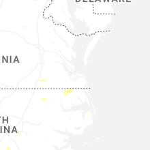
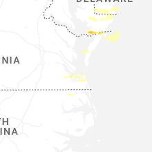
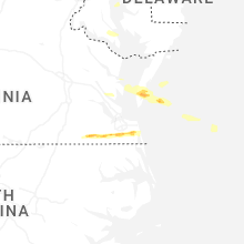
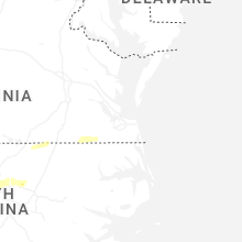


Connect with Interactive Hail Maps