

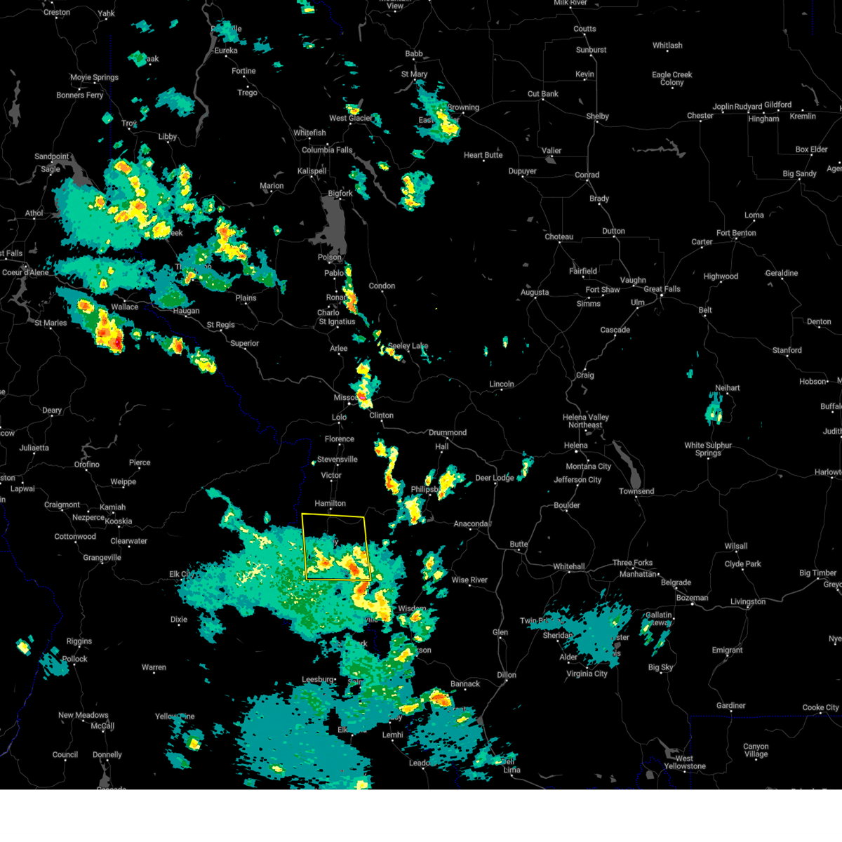
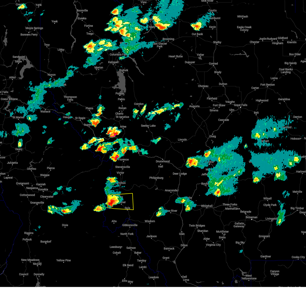
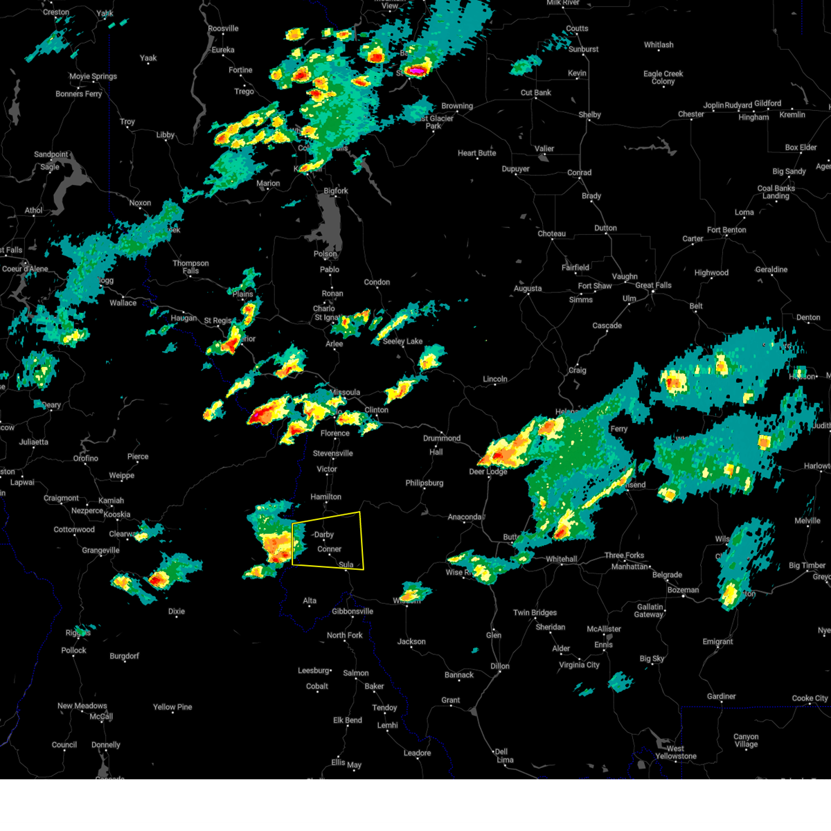
Hail Map for Sula, MT
The Sula, MT area has had 0 reports of on-the-ground hail by trained spotters, and has been under severe weather warnings 3 times during the past 12 months. Doppler radar has detected hail at or near Sula, MT on 12 occasions.
| Name: | Sula, MT |
| Where Located: | 45.8 miles N of Salmon, ID |
| Map: | Google Map for Sula, MT |
| Population: | 37 |
| Housing Units: | 22 |
| More Info: | Search Google for Sula, MT |
5
The Top Recent Hail Date for Sula, MT is Monday, July 10, 2023 (1st out of 12)

Hail and Wind Damage Spotted near Sula, MT
| Date / Time | Report Details |
|---|---|
| 9/11/2024 3:09 PM MDT | Mesonet station tepm8 tepee pt. radar estimate time is around 2:47 pm md in ravalli county MT, 12.3 miles WSW of Sula, MT |
| 8/23/2024 3:09 PM MDT | Mesonet station tepm8 tepee p in ravalli county MT, 12.3 miles WSW of Sula, MT |
| 8/23/2024 2:46 PM MDT | Video of ponderosa pine trees falling in sula. power outages reporte in ravalli county MT, 1 miles E of Sula, MT |
| 8/15/2024 4:31 PM MDT |
 Svrmso the national weather service in missoula has issued a * severe thunderstorm warning for, central ravalli county in west central montana, * until 515 pm mdt. * at 431 pm mdt, severe thunderstorms were located along a line extending from 17 miles southeast of darby to 7 miles west of conner, moving north at 20 mph (radar indicated). Hazards include 60 mph wind gusts. expect damage to roofs, siding, and trees Svrmso the national weather service in missoula has issued a * severe thunderstorm warning for, central ravalli county in west central montana, * until 515 pm mdt. * at 431 pm mdt, severe thunderstorms were located along a line extending from 17 miles southeast of darby to 7 miles west of conner, moving north at 20 mph (radar indicated). Hazards include 60 mph wind gusts. expect damage to roofs, siding, and trees
|
| 8/6/2024 5:55 PM MDT |
 At 555 pm mdt/455 pm pdt/, a severe thunderstorm was located near conner, or 22 miles south of hamilton, moving east at 25 mph (radar indicated). Hazards include quarter size hail. Damage to vehicles is expected. Locations impacted include, darby, conner, and como. At 555 pm mdt/455 pm pdt/, a severe thunderstorm was located near conner, or 22 miles south of hamilton, moving east at 25 mph (radar indicated). Hazards include quarter size hail. Damage to vehicles is expected. Locations impacted include, darby, conner, and como.
|
| 8/6/2024 5:39 PM MDT |
 Svrmso the national weather service in missoula has issued a * severe thunderstorm warning for, east central idaho county in central idaho, central ravalli county in west central montana, * until 615 pm mdt/515 pm pdt/. * at 539 pm mdt/439 pm pdt/, a severe thunderstorm was located 7 miles west of darby, or 18 miles southwest of hamilton, moving east at 45 mph (radar indicated). Hazards include quarter size hail. damage to vehicles is expected Svrmso the national weather service in missoula has issued a * severe thunderstorm warning for, east central idaho county in central idaho, central ravalli county in west central montana, * until 615 pm mdt/515 pm pdt/. * at 539 pm mdt/439 pm pdt/, a severe thunderstorm was located 7 miles west of darby, or 18 miles southwest of hamilton, moving east at 45 mph (radar indicated). Hazards include quarter size hail. damage to vehicles is expected
|
| 7/3/2022 3:37 PM MDT |
 The severe thunderstorm warning for east central ravalli and southwestern granite counties will expire at 345 pm mdt, the storms which prompted the warning have weakened below severe limits, and no longer pose an immediate threat to life or property. therefore, the warning will be allowed to expire. however heavy rain is still possible with these thunderstorms. The severe thunderstorm warning for east central ravalli and southwestern granite counties will expire at 345 pm mdt, the storms which prompted the warning have weakened below severe limits, and no longer pose an immediate threat to life or property. therefore, the warning will be allowed to expire. however heavy rain is still possible with these thunderstorms.
|
| 7/3/2022 3:14 PM MDT |
 At 313 pm mdt, severe thunderstorms were located along a line extending from 6 miles east of conner to 17 miles north of gibbonsville, moving east at 30 mph (radar indicated). Hazards include ping pong ball size hail and 60 mph wind gusts. People and animals outdoors will be injured. expect hail damage to roofs, siding, windows, and vehicles. Expect wind damage to roofs, siding, and trees. At 313 pm mdt, severe thunderstorms were located along a line extending from 6 miles east of conner to 17 miles north of gibbonsville, moving east at 30 mph (radar indicated). Hazards include ping pong ball size hail and 60 mph wind gusts. People and animals outdoors will be injured. expect hail damage to roofs, siding, windows, and vehicles. Expect wind damage to roofs, siding, and trees.
|
| 7/3/2022 3:06 PM MDT |
 At 305 pm mdt, severe thunderstorms were located along a line extending from conner to 16 miles north of gibbonsville, moving northeast at 30 mph (radar indicated). Hazards include 60 mph wind gusts and half dollar size hail. Hail damage to vehicles is expected. expect wind damage to roofs, siding, and trees. locations impacted include, conner and sula. hail threat, radar indicated max hail size, 1. 25 in wind threat, radar indicated max wind gust, 60 mph. At 305 pm mdt, severe thunderstorms were located along a line extending from conner to 16 miles north of gibbonsville, moving northeast at 30 mph (radar indicated). Hazards include 60 mph wind gusts and half dollar size hail. Hail damage to vehicles is expected. expect wind damage to roofs, siding, and trees. locations impacted include, conner and sula. hail threat, radar indicated max hail size, 1. 25 in wind threat, radar indicated max wind gust, 60 mph.
|
| 7/3/2022 2:39 PM MDT |
 At 238 pm mdt, severe thunderstorms were located along a line extending from 9 miles southwest of conner to 18 miles northwest of gibbonsville, moving northeast at 25 mph (radar indicated). Hazards include 60 mph wind gusts and half dollar size hail. Hail damage to vehicles is expected. Expect wind damage to roofs, siding, and trees. At 238 pm mdt, severe thunderstorms were located along a line extending from 9 miles southwest of conner to 18 miles northwest of gibbonsville, moving northeast at 25 mph (radar indicated). Hazards include 60 mph wind gusts and half dollar size hail. Hail damage to vehicles is expected. Expect wind damage to roofs, siding, and trees.
|
| 8/26/2020 6:12 PM MDT |
 The severe thunderstorm warning for east central ravalli county will expire at 615 pm mdt, the storm which prompted the warning has weakened below severe limits, and no longer poses an immediate threat to life or property. therefore, the warning will be allowed to expire. to report severe weather, contact your nearest law enforcement agency. they will relay your report to the national weather service missoula. The severe thunderstorm warning for east central ravalli county will expire at 615 pm mdt, the storm which prompted the warning has weakened below severe limits, and no longer poses an immediate threat to life or property. therefore, the warning will be allowed to expire. to report severe weather, contact your nearest law enforcement agency. they will relay your report to the national weather service missoula.
|
| 8/26/2020 5:53 PM MDT |
 At 552 pm mdt, a severe thunderstorm was located near conner, or 25 miles south of hamilton, moving northeast at 35 mph (radar indicated). Hazards include 60 mph wind gusts and quarter size hail. Hail damage to vehicles is expected. Expect wind damage to roofs, siding, and trees. At 552 pm mdt, a severe thunderstorm was located near conner, or 25 miles south of hamilton, moving northeast at 35 mph (radar indicated). Hazards include 60 mph wind gusts and quarter size hail. Hail damage to vehicles is expected. Expect wind damage to roofs, siding, and trees.
|
| 5/6/2017 1:55 PM MDT | Raws sensor reported 66 mph gust as storm moved through. sensor reports hourly... with the hour containing this report being 1:09pm - 2:09pm mdt. estimated time of gust in ravalli county MT, 12.3 miles WSW of Sula, MT |
| 5/6/2017 1:26 PM MDT |
 At 126 pm mdt, doppler radar indicated a severe thunderstorm capable of producing quarter size hail and damaging winds in excess of 50 mph. this storm was located 13 miles southeast of conner, or 34 miles south of hamilton, and moving northeast at 40 mph. At 126 pm mdt, doppler radar indicated a severe thunderstorm capable of producing quarter size hail and damaging winds in excess of 50 mph. this storm was located 13 miles southeast of conner, or 34 miles south of hamilton, and moving northeast at 40 mph.
|
| 8/10/2015 5:00 PM MDT |
 At 459 pm mdt /359 pm pdt/, doppler radar indicated a severe thunderstorm capable of producing damaging winds in excess of 60 mph. this storm was located near conner, or 26 miles south of hamilton, and moving north at 30 mph. At 459 pm mdt /359 pm pdt/, doppler radar indicated a severe thunderstorm capable of producing damaging winds in excess of 60 mph. this storm was located near conner, or 26 miles south of hamilton, and moving north at 30 mph.
|
Hail Maps for Sula, MT


Connect with Interactive Hail Maps