

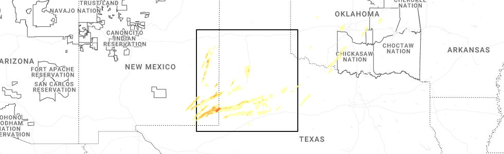
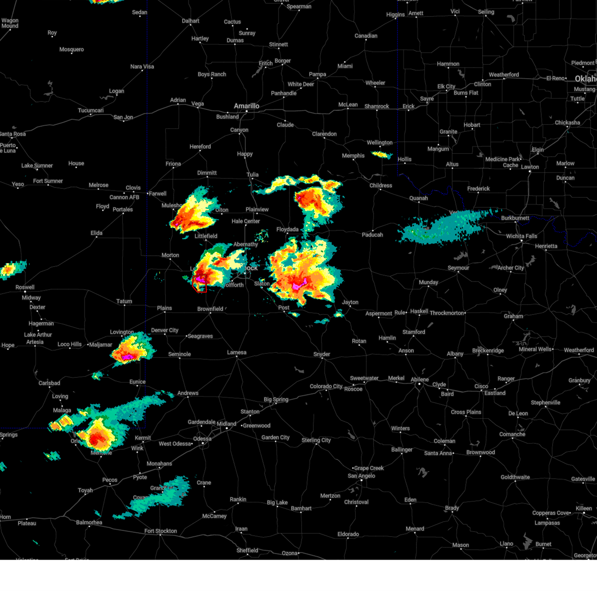
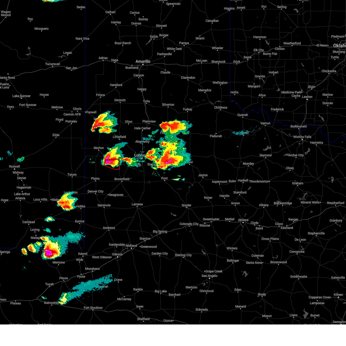
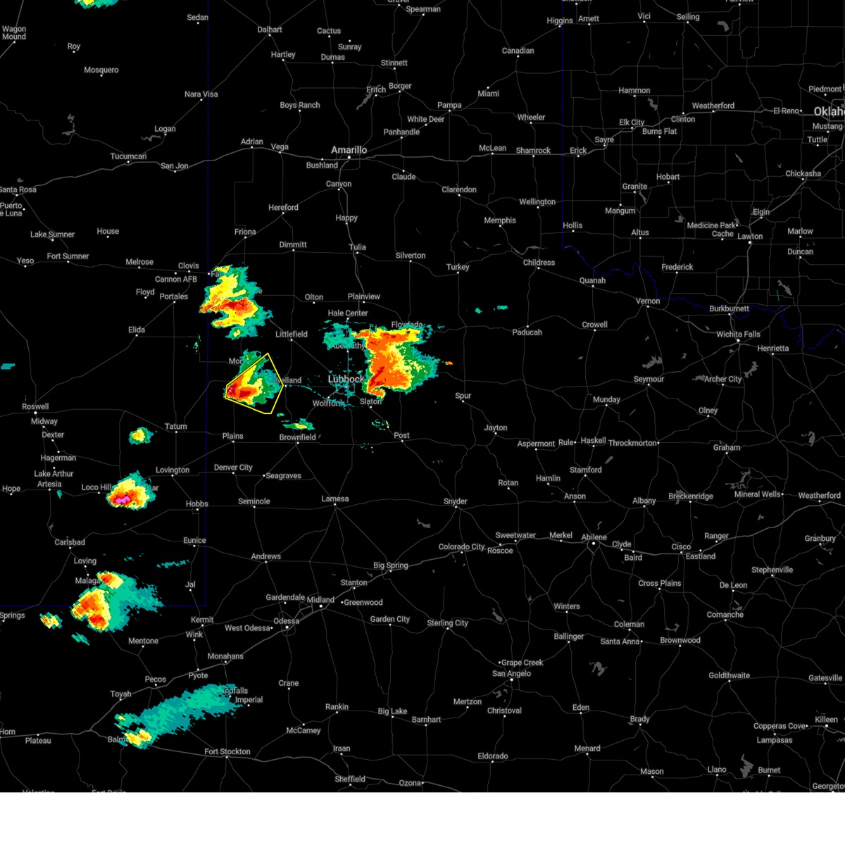
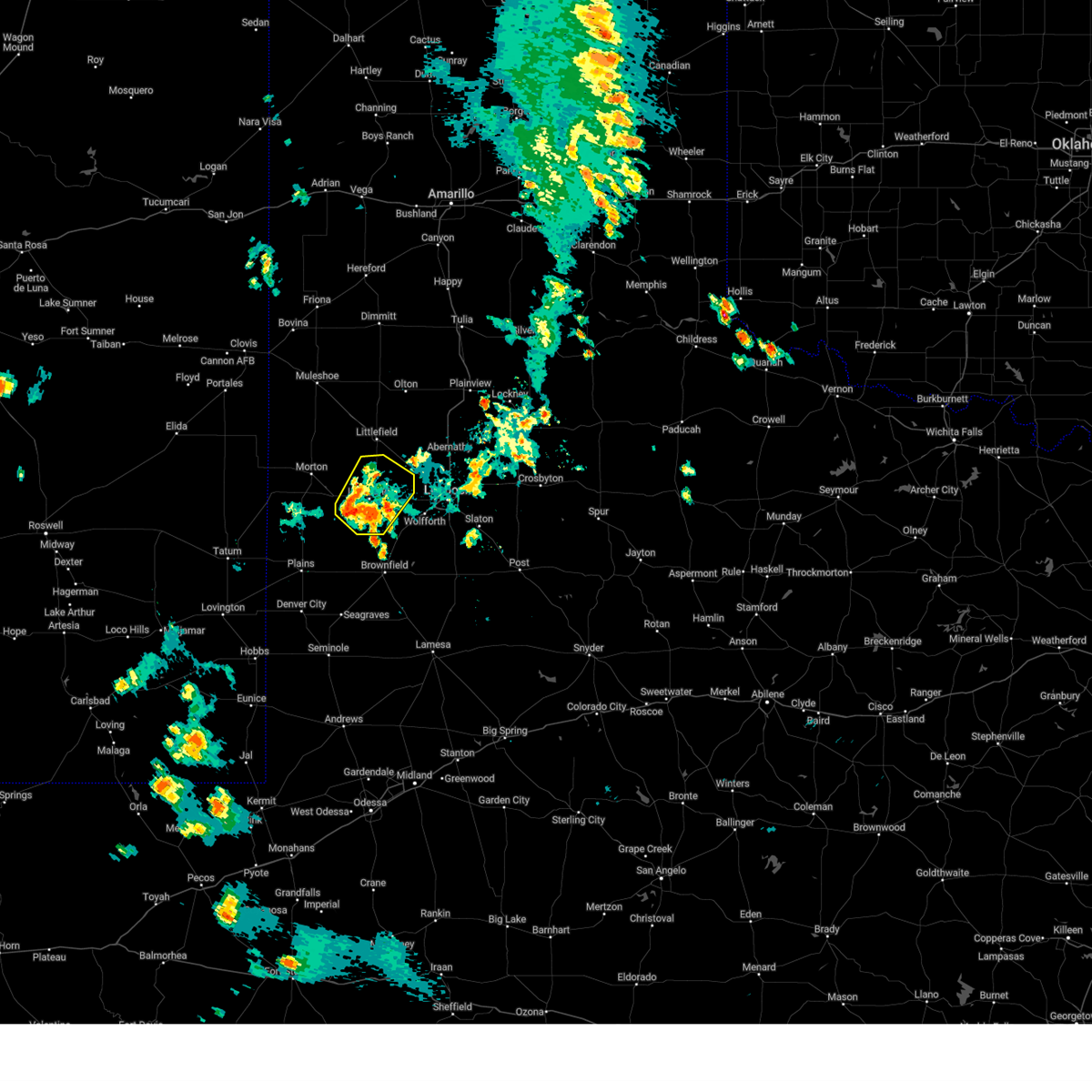
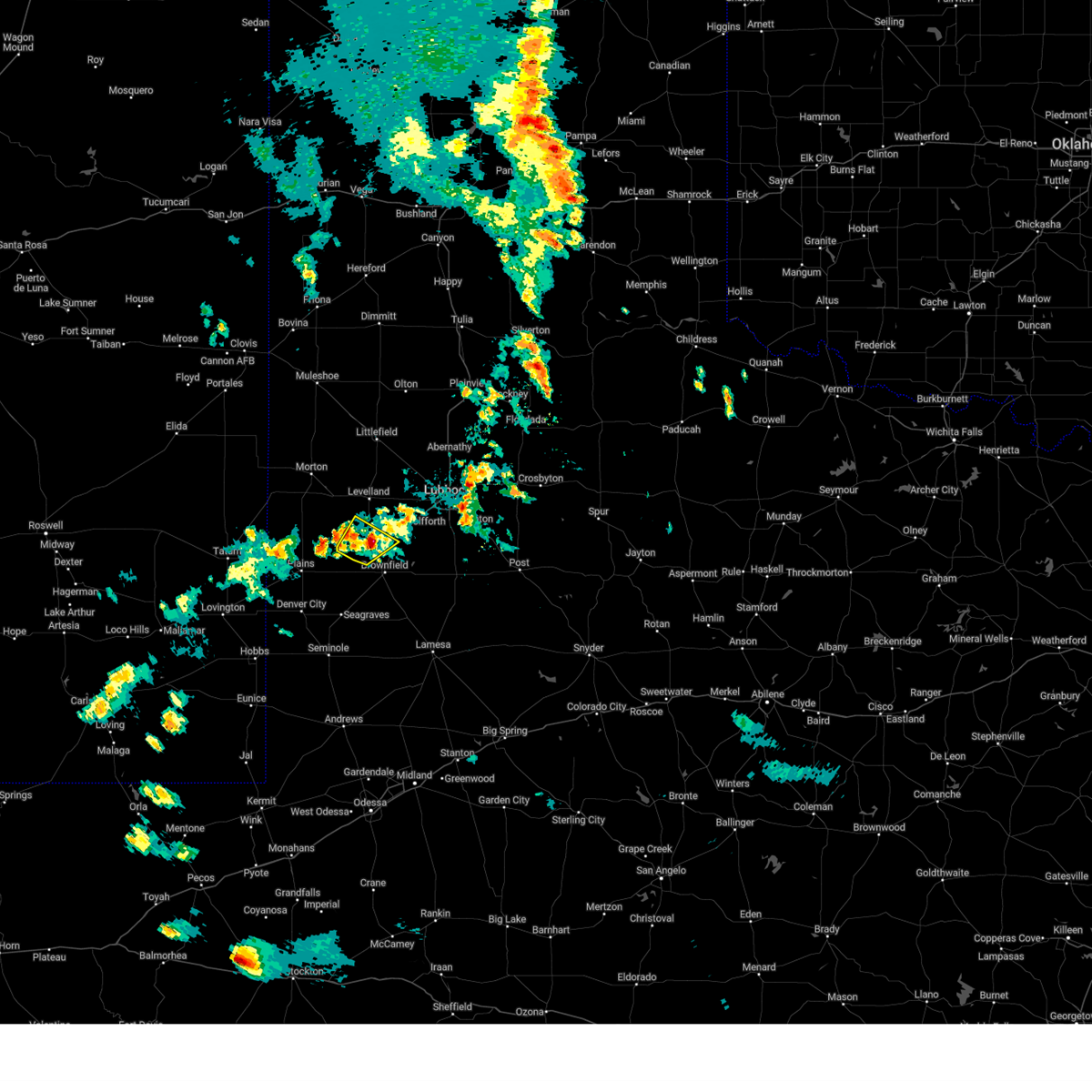
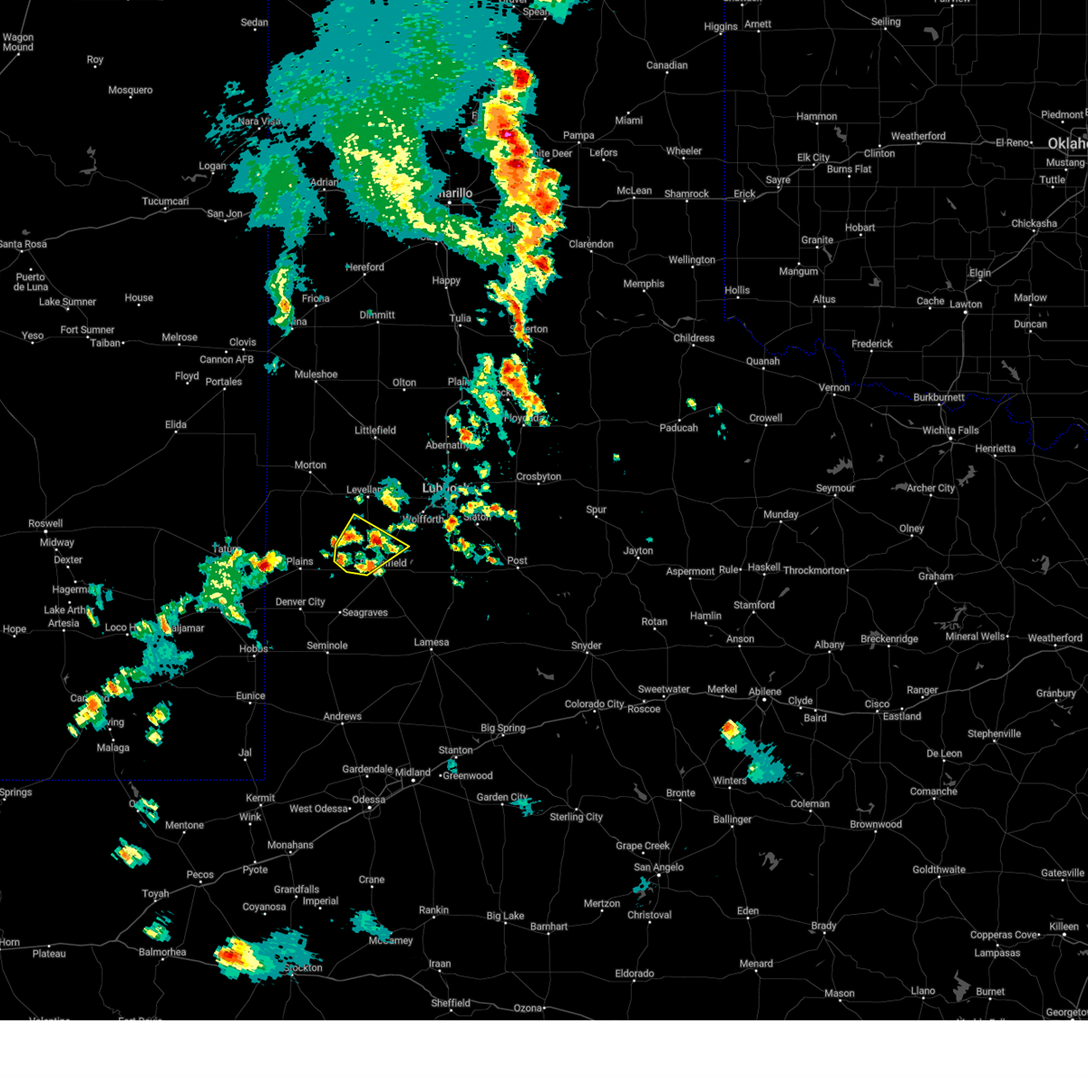
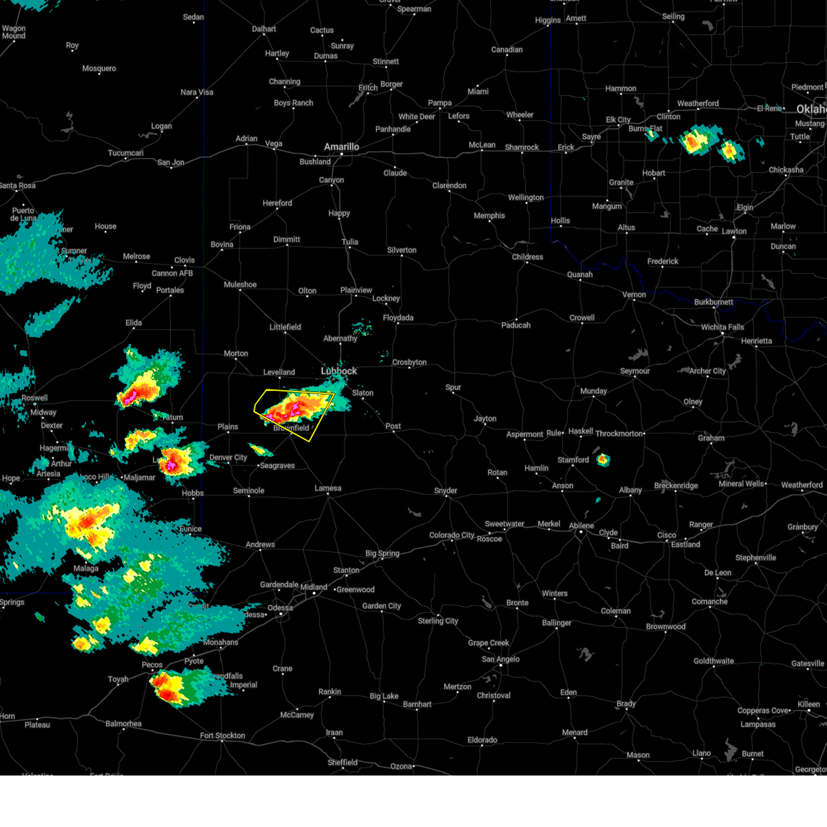
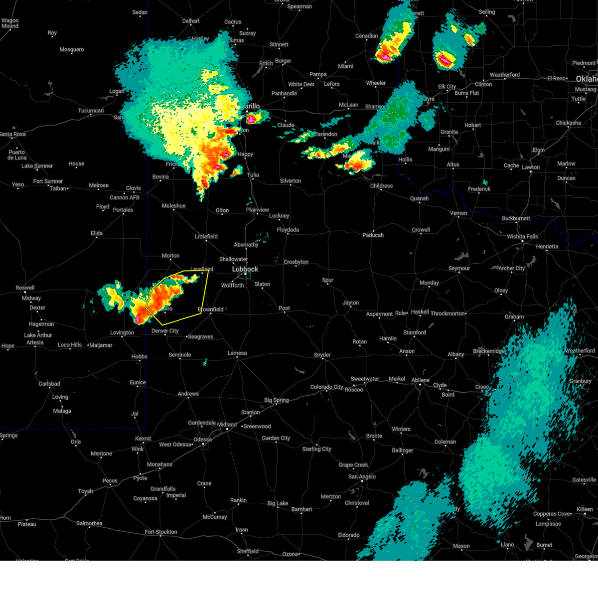
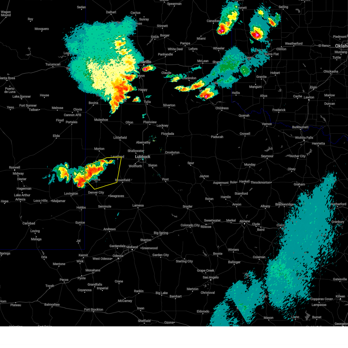
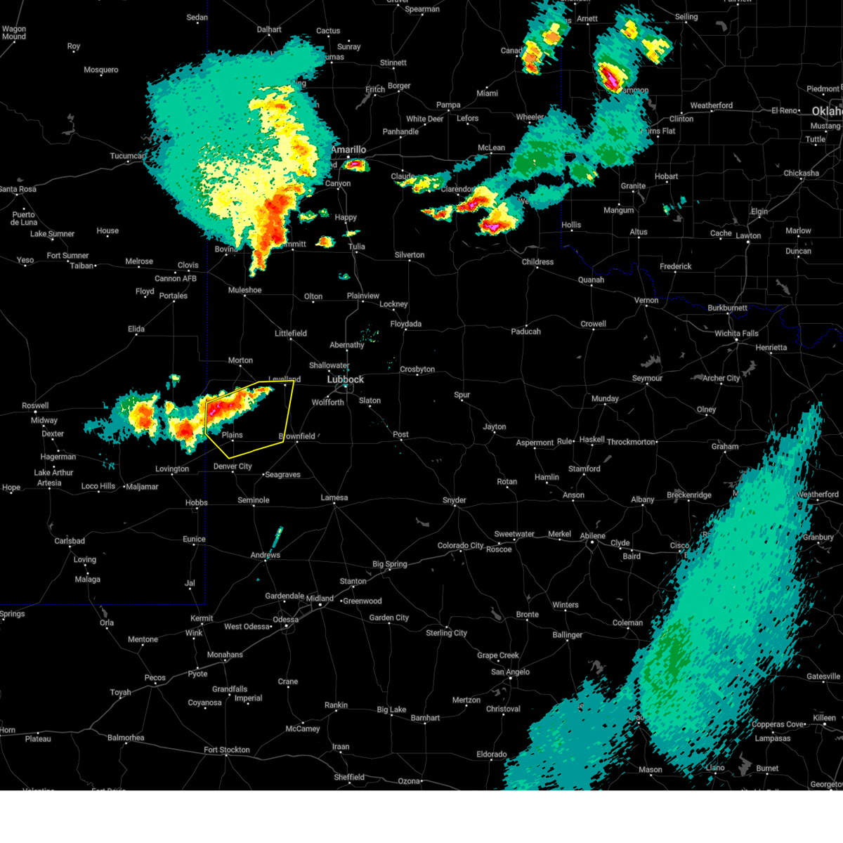
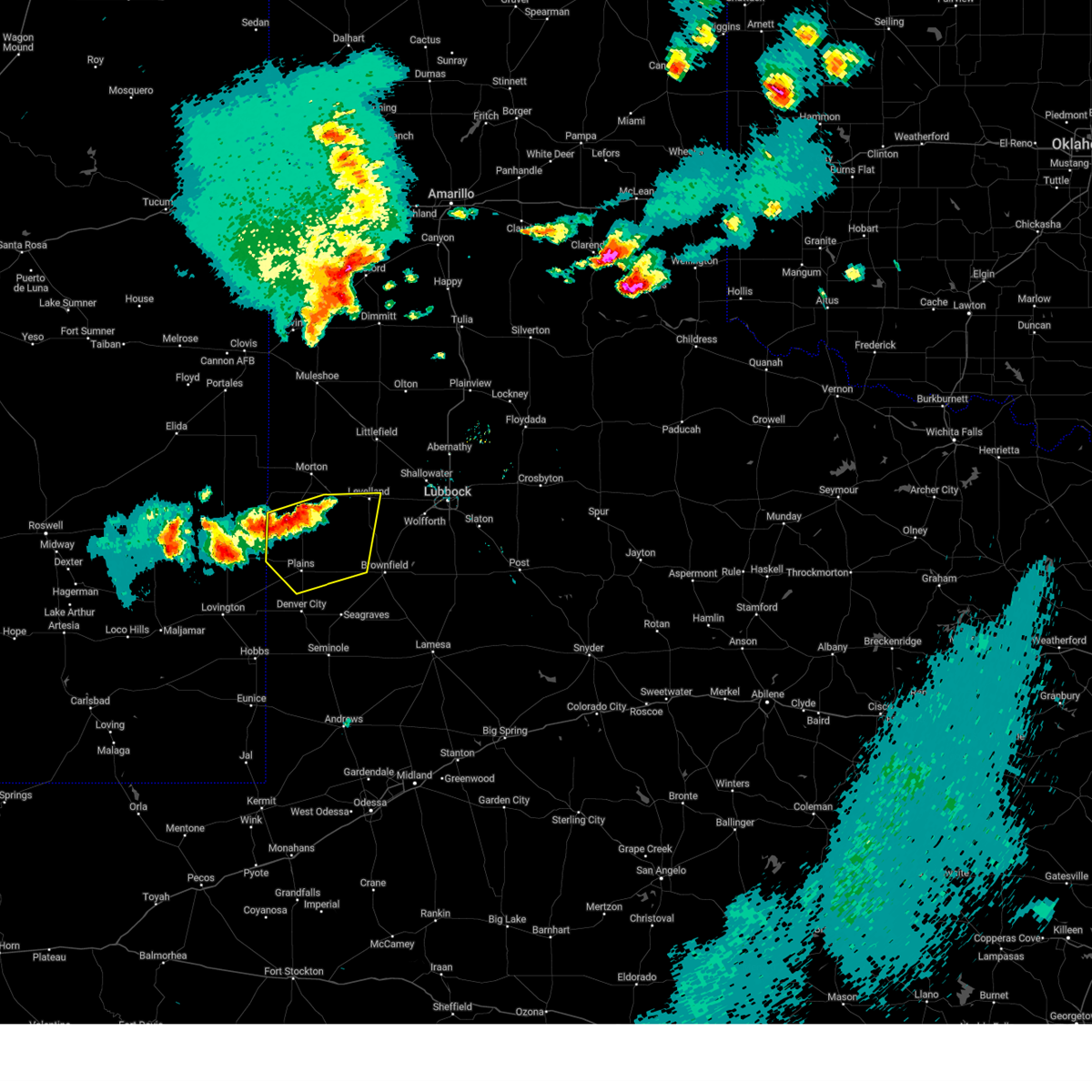
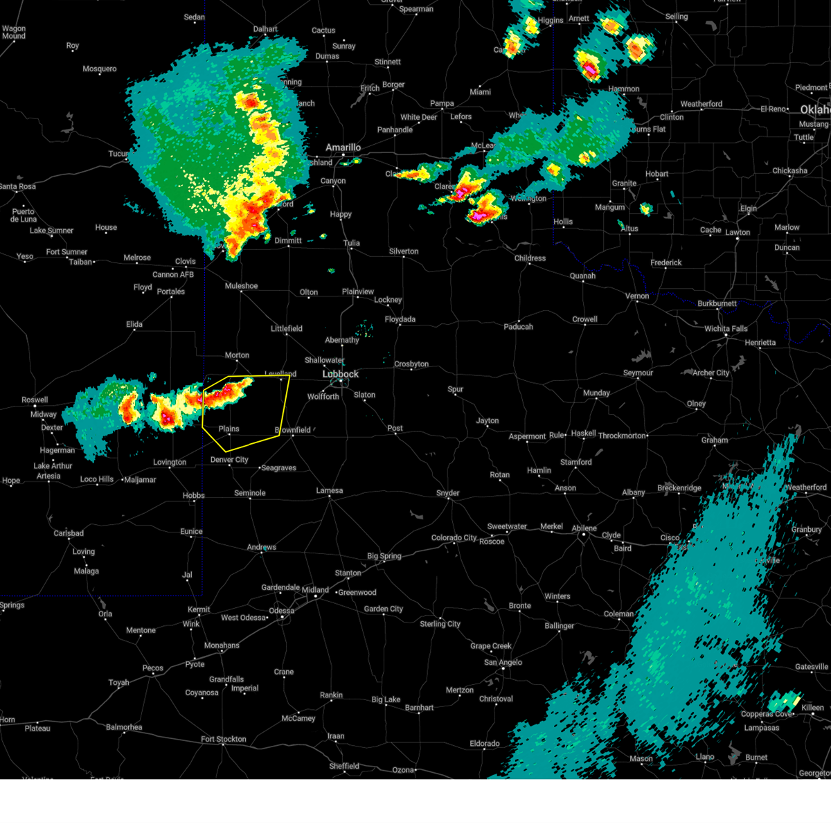
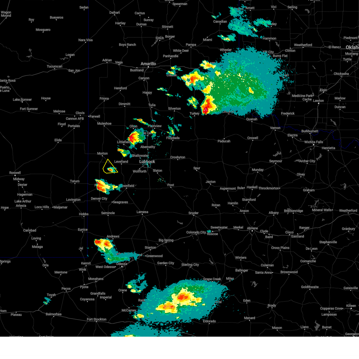
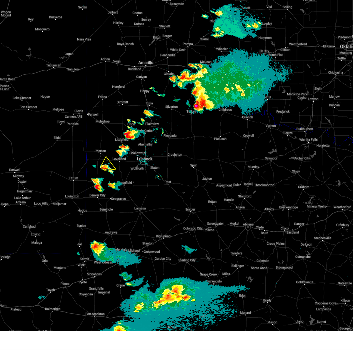
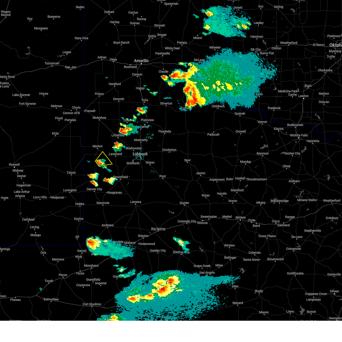
Hail Map for Sundown, TX
The Sundown, TX area has had 6 reports of on-the-ground hail by trained spotters, and has been under severe weather warnings 32 times during the past 12 months. Doppler radar has detected hail at or near Sundown, TX on 81 occasions, including 7 occasions during the past year.
| Name: | Sundown, TX |
| Where Located: | 37.8 miles WSW of Lubbock, TX |
| Map: | Google Map for Sundown, TX |
| Population: | 1397 |
| Housing Units: | 554 |
| More Info: | Search Google for Sundown, TX |
1
The Top Recent Hail Date for Sundown, TX is Saturday, November 2, 2024 (23rd out of 81)
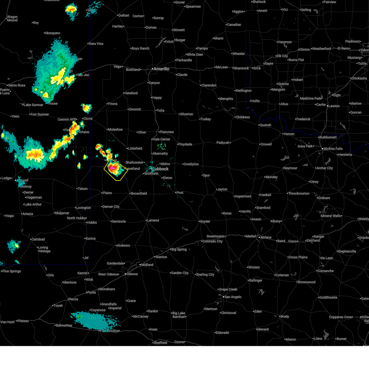
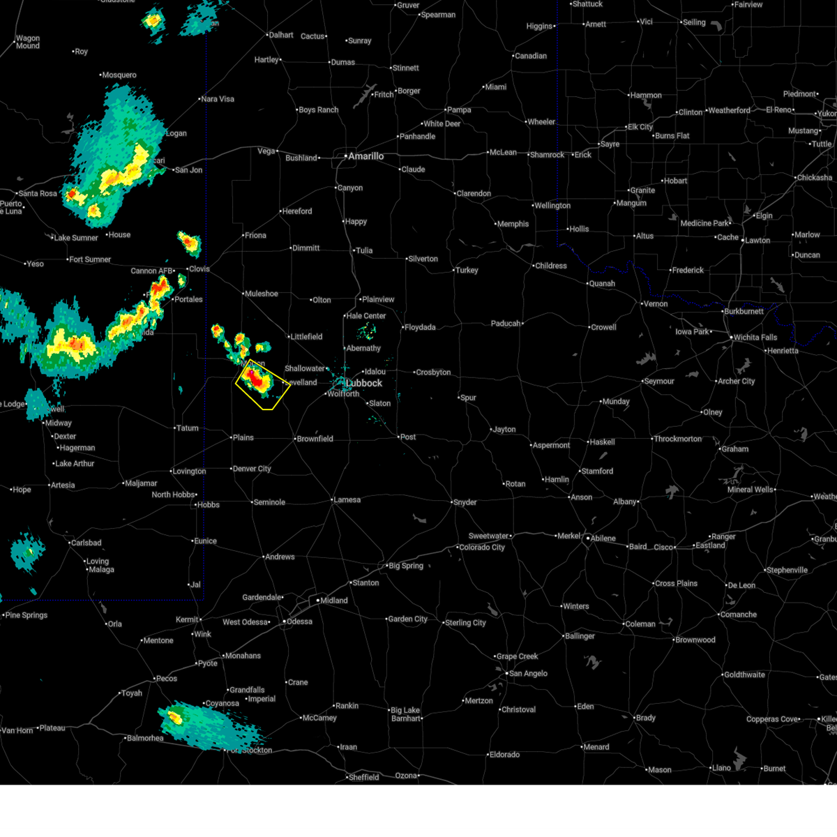
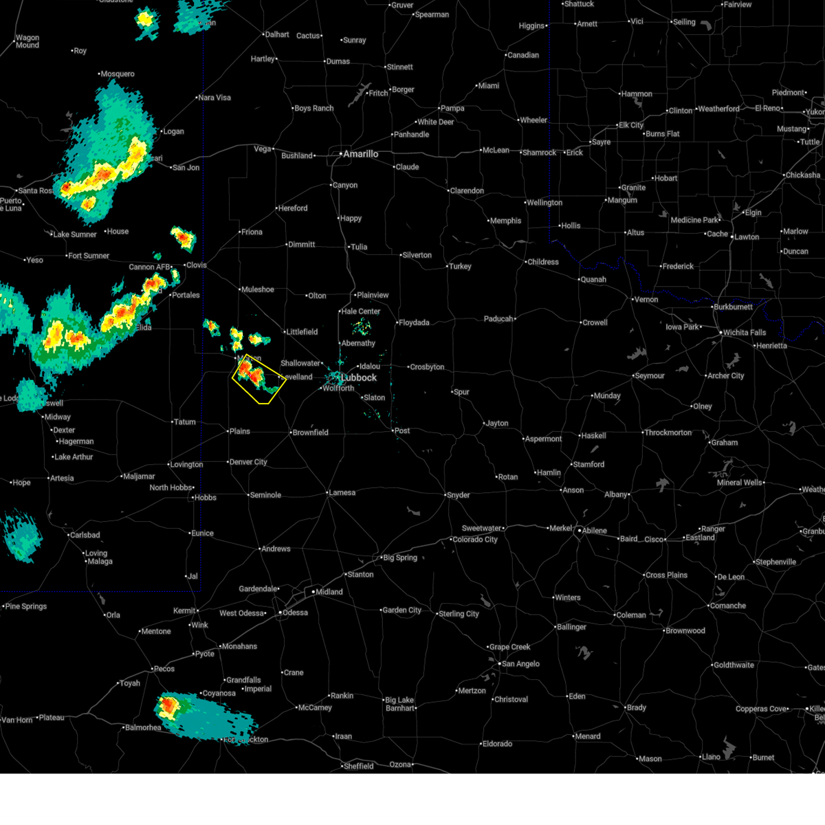
Hail and Wind Damage Spotted near Sundown, TX
| Date / Time | Report Details |
|---|---|
| 6/13/2025 9:30 PM CDT | Storm damage reported in cochran county TX, 8.4 miles NE of Sundown, TX |
| 6/13/2025 6:58 PM CDT |
 At 658 pm cdt, a severe thunderstorm was located 9 miles east of lehman, or 11 miles southeast of morton, moving southeast at 10 mph (radar indicated). Hazards include ping pong ball size hail and 60 mph wind gusts. People and animals outdoors will be injured. expect hail damage to roofs, siding, windows, and vehicles. expect wind damage to roofs, siding, and trees. Locations impacted include, levelland, sundown, and whiteface. At 658 pm cdt, a severe thunderstorm was located 9 miles east of lehman, or 11 miles southeast of morton, moving southeast at 10 mph (radar indicated). Hazards include ping pong ball size hail and 60 mph wind gusts. People and animals outdoors will be injured. expect hail damage to roofs, siding, windows, and vehicles. expect wind damage to roofs, siding, and trees. Locations impacted include, levelland, sundown, and whiteface.
|
| 6/13/2025 6:40 PM CDT |
 At 639 pm cdt, a severe thunderstorm was located 10 miles east of lehman, or 11 miles southeast of morton, moving southeast at 5 mph (radar indicated). Hazards include ping pong ball size hail and 60 mph wind gusts. People and animals outdoors will be injured. expect hail damage to roofs, siding, windows, and vehicles. expect wind damage to roofs, siding, and trees. Locations impacted include, levelland, sundown, and whiteface. At 639 pm cdt, a severe thunderstorm was located 10 miles east of lehman, or 11 miles southeast of morton, moving southeast at 5 mph (radar indicated). Hazards include ping pong ball size hail and 60 mph wind gusts. People and animals outdoors will be injured. expect hail damage to roofs, siding, windows, and vehicles. expect wind damage to roofs, siding, and trees. Locations impacted include, levelland, sundown, and whiteface.
|
| 6/13/2025 6:28 PM CDT |
 Svrlub the national weather service in lubbock texas has issued a * severe thunderstorm warning for, east central cochran county in northwestern texas, southwestern hockley county in northwestern texas, * until 715 pm cdt. * at 628 pm cdt, a severe thunderstorm was located 11 miles east of lehman, or 13 miles southeast of morton, moving southeast at 10 mph (radar indicated). Hazards include 60 mph wind gusts and quarter size hail. Hail damage to vehicles is expected. Expect wind damage to roofs, siding, and trees. Svrlub the national weather service in lubbock texas has issued a * severe thunderstorm warning for, east central cochran county in northwestern texas, southwestern hockley county in northwestern texas, * until 715 pm cdt. * at 628 pm cdt, a severe thunderstorm was located 11 miles east of lehman, or 13 miles southeast of morton, moving southeast at 10 mph (radar indicated). Hazards include 60 mph wind gusts and quarter size hail. Hail damage to vehicles is expected. Expect wind damage to roofs, siding, and trees.
|
| 6/6/2025 7:20 PM CDT |
 At 720 pm cdt, a confirmed tornado was located near locketville, or 9 miles south of levelland, moving east at 25 mph (weather spotters confirmed tornado). Hazards include damaging tornado and tennis ball size hail. Flying debris will be dangerous to those caught without shelter. mobile homes will be damaged or destroyed. damage to roofs, windows, and vehicles will occur. tree damage is likely. Locations impacted include, sundown. At 720 pm cdt, a confirmed tornado was located near locketville, or 9 miles south of levelland, moving east at 25 mph (weather spotters confirmed tornado). Hazards include damaging tornado and tennis ball size hail. Flying debris will be dangerous to those caught without shelter. mobile homes will be damaged or destroyed. damage to roofs, windows, and vehicles will occur. tree damage is likely. Locations impacted include, sundown.
|
| 6/6/2025 7:07 PM CDT |
 At 707 pm cdt, a confirmed tornado was located over sundown, or 10 miles southwest of levelland, moving east at 25 mph (weather spotters confirmed tornado). Hazards include damaging tornado and tennis ball size hail. Flying debris will be dangerous to those caught without shelter. mobile homes will be damaged or destroyed. damage to roofs, windows, and vehicles will occur. tree damage is likely. This tornadic thunderstorm will remain over mainly rural areas of southwestern hockley county. At 707 pm cdt, a confirmed tornado was located over sundown, or 10 miles southwest of levelland, moving east at 25 mph (weather spotters confirmed tornado). Hazards include damaging tornado and tennis ball size hail. Flying debris will be dangerous to those caught without shelter. mobile homes will be damaged or destroyed. damage to roofs, windows, and vehicles will occur. tree damage is likely. This tornadic thunderstorm will remain over mainly rural areas of southwestern hockley county.
|
| 6/6/2025 7:03 PM CDT |
 the tornado warning has been cancelled and is no longer in effect the tornado warning has been cancelled and is no longer in effect
|
| 6/6/2025 7:03 PM CDT |
 At 703 pm cdt, a severe thunderstorm capable of producing a tornado was located over sundown, or 11 miles southwest of levelland, moving east at 25 mph (weather spotters reported a rotating wall cloud). Hazards include tornado and tennis ball size hail. Flying debris will be dangerous to those caught without shelter. mobile homes will be damaged or destroyed. damage to roofs, windows, and vehicles will occur. tree damage is likely. This dangerous storm will be near, sundown around 710 pm cdt. At 703 pm cdt, a severe thunderstorm capable of producing a tornado was located over sundown, or 11 miles southwest of levelland, moving east at 25 mph (weather spotters reported a rotating wall cloud). Hazards include tornado and tennis ball size hail. Flying debris will be dangerous to those caught without shelter. mobile homes will be damaged or destroyed. damage to roofs, windows, and vehicles will occur. tree damage is likely. This dangerous storm will be near, sundown around 710 pm cdt.
|
| 6/6/2025 6:49 PM CDT |
 Torlub the national weather service in lubbock texas has issued a * tornado warning for, southeastern cochran county in northwestern texas, southwestern hockley county in northwestern texas, * until 730 pm cdt. * at 649 pm cdt, a severe thunderstorm capable of producing a tornado was located 7 miles west of sundown, or 16 miles southwest of levelland, moving east at 25 mph (weather spotters reported funnel cloud). Hazards include tornado and tennis ball size hail. Flying debris will be dangerous to those caught without shelter. mobile homes will be damaged or destroyed. damage to roofs, windows, and vehicles will occur. tree damage is likely. This dangerous storm will be near, sundown around 655 pm cdt. Torlub the national weather service in lubbock texas has issued a * tornado warning for, southeastern cochran county in northwestern texas, southwestern hockley county in northwestern texas, * until 730 pm cdt. * at 649 pm cdt, a severe thunderstorm capable of producing a tornado was located 7 miles west of sundown, or 16 miles southwest of levelland, moving east at 25 mph (weather spotters reported funnel cloud). Hazards include tornado and tennis ball size hail. Flying debris will be dangerous to those caught without shelter. mobile homes will be damaged or destroyed. damage to roofs, windows, and vehicles will occur. tree damage is likely. This dangerous storm will be near, sundown around 655 pm cdt.
|
| 6/6/2025 6:34 PM CDT | At 634 pm cdt, a severe thunderstorm was located 7 miles northwest of sundown, or 14 miles west of levelland, moving east at 25 mph (radar indicated). Hazards include tennis ball size hail and 60 mph wind gusts. People and animals outdoors will be injured. expect hail damage to roofs, siding, windows, and vehicles. expect wind damage to roofs, siding, and trees. Locations impacted include, sundown and whiteface. |
| 6/6/2025 6:15 PM CDT |
 Svrlub the national weather service in lubbock texas has issued a * severe thunderstorm warning for, southeastern cochran county in northwestern texas, western hockley county in northwestern texas, * until 700 pm cdt. * at 615 pm cdt, a severe thunderstorm was located 9 miles southeast of lehman, or 13 miles southeast of morton, moving east at 35 mph (radar indicated). Hazards include tennis ball size hail and 60 mph wind gusts. People and animals outdoors will be injured. expect hail damage to roofs, siding, windows, and vehicles. Expect wind damage to roofs, siding, and trees. Svrlub the national weather service in lubbock texas has issued a * severe thunderstorm warning for, southeastern cochran county in northwestern texas, western hockley county in northwestern texas, * until 700 pm cdt. * at 615 pm cdt, a severe thunderstorm was located 9 miles southeast of lehman, or 13 miles southeast of morton, moving east at 35 mph (radar indicated). Hazards include tennis ball size hail and 60 mph wind gusts. People and animals outdoors will be injured. expect hail damage to roofs, siding, windows, and vehicles. Expect wind damage to roofs, siding, and trees.
|
| 6/2/2025 5:35 PM CDT |
 Svrlub the national weather service in lubbock texas has issued a * severe thunderstorm warning for, hockley county in northwestern texas, * until 630 pm cdt. * at 535 pm cdt, a severe thunderstorm was located 5 miles north of sundown, or 8 miles west of levelland, moving northeast at 15 mph (radar indicated). Hazards include 60 mph wind gusts and quarter size hail. Hail damage to vehicles is expected. Expect wind damage to roofs, siding, and trees. Svrlub the national weather service in lubbock texas has issued a * severe thunderstorm warning for, hockley county in northwestern texas, * until 630 pm cdt. * at 535 pm cdt, a severe thunderstorm was located 5 miles north of sundown, or 8 miles west of levelland, moving northeast at 15 mph (radar indicated). Hazards include 60 mph wind gusts and quarter size hail. Hail damage to vehicles is expected. Expect wind damage to roofs, siding, and trees.
|
| 6/2/2025 4:52 PM CDT |
 At 451 pm cdt, a severe thunderstorm was located 6 miles northeast of locketville, or 13 miles southeast of levelland, moving northeast at 25 mph (radar indicated). Hazards include 60 mph wind gusts and quarter size hail. Hail damage to vehicles is expected. expect wind damage to roofs, siding, and trees. Locations impacted include, sundown, locketville, and meadow. At 451 pm cdt, a severe thunderstorm was located 6 miles northeast of locketville, or 13 miles southeast of levelland, moving northeast at 25 mph (radar indicated). Hazards include 60 mph wind gusts and quarter size hail. Hail damage to vehicles is expected. expect wind damage to roofs, siding, and trees. Locations impacted include, sundown, locketville, and meadow.
|
| 6/2/2025 4:37 PM CDT |
 At 437 pm cdt, a severe thunderstorm was located over locketville, or 14 miles north of brownfield, moving northeast at 25 mph (radar indicated). Hazards include 60 mph wind gusts and quarter size hail. Hail damage to vehicles is expected. expect wind damage to roofs, siding, and trees. Locations impacted include, sundown, locketville, and meadow. At 437 pm cdt, a severe thunderstorm was located over locketville, or 14 miles north of brownfield, moving northeast at 25 mph (radar indicated). Hazards include 60 mph wind gusts and quarter size hail. Hail damage to vehicles is expected. expect wind damage to roofs, siding, and trees. Locations impacted include, sundown, locketville, and meadow.
|
| 6/2/2025 4:37 PM CDT |
 the severe thunderstorm warning has been cancelled and is no longer in effect the severe thunderstorm warning has been cancelled and is no longer in effect
|
| 6/2/2025 4:23 PM CDT |
 At 423 pm cdt, a severe thunderstorm was located 9 miles southwest of locketville, or 11 miles northwest of brownfield, moving northeast at 25 mph (radar indicated). Hazards include 60 mph wind gusts and quarter size hail. Hail damage to vehicles is expected. expect wind damage to roofs, siding, and trees. Locations impacted include, sundown, locketville, tokio, and meadow. At 423 pm cdt, a severe thunderstorm was located 9 miles southwest of locketville, or 11 miles northwest of brownfield, moving northeast at 25 mph (radar indicated). Hazards include 60 mph wind gusts and quarter size hail. Hail damage to vehicles is expected. expect wind damage to roofs, siding, and trees. Locations impacted include, sundown, locketville, tokio, and meadow.
|
| 6/2/2025 4:07 PM CDT |
 At 407 pm cdt, a severe thunderstorm was located 4 miles northeast of tokio, or 13 miles west of brownfield, moving northeast at 25 mph (radar indicated). Hazards include 60 mph wind gusts and nickel size hail. Expect damage to roofs, siding, and trees. Locations impacted include, sundown, locketville, tokio, and meadow. At 407 pm cdt, a severe thunderstorm was located 4 miles northeast of tokio, or 13 miles west of brownfield, moving northeast at 25 mph (radar indicated). Hazards include 60 mph wind gusts and nickel size hail. Expect damage to roofs, siding, and trees. Locations impacted include, sundown, locketville, tokio, and meadow.
|
| 6/2/2025 3:53 PM CDT |
 Svrlub the national weather service in lubbock texas has issued a * severe thunderstorm warning for, northern terry county in northwestern texas, south central hockley county in northwestern texas, east central yoakum county in northwestern texas, * until 500 pm cdt. * at 353 pm cdt, a severe thunderstorm was located over tokio, or 15 miles east of plains, moving northeast at 25 mph (radar indicated). Hazards include 60 mph wind gusts and half dollar size hail. Hail damage to vehicles is expected. Expect wind damage to roofs, siding, and trees. Svrlub the national weather service in lubbock texas has issued a * severe thunderstorm warning for, northern terry county in northwestern texas, south central hockley county in northwestern texas, east central yoakum county in northwestern texas, * until 500 pm cdt. * at 353 pm cdt, a severe thunderstorm was located over tokio, or 15 miles east of plains, moving northeast at 25 mph (radar indicated). Hazards include 60 mph wind gusts and half dollar size hail. Hail damage to vehicles is expected. Expect wind damage to roofs, siding, and trees.
|
| 5/29/2025 4:52 PM CDT |
 At 451 pm cdt, a severe thunderstorm was located 8 miles southeast of locketville, or 9 miles north of brownfield, moving southeast at 20 mph (radar indicated). Hazards include two inch hail and 60 mph wind gusts. People and animals outdoors will be injured. expect hail damage to roofs, siding, windows, and vehicles. expect wind damage to roofs, siding, and trees. Locations impacted include, brownfield, sundown, locketville, meadow, and ropesville. At 451 pm cdt, a severe thunderstorm was located 8 miles southeast of locketville, or 9 miles north of brownfield, moving southeast at 20 mph (radar indicated). Hazards include two inch hail and 60 mph wind gusts. People and animals outdoors will be injured. expect hail damage to roofs, siding, windows, and vehicles. expect wind damage to roofs, siding, and trees. Locations impacted include, brownfield, sundown, locketville, meadow, and ropesville.
|
| 5/29/2025 4:37 PM CDT |
 At 436 pm cdt, a severe thunderstorm was located near locketville, or 11 miles north of brownfield, moving east at 20 mph (radar indicated). Hazards include two inch hail and 60 mph wind gusts. People and animals outdoors will be injured. expect hail damage to roofs, siding, windows, and vehicles. expect wind damage to roofs, siding, and trees. Locations impacted include, brownfield, sundown, locketville, slide, meadow, and ropesville. At 436 pm cdt, a severe thunderstorm was located near locketville, or 11 miles north of brownfield, moving east at 20 mph (radar indicated). Hazards include two inch hail and 60 mph wind gusts. People and animals outdoors will be injured. expect hail damage to roofs, siding, windows, and vehicles. expect wind damage to roofs, siding, and trees. Locations impacted include, brownfield, sundown, locketville, slide, meadow, and ropesville.
|
| 5/29/2025 4:37 PM CDT |
 the severe thunderstorm warning has been cancelled and is no longer in effect the severe thunderstorm warning has been cancelled and is no longer in effect
|
| 5/29/2025 4:20 PM CDT |
 Svrlub the national weather service in lubbock texas has issued a * severe thunderstorm warning for, southwestern lubbock county in northwestern texas, northwestern lynn county in northwestern texas, northern terry county in northwestern texas, southern hockley county in northwestern texas, northeastern yoakum county in northwestern texas, * until 500 pm cdt. * at 418 pm cdt, a severe thunderstorm was located near locketville, or 14 miles south of levelland, moving southeast at 20 mph (radar indicated). Hazards include two inch hail and 60 mph wind gusts. People and animals outdoors will be injured. expect hail damage to roofs, siding, windows, and vehicles. Expect wind damage to roofs, siding, and trees. Svrlub the national weather service in lubbock texas has issued a * severe thunderstorm warning for, southwestern lubbock county in northwestern texas, northwestern lynn county in northwestern texas, northern terry county in northwestern texas, southern hockley county in northwestern texas, northeastern yoakum county in northwestern texas, * until 500 pm cdt. * at 418 pm cdt, a severe thunderstorm was located near locketville, or 14 miles south of levelland, moving southeast at 20 mph (radar indicated). Hazards include two inch hail and 60 mph wind gusts. People and animals outdoors will be injured. expect hail damage to roofs, siding, windows, and vehicles. Expect wind damage to roofs, siding, and trees.
|
| 5/26/2025 9:27 PM CDT |
 At 927 pm cdt, severe thunderstorms were located along a line extending from 8 miles southwest of sundown to 9 miles northeast of plains to 4 miles south of bronco, moving southeast at 30 mph (radar indicated). Hazards include 60 mph wind gusts and half dollar size hail. Hail damage to vehicles is expected. expect wind damage to roofs, siding, and trees. Locations impacted include, plains, sundown, and tokio. At 927 pm cdt, severe thunderstorms were located along a line extending from 8 miles southwest of sundown to 9 miles northeast of plains to 4 miles south of bronco, moving southeast at 30 mph (radar indicated). Hazards include 60 mph wind gusts and half dollar size hail. Hail damage to vehicles is expected. expect wind damage to roofs, siding, and trees. Locations impacted include, plains, sundown, and tokio.
|
| 5/26/2025 9:17 PM CDT |
 At 916 pm cdt, severe thunderstorms were located along a line extending from 5 miles north of sundown to 10 miles north of plains to near bronco, moving southeast at 35 mph (radar indicated). Hazards include 60 mph wind gusts and quarter size hail. Hail damage to vehicles is expected. expect wind damage to roofs, siding, and trees. Locations impacted include, levelland, plains, sundown, bronco, tokio, whiteface, and opdyke west. At 916 pm cdt, severe thunderstorms were located along a line extending from 5 miles north of sundown to 10 miles north of plains to near bronco, moving southeast at 35 mph (radar indicated). Hazards include 60 mph wind gusts and quarter size hail. Hail damage to vehicles is expected. expect wind damage to roofs, siding, and trees. Locations impacted include, levelland, plains, sundown, bronco, tokio, whiteface, and opdyke west.
|
| 5/26/2025 9:13 PM CDT |
 At 913 pm cdt, severe thunderstorms were located along a line extending from 6 miles northwest of sundown to 10 miles north of plains to 3 miles west of bronco, moving southeast at 20 mph (radar indicated). Hazards include 60 mph wind gusts and quarter size hail. Hail damage to vehicles is expected. expect wind damage to roofs, siding, and trees. Locations impacted include, levelland, plains, sundown, bronco, tokio, whiteface, and opdyke west. At 913 pm cdt, severe thunderstorms were located along a line extending from 6 miles northwest of sundown to 10 miles north of plains to 3 miles west of bronco, moving southeast at 20 mph (radar indicated). Hazards include 60 mph wind gusts and quarter size hail. Hail damage to vehicles is expected. expect wind damage to roofs, siding, and trees. Locations impacted include, levelland, plains, sundown, bronco, tokio, whiteface, and opdyke west.
|
| 5/26/2025 9:01 PM CDT |
 At 901 pm cdt, severe thunderstorms were located along a line extending from 7 miles north of sundown to 12 miles north of plains to near bronco, moving southeast at 20 mph (radar indicated). Hazards include 60 mph wind gusts and half dollar size hail. Hail damage to vehicles is expected. expect wind damage to roofs, siding, and trees. Locations impacted include, levelland, plains, sundown, bronco, tokio, whiteface, and opdyke west. At 901 pm cdt, severe thunderstorms were located along a line extending from 7 miles north of sundown to 12 miles north of plains to near bronco, moving southeast at 20 mph (radar indicated). Hazards include 60 mph wind gusts and half dollar size hail. Hail damage to vehicles is expected. expect wind damage to roofs, siding, and trees. Locations impacted include, levelland, plains, sundown, bronco, tokio, whiteface, and opdyke west.
|
| 5/26/2025 8:47 PM CDT |
 At 846 pm cdt, severe thunderstorms were located along a line extending from 9 miles southeast of lehman to 15 miles north of plains to 8 miles north of bronco, moving southeast at 35 mph (radar indicated). Hazards include 60 mph wind gusts and half dollar size hail. Hail damage to vehicles is expected. expect wind damage to roofs, siding, and trees. Locations impacted include, levelland, plains, sundown, bronco, tokio, whiteface, and opdyke west. At 846 pm cdt, severe thunderstorms were located along a line extending from 9 miles southeast of lehman to 15 miles north of plains to 8 miles north of bronco, moving southeast at 35 mph (radar indicated). Hazards include 60 mph wind gusts and half dollar size hail. Hail damage to vehicles is expected. expect wind damage to roofs, siding, and trees. Locations impacted include, levelland, plains, sundown, bronco, tokio, whiteface, and opdyke west.
|
| 5/26/2025 8:39 PM CDT |
 Svrlub the national weather service in lubbock texas has issued a * severe thunderstorm warning for, southern cochran county in northwestern texas, northwestern terry county in northwestern texas, southwestern hockley county in northwestern texas, yoakum county in northwestern texas, * until 945 pm cdt. * at 839 pm cdt, severe thunderstorms were located along a line extending from 8 miles southeast of lehman to 15 miles north of plains to 9 miles north of bronco, moving southeast at 35 mph (radar indicated). Hazards include 60 mph wind gusts and quarter size hail. Hail damage to vehicles is expected. Expect wind damage to roofs, siding, and trees. Svrlub the national weather service in lubbock texas has issued a * severe thunderstorm warning for, southern cochran county in northwestern texas, northwestern terry county in northwestern texas, southwestern hockley county in northwestern texas, yoakum county in northwestern texas, * until 945 pm cdt. * at 839 pm cdt, severe thunderstorms were located along a line extending from 8 miles southeast of lehman to 15 miles north of plains to 9 miles north of bronco, moving southeast at 35 mph (radar indicated). Hazards include 60 mph wind gusts and quarter size hail. Hail damage to vehicles is expected. Expect wind damage to roofs, siding, and trees.
|
| 4/22/2025 7:17 PM CDT |
 the severe thunderstorm warning has been cancelled and is no longer in effect the severe thunderstorm warning has been cancelled and is no longer in effect
|
| 4/22/2025 7:03 PM CDT |
 At 703 pm cdt, a severe thunderstorm was located 10 miles west of sundown, or 17 miles south of morton, moving east at 15 mph (radar indicated). Hazards include 60 mph wind gusts and quarter size hail. Hail damage to vehicles is expected. expect wind damage to roofs, siding, and trees. Locations impacted include, whiteface and sundown. At 703 pm cdt, a severe thunderstorm was located 10 miles west of sundown, or 17 miles south of morton, moving east at 15 mph (radar indicated). Hazards include 60 mph wind gusts and quarter size hail. Hail damage to vehicles is expected. expect wind damage to roofs, siding, and trees. Locations impacted include, whiteface and sundown.
|
| 4/22/2025 6:47 PM CDT |
 Svrlub the national weather service in lubbock texas has issued a * severe thunderstorm warning for, southeastern cochran county in northwestern texas, southwestern hockley county in northwestern texas, * until 745 pm cdt. * at 646 pm cdt, a severe thunderstorm was located 10 miles south of lehman, or 16 miles south of morton, moving northeast at 5 mph (radar indicated). Hazards include 60 mph wind gusts and quarter size hail. Hail damage to vehicles is expected. Expect wind damage to roofs, siding, and trees. Svrlub the national weather service in lubbock texas has issued a * severe thunderstorm warning for, southeastern cochran county in northwestern texas, southwestern hockley county in northwestern texas, * until 745 pm cdt. * at 646 pm cdt, a severe thunderstorm was located 10 miles south of lehman, or 16 miles south of morton, moving northeast at 5 mph (radar indicated). Hazards include 60 mph wind gusts and quarter size hail. Hail damage to vehicles is expected. Expect wind damage to roofs, siding, and trees.
|
| 7/17/2024 8:48 PM CDT |
 the severe thunderstorm warning has been cancelled and is no longer in effect the severe thunderstorm warning has been cancelled and is no longer in effect
|
| 7/17/2024 8:25 PM CDT |
 Svrlub the national weather service in lubbock texas has issued a * severe thunderstorm warning for, southwestern hockley county in northwestern texas, * until 930 pm cdt. * at 825 pm cdt, a severe thunderstorm was located 5 miles southwest of levelland, and is nearly stationary (radar indicated). Hazards include 60 mph wind gusts and half dollar size hail. Hail damage to vehicles is expected. Expect wind damage to roofs, siding, and trees. Svrlub the national weather service in lubbock texas has issued a * severe thunderstorm warning for, southwestern hockley county in northwestern texas, * until 930 pm cdt. * at 825 pm cdt, a severe thunderstorm was located 5 miles southwest of levelland, and is nearly stationary (radar indicated). Hazards include 60 mph wind gusts and half dollar size hail. Hail damage to vehicles is expected. Expect wind damage to roofs, siding, and trees.
|
| 7/4/2024 5:53 PM CDT |
 At 550 pm cdt, a severe thunderstorm was located 5 miles north of levelland, moving northeast at 15 mph. this is a destructive storm for hockley county (west texas mesonet. at 5:38 pm cdt a wind gust of 80 mph was recorded by the west texas mesonet in levelland). Hazards include 80 mph wind gusts and quarter size hail. Flying debris will be dangerous to those caught without shelter. mobile homes will be heavily damaged. expect considerable damage to roofs, windows, and vehicles. extensive tree damage and power outages are likely. Locations impacted include, levelland, sundown, whitharral, smyer, ropesville, and opdyke west. At 550 pm cdt, a severe thunderstorm was located 5 miles north of levelland, moving northeast at 15 mph. this is a destructive storm for hockley county (west texas mesonet. at 5:38 pm cdt a wind gust of 80 mph was recorded by the west texas mesonet in levelland). Hazards include 80 mph wind gusts and quarter size hail. Flying debris will be dangerous to those caught without shelter. mobile homes will be heavily damaged. expect considerable damage to roofs, windows, and vehicles. extensive tree damage and power outages are likely. Locations impacted include, levelland, sundown, whitharral, smyer, ropesville, and opdyke west.
|
| 7/4/2024 5:38 PM CDT |
 At 537 pm cdt, a severe thunderstorm was located 4 miles northwest of levelland, moving northeast at 15 mph (west texas mesonet). Hazards include 70 mph wind gusts and quarter size hail. Hail damage to vehicles is expected. expect considerable tree damage. wind damage is also likely to mobile homes, roofs, and outbuildings. Locations impacted include, levelland, sundown, whitharral, smyer, ropesville, and opdyke west. At 537 pm cdt, a severe thunderstorm was located 4 miles northwest of levelland, moving northeast at 15 mph (west texas mesonet). Hazards include 70 mph wind gusts and quarter size hail. Hail damage to vehicles is expected. expect considerable tree damage. wind damage is also likely to mobile homes, roofs, and outbuildings. Locations impacted include, levelland, sundown, whitharral, smyer, ropesville, and opdyke west.
|
| 7/4/2024 5:37 PM CDT |
 At 537 pm cdt, a severe thunderstorm was located near levelland, moving northeast at 20 mph (west texas mesonet). Hazards include 70 mph wind gusts and quarter size hail. Hail damage to vehicles is expected. expect considerable tree damage. wind damage is also likely to mobile homes, roofs, and outbuildings. Locations impacted include, levelland, sundown, and whiteface. At 537 pm cdt, a severe thunderstorm was located near levelland, moving northeast at 20 mph (west texas mesonet). Hazards include 70 mph wind gusts and quarter size hail. Hail damage to vehicles is expected. expect considerable tree damage. wind damage is also likely to mobile homes, roofs, and outbuildings. Locations impacted include, levelland, sundown, and whiteface.
|
| 7/4/2024 5:35 PM CDT |
 Svrlub the national weather service in lubbock texas has issued a * severe thunderstorm warning for, hockley county in northwestern texas, * until 630 pm cdt. * at 534 pm cdt, a severe thunderstorm was located 4 miles northwest of levelland, moving northeast at 15 mph (radar indicated). Hazards include 60 mph wind gusts and quarter size hail. Hail damage to vehicles is expected. Expect wind damage to roofs, siding, and trees. Svrlub the national weather service in lubbock texas has issued a * severe thunderstorm warning for, hockley county in northwestern texas, * until 630 pm cdt. * at 534 pm cdt, a severe thunderstorm was located 4 miles northwest of levelland, moving northeast at 15 mph (radar indicated). Hazards include 60 mph wind gusts and quarter size hail. Hail damage to vehicles is expected. Expect wind damage to roofs, siding, and trees.
|
| 7/4/2024 5:28 PM CDT |
 At 525 pm cdt, a severe thunderstorm was located near sundown, or 12 miles southwest of levelland, moving east at 25 mph (radar indicated). Hazards include 60 mph wind gusts and quarter size hail. Hail damage to vehicles is expected. expect wind damage to roofs, siding, and trees. Locations impacted include, levelland, sundown, and whiteface. At 525 pm cdt, a severe thunderstorm was located near sundown, or 12 miles southwest of levelland, moving east at 25 mph (radar indicated). Hazards include 60 mph wind gusts and quarter size hail. Hail damage to vehicles is expected. expect wind damage to roofs, siding, and trees. Locations impacted include, levelland, sundown, and whiteface.
|
| 7/4/2024 5:28 PM CDT |
 the severe thunderstorm warning has been cancelled and is no longer in effect the severe thunderstorm warning has been cancelled and is no longer in effect
|
| 7/4/2024 5:06 PM CDT |
 Svrlub the national weather service in lubbock texas has issued a * severe thunderstorm warning for, southeastern cochran county in northwestern texas, northwestern terry county in northwestern texas, southwestern hockley county in northwestern texas, northeastern yoakum county in northwestern texas, * until 545 pm cdt. * at 506 pm cdt, a severe thunderstorm was located 10 miles southeast of lehman, or 15 miles southeast of morton, moving east at 25 mph (radar indicated). Hazards include 60 mph wind gusts and quarter size hail. Hail damage to vehicles is expected. Expect wind damage to roofs, siding, and trees. Svrlub the national weather service in lubbock texas has issued a * severe thunderstorm warning for, southeastern cochran county in northwestern texas, northwestern terry county in northwestern texas, southwestern hockley county in northwestern texas, northeastern yoakum county in northwestern texas, * until 545 pm cdt. * at 506 pm cdt, a severe thunderstorm was located 10 miles southeast of lehman, or 15 miles southeast of morton, moving east at 25 mph (radar indicated). Hazards include 60 mph wind gusts and quarter size hail. Hail damage to vehicles is expected. Expect wind damage to roofs, siding, and trees.
|
| 7/4/2024 5:02 PM CDT | Corrects previous tstm wnd gst report from 8 sw sundown. measured by the west texas mesonet. several wind gusts of 58+ mph occurred from 5:01 pm to 5:11 p in cochran county TX, 8.4 miles NE of Sundown, TX |
| 6/15/2024 8:58 PM CDT |
 Svrlub the national weather service in lubbock texas has issued a * severe thunderstorm warning for, northeastern terry county in northwestern texas, southern hockley county in northwestern texas, * until 945 pm cdt. * at 858 pm cdt, a severe thunderstorm was located 4 miles northwest of locketville, or 9 miles south of levelland, moving southeast at 15 mph (radar indicated). Hazards include 60 mph wind gusts and quarter size hail. Hail damage to vehicles is expected. Expect wind damage to roofs, siding, and trees. Svrlub the national weather service in lubbock texas has issued a * severe thunderstorm warning for, northeastern terry county in northwestern texas, southern hockley county in northwestern texas, * until 945 pm cdt. * at 858 pm cdt, a severe thunderstorm was located 4 miles northwest of locketville, or 9 miles south of levelland, moving southeast at 15 mph (radar indicated). Hazards include 60 mph wind gusts and quarter size hail. Hail damage to vehicles is expected. Expect wind damage to roofs, siding, and trees.
|
| 6/15/2024 8:50 PM CDT |
 the severe thunderstorm warning has been cancelled and is no longer in effect the severe thunderstorm warning has been cancelled and is no longer in effect
|
| 6/15/2024 8:50 PM CDT |
 At 849 pm cdt, a severe thunderstorm was located 4 miles north of locketville, or 9 miles south of levelland, moving southeast at 20 mph (radar indicated). Hazards include 60 mph wind gusts and quarter size hail. Hail damage to vehicles is expected. expect wind damage to roofs, siding, and trees. Locations impacted include, levelland and sundown. At 849 pm cdt, a severe thunderstorm was located 4 miles north of locketville, or 9 miles south of levelland, moving southeast at 20 mph (radar indicated). Hazards include 60 mph wind gusts and quarter size hail. Hail damage to vehicles is expected. expect wind damage to roofs, siding, and trees. Locations impacted include, levelland and sundown.
|
| 6/15/2024 8:43 PM CDT |
 At 842 pm cdt, a severe thunderstorm was located 5 miles north of locketville, or 8 miles south of levelland, moving southeast at 15 mph (radar indicated). Hazards include 60 mph wind gusts and half dollar size hail. Hail damage to vehicles is expected. expect wind damage to roofs, siding, and trees. Locations impacted include, levelland, sundown, smyer, ropesville, and opdyke west. At 842 pm cdt, a severe thunderstorm was located 5 miles north of locketville, or 8 miles south of levelland, moving southeast at 15 mph (radar indicated). Hazards include 60 mph wind gusts and half dollar size hail. Hail damage to vehicles is expected. expect wind damage to roofs, siding, and trees. Locations impacted include, levelland, sundown, smyer, ropesville, and opdyke west.
|
| 6/15/2024 8:43 PM CDT |
 the severe thunderstorm warning has been cancelled and is no longer in effect the severe thunderstorm warning has been cancelled and is no longer in effect
|
| 6/15/2024 8:29 PM CDT |
 At 828 pm cdt, a severe thunderstorm was located 5 miles south of levelland, moving southeast at 20 mph. at 820 pm cdt, the west texas mesonet station near levellend gusted to 62 mph (west texas mesonet). Hazards include ping pong ball size hail and 60 mph wind gusts. People and animals outdoors will be injured. expect hail damage to roofs, siding, windows, and vehicles. expect wind damage to roofs, siding, and trees. Locations impacted include, levelland, sundown, smyer, whiteface, ropesville, and opdyke west. At 828 pm cdt, a severe thunderstorm was located 5 miles south of levelland, moving southeast at 20 mph. at 820 pm cdt, the west texas mesonet station near levellend gusted to 62 mph (west texas mesonet). Hazards include ping pong ball size hail and 60 mph wind gusts. People and animals outdoors will be injured. expect hail damage to roofs, siding, windows, and vehicles. expect wind damage to roofs, siding, and trees. Locations impacted include, levelland, sundown, smyer, whiteface, ropesville, and opdyke west.
|
| 6/15/2024 8:22 PM CDT |
 At 822 pm cdt, a severe thunderstorm was located 4 miles south of levelland, moving southeast at 15 mph (radar indicated). Hazards include ping pong ball size hail and 60 mph wind gusts. People and animals outdoors will be injured. expect hail damage to roofs, siding, windows, and vehicles. expect wind damage to roofs, siding, and trees. Locations impacted include, levelland, sundown, smyer, whiteface, ropesville, and opdyke west. At 822 pm cdt, a severe thunderstorm was located 4 miles south of levelland, moving southeast at 15 mph (radar indicated). Hazards include ping pong ball size hail and 60 mph wind gusts. People and animals outdoors will be injured. expect hail damage to roofs, siding, windows, and vehicles. expect wind damage to roofs, siding, and trees. Locations impacted include, levelland, sundown, smyer, whiteface, ropesville, and opdyke west.
|
| 6/15/2024 8:14 PM CDT |
 Svrlub the national weather service in lubbock texas has issued a * severe thunderstorm warning for, western lubbock county in northwestern texas, southeastern cochran county in northwestern texas, hockley county in northwestern texas, * until 900 pm cdt. * at 814 pm cdt, a severe thunderstorm was located over levelland, moving east at 15 mph (radar indicated). Hazards include 60 mph wind gusts and quarter size hail. Hail damage to vehicles is expected. Expect wind damage to roofs, siding, and trees. Svrlub the national weather service in lubbock texas has issued a * severe thunderstorm warning for, western lubbock county in northwestern texas, southeastern cochran county in northwestern texas, hockley county in northwestern texas, * until 900 pm cdt. * at 814 pm cdt, a severe thunderstorm was located over levelland, moving east at 15 mph (radar indicated). Hazards include 60 mph wind gusts and quarter size hail. Hail damage to vehicles is expected. Expect wind damage to roofs, siding, and trees.
|
| 5/31/2024 10:40 PM CDT |
 At 1040 pm cdt, a severe thunderstorm was located 5 miles south of locketville, or 10 miles north of brownfield, moving south at 20 mph (radar indicated). Hazards include 70 mph wind gusts and quarter size hail. Hail damage to vehicles is expected. expect considerable tree damage. wind damage is also likely to mobile homes, roofs, and outbuildings. Locations impacted include, sundown, locketville, and meadow. At 1040 pm cdt, a severe thunderstorm was located 5 miles south of locketville, or 10 miles north of brownfield, moving south at 20 mph (radar indicated). Hazards include 70 mph wind gusts and quarter size hail. Hail damage to vehicles is expected. expect considerable tree damage. wind damage is also likely to mobile homes, roofs, and outbuildings. Locations impacted include, sundown, locketville, and meadow.
|
| 5/31/2024 10:27 PM CDT | Mesonet station 29 sundown 8s in cochran county TX, 8.4 miles NE of Sundown, TX |
| 5/31/2024 10:25 PM CDT |
 At 1024 pm cdt, a severe thunderstorm was located over locketville, or 13 miles south of levelland, moving southeast at 25 mph (radar indicated). Hazards include 70 mph wind gusts and quarter size hail. Hail damage to vehicles is expected. expect considerable tree damage. wind damage is also likely to mobile homes, roofs, and outbuildings. Locations impacted include, sundown, locketville, and meadow. At 1024 pm cdt, a severe thunderstorm was located over locketville, or 13 miles south of levelland, moving southeast at 25 mph (radar indicated). Hazards include 70 mph wind gusts and quarter size hail. Hail damage to vehicles is expected. expect considerable tree damage. wind damage is also likely to mobile homes, roofs, and outbuildings. Locations impacted include, sundown, locketville, and meadow.
|
| 5/31/2024 10:18 PM CDT |
 At 1018 pm cdt, a severe thunderstorm was located near locketville, or 10 miles south of levelland, moving southeast at 25 mph (west texas mesonet measured a 64 mph gust in levelland). Hazards include 70 mph wind gusts and quarter size hail. Hail damage to vehicles is expected. expect considerable tree damage. wind damage is also likely to mobile homes, roofs, and outbuildings. Locations impacted include, levelland, sundown, locketville, meadow, and opdyke west. At 1018 pm cdt, a severe thunderstorm was located near locketville, or 10 miles south of levelland, moving southeast at 25 mph (west texas mesonet measured a 64 mph gust in levelland). Hazards include 70 mph wind gusts and quarter size hail. Hail damage to vehicles is expected. expect considerable tree damage. wind damage is also likely to mobile homes, roofs, and outbuildings. Locations impacted include, levelland, sundown, locketville, meadow, and opdyke west.
|
| 5/31/2024 10:10 PM CDT |
 At 1010 pm cdt, a severe thunderstorm was located 8 miles southeast of levelland, moving southeast at 25 mph (radar indicated). Hazards include 70 mph wind gusts and quarter size hail. Hail damage to vehicles is expected. expect considerable tree damage. wind damage is also likely to mobile homes, roofs, and outbuildings. Locations impacted include, levelland, sundown, locketville, meadow, and opdyke west. At 1010 pm cdt, a severe thunderstorm was located 8 miles southeast of levelland, moving southeast at 25 mph (radar indicated). Hazards include 70 mph wind gusts and quarter size hail. Hail damage to vehicles is expected. expect considerable tree damage. wind damage is also likely to mobile homes, roofs, and outbuildings. Locations impacted include, levelland, sundown, locketville, meadow, and opdyke west.
|
| 5/31/2024 10:03 PM CDT |
 At 1003 pm cdt, a severe thunderstorm was located 6 miles southeast of levelland, moving southeast at 35 mph (radar indicated). Hazards include 70 mph wind gusts and quarter size hail. Hail damage to vehicles is expected. expect considerable tree damage. wind damage is also likely to mobile homes, roofs, and outbuildings. Locations impacted include, levelland, sundown, locketville, meadow, smyer, whiteface, ropesville, and opdyke west. At 1003 pm cdt, a severe thunderstorm was located 6 miles southeast of levelland, moving southeast at 35 mph (radar indicated). Hazards include 70 mph wind gusts and quarter size hail. Hail damage to vehicles is expected. expect considerable tree damage. wind damage is also likely to mobile homes, roofs, and outbuildings. Locations impacted include, levelland, sundown, locketville, meadow, smyer, whiteface, ropesville, and opdyke west.
|
| 5/31/2024 10:03 PM CDT |
 the severe thunderstorm warning has been cancelled and is no longer in effect the severe thunderstorm warning has been cancelled and is no longer in effect
|
| 5/31/2024 9:53 PM CDT |
 Svrlub the national weather service in lubbock texas has issued a * severe thunderstorm warning for, east central cochran county in northwestern texas, northern terry county in northwestern texas, hockley county in northwestern texas, * until 1100 pm cdt. * at 952 pm cdt, a severe thunderstorm was located 8 miles west of levelland, moving southeast at 25 mph (radar indicated). Hazards include 70 mph wind gusts and quarter size hail. Hail damage to vehicles is expected. expect considerable tree damage. Wind damage is also likely to mobile homes, roofs, and outbuildings. Svrlub the national weather service in lubbock texas has issued a * severe thunderstorm warning for, east central cochran county in northwestern texas, northern terry county in northwestern texas, hockley county in northwestern texas, * until 1100 pm cdt. * at 952 pm cdt, a severe thunderstorm was located 8 miles west of levelland, moving southeast at 25 mph (radar indicated). Hazards include 70 mph wind gusts and quarter size hail. Hail damage to vehicles is expected. expect considerable tree damage. Wind damage is also likely to mobile homes, roofs, and outbuildings.
|
| 5/30/2024 6:52 PM CDT |
 At 652 pm cdt, a severe thunderstorm was located 9 miles west of sundown, or 17 miles northeast of plains, moving east at 15 mph (radar indicated). Hazards include ping pong ball size hail and 60 mph wind gusts. People and animals outdoors will be injured. expect hail damage to roofs, siding, windows, and vehicles. expect wind damage to roofs, siding, and trees. Locations impacted include, sundown. At 652 pm cdt, a severe thunderstorm was located 9 miles west of sundown, or 17 miles northeast of plains, moving east at 15 mph (radar indicated). Hazards include ping pong ball size hail and 60 mph wind gusts. People and animals outdoors will be injured. expect hail damage to roofs, siding, windows, and vehicles. expect wind damage to roofs, siding, and trees. Locations impacted include, sundown.
|
| 5/30/2024 6:46 PM CDT |
 At 646 pm cdt, a severe thunderstorm was located 11 miles west of sundown, or 16 miles northeast of plains, moving southeast at 15 mph (radar indicated). Hazards include golf ball size hail and 60 mph wind gusts. People and animals outdoors will be injured. expect hail damage to roofs, siding, windows, and vehicles. expect wind damage to roofs, siding, and trees. Locations impacted include, sundown. At 646 pm cdt, a severe thunderstorm was located 11 miles west of sundown, or 16 miles northeast of plains, moving southeast at 15 mph (radar indicated). Hazards include golf ball size hail and 60 mph wind gusts. People and animals outdoors will be injured. expect hail damage to roofs, siding, windows, and vehicles. expect wind damage to roofs, siding, and trees. Locations impacted include, sundown.
|
| 5/30/2024 6:36 PM CDT |
 Svrlub the national weather service in lubbock texas has issued a * severe thunderstorm warning for, southeastern cochran county in northwestern texas, northwestern terry county in northwestern texas, southwestern hockley county in northwestern texas, northeastern yoakum county in northwestern texas, * until 730 pm cdt. * at 636 pm cdt, a severe thunderstorm was located 13 miles west of sundown, or 17 miles north of plains, moving east at 10 mph (radar indicated). Hazards include two inch hail and 60 mph wind gusts. People and animals outdoors will be injured. expect hail damage to roofs, siding, windows, and vehicles. Expect wind damage to roofs, siding, and trees. Svrlub the national weather service in lubbock texas has issued a * severe thunderstorm warning for, southeastern cochran county in northwestern texas, northwestern terry county in northwestern texas, southwestern hockley county in northwestern texas, northeastern yoakum county in northwestern texas, * until 730 pm cdt. * at 636 pm cdt, a severe thunderstorm was located 13 miles west of sundown, or 17 miles north of plains, moving east at 10 mph (radar indicated). Hazards include two inch hail and 60 mph wind gusts. People and animals outdoors will be injured. expect hail damage to roofs, siding, windows, and vehicles. Expect wind damage to roofs, siding, and trees.
|
| 5/30/2024 6:13 PM CDT |
 At 612 pm cdt, a severe thunderstorm was located 11 miles east of lehman, or 12 miles southeast of morton, moving east at 15 mph (radar indicated). Hazards include 60 mph wind gusts and half dollar size hail. Hail damage to vehicles is expected. expect wind damage to roofs, siding, and trees. Locations impacted include, levelland, sundown, and whiteface. At 612 pm cdt, a severe thunderstorm was located 11 miles east of lehman, or 12 miles southeast of morton, moving east at 15 mph (radar indicated). Hazards include 60 mph wind gusts and half dollar size hail. Hail damage to vehicles is expected. expect wind damage to roofs, siding, and trees. Locations impacted include, levelland, sundown, and whiteface.
|
| 5/30/2024 6:04 PM CDT |
 Svrlub the national weather service in lubbock texas has issued a * severe thunderstorm warning for, east central cochran county in northwestern texas, southwestern hockley county in northwestern texas, * until 700 pm cdt. * at 603 pm cdt, a severe thunderstorm was located 8 miles east of lehman, or 10 miles southeast of morton, moving east at 15 mph (radar indicated). Hazards include 60 mph wind gusts and half dollar size hail. Hail damage to vehicles is expected. Expect wind damage to roofs, siding, and trees. Svrlub the national weather service in lubbock texas has issued a * severe thunderstorm warning for, east central cochran county in northwestern texas, southwestern hockley county in northwestern texas, * until 700 pm cdt. * at 603 pm cdt, a severe thunderstorm was located 8 miles east of lehman, or 10 miles southeast of morton, moving east at 15 mph (radar indicated). Hazards include 60 mph wind gusts and half dollar size hail. Hail damage to vehicles is expected. Expect wind damage to roofs, siding, and trees.
|
| 5/29/2024 1:39 AM CDT |
 Svrlub the national weather service in lubbock texas has issued a * severe thunderstorm warning for, southwestern lubbock county in northwestern texas, northeastern terry county in northwestern texas, hockley county in northwestern texas, * until 230 am cdt. * at 138 am cdt, a severe thunderstorm was located over levelland, moving southeast at 30 mph (radar indicated). Hazards include 70 mph wind gusts and ping pong ball size hail. People and animals outdoors will be injured. expect hail damage to roofs, siding, windows, and vehicles. expect considerable tree damage. Wind damage is also likely to mobile homes, roofs, and outbuildings. Svrlub the national weather service in lubbock texas has issued a * severe thunderstorm warning for, southwestern lubbock county in northwestern texas, northeastern terry county in northwestern texas, hockley county in northwestern texas, * until 230 am cdt. * at 138 am cdt, a severe thunderstorm was located over levelland, moving southeast at 30 mph (radar indicated). Hazards include 70 mph wind gusts and ping pong ball size hail. People and animals outdoors will be injured. expect hail damage to roofs, siding, windows, and vehicles. expect considerable tree damage. Wind damage is also likely to mobile homes, roofs, and outbuildings.
|
| 5/29/2024 1:28 AM CDT |
 the severe thunderstorm warning has been cancelled and is no longer in effect the severe thunderstorm warning has been cancelled and is no longer in effect
|
| 5/29/2024 1:28 AM CDT |
 At 127 am cdt, a severe thunderstorm was located 5 miles northwest of levelland, moving southeast at 30 mph (radar indicated). Hazards include 70 mph wind gusts and ping pong ball size hail. People and animals outdoors will be injured. expect hail damage to roofs, siding, windows, and vehicles. expect considerable tree damage. wind damage is also likely to mobile homes, roofs, and outbuildings. Locations impacted include, levelland, sundown, pep, whitharral, and opdyke west. At 127 am cdt, a severe thunderstorm was located 5 miles northwest of levelland, moving southeast at 30 mph (radar indicated). Hazards include 70 mph wind gusts and ping pong ball size hail. People and animals outdoors will be injured. expect hail damage to roofs, siding, windows, and vehicles. expect considerable tree damage. wind damage is also likely to mobile homes, roofs, and outbuildings. Locations impacted include, levelland, sundown, pep, whitharral, and opdyke west.
|
| 5/29/2024 1:10 AM CDT |
 At 109 am cdt, a severe thunderstorm was located 7 miles south of pep, or 9 miles east of morton, moving southeast at 30 mph (radar indicated. at 1254 am a 62 mph wind gust was reported at the west texas mesonet station located 1 mile east northeast of morton). Hazards include 70 mph wind gusts and ping pong ball size hail. People and animals outdoors will be injured. expect hail damage to roofs, siding, windows, and vehicles. expect considerable tree damage. wind damage is also likely to mobile homes, roofs, and outbuildings. Locations impacted include, levelland, morton, sundown, whitharral, bula, muleshoe wildlife refuge, enochs, pep, lehman, whiteface, and opdyke west. At 109 am cdt, a severe thunderstorm was located 7 miles south of pep, or 9 miles east of morton, moving southeast at 30 mph (radar indicated. at 1254 am a 62 mph wind gust was reported at the west texas mesonet station located 1 mile east northeast of morton). Hazards include 70 mph wind gusts and ping pong ball size hail. People and animals outdoors will be injured. expect hail damage to roofs, siding, windows, and vehicles. expect considerable tree damage. wind damage is also likely to mobile homes, roofs, and outbuildings. Locations impacted include, levelland, morton, sundown, whitharral, bula, muleshoe wildlife refuge, enochs, pep, lehman, whiteface, and opdyke west.
|
| 5/29/2024 12:52 AM CDT |
 Svrlub the national weather service in lubbock texas has issued a * severe thunderstorm warning for, southeastern bailey county in northwestern texas, northeastern cochran county in northwestern texas, hockley county in northwestern texas, southwestern lamb county in northwestern texas, * until 145 am cdt. * at 1251 am cdt, a severe thunderstorm was located 6 miles northeast of morton, moving southeast at 35 mph (radar indicated). Hazards include 70 mph wind gusts and ping pong ball size hail. People and animals outdoors will be injured. expect hail damage to roofs, siding, windows, and vehicles. expect considerable tree damage. Wind damage is also likely to mobile homes, roofs, and outbuildings. Svrlub the national weather service in lubbock texas has issued a * severe thunderstorm warning for, southeastern bailey county in northwestern texas, northeastern cochran county in northwestern texas, hockley county in northwestern texas, southwestern lamb county in northwestern texas, * until 145 am cdt. * at 1251 am cdt, a severe thunderstorm was located 6 miles northeast of morton, moving southeast at 35 mph (radar indicated). Hazards include 70 mph wind gusts and ping pong ball size hail. People and animals outdoors will be injured. expect hail damage to roofs, siding, windows, and vehicles. expect considerable tree damage. Wind damage is also likely to mobile homes, roofs, and outbuildings.
|
| 5/28/2024 4:26 PM CDT |
 At 426 pm cdt, a severe thunderstorm was located 5 miles southeast of sundown, or 14 miles south of levelland, moving east at 10 mph (radar indicated). Hazards include golf ball size hail and 60 mph wind gusts. People and animals outdoors will be injured. expect hail damage to roofs, siding, windows, and vehicles. expect wind damage to roofs, siding, and trees. Locations impacted include, sundown. At 426 pm cdt, a severe thunderstorm was located 5 miles southeast of sundown, or 14 miles south of levelland, moving east at 10 mph (radar indicated). Hazards include golf ball size hail and 60 mph wind gusts. People and animals outdoors will be injured. expect hail damage to roofs, siding, windows, and vehicles. expect wind damage to roofs, siding, and trees. Locations impacted include, sundown.
|
| 5/28/2024 4:18 PM CDT |
 At 417 pm cdt, a severe thunderstorm was located 4 miles south of sundown, or 14 miles southwest of levelland, moving east at 10 mph (radar indicated). Hazards include golf ball size hail and 60 mph wind gusts. People and animals outdoors will be injured. expect hail damage to roofs, siding, windows, and vehicles. expect wind damage to roofs, siding, and trees. Locations impacted include, sundown. At 417 pm cdt, a severe thunderstorm was located 4 miles south of sundown, or 14 miles southwest of levelland, moving east at 10 mph (radar indicated). Hazards include golf ball size hail and 60 mph wind gusts. People and animals outdoors will be injured. expect hail damage to roofs, siding, windows, and vehicles. expect wind damage to roofs, siding, and trees. Locations impacted include, sundown.
|
| 5/28/2024 4:16 PM CDT |
 At 416 pm cdt, a severe thunderstorm was located 5 miles south of sundown, or 15 miles southwest of levelland, moving east at 10 mph (radar indicated). Hazards include golf ball size hail and 60 mph wind gusts. People and animals outdoors will be injured. expect hail damage to roofs, siding, windows, and vehicles. expect wind damage to roofs, siding, and trees. Locations impacted include, sundown. At 416 pm cdt, a severe thunderstorm was located 5 miles south of sundown, or 15 miles southwest of levelland, moving east at 10 mph (radar indicated). Hazards include golf ball size hail and 60 mph wind gusts. People and animals outdoors will be injured. expect hail damage to roofs, siding, windows, and vehicles. expect wind damage to roofs, siding, and trees. Locations impacted include, sundown.
|
| 5/28/2024 4:16 PM CDT |
 the severe thunderstorm warning has been cancelled and is no longer in effect the severe thunderstorm warning has been cancelled and is no longer in effect
|
| 5/28/2024 4:03 PM CDT | Half Dollar sized hail reported 3.5 miles N of Sundown, TX |
| 5/28/2024 4:03 PM CDT |
 Svrlub the national weather service in lubbock texas has issued a * severe thunderstorm warning for, southeastern cochran county in northwestern texas, northwestern terry county in northwestern texas, southwestern hockley county in northwestern texas, northeastern yoakum county in northwestern texas, * until 500 pm cdt. * at 403 pm cdt, a severe thunderstorm was located 6 miles southwest of sundown, or 17 miles southwest of levelland, moving east at 10 mph (radar indicated). Hazards include golf ball size hail and 60 mph wind gusts. People and animals outdoors will be injured. expect hail damage to roofs, siding, windows, and vehicles. Expect wind damage to roofs, siding, and trees. Svrlub the national weather service in lubbock texas has issued a * severe thunderstorm warning for, southeastern cochran county in northwestern texas, northwestern terry county in northwestern texas, southwestern hockley county in northwestern texas, northeastern yoakum county in northwestern texas, * until 500 pm cdt. * at 403 pm cdt, a severe thunderstorm was located 6 miles southwest of sundown, or 17 miles southwest of levelland, moving east at 10 mph (radar indicated). Hazards include golf ball size hail and 60 mph wind gusts. People and animals outdoors will be injured. expect hail damage to roofs, siding, windows, and vehicles. Expect wind damage to roofs, siding, and trees.
|
| 5/28/2024 3:25 PM CDT |
 the severe thunderstorm warning has been cancelled and is no longer in effect the severe thunderstorm warning has been cancelled and is no longer in effect
|
| 5/28/2024 3:13 PM CDT |
 At 313 pm cdt, a severe thunderstorm was located over sundown, or 9 miles southwest of levelland, moving northeast at 25 mph (radar indicated). Hazards include 60 mph wind gusts and quarter size hail. Hail damage to vehicles is expected. expect wind damage to roofs, siding, and trees. Locations impacted include, levelland, sundown, locketville, ropesville, and opdyke west. At 313 pm cdt, a severe thunderstorm was located over sundown, or 9 miles southwest of levelland, moving northeast at 25 mph (radar indicated). Hazards include 60 mph wind gusts and quarter size hail. Hail damage to vehicles is expected. expect wind damage to roofs, siding, and trees. Locations impacted include, levelland, sundown, locketville, ropesville, and opdyke west.
|
| 5/28/2024 3:05 PM CDT |
 At 304 pm cdt, a severe thunderstorm was located over sundown, or 10 miles southwest of levelland, moving northeast at 25 mph (radar indicated). Hazards include golf ball size hail and 60 mph wind gusts. People and animals outdoors will be injured. expect hail damage to roofs, siding, windows, and vehicles. expect wind damage to roofs, siding, and trees. Locations impacted include, levelland, sundown, locketville, ropesville, and opdyke west. At 304 pm cdt, a severe thunderstorm was located over sundown, or 10 miles southwest of levelland, moving northeast at 25 mph (radar indicated). Hazards include golf ball size hail and 60 mph wind gusts. People and animals outdoors will be injured. expect hail damage to roofs, siding, windows, and vehicles. expect wind damage to roofs, siding, and trees. Locations impacted include, levelland, sundown, locketville, ropesville, and opdyke west.
|
| 5/28/2024 3:05 PM CDT |
 the severe thunderstorm warning has been cancelled and is no longer in effect the severe thunderstorm warning has been cancelled and is no longer in effect
|
| 5/28/2024 2:57 PM CDT |
 Svrlub the national weather service in lubbock texas has issued a * severe thunderstorm warning for, southeastern cochran county in northwestern texas, northwestern terry county in northwestern texas, hockley county in northwestern texas, northeastern yoakum county in northwestern texas, * until 400 pm cdt. * at 256 pm cdt, a severe thunderstorm was located near sundown, or 13 miles southwest of levelland, moving northeast at 25 mph (radar indicated). Hazards include golf ball size hail and 60 mph wind gusts. People and animals outdoors will be injured. expect hail damage to roofs, siding, windows, and vehicles. Expect wind damage to roofs, siding, and trees. Svrlub the national weather service in lubbock texas has issued a * severe thunderstorm warning for, southeastern cochran county in northwestern texas, northwestern terry county in northwestern texas, hockley county in northwestern texas, northeastern yoakum county in northwestern texas, * until 400 pm cdt. * at 256 pm cdt, a severe thunderstorm was located near sundown, or 13 miles southwest of levelland, moving northeast at 25 mph (radar indicated). Hazards include golf ball size hail and 60 mph wind gusts. People and animals outdoors will be injured. expect hail damage to roofs, siding, windows, and vehicles. Expect wind damage to roofs, siding, and trees.
|
| 5/16/2024 5:15 PM CDT |
 Svrlub the national weather service in lubbock texas has issued a * severe thunderstorm warning for, hockley county in northwestern texas, * until 600 pm cdt. * at 514 pm cdt, severe thunderstorms were located along a line extending from 7 miles southwest of littlefield to 7 miles northeast of tokio, moving east at 35 mph (radar indicated). Hazards include 60 mph wind gusts. expect damage to roofs, siding, and trees Svrlub the national weather service in lubbock texas has issued a * severe thunderstorm warning for, hockley county in northwestern texas, * until 600 pm cdt. * at 514 pm cdt, severe thunderstorms were located along a line extending from 7 miles southwest of littlefield to 7 miles northeast of tokio, moving east at 35 mph (radar indicated). Hazards include 60 mph wind gusts. expect damage to roofs, siding, and trees
|
| 5/16/2024 4:59 PM CDT |
 At 459 pm cdt, severe thunderstorms were located along a line extending from pep to 6 miles west of tokio, moving east at 30 mph (radar indicated). Hazards include 60 mph wind gusts. Expect damage to roofs, siding, and trees. Locations impacted include, levelland, morton, plains, sundown, tokio, pep, lehman, and whiteface. At 459 pm cdt, severe thunderstorms were located along a line extending from pep to 6 miles west of tokio, moving east at 30 mph (radar indicated). Hazards include 60 mph wind gusts. Expect damage to roofs, siding, and trees. Locations impacted include, levelland, morton, plains, sundown, tokio, pep, lehman, and whiteface.
|
| 5/16/2024 4:42 PM CDT |
 Svrlub the national weather service in lubbock texas has issued a * severe thunderstorm warning for, cochran county in northwestern texas, northwestern terry county in northwestern texas, western hockley county in northwestern texas, yoakum county in northwestern texas, * until 515 pm cdt. * at 441 pm cdt, severe thunderstorms were located along a line extending from 4 miles northeast of morton to 4 miles south of plains, moving northeast at 30 mph (west texas mesonet). Hazards include 70 mph wind gusts and penny size hail. Expect considerable tree damage. Damage is likely to mobile homes, roofs, and outbuildings. Svrlub the national weather service in lubbock texas has issued a * severe thunderstorm warning for, cochran county in northwestern texas, northwestern terry county in northwestern texas, western hockley county in northwestern texas, yoakum county in northwestern texas, * until 515 pm cdt. * at 441 pm cdt, severe thunderstorms were located along a line extending from 4 miles northeast of morton to 4 miles south of plains, moving northeast at 30 mph (west texas mesonet). Hazards include 70 mph wind gusts and penny size hail. Expect considerable tree damage. Damage is likely to mobile homes, roofs, and outbuildings.
|
| 10/4/2023 5:05 PM CDT |
 At 504 pm cdt, a severe thunderstorm was located near levelland, moving east at 25 mph (radar indicated). Hazards include tennis ball size hail and 60 mph wind gusts. People and animals outdoors will be injured. expect hail damage to roofs, siding, windows, and vehicles. expect wind damage to roofs, siding, and trees. Locations impacted include, levelland and opdyke west. At 504 pm cdt, a severe thunderstorm was located near levelland, moving east at 25 mph (radar indicated). Hazards include tennis ball size hail and 60 mph wind gusts. People and animals outdoors will be injured. expect hail damage to roofs, siding, windows, and vehicles. expect wind damage to roofs, siding, and trees. Locations impacted include, levelland and opdyke west.
|
| 10/4/2023 4:40 PM CDT |
 At 439 pm cdt, a severe thunderstorm was located 11 miles west of levelland, moving east at 30 mph. this is a destructive storm for western hockley county (trained weather spotters. golf ball size hail was also reported near whiteface). Hazards include baseball size hail and 60 mph wind gusts. People and animals outdoors will be severely injured. expect shattered windows, extensive damage to roofs, siding, and vehicles. Locations impacted include, sundown and whiteface. At 439 pm cdt, a severe thunderstorm was located 11 miles west of levelland, moving east at 30 mph. this is a destructive storm for western hockley county (trained weather spotters. golf ball size hail was also reported near whiteface). Hazards include baseball size hail and 60 mph wind gusts. People and animals outdoors will be severely injured. expect shattered windows, extensive damage to roofs, siding, and vehicles. Locations impacted include, sundown and whiteface.
|
| 10/4/2023 4:33 PM CDT |
 At 433 pm cdt, a severe thunderstorm was located 8 miles east of lehman, or 9 miles southeast of morton, moving east at 20 mph (radar indicated). Hazards include ping pong ball size hail and 60 mph wind gusts. People and animals outdoors will be injured. expect hail damage to roofs, siding, windows, and vehicles. expect wind damage to roofs, siding, and trees. Locations impacted include, morton, sundown, and whiteface. At 433 pm cdt, a severe thunderstorm was located 8 miles east of lehman, or 9 miles southeast of morton, moving east at 20 mph (radar indicated). Hazards include ping pong ball size hail and 60 mph wind gusts. People and animals outdoors will be injured. expect hail damage to roofs, siding, windows, and vehicles. expect wind damage to roofs, siding, and trees. Locations impacted include, morton, sundown, and whiteface.
|
| 10/4/2023 4:28 PM CDT |
 At 427 pm cdt, a severe thunderstorm was located 8 miles east of lehman, or 9 miles southeast of morton, moving east at 30 mph (radar indicated). Hazards include 60 mph wind gusts and quarter size hail. Hail damage to vehicles is expected. expect wind damage to roofs, siding, and trees. Locations impacted include, morton, sundown, lehman, and whiteface. At 427 pm cdt, a severe thunderstorm was located 8 miles east of lehman, or 9 miles southeast of morton, moving east at 30 mph (radar indicated). Hazards include 60 mph wind gusts and quarter size hail. Hail damage to vehicles is expected. expect wind damage to roofs, siding, and trees. Locations impacted include, morton, sundown, lehman, and whiteface.
|
| 10/4/2023 4:21 PM CDT |
 At 421 pm cdt, a severe thunderstorm was located 5 miles east of lehman, or 7 miles southeast of morton, moving east at 25 mph (radar indicated). Hazards include 60 mph wind gusts and quarter size hail. Hail damage to vehicles is expected. expect wind damage to roofs, siding, and trees. locations impacted include, morton, sundown, lehman, and whiteface. hail threat, radar indicated max hail size, 1. 00 in wind threat, radar indicated max wind gust, 60 mph. At 421 pm cdt, a severe thunderstorm was located 5 miles east of lehman, or 7 miles southeast of morton, moving east at 25 mph (radar indicated). Hazards include 60 mph wind gusts and quarter size hail. Hail damage to vehicles is expected. expect wind damage to roofs, siding, and trees. locations impacted include, morton, sundown, lehman, and whiteface. hail threat, radar indicated max hail size, 1. 00 in wind threat, radar indicated max wind gust, 60 mph.
|
| 10/4/2023 4:05 PM CDT |
 At 405 pm cdt, a severe thunderstorm was located over lehman, or 7 miles south of morton, moving east at 30 mph (radar indicated). Hazards include 60 mph wind gusts and quarter size hail. Hail damage to vehicles is expected. Expect wind damage to roofs, siding, and trees. At 405 pm cdt, a severe thunderstorm was located over lehman, or 7 miles south of morton, moving east at 30 mph (radar indicated). Hazards include 60 mph wind gusts and quarter size hail. Hail damage to vehicles is expected. Expect wind damage to roofs, siding, and trees.
|
| 10/2/2023 8:16 PM CDT |
 At 815 pm cdt, a severe thunderstorm was located 4 miles west of sundown, or 15 miles southwest of levelland, moving northeast at 20 mph. at 808 pm cdt, the sundown west texas mesonet gusted to 68 mph (west texas mesonet). Hazards include 70 mph wind gusts. Expect considerable tree damage. Damage is likely to mobile homes, roofs, and outbuildings. At 815 pm cdt, a severe thunderstorm was located 4 miles west of sundown, or 15 miles southwest of levelland, moving northeast at 20 mph. at 808 pm cdt, the sundown west texas mesonet gusted to 68 mph (west texas mesonet). Hazards include 70 mph wind gusts. Expect considerable tree damage. Damage is likely to mobile homes, roofs, and outbuildings.
|
| 10/2/2023 8:08 PM CDT | Severe gusts began at 803 pm and ended at 808 p in cochran county TX, 8.4 miles NE of Sundown, TX |
| 7/7/2023 10:51 PM CDT | Storm damage reported in cochran county TX, 8.4 miles NE of Sundown, TX |
| 7/7/2023 7:00 PM CDT |
 At 700 pm cdt, severe thunderstorms were located along a line extending from 11 miles west of brice to 8 miles west of flomot to 3 miles north of cone to downtown lubbock, moving east at 60 mph (radar indicated). Hazards include 60 mph wind gusts. Expect damage to roofs, siding, and trees. locations impacted include, lubbock, plainview, levelland, slaton, tulia, floydada, abernathy, memphis, hale center, crosbyton, silverton, matador, turkey, caprock canyon state park, wolfforth, shallowater, idalou, ralls, lockney and sundown. hail threat, radar indicated max hail size, <. 75 in wind threat, radar indicated max wind gust, 60 mph. At 700 pm cdt, severe thunderstorms were located along a line extending from 11 miles west of brice to 8 miles west of flomot to 3 miles north of cone to downtown lubbock, moving east at 60 mph (radar indicated). Hazards include 60 mph wind gusts. Expect damage to roofs, siding, and trees. locations impacted include, lubbock, plainview, levelland, slaton, tulia, floydada, abernathy, memphis, hale center, crosbyton, silverton, matador, turkey, caprock canyon state park, wolfforth, shallowater, idalou, ralls, lockney and sundown. hail threat, radar indicated max hail size, <. 75 in wind threat, radar indicated max wind gust, 60 mph.
|
| 7/7/2023 6:31 PM CDT |
 At 631 pm cdt, severe thunderstorms were located along a line extending from 4 miles northwest of vigo park to 4 miles northwest of aiken to abernathy to 6 miles southeast of levelland, moving east at 60 mph (radar indicated). Hazards include 70 mph wind gusts. Expect considerable tree damage. Damage is likely to mobile homes, roofs, and outbuildings. At 631 pm cdt, severe thunderstorms were located along a line extending from 4 miles northwest of vigo park to 4 miles northwest of aiken to abernathy to 6 miles southeast of levelland, moving east at 60 mph (radar indicated). Hazards include 70 mph wind gusts. Expect considerable tree damage. Damage is likely to mobile homes, roofs, and outbuildings.
|
| 7/7/2023 6:17 PM CDT |
 At 616 pm cdt, severe thunderstorms were located along a line extending from 3 miles northeast of anton to sundown to 4 miles southwest of plains, moving east at 40 mph (radar indicated). Hazards include 70 mph wind gusts. Expect considerable tree damage. damage is likely to mobile homes, roofs, and outbuildings. locations impacted include, levelland, denver city, abernathy, morton, plains, shallowater, sundown, anton, bronco, tokio, locketville, whitharral, pep, lehman, reese center, smyer, whiteface and opdyke west. thunderstorm damage threat, considerable hail threat, radar indicated max hail size, <. 75 in wind threat, radar indicated max wind gust, 70 mph. At 616 pm cdt, severe thunderstorms were located along a line extending from 3 miles northeast of anton to sundown to 4 miles southwest of plains, moving east at 40 mph (radar indicated). Hazards include 70 mph wind gusts. Expect considerable tree damage. damage is likely to mobile homes, roofs, and outbuildings. locations impacted include, levelland, denver city, abernathy, morton, plains, shallowater, sundown, anton, bronco, tokio, locketville, whitharral, pep, lehman, reese center, smyer, whiteface and opdyke west. thunderstorm damage threat, considerable hail threat, radar indicated max hail size, <. 75 in wind threat, radar indicated max wind gust, 70 mph.
|
| 7/7/2023 6:11 PM CDT |
 At 611 pm cdt, severe thunderstorms were located along a line extending from near anton to sundown to 5 miles southwest of plains, moving east at 40 mph (radar indicated). Hazards include 70 mph wind gusts. Expect considerable tree damage. damage is likely to mobile homes, roofs, and outbuildings. locations impacted include, levelland, denver city, abernathy, morton, plains, shallowater, sundown, anton, bronco, tokio, locketville, whitharral, pep, lehman, reese center, smyer, whiteface and opdyke west. thunderstorm damage threat, considerable hail threat, radar indicated max hail size, <. 75 in wind threat, radar indicated max wind gust, 70 mph. At 611 pm cdt, severe thunderstorms were located along a line extending from near anton to sundown to 5 miles southwest of plains, moving east at 40 mph (radar indicated). Hazards include 70 mph wind gusts. Expect considerable tree damage. damage is likely to mobile homes, roofs, and outbuildings. locations impacted include, levelland, denver city, abernathy, morton, plains, shallowater, sundown, anton, bronco, tokio, locketville, whitharral, pep, lehman, reese center, smyer, whiteface and opdyke west. thunderstorm damage threat, considerable hail threat, radar indicated max hail size, <. 75 in wind threat, radar indicated max wind gust, 70 mph.
|
| 7/7/2023 5:54 PM CDT |
 At 554 pm cdt, severe thunderstorms were located along a line extending from 4 miles south of littlefield to 10 miles west of sundown to 7 miles south of bronco, moving east at 40 mph (radar indicated). Hazards include 70 mph wind gusts. Expect considerable tree damage. Damage is likely to mobile homes, roofs, and outbuildings. At 554 pm cdt, severe thunderstorms were located along a line extending from 4 miles south of littlefield to 10 miles west of sundown to 7 miles south of bronco, moving east at 40 mph (radar indicated). Hazards include 70 mph wind gusts. Expect considerable tree damage. Damage is likely to mobile homes, roofs, and outbuildings.
|
| 5/31/2023 7:54 PM CDT |
 The severe thunderstorm warning for southeastern cochran, northwestern terry, southwestern hockley and northeastern yoakum counties will expire at 800 pm cdt, the storm which prompted the warning has weakened below severe limits, and no longer poses an immediate threat to life or property. therefore, the warning will be allowed to expire. however small hail and gusty winds are still possible with this thunderstorm. a severe thunderstorm watch remains in effect until 1000 pm cdt for northwestern texas. The severe thunderstorm warning for southeastern cochran, northwestern terry, southwestern hockley and northeastern yoakum counties will expire at 800 pm cdt, the storm which prompted the warning has weakened below severe limits, and no longer poses an immediate threat to life or property. therefore, the warning will be allowed to expire. however small hail and gusty winds are still possible with this thunderstorm. a severe thunderstorm watch remains in effect until 1000 pm cdt for northwestern texas.
|
| 5/31/2023 7:44 PM CDT |
 At 744 pm cdt, a severe thunderstorm was located 9 miles southwest of sundown, or 17 miles northeast of plains, moving northeast at 20 mph (radar indicated). Hazards include 60 mph wind gusts and quarter size hail. Hail damage to vehicles is expected. expect wind damage to roofs, siding, and trees. locations impacted include, sundown. hail threat, radar indicated max hail size, 1. 00 in wind threat, radar indicated max wind gust, 60 mph. At 744 pm cdt, a severe thunderstorm was located 9 miles southwest of sundown, or 17 miles northeast of plains, moving northeast at 20 mph (radar indicated). Hazards include 60 mph wind gusts and quarter size hail. Hail damage to vehicles is expected. expect wind damage to roofs, siding, and trees. locations impacted include, sundown. hail threat, radar indicated max hail size, 1. 00 in wind threat, radar indicated max wind gust, 60 mph.
|
| 5/31/2023 7:31 PM CDT |
 At 731 pm cdt, a severe thunderstorm was located 9 miles north of tokio, or 14 miles northeast of plains, moving northeast at 25 mph (radar indicated). Hazards include 60 mph wind gusts and half dollar size hail. Hail damage to vehicles is expected. expect wind damage to roofs, siding, and trees. locations impacted include, sundown, locketville, tokio and meadow. hail threat, radar indicated max hail size, 1. 25 in wind threat, radar indicated max wind gust, 60 mph. At 731 pm cdt, a severe thunderstorm was located 9 miles north of tokio, or 14 miles northeast of plains, moving northeast at 25 mph (radar indicated). Hazards include 60 mph wind gusts and half dollar size hail. Hail damage to vehicles is expected. expect wind damage to roofs, siding, and trees. locations impacted include, sundown, locketville, tokio and meadow. hail threat, radar indicated max hail size, 1. 25 in wind threat, radar indicated max wind gust, 60 mph.
|
| 5/31/2023 7:18 PM CDT |
 At 718 pm cdt, a severe thunderstorm was located 9 miles northeast of plains, moving northeast at 20 mph (radar indicated). Hazards include 60 mph wind gusts and half dollar size hail. Hail damage to vehicles is expected. expect wind damage to roofs, siding, and trees. locations impacted include, sundown, locketville, tokio and meadow. hail threat, radar indicated max hail size, 1. 25 in wind threat, radar indicated max wind gust, 60 mph. At 718 pm cdt, a severe thunderstorm was located 9 miles northeast of plains, moving northeast at 20 mph (radar indicated). Hazards include 60 mph wind gusts and half dollar size hail. Hail damage to vehicles is expected. expect wind damage to roofs, siding, and trees. locations impacted include, sundown, locketville, tokio and meadow. hail threat, radar indicated max hail size, 1. 25 in wind threat, radar indicated max wind gust, 60 mph.
|
| 5/31/2023 7:01 PM CDT |
 At 701 pm cdt, a severe thunderstorm was located 6 miles east of plains, moving northeast at 25 mph (radar indicated). Hazards include 60 mph wind gusts and quarter size hail. Hail damage to vehicles is expected. Expect wind damage to roofs, siding, and trees. At 701 pm cdt, a severe thunderstorm was located 6 miles east of plains, moving northeast at 25 mph (radar indicated). Hazards include 60 mph wind gusts and quarter size hail. Hail damage to vehicles is expected. Expect wind damage to roofs, siding, and trees.
|
| 5/27/2023 10:27 PM CDT |
 At 1027 pm cdt, a severe thunderstorm was located 4 miles southwest of levelland, moving southeast at 15 mph (radar indicated). Hazards include 60 mph wind gusts and quarter size hail. Hail damage to vehicles is expected. Expect wind damage to roofs, siding, and trees. At 1027 pm cdt, a severe thunderstorm was located 4 miles southwest of levelland, moving southeast at 15 mph (radar indicated). Hazards include 60 mph wind gusts and quarter size hail. Hail damage to vehicles is expected. Expect wind damage to roofs, siding, and trees.
|
| 5/2/2023 9:01 PM CDT |
 At 901 pm cdt, severe thunderstorms were located along a line extending from 5 miles south of levelland to 4 miles northeast of locketville to 8 miles north of brownfield, moving northeast at 25 mph (radar indicated). Hazards include 60 mph wind gusts and nickel size hail. Expect damage to roofs, siding, and trees. locations impacted include, sundown, locketville, and meadow. hail threat, radar indicated max hail size, 0. 88 in wind threat, radar indicated max wind gust, 60 mph. At 901 pm cdt, severe thunderstorms were located along a line extending from 5 miles south of levelland to 4 miles northeast of locketville to 8 miles north of brownfield, moving northeast at 25 mph (radar indicated). Hazards include 60 mph wind gusts and nickel size hail. Expect damage to roofs, siding, and trees. locations impacted include, sundown, locketville, and meadow. hail threat, radar indicated max hail size, 0. 88 in wind threat, radar indicated max wind gust, 60 mph.
|
| 5/2/2023 8:38 PM CDT |
 At 838 pm cdt, severe thunderstorms were located along a line extending from 4 miles southwest of sundown to 9 miles northeast of tokio to 9 miles northeast of seagraves airport, moving northeast at 25 mph (radar indicated). Hazards include 60 mph wind gusts and quarter size hail. Hail damage to vehicles is expected. expect wind damage to roofs, siding, and trees. locations impacted include, brownfield, sundown, and wellman. hail threat, radar indicated max hail size, 1. 00 in wind threat, radar indicated max wind gust, 60 mph. At 838 pm cdt, severe thunderstorms were located along a line extending from 4 miles southwest of sundown to 9 miles northeast of tokio to 9 miles northeast of seagraves airport, moving northeast at 25 mph (radar indicated). Hazards include 60 mph wind gusts and quarter size hail. Hail damage to vehicles is expected. expect wind damage to roofs, siding, and trees. locations impacted include, brownfield, sundown, and wellman. hail threat, radar indicated max hail size, 1. 00 in wind threat, radar indicated max wind gust, 60 mph.
|
| 5/2/2023 8:34 PM CDT |
 At 833 pm cdt, severe thunderstorms were located along a line extending from 6 miles southwest of sundown to 7 miles northeast of tokio to 7 miles northeast of seagraves airport, moving northeast at 25 mph (radar indicated). Hazards include 60 mph wind gusts and quarter size hail. Hail damage to vehicles is expected. expect wind damage to roofs, siding, and trees. locations impacted include, brownfield, sundown, and wellman. hail threat, radar indicated max hail size, 1. 00 in wind threat, radar indicated max wind gust, 60 mph. At 833 pm cdt, severe thunderstorms were located along a line extending from 6 miles southwest of sundown to 7 miles northeast of tokio to 7 miles northeast of seagraves airport, moving northeast at 25 mph (radar indicated). Hazards include 60 mph wind gusts and quarter size hail. Hail damage to vehicles is expected. expect wind damage to roofs, siding, and trees. locations impacted include, brownfield, sundown, and wellman. hail threat, radar indicated max hail size, 1. 00 in wind threat, radar indicated max wind gust, 60 mph.
|
| 5/2/2023 8:20 PM CDT |
 At 819 pm cdt, severe thunderstorms were located along a line extending from 11 miles southwest of sundown to near tokio to near seagraves airport, moving northeast at 25 mph (radar indicated). Hazards include 60 mph wind gusts and quarter size hail. Hail damage to vehicles is expected. expect wind damage to roofs, siding, and trees. locations impacted include, brownfield, sundown, tokio, and wellman. hail threat, radar indicated max hail size, 1. 00 in wind threat, radar indicated max wind gust, 60 mph. At 819 pm cdt, severe thunderstorms were located along a line extending from 11 miles southwest of sundown to near tokio to near seagraves airport, moving northeast at 25 mph (radar indicated). Hazards include 60 mph wind gusts and quarter size hail. Hail damage to vehicles is expected. expect wind damage to roofs, siding, and trees. locations impacted include, brownfield, sundown, tokio, and wellman. hail threat, radar indicated max hail size, 1. 00 in wind threat, radar indicated max wind gust, 60 mph.
|
| 5/2/2023 8:06 PM CDT |
 At 806 pm cdt, severe thunderstorms were located along a line extending from 10 miles northeast of plains to near tokio to 3 miles north of seagraves, moving northeast at 25 mph (radar indicated). Hazards include 60 mph wind gusts and quarter size hail. Hail damage to vehicles is expected. expect wind damage to roofs, siding, and trees. locations impacted include, brownfield, sundown, tokio, and wellman. hail threat, radar indicated max hail size, 1. 00 in wind threat, radar indicated max wind gust, 60 mph. At 806 pm cdt, severe thunderstorms were located along a line extending from 10 miles northeast of plains to near tokio to 3 miles north of seagraves, moving northeast at 25 mph (radar indicated). Hazards include 60 mph wind gusts and quarter size hail. Hail damage to vehicles is expected. expect wind damage to roofs, siding, and trees. locations impacted include, brownfield, sundown, tokio, and wellman. hail threat, radar indicated max hail size, 1. 00 in wind threat, radar indicated max wind gust, 60 mph.
|
| 5/2/2023 7:53 PM CDT |
 At 753 pm cdt, severe thunderstorms were located along a line extending from 5 miles southeast of bledsoe to 7 miles southwest of sundown to 6 miles west of brownfield, moving northeast at 30 mph (radar indicated). Hazards include 60 mph wind gusts and quarter size hail. Hail damage to vehicles is expected. expect wind damage to roofs, siding, and trees. locations impacted include, brownfield, sundown, tokio, and wellman. hail threat, radar indicated max hail size, 1. 00 in wind threat, radar indicated max wind gust, 60 mph. At 753 pm cdt, severe thunderstorms were located along a line extending from 5 miles southeast of bledsoe to 7 miles southwest of sundown to 6 miles west of brownfield, moving northeast at 30 mph (radar indicated). Hazards include 60 mph wind gusts and quarter size hail. Hail damage to vehicles is expected. expect wind damage to roofs, siding, and trees. locations impacted include, brownfield, sundown, tokio, and wellman. hail threat, radar indicated max hail size, 1. 00 in wind threat, radar indicated max wind gust, 60 mph.
|
| 5/2/2023 7:52 PM CDT |
 At 752 pm cdt, severe thunderstorms were located along a line extending from 7 miles northeast of plains to 6 miles southwest of tokio to 3 miles northwest of seagraves, moving northeast at 25 mph (radar indicated). Hazards include 60 mph wind gusts and quarter size hail. Hail damage to vehicles is expected. Expect wind damage to roofs, siding, and trees. At 752 pm cdt, severe thunderstorms were located along a line extending from 7 miles northeast of plains to 6 miles southwest of tokio to 3 miles northwest of seagraves, moving northeast at 25 mph (radar indicated). Hazards include 60 mph wind gusts and quarter size hail. Hail damage to vehicles is expected. Expect wind damage to roofs, siding, and trees.
|
| 5/2/2023 7:43 PM CDT |
 At 743 pm cdt, severe thunderstorms were located along a line extending from 5 miles south of bledsoe to 11 miles southwest of sundown to 9 miles southeast of tokio, moving northeast at 30 mph (radar indicated). Hazards include 60 mph wind gusts and quarter size hail. Hail damage to vehicles is expected. expect wind damage to roofs, siding, and trees. locations impacted include, brownfield, plains, sundown, lehman, tokio, and wellman. hail threat, radar indicated max hail size, 1. 00 in wind threat, radar indicated max wind gust, 60 mph. At 743 pm cdt, severe thunderstorms were located along a line extending from 5 miles south of bledsoe to 11 miles southwest of sundown to 9 miles southeast of tokio, moving northeast at 30 mph (radar indicated). Hazards include 60 mph wind gusts and quarter size hail. Hail damage to vehicles is expected. expect wind damage to roofs, siding, and trees. locations impacted include, brownfield, plains, sundown, lehman, tokio, and wellman. hail threat, radar indicated max hail size, 1. 00 in wind threat, radar indicated max wind gust, 60 mph.
|
| 5/2/2023 7:28 PM CDT |
 At 728 pm cdt, severe thunderstorms were located along a line extending from 11 miles south of bledsoe to 7 miles northeast of plains to 5 miles north of seagraves airport, moving northeast at 30 mph (radar indicated). Hazards include 60 mph wind gusts and quarter size hail. Hail damage to vehicles is expected. expect wind damage to roofs, siding, and trees. locations impacted include, brownfield, denver city, plains, sundown, tokio, lehman, and wellman. hail threat, radar indicated max hail size, 1. 00 in wind threat, radar indicated max wind gust, 60 mph. At 728 pm cdt, severe thunderstorms were located along a line extending from 11 miles south of bledsoe to 7 miles northeast of plains to 5 miles north of seagraves airport, moving northeast at 30 mph (radar indicated). Hazards include 60 mph wind gusts and quarter size hail. Hail damage to vehicles is expected. expect wind damage to roofs, siding, and trees. locations impacted include, brownfield, denver city, plains, sundown, tokio, lehman, and wellman. hail threat, radar indicated max hail size, 1. 00 in wind threat, radar indicated max wind gust, 60 mph.
|
| 5/2/2023 7:20 PM CDT |
 At 719 pm cdt, severe thunderstorms were located along a line extending from 12 miles northwest of bronco to 3 miles northeast of plains to 3 miles north of seagraves, moving northeast at 30 mph (radar indicated). Hazards include 60 mph wind gusts and quarter size hail. Hail damage to vehicles is expected. expect wind damage to roofs, siding, and trees. locations impacted include, brownfield, denver city, plains, sundown, bronco, tokio, lehman, and wellman. hail threat, radar indicated max hail size, 1. 00 in wind threat, radar indicated max wind gust, 60 mph. At 719 pm cdt, severe thunderstorms were located along a line extending from 12 miles northwest of bronco to 3 miles northeast of plains to 3 miles north of seagraves, moving northeast at 30 mph (radar indicated). Hazards include 60 mph wind gusts and quarter size hail. Hail damage to vehicles is expected. expect wind damage to roofs, siding, and trees. locations impacted include, brownfield, denver city, plains, sundown, bronco, tokio, lehman, and wellman. hail threat, radar indicated max hail size, 1. 00 in wind threat, radar indicated max wind gust, 60 mph.
|
| 5/2/2023 7:05 PM CDT |
 At 705 pm cdt, severe thunderstorms were located along a line extending from 8 miles northeast of tatum to near plains to 4 miles west of seagraves, moving northeast at 30 mph (radar indicated). Hazards include 60 mph wind gusts and quarter size hail. Hail damage to vehicles is expected. Expect wind damage to roofs, siding, and trees. At 705 pm cdt, severe thunderstorms were located along a line extending from 8 miles northeast of tatum to near plains to 4 miles west of seagraves, moving northeast at 30 mph (radar indicated). Hazards include 60 mph wind gusts and quarter size hail. Hail damage to vehicles is expected. Expect wind damage to roofs, siding, and trees.
|
| 8/29/2022 6:49 PM CDT | West texas mesonet in cochran county TX, 8.4 miles NE of Sundown, TX |
| 6/3/2022 12:56 AM CDT |
 At 1255 am cdt, a severe thunderstorm was located 9 miles northwest of sundown, or 13 miles west of levelland, moving east at 15 mph (radar indicated). Hazards include 60 mph wind gusts and quarter size hail. Hail damage to vehicles is expected. Expect wind damage to roofs, siding, and trees. At 1255 am cdt, a severe thunderstorm was located 9 miles northwest of sundown, or 13 miles west of levelland, moving east at 15 mph (radar indicated). Hazards include 60 mph wind gusts and quarter size hail. Hail damage to vehicles is expected. Expect wind damage to roofs, siding, and trees.
|
| 6/3/2022 12:55 AM CDT | Measured by the west texas mesone in cochran county TX, 8.4 miles NE of Sundown, TX |
| 6/3/2022 12:07 AM CDT |
 At 1206 am cdt, a severe thunderstorm was located 9 miles northwest of plains, moving east at 30 mph (radar indicated). Hazards include 60 mph wind gusts and nickel size hail. expect damage to roofs, siding, and trees At 1206 am cdt, a severe thunderstorm was located 9 miles northwest of plains, moving east at 30 mph (radar indicated). Hazards include 60 mph wind gusts and nickel size hail. expect damage to roofs, siding, and trees
|
| 5/24/2022 5:26 PM CDT |
 At 526 pm cdt, severe thunderstorms were located along a line extending from 5 miles west of anton to 5 miles east of levelland to 3 miles west of locketville, moving east at 35 mph (west texas mesonet). Hazards include 70 mph wind gusts and nickel size hail. Expect considerable tree damage. damage is likely to mobile homes, roofs, and outbuildings. locations impacted include, levelland, sundown, anton, whitharral, smyer and opdyke west. thunderstorm damage threat, considerable hail threat, radar indicated max hail size, 0. 88 in wind threat, radar indicated max wind gust, 70 mph. At 526 pm cdt, severe thunderstorms were located along a line extending from 5 miles west of anton to 5 miles east of levelland to 3 miles west of locketville, moving east at 35 mph (west texas mesonet). Hazards include 70 mph wind gusts and nickel size hail. Expect considerable tree damage. damage is likely to mobile homes, roofs, and outbuildings. locations impacted include, levelland, sundown, anton, whitharral, smyer and opdyke west. thunderstorm damage threat, considerable hail threat, radar indicated max hail size, 0. 88 in wind threat, radar indicated max wind gust, 70 mph.
|
| 5/24/2022 5:22 PM CDT |
 At 521 pm cdt, severe thunderstorms were located along a line extending from 4 miles north of whitharral to 3 miles northeast of levelland to 6 miles southeast of sundown, moving east at 45 mph (west texas mesonet. at 515 pm cdt, the west texas mesonet near sundown measured a wind gust of 65 mph). Hazards include 70 mph wind gusts and nickel size hail. Expect considerable tree damage. damage is likely to mobile homes, roofs, and outbuildings. locations impacted include, levelland, sundown, anton, whitharral, pep, smyer, whiteface, and opdyke west. thunderstorm damage threat, considerable hail threat, radar indicated max hail size, 0. 88 in wind threat, radar indicated max wind gust, 70 mph. At 521 pm cdt, severe thunderstorms were located along a line extending from 4 miles north of whitharral to 3 miles northeast of levelland to 6 miles southeast of sundown, moving east at 45 mph (west texas mesonet. at 515 pm cdt, the west texas mesonet near sundown measured a wind gust of 65 mph). Hazards include 70 mph wind gusts and nickel size hail. Expect considerable tree damage. damage is likely to mobile homes, roofs, and outbuildings. locations impacted include, levelland, sundown, anton, whitharral, pep, smyer, whiteface, and opdyke west. thunderstorm damage threat, considerable hail threat, radar indicated max hail size, 0. 88 in wind threat, radar indicated max wind gust, 70 mph.
|
| 5/24/2022 5:18 PM CDT |
 At 517 pm cdt, severe thunderstorms were located along a line extending from 6 miles southwest of littlefield to 6 miles northwest of levelland to 3 miles southwest of sundown, moving east at 35 mph. these are destructive storms for sundown, whiteface, levelland, and opdyke west (west texas mesonet. at 502 pm cdt, the west texas mesonet near sundown measured a wind gust of 78 mph). Hazards include 80 mph wind gusts and nickel size hail. Flying debris will be dangerous to those caught without shelter. mobile homes will be heavily damaged. expect considerable damage to roofs, windows, and vehicles. extensive tree damage and power outages are likely. locations impacted include, levelland, morton, sundown, anton, whitharral, pep, smyer, whiteface and opdyke west. thunderstorm damage threat, destructive hail threat, radar indicated max hail size, 0. 88 in wind threat, radar indicated max wind gust, 80 mph. At 517 pm cdt, severe thunderstorms were located along a line extending from 6 miles southwest of littlefield to 6 miles northwest of levelland to 3 miles southwest of sundown, moving east at 35 mph. these are destructive storms for sundown, whiteface, levelland, and opdyke west (west texas mesonet. at 502 pm cdt, the west texas mesonet near sundown measured a wind gust of 78 mph). Hazards include 80 mph wind gusts and nickel size hail. Flying debris will be dangerous to those caught without shelter. mobile homes will be heavily damaged. expect considerable damage to roofs, windows, and vehicles. extensive tree damage and power outages are likely. locations impacted include, levelland, morton, sundown, anton, whitharral, pep, smyer, whiteface and opdyke west. thunderstorm damage threat, destructive hail threat, radar indicated max hail size, 0. 88 in wind threat, radar indicated max wind gust, 80 mph.
|
| 5/24/2022 5:11 PM CDT |
 At 510 pm cdt, severe thunderstorms were located along a line extending from 5 miles northeast of pep to 8 miles northwest of levelland to 5 miles southwest of sundown, moving east at 35 mph. these are destructive storms for sundown, whiteface, levelland, and opdyke west (west texas mesonet. at 502 pm cdt, the west texas mesonet measured a wind gust of 78 mph). Hazards include 80 mph wind gusts and nickel size hail. Flying debris will be dangerous to those caught without shelter. mobile homes will be heavily damaged. expect considerable damage to roofs, windows, and vehicles. extensive tree damage and power outages are likely. locations impacted include, levelland, morton, sundown, anton, whitharral, pep, smyer, whiteface, and opdyke west. thunderstorm damage threat, destructive hail threat, radar indicated max hail size, 0. 88 in wind threat, radar indicated max wind gust, 80 mph. At 510 pm cdt, severe thunderstorms were located along a line extending from 5 miles northeast of pep to 8 miles northwest of levelland to 5 miles southwest of sundown, moving east at 35 mph. these are destructive storms for sundown, whiteface, levelland, and opdyke west (west texas mesonet. at 502 pm cdt, the west texas mesonet measured a wind gust of 78 mph). Hazards include 80 mph wind gusts and nickel size hail. Flying debris will be dangerous to those caught without shelter. mobile homes will be heavily damaged. expect considerable damage to roofs, windows, and vehicles. extensive tree damage and power outages are likely. locations impacted include, levelland, morton, sundown, anton, whitharral, pep, smyer, whiteface, and opdyke west. thunderstorm damage threat, destructive hail threat, radar indicated max hail size, 0. 88 in wind threat, radar indicated max wind gust, 80 mph.
|
| 5/24/2022 5:04 PM CDT |
 At 504 pm cdt, severe thunderstorms were located along a line extending from 3 miles northeast of pep to 11 miles west of levelland to 8 miles west of sundown, moving east at 35 mph (west texas mesonet. at 5 pm cdt, the west texas mesonet at morton and sundown measured wind gusts of 66 mph). Hazards include 70 mph wind gusts and nickel size hail. Expect considerable tree damage. damage is likely to mobile homes, roofs, and outbuildings. locations impacted include, levelland, morton, sundown, anton, whitharral, pep, smyer, whiteface, and opdyke west. thunderstorm damage threat, considerable hail threat, radar indicated max hail size, 0. 88 in wind threat, radar indicated max wind gust, 70 mph. At 504 pm cdt, severe thunderstorms were located along a line extending from 3 miles northeast of pep to 11 miles west of levelland to 8 miles west of sundown, moving east at 35 mph (west texas mesonet. at 5 pm cdt, the west texas mesonet at morton and sundown measured wind gusts of 66 mph). Hazards include 70 mph wind gusts and nickel size hail. Expect considerable tree damage. damage is likely to mobile homes, roofs, and outbuildings. locations impacted include, levelland, morton, sundown, anton, whitharral, pep, smyer, whiteface, and opdyke west. thunderstorm damage threat, considerable hail threat, radar indicated max hail size, 0. 88 in wind threat, radar indicated max wind gust, 70 mph.
|
| 5/24/2022 5:02 PM CDT | Measured by the west texas mesonet. additional severe reports occurred between 457 pm and 505 p in cochran county TX, 8.4 miles NE of Sundown, TX |
| 5/24/2022 5:00 PM CDT | Measured by the west texas mesonet. a gust to 60 mph was sampled at 457 pm and to 58 mph was measured at 459 p in cochran county TX, 8.4 miles NE of Sundown, TX |
| 5/24/2022 4:52 PM CDT |
 At 451 pm cdt, severe thunderstorms were located along a line extending from 3 miles east of enochs to 11 miles northwest of sundown to 12 miles north of plains, moving east at 45 mph (radar indicated). Hazards include 70 mph wind gusts and nickel size hail. Expect considerable tree damage. damage is likely to mobile homes, roofs, and outbuildings. locations impacted include, levelland, morton, sundown, pep, lehman, whiteface, and opdyke west. thunderstorm damage threat, considerable hail threat, radar indicated max hail size, 0. 88 in wind threat, radar indicated max wind gust, 70 mph. At 451 pm cdt, severe thunderstorms were located along a line extending from 3 miles east of enochs to 11 miles northwest of sundown to 12 miles north of plains, moving east at 45 mph (radar indicated). Hazards include 70 mph wind gusts and nickel size hail. Expect considerable tree damage. damage is likely to mobile homes, roofs, and outbuildings. locations impacted include, levelland, morton, sundown, pep, lehman, whiteface, and opdyke west. thunderstorm damage threat, considerable hail threat, radar indicated max hail size, 0. 88 in wind threat, radar indicated max wind gust, 70 mph.
|
| 5/24/2022 4:51 PM CDT |
 At 450 pm cdt, severe thunderstorms were located along a line extending from 4 miles south of bula to 6 miles east of lehman to 16 miles north of plains, moving east at 35 mph (radar indicated). Hazards include 70 mph wind gusts and nickel size hail. Expect considerable tree damage. Damage is likely to mobile homes, roofs, and outbuildings. At 450 pm cdt, severe thunderstorms were located along a line extending from 4 miles south of bula to 6 miles east of lehman to 16 miles north of plains, moving east at 35 mph (radar indicated). Hazards include 70 mph wind gusts and nickel size hail. Expect considerable tree damage. Damage is likely to mobile homes, roofs, and outbuildings.
|
| 5/24/2022 4:43 PM CDT |
 At 443 pm cdt, severe thunderstorms were located along a line extending from 3 miles west of enochs to 5 miles east of lehman to 13 miles north of plains, moving east at 45 mph (radar indicated). Hazards include 70 mph wind gusts and quarter size hail. Hail damage to vehicles is expected. expect considerable tree damage. wind damage is also likely to mobile homes, roofs, and outbuildings. locations impacted include, levelland, morton, sundown, bula, enochs, pep, lehman, whiteface, and opdyke west. thunderstorm damage threat, considerable hail threat, radar indicated max hail size, 1. 00 in wind threat, radar indicated max wind gust, 70 mph. At 443 pm cdt, severe thunderstorms were located along a line extending from 3 miles west of enochs to 5 miles east of lehman to 13 miles north of plains, moving east at 45 mph (radar indicated). Hazards include 70 mph wind gusts and quarter size hail. Hail damage to vehicles is expected. expect considerable tree damage. wind damage is also likely to mobile homes, roofs, and outbuildings. locations impacted include, levelland, morton, sundown, bula, enochs, pep, lehman, whiteface, and opdyke west. thunderstorm damage threat, considerable hail threat, radar indicated max hail size, 1. 00 in wind threat, radar indicated max wind gust, 70 mph.
|
| 5/24/2022 4:32 PM CDT |
 At 432 pm cdt, severe thunderstorms were located along a line extending from 5 miles north of maple to 3 miles northwest of lehman to 11 miles north of bronco, moving east at 35 mph (radar indicated). Hazards include 70 mph wind gusts and ping pong ball size hail. People and animals outdoors will be injured. expect hail damage to roofs, siding, windows, and vehicles. expect considerable tree damage. wind damage is also likely to mobile homes, roofs, and outbuildings. locations impacted include, levelland, morton, sundown, bledsoe, bula, enochs, pep, lehman, maple, whiteface, and opdyke west. thunderstorm damage threat, considerable hail threat, radar indicated max hail size, 1. 50 in wind threat, radar indicated max wind gust, 70 mph. At 432 pm cdt, severe thunderstorms were located along a line extending from 5 miles north of maple to 3 miles northwest of lehman to 11 miles north of bronco, moving east at 35 mph (radar indicated). Hazards include 70 mph wind gusts and ping pong ball size hail. People and animals outdoors will be injured. expect hail damage to roofs, siding, windows, and vehicles. expect considerable tree damage. wind damage is also likely to mobile homes, roofs, and outbuildings. locations impacted include, levelland, morton, sundown, bledsoe, bula, enochs, pep, lehman, maple, whiteface, and opdyke west. thunderstorm damage threat, considerable hail threat, radar indicated max hail size, 1. 50 in wind threat, radar indicated max wind gust, 70 mph.
|
| 5/24/2022 4:22 PM CDT |
 At 422 pm cdt, severe thunderstorms were located along a line extending from 11 miles east of arch to 5 miles northwest of morton to 8 miles southwest of bledsoe, moving east at 45 mph (radar indicated). Hazards include 70 mph wind gusts and ping pong ball size hail. People and animals outdoors will be injured. expect hail damage to roofs, siding, windows, and vehicles. expect considerable tree damage. wind damage is also likely to mobile homes, roofs, and outbuildings. locations impacted include, levelland, morton, sundown, bledsoe, muleshoe wildlife refuge, bula, enochs, pep, lehman, maple, whiteface, and opdyke west. thunderstorm damage threat, considerable hail threat, radar indicated max hail size, 1. 50 in wind threat, radar indicated max wind gust, 70 mph. At 422 pm cdt, severe thunderstorms were located along a line extending from 11 miles east of arch to 5 miles northwest of morton to 8 miles southwest of bledsoe, moving east at 45 mph (radar indicated). Hazards include 70 mph wind gusts and ping pong ball size hail. People and animals outdoors will be injured. expect hail damage to roofs, siding, windows, and vehicles. expect considerable tree damage. wind damage is also likely to mobile homes, roofs, and outbuildings. locations impacted include, levelland, morton, sundown, bledsoe, muleshoe wildlife refuge, bula, enochs, pep, lehman, maple, whiteface, and opdyke west. thunderstorm damage threat, considerable hail threat, radar indicated max hail size, 1. 50 in wind threat, radar indicated max wind gust, 70 mph.
|
| 5/24/2022 4:16 PM CDT |
 At 415 pm cdt, severe thunderstorms were located along a line extending from 6 miles east of arch to near maple to 9 miles east of crossroads, moving east at 45 mph (radar indicated). Hazards include 60 mph wind gusts and quarter size hail. Hail damage to vehicles is expected. expect wind damage to roofs, siding, and trees. locations impacted include, levelland, morton, sundown, bledsoe, muleshoe wildlife refuge, bula, enochs, pep, lehman, maple, whiteface, and opdyke west. hail threat, radar indicated max hail size, 1. 00 in wind threat, radar indicated max wind gust, 60 mph. At 415 pm cdt, severe thunderstorms were located along a line extending from 6 miles east of arch to near maple to 9 miles east of crossroads, moving east at 45 mph (radar indicated). Hazards include 60 mph wind gusts and quarter size hail. Hail damage to vehicles is expected. expect wind damage to roofs, siding, and trees. locations impacted include, levelland, morton, sundown, bledsoe, muleshoe wildlife refuge, bula, enochs, pep, lehman, maple, whiteface, and opdyke west. hail threat, radar indicated max hail size, 1. 00 in wind threat, radar indicated max wind gust, 60 mph.
|
| 5/24/2022 4:04 PM CDT |
 At 404 pm cdt, severe thunderstorms were located along a line extending from arch to 5 miles west of maple to 5 miles southeast of milnesand, moving east at 45 mph (radar indicated. the west texas mesonet at dora, new mexico, measured a wind gust of 56 mph at 355 pm cdt). Hazards include 60 mph wind gusts and quarter size hail. Hail damage to vehicles is expected. Expect wind damage to roofs, siding, and trees. At 404 pm cdt, severe thunderstorms were located along a line extending from arch to 5 miles west of maple to 5 miles southeast of milnesand, moving east at 45 mph (radar indicated. the west texas mesonet at dora, new mexico, measured a wind gust of 56 mph at 355 pm cdt). Hazards include 60 mph wind gusts and quarter size hail. Hail damage to vehicles is expected. Expect wind damage to roofs, siding, and trees.
|
| 5/16/2022 7:19 PM CDT |
 At 719 pm cdt, a severe thunderstorm was located 4 miles northeast of tokio, or 14 miles west of brownfield, moving northeast at 25 mph (radar indicated). Hazards include 60 mph wind gusts and penny size hail. Expect damage to roofs, siding, and trees. locations impacted include, levelland, brownfield, sundown, locketville, tokio, meadow, smyer, ropesville, wellman and opdyke west. hail threat, radar indicated max hail size, 0. 75 in wind threat, radar indicated max wind gust, 60 mph. At 719 pm cdt, a severe thunderstorm was located 4 miles northeast of tokio, or 14 miles west of brownfield, moving northeast at 25 mph (radar indicated). Hazards include 60 mph wind gusts and penny size hail. Expect damage to roofs, siding, and trees. locations impacted include, levelland, brownfield, sundown, locketville, tokio, meadow, smyer, ropesville, wellman and opdyke west. hail threat, radar indicated max hail size, 0. 75 in wind threat, radar indicated max wind gust, 60 mph.
|
| 5/16/2022 7:02 PM CDT |
 At 702 pm cdt, a severe thunderstorm was located over tokio, or 13 miles east of plains, moving northeast at 25 mph (radar indicated). Hazards include 60 mph wind gusts and penny size hail. expect damage to roofs, siding, and trees At 702 pm cdt, a severe thunderstorm was located over tokio, or 13 miles east of plains, moving northeast at 25 mph (radar indicated). Hazards include 60 mph wind gusts and penny size hail. expect damage to roofs, siding, and trees
|
| 5/10/2022 8:04 PM CDT |
 At 802 pm cdt, severe thunderstorms were located along a line extending from 7 miles west of sundown to 3 miles northwest of tokio, moving northeast at 40 mph. at 757 pm, a wind gust to 66 mph was measured at the west texas mesonet near sundown. extensive blowing dust with near zero visibilities are likely at times along the leading edge of these storms (radar indicated). Hazards include 70 mph wind gusts and quarter size hail. Hail damage to vehicles is expected. expect considerable tree damage. wind damage is also likely to mobile homes, roofs, and outbuildings. locations impacted include, levelland, sundown, locketville, tokio, meadow, ropesville and opdyke west. thunderstorm damage threat, considerable hail threat, radar indicated max hail size, 1. 00 in wind threat, radar indicated max wind gust, 70 mph. At 802 pm cdt, severe thunderstorms were located along a line extending from 7 miles west of sundown to 3 miles northwest of tokio, moving northeast at 40 mph. at 757 pm, a wind gust to 66 mph was measured at the west texas mesonet near sundown. extensive blowing dust with near zero visibilities are likely at times along the leading edge of these storms (radar indicated). Hazards include 70 mph wind gusts and quarter size hail. Hail damage to vehicles is expected. expect considerable tree damage. wind damage is also likely to mobile homes, roofs, and outbuildings. locations impacted include, levelland, sundown, locketville, tokio, meadow, ropesville and opdyke west. thunderstorm damage threat, considerable hail threat, radar indicated max hail size, 1. 00 in wind threat, radar indicated max wind gust, 70 mph.
|
| 5/10/2022 7:57 PM CDT | West texas mesonet in cochran county TX, 8.4 miles NE of Sundown, TX |
| 5/10/2022 7:53 PM CDT |
 At 752 pm cdt, severe thunderstorms were located along a line extending from 15 miles north of plains to 6 miles west of tokio, moving northeast at 40 mph (radar indicated). Hazards include 70 mph wind gusts and quarter size hail. Hail damage to vehicles is expected. expect considerable tree damage. Wind damage is also likely to mobile homes, roofs, and outbuildings. At 752 pm cdt, severe thunderstorms were located along a line extending from 15 miles north of plains to 6 miles west of tokio, moving northeast at 40 mph (radar indicated). Hazards include 70 mph wind gusts and quarter size hail. Hail damage to vehicles is expected. expect considerable tree damage. Wind damage is also likely to mobile homes, roofs, and outbuildings.
|
| 5/10/2022 6:50 PM CDT |
 At 650 pm cdt, a severe thunderstorm was located 8 miles northwest of sundown, or 15 miles west of levelland, moving northeast at 15 mph (radar indicated). Hazards include 70 mph wind gusts and half dollar size hail. Hail damage to vehicles is expected. expect considerable tree damage. Wind damage is also likely to mobile homes, roofs, and outbuildings. At 650 pm cdt, a severe thunderstorm was located 8 miles northwest of sundown, or 15 miles west of levelland, moving northeast at 15 mph (radar indicated). Hazards include 70 mph wind gusts and half dollar size hail. Hail damage to vehicles is expected. expect considerable tree damage. Wind damage is also likely to mobile homes, roofs, and outbuildings.
|
| 5/1/2022 9:24 PM CDT |
 At 924 pm cdt, a severe thunderstorm was located 5 miles east of sundown, or 8 miles south of levelland, moving east at 25 mph (radar indicated). Hazards include 60 mph wind gusts. Expect damage to roofs, siding, and trees. locations impacted include, levelland, sundown, smyer and ropesville. hail threat, radar indicated max hail size, <. 75 in wind threat, radar indicated max wind gust, 60 mph. At 924 pm cdt, a severe thunderstorm was located 5 miles east of sundown, or 8 miles south of levelland, moving east at 25 mph (radar indicated). Hazards include 60 mph wind gusts. Expect damage to roofs, siding, and trees. locations impacted include, levelland, sundown, smyer and ropesville. hail threat, radar indicated max hail size, <. 75 in wind threat, radar indicated max wind gust, 60 mph.
|
| 5/1/2022 9:16 PM CDT |
 At 916 pm cdt, a severe thunderstorm was located 4 miles east of sundown, or 10 miles south of levelland, moving east at 30 mph (radar indicated). Hazards include 60 mph wind gusts and quarter size hail. Hail damage to vehicles is expected. expect wind damage to roofs, siding, and trees. locations impacted include, levelland, sundown, smyer and ropesville. hail threat, radar indicated max hail size, 1. 00 in wind threat, radar indicated max wind gust, 60 mph. At 916 pm cdt, a severe thunderstorm was located 4 miles east of sundown, or 10 miles south of levelland, moving east at 30 mph (radar indicated). Hazards include 60 mph wind gusts and quarter size hail. Hail damage to vehicles is expected. expect wind damage to roofs, siding, and trees. locations impacted include, levelland, sundown, smyer and ropesville. hail threat, radar indicated max hail size, 1. 00 in wind threat, radar indicated max wind gust, 60 mph.
|
| 5/1/2022 9:02 PM CDT |
 At 902 pm cdt, a severe thunderstorm was located over sundown, or 14 miles southwest of levelland, moving east at 30 mph (radar indicated). Hazards include 60 mph wind gusts and quarter size hail. Hail damage to vehicles is expected. Expect wind damage to roofs, siding, and trees. At 902 pm cdt, a severe thunderstorm was located over sundown, or 14 miles southwest of levelland, moving east at 30 mph (radar indicated). Hazards include 60 mph wind gusts and quarter size hail. Hail damage to vehicles is expected. Expect wind damage to roofs, siding, and trees.
|
| 5/1/2022 5:29 PM CDT |
 At 529 pm cdt, a severe thunderstorm was located over levelland, moving north at 40 mph (radar indicated). Hazards include tennis ball size hail and 60 mph wind gusts. People and animals outdoors will be injured. expect hail damage to roofs, siding, windows, and vehicles. expect wind damage to roofs, siding, and trees. locations impacted include, levelland, sundown and opdyke west. thunderstorm damage threat, considerable hail threat, radar indicated max hail size, 2. 50 in wind threat, radar indicated max wind gust, 60 mph. At 529 pm cdt, a severe thunderstorm was located over levelland, moving north at 40 mph (radar indicated). Hazards include tennis ball size hail and 60 mph wind gusts. People and animals outdoors will be injured. expect hail damage to roofs, siding, windows, and vehicles. expect wind damage to roofs, siding, and trees. locations impacted include, levelland, sundown and opdyke west. thunderstorm damage threat, considerable hail threat, radar indicated max hail size, 2. 50 in wind threat, radar indicated max wind gust, 60 mph.
|
| 5/1/2022 5:19 PM CDT |
 At 519 pm cdt, a severe thunderstorm was located over sundown, or 13 miles southwest of levelland, moving north at 35 mph (radar indicated). Hazards include golf ball size hail and 60 mph wind gusts. People and animals outdoors will be injured. expect hail damage to roofs, siding, windows, and vehicles. expect wind damage to roofs, siding, and trees. locations impacted include, levelland, sundown, whiteface and opdyke west. thunderstorm damage threat, considerable hail threat, radar indicated max hail size, 1. 75 in wind threat, radar indicated max wind gust, 60 mph. At 519 pm cdt, a severe thunderstorm was located over sundown, or 13 miles southwest of levelland, moving north at 35 mph (radar indicated). Hazards include golf ball size hail and 60 mph wind gusts. People and animals outdoors will be injured. expect hail damage to roofs, siding, windows, and vehicles. expect wind damage to roofs, siding, and trees. locations impacted include, levelland, sundown, whiteface and opdyke west. thunderstorm damage threat, considerable hail threat, radar indicated max hail size, 1. 75 in wind threat, radar indicated max wind gust, 60 mph.
|
| 5/1/2022 5:04 PM CDT |
 At 504 pm cdt, a severe thunderstorm was located 8 miles north of tokio, or 17 miles northeast of plains, moving north at 35 mph (radar indicated). Hazards include golf ball size hail and 60 mph wind gusts. People and animals outdoors will be injured. expect hail damage to roofs, siding, windows, and vehicles. Expect wind damage to roofs, siding, and trees. At 504 pm cdt, a severe thunderstorm was located 8 miles north of tokio, or 17 miles northeast of plains, moving north at 35 mph (radar indicated). Hazards include golf ball size hail and 60 mph wind gusts. People and animals outdoors will be injured. expect hail damage to roofs, siding, windows, and vehicles. Expect wind damage to roofs, siding, and trees.
|
| 7/11/2021 3:09 PM CDT |
 At 309 pm cdt, a severe thunderstorm was located 4 miles south of locketville, or 11 miles north of brownfield, moving east at 30 mph (radar indicated). Hazards include 70 mph wind gusts and quarter size hail. Hail damage to vehicles is expected. expect considerable tree damage. wind damage is also likely to mobile homes, roofs, and outbuildings. Locations impacted include, sundown and locketville. At 309 pm cdt, a severe thunderstorm was located 4 miles south of locketville, or 11 miles north of brownfield, moving east at 30 mph (radar indicated). Hazards include 70 mph wind gusts and quarter size hail. Hail damage to vehicles is expected. expect considerable tree damage. wind damage is also likely to mobile homes, roofs, and outbuildings. Locations impacted include, sundown and locketville.
|
| 7/11/2021 2:49 PM CDT |
 At 249 pm cdt, a severe thunderstorm was located 7 miles south of sundown, or 17 miles southwest of levelland, moving east at 30 mph (radar indicated). Hazards include 70 mph wind gusts and quarter size hail. Hail damage to vehicles is expected. expect considerable tree damage. Wind damage is also likely to mobile homes, roofs, and outbuildings. At 249 pm cdt, a severe thunderstorm was located 7 miles south of sundown, or 17 miles southwest of levelland, moving east at 30 mph (radar indicated). Hazards include 70 mph wind gusts and quarter size hail. Hail damage to vehicles is expected. expect considerable tree damage. Wind damage is also likely to mobile homes, roofs, and outbuildings.
|
| 7/11/2021 2:25 PM CDT | Storm damage reported in cochran county TX, 8.4 miles NE of Sundown, TX |
| 7/5/2021 4:21 AM CDT |
 At 420 am cdt, a severe thunderstorm was located over levelland, moving south at 15 mph (radar indicated). Hazards include 60 mph wind gusts. Expect damage to roofs, siding, and trees. Locations impacted include, levelland, sundown and opdyke west. At 420 am cdt, a severe thunderstorm was located over levelland, moving south at 15 mph (radar indicated). Hazards include 60 mph wind gusts. Expect damage to roofs, siding, and trees. Locations impacted include, levelland, sundown and opdyke west.
|
| 7/5/2021 4:08 AM CDT |
 At 408 am cdt, a severe thunderstorm was located near levelland, moving south at 15 mph (radar indicated). Hazards include 60 mph wind gusts. Expect damage to roofs, siding, and trees. Locations impacted include, levelland, sundown, whitharral, smyer and opdyke west. At 408 am cdt, a severe thunderstorm was located near levelland, moving south at 15 mph (radar indicated). Hazards include 60 mph wind gusts. Expect damage to roofs, siding, and trees. Locations impacted include, levelland, sundown, whitharral, smyer and opdyke west.
|
| 7/5/2021 3:53 AM CDT |
 At 352 am cdt, a severe thunderstorm was located 5 miles southwest of whitharral, or 7 miles north of levelland, moving south at 15 mph (radar indicated). Hazards include 60 mph wind gusts and penny size hail. expect damage to roofs, siding, and trees At 352 am cdt, a severe thunderstorm was located 5 miles southwest of whitharral, or 7 miles north of levelland, moving south at 15 mph (radar indicated). Hazards include 60 mph wind gusts and penny size hail. expect damage to roofs, siding, and trees
|
| 6/26/2021 8:59 PM CDT |
 At 859 pm cdt, severe thunderstorms were located along a line extending from near levelland to 10 miles northeast of denver city, moving east at 35 mph (radar indicated). Hazards include 70 mph wind gusts and quarter size hail. Hail damage to vehicles is expected. expect considerable tree damage. Wind damage is also likely to mobile homes, roofs, and outbuildings. At 859 pm cdt, severe thunderstorms were located along a line extending from near levelland to 10 miles northeast of denver city, moving east at 35 mph (radar indicated). Hazards include 70 mph wind gusts and quarter size hail. Hail damage to vehicles is expected. expect considerable tree damage. Wind damage is also likely to mobile homes, roofs, and outbuildings.
|
| 6/2/2021 10:49 PM CDT |
 At 1049 pm cdt, severe thunderstorms were located along a line extending from 4 miles west of shallowater to 5 miles southwest of wolfforth to 3 miles northeast of brownfield, moving east at 40 mph (radar indicated). Hazards include 60 mph wind gusts. Expect damage to roofs, siding, and trees. Locations impacted include, lubbock, levelland, brownfield, abernathy, wolfforth, shallowater, idalou, sundown, anton, tokio, lubbock south plains mall, locketville, slide, woodrow, reese center, lubbock international airport, texas tech university, whitharral, downtown lubbock and new deal. At 1049 pm cdt, severe thunderstorms were located along a line extending from 4 miles west of shallowater to 5 miles southwest of wolfforth to 3 miles northeast of brownfield, moving east at 40 mph (radar indicated). Hazards include 60 mph wind gusts. Expect damage to roofs, siding, and trees. Locations impacted include, lubbock, levelland, brownfield, abernathy, wolfforth, shallowater, idalou, sundown, anton, tokio, lubbock south plains mall, locketville, slide, woodrow, reese center, lubbock international airport, texas tech university, whitharral, downtown lubbock and new deal.
|
| 6/2/2021 10:37 PM CDT |
 At 1036 pm cdt, severe thunderstorms were located along a line extending from 7 miles south of anton to 8 miles southeast of levelland to 5 miles northwest of brownfield, moving east at 35 mph. a texas tech university west texas mesonet measured a wind gust to 64 mph near levelland at 1029 pm cdt (texas tech university west texas mesonet). Hazards include 60 mph wind gusts. Expect damage to roofs, siding, and trees. Locations impacted include, lubbock, levelland, brownfield, abernathy, plains, wolfforth, shallowater, idalou, sundown, anton, tokio, lubbock south plains mall, locketville, slide, woodrow, reese center, lubbock international airport, texas tech university, whitharral and downtown lubbock. At 1036 pm cdt, severe thunderstorms were located along a line extending from 7 miles south of anton to 8 miles southeast of levelland to 5 miles northwest of brownfield, moving east at 35 mph. a texas tech university west texas mesonet measured a wind gust to 64 mph near levelland at 1029 pm cdt (texas tech university west texas mesonet). Hazards include 60 mph wind gusts. Expect damage to roofs, siding, and trees. Locations impacted include, lubbock, levelland, brownfield, abernathy, plains, wolfforth, shallowater, idalou, sundown, anton, tokio, lubbock south plains mall, locketville, slide, woodrow, reese center, lubbock international airport, texas tech university, whitharral and downtown lubbock.
|
| 6/2/2021 10:32 PM CDT |
 At 1032 pm cdt, severe thunderstorms were located along a line extending from 7 miles east of whitharral to 7 miles southeast of levelland to 6 miles northwest of brownfield, moving east at 35 mph (radar indicated). Hazards include 60 mph wind gusts. Expect damage to roofs, siding, and trees. Locations impacted include, lubbock, levelland, brownfield, abernathy, plains, wolfforth, shallowater, idalou, sundown, anton, tokio, lubbock south plains mall, locketville, slide, woodrow, reese center, lubbock international airport, texas tech university, whitharral and downtown lubbock. At 1032 pm cdt, severe thunderstorms were located along a line extending from 7 miles east of whitharral to 7 miles southeast of levelland to 6 miles northwest of brownfield, moving east at 35 mph (radar indicated). Hazards include 60 mph wind gusts. Expect damage to roofs, siding, and trees. Locations impacted include, lubbock, levelland, brownfield, abernathy, plains, wolfforth, shallowater, idalou, sundown, anton, tokio, lubbock south plains mall, locketville, slide, woodrow, reese center, lubbock international airport, texas tech university, whitharral and downtown lubbock.
|
| 6/2/2021 10:14 PM CDT |
 At 1014 pm cdt, severe thunderstorms were located along a line extending from 3 miles southwest of whitharral to 5 miles northeast of sundown to 3 miles northeast of tokio, moving east at 35 mph (radar indicated). Hazards include 60 mph wind gusts. expect damage to roofs, siding, and trees At 1014 pm cdt, severe thunderstorms were located along a line extending from 3 miles southwest of whitharral to 5 miles northeast of sundown to 3 miles northeast of tokio, moving east at 35 mph (radar indicated). Hazards include 60 mph wind gusts. expect damage to roofs, siding, and trees
|
| 5/28/2021 9:39 PM CDT |
 At 938 pm cdt, severe thunderstorms were located along a line extending from 3 miles southeast of sudan to near anton to 8 miles east of levelland to 9 miles north of tokio to 8 miles northwest of seagraves to 4 miles south of denver city, moving east at 35 mph. a wind gust to 58 mph was reported at 920 pm at the plains mesonet site (radar indicated). Hazards include 60 mph wind gusts and penny size hail. Expect damage to roofs, siding, and trees. Locations impacted include, levelland, littlefield, denver city, plains, sundown, anton, amherst, fieldton, spade, tokio, locketville, whitharral, smyer and opdyke west. At 938 pm cdt, severe thunderstorms were located along a line extending from 3 miles southeast of sudan to near anton to 8 miles east of levelland to 9 miles north of tokio to 8 miles northwest of seagraves to 4 miles south of denver city, moving east at 35 mph. a wind gust to 58 mph was reported at 920 pm at the plains mesonet site (radar indicated). Hazards include 60 mph wind gusts and penny size hail. Expect damage to roofs, siding, and trees. Locations impacted include, levelland, littlefield, denver city, plains, sundown, anton, amherst, fieldton, spade, tokio, locketville, whitharral, smyer and opdyke west.
|
| 5/28/2021 9:32 PM CDT |
 At 931 pm cdt, severe thunderstorms were located along a line extending from 8 miles northeast of amherst to 5 miles north of levelland to 10 miles northeast of plains to 8 miles west of denver city, moving southeast at 25 mph. a wind gust to 58 mph was reported at 920 pm at the plains mesonet station (radar indicated). Hazards include 60 mph wind gusts and penny size hail. Expect damage to roofs, siding, and trees. Locations impacted include, levelland, littlefield, denver city, plains, sundown, anton, sudan, amherst, bronco, fieldton, spade, tokio, locketville, whitharral, pep, smyer, whiteface and opdyke west. At 931 pm cdt, severe thunderstorms were located along a line extending from 8 miles northeast of amherst to 5 miles north of levelland to 10 miles northeast of plains to 8 miles west of denver city, moving southeast at 25 mph. a wind gust to 58 mph was reported at 920 pm at the plains mesonet station (radar indicated). Hazards include 60 mph wind gusts and penny size hail. Expect damage to roofs, siding, and trees. Locations impacted include, levelland, littlefield, denver city, plains, sundown, anton, sudan, amherst, bronco, fieldton, spade, tokio, locketville, whitharral, pep, smyer, whiteface and opdyke west.
|
| 5/28/2021 9:25 PM CDT |
 At 922 pm cdt, severe thunderstorms were located along a line extending from 6 miles south of earth to 4 miles southwest of whitharral to 14 miles northeast of bronco to 5 miles south of plains to 10 miles west of denver city, moving southeast at 35 mph. the latest radar data suggest a decrease in storm rotation across yoakum county thus decreasing the tornado threat. further north, winds appear to be weakening in the storm arc across lamb and hockley counties (radar indicated). Hazards include 60 mph wind gusts and quarter size hail. Hail damage to vehicles is expected. expect wind damage to roofs, siding, and trees. Locations impacted include, levelland, littlefield, denver city, plains, sundown, anton, sudan, amherst, needmore, bronco, fieldton, spade, tokio, locketville, whitharral, bula, pep, smyer, whiteface and opdyke west. At 922 pm cdt, severe thunderstorms were located along a line extending from 6 miles south of earth to 4 miles southwest of whitharral to 14 miles northeast of bronco to 5 miles south of plains to 10 miles west of denver city, moving southeast at 35 mph. the latest radar data suggest a decrease in storm rotation across yoakum county thus decreasing the tornado threat. further north, winds appear to be weakening in the storm arc across lamb and hockley counties (radar indicated). Hazards include 60 mph wind gusts and quarter size hail. Hail damage to vehicles is expected. expect wind damage to roofs, siding, and trees. Locations impacted include, levelland, littlefield, denver city, plains, sundown, anton, sudan, amherst, needmore, bronco, fieldton, spade, tokio, locketville, whitharral, bula, pep, smyer, whiteface and opdyke west.
|
| 5/28/2021 9:15 PM CDT |
 At 915 pm cdt, severe thunderstorms were located along a line extending from 4 miles southwest of earth to 6 miles west of whitharral to 13 miles northeast of bronco to 4 miles southwest of plains to 13 miles west of denver city, moving southeast at 35 mph. a number of small scale rotation signatures are being observed with the line across central yoakum county. tornado formation remains possible in this area (radar indicated). Hazards include 60 mph wind gusts and quarter size hail. Hail damage to vehicles is expected. expect wind damage to roofs, siding, and trees. Locations impacted include, levelland, littlefield, muleshoe, denver city, morton, plains, sundown, anton, sudan, amherst, needmore, fieldton, spade, tokio, locketville, bronco, enochs, whitharral, muleshoe wildlife refuge and bula. At 915 pm cdt, severe thunderstorms were located along a line extending from 4 miles southwest of earth to 6 miles west of whitharral to 13 miles northeast of bronco to 4 miles southwest of plains to 13 miles west of denver city, moving southeast at 35 mph. a number of small scale rotation signatures are being observed with the line across central yoakum county. tornado formation remains possible in this area (radar indicated). Hazards include 60 mph wind gusts and quarter size hail. Hail damage to vehicles is expected. expect wind damage to roofs, siding, and trees. Locations impacted include, levelland, littlefield, muleshoe, denver city, morton, plains, sundown, anton, sudan, amherst, needmore, fieldton, spade, tokio, locketville, bronco, enochs, whitharral, muleshoe wildlife refuge and bula.
|
| 5/28/2021 9:03 PM CDT |
 At 903 pm cdt, severe thunderstorms were located along a line extending from 7 miles west of earth to 3 miles east of pep to 13 miles south of bledsoe to 11 miles south of bronco, moving southeast at 30 mph. an area of low level rotation is located about 15 miles northwest of plains and tornado formation remains possible across northwestern yoakum county (radar indicated). Hazards include 70 mph wind gusts and quarter size hail. Hail damage to vehicles is expected. expect considerable tree damage. wind damage is also likely to mobile homes, roofs, and outbuildings. Locations impacted include, levelland, littlefield, muleshoe, denver city, morton, plains, sundown, anton, sudan, amherst, needmore, fieldton, spade, tokio, bledsoe, locketville, maple, bronco, progress and enochs. At 903 pm cdt, severe thunderstorms were located along a line extending from 7 miles west of earth to 3 miles east of pep to 13 miles south of bledsoe to 11 miles south of bronco, moving southeast at 30 mph. an area of low level rotation is located about 15 miles northwest of plains and tornado formation remains possible across northwestern yoakum county (radar indicated). Hazards include 70 mph wind gusts and quarter size hail. Hail damage to vehicles is expected. expect considerable tree damage. wind damage is also likely to mobile homes, roofs, and outbuildings. Locations impacted include, levelland, littlefield, muleshoe, denver city, morton, plains, sundown, anton, sudan, amherst, needmore, fieldton, spade, tokio, bledsoe, locketville, maple, bronco, progress and enochs.
|
| 5/28/2021 8:54 PM CDT |
 At 854 pm cdt, severe thunderstorms were located along a line extending from 5 miles northeast of muleshoe to 3 miles southeast of bula to 11 miles south of bledsoe to 9 miles southeast of mcdonald, moving southeast at 25 mph (radar indicated). Hazards include 70 mph wind gusts and quarter size hail. Hail damage to vehicles is expected. expect considerable tree damage. Wind damage is also likely to mobile homes, roofs, and outbuildings. At 854 pm cdt, severe thunderstorms were located along a line extending from 5 miles northeast of muleshoe to 3 miles southeast of bula to 11 miles south of bledsoe to 9 miles southeast of mcdonald, moving southeast at 25 mph (radar indicated). Hazards include 70 mph wind gusts and quarter size hail. Hail damage to vehicles is expected. expect considerable tree damage. Wind damage is also likely to mobile homes, roofs, and outbuildings.
|
| 5/26/2021 10:02 PM CDT |
 At 1002 pm cdt, a severe thunderstorm was located 4 miles west of levelland, moving northeast at 35 mph (radar indicated). Hazards include 70 mph wind gusts and quarter size hail. Hail damage to vehicles is expected. expect considerable tree damage. wind damage is also likely to mobile homes, roofs, and outbuildings. Locations impacted include, levelland, sundown, anton, whitharral, smyer and opdyke west. At 1002 pm cdt, a severe thunderstorm was located 4 miles west of levelland, moving northeast at 35 mph (radar indicated). Hazards include 70 mph wind gusts and quarter size hail. Hail damage to vehicles is expected. expect considerable tree damage. wind damage is also likely to mobile homes, roofs, and outbuildings. Locations impacted include, levelland, sundown, anton, whitharral, smyer and opdyke west.
|
| 5/26/2021 9:56 PM CDT |
 At 955 pm cdt, a severe thunderstorm was located 6 miles north of sundown, or 8 miles west of levelland, moving northeast at 35 mph (radar indicated). Hazards include 60 mph wind gusts and quarter size hail. Hail damage to vehicles is expected. Expect wind damage to roofs, siding, and trees. At 955 pm cdt, a severe thunderstorm was located 6 miles north of sundown, or 8 miles west of levelland, moving northeast at 35 mph (radar indicated). Hazards include 60 mph wind gusts and quarter size hail. Hail damage to vehicles is expected. Expect wind damage to roofs, siding, and trees.
|
| 5/17/2021 6:44 PM CDT |
 At 644 pm cdt, a severe thunderstorm was located over sundown, or 9 miles southwest of levelland, moving east at 20 mph (radar indicated). Hazards include 70 mph wind gusts and half dollar size hail. Hail damage to vehicles is expected. expect considerable tree damage. wind damage is also likely to mobile homes, roofs, and outbuildings. Locations impacted include, levelland, sundown, smyer, ropesville and opdyke west. At 644 pm cdt, a severe thunderstorm was located over sundown, or 9 miles southwest of levelland, moving east at 20 mph (radar indicated). Hazards include 70 mph wind gusts and half dollar size hail. Hail damage to vehicles is expected. expect considerable tree damage. wind damage is also likely to mobile homes, roofs, and outbuildings. Locations impacted include, levelland, sundown, smyer, ropesville and opdyke west.
|
| 5/17/2021 6:39 PM CDT |
 At 639 pm cdt, a severe thunderstorm was located over sundown, or 10 miles southwest of levelland, moving east at 20 mph (radar indicated). Hazards include 70 mph wind gusts and half dollar size hail. Hail damage to vehicles is expected. expect considerable tree damage. Wind damage is also likely to mobile homes, roofs, and outbuildings. At 639 pm cdt, a severe thunderstorm was located over sundown, or 10 miles southwest of levelland, moving east at 20 mph (radar indicated). Hazards include 70 mph wind gusts and half dollar size hail. Hail damage to vehicles is expected. expect considerable tree damage. Wind damage is also likely to mobile homes, roofs, and outbuildings.
|
| 5/17/2021 6:19 PM CDT | Quarter sized hail reported 0.1 miles NW of Sundown, TX, time estimated from radar. |
| 5/17/2021 6:10 PM CDT |
 At 609 pm cdt, a severe thunderstorm was located 8 miles southwest of sundown, or 18 miles northeast of plains, moving north at 20 mph (radar indicated). Hazards include 60 mph wind gusts and quarter size hail. Hail damage to vehicles is expected. expect wind damage to roofs, siding, and trees. Locations impacted include, sundown. At 609 pm cdt, a severe thunderstorm was located 8 miles southwest of sundown, or 18 miles northeast of plains, moving north at 20 mph (radar indicated). Hazards include 60 mph wind gusts and quarter size hail. Hail damage to vehicles is expected. expect wind damage to roofs, siding, and trees. Locations impacted include, sundown.
|
| 5/17/2021 5:59 PM CDT |
 At 559 pm cdt, a severe thunderstorm was located 11 miles southwest of sundown, or 15 miles northeast of plains, moving north at 20 mph (radar indicated). Hazards include 60 mph wind gusts and quarter size hail. Hail damage to vehicles is expected. expect wind damage to roofs, siding, and trees. Locations impacted include, sundown. At 559 pm cdt, a severe thunderstorm was located 11 miles southwest of sundown, or 15 miles northeast of plains, moving north at 20 mph (radar indicated). Hazards include 60 mph wind gusts and quarter size hail. Hail damage to vehicles is expected. expect wind damage to roofs, siding, and trees. Locations impacted include, sundown.
|
| 5/17/2021 5:51 PM CDT |
 At 551 pm cdt, a severe thunderstorm was located 9 miles northwest of tokio, or 12 miles northeast of plains, moving north at 20 mph (radar indicated). Hazards include 60 mph wind gusts and quarter size hail. Hail damage to vehicles is expected. Expect wind damage to roofs, siding, and trees. At 551 pm cdt, a severe thunderstorm was located 9 miles northwest of tokio, or 12 miles northeast of plains, moving north at 20 mph (radar indicated). Hazards include 60 mph wind gusts and quarter size hail. Hail damage to vehicles is expected. Expect wind damage to roofs, siding, and trees.
|
| 5/15/2021 9:03 PM CDT |
 At 856 pm cdt, severe thunderstorms were located along a line extending from spade to 3 miles south of anton to 3 miles southwest of reese center to 6 miles southeast of locketville to 9 miles east of seagraves airport, moving east at 20 mph. a swath of enhanced winds near reese center will continue to move east into central lubbock county (radar indicated). Hazards include 70 mph wind gusts and quarter size hail. Hail damage to vehicles is expected. expect considerable tree damage. wind damage is also likely to mobile homes, roofs, and outbuildings. Locations impacted include, lubbock, levelland, brownfield, littlefield, slaton, denver city, abernathy, tahoka, wolfforth, shallowater, idalou, sundown, anton, ransom canyon, cotton center, new moore, spade, tokio, lubbock south plains mall and locketville. At 856 pm cdt, severe thunderstorms were located along a line extending from spade to 3 miles south of anton to 3 miles southwest of reese center to 6 miles southeast of locketville to 9 miles east of seagraves airport, moving east at 20 mph. a swath of enhanced winds near reese center will continue to move east into central lubbock county (radar indicated). Hazards include 70 mph wind gusts and quarter size hail. Hail damage to vehicles is expected. expect considerable tree damage. wind damage is also likely to mobile homes, roofs, and outbuildings. Locations impacted include, lubbock, levelland, brownfield, littlefield, slaton, denver city, abernathy, tahoka, wolfforth, shallowater, idalou, sundown, anton, ransom canyon, cotton center, new moore, spade, tokio, lubbock south plains mall and locketville.
|
| 5/15/2021 8:59 PM CDT |
 At 856 pm cdt, severe thunderstorms were located along a line extending from spade to 3 miles south of anton to 3 miles southwest of reese center to 6 miles southeast of locketville to 9 miles east of seagraves airport, moving east at 20 mph. a swath of enhanced winds near reese center will continue to move east into central lubbock county (radar indicated). Hazards include 70 mph wind gusts and quarter size hail. Hail damage to vehicles is expected. expect considerable tree damage. wind damage is also likely to mobile homes, roofs, and outbuildings. Locations impacted include, lubbock, levelland, brownfield, littlefield, slaton, denver city, abernathy, tahoka, wolfforth, shallowater, idalou, sundown, anton, ransom canyon, cotton center, new moore, spade, tokio, lubbock south plains mall and locketville. At 856 pm cdt, severe thunderstorms were located along a line extending from spade to 3 miles south of anton to 3 miles southwest of reese center to 6 miles southeast of locketville to 9 miles east of seagraves airport, moving east at 20 mph. a swath of enhanced winds near reese center will continue to move east into central lubbock county (radar indicated). Hazards include 70 mph wind gusts and quarter size hail. Hail damage to vehicles is expected. expect considerable tree damage. wind damage is also likely to mobile homes, roofs, and outbuildings. Locations impacted include, lubbock, levelland, brownfield, littlefield, slaton, denver city, abernathy, tahoka, wolfforth, shallowater, idalou, sundown, anton, ransom canyon, cotton center, new moore, spade, tokio, lubbock south plains mall and locketville.
|
| 5/15/2021 8:40 PM CDT |
 At 835 pm cdt, severe thunderstorms were located along a line extending from 6 miles west of littlefield to 6 miles west of whitharral to 9 miles west of reese center to 7 miles north of brownfield to 4 miles east of seagraves airport, moving east at 20 mph. a swath of enhanced winds just north of opdyke west will continue to move east into central hockley county (emergency management reported 1" sized hail in levelland). Hazards include 70 mph wind gusts and half dollar size hail. Hail damage to vehicles is expected. expect considerable tree damage. wind damage is also likely to mobile homes, roofs, and outbuildings. Locations impacted include, lubbock, levelland, brownfield, littlefield, slaton, denver city, abernathy, tahoka, plains, wolfforth, shallowater, idalou, sundown, anton, ransom canyon, cotton center, new moore, spade, tokio and lubbock south plains mall. At 835 pm cdt, severe thunderstorms were located along a line extending from 6 miles west of littlefield to 6 miles west of whitharral to 9 miles west of reese center to 7 miles north of brownfield to 4 miles east of seagraves airport, moving east at 20 mph. a swath of enhanced winds just north of opdyke west will continue to move east into central hockley county (emergency management reported 1" sized hail in levelland). Hazards include 70 mph wind gusts and half dollar size hail. Hail damage to vehicles is expected. expect considerable tree damage. wind damage is also likely to mobile homes, roofs, and outbuildings. Locations impacted include, lubbock, levelland, brownfield, littlefield, slaton, denver city, abernathy, tahoka, plains, wolfforth, shallowater, idalou, sundown, anton, ransom canyon, cotton center, new moore, spade, tokio and lubbock south plains mall.
|
| 5/15/2021 8:30 PM CDT |
 At 827 pm cdt, severe thunderstorms were located along a line extending from 6 miles northeast of pep to 9 miles west of whitharral to 7 miles east of levelland to 7 miles north of brownfield to seagraves airport, moving east at 20 mph (emergency management reported 1" sized hail in levelland). Hazards include 70 mph wind gusts and half dollar size hail. Hail damage to vehicles is expected. expect considerable tree damage. wind damage is also likely to mobile homes, roofs, and outbuildings. Locations impacted include, lubbock, levelland, brownfield, littlefield, slaton, denver city, abernathy, tahoka, plains, wolfforth, shallowater, idalou, sundown, anton, ransom canyon, cotton center, new moore, spade, tokio and lubbock south plains mall. At 827 pm cdt, severe thunderstorms were located along a line extending from 6 miles northeast of pep to 9 miles west of whitharral to 7 miles east of levelland to 7 miles north of brownfield to seagraves airport, moving east at 20 mph (emergency management reported 1" sized hail in levelland). Hazards include 70 mph wind gusts and half dollar size hail. Hail damage to vehicles is expected. expect considerable tree damage. wind damage is also likely to mobile homes, roofs, and outbuildings. Locations impacted include, lubbock, levelland, brownfield, littlefield, slaton, denver city, abernathy, tahoka, plains, wolfforth, shallowater, idalou, sundown, anton, ransom canyon, cotton center, new moore, spade, tokio and lubbock south plains mall.
|
| 5/15/2021 8:24 PM CDT |
 At 823 pm cdt, severe thunderstorms were located along a line extending from 6 miles northeast of pep to 9 miles west of whitharral to 6 miles east of levelland to 7 miles north of brownfield to seagraves airport, moving east at 20 mph (radar indicated). Hazards include 70 mph wind gusts and half dollar size hail. Hail damage to vehicles is expected. expect considerable tree damage. Wind damage is also likely to mobile homes, roofs, and outbuildings. At 823 pm cdt, severe thunderstorms were located along a line extending from 6 miles northeast of pep to 9 miles west of whitharral to 6 miles east of levelland to 7 miles north of brownfield to seagraves airport, moving east at 20 mph (radar indicated). Hazards include 70 mph wind gusts and half dollar size hail. Hail damage to vehicles is expected. expect considerable tree damage. Wind damage is also likely to mobile homes, roofs, and outbuildings.
|
| 5/15/2021 8:12 PM CDT |
 At 811 pm cdt, severe thunderstorms were located along a line extending from 4 miles southwest of pep to 5 miles north of sundown to 5 miles west of tokio to denver city, moving east at 35 mph (west texas mesonet. winds gusted to 60 mph at the plains mesonet). Hazards include 70 mph wind gusts and quarter size hail. Hail damage to vehicles is expected. expect considerable tree damage. wind damage is also likely to mobile homes, roofs, and outbuildings. Locations impacted include, levelland, brownfield, denver city, morton, sundown, anton, tokio, enochs, locketville, whitharral, pep, lehman, meadow, smyer, whiteface, ropesville, wellman and opdyke west. At 811 pm cdt, severe thunderstorms were located along a line extending from 4 miles southwest of pep to 5 miles north of sundown to 5 miles west of tokio to denver city, moving east at 35 mph (west texas mesonet. winds gusted to 60 mph at the plains mesonet). Hazards include 70 mph wind gusts and quarter size hail. Hail damage to vehicles is expected. expect considerable tree damage. wind damage is also likely to mobile homes, roofs, and outbuildings. Locations impacted include, levelland, brownfield, denver city, morton, sundown, anton, tokio, enochs, locketville, whitharral, pep, lehman, meadow, smyer, whiteface, ropesville, wellman and opdyke west.
|
| 5/15/2021 8:07 PM CDT |
 At 806 pm cdt, severe thunderstorms were located along a line extending from 6 miles southwest of pep to 7 miles north of sundown to 6 miles east of plains to 3 miles west of denver city, moving east at 35 mph (radar indicated). Hazards include 70 mph wind gusts and quarter size hail. Hail damage to vehicles is expected. expect considerable tree damage. wind damage is also likely to mobile homes, roofs, and outbuildings. Locations impacted include, levelland, brownfield, denver city, morton, sundown, anton, tokio, enochs, locketville, whitharral, pep, lehman, meadow, smyer, whiteface, ropesville, wellman and opdyke west. At 806 pm cdt, severe thunderstorms were located along a line extending from 6 miles southwest of pep to 7 miles north of sundown to 6 miles east of plains to 3 miles west of denver city, moving east at 35 mph (radar indicated). Hazards include 70 mph wind gusts and quarter size hail. Hail damage to vehicles is expected. expect considerable tree damage. wind damage is also likely to mobile homes, roofs, and outbuildings. Locations impacted include, levelland, brownfield, denver city, morton, sundown, anton, tokio, enochs, locketville, whitharral, pep, lehman, meadow, smyer, whiteface, ropesville, wellman and opdyke west.
|
| 5/15/2021 7:54 PM CDT |
 At 753 pm cdt, severe thunderstorms were located along a line extending from 5 miles northeast of morton to 8 miles southeast of lehman to near plains to 6 miles west of denver city, moving east at 30 mph (radar indicated). Hazards include golf ball size hail and 70 mph wind gusts. People and animals outdoors will be injured. expect hail damage to roofs, siding, windows, and vehicles. expect considerable tree damage. wind damage is also likely to mobile homes, roofs, and outbuildings. Locations impacted include, levelland, brownfield, denver city, morton, sundown, anton, tokio, enochs, locketville, whitharral, pep, lehman, meadow, smyer, whiteface, ropesville, wellman and opdyke west. At 753 pm cdt, severe thunderstorms were located along a line extending from 5 miles northeast of morton to 8 miles southeast of lehman to near plains to 6 miles west of denver city, moving east at 30 mph (radar indicated). Hazards include golf ball size hail and 70 mph wind gusts. People and animals outdoors will be injured. expect hail damage to roofs, siding, windows, and vehicles. expect considerable tree damage. wind damage is also likely to mobile homes, roofs, and outbuildings. Locations impacted include, levelland, brownfield, denver city, morton, sundown, anton, tokio, enochs, locketville, whitharral, pep, lehman, meadow, smyer, whiteface, ropesville, wellman and opdyke west.
|
| 5/15/2021 7:38 PM CDT |
 At 737 pm cdt, severe thunderstorms were located along a line extending from 4 miles southeast of maple to near denver city, moving east at 35 mph (radar indicated). Hazards include golf ball size hail and 70 mph wind gusts. People and animals outdoors will be injured. expect hail damage to roofs, siding, windows, and vehicles. expect considerable tree damage. Wind damage is also likely to mobile homes, roofs, and outbuildings. At 737 pm cdt, severe thunderstorms were located along a line extending from 4 miles southeast of maple to near denver city, moving east at 35 mph (radar indicated). Hazards include golf ball size hail and 70 mph wind gusts. People and animals outdoors will be injured. expect hail damage to roofs, siding, windows, and vehicles. expect considerable tree damage. Wind damage is also likely to mobile homes, roofs, and outbuildings.
|
| 5/7/2021 8:13 PM CDT |
 At 811 pm cdt, severe thunderstorms were located along a line extending from 3 miles northeast of abernathy to 6 miles north of seagraves airport, moving east at 35 mph (radar indicated. at 8 pm a 73 mph wind gust was measured by the levelland west texas mesonet located 4 miles south of town). Hazards include 70 mph wind gusts. Expect considerable tree damage. damage is likely to mobile homes, roofs, and outbuildings. Locations impacted include, lubbock, levelland, brownfield, denver city, abernathy, plains, wolfforth, shallowater, idalou, sundown, petersburg, anton, tokio, locketville, slide, woodrow, reese center, lubbock international airport and texas tech university. At 811 pm cdt, severe thunderstorms were located along a line extending from 3 miles northeast of abernathy to 6 miles north of seagraves airport, moving east at 35 mph (radar indicated. at 8 pm a 73 mph wind gust was measured by the levelland west texas mesonet located 4 miles south of town). Hazards include 70 mph wind gusts. Expect considerable tree damage. damage is likely to mobile homes, roofs, and outbuildings. Locations impacted include, lubbock, levelland, brownfield, denver city, abernathy, plains, wolfforth, shallowater, idalou, sundown, petersburg, anton, tokio, locketville, slide, woodrow, reese center, lubbock international airport and texas tech university.
|
| 5/7/2021 7:46 PM CDT |
 At 745 pm cdt, severe thunderstorms were located along a line extending from near spade to 6 miles south of plains, moving southeast at 35 mph (radar indicated). Hazards include 60 mph wind gusts. expect damage to roofs, siding, and trees At 745 pm cdt, severe thunderstorms were located along a line extending from near spade to 6 miles south of plains, moving southeast at 35 mph (radar indicated). Hazards include 60 mph wind gusts. expect damage to roofs, siding, and trees
|
| 5/7/2021 7:38 PM CDT |
 At 737 pm cdt, a severe thunderstorm was located 8 miles northeast of plains, moving east at 35 mph. additional thunderstorms capable of producing severe wind gusts extend through levelland and littlefield (radar indicated). Hazards include 60 mph wind gusts. Expect damage to roofs, siding, and trees. Locations impacted include, levelland, brownfield, littlefield, plains, sundown, anton, bronco, spade, tokio, locketville, whitharral, meadow, smyer, whiteface, ropesville and opdyke west. At 737 pm cdt, a severe thunderstorm was located 8 miles northeast of plains, moving east at 35 mph. additional thunderstorms capable of producing severe wind gusts extend through levelland and littlefield (radar indicated). Hazards include 60 mph wind gusts. Expect damage to roofs, siding, and trees. Locations impacted include, levelland, brownfield, littlefield, plains, sundown, anton, bronco, spade, tokio, locketville, whitharral, meadow, smyer, whiteface, ropesville and opdyke west.
|
| 5/7/2021 7:22 PM CDT |
 At 720 pm cdt, a severe thunderstorm was located 7 miles northeast of bronco, or 11 miles northwest of plains, moving east at 30 mph. additional thunderstorms capable of producing severe wind gusts stretched from olton to littlefield to whiteface, and were moving east at 30 mph (radar indicated). Hazards include 70 mph wind gusts and nickel size hail. Expect considerable tree damage. damage is likely to mobile homes, roofs, and outbuildings. Locations impacted include, levelland, brownfield, littlefield, olton, plains, sundown, anton, amherst, bronco, fieldton, spade, tokio, locketville, whitharral, pep, lehman, meadow, smyer, whiteface and ropesville. At 720 pm cdt, a severe thunderstorm was located 7 miles northeast of bronco, or 11 miles northwest of plains, moving east at 30 mph. additional thunderstorms capable of producing severe wind gusts stretched from olton to littlefield to whiteface, and were moving east at 30 mph (radar indicated). Hazards include 70 mph wind gusts and nickel size hail. Expect considerable tree damage. damage is likely to mobile homes, roofs, and outbuildings. Locations impacted include, levelland, brownfield, littlefield, olton, plains, sundown, anton, amherst, bronco, fieldton, spade, tokio, locketville, whitharral, pep, lehman, meadow, smyer, whiteface and ropesville.
|
| 5/7/2021 7:04 PM CDT |
 At 703 pm cdt, severe thunderstorms were located along a line extending from earth to 6 miles southeast of bronco, moving east at 30 mph (radar indicated. at 635 pm, the muleshoe west texas mesonet measured a 68 mph wind gust). Hazards include 70 mph wind gusts and penny size hail. Expect considerable tree damage. damage is likely to mobile homes, roofs, and outbuildings. Locations impacted include, levelland, brownfield, littlefield, olton, morton, plains, earth, sundown, anton, sudan, amherst, needmore, fieldton, spade, tokio, bledsoe, locketville, maple, bronco and enochs. At 703 pm cdt, severe thunderstorms were located along a line extending from earth to 6 miles southeast of bronco, moving east at 30 mph (radar indicated. at 635 pm, the muleshoe west texas mesonet measured a 68 mph wind gust). Hazards include 70 mph wind gusts and penny size hail. Expect considerable tree damage. damage is likely to mobile homes, roofs, and outbuildings. Locations impacted include, levelland, brownfield, littlefield, olton, morton, plains, earth, sundown, anton, sudan, amherst, needmore, fieldton, spade, tokio, bledsoe, locketville, maple, bronco and enochs.
|
| 5/7/2021 6:43 PM CDT |
 At 643 pm cdt, severe thunderstorms were located along a line extending from 4 miles east of muleshoe to 6 miles northeast of bronco, moving east at 35 mph (radar indicated). Hazards include 70 mph wind gusts and penny size hail. Expect considerable tree damage. Damage is likely to mobile homes, roofs, and outbuildings. At 643 pm cdt, severe thunderstorms were located along a line extending from 4 miles east of muleshoe to 6 miles northeast of bronco, moving east at 35 mph (radar indicated). Hazards include 70 mph wind gusts and penny size hail. Expect considerable tree damage. Damage is likely to mobile homes, roofs, and outbuildings.
|
| 5/3/2021 6:57 PM CDT |
 At 650 pm cdt, a severe thunderstorm was located 14 miles north of plains, moving east at 25 mph (radar indicated). Hazards include ping pong ball size hail and 60 mph wind gusts. People and animals outdoors will be injured. expect hail damage to roofs, siding, windows, and vehicles. expect wind damage to roofs, siding, and trees. Locations impacted include, sundown. At 650 pm cdt, a severe thunderstorm was located 14 miles north of plains, moving east at 25 mph (radar indicated). Hazards include ping pong ball size hail and 60 mph wind gusts. People and animals outdoors will be injured. expect hail damage to roofs, siding, windows, and vehicles. expect wind damage to roofs, siding, and trees. Locations impacted include, sundown.
|
| 5/3/2021 6:51 PM CDT |
 At 650 pm cdt, a severe thunderstorm was located 14 miles north of plains, moving east at 25 mph (radar indicated). Hazards include ping pong ball size hail and 60 mph wind gusts. People and animals outdoors will be injured. expect hail damage to roofs, siding, windows, and vehicles. expect wind damage to roofs, siding, and trees. Locations impacted include, sundown. At 650 pm cdt, a severe thunderstorm was located 14 miles north of plains, moving east at 25 mph (radar indicated). Hazards include ping pong ball size hail and 60 mph wind gusts. People and animals outdoors will be injured. expect hail damage to roofs, siding, windows, and vehicles. expect wind damage to roofs, siding, and trees. Locations impacted include, sundown.
|
| 5/3/2021 6:47 PM CDT |
 At 647 pm cdt, a severe thunderstorm was located 14 miles north of plains, moving east at 25 mph (radar indicated). Hazards include ping pong ball size hail and 60 mph wind gusts. People and animals outdoors will be injured. expect hail damage to roofs, siding, windows, and vehicles. expect wind damage to roofs, siding, and trees. Locations impacted include, sundown. At 647 pm cdt, a severe thunderstorm was located 14 miles north of plains, moving east at 25 mph (radar indicated). Hazards include ping pong ball size hail and 60 mph wind gusts. People and animals outdoors will be injured. expect hail damage to roofs, siding, windows, and vehicles. expect wind damage to roofs, siding, and trees. Locations impacted include, sundown.
|
| 5/3/2021 6:38 PM CDT |
 At 637 pm cdt, a severe thunderstorm was located 13 miles northeast of bronco, or 14 miles north of plains, moving east at 25 mph (radar indicated). Hazards include ping pong ball size hail and 60 mph wind gusts. People and animals outdoors will be injured. expect hail damage to roofs, siding, windows, and vehicles. Expect wind damage to roofs, siding, and trees. At 637 pm cdt, a severe thunderstorm was located 13 miles northeast of bronco, or 14 miles north of plains, moving east at 25 mph (radar indicated). Hazards include ping pong ball size hail and 60 mph wind gusts. People and animals outdoors will be injured. expect hail damage to roofs, siding, windows, and vehicles. Expect wind damage to roofs, siding, and trees.
|
| 8/11/2020 7:46 PM CDT |
 At 745 pm cdt, a severe thunderstorm was located 4 miles southwest of levelland, moving east at 20 mph (radar indicated). Hazards include 60 mph wind gusts and quarter size hail. Hail damage to vehicles is expected. Expect wind damage to roofs, siding, and trees. At 745 pm cdt, a severe thunderstorm was located 4 miles southwest of levelland, moving east at 20 mph (radar indicated). Hazards include 60 mph wind gusts and quarter size hail. Hail damage to vehicles is expected. Expect wind damage to roofs, siding, and trees.
|
| 6/23/2020 12:14 AM CDT |
 At 1212 am cdt, a line of severe thunderstorm was located across southern hockley and southern lubbock county with the strongest winds located near slide, or 11 miles south of lubbock and slowly moving south at around 15 mph (radar indicated. at 1205 am cdt, the west texas mesonet site 6 miles south southwest of wolfforth reported a wind gust to 68 mph). Hazards include 70 mph wind gusts. Expect considerable tree damage. damage is likely to mobile homes, roofs, and outbuildings. Locations impacted include, lubbock, levelland, slaton, wolfforth, shallowater, idalou, sundown, ransom canyon, lubbock south plains mall, lubbock international airport, texas tech university, slide, downtown lubbock, woodrow, reese center, new deal, smyer, buffalo springs, ropesville and opdyke west. At 1212 am cdt, a line of severe thunderstorm was located across southern hockley and southern lubbock county with the strongest winds located near slide, or 11 miles south of lubbock and slowly moving south at around 15 mph (radar indicated. at 1205 am cdt, the west texas mesonet site 6 miles south southwest of wolfforth reported a wind gust to 68 mph). Hazards include 70 mph wind gusts. Expect considerable tree damage. damage is likely to mobile homes, roofs, and outbuildings. Locations impacted include, lubbock, levelland, slaton, wolfforth, shallowater, idalou, sundown, ransom canyon, lubbock south plains mall, lubbock international airport, texas tech university, slide, downtown lubbock, woodrow, reese center, new deal, smyer, buffalo springs, ropesville and opdyke west.
|
| 6/23/2020 12:02 AM CDT |
 At 1159 pm cdt, the area of strongest winds associated with severe thunderstorms was located over woodrow, or 8 miles south of lubbock, moving south at 15 mph. other strong wind gusts between 60 to 70 mph continue to be reported at the smyer and levelland west texas mesonet stations (radar indicated). Hazards include 70 mph wind gusts. Expect considerable tree damage. damage is likely to mobile homes, roofs, and outbuildings. Locations impacted include, lubbock, levelland, slaton, abernathy, wolfforth, shallowater, idalou, sundown, anton, ransom canyon, lubbock south plains mall, slide, woodrow, reese center, lubbock international airport, texas tech university, whitharral, downtown lubbock, new deal and smyer. At 1159 pm cdt, the area of strongest winds associated with severe thunderstorms was located over woodrow, or 8 miles south of lubbock, moving south at 15 mph. other strong wind gusts between 60 to 70 mph continue to be reported at the smyer and levelland west texas mesonet stations (radar indicated). Hazards include 70 mph wind gusts. Expect considerable tree damage. damage is likely to mobile homes, roofs, and outbuildings. Locations impacted include, lubbock, levelland, slaton, abernathy, wolfforth, shallowater, idalou, sundown, anton, ransom canyon, lubbock south plains mall, slide, woodrow, reese center, lubbock international airport, texas tech university, whitharral, downtown lubbock, new deal and smyer.
|
| 6/22/2020 11:51 PM CDT |
 At 1150 pm cdt, a severe thunderstorm was located over reese center, or 11 miles northwest of lubbock, moving east at 25 mph. this is a very dangerous storm (radar indicated. at 1140 pm cdt, the west texas mesonet station near levelland reported a wind gust to 67 mph and at 1145 pm cdt, the mesonet station at smyer reported a wind gust to 71 mph). Hazards include 80 mph wind gusts. Flying debris will be dangerous to those caught without shelter. mobile homes will be heavily damaged. expect considerable damage to roofs, windows, and vehicles. extensive tree damage and power outages are likely. Locations impacted include, lubbock, levelland, slaton, abernathy, wolfforth, shallowater, idalou, sundown, anton, ransom canyon, lubbock south plains mall, slide, woodrow, reese center, lubbock international airport, texas tech university, whitharral, downtown lubbock, new deal and smyer. At 1150 pm cdt, a severe thunderstorm was located over reese center, or 11 miles northwest of lubbock, moving east at 25 mph. this is a very dangerous storm (radar indicated. at 1140 pm cdt, the west texas mesonet station near levelland reported a wind gust to 67 mph and at 1145 pm cdt, the mesonet station at smyer reported a wind gust to 71 mph). Hazards include 80 mph wind gusts. Flying debris will be dangerous to those caught without shelter. mobile homes will be heavily damaged. expect considerable damage to roofs, windows, and vehicles. extensive tree damage and power outages are likely. Locations impacted include, lubbock, levelland, slaton, abernathy, wolfforth, shallowater, idalou, sundown, anton, ransom canyon, lubbock south plains mall, slide, woodrow, reese center, lubbock international airport, texas tech university, whitharral, downtown lubbock, new deal and smyer.
|
| 6/22/2020 11:41 PM CDT |
 At 1140 pm cdt, a severe thunderstorm was located 6 miles northwest of reese center, or 14 miles northeast of levelland, moving southeast at 40 mph. this is a very dangerous storm (radar indicated). Hazards include 90 mph wind gusts. You are in a life-threatening situation. flying debris may be deadly to those caught without shelter. mobile homes will be heavily damaged or destroyed. homes and businesses will have substantial roof and window damage. expect extensive tree damage and power outages. Locations impacted include, lubbock, levelland, slaton, abernathy, wolfforth, shallowater, idalou, sundown, anton, ransom canyon, lubbock south plains mall, slide, woodrow, reese center, lubbock international airport, texas tech university, whitharral, downtown lubbock, new deal and smyer. At 1140 pm cdt, a severe thunderstorm was located 6 miles northwest of reese center, or 14 miles northeast of levelland, moving southeast at 40 mph. this is a very dangerous storm (radar indicated). Hazards include 90 mph wind gusts. You are in a life-threatening situation. flying debris may be deadly to those caught without shelter. mobile homes will be heavily damaged or destroyed. homes and businesses will have substantial roof and window damage. expect extensive tree damage and power outages. Locations impacted include, lubbock, levelland, slaton, abernathy, wolfforth, shallowater, idalou, sundown, anton, ransom canyon, lubbock south plains mall, slide, woodrow, reese center, lubbock international airport, texas tech university, whitharral, downtown lubbock, new deal and smyer.
|
| 6/22/2020 11:30 PM CDT | Storm damage reported in cochran county TX, 8.4 miles NE of Sundown, TX |
| 6/22/2020 11:27 PM CDT |
 At 1125 pm cdt, a severe thunderstorm was located near whitharral, or 11 miles south of littlefield, moving east at 40 mph. this is a very dangerous storm (radar indicated). Hazards include 80 mph wind gusts. Flying debris will be dangerous to those caught without shelter. mobile homes will be heavily damaged. expect considerable damage to roofs, windows, and vehicles. Extensive tree damage and power outages are likely. At 1125 pm cdt, a severe thunderstorm was located near whitharral, or 11 miles south of littlefield, moving east at 40 mph. this is a very dangerous storm (radar indicated). Hazards include 80 mph wind gusts. Flying debris will be dangerous to those caught without shelter. mobile homes will be heavily damaged. expect considerable damage to roofs, windows, and vehicles. Extensive tree damage and power outages are likely.
|
| 6/19/2020 4:55 PM CDT |
 At 455 pm cdt, a severe thunderstorm was located 6 miles southwest of whitharral, or 7 miles north of levelland, moving northeast at 15 mph (radar indicated). Hazards include 60 mph wind gusts and quarter size hail. Hail damage to vehicles is expected. expect wind damage to roofs, siding, and trees. Locations impacted include, levelland, sundown, whitharral, pep, smyer, whiteface and opdyke west. At 455 pm cdt, a severe thunderstorm was located 6 miles southwest of whitharral, or 7 miles north of levelland, moving northeast at 15 mph (radar indicated). Hazards include 60 mph wind gusts and quarter size hail. Hail damage to vehicles is expected. expect wind damage to roofs, siding, and trees. Locations impacted include, levelland, sundown, whitharral, pep, smyer, whiteface and opdyke west.
|
| 6/19/2020 4:35 PM CDT |
 At 435 pm cdt, a severe thunderstorm was located 9 miles northwest of levelland, moving northeast at 20 mph (radar indicated). Hazards include 60 mph wind gusts and quarter size hail. Hail damage to vehicles is expected. Expect wind damage to roofs, siding, and trees. At 435 pm cdt, a severe thunderstorm was located 9 miles northwest of levelland, moving northeast at 20 mph (radar indicated). Hazards include 60 mph wind gusts and quarter size hail. Hail damage to vehicles is expected. Expect wind damage to roofs, siding, and trees.
|
| 5/11/2020 9:25 PM CDT |
 At 925 pm cdt, severe thunderstorms were located along a line extending from near lorenzo to 12 miles west of tahoka to 5 miles southeast of tokio, moving southeast at 40 mph (radar indicated). Hazards include golf ball size hail and 60 mph wind gusts. People and animals outdoors will be injured. expect hail damage to roofs, siding, windows, and vehicles. expect wind damage to roofs, siding, and trees. Locations impacted include, lubbock, brownfield, slaton, tahoka, wolfforth, idalou, sundown, lorenzo, ransom canyon, o`donnell, new moore, tokio, lubbock south plains mall, locketville, slide, woodrow, caprock, southland, texas tech university and lubbock international airport. At 925 pm cdt, severe thunderstorms were located along a line extending from near lorenzo to 12 miles west of tahoka to 5 miles southeast of tokio, moving southeast at 40 mph (radar indicated). Hazards include golf ball size hail and 60 mph wind gusts. People and animals outdoors will be injured. expect hail damage to roofs, siding, windows, and vehicles. expect wind damage to roofs, siding, and trees. Locations impacted include, lubbock, brownfield, slaton, tahoka, wolfforth, idalou, sundown, lorenzo, ransom canyon, o`donnell, new moore, tokio, lubbock south plains mall, locketville, slide, woodrow, caprock, southland, texas tech university and lubbock international airport.
|
| 5/11/2020 9:06 PM CDT |
 At 905 pm cdt, severe thunderstorms were located along a line extending from 3 miles southwest of petersburg to 11 miles west of slide to 6 miles northwest of tokio, moving southeast at 40 mph (radar indicated). Hazards include golf ball size hail and 60 mph wind gusts. People and animals outdoors will be injured. expect hail damage to roofs, siding, windows, and vehicles. expect wind damage to roofs, siding, and trees. Locations impacted include, lubbock, brownfield, slaton, abernathy, tahoka, wolfforth, shallowater, idalou, ralls, sundown, petersburg, lorenzo, ransom canyon, o`donnell, new moore, tokio, lubbock south plains mall, locketville, slide and woodrow. At 905 pm cdt, severe thunderstorms were located along a line extending from 3 miles southwest of petersburg to 11 miles west of slide to 6 miles northwest of tokio, moving southeast at 40 mph (radar indicated). Hazards include golf ball size hail and 60 mph wind gusts. People and animals outdoors will be injured. expect hail damage to roofs, siding, windows, and vehicles. expect wind damage to roofs, siding, and trees. Locations impacted include, lubbock, brownfield, slaton, abernathy, tahoka, wolfforth, shallowater, idalou, ralls, sundown, petersburg, lorenzo, ransom canyon, o`donnell, new moore, tokio, lubbock south plains mall, locketville, slide and woodrow.
|
| 5/11/2020 8:45 PM CDT |
 At 845 pm cdt, severe thunderstorms were located along a line extending from 5 miles southeast of hale center to 8 miles southeast of levelland to 15 miles north of plains, moving southeast at 40 mph (radar indicated). Hazards include golf ball size hail and 60 mph wind gusts. People and animals outdoors will be injured. expect hail damage to roofs, siding, windows, and vehicles. Expect wind damage to roofs, siding, and trees. At 845 pm cdt, severe thunderstorms were located along a line extending from 5 miles southeast of hale center to 8 miles southeast of levelland to 15 miles north of plains, moving southeast at 40 mph (radar indicated). Hazards include golf ball size hail and 60 mph wind gusts. People and animals outdoors will be injured. expect hail damage to roofs, siding, windows, and vehicles. Expect wind damage to roofs, siding, and trees.
|
| 5/11/2020 8:34 PM CDT |
 At 834 pm cdt, severe thunderstorms were located along a line extending from near abernathy to 5 miles west of shallowater to 3 miles north of sundown, moving southeast at 40 mph (radar indicated). Hazards include ping pong ball size hail and 60 mph wind gusts. People and animals outdoors will be injured. expect hail damage to roofs, siding, windows, and vehicles. expect wind damage to roofs, siding, and trees. Locations impacted include, lubbock, levelland, abernathy, shallowater, sundown, petersburg, anton, cotton center, spade, whitharral, reese center, new deal, smyer, whiteface and opdyke west. At 834 pm cdt, severe thunderstorms were located along a line extending from near abernathy to 5 miles west of shallowater to 3 miles north of sundown, moving southeast at 40 mph (radar indicated). Hazards include ping pong ball size hail and 60 mph wind gusts. People and animals outdoors will be injured. expect hail damage to roofs, siding, windows, and vehicles. expect wind damage to roofs, siding, and trees. Locations impacted include, lubbock, levelland, abernathy, shallowater, sundown, petersburg, anton, cotton center, spade, whitharral, reese center, new deal, smyer, whiteface and opdyke west.
|
| 5/11/2020 8:24 PM CDT |
 At 824 pm cdt, severe thunderstorms were located along a line extending from 6 miles north of abernathy to 5 miles south of anton to 8 miles northwest of sundown, moving southeast at 40 mph (radar indicated). Hazards include ping pong ball size hail and 60 mph wind gusts. People and animals outdoors will be injured. expect hail damage to roofs, siding, windows, and vehicles. expect wind damage to roofs, siding, and trees. Locations impacted include, lubbock, levelland, littlefield, abernathy, shallowater, sundown, petersburg, anton, cotton center, spade, whitharral, reese center, new deal, smyer, whiteface and opdyke west. At 824 pm cdt, severe thunderstorms were located along a line extending from 6 miles north of abernathy to 5 miles south of anton to 8 miles northwest of sundown, moving southeast at 40 mph (radar indicated). Hazards include ping pong ball size hail and 60 mph wind gusts. People and animals outdoors will be injured. expect hail damage to roofs, siding, windows, and vehicles. expect wind damage to roofs, siding, and trees. Locations impacted include, lubbock, levelland, littlefield, abernathy, shallowater, sundown, petersburg, anton, cotton center, spade, whitharral, reese center, new deal, smyer, whiteface and opdyke west.
|
| 5/11/2020 7:58 PM CDT |
 At 758 pm cdt, severe thunderstorms were located along a line extending from 7 miles northwest of cotton center to near littlefield to morton, moving southeast at 40 mph (radar indicated). Hazards include 60 mph wind gusts and half dollar size hail. Hail damage to vehicles is expected. Expect wind damage to roofs, siding, and trees. At 758 pm cdt, severe thunderstorms were located along a line extending from 7 miles northwest of cotton center to near littlefield to morton, moving southeast at 40 mph (radar indicated). Hazards include 60 mph wind gusts and half dollar size hail. Hail damage to vehicles is expected. Expect wind damage to roofs, siding, and trees.
|
| 3/17/2020 8:55 AM CDT |
 At 854 am cdt, a severe thunderstorm was located near levelland, moving east at 30 mph (trained weather spotters. at 853 am, 1 inch hail was reported 5 miles west of levelland). Hazards include quarter size hail. Damage to vehicles is expected. Locations impacted include, levelland, sundown, whitharral, reese center, smyer, ropesville and opdyke west. At 854 am cdt, a severe thunderstorm was located near levelland, moving east at 30 mph (trained weather spotters. at 853 am, 1 inch hail was reported 5 miles west of levelland). Hazards include quarter size hail. Damage to vehicles is expected. Locations impacted include, levelland, sundown, whitharral, reese center, smyer, ropesville and opdyke west.
|
| 3/17/2020 8:44 AM CDT |
 At 844 am cdt, a severe thunderstorm was located 4 miles southwest of levelland, moving east at 25 mph (radar indicated). Hazards include 60 mph wind gusts and quarter size hail. Hail damage to vehicles is expected. Expect wind damage to roofs, siding, and trees. At 844 am cdt, a severe thunderstorm was located 4 miles southwest of levelland, moving east at 25 mph (radar indicated). Hazards include 60 mph wind gusts and quarter size hail. Hail damage to vehicles is expected. Expect wind damage to roofs, siding, and trees.
|
| 3/17/2020 8:29 AM CDT |
 At 828 am cdt, severe thunderstorms were located along a line extending from 3 miles northeast of needmore to pep to 7 miles northwest of sundown, moving northeast at 40 mph (radar indicated). Hazards include 60 mph wind gusts and quarter size hail. Hail damage to vehicles is expected. expect wind damage to roofs, siding, and trees. Locations impacted include, littlefield, sundown, sudan, amherst, needmore, bula, pep and whiteface. At 828 am cdt, severe thunderstorms were located along a line extending from 3 miles northeast of needmore to pep to 7 miles northwest of sundown, moving northeast at 40 mph (radar indicated). Hazards include 60 mph wind gusts and quarter size hail. Hail damage to vehicles is expected. expect wind damage to roofs, siding, and trees. Locations impacted include, littlefield, sundown, sudan, amherst, needmore, bula, pep and whiteface.
|
| 3/17/2020 8:19 AM CDT |
 At 752 am cdt, severe thunderstorms were located along a line extending from 4 miles west of maple to 3 miles southwest of lehman to 16 miles north of plains, moving east at 30 mph. the strongest portions of the storm will impact lehman and morton (radar indicated). Hazards include 60 mph wind gusts and quarter size hail. Hail damage to vehicles is expected. expect wind damage to roofs, siding, and trees. Locations impacted include, littlefield, morton, earth, sundown, sudan, amherst, needmore, bledsoe, enochs, muleshoe wildlife refuge, bula, pep, lehman, maple and whiteface. At 752 am cdt, severe thunderstorms were located along a line extending from 4 miles west of maple to 3 miles southwest of lehman to 16 miles north of plains, moving east at 30 mph. the strongest portions of the storm will impact lehman and morton (radar indicated). Hazards include 60 mph wind gusts and quarter size hail. Hail damage to vehicles is expected. expect wind damage to roofs, siding, and trees. Locations impacted include, littlefield, morton, earth, sundown, sudan, amherst, needmore, bledsoe, enochs, muleshoe wildlife refuge, bula, pep, lehman, maple and whiteface.
|
| 3/17/2020 7:53 AM CDT |
 At 752 am cdt, severe thunderstorms were located along a line extending from 4 miles west of maple to 3 miles southwest of lehman to 16 miles north of plains, moving east at 30 mph. the strongest portions of the storm will impact lehman and morton (radar indicated). Hazards include 60 mph wind gusts and quarter size hail. Hail damage to vehicles is expected. expect wind damage to roofs, siding, and trees. Locations impacted include, littlefield, morton, earth, sundown, sudan, amherst, needmore, bledsoe, enochs, muleshoe wildlife refuge, bula, pep, lehman, maple and whiteface. At 752 am cdt, severe thunderstorms were located along a line extending from 4 miles west of maple to 3 miles southwest of lehman to 16 miles north of plains, moving east at 30 mph. the strongest portions of the storm will impact lehman and morton (radar indicated). Hazards include 60 mph wind gusts and quarter size hail. Hail damage to vehicles is expected. expect wind damage to roofs, siding, and trees. Locations impacted include, littlefield, morton, earth, sundown, sudan, amherst, needmore, bledsoe, enochs, muleshoe wildlife refuge, bula, pep, lehman, maple and whiteface.
|
| 3/17/2020 7:38 AM CDT |
 At 738 am cdt, severe thunderstorms were located along a line extending from 4 miles east of lingo to 14 miles south of bledsoe to 4 miles northeast of bronco, moving northeast at 40 mph (radar indicated). Hazards include 60 mph wind gusts and quarter size hail. Hail damage to vehicles is expected. Expect wind damage to roofs, siding, and trees. At 738 am cdt, severe thunderstorms were located along a line extending from 4 miles east of lingo to 14 miles south of bledsoe to 4 miles northeast of bronco, moving northeast at 40 mph (radar indicated). Hazards include 60 mph wind gusts and quarter size hail. Hail damage to vehicles is expected. Expect wind damage to roofs, siding, and trees.
|
| 10/8/2019 9:38 PM CDT |
 At 937 pm cdt, a severe thunderstorm was located over sundown, or 9 miles southwest of levelland, moving east at 35 mph (radar indicated). Hazards include 60 mph wind gusts and quarter size hail. Hail damage to vehicles is expected. Expect wind damage to roofs, siding, and trees. At 937 pm cdt, a severe thunderstorm was located over sundown, or 9 miles southwest of levelland, moving east at 35 mph (radar indicated). Hazards include 60 mph wind gusts and quarter size hail. Hail damage to vehicles is expected. Expect wind damage to roofs, siding, and trees.
|
| 9/29/2019 11:27 PM CDT |
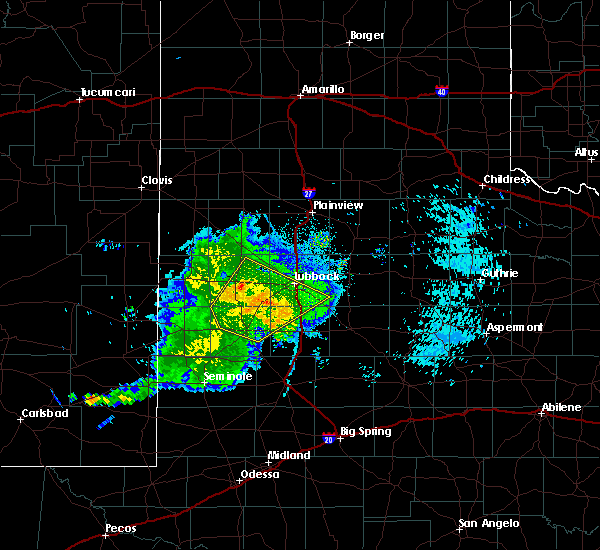 At 1127 pm cdt, the leading edge of strong winds from a severe thunderstorm was located near wolfforth, or 12 miles west of lubbock, moving northeast at 60 mph (radar indicated). Hazards include 70 mph wind gusts. Expect considerable tree damage. damage is likely to mobile homes, roofs, and outbuildings. Locations impacted include, lubbock, levelland, brownfield, slaton, wolfforth, sundown, ransom canyon, lubbock south plains mall, texas tech university, locketville, slide, whitharral, downtown lubbock, woodrow, reese center, meadow, smyer, ropesville, new home and opdyke west. At 1127 pm cdt, the leading edge of strong winds from a severe thunderstorm was located near wolfforth, or 12 miles west of lubbock, moving northeast at 60 mph (radar indicated). Hazards include 70 mph wind gusts. Expect considerable tree damage. damage is likely to mobile homes, roofs, and outbuildings. Locations impacted include, lubbock, levelland, brownfield, slaton, wolfforth, sundown, ransom canyon, lubbock south plains mall, texas tech university, locketville, slide, whitharral, downtown lubbock, woodrow, reese center, meadow, smyer, ropesville, new home and opdyke west.
|
| 9/29/2019 11:18 PM CDT |
 At 1116 pm cdt, a severe thunderstorm was located 6 miles south of locketville, or 8 miles north of brownfield, moving northeast at 40 mph (radar indicated. at 1105 pm, a wind gust of 58 mph was reported by the west texas mesonet station 2 miles south of brownfield). Hazards include 70 mph wind gusts. Expect considerable tree damage. damage is likely to mobile homes, roofs, and outbuildings. Locations impacted include, lubbock, levelland, brownfield, slaton, wolfforth, sundown, ransom canyon, lubbock south plains mall, texas tech university, locketville, slide, whitharral, downtown lubbock, woodrow, reese center, meadow, smyer, ropesville, new home and opdyke west. At 1116 pm cdt, a severe thunderstorm was located 6 miles south of locketville, or 8 miles north of brownfield, moving northeast at 40 mph (radar indicated. at 1105 pm, a wind gust of 58 mph was reported by the west texas mesonet station 2 miles south of brownfield). Hazards include 70 mph wind gusts. Expect considerable tree damage. damage is likely to mobile homes, roofs, and outbuildings. Locations impacted include, lubbock, levelland, brownfield, slaton, wolfforth, sundown, ransom canyon, lubbock south plains mall, texas tech university, locketville, slide, whitharral, downtown lubbock, woodrow, reese center, meadow, smyer, ropesville, new home and opdyke west.
|
| 9/29/2019 11:07 PM CDT |
 At 1106 pm cdt, a severe thunderstorm was located 6 miles northwest of brownfield, moving northeast at 40 mph (radar indicated). Hazards include 70 mph wind gusts. Expect considerable tree damage. Damage is likely to mobile homes, roofs, and outbuildings. At 1106 pm cdt, a severe thunderstorm was located 6 miles northwest of brownfield, moving northeast at 40 mph (radar indicated). Hazards include 70 mph wind gusts. Expect considerable tree damage. Damage is likely to mobile homes, roofs, and outbuildings.
|
| 9/28/2019 7:01 PM CDT |
 At 701 pm cdt, a severe thunderstorm was located over sundown, or 12 miles southwest of levelland, moving northeast at 25 mph (radar indicated). Hazards include 60 mph wind gusts and quarter size hail. Hail damage to vehicles is expected. expect wind damage to roofs, siding, and trees. Locations impacted include, sundown and locketville. At 701 pm cdt, a severe thunderstorm was located over sundown, or 12 miles southwest of levelland, moving northeast at 25 mph (radar indicated). Hazards include 60 mph wind gusts and quarter size hail. Hail damage to vehicles is expected. expect wind damage to roofs, siding, and trees. Locations impacted include, sundown and locketville.
|
| 9/28/2019 6:44 PM CDT |
 At 644 pm cdt, a severe thunderstorm was located 9 miles south of sundown, or 18 miles northwest of brownfield, moving northeast at 25 mph (radar indicated). Hazards include 60 mph wind gusts and quarter size hail. Hail damage to vehicles is expected. Expect wind damage to roofs, siding, and trees. At 644 pm cdt, a severe thunderstorm was located 9 miles south of sundown, or 18 miles northwest of brownfield, moving northeast at 25 mph (radar indicated). Hazards include 60 mph wind gusts and quarter size hail. Hail damage to vehicles is expected. Expect wind damage to roofs, siding, and trees.
|
| 9/28/2019 6:38 PM CDT |
 At 638 pm cdt, a severe thunderstorm was located 7 miles southwest of sundown, or 18 miles southwest of levelland, moving northeast at 25 mph (radar indicated). Hazards include 60 mph wind gusts and half dollar size hail. Hail damage to vehicles is expected. expect wind damage to roofs, siding, and trees. Locations impacted include, sundown and locketville. At 638 pm cdt, a severe thunderstorm was located 7 miles southwest of sundown, or 18 miles southwest of levelland, moving northeast at 25 mph (radar indicated). Hazards include 60 mph wind gusts and half dollar size hail. Hail damage to vehicles is expected. expect wind damage to roofs, siding, and trees. Locations impacted include, sundown and locketville.
|
| 9/28/2019 6:30 PM CDT |
 At 630 pm cdt, a severe thunderstorm was located 9 miles north of tokio, or 16 miles northeast of plains, moving northeast at 25 mph (radar indicated). Hazards include 60 mph wind gusts and half dollar size hail. Hail damage to vehicles is expected. expect wind damage to roofs, siding, and trees. Locations impacted include, sundown, tokio and locketville. At 630 pm cdt, a severe thunderstorm was located 9 miles north of tokio, or 16 miles northeast of plains, moving northeast at 25 mph (radar indicated). Hazards include 60 mph wind gusts and half dollar size hail. Hail damage to vehicles is expected. expect wind damage to roofs, siding, and trees. Locations impacted include, sundown, tokio and locketville.
|
| 9/28/2019 6:20 PM CDT |
 At 619 pm cdt, a severe thunderstorm was located 5 miles northwest of tokio, or 12 miles east of plains, moving northeast at 25 mph (radar indicated). Hazards include 60 mph wind gusts and half dollar size hail. Hail damage to vehicles is expected. expect wind damage to roofs, siding, and trees. Locations impacted include, sundown, tokio and locketville. At 619 pm cdt, a severe thunderstorm was located 5 miles northwest of tokio, or 12 miles east of plains, moving northeast at 25 mph (radar indicated). Hazards include 60 mph wind gusts and half dollar size hail. Hail damage to vehicles is expected. expect wind damage to roofs, siding, and trees. Locations impacted include, sundown, tokio and locketville.
|
| 9/28/2019 6:10 PM CDT |
 At 610 pm cdt, a severe thunderstorm was located 4 miles west of tokio, or 10 miles east of plains, moving northeast at 25 mph (radar indicated). Hazards include 60 mph wind gusts and half dollar size hail. Hail damage to vehicles is expected. Expect wind damage to roofs, siding, and trees. At 610 pm cdt, a severe thunderstorm was located 4 miles west of tokio, or 10 miles east of plains, moving northeast at 25 mph (radar indicated). Hazards include 60 mph wind gusts and half dollar size hail. Hail damage to vehicles is expected. Expect wind damage to roofs, siding, and trees.
|
| 8/18/2019 7:26 PM CDT |
 The national weather service in lubbock texas has issued a * severe thunderstorm warning for. hockley county in northwestern texas. until 815 pm cdt. At 725 pm cdt, a severe thunderstorm was located over levelland, moving east at 10 mph. The national weather service in lubbock texas has issued a * severe thunderstorm warning for. hockley county in northwestern texas. until 815 pm cdt. At 725 pm cdt, a severe thunderstorm was located over levelland, moving east at 10 mph.
|
| 7/6/2019 9:10 PM CDT | Storm damage reported in cochran county TX, 8.4 miles NE of Sundown, TX |
| 7/3/2019 7:51 PM CDT |
 At 751 pm cdt, a severe thunderstorm was located 8 miles southwest of sundown, or 18 miles northeast of plains, moving south at 20 mph (radar indicated. at 745 pm, the west texas mesonet station 8 miles west southwest of sundown reported sustained winds of 46 pm from the north with wind gusts to 59 mph). Hazards include 60 mph wind gusts and quarter size hail. Hail damage to vehicles is expected. expect wind damage to roofs, siding, and trees. Locations impacted include, sundown. At 751 pm cdt, a severe thunderstorm was located 8 miles southwest of sundown, or 18 miles northeast of plains, moving south at 20 mph (radar indicated. at 745 pm, the west texas mesonet station 8 miles west southwest of sundown reported sustained winds of 46 pm from the north with wind gusts to 59 mph). Hazards include 60 mph wind gusts and quarter size hail. Hail damage to vehicles is expected. expect wind damage to roofs, siding, and trees. Locations impacted include, sundown.
|
| 7/3/2019 7:41 PM CDT |
 At 741 pm cdt, a severe thunderstorm was located 6 miles west of sundown, or 16 miles southwest of levelland, moving south at 15 mph (radar indicated). Hazards include 60 mph wind gusts and quarter size hail. Hail damage to vehicles is expected. Expect wind damage to roofs, siding, and trees. At 741 pm cdt, a severe thunderstorm was located 6 miles west of sundown, or 16 miles southwest of levelland, moving south at 15 mph (radar indicated). Hazards include 60 mph wind gusts and quarter size hail. Hail damage to vehicles is expected. Expect wind damage to roofs, siding, and trees.
|
| 7/3/2019 7:40 PM CDT | Measured by the ttu west texas mesonet in cochran county TX, 8.4 miles NE of Sundown, TX |
| 6/18/2019 1:08 AM CDT |
 The severe thunderstorm warning for southeastern cochran, northwestern terry, southwestern hockley and northeastern yoakum counties will expire at 115 am cdt, the storm which prompted the warning has weakened below severe limits, and no longer poses an immediate threat to life or property. therefore, the warning will be allowed to expire. however small hail, gusty winds and heavy rain are still possible with this thunderstorm. a severe thunderstorm watch remains in effect until 300 am cdt for northwestern texas. The severe thunderstorm warning for southeastern cochran, northwestern terry, southwestern hockley and northeastern yoakum counties will expire at 115 am cdt, the storm which prompted the warning has weakened below severe limits, and no longer poses an immediate threat to life or property. therefore, the warning will be allowed to expire. however small hail, gusty winds and heavy rain are still possible with this thunderstorm. a severe thunderstorm watch remains in effect until 300 am cdt for northwestern texas.
|
| 6/18/2019 12:53 AM CDT |
 At 1252 am cdt, a severe thunderstorm was located 8 miles north of sundown, or 8 miles west of levelland, moving east at 25 mph (radar indicated). Hazards include 60 mph wind gusts. Expect damage to roofs, siding, and trees. Locations impacted include, levelland, sundown and whiteface. At 1252 am cdt, a severe thunderstorm was located 8 miles north of sundown, or 8 miles west of levelland, moving east at 25 mph (radar indicated). Hazards include 60 mph wind gusts. Expect damage to roofs, siding, and trees. Locations impacted include, levelland, sundown and whiteface.
|
| 6/18/2019 12:35 AM CDT |
 At 1214 am cdt, a severe thunderstorm was located 9 miles southwest of lehman, or 16 miles southwest of morton, moving southeast at 20 mph (radar indicated). Hazards include 60 mph wind gusts and quarter size hail. Hail damage to vehicles is expected. Expect wind damage to roofs, siding, and trees. At 1214 am cdt, a severe thunderstorm was located 9 miles southwest of lehman, or 16 miles southwest of morton, moving southeast at 20 mph (radar indicated). Hazards include 60 mph wind gusts and quarter size hail. Hail damage to vehicles is expected. Expect wind damage to roofs, siding, and trees.
|
| 6/18/2019 12:15 AM CDT |
 At 1214 am cdt, a severe thunderstorm was located 9 miles southwest of lehman, or 16 miles southwest of morton, moving southeast at 20 mph (radar indicated). Hazards include 60 mph wind gusts and quarter size hail. Hail damage to vehicles is expected. Expect wind damage to roofs, siding, and trees. At 1214 am cdt, a severe thunderstorm was located 9 miles southwest of lehman, or 16 miles southwest of morton, moving southeast at 20 mph (radar indicated). Hazards include 60 mph wind gusts and quarter size hail. Hail damage to vehicles is expected. Expect wind damage to roofs, siding, and trees.
|
| 6/5/2019 5:58 PM CDT |
 The severe thunderstorm warning for southern hockley county will expire at 600 pm cdt, the storm which prompted the warning has moved out of the area. therefore, the warning will be allowed to expire. however gusty winds and heavy rain are still possible with this thunderstorm. remember, a severe thunderstorm warning still remains in effect for eastern lamb and eastern hockley counties until 645 pm. The severe thunderstorm warning for southern hockley county will expire at 600 pm cdt, the storm which prompted the warning has moved out of the area. therefore, the warning will be allowed to expire. however gusty winds and heavy rain are still possible with this thunderstorm. remember, a severe thunderstorm warning still remains in effect for eastern lamb and eastern hockley counties until 645 pm.
|
| 6/5/2019 5:40 PM CDT |
 At 540 pm cdt, a severe thunderstorm was located over levelland, moving east at 30 mph (radar indicated). Hazards include 70 mph wind gusts and quarter size hail. Hail damage to vehicles is expected. expect considerable tree damage. Wind damage is also likely to mobile homes, roofs, and outbuildings. At 540 pm cdt, a severe thunderstorm was located over levelland, moving east at 30 mph (radar indicated). Hazards include 70 mph wind gusts and quarter size hail. Hail damage to vehicles is expected. expect considerable tree damage. Wind damage is also likely to mobile homes, roofs, and outbuildings.
|
| 6/2/2019 10:15 PM CDT | Storm damage reported in cochran county TX, 8.4 miles NE of Sundown, TX |
| 5/25/2019 5:24 PM CDT |
 At 524 pm cdt, a severe thunderstorm was located near pep, or 11 miles southwest of littlefield, moving northeast at 55 mph (radar indicated). Hazards include 60 mph wind gusts and quarter size hail. Hail damage to vehicles is expected. expect wind damage to roofs, siding, and trees. Locations impacted include, levelland, littlefield, morton, sundown, whitharral, bula, pep, lehman and whiteface. At 524 pm cdt, a severe thunderstorm was located near pep, or 11 miles southwest of littlefield, moving northeast at 55 mph (radar indicated). Hazards include 60 mph wind gusts and quarter size hail. Hail damage to vehicles is expected. expect wind damage to roofs, siding, and trees. Locations impacted include, levelland, littlefield, morton, sundown, whitharral, bula, pep, lehman and whiteface.
|
| 5/25/2019 5:20 PM CDT |
 At 519 pm cdt, a severe thunderstorm was located 8 miles southeast of lehman, or 13 miles south of morton, moving northeast at 70 mph (radar indicated). Hazards include 60 mph wind gusts and quarter size hail. Hail damage to vehicles is expected. expect wind damage to roofs, siding, and trees. Locations impacted include, levelland, littlefield, morton, sundown, whitharral, bula, pep, lehman and whiteface. At 519 pm cdt, a severe thunderstorm was located 8 miles southeast of lehman, or 13 miles south of morton, moving northeast at 70 mph (radar indicated). Hazards include 60 mph wind gusts and quarter size hail. Hail damage to vehicles is expected. expect wind damage to roofs, siding, and trees. Locations impacted include, levelland, littlefield, morton, sundown, whitharral, bula, pep, lehman and whiteface.
|
| 5/25/2019 5:11 PM CDT |
 At 511 pm cdt, a severe thunderstorm was located 15 miles north of plains, moving northeast at 70 mph (radar indicated). Hazards include 60 mph wind gusts and quarter size hail. Hail damage to vehicles is expected. Expect wind damage to roofs, siding, and trees. At 511 pm cdt, a severe thunderstorm was located 15 miles north of plains, moving northeast at 70 mph (radar indicated). Hazards include 60 mph wind gusts and quarter size hail. Hail damage to vehicles is expected. Expect wind damage to roofs, siding, and trees.
|
| 5/24/2019 1:05 AM CDT |
 The severe thunderstorm warning for western hockley county will expire at 115 am cdt, the storm which prompted the warning has weakened below severe limits, and has exited the warned area. therefore, the warning will be allowed to expire. a severe thunderstorm watch remains in effect until 300 am cdt for northwestern texas. The severe thunderstorm warning for western hockley county will expire at 115 am cdt, the storm which prompted the warning has weakened below severe limits, and has exited the warned area. therefore, the warning will be allowed to expire. a severe thunderstorm watch remains in effect until 300 am cdt for northwestern texas.
|
| 5/24/2019 12:56 AM CDT |
 At 1255 am cdt, a severe thunderstorm was located 5 miles northwest of levelland, moving northeast at 55 mph (radar indicated). Hazards include 60 mph wind gusts and quarter size hail. Hail damage to vehicles is expected. expect wind damage to roofs, siding, and trees. Locations impacted include, levelland and sundown. At 1255 am cdt, a severe thunderstorm was located 5 miles northwest of levelland, moving northeast at 55 mph (radar indicated). Hazards include 60 mph wind gusts and quarter size hail. Hail damage to vehicles is expected. expect wind damage to roofs, siding, and trees. Locations impacted include, levelland and sundown.
|
| 5/24/2019 12:46 AM CDT |
 At 1245 am cdt, a severe thunderstorm was located 6 miles northwest of sundown, or 13 miles west of levelland, moving northeast at 55 mph (radar indicated). Hazards include 60 mph wind gusts and half dollar size hail. Hail damage to vehicles is expected. expect wind damage to roofs, siding, and trees. Locations impacted include, levelland, sundown and whiteface. At 1245 am cdt, a severe thunderstorm was located 6 miles northwest of sundown, or 13 miles west of levelland, moving northeast at 55 mph (radar indicated). Hazards include 60 mph wind gusts and half dollar size hail. Hail damage to vehicles is expected. expect wind damage to roofs, siding, and trees. Locations impacted include, levelland, sundown and whiteface.
|
| 5/24/2019 12:30 AM CDT |
 At 1230 am cdt, a severe thunderstorm was located 11 miles north of plains, moving northeast at 40 mph (radar indicated). Hazards include 60 mph wind gusts and quarter size hail. Hail damage to vehicles is expected. Expect wind damage to roofs, siding, and trees. At 1230 am cdt, a severe thunderstorm was located 11 miles north of plains, moving northeast at 40 mph (radar indicated). Hazards include 60 mph wind gusts and quarter size hail. Hail damage to vehicles is expected. Expect wind damage to roofs, siding, and trees.
|
| 5/23/2019 8:27 PM CDT |
 At 827 pm cdt, a severe thunderstorm was located 6 miles west of levelland, moving northeast at 25 mph (radar indicated). Hazards include tennis ball size hail and 60 mph wind gusts. People and animals outdoors will be injured. expect hail damage to roofs, siding, windows, and vehicles. Expect wind damage to roofs, siding, and trees. At 827 pm cdt, a severe thunderstorm was located 6 miles west of levelland, moving northeast at 25 mph (radar indicated). Hazards include tennis ball size hail and 60 mph wind gusts. People and animals outdoors will be injured. expect hail damage to roofs, siding, windows, and vehicles. Expect wind damage to roofs, siding, and trees.
|
| 5/7/2019 6:55 PM CDT |
 At 655 pm cdt, a severe thunderstorm was located 5 miles southwest of locketville, or 12 miles northwest of brownfield, moving northeast at 45 mph (radar indicated). Hazards include 60 mph wind gusts and half dollar size hail. Hail damage to vehicles is expected. expect wind damage to roofs, siding, and trees. Locations impacted include, levelland, sundown, locketville, meadow and ropesville. At 655 pm cdt, a severe thunderstorm was located 5 miles southwest of locketville, or 12 miles northwest of brownfield, moving northeast at 45 mph (radar indicated). Hazards include 60 mph wind gusts and half dollar size hail. Hail damage to vehicles is expected. expect wind damage to roofs, siding, and trees. Locations impacted include, levelland, sundown, locketville, meadow and ropesville.
|
| 5/7/2019 6:43 PM CDT |
 At 643 pm cdt, a severe thunderstorm was located 6 miles northeast of tokio, or 12 miles west of brownfield, moving northeast at 40 mph (radar indicated). Hazards include 60 mph wind gusts and half dollar size hail. Hail damage to vehicles is expected. Expect wind damage to roofs, siding, and trees. At 643 pm cdt, a severe thunderstorm was located 6 miles northeast of tokio, or 12 miles west of brownfield, moving northeast at 40 mph (radar indicated). Hazards include 60 mph wind gusts and half dollar size hail. Hail damage to vehicles is expected. Expect wind damage to roofs, siding, and trees.
|
| 3/22/2019 8:45 PM CDT |
 At 844 pm cdt, a severe thunderstorm was located 4 miles south of levelland, moving east at 35 mph (radar indicated). Hazards include 60 mph wind gusts and quarter size hail. Hail damage to vehicles is expected. expect wind damage to roofs, siding, and trees. Locations impacted include, levelland, sundown, whitharral, smyer and opdyke west. At 844 pm cdt, a severe thunderstorm was located 4 miles south of levelland, moving east at 35 mph (radar indicated). Hazards include 60 mph wind gusts and quarter size hail. Hail damage to vehicles is expected. expect wind damage to roofs, siding, and trees. Locations impacted include, levelland, sundown, whitharral, smyer and opdyke west.
|
| 3/22/2019 8:23 PM CDT |
 At 822 pm cdt, a severe thunderstorm was located near sundown, or 14 miles southwest of levelland, moving east at 35 mph (radar indicated). Hazards include 60 mph wind gusts and quarter size hail. Hail damage to vehicles is expected. Expect wind damage to roofs, siding, and trees. At 822 pm cdt, a severe thunderstorm was located near sundown, or 14 miles southwest of levelland, moving east at 35 mph (radar indicated). Hazards include 60 mph wind gusts and quarter size hail. Hail damage to vehicles is expected. Expect wind damage to roofs, siding, and trees.
|
| 3/9/2019 2:11 AM CST |
 At 210 am cst, severe thunderstorms were located along a line extending from near cotton center to 4 miles northeast of sundown, moving east at 40 mph (radar indicated). Hazards include 60 mph wind gusts. Expect damage to roofs. Siding and trees. At 210 am cst, severe thunderstorms were located along a line extending from near cotton center to 4 miles northeast of sundown, moving east at 40 mph (radar indicated). Hazards include 60 mph wind gusts. Expect damage to roofs. Siding and trees.
|
| 10/5/2018 5:32 PM CDT |
 At 531 pm cdt, severe thunderstorms were located along a line extending from 4 miles southwest of levelland to 8 miles southwest of sundown, moving northeast at 20 mph (radar indicated). Hazards include 60 mph wind gusts and quarter size hail. Hail damage to vehicles is expected. expect wind damage to roofs, siding and trees. Locations impacted include, levelland, sundown, whitharral, smyer and opdyke west. At 531 pm cdt, severe thunderstorms were located along a line extending from 4 miles southwest of levelland to 8 miles southwest of sundown, moving northeast at 20 mph (radar indicated). Hazards include 60 mph wind gusts and quarter size hail. Hail damage to vehicles is expected. expect wind damage to roofs, siding and trees. Locations impacted include, levelland, sundown, whitharral, smyer and opdyke west.
|
| 10/5/2018 5:03 PM CDT |
 At 501 pm cdt, two severe thunderstorms were located along a line extending from sundown to 14 miles southwest of sundown, moving northeast at 35 mph (radar indicated). Hazards include 60 mph wind gusts and quarter size hail. Hail damage to vehicles is expected. Expect wind damage to roofs, siding and trees. At 501 pm cdt, two severe thunderstorms were located along a line extending from sundown to 14 miles southwest of sundown, moving northeast at 35 mph (radar indicated). Hazards include 60 mph wind gusts and quarter size hail. Hail damage to vehicles is expected. Expect wind damage to roofs, siding and trees.
|
| 10/21/2017 5:10 PM CDT | West texas mesonet observation in cochran county TX, 8.4 miles NE of Sundown, TX |
| 9/16/2017 5:05 PM CDT | West texas mesonet report in cochran county TX, 8.4 miles NE of Sundown, TX |
| 8/22/2017 6:35 PM CDT |
 At 635 pm cdt, a severe thunderstorm was located near levelland, moving east at 15 mph (radar indicated). Hazards include golf ball size hail and 70 mph wind gusts. People and animals outdoors will be injured. expect hail damage to roofs, siding, windows and vehicles. expect considerable tree damage. wind damage is likely to mobile homes, roofs and outbuildings. Locations impacted include, levelland, sundown and opdyke west. At 635 pm cdt, a severe thunderstorm was located near levelland, moving east at 15 mph (radar indicated). Hazards include golf ball size hail and 70 mph wind gusts. People and animals outdoors will be injured. expect hail damage to roofs, siding, windows and vehicles. expect considerable tree damage. wind damage is likely to mobile homes, roofs and outbuildings. Locations impacted include, levelland, sundown and opdyke west.
|
| 8/22/2017 6:14 PM CDT |
 At 614 pm cdt, a severe thunderstorm was located near sundown, moving east at 10 mph (radar indicated). Hazards include 70 mph wind gusts and quarter size hail. Hail damage to vehicles is expected. expect considerable tree damage. Wind damage is likely to mobile homes, roofs and outbuildings. At 614 pm cdt, a severe thunderstorm was located near sundown, moving east at 10 mph (radar indicated). Hazards include 70 mph wind gusts and quarter size hail. Hail damage to vehicles is expected. expect considerable tree damage. Wind damage is likely to mobile homes, roofs and outbuildings.
|
| 8/5/2017 6:20 PM CDT | Storm damage reported in cochran county TX, 8.4 miles NE of Sundown, TX |
| 7/4/2017 9:25 PM CDT |
 At 923 pm cdt, severe thunderstorms were located along a line extending from near aiken to near lubbock international airport to wolfforth to 9 miles northwest of brownfield to near bronco, moving south at 35 mph. the west texas mesonet station at aiken reported 67 mph at 910 pm (radar indicated). Hazards include 70 mph wind gusts. Expect considerable tree damage. damage is likely to mobile homes, roofs, and outbuildings. Locations impacted include, lubbock, plainview, levelland, brownfield, slaton, tulia, floydada, abernathy, hale center, plains, silverton, wolfforth, shallowater, idalou, ralls, lockney, sundown, petersburg, lorenzo and ransom canyon. At 923 pm cdt, severe thunderstorms were located along a line extending from near aiken to near lubbock international airport to wolfforth to 9 miles northwest of brownfield to near bronco, moving south at 35 mph. the west texas mesonet station at aiken reported 67 mph at 910 pm (radar indicated). Hazards include 70 mph wind gusts. Expect considerable tree damage. damage is likely to mobile homes, roofs, and outbuildings. Locations impacted include, lubbock, plainview, levelland, brownfield, slaton, tulia, floydada, abernathy, hale center, plains, silverton, wolfforth, shallowater, idalou, ralls, lockney, sundown, petersburg, lorenzo and ransom canyon.
|
| 7/4/2017 9:13 PM CDT |
 At 910 pm cdt, severe thunderstorms were located along a line extending from 7 miles south of claytonville to 7 miles southeast of abernathy to near reese center to 6 miles southwest of locketville to near bronco, moving southeast at 40 mph. the west texas mesonet station at sundown reported a wind gust to 64 mph and the station at levelland reported 58 mph, both at 905 pm. these are very dangerous storms (radar indicated). Hazards include 80 mph wind gusts. Flying debris will be dangerous to those caught without shelter. mobile homes will be heavily damaged. expect considerable damage to roofs, windows, and vehicles. extensive tree damage and power outages are likely. Locations impacted include, lubbock, plainview, levelland, brownfield, slaton, tulia, floydada, abernathy, hale center, plains, silverton, wolfforth, shallowater, idalou, ralls, lockney, sundown, petersburg, lorenzo and anton. At 910 pm cdt, severe thunderstorms were located along a line extending from 7 miles south of claytonville to 7 miles southeast of abernathy to near reese center to 6 miles southwest of locketville to near bronco, moving southeast at 40 mph. the west texas mesonet station at sundown reported a wind gust to 64 mph and the station at levelland reported 58 mph, both at 905 pm. these are very dangerous storms (radar indicated). Hazards include 80 mph wind gusts. Flying debris will be dangerous to those caught without shelter. mobile homes will be heavily damaged. expect considerable damage to roofs, windows, and vehicles. extensive tree damage and power outages are likely. Locations impacted include, lubbock, plainview, levelland, brownfield, slaton, tulia, floydada, abernathy, hale center, plains, silverton, wolfforth, shallowater, idalou, ralls, lockney, sundown, petersburg, lorenzo and anton.
|
| 7/4/2017 9:05 PM CDT | Measured by texas tech west texas mesone in cochran county TX, 8.4 miles NE of Sundown, TX |
| 7/4/2017 8:59 PM CDT |
 At 858 pm cdt, severe thunderstorms were located along a line extending from near claytonville to abernathy to near shallowater to sundown to 11 miles north of bronco, moving southeast at 40 mph. these are very dangerous storms (radar indicated). Hazards include 80 mph wind gusts. Flying debris will be dangerous to those caught without shelter. mobile homes will be heavily damaged. expect considerable damage to roofs, windows, and vehicles. Extensive tree damage and power outages are likely. At 858 pm cdt, severe thunderstorms were located along a line extending from near claytonville to abernathy to near shallowater to sundown to 11 miles north of bronco, moving southeast at 40 mph. these are very dangerous storms (radar indicated). Hazards include 80 mph wind gusts. Flying debris will be dangerous to those caught without shelter. mobile homes will be heavily damaged. expect considerable damage to roofs, windows, and vehicles. Extensive tree damage and power outages are likely.
|
| 7/4/2017 8:41 PM CDT |
 At 839 pm cdt, severe thunderstorms were located along a line extending from near tulia to near hale center to near spade to 8 miles southeast of pep to 6 miles east of bledsoe, moving southeast at 30 mph. at 830 pm, the west texas mesonet station at morton reported a wind gust to 58 mph and the station at olton reported a wind gust to 59 mph at 835 pm (radar indicated). Hazards include 70 mph wind gusts. Expect considerable tree damage. damage is likely to mobile homes, roofs, and outbuildings. Locations impacted include, lubbock, plainview, levelland, littlefield, tulia, abernathy, hale center, olton, morton, wolfforth, shallowater, sundown, petersburg, anton, kress, cotton center, fieldton, spade, claytonville and lubbock south plains mall. At 839 pm cdt, severe thunderstorms were located along a line extending from near tulia to near hale center to near spade to 8 miles southeast of pep to 6 miles east of bledsoe, moving southeast at 30 mph. at 830 pm, the west texas mesonet station at morton reported a wind gust to 58 mph and the station at olton reported a wind gust to 59 mph at 835 pm (radar indicated). Hazards include 70 mph wind gusts. Expect considerable tree damage. damage is likely to mobile homes, roofs, and outbuildings. Locations impacted include, lubbock, plainview, levelland, littlefield, tulia, abernathy, hale center, olton, morton, wolfforth, shallowater, sundown, petersburg, anton, kress, cotton center, fieldton, spade, claytonville and lubbock south plains mall.
|
| 7/4/2017 8:31 PM CDT |
 At 829 pm cdt, severe thunderstorms were located along a line extending from 8 miles west of tulia to near spade to pep to 7 miles south of maple, moving southeast at 30 mph (radar indicated). Hazards include 70 mph wind gusts. Expect considerable tree damage. Damage is likely to mobile homes, roofs, and outbuildings. At 829 pm cdt, severe thunderstorms were located along a line extending from 8 miles west of tulia to near spade to pep to 7 miles south of maple, moving southeast at 30 mph (radar indicated). Hazards include 70 mph wind gusts. Expect considerable tree damage. Damage is likely to mobile homes, roofs, and outbuildings.
|
| 7/1/2017 1:58 AM CDT |
 At 157 am cdt, a severe thunderstorm was located 9 miles northeast of locketville, or 12 miles southeast of levelland, moving east at 55 mph. this is a very dangerous storm (radar indicated). Hazards include 80 mph wind gusts and quarter size hail. Flying debris will be dangerous to those caught without shelter. mobile homes will be heavily damaged. expect considerable damage to roofs, windows, and vehicles. Extensive tree damage and power outages are likely. At 157 am cdt, a severe thunderstorm was located 9 miles northeast of locketville, or 12 miles southeast of levelland, moving east at 55 mph. this is a very dangerous storm (radar indicated). Hazards include 80 mph wind gusts and quarter size hail. Flying debris will be dangerous to those caught without shelter. mobile homes will be heavily damaged. expect considerable damage to roofs, windows, and vehicles. Extensive tree damage and power outages are likely.
|
| 7/1/2017 1:33 AM CDT |
 At 133 am cdt, a severe thunderstorm was located near sundown, or 9 miles southwest of levelland, moving southeast at 30 mph (radar indicated). Hazards include 60 mph wind gusts and quarter size hail. Hail damage to vehicles is expected. expect wind damage to roofs, siding, and trees. Locations impacted include, levelland, sundown, whitharral, whiteface and opdyke west. At 133 am cdt, a severe thunderstorm was located near sundown, or 9 miles southwest of levelland, moving southeast at 30 mph (radar indicated). Hazards include 60 mph wind gusts and quarter size hail. Hail damage to vehicles is expected. expect wind damage to roofs, siding, and trees. Locations impacted include, levelland, sundown, whitharral, whiteface and opdyke west.
|
| 7/1/2017 1:12 AM CDT |
 At 112 am cdt, a severe thunderstorm was located 7 miles southeast of lehman, or 11 miles southeast of morton, moving southeast at 30 mph (radar indicated). Hazards include ping pong ball size hail and 60 mph wind gusts. People and animals outdoors will be injured. expect hail damage to roofs, siding, windows, and vehicles. Expect wind damage to roofs, siding, and trees. At 112 am cdt, a severe thunderstorm was located 7 miles southeast of lehman, or 11 miles southeast of morton, moving southeast at 30 mph (radar indicated). Hazards include ping pong ball size hail and 60 mph wind gusts. People and animals outdoors will be injured. expect hail damage to roofs, siding, windows, and vehicles. Expect wind damage to roofs, siding, and trees.
|
| 1/1/2017 8:33 PM CST |
 At 832 pm cst, severe thunderstorms were located along a line extending from 7 miles northwest of levelland to 8 miles west of sundown to 7 miles west of brownfield, moving northeast at 45 mph. data indicate that terry county has the highest risk of severe winds with this activity (radar indicated). Hazards include 70 mph wind gusts. Expect considerable tree damage. damage is likely to mobile homes, roofs, and outbuildings. Locations impacted include, levelland, brownfield, sundown, anton, whitharral, locketville, tokio, meadow, smyer, whiteface, ropesville, wellman and opdyke west. At 832 pm cst, severe thunderstorms were located along a line extending from 7 miles northwest of levelland to 8 miles west of sundown to 7 miles west of brownfield, moving northeast at 45 mph. data indicate that terry county has the highest risk of severe winds with this activity (radar indicated). Hazards include 70 mph wind gusts. Expect considerable tree damage. damage is likely to mobile homes, roofs, and outbuildings. Locations impacted include, levelland, brownfield, sundown, anton, whitharral, locketville, tokio, meadow, smyer, whiteface, ropesville, wellman and opdyke west.
|
| 1/1/2017 8:18 PM CST |
 At 817 pm cst, severe thunderstorms were located along a line extending from 6 miles southeast of lehman to 11 miles north of plains to 8 miles south of tokio, moving northeast at 45 mph. an area of low level circulation was located about 10 miles southwest of sundown (radar indicated). Hazards include 70 mph wind gusts. Expect considerable tree damage. Damage is likely to mobile homes, roofs, and outbuildings. At 817 pm cst, severe thunderstorms were located along a line extending from 6 miles southeast of lehman to 11 miles north of plains to 8 miles south of tokio, moving northeast at 45 mph. an area of low level circulation was located about 10 miles southwest of sundown (radar indicated). Hazards include 70 mph wind gusts. Expect considerable tree damage. Damage is likely to mobile homes, roofs, and outbuildings.
|
| 7/10/2016 6:21 PM CDT |
 At 621 pm cdt, a severe thunderstorm was located 9 miles west of levelland, moving southeast at 10 mph (radar indicated). Hazards include 60 mph wind gusts and quarter size hail. Hail damage to vehicles is expected. expect wind damage to roofs, siding and trees. Locations impacted include, levelland and sundown. At 621 pm cdt, a severe thunderstorm was located 9 miles west of levelland, moving southeast at 10 mph (radar indicated). Hazards include 60 mph wind gusts and quarter size hail. Hail damage to vehicles is expected. expect wind damage to roofs, siding and trees. Locations impacted include, levelland and sundown.
|
| 7/10/2016 6:06 PM CDT |
 At 605 pm cdt, a severe thunderstorm was located 11 miles northwest of levelland, moving southeast at 10 mph (radar indicated). Hazards include ping pong ball size hail and 60 mph wind gusts. People and animals outdoors will be injured. expect hail damage to roofs, siding, windows and vehicles. Expect wind damage to roofs, siding and trees. At 605 pm cdt, a severe thunderstorm was located 11 miles northwest of levelland, moving southeast at 10 mph (radar indicated). Hazards include ping pong ball size hail and 60 mph wind gusts. People and animals outdoors will be injured. expect hail damage to roofs, siding, windows and vehicles. Expect wind damage to roofs, siding and trees.
|
| 6/15/2016 6:10 PM CDT | Measured by west texas mesone in yoakum county TX, 8.4 miles NE of Sundown, TX |
| 6/15/2016 5:55 PM CDT |
 At 554 pm cdt, a severe thunderstorm was located near sundown, or 7 miles west of levelland, moving northeast at 20 mph (radar indicated). Hazards include ping pong ball size hail and 60 mph wind gusts. People and animals outdoors will be injured. expect hail damage to roofs, siding, windows and vehicles. expect wind damage to roofs, siding and trees. Locations impacted include, levelland, sundown, whitharral and opdyke west. At 554 pm cdt, a severe thunderstorm was located near sundown, or 7 miles west of levelland, moving northeast at 20 mph (radar indicated). Hazards include ping pong ball size hail and 60 mph wind gusts. People and animals outdoors will be injured. expect hail damage to roofs, siding, windows and vehicles. expect wind damage to roofs, siding and trees. Locations impacted include, levelland, sundown, whitharral and opdyke west.
|
| 6/15/2016 5:43 PM CDT |
 At 542 pm cdt, a severe thunderstorm was located near sundown, or 10 miles southwest of levelland, moving northeast at 25 mph (radar indicated). Hazards include ping pong ball size hail and 60 mph wind gusts. People and animals outdoors will be injured. expect hail damage to roofs, siding, windows and vehicles. Expect wind damage to roofs, siding and trees. At 542 pm cdt, a severe thunderstorm was located near sundown, or 10 miles southwest of levelland, moving northeast at 25 mph (radar indicated). Hazards include ping pong ball size hail and 60 mph wind gusts. People and animals outdoors will be injured. expect hail damage to roofs, siding, windows and vehicles. Expect wind damage to roofs, siding and trees.
|
| 6/15/2016 5:36 PM CDT |
 At 535 pm cdt, a severe thunderstorm was located near sundown, or 15 miles southwest of levelland, moving northeast at 20 mph (radar indicated). Hazards include 60 mph wind gusts and half dollar size hail. Hail damage to vehicles is expected. expect wind damage to roofs, siding and trees. Locations impacted include, levelland, sundown and whiteface. At 535 pm cdt, a severe thunderstorm was located near sundown, or 15 miles southwest of levelland, moving northeast at 20 mph (radar indicated). Hazards include 60 mph wind gusts and half dollar size hail. Hail damage to vehicles is expected. expect wind damage to roofs, siding and trees. Locations impacted include, levelland, sundown and whiteface.
|
| 6/15/2016 5:18 PM CDT |
 At 518 pm cdt, a severe thunderstorm was located 10 miles west of sundown, or 17 miles northeast of plains, moving northeast at 25 mph (radar indicated). Hazards include 60 mph wind gusts and half dollar size hail. Hail damage to vehicles is expected. Expect wind damage to roofs, siding and trees. At 518 pm cdt, a severe thunderstorm was located 10 miles west of sundown, or 17 miles northeast of plains, moving northeast at 25 mph (radar indicated). Hazards include 60 mph wind gusts and half dollar size hail. Hail damage to vehicles is expected. Expect wind damage to roofs, siding and trees.
|
| 6/18/2015 7:48 PM CDT | At 747 pm cdt, a severe thunderstorm was located just east of sundown, or 10 miles southwest of levelland, moving west at 10 mph (radar indicated). Hazards include quarter size hail and 60 mph wind gusts. Hail damage to vehicles is expected. expect wind damage to roofs, siding and trees. Locations impacted include, sundown and locketville. |
| 6/18/2015 7:31 PM CDT | At 731 pm cdt, a severe thunderstorm was located near sundown, or 9 miles south of levelland, moving west at 10 mph (radar indicated). Hazards include 60 mph wind gusts and quarter size hail. Hail damage to vehicles is expected. Expect wind damage to roofs, siding and trees. |
| 6/13/2015 7:55 PM CDT |
 At 755 pm cdt, a severe thunderstorm was located near sundown, or 12 miles southwest of levelland, moving north at 20 mph (radar indicated). Hazards include half dollar size hail and 60 mph wind gusts. Hail damage to vehicles is expected. expect wind damage to roofs, siding and trees. Locations impacted include, levelland, sundown and whiteface. At 755 pm cdt, a severe thunderstorm was located near sundown, or 12 miles southwest of levelland, moving north at 20 mph (radar indicated). Hazards include half dollar size hail and 60 mph wind gusts. Hail damage to vehicles is expected. expect wind damage to roofs, siding and trees. Locations impacted include, levelland, sundown and whiteface.
|
| 6/13/2015 7:41 PM CDT |
 At 741 pm cdt, a severe thunderstorm was located 7 miles south of sundown, or 17 miles southwest of levelland, moving north at 20 mph (radar indicated). Hazards include 60 mph wind gusts and half dollar size hail. Hail damage to vehicles is expected. Expect wind damage to roofs, siding and trees. At 741 pm cdt, a severe thunderstorm was located 7 miles south of sundown, or 17 miles southwest of levelland, moving north at 20 mph (radar indicated). Hazards include 60 mph wind gusts and half dollar size hail. Hail damage to vehicles is expected. Expect wind damage to roofs, siding and trees.
|
| 6/13/2015 6:46 PM CDT |
 At 645 pm cdt, a severe thunderstorm was located near sundown, or near levelland, moving northeast at 20 mph (radar indicated). Hazards include half dollar size hail and 60 mph wind gusts. Hail damage to vehicles is expected. expect wind damage to roofs, siding and trees. Locations impacted include, levelland, sundown and opdyke west. At 645 pm cdt, a severe thunderstorm was located near sundown, or near levelland, moving northeast at 20 mph (radar indicated). Hazards include half dollar size hail and 60 mph wind gusts. Hail damage to vehicles is expected. expect wind damage to roofs, siding and trees. Locations impacted include, levelland, sundown and opdyke west.
|
| 6/13/2015 6:40 PM CDT | Quarter sized hail reported 0.1 miles NW of Sundown, TX |
| 6/13/2015 6:27 PM CDT |
 At 627 pm cdt, a severe thunderstorm was located over sundown, or 10 miles southwest of levelland, moving northeast at 15 mph (radar indicated). Hazards include 60 mph wind gusts and half dollar size hail. Hail damage to vehicles is expected. Expect wind damage to roofs, siding and trees. At 627 pm cdt, a severe thunderstorm was located over sundown, or 10 miles southwest of levelland, moving northeast at 15 mph (radar indicated). Hazards include 60 mph wind gusts and half dollar size hail. Hail damage to vehicles is expected. Expect wind damage to roofs, siding and trees.
|
| 6/12/2015 5:36 PM CDT |
 At 536 pm cdt, a severe thunderstorm was located near sundown, or 10 miles south of levelland, moving east at 15 mph (radar indicated). Hazards include ping pong size hail and 70 mph wind gusts. People and animals outdoors will be injured. expect hail damage to roofs, siding, windows and vehicles. expect considerable tree damage. wind damage is also likely to mobile homes, roofs and outbuildings. locations impacted include, levelland, sundown and locketville. A tornado watch remains in effect until 1000 pm cdt for northwestern texas. At 536 pm cdt, a severe thunderstorm was located near sundown, or 10 miles south of levelland, moving east at 15 mph (radar indicated). Hazards include ping pong size hail and 70 mph wind gusts. People and animals outdoors will be injured. expect hail damage to roofs, siding, windows and vehicles. expect considerable tree damage. wind damage is also likely to mobile homes, roofs and outbuildings. locations impacted include, levelland, sundown and locketville. A tornado watch remains in effect until 1000 pm cdt for northwestern texas.
|
| 6/12/2015 5:28 PM CDT | Ping Pong Ball sized hail reported 0.1 miles NW of Sundown, TX |
| 6/12/2015 5:26 PM CDT |
 At 526 pm cdt, a severe thunderstorm was located over sundown, or 11 miles southwest of levelland, moving east at 15 mph (radar indicated). Hazards include ping pong size hail and 70 mph wind gusts. People and animals outdoors will be injured. expect hail damage to roofs, siding, windows and vehicles. expect considerable tree damage. wind damage is also likely to mobile homes, roofs and outbuildings. locations impacted include, levelland, sundown and locketville. A tornado watch remains in effect until 1000 pm cdt for northwestern texas. At 526 pm cdt, a severe thunderstorm was located over sundown, or 11 miles southwest of levelland, moving east at 15 mph (radar indicated). Hazards include ping pong size hail and 70 mph wind gusts. People and animals outdoors will be injured. expect hail damage to roofs, siding, windows and vehicles. expect considerable tree damage. wind damage is also likely to mobile homes, roofs and outbuildings. locations impacted include, levelland, sundown and locketville. A tornado watch remains in effect until 1000 pm cdt for northwestern texas.
|
| 6/12/2015 5:16 PM CDT |
 At 516 pm cdt, a severe thunderstorm was located over sundown, or 13 miles southwest of levelland, moving east at 15 mph (radar indicated). Hazards include 70 mph wind gusts and ping pong ball size hail. People and animals outdoors will be injured. expect hail damage to roofs, siding, windows and vehicles. expect considerable tree damage. Wind damage is also likely to mobile homes, roofs and outbuildings. At 516 pm cdt, a severe thunderstorm was located over sundown, or 13 miles southwest of levelland, moving east at 15 mph (radar indicated). Hazards include 70 mph wind gusts and ping pong ball size hail. People and animals outdoors will be injured. expect hail damage to roofs, siding, windows and vehicles. expect considerable tree damage. Wind damage is also likely to mobile homes, roofs and outbuildings.
|
| 6/12/2015 5:01 PM CDT |
 At 501 pm cdt, a severe thunderstorm was located near sundown, or 12 miles southwest of levelland, moving east at 30 mph (trained weather spotters). Hazards include golf ball size hail and 70 mph wind gusts. People and animals outdoors will be injured. expect hail damage to roofs, siding, windows and vehicles. expect considerable tree damage. wind damage is also likely to mobile homes, roofs and outbuildings. locations impacted include, sundown and whiteface. A tornado watch remains in effect until 1000 pm cdt for northwestern texas. At 501 pm cdt, a severe thunderstorm was located near sundown, or 12 miles southwest of levelland, moving east at 30 mph (trained weather spotters). Hazards include golf ball size hail and 70 mph wind gusts. People and animals outdoors will be injured. expect hail damage to roofs, siding, windows and vehicles. expect considerable tree damage. wind damage is also likely to mobile homes, roofs and outbuildings. locations impacted include, sundown and whiteface. A tornado watch remains in effect until 1000 pm cdt for northwestern texas.
|
| 6/12/2015 4:53 PM CDT |
 At 452 pm cdt, a severe thunderstorm was located 7 miles west of sundown, or 16 miles southwest of levelland, moving east at 30 mph (trained weather spotters 8 miles west of sundown reported 1.50 inch hail). Hazards include golf ball size hail and 70 mph wind gusts. People and animals outdoors will be injured. expect hail damage to roofs, siding, windows and vehicles. expect considerable tree damage. wind damage is also likely to mobile homes, roofs and outbuildings. locations impacted include, sundown and whiteface. A tornado watch remains in effect until 1000 pm cdt for northwestern texas. At 452 pm cdt, a severe thunderstorm was located 7 miles west of sundown, or 16 miles southwest of levelland, moving east at 30 mph (trained weather spotters 8 miles west of sundown reported 1.50 inch hail). Hazards include golf ball size hail and 70 mph wind gusts. People and animals outdoors will be injured. expect hail damage to roofs, siding, windows and vehicles. expect considerable tree damage. wind damage is also likely to mobile homes, roofs and outbuildings. locations impacted include, sundown and whiteface. A tornado watch remains in effect until 1000 pm cdt for northwestern texas.
|
| 6/12/2015 4:41 PM CDT |
 At 440 pm cdt, a severe thunderstorm was located 12 miles south of lehman, or 18 miles south of morton, moving east at 30 mph (radar indicated). Hazards include golf ball size hail and 70 mph wind gusts. People and animals outdoors will be injured. expect hail damage to roofs, siding, windows and vehicles. expect considerable tree damage. Wind damage is also likely to mobile homes, roofs and outbuildings. At 440 pm cdt, a severe thunderstorm was located 12 miles south of lehman, or 18 miles south of morton, moving east at 30 mph (radar indicated). Hazards include golf ball size hail and 70 mph wind gusts. People and animals outdoors will be injured. expect hail damage to roofs, siding, windows and vehicles. expect considerable tree damage. Wind damage is also likely to mobile homes, roofs and outbuildings.
|
| 5/29/2015 10:30 PM CDT | At 1030 pm cdt, severe thunderstorms were located along a line extending from near ransom canyon to near brownfield, moving east at 30 mph (trained weather spotters). Hazards include quarter size hail and 60 mph wind gusts. Hail damage to vehicles is expected. expect wind damage to roofs, siding and trees. Locations impacted include, lubbock, levelland, slaton, wolfforth, idalou, sundown, ransom canyon, woodrow, slide, lubbock south plains mall, reese center, downtown lubbock, locketville, lubbock international airport, texas tech university, meadow, wilson, smyer, ropesville and new home. |
| 5/29/2015 10:11 PM CDT | At 1010 pm cdt, a line of severe thunderstorms was located near sundown to west lubbock, moving east southeast at 45 mph. a developing storm within this line in west lubbock will be nearly stationary for a time before moving southeast within the rest of the line (trained weather spotters). Hazards include 60 mph wind gusts and quarter size hail. Hail damage to vehicles is expected. Expect wind damage to roofs, siding and trees. |
| 5/29/2015 9:45 PM CDT | At 945 pm cdt, severe thunderstorms were located along a line extending from 9 miles southeast of morton to 9 miles northeast of plains to 6 miles north of higginbotham, moving southeast at 20 mph (radar indicated). Hazards include quarter size hail and 60 mph wind gusts. Hail damage to vehicles is expected. expect wind damage to roofs, siding and trees. Locations impacted include, levelland, brownfield, denver city, morton, plains, sundown, anton, whitharral, bledsoe, lehman, locketville, pep, tokio, bronco, meadow, smyer, whiteface, ropesville, wellman and opdyke west. |
| 5/29/2015 9:12 PM CDT | At 910 pm cdt, severe thunderstorms were located along a line extending from 8 miles southeast of bledsoe to near bronco to 6 miles south of lovington, moving southeast at 25 mph. portions of this line have had a history of producing tornadoes and large hail (radar indicated). Hazards include 60 mph wind gusts and quarter size hail. Hail damage to vehicles is expected. Expect wind damage to roofs, siding and trees. |
| 5/28/2015 6:12 PM CDT | At 611 pm cdt, a severe thunderstorm was located 9 miles south of sundown, or 16 miles northwest of brownfield, moving east at 35 mph (radar indicated). Hazards include half dollar size hail and 60 mph wind gusts. Hail damage to vehicles is expected. expect wind damage to roofs, siding and trees. locations impacted include, brownfield, sundown, locketville and meadow. A tornado watch remains in effect until 800 pm cdt for northwestern texas. |
| 5/28/2015 5:50 PM CDT | At 549 pm cdt, a severe thunderstorm was located 9 miles northwest of tokio, or 13 miles northeast of plains, moving east at 25 mph (radar indicated). Hazards include 60 mph wind gusts and half dollar size hail. Hail damage to vehicles is expected. Expect wind damage to roofs, siding and trees. |
| 5/28/2015 5:19 PM CDT | At 518 pm cdt, a severe thunderstorm was located 9 miles north of plains, moving east at 20 mph (radar indicated). Hazards include half dollar size hail and 60 mph wind gusts. Hail damage to vehicles is expected. expect wind damage to roofs, siding and trees. locations impacted include, levelland, sundown, locketville, meadow, smyer, and whiteface. A tornado watch remains in effect until 800 pm cdt for northwestern texas. |
| 5/28/2015 5:03 PM CDT | At 503 pm cdt, a severe thunderstorm was located 8 miles north of plains, moving northeast at 30 mph (radar indicated). Hazards include 60 mph wind gusts and half dollar size hail. Hail damage to vehicles is expected. Expect wind damage to roofs, siding and trees. |
| 5/28/2015 2:54 PM CDT | At 253 pm cdt, a severe thunderstorm was located near levelland, moving northeast at 40 mph (radar indicated). Hazards include ping pong size hail and 60 mph wind gusts. People and animals outdoors will be injured. expect hail damage to roofs, siding, windows and vehicles. expect wind damage to roofs, siding and trees. locations impacted include, levelland, littlefield, abernathy, shallowater, sundown, anton, spade, whitharral, reese center, smyer, ropesville and opdyke west. A tornado watch remains in effect until 800 pm cdt for northwestern texas. |
| 5/28/2015 2:29 PM CDT | At 228 pm cdt, a severe thunderstorm was located 10 miles northwest of sundown, or 13 miles southeast of morton, moving northeast at 35 mph (radar indicated). Hazards include ping pong ball size hail and 60 mph wind gusts. People and animals outdoors will be injured. expect hail damage to roofs, siding, windows and vehicles. Expect wind damage to roofs, siding and trees. |
| 5/28/2015 11:59 AM CDT | At 1159 am cdt, a severe thunderstorm was located near levelland, moving northeast at 15 mph (radar indicated). Hazards include 60 mph wind gusts and half dollar size hail. Hail damage to vehicles is expected. Expect wind damage to roofs, siding and trees. |
| 5/27/2015 10:09 PM CDT | At 1008 pm cdt, a severe thunderstorm was located over sundown, or 12 miles southwest of levelland, moving northeast at 30 mph (radar indicated). Hazards include quarter size hail and 60 mph wind gusts. Hail damage to vehicles is expected. expect wind damage to roofs, siding and trees. Locations impacted include, sundown. |
| 5/27/2015 9:54 PM CDT | At 953 pm cdt, a severe thunderstorm was located 10 miles southwest of sundown, or 16 miles northeast of plains, moving northeast at 25 mph (radar indicated). Hazards include 60 mph wind gusts and penny size hail. Expect damage to roofs. siding and trees. Locations impacted include, sundown. |
| 5/27/2015 9:30 PM CDT | At 929 pm cdt, a severe thunderstorm was located 8 miles southwest of tokio, or 8 miles southeast of plains, moving northeast at 25 mph (radar indicated). Hazards include 60 mph wind gusts and quarter size hail. Hail damage to vehicles is expected. Expect wind damage to roofs, siding and trees. |
| 5/8/2015 9:03 AM CDT | At 902 am cdt, doppler radar indicated a severe thunderstorm capable of producing quarter size hail. this storm was located near levelland, and moving northeast at 35 mph. |
| 5/3/2015 7:51 PM CDT | At 751 pm cdt, a severe thunderstorm was located near sundown, or 7 miles southwest of levelland, moving northeast at 30 mph (radar indicated). Hazards include 70 mph wind gusts and nickel size hail. Expect considerable tree damage. Damage is likely to mobile homes, roofs and outbuildings. |
| 12/22/2014 7:10 PM CST | Storm damage reported in cochran county TX, 8.2 miles ENE of Sundown, TX |
| 6/7/2014 10:00 PM CDT | Hen Egg sized hail reported 0.1 miles NW of Sundown, TX |
| 6/7/2014 9:23 PM CDT | Golf Ball sized hail reported 0.1 miles NW of Sundown, TX, quarter to golf ball sized hail |
| 6/6/2014 9:05 PM CDT | West texas mesonet in cochran county TX, 8.2 miles ENE of Sundown, TX |
| 5/6/2013 10:12 PM CDT | Storm damage reported in hockley county TX, 2.9 miles W of Sundown, TX |
Hail Maps for Sundown, TX
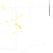


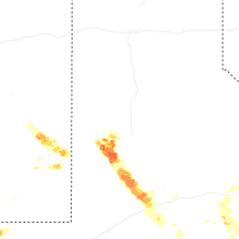


Connect with Interactive Hail Maps