

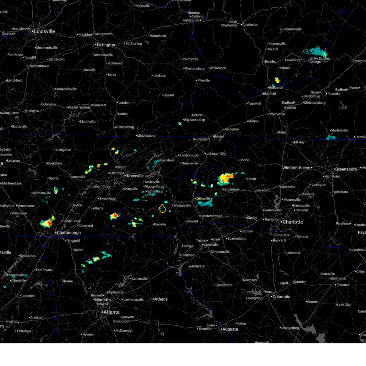
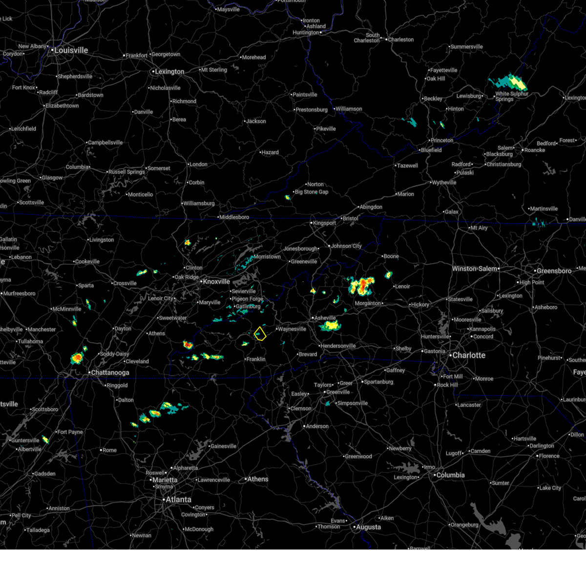
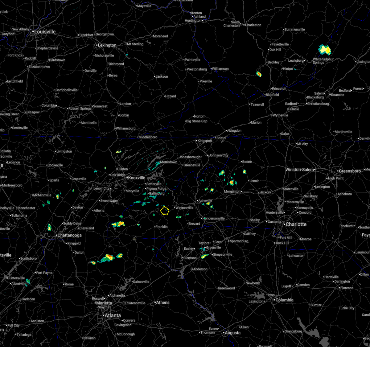
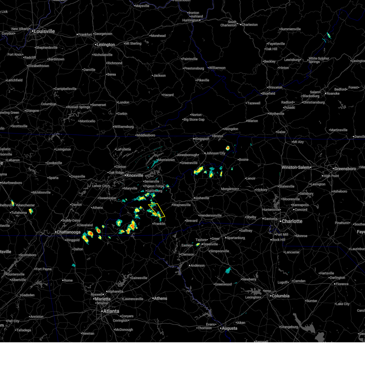
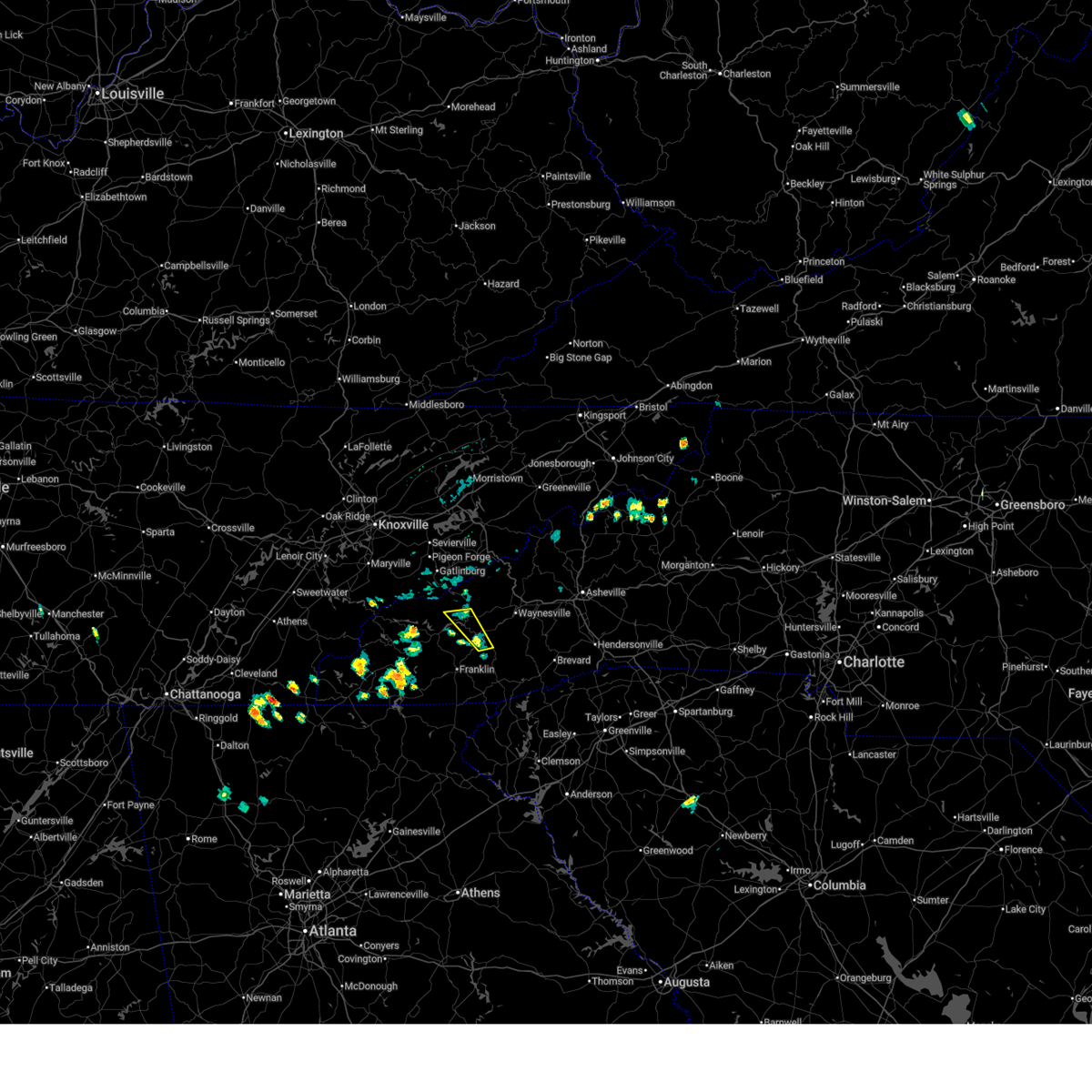
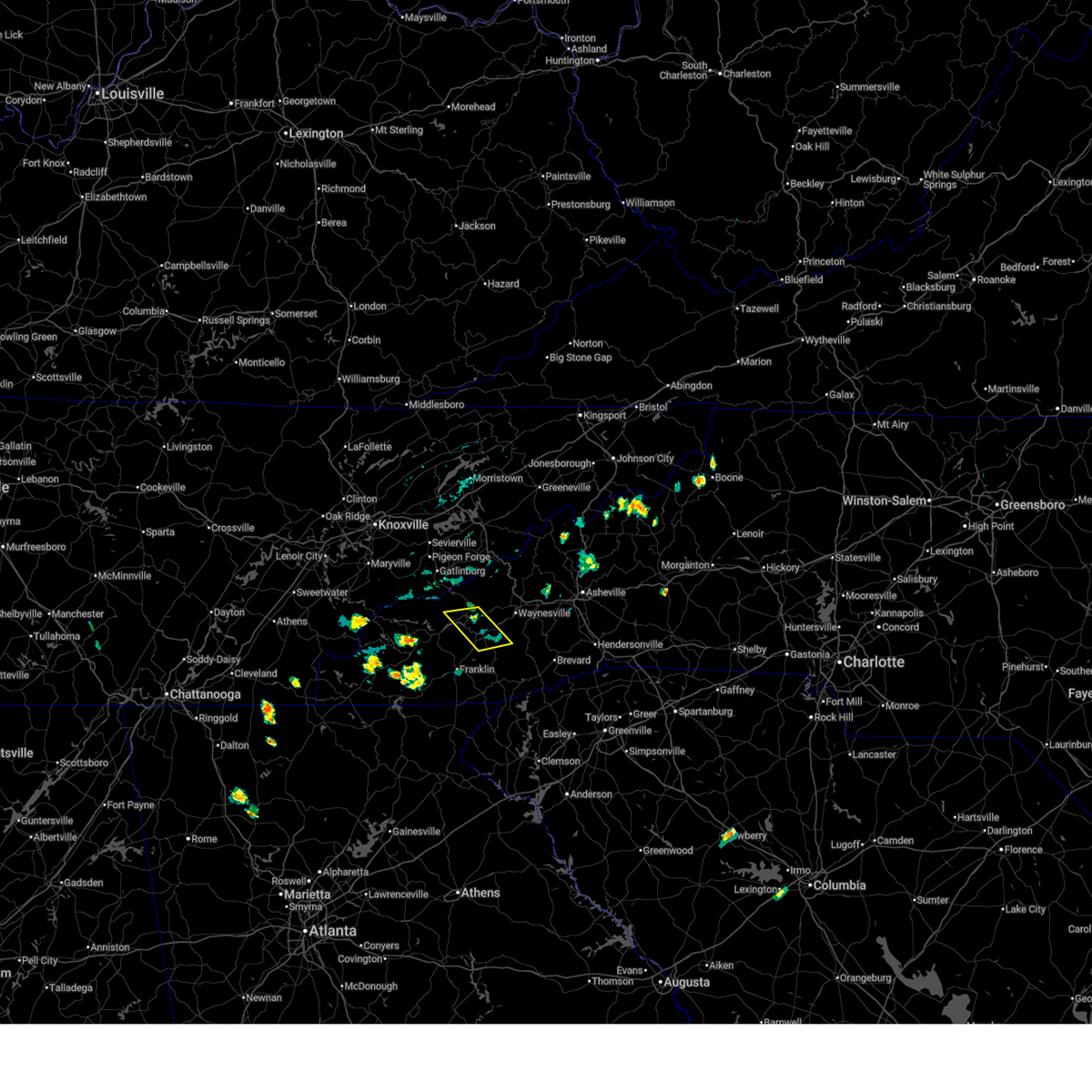
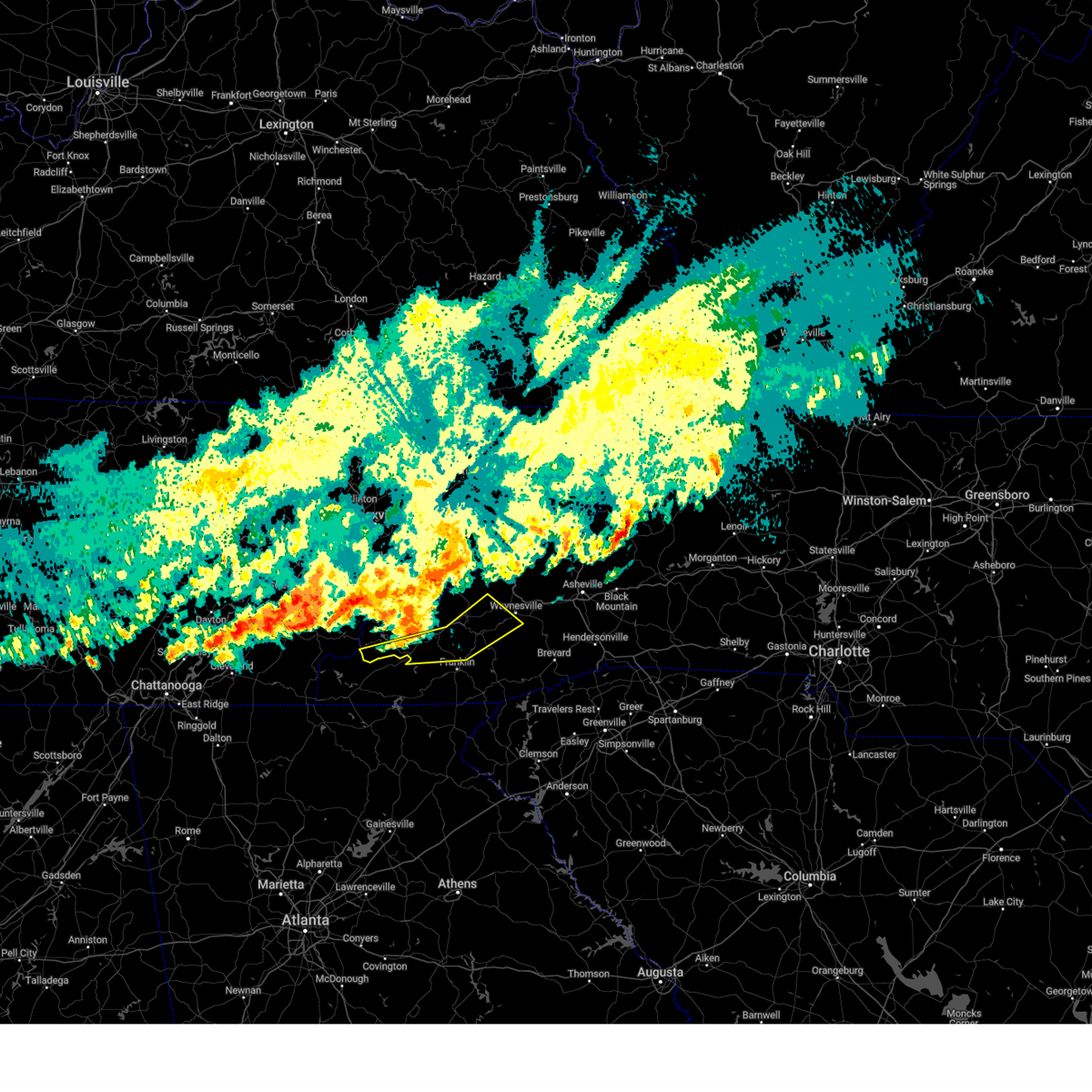
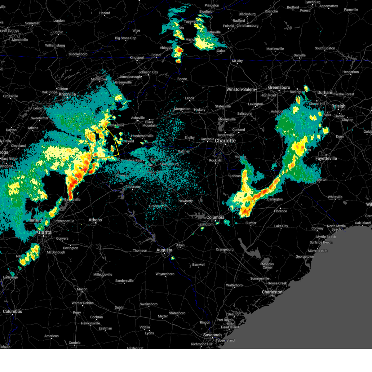
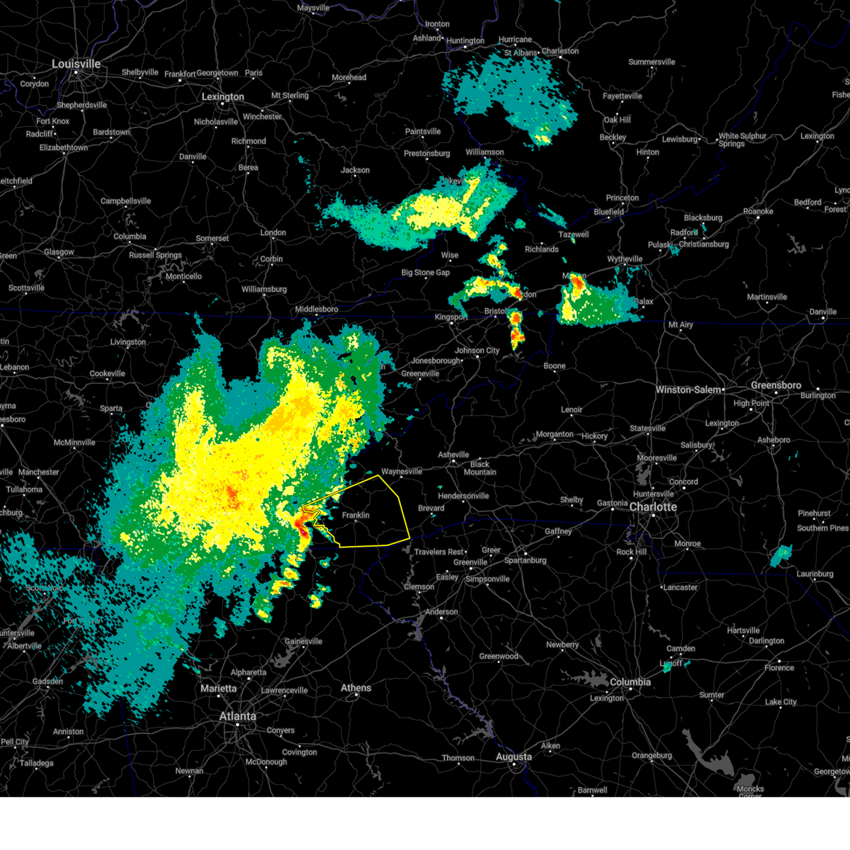
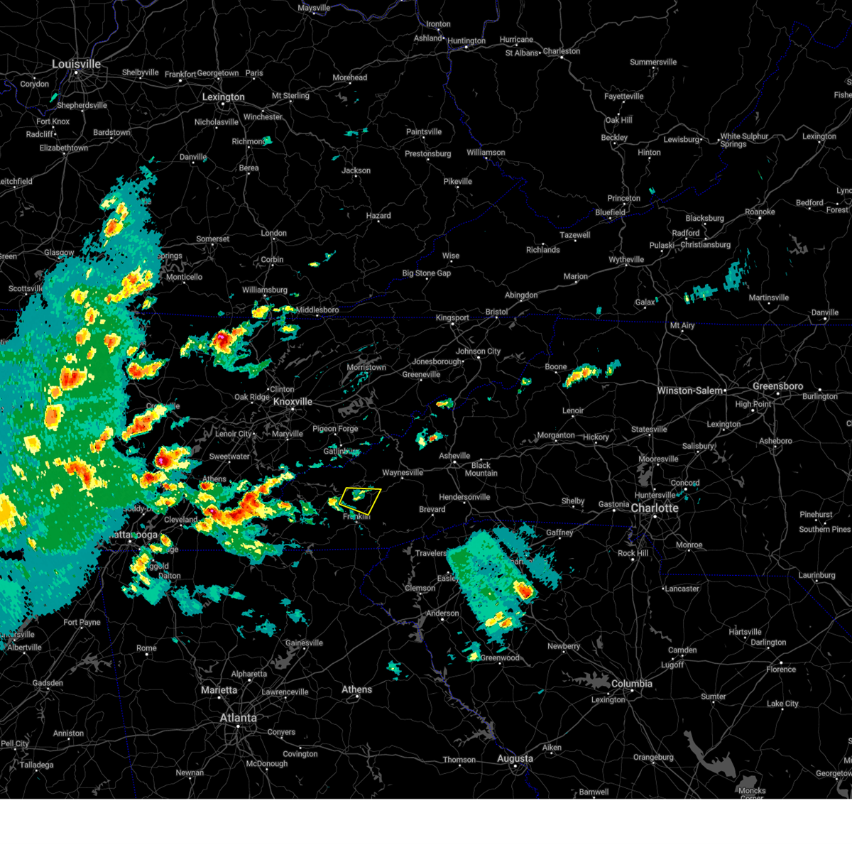
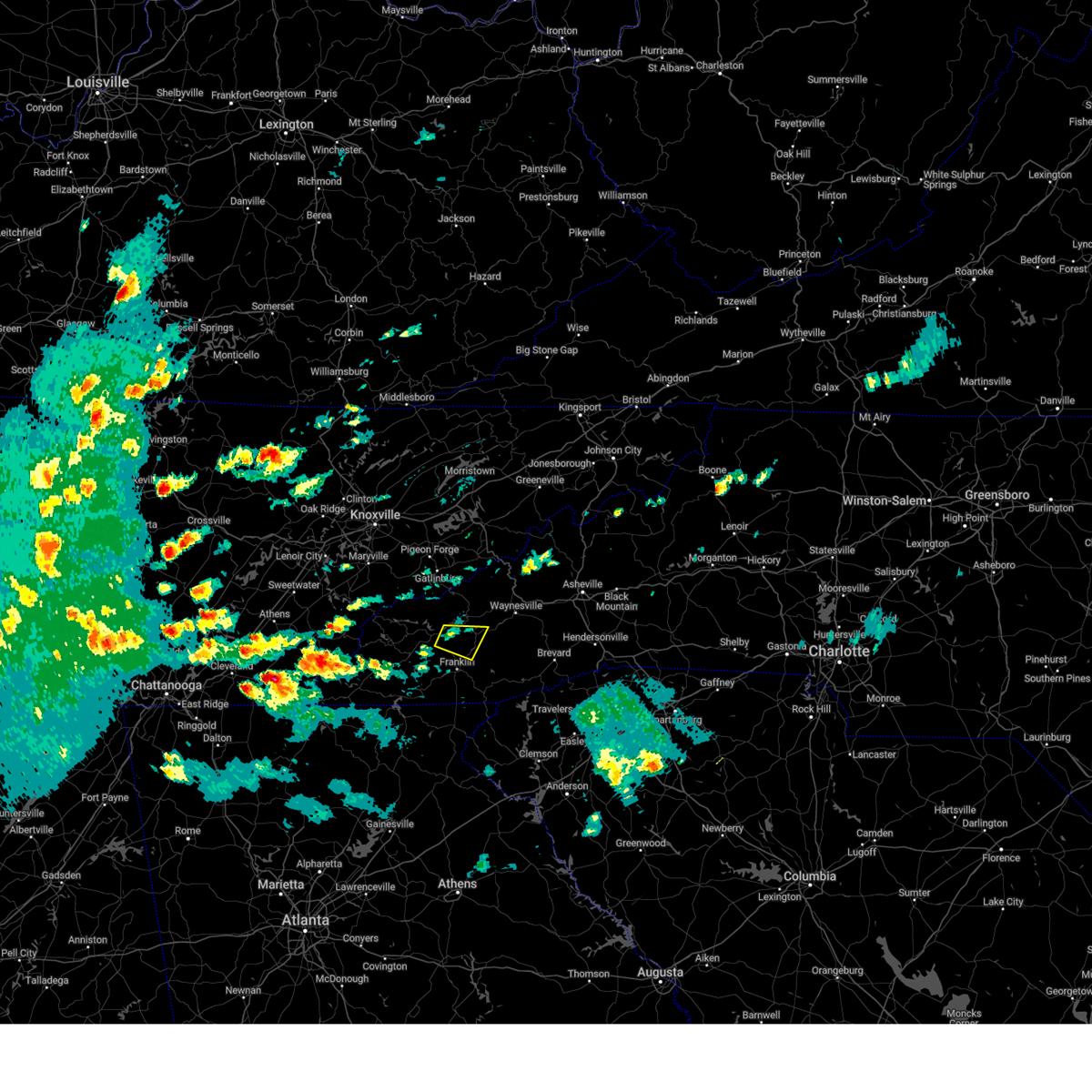
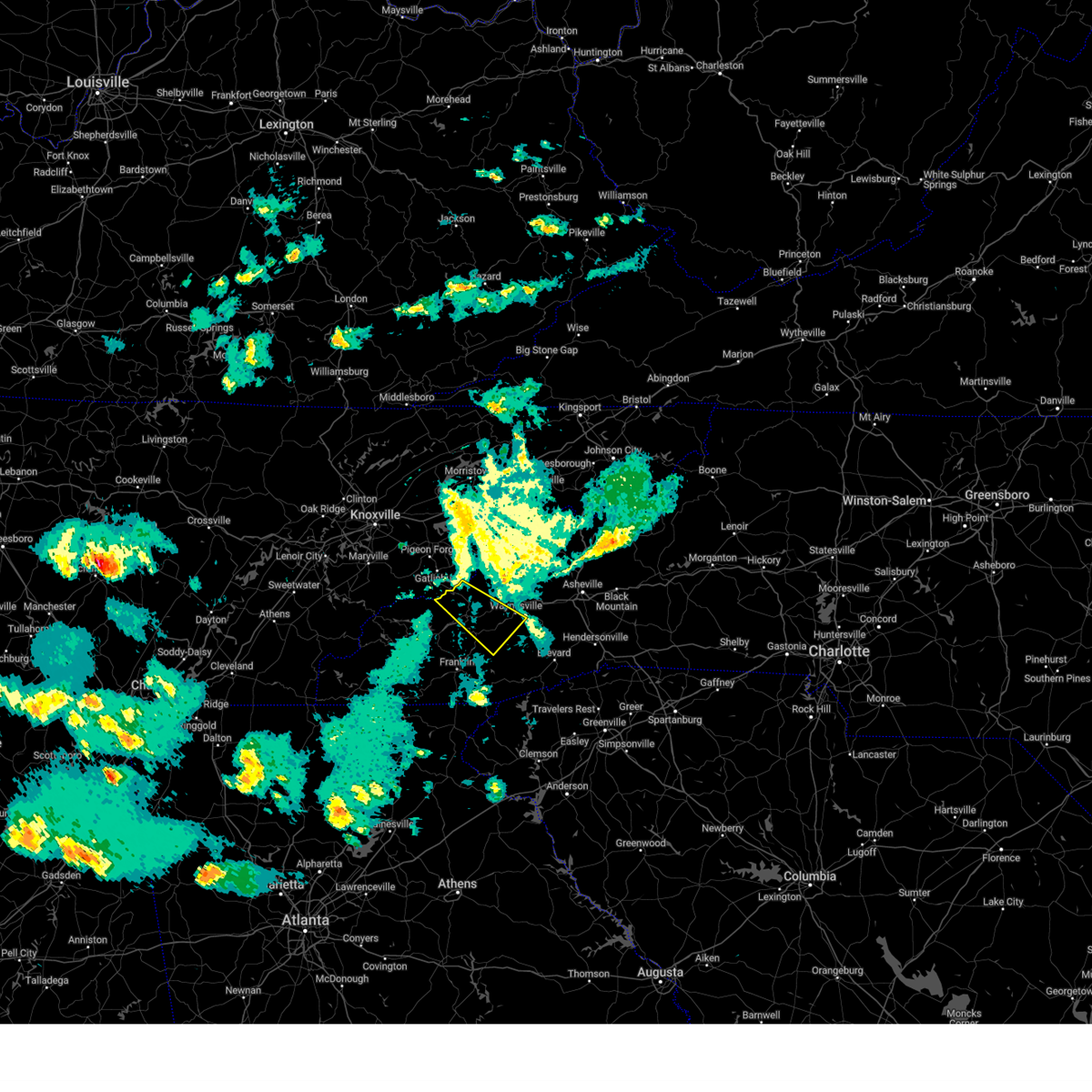
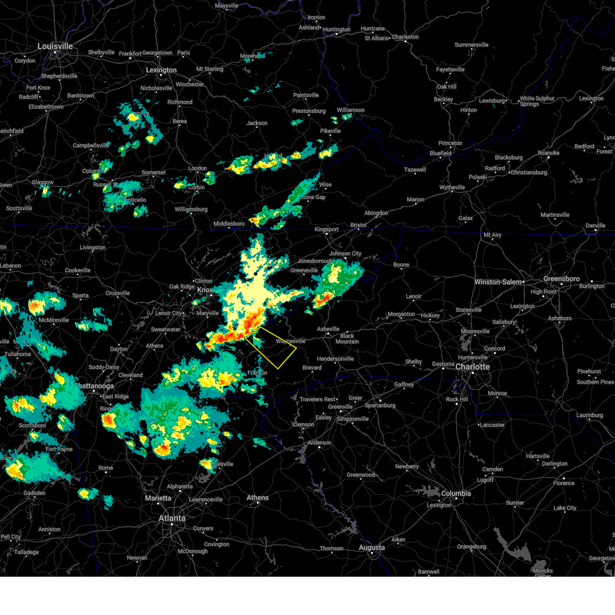
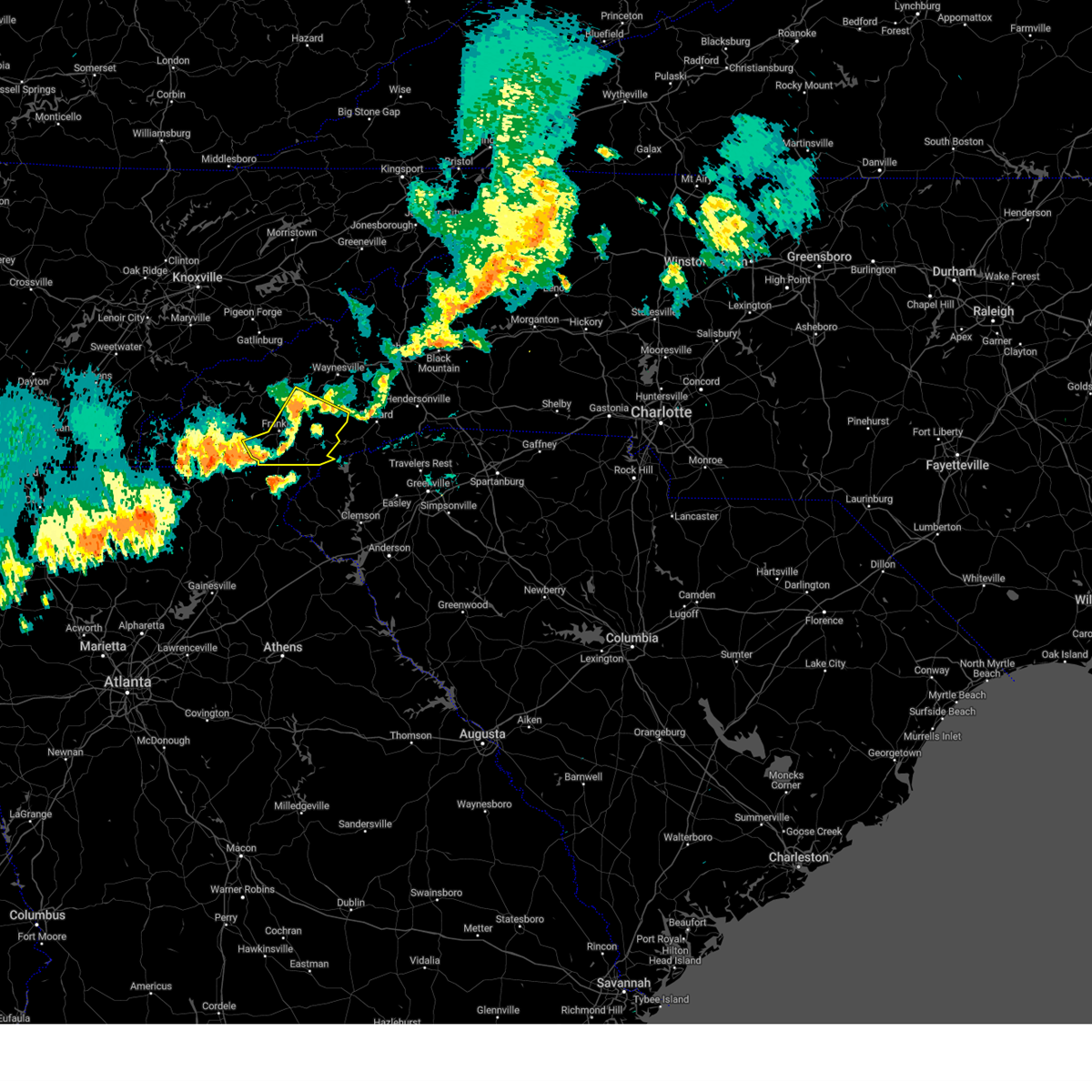
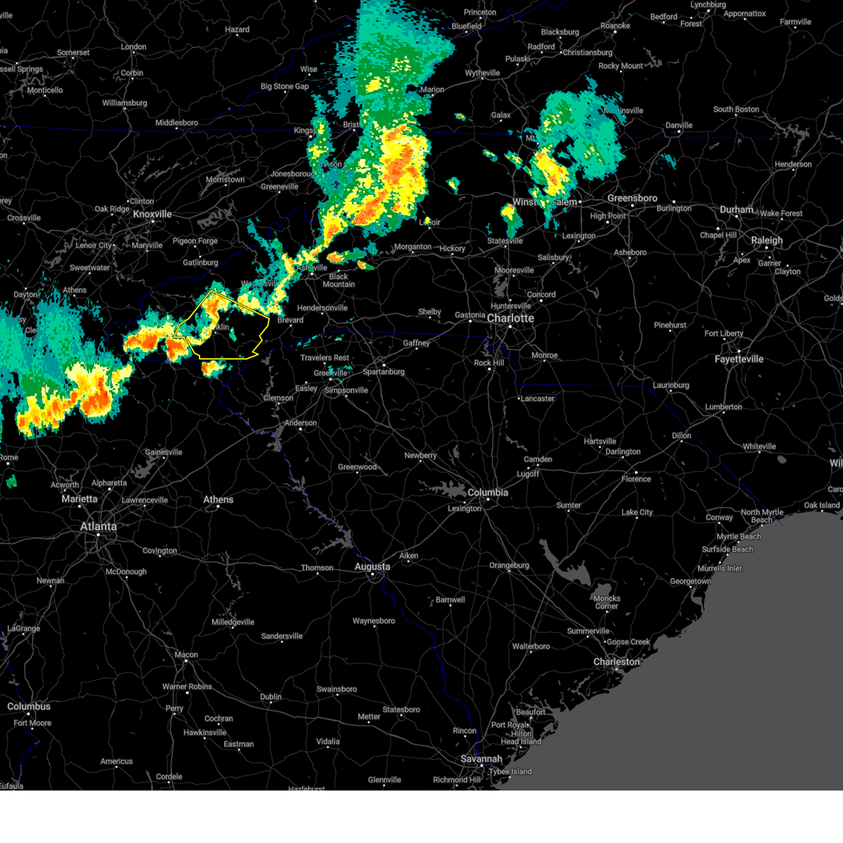
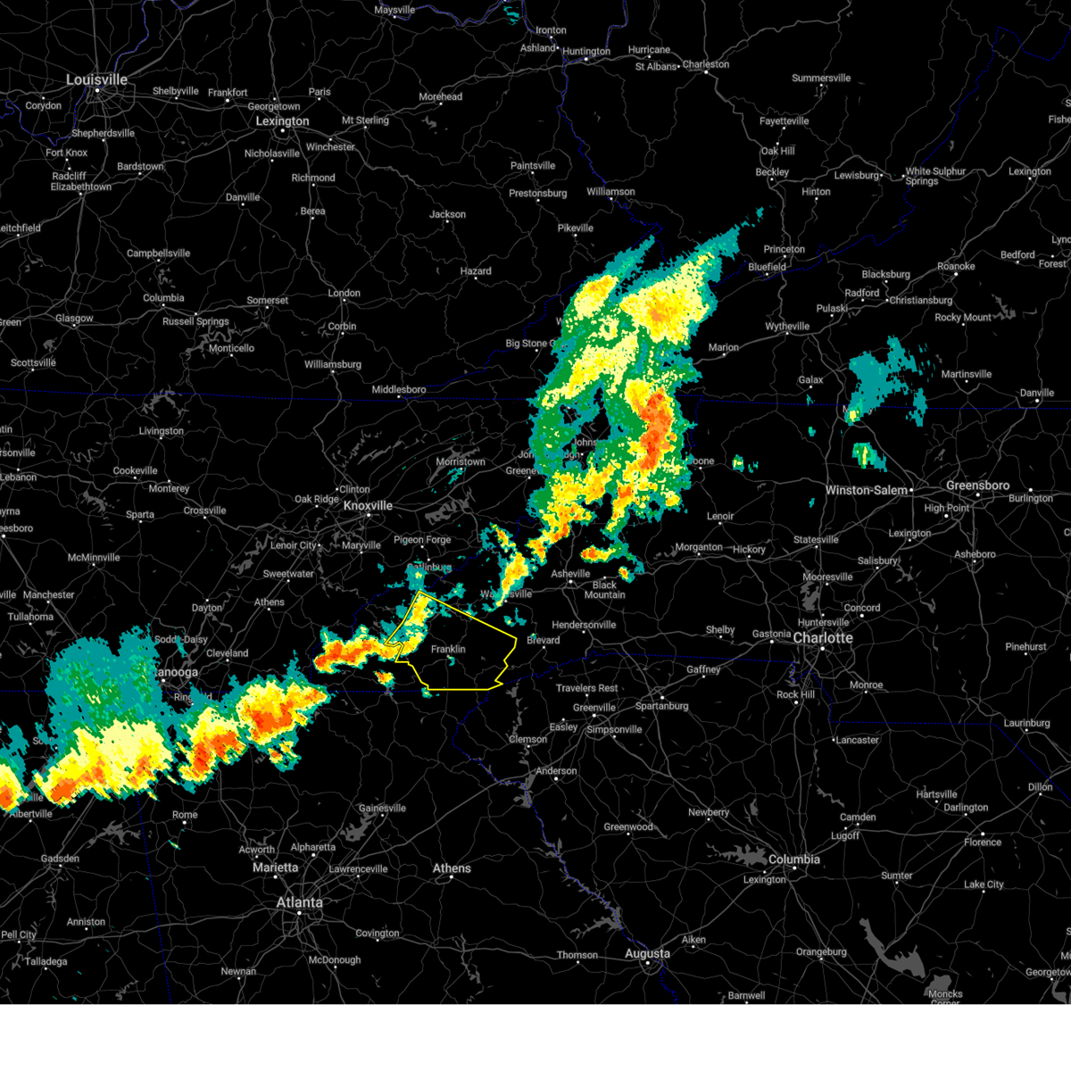
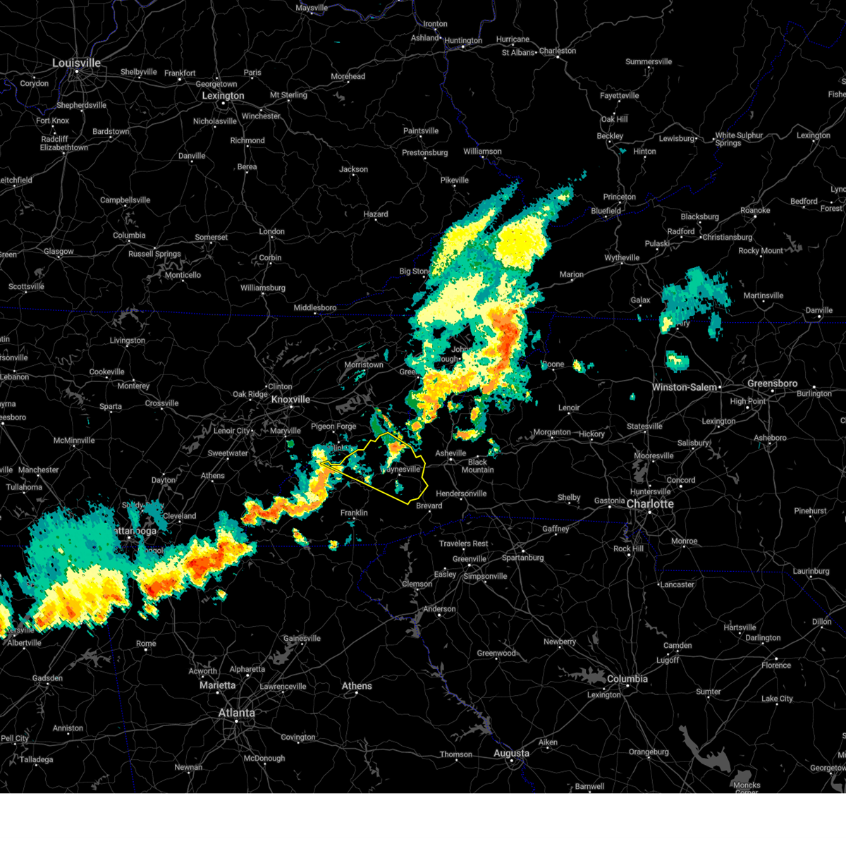
Hail Map for Sylva, NC
The Sylva, NC area has had 3 reports of on-the-ground hail by trained spotters, and has been under severe weather warnings 21 times during the past 12 months. Doppler radar has detected hail at or near Sylva, NC on 8 occasions.
| Name: | Sylva, NC |
| Where Located: | 51.1 miles NW of Greenville, SC |
| Map: | Google Map for Sylva, NC |
| Population: | 2588 |
| Housing Units: | 1338 |
| More Info: | Search Google for Sylva, NC |
0
The Top Recent Hail Date for Sylva, NC is Wednesday, May 8, 2024 (8th out of 8)

Hail and Wind Damage Spotted near Sylva, NC
| Date / Time | Report Details |
|---|---|
| 6/25/2025 2:49 PM EDT |
 the severe thunderstorm warning has been cancelled and is no longer in effect the severe thunderstorm warning has been cancelled and is no longer in effect
|
| 6/25/2025 2:40 PM EDT |
 At 240 pm edt, a severe thunderstorm was located 4 miles north of sylva, moving southwest at 5 mph (radar indicated). Hazards include 60 mph wind gusts and penny size hail. Expect damage to trees and power lines. Locations impacted include, sylva and cherokee. At 240 pm edt, a severe thunderstorm was located 4 miles north of sylva, moving southwest at 5 mph (radar indicated). Hazards include 60 mph wind gusts and penny size hail. Expect damage to trees and power lines. Locations impacted include, sylva and cherokee.
|
| 6/25/2025 2:14 PM EDT |
 Svrgsp the national weather service in greenville-spartanburg has issued a * severe thunderstorm warning for, north central jackson county in western north carolina, * until 300 pm edt. * at 213 pm edt, a severe thunderstorm was located 6 miles northeast of sylva, or near the blue ridge parkway between the smoky mountains and balsam gap. the storm is nearly stationary (radar indicated). Hazards include 60 mph wind gusts and penny size hail. expect damage to trees and power lines Svrgsp the national weather service in greenville-spartanburg has issued a * severe thunderstorm warning for, north central jackson county in western north carolina, * until 300 pm edt. * at 213 pm edt, a severe thunderstorm was located 6 miles northeast of sylva, or near the blue ridge parkway between the smoky mountains and balsam gap. the storm is nearly stationary (radar indicated). Hazards include 60 mph wind gusts and penny size hail. expect damage to trees and power lines
|
| 6/24/2025 5:26 PM EDT |
 The storms which prompted the warning have moved out of the area. therefore, the warning will be allowed to expire. to report severe weather to the national weather service greenville-spartanburg, call toll free, 1, 800, 2 6 7, 8 1 0 1, or post on our facebook page, or tweet it using hashtag nwsgsp. your message should describe the event and the specific location where it occurred. remember, a severe thunderstorm warning still remains in effect for southwestern swain county until 600 pm edt. The storms which prompted the warning have moved out of the area. therefore, the warning will be allowed to expire. to report severe weather to the national weather service greenville-spartanburg, call toll free, 1, 800, 2 6 7, 8 1 0 1, or post on our facebook page, or tweet it using hashtag nwsgsp. your message should describe the event and the specific location where it occurred. remember, a severe thunderstorm warning still remains in effect for southwestern swain county until 600 pm edt.
|
| 6/24/2025 5:10 PM EDT |
 At 510 pm edt, severe thunderstorms were located along a line extending from 6 miles east of bryson city to 3 miles southwest of sylva, moving west at 10 mph (radar indicated). Hazards include 60 mph wind gusts. Expect damage to trees and power lines. Locations impacted include, sylva, cherokee, cullowhee, webster, dillsboro, smoky mountains at deep creek, whittier, and savannah. At 510 pm edt, severe thunderstorms were located along a line extending from 6 miles east of bryson city to 3 miles southwest of sylva, moving west at 10 mph (radar indicated). Hazards include 60 mph wind gusts. Expect damage to trees and power lines. Locations impacted include, sylva, cherokee, cullowhee, webster, dillsboro, smoky mountains at deep creek, whittier, and savannah.
|
| 6/24/2025 4:43 PM EDT |
 Svrgsp the national weather service in greenville-spartanburg has issued a * severe thunderstorm warning for, northern jackson county in western north carolina, southeastern swain county in western north carolina, * until 530 pm edt. * at 442 pm edt, severe thunderstorms were located along a line extending from 10 miles east of bryson city to 6 miles east of sylva, moving west at 10 mph (radar indicated). Hazards include 60 mph wind gusts and penny size hail. expect damage to trees and power lines Svrgsp the national weather service in greenville-spartanburg has issued a * severe thunderstorm warning for, northern jackson county in western north carolina, southeastern swain county in western north carolina, * until 530 pm edt. * at 442 pm edt, severe thunderstorms were located along a line extending from 10 miles east of bryson city to 6 miles east of sylva, moving west at 10 mph (radar indicated). Hazards include 60 mph wind gusts and penny size hail. expect damage to trees and power lines
|
| 5/17/2025 5:01 AM EDT | Tree on hous in jackson county NC, 2.1 miles NW of Sylva, NC |
| 5/17/2025 5:00 AM EDT | Quarter sized hail reported 2.6 miles NW of Sylva, NC |
| 5/17/2025 3:52 AM EDT |
 Svrgsp the national weather service in greenville-spartanburg has issued a * severe thunderstorm warning for, northwestern macon county in western north carolina, northwestern jackson county in western north carolina, southeastern swain county in western north carolina, southern graham county in western north carolina, southwestern haywood county in western north carolina, * until 500 am edt. * at 352 am edt, severe thunderstorms were located along a line extending from 13 miles northwest of waynesville to 7 miles west of bryson city to 3 miles north of andrews, moving east at 20 mph (radar indicated). Hazards include 60 mph wind gusts and quarter size hail. Minor hail damage to vehicles is expected. Expect wind damage to trees and power lines. Svrgsp the national weather service in greenville-spartanburg has issued a * severe thunderstorm warning for, northwestern macon county in western north carolina, northwestern jackson county in western north carolina, southeastern swain county in western north carolina, southern graham county in western north carolina, southwestern haywood county in western north carolina, * until 500 am edt. * at 352 am edt, severe thunderstorms were located along a line extending from 13 miles northwest of waynesville to 7 miles west of bryson city to 3 miles north of andrews, moving east at 20 mph (radar indicated). Hazards include 60 mph wind gusts and quarter size hail. Minor hail damage to vehicles is expected. Expect wind damage to trees and power lines.
|
| 5/2/2025 9:40 PM EDT |
 At 939 pm edt, a severe thunderstorm was located 7 miles northeast of franklin, moving east at 40 mph (radar indicated). Hazards include 60 mph wind gusts and penny size hail. Expect damage to trees and power lines. Locations impacted include, dillsboro, franklin, tuckasegee, wolf mountain, whiteside mountain, scaly mountain, sapphire, alarka, sylva, and cullowhee. At 939 pm edt, a severe thunderstorm was located 7 miles northeast of franklin, moving east at 40 mph (radar indicated). Hazards include 60 mph wind gusts and penny size hail. Expect damage to trees and power lines. Locations impacted include, dillsboro, franklin, tuckasegee, wolf mountain, whiteside mountain, scaly mountain, sapphire, alarka, sylva, and cullowhee.
|
| 5/2/2025 9:40 PM EDT |
 the severe thunderstorm warning has been cancelled and is no longer in effect the severe thunderstorm warning has been cancelled and is no longer in effect
|
| 5/2/2025 9:03 PM EDT |
 Svrgsp the national weather service in greenville-spartanburg has issued a * severe thunderstorm warning for, macon county in western north carolina, southwestern transylvania county in western north carolina, jackson county in western north carolina, south central swain county in western north carolina, southeastern graham county in western north carolina, * until 1000 pm edt. * at 902 pm edt, a severe thunderstorm was located 7 miles east of andrews, or near nantahala lake, moving east at 40 mph (radar indicated). Hazards include 60 mph wind gusts and quarter size hail. Minor hail damage to vehicles is expected. Expect wind damage to trees and power lines. Svrgsp the national weather service in greenville-spartanburg has issued a * severe thunderstorm warning for, macon county in western north carolina, southwestern transylvania county in western north carolina, jackson county in western north carolina, south central swain county in western north carolina, southeastern graham county in western north carolina, * until 1000 pm edt. * at 902 pm edt, a severe thunderstorm was located 7 miles east of andrews, or near nantahala lake, moving east at 40 mph (radar indicated). Hazards include 60 mph wind gusts and quarter size hail. Minor hail damage to vehicles is expected. Expect wind damage to trees and power lines.
|
| 5/2/2025 3:52 PM EDT |
 The severe thunderstorm which prompted the warning has weakened. therefore, the warning will be allowed to expire. however, small hail and heavy rain are still possible with this thunderstorm. The severe thunderstorm which prompted the warning has weakened. therefore, the warning will be allowed to expire. however, small hail and heavy rain are still possible with this thunderstorm.
|
| 5/2/2025 3:35 PM EDT |
 Svrgsp the national weather service in greenville-spartanburg has issued a * severe thunderstorm warning for, north central macon county in western north carolina, northwestern jackson county in western north carolina, south central swain county in western north carolina, * until 400 pm edt. * at 335 pm edt, a severe thunderstorm was located 4 miles south of bryson city, moving east at 10 mph (radar indicated). Hazards include 60 mph wind gusts and half dollar size hail. Minor hail damage to vehicles is expected. Expect wind damage to trees and power lines. Svrgsp the national weather service in greenville-spartanburg has issued a * severe thunderstorm warning for, north central macon county in western north carolina, northwestern jackson county in western north carolina, south central swain county in western north carolina, * until 400 pm edt. * at 335 pm edt, a severe thunderstorm was located 4 miles south of bryson city, moving east at 10 mph (radar indicated). Hazards include 60 mph wind gusts and half dollar size hail. Minor hail damage to vehicles is expected. Expect wind damage to trees and power lines.
|
| 4/10/2025 7:26 PM EDT |
 The storm which prompted the warning has weakened below severe limits, and no longer poses an immediate threat to life or property. therefore, the warning will be allowed to expire. a severe thunderstorm watch remains in effect until midnight edt for western north carolina. to report severe weather to the national weather service greenville-spartanburg, call toll free, 1, 800, 2 6 7, 8 1 0 1, or post on our facebook page, or tweet it using hashtag nwsgsp. your message should describe the event and the specific location where it occurred. The storm which prompted the warning has weakened below severe limits, and no longer poses an immediate threat to life or property. therefore, the warning will be allowed to expire. a severe thunderstorm watch remains in effect until midnight edt for western north carolina. to report severe weather to the national weather service greenville-spartanburg, call toll free, 1, 800, 2 6 7, 8 1 0 1, or post on our facebook page, or tweet it using hashtag nwsgsp. your message should describe the event and the specific location where it occurred.
|
| 4/10/2025 6:51 PM EDT |
 Svrgsp the national weather service in greenville-spartanburg has issued a * severe thunderstorm warning for, northern jackson county in western north carolina, northeastern swain county in western north carolina, southwestern haywood county in western north carolina, * until 730 pm edt. * at 649 pm edt, a severe thunderstorm was located 9 miles north of bryson city, or near smoky mountains-newfound gap, moving southeast at 45 mph (radar indicated). Hazards include 60 mph wind gusts and quarter size hail. Minor hail damage to vehicles is expected. Expect wind damage to trees and power lines. Svrgsp the national weather service in greenville-spartanburg has issued a * severe thunderstorm warning for, northern jackson county in western north carolina, northeastern swain county in western north carolina, southwestern haywood county in western north carolina, * until 730 pm edt. * at 649 pm edt, a severe thunderstorm was located 9 miles north of bryson city, or near smoky mountains-newfound gap, moving southeast at 45 mph (radar indicated). Hazards include 60 mph wind gusts and quarter size hail. Minor hail damage to vehicles is expected. Expect wind damage to trees and power lines.
|
| 8/16/2024 7:33 PM EDT |
 the severe thunderstorm warning has been cancelled and is no longer in effect the severe thunderstorm warning has been cancelled and is no longer in effect
|
| 8/16/2024 7:33 PM EDT |
 At 733 pm edt, severe thunderstorms were located along a line extending from 5 miles south of sylva to 4 miles south of franklin to 10 miles northeast of hiawassee, moving southeast at 25 mph (radar indicated). Hazards include 60 mph wind gusts and penny size hail. Expect damage to trees and power lines. Locations impacted include, franklin, sylva, cullowhee, highlands, webster, dillsboro, cashiers, lake glenville, ellijay, and savannah. At 733 pm edt, severe thunderstorms were located along a line extending from 5 miles south of sylva to 4 miles south of franklin to 10 miles northeast of hiawassee, moving southeast at 25 mph (radar indicated). Hazards include 60 mph wind gusts and penny size hail. Expect damage to trees and power lines. Locations impacted include, franklin, sylva, cullowhee, highlands, webster, dillsboro, cashiers, lake glenville, ellijay, and savannah.
|
| 8/16/2024 7:14 PM EDT |
 the severe thunderstorm warning has been cancelled and is no longer in effect the severe thunderstorm warning has been cancelled and is no longer in effect
|
| 8/16/2024 7:14 PM EDT |
 At 714 pm edt, severe thunderstorms were located along a line extending from 6 miles west of sylva to 5 miles west of franklin to 9 miles east of hayesville, moving southeast at 25 mph (radar indicated). Hazards include 60 mph wind gusts and penny size hail. Expect damage to trees and power lines. Locations impacted include, franklin, sylva, bryson city, cullowhee, highlands, webster, dillsboro, cashiers, nantahala lake, and lake glenville. At 714 pm edt, severe thunderstorms were located along a line extending from 6 miles west of sylva to 5 miles west of franklin to 9 miles east of hayesville, moving southeast at 25 mph (radar indicated). Hazards include 60 mph wind gusts and penny size hail. Expect damage to trees and power lines. Locations impacted include, franklin, sylva, bryson city, cullowhee, highlands, webster, dillsboro, cashiers, nantahala lake, and lake glenville.
|
| 8/16/2024 6:58 PM EDT |
 At 658 pm edt, severe thunderstorms were located along a line extending from 20 miles southwest of marshall to 3 miles southwest of waynesville to 5 miles southeast of sylva, moving southeast at 30 mph (radar indicated). Hazards include 60 mph wind gusts and penny size hail. Expect damage to trees and power lines. locations impacted include, waynesville, cherokee, canton, lake junaluska, clyde, maggie valley, balsam, graveyard fields, b. r. Parkway-smoky mountains to balsam gap, and smoky mountains-cataloochee. At 658 pm edt, severe thunderstorms were located along a line extending from 20 miles southwest of marshall to 3 miles southwest of waynesville to 5 miles southeast of sylva, moving southeast at 30 mph (radar indicated). Hazards include 60 mph wind gusts and penny size hail. Expect damage to trees and power lines. locations impacted include, waynesville, cherokee, canton, lake junaluska, clyde, maggie valley, balsam, graveyard fields, b. r. Parkway-smoky mountains to balsam gap, and smoky mountains-cataloochee.
|
| 8/16/2024 6:56 PM EDT |
 Svrgsp the national weather service in greenville-spartanburg has issued a * severe thunderstorm warning for, macon county in western north carolina, jackson county in western north carolina, south central swain county in western north carolina, eastern graham county in western north carolina, * until 745 pm edt. * at 656 pm edt, severe thunderstorms were located along a line extending from near bryson city to 11 miles northwest of franklin to 4 miles southeast of andrews, moving southeast at 25 mph (radar indicated). Hazards include 60 mph wind gusts and penny size hail. expect damage to trees and power lines Svrgsp the national weather service in greenville-spartanburg has issued a * severe thunderstorm warning for, macon county in western north carolina, jackson county in western north carolina, south central swain county in western north carolina, eastern graham county in western north carolina, * until 745 pm edt. * at 656 pm edt, severe thunderstorms were located along a line extending from near bryson city to 11 miles northwest of franklin to 4 miles southeast of andrews, moving southeast at 25 mph (radar indicated). Hazards include 60 mph wind gusts and penny size hail. expect damage to trees and power lines
|
| 8/16/2024 6:44 PM EDT |
 Svrgsp the national weather service in greenville-spartanburg has issued a * severe thunderstorm warning for, northern jackson county in western north carolina, northeastern swain county in western north carolina, haywood county in western north carolina, * until 730 pm edt. * at 644 pm edt, severe thunderstorms were located along a line extending from 20 miles southwest of marshall to 5 miles west of waynesville to near sylva, moving southeast at 30 mph (radar indicated). Hazards include 60 mph wind gusts and penny size hail. expect damage to trees and power lines Svrgsp the national weather service in greenville-spartanburg has issued a * severe thunderstorm warning for, northern jackson county in western north carolina, northeastern swain county in western north carolina, haywood county in western north carolina, * until 730 pm edt. * at 644 pm edt, severe thunderstorms were located along a line extending from 20 miles southwest of marshall to 5 miles west of waynesville to near sylva, moving southeast at 30 mph (radar indicated). Hazards include 60 mph wind gusts and penny size hail. expect damage to trees and power lines
|
| 5/9/2024 12:13 PM EDT | Trees down on power lines and utility equipment in sylv in jackson county NC, 0.8 miles ENE of Sylva, NC |
| 5/9/2024 12:55 AM EDT |
 the severe thunderstorm warning has been cancelled and is no longer in effect the severe thunderstorm warning has been cancelled and is no longer in effect
|
| 5/9/2024 12:09 AM EDT |
 Svrgsp the national weather service in greenville-spartanburg has issued a * severe thunderstorm warning for, macon county in western north carolina, transylvania county in western north carolina, jackson county in western north carolina, southern haywood county in western north carolina, * until 115 am edt. * at 1209 am edt, severe thunderstorms were located along a line extending from 11 miles northwest of waynesville to 6 miles northeast of franklin to 16 miles northeast of hiawassee, moving east at 40 mph (radar indicated). Hazards include 60 mph wind gusts. expect damage to trees and power lines Svrgsp the national weather service in greenville-spartanburg has issued a * severe thunderstorm warning for, macon county in western north carolina, transylvania county in western north carolina, jackson county in western north carolina, southern haywood county in western north carolina, * until 115 am edt. * at 1209 am edt, severe thunderstorms were located along a line extending from 11 miles northwest of waynesville to 6 miles northeast of franklin to 16 miles northeast of hiawassee, moving east at 40 mph (radar indicated). Hazards include 60 mph wind gusts. expect damage to trees and power lines
|
| 5/8/2024 11:49 PM EDT |
 the severe thunderstorm warning has been cancelled and is no longer in effect the severe thunderstorm warning has been cancelled and is no longer in effect
|
| 5/8/2024 11:49 PM EDT |
 At 1147 pm edt, severe thunderstorms were located along a line extending from 10 miles east of marshall to near bryson city to 11 miles east of robbinsville to 6 miles southeast of andrews, moving southeast at 40 mph (radar indicated). Hazards include 60 mph wind gusts. Expect damage to trees and power lines. Locations impacted include, sylva, waynesville, bryson city, marshall, cherokee, woodfin, canton, lake junaluska, weaverville, and mars hill. At 1147 pm edt, severe thunderstorms were located along a line extending from 10 miles east of marshall to near bryson city to 11 miles east of robbinsville to 6 miles southeast of andrews, moving southeast at 40 mph (radar indicated). Hazards include 60 mph wind gusts. Expect damage to trees and power lines. Locations impacted include, sylva, waynesville, bryson city, marshall, cherokee, woodfin, canton, lake junaluska, weaverville, and mars hill.
|
| 5/8/2024 11:15 PM EDT |
 Svrgsp the national weather service in greenville-spartanburg has issued a * severe thunderstorm warning for, western macon county in western north carolina, northwestern jackson county in western north carolina, madison county in western north carolina, swain county in western north carolina, graham county in western north carolina, haywood county in western north carolina, northern buncombe county in western north carolina, * until 1215 am edt. * at 1114 pm edt, severe thunderstorms were located along a line extending from 13 miles south of greeneville to 17 miles southeast of maryville to 12 miles northwest of robbinsville to 11 miles north of murphy, moving southeast at 35 mph (radar indicated). Hazards include 60 mph wind gusts. expect damage to trees and power lines Svrgsp the national weather service in greenville-spartanburg has issued a * severe thunderstorm warning for, western macon county in western north carolina, northwestern jackson county in western north carolina, madison county in western north carolina, swain county in western north carolina, graham county in western north carolina, haywood county in western north carolina, northern buncombe county in western north carolina, * until 1215 am edt. * at 1114 pm edt, severe thunderstorms were located along a line extending from 13 miles south of greeneville to 17 miles southeast of maryville to 12 miles northwest of robbinsville to 11 miles north of murphy, moving southeast at 35 mph (radar indicated). Hazards include 60 mph wind gusts. expect damage to trees and power lines
|
| 5/8/2024 2:35 PM EDT |
 Svrgsp the national weather service in greenville-spartanburg has issued a * severe thunderstorm warning for, northeastern macon county in western north carolina, central transylvania county in western north carolina, central jackson county in western north carolina, south central swain county in western north carolina, south central haywood county in western north carolina, * until 330 pm edt. * at 234 pm edt, severe thunderstorms were located along a line extending from 10 miles east of sylva to 4 miles southwest of bryson city, moving east at 30 mph (radar indicated). Hazards include 60 mph wind gusts and quarter size hail. Minor hail damage to vehicles is expected. Expect wind damage to trees and power lines. Svrgsp the national weather service in greenville-spartanburg has issued a * severe thunderstorm warning for, northeastern macon county in western north carolina, central transylvania county in western north carolina, central jackson county in western north carolina, south central swain county in western north carolina, south central haywood county in western north carolina, * until 330 pm edt. * at 234 pm edt, severe thunderstorms were located along a line extending from 10 miles east of sylva to 4 miles southwest of bryson city, moving east at 30 mph (radar indicated). Hazards include 60 mph wind gusts and quarter size hail. Minor hail damage to vehicles is expected. Expect wind damage to trees and power lines.
|
| 8/12/2023 5:12 PM EDT |
 At 512 pm edt, severe thunderstorms were located along a line extending from 5 miles northwest of waynesville to near sylva to 5 miles northeast of franklin, moving east at 40 mph (radar indicated). Hazards include 60 mph wind gusts. Expect damage to trees and power lines. locations impacted include, sylva, waynesville, cullowhee, lake junaluska, clyde, maggie valley, balsam, webster, dillsboro and b. r. parkway-smoky mountains to balsam gap. hail threat, radar indicated max hail size, <. 75 in wind threat, radar indicated max wind gust, 60 mph. At 512 pm edt, severe thunderstorms were located along a line extending from 5 miles northwest of waynesville to near sylva to 5 miles northeast of franklin, moving east at 40 mph (radar indicated). Hazards include 60 mph wind gusts. Expect damage to trees and power lines. locations impacted include, sylva, waynesville, cullowhee, lake junaluska, clyde, maggie valley, balsam, webster, dillsboro and b. r. parkway-smoky mountains to balsam gap. hail threat, radar indicated max hail size, <. 75 in wind threat, radar indicated max wind gust, 60 mph.
|
| 8/12/2023 5:00 PM EDT |
 At 500 pm edt, severe thunderstorms were located along a line extending from 11 miles northwest of waynesville to 4 miles west of sylva to 9 miles west of franklin, moving east at 45 mph (radar indicated). Hazards include 60 mph wind gusts. Expect damage to trees and power lines. locations impacted include, sylva, waynesville, cherokee, cullowhee, lake junaluska, clyde, maggie valley, balsam, webster and dillsboro. hail threat, radar indicated max hail size, <. 75 in wind threat, radar indicated max wind gust, 60 mph. At 500 pm edt, severe thunderstorms were located along a line extending from 11 miles northwest of waynesville to 4 miles west of sylva to 9 miles west of franklin, moving east at 45 mph (radar indicated). Hazards include 60 mph wind gusts. Expect damage to trees and power lines. locations impacted include, sylva, waynesville, cherokee, cullowhee, lake junaluska, clyde, maggie valley, balsam, webster and dillsboro. hail threat, radar indicated max hail size, <. 75 in wind threat, radar indicated max wind gust, 60 mph.
|
| 8/12/2023 4:34 PM EDT |
 At 434 pm edt, severe thunderstorms were located along a line extending from 5 miles south of gatlinburg to 9 miles west of bryson city to 3 miles northwest of andrews, moving east at 40 mph (radar indicated). Hazards include 60 mph wind gusts. expect damage to trees and power lines At 434 pm edt, severe thunderstorms were located along a line extending from 5 miles south of gatlinburg to 9 miles west of bryson city to 3 miles northwest of andrews, moving east at 40 mph (radar indicated). Hazards include 60 mph wind gusts. expect damage to trees and power lines
|
| 8/7/2023 3:50 PM EDT |
 At 349 pm edt, severe thunderstorms were located along a line extending from 4 miles north of downtown asheville to 8 miles northwest of brevard to 15 miles southeast of sylva, moving east at 50 mph (radar indicated). Hazards include 70 mph wind gusts and penny size hail. Expect considerable tree damage. damage is likely to mobile homes, roofs, and outbuildings. locations impacted include, downtown asheville, brevard, sylva, waynesville, burnsville, east asheville, arden, west asheville, north asheville and black mountain. thunderstorm damage threat, considerable hail threat, radar indicated max hail size, 0. 75 in wind threat, radar indicated max wind gust, 70 mph. At 349 pm edt, severe thunderstorms were located along a line extending from 4 miles north of downtown asheville to 8 miles northwest of brevard to 15 miles southeast of sylva, moving east at 50 mph (radar indicated). Hazards include 70 mph wind gusts and penny size hail. Expect considerable tree damage. damage is likely to mobile homes, roofs, and outbuildings. locations impacted include, downtown asheville, brevard, sylva, waynesville, burnsville, east asheville, arden, west asheville, north asheville and black mountain. thunderstorm damage threat, considerable hail threat, radar indicated max hail size, 0. 75 in wind threat, radar indicated max wind gust, 70 mph.
|
| 8/7/2023 3:34 PM EDT |
 At 334 pm edt, severe thunderstorms were located along a line extending from 14 miles southwest of marshall to 7 miles south of waynesville to 9 miles south of sylva, moving east at 50 mph (radar indicated). Hazards include 70 mph wind gusts and quarter size hail. Minor hail damage to vehicles is expected. expect considerable tree damage. Wind damage is also likely to mobile homes, roofs, and outbuildings. At 334 pm edt, severe thunderstorms were located along a line extending from 14 miles southwest of marshall to 7 miles south of waynesville to 9 miles south of sylva, moving east at 50 mph (radar indicated). Hazards include 70 mph wind gusts and quarter size hail. Minor hail damage to vehicles is expected. expect considerable tree damage. Wind damage is also likely to mobile homes, roofs, and outbuildings.
|
| 8/7/2023 3:28 PM EDT |
 At 328 pm edt, severe thunderstorms were located along a line extending from 12 miles west of marshall to near sylva to 11 miles west of franklin, moving east at 60 mph (radar indicated). Hazards include 70 mph wind gusts and quarter size hail. Minor hail damage to vehicles is expected. expect considerable tree damage. wind damage is also likely to mobile homes, roofs, and outbuildings. locations impacted include, sylva, waynesville, bryson city, robbinsville, cherokee, cullowhee, lake junaluska, maggie valley, balsam and webster. thunderstorm damage threat, considerable hail threat, radar indicated max hail size, 1. 00 in wind threat, radar indicated max wind gust, 70 mph. At 328 pm edt, severe thunderstorms were located along a line extending from 12 miles west of marshall to near sylva to 11 miles west of franklin, moving east at 60 mph (radar indicated). Hazards include 70 mph wind gusts and quarter size hail. Minor hail damage to vehicles is expected. expect considerable tree damage. wind damage is also likely to mobile homes, roofs, and outbuildings. locations impacted include, sylva, waynesville, bryson city, robbinsville, cherokee, cullowhee, lake junaluska, maggie valley, balsam and webster. thunderstorm damage threat, considerable hail threat, radar indicated max hail size, 1. 00 in wind threat, radar indicated max wind gust, 70 mph.
|
| 8/7/2023 3:25 PM EDT | Tree down in savannah communit in jackson county NC, 5 miles NNE of Sylva, NC |
| 8/7/2023 3:05 PM EDT |
 At 305 pm edt, severe thunderstorms were located along a line extending from 13 miles east of gatlinburg to 7 miles west of bryson city to 8 miles northwest of andrews, moving east at 60 mph (radar indicated). Hazards include 70 mph wind gusts and quarter size hail. Minor hail damage to vehicles is expected. expect considerable tree damage. Wind damage is also likely to mobile homes, roofs, and outbuildings. At 305 pm edt, severe thunderstorms were located along a line extending from 13 miles east of gatlinburg to 7 miles west of bryson city to 8 miles northwest of andrews, moving east at 60 mph (radar indicated). Hazards include 70 mph wind gusts and quarter size hail. Minor hail damage to vehicles is expected. expect considerable tree damage. Wind damage is also likely to mobile homes, roofs, and outbuildings.
|
| 7/19/2023 12:29 AM EDT |
 At 1228 am edt, severe thunderstorms were located along a line extending from 4 miles east of sylva to 16 miles west of brevard to 12 miles north of walhalla, moving east at 30 mph (radar indicated). Hazards include 60 mph wind gusts and nickel size hail. Expect damage to trees and power lines. locations impacted include, sylva, cullowhee, balsam, webster, dillsboro, cashiers, lake toxaway, lake glenville, devils fork state park and gorges state park. hail threat, radar indicated max hail size, 0. 88 in wind threat, radar indicated max wind gust, 60 mph. At 1228 am edt, severe thunderstorms were located along a line extending from 4 miles east of sylva to 16 miles west of brevard to 12 miles north of walhalla, moving east at 30 mph (radar indicated). Hazards include 60 mph wind gusts and nickel size hail. Expect damage to trees and power lines. locations impacted include, sylva, cullowhee, balsam, webster, dillsboro, cashiers, lake toxaway, lake glenville, devils fork state park and gorges state park. hail threat, radar indicated max hail size, 0. 88 in wind threat, radar indicated max wind gust, 60 mph.
|
| 7/19/2023 12:16 AM EDT |
 At 1215 am edt, severe thunderstorms were located along a line extending from near sylva to 14 miles east of franklin to 11 miles north of walhalla, moving east at 30 mph (radar indicated). Hazards include 60 mph wind gusts. Expect damage to trees and power lines. locations impacted include, sylva, cullowhee, highlands, balsam, webster, dillsboro, cashiers, lake toxaway, lake glenville and devils fork state park. hail threat, radar indicated max hail size, <. 75 in wind threat, radar indicated max wind gust, 60 mph. At 1215 am edt, severe thunderstorms were located along a line extending from near sylva to 14 miles east of franklin to 11 miles north of walhalla, moving east at 30 mph (radar indicated). Hazards include 60 mph wind gusts. Expect damage to trees and power lines. locations impacted include, sylva, cullowhee, highlands, balsam, webster, dillsboro, cashiers, lake toxaway, lake glenville and devils fork state park. hail threat, radar indicated max hail size, <. 75 in wind threat, radar indicated max wind gust, 60 mph.
|
| 7/18/2023 11:59 PM EDT |
 At 1159 pm edt, severe thunderstorms were located along a line extending from near bryson city to 6 miles east of franklin to 8 miles east of clayton, moving east at 30 mph (radar indicated). Hazards include 60 mph wind gusts. expect damage to trees and power lines At 1159 pm edt, severe thunderstorms were located along a line extending from near bryson city to 6 miles east of franklin to 8 miles east of clayton, moving east at 30 mph (radar indicated). Hazards include 60 mph wind gusts. expect damage to trees and power lines
|
| 3/25/2023 5:01 AM EDT |
 At 500 am edt, severe thunderstorms were located along a line extending from 8 miles southeast of greeneville to 13 miles northeast of waynesville to 5 miles east of sylva, moving east at 50 mph (radar indicated). Hazards include 60 mph wind gusts. Expect damage to trees and power lines. locations impacted include, sylva, waynesville, marshall, cherokee, canton, cullowhee, lake junaluska, clyde, maggie valley and hot springs. hail threat, radar indicated max hail size, <. 75 in wind threat, radar indicated max wind gust, 60 mph. At 500 am edt, severe thunderstorms were located along a line extending from 8 miles southeast of greeneville to 13 miles northeast of waynesville to 5 miles east of sylva, moving east at 50 mph (radar indicated). Hazards include 60 mph wind gusts. Expect damage to trees and power lines. locations impacted include, sylva, waynesville, marshall, cherokee, canton, cullowhee, lake junaluska, clyde, maggie valley and hot springs. hail threat, radar indicated max hail size, <. 75 in wind threat, radar indicated max wind gust, 60 mph.
|
| 3/25/2023 4:28 AM EDT |
 At 426 am edt, severe thunderstorms were located along a line extending from 9 miles east of morristown to 9 miles east of gatlinburg to 8 miles west of bryson city, moving east at 50 mph (radar indicated). Hazards include 60 mph wind gusts. expect damage to trees and power lines At 426 am edt, severe thunderstorms were located along a line extending from 9 miles east of morristown to 9 miles east of gatlinburg to 8 miles west of bryson city, moving east at 50 mph (radar indicated). Hazards include 60 mph wind gusts. expect damage to trees and power lines
|
| 3/3/2023 4:51 PM EST |
 At 451 pm est, a severe thunderstorm was located 7 miles southwest of waynesville, or near balsam, moving northeast at 100 mph (radar indicated). Hazards include 60 mph wind gusts. Expect damage to trees and power lines. locations impacted include, sylva, cullowhee, maggie valley, balsam, rosman, webster, dillsboro, cashiers, lake toxaway and b. r. parkway-black balsam to mount pisgah. hail threat, radar indicated max hail size, <. 75 in wind threat, radar indicated max wind gust, 60 mph. At 451 pm est, a severe thunderstorm was located 7 miles southwest of waynesville, or near balsam, moving northeast at 100 mph (radar indicated). Hazards include 60 mph wind gusts. Expect damage to trees and power lines. locations impacted include, sylva, cullowhee, maggie valley, balsam, rosman, webster, dillsboro, cashiers, lake toxaway and b. r. parkway-black balsam to mount pisgah. hail threat, radar indicated max hail size, <. 75 in wind threat, radar indicated max wind gust, 60 mph.
|
| 3/3/2023 4:37 PM EST |
 At 436 pm est, a severe thunderstorm was located near franklin, moving northeast at 100 mph (radar indicated). Hazards include 60 mph wind gusts. expect damage to trees and power lines At 436 pm est, a severe thunderstorm was located near franklin, moving northeast at 100 mph (radar indicated). Hazards include 60 mph wind gusts. expect damage to trees and power lines
|
| 3/3/2023 4:27 PM EST |
 At 427 pm est, a severe thunderstorm was located 8 miles north of sylva, or near b.r. parkway-smoky mountains to balsam gap, moving northeast at 70 mph (radar indicated). Hazards include 60 mph wind gusts. Expect damage to trees and power lines. Locations impacted include, sylva, waynesville, cherokee, canton, lake junaluska, clyde, maggie valley, balsam, webster and dillsboro. At 427 pm est, a severe thunderstorm was located 8 miles north of sylva, or near b.r. parkway-smoky mountains to balsam gap, moving northeast at 70 mph (radar indicated). Hazards include 60 mph wind gusts. Expect damage to trees and power lines. Locations impacted include, sylva, waynesville, cherokee, canton, lake junaluska, clyde, maggie valley, balsam, webster and dillsboro.
|
| 3/3/2023 4:19 PM EST |
 At 419 pm est, a severe thunderstorm was located 7 miles northwest of sylva, or near cherokee, moving northeast at 80 mph (radar indicated). Hazards include 60 mph wind gusts. Expect damage to trees and power lines. Locations impacted include, sylva, waynesville, bryson city, cherokee, canton, lake junaluska, clyde, maggie valley, balsam and webster. At 419 pm est, a severe thunderstorm was located 7 miles northwest of sylva, or near cherokee, moving northeast at 80 mph (radar indicated). Hazards include 60 mph wind gusts. Expect damage to trees and power lines. Locations impacted include, sylva, waynesville, bryson city, cherokee, canton, lake junaluska, clyde, maggie valley, balsam and webster.
|
| 3/3/2023 4:08 PM EST |
 At 408 pm est, a severe thunderstorm was located 6 miles southwest of bryson city, moving northeast at 50 mph (radar indicated). Hazards include 60 mph wind gusts. expect damage to trees and power lines At 408 pm est, a severe thunderstorm was located 6 miles southwest of bryson city, moving northeast at 50 mph (radar indicated). Hazards include 60 mph wind gusts. expect damage to trees and power lines
|
| 3/3/2023 4:02 PM EST |
 At 402 pm est, severe thunderstorms were located along a line extending from 15 miles northwest of waynesville to 7 miles southeast of robbinsville, moving east at 35 mph (radar indicated). Hazards include 60 mph wind gusts. Expect damage to trees and power lines. Locations impacted include, sylva, bryson city, cherokee, balsam, webster, dillsboro, smoky mountains-newfound gap, smoky mountains-balsam mountain, nantahala lake and smoky mountains-deep creek. At 402 pm est, severe thunderstorms were located along a line extending from 15 miles northwest of waynesville to 7 miles southeast of robbinsville, moving east at 35 mph (radar indicated). Hazards include 60 mph wind gusts. Expect damage to trees and power lines. Locations impacted include, sylva, bryson city, cherokee, balsam, webster, dillsboro, smoky mountains-newfound gap, smoky mountains-balsam mountain, nantahala lake and smoky mountains-deep creek.
|
| 3/3/2023 3:34 PM EST |
 At 334 pm est, severe thunderstorms were located along a line extending from 9 miles northeast of robbinsville to 3 miles northwest of murphy, moving northeast at 75 mph (radar indicated). Hazards include 60 mph wind gusts. expect damage to trees and power lines At 334 pm est, severe thunderstorms were located along a line extending from 9 miles northeast of robbinsville to 3 miles northwest of murphy, moving northeast at 75 mph (radar indicated). Hazards include 60 mph wind gusts. expect damage to trees and power lines
|
| 6/17/2022 4:17 PM EDT |
 At 417 pm edt, severe thunderstorms were located along a line extending from 6 miles south of waynesville to 5 miles northwest of franklin, moving east at 35 mph (radar indicated). Hazards include 60 mph wind gusts and nickel size hail. Expect damage to trees and power lines. locations impacted include, franklin, cullowhee, webster, lake glenville, nantahala lake, b. r. parkway-balsam gap to black balsam area, ellijay, burningtown, savannah and kyle. hail threat, radar indicated max hail size, 0. 88 in wind threat, radar indicated max wind gust, 60 mph. At 417 pm edt, severe thunderstorms were located along a line extending from 6 miles south of waynesville to 5 miles northwest of franklin, moving east at 35 mph (radar indicated). Hazards include 60 mph wind gusts and nickel size hail. Expect damage to trees and power lines. locations impacted include, franklin, cullowhee, webster, lake glenville, nantahala lake, b. r. parkway-balsam gap to black balsam area, ellijay, burningtown, savannah and kyle. hail threat, radar indicated max hail size, 0. 88 in wind threat, radar indicated max wind gust, 60 mph.
|
| 6/17/2022 3:46 PM EDT |
 At 346 pm edt, severe thunderstorms were located along a line extending from 5 miles northwest of sylva to 3 miles northeast of andrews, moving east at 35 mph (radar indicated). Hazards include 60 mph wind gusts and nickel size hail. expect damage to trees and power lines At 346 pm edt, severe thunderstorms were located along a line extending from 5 miles northwest of sylva to 3 miles northeast of andrews, moving east at 35 mph (radar indicated). Hazards include 60 mph wind gusts and nickel size hail. expect damage to trees and power lines
|
| 7/21/2020 2:53 PM EDT |
 At 253 pm edt, a severe thunderstorm was located 6 miles south of waynesville, or near b.r. parkway-balsam gap to black balsam area, moving east at 5 mph (radar indicated). Hazards include 60 mph wind gusts and penny size hail. Expect damage to trees and power lines. locations impacted include, balsam, b. r. parkway-black balsam to mount pisgah, b. r. parkway-balsam gap to black balsam area, sunburst, black balsam area, waynesville and b. r. Parkway-smoky mountains to balsam gap. At 253 pm edt, a severe thunderstorm was located 6 miles south of waynesville, or near b.r. parkway-balsam gap to black balsam area, moving east at 5 mph (radar indicated). Hazards include 60 mph wind gusts and penny size hail. Expect damage to trees and power lines. locations impacted include, balsam, b. r. parkway-black balsam to mount pisgah, b. r. parkway-balsam gap to black balsam area, sunburst, black balsam area, waynesville and b. r. Parkway-smoky mountains to balsam gap.
|
| 7/21/2020 2:34 PM EDT |
 At 234 pm edt, a severe thunderstorm was located 6 miles south of waynesville, or near b.r. parkway-balsam gap to black balsam area, moving east at 5 mph (radar indicated). Hazards include 60 mph wind gusts and penny size hail. expect damage to trees and power lines At 234 pm edt, a severe thunderstorm was located 6 miles south of waynesville, or near b.r. parkway-balsam gap to black balsam area, moving east at 5 mph (radar indicated). Hazards include 60 mph wind gusts and penny size hail. expect damage to trees and power lines
|
| 7/21/2020 2:02 PM EDT |
 At 202 pm edt, a severe thunderstorm was located near sylva, or near dillsboro, and is nearly stationary (radar indicated). Hazards include 60 mph wind gusts and quarter size hail. Minor hail damage to vehicles is expected. expect wind damage to trees and power lines. locations impacted include, sylva, cullowhee, webster, dillsboro, savannah, cherokee, whittier and b. r. Parkway-smoky mountains to balsam gap. At 202 pm edt, a severe thunderstorm was located near sylva, or near dillsboro, and is nearly stationary (radar indicated). Hazards include 60 mph wind gusts and quarter size hail. Minor hail damage to vehicles is expected. expect wind damage to trees and power lines. locations impacted include, sylva, cullowhee, webster, dillsboro, savannah, cherokee, whittier and b. r. Parkway-smoky mountains to balsam gap.
|
| 7/21/2020 1:43 PM EDT |
 At 142 pm edt, a severe thunderstorm was located 4 miles northwest of sylva, or near dillsboro, and is nearly stationary (radar indicated). Hazards include 60 mph wind gusts and quarter size hail. Minor hail damage to vehicles is expected. Expect wind damage to trees and power lines. At 142 pm edt, a severe thunderstorm was located 4 miles northwest of sylva, or near dillsboro, and is nearly stationary (radar indicated). Hazards include 60 mph wind gusts and quarter size hail. Minor hail damage to vehicles is expected. Expect wind damage to trees and power lines.
|
| 4/25/2020 7:06 PM EDT |
 At 706 pm edt, a severe thunderstorm was located 7 miles northeast of bryson city, or over cherokee, moving east at 45 mph (radar indicated). Hazards include 60 mph wind gusts and quarter size hail. Minor hail damage to vehicles is expected. Expect wind damage to trees and power lines. At 706 pm edt, a severe thunderstorm was located 7 miles northeast of bryson city, or over cherokee, moving east at 45 mph (radar indicated). Hazards include 60 mph wind gusts and quarter size hail. Minor hail damage to vehicles is expected. Expect wind damage to trees and power lines.
|
| 1/11/2020 6:10 PM EST |
 At 610 pm est, severe thunderstorms were located along a line extending from 10 miles southeast of gatlinburg to 10 miles northwest of clayton, moving northeast at 25 mph (radar indicated). Hazards include 60 mph wind gusts. expect damage to trees and power lines At 610 pm est, severe thunderstorms were located along a line extending from 10 miles southeast of gatlinburg to 10 miles northwest of clayton, moving northeast at 25 mph (radar indicated). Hazards include 60 mph wind gusts. expect damage to trees and power lines
|
| 6/22/2019 1:09 AM EDT |
 At 108 am edt, a severe thunderstorm was located 5 miles northeast of sylva, or near balsam, moving east at 35 mph (radar indicated). Hazards include 60 mph wind gusts and nickel size hail. Expect damage to trees and power lines. Locations impacted include, brevard, franklin, sylva, waynesville, cullowhee, etowah, lake junaluska, clyde, highlands and maggie valley. At 108 am edt, a severe thunderstorm was located 5 miles northeast of sylva, or near balsam, moving east at 35 mph (radar indicated). Hazards include 60 mph wind gusts and nickel size hail. Expect damage to trees and power lines. Locations impacted include, brevard, franklin, sylva, waynesville, cullowhee, etowah, lake junaluska, clyde, highlands and maggie valley.
|
| 6/22/2019 12:38 AM EDT |
 The national weather service in greenville-spartanburg has issued a * severe thunderstorm warning for. eastern macon county in western north carolina. transylvania county in western north carolina. northwestern henderson county in western north carolina. Jackson county in western north carolina. The national weather service in greenville-spartanburg has issued a * severe thunderstorm warning for. eastern macon county in western north carolina. transylvania county in western north carolina. northwestern henderson county in western north carolina. Jackson county in western north carolina.
|
| 8/8/2018 4:41 PM EDT |
 At 441 pm edt, severe thunderstorms were located along a line extending from 15 miles west of waynesville to 5 miles west of sylva to 8 miles southwest of bryson city, moving east at 15 mph (radar indicated). Hazards include 60 mph wind gusts. Expect damage to trees and power lines. Locations impacted include, sylva, bryson city, cherokee, cullowhee, webster, dillsboro, smoky mountains-balsam mountain, savannah, whittier and luada. At 441 pm edt, severe thunderstorms were located along a line extending from 15 miles west of waynesville to 5 miles west of sylva to 8 miles southwest of bryson city, moving east at 15 mph (radar indicated). Hazards include 60 mph wind gusts. Expect damage to trees and power lines. Locations impacted include, sylva, bryson city, cherokee, cullowhee, webster, dillsboro, smoky mountains-balsam mountain, savannah, whittier and luada.
|
| 8/8/2018 4:17 PM EDT |
 At 416 pm edt, a severe thunderstorm was located 4 miles west of bryson city, moving east at 20 mph (radar indicated). Hazards include 60 mph wind gusts and quarter size hail. Minor hail damage to vehicles is expected. Expect wind damage to trees and power lines. At 416 pm edt, a severe thunderstorm was located 4 miles west of bryson city, moving east at 20 mph (radar indicated). Hazards include 60 mph wind gusts and quarter size hail. Minor hail damage to vehicles is expected. Expect wind damage to trees and power lines.
|
| 6/25/2018 4:44 PM EDT |
 At 444 pm edt, severe thunderstorms were located along a line extending from 4 miles northeast of waynesville to 10 miles northwest of clayton, moving east at 15 mph (radar indicated). Hazards include 60 mph wind gusts and quarter size hail. Minor hail damage to vehicles is expected. expect wind damage to trees and power lines. Locations impacted include, franklin, sylva, waynesville, canton, cullowhee, lake junaluska, clyde, highlands, maggie valley and balsam. At 444 pm edt, severe thunderstorms were located along a line extending from 4 miles northeast of waynesville to 10 miles northwest of clayton, moving east at 15 mph (radar indicated). Hazards include 60 mph wind gusts and quarter size hail. Minor hail damage to vehicles is expected. expect wind damage to trees and power lines. Locations impacted include, franklin, sylva, waynesville, canton, cullowhee, lake junaluska, clyde, highlands, maggie valley and balsam.
|
| 6/25/2018 4:24 PM EDT | County reports numerous trees down across the northern part of the count in jackson county NC, 0.3 miles NE of Sylva, NC |
| 6/25/2018 4:19 PM EDT |
 At 419 pm edt, severe thunderstorms were located along a line extending from 4 miles northwest of waynesville to 6 miles east of hiawassee, moving east at 15 mph (radar indicated). Hazards include 60 mph wind gusts and quarter size hail. Minor hail damage to vehicles is expected. Expect wind damage to trees and power lines. At 419 pm edt, severe thunderstorms were located along a line extending from 4 miles northwest of waynesville to 6 miles east of hiawassee, moving east at 15 mph (radar indicated). Hazards include 60 mph wind gusts and quarter size hail. Minor hail damage to vehicles is expected. Expect wind damage to trees and power lines.
|
| 6/24/2018 4:11 PM EDT |
 At 410 pm edt, severe thunderstorms were located along a line extending from 7 miles south of bryson city to 4 miles northeast of franklin to 19 miles south of sylva to 6 miles east of clayton to 12 miles northeast of clarkesville, moving east at 35 mph (radar indicated). Hazards include 60 mph wind gusts. expect damage to trees and power lines At 410 pm edt, severe thunderstorms were located along a line extending from 7 miles south of bryson city to 4 miles northeast of franklin to 19 miles south of sylva to 6 miles east of clayton to 12 miles northeast of clarkesville, moving east at 35 mph (radar indicated). Hazards include 60 mph wind gusts. expect damage to trees and power lines
|
| 6/23/2018 4:45 PM EDT |
 A severe thunderstorm warning remains in effect until 515 pm edt for transylvania. jackson. southeastern haywood. pickens and oconee counties. At 444 pm edt, severe thunderstorms were located along a line extending from 11 miles southeast of sylva to 14 miles northwest of pickens to near seneca, moving east at 45 mph. A severe thunderstorm warning remains in effect until 515 pm edt for transylvania. jackson. southeastern haywood. pickens and oconee counties. At 444 pm edt, severe thunderstorms were located along a line extending from 11 miles southeast of sylva to 14 miles northwest of pickens to near seneca, moving east at 45 mph.
|
| 6/23/2018 4:45 PM EDT |
 At 420 pm edt, severe thunderstorms were located along a line extending from 6 miles north of franklin to 9 miles northeast of clayton to 4 miles west of toccoa, moving east at 50 mph (radar indicated). Hazards include 60 mph wind gusts. expect damage to trees and power lines At 420 pm edt, severe thunderstorms were located along a line extending from 6 miles north of franklin to 9 miles northeast of clayton to 4 miles west of toccoa, moving east at 50 mph (radar indicated). Hazards include 60 mph wind gusts. expect damage to trees and power lines
|
| 6/23/2018 4:22 PM EDT |
 The national weather service in greenville-spartanburg has issued a * severe thunderstorm warning for. stephens county in northeastern georgia. southeastern habersham county in northeastern georgia. eastern rabun county in northeastern georgia. Eastern macon county in western north carolina. The national weather service in greenville-spartanburg has issued a * severe thunderstorm warning for. stephens county in northeastern georgia. southeastern habersham county in northeastern georgia. eastern rabun county in northeastern georgia. Eastern macon county in western north carolina.
|
| 6/23/2018 4:22 PM EDT |
 At 420 pm edt, severe thunderstorms were located along a line extending from 6 miles north of franklin to 9 miles northeast of clayton to 4 miles west of toccoa, moving east at 50 mph (radar indicated). Hazards include 60 mph wind gusts. expect damage to trees and power lines At 420 pm edt, severe thunderstorms were located along a line extending from 6 miles north of franklin to 9 miles northeast of clayton to 4 miles west of toccoa, moving east at 50 mph (radar indicated). Hazards include 60 mph wind gusts. expect damage to trees and power lines
|
| 5/27/2017 11:55 PM EDT | County 911 reports downed trees all around the count in jackson county NC, 0.3 miles NE of Sylva, NC |
| 5/27/2017 11:40 PM EDT | County 911 reports downed trees all around the count in jackson county NC, 0.3 miles NE of Sylva, NC |
| 5/27/2017 11:30 PM EDT |
 At 1129 pm edt, severe thunderstorms were located along a line extending from 16 miles northwest of waynesville to 5 miles west of sylva to 4 miles south of andrews, moving southeast at 50 mph (radar indicated). Hazards include 60 mph wind gusts and nickel size hail. Expect damage to trees and power lines. Locations impacted include, franklin, sylva, bryson city, cherokee, cullowhee, maggie valley, webster, dillsboro, smoky mountains-newfound gap and smoky mountains-balsam mountain. At 1129 pm edt, severe thunderstorms were located along a line extending from 16 miles northwest of waynesville to 5 miles west of sylva to 4 miles south of andrews, moving southeast at 50 mph (radar indicated). Hazards include 60 mph wind gusts and nickel size hail. Expect damage to trees and power lines. Locations impacted include, franklin, sylva, bryson city, cherokee, cullowhee, maggie valley, webster, dillsboro, smoky mountains-newfound gap and smoky mountains-balsam mountain.
|
| 5/27/2017 10:55 PM EDT |
 At 1054 pm edt, severe thunderstorms were located along a line extending from 4 miles northwest of sevierville to 14 miles southeast of maryville to 10 miles south of madisonville, moving southeast at 50 mph (radar indicated). Hazards include 60 mph wind gusts and quarter size hail. Minor hail damage to vehicles is expected. Expect wind damage to trees and power lines. At 1054 pm edt, severe thunderstorms were located along a line extending from 4 miles northwest of sevierville to 14 miles southeast of maryville to 10 miles south of madisonville, moving southeast at 50 mph (radar indicated). Hazards include 60 mph wind gusts and quarter size hail. Minor hail damage to vehicles is expected. Expect wind damage to trees and power lines.
|
| 7/8/2016 8:37 PM EDT |
 The severe thunderstorm warning for jackson, transylvania, southeastern swain, southern haywood and north central macon counties will expire at 845 pm edt, the storm which prompted the warning has weakened below severe limits, and no longer poses an immediate threat to life or property. therefore the warning will be allowed to expire. a severe thunderstorm watch remains in effect until midnight edt for western north carolina, and upstate south carolina. The severe thunderstorm warning for jackson, transylvania, southeastern swain, southern haywood and north central macon counties will expire at 845 pm edt, the storm which prompted the warning has weakened below severe limits, and no longer poses an immediate threat to life or property. therefore the warning will be allowed to expire. a severe thunderstorm watch remains in effect until midnight edt for western north carolina, and upstate south carolina.
|
| 7/8/2016 8:29 PM EDT |
 At 828 pm edt, a severe thunderstorm was located 4 miles north of brevard, or 4 miles east of looking glass, moving east at 40 mph. radar continues to show strong winds just off the surface, but the hail threat has passed (radar indicated). Hazards include 60 mph wind gusts. Expect damage to roofs. siding and trees. Locations impacted include, brevard, sylva, waynesville, cherokee, cullowhee, lake junaluska, maggie valley, balsam, rosman and webster. At 828 pm edt, a severe thunderstorm was located 4 miles north of brevard, or 4 miles east of looking glass, moving east at 40 mph. radar continues to show strong winds just off the surface, but the hail threat has passed (radar indicated). Hazards include 60 mph wind gusts. Expect damage to roofs. siding and trees. Locations impacted include, brevard, sylva, waynesville, cherokee, cullowhee, lake junaluska, maggie valley, balsam, rosman and webster.
|
| 7/8/2016 7:55 PM EDT | Quarter sized hail reported 0.3 miles NE of Sylva, NC |
| 7/8/2016 7:47 PM EDT |
 At 746 pm edt, a severe thunderstorm was located near sylva, moving east at 40 mph (radar indicated). Hazards include 60 mph wind gusts and quarter size hail. Hail damage to vehicles is expected. Expect wind damage to roofs, siding and trees. At 746 pm edt, a severe thunderstorm was located near sylva, moving east at 40 mph (radar indicated). Hazards include 60 mph wind gusts and quarter size hail. Hail damage to vehicles is expected. Expect wind damage to roofs, siding and trees.
|
| 7/7/2016 8:37 PM EDT |
 The severe thunderstorm warning for jackson, southwestern transylvania and macon counties will expire at 845 pm edt, the storms which prompted the warning have weakened below severe limits, and have exited the warned area. therefore the warning will be allowed to expire. a severe thunderstorm watch remains in effect until 1100 pm edt for western north carolina. The severe thunderstorm warning for jackson, southwestern transylvania and macon counties will expire at 845 pm edt, the storms which prompted the warning have weakened below severe limits, and have exited the warned area. therefore the warning will be allowed to expire. a severe thunderstorm watch remains in effect until 1100 pm edt for western north carolina.
|
| 7/7/2016 7:56 PM EDT |
 At 756 pm edt, severe thunderstorms were located along a line extending from 10 miles west of waynesville to 5 miles south of sylva to 8 miles west of franklin, moving southeast at 50 mph (radar indicated). Hazards include 60 mph wind gusts. Expect damage to roofs. Siding and trees. At 756 pm edt, severe thunderstorms were located along a line extending from 10 miles west of waynesville to 5 miles south of sylva to 8 miles west of franklin, moving southeast at 50 mph (radar indicated). Hazards include 60 mph wind gusts. Expect damage to roofs. Siding and trees.
|
| 7/7/2016 7:11 PM EDT |
 At 711 pm edt, severe thunderstorms were located along a line extending from 7 miles southwest of sevierville to 14 miles southeast of maryville to 13 miles east of madisonville, moving southeast at 55 mph (radar indicated). Hazards include 60 mph wind gusts and penny size hail. Expect damage to roofs. Siding and trees. At 711 pm edt, severe thunderstorms were located along a line extending from 7 miles southwest of sevierville to 14 miles southeast of maryville to 13 miles east of madisonville, moving southeast at 55 mph (radar indicated). Hazards include 60 mph wind gusts and penny size hail. Expect damage to roofs. Siding and trees.
|
| 7/14/2015 5:58 PM EDT |
 At 556 pm edt, doppler radar indicated a line of severe thunderstorms with a history of producing damaging winds in excess of 60 mph. these storms were located along a line extending from 3 miles south of sylva to 3 miles north of hayesville to 10 miles southwest of murphy, and moving southeast at 30 mph. At 556 pm edt, doppler radar indicated a line of severe thunderstorms with a history of producing damaging winds in excess of 60 mph. these storms were located along a line extending from 3 miles south of sylva to 3 miles north of hayesville to 10 miles southwest of murphy, and moving southeast at 30 mph.
|
| 7/14/2015 5:31 PM EDT |
 At 529 pm edt, doppler radar indicated a line of severe thunderstorms capable of producing damaging winds in excess of 60 mph. these storms were located along a line extending from 9 miles north of bryson city to 6 miles west of robbinsville to 12 miles northeast of ducktown, moving southeast at 30 mph. penny size hail may also accompany the damaging winds. locations impacted include, franklin, sylva, bryson city, robbinsville, cherokee, fontana lake, cullowhee, maggie valley, balsam, webster and dillsboro. At 529 pm edt, doppler radar indicated a line of severe thunderstorms capable of producing damaging winds in excess of 60 mph. these storms were located along a line extending from 9 miles north of bryson city to 6 miles west of robbinsville to 12 miles northeast of ducktown, moving southeast at 30 mph. penny size hail may also accompany the damaging winds. locations impacted include, franklin, sylva, bryson city, robbinsville, cherokee, fontana lake, cullowhee, maggie valley, balsam, webster and dillsboro.
|
| 7/14/2015 5:17 PM EDT |
 At 515 pm edt, doppler radar indicated a line of severe thunderstorms capable of producing damaging winds in excess of 60 mph. these storms were located along a line extending from 11 miles northeast of bryson city to 13 miles north of robbinsville to 15 miles southeast of athens, moving southeast at 30 mph. penny size hail may also accompany the damaging winds. locations impacted include, franklin, sylva, bryson city, robbinsville, cherokee, fontana lake, cullowhee, maggie valley, balsam, webster and dillsboro. At 515 pm edt, doppler radar indicated a line of severe thunderstorms capable of producing damaging winds in excess of 60 mph. these storms were located along a line extending from 11 miles northeast of bryson city to 13 miles north of robbinsville to 15 miles southeast of athens, moving southeast at 30 mph. penny size hail may also accompany the damaging winds. locations impacted include, franklin, sylva, bryson city, robbinsville, cherokee, fontana lake, cullowhee, maggie valley, balsam, webster and dillsboro.
|
| 7/14/2015 4:45 PM EDT |
 At 444 pm edt, doppler radar indicated a line of severe thunderstorms capable of producing damaging winds in excess of 60 mph. these storms were located along a line extending from 15 miles southeast of sevierville to 5 miles southwest of sweetwater, and moving southeast at 40 mph. penny size hail may also accompany the damaging winds. At 444 pm edt, doppler radar indicated a line of severe thunderstorms capable of producing damaging winds in excess of 60 mph. these storms were located along a line extending from 15 miles southeast of sevierville to 5 miles southwest of sweetwater, and moving southeast at 40 mph. penny size hail may also accompany the damaging winds.
|
| 7/14/2015 10:58 AM EDT |
 At 1057 am edt, doppler radar indicated a severe thunderstorm capable of producing quarter size hail and damaging winds in excess of 60 mph. this storm was located 9 miles southwest of bryson city, moving southeast at 35 mph. locations impacted include, franklin, highlands, dillsboro, cashiers, nantahala lake, lake glenville, cowee, wayah bald, wesser and aquone. At 1057 am edt, doppler radar indicated a severe thunderstorm capable of producing quarter size hail and damaging winds in excess of 60 mph. this storm was located 9 miles southwest of bryson city, moving southeast at 35 mph. locations impacted include, franklin, highlands, dillsboro, cashiers, nantahala lake, lake glenville, cowee, wayah bald, wesser and aquone.
|
| 7/14/2015 10:45 AM EDT |
 At 1045 am edt, doppler radar indicated a severe thunderstorm capable of producing large damaging hail up to golf ball size and damaging winds in excess of 60 mph. this storm was located 9 miles southwest of bryson city, or 8 miles southeast of fontana lake, moving southeast at 30 mph. locations impacted include, franklin, bryson city, highlands, dillsboro, cashiers, nantahala lake, lake glenville, smoky mountains-deep creek, cowee and cheoah. At 1045 am edt, doppler radar indicated a severe thunderstorm capable of producing large damaging hail up to golf ball size and damaging winds in excess of 60 mph. this storm was located 9 miles southwest of bryson city, or 8 miles southeast of fontana lake, moving southeast at 30 mph. locations impacted include, franklin, bryson city, highlands, dillsboro, cashiers, nantahala lake, lake glenville, smoky mountains-deep creek, cowee and cheoah.
|
| 7/14/2015 10:34 AM EDT |
 The national weather service in greenville-spartanburg has issued a * severe thunderstorm warning for. central jackson county in western north carolina. southeastern swain county in western north carolina. eastern graham county in western north carolina. Macon county in western north carolina. The national weather service in greenville-spartanburg has issued a * severe thunderstorm warning for. central jackson county in western north carolina. southeastern swain county in western north carolina. eastern graham county in western north carolina. Macon county in western north carolina.
|
| 6/17/2015 7:32 PM EDT |
 At 732 pm edt, doppler radar indicated a severe thunderstorm capable of producing quarter size hail and damaging winds in excess of 60 mph. this storm was located 9 miles south of waynesville, or near b.r. parkway, black balsam to mount pisgah, moving northeast at 15 mph. locations impacted include, sylva, waynesville, cullowhee, balsam, webster, dillsboro, b.r. parkway, balsam gap to black balsam area, b.r. parkway, black balsam to mount pisgah, sunburst and tuckasegee. At 732 pm edt, doppler radar indicated a severe thunderstorm capable of producing quarter size hail and damaging winds in excess of 60 mph. this storm was located 9 miles south of waynesville, or near b.r. parkway, black balsam to mount pisgah, moving northeast at 15 mph. locations impacted include, sylva, waynesville, cullowhee, balsam, webster, dillsboro, b.r. parkway, balsam gap to black balsam area, b.r. parkway, black balsam to mount pisgah, sunburst and tuckasegee.
|
| 6/17/2015 7:19 PM EDT |
 At 719 pm edt, doppler radar indicated a severe thunderstorm capable of producing quarter size hail and damaging winds in excess of 60 mph. this storm was located 4 miles southeast of sylva, or over cullowhee, moving east at 5 mph. locations impacted include, sylva, waynesville, cullowhee, balsam, webster, dillsboro, b.r. parkway, balsam gap to black balsam area, b.r. parkway, black balsam to mount pisgah, sunburst and tuckasegee. At 719 pm edt, doppler radar indicated a severe thunderstorm capable of producing quarter size hail and damaging winds in excess of 60 mph. this storm was located 4 miles southeast of sylva, or over cullowhee, moving east at 5 mph. locations impacted include, sylva, waynesville, cullowhee, balsam, webster, dillsboro, b.r. parkway, balsam gap to black balsam area, b.r. parkway, black balsam to mount pisgah, sunburst and tuckasegee.
|
| 6/17/2015 7:00 PM EDT |
 At 700 pm edt, doppler radar indicated a severe thunderstorm capable of producing quarter size hail and damaging winds in excess of 60 mph. this storm was located 4 miles southeast of sylva, or near cullowhee, and moving east at 10 mph. At 700 pm edt, doppler radar indicated a severe thunderstorm capable of producing quarter size hail and damaging winds in excess of 60 mph. this storm was located 4 miles southeast of sylva, or near cullowhee, and moving east at 10 mph.
|
| 6/13/2013 3:41 PM EDT | Several trees blown dow in jackson county NC, 1.9 miles S of Sylva, NC |
| 1/30/2013 5:30 PM EST | Multiple roads closed across jackson county because of downed tree in jackson county NC, 0.3 miles NE of Sylva, NC |
| 7/5/2012 6:20 PM EDT | Numerous trees down across the northern part of the county. quarter size hail also reported at multiple location in jackson county NC, 0.3 miles NE of Sylva, NC |
| 1/1/0001 12:00 AM | Multiple trees down in jackson county NC, 0.3 miles NE of Sylva, NC |
| 1/1/0001 12:00 AM | Numerous trees reported down in silv in jackson county NC, 0.3 miles NE of Sylva, NC |
| 1/1/0001 12:00 AM | Multiple trees down off scotts creek r in jackson county NC, 0.6 miles SW of Sylva, NC |
| 1/1/0001 12:00 AM | Sheriff reported trees down in northern jackson count in jackson county NC, 0.3 miles NE of Sylva, NC |
| 1/1/0001 12:00 AM | Quarter sized hail reported 3.6 miles N of Sylva, NC, hail size of quarters currently falling at forestry office. |
Hail Maps for Sylva, NC


Connect with Interactive Hail Maps