

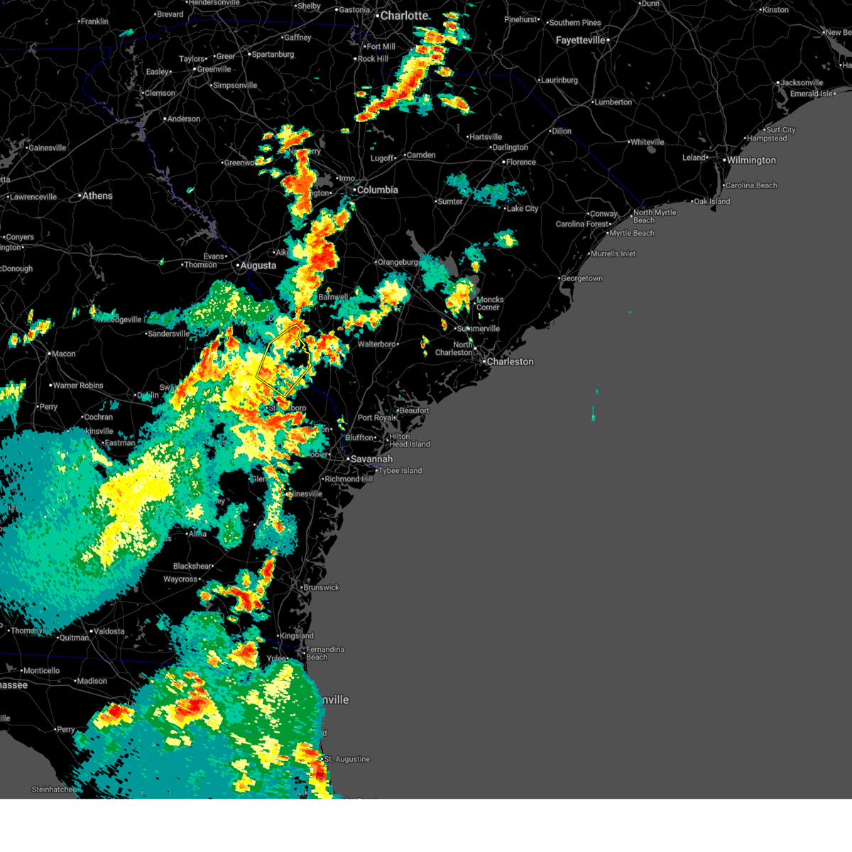
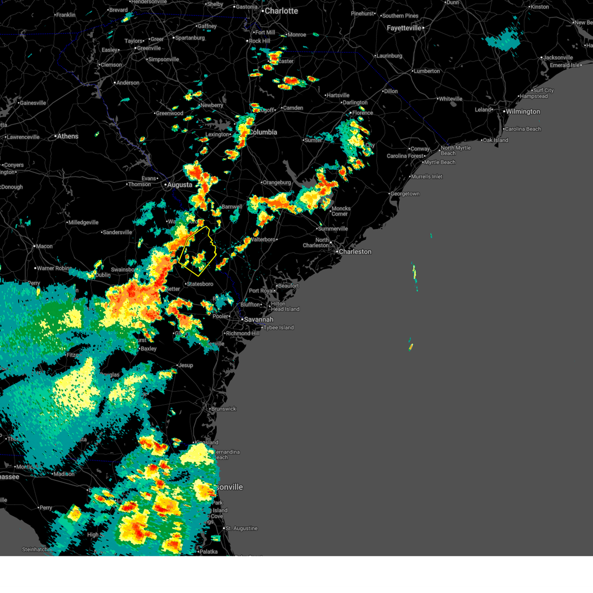
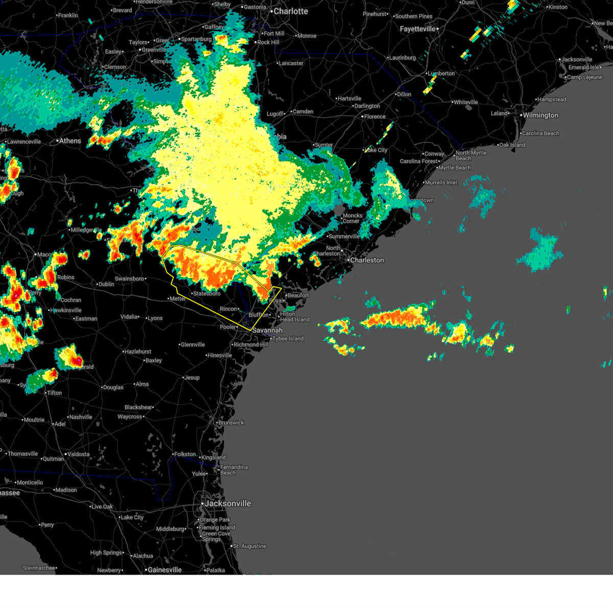
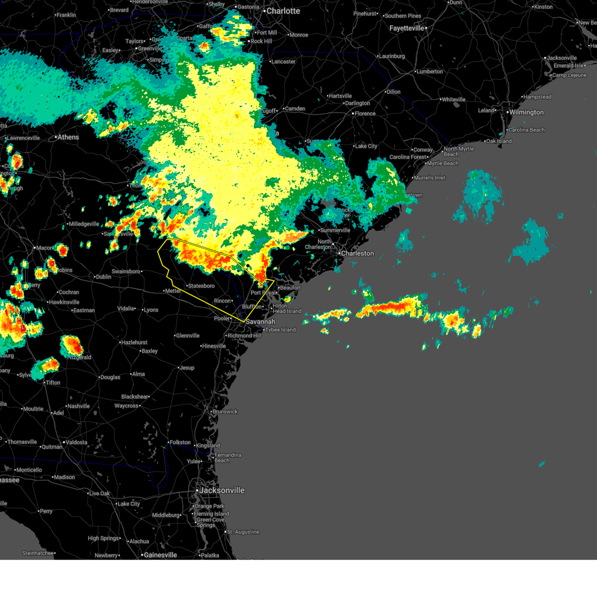
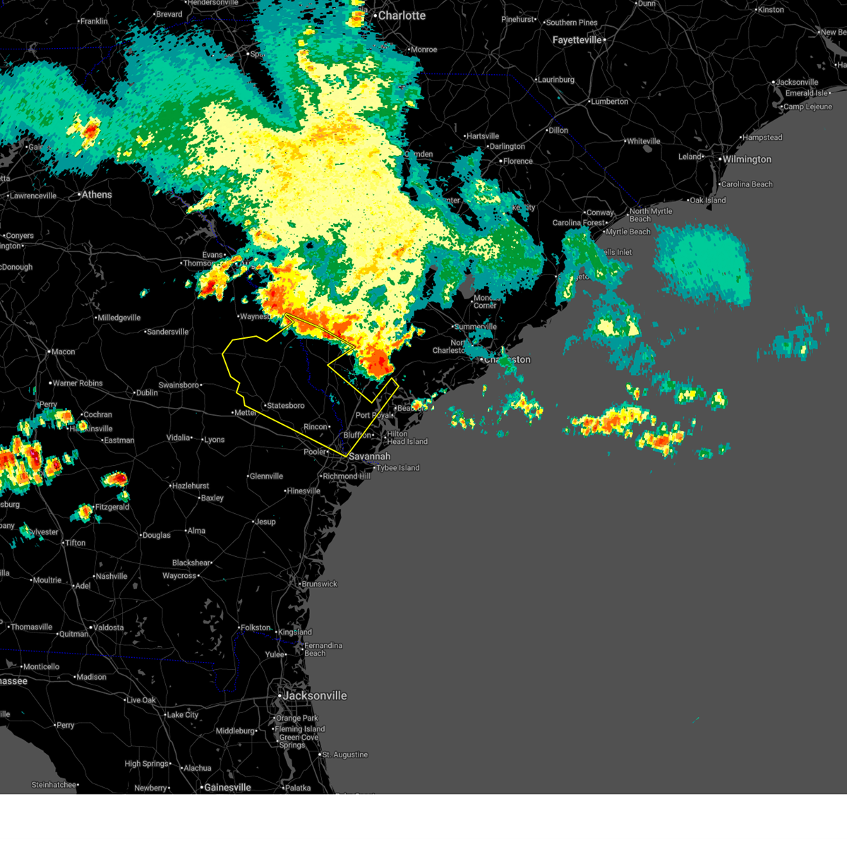
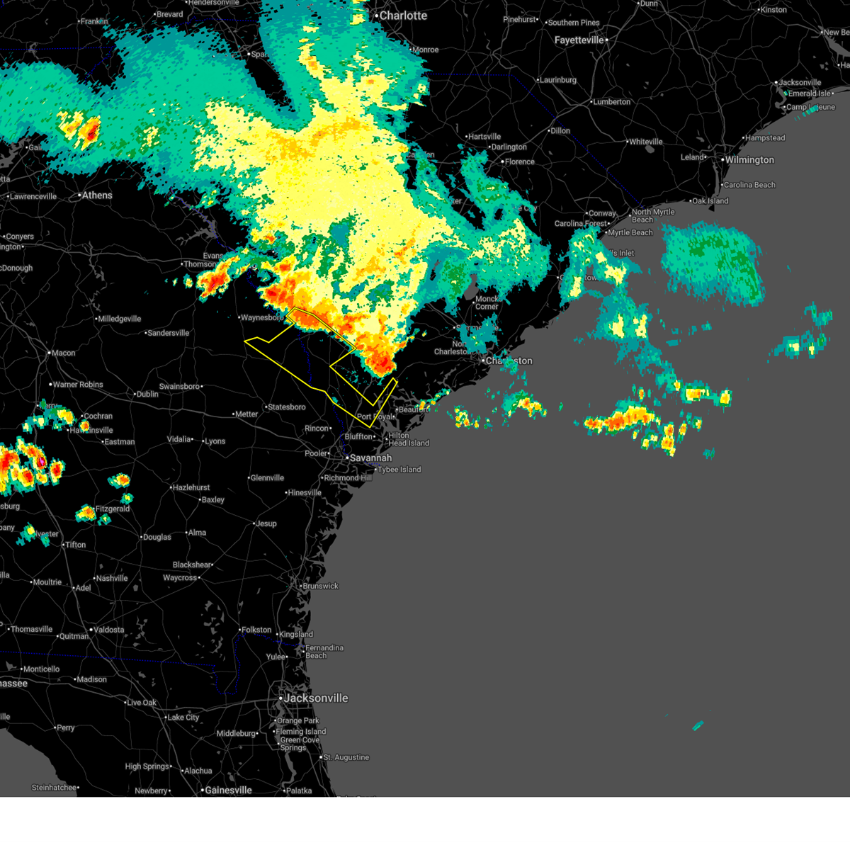
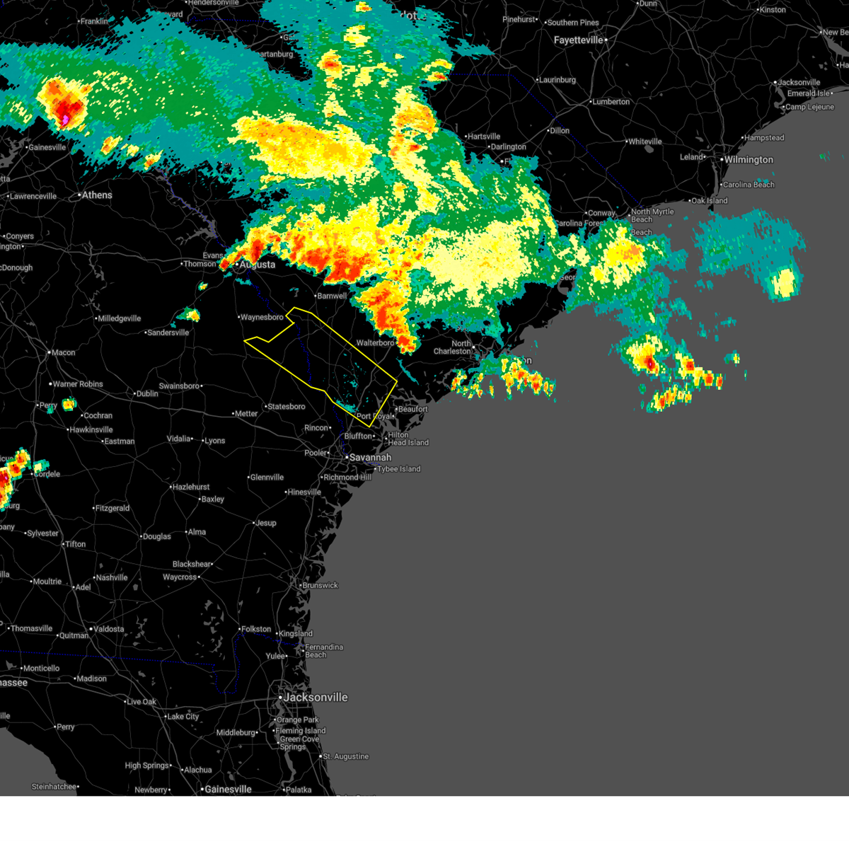
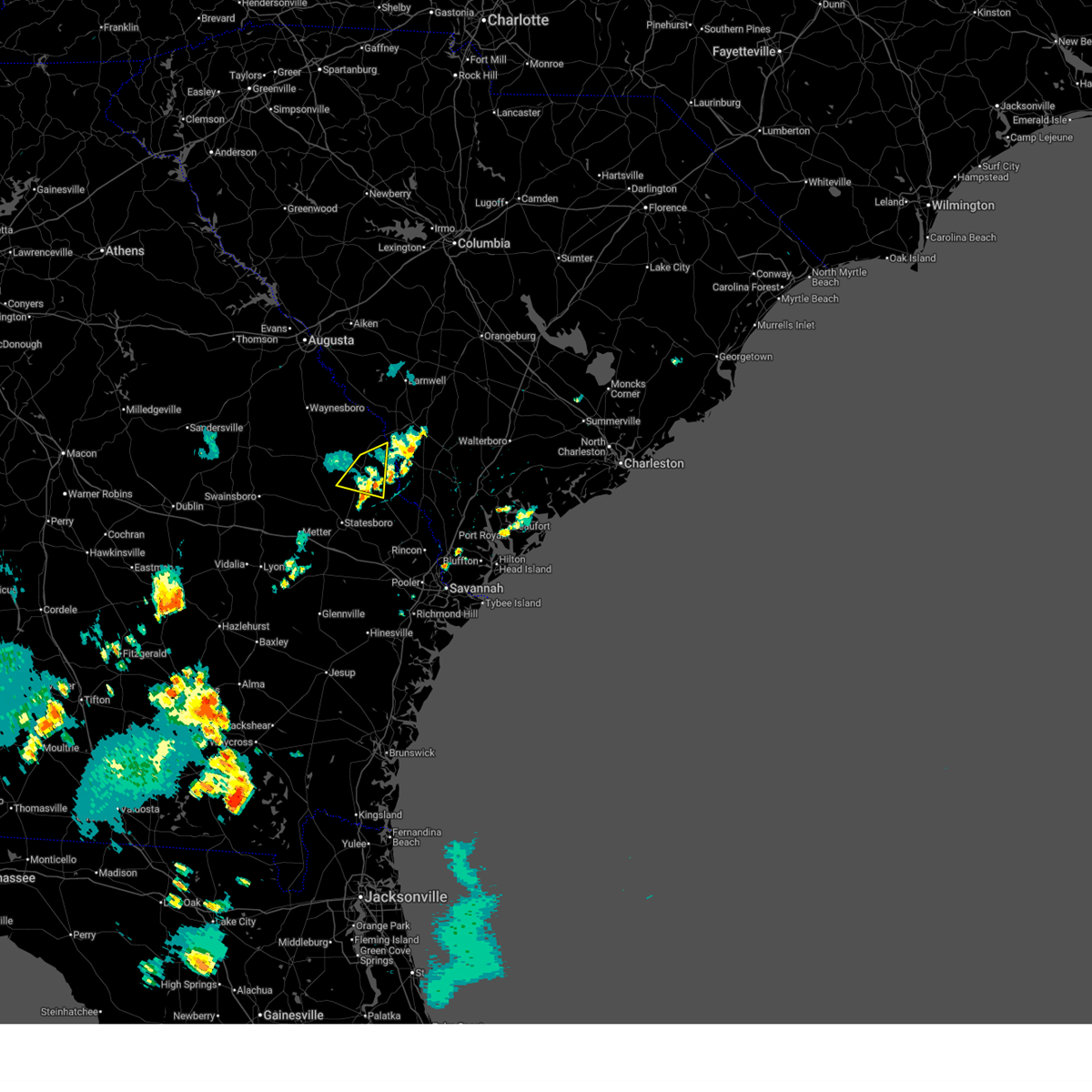
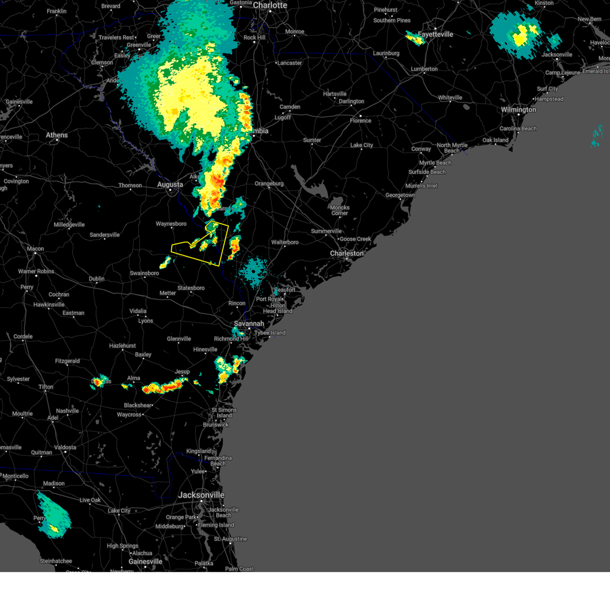
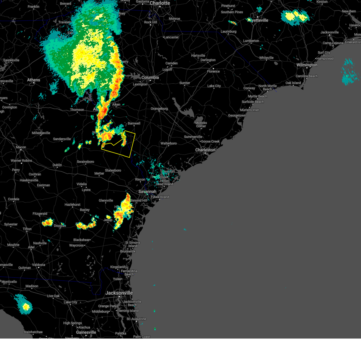
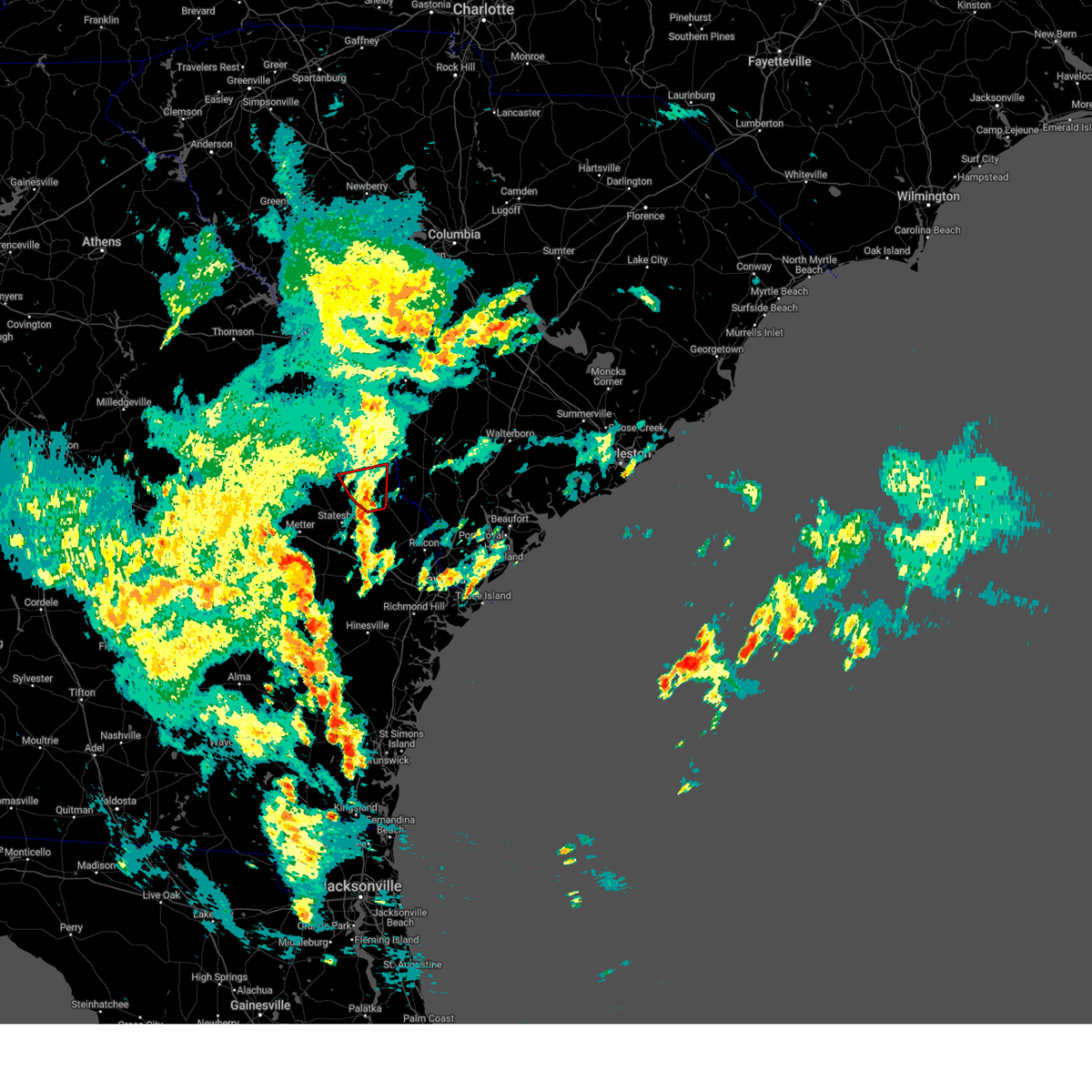
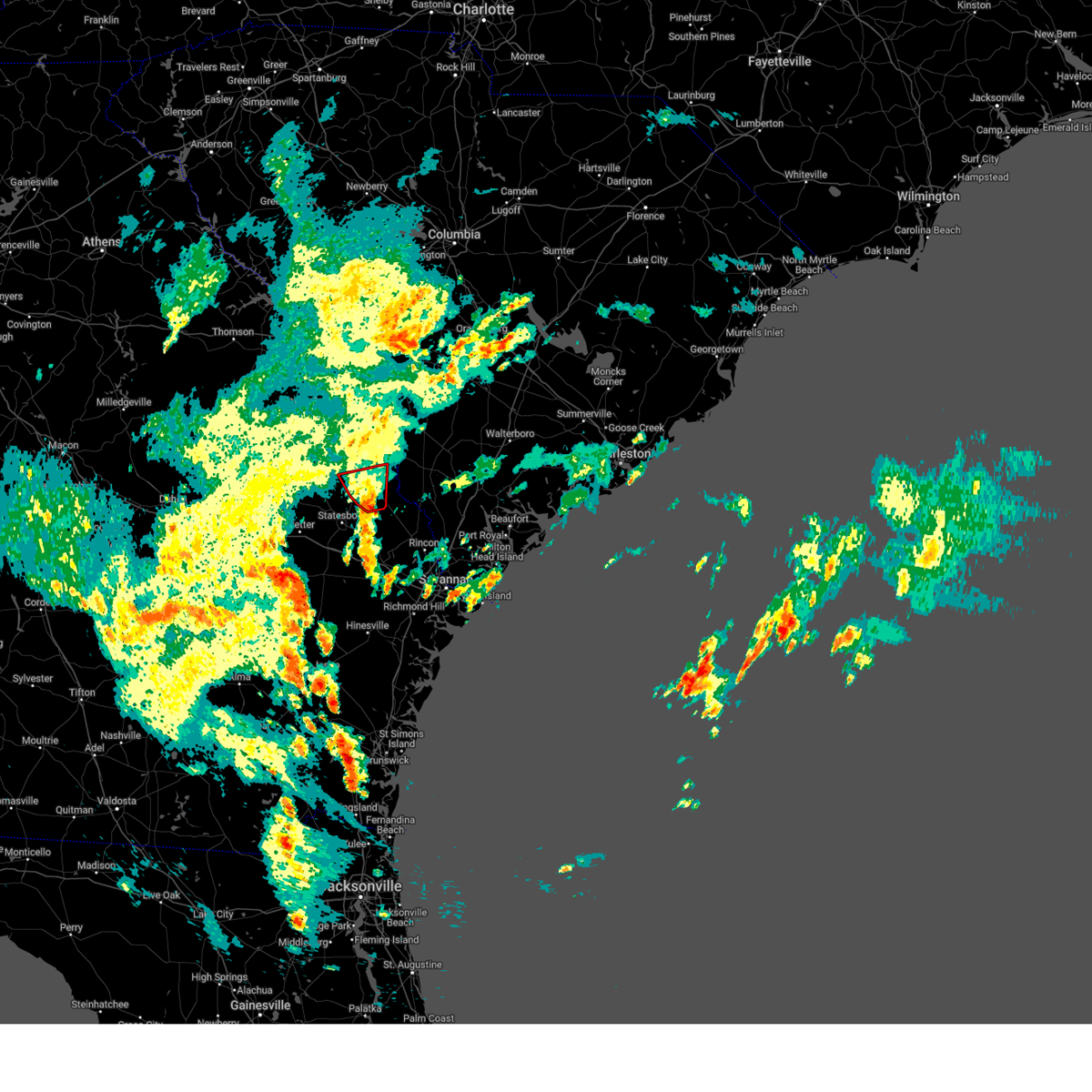
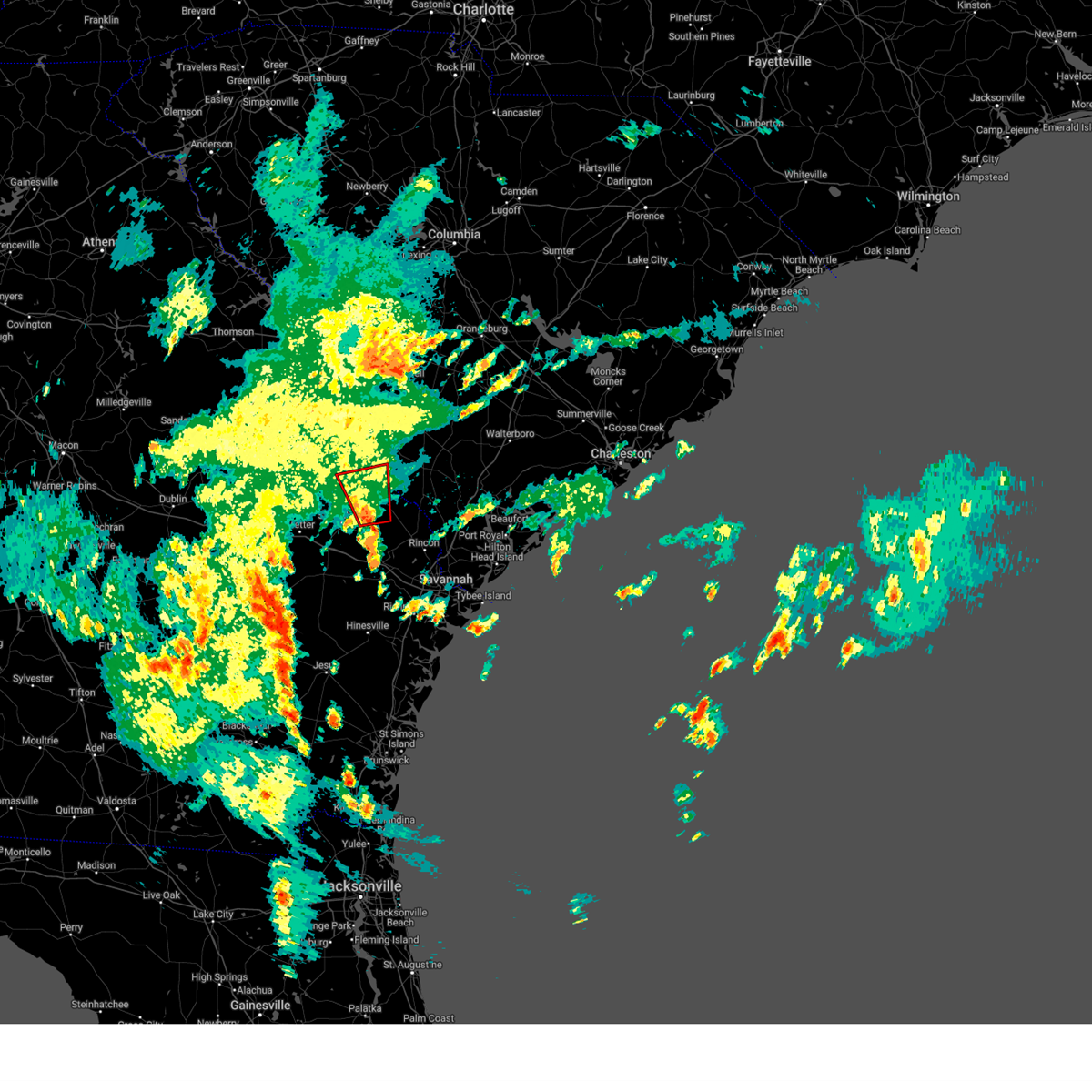
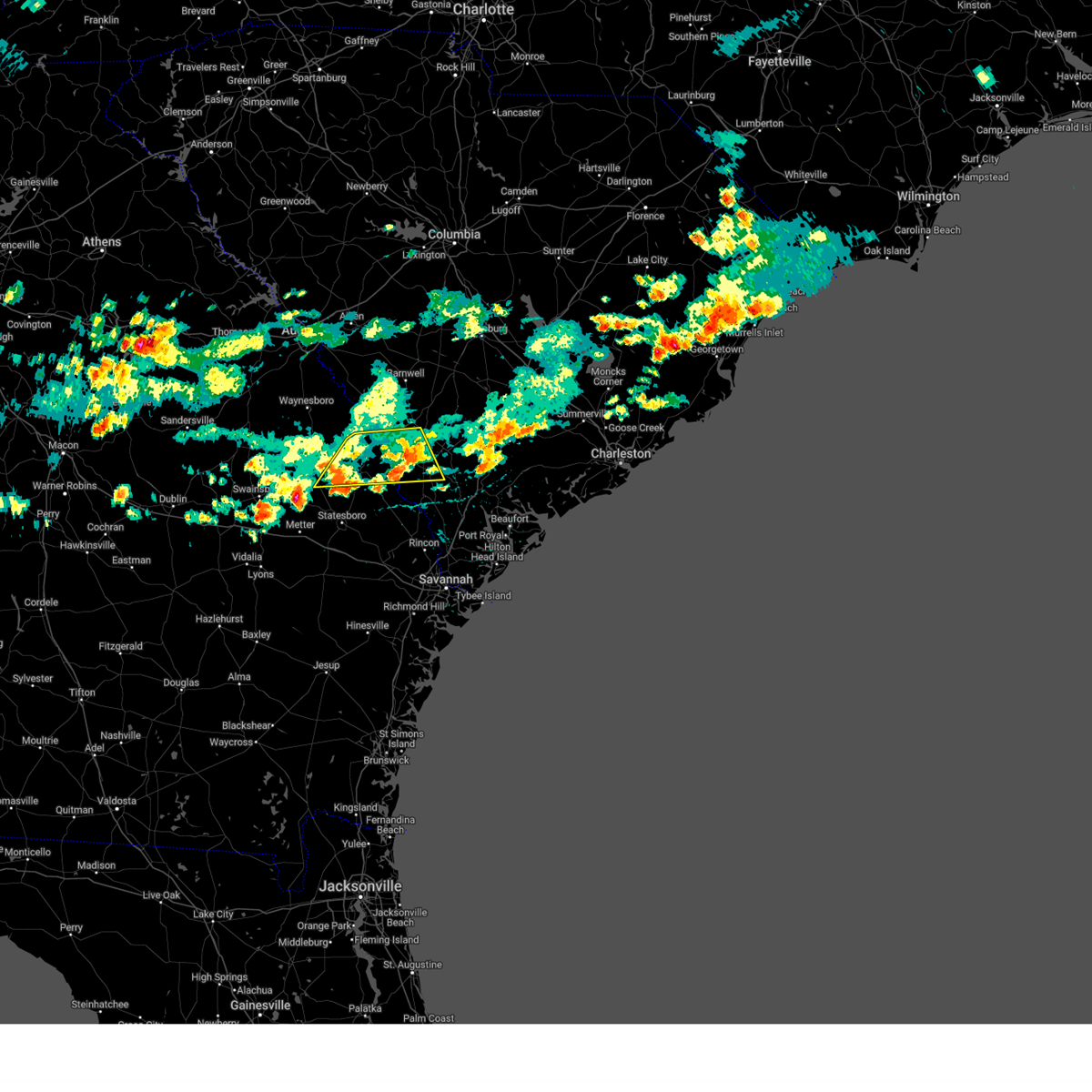
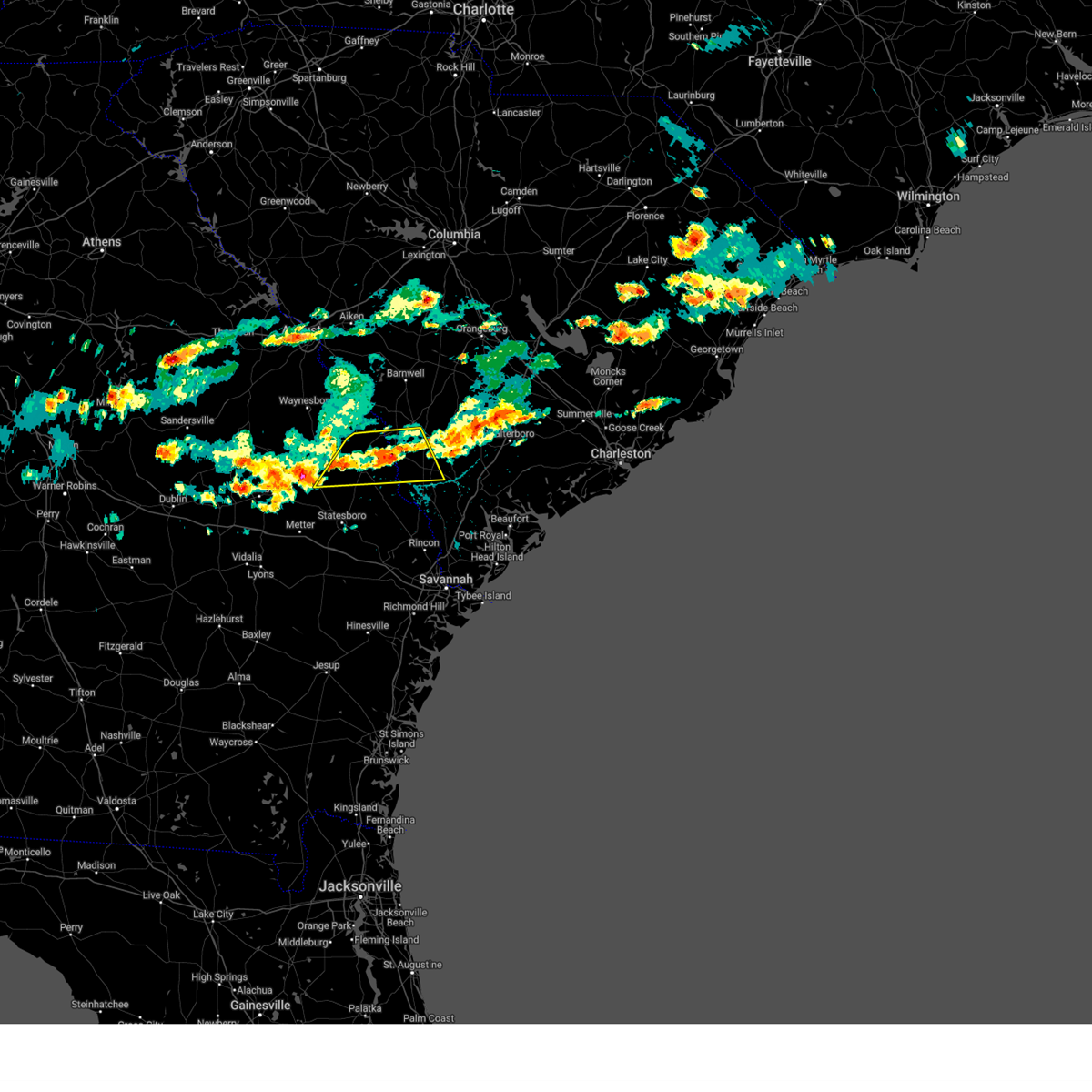
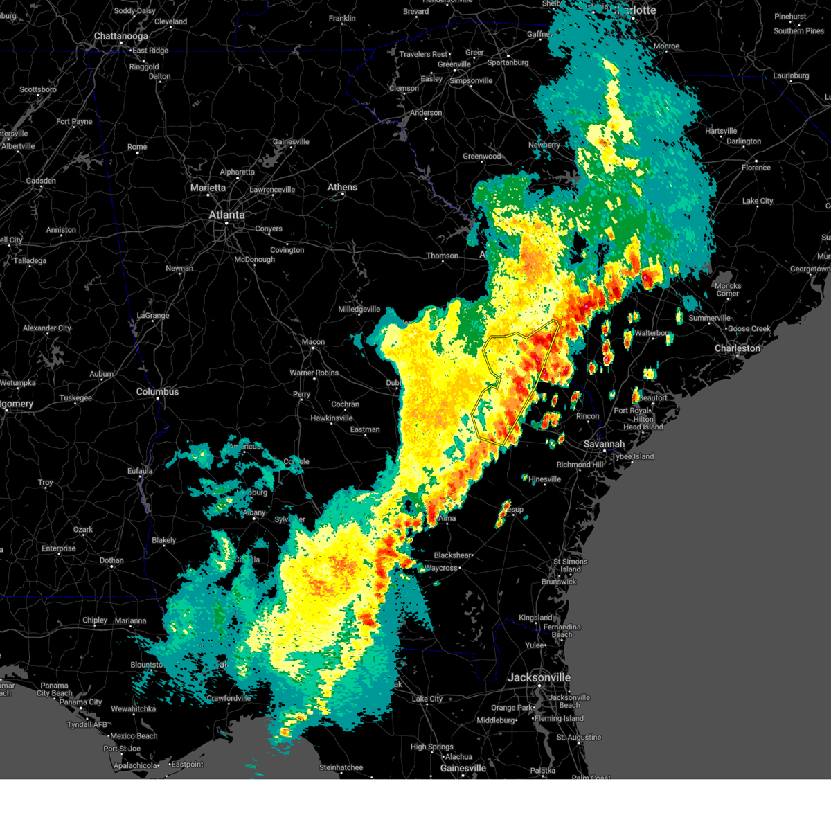
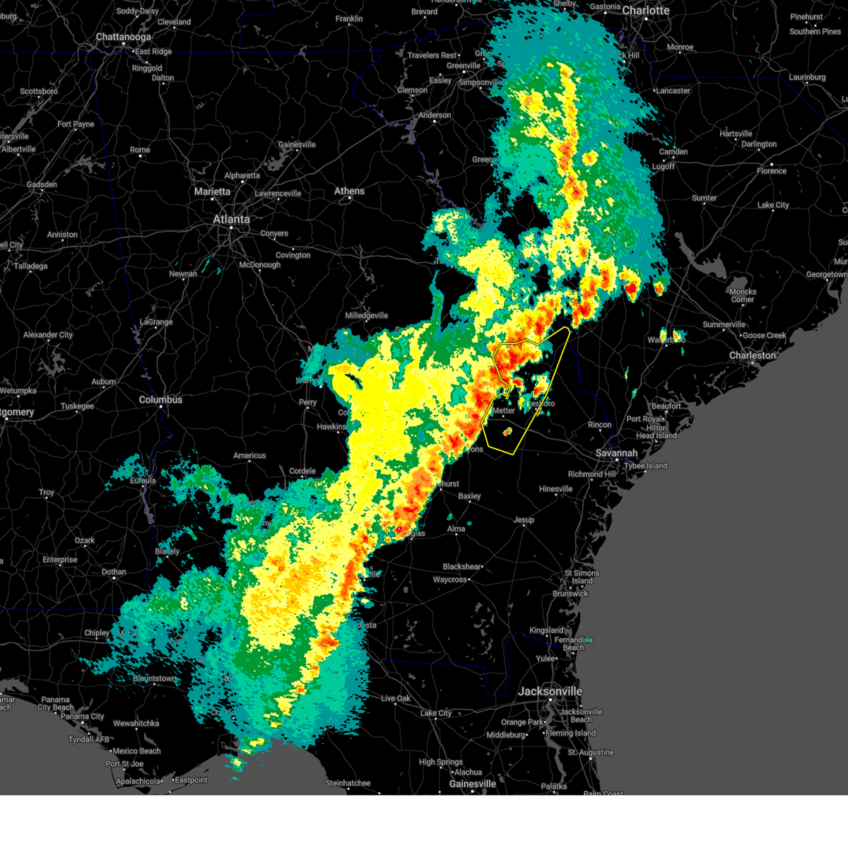
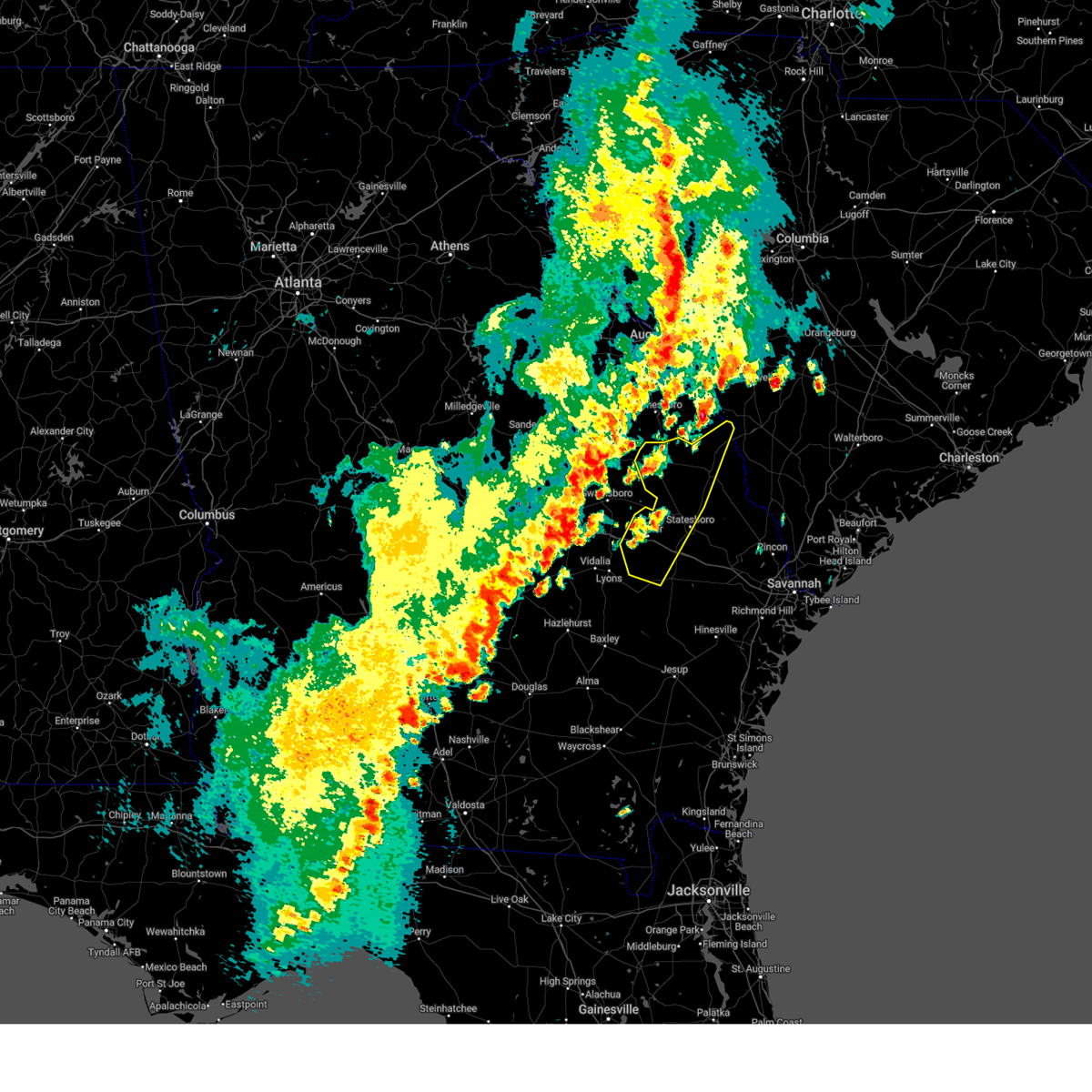
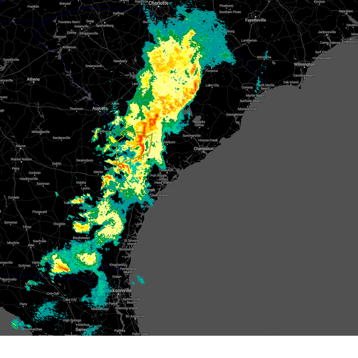
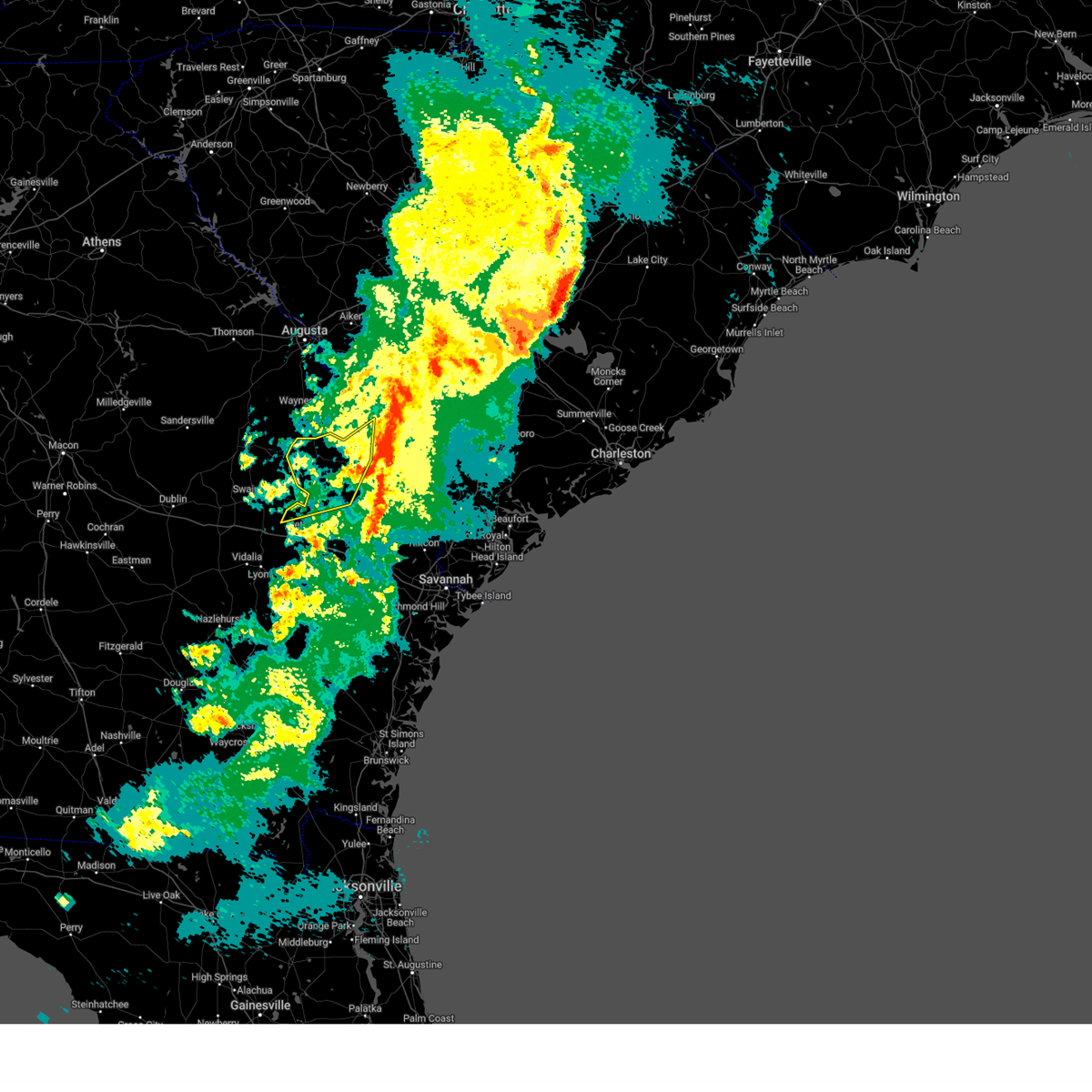
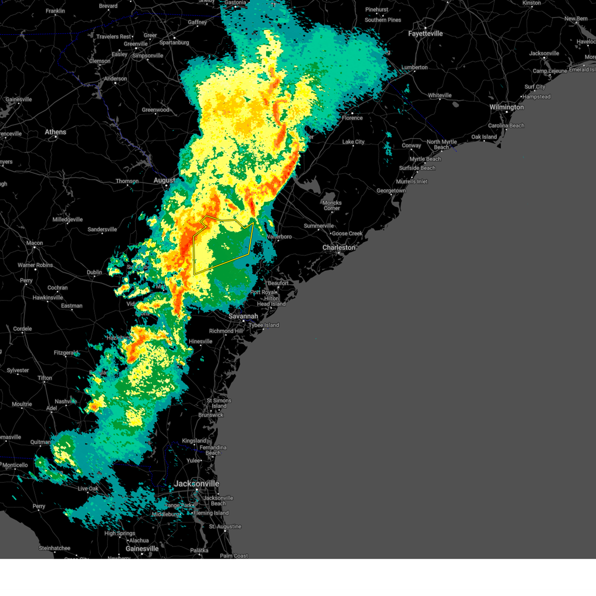
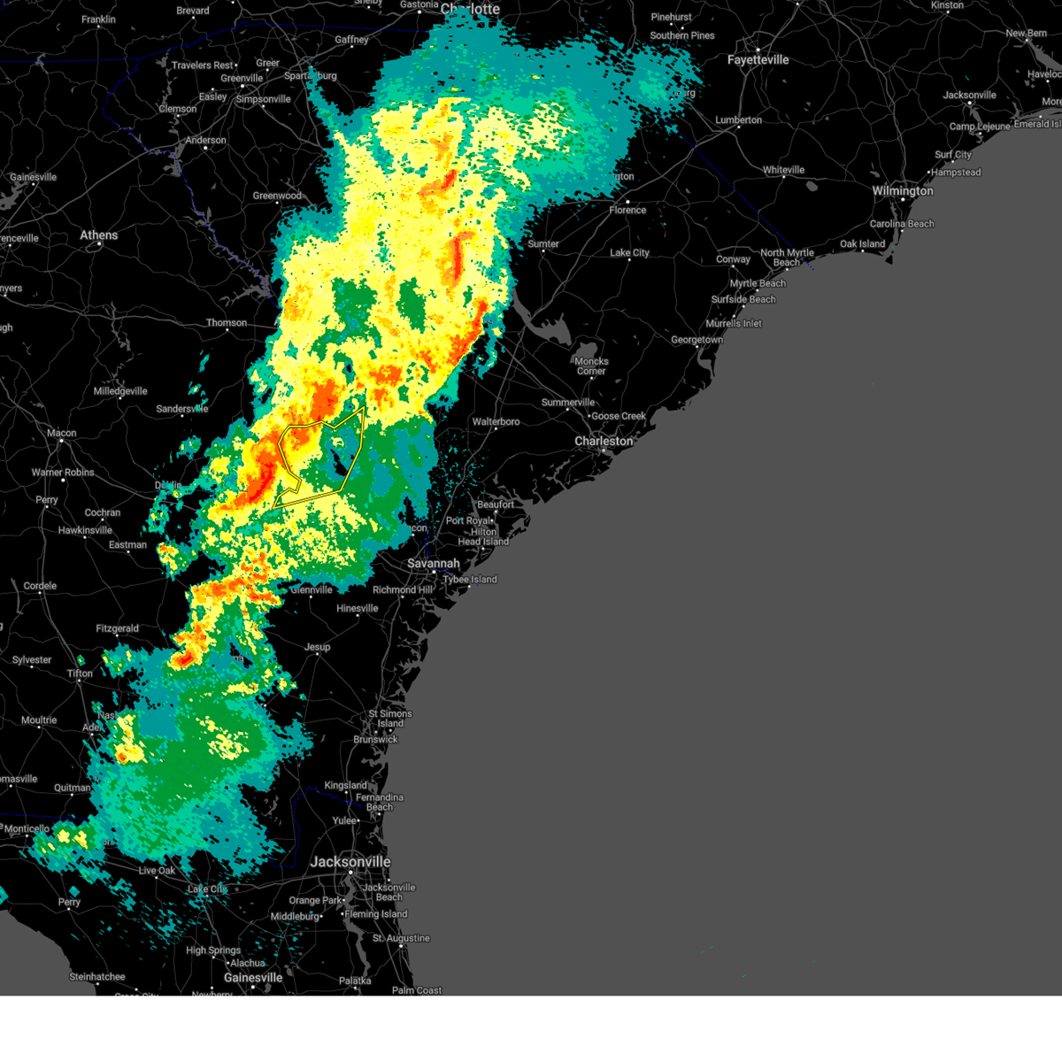
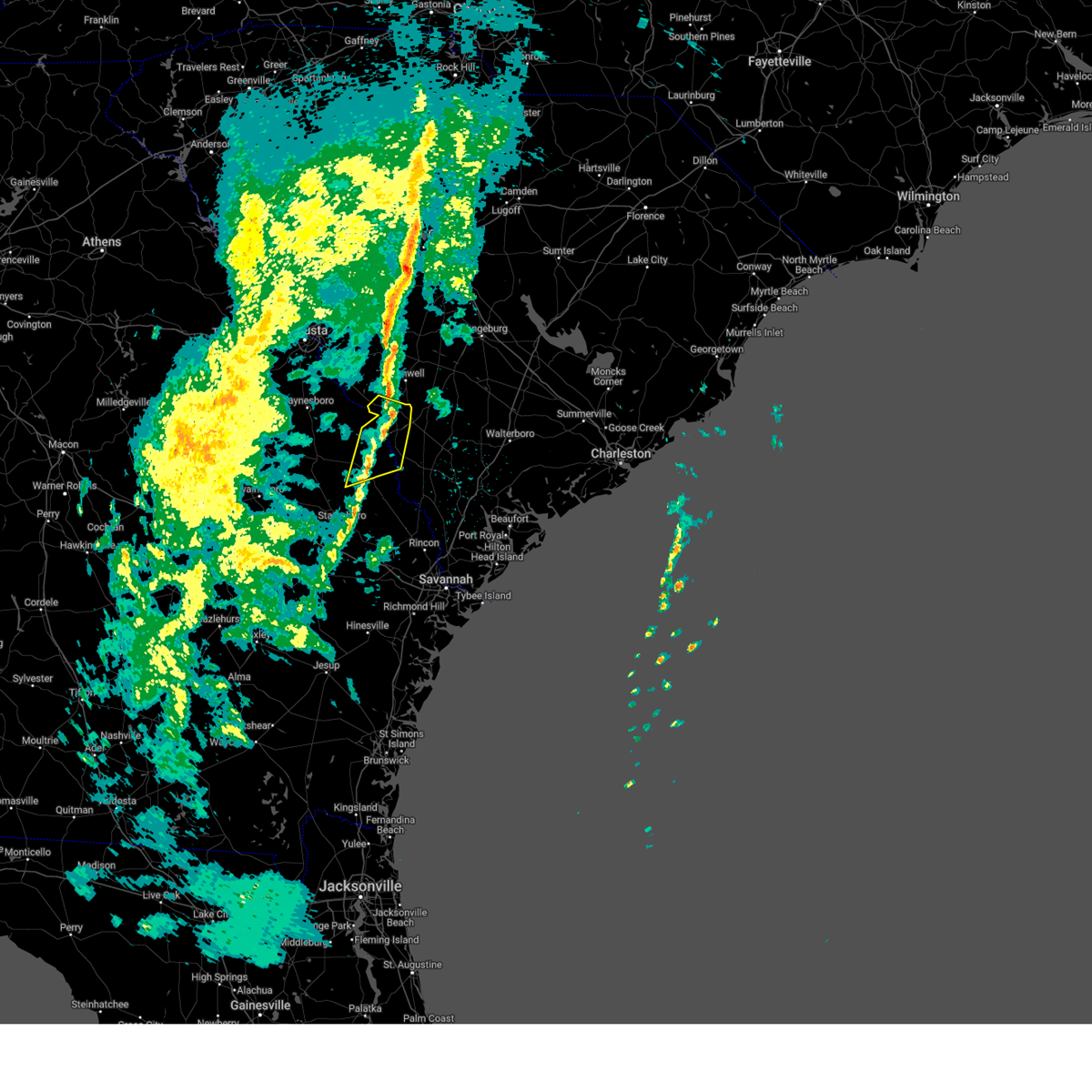
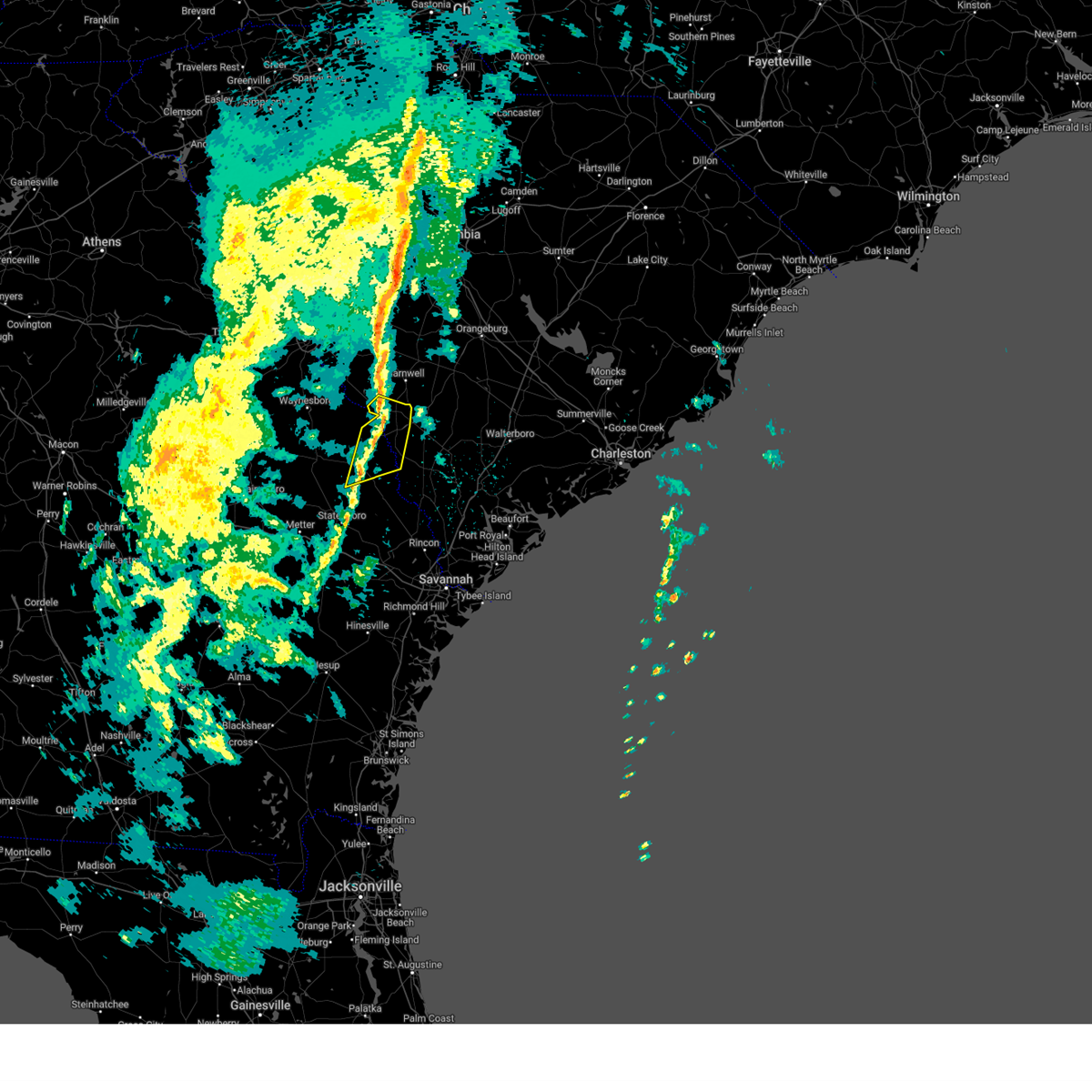
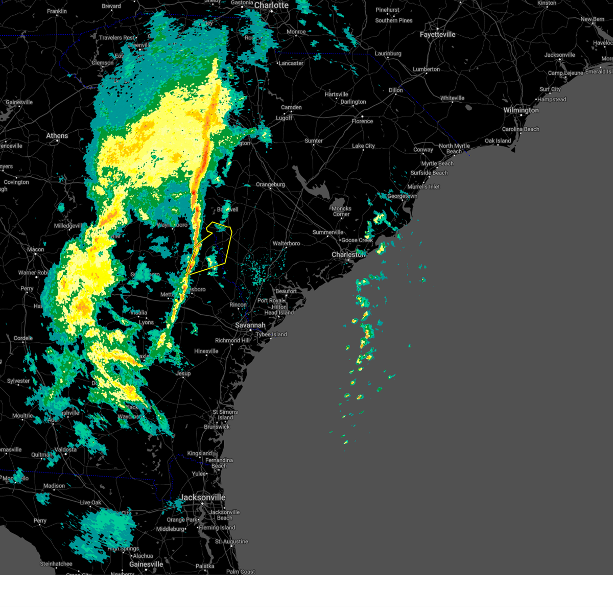
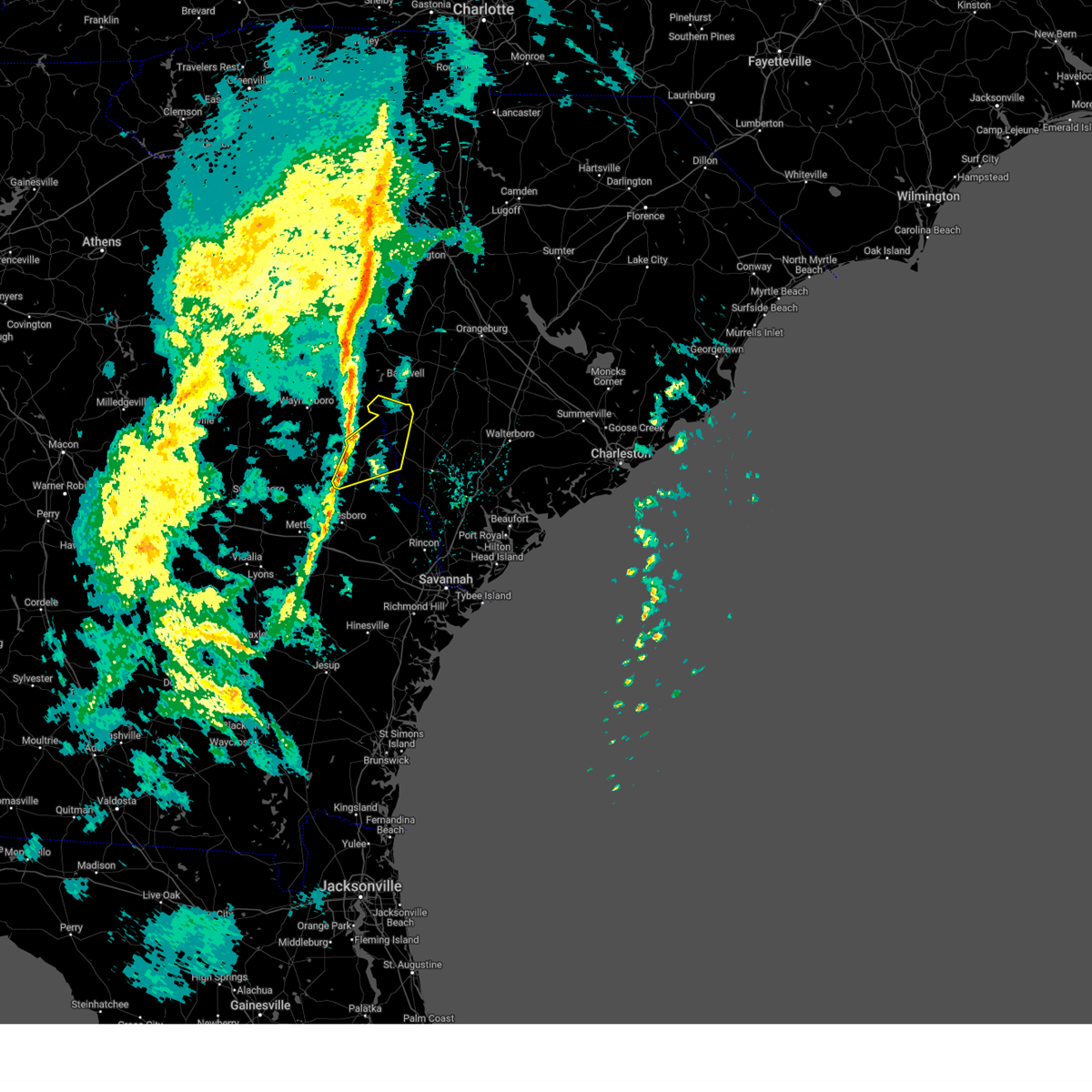
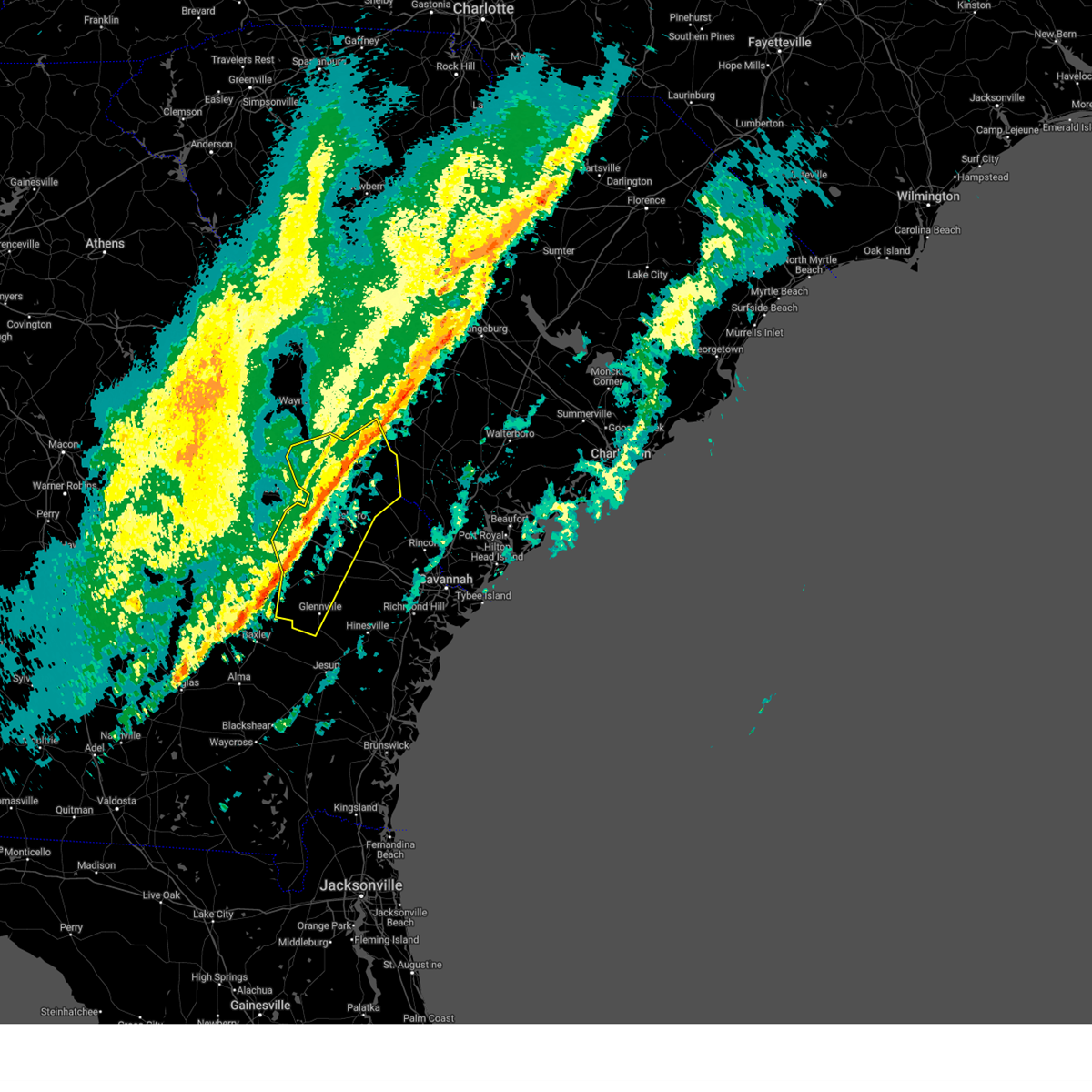
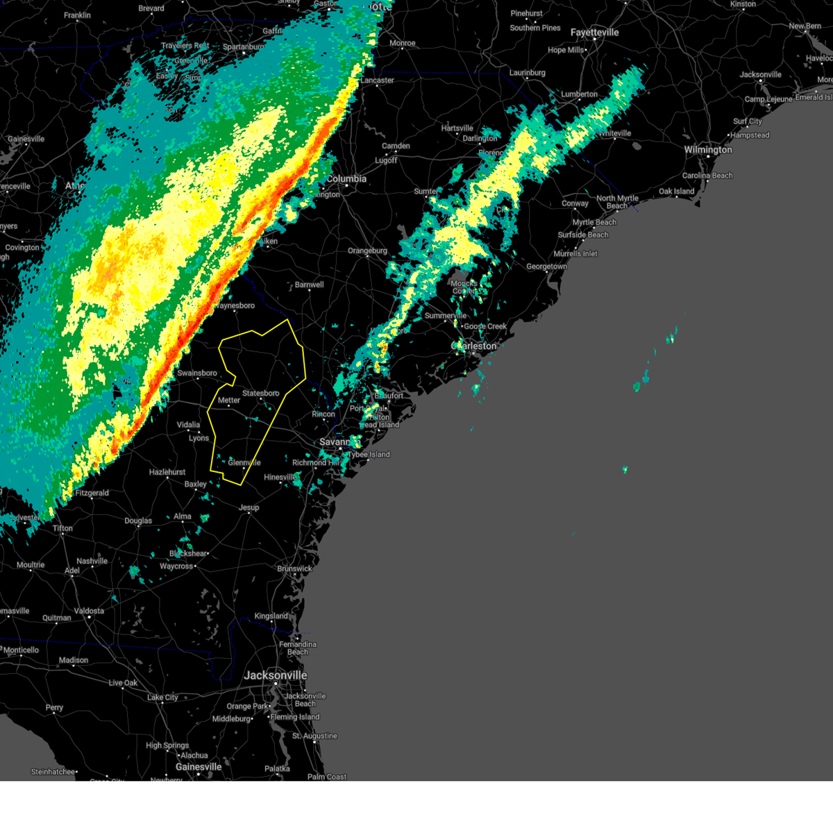
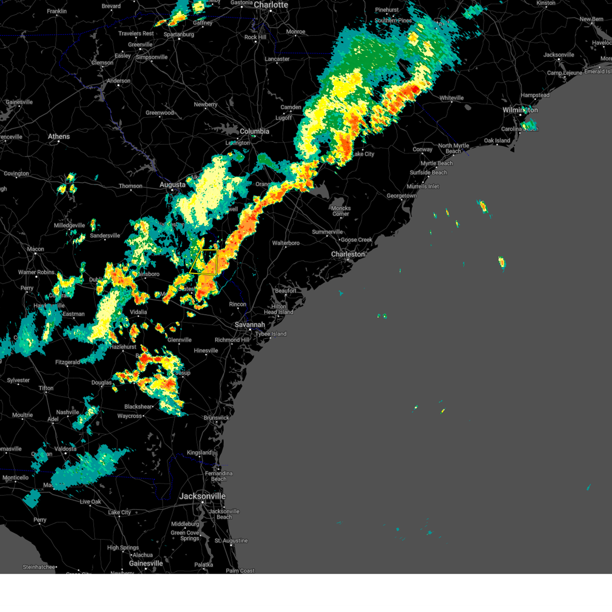
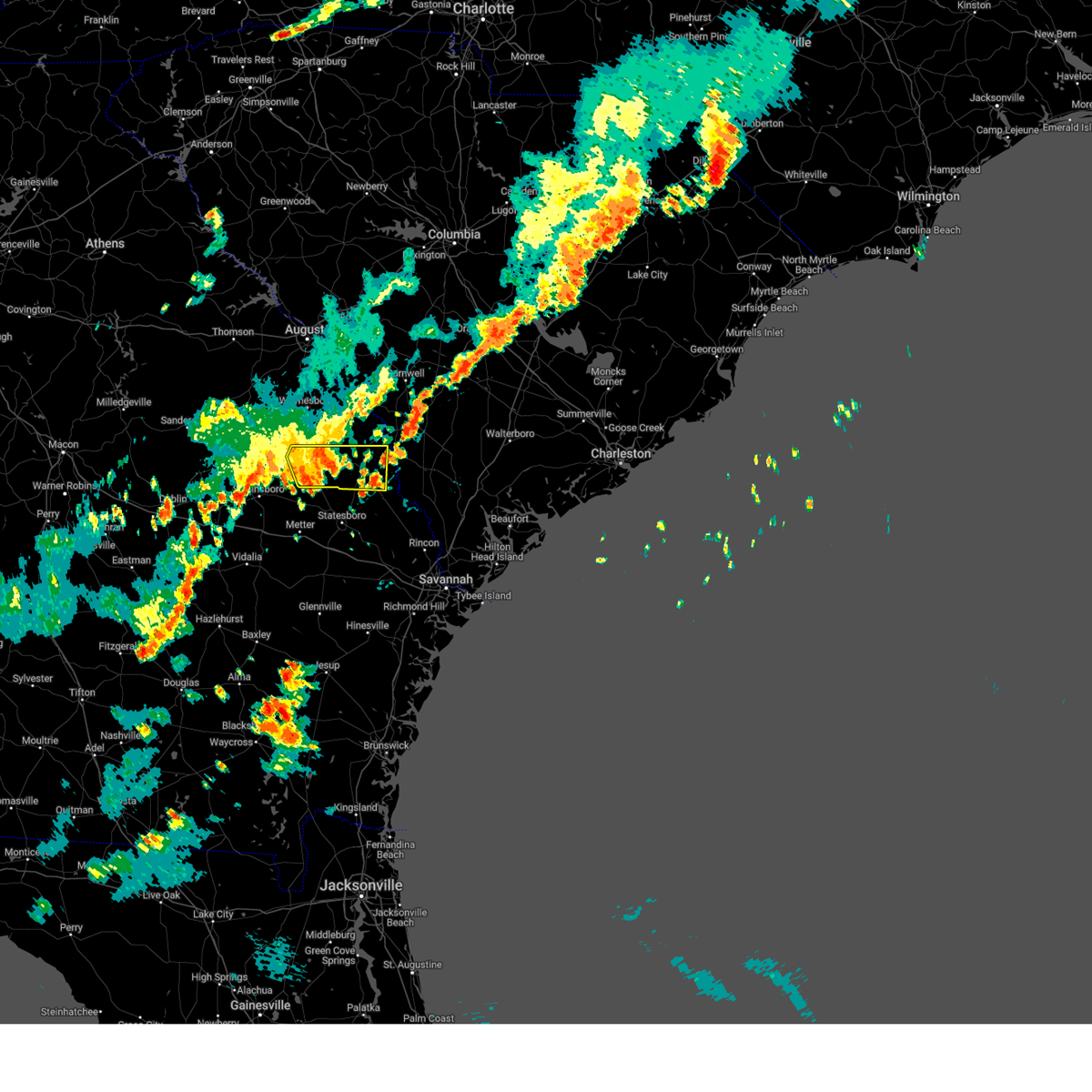
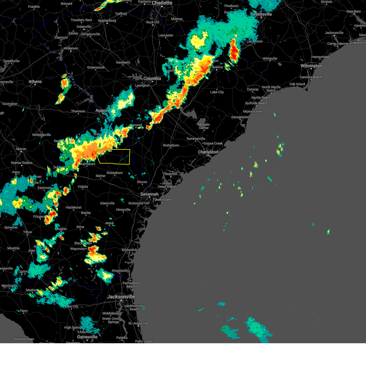
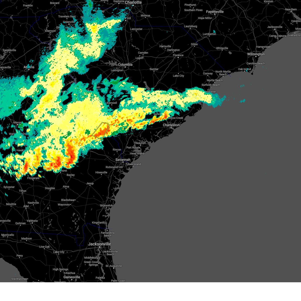
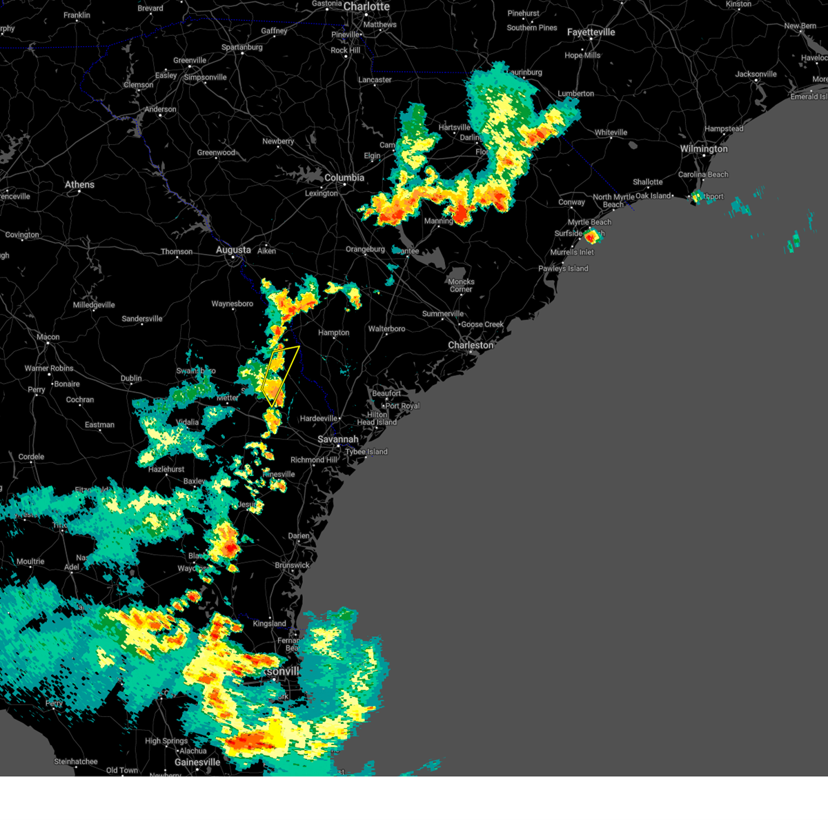
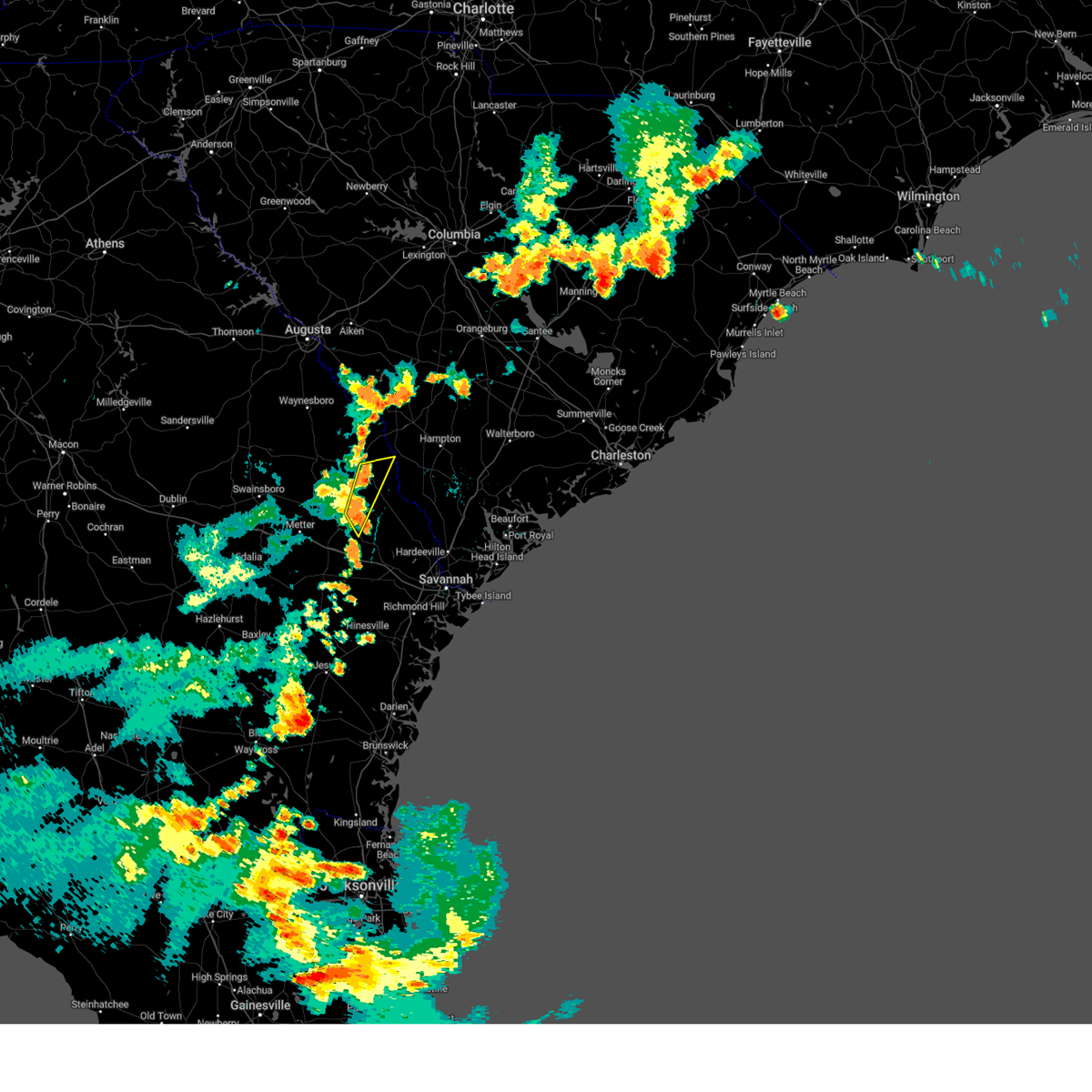
Hail Map for Sylvania, GA
The Sylvania, GA area has had 12 reports of on-the-ground hail by trained spotters, and has been under severe weather warnings 42 times during the past 12 months. Doppler radar has detected hail at or near Sylvania, GA on 40 occasions, including 3 occasions during the past year.
| Name: | Sylvania, GA |
| Where Located: | 54 miles SSE of Augusta, GA |
| Map: | Google Map for Sylvania, GA |
| Population: | 2956 |
| Housing Units: | 1374 |
| More Info: | Search Google for Sylvania, GA |
0
The Top Recent Hail Date for Sylvania, GA is Wednesday, July 9, 2025 (28th out of 40)

Hail and Wind Damage Spotted near Sylvania, GA
| Date / Time | Report Details |
|---|---|
| 7/11/2025 5:18 PM EDT | Tree down on the paved portion of jenk hill road. exact location had to be estimated. time estimated by rada in screven county GA, 7 miles NNE of Sylvania, GA |
| 7/9/2025 4:40 PM EDT |
 The storm which prompted the warning has weakened below severe limits, and no longer poses an immediate threat to life or property. therefore, the warning will be allowed to expire. however, heavy rain is still possible with this thunderstorm. The storm which prompted the warning has weakened below severe limits, and no longer poses an immediate threat to life or property. therefore, the warning will be allowed to expire. however, heavy rain is still possible with this thunderstorm.
|
| 7/9/2025 4:11 PM EDT | At 411 pm edt, a severe thunderstorm was located over woodcliff, moving north at 5 mph (radar indicated). Hazards include 60 mph wind gusts and small hail. Expect damage to roofs, siding, and trees. Locations impacted include, sylvania, hiltonia, rocky ford, altman, hilltonia, woodcliff, hunters, captolo, millhaven and burtons ferry landing. |
| 7/9/2025 3:48 PM EDT |
 Svrchs the national weather service in charleston has issued a * severe thunderstorm warning for portions of, screven county in southeastern georgia, * until 445 pm edt. * at 348 pm edt, a severe thunderstorm was located over woodcliff, moving northeast at 10 mph (radar indicated). Hazards include 60 mph wind gusts and small hail. expect damage to roofs, siding, and trees Svrchs the national weather service in charleston has issued a * severe thunderstorm warning for portions of, screven county in southeastern georgia, * until 445 pm edt. * at 348 pm edt, a severe thunderstorm was located over woodcliff, moving northeast at 10 mph (radar indicated). Hazards include 60 mph wind gusts and small hail. expect damage to roofs, siding, and trees
|
| 6/25/2025 11:40 PM EDT |
 The severe thunderstorm warning that was previously in effect has been reissued for screven, jenkins, effingham, and bulloch counties and is in effect until 1230 am edt. please refer to that bulletin for the latest severe weather information. a severe thunderstorm watch remains in effect until 400 am edt for portions of southeast georgia and southeast south carolina. The severe thunderstorm warning that was previously in effect has been reissued for screven, jenkins, effingham, and bulloch counties and is in effect until 1230 am edt. please refer to that bulletin for the latest severe weather information. a severe thunderstorm watch remains in effect until 400 am edt for portions of southeast georgia and southeast south carolina.
|
| 6/25/2025 11:22 PM EDT |
 At 1122 pm edt, severe thunderstorms were located along a line from over old house to over millen, moving southwest at 30 mph (law enforcement reported. at 1020 pm, law enforcement officials reported trees down near sylvania as well as other portions of screven county). Hazards include 60 mph wind gusts and small hail. Expect damage to roofs, siding, and trees. locations impacted include, beaufort, sylvania, ridgeland, millen, springfield, statesboro, bluffton, godley station, savannah international airport and pooler. this includes the following highways, i-95 in georgia between mile markers 106 and 112. I-95 in south carolina between mile markers 2 and 25. At 1122 pm edt, severe thunderstorms were located along a line from over old house to over millen, moving southwest at 30 mph (law enforcement reported. at 1020 pm, law enforcement officials reported trees down near sylvania as well as other portions of screven county). Hazards include 60 mph wind gusts and small hail. Expect damage to roofs, siding, and trees. locations impacted include, beaufort, sylvania, ridgeland, millen, springfield, statesboro, bluffton, godley station, savannah international airport and pooler. this includes the following highways, i-95 in georgia between mile markers 106 and 112. I-95 in south carolina between mile markers 2 and 25.
|
| 6/25/2025 10:59 PM EDT | Multiple trees down on south maine. time estimated from rada in screven county GA, 1 miles WNW of Sylvania, GA |
| 6/25/2025 10:59 PM EDT | Multiple treees down on mims road. time estimated from rada in screven county GA, 0.3 miles SE of Sylvania, GA |
| 6/25/2025 10:49 PM EDT |
 Svrchs the national weather service in charleston has issued a * severe thunderstorm warning for portions of, bulloch county in southeastern georgia, chatham county in southeastern georgia, effingham county in southeastern georgia, jenkins county in southeastern georgia, screven county in southeastern georgia, allendale county in southeastern south carolina, beaufort county in southeastern south carolina, hampton county in southeastern south carolina, jasper county in southeastern south carolina, * until 1145 pm edt. * at 1049 pm edt, severe thunderstorms were located along a line from near sheldon to 12 miles northeast of perkins, moving southwest at 30 mph (radar indicated). Hazards include 60 mph wind gusts and small hail. expect damage to roofs, siding, and trees Svrchs the national weather service in charleston has issued a * severe thunderstorm warning for portions of, bulloch county in southeastern georgia, chatham county in southeastern georgia, effingham county in southeastern georgia, jenkins county in southeastern georgia, screven county in southeastern georgia, allendale county in southeastern south carolina, beaufort county in southeastern south carolina, hampton county in southeastern south carolina, jasper county in southeastern south carolina, * until 1145 pm edt. * at 1049 pm edt, severe thunderstorms were located along a line from near sheldon to 12 miles northeast of perkins, moving southwest at 30 mph (radar indicated). Hazards include 60 mph wind gusts and small hail. expect damage to roofs, siding, and trees
|
| 6/25/2025 10:43 PM EDT |
 the severe thunderstorm warning has been cancelled and is no longer in effect the severe thunderstorm warning has been cancelled and is no longer in effect
|
| 6/25/2025 10:43 PM EDT |
 At 1043 pm edt, severe thunderstorms were located along a line from over gardens corner to 12 miles northwest of millhaven, moving southwest at 30 mph (radar indicated). Hazards include 60 mph wind gusts and small hail. Expect damage to roofs, siding, and trees. locations impacted include, ridgeland, allendale, sylvania, hampton, lake warren state park, clarendon, jasper, varnville, estill and fairfax. This includes i-95 in south carolina between mile markers 14 and 25. At 1043 pm edt, severe thunderstorms were located along a line from over gardens corner to 12 miles northwest of millhaven, moving southwest at 30 mph (radar indicated). Hazards include 60 mph wind gusts and small hail. Expect damage to roofs, siding, and trees. locations impacted include, ridgeland, allendale, sylvania, hampton, lake warren state park, clarendon, jasper, varnville, estill and fairfax. This includes i-95 in south carolina between mile markers 14 and 25.
|
| 6/25/2025 10:04 PM EDT |
 Svrchs the national weather service in charleston has issued a * severe thunderstorm warning for portions of, jenkins county in southeastern georgia, screven county in southeastern georgia, allendale county in southeastern south carolina, beaufort county in southeastern south carolina, colleton county in southeastern south carolina, hampton county in southeastern south carolina, jasper county in southeastern south carolina, * until 1100 pm edt. * at 1004 pm edt, severe thunderstorms were located along a line from over hendersonville to 16 miles north of millett, moving southwest at 30 mph (radar indicated). Hazards include 60 mph wind gusts and small hail. expect damage to roofs, siding, and trees Svrchs the national weather service in charleston has issued a * severe thunderstorm warning for portions of, jenkins county in southeastern georgia, screven county in southeastern georgia, allendale county in southeastern south carolina, beaufort county in southeastern south carolina, colleton county in southeastern south carolina, hampton county in southeastern south carolina, jasper county in southeastern south carolina, * until 1100 pm edt. * at 1004 pm edt, severe thunderstorms were located along a line from over hendersonville to 16 miles north of millett, moving southwest at 30 mph (radar indicated). Hazards include 60 mph wind gusts and small hail. expect damage to roofs, siding, and trees
|
| 6/19/2025 6:13 PM EDT |
 the severe thunderstorm warning has been cancelled and is no longer in effect the severe thunderstorm warning has been cancelled and is no longer in effect
|
| 6/19/2025 5:51 PM EDT | At 551 pm edt, a severe thunderstorm was located over sylvania, moving east at 10 mph (radar indicated). Hazards include 60 mph wind gusts and quarter size hail. Hail damage to vehicles is expected. expect wind damage to roofs, siding, and trees. Locations impacted include, sylvania, newington, rocky ford, altman, hunters, captolo, green hill, farmdale, waters and white hill. |
| 6/19/2025 5:43 PM EDT | Svrchs the national weather service in charleston has issued a * severe thunderstorm warning for portions of, screven county in southeastern georgia, * until 630 pm edt. * at 543 pm edt, a severe thunderstorm was located near sylvania, moving east at 10 mph (radar indicated). Hazards include 60 mph wind gusts and quarter size hail. Hail damage to vehicles is expected. Expect wind damage to roofs, siding, and trees. |
| 6/7/2025 9:16 PM EDT |
 The storm which prompted the warning has weakened below severe limits, and no longer poses an immediate threat to life or property. therefore, the warning has been allowed to expire. however, gusty winds are still possible with this thunderstorm. The storm which prompted the warning has weakened below severe limits, and no longer poses an immediate threat to life or property. therefore, the warning has been allowed to expire. however, gusty winds are still possible with this thunderstorm.
|
| 6/7/2025 8:43 PM EDT |
 Svrchs the national weather service in charleston has issued a * severe thunderstorm warning for portions of, jenkins county in southeastern georgia, screven county in southeastern georgia, allendale county in southeastern south carolina, * until 915 pm edt. * at 843 pm edt, a severe thunderstorm was located 8 miles northwest of millhaven, moving east at 45 mph (radar indicated). Hazards include 60 mph wind gusts and quarter size hail. Hail damage to vehicles is expected. Expect wind damage to roofs, siding, and trees. Svrchs the national weather service in charleston has issued a * severe thunderstorm warning for portions of, jenkins county in southeastern georgia, screven county in southeastern georgia, allendale county in southeastern south carolina, * until 915 pm edt. * at 843 pm edt, a severe thunderstorm was located 8 miles northwest of millhaven, moving east at 45 mph (radar indicated). Hazards include 60 mph wind gusts and quarter size hail. Hail damage to vehicles is expected. Expect wind damage to roofs, siding, and trees.
|
| 5/11/2025 3:13 PM EDT |
 The storm which prompted the warning has weakened below severe limits, and no longer appears capable of producing a tornado. therefore, the warning will be allowed to expire. to report severe weather, contact your nearest law enforcement agency. they will send your report to the national weather service office. The storm which prompted the warning has weakened below severe limits, and no longer appears capable of producing a tornado. therefore, the warning will be allowed to expire. to report severe weather, contact your nearest law enforcement agency. they will send your report to the national weather service office.
|
| 5/11/2025 2:58 PM EDT |
 At 258 pm edt, a severe thunderstorm capable of producing a tornado was located over captolo, moving north at 20 mph (radar indicated rotation). Hazards include tornado. Flying debris will be dangerous to those caught without shelter. mobile homes will be damaged or destroyed. damage to roofs, windows and vehicles will occur. tree damage is likely. Locations impacted include, sylvania, newington, oliver, captolo, hunters, altman, plantation airpark, white hill, farmdale and green hill. At 258 pm edt, a severe thunderstorm capable of producing a tornado was located over captolo, moving north at 20 mph (radar indicated rotation). Hazards include tornado. Flying debris will be dangerous to those caught without shelter. mobile homes will be damaged or destroyed. damage to roofs, windows and vehicles will occur. tree damage is likely. Locations impacted include, sylvania, newington, oliver, captolo, hunters, altman, plantation airpark, white hill, farmdale and green hill.
|
| 5/11/2025 2:58 PM EDT |
 the tornado warning has been cancelled and is no longer in effect the tornado warning has been cancelled and is no longer in effect
|
| 5/11/2025 2:31 PM EDT |
 Torchs the national weather service in charleston has issued a * tornado warning for portions of, bulloch county in southeastern georgia, effingham county in southeastern georgia, screven county in southeastern georgia, * until 315 pm edt. * at 231 pm edt, a severe thunderstorm capable of producing a tornado was located near leefield, moving north at 20 mph (radar indicated rotation). Hazards include tornado. Flying debris will be dangerous to those caught without shelter. mobile homes will be damaged or destroyed. damage to roofs, windows and vehicles will occur. Tree damage is likely. Torchs the national weather service in charleston has issued a * tornado warning for portions of, bulloch county in southeastern georgia, effingham county in southeastern georgia, screven county in southeastern georgia, * until 315 pm edt. * at 231 pm edt, a severe thunderstorm capable of producing a tornado was located near leefield, moving north at 20 mph (radar indicated rotation). Hazards include tornado. Flying debris will be dangerous to those caught without shelter. mobile homes will be damaged or destroyed. damage to roofs, windows and vehicles will occur. Tree damage is likely.
|
| 4/23/2025 4:14 PM EDT |
 The storms which prompted the warning have weakened below severe limits, and no longer pose an immediate threat to life or property. therefore, the warning will be allowed to expire. The storms which prompted the warning have weakened below severe limits, and no longer pose an immediate threat to life or property. therefore, the warning will be allowed to expire.
|
| 4/23/2025 3:36 PM EDT |
 Svrchs the national weather service in charleston has issued a * severe thunderstorm warning for portions of, jenkins county in southeastern georgia, screven county in southeastern georgia, allendale county in southeastern south carolina, hampton county in southeastern south carolina, * until 415 pm edt. * at 336 pm edt, severe thunderstorms were located along a line from over lake warren state park to over scarboro, moving east at 15 mph (radar indicated). Hazards include 60 mph wind gusts and small hail. expect damage to roofs, siding, and trees Svrchs the national weather service in charleston has issued a * severe thunderstorm warning for portions of, jenkins county in southeastern georgia, screven county in southeastern georgia, allendale county in southeastern south carolina, hampton county in southeastern south carolina, * until 415 pm edt. * at 336 pm edt, severe thunderstorms were located along a line from over lake warren state park to over scarboro, moving east at 15 mph (radar indicated). Hazards include 60 mph wind gusts and small hail. expect damage to roofs, siding, and trees
|
| 3/31/2025 5:01 PM EDT |
 The storms which prompted the warning have weakened below severe limits, and have exited the warned area. therefore, the warning has been allowed to expire. however, gusty winds are still possible with these thunderstorms. a severe thunderstorm watch remains in effect until 900 pm edt for a portion of southeast georgia. The storms which prompted the warning have weakened below severe limits, and have exited the warned area. therefore, the warning has been allowed to expire. however, gusty winds are still possible with these thunderstorms. a severe thunderstorm watch remains in effect until 900 pm edt for a portion of southeast georgia.
|
| 3/31/2025 4:25 PM EDT |
 At 425 pm edt, severe thunderstorms were located along a line from 7 miles northeast of perkins to 12 miles west of gordonia altamaha state park, moving east at 45 mph (radar indicated). Hazards include 60 mph wind gusts and small hail. Expect damage to roofs, siding, and trees. locations impacted include, statesboro, metter, millen, sylvania, butts, portal, collins, cobbtown, hiltonia and pulaski. This includes i-16 between mile markers 96 and 118. At 425 pm edt, severe thunderstorms were located along a line from 7 miles northeast of perkins to 12 miles west of gordonia altamaha state park, moving east at 45 mph (radar indicated). Hazards include 60 mph wind gusts and small hail. Expect damage to roofs, siding, and trees. locations impacted include, statesboro, metter, millen, sylvania, butts, portal, collins, cobbtown, hiltonia and pulaski. This includes i-16 between mile markers 96 and 118.
|
| 3/31/2025 3:59 PM EDT |
 Svrchs the national weather service in charleston has issued a * severe thunderstorm warning for portions of, bulloch county in southeastern georgia, candler county in southeastern georgia, evans county in southeastern georgia, jenkins county in southeastern georgia, screven county in southeastern georgia, tattnall county in southeastern georgia, * until 500 pm edt. * at 359 pm edt, severe thunderstorms were located along a line from 12 miles north of herndon to 30 miles west of gordonia altamaha state park, moving east at 45 mph (radar indicated). Hazards include 60 mph wind gusts. expect damage to roofs, siding, and trees Svrchs the national weather service in charleston has issued a * severe thunderstorm warning for portions of, bulloch county in southeastern georgia, candler county in southeastern georgia, evans county in southeastern georgia, jenkins county in southeastern georgia, screven county in southeastern georgia, tattnall county in southeastern georgia, * until 500 pm edt. * at 359 pm edt, severe thunderstorms were located along a line from 12 miles north of herndon to 30 miles west of gordonia altamaha state park, moving east at 45 mph (radar indicated). Hazards include 60 mph wind gusts. expect damage to roofs, siding, and trees
|
| 3/16/2025 9:39 AM EDT |
 The storms which prompted the warning have weakened below severe limits, and no longer pose an immediate threat to life or property. therefore, the warning will be allowed to expire. however, gusty winds are still possible with these thunderstorms. a tornado watch remains in effect until 200 pm edt sunday for portions of southeast georgia and southeast south carolina. The storms which prompted the warning have weakened below severe limits, and no longer pose an immediate threat to life or property. therefore, the warning will be allowed to expire. however, gusty winds are still possible with these thunderstorms. a tornado watch remains in effect until 200 pm edt sunday for portions of southeast georgia and southeast south carolina.
|
| 3/16/2025 9:12 AM EDT |
 The storms which prompted the warning have moved out of the area. therefore, the warning will be allowed to expire. however, gusty winds are still possible with these thunderstorms. a tornado watch remains in effect until 200 pm edt sunday for a portion of southeast georgia. The storms which prompted the warning have moved out of the area. therefore, the warning will be allowed to expire. however, gusty winds are still possible with these thunderstorms. a tornado watch remains in effect until 200 pm edt sunday for a portion of southeast georgia.
|
| 3/16/2025 9:01 AM EDT |
 Svrchs the national weather service in charleston has issued a * severe thunderstorm warning for portions of, screven county in southeastern georgia, allendale county in southeastern south carolina, colleton county in southeastern south carolina, hampton county in southeastern south carolina, * until 945 am edt. * at 901 am edt, severe thunderstorms were located along a line from near millett to near captolo, moving northeast at 55 mph (radar indicated). Hazards include 60 mph wind gusts and small hail. expect damage to roofs, siding, and trees Svrchs the national weather service in charleston has issued a * severe thunderstorm warning for portions of, screven county in southeastern georgia, allendale county in southeastern south carolina, colleton county in southeastern south carolina, hampton county in southeastern south carolina, * until 945 am edt. * at 901 am edt, severe thunderstorms were located along a line from near millett to near captolo, moving northeast at 55 mph (radar indicated). Hazards include 60 mph wind gusts and small hail. expect damage to roofs, siding, and trees
|
| 3/16/2025 8:23 AM EDT |
 Svrchs the national weather service in charleston has issued a * severe thunderstorm warning for portions of, bulloch county in southeastern georgia, candler county in southeastern georgia, jenkins county in southeastern georgia, screven county in southeastern georgia, * until 915 am edt. * at 823 am edt, severe thunderstorms were located along a line from over herndon to 10 miles north of aline, moving east at 50 mph (radar indicated). Hazards include 60 mph wind gusts and small hail. expect damage to roofs, siding, and trees Svrchs the national weather service in charleston has issued a * severe thunderstorm warning for portions of, bulloch county in southeastern georgia, candler county in southeastern georgia, jenkins county in southeastern georgia, screven county in southeastern georgia, * until 915 am edt. * at 823 am edt, severe thunderstorms were located along a line from over herndon to 10 miles north of aline, moving east at 50 mph (radar indicated). Hazards include 60 mph wind gusts and small hail. expect damage to roofs, siding, and trees
|
| 3/5/2025 7:36 AM EST |
 The storms which prompted the warning have weakened below severe limits, and no longer pose an immediate threat to life or property. therefore, the warning will be allowed to expire. to report severe weather, contact your nearest law enforcement agency. they will send your report to the national weather service office. a severe thunderstorm watch remains in effect until 1000 am est wednesday for portions of southeast georgia and southeast south carolina. The storms which prompted the warning have weakened below severe limits, and no longer pose an immediate threat to life or property. therefore, the warning will be allowed to expire. to report severe weather, contact your nearest law enforcement agency. they will send your report to the national weather service office. a severe thunderstorm watch remains in effect until 1000 am est wednesday for portions of southeast georgia and southeast south carolina.
|
| 3/5/2025 7:29 AM EST |
 At 729 am est, severe thunderstorms were located along a line from 5 miles northeast of millett to over altman, moving northeast at 40 mph (radar indicated). Hazards include 60 mph wind gusts. Expect damage to roofs, siding, and trees. Locations impacted include, hiltonia, millhaven, hilltonia, sylvania, millett, altman, martin, burtons ferry landing, appleton and allendale. At 729 am est, severe thunderstorms were located along a line from 5 miles northeast of millett to over altman, moving northeast at 40 mph (radar indicated). Hazards include 60 mph wind gusts. Expect damage to roofs, siding, and trees. Locations impacted include, hiltonia, millhaven, hilltonia, sylvania, millett, altman, martin, burtons ferry landing, appleton and allendale.
|
| 3/5/2025 7:12 AM EST |
 At 712 am est, severe thunderstorms were located along a line from over millhaven to near woodcliff, moving northeast at 40 mph (radar indicated). Hazards include 60 mph wind gusts. Expect damage to roofs, siding, and trees. Locations impacted include, rocky ford, millhaven, hiltonia, hilltonia, sylvania, altman, millett, burtons ferry landing, martin and allendale. At 712 am est, severe thunderstorms were located along a line from over millhaven to near woodcliff, moving northeast at 40 mph (radar indicated). Hazards include 60 mph wind gusts. Expect damage to roofs, siding, and trees. Locations impacted include, rocky ford, millhaven, hiltonia, hilltonia, sylvania, altman, millett, burtons ferry landing, martin and allendale.
|
| 3/5/2025 7:12 AM EST |
 the severe thunderstorm warning has been cancelled and is no longer in effect the severe thunderstorm warning has been cancelled and is no longer in effect
|
| 3/5/2025 7:01 AM EST | Svrchs the national weather service in charleston has issued a * severe thunderstorm warning for portions of, jenkins county in southeastern georgia, screven county in southeastern georgia, allendale county in southeastern south carolina, * until 745 am est. * at 701 am est, severe thunderstorms were located along a line from 10 miles west of millhaven to near rocky ford, moving northeast at 40 mph (radar indicated). Hazards include 60 mph wind gusts. expect damage to roofs, siding, and trees |
| 2/16/2025 8:18 AM EST |
 The severe thunderstorm warning that was previously in effect has been reissued for tattnall, jenkins, evans, bulloch, screven, and candler counties and is in effect until 915 am est. please refer to that bulletin for the latest severe weather information. a severe thunderstorm watch remains in effect until 100 pm est for a portion of southeast georgia. The severe thunderstorm warning that was previously in effect has been reissued for tattnall, jenkins, evans, bulloch, screven, and candler counties and is in effect until 915 am est. please refer to that bulletin for the latest severe weather information. a severe thunderstorm watch remains in effect until 100 pm est for a portion of southeast georgia.
|
| 2/16/2025 8:14 AM EST |
 Svrchs the national weather service in charleston has issued a * severe thunderstorm warning for portions of, bryan county in southeastern georgia, bulloch county in southeastern georgia, candler county in southeastern georgia, effingham county in southeastern georgia, evans county in southeastern georgia, jenkins county in southeastern georgia, liberty county in southeastern georgia, long county in southeastern georgia, screven county in southeastern georgia, tattnall county in southeastern georgia, allendale county in southeastern south carolina, hampton county in southeastern south carolina, jasper county in southeastern south carolina, * until 915 am est. * at 814 am est, severe thunderstorms were located along a line from near millett to 13 miles southwest of gordonia altamaha state park, moving southeast at 40 mph (radar indicated). Hazards include 60 mph wind gusts. expect damage to roofs, siding, and trees Svrchs the national weather service in charleston has issued a * severe thunderstorm warning for portions of, bryan county in southeastern georgia, bulloch county in southeastern georgia, candler county in southeastern georgia, effingham county in southeastern georgia, evans county in southeastern georgia, jenkins county in southeastern georgia, liberty county in southeastern georgia, long county in southeastern georgia, screven county in southeastern georgia, tattnall county in southeastern georgia, allendale county in southeastern south carolina, hampton county in southeastern south carolina, jasper county in southeastern south carolina, * until 915 am est. * at 814 am est, severe thunderstorms were located along a line from near millett to 13 miles southwest of gordonia altamaha state park, moving southeast at 40 mph (radar indicated). Hazards include 60 mph wind gusts. expect damage to roofs, siding, and trees
|
| 2/16/2025 7:52 AM EST | At 752 am est, severe thunderstorms were located along a line from 9 miles northeast of perkins to 19 miles west of gordonia altamaha state park, moving east at 45 mph (radar indicated). Hazards include 60 mph wind gusts. Expect damage to roofs, siding, and trees. locations impacted include, statesboro, reidsville, metter, glennville, millen, sylvania, claxton, butts, brooklet and hagan. This includes i-16 between mile markers 96 and 128. |
| 2/16/2025 7:19 AM EST |
 Svrchs the national weather service in charleston has issued a * severe thunderstorm warning for portions of, bulloch county in southeastern georgia, candler county in southeastern georgia, evans county in southeastern georgia, jenkins county in southeastern georgia, screven county in southeastern georgia, tattnall county in southeastern georgia, * until 815 am est. * at 719 am est, severe thunderstorms were located along a line from 17 miles northwest of perkins to 35 miles west of aline, moving east at 50 mph (radar indicated). Hazards include 60 mph wind gusts. expect damage to roofs, siding, and trees Svrchs the national weather service in charleston has issued a * severe thunderstorm warning for portions of, bulloch county in southeastern georgia, candler county in southeastern georgia, evans county in southeastern georgia, jenkins county in southeastern georgia, screven county in southeastern georgia, tattnall county in southeastern georgia, * until 815 am est. * at 719 am est, severe thunderstorms were located along a line from 17 miles northwest of perkins to 35 miles west of aline, moving east at 50 mph (radar indicated). Hazards include 60 mph wind gusts. expect damage to roofs, siding, and trees
|
| 8/18/2024 8:45 PM EDT | Tree reported down on jarrell pond road near stoney pond road. time estimated from rada in screven county GA, 8.7 miles N of Sylvania, GA |
| 8/18/2024 8:38 PM EDT | Tree reported down on statesboro highway at dover road. time estimated from rada in screven county GA, 12.7 miles NNE of Sylvania, GA |
| 8/18/2024 8:28 PM EDT | Svrchs the national weather service in charleston has issued a * severe thunderstorm warning for portions of, bryan county in southeastern georgia, screven county in southeastern georgia, evans county in southeastern georgia, liberty county in southeastern georgia, bulloch county in southeastern georgia, candler county in southeastern georgia, effingham county in southeastern georgia, tattnall county in southeastern georgia, hampton county in southeastern south carolina, jasper county in southeastern south carolina, * until 930 pm edt. * at 828 pm edt, severe thunderstorms were located along a line extending from near rocky ford to near hopeulikit to 6 miles north of lyons, moving east at 30 mph (radar indicated). Hazards include 60 mph wind gusts and penny size hail. Expect damage to trees and powerlines. locations impacted include: statesboro, reidsville, metter, sylvania, springfield, claxton, pembroke, rincon, guyton, brooklet, hagan, portal, collins, cobbtown, and newington. This warning includes i-16 between mile markers 99 and 144. |
| 8/3/2024 7:45 PM EDT |
 The storm which prompted the warning has weakened below severe limits, and no longer poses an immediate threat to life or property. therefore, the warning has been allowed to expire. however, heavy rain is still possible with this thunderstorm. The storm which prompted the warning has weakened below severe limits, and no longer poses an immediate threat to life or property. therefore, the warning has been allowed to expire. however, heavy rain is still possible with this thunderstorm.
|
| 8/3/2024 7:31 PM EDT | the severe thunderstorm warning has been cancelled and is no longer in effect |
| 8/3/2024 7:31 PM EDT | At 731 pm edt, a severe thunderstorm was located over woodcliff, moving east at 35 mph (radar indicated). Hazards include 60 mph wind gusts and quarter size hail. Hail damage to vehicles is expected. expect wind damage to roofs, siding, and trees. Locations impacted include, sylvania, hiltonia, altman, hunters, green hill, waters, farmdale, goloid, white hill and lewis. |
| 8/3/2024 7:07 PM EDT |
 At 707 pm edt, a severe thunderstorm was located near emmalane, moving east at 35 mph (radar indicated). Hazards include 60 mph wind gusts and quarter size hail. Hail damage to vehicles is expected. expect wind damage to roofs, siding, and trees. Locations impacted include, millen, sylvania, butts, hiltonia, rocky ford, woodcliff, scarboro, altman, emmalane and hunters. At 707 pm edt, a severe thunderstorm was located near emmalane, moving east at 35 mph (radar indicated). Hazards include 60 mph wind gusts and quarter size hail. Hail damage to vehicles is expected. expect wind damage to roofs, siding, and trees. Locations impacted include, millen, sylvania, butts, hiltonia, rocky ford, woodcliff, scarboro, altman, emmalane and hunters.
|
| 8/3/2024 6:43 PM EDT |
 Svrchs the national weather service in charleston has issued a * severe thunderstorm warning for portions of, jenkins county in southeastern georgia, screven county in southeastern georgia, * until 745 pm edt. * at 643 pm edt, a severe thunderstorm was located 6 miles southwest of herndon, moving east at 35 mph (radar indicated). Hazards include 60 mph wind gusts and quarter size hail. Hail damage to vehicles is expected. Expect wind damage to roofs, siding, and trees. Svrchs the national weather service in charleston has issued a * severe thunderstorm warning for portions of, jenkins county in southeastern georgia, screven county in southeastern georgia, * until 745 pm edt. * at 643 pm edt, a severe thunderstorm was located 6 miles southwest of herndon, moving east at 35 mph (radar indicated). Hazards include 60 mph wind gusts and quarter size hail. Hail damage to vehicles is expected. Expect wind damage to roofs, siding, and trees.
|
| 6/10/2024 5:29 AM EDT |
 Svrchs the national weather service in charleston has issued a * severe thunderstorm warning for portions of, screven county in southeastern georgia, effingham county in southeastern georgia, hampton county in southeastern south carolina, allendale county in southeastern south carolina, jasper county in southeastern south carolina, * until 615 am edt. * at 529 am edt, a severe thunderstorm was located over hunters, moving east at 45 mph (radar indicated). Hazards include 60 mph wind gusts and quarter size hail. Minor hail damage to vehicles is possible. expect wind damage to trees and powerlines. Locations impacted include: sylvania, estill, newington, furman, scotia, altman, lena, tarboro, garnett, pineland, captolo, shirley, tillman, robertville, and clyo. Svrchs the national weather service in charleston has issued a * severe thunderstorm warning for portions of, screven county in southeastern georgia, effingham county in southeastern georgia, hampton county in southeastern south carolina, allendale county in southeastern south carolina, jasper county in southeastern south carolina, * until 615 am edt. * at 529 am edt, a severe thunderstorm was located over hunters, moving east at 45 mph (radar indicated). Hazards include 60 mph wind gusts and quarter size hail. Minor hail damage to vehicles is possible. expect wind damage to trees and powerlines. Locations impacted include: sylvania, estill, newington, furman, scotia, altman, lena, tarboro, garnett, pineland, captolo, shirley, tillman, robertville, and clyo.
|
| 6/10/2024 5:18 AM EDT |
 the severe thunderstorm warning has been cancelled and is no longer in effect the severe thunderstorm warning has been cancelled and is no longer in effect
|
| 6/10/2024 5:18 AM EDT |
 At 518 am edt, a severe thunderstorm was located over woodcliff, moving east at 40 mph (radar indicated). Hazards include 60 mph wind gusts and quarter size hail. Minor hail damage to vehicles is possible. expect wind damage to trees and powerlines. Locations impacted include: sylvania, rocky ford, woodcliff, and altman. At 518 am edt, a severe thunderstorm was located over woodcliff, moving east at 40 mph (radar indicated). Hazards include 60 mph wind gusts and quarter size hail. Minor hail damage to vehicles is possible. expect wind damage to trees and powerlines. Locations impacted include: sylvania, rocky ford, woodcliff, and altman.
|
| 6/10/2024 5:05 AM EDT |
 Svrchs the national weather service in charleston has issued a * severe thunderstorm warning for portions of, screven county in southeastern georgia, jenkins county in southeastern georgia, * until 530 am edt. * at 505 am edt, a severe thunderstorm was located over millen, moving east at 35 mph (radar indicated). Hazards include 60 mph wind gusts and quarter size hail. Minor hail damage to vehicles is possible. expect wind damage to trees and powerlines. Locations impacted include: millen, sylvania, rocky ford, woodcliff, altman, emmalane, and scarboro. Svrchs the national weather service in charleston has issued a * severe thunderstorm warning for portions of, screven county in southeastern georgia, jenkins county in southeastern georgia, * until 530 am edt. * at 505 am edt, a severe thunderstorm was located over millen, moving east at 35 mph (radar indicated). Hazards include 60 mph wind gusts and quarter size hail. Minor hail damage to vehicles is possible. expect wind damage to trees and powerlines. Locations impacted include: millen, sylvania, rocky ford, woodcliff, altman, emmalane, and scarboro.
|
| 5/19/2024 12:57 PM EDT |
 At 1257 pm edt, a severe thunderstorm was located near hunters, moving southeast at 15 mph (radar indicated). Hazards include 60 mph wind gusts and quarter size hail. Minor hail damage to vehicles is possible. expect wind damage to trees and powerlines. Locations impacted include: sylvania, newington, oliver, woodcliff, altman, captolo, and hunters. At 1257 pm edt, a severe thunderstorm was located near hunters, moving southeast at 15 mph (radar indicated). Hazards include 60 mph wind gusts and quarter size hail. Minor hail damage to vehicles is possible. expect wind damage to trees and powerlines. Locations impacted include: sylvania, newington, oliver, woodcliff, altman, captolo, and hunters.
|
| 5/19/2024 12:45 PM EDT |
 At 1245 pm edt, a severe thunderstorm was located near hunters, moving southeast at 10 mph (radar indicated). Hazards include 60 mph wind gusts and quarter size hail. Minor hail damage to vehicles is possible. expect wind damage to trees and powerlines. This severe thunderstorm will remain over mainly rural areas of screven county, including the following locations, green hill, goloid, zeigler, sheppards, thomasboro, lewis, white hill, farmdale, parkers, and waters. At 1245 pm edt, a severe thunderstorm was located near hunters, moving southeast at 10 mph (radar indicated). Hazards include 60 mph wind gusts and quarter size hail. Minor hail damage to vehicles is possible. expect wind damage to trees and powerlines. This severe thunderstorm will remain over mainly rural areas of screven county, including the following locations, green hill, goloid, zeigler, sheppards, thomasboro, lewis, white hill, farmdale, parkers, and waters.
|
| 5/19/2024 12:43 PM EDT | Tree reported down on twin oaks road. time is radar estimate in screven county GA, 1.8 miles NNW of Sylvania, GA |
| 5/19/2024 12:33 PM EDT | Quarter sized hail reported 0.5 miles SW of Sylvania, GA, media relayed report and video of quarter size hail in sylvania. |
| 5/19/2024 12:29 PM EDT |
 Svrchs the national weather service in charleston has issued a * severe thunderstorm warning for portions of, screven county in southeastern georgia, * until 130 pm edt. * at 1229 pm edt, a severe thunderstorm was located over altman, moving east at 10 mph (radar indicated). Hazards include 60 mph wind gusts and half dollar size hail. Minor hail damage to vehicles is possible. expect wind damage to trees and powerlines. Locations impacted include: sylvania, hiltonia, newington, oliver, woodcliff, altman, captolo, and hunters. Svrchs the national weather service in charleston has issued a * severe thunderstorm warning for portions of, screven county in southeastern georgia, * until 130 pm edt. * at 1229 pm edt, a severe thunderstorm was located over altman, moving east at 10 mph (radar indicated). Hazards include 60 mph wind gusts and half dollar size hail. Minor hail damage to vehicles is possible. expect wind damage to trees and powerlines. Locations impacted include: sylvania, hiltonia, newington, oliver, woodcliff, altman, captolo, and hunters.
|
| 5/9/2024 1:53 PM EDT |
 At 153 pm edt, severe thunderstorms were located along a line extending from 9 miles east of altman to near hunters to near rocky ford, moving east at 25 mph (radar indicated). Hazards include 60 mph wind gusts and penny size hail. Expect damage to trees and powerlines. These severe thunderstorms will remain over mainly rural areas of screven and bulloch counties, including the following locations, green hill, goloid, white hill, cooperville, farmdale, ogeechee, waters, plantation airpark, and sheppards. At 153 pm edt, severe thunderstorms were located along a line extending from 9 miles east of altman to near hunters to near rocky ford, moving east at 25 mph (radar indicated). Hazards include 60 mph wind gusts and penny size hail. Expect damage to trees and powerlines. These severe thunderstorms will remain over mainly rural areas of screven and bulloch counties, including the following locations, green hill, goloid, white hill, cooperville, farmdale, ogeechee, waters, plantation airpark, and sheppards.
|
| 5/9/2024 1:19 PM EDT |
 Svrchs the national weather service in charleston has issued a * severe thunderstorm warning for portions of, screven county in southeastern georgia, bulloch county in southeastern georgia, * until 215 pm edt. * at 118 pm edt, severe thunderstorms were located along a line extending from near hiltonia to near woodcliff to near butts, moving east at 25 mph (radar indicated). Hazards include 60 mph wind gusts and penny size hail. Expect damage to trees and powerlines. Locations impacted include: sylvania, hiltonia, rocky ford, woodcliff, altman, hilltonia, captolo, and hunters. Svrchs the national weather service in charleston has issued a * severe thunderstorm warning for portions of, screven county in southeastern georgia, bulloch county in southeastern georgia, * until 215 pm edt. * at 118 pm edt, severe thunderstorms were located along a line extending from near hiltonia to near woodcliff to near butts, moving east at 25 mph (radar indicated). Hazards include 60 mph wind gusts and penny size hail. Expect damage to trees and powerlines. Locations impacted include: sylvania, hiltonia, rocky ford, woodcliff, altman, hilltonia, captolo, and hunters.
|
| 3/27/2024 10:36 PM EDT |
 The storm which prompted the warning has weakened below severe limits, and no longer poses an immediate threat to life or property. therefore, the warning will be allowed to expire. The storm which prompted the warning has weakened below severe limits, and no longer poses an immediate threat to life or property. therefore, the warning will be allowed to expire.
|
| 3/27/2024 10:24 PM EDT |
 At 1024 pm edt, a severe thunderstorm was located near woodcliff, moving northeast at 45 mph (radar indicated). Hazards include quarter size hail. minor damage to vehicles is possible At 1024 pm edt, a severe thunderstorm was located near woodcliff, moving northeast at 45 mph (radar indicated). Hazards include quarter size hail. minor damage to vehicles is possible
|
| 3/27/2024 10:24 PM EDT |
 the severe thunderstorm warning has been cancelled and is no longer in effect the severe thunderstorm warning has been cancelled and is no longer in effect
|
| 3/27/2024 10:05 PM EDT |
 Svrchs the national weather service in charleston has issued a * severe thunderstorm warning for portions of, screven county in southeastern georgia, bulloch county in southeastern georgia, jenkins county in southeastern georgia, * until 1045 pm edt. * at 1004 pm edt, a severe thunderstorm was located near portal, moving northeast at 45 mph (radar indicated). Hazards include 60 mph wind gusts and quarter size hail. Minor hail damage to vehicles is possible. expect wind damage to trees and powerlines. Locations impacted include: sylvania, hiltonia, rocky ford, woodcliff, millhaven, and scarboro. Svrchs the national weather service in charleston has issued a * severe thunderstorm warning for portions of, screven county in southeastern georgia, bulloch county in southeastern georgia, jenkins county in southeastern georgia, * until 1045 pm edt. * at 1004 pm edt, a severe thunderstorm was located near portal, moving northeast at 45 mph (radar indicated). Hazards include 60 mph wind gusts and quarter size hail. Minor hail damage to vehicles is possible. expect wind damage to trees and powerlines. Locations impacted include: sylvania, hiltonia, rocky ford, woodcliff, millhaven, and scarboro.
|
| 1/9/2024 2:20 PM EST |
 The tornado warning for portions of screven county will expire at 230 pm est, the storm which prompted the warning has moved out of the area. therefore, the warning will be allowed to expire. a tornado watch remains in effect until 600 pm est for southeastern georgia, and southeastern south carolina. The tornado warning for portions of screven county will expire at 230 pm est, the storm which prompted the warning has moved out of the area. therefore, the warning will be allowed to expire. a tornado watch remains in effect until 600 pm est for southeastern georgia, and southeastern south carolina.
|
| 1/9/2024 2:17 PM EST | Tree down at 1437 stony bluff roa in screven county GA, 16.2 miles S of Sylvania, GA |
| 1/9/2024 2:11 PM EST |
 At 210 pm est, a severe thunderstorm capable of producing a tornado was located over sylvania, moving northeast at 45 mph (radar indicated rotation). Hazards include tornado. Flying debris will be dangerous to those caught without shelter. mobile homes will be damaged or destroyed. damage to roofs, windows, and vehicles will occur. tree damage is likely. Locations impacted include: sylvania, hiltonia, altman, and hilltonia. At 210 pm est, a severe thunderstorm capable of producing a tornado was located over sylvania, moving northeast at 45 mph (radar indicated rotation). Hazards include tornado. Flying debris will be dangerous to those caught without shelter. mobile homes will be damaged or destroyed. damage to roofs, windows, and vehicles will occur. tree damage is likely. Locations impacted include: sylvania, hiltonia, altman, and hilltonia.
|
| 1/9/2024 1:53 PM EST |
 At 152 pm est, a severe thunderstorm capable of producing a tornado was located near dover, moving northeast at 40 mph (radar indicated rotation). Hazards include tornado. Flying debris will be dangerous to those caught without shelter. mobile homes will be damaged or destroyed. damage to roofs, windows, and vehicles will occur. tree damage is likely. Locations impacted include: sylvania, hiltonia, rocky ford, woodcliff, altman, hilltonia, hunters, and dover. At 152 pm est, a severe thunderstorm capable of producing a tornado was located near dover, moving northeast at 40 mph (radar indicated rotation). Hazards include tornado. Flying debris will be dangerous to those caught without shelter. mobile homes will be damaged or destroyed. damage to roofs, windows, and vehicles will occur. tree damage is likely. Locations impacted include: sylvania, hiltonia, rocky ford, woodcliff, altman, hilltonia, hunters, and dover.
|
| 1/9/2024 1:46 PM EST |
 At 146 pm est, severe thunderstorms were located along a line extending from 6 miles east of plant vogtle to near hopeulikit, moving northeast at 60 mph (radar indicated). Hazards include 70 mph wind gusts. Expect considerable tree damage. damage is likely to mobile homes, roofs, and outbuildings. locations impacted include: statesboro, allendale, sylvania, lake warren state park, estill, fairfax, brunson, hiltonia, gifford, newington, oliver, scotia, sycamore, luray, and ulmer. thunderstorm damage threat, considerable hail threat, radar indicated max hail size, <. 75 in wind threat, radar indicated max wind gust, 70 mph. At 146 pm est, severe thunderstorms were located along a line extending from 6 miles east of plant vogtle to near hopeulikit, moving northeast at 60 mph (radar indicated). Hazards include 70 mph wind gusts. Expect considerable tree damage. damage is likely to mobile homes, roofs, and outbuildings. locations impacted include: statesboro, allendale, sylvania, lake warren state park, estill, fairfax, brunson, hiltonia, gifford, newington, oliver, scotia, sycamore, luray, and ulmer. thunderstorm damage threat, considerable hail threat, radar indicated max hail size, <. 75 in wind threat, radar indicated max wind gust, 70 mph.
|
| 1/9/2024 1:29 PM EST |
 At 128 pm est, severe thunderstorms were located along a line extending from near sardis to 6 miles west of mendes, moving northeast at 55 mph (radar indicated). Hazards include 70 mph wind gusts. Expect considerable tree damage. damage is likely to mobile homes, roofs, and outbuildings. locations impacted include: statesboro, reidsville, metter, glennville, millen, sylvania, claxton, butts, hagan, portal, collins, cobbtown, hiltonia, pulaski, and register. This warning includes i-16 between mile markers 98 and 124. At 128 pm est, severe thunderstorms were located along a line extending from near sardis to 6 miles west of mendes, moving northeast at 55 mph (radar indicated). Hazards include 70 mph wind gusts. Expect considerable tree damage. damage is likely to mobile homes, roofs, and outbuildings. locations impacted include: statesboro, reidsville, metter, glennville, millen, sylvania, claxton, butts, hagan, portal, collins, cobbtown, hiltonia, pulaski, and register. This warning includes i-16 between mile markers 98 and 124.
|
| 1/9/2024 1:14 PM EST |
 At 113 pm est, severe thunderstorms were located along a line extending from near herndon to near plant hatch, moving northeast at 45 mph (radar indicated). Hazards include 70 mph wind gusts. Expect considerable tree damage. damage is likely to mobile homes, roofs, and outbuildings. locations impacted include: statesboro, reidsville, metter, glennville, millen, sylvania, claxton, butts, hagan, portal, collins, cobbtown, hiltonia, pulaski, and register. This warning includes i-16 between mile markers 96 and 124. At 113 pm est, severe thunderstorms were located along a line extending from near herndon to near plant hatch, moving northeast at 45 mph (radar indicated). Hazards include 70 mph wind gusts. Expect considerable tree damage. damage is likely to mobile homes, roofs, and outbuildings. locations impacted include: statesboro, reidsville, metter, glennville, millen, sylvania, claxton, butts, hagan, portal, collins, cobbtown, hiltonia, pulaski, and register. This warning includes i-16 between mile markers 96 and 124.
|
| 1/9/2024 12:53 PM EST |
 At 1253 pm est, severe thunderstorms were located along a line extending from near midville to uvalda, moving northeast at 55 mph (radar indicated). Hazards include 70 mph wind gusts. Expect considerable tree damage. damage is likely to mobile homes, roofs, and outbuildings. locations impacted include: statesboro, reidsville, metter, glennville, millen, sylvania, claxton, butts, hagan, portal, collins, cobbtown, hiltonia, pulaski, and register. this warning includes i-16 between mile markers 96 and 124. thunderstorm damage threat, considerable hail threat, radar indicated max hail size, <. 75 in wind threat, radar indicated max wind gust, 70 mph. At 1253 pm est, severe thunderstorms were located along a line extending from near midville to uvalda, moving northeast at 55 mph (radar indicated). Hazards include 70 mph wind gusts. Expect considerable tree damage. damage is likely to mobile homes, roofs, and outbuildings. locations impacted include: statesboro, reidsville, metter, glennville, millen, sylvania, claxton, butts, hagan, portal, collins, cobbtown, hiltonia, pulaski, and register. this warning includes i-16 between mile markers 96 and 124. thunderstorm damage threat, considerable hail threat, radar indicated max hail size, <. 75 in wind threat, radar indicated max wind gust, 70 mph.
|
| 8/15/2023 5:41 PM EDT | A tree brought down power poles near the intersection of effingham highway and highway 30 in screven county GA, 11.2 miles NNE of Sylvania, GA |
| 8/15/2023 5:40 PM EDT | Power lines down on middleground roa in screven county GA, 12.2 miles NW of Sylvania, GA |
| 8/7/2023 8:16 PM EDT | A tree and power lines down at cherry and pine st in sylvani in screven county GA, 0.5 miles NNE of Sylvania, GA |
| 8/7/2023 8:15 PM EDT | Tree down on plum st in sylvani in screven county GA, 0.6 miles NW of Sylvania, GA |
| 8/7/2023 8:15 PM EDT |
 At 815 pm edt, a severe thunderstorm was located near captolo, moving east at 30 mph (radar indicated). Hazards include 60 mph wind gusts. Expect damage to trees and powerlines. locations impacted include: sylvania, rocky ford, woodcliff, and dover. hail threat, radar indicated max hail size, <. 75 in wind threat, radar indicated max wind gust, 60 mph. At 815 pm edt, a severe thunderstorm was located near captolo, moving east at 30 mph (radar indicated). Hazards include 60 mph wind gusts. Expect damage to trees and powerlines. locations impacted include: sylvania, rocky ford, woodcliff, and dover. hail threat, radar indicated max hail size, <. 75 in wind threat, radar indicated max wind gust, 60 mph.
|
| 8/7/2023 8:14 PM EDT | Tree and power line down on west ogeechee s in screven county GA, 0.5 miles NNE of Sylvania, GA |
| 8/7/2023 8:10 PM EDT |
 At 809 pm edt, a severe thunderstorm was located near captolo, moving east at 25 mph (radar indicated). Hazards include 60 mph wind gusts. Expect damage to trees and powerlines. locations impacted include: sylvania, lake warren state park, varnville, estill, newington, furman, oliver, scotia, luray, egypt, tarboro, grays, stillwell, captolo, and shirley. this warning includes i-95 in south carolina between mile markers 13 and 14. hail threat, radar indicated max hail size, <. 75 in wind threat, radar indicated max wind gust, 60 mph. At 809 pm edt, a severe thunderstorm was located near captolo, moving east at 25 mph (radar indicated). Hazards include 60 mph wind gusts. Expect damage to trees and powerlines. locations impacted include: sylvania, lake warren state park, varnville, estill, newington, furman, oliver, scotia, luray, egypt, tarboro, grays, stillwell, captolo, and shirley. this warning includes i-95 in south carolina between mile markers 13 and 14. hail threat, radar indicated max hail size, <. 75 in wind threat, radar indicated max wind gust, 60 mph.
|
| 8/7/2023 8:00 PM EDT |
 At 800 pm edt, a severe thunderstorm was located near rocky ford, moving east at 35 mph (radar indicated). Hazards include 60 mph wind gusts. Expect damage to trees and powerlines. locations impacted include: millen, sylvania, portal, hiltonia, rocky ford, woodcliff, hilltonia, dover, emmalane, and scarboro. hail threat, radar indicated max hail size, <. 75 in wind threat, radar indicated max wind gust, 60 mph. At 800 pm edt, a severe thunderstorm was located near rocky ford, moving east at 35 mph (radar indicated). Hazards include 60 mph wind gusts. Expect damage to trees and powerlines. locations impacted include: millen, sylvania, portal, hiltonia, rocky ford, woodcliff, hilltonia, dover, emmalane, and scarboro. hail threat, radar indicated max hail size, <. 75 in wind threat, radar indicated max wind gust, 60 mph.
|
| 8/7/2023 7:35 PM EDT |
 At 735 pm edt, a severe thunderstorm was located over butts, moving east at 30 mph (radar indicated). Hazards include 60 mph wind gusts. Expect damage to trees and powerlines. locations impacted include: millen, sylvania, butts, portal, hiltonia, rocky ford, woodcliff, hilltonia, dover, emmalane, herndon, and scarboro. hail threat, radar indicated max hail size, <. 75 in wind threat, radar indicated max wind gust, 60 mph. At 735 pm edt, a severe thunderstorm was located over butts, moving east at 30 mph (radar indicated). Hazards include 60 mph wind gusts. Expect damage to trees and powerlines. locations impacted include: millen, sylvania, butts, portal, hiltonia, rocky ford, woodcliff, hilltonia, dover, emmalane, herndon, and scarboro. hail threat, radar indicated max hail size, <. 75 in wind threat, radar indicated max wind gust, 60 mph.
|
| 8/7/2023 7:28 PM EDT | Tree down on newington hwy at buck creek r in screven county GA, 7.4 miles W of Sylvania, GA |
| 8/7/2023 7:17 PM EDT | Power lines and a transformer down on mock s in screven county GA, 0.6 miles NW of Sylvania, GA |
| 8/7/2023 7:11 PM EDT |
 At 711 pm edt, a severe thunderstorm was located over sylvania, moving east at 25 mph (radar indicated). Hazards include 60 mph wind gusts. Expect damage to trees and powerlines. locations impacted include: sylvania, hampton, lake warren state park, varnville, estill, gifford, newington, furman, scotia, rocky ford, luray, altman, lena, tarboro, and woodcliff. hail threat, radar indicated max hail size, <. 75 in wind threat, radar indicated max wind gust, 60 mph. At 711 pm edt, a severe thunderstorm was located over sylvania, moving east at 25 mph (radar indicated). Hazards include 60 mph wind gusts. Expect damage to trees and powerlines. locations impacted include: sylvania, hampton, lake warren state park, varnville, estill, gifford, newington, furman, scotia, rocky ford, luray, altman, lena, tarboro, and woodcliff. hail threat, radar indicated max hail size, <. 75 in wind threat, radar indicated max wind gust, 60 mph.
|
| 8/7/2023 7:10 PM EDT | Tree down on water station rd near millen hw in screven county GA, 2.2 miles SE of Sylvania, GA |
| 8/7/2023 7:01 PM EDT | Large tree down on rocky ford rd near indian trail r in screven county GA, 4.9 miles E of Sylvania, GA |
| 8/7/2023 7:01 PM EDT |
 At 700 pm edt, a severe thunderstorm was located near woodcliff, moving east at 30 mph (radar indicated). Hazards include 60 mph wind gusts. Expect damage to trees and powerlines. locations impacted include: sylvania, hiltonia, rocky ford, woodcliff, altman, hilltonia, captolo, millett, martin, millhaven, burtons ferry landing, and hunters. hail threat, radar indicated max hail size, <. 75 in wind threat, radar indicated max wind gust, 60 mph. At 700 pm edt, a severe thunderstorm was located near woodcliff, moving east at 30 mph (radar indicated). Hazards include 60 mph wind gusts. Expect damage to trees and powerlines. locations impacted include: sylvania, hiltonia, rocky ford, woodcliff, altman, hilltonia, captolo, millett, martin, millhaven, burtons ferry landing, and hunters. hail threat, radar indicated max hail size, <. 75 in wind threat, radar indicated max wind gust, 60 mph.
|
| 8/7/2023 7:00 PM EDT | Several large limbs down on rocky ford rd near woodclif in screven county GA, 6.6 miles E of Sylvania, GA |
| 8/7/2023 6:49 PM EDT | Tree down on buttermilk rd at bay branch r in screven county GA, 8.4 miles SE of Sylvania, GA |
| 8/7/2023 6:21 PM EDT |
 At 621 pm edt, a severe thunderstorm was located near perkins, moving east at 25 mph (radar indicated). Hazards include 60 mph wind gusts. Expect damage to trees and powerlines. locations impacted include: millen, sylvania, butts, hiltonia, rocky ford, altman, perkins, emmalane, martin, millhaven, scarboro, woodcliff, hilltonia, captolo, and millett. hail threat, radar indicated max hail size, <. 75 in wind threat, radar indicated max wind gust, 60 mph. At 621 pm edt, a severe thunderstorm was located near perkins, moving east at 25 mph (radar indicated). Hazards include 60 mph wind gusts. Expect damage to trees and powerlines. locations impacted include: millen, sylvania, butts, hiltonia, rocky ford, altman, perkins, emmalane, martin, millhaven, scarboro, woodcliff, hilltonia, captolo, and millett. hail threat, radar indicated max hail size, <. 75 in wind threat, radar indicated max wind gust, 60 mph.
|
| 7/30/2023 7:54 PM EDT | 911 call center reported a tree down along s old river rd. time was estimated via radar dat in screven county GA, 11.2 miles SW of Sylvania, GA |
| 7/30/2023 7:52 PM EDT |
 The severe thunderstorm warning for portions of screven and bulloch counties will expire at 800 pm edt, the storms which prompted the warning have moved out of the area. therefore, the warning will be allowed to expire. The severe thunderstorm warning for portions of screven and bulloch counties will expire at 800 pm edt, the storms which prompted the warning have moved out of the area. therefore, the warning will be allowed to expire.
|
| 7/30/2023 7:42 PM EDT |
 At 741 pm edt, severe thunderstorms were located along a line extending from sylvania to leefield, moving east at 15 mph. these storms have a history of producing wind damage (radar indicated). Hazards include 60 mph wind gusts. Expect damage to trees and powerlines. locations impacted include: sylvania, brooklet, captolo, altman, dover, and hunters. hail threat, radar indicated max hail size, <. 75 in wind threat, radar indicated max wind gust, 60 mph. At 741 pm edt, severe thunderstorms were located along a line extending from sylvania to leefield, moving east at 15 mph. these storms have a history of producing wind damage (radar indicated). Hazards include 60 mph wind gusts. Expect damage to trees and powerlines. locations impacted include: sylvania, brooklet, captolo, altman, dover, and hunters. hail threat, radar indicated max hail size, <. 75 in wind threat, radar indicated max wind gust, 60 mph.
|
| 7/30/2023 7:30 PM EDT | 911 call center reported a tree down along millhaven rd. time was estimated via radar dat in screven county GA, 12 miles S of Sylvania, GA |
| 7/30/2023 7:24 PM EDT |
 At 723 pm edt, severe thunderstorms were located along a line extending from near woodcliff to near statesboro, moving east at 25 mph (law enforcement. at 720 pm, trees were reported down between portal and rocky ford). Hazards include 60 mph wind gusts. Expect damage to trees and powerlines. these severe thunderstorms will remain over mainly rural areas of screven and bulloch counties, including the following locations, westchester, statesboro mall, middleground, cooperville, hunters pointe, farmdale, huntington, cameron, mill creek park, and goloid. hail threat, radar indicated max hail size, <. 75 in wind threat, radar indicated max wind gust, 60 mph. At 723 pm edt, severe thunderstorms were located along a line extending from near woodcliff to near statesboro, moving east at 25 mph (law enforcement. at 720 pm, trees were reported down between portal and rocky ford). Hazards include 60 mph wind gusts. Expect damage to trees and powerlines. these severe thunderstorms will remain over mainly rural areas of screven and bulloch counties, including the following locations, westchester, statesboro mall, middleground, cooperville, hunters pointe, farmdale, huntington, cameron, mill creek park, and goloid. hail threat, radar indicated max hail size, <. 75 in wind threat, radar indicated max wind gust, 60 mph.
|
| 7/30/2023 7:15 PM EDT |
 At 715 pm edt, severe thunderstorms were located along a line extending from woodcliff to portal, moving east at 25 mph (radar indicated). Hazards include 60 mph wind gusts. Expect damage to trees and powerlines. locations impacted include: statesboro, sylvania, brooklet, portal, rocky ford, altman, dover, scarboro, woodcliff, georgia southern, hopeulikit, captolo, and hunters. hail threat, radar indicated max hail size, <. 75 in wind threat, radar indicated max wind gust, 60 mph. At 715 pm edt, severe thunderstorms were located along a line extending from woodcliff to portal, moving east at 25 mph (radar indicated). Hazards include 60 mph wind gusts. Expect damage to trees and powerlines. locations impacted include: statesboro, sylvania, brooklet, portal, rocky ford, altman, dover, scarboro, woodcliff, georgia southern, hopeulikit, captolo, and hunters. hail threat, radar indicated max hail size, <. 75 in wind threat, radar indicated max wind gust, 60 mph.
|
| 7/30/2023 7:00 PM EDT |
 At 659 pm edt, severe thunderstorms were located along a line extending from near scarboro to near portal, moving east at 25 mph (radar indicated). Hazards include 60 mph wind gusts. Expect damage to trees and powerlines. locations impacted include: statesboro, millen, sylvania, brooklet, portal, rocky ford, altman, dover, scarboro, woodcliff, georgia southern, hopeulikit, captolo, and hunters. hail threat, radar indicated max hail size, <. 75 in wind threat, radar indicated max wind gust, 60 mph. At 659 pm edt, severe thunderstorms were located along a line extending from near scarboro to near portal, moving east at 25 mph (radar indicated). Hazards include 60 mph wind gusts. Expect damage to trees and powerlines. locations impacted include: statesboro, millen, sylvania, brooklet, portal, rocky ford, altman, dover, scarboro, woodcliff, georgia southern, hopeulikit, captolo, and hunters. hail threat, radar indicated max hail size, <. 75 in wind threat, radar indicated max wind gust, 60 mph.
|
| 7/20/2023 10:24 PM EDT |
 The severe thunderstorm warning for portions of screven, bulloch, candler, tattnall, hampton, colleton and allendale counties will expire at 1030 pm edt, the storms which prompted the warning have moved out of the area. therefore, the warning will be allowed to expire. however, gusty winds are still possible with these thunderstorms. a severe thunderstorm watch remains in effect until 100 am edt for southeastern georgia, and southeastern south carolina. to report severe weather, contact your nearest law enforcement agency. they will relay your report to the national weather service charleston. The severe thunderstorm warning for portions of screven, bulloch, candler, tattnall, hampton, colleton and allendale counties will expire at 1030 pm edt, the storms which prompted the warning have moved out of the area. therefore, the warning will be allowed to expire. however, gusty winds are still possible with these thunderstorms. a severe thunderstorm watch remains in effect until 100 am edt for southeastern georgia, and southeastern south carolina. to report severe weather, contact your nearest law enforcement agency. they will relay your report to the national weather service charleston.
|
| 7/20/2023 9:54 PM EDT |
 At 954 pm edt, severe thunderstorms were located along a line extending from 8 miles north of lodge to 6 miles west of estill to near metter, moving southeast at 35 mph (radar indicated). Hazards include 60 mph wind gusts. Expect damage to trees and powerlines. these severe thunderstorms will remain over mainly rural areas of screven, bulloch, candler, tattnall, hampton, colleton and allendale counties, including the following locations, westchester, collins lake, middleground, milbury, cooperville, hunters pointe, farmdale, huntington, nixville, and cameron. this warning includes i-16 between mile markers 96 and 108. hail threat, radar indicated max hail size, <. 75 in wind threat, radar indicated max wind gust, 60 mph. At 954 pm edt, severe thunderstorms were located along a line extending from 8 miles north of lodge to 6 miles west of estill to near metter, moving southeast at 35 mph (radar indicated). Hazards include 60 mph wind gusts. Expect damage to trees and powerlines. these severe thunderstorms will remain over mainly rural areas of screven, bulloch, candler, tattnall, hampton, colleton and allendale counties, including the following locations, westchester, collins lake, middleground, milbury, cooperville, hunters pointe, farmdale, huntington, nixville, and cameron. this warning includes i-16 between mile markers 96 and 108. hail threat, radar indicated max hail size, <. 75 in wind threat, radar indicated max wind gust, 60 mph.
|
| 7/20/2023 9:34 PM EDT | Tree reported down along waters station road. time estimated from rada in screven county GA, 1.4 miles NE of Sylvania, GA |
| 7/20/2023 9:23 PM EDT | Tree reported down along the 1700 block of waynesboro highway. time estimated from rada in screven county GA, 8.5 miles S of Sylvania, GA |
| 7/20/2023 9:22 PM EDT |
 At 922 pm edt, severe thunderstorms were located along a line extending from blackville to near hilltonia to near twin city, moving east at 60 mph (radar indicated). Hazards include 60 mph wind gusts. Expect damage to trees and powerlines. locations impacted include: statesboro, metter, allendale, millen, sylvania, hampton, lake warren state park, colleton, butts, varnville, estill, fairfax, portal, brunson, and hiltonia. this warning includes i-16 between mile markers 96 and 108. hail threat, radar indicated max hail size, <. 75 in wind threat, radar indicated max wind gust, 60 mph. At 922 pm edt, severe thunderstorms were located along a line extending from blackville to near hilltonia to near twin city, moving east at 60 mph (radar indicated). Hazards include 60 mph wind gusts. Expect damage to trees and powerlines. locations impacted include: statesboro, metter, allendale, millen, sylvania, hampton, lake warren state park, colleton, butts, varnville, estill, fairfax, portal, brunson, and hiltonia. this warning includes i-16 between mile markers 96 and 108. hail threat, radar indicated max hail size, <. 75 in wind threat, radar indicated max wind gust, 60 mph.
|
| 7/19/2023 7:30 PM EDT |
 At 730 pm edt, severe thunderstorms were located along a line extending from 8 miles west of luray to near portal, moving southeast at 20 mph (radar indicated). Hazards include 60 mph wind gusts and nickel size hail. Expect damage to trees and powerlines. locations impacted include: statesboro, sylvania, estill, brooklet, portal, newington, pulaski, furman, oliver, scotia, register, rocky ford, luray, egypt, and tarboro. this warning includes i-16 between mile markers 110 and 123. hail threat, radar indicated max hail size, 0. 88 in wind threat, radar indicated max wind gust, 60 mph. At 730 pm edt, severe thunderstorms were located along a line extending from 8 miles west of luray to near portal, moving southeast at 20 mph (radar indicated). Hazards include 60 mph wind gusts and nickel size hail. Expect damage to trees and powerlines. locations impacted include: statesboro, sylvania, estill, brooklet, portal, newington, pulaski, furman, oliver, scotia, register, rocky ford, luray, egypt, and tarboro. this warning includes i-16 between mile markers 110 and 123. hail threat, radar indicated max hail size, 0. 88 in wind threat, radar indicated max wind gust, 60 mph.
|
| 7/19/2023 7:15 PM EDT |
 At 715 pm edt, severe thunderstorms were located along a line extending from 8 miles southeast of burtons ferry landing to near portal, moving southeast at 30 mph (radar indicated). Hazards include 60 mph wind gusts and nickel size hail. Expect damage to trees and powerlines. locations impacted include: statesboro, metter, millen, sylvania, butts, portal, hiltonia, newington, pulaski, register, rocky ford, altman, dover, emmalane, and scarboro. this warning includes i-16 between mile markers 96 and 114. hail threat, radar indicated max hail size, 0. 88 in wind threat, radar indicated max wind gust, 60 mph. At 715 pm edt, severe thunderstorms were located along a line extending from 8 miles southeast of burtons ferry landing to near portal, moving southeast at 30 mph (radar indicated). Hazards include 60 mph wind gusts and nickel size hail. Expect damage to trees and powerlines. locations impacted include: statesboro, metter, millen, sylvania, butts, portal, hiltonia, newington, pulaski, register, rocky ford, altman, dover, emmalane, and scarboro. this warning includes i-16 between mile markers 96 and 114. hail threat, radar indicated max hail size, 0. 88 in wind threat, radar indicated max wind gust, 60 mph.
|
| 7/19/2023 6:55 PM EDT |
 At 654 pm edt, severe thunderstorms were located along a line extending from near burtons ferry landing to twin city, moving southeast at 25 mph (radar indicated). Hazards include 60 mph wind gusts and nickel size hail. Expect damage to trees and powerlines. these severe thunderstorms will remain over mainly rural areas of screven, bulloch, jenkins, candler, tattnall, hampton and allendale counties, including the following locations, westchester, hunters pointe, farmdale, cameron, metter municiple airport, mill creek park, canoe pond, goloid, zeigler, and georgian walk. this warning includes i-16 between mile markers 96 and 114. hail threat, radar indicated max hail size, 0. 88 in wind threat, radar indicated max wind gust, 60 mph. At 654 pm edt, severe thunderstorms were located along a line extending from near burtons ferry landing to twin city, moving southeast at 25 mph (radar indicated). Hazards include 60 mph wind gusts and nickel size hail. Expect damage to trees and powerlines. these severe thunderstorms will remain over mainly rural areas of screven, bulloch, jenkins, candler, tattnall, hampton and allendale counties, including the following locations, westchester, hunters pointe, farmdale, cameron, metter municiple airport, mill creek park, canoe pond, goloid, zeigler, and georgian walk. this warning includes i-16 between mile markers 96 and 114. hail threat, radar indicated max hail size, 0. 88 in wind threat, radar indicated max wind gust, 60 mph.
|
| 7/19/2023 6:32 PM EDT |
 At 632 pm edt, severe thunderstorms were located along a line extending from millhaven to near summertown, moving southeast at 25 mph (radar indicated). Hazards include 60 mph wind gusts and nickel size hail. Expect damage to trees and powerlines. locations impacted include: statesboro, metter, millen, sylvania, butts, portal, hiltonia, newington, pulaski, register, rocky ford, emmalane, millhaven, captolo, and herndon. this warning includes i-16 between mile markers 96 and 114. hail threat, radar indicated max hail size, 0. 88 in wind threat, radar indicated max wind gust, 60 mph. At 632 pm edt, severe thunderstorms were located along a line extending from millhaven to near summertown, moving southeast at 25 mph (radar indicated). Hazards include 60 mph wind gusts and nickel size hail. Expect damage to trees and powerlines. locations impacted include: statesboro, metter, millen, sylvania, butts, portal, hiltonia, newington, pulaski, register, rocky ford, emmalane, millhaven, captolo, and herndon. this warning includes i-16 between mile markers 96 and 114. hail threat, radar indicated max hail size, 0. 88 in wind threat, radar indicated max wind gust, 60 mph.
|
| 6/11/2023 3:42 PM EDT | Screven county warning point reported multiple trees down on bascom road near country club roa in screven county GA, 3 miles S of Sylvania, GA |
| 6/11/2023 3:41 PM EDT |
 At 341 pm edt, severe thunderstorms were located along a line extending from near hiltonia to near hopeulikit, moving east at 20 mph (radar indicated). Hazards include 60 mph wind gusts and nickel size hail. Expect damage to trees and powerlines. locations impacted include: sylvania, hiltonia, newington, rocky ford, woodcliff, altman, hilltonia, captolo, dover, millhaven, and hunters. hail threat, radar indicated max hail size, 0. 88 in wind threat, radar indicated max wind gust, 60 mph. At 341 pm edt, severe thunderstorms were located along a line extending from near hiltonia to near hopeulikit, moving east at 20 mph (radar indicated). Hazards include 60 mph wind gusts and nickel size hail. Expect damage to trees and powerlines. locations impacted include: sylvania, hiltonia, newington, rocky ford, woodcliff, altman, hilltonia, captolo, dover, millhaven, and hunters. hail threat, radar indicated max hail size, 0. 88 in wind threat, radar indicated max wind gust, 60 mph.
|
| 6/11/2023 3:28 PM EDT |
 At 328 pm edt, severe thunderstorms were located along a line extending from 6 miles northeast of millen to near hopeulikit, moving east at 25 mph (radar indicated). Hazards include 60 mph wind gusts and quarter size hail. Minor hail damage to vehicles is possible. expect wind damage to trees and powerlines. locations impacted include: sylvania, hiltonia, newington, rocky ford, woodcliff, altman, hilltonia, captolo, dover, millhaven, scarboro, and hunters. hail threat, radar indicated max hail size, 1. 00 in wind threat, radar indicated max wind gust, 60 mph. At 328 pm edt, severe thunderstorms were located along a line extending from 6 miles northeast of millen to near hopeulikit, moving east at 25 mph (radar indicated). Hazards include 60 mph wind gusts and quarter size hail. Minor hail damage to vehicles is possible. expect wind damage to trees and powerlines. locations impacted include: sylvania, hiltonia, newington, rocky ford, woodcliff, altman, hilltonia, captolo, dover, millhaven, scarboro, and hunters. hail threat, radar indicated max hail size, 1. 00 in wind threat, radar indicated max wind gust, 60 mph.
|
| 8/19/2022 5:09 PM EDT |
 At 508 pm edt, a severe thunderstorm was located near portal, moving east at 25 mph (radar indicated). Hazards include 60 mph wind gusts and penny size hail. Expect damage to trees and powerlines. Locations impacted include: statesboro, sylvania, butts, portal, rocky ford, woodcliff, altman, hopeulikit, captolo, dover and scarboro. At 508 pm edt, a severe thunderstorm was located near portal, moving east at 25 mph (radar indicated). Hazards include 60 mph wind gusts and penny size hail. Expect damage to trees and powerlines. Locations impacted include: statesboro, sylvania, butts, portal, rocky ford, woodcliff, altman, hopeulikit, captolo, dover and scarboro.
|
| 8/19/2022 4:45 PM EDT |
 At 444 pm edt, severe thunderstorms were located along a line extending from near swainsboro to near garfield, moving east at 30 mph (radar indicated). Hazards include 60 mph wind gusts and penny size hail. Expect damage to trees and powerlines. locations impacted include: statesboro, sylvania, butts, portal, rocky ford, woodcliff, altman, hopeulikit, captolo, dover and scarboro. hail threat, radar indicated max hail size, 0. 75 in wind threat, radar indicated max wind gust, 60 mph. At 444 pm edt, severe thunderstorms were located along a line extending from near swainsboro to near garfield, moving east at 30 mph (radar indicated). Hazards include 60 mph wind gusts and penny size hail. Expect damage to trees and powerlines. locations impacted include: statesboro, sylvania, butts, portal, rocky ford, woodcliff, altman, hopeulikit, captolo, dover and scarboro. hail threat, radar indicated max hail size, 0. 75 in wind threat, radar indicated max wind gust, 60 mph.
|
| 8/3/2022 3:51 PM EDT |
 At 350 pm edt, severe thunderstorms were located along a line extending from near gifford to captolo, moving east at 5 mph (radar indicated). Hazards include 60 mph wind gusts and quarter size hail. Minor hail damage to vehicles is possible. expect wind damage to trees and powerlines. locations impacted include: allendale, sylvania, hampton, lake warren state park, varnville, estill, fairfax, brunson, gifford, newington, furman, scotia, sycamore, luray and captolo. hail threat, radar indicated max hail size, 1. 00 in wind threat, radar indicated max wind gust, 60 mph. At 350 pm edt, severe thunderstorms were located along a line extending from near gifford to captolo, moving east at 5 mph (radar indicated). Hazards include 60 mph wind gusts and quarter size hail. Minor hail damage to vehicles is possible. expect wind damage to trees and powerlines. locations impacted include: allendale, sylvania, hampton, lake warren state park, varnville, estill, fairfax, brunson, gifford, newington, furman, scotia, sycamore, luray and captolo. hail threat, radar indicated max hail size, 1. 00 in wind threat, radar indicated max wind gust, 60 mph.
|
| 8/3/2022 3:14 PM EDT |
 At 314 pm edt, severe thunderstorms were located along a line extending from gifford to captolo, moving northwest at 5 mph (radar indicated). Hazards include 60 mph wind gusts and quarter size hail. Minor hail damage to vehicles is possible. expect wind damage to trees and powerlines. locations impacted include: allendale, sylvania, hampton, lake warren state park, varnville, estill, fairfax, brunson, gifford, newington, furman, oliver, scotia, sycamore and luray. hail threat, radar indicated max hail size, 1. 00 in wind threat, radar indicated max wind gust, 60 mph. At 314 pm edt, severe thunderstorms were located along a line extending from gifford to captolo, moving northwest at 5 mph (radar indicated). Hazards include 60 mph wind gusts and quarter size hail. Minor hail damage to vehicles is possible. expect wind damage to trees and powerlines. locations impacted include: allendale, sylvania, hampton, lake warren state park, varnville, estill, fairfax, brunson, gifford, newington, furman, oliver, scotia, sycamore and luray. hail threat, radar indicated max hail size, 1. 00 in wind threat, radar indicated max wind gust, 60 mph.
|
| 6/17/2022 8:30 PM EDT |
 At 829 pm edt, severe thunderstorms were located along a line extending from near islandton to altman, moving southeast at 25 mph (emergency management). Hazards include 70 mph wind gusts and nickel size hail. Expect considerable tree damage. damage is likely to mobile homes, roofs, and outbuildings. locations impacted include: allendale, sylvania, hampton, yemassee, lake warren state park, varnville, estill, fairfax, brunson, gifford, newington, furman, oliver, scotia and sycamore. this warning includes i-95 in south carolina between mile markers 40 and 41. thunderstorm damage threat, considerable hail threat, radar indicated max hail size, 0. 88 in wind threat, radar indicated max wind gust, 70 mph. At 829 pm edt, severe thunderstorms were located along a line extending from near islandton to altman, moving southeast at 25 mph (emergency management). Hazards include 70 mph wind gusts and nickel size hail. Expect considerable tree damage. damage is likely to mobile homes, roofs, and outbuildings. locations impacted include: allendale, sylvania, hampton, yemassee, lake warren state park, varnville, estill, fairfax, brunson, gifford, newington, furman, oliver, scotia and sycamore. this warning includes i-95 in south carolina between mile markers 40 and 41. thunderstorm damage threat, considerable hail threat, radar indicated max hail size, 0. 88 in wind threat, radar indicated max wind gust, 70 mph.
|
| 6/17/2022 8:05 PM EDT |
 At 804 pm edt, severe thunderstorms were located along a line extending from ashton to near woodcliff, moving southeast at 25 mph (emergency management). Hazards include 70 mph wind gusts and nickel size hail. Expect considerable tree damage. damage is likely to mobile homes, roofs, and outbuildings. locations impacted include: allendale, sylvania, hampton, yemassee, lake warren state park, varnville, estill, fairfax, brunson, hiltonia, gifford, newington, furman, oliver and scotia. this warning includes i-95 in south carolina between mile markers 40 and 42. thunderstorm damage threat, considerable hail threat, radar indicated max hail size, 0. 88 in wind threat, radar indicated max wind gust, 70 mph. At 804 pm edt, severe thunderstorms were located along a line extending from ashton to near woodcliff, moving southeast at 25 mph (emergency management). Hazards include 70 mph wind gusts and nickel size hail. Expect considerable tree damage. damage is likely to mobile homes, roofs, and outbuildings. locations impacted include: allendale, sylvania, hampton, yemassee, lake warren state park, varnville, estill, fairfax, brunson, hiltonia, gifford, newington, furman, oliver and scotia. this warning includes i-95 in south carolina between mile markers 40 and 42. thunderstorm damage threat, considerable hail threat, radar indicated max hail size, 0. 88 in wind threat, radar indicated max wind gust, 70 mph.
|
| 6/17/2022 8:02 PM EDT | Public relayed pictures of trees down on captola road off of highway 301. time estimated from radar. damage likely associated with thunderstorm outflo in screven county GA, 7.1 miles NNE of Sylvania, GA |
| 6/17/2022 8:01 PM EDT |
 At 800 pm edt, severe thunderstorms were located along a line extending from near ashton to near woodcliff, moving southeast at 25 mph (radar indicated). Hazards include 70 mph wind gusts and nickel size hail. Expect considerable tree damage. damage is likely to mobile homes, roofs, and outbuildings. locations impacted include: allendale, sylvania, hampton, yemassee, lake warren state park, varnville, estill, fairfax, brunson, hiltonia, gifford, newington, furman, oliver and scotia. this warning includes i-95 in south carolina between mile markers 40 and 42. thunderstorm damage threat, considerable hail threat, radar indicated max hail size, 0. 88 in wind threat, radar indicated max wind gust, 70 mph. At 800 pm edt, severe thunderstorms were located along a line extending from near ashton to near woodcliff, moving southeast at 25 mph (radar indicated). Hazards include 70 mph wind gusts and nickel size hail. Expect considerable tree damage. damage is likely to mobile homes, roofs, and outbuildings. locations impacted include: allendale, sylvania, hampton, yemassee, lake warren state park, varnville, estill, fairfax, brunson, hiltonia, gifford, newington, furman, oliver and scotia. this warning includes i-95 in south carolina between mile markers 40 and 42. thunderstorm damage threat, considerable hail threat, radar indicated max hail size, 0. 88 in wind threat, radar indicated max wind gust, 70 mph.
|
| 6/17/2022 7:56 PM EDT | Screven county 911 reported a tree down on hiltonia creek r in screven county GA, 10 miles S of Sylvania, GA |
| 6/17/2022 7:49 PM EDT |
 At 749 pm edt, severe thunderstorms were located along a line extending from near rivers bridge state park to 7 miles north of woodcliff, moving southeast at 25 mph (radar indicated). Hazards include 60 mph wind gusts and penny size hail. Expect damage to trees and powerlines. locations impacted include: allendale, sylvania, hampton, yemassee, lake warren state park, varnville, estill, fairfax, brunson, hiltonia, gifford, newington, furman, oliver and scotia. this warning includes i-95 in south carolina between mile markers 40 and 42. hail threat, radar indicated max hail size, 0. 75 in wind threat, radar indicated max wind gust, 60 mph. At 749 pm edt, severe thunderstorms were located along a line extending from near rivers bridge state park to 7 miles north of woodcliff, moving southeast at 25 mph (radar indicated). Hazards include 60 mph wind gusts and penny size hail. Expect damage to trees and powerlines. locations impacted include: allendale, sylvania, hampton, yemassee, lake warren state park, varnville, estill, fairfax, brunson, hiltonia, gifford, newington, furman, oliver and scotia. this warning includes i-95 in south carolina between mile markers 40 and 42. hail threat, radar indicated max hail size, 0. 75 in wind threat, radar indicated max wind gust, 60 mph.
|
| 6/14/2022 1:11 PM EDT |
 The severe thunderstorm warning for portions of screven and jenkins counties will expire at 115 pm edt, the storms which prompted the warning have weakened below severe limits, and no longer pose an immediate threat to life or property. therefore, the warning will be allowed to expire. The severe thunderstorm warning for portions of screven and jenkins counties will expire at 115 pm edt, the storms which prompted the warning have weakened below severe limits, and no longer pose an immediate threat to life or property. therefore, the warning will be allowed to expire.
|
| 6/14/2022 12:46 PM EDT |
 At 1246 pm edt, severe thunderstorms were located along a line extending from near woodcliff to near herndon, moving south at 10 mph (radar indicated). Hazards include 60 mph wind gusts and penny size hail. Expect damage to trees and powerlines. locations impacted include: millen, sylvania, butts, hiltonia, rocky ford, woodcliff, perkins, hilltonia, emmalane, millhaven, herndon and scarboro. hail threat, radar indicated max hail size, 0. 75 in wind threat, radar indicated max wind gust, 60 mph. At 1246 pm edt, severe thunderstorms were located along a line extending from near woodcliff to near herndon, moving south at 10 mph (radar indicated). Hazards include 60 mph wind gusts and penny size hail. Expect damage to trees and powerlines. locations impacted include: millen, sylvania, butts, hiltonia, rocky ford, woodcliff, perkins, hilltonia, emmalane, millhaven, herndon and scarboro. hail threat, radar indicated max hail size, 0. 75 in wind threat, radar indicated max wind gust, 60 mph.
|
| 6/14/2022 12:29 PM EDT |
 At 1228 pm edt, severe thunderstorms were located along a line extending from 7 miles northeast of millen to 6 miles north of herndon, moving south at 10 mph (radar indicated). Hazards include 60 mph wind gusts and quarter size hail. Minor hail damage to vehicles is possible. expect wind damage to trees and powerlines. locations impacted include: millen, sylvania, butts, hiltonia, rocky ford, woodcliff, perkins, hilltonia, emmalane, millhaven, herndon and scarboro. hail threat, radar indicated max hail size, 1. 00 in wind threat, radar indicated max wind gust, 60 mph. At 1228 pm edt, severe thunderstorms were located along a line extending from 7 miles northeast of millen to 6 miles north of herndon, moving south at 10 mph (radar indicated). Hazards include 60 mph wind gusts and quarter size hail. Minor hail damage to vehicles is possible. expect wind damage to trees and powerlines. locations impacted include: millen, sylvania, butts, hiltonia, rocky ford, woodcliff, perkins, hilltonia, emmalane, millhaven, herndon and scarboro. hail threat, radar indicated max hail size, 1. 00 in wind threat, radar indicated max wind gust, 60 mph.
|
| 5/23/2022 5:29 PM EDT |
 At 528 pm edt, severe thunderstorms were located along a line extending from near burtons ferry landing to near donald, moving east at 30 mph (radar indicated). Hazards include 60 mph wind gusts and penny size hail. Expect damage to trees and powerlines. locations impacted include: hinesville, statesboro, glennville, sylvania, claxton, pembroke, ludowici, fort stewart, brooklet, hagan, portal, hiltonia, gumbranch, oliver and register. this warning includes i-16 between mile markers 113 and 135. hail threat, radar indicated max hail size, 0. 75 in wind threat, radar indicated max wind gust, 60 mph. At 528 pm edt, severe thunderstorms were located along a line extending from near burtons ferry landing to near donald, moving east at 30 mph (radar indicated). Hazards include 60 mph wind gusts and penny size hail. Expect damage to trees and powerlines. locations impacted include: hinesville, statesboro, glennville, sylvania, claxton, pembroke, ludowici, fort stewart, brooklet, hagan, portal, hiltonia, gumbranch, oliver and register. this warning includes i-16 between mile markers 113 and 135. hail threat, radar indicated max hail size, 0. 75 in wind threat, radar indicated max wind gust, 60 mph.
|
| 5/23/2022 5:08 PM EDT |
 At 506 pm edt, severe thunderstorms were located along a line extending from near sardis to near donald, moving east at 25 mph (radar indicated. downed trees and powerlines were reported along this line in northern candler county). Hazards include 60 mph wind gusts and penny size hail. Expect damage to trees and powerlines. locations impacted include: hinesville, statesboro, reidsville, metter, glennville, millen, sylvania, claxton, pembroke, ludowici, fort stewart, butts, brooklet, hagan and portal. this warning includes i-16 between mile markers 99 and 135. hail threat, radar indicated max hail size, 0. 75 in wind threat, radar indicated max wind gust, 60 mph. At 506 pm edt, severe thunderstorms were located along a line extending from near sardis to near donald, moving east at 25 mph (radar indicated. downed trees and powerlines were reported along this line in northern candler county). Hazards include 60 mph wind gusts and penny size hail. Expect damage to trees and powerlines. locations impacted include: hinesville, statesboro, reidsville, metter, glennville, millen, sylvania, claxton, pembroke, ludowici, fort stewart, butts, brooklet, hagan and portal. this warning includes i-16 between mile markers 99 and 135. hail threat, radar indicated max hail size, 0. 75 in wind threat, radar indicated max wind gust, 60 mph.
|
| 5/23/2022 4:47 PM EDT |
 At 447 pm edt, severe thunderstorms were located along a line extending from near perkins to near surrency, moving east at 15 mph (radar indicated). Hazards include 60 mph wind gusts and penny size hail. Expect damage to trees and powerlines. locations impacted include: hinesville, statesboro, reidsville, metter, glennville, millen, sylvania, claxton, pembroke, ludowici, fort stewart, butts, brooklet, hagan and portal. this warning includes i-16 between mile markers 96 and 135. hail threat, radar indicated max hail size, 0. 75 in wind threat, radar indicated max wind gust, 60 mph. At 447 pm edt, severe thunderstorms were located along a line extending from near perkins to near surrency, moving east at 15 mph (radar indicated). Hazards include 60 mph wind gusts and penny size hail. Expect damage to trees and powerlines. locations impacted include: hinesville, statesboro, reidsville, metter, glennville, millen, sylvania, claxton, pembroke, ludowici, fort stewart, butts, brooklet, hagan and portal. this warning includes i-16 between mile markers 96 and 135. hail threat, radar indicated max hail size, 0. 75 in wind threat, radar indicated max wind gust, 60 mph.
|
| 5/22/2022 6:58 PM EDT |
 At 657 pm edt, a severe thunderstorm was located over millhaven, moving northeast at 35 mph (radar indicated). Hazards include 60 mph wind gusts and quarter size hail. Minor hail damage to vehicles is possible. expect wind damage to trees and powerlines. locations impacted include: hiltonia, millhaven, burtons ferry landing and hilltonia. hail threat, radar indicated max hail size, 1. 00 in wind threat, radar indicated max wind gust, 60 mph. At 657 pm edt, a severe thunderstorm was located over millhaven, moving northeast at 35 mph (radar indicated). Hazards include 60 mph wind gusts and quarter size hail. Minor hail damage to vehicles is possible. expect wind damage to trees and powerlines. locations impacted include: hiltonia, millhaven, burtons ferry landing and hilltonia. hail threat, radar indicated max hail size, 1. 00 in wind threat, radar indicated max wind gust, 60 mph.
|
| 5/22/2022 6:49 PM EDT | Tree down on roberts bridge road. time estimated by rada in screven county GA, 12.3 miles SSE of Sylvania, GA |
| 5/22/2022 6:37 PM EDT |
 At 636 pm edt, a severe thunderstorm was located near woodcliff, moving northeast at 40 mph (radar indicated). Hazards include 60 mph wind gusts and quarter size hail. Minor hail damage to vehicles is possible. expect wind damage to trees and powerlines. locations impacted include: hiltonia, woodcliff, millhaven, burtons ferry landing and hilltonia. hail threat, radar indicated max hail size, 1. 00 in wind threat, radar indicated max wind gust, 60 mph. At 636 pm edt, a severe thunderstorm was located near woodcliff, moving northeast at 40 mph (radar indicated). Hazards include 60 mph wind gusts and quarter size hail. Minor hail damage to vehicles is possible. expect wind damage to trees and powerlines. locations impacted include: hiltonia, woodcliff, millhaven, burtons ferry landing and hilltonia. hail threat, radar indicated max hail size, 1. 00 in wind threat, radar indicated max wind gust, 60 mph.
|
| 5/6/2022 4:34 PM EDT |
 At 434 pm edt, severe thunderstorms were located along a line extending from 6 miles east of perkins to captolo, moving northeast at 45 mph (radar indicated). Hazards include 60 mph wind gusts and quarter size hail. Minor hail damage to vehicles is possible. expect wind damage to trees and powerlines. locations impacted include: millen, sylvania, butts, hiltonia, newington, oliver, rocky ford, altman, perkins, dover, emmalane, millhaven, scarboro, woodcliff and hilltonia. hail threat, radar indicated max hail size, 1. 00 in wind threat, radar indicated max wind gust, 60 mph. At 434 pm edt, severe thunderstorms were located along a line extending from 6 miles east of perkins to captolo, moving northeast at 45 mph (radar indicated). Hazards include 60 mph wind gusts and quarter size hail. Minor hail damage to vehicles is possible. expect wind damage to trees and powerlines. locations impacted include: millen, sylvania, butts, hiltonia, newington, oliver, rocky ford, altman, perkins, dover, emmalane, millhaven, scarboro, woodcliff and hilltonia. hail threat, radar indicated max hail size, 1. 00 in wind threat, radar indicated max wind gust, 60 mph.
|
| 5/6/2022 4:16 PM EDT |
 At 415 pm edt, a severe thunderstorm was located over scarboro, moving northeast at 50 mph (radar indicated). Hazards include 60 mph wind gusts and quarter size hail. Minor hail damage to vehicles is possible. expect wind damage to trees and powerlines. locations impacted include: millen, sylvania, butts, hiltonia, newington, oliver, rocky ford, altman, perkins, dover, emmalane, millhaven, scarboro, woodcliff and hilltonia. hail threat, radar indicated max hail size, 1. 00 in wind threat, radar indicated max wind gust, 60 mph. At 415 pm edt, a severe thunderstorm was located over scarboro, moving northeast at 50 mph (radar indicated). Hazards include 60 mph wind gusts and quarter size hail. Minor hail damage to vehicles is possible. expect wind damage to trees and powerlines. locations impacted include: millen, sylvania, butts, hiltonia, newington, oliver, rocky ford, altman, perkins, dover, emmalane, millhaven, scarboro, woodcliff and hilltonia. hail threat, radar indicated max hail size, 1. 00 in wind threat, radar indicated max wind gust, 60 mph.
|
| 5/3/2022 4:32 PM EDT |
 At 431 pm edt, a severe thunderstorm was located over rocky ford, moving northeast at 10 mph (radar indicated). Hazards include quarter size hail. Minor damage to vehicles is possible. locations impacted include: sylvania, portal, rocky ford, woodcliff, altman, hopeulikit and scarboro. hail threat, radar indicated max hail size, 1. 00 in wind threat, radar indicated max wind gust, <50 mph. At 431 pm edt, a severe thunderstorm was located over rocky ford, moving northeast at 10 mph (radar indicated). Hazards include quarter size hail. Minor damage to vehicles is possible. locations impacted include: sylvania, portal, rocky ford, woodcliff, altman, hopeulikit and scarboro. hail threat, radar indicated max hail size, 1. 00 in wind threat, radar indicated max wind gust, <50 mph.
|
| 5/3/2022 4:17 PM EDT |
 At 417 pm edt, a severe thunderstorm was located over scarboro, moving east at 10 mph (radar indicated). Hazards include 60 mph wind gusts and quarter size hail. Minor hail damage to vehicles is possible. expect wind damage to trees and powerlines. locations impacted include: sylvania, portal, rocky ford, woodcliff, altman and scarboro. hail threat, radar indicated max hail size, 1. 00 in wind threat, radar indicated max wind gust, 60 mph. At 417 pm edt, a severe thunderstorm was located over scarboro, moving east at 10 mph (radar indicated). Hazards include 60 mph wind gusts and quarter size hail. Minor hail damage to vehicles is possible. expect wind damage to trees and powerlines. locations impacted include: sylvania, portal, rocky ford, woodcliff, altman and scarboro. hail threat, radar indicated max hail size, 1. 00 in wind threat, radar indicated max wind gust, 60 mph.
|
| 4/6/2022 9:31 PM EDT |
 At 931 pm edt, severe thunderstorms were located along a line extending from 8 miles northeast of sylvania to oliver to near egypt to near bay to near groveland, moving east at 55 mph (radar indicated). Hazards include 60 mph wind gusts. Expect damage to trees and powerlines. locations impacted include: allendale, sylvania, springfield, pembroke, godley station, lanier, rincon, port wentworth, estill, fairfax, guyton, hiltonia, gifford, newington and furman. this warning includes i-16 between mile markers 129 and 150. hail threat, radar indicated max hail size, <. 75 in wind threat, radar indicated max wind gust, 60 mph. At 931 pm edt, severe thunderstorms were located along a line extending from 8 miles northeast of sylvania to oliver to near egypt to near bay to near groveland, moving east at 55 mph (radar indicated). Hazards include 60 mph wind gusts. Expect damage to trees and powerlines. locations impacted include: allendale, sylvania, springfield, pembroke, godley station, lanier, rincon, port wentworth, estill, fairfax, guyton, hiltonia, gifford, newington and furman. this warning includes i-16 between mile markers 129 and 150. hail threat, radar indicated max hail size, <. 75 in wind threat, radar indicated max wind gust, 60 mph.
|
| 4/6/2022 8:58 PM EDT |
 At 857 pm edt, severe thunderstorms were located along a line extending from near perkins to near portal to 6 miles north of metter to near aline to near collins, moving east at 55 mph (radar indicated). Hazards include 60 mph wind gusts. Expect damage to trees and powerlines. locations impacted include: statesboro, reidsville, metter, glennville, millen, sylvania, claxton, pembroke, butts, brooklet, hagan, portal, collins, cobbtown and hiltonia. this warning includes i-16 between mile markers 96 and 135. hail threat, radar indicated max hail size, <. 75 in wind threat, radar indicated max wind gust, 60 mph. At 857 pm edt, severe thunderstorms were located along a line extending from near perkins to near portal to 6 miles north of metter to near aline to near collins, moving east at 55 mph (radar indicated). Hazards include 60 mph wind gusts. Expect damage to trees and powerlines. locations impacted include: statesboro, reidsville, metter, glennville, millen, sylvania, claxton, pembroke, butts, brooklet, hagan, portal, collins, cobbtown and hiltonia. this warning includes i-16 between mile markers 96 and 135. hail threat, radar indicated max hail size, <. 75 in wind threat, radar indicated max wind gust, 60 mph.
|
| 4/6/2022 8:25 PM EDT |
 At 825 pm edt, severe thunderstorms were located along a line extending from 9 miles southeast of wrightsville to near adrian to 7 miles southwest of soperton to near alamo, moving east at 55 mph (radar indicated). Hazards include 60 mph wind gusts. Expect damage to trees and powerlines. locations impacted include: statesboro, reidsville, metter, glennville, millen, sylvania, claxton, pembroke, butts, brooklet, hagan, portal, collins, cobbtown and hiltonia. this warning includes i-16 between mile markers 96 and 135. hail threat, radar indicated max hail size, <. 75 in wind threat, radar indicated max wind gust, 60 mph. At 825 pm edt, severe thunderstorms were located along a line extending from 9 miles southeast of wrightsville to near adrian to 7 miles southwest of soperton to near alamo, moving east at 55 mph (radar indicated). Hazards include 60 mph wind gusts. Expect damage to trees and powerlines. locations impacted include: statesboro, reidsville, metter, glennville, millen, sylvania, claxton, pembroke, butts, brooklet, hagan, portal, collins, cobbtown and hiltonia. this warning includes i-16 between mile markers 96 and 135. hail threat, radar indicated max hail size, <. 75 in wind threat, radar indicated max wind gust, 60 mph.
|
| 4/5/2022 6:12 PM EDT |
 At 611 pm edt, severe thunderstorms were located along a line extending from 6 miles southeast of burtons ferry landing to near donald, moving northeast at 60 mph (radar indicated). Hazards include 60 mph wind gusts and penny size hail. Expect damage to trees and powerlines. locations impacted include: statesboro, glennville, sylvania, hampton, pembroke, ludowici, lake warren state park, lanier, varnville, estill, fairfax, guyton, brooklet, brunson and hiltonia. this warning includes i-16 between mile markers 119 and 143. hail threat, radar indicated max hail size, 0. 75 in wind threat, radar indicated max wind gust, 60 mph. At 611 pm edt, severe thunderstorms were located along a line extending from 6 miles southeast of burtons ferry landing to near donald, moving northeast at 60 mph (radar indicated). Hazards include 60 mph wind gusts and penny size hail. Expect damage to trees and powerlines. locations impacted include: statesboro, glennville, sylvania, hampton, pembroke, ludowici, lake warren state park, lanier, varnville, estill, fairfax, guyton, brooklet, brunson and hiltonia. this warning includes i-16 between mile markers 119 and 143. hail threat, radar indicated max hail size, 0. 75 in wind threat, radar indicated max wind gust, 60 mph.
|
| 4/5/2022 3:35 PM EDT | Screven county 911 center reported 2 trees down at pine grove inn road and burton's ferry road. this was due to a possible tornad in screven county GA, 9.5 miles SW of Sylvania, GA |
| 4/5/2022 3:29 PM EDT |
 At 328 pm edt, a severe thunderstorm capable of producing a tornado was located near hilltonia, moving northeast at 30 mph (radar indicated rotation). Hazards include tornado. Flying debris will be dangerous to those caught without shelter. mobile homes will be damaged or destroyed. damage to roofs, windows, and vehicles will occur. tree damage is likely. Locations impacted include: allendale, sylvania, fairfax, hiltonia, sycamore, ulmer, altman, seigling, martin, barton, millhaven, hilltonia, millett, appleton and burtons ferry landing. At 328 pm edt, a severe thunderstorm capable of producing a tornado was located near hilltonia, moving northeast at 30 mph (radar indicated rotation). Hazards include tornado. Flying debris will be dangerous to those caught without shelter. mobile homes will be damaged or destroyed. damage to roofs, windows, and vehicles will occur. tree damage is likely. Locations impacted include: allendale, sylvania, fairfax, hiltonia, sycamore, ulmer, altman, seigling, martin, barton, millhaven, hilltonia, millett, appleton and burtons ferry landing.
|
| 3/16/2022 12:30 PM EDT |
 At 1228 pm edt, a severe thunderstorm was located over dover, moving northeast at 50 mph (radar indicated). Hazards include quarter size hail. Minor damage to vehicles is possible. locations impacted include: statesboro, sylvania, rocky ford, woodcliff, altman, georgia southern, hopeulikit, captolo and dover. hail threat, radar indicated max hail size, 1. 00 in wind threat, radar indicated max wind gust, <50 mph. At 1228 pm edt, a severe thunderstorm was located over dover, moving northeast at 50 mph (radar indicated). Hazards include quarter size hail. Minor damage to vehicles is possible. locations impacted include: statesboro, sylvania, rocky ford, woodcliff, altman, georgia southern, hopeulikit, captolo and dover. hail threat, radar indicated max hail size, 1. 00 in wind threat, radar indicated max wind gust, <50 mph.
|
| 3/16/2022 12:13 PM EDT |
 At 1212 pm edt, a severe thunderstorm was located near hopeulikit, moving northeast at 30 mph (radar indicated). Hazards include quarter size hail. Minor damage to vehicles is possible. locations impacted include: statesboro, sylvania, portal, register, rocky ford, woodcliff, altman, georgia southern, hopeulikit, captolo, dover and scarboro. hail threat, radar indicated max hail size, 1. 00 in wind threat, radar indicated max wind gust, <50 mph. At 1212 pm edt, a severe thunderstorm was located near hopeulikit, moving northeast at 30 mph (radar indicated). Hazards include quarter size hail. Minor damage to vehicles is possible. locations impacted include: statesboro, sylvania, portal, register, rocky ford, woodcliff, altman, georgia southern, hopeulikit, captolo, dover and scarboro. hail threat, radar indicated max hail size, 1. 00 in wind threat, radar indicated max wind gust, <50 mph.
|
| 7/18/2021 12:56 PM EDT |
 At 1215 pm edt, severe thunderstorms were located along a line extending from near hiltonia to near sylvania, moving northeast at 30 mph (radar indicated. at 1214 pm a power line was knocked down near hiltonia). Hazards include 60 mph wind gusts. expect damage to trees and powerlines At 1215 pm edt, severe thunderstorms were located along a line extending from near hiltonia to near sylvania, moving northeast at 30 mph (radar indicated. at 1214 pm a power line was knocked down near hiltonia). Hazards include 60 mph wind gusts. expect damage to trees and powerlines
|
| 7/18/2021 12:56 PM EDT |
 The severe thunderstorm warning for portions of screven and allendale counties will expire at 100 pm edt, the storms which prompted the warning have weakened below severe limits, and no longer pose an immediate threat to life or property. therefore the warning will be allowed to expire. The severe thunderstorm warning for portions of screven and allendale counties will expire at 100 pm edt, the storms which prompted the warning have weakened below severe limits, and no longer pose an immediate threat to life or property. therefore the warning will be allowed to expire.
|
| 7/18/2021 12:25 PM EDT | The screven county warning point reported a tree down near the intersection of highway 301 and highway 2 in screven county GA, 5.3 miles SSW of Sylvania, GA |
| 7/18/2021 12:17 PM EDT |
 At 1215 pm edt, severe thunderstorms were located along a line extending from near hiltonia to near sylvania, moving northeast at 30 mph (radar indicated. at 1214 pm a power line was knocked down near hiltonia). Hazards include 60 mph wind gusts. expect damage to trees and powerlines At 1215 pm edt, severe thunderstorms were located along a line extending from near hiltonia to near sylvania, moving northeast at 30 mph (radar indicated. at 1214 pm a power line was knocked down near hiltonia). Hazards include 60 mph wind gusts. expect damage to trees and powerlines
|
| 7/18/2021 12:11 PM EDT | The screven county warning point reported a power line down along antioch roa in screven county GA, 8.7 miles SE of Sylvania, GA |
| 7/18/2021 12:09 PM EDT |
 At 1209 pm edt, severe thunderstorms were located along a line extending from near hiltonia to near sylvania to near rocky ford, moving northeast at 35 mph (radar indicated). Hazards include 60 mph wind gusts. Expect damage to trees and powerlines. Locations impacted include, sylvania, rocky ford, captolo, woodcliff and altman. At 1209 pm edt, severe thunderstorms were located along a line extending from near hiltonia to near sylvania to near rocky ford, moving northeast at 35 mph (radar indicated). Hazards include 60 mph wind gusts. Expect damage to trees and powerlines. Locations impacted include, sylvania, rocky ford, captolo, woodcliff and altman.
|
| 7/18/2021 11:43 AM EDT |
 At 1142 am edt, severe thunderstorms were located along a line extending from emmalane to near rocky ford to near portal, moving east at 25 mph (radar indicated). Hazards include 60 mph wind gusts and penny size hail. expect damage to trees and powerlines At 1142 am edt, severe thunderstorms were located along a line extending from emmalane to near rocky ford to near portal, moving east at 25 mph (radar indicated). Hazards include 60 mph wind gusts and penny size hail. expect damage to trees and powerlines
|
| 7/7/2021 11:56 PM EDT |
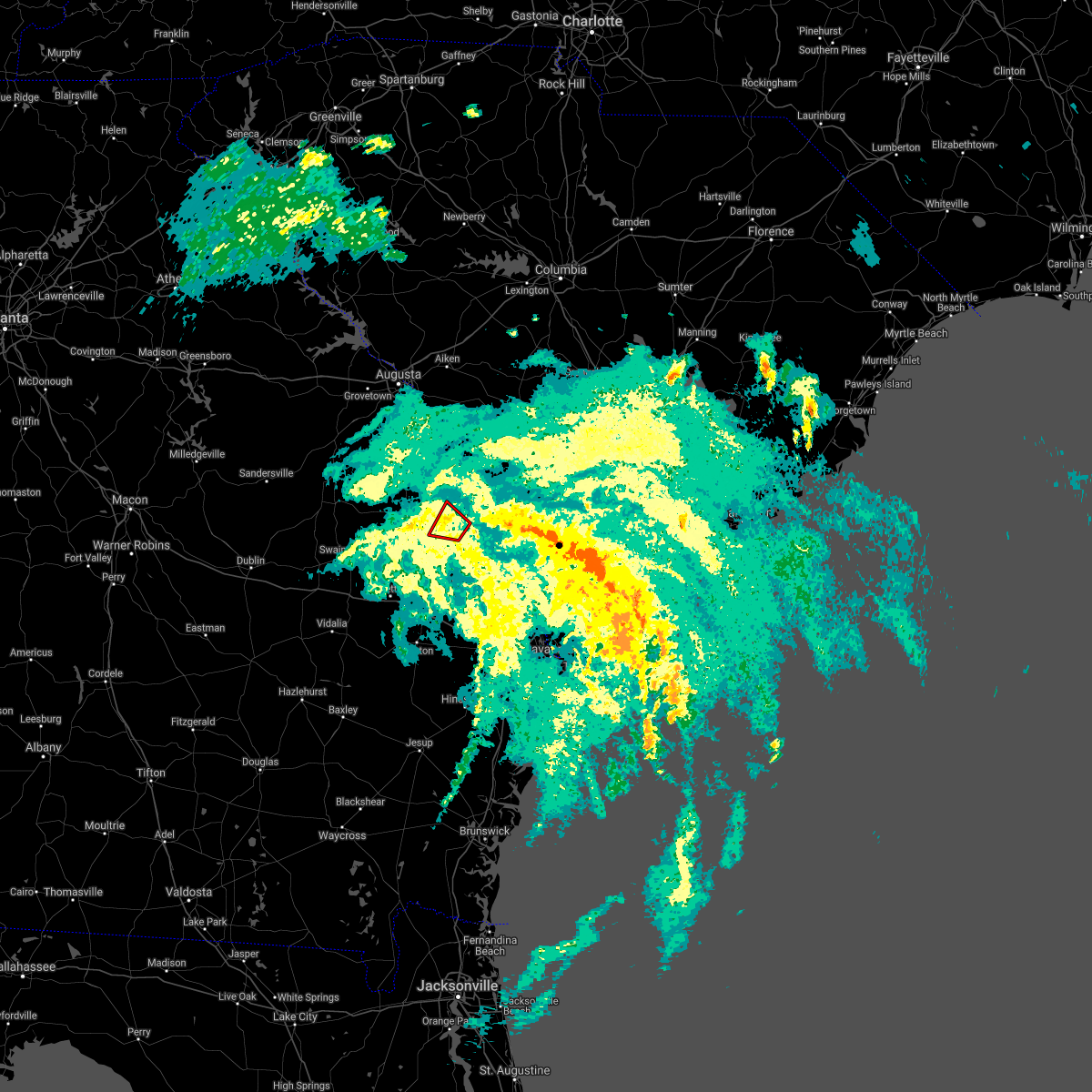 The tornado warning for portions of screven county will expire at midnight edt, the storm which prompted the warning has weakened below severe limits, and no longer appears capable of producing a tornado. therefore the warning will be allowed to expire. The tornado warning for portions of screven county will expire at midnight edt, the storm which prompted the warning has weakened below severe limits, and no longer appears capable of producing a tornado. therefore the warning will be allowed to expire.
|
| 7/7/2021 11:48 PM EDT |
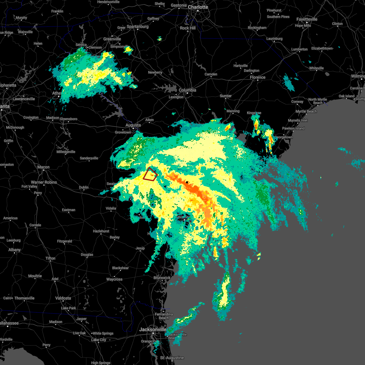 At 1148 pm edt, a severe thunderstorm capable of producing a tornado was located over sylvania, moving northwest at 35 mph (radar indicated rotation). Hazards include tornado. Flying debris will be dangerous to those caught without shelter. mobile homes will be damaged or destroyed. damage to roofs, windows, and vehicles will occur. tree damage is likely. Locations impacted include, sylvania, woodcliff and altman. At 1148 pm edt, a severe thunderstorm capable of producing a tornado was located over sylvania, moving northwest at 35 mph (radar indicated rotation). Hazards include tornado. Flying debris will be dangerous to those caught without shelter. mobile homes will be damaged or destroyed. damage to roofs, windows, and vehicles will occur. tree damage is likely. Locations impacted include, sylvania, woodcliff and altman.
|
| 7/7/2021 11:36 PM EDT |
 At 1136 pm edt, a severe thunderstorm capable of producing a tornado was located over hunters, moving northwest at 30 mph (radar indicated rotation). Hazards include tornado. Flying debris will be dangerous to those caught without shelter. mobile homes will be damaged or destroyed. damage to roofs, windows, and vehicles will occur. Tree damage is likely. At 1136 pm edt, a severe thunderstorm capable of producing a tornado was located over hunters, moving northwest at 30 mph (radar indicated rotation). Hazards include tornado. Flying debris will be dangerous to those caught without shelter. mobile homes will be damaged or destroyed. damage to roofs, windows, and vehicles will occur. Tree damage is likely.
|
| 3/28/2021 5:24 PM EDT |
 The severe thunderstorm warning for screven and jenkins counties will expire at 530 pm edt, the storm which prompted the warning has weakened below severe limits and is exiting the warned area. therefore the warning will be allowed to expire. The severe thunderstorm warning for screven and jenkins counties will expire at 530 pm edt, the storm which prompted the warning has weakened below severe limits and is exiting the warned area. therefore the warning will be allowed to expire.
|
| 3/28/2021 5:09 PM EDT |
 At 440 pm edt, a severe thunderstorm was located over midville, moving east at 50 mph (radar indicated). Hazards include 60 mph wind gusts and penny size hail. expect damage to trees and powerlines At 440 pm edt, a severe thunderstorm was located over midville, moving east at 50 mph (radar indicated). Hazards include 60 mph wind gusts and penny size hail. expect damage to trees and powerlines
|
| 3/28/2021 4:41 PM EDT |
 At 440 pm edt, a severe thunderstorm was located over midville, moving east at 50 mph (radar indicated). Hazards include 60 mph wind gusts and penny size hail. expect damage to trees and powerlines At 440 pm edt, a severe thunderstorm was located over midville, moving east at 50 mph (radar indicated). Hazards include 60 mph wind gusts and penny size hail. expect damage to trees and powerlines
|
| 8/18/2020 2:14 PM EDT | Tree down on halcyondale rd and robbins branch rd. time estimated from rada in screven county GA, 4.2 miles NNW of Sylvania, GA |
| 6/24/2020 8:09 PM EDT | A tree was reported down on bascom road near lawton roa in screven county GA, 4.6 miles SSE of Sylvania, GA |
| 4/13/2020 6:03 AM EDT |
 At 602 am edt, severe thunderstorms were located along a line extending from near bamberg to near nevils, moving east at 60 mph (radar indicated). Hazards include 60 mph wind gusts and penny size hail. Expect damage to trees and powerlines. locations impacted include, statesboro, reidsville, metter, allendale, springfield, hampton, claxton, lake warren state park, varnville, estill, fairfax, guyton, brooklet, hagan and collins. This warning includes i-16 between mile markers 106 and 139. At 602 am edt, severe thunderstorms were located along a line extending from near bamberg to near nevils, moving east at 60 mph (radar indicated). Hazards include 60 mph wind gusts and penny size hail. Expect damage to trees and powerlines. locations impacted include, statesboro, reidsville, metter, allendale, springfield, hampton, claxton, lake warren state park, varnville, estill, fairfax, guyton, brooklet, hagan and collins. This warning includes i-16 between mile markers 106 and 139.
|
| 4/13/2020 5:48 AM EDT | A tree was reported down on dover road. time is estimated by rada in screven county GA, 12 miles NNE of Sylvania, GA |
| 4/13/2020 5:33 AM EDT |
 At 532 am edt, severe thunderstorms were located along a line extending from 6 miles west of barnwell to near santa claus, moving east at 60 mph (radar indicated). Hazards include 60 mph wind gusts and penny size hail. expect damage to trees and powerlines At 532 am edt, severe thunderstorms were located along a line extending from 6 miles west of barnwell to near santa claus, moving east at 60 mph (radar indicated). Hazards include 60 mph wind gusts and penny size hail. expect damage to trees and powerlines
|
| 4/13/2020 5:13 AM EDT |
 At 513 am edt, severe thunderstorms were located along a line extending from near perkins to oak park, moving east at 40 mph (radar indicated). Hazards include 60 mph wind gusts. Expect damage to trees and powerlines. locations impacted include, statesboro, metter, millen, sylvania, butts, portal, hiltonia, pulaski, register, rocky ford, perkins, emmalane, millhaven, scarboro and woodcliff. This warning includes i-16 between mile markers 96 and 120. At 513 am edt, severe thunderstorms were located along a line extending from near perkins to oak park, moving east at 40 mph (radar indicated). Hazards include 60 mph wind gusts. Expect damage to trees and powerlines. locations impacted include, statesboro, metter, millen, sylvania, butts, portal, hiltonia, pulaski, register, rocky ford, perkins, emmalane, millhaven, scarboro and woodcliff. This warning includes i-16 between mile markers 96 and 120.
|
| 4/13/2020 4:44 AM EDT |
 At 444 am edt, severe thunderstorms were located along a line extending from 8 miles north of midville to 6 miles southwest of soperton, moving east at 50 mph (radar indicated). Hazards include 60 mph wind gusts. expect damage to trees and powerlines At 444 am edt, severe thunderstorms were located along a line extending from 8 miles north of midville to 6 miles southwest of soperton, moving east at 50 mph (radar indicated). Hazards include 60 mph wind gusts. expect damage to trees and powerlines
|
| 3/31/2020 4:30 PM EDT |
 At 430 pm edt, severe thunderstorms were located along a line extending from 9 miles northeast of hunters to near rocky ford, moving east at 65 mph (radar indicated). Hazards include 60 mph wind gusts. Expect damage to trees and powerlines. Locations impacted include, sylvania, newington, altman, captolo, shirley, dover and hunters. At 430 pm edt, severe thunderstorms were located along a line extending from 9 miles northeast of hunters to near rocky ford, moving east at 65 mph (radar indicated). Hazards include 60 mph wind gusts. Expect damage to trees and powerlines. Locations impacted include, sylvania, newington, altman, captolo, shirley, dover and hunters.
|
| 3/31/2020 4:21 PM EDT |
 At 421 pm edt, severe thunderstorms were located along a line extending from near sylvania to near rocky ford, moving east at 45 mph (radar indicated). Hazards include 60 mph wind gusts. Expect damage to trees and powerlines. Locations impacted include, sylvania, newington, rocky ford, woodcliff, altman, captolo, shirley, dover, scarboro and hunters. At 421 pm edt, severe thunderstorms were located along a line extending from near sylvania to near rocky ford, moving east at 45 mph (radar indicated). Hazards include 60 mph wind gusts. Expect damage to trees and powerlines. Locations impacted include, sylvania, newington, rocky ford, woodcliff, altman, captolo, shirley, dover, scarboro and hunters.
|
| 3/31/2020 4:03 PM EDT |
 At 403 pm edt, severe thunderstorms were located along a line extending from near woodcliff to near butts, moving east at 65 mph (radar indicated). Hazards include 60 mph wind gusts. expect damage to trees and powerlines At 403 pm edt, severe thunderstorms were located along a line extending from near woodcliff to near butts, moving east at 65 mph (radar indicated). Hazards include 60 mph wind gusts. expect damage to trees and powerlines
|
| 10/31/2019 6:32 PM EDT |
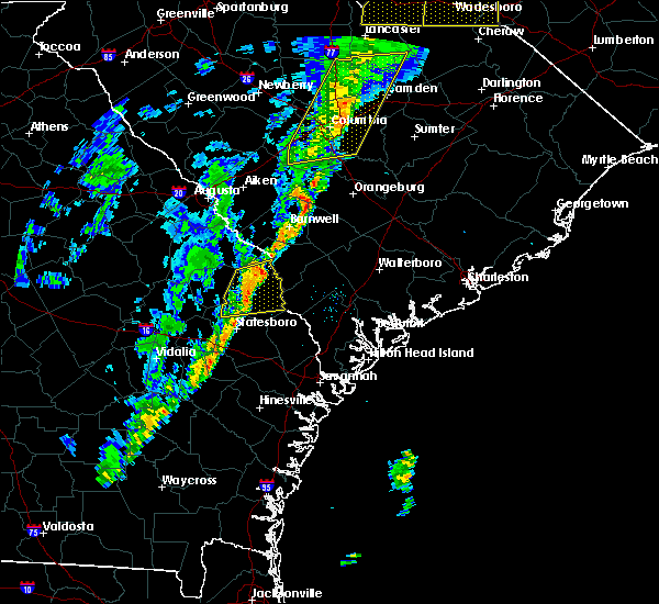 At 632 pm edt, severe thunderstorms were located along a line extending from 17 miles west of allendale to 9 miles south of sylvania, moving east at 55 mph (radar indicated). Hazards include 60 mph wind gusts. Expect damage to trees and powerlines. Locations impacted include, sylvania, newington, altman, captolo, dover, burtons ferry landing and hunters. At 632 pm edt, severe thunderstorms were located along a line extending from 17 miles west of allendale to 9 miles south of sylvania, moving east at 55 mph (radar indicated). Hazards include 60 mph wind gusts. Expect damage to trees and powerlines. Locations impacted include, sylvania, newington, altman, captolo, dover, burtons ferry landing and hunters.
|
| 10/31/2019 6:28 PM EDT | The screven county 911 call center reported a tree down on a power line along highway 2 in screven county GA, 4.9 miles SSW of Sylvania, GA |
| 10/31/2019 6:20 PM EDT | The screven county 911 call center reported a tree down near the intersection of rocky ford road and little horse creek roa in screven county GA, 7.3 miles E of Sylvania, GA |
| 10/31/2019 6:20 PM EDT |
 At 620 pm edt, severe thunderstorms were located along a line extending from 9 miles east of millen to near middleground, moving east at 45 mph (radar indicated). Hazards include 60 mph wind gusts. expect damage to trees and powerlines At 620 pm edt, severe thunderstorms were located along a line extending from 9 miles east of millen to near middleground, moving east at 45 mph (radar indicated). Hazards include 60 mph wind gusts. expect damage to trees and powerlines
|
| 9/30/2019 9:41 PM EDT |
 At 940 pm edt, a severe thunderstorm was located near sylvania, moving southwest at 25 mph (radar indicated). Hazards include 60 mph wind gusts and quarter size hail. Minor hail damage to vehicles is possible. expect wind damage to trees and powerlines. Locations impacted include, sylvania, newington, altman and hunters. At 940 pm edt, a severe thunderstorm was located near sylvania, moving southwest at 25 mph (radar indicated). Hazards include 60 mph wind gusts and quarter size hail. Minor hail damage to vehicles is possible. expect wind damage to trees and powerlines. Locations impacted include, sylvania, newington, altman and hunters.
|
| 9/30/2019 9:25 PM EDT |
 At 925 pm edt, a severe thunderstorm was located near sylvania, moving southwest at 30 mph (radar indicated). Hazards include 60 mph wind gusts and quarter size hail. Minor hail damage to vehicles is possible. expect wind damage to trees and powerlines. Locations impacted include, sylvania, estill, gifford, newington, luray, altman, lena and barton. At 925 pm edt, a severe thunderstorm was located near sylvania, moving southwest at 30 mph (radar indicated). Hazards include 60 mph wind gusts and quarter size hail. Minor hail damage to vehicles is possible. expect wind damage to trees and powerlines. Locations impacted include, sylvania, estill, gifford, newington, luray, altman, lena and barton.
|
| 9/30/2019 9:00 PM EDT |
 At 900 pm edt, a severe thunderstorm was located 12 miles southwest of allendale, moving southwest at 30 mph (radar indicated). Hazards include 60 mph wind gusts and quarter size hail. Minor hail damage to vehicles is possible. Expect wind damage to trees and powerlines. At 900 pm edt, a severe thunderstorm was located 12 miles southwest of allendale, moving southwest at 30 mph (radar indicated). Hazards include 60 mph wind gusts and quarter size hail. Minor hail damage to vehicles is possible. Expect wind damage to trees and powerlines.
|
| 9/9/2019 2:33 PM EDT |
 At 231 pm edt, a severe thunderstorm was located near statesboro, and is nearly stationary (radar indicated. this thunderstorm has produced quarter size hail and has blown down a tree in the statesboro area). Hazards include 60 mph wind gusts and quarter size hail. Minor hail damage to vehicles is possible. expect wind damage to trees and powerlines. Locations impacted include, statesboro, sylvania, middleground, newington, oliver, rocky ford, altman and georgia southern. At 231 pm edt, a severe thunderstorm was located near statesboro, and is nearly stationary (radar indicated. this thunderstorm has produced quarter size hail and has blown down a tree in the statesboro area). Hazards include 60 mph wind gusts and quarter size hail. Minor hail damage to vehicles is possible. expect wind damage to trees and powerlines. Locations impacted include, statesboro, sylvania, middleground, newington, oliver, rocky ford, altman and georgia southern.
|
| 9/9/2019 2:28 PM EDT |
 At 227 pm edt, a severe thunderstorm was located near middleground, moving east at 5 mph (radar indicated). Hazards include 60 mph wind gusts and quarter size hail. Minor hail damage to vehicles is possible. expect wind damage to trees and powerlines. Locations impacted include, statesboro, sylvania, middleground, newington, oliver, rocky ford, altman and georgia southern. At 227 pm edt, a severe thunderstorm was located near middleground, moving east at 5 mph (radar indicated). Hazards include 60 mph wind gusts and quarter size hail. Minor hail damage to vehicles is possible. expect wind damage to trees and powerlines. Locations impacted include, statesboro, sylvania, middleground, newington, oliver, rocky ford, altman and georgia southern.
|
| 9/9/2019 2:10 PM EDT |
 At 210 pm edt, a severe thunderstorm was located over middleground, moving east at 5 mph (radar indicated). Hazards include 60 mph wind gusts and penny size hail. expect damage to trees and powerlines At 210 pm edt, a severe thunderstorm was located over middleground, moving east at 5 mph (radar indicated). Hazards include 60 mph wind gusts and penny size hail. expect damage to trees and powerlines
|
| 6/23/2019 7:31 PM EDT | Multiple tree limbs were reported to have fallen on powerlines by the 911 center near cab dr and halcyondale rd. time is estimated by rada in screven county GA, 2.4 miles NW of Sylvania, GA |
| 6/23/2019 7:27 PM EDT |
 At 727 pm edt, severe thunderstorms were located along a line extending from near lake warren state park to 7 miles south of sylvania, moving southeast at 40 mph (radar indicated). Hazards include 60 mph wind gusts. Expect damage to trees and powerlines. locations impacted include, ridgeland, sylvania, springfield, hampton, lake warren state park, bay, varnville and estill. this warning includes, i-16 between mile markers 135 and 138. I-95 in south carolina between mile markers 17 and 32. At 727 pm edt, severe thunderstorms were located along a line extending from near lake warren state park to 7 miles south of sylvania, moving southeast at 40 mph (radar indicated). Hazards include 60 mph wind gusts. Expect damage to trees and powerlines. locations impacted include, ridgeland, sylvania, springfield, hampton, lake warren state park, bay, varnville and estill. this warning includes, i-16 between mile markers 135 and 138. I-95 in south carolina between mile markers 17 and 32.
|
| 6/23/2019 7:06 PM EDT |
 At 705 pm edt, severe thunderstorms were located along a line extending from near allendale to 9 miles east of millen, moving southeast at 40 mph (radar indicated). Hazards include 60 mph wind gusts. expect damage to trees and powerlines At 705 pm edt, severe thunderstorms were located along a line extending from near allendale to 9 miles east of millen, moving southeast at 40 mph (radar indicated). Hazards include 60 mph wind gusts. expect damage to trees and powerlines
|
| 6/22/2019 4:19 PM EDT |
 At 418 pm edt, severe thunderstorms were located along a line extending from 11 miles northeast of millen to near sylvania, moving east at 40 mph (radar indicated. the county warning point reports a few trees down near rocky ford). Hazards include 60 mph wind gusts and nickel size hail. Expect damage to trees and powerlines. Locations impacted include, millen, sylvania, rocky ford, woodcliff, altman, perkins, scarboro and hunters. At 418 pm edt, severe thunderstorms were located along a line extending from 11 miles northeast of millen to near sylvania, moving east at 40 mph (radar indicated. the county warning point reports a few trees down near rocky ford). Hazards include 60 mph wind gusts and nickel size hail. Expect damage to trees and powerlines. Locations impacted include, millen, sylvania, rocky ford, woodcliff, altman, perkins, scarboro and hunters.
|
| 6/22/2019 4:12 PM EDT | A tree was reported down at buttermilk rd and mcdonald rd. time estimated by rada in screven county GA, 6.3 miles SE of Sylvania, GA |
| 6/22/2019 4:07 PM EDT |
 At 406 pm edt, severe thunderstorms were located along a line extending from 8 miles north of millen to 6 miles southwest of sylvania, moving northeast at 35 mph (radar indicated). Hazards include 70 mph wind gusts and nickel size hail. Expect considerable tree damage. damage is likely to mobile homes, roofs, and outbuildings. Locations impacted include, millen, sylvania, rocky ford, woodcliff, altman, perkins, scarboro and hunters. At 406 pm edt, severe thunderstorms were located along a line extending from 8 miles north of millen to 6 miles southwest of sylvania, moving northeast at 35 mph (radar indicated). Hazards include 70 mph wind gusts and nickel size hail. Expect considerable tree damage. damage is likely to mobile homes, roofs, and outbuildings. Locations impacted include, millen, sylvania, rocky ford, woodcliff, altman, perkins, scarboro and hunters.
|
| 6/22/2019 3:53 PM EDT |
 At 353 pm edt, severe thunderstorms were located along a line extending from 8 miles west of millen to 8 miles southwest of sylvania, moving east at 30 mph (radar indicated). Hazards include 70 mph wind gusts and nickel size hail. Expect considerable tree damage. damage is likely to mobile homes, roofs, and outbuildings. Locations impacted include, millen, sylvania, westside, butts, portal, rocky ford, altman and perkins. At 353 pm edt, severe thunderstorms were located along a line extending from 8 miles west of millen to 8 miles southwest of sylvania, moving east at 30 mph (radar indicated). Hazards include 70 mph wind gusts and nickel size hail. Expect considerable tree damage. damage is likely to mobile homes, roofs, and outbuildings. Locations impacted include, millen, sylvania, westside, butts, portal, rocky ford, altman and perkins.
|
| 6/22/2019 3:33 PM EDT |
 At 333 pm edt, severe thunderstorms were located along a line extending from 10 miles southwest of millen to near westside, moving east at 40 mph (radar indicated). Hazards include 60 mph wind gusts and quarter size hail. Minor hail damage to vehicles is possible. Expect wind damage to trees and powerlines. At 333 pm edt, severe thunderstorms were located along a line extending from 10 miles southwest of millen to near westside, moving east at 40 mph (radar indicated). Hazards include 60 mph wind gusts and quarter size hail. Minor hail damage to vehicles is possible. Expect wind damage to trees and powerlines.
|
| 6/22/2019 5:40 AM EDT |
 At 540 am edt, severe thunderstorms were located along a line extending from 11 miles southwest of lake warren state park to 6 miles south of westside, moving east at 45 mph (radar indicated). Hazards include 60 mph wind gusts and quarter size hail. Minor hail damage to vehicles is possible. Expect wind damage to trees and powerlines. At 540 am edt, severe thunderstorms were located along a line extending from 11 miles southwest of lake warren state park to 6 miles south of westside, moving east at 45 mph (radar indicated). Hazards include 60 mph wind gusts and quarter size hail. Minor hail damage to vehicles is possible. Expect wind damage to trees and powerlines.
|
| 6/20/2019 6:26 PM EDT |
 At 626 pm edt, severe thunderstorms were located along a line extending from 7 miles north of allendale to 9 miles east of sylvania to near westside, moving east at 60 mph (radar indicated). Hazards include 70 mph wind gusts. Expect considerable tree damage. Damage is likely to mobile homes, roofs, and outbuildings. At 626 pm edt, severe thunderstorms were located along a line extending from 7 miles north of allendale to 9 miles east of sylvania to near westside, moving east at 60 mph (radar indicated). Hazards include 70 mph wind gusts. Expect considerable tree damage. Damage is likely to mobile homes, roofs, and outbuildings.
|
| 6/20/2019 6:17 PM EDT | Tree down on brannens bridge roa in screven county GA, 3.7 miles WSW of Sylvania, GA |
| 6/20/2019 6:15 PM EDT | Screven 911 reported a tree down on a power line and partially blocking the road on n main st in sylvani in screven county GA, 1 miles SSW of Sylvania, GA |
| 6/20/2019 6:11 PM EDT |
 At 531 pm edt, severe thunderstorms were located along a line extending from 9 miles northwest of millen to 10 miles northwest of swainsboro, moving east at 45 mph (radar indicated). Hazards include 60 mph wind gusts and penny size hail. expect damage to trees and powerlines At 531 pm edt, severe thunderstorms were located along a line extending from 9 miles northwest of millen to 10 miles northwest of swainsboro, moving east at 45 mph (radar indicated). Hazards include 60 mph wind gusts and penny size hail. expect damage to trees and powerlines
|
| 6/20/2019 6:10 PM EDT | Tree down on bay branch roa in screven county GA, 3.9 miles SE of Sylvania, GA |
| 6/20/2019 5:31 PM EDT |
 At 531 pm edt, severe thunderstorms were located along a line extending from 9 miles northwest of millen to 10 miles northwest of swainsboro, moving east at 45 mph (radar indicated). Hazards include 60 mph wind gusts and penny size hail. expect damage to trees and powerlines At 531 pm edt, severe thunderstorms were located along a line extending from 9 miles northwest of millen to 10 miles northwest of swainsboro, moving east at 45 mph (radar indicated). Hazards include 60 mph wind gusts and penny size hail. expect damage to trees and powerlines
|
| 6/4/2019 3:39 PM EDT | Tree down on east ogeechee st in sylvania. exact location unknown. time estimated by rada in screven county GA, 0.5 miles SW of Sylvania, GA |
| 6/4/2019 3:38 PM EDT | Screven county 911 center reported a tree blown down along highway 21 near the carver avenue intersection. time of event was estimated from radar dat in screven county GA, 1.2 miles NNW of Sylvania, GA |
| 6/4/2019 3:37 PM EDT |
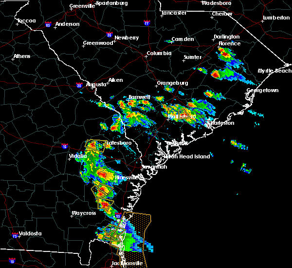 At 337 pm edt, a severe thunderstorm was located over sylvania, moving southeast at 20 mph (radar indicated). Hazards include 60 mph wind gusts and quarter size hail. Minor hail damage to vehicles is possible. Expect wind damage to trees and powerlines. At 337 pm edt, a severe thunderstorm was located over sylvania, moving southeast at 20 mph (radar indicated). Hazards include 60 mph wind gusts and quarter size hail. Minor hail damage to vehicles is possible. Expect wind damage to trees and powerlines.
|
| 5/12/2019 4:53 PM EDT |
 At 453 pm edt, severe thunderstorms were located along a line extending from near sylvania to 18 miles southwest of lake warren state park, moving east at 65 mph (radar indicated). Hazards include 60 mph wind gusts. Expect damage to trees and powerlines. Locations impacted include, sylvania, hiltonia, newington, woodcliff, altman, hilltonia, millhaven and burtons ferry landing. At 453 pm edt, severe thunderstorms were located along a line extending from near sylvania to 18 miles southwest of lake warren state park, moving east at 65 mph (radar indicated). Hazards include 60 mph wind gusts. Expect damage to trees and powerlines. Locations impacted include, sylvania, hiltonia, newington, woodcliff, altman, hilltonia, millhaven and burtons ferry landing.
|
| 5/12/2019 4:39 PM EDT |
 A severe thunderstorm warning remains in effect until 515 pm edt for screven. jenkins and effingham counties. at 439 pm edt, severe thunderstorms were located along a line extending from near millen to 11 miles south of sylvania, moving northeast at 40 mph. hazard. 60 mph wind gusts. A severe thunderstorm warning remains in effect until 515 pm edt for screven. jenkins and effingham counties. at 439 pm edt, severe thunderstorms were located along a line extending from near millen to 11 miles south of sylvania, moving northeast at 40 mph. hazard. 60 mph wind gusts.
|
| 5/12/2019 4:17 PM EDT |
 At 417 pm edt, severe thunderstorms were located along a line extending from 8 miles northwest of westside to near statesboro, moving northeast at 40 mph (radar indicated). Hazards include 60 mph wind gusts. expect damage to trees and powerlines At 417 pm edt, severe thunderstorms were located along a line extending from 8 miles northwest of westside to near statesboro, moving northeast at 40 mph (radar indicated). Hazards include 60 mph wind gusts. expect damage to trees and powerlines
|
| 5/11/2019 7:01 PM EDT |
 At 701 pm edt, severe thunderstorms were located along a line extending from 6 miles northeast of sylvania to 9 miles east of statesboro, moving east at 50 mph (radar indicated). Hazards include 60 mph wind gusts. Expect damage to trees and powerlines. Locations impacted include, allendale, sylvania, hampton, lake warren state park, estill, fairfax, brooklet and brunson. At 701 pm edt, severe thunderstorms were located along a line extending from 6 miles northeast of sylvania to 9 miles east of statesboro, moving east at 50 mph (radar indicated). Hazards include 60 mph wind gusts. Expect damage to trees and powerlines. Locations impacted include, allendale, sylvania, hampton, lake warren state park, estill, fairfax, brooklet and brunson.
|
| 5/11/2019 6:55 PM EDT | Trampoline thrown into powerlines on east ogeechee stree in screven county GA, 1 miles WSW of Sylvania, GA |
| 5/11/2019 6:55 PM EDT | Tree blown down on a home on sylvan circl in screven county GA, 0.5 miles SW of Sylvania, GA |
| 5/11/2019 6:54 PM EDT | Tree down on water station roa in screven county GA, 0.9 miles ENE of Sylvania, GA |
| 5/11/2019 6:49 PM EDT | Tree down off of bay branch road near the woodcliff neighborhoo in screven county GA, 7.2 miles E of Sylvania, GA |
| 5/11/2019 6:49 PM EDT |
 At 649 pm edt, severe thunderstorms were located along a line extending from near sylvania to 6 miles south of statesboro, moving east at 50 mph (radar indicated). Hazards include 60 mph wind gusts. expect damage to trees and powerlines At 649 pm edt, severe thunderstorms were located along a line extending from near sylvania to 6 miles south of statesboro, moving east at 50 mph (radar indicated). Hazards include 60 mph wind gusts. expect damage to trees and powerlines
|
| 4/19/2019 12:43 PM EDT |
 At 1243 pm edt, severe thunderstorms were located along a line extending from 8 miles southwest of springfield to near richmond hill to near darien, moving northeast at 45 mph (radar indicated). Hazards include 60 mph wind gusts. Expect damage to trees and powerlines. locations impacted include, savannah, hinesville, pooler, richmond hill, sylvania, springfield, pembroke and darien. this warning includes, i-16 between mile markers 138 and 168. i-516 between mile markers 3 and 9. I-95 in georgia between mile markers 50 and 112. At 1243 pm edt, severe thunderstorms were located along a line extending from 8 miles southwest of springfield to near richmond hill to near darien, moving northeast at 45 mph (radar indicated). Hazards include 60 mph wind gusts. Expect damage to trees and powerlines. locations impacted include, savannah, hinesville, pooler, richmond hill, sylvania, springfield, pembroke and darien. this warning includes, i-16 between mile markers 138 and 168. i-516 between mile markers 3 and 9. I-95 in georgia between mile markers 50 and 112.
|
| 4/19/2019 12:27 PM EDT |
 At 1225 pm edt, severe thunderstorms were located along a line extending from near bay to 10 miles east of hinesville to near dock junction, moving northeast at 45 mph (radar indicated). Hazards include 60 mph wind gusts. Expect damage to trees and powerlines. locations impacted include, savannah, hinesville, statesboro, pooler, richmond hill, sylvania, springfield and pembroke. this warning includes, i-16 between mile markers 119 and 168. i-516 between mile markers 3 and 9. I-95 in georgia between mile markers 50 and 112. At 1225 pm edt, severe thunderstorms were located along a line extending from near bay to 10 miles east of hinesville to near dock junction, moving northeast at 45 mph (radar indicated). Hazards include 60 mph wind gusts. Expect damage to trees and powerlines. locations impacted include, savannah, hinesville, statesboro, pooler, richmond hill, sylvania, springfield and pembroke. this warning includes, i-16 between mile markers 119 and 168. i-516 between mile markers 3 and 9. I-95 in georgia between mile markers 50 and 112.
|
| 4/19/2019 12:09 PM EDT |
 At 1208 pm edt, severe thunderstorms were located along a line extending from 6 miles west of pembroke to near tibet to 12 miles east of nahunta, moving northeast at 45 mph (radar indicated). Hazards include 60 mph wind gusts. expect damage to trees and powerlines At 1208 pm edt, severe thunderstorms were located along a line extending from 6 miles west of pembroke to near tibet to 12 miles east of nahunta, moving northeast at 45 mph (radar indicated). Hazards include 60 mph wind gusts. expect damage to trees and powerlines
|
| 4/19/2019 11:48 AM EDT |
 At 1148 am edt, severe thunderstorms were located along a line extending from 8 miles southeast of metter to near gardi, moving northeast at 55 mph (radar indicated). Hazards include 60 mph wind gusts. Expect damage to trees and powerlines. locations impacted include, hinesville, statesboro, reidsville, metter, millen, sylvania, claxton and pembroke. This warning includes i-16 between mile markers 96 and 139. At 1148 am edt, severe thunderstorms were located along a line extending from 8 miles southeast of metter to near gardi, moving northeast at 55 mph (radar indicated). Hazards include 60 mph wind gusts. Expect damage to trees and powerlines. locations impacted include, hinesville, statesboro, reidsville, metter, millen, sylvania, claxton and pembroke. This warning includes i-16 between mile markers 96 and 139.
|
| 4/19/2019 11:32 AM EDT |
 At 1131 am edt, severe thunderstorms were located along a line extending from 8 miles north of reidsville to 7 miles southeast of patterson, moving northeast at 50 mph (radar indicated). Hazards include 60 mph wind gusts. Expect damage to trees and powerlines. locations impacted include, hinesville, statesboro, reidsville, metter, millen, sylvania, claxton and pembroke. This warning includes i-16 between mile markers 96 and 139. At 1131 am edt, severe thunderstorms were located along a line extending from 8 miles north of reidsville to 7 miles southeast of patterson, moving northeast at 50 mph (radar indicated). Hazards include 60 mph wind gusts. Expect damage to trees and powerlines. locations impacted include, hinesville, statesboro, reidsville, metter, millen, sylvania, claxton and pembroke. This warning includes i-16 between mile markers 96 and 139.
|
| 4/19/2019 11:14 AM EDT |
 At 1111 am edt, severe thunderstorms were located along a line extending from 9 miles south of lyons to 6 miles south of blackshear, moving northeast at 55 mph (radar indicated). Hazards include 60 mph wind gusts. expect damage to trees and powerlines At 1111 am edt, severe thunderstorms were located along a line extending from 9 miles south of lyons to 6 miles south of blackshear, moving northeast at 55 mph (radar indicated). Hazards include 60 mph wind gusts. expect damage to trees and powerlines
|
| 3/3/2019 4:47 PM EST | Screven 911 center reported a tree down at beaver dam road and rolling roa in screven county GA, 6.6 miles SSE of Sylvania, GA |
| 3/3/2019 4:30 PM EST | Quarter sized hail reported 10.4 miles WNW of Sylvania, GA, screven 911 center reported quarter size hail near poor robin rd. and hwy 24. |
| 8/9/2018 6:42 PM EDT |
 The severe thunderstorm warning for screven county will expire at 645 pm edt, the storm which prompted the warning has weakened below severe limits, and no longer pose an immediate threat to life or property. therefore the warning will be allowed to expire. to report severe weather, contact your nearest law enforcement agency. they will relay your report to the national weather service charleston. The severe thunderstorm warning for screven county will expire at 645 pm edt, the storm which prompted the warning has weakened below severe limits, and no longer pose an immediate threat to life or property. therefore the warning will be allowed to expire. to report severe weather, contact your nearest law enforcement agency. they will relay your report to the national weather service charleston.
|
| 8/9/2018 6:14 PM EDT |
 At 613 pm edt, a severe thunderstorm was located 13 miles northeast of sylvania, moving east at 15 mph (radar indicated. at 549 pm screven county dispatch reported a tree down along millhaven road near millhaven). Hazards include 60 mph wind gusts. Expect damage to trees and powerlines. Locations impacted include, sylvania, hiltonia, altman, burtons ferry landing and hilltonia. At 613 pm edt, a severe thunderstorm was located 13 miles northeast of sylvania, moving east at 15 mph (radar indicated. at 549 pm screven county dispatch reported a tree down along millhaven road near millhaven). Hazards include 60 mph wind gusts. Expect damage to trees and powerlines. Locations impacted include, sylvania, hiltonia, altman, burtons ferry landing and hilltonia.
|
| 8/9/2018 5:49 PM EDT | Screven county 911 center reported a tree down along millhaven road near the johnson grove road intersection. time of event was estimated from radar dat in screven county GA, 12 miles S of Sylvania, GA |
| 8/9/2018 5:43 PM EDT |
 At 543 pm edt, a severe thunderstorm was located 12 miles north of sylvania, moving east at 10 mph (radar indicated). Hazards include 60 mph wind gusts and nickel size hail. expect damage to trees and powerlines At 543 pm edt, a severe thunderstorm was located 12 miles north of sylvania, moving east at 10 mph (radar indicated). Hazards include 60 mph wind gusts and nickel size hail. expect damage to trees and powerlines
|
| 6/25/2018 9:40 PM EDT |
 The severe thunderstorm warning for screven, evans, bulloch, jenkins, candler, effingham, tattnall, hampton, colleton and allendale counties will expire at 945 pm edt, the storms which prompted the warning will have weakened below severe limits by 945 pm and will no longer pose an immediate threat to life or property. therefore the warning will be allowed to expire. however gusty winds and heavy rain are still possible with these thunderstorms. to report severe weather, contact your nearest law enforcement agency. they will relay your report to the national weather service charleston. The severe thunderstorm warning for screven, evans, bulloch, jenkins, candler, effingham, tattnall, hampton, colleton and allendale counties will expire at 945 pm edt, the storms which prompted the warning will have weakened below severe limits by 945 pm and will no longer pose an immediate threat to life or property. therefore the warning will be allowed to expire. however gusty winds and heavy rain are still possible with these thunderstorms. to report severe weather, contact your nearest law enforcement agency. they will relay your report to the national weather service charleston.
|
| 6/25/2018 9:18 PM EDT |
 At 917 pm edt, severe thunderstorms were located along a line extending from near denmark to 7 miles south of lyons, moving east at 30 mph (radar indicated). Hazards include 60 mph wind gusts. Expect damage to trees and powerlines. locations impacted include, statesboro, reidsville, metter, allendale, millen, sylvania, hampton and claxton. this warning includes, i-16 between mile markers 96 and 130. I-95 in south carolina near mile marker 68. At 917 pm edt, severe thunderstorms were located along a line extending from near denmark to 7 miles south of lyons, moving east at 30 mph (radar indicated). Hazards include 60 mph wind gusts. Expect damage to trees and powerlines. locations impacted include, statesboro, reidsville, metter, allendale, millen, sylvania, hampton and claxton. this warning includes, i-16 between mile markers 96 and 130. I-95 in south carolina near mile marker 68.
|
| 6/25/2018 8:52 PM EDT |
 At 851 pm edt, severe thunderstorms were located along a line extending from 12 miles northwest of barnwell to near mount vernon, moving east at 45 mph (law enforcement reports. multiple reports of trees blown down). Hazards include 60 mph wind gusts and penny size hail. expect damage to trees and powerlines At 851 pm edt, severe thunderstorms were located along a line extending from 12 miles northwest of barnwell to near mount vernon, moving east at 45 mph (law enforcement reports. multiple reports of trees blown down). Hazards include 60 mph wind gusts and penny size hail. expect damage to trees and powerlines
|
| 6/25/2018 7:35 PM EDT | Screven county 911 reported a couple of trees down on highwy 301 near dove in screven county GA, 12 miles NNE of Sylvania, GA |
| 6/24/2018 11:58 PM EDT |
 At 1158 pm edt, severe thunderstorms were located along a line extending from near walterboro to 16 miles south of lake warren state park to middleground, moving southeast at 35 mph (radar indicated). Hazards include 60 mph wind gusts. expect damage to trees and powerlines At 1158 pm edt, severe thunderstorms were located along a line extending from near walterboro to 16 miles south of lake warren state park to middleground, moving southeast at 35 mph (radar indicated). Hazards include 60 mph wind gusts. expect damage to trees and powerlines
|
| 6/24/2018 11:38 PM EDT |
 At 1138 pm edt, severe thunderstorms were located along a line extending from lake warren state park to 7 miles southeast of sylvania to 9 miles southwest of millen, moving south at 30 mph (radar indicated). Hazards include 60 mph wind gusts. Expect damage to trees and powerlines. Locations impacted include, allendale, millen, sylvania, butts, fairfax, brunson, hiltonia and sycamore. At 1138 pm edt, severe thunderstorms were located along a line extending from lake warren state park to 7 miles southeast of sylvania to 9 miles southwest of millen, moving south at 30 mph (radar indicated). Hazards include 60 mph wind gusts. Expect damage to trees and powerlines. Locations impacted include, allendale, millen, sylvania, butts, fairfax, brunson, hiltonia and sycamore.
|
| 6/24/2018 10:58 PM EDT |
 At 1057 pm edt, severe thunderstorms were located along a line extending from 10 miles southeast of barnwell to 14 miles northeast of millen, moving south at 35 mph (radar indicated). Hazards include 60 mph wind gusts. expect damage to trees and powerlines At 1057 pm edt, severe thunderstorms were located along a line extending from 10 miles southeast of barnwell to 14 miles northeast of millen, moving south at 35 mph (radar indicated). Hazards include 60 mph wind gusts. expect damage to trees and powerlines
|
| 6/16/2018 4:38 PM EDT | Warning point reported tree down on hiltonia-perkins road. time estimated based on rada in screven county GA, 8.5 miles SSE of Sylvania, GA |
| 6/16/2018 4:28 PM EDT |
 At 427 pm edt, a severe thunderstorm was located near sylvania, moving north at 25 mph (radar indicated). Hazards include 60 mph wind gusts and quarter size hail. Minor hail damage to vehicles is possible. Expect wind damage to trees and powerlines. At 427 pm edt, a severe thunderstorm was located near sylvania, moving north at 25 mph (radar indicated). Hazards include 60 mph wind gusts and quarter size hail. Minor hail damage to vehicles is possible. Expect wind damage to trees and powerlines.
|
| 6/16/2018 3:58 PM EDT | Warning point reported tree down on poor robin road. time estimated based on rada in screven county GA, 7.8 miles WNW of Sylvania, GA |
| 6/2/2018 4:05 PM EDT | Screven county 911 reported a tree down on poor robin r in screven county GA, 8.8 miles WNW of Sylvania, GA |
| 6/2/2018 3:54 PM EDT |
 At 353 pm edt, severe thunderstorms were located along a line extending from 16 miles southwest of allendale to 8 miles south of sylvania, moving southeast at 30 mph (radar indicated). Hazards include 60 mph wind gusts and quarter size hail. Minor hail damage to vehicles is possible. Expect wind damage to trees and powerlines. At 353 pm edt, severe thunderstorms were located along a line extending from 16 miles southwest of allendale to 8 miles south of sylvania, moving southeast at 30 mph (radar indicated). Hazards include 60 mph wind gusts and quarter size hail. Minor hail damage to vehicles is possible. Expect wind damage to trees and powerlines.
|
| 6/2/2018 3:48 PM EDT | Screven county 911 reported a tree down on forest road in sylvani in screven county GA, 0.3 miles SE of Sylvania, GA |
| 4/15/2018 1:56 PM EDT |
 The severe thunderstorm warning for screven county will expire at 200 pm edt, the storm which prompted the warning has weakened below severe limits, and has exited the warned area. therefore the warning will be allowed to expire. The severe thunderstorm warning for screven county will expire at 200 pm edt, the storm which prompted the warning has weakened below severe limits, and has exited the warned area. therefore the warning will be allowed to expire.
|
| 4/15/2018 1:45 PM EDT | Screven county 911 center reported a tree blown down along pine grove inn road. time of event was estimated from rada in screven county GA, 10 miles SSW of Sylvania, GA |
| 4/15/2018 1:39 PM EDT |
 At 139 pm edt, a severe thunderstorm was located 8 miles south of sylvania, moving northeast at 50 mph (radar indicated). Hazards include 60 mph wind gusts. Expect damage to trees and powerlines. Locations impacted include, sylvania, newington, oliver, rocky ford, altman, captolo, dover and hunters. At 139 pm edt, a severe thunderstorm was located 8 miles south of sylvania, moving northeast at 50 mph (radar indicated). Hazards include 60 mph wind gusts. Expect damage to trees and powerlines. Locations impacted include, sylvania, newington, oliver, rocky ford, altman, captolo, dover and hunters.
|
| 4/15/2018 1:18 PM EDT |
 At 117 pm edt, a severe thunderstorm was located over statesboro, moving northeast at 50 mph (radar indicated). Hazards include 60 mph wind gusts. expect damage to trees and powerlines At 117 pm edt, a severe thunderstorm was located over statesboro, moving northeast at 50 mph (radar indicated). Hazards include 60 mph wind gusts. expect damage to trees and powerlines
|
| 3/20/2018 5:22 AM EDT |
 The severe thunderstorm warning for screven and bulloch counties will expire at 530 am edt, the storm which prompted the warning has moved out of the area. therefore the warning will be allowed to expire. The severe thunderstorm warning for screven and bulloch counties will expire at 530 am edt, the storm which prompted the warning has moved out of the area. therefore the warning will be allowed to expire.
|
| 3/20/2018 5:02 AM EDT |
 At 502 am edt, a severe thunderstorm was located near sylvania, moving east at 55 mph (radar indicated). Hazards include 60 mph wind gusts and penny size hail. Expect damage to trees and powerlines. Locations impacted include, statesboro, sylvania, middleground, portal, newington, oliver, rocky ford and altman. At 502 am edt, a severe thunderstorm was located near sylvania, moving east at 55 mph (radar indicated). Hazards include 60 mph wind gusts and penny size hail. Expect damage to trees and powerlines. Locations impacted include, statesboro, sylvania, middleground, portal, newington, oliver, rocky ford and altman.
|
| 3/20/2018 4:42 AM EDT |
 At 441 am edt, a severe thunderstorm was located 10 miles southwest of millen, moving east at 55 mph (radar indicated). Hazards include 60 mph wind gusts and penny size hail. expect damage to trees and powerlines At 441 am edt, a severe thunderstorm was located 10 miles southwest of millen, moving east at 55 mph (radar indicated). Hazards include 60 mph wind gusts and penny size hail. expect damage to trees and powerlines
|
| 3/20/2018 3:18 AM EDT |
 At 318 am edt, severe thunderstorms were located along a line extending from 13 miles west of allendale to 9 miles north of sylvania to millen, moving east at 60 mph (radar indicated). Hazards include 60 mph wind gusts and quarter size hail. Minor hail damage to vehicles is possible. expect wind damage to trees and powerlines. Locations impacted include, allendale, millen, sylvania, hampton, lake warren state park, butts, estill and fairfax. At 318 am edt, severe thunderstorms were located along a line extending from 13 miles west of allendale to 9 miles north of sylvania to millen, moving east at 60 mph (radar indicated). Hazards include 60 mph wind gusts and quarter size hail. Minor hail damage to vehicles is possible. expect wind damage to trees and powerlines. Locations impacted include, allendale, millen, sylvania, hampton, lake warren state park, butts, estill and fairfax.
|
| 3/20/2018 2:50 AM EDT |
 At 248 am edt, severe thunderstorms were located along a line extending from 12 miles west of savannah river site to 8 miles southwest of waynesboro to near louisville, moving east at 55 mph (radar indicated). Hazards include 60 mph wind gusts and quarter size hail. Minor hail damage to vehicles is possible. Expect wind damage to trees and powerlines. At 248 am edt, severe thunderstorms were located along a line extending from 12 miles west of savannah river site to 8 miles southwest of waynesboro to near louisville, moving east at 55 mph (radar indicated). Hazards include 60 mph wind gusts and quarter size hail. Minor hail damage to vehicles is possible. Expect wind damage to trees and powerlines.
|
| 5/13/2017 2:49 PM EDT |
 At 248 pm edt, a severe thunderstorm was located near sylvania, moving east at 55 mph (radar indicated). Hazards include 60 mph wind gusts. Expect damage to trees and powerlines. Locations impacted include, sylvania, lake warren state park, estill, gifford, scotia, luray, altman and lena. At 248 pm edt, a severe thunderstorm was located near sylvania, moving east at 55 mph (radar indicated). Hazards include 60 mph wind gusts. Expect damage to trees and powerlines. Locations impacted include, sylvania, lake warren state park, estill, gifford, scotia, luray, altman and lena.
|
| 5/13/2017 2:19 PM EDT |
 At 218 pm edt, a severe thunderstorm was located 7 miles east of middleground, moving northeast at 45 mph. these storms have a history of producing damage (radar indicated). Hazards include 60 mph wind gusts and penny size hail. expect damage to trees and powerlines At 218 pm edt, a severe thunderstorm was located 7 miles east of middleground, moving northeast at 45 mph. these storms have a history of producing damage (radar indicated). Hazards include 60 mph wind gusts and penny size hail. expect damage to trees and powerlines
|
| 4/5/2017 5:40 PM EDT |
 At 540 pm edt, severe thunderstorms were located along a line extending from 10 miles east of millen to 8 miles south of sylvania to near statesboro, moving northeast at 45 mph (radar indicated). Hazards include 60 mph wind gusts and penny size hail. Expect damage to roofs, siding, and trees. locations impacted include, statesboro, sylvania, brooklet, newington, oliver, register, rocky ford and altman. A tornado watch remains in effect until 800 pm edt for southeastern georgia, and southeastern south carolina. At 540 pm edt, severe thunderstorms were located along a line extending from 10 miles east of millen to 8 miles south of sylvania to near statesboro, moving northeast at 45 mph (radar indicated). Hazards include 60 mph wind gusts and penny size hail. Expect damage to roofs, siding, and trees. locations impacted include, statesboro, sylvania, brooklet, newington, oliver, register, rocky ford and altman. A tornado watch remains in effect until 800 pm edt for southeastern georgia, and southeastern south carolina.
|
| 4/5/2017 5:27 PM EDT |
 At 525 pm edt, severe thunderstorms were located along a line extending from near millen to near middleground to near statesboro, moving northeast at 45 mph (radar indicated. at 525 pm edt, a wind gust to 52 mph was reported by the automated weather sensor at the statesboro airport). Hazards include 60 mph wind gusts and penny size hail. expect damage to roofs, siding, and trees At 525 pm edt, severe thunderstorms were located along a line extending from near millen to near middleground to near statesboro, moving northeast at 45 mph (radar indicated. at 525 pm edt, a wind gust to 52 mph was reported by the automated weather sensor at the statesboro airport). Hazards include 60 mph wind gusts and penny size hail. expect damage to roofs, siding, and trees
|
| 4/5/2017 5:06 PM EDT |
 At 506 pm edt, a severe thunderstorm capable of producing a tornado was located 13 miles northwest of westside, moving east at 35 mph (radar indicated rotation). Hazards include tornado. Flying debris will be dangerous to those caught without shelter. mobile homes will be damaged or destroyed. damage to roofs, windows, and vehicles will occur. tree damage is likely. Locations impacted include, statesboro, middleground, butts, portal, rocky ford, woodcliff, hopeulikit and dover. At 506 pm edt, a severe thunderstorm capable of producing a tornado was located 13 miles northwest of westside, moving east at 35 mph (radar indicated rotation). Hazards include tornado. Flying debris will be dangerous to those caught without shelter. mobile homes will be damaged or destroyed. damage to roofs, windows, and vehicles will occur. tree damage is likely. Locations impacted include, statesboro, middleground, butts, portal, rocky ford, woodcliff, hopeulikit and dover.
|
| 4/5/2017 4:50 PM EDT |
 At 450 pm edt, a severe thunderstorm capable of producing a tornado was located 9 miles east of swainsboro, moving east at 45 mph (radar indicated rotation). Hazards include tornado and quarter size hail. Flying debris will be dangerous to those caught without shelter. mobile homes will be damaged or destroyed. damage to roofs, windows, and vehicles will occur. Tree damage is likely. At 450 pm edt, a severe thunderstorm capable of producing a tornado was located 9 miles east of swainsboro, moving east at 45 mph (radar indicated rotation). Hazards include tornado and quarter size hail. Flying debris will be dangerous to those caught without shelter. mobile homes will be damaged or destroyed. damage to roofs, windows, and vehicles will occur. Tree damage is likely.
|
| 4/5/2017 4:33 PM EDT |
 At 432 pm edt, severe thunderstorms were located along a line extending from 17 miles east of wrightsville to swainsboro to 11 miles north of lyons, moving east at 40 mph. this line of thunderstorms have a history of producing widespread wind damage and tornadoes (radar indicated). Hazards include 70 mph wind gusts and quarter size hail. Hail damage to vehicles is expected. expect considerable tree damage. Wind damage is also likely to mobile homes, roofs, and outbuildings. At 432 pm edt, severe thunderstorms were located along a line extending from 17 miles east of wrightsville to swainsboro to 11 miles north of lyons, moving east at 40 mph. this line of thunderstorms have a history of producing widespread wind damage and tornadoes (radar indicated). Hazards include 70 mph wind gusts and quarter size hail. Hail damage to vehicles is expected. expect considerable tree damage. Wind damage is also likely to mobile homes, roofs, and outbuildings.
|
| 4/3/2017 4:23 PM EDT | Screven county 911 reported a tree down near the intersection of oglethorpe trail and highway 30 in screven county GA, 15 miles SSW of Sylvania, GA |
| 4/3/2017 4:19 PM EDT | Screven county 911 reported a tree down near the intersection of plantation road and highway 30 in screven county GA, 10.4 miles SSW of Sylvania, GA |
| 4/3/2017 4:16 PM EDT | Screven county 911 reported a tree down near the intersection of buttermilk road and parker roa in screven county GA, 5.1 miles SSE of Sylvania, GA |
| 4/3/2017 3:44 PM EDT |
 At 344 pm edt, a severe thunderstorm was located near sylvania, moving east at 45 mph (radar indicated). Hazards include 60 mph wind gusts and quarter size hail. Hail damage to vehicles is expected. Expect wind damage to roofs, siding, and trees. At 344 pm edt, a severe thunderstorm was located near sylvania, moving east at 45 mph (radar indicated). Hazards include 60 mph wind gusts and quarter size hail. Hail damage to vehicles is expected. Expect wind damage to roofs, siding, and trees.
|
| 3/22/2017 12:03 AM EDT |
 At 1203 am edt, severe thunderstorms were located along a line extending from 9 miles southeast of barnwell to 7 miles south of allendale to 13 miles east of sylvania, moving east at 55 mph (radar indicated). Hazards include 60 mph wind gusts and penny size hail. Expect damage to roofs, siding, and trees. Locations impacted include, allendale, sylvania, fairfax, brunson, gifford, sycamore, luray and ulmer. At 1203 am edt, severe thunderstorms were located along a line extending from 9 miles southeast of barnwell to 7 miles south of allendale to 13 miles east of sylvania, moving east at 55 mph (radar indicated). Hazards include 60 mph wind gusts and penny size hail. Expect damage to roofs, siding, and trees. Locations impacted include, allendale, sylvania, fairfax, brunson, gifford, sycamore, luray and ulmer.
|
| 3/21/2017 11:51 PM EDT |
 At 1151 pm edt, severe thunderstorms were located along a line extending from 7 miles south of barnwell to 8 miles southwest of allendale to sylvania, moving east at 65 mph (radar indicated). Hazards include 60 mph wind gusts and penny size hail. Expect damage to roofs, siding, and trees. Locations impacted include, allendale, sylvania, fairfax, brunson, hiltonia, gifford, sycamore and luray. At 1151 pm edt, severe thunderstorms were located along a line extending from 7 miles south of barnwell to 8 miles southwest of allendale to sylvania, moving east at 65 mph (radar indicated). Hazards include 60 mph wind gusts and penny size hail. Expect damage to roofs, siding, and trees. Locations impacted include, allendale, sylvania, fairfax, brunson, hiltonia, gifford, sycamore and luray.
|
| 3/21/2017 11:31 PM EDT |
 At 1131 pm edt, severe thunderstorms were located along a line extending from 7 miles southeast of savannah river site to 16 miles north of sylvania to 7 miles east of millen, moving east at 55 mph (radar indicated). Hazards include 60 mph wind gusts and penny size hail. expect damage to roofs, siding, and trees At 1131 pm edt, severe thunderstorms were located along a line extending from 7 miles southeast of savannah river site to 16 miles north of sylvania to 7 miles east of millen, moving east at 55 mph (radar indicated). Hazards include 60 mph wind gusts and penny size hail. expect damage to roofs, siding, and trees
|
| 1/21/2017 2:53 PM EST | Twtter report shows a car flipped on its side...a roof blown off a house...metal siding removed from a fire station...and various other damage near the intersection of in screven county GA, 3.2 miles SW of Sylvania, GA |
| 1/21/2017 2:48 PM EST | Trained spotter reported multiple trees... road signs... and powerlines down with damage to chicken coops including metal roofs removed with portions left in trees near in screven county GA, 8.4 miles SE of Sylvania, GA |
| 1/21/2017 2:44 PM EST | Screven county warning point reports multiple trees down and damage to a shed in the 5300 block of buttermilk rd. possible tornado in screven county GA, 8 miles SE of Sylvania, GA |
| 1/21/2017 2:43 PM EST |
 At 242 pm est, severe thunderstorms were located along a line extending from 15 miles west of allendale to near sylvania to 14 miles north of statesboro to near middleground, moving northeast at 70 mph (radar indicated). Hazards include 60 mph wind gusts and penny size hail. Expect damage to roofs, siding, and trees. locations impacted include, statesboro, reidsville, metter, millen, sylvania, claxton, middleground and westside. A tornado watch remains in effect until 700 pm est for southeastern georgia, and southeastern south carolina. At 242 pm est, severe thunderstorms were located along a line extending from 15 miles west of allendale to near sylvania to 14 miles north of statesboro to near middleground, moving northeast at 70 mph (radar indicated). Hazards include 60 mph wind gusts and penny size hail. Expect damage to roofs, siding, and trees. locations impacted include, statesboro, reidsville, metter, millen, sylvania, claxton, middleground and westside. A tornado watch remains in effect until 700 pm est for southeastern georgia, and southeastern south carolina.
|
| 1/21/2017 2:36 PM EST |
 At 236 pm est, a severe thunderstorm capable of producing a tornado was located near millen, moving northeast at 50 mph (radar indicated rotation). Hazards include tornado. Flying debris will be dangerous to those caught without shelter. mobile homes will be damaged or destroyed. damage to roofs, windows, and vehicles will occur. tree damage is likely. Locations impacted include, millen, sylvania, hiltonia, woodcliff, altman, hilltonia, emmalane and scarboro. At 236 pm est, a severe thunderstorm capable of producing a tornado was located near millen, moving northeast at 50 mph (radar indicated rotation). Hazards include tornado. Flying debris will be dangerous to those caught without shelter. mobile homes will be damaged or destroyed. damage to roofs, windows, and vehicles will occur. tree damage is likely. Locations impacted include, millen, sylvania, hiltonia, woodcliff, altman, hilltonia, emmalane and scarboro.
|
| 1/21/2017 2:21 PM EST |
 At 221 pm est, a severe thunderstorm capable of producing a tornado was located 7 miles southwest of millen, moving northeast at 55 mph (radar indicated rotation). Hazards include tornado. Flying debris will be dangerous to those caught without shelter. mobile homes will be damaged or destroyed. damage to roofs, windows, and vehicles will occur. Tree damage is likely. At 221 pm est, a severe thunderstorm capable of producing a tornado was located 7 miles southwest of millen, moving northeast at 55 mph (radar indicated rotation). Hazards include tornado. Flying debris will be dangerous to those caught without shelter. mobile homes will be damaged or destroyed. damage to roofs, windows, and vehicles will occur. Tree damage is likely.
|
| 1/21/2017 2:13 PM EST |
 At 212 pm est, severe thunderstorms were located along a line extending from 7 miles west of millen to 10 miles east of swainsboro to 10 miles west of metter to 6 miles north of lyons, moving northeast at 70 mph (radar indicated). Hazards include 60 mph wind gusts and penny size hail. expect damage to roofs, siding, and trees At 212 pm est, severe thunderstorms were located along a line extending from 7 miles west of millen to 10 miles east of swainsboro to 10 miles west of metter to 6 miles north of lyons, moving northeast at 70 mph (radar indicated). Hazards include 60 mph wind gusts and penny size hail. expect damage to roofs, siding, and trees
|
| 1/2/2017 5:33 PM EST | A large tree crushed a mobile home in the boscom community. social media images show extensive damage to the home. time estimated based on radar. reported relayed by lo in screven county GA, 8 miles S of Sylvania, GA |
| 1/2/2017 5:26 PM EST | Screven county 911 reported trees down at intersection of winchester rd and sunnyside rd. separate report received of hail damage to a passing vehicle but hail size was in screven county GA, 6.9 miles SSE of Sylvania, GA |
| 1/2/2017 5:20 PM EST |
 At 520 pm est, a severe thunderstorm was located 7 miles northwest of sylvania, moving east at 35 mph (radar indicated). Hazards include 60 mph wind gusts and quarter size hail. Hail damage to vehicles is expected. Expect wind damage to roofs, siding, and trees. At 520 pm est, a severe thunderstorm was located 7 miles northwest of sylvania, moving east at 35 mph (radar indicated). Hazards include 60 mph wind gusts and quarter size hail. Hail damage to vehicles is expected. Expect wind damage to roofs, siding, and trees.
|
| 9/11/2016 8:06 PM EDT |
 At 806 pm edt, a severe thunderstorm was located 14 miles southeast of sylvania, moving southwest at 10 mph (radar indicated). Hazards include 60 mph wind gusts. Expect damage to roofs. siding. And trees. At 806 pm edt, a severe thunderstorm was located 14 miles southeast of sylvania, moving southwest at 10 mph (radar indicated). Hazards include 60 mph wind gusts. Expect damage to roofs. siding. And trees.
|
| 8/29/2016 6:05 PM EDT |
 At 605 pm edt, a severe thunderstorm was located 13 miles west of lake warren state park, moving southwest at 20 mph (radar indicated). Hazards include 60 mph wind gusts. Expect damage to roofs. siding. and trees. Locations impacted include, sylvania, hiltonia, burtons ferry landing and hilltonia. At 605 pm edt, a severe thunderstorm was located 13 miles west of lake warren state park, moving southwest at 20 mph (radar indicated). Hazards include 60 mph wind gusts. Expect damage to roofs. siding. and trees. Locations impacted include, sylvania, hiltonia, burtons ferry landing and hilltonia.
|
| 8/29/2016 5:56 PM EDT | Tree limb brought powerlines down due to thunderstorm outflow at the intersection of north main street and martin luther king jr driv in screven county GA, 1 miles SSW of Sylvania, GA |
| 8/29/2016 5:50 PM EDT | Warning point reported power lines down at the 1400 block of waynesboro highway. time estimated based on rada in screven county GA, 7.9 miles S of Sylvania, GA |
| 8/29/2016 5:48 PM EDT |
 At 548 pm edt, a severe thunderstorm was located near lake warren state park, moving southwest at 20 mph (radar indicated). Hazards include 60 mph wind gusts. Expect damage to roofs. siding. And trees. At 548 pm edt, a severe thunderstorm was located near lake warren state park, moving southwest at 20 mph (radar indicated). Hazards include 60 mph wind gusts. Expect damage to roofs. siding. And trees.
|
| 7/15/2016 8:40 PM EDT |
 The severe thunderstorm warning for jenkins and screven counties will expire at 845 pm edt, the storms which prompted the warning have weakened. therefore the warning will be allowed to expire. however gusty winds and heavy rain are still possible with these thunderstorms. to report severe weather, contact your nearest law enforcement agency. they will relay your report to the national weather service charleston. The severe thunderstorm warning for jenkins and screven counties will expire at 845 pm edt, the storms which prompted the warning have weakened. therefore the warning will be allowed to expire. however gusty winds and heavy rain are still possible with these thunderstorms. to report severe weather, contact your nearest law enforcement agency. they will relay your report to the national weather service charleston.
|
| 7/15/2016 8:32 PM EDT |
 At 831 pm edt, severe thunderstorms were located along a line extending from near millen to 14 miles east of statesboro, moving north at 25 mph (radar indicated). Hazards include 60 mph wind gusts. Expect damage to roofs. siding. and trees. Locations impacted include, millen, sylvania, newington, oliver, rocky ford, herndon, hunters and scarboro. At 831 pm edt, severe thunderstorms were located along a line extending from near millen to 14 miles east of statesboro, moving north at 25 mph (radar indicated). Hazards include 60 mph wind gusts. Expect damage to roofs. siding. and trees. Locations impacted include, millen, sylvania, newington, oliver, rocky ford, herndon, hunters and scarboro.
|
| 7/15/2016 8:07 PM EDT |
 At 805 pm edt, a severe thunderstorm was located 10 miles east of statesboro, moving northeast at 30 mph. additional severe thunderstorms could affect areas to the northwest near millen (radar indicated). Hazards include 60 mph wind gusts and quarter size hail. Hail damage to vehicles is expected. expect wind damage to roofs, siding, and trees. Locations impacted include, statesboro, millen, sylvania, middleground, butts, brooklet, portal and newington. At 805 pm edt, a severe thunderstorm was located 10 miles east of statesboro, moving northeast at 30 mph. additional severe thunderstorms could affect areas to the northwest near millen (radar indicated). Hazards include 60 mph wind gusts and quarter size hail. Hail damage to vehicles is expected. expect wind damage to roofs, siding, and trees. Locations impacted include, statesboro, millen, sylvania, middleground, butts, brooklet, portal and newington.
|
| 7/15/2016 8:04 PM EDT | The screven county warning point reported a tree down near the intersection of dorsey clark road and highway 1 in screven county GA, 12.2 miles N of Sylvania, GA |
| 7/15/2016 8:02 PM EDT | The screven county warning point reported a tree down near the intersection of statesboro highway and highway 1 in screven county GA, 11.2 miles NNE of Sylvania, GA |
| 7/15/2016 7:44 PM EDT |
 At 744 pm edt, a severe thunderstorm was located 9 miles west of bay, moving northeast at 15 mph (radar indicated). Hazards include 60 mph wind gusts and quarter size hail. Hail damage to vehicles is expected. Expect wind damage to roofs, siding, and trees. At 744 pm edt, a severe thunderstorm was located 9 miles west of bay, moving northeast at 15 mph (radar indicated). Hazards include 60 mph wind gusts and quarter size hail. Hail damage to vehicles is expected. Expect wind damage to roofs, siding, and trees.
|
| 7/6/2016 5:01 PM EDT |
 At 501 pm edt, severe thunderstorms were located along a line extending from 12 miles west of allendale to 6 miles southeast of sylvania, moving east at 40 mph (radar indicated). Hazards include 60 mph wind gusts. Expect damage to roofs. siding. and trees. Locations impacted include, allendale, millen, sylvania, butts, hiltonia, rocky ford, herndon and hunters. At 501 pm edt, severe thunderstorms were located along a line extending from 12 miles west of allendale to 6 miles southeast of sylvania, moving east at 40 mph (radar indicated). Hazards include 60 mph wind gusts. Expect damage to roofs. siding. and trees. Locations impacted include, allendale, millen, sylvania, butts, hiltonia, rocky ford, herndon and hunters.
|
| 7/6/2016 4:46 PM EDT |
 At 445 pm edt, severe thunderstorms were located 10 miles northeast of millen, moving east at 15 mph (radar indicated). Hazards include 60 mph wind gusts. Expect damage to roofs. siding. and trees. Locations impacted include, allendale, millen, sylvania, butts, hiltonia, rocky ford, herndon and hunters. At 445 pm edt, severe thunderstorms were located 10 miles northeast of millen, moving east at 15 mph (radar indicated). Hazards include 60 mph wind gusts. Expect damage to roofs. siding. and trees. Locations impacted include, allendale, millen, sylvania, butts, hiltonia, rocky ford, herndon and hunters.
|
| 7/6/2016 4:31 PM EDT |
 At 430 pm edt, severe thunderstorms were located along a line extending from 13 miles southeast of savannah river site to 13 miles east of swainsboro, moving east at 25 mph (radar indicated). Hazards include 60 mph wind gusts. Expect damage to roofs. siding. And trees. At 430 pm edt, severe thunderstorms were located along a line extending from 13 miles southeast of savannah river site to 13 miles east of swainsboro, moving east at 25 mph (radar indicated). Hazards include 60 mph wind gusts. Expect damage to roofs. siding. And trees.
|
| 7/5/2016 6:26 PM EDT |
 The severe thunderstorm warning for jenkins, screven and allendale counties will expire at 630 pm edt, the storms which prompted the warning have weakened below severe limits, and no longer pose an immediate threat to life or property. therefore the warning will be allowed to expire. however gusty winds are still possible with these thunderstorms. to report severe weather, contact your nearest law enforcement agency. they will relay your report to the national weather service charleston. The severe thunderstorm warning for jenkins, screven and allendale counties will expire at 630 pm edt, the storms which prompted the warning have weakened below severe limits, and no longer pose an immediate threat to life or property. therefore the warning will be allowed to expire. however gusty winds are still possible with these thunderstorms. to report severe weather, contact your nearest law enforcement agency. they will relay your report to the national weather service charleston.
|
| 7/5/2016 6:01 PM EDT |
 At 601 pm edt, severe thunderstorms were located along a line extending from 7 miles north of allendale to near millen, moving east at 55 mph (radar indicated). Hazards include 60 mph wind gusts. Expect damage to roofs. siding. and trees. Locations impacted include, allendale, millen, sylvania, butts, fairfax, martin, millett, hiltonia, sycamore and rocky ford. At 601 pm edt, severe thunderstorms were located along a line extending from 7 miles north of allendale to near millen, moving east at 55 mph (radar indicated). Hazards include 60 mph wind gusts. Expect damage to roofs. siding. and trees. Locations impacted include, allendale, millen, sylvania, butts, fairfax, martin, millett, hiltonia, sycamore and rocky ford.
|
| 7/5/2016 5:51 PM EDT |
 At 551 pm edt, severe thunderstorms were located along a line extending from 10 miles northwest of allendale to near millen, moving east at 40 mph (radar indicated). Hazards include 60 mph wind gusts. Expect damage to roofs. siding. and trees. Locations impacted include, allendale, millen, sylvania, butts, fairfax, hiltonia, sycamore, martin, millett and rocky ford. At 551 pm edt, severe thunderstorms were located along a line extending from 10 miles northwest of allendale to near millen, moving east at 40 mph (radar indicated). Hazards include 60 mph wind gusts. Expect damage to roofs. siding. and trees. Locations impacted include, allendale, millen, sylvania, butts, fairfax, hiltonia, sycamore, martin, millett and rocky ford.
|
| 7/5/2016 5:35 PM EDT |
 At 535 pm edt, severe thunderstorms were located along a line extending from 8 miles southwest of barnwell to 8 miles west of millen, moving east at 55 mph (radar indicated). Hazards include 60 mph wind gusts. Expect damage to roofs. siding. And trees. At 535 pm edt, severe thunderstorms were located along a line extending from 8 miles southwest of barnwell to 8 miles west of millen, moving east at 55 mph (radar indicated). Hazards include 60 mph wind gusts. Expect damage to roofs. siding. And trees.
|
| 6/17/2016 5:09 PM EDT |
 At 508 pm edt, severe thunderstorms were located along a line extending from 14 miles north of springfield to 15 miles northeast of statesboro to 9 miles northwest of westside, moving southeast at 50 mph (trained weather spotters). Hazards include 60 mph wind gusts and penny size hail. Expect damage to roofs. siding. and trees. Locations impacted include, statesboro, sylvania, springfield, middleground, butts, guyton, brooklet and portal. At 508 pm edt, severe thunderstorms were located along a line extending from 14 miles north of springfield to 15 miles northeast of statesboro to 9 miles northwest of westside, moving southeast at 50 mph (trained weather spotters). Hazards include 60 mph wind gusts and penny size hail. Expect damage to roofs. siding. and trees. Locations impacted include, statesboro, sylvania, springfield, middleground, butts, guyton, brooklet and portal.
|
| 6/17/2016 4:47 PM EDT |
 At 446 pm edt, severe thunderstorms were located along a line extending from 18 miles west of lake warren state park to near sylvania to 11 miles west of millen, moving southeast at 50 mph (trained weather spotters). Hazards include 60 mph wind gusts and penny size hail. Expect damage to roofs. siding. And trees. At 446 pm edt, severe thunderstorms were located along a line extending from 18 miles west of lake warren state park to near sylvania to 11 miles west of millen, moving southeast at 50 mph (trained weather spotters). Hazards include 60 mph wind gusts and penny size hail. Expect damage to roofs. siding. And trees.
|
| 6/17/2016 4:19 PM EDT |
 At 419 pm edt, severe thunderstorms were located along a line extending from 12 miles southwest of waynesboro to 11 miles north of sylvania, moving southeast at 25 mph (radar indicated). Hazards include 70 mph wind gusts and quarter size hail. Hail damage to vehicles is expected. expect considerable tree damage. wind damage is also likely to mobile homes, roofs, and outbuildings. Locations impacted include, millen, sylvania, butts, hiltonia, rocky ford, herndon, hunters and emmalane. At 419 pm edt, severe thunderstorms were located along a line extending from 12 miles southwest of waynesboro to 11 miles north of sylvania, moving southeast at 25 mph (radar indicated). Hazards include 70 mph wind gusts and quarter size hail. Hail damage to vehicles is expected. expect considerable tree damage. wind damage is also likely to mobile homes, roofs, and outbuildings. Locations impacted include, millen, sylvania, butts, hiltonia, rocky ford, herndon, hunters and emmalane.
|
| 6/17/2016 4:02 PM EDT | Screven county warning point reports tree down on burtons ferry hwy blocking roadway. time estimated from radar in screven county GA, 15 miles SSW of Sylvania, GA |
| 6/17/2016 4:02 PM EDT |
 At 402 pm edt, severe thunderstorms were located along a line extending from 13 miles east of louisville to 14 miles north of sylvania, moving southeast at 35 mph (radar indicated). Hazards include 70 mph wind gusts and quarter size hail. Hail damage to vehicles is expected. expect considerable tree damage. Wind damage is also likely to mobile homes, roofs, and outbuildings. At 402 pm edt, severe thunderstorms were located along a line extending from 13 miles east of louisville to 14 miles north of sylvania, moving southeast at 35 mph (radar indicated). Hazards include 70 mph wind gusts and quarter size hail. Hail damage to vehicles is expected. expect considerable tree damage. Wind damage is also likely to mobile homes, roofs, and outbuildings.
|
| 4/1/2016 3:54 PM EDT | Trees and powerlines reported down in the vicinity of andrews chapel rd and ginhouse rd. time estimated based on rada in screven county GA, 15 miles SSW of Sylvania, GA |
| 4/1/2016 1:02 PM EDT |
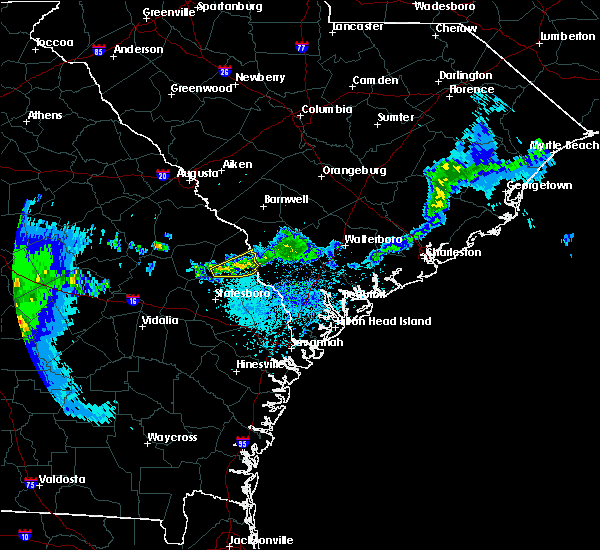 At 102 pm edt, a severe thunderstorm was located near sylvania, moving east at 20 mph (radar indicated). Hazards include 60 mph wind gusts. Expect damage to roofs. siding. and trees. locations impacted include, sylvania, hunters and altman. A tornado watch remains in effect until 300 pm edt for southeastern georgia, and southeastern south carolina. At 102 pm edt, a severe thunderstorm was located near sylvania, moving east at 20 mph (radar indicated). Hazards include 60 mph wind gusts. Expect damage to roofs. siding. and trees. locations impacted include, sylvania, hunters and altman. A tornado watch remains in effect until 300 pm edt for southeastern georgia, and southeastern south carolina.
|
| 4/1/2016 12:28 PM EDT |
 At 1226 pm edt, a severe thunderstorm was located 8 miles southwest of sylvania, moving east at 40 mph (radar indicated). Hazards include 60 mph wind gusts. Expect damage to roofs. siding. And trees. At 1226 pm edt, a severe thunderstorm was located 8 miles southwest of sylvania, moving east at 40 mph (radar indicated). Hazards include 60 mph wind gusts. Expect damage to roofs. siding. And trees.
|
| 3/26/2016 3:11 PM EDT |
 At 311 pm edt, a severe thunderstorm was located over sylvania, moving northeast at 20 mph (radar indicated). Hazards include 60 mph wind gusts and quarter size hail. Hail damage to vehicles is expected. expect wind damage to roofs, siding, and trees. Locations impacted include, sylvania, hiltonia, rocky ford, hilltonia, millhaven, hunters, burtons ferry landing and altman. At 311 pm edt, a severe thunderstorm was located over sylvania, moving northeast at 20 mph (radar indicated). Hazards include 60 mph wind gusts and quarter size hail. Hail damage to vehicles is expected. expect wind damage to roofs, siding, and trees. Locations impacted include, sylvania, hiltonia, rocky ford, hilltonia, millhaven, hunters, burtons ferry landing and altman.
|
| 3/26/2016 3:04 PM EDT |
 At 303 pm edt, a severe thunderstorm was located near sylvania, moving northeast at 20 mph (radar indicated). Hazards include quarter size hail. Damage to vehicles is expected. Locations impacted include, sylvania, hiltonia, rocky ford, hilltonia, millhaven, hunters, burtons ferry landing and altman. At 303 pm edt, a severe thunderstorm was located near sylvania, moving northeast at 20 mph (radar indicated). Hazards include quarter size hail. Damage to vehicles is expected. Locations impacted include, sylvania, hiltonia, rocky ford, hilltonia, millhaven, hunters, burtons ferry landing and altman.
|
| 3/26/2016 2:57 PM EDT |
 At 256 pm edt, a severe thunderstorm was located 9 miles west of sylvania, moving northeast at 20 mph (radar indicated). Hazards include quarter size hail. Damage to vehicles is expected. Locations impacted include, millen, sylvania, hiltonia, rocky ford, hilltonia, millhaven, hunters and scarboro. At 256 pm edt, a severe thunderstorm was located 9 miles west of sylvania, moving northeast at 20 mph (radar indicated). Hazards include quarter size hail. Damage to vehicles is expected. Locations impacted include, millen, sylvania, hiltonia, rocky ford, hilltonia, millhaven, hunters and scarboro.
|
| 3/26/2016 2:47 PM EDT |
 At 246 pm edt, a severe thunderstorm was located 10 miles north of middleground, moving northeast at 20 mph (radar indicated. at 235 pm quarter sized hail was reported near the jenkins and screven county line). Hazards include quarter size hail. damage to vehicles is expected At 246 pm edt, a severe thunderstorm was located 10 miles north of middleground, moving northeast at 20 mph (radar indicated. at 235 pm quarter sized hail was reported near the jenkins and screven county line). Hazards include quarter size hail. damage to vehicles is expected
|
| 11/2/2015 7:53 PM EST |
 At 753 pm est, a severe thunderstorm was located near sylvania, moving northeast at 30 mph (radar indicated). Hazards include 60 mph wind gusts. Expect damage to roofs. siding and trees. Locations impacted include, sylvania, hilltonia, burtons ferry landing, altman, hunters and captolo. At 753 pm est, a severe thunderstorm was located near sylvania, moving northeast at 30 mph (radar indicated). Hazards include 60 mph wind gusts. Expect damage to roofs. siding and trees. Locations impacted include, sylvania, hilltonia, burtons ferry landing, altman, hunters and captolo.
|
| 11/2/2015 7:45 PM EST | Power lines down at the intersection of bluebell street and westchester roa in screven county GA, 0.5 miles SW of Sylvania, GA |
| 11/2/2015 7:41 PM EST |
 At 741 pm est, a severe thunderstorm was located over sylvania, moving northeast at 20 mph (radar indicated). Hazards include 60 mph wind gusts. Expect damage to roofs. siding and trees. Locations impacted include, sylvania, hiltonia, hunters, dover, burtons ferry landing, altman, captolo and woodcliff. At 741 pm est, a severe thunderstorm was located over sylvania, moving northeast at 20 mph (radar indicated). Hazards include 60 mph wind gusts. Expect damage to roofs. siding and trees. Locations impacted include, sylvania, hiltonia, hunters, dover, burtons ferry landing, altman, captolo and woodcliff.
|
| 11/2/2015 7:15 PM EST |
 At 715 pm est, a severe thunderstorm was located 9 miles west of sylvania, moving northeast at 20 mph (radar indicated). Hazards include 60 mph wind gusts. Expect damage to roofs. Siding and trees. At 715 pm est, a severe thunderstorm was located 9 miles west of sylvania, moving northeast at 20 mph (radar indicated). Hazards include 60 mph wind gusts. Expect damage to roofs. Siding and trees.
|
| 8/23/2015 2:30 PM EDT | Sylvania fire dept reports multiple trees down on private property in the sylvan heights neighborhood. time estimated from radar in screven county GA, 0.6 miles NW of Sylvania, GA |
| 8/23/2015 1:57 PM EDT |
 At 157 pm edt, a severe thunderstorm was located near millen, moving east at 40 mph (radar indicated). Hazards include 60 mph wind gusts. Expect damage to roofs. siding and trees. Locations impacted include, millen, sylvania, butts, hiltonia, rocky ford, herndon, woodcliff and emmalane. At 157 pm edt, a severe thunderstorm was located near millen, moving east at 40 mph (radar indicated). Hazards include 60 mph wind gusts. Expect damage to roofs. siding and trees. Locations impacted include, millen, sylvania, butts, hiltonia, rocky ford, herndon, woodcliff and emmalane.
|
| 8/23/2015 1:42 PM EDT |
 At 142 pm edt, a severe thunderstorm was located near millen, moving east at 30 mph (radar indicated). Hazards include 60 mph wind gusts. Expect damage to roofs. siding and trees. Locations impacted include, millen, sylvania, butts, hiltonia, rocky ford, herndon, woodcliff and emmalane. At 142 pm edt, a severe thunderstorm was located near millen, moving east at 30 mph (radar indicated). Hazards include 60 mph wind gusts. Expect damage to roofs. siding and trees. Locations impacted include, millen, sylvania, butts, hiltonia, rocky ford, herndon, woodcliff and emmalane.
|
| 8/23/2015 1:28 PM EDT |
 At 127 pm edt, a severe thunderstorm was located 13 miles west of millen, moving east at 35 mph (radar indicated). Hazards include 60 mph wind gusts. Expect damage to roofs. siding and trees. Locations impacted include, millen, sylvania, butts, hiltonia, rocky ford, herndon, woodcliff and emmalane. At 127 pm edt, a severe thunderstorm was located 13 miles west of millen, moving east at 35 mph (radar indicated). Hazards include 60 mph wind gusts. Expect damage to roofs. siding and trees. Locations impacted include, millen, sylvania, butts, hiltonia, rocky ford, herndon, woodcliff and emmalane.
|
| 8/23/2015 1:11 PM EDT |
 At 111 pm edt, a severe thunderstorm was located 13 miles north of swainsboro, moving east at 35 mph (radar indicated). Hazards include 60 mph wind gusts. Expect damage to roofs. Siding and trees. At 111 pm edt, a severe thunderstorm was located 13 miles north of swainsboro, moving east at 35 mph (radar indicated). Hazards include 60 mph wind gusts. Expect damage to roofs. Siding and trees.
|
| 8/6/2015 6:48 PM EDT |
 At 648 pm edt, severe thunderstorms were located along a line extending from 6 miles northeast of sylvania to 15 miles northeast of statesboro to near middleground, moving east at 40 mph (radar indicated). Hazards include 60 mph wind gusts. Expect damage to roofs. siding and trees. Locations impacted include, statesboro, sylvania, newington, oliver, egypt, leefield, hunters and dover. At 648 pm edt, severe thunderstorms were located along a line extending from 6 miles northeast of sylvania to 15 miles northeast of statesboro to near middleground, moving east at 40 mph (radar indicated). Hazards include 60 mph wind gusts. Expect damage to roofs. siding and trees. Locations impacted include, statesboro, sylvania, newington, oliver, egypt, leefield, hunters and dover.
|
| 8/6/2015 6:34 PM EDT | Tree down on stoopto r in screven county GA, 5.7 miles ENE of Sylvania, GA |
| 8/6/2015 6:28 PM EDT |
 At 628 pm edt, severe thunderstorms were located along a line extending from 8 miles east of millen to near middleground to near westside, moving east at 50 mph (radar indicated). Hazards include 60 mph wind gusts. Expect damage to roofs. Siding and trees. At 628 pm edt, severe thunderstorms were located along a line extending from 8 miles east of millen to near middleground to near westside, moving east at 50 mph (radar indicated). Hazards include 60 mph wind gusts. Expect damage to roofs. Siding and trees.
|
| 7/14/2015 3:58 PM EDT |
 At 357 pm edt, a severe thunderstorm was located near woodcliff, or near sylvania, moving east at 20 mph (radar indicated). Hazards include 60 mph wind gusts and penny size hail. Expect damage to roofs. siding and trees. Locations impacted include, sylvania. At 357 pm edt, a severe thunderstorm was located near woodcliff, or near sylvania, moving east at 20 mph (radar indicated). Hazards include 60 mph wind gusts and penny size hail. Expect damage to roofs. siding and trees. Locations impacted include, sylvania.
|
| 7/14/2015 3:48 PM EDT |
 At 347 pm edt, a severe thunderstorm was located near woodcliff, or 9 miles east of millen, moving east at 20 mph (radar indicated). Hazards include 70 mph wind gusts and nickel size hail. Expect considerable tree damage. damage is likely to mobile homes, roofs and outbuildings. Locations impacted include, millen and sylvania. At 347 pm edt, a severe thunderstorm was located near woodcliff, or 9 miles east of millen, moving east at 20 mph (radar indicated). Hazards include 70 mph wind gusts and nickel size hail. Expect considerable tree damage. damage is likely to mobile homes, roofs and outbuildings. Locations impacted include, millen and sylvania.
|
| 7/14/2015 3:39 PM EDT |
 At 339 pm edt, a severe thunderstorm was located near millen, moving east at 20 mph (radar indicated). Hazards include 60 mph wind gusts and penny size hail. Expect damage to roofs. Siding and trees. At 339 pm edt, a severe thunderstorm was located near millen, moving east at 20 mph (radar indicated). Hazards include 60 mph wind gusts and penny size hail. Expect damage to roofs. Siding and trees.
|
| 7/12/2015 8:47 PM EDT | Tree down in 3400 block pine grove inn rd in screven county GA, 9.8 miles SW of Sylvania, GA |
| 7/4/2015 5:20 PM EDT |
 The severe thunderstorm warning for bulloch, screven and effingham counties will expire at 530 pm edt, the storms which prompted the warning have weakened below severe limits, and no longer pose an immediate threat to life or property. therefore the warning will be allowed to expire. to report severe weather, contact your nearest law enforcement agency. they will relay your report to the national weather service charleston. The severe thunderstorm warning for bulloch, screven and effingham counties will expire at 530 pm edt, the storms which prompted the warning have weakened below severe limits, and no longer pose an immediate threat to life or property. therefore the warning will be allowed to expire. to report severe weather, contact your nearest law enforcement agency. they will relay your report to the national weather service charleston.
|
| 7/4/2015 5:08 PM EDT |
 At 508 pm edt, severe thunderstorms were located along a line extending from altman to near stilson, moving northeast at 20 mph (radar indicated). Hazards include 60 mph wind gusts. Expect damage to roofs. siding and trees. These severe thunderstorms will remain over mainly rural areas of bulloch, screven and effingham counties, including the following locations, green hill, halcyondale, stalco, white hill, sheppards, griffin lake, ardmore, gwinetts crossing, goloid and akins. At 508 pm edt, severe thunderstorms were located along a line extending from altman to near stilson, moving northeast at 20 mph (radar indicated). Hazards include 60 mph wind gusts. Expect damage to roofs. siding and trees. These severe thunderstorms will remain over mainly rural areas of bulloch, screven and effingham counties, including the following locations, green hill, halcyondale, stalco, white hill, sheppards, griffin lake, ardmore, gwinetts crossing, goloid and akins.
|
| 7/4/2015 4:52 PM EDT |
 At 452 pm edt, severe thunderstorms were located along a line extending from near altman to near bay, moving east at 20 mph (radar indicated). Hazards include 60 mph wind gusts. Expect damage to roofs. siding and trees. These severe thunderstorms will remain over mainly rural areas of bulloch, screven and effingham counties, including the following locations, green hill, cooperville, grimshaw, halcyondale, stalco, white hill, sheppards, cameron, eureka and griffin lake. At 452 pm edt, severe thunderstorms were located along a line extending from near altman to near bay, moving east at 20 mph (radar indicated). Hazards include 60 mph wind gusts. Expect damage to roofs. siding and trees. These severe thunderstorms will remain over mainly rural areas of bulloch, screven and effingham counties, including the following locations, green hill, cooperville, grimshaw, halcyondale, stalco, white hill, sheppards, cameron, eureka and griffin lake.
|
| 7/4/2015 4:43 PM EDT | Tree down on cameron rd near captola rd. time estimated based on rada in screven county GA, 6.8 miles NNE of Sylvania, GA |
| 7/4/2015 4:23 PM EDT |
 At 423 pm edt, severe thunderstorms were located along a line extending from near middleground to near denmark, moving northeast at 20 mph (radar indicated). Hazards include 60 mph wind gusts and quarter size hail. Hail damage to vehicles is expected. Expect wind damage to roofs, siding and trees. At 423 pm edt, severe thunderstorms were located along a line extending from near middleground to near denmark, moving northeast at 20 mph (radar indicated). Hazards include 60 mph wind gusts and quarter size hail. Hail damage to vehicles is expected. Expect wind damage to roofs, siding and trees.
|
| 7/3/2015 1:56 PM EDT |
 The severe thunderstorm warning for jenkins, screven, hampton and allendale counties will expire at 200 pm edt, the storms which prompted the warning have moved out of the area. therefore the warning will be allowed to expire. however, another severe thunderstorm warning remains in effect for portions of hampton and screven counties until 215 pm. a severe thunderstorm watch remains in effect until 600 pm edt for southeastern georgia and southeastern south carolina. The severe thunderstorm warning for jenkins, screven, hampton and allendale counties will expire at 200 pm edt, the storms which prompted the warning have moved out of the area. therefore the warning will be allowed to expire. however, another severe thunderstorm warning remains in effect for portions of hampton and screven counties until 215 pm. a severe thunderstorm watch remains in effect until 600 pm edt for southeastern georgia and southeastern south carolina.
|
| 7/3/2015 1:39 PM EDT |
 At 139 pm edt, severe thunderstorms were located along a line extending from near ashton to near woodcliff, moving east at 45 mph (radar indicated). Hazards include 60 mph wind gusts. Expect damage to roofs. siding and trees. Locations impacted include, allendale, sylvania, hampton and lake warren state park. At 139 pm edt, severe thunderstorms were located along a line extending from near ashton to near woodcliff, moving east at 45 mph (radar indicated). Hazards include 60 mph wind gusts. Expect damage to roofs. siding and trees. Locations impacted include, allendale, sylvania, hampton and lake warren state park.
|
| 7/3/2015 1:35 PM EDT | Power lines were blown down onto curtis and east ogeechee street in screven county GA, 1 miles WSW of Sylvania, GA |
| 7/3/2015 1:32 PM EDT |
 At 132 pm edt, severe thunderstorms were located along a line extending from near crocketville to near twin city, moving southeast at 30 mph (radar indicated). Hazards include 60 mph wind gusts. Expect damage to roofs. Siding and trees. At 132 pm edt, severe thunderstorms were located along a line extending from near crocketville to near twin city, moving southeast at 30 mph (radar indicated). Hazards include 60 mph wind gusts. Expect damage to roofs. Siding and trees.
|
| 7/3/2015 1:25 PM EDT |
 At 124 pm edt, severe thunderstorms were located along a line extending from near sycamore to near millen, moving east at 45 mph (radar indicated). Hazards include 60 mph wind gusts. Expect damage to roofs. siding and trees. locations impacted include, allendale, millen, sylvania, hampton and lake warren state park. At 123 pm, large branches were reported down near millen. At 124 pm edt, severe thunderstorms were located along a line extending from near sycamore to near millen, moving east at 45 mph (radar indicated). Hazards include 60 mph wind gusts. Expect damage to roofs. siding and trees. locations impacted include, allendale, millen, sylvania, hampton and lake warren state park. At 123 pm, large branches were reported down near millen.
|
| 7/3/2015 1:09 PM EDT |
 At 109 pm edt, severe thunderstorms were located along a line extending from near seigling to herndon, moving east at 45 mph (radar indicated). Hazards include 60 mph wind gusts. Expect damage to roofs. Siding and trees. At 109 pm edt, severe thunderstorms were located along a line extending from near seigling to herndon, moving east at 45 mph (radar indicated). Hazards include 60 mph wind gusts. Expect damage to roofs. Siding and trees.
|
| 7/2/2015 6:14 PM EDT |
 At 613 pm edt, severe thunderstorms were located along a line extending from appleton to hunters, moving east at 35 mph (radar indicated). Hazards include 70 mph wind gusts and penny size hail. Expect considerable tree damage. damage is likely to mobile homes, roofs and outbuildings. Locations impacted include, milbury, barton, estill, luray, allendale, sylvania, hampton and lake warren state park. At 613 pm edt, severe thunderstorms were located along a line extending from appleton to hunters, moving east at 35 mph (radar indicated). Hazards include 70 mph wind gusts and penny size hail. Expect considerable tree damage. damage is likely to mobile homes, roofs and outbuildings. Locations impacted include, milbury, barton, estill, luray, allendale, sylvania, hampton and lake warren state park.
|
| 7/2/2015 6:00 PM EDT | Numerous trees down along statesboro highway near sylvania in screven county GA, 1.8 miles N of Sylvania, GA |
| 7/2/2015 5:57 PM EDT | Tree down on buttermilk rd just outside sylvania in screven county GA, 2.5 miles SSE of Sylvania, GA |
| 7/2/2015 5:57 PM EDT | Tree down on victory dr in screven county GA, 6.6 miles SE of Sylvania, GA |
| 7/2/2015 5:57 PM EDT |
 At 555 pm edt, severe thunderstorms were located along a line extending from near millett to near woodcliff, moving southeast at 30 mph (radar indicated. at 552 pm wind damage was reported with trees down in the rocky ford area). Hazards include 70 mph wind gusts and penny size hail. Expect considerable tree damage. damage is likely to mobile homes, roofs and outbuildings. Locations impacted include, lewis, millhaven, parkers, goloid, allendale, sylvania, hampton, milbury, waters and lake warren state park. At 555 pm edt, severe thunderstorms were located along a line extending from near millett to near woodcliff, moving southeast at 30 mph (radar indicated. at 552 pm wind damage was reported with trees down in the rocky ford area). Hazards include 70 mph wind gusts and penny size hail. Expect considerable tree damage. damage is likely to mobile homes, roofs and outbuildings. Locations impacted include, lewis, millhaven, parkers, goloid, allendale, sylvania, hampton, milbury, waters and lake warren state park.
|
| 7/2/2015 5:43 PM EDT |
 At 542 pm edt, severe thunderstorms were located along a line extending from near barnwell to near scarboro, moving southeast at 35 mph (radar indicated). Hazards include 70 mph wind gusts and penny size hail. Expect considerable tree damage. damage is likely to mobile homes, roofs and outbuildings. Locations impacted include, lewis, bascom, hilltonia, millhaven, allendale, sylvania, hampton and lake warren state park. At 542 pm edt, severe thunderstorms were located along a line extending from near barnwell to near scarboro, moving southeast at 35 mph (radar indicated). Hazards include 70 mph wind gusts and penny size hail. Expect considerable tree damage. damage is likely to mobile homes, roofs and outbuildings. Locations impacted include, lewis, bascom, hilltonia, millhaven, allendale, sylvania, hampton and lake warren state park.
|
| 7/2/2015 5:31 PM EDT |
 At 530 pm edt, severe thunderstorms were located along a line extending from 8 miles west of barnwell to near scarboro, moving southeast at 40 mph (radar indicated). Hazards include 60 mph wind gusts and penny size hail. Expect damage to roofs. Siding and trees. At 530 pm edt, severe thunderstorms were located along a line extending from 8 miles west of barnwell to near scarboro, moving southeast at 40 mph (radar indicated). Hazards include 60 mph wind gusts and penny size hail. Expect damage to roofs. Siding and trees.
|
| 6/30/2015 5:05 PM EDT |
 At 504 pm edt, severe thunderstorms were located along a line extending from allendale to near brooklet, moving east at 35 mph (there have been reports of wind damage south of statesboro and also in screven county with these storms). Hazards include 60 mph wind gusts. Expect damage to roofs. siding and trees. Locations impacted include, allendale, sylvania, springfield, hampton, bay and lake warren state park. At 504 pm edt, severe thunderstorms were located along a line extending from allendale to near brooklet, moving east at 35 mph (there have been reports of wind damage south of statesboro and also in screven county with these storms). Hazards include 60 mph wind gusts. Expect damage to roofs. siding and trees. Locations impacted include, allendale, sylvania, springfield, hampton, bay and lake warren state park.
|
| 6/30/2015 4:46 PM EDT | Warning point reported tree down at the 900 block of burtons ferry highway in screven county GA, 2.5 miles SSW of Sylvania, GA |
| 6/30/2015 4:43 PM EDT | Warning point reported tree down on statesboro highway near double heads baptist churc in screven county GA, 7.1 miles NNE of Sylvania, GA |
| 6/30/2015 4:39 PM EDT |
 At 439 pm edt, severe thunderstorms were located along a line extending from near burtons ferry landing to near register, moving east at 35 mph (radar indicated). Hazards include 60 mph wind gusts. Expect damage to roofs. Siding and trees. At 439 pm edt, severe thunderstorms were located along a line extending from near burtons ferry landing to near register, moving east at 35 mph (radar indicated). Hazards include 60 mph wind gusts. Expect damage to roofs. Siding and trees.
|
| 6/25/2015 6:52 PM EDT |
 At 652 pm edt, a severe thunderstorm was located near captolo, or 8 miles south of sylvania, and is nearly stationary (radar indicated). Hazards include 60 mph wind gusts and nickel size hail. Expect damage to roofs. siding and trees. Locations impacted include, sylvania. At 652 pm edt, a severe thunderstorm was located near captolo, or 8 miles south of sylvania, and is nearly stationary (radar indicated). Hazards include 60 mph wind gusts and nickel size hail. Expect damage to roofs. siding and trees. Locations impacted include, sylvania.
|
| 6/25/2015 6:44 PM EDT | Several trees down on captola rd about 4 miles north of halcyondal in screven county GA, 8 miles N of Sylvania, GA |
| 6/25/2015 6:36 PM EDT |
 At 636 pm edt, a severe thunderstorm was located over captolo, or 7 miles south of sylvania, moving east at 5 mph (radar indicated). Hazards include 60 mph wind gusts and quarter size hail. Hail damage to vehicles is expected. Expect wind damage to roofs, siding and trees. At 636 pm edt, a severe thunderstorm was located over captolo, or 7 miles south of sylvania, moving east at 5 mph (radar indicated). Hazards include 60 mph wind gusts and quarter size hail. Hail damage to vehicles is expected. Expect wind damage to roofs, siding and trees.
|
| 6/22/2015 4:40 PM EDT |
 At 439 pm edt, a severe thunderstorm was located near shirley, or 16 miles southeast of sylvania, and is nearly stationary (radar indicated). Hazards include 60 mph wind gusts and quarter size hail. Hail damage to vehicles is expected. expect wind damage to roofs, siding and trees. Locations impacted include, sylvania. At 439 pm edt, a severe thunderstorm was located near shirley, or 16 miles southeast of sylvania, and is nearly stationary (radar indicated). Hazards include 60 mph wind gusts and quarter size hail. Hail damage to vehicles is expected. expect wind damage to roofs, siding and trees. Locations impacted include, sylvania.
|
| 6/22/2015 4:27 PM EDT |
 At 427 pm edt, a severe thunderstorm was located near shirley, or 14 miles southeast of sylvania, moving east at 5 mph (radar indicated). Hazards include 60 mph wind gusts and quarter size hail. Hail damage to vehicles is expected. Expect wind damage to roofs, siding and trees. At 427 pm edt, a severe thunderstorm was located near shirley, or 14 miles southeast of sylvania, moving east at 5 mph (radar indicated). Hazards include 60 mph wind gusts and quarter size hail. Hail damage to vehicles is expected. Expect wind damage to roofs, siding and trees.
|
| 11/17/2014 12:26 PM EST | Warning point reported tree down on gilgal road...2 miles from highway 30 in screven county GA, 8.2 miles NNE of Sylvania, GA |
| 5/25/2014 5:46 PM EDT | Quarter sized hail reported 6.6 miles E of Sylvania, GA, public report of quarter size hail and very gusty winds in the woodcliff area. |
| 5/25/2014 5:39 PM EDT | Quarter sized hail reported 0.5 miles SW of Sylvania, GA, screven county dispatch received quarter size hail at their building. |
| 5/25/2014 5:35 PM EDT | Quarter sized hail reported 1 miles SSE of Sylvania, GA, spotter reported hail the size of dimes and quarters off of buttermilk road and highway 301. |
| 6/30/2013 4:49 PM EDT | Tree down on the roadway at zeigler loop and rocky ford road. time estimated by rada in screven county GA, 6 miles E of Sylvania, GA |
| 6/30/2013 4:49 PM EDT | Tree down on the roadway at zeigler loop at zeigler loop and rocky ford road. time estimated by rada in screven county GA, 6 miles E of Sylvania, GA |
| 6/18/2013 2:37 PM EDT | Warning point reported one tree down on a powerline along west ogeechee roa in screven county GA, 0.5 miles SW of Sylvania, GA |
| 5/20/2013 7:30 PM EDT | Numerous tree limbs down up to 3 inches in diameter. time estimated by rada in screven county GA, 5.5 miles NW of Sylvania, GA |
| 3/18/2013 9:52 PM EDT | Tree down on 800 block of poor robin road in screven county GA, 7.3 miles WNW of Sylvania, GA |
| 8/2/2012 3:18 PM EDT | Quarter sized hail reported 0.5 miles SW of Sylvania, GA, public reported penny to quarter size hail in downtown sylvania near intersection of nimms rd and ogeechee rd. |
| 8/2/2012 2:45 PM EDT | Ping Pong Ball sized hail reported 7 miles ESE of Sylvania, GA, hail up to the size of ping pong balls in the 1600 block of bay branch road. |
| 7/5/2012 9:29 PM EDT | Trees were blown down along bay branch road. time was estimated from rada in screven county GA, 6.8 miles ESE of Sylvania, GA |
| 7/5/2012 8:30 PM EDT | Trees were blown down along parker road. time was estimated from rada in screven county GA, 4.6 miles SSE of Sylvania, GA |
| 7/3/2012 2:55 PM EDT | The public reported a tree dow in screven county GA, 7.2 miles WSW of Sylvania, GA |
| 4/3/2012 6:20 PM EDT | Quarter sized hail reported 7.4 miles NNW of Sylvania, GA, spotter at plantation airpark observed penny to quarter size hail. |
| 3/16/2012 5:35 PM EDT | Golf Ball sized hail reported 13.4 miles WNW of Sylvania, GA, hail as large as golf balls and completely covering a backyard deck. |
| 3/16/2012 5:26 PM EDT | Golf Ball sized hail reported 13.4 miles WNW of Sylvania, GA, hail as large as golf balls and completely covering a backyard deck. |
| 1/1/0001 12:00 AM | *** 1 inj *** a tree fell on a mobile home trapping the occupant inside. the occupant was rescued and transported to the hospital with unspecified injurie in screven county GA, 2.7 miles NNW of Sylvania, GA |
| 1/1/0001 12:00 AM | Trained spotter reported several large pecan tree limbs down near lewis. time estimated by rada in screven county GA, 4.4 miles SE of Sylvania, GA |
| 1/1/0001 12:00 AM | *** 1 inj *** law enforcement reported 5 trees down in sylvania georgia. one adult female was injured and taken to a hospital after colliding with a tree down on states in screven county GA, 0.5 miles SW of Sylvania, GA |
| 1/1/0001 12:00 AM | Law enforcement reported one tree down on torrington roa in screven county GA, 0.5 miles SW of Sylvania, GA |
| 1/1/0001 12:00 AM | A sheriff department reported 1 tree down on mouth of the creek road and minor roof damage to a residence on brannens bridge roa in screven county GA, 8.8 miles WSW of Sylvania, GA |
| 1/1/0001 12:00 AM | Quarter sized hail reported 11.4 miles N of Sylvania, GA, cameron post office reported quarter size hail in the area and estimated wind gusts of 50 mph. |
| 1/1/0001 12:00 AM | Multiple reports of numerous trees down along effingham hwy and capitola road. time estimated by rada in screven county GA, 0.5 miles SW of Sylvania, GA |
| 1/1/0001 12:00 AM | Quarter sized hail reported 4.4 miles SE of Sylvania, GA |
| 1/1/0001 12:00 AM | Tree down on power line along peoples farm roa in screven county GA, 2.7 miles W of Sylvania, GA |
Hail Maps for Sylvania, GA
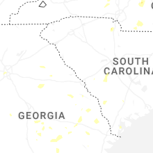


Connect with Interactive Hail Maps