

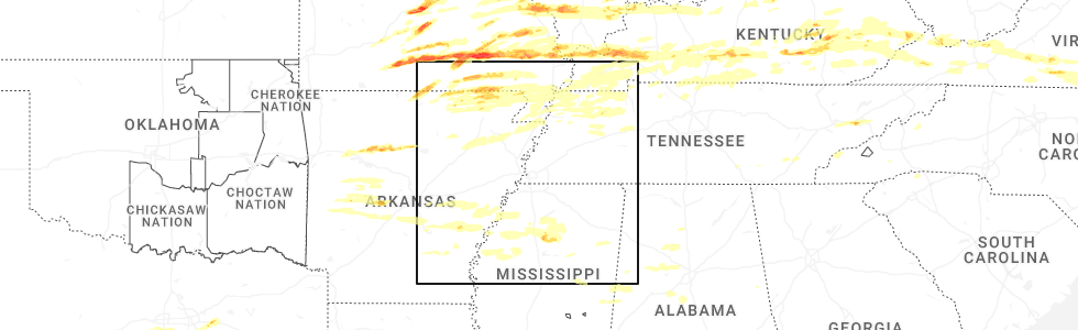
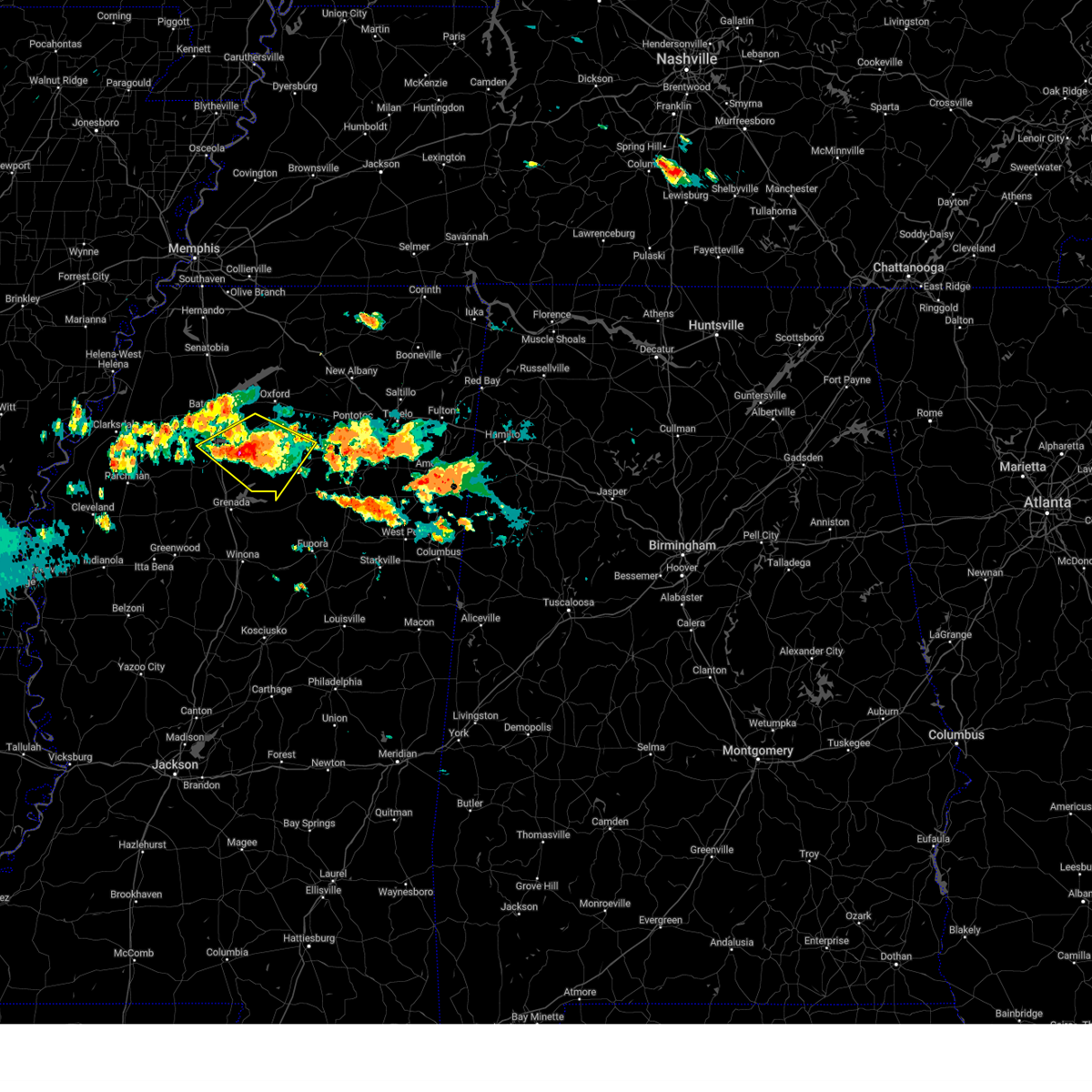
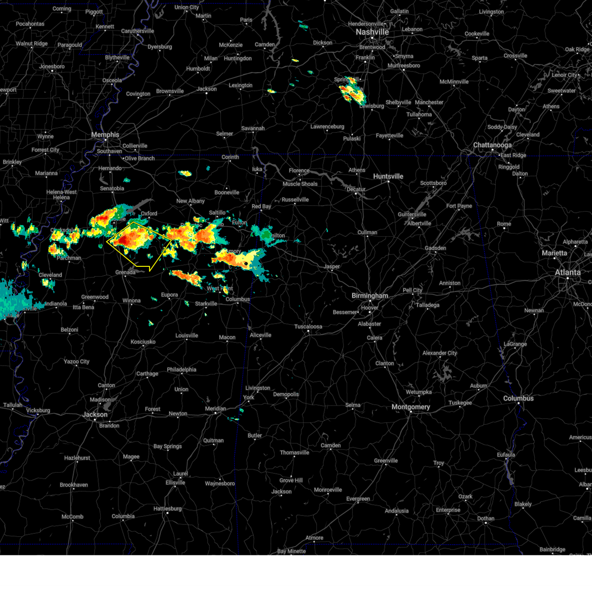
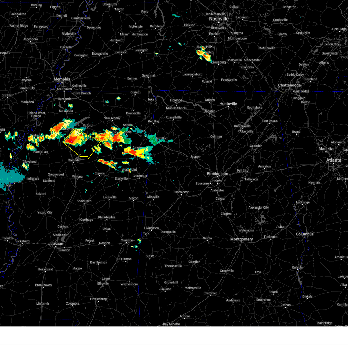
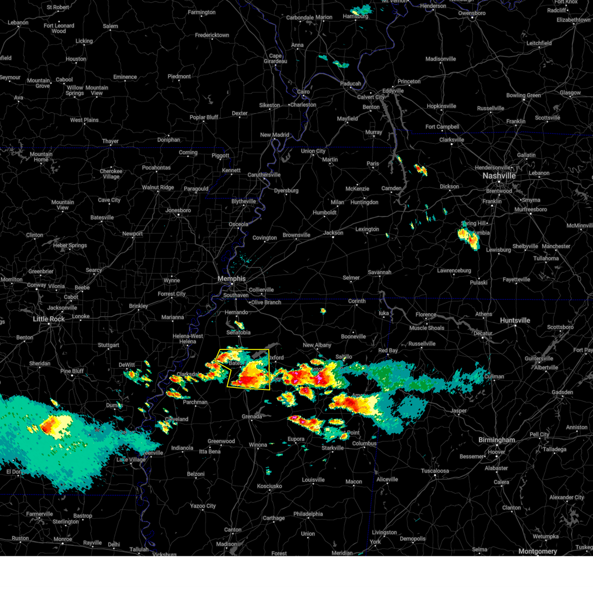
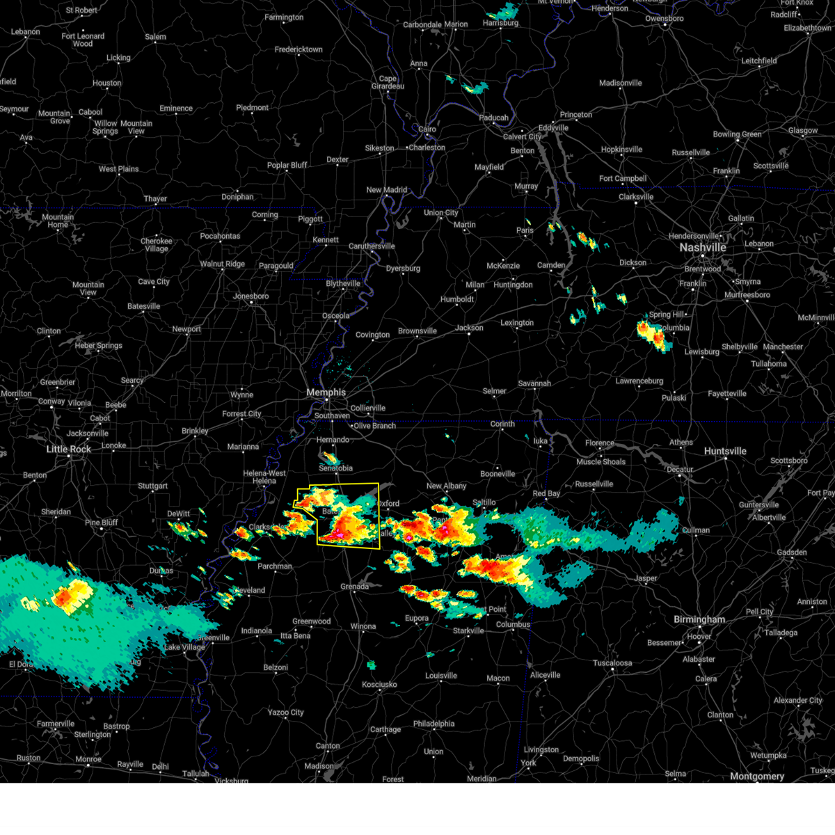
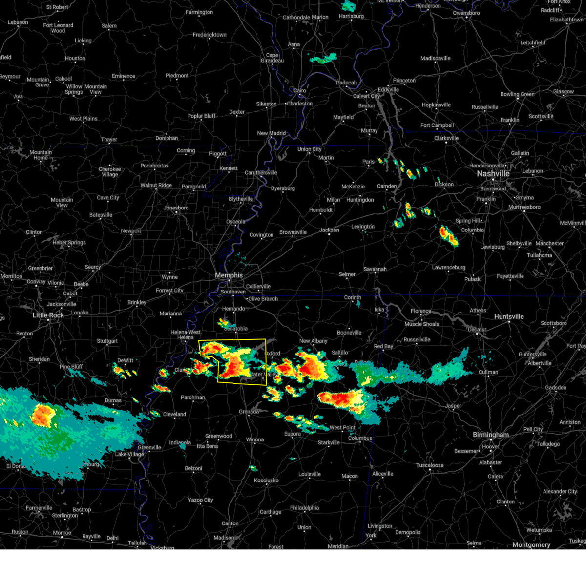
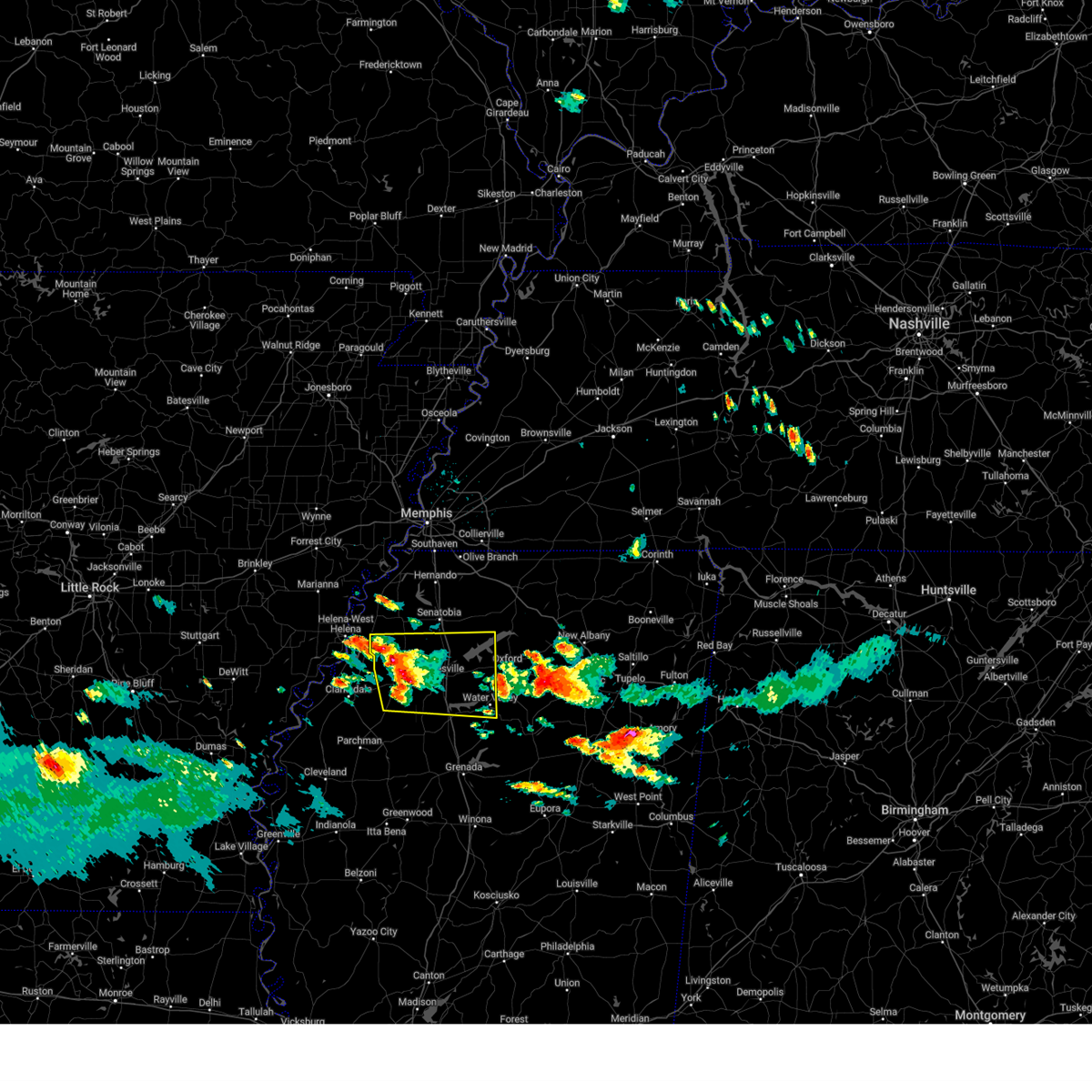
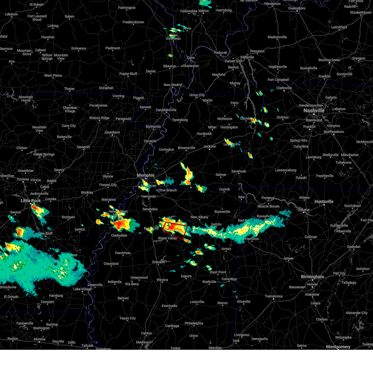
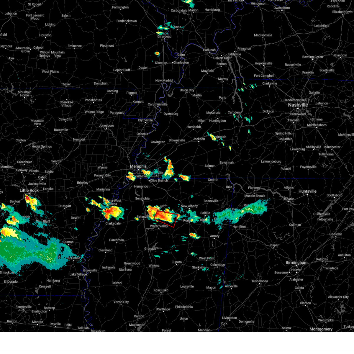
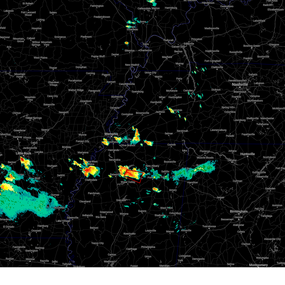
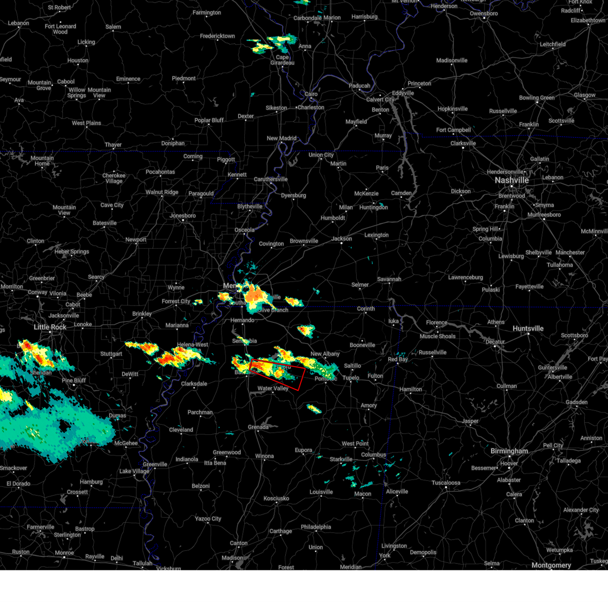
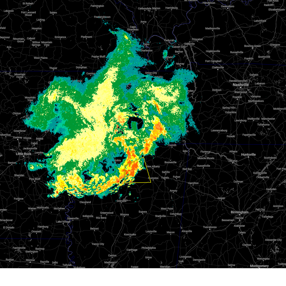
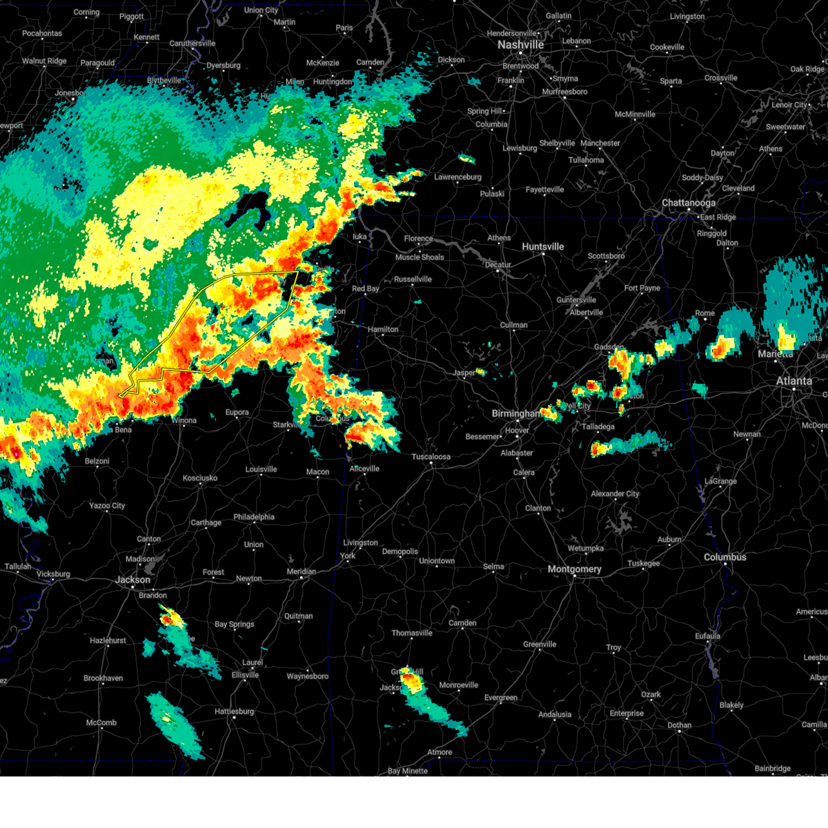
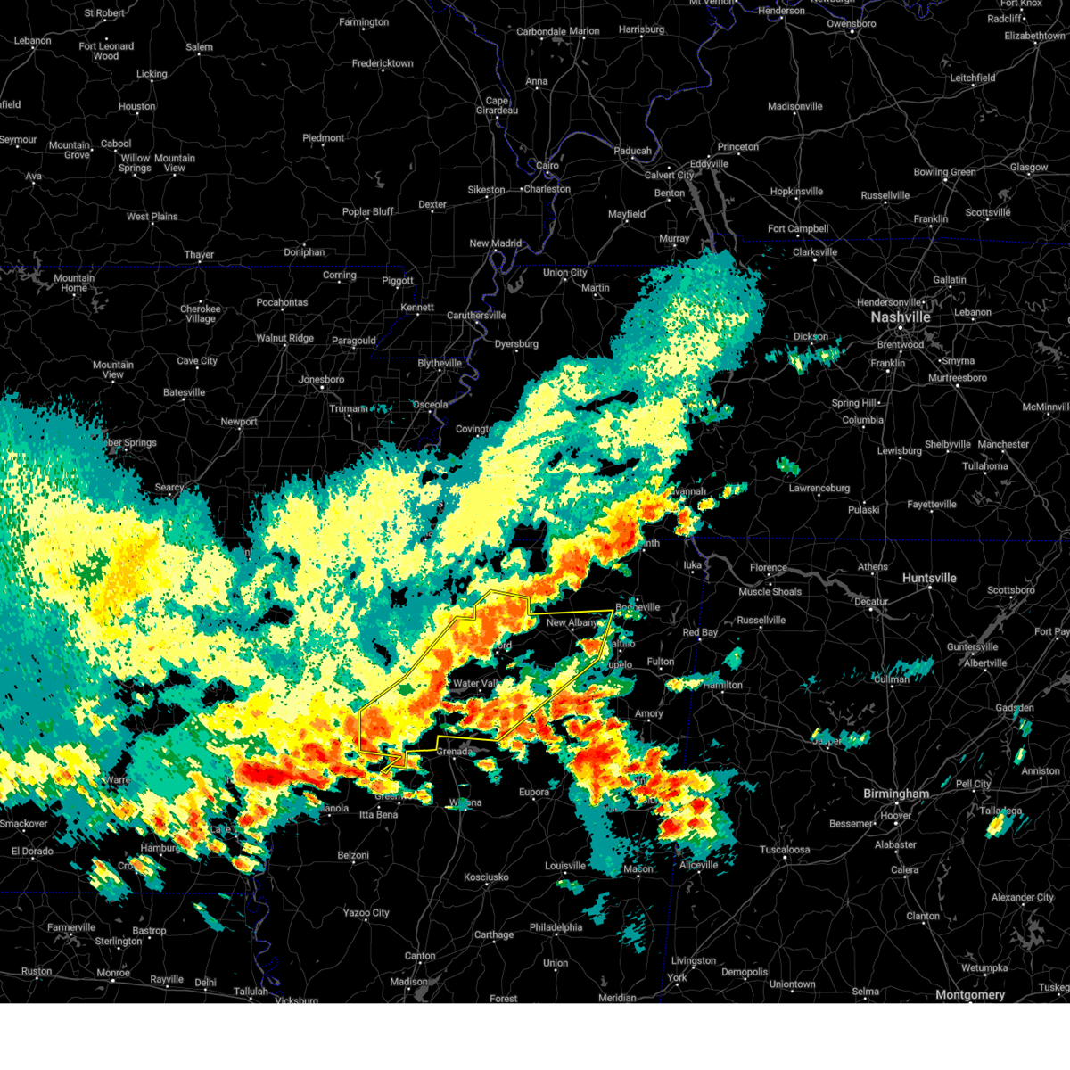
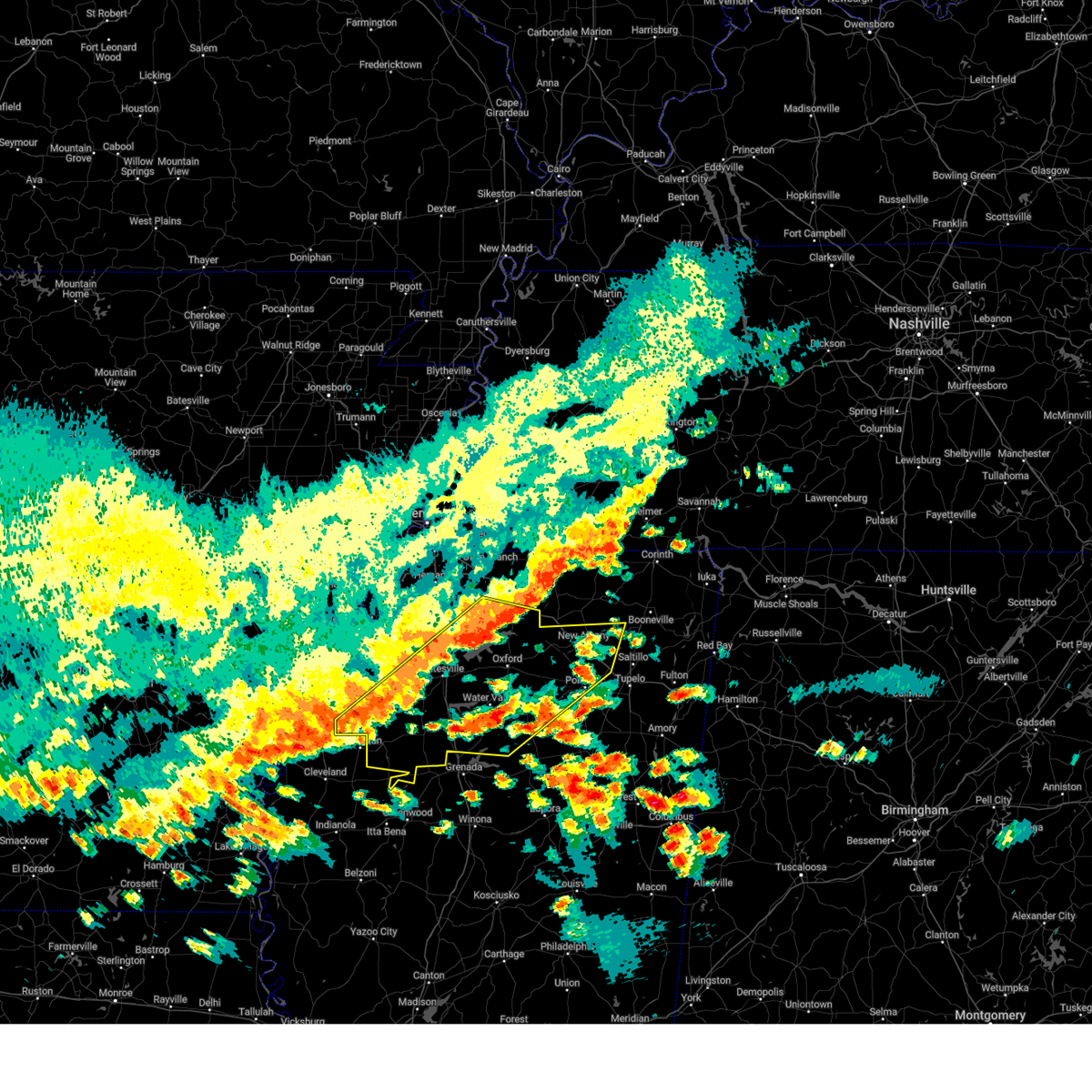
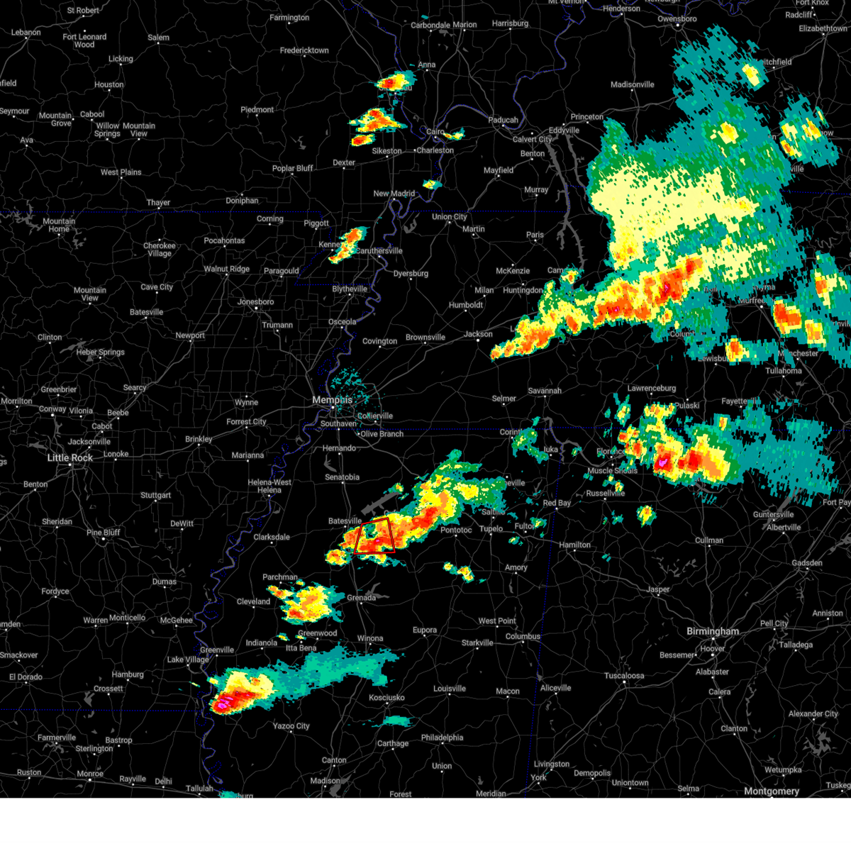
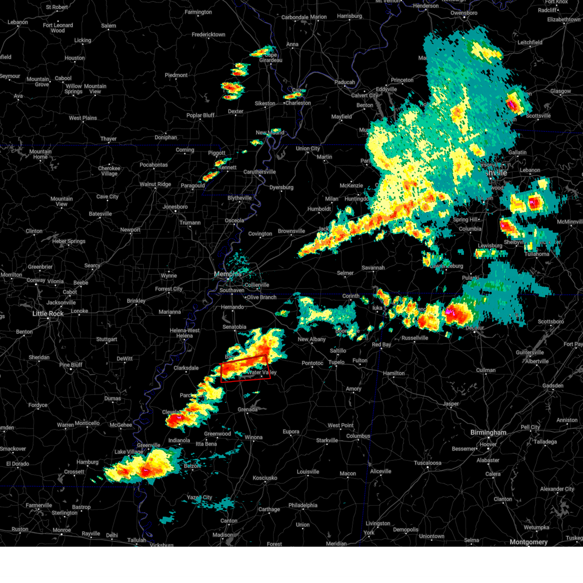
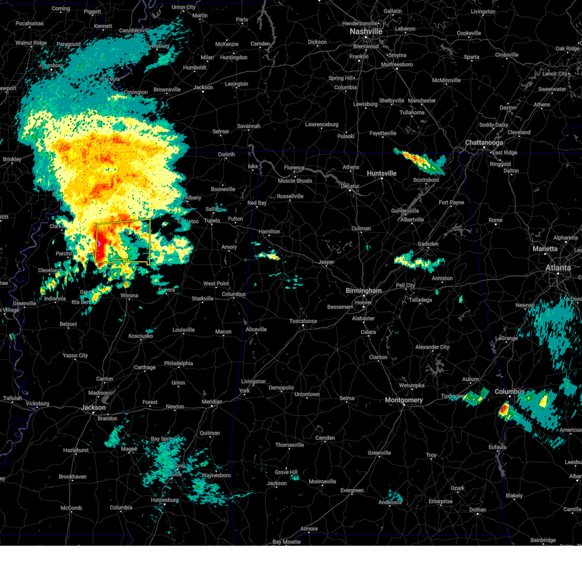
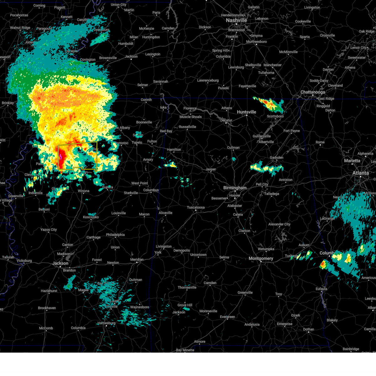
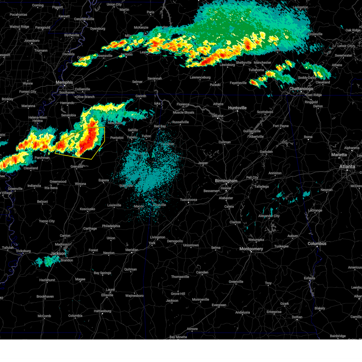
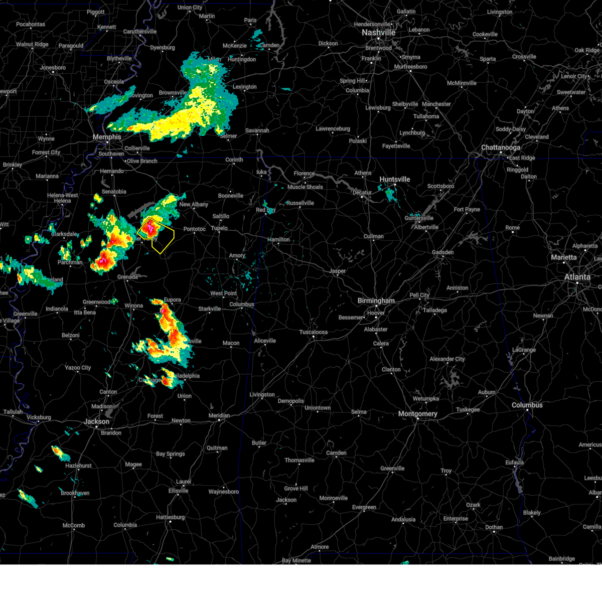
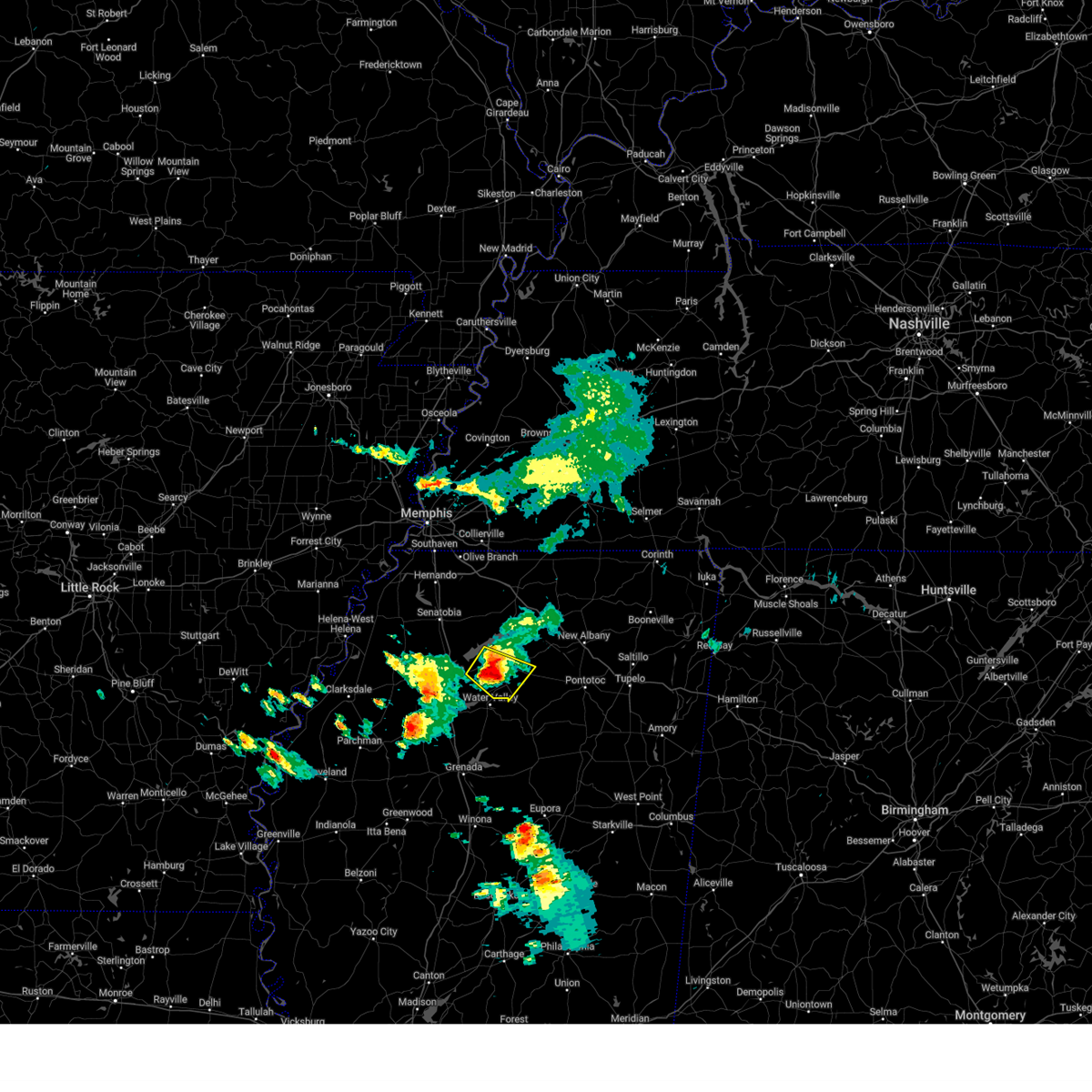
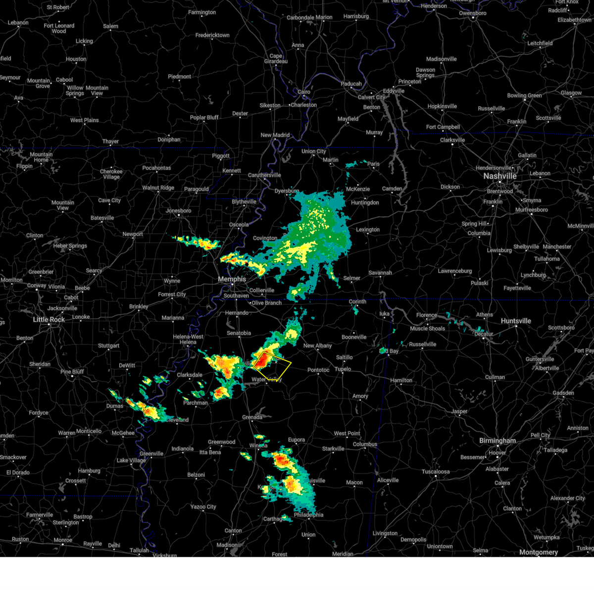
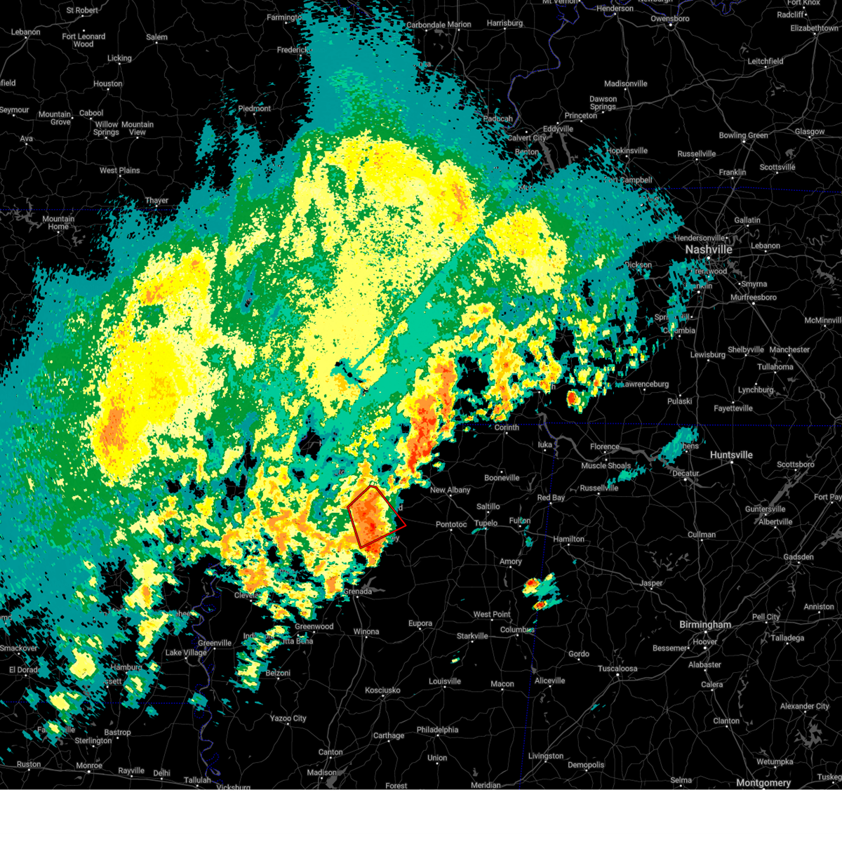
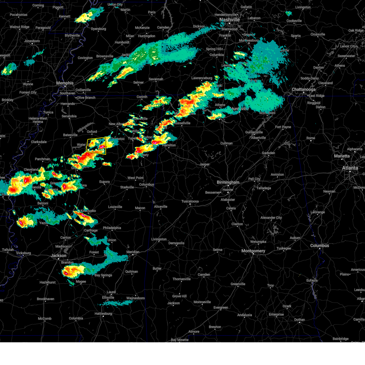
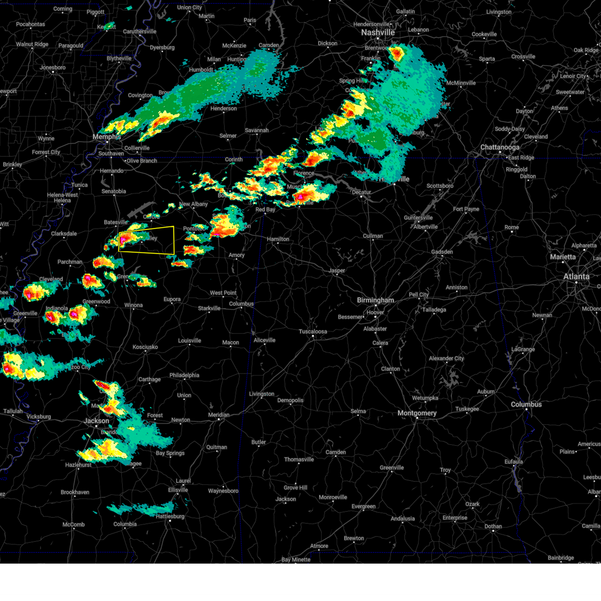
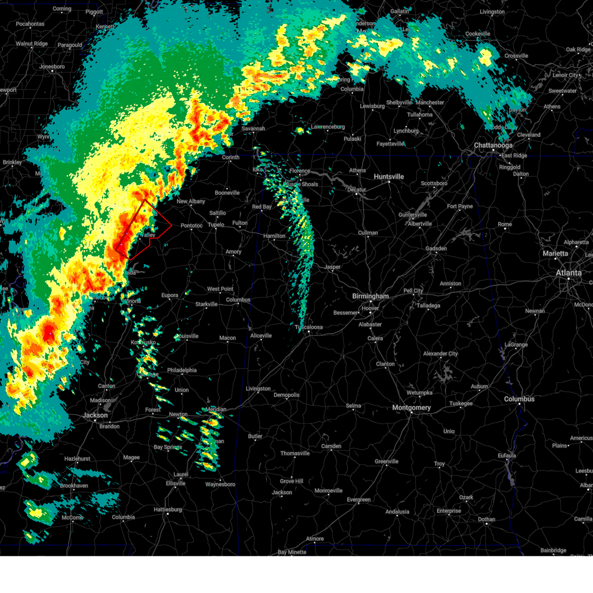
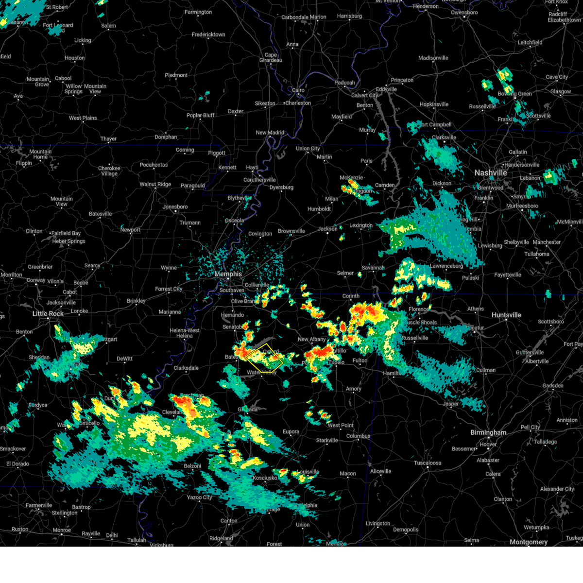
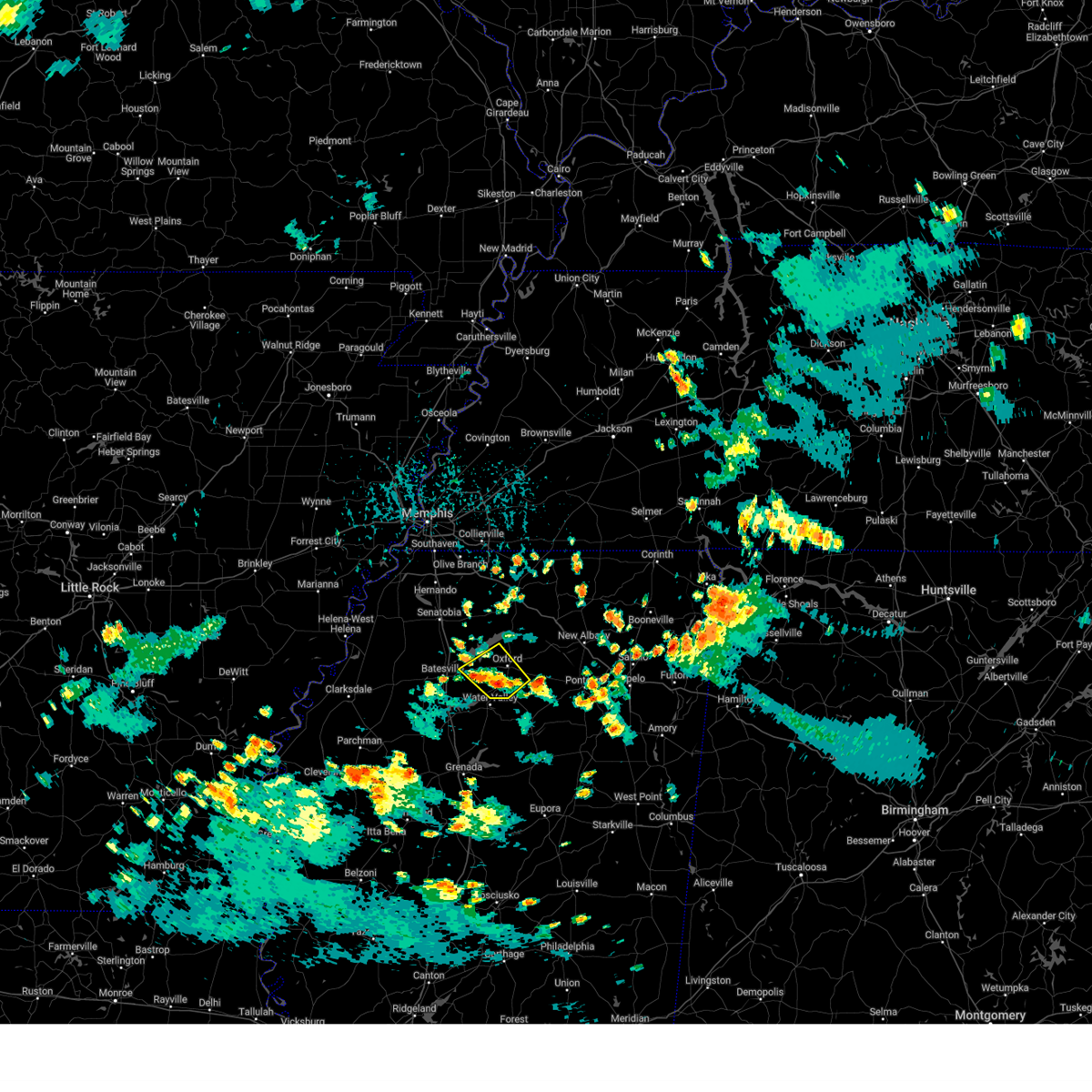
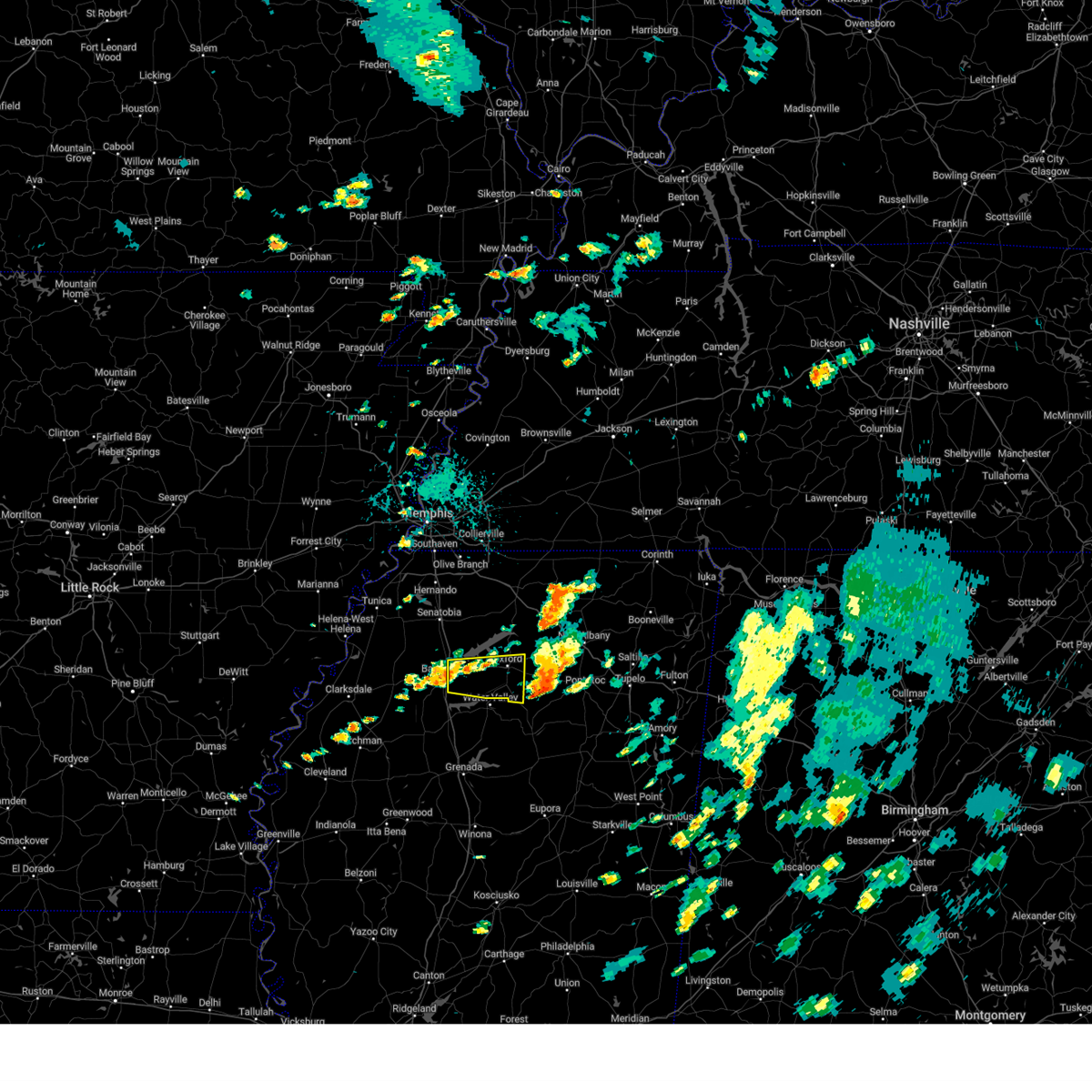
Hail Map for Taylor, MS
The Taylor, MS area has had 2 reports of on-the-ground hail by trained spotters, and has been under severe weather warnings 69 times during the past 12 months. Doppler radar has detected hail at or near Taylor, MS on 72 occasions, including 11 occasions during the past year.
| Name: | Taylor, MS |
| Where Located: | 66.4 miles SSE of Memphis, TN |
| Map: | Google Map for Taylor, MS |
| Population: | 322 |
| Housing Units: | 158 |
| More Info: | Search Google for Taylor, MS |
3
The Top Recent Hail Date for Taylor, MS is Friday, May 16, 2025 (7th out of 72)
Hail and Wind Damage Spotted near Taylor, MS
| Date / Time | Report Details |
|---|---|
| 6/8/2025 12:14 AM CDT |
 At 1214 am cdt, a severe thunderstorm was located near velma, or 7 miles southwest of water valley, moving southeast at 20 mph (radar indicated). Hazards include 60 mph wind gusts and half dollar size hail. Hail damage to vehicles is expected. expect wind damage to roofs, siding, and trees. Locations impacted include, water valley, george payne state park, coffeeville, springdale, enid, banner, velma, paris, oakland, taylor, spearman, bryant, benwood, shuford, bounds, pine valley, ellard, shepherd, skuna, and tyson. At 1214 am cdt, a severe thunderstorm was located near velma, or 7 miles southwest of water valley, moving southeast at 20 mph (radar indicated). Hazards include 60 mph wind gusts and half dollar size hail. Hail damage to vehicles is expected. expect wind damage to roofs, siding, and trees. Locations impacted include, water valley, george payne state park, coffeeville, springdale, enid, banner, velma, paris, oakland, taylor, spearman, bryant, benwood, shuford, bounds, pine valley, ellard, shepherd, skuna, and tyson.
|
| 6/7/2025 11:58 PM CDT |
 At 1158 pm cdt, a severe thunderstorm was located near george payne state park, moving southeast at 25 mph (radar indicated). Hazards include golf ball size hail and 60 mph wind gusts. People and animals outdoors will be injured. expect hail damage to roofs, siding, windows, and vehicles. expect wind damage to roofs, siding, and trees. Locations impacted include, water valley, george payne state park, coffeeville, springdale, enid, banner, velma, paris, oakland, taylor, spearman, bryant, benwood, shuford, bounds, pine valley, ellard, shepherd, skuna, and tyson. At 1158 pm cdt, a severe thunderstorm was located near george payne state park, moving southeast at 25 mph (radar indicated). Hazards include golf ball size hail and 60 mph wind gusts. People and animals outdoors will be injured. expect hail damage to roofs, siding, windows, and vehicles. expect wind damage to roofs, siding, and trees. Locations impacted include, water valley, george payne state park, coffeeville, springdale, enid, banner, velma, paris, oakland, taylor, spearman, bryant, benwood, shuford, bounds, pine valley, ellard, shepherd, skuna, and tyson.
|
| 6/7/2025 11:52 PM CDT |
 Svrmeg the national weather service in memphis has issued a * severe thunderstorm warning for, southwestern lafayette county in northwestern mississippi, yalobusha county in northwestern mississippi, northwestern calhoun county in northeastern mississippi, northeastern tallahatchie county in northwestern mississippi, southeastern panola county in northwestern mississippi, * until 1230 am cdt. * at 1152 pm cdt, a severe thunderstorm was located near george payne state park, moving southeast at 30 mph (radar indicated). Hazards include ping pong ball size hail and 60 mph wind gusts. People and animals outdoors will be injured. expect hail damage to roofs, siding, windows, and vehicles. Expect wind damage to roofs, siding, and trees. Svrmeg the national weather service in memphis has issued a * severe thunderstorm warning for, southwestern lafayette county in northwestern mississippi, yalobusha county in northwestern mississippi, northwestern calhoun county in northeastern mississippi, northeastern tallahatchie county in northwestern mississippi, southeastern panola county in northwestern mississippi, * until 1230 am cdt. * at 1152 pm cdt, a severe thunderstorm was located near george payne state park, moving southeast at 30 mph (radar indicated). Hazards include ping pong ball size hail and 60 mph wind gusts. People and animals outdoors will be injured. expect hail damage to roofs, siding, windows, and vehicles. Expect wind damage to roofs, siding, and trees.
|
| 6/7/2025 11:45 PM CDT |
 At 1145 pm cdt, a severe thunderstorm was located near george payne state park, moving east at 30 mph (radar indicated). Hazards include ping pong ball size hail and 60 mph wind gusts. People and animals outdoors will be injured. expect hail damage to roofs, siding, windows, and vehicles. expect wind damage to roofs, siding, and trees. Locations impacted include, batesville, water valley, george payne state park, john w kyle state park, sardis, sledge, pope, springdale, curtis station, burgess, enid, pleasant grove, courtland, taylor, falcon, shuford, ballentine, hayes crossing, horatio, and eureka springs. At 1145 pm cdt, a severe thunderstorm was located near george payne state park, moving east at 30 mph (radar indicated). Hazards include ping pong ball size hail and 60 mph wind gusts. People and animals outdoors will be injured. expect hail damage to roofs, siding, windows, and vehicles. expect wind damage to roofs, siding, and trees. Locations impacted include, batesville, water valley, george payne state park, john w kyle state park, sardis, sledge, pope, springdale, curtis station, burgess, enid, pleasant grove, courtland, taylor, falcon, shuford, ballentine, hayes crossing, horatio, and eureka springs.
|
| 6/7/2025 11:40 PM CDT |
 At 1140 pm cdt, a severe thunderstorm was located over george payne state park, moving east at 35 mph (radar indicated). Hazards include 60 mph wind gusts and half dollar size hail. Hail damage to vehicles is expected. expect wind damage to roofs, siding, and trees. Locations impacted include, batesville, water valley, george payne state park, john w kyle state park, sardis, como, crenshaw, crowder, sledge, pope, enid, pleasant grove, harmontown, springdale, curtis station, burgess, courtland, taylor, falcon, and askew. At 1140 pm cdt, a severe thunderstorm was located over george payne state park, moving east at 35 mph (radar indicated). Hazards include 60 mph wind gusts and half dollar size hail. Hail damage to vehicles is expected. expect wind damage to roofs, siding, and trees. Locations impacted include, batesville, water valley, george payne state park, john w kyle state park, sardis, como, crenshaw, crowder, sledge, pope, enid, pleasant grove, harmontown, springdale, curtis station, burgess, courtland, taylor, falcon, and askew.
|
| 6/7/2025 11:40 PM CDT |
 the severe thunderstorm warning has been cancelled and is no longer in effect the severe thunderstorm warning has been cancelled and is no longer in effect
|
| 6/7/2025 11:29 PM CDT |
 At 1129 pm cdt, a severe thunderstorm was located near pope, or near batesville, moving southeast at 40 mph (radar indicated). Hazards include 60 mph wind gusts and quarter size hail. Hail damage to vehicles is expected. expect wind damage to roofs, siding, and trees. Locations impacted include, batesville, water valley, george payne state park, john w kyle state park, sardis, como, crenshaw, crowder, sledge, pope, enid, pleasant grove, harmontown, springdale, curtis station, burgess, courtland, taylor, falcon, and askew. At 1129 pm cdt, a severe thunderstorm was located near pope, or near batesville, moving southeast at 40 mph (radar indicated). Hazards include 60 mph wind gusts and quarter size hail. Hail damage to vehicles is expected. expect wind damage to roofs, siding, and trees. Locations impacted include, batesville, water valley, george payne state park, john w kyle state park, sardis, como, crenshaw, crowder, sledge, pope, enid, pleasant grove, harmontown, springdale, curtis station, burgess, courtland, taylor, falcon, and askew.
|
| 6/7/2025 11:14 PM CDT |
 Svrmeg the national weather service in memphis has issued a * severe thunderstorm warning for, western lafayette county in northwestern mississippi, northern yalobusha county in northwestern mississippi, southeastern tunica county in northwestern mississippi, northeastern tallahatchie county in northwestern mississippi, quitman county in northwestern mississippi, panola county in northwestern mississippi, * until midnight cdt. * at 1114 pm cdt, a severe thunderstorm was located near curtis station, or 15 miles west of batesville, moving east at 30 mph (radar indicated). Hazards include 60 mph wind gusts and quarter size hail. Hail damage to vehicles is expected. Expect wind damage to roofs, siding, and trees. Svrmeg the national weather service in memphis has issued a * severe thunderstorm warning for, western lafayette county in northwestern mississippi, northern yalobusha county in northwestern mississippi, southeastern tunica county in northwestern mississippi, northeastern tallahatchie county in northwestern mississippi, quitman county in northwestern mississippi, panola county in northwestern mississippi, * until midnight cdt. * at 1114 pm cdt, a severe thunderstorm was located near curtis station, or 15 miles west of batesville, moving east at 30 mph (radar indicated). Hazards include 60 mph wind gusts and quarter size hail. Hail damage to vehicles is expected. Expect wind damage to roofs, siding, and trees.
|
| 6/7/2025 10:35 PM CDT |
 The storm which prompted the warning has weakened below severe limits, and no longer appears capable of producing a tornado. therefore, the warning will be allowed to expire. a severe thunderstorm watch remains in effect until 200 am cdt for northwestern mississippi. The storm which prompted the warning has weakened below severe limits, and no longer appears capable of producing a tornado. therefore, the warning will be allowed to expire. a severe thunderstorm watch remains in effect until 200 am cdt for northwestern mississippi.
|
| 6/7/2025 10:25 PM CDT |
 At 1025 pm cdt, a severe thunderstorm capable of producing a tornado was located over holly springs national forest, moving east at 35 mph (radar indicated rotation). Hazards include tornado. Flying debris will be dangerous to those caught without shelter. mobile homes will be damaged or destroyed. damage to roofs, windows, and vehicles will occur. tree damage is likely. Locations impacted include, oxford, holly springs national forest, tula, burgess, denmark, taylor, college hill station, altus, college hill, and yocona. At 1025 pm cdt, a severe thunderstorm capable of producing a tornado was located over holly springs national forest, moving east at 35 mph (radar indicated rotation). Hazards include tornado. Flying debris will be dangerous to those caught without shelter. mobile homes will be damaged or destroyed. damage to roofs, windows, and vehicles will occur. tree damage is likely. Locations impacted include, oxford, holly springs national forest, tula, burgess, denmark, taylor, college hill station, altus, college hill, and yocona.
|
| 6/7/2025 10:25 PM CDT |
 the tornado warning has been cancelled and is no longer in effect the tornado warning has been cancelled and is no longer in effect
|
| 6/7/2025 10:01 PM CDT |
 Tormeg the national weather service in memphis has issued a * tornado warning for, central lafayette county in northwestern mississippi, northeastern panola county in northwestern mississippi, * until 1045 pm cdt. * at 1001 pm cdt, a severe thunderstorm capable of producing a tornado was located near john w kyle state park, moving east at 35 mph (radar indicated rotation). Hazards include tornado. Flying debris will be dangerous to those caught without shelter. mobile homes will be damaged or destroyed. damage to roofs, windows, and vehicles will occur. Tree damage is likely. Tormeg the national weather service in memphis has issued a * tornado warning for, central lafayette county in northwestern mississippi, northeastern panola county in northwestern mississippi, * until 1045 pm cdt. * at 1001 pm cdt, a severe thunderstorm capable of producing a tornado was located near john w kyle state park, moving east at 35 mph (radar indicated rotation). Hazards include tornado. Flying debris will be dangerous to those caught without shelter. mobile homes will be damaged or destroyed. damage to roofs, windows, and vehicles will occur. Tree damage is likely.
|
| 6/7/2025 11:14 AM CDT |
 Svrmeg the national weather service in memphis has issued a * severe thunderstorm warning for, lafayette county in northwestern mississippi, western union county in northeastern mississippi, northwestern pontotoc county in northeastern mississippi, southern marshall county in northwestern mississippi, southwestern benton county in northeastern mississippi, * until noon cdt. * at 1114 am cdt, a severe thunderstorm was located over burgess, or near holly springs national forest, moving east at 20 mph (radar indicated). Hazards include 60 mph wind gusts and nickel size hail. expect damage to roofs, siding, and trees Svrmeg the national weather service in memphis has issued a * severe thunderstorm warning for, lafayette county in northwestern mississippi, western union county in northeastern mississippi, northwestern pontotoc county in northeastern mississippi, southern marshall county in northwestern mississippi, southwestern benton county in northeastern mississippi, * until noon cdt. * at 1114 am cdt, a severe thunderstorm was located over burgess, or near holly springs national forest, moving east at 20 mph (radar indicated). Hazards include 60 mph wind gusts and nickel size hail. expect damage to roofs, siding, and trees
|
| 5/25/2025 7:20 PM CDT |
 At 719 pm cdt, severe thunderstorms were located along a line extending from blair to near scobey, moving east at 60 mph (radar indicated). Hazards include 70 mph wind gusts and quarter size hail. Hail damage to vehicles is expected. expect considerable tree damage. wind damage is also likely to mobile homes, roofs, and outbuildings. Locations impacted include, shari, robbs, keel, graham, esperanza, endville, paynes, pumpkin center, oakland, cambridge, delay, tyson, gums, keownville, new harmony, randolph, rough edge, smalco, glenfield, and rosebloom. At 719 pm cdt, severe thunderstorms were located along a line extending from blair to near scobey, moving east at 60 mph (radar indicated). Hazards include 70 mph wind gusts and quarter size hail. Hail damage to vehicles is expected. expect considerable tree damage. wind damage is also likely to mobile homes, roofs, and outbuildings. Locations impacted include, shari, robbs, keel, graham, esperanza, endville, paynes, pumpkin center, oakland, cambridge, delay, tyson, gums, keownville, new harmony, randolph, rough edge, smalco, glenfield, and rosebloom.
|
| 5/25/2025 7:09 PM CDT | At 708 pm cdt, severe thunderstorms were located along a line extending from near keownville to near paynes, moving east at 60 mph (radar indicated). Hazards include 70 mph wind gusts and quarter size hail. Hail damage to vehicles is expected. expect considerable tree damage. wind damage is also likely to mobile homes, roofs, and outbuildings. Locations impacted include, shari, robbs, charleston, esperanza, paynes, swan lake, pumpkin center, cambridge, tyson, gums, new harmony, rough edge, glenfield, rosebloom, bryant, altus, bethlehem, toccopola, cascilla, and alpine. |
| 5/25/2025 7:09 PM CDT | the severe thunderstorm warning has been cancelled and is no longer in effect |
| 5/25/2025 7:00 PM CDT |
 At 700 pm cdt, severe thunderstorms were located along a line extending from new albany to near paynes, moving east at 60 mph (radar indicated). Hazards include 70 mph wind gusts and quarter size hail. Hail damage to vehicles is expected. expect considerable tree damage. wind damage is also likely to mobile homes, roofs, and outbuildings. Locations impacted include, shari, robbs, charleston, esperanza, paynes, swan lake, pumpkin center, cambridge, chulahoma, tyson, gums, albin, new harmony, rough edge, glenfield, rosebloom, bryant, altus, bethlehem, and toccopola. At 700 pm cdt, severe thunderstorms were located along a line extending from new albany to near paynes, moving east at 60 mph (radar indicated). Hazards include 70 mph wind gusts and quarter size hail. Hail damage to vehicles is expected. expect considerable tree damage. wind damage is also likely to mobile homes, roofs, and outbuildings. Locations impacted include, shari, robbs, charleston, esperanza, paynes, swan lake, pumpkin center, cambridge, chulahoma, tyson, gums, albin, new harmony, rough edge, glenfield, rosebloom, bryant, altus, bethlehem, and toccopola.
|
| 5/25/2025 6:53 PM CDT |
 At 653 pm cdt, severe thunderstorms were located along a line extending from 6 miles northeast of etta to 7 miles east of webb, moving east at 60 mph (radar indicated). Hazards include 60 mph wind gusts and quarter size hail. Hail damage to vehicles is expected. expect wind damage to roofs, siding, and trees. Locations impacted include, shari, robbs, charleston, esperanza, paynes, swan lake, pumpkin center, cambridge, chulahoma, tyson, gums, albin, new harmony, rough edge, glenfield, rosebloom, bryant, altus, bethlehem, and toccopola. At 653 pm cdt, severe thunderstorms were located along a line extending from 6 miles northeast of etta to 7 miles east of webb, moving east at 60 mph (radar indicated). Hazards include 60 mph wind gusts and quarter size hail. Hail damage to vehicles is expected. expect wind damage to roofs, siding, and trees. Locations impacted include, shari, robbs, charleston, esperanza, paynes, swan lake, pumpkin center, cambridge, chulahoma, tyson, gums, albin, new harmony, rough edge, glenfield, rosebloom, bryant, altus, bethlehem, and toccopola.
|
| 5/25/2025 6:53 PM CDT |
 the severe thunderstorm warning has been cancelled and is no longer in effect the severe thunderstorm warning has been cancelled and is no longer in effect
|
| 5/25/2025 6:33 PM CDT |
 Svrmeg the national weather service in memphis has issued a * severe thunderstorm warning for, lafayette county in northwestern mississippi, yalobusha county in northwestern mississippi, southeastern coahoma county in northwestern mississippi, northern calhoun county in northeastern mississippi, union county in northeastern mississippi, pontotoc county in northeastern mississippi, southern marshall county in northwestern mississippi, southeastern tate county in northwestern mississippi, tallahatchie county in northwestern mississippi, quitman county in northwestern mississippi, panola county in northwestern mississippi, * until 730 pm cdt. * at 632 pm cdt, severe thunderstorms were located along a line extending from near wall doxey state park to near dublin, moving east at 60 mph (radar indicated). Hazards include 60 mph wind gusts and quarter size hail. Hail damage to vehicles is expected. Expect wind damage to roofs, siding, and trees. Svrmeg the national weather service in memphis has issued a * severe thunderstorm warning for, lafayette county in northwestern mississippi, yalobusha county in northwestern mississippi, southeastern coahoma county in northwestern mississippi, northern calhoun county in northeastern mississippi, union county in northeastern mississippi, pontotoc county in northeastern mississippi, southern marshall county in northwestern mississippi, southeastern tate county in northwestern mississippi, tallahatchie county in northwestern mississippi, quitman county in northwestern mississippi, panola county in northwestern mississippi, * until 730 pm cdt. * at 632 pm cdt, severe thunderstorms were located along a line extending from near wall doxey state park to near dublin, moving east at 60 mph (radar indicated). Hazards include 60 mph wind gusts and quarter size hail. Hail damage to vehicles is expected. Expect wind damage to roofs, siding, and trees.
|
| 5/25/2025 5:41 PM CDT | The storm which prompted the warning has weakened below severe limits, and no longer poses an immediate threat to life or property. therefore, the warning will be allowed to expire. however, small hail, gusty winds and heavy rain are still possible with this thunderstorm. a severe thunderstorm watch remains in effect until 900 pm cdt for northeastern and northwestern mississippi. |
| 5/25/2025 5:31 PM CDT | At 531 pm cdt, a severe thunderstorm was located over water valley, moving east at 20 mph (radar indicated). Hazards include 60 mph wind gusts and quarter size hail. Hail damage to vehicles is expected. expect wind damage to roofs, siding, and trees. Locations impacted include, springdale, tula, altus, taylor, banner, denmark, water valley, paris, yocona, and oxford. |
| 5/25/2025 5:31 PM CDT | the severe thunderstorm warning has been cancelled and is no longer in effect |
| 5/25/2025 5:09 PM CDT |
 At 509 pm cdt, a severe thunderstorm was located over springdale, or near water valley, moving east at 25 mph (radar indicated). Hazards include 60 mph wind gusts and half dollar size hail. Hail damage to vehicles is expected. expect wind damage to roofs, siding, and trees. Locations impacted include, springdale, tula, altus, shuford, taylor, banner, denmark, water valley, paris, yocona, and oxford. At 509 pm cdt, a severe thunderstorm was located over springdale, or near water valley, moving east at 25 mph (radar indicated). Hazards include 60 mph wind gusts and half dollar size hail. Hail damage to vehicles is expected. expect wind damage to roofs, siding, and trees. Locations impacted include, springdale, tula, altus, shuford, taylor, banner, denmark, water valley, paris, yocona, and oxford.
|
| 5/25/2025 4:52 PM CDT |
 Svrmeg the national weather service in memphis has issued a * severe thunderstorm warning for, southern lafayette county in northwestern mississippi, northeastern yalobusha county in northwestern mississippi, northwestern calhoun county in northeastern mississippi, southeastern panola county in northwestern mississippi, * until 545 pm cdt. * at 452 pm cdt, a severe thunderstorm was located 9 miles southwest of burgess, or 9 miles southeast of batesville, moving east at 25 mph (radar indicated). Hazards include 60 mph wind gusts and quarter size hail. Hail damage to vehicles is expected. Expect wind damage to roofs, siding, and trees. Svrmeg the national weather service in memphis has issued a * severe thunderstorm warning for, southern lafayette county in northwestern mississippi, northeastern yalobusha county in northwestern mississippi, northwestern calhoun county in northeastern mississippi, southeastern panola county in northwestern mississippi, * until 545 pm cdt. * at 452 pm cdt, a severe thunderstorm was located 9 miles southwest of burgess, or 9 miles southeast of batesville, moving east at 25 mph (radar indicated). Hazards include 60 mph wind gusts and quarter size hail. Hail damage to vehicles is expected. Expect wind damage to roofs, siding, and trees.
|
| 5/20/2025 6:13 PM CDT |
 The tornado threat has diminished and the tornado warning has been cancelled. however, large hail and damaging winds remain likely and a severe thunderstorm warning remains in effect for the area. however, small hail and gusty winds are still possible with this thunderstorm. a tornado watch remains in effect until 800 pm cdt for northwestern mississippi. The tornado threat has diminished and the tornado warning has been cancelled. however, large hail and damaging winds remain likely and a severe thunderstorm warning remains in effect for the area. however, small hail and gusty winds are still possible with this thunderstorm. a tornado watch remains in effect until 800 pm cdt for northwestern mississippi.
|
| 5/20/2025 6:04 PM CDT |
 At 603 pm cdt, a severe thunderstorm capable of producing a tornado was located near springdale, or near water valley, moving east at 40 mph (radar indicated rotation). Hazards include tornado and quarter size hail. Flying debris will be dangerous to those caught without shelter. mobile homes will be damaged or destroyed. damage to roofs, windows, and vehicles will occur. tree damage is likely. Locations impacted include, springdale, burgess, shuford, taylor, and water valley. At 603 pm cdt, a severe thunderstorm capable of producing a tornado was located near springdale, or near water valley, moving east at 40 mph (radar indicated rotation). Hazards include tornado and quarter size hail. Flying debris will be dangerous to those caught without shelter. mobile homes will be damaged or destroyed. damage to roofs, windows, and vehicles will occur. tree damage is likely. Locations impacted include, springdale, burgess, shuford, taylor, and water valley.
|
| 5/20/2025 5:49 PM CDT | the tornado warning has been cancelled and is no longer in effect |
| 5/20/2025 5:49 PM CDT | At 548 pm cdt, a severe thunderstorm capable of producing a tornado was located near pope, or near george payne state park, moving east at 40 mph (radar indicated rotation). Hazards include tornado and quarter size hail. Flying debris will be dangerous to those caught without shelter. mobile homes will be damaged or destroyed. damage to roofs, windows, and vehicles will occur. tree damage is likely. Locations impacted include, springdale, pope, courtland, burgess, shuford, george payne state park, taylor, water valley, eureka springs, and batesville. |
| 5/20/2025 5:48 PM CDT | At 548 pm cdt, a severe thunderstorm was located near denmark, or 7 miles east of oxford, moving east at 40 mph (radar indicated). Hazards include 60 mph wind gusts and quarter size hail. Hail damage to vehicles is expected. expect wind damage to roofs, siding, and trees. Locations impacted include, altus, denmark, lafayette springs, delay, yocona, oxford, and taylor. |
| 5/20/2025 5:41 PM CDT | Svrmeg the national weather service in memphis has issued a * severe thunderstorm warning for, southeastern lafayette county in northwestern mississippi, * until 600 pm cdt. * at 541 pm cdt, a severe thunderstorm was located near oxford, moving east at 40 mph (radar indicated). Hazards include 60 mph wind gusts and quarter size hail. Hail damage to vehicles is expected. Expect wind damage to roofs, siding, and trees. |
| 5/20/2025 5:34 PM CDT |
 Tormeg the national weather service in memphis has issued a * tornado warning for, southwestern lafayette county in northwestern mississippi, northern yalobusha county in northwestern mississippi, northeastern tallahatchie county in northwestern mississippi, southern panola county in northwestern mississippi, * until 615 pm cdt. * at 534 pm cdt, a severe thunderstorm capable of producing a tornado was located near crowder, or 9 miles west of george payne state park, moving east at 40 mph (radar indicated rotation). Hazards include tornado and quarter size hail. Flying debris will be dangerous to those caught without shelter. mobile homes will be damaged or destroyed. damage to roofs, windows, and vehicles will occur. Tree damage is likely. Tormeg the national weather service in memphis has issued a * tornado warning for, southwestern lafayette county in northwestern mississippi, northern yalobusha county in northwestern mississippi, northeastern tallahatchie county in northwestern mississippi, southern panola county in northwestern mississippi, * until 615 pm cdt. * at 534 pm cdt, a severe thunderstorm capable of producing a tornado was located near crowder, or 9 miles west of george payne state park, moving east at 40 mph (radar indicated rotation). Hazards include tornado and quarter size hail. Flying debris will be dangerous to those caught without shelter. mobile homes will be damaged or destroyed. damage to roofs, windows, and vehicles will occur. Tree damage is likely.
|
| 5/18/2025 9:43 AM CDT |
 At 942 am cdt, a severe thunderstorm was located near enid, or near charleston, moving east at 40 mph (radar indicated). Hazards include 60 mph wind gusts and quarter size hail. Hail damage to vehicles is expected. expect wind damage to roofs, siding, and trees. Locations impacted include, charleston, enid, mims, paynes, oakland, tyson, gums, eureka springs, rosebloom, spearman, springdale, bryant, benwood, shuford, george payne state park, taylor, pine valley, coffeeville, water valley, and tillatoba. At 942 am cdt, a severe thunderstorm was located near enid, or near charleston, moving east at 40 mph (radar indicated). Hazards include 60 mph wind gusts and quarter size hail. Hail damage to vehicles is expected. expect wind damage to roofs, siding, and trees. Locations impacted include, charleston, enid, mims, paynes, oakland, tyson, gums, eureka springs, rosebloom, spearman, springdale, bryant, benwood, shuford, george payne state park, taylor, pine valley, coffeeville, water valley, and tillatoba.
|
| 5/18/2025 9:43 AM CDT |
 the severe thunderstorm warning has been cancelled and is no longer in effect the severe thunderstorm warning has been cancelled and is no longer in effect
|
| 5/18/2025 9:34 AM CDT |
 Svrmeg the national weather service in memphis has issued a * severe thunderstorm warning for, southwestern lafayette county in northwestern mississippi, yalobusha county in northwestern mississippi, northwestern calhoun county in northeastern mississippi, northeastern tallahatchie county in northwestern mississippi, southeastern quitman county in northwestern mississippi, southern panola county in northwestern mississippi, * until 1015 am cdt. * at 933 am cdt, a severe thunderstorm was located near charleston, moving east at 40 mph (radar indicated). Hazards include 60 mph wind gusts and quarter size hail. Hail damage to vehicles is expected. Expect wind damage to roofs, siding, and trees. Svrmeg the national weather service in memphis has issued a * severe thunderstorm warning for, southwestern lafayette county in northwestern mississippi, yalobusha county in northwestern mississippi, northwestern calhoun county in northeastern mississippi, northeastern tallahatchie county in northwestern mississippi, southeastern quitman county in northwestern mississippi, southern panola county in northwestern mississippi, * until 1015 am cdt. * at 933 am cdt, a severe thunderstorm was located near charleston, moving east at 40 mph (radar indicated). Hazards include 60 mph wind gusts and quarter size hail. Hail damage to vehicles is expected. Expect wind damage to roofs, siding, and trees.
|
| 5/17/2025 1:20 AM CDT | Tree down on house in the 100 block of cr 47 in lafayette county MS, 10.2 miles WNW of Taylor, MS |
| 5/17/2025 1:17 AM CDT |
 At 117 am cdt, severe thunderstorms were located along a line extending from near oxford to near paris to near coffeeville, moving east at 45 mph (radar indicated). Hazards include 70 mph wind gusts and quarter size hail. Hail damage to vehicles is expected. expect considerable tree damage. wind damage is also likely to mobile homes, roofs, and outbuildings. Locations impacted include, charleston, keel, enid, mims, oakland, cambridge, delay, college hill station, college hill, tyson, oxford, eureka springs, springdale, altus, benwood, burgess, shuford, george payne state park, taylor, and banner. At 117 am cdt, severe thunderstorms were located along a line extending from near oxford to near paris to near coffeeville, moving east at 45 mph (radar indicated). Hazards include 70 mph wind gusts and quarter size hail. Hail damage to vehicles is expected. expect considerable tree damage. wind damage is also likely to mobile homes, roofs, and outbuildings. Locations impacted include, charleston, keel, enid, mims, oakland, cambridge, delay, college hill station, college hill, tyson, oxford, eureka springs, springdale, altus, benwood, burgess, shuford, george payne state park, taylor, and banner.
|
| 5/17/2025 1:06 AM CDT |
 At 106 am cdt, severe thunderstorms were located along a line extending from near holly springs national forest to near springdale to 7 miles northeast of scobey, moving east at 50 mph (radar indicated). Hazards include 70 mph wind gusts and quarter size hail. Hail damage to vehicles is expected. expect considerable tree damage. wind damage is also likely to mobile homes, roofs, and outbuildings. Locations impacted include, charleston, keel, enid, mims, denton, oakland, cambridge, vance, delay, asa, college hill station, college hill, tyson, oxford, eureka springs, springdale, altus, benwood, burgess, and shuford. At 106 am cdt, severe thunderstorms were located along a line extending from near holly springs national forest to near springdale to 7 miles northeast of scobey, moving east at 50 mph (radar indicated). Hazards include 70 mph wind gusts and quarter size hail. Hail damage to vehicles is expected. expect considerable tree damage. wind damage is also likely to mobile homes, roofs, and outbuildings. Locations impacted include, charleston, keel, enid, mims, denton, oakland, cambridge, vance, delay, asa, college hill station, college hill, tyson, oxford, eureka springs, springdale, altus, benwood, burgess, and shuford.
|
| 5/17/2025 12:45 AM CDT |
 Svrmeg the national weather service in memphis has issued a * severe thunderstorm warning for, lafayette county in northwestern mississippi, yalobusha county in northwestern mississippi, northwestern calhoun county in northeastern mississippi, northern tallahatchie county in northwestern mississippi, quitman county in northwestern mississippi, panola county in northwestern mississippi, * until 130 am cdt. * at 1245 am cdt, severe thunderstorms were located along a line extending from near sardis to near pope to 6 miles south of crowder, moving east at 45 mph (radar indicated). Hazards include 60 mph wind gusts and quarter size hail. Hail damage to vehicles is expected. Expect wind damage to roofs, siding, and trees. Svrmeg the national weather service in memphis has issued a * severe thunderstorm warning for, lafayette county in northwestern mississippi, yalobusha county in northwestern mississippi, northwestern calhoun county in northeastern mississippi, northern tallahatchie county in northwestern mississippi, quitman county in northwestern mississippi, panola county in northwestern mississippi, * until 130 am cdt. * at 1245 am cdt, severe thunderstorms were located along a line extending from near sardis to near pope to 6 miles south of crowder, moving east at 45 mph (radar indicated). Hazards include 60 mph wind gusts and quarter size hail. Hail damage to vehicles is expected. Expect wind damage to roofs, siding, and trees.
|
| 4/27/2025 5:01 PM CDT |
 At 501 pm cdt, a severe thunderstorm was located near oxford, moving southeast at 20 mph (emergency management). Hazards include ping pong ball size hail and 60 mph wind gusts. People and animals outdoors will be injured. expect hail damage to roofs, siding, windows, and vehicles. expect wind damage to roofs, siding, and trees. Locations impacted include, altus, holly springs national forest, oxford, taylor, and yocona. At 501 pm cdt, a severe thunderstorm was located near oxford, moving southeast at 20 mph (emergency management). Hazards include ping pong ball size hail and 60 mph wind gusts. People and animals outdoors will be injured. expect hail damage to roofs, siding, windows, and vehicles. expect wind damage to roofs, siding, and trees. Locations impacted include, altus, holly springs national forest, oxford, taylor, and yocona.
|
| 4/27/2025 4:55 PM CDT |
 Svrmeg the national weather service in memphis has issued a * severe thunderstorm warning for, southern lafayette county in northwestern mississippi, northwestern calhoun county in northeastern mississippi, * until 545 pm cdt. * at 454 pm cdt, a severe thunderstorm was located near springdale, or near holly springs national forest, moving southeast at 20 mph (radar indicated). Hazards include 60 mph wind gusts and half dollar size hail. Hail damage to vehicles is expected. Expect wind damage to roofs, siding, and trees. Svrmeg the national weather service in memphis has issued a * severe thunderstorm warning for, southern lafayette county in northwestern mississippi, northwestern calhoun county in northeastern mississippi, * until 545 pm cdt. * at 454 pm cdt, a severe thunderstorm was located near springdale, or near holly springs national forest, moving southeast at 20 mph (radar indicated). Hazards include 60 mph wind gusts and half dollar size hail. Hail damage to vehicles is expected. Expect wind damage to roofs, siding, and trees.
|
| 4/27/2025 4:48 PM CDT | A tree uprooted and power pole snapped near the sub-station on hwy 32 in lafayette county MS, 0.3 miles SSW of Taylor, MS |
| 4/27/2025 4:48 PM CDT |
 the severe thunderstorm warning has been cancelled and is no longer in effect the severe thunderstorm warning has been cancelled and is no longer in effect
|
| 4/27/2025 4:48 PM CDT |
 At 448 pm cdt, a severe thunderstorm was located near holly springs national forest, moving southeast at 20 mph (emergency management). Hazards include golf ball size hail and 60 mph wind gusts. People and animals outdoors will be injured. expect hail damage to roofs, siding, windows, and vehicles. expect wind damage to roofs, siding, and trees. Locations impacted include, springdale, college hill station, altus, college hill, burgess, taylor, holly springs national forest, oxford, and yocona. At 448 pm cdt, a severe thunderstorm was located near holly springs national forest, moving southeast at 20 mph (emergency management). Hazards include golf ball size hail and 60 mph wind gusts. People and animals outdoors will be injured. expect hail damage to roofs, siding, windows, and vehicles. expect wind damage to roofs, siding, and trees. Locations impacted include, springdale, college hill station, altus, college hill, burgess, taylor, holly springs national forest, oxford, and yocona.
|
| 4/27/2025 4:42 PM CDT |
 At 441 pm cdt, a severe thunderstorm was located over burgess, or near holly springs national forest, moving southeast at 20 mph (emergency management. at 437pm golf ball sized hail was reported in the burgess clear creek area). Hazards include golf ball size hail and 60 mph wind gusts. People and animals outdoors will be injured. expect hail damage to roofs, siding, windows, and vehicles. expect wind damage to roofs, siding, and trees. Locations impacted include, springdale, college hill station, altus, college hill, burgess, taylor, holly springs national forest, oxford, and yocona. At 441 pm cdt, a severe thunderstorm was located over burgess, or near holly springs national forest, moving southeast at 20 mph (emergency management. at 437pm golf ball sized hail was reported in the burgess clear creek area). Hazards include golf ball size hail and 60 mph wind gusts. People and animals outdoors will be injured. expect hail damage to roofs, siding, windows, and vehicles. expect wind damage to roofs, siding, and trees. Locations impacted include, springdale, college hill station, altus, college hill, burgess, taylor, holly springs national forest, oxford, and yocona.
|
| 4/27/2025 4:34 PM CDT |
 Svrmeg the national weather service in memphis has issued a * severe thunderstorm warning for, southern lafayette county in northwestern mississippi, east central panola county in northwestern mississippi, * until 515 pm cdt. * at 434 pm cdt, a severe thunderstorm was located over burgess, or near holly springs national forest, moving southeast at 20 mph (radar indicated). Hazards include 60 mph wind gusts and quarter size hail. Hail damage to vehicles is expected. Expect wind damage to roofs, siding, and trees. Svrmeg the national weather service in memphis has issued a * severe thunderstorm warning for, southern lafayette county in northwestern mississippi, east central panola county in northwestern mississippi, * until 515 pm cdt. * at 434 pm cdt, a severe thunderstorm was located over burgess, or near holly springs national forest, moving southeast at 20 mph (radar indicated). Hazards include 60 mph wind gusts and quarter size hail. Hail damage to vehicles is expected. Expect wind damage to roofs, siding, and trees.
|
| 4/5/2025 5:47 PM CDT |
 the tornado warning has been cancelled and is no longer in effect the tornado warning has been cancelled and is no longer in effect
|
| 4/5/2025 5:47 PM CDT |
 At 547 pm cdt, a severe thunderstorm capable of producing a tornado was located over burgess, or 8 miles west of holly springs national forest, moving northeast at 50 mph (radar indicated rotation). Hazards include tornado and quarter size hail. Flying debris will be dangerous to those caught without shelter. mobile homes will be damaged or destroyed. damage to roofs, windows, and vehicles will occur. tree damage is likely. Locations impacted include, springdale, teckville, burgess, shuford, taylor, college hill station, college hill, harmontown, hayes crossing, holly springs national forest, oxford, john w kyle state park, yocona, and water valley. At 547 pm cdt, a severe thunderstorm capable of producing a tornado was located over burgess, or 8 miles west of holly springs national forest, moving northeast at 50 mph (radar indicated rotation). Hazards include tornado and quarter size hail. Flying debris will be dangerous to those caught without shelter. mobile homes will be damaged or destroyed. damage to roofs, windows, and vehicles will occur. tree damage is likely. Locations impacted include, springdale, teckville, burgess, shuford, taylor, college hill station, college hill, harmontown, hayes crossing, holly springs national forest, oxford, john w kyle state park, yocona, and water valley.
|
| 4/5/2025 5:23 PM CDT | Tormeg the national weather service in memphis has issued a * tornado warning for, western lafayette county in northwestern mississippi, northwestern yalobusha county in northwestern mississippi, northeastern tallahatchie county in northwestern mississippi, southern panola county in northwestern mississippi, * until 615 pm cdt. * at 523 pm cdt, a severe thunderstorm capable of producing a tornado was located over pope, or near batesville, moving northeast at 40 mph (radar indicated rotation). Hazards include tornado. Flying debris will be dangerous to those caught without shelter. mobile homes will be damaged or destroyed. damage to roofs, windows, and vehicles will occur. Tree damage is likely. |
| 3/23/2025 7:14 PM CDT |
 The storm which prompted the warning has weakened below severe limits, and no longer poses an immediate threat to life or property. therefore, the warning will be allowed to expire. however, small hail and gusty winds are still possible with this thunderstorm. a tornado watch remains in effect until 1100 pm cdt for northeastern and northwestern mississippi. The storm which prompted the warning has weakened below severe limits, and no longer poses an immediate threat to life or property. therefore, the warning will be allowed to expire. however, small hail and gusty winds are still possible with this thunderstorm. a tornado watch remains in effect until 1100 pm cdt for northeastern and northwestern mississippi.
|
| 3/23/2025 6:55 PM CDT |
 At 655 pm cdt, a severe thunderstorm was located near water valley, moving east at 35 mph (radar indicated). Hazards include 60 mph wind gusts and quarter size hail. Hail damage to vehicles is expected. expect wind damage to roofs, siding, and trees. Locations impacted include, tula, taylor, banner, pine valley, sarepta, delay, paris, yocona, and water valley. At 655 pm cdt, a severe thunderstorm was located near water valley, moving east at 35 mph (radar indicated). Hazards include 60 mph wind gusts and quarter size hail. Hail damage to vehicles is expected. expect wind damage to roofs, siding, and trees. Locations impacted include, tula, taylor, banner, pine valley, sarepta, delay, paris, yocona, and water valley.
|
| 3/23/2025 6:43 PM CDT |
 At 642 pm cdt, a severe thunderstorm was located over water valley, moving east at 35 mph (radar indicated). Hazards include 60 mph wind gusts and quarter size hail. Hail damage to vehicles is expected. expect wind damage to roofs, siding, and trees. Locations impacted include, springdale, tula, taylor, banner, pine valley, velma, sarepta, water valley, delay, paris, and yocona. At 642 pm cdt, a severe thunderstorm was located over water valley, moving east at 35 mph (radar indicated). Hazards include 60 mph wind gusts and quarter size hail. Hail damage to vehicles is expected. expect wind damage to roofs, siding, and trees. Locations impacted include, springdale, tula, taylor, banner, pine valley, velma, sarepta, water valley, delay, paris, and yocona.
|
| 3/23/2025 6:43 PM CDT |
 the severe thunderstorm warning has been cancelled and is no longer in effect the severe thunderstorm warning has been cancelled and is no longer in effect
|
| 3/23/2025 6:30 PM CDT |
 At 629 pm cdt, a severe thunderstorm was located near george payne state park, moving east at 35 mph (radar indicated). Hazards include ping pong ball size hail and 60 mph wind gusts. People and animals outdoors will be injured. expect hail damage to roofs, siding, windows, and vehicles. expect wind damage to roofs, siding, and trees. Locations impacted include, springdale, shuford, taylor, banner, pine valley, water valley, delay, tula, velma, sarepta, eureka springs, paris, and yocona. At 629 pm cdt, a severe thunderstorm was located near george payne state park, moving east at 35 mph (radar indicated). Hazards include ping pong ball size hail and 60 mph wind gusts. People and animals outdoors will be injured. expect hail damage to roofs, siding, windows, and vehicles. expect wind damage to roofs, siding, and trees. Locations impacted include, springdale, shuford, taylor, banner, pine valley, water valley, delay, tula, velma, sarepta, eureka springs, paris, and yocona.
|
| 3/23/2025 6:26 PM CDT |
 Svrmeg the national weather service in memphis has issued a * severe thunderstorm warning for, southern lafayette county in northwestern mississippi, northern yalobusha county in northwestern mississippi, northwestern calhoun county in northeastern mississippi, southeastern panola county in northwestern mississippi, * until 715 pm cdt. * at 626 pm cdt, a severe thunderstorm was located over george payne state park, moving east at 35 mph (radar indicated). Hazards include 60 mph wind gusts and quarter size hail. Hail damage to vehicles is expected. Expect wind damage to roofs, siding, and trees. Svrmeg the national weather service in memphis has issued a * severe thunderstorm warning for, southern lafayette county in northwestern mississippi, northern yalobusha county in northwestern mississippi, northwestern calhoun county in northeastern mississippi, southeastern panola county in northwestern mississippi, * until 715 pm cdt. * at 626 pm cdt, a severe thunderstorm was located over george payne state park, moving east at 35 mph (radar indicated). Hazards include 60 mph wind gusts and quarter size hail. Hail damage to vehicles is expected. Expect wind damage to roofs, siding, and trees.
|
| 3/15/2025 11:53 AM CDT |
 The storm which prompted the warning has weakened below severe limits, and no longer poses an immediate threat to life or property. therefore, the warning will be allowed to expire. a tornado watch remains in effect until 100 pm cdt for northwestern mississippi. a tornado watch also remains in effect until 600 pm cdt for northeastern and northwestern mississippi. The storm which prompted the warning has weakened below severe limits, and no longer poses an immediate threat to life or property. therefore, the warning will be allowed to expire. a tornado watch remains in effect until 100 pm cdt for northwestern mississippi. a tornado watch also remains in effect until 600 pm cdt for northeastern and northwestern mississippi.
|
| 3/15/2025 11:14 AM CDT |
 The tornado threat has diminished and the tornado warning has been cancelled. however, large hail and damaging winds remain likely and a severe thunderstorm warning remains in effect for the area. a tornado watch remains in effect until 100 pm cdt for northwestern mississippi. a tornado watch also remains in effect until 600 pm cdt for northeastern and northwestern mississippi. The tornado threat has diminished and the tornado warning has been cancelled. however, large hail and damaging winds remain likely and a severe thunderstorm warning remains in effect for the area. a tornado watch remains in effect until 100 pm cdt for northwestern mississippi. a tornado watch also remains in effect until 600 pm cdt for northeastern and northwestern mississippi.
|
| 3/15/2025 11:13 AM CDT |
 Svrmeg the national weather service in memphis has issued a * severe thunderstorm warning for, lafayette county in northwestern mississippi, yalobusha county in northwestern mississippi, northwestern calhoun county in northeastern mississippi, northwestern pontotoc county in northeastern mississippi, union county in northeastern mississippi, southeastern marshall county in northwestern mississippi, southwestern tippah county in northeastern mississippi, southern benton county in northeastern mississippi, * until noon cdt. * at 1113 am cdt, a severe thunderstorm was located over springdale, or near water valley, moving northeast at 60 mph (radar indicated). Hazards include 60 mph wind gusts and quarter size hail. Hail damage to vehicles is expected. Expect wind damage to roofs, siding, and trees. Svrmeg the national weather service in memphis has issued a * severe thunderstorm warning for, lafayette county in northwestern mississippi, yalobusha county in northwestern mississippi, northwestern calhoun county in northeastern mississippi, northwestern pontotoc county in northeastern mississippi, union county in northeastern mississippi, southeastern marshall county in northwestern mississippi, southwestern tippah county in northeastern mississippi, southern benton county in northeastern mississippi, * until noon cdt. * at 1113 am cdt, a severe thunderstorm was located over springdale, or near water valley, moving northeast at 60 mph (radar indicated). Hazards include 60 mph wind gusts and quarter size hail. Hail damage to vehicles is expected. Expect wind damage to roofs, siding, and trees.
|
| 3/15/2025 11:05 AM CDT |
 the tornado warning has been cancelled and is no longer in effect the tornado warning has been cancelled and is no longer in effect
|
| 3/15/2025 11:05 AM CDT |
 At 1104 am cdt, a severe thunderstorm capable of producing a tornado was located over springdale, or near water valley, moving northeast at 60 mph (radar indicated rotation). Hazards include tornado and ping pong ball size hail. Flying debris will be dangerous to those caught without shelter. mobile homes will be damaged or destroyed. damage to roofs, windows, and vehicles will occur. tree damage is likely. Locations impacted include, springdale, altus, burgess, taylor, oakland, water valley, delay, college hill station, tula, college hill, denmark, holly springs national forest, velma, oxford, paris, yocona, coffeeville, and abbeville. At 1104 am cdt, a severe thunderstorm capable of producing a tornado was located over springdale, or near water valley, moving northeast at 60 mph (radar indicated rotation). Hazards include tornado and ping pong ball size hail. Flying debris will be dangerous to those caught without shelter. mobile homes will be damaged or destroyed. damage to roofs, windows, and vehicles will occur. tree damage is likely. Locations impacted include, springdale, altus, burgess, taylor, oakland, water valley, delay, college hill station, tula, college hill, denmark, holly springs national forest, velma, oxford, paris, yocona, coffeeville, and abbeville.
|
| 3/15/2025 10:57 AM CDT |
 At 1057 am cdt, a severe thunderstorm capable of producing a tornado was located near water valley, moving northeast at 60 mph (radar indicated rotation). Hazards include tornado and ping pong ball size hail. Flying debris will be dangerous to those caught without shelter. mobile homes will be damaged or destroyed. damage to roofs, windows, and vehicles will occur. tree damage is likely. Locations impacted include, springdale, altus, burgess, shuford, george payne state park, taylor, paynes, cascilla, oakland, water valley, delay, college hill station, tula, college hill, leverett, denmark, holly springs national forest, velma, oxford, and paris. At 1057 am cdt, a severe thunderstorm capable of producing a tornado was located near water valley, moving northeast at 60 mph (radar indicated rotation). Hazards include tornado and ping pong ball size hail. Flying debris will be dangerous to those caught without shelter. mobile homes will be damaged or destroyed. damage to roofs, windows, and vehicles will occur. tree damage is likely. Locations impacted include, springdale, altus, burgess, shuford, george payne state park, taylor, paynes, cascilla, oakland, water valley, delay, college hill station, tula, college hill, leverett, denmark, holly springs national forest, velma, oxford, and paris.
|
| 3/15/2025 10:34 AM CDT |
 Tormeg the national weather service in memphis has issued a * tornado warning for, lafayette county in northwestern mississippi, yalobusha county in northwestern mississippi, east central tallahatchie county in northwestern mississippi, southeastern panola county in northwestern mississippi, * until 1115 am cdt. * at 1034 am cdt, a severe thunderstorm capable of producing a tornado was located near paynes, or 9 miles southeast of charleston, moving northeast at 60 mph (radar indicated rotation). Hazards include tornado and ping pong ball size hail. Flying debris will be dangerous to those caught without shelter. mobile homes will be damaged or destroyed. damage to roofs, windows, and vehicles will occur. Tree damage is likely. Tormeg the national weather service in memphis has issued a * tornado warning for, lafayette county in northwestern mississippi, yalobusha county in northwestern mississippi, east central tallahatchie county in northwestern mississippi, southeastern panola county in northwestern mississippi, * until 1115 am cdt. * at 1034 am cdt, a severe thunderstorm capable of producing a tornado was located near paynes, or 9 miles southeast of charleston, moving northeast at 60 mph (radar indicated rotation). Hazards include tornado and ping pong ball size hail. Flying debris will be dangerous to those caught without shelter. mobile homes will be damaged or destroyed. damage to roofs, windows, and vehicles will occur. Tree damage is likely.
|
| 3/15/2025 10:31 AM CDT |
 Svrmeg the national weather service in memphis has issued a * severe thunderstorm warning for, lafayette county in northwestern mississippi, northwestern yalobusha county in northwestern mississippi, northeastern tallahatchie county in northwestern mississippi, southeastern panola county in northwestern mississippi, * until 1115 am cdt. * at 1031 am cdt, a severe thunderstorm was located near paynes, or 10 miles south of charleston, moving northeast at 60 mph (radar indicated). Hazards include ping pong ball size hail and 60 mph wind gusts. People and animals outdoors will be injured. expect hail damage to roofs, siding, windows, and vehicles. Expect wind damage to roofs, siding, and trees. Svrmeg the national weather service in memphis has issued a * severe thunderstorm warning for, lafayette county in northwestern mississippi, northwestern yalobusha county in northwestern mississippi, northeastern tallahatchie county in northwestern mississippi, southeastern panola county in northwestern mississippi, * until 1115 am cdt. * at 1031 am cdt, a severe thunderstorm was located near paynes, or 10 miles south of charleston, moving northeast at 60 mph (radar indicated). Hazards include ping pong ball size hail and 60 mph wind gusts. People and animals outdoors will be injured. expect hail damage to roofs, siding, windows, and vehicles. Expect wind damage to roofs, siding, and trees.
|
| 12/16/2024 8:41 PM CST |
 Svrmeg the national weather service in memphis has issued a * severe thunderstorm warning for, lafayette county in northwestern mississippi, union county in northeastern mississippi, pontotoc county in northeastern mississippi, southern marshall county in northwestern mississippi, northwestern lee county in northeastern mississippi, southwestern benton county in northeastern mississippi, east central panola county in northwestern mississippi, * until 930 pm cst. * at 840 pm cst, a severe thunderstorm was located near harmontown, or 9 miles north of holly springs national forest, moving east at 25 mph (radar indicated). Hazards include 60 mph wind gusts. expect damage to roofs, siding, and trees Svrmeg the national weather service in memphis has issued a * severe thunderstorm warning for, lafayette county in northwestern mississippi, union county in northeastern mississippi, pontotoc county in northeastern mississippi, southern marshall county in northwestern mississippi, northwestern lee county in northeastern mississippi, southwestern benton county in northeastern mississippi, east central panola county in northwestern mississippi, * until 930 pm cst. * at 840 pm cst, a severe thunderstorm was located near harmontown, or 9 miles north of holly springs national forest, moving east at 25 mph (radar indicated). Hazards include 60 mph wind gusts. expect damage to roofs, siding, and trees
|
| 9/24/2024 1:37 PM CDT |
 Svrmeg the national weather service in memphis has issued a * severe thunderstorm warning for, southern lafayette county in northwestern mississippi, northern yalobusha county in northwestern mississippi, northern calhoun county in northeastern mississippi, western pontotoc county in northeastern mississippi, * until 230 pm cdt. * at 137 pm cdt, a severe thunderstorm was located near water valley, moving east at 25 mph (radar indicated). Hazards include 60 mph wind gusts and quarter size hail. Hail damage to vehicles is expected. Expect wind damage to roofs, siding, and trees. Svrmeg the national weather service in memphis has issued a * severe thunderstorm warning for, southern lafayette county in northwestern mississippi, northern yalobusha county in northwestern mississippi, northern calhoun county in northeastern mississippi, western pontotoc county in northeastern mississippi, * until 230 pm cdt. * at 137 pm cdt, a severe thunderstorm was located near water valley, moving east at 25 mph (radar indicated). Hazards include 60 mph wind gusts and quarter size hail. Hail damage to vehicles is expected. Expect wind damage to roofs, siding, and trees.
|
| 8/30/2024 5:05 PM CDT |
 The storm which prompted the warning has moved out of the area. therefore, the warning will be allowed to expire. however, gusty winds are still possible with this thunderstorm. The storm which prompted the warning has moved out of the area. therefore, the warning will be allowed to expire. however, gusty winds are still possible with this thunderstorm.
|
| 8/30/2024 4:38 PM CDT | Tree down on main street and highway 733 near taylor... m in lafayette county MS, 0.5 miles ESE of Taylor, MS |
| 8/30/2024 4:33 PM CDT |
 Svrmeg the national weather service in memphis has issued a * severe thunderstorm warning for, western lafayette county in northwestern mississippi, east central panola county in northwestern mississippi, * until 515 pm cdt. * at 433 pm cdt, a severe thunderstorm was located near springdale, or near holly springs national forest, and is nearly stationary (radar indicated). Hazards include 60 mph wind gusts and quarter size hail. Hail damage to vehicles is expected. Expect wind damage to roofs, siding, and trees. Svrmeg the national weather service in memphis has issued a * severe thunderstorm warning for, western lafayette county in northwestern mississippi, east central panola county in northwestern mississippi, * until 515 pm cdt. * at 433 pm cdt, a severe thunderstorm was located near springdale, or near holly springs national forest, and is nearly stationary (radar indicated). Hazards include 60 mph wind gusts and quarter size hail. Hail damage to vehicles is expected. Expect wind damage to roofs, siding, and trees.
|
| 7/28/2024 4:39 PM CDT |
 the severe thunderstorm warning has been cancelled and is no longer in effect the severe thunderstorm warning has been cancelled and is no longer in effect
|
| 7/28/2024 4:29 PM CDT |
 the severe thunderstorm warning has been cancelled and is no longer in effect the severe thunderstorm warning has been cancelled and is no longer in effect
|
| 7/28/2024 4:29 PM CDT |
 At 429 pm cdt, a severe thunderstorm was located near burgess, or 8 miles southwest of holly springs national forest, moving east at 25 mph (radar indicated). Hazards include 60 mph wind gusts. Expect damage to roofs, siding, and trees. Locations impacted include, oxford, water valley, holly springs national forest, springdale, burgess, paris, taylor, college hill station, and yocona. At 429 pm cdt, a severe thunderstorm was located near burgess, or 8 miles southwest of holly springs national forest, moving east at 25 mph (radar indicated). Hazards include 60 mph wind gusts. Expect damage to roofs, siding, and trees. Locations impacted include, oxford, water valley, holly springs national forest, springdale, burgess, paris, taylor, college hill station, and yocona.
|
| 7/28/2024 4:09 PM CDT |
 Svrmeg the national weather service in memphis has issued a * severe thunderstorm warning for, southwestern lafayette county in northwestern mississippi, southeastern panola county in northwestern mississippi, * until 500 pm cdt. * at 409 pm cdt, a severe thunderstorm was located near batesville, moving east at 25 mph (radar indicated). Hazards include 60 mph wind gusts. expect damage to roofs, siding, and trees Svrmeg the national weather service in memphis has issued a * severe thunderstorm warning for, southwestern lafayette county in northwestern mississippi, southeastern panola county in northwestern mississippi, * until 500 pm cdt. * at 409 pm cdt, a severe thunderstorm was located near batesville, moving east at 25 mph (radar indicated). Hazards include 60 mph wind gusts. expect damage to roofs, siding, and trees
|
| 5/24/2024 7:27 PM CDT |
 the severe thunderstorm warning has been cancelled and is no longer in effect the severe thunderstorm warning has been cancelled and is no longer in effect
|
| 5/24/2024 7:27 PM CDT |
 At 727 pm cdt, a severe thunderstorm was located near paris, or 10 miles east of water valley, moving southeast at 35 mph (radar indicated). Hazards include tennis ball size hail and 60 mph wind gusts. People and animals outdoors will be injured. expect hail damage to roofs, siding, windows, and vehicles. expect wind damage to roofs, siding, and trees. Locations impacted include, oxford, water valley, holly springs national forest, springdale, banner, tula, denmark, velma, randolph, paris, taylor, toccopola, altus, pine valley, delay, sarepta, and yocona. At 727 pm cdt, a severe thunderstorm was located near paris, or 10 miles east of water valley, moving southeast at 35 mph (radar indicated). Hazards include tennis ball size hail and 60 mph wind gusts. People and animals outdoors will be injured. expect hail damage to roofs, siding, windows, and vehicles. expect wind damage to roofs, siding, and trees. Locations impacted include, oxford, water valley, holly springs national forest, springdale, banner, tula, denmark, velma, randolph, paris, taylor, toccopola, altus, pine valley, delay, sarepta, and yocona.
|
| 5/24/2024 7:24 PM CDT |
 Tormeg the national weather service in memphis has issued a * tornado warning for, southwestern lafayette county in northwestern mississippi, northeastern yalobusha county in northwestern mississippi, northern calhoun county in northeastern mississippi, * until 815 pm cdt. * at 723 pm cdt, a severe thunderstorm capable of producing a tornado was located over water valley, moving southeast at 30 mph (radar indicated rotation). Hazards include tornado and tennis ball size hail. Flying debris will be dangerous to those caught without shelter. mobile homes will be damaged or destroyed. damage to roofs, windows, and vehicles will occur. Tree damage is likely. Tormeg the national weather service in memphis has issued a * tornado warning for, southwestern lafayette county in northwestern mississippi, northeastern yalobusha county in northwestern mississippi, northern calhoun county in northeastern mississippi, * until 815 pm cdt. * at 723 pm cdt, a severe thunderstorm capable of producing a tornado was located over water valley, moving southeast at 30 mph (radar indicated rotation). Hazards include tornado and tennis ball size hail. Flying debris will be dangerous to those caught without shelter. mobile homes will be damaged or destroyed. damage to roofs, windows, and vehicles will occur. Tree damage is likely.
|
| 5/24/2024 7:19 PM CDT | Quarter sized hail reported 0.3 miles SSW of Taylor, MS |
| 5/24/2024 7:09 PM CDT |
 At 709 pm cdt, a severe thunderstorm was located over springdale, or 7 miles northeast of water valley, moving southeast at 35 mph (radar indicated). Hazards include tennis ball size hail and 60 mph wind gusts. People and animals outdoors will be injured. expect hail damage to roofs, siding, windows, and vehicles. expect wind damage to roofs, siding, and trees. Locations impacted include, oxford, water valley, holly springs national forest, springdale, burgess, banner, tula, denmark, velma, randolph, paris, taylor, toccopola, altus, pine valley, delay, college hill station, college hill, sarepta, and yocona. At 709 pm cdt, a severe thunderstorm was located over springdale, or 7 miles northeast of water valley, moving southeast at 35 mph (radar indicated). Hazards include tennis ball size hail and 60 mph wind gusts. People and animals outdoors will be injured. expect hail damage to roofs, siding, windows, and vehicles. expect wind damage to roofs, siding, and trees. Locations impacted include, oxford, water valley, holly springs national forest, springdale, burgess, banner, tula, denmark, velma, randolph, paris, taylor, toccopola, altus, pine valley, delay, college hill station, college hill, sarepta, and yocona.
|
| 5/24/2024 7:00 PM CDT |
 At 700 pm cdt, a severe thunderstorm was located over burgess, or near holly springs national forest, moving southeast at 35 mph (radar indicated). Hazards include two inch hail and 60 mph wind gusts. People and animals outdoors will be injured. expect hail damage to roofs, siding, windows, and vehicles. expect wind damage to roofs, siding, and trees. Locations impacted include, oxford, water valley, holly springs national forest, john w kyle state park, sardis, springdale, burgess, banner, tula, denmark, velma, randolph, paris, taylor, toccopola, altus, teckville, pine valley, delay, and college hill station. At 700 pm cdt, a severe thunderstorm was located over burgess, or near holly springs national forest, moving southeast at 35 mph (radar indicated). Hazards include two inch hail and 60 mph wind gusts. People and animals outdoors will be injured. expect hail damage to roofs, siding, windows, and vehicles. expect wind damage to roofs, siding, and trees. Locations impacted include, oxford, water valley, holly springs national forest, john w kyle state park, sardis, springdale, burgess, banner, tula, denmark, velma, randolph, paris, taylor, toccopola, altus, teckville, pine valley, delay, and college hill station.
|
| 5/24/2024 6:55 PM CDT |
 Svrmeg the national weather service in memphis has issued a * severe thunderstorm warning for, lafayette county in northwestern mississippi, northeastern yalobusha county in northwestern mississippi, northwestern calhoun county in northeastern mississippi, west central pontotoc county in northeastern mississippi, northeastern panola county in northwestern mississippi, * until 745 pm cdt. * at 654 pm cdt, a severe thunderstorm was located over burgess, or 7 miles west of holly springs national forest, moving southeast at 35 mph (radar indicated). Hazards include golf ball size hail and 60 mph wind gusts. People and animals outdoors will be injured. expect hail damage to roofs, siding, windows, and vehicles. Expect wind damage to roofs, siding, and trees. Svrmeg the national weather service in memphis has issued a * severe thunderstorm warning for, lafayette county in northwestern mississippi, northeastern yalobusha county in northwestern mississippi, northwestern calhoun county in northeastern mississippi, west central pontotoc county in northeastern mississippi, northeastern panola county in northwestern mississippi, * until 745 pm cdt. * at 654 pm cdt, a severe thunderstorm was located over burgess, or 7 miles west of holly springs national forest, moving southeast at 35 mph (radar indicated). Hazards include golf ball size hail and 60 mph wind gusts. People and animals outdoors will be injured. expect hail damage to roofs, siding, windows, and vehicles. Expect wind damage to roofs, siding, and trees.
|
| 5/6/2024 2:37 AM CDT |
 The storm which prompted the warning has weakened below severe limits, and no longer poses an immediate threat to life or property. therefore, the warning will be allowed to expire. however, small hail and gusty winds are still possible with this thunderstorm. to report severe weather, contact your nearest law enforcement agency. they will relay your report to the national weather service memphis. The storm which prompted the warning has weakened below severe limits, and no longer poses an immediate threat to life or property. therefore, the warning will be allowed to expire. however, small hail and gusty winds are still possible with this thunderstorm. to report severe weather, contact your nearest law enforcement agency. they will relay your report to the national weather service memphis.
|
| 5/6/2024 2:32 AM CDT |
 At 232 am cdt, a severe thunderstorm was located near oxford, moving east at 30 mph (radar indicated). Hazards include 60 mph wind gusts and quarter size hail. Hail damage to vehicles is expected. expect wind damage to roofs, siding, and trees. Locations impacted include, oxford, new albany, pontotoc, water valley, ecru, tula, denmark, pinedale, thaxton, taylor, toccopola, hortontown, keel, poolville, esperanza, delay, rough edge, altus, martintown, and ingomar. At 232 am cdt, a severe thunderstorm was located near oxford, moving east at 30 mph (radar indicated). Hazards include 60 mph wind gusts and quarter size hail. Hail damage to vehicles is expected. expect wind damage to roofs, siding, and trees. Locations impacted include, oxford, new albany, pontotoc, water valley, ecru, tula, denmark, pinedale, thaxton, taylor, toccopola, hortontown, keel, poolville, esperanza, delay, rough edge, altus, martintown, and ingomar.
|
| 5/6/2024 2:12 AM CDT |
 At 212 am cdt, a severe thunderstorm was located over springdale, or near water valley, moving east at 30 mph (radar indicated). Hazards include 60 mph wind gusts and quarter size hail. Hail damage to vehicles is expected. expect wind damage to roofs, siding, and trees. Locations impacted include, oxford, new albany, pontotoc, water valley, holly springs national forest, ecru, springdale, tula, denmark, pinedale, thaxton, taylor, toccopola, hortontown, keel, poolville, esperanza, delay, rough edge, and altus. At 212 am cdt, a severe thunderstorm was located over springdale, or near water valley, moving east at 30 mph (radar indicated). Hazards include 60 mph wind gusts and quarter size hail. Hail damage to vehicles is expected. expect wind damage to roofs, siding, and trees. Locations impacted include, oxford, new albany, pontotoc, water valley, holly springs national forest, ecru, springdale, tula, denmark, pinedale, thaxton, taylor, toccopola, hortontown, keel, poolville, esperanza, delay, rough edge, and altus.
|
| 5/6/2024 2:12 AM CDT |
 the severe thunderstorm warning has been cancelled and is no longer in effect the severe thunderstorm warning has been cancelled and is no longer in effect
|
| 5/6/2024 2:07 AM CDT |
 Svrmeg the national weather service in memphis has issued a * severe thunderstorm warning for, southern lafayette county in northwestern mississippi, southwestern union county in northeastern mississippi, northwestern pontotoc county in northeastern mississippi, southeastern panola county in northwestern mississippi, * until 245 am cdt. * at 207 am cdt, a severe thunderstorm was located near springdale, or near water valley, moving east at 30 mph (radar indicated). Hazards include 60 mph wind gusts and quarter size hail. Hail damage to vehicles is expected. Expect wind damage to roofs, siding, and trees. Svrmeg the national weather service in memphis has issued a * severe thunderstorm warning for, southern lafayette county in northwestern mississippi, southwestern union county in northeastern mississippi, northwestern pontotoc county in northeastern mississippi, southeastern panola county in northwestern mississippi, * until 245 am cdt. * at 207 am cdt, a severe thunderstorm was located near springdale, or near water valley, moving east at 30 mph (radar indicated). Hazards include 60 mph wind gusts and quarter size hail. Hail damage to vehicles is expected. Expect wind damage to roofs, siding, and trees.
|
| 12/9/2023 5:09 PM CST |
 The severe thunderstorm warning for southern lafayette, northern pontotoc and southwestern union counties will expire at 515 pm cst, the storm which prompted the warning has moved out of the area. therefore, the warning will be allowed to expire. a tornado watch remains in effect until 700 pm cst for northeastern and northwestern mississippi. a tornado watch also remains in effect until midnight cst for northeastern and northwestern mississippi. remember, a severe thunderstorm warning still remains in effect for lafayette and pontotoc counties. The severe thunderstorm warning for southern lafayette, northern pontotoc and southwestern union counties will expire at 515 pm cst, the storm which prompted the warning has moved out of the area. therefore, the warning will be allowed to expire. a tornado watch remains in effect until 700 pm cst for northeastern and northwestern mississippi. a tornado watch also remains in effect until midnight cst for northeastern and northwestern mississippi. remember, a severe thunderstorm warning still remains in effect for lafayette and pontotoc counties.
|
| 12/9/2023 4:58 PM CST |
 At 458 pm cst, a severe thunderstorm was located near denmark, or 7 miles southeast of oxford, moving northeast at 50 mph (radar indicated). Hazards include 60 mph wind gusts and half dollar size hail. Hail damage to vehicles is expected. expect wind damage to roofs, siding, and trees. locations impacted include, oxford, ecru, tula, denmark, pinedale, paris, thaxton, taylor, toccopola, nixon, altus, hortontown, poolville, esperanza, cherry creek, ingomar, bald hill, delay, buchannan, and springville. hail threat, radar indicated max hail size, 1. 25 in wind threat, radar indicated max wind gust, 60 mph. At 458 pm cst, a severe thunderstorm was located near denmark, or 7 miles southeast of oxford, moving northeast at 50 mph (radar indicated). Hazards include 60 mph wind gusts and half dollar size hail. Hail damage to vehicles is expected. expect wind damage to roofs, siding, and trees. locations impacted include, oxford, ecru, tula, denmark, pinedale, paris, thaxton, taylor, toccopola, nixon, altus, hortontown, poolville, esperanza, cherry creek, ingomar, bald hill, delay, buchannan, and springville. hail threat, radar indicated max hail size, 1. 25 in wind threat, radar indicated max wind gust, 60 mph.
|
| 12/9/2023 4:37 PM CST |
 At 437 pm cst, a severe thunderstorm was located near water valley, moving northeast at 50 mph (radar indicated). Hazards include 60 mph wind gusts and half dollar size hail. Hail damage to vehicles is expected. Expect wind damage to roofs, siding, and trees. At 437 pm cst, a severe thunderstorm was located near water valley, moving northeast at 50 mph (radar indicated). Hazards include 60 mph wind gusts and half dollar size hail. Hail damage to vehicles is expected. Expect wind damage to roofs, siding, and trees.
|
| 12/9/2023 4:23 PM CST |
 The severe thunderstorm warning for lafayette county will expire at 430 pm cst, the severe thunderstorm which prompted the warning has moved out of the warned area. therefore, the warning will be allowed to expire. a tornado watch remains in effect until 700 pm cst for northwestern mississippi. a tornado watch also remains in effect until midnight cst for northeastern and northwestern mississippi. remember, a severe thunderstorm warning still remains in effect for northern lafayette county until 5pm. The severe thunderstorm warning for lafayette county will expire at 430 pm cst, the severe thunderstorm which prompted the warning has moved out of the warned area. therefore, the warning will be allowed to expire. a tornado watch remains in effect until 700 pm cst for northwestern mississippi. a tornado watch also remains in effect until midnight cst for northeastern and northwestern mississippi. remember, a severe thunderstorm warning still remains in effect for northern lafayette county until 5pm.
|
| 12/9/2023 4:17 PM CST |
 At 416 pm cst, a severe thunderstorm was located over oxford, moving east at 45 mph (radar indicated). Hazards include ping pong ball size hail and 60 mph wind gusts. People and animals outdoors will be injured. expect hail damage to roofs, siding, windows, and vehicles. expect wind damage to roofs, siding, and trees. locations impacted include, oxford, water valley, holly springs national forest, springdale, burgess, cambridge, tula, denmark, abbeville, taylor, toccopola, altus, keel, delay, college hill station, college hill, lafayette springs, and yocona. hail threat, radar indicated max hail size, 1. 50 in wind threat, radar indicated max wind gust, 60 mph. At 416 pm cst, a severe thunderstorm was located over oxford, moving east at 45 mph (radar indicated). Hazards include ping pong ball size hail and 60 mph wind gusts. People and animals outdoors will be injured. expect hail damage to roofs, siding, windows, and vehicles. expect wind damage to roofs, siding, and trees. locations impacted include, oxford, water valley, holly springs national forest, springdale, burgess, cambridge, tula, denmark, abbeville, taylor, toccopola, altus, keel, delay, college hill station, college hill, lafayette springs, and yocona. hail threat, radar indicated max hail size, 1. 50 in wind threat, radar indicated max wind gust, 60 mph.
|
| 12/9/2023 3:47 PM CST |
 At 346 pm cst, a severe thunderstorm was located over batesville, moving east at 45 mph (radar indicated). Hazards include ping pong ball size hail and 60 mph wind gusts. People and animals outdoors will be injured. expect hail damage to roofs, siding, windows, and vehicles. Expect wind damage to roofs, siding, and trees. At 346 pm cst, a severe thunderstorm was located over batesville, moving east at 45 mph (radar indicated). Hazards include ping pong ball size hail and 60 mph wind gusts. People and animals outdoors will be injured. expect hail damage to roofs, siding, windows, and vehicles. Expect wind damage to roofs, siding, and trees.
|
| 12/9/2023 3:41 PM CST |
 At 340 pm cst, a severe thunderstorm was located over john w kyle state park, moving east at 50 mph. this is a destructive storm for panola and lafayette counties (radar indicated). Hazards include baseball size hail and 60 mph wind gusts. People and animals outdoors will be severely injured. expect shattered windows, extensive damage to roofs, siding, and vehicles. locations impacted include, oxford, batesville, holly springs national forest, john w kyle state park, sardis, como, pleasant grove, harmontown, burgess, laws hill, courtland, abbeville, taylor, malone, tyro, asa, glenville, college hill station, college hill, and galena. thunderstorm damage threat, destructive hail threat, observed max hail size, 2. 75 in wind threat, radar indicated max wind gust, 60 mph. At 340 pm cst, a severe thunderstorm was located over john w kyle state park, moving east at 50 mph. this is a destructive storm for panola and lafayette counties (radar indicated). Hazards include baseball size hail and 60 mph wind gusts. People and animals outdoors will be severely injured. expect shattered windows, extensive damage to roofs, siding, and vehicles. locations impacted include, oxford, batesville, holly springs national forest, john w kyle state park, sardis, como, pleasant grove, harmontown, burgess, laws hill, courtland, abbeville, taylor, malone, tyro, asa, glenville, college hill station, college hill, and galena. thunderstorm damage threat, destructive hail threat, observed max hail size, 2. 75 in wind threat, radar indicated max wind gust, 60 mph.
|
| 12/9/2023 3:27 PM CST |
 At 327 pm cst, a severe thunderstorm was located near batesville, moving east at 50 mph (radar indicated). Hazards include two inch hail and 60 mph wind gusts. People and animals outdoors will be injured. expect hail damage to roofs, siding, windows, and vehicles. expect wind damage to roofs, siding, and trees. locations impacted include, oxford, batesville, holly springs national forest, john w kyle state park, sardis, como, pleasant grove, harmontown, burgess, laws hill, courtland, abbeville, taylor, malone, tyro, asa, glenville, college hill station, college hill, and galena. thunderstorm damage threat, considerable hail threat, radar indicated max hail size, 2. 00 in wind threat, radar indicated max wind gust, 60 mph. At 327 pm cst, a severe thunderstorm was located near batesville, moving east at 50 mph (radar indicated). Hazards include two inch hail and 60 mph wind gusts. People and animals outdoors will be injured. expect hail damage to roofs, siding, windows, and vehicles. expect wind damage to roofs, siding, and trees. locations impacted include, oxford, batesville, holly springs national forest, john w kyle state park, sardis, como, pleasant grove, harmontown, burgess, laws hill, courtland, abbeville, taylor, malone, tyro, asa, glenville, college hill station, college hill, and galena. thunderstorm damage threat, considerable hail threat, radar indicated max hail size, 2. 00 in wind threat, radar indicated max wind gust, 60 mph.
|
| 12/9/2023 3:23 PM CST |
 At 323 pm cst, a severe thunderstorm was located near batesville, moving east at 50 mph (radar indicated). Hazards include ping pong ball size hail and 60 mph wind gusts. People and animals outdoors will be injured. expect hail damage to roofs, siding, windows, and vehicles. Expect wind damage to roofs, siding, and trees. At 323 pm cst, a severe thunderstorm was located near batesville, moving east at 50 mph (radar indicated). Hazards include ping pong ball size hail and 60 mph wind gusts. People and animals outdoors will be injured. expect hail damage to roofs, siding, windows, and vehicles. Expect wind damage to roofs, siding, and trees.
|
| 9/6/2023 7:18 PM CDT |
 At 718 pm cdt, severe thunderstorms were located along a line extending from near denmark to 6 miles northwest of water valley to near curtis station, moving southeast at 25 mph (radar indicated). Hazards include 60 mph wind gusts. Expect damage to roofs, siding, and trees. locations impacted include, oxford, water valley, holly springs national forest, springdale, burgess, tula, denmark, paris, taylor, altus, shuford, delay, lafayette springs and yocona. hail threat, radar indicated max hail size, <. 75 in wind threat, radar indicated max wind gust, 60 mph. At 718 pm cdt, severe thunderstorms were located along a line extending from near denmark to 6 miles northwest of water valley to near curtis station, moving southeast at 25 mph (radar indicated). Hazards include 60 mph wind gusts. Expect damage to roofs, siding, and trees. locations impacted include, oxford, water valley, holly springs national forest, springdale, burgess, tula, denmark, paris, taylor, altus, shuford, delay, lafayette springs and yocona. hail threat, radar indicated max hail size, <. 75 in wind threat, radar indicated max wind gust, 60 mph.
|
| 9/6/2023 7:15 PM CDT |
 At 715 pm cdt, severe thunderstorms were located along a line extending from 7 miles southwest of ecru to near tula to 6 miles northeast of george payne state park, moving southeast at 40 mph (radar indicated). Hazards include 60 mph wind gusts and penny size hail. expect damage to roofs, siding, and trees At 715 pm cdt, severe thunderstorms were located along a line extending from 7 miles southwest of ecru to near tula to 6 miles northeast of george payne state park, moving southeast at 40 mph (radar indicated). Hazards include 60 mph wind gusts and penny size hail. expect damage to roofs, siding, and trees
|
| 9/6/2023 6:58 PM CDT |
 At 657 pm cdt, severe thunderstorms were located along a line extending from near denmark to 7 miles east of batesville to near sledge, moving southeast at 25 mph (radar indicated). Hazards include 60 mph wind gusts and quarter size hail. Hail damage to vehicles is expected. expect wind damage to roofs, siding, and trees. locations impacted include, oxford, batesville, water valley, holly springs national forest, john w kyle state park, sardis, crenshaw, crowder, sledge, pope, cambridge, pleasant grove, curtis station, darling, springdale, burgess, tula, denmark, paris and courtland. hail threat, radar indicated max hail size, 1. 00 in wind threat, radar indicated max wind gust, 60 mph. At 657 pm cdt, severe thunderstorms were located along a line extending from near denmark to 7 miles east of batesville to near sledge, moving southeast at 25 mph (radar indicated). Hazards include 60 mph wind gusts and quarter size hail. Hail damage to vehicles is expected. expect wind damage to roofs, siding, and trees. locations impacted include, oxford, batesville, water valley, holly springs national forest, john w kyle state park, sardis, crenshaw, crowder, sledge, pope, cambridge, pleasant grove, curtis station, darling, springdale, burgess, tula, denmark, paris and courtland. hail threat, radar indicated max hail size, 1. 00 in wind threat, radar indicated max wind gust, 60 mph.
|
| 9/6/2023 6:41 PM CDT |
 At 641 pm cdt, severe thunderstorms were located along a line extending from near cambridge to john w kyle state park to sledge, moving southeast at 25 mph (radar indicated). Hazards include 60 mph wind gusts and quarter size hail. Hail damage to vehicles is expected. Expect wind damage to roofs, siding, and trees. At 641 pm cdt, severe thunderstorms were located along a line extending from near cambridge to john w kyle state park to sledge, moving southeast at 25 mph (radar indicated). Hazards include 60 mph wind gusts and quarter size hail. Hail damage to vehicles is expected. Expect wind damage to roofs, siding, and trees.
|
| 8/27/2023 6:30 AM CDT |
 At 630 am cdt, a severe thunderstorm was located over velma, or 8 miles southwest of water valley, moving southeast at 30 mph (radar indicated). Hazards include 60 mph wind gusts. Expect damage to roofs, siding, and trees. locations impacted include, water valley, charleston, george payne state park, coffeeville, pope, enid, springdale, banner, velma, scobey, paris, oakland, taylor, ellard, tyson, gums, eureka springs, rosebloom, spearman and bryant. hail threat, radar indicated max hail size, <. 75 in wind threat, radar indicated max wind gust, 60 mph. At 630 am cdt, a severe thunderstorm was located over velma, or 8 miles southwest of water valley, moving southeast at 30 mph (radar indicated). Hazards include 60 mph wind gusts. Expect damage to roofs, siding, and trees. locations impacted include, water valley, charleston, george payne state park, coffeeville, pope, enid, springdale, banner, velma, scobey, paris, oakland, taylor, ellard, tyson, gums, eureka springs, rosebloom, spearman and bryant. hail threat, radar indicated max hail size, <. 75 in wind threat, radar indicated max wind gust, 60 mph.
|
| 8/27/2023 6:12 AM CDT |
 At 612 am cdt, a severe thunderstorm was located near george payne state park, moving southeast at 30 mph (radar indicated). Hazards include 60 mph wind gusts. expect damage to roofs, siding, and trees At 612 am cdt, a severe thunderstorm was located near george payne state park, moving southeast at 30 mph (radar indicated). Hazards include 60 mph wind gusts. expect damage to roofs, siding, and trees
|
| 6/25/2023 8:32 PM CDT |
 At 832 pm cdt, severe thunderstorms were located along a line extending from near cambridge to 7 miles northwest of coffeeville, moving southeast at 45 mph (radar indicated). Hazards include 60 mph wind gusts and quarter size hail. Hail damage to vehicles is expected. expect wind damage to roofs, siding, and trees. locations impacted include, tupelo, oxford, pontotoc, water valley, trace state park, george payne state park, holly springs national forest, bruce, calhoun city, coffeeville, ecru, pittsboro, enid, sabougla, cambridge, randolph, velma, springdale, burgess and banner. hail threat, radar indicated max hail size, 1. 00 in wind threat, radar indicated max wind gust, 60 mph. At 832 pm cdt, severe thunderstorms were located along a line extending from near cambridge to 7 miles northwest of coffeeville, moving southeast at 45 mph (radar indicated). Hazards include 60 mph wind gusts and quarter size hail. Hail damage to vehicles is expected. expect wind damage to roofs, siding, and trees. locations impacted include, tupelo, oxford, pontotoc, water valley, trace state park, george payne state park, holly springs national forest, bruce, calhoun city, coffeeville, ecru, pittsboro, enid, sabougla, cambridge, randolph, velma, springdale, burgess and banner. hail threat, radar indicated max hail size, 1. 00 in wind threat, radar indicated max wind gust, 60 mph.
|
| 6/25/2023 8:11 PM CDT |
 At 811 pm cdt, severe thunderstorms were located along a line extending from near harmontown to near enid, moving southeast at 45 mph (radar indicated). Hazards include 60 mph wind gusts and quarter size hail. Hail damage to vehicles is expected. Expect wind damage to roofs, siding, and trees. At 811 pm cdt, severe thunderstorms were located along a line extending from near harmontown to near enid, moving southeast at 45 mph (radar indicated). Hazards include 60 mph wind gusts and quarter size hail. Hail damage to vehicles is expected. Expect wind damage to roofs, siding, and trees.
|
| 6/11/2023 9:08 PM CDT |
 At 907 pm cdt, a severe thunderstorm was located near paris, or 12 miles east of water valley, moving southeast at 45 mph (radar indicated). Hazards include 60 mph wind gusts and quarter size hail. Hail damage to vehicles is expected. Expect wind damage to roofs, siding, and trees. At 907 pm cdt, a severe thunderstorm was located near paris, or 12 miles east of water valley, moving southeast at 45 mph (radar indicated). Hazards include 60 mph wind gusts and quarter size hail. Hail damage to vehicles is expected. Expect wind damage to roofs, siding, and trees.
|
| 6/11/2023 7:51 PM CDT |
 At 751 pm cdt, a severe thunderstorm was located over cambridge, or 9 miles northeast of oxford, moving southeast at 50 mph (radar indicated). Hazards include 60 mph wind gusts and quarter size hail. Hail damage to vehicles is expected. expect wind damage to roofs, siding, and trees. locations impacted include, oxford, wall doxey state park, holly springs national forest, bethlehem, cambridge, harmontown, laws hill, abbeville, taylor, malone, altus, keel, blackwater, teckville, waterford, burt, college hill station, college hill and spraggins. hail threat, radar indicated max hail size, 1. 00 in wind threat, radar indicated max wind gust, 60 mph. At 751 pm cdt, a severe thunderstorm was located over cambridge, or 9 miles northeast of oxford, moving southeast at 50 mph (radar indicated). Hazards include 60 mph wind gusts and quarter size hail. Hail damage to vehicles is expected. expect wind damage to roofs, siding, and trees. locations impacted include, oxford, wall doxey state park, holly springs national forest, bethlehem, cambridge, harmontown, laws hill, abbeville, taylor, malone, altus, keel, blackwater, teckville, waterford, burt, college hill station, college hill and spraggins. hail threat, radar indicated max hail size, 1. 00 in wind threat, radar indicated max wind gust, 60 mph.
|
| 6/11/2023 7:33 PM CDT |
 At 733 pm cdt, a severe thunderstorm was located over laws hill, or 9 miles southwest of wall doxey state park, moving southeast at 50 mph (radar indicated). Hazards include 60 mph wind gusts and quarter size hail. Hail damage to vehicles is expected. Expect wind damage to roofs, siding, and trees. At 733 pm cdt, a severe thunderstorm was located over laws hill, or 9 miles southwest of wall doxey state park, moving southeast at 50 mph (radar indicated). Hazards include 60 mph wind gusts and quarter size hail. Hail damage to vehicles is expected. Expect wind damage to roofs, siding, and trees.
|
| 6/11/2023 7:02 PM CDT |
 At 702 pm cdt, a severe thunderstorm was located near oxford, moving east at 30 mph (radar indicated). Hazards include 60 mph wind gusts and quarter size hail. Hail damage to vehicles is expected. Expect wind damage to roofs, siding, and trees. At 702 pm cdt, a severe thunderstorm was located near oxford, moving east at 30 mph (radar indicated). Hazards include 60 mph wind gusts and quarter size hail. Hail damage to vehicles is expected. Expect wind damage to roofs, siding, and trees.
|
| 3/24/2023 8:47 PM CDT |
 At 847 pm cdt, a severe thunderstorm capable of producing a tornado was located near springdale, or near water valley, moving northeast at 55 mph (radar indicated rotation). Hazards include tornado and quarter size hail. Flying debris will be dangerous to those caught without shelter. mobile homes will be damaged or destroyed. damage to roofs, windows, and vehicles will occur. tree damage is likely. Locations impacted include, oxford, water valley, holly springs national forest, springdale, burgess, taylor, college hill and shuford. At 847 pm cdt, a severe thunderstorm capable of producing a tornado was located near springdale, or near water valley, moving northeast at 55 mph (radar indicated rotation). Hazards include tornado and quarter size hail. Flying debris will be dangerous to those caught without shelter. mobile homes will be damaged or destroyed. damage to roofs, windows, and vehicles will occur. tree damage is likely. Locations impacted include, oxford, water valley, holly springs national forest, springdale, burgess, taylor, college hill and shuford.
|
| 3/24/2023 8:38 PM CDT |
 At 837 pm cdt, a severe thunderstorm capable of producing a tornado was located over george payne state park, moving northeast at 55 mph (radar indicated rotation). Hazards include tornado and quarter size hail. Flying debris will be dangerous to those caught without shelter. mobile homes will be damaged or destroyed. damage to roofs, windows, and vehicles will occur. tree damage is likely. Locations impacted include, oxford, batesville, water valley, george payne state park, holly springs national forest, pope, springdale, burgess, courtland, taylor, shuford, college hill and eureka springs. At 837 pm cdt, a severe thunderstorm capable of producing a tornado was located over george payne state park, moving northeast at 55 mph (radar indicated rotation). Hazards include tornado and quarter size hail. Flying debris will be dangerous to those caught without shelter. mobile homes will be damaged or destroyed. damage to roofs, windows, and vehicles will occur. tree damage is likely. Locations impacted include, oxford, batesville, water valley, george payne state park, holly springs national forest, pope, springdale, burgess, courtland, taylor, shuford, college hill and eureka springs.
|
| 3/24/2023 8:17 PM CDT |
 At 817 pm cdt, a severe thunderstorm capable of producing a tornado was located near charleston, moving northeast at 55 mph (radar indicated rotation). Hazards include tornado and quarter size hail. Flying debris will be dangerous to those caught without shelter. mobile homes will be damaged or destroyed. damage to roofs, windows, and vehicles will occur. Tree damage is likely. At 817 pm cdt, a severe thunderstorm capable of producing a tornado was located near charleston, moving northeast at 55 mph (radar indicated rotation). Hazards include tornado and quarter size hail. Flying debris will be dangerous to those caught without shelter. mobile homes will be damaged or destroyed. damage to roofs, windows, and vehicles will occur. Tree damage is likely.
|
| 2/8/2023 7:51 PM CST |
 The severe thunderstorm warning for central lafayette county will expire at 800 pm cst, the storm which prompted the warning has weakened below severe limits, and no longer poses an immediate threat to life or property. therefore, the warning will be allowed to expire. The severe thunderstorm warning for central lafayette county will expire at 800 pm cst, the storm which prompted the warning has weakened below severe limits, and no longer poses an immediate threat to life or property. therefore, the warning will be allowed to expire.
|
| 2/8/2023 7:31 PM CST |
 At 731 pm cst, a severe thunderstorm was located near springdale, or near water valley, moving northeast at 30 mph (radar indicated). Hazards include 60 mph wind gusts. Expect damage to roofs, siding, and trees. locations impacted include, oxford, holly springs national forest, springdale, denmark, taylor, college hill station, altus, keel, yocona and college hill. hail threat, radar indicated max hail size, <. 75 in wind threat, radar indicated max wind gust, 60 mph. At 731 pm cst, a severe thunderstorm was located near springdale, or near water valley, moving northeast at 30 mph (radar indicated). Hazards include 60 mph wind gusts. Expect damage to roofs, siding, and trees. locations impacted include, oxford, holly springs national forest, springdale, denmark, taylor, college hill station, altus, keel, yocona and college hill. hail threat, radar indicated max hail size, <. 75 in wind threat, radar indicated max wind gust, 60 mph.
|
| 2/8/2023 7:15 PM CST |
 At 715 pm cst, a severe thunderstorm was located over water valley, moving northeast at 30 mph (radar indicated). Hazards include 60 mph wind gusts. expect damage to roofs, siding, and trees At 715 pm cst, a severe thunderstorm was located over water valley, moving northeast at 30 mph (radar indicated). Hazards include 60 mph wind gusts. expect damage to roofs, siding, and trees
|
| 1/3/2023 8:22 AM CST |
 At 822 am cst, a severe thunderstorm was located over holly springs national forest, moving northeast at 55 mph (radar indicated). Hazards include 60 mph wind gusts. expect damage to roofs, siding, and trees At 822 am cst, a severe thunderstorm was located over holly springs national forest, moving northeast at 55 mph (radar indicated). Hazards include 60 mph wind gusts. expect damage to roofs, siding, and trees
|
| 1/3/2023 8:20 AM CST |
 At 820 am cst, a severe thunderstorm was located 7 miles southeast of george payne state park, moving northeast at 55 mph (radar indicated). Hazards include 60 mph wind gusts. Expect damage to roofs, siding, and trees. Locations impacted include, oxford, water valley, george payne state park, holly springs national forest, coffeeville, springdale, burgess, banner, velma, scobey, paris, oakland, taylor, spearman, bryant, shuford, pine valley, ellard, tillatoba and gums. At 820 am cst, a severe thunderstorm was located 7 miles southeast of george payne state park, moving northeast at 55 mph (radar indicated). Hazards include 60 mph wind gusts. Expect damage to roofs, siding, and trees. Locations impacted include, oxford, water valley, george payne state park, holly springs national forest, coffeeville, springdale, burgess, banner, velma, scobey, paris, oakland, taylor, spearman, bryant, shuford, pine valley, ellard, tillatoba and gums.
|
| 1/3/2023 8:09 AM CST |
 At 809 am cst, a severe thunderstorm was located near scobey, or near charleston, moving northeast at 55 mph (radar indicated). Hazards include 60 mph wind gusts. Expect damage to roofs, siding, and trees. Locations impacted include, oxford, water valley, charleston, george payne state park, holly springs national forest, coffeeville, pope, enid, springdale, burgess, banner, velma, scobey, paris, oakland, courtland, taylor, ellard, gums and eureka springs. At 809 am cst, a severe thunderstorm was located near scobey, or near charleston, moving northeast at 55 mph (radar indicated). Hazards include 60 mph wind gusts. Expect damage to roofs, siding, and trees. Locations impacted include, oxford, water valley, charleston, george payne state park, holly springs national forest, coffeeville, pope, enid, springdale, burgess, banner, velma, scobey, paris, oakland, courtland, taylor, ellard, gums and eureka springs.
|
| 1/3/2023 7:56 AM CST |
 At 755 am cst, a severe thunderstorm was located near paynes, or 11 miles southwest of charleston, moving northeast at 55 mph (radar indicated). Hazards include 60 mph wind gusts. expect damage to roofs, siding, and trees At 755 am cst, a severe thunderstorm was located near paynes, or 11 miles southwest of charleston, moving northeast at 55 mph (radar indicated). Hazards include 60 mph wind gusts. expect damage to roofs, siding, and trees
|
| 12/13/2022 11:34 PM CST |
 At 1133 pm cst, a severe thunderstorm was located near cambridge, or 10 miles northeast of oxford, moving northeast at 65 mph (radar indicated). Hazards include 60 mph wind gusts. Expect damage to roofs, siding, and trees. locations impacted include, oxford, holly springs national forest, springdale, burgess, bethlehem, cambridge, denmark, pinedale, etta, potts camp, abbeville, taylor, malone, altus, keel, esperanza, burt, lake center, college hill station and college hill. hail threat, radar indicated max hail size, <. 75 in wind threat, radar indicated max wind gust, 60 mph. At 1133 pm cst, a severe thunderstorm was located near cambridge, or 10 miles northeast of oxford, moving northeast at 65 mph (radar indicated). Hazards include 60 mph wind gusts. Expect damage to roofs, siding, and trees. locations impacted include, oxford, holly springs national forest, springdale, burgess, bethlehem, cambridge, denmark, pinedale, etta, potts camp, abbeville, taylor, malone, altus, keel, esperanza, burt, lake center, college hill station and college hill. hail threat, radar indicated max hail size, <. 75 in wind threat, radar indicated max wind gust, 60 mph.
|
| 12/13/2022 11:16 PM CST |
 At 1116 pm cst, a severe thunderstorm was located over burgess, or 9 miles west of holly springs national forest, moving northeast at 65 mph (radar indicated). Hazards include 60 mph wind gusts. expect damage to roofs, siding, and trees At 1116 pm cst, a severe thunderstorm was located over burgess, or 9 miles west of holly springs national forest, moving northeast at 65 mph (radar indicated). Hazards include 60 mph wind gusts. expect damage to roofs, siding, and trees
|
| 12/13/2022 10:58 PM CST |
 At 1058 pm cst, a severe thunderstorm capable of producing a tornado was located near george payne state park, moving northeast at 65 mph (radar indicated rotation). Hazards include tornado and 60 mph wind gusts. Flying debris will be dangerous to those caught without shelter. mobile homes will be damaged or destroyed. damage to roofs, windows, and vehicles will occur. tree damage is likely. Locations impacted include, batesville, water valley, charleston, george payne state park, john w kyle state park, pope, springdale, burgess, enid, velma, oakland, courtland, taylor, shuford, hayes crossing, eureka springs and chapeltown. At 1058 pm cst, a severe thunderstorm capable of producing a tornado was located near george payne state park, moving northeast at 65 mph (radar indicated rotation). Hazards include tornado and 60 mph wind gusts. Flying debris will be dangerous to those caught without shelter. mobile homes will be damaged or destroyed. damage to roofs, windows, and vehicles will occur. tree damage is likely. Locations impacted include, batesville, water valley, charleston, george payne state park, john w kyle state park, pope, springdale, burgess, enid, velma, oakland, courtland, taylor, shuford, hayes crossing, eureka springs and chapeltown.
|
| 12/13/2022 10:40 PM CST |
 At 1039 pm cst, a severe thunderstorm capable of producing a tornado was located near charleston, moving northeast at 65 mph (radar indicated rotation). Hazards include tornado. Flying debris will be dangerous to those caught without shelter. mobile homes will be damaged or destroyed. damage to roofs, windows, and vehicles will occur. Tree damage is likely. At 1039 pm cst, a severe thunderstorm capable of producing a tornado was located near charleston, moving northeast at 65 mph (radar indicated rotation). Hazards include tornado. Flying debris will be dangerous to those caught without shelter. mobile homes will be damaged or destroyed. damage to roofs, windows, and vehicles will occur. Tree damage is likely.
|
| 5/4/2022 8:23 PM CDT |
 The severe thunderstorm warning for southwestern lafayette, north central yalobusha and southeastern panola counties will expire at 830 pm cdt, the storm which prompted the warning has weakened below severe limits, and no longer poses an immediate threat to life or property. therefore, the warning will be allowed to expire. however small hail is still possible with this thunderstorm. to report severe weather, contact your nearest law enforcement agency. they will relay your report to the national weather service memphis. The severe thunderstorm warning for southwestern lafayette, north central yalobusha and southeastern panola counties will expire at 830 pm cdt, the storm which prompted the warning has weakened below severe limits, and no longer poses an immediate threat to life or property. therefore, the warning will be allowed to expire. however small hail is still possible with this thunderstorm. to report severe weather, contact your nearest law enforcement agency. they will relay your report to the national weather service memphis.
|
| 5/4/2022 8:04 PM CDT |
 At 804 pm cdt, a severe thunderstorm was located near water valley, moving northeast at 20 mph (trained weather spotters). Hazards include quarter size hail. Damage to vehicles is expected. locations impacted include, oxford, water valley, springdale, burgess, taylor and shuford. hail threat, observed max hail size, 1. 00 in wind threat, radar indicated max wind gust, <50 mph. At 804 pm cdt, a severe thunderstorm was located near water valley, moving northeast at 20 mph (trained weather spotters). Hazards include quarter size hail. Damage to vehicles is expected. locations impacted include, oxford, water valley, springdale, burgess, taylor and shuford. hail threat, observed max hail size, 1. 00 in wind threat, radar indicated max wind gust, <50 mph.
|
| 5/4/2022 7:44 PM CDT |
 At 744 pm cdt, a severe thunderstorm was located near george payne state park, moving northeast at 20 mph (radar indicated). Hazards include quarter size hail. damage to vehicles is expected At 744 pm cdt, a severe thunderstorm was located near george payne state park, moving northeast at 20 mph (radar indicated). Hazards include quarter size hail. damage to vehicles is expected
|
| 4/13/2022 6:36 PM CDT |
 At 636 pm cdt, a severe thunderstorm was located near oxford, moving east at 50 mph (radar indicated). Hazards include 60 mph wind gusts. expect damage to roofs, siding, and trees At 636 pm cdt, a severe thunderstorm was located near oxford, moving east at 50 mph (radar indicated). Hazards include 60 mph wind gusts. expect damage to roofs, siding, and trees
|
| 4/13/2022 6:18 PM CDT |
 At 618 pm cdt, severe thunderstorms were located along a line extending from near como to near batesville to webb, moving east at 40 mph (radar indicated). Hazards include 70 mph wind gusts. Expect considerable tree damage. damage is likely to mobile homes, roofs, and outbuildings. Locations impacted include, oxford, batesville, charleston, george payne state park, holly springs national forest, john w kyle state park, sardis, como, crowder, webb, sumner, pope, enid, paynes, harmontown, burgess, oakland, courtland, taylor and glendora. At 618 pm cdt, severe thunderstorms were located along a line extending from near como to near batesville to webb, moving east at 40 mph (radar indicated). Hazards include 70 mph wind gusts. Expect considerable tree damage. damage is likely to mobile homes, roofs, and outbuildings. Locations impacted include, oxford, batesville, charleston, george payne state park, holly springs national forest, john w kyle state park, sardis, como, crowder, webb, sumner, pope, enid, paynes, harmontown, burgess, oakland, courtland, taylor and glendora.
|
| 4/13/2022 6:06 PM CDT |
 At 605 pm cdt, severe thunderstorms were located along a line extending from pleasant grove to near pope to near parchman, moving east at 40 mph (radar indicated). Hazards include 70 mph wind gusts. Expect considerable tree damage. Damage is likely to mobile homes, roofs, and outbuildings. At 605 pm cdt, severe thunderstorms were located along a line extending from pleasant grove to near pope to near parchman, moving east at 40 mph (radar indicated). Hazards include 70 mph wind gusts. Expect considerable tree damage. Damage is likely to mobile homes, roofs, and outbuildings.
|
| 4/13/2022 5:28 PM CDT |
 At 528 pm cdt, severe thunderstorms were located along a line extending from near pleasant grove to near lambert to 6 miles northwest of rome, moving east at 40 mph (radar indicated). Hazards include 60 mph wind gusts. expect damage to roofs, siding, and trees At 528 pm cdt, severe thunderstorms were located along a line extending from near pleasant grove to near lambert to 6 miles northwest of rome, moving east at 40 mph (radar indicated). Hazards include 60 mph wind gusts. expect damage to roofs, siding, and trees
|
| 3/30/2022 5:15 PM CDT |
 At 515 pm cdt, severe thunderstorms were located along a line extending from near wall doxey state park to near denmark to near pittsboro, moving east at 50 mph (radar indicated). Hazards include 70 mph wind gusts. Expect considerable tree damage. damage is likely to mobile homes, roofs, and outbuildings. Locations impacted include, oxford, water valley, holly springs national forest, john w kyle state park, bruce, calhoun city, vardaman, derma, coffeeville, pittsboro, slate springs, sabougla, cambridge, harmontown, velma, springdale, burgess, banner, tula and denmark. At 515 pm cdt, severe thunderstorms were located along a line extending from near wall doxey state park to near denmark to near pittsboro, moving east at 50 mph (radar indicated). Hazards include 70 mph wind gusts. Expect considerable tree damage. damage is likely to mobile homes, roofs, and outbuildings. Locations impacted include, oxford, water valley, holly springs national forest, john w kyle state park, bruce, calhoun city, vardaman, derma, coffeeville, pittsboro, slate springs, sabougla, cambridge, harmontown, velma, springdale, burgess, banner, tula and denmark.
|
| 3/30/2022 4:45 PM CDT |
 At 444 pm cdt, severe thunderstorms were located along a line extending from near como to near george payne state park to near bew springs, moving east at 50 mph (radar indicated). Hazards include 60 mph wind gusts. expect damage to roofs, siding, and trees At 444 pm cdt, severe thunderstorms were located along a line extending from near como to near george payne state park to near bew springs, moving east at 50 mph (radar indicated). Hazards include 60 mph wind gusts. expect damage to roofs, siding, and trees
|
| 5/9/2021 7:06 PM CDT |
 The severe thunderstorm warning for lafayette, northwestern calhoun, southwestern union, western pontotoc and southeastern marshall counties will expire at 715 pm cdt, the storm which prompted the warning has moved out of the area. therefore, the warning will be allowed to expire. a severe thunderstorm watch remains in effect until 900 pm cdt for northeastern and northwestern mississippi. The severe thunderstorm warning for lafayette, northwestern calhoun, southwestern union, western pontotoc and southeastern marshall counties will expire at 715 pm cdt, the storm which prompted the warning has moved out of the area. therefore, the warning will be allowed to expire. a severe thunderstorm watch remains in effect until 900 pm cdt for northeastern and northwestern mississippi.
|
| 5/9/2021 6:31 PM CDT |
 At 631 pm cdt, a severe thunderstorm was located near harmontown, or 9 miles northwest of holly springs national forest, moving southeast at 40 mph (radar indicated). Hazards include 70 mph wind gusts and quarter size hail. Hail damage to vehicles is expected. expect considerable tree damage. Wind damage is also likely to mobile homes, roofs, and outbuildings. At 631 pm cdt, a severe thunderstorm was located near harmontown, or 9 miles northwest of holly springs national forest, moving southeast at 40 mph (radar indicated). Hazards include 70 mph wind gusts and quarter size hail. Hail damage to vehicles is expected. expect considerable tree damage. Wind damage is also likely to mobile homes, roofs, and outbuildings.
|
| 5/6/2021 6:02 PM CDT |
 At 559 pm cdt, severe thunderstorms were located along a line extending from near haleyville to near amory to 6 miles west of houlka, moving southeast at 70 mph (radar indicated). Hazards include 60 mph wind gusts. Expect damage to roofs, siding, and trees. wind gust of 60 mph reported at the tupelo airport. Locations impacted include, tupelo, oxford, amory, pontotoc, aberdeen, fulton, houston, water valley, verona, okolona, trace state park, holly springs national forest, tombigbee state park, saltillo, guntown, bruce, calhoun city, shannon, vardaman and plantersville. At 559 pm cdt, severe thunderstorms were located along a line extending from near haleyville to near amory to 6 miles west of houlka, moving southeast at 70 mph (radar indicated). Hazards include 60 mph wind gusts. Expect damage to roofs, siding, and trees. wind gust of 60 mph reported at the tupelo airport. Locations impacted include, tupelo, oxford, amory, pontotoc, aberdeen, fulton, houston, water valley, verona, okolona, trace state park, holly springs national forest, tombigbee state park, saltillo, guntown, bruce, calhoun city, shannon, vardaman and plantersville.
|
| 5/6/2021 5:24 PM CDT |
 At 523 pm cdt, severe thunderstorms were located along a line extending from near cherokee to near keownville to near harmontown, moving southeast at 70 mph (radar indicated). Hazards include 60 mph wind gusts. expect damage to roofs, siding, and trees At 523 pm cdt, severe thunderstorms were located along a line extending from near cherokee to near keownville to near harmontown, moving southeast at 70 mph (radar indicated). Hazards include 60 mph wind gusts. expect damage to roofs, siding, and trees
|
| 3/28/2021 1:10 AM CDT |
 At 110 am cdt, doppler radar indicated a severe thunderstorm producing a tornado was located near springdale, or near water valley, moving east at 55 mph (radar indicated rotation). Hazards include tornado. Flying debris will be dangerous to those caught without shelter. mobile homes will be damaged or destroyed. damage to roofs, windows, and vehicles will occur. Tree damage is likely. At 110 am cdt, doppler radar indicated a severe thunderstorm producing a tornado was located near springdale, or near water valley, moving east at 55 mph (radar indicated rotation). Hazards include tornado. Flying debris will be dangerous to those caught without shelter. mobile homes will be damaged or destroyed. damage to roofs, windows, and vehicles will occur. Tree damage is likely.
|
| 3/28/2021 12:59 AM CDT |
 The national weather service in memphis has issued a * severe thunderstorm warning for. southern lafayette county in northwestern mississippi. western chickasaw county in northeastern mississippi. yalobusha county in northwestern mississippi. Calhoun county in northeastern mississippi. The national weather service in memphis has issued a * severe thunderstorm warning for. southern lafayette county in northwestern mississippi. western chickasaw county in northeastern mississippi. yalobusha county in northwestern mississippi. Calhoun county in northeastern mississippi.
|
| 3/28/2021 12:52 AM CDT |
 At 1251 am cdt, severe thunderstorms were located along a line extending from pope to near scobey to near leflore, moving east at 55 mph (radar indicated). Hazards include 60 mph wind gusts. Expect damage to roofs, siding, and trees. Locations impacted include, oxford, batesville, water valley, charleston, george payne state park, holly springs national forest, coffeeville, webb, sumner, pope, enid, paynes, springdale, burgess, velma, scobey, oakland, courtland, taylor and glendora. At 1251 am cdt, severe thunderstorms were located along a line extending from pope to near scobey to near leflore, moving east at 55 mph (radar indicated). Hazards include 60 mph wind gusts. Expect damage to roofs, siding, and trees. Locations impacted include, oxford, batesville, water valley, charleston, george payne state park, holly springs national forest, coffeeville, webb, sumner, pope, enid, paynes, springdale, burgess, velma, scobey, oakland, courtland, taylor and glendora.
|
| 3/28/2021 12:36 AM CDT |
 At 1236 am cdt, severe thunderstorms were located along a line extending from crowder to near paynes to minter city, moving east at 55 mph (radar indicated). Hazards include 60 mph wind gusts. Expect damage to roofs, siding, and trees. Locations impacted include, oxford, batesville, water valley, charleston, george payne state park, holly springs national forest, marks, lambert, coffeeville, crowder, webb, sumner, pope, belen, enid, paynes, curtis station, velma, vance and darling. At 1236 am cdt, severe thunderstorms were located along a line extending from crowder to near paynes to minter city, moving east at 55 mph (radar indicated). Hazards include 60 mph wind gusts. Expect damage to roofs, siding, and trees. Locations impacted include, oxford, batesville, water valley, charleston, george payne state park, holly springs national forest, marks, lambert, coffeeville, crowder, webb, sumner, pope, belen, enid, paynes, curtis station, velma, vance and darling.
|
| 3/28/2021 12:27 AM CDT |
 The national weather service in memphis has issued a * severe thunderstorm warning for. southwestern lafayette county in northwestern mississippi. yalobusha county in northwestern mississippi. northwestern calhoun county in northeastern mississippi. Tallahatchie county in northwestern mississippi. The national weather service in memphis has issued a * severe thunderstorm warning for. southwestern lafayette county in northwestern mississippi. yalobusha county in northwestern mississippi. northwestern calhoun county in northeastern mississippi. Tallahatchie county in northwestern mississippi.
|
| 3/17/2021 7:56 AM CDT |
 The severe thunderstorm warning for western lafayette, southwestern marshall, southeastern tate and eastern panola counties will expire at 800 am cdt, the storm which prompted the warning has weakened below severe limits, and no longer poses an immediate threat to life or property. therefore, the warning will be allowed to expire. a tornado watch remains in effect until 100 pm cdt for northwestern mississippi. The severe thunderstorm warning for western lafayette, southwestern marshall, southeastern tate and eastern panola counties will expire at 800 am cdt, the storm which prompted the warning has weakened below severe limits, and no longer poses an immediate threat to life or property. therefore, the warning will be allowed to expire. a tornado watch remains in effect until 100 pm cdt for northwestern mississippi.
|
| 3/17/2021 7:39 AM CDT |
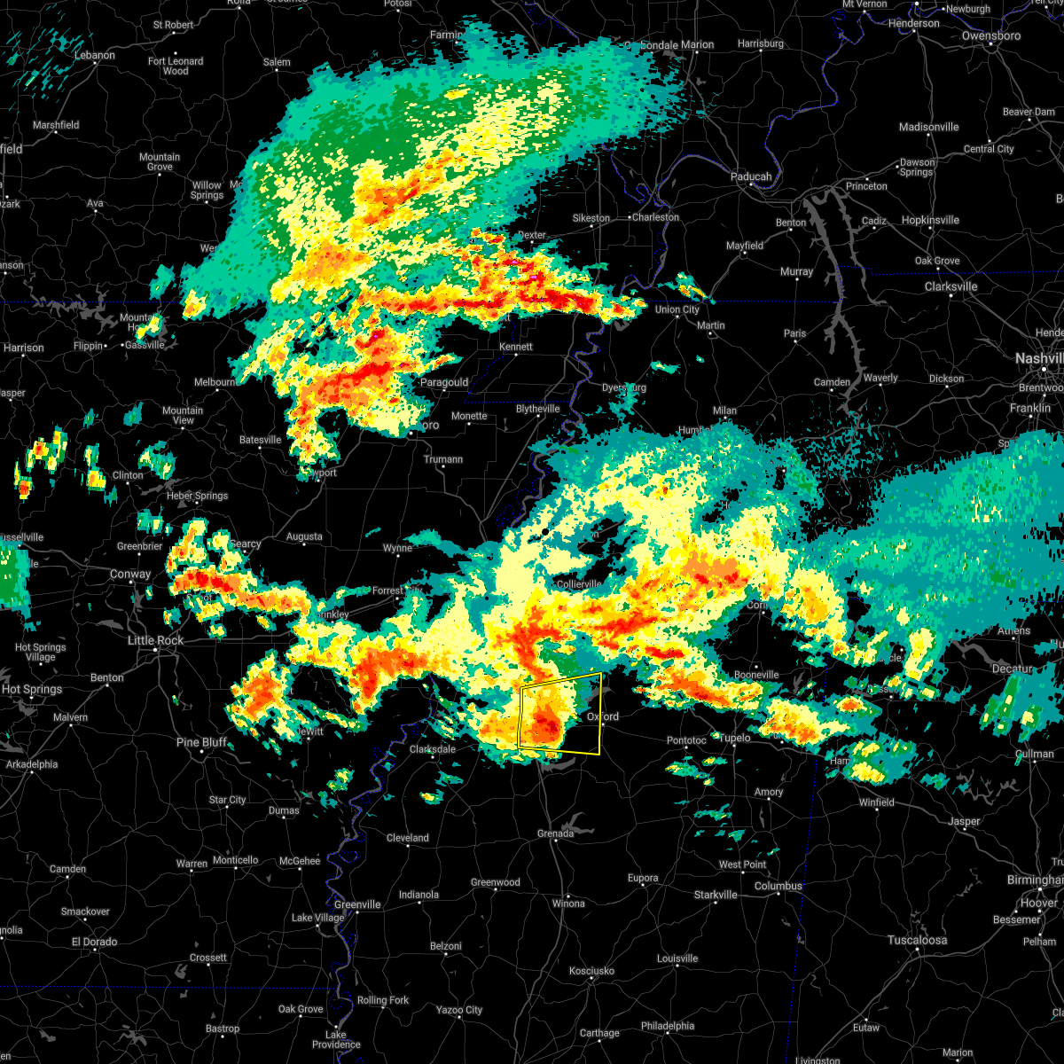 At 739 am cdt, a severe thunderstorm was located near burgess, or 7 miles east of john w kyle state park, moving east at 50 mph (radar indicated). Hazards include 60 mph wind gusts and quarter size hail. Hail damage to vehicles is expected. expect wind damage to roofs, siding, and trees. Locations impacted include, oxford, batesville, holly springs national forest, john w kyle state park, sardis, como, springdale, burgess, harmontown, laws hill, courtland, taylor, blackwater, teckville, tyro, mcghee, glenville, college hill, hayes crossing and eureka springs. At 739 am cdt, a severe thunderstorm was located near burgess, or 7 miles east of john w kyle state park, moving east at 50 mph (radar indicated). Hazards include 60 mph wind gusts and quarter size hail. Hail damage to vehicles is expected. expect wind damage to roofs, siding, and trees. Locations impacted include, oxford, batesville, holly springs national forest, john w kyle state park, sardis, como, springdale, burgess, harmontown, laws hill, courtland, taylor, blackwater, teckville, tyro, mcghee, glenville, college hill, hayes crossing and eureka springs.
|
| 3/17/2021 7:12 AM CDT |
 The national weather service in memphis has issued a * severe thunderstorm warning for. western lafayette county in northwestern mississippi. northern yalobusha county in northwestern mississippi. southwestern marshall county in northwestern mississippi. Southeastern tate county in northwestern mississippi. The national weather service in memphis has issued a * severe thunderstorm warning for. western lafayette county in northwestern mississippi. northern yalobusha county in northwestern mississippi. southwestern marshall county in northwestern mississippi. Southeastern tate county in northwestern mississippi.
|
| 8/28/2020 6:41 AM CDT |
 The severe thunderstorm warning for central lafayette county will expire at 645 am cdt, the severe thunderstorm which prompted the warning has moved out of the warned area. therefore, the warning will be allowed to expire. remember, a tornado warning still remains in effect for lafayette county until 645am. The severe thunderstorm warning for central lafayette county will expire at 645 am cdt, the severe thunderstorm which prompted the warning has moved out of the warned area. therefore, the warning will be allowed to expire. remember, a tornado warning still remains in effect for lafayette county until 645am.
|
| 8/28/2020 6:21 AM CDT |
 At 620 am cdt, doppler radar indicated a severe thunderstorm producing a tornado was located over holly springs national forest, moving northeast at 50 mph (radar indicated rotation). Hazards include tornado. Flying debris will be dangerous to those caught without shelter. mobile homes will be damaged or destroyed. damage to roofs, windows, and vehicles will occur. Tree damage is likely. At 620 am cdt, doppler radar indicated a severe thunderstorm producing a tornado was located over holly springs national forest, moving northeast at 50 mph (radar indicated rotation). Hazards include tornado. Flying debris will be dangerous to those caught without shelter. mobile homes will be damaged or destroyed. damage to roofs, windows, and vehicles will occur. Tree damage is likely.
|
| 8/28/2020 6:18 AM CDT |
 At 617 am cdt, a severe thunderstorm was located near burgess, or near holly springs national forest, moving northeast at 30 mph (radar indicated). Hazards include 60 mph wind gusts. expect damage to roofs, siding, and trees At 617 am cdt, a severe thunderstorm was located near burgess, or near holly springs national forest, moving northeast at 30 mph (radar indicated). Hazards include 60 mph wind gusts. expect damage to roofs, siding, and trees
|
| 6/5/2020 3:33 PM CDT |
 At 332 pm cdt, severe thunderstorms were located along a line extending from 7 miles southwest of banner to paynes, moving southeast at 45 mph (radar indicated). Hazards include 60 mph wind gusts. Expect damage to roofs, siding, and trees. Locations impacted include, oxford, batesville, water valley, charleston, george payne state park, bruce, calhoun city, marks, lambert, derma, coffeeville, crowder, webb, sumner, pope, pittsboro, slate springs, enid, paynes and sabougla. At 332 pm cdt, severe thunderstorms were located along a line extending from 7 miles southwest of banner to paynes, moving southeast at 45 mph (radar indicated). Hazards include 60 mph wind gusts. Expect damage to roofs, siding, and trees. Locations impacted include, oxford, batesville, water valley, charleston, george payne state park, bruce, calhoun city, marks, lambert, derma, coffeeville, crowder, webb, sumner, pope, pittsboro, slate springs, enid, paynes and sabougla.
|
| 6/5/2020 3:14 PM CDT |
 At 311 pm cdt, severe thunderstorms were located along a line extending from near springdale to 6 miles east of vance, moving southeast at 45 mph (radar indicated). Hazards include 60 mph wind gusts. expect damage to roofs, siding, and trees At 311 pm cdt, severe thunderstorms were located along a line extending from near springdale to 6 miles east of vance, moving southeast at 45 mph (radar indicated). Hazards include 60 mph wind gusts. expect damage to roofs, siding, and trees
|
| 6/5/2020 3:04 PM CDT |
 At 304 pm cdt, severe thunderstorms were located along a line extending from near tula to crowder, moving southeast at 50 mph (radar indicated). Hazards include 60 mph wind gusts. Expect damage to roofs, siding, and trees. Locations impacted include, oxford, batesville, water valley, charleston, george payne state park, holly springs national forest, john w kyle state park, marks, sardis, lambert, como, crowder, sledge, pope, enid, darling, pleasant grove, springdale, curtis station and burgess. At 304 pm cdt, severe thunderstorms were located along a line extending from near tula to crowder, moving southeast at 50 mph (radar indicated). Hazards include 60 mph wind gusts. Expect damage to roofs, siding, and trees. Locations impacted include, oxford, batesville, water valley, charleston, george payne state park, holly springs national forest, john w kyle state park, marks, sardis, lambert, como, crowder, sledge, pope, enid, darling, pleasant grove, springdale, curtis station and burgess.
|
| 6/5/2020 2:47 PM CDT |
 At 246 pm cdt, severe thunderstorms were located along a line extending from near holly springs national forest to near darling, moving southeast at 50 mph (radar indicated). Hazards include 60 mph wind gusts. expect damage to roofs, siding, and trees At 246 pm cdt, severe thunderstorms were located along a line extending from near holly springs national forest to near darling, moving southeast at 50 mph (radar indicated). Hazards include 60 mph wind gusts. expect damage to roofs, siding, and trees
|
| 4/12/2020 10:35 PM CDT |
 The severe thunderstorm warning for western lafayette, central desoto, eastern yalobusha, southwestern marshall, eastern tate and eastern panola counties will expire at 1045 pm cdt, the storms which prompted the warning have moved out of the area. therefore, the warning will be allowed to expire. a severe thunderstorm watch remains in effect until 100 am cdt for eastern arkansas, and northwestern mississippi. The severe thunderstorm warning for western lafayette, central desoto, eastern yalobusha, southwestern marshall, eastern tate and eastern panola counties will expire at 1045 pm cdt, the storms which prompted the warning have moved out of the area. therefore, the warning will be allowed to expire. a severe thunderstorm watch remains in effect until 100 am cdt for eastern arkansas, and northwestern mississippi.
|
| 4/12/2020 10:23 PM CDT |
 At 1022 pm cdt, severe thunderstorms were located along a line extending from near midtown memphis to harmontown to near velma, moving northeast at 70 mph (radar indicated). Hazards include 70 mph wind gusts. Expect considerable tree damage. damage is likely to mobile homes, roofs, and outbuildings. Locations impacted include, southaven, horn lake, oxford, hernando, water valley, holly springs national forest, coldwater, walls, coffeeville, lake cormorant, harmontown, eudora, velma, laws hill, barr, lynchburg, springdale, burgess, independence and abbeville. At 1022 pm cdt, severe thunderstorms were located along a line extending from near midtown memphis to harmontown to near velma, moving northeast at 70 mph (radar indicated). Hazards include 70 mph wind gusts. Expect considerable tree damage. damage is likely to mobile homes, roofs, and outbuildings. Locations impacted include, southaven, horn lake, oxford, hernando, water valley, holly springs national forest, coldwater, walls, coffeeville, lake cormorant, harmontown, eudora, velma, laws hill, barr, lynchburg, springdale, burgess, independence and abbeville.
|
| 4/12/2020 10:17 PM CDT |
 At 1017 pm cdt, severe thunderstorms were located along a line extending from whitehaven to 6 miles north of burgess to coffeeville, moving northeast at 75 mph (radar indicated). Hazards include 70 mph wind gusts. Expect considerable tree damage. damage is likely to mobile homes, roofs, and outbuildings. Locations impacted include, southaven, horn lake, oxford, hernando, senatobia, batesville, water valley, george payne state park, holly springs national forest, john w kyle state park, sardis, coldwater, como, walls, coffeeville, pope, lake cormorant, enid, harmontown and eudora. At 1017 pm cdt, severe thunderstorms were located along a line extending from whitehaven to 6 miles north of burgess to coffeeville, moving northeast at 75 mph (radar indicated). Hazards include 70 mph wind gusts. Expect considerable tree damage. damage is likely to mobile homes, roofs, and outbuildings. Locations impacted include, southaven, horn lake, oxford, hernando, senatobia, batesville, water valley, george payne state park, holly springs national forest, john w kyle state park, sardis, coldwater, como, walls, coffeeville, pope, lake cormorant, enid, harmontown and eudora.
|
| 4/12/2020 10:03 PM CDT |
 At 1001 pm cdt, severe thunderstorms were located along a line extending from near horseshoe lake to near batesville to near paynes, moving east at 75 mph (radar indicated. tunica airport reported 60 mph winds at 10 pm). Hazards include 70 mph wind gusts. Expect considerable tree damage. damage is likely to mobile homes, roofs, and outbuildings. Locations impacted include, southaven, horn lake, oxford, hernando, senatobia, batesville, water valley, charleston, george payne state park, holly springs national forest, john w kyle state park, sardis, coldwater, como, walls, tunica, coffeeville, crenshaw, crowder and pope. At 1001 pm cdt, severe thunderstorms were located along a line extending from near horseshoe lake to near batesville to near paynes, moving east at 75 mph (radar indicated. tunica airport reported 60 mph winds at 10 pm). Hazards include 70 mph wind gusts. Expect considerable tree damage. damage is likely to mobile homes, roofs, and outbuildings. Locations impacted include, southaven, horn lake, oxford, hernando, senatobia, batesville, water valley, charleston, george payne state park, holly springs national forest, john w kyle state park, sardis, coldwater, como, walls, tunica, coffeeville, crenshaw, crowder and pope.
|
| 4/12/2020 9:50 PM CDT |
 At 950 pm cdt, severe thunderstorms were located along a line extending from madison to 6 miles southeast of dundee to tutwiler, moving northeast at 70 mph (radar indicated). Hazards include 70 mph wind gusts. Expect considerable tree damage. Damage is likely to mobile homes, roofs, and outbuildings. At 950 pm cdt, severe thunderstorms were located along a line extending from madison to 6 miles southeast of dundee to tutwiler, moving northeast at 70 mph (radar indicated). Hazards include 70 mph wind gusts. Expect considerable tree damage. Damage is likely to mobile homes, roofs, and outbuildings.
|
| 3/28/2020 10:08 PM CDT |
 At 1008 pm cdt, a severe thunderstorm was located near batesville, moving northeast at 65 mph (radar indicated). Hazards include 60 mph wind gusts and quarter size hail. Hail damage to vehicles is expected. expect wind damage to roofs, siding, and trees. Locations impacted include, oxford, batesville, holly springs national forest, john w kyle state park, pope, burgess, cambridge, harmontown, laws hill, courtland, abbeville, taylor, malone, keel, blackwater, teckville, shuford, glenville, college hill station and college hill. At 1008 pm cdt, a severe thunderstorm was located near batesville, moving northeast at 65 mph (radar indicated). Hazards include 60 mph wind gusts and quarter size hail. Hail damage to vehicles is expected. expect wind damage to roofs, siding, and trees. Locations impacted include, oxford, batesville, holly springs national forest, john w kyle state park, pope, burgess, cambridge, harmontown, laws hill, courtland, abbeville, taylor, malone, keel, blackwater, teckville, shuford, glenville, college hill station and college hill.
|
| 3/28/2020 9:57 PM CDT |
 The national weather service in memphis has issued a * severe thunderstorm warning for. northern lafayette county in northwestern mississippi. southwestern marshall county in northwestern mississippi. northeastern tallahatchie county in northwestern mississippi. Southeastern panola county in northwestern mississippi. The national weather service in memphis has issued a * severe thunderstorm warning for. northern lafayette county in northwestern mississippi. southwestern marshall county in northwestern mississippi. northeastern tallahatchie county in northwestern mississippi. Southeastern panola county in northwestern mississippi.
|
| 1/11/2020 5:19 AM CST |
 At 519 am cst, severe thunderstorms were located along a line extending from harmontown to 6 miles southwest of coffeeville, moving east at 40 mph (radar indicated). Hazards include 60 mph wind gusts. expect damage to roofs, siding, and trees At 519 am cst, severe thunderstorms were located along a line extending from harmontown to 6 miles southwest of coffeeville, moving east at 40 mph (radar indicated). Hazards include 60 mph wind gusts. expect damage to roofs, siding, and trees
|
| 1/11/2020 5:16 AM CST |
 At 516 am cst, severe thunderstorms were located along a line extending from near hernando to near barr to 7 miles southeast of enid, moving northeast at 55 mph (radar indicated). Hazards include 70 mph wind gusts. Expect considerable tree damage. damage is likely to mobile homes, roofs, and outbuildings. Locations impacted include, oxford, senatobia, holly springs, batesville, water valley, george payne state park, holly springs national forest, wall doxey state park, john w kyle state park, coffeeville, pope, enid, harmontown, velma, laws hill, barr, springdale, burgess, scobey and marianna. At 516 am cst, severe thunderstorms were located along a line extending from near hernando to near barr to 7 miles southeast of enid, moving northeast at 55 mph (radar indicated). Hazards include 70 mph wind gusts. Expect considerable tree damage. damage is likely to mobile homes, roofs, and outbuildings. Locations impacted include, oxford, senatobia, holly springs, batesville, water valley, george payne state park, holly springs national forest, wall doxey state park, john w kyle state park, coffeeville, pope, enid, harmontown, velma, laws hill, barr, springdale, burgess, scobey and marianna.
|
| 1/11/2020 4:55 AM CST |
 At 454 am cst, severe thunderstorms were located along a line extending from near little texas to near batesville to near paynes, moving northeast at 50 mph (radar indicated). Hazards include 70 mph wind gusts. Expect considerable tree damage. Damage is likely to mobile homes, roofs, and outbuildings. At 454 am cst, severe thunderstorms were located along a line extending from near little texas to near batesville to near paynes, moving northeast at 50 mph (radar indicated). Hazards include 70 mph wind gusts. Expect considerable tree damage. Damage is likely to mobile homes, roofs, and outbuildings.
|
| 12/16/2019 3:01 PM CST |
 At 251 pm cst, doppler radar indicated a severe thunderstorm producing a tornado was located over springdale, or 7 miles north of water valley, moving northeast at 40 mph (radar indicated rotation). Hazards include tornado. Flying debris will be dangerous to those caught without shelter. mobile homes will be damaged or destroyed. damage to roofs, windows, and vehicles will occur. Tree damage is likely. At 251 pm cst, doppler radar indicated a severe thunderstorm producing a tornado was located over springdale, or 7 miles north of water valley, moving northeast at 40 mph (radar indicated rotation). Hazards include tornado. Flying debris will be dangerous to those caught without shelter. mobile homes will be damaged or destroyed. damage to roofs, windows, and vehicles will occur. Tree damage is likely.
|
| 12/16/2019 2:51 PM CST |
 At 251 pm cst, doppler radar indicated a severe thunderstorm producing a tornado was located over springdale, or 7 miles north of water valley, moving northeast at 40 mph (radar indicated rotation). Hazards include tornado. Flying debris will be dangerous to those caught without shelter. mobile homes will be damaged or destroyed. damage to roofs, windows, and vehicles will occur. Tree damage is likely. At 251 pm cst, doppler radar indicated a severe thunderstorm producing a tornado was located over springdale, or 7 miles north of water valley, moving northeast at 40 mph (radar indicated rotation). Hazards include tornado. Flying debris will be dangerous to those caught without shelter. mobile homes will be damaged or destroyed. damage to roofs, windows, and vehicles will occur. Tree damage is likely.
|
| 12/16/2019 2:40 PM CST |
 At 239 pm cst, a severe thunderstorm was located near springdale, or near water valley, moving northeast at 55 mph (radar indicated). Hazards include 60 mph wind gusts and quarter size hail. Hail damage to vehicles is expected. expect wind damage to roofs, siding, and trees. Locations impacted include, oxford, batesville, water valley, holly springs national forest, springdale, burgess, cambridge, tula, denmark, velma, paris, abbeville, taylor, toccopola, altus, keel, shuford, delay, college hill station and college hill. At 239 pm cst, a severe thunderstorm was located near springdale, or near water valley, moving northeast at 55 mph (radar indicated). Hazards include 60 mph wind gusts and quarter size hail. Hail damage to vehicles is expected. expect wind damage to roofs, siding, and trees. Locations impacted include, oxford, batesville, water valley, holly springs national forest, springdale, burgess, cambridge, tula, denmark, velma, paris, abbeville, taylor, toccopola, altus, keel, shuford, delay, college hill station and college hill.
|
| 12/16/2019 2:18 PM CST |
 At 218 pm cst, a severe thunderstorm was located near enid, or 7 miles west of george payne state park, moving northeast at 65 mph (radar indicated). Hazards include 60 mph wind gusts and quarter size hail. Hail damage to vehicles is expected. Expect wind damage to roofs, siding, and trees. At 218 pm cst, a severe thunderstorm was located near enid, or 7 miles west of george payne state park, moving northeast at 65 mph (radar indicated). Hazards include 60 mph wind gusts and quarter size hail. Hail damage to vehicles is expected. Expect wind damage to roofs, siding, and trees.
|
| 6/24/2019 5:09 AM CDT |
 The severe thunderstorm warning for lafayette, northeastern yalobusha, northern calhoun, western pontotoc and western union counties will expire at 515 am cdt, the storm which prompted the warning has weakened below severe limits, and no longer poses an immediate threat to life or property. therefore, the warning will be allowed to expire. The severe thunderstorm warning for lafayette, northeastern yalobusha, northern calhoun, western pontotoc and western union counties will expire at 515 am cdt, the storm which prompted the warning has weakened below severe limits, and no longer poses an immediate threat to life or property. therefore, the warning will be allowed to expire.
|
| 6/24/2019 4:51 AM CDT |
 At 451 am cdt, a severe thunderstorm was located near denmark, or near oxford, moving northeast at 55 mph (radar indicated). Hazards include 60 mph wind gusts. Expect damage to roofs, siding, and trees. Locations impacted include, oxford, water valley, holly springs national forest, cambridge, randolph, etta, springdale, burgess, banner, tula, denmark, pinedale, paris, thaxton, myrtle, taylor, toccopola, robbs, keel and poolville. At 451 am cdt, a severe thunderstorm was located near denmark, or near oxford, moving northeast at 55 mph (radar indicated). Hazards include 60 mph wind gusts. Expect damage to roofs, siding, and trees. Locations impacted include, oxford, water valley, holly springs national forest, cambridge, randolph, etta, springdale, burgess, banner, tula, denmark, pinedale, paris, thaxton, myrtle, taylor, toccopola, robbs, keel and poolville.
|
| 6/24/2019 4:33 AM CDT |
 At 432 am cdt, a severe thunderstorm was located near springdale, or near water valley, moving northeast at 55 mph (radar indicated). Hazards include 60 mph wind gusts. expect damage to roofs, siding, and trees At 432 am cdt, a severe thunderstorm was located near springdale, or near water valley, moving northeast at 55 mph (radar indicated). Hazards include 60 mph wind gusts. expect damage to roofs, siding, and trees
|
| 6/20/2019 12:10 AM CDT |
 At 1209 am cdt, severe thunderstorms were located along a line extending from holly springs national forest to near embry, moving east at 60 mph (radar indicated). Hazards include 60 mph wind gusts. expect damage to roofs, siding, and trees At 1209 am cdt, severe thunderstorms were located along a line extending from holly springs national forest to near embry, moving east at 60 mph (radar indicated). Hazards include 60 mph wind gusts. expect damage to roofs, siding, and trees
|
| 6/19/2019 11:50 PM CDT |
 At 1150 pm cdt, a severe thunderstorm was located over pope, or near george payne state park, moving northeast at 55 mph (radar indicated). Hazards include 60 mph wind gusts. Expect damage to roofs, siding, and trees. Locations impacted include, oxford, batesville, water valley, charleston, george payne state park, holly springs national forest, john w kyle state park, bruce, marks, lambert, coffeeville, crowder, pope, enid, paynes, velma, vance, springdale, burgess and banner. At 1150 pm cdt, a severe thunderstorm was located over pope, or near george payne state park, moving northeast at 55 mph (radar indicated). Hazards include 60 mph wind gusts. Expect damage to roofs, siding, and trees. Locations impacted include, oxford, batesville, water valley, charleston, george payne state park, holly springs national forest, john w kyle state park, bruce, marks, lambert, coffeeville, crowder, pope, enid, paynes, velma, vance, springdale, burgess and banner.
|
| 6/19/2019 11:28 PM CDT |
 At 1128 pm cdt, a severe thunderstorm was located near vance, or 11 miles northwest of charleston, moving northeast at 55 mph (radar indicated). Hazards include 60 mph wind gusts. expect damage to roofs, siding, and trees At 1128 pm cdt, a severe thunderstorm was located near vance, or 11 miles northwest of charleston, moving northeast at 55 mph (radar indicated). Hazards include 60 mph wind gusts. expect damage to roofs, siding, and trees
|
| 8/20/2018 6:49 PM CDT |
 At 649 pm cdt, a severe thunderstorm was located near paris, or near water valley, moving east at 20 mph (radar indicated). Hazards include 60 mph wind gusts and quarter size hail. Hail damage to vehicles is expected. Expect wind damage to roofs, siding, and trees. At 649 pm cdt, a severe thunderstorm was located near paris, or near water valley, moving east at 20 mph (radar indicated). Hazards include 60 mph wind gusts and quarter size hail. Hail damage to vehicles is expected. Expect wind damage to roofs, siding, and trees.
|
| 8/20/2018 6:14 PM CDT |
 At 614 pm cdt, a severe thunderstorm was located near burgess, or 9 miles southeast of john w kyle state park, moving east at 25 mph (radar indicated). Hazards include 60 mph wind gusts and quarter size hail. Hail damage to vehicles is expected. expect wind damage to roofs, siding, and trees. Locations impacted include, oxford, holly springs national forest, springdale, burgess, paris, taylor, college hill station, altus, keel, college hill and yocona. At 614 pm cdt, a severe thunderstorm was located near burgess, or 9 miles southeast of john w kyle state park, moving east at 25 mph (radar indicated). Hazards include 60 mph wind gusts and quarter size hail. Hail damage to vehicles is expected. expect wind damage to roofs, siding, and trees. Locations impacted include, oxford, holly springs national forest, springdale, burgess, paris, taylor, college hill station, altus, keel, college hill and yocona.
|
| 8/20/2018 5:59 PM CDT |
 At 559 pm cdt, a severe thunderstorm was located near batesville, moving east at 25 mph (radar indicated). Hazards include 60 mph wind gusts and quarter size hail. Hail damage to vehicles is expected. Expect wind damage to roofs, siding, and trees. At 559 pm cdt, a severe thunderstorm was located near batesville, moving east at 25 mph (radar indicated). Hazards include 60 mph wind gusts and quarter size hail. Hail damage to vehicles is expected. Expect wind damage to roofs, siding, and trees.
|
| 7/19/2018 9:46 PM CDT |
 At 946 pm cdt, a severe thunderstorm was located near burgess, or 9 miles southwest of holly springs national forest, moving southeast at 20 mph (radar indicated). Hazards include 60 mph wind gusts and quarter size hail. Hail damage to vehicles is expected. Expect wind damage to roofs, siding, and trees. At 946 pm cdt, a severe thunderstorm was located near burgess, or 9 miles southwest of holly springs national forest, moving southeast at 20 mph (radar indicated). Hazards include 60 mph wind gusts and quarter size hail. Hail damage to vehicles is expected. Expect wind damage to roofs, siding, and trees.
|
| 6/1/2018 2:21 PM CDT |
 At 221 pm cdt, a severe thunderstorm was located near cambridge, or near oxford, moving southeast at 20 mph (radar indicated). Hazards include 60 mph wind gusts and quarter size hail. Hail damage to vehicles is expected. expect wind damage to roofs, siding, and trees. Locations impacted include, oxford, holly springs national forest, cambridge, denmark, thaxton, abbeville, taylor, altus, keel, delay, college hill station, college hill, lafayette springs and yocona. At 221 pm cdt, a severe thunderstorm was located near cambridge, or near oxford, moving southeast at 20 mph (radar indicated). Hazards include 60 mph wind gusts and quarter size hail. Hail damage to vehicles is expected. expect wind damage to roofs, siding, and trees. Locations impacted include, oxford, holly springs national forest, cambridge, denmark, thaxton, abbeville, taylor, altus, keel, delay, college hill station, college hill, lafayette springs and yocona.
|
| 6/1/2018 2:05 PM CDT |
 At 204 pm cdt, a severe thunderstorm was located near cambridge, or 10 miles northeast of oxford, moving southeast at 25 mph (radar indicated). Hazards include 60 mph wind gusts and quarter size hail. Hail damage to vehicles is expected. Expect wind damage to roofs, siding, and trees. At 204 pm cdt, a severe thunderstorm was located near cambridge, or 10 miles northeast of oxford, moving southeast at 25 mph (radar indicated). Hazards include 60 mph wind gusts and quarter size hail. Hail damage to vehicles is expected. Expect wind damage to roofs, siding, and trees.
|
| 4/14/2018 5:17 AM CDT |
 At 517 am cdt, a severe thunderstorm was located near tula, or 14 miles east of water valley, moving east at 60 mph (radar indicated). Hazards include 60 mph wind gusts. expect damage to roofs, siding, and trees At 517 am cdt, a severe thunderstorm was located near tula, or 14 miles east of water valley, moving east at 60 mph (radar indicated). Hazards include 60 mph wind gusts. expect damage to roofs, siding, and trees
|
| 4/30/2017 10:34 AM CDT |
 At 1034 am cdt, severe thunderstorms were located along a line extending from near curtis station to scobey, moving northeast at 40 mph (radar indicated). Hazards include 60 mph wind gusts. expect damage to roofs, siding, and trees At 1034 am cdt, severe thunderstorms were located along a line extending from near curtis station to scobey, moving northeast at 40 mph (radar indicated). Hazards include 60 mph wind gusts. expect damage to roofs, siding, and trees
|
| 3/25/2017 5:06 AM CDT |
 The severe thunderstorm warning for lafayette county will expire at 515 am cdt, the storm which prompted the warning has weakened below severe limits, and no longer pose an immediate threat to life or property. therefore, the warning will be allowed to expire. however gusty winds are still possible with this thunderstorm. The severe thunderstorm warning for lafayette county will expire at 515 am cdt, the storm which prompted the warning has weakened below severe limits, and no longer pose an immediate threat to life or property. therefore, the warning will be allowed to expire. however gusty winds are still possible with this thunderstorm.
|
| 3/25/2017 4:46 AM CDT |
 At 446 am cdt, a severe thunderstorm was located over burgess, or near holly springs national forest, moving northeast at 45 mph (radar indicated). Hazards include 60 mph wind gusts. Expect damage to roofs, siding, and trees. Locations impacted include, oxford, water valley, holly springs national forest, springdale, burgess, cambridge, harmontown, denmark, abbeville, taylor, altus, keel, blackwater, teckville, college hill station and college hill. At 446 am cdt, a severe thunderstorm was located over burgess, or near holly springs national forest, moving northeast at 45 mph (radar indicated). Hazards include 60 mph wind gusts. Expect damage to roofs, siding, and trees. Locations impacted include, oxford, water valley, holly springs national forest, springdale, burgess, cambridge, harmontown, denmark, abbeville, taylor, altus, keel, blackwater, teckville, college hill station and college hill.
|
| 3/25/2017 4:25 AM CDT |
 At 425 am cdt, a severe thunderstorm was located 7 miles southeast of batesville, moving northeast at 55 mph (radar indicated). Hazards include 60 mph wind gusts. expect damage to roofs, siding, and trees At 425 am cdt, a severe thunderstorm was located 7 miles southeast of batesville, moving northeast at 55 mph (radar indicated). Hazards include 60 mph wind gusts. expect damage to roofs, siding, and trees
|
| 3/25/2017 4:11 AM CDT |
 At 411 am cdt, a severe thunderstorm was located over pope, or near batesville, moving northeast at 50 mph (radar indicated). Hazards include 60 mph wind gusts. Expect damage to roofs, siding, and trees. Locations impacted include, oxford, batesville, water valley, charleston, george payne state park, holly springs national forest, john w kyle state park, sardis, pope, enid, harmontown, springdale, burgess, courtland, abbeville, taylor, glenville, college hill station, college hill and hayes crossing. At 411 am cdt, a severe thunderstorm was located over pope, or near batesville, moving northeast at 50 mph (radar indicated). Hazards include 60 mph wind gusts. Expect damage to roofs, siding, and trees. Locations impacted include, oxford, batesville, water valley, charleston, george payne state park, holly springs national forest, john w kyle state park, sardis, pope, enid, harmontown, springdale, burgess, courtland, abbeville, taylor, glenville, college hill station, college hill and hayes crossing.
|
| 3/25/2017 3:52 AM CDT |
 At 350 am cdt, a severe thunderstorm was located near crowder, or 7 miles northwest of charleston, moving northeast at 60 mph (radar indicated). Hazards include 60 mph wind gusts. expect damage to roofs, siding, and trees At 350 am cdt, a severe thunderstorm was located near crowder, or 7 miles northwest of charleston, moving northeast at 60 mph (radar indicated). Hazards include 60 mph wind gusts. expect damage to roofs, siding, and trees
|
| 3/10/2017 1:08 AM CST |
 At 108 am cst, a severe thunderstorm was located over bruce, or 19 miles southeast of water valley, moving south at 60 mph (radar indicated). Hazards include 60 mph wind gusts. Expect damage to roofs, siding, and trees. Locations impacted include, tupelo, oxford, new albany, pontotoc, water valley, baldwyn, verona, trace state park, saltillo, guntown, bruce, shannon, plantersville, coffeeville, ecru, new harmony, pratts friendship, randolph, troy and velma. At 108 am cst, a severe thunderstorm was located over bruce, or 19 miles southeast of water valley, moving south at 60 mph (radar indicated). Hazards include 60 mph wind gusts. Expect damage to roofs, siding, and trees. Locations impacted include, tupelo, oxford, new albany, pontotoc, water valley, baldwyn, verona, trace state park, saltillo, guntown, bruce, shannon, plantersville, coffeeville, ecru, new harmony, pratts friendship, randolph, troy and velma.
|
| 3/10/2017 12:48 AM CST |
 At 1248 am cst, a severe thunderstorm was located near etta, or 8 miles west of new albany, moving southeast at 45 mph (radar indicated). Hazards include 70 mph wind gusts. Expect considerable tree damage. damage is likely to mobile homes, roofs, and outbuildings. Locations impacted include, oxford, new albany, ripley, holly springs national forest, blue mountain, cambridge, keownville, etta, burgess, bethlehem, gravestown, pinedale, hickory flat, potts camp, myrtle, dumas, abbeville, taylor, malone and shari. At 1248 am cst, a severe thunderstorm was located near etta, or 8 miles west of new albany, moving southeast at 45 mph (radar indicated). Hazards include 70 mph wind gusts. Expect considerable tree damage. damage is likely to mobile homes, roofs, and outbuildings. Locations impacted include, oxford, new albany, ripley, holly springs national forest, blue mountain, cambridge, keownville, etta, burgess, bethlehem, gravestown, pinedale, hickory flat, potts camp, myrtle, dumas, abbeville, taylor, malone and shari.
|
| 3/10/2017 12:44 AM CST |
 At 1244 am cst, a severe thunderstorm was located over oxford, moving south at 60 mph (radar indicated). Hazards include 70 mph wind gusts. Expect considerable tree damage. Damage is likely to mobile homes, roofs, and outbuildings. At 1244 am cst, a severe thunderstorm was located over oxford, moving south at 60 mph (radar indicated). Hazards include 70 mph wind gusts. Expect considerable tree damage. Damage is likely to mobile homes, roofs, and outbuildings.
|
| 3/10/2017 12:39 AM CST |
 At 1238 am cst, a severe thunderstorm was located near bethlehem, or 12 miles east of wall doxey state park, moving southeast at 45 mph (radar indicated). Hazards include 70 mph wind gusts. Expect considerable tree damage. damage is likely to mobile homes, roofs, and outbuildings. Locations impacted include, oxford, new albany, holly springs, ripley, holly springs national forest, wall doxey state park, blue mountain, snow lake shores, cambridge, harmontown, keownville, bethlehem, laws hill, barr, etta, burgess, gravestown, pinedale, marianna and hickory flat. At 1238 am cst, a severe thunderstorm was located near bethlehem, or 12 miles east of wall doxey state park, moving southeast at 45 mph (radar indicated). Hazards include 70 mph wind gusts. Expect considerable tree damage. damage is likely to mobile homes, roofs, and outbuildings. Locations impacted include, oxford, new albany, holly springs, ripley, holly springs national forest, wall doxey state park, blue mountain, snow lake shores, cambridge, harmontown, keownville, bethlehem, laws hill, barr, etta, burgess, gravestown, pinedale, marianna and hickory flat.
|
| 3/10/2017 12:25 AM CST |
 At 1225 am cst, a severe thunderstorm was located near wall doxey state park, moving southeast at 45 mph (radar indicated). Hazards include 70 mph wind gusts. Expect considerable tree damage. damage is likely to mobile homes, roofs, and outbuildings. Locations impacted include, oxford, new albany, holly springs, ripley, holly springs national forest, wall doxey state park, blue mountain, snow lake shores, cambridge, harmontown, keownville, bethlehem, laws hill, barr, etta, burgess, gravestown, pinedale, marianna and hickory flat. At 1225 am cst, a severe thunderstorm was located near wall doxey state park, moving southeast at 45 mph (radar indicated). Hazards include 70 mph wind gusts. Expect considerable tree damage. damage is likely to mobile homes, roofs, and outbuildings. Locations impacted include, oxford, new albany, holly springs, ripley, holly springs national forest, wall doxey state park, blue mountain, snow lake shores, cambridge, harmontown, keownville, bethlehem, laws hill, barr, etta, burgess, gravestown, pinedale, marianna and hickory flat.
|
| 3/10/2017 12:21 AM CST |
 At 1220 am cst, a severe thunderstorm was located over holly springs, moving southeast at 45 mph (radar indicated). Hazards include 70 mph wind gusts. Expect considerable tree damage. Damage is likely to mobile homes, roofs, and outbuildings. At 1220 am cst, a severe thunderstorm was located over holly springs, moving southeast at 45 mph (radar indicated). Hazards include 70 mph wind gusts. Expect considerable tree damage. Damage is likely to mobile homes, roofs, and outbuildings.
|
| 6/17/2016 4:52 PM CDT |
 At 451 pm cdt, a severe thunderstorm was located over laws hill, or 7 miles southwest of wall doxey state park, moving south at 30 mph (radar indicated). Hazards include 60 mph wind gusts and penny size hail. Expect damage to roofs. siding. And trees. At 451 pm cdt, a severe thunderstorm was located over laws hill, or 7 miles southwest of wall doxey state park, moving south at 30 mph (radar indicated). Hazards include 60 mph wind gusts and penny size hail. Expect damage to roofs. siding. And trees.
|
| 3/31/2016 1:13 AM CDT |
 At 112 am cdt, a severe thunderstorm was located near velma, or 9 miles southwest of water valley, moving northeast at 80 mph (radar indicated). Hazards include 60 mph wind gusts and quarter size hail. Hail damage to vehicles is expected. Expect wind damage to roofs, siding, and trees. At 112 am cdt, a severe thunderstorm was located near velma, or 9 miles southwest of water valley, moving northeast at 80 mph (radar indicated). Hazards include 60 mph wind gusts and quarter size hail. Hail damage to vehicles is expected. Expect wind damage to roofs, siding, and trees.
|
| 12/23/2015 5:13 PM CST | A tornado warning remains in effect until 545 pm cst for central lafayette county. at 512 pm cst. a confirmed large and extremely dangerous tornado was located near oxford. moving northeast at 65 mph. this is a particularly dangerous situation. hazard. Damaging tornado. |
| 12/23/2015 4:59 PM CST | At 459 pm cst, a confirmed large and extremely dangerous tornado was located near george payne state park, moving northeast at 55 mph. this is a particularly dangerous situation (radar confirmed tornado). Hazards include damaging tornado. You are in a life threatening situation. flying debris may be deadly to those caught without shelter. mobile homes will be destroyed. considerable damage to homes, businesses and vehicles is likely and complete destruction is possible. the tornado will be near, water valley and springdale around 510 pm cst. holly springs national forest around 520 pm cst. oxford around 525 pm cst. denmark around 530 pm cst. cambridge around 535 pm cst. Other locations impacted by this tornadic thunderstorm include lafayette springs, burt, altus, keel, yocona, college hill station and taylor. |
| 8/22/2015 7:02 PM CDT |
 At 702 pm cdt, a severe thunderstorm was located near burgess, or 9 miles northwest of water valley, moving east at 25 mph (trained weather spotters). Hazards include half dollar size hail. Damage to vehicles is expected. Locations impacted include, oxford, batesville, water valley, springdale, burgess, taylor, shuford and eureka springs. At 702 pm cdt, a severe thunderstorm was located near burgess, or 9 miles northwest of water valley, moving east at 25 mph (trained weather spotters). Hazards include half dollar size hail. Damage to vehicles is expected. Locations impacted include, oxford, batesville, water valley, springdale, burgess, taylor, shuford and eureka springs.
|
| 8/22/2015 6:40 PM CDT |
 At 639 pm cdt, a severe thunderstorm was located near batesville, moving east at 25 mph (trained weather spotters). Hazards include quarter size hail. Damage to vehicles is expected. Locations impacted include, oxford, batesville, water valley, pope, springdale, burgess, courtland, taylor, shuford and eureka springs. At 639 pm cdt, a severe thunderstorm was located near batesville, moving east at 25 mph (trained weather spotters). Hazards include quarter size hail. Damage to vehicles is expected. Locations impacted include, oxford, batesville, water valley, pope, springdale, burgess, courtland, taylor, shuford and eureka springs.
|
| 8/22/2015 6:25 PM CDT |
 At 625 pm cdt, a severe thunderstorm was located near pope, or near batesville, moving east at 25 mph (radar indicated). Hazards include 60 mph wind gusts and half dollar size hail. Hail damage to vehicles is expected. Expect wind damage to roofs, siding and trees. At 625 pm cdt, a severe thunderstorm was located near pope, or near batesville, moving east at 25 mph (radar indicated). Hazards include 60 mph wind gusts and half dollar size hail. Hail damage to vehicles is expected. Expect wind damage to roofs, siding and trees.
|
| 8/7/2015 10:10 AM CDT |
 At 1006 am cdt, a severe thunderstorm was located near randolph, or 15 miles west of pontotoc, moving southeast at 55 mph (trained weather spotters. at 1000 am...layfayette county emergency management reported a tree down on old taylor road south of oxford). Hazards include 60 mph wind gusts. Expect damage to roofs. siding and trees. Locations impacted include, pontotoc, bruce, vardaman, houlka, tula, troy, denmark, randolph, paris, pyland, banner, thaxton, new houlka, algoma, taylor, toccopola, sarepta, loyd, springville and buchannan. At 1006 am cdt, a severe thunderstorm was located near randolph, or 15 miles west of pontotoc, moving southeast at 55 mph (trained weather spotters. at 1000 am...layfayette county emergency management reported a tree down on old taylor road south of oxford). Hazards include 60 mph wind gusts. Expect damage to roofs. siding and trees. Locations impacted include, pontotoc, bruce, vardaman, houlka, tula, troy, denmark, randolph, paris, pyland, banner, thaxton, new houlka, algoma, taylor, toccopola, sarepta, loyd, springville and buchannan.
|
| 8/7/2015 9:51 AM CDT |
 At 949 am cdt, a severe thunderstorm was located near oxford, moving southeast at 55 mph (public. at 939 am...a 61 mph wind gust was measured 2 miles north of oxford with several trees uprooted). Hazards include 60 mph wind gusts. Expect damage to roofs. Siding and trees. At 949 am cdt, a severe thunderstorm was located near oxford, moving southeast at 55 mph (public. at 939 am...a 61 mph wind gust was measured 2 miles north of oxford with several trees uprooted). Hazards include 60 mph wind gusts. Expect damage to roofs. Siding and trees.
|
| 6/8/2015 4:45 PM CDT | At 445 pm cdt, a severe thunderstorm was located over springdale, or near water valley, moving east at 10 mph (radar indicated). Hazards include 60 mph wind gusts and quarter size hail. Hail damage to vehicles is expected. Expect wind damage to roofs, siding and trees. |
| 6/8/2015 4:36 PM CDT | At 435 pm cdt, a severe thunderstorm was located near holly springs national forest, moving southeast at 10 mph (radar indicated). Hazards include 60 mph wind gusts and half dollar size hail. Hail damage to vehicles is expected. expect wind damage to roofs, siding and trees. Locations impacted include, oxford, holly springs national forest, burgess and taylor. |
| 6/8/2015 4:04 PM CDT | At 404 pm cdt, a severe thunderstorm was located over burgess, or near holly springs national forest, moving east at 40 mph (radar indicated). Hazards include 60 mph wind gusts and quarter size hail. Hail damage to vehicles is expected. Expect wind damage to roofs, siding and trees. |
| 4/19/2015 10:10 PM CDT | At 1010 pm cdt, a severe thunderstorm was located over george payne state park, moving northeast at 45 mph (radar indicated). Hazards include 60 mph wind gusts and quarter size hail. Hail damage to vehicles is expected. Expect wind damage to roofs, siding and trees. |
| 12/21/2013 7:30 PM CST | Power lines and trees down on the north side of tow in lafayette county MS, 8.8 miles NW of Taylor, MS |
| 1/1/0001 12:00 AM | Powerlines down from a 6-18 inch diameter tre in lafayette county MS, 0.3 miles SSW of Taylor, MS |
| 1/1/0001 12:00 AM | Half Dollar sized hail reported 0.8 miles WNW of Taylor, MS, hail slightly larger than quarter size was reported by a storm spotter near the town of taylor. |
Hail Maps for Taylor, MS
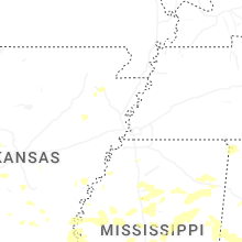
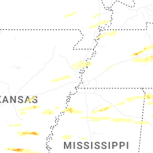

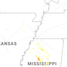
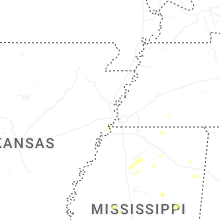
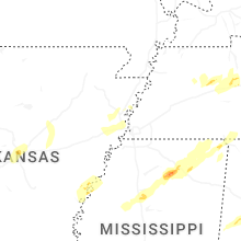
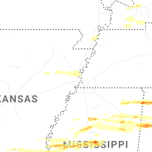
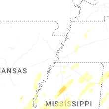
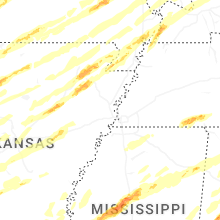


Connect with Interactive Hail Maps