

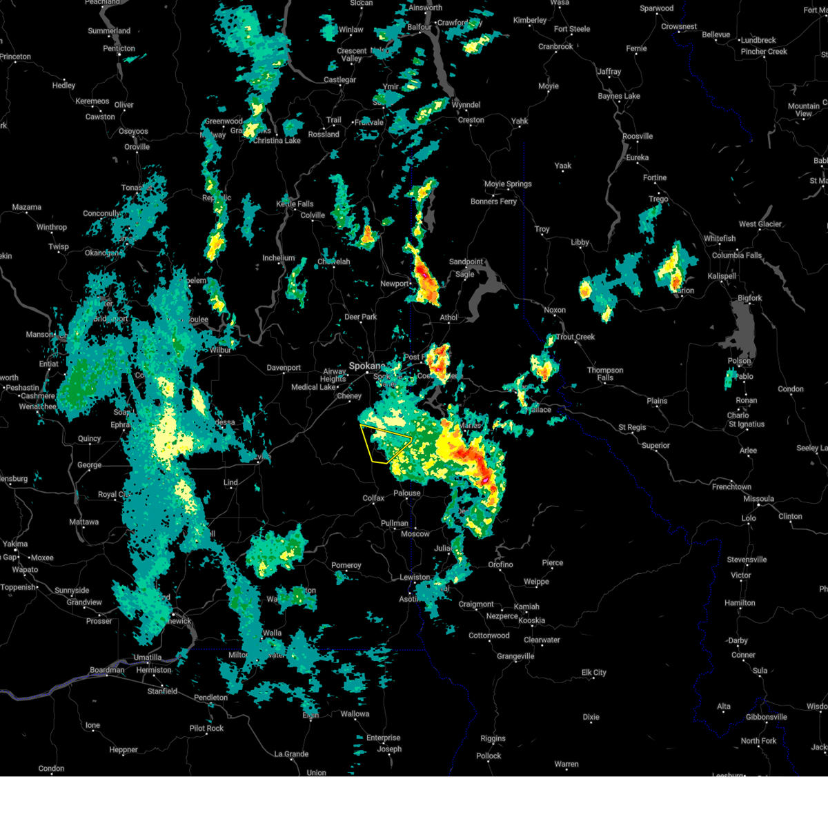
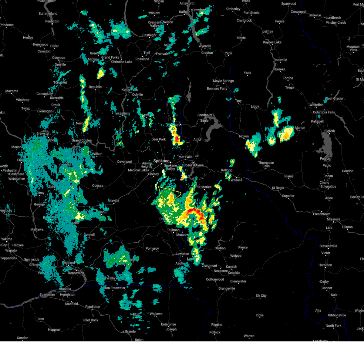
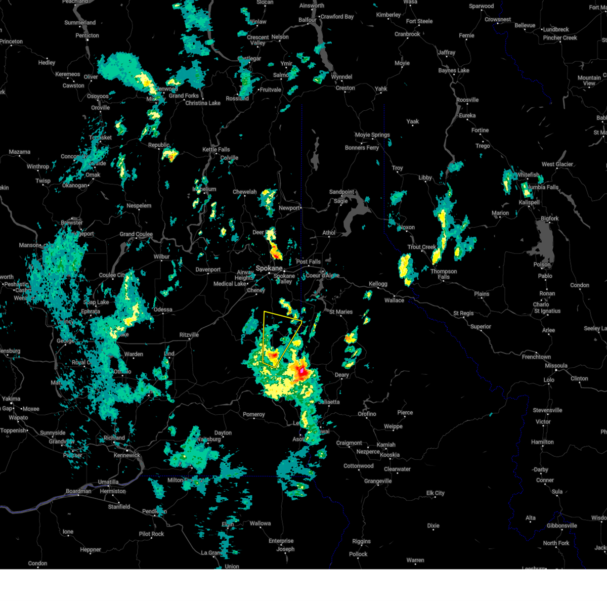
Hail Map for Tekoa, WA
The Tekoa, WA area has had 0 reports of on-the-ground hail by trained spotters, and has been under severe weather warnings 3 times during the past 12 months. Doppler radar has detected hail at or near Tekoa, WA on 4 occasions.
| Name: | Tekoa, WA |
| Where Located: | 33.8 miles SSE of Spokane, WA |
| Map: | Google Map for Tekoa, WA |
| Population: | 778 |
| Housing Units: | 360 |
| More Info: | Search Google for Tekoa, WA |
5
The Top Recent Hail Date for Tekoa, WA is Sunday, June 5, 2022 (1st out of 4)

Hail and Wind Damage Spotted near Tekoa, WA
| Date / Time | Report Details |
|---|---|
| 9/25/2024 5:15 PM PDT |
 the severe thunderstorm warning has been cancelled and is no longer in effect the severe thunderstorm warning has been cancelled and is no longer in effect
|
| 9/25/2024 4:59 PM PDT |
 At 458 pm pdt, a severe thunderstorm was located 14 miles north of colfax, or 26 miles north of pullman, moving north at 20 mph (radar indicated). Hazards include 60 mph wind gusts. Expect damage to roofs, siding, and trees. locations impacted include, tekoa, rosalia, oakesdale, latah, and plaza. this includes u. s. Highway 195 in washington between mile markers 57 and 72. At 458 pm pdt, a severe thunderstorm was located 14 miles north of colfax, or 26 miles north of pullman, moving north at 20 mph (radar indicated). Hazards include 60 mph wind gusts. Expect damage to roofs, siding, and trees. locations impacted include, tekoa, rosalia, oakesdale, latah, and plaza. this includes u. s. Highway 195 in washington between mile markers 57 and 72.
|
| 9/25/2024 4:39 PM PDT |
 Svrotx the national weather service in spokane has issued a * severe thunderstorm warning for, northeastern whitman county in eastern washington, southeastern spokane county in northeastern washington, * until 615 pm pdt. * at 438 pm pdt, a severe thunderstorm was located 7 miles north of colfax, or 20 miles northwest of pullman, moving north at 20 mph (radar indicated). Hazards include 60 mph wind gusts. areas of blowing dust producing brief visibility below a quarter of a mile. expect damage to roofs, siding, and trees Svrotx the national weather service in spokane has issued a * severe thunderstorm warning for, northeastern whitman county in eastern washington, southeastern spokane county in northeastern washington, * until 615 pm pdt. * at 438 pm pdt, a severe thunderstorm was located 7 miles north of colfax, or 20 miles northwest of pullman, moving north at 20 mph (radar indicated). Hazards include 60 mph wind gusts. areas of blowing dust producing brief visibility below a quarter of a mile. expect damage to roofs, siding, and trees
|
| 8/11/2022 4:59 PM PDT |
 At 459 pm pdt, a severe thunderstorm was located 8 miles west of plummer, or 23 miles west of st. maries, moving northeast at 40 mph (radar indicated). Hazards include ping pong ball size hail and 60 mph wind gusts. People and animals outdoors will be injured. expect hail damage to roofs, siding, windows, and vehicles. expect wind damage to roofs, siding, and trees. locations impacted include, harrison, tekoa, fairfield, rockford, worley and latah. this includes u. s. highway 95 in idaho between mile markers 398 and 413. hail threat, radar indicated max hail size, 1. 50 in wind threat, radar indicated max wind gust, 60 mph. At 459 pm pdt, a severe thunderstorm was located 8 miles west of plummer, or 23 miles west of st. maries, moving northeast at 40 mph (radar indicated). Hazards include ping pong ball size hail and 60 mph wind gusts. People and animals outdoors will be injured. expect hail damage to roofs, siding, windows, and vehicles. expect wind damage to roofs, siding, and trees. locations impacted include, harrison, tekoa, fairfield, rockford, worley and latah. this includes u. s. highway 95 in idaho between mile markers 398 and 413. hail threat, radar indicated max hail size, 1. 50 in wind threat, radar indicated max wind gust, 60 mph.
|
| 8/11/2022 4:48 PM PDT |
 At 448 pm pdt, a severe thunderstorm was located 12 miles southwest of plummer, or 26 miles west of st. maries, moving northeast at 35 mph (radar indicated). Hazards include 60 mph wind gusts and quarter size hail. Hail damage to vehicles is expected. expect wind damage to roofs, siding, and trees. locations impacted include, harrison, tekoa, fairfield, rockford, worley and latah. this includes u. s. highway 95 in idaho between mile markers 397 and 413. hail threat, radar indicated max hail size, 1. 00 in wind threat, radar indicated max wind gust, 60 mph. At 448 pm pdt, a severe thunderstorm was located 12 miles southwest of plummer, or 26 miles west of st. maries, moving northeast at 35 mph (radar indicated). Hazards include 60 mph wind gusts and quarter size hail. Hail damage to vehicles is expected. expect wind damage to roofs, siding, and trees. locations impacted include, harrison, tekoa, fairfield, rockford, worley and latah. this includes u. s. highway 95 in idaho between mile markers 397 and 413. hail threat, radar indicated max hail size, 1. 00 in wind threat, radar indicated max wind gust, 60 mph.
|
| 8/11/2022 4:34 PM PDT |
 At 433 pm pdt, a severe thunderstorm was located 17 miles north of colfax, or 27 miles north of pullman, moving northeast at 45 mph (radar indicated). Hazards include quarter size hail. damage to vehicles is expected At 433 pm pdt, a severe thunderstorm was located 17 miles north of colfax, or 27 miles north of pullman, moving northeast at 45 mph (radar indicated). Hazards include quarter size hail. damage to vehicles is expected
|
| 6/5/2022 5:56 PM PDT |
 The severe thunderstorm warning for west central benewah, northeastern whitman and southeastern spokane counties will expire at 600 pm pdt, the storm which prompted the warning has weakened below severe limits, and no longer poses an immediate threat to life or property. therefore, the warning will be allowed to expire. however heavy rain is still possible with this thunderstorm. The severe thunderstorm warning for west central benewah, northeastern whitman and southeastern spokane counties will expire at 600 pm pdt, the storm which prompted the warning has weakened below severe limits, and no longer poses an immediate threat to life or property. therefore, the warning will be allowed to expire. however heavy rain is still possible with this thunderstorm.
|
| 6/5/2022 5:32 PM PDT |
 At 531 pm pdt, a severe thunderstorm was located 19 miles north of colfax, or 28 miles north of pullman, moving northeast at 20 mph (radar indicated). Hazards include quarter size hail. damage to vehicles is expected At 531 pm pdt, a severe thunderstorm was located 19 miles north of colfax, or 28 miles north of pullman, moving northeast at 20 mph (radar indicated). Hazards include quarter size hail. damage to vehicles is expected
|
Hail Maps for Tekoa, WA


Connect with Interactive Hail Maps