

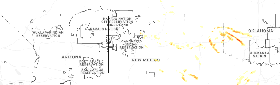
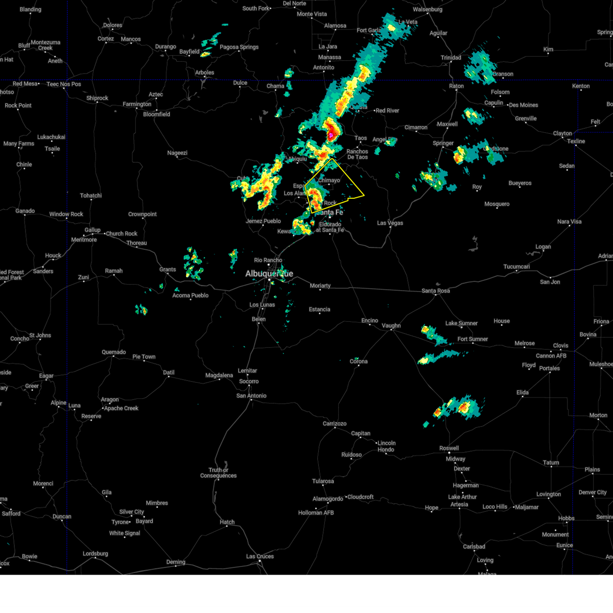
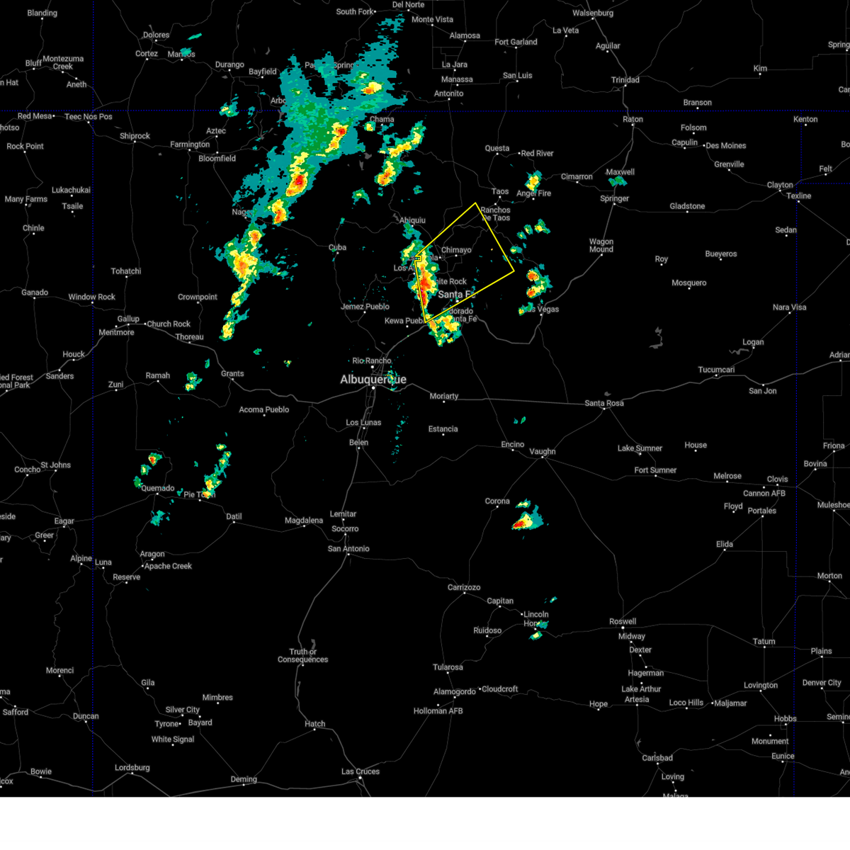
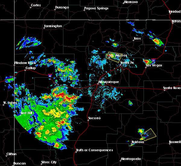
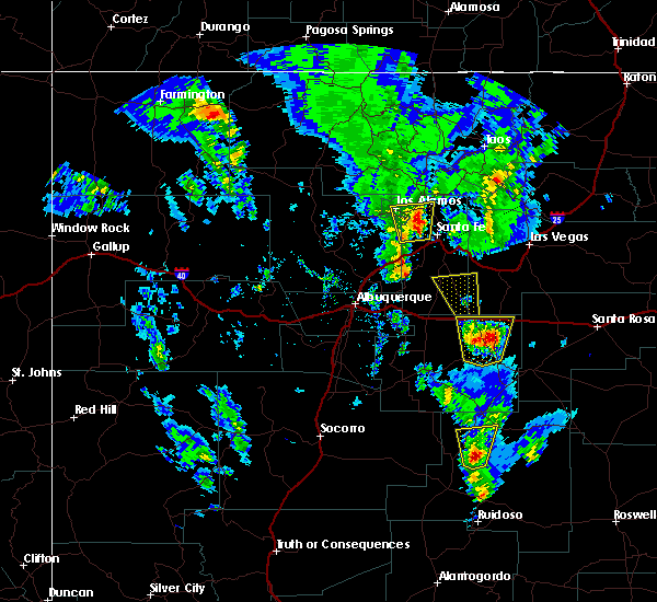
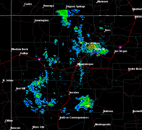
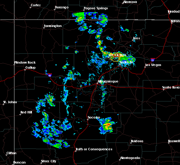
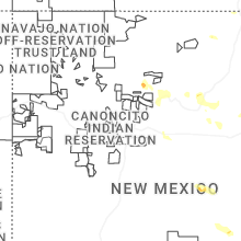
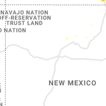
Hail Map for Tesuque Pueblo, NM
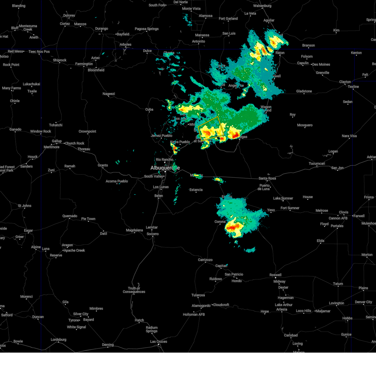
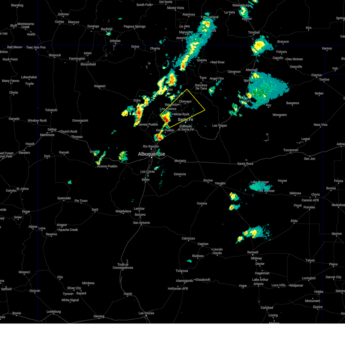
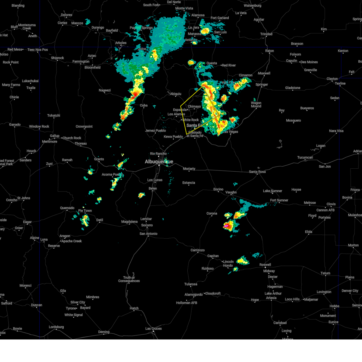
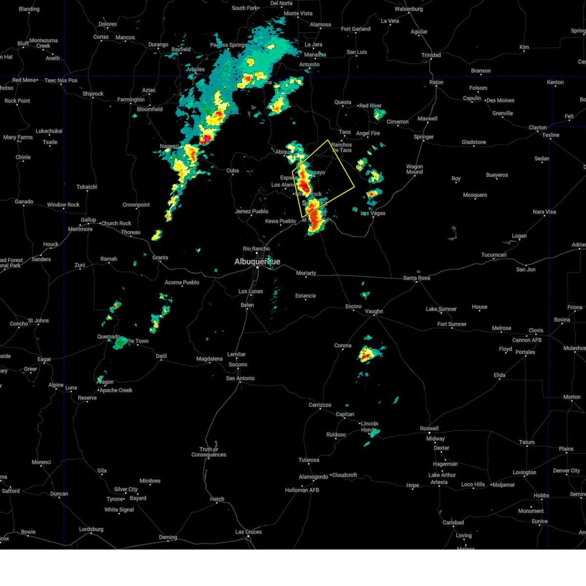
The Tesuque Pueblo, NM area has had 0 reports of on-the-ground hail by trained spotters, and has been under severe weather warnings 11 times during the past 12 months. Doppler radar has detected hail at or near Tesuque Pueblo, NM on 20 occasions, including 1 occasion during the past year.
| Name: | Tesuque Pueblo, NM |
| Where Located: | 47.4 miles SSW of Taos, NM |
| Map: | Google Map for Tesuque Pueblo, NM |
| Population: | 233 |
| Housing Units: | 84 |
| More Info: | Search Google for Tesuque Pueblo, NM |
0
The Top Recent Hail Date for Tesuque Pueblo, NM is Monday, May 26, 2025 (20th out of 20)
Hail and Wind Damage Spotted near Tesuque Pueblo, NM
| Date / Time | Report Details |
|---|---|
| 5/26/2025 2:48 PM MDT |
 the severe thunderstorm warning has been cancelled and is no longer in effect the severe thunderstorm warning has been cancelled and is no longer in effect
|
| 5/26/2025 2:37 PM MDT |
 At 237 pm mdt, a severe thunderstorm was located near hyde memorial state park, or 5 miles northeast of santa fe, moving northeast at 30 mph (radar indicated). Hazards include 60 mph wind gusts and quarter size hail. Hail damage to vehicles is expected. expect wind damage to roofs, siding, and trees. locations impacted include, santa fe, hyde memorial state park, tererro, cowles, tesuque, rio en medio in santa fe county, glorieta, canada de los alamos and chupadero. this includes the following highways, state road 63 between mile markers 10 and 25. Interstate 25 between mile markers 282 and 288. At 237 pm mdt, a severe thunderstorm was located near hyde memorial state park, or 5 miles northeast of santa fe, moving northeast at 30 mph (radar indicated). Hazards include 60 mph wind gusts and quarter size hail. Hail damage to vehicles is expected. expect wind damage to roofs, siding, and trees. locations impacted include, santa fe, hyde memorial state park, tererro, cowles, tesuque, rio en medio in santa fe county, glorieta, canada de los alamos and chupadero. this includes the following highways, state road 63 between mile markers 10 and 25. Interstate 25 between mile markers 282 and 288.
|
| 5/26/2025 2:25 PM MDT |
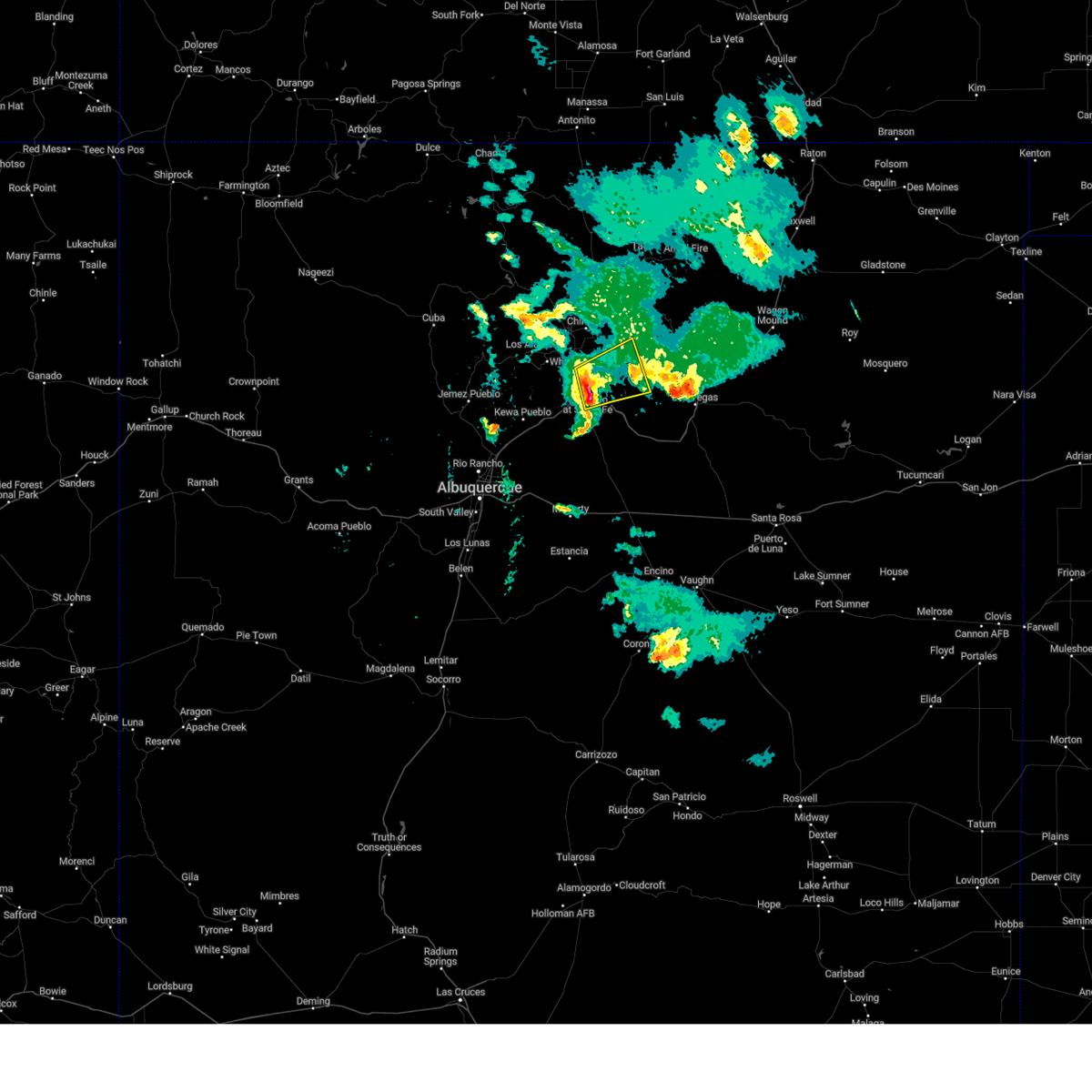
 Svrabq the national weather service in albuquerque has issued a * severe thunderstorm warning for, northeastern santa fe county in north central new mexico, west central mora county in northeastern new mexico, northwestern san miguel county in northeastern new mexico, * until 315 pm mdt. * at 225 pm mdt, a severe thunderstorm was located over santa fe, moving northeast at 30 mph (radar indicated). Hazards include 60 mph wind gusts and quarter size hail. Hail damage to vehicles is expected. Expect wind damage to roofs, siding, and trees. Svrabq the national weather service in albuquerque has issued a * severe thunderstorm warning for, northeastern santa fe county in north central new mexico, west central mora county in northeastern new mexico, northwestern san miguel county in northeastern new mexico, * until 315 pm mdt. * at 225 pm mdt, a severe thunderstorm was located over santa fe, moving northeast at 30 mph (radar indicated). Hazards include 60 mph wind gusts and quarter size hail. Hail damage to vehicles is expected. Expect wind damage to roofs, siding, and trees.
|
| 9/17/2024 3:42 PM MDT |
 The storm which prompted the warning has weakened below severe limits, and no longer poses an immediate threat to life or property. therefore, the warning will be allowed to expire. however, gusty winds are still possible with this thunderstorm. a severe thunderstorm watch remains in effect until 700 pm mdt for north central and northeastern new mexico. The storm which prompted the warning has weakened below severe limits, and no longer poses an immediate threat to life or property. therefore, the warning will be allowed to expire. however, gusty winds are still possible with this thunderstorm. a severe thunderstorm watch remains in effect until 700 pm mdt for north central and northeastern new mexico.
|
| 9/17/2024 3:21 PM MDT |
 At 320 pm mdt, a severe thunderstorm was located over pojoaque pueblo, or 7 miles south of espanola, moving northeast at 50 mph (radar indicated). Hazards include 60 mph wind gusts. Expect damage to roofs, siding, and trees. Locations impacted include, espanola, chimayo, white rock, pojoaque, santa clara pueblo, cuartelez, nambe pueblo, rio chiquito, embudo, and cundiyo. At 320 pm mdt, a severe thunderstorm was located over pojoaque pueblo, or 7 miles south of espanola, moving northeast at 50 mph (radar indicated). Hazards include 60 mph wind gusts. Expect damage to roofs, siding, and trees. Locations impacted include, espanola, chimayo, white rock, pojoaque, santa clara pueblo, cuartelez, nambe pueblo, rio chiquito, embudo, and cundiyo.
|
| 9/17/2024 3:21 PM MDT |
 the severe thunderstorm warning has been cancelled and is no longer in effect the severe thunderstorm warning has been cancelled and is no longer in effect
|
| 9/17/2024 3:02 PM MDT |
 Svrabq the national weather service in albuquerque has issued a * severe thunderstorm warning for, los alamos county in north central new mexico, northwestern san miguel county in northeastern new mexico, southeastern rio arriba county in north central new mexico, east central sandoval county in north central new mexico, northern santa fe county in north central new mexico, west central mora county in northeastern new mexico, * until 345 pm mdt. * at 301 pm mdt, a severe thunderstorm was located over white rock, or 7 miles south of los alamos, moving northeast at 45 mph (radar indicated). Hazards include 60 mph wind gusts and penny size hail. expect damage to roofs, siding, and trees Svrabq the national weather service in albuquerque has issued a * severe thunderstorm warning for, los alamos county in north central new mexico, northwestern san miguel county in northeastern new mexico, southeastern rio arriba county in north central new mexico, east central sandoval county in north central new mexico, northern santa fe county in north central new mexico, west central mora county in northeastern new mexico, * until 345 pm mdt. * at 301 pm mdt, a severe thunderstorm was located over white rock, or 7 miles south of los alamos, moving northeast at 45 mph (radar indicated). Hazards include 60 mph wind gusts and penny size hail. expect damage to roofs, siding, and trees
|
| 9/17/2024 1:06 PM MDT |
 The storms which prompted the warning have moved out of the area. therefore, the warning will be allowed to expire. however, small hail is still possible with these thunderstorms. a severe thunderstorm watch remains in effect until 700 pm mdt for north central and northeastern new mexico. The storms which prompted the warning have moved out of the area. therefore, the warning will be allowed to expire. however, small hail is still possible with these thunderstorms. a severe thunderstorm watch remains in effect until 700 pm mdt for north central and northeastern new mexico.
|
| 9/17/2024 12:27 PM MDT |
 the severe thunderstorm warning has been cancelled and is no longer in effect the severe thunderstorm warning has been cancelled and is no longer in effect
|
| 9/17/2024 12:27 PM MDT |
 At 1226 pm mdt, severe thunderstorms were located along a line extending from 6 miles northwest of espanola to santa fe, moving northeast at 45 mph (radar indicated). Hazards include 60 mph wind gusts and quarter size hail. Hail damage to vehicles is expected. expect wind damage to roofs, siding, and trees. locations impacted include, santa fe, espanola, chimayo, pojoaque, santa clara pueblo, cuartelez, nambe pueblo, rio chiquito, embudo, and penasco. this includes the following highways, highway 285 between mile markers 337 and 339. State road 63 between mile markers 24 and 25. At 1226 pm mdt, severe thunderstorms were located along a line extending from 6 miles northwest of espanola to santa fe, moving northeast at 45 mph (radar indicated). Hazards include 60 mph wind gusts and quarter size hail. Hail damage to vehicles is expected. expect wind damage to roofs, siding, and trees. locations impacted include, santa fe, espanola, chimayo, pojoaque, santa clara pueblo, cuartelez, nambe pueblo, rio chiquito, embudo, and penasco. this includes the following highways, highway 285 between mile markers 337 and 339. State road 63 between mile markers 24 and 25.
|
| 9/17/2024 12:11 PM MDT |
 Svrabq the national weather service in albuquerque has issued a * severe thunderstorm warning for, southwestern taos county in north central new mexico, eastern los alamos county in north central new mexico, northwestern san miguel county in northeastern new mexico, southeastern rio arriba county in north central new mexico, northern santa fe county in north central new mexico, west central mora county in northeastern new mexico, * until 115 pm mdt. * at 1210 pm mdt, severe thunderstorms were located along a line extending from near los alamos to la bajada, moving northeast at 45 mph (radar indicated). Hazards include 60 mph wind gusts. expect damage to roofs, siding, and trees Svrabq the national weather service in albuquerque has issued a * severe thunderstorm warning for, southwestern taos county in north central new mexico, eastern los alamos county in north central new mexico, northwestern san miguel county in northeastern new mexico, southeastern rio arriba county in north central new mexico, northern santa fe county in north central new mexico, west central mora county in northeastern new mexico, * until 115 pm mdt. * at 1210 pm mdt, severe thunderstorms were located along a line extending from near los alamos to la bajada, moving northeast at 45 mph (radar indicated). Hazards include 60 mph wind gusts. expect damage to roofs, siding, and trees
|
| 6/19/2024 4:02 PM MDT |
 the severe thunderstorm warning has been cancelled and is no longer in effect the severe thunderstorm warning has been cancelled and is no longer in effect
|
| 6/19/2024 3:44 PM MDT |
 At 344 pm mdt, a severe thunderstorm was located near white rock, or 10 miles southeast of los alamos, moving north at 40 mph (radar indicated). Hazards include 60 mph wind gusts and quarter size hail. Hail damage to vehicles is expected. expect wind damage to roofs, siding, and trees. Locations impacted include, northern santa fe, los alamos, espanola, chimayo, white rock, pojoaque, santa clara pueblo, cuartelez, nambe pueblo, and rio chiquito. At 344 pm mdt, a severe thunderstorm was located near white rock, or 10 miles southeast of los alamos, moving north at 40 mph (radar indicated). Hazards include 60 mph wind gusts and quarter size hail. Hail damage to vehicles is expected. expect wind damage to roofs, siding, and trees. Locations impacted include, northern santa fe, los alamos, espanola, chimayo, white rock, pojoaque, santa clara pueblo, cuartelez, nambe pueblo, and rio chiquito.
|
| 6/19/2024 3:28 PM MDT |
 Svrabq the national weather service in albuquerque has issued a * severe thunderstorm warning for, los alamos county in north central new mexico, southeastern rio arriba county in north central new mexico, east central sandoval county in north central new mexico, northwestern santa fe county in north central new mexico, * until 430 pm mdt. * at 327 pm mdt, a severe thunderstorm was located near la cienega, or 9 miles west of santa fe, moving north at 45 mph (radar indicated). Hazards include 60 mph wind gusts and quarter size hail. Hail damage to vehicles is expected. Expect wind damage to roofs, siding, and trees. Svrabq the national weather service in albuquerque has issued a * severe thunderstorm warning for, los alamos county in north central new mexico, southeastern rio arriba county in north central new mexico, east central sandoval county in north central new mexico, northwestern santa fe county in north central new mexico, * until 430 pm mdt. * at 327 pm mdt, a severe thunderstorm was located near la cienega, or 9 miles west of santa fe, moving north at 45 mph (radar indicated). Hazards include 60 mph wind gusts and quarter size hail. Hail damage to vehicles is expected. Expect wind damage to roofs, siding, and trees.
|
| 6/14/2024 7:21 PM MDT |
 The storm which prompted the warning has weakened below severe limits, and no longer poses an immediate threat to life or property. therefore, the warning will be allowed to expire. however, gusty winds are still possible with this thunderstorm. The storm which prompted the warning has weakened below severe limits, and no longer poses an immediate threat to life or property. therefore, the warning will be allowed to expire. however, gusty winds are still possible with this thunderstorm.
|
| 6/14/2024 7:09 PM MDT |
 Svrabq the national weather service in albuquerque has issued a * severe thunderstorm warning for, southeastern taos county in north central new mexico, northwestern san miguel county in northeastern new mexico, southeastern rio arriba county in north central new mexico, northeastern santa fe county in north central new mexico, western mora county in northeastern new mexico, * until 800 pm mdt. * at 707 pm mdt, a severe thunderstorm was located near cowles, or 15 miles northeast of santa fe, moving northeast at 40 mph (radar indicated). Hazards include 60 mph wind gusts. expect damage to roofs, siding, and trees Svrabq the national weather service in albuquerque has issued a * severe thunderstorm warning for, southeastern taos county in north central new mexico, northwestern san miguel county in northeastern new mexico, southeastern rio arriba county in north central new mexico, northeastern santa fe county in north central new mexico, western mora county in northeastern new mexico, * until 800 pm mdt. * at 707 pm mdt, a severe thunderstorm was located near cowles, or 15 miles northeast of santa fe, moving northeast at 40 mph (radar indicated). Hazards include 60 mph wind gusts. expect damage to roofs, siding, and trees
|
| 6/14/2024 7:09 PM MDT |
 At 708 pm mdt, a severe thunderstorm was located near cowles, or 16 miles northeast of santa fe, moving northeast at 35 mph (radar indicated). Hazards include 60 mph wind gusts. Expect damage to roofs, siding, and trees. locations impacted include, northeastern santa fe, chimayo, pojoaque, cowles, nambe pueblo, rio chiquito, hyde memorial state park, tererro, cundiyo, and rio en medio in santa fe county. This includes state road 63 between mile markers 8 and 25. At 708 pm mdt, a severe thunderstorm was located near cowles, or 16 miles northeast of santa fe, moving northeast at 35 mph (radar indicated). Hazards include 60 mph wind gusts. Expect damage to roofs, siding, and trees. locations impacted include, northeastern santa fe, chimayo, pojoaque, cowles, nambe pueblo, rio chiquito, hyde memorial state park, tererro, cundiyo, and rio en medio in santa fe county. This includes state road 63 between mile markers 8 and 25.
|
| 6/14/2024 6:44 PM MDT |
 Svrabq the national weather service in albuquerque has issued a * severe thunderstorm warning for, northwestern san miguel county in northeastern new mexico, southeastern rio arriba county in north central new mexico, northeastern santa fe county in north central new mexico, west central mora county in northeastern new mexico, * until 730 pm mdt. * at 644 pm mdt, a severe thunderstorm was located over santa fe, moving northeast at 35 mph (radar indicated). Hazards include 60 mph wind gusts. expect damage to roofs, siding, and trees Svrabq the national weather service in albuquerque has issued a * severe thunderstorm warning for, northwestern san miguel county in northeastern new mexico, southeastern rio arriba county in north central new mexico, northeastern santa fe county in north central new mexico, west central mora county in northeastern new mexico, * until 730 pm mdt. * at 644 pm mdt, a severe thunderstorm was located over santa fe, moving northeast at 35 mph (radar indicated). Hazards include 60 mph wind gusts. expect damage to roofs, siding, and trees
|
| 6/14/2024 6:37 PM MDT |
 At 636 pm mdt, a severe thunderstorm was located near santa fe, moving northeast at 40 mph (radar indicated). Hazards include 60 mph wind gusts. Expect damage to roofs, siding, and trees. Locations impacted include, santa fe, los alamos, white rock, pojoaque, eldorado at santa fe, cerrillos hills state park, canada de los alamos, glorieta, frijoles, and bandelier national monument. At 636 pm mdt, a severe thunderstorm was located near santa fe, moving northeast at 40 mph (radar indicated). Hazards include 60 mph wind gusts. Expect damage to roofs, siding, and trees. Locations impacted include, santa fe, los alamos, white rock, pojoaque, eldorado at santa fe, cerrillos hills state park, canada de los alamos, glorieta, frijoles, and bandelier national monument.
|
| 6/14/2024 5:50 PM MDT |
 Svrabq the national weather service in albuquerque has issued a * severe thunderstorm warning for, southeastern los alamos county in north central new mexico, east central sandoval county in north central new mexico, central santa fe county in north central new mexico, * until 645 pm mdt. * at 550 pm mdt, a severe thunderstorm was located over san felipe pueblo, or 10 miles northeast of bernalillo, moving east at 55 mph (radar indicated). Hazards include 60 mph wind gusts. expect damage to roofs, siding, and trees Svrabq the national weather service in albuquerque has issued a * severe thunderstorm warning for, southeastern los alamos county in north central new mexico, east central sandoval county in north central new mexico, central santa fe county in north central new mexico, * until 645 pm mdt. * at 550 pm mdt, a severe thunderstorm was located over san felipe pueblo, or 10 miles northeast of bernalillo, moving east at 55 mph (radar indicated). Hazards include 60 mph wind gusts. expect damage to roofs, siding, and trees
|
| 6/1/2023 1:50 PM MDT |
 At 150 pm mdt, a severe thunderstorm was located over hyde memorial state park, or 9 miles northeast of santa fe, moving northeast at 30 mph (radar indicated). Hazards include 60 mph wind gusts and quarter size hail. most hail has been the size of dimes with accumulations of hail on highways. Hail damage to vehicles is expected. expect wind damage to roofs, siding, and trees. locations impacted include, hyde memorial state park, rio en medio in santa fe county, tesuque and chupadero. hail threat, radar indicated max hail size, 1. 00 in wind threat, radar indicated max wind gust, 60 mph. At 150 pm mdt, a severe thunderstorm was located over hyde memorial state park, or 9 miles northeast of santa fe, moving northeast at 30 mph (radar indicated). Hazards include 60 mph wind gusts and quarter size hail. most hail has been the size of dimes with accumulations of hail on highways. Hail damage to vehicles is expected. expect wind damage to roofs, siding, and trees. locations impacted include, hyde memorial state park, rio en medio in santa fe county, tesuque and chupadero. hail threat, radar indicated max hail size, 1. 00 in wind threat, radar indicated max wind gust, 60 mph.
|
| 6/1/2023 1:24 PM MDT |
 At 124 pm mdt, a severe thunderstorm was located near santa fe, moving northeast at 30 mph (radar indicated). Hazards include 60 mph wind gusts and quarter size hail. Hail damage to vehicles is expected. Expect wind damage to roofs, siding, and trees. At 124 pm mdt, a severe thunderstorm was located near santa fe, moving northeast at 30 mph (radar indicated). Hazards include 60 mph wind gusts and quarter size hail. Hail damage to vehicles is expected. Expect wind damage to roofs, siding, and trees.
|
| 7/11/2021 5:01 PM MDT |
 At 501 pm mdt, a severe thunderstorm was located over tesuque, or near santa fe, moving southwest at 15 mph (radar indicated). Hazards include 60 mph wind gusts and quarter size hail. Hail damage to vehicles is expected. Expect wind damage to roofs, siding, and trees. At 501 pm mdt, a severe thunderstorm was located over tesuque, or near santa fe, moving southwest at 15 mph (radar indicated). Hazards include 60 mph wind gusts and quarter size hail. Hail damage to vehicles is expected. Expect wind damage to roofs, siding, and trees.
|
| 5/22/2021 4:47 PM MDT |
 At 446 pm mdt, a severe thunderstorm was located over rio en medio in santa fe county, or 10 miles north of santa fe, moving north at 40 mph (radar indicated). Hazards include 60 mph wind gusts and quarter size hail. Hail damage to vehicles is expected. expect wind damage to roofs, siding, and trees. this severe storm will be near, pojoaque pueblo, jaconita and jacona around 450 pm mdt. chimayo, rio chiquito, la puebla, santa cruz and cordova around 505 pm mdt. velarde and ojo sarco around 520 pm mdt. dixon, embudo, chamisal and rio lucio around 525 pm mdt. this includes the following highways, interstate 25 between mile markers 283 and 284. Highway 285 between mile markers 342 and 347. At 446 pm mdt, a severe thunderstorm was located over rio en medio in santa fe county, or 10 miles north of santa fe, moving north at 40 mph (radar indicated). Hazards include 60 mph wind gusts and quarter size hail. Hail damage to vehicles is expected. expect wind damage to roofs, siding, and trees. this severe storm will be near, pojoaque pueblo, jaconita and jacona around 450 pm mdt. chimayo, rio chiquito, la puebla, santa cruz and cordova around 505 pm mdt. velarde and ojo sarco around 520 pm mdt. dixon, embudo, chamisal and rio lucio around 525 pm mdt. this includes the following highways, interstate 25 between mile markers 283 and 284. Highway 285 between mile markers 342 and 347.
|
| 5/22/2021 4:23 PM MDT |
 At 423 pm mdt, a severe thunderstorm was located over southern santa fe, moving north at 55 mph (radar indicated). Hazards include 60 mph wind gusts and quarter size hail. Hail damage to vehicles is expected. Expect wind damage to roofs, siding, and trees. At 423 pm mdt, a severe thunderstorm was located over southern santa fe, moving north at 55 mph (radar indicated). Hazards include 60 mph wind gusts and quarter size hail. Hail damage to vehicles is expected. Expect wind damage to roofs, siding, and trees.
|
| 6/2/2019 5:36 PM MDT |
 At 536 pm mdt, a severe thunderstorm was located over hyde memorial state park, or 8 miles northeast of santa fe, moving northeast at 35 mph (radar indicated). Hazards include 60 mph wind gusts and quarter size hail. Hail damage to vehicles is expected. expect wind damage to roofs, siding, and trees. Locations impacted include, northeastern santa fe, cundiyo, rio chiquito, hyde memorial state park, rio en medio in santa fe county, tesuque, cordova, chupadero and chimayo. At 536 pm mdt, a severe thunderstorm was located over hyde memorial state park, or 8 miles northeast of santa fe, moving northeast at 35 mph (radar indicated). Hazards include 60 mph wind gusts and quarter size hail. Hail damage to vehicles is expected. expect wind damage to roofs, siding, and trees. Locations impacted include, northeastern santa fe, cundiyo, rio chiquito, hyde memorial state park, rio en medio in santa fe county, tesuque, cordova, chupadero and chimayo.
|
| 6/2/2019 5:24 PM MDT |
 At 524 pm mdt, a severe thunderstorm was located over eastern santa fe, moving northeast at 35 mph (radar indicated). Hazards include 60 mph wind gusts and quarter size hail. Hail damage to vehicles is expected. Expect wind damage to roofs, siding, and trees. At 524 pm mdt, a severe thunderstorm was located over eastern santa fe, moving northeast at 35 mph (radar indicated). Hazards include 60 mph wind gusts and quarter size hail. Hail damage to vehicles is expected. Expect wind damage to roofs, siding, and trees.
|
| 5/21/2018 4:23 PM MDT |
 The severe thunderstorm warning for south central taos, eastern los alamos, southeastern rio arriba and northern santa fe counties will expire at 430 pm mdt, the storms which prompted the warning have weakened below severe limits, and no longer pose an immediate threat to life or property. therefore the warning will be allowed to expire. however gusty winds are still possible with these thunderstorms. a severe thunderstorm watch remains in effect until 700 pm mdt for north central new mexico. The severe thunderstorm warning for south central taos, eastern los alamos, southeastern rio arriba and northern santa fe counties will expire at 430 pm mdt, the storms which prompted the warning have weakened below severe limits, and no longer pose an immediate threat to life or property. therefore the warning will be allowed to expire. however gusty winds are still possible with these thunderstorms. a severe thunderstorm watch remains in effect until 700 pm mdt for north central new mexico.
|
| 5/21/2018 4:07 PM MDT |
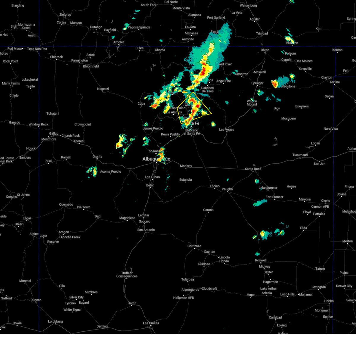
 At 407 pm mdt, severe thunderstorms were located along a line extending from 7 miles north of los alamos to near rio en medio in santa fe county, moving northeast at 35 mph (radar indicated). Hazards include 60 mph wind gusts. Expect damage to roofs, siding, and trees. locations impacted include, santa fe, los alamos, espanola, white rock, pojoaque, chimayo, santa clara pueblo, cuartelez, nambe pueblo and rio chiquito. this includes the following highways, interstate 25 between mile markers 268 and 281. Highway 285 between mile markers 337 and 349. At 407 pm mdt, severe thunderstorms were located along a line extending from 7 miles north of los alamos to near rio en medio in santa fe county, moving northeast at 35 mph (radar indicated). Hazards include 60 mph wind gusts. Expect damage to roofs, siding, and trees. locations impacted include, santa fe, los alamos, espanola, white rock, pojoaque, chimayo, santa clara pueblo, cuartelez, nambe pueblo and rio chiquito. this includes the following highways, interstate 25 between mile markers 268 and 281. Highway 285 between mile markers 337 and 349.
|
| 5/21/2018 3:44 PM MDT |
 At 344 pm mdt, severe thunderstorms were located along a line extending from 7 miles southwest of los alamos to 8 miles southeast of white rock, moving northeast at 45 mph (radar indicated). Hazards include 60 mph wind gusts and quarter size hail. Hail damage to vehicles is expected. Expect wind damage to roofs, siding, and trees. At 344 pm mdt, severe thunderstorms were located along a line extending from 7 miles southwest of los alamos to 8 miles southeast of white rock, moving northeast at 45 mph (radar indicated). Hazards include 60 mph wind gusts and quarter size hail. Hail damage to vehicles is expected. Expect wind damage to roofs, siding, and trees.
|
| 6/25/2017 3:03 PM MDT |
 At 303 pm mdt, a severe thunderstorm was located near los alamos, moving east at 15 mph (radar indicated). Hazards include ping pong ball size hail and 60 mph wind gusts. People and animals outdoors will be injured. expect hail damage to roofs, siding, windows, and vehicles. Expect wind damage to roofs, siding, and trees. At 303 pm mdt, a severe thunderstorm was located near los alamos, moving east at 15 mph (radar indicated). Hazards include ping pong ball size hail and 60 mph wind gusts. People and animals outdoors will be injured. expect hail damage to roofs, siding, windows, and vehicles. Expect wind damage to roofs, siding, and trees.
|
| 5/9/2017 12:47 PM MDT |
 At 1247 pm mdt, a severe thunderstorm was located near white rock, or 11 miles southeast of los alamos, moving north at 35 mph (radar indicated). Hazards include 60 mph wind gusts and quarter size hail. Hail damage to vehicles is expected. expect wind damage to roofs, siding, and trees. Locations impacted include, los alamos, white rock, pojoaque, frijoles, bandelier national monument, pojoaque pueblo, san ildefonso pueblo, el rancho, cuyamungue and jaconita. At 1247 pm mdt, a severe thunderstorm was located near white rock, or 11 miles southeast of los alamos, moving north at 35 mph (radar indicated). Hazards include 60 mph wind gusts and quarter size hail. Hail damage to vehicles is expected. expect wind damage to roofs, siding, and trees. Locations impacted include, los alamos, white rock, pojoaque, frijoles, bandelier national monument, pojoaque pueblo, san ildefonso pueblo, el rancho, cuyamungue and jaconita.
|
| 5/9/2017 12:13 PM MDT |
 At 1212 pm mdt, a severe thunderstorm was located near la cienega, or 13 miles southwest of santa fe, moving north at 30 mph (radar indicated). Hazards include 60 mph wind gusts and quarter size hail. Hail damage to vehicles is expected. Expect wind damage to roofs, siding, and trees. At 1212 pm mdt, a severe thunderstorm was located near la cienega, or 13 miles southwest of santa fe, moving north at 30 mph (radar indicated). Hazards include 60 mph wind gusts and quarter size hail. Hail damage to vehicles is expected. Expect wind damage to roofs, siding, and trees.
|
| 6/4/2016 7:37 PM MDT |
 The severe thunderstorm warning for northwestern santa fe county will expire at 745 pm mdt, the storm which prompted the warning has weakened below severe limits. therefore the warning will be allowed to expire. however small hail, .gusty winds, heavy rain, and flooding are still possible with this thunderstorm. The severe thunderstorm warning for northwestern santa fe county will expire at 745 pm mdt, the storm which prompted the warning has weakened below severe limits. therefore the warning will be allowed to expire. however small hail, .gusty winds, heavy rain, and flooding are still possible with this thunderstorm.
|
| 6/4/2016 7:23 PM MDT |
 At 723 pm mdt, a severe thunderstorm was located near pojoaque, or 10 miles south of espanola, moving south at 10 mph (radar indicated). Hazards include 60 mph wind gusts and penny size hail. Expect damage to roofs. siding. and trees. locations impacted include, white rock, pojoaque, pojoaque pueblo, nambe lake, el rancho, jacona, jaconita, cuyamungue and san ildefonso pueblo. other locations affected include the following location buckman river white rock canyon. T At 723 pm mdt, a severe thunderstorm was located near pojoaque, or 10 miles south of espanola, moving south at 10 mph (radar indicated). Hazards include 60 mph wind gusts and penny size hail. Expect damage to roofs. siding. and trees. locations impacted include, white rock, pojoaque, pojoaque pueblo, nambe lake, el rancho, jacona, jaconita, cuyamungue and san ildefonso pueblo. other locations affected include the following location buckman river white rock canyon. T
|
| 6/4/2016 6:59 PM MDT |
 At 659 pm mdt, a severe thunderstorm was located over pojoaque, or 6 miles south of espanola, moving south at 10 mph (radar indicated). Hazards include quarter size hail and 60 mph wind gusts. Hail damage to vehicles is expected. Expect wind damage to roofs, siding, and trees. At 659 pm mdt, a severe thunderstorm was located over pojoaque, or 6 miles south of espanola, moving south at 10 mph (radar indicated). Hazards include quarter size hail and 60 mph wind gusts. Hail damage to vehicles is expected. Expect wind damage to roofs, siding, and trees.
|
| 5/15/2016 3:22 PM MDT |
 At 322 pm mdt, a severe thunderstorm was located near white rock, or 7 miles east of los alamos, moving northeast at 30 mph (radar indicated). Hazards include quarter size hail and 60 mph wind gusts. Hail damage to vehicles is expected. expect wind damage to roofs, siding and trees. this severe thunderstorm will be near, san ildefonso pueblo around 330 pm mdt. el rancho, jaconita and jacona around 335 pm mdt. pojoaque, pojoaque pueblo, santa clara pueblo, nambe lake and cuyamungue around 340 pm mdt. Espanola, chimayo, sombrillo, cuartelez, la puebla, santa cruz, cundiyo, nambe pueblo, rio chiquito and ohkay owingeh pueblo around 345 pm mdt. At 322 pm mdt, a severe thunderstorm was located near white rock, or 7 miles east of los alamos, moving northeast at 30 mph (radar indicated). Hazards include quarter size hail and 60 mph wind gusts. Hail damage to vehicles is expected. expect wind damage to roofs, siding and trees. this severe thunderstorm will be near, san ildefonso pueblo around 330 pm mdt. el rancho, jaconita and jacona around 335 pm mdt. pojoaque, pojoaque pueblo, santa clara pueblo, nambe lake and cuyamungue around 340 pm mdt. Espanola, chimayo, sombrillo, cuartelez, la puebla, santa cruz, cundiyo, nambe pueblo, rio chiquito and ohkay owingeh pueblo around 345 pm mdt.
|
Hail Maps for Tesuque Pueblo, NM


Connect with Interactive Hail Maps