

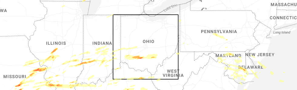
Hail Map for The Plains, OH
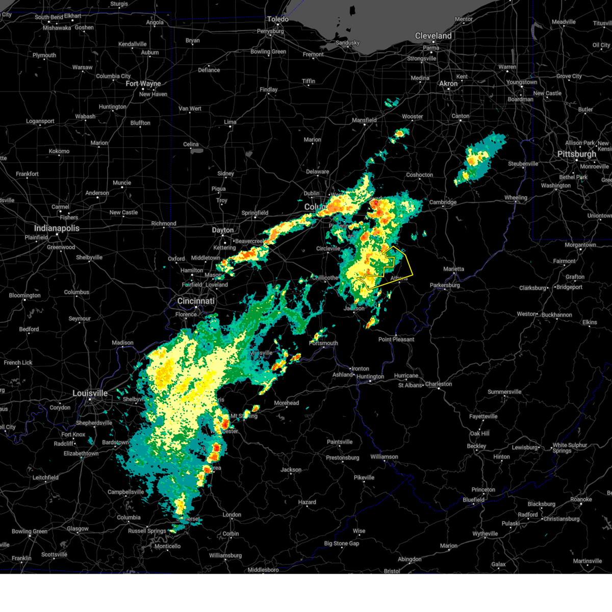
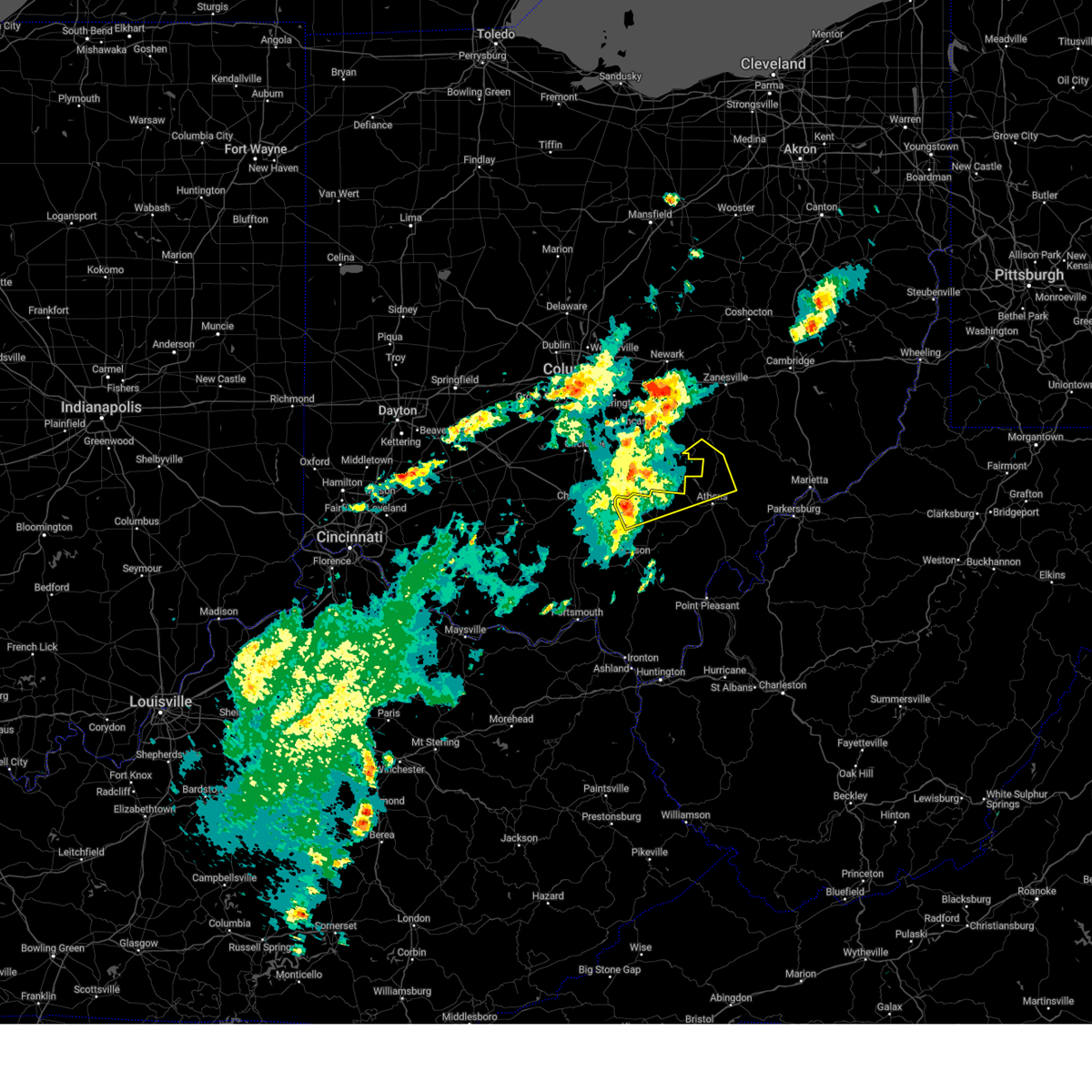
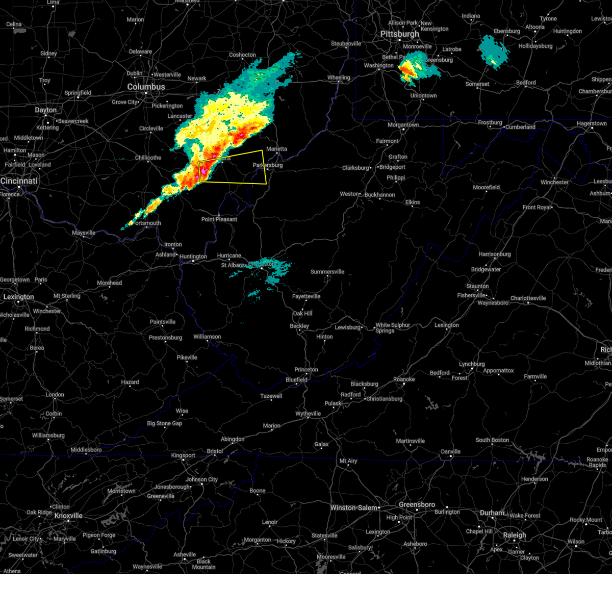
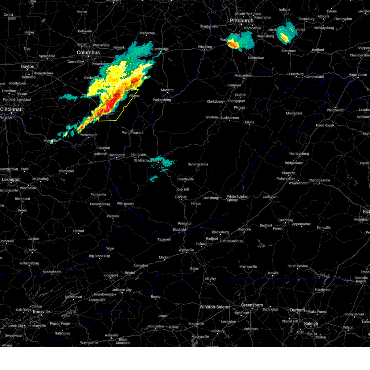
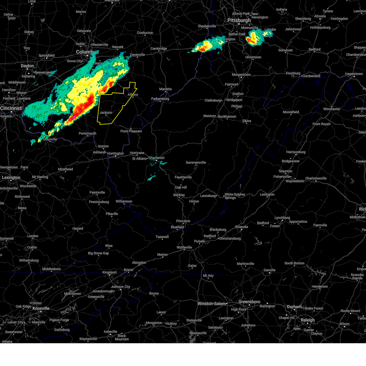
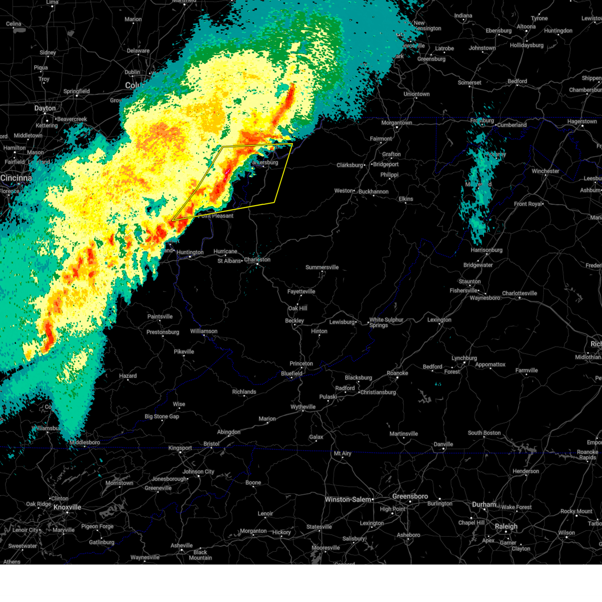
The The Plains, OH area has had 2 reports of on-the-ground hail by trained spotters, and has been under severe weather warnings 36 times during the past 12 months. Doppler radar has detected hail at or near The Plains, OH on 37 occasions, including 4 occasions during the past year.
| Name: | The Plains, OH |
| Where Located: | 61.8 miles SE of Columbus, OH |
| Map: | Google Map for The Plains, OH |
| Population: | 3080 |
| Housing Units: | 1499 |
| More Info: | Search Google for The Plains, OH |
0
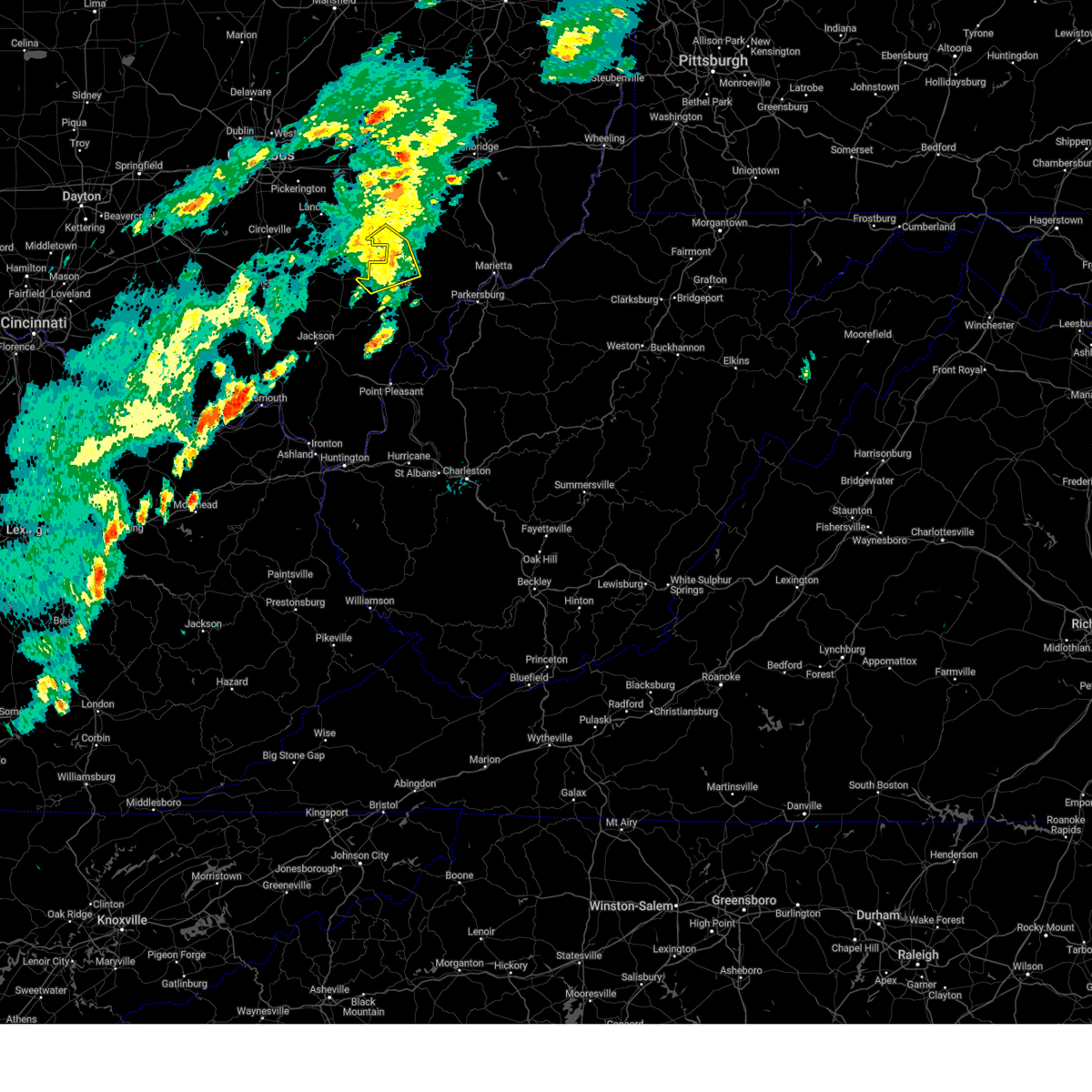
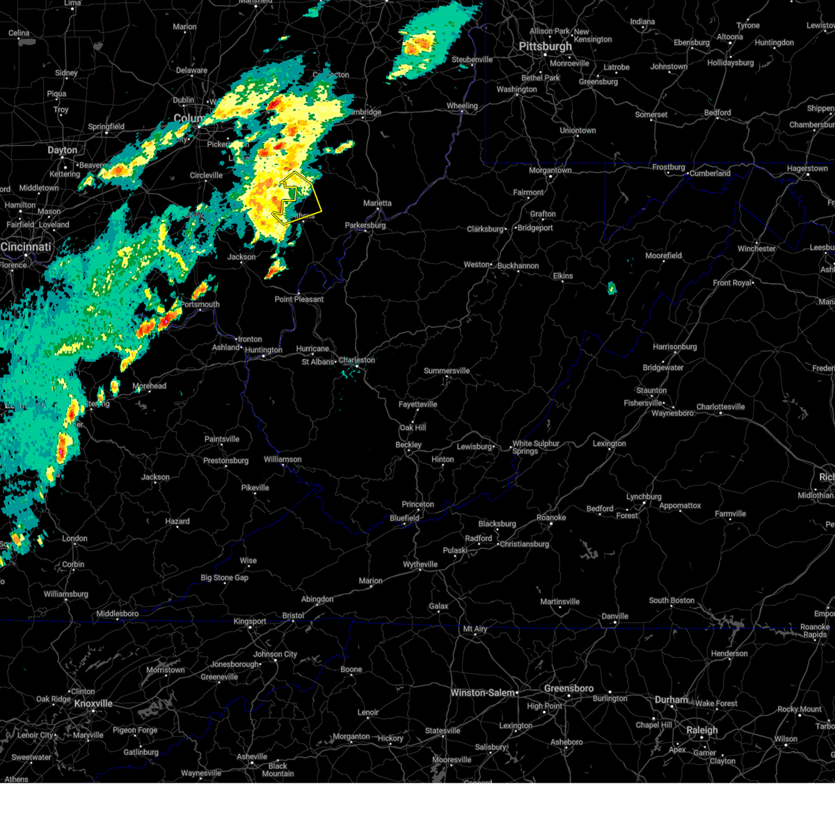
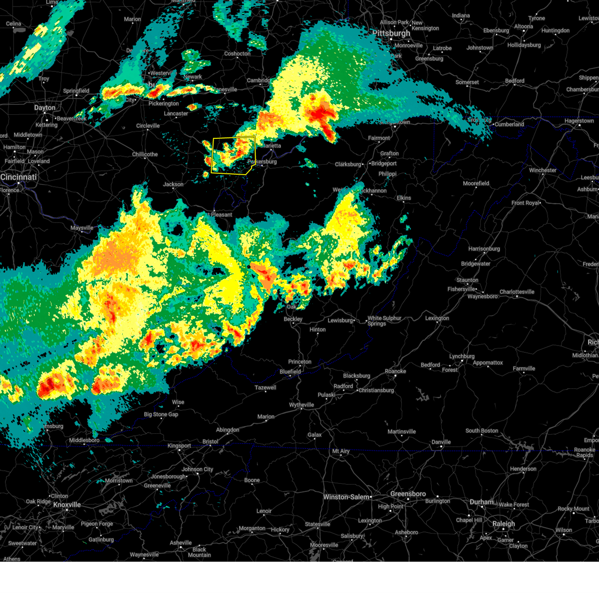
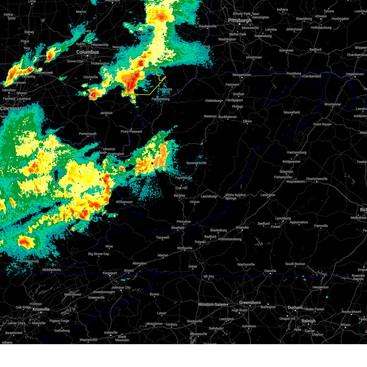
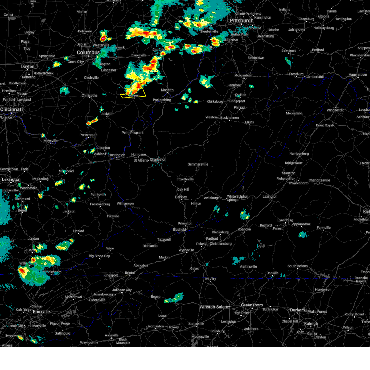
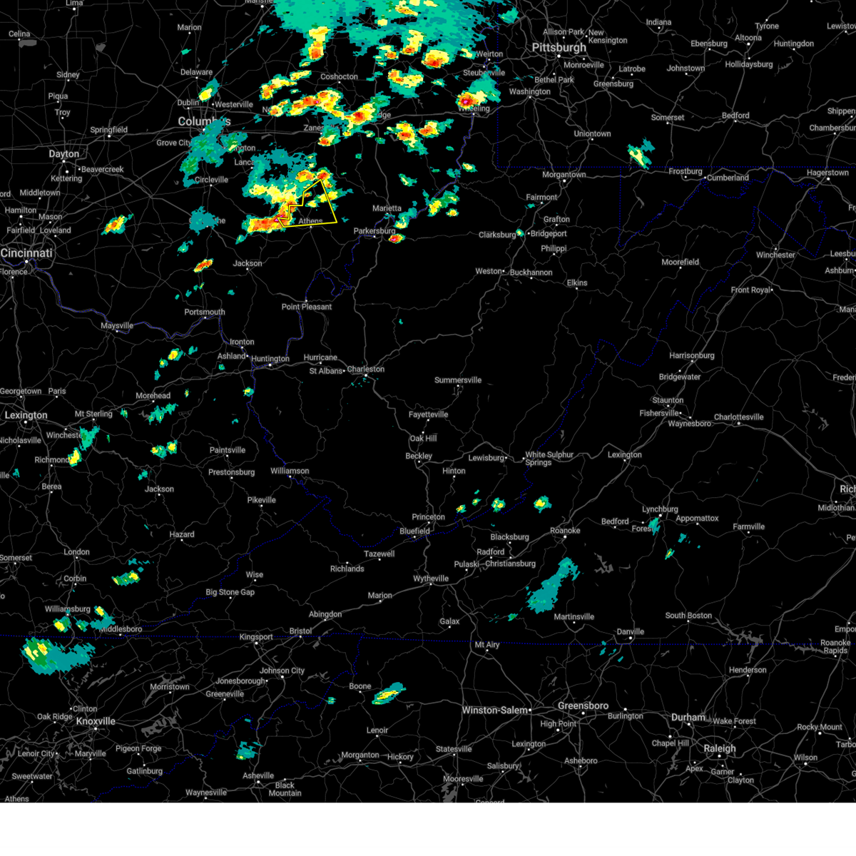
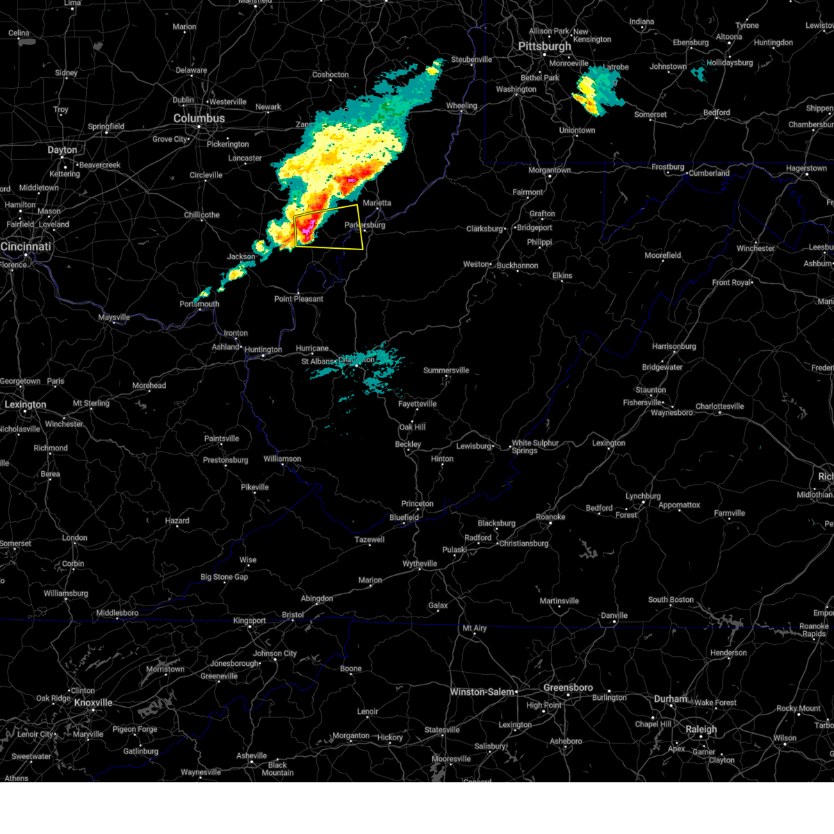
The Top Recent Hail Date for The Plains, OH is Friday, May 16, 2025 (19th out of 37)
Hail and Wind Damage Spotted near The Plains, OH
| Date / Time | Report Details |
|---|---|
| 6/18/2025 10:46 PM EDT |
 The storms which prompted the warning have weakened below severe limits, and no longer pose an immediate threat to life or property. therefore, the warning has been allowed to expire. however, gusty winds are still possible with these thunderstorms. a severe thunderstorm watch remains in effect until 300 am edt for southeastern ohio. to report severe weather, contact your nearest law enforcement agency. they will relay your report to the national weather service charleston west virginia. The storms which prompted the warning have weakened below severe limits, and no longer pose an immediate threat to life or property. therefore, the warning has been allowed to expire. however, gusty winds are still possible with these thunderstorms. a severe thunderstorm watch remains in effect until 300 am edt for southeastern ohio. to report severe weather, contact your nearest law enforcement agency. they will relay your report to the national weather service charleston west virginia.
|
| 6/18/2025 10:38 PM EDT |
 the severe thunderstorm warning has been cancelled and is no longer in effect the severe thunderstorm warning has been cancelled and is no longer in effect
|
| 6/18/2025 10:38 PM EDT |
 At 1038 pm edt, severe thunderstorms were located along a line extending from near nelsonville to near wellston, moving east at 40 mph (radar indicated). Hazards include 60 mph wind gusts. Expect damage to roofs, siding, and trees. Locations impacted include, jackson, wellston, nelsonville, mcarthur, lake hope state park, chauncey, hamden, buchtel, jacksonville, coalton, zaleski, creola, radcliffe, byer, and the plains. At 1038 pm edt, severe thunderstorms were located along a line extending from near nelsonville to near wellston, moving east at 40 mph (radar indicated). Hazards include 60 mph wind gusts. Expect damage to roofs, siding, and trees. Locations impacted include, jackson, wellston, nelsonville, mcarthur, lake hope state park, chauncey, hamden, buchtel, jacksonville, coalton, zaleski, creola, radcliffe, byer, and the plains.
|
| 6/18/2025 10:05 PM EDT |
 Svrrlx the national weather service in charleston west virginia has issued a * severe thunderstorm warning for, northwestern meigs county in southeastern ohio, north central gallia county in southeastern ohio, jackson county in southeastern ohio, vinton county in southeastern ohio, western athens county in southeastern ohio, * until 1045 pm edt. * at 1005 pm edt, severe thunderstorms were located along a line extending from 10 miles southwest of hocking hills state park to piketon, moving east at 45 mph (radar indicated). Hazards include 60 mph wind gusts. expect damage to roofs, siding, and trees Svrrlx the national weather service in charleston west virginia has issued a * severe thunderstorm warning for, northwestern meigs county in southeastern ohio, north central gallia county in southeastern ohio, jackson county in southeastern ohio, vinton county in southeastern ohio, western athens county in southeastern ohio, * until 1045 pm edt. * at 1005 pm edt, severe thunderstorms were located along a line extending from 10 miles southwest of hocking hills state park to piketon, moving east at 45 mph (radar indicated). Hazards include 60 mph wind gusts. expect damage to roofs, siding, and trees
|
| 6/9/2025 2:35 PM EDT |
 The storm which prompted the warning has weakened below severe limits, and no longer poses an immediate threat to life or property. therefore, the warning will be allowed to expire. however, gusty winds and heavy rain are still possible with this thunderstorm. The storm which prompted the warning has weakened below severe limits, and no longer poses an immediate threat to life or property. therefore, the warning will be allowed to expire. however, gusty winds and heavy rain are still possible with this thunderstorm.
|
| 6/9/2025 2:19 PM EDT |
 At 219 pm edt, a severe thunderstorm was located near nelsonville, moving northeast at 40 mph (radar indicated). Hazards include 60 mph wind gusts and quarter size hail. Hail damage to vehicles is expected. expect wind damage to roofs, siding, and trees. Locations impacted include, nelsonville, glouster, shawnee, chauncey, new straitsville, corning, buchtel, jacksonville, trimble, hemlock, amesville, rendville, burr oak state park, and the plains. At 219 pm edt, a severe thunderstorm was located near nelsonville, moving northeast at 40 mph (radar indicated). Hazards include 60 mph wind gusts and quarter size hail. Hail damage to vehicles is expected. expect wind damage to roofs, siding, and trees. Locations impacted include, nelsonville, glouster, shawnee, chauncey, new straitsville, corning, buchtel, jacksonville, trimble, hemlock, amesville, rendville, burr oak state park, and the plains.
|
| 6/9/2025 2:08 PM EDT |
 At 208 pm edt, a severe thunderstorm was located near hocking hills state park, or near lake hope state park, moving northeast at 40 mph (radar indicated). Hazards include 60 mph wind gusts and quarter size hail. Hail damage to vehicles is expected. expect wind damage to roofs, siding, and trees. Locations impacted include, nelsonville, glouster, shawnee, lake hope state park, chauncey, new straitsville, corning, buchtel, jacksonville, trimble, zaleski, hemlock, amesville, rendville, creola, burr oak state park, and the plains. At 208 pm edt, a severe thunderstorm was located near hocking hills state park, or near lake hope state park, moving northeast at 40 mph (radar indicated). Hazards include 60 mph wind gusts and quarter size hail. Hail damage to vehicles is expected. expect wind damage to roofs, siding, and trees. Locations impacted include, nelsonville, glouster, shawnee, lake hope state park, chauncey, new straitsville, corning, buchtel, jacksonville, trimble, zaleski, hemlock, amesville, rendville, creola, burr oak state park, and the plains.
|
| 6/9/2025 1:55 PM EDT |
 Svrrlx the national weather service in charleston west virginia has issued a * severe thunderstorm warning for, southeastern perry county in southeastern ohio, southwestern morgan county in southeastern ohio, northern vinton county in southeastern ohio, northwestern athens county in southeastern ohio, * until 245 pm edt. * at 154 pm edt, a severe thunderstorm was located 8 miles southwest of hocking hills state park, or 9 miles northwest of mcarthur, moving northeast at 50 mph (radar indicated). Hazards include 60 mph wind gusts and quarter size hail. Hail damage to vehicles is expected. Expect wind damage to roofs, siding, and trees. Svrrlx the national weather service in charleston west virginia has issued a * severe thunderstorm warning for, southeastern perry county in southeastern ohio, southwestern morgan county in southeastern ohio, northern vinton county in southeastern ohio, northwestern athens county in southeastern ohio, * until 245 pm edt. * at 154 pm edt, a severe thunderstorm was located 8 miles southwest of hocking hills state park, or 9 miles northwest of mcarthur, moving northeast at 50 mph (radar indicated). Hazards include 60 mph wind gusts and quarter size hail. Hail damage to vehicles is expected. Expect wind damage to roofs, siding, and trees.
|
| 5/17/2025 12:28 AM EDT |
 The storm which prompted the warning has weakened below severe limits, and no longer poses an immediate threat to life or property. therefore, the warning will be allowed to expire. however, gusty winds are still possible with this thunderstorm. a tornado watch remains in effect until 300 am edt for portions of southeastern ohio. a severe thunderstorm watch remains in effect until 500 am edt for portions of southeastern ohio and northwestern west virginia. The storm which prompted the warning has weakened below severe limits, and no longer poses an immediate threat to life or property. therefore, the warning will be allowed to expire. however, gusty winds are still possible with this thunderstorm. a tornado watch remains in effect until 300 am edt for portions of southeastern ohio. a severe thunderstorm watch remains in effect until 500 am edt for portions of southeastern ohio and northwestern west virginia.
|
| 5/17/2025 12:16 AM EDT |
 the severe thunderstorm warning has been cancelled and is no longer in effect the severe thunderstorm warning has been cancelled and is no longer in effect
|
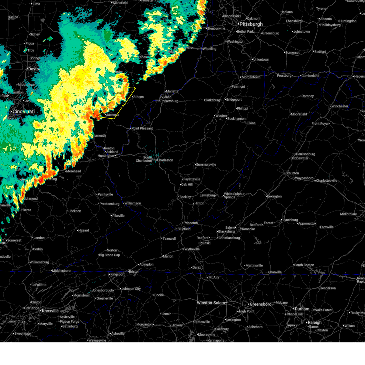
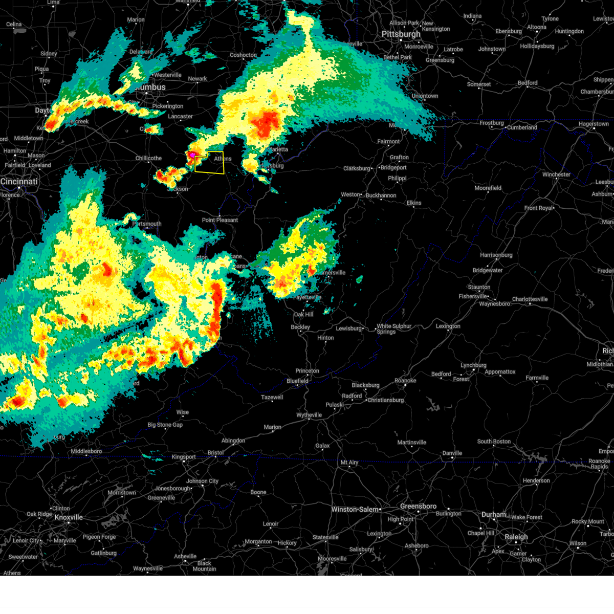
| 5/17/2025 12:16 AM EDT |
 At 1214 am edt, a severe thunderstorm was located near athens, moving east at 55 mph (radar indicated). Hazards include 60 mph wind gusts and quarter size hail. Hail damage to vehicles is expected. expect wind damage to roofs, siding, and trees. Locations impacted include, athens, glouster, coolville, chesterhill, chauncey, jacksonville, trimble, amesville, stroud run state park, bartlett, the plains, and little hocking. At 1214 am edt, a severe thunderstorm was located near athens, moving east at 55 mph (radar indicated). Hazards include 60 mph wind gusts and quarter size hail. Hail damage to vehicles is expected. expect wind damage to roofs, siding, and trees. Locations impacted include, athens, glouster, coolville, chesterhill, chauncey, jacksonville, trimble, amesville, stroud run state park, bartlett, the plains, and little hocking.
|
| 5/17/2025 12:01 AM EDT |
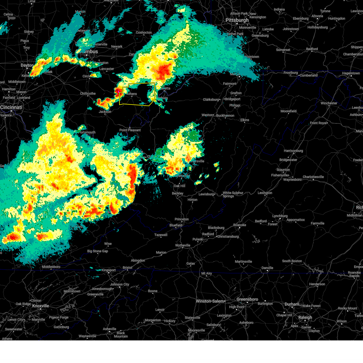 Svrrlx the national weather service in charleston west virginia has issued a * severe thunderstorm warning for, southwestern washington county in southeastern ohio, southwestern morgan county in southeastern ohio, northeastern vinton county in southeastern ohio, athens county in southeastern ohio, * until 1230 am edt. * at 1201 am edt, a severe thunderstorm was located near nelsonville, moving east at 50 mph (radar indicated). Hazards include 60 mph wind gusts and half dollar size hail. Hail damage to vehicles is expected. Expect wind damage to roofs, siding, and trees. Svrrlx the national weather service in charleston west virginia has issued a * severe thunderstorm warning for, southwestern washington county in southeastern ohio, southwestern morgan county in southeastern ohio, northeastern vinton county in southeastern ohio, athens county in southeastern ohio, * until 1230 am edt. * at 1201 am edt, a severe thunderstorm was located near nelsonville, moving east at 50 mph (radar indicated). Hazards include 60 mph wind gusts and half dollar size hail. Hail damage to vehicles is expected. Expect wind damage to roofs, siding, and trees.
|
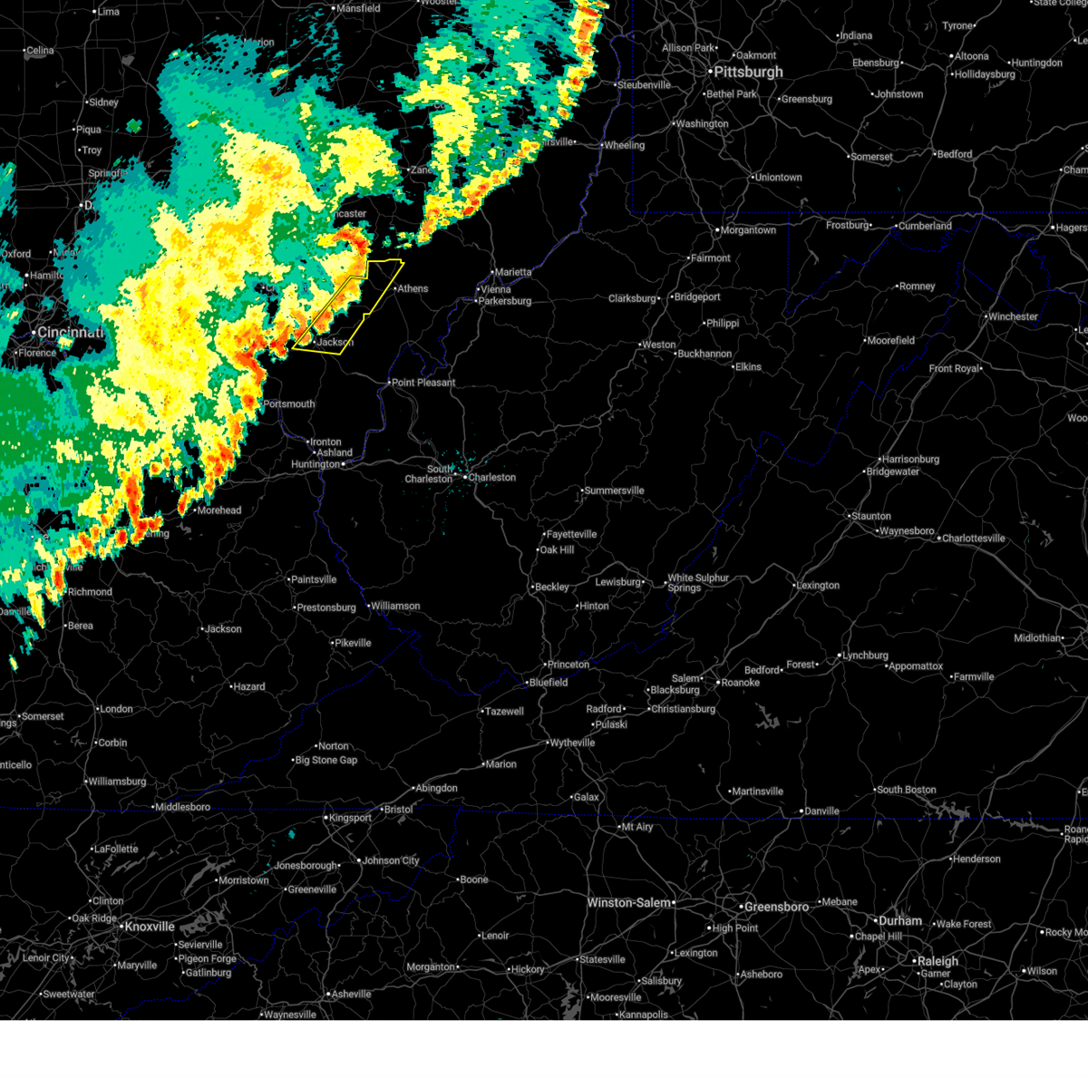
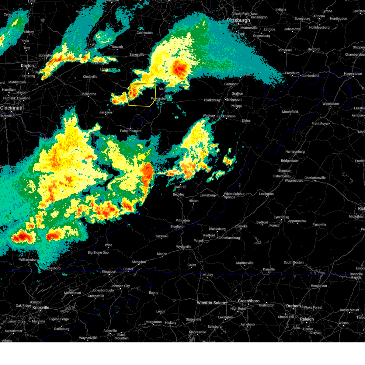
| 5/16/2025 11:54 PM EDT |
 At 1154 pm edt, a severe thunderstorm was located over lake hope state park, moving east at 55 mph (radar indicated). Hazards include 60 mph wind gusts and half dollar size hail. Hail damage to vehicles is expected. expect wind damage to roofs, siding, and trees. Locations impacted include, athens, lake hope state park, chauncey, zaleski, and the plains. At 1154 pm edt, a severe thunderstorm was located over lake hope state park, moving east at 55 mph (radar indicated). Hazards include 60 mph wind gusts and half dollar size hail. Hail damage to vehicles is expected. expect wind damage to roofs, siding, and trees. Locations impacted include, athens, lake hope state park, chauncey, zaleski, and the plains.
|
| 5/16/2025 11:32 PM EDT | Svrrlx the national weather service in charleston west virginia has issued a * severe thunderstorm warning for, northern vinton county in southeastern ohio, southwestern athens county in southeastern ohio, * until midnight edt. * at 1132 pm edt, a severe thunderstorm was located 10 miles southwest of hocking hills state park, or 14 miles northwest of mcarthur, moving east at 55 mph (radar indicated). Hazards include 60 mph wind gusts and half dollar size hail. Hail damage to vehicles is expected. Expect wind damage to roofs, siding, and trees. |
| 5/16/2025 11:30 PM EDT |
 At 1129 pm edt, severe thunderstorms were located along a line extending from mcconnelsville to near glouster, moving east at 60 mph (radar indicated). Hazards include 60 mph wind gusts and half dollar size hail. Hail damage to vehicles is expected. expect wind damage to roofs, siding, and trees. Locations impacted include, nelsonville, glouster, mcconnelsville, beverly, chesterhill, chauncey, malta, corning, buchtel, stockport, jacksonville, trimble, bristol, hemlock, amesville, rendville, burr oak state park, hackney, eagleport, and bartlett. At 1129 pm edt, severe thunderstorms were located along a line extending from mcconnelsville to near glouster, moving east at 60 mph (radar indicated). Hazards include 60 mph wind gusts and half dollar size hail. Hail damage to vehicles is expected. expect wind damage to roofs, siding, and trees. Locations impacted include, nelsonville, glouster, mcconnelsville, beverly, chesterhill, chauncey, malta, corning, buchtel, stockport, jacksonville, trimble, bristol, hemlock, amesville, rendville, burr oak state park, hackney, eagleport, and bartlett.
|
| 5/16/2025 11:14 PM EDT | Svrrlx the national weather service in charleston west virginia has issued a * severe thunderstorm warning for, southeastern perry county in southeastern ohio, northwestern washington county in southeastern ohio, morgan county in southeastern ohio, northern athens county in southeastern ohio, * until 1145 pm edt. * at 1113 pm edt, severe thunderstorms were located along a line extending from near shawnee to 6 miles north of lake hope state park, moving east at 60 mph (radar indicated). Hazards include 60 mph wind gusts and half dollar size hail. Hail damage to vehicles is expected. Expect wind damage to roofs, siding, and trees. |
| 5/2/2025 4:26 PM EDT |
 The storm which prompted the warning has weakened below severe limits, and no longer poses an immediate threat to life or property. therefore, the warning will be allowed to expire. however, gusty winds and heavy rain are still possible with this thunderstorm. The storm which prompted the warning has weakened below severe limits, and no longer poses an immediate threat to life or property. therefore, the warning will be allowed to expire. however, gusty winds and heavy rain are still possible with this thunderstorm.
|
| 5/2/2025 4:16 PM EDT | At 416 pm edt, a severe thunderstorm was located over glouster, moving northeast at 50 mph (radar indicated). Hazards include 60 mph wind gusts and quarter size hail. Hail damage to vehicles is expected. expect wind damage to roofs, siding, and trees. Locations impacted include, athens, nelsonville, glouster, chauncey, corning, buchtel, jacksonville, trimble, amesville, burr oak state park, and the plains. |
| 5/2/2025 4:01 PM EDT |
 Svrrlx the national weather service in charleston west virginia has issued a * severe thunderstorm warning for, southeastern perry county in southeastern ohio, southwestern morgan county in southeastern ohio, northeastern vinton county in southeastern ohio, northwestern athens county in southeastern ohio, * until 430 pm edt. * at 401 pm edt, a severe thunderstorm was located near lake hope state park, moving northeast at 45 mph (radar indicated). Hazards include 60 mph wind gusts and quarter size hail. Hail damage to vehicles is expected. Expect wind damage to roofs, siding, and trees. Svrrlx the national weather service in charleston west virginia has issued a * severe thunderstorm warning for, southeastern perry county in southeastern ohio, southwestern morgan county in southeastern ohio, northeastern vinton county in southeastern ohio, northwestern athens county in southeastern ohio, * until 430 pm edt. * at 401 pm edt, a severe thunderstorm was located near lake hope state park, moving northeast at 45 mph (radar indicated). Hazards include 60 mph wind gusts and quarter size hail. Hail damage to vehicles is expected. Expect wind damage to roofs, siding, and trees.
|
| 4/19/2025 6:52 PM EDT |
 the severe thunderstorm warning has been cancelled and is no longer in effect the severe thunderstorm warning has been cancelled and is no longer in effect
|
| 4/19/2025 6:52 PM EDT |
 At 651 pm edt, a severe thunderstorm was located near athens, moving east at 60 mph (radar indicated). Hazards include 60 mph wind gusts and penny size hail. Expect damage to roofs, siding, and trees. Locations impacted include, coolville, tuppers plains, blennerhassett, stroud run state park, athens, lubeck, washington, the plains, little hocking, and belpre. At 651 pm edt, a severe thunderstorm was located near athens, moving east at 60 mph (radar indicated). Hazards include 60 mph wind gusts and penny size hail. Expect damage to roofs, siding, and trees. Locations impacted include, coolville, tuppers plains, blennerhassett, stroud run state park, athens, lubeck, washington, the plains, little hocking, and belpre.
|
| 4/19/2025 6:42 PM EDT |
 Svrrlx the national weather service in charleston west virginia has issued a * severe thunderstorm warning for, northern meigs county in southeastern ohio, southwestern washington county in southeastern ohio, northeastern vinton county in southeastern ohio, athens county in southeastern ohio, west central wood county in northwestern west virginia, * until 715 pm edt. * at 641 pm edt, a severe thunderstorm was located near albany, moving east at 55 mph (radar indicated). Hazards include 60 mph wind gusts and penny size hail. expect damage to roofs, siding, and trees Svrrlx the national weather service in charleston west virginia has issued a * severe thunderstorm warning for, northern meigs county in southeastern ohio, southwestern washington county in southeastern ohio, northeastern vinton county in southeastern ohio, athens county in southeastern ohio, west central wood county in northwestern west virginia, * until 715 pm edt. * at 641 pm edt, a severe thunderstorm was located near albany, moving east at 55 mph (radar indicated). Hazards include 60 mph wind gusts and penny size hail. expect damage to roofs, siding, and trees
|
| 4/19/2025 6:26 PM EDT |
 At 626 pm edt, severe thunderstorms were located along a line extending from 6 miles southeast of logan to 9 miles west of jackson, moving east at 55 mph (radar indicated). Hazards include 60 mph wind gusts and penny size hail. Expect damage to roofs, siding, and trees. Locations impacted include, wellston, lake hope state park, chauncey, creola, buchtel, radcliffe, zaleski, coalton, jackson, nelsonville, allensville, trimble, byer, glouster, jacksonville, mcarthur, the plains, and hamden. At 626 pm edt, severe thunderstorms were located along a line extending from 6 miles southeast of logan to 9 miles west of jackson, moving east at 55 mph (radar indicated). Hazards include 60 mph wind gusts and penny size hail. Expect damage to roofs, siding, and trees. Locations impacted include, wellston, lake hope state park, chauncey, creola, buchtel, radcliffe, zaleski, coalton, jackson, nelsonville, allensville, trimble, byer, glouster, jacksonville, mcarthur, the plains, and hamden.
|
| 4/19/2025 5:59 PM EDT |
 Svrrlx the national weather service in charleston west virginia has issued a * severe thunderstorm warning for, jackson county in southeastern ohio, vinton county in southeastern ohio, western athens county in southeastern ohio, * until 645 pm edt. * at 559 pm edt, severe thunderstorms were located along a line extending from 6 miles east of chillicothe to near peebles, moving east at 55 mph (radar indicated). Hazards include 60 mph wind gusts and quarter size hail. Hail damage to vehicles is expected. Expect wind damage to roofs, siding, and trees. Svrrlx the national weather service in charleston west virginia has issued a * severe thunderstorm warning for, jackson county in southeastern ohio, vinton county in southeastern ohio, western athens county in southeastern ohio, * until 645 pm edt. * at 559 pm edt, severe thunderstorms were located along a line extending from 6 miles east of chillicothe to near peebles, moving east at 55 mph (radar indicated). Hazards include 60 mph wind gusts and quarter size hail. Hail damage to vehicles is expected. Expect wind damage to roofs, siding, and trees.
|
| 4/3/2025 3:31 AM EDT |
 At 331 am edt, severe thunderstorms were located along a line extending from near chesterhill to 7 miles northwest of point pleasant, moving east at 45 mph (radar indicated). Hazards include 70 mph wind gusts. Expect considerable tree damage. damage is likely to mobile homes, roofs, and outbuildings. Locations impacted include, sandyville, point pleasant, belmont, stroud run state park, adamsville, pomeroy, mineralwells, little hocking, salem center, fleming, syracuse, dexter, amesville, racine, albany, gallia, peewee, rutland, parkersburg, and hartford city. At 331 am edt, severe thunderstorms were located along a line extending from near chesterhill to 7 miles northwest of point pleasant, moving east at 45 mph (radar indicated). Hazards include 70 mph wind gusts. Expect considerable tree damage. damage is likely to mobile homes, roofs, and outbuildings. Locations impacted include, sandyville, point pleasant, belmont, stroud run state park, adamsville, pomeroy, mineralwells, little hocking, salem center, fleming, syracuse, dexter, amesville, racine, albany, gallia, peewee, rutland, parkersburg, and hartford city.
|
| 4/3/2025 3:29 AM EDT | The storm which prompted the warning has weakened below severe limits, and no longer appears capable of producing a tornado. therefore, the warning will be allowed to expire. a severe thunderstorm watch remains in effect until 700 am edt for southeastern ohio. |
| 4/3/2025 3:19 AM EDT | the tornado warning has been cancelled and is no longer in effect |
| 4/3/2025 3:19 AM EDT | At 318 am edt, a severe thunderstorm capable of producing a tornado was located near albany, moving northeast at 65 mph (radar indicated rotation). Hazards include tornado. Flying debris will be dangerous to those caught without shelter. mobile homes will be damaged or destroyed. damage to roofs, windows, and vehicles will occur. tree damage is likely. this dangerous storm will be near, athens and albany around 325 am edt. Other locations impacted by this tornadic thunderstorm include dyesville, darwin, salem center, wilkesville, radcliffe, harrisonville, dexter, carpenter, and the plains. |
| 4/3/2025 3:09 AM EDT |
 Svrrlx the national weather service in charleston west virginia has issued a * severe thunderstorm warning for, meigs county in southeastern ohio, northern gallia county in southeastern ohio, southern washington county in southeastern ohio, southeastern jackson county in southeastern ohio, southeastern vinton county in southeastern ohio, athens county in southeastern ohio, northwestern lawrence county in southeastern ohio, southwestern pleasants county in northwestern west virginia, northwestern mason county in western west virginia, western wirt county in northwestern west virginia, northern jackson county in northwestern west virginia, wood county in northwestern west virginia, * until 345 am edt. * at 308 am edt, severe thunderstorms were located along a line extending from near nelsonville to near oak hill, moving east at 90 mph (radar indicated). Hazards include 70 mph wind gusts. Expect considerable tree damage. Damage is likely to mobile homes, roofs, and outbuildings. Svrrlx the national weather service in charleston west virginia has issued a * severe thunderstorm warning for, meigs county in southeastern ohio, northern gallia county in southeastern ohio, southern washington county in southeastern ohio, southeastern jackson county in southeastern ohio, southeastern vinton county in southeastern ohio, athens county in southeastern ohio, northwestern lawrence county in southeastern ohio, southwestern pleasants county in northwestern west virginia, northwestern mason county in western west virginia, western wirt county in northwestern west virginia, northern jackson county in northwestern west virginia, wood county in northwestern west virginia, * until 345 am edt. * at 308 am edt, severe thunderstorms were located along a line extending from near nelsonville to near oak hill, moving east at 90 mph (radar indicated). Hazards include 70 mph wind gusts. Expect considerable tree damage. Damage is likely to mobile homes, roofs, and outbuildings.
|
| 4/3/2025 3:05 AM EDT | Torrlx the national weather service in charleston west virginia has issued a * tornado warning for, northwestern meigs county in southeastern ohio, north central gallia county in southeastern ohio, northeastern jackson county in southeastern ohio, southeastern vinton county in southeastern ohio, southwestern athens county in southeastern ohio, * until 330 am edt. * at 305 am edt, a severe thunderstorm capable of producing a tornado was located near wellston, moving northeast at 65 mph (radar indicated rotation). Hazards include tornado. Flying debris will be dangerous to those caught without shelter. mobile homes will be damaged or destroyed. damage to roofs, windows, and vehicles will occur. tree damage is likely. this dangerous storm will be near, albany around 315 am edt. athens around 325 am edt. Other locations impacted by this tornadic thunderstorm include dyesville, darwin, salem center, wilkesville, radcliffe, harrisonville, coalton, dexter, carpenter, and the plains. |
| 3/30/2025 11:45 PM EDT |
 The storms which prompted the warning have weakened below severe limits, and have exited the warned area. therefore, the warning has been allowed to expire. however, gusty winds are still possible with these thunderstorms. a severe thunderstorm watch remains in effect until 300 am edt for southeastern ohio. to report severe weather, contact your nearest law enforcement agency. they will relay your report to the national weather service charleston west virginia. The storms which prompted the warning have weakened below severe limits, and have exited the warned area. therefore, the warning has been allowed to expire. however, gusty winds are still possible with these thunderstorms. a severe thunderstorm watch remains in effect until 300 am edt for southeastern ohio. to report severe weather, contact your nearest law enforcement agency. they will relay your report to the national weather service charleston west virginia.
|
| 3/30/2025 11:27 PM EDT | At 1127 pm edt, severe thunderstorms were located along a line extending from near south zanesville to nelsonville, moving east at 45 mph (radar indicated). Hazards include 60 mph wind gusts and penny size hail. Expect damage to roofs, siding, and trees. Locations impacted include, lake hope state park, chauncey, creola, buchtel, shawnee, new straitsville, burr oak state park, mcconnelsville, rendville, new lexington, malta, eagleport, nelsonville, allensville, trimble, hemlock, glouster, jacksonville, crooksville, and the plains. |
| 3/30/2025 10:53 PM EDT |
 Svrrlx the national weather service in charleston west virginia has issued a * severe thunderstorm warning for, perry county in southeastern ohio, western morgan county in southeastern ohio, northern vinton county in southeastern ohio, northwestern athens county in southeastern ohio, * until 1145 pm edt. * at 1052 pm edt, severe thunderstorms were located along a line extending from near bremen to 10 miles southwest of hocking hills state park, moving east at 45 mph (radar indicated). Hazards include 60 mph wind gusts and penny size hail. expect damage to roofs, siding, and trees Svrrlx the national weather service in charleston west virginia has issued a * severe thunderstorm warning for, perry county in southeastern ohio, western morgan county in southeastern ohio, northern vinton county in southeastern ohio, northwestern athens county in southeastern ohio, * until 1145 pm edt. * at 1052 pm edt, severe thunderstorms were located along a line extending from near bremen to 10 miles southwest of hocking hills state park, moving east at 45 mph (radar indicated). Hazards include 60 mph wind gusts and penny size hail. expect damage to roofs, siding, and trees
|
| 3/16/2025 11:39 AM EDT |
 Svrrlx the national weather service in charleston west virginia has issued a * severe thunderstorm warning for, southeastern perry county in southeastern ohio, northwestern washington county in southeastern ohio, morgan county in southeastern ohio, central athens county in southeastern ohio, * until 1215 pm edt. * at 1139 am edt, severe thunderstorms were located along a line extending from near south zanesville to 7 miles east of new lexington to near glouster to 6 miles southeast of buchtel, moving east at 60 mph (radar indicated). Hazards include 60 mph wind gusts. expect damage to roofs, siding, and trees Svrrlx the national weather service in charleston west virginia has issued a * severe thunderstorm warning for, southeastern perry county in southeastern ohio, northwestern washington county in southeastern ohio, morgan county in southeastern ohio, central athens county in southeastern ohio, * until 1215 pm edt. * at 1139 am edt, severe thunderstorms were located along a line extending from near south zanesville to 7 miles east of new lexington to near glouster to 6 miles southeast of buchtel, moving east at 60 mph (radar indicated). Hazards include 60 mph wind gusts. expect damage to roofs, siding, and trees
|
| 7/14/2024 5:19 PM EDT |
 At 518 pm edt, severe thunderstorms were located along a line extending from near mcarthur to near jackson to near rosemount, moving southeast at 40 mph (radar indicated). Hazards include 60 mph wind gusts. Expect damage to roofs, siding, and trees. Locations impacted include, athens, jackson, wellston, mcarthur, oak hill, rio grande, albany, lake hope state park, gallia, vernon, hamden, coalton, zaleski, vinton, hanging rock, wilkesville, radcliffe, dyesville, petersburg, and salem center. At 518 pm edt, severe thunderstorms were located along a line extending from near mcarthur to near jackson to near rosemount, moving southeast at 40 mph (radar indicated). Hazards include 60 mph wind gusts. Expect damage to roofs, siding, and trees. Locations impacted include, athens, jackson, wellston, mcarthur, oak hill, rio grande, albany, lake hope state park, gallia, vernon, hamden, coalton, zaleski, vinton, hanging rock, wilkesville, radcliffe, dyesville, petersburg, and salem center.
|
| 7/14/2024 4:45 PM EDT |
 Svrrlx the national weather service in charleston west virginia has issued a * severe thunderstorm warning for, northwestern meigs county in southeastern ohio, northwestern gallia county in southeastern ohio, jackson county in southeastern ohio, vinton county in southeastern ohio, southwestern athens county in southeastern ohio, northwestern lawrence county in southeastern ohio, * until 545 pm edt. * at 442 pm edt, thunderstorms were located along a line extending from near kingston to near waverly to 6 miles south of kincaid springs, moving southeast at 40 mph (radar indicated). Hazards include 60 mph wind gusts. expect damage to roofs, siding, and trees Svrrlx the national weather service in charleston west virginia has issued a * severe thunderstorm warning for, northwestern meigs county in southeastern ohio, northwestern gallia county in southeastern ohio, jackson county in southeastern ohio, vinton county in southeastern ohio, southwestern athens county in southeastern ohio, northwestern lawrence county in southeastern ohio, * until 545 pm edt. * at 442 pm edt, thunderstorms were located along a line extending from near kingston to near waverly to 6 miles south of kincaid springs, moving southeast at 40 mph (radar indicated). Hazards include 60 mph wind gusts. expect damage to roofs, siding, and trees
|
| 6/14/2024 7:13 PM EDT |
 The storms which prompted the warning have weakened below severe limits, and no longer pose an immediate threat to life or property. therefore, the warning will be allowed to expire. however, 40 to 50 mph wind gusts are still possible with these thunderstorms. a severe thunderstorm watch remains in effect until 900 pm edt for southeastern ohio. The storms which prompted the warning have weakened below severe limits, and no longer pose an immediate threat to life or property. therefore, the warning will be allowed to expire. however, 40 to 50 mph wind gusts are still possible with these thunderstorms. a severe thunderstorm watch remains in effect until 900 pm edt for southeastern ohio.
|
| 6/14/2024 7:01 PM EDT |
 At 701 pm edt, severe thunderstorms were located along a line extending from buchtel to lake hope state park, moving southeast at 35 mph (radar indicated). Hazards include 60 mph wind gusts. Expect damage to roofs, siding, and trees. Locations impacted include, athens, albany, lake hope state park, chauncey, buchtel, and the plains. At 701 pm edt, severe thunderstorms were located along a line extending from buchtel to lake hope state park, moving southeast at 35 mph (radar indicated). Hazards include 60 mph wind gusts. Expect damage to roofs, siding, and trees. Locations impacted include, athens, albany, lake hope state park, chauncey, buchtel, and the plains.
|
| 6/14/2024 6:46 PM EDT |
 Svrrlx the national weather service in charleston west virginia has issued a * severe thunderstorm warning for, northeastern vinton county in southeastern ohio, western athens county in southeastern ohio, * until 715 pm edt. * at 646 pm edt, severe thunderstorms were located along a line extending from near nelsonville to near hocking hills state park, moving southeast at 35 mph (radar indicated). Hazards include 60 mph wind gusts. expect damage to roofs, siding, and trees Svrrlx the national weather service in charleston west virginia has issued a * severe thunderstorm warning for, northeastern vinton county in southeastern ohio, western athens county in southeastern ohio, * until 715 pm edt. * at 646 pm edt, severe thunderstorms were located along a line extending from near nelsonville to near hocking hills state park, moving southeast at 35 mph (radar indicated). Hazards include 60 mph wind gusts. expect damage to roofs, siding, and trees
|
| 5/26/2024 4:24 PM EDT |
 The storms which prompted the warning have moved out of the area. therefore, the warning will be allowed to expire. a severe thunderstorm watch remains in effect until 800 pm edt for southeastern ohio, and western west virginia. a severe thunderstorm watch also remains in effect until 900 pm edt for southeastern ohio. The storms which prompted the warning have moved out of the area. therefore, the warning will be allowed to expire. a severe thunderstorm watch remains in effect until 800 pm edt for southeastern ohio, and western west virginia. a severe thunderstorm watch also remains in effect until 900 pm edt for southeastern ohio.
|
| 5/26/2024 4:06 PM EDT |
 At 405 pm edt, severe thunderstorms were located along a line extending from near bremen to 6 miles southwest of albany to 10 miles south of gallipolis, moving east at 40 mph (radar indicated). Hazards include 60 mph wind gusts and quarter size hail. Hail damage to vehicles is expected. expect wind damage to roofs, siding, and trees. Locations impacted include, athens, nelsonville, new lexington, pomeroy, glouster, mcarthur, albany, shawnee, rutland, lake hope state park, mason, middleport, chauncey, junction city, new straitsville, corning, buchtel, jacksonville, trimble, and zaleski. At 405 pm edt, severe thunderstorms were located along a line extending from near bremen to 6 miles southwest of albany to 10 miles south of gallipolis, moving east at 40 mph (radar indicated). Hazards include 60 mph wind gusts and quarter size hail. Hail damage to vehicles is expected. expect wind damage to roofs, siding, and trees. Locations impacted include, athens, nelsonville, new lexington, pomeroy, glouster, mcarthur, albany, shawnee, rutland, lake hope state park, mason, middleport, chauncey, junction city, new straitsville, corning, buchtel, jacksonville, trimble, and zaleski.
|
| 5/26/2024 3:19 PM EDT |
 Svrrlx the national weather service in charleston west virginia has issued a * severe thunderstorm warning for, northwestern meigs county in southeastern ohio, southern perry county in southeastern ohio, northeastern gallia county in southeastern ohio, northeastern jackson county in southeastern ohio, vinton county in southeastern ohio, athens county in southeastern ohio, northwestern mason county in western west virginia, * until 430 pm edt. * at 319 pm edt, a severe thunderstorm was located over pike lake, or 11 miles west of waverly, moving east at 45 mph (radar indicated). Hazards include 60 mph wind gusts and quarter size hail. Hail damage to vehicles is expected. Expect wind damage to roofs, siding, and trees. Svrrlx the national weather service in charleston west virginia has issued a * severe thunderstorm warning for, northwestern meigs county in southeastern ohio, southern perry county in southeastern ohio, northeastern gallia county in southeastern ohio, northeastern jackson county in southeastern ohio, vinton county in southeastern ohio, athens county in southeastern ohio, northwestern mason county in western west virginia, * until 430 pm edt. * at 319 pm edt, a severe thunderstorm was located over pike lake, or 11 miles west of waverly, moving east at 45 mph (radar indicated). Hazards include 60 mph wind gusts and quarter size hail. Hail damage to vehicles is expected. Expect wind damage to roofs, siding, and trees.
|
| 4/17/2024 8:34 PM EDT |
 At 833 pm edt, severe thunderstorms were located along a line extending from 9 miles south of chesterhill to 12 miles southwest of hocking hills state park, moving southeast at 10 mph (radar indicated). Hazards include 60 mph wind gusts and quarter size hail. Hail damage to vehicles is expected. expect wind damage to roofs, siding, and trees. Locations impacted include, athens, wellston, mcarthur, albany, coolville, lake hope state park, chauncey, hamden, coalton, zaleski, amesville, creola, eagle mills, radcliffe, stroud run state park, little hocking, allensville, byer, carpenter, and the plains. At 833 pm edt, severe thunderstorms were located along a line extending from 9 miles south of chesterhill to 12 miles southwest of hocking hills state park, moving southeast at 10 mph (radar indicated). Hazards include 60 mph wind gusts and quarter size hail. Hail damage to vehicles is expected. expect wind damage to roofs, siding, and trees. Locations impacted include, athens, wellston, mcarthur, albany, coolville, lake hope state park, chauncey, hamden, coalton, zaleski, amesville, creola, eagle mills, radcliffe, stroud run state park, little hocking, allensville, byer, carpenter, and the plains.
|
| 4/17/2024 8:20 PM EDT |
 Svrrlx the national weather service in charleston west virginia has issued a * severe thunderstorm warning for, northwestern meigs county in southeastern ohio, southwestern washington county in southeastern ohio, northern jackson county in southeastern ohio, vinton county in southeastern ohio, athens county in southeastern ohio, * until 845 pm edt. * at 819 pm edt, severe thunderstorms were located along a line extending from 7 miles southwest of chesterhill to 12 miles southwest of hocking hills state park, moving southeast at 20 mph (radar indicated). Hazards include 60 mph wind gusts and quarter size hail. Hail damage to vehicles is expected. Expect wind damage to roofs, siding, and trees. Svrrlx the national weather service in charleston west virginia has issued a * severe thunderstorm warning for, northwestern meigs county in southeastern ohio, southwestern washington county in southeastern ohio, northern jackson county in southeastern ohio, vinton county in southeastern ohio, athens county in southeastern ohio, * until 845 pm edt. * at 819 pm edt, severe thunderstorms were located along a line extending from 7 miles southwest of chesterhill to 12 miles southwest of hocking hills state park, moving southeast at 20 mph (radar indicated). Hazards include 60 mph wind gusts and quarter size hail. Hail damage to vehicles is expected. Expect wind damage to roofs, siding, and trees.
|
| 4/17/2024 8:07 PM EDT |
 At 806 pm edt, severe thunderstorms were located along a line extending from nelsonville to 6 miles southwest of hocking hills state park, moving southeast at 30 mph (radar indicated). Hazards include 60 mph wind gusts and quarter size hail. Hail damage to vehicles is expected. expect wind damage to roofs, siding, and trees. Locations impacted include, athens, nelsonville, mcarthur, lake hope state park, chauncey, buchtel, zaleski, amesville, creola, eagle mills, and the plains. At 806 pm edt, severe thunderstorms were located along a line extending from nelsonville to 6 miles southwest of hocking hills state park, moving southeast at 30 mph (radar indicated). Hazards include 60 mph wind gusts and quarter size hail. Hail damage to vehicles is expected. expect wind damage to roofs, siding, and trees. Locations impacted include, athens, nelsonville, mcarthur, lake hope state park, chauncey, buchtel, zaleski, amesville, creola, eagle mills, and the plains.
|
| 4/17/2024 7:53 PM EDT |
 Svrrlx the national weather service in charleston west virginia has issued a * severe thunderstorm warning for, northern vinton county in southeastern ohio, northwestern athens county in southeastern ohio, * until 815 pm edt. * at 751 pm edt, severe thunderstorms were located along a line extending from near logan to 9 miles southwest of hocking hills state park, moving southeast at 25 mph (radar indicated). Hazards include 60 mph wind gusts and half dollar size hail. Hail damage to vehicles is expected. Expect wind damage to roofs, siding, and trees. Svrrlx the national weather service in charleston west virginia has issued a * severe thunderstorm warning for, northern vinton county in southeastern ohio, northwestern athens county in southeastern ohio, * until 815 pm edt. * at 751 pm edt, severe thunderstorms were located along a line extending from near logan to 9 miles southwest of hocking hills state park, moving southeast at 25 mph (radar indicated). Hazards include 60 mph wind gusts and half dollar size hail. Hail damage to vehicles is expected. Expect wind damage to roofs, siding, and trees.
|
| 8/12/2023 7:13 PM EDT |
 At 712 pm edt, a severe thunderstorm was located near athens, moving east at 20 mph (radar indicated). Hazards include 60 mph wind gusts. Expect damage to roofs, siding, and trees. Locations impacted include, athens, chauncey, and the plains. At 712 pm edt, a severe thunderstorm was located near athens, moving east at 20 mph (radar indicated). Hazards include 60 mph wind gusts. Expect damage to roofs, siding, and trees. Locations impacted include, athens, chauncey, and the plains.
|
| 8/12/2023 7:03 PM EDT |
 At 702 pm edt, a severe thunderstorm was located near lake hope state park, moving east at 20 mph (radar indicated). Hazards include 60 mph wind gusts. expect damage to roofs, siding, and trees At 702 pm edt, a severe thunderstorm was located near lake hope state park, moving east at 20 mph (radar indicated). Hazards include 60 mph wind gusts. expect damage to roofs, siding, and trees
|
| 3/3/2023 7:17 PM EST |
 At 715 pm est, a severe thunderstorm was located over tuppers plains, or near coolville, moving east at 60 mph (radar indicated). Hazards include 60 mph wind gusts. Expect damage to roofs, siding, and trees. locations impacted include, athens, nelsonville, gallipolis, glouster, rio grande, albany, rutland, chauncey, buchtel, jacksonville, trimble, vinton, wilkesville, adamsville, dyesville, salem center, harrisonville, gage, dexter and carpenter. hail threat, radar indicated max hail size, <. 75 in wind threat, radar indicated max wind gust, 60 mph. At 715 pm est, a severe thunderstorm was located over tuppers plains, or near coolville, moving east at 60 mph (radar indicated). Hazards include 60 mph wind gusts. Expect damage to roofs, siding, and trees. locations impacted include, athens, nelsonville, gallipolis, glouster, rio grande, albany, rutland, chauncey, buchtel, jacksonville, trimble, vinton, wilkesville, adamsville, dyesville, salem center, harrisonville, gage, dexter and carpenter. hail threat, radar indicated max hail size, <. 75 in wind threat, radar indicated max wind gust, 60 mph.
|
| 3/3/2023 6:58 PM EST |
 At 657 pm est, a line of severe thunderstorms was located 8 miles west of rutland, moving east at 60 mph (radar indicated). Hazards include 60 mph wind gusts. expect damage to roofs, siding, and trees At 657 pm est, a line of severe thunderstorms was located 8 miles west of rutland, moving east at 60 mph (radar indicated). Hazards include 60 mph wind gusts. expect damage to roofs, siding, and trees
|
| 3/3/2023 5:20 PM EST |
 At 517 pm est, a severe thunderstorm was located 10 miles west of rutland, moving east at 60 mph (radar indicated). Hazards include 60 mph wind gusts. Expect damage to roofs, siding, and trees. locations impacted include, athens, jackson, wellston, nelsonville, gallipolis, glouster, mcarthur, oak hill, rio grande, albany, rutland, lake hope state park, chauncey, hamden, buchtel, jacksonville, trimble, zaleski, vinton and wilkesville. hail threat, radar indicated max hail size, <. 75 in wind threat, radar indicated max wind gust, 60 mph. At 517 pm est, a severe thunderstorm was located 10 miles west of rutland, moving east at 60 mph (radar indicated). Hazards include 60 mph wind gusts. Expect damage to roofs, siding, and trees. locations impacted include, athens, jackson, wellston, nelsonville, gallipolis, glouster, mcarthur, oak hill, rio grande, albany, rutland, lake hope state park, chauncey, hamden, buchtel, jacksonville, trimble, zaleski, vinton and wilkesville. hail threat, radar indicated max hail size, <. 75 in wind threat, radar indicated max wind gust, 60 mph.
|
| 3/3/2023 4:57 PM EST |
 At 455 pm est, a severe thunderstorm was located over jackson, moving east at 65 mph (radar indicated). Hazards include 60 mph wind gusts. expect damage to roofs, siding, and trees At 455 pm est, a severe thunderstorm was located over jackson, moving east at 65 mph (radar indicated). Hazards include 60 mph wind gusts. expect damage to roofs, siding, and trees
|
| 7/23/2022 1:47 PM EDT |
 At 146 pm edt, a severe thunderstorm was located over albany, moving east at 35 mph (radar indicated). Hazards include 60 mph wind gusts and nickel size hail. expect damage to roofs, siding, and trees At 146 pm edt, a severe thunderstorm was located over albany, moving east at 35 mph (radar indicated). Hazards include 60 mph wind gusts and nickel size hail. expect damage to roofs, siding, and trees
|
| 6/22/2022 6:38 PM EDT |
 At 638 pm edt, a severe thunderstorm was located near athens, moving southeast at 15 mph (radar indicated). Hazards include 60 mph wind gusts and quarter size hail. Hail damage to vehicles is expected. expect wind damage to roofs, siding, and trees. locations impacted include, athens, nelsonville, chauncey, buchtel, amesville and the plains. hail threat, radar indicated max hail size, 1. 00 in wind threat, radar indicated max wind gust, 60 mph. At 638 pm edt, a severe thunderstorm was located near athens, moving southeast at 15 mph (radar indicated). Hazards include 60 mph wind gusts and quarter size hail. Hail damage to vehicles is expected. expect wind damage to roofs, siding, and trees. locations impacted include, athens, nelsonville, chauncey, buchtel, amesville and the plains. hail threat, radar indicated max hail size, 1. 00 in wind threat, radar indicated max wind gust, 60 mph.
|
| 6/22/2022 6:09 PM EDT |
 At 609 pm edt, a severe thunderstorm was located over nelsonville, moving southeast at 15 mph (radar indicated). Hazards include 60 mph wind gusts and quarter size hail. Hail damage to vehicles is expected. Expect wind damage to roofs, siding, and trees. At 609 pm edt, a severe thunderstorm was located over nelsonville, moving southeast at 15 mph (radar indicated). Hazards include 60 mph wind gusts and quarter size hail. Hail damage to vehicles is expected. Expect wind damage to roofs, siding, and trees.
|
| 6/12/2022 5:11 PM EDT |
 The severe thunderstorm warning for northeastern vinton and southwestern athens counties will expire at 515 pm edt, the severe thunderstorm which prompted the warning has weakened. therefore, the warning will be allowed to expire. however gusty winds and small hail are still possible with this thunderstorm. The severe thunderstorm warning for northeastern vinton and southwestern athens counties will expire at 515 pm edt, the severe thunderstorm which prompted the warning has weakened. therefore, the warning will be allowed to expire. however gusty winds and small hail are still possible with this thunderstorm.
|
| 6/12/2022 4:48 PM EDT |
 At 448 pm edt, a severe thunderstorm was located near hocking hills state park, or near lake hope state park, moving southeast at 30 mph (radar indicated). Hazards include 60 mph wind gusts and quarter size hail. Hail damage to vehicles is expected. Expect wind damage to roofs, siding, and trees. At 448 pm edt, a severe thunderstorm was located near hocking hills state park, or near lake hope state park, moving southeast at 30 mph (radar indicated). Hazards include 60 mph wind gusts and quarter size hail. Hail damage to vehicles is expected. Expect wind damage to roofs, siding, and trees.
|
| 6/8/2022 8:57 PM EDT |
 The severe thunderstorm warning for northwestern meigs and athens counties will expire at 900 pm edt, the storm which prompted the warning has weakened below severe limits, and no longer poses an immediate threat to life or property. therefore, the warning will be allowed to expire. a tornado watch remains in effect until 1000 pm edt for southeastern ohio. a tornado watch also remains in effect until 100 am edt for southeastern ohio. The severe thunderstorm warning for northwestern meigs and athens counties will expire at 900 pm edt, the storm which prompted the warning has weakened below severe limits, and no longer poses an immediate threat to life or property. therefore, the warning will be allowed to expire. a tornado watch remains in effect until 1000 pm edt for southeastern ohio. a tornado watch also remains in effect until 100 am edt for southeastern ohio.
|
| 6/8/2022 8:48 PM EDT |
 At 848 pm edt, a severe thunderstorm was located near athens, moving east at 55 mph (radar indicated). Hazards include 60 mph wind gusts. Expect damage to roofs, siding, and trees. locations impacted include, athens, albany, tuppers plains, chauncey, amesville, stroud run state park and the plains. hail threat, radar indicated max hail size, <. 75 in wind threat, radar indicated max wind gust, 60 mph. At 848 pm edt, a severe thunderstorm was located near athens, moving east at 55 mph (radar indicated). Hazards include 60 mph wind gusts. Expect damage to roofs, siding, and trees. locations impacted include, athens, albany, tuppers plains, chauncey, amesville, stroud run state park and the plains. hail threat, radar indicated max hail size, <. 75 in wind threat, radar indicated max wind gust, 60 mph.
|
| 6/8/2022 8:08 PM EDT |
 At 808 pm edt, a severe thunderstorm was located 10 miles southwest of hocking hills state park, or 11 miles northwest of mcarthur, moving east at 55 mph (radar indicated). Hazards include 60 mph wind gusts. expect damage to roofs, siding, and trees At 808 pm edt, a severe thunderstorm was located 10 miles southwest of hocking hills state park, or 11 miles northwest of mcarthur, moving east at 55 mph (radar indicated). Hazards include 60 mph wind gusts. expect damage to roofs, siding, and trees
|
| 6/8/2022 7:53 PM EDT |
 At 752 pm edt, a severe thunderstorm capable of producing a tornado was located near lake hope state park, moving east at 45 mph (radar indicated rotation). Hazards include tornado. Flying debris will be dangerous to those caught without shelter. mobile homes will be damaged or destroyed. damage to roofs, windows, and vehicles will occur. tree damage is likely. this dangerous storm will be near, athens around 805 pm edt. Other locations impacted by this tornadic thunderstorm include stroud run state park, amesville, chauncey and the plains. At 752 pm edt, a severe thunderstorm capable of producing a tornado was located near lake hope state park, moving east at 45 mph (radar indicated rotation). Hazards include tornado. Flying debris will be dangerous to those caught without shelter. mobile homes will be damaged or destroyed. damage to roofs, windows, and vehicles will occur. tree damage is likely. this dangerous storm will be near, athens around 805 pm edt. Other locations impacted by this tornadic thunderstorm include stroud run state park, amesville, chauncey and the plains.
|
| 3/23/2022 6:44 PM EDT |
 At 643 pm edt, a severe thunderstorm was located near lake hope state park, moving northeast at 70 mph (radar indicated). Hazards include 70 mph wind gusts and quarter size hail. Hail damage to vehicles is expected. expect considerable tree damage. wind damage is also likely to mobile homes, roofs, and outbuildings. Locations impacted include, athens, glouster, mcconnelsville, beverly, chesterhill, chauncey, malta, corning, stockport, jacksonville, trimble, bristol, amesville, rendville, stroud run state park, burr oak state park, hackney, eagleport and the plains. At 643 pm edt, a severe thunderstorm was located near lake hope state park, moving northeast at 70 mph (radar indicated). Hazards include 70 mph wind gusts and quarter size hail. Hail damage to vehicles is expected. expect considerable tree damage. wind damage is also likely to mobile homes, roofs, and outbuildings. Locations impacted include, athens, glouster, mcconnelsville, beverly, chesterhill, chauncey, malta, corning, stockport, jacksonville, trimble, bristol, amesville, rendville, stroud run state park, burr oak state park, hackney, eagleport and the plains.
|
| 3/23/2022 6:28 PM EDT |
 At 628 pm edt, a severe thunderstorm was located over wellston, moving northeast at 70 mph (radar indicated). Hazards include 60 mph wind gusts and quarter size hail. Hail damage to vehicles is expected. Expect wind damage to roofs, siding, and trees. At 628 pm edt, a severe thunderstorm was located over wellston, moving northeast at 70 mph (radar indicated). Hazards include 60 mph wind gusts and quarter size hail. Hail damage to vehicles is expected. Expect wind damage to roofs, siding, and trees.
|
| 3/23/2022 5:55 PM EDT |
 At 554 pm edt, a severe thunderstorm capable of producing a tornado was located over buchtel, or near nelsonville, moving northeast at 55 mph (radar indicated rotation). Hazards include tornado. Flying debris will be dangerous to those caught without shelter. mobile homes will be damaged or destroyed. damage to roofs, windows, and vehicles will occur. tree damage is likely. this dangerous storm will be near, glouster around 600 pm edt. mcconnelsville around 620 pm edt. Other locations impacted by this tornadic thunderstorm include eagleport, chauncey, buchtel, bristol, trimble, burr oak state park, rendville, jacksonville, malta and the plains. At 554 pm edt, a severe thunderstorm capable of producing a tornado was located over buchtel, or near nelsonville, moving northeast at 55 mph (radar indicated rotation). Hazards include tornado. Flying debris will be dangerous to those caught without shelter. mobile homes will be damaged or destroyed. damage to roofs, windows, and vehicles will occur. tree damage is likely. this dangerous storm will be near, glouster around 600 pm edt. mcconnelsville around 620 pm edt. Other locations impacted by this tornadic thunderstorm include eagleport, chauncey, buchtel, bristol, trimble, burr oak state park, rendville, jacksonville, malta and the plains.
|
| 3/23/2022 3:09 PM EDT |
 At 308 pm edt, a severe thunderstorm was located near lake hope state park, moving northeast at 55 mph (radar indicated). Hazards include 60 mph wind gusts and quarter size hail. Hail damage to vehicles is expected. expect wind damage to roofs, siding, and trees. Locations impacted include, athens, nelsonville, glouster, albany, chauncey, buchtel, jacksonville, trimble, stroud run state park and the plains. At 308 pm edt, a severe thunderstorm was located near lake hope state park, moving northeast at 55 mph (radar indicated). Hazards include 60 mph wind gusts and quarter size hail. Hail damage to vehicles is expected. expect wind damage to roofs, siding, and trees. Locations impacted include, athens, nelsonville, glouster, albany, chauncey, buchtel, jacksonville, trimble, stroud run state park and the plains.
|
| 3/23/2022 2:56 PM EDT |
 At 255 pm edt, a severe thunderstorm was located over mcarthur, moving northeast at 55 mph (radar indicated). Hazards include 60 mph wind gusts and quarter size hail. Hail damage to vehicles is expected. expect wind damage to roofs, siding, and trees. Locations impacted include, athens, nelsonville, glouster, mcarthur, albany, lake hope state park, chauncey, buchtel, jacksonville, trimble, zaleski, creola, stroud run state park and the plains. At 255 pm edt, a severe thunderstorm was located over mcarthur, moving northeast at 55 mph (radar indicated). Hazards include 60 mph wind gusts and quarter size hail. Hail damage to vehicles is expected. expect wind damage to roofs, siding, and trees. Locations impacted include, athens, nelsonville, glouster, mcarthur, albany, lake hope state park, chauncey, buchtel, jacksonville, trimble, zaleski, creola, stroud run state park and the plains.
|
| 3/23/2022 2:43 PM EDT |
 At 242 pm edt, a severe thunderstorm was located near wellston, moving northeast at 55 mph (radar indicated). Hazards include 60 mph wind gusts and quarter size hail. Hail damage to vehicles is expected. Expect wind damage to roofs, siding, and trees. At 242 pm edt, a severe thunderstorm was located near wellston, moving northeast at 55 mph (radar indicated). Hazards include 60 mph wind gusts and quarter size hail. Hail damage to vehicles is expected. Expect wind damage to roofs, siding, and trees.
|
| 6/30/2021 5:58 PM EDT |
 At 557 pm edt, a severe thunderstorm was located near athens, moving east at 15 mph (radar indicated). Hazards include 60 mph wind gusts and quarter size hail. Hail damage to vehicles is expected. expect wind damage to roofs, siding, and trees. Locations impacted include, athens, albany, amesville, stroud run state park and the plains. At 557 pm edt, a severe thunderstorm was located near athens, moving east at 15 mph (radar indicated). Hazards include 60 mph wind gusts and quarter size hail. Hail damage to vehicles is expected. expect wind damage to roofs, siding, and trees. Locations impacted include, athens, albany, amesville, stroud run state park and the plains.
|
| 6/30/2021 5:40 PM EDT |
 At 540 pm edt, a severe thunderstorm was located over athens, moving east at 15 mph (radar indicated). Hazards include 60 mph wind gusts and quarter size hail. Hail damage to vehicles is expected. Expect wind damage to roofs, siding, and trees. At 540 pm edt, a severe thunderstorm was located over athens, moving east at 15 mph (radar indicated). Hazards include 60 mph wind gusts and quarter size hail. Hail damage to vehicles is expected. Expect wind damage to roofs, siding, and trees.
|
| 6/21/2021 3:53 PM EDT |
 At 353 pm edt, a severe thunderstorm was located over wellston, moving northeast at 40 mph (radar indicated). Hazards include 60 mph wind gusts and penny size hail. expect damage to roofs, siding, and trees At 353 pm edt, a severe thunderstorm was located over wellston, moving northeast at 40 mph (radar indicated). Hazards include 60 mph wind gusts and penny size hail. expect damage to roofs, siding, and trees
|
| 11/15/2020 1:18 PM EST |
 At 117 pm est, severe thunderstorms were located along a line extending from near farmerstown to near chesterhill to 6 miles southwest of rio grande, moving east at 50 mph (radar indicated. at severe wind gust of 58 mph was recorded at the ohio university airport with this line of storms). Hazards include 60 mph wind gusts. Expect damage to roofs, siding, and trees. Locations impacted include, athens, marietta, belpre, jackson, wellston, glouster, mcconnelsville, beverly, albany, coolville, rutland, chesterhill, tuppers plains, washington, crooksville, chester, chauncey, malta, corning and lowell. At 117 pm est, severe thunderstorms were located along a line extending from near farmerstown to near chesterhill to 6 miles southwest of rio grande, moving east at 50 mph (radar indicated. at severe wind gust of 58 mph was recorded at the ohio university airport with this line of storms). Hazards include 60 mph wind gusts. Expect damage to roofs, siding, and trees. Locations impacted include, athens, marietta, belpre, jackson, wellston, glouster, mcconnelsville, beverly, albany, coolville, rutland, chesterhill, tuppers plains, washington, crooksville, chester, chauncey, malta, corning and lowell.
|
| 11/15/2020 12:51 PM EST |
 At 1249 pm est, severe thunderstorms were located along a line extending from near danville to near logan to clarktown, moving east at 50 mph (radar indicated). Hazards include 60 mph wind gusts. Expect damage to roofs, siding, and trees. Locations impacted include, athens, marietta, belpre, jackson, wellston, nelsonville, new lexington, glouster, mcconnelsville, mcarthur, somerset, beverly, albany, shawnee, coolville, rutland, chesterhill, perry state forest, lake hope state park and tuppers plains. At 1249 pm est, severe thunderstorms were located along a line extending from near danville to near logan to clarktown, moving east at 50 mph (radar indicated). Hazards include 60 mph wind gusts. Expect damage to roofs, siding, and trees. Locations impacted include, athens, marietta, belpre, jackson, wellston, nelsonville, new lexington, glouster, mcconnelsville, mcarthur, somerset, beverly, albany, shawnee, coolville, rutland, chesterhill, perry state forest, lake hope state park and tuppers plains.
|
| 11/15/2020 12:25 PM EST |
 At 1224 pm est, severe thunderstorms were located along a line extending from chesterville to 10 miles northeast of kingston to 10 miles southeast of peebles, moving east at 50 mph. sporadic severe wind gusts are likely with this line of thunderstorms (radar indicated). Hazards include 60 mph wind gusts. expect damage to roofs, siding, and trees At 1224 pm est, severe thunderstorms were located along a line extending from chesterville to 10 miles northeast of kingston to 10 miles southeast of peebles, moving east at 50 mph. sporadic severe wind gusts are likely with this line of thunderstorms (radar indicated). Hazards include 60 mph wind gusts. expect damage to roofs, siding, and trees
|
| 8/25/2020 4:53 PM EDT |
 The severe thunderstorm warning for western athens and northeastern vinton counties will expire at 500 pm edt, the storm which prompted the warning has moved out of the area. therefore, the warning will be allowed to expire. a severe thunderstorm watch remains in effect until 1100 pm edt for southeastern ohio. The severe thunderstorm warning for western athens and northeastern vinton counties will expire at 500 pm edt, the storm which prompted the warning has moved out of the area. therefore, the warning will be allowed to expire. a severe thunderstorm watch remains in effect until 1100 pm edt for southeastern ohio.
|
| 8/25/2020 4:27 PM EDT |
 At 427 pm edt, a severe thunderstorm was located near nelsonville, moving southeast at 25 mph (radar indicated). Hazards include 60 mph wind gusts and penny size hail. expect damage to roofs, siding, and trees At 427 pm edt, a severe thunderstorm was located near nelsonville, moving southeast at 25 mph (radar indicated). Hazards include 60 mph wind gusts and penny size hail. expect damage to roofs, siding, and trees
|
| 6/10/2020 7:35 PM EDT |
 At 733 pm edt, severe thunderstorms were located along a line extending from near north zanesville to near nelsonville to 7 miles southwest of albany, moving northeast at 60 mph (radar indicated). Hazards include 60 mph wind gusts. Expect damage to roofs, siding, and trees. Locations impacted include, athens, jackson, wellston, nelsonville, new lexington, glouster, mcarthur, shawnee, chesterhill, lake hope state park, perry state forest, crooksville, chauncey, hamden, junction city, new straitsville, corning, buchtel, jacksonville and coalton. At 733 pm edt, severe thunderstorms were located along a line extending from near north zanesville to near nelsonville to 7 miles southwest of albany, moving northeast at 60 mph (radar indicated). Hazards include 60 mph wind gusts. Expect damage to roofs, siding, and trees. Locations impacted include, athens, jackson, wellston, nelsonville, new lexington, glouster, mcarthur, shawnee, chesterhill, lake hope state park, perry state forest, crooksville, chauncey, hamden, junction city, new straitsville, corning, buchtel, jacksonville and coalton.
|
| 6/10/2020 6:44 PM EDT |
 At 643 pm edt, severe thunderstorms were located along a line extending from 9 miles southwest of lancaster to near piketon to 6 miles east of rome, moving northeast at 60 mph (radar indicated). Hazards include 60 mph wind gusts. expect damage to roofs, siding, and trees At 643 pm edt, severe thunderstorms were located along a line extending from 9 miles southwest of lancaster to near piketon to 6 miles east of rome, moving northeast at 60 mph (radar indicated). Hazards include 60 mph wind gusts. expect damage to roofs, siding, and trees
|
| 4/9/2020 12:51 AM EDT |
 At 1250 am edt, a severe thunderstorm was located near new haven, or near racine, moving east at 65 mph (radar indicated). Hazards include 70 mph wind gusts and quarter size hail. Hail damage to vehicles is expected. expect considerable tree damage. wind damage is also likely to mobile homes, roofs, and outbuildings. Locations impacted include, athens, point pleasant, gallipolis, ripley, pomeroy, albany, racine, coolville, rutland, forked run state park, ravenswood, new haven, mason, sandyville, washington, tuppers plains, lubeck, middleport, chester and syracuse. At 1250 am edt, a severe thunderstorm was located near new haven, or near racine, moving east at 65 mph (radar indicated). Hazards include 70 mph wind gusts and quarter size hail. Hail damage to vehicles is expected. expect considerable tree damage. wind damage is also likely to mobile homes, roofs, and outbuildings. Locations impacted include, athens, point pleasant, gallipolis, ripley, pomeroy, albany, racine, coolville, rutland, forked run state park, ravenswood, new haven, mason, sandyville, washington, tuppers plains, lubeck, middleport, chester and syracuse.
|
| 4/9/2020 12:42 AM EDT |
 At 1242 am edt, a severe thunderstorm was located near rutland, moving east at 45 mph (radar indicated). Hazards include 70 mph wind gusts and quarter size hail. Hail damage to vehicles is expected. expect considerable tree damage. wind damage is also likely to mobile homes, roofs, and outbuildings. Locations impacted include, athens, point pleasant, gallipolis, ripley, pomeroy, mcarthur, rio grande, albany, racine, coolville, rutland, forked run state park, ravenswood, new haven, mason, sandyville, washington, tuppers plains, lubeck and middleport. At 1242 am edt, a severe thunderstorm was located near rutland, moving east at 45 mph (radar indicated). Hazards include 70 mph wind gusts and quarter size hail. Hail damage to vehicles is expected. expect considerable tree damage. wind damage is also likely to mobile homes, roofs, and outbuildings. Locations impacted include, athens, point pleasant, gallipolis, ripley, pomeroy, mcarthur, rio grande, albany, racine, coolville, rutland, forked run state park, ravenswood, new haven, mason, sandyville, washington, tuppers plains, lubeck and middleport.
|
| 4/9/2020 12:24 AM EDT |
 At 1222 am edt, a line of severe thunderstorms were located just west of the above stated counties. another seperate severe thunderstorm is northwest of meigs county. all storms are moving east at 45 mph (radar indicated). Hazards include 70 mph wind gusts and quarter size hail. Hail damage to vehicles is expected. expect considerable tree damage. Wind damage is also likely to mobile homes, roofs, and outbuildings. At 1222 am edt, a line of severe thunderstorms were located just west of the above stated counties. another seperate severe thunderstorm is northwest of meigs county. all storms are moving east at 45 mph (radar indicated). Hazards include 70 mph wind gusts and quarter size hail. Hail damage to vehicles is expected. expect considerable tree damage. Wind damage is also likely to mobile homes, roofs, and outbuildings.
|
| 4/8/2020 4:11 AM EDT |
 The severe thunderstorm warning for northeastern meigs, southwestern washington, athens and northeastern vinton counties will expire at 415 am edt, the storm which prompted the warning has weakened below severe limits, and no longer poses an immediate threat to life or property. therefore, the warning will be allowed to expire. however gusty winds are still possible with this thunderstorm. a severe thunderstorm watch remains in effect until 600 am edt for southeastern ohio, and northwestern west virginia. The severe thunderstorm warning for northeastern meigs, southwestern washington, athens and northeastern vinton counties will expire at 415 am edt, the storm which prompted the warning has weakened below severe limits, and no longer poses an immediate threat to life or property. therefore, the warning will be allowed to expire. however gusty winds are still possible with this thunderstorm. a severe thunderstorm watch remains in effect until 600 am edt for southeastern ohio, and northwestern west virginia.
|
| 4/8/2020 3:50 AM EDT |
 At 350 am edt, a severe thunderstorm was located near lake hope state park, moving east at 65 mph (radar indicated). Hazards include 60 mph wind gusts and quarter size hail. Hail damage to vehicles is expected. Expect wind damage to roofs, siding, and trees. At 350 am edt, a severe thunderstorm was located near lake hope state park, moving east at 65 mph (radar indicated). Hazards include 60 mph wind gusts and quarter size hail. Hail damage to vehicles is expected. Expect wind damage to roofs, siding, and trees.
|
| 4/8/2020 3:43 AM EDT |
 At 343 am edt, a severe thunderstorm was located 8 miles north of coolville, moving east at 60 mph (radar indicated). Hazards include 60 mph wind gusts and quarter size hail. Hail damage to vehicles is expected. expect wind damage to roofs, siding, and trees. Locations impacted include, athens, coolville, jacksonville, trimble, amesville, fleming, stroud run state park, bartlett, the plains and little hocking. At 343 am edt, a severe thunderstorm was located 8 miles north of coolville, moving east at 60 mph (radar indicated). Hazards include 60 mph wind gusts and quarter size hail. Hail damage to vehicles is expected. expect wind damage to roofs, siding, and trees. Locations impacted include, athens, coolville, jacksonville, trimble, amesville, fleming, stroud run state park, bartlett, the plains and little hocking.
|
| 4/8/2020 3:26 AM EDT |
 At 326 am edt, a severe thunderstorm was located near buchtel, or near athens, moving east at 60 mph (radar indicated). Hazards include 60 mph wind gusts and quarter size hail. Hail damage to vehicles is expected. Expect wind damage to roofs, siding, and trees. At 326 am edt, a severe thunderstorm was located near buchtel, or near athens, moving east at 60 mph (radar indicated). Hazards include 60 mph wind gusts and quarter size hail. Hail damage to vehicles is expected. Expect wind damage to roofs, siding, and trees.
|
| 7/2/2019 12:45 PM EDT |
 At 1245 pm edt, a severe thunderstorm was located over athens, moving southeast at 20 mph (radar indicated). Hazards include 60 mph wind gusts and quarter size hail. Hail damage to vehicles is expected. Expect wind damage to roofs, siding, and trees. At 1245 pm edt, a severe thunderstorm was located over athens, moving southeast at 20 mph (radar indicated). Hazards include 60 mph wind gusts and quarter size hail. Hail damage to vehicles is expected. Expect wind damage to roofs, siding, and trees.
|
| 6/24/2019 3:59 PM EDT |
 At 358 pm edt, severe thunderstorms were located along a line extending from near logan to near nelsonville to near mcarthur, moving northeast at 50 mph (radar indicated). Hazards include 60 mph wind gusts. expect damage to roofs, siding, and trees At 358 pm edt, severe thunderstorms were located along a line extending from near logan to near nelsonville to near mcarthur, moving northeast at 50 mph (radar indicated). Hazards include 60 mph wind gusts. expect damage to roofs, siding, and trees
|
| 6/17/2019 10:39 PM EDT |
 At 1038 pm edt, severe thunderstorms were located along a line extending from near lancaster to near hocking hills state park to near mcarthur, moving east at 40 mph (radar indicated). Hazards include 60 mph wind gusts. Expect damage to roofs, siding, and trees. Locations impacted include, athens, nelsonville, glouster, mcarthur, albany, shawnee, lake hope state park, chauncey, new straitsville, buchtel, jacksonville, trimble, zaleski, hemlock, creola, allensville and the plains. At 1038 pm edt, severe thunderstorms were located along a line extending from near lancaster to near hocking hills state park to near mcarthur, moving east at 40 mph (radar indicated). Hazards include 60 mph wind gusts. Expect damage to roofs, siding, and trees. Locations impacted include, athens, nelsonville, glouster, mcarthur, albany, shawnee, lake hope state park, chauncey, new straitsville, buchtel, jacksonville, trimble, zaleski, hemlock, creola, allensville and the plains.
|
| 6/17/2019 10:09 PM EDT |
 At 1009 pm edt, severe thunderstorms were located along a line extending from near circleville to 9 miles southeast of kingston to 8 miles southeast of chillicothe, moving east at 40 mph (radar indicated). Hazards include 60 mph wind gusts. expect damage to roofs, siding, and trees At 1009 pm edt, severe thunderstorms were located along a line extending from near circleville to 9 miles southeast of kingston to 8 miles southeast of chillicothe, moving east at 40 mph (radar indicated). Hazards include 60 mph wind gusts. expect damage to roofs, siding, and trees
|
| 5/28/2019 2:42 AM EDT |
 The tornado warning for northwestern meigs, southwestern athens and eastern vinton counties will expire at 245 am edt, the storm which prompted the warning has weakened below severe limits, and no longer appears capable of producing a tornado. therefore, the warning will be allowed to expire. however small hail and gusty winds are still possible with this thunderstorm. a tornado watch remains in effect until 400 am edt for southeastern ohio. The tornado warning for northwestern meigs, southwestern athens and eastern vinton counties will expire at 245 am edt, the storm which prompted the warning has weakened below severe limits, and no longer appears capable of producing a tornado. therefore, the warning will be allowed to expire. however small hail and gusty winds are still possible with this thunderstorm. a tornado watch remains in effect until 400 am edt for southeastern ohio.
|
| 5/28/2019 2:24 AM EDT |
 At 223 am edt, a severe thunderstorm capable of producing a tornado was located near albany, moving east at 45 mph (radar indicated rotation). Hazards include tornado and quarter size hail. Flying debris will be dangerous to those caught without shelter. mobile homes will be damaged or destroyed. damage to roofs, windows, and vehicles will occur. tree damage is likely. this dangerous storm will be near, albany around 230 am edt. Other locations impacted by this tornadic thunderstorm include dyesville, salem center, creola, wilkesville, radcliffe, zaleski, carpenter and the plains. At 223 am edt, a severe thunderstorm capable of producing a tornado was located near albany, moving east at 45 mph (radar indicated rotation). Hazards include tornado and quarter size hail. Flying debris will be dangerous to those caught without shelter. mobile homes will be damaged or destroyed. damage to roofs, windows, and vehicles will occur. tree damage is likely. this dangerous storm will be near, albany around 230 am edt. Other locations impacted by this tornadic thunderstorm include dyesville, salem center, creola, wilkesville, radcliffe, zaleski, carpenter and the plains.
|
| 5/28/2019 2:02 AM EDT |
 The national weather service in charleston west virginia has issued a * tornado warning for. northwestern meigs county in southeastern ohio. northeastern jackson county in southeastern ohio. southwestern athens county in southeastern ohio. Vinton county in southeastern ohio. The national weather service in charleston west virginia has issued a * tornado warning for. northwestern meigs county in southeastern ohio. northeastern jackson county in southeastern ohio. southwestern athens county in southeastern ohio. Vinton county in southeastern ohio.
|
| 5/28/2019 1:42 AM EDT |
 At 142 am edt, a severe thunderstorm capable of producing a tornado was located near lake hope state park, moving southeast at 40 mph (radar indicated rotation). Hazards include tornado and quarter size hail. Flying debris will be dangerous to those caught without shelter. mobile homes will be damaged or destroyed. damage to roofs, windows, and vehicles will occur. tree damage is likely. this dangerous storm will be near, nelsonville and buchtel around 150 am edt. athens and albany around 200 am edt. Other locations impacted by this tornadic thunderstorm include chauncey, creola, harrisonville, stroud run state park, zaleski, amesville, carpenter and the plains. At 142 am edt, a severe thunderstorm capable of producing a tornado was located near lake hope state park, moving southeast at 40 mph (radar indicated rotation). Hazards include tornado and quarter size hail. Flying debris will be dangerous to those caught without shelter. mobile homes will be damaged or destroyed. damage to roofs, windows, and vehicles will occur. tree damage is likely. this dangerous storm will be near, nelsonville and buchtel around 150 am edt. athens and albany around 200 am edt. Other locations impacted by this tornadic thunderstorm include chauncey, creola, harrisonville, stroud run state park, zaleski, amesville, carpenter and the plains.
|
| 5/26/2019 3:26 PM EDT |
 The severe thunderstorm warning for central athens county will expire at 330 pm edt, the storm which prompted the warning has moved out of the area. therefore, the warning will be allowed to expire. a severe thunderstorm watch remains in effect until 900 pm edt for southeastern ohio. The severe thunderstorm warning for central athens county will expire at 330 pm edt, the storm which prompted the warning has moved out of the area. therefore, the warning will be allowed to expire. a severe thunderstorm watch remains in effect until 900 pm edt for southeastern ohio.
|
| 5/26/2019 3:08 PM EDT |
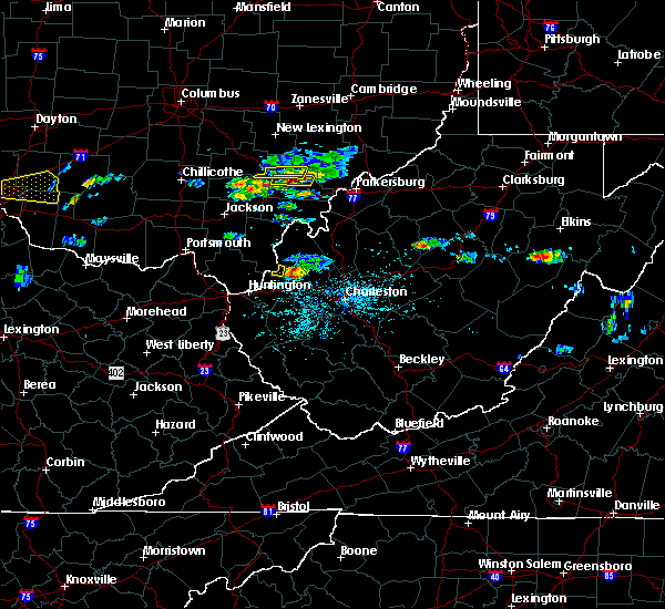 The severe thunderstorm warning for west central athens and northeastern vinton counties will expire at 315 pm edt, the storm which prompted the warning has moved out of the area. therefore, the warning will be allowed to expire. a severe thunderstorm watch remains in effect until 900 pm edt for southeastern ohio. The severe thunderstorm warning for west central athens and northeastern vinton counties will expire at 315 pm edt, the storm which prompted the warning has moved out of the area. therefore, the warning will be allowed to expire. a severe thunderstorm watch remains in effect until 900 pm edt for southeastern ohio.
|
| 5/26/2019 2:56 PM EDT |
 At 256 pm edt, a severe thunderstorm was located near the plains, moving east at 35 mph (radar indicated). Hazards include 60 mph wind gusts and half dollar size hail. Hail damage to vehicles is expected. Expect wind damage to roofs, siding, and trees. At 256 pm edt, a severe thunderstorm was located near the plains, moving east at 35 mph (radar indicated). Hazards include 60 mph wind gusts and half dollar size hail. Hail damage to vehicles is expected. Expect wind damage to roofs, siding, and trees.
|
| 5/26/2019 2:55 PM EDT | Half Dollar sized hail reported 0.5 miles SW of The Plains, OH |
| 5/26/2019 2:46 PM EDT |
 At 245 pm edt, a severe thunderstorm was located near nelsonville, moving east at 35 mph (radar indicated). Hazards include 60 mph wind gusts and half dollar size hail. Hail damage to vehicles is expected. expect wind damage to roofs, siding, and trees. Locations impacted include, chauncey, amesville and the plains. At 245 pm edt, a severe thunderstorm was located near nelsonville, moving east at 35 mph (radar indicated). Hazards include 60 mph wind gusts and half dollar size hail. Hail damage to vehicles is expected. expect wind damage to roofs, siding, and trees. Locations impacted include, chauncey, amesville and the plains.
|
| 5/26/2019 2:19 PM EDT |
 At 218 pm edt, a severe thunderstorm was located over hocking hills state park, or 10 miles southwest of logan, moving east at 25 mph (radar indicated). Hazards include two inch hail and 60 mph wind gusts. People and animals outdoors will be injured. expect hail damage to roofs, siding, windows, and vehicles. Expect wind damage to roofs, siding, and trees. At 218 pm edt, a severe thunderstorm was located over hocking hills state park, or 10 miles southwest of logan, moving east at 25 mph (radar indicated). Hazards include two inch hail and 60 mph wind gusts. People and animals outdoors will be injured. expect hail damage to roofs, siding, windows, and vehicles. Expect wind damage to roofs, siding, and trees.
|
| 4/14/2019 5:40 PM EDT | Picture from twitter of large limb broken out of a tree due to thunderstorm wind in athens county OH, 0.5 miles SW of The Plains, OH |
| 4/14/2019 5:37 PM EDT |
 At 537 pm edt, a severe thunderstorm was located near athens, moving northeast at 70 mph (radar indicated). Hazards include 60 mph wind gusts. expect damage to roofs, siding, and trees At 537 pm edt, a severe thunderstorm was located near athens, moving northeast at 70 mph (radar indicated). Hazards include 60 mph wind gusts. expect damage to roofs, siding, and trees
|
| 6/17/2018 4:12 PM EDT |
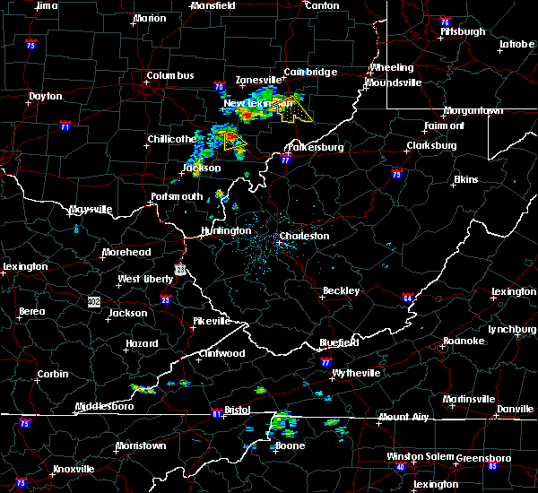 At 412 pm edt, a severe thunderstorm was located near buchtel, or near nelsonville, moving south at 15 mph (radar indicated). Hazards include 60 mph wind gusts and quarter size hail. Hail damage to vehicles is expected. expect wind damage to roofs, siding, and trees. Locations impacted include, athens, chauncey, jacksonville and the plains. At 412 pm edt, a severe thunderstorm was located near buchtel, or near nelsonville, moving south at 15 mph (radar indicated). Hazards include 60 mph wind gusts and quarter size hail. Hail damage to vehicles is expected. expect wind damage to roofs, siding, and trees. Locations impacted include, athens, chauncey, jacksonville and the plains.
|
| 6/17/2018 3:56 PM EDT |
 At 355 pm edt, a severe thunderstorm was located over buchtel, or near nelsonville, moving south at 10 mph (radar indicated). Hazards include 60 mph wind gusts and quarter size hail. Hail damage to vehicles is expected. Expect wind damage to roofs, siding, and trees. At 355 pm edt, a severe thunderstorm was located over buchtel, or near nelsonville, moving south at 10 mph (radar indicated). Hazards include 60 mph wind gusts and quarter size hail. Hail damage to vehicles is expected. Expect wind damage to roofs, siding, and trees.
|
| 5/13/2018 9:03 PM EDT |
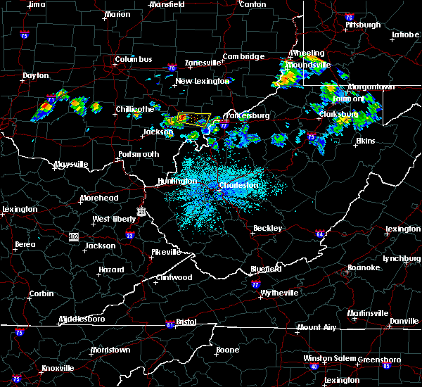 At 902 pm edt, a severe thunderstorm was located over athens, moving east at 40 mph (radar indicated). Hazards include 60 mph wind gusts and quarter size hail. Hail damage to vehicles is expected. Expect wind damage to roofs, siding, and trees. At 902 pm edt, a severe thunderstorm was located over athens, moving east at 40 mph (radar indicated). Hazards include 60 mph wind gusts and quarter size hail. Hail damage to vehicles is expected. Expect wind damage to roofs, siding, and trees.
|
| 7/10/2017 6:16 PM EDT |
 At 616 pm edt, a severe thunderstorm was located 7 miles northwest of tuppers plains, or 7 miles west of coolville, moving southeast at 45 mph (radar indicated). Hazards include 70 mph wind gusts and ping pong ball size hail. People and animals outdoors will be injured. expect hail damage to roofs, siding, windows, and vehicles. expect considerable tree damage. wind damage is also likely to mobile homes, roofs, and outbuildings. locations impacted include, athens, albany, nelsonville, chauncey, darwin, stroud run state park and the plains. At 616 pm edt, a severe thunderstorm was located 7 miles northwest of tuppers plains, or 7 miles west of coolville, moving southeast at 45 mph (radar indicated). Hazards include 70 mph wind gusts and ping pong ball size hail. People and animals outdoors will be injured. expect hail damage to roofs, siding, windows, and vehicles. expect considerable tree damage. wind damage is also likely to mobile homes, roofs, and outbuildings. locations impacted include, athens, albany, nelsonville, chauncey, darwin, stroud run state park and the plains.
|
| 7/10/2017 5:49 PM EDT |
 At 548 pm edt, a severe thunderstorm was located near nelsonville, moving southeast at 40 mph (radar indicated). Hazards include 60 mph wind gusts and quarter size hail. Hail damage to vehicles is expected. Expect wind damage to roofs, siding, and trees. At 548 pm edt, a severe thunderstorm was located near nelsonville, moving southeast at 40 mph (radar indicated). Hazards include 60 mph wind gusts and quarter size hail. Hail damage to vehicles is expected. Expect wind damage to roofs, siding, and trees.
|
| 7/7/2017 3:37 PM EDT |
 The severe thunderstorm warning for northwestern washington, morgan, northern athens and northeastern vinton counties will expire at 345 pm edt, the storms which prompted the warning have weakened below severe limits, and have exited the warned area. therefore the warning will be allowed to expire. however gusty winds and heavy rain are still possible with these thunderstorms. a severe thunderstorm watch remains in effect until 900 pm edt for southeastern ohio. The severe thunderstorm warning for northwestern washington, morgan, northern athens and northeastern vinton counties will expire at 345 pm edt, the storms which prompted the warning have weakened below severe limits, and have exited the warned area. therefore the warning will be allowed to expire. however gusty winds and heavy rain are still possible with these thunderstorms. a severe thunderstorm watch remains in effect until 900 pm edt for southeastern ohio.
|
| 7/7/2017 2:58 PM EDT |
 At 257 pm edt, severe thunderstorms were located along a line extending from 7 miles west of caldwell to near chesterhill to near logan, moving southeast at 35 mph (radar indicated). Hazards include 60 mph wind gusts. expect damage to roofs, siding, and trees At 257 pm edt, severe thunderstorms were located along a line extending from 7 miles west of caldwell to near chesterhill to near logan, moving southeast at 35 mph (radar indicated). Hazards include 60 mph wind gusts. expect damage to roofs, siding, and trees
|
| 7/7/2017 2:49 PM EDT |
 At 249 pm edt, severe thunderstorms were located along a line extending from near mcconnelsville to near glouster to near nelsonville, moving southeast at 35 mph (radar indicated). Hazards include 60 mph wind gusts. Expect damage to roofs, siding, and trees. locations impacted include, athens, nelsonville, glouster, mcconnelsville, shawnee, chesterhill, chauncey, new straitsville, malta, corning, buchtel, stockport, jacksonville, murray city, trimble, bristol, hemlock, amesville, rendville and burr oak state park. At 249 pm edt, severe thunderstorms were located along a line extending from near mcconnelsville to near glouster to near nelsonville, moving southeast at 35 mph (radar indicated). Hazards include 60 mph wind gusts. Expect damage to roofs, siding, and trees. locations impacted include, athens, nelsonville, glouster, mcconnelsville, shawnee, chesterhill, chauncey, new straitsville, malta, corning, buchtel, stockport, jacksonville, murray city, trimble, bristol, hemlock, amesville, rendville and burr oak state park.
|
| 7/7/2017 2:35 PM EDT |
 At 234 pm edt, severe thunderstorms were located along a line extending from 7 miles south of south zanesville to near new lexington to near logan, moving southeast at 45 mph (radar indicated). Hazards include 60 mph wind gusts. expect damage to roofs, siding, and trees At 234 pm edt, severe thunderstorms were located along a line extending from 7 miles south of south zanesville to near new lexington to near logan, moving southeast at 45 mph (radar indicated). Hazards include 60 mph wind gusts. expect damage to roofs, siding, and trees
|
| 5/19/2017 7:04 PM EDT |
 At 703 pm edt, severe thunderstorms were located along a line extending from 6 miles west of new concord to near mcarthur, moving east at 35 mph (radar indicated). Hazards include 60 mph wind gusts and quarter size hail. Hail damage to vehicles is expected. expect wind damage to roofs, siding, and trees. locations impacted include, nelsonville, new lexington, glouster, mcconnelsville, somerset, shawnee, perry state forest, crooksville, chauncey, junction city, new straitsville, malta, corning, buchtel, jacksonville, murray city, trimble, glenford, hemlock and rendville. At 703 pm edt, severe thunderstorms were located along a line extending from 6 miles west of new concord to near mcarthur, moving east at 35 mph (radar indicated). Hazards include 60 mph wind gusts and quarter size hail. Hail damage to vehicles is expected. expect wind damage to roofs, siding, and trees. locations impacted include, nelsonville, new lexington, glouster, mcconnelsville, somerset, shawnee, perry state forest, crooksville, chauncey, junction city, new straitsville, malta, corning, buchtel, jacksonville, murray city, trimble, glenford, hemlock and rendville.
|
| 5/19/2017 6:48 PM EDT |
 At 647 pm edt, severe thunderstorms were located along a line extending from near north zanesville to 13 miles northwest of wellston, moving east at 35 mph (radar indicated). Hazards include 60 mph wind gusts and quarter size hail. Hail damage to vehicles is expected. expect wind damage to roofs, siding, and trees. locations impacted include, athens, wellston, nelsonville, new lexington, glouster, mcconnelsville, mcarthur, somerset, albany, shawnee, lake hope state park, perry state forest, crooksville, chauncey, hamden, junction city, new straitsville, malta, corning and buchtel. At 647 pm edt, severe thunderstorms were located along a line extending from near north zanesville to 13 miles northwest of wellston, moving east at 35 mph (radar indicated). Hazards include 60 mph wind gusts and quarter size hail. Hail damage to vehicles is expected. expect wind damage to roofs, siding, and trees. locations impacted include, athens, wellston, nelsonville, new lexington, glouster, mcconnelsville, mcarthur, somerset, albany, shawnee, lake hope state park, perry state forest, crooksville, chauncey, hamden, junction city, new straitsville, malta, corning and buchtel.
|
| 5/19/2017 6:19 PM EDT |
 At 618 pm edt, severe thunderstorms were located along a line extending from near thornport to 6 miles northwest of waverly, moving east at 35 mph (radar indicated). Hazards include 60 mph wind gusts and quarter size hail. Hail damage to vehicles is expected. Expect wind damage to roofs, siding, and trees. At 618 pm edt, severe thunderstorms were located along a line extending from near thornport to 6 miles northwest of waverly, moving east at 35 mph (radar indicated). Hazards include 60 mph wind gusts and quarter size hail. Hail damage to vehicles is expected. Expect wind damage to roofs, siding, and trees.
|
| 3/1/2017 9:05 AM EST |
 At 905 am est, severe thunderstorms were located along a line extending from near lake hope state park to near coal grove, moving east at 55 mph (radar indicated). Hazards include 70 mph wind gusts and half dollar size hail. Hail damage to vehicles is expected. expect considerable tree damage. wind damage is also likely to mobile homes, roofs, and outbuildings. locations impacted include, athens, ashland, ironton, jackson, wellston, point pleasant, gallipolis, coal grove, pomeroy, mcarthur, oak hill, rio grande, albany, rutland, lake vesuvius, mason, gallia, vernon, waterloo and middleport. This includes interstate 64 in west virginia near mile marker 23. At 905 am est, severe thunderstorms were located along a line extending from near lake hope state park to near coal grove, moving east at 55 mph (radar indicated). Hazards include 70 mph wind gusts and half dollar size hail. Hail damage to vehicles is expected. expect considerable tree damage. wind damage is also likely to mobile homes, roofs, and outbuildings. locations impacted include, athens, ashland, ironton, jackson, wellston, point pleasant, gallipolis, coal grove, pomeroy, mcarthur, oak hill, rio grande, albany, rutland, lake vesuvius, mason, gallia, vernon, waterloo and middleport. This includes interstate 64 in west virginia near mile marker 23.
|
| 3/1/2017 8:47 AM EST |
 At 846 am est, severe thunderstorms were located along a line extending from near mcarthur to near greenbo lake, moving east at 55 mph (radar indicated). Hazards include 70 mph wind gusts and half dollar size hail. Hail damage to vehicles is expected. expect considerable tree damage. Wind damage is also likely to mobile homes, roofs, and outbuildings. At 846 am est, severe thunderstorms were located along a line extending from near mcarthur to near greenbo lake, moving east at 55 mph (radar indicated). Hazards include 70 mph wind gusts and half dollar size hail. Hail damage to vehicles is expected. expect considerable tree damage. Wind damage is also likely to mobile homes, roofs, and outbuildings.
|
| 3/1/2017 3:57 AM EST |
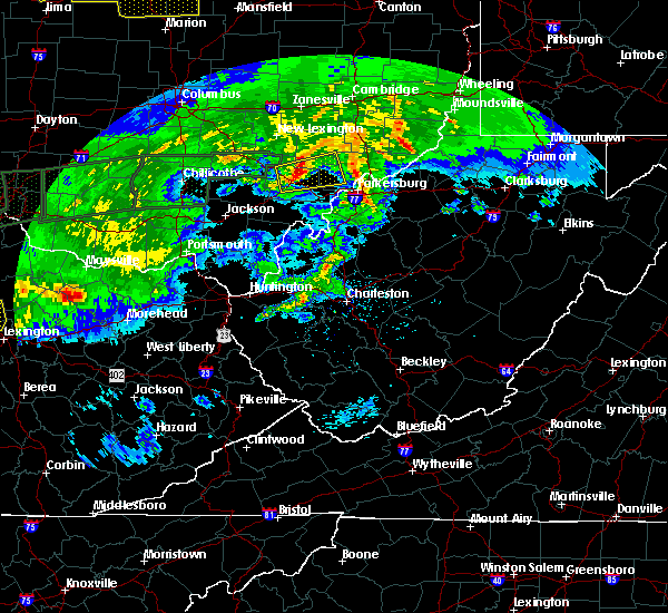 At 357 am est, a severe thunderstorm was located near athens, moving east at 60 mph (radar indicated). Hazards include 70 mph wind gusts. Expect considerable tree damage. damage is likely to mobile homes, roofs, and outbuildings. Locations impacted include, athens, chesterhill, nelsonville, chauncey, buchtel, stockport, jacksonville, trimble, amesville, stroud run state park, bartlett and the plains. At 357 am est, a severe thunderstorm was located near athens, moving east at 60 mph (radar indicated). Hazards include 70 mph wind gusts. Expect considerable tree damage. damage is likely to mobile homes, roofs, and outbuildings. Locations impacted include, athens, chesterhill, nelsonville, chauncey, buchtel, stockport, jacksonville, trimble, amesville, stroud run state park, bartlett and the plains.
|
| 3/1/2017 3:48 AM EST |
 At 347 am est, a severe thunderstorm was located over lake hope state park, moving east at 60 mph (radar indicated). Hazards include 70 mph wind gusts. Expect considerable tree damage. Damage is likely to mobile homes, roofs, and outbuildings. At 347 am est, a severe thunderstorm was located over lake hope state park, moving east at 60 mph (radar indicated). Hazards include 70 mph wind gusts. Expect considerable tree damage. Damage is likely to mobile homes, roofs, and outbuildings.
|
| 7/15/2016 5:58 PM EDT |
 At 557 pm edt, a severe thunderstorm was located near lake hope state park, moving east at 25 mph (radar indicated). Hazards include 60 mph wind gusts and quarter size hail. Hail damage to vehicles is expected. expect wind damage to roofs, siding, and trees. Locations impacted include, albany, lake hope state park, zaleski, creola and the plains. At 557 pm edt, a severe thunderstorm was located near lake hope state park, moving east at 25 mph (radar indicated). Hazards include 60 mph wind gusts and quarter size hail. Hail damage to vehicles is expected. expect wind damage to roofs, siding, and trees. Locations impacted include, albany, lake hope state park, zaleski, creola and the plains.
|
| 7/15/2016 5:25 PM EDT |
 At 524 pm edt, a severe thunderstorm was located near mcarthur, moving east at 25 mph (radar indicated). Hazards include 60 mph wind gusts and quarter size hail. Hail damage to vehicles is expected. Expect wind damage to roofs, siding, and trees. At 524 pm edt, a severe thunderstorm was located near mcarthur, moving east at 25 mph (radar indicated). Hazards include 60 mph wind gusts and quarter size hail. Hail damage to vehicles is expected. Expect wind damage to roofs, siding, and trees.
|
| 4/28/2016 5:28 PM EDT |
 At 528 pm edt, a severe thunderstorm was located near glouster, moving east at 35 mph (radar indicated). Hazards include 60 mph wind gusts and half dollar size hail. Hail damage to vehicles is expected. Expect wind damage to roofs, siding, and trees. At 528 pm edt, a severe thunderstorm was located near glouster, moving east at 35 mph (radar indicated). Hazards include 60 mph wind gusts and half dollar size hail. Hail damage to vehicles is expected. Expect wind damage to roofs, siding, and trees.
|
| 4/28/2016 5:16 PM EDT |
 At 516 pm edt, a severe thunderstorm was located over buchtel, or over nelsonville, moving east at 25 mph (radar indicated). Hazards include 60 mph wind gusts and quarter size hail. Hail damage to vehicles is expected. expect wind damage to roofs, siding, and trees. Locations impacted include, athens, nelsonville, glouster, chesterhill, lake hope state park, chauncey, buchtel, jacksonville, murray city, trimble, amesville, stroud run state park, burr oak state park and the plains. At 516 pm edt, a severe thunderstorm was located over buchtel, or over nelsonville, moving east at 25 mph (radar indicated). Hazards include 60 mph wind gusts and quarter size hail. Hail damage to vehicles is expected. expect wind damage to roofs, siding, and trees. Locations impacted include, athens, nelsonville, glouster, chesterhill, lake hope state park, chauncey, buchtel, jacksonville, murray city, trimble, amesville, stroud run state park, burr oak state park and the plains.
|
| 4/28/2016 4:57 PM EDT |
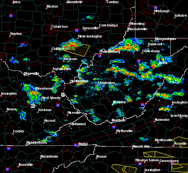 At 456 pm edt, a severe thunderstorm was located near nelsonville, moving east at 40 mph (radar indicated). Hazards include 60 mph wind gusts and quarter size hail. Hail damage to vehicles is expected. Expect wind damage to roofs, siding, and trees. At 456 pm edt, a severe thunderstorm was located near nelsonville, moving east at 40 mph (radar indicated). Hazards include 60 mph wind gusts and quarter size hail. Hail damage to vehicles is expected. Expect wind damage to roofs, siding, and trees.
|
| 7/14/2015 3:53 PM EDT |
 At 351 pm edt, doppler radar indicated a line of severe thunderstorms capable of producing destructive winds in excess of 70 mph. these storms were located along a line extending from near nelsonville to near hocking hills state park, moving southeast at 35 mph. these severe storms will be near, nelsonville and nelsonville around 355 pm edt. buchtel around 400 pm edt. lake hope state park around 405 pm edt. athens around 410 pm edt. albany around 415 pm edt. other locations impacted by these severe thunderstorms include creola, stroud run state park, coalton, chauncey, trimble, zaleski, eagle mills, hamden, amesville and jacksonville. At 351 pm edt, doppler radar indicated a line of severe thunderstorms capable of producing destructive winds in excess of 70 mph. these storms were located along a line extending from near nelsonville to near hocking hills state park, moving southeast at 35 mph. these severe storms will be near, nelsonville and nelsonville around 355 pm edt. buchtel around 400 pm edt. lake hope state park around 405 pm edt. athens around 410 pm edt. albany around 415 pm edt. other locations impacted by these severe thunderstorms include creola, stroud run state park, coalton, chauncey, trimble, zaleski, eagle mills, hamden, amesville and jacksonville.
|
| 7/14/2015 3:21 PM EDT |
 At 321 pm edt, doppler radar indicated a line of severe thunderstorms capable of producing damaging winds in excess of 60 mph. these storms were located along a line extending from 7 miles west of logan to 8 miles east of kingston, and moving southeast at 35 mph. * severe thunderstorms will be near, nelsonville, nelsonville and buchtel around 355 pm edt. mcarthur around 400 pm edt. lake hope state park around 405 pm edt. athens around 410 pm edt. albany around 415 pm edt. other locations impacted by these severe thunderstorms include creola, stroud run state park, coalton, chauncey, trimble, new straitsville, zaleski, eagle mills, corning and hamden. At 321 pm edt, doppler radar indicated a line of severe thunderstorms capable of producing damaging winds in excess of 60 mph. these storms were located along a line extending from 7 miles west of logan to 8 miles east of kingston, and moving southeast at 35 mph. * severe thunderstorms will be near, nelsonville, nelsonville and buchtel around 355 pm edt. mcarthur around 400 pm edt. lake hope state park around 405 pm edt. athens around 410 pm edt. albany around 415 pm edt. other locations impacted by these severe thunderstorms include creola, stroud run state park, coalton, chauncey, trimble, new straitsville, zaleski, eagle mills, corning and hamden.
|
| 6/23/2015 3:18 PM EDT |
 At 317 pm edt, doppler radar indicated a severe thunderstorm capable of producing quarter size hail and damaging winds in excess of 60 mph. this storm was located near nelsonville, moving southeast at 20 mph. locations impacted include, athens, nelsonville, albany, chauncey, buchtel, stroud run state park and the plains. At 317 pm edt, doppler radar indicated a severe thunderstorm capable of producing quarter size hail and damaging winds in excess of 60 mph. this storm was located near nelsonville, moving southeast at 20 mph. locations impacted include, athens, nelsonville, albany, chauncey, buchtel, stroud run state park and the plains.
|
| 6/23/2015 3:06 PM EDT |
 At 306 pm edt, doppler radar indicated a severe thunderstorm capable of producing half dollar size hail and damaging winds in excess of 60 mph. this storm was located near nelsonville, and moving southeast at 20 mph. At 306 pm edt, doppler radar indicated a severe thunderstorm capable of producing half dollar size hail and damaging winds in excess of 60 mph. this storm was located near nelsonville, and moving southeast at 20 mph.
|
| 5/11/2015 6:49 PM EDT | At 647 pm edt, national weather service doppler radar continued to indicate a line of severe thunderstorms capable of producing damaging winds in excess of 60 mph. these storms were located along a line extending from eagleport to chesterhill to 6 miles southeast of dexter, or along a line extending from 9 miles north of mcconnelsville to chesterhill to rutland, moving east at 35 mph. other locations in the warning include but are not limited to malta, darwin, stockport, bartlett, bristol, hackney, beverly, fleming, marietta, macksburg, lower salem, lowell and devola this will impact the following interstate, i-77 between mile markers 1 and 17 in ohio. very heavy rain will also fall from this line of severe thunderstorms, and will cause water to pond on roads and quickly fill roadside ditches and small streams. a severe thunderstorm watch remains in effect until 1000 pm edt monday evening for central kentucky and southeast ohio and central west virginia. a severe thunderstorm watch also remains in effect until 100 am edt tuesday morning for central west virginia. please report severe weather to the national weather service by calling toll free, 800-401-9535, when you can do so safely. you may also report severe weather by posting your report to the charleston west virginia national weather service facebook page, or by using the twitter hashtag, nwsrlx. |
| 5/11/2015 6:19 PM EDT | At 617 pm edt, national weather service doppler radar indicated a line of severe thunderstorms capable of producing damaging winds in excess of 60 mph. these storms were located along a line extending from 23 miles northwest of mcconnelsville to 7 miles west of glouster to 18 miles southwest of albany, or along a line extending from 8 miles southwest of zanesville to nelsonville to 9 miles north of rio grande, moving northeast at 55 mph. * other locations in the warning include but are not limited to stroud run state park, salem center, harrisonville, hackney, fleming, eagleport, dyesville, dexter, darwin, carpenter, burr oak state park, bristol, bartlett, vinton, stockport, malta, macksburg, lower salem, lowell, devola, trimble, the plains, jacksonville, chauncey, amesville, rendville and corning. this will impact the following interstate, i-77 between mile markers 1 and 17 in ohio. very heavy rain will also fall from this line of severe thunderstorms, and will cause water to pond on roads and quickly fill roadside ditches and small streams. a severe thunderstorm watch remains in effect until 1000 pm edt monday evening for central kentucky and southeast ohio and central west virginia. a severe thunderstorm watch also remains in effect until 100 am edt tuesday morning for central west virginia. please report hail or strong wind to the national weather service by calling toll free, 800-401-9535, when you can do so safely. you may also report severe weather by posting your report to the charleston west virginia national weather service facebook page, or by using the twitter hashtag, nwsrlx. |
| 4/9/2015 4:56 PM EDT | The national weather service in charleston has issued a * severe thunderstorm warning for. pleasants county in west virginia. this includes the city of st. marys. north central ritchie county in west virginia. Northern wood county in west virginia. |
| 4/9/2015 4:56 PM EDT | The national weather service in charleston has issued a * severe thunderstorm warning for. pleasants county in west virginia. this includes the city of st. marys. north central ritchie county in west virginia. Northern wood county in west virginia. |
| 4/9/2015 3:07 PM EDT | The national weather service in charleston has issued a * severe thunderstorm warning for. northwestern athens county in southeast ohio. this includes the cities of. nelsonville. glouster. western morgan county in southeast ohio. This includes the city of mcconnelsville. |
| 4/9/2015 2:51 PM EDT | The national weather service in charleston has issued a * severe thunderstorm warning for. central athens county in southeast ohio. this includes the city of athens. morgan county in southeast ohio. this includes the cities of. mcconnelsville. Chesterhill. |
| 4/9/2015 2:39 PM EDT | A severe thunderstorm warning remains in effect until 300 pm edt for east central vinton. southwestern morgan. northwestern meigs and athens counties. at 236 pm edt. national weather service doppler radar continued to indicate a severe thunderstorm capable of producing golf ball size hail. and damaging winds in excess of 60 mph. This storm was. |
| 4/9/2015 2:13 PM EDT | The national weather service in charleston has issued a * severe thunderstorm warning for. athens county in southeast ohio. this includes the cities of. nelsonville. glouster. athens. albany. North central gallia county in southeast ohio. |
| 4/8/2015 12:56 PM EDT | The national weather service in charleston has issued a * severe thunderstorm warning for. boyd county in kentucky. this includes the cities of. cannonsburg. ashland. carter county in kentucky. this includes the cities of. olive hill. Grayson lake state. |
| 4/8/2015 12:56 PM EDT | The national weather service in charleston has issued a * severe thunderstorm warning for. boyd county in kentucky. this includes the cities of. cannonsburg. ashland. carter county in kentucky. this includes the cities of. olive hill. Grayson lake state. |
| 4/8/2015 12:56 PM EDT | The national weather service in charleston has issued a * severe thunderstorm warning for. boyd county in kentucky. this includes the cities of. cannonsburg. ashland. carter county in kentucky. this includes the cities of. olive hill. Grayson lake state. |
| 4/8/2015 12:29 PM EDT | A severe thunderstorm warning remains in effect until 100 pm edt for greenup county in kentucky. and vinton. western meigs. northern lawrence. jackson. gallia and western athens counties in southeast ohio. at 1221 pm edt. National weather service doppler radar continued to indicate a line of severe thunderstorms capable of producing damaging. |
| 4/8/2015 12:29 PM EDT | A severe thunderstorm warning remains in effect until 100 pm edt for greenup county in kentucky. and vinton. western meigs. northern lawrence. jackson. gallia and western athens counties in southeast ohio. at 1221 pm edt. National weather service doppler radar continued to indicate a line of severe thunderstorms capable of producing damaging. |
| 4/8/2015 12:02 PM EDT | The national weather service in charleston has issued a * severe thunderstorm warning for. greenup county in kentucky. western athens county in southeast ohio. this includes the cities of. nelsonville. albany. Gallia county in southeast ohio. |
| 4/8/2015 12:02 PM EDT | The national weather service in charleston has issued a * severe thunderstorm warning for. greenup county in kentucky. western athens county in southeast ohio. this includes the cities of. nelsonville. albany. Gallia county in southeast ohio. |
| 3/19/2012 2:08 AM EDT | Quarter sized hail reported 0.3 miles SSE of The Plains, OH |
Hail Maps for The Plains, OH
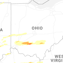


Connect with Interactive Hail Maps