

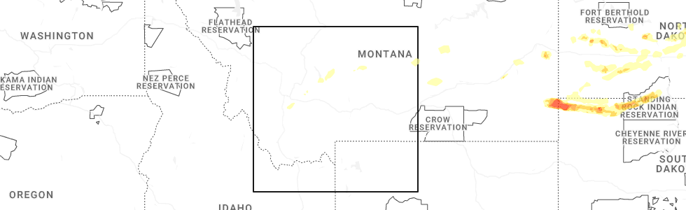
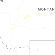
Hail Map for The Silos, MT
The The Silos, MT area has had 0 reports of on-the-ground hail by trained spotters, and has been under severe weather warnings 2 times during the past 12 months. Doppler radar has detected hail at or near The Silos, MT on 15 occasions, including 1 occasion during the past year.
| Name: | The Silos, MT |
| Where Located: | 56.4 miles NNW of Bozeman, MT |
| Map: | Google Map for The Silos, MT |
| Population: | 506 |
| Housing Units: | 259 |
| More Info: | Search Google for The Silos, MT |
1
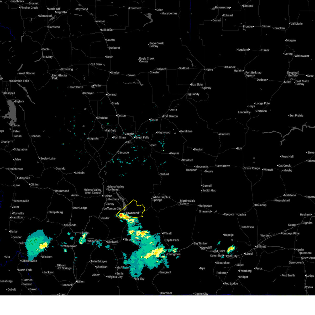
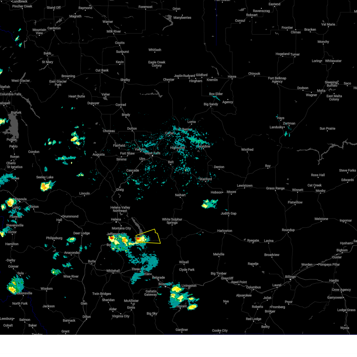
The Top Recent Hail Date for The Silos, MT is Friday, June 20, 2025 (6th out of 15)
Hail and Wind Damage Spotted near The Silos, MT
| Date / Time | Report Details |
|---|---|
| 7/1/2025 5:57 PM MDT |
 Svrtfx the national weather service in great falls has issued a * severe thunderstorm warning for, central broadwater county in southwestern montana, * until 645 pm mdt. * at 556 pm mdt, a severe thunderstorm was located near townsend, moving northeast at 35 mph (radar indicated). Hazards include 60 mph wind gusts. expect damage to roofs, siding, and trees Svrtfx the national weather service in great falls has issued a * severe thunderstorm warning for, central broadwater county in southwestern montana, * until 645 pm mdt. * at 556 pm mdt, a severe thunderstorm was located near townsend, moving northeast at 35 mph (radar indicated). Hazards include 60 mph wind gusts. expect damage to roofs, siding, and trees
|
| 8/10/2024 1:56 PM MDT |
 Svrtfx the national weather service in great falls has issued a * severe thunderstorm warning for, central broadwater county in southwestern montana, * until 245 pm mdt. * at 156 pm mdt, a severe thunderstorm was located near townsend, moving east at 20 mph (radar indicated). Hazards include 60 mph wind gusts and quarter size hail. Hail damage to vehicles is expected. Expect wind damage to roofs, siding, and trees. Svrtfx the national weather service in great falls has issued a * severe thunderstorm warning for, central broadwater county in southwestern montana, * until 245 pm mdt. * at 156 pm mdt, a severe thunderstorm was located near townsend, moving east at 20 mph (radar indicated). Hazards include 60 mph wind gusts and quarter size hail. Hail damage to vehicles is expected. Expect wind damage to roofs, siding, and trees.
|
| 6/21/2024 3:22 PM MDT |
 the severe thunderstorm warning has been cancelled and is no longer in effect the severe thunderstorm warning has been cancelled and is no longer in effect
|
| 6/21/2024 3:17 PM MDT |
 At 316 pm mdt, a severe thunderstorm was located over townsend, moving east southeast at 10 mph (radar indicated). Hazards include 60 mph wind gusts and quarter size hail. Hail damage to vehicles is expected. expect wind damage to roofs, siding, and trees. Locations impacted include, townsend. At 316 pm mdt, a severe thunderstorm was located over townsend, moving east southeast at 10 mph (radar indicated). Hazards include 60 mph wind gusts and quarter size hail. Hail damage to vehicles is expected. expect wind damage to roofs, siding, and trees. Locations impacted include, townsend.
|
| 6/21/2024 3:03 PM MDT |
 Svrtfx the national weather service in great falls has issued a * severe thunderstorm warning for, west central broadwater county in southwestern montana, * until 345 pm mdt. * at 300 pm mdt, a severe thunderstorm was located near townsend, moving east southeast at 10 mph (radar indicated). Hazards include 60 mph wind gusts and quarter size hail. Hail damage to vehicles is expected. Expect wind damage to roofs, siding, and trees. Svrtfx the national weather service in great falls has issued a * severe thunderstorm warning for, west central broadwater county in southwestern montana, * until 345 pm mdt. * at 300 pm mdt, a severe thunderstorm was located near townsend, moving east southeast at 10 mph (radar indicated). Hazards include 60 mph wind gusts and quarter size hail. Hail damage to vehicles is expected. Expect wind damage to roofs, siding, and trees.
|
| 5/28/2024 6:31 PM MDT |
 Svrtfx the national weather service in great falls has issued a * severe thunderstorm warning for, southeastern lewis and clark county in west central montana, northwestern broadwater county in southwestern montana, northwestern meagher county in central montana, northeastern jefferson county in southwestern montana, * until 715 pm mdt. * at 631 pm mdt, severe thunderstorms were located along a line extending from 16 miles southeast of wolf creek to 10 miles southwest of montana city, moving east at 35 mph (radar indicated). Hazards include 60 mph wind gusts. expect damage to roofs, siding, and trees Svrtfx the national weather service in great falls has issued a * severe thunderstorm warning for, southeastern lewis and clark county in west central montana, northwestern broadwater county in southwestern montana, northwestern meagher county in central montana, northeastern jefferson county in southwestern montana, * until 715 pm mdt. * at 631 pm mdt, severe thunderstorms were located along a line extending from 16 miles southeast of wolf creek to 10 miles southwest of montana city, moving east at 35 mph (radar indicated). Hazards include 60 mph wind gusts. expect damage to roofs, siding, and trees
|
| 8/18/2023 3:54 PM MDT |
 The severe thunderstorm warning for northern broadwater and western meagher counties will expire at 400 pm mdt, the storms which prompted the warning have moved out of broadwater county. another severe thudnerstorm warning has been issued for portions of meagher county. remember, a severe thunderstorm warning still remains in effect for much of meagher county. The severe thunderstorm warning for northern broadwater and western meagher counties will expire at 400 pm mdt, the storms which prompted the warning have moved out of broadwater county. another severe thudnerstorm warning has been issued for portions of meagher county. remember, a severe thunderstorm warning still remains in effect for much of meagher county.
|
| 8/18/2023 3:35 PM MDT |
 At 335 pm mdt, severe thunderstorms were located along a line extending from 26 miles east of east helena to 19 miles west of white sulphur springs to 6 miles southeast of townsend, moving east at 40 mph (radar indicated). Hazards include 60 mph wind gusts. Expect damage to roofs, siding, and trees. locations impacted include, townsend, silos, fort logan on the smith river, fort logan and goose bay. hail threat, radar indicated max hail size, <. 75 in wind threat, radar indicated max wind gust, 60 mph. At 335 pm mdt, severe thunderstorms were located along a line extending from 26 miles east of east helena to 19 miles west of white sulphur springs to 6 miles southeast of townsend, moving east at 40 mph (radar indicated). Hazards include 60 mph wind gusts. Expect damage to roofs, siding, and trees. locations impacted include, townsend, silos, fort logan on the smith river, fort logan and goose bay. hail threat, radar indicated max hail size, <. 75 in wind threat, radar indicated max wind gust, 60 mph.
|
| 8/18/2023 3:25 PM MDT |
 At 325 pm mdt, severe thunderstorms were located along a line extending from 19 miles northeast of east helena to 20 miles north of toston to near townsend, moving east at 40 mph (radar indicated). Hazards include 60 mph wind gusts. Expect damage to roofs, siding, and trees. locations impacted include, townsend, fort logan on the smith river, winston, york, silos, fort logan, goose bay and radersburg. hail threat, radar indicated max hail size, <. 75 in wind threat, radar indicated max wind gust, 60 mph. At 325 pm mdt, severe thunderstorms were located along a line extending from 19 miles northeast of east helena to 20 miles north of toston to near townsend, moving east at 40 mph (radar indicated). Hazards include 60 mph wind gusts. Expect damage to roofs, siding, and trees. locations impacted include, townsend, fort logan on the smith river, winston, york, silos, fort logan, goose bay and radersburg. hail threat, radar indicated max hail size, <. 75 in wind threat, radar indicated max wind gust, 60 mph.
|
| 8/18/2023 3:09 PM MDT |
 At 308 pm mdt, severe thunderstorms were located along a line extending from 9 miles northeast of east helena to 11 miles northwest of townsend to 15 miles west of toston, moving east at 40 mph (radar indicated). Hazards include 60 mph wind gusts. expect damage to roofs, siding, and trees At 308 pm mdt, severe thunderstorms were located along a line extending from 9 miles northeast of east helena to 11 miles northwest of townsend to 15 miles west of toston, moving east at 40 mph (radar indicated). Hazards include 60 mph wind gusts. expect damage to roofs, siding, and trees
|
| 7/10/2023 4:24 PM MDT |
 At 423 pm mdt, a severe thunderstorm was located 8 miles north of townsend, moving east at 30 mph (radar indicated). Hazards include 60 mph wind gusts and quarter size hail. Hail damage to vehicles is expected. expect wind damage to roofs, siding, and trees. locations impacted include, silos and winston. hail threat, radar indicated max hail size, 1. 00 in wind threat, radar indicated max wind gust, 60 mph. At 423 pm mdt, a severe thunderstorm was located 8 miles north of townsend, moving east at 30 mph (radar indicated). Hazards include 60 mph wind gusts and quarter size hail. Hail damage to vehicles is expected. expect wind damage to roofs, siding, and trees. locations impacted include, silos and winston. hail threat, radar indicated max hail size, 1. 00 in wind threat, radar indicated max wind gust, 60 mph.
|
| 7/10/2023 4:04 PM MDT |
 At 403 pm mdt, a severe thunderstorm was located 11 miles southeast of montana city, or 13 miles northwest of townsend, moving east at 30 mph (radar indicated). Hazards include half dollar size hail. damage to vehicles is expected At 403 pm mdt, a severe thunderstorm was located 11 miles southeast of montana city, or 13 miles northwest of townsend, moving east at 30 mph (radar indicated). Hazards include half dollar size hail. damage to vehicles is expected
|
| 7/1/2023 1:08 PM MDT |
 At 107 pm mdt, severe thunderstorms were located along a line extending from 24 miles south of cascade to 24 miles east of east helena to near townsend, moving east at 50 mph (public). Hazards include 60 mph wind gusts. Expect damage to roofs, siding, and trees. locations impacted include, white sulphur springs, silos, fort logan on the smith river, fort logan, winston and goose bay. hail threat, radar indicated max hail size, <. 75 in wind threat, observed max wind gust, 60 mph. At 107 pm mdt, severe thunderstorms were located along a line extending from 24 miles south of cascade to 24 miles east of east helena to near townsend, moving east at 50 mph (public). Hazards include 60 mph wind gusts. Expect damage to roofs, siding, and trees. locations impacted include, white sulphur springs, silos, fort logan on the smith river, fort logan, winston and goose bay. hail threat, radar indicated max hail size, <. 75 in wind threat, observed max wind gust, 60 mph.
|
| 7/1/2023 12:48 PM MDT |
 At 1247 pm mdt, severe thunderstorms were located along a line extending from 15 miles southeast of wolf creek to 9 miles east of east helena to 11 miles west of townsend, moving east at 50 mph (public). Hazards include 60 mph wind gusts. expect damage to roofs, siding, and trees At 1247 pm mdt, severe thunderstorms were located along a line extending from 15 miles southeast of wolf creek to 9 miles east of east helena to 11 miles west of townsend, moving east at 50 mph (public). Hazards include 60 mph wind gusts. expect damage to roofs, siding, and trees
|
| 9/7/2022 5:57 PM MDT |
 At 556 pm mdt, severe thunderstorms were located along a line extending from near dutton to 23 miles southeast of cascade to 10 miles southwest of townsend, moving east at 50 mph (radar indicated). Hazards include 70 mph wind gusts. Expect considerable tree damage. Damage is likely to mobile homes, roofs, and outbuildings. At 556 pm mdt, severe thunderstorms were located along a line extending from near dutton to 23 miles southeast of cascade to 10 miles southwest of townsend, moving east at 50 mph (radar indicated). Hazards include 70 mph wind gusts. Expect considerable tree damage. Damage is likely to mobile homes, roofs, and outbuildings.
|
| 7/13/2022 2:06 PM MDT |
 The severe thunderstorm warning for northwestern broadwater and northeastern jefferson counties will expire at 215 pm mdt, the storm which prompted the warning has weakened below severe limits, and has exited the warned area. therefore, the warning will be allowed to expire. The severe thunderstorm warning for northwestern broadwater and northeastern jefferson counties will expire at 215 pm mdt, the storm which prompted the warning has weakened below severe limits, and has exited the warned area. therefore, the warning will be allowed to expire.
|
| 7/13/2022 1:30 PM MDT |
 At 130 pm mdt, a severe thunderstorm was located 10 miles southwest of montana city, or 12 miles north of boulder, moving northeast at 30 mph (radar indicated). Hazards include 60 mph wind gusts and quarter size hail. Hail damage to vehicles is expected. Expect wind damage to roofs, siding, and trees. At 130 pm mdt, a severe thunderstorm was located 10 miles southwest of montana city, or 12 miles north of boulder, moving northeast at 30 mph (radar indicated). Hazards include 60 mph wind gusts and quarter size hail. Hail damage to vehicles is expected. Expect wind damage to roofs, siding, and trees.
|
| 8/10/2019 7:01 PM MDT |
 At 700 pm mdt, severe thunderstorms were located along a line extending from 6 miles north of townsend to toston, moving northeast at 30 mph (radar indicated). Hazards include 60 mph wind gusts and quarter size hail. Hail damage to vehicles is expected. expect wind damage to roofs, siding, and trees. Locations impacted include, townsend, canyon ferry lake, toston, and silos. At 700 pm mdt, severe thunderstorms were located along a line extending from 6 miles north of townsend to toston, moving northeast at 30 mph (radar indicated). Hazards include 60 mph wind gusts and quarter size hail. Hail damage to vehicles is expected. expect wind damage to roofs, siding, and trees. Locations impacted include, townsend, canyon ferry lake, toston, and silos.
|
| 8/10/2019 6:50 PM MDT |
 The national weather service in great falls has issued a * severe thunderstorm warning for. northern broadwater county in southwestern montana. until 715 pm mdt. At 649 pm mdt, severe thunderstorms were located along a line extending from 8 miles northwest of townsend to 6 miles west of. The national weather service in great falls has issued a * severe thunderstorm warning for. northern broadwater county in southwestern montana. until 715 pm mdt. At 649 pm mdt, severe thunderstorms were located along a line extending from 8 miles northwest of townsend to 6 miles west of.
|
| 8/10/2019 6:16 PM MDT |
 At 616 pm mdt, a severe thunderstorm was located near townsend, moving northeast at 30 mph (trained weather spotters). Hazards include ping pong ball size hail and 60 mph wind gusts. People and animals outdoors will be injured. expect hail damage to roofs, siding, windows, and vehicles. Expect wind damage to roofs, siding, and trees. At 616 pm mdt, a severe thunderstorm was located near townsend, moving northeast at 30 mph (trained weather spotters). Hazards include ping pong ball size hail and 60 mph wind gusts. People and animals outdoors will be injured. expect hail damage to roofs, siding, windows, and vehicles. Expect wind damage to roofs, siding, and trees.
|
| 7/14/2019 8:21 PM MDT |
 At 821 pm mdt, a severe thunderstorm was located 8 miles north of townsend, moving northeast at 35 mph (radar indicated). Hazards include 70 mph wind gusts and ping pong ball size hail. People and animals outdoors will be injured. expect hail damage to roofs, siding, windows, and vehicles. expect considerable tree damage. wind damage is also likely to mobile homes, roofs, and outbuildings. Locations impacted include, townsend, silos, winston and goose bay. At 821 pm mdt, a severe thunderstorm was located 8 miles north of townsend, moving northeast at 35 mph (radar indicated). Hazards include 70 mph wind gusts and ping pong ball size hail. People and animals outdoors will be injured. expect hail damage to roofs, siding, windows, and vehicles. expect considerable tree damage. wind damage is also likely to mobile homes, roofs, and outbuildings. Locations impacted include, townsend, silos, winston and goose bay.
|
| 7/14/2019 8:05 PM MDT |
 At 804 pm mdt, a severe thunderstorm was located near townsend, moving northeast at 35 mph (radar indicated). Hazards include ping pong ball size hail and 60 mph wind gusts. People and animals outdoors will be injured. expect hail damage to roofs, siding, windows, and vehicles. expect wind damage to roofs, siding, and trees. Locations impacted include, townsend, silos, winston and goose bay. At 804 pm mdt, a severe thunderstorm was located near townsend, moving northeast at 35 mph (radar indicated). Hazards include ping pong ball size hail and 60 mph wind gusts. People and animals outdoors will be injured. expect hail damage to roofs, siding, windows, and vehicles. expect wind damage to roofs, siding, and trees. Locations impacted include, townsend, silos, winston and goose bay.
|
| 7/14/2019 7:53 PM MDT |
 At 752 pm mdt, a severe thunderstorm was located 12 miles southwest of townsend, moving northeast at 35 mph (radar indicated). Hazards include 60 mph wind gusts and quarter size hail. Hail damage to vehicles is expected. Expect wind damage to roofs, siding, and trees. At 752 pm mdt, a severe thunderstorm was located 12 miles southwest of townsend, moving northeast at 35 mph (radar indicated). Hazards include 60 mph wind gusts and quarter size hail. Hail damage to vehicles is expected. Expect wind damage to roofs, siding, and trees.
|
| 7/14/2019 4:56 PM MDT |
 The severe thunderstorm warning for central broadwater county will expire at 500 pm mdt, the storm which prompted the warning has weakened below severe limits, and no longer poses an immediate threat to life or property. therefore, the warning will be allowed to expire. however small hail and gusty winds are still possible with this thunderstorm. The severe thunderstorm warning for central broadwater county will expire at 500 pm mdt, the storm which prompted the warning has weakened below severe limits, and no longer poses an immediate threat to life or property. therefore, the warning will be allowed to expire. however small hail and gusty winds are still possible with this thunderstorm.
|
| 7/14/2019 4:48 PM MDT |
 At 448 pm mdt, a severe thunderstorm was located 13 miles east of townsend, moving east at 40 mph (radar indicated). Hazards include 60 mph wind gusts and quarter size hail. Hail damage to vehicles is expected. expect wind damage to roofs, siding, and trees. Locations impacted include, townsend and radersburg. At 448 pm mdt, a severe thunderstorm was located 13 miles east of townsend, moving east at 40 mph (radar indicated). Hazards include 60 mph wind gusts and quarter size hail. Hail damage to vehicles is expected. expect wind damage to roofs, siding, and trees. Locations impacted include, townsend and radersburg.
|
| 7/14/2019 4:26 PM MDT |
 At 426 pm mdt, a severe thunderstorm was located over townsend, moving east at 40 mph (radar indicated). Hazards include 60 mph wind gusts and half dollar size hail. Hail damage to vehicles is expected. Expect wind damage to roofs, siding, and trees. At 426 pm mdt, a severe thunderstorm was located over townsend, moving east at 40 mph (radar indicated). Hazards include 60 mph wind gusts and half dollar size hail. Hail damage to vehicles is expected. Expect wind damage to roofs, siding, and trees.
|
| 7/12/2019 8:08 PM MDT |
 The severe thunderstorm warning for southeastern lewis and clark, west central broadwater and northeastern jefferson counties will expire at 815 pm mdt, the storm which prompted the warning has moved out of the area. therefore, the warning will be allowed to expire. however small hail and gusty winds are still possible with this thunderstorm. The severe thunderstorm warning for southeastern lewis and clark, west central broadwater and northeastern jefferson counties will expire at 815 pm mdt, the storm which prompted the warning has moved out of the area. therefore, the warning will be allowed to expire. however small hail and gusty winds are still possible with this thunderstorm.
|
| 7/12/2019 7:49 PM MDT |
 At 749 pm mdt, a severe thunderstorm was located 11 miles northwest of townsend, moving east at 30 mph (radar indicated). Hazards include 60 mph wind gusts and quarter size hail. Hail damage to vehicles is expected. expect wind damage to roofs, siding, and trees. Locations impacted include, silos and winston. At 749 pm mdt, a severe thunderstorm was located 11 miles northwest of townsend, moving east at 30 mph (radar indicated). Hazards include 60 mph wind gusts and quarter size hail. Hail damage to vehicles is expected. expect wind damage to roofs, siding, and trees. Locations impacted include, silos and winston.
|
| 7/12/2019 7:30 PM MDT |
 At 730 pm mdt, a severe thunderstorm was located 12 miles south of montana city, or 14 miles northeast of boulder, moving northeast at 25 mph (radar indicated). Hazards include 60 mph wind gusts and quarter size hail. Hail damage to vehicles is expected. Expect wind damage to roofs, siding, and trees. At 730 pm mdt, a severe thunderstorm was located 12 miles south of montana city, or 14 miles northeast of boulder, moving northeast at 25 mph (radar indicated). Hazards include 60 mph wind gusts and quarter size hail. Hail damage to vehicles is expected. Expect wind damage to roofs, siding, and trees.
|
| 6/27/2019 3:10 PM MDT |
 At 308 pm mdt, a severe thunderstorm was located 8 miles northwest of townsend, moving northeast at 45 mph (radar indicated). Hazards include 60 mph wind gusts and nickel size hail. Expect damage to roofs, siding, and trees. Locations impacted include, silos, goose bay and winston. At 308 pm mdt, a severe thunderstorm was located 8 miles northwest of townsend, moving northeast at 45 mph (radar indicated). Hazards include 60 mph wind gusts and nickel size hail. Expect damage to roofs, siding, and trees. Locations impacted include, silos, goose bay and winston.
|
| 6/27/2019 2:57 PM MDT |
 At 257 pm mdt, a severe thunderstorm was located 9 miles west of townsend, moving northeast at 45 mph (radar indicated). Hazards include 60 mph wind gusts and quarter size hail. Hail damage to vehicles is expected. Expect wind damage to roofs, siding, and trees. At 257 pm mdt, a severe thunderstorm was located 9 miles west of townsend, moving northeast at 45 mph (radar indicated). Hazards include 60 mph wind gusts and quarter size hail. Hail damage to vehicles is expected. Expect wind damage to roofs, siding, and trees.
|
| 8/7/2016 5:50 PM MDT |
 At 550 pm mdt, a severe thunderstorm was located near townsend, moving northeast at 25 mph. at 547 pm, the public reported half dollar size hail in townsend (public). Hazards include 60 mph wind gusts and half dollar size hail. Hail damage to vehicles is expected. expect wind damage to roofs, siding, and trees. Locations impacted include, townsend, white sulphur springs, fort logan on the smith river, lennep, silos, newlan creek reservoir and fort logan. At 550 pm mdt, a severe thunderstorm was located near townsend, moving northeast at 25 mph. at 547 pm, the public reported half dollar size hail in townsend (public). Hazards include 60 mph wind gusts and half dollar size hail. Hail damage to vehicles is expected. expect wind damage to roofs, siding, and trees. Locations impacted include, townsend, white sulphur springs, fort logan on the smith river, lennep, silos, newlan creek reservoir and fort logan.
|
| 8/7/2016 5:45 PM MDT |
 At 543 pm mdt, a severe thunderstorm was located near townsend, moving northeast at 40 mph. at 535 pm, trained spotters reported dime size hail in townsend. hail up to quarter size is likely (radar indicated). Hazards include 60 mph wind gusts and quarter size hail. Hail damage to vehicles is expected. Expect wind damage to roofs, siding, and trees. At 543 pm mdt, a severe thunderstorm was located near townsend, moving northeast at 40 mph. at 535 pm, trained spotters reported dime size hail in townsend. hail up to quarter size is likely (radar indicated). Hazards include 60 mph wind gusts and quarter size hail. Hail damage to vehicles is expected. Expect wind damage to roofs, siding, and trees.
|
| 6/29/2015 5:03 PM MDT | 60 mph thunderstorm wind gust reported at ginger raws site. time of occurrence estimate in broadwater county MT, 4.8 miles N of The Silos, MT |
| 8/2/2013 2:05 AM MDT | Delayed report of trees stripped of all leaves by combination of extremely strong wind and small hail in broadwater county MT, 0.7 miles SSE of The Silos, MT |
| 1/1/0001 12:00 AM | 61 mph thunderstorm wind gust reported at elkhorn raws site. surrounding automated sites also reported gusts between 40 and 46 mph around the same tim in broadwater county MT, 8.3 miles NE of The Silos, MT |
Hail Maps for The Silos, MT


Connect with Interactive Hail Maps