

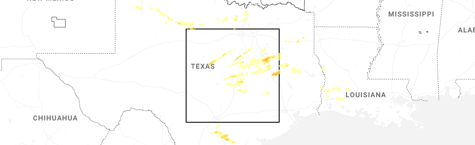
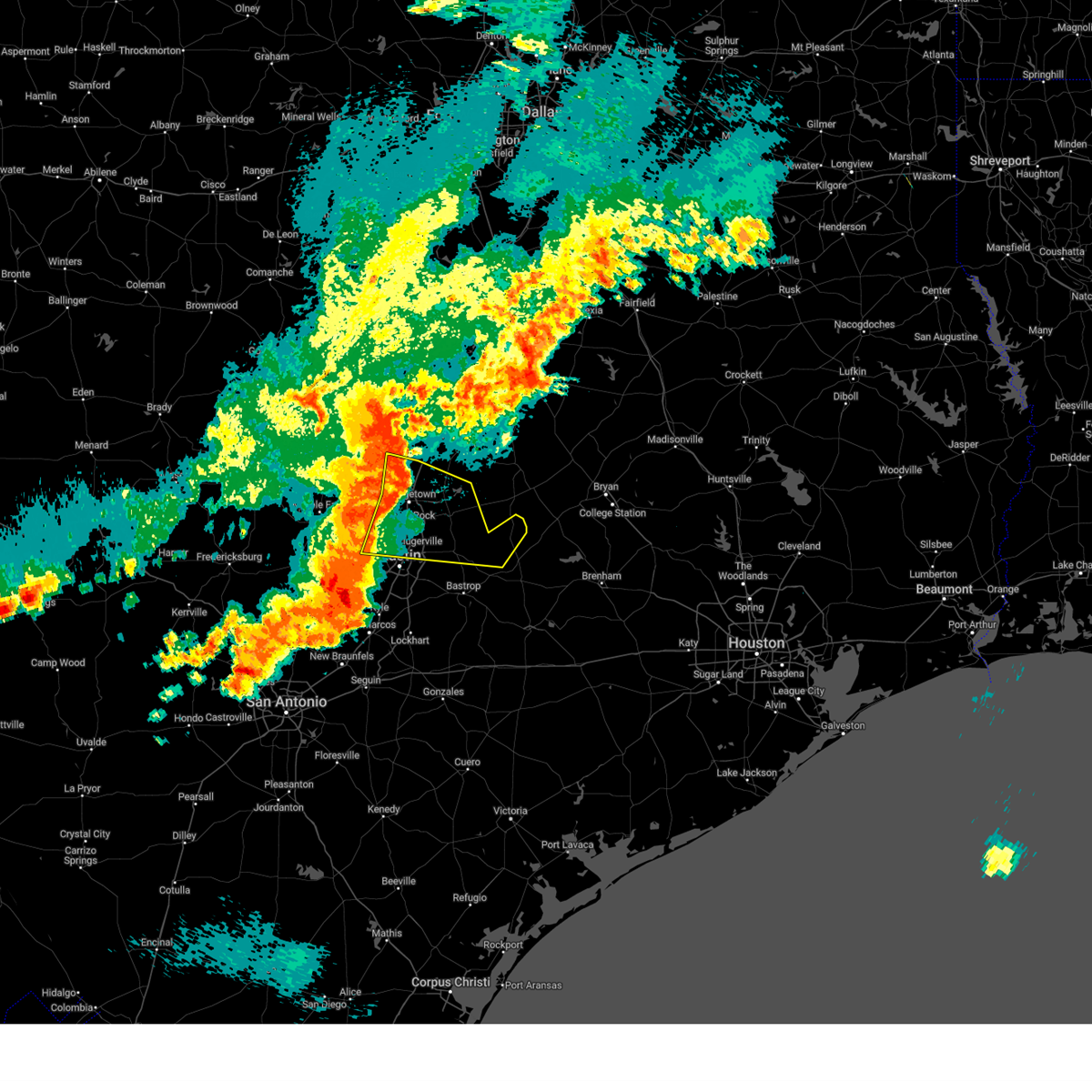
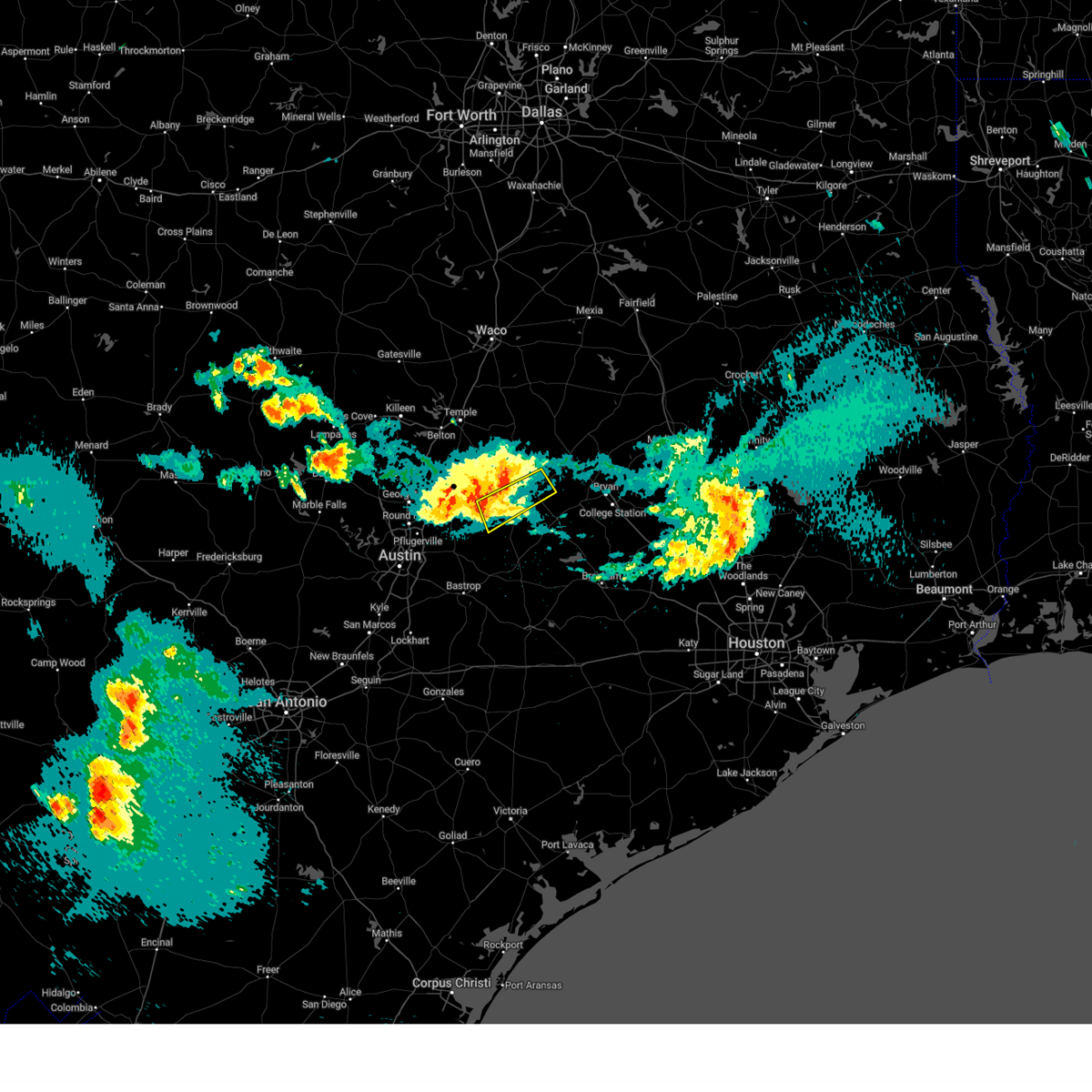
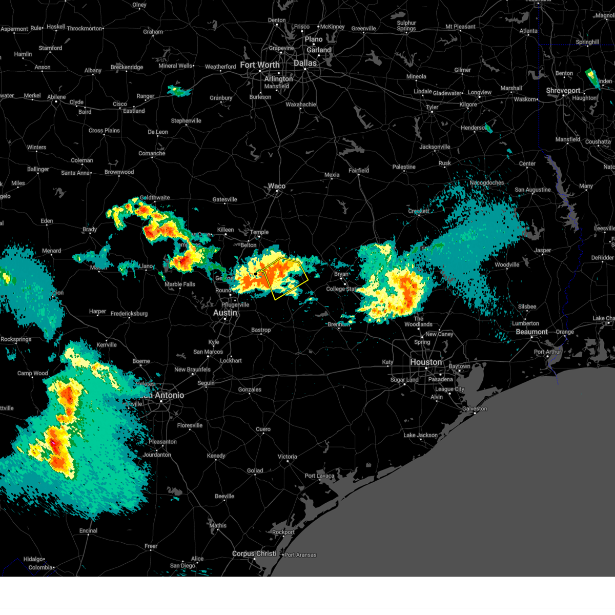
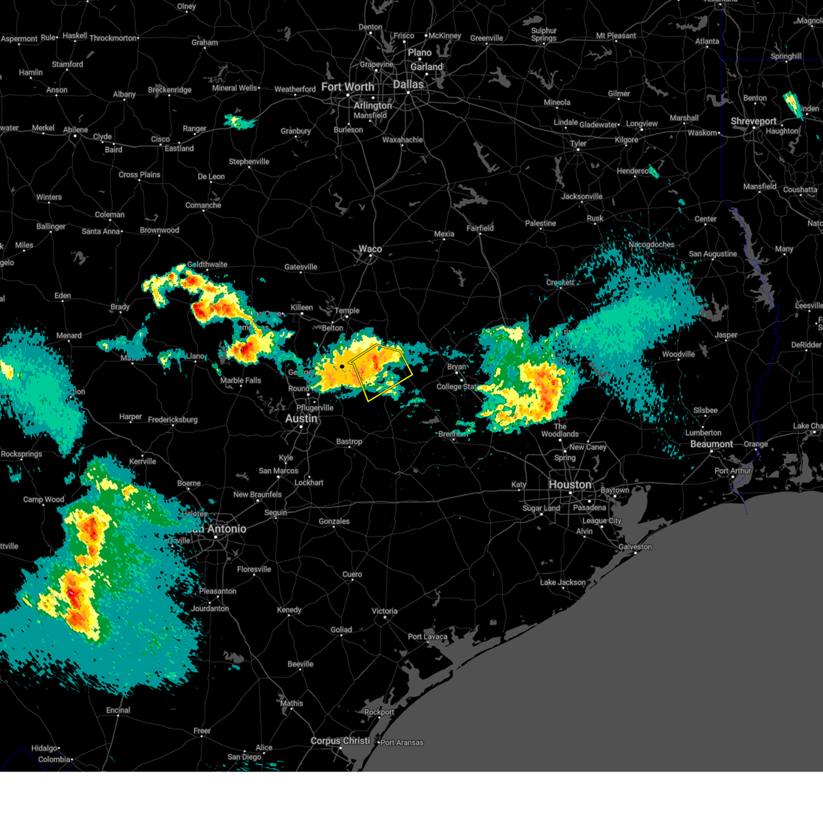
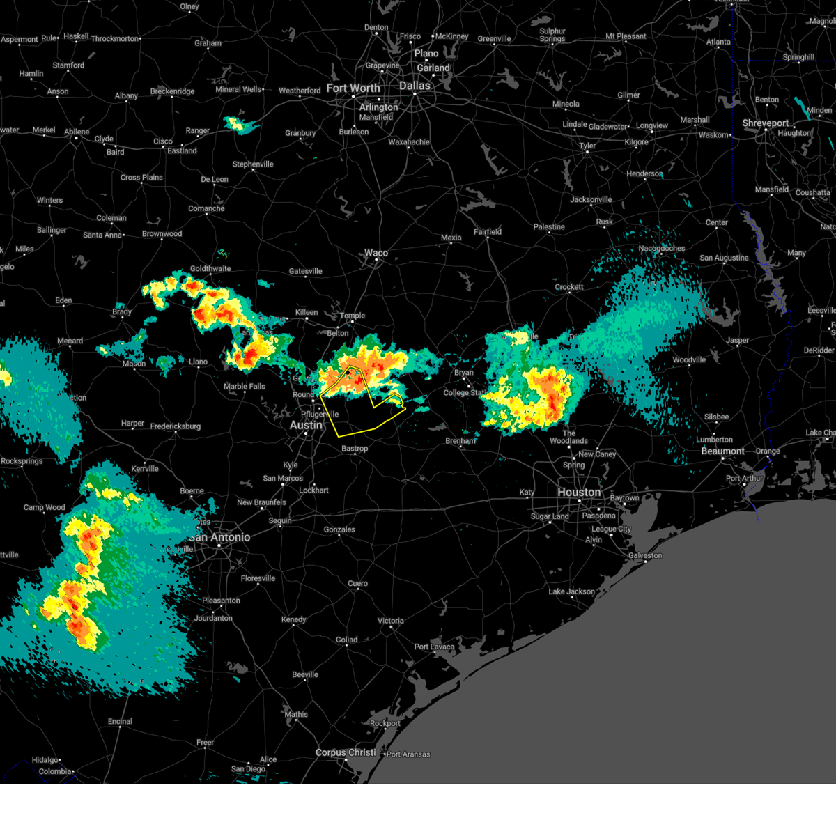
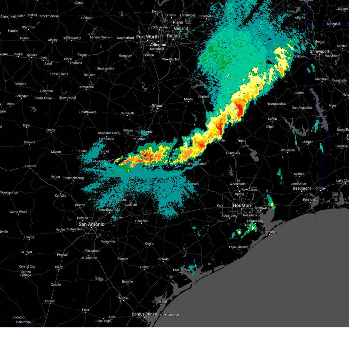
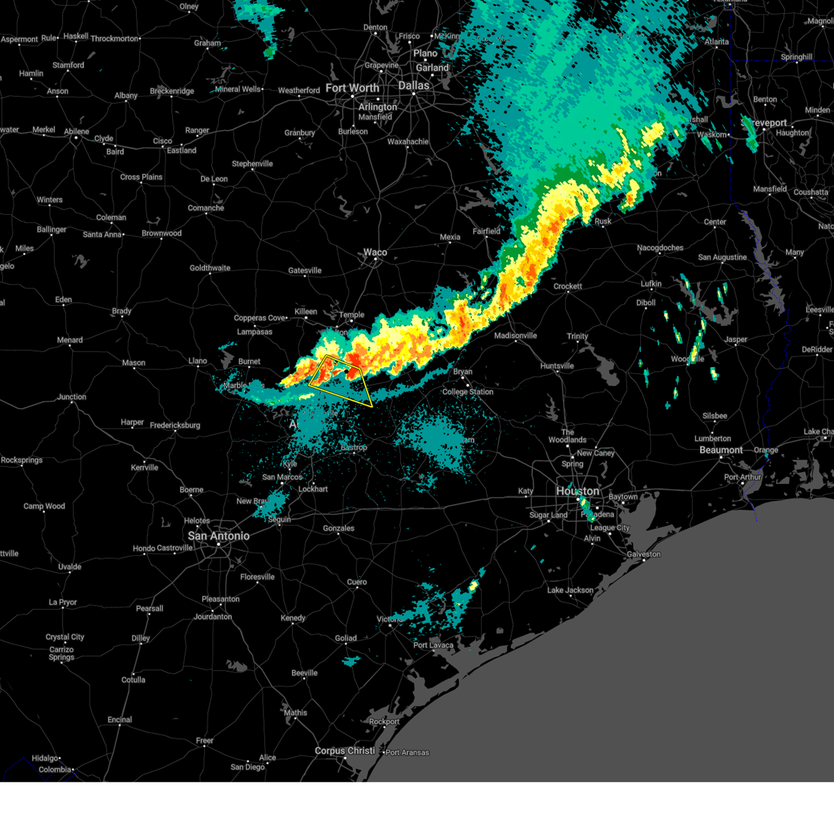
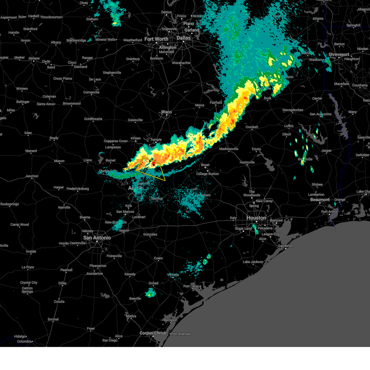
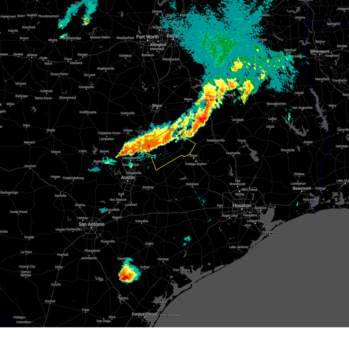
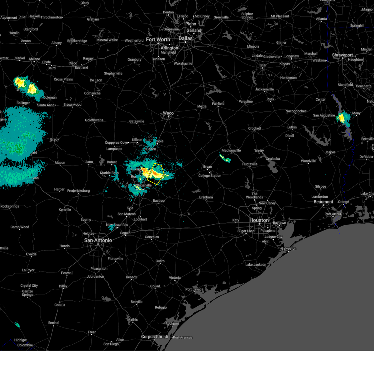
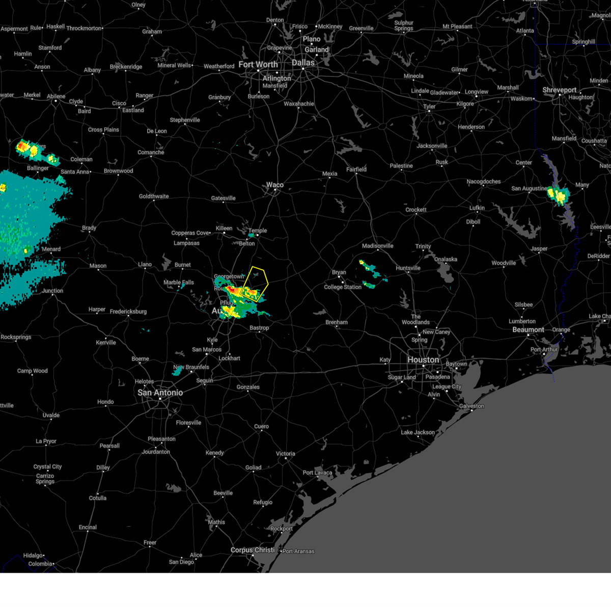
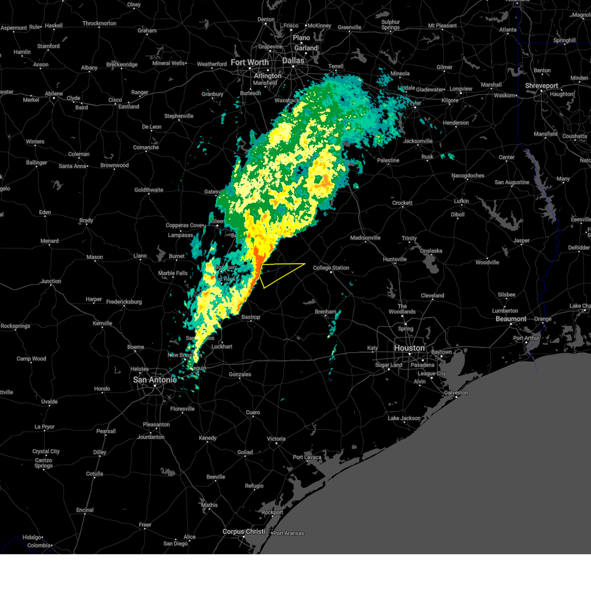
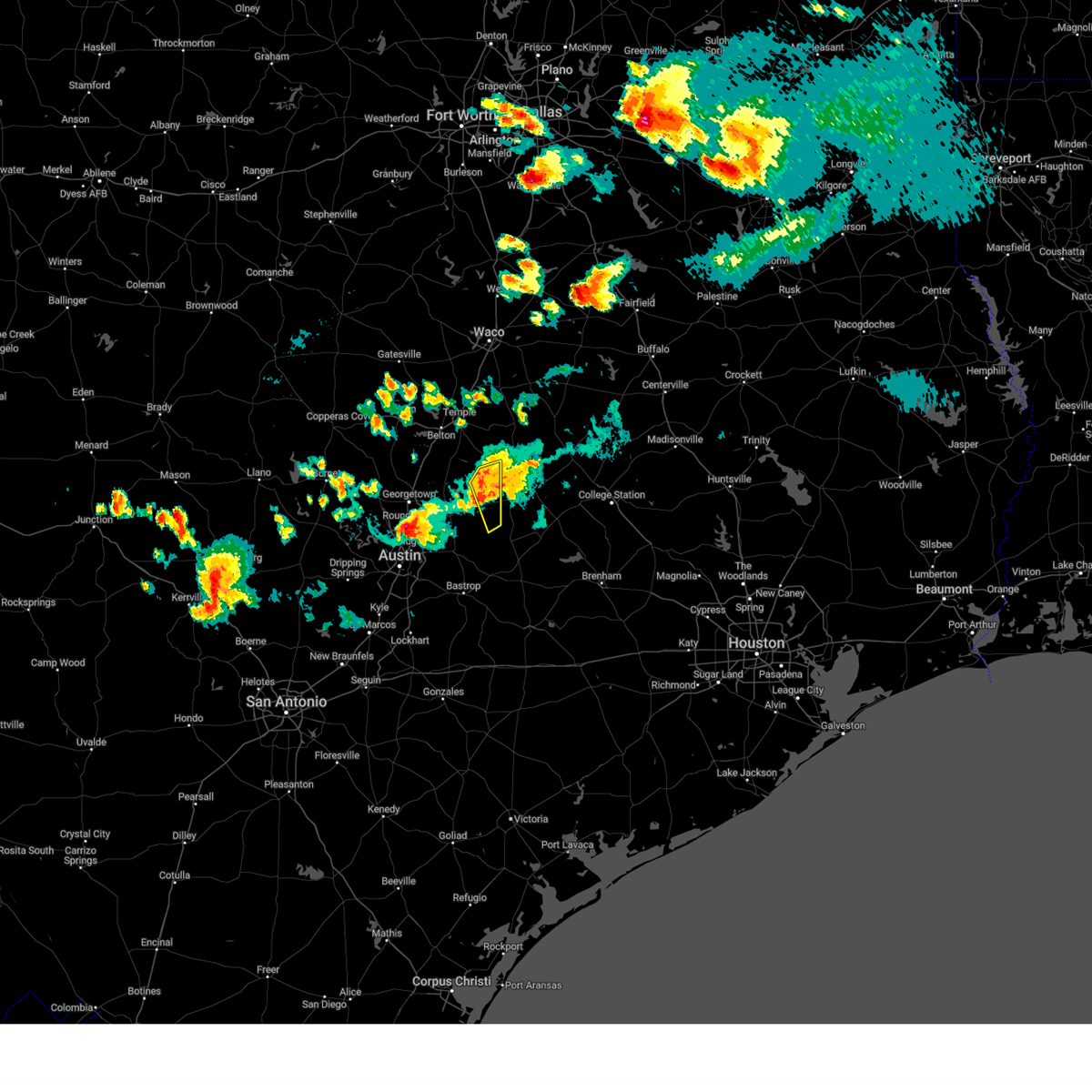
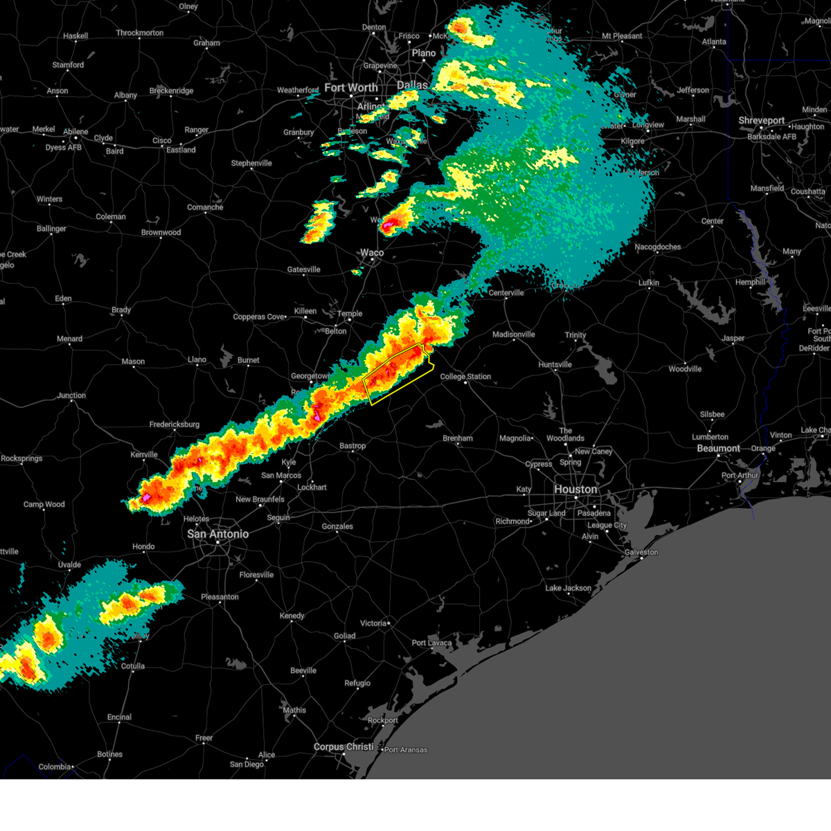
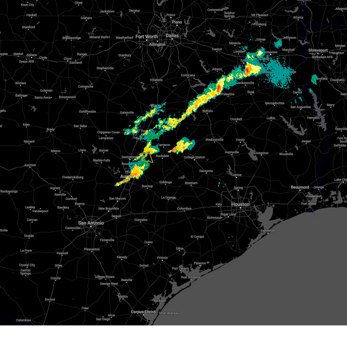
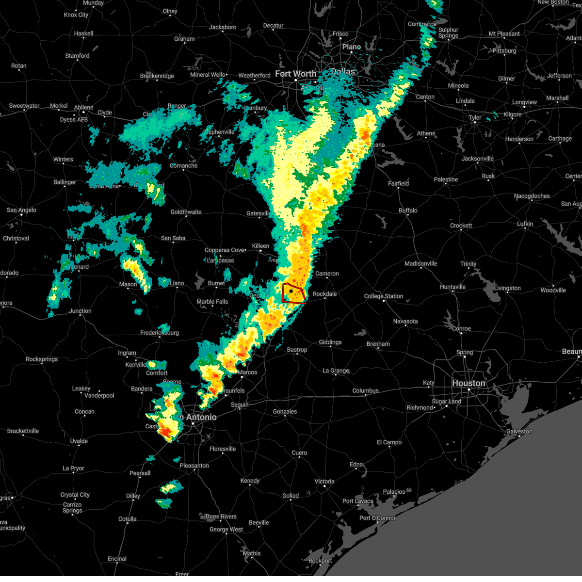
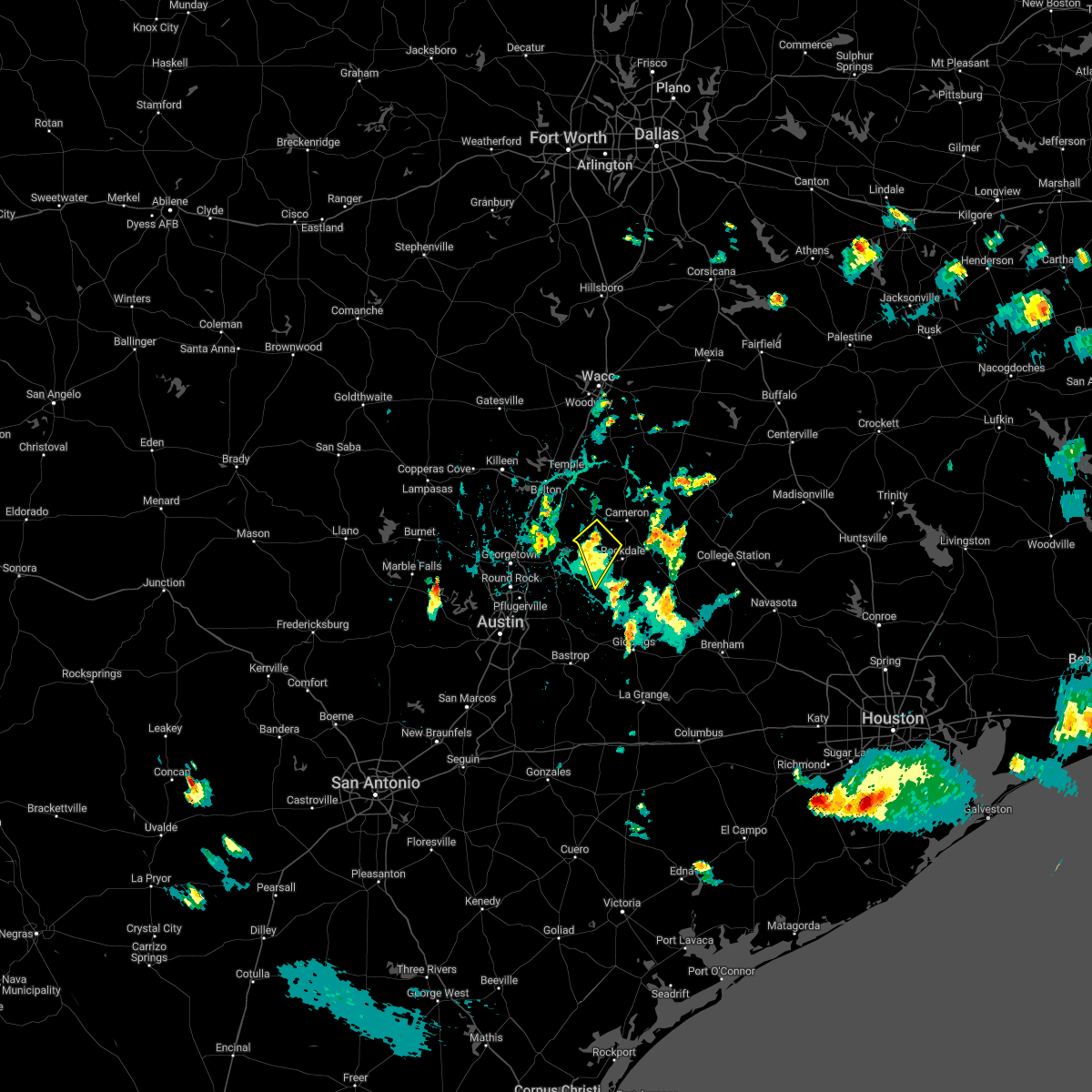
Hail Map for Thorndale, TX
The Thorndale, TX area has had 0 reports of on-the-ground hail by trained spotters, and has been under severe weather warnings 38 times during the past 12 months. Doppler radar has detected hail at or near Thorndale, TX on 40 occasions, including 4 occasions during the past year.
| Name: | Thorndale, TX |
| Where Located: | 46.4 miles SE of Killeen, TX |
| Map: | Google Map for Thorndale, TX |
| Population: | 1336 |
| Housing Units: | 577 |
| More Info: | Search Google for Thorndale, TX |
1
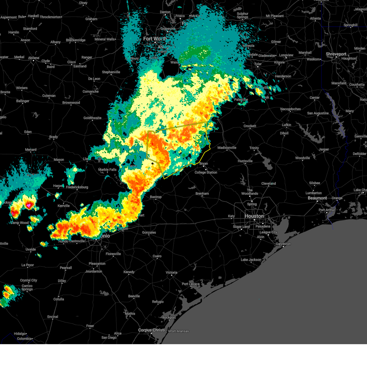
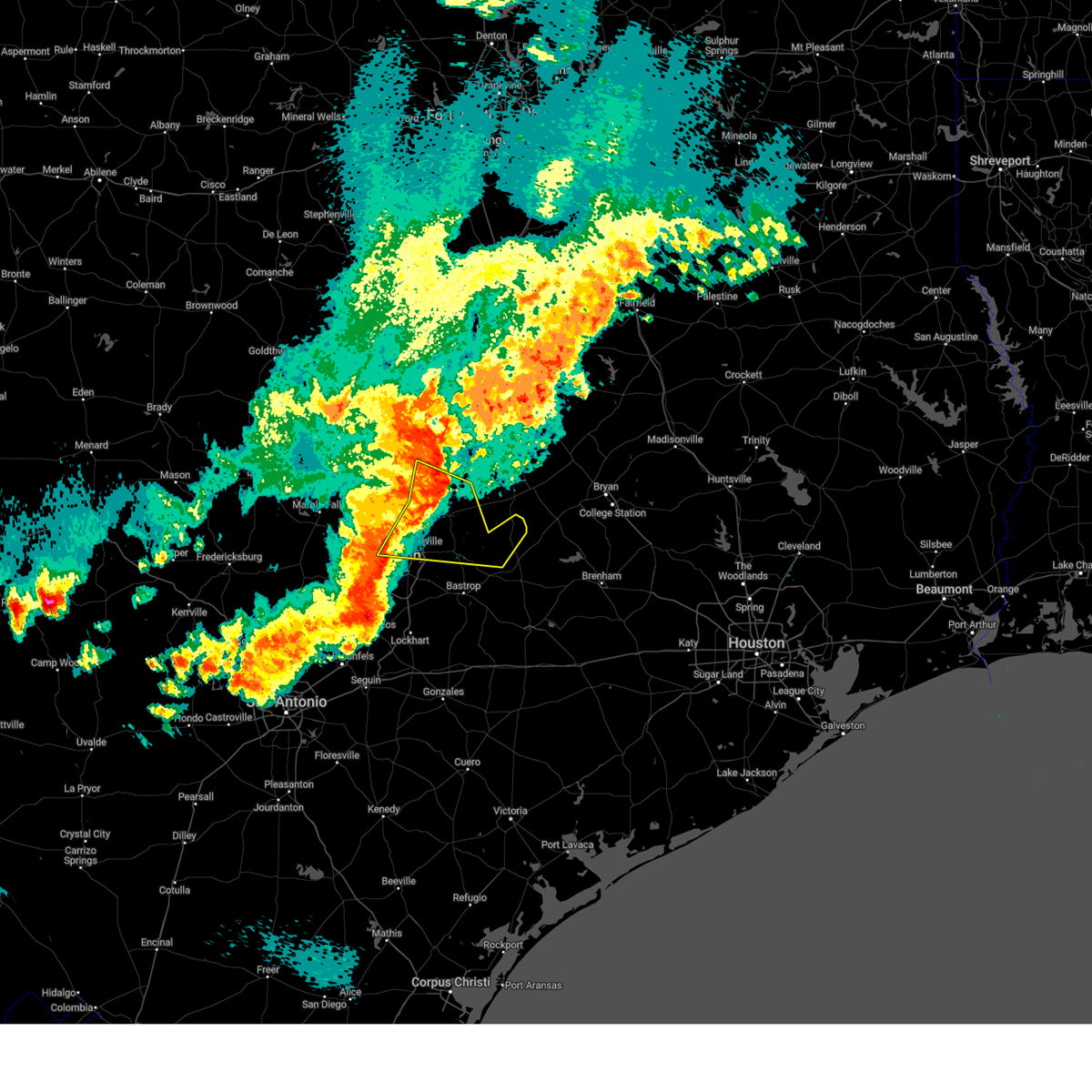
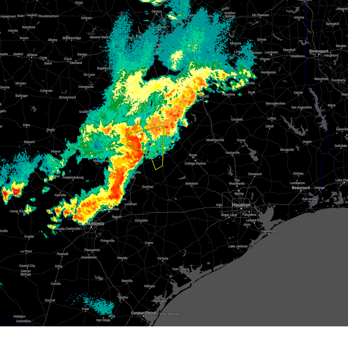
The Top Recent Hail Date for Thorndale, TX is Wednesday, April 30, 2025 (16th out of 40)
Hail and Wind Damage Spotted near Thorndale, TX
| Date / Time | Report Details |
|---|---|
| 5/26/2025 9:33 PM CDT | the severe thunderstorm warning has been cancelled and is no longer in effect |
| 5/26/2025 9:26 PM CDT |
 Svrfwd the national weather service in fort worth has issued a * severe thunderstorm warning for, robertson county in central texas, milam county in central texas, eastern bell county in central texas, southeastern limestone county in central texas, falls county in central texas, * until 1015 pm cdt. * at 925 pm cdt, a severe thunderstorm was located near cameron, moving east at 55 mph (trained weather spotters). Hazards include 70 mph wind gusts and quarter size hail. Hail damage to vehicles is expected. expect considerable tree damage. wind damage is also likely to mobile homes, roofs, and outbuildings. this severe thunderstorm will be near, cameron around 930 pm cdt. calvert and hearne around 945 pm cdt. other locations impacted by this severe thunderstorm include barclay, moffat, sharp, yarrelton, hoyte, pettibone, reagan, new baden, davilla, and elevation. This includes interstate 35 between mile markers 290 and 313. Svrfwd the national weather service in fort worth has issued a * severe thunderstorm warning for, robertson county in central texas, milam county in central texas, eastern bell county in central texas, southeastern limestone county in central texas, falls county in central texas, * until 1015 pm cdt. * at 925 pm cdt, a severe thunderstorm was located near cameron, moving east at 55 mph (trained weather spotters). Hazards include 70 mph wind gusts and quarter size hail. Hail damage to vehicles is expected. expect considerable tree damage. wind damage is also likely to mobile homes, roofs, and outbuildings. this severe thunderstorm will be near, cameron around 930 pm cdt. calvert and hearne around 945 pm cdt. other locations impacted by this severe thunderstorm include barclay, moffat, sharp, yarrelton, hoyte, pettibone, reagan, new baden, davilla, and elevation. This includes interstate 35 between mile markers 290 and 313.
|
| 5/26/2025 9:03 PM CDT |
 At 902 pm cdt, severe thunderstorms were located along a line extending from near rogers to near thrall to near manor, moving east at 60 mph (radar indicated). Hazards include 60 mph wind gusts. Expect damage to roofs, siding, and trees. Locations impacted include, austin, round rock, cedar park, georgetown, pflugerville, taylor, elgin, granger, lexington, windemere, anderson mill, hutto, manor, bartlett, jarrell, thorndale, thrall, weir, fedor, and granger dam. At 902 pm cdt, severe thunderstorms were located along a line extending from near rogers to near thrall to near manor, moving east at 60 mph (radar indicated). Hazards include 60 mph wind gusts. Expect damage to roofs, siding, and trees. Locations impacted include, austin, round rock, cedar park, georgetown, pflugerville, taylor, elgin, granger, lexington, windemere, anderson mill, hutto, manor, bartlett, jarrell, thorndale, thrall, weir, fedor, and granger dam.
|
| 5/26/2025 9:02 PM CDT |
 At 901 pm cdt, a severe thunderstorm was located near holland, or 13 miles northeast of granger, moving east at 50 mph. this is a destructive storm for southern bell and milam counties (trained weather spotters). Hazards include 80 mph wind gusts and quarter size hail. Flying debris will be dangerous to those caught without shelter. mobile homes will be heavily damaged. expect considerable damage to roofs, windows, and vehicles. extensive tree damage and power outages are likely. this severe storm will be near, rogers around 905 pm cdt. buckholts around 910 pm cdt. cameron around 925 pm cdt. Other locations impacted by this severe thunderstorm include barclay, cedar valley, sharp, yarrelton, pettibone, prairie dell, davilla, woodland, oenaville, and terrys chapel. At 901 pm cdt, a severe thunderstorm was located near holland, or 13 miles northeast of granger, moving east at 50 mph. this is a destructive storm for southern bell and milam counties (trained weather spotters). Hazards include 80 mph wind gusts and quarter size hail. Flying debris will be dangerous to those caught without shelter. mobile homes will be heavily damaged. expect considerable damage to roofs, windows, and vehicles. extensive tree damage and power outages are likely. this severe storm will be near, rogers around 905 pm cdt. buckholts around 910 pm cdt. cameron around 925 pm cdt. Other locations impacted by this severe thunderstorm include barclay, cedar valley, sharp, yarrelton, pettibone, prairie dell, davilla, woodland, oenaville, and terrys chapel.
|
| 5/26/2025 8:42 PM CDT |
 At 842 pm cdt, severe thunderstorms were located along a line extending from 8 miles northeast of florence to georgetown to anderson mill, moving east at 40 mph. these are destructive storms for jarrell, granger, and barlett (radar indicated). Hazards include 80 mph wind gusts and penny size hail. Flying debris will be dangerous to those caught without shelter. mobile homes will be heavily damaged. expect considerable damage to roofs, windows, and vehicles. extensive tree damage and power outages are likely. Locations impacted include, austin, round rock, cedar park, georgetown, pflugerville, taylor, elgin, granger, lexington, serenada, anderson mill, windemere, leander, hutto, lakeway, manor, lago vista, hudson bend, bartlett, and the hills. At 842 pm cdt, severe thunderstorms were located along a line extending from 8 miles northeast of florence to georgetown to anderson mill, moving east at 40 mph. these are destructive storms for jarrell, granger, and barlett (radar indicated). Hazards include 80 mph wind gusts and penny size hail. Flying debris will be dangerous to those caught without shelter. mobile homes will be heavily damaged. expect considerable damage to roofs, windows, and vehicles. extensive tree damage and power outages are likely. Locations impacted include, austin, round rock, cedar park, georgetown, pflugerville, taylor, elgin, granger, lexington, serenada, anderson mill, windemere, leander, hutto, lakeway, manor, lago vista, hudson bend, bartlett, and the hills.
|
| 5/26/2025 8:38 PM CDT |
 Svrfwd the national weather service in fort worth has issued a * severe thunderstorm warning for, western milam county in central texas, bell county in central texas, southwestern falls county in central texas, * until 930 pm cdt. * at 836 pm cdt, a severe thunderstorm was located near stillhouse hollow lake, or near harker heights, moving east at 40 mph (radar indicated). Hazards include 70 mph wind gusts and quarter size hail. Hail damage to vehicles is expected. expect considerable tree damage. wind damage is also likely to mobile homes, roofs, and outbuildings. this severe thunderstorm will be near, stillhouse hollow lake, harker heights, and salado around 840 pm cdt. belton around 850 pm cdt. little river-academy around 855 pm cdt. rogers around 910 pm cdt. other locations impacted by this severe thunderstorm include barclay, cedar valley, sharp, yarrelton, pettibone, prairie dell, davilla, woodland, oenaville, and terrys chapel. This includes interstate 35 between mile markers 278 and 306. Svrfwd the national weather service in fort worth has issued a * severe thunderstorm warning for, western milam county in central texas, bell county in central texas, southwestern falls county in central texas, * until 930 pm cdt. * at 836 pm cdt, a severe thunderstorm was located near stillhouse hollow lake, or near harker heights, moving east at 40 mph (radar indicated). Hazards include 70 mph wind gusts and quarter size hail. Hail damage to vehicles is expected. expect considerable tree damage. wind damage is also likely to mobile homes, roofs, and outbuildings. this severe thunderstorm will be near, stillhouse hollow lake, harker heights, and salado around 840 pm cdt. belton around 850 pm cdt. little river-academy around 855 pm cdt. rogers around 910 pm cdt. other locations impacted by this severe thunderstorm include barclay, cedar valley, sharp, yarrelton, pettibone, prairie dell, davilla, woodland, oenaville, and terrys chapel. This includes interstate 35 between mile markers 278 and 306.
|
| 5/26/2025 8:36 PM CDT |
 Svrewx the national weather service in austin san antonio has issued a * severe thunderstorm warning for, williamson county in south central texas, central travis county in south central texas, northeastern bastrop county in south central texas, northwestern lee county in south central texas, * until 945 pm cdt. * at 835 pm cdt, severe thunderstorms were located along a line extending from 7 miles north of florence to georgetown dam to near hudson bend, moving east at 40 mph. these are destructive storms for jarrell, granger, and barlett (radar indicated). Hazards include 80 mph wind gusts and penny size hail. Flying debris will be dangerous to those caught without shelter. mobile homes will be heavily damaged. expect considerable damage to roofs, windows, and vehicles. Extensive tree damage and power outages are likely. Svrewx the national weather service in austin san antonio has issued a * severe thunderstorm warning for, williamson county in south central texas, central travis county in south central texas, northeastern bastrop county in south central texas, northwestern lee county in south central texas, * until 945 pm cdt. * at 835 pm cdt, severe thunderstorms were located along a line extending from 7 miles north of florence to georgetown dam to near hudson bend, moving east at 40 mph. these are destructive storms for jarrell, granger, and barlett (radar indicated). Hazards include 80 mph wind gusts and penny size hail. Flying debris will be dangerous to those caught without shelter. mobile homes will be heavily damaged. expect considerable damage to roofs, windows, and vehicles. Extensive tree damage and power outages are likely.
|
| 5/6/2025 1:25 PM CDT | the severe thunderstorm warning has been cancelled and is no longer in effect |
| 5/6/2025 12:44 PM CDT |
 Svrfwd the national weather service in fort worth has issued a * severe thunderstorm warning for, southern milam county in central texas, * until 145 pm cdt. * at 1243 pm cdt, severe thunderstorms were located along a line extending from milano to near lexington, moving east at 30 mph (radar indicated). Hazards include 60 mph wind gusts and quarter size hail. Hail damage to vehicles is expected. expect wind damage to roofs, siding, and trees. These severe thunderstorms will remain over mainly rural areas of southern milam county, including the following locations, elevation, gause, milano, and praesel. Svrfwd the national weather service in fort worth has issued a * severe thunderstorm warning for, southern milam county in central texas, * until 145 pm cdt. * at 1243 pm cdt, severe thunderstorms were located along a line extending from milano to near lexington, moving east at 30 mph (radar indicated). Hazards include 60 mph wind gusts and quarter size hail. Hail damage to vehicles is expected. expect wind damage to roofs, siding, and trees. These severe thunderstorms will remain over mainly rural areas of southern milam county, including the following locations, elevation, gause, milano, and praesel.
|
| 5/6/2025 12:38 PM CDT | The storm which prompted the warning has moved out of the area. therefore the warning will be allowed to expire. a tornado watch remains in effect until 400 pm cdt for central texas. to report severe weather, contact your nearest law enforcement agency. they will relay your report to the national weather service fort worth. |
| 5/6/2025 12:30 PM CDT |
 The storms which prompted the warning have moved out of the area. therefore, the warning will be allowed to expire. however small hail, gusty winds and heavy rain are still possible with these thunderstorms. a tornado watch remains in effect until 400 pm cdt for south central texas. The storms which prompted the warning have moved out of the area. therefore, the warning will be allowed to expire. however small hail, gusty winds and heavy rain are still possible with these thunderstorms. a tornado watch remains in effect until 400 pm cdt for south central texas.
|
| 5/6/2025 12:07 PM CDT | At 1206 pm cdt, a severe thunderstorm was located near buckholts, or near cameron, moving northeast at 35 mph (radar indicated). Hazards include 70 mph wind gusts and half dollar size hail. Hail damage to vehicles is expected. expect considerable tree damage. wind damage is also likely to mobile homes, roofs, and outbuildings. this severe storm will be near, cameron around 1210 pm cdt. Other locations impacted by this severe thunderstorm include minerva, hanover, ben arnold, san gabriel, baileyville, sharp, maysfield, yarrelton, hoyte, and crossroads. |
| 5/6/2025 12:04 PM CDT | Svrewx the national weather service in austin san antonio has issued a * severe thunderstorm warning for, southeastern williamson county in south central texas, * until 1230 pm cdt. * at 1204 pm cdt, severe thunderstorms were located along a line extending from near granger dam to thrall to near coupland, moving east at 20 mph (radar indicated). Hazards include 60 mph wind gusts and half dollar size hail. Hail damage to vehicles is expected. Expect wind damage to roofs, siding, and trees. |
| 5/6/2025 11:45 AM CDT |
 Svrfwd the national weather service in fort worth has issued a * severe thunderstorm warning for, milam county in central texas, * until 1245 pm cdt. * at 1145 am cdt, a severe thunderstorm was located near granger dam, or 10 miles east of granger, moving northeast at 35 mph (radar indicated). Hazards include 65 mph wind gusts and quarter size hail. Hail damage to vehicles is expected. expect wind damage to roofs, siding, and trees. this severe thunderstorm will be near, buckholts around 1200 pm cdt. cameron around 1210 pm cdt. Other locations impacted by this severe thunderstorm include minerva, hanover, ben arnold, san gabriel, baileyville, sharp, maysfield, yarrelton, hoyte, and crossroads. Svrfwd the national weather service in fort worth has issued a * severe thunderstorm warning for, milam county in central texas, * until 1245 pm cdt. * at 1145 am cdt, a severe thunderstorm was located near granger dam, or 10 miles east of granger, moving northeast at 35 mph (radar indicated). Hazards include 65 mph wind gusts and quarter size hail. Hail damage to vehicles is expected. expect wind damage to roofs, siding, and trees. this severe thunderstorm will be near, buckholts around 1200 pm cdt. cameron around 1210 pm cdt. Other locations impacted by this severe thunderstorm include minerva, hanover, ben arnold, san gabriel, baileyville, sharp, maysfield, yarrelton, hoyte, and crossroads.
|
| 5/1/2025 8:42 PM CDT |
 Svrfwd the national weather service in fort worth has issued a * severe thunderstorm warning for, southern milam county in central texas, * until 915 pm cdt. * at 842 pm cdt, a severe thunderstorm was located near rockdale, moving southeast at 20 mph (radar indicated). Hazards include 60 mph wind gusts and quarter size hail. Hail damage to vehicles is expected. expect wind damage to roofs, siding, and trees. This severe thunderstorm will remain over mainly rural areas of southern milam county, including the following locations, hanover, elevation, milano, and praesel. Svrfwd the national weather service in fort worth has issued a * severe thunderstorm warning for, southern milam county in central texas, * until 915 pm cdt. * at 842 pm cdt, a severe thunderstorm was located near rockdale, moving southeast at 20 mph (radar indicated). Hazards include 60 mph wind gusts and quarter size hail. Hail damage to vehicles is expected. expect wind damage to roofs, siding, and trees. This severe thunderstorm will remain over mainly rural areas of southern milam county, including the following locations, hanover, elevation, milano, and praesel.
|
| 5/1/2025 8:26 PM CDT |
 At 825 pm cdt, severe thunderstorms were located along a line extending from near alcoa lake to 8 miles south of thrall to near coupland, moving southeast at 20 mph (radar indicated). Hazards include 60 mph wind gusts and penny size hail. Expect damage to roofs, siding, and trees. these severe storms will be near, elgin, manor, and coupland around 830 pm cdt. tanglewood around 845 pm cdt. lexington around 850 pm cdt. Other locations impacted by these severe thunderstorms include knobb springs, rices crossing, blue, noack, beyarsville, mcdade, butler, and cedar hills. At 825 pm cdt, severe thunderstorms were located along a line extending from near alcoa lake to 8 miles south of thrall to near coupland, moving southeast at 20 mph (radar indicated). Hazards include 60 mph wind gusts and penny size hail. Expect damage to roofs, siding, and trees. these severe storms will be near, elgin, manor, and coupland around 830 pm cdt. tanglewood around 845 pm cdt. lexington around 850 pm cdt. Other locations impacted by these severe thunderstorms include knobb springs, rices crossing, blue, noack, beyarsville, mcdade, butler, and cedar hills.
|
| 5/1/2025 8:12 PM CDT |
 the severe thunderstorm warning has been cancelled and is no longer in effect the severe thunderstorm warning has been cancelled and is no longer in effect
|
| 5/1/2025 8:12 PM CDT |
 At 812 pm cdt, severe thunderstorms were located along a line extending from thorndale to cameron, moving southeast at 20 mph (radar indicated). Hazards include 65 mph wind gusts and quarter size hail. Hail damage to vehicles is expected. expect wind damage to roofs, siding, and trees. Locations impacted include, minerva, san gabriel, sharp, hoyte, thorndale, pettibone, cameron, milano, rockdale, elevation, praesel, alcoa lake, and buckholts. At 812 pm cdt, severe thunderstorms were located along a line extending from thorndale to cameron, moving southeast at 20 mph (radar indicated). Hazards include 65 mph wind gusts and quarter size hail. Hail damage to vehicles is expected. expect wind damage to roofs, siding, and trees. Locations impacted include, minerva, san gabriel, sharp, hoyte, thorndale, pettibone, cameron, milano, rockdale, elevation, praesel, alcoa lake, and buckholts.
|
| 5/1/2025 8:04 PM CDT |
 At 804 pm cdt, severe thunderstorms were located along a line extending from near thorndale to near thrall to near hutto, moving southeast at 20 mph (radar indicated). Hazards include 60 mph wind gusts and quarter size hail. Hail damage to vehicles is expected. expect wind damage to roofs, siding, and trees. these severe storms will be near, pflugerville, thorndale, thrall, and coupland around 810 pm cdt. manor around 820 pm cdt. elgin around 825 pm cdt. tanglewood around 855 pm cdt. Other locations impacted by these severe thunderstorms include knobb springs, rices crossing, laneport, blue, hoxie, beyarsville, mcdade, waterloo, hare, and cedar hills. At 804 pm cdt, severe thunderstorms were located along a line extending from near thorndale to near thrall to near hutto, moving southeast at 20 mph (radar indicated). Hazards include 60 mph wind gusts and quarter size hail. Hail damage to vehicles is expected. expect wind damage to roofs, siding, and trees. these severe storms will be near, pflugerville, thorndale, thrall, and coupland around 810 pm cdt. manor around 820 pm cdt. elgin around 825 pm cdt. tanglewood around 855 pm cdt. Other locations impacted by these severe thunderstorms include knobb springs, rices crossing, laneport, blue, hoxie, beyarsville, mcdade, waterloo, hare, and cedar hills.
|
| 5/1/2025 7:58 PM CDT |
 At 757 pm cdt, severe thunderstorms were located along a line extending from granger dam to cameron, moving southeast at 10 mph (radar indicated). Hazards include 65 mph wind gusts and quarter size hail. Hail damage to vehicles is expected. expect wind damage to roofs, siding, and trees. Locations impacted include, minerva, san gabriel, sharp, hoyte, thorndale, pettibone, cameron, milano, rockdale, davilla, buckholts, elevation, val verde, praesel, alcoa lake, bartlett, and rogers. At 757 pm cdt, severe thunderstorms were located along a line extending from granger dam to cameron, moving southeast at 10 mph (radar indicated). Hazards include 65 mph wind gusts and quarter size hail. Hail damage to vehicles is expected. expect wind damage to roofs, siding, and trees. Locations impacted include, minerva, san gabriel, sharp, hoyte, thorndale, pettibone, cameron, milano, rockdale, davilla, buckholts, elevation, val verde, praesel, alcoa lake, bartlett, and rogers.
|
| 5/1/2025 7:54 PM CDT |
 Svrewx the national weather service in austin san antonio has issued a * severe thunderstorm warning for, southeastern williamson county in south central texas, northeastern travis county in south central texas, north central bastrop county in south central texas, northwestern lee county in south central texas, * until 900 pm cdt. * at 754 pm cdt, severe thunderstorms were located along a line extending from near granger dam to near taylor to near hutto, moving southeast at 20 mph (radar indicated). Hazards include 60 mph wind gusts. Expect damage to roofs, siding, and trees. severe thunderstorms will be near, pflugerville, taylor, thorndale, thrall, and coupland around 800 pm cdt. elgin and manor around 820 pm cdt. Other locations impacted by these severe thunderstorms include knobb springs, rices crossing, laneport, blue, hoxie, beyarsville, mcdade, waterloo, hare, and cedar hills. Svrewx the national weather service in austin san antonio has issued a * severe thunderstorm warning for, southeastern williamson county in south central texas, northeastern travis county in south central texas, north central bastrop county in south central texas, northwestern lee county in south central texas, * until 900 pm cdt. * at 754 pm cdt, severe thunderstorms were located along a line extending from near granger dam to near taylor to near hutto, moving southeast at 20 mph (radar indicated). Hazards include 60 mph wind gusts. Expect damage to roofs, siding, and trees. severe thunderstorms will be near, pflugerville, taylor, thorndale, thrall, and coupland around 800 pm cdt. elgin and manor around 820 pm cdt. Other locations impacted by these severe thunderstorms include knobb springs, rices crossing, laneport, blue, hoxie, beyarsville, mcdade, waterloo, hare, and cedar hills.
|
| 5/1/2025 7:32 PM CDT |
 Svrfwd the national weather service in fort worth has issued a * severe thunderstorm warning for, southern milam county in central texas, southeastern bell county in central texas, * until 845 pm cdt. * at 731 pm cdt, severe thunderstorms were located along a line extending from bartlett to 12 miles southwest of hearne, moving southeast at 10 mph (radar indicated). Hazards include 60 mph wind gusts and half dollar size hail. Hail damage to vehicles is expected. expect wind damage to roofs, siding, and trees. these severe thunderstorms will remain over mainly rural areas of southern milam and southeastern bell counties, including the following locations, minerva, elevation, val verde, san gabriel, praesel, sharp, hoyte, pettibone, prairie dell, and milano. This includes interstate 35 between mile markers 278 and 279. Svrfwd the national weather service in fort worth has issued a * severe thunderstorm warning for, southern milam county in central texas, southeastern bell county in central texas, * until 845 pm cdt. * at 731 pm cdt, severe thunderstorms were located along a line extending from bartlett to 12 miles southwest of hearne, moving southeast at 10 mph (radar indicated). Hazards include 60 mph wind gusts and half dollar size hail. Hail damage to vehicles is expected. expect wind damage to roofs, siding, and trees. these severe thunderstorms will remain over mainly rural areas of southern milam and southeastern bell counties, including the following locations, minerva, elevation, val verde, san gabriel, praesel, sharp, hoyte, pettibone, prairie dell, and milano. This includes interstate 35 between mile markers 278 and 279.
|
| 4/30/2025 10:50 PM CDT |
 Svrfwd the national weather service in fort worth has issued a * severe thunderstorm warning for, southern milam county in central texas, * until 1115 pm cdt. * at 1050 pm cdt, a severe thunderstorm was located near thrall, or 8 miles east of taylor, moving east at 45 mph (radar indicated). Hazards include 60 mph wind gusts and half dollar size hail. Hail damage to vehicles is expected. expect wind damage to roofs, siding, and trees. This severe thunderstorm will remain over mainly rural areas of southern milam county, including the following locations, praesel and elevation. Svrfwd the national weather service in fort worth has issued a * severe thunderstorm warning for, southern milam county in central texas, * until 1115 pm cdt. * at 1050 pm cdt, a severe thunderstorm was located near thrall, or 8 miles east of taylor, moving east at 45 mph (radar indicated). Hazards include 60 mph wind gusts and half dollar size hail. Hail damage to vehicles is expected. expect wind damage to roofs, siding, and trees. This severe thunderstorm will remain over mainly rural areas of southern milam county, including the following locations, praesel and elevation.
|
| 4/30/2025 10:10 PM CDT |
 the severe thunderstorm warning has been cancelled and is no longer in effect the severe thunderstorm warning has been cancelled and is no longer in effect
|
| 4/30/2025 9:56 PM CDT |
 Svrewx the national weather service in austin san antonio has issued a * severe thunderstorm warning for, northeastern williamson county in south central texas, * until 1030 pm cdt. * at 956 pm cdt, a severe thunderstorm was located near granger dam, or 7 miles southeast of granger, moving east at 30 mph (radar indicated). Hazards include 60 mph wind gusts and quarter size hail. Hail damage to vehicles is expected. Expect wind damage to roofs, siding, and trees. Svrewx the national weather service in austin san antonio has issued a * severe thunderstorm warning for, northeastern williamson county in south central texas, * until 1030 pm cdt. * at 956 pm cdt, a severe thunderstorm was located near granger dam, or 7 miles southeast of granger, moving east at 30 mph (radar indicated). Hazards include 60 mph wind gusts and quarter size hail. Hail damage to vehicles is expected. Expect wind damage to roofs, siding, and trees.
|
| 4/30/2025 9:47 PM CDT |
 At 946 pm cdt, a severe thunderstorm was located near granger dam, or near granger, moving east at 30 mph (radar indicated). Hazards include 60 mph wind gusts and half dollar size hail. Hail damage to vehicles is expected. expect wind damage to roofs, siding, and trees. Locations impacted include, georgetown, taylor, granger, hutto, bartlett, thrall, weir, granger dam, theon, laneport, hoxie, beyarsville, waterloo, hare, walburg, schwertner, jonah, noack, and sandoval. At 946 pm cdt, a severe thunderstorm was located near granger dam, or near granger, moving east at 30 mph (radar indicated). Hazards include 60 mph wind gusts and half dollar size hail. Hail damage to vehicles is expected. expect wind damage to roofs, siding, and trees. Locations impacted include, georgetown, taylor, granger, hutto, bartlett, thrall, weir, granger dam, theon, laneport, hoxie, beyarsville, waterloo, hare, walburg, schwertner, jonah, noack, and sandoval.
|
| 4/30/2025 9:37 PM CDT |
 At 937 pm cdt, a severe thunderstorm was located near granger, moving east at 35 mph (radar indicated). Hazards include 60 mph wind gusts and half dollar size hail. Hail damage to vehicles is expected. expect wind damage to roofs, siding, and trees. Locations impacted include, georgetown, taylor, granger, hutto, bartlett, thrall, weir, granger dam, theon, laneport, hoxie, beyarsville, waterloo, hare, walburg, schwertner, jonah, noack, and sandoval. At 937 pm cdt, a severe thunderstorm was located near granger, moving east at 35 mph (radar indicated). Hazards include 60 mph wind gusts and half dollar size hail. Hail damage to vehicles is expected. expect wind damage to roofs, siding, and trees. Locations impacted include, georgetown, taylor, granger, hutto, bartlett, thrall, weir, granger dam, theon, laneport, hoxie, beyarsville, waterloo, hare, walburg, schwertner, jonah, noack, and sandoval.
|
| 4/30/2025 9:29 PM CDT |
 At 929 pm cdt, a severe thunderstorm was located near granger, moving east at 35 mph (radar indicated). Hazards include golf ball size hail and 60 mph wind gusts. People and animals outdoors will be injured. expect hail damage to roofs, siding, windows, and vehicles. expect wind damage to roofs, siding, and trees. Locations impacted include, georgetown, taylor, granger, hutto, bartlett, thrall, weir, granger dam, theon, laneport, hoxie, beyarsville, waterloo, hare, walburg, schwertner, jonah, noack, and sandoval. At 929 pm cdt, a severe thunderstorm was located near granger, moving east at 35 mph (radar indicated). Hazards include golf ball size hail and 60 mph wind gusts. People and animals outdoors will be injured. expect hail damage to roofs, siding, windows, and vehicles. expect wind damage to roofs, siding, and trees. Locations impacted include, georgetown, taylor, granger, hutto, bartlett, thrall, weir, granger dam, theon, laneport, hoxie, beyarsville, waterloo, hare, walburg, schwertner, jonah, noack, and sandoval.
|
| 4/30/2025 9:20 PM CDT |
 Svrewx the national weather service in austin san antonio has issued a * severe thunderstorm warning for, northeastern williamson county in south central texas, * until 1000 pm cdt. * at 919 pm cdt, a severe thunderstorm was located over weir, or near serenada, moving east at 35 mph (radar indicated). Hazards include 60 mph wind gusts and half dollar size hail. Hail damage to vehicles is expected. Expect wind damage to roofs, siding, and trees. Svrewx the national weather service in austin san antonio has issued a * severe thunderstorm warning for, northeastern williamson county in south central texas, * until 1000 pm cdt. * at 919 pm cdt, a severe thunderstorm was located over weir, or near serenada, moving east at 35 mph (radar indicated). Hazards include 60 mph wind gusts and half dollar size hail. Hail damage to vehicles is expected. Expect wind damage to roofs, siding, and trees.
|
| 4/30/2025 9:13 PM CDT |
 At 913 pm cdt, a severe thunderstorm was located near cameron, moving east at 20 mph (radar indicated). Hazards include 60 mph wind gusts and quarter size hail. Hail damage to vehicles is expected. expect wind damage to roofs, siding, and trees. This severe thunderstorm will remain over mainly rural areas of southern robertson, milam and south central bell counties, including the following locations, minerva, hanover, ben arnold, san gabriel, baileyville, sharp, maysfield, yarrelton, hoyte, and crossroads. At 913 pm cdt, a severe thunderstorm was located near cameron, moving east at 20 mph (radar indicated). Hazards include 60 mph wind gusts and quarter size hail. Hail damage to vehicles is expected. expect wind damage to roofs, siding, and trees. This severe thunderstorm will remain over mainly rural areas of southern robertson, milam and south central bell counties, including the following locations, minerva, hanover, ben arnold, san gabriel, baileyville, sharp, maysfield, yarrelton, hoyte, and crossroads.
|
| 4/30/2025 9:13 PM CDT |
 the severe thunderstorm warning has been cancelled and is no longer in effect the severe thunderstorm warning has been cancelled and is no longer in effect
|
| 4/30/2025 8:41 PM CDT |
 Svrfwd the national weather service in fort worth has issued a * severe thunderstorm warning for, southern robertson county in central texas, milam county in central texas, southeastern bell county in central texas, south central falls county in central texas, * until 945 pm cdt. * at 840 pm cdt, a severe thunderstorm was located near buckholts, or 8 miles northwest of cameron, moving east at 20 mph (radar indicated). Hazards include 60 mph wind gusts and quarter size hail. Hail damage to vehicles is expected. expect wind damage to roofs, siding, and trees. this severe thunderstorm will be near, cameron around 850 pm cdt. Other locations impacted by this severe thunderstorm include hanover, ben arnold, baileyville, sharp, yarrelton, hoyte, crossroads, pettibone, davilla, and elevation. Svrfwd the national weather service in fort worth has issued a * severe thunderstorm warning for, southern robertson county in central texas, milam county in central texas, southeastern bell county in central texas, south central falls county in central texas, * until 945 pm cdt. * at 840 pm cdt, a severe thunderstorm was located near buckholts, or 8 miles northwest of cameron, moving east at 20 mph (radar indicated). Hazards include 60 mph wind gusts and quarter size hail. Hail damage to vehicles is expected. expect wind damage to roofs, siding, and trees. this severe thunderstorm will be near, cameron around 850 pm cdt. Other locations impacted by this severe thunderstorm include hanover, ben arnold, baileyville, sharp, yarrelton, hoyte, crossroads, pettibone, davilla, and elevation.
|
| 4/22/2025 8:49 PM CDT |
 the severe thunderstorm warning has been cancelled and is no longer in effect the severe thunderstorm warning has been cancelled and is no longer in effect
|
| 4/22/2025 8:26 PM CDT |
 Svrewx the national weather service in austin san antonio has issued a * severe thunderstorm warning for, southeastern williamson county in south central texas, * until 930 pm cdt. * at 825 pm cdt, a severe thunderstorm was located near taylor, moving northeast at 15 mph (radar indicated). Hazards include 60 mph wind gusts and quarter size hail. Hail damage to vehicles is expected. Expect wind damage to roofs, siding, and trees. Svrewx the national weather service in austin san antonio has issued a * severe thunderstorm warning for, southeastern williamson county in south central texas, * until 930 pm cdt. * at 825 pm cdt, a severe thunderstorm was located near taylor, moving northeast at 15 mph (radar indicated). Hazards include 60 mph wind gusts and quarter size hail. Hail damage to vehicles is expected. Expect wind damage to roofs, siding, and trees.
|
| 3/23/2025 10:51 PM CDT |
 The storm which prompted the warning has weakened below severe limits, and no longer poses an immediate threat to life or property. therefore, the warning will be allowed to expire. a severe thunderstorm watch remains in effect until 100 am cdt for south central texas. The storm which prompted the warning has weakened below severe limits, and no longer poses an immediate threat to life or property. therefore, the warning will be allowed to expire. a severe thunderstorm watch remains in effect until 100 am cdt for south central texas.
|
| 3/23/2025 10:42 PM CDT |
 At 1042 pm cdt, a severe thunderstorm was located over taylor, moving east at 30 mph (radar indicated). Hazards include 60 mph wind gusts and quarter size hail. Hail damage to vehicles is expected. expect wind damage to roofs, siding, and trees. Locations impacted include, round rock, georgetown, taylor, granger, hutto, thrall, weir, coupland, granger dam, rices crossing, hoxie, beyarsville, waterloo, hare, jonah, noack, and sandoval. At 1042 pm cdt, a severe thunderstorm was located over taylor, moving east at 30 mph (radar indicated). Hazards include 60 mph wind gusts and quarter size hail. Hail damage to vehicles is expected. expect wind damage to roofs, siding, and trees. Locations impacted include, round rock, georgetown, taylor, granger, hutto, thrall, weir, coupland, granger dam, rices crossing, hoxie, beyarsville, waterloo, hare, jonah, noack, and sandoval.
|
| 3/23/2025 10:14 PM CDT |
 Svrewx the national weather service in austin san antonio has issued a * severe thunderstorm warning for, southeastern williamson county in south central texas, * until 1100 pm cdt. * at 1013 pm cdt, a severe thunderstorm was located over georgetown, moving east at 30 mph (radar indicated). Hazards include 60 mph wind gusts and quarter size hail. Hail damage to vehicles is expected. Expect wind damage to roofs, siding, and trees. Svrewx the national weather service in austin san antonio has issued a * severe thunderstorm warning for, southeastern williamson county in south central texas, * until 1100 pm cdt. * at 1013 pm cdt, a severe thunderstorm was located over georgetown, moving east at 30 mph (radar indicated). Hazards include 60 mph wind gusts and quarter size hail. Hail damage to vehicles is expected. Expect wind damage to roofs, siding, and trees.
|
| 1/30/2025 7:52 AM CST |
 Svrfwd the national weather service in fort worth has issued a * severe thunderstorm warning for, southern milam county in central texas, * until 830 am cst. * at 752 am cst, a severe thunderstorm was located near thorndale, or 8 miles west of rockdale, moving east at 45 mph (radar indicated). Hazards include 60 mph wind gusts. Expect damage to roofs, siding, and trees. this severe thunderstorm will be near, rockdale and alcoa lake around 800 am cst. Other locations impacted by this severe thunderstorm include elevation, milano, praesel, and san gabriel. Svrfwd the national weather service in fort worth has issued a * severe thunderstorm warning for, southern milam county in central texas, * until 830 am cst. * at 752 am cst, a severe thunderstorm was located near thorndale, or 8 miles west of rockdale, moving east at 45 mph (radar indicated). Hazards include 60 mph wind gusts. Expect damage to roofs, siding, and trees. this severe thunderstorm will be near, rockdale and alcoa lake around 800 am cst. Other locations impacted by this severe thunderstorm include elevation, milano, praesel, and san gabriel.
|
| 5/9/2024 9:45 PM CDT |
 the severe thunderstorm warning has been cancelled and is no longer in effect the severe thunderstorm warning has been cancelled and is no longer in effect
|
| 5/9/2024 9:24 PM CDT |
 Svrfwd the national weather service in fort worth has issued a * severe thunderstorm warning for, southwestern milam county in central texas, * until 1000 pm cdt. * at 923 pm cdt, a severe thunderstorm was located near sandow, moving southeast at 50 mph (radar indicated). Hazards include 60 mph wind gusts and quarter size hail. Hail damage to vehicles is expected. Expect wind damage to roofs, siding, and trees. Svrfwd the national weather service in fort worth has issued a * severe thunderstorm warning for, southwestern milam county in central texas, * until 1000 pm cdt. * at 923 pm cdt, a severe thunderstorm was located near sandow, moving southeast at 50 mph (radar indicated). Hazards include 60 mph wind gusts and quarter size hail. Hail damage to vehicles is expected. Expect wind damage to roofs, siding, and trees.
|
| 5/9/2024 9:05 PM CDT |
 At 904 pm cdt, a severe thunderstorm was located near taylor, moving southeast at 45 mph. this is a destructive storm for taylor and thrall (radar indicated). Hazards include three inch hail and 60 mph wind gusts. People and animals outdoors will be severely injured. expect shattered windows, extensive damage to roofs, siding, and vehicles. Locations impacted include, round rock, georgetown, taylor, granger, hutto, bartlett, jarrell, thorndale, thrall, weir, granger dam, coupland, theon, rices crossing, laneport, hoxie, beyarsville, waterloo, hare, and walburg. At 904 pm cdt, a severe thunderstorm was located near taylor, moving southeast at 45 mph. this is a destructive storm for taylor and thrall (radar indicated). Hazards include three inch hail and 60 mph wind gusts. People and animals outdoors will be severely injured. expect shattered windows, extensive damage to roofs, siding, and vehicles. Locations impacted include, round rock, georgetown, taylor, granger, hutto, bartlett, jarrell, thorndale, thrall, weir, granger dam, coupland, theon, rices crossing, laneport, hoxie, beyarsville, waterloo, hare, and walburg.
|
| 5/9/2024 8:51 PM CDT |
 At 851 pm cdt, a severe thunderstorm was located near granger, moving southeast at 40 mph (radar indicated). Hazards include two inch hail and 60 mph wind gusts. People and animals outdoors will be injured. expect hail damage to roofs, siding, windows, and vehicles. expect wind damage to roofs, siding, and trees. Locations impacted include, round rock, georgetown, taylor, granger, hutto, bartlett, jarrell, thorndale, thrall, weir, granger dam, coupland, theon, rices crossing, laneport, hoxie, beyarsville, waterloo, hare, and walburg. At 851 pm cdt, a severe thunderstorm was located near granger, moving southeast at 40 mph (radar indicated). Hazards include two inch hail and 60 mph wind gusts. People and animals outdoors will be injured. expect hail damage to roofs, siding, windows, and vehicles. expect wind damage to roofs, siding, and trees. Locations impacted include, round rock, georgetown, taylor, granger, hutto, bartlett, jarrell, thorndale, thrall, weir, granger dam, coupland, theon, rices crossing, laneport, hoxie, beyarsville, waterloo, hare, and walburg.
|
| 5/9/2024 8:29 PM CDT |
 Svrewx the national weather service in austin san antonio has issued a * severe thunderstorm warning for, williamson county in south central texas, * until 930 pm cdt. * at 828 pm cdt, a severe thunderstorm was located near jarrell, or near serenada, moving southeast at 45 mph (radar indicated). Hazards include two inch hail and 60 mph wind gusts. People and animals outdoors will be injured. expect hail damage to roofs, siding, windows, and vehicles. Expect wind damage to roofs, siding, and trees. Svrewx the national weather service in austin san antonio has issued a * severe thunderstorm warning for, williamson county in south central texas, * until 930 pm cdt. * at 828 pm cdt, a severe thunderstorm was located near jarrell, or near serenada, moving southeast at 45 mph (radar indicated). Hazards include two inch hail and 60 mph wind gusts. People and animals outdoors will be injured. expect hail damage to roofs, siding, windows, and vehicles. Expect wind damage to roofs, siding, and trees.
|
| 4/9/2024 8:56 PM CDT |
 Svrewx the national weather service in austin san antonio has issued a * severe thunderstorm warning for, southeastern williamson county in south central texas, northwestern lee county in south central texas, * until 945 pm cdt. * at 856 pm cdt, a severe thunderstorm was located 11 miles west of lexington, moving east at 20 mph (radar indicated). Hazards include 60 mph wind gusts and half dollar size hail. Hail damage to vehicles is expected. Expect wind damage to roofs, siding, and trees. Svrewx the national weather service in austin san antonio has issued a * severe thunderstorm warning for, southeastern williamson county in south central texas, northwestern lee county in south central texas, * until 945 pm cdt. * at 856 pm cdt, a severe thunderstorm was located 11 miles west of lexington, moving east at 20 mph (radar indicated). Hazards include 60 mph wind gusts and half dollar size hail. Hail damage to vehicles is expected. Expect wind damage to roofs, siding, and trees.
|
| 9/24/2023 9:19 PM CDT |
 At 919 pm cdt, a severe thunderstorm was located near granger dam, or 12 miles east of granger, moving south at 15 mph (radar indicated). Hazards include 65 mph wind gusts. Expect damage to roofs, siding, and trees. locations impacted include, thorndale, alcoa lake, sharp, pettibone, and san gabriel. hail threat, radar indicated max hail size, <. 75 in wind threat, radar indicated max wind gust, 65 mph. At 919 pm cdt, a severe thunderstorm was located near granger dam, or 12 miles east of granger, moving south at 15 mph (radar indicated). Hazards include 65 mph wind gusts. Expect damage to roofs, siding, and trees. locations impacted include, thorndale, alcoa lake, sharp, pettibone, and san gabriel. hail threat, radar indicated max hail size, <. 75 in wind threat, radar indicated max wind gust, 65 mph.
|
| 9/24/2023 9:09 PM CDT |
 At 908 pm cdt, a severe thunderstorm was located 7 miles northeast of granger dam, or 12 miles east of granger, moving south at 15 mph (trained weather spotters). Hazards include 70 mph wind gusts. Expect considerable tree damage. damage is likely to mobile homes, roofs, and outbuildings. locations impacted include, thorndale, buckholts, alcoa lake, yarrelton, val verde, san gabriel, sharp, pettibone, and davilla. thunderstorm damage threat, considerable hail threat, radar indicated max hail size, <. 75 in wind threat, radar indicated max wind gust, 70 mph. At 908 pm cdt, a severe thunderstorm was located 7 miles northeast of granger dam, or 12 miles east of granger, moving south at 15 mph (trained weather spotters). Hazards include 70 mph wind gusts. Expect considerable tree damage. damage is likely to mobile homes, roofs, and outbuildings. locations impacted include, thorndale, buckholts, alcoa lake, yarrelton, val verde, san gabriel, sharp, pettibone, and davilla. thunderstorm damage threat, considerable hail threat, radar indicated max hail size, <. 75 in wind threat, radar indicated max wind gust, 70 mph.
|
| 9/24/2023 8:45 PM CDT |
 At 845 pm cdt, a severe thunderstorm was located near rogers, or 14 miles northeast of granger, moving south at 15 mph (trained weather spotters). Hazards include 70 mph wind gusts. Expect considerable tree damage. Damage is likely to mobile homes, roofs, and outbuildings. At 845 pm cdt, a severe thunderstorm was located near rogers, or 14 miles northeast of granger, moving south at 15 mph (trained weather spotters). Hazards include 70 mph wind gusts. Expect considerable tree damage. Damage is likely to mobile homes, roofs, and outbuildings.
|
| 4/28/2023 5:27 PM CDT |
 At 527 pm cdt, severe thunderstorms were located along a line extending from 8 miles southwest of hearne to near alcoa lake, moving southeast at 35 mph (radar indicated). Hazards include 70 mph wind gusts and quarter size hail. Hail damage to vehicles is expected. expect considerable tree damage. wind damage is also likely to mobile homes, roofs, and outbuildings. locations impacted include, rockdale, thorndale, alcoa lake, milano, hoyte, elevation, hanover, minerva, praesel, branchville and gause. thunderstorm damage threat, considerable hail threat, radar indicated max hail size, 1. 00 in wind threat, radar indicated max wind gust, 70 mph. At 527 pm cdt, severe thunderstorms were located along a line extending from 8 miles southwest of hearne to near alcoa lake, moving southeast at 35 mph (radar indicated). Hazards include 70 mph wind gusts and quarter size hail. Hail damage to vehicles is expected. expect considerable tree damage. wind damage is also likely to mobile homes, roofs, and outbuildings. locations impacted include, rockdale, thorndale, alcoa lake, milano, hoyte, elevation, hanover, minerva, praesel, branchville and gause. thunderstorm damage threat, considerable hail threat, radar indicated max hail size, 1. 00 in wind threat, radar indicated max wind gust, 70 mph.
|
| 4/28/2023 5:26 PM CDT |
 At 526 pm cdt, a severe thunderstorm was located near pflugerville, moving east at 25 mph (radar indicated). Hazards include 60 mph wind gusts and half dollar size hail. Hail damage to vehicles is expected. expect wind damage to roofs, siding, and trees. this severe storm will be near, coupland around 535 pm cdt. other locations impacted by this severe thunderstorm include camp mabry, rices crossing, lost creek, noack, hoxie, wells branch, sandoval, hare and laneport. hail threat, radar indicated max hail size, 1. 25 in wind threat, radar indicated max wind gust, 60 mph. At 526 pm cdt, a severe thunderstorm was located near pflugerville, moving east at 25 mph (radar indicated). Hazards include 60 mph wind gusts and half dollar size hail. Hail damage to vehicles is expected. expect wind damage to roofs, siding, and trees. this severe storm will be near, coupland around 535 pm cdt. other locations impacted by this severe thunderstorm include camp mabry, rices crossing, lost creek, noack, hoxie, wells branch, sandoval, hare and laneport. hail threat, radar indicated max hail size, 1. 25 in wind threat, radar indicated max wind gust, 60 mph.
|
| 4/28/2023 5:11 PM CDT |
 At 511 pm cdt, a severe thunderstorm was located over windemere, moving east at 25 mph (radar indicated). Hazards include ping pong ball size hail and 60 mph wind gusts. People and animals outdoors will be injured. expect hail damage to roofs, siding, windows, and vehicles. expect wind damage to roofs, siding, and trees. this severe thunderstorm will be near, pflugerville and hutto around 515 pm cdt. coupland around 535 pm cdt. other locations impacted by this severe thunderstorm include camp mabry, rices crossing, laneport, lost creek, noack, hoxie, wells branch, waterloo, sandoval and hare. hail threat, radar indicated max hail size, 1. 50 in wind threat, radar indicated max wind gust, 60 mph. At 511 pm cdt, a severe thunderstorm was located over windemere, moving east at 25 mph (radar indicated). Hazards include ping pong ball size hail and 60 mph wind gusts. People and animals outdoors will be injured. expect hail damage to roofs, siding, windows, and vehicles. expect wind damage to roofs, siding, and trees. this severe thunderstorm will be near, pflugerville and hutto around 515 pm cdt. coupland around 535 pm cdt. other locations impacted by this severe thunderstorm include camp mabry, rices crossing, laneport, lost creek, noack, hoxie, wells branch, waterloo, sandoval and hare. hail threat, radar indicated max hail size, 1. 50 in wind threat, radar indicated max wind gust, 60 mph.
|
| 4/28/2023 5:09 PM CDT |
 At 508 pm cdt, severe thunderstorms were located along a line extending from near cameron to near thorndale, moving southeast at 30 mph (radar indicated). Hazards include 60 mph wind gusts and quarter size hail. Hail damage to vehicles is expected. Expect wind damage to roofs, siding, and trees. At 508 pm cdt, severe thunderstorms were located along a line extending from near cameron to near thorndale, moving southeast at 30 mph (radar indicated). Hazards include 60 mph wind gusts and quarter size hail. Hail damage to vehicles is expected. Expect wind damage to roofs, siding, and trees.
|
| 4/28/2023 4:45 PM CDT |
 At 444 pm cdt, severe thunderstorms were located along a line extending from near bartlett to near lago vista, moving southeast at 30 mph (radar indicated). Hazards include 70 mph wind gusts and quarter size hail. Hail damage to vehicles is expected. expect considerable tree damage. wind damage is also likely to mobile homes, roofs, and outbuildings. locations impacted include, austin, round rock, cedar park, georgetown, pflugerville, taylor, granger, serenada, anderson mill, windemere, leander, hutto, lakeway, manor, lago vista, bee cave, west lake hills, hudson bend, bartlett and the hills. thunderstorm damage threat, considerable hail threat, observed max hail size, 1. 00 in wind threat, radar indicated max wind gust, 70 mph. At 444 pm cdt, severe thunderstorms were located along a line extending from near bartlett to near lago vista, moving southeast at 30 mph (radar indicated). Hazards include 70 mph wind gusts and quarter size hail. Hail damage to vehicles is expected. expect considerable tree damage. wind damage is also likely to mobile homes, roofs, and outbuildings. locations impacted include, austin, round rock, cedar park, georgetown, pflugerville, taylor, granger, serenada, anderson mill, windemere, leander, hutto, lakeway, manor, lago vista, bee cave, west lake hills, hudson bend, bartlett and the hills. thunderstorm damage threat, considerable hail threat, observed max hail size, 1. 00 in wind threat, radar indicated max wind gust, 70 mph.
|
| 4/28/2023 4:36 PM CDT |
 At 436 pm cdt, severe thunderstorms were located along a line extending from 6 miles west of rosebud to near jarrell, moving southeast at 40 mph (trained weather spotters). Hazards include golf ball size hail and 60 mph wind gusts. People and animals outdoors will be injured. expect hail damage to roofs, siding, windows, and vehicles. expect wind damage to roofs, siding, and trees. locations impacted include, temple, rockdale, cameron, bartlett, salado, little river-academy, rosebud, thorndale, rogers, holland, lott, buckholts, alcoa lake, sparks, wilson, milano, yarrelton, crossroads, silver city and hoyte. thunderstorm damage threat, considerable hail threat, radar indicated max hail size, 1. 75 in wind threat, radar indicated max wind gust, 60 mph. At 436 pm cdt, severe thunderstorms were located along a line extending from 6 miles west of rosebud to near jarrell, moving southeast at 40 mph (trained weather spotters). Hazards include golf ball size hail and 60 mph wind gusts. People and animals outdoors will be injured. expect hail damage to roofs, siding, windows, and vehicles. expect wind damage to roofs, siding, and trees. locations impacted include, temple, rockdale, cameron, bartlett, salado, little river-academy, rosebud, thorndale, rogers, holland, lott, buckholts, alcoa lake, sparks, wilson, milano, yarrelton, crossroads, silver city and hoyte. thunderstorm damage threat, considerable hail threat, radar indicated max hail size, 1. 75 in wind threat, radar indicated max wind gust, 60 mph.
|
| 4/28/2023 4:35 PM CDT |
 At 435 pm cdt, severe thunderstorms were located along a line extending from 6 miles northeast of jarrell to near spicewood, moving southeast at 30 mph (radar indicated). Hazards include 70 mph wind gusts and quarter size hail. Hail damage to vehicles is expected. expect considerable tree damage. wind damage is also likely to mobile homes, roofs, and outbuildings. locations impacted include, austin, round rock, cedar park, georgetown, pflugerville, taylor, granger, serenada, anderson mill, windemere, leander, hutto, lakeway, manor, lago vista, bee cave, west lake hills, hudson bend, bartlett and the hills. thunderstorm damage threat, considerable hail threat, radar indicated max hail size, 1. 00 in wind threat, radar indicated max wind gust, 70 mph. At 435 pm cdt, severe thunderstorms were located along a line extending from 6 miles northeast of jarrell to near spicewood, moving southeast at 30 mph (radar indicated). Hazards include 70 mph wind gusts and quarter size hail. Hail damage to vehicles is expected. expect considerable tree damage. wind damage is also likely to mobile homes, roofs, and outbuildings. locations impacted include, austin, round rock, cedar park, georgetown, pflugerville, taylor, granger, serenada, anderson mill, windemere, leander, hutto, lakeway, manor, lago vista, bee cave, west lake hills, hudson bend, bartlett and the hills. thunderstorm damage threat, considerable hail threat, radar indicated max hail size, 1. 00 in wind threat, radar indicated max wind gust, 70 mph.
|
| 4/28/2023 4:13 PM CDT |
 At 413 pm cdt, severe thunderstorms were located along a line extending from 6 miles west of salado to marble falls, moving southeast at 30 mph (radar indicated). Hazards include 60 mph wind gusts and quarter size hail. Hail damage to vehicles is expected. Expect wind damage to roofs, siding, and trees. At 413 pm cdt, severe thunderstorms were located along a line extending from 6 miles west of salado to marble falls, moving southeast at 30 mph (radar indicated). Hazards include 60 mph wind gusts and quarter size hail. Hail damage to vehicles is expected. Expect wind damage to roofs, siding, and trees.
|
| 4/28/2023 4:12 PM CDT |
 At 411 pm cdt, severe thunderstorms were located along a line extending from lott to near rogers to near jarrell, moving southeast at 55 mph (radar indicated). Hazards include 60 mph wind gusts and quarter size hail. Hail damage to vehicles is expected. Expect wind damage to roofs, siding, and trees. At 411 pm cdt, severe thunderstorms were located along a line extending from lott to near rogers to near jarrell, moving southeast at 55 mph (radar indicated). Hazards include 60 mph wind gusts and quarter size hail. Hail damage to vehicles is expected. Expect wind damage to roofs, siding, and trees.
|
| 4/20/2023 6:19 PM CDT |
 At 618 pm cdt, severe thunderstorms were located along a line extending from near jarrell to buckholts, moving southeast at 20 mph (radar indicated). Hazards include 60 mph wind gusts and half dollar size hail. Hail damage to vehicles is expected. Expect wind damage to roofs, siding, and trees. At 618 pm cdt, severe thunderstorms were located along a line extending from near jarrell to buckholts, moving southeast at 20 mph (radar indicated). Hazards include 60 mph wind gusts and half dollar size hail. Hail damage to vehicles is expected. Expect wind damage to roofs, siding, and trees.
|
| 3/16/2023 9:31 PM CDT |
 At 930 pm cdt, a severe thunderstorm was located 7 miles north of thorndale, or 11 miles northwest of rockdale, moving east at 40 mph (radar indicated). Hazards include 60 mph wind gusts and quarter size hail. Hail damage to vehicles is expected. Expect wind damage to roofs, siding, and trees. At 930 pm cdt, a severe thunderstorm was located 7 miles north of thorndale, or 11 miles northwest of rockdale, moving east at 40 mph (radar indicated). Hazards include 60 mph wind gusts and quarter size hail. Hail damage to vehicles is expected. Expect wind damage to roofs, siding, and trees.
|
| 3/16/2023 9:20 PM CDT |
 At 919 pm cdt, severe thunderstorms were located along a line extending from 9 miles northwest of thorndale to near granger dam to near taylor, moving east at 40 mph (radar indicated). Hazards include 60 mph wind gusts and nickel size hail. Expect damage to roofs, siding, and trees. locations impacted include, granger dam, laneport, waterloo, sandoval, hare and hoxie. hail threat, radar indicated max hail size, 0. 88 in wind threat, radar indicated max wind gust, 60 mph. At 919 pm cdt, severe thunderstorms were located along a line extending from 9 miles northwest of thorndale to near granger dam to near taylor, moving east at 40 mph (radar indicated). Hazards include 60 mph wind gusts and nickel size hail. Expect damage to roofs, siding, and trees. locations impacted include, granger dam, laneport, waterloo, sandoval, hare and hoxie. hail threat, radar indicated max hail size, 0. 88 in wind threat, radar indicated max wind gust, 60 mph.
|
| 3/16/2023 8:59 PM CDT |
 At 859 pm cdt, a severe thunderstorm was located near granger, moving east at 45 mph (radar indicated). Hazards include 60 mph wind gusts and quarter size hail. Hail damage to vehicles is expected. expect wind damage to roofs, siding, and trees. locations impacted include, georgetown, granger, bartlett, jarrell, weir, granger dam, theon, laneport, hoxie, waterloo, hare, walburg, schwertner and sandoval. hail threat, radar indicated max hail size, 1. 00 in wind threat, radar indicated max wind gust, 60 mph. At 859 pm cdt, a severe thunderstorm was located near granger, moving east at 45 mph (radar indicated). Hazards include 60 mph wind gusts and quarter size hail. Hail damage to vehicles is expected. expect wind damage to roofs, siding, and trees. locations impacted include, georgetown, granger, bartlett, jarrell, weir, granger dam, theon, laneport, hoxie, waterloo, hare, walburg, schwertner and sandoval. hail threat, radar indicated max hail size, 1. 00 in wind threat, radar indicated max wind gust, 60 mph.
|
| 3/16/2023 8:45 PM CDT |
 At 845 pm cdt, a severe thunderstorm was located near jarrell, or near serenada, moving east at 45 mph (radar indicated). Hazards include 60 mph wind gusts and quarter size hail. Hail damage to vehicles is expected. Expect wind damage to roofs, siding, and trees. At 845 pm cdt, a severe thunderstorm was located near jarrell, or near serenada, moving east at 45 mph (radar indicated). Hazards include 60 mph wind gusts and quarter size hail. Hail damage to vehicles is expected. Expect wind damage to roofs, siding, and trees.
|
| 3/2/2023 8:30 PM CST |
 At 830 pm cst, severe thunderstorms were located along a line extending from groesbeck to near tanglewood, moving east at 35 mph (radar indicated). Hazards include 60 mph wind gusts and penny size hail. Expect damage to roofs, siding, and trees. Locations impacted include, marlin, rockdale, cameron, hearne, groesbeck, teague, mart, franklin, rosebud, thorndale, calvert, bremond, buckholts, alcoa lake, twin oak reservoir, fort parker state park, lake limestone, thornton, wilson and kosse. At 830 pm cst, severe thunderstorms were located along a line extending from groesbeck to near tanglewood, moving east at 35 mph (radar indicated). Hazards include 60 mph wind gusts and penny size hail. Expect damage to roofs, siding, and trees. Locations impacted include, marlin, rockdale, cameron, hearne, groesbeck, teague, mart, franklin, rosebud, thorndale, calvert, bremond, buckholts, alcoa lake, twin oak reservoir, fort parker state park, lake limestone, thornton, wilson and kosse.
|
| 3/2/2023 7:53 PM CST |
 The tornado warning for northeastern williamson county will expire at 800 pm cst, the storm which prompted the warning has moved out of the area. therefore, the warning will be allowed to expire. however gusty winds to 60 mph are still possible with this thunderstorm. remember, a severe thunderstorm warning still remains in effect for williamson county until 845 pm. The tornado warning for northeastern williamson county will expire at 800 pm cst, the storm which prompted the warning has moved out of the area. therefore, the warning will be allowed to expire. however gusty winds to 60 mph are still possible with this thunderstorm. remember, a severe thunderstorm warning still remains in effect for williamson county until 845 pm.
|
| 3/2/2023 7:44 PM CST |
 At 744 pm cst, severe thunderstorms were located along a line extending from near granger dam to near manor to near buda, moving east at 45 mph (radar indicated). Hazards include 60 mph wind gusts. Expect damage to roofs, siding, and trees. severe thunderstorms will be near, elgin around 755 pm cst. wyldwood around 805 pm cst. cedar creek around 810 pm cst. bastrop and paige around 820 pm cst. fedor around 825 pm cst. lexington around 830 pm cst. circle d-kc estates around 835 pm cst. dime box around 845 pm cst. other locations impacted by these severe thunderstorms include northrup, laneport, maha, wells branch, waterloo, cedar hills, schwertner, mckinney falls state park, hills and hays city. hail threat, radar indicated max hail size, <. 75 in wind threat, radar indicated max wind gust, 60 mph. At 744 pm cst, severe thunderstorms were located along a line extending from near granger dam to near manor to near buda, moving east at 45 mph (radar indicated). Hazards include 60 mph wind gusts. Expect damage to roofs, siding, and trees. severe thunderstorms will be near, elgin around 755 pm cst. wyldwood around 805 pm cst. cedar creek around 810 pm cst. bastrop and paige around 820 pm cst. fedor around 825 pm cst. lexington around 830 pm cst. circle d-kc estates around 835 pm cst. dime box around 845 pm cst. other locations impacted by these severe thunderstorms include northrup, laneport, maha, wells branch, waterloo, cedar hills, schwertner, mckinney falls state park, hills and hays city. hail threat, radar indicated max hail size, <. 75 in wind threat, radar indicated max wind gust, 60 mph.
|
| 3/2/2023 7:39 PM CST |
 At 739 pm cst, a severe thunderstorm capable of producing a tornado was located near bartlett, or near granger, moving east at 40 mph (radar indicated rotation). Hazards include tornado. Flying debris will be dangerous to those caught without shelter. mobile homes will be damaged or destroyed. damage to roofs, windows, and vehicles will occur. tree damage is likely. This tornadic thunderstorm will remain over mainly rural areas of northeastern williamson county, including the following locations, laneport, waterloo, sandoval, hare and hoxie. At 739 pm cst, a severe thunderstorm capable of producing a tornado was located near bartlett, or near granger, moving east at 40 mph (radar indicated rotation). Hazards include tornado. Flying debris will be dangerous to those caught without shelter. mobile homes will be damaged or destroyed. damage to roofs, windows, and vehicles will occur. tree damage is likely. This tornadic thunderstorm will remain over mainly rural areas of northeastern williamson county, including the following locations, laneport, waterloo, sandoval, hare and hoxie.
|
| 3/2/2023 7:37 PM CST |
 At 737 pm cst, severe thunderstorms were located along a line extending from near bellmead to near coupland, moving east at 35 mph (radar indicated). Hazards include 60 mph wind gusts and penny size hail. expect damage to roofs, siding, and trees At 737 pm cst, severe thunderstorms were located along a line extending from near bellmead to near coupland, moving east at 35 mph (radar indicated). Hazards include 60 mph wind gusts and penny size hail. expect damage to roofs, siding, and trees
|
| 3/2/2023 7:27 PM CST |
 At 727 pm cst, a severe thunderstorm capable of producing a tornado was located near weir, or near granger, moving east at 40 mph (radar indicated rotation). Hazards include tornado. Flying debris will be dangerous to those caught without shelter. mobile homes will be damaged or destroyed. damage to roofs, windows, and vehicles will occur. tree damage is likely. this dangerous storm will be near, granger around 735 pm cst. bartlett around 740 pm cst. granger dam around 745 pm cst. Other locations impacted by this tornadic thunderstorm include theon, laneport, jonah, hoxie, waterloo, sandoval, hare and walburg. At 727 pm cst, a severe thunderstorm capable of producing a tornado was located near weir, or near granger, moving east at 40 mph (radar indicated rotation). Hazards include tornado. Flying debris will be dangerous to those caught without shelter. mobile homes will be damaged or destroyed. damage to roofs, windows, and vehicles will occur. tree damage is likely. this dangerous storm will be near, granger around 735 pm cst. bartlett around 740 pm cst. granger dam around 745 pm cst. Other locations impacted by this tornadic thunderstorm include theon, laneport, jonah, hoxie, waterloo, sandoval, hare and walburg.
|
| 3/2/2023 7:20 PM CST |
 At 720 pm cst, severe thunderstorms were located along a line extending from near nolanville to serenada to near dripping springs, moving east at 55 mph (radar indicated). Hazards include 70 mph wind gusts and penny size hail. Expect considerable tree damage. damage is likely to mobile homes, roofs, and outbuildings. these severe storms will be near, serenada and weir around 725 pm cst. buda, granger and tanglewood forest around 735 pm cst. austin, taylor, bartlett and onion creek around 740 pm cst. austin bergstrom int airport, thrall and granger dam around 745 pm cst. mustang ridge around 750 pm cst. other locations impacted by these severe thunderstorms include mountain city, laneport, garfield, creedmoor, maha, wells branch, waterloo, manchaca, schwertner and mckinney falls state park. thunderstorm damage threat, considerable hail threat, radar indicated max hail size, 0. 75 in wind threat, radar indicated max wind gust, 70 mph. At 720 pm cst, severe thunderstorms were located along a line extending from near nolanville to serenada to near dripping springs, moving east at 55 mph (radar indicated). Hazards include 70 mph wind gusts and penny size hail. Expect considerable tree damage. damage is likely to mobile homes, roofs, and outbuildings. these severe storms will be near, serenada and weir around 725 pm cst. buda, granger and tanglewood forest around 735 pm cst. austin, taylor, bartlett and onion creek around 740 pm cst. austin bergstrom int airport, thrall and granger dam around 745 pm cst. mustang ridge around 750 pm cst. other locations impacted by these severe thunderstorms include mountain city, laneport, garfield, creedmoor, maha, wells branch, waterloo, manchaca, schwertner and mckinney falls state park. thunderstorm damage threat, considerable hail threat, radar indicated max hail size, 0. 75 in wind threat, radar indicated max wind gust, 70 mph.
|
| 3/2/2023 7:17 PM CST |
 At 717 pm cst, a severe thunderstorm capable of producing a tornado was located over serenada, moving east at 35 mph (radar indicated rotation). Hazards include tornado. Flying debris will be dangerous to those caught without shelter. mobile homes will be damaged or destroyed. damage to roofs, windows, and vehicles will occur. tree damage is likely. this dangerous storm will be near, weir around 725 pm cst. granger and bartlett around 740 pm cst. granger dam around 750 pm cst. Other locations impacted by this tornadic thunderstorm include theon, laneport, jonah, hoxie, waterloo, sandoval, hare and walburg. At 717 pm cst, a severe thunderstorm capable of producing a tornado was located over serenada, moving east at 35 mph (radar indicated rotation). Hazards include tornado. Flying debris will be dangerous to those caught without shelter. mobile homes will be damaged or destroyed. damage to roofs, windows, and vehicles will occur. tree damage is likely. this dangerous storm will be near, weir around 725 pm cst. granger and bartlett around 740 pm cst. granger dam around 750 pm cst. Other locations impacted by this tornadic thunderstorm include theon, laneport, jonah, hoxie, waterloo, sandoval, hare and walburg.
|
| 3/2/2023 6:51 PM CST |
 At 650 pm cst, severe thunderstorms were located along a line extending from near kempner to bertram to near flugrath, moving east at 55 mph (radar indicated). Hazards include 70 mph wind gusts and penny size hail. Expect considerable tree damage. damage is likely to mobile homes, roofs, and outbuildings. severe thunderstorms will be near, bertram, oatmeal, joppa and shady grove around 655 pm cst. leander, liberty hill and mahomet around 700 pm cst. payton and andice around 705 pm cst. florence, sun city, henly and georgetown dam around 710 pm cst. serenada around 715 pm cst. dripping springs, jarrell, weir and driftwood around 720 pm cst. bear creek around 725 pm cst. granger, bartlett and shady hollow around 730 pm cst. other locations impacted by these severe thunderstorms include mountain city, laneport, garfield, creedmoor, maha, wells branch, waterloo, manchaca, schwertner and mckinney falls state park. thunderstorm damage threat, considerable hail threat, radar indicated max hail size, 0. 75 in wind threat, observed max wind gust, 70 mph. At 650 pm cst, severe thunderstorms were located along a line extending from near kempner to bertram to near flugrath, moving east at 55 mph (radar indicated). Hazards include 70 mph wind gusts and penny size hail. Expect considerable tree damage. damage is likely to mobile homes, roofs, and outbuildings. severe thunderstorms will be near, bertram, oatmeal, joppa and shady grove around 655 pm cst. leander, liberty hill and mahomet around 700 pm cst. payton and andice around 705 pm cst. florence, sun city, henly and georgetown dam around 710 pm cst. serenada around 715 pm cst. dripping springs, jarrell, weir and driftwood around 720 pm cst. bear creek around 725 pm cst. granger, bartlett and shady hollow around 730 pm cst. other locations impacted by these severe thunderstorms include mountain city, laneport, garfield, creedmoor, maha, wells branch, waterloo, manchaca, schwertner and mckinney falls state park. thunderstorm damage threat, considerable hail threat, radar indicated max hail size, 0. 75 in wind threat, observed max wind gust, 70 mph.
|
| 10/24/2022 9:59 PM CDT |
 At 958 pm cdt, severe thunderstorms were located along a line extending from 7 miles west of lake limestone to near franklin to 9 miles southwest of hearne, moving east at 40 mph (radar indicated). Hazards include 60 mph wind gusts and quarter size hail. Hail damage to vehicles is expected. expect wind damage to roofs, siding, and trees. locations impacted include, rockdale, cameron, hearne, groesbeck, franklin, thorndale, calvert, bremond, alcoa lake, lake limestone, twin oak reservoir, camp creek lake, fort parker state park, thornton, kosse, milano, crossroads, silver city, hoyte and jones prairie. hail threat, radar indicated max hail size, 1. 00 in wind threat, radar indicated max wind gust, 60 mph. At 958 pm cdt, severe thunderstorms were located along a line extending from 7 miles west of lake limestone to near franklin to 9 miles southwest of hearne, moving east at 40 mph (radar indicated). Hazards include 60 mph wind gusts and quarter size hail. Hail damage to vehicles is expected. expect wind damage to roofs, siding, and trees. locations impacted include, rockdale, cameron, hearne, groesbeck, franklin, thorndale, calvert, bremond, alcoa lake, lake limestone, twin oak reservoir, camp creek lake, fort parker state park, thornton, kosse, milano, crossroads, silver city, hoyte and jones prairie. hail threat, radar indicated max hail size, 1. 00 in wind threat, radar indicated max wind gust, 60 mph.
|
| 10/24/2022 9:40 PM CDT |
 At 939 pm cdt, severe thunderstorms were located along a line extending from near thrall to near manor to onion creek, moving east at 40 mph (radar indicated). Hazards include 60 mph wind gusts and penny size hail. Expect damage to roofs, siding, and trees. locations impacted include, austin, round rock, cedar park, georgetown, pflugerville, taylor, elgin, dripping springs, tanglewood forest, serenada, anderson mill, austin bergstrom int airport, windemere, leander, hutto, lakeway, manor, lago vista, bee cave and west lake hills. hail threat, radar indicated max hail size, 0. 75 in wind threat, radar indicated max wind gust, 60 mph. At 939 pm cdt, severe thunderstorms were located along a line extending from near thrall to near manor to onion creek, moving east at 40 mph (radar indicated). Hazards include 60 mph wind gusts and penny size hail. Expect damage to roofs, siding, and trees. locations impacted include, austin, round rock, cedar park, georgetown, pflugerville, taylor, elgin, dripping springs, tanglewood forest, serenada, anderson mill, austin bergstrom int airport, windemere, leander, hutto, lakeway, manor, lago vista, bee cave and west lake hills. hail threat, radar indicated max hail size, 0. 75 in wind threat, radar indicated max wind gust, 60 mph.
|
| 10/24/2022 9:24 PM CDT |
 At 923 pm cdt, severe thunderstorms were located along a line extending from near marlin to rosebud to 9 miles south of buckholts, moving east at 45 mph (radar indicated). Hazards include ping pong ball size hail and 60 mph wind gusts. People and animals outdoors will be injured. expect hail damage to roofs, siding, windows, and vehicles. Expect wind damage to roofs, siding, and trees. At 923 pm cdt, severe thunderstorms were located along a line extending from near marlin to rosebud to 9 miles south of buckholts, moving east at 45 mph (radar indicated). Hazards include ping pong ball size hail and 60 mph wind gusts. People and animals outdoors will be injured. expect hail damage to roofs, siding, windows, and vehicles. Expect wind damage to roofs, siding, and trees.
|
| 10/24/2022 9:10 PM CDT |
 At 910 pm cdt, severe thunderstorms were located along a line extending from near weir to near anderson mill to near dripping springs, moving east at 50 mph (radar indicated). Hazards include 60 mph wind gusts and penny size hail. expect damage to roofs, siding, and trees At 910 pm cdt, severe thunderstorms were located along a line extending from near weir to near anderson mill to near dripping springs, moving east at 50 mph (radar indicated). Hazards include 60 mph wind gusts and penny size hail. expect damage to roofs, siding, and trees
|
| 9/7/2022 5:56 PM CDT |
 The severe thunderstorm warning for southwestern milam county will expire at 600 pm cdt, the storm which prompted the warning has weakened below severe limits. therefore the warning will be allowed to expire. The severe thunderstorm warning for southwestern milam county will expire at 600 pm cdt, the storm which prompted the warning has weakened below severe limits. therefore the warning will be allowed to expire.
|
| 9/7/2022 5:40 PM CDT |
 At 539 pm cdt, a severe thunderstorm was located 9 miles north of thorndale, or 11 miles northwest of rockdale, moving southwest at 20 mph (radar indicated). Hazards include 60 mph wind gusts and nickel size hail. Expect damage to roofs, siding, and trees. locations impacted include, thorndale. hail threat, radar indicated max hail size, 0. 88 in wind threat, radar indicated max wind gust, 60 mph. At 539 pm cdt, a severe thunderstorm was located 9 miles north of thorndale, or 11 miles northwest of rockdale, moving southwest at 20 mph (radar indicated). Hazards include 60 mph wind gusts and nickel size hail. Expect damage to roofs, siding, and trees. locations impacted include, thorndale. hail threat, radar indicated max hail size, 0. 88 in wind threat, radar indicated max wind gust, 60 mph.
|
| 9/7/2022 5:18 PM CDT |
 At 518 pm cdt, a severe thunderstorm was located 8 miles southwest of cameron, moving southwest at 20 mph (radar indicated). Hazards include 60 mph wind gusts and quarter size hail. Hail damage to vehicles is expected. expect wind damage to roofs, siding, and trees. locations impacted include, thorndale and buckholts. hail threat, radar indicated max hail size, 1. 00 in wind threat, radar indicated max wind gust, 60 mph. At 518 pm cdt, a severe thunderstorm was located 8 miles southwest of cameron, moving southwest at 20 mph (radar indicated). Hazards include 60 mph wind gusts and quarter size hail. Hail damage to vehicles is expected. expect wind damage to roofs, siding, and trees. locations impacted include, thorndale and buckholts. hail threat, radar indicated max hail size, 1. 00 in wind threat, radar indicated max wind gust, 60 mph.
|
| 9/7/2022 4:57 PM CDT |
 At 457 pm cdt, a severe thunderstorm was located near cameron, moving southwest at 25 mph (radar indicated). Hazards include 60 mph wind gusts and quarter size hail. Hail damage to vehicles is expected. Expect wind damage to roofs, siding, and trees. At 457 pm cdt, a severe thunderstorm was located near cameron, moving southwest at 25 mph (radar indicated). Hazards include 60 mph wind gusts and quarter size hail. Hail damage to vehicles is expected. Expect wind damage to roofs, siding, and trees.
|
| 5/25/2022 12:26 AM CDT |
 At 1226 am cdt, severe thunderstorms were located along a line extending from 7 miles east of tanglewood to near giddings to cistern, moving east at 45 mph (radar indicated). Hazards include 60 mph wind gusts and penny size hail. expect damage to roofs, siding, and trees At 1226 am cdt, severe thunderstorms were located along a line extending from 7 miles east of tanglewood to near giddings to cistern, moving east at 45 mph (radar indicated). Hazards include 60 mph wind gusts and penny size hail. expect damage to roofs, siding, and trees
|
| 5/25/2022 12:09 AM CDT |
 At 1209 am cdt, severe thunderstorms were located along a line extending from 7 miles east of cameron to 7 miles west of lexington to 10 miles east of lockhart, moving east at 40 mph (radar indicated). Hazards include 60 mph wind gusts and penny size hail. Expect damage to roofs, siding, and trees. locations impacted include, austin, san marcos, pflugerville, kyle, taylor, buda, lockhart, elgin, bastrop, giddings, smithville, granger, lexington, austin bergstrom int airport, hutto, manor, bartlett, jarrell, uhland and mustang ridge. hail threat, radar indicated max hail size, 0. 75 in wind threat, radar indicated max wind gust, 60 mph. At 1209 am cdt, severe thunderstorms were located along a line extending from 7 miles east of cameron to 7 miles west of lexington to 10 miles east of lockhart, moving east at 40 mph (radar indicated). Hazards include 60 mph wind gusts and penny size hail. Expect damage to roofs, siding, and trees. locations impacted include, austin, san marcos, pflugerville, kyle, taylor, buda, lockhart, elgin, bastrop, giddings, smithville, granger, lexington, austin bergstrom int airport, hutto, manor, bartlett, jarrell, uhland and mustang ridge. hail threat, radar indicated max hail size, 0. 75 in wind threat, radar indicated max wind gust, 60 mph.
|
| 5/24/2022 11:23 PM CDT |
 At 1122 pm cdt, severe thunderstorms were located along a line extending from near florence to near pflugerville to near seguin, moving east at 60 mph (radar indicated). Hazards include 60 mph wind gusts and quarter size hail. Hail damage to vehicles is expected. Expect wind damage to roofs, siding, and trees. At 1122 pm cdt, severe thunderstorms were located along a line extending from near florence to near pflugerville to near seguin, moving east at 60 mph (radar indicated). Hazards include 60 mph wind gusts and quarter size hail. Hail damage to vehicles is expected. Expect wind damage to roofs, siding, and trees.
|
| 3/22/2022 12:11 AM CDT |
 At 1210 am cdt, severe thunderstorms were located along a line extending from 6 miles east of thorndale to near cedar creek, moving northeast at 40 mph (radar indicated). Hazards include 60 mph wind gusts and quarter size hail. Hail damage to vehicles is expected. Expect wind damage to roofs, siding, and trees. At 1210 am cdt, severe thunderstorms were located along a line extending from 6 miles east of thorndale to near cedar creek, moving northeast at 40 mph (radar indicated). Hazards include 60 mph wind gusts and quarter size hail. Hail damage to vehicles is expected. Expect wind damage to roofs, siding, and trees.
|
| 5/4/2021 8:05 AM CDT |
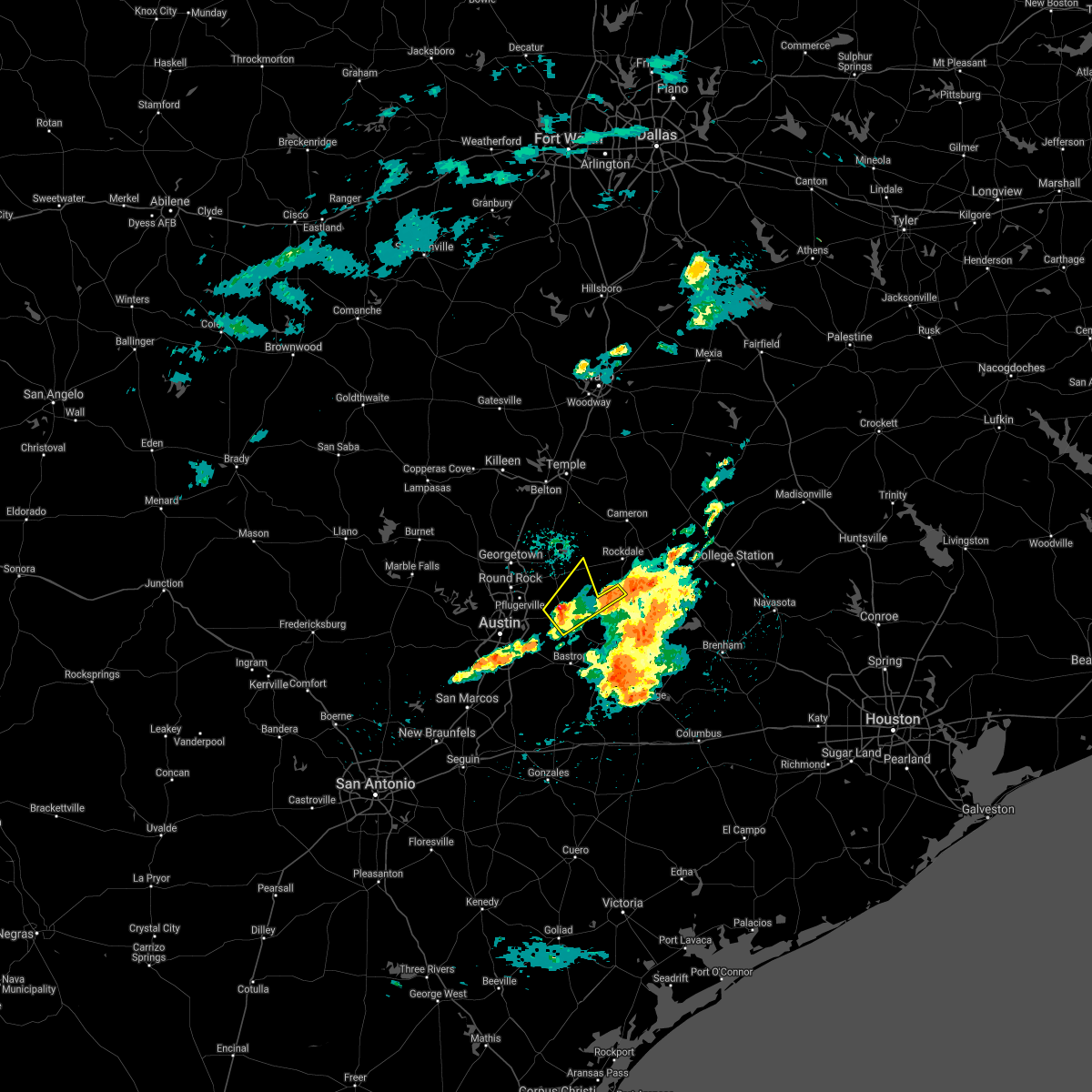 At 805 am cdt, a severe thunderstorm was located near elgin, moving northeast at 30 mph (radar indicated). Hazards include 60 mph wind gusts and quarter size hail. Hail damage to vehicles is expected. Expect wind damage to roofs, siding, and trees. At 805 am cdt, a severe thunderstorm was located near elgin, moving northeast at 30 mph (radar indicated). Hazards include 60 mph wind gusts and quarter size hail. Hail damage to vehicles is expected. Expect wind damage to roofs, siding, and trees.
|
| 3/25/2021 4:17 AM CDT |
 At 416 am cdt, a severe thunderstorm was located near austin, moving northeast at 55 mph (radar indicated). Hazards include quarter size hail. damage to vehicles is expected At 416 am cdt, a severe thunderstorm was located near austin, moving northeast at 55 mph (radar indicated). Hazards include quarter size hail. damage to vehicles is expected
|
| 3/22/2021 11:42 PM CDT |
 At 1140 pm cdt, a severe thunderstorm was located over central milam county, moving east at 35 mph. 65 mph wind gusts are possible over rockdale, minerva, and milano with this storm (radar indicated). Hazards include 65 mph wind gusts and quarter size hail. Hail damage to vehicles is expected. expect wind damage to roofs, siding, and trees. Locations impacted include, rockdale, cameron, thorndale, buckholts and milano. At 1140 pm cdt, a severe thunderstorm was located over central milam county, moving east at 35 mph. 65 mph wind gusts are possible over rockdale, minerva, and milano with this storm (radar indicated). Hazards include 65 mph wind gusts and quarter size hail. Hail damage to vehicles is expected. expect wind damage to roofs, siding, and trees. Locations impacted include, rockdale, cameron, thorndale, buckholts and milano.
|
| 3/22/2021 11:31 PM CDT |
 At 1129 pm cdt, a severe thunderstorm was located 10 miles southeast of cameron, moving east at 35 mph (radar indicated). Hazards include 65 mph wind gusts and half dollar size hail. Hail damage to vehicles is expected. expect wind damage to roofs, siding, and trees. Locations impacted include, sharp, minerva, rockdale, cameron, thorndale, buckholts and milano. At 1129 pm cdt, a severe thunderstorm was located 10 miles southeast of cameron, moving east at 35 mph (radar indicated). Hazards include 65 mph wind gusts and half dollar size hail. Hail damage to vehicles is expected. expect wind damage to roofs, siding, and trees. Locations impacted include, sharp, minerva, rockdale, cameron, thorndale, buckholts and milano.
|
| 3/22/2021 11:16 PM CDT |
 At 1115 pm cdt, a severe thunderstorm was located over granger dam, or 9 miles east of granger, moving east at 35 mph (radar indicated). Hazards include 65 mph wind gusts and half dollar size hail. Hail damage to vehicles is expected. expect wind damage to roofs, siding, and trees. Locations impacted include, sharp, davilla, minerva, rockdale, cameron, thorndale, buckholts and milano. At 1115 pm cdt, a severe thunderstorm was located over granger dam, or 9 miles east of granger, moving east at 35 mph (radar indicated). Hazards include 65 mph wind gusts and half dollar size hail. Hail damage to vehicles is expected. expect wind damage to roofs, siding, and trees. Locations impacted include, sharp, davilla, minerva, rockdale, cameron, thorndale, buckholts and milano.
|
| 3/22/2021 11:15 PM CDT |
 At 1115 pm cdt, a severe thunderstorm was located over granger dam, or near granger, moving east at 35 mph (radar indicated). Hazards include golf ball size hail and 60 mph wind gusts. People and animals outdoors will be injured. expect hail damage to roofs, siding, windows, and vehicles. expect wind damage to roofs, siding, and trees. Locations impacted include, taylor, granger, bartlett, thrall, granger dam, laneport, hoxie, waterloo, hare and sandoval. At 1115 pm cdt, a severe thunderstorm was located over granger dam, or near granger, moving east at 35 mph (radar indicated). Hazards include golf ball size hail and 60 mph wind gusts. People and animals outdoors will be injured. expect hail damage to roofs, siding, windows, and vehicles. expect wind damage to roofs, siding, and trees. Locations impacted include, taylor, granger, bartlett, thrall, granger dam, laneport, hoxie, waterloo, hare and sandoval.
|
| 3/22/2021 10:53 PM CDT |
 At 1052 pm cdt, a severe thunderstorm was located near granger, moving east at 35 mph (radar indicated). Hazards include 60 mph wind gusts and half dollar size hail. Hail damage to vehicles is expected. Expect wind damage to roofs, siding, and trees. At 1052 pm cdt, a severe thunderstorm was located near granger, moving east at 35 mph (radar indicated). Hazards include 60 mph wind gusts and half dollar size hail. Hail damage to vehicles is expected. Expect wind damage to roofs, siding, and trees.
|
| 3/22/2021 10:43 PM CDT |
 At 1042 pm cdt, a severe thunderstorm capable of producing a tornado was located near weir, or near serenada, moving east at 35 mph (radar indicated rotation). Hazards include tornado and ping pong ball size hail. Flying debris will be dangerous to those caught without shelter. mobile homes will be damaged or destroyed. damage to roofs, windows, and vehicles will occur. tree damage is likely. Locations impacted include, georgetown, taylor, granger, serenada, bartlett, jarrell, weir, granger dam, theon, laneport, hoxie, waterloo, hare, walburg, schwertner, jonah and sandoval. At 1042 pm cdt, a severe thunderstorm capable of producing a tornado was located near weir, or near serenada, moving east at 35 mph (radar indicated rotation). Hazards include tornado and ping pong ball size hail. Flying debris will be dangerous to those caught without shelter. mobile homes will be damaged or destroyed. damage to roofs, windows, and vehicles will occur. tree damage is likely. Locations impacted include, georgetown, taylor, granger, serenada, bartlett, jarrell, weir, granger dam, theon, laneport, hoxie, waterloo, hare, walburg, schwertner, jonah and sandoval.
|
| 3/22/2021 10:26 PM CDT |
 At 1025 pm cdt, a severe thunderstorm capable of producing a tornado was located near sun city, or near serenada, moving east at 40 mph (radar indicated rotation). Hazards include tornado and golf ball size hail. Flying debris will be dangerous to those caught without shelter. mobile homes will be damaged or destroyed. damage to roofs, windows, and vehicles will occur. Tree damage is likely. At 1025 pm cdt, a severe thunderstorm capable of producing a tornado was located near sun city, or near serenada, moving east at 40 mph (radar indicated rotation). Hazards include tornado and golf ball size hail. Flying debris will be dangerous to those caught without shelter. mobile homes will be damaged or destroyed. damage to roofs, windows, and vehicles will occur. Tree damage is likely.
|
| 3/22/2021 9:58 PM CDT |
 At 957 pm cdt, a severe thunderstorm was located near bertram, moving east at 65 mph (radar indicated). Hazards include golf ball size hail and 60 mph wind gusts. People and animals outdoors will be injured. expect hail damage to roofs, siding, windows, and vehicles. Expect wind damage to roofs, siding, and trees. At 957 pm cdt, a severe thunderstorm was located near bertram, moving east at 65 mph (radar indicated). Hazards include golf ball size hail and 60 mph wind gusts. People and animals outdoors will be injured. expect hail damage to roofs, siding, windows, and vehicles. Expect wind damage to roofs, siding, and trees.
|
| 5/28/2020 12:27 AM CDT |
 At 1226 am cdt, a severe thunderstorm was located over thrall, or 8 miles east of taylor, moving southeast at 30 mph (trained weather spotters. spotters reported two inch hail near georgetown). Hazards include 60 mph wind gusts and quarter size hail. Hail damage to vehicles is expected. expect wind damage to roofs, siding, and trees. Locations impacted include, round rock, georgetown, taylor, granger, hutto, thrall, weir, granger dam, coupland, hoxie, beyarsville, waterloo, hare, jonah, noack and sandoval. At 1226 am cdt, a severe thunderstorm was located over thrall, or 8 miles east of taylor, moving southeast at 30 mph (trained weather spotters. spotters reported two inch hail near georgetown). Hazards include 60 mph wind gusts and quarter size hail. Hail damage to vehicles is expected. expect wind damage to roofs, siding, and trees. Locations impacted include, round rock, georgetown, taylor, granger, hutto, thrall, weir, granger dam, coupland, hoxie, beyarsville, waterloo, hare, jonah, noack and sandoval.
|
| 5/28/2020 12:17 AM CDT |
 At 1216 am cdt, a severe thunderstorm was located near taylor, moving southeast at 30 mph (radar indicated). Hazards include 60 mph wind gusts and quarter size hail. Hail damage to vehicles is expected. expect wind damage to roofs, siding, and trees. Locations impacted include, round rock, georgetown, taylor, granger, serenada, hutto, jarrell, thrall, weir, georgetown dam, sun city, granger dam, coupland, theon, hoxie, beyarsville, waterloo, hare, walburg and jonah. At 1216 am cdt, a severe thunderstorm was located near taylor, moving southeast at 30 mph (radar indicated). Hazards include 60 mph wind gusts and quarter size hail. Hail damage to vehicles is expected. expect wind damage to roofs, siding, and trees. Locations impacted include, round rock, georgetown, taylor, granger, serenada, hutto, jarrell, thrall, weir, georgetown dam, sun city, granger dam, coupland, theon, hoxie, beyarsville, waterloo, hare, walburg and jonah.
|
| 5/28/2020 12:10 AM CDT |
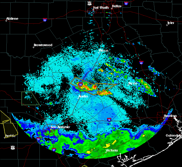 At 1210 am cdt, a severe thunderstorm was located over thorndale, or 11 miles west of rockdale, moving east at 45 mph (radar indicated). Hazards include half dollar size hail. damage to vehicles is possible At 1210 am cdt, a severe thunderstorm was located over thorndale, or 11 miles west of rockdale, moving east at 45 mph (radar indicated). Hazards include half dollar size hail. damage to vehicles is possible
|
| 5/27/2020 11:56 PM CDT |
 At 1156 pm cdt, a severe thunderstorm was located near weir, or near granger, moving southeast at 30 mph (radar indicated). Hazards include 60 mph wind gusts and quarter size hail. Hail damage to vehicles is expected. expect wind damage to roofs, siding, and trees. Locations impacted include, round rock, georgetown, taylor, granger, serenada, hutto, jarrell, florence, thrall, weir, georgetown dam, granger dam, coupland, andice, sun city, waterloo, jonah, sandoval, theon and hoxie. At 1156 pm cdt, a severe thunderstorm was located near weir, or near granger, moving southeast at 30 mph (radar indicated). Hazards include 60 mph wind gusts and quarter size hail. Hail damage to vehicles is expected. expect wind damage to roofs, siding, and trees. Locations impacted include, round rock, georgetown, taylor, granger, serenada, hutto, jarrell, florence, thrall, weir, georgetown dam, granger dam, coupland, andice, sun city, waterloo, jonah, sandoval, theon and hoxie.
|
| 5/27/2020 11:38 PM CDT |
 At 1138 pm cdt, a severe thunderstorm was located over sun city, or over serenada, moving southeast at 30 mph (radar indicated). Hazards include 60 mph wind gusts and quarter size hail. Hail damage to vehicles is expected. Expect wind damage to roofs, siding, and trees. At 1138 pm cdt, a severe thunderstorm was located over sun city, or over serenada, moving southeast at 30 mph (radar indicated). Hazards include 60 mph wind gusts and quarter size hail. Hail damage to vehicles is expected. Expect wind damage to roofs, siding, and trees.
|
| 5/27/2020 7:35 PM CDT |
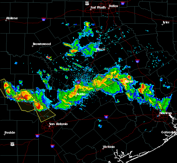 At 734 pm cdt, severe thunderstorms were located along a line extending from 8 miles southeast of cameron to rockdale to thorndale, moving southeast at 35 mph (radar indicated). Hazards include 60 mph wind gusts and nickel size hail. Expect damage to roofs, siding, and trees. Locations impacted include, rockdale, thorndale and milano. At 734 pm cdt, severe thunderstorms were located along a line extending from 8 miles southeast of cameron to rockdale to thorndale, moving southeast at 35 mph (radar indicated). Hazards include 60 mph wind gusts and nickel size hail. Expect damage to roofs, siding, and trees. Locations impacted include, rockdale, thorndale and milano.
|
| 5/27/2020 7:22 PM CDT |
 At 721 pm cdt, severe thunderstorms were located along a line extending from cameron to rockdale to thorndale, moving southeast at 45 mph (radar indicated). Hazards include 60 mph wind gusts. Expect damage to roofs, siding, and trees. Locations impacted include, rockdale, cameron, thorndale and milano. At 721 pm cdt, severe thunderstorms were located along a line extending from cameron to rockdale to thorndale, moving southeast at 45 mph (radar indicated). Hazards include 60 mph wind gusts. Expect damage to roofs, siding, and trees. Locations impacted include, rockdale, cameron, thorndale and milano.
|
| 5/27/2020 7:08 PM CDT |
 At 707 pm cdt, severe thunderstorms were located along a line extending from rogers to granger, moving southeast at 40 mph (radar indicated). Hazards include 60 mph wind gusts and quarter size hail. Hail damage to vehicles is expected. expect wind damage to roofs, siding, and trees. Locations impacted include, rockdale, cameron, bartlett, thorndale, rogers, holland, buckholts and milano. At 707 pm cdt, severe thunderstorms were located along a line extending from rogers to granger, moving southeast at 40 mph (radar indicated). Hazards include 60 mph wind gusts and quarter size hail. Hail damage to vehicles is expected. expect wind damage to roofs, siding, and trees. Locations impacted include, rockdale, cameron, bartlett, thorndale, rogers, holland, buckholts and milano.
|
| 5/27/2020 6:50 PM CDT |
 At 649 pm cdt, severe thunderstorms were located along a line extending from little river-academy to holland to jarrell, moving southeast at 35 mph (radar indicated). Hazards include 60 mph wind gusts and quarter size hail. Hail damage to vehicles is expected. Expect wind damage to roofs, siding, and trees. At 649 pm cdt, severe thunderstorms were located along a line extending from little river-academy to holland to jarrell, moving southeast at 35 mph (radar indicated). Hazards include 60 mph wind gusts and quarter size hail. Hail damage to vehicles is expected. Expect wind damage to roofs, siding, and trees.
|
| 5/24/2020 6:23 PM CDT |
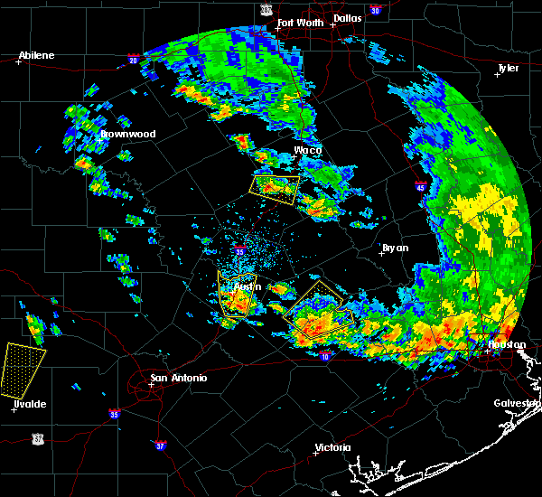 At 622 pm cdt, a severe thunderstorm was located near elgin, moving north at 15 mph (radar indicated). Hazards include quarter size hail. damage to vehicles is expected At 622 pm cdt, a severe thunderstorm was located near elgin, moving north at 15 mph (radar indicated). Hazards include quarter size hail. damage to vehicles is expected
|
| 4/29/2020 5:28 AM CDT |
 The severe thunderstorm warning for williamson, central caldwell, central hays, travis, blanco, northeastern gillespie, llano, bastrop, lee, central fayette and burnet counties will expire at 530 am cdt, the storms which prompted the warning have weakened below severe limits, and no longer pose an immediate threat to life or property. therefore, the warning will be allowed to expire. however small hail, gusty winds and heavy rain are still possible with these thunderstorms. a severe thunderstorm watch remains in effect until 900 am cdt for south central texas. to report severe weather, contact your nearest law enforcement agency. they will relay your report to the national weather service austin san antonio. The severe thunderstorm warning for williamson, central caldwell, central hays, travis, blanco, northeastern gillespie, llano, bastrop, lee, central fayette and burnet counties will expire at 530 am cdt, the storms which prompted the warning have weakened below severe limits, and no longer pose an immediate threat to life or property. therefore, the warning will be allowed to expire. however small hail, gusty winds and heavy rain are still possible with these thunderstorms. a severe thunderstorm watch remains in effect until 900 am cdt for south central texas. to report severe weather, contact your nearest law enforcement agency. they will relay your report to the national weather service austin san antonio.
|
| 4/29/2020 5:05 AM CDT |
 At 505 am cdt, severe thunderstorms were located along a line extending from near field creek to near horseshoe bay to near austin bergstrom int airport to bastrop to 8 miles south of lake somerville state park & trailway, moving south at 40 mph (radar indicated). Hazards include 60 mph wind gusts and nickel size hail. Expect damage to roofs, siding, and trees. Locations impacted include, austin, round rock, cedar park, georgetown, pflugerville, kyle, taylor, buda, lockhart, elgin, bastrop, burnet, marble falls, kingsland, giddings, la grange, smithville, llano, dripping springs and granger. At 505 am cdt, severe thunderstorms were located along a line extending from near field creek to near horseshoe bay to near austin bergstrom int airport to bastrop to 8 miles south of lake somerville state park & trailway, moving south at 40 mph (radar indicated). Hazards include 60 mph wind gusts and nickel size hail. Expect damage to roofs, siding, and trees. Locations impacted include, austin, round rock, cedar park, georgetown, pflugerville, kyle, taylor, buda, lockhart, elgin, bastrop, burnet, marble falls, kingsland, giddings, la grange, smithville, llano, dripping springs and granger.
|
| 4/29/2020 4:51 AM CDT |
 The severe thunderstorm warning for milam county will expire at 500 am cdt, the storms which prompted the warning have moved out of the area. therefore the warning will be allowed to expire. a severe thunderstorm watch remains in effect until 600 am cdt for central texas. The severe thunderstorm warning for milam county will expire at 500 am cdt, the storms which prompted the warning have moved out of the area. therefore the warning will be allowed to expire. a severe thunderstorm watch remains in effect until 600 am cdt for central texas.
|
| 4/29/2020 4:39 AM CDT |
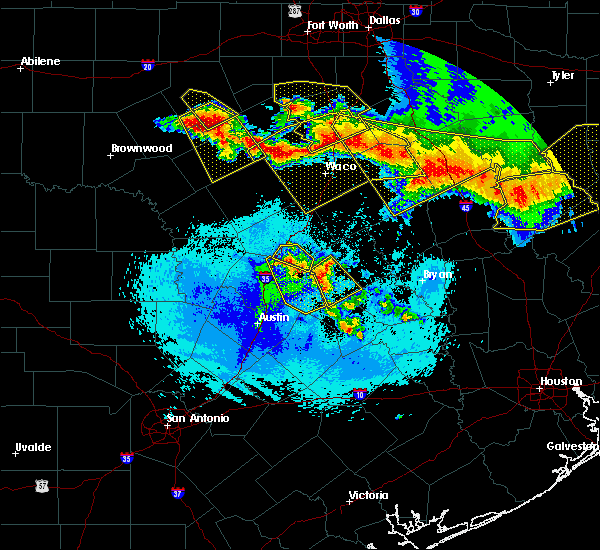 At 439 am cdt, severe thunderstorms were located along a line extending from hearne to thorndale, moving southeast at 55 mph (radar indicated). Hazards include 60 mph wind gusts and quarter size hail. Hail damage to vehicles is expected. expect wind damage to roofs, siding, and trees. Locations impacted include, rockdale, cameron, thorndale and milano. At 439 am cdt, severe thunderstorms were located along a line extending from hearne to thorndale, moving southeast at 55 mph (radar indicated). Hazards include 60 mph wind gusts and quarter size hail. Hail damage to vehicles is expected. expect wind damage to roofs, siding, and trees. Locations impacted include, rockdale, cameron, thorndale and milano.
|
| 4/29/2020 4:35 AM CDT |
 At 435 am cdt, severe thunderstorms were located along a line extending from tow to pflugerville to near elgin to near caldwell, moving south at 40 mph (radar indicated). Hazards include 60 mph wind gusts and quarter size hail. Hail damage to vehicles is expected. Expect wind damage to roofs, siding, and trees. At 435 am cdt, severe thunderstorms were located along a line extending from tow to pflugerville to near elgin to near caldwell, moving south at 40 mph (radar indicated). Hazards include 60 mph wind gusts and quarter size hail. Hail damage to vehicles is expected. Expect wind damage to roofs, siding, and trees.
|
| 4/29/2020 4:31 AM CDT |
 At 430 am cdt, severe thunderstorms were located along a line extending from calvert to milano to near thorndale, moving south at 40 mph (radar indicated). Hazards include 65 mph wind gusts and half dollar size hail. Hail damage to vehicles is expected. expect wind damage to roofs, siding, and trees. Locations impacted include, rockdale, cameron, bartlett, thorndale, holland, buckholts and milano. At 430 am cdt, severe thunderstorms were located along a line extending from calvert to milano to near thorndale, moving south at 40 mph (radar indicated). Hazards include 65 mph wind gusts and half dollar size hail. Hail damage to vehicles is expected. expect wind damage to roofs, siding, and trees. Locations impacted include, rockdale, cameron, bartlett, thorndale, holland, buckholts and milano.
|
| 4/29/2020 4:23 AM CDT |
 At 423 am cdt, severe thunderstorms were located along a line extending from rockdale to near taylor to near bend, moving south at 35 mph (radar indicated). Hazards include 60 mph wind gusts and quarter size hail. Hail damage to vehicles is expected. expect wind damage to roofs, siding, and trees. Locations impacted include, round rock, cedar park, georgetown, pflugerville, taylor, burnet, granger, bertram, lexington, serenada, windemere, buchanan dam, leander, hutto, bartlett, liberty hill, jarrell, florence, thrall and buchanan lake village. At 423 am cdt, severe thunderstorms were located along a line extending from rockdale to near taylor to near bend, moving south at 35 mph (radar indicated). Hazards include 60 mph wind gusts and quarter size hail. Hail damage to vehicles is expected. expect wind damage to roofs, siding, and trees. Locations impacted include, round rock, cedar park, georgetown, pflugerville, taylor, burnet, granger, bertram, lexington, serenada, windemere, buchanan dam, leander, hutto, bartlett, liberty hill, jarrell, florence, thrall and buchanan lake village.
|
| 4/29/2020 3:55 AM CDT |
 At 355 am cdt, severe thunderstorms were located along a line extending from salado to rovers to rosebud, moving southeast at 55 mph (radar indicated). Hazards include 65 mph wind gusts and half dollar size hail. Hail damage to vehicles is expected. Expect wind damage to roofs, siding, and trees. At 355 am cdt, severe thunderstorms were located along a line extending from salado to rovers to rosebud, moving southeast at 55 mph (radar indicated). Hazards include 65 mph wind gusts and half dollar size hail. Hail damage to vehicles is expected. Expect wind damage to roofs, siding, and trees.
|
| 4/29/2020 3:54 AM CDT |
 At 353 am cdt, severe thunderstorms were located along a line extending from near rogers to salado to 13 miles southwest of evant, moving southeast at 35 mph (radar indicated). Hazards include 70 mph wind gusts and ping pong ball size hail. People and animals outdoors will be injured. expect hail damage to roofs, siding, windows, and vehicles. expect considerable tree damage. Wind damage is also likely to mobile homes, roofs, and outbuildings. At 353 am cdt, severe thunderstorms were located along a line extending from near rogers to salado to 13 miles southwest of evant, moving southeast at 35 mph (radar indicated). Hazards include 70 mph wind gusts and ping pong ball size hail. People and animals outdoors will be injured. expect hail damage to roofs, siding, windows, and vehicles. expect considerable tree damage. Wind damage is also likely to mobile homes, roofs, and outbuildings.
|
| 4/29/2020 2:37 AM CDT |
 At 237 am cdt, severe thunderstorms were located along a line extending from rockdale to thorndale, moving southeast at 35 mph (radar indicated). Hazards include 60 mph wind gusts and quarter size hail. Hail damage to vehicles is expected. expect wind damage to roofs, siding, and trees. Locations impacted include, rockdale and thorndale. At 237 am cdt, severe thunderstorms were located along a line extending from rockdale to thorndale, moving southeast at 35 mph (radar indicated). Hazards include 60 mph wind gusts and quarter size hail. Hail damage to vehicles is expected. expect wind damage to roofs, siding, and trees. Locations impacted include, rockdale and thorndale.
|
| 4/29/2020 2:15 AM CDT |
 At 215 am cdt, a severe thunderstorm was located 4 miles north of sharp moving southeast at 35 mph (radar indicated). Hazards include quarter size hail. damage to vehicles is possible At 215 am cdt, a severe thunderstorm was located 4 miles north of sharp moving southeast at 35 mph (radar indicated). Hazards include quarter size hail. damage to vehicles is possible
|
| 4/9/2020 3:28 PM CDT |
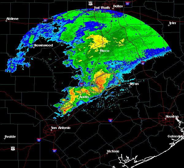 At 328 pm cdt, severe thunderstorms were located along a line extending from near rockdale to 7 miles west of fedor, moving east at 40 mph (radar indicated). Hazards include 60 mph wind gusts. expect damage to roofs, siding, and trees At 328 pm cdt, severe thunderstorms were located along a line extending from near rockdale to 7 miles west of fedor, moving east at 40 mph (radar indicated). Hazards include 60 mph wind gusts. expect damage to roofs, siding, and trees
|
| 4/9/2020 3:22 PM CDT |
 At 322 pm cdt, a severe thunderstorm was located 9 miles northwest of rockdale, moving east at 45 mph (radar indicated). Hazards include 65 mph wind gusts and penny size hail. Expect damage to roofs, siding, and trees. Locations impacted include, rockdale, cameron, buckholts and milano. At 322 pm cdt, a severe thunderstorm was located 9 miles northwest of rockdale, moving east at 45 mph (radar indicated). Hazards include 65 mph wind gusts and penny size hail. Expect damage to roofs, siding, and trees. Locations impacted include, rockdale, cameron, buckholts and milano.
|
| 4/9/2020 3:20 PM CDT | Trees and power lines down in and around san gabriel. reported by milam county sheriffs office. time estimated via rada in milam county TX, 6 miles S of Thorndale, TX |
| 4/9/2020 3:20 PM CDT | Trees down along cr 412. time estimated via rada in milam county TX, 8.5 miles SSW of Thorndale, TX |
| 4/9/2020 3:19 PM CDT | Damage to a shed reported north of thorndal in milam county TX, 3.3 miles SSW of Thorndale, TX |
| 4/9/2020 3:07 PM CDT |
 At 307 pm cdt, severe thunderstorms were located along a line extending from near holland to granger dam to near taylor, moving east at 45 mph (radar indicated). Hazards include 70 mph wind gusts. Expect considerable tree damage. damage is likely to mobile homes, roofs, and outbuildings. Locations impacted include, taylor, thrall, granger dam, laneport, noack, hoxie, waterloo, hare and sandoval. At 307 pm cdt, severe thunderstorms were located along a line extending from near holland to granger dam to near taylor, moving east at 45 mph (radar indicated). Hazards include 70 mph wind gusts. Expect considerable tree damage. damage is likely to mobile homes, roofs, and outbuildings. Locations impacted include, taylor, thrall, granger dam, laneport, noack, hoxie, waterloo, hare and sandoval.
|
| 4/9/2020 3:03 PM CDT |
 At 302 pm cdt, a severe thunderstorm was located near granger dam, or near granger, moving east at 40 mph (radar indicated). Hazards include 70 mph wind gusts and penny size hail. Expect considerable tree damage. Damage is likely to mobile homes, roofs, and outbuildings. At 302 pm cdt, a severe thunderstorm was located near granger dam, or near granger, moving east at 40 mph (radar indicated). Hazards include 70 mph wind gusts and penny size hail. Expect considerable tree damage. Damage is likely to mobile homes, roofs, and outbuildings.
|
| 4/9/2020 2:54 PM CDT |
 At 253 pm cdt, severe thunderstorms were located along a line extending from near holland to near granger to near hutto, moving east at 45 mph (radar indicated). Hazards include 60 mph wind gusts. expect damage to roofs, siding, and trees At 253 pm cdt, severe thunderstorms were located along a line extending from near holland to near granger to near hutto, moving east at 45 mph (radar indicated). Hazards include 60 mph wind gusts. expect damage to roofs, siding, and trees
|
| 3/4/2020 7:47 AM CST |
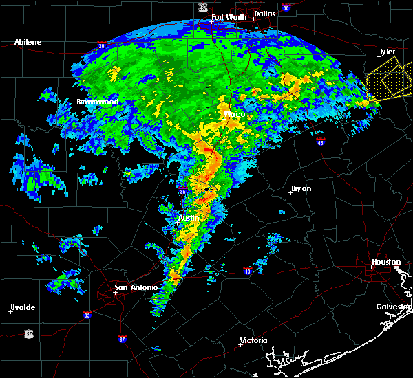 At 747 am cst, a severe thunderstorm was located over thorndale, or 9 miles west of rockdale, moving east at 40 mph (radar indicated). Hazards include 60 mph wind gusts and penny size hail. expect damage to roofs, siding, and trees At 747 am cst, a severe thunderstorm was located over thorndale, or 9 miles west of rockdale, moving east at 40 mph (radar indicated). Hazards include 60 mph wind gusts and penny size hail. expect damage to roofs, siding, and trees
|
| 6/16/2019 8:58 PM CDT |
 At 855 pm cdt, a severe thunderstorm was located 10 miles southeast of cameron, moving east at 35 mph (radar indicated). Hazards include 60 mph wind gusts and quarter size hail. Hail damage to vehicles is expected. expect wind damage to roofs, siding, and trees. the rockdale police department estimated 60 mph winds with this storm in the city of rockdale. The severe thunderstorm will remain over mainly rural areas of southern milam county, including milano and buckholts, but additional strong thunderstorms will impact other portions of the county with gusty winds and small hail. At 855 pm cdt, a severe thunderstorm was located 10 miles southeast of cameron, moving east at 35 mph (radar indicated). Hazards include 60 mph wind gusts and quarter size hail. Hail damage to vehicles is expected. expect wind damage to roofs, siding, and trees. the rockdale police department estimated 60 mph winds with this storm in the city of rockdale. The severe thunderstorm will remain over mainly rural areas of southern milam county, including milano and buckholts, but additional strong thunderstorms will impact other portions of the county with gusty winds and small hail.
|
| 6/16/2019 8:49 PM CDT |
 At 849 pm cdt, a severe thunderstorm was located near bartlett, or 7 miles northeast of granger, moving east at 20 mph (radar indicated). Hazards include 60 mph wind gusts and quarter size hail. Hail damage to vehicles is expected. expect wind damage to roofs, siding, and trees. Locations impacted include, taylor, granger, bartlett, jarrell, thrall, granger dam, laneport, hoxie, beyarsville, waterloo, hare, schwertner, noack and sandoval. At 849 pm cdt, a severe thunderstorm was located near bartlett, or 7 miles northeast of granger, moving east at 20 mph (radar indicated). Hazards include 60 mph wind gusts and quarter size hail. Hail damage to vehicles is expected. expect wind damage to roofs, siding, and trees. Locations impacted include, taylor, granger, bartlett, jarrell, thrall, granger dam, laneport, hoxie, beyarsville, waterloo, hare, schwertner, noack and sandoval.
|
| 6/16/2019 8:19 PM CDT |
 At 818 pm cdt, a severe thunderstorm was located near jarrell, or 10 miles northwest of granger, moving southeast at 20 mph (radar indicated). Hazards include 60 mph wind gusts and quarter size hail. Hail damage to vehicles is expected. Expect wind damage to roofs, siding, and trees. At 818 pm cdt, a severe thunderstorm was located near jarrell, or 10 miles northwest of granger, moving southeast at 20 mph (radar indicated). Hazards include 60 mph wind gusts and quarter size hail. Hail damage to vehicles is expected. Expect wind damage to roofs, siding, and trees.
|
| 6/16/2019 8:16 PM CDT |
 At 815 pm cdt, a severe thunderstorm was located near jarrell, or 13 miles northwest of granger, moving east at 20 mph (radar indicated). Hazards include 60 mph wind gusts and half dollar size hail. Hail damage to vehicles is expected. expect wind damage to roofs, siding, and trees. this severe thunderstorm will be near, bartlett around 835 pm cdt. holland around 840 pm cdt. little river-academy around 905 pm cdt. rogers around 915 pm cdt. this includes interstate 35 between mile markers 277 and 287. Spotters have reported quarter size hail along i-35 in southern bell county near the williamson county line. At 815 pm cdt, a severe thunderstorm was located near jarrell, or 13 miles northwest of granger, moving east at 20 mph (radar indicated). Hazards include 60 mph wind gusts and half dollar size hail. Hail damage to vehicles is expected. expect wind damage to roofs, siding, and trees. this severe thunderstorm will be near, bartlett around 835 pm cdt. holland around 840 pm cdt. little river-academy around 905 pm cdt. rogers around 915 pm cdt. this includes interstate 35 between mile markers 277 and 287. Spotters have reported quarter size hail along i-35 in southern bell county near the williamson county line.
|
| 5/8/2019 1:27 PM CDT |
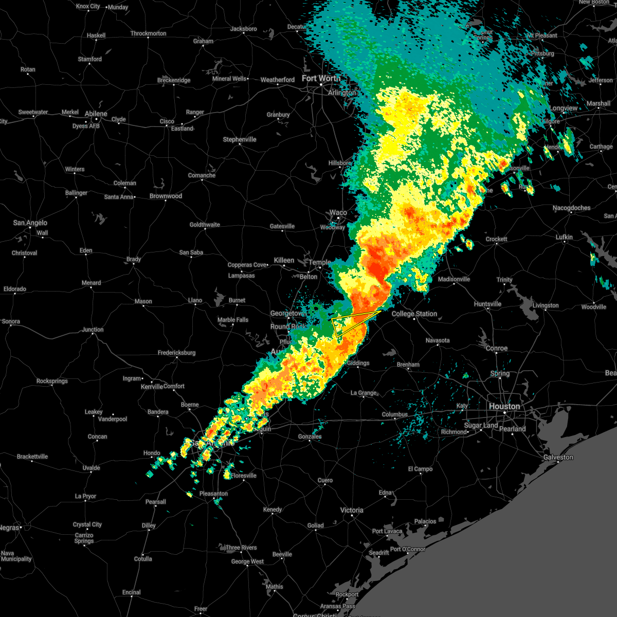 At 103 pm cdt, a severe thunderstorm was located near thorndale, or 10 miles southwest of rockdale, moving east at 40 mph (radar indicated). Hazards include 60 mph wind gusts. expect damage to roofs, siding, and trees At 103 pm cdt, a severe thunderstorm was located near thorndale, or 10 miles southwest of rockdale, moving east at 40 mph (radar indicated). Hazards include 60 mph wind gusts. expect damage to roofs, siding, and trees
|
| 5/8/2019 1:09 PM CDT |
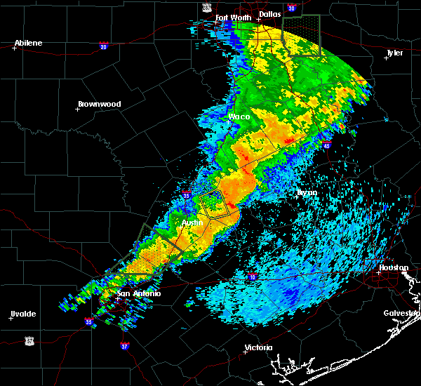 The severe thunderstorm warning for southeastern williamson county will expire at 115 pm cdt, the storm which prompted the warning has moved out of the area. therefore, the warning will be allowed to expire. however gusty winds are still possible with this thunderstorm. The severe thunderstorm warning for southeastern williamson county will expire at 115 pm cdt, the storm which prompted the warning has moved out of the area. therefore, the warning will be allowed to expire. however gusty winds are still possible with this thunderstorm.
|
| 5/8/2019 1:03 PM CDT |
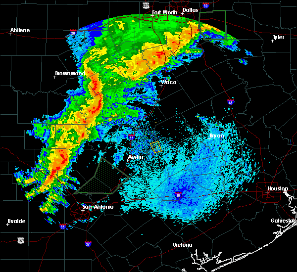 At 103 pm cdt, a severe thunderstorm was located near thorndale, or 10 miles southwest of rockdale, moving east at 40 mph (radar indicated). Hazards include 60 mph wind gusts. expect damage to roofs, siding, and trees At 103 pm cdt, a severe thunderstorm was located near thorndale, or 10 miles southwest of rockdale, moving east at 40 mph (radar indicated). Hazards include 60 mph wind gusts. expect damage to roofs, siding, and trees
|
| 5/8/2019 12:58 PM CDT |
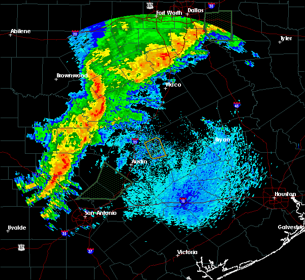 At 1257 pm cdt, a severe thunderstorm was located over thorndale, or 11 miles east of taylor, moving northeast at 35 mph (radar indicated). Hazards include 60 mph wind gusts. Expect damage to roofs, siding, and trees. Locations impacted include, thrall and noack. At 1257 pm cdt, a severe thunderstorm was located over thorndale, or 11 miles east of taylor, moving northeast at 35 mph (radar indicated). Hazards include 60 mph wind gusts. Expect damage to roofs, siding, and trees. Locations impacted include, thrall and noack.
|
| 5/8/2019 12:53 PM CDT |
 At 1253 pm cdt, a severe thunderstorm was located over thrall, or 9 miles east of taylor, moving northeast at 35 mph (radar indicated). Hazards include 60 mph wind gusts. Expect damage to roofs, siding, and trees. Locations impacted include, taylor, granger, thrall, coupland, granger dam, laneport, noack, hoxie, beyarsville, waterloo, sandoval and hare. At 1253 pm cdt, a severe thunderstorm was located over thrall, or 9 miles east of taylor, moving northeast at 35 mph (radar indicated). Hazards include 60 mph wind gusts. Expect damage to roofs, siding, and trees. Locations impacted include, taylor, granger, thrall, coupland, granger dam, laneport, noack, hoxie, beyarsville, waterloo, sandoval and hare.
|
| 5/8/2019 12:27 PM CDT |
 At 1227 pm cdt, a severe thunderstorm was located near hutto, or near taylor, moving northeast at 35 mph (radar indicated). Hazards include 60 mph wind gusts. expect damage to roofs, siding, and trees At 1227 pm cdt, a severe thunderstorm was located near hutto, or near taylor, moving northeast at 35 mph (radar indicated). Hazards include 60 mph wind gusts. expect damage to roofs, siding, and trees
|
| 5/8/2019 12:21 PM CDT |
 At 1221 pm cdt, a severe thunderstorm was located near hutto, or 7 miles northeast of pflugerville, moving northeast at 60 mph (radar indicated). Hazards include 60 mph wind gusts. expect damage to roofs, siding, and trees At 1221 pm cdt, a severe thunderstorm was located near hutto, or 7 miles northeast of pflugerville, moving northeast at 60 mph (radar indicated). Hazards include 60 mph wind gusts. expect damage to roofs, siding, and trees
|
| 4/24/2019 4:10 PM CDT |
 At 409 pm cdt, a severe thunderstorm was located near thorndale, or 9 miles west of rockdale, moving northeast at 30 mph (radar indicated). Hazards include 60 mph wind gusts. expect damage to roofs, siding, and trees At 409 pm cdt, a severe thunderstorm was located near thorndale, or 9 miles west of rockdale, moving northeast at 30 mph (radar indicated). Hazards include 60 mph wind gusts. expect damage to roofs, siding, and trees
|
| 4/18/2019 12:26 AM CDT |
 At 1226 am cdt, a severe thunderstorm was located 8 miles north of thorndale, or 9 miles northwest of rockdale, moving east at 55 mph (radar indicated). Hazards include 70 mph wind gusts. Expect considerable tree damage. Damage is likely to mobile homes, roofs, and outbuildings. At 1226 am cdt, a severe thunderstorm was located 8 miles north of thorndale, or 9 miles northwest of rockdale, moving east at 55 mph (radar indicated). Hazards include 70 mph wind gusts. Expect considerable tree damage. Damage is likely to mobile homes, roofs, and outbuildings.
|
| 4/13/2019 9:43 AM CDT |
 At 942 am cdt, a severe thunderstorm was located near thorndale, or 10 miles southwest of rockdale, moving northeast at 35 mph (radar indicated). Hazards include 60 mph wind gusts and quarter size hail. Hail damage to vehicles is expected. Expect wind damage to roofs, siding, and trees. At 942 am cdt, a severe thunderstorm was located near thorndale, or 10 miles southwest of rockdale, moving northeast at 35 mph (radar indicated). Hazards include 60 mph wind gusts and quarter size hail. Hail damage to vehicles is expected. Expect wind damage to roofs, siding, and trees.
|
| 4/6/2019 7:24 PM CDT |
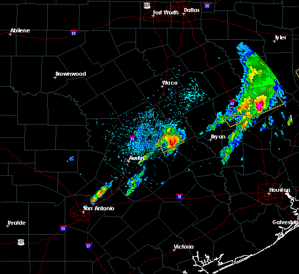 At 721 pm cdt, a severe thunderstorm was located 5 miles southwest of rockdale, or near alcoa lake, moving northeast at 30 mph. this is a very dangerous storm (radar indicated). Hazards include baseball size hail and 60 mph wind gusts. People and animals outdoors will be severely injured. expect shattered windows, extensive damage to roofs, siding, and vehicles. The hail core will remain primarily south of the city of rockdale. At 721 pm cdt, a severe thunderstorm was located 5 miles southwest of rockdale, or near alcoa lake, moving northeast at 30 mph. this is a very dangerous storm (radar indicated). Hazards include baseball size hail and 60 mph wind gusts. People and animals outdoors will be severely injured. expect shattered windows, extensive damage to roofs, siding, and vehicles. The hail core will remain primarily south of the city of rockdale.
|
| 4/6/2019 7:11 PM CDT |
 At 709 pm cdt, a severe thunderstorm was located 7 miles southeast of thorndale, or near alcoa lake, moving east at 25 mph (radar indicated). Hazards include tennis ball size hail and 60 mph wind gusts. People and animals outdoors will be injured. expect hail damage to roofs, siding, windows, and vehicles. expect wind damage to roofs, siding, and trees. This severe storm will be near, alcoa lake around 720 pm cdt rockdale around 735 pm cdt. At 709 pm cdt, a severe thunderstorm was located 7 miles southeast of thorndale, or near alcoa lake, moving east at 25 mph (radar indicated). Hazards include tennis ball size hail and 60 mph wind gusts. People and animals outdoors will be injured. expect hail damage to roofs, siding, windows, and vehicles. expect wind damage to roofs, siding, and trees. This severe storm will be near, alcoa lake around 720 pm cdt rockdale around 735 pm cdt.
|
| 4/6/2019 7:03 PM CDT |
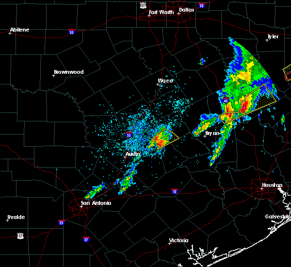 At 702 pm cdt, a severe thunderstorm was located 7 miles south of thorndale, in the far southwestern corner of milam county, moving east at 25 mph (radar indicated). Hazards include ping pong ball size hail and 60 mph wind gusts. People and animals outdoors will be injured. expect hail damage to roofs, siding, windows, and vehicles. expect wind damage to roofs, siding, and trees. This severe thunderstorm will be near, rockdale around 735 pm cdt. At 702 pm cdt, a severe thunderstorm was located 7 miles south of thorndale, in the far southwestern corner of milam county, moving east at 25 mph (radar indicated). Hazards include ping pong ball size hail and 60 mph wind gusts. People and animals outdoors will be injured. expect hail damage to roofs, siding, windows, and vehicles. expect wind damage to roofs, siding, and trees. This severe thunderstorm will be near, rockdale around 735 pm cdt.
|
| 4/6/2019 2:26 PM CDT |
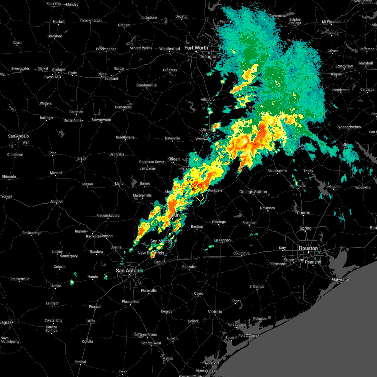 The severe thunderstorm warning for east central williamson county will expire at 230 pm cdt, the storm which prompted the warning has moved out of the area. therefore, the warning will be allowed to expire. a tornado watch remains in effect until 600 pm cdt for south central texas. The severe thunderstorm warning for east central williamson county will expire at 230 pm cdt, the storm which prompted the warning has moved out of the area. therefore, the warning will be allowed to expire. a tornado watch remains in effect until 600 pm cdt for south central texas.
|
| 4/6/2019 2:15 PM CDT | Damage to structures and power poles. may correspond to radar-observed tornado debris signature. time estimate in milam county TX, 5.2 miles S of Thorndale, TX |
| 4/6/2019 2:06 PM CDT |
 At 205 pm cdt, a severe thunderstorm capable of producing a tornado was located north of thorndale, or 10 miles west of rockdale, moving northeast at 30 mph (radar indicated rotation). Hazards include tornado. Flying debris will be dangerous to those caught without shelter. mobile homes will be damaged or destroyed. damage to roofs, windows, and vehicles will occur. tree damage is likely. this dangerous storm will be near, cameron around 245 pm cdt. Other locations impacted by this tornadic thunderstorm include buckholts. At 205 pm cdt, a severe thunderstorm capable of producing a tornado was located north of thorndale, or 10 miles west of rockdale, moving northeast at 30 mph (radar indicated rotation). Hazards include tornado. Flying debris will be dangerous to those caught without shelter. mobile homes will be damaged or destroyed. damage to roofs, windows, and vehicles will occur. tree damage is likely. this dangerous storm will be near, cameron around 245 pm cdt. Other locations impacted by this tornadic thunderstorm include buckholts.
|
| 4/6/2019 2:00 PM CDT |
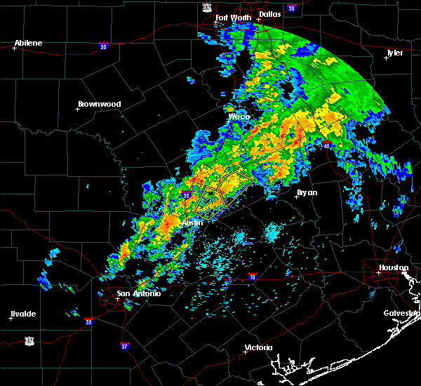 At 159 pm cdt, a severe thunderstorm was located near thorndale, or 12 miles west of rockdale, moving northeast at 30 mph (radar indicated). Hazards include 60 mph wind gusts and nickel size hail. Expect damage to roofs, siding, and trees. Locations impacted include, thrall, granger dam, laneport, sandoval, hare and hoxie. At 159 pm cdt, a severe thunderstorm was located near thorndale, or 12 miles west of rockdale, moving northeast at 30 mph (radar indicated). Hazards include 60 mph wind gusts and nickel size hail. Expect damage to roofs, siding, and trees. Locations impacted include, thrall, granger dam, laneport, sandoval, hare and hoxie.
|
| 4/6/2019 1:58 PM CDT |
 At 157 pm cdt, a severe thunderstorm was located near thorndale, or 12 miles west of rockdale, moving northeast at 30 mph (radar indicated). Hazards include 60 mph wind gusts and nickel size hail. expect damage to roofs, siding, and trees At 157 pm cdt, a severe thunderstorm was located near thorndale, or 12 miles west of rockdale, moving northeast at 30 mph (radar indicated). Hazards include 60 mph wind gusts and nickel size hail. expect damage to roofs, siding, and trees
|
| 4/6/2019 1:24 PM CDT |
 At 124 pm cdt, a severe thunderstorm was located near coupland, or near taylor, moving northeast at 25 mph (radar indicated). Hazards include quarter size hail. damage to vehicles is expected At 124 pm cdt, a severe thunderstorm was located near coupland, or near taylor, moving northeast at 25 mph (radar indicated). Hazards include quarter size hail. damage to vehicles is expected
|
| 12/26/2018 11:10 PM CST |
 At 1110 pm cst, a severe thunderstorm was located near rockdale, moving east at 40 mph toward milano (radar indicated). Hazards include 65 mph wind gusts. Expect damage to roofs, siding, and trees. locations impacted include, rockdale, cameron, thorndale, buckholts and milano. A tornado watch remains in effect until 400 am cst for central texas. At 1110 pm cst, a severe thunderstorm was located near rockdale, moving east at 40 mph toward milano (radar indicated). Hazards include 65 mph wind gusts. Expect damage to roofs, siding, and trees. locations impacted include, rockdale, cameron, thorndale, buckholts and milano. A tornado watch remains in effect until 400 am cst for central texas.
|
| 12/26/2018 10:50 PM CST |
 At 1049 pm cst, a severe thunderstorm was located 9 miles north of thorndale, or 11 miles northwest of rockdale, moving east at 35 mph (radar indicated). Hazards include 60 mph wind gusts and quarter size hail. Hail damage to vehicles is expected. Expect wind damage to roofs, siding, and trees. At 1049 pm cst, a severe thunderstorm was located 9 miles north of thorndale, or 11 miles northwest of rockdale, moving east at 35 mph (radar indicated). Hazards include 60 mph wind gusts and quarter size hail. Hail damage to vehicles is expected. Expect wind damage to roofs, siding, and trees.
|
| 6/4/2018 12:20 AM CDT |
 The severe thunderstorm warning for southwestern milam county will expire at 1230 am cdt, the storm which prompted the warning has weakened below severe limits. therefore the warning will be allowed to expire. however gusty winds and heavy rain are still possible with this thunderstorm. The severe thunderstorm warning for southwestern milam county will expire at 1230 am cdt, the storm which prompted the warning has weakened below severe limits. therefore the warning will be allowed to expire. however gusty winds and heavy rain are still possible with this thunderstorm.
|
| 6/4/2018 12:02 AM CDT |
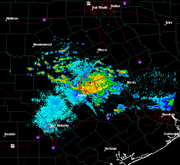 At 1201 am cdt, a severe thunderstorm was located 4 miles southwest of cameron, drifting southwest at 5 mph (radar indicated). Hazards include 60 mph wind gusts and penny size hail. Expect damage to roofs, siding, and trees. Locations impacted include, thorndale. At 1201 am cdt, a severe thunderstorm was located 4 miles southwest of cameron, drifting southwest at 5 mph (radar indicated). Hazards include 60 mph wind gusts and penny size hail. Expect damage to roofs, siding, and trees. Locations impacted include, thorndale.
|
| 6/3/2018 11:43 PM CDT |
 At 1143 pm cdt, a severe thunderstorm was located over coupland, or 7 miles south of taylor, moving west at 25 mph (radar indicated). Hazards include 60 mph wind gusts and nickel size hail. Expect damage to roofs, siding, and trees. Locations impacted include, round rock, georgetown, taylor, granger, hutto, bartlett, jarrell, thrall, weir, granger dam, coupland, theon, rices crossing, laneport, hoxie, beyarsville, waterloo, hare, walburg and schwertner. At 1143 pm cdt, a severe thunderstorm was located over coupland, or 7 miles south of taylor, moving west at 25 mph (radar indicated). Hazards include 60 mph wind gusts and nickel size hail. Expect damage to roofs, siding, and trees. Locations impacted include, round rock, georgetown, taylor, granger, hutto, bartlett, jarrell, thrall, weir, granger dam, coupland, theon, rices crossing, laneport, hoxie, beyarsville, waterloo, hare, walburg and schwertner.
|
| 6/3/2018 11:43 PM CDT |
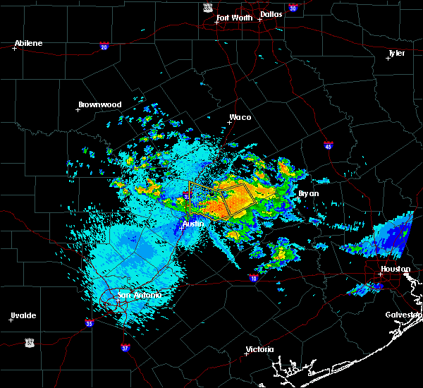 At 1142 pm cdt, a severe thunderstorm was located near cameron, while another cluster of severe storms was located from thorndale south to the southern county line. all storms were moving west- southwest at 10 mph (radar indicated). Hazards include 60 mph wind gusts and penny size hail. expect damage to roofs, siding, and trees At 1142 pm cdt, a severe thunderstorm was located near cameron, while another cluster of severe storms was located from thorndale south to the southern county line. all storms were moving west- southwest at 10 mph (radar indicated). Hazards include 60 mph wind gusts and penny size hail. expect damage to roofs, siding, and trees
|
| 6/3/2018 11:22 PM CDT |
 At 1121 pm cdt, a severe thunderstorm was located near thorndale, or 12 miles southwest of rockdale, moving west at 25 mph (radar indicated). Hazards include 60 mph wind gusts and half dollar size hail. Hail damage to vehicles is expected. Expect wind damage to roofs, siding, and trees. At 1121 pm cdt, a severe thunderstorm was located near thorndale, or 12 miles southwest of rockdale, moving west at 25 mph (radar indicated). Hazards include 60 mph wind gusts and half dollar size hail. Hail damage to vehicles is expected. Expect wind damage to roofs, siding, and trees.
|
| 6/3/2018 11:20 PM CDT |
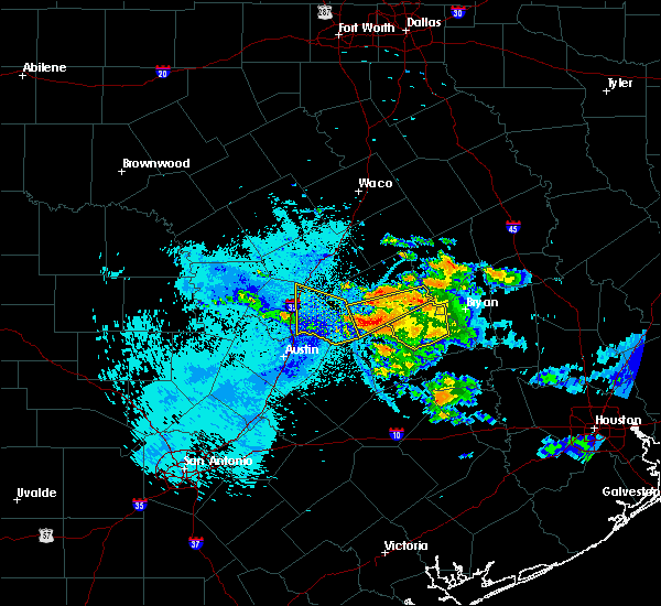 At 1119 pm cdt, a severe thunderstorm was located 3 miles southwest of rockdale, or 8 miles southeast of thorndale, moving west at 10 mph. another possible severe storm was located 10 miles east of milano (radar indicated). Hazards include 65 mph wind gusts and quarter size hail. Hail damage to vehicles is expected. expect wind damage to roofs, siding, and trees. Locations impacted include, rockdale, thorndale and milano. At 1119 pm cdt, a severe thunderstorm was located 3 miles southwest of rockdale, or 8 miles southeast of thorndale, moving west at 10 mph. another possible severe storm was located 10 miles east of milano (radar indicated). Hazards include 65 mph wind gusts and quarter size hail. Hail damage to vehicles is expected. expect wind damage to roofs, siding, and trees. Locations impacted include, rockdale, thorndale and milano.
|
| 6/3/2018 11:09 PM CDT |
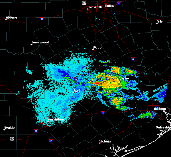 At 1108 pm cdt, a severe thunderstorm was located near rockdale,while other severe storms were 8 miles east-southeast of milano. the entire cluster of storms were moving west at 10 mph (radar indicated). Hazards include 65 mph wind gusts along with pea size hail. Expect damage to roofs, siding, and trees. Locations impacted include, rockdale, thorndale and milano. At 1108 pm cdt, a severe thunderstorm was located near rockdale,while other severe storms were 8 miles east-southeast of milano. the entire cluster of storms were moving west at 10 mph (radar indicated). Hazards include 65 mph wind gusts along with pea size hail. Expect damage to roofs, siding, and trees. Locations impacted include, rockdale, thorndale and milano.
|
| 6/3/2018 10:49 PM CDT |
 The national weather service in fort worth has issued a * severe thunderstorm warning for. southern milam county in central texas. until 1145 pm cdt. At 1048 pm cdt, a severe thunderstorm was located 9 miles south of hearne, while another severe thunderstorm was 6 miles south-. The national weather service in fort worth has issued a * severe thunderstorm warning for. southern milam county in central texas. until 1145 pm cdt. At 1048 pm cdt, a severe thunderstorm was located 9 miles south of hearne, while another severe thunderstorm was 6 miles south-.
|
| 4/13/2018 10:23 PM CDT |
 At 1022 pm cdt, a severe thunderstorm was located near granger dam, or 10 miles east of granger, moving southeast at 40 mph (radar indicated). Hazards include 60 mph wind gusts. expect damage to roofs, siding, and trees At 1022 pm cdt, a severe thunderstorm was located near granger dam, or 10 miles east of granger, moving southeast at 40 mph (radar indicated). Hazards include 60 mph wind gusts. expect damage to roofs, siding, and trees
|
| 3/18/2018 5:39 PM CDT |
 At 538 pm cdt, a severe thunderstorm was located near tanglewood, or near lexington, moving east at 35 mph. a second storm was located near cameron moving east at 35 mph (radar indicated). Hazards include 60 mph wind gusts and half dollar size hail. Hail damage to vehicles is expected. Expect wind damage to roofs, siding, and trees. At 538 pm cdt, a severe thunderstorm was located near tanglewood, or near lexington, moving east at 35 mph. a second storm was located near cameron moving east at 35 mph (radar indicated). Hazards include 60 mph wind gusts and half dollar size hail. Hail damage to vehicles is expected. Expect wind damage to roofs, siding, and trees.
|
| 3/18/2018 4:22 PM CDT |
 At 420 pm cdt, a severe thunderstorm was located 7 miles southeast of cameron, moving northeast at 35 mph. a second storm capable of producing quarter-sized hail was located just south of thorndale, also moving northeast at 35 mph (radar indicated). Hazards include 60 mph wind gusts and half dollar size hail. Hail damage to vehicles is expected. expect wind damage to roofs, siding, and trees. Locations impacted include, rockdale, hearne, franklin, thorndale, calvert and milano. At 420 pm cdt, a severe thunderstorm was located 7 miles southeast of cameron, moving northeast at 35 mph. a second storm capable of producing quarter-sized hail was located just south of thorndale, also moving northeast at 35 mph (radar indicated). Hazards include 60 mph wind gusts and half dollar size hail. Hail damage to vehicles is expected. expect wind damage to roofs, siding, and trees. Locations impacted include, rockdale, hearne, franklin, thorndale, calvert and milano.
|
| 3/18/2018 4:03 PM CDT |
 At 402 pm cdt, a severe thunderstorm was located near rockdale, moving northeast at 50 mph (radar indicated). Hazards include 60 mph wind gusts and half dollar size hail. Hail damage to vehicles is expected. Expect wind damage to roofs, siding, and trees. At 402 pm cdt, a severe thunderstorm was located near rockdale, moving northeast at 50 mph (radar indicated). Hazards include 60 mph wind gusts and half dollar size hail. Hail damage to vehicles is expected. Expect wind damage to roofs, siding, and trees.
|
| 4/2/2017 10:56 AM CDT | The severe thunderstorm warning for western milam and bell counties will expire at 1100 am cdt, the storms which prompted the warning have moved out of the area. therefore the warning will be allowed to expire. a tornado watch remains in effect until 100 pm cdt for central texas. |
| 4/2/2017 10:35 AM CDT | The severe thunderstorm warning for eastern williamson county will expire at 1045 am cdt, the storms which prompted the warning have moved out of the warned area. therefore, the warning will be allowed to expire. a tornado watch remains in effect until 100 pm cdt for south central texas. |
| 4/2/2017 10:30 AM CDT | At 1030 am cdt, severe thunderstorms were located along a line extending from near rogers to 8 miles west of fedor, moving east at 45 mph (radar indicated). Hazards include 60 mph wind gusts and nickel size hail. Expect damage to roofs, siding, and trees. locations impacted include, taylor, thrall, granger dam, laneport, noack, hoxie, beyarsville, waterloo, hare and sandoval. A tornado watch remains in effect until 100 pm cdt for south central texas. |
| 4/2/2017 10:12 AM CDT | At 1012 am cdt, severe thunderstorms were located along a line extending from near killeen to coupland, moving east at 50 mph (radar indicated). Hazards include 60 mph wind gusts and nickel size hail. Expect damage to roofs, siding, and trees. locations impacted include, taylor, elgin, granger, hutto, bartlett, jarrell, thrall, weir, granger dam, coupland, theon, rices crossing, laneport, hoxie, beyarsville, waterloo, hare, walburg, schwertner and jonah. A tornado watch remains in effect until 100 pm cdt for south central texas. |
| 4/2/2017 9:58 AM CDT | At 957 am cdt, severe thunderstorms were located along a line extending from near kempner to near elgin, moving northeast at 45 mph (radar indicated). Hazards include 65 mph wind gusts. expect damage to roofs, siding, and trees |
| 4/2/2017 9:48 AM CDT | At 948 am cdt, severe thunderstorms were located along a line extending from near watson to near manor, moving northeast at 35 mph (radar indicated). Hazards include 60 mph wind gusts and nickel size hail. expect damage to roofs, siding, and trees |
| 2/20/2017 1:08 AM CST |
 The severe thunderstorm warning for eastern williamson and lee counties will expire at 115 am cst, the stronger portions of the line of thunderstorms which prompted the warning have moved out of the area. therefore the warning will be allowed to expire. a severe thunderstorm watch remains in effect until 200 am cst for south central texas. The severe thunderstorm warning for eastern williamson and lee counties will expire at 115 am cst, the stronger portions of the line of thunderstorms which prompted the warning have moved out of the area. therefore the warning will be allowed to expire. a severe thunderstorm watch remains in effect until 200 am cst for south central texas.
|
| 2/20/2017 12:57 AM CST |
 At 1256 am cst, a severe thunderstorm was located 7 miles southeast of cameron and milano, moving northeast at 55 mph. this is a very dangerous storm (radar indicated). Hazards include 80 mph wind gusts. Flying debris will be dangerous to those caught without shelter. mobile homes will be heavily damaged. expect considerable damage to roofs, windows, and vehicles. extensive tree damage and power outages are likely. Locations impacted include, rockdale, cameron, thorndale, buckholts and milano. At 1256 am cst, a severe thunderstorm was located 7 miles southeast of cameron and milano, moving northeast at 55 mph. this is a very dangerous storm (radar indicated). Hazards include 80 mph wind gusts. Flying debris will be dangerous to those caught without shelter. mobile homes will be heavily damaged. expect considerable damage to roofs, windows, and vehicles. extensive tree damage and power outages are likely. Locations impacted include, rockdale, cameron, thorndale, buckholts and milano.
|
| 2/20/2017 12:52 AM CST |
 At 1252 am cst, a severe thunderstorm was located near rockdale, moving northeast at 50 mph. this is a very dangerous storm (radar indicated). Hazards include 80 mph wind gusts. Flying debris will be dangerous to those caught without shelter. mobile homes will be heavily damaged. expect considerable damage to roofs, windows, and vehicles. extensive tree damage and power outages are likely. This severe thunderstorm will remain over mainly rural areas of milam county, including the following locations: milano and buckholts. At 1252 am cst, a severe thunderstorm was located near rockdale, moving northeast at 50 mph. this is a very dangerous storm (radar indicated). Hazards include 80 mph wind gusts. Flying debris will be dangerous to those caught without shelter. mobile homes will be heavily damaged. expect considerable damage to roofs, windows, and vehicles. extensive tree damage and power outages are likely. This severe thunderstorm will remain over mainly rural areas of milam county, including the following locations: milano and buckholts.
|
| 2/20/2017 12:42 AM CST |
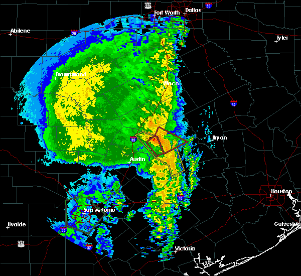 At 1240 am cst, a severe thunderstorm capable of producing a tornado was located near thorndale, or 8 miles west of rockdale, moving northeast at 55 mph (radar indicated rotation). Hazards include tornado and extreme winds to near 80 mph. Flying debris will be dangerous to those caught without shelter. mobile homes will be damaged or destroyed. damage to roofs, windows, and vehicles will occur. tree damage is likely. this dangerous storm will be near, rockdale around 1250 am cst. Other locations impacted by this tornadic thunderstorm include milano. At 1240 am cst, a severe thunderstorm capable of producing a tornado was located near thorndale, or 8 miles west of rockdale, moving northeast at 55 mph (radar indicated rotation). Hazards include tornado and extreme winds to near 80 mph. Flying debris will be dangerous to those caught without shelter. mobile homes will be damaged or destroyed. damage to roofs, windows, and vehicles will occur. tree damage is likely. this dangerous storm will be near, rockdale around 1250 am cst. Other locations impacted by this tornadic thunderstorm include milano.
|
| 2/20/2017 12:40 AM CST |
 At 1240 am cst, severe thunderstorms were located along a line extending from 6 miles northeast of granger dam to near fedor, moving east at 55 mph (radar indicated). Hazards include 60 mph wind gusts and penny size hail. Expect damage to roofs, siding, and trees. Locations impacted include, taylor, giddings, granger, lexington, bartlett, thrall, fedor, granger dam, tanglewood, knobb springs, laneport, waterloo, loebau, schwertner, hills, lincoln, sandoval, manheim, theon and serbin. At 1240 am cst, severe thunderstorms were located along a line extending from 6 miles northeast of granger dam to near fedor, moving east at 55 mph (radar indicated). Hazards include 60 mph wind gusts and penny size hail. Expect damage to roofs, siding, and trees. Locations impacted include, taylor, giddings, granger, lexington, bartlett, thrall, fedor, granger dam, tanglewood, knobb springs, laneport, waterloo, loebau, schwertner, hills, lincoln, sandoval, manheim, theon and serbin.
|
| 2/20/2017 12:35 AM CST |
 At 1235 am cst, severe thunderstorms were located along a line extending from near granger dam to paige, moving northeast at 45 mph (radar indicated). Hazards include 60 mph wind gusts and penny size hail. Expect damage to roofs, siding, and trees. Locations impacted include, taylor, elgin, bastrop, giddings, smithville, granger, lexington, bartlett, thrall, weir, fedor, paige, granger dam, tanglewood, camp swift, coupland, circle d-kc estate, circle d-kc estates, knobb springs and laneport. At 1235 am cst, severe thunderstorms were located along a line extending from near granger dam to paige, moving northeast at 45 mph (radar indicated). Hazards include 60 mph wind gusts and penny size hail. Expect damage to roofs, siding, and trees. Locations impacted include, taylor, elgin, bastrop, giddings, smithville, granger, lexington, bartlett, thrall, weir, fedor, paige, granger dam, tanglewood, camp swift, coupland, circle d-kc estate, circle d-kc estates, knobb springs and laneport.
|
| 2/20/2017 12:33 AM CST |
 At 1232 am cst, a severe thunderstorm capable of producing a tornado was located over thrall, or near taylor, moving northeast at 30 mph (radar indicated rotation). Hazards include tornado. Flying debris will be dangerous to those caught without shelter. mobile homes will be damaged or destroyed. damage to roofs, windows, and vehicles will occur. tree damage is likely. Locations impacted include, taylor, thrall, granger dam, laneport, noack, hoxie, beyarsville, waterloo, hare and sandoval. At 1232 am cst, a severe thunderstorm capable of producing a tornado was located over thrall, or near taylor, moving northeast at 30 mph (radar indicated rotation). Hazards include tornado. Flying debris will be dangerous to those caught without shelter. mobile homes will be damaged or destroyed. damage to roofs, windows, and vehicles will occur. tree damage is likely. Locations impacted include, taylor, thrall, granger dam, laneport, noack, hoxie, beyarsville, waterloo, hare and sandoval.
|
| 2/20/2017 12:30 AM CST |
 At 1230 am cst, a severe thunderstorm capable of producing a tornado was located over thrall, or 7 miles east of taylor, moving northeast at 55 mph (radar indicated rotation). Hazards include tornado. Flying debris will be dangerous to those caught without shelter. mobile homes will be damaged or destroyed. damage to roofs, windows, and vehicles will occur. tree damage is likely. this dangerous storm will be near, thorndale around 1235 am cst. rockdale around 1250 am cst. Other locations impacted by this tornadic thunderstorm include milano. At 1230 am cst, a severe thunderstorm capable of producing a tornado was located over thrall, or 7 miles east of taylor, moving northeast at 55 mph (radar indicated rotation). Hazards include tornado. Flying debris will be dangerous to those caught without shelter. mobile homes will be damaged or destroyed. damage to roofs, windows, and vehicles will occur. tree damage is likely. this dangerous storm will be near, thorndale around 1235 am cst. rockdale around 1250 am cst. Other locations impacted by this tornadic thunderstorm include milano.
|
| 2/20/2017 12:29 AM CST |
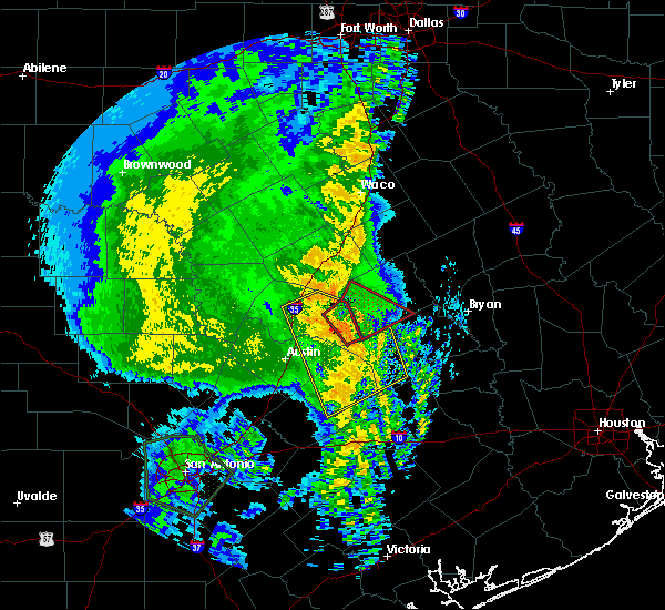 At 1229 am cst, a severe thunderstorm capable of producing a tornado was located over thrall, or near taylor, moving northeast at 60 mph (radar indicated rotation). Hazards include tornado. Flying debris will be dangerous to those caught without shelter. mobile homes will be damaged or destroyed. damage to roofs, windows, and vehicles will occur. tree damage is likely. Locations impacted include, taylor, thrall, granger dam, laneport, noack, hoxie, beyarsville, waterloo, hare and sandoval. At 1229 am cst, a severe thunderstorm capable of producing a tornado was located over thrall, or near taylor, moving northeast at 60 mph (radar indicated rotation). Hazards include tornado. Flying debris will be dangerous to those caught without shelter. mobile homes will be damaged or destroyed. damage to roofs, windows, and vehicles will occur. tree damage is likely. Locations impacted include, taylor, thrall, granger dam, laneport, noack, hoxie, beyarsville, waterloo, hare and sandoval.
|
| 2/20/2017 12:23 AM CST |
 At 1223 am cst, a severe thunderstorm capable of producing a tornado was located near taylor, moving east at 30 mph (radar indicated rotation). Hazards include tornado. Flying debris will be dangerous to those caught without shelter. mobile homes will be damaged or destroyed. damage to roofs, windows, and vehicles will occur. Tree damage is likely. At 1223 am cst, a severe thunderstorm capable of producing a tornado was located near taylor, moving east at 30 mph (radar indicated rotation). Hazards include tornado. Flying debris will be dangerous to those caught without shelter. mobile homes will be damaged or destroyed. damage to roofs, windows, and vehicles will occur. Tree damage is likely.
|
| 2/20/2017 12:22 AM CST |
 At 1221 am cst, severe thunderstorms were located along a line extending from near bartlett to near bastrop, moving east at 45 mph (radar indicated). Hazards include 60 mph wind gusts and penny size hail. expect damage to roofs, siding, and trees At 1221 am cst, severe thunderstorms were located along a line extending from near bartlett to near bastrop, moving east at 45 mph (radar indicated). Hazards include 60 mph wind gusts and penny size hail. expect damage to roofs, siding, and trees
|
| 10/30/2015 12:32 PM CDT |
 At 1231 pm cdt, a severe thunderstorm was located over rockdale, moving northeast at 20 mph (radar indicated). Hazards include 60 mph wind gusts. Expect damage to roofs. siding and trees. locations impacted include, rockdale, thorndale and milano. A tornado watch remains in effect until 700 pm cdt for central texas. At 1231 pm cdt, a severe thunderstorm was located over rockdale, moving northeast at 20 mph (radar indicated). Hazards include 60 mph wind gusts. Expect damage to roofs. siding and trees. locations impacted include, rockdale, thorndale and milano. A tornado watch remains in effect until 700 pm cdt for central texas.
|
| 10/30/2015 12:16 PM CDT |
 At 1215 pm cdt, a severe thunderstorm was located near rockdale, moving northeast at 40 mph (radar indicated). Hazards include 60 to 70 mph wind gusts. Expect considerable tree damage. Damage is likely to mobile homes, roofs and outbuildings. At 1215 pm cdt, a severe thunderstorm was located near rockdale, moving northeast at 40 mph (radar indicated). Hazards include 60 to 70 mph wind gusts. Expect considerable tree damage. Damage is likely to mobile homes, roofs and outbuildings.
|
| 5/29/2015 1:21 AM CDT | At 121 am cdt, severe thunderstorms were located along a line extending from near bartlett to near austin bergstrom int ap to near staples, moving east at 50 mph (radar indicated). Hazards include 60 mph wind gusts. Expect damage to roofs. siding and trees. Locations impacted include, austin, round rock, cedar park, georgetown, pflugerville, san marcos, taylor, elgin, wimberley, dripping springs, granger, windemere, tanglewood forest, anderson mill, serenada, austin bergstrom int ap, kyle, leander, hutto and lakeway. |
| 5/29/2015 12:44 AM CDT | At 1244 am cdt, severe thunderstorms were located along a line extending from 6 miles northeast of florence to barton creek to near canyon lake dam, moving east at 40 mph (radar indicated). Hazards include 60 mph wind gusts. Expect damage to roofs. siding and trees. Locations impacted include, austin, round rock, cedar park, georgetown, pflugerville, san marcos, taylor, elgin, wimberley, dripping springs, granger, windemere, tanglewood forest, anderson mill, serenada, austin bergstrom int ap, kyle, leander, hutto and lakeway. |
| 5/29/2015 12:03 AM CDT | At 1203 am cdt, severe thunderstorms were located along a line extending from 6 miles southwest of kempner to near spicewood to near twin sisters, moving east at 50 mph (radar indicated). Hazards include 60 mph wind gusts and penny size hail. Expect damage to roofs. Siding and trees. |
| 5/25/2015 3:48 PM CDT | At 348 pm cdt, a severe thunderstorm was located 10 miles south of rogers, or 11 miles southwest of cameron, moving northeast at 30 mph (radar indicated). Hazards include 60 mph wind gusts and quarter size hail. Hail damage to vehicles is expected. expect wind damage to roofs, siding and trees. locations impacted include, taylor, thrall, granger dam, sandoval, hare, noack, hoxie, waterloo and laneport. A tornado watch remains in effect until 1000 pm cdt for south central texas. |
| 5/25/2015 3:28 PM CDT | At 327 pm cdt, a severe thunderstorm was located near granger dam, or 9 miles east of granger, moving east at 30 mph (radar indicated). Hazards include 60 mph wind gusts and quarter size hail. Hail damage to vehicles is expected. Expect wind damage to roofs, siding and trees. |
| 5/25/2015 3:27 PM CDT | At 327 pm cdt, a severe thunderstorm was located over granger dam, or 7 miles east of granger, moving northeast at 30 mph (radar indicated). Hazards include 70 mph wind gusts and nickel size hail. Expect considerable tree damage. Damage is likely to mobile homes, roofs and outbuildings. |
| 5/23/2015 10:44 PM CDT | At 1044 pm cdt, severe thunderstorms were located along a line extending from near killeen to little river-academy to west of cameron to near rockdale, moving north at 45 mph. some low level rotation has been observed in this line of storms (radar indicated). Hazards include 60 mph wind gusts. Expect damage to roofs. siding and trees. locations impacted include, killeen, temple, copperas cove, harker heights, belton, rockdale, cameron, fort hood, nolanville, morgan`s point resort, salado, little river-academy, troy, thorndale, rogers, holland, buckholts and milano. A tornado watch remains in effect until 400 am cdt for central texas. |
| 5/23/2015 10:15 PM CDT | At 1013 pm cdt, severe thunderstorms were located along a line extending from near florence to granger to near fedor, moving northeast at 45 mph (radar indicated). Hazards include 65 mph wind gusts. Expect damage to roofs. Siding and trees. |
| 5/23/2015 10:06 PM CDT | At 1006 pm cdt, severe thunderstorms were located along a line extending from salado to near taylor, moving east at 35 mph (radar indicated). Hazards include 70 mph wind gusts. Expect considerable tree damage. damage is likely to mobile homes, roofs and outbuildings. locations impacted include, round rock, georgetown, taylor, granger, serenada, hutto, bartlett, florence, jarrell, thrall, weir, georgetown dam, andice, sun city, coupland, granger dam, sandoval, rices crossing, noack and beyarsville. A tornado watch remains in effect until 300 am cdt for south central texas. |
| 5/23/2015 9:39 PM CDT | At 939 pm cdt, severe thunderstorms were located along a line extending from florence to near anderson mill, moving east at 35 mph (radar indicated). Hazards include 70 mph wind gusts. Expect considerable tree damage. Damage is likely to mobile homes, roofs and outbuildings. |
| 4/27/2015 2:16 AM CDT | At 215 am cdt, severe thunderstorms were located along a line extending from 7 miles southeast of rogers to near palmeto to near stockdale to near floresville to near poteet to 6 miles west of schattel to 8 miles east of dilley, and are nearly stationary (radar indicated). Hazards include 60 mph wind gusts and penny size hail. Expect damage to roofs. siding and trees. locations impacted include, san antonio, austin, new braunfels, pflugerville, san marcos, seguin, taylor, lockhart, pearsall, pleasanton, elgin, gonzales, bastrop, crystal city, floresville, luling, giddings, dilley, jourdanton and smithville. a tornado watch remains in effect until 900 am cdt for south central texas. 0. 75in. |
| 4/27/2015 1:58 AM CDT | At 157 am cdt, severe thunderstorms were located along a line extending from near cameron to 9 miles south of cedar creek to near sutherland springs to near elmendorf to near bigfoot to pearsall to dilley, moving east at 55 mph (radar indicated). Hazards include 60 mph wind gusts and penny size hail. Expect damage to roofs. siding and trees. locations impacted include, san antonio, austin, round rock, new braunfels, cedar park, georgetown, pflugerville, san marcos, seguin, universal city, taylor, lockhart, pearsall, pleasanton, elgin, gonzales, bastrop, crystal city, floresville and luling. a tornado watch remains in effect until 900 am cdt for south central texas. 0. 75in. |
| 4/27/2015 1:38 AM CDT | At 137 am cdt, severe thunderstorms were located along a line extending from near bartlett to zorn to near somerset to moore to 9 miles east of batesville to near brundage, moving east at 50 mph (radar indicated). Hazards include 60 mph wind gusts and penny size hail. Expect damage to roofs. Siding and trees. |
Hail Maps for Thorndale, TX


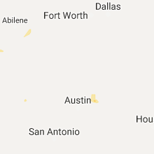


Connect with Interactive Hail Maps