

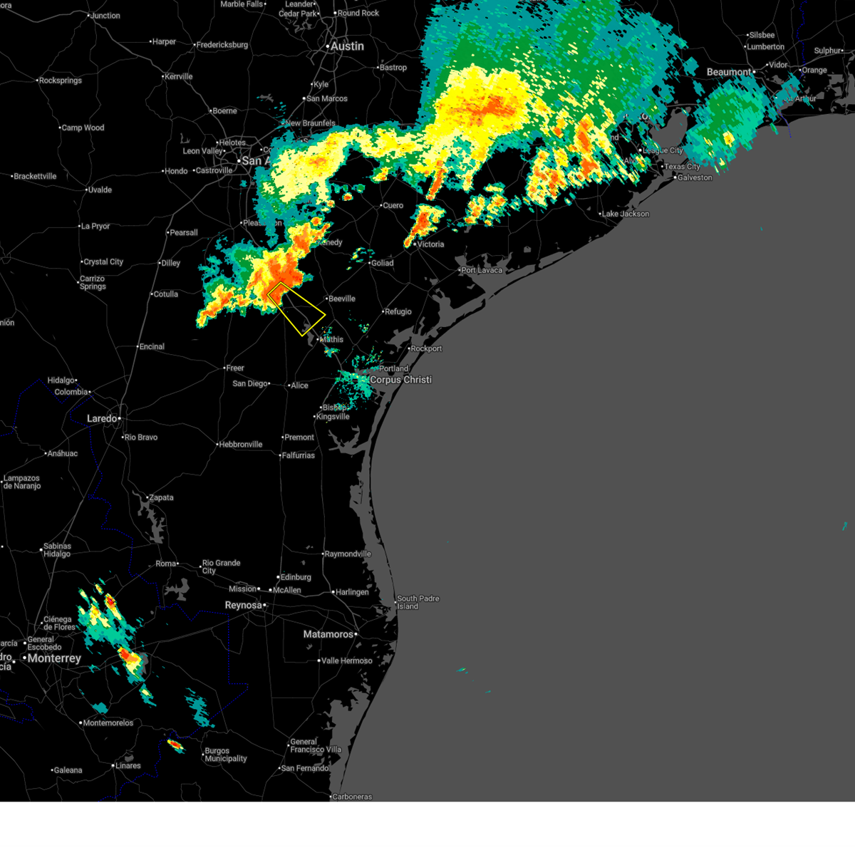
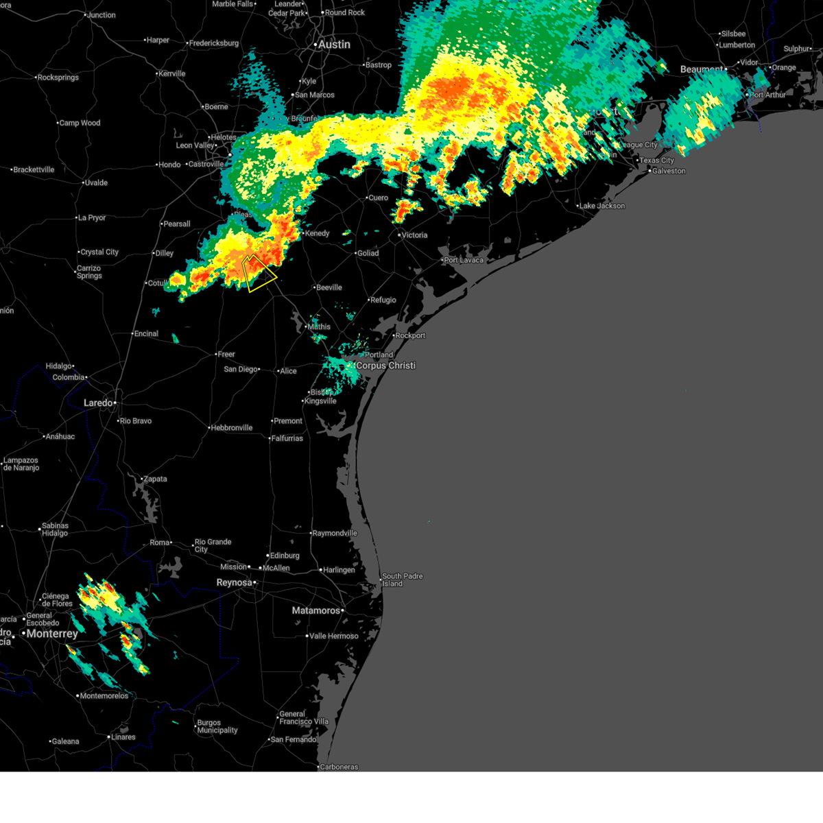
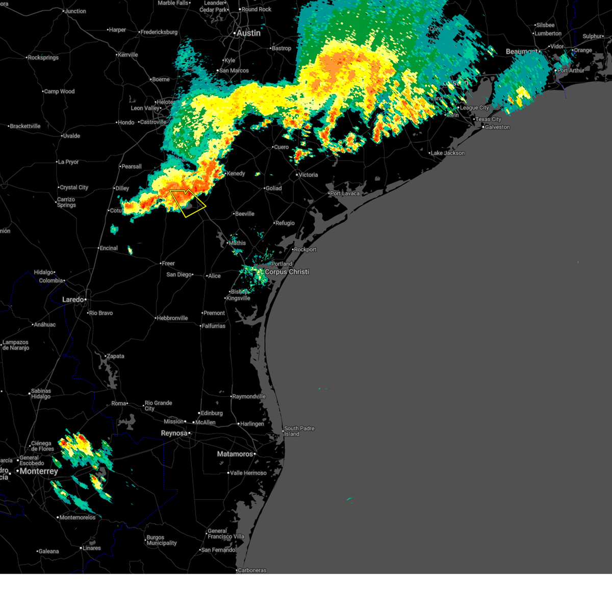
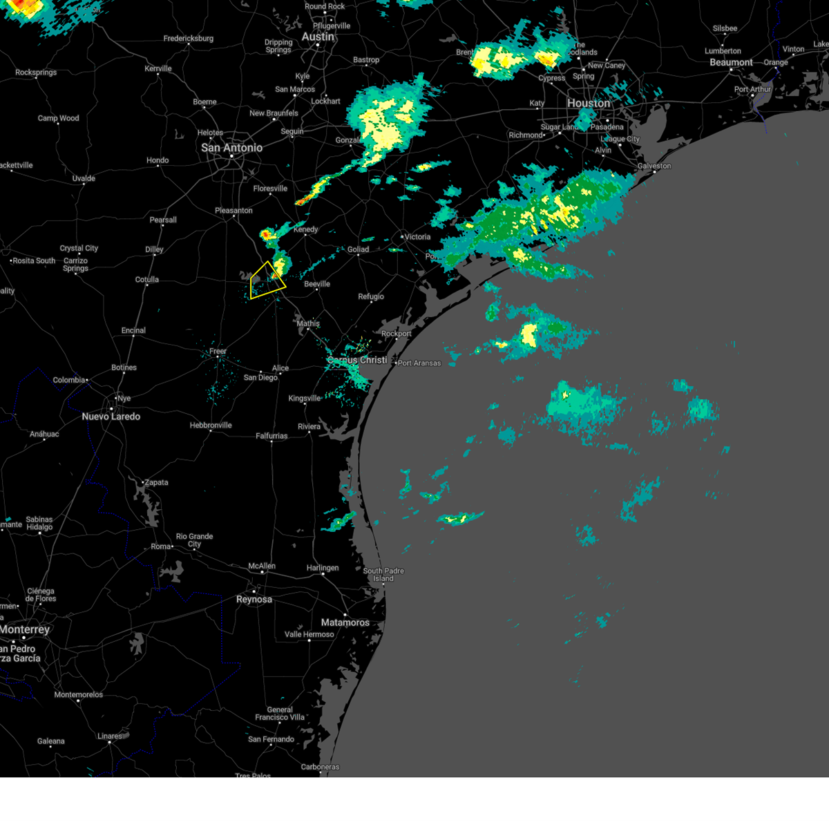
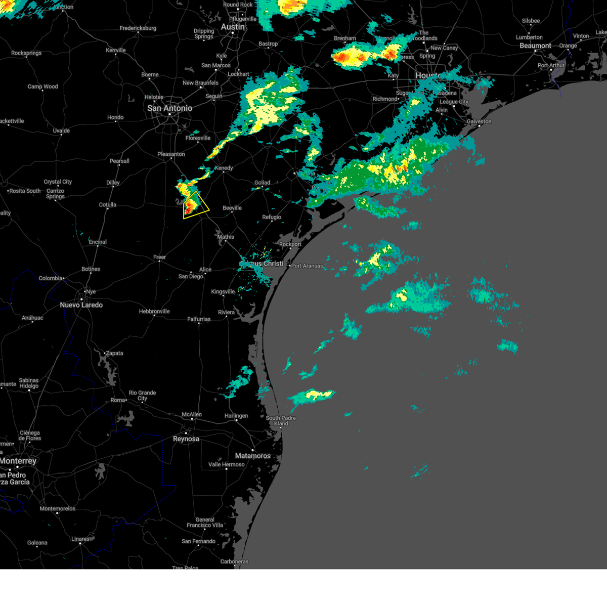
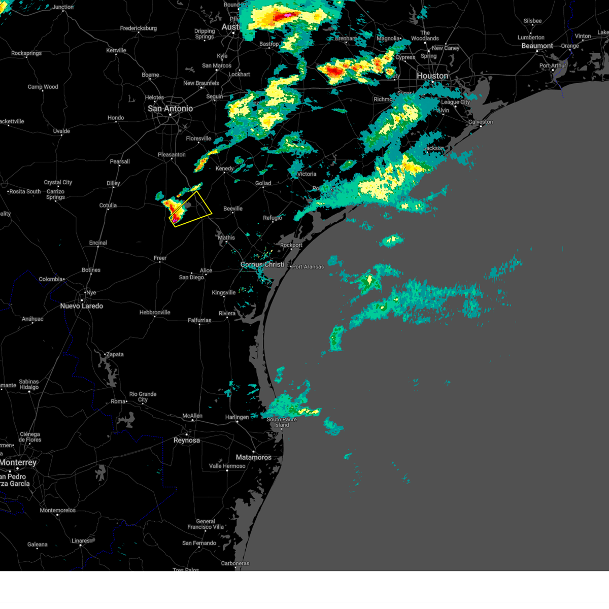
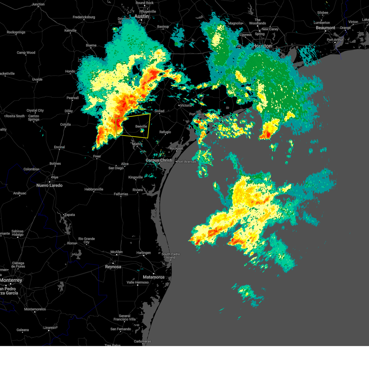
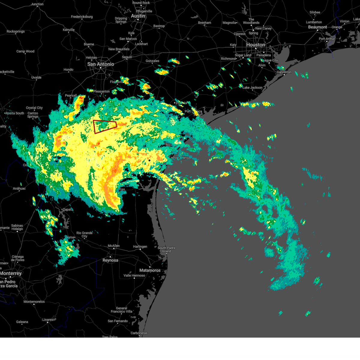
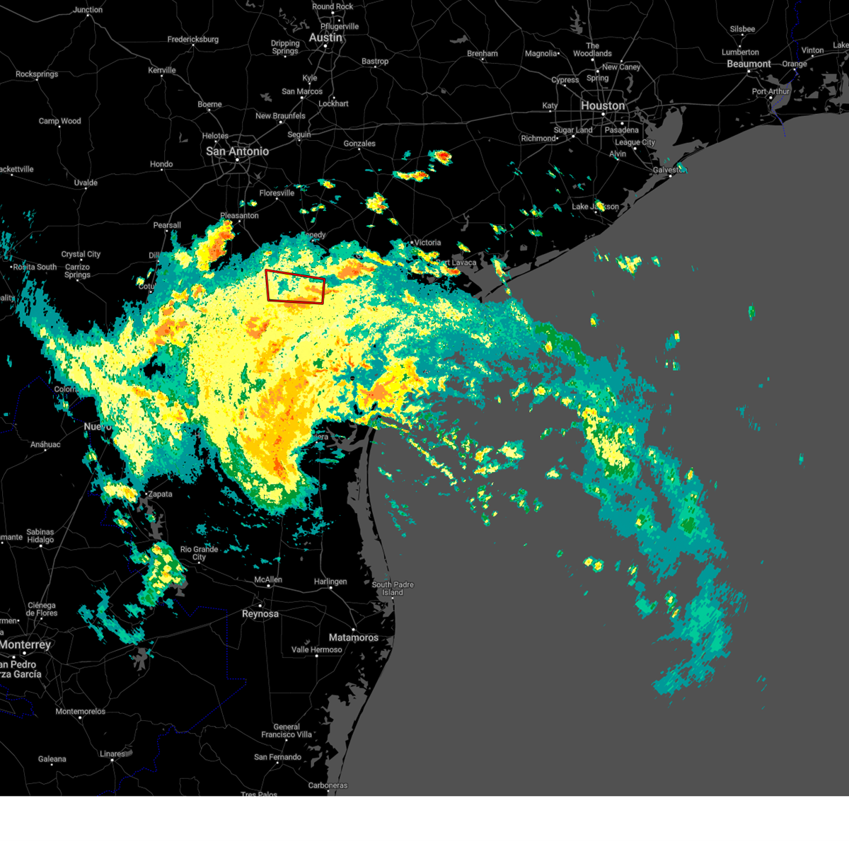
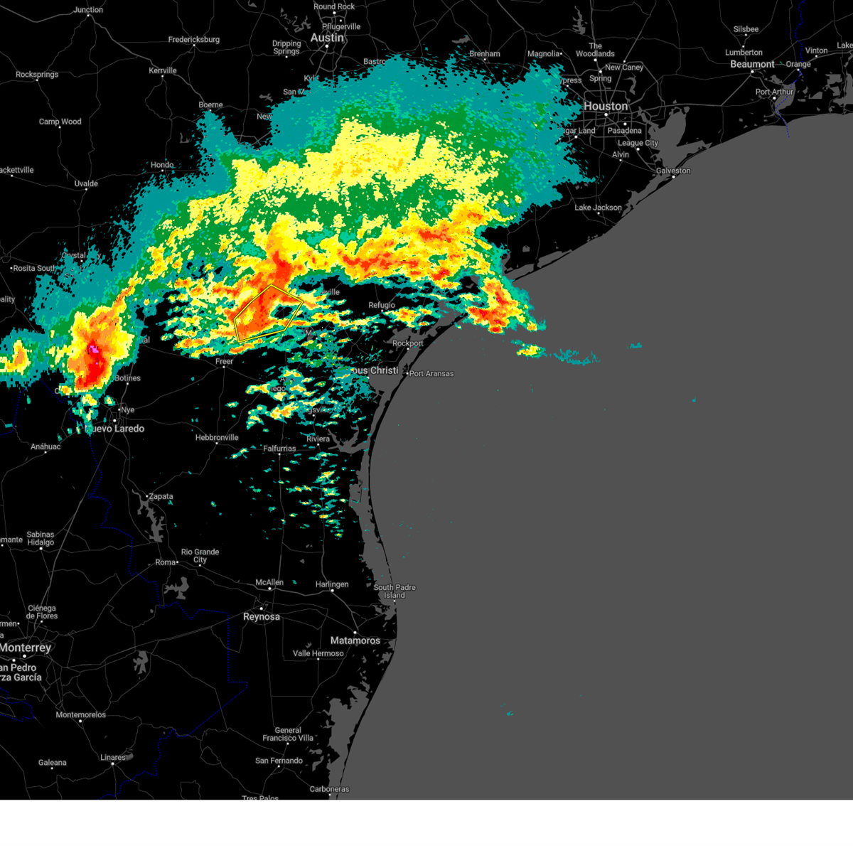
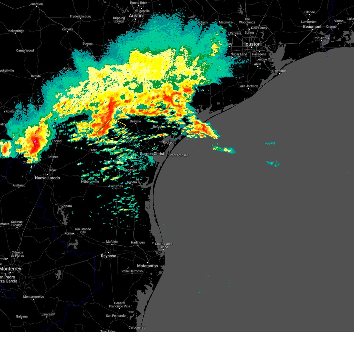
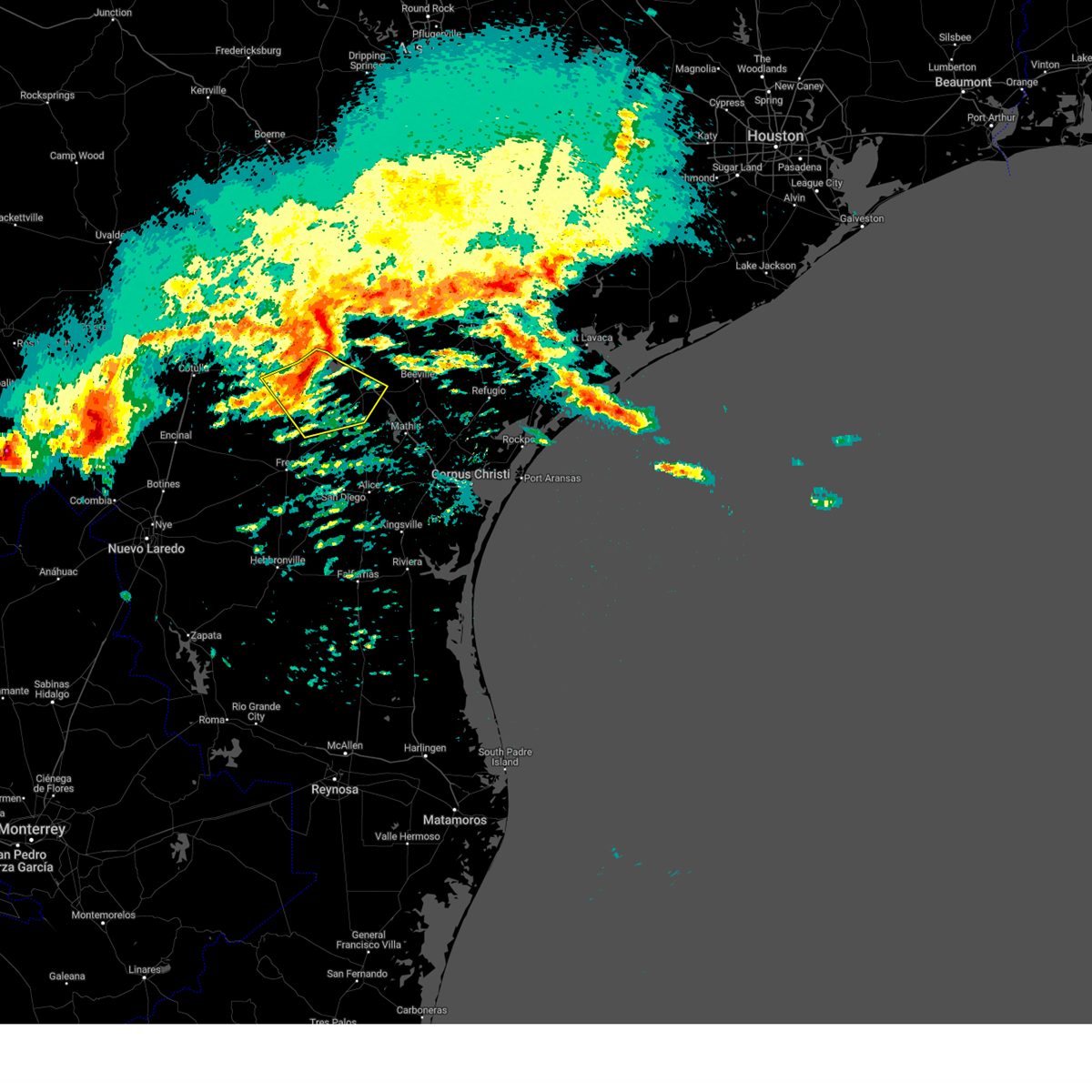
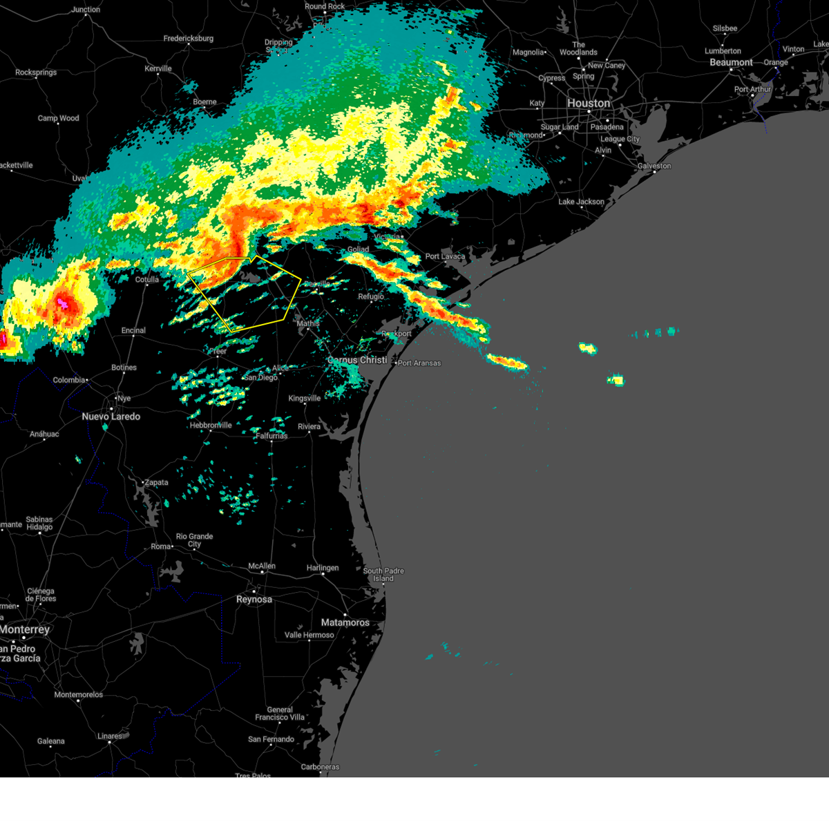
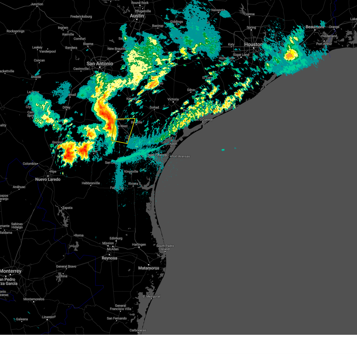
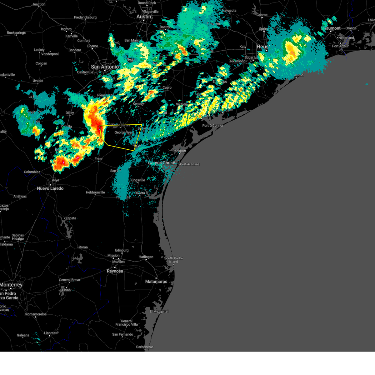
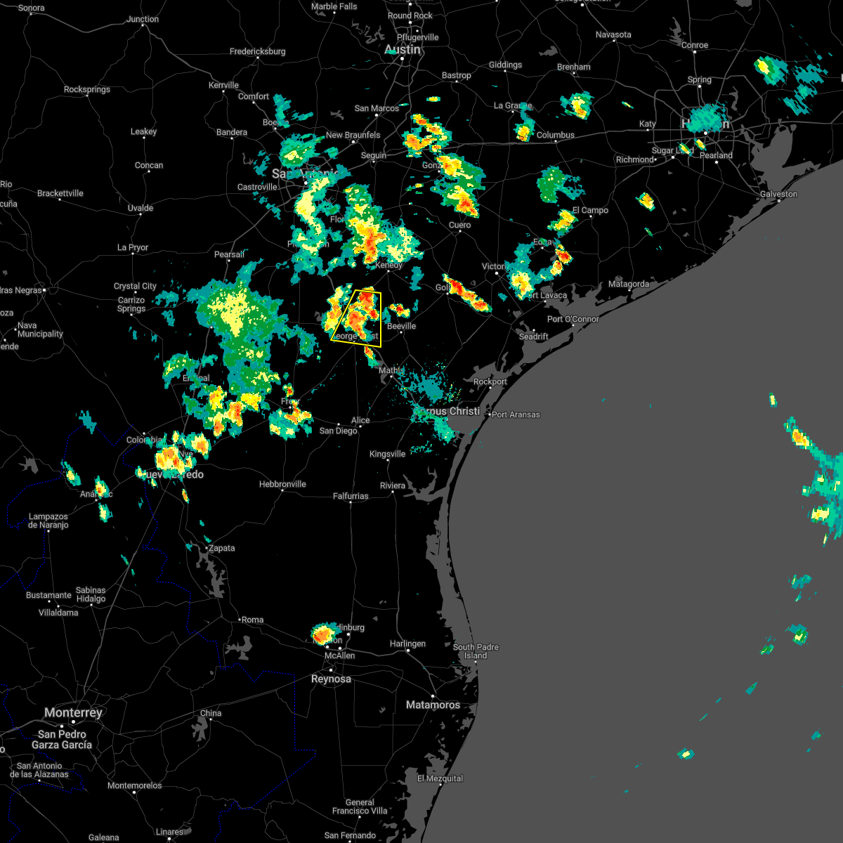
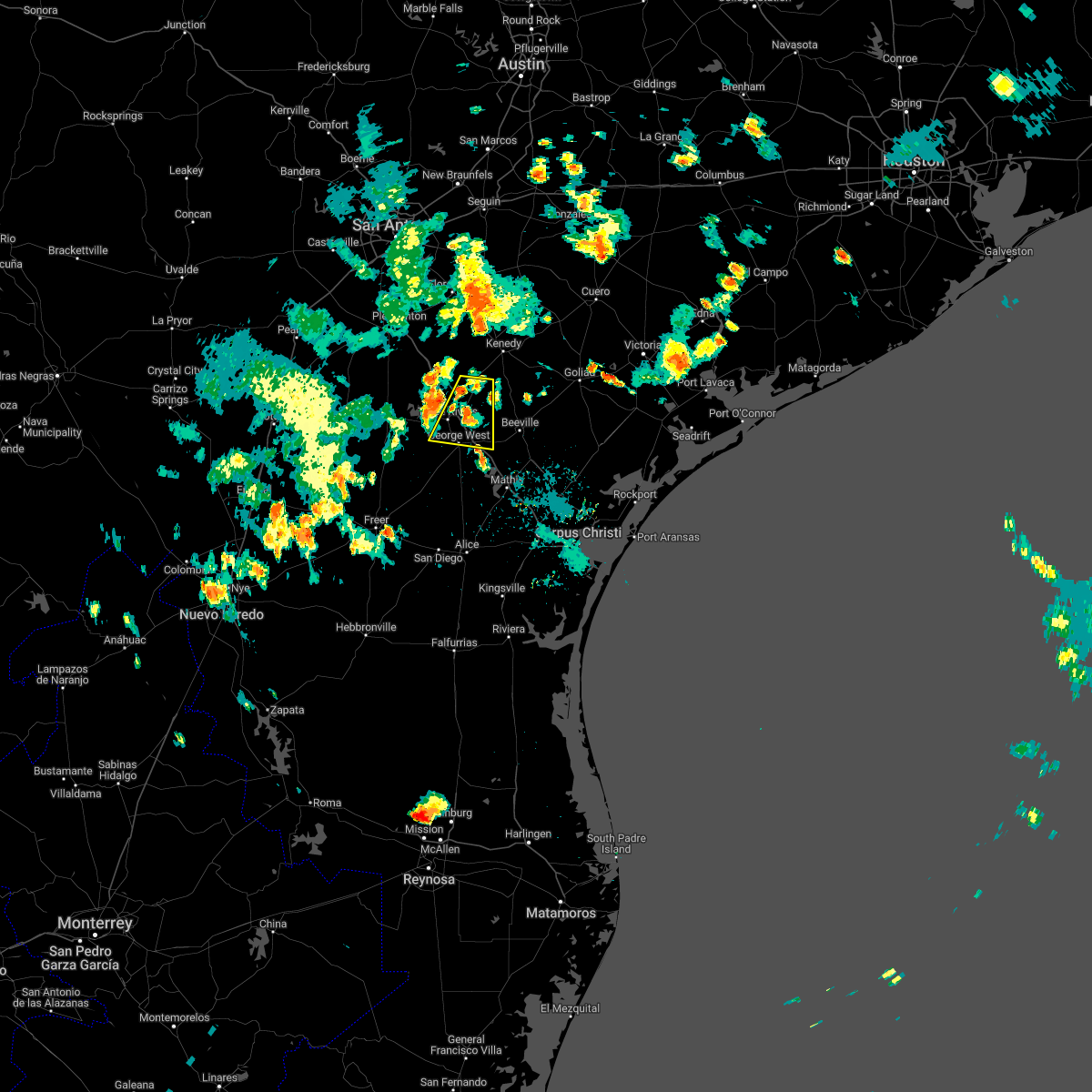
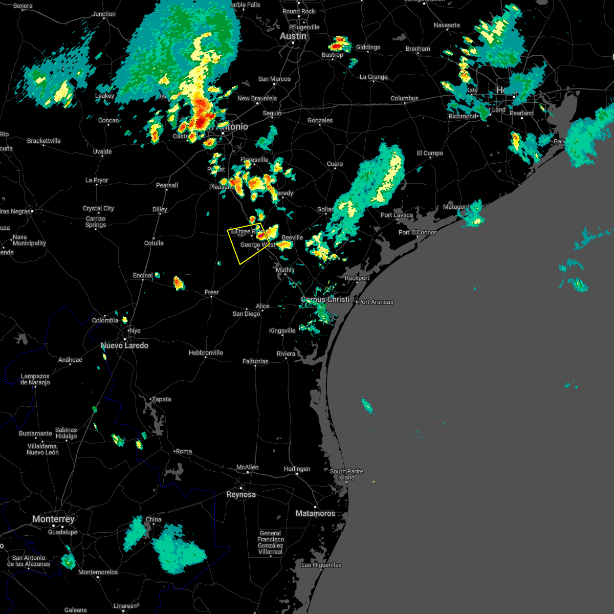
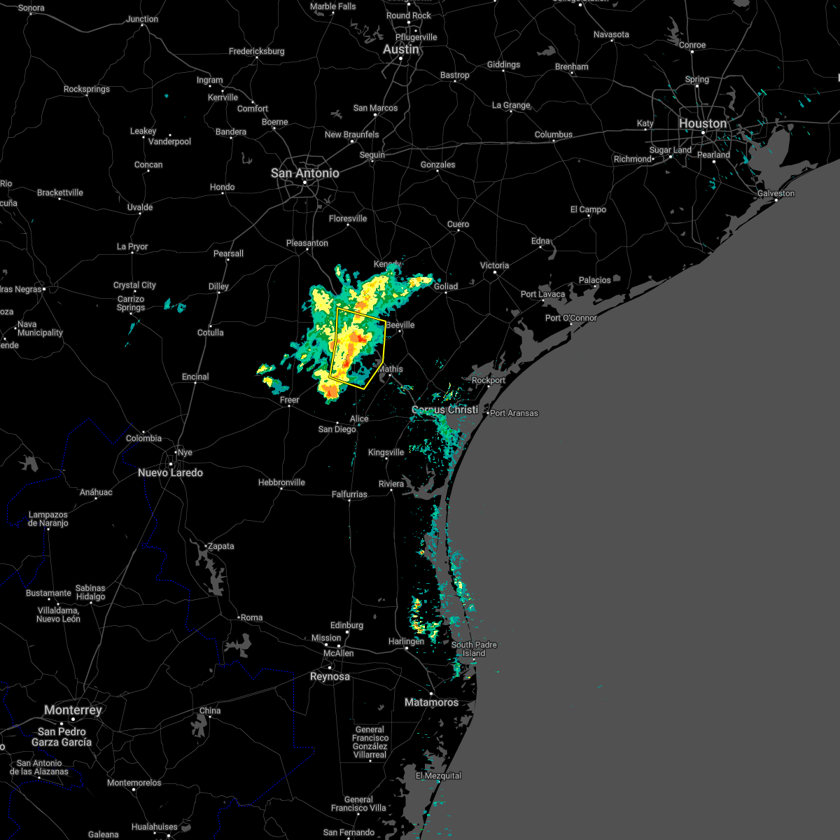
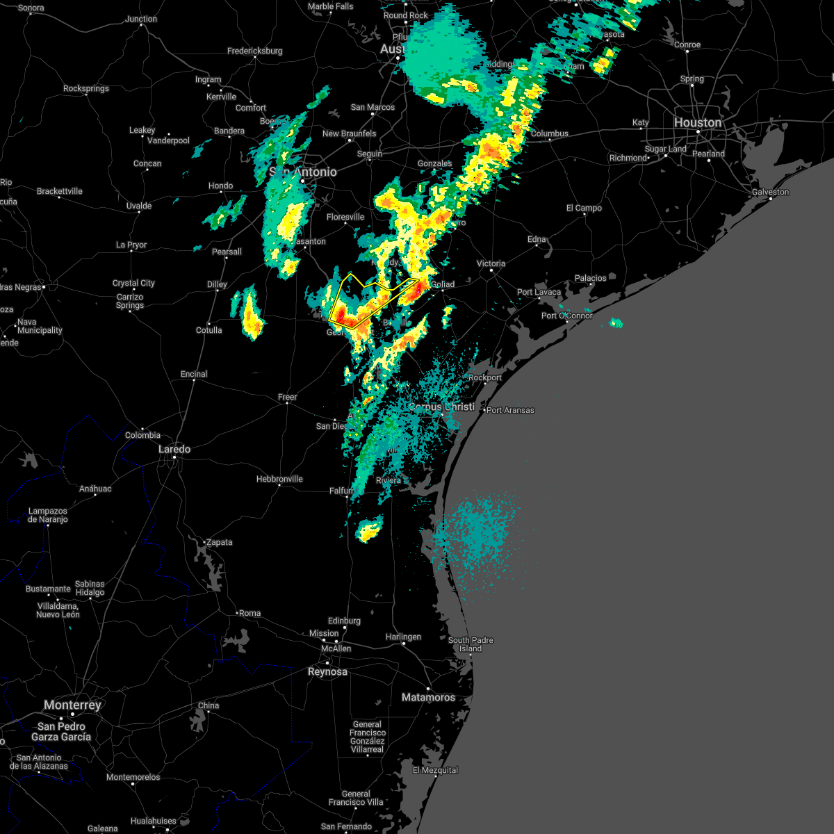
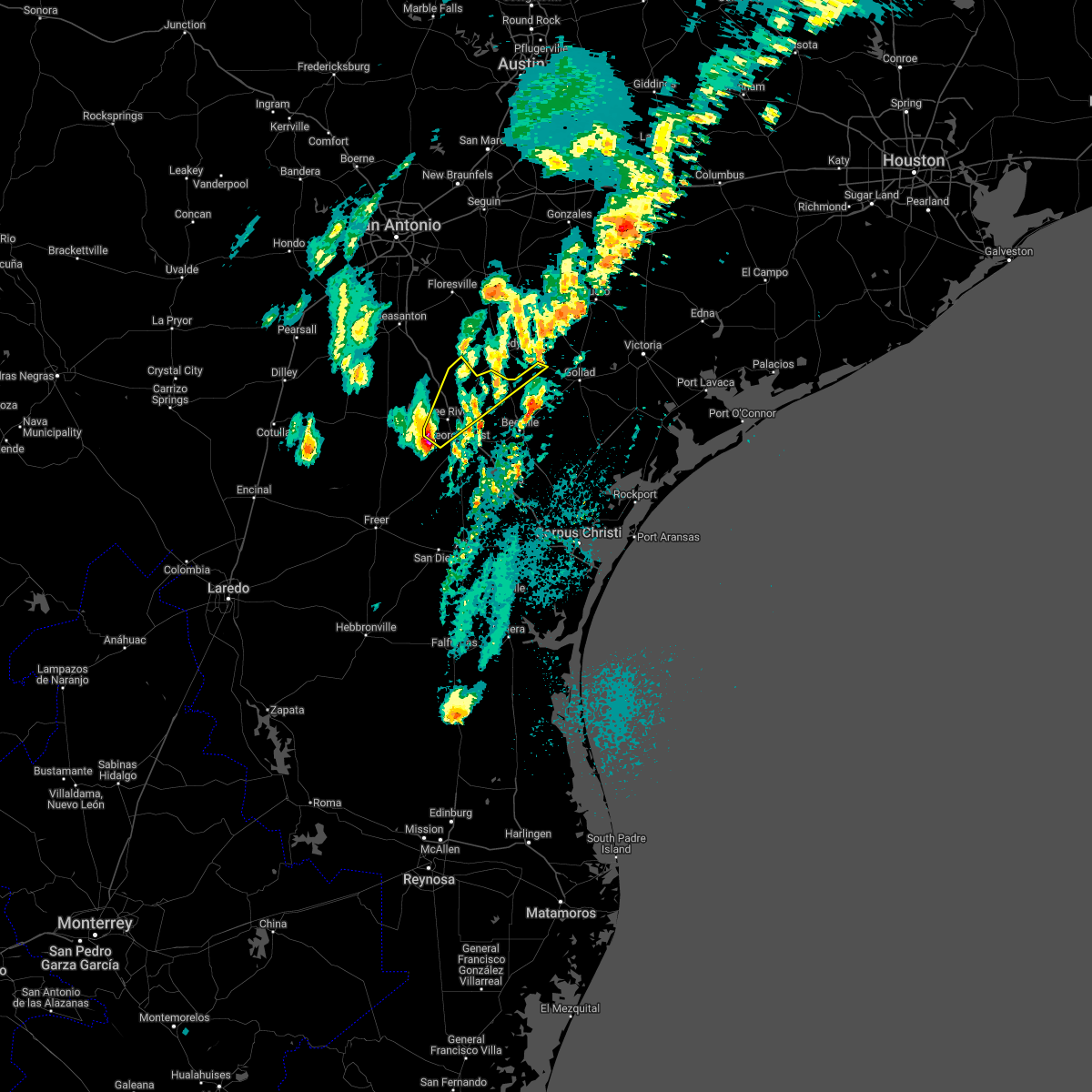
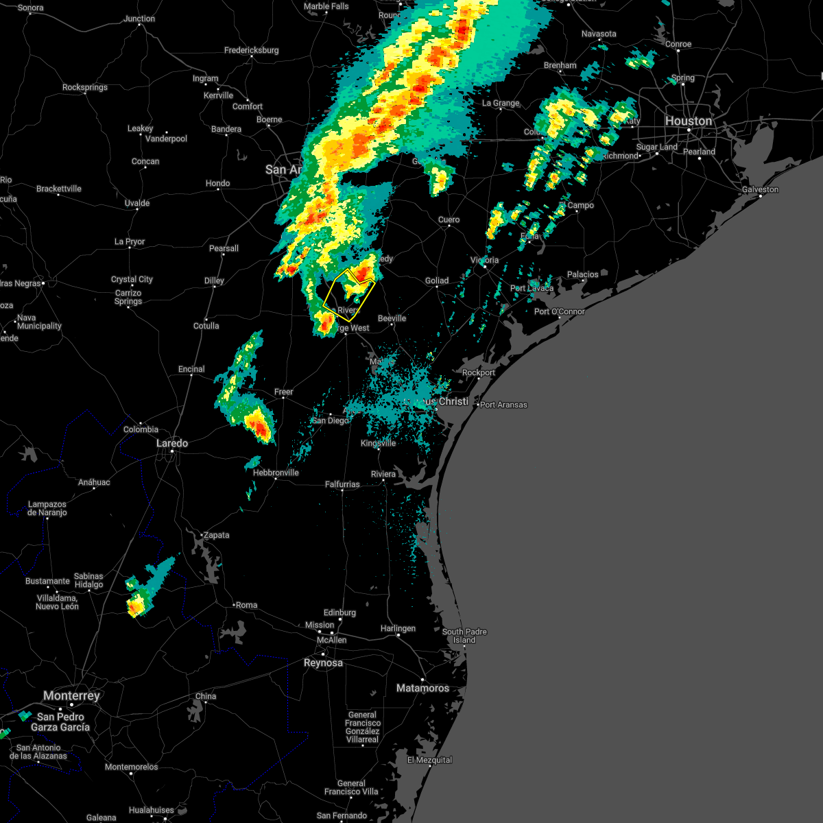
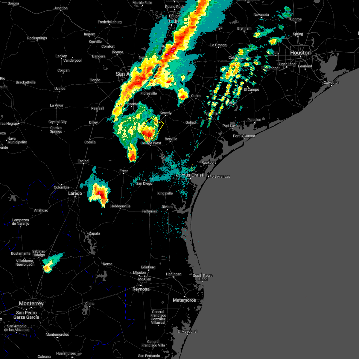
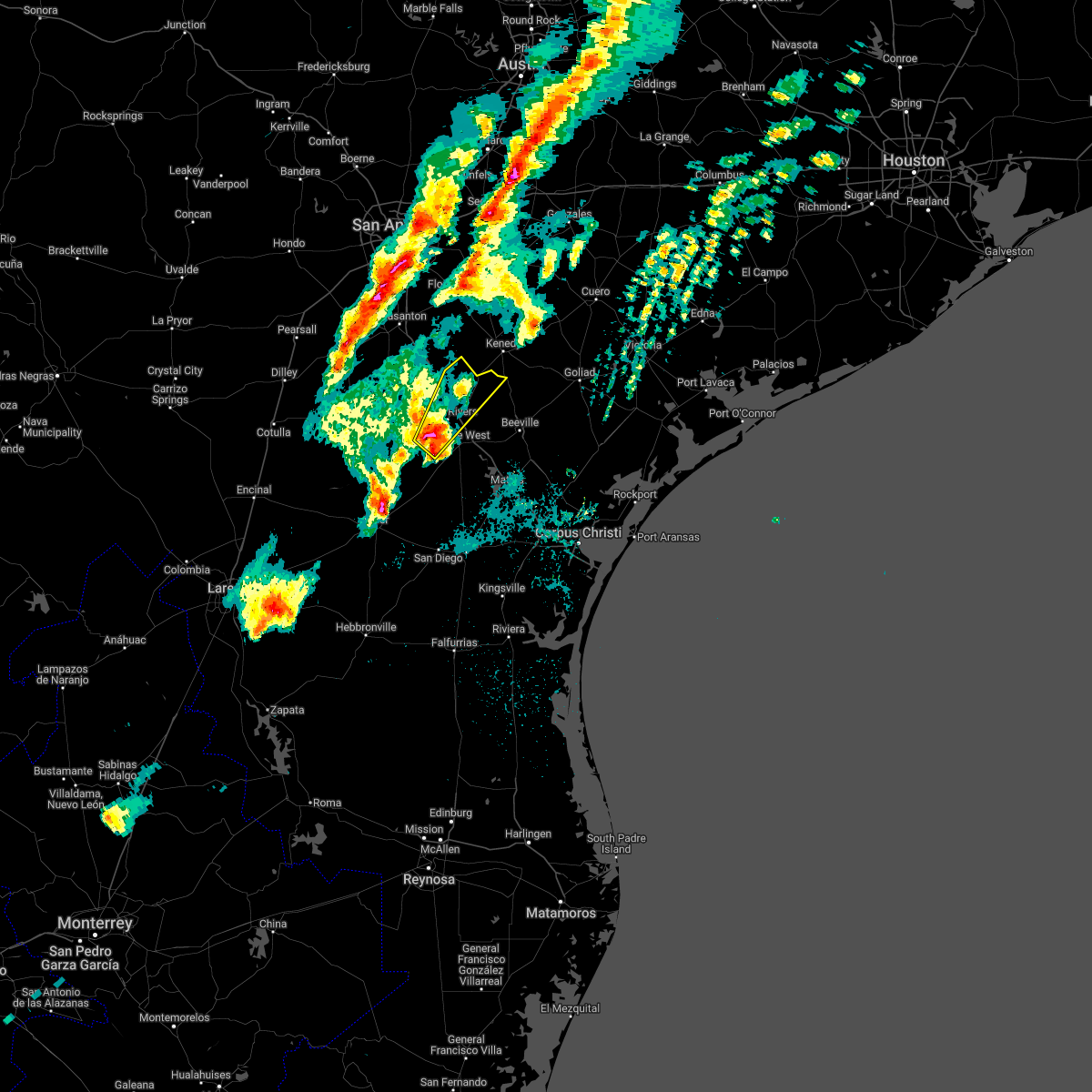
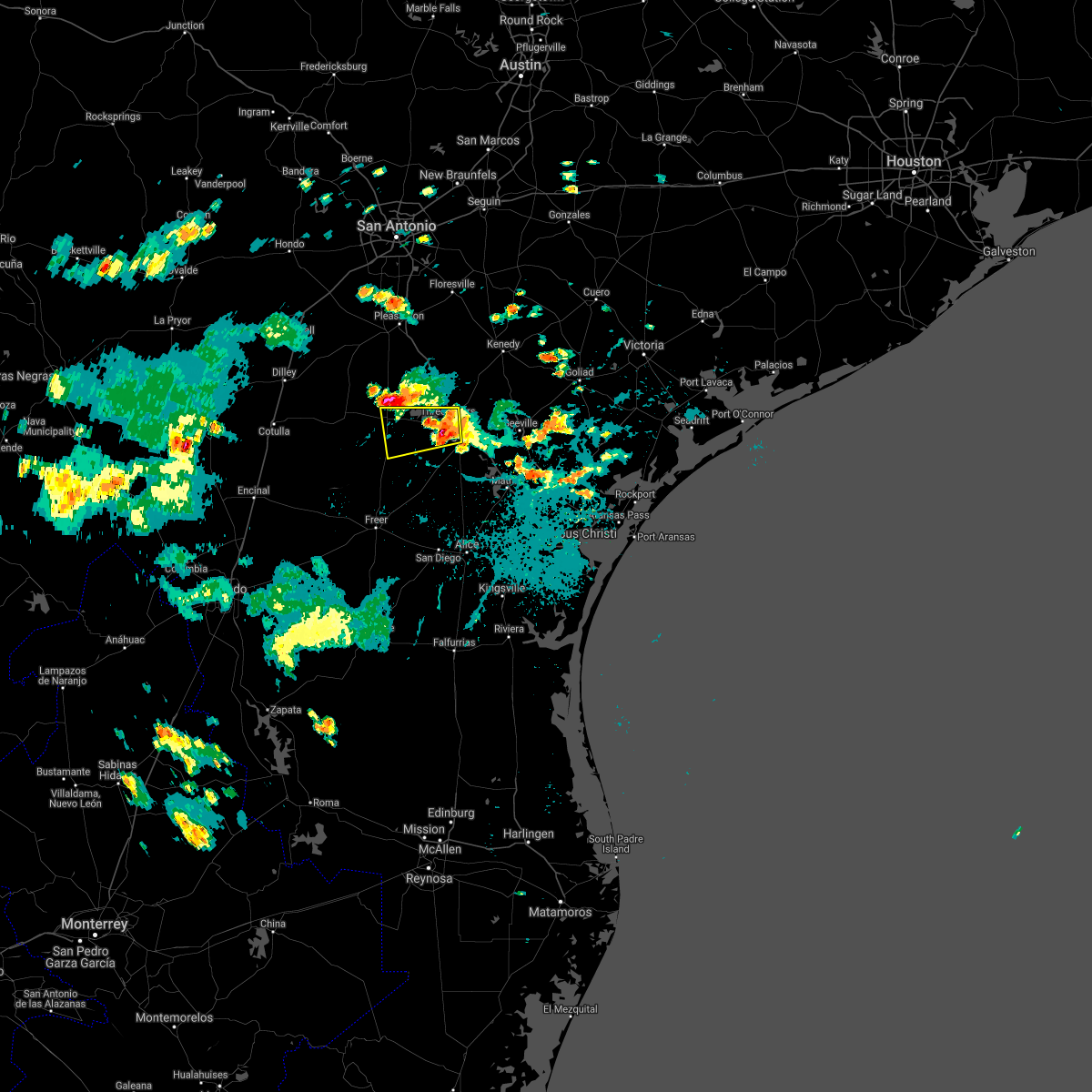
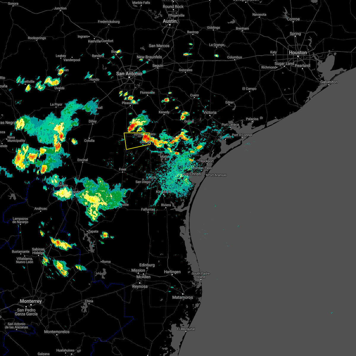
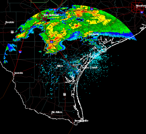
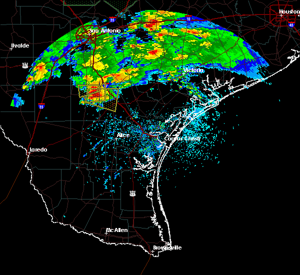
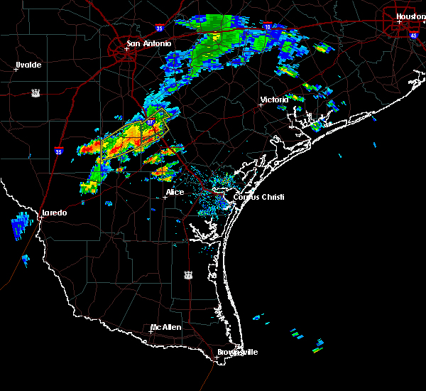
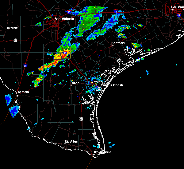
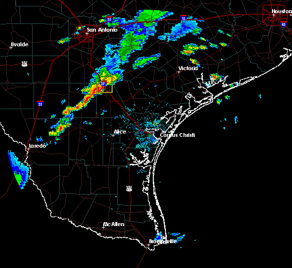
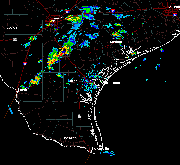
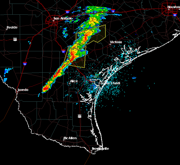
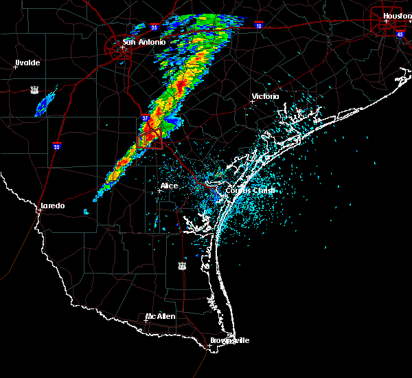
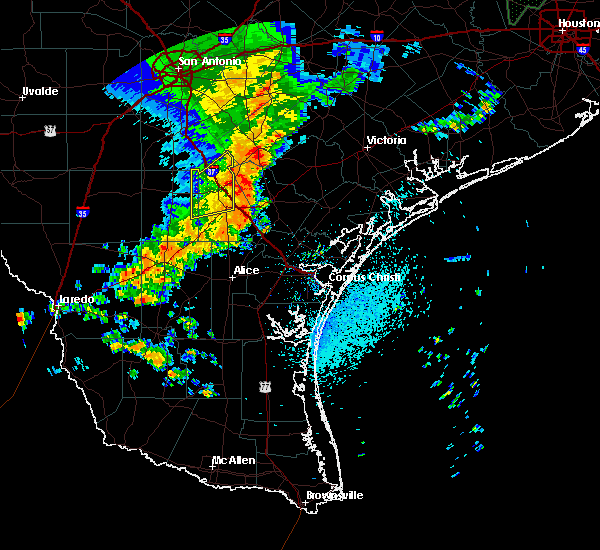
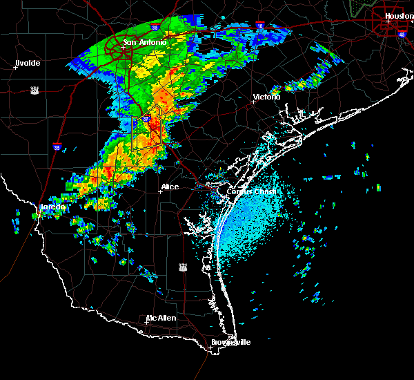
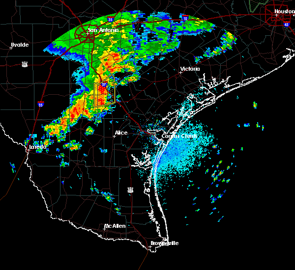
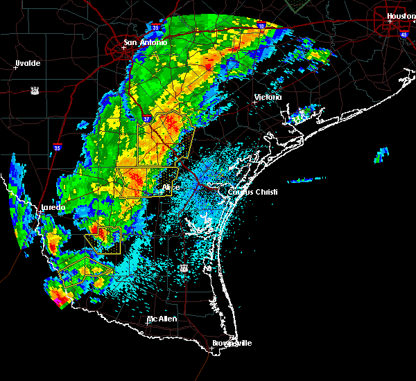
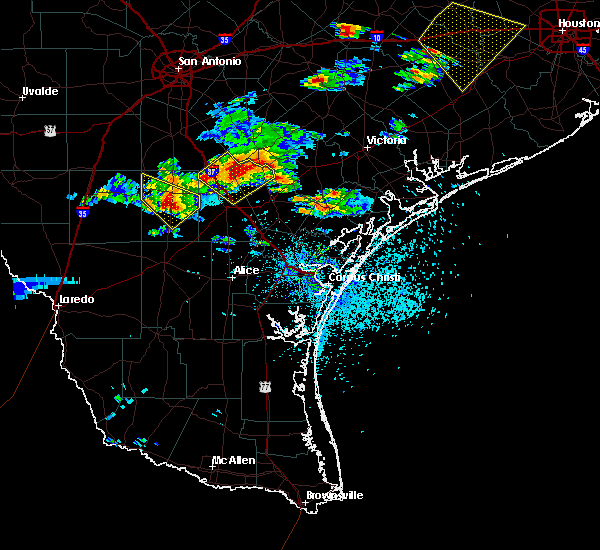
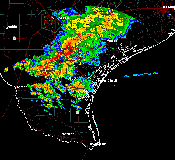
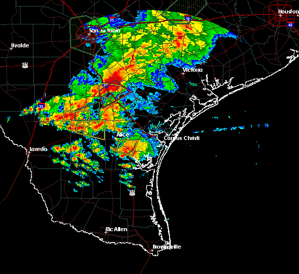
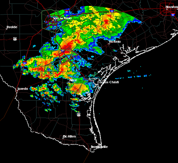
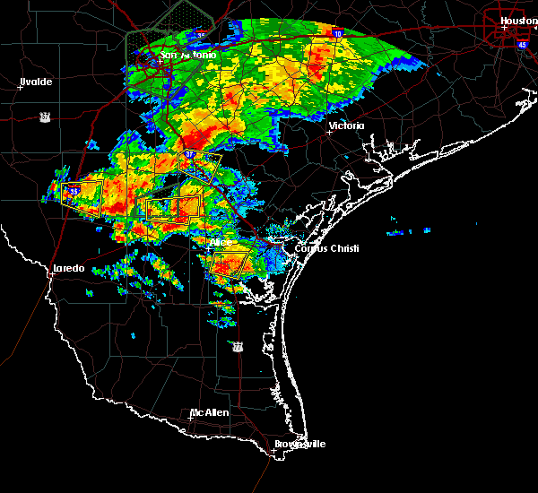
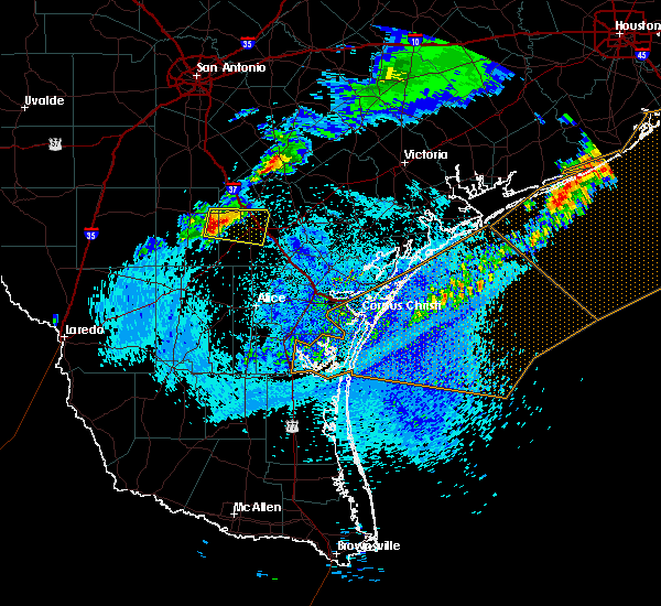
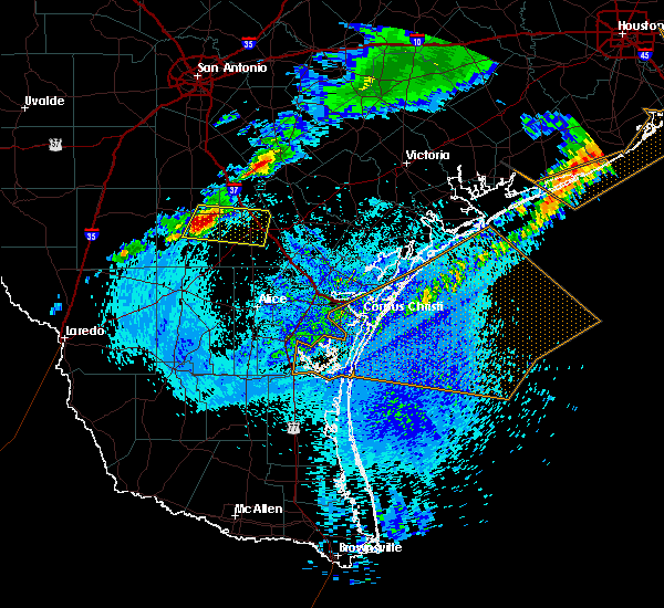
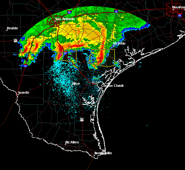
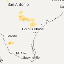
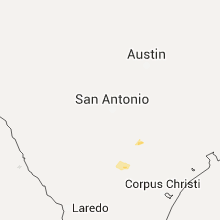
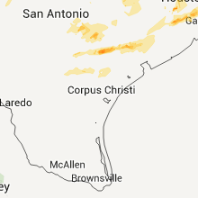
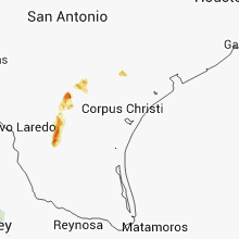
Hail Map for Three Rivers, TX
The Three Rivers, TX area has had 6 reports of on-the-ground hail by trained spotters, and has been under severe weather warnings 4 times during the past 12 months. Doppler radar has detected hail at or near Three Rivers, TX on 25 occasions, including 1 occasion during the past year.
| Name: | Three Rivers, TX |
| Where Located: | 66.2 miles NW of Corpus Christi, TX |
| Map: | Google Map for Three Rivers, TX |
| Population: | 1848 |
| Housing Units: | 845 |
| More Info: | Search Google for Three Rivers, TX |
0
The Top Recent Hail Date for Three Rivers, TX is Wednesday, September 25, 2024 (25th out of 25)

Hail and Wind Damage Spotted near Three Rivers, TX
| Date / Time | Report Details |
|---|---|
| 6/15/2025 8:11 PM CDT | the severe thunderstorm warning has been cancelled and is no longer in effect |
| 6/15/2025 8:04 PM CDT |
 Svrcrp the national weather service in corpus christi has issued a * severe thunderstorm warning for, southern live oak county in south central texas, south central bee county in south central texas, * until 845 pm cdt. * at 803 pm cdt, a severe thunderstorm was located over oakville, or near three rivers, moving southeast at 30 mph (law enforcement). Hazards include 60 mph wind gusts. expect damage to roofs, siding, and trees Svrcrp the national weather service in corpus christi has issued a * severe thunderstorm warning for, southern live oak county in south central texas, south central bee county in south central texas, * until 845 pm cdt. * at 803 pm cdt, a severe thunderstorm was located over oakville, or near three rivers, moving southeast at 30 mph (law enforcement). Hazards include 60 mph wind gusts. expect damage to roofs, siding, and trees
|
| 6/15/2025 7:56 PM CDT | Trees down reported in the cit in live oak county TX, 0.2 miles ENE of Three Rivers, TX |
| 6/15/2025 7:46 PM CDT |
 At 744 pm cdt, a severe thunderstorm was located near simmons, or near choke canyon, moving southeast at 35 mph (radar indicated). Hazards include 60 mph wind gusts. Expect damage to roofs, siding, and trees. locations impacted include, three rivers, choke canyon, calliham, simmons, and whitsett. this includes the following highways, interstate 37 between mile markers 67 and 76. Us highway 281 between mile markers 618 and 622. At 744 pm cdt, a severe thunderstorm was located near simmons, or near choke canyon, moving southeast at 35 mph (radar indicated). Hazards include 60 mph wind gusts. Expect damage to roofs, siding, and trees. locations impacted include, three rivers, choke canyon, calliham, simmons, and whitsett. this includes the following highways, interstate 37 between mile markers 67 and 76. Us highway 281 between mile markers 618 and 622.
|
| 6/15/2025 7:32 PM CDT |
 Svrcrp the national weather service in corpus christi has issued a * severe thunderstorm warning for, northeastern mcmullen county in south central texas, west central live oak county in south central texas, * until 830 pm cdt. * at 730 pm cdt, a severe thunderstorm was located near choke canyon, moving southeast at 35 mph (radar indicated). Hazards include 60 mph wind gusts. expect damage to roofs, siding, and trees Svrcrp the national weather service in corpus christi has issued a * severe thunderstorm warning for, northeastern mcmullen county in south central texas, west central live oak county in south central texas, * until 830 pm cdt. * at 730 pm cdt, a severe thunderstorm was located near choke canyon, moving southeast at 35 mph (radar indicated). Hazards include 60 mph wind gusts. expect damage to roofs, siding, and trees
|
| 4/30/2025 7:29 PM CDT | Half Dollar sized hail reported 12.9 miles SSE of Three Rivers, TX, dps reported half-dollar sized hail at intersection if i-37 and fm 99... near whitsett. |
| 3/15/2024 8:06 AM CDT |
 The storm which prompted the warning has weakened below severe limits, and no longer poses an immediate threat to life or property. therefore, the warning will be allowed to expire. The storm which prompted the warning has weakened below severe limits, and no longer poses an immediate threat to life or property. therefore, the warning will be allowed to expire.
|
| 3/15/2024 7:53 AM CDT |
 At 752 am cdt, a severe thunderstorm was located near three rivers, moving northeast at 45 mph (radar indicated). Hazards include quarter size hail. Damage to vehicles is expected. locations impacted include, three rivers, oakville, and simmons. this includes the following highways, interstate 37 between mile markers 62 and 77. Us highway 281 between mile markers 618 and 626. At 752 am cdt, a severe thunderstorm was located near three rivers, moving northeast at 45 mph (radar indicated). Hazards include quarter size hail. Damage to vehicles is expected. locations impacted include, three rivers, oakville, and simmons. this includes the following highways, interstate 37 between mile markers 62 and 77. Us highway 281 between mile markers 618 and 626.
|
| 3/15/2024 7:53 AM CDT |
 the severe thunderstorm warning has been cancelled and is no longer in effect the severe thunderstorm warning has been cancelled and is no longer in effect
|
| 3/15/2024 7:32 AM CDT |
 Svrcrp the national weather service in corpus christi has issued a * severe thunderstorm warning for, east central mcmullen county in south central texas, northwestern live oak county in south central texas, * until 815 am cdt. * at 732 am cdt, a severe thunderstorm was located 8 miles southwest of simmons, or 11 miles southeast of tilden, moving northeast at 50 mph (radar indicated). Hazards include quarter size hail. damage to vehicles is expected Svrcrp the national weather service in corpus christi has issued a * severe thunderstorm warning for, east central mcmullen county in south central texas, northwestern live oak county in south central texas, * until 815 am cdt. * at 732 am cdt, a severe thunderstorm was located 8 miles southwest of simmons, or 11 miles southeast of tilden, moving northeast at 50 mph (radar indicated). Hazards include quarter size hail. damage to vehicles is expected
|
| 2/3/2024 4:12 AM CST |
 At 412 am cst, a severe thunderstorm was located over three rivers, moving east at 40 mph (law enforcement). Hazards include 60 mph wind gusts and quarter size hail. Hail damage to vehicles is expected. Expect wind damage to roofs, siding, and trees. At 412 am cst, a severe thunderstorm was located over three rivers, moving east at 40 mph (law enforcement). Hazards include 60 mph wind gusts and quarter size hail. Hail damage to vehicles is expected. Expect wind damage to roofs, siding, and trees.
|
| 2/3/2024 4:10 AM CST | Quarter sized hail reported 0.2 miles ENE of Three Rivers, TX, quarter size hail and strong winds (no estimate). |
| 8/22/2023 12:21 PM CDT |
 The tornado warning for west central live oak county will expire at 1230 pm cdt, the storm which prompted the warning has moved out of the area. therefore, the warning will be allowed to expire. The tornado warning for west central live oak county will expire at 1230 pm cdt, the storm which prompted the warning has moved out of the area. therefore, the warning will be allowed to expire.
|
| 8/22/2023 12:17 PM CDT |
 At 1217 pm cdt, a severe thunderstorm capable of producing a tornado was located over simmons, or near choke canyon, moving west at 45 mph (radar indicated rotation). Hazards include tornado. Flying debris will be dangerous to those caught without shelter. mobile homes will be damaged or destroyed. damage to roofs, windows, and vehicles will occur. tree damage is likely. this dangerous storm will be near, calliham around 1225 pm cdt. Tilden around 1240 pm cdt. At 1217 pm cdt, a severe thunderstorm capable of producing a tornado was located over simmons, or near choke canyon, moving west at 45 mph (radar indicated rotation). Hazards include tornado. Flying debris will be dangerous to those caught without shelter. mobile homes will be damaged or destroyed. damage to roofs, windows, and vehicles will occur. tree damage is likely. this dangerous storm will be near, calliham around 1225 pm cdt. Tilden around 1240 pm cdt.
|
| 8/22/2023 12:08 PM CDT |
 At 1208 pm cdt, a severe thunderstorm capable of producing a tornado was located over oakville, or over three rivers, moving west at 40 mph (radar indicated rotation). Hazards include tornado. Flying debris will be dangerous to those caught without shelter. mobile homes will be damaged or destroyed. damage to roofs, windows, and vehicles will occur. tree damage is likely. this tornadic thunderstorm will remain over mainly rural areas of west central live oak county. this includes the following highways, interstate 37 between mile markers 64 and 78. Us highway 281 between mile markers 618 and 628. At 1208 pm cdt, a severe thunderstorm capable of producing a tornado was located over oakville, or over three rivers, moving west at 40 mph (radar indicated rotation). Hazards include tornado. Flying debris will be dangerous to those caught without shelter. mobile homes will be damaged or destroyed. damage to roofs, windows, and vehicles will occur. tree damage is likely. this tornadic thunderstorm will remain over mainly rural areas of west central live oak county. this includes the following highways, interstate 37 between mile markers 64 and 78. Us highway 281 between mile markers 618 and 628.
|
| 8/22/2023 11:58 AM CDT |
 At 1158 am cdt, a severe thunderstorm capable of producing a tornado was located over karon, or 9 miles east of three rivers, moving west at 35 mph (radar indicated rotation). Hazards include tornado. Flying debris will be dangerous to those caught without shelter. mobile homes will be damaged or destroyed. damage to roofs, windows, and vehicles will occur. tree damage is likely. this dangerous storm will be near, oakville and ray point around 1205 pm cdt. three rivers around 1215 pm cdt. this includes the following highways, interstate 37 between mile markers 59 and 77. Us highway 281 between mile markers 618 and 628. At 1158 am cdt, a severe thunderstorm capable of producing a tornado was located over karon, or 9 miles east of three rivers, moving west at 35 mph (radar indicated rotation). Hazards include tornado. Flying debris will be dangerous to those caught without shelter. mobile homes will be damaged or destroyed. damage to roofs, windows, and vehicles will occur. tree damage is likely. this dangerous storm will be near, oakville and ray point around 1205 pm cdt. three rivers around 1215 pm cdt. this includes the following highways, interstate 37 between mile markers 59 and 77. Us highway 281 between mile markers 618 and 628.
|
| 8/22/2023 11:51 AM CDT |
 At 1150 am cdt, a severe thunderstorm capable of producing a tornado was located near karon, or 13 miles west of beeville, moving west at 40 mph (radar indicated rotation). Hazards include tornado. Flying debris will be dangerous to those caught without shelter. mobile homes will be damaged or destroyed. damage to roofs, windows, and vehicles will occur. tree damage is likely. this dangerous storm will be near, karon around 1155 am cdt. oakville and ray point around 1205 pm cdt. three rivers around 1210 pm cdt. this includes the following highways, interstate 37 between mile markers 59 and 77. us highway 281 between mile markers 618 and 628. us highway 181 between mile markers 584 and 588. Us highway 59 between mile markers 698 and 702. At 1150 am cdt, a severe thunderstorm capable of producing a tornado was located near karon, or 13 miles west of beeville, moving west at 40 mph (radar indicated rotation). Hazards include tornado. Flying debris will be dangerous to those caught without shelter. mobile homes will be damaged or destroyed. damage to roofs, windows, and vehicles will occur. tree damage is likely. this dangerous storm will be near, karon around 1155 am cdt. oakville and ray point around 1205 pm cdt. three rivers around 1210 pm cdt. this includes the following highways, interstate 37 between mile markers 59 and 77. us highway 281 between mile markers 618 and 628. us highway 181 between mile markers 584 and 588. Us highway 59 between mile markers 698 and 702.
|
| 8/22/2023 11:42 AM CDT |
 At 1141 am cdt, a severe thunderstorm capable of producing a tornado was located 4 miles northwest of beeville, moving west at 40 mph (radar indicated rotation). Hazards include tornado. Flying debris will be dangerous to those caught without shelter. mobile homes will be damaged or destroyed. damage to roofs, windows, and vehicles will occur. tree damage is likely. this dangerous storm will be near, mineral around 1150 am cdt. karon around 1155 am cdt. oakville and ray point around 1205 pm cdt. three rivers around 1210 pm cdt. this includes the following highways, interstate 37 between mile markers 59 and 77. us highway 281 between mile markers 618 and 628. us highway 181 between mile markers 584 and 588. Us highway 59 between mile markers 698 and 702. At 1141 am cdt, a severe thunderstorm capable of producing a tornado was located 4 miles northwest of beeville, moving west at 40 mph (radar indicated rotation). Hazards include tornado. Flying debris will be dangerous to those caught without shelter. mobile homes will be damaged or destroyed. damage to roofs, windows, and vehicles will occur. tree damage is likely. this dangerous storm will be near, mineral around 1150 am cdt. karon around 1155 am cdt. oakville and ray point around 1205 pm cdt. three rivers around 1210 pm cdt. this includes the following highways, interstate 37 between mile markers 59 and 77. us highway 281 between mile markers 618 and 628. us highway 181 between mile markers 584 and 588. Us highway 59 between mile markers 698 and 702.
|
| 6/5/2023 8:40 PM CDT | At 840 pm cdt, a severe thunderstorm was located over choke canyon, moving southwest at 15 mph (radar indicated). Hazards include 60 mph wind gusts and quarter size hail. Hail damage to vehicles is expected. Expect wind damage to roofs, siding, and trees. |
| 4/23/2023 8:55 AM CDT |
 The severe thunderstorm warning for southeastern mcmullen and southwestern live oak counties will expire at 900 am cdt, the storms which prompted the warning have weakened below severe limits, and have exited the warned area. therefore, the warning will be allowed to expire. however small hail and gusty winds are still possible with these thunderstorms. a severe thunderstorm watch remains in effect until 200 pm cdt for south central texas. The severe thunderstorm warning for southeastern mcmullen and southwestern live oak counties will expire at 900 am cdt, the storms which prompted the warning have weakened below severe limits, and have exited the warned area. therefore, the warning will be allowed to expire. however small hail and gusty winds are still possible with these thunderstorms. a severe thunderstorm watch remains in effect until 200 pm cdt for south central texas.
|
| 4/23/2023 8:37 AM CDT |
 At 837 am cdt, severe thunderstorms were located along a line extending from near oakville to 8 miles south of simmons to loma alta, moving southeast at 30 mph (radar indicated). Hazards include 60 mph wind gusts and penny size hail. Expect damage to roofs, siding, and trees. locations impacted include, george west, three rivers, river creek acres, simmons and clegg. this includes the following highways, interstate 37 between mile markers 54 and 64. us highway 281 between mile markers 622 and 642. Us highway 59 between mile markers 714 and 740. At 837 am cdt, severe thunderstorms were located along a line extending from near oakville to 8 miles south of simmons to loma alta, moving southeast at 30 mph (radar indicated). Hazards include 60 mph wind gusts and penny size hail. Expect damage to roofs, siding, and trees. locations impacted include, george west, three rivers, river creek acres, simmons and clegg. this includes the following highways, interstate 37 between mile markers 54 and 64. us highway 281 between mile markers 622 and 642. Us highway 59 between mile markers 714 and 740.
|
| 4/23/2023 8:20 AM CDT |
 At 819 am cdt, severe thunderstorms were located along a line extending from 6 miles northeast of choke canyon to near simmons to 7 miles northwest of loma alta, moving southeast at 75 mph (radar indicated). Hazards include 60 mph wind gusts and penny size hail. Expect damage to roofs, siding, and trees. locations impacted include, george west, three rivers, choke canyon, tilden, calliham, loma alta, river creek acres, simmons and clegg. this includes the following highways, interstate 37 between mile markers 54 and 64. us highway 281 between mile markers 622 and 642. Us highway 59 between mile markers 714 and 740. At 819 am cdt, severe thunderstorms were located along a line extending from 6 miles northeast of choke canyon to near simmons to 7 miles northwest of loma alta, moving southeast at 75 mph (radar indicated). Hazards include 60 mph wind gusts and penny size hail. Expect damage to roofs, siding, and trees. locations impacted include, george west, three rivers, choke canyon, tilden, calliham, loma alta, river creek acres, simmons and clegg. this includes the following highways, interstate 37 between mile markers 54 and 64. us highway 281 between mile markers 622 and 642. Us highway 59 between mile markers 714 and 740.
|
| 4/23/2023 8:05 AM CDT |
 At 805 am cdt, severe thunderstorms were located along a line extending from near whitsett to 6 miles southwest of calliham to 10 miles southeast of fowlerton, moving southeast at 30 mph (radar indicated). Hazards include 60 mph wind gusts and penny size hail. expect damage to roofs, siding, and trees At 805 am cdt, severe thunderstorms were located along a line extending from near whitsett to 6 miles southwest of calliham to 10 miles southeast of fowlerton, moving southeast at 30 mph (radar indicated). Hazards include 60 mph wind gusts and penny size hail. expect damage to roofs, siding, and trees
|
| 3/17/2023 3:26 AM CDT |
 At 326 am cdt, a severe thunderstorm was located near george west, moving east at 60 mph (radar indicated). Hazards include 60 mph wind gusts and quarter size hail. Hail damage to vehicles is expected. expect wind damage to roofs, siding, and trees. locations impacted include, george west, three rivers, karon, lagarto, mount lucas, oakville, river creek acres and dinero. this includes the following highways, interstate 37 between mile markers 44 and 70. us highway 281 between mile markers 620 and 648. us highway 59 between mile markers 704 and 732. hail threat, radar indicated max hail size, 1. 00 in wind threat, radar indicated max wind gust, 60 mph. At 326 am cdt, a severe thunderstorm was located near george west, moving east at 60 mph (radar indicated). Hazards include 60 mph wind gusts and quarter size hail. Hail damage to vehicles is expected. expect wind damage to roofs, siding, and trees. locations impacted include, george west, three rivers, karon, lagarto, mount lucas, oakville, river creek acres and dinero. this includes the following highways, interstate 37 between mile markers 44 and 70. us highway 281 between mile markers 620 and 648. us highway 59 between mile markers 704 and 732. hail threat, radar indicated max hail size, 1. 00 in wind threat, radar indicated max wind gust, 60 mph.
|
| 3/17/2023 3:10 AM CDT |
 At 310 am cdt, a severe thunderstorm was located near simmons, or 10 miles southwest of choke canyon, moving east at 45 mph (radar indicated). Hazards include 60 mph wind gusts and quarter size hail. Hail damage to vehicles is expected. Expect wind damage to roofs, siding, and trees. At 310 am cdt, a severe thunderstorm was located near simmons, or 10 miles southwest of choke canyon, moving east at 45 mph (radar indicated). Hazards include 60 mph wind gusts and quarter size hail. Hail damage to vehicles is expected. Expect wind damage to roofs, siding, and trees.
|
| 8/11/2022 7:17 PM CDT |
 At 717 pm cdt, a severe thunderstorm was located near ray point, or 10 miles northeast of three rivers, moving south at 15 mph (radar indicated). Hazards include quarter size hail. Damage to vehicles is expected. locations impacted include, george west, three rivers, oakville, pawnee, ray point and karon. this includes the following highways, interstate 37 between mile markers 54 and 74. us highway 281 between mile markers 618 and 630. us highway 59 between mile markers 710 and 722. hail threat, radar indicated max hail size, 1. 00 in wind threat, radar indicated max wind gust, <50 mph. At 717 pm cdt, a severe thunderstorm was located near ray point, or 10 miles northeast of three rivers, moving south at 15 mph (radar indicated). Hazards include quarter size hail. Damage to vehicles is expected. locations impacted include, george west, three rivers, oakville, pawnee, ray point and karon. this includes the following highways, interstate 37 between mile markers 54 and 74. us highway 281 between mile markers 618 and 630. us highway 59 between mile markers 710 and 722. hail threat, radar indicated max hail size, 1. 00 in wind threat, radar indicated max wind gust, <50 mph.
|
| 8/11/2022 7:03 PM CDT |
 At 703 pm cdt, a severe thunderstorm was located over pawnee, or 13 miles northeast of three rivers, moving south at 20 mph (radar indicated). Hazards include 60 mph wind gusts and quarter size hail. Hail damage to vehicles is expected. Expect wind damage to roofs, siding, and trees. At 703 pm cdt, a severe thunderstorm was located over pawnee, or 13 miles northeast of three rivers, moving south at 20 mph (radar indicated). Hazards include 60 mph wind gusts and quarter size hail. Hail damage to vehicles is expected. Expect wind damage to roofs, siding, and trees.
|
| 7/14/2022 6:58 PM CDT |
 At 657 pm cdt, a severe thunderstorm was located over oakville, or near three rivers, moving southwest at 20 mph (radar indicated). Hazards include 60 mph wind gusts and half dollar size hail. Hail damage to vehicles is expected. Expect wind damage to roofs, siding, and trees. At 657 pm cdt, a severe thunderstorm was located over oakville, or near three rivers, moving southwest at 20 mph (radar indicated). Hazards include 60 mph wind gusts and half dollar size hail. Hail damage to vehicles is expected. Expect wind damage to roofs, siding, and trees.
|
| 4/5/2022 7:07 PM CDT |
 At 706 pm cdt, severe thunderstorms were located along a line extending from near karon to dinero to near midway, moving east at 35 mph (radar indicated). Hazards include 60 mph wind gusts and penny size hail. Expect damage to roofs, siding, and trees. locations impacted include, george west, three rivers, midway, annarose, karon, lagarto, mount lucas, oakville, river creek acres, ray point, dinero and clegg. this includes the following highways, interstate 37 between mile markers 43 and 74. us highway 281 between mile markers 618 and 654. us highway 59 between mile markers 706 and 738. hail threat, radar indicated max hail size, 0. 75 in wind threat, radar indicated max wind gust, 60 mph. At 706 pm cdt, severe thunderstorms were located along a line extending from near karon to dinero to near midway, moving east at 35 mph (radar indicated). Hazards include 60 mph wind gusts and penny size hail. Expect damage to roofs, siding, and trees. locations impacted include, george west, three rivers, midway, annarose, karon, lagarto, mount lucas, oakville, river creek acres, ray point, dinero and clegg. this includes the following highways, interstate 37 between mile markers 43 and 74. us highway 281 between mile markers 618 and 654. us highway 59 between mile markers 706 and 738. hail threat, radar indicated max hail size, 0. 75 in wind threat, radar indicated max wind gust, 60 mph.
|
| 4/5/2022 6:36 PM CDT |
 At 636 pm cdt, severe thunderstorms were located along a line extending from three rivers to near george west to near clegg, moving east at 35 mph (radar indicated). Hazards include 60 mph wind gusts and penny size hail. expect damage to roofs, siding, and trees At 636 pm cdt, severe thunderstorms were located along a line extending from three rivers to near george west to near clegg, moving east at 35 mph (radar indicated). Hazards include 60 mph wind gusts and penny size hail. expect damage to roofs, siding, and trees
|
| 3/22/2022 3:14 AM CDT |
 At 313 am cdt, a severe thunderstorm was located over ray point, or near three rivers, moving northeast at 55 mph (radar indicated). Hazards include 60 mph wind gusts and penny size hail. Expect damage to roofs, siding, and trees. locations impacted include, three rivers, mineral, nell, tulsita, karon, oakville, pettus, pawnee, ray point, charco and tuleta. this includes the following highways, interstate 37 between mile markers 63 and 79. us highway 281 between mile markers 618 and 624. us highway 181 between mile markers 572 and 578. hail threat, radar indicated max hail size, 0. 75 in wind threat, radar indicated max wind gust, 60 mph. At 313 am cdt, a severe thunderstorm was located over ray point, or near three rivers, moving northeast at 55 mph (radar indicated). Hazards include 60 mph wind gusts and penny size hail. Expect damage to roofs, siding, and trees. locations impacted include, three rivers, mineral, nell, tulsita, karon, oakville, pettus, pawnee, ray point, charco and tuleta. this includes the following highways, interstate 37 between mile markers 63 and 79. us highway 281 between mile markers 618 and 624. us highway 181 between mile markers 572 and 578. hail threat, radar indicated max hail size, 0. 75 in wind threat, radar indicated max wind gust, 60 mph.
|
| 3/22/2022 3:04 AM CDT |
 At 303 am cdt, a severe thunderstorm was located near three rivers, moving northeast at 50 mph (radar indicated). Hazards include 60 mph wind gusts and quarter size hail. Hail damage to vehicles is expected. Expect wind damage to roofs, siding, and trees. At 303 am cdt, a severe thunderstorm was located near three rivers, moving northeast at 50 mph (radar indicated). Hazards include 60 mph wind gusts and quarter size hail. Hail damage to vehicles is expected. Expect wind damage to roofs, siding, and trees.
|
| 3/22/2022 12:35 AM CDT |
 The severe thunderstorm warning for northwestern live oak and northwestern bee counties will expire at 1245 am cdt, the storm which prompted the warning has weakened below severe limits, and has exited the warned area. therefore, the warning will be allowed to expire. The severe thunderstorm warning for northwestern live oak and northwestern bee counties will expire at 1245 am cdt, the storm which prompted the warning has weakened below severe limits, and has exited the warned area. therefore, the warning will be allowed to expire.
|
| 3/22/2022 12:13 AM CDT |
 At 1212 am cdt, a severe thunderstorm was located near pawnee, or 12 miles northeast of three rivers, moving northeast at 35 mph (radar indicated). Hazards include 60 mph wind gusts and nickel size hail. Expect damage to roofs, siding, and trees. locations impacted include, three rivers, oakville, pawnee, nell, ray point and esseville. this includes the following highways, interstate 37 between mile markers 64 and 81. us highway 281 between mile markers 618 and 620. hail threat, radar indicated max hail size, 0. 88 in wind threat, radar indicated max wind gust, 60 mph. At 1212 am cdt, a severe thunderstorm was located near pawnee, or 12 miles northeast of three rivers, moving northeast at 35 mph (radar indicated). Hazards include 60 mph wind gusts and nickel size hail. Expect damage to roofs, siding, and trees. locations impacted include, three rivers, oakville, pawnee, nell, ray point and esseville. this includes the following highways, interstate 37 between mile markers 64 and 81. us highway 281 between mile markers 618 and 620. hail threat, radar indicated max hail size, 0. 88 in wind threat, radar indicated max wind gust, 60 mph.
|
| 3/21/2022 11:59 PM CDT |
 At 1158 pm cdt, a severe thunderstorm was located over three rivers, moving northeast at 55 mph (radar indicated). Hazards include 60 mph wind gusts and quarter size hail. Hail damage to vehicles is expected. Expect wind damage to roofs, siding, and trees. At 1158 pm cdt, a severe thunderstorm was located over three rivers, moving northeast at 55 mph (radar indicated). Hazards include 60 mph wind gusts and quarter size hail. Hail damage to vehicles is expected. Expect wind damage to roofs, siding, and trees.
|
| 5/19/2021 1:13 AM CDT |
 At 113 am cdt, severe thunderstorms were located along a line extending from near crowther to near annarose, moving east at 35 mph (radar indicated). Hazards include 60 mph wind gusts and quarter size hail. Hail damage to vehicles is expected. expect wind damage to roofs, siding, and trees. locations impacted include, beeville, mathis, george west, three rivers, tilden, choke canyon, skidmore, lake city, midway, cross, river creek acres, tynan, calliham, annarose, argenta, karon, rancho de la parita, mount lucas, pawnee and simmons. this includes the following highways, interstate 37 between mile markers 36 and 83. us highway 281 between mile markers 618 and 656. Us highway 59 between mile markers 698 and 752. At 113 am cdt, severe thunderstorms were located along a line extending from near crowther to near annarose, moving east at 35 mph (radar indicated). Hazards include 60 mph wind gusts and quarter size hail. Hail damage to vehicles is expected. expect wind damage to roofs, siding, and trees. locations impacted include, beeville, mathis, george west, three rivers, tilden, choke canyon, skidmore, lake city, midway, cross, river creek acres, tynan, calliham, annarose, argenta, karon, rancho de la parita, mount lucas, pawnee and simmons. this includes the following highways, interstate 37 between mile markers 36 and 83. us highway 281 between mile markers 618 and 656. Us highway 59 between mile markers 698 and 752.
|
| 5/19/2021 1:01 AM CDT |
 At 1257 am cdt, severe thunderstorms were located along a line extending from cross to 9 miles east of seven sisters, moving northeast at 70 mph (radar indicated). Hazards include ping pong ball size hail and 60 mph wind gusts. People and animals outdoors will be injured. expect hail damage to roofs, siding, windows, and vehicles. Expect wind damage to roofs, siding, and trees. At 1257 am cdt, severe thunderstorms were located along a line extending from cross to 9 miles east of seven sisters, moving northeast at 70 mph (radar indicated). Hazards include ping pong ball size hail and 60 mph wind gusts. People and animals outdoors will be injured. expect hail damage to roofs, siding, windows, and vehicles. Expect wind damage to roofs, siding, and trees.
|
| 5/19/2021 12:58 AM CDT |
 At 1257 am cdt, severe thunderstorms were located along a line extending from cross to 9 miles east of seven sisters, moving northeast at 70 mph (radar indicated). Hazards include ping pong ball size hail and 60 mph wind gusts. People and animals outdoors will be injured. expect hail damage to roofs, siding, windows, and vehicles. Expect wind damage to roofs, siding, and trees. At 1257 am cdt, severe thunderstorms were located along a line extending from cross to 9 miles east of seven sisters, moving northeast at 70 mph (radar indicated). Hazards include ping pong ball size hail and 60 mph wind gusts. People and animals outdoors will be injured. expect hail damage to roofs, siding, windows, and vehicles. Expect wind damage to roofs, siding, and trees.
|
| 4/23/2021 7:48 PM CDT | 12 inch limb broke off of tre in live oak county TX, 12 miles SSE of Three Rivers, TX |
| 4/23/2021 7:47 PM CDT | Power poles broke at the groun in live oak county TX, 12.5 miles SSE of Three Rivers, TX |
| 4/23/2021 7:47 PM CDT | Power poles broke at the groun in live oak county TX, 12.5 miles SSE of Three Rivers, TX |
| 8/18/2020 4:35 PM CDT |
 At 435 pm cdt, a severe thunderstorm was located over simmons, or near choke canyon, moving west at 20 mph (radar indicated). Hazards include 60 mph wind gusts and quarter size hail. Hail damage to vehicles is expected. expect wind damage to roofs, siding, and trees. Locations impacted include, george west, three rivers, choke canyon, tilden, calliham and simmons. At 435 pm cdt, a severe thunderstorm was located over simmons, or near choke canyon, moving west at 20 mph (radar indicated). Hazards include 60 mph wind gusts and quarter size hail. Hail damage to vehicles is expected. expect wind damage to roofs, siding, and trees. Locations impacted include, george west, three rivers, choke canyon, tilden, calliham and simmons.
|
| 8/18/2020 4:16 PM CDT |
 At 416 pm cdt, a severe thunderstorm was located near three rivers, moving west at 20 mph (radar indicated). Hazards include 60 mph wind gusts and quarter size hail. Hail damage to vehicles is expected. Expect wind damage to roofs, siding, and trees. At 416 pm cdt, a severe thunderstorm was located near three rivers, moving west at 20 mph (radar indicated). Hazards include 60 mph wind gusts and quarter size hail. Hail damage to vehicles is expected. Expect wind damage to roofs, siding, and trees.
|
| 5/24/2020 10:00 PM CDT |
 At 1000 pm cdt, severe thunderstorms were located along a line extending from whitsett to near loma alta to 16 miles northeast of ranchitos las lomas, moving east at 50 mph (radar indicated). Hazards include 60 mph wind gusts. expect damage to roofs, siding, and trees At 1000 pm cdt, severe thunderstorms were located along a line extending from whitsett to near loma alta to 16 miles northeast of ranchitos las lomas, moving east at 50 mph (radar indicated). Hazards include 60 mph wind gusts. expect damage to roofs, siding, and trees
|
| 5/15/2020 11:57 PM CDT |
 At 1157 pm cdt, severe thunderstorms were located along a line extending from 7 miles northwest of nell to near whitsett to 12 miles northeast of fort ewell site, moving east at 30 mph (radar indicated). Hazards include 60 mph wind gusts and penny size hail. expect damage to roofs, siding, and trees At 1157 pm cdt, severe thunderstorms were located along a line extending from 7 miles northwest of nell to near whitsett to 12 miles northeast of fort ewell site, moving east at 30 mph (radar indicated). Hazards include 60 mph wind gusts and penny size hail. expect damage to roofs, siding, and trees
|
| 4/3/2020 5:57 PM CDT | Time estimated from radar. rv park report estimated 50-60mph wind in live oak county TX, 7.6 miles NE of Three Rivers, TX |
| 4/3/2020 5:52 PM CDT |
 At 552 pm cdt, a severe thunderstorm was located near three rivers, moving east at 20 mph (radar indicated). Hazards include ping pong ball size hail and 60 mph wind gusts. People and animals outdoors will be injured. expect hail damage to roofs, siding, windows, and vehicles. expect wind damage to roofs, siding, and trees. Locations impacted include, george west, three rivers, choke canyon, calliham, oakville, simmons and ray point. At 552 pm cdt, a severe thunderstorm was located near three rivers, moving east at 20 mph (radar indicated). Hazards include ping pong ball size hail and 60 mph wind gusts. People and animals outdoors will be injured. expect hail damage to roofs, siding, windows, and vehicles. expect wind damage to roofs, siding, and trees. Locations impacted include, george west, three rivers, choke canyon, calliham, oakville, simmons and ray point.
|
| 4/3/2020 5:34 PM CDT | Quarter sized hail reported 11.2 miles E of Three Rivers, TX |
| 4/3/2020 5:27 PM CDT |
 At 527 pm cdt, a severe thunderstorm was located over calliham, or near choke canyon, moving east at 20 mph (radar indicated). Hazards include two inch hail and 60 mph wind gusts. People and animals outdoors will be injured. expect hail damage to roofs, siding, windows, and vehicles. Expect wind damage to roofs, siding, and trees. At 527 pm cdt, a severe thunderstorm was located over calliham, or near choke canyon, moving east at 20 mph (radar indicated). Hazards include two inch hail and 60 mph wind gusts. People and animals outdoors will be injured. expect hail damage to roofs, siding, windows, and vehicles. Expect wind damage to roofs, siding, and trees.
|
| 7/3/2019 5:45 PM CDT |
 At 544 pm cdt, a severe thunderstorm was located near calliham, or near choke canyon, moving northeast at 15 mph (radar indicated). Hazards include 60 mph wind gusts and quarter size hail. Hail damage to vehicles is expected. expect wind damage to roofs, siding, and trees. Locations impacted include, three rivers, choke canyon, tilden, calliham, nell, crowther, simmons, ray point, whitsett and esseville. At 544 pm cdt, a severe thunderstorm was located near calliham, or near choke canyon, moving northeast at 15 mph (radar indicated). Hazards include 60 mph wind gusts and quarter size hail. Hail damage to vehicles is expected. expect wind damage to roofs, siding, and trees. Locations impacted include, three rivers, choke canyon, tilden, calliham, nell, crowther, simmons, ray point, whitsett and esseville.
|
| 7/3/2019 5:14 PM CDT |
 At 513 pm cdt, a severe thunderstorm was located over calliham, or over choke canyon, moving northeast at 10 mph (radar indicated). Hazards include 60 mph wind gusts and quarter size hail. Hail damage to vehicles is expected. Expect wind damage to roofs, siding, and trees. At 513 pm cdt, a severe thunderstorm was located over calliham, or over choke canyon, moving northeast at 10 mph (radar indicated). Hazards include 60 mph wind gusts and quarter size hail. Hail damage to vehicles is expected. Expect wind damage to roofs, siding, and trees.
|
| 7/3/2019 5:00 PM CDT |
 At 500 pm cdt, a severe thunderstorm was located near whitsett, or 8 miles northeast of choke canyon, and is nearly stationary (radar indicated). Hazards include 60 mph wind gusts and quarter size hail. Hail damage to vehicles is expected. expect wind damage to roofs, siding, and trees. Locations impacted include, three rivers, choke canyon, ray point, whitsett and esseville. At 500 pm cdt, a severe thunderstorm was located near whitsett, or 8 miles northeast of choke canyon, and is nearly stationary (radar indicated). Hazards include 60 mph wind gusts and quarter size hail. Hail damage to vehicles is expected. expect wind damage to roofs, siding, and trees. Locations impacted include, three rivers, choke canyon, ray point, whitsett and esseville.
|
| 7/3/2019 4:30 PM CDT |
 At 429 pm cdt, a severe thunderstorm was located near whitsett, or 9 miles northeast of choke canyon, and is nearly stationary (radar indicated). Hazards include 60 mph wind gusts and quarter size hail. Hail damage to vehicles is expected. Expect wind damage to roofs, siding, and trees. At 429 pm cdt, a severe thunderstorm was located near whitsett, or 9 miles northeast of choke canyon, and is nearly stationary (radar indicated). Hazards include 60 mph wind gusts and quarter size hail. Hail damage to vehicles is expected. Expect wind damage to roofs, siding, and trees.
|
| 5/9/2019 9:44 PM CDT |
 At 943 pm cdt, severe thunderstorms were located along a line extending from near runge to near whitsett, moving northeast at 35 mph (radar indicated). Hazards include 60 mph wind gusts and nickel size hail. Expect damage to roofs, siding, and trees. Locations impacted include, george west, three rivers, mineral, river creek acres, nell, tulsita, karon, oakville, normanna, pettus, pawnee, simmons, ray point, tuleta, whitsett, esseville and charco. At 943 pm cdt, severe thunderstorms were located along a line extending from near runge to near whitsett, moving northeast at 35 mph (radar indicated). Hazards include 60 mph wind gusts and nickel size hail. Expect damage to roofs, siding, and trees. Locations impacted include, george west, three rivers, mineral, river creek acres, nell, tulsita, karon, oakville, normanna, pettus, pawnee, simmons, ray point, tuleta, whitsett, esseville and charco.
|
| 5/9/2019 9:24 PM CDT |
 At 924 pm cdt, severe thunderstorms were located along a line extending from near kenedy to near crowther, moving northeast at 35 mph (radar indicated). Hazards include 60 mph wind gusts and quarter size hail. Hail damage to vehicles is expected. expect wind damage to roofs, siding, and trees. Locations impacted include, george west, three rivers, choke canyon, mineral, river creek acres, calliham, nell, tulsita, karon, oakville, normanna, pettus, crowther, pawnee, simmons, ray point, tuleta, whitsett, esseville and charco. At 924 pm cdt, severe thunderstorms were located along a line extending from near kenedy to near crowther, moving northeast at 35 mph (radar indicated). Hazards include 60 mph wind gusts and quarter size hail. Hail damage to vehicles is expected. expect wind damage to roofs, siding, and trees. Locations impacted include, george west, three rivers, choke canyon, mineral, river creek acres, calliham, nell, tulsita, karon, oakville, normanna, pettus, crowther, pawnee, simmons, ray point, tuleta, whitsett, esseville and charco.
|
| 5/9/2019 9:11 PM CDT |
 At 910 pm cdt, severe thunderstorms were located along a line extending from near pawnee to near tilden, moving northeast at 35 mph (radar indicated). Hazards include 60 mph wind gusts and quarter size hail. Hail damage to vehicles is expected. Expect wind damage to roofs, siding, and trees. At 910 pm cdt, severe thunderstorms were located along a line extending from near pawnee to near tilden, moving northeast at 35 mph (radar indicated). Hazards include 60 mph wind gusts and quarter size hail. Hail damage to vehicles is expected. Expect wind damage to roofs, siding, and trees.
|
| 5/3/2019 11:13 PM CDT |
 At 1113 pm cdt, severe thunderstorms were located along a line extending from near placedo to lagarto, moving southeast at 30 mph (radar indicated). Hazards include 60 mph wind gusts and quarter size hail. Hail damage to vehicles is expected. expect wind damage to roofs, siding, and trees. Locations impacted include, victoria, beeville, george west, goliad, three rivers, mcfaddin, skidmore, guadalupe, fannin, victoria colony creek country club, river creek acres, nursery, victoria riverside park, victoria college, victoria mall, saxet lakes, argenta, karon, mount lucas and salem. At 1113 pm cdt, severe thunderstorms were located along a line extending from near placedo to lagarto, moving southeast at 30 mph (radar indicated). Hazards include 60 mph wind gusts and quarter size hail. Hail damage to vehicles is expected. expect wind damage to roofs, siding, and trees. Locations impacted include, victoria, beeville, george west, goliad, three rivers, mcfaddin, skidmore, guadalupe, fannin, victoria colony creek country club, river creek acres, nursery, victoria riverside park, victoria college, victoria mall, saxet lakes, argenta, karon, mount lucas and salem.
|
| 5/3/2019 11:13 PM CDT |
 A severe thunderstorm warning remains in effect until 1130 pm cdt for northwestern calhoun. victoria. goliad. central live oak. northwestern refugio and bee counties. at 1113 pm cdt, severe thunderstorms were located along a line extending from near placedo to lagarto, moving southeast at 30 mph. hazard. 60 mph wind gusts and quarter size hail. A severe thunderstorm warning remains in effect until 1130 pm cdt for northwestern calhoun. victoria. goliad. central live oak. northwestern refugio and bee counties. at 1113 pm cdt, severe thunderstorms were located along a line extending from near placedo to lagarto, moving southeast at 30 mph. hazard. 60 mph wind gusts and quarter size hail.
|
| 5/3/2019 10:41 PM CDT |
 At 1041 pm cdt, severe thunderstorms were located along a line extending from near telferner to george west, moving southeast at 30 mph (radar indicated). Hazards include 60 mph wind gusts and quarter size hail. Hail damage to vehicles is expected. Expect wind damage to roofs, siding, and trees. At 1041 pm cdt, severe thunderstorms were located along a line extending from near telferner to george west, moving southeast at 30 mph (radar indicated). Hazards include 60 mph wind gusts and quarter size hail. Hail damage to vehicles is expected. Expect wind damage to roofs, siding, and trees.
|
| 5/3/2019 10:26 PM CDT |
 At 1026 pm cdt, severe thunderstorms were located along a line extending from 7 miles northeast of salem to near simmons, moving southeast at 35 mph (radar indicated). Hazards include 60 mph wind gusts and nickel size hail. Expect damage to roofs, siding, and trees. Locations impacted include, victoria, beeville, george west, goliad, three rivers, guadalupe, fannin, victoria colony creek country club, weesatche, river creek acres, weser, nursery, victoria riverside park, victoria college, victoria mall, saxet lakes, karon, inez, salem and normanna. At 1026 pm cdt, severe thunderstorms were located along a line extending from 7 miles northeast of salem to near simmons, moving southeast at 35 mph (radar indicated). Hazards include 60 mph wind gusts and nickel size hail. Expect damage to roofs, siding, and trees. Locations impacted include, victoria, beeville, george west, goliad, three rivers, guadalupe, fannin, victoria colony creek country club, weesatche, river creek acres, weser, nursery, victoria riverside park, victoria college, victoria mall, saxet lakes, karon, inez, salem and normanna.
|
| 5/3/2019 9:53 PM CDT |
 At 952 pm cdt, severe thunderstorms were located along a line extending from 6 miles west of ezzell to near crowther, moving southeast at 35 mph (radar indicated). Hazards include 60 mph wind gusts and penny size hail. expect damage to roofs, siding, and trees At 952 pm cdt, severe thunderstorms were located along a line extending from 6 miles west of ezzell to near crowther, moving southeast at 35 mph (radar indicated). Hazards include 60 mph wind gusts and penny size hail. expect damage to roofs, siding, and trees
|
| 4/24/2019 5:44 PM CDT |
 At 543 pm cdt, severe thunderstorms were located along a line extending from near pawnee to near river creek acres, moving east at 30 mph (radar indicated). Hazards include 60 mph wind gusts and half dollar size hail. Hail damage to vehicles is expected. Expect wind damage to roofs, siding, and trees. At 543 pm cdt, severe thunderstorms were located along a line extending from near pawnee to near river creek acres, moving east at 30 mph (radar indicated). Hazards include 60 mph wind gusts and half dollar size hail. Hail damage to vehicles is expected. Expect wind damage to roofs, siding, and trees.
|
| 4/24/2019 5:21 PM CDT |
 At 520 pm cdt, a severe thunderstorm capable of producing a tornado was located near simmons, or 7 miles west of george west, moving east at 30 mph (radar indicated rotation). Hazards include tornado and half dollar size hail. Flying debris will be dangerous to those caught without shelter. mobile homes will be damaged or destroyed. damage to roofs, windows, and vehicles will occur. tree damage is likely. this dangerous storm will be near, george west around 535 pm cdt. oakville around 540 pm cdt. River creek acres around 545 pm cdt. At 520 pm cdt, a severe thunderstorm capable of producing a tornado was located near simmons, or 7 miles west of george west, moving east at 30 mph (radar indicated rotation). Hazards include tornado and half dollar size hail. Flying debris will be dangerous to those caught without shelter. mobile homes will be damaged or destroyed. damage to roofs, windows, and vehicles will occur. tree damage is likely. this dangerous storm will be near, george west around 535 pm cdt. oakville around 540 pm cdt. River creek acres around 545 pm cdt.
|
| 5/20/2018 7:25 PM CDT |
 The severe thunderstorm warning for northeastern mcmullen and northwestern live oak counties will expire at 730 pm cdt, the storm which prompted the warning has weakened below severe limits, and no longer poses an immediate threat to life or property. therefore, the warning will be allowed to expire. however small hail, gusty winds and heavy rain are still possible with this thunderstorm. hail to the size of pennies and winds 40 to 50 mph are still possible. The severe thunderstorm warning for northeastern mcmullen and northwestern live oak counties will expire at 730 pm cdt, the storm which prompted the warning has weakened below severe limits, and no longer poses an immediate threat to life or property. therefore, the warning will be allowed to expire. however small hail, gusty winds and heavy rain are still possible with this thunderstorm. hail to the size of pennies and winds 40 to 50 mph are still possible.
|
| 5/20/2018 7:02 PM CDT |
 At 700 pm cdt, a severe thunderstorm was located around three rivers. the strong winds from this storm are moving south at 30 mph (radar indicated). Hazards include 70 mph wind gusts and quarter size hail. however, radar has shown even higher winds at times. Hail damage to vehicles is expected. expect considerable tree damage. wind damage is also likely to mobile homes, roofs, and outbuildings. Locations impacted include, george west, three rivers, choke canyon, calliham, nell, oakville, simmons, ray point, whitsett and esseville. At 700 pm cdt, a severe thunderstorm was located around three rivers. the strong winds from this storm are moving south at 30 mph (radar indicated). Hazards include 70 mph wind gusts and quarter size hail. however, radar has shown even higher winds at times. Hail damage to vehicles is expected. expect considerable tree damage. wind damage is also likely to mobile homes, roofs, and outbuildings. Locations impacted include, george west, three rivers, choke canyon, calliham, nell, oakville, simmons, ray point, whitsett and esseville.
|
| 5/20/2018 6:38 PM CDT |
 At 637 pm cdt, a severe thunderstorm was located 7 miles northeast of campbellton, moving north at 40 mph. however, the strongest winds with this storm is pushing southward. damaging wind is the main concern with this storm (radar indicated). Hazards include 70 mph wind gusts and quarter size hail. Hail damage to vehicles is expected. expect considerable tree damage. Wind damage is also likely to mobile homes, roofs, and outbuildings. At 637 pm cdt, a severe thunderstorm was located 7 miles northeast of campbellton, moving north at 40 mph. however, the strongest winds with this storm is pushing southward. damaging wind is the main concern with this storm (radar indicated). Hazards include 70 mph wind gusts and quarter size hail. Hail damage to vehicles is expected. expect considerable tree damage. Wind damage is also likely to mobile homes, roofs, and outbuildings.
|
| 3/29/2018 12:03 AM CDT |
 At 1202 am cdt, severe thunderstorms were located along a line extending from 7 miles east of kenedy to near annarose, moving east at 50 mph (radar indicated). Hazards include 70 mph wind gusts and penny size hail. Expect considerable tree damage. damage is likely to mobile homes, roofs, and outbuildings. Locations impacted include, beeville, george west, three rivers, choke canyon, skidmore, mineral, lagarto, river creek acres, tynan, tulsita, annarose, argenta, karon, mount lucas, normanna, oakville, pettus, pawnee, simmons and ray point. At 1202 am cdt, severe thunderstorms were located along a line extending from 7 miles east of kenedy to near annarose, moving east at 50 mph (radar indicated). Hazards include 70 mph wind gusts and penny size hail. Expect considerable tree damage. damage is likely to mobile homes, roofs, and outbuildings. Locations impacted include, beeville, george west, three rivers, choke canyon, skidmore, mineral, lagarto, river creek acres, tynan, tulsita, annarose, argenta, karon, mount lucas, normanna, oakville, pettus, pawnee, simmons and ray point.
|
| 3/28/2018 11:45 PM CDT |
 At 1122 pm cdt, severe thunderstorms were located along a line extending from near campbellton to near loma alta, moving east at 50 mph. in addition to this severe thunderstorm warning, a tornado warning is also currently in effect for souther mcmullen county (radar indicated). Hazards include ping pong ball size hail and 60 mph wind gusts. People and animals outdoors will be injured. expect hail damage to roofs, siding, windows, and vehicles. Expect wind damage to roofs, siding, and trees. At 1122 pm cdt, severe thunderstorms were located along a line extending from near campbellton to near loma alta, moving east at 50 mph. in addition to this severe thunderstorm warning, a tornado warning is also currently in effect for souther mcmullen county (radar indicated). Hazards include ping pong ball size hail and 60 mph wind gusts. People and animals outdoors will be injured. expect hail damage to roofs, siding, windows, and vehicles. Expect wind damage to roofs, siding, and trees.
|
| 3/28/2018 11:24 PM CDT |
 At 1122 pm cdt, severe thunderstorms were located along a line extending from near campbellton to near loma alta, moving east at 50 mph. in addition to this severe thunderstorm warning, a tornado warning is also currently in effect for souther mcmullen county (radar indicated). Hazards include ping pong ball size hail and 60 mph wind gusts. People and animals outdoors will be injured. expect hail damage to roofs, siding, windows, and vehicles. Expect wind damage to roofs, siding, and trees. At 1122 pm cdt, severe thunderstorms were located along a line extending from near campbellton to near loma alta, moving east at 50 mph. in addition to this severe thunderstorm warning, a tornado warning is also currently in effect for souther mcmullen county (radar indicated). Hazards include ping pong ball size hail and 60 mph wind gusts. People and animals outdoors will be injured. expect hail damage to roofs, siding, windows, and vehicles. Expect wind damage to roofs, siding, and trees.
|
| 5/23/2017 7:14 PM CDT |
 At 714 pm cdt, a severe thunderstorm was located 8 miles west of beeville, moving southeast at 45 mph. this is a very dangerous storm (radar indicated). Hazards include 80 mph wind gusts and quarter size hail. Flying debris will be dangerous to those caught without shelter. mobile homes will be heavily damaged. expect considerable damage to roofs, windows, and vehicles. extensive tree damage and power outages are likely. locations impacted include, beeville, mathis, three rivers, skidmore, st. Paul, mineral, river creek acres, tynan, west sinton, tulsita, argenta, papalote, karon, normanna, oakville, pettus, ray point, dinero, tuleta and blanconia. At 714 pm cdt, a severe thunderstorm was located 8 miles west of beeville, moving southeast at 45 mph. this is a very dangerous storm (radar indicated). Hazards include 80 mph wind gusts and quarter size hail. Flying debris will be dangerous to those caught without shelter. mobile homes will be heavily damaged. expect considerable damage to roofs, windows, and vehicles. extensive tree damage and power outages are likely. locations impacted include, beeville, mathis, three rivers, skidmore, st. Paul, mineral, river creek acres, tynan, west sinton, tulsita, argenta, papalote, karon, normanna, oakville, pettus, ray point, dinero, tuleta and blanconia.
|
| 5/23/2017 6:58 PM CDT |
 At 658 pm cdt, a severe thunderstorm was located near pawnee, or 12 miles northeast of three rivers, moving southeast at 40 mph (radar indicated). Hazards include 70 mph wind gusts and quarter size hail. Hail damage to vehicles is expected. expect considerable tree damage. wind damage is also likely to mobile homes, roofs, and outbuildings. Locations impacted include, three rivers, mineral, nell, tulsita, karon, normanna, oakville, pettus, pawnee, ray point, tuleta, whitsett and esseville. At 658 pm cdt, a severe thunderstorm was located near pawnee, or 12 miles northeast of three rivers, moving southeast at 40 mph (radar indicated). Hazards include 70 mph wind gusts and quarter size hail. Hail damage to vehicles is expected. expect considerable tree damage. wind damage is also likely to mobile homes, roofs, and outbuildings. Locations impacted include, three rivers, mineral, nell, tulsita, karon, normanna, oakville, pettus, pawnee, ray point, tuleta, whitsett and esseville.
|
| 5/23/2017 6:41 PM CDT |
 At 641 pm cdt, a severe thunderstorm was located near esseville, or 7 miles east of campbellton, moving southeast at 35 mph (radar indicated). Hazards include 60 mph wind gusts and quarter size hail. Hail damage to vehicles is expected. Expect wind damage to roofs, siding, and trees. At 641 pm cdt, a severe thunderstorm was located near esseville, or 7 miles east of campbellton, moving southeast at 35 mph (radar indicated). Hazards include 60 mph wind gusts and quarter size hail. Hail damage to vehicles is expected. Expect wind damage to roofs, siding, and trees.
|
| 5/31/2016 6:36 PM CDT |
 The severe thunderstorm warning for central live oak and bee counties will expire at 645 pm cdt, the storms which prompted the warning have weakened below severe limits, and no longer pose an immediate threat to life or property. therefore the warning will be allowed to expire. however small hail and gusty winds are still possible with these thunderstorms. The severe thunderstorm warning for central live oak and bee counties will expire at 645 pm cdt, the storms which prompted the warning have weakened below severe limits, and no longer pose an immediate threat to life or property. therefore the warning will be allowed to expire. however small hail and gusty winds are still possible with these thunderstorms.
|
| 5/31/2016 6:07 PM CDT |
 At 606 pm cdt, severe thunderstorms were located along a line extending from near pawnee to near mineral to oakville, moving southeast at 35 mph (radar indicated). Hazards include 60 mph wind gusts and quarter size hail. Hail damage to vehicles is expected. Expect wind damage to roofs, siding, and trees. At 606 pm cdt, severe thunderstorms were located along a line extending from near pawnee to near mineral to oakville, moving southeast at 35 mph (radar indicated). Hazards include 60 mph wind gusts and quarter size hail. Hail damage to vehicles is expected. Expect wind damage to roofs, siding, and trees.
|
| 5/31/2016 5:54 PM CDT |
 At 553 pm cdt, a severe thunderstorm capable of producing a tornado was located over pawnee, or 15 miles southwest of kenedy, moving southeast at 30 mph. the rotation with the storm northwest of three rivers appears to have weakened (radar indicated rotation). Hazards include tornado and half dollar size hail. Flying debris will be dangerous to those caught without shelter. mobile homes will be damaged or destroyed. damage to roofs, windows, and vehicles will occur. tree damage is likely. This dangerous storm will be near, mineral around 615 pm cdt. At 553 pm cdt, a severe thunderstorm capable of producing a tornado was located over pawnee, or 15 miles southwest of kenedy, moving southeast at 30 mph. the rotation with the storm northwest of three rivers appears to have weakened (radar indicated rotation). Hazards include tornado and half dollar size hail. Flying debris will be dangerous to those caught without shelter. mobile homes will be damaged or destroyed. damage to roofs, windows, and vehicles will occur. tree damage is likely. This dangerous storm will be near, mineral around 615 pm cdt.
|
| 5/31/2016 5:47 PM CDT |
 At 546 pm cdt, spotter reported a tornado 5 miles northwest of three rivers, moving southeast at 25 mph. another possible tornado could form southwest of nell, moving southeast at 20 mph (weather spotters confirmed tornado). Hazards include damaging tornado and quarter size hail. Flying debris will be dangerous to those caught without shelter. mobile homes will be damaged or destroyed. damage to roofs, windows, and vehicles will occur. tree damage is likely. the tornado will be near, ray point around 550 pm cdt. three rivers and simmons around 555 pm cdt. Oakville around 600 pm cdt. At 546 pm cdt, spotter reported a tornado 5 miles northwest of three rivers, moving southeast at 25 mph. another possible tornado could form southwest of nell, moving southeast at 20 mph (weather spotters confirmed tornado). Hazards include damaging tornado and quarter size hail. Flying debris will be dangerous to those caught without shelter. mobile homes will be damaged or destroyed. damage to roofs, windows, and vehicles will occur. tree damage is likely. the tornado will be near, ray point around 550 pm cdt. three rivers and simmons around 555 pm cdt. Oakville around 600 pm cdt.
|
| 5/31/2016 5:38 PM CDT |
 At 534 pm cdt, a severe thunderstorm was located near whitsett, or near choke canyon, moving east at 15 mph (radar indicated). Hazards include 60 mph wind gusts and half dollar size hail. Hail damage to vehicles is expected. Expect wind damage to roofs, siding, and trees. At 534 pm cdt, a severe thunderstorm was located near whitsett, or near choke canyon, moving east at 15 mph (radar indicated). Hazards include 60 mph wind gusts and half dollar size hail. Hail damage to vehicles is expected. Expect wind damage to roofs, siding, and trees.
|
| 4/27/2016 7:00 AM CDT |
 At 659 am cdt, a severe thunderstorm was located near simmons, or 10 miles south of choke canyon, moving east at 40 mph (radar indicated). Hazards include quarter size hail. Damage to vehicles is expected. Locations impacted include, george west, three rivers, oakville, river creek acres and simmons. At 659 am cdt, a severe thunderstorm was located near simmons, or 10 miles south of choke canyon, moving east at 40 mph (radar indicated). Hazards include quarter size hail. Damage to vehicles is expected. Locations impacted include, george west, three rivers, oakville, river creek acres and simmons.
|
| 4/27/2016 6:45 AM CDT |
 At 645 am cdt, a severe thunderstorm was located near calliham, or 8 miles southeast of tilden, moving east at 40 mph (radar indicated). Hazards include quarter size hail. damage to vehicles is expected At 645 am cdt, a severe thunderstorm was located near calliham, or 8 miles southeast of tilden, moving east at 40 mph (radar indicated). Hazards include quarter size hail. damage to vehicles is expected
|
| 2/23/2016 3:14 AM CST |
 At 313 am cst, severe thunderstorms were located along a line extending from near pawnee to near george west, moving east at 50 mph (radar indicated). Hazards include 60 mph wind gusts and quarter size hail. Hail damage to vehicles is expected. Expect wind damage to roofs, siding, and trees. At 313 am cst, severe thunderstorms were located along a line extending from near pawnee to near george west, moving east at 50 mph (radar indicated). Hazards include 60 mph wind gusts and quarter size hail. Hail damage to vehicles is expected. Expect wind damage to roofs, siding, and trees.
|
| 2/23/2016 2:53 AM CST |
 At 253 am cst, a severe thunderstorm was located near choke canyon, moving east at 45 mph (radar indicated). Hazards include 60 mph wind gusts and quarter size hail. Hail damage to vehicles is expected. expect wind damage to roofs, siding, and trees. Locations impacted include, three rivers, choke canyon, oakville, crowther, ray point, nell, pawnee, calliham, karon, esseville and whitsett. At 253 am cst, a severe thunderstorm was located near choke canyon, moving east at 45 mph (radar indicated). Hazards include 60 mph wind gusts and quarter size hail. Hail damage to vehicles is expected. expect wind damage to roofs, siding, and trees. Locations impacted include, three rivers, choke canyon, oakville, crowther, ray point, nell, pawnee, calliham, karon, esseville and whitsett.
|
| 2/23/2016 2:38 AM CST |
 At 238 am cst, a severe thunderstorm was located over cross, or 8 miles north of tilden, moving east at 45 mph (radar indicated). Hazards include 60 mph wind gusts and half dollar size hail. Hail damage to vehicles is expected. Expect wind damage to roofs, siding, and trees. At 238 am cst, a severe thunderstorm was located over cross, or 8 miles north of tilden, moving east at 45 mph (radar indicated). Hazards include 60 mph wind gusts and half dollar size hail. Hail damage to vehicles is expected. Expect wind damage to roofs, siding, and trees.
|
| 2/23/2016 1:30 AM CST |
 At 129 am cst, a severe thunderstorm was located near crowther, or near choke canyon, moving east at 55 mph (radar indicated). Hazards include 60 mph wind gusts and quarter size hail. Hail damage to vehicles is expected. expect wind damage to roofs, siding, and trees. Locations impacted include, three rivers, choke canyon, tilden, crowther, cross, calliham, esseville and whitsett. At 129 am cst, a severe thunderstorm was located near crowther, or near choke canyon, moving east at 55 mph (radar indicated). Hazards include 60 mph wind gusts and quarter size hail. Hail damage to vehicles is expected. expect wind damage to roofs, siding, and trees. Locations impacted include, three rivers, choke canyon, tilden, crowther, cross, calliham, esseville and whitsett.
|
| 2/23/2016 1:18 AM CST |
 At 116 am cst, a severe thunderstorm was located over cross, or 10 miles north of tilden, moving east at 55 mph (radar indicated). Hazards include 60 mph wind gusts and quarter size hail. Hail damage to vehicles is expected. expect wind damage to roofs, siding, and trees. Locations impacted include, three rivers, choke canyon, tilden, crowther, cross, zella, calliham, esseville and whitsett. At 116 am cst, a severe thunderstorm was located over cross, or 10 miles north of tilden, moving east at 55 mph (radar indicated). Hazards include 60 mph wind gusts and quarter size hail. Hail damage to vehicles is expected. expect wind damage to roofs, siding, and trees. Locations impacted include, three rivers, choke canyon, tilden, crowther, cross, zella, calliham, esseville and whitsett.
|
| 2/23/2016 12:59 AM CST |
 At 1257 am cst, a severe thunderstorm was located near zella, or 16 miles southwest of charlotte, moving east at 55 mph (radar indicated). Hazards include 70 mph wind gusts and half dollar size hail. Hail damage to vehicles is expected. expect considerable tree damage. Wind damage is also likely to mobile homes, roofs, and outbuildings. At 1257 am cst, a severe thunderstorm was located near zella, or 16 miles southwest of charlotte, moving east at 55 mph (radar indicated). Hazards include 70 mph wind gusts and half dollar size hail. Hail damage to vehicles is expected. expect considerable tree damage. Wind damage is also likely to mobile homes, roofs, and outbuildings.
|
| 5/15/2015 10:53 AM CDT | The severe thunderstorm warning for northwestern bee and central live oak counties will expire at 1100 am cdt, the storm which prompted the warning has weakened below severe limits, and no longer poses an immediate threat to life or property. therefore the warning will be allowed to expire. however gusty winds of 40 mph are still possible with this thunderstorm. |
| 5/15/2015 10:14 AM CDT | At 1014 am cdt, doppler radar indicated a severe thunderstorm capable of producing quarter size hail and damaging winds in excess of 60 mph. this storm was located near karon, or 8 miles east of three rivers, and moving east at 45 mph. |
| 4/17/2015 4:15 PM CDT | At 412 pm cdt, doppler radar indicated a severe thunderstorm capable of producing quarter size hail and damaging winds in excess of 60 mph. this storm was located north of choke canyon reservoir, or 3 miles south of whitsett, moving northeast at 30 mph. locations impacted include, choke canyon, esseville and whitsett. |
| 4/17/2015 4:11 PM CDT | At 409 pm cdt, doppler radar indicated a line of severe thunderstorms capable of producing quarter size hail and damaging winds in excess of 60 mph. these storms were located along a line extending from near pawnee to near three rivers, moving east at 30 mph. locations impacted include, three rivers, oakville, tuleta, ray point, nell, tulsita, normanna, pawnee, karon, whitsett, pettus, mineral and esseville. |
| 4/17/2015 3:54 PM CDT | At 353 pm cdt, doppler radar indicated a severe thunderstorm capable of producing quarter size hail and destructive winds in excess of 70 mph. this storm was located near three rivers, and moving east at 35 mph. |
| 4/17/2015 3:41 PM CDT | At 340 pm cdt, doppler radar indicated a severe thunderstorm capable of producing quarter size hail and destructive winds in excess of 70 mph. this storm was located near tilden, moving east at 25 mph. another severe thunderstorm was located 5 miles southwest of whitsett, moving to the northeast at 25 mph. locations impacted include, three rivers, choke canyon, tilden, crowther, cross, calliham, esseville and whitsett. |
| 4/17/2015 3:31 PM CDT | At 331 pm cdt, doppler radar indicated a severe thunderstorm capable of producing destructive winds in excess of 70 mph. this storm was located over tilden, and moving east at 25 mph. another severe thunderstorm was located near choke canyon reservoir moving to the northeast at 25 mph. |
| 6/13/2014 6:19 PM CDT | Golf Ball sized hail reported 3.2 miles E of Three Rivers, TX, police officer reported golf ball size hail near county road 403 off of highway 72 west of three rivers. |
| 5/27/2014 4:38 PM CDT | Quarter sized hail reported 2.7 miles S of Three Rivers, TX, reported near merger of interstate 37 and highway 281. |
| 5/10/2013 9:10 PM CDT | Quarter sized hail reported 0.8 miles NNE of Three Rivers, TX, report from spotter network. |
| 9/29/2012 2:50 AM CDT | Large tree blown down on oakville road in three river in live oak county TX, 0.2 miles ENE of Three Rivers, TX |
| 5/10/2012 1:55 PM CDT | Shed blown down and large tree limbs down as wel in live oak county TX, 12 miles SSE of Three Rivers, TX |
Hail Maps for Three Rivers, TX


Connect with Interactive Hail Maps