

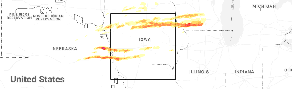
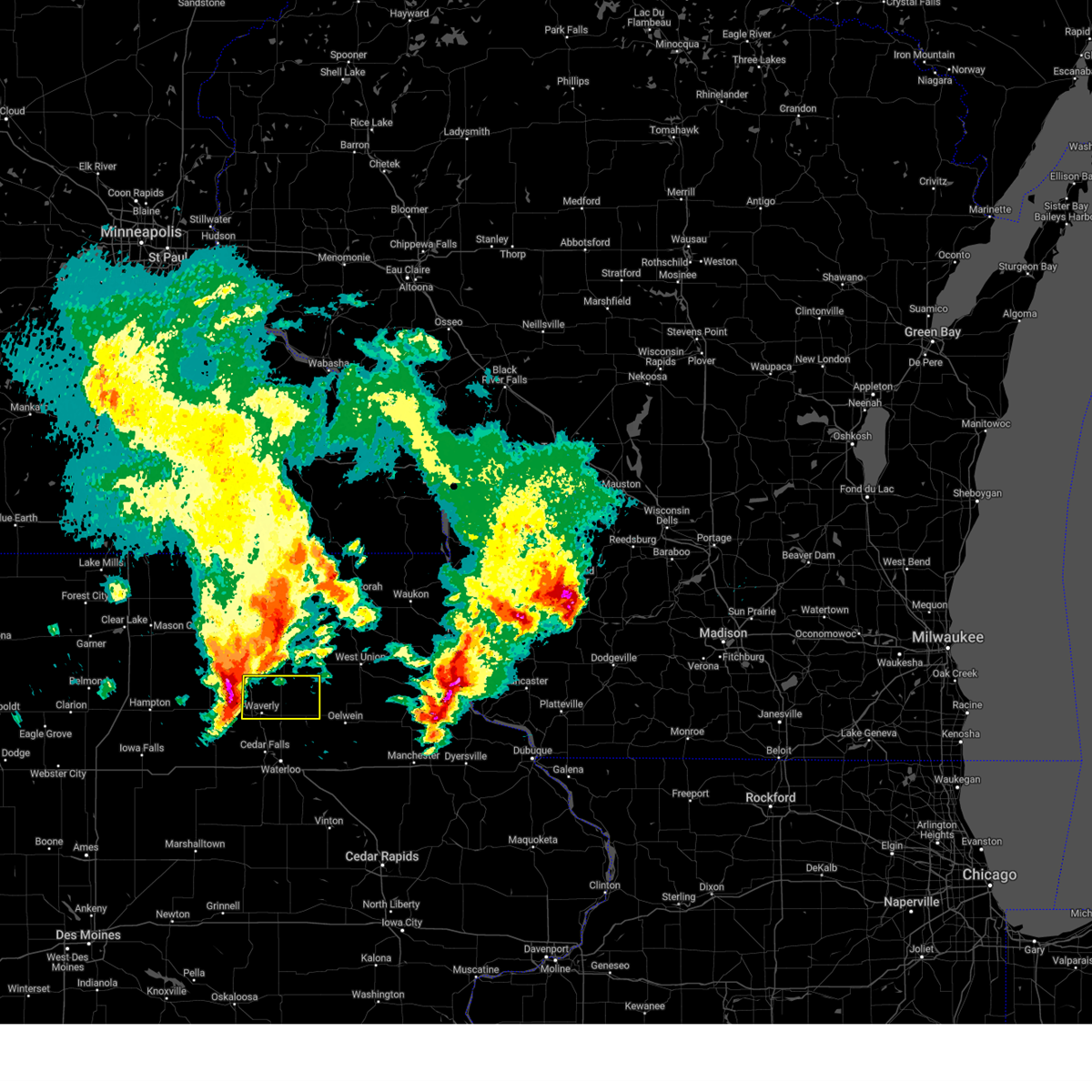
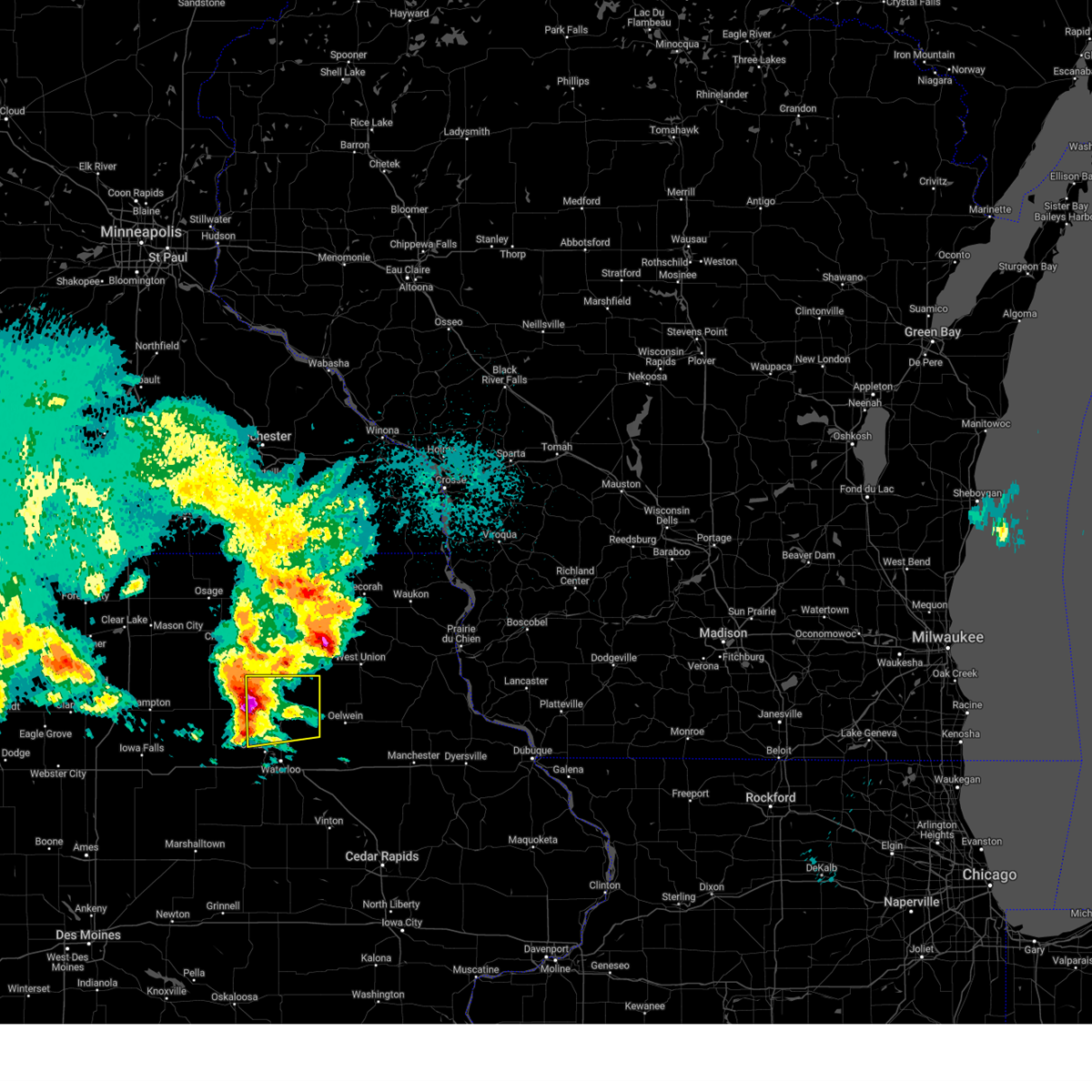
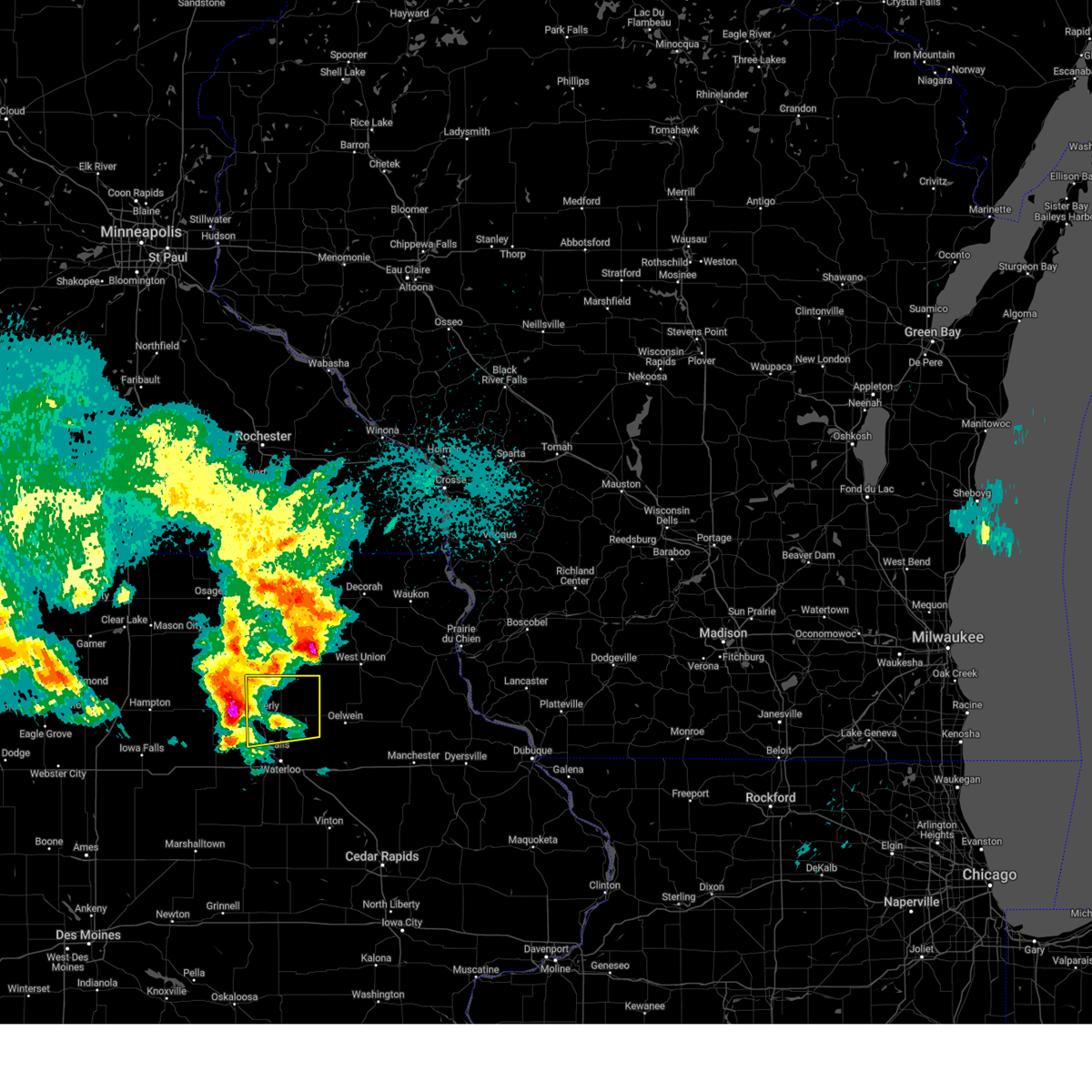
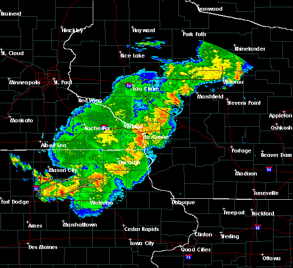
Hail Map for Tripoli, IA
The Tripoli, IA area has had 6 reports of on-the-ground hail by trained spotters, and has been under severe weather warnings 13 times during the past 12 months. Doppler radar has detected hail at or near Tripoli, IA on 47 occasions, including 2 occasions during the past year.
| Name: | Tripoli, IA |
| Where Located: | 53.7 miles ESE of Mason City, IA |
| Map: | Google Map for Tripoli, IA |
| Population: | 1313 |
| Housing Units: | 568 |
| More Info: | Search Google for Tripoli, IA |
5
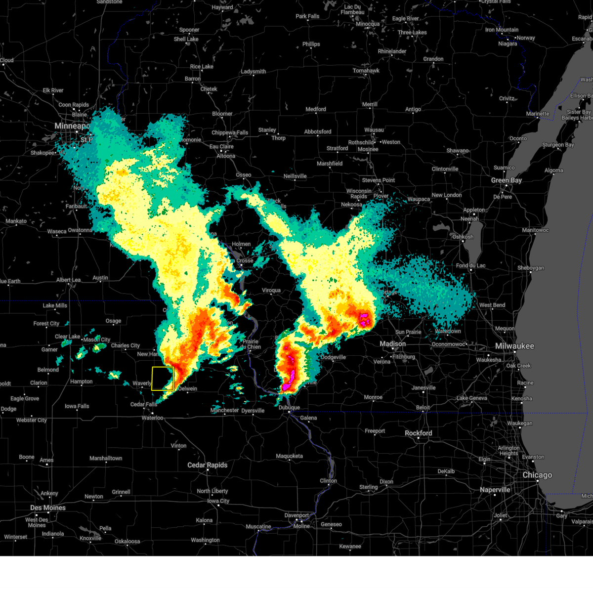
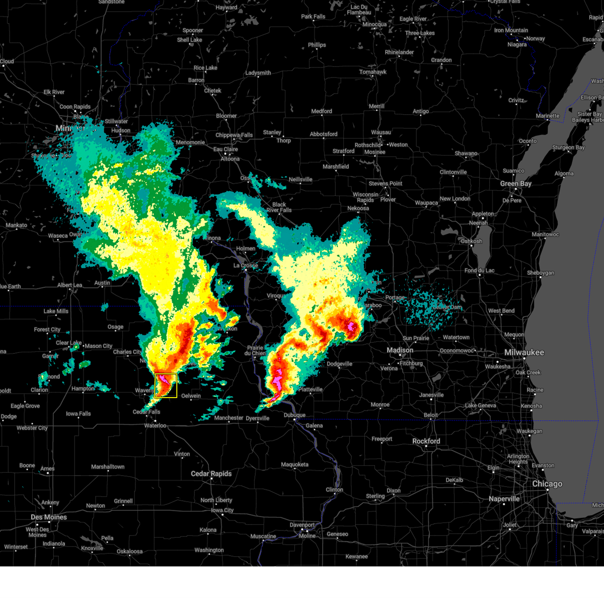
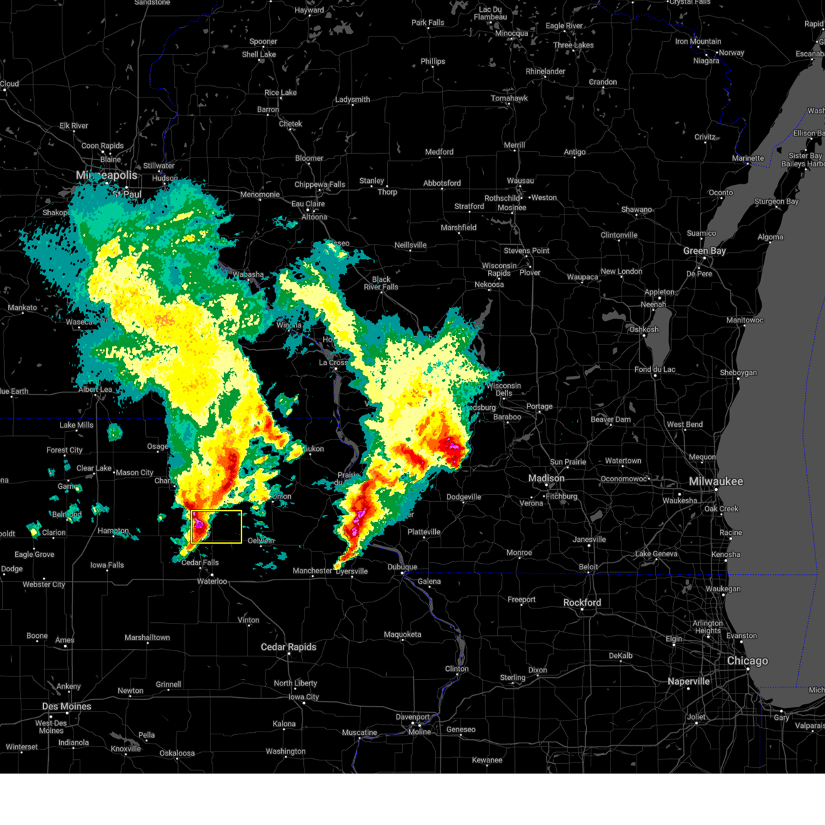
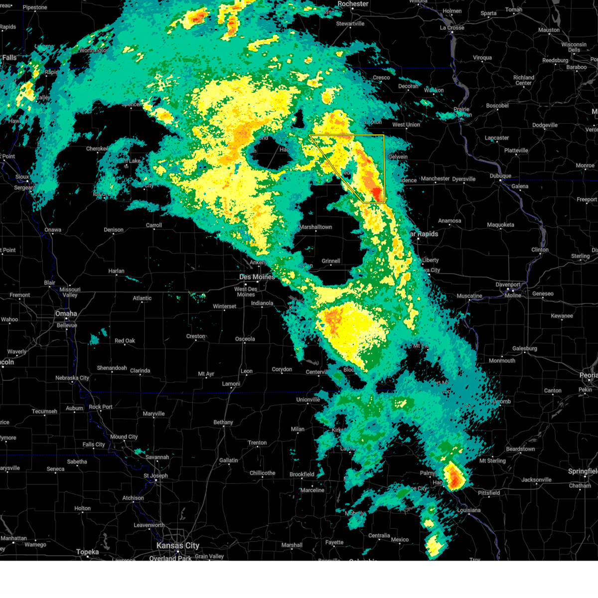
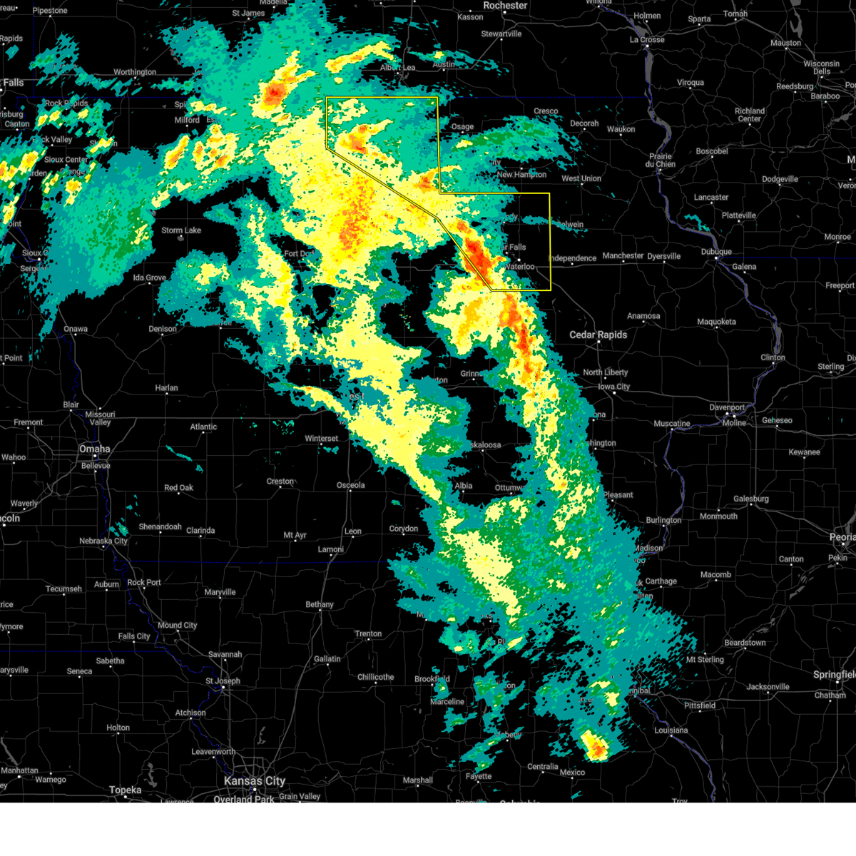
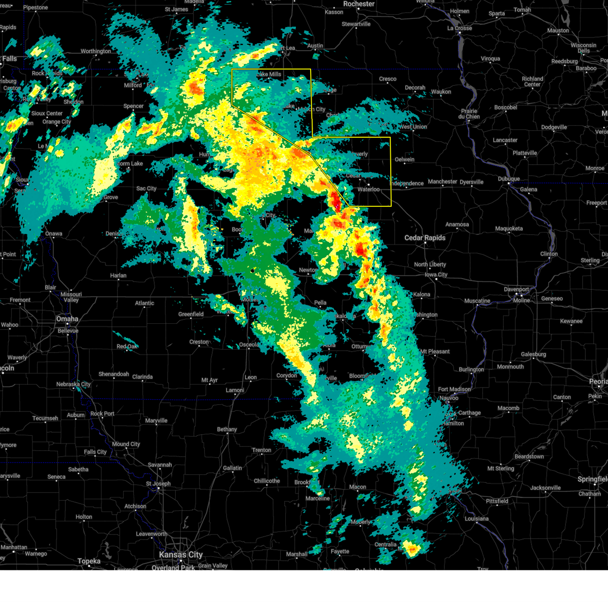
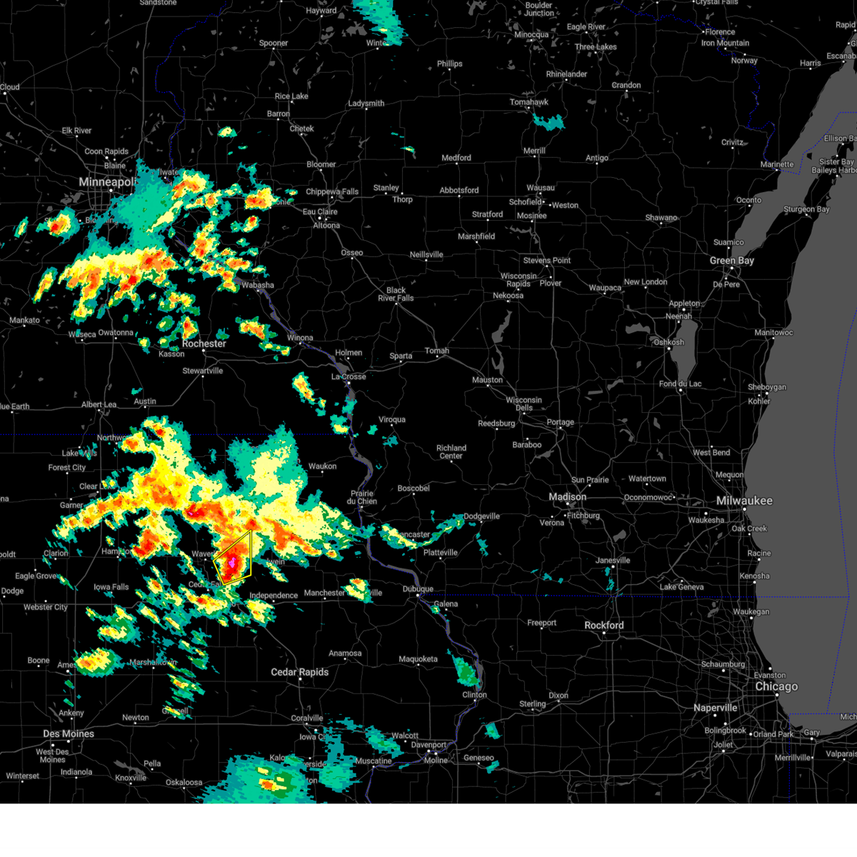
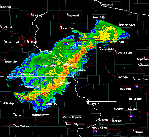
The Top Recent Hail Date for Tripoli, IA is Thursday, April 17, 2025 (1st out of 47)
Hail and Wind Damage Spotted near Tripoli, IA
| Date / Time | Report Details |
|---|---|
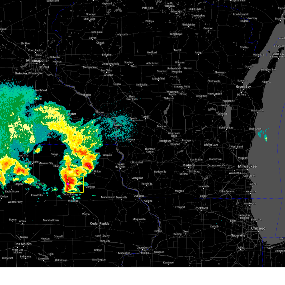
| 4/18/2025 5:43 AM CDT |
 the severe thunderstorm warning has been cancelled and is no longer in effect the severe thunderstorm warning has been cancelled and is no longer in effect
|
| 4/18/2025 5:31 AM CDT |
 At 531 am cdt, severe thunderstorms were located along a line extending from near fredericksburg to near tripoli to near denver, moving east at 65 mph (radar indicated). Hazards include 60 mph wind gusts and half dollar size hail. Hail damage to vehicles is expected. expect wind damage to roofs, siding, and trees. Locations impacted include, frederika, readlyn, sumner, and tripoli. At 531 am cdt, severe thunderstorms were located along a line extending from near fredericksburg to near tripoli to near denver, moving east at 65 mph (radar indicated). Hazards include 60 mph wind gusts and half dollar size hail. Hail damage to vehicles is expected. expect wind damage to roofs, siding, and trees. Locations impacted include, frederika, readlyn, sumner, and tripoli.
|
| 4/18/2025 5:22 AM CDT |
 the severe thunderstorm warning has been cancelled and is no longer in effect the severe thunderstorm warning has been cancelled and is no longer in effect
|
| 4/18/2025 5:22 AM CDT |
 At 521 am cdt, severe thunderstorms were located along a line extending from republic to 6 miles southwest of frederika to near waverly, moving east at 70 mph (radar indicated). Hazards include ping pong ball size hail and 60 mph wind gusts. People and animals outdoors will be injured. expect hail damage to roofs, siding, windows, and vehicles. expect wind damage to roofs, siding, and trees. Locations impacted include, frederika, waverly, readlyn, waverly municipal airport, sumner, and tripoli. At 521 am cdt, severe thunderstorms were located along a line extending from republic to 6 miles southwest of frederika to near waverly, moving east at 70 mph (radar indicated). Hazards include ping pong ball size hail and 60 mph wind gusts. People and animals outdoors will be injured. expect hail damage to roofs, siding, windows, and vehicles. expect wind damage to roofs, siding, and trees. Locations impacted include, frederika, waverly, readlyn, waverly municipal airport, sumner, and tripoli.
|
| 4/18/2025 5:09 AM CDT |
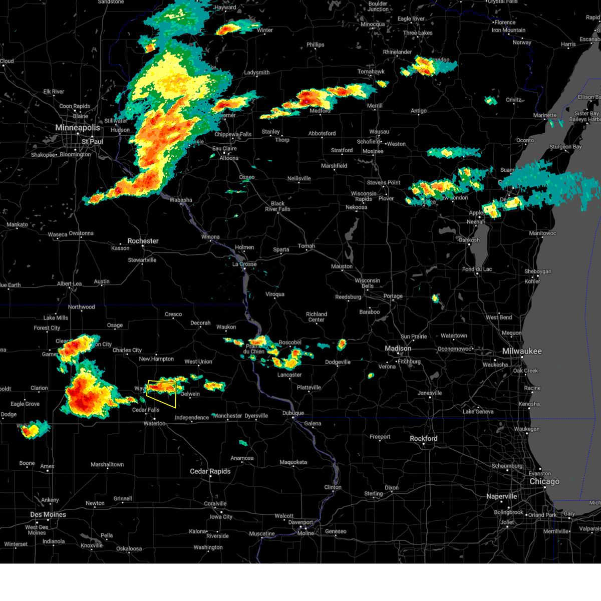
 Svrdmx the national weather service in des moines has issued a * severe thunderstorm warning for, bremer county in northeastern iowa, northeastern butler county in north central iowa, * until 600 am cdt. * at 508 am cdt, severe thunderstorms were located along a line extending from county roads b 60 and t 64 to near clarksville to 5 miles southeast of allison, moving east at 60 mph (radar indicated). Hazards include 60 mph wind gusts and half dollar size hail. Hail damage to vehicles is expected. Expect wind damage to roofs, siding, and trees. Svrdmx the national weather service in des moines has issued a * severe thunderstorm warning for, bremer county in northeastern iowa, northeastern butler county in north central iowa, * until 600 am cdt. * at 508 am cdt, severe thunderstorms were located along a line extending from county roads b 60 and t 64 to near clarksville to 5 miles southeast of allison, moving east at 60 mph (radar indicated). Hazards include 60 mph wind gusts and half dollar size hail. Hail damage to vehicles is expected. Expect wind damage to roofs, siding, and trees.
|
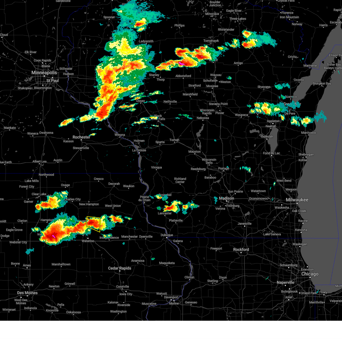
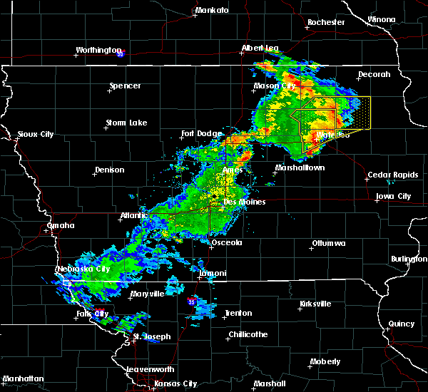
| 4/18/2025 4:06 AM CDT | Ping Pong Ball sized hail reported 0.7 miles SE of Tripoli, IA, numerous hailstones pictured with largest ping pong ball size. |
| 4/18/2025 4:02 AM CDT |
 At 401 am cdt, severe thunderstorms were located along a line extending from near republic to 5 miles west of tripoli to near denver, moving east at 55 mph (public reported golf ball sized hail between waverly and plainfield). Hazards include golf ball size hail and 60 mph wind gusts. People and animals outdoors will be injured. expect hail damage to roofs, siding, windows, and vehicles. expect wind damage to roofs, siding, and trees. Locations impacted include, janesville, readlyn, sumner, tripoli, denver, frederika, and waverly. At 401 am cdt, severe thunderstorms were located along a line extending from near republic to 5 miles west of tripoli to near denver, moving east at 55 mph (public reported golf ball sized hail between waverly and plainfield). Hazards include golf ball size hail and 60 mph wind gusts. People and animals outdoors will be injured. expect hail damage to roofs, siding, windows, and vehicles. expect wind damage to roofs, siding, and trees. Locations impacted include, janesville, readlyn, sumner, tripoli, denver, frederika, and waverly.
|
| 4/18/2025 4:02 AM CDT |
 the severe thunderstorm warning has been cancelled and is no longer in effect the severe thunderstorm warning has been cancelled and is no longer in effect
|
| 4/18/2025 3:49 AM CDT |
 At 348 am cdt, severe thunderstorms were located along a line extending from powersville to near clarksville to 4 miles north of new hartford, moving east at 55 mph (radar indicated). Hazards include tennis ball size hail and 60 mph wind gusts. People and animals outdoors will be injured. expect hail damage to roofs, siding, windows, and vehicles. expect wind damage to roofs, siding, and trees. Locations impacted include, janesville, waverly, readlyn, waverly municipal airport, sumner, plainfield, tripoli, denver, frederika, and cedar falls. At 348 am cdt, severe thunderstorms were located along a line extending from powersville to near clarksville to 4 miles north of new hartford, moving east at 55 mph (radar indicated). Hazards include tennis ball size hail and 60 mph wind gusts. People and animals outdoors will be injured. expect hail damage to roofs, siding, windows, and vehicles. expect wind damage to roofs, siding, and trees. Locations impacted include, janesville, waverly, readlyn, waverly municipal airport, sumner, plainfield, tripoli, denver, frederika, and cedar falls.
|
| 4/18/2025 3:45 AM CDT |
 Svrdmx the national weather service in des moines has issued a * severe thunderstorm warning for, northern black hawk county in northeastern iowa, bremer county in northeastern iowa, northeastern butler county in north central iowa, * until 430 am cdt. * at 344 am cdt, severe thunderstorms were located along a line extending from near powersville to clarksville to 5 miles northwest of new hartford, moving east at 55 mph (radar indicated). Hazards include golf ball size hail and 60 mph wind gusts. People and animals outdoors will be injured. expect hail damage to roofs, siding, windows, and vehicles. Expect wind damage to roofs, siding, and trees. Svrdmx the national weather service in des moines has issued a * severe thunderstorm warning for, northern black hawk county in northeastern iowa, bremer county in northeastern iowa, northeastern butler county in north central iowa, * until 430 am cdt. * at 344 am cdt, severe thunderstorms were located along a line extending from near powersville to clarksville to 5 miles northwest of new hartford, moving east at 55 mph (radar indicated). Hazards include golf ball size hail and 60 mph wind gusts. People and animals outdoors will be injured. expect hail damage to roofs, siding, windows, and vehicles. Expect wind damage to roofs, siding, and trees.
|
| 3/14/2025 8:01 PM CDT |
 the severe thunderstorm warning has been cancelled and is no longer in effect the severe thunderstorm warning has been cancelled and is no longer in effect
|
| 3/14/2025 8:01 PM CDT |
 At 800 pm cdt, severe thunderstorms were located along a line extending from lake mills municipal airport to floyd crossing to near dunkerton, moving north at 60 mph (radar indicated). Hazards include 60 mph wind gusts. Expect damage to roofs, siding, and trees. locations impacted include, clarksville, raymond, plainfield, dunkerton, waterloo, new hartford, george wyth state park, crossroads mall, allison municipal airport, readlyn, waverly municipal airport, sumner, tripoli, denver, evansdale, shell rock, cedar falls, janesville, elk run heights, and hudson. This includes interstate 380 between mile markers 57 and 73. At 800 pm cdt, severe thunderstorms were located along a line extending from lake mills municipal airport to floyd crossing to near dunkerton, moving north at 60 mph (radar indicated). Hazards include 60 mph wind gusts. Expect damage to roofs, siding, and trees. locations impacted include, clarksville, raymond, plainfield, dunkerton, waterloo, new hartford, george wyth state park, crossroads mall, allison municipal airport, readlyn, waverly municipal airport, sumner, tripoli, denver, evansdale, shell rock, cedar falls, janesville, elk run heights, and hudson. This includes interstate 380 between mile markers 57 and 73.
|
| 3/14/2025 7:24 PM CDT |
 At 722 pm cdt, severe thunderstorms were located along a line extending from near crystal lake to near dougherty to near hudson, moving north at 60 mph (trained weather spotters. at 720pm, a trained spotter reported a wind gust of 71mph in grundy center). Hazards include 70 mph wind gusts. Expect considerable tree damage. damage is likely to mobile homes, roofs, and outbuildings. locations impacted include, clarksville, lake mills municipal airport, mcintosh woods state park, forest city municipal airport, plainfield, grafton, waterloo, george wyth state park, buffalo center, mason city, readlyn, eagle lake state park, kensett, ventura, evansdale, thompson, dike, cedar falls, hayfield, and janesville. this includes the following highways, interstate 35 between mile markers 177 and 218. Interstate 380 between mile markers 57 and 73. At 722 pm cdt, severe thunderstorms were located along a line extending from near crystal lake to near dougherty to near hudson, moving north at 60 mph (trained weather spotters. at 720pm, a trained spotter reported a wind gust of 71mph in grundy center). Hazards include 70 mph wind gusts. Expect considerable tree damage. damage is likely to mobile homes, roofs, and outbuildings. locations impacted include, clarksville, lake mills municipal airport, mcintosh woods state park, forest city municipal airport, plainfield, grafton, waterloo, george wyth state park, buffalo center, mason city, readlyn, eagle lake state park, kensett, ventura, evansdale, thompson, dike, cedar falls, hayfield, and janesville. this includes the following highways, interstate 35 between mile markers 177 and 218. Interstate 380 between mile markers 57 and 73.
|
| 3/14/2025 7:11 PM CDT |
 Svrdmx the national weather service in des moines has issued a * severe thunderstorm warning for, black hawk county in northeastern iowa, worth county in north central iowa, bremer county in northeastern iowa, northeastern franklin county in north central iowa, northern hancock county in north central iowa, northeastern grundy county in central iowa, butler county in north central iowa, cerro gordo county in north central iowa, winnebago county in north central iowa, * until 815 pm cdt. * at 710 pm cdt, severe thunderstorms were located along a line extending from near eagle lake state park to aredale to 6 miles north of tf clark state park, moving northeast at 45 mph (radar indicated). Hazards include 60 mph wind gusts. expect damage to roofs, siding, and trees Svrdmx the national weather service in des moines has issued a * severe thunderstorm warning for, black hawk county in northeastern iowa, worth county in north central iowa, bremer county in northeastern iowa, northeastern franklin county in north central iowa, northern hancock county in north central iowa, northeastern grundy county in central iowa, butler county in north central iowa, cerro gordo county in north central iowa, winnebago county in north central iowa, * until 815 pm cdt. * at 710 pm cdt, severe thunderstorms were located along a line extending from near eagle lake state park to aredale to 6 miles north of tf clark state park, moving northeast at 45 mph (radar indicated). Hazards include 60 mph wind gusts. expect damage to roofs, siding, and trees
|
| 6/18/2024 10:46 PM CDT |
 the severe thunderstorm warning has been cancelled and is no longer in effect the severe thunderstorm warning has been cancelled and is no longer in effect
|
| 6/18/2024 10:34 PM CDT |
 At 1034 pm cdt, severe thunderstorms were located along a line extending from near highway 18 and county v 56 to near gilbertville to near vining, moving east at 45 mph (radar indicated). Hazards include 60 mph wind gusts. Expect damage to roofs, siding, and trees. locations impacted include, waterloo, evansdale, jesup, la porte city, sumner, denver, dysart, tripoli, elk run heights, crossroads mall, washburn, dunkerton, readlyn, raymond, gilbertville, chelsea, clutier, elberon, frederika, and vining. This includes interstate 380 between mile markers 56 and 73. At 1034 pm cdt, severe thunderstorms were located along a line extending from near highway 18 and county v 56 to near gilbertville to near vining, moving east at 45 mph (radar indicated). Hazards include 60 mph wind gusts. Expect damage to roofs, siding, and trees. locations impacted include, waterloo, evansdale, jesup, la porte city, sumner, denver, dysart, tripoli, elk run heights, crossroads mall, washburn, dunkerton, readlyn, raymond, gilbertville, chelsea, clutier, elberon, frederika, and vining. This includes interstate 380 between mile markers 56 and 73.
|
| 6/18/2024 10:15 PM CDT |
 Svrdmx the national weather service in des moines has issued a * severe thunderstorm warning for, black hawk county in northeastern iowa, eastern tama county in central iowa, bremer county in northeastern iowa, * until 1100 pm cdt. * at 1015 pm cdt, severe thunderstorms were located along a line extending from near republic to 5 miles south of hudson to near tama, moving east at 45 mph (radar indicated). Hazards include 60 mph wind gusts. expect damage to roofs, siding, and trees Svrdmx the national weather service in des moines has issued a * severe thunderstorm warning for, black hawk county in northeastern iowa, eastern tama county in central iowa, bremer county in northeastern iowa, * until 1100 pm cdt. * at 1015 pm cdt, severe thunderstorms were located along a line extending from near republic to 5 miles south of hudson to near tama, moving east at 45 mph (radar indicated). Hazards include 60 mph wind gusts. expect damage to roofs, siding, and trees
|
| 5/24/2024 6:47 AM CDT |
 the severe thunderstorm warning has been cancelled and is no longer in effect the severe thunderstorm warning has been cancelled and is no longer in effect
|
| 5/24/2024 6:38 AM CDT |
 the severe thunderstorm warning has been cancelled and is no longer in effect the severe thunderstorm warning has been cancelled and is no longer in effect
|
| 5/24/2024 6:38 AM CDT |
 At 638 am cdt, severe thunderstorms were located along a line extending from near twin ponds park to near jesup to 4 miles south of benton county fairgrounds, moving east at 50 mph (radar indicated). Hazards include 60 mph wind gusts and penny size hail. Expect damage to roofs, siding, and trees. locations impacted include, waterloo, cedar falls, waverly, evansdale, jesup, la porte city, sumner, denver, tripoli, elk run heights, waterloo municipal airport, crossroads mall, washburn, dunkerton, readlyn, raymond, gilbertville, frederika, and george wyth state park. This includes interstate 380 between mile markers 56 and 73. At 638 am cdt, severe thunderstorms were located along a line extending from near twin ponds park to near jesup to 4 miles south of benton county fairgrounds, moving east at 50 mph (radar indicated). Hazards include 60 mph wind gusts and penny size hail. Expect damage to roofs, siding, and trees. locations impacted include, waterloo, cedar falls, waverly, evansdale, jesup, la porte city, sumner, denver, tripoli, elk run heights, waterloo municipal airport, crossroads mall, washburn, dunkerton, readlyn, raymond, gilbertville, frederika, and george wyth state park. This includes interstate 380 between mile markers 56 and 73.
|
| 5/24/2024 6:30 AM CDT |
 the severe thunderstorm warning has been cancelled and is no longer in effect the severe thunderstorm warning has been cancelled and is no longer in effect
|
| 5/24/2024 6:30 AM CDT |
 At 630 am cdt, severe thunderstorms were located along a line extending from bradford to gilbertville to 4 miles northwest of van horne, moving east at 50 mph (radar indicated). Hazards include 60 mph wind gusts and penny size hail. Expect damage to roofs, siding, and trees. locations impacted include, waterloo, cedar falls, waverly, evansdale, jesup, la porte city, hudson, sumner, denver, traer, dysart, tripoli, elk run heights, crossroads mall, waterloo municipal airport, uni-dome and mcleod center, janesville, washburn, dunkerton, and readlyn. This includes interstate 380 between mile markers 56 and 73. At 630 am cdt, severe thunderstorms were located along a line extending from bradford to gilbertville to 4 miles northwest of van horne, moving east at 50 mph (radar indicated). Hazards include 60 mph wind gusts and penny size hail. Expect damage to roofs, siding, and trees. locations impacted include, waterloo, cedar falls, waverly, evansdale, jesup, la porte city, hudson, sumner, denver, traer, dysart, tripoli, elk run heights, crossroads mall, waterloo municipal airport, uni-dome and mcleod center, janesville, washburn, dunkerton, and readlyn. This includes interstate 380 between mile markers 56 and 73.
|
| 5/24/2024 6:16 AM CDT |
 the severe thunderstorm warning has been cancelled and is no longer in effect the severe thunderstorm warning has been cancelled and is no longer in effect
|
| 5/24/2024 6:16 AM CDT |
 At 616 am cdt, severe thunderstorms were located along a line extending from powersville to 4 miles south of hudson to elberon, moving east at 50 mph (radar indicated). Hazards include 60 mph wind gusts and penny size hail. Expect damage to roofs, siding, and trees. locations impacted include, waterloo, cedar falls, waverly, toledo, allison, evansdale, tama, jesup, la porte city, hudson, sumner, parkersburg, denver, traer, reinbeck, clarksville, dysart, tripoli, shell rock, and dike. This includes interstate 380 between mile markers 56 and 73. At 616 am cdt, severe thunderstorms were located along a line extending from powersville to 4 miles south of hudson to elberon, moving east at 50 mph (radar indicated). Hazards include 60 mph wind gusts and penny size hail. Expect damage to roofs, siding, and trees. locations impacted include, waterloo, cedar falls, waverly, toledo, allison, evansdale, tama, jesup, la porte city, hudson, sumner, parkersburg, denver, traer, reinbeck, clarksville, dysart, tripoli, shell rock, and dike. This includes interstate 380 between mile markers 56 and 73.
|
| 5/24/2024 5:57 AM CDT |
 Svrdmx the national weather service in des moines has issued a * severe thunderstorm warning for, northern poweshiek county in central iowa, eastern marshall county in central iowa, northeastern hardin county in central iowa, black hawk county in northeastern iowa, tama county in central iowa, bremer county in northeastern iowa, eastern franklin county in north central iowa, grundy county in central iowa, butler county in north central iowa, northeastern jasper county in central iowa, * until 700 am cdt. * at 556 am cdt, severe thunderstorms were located along a line extending from aredale to lincoln to near tama, moving east at 50 mph (public). Hazards include 60 mph wind gusts and quarter size hail. Hail damage to vehicles is expected. Expect wind damage to roofs, siding, and trees. Svrdmx the national weather service in des moines has issued a * severe thunderstorm warning for, northern poweshiek county in central iowa, eastern marshall county in central iowa, northeastern hardin county in central iowa, black hawk county in northeastern iowa, tama county in central iowa, bremer county in northeastern iowa, eastern franklin county in north central iowa, grundy county in central iowa, butler county in north central iowa, northeastern jasper county in central iowa, * until 700 am cdt. * at 556 am cdt, severe thunderstorms were located along a line extending from aredale to lincoln to near tama, moving east at 50 mph (public). Hazards include 60 mph wind gusts and quarter size hail. Hail damage to vehicles is expected. Expect wind damage to roofs, siding, and trees.
|
| 5/24/2024 5:50 AM CDT |
 The storm which prompted the warning has moved out of the area. therefore, the warning will be allowed to expire. however, gusty winds are still possible with this thunderstorm. a severe thunderstorm watch remains in effect until 1000 am cdt for northeastern iowa. The storm which prompted the warning has moved out of the area. therefore, the warning will be allowed to expire. however, gusty winds are still possible with this thunderstorm. a severe thunderstorm watch remains in effect until 1000 am cdt for northeastern iowa.
|
| 5/24/2024 5:39 AM CDT |
 At 538 am cdt, a severe thunderstorm was located near frederika, or 13 miles south of new hampton, moving north at 30 mph (radar indicated). Hazards include 60 mph wind gusts and quarter size hail. Hail damage to vehicles is expected. expect wind damage to roofs, siding, and trees. This severe thunderstorm will remain over mainly rural areas of northeastern bremer county, including the following locations, frederika. At 538 am cdt, a severe thunderstorm was located near frederika, or 13 miles south of new hampton, moving north at 30 mph (radar indicated). Hazards include 60 mph wind gusts and quarter size hail. Hail damage to vehicles is expected. expect wind damage to roofs, siding, and trees. This severe thunderstorm will remain over mainly rural areas of northeastern bremer county, including the following locations, frederika.
|
| 5/24/2024 5:39 AM CDT |
 the severe thunderstorm warning has been cancelled and is no longer in effect the severe thunderstorm warning has been cancelled and is no longer in effect
|
| 5/24/2024 5:04 AM CDT |
 Svrdmx the national weather service in des moines has issued a * severe thunderstorm warning for, northeastern black hawk county in northeastern iowa, bremer county in northeastern iowa, * until 600 am cdt. * at 504 am cdt, a severe thunderstorm was located 5 miles northwest of dunkerton, or 10 miles northeast of waterloo, moving north at 30 mph (broadcast media). Hazards include golf ball size hail and 60 mph wind gusts. People and animals outdoors will be injured. expect hail damage to roofs, siding, windows, and vehicles. expect wind damage to roofs, siding, and trees. this severe thunderstorm will be near, readlyn around 510 am cdt. tripoli around 520 am cdt. Other locations impacted by this severe thunderstorm include frederika, readlyn, and dunkerton. Svrdmx the national weather service in des moines has issued a * severe thunderstorm warning for, northeastern black hawk county in northeastern iowa, bremer county in northeastern iowa, * until 600 am cdt. * at 504 am cdt, a severe thunderstorm was located 5 miles northwest of dunkerton, or 10 miles northeast of waterloo, moving north at 30 mph (broadcast media). Hazards include golf ball size hail and 60 mph wind gusts. People and animals outdoors will be injured. expect hail damage to roofs, siding, windows, and vehicles. expect wind damage to roofs, siding, and trees. this severe thunderstorm will be near, readlyn around 510 am cdt. tripoli around 520 am cdt. Other locations impacted by this severe thunderstorm include frederika, readlyn, and dunkerton.
|
| 5/21/2024 6:27 PM CDT |
 The storm which prompted the warning has moved out of the area. therefore, the warning will be allowed to expire. a tornado watch remains in effect until 900 pm cdt for northeastern iowa. The storm which prompted the warning has moved out of the area. therefore, the warning will be allowed to expire. a tornado watch remains in effect until 900 pm cdt for northeastern iowa.
|
| 5/21/2024 6:18 PM CDT |
 At 617 pm cdt, a severe thunderstorm was located over readlyn, or 13 miles west of oelwein, moving northeast at 45 mph (radar indicated). Hazards include 70 mph wind gusts and quarter size hail. Hail damage to vehicles is expected. expect considerable tree damage. wind damage is also likely to mobile homes, roofs, and outbuildings. Locations impacted include, waterloo, sumner, denver, tripoli, dunkerton, readlyn, and frederika. At 617 pm cdt, a severe thunderstorm was located over readlyn, or 13 miles west of oelwein, moving northeast at 45 mph (radar indicated). Hazards include 70 mph wind gusts and quarter size hail. Hail damage to vehicles is expected. expect considerable tree damage. wind damage is also likely to mobile homes, roofs, and outbuildings. Locations impacted include, waterloo, sumner, denver, tripoli, dunkerton, readlyn, and frederika.
|
| 5/21/2024 5:48 PM CDT |
 Svrdmx the national weather service in des moines has issued a * severe thunderstorm warning for, northern black hawk county in northeastern iowa, bremer county in northeastern iowa, * until 630 pm cdt. * at 547 pm cdt, a severe thunderstorm was located near dike, or 5 miles southwest of cedar falls, moving northeast at 75 mph (radar indicated). Hazards include 70 mph wind gusts and quarter size hail. Hail damage to vehicles is expected. expect considerable tree damage. Wind damage is also likely to mobile homes, roofs, and outbuildings. Svrdmx the national weather service in des moines has issued a * severe thunderstorm warning for, northern black hawk county in northeastern iowa, bremer county in northeastern iowa, * until 630 pm cdt. * at 547 pm cdt, a severe thunderstorm was located near dike, or 5 miles southwest of cedar falls, moving northeast at 75 mph (radar indicated). Hazards include 70 mph wind gusts and quarter size hail. Hail damage to vehicles is expected. expect considerable tree damage. Wind damage is also likely to mobile homes, roofs, and outbuildings.
|
| 5/21/2024 3:42 AM CDT |
 The storm which prompted the warning has moved out of the area. therefore, the warning will be allowed to expire. however, gusty winds are still possible with this thunderstorm. The storm which prompted the warning has moved out of the area. therefore, the warning will be allowed to expire. however, gusty winds are still possible with this thunderstorm.
|
| 5/21/2024 3:29 AM CDT |
 At 329 am cdt, a severe thunderstorm was located near sumner, or 15 miles northwest of oelwein, moving northeast at 50 mph (radar indicated). Hazards include 60 mph wind gusts and penny size hail. Expect damage to roofs, siding, and trees. Locations impacted include, sumner, tripoli, readlyn, and frederika. At 329 am cdt, a severe thunderstorm was located near sumner, or 15 miles northwest of oelwein, moving northeast at 50 mph (radar indicated). Hazards include 60 mph wind gusts and penny size hail. Expect damage to roofs, siding, and trees. Locations impacted include, sumner, tripoli, readlyn, and frederika.
|
| 5/21/2024 3:29 AM CDT |
 the severe thunderstorm warning has been cancelled and is no longer in effect the severe thunderstorm warning has been cancelled and is no longer in effect
|
| 5/21/2024 3:07 AM CDT |
 At 306 am cdt, a severe thunderstorm was located near denver, or 8 miles northeast of cedar falls, moving northeast at 50 mph (radar indicated. at 305 am 70 mph wind was observed at the waterloo airport). Hazards include 70 mph wind gusts and penny size hail. Expect considerable tree damage. damage is likely to mobile homes, roofs, and outbuildings. locations impacted include, waterloo, cedar falls, waverly, evansdale, hudson, sumner, denver, tripoli, shell rock, elk run heights, waterloo municipal airport, crossroads mall, uni-dome and mcleod center, janesville, dunkerton, readlyn, raymond, frederika, george wyth state park, and waverly municipal airport. This includes interstate 380 between mile markers 67 and 73. At 306 am cdt, a severe thunderstorm was located near denver, or 8 miles northeast of cedar falls, moving northeast at 50 mph (radar indicated. at 305 am 70 mph wind was observed at the waterloo airport). Hazards include 70 mph wind gusts and penny size hail. Expect considerable tree damage. damage is likely to mobile homes, roofs, and outbuildings. locations impacted include, waterloo, cedar falls, waverly, evansdale, hudson, sumner, denver, tripoli, shell rock, elk run heights, waterloo municipal airport, crossroads mall, uni-dome and mcleod center, janesville, dunkerton, readlyn, raymond, frederika, george wyth state park, and waverly municipal airport. This includes interstate 380 between mile markers 67 and 73.
|
| 5/21/2024 2:56 AM CDT |
 Svrdmx the national weather service in des moines has issued a * severe thunderstorm warning for, northern black hawk county in northeastern iowa, bremer county in northeastern iowa, southeastern butler county in north central iowa, * until 345 am cdt. * at 256 am cdt, a severe thunderstorm was located over the uni-dome and mcleod center, or over cedar falls, moving northeast at 50 mph (radar indicated). Hazards include 60 mph wind gusts and penny size hail. expect damage to roofs, siding, and trees Svrdmx the national weather service in des moines has issued a * severe thunderstorm warning for, northern black hawk county in northeastern iowa, bremer county in northeastern iowa, southeastern butler county in north central iowa, * until 345 am cdt. * at 256 am cdt, a severe thunderstorm was located over the uni-dome and mcleod center, or over cedar falls, moving northeast at 50 mph (radar indicated). Hazards include 60 mph wind gusts and penny size hail. expect damage to roofs, siding, and trees
|
| 4/16/2024 2:25 PM CDT |
 At 224 pm cdt, a severe thunderstorm was located 5 miles east of plainfield, or 10 miles north of waverly, moving northeast at 50 mph (radar indicated). Hazards include 60 mph wind gusts. Expect damage to roofs, siding, and trees. locations impacted include, waterloo, cedar falls, waverly, allison, evansdale, hudson, sumner, denver, clarksville, tripoli, shell rock, greene, waterloo municipal airport, crossroads mall, uni-dome and mcleod center, janesville, readlyn, new hartford, plainfield, and frederika. This includes interstate 380 between mile markers 72 and 73. At 224 pm cdt, a severe thunderstorm was located 5 miles east of plainfield, or 10 miles north of waverly, moving northeast at 50 mph (radar indicated). Hazards include 60 mph wind gusts. Expect damage to roofs, siding, and trees. locations impacted include, waterloo, cedar falls, waverly, allison, evansdale, hudson, sumner, denver, clarksville, tripoli, shell rock, greene, waterloo municipal airport, crossroads mall, uni-dome and mcleod center, janesville, readlyn, new hartford, plainfield, and frederika. This includes interstate 380 between mile markers 72 and 73.
|
| 4/16/2024 2:05 PM CDT |
 Svrdmx the national weather service in des moines has issued a * severe thunderstorm warning for, western black hawk county in northeastern iowa, bremer county in northeastern iowa, northern grundy county in central iowa, butler county in north central iowa, * until 245 pm cdt. * at 204 pm cdt, a severe thunderstorm was located near new hartford, or 8 miles southwest of waverly, moving northeast at 50 mph (radar indicated). Hazards include 60 mph wind gusts. expect damage to roofs, siding, and trees Svrdmx the national weather service in des moines has issued a * severe thunderstorm warning for, western black hawk county in northeastern iowa, bremer county in northeastern iowa, northern grundy county in central iowa, butler county in north central iowa, * until 245 pm cdt. * at 204 pm cdt, a severe thunderstorm was located near new hartford, or 8 miles southwest of waverly, moving northeast at 50 mph (radar indicated). Hazards include 60 mph wind gusts. expect damage to roofs, siding, and trees
|
| 7/28/2023 6:57 PM CDT |
 The severe thunderstorm warning for northeastern black hawk and southeastern bremer counties will expire at 700 pm cdt, the storm which prompted the warning has weakened below severe limits, and no longer poses an immediate threat to life or property. therefore, the warning will be allowed to expire. however heavy rain is still possible with this thunderstorm. a severe thunderstorm watch remains in effect until midnight cdt for northeastern iowa. The severe thunderstorm warning for northeastern black hawk and southeastern bremer counties will expire at 700 pm cdt, the storm which prompted the warning has weakened below severe limits, and no longer poses an immediate threat to life or property. therefore, the warning will be allowed to expire. however heavy rain is still possible with this thunderstorm. a severe thunderstorm watch remains in effect until midnight cdt for northeastern iowa.
|
| 7/28/2023 6:32 PM CDT |
 At 631 pm cdt, a severe thunderstorm was located over readlyn, or 11 miles east of waverly, moving east at 5 mph (trained weather spotters reported hail up to baseball sized around 623 pm). Hazards include two inch hail and 60 mph wind gusts. People and animals outdoors will be injured. expect hail damage to roofs, siding, windows, and vehicles. expect wind damage to roofs, siding, and trees. locations impacted include, denver, tripoli and readlyn. thunderstorm damage threat, considerable hail threat, observed max hail size, 2. 00 in wind threat, radar indicated max wind gust, 60 mph. At 631 pm cdt, a severe thunderstorm was located over readlyn, or 11 miles east of waverly, moving east at 5 mph (trained weather spotters reported hail up to baseball sized around 623 pm). Hazards include two inch hail and 60 mph wind gusts. People and animals outdoors will be injured. expect hail damage to roofs, siding, windows, and vehicles. expect wind damage to roofs, siding, and trees. locations impacted include, denver, tripoli and readlyn. thunderstorm damage threat, considerable hail threat, observed max hail size, 2. 00 in wind threat, radar indicated max wind gust, 60 mph.
|
| 7/28/2023 6:20 PM CDT | Half Dollar sized hail reported 4.4 miles N of Tripoli, IA, report from mping of half dollar (1.25 in.). |
| 7/28/2023 6:05 PM CDT | Half Dollar sized hail reported 4.4 miles N of Tripoli, IA, delayed report - hail up to half dollar sized. |
| 7/28/2023 5:53 PM CDT |
 At 553 pm cdt, a severe thunderstorm was located near tripoli, or 7 miles east of waverly, moving east at 15 mph (radar indicated). Hazards include 60 mph wind gusts and quarter size hail. Hail damage to vehicles is expected. expect wind damage to roofs, siding, and trees. this severe thunderstorm will be near, tripoli around 605 pm cdt. Other locations in the path of this severe thunderstorm include readlyn. At 553 pm cdt, a severe thunderstorm was located near tripoli, or 7 miles east of waverly, moving east at 15 mph (radar indicated). Hazards include 60 mph wind gusts and quarter size hail. Hail damage to vehicles is expected. expect wind damage to roofs, siding, and trees. this severe thunderstorm will be near, tripoli around 605 pm cdt. Other locations in the path of this severe thunderstorm include readlyn.
|
| 7/13/2023 10:23 PM CDT |
 At 1023 pm cdt, a severe thunderstorm was located near sumner, or 14 miles southeast of new hampton, moving southeast at 35 mph (radar indicated). Hazards include quarter size hail. Damage to vehicles is expected. this severe thunderstorm will be near, sumner around 1030 pm cdt. hail threat, radar indicated max hail size, 1. 00 in wind threat, radar indicated max wind gust, <50 mph. At 1023 pm cdt, a severe thunderstorm was located near sumner, or 14 miles southeast of new hampton, moving southeast at 35 mph (radar indicated). Hazards include quarter size hail. Damage to vehicles is expected. this severe thunderstorm will be near, sumner around 1030 pm cdt. hail threat, radar indicated max hail size, 1. 00 in wind threat, radar indicated max wind gust, <50 mph.
|
| 6/24/2023 5:12 PM CDT |
 At 512 pm cdt, a severe thunderstorm was located over readlyn, or 12 miles east of waverly, moving northeast at 35 mph (radar indicated). Hazards include ping pong ball size hail and 60 mph wind gusts. People and animals outdoors will be injured. expect hail damage to roofs, siding, windows, and vehicles. expect wind damage to roofs, siding, and trees. locations impacted include, sumner. hail threat, radar indicated max hail size, 1. 50 in wind threat, radar indicated max wind gust, 60 mph. At 512 pm cdt, a severe thunderstorm was located over readlyn, or 12 miles east of waverly, moving northeast at 35 mph (radar indicated). Hazards include ping pong ball size hail and 60 mph wind gusts. People and animals outdoors will be injured. expect hail damage to roofs, siding, windows, and vehicles. expect wind damage to roofs, siding, and trees. locations impacted include, sumner. hail threat, radar indicated max hail size, 1. 50 in wind threat, radar indicated max wind gust, 60 mph.
|
| 6/24/2023 4:58 PM CDT |
 At 457 pm cdt, a severe thunderstorm was located over denver, or 5 miles southeast of waverly, moving northeast at 30 mph (radar indicated). Hazards include 60 mph wind gusts and half dollar size hail. Hail damage to vehicles is expected. expect wind damage to roofs, siding, and trees. this severe thunderstorm will be near, denver around 500 pm cdt. readlyn around 510 pm cdt. tripoli around 515 pm cdt. other locations in the path of this severe thunderstorm include sumner. hail threat, radar indicated max hail size, 1. 25 in wind threat, radar indicated max wind gust, 60 mph. At 457 pm cdt, a severe thunderstorm was located over denver, or 5 miles southeast of waverly, moving northeast at 30 mph (radar indicated). Hazards include 60 mph wind gusts and half dollar size hail. Hail damage to vehicles is expected. expect wind damage to roofs, siding, and trees. this severe thunderstorm will be near, denver around 500 pm cdt. readlyn around 510 pm cdt. tripoli around 515 pm cdt. other locations in the path of this severe thunderstorm include sumner. hail threat, radar indicated max hail size, 1. 25 in wind threat, radar indicated max wind gust, 60 mph.
|
| 7/5/2022 8:57 PM CDT |
 The severe thunderstorm warning for black hawk, bremer, northeastern grundy and southeastern butler counties will expire at 900 pm cdt, the storms which prompted the warning have moved out of the area. therefore, the warning will be allowed to expire. a severe thunderstorm watch remains in effect until 1000 pm cdt for central, north central and northeastern iowa. The severe thunderstorm warning for black hawk, bremer, northeastern grundy and southeastern butler counties will expire at 900 pm cdt, the storms which prompted the warning have moved out of the area. therefore, the warning will be allowed to expire. a severe thunderstorm watch remains in effect until 1000 pm cdt for central, north central and northeastern iowa.
|
| 7/5/2022 8:24 PM CDT |
 At 824 pm cdt, severe thunderstorms were located along a line extending from 6 miles northwest of tripoli to near reinbeck, moving east at 50 mph (radar indicated). Hazards include 60 mph wind gusts. expect damage to roofs, siding, and trees At 824 pm cdt, severe thunderstorms were located along a line extending from 6 miles northwest of tripoli to near reinbeck, moving east at 50 mph (radar indicated). Hazards include 60 mph wind gusts. expect damage to roofs, siding, and trees
|
| 7/5/2022 8:10 PM CDT |
 At 810 pm cdt, severe thunderstorms were located along a line extending from near nashua to near conrad, moving east at 40 mph (radar indicated). Hazards include 60 mph wind gusts. Expect damage to roofs, siding, and trees. locations impacted include, waterloo, cedar falls, waverly, grundy center, allison, evansdale, jesup, la porte city, hudson, sumner, parkersburg, denver, reinbeck, clarksville, tripoli, shell rock, dike, aplington, elk run heights and conrad. hail threat, radar indicated max hail size, <. 75 in wind threat, radar indicated max wind gust, 60 mph. At 810 pm cdt, severe thunderstorms were located along a line extending from near nashua to near conrad, moving east at 40 mph (radar indicated). Hazards include 60 mph wind gusts. Expect damage to roofs, siding, and trees. locations impacted include, waterloo, cedar falls, waverly, grundy center, allison, evansdale, jesup, la porte city, hudson, sumner, parkersburg, denver, reinbeck, clarksville, tripoli, shell rock, dike, aplington, elk run heights and conrad. hail threat, radar indicated max hail size, <. 75 in wind threat, radar indicated max wind gust, 60 mph.
|
| 7/5/2022 7:31 PM CDT |
 At 730 pm cdt, severe thunderstorms were located along a line extending from 7 miles east of sheffield to 11 miles northeast of roland, moving east at 40 mph (radar indicated). Hazards include 60 mph wind gusts. expect damage to roofs, siding, and trees At 730 pm cdt, severe thunderstorms were located along a line extending from 7 miles east of sheffield to 11 miles northeast of roland, moving east at 40 mph (radar indicated). Hazards include 60 mph wind gusts. expect damage to roofs, siding, and trees
|
| 6/15/2022 3:41 AM CDT |
 The severe thunderstorm warning for black hawk and bremer counties will expire at 345 am cdt, the storm which prompted the warning has weakened below severe limits, and no longer poses an immediate threat to life or property. therefore, the warning will be allowed to expire. however gusty winds and heavy rain are still possible with this thunderstorm. a severe thunderstorm watch remains in effect until 400 am cdt for northeastern iowa. The severe thunderstorm warning for black hawk and bremer counties will expire at 345 am cdt, the storm which prompted the warning has weakened below severe limits, and no longer poses an immediate threat to life or property. therefore, the warning will be allowed to expire. however gusty winds and heavy rain are still possible with this thunderstorm. a severe thunderstorm watch remains in effect until 400 am cdt for northeastern iowa.
|
| 6/15/2022 3:27 AM CDT |
 At 327 am cdt, a severe thunderstorm was located near waterloo municipal airport, or near waterloo, moving northeast at 30 mph (radar indicated). Hazards include 60 mph wind gusts and quarter size hail. Hail damage to vehicles is expected. expect wind damage to roofs, siding, and trees. locations impacted include, waterloo, cedar falls, waverly, evansdale, jesup, hudson, sumner, denver, tripoli, elk run heights, crossroads mall, waterloo municipal airport, uni-dome and mcleod center, janesville, washburn, dunkerton, readlyn, raymond, gilbertville and george wyth state park. hail threat, radar indicated max hail size, 1. 00 in wind threat, radar indicated max wind gust, 60 mph. At 327 am cdt, a severe thunderstorm was located near waterloo municipal airport, or near waterloo, moving northeast at 30 mph (radar indicated). Hazards include 60 mph wind gusts and quarter size hail. Hail damage to vehicles is expected. expect wind damage to roofs, siding, and trees. locations impacted include, waterloo, cedar falls, waverly, evansdale, jesup, hudson, sumner, denver, tripoli, elk run heights, crossroads mall, waterloo municipal airport, uni-dome and mcleod center, janesville, washburn, dunkerton, readlyn, raymond, gilbertville and george wyth state park. hail threat, radar indicated max hail size, 1. 00 in wind threat, radar indicated max wind gust, 60 mph.
|
| 6/15/2022 3:04 AM CDT |
 At 304 am cdt, a severe thunderstorm was located over uni-dome and mcleod center, or near cedar falls, moving northeast at 40 mph (radar indicated). Hazards include ping pong ball size hail and 60 mph wind gusts. People and animals outdoors will be injured. expect hail damage to roofs, siding, windows, and vehicles. expect wind damage to roofs, siding, and trees. locations impacted include, waterloo, cedar falls, waverly, evansdale, jesup, hudson, sumner, parkersburg, denver, tripoli, dike, elk run heights, crossroads mall, waterloo municipal airport, uni-dome and mcleod center, janesville, washburn, dunkerton, readlyn and raymond. hail threat, radar indicated max hail size, 1. 50 in wind threat, radar indicated max wind gust, 60 mph. At 304 am cdt, a severe thunderstorm was located over uni-dome and mcleod center, or near cedar falls, moving northeast at 40 mph (radar indicated). Hazards include ping pong ball size hail and 60 mph wind gusts. People and animals outdoors will be injured. expect hail damage to roofs, siding, windows, and vehicles. expect wind damage to roofs, siding, and trees. locations impacted include, waterloo, cedar falls, waverly, evansdale, jesup, hudson, sumner, parkersburg, denver, tripoli, dike, elk run heights, crossroads mall, waterloo municipal airport, uni-dome and mcleod center, janesville, washburn, dunkerton, readlyn and raymond. hail threat, radar indicated max hail size, 1. 50 in wind threat, radar indicated max wind gust, 60 mph.
|
| 6/15/2022 2:54 AM CDT |
 At 254 am cdt, a severe thunderstorm was located over dike, or 8 miles west of cedar falls, moving northeast at 45 mph (radar indicated). Hazards include 60 mph wind gusts and quarter size hail. Hail damage to vehicles is expected. Expect wind damage to roofs, siding, and trees. At 254 am cdt, a severe thunderstorm was located over dike, or 8 miles west of cedar falls, moving northeast at 45 mph (radar indicated). Hazards include 60 mph wind gusts and quarter size hail. Hail damage to vehicles is expected. Expect wind damage to roofs, siding, and trees.
|
| 4/23/2022 9:00 PM CDT |
 At 900 pm cdt, severe thunderstorms were located along a line extending from near waverly to near waterloo municipal airport to crossroads mall, moving east at 70 mph (marshalltown asos). Hazards include 60 mph wind gusts. Expect damage to roofs, siding, and trees. locations impacted include, waterloo, cedar falls, evansdale, jesup, la porte city, sumner, denver, tripoli, elk run heights, crossroads mall, waterloo municipal airport, janesville, washburn, dunkerton, readlyn, raymond, gilbertville and george wyth state park. hail threat, radar indicated max hail size, <. 75 in wind threat, radar indicated max wind gust, 60 mph. At 900 pm cdt, severe thunderstorms were located along a line extending from near waverly to near waterloo municipal airport to crossroads mall, moving east at 70 mph (marshalltown asos). Hazards include 60 mph wind gusts. Expect damage to roofs, siding, and trees. locations impacted include, waterloo, cedar falls, evansdale, jesup, la porte city, sumner, denver, tripoli, elk run heights, crossroads mall, waterloo municipal airport, janesville, washburn, dunkerton, readlyn, raymond, gilbertville and george wyth state park. hail threat, radar indicated max hail size, <. 75 in wind threat, radar indicated max wind gust, 60 mph.
|
| 4/23/2022 8:38 PM CDT |
 At 837 pm cdt, severe thunderstorms were located along a line extending from near grundy center to near reinbeck to 9 miles north of meskwaki casino, moving northeast at 75 mph (marshalltown asos). Hazards include 60 mph wind gusts. expect damage to roofs, siding, and trees At 837 pm cdt, severe thunderstorms were located along a line extending from near grundy center to near reinbeck to 9 miles north of meskwaki casino, moving northeast at 75 mph (marshalltown asos). Hazards include 60 mph wind gusts. expect damage to roofs, siding, and trees
|
| 12/15/2021 7:44 PM CST |
 At 743 pm cst, severe thunderstorms were located along a line extending from near shell rock to near belle plaine, moving northeast at 75 mph (trained weather spotters). Hazards include 70 mph wind gusts. Expect considerable tree damage. damage is likely to mobile homes, roofs, and outbuildings. severe thunderstorms will be near, waverly around 750 pm cst. This includes interstate 380 between mile markers 56 and 73. At 743 pm cst, severe thunderstorms were located along a line extending from near shell rock to near belle plaine, moving northeast at 75 mph (trained weather spotters). Hazards include 70 mph wind gusts. Expect considerable tree damage. damage is likely to mobile homes, roofs, and outbuildings. severe thunderstorms will be near, waverly around 750 pm cst. This includes interstate 380 between mile markers 56 and 73.
|
| 12/15/2021 6:30 PM CST |
 At 629 pm cst, severe thunderstorms were located along a line extending from near easton to 9 miles north of grinnell, moving northeast at 110 mph (radar indicated). Hazards include 70 mph wind gusts. Expect considerable tree damage. damage is likely to mobile homes, roofs, and outbuildings. severe thunderstorms will be near, toledo and tama around 635 pm cst. dysart around 645 pm cst. this includes the following highways, interstate 35 between mile markers 178 and 218. interstate 380 between mile markers 56 and 73. thunderstorm damage threat, considerable hail threat, radar indicated max hail size, <. 75 in wind threat, radar indicated max wind gust, 70 mph. At 629 pm cst, severe thunderstorms were located along a line extending from near easton to 9 miles north of grinnell, moving northeast at 110 mph (radar indicated). Hazards include 70 mph wind gusts. Expect considerable tree damage. damage is likely to mobile homes, roofs, and outbuildings. severe thunderstorms will be near, toledo and tama around 635 pm cst. dysart around 645 pm cst. this includes the following highways, interstate 35 between mile markers 178 and 218. interstate 380 between mile markers 56 and 73. thunderstorm damage threat, considerable hail threat, radar indicated max hail size, <. 75 in wind threat, radar indicated max wind gust, 70 mph.
|
| 8/24/2021 2:49 PM CDT |
 At 248 pm cdt, a severe thunderstorm was located over independence, moving southeast at 45 mph (radar indicated. this storm has a history of producing 60 mph near waterloo, and causing tree damage near tripoli). Hazards include 60 mph wind gusts and quarter size hail. Hail damage to vehicles is expected. expect wind damage to roofs, siding, and trees. locations impacted include, waterloo, evansdale, jesup, sumner, denver, tripoli, elk run heights, crossroads mall, washburn, dunkerton, readlyn, raymond, gilbertville and frederika. hail threat, radar indicated max hail size, 1. 00 in wind threat, radar indicated max wind gust, 60 mph. At 248 pm cdt, a severe thunderstorm was located over independence, moving southeast at 45 mph (radar indicated. this storm has a history of producing 60 mph near waterloo, and causing tree damage near tripoli). Hazards include 60 mph wind gusts and quarter size hail. Hail damage to vehicles is expected. expect wind damage to roofs, siding, and trees. locations impacted include, waterloo, evansdale, jesup, sumner, denver, tripoli, elk run heights, crossroads mall, washburn, dunkerton, readlyn, raymond, gilbertville and frederika. hail threat, radar indicated max hail size, 1. 00 in wind threat, radar indicated max wind gust, 60 mph.
|
| 8/24/2021 2:40 PM CDT | Reports of trees downed and semi over-turned in the tripoli are in bremer county IA, 0.4 miles S of Tripoli, IA |
| 8/24/2021 2:30 PM CDT | Semi trailer turned over... bin blown in to field... bin roof blown off... corn damage... branches on houses... roof damage... uprooted trees. time estimated by rada in bremer county IA, 3.7 miles N of Tripoli, IA |
| 8/24/2021 2:28 PM CDT |
 At 227 pm cdt, a severe thunderstorm was located near elk run heights, or 8 miles northeast of waterloo, moving east at 65 mph (waterloo asos reported a 61 mph gust). Hazards include 60 mph wind gusts and quarter size hail. Hail damage to vehicles is expected. expect wind damage to roofs, siding, and trees. this severe thunderstorm will remain over mainly rural areas of black hawk and bremer counties, including the following locations, janesville, raymond, plainfield, dunkerton, washburn, george wyth state park, waverly municipal airport, readlyn, frederika and gilbertville. hail threat, radar indicated max hail size, 1. 00 in wind threat, observed max wind gust, 60 mph. At 227 pm cdt, a severe thunderstorm was located near elk run heights, or 8 miles northeast of waterloo, moving east at 65 mph (waterloo asos reported a 61 mph gust). Hazards include 60 mph wind gusts and quarter size hail. Hail damage to vehicles is expected. expect wind damage to roofs, siding, and trees. this severe thunderstorm will remain over mainly rural areas of black hawk and bremer counties, including the following locations, janesville, raymond, plainfield, dunkerton, washburn, george wyth state park, waverly municipal airport, readlyn, frederika and gilbertville. hail threat, radar indicated max hail size, 1. 00 in wind threat, observed max wind gust, 60 mph.
|
| 8/24/2021 1:53 PM CDT |
 At 153 pm cdt, a severe thunderstorm was located over shell rock, or 7 miles west of waverly, moving southeast at 45 mph (radar indicated). Hazards include 60 mph wind gusts and quarter size hail. Hail damage to vehicles is expected. expect wind damage to roofs, siding, and trees. this severe thunderstorm will be near, waverly around 200 pm cdt. cedar falls and denver around 210 pm cdt. other locations in the path of this severe thunderstorm include waterloo municipal airport, waterloo, evansdale, elk run heights and jesup. this includes interstate 380 between mile markers 58 and 73. hail threat, radar indicated max hail size, 1. 00 in wind threat, radar indicated max wind gust, 60 mph. At 153 pm cdt, a severe thunderstorm was located over shell rock, or 7 miles west of waverly, moving southeast at 45 mph (radar indicated). Hazards include 60 mph wind gusts and quarter size hail. Hail damage to vehicles is expected. expect wind damage to roofs, siding, and trees. this severe thunderstorm will be near, waverly around 200 pm cdt. cedar falls and denver around 210 pm cdt. other locations in the path of this severe thunderstorm include waterloo municipal airport, waterloo, evansdale, elk run heights and jesup. this includes interstate 380 between mile markers 58 and 73. hail threat, radar indicated max hail size, 1. 00 in wind threat, radar indicated max wind gust, 60 mph.
|
| 8/10/2021 2:14 PM CDT |
 At 214 pm cdt, a severe thunderstorm was located near waverly, moving east at 35 mph (emergency management. half to one inch hail has been reported north of waverly). Hazards include 60 mph wind gusts and quarter size hail. Hail damage to vehicles is expected. expect wind damage to roofs, siding, and trees. this severe thunderstorm will be near, tripoli around 230 pm cdt. other locations in the path of this severe thunderstorm include sumner. hail threat, observed max hail size, 1. 00 in wind threat, radar indicated max wind gust, 60 mph. At 214 pm cdt, a severe thunderstorm was located near waverly, moving east at 35 mph (emergency management. half to one inch hail has been reported north of waverly). Hazards include 60 mph wind gusts and quarter size hail. Hail damage to vehicles is expected. expect wind damage to roofs, siding, and trees. this severe thunderstorm will be near, tripoli around 230 pm cdt. other locations in the path of this severe thunderstorm include sumner. hail threat, observed max hail size, 1. 00 in wind threat, radar indicated max wind gust, 60 mph.
|
| 8/10/2021 2:11 PM CDT |
 At 211 pm cdt, a severe thunderstorm was located near tripoli, or near waverly, moving east at 30 mph (emergency management. half to one inch hail reported north of waverly at 207 pm). Hazards include 60 mph wind gusts and quarter size hail. Hail damage to vehicles is expected. expect wind damage to roofs, siding, and trees. locations impacted include, tripoli. hail threat, observed max hail size, 1. 00 in wind threat, radar indicated max wind gust, 60 mph. At 211 pm cdt, a severe thunderstorm was located near tripoli, or near waverly, moving east at 30 mph (emergency management. half to one inch hail reported north of waverly at 207 pm). Hazards include 60 mph wind gusts and quarter size hail. Hail damage to vehicles is expected. expect wind damage to roofs, siding, and trees. locations impacted include, tripoli. hail threat, observed max hail size, 1. 00 in wind threat, radar indicated max wind gust, 60 mph.
|
| 8/10/2021 2:08 PM CDT | Quarter sized hail reported 6 miles SE of Tripoli, IA, quarter inch hail in progress with heavy rain. |
| 8/10/2021 1:48 PM CDT |
 At 147 pm cdt, a severe thunderstorm was located over shell rock, or 7 miles west of waverly, moving northeast at 35 mph (radar indicated). Hazards include 60 mph wind gusts and quarter size hail. Hail damage to vehicles is expected. expect wind damage to roofs, siding, and trees. this severe thunderstorm will be near, waverly around 200 pm cdt. other locations in the path of this severe thunderstorm include tripoli. hail threat, radar indicated max hail size, 1. 00 in wind threat, radar indicated max wind gust, 60 mph. At 147 pm cdt, a severe thunderstorm was located over shell rock, or 7 miles west of waverly, moving northeast at 35 mph (radar indicated). Hazards include 60 mph wind gusts and quarter size hail. Hail damage to vehicles is expected. expect wind damage to roofs, siding, and trees. this severe thunderstorm will be near, waverly around 200 pm cdt. other locations in the path of this severe thunderstorm include tripoli. hail threat, radar indicated max hail size, 1. 00 in wind threat, radar indicated max wind gust, 60 mph.
|
| 7/14/2021 5:37 PM CDT |
 At 536 pm cdt, a confirmed tornado was located near waverly, moving east at 40 mph (weather spotters confirmed tornado). Hazards include damaging tornado and quarter size hail. Flying debris will be dangerous to those caught without shelter. mobile homes will be damaged or destroyed. damage to roofs, windows, and vehicles will occur. tree damage is likely. this tornado will be near, denver around 540 pm cdt. Other locations in the path of this tornadic thunderstorm include tripoli. At 536 pm cdt, a confirmed tornado was located near waverly, moving east at 40 mph (weather spotters confirmed tornado). Hazards include damaging tornado and quarter size hail. Flying debris will be dangerous to those caught without shelter. mobile homes will be damaged or destroyed. damage to roofs, windows, and vehicles will occur. tree damage is likely. this tornado will be near, denver around 540 pm cdt. Other locations in the path of this tornadic thunderstorm include tripoli.
|
| 7/14/2021 5:23 PM CDT |
 At 523 pm cdt, a confirmed tornado was located over waverly, moving east at 45 mph (weather spotters confirmed tornado). Hazards include damaging tornado and half dollar size hail. Flying debris will be dangerous to those caught without shelter. mobile homes will be damaged or destroyed. damage to roofs, windows, and vehicles will occur. tree damage is likely. The tornado will be near, denver around 535 pm cdt. At 523 pm cdt, a confirmed tornado was located over waverly, moving east at 45 mph (weather spotters confirmed tornado). Hazards include damaging tornado and half dollar size hail. Flying debris will be dangerous to those caught without shelter. mobile homes will be damaged or destroyed. damage to roofs, windows, and vehicles will occur. tree damage is likely. The tornado will be near, denver around 535 pm cdt.
|
| 7/14/2021 5:18 PM CDT |
 At 518 pm cdt, a severe thunderstorm was located near shell rock, or near waverly, moving east at 30 mph (trained weather spotters reported half-dollar size hail in clarkesville at 513 pm). Hazards include 60 mph wind gusts and half dollar size hail. Hail damage to vehicles is expected. expect wind damage to roofs, siding, and trees. this severe thunderstorm will be near, waverly around 525 pm cdt. Other locations in the path of this severe thunderstorm include denver and tripoli. At 518 pm cdt, a severe thunderstorm was located near shell rock, or near waverly, moving east at 30 mph (trained weather spotters reported half-dollar size hail in clarkesville at 513 pm). Hazards include 60 mph wind gusts and half dollar size hail. Hail damage to vehicles is expected. expect wind damage to roofs, siding, and trees. this severe thunderstorm will be near, waverly around 525 pm cdt. Other locations in the path of this severe thunderstorm include denver and tripoli.
|
| 9/6/2020 2:21 AM CDT |
 At 221 am cdt, a severe thunderstorm was located over fredericksburg, or 11 miles southeast of new hampton, moving southeast at 40 mph (radar indicated). Hazards include 60 mph wind gusts and nickel size hail. expect damage to roofs, siding, and trees At 221 am cdt, a severe thunderstorm was located over fredericksburg, or 11 miles southeast of new hampton, moving southeast at 40 mph (radar indicated). Hazards include 60 mph wind gusts and nickel size hail. expect damage to roofs, siding, and trees
|
| 7/9/2020 1:55 PM CDT |
 The severe thunderstorm warning for northwestern black hawk and bremer counties will expire at 200 pm cdt, the storm which prompted the warning has weakened below severe limits, and no longer poses an immediate threat to life or property. therefore, the warning will be allowed to expire. however gusty winds and heavy rain are still possible with this thunderstorm. a severe thunderstorm watch remains in effect until 700 pm cdt for northeastern iowa. The severe thunderstorm warning for northwestern black hawk and bremer counties will expire at 200 pm cdt, the storm which prompted the warning has weakened below severe limits, and no longer poses an immediate threat to life or property. therefore, the warning will be allowed to expire. however gusty winds and heavy rain are still possible with this thunderstorm. a severe thunderstorm watch remains in effect until 700 pm cdt for northeastern iowa.
|
| 7/9/2020 1:22 PM CDT |
 At 121 pm cdt, a severe thunderstorm was located near waterloo municipal airport, or near cedar falls, moving northeast at 25 mph (radar indicated). Hazards include 60 mph wind gusts and penny size hail. expect damage to roofs, siding, and trees At 121 pm cdt, a severe thunderstorm was located near waterloo municipal airport, or near cedar falls, moving northeast at 25 mph (radar indicated). Hazards include 60 mph wind gusts and penny size hail. expect damage to roofs, siding, and trees
|
| 7/9/2020 12:53 PM CDT |
 At 1251 pm cdt, a severe thunderstorm was located over waverly, moving north at 30 mph (public. at about 1239 pm cdt, a report of tree limbs down in cedar falls). Hazards include 60 mph wind gusts. Expect damage to roofs, siding, and trees. Locations impacted include, waterloo, cedar falls, waverly, hudson, denver, clarksville, tripoli, shell rock, waterloo municipal airport, uni-dome and mcleod center, janesville, new hartford, plainfield, frederika, george wyth state park and waverly municipal airport. At 1251 pm cdt, a severe thunderstorm was located over waverly, moving north at 30 mph (public. at about 1239 pm cdt, a report of tree limbs down in cedar falls). Hazards include 60 mph wind gusts. Expect damage to roofs, siding, and trees. Locations impacted include, waterloo, cedar falls, waverly, hudson, denver, clarksville, tripoli, shell rock, waterloo municipal airport, uni-dome and mcleod center, janesville, new hartford, plainfield, frederika, george wyth state park and waverly municipal airport.
|
| 7/9/2020 12:30 PM CDT |
 At 1230 pm cdt, a severe thunderstorm was located over uni-dome and mcleod center, or near cedar falls, moving north at 20 mph (radar indicated). Hazards include 60 mph wind gusts. expect damage to roofs, siding, and trees At 1230 pm cdt, a severe thunderstorm was located over uni-dome and mcleod center, or near cedar falls, moving north at 20 mph (radar indicated). Hazards include 60 mph wind gusts. expect damage to roofs, siding, and trees
|
| 6/21/2020 9:17 PM CDT |
 At 917 pm cdt, a severe thunderstorm was located over sumner, or 16 miles northwest of oelwein, moving east at 30 mph (radar indicated). Hazards include 60 mph wind gusts. Expect damage to roofs, siding, and trees. Locations impacted include, sumner. At 917 pm cdt, a severe thunderstorm was located over sumner, or 16 miles northwest of oelwein, moving east at 30 mph (radar indicated). Hazards include 60 mph wind gusts. Expect damage to roofs, siding, and trees. Locations impacted include, sumner.
|
| 6/21/2020 8:56 PM CDT |
 At 856 pm cdt, a severe thunderstorm was located near tripoli, or 10 miles northeast of waverly, moving east at 30 mph (radar indicated). Hazards include 60 mph wind gusts. expect damage to roofs, siding, and trees At 856 pm cdt, a severe thunderstorm was located near tripoli, or 10 miles northeast of waverly, moving east at 30 mph (radar indicated). Hazards include 60 mph wind gusts. expect damage to roofs, siding, and trees
|
| 9/9/2019 8:22 PM CDT |
 At 822 pm cdt, severe thunderstorms were located along a line extending from near waucoma to denver to 7 miles north of traer, moving east at 40 mph (radar indicated). Hazards include 60 mph wind gusts. Expect damage to roofs, siding, and trees. locations impacted include, waterloo, cedar falls, waverly, evansdale, jesup, la porte city, hudson, sumner, denver, traer, dysart, tripoli, elk run heights, crossroads mall, waterloo municipal airport, uni-dome and mcleod center, janesville, washburn, dunkerton and readlyn. This includes interstate 380 between mile markers 56 and 73. At 822 pm cdt, severe thunderstorms were located along a line extending from near waucoma to denver to 7 miles north of traer, moving east at 40 mph (radar indicated). Hazards include 60 mph wind gusts. Expect damage to roofs, siding, and trees. locations impacted include, waterloo, cedar falls, waverly, evansdale, jesup, la porte city, hudson, sumner, denver, traer, dysart, tripoli, elk run heights, crossroads mall, waterloo municipal airport, uni-dome and mcleod center, janesville, washburn, dunkerton and readlyn. This includes interstate 380 between mile markers 56 and 73.
|
| 9/9/2019 8:03 PM CDT |
 At 803 pm cdt, severe thunderstorms were located along a line extending from near fredericksburg to 6 miles northwest of uni-dome and mcleod center to near reinbeck, moving east at 40 mph (radar indicated). Hazards include 60 mph wind gusts. expect damage to roofs, siding, and trees At 803 pm cdt, severe thunderstorms were located along a line extending from near fredericksburg to 6 miles northwest of uni-dome and mcleod center to near reinbeck, moving east at 40 mph (radar indicated). Hazards include 60 mph wind gusts. expect damage to roofs, siding, and trees
|
| 9/9/2019 7:07 PM CDT |
 At 706 pm cdt, a severe thunderstorm was located near hawkeye, or 12 miles west of west union, moving northeast at 50 mph (radar indicated). Hazards include 60 mph wind gusts and penny size hail. Expect damage to roofs, siding, and trees. locations impacted include, waterloo, cedar falls, evansdale, hudson, sumner, denver, tripoli, elk run heights, crossroads mall, waterloo municipal airport, uni-dome and mcleod center, dunkerton, readlyn, raymond and george wyth state park. This includes interstate 380 between mile markers 69 and 73. At 706 pm cdt, a severe thunderstorm was located near hawkeye, or 12 miles west of west union, moving northeast at 50 mph (radar indicated). Hazards include 60 mph wind gusts and penny size hail. Expect damage to roofs, siding, and trees. locations impacted include, waterloo, cedar falls, evansdale, hudson, sumner, denver, tripoli, elk run heights, crossroads mall, waterloo municipal airport, uni-dome and mcleod center, dunkerton, readlyn, raymond and george wyth state park. This includes interstate 380 between mile markers 69 and 73.
|
| 9/9/2019 6:25 PM CDT |
 At 624 pm cdt, a severe thunderstorm was located near shell rock, or 9 miles southwest of waverly, moving northeast at 50 mph (radar indicated). Hazards include 60 mph wind gusts and penny size hail. expect damage to roofs, siding, and trees At 624 pm cdt, a severe thunderstorm was located near shell rock, or 9 miles southwest of waverly, moving northeast at 50 mph (radar indicated). Hazards include 60 mph wind gusts and penny size hail. expect damage to roofs, siding, and trees
|
| 6/30/2019 5:13 PM CDT |
 The severe thunderstorm warning for northern black hawk, bremer and butler counties will expire at 515 pm cdt, the storms which prompted the warning have weakened below severe limits, and no longer pose an immediate threat to life or property. therefore, the warning will be allowed to expire. however gusty winds are still possible with these thunderstorms. a severe thunderstorm watch remains in effect until 900 pm cdt for north central and northeastern iowa. The severe thunderstorm warning for northern black hawk, bremer and butler counties will expire at 515 pm cdt, the storms which prompted the warning have weakened below severe limits, and no longer pose an immediate threat to life or property. therefore, the warning will be allowed to expire. however gusty winds are still possible with these thunderstorms. a severe thunderstorm watch remains in effect until 900 pm cdt for north central and northeastern iowa.
|
| 6/30/2019 5:00 PM CDT |
 At 459 pm cdt, severe thunderstorms were located along a line extending from near jesup to near shell rock to 8 miles northwest of allison, moving south at 50 mph (radar indicated). Hazards include 60 mph wind gusts. Expect damage to roofs, siding, and trees. Locations impacted include, waterloo, cedar falls, waverly, allison, sumner, parkersburg, denver, clarksville, tripoli, shell rock, greene, aplington, waterloo municipal airport, janesville, dunkerton, readlyn, dumont, new hartford, plainfield and frederika. At 459 pm cdt, severe thunderstorms were located along a line extending from near jesup to near shell rock to 8 miles northwest of allison, moving south at 50 mph (radar indicated). Hazards include 60 mph wind gusts. Expect damage to roofs, siding, and trees. Locations impacted include, waterloo, cedar falls, waverly, allison, sumner, parkersburg, denver, clarksville, tripoli, shell rock, greene, aplington, waterloo municipal airport, janesville, dunkerton, readlyn, dumont, new hartford, plainfield and frederika.
|
| 6/30/2019 4:27 PM CDT |
 At 426 pm cdt, a severe thunderstorm was located near fredericksburg, or 12 miles south of new hampton, moving south at 35 mph (public. home weather station just west of fredericksburg reported a wind gust 65 mph). Hazards include 60 mph wind gusts. expect damage to roofs, siding, and trees At 426 pm cdt, a severe thunderstorm was located near fredericksburg, or 12 miles south of new hampton, moving south at 35 mph (public. home weather station just west of fredericksburg reported a wind gust 65 mph). Hazards include 60 mph wind gusts. expect damage to roofs, siding, and trees
|
| 6/9/2018 6:44 PM CDT |
 At 644 pm cdt, severe thunderstorms were located along a line extending from near sumner to near tripoli to near waverly, moving east at 25 mph (radar indicated). Hazards include 60 mph wind gusts and quarter size hail. Hail damage to vehicles is expected. expect wind damage to roofs, siding, and trees. locations impacted include, waverly, sumner, denver, tripoli, janesville, readlyn and waverly municipal airport. A tornado watch remains in effect until 1000 pm cdt for northeastern iowa. At 644 pm cdt, severe thunderstorms were located along a line extending from near sumner to near tripoli to near waverly, moving east at 25 mph (radar indicated). Hazards include 60 mph wind gusts and quarter size hail. Hail damage to vehicles is expected. expect wind damage to roofs, siding, and trees. locations impacted include, waverly, sumner, denver, tripoli, janesville, readlyn and waverly municipal airport. A tornado watch remains in effect until 1000 pm cdt for northeastern iowa.
|
| 6/9/2018 6:09 PM CDT |
 At 608 pm cdt, a severe thunderstorm was located near nashua, or 11 miles northwest of waverly, moving southeast at 25 mph (radar indicated). Hazards include 60 mph wind gusts and quarter size hail. Hail damage to vehicles is expected. Expect wind damage to roofs, siding, and trees. At 608 pm cdt, a severe thunderstorm was located near nashua, or 11 miles northwest of waverly, moving southeast at 25 mph (radar indicated). Hazards include 60 mph wind gusts and quarter size hail. Hail damage to vehicles is expected. Expect wind damage to roofs, siding, and trees.
|
| 7/19/2017 5:44 PM CDT |
 At 544 pm cdt, severe thunderstorms were located along a line extending from near hawkeye to sumner to near tripoli, moving east at 60 mph (radar indicated). Hazards include 60 mph wind gusts. Expect damage to roofs, siding, and trees. Locations impacted include, sumner, tripoli, readlyn and frederika. At 544 pm cdt, severe thunderstorms were located along a line extending from near hawkeye to sumner to near tripoli, moving east at 60 mph (radar indicated). Hazards include 60 mph wind gusts. Expect damage to roofs, siding, and trees. Locations impacted include, sumner, tripoli, readlyn and frederika.
|
| 7/19/2017 5:34 PM CDT |
 At 534 pm cdt, severe thunderstorms were located along a line extending from near hawkeye to near tripoli to near waverly, moving east at 65 mph (radar indicated). Hazards include 60 mph wind gusts. Expect damage to roofs, siding, and trees. Locations impacted include, waverly, sumner, tripoli, greene, readlyn, plainfield, frederika and waverly municipal airport. At 534 pm cdt, severe thunderstorms were located along a line extending from near hawkeye to near tripoli to near waverly, moving east at 65 mph (radar indicated). Hazards include 60 mph wind gusts. Expect damage to roofs, siding, and trees. Locations impacted include, waverly, sumner, tripoli, greene, readlyn, plainfield, frederika and waverly municipal airport.
|
| 7/19/2017 5:22 PM CDT |
 At 521 pm cdt, severe thunderstorms were located along a line extending from near new hampton to nashua to greene, moving east at 60 mph (radar indicated). Hazards include 60 mph wind gusts. expect damage to roofs, siding, and trees At 521 pm cdt, severe thunderstorms were located along a line extending from near new hampton to nashua to greene, moving east at 60 mph (radar indicated). Hazards include 60 mph wind gusts. expect damage to roofs, siding, and trees
|
| 7/12/2017 5:39 PM CDT |
 At 539 pm cdt, a severe thunderstorm was located near tripoli, or 11 miles east of waverly, moving northeast at 25 mph (radar indicated). Hazards include 60 mph wind gusts and quarter size hail. Hail damage to vehicles is expected. expect wind damage to roofs, siding, and trees. Locations impacted include, sumner, denver, tripoli and readlyn. At 539 pm cdt, a severe thunderstorm was located near tripoli, or 11 miles east of waverly, moving northeast at 25 mph (radar indicated). Hazards include 60 mph wind gusts and quarter size hail. Hail damage to vehicles is expected. expect wind damage to roofs, siding, and trees. Locations impacted include, sumner, denver, tripoli and readlyn.
|
| 7/12/2017 5:25 PM CDT |
 At 524 pm cdt, a severe thunderstorm was located over denver, or 7 miles southeast of waverly, moving northeast at 30 mph (radar indicated. at 5:17 pm quarter hail was reported near janesville). Hazards include 60 mph wind gusts and quarter size hail. Hail damage to vehicles is expected. Expect wind damage to roofs, siding, and trees. At 524 pm cdt, a severe thunderstorm was located over denver, or 7 miles southeast of waverly, moving northeast at 30 mph (radar indicated. at 5:17 pm quarter hail was reported near janesville). Hazards include 60 mph wind gusts and quarter size hail. Hail damage to vehicles is expected. Expect wind damage to roofs, siding, and trees.
|
| 6/28/2017 11:55 AM CDT |
 At 454 pm cdt, a severe thunderstorm was located near shell rock, or near waverly, moving east at 35 mph (radar indicated). Hazards include 60 mph wind gusts and quarter size hail. Hail damage to vehicles is expected. expect wind damage to roofs, siding, and trees. locations impacted include, waverly, sumner, clarksville, tripoli, shell rock, readlyn, plainfield, frederika and waverly municipal airport. A tornado watch remains in effect until 1000 pm cdt for north central and northeastern iowa. At 454 pm cdt, a severe thunderstorm was located near shell rock, or near waverly, moving east at 35 mph (radar indicated). Hazards include 60 mph wind gusts and quarter size hail. Hail damage to vehicles is expected. expect wind damage to roofs, siding, and trees. locations impacted include, waverly, sumner, clarksville, tripoli, shell rock, readlyn, plainfield, frederika and waverly municipal airport. A tornado watch remains in effect until 1000 pm cdt for north central and northeastern iowa.
|
| 6/28/2017 11:33 AM CDT |
 At 433 pm cdt, a severe thunderstorm was located over allison, moving east at 35 mph (radar indicated). Hazards include 60 mph wind gusts and quarter size hail. Hail damage to vehicles is expected. Expect wind damage to roofs, siding, and trees. At 433 pm cdt, a severe thunderstorm was located over allison, moving east at 35 mph (radar indicated). Hazards include 60 mph wind gusts and quarter size hail. Hail damage to vehicles is expected. Expect wind damage to roofs, siding, and trees.
|
| 6/15/2017 7:11 PM CDT |
 The severe thunderstorm warning for northeastern bremer county will expire at 715 pm cdt, the storm which prompted the warning has moved out of the area. therefore the warning will be allowed to expire. a severe thunderstorm watch remains in effect until 100 am cdt for northeastern iowa. The severe thunderstorm warning for northeastern bremer county will expire at 715 pm cdt, the storm which prompted the warning has moved out of the area. therefore the warning will be allowed to expire. a severe thunderstorm watch remains in effect until 100 am cdt for northeastern iowa.
|
| 6/15/2017 6:53 PM CDT |
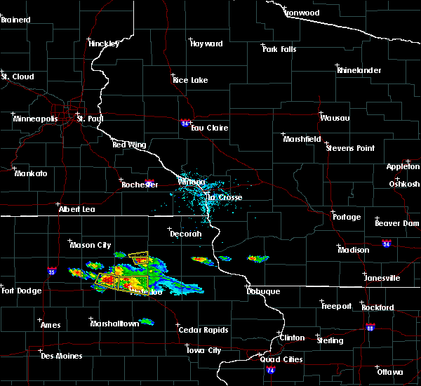 At 653 pm cdt, a severe thunderstorm was located near fredericksburg, or 11 miles southeast of new hampton, moving east at 35 mph (radar indicated). Hazards include 60 mph wind gusts and half dollar size hail. Hail damage to vehicles is expected. expect wind damage to roofs, siding, and trees. Locations impacted include, sumner and tripoli. At 653 pm cdt, a severe thunderstorm was located near fredericksburg, or 11 miles southeast of new hampton, moving east at 35 mph (radar indicated). Hazards include 60 mph wind gusts and half dollar size hail. Hail damage to vehicles is expected. expect wind damage to roofs, siding, and trees. Locations impacted include, sumner and tripoli.
|
| 6/15/2017 6:40 PM CDT |
 At 639 pm cdt, a severe thunderstorm was located 7 miles northwest of tripoli, or 11 miles northeast of waverly, moving east at 35 mph (trained weather spotters. at 6:28pm, trained weather spotters reported golf ball sized hail in plainfield). Hazards include golf ball size hail and 60 mph wind gusts. People and animals outdoors will be injured. expect hail damage to roofs, siding, windows, and vehicles. Expect wind damage to roofs, siding, and trees. At 639 pm cdt, a severe thunderstorm was located 7 miles northwest of tripoli, or 11 miles northeast of waverly, moving east at 35 mph (trained weather spotters. at 6:28pm, trained weather spotters reported golf ball sized hail in plainfield). Hazards include golf ball size hail and 60 mph wind gusts. People and animals outdoors will be injured. expect hail damage to roofs, siding, windows, and vehicles. Expect wind damage to roofs, siding, and trees.
|
| 5/17/2017 6:19 PM CDT |
 At 619 pm cdt, severe thunderstorms were located along a line extending from 6 miles east of nashua to near fredericksburg to near jesup, moving northeast at 55 mph (radar indicated). Hazards include 60 mph wind gusts. Expect damage to roofs, siding, and trees. locations impacted include, jesup, sumner, tripoli, dunkerton, readlyn and frederika. A tornado watch remains in effect until 700 pm cdt for northeastern iowa. At 619 pm cdt, severe thunderstorms were located along a line extending from 6 miles east of nashua to near fredericksburg to near jesup, moving northeast at 55 mph (radar indicated). Hazards include 60 mph wind gusts. Expect damage to roofs, siding, and trees. locations impacted include, jesup, sumner, tripoli, dunkerton, readlyn and frederika. A tornado watch remains in effect until 700 pm cdt for northeastern iowa.
|
| 5/17/2017 6:16 PM CDT |
 At 616 pm cdt, severe thunderstorms were located along a line extending from near nashua to near tripoli to near jesup, moving northeast at 55 mph (radar indicated). Hazards include 70 mph wind gusts. Expect considerable tree damage. Damage is likely to mobile homes, roofs, and outbuildings. At 616 pm cdt, severe thunderstorms were located along a line extending from near nashua to near tripoli to near jesup, moving northeast at 55 mph (radar indicated). Hazards include 70 mph wind gusts. Expect considerable tree damage. Damage is likely to mobile homes, roofs, and outbuildings.
|
| 5/17/2017 6:05 PM CDT |
 At 604 pm cdt, severe thunderstorms were located along a line extending from near marble rock to 6 miles west of tripoli to jesup, moving north at 55 mph (trained weather spotters. at 553 pm...70 mph winds were reported at the waterloo airport. numerous trees were reported down in town). Hazards include 70 mph wind gusts and nickel size hail. Expect considerable tree damage. damage is likely to mobile homes, roofs, and outbuildings. locations impacted include, waterloo, cedar falls, waverly, allison, evansdale, jesup, la porte city, hudson, sumner, denver, clarksville, tripoli, shell rock, greene, elk run heights, crossroads mall, waterloo municipal airport, uni-dome and mcleod center, janesville and washburn. this includes interstate 380 between mile markers 56 and 73. A tornado watch remains in effect until 700 pm cdt for central, north central and northeastern iowa. At 604 pm cdt, severe thunderstorms were located along a line extending from near marble rock to 6 miles west of tripoli to jesup, moving north at 55 mph (trained weather spotters. at 553 pm...70 mph winds were reported at the waterloo airport. numerous trees were reported down in town). Hazards include 70 mph wind gusts and nickel size hail. Expect considerable tree damage. damage is likely to mobile homes, roofs, and outbuildings. locations impacted include, waterloo, cedar falls, waverly, allison, evansdale, jesup, la porte city, hudson, sumner, denver, clarksville, tripoli, shell rock, greene, elk run heights, crossroads mall, waterloo municipal airport, uni-dome and mcleod center, janesville and washburn. this includes interstate 380 between mile markers 56 and 73. A tornado watch remains in effect until 700 pm cdt for central, north central and northeastern iowa.
|
| 5/17/2017 5:47 PM CDT |
 At 545 pm cdt, severe thunderstorms were located along a line extending from 7 miles northeast of hampton to near shell rock to 7 miles west of la porte city, moving northeast at 70 mph (trained weather spotters. numerous reports of 60 to 70 mph winds have been reported over northeast iowa. doppler radar indicates that the strongest winds are now moving into the southern sections of the waterloo area). Hazards include 70 mph wind gusts and nickel size hail. Expect considerable tree damage. damage is likely to mobile homes, roofs, and outbuildings. locations impacted include, waterloo, cedar falls, waverly, allison, evansdale, jesup, la porte city, hudson, sumner, parkersburg, denver, clarksville, tripoli, shell rock, greene, aplington, elk run heights, crossroads mall, waterloo municipal airport and uni-dome and mcleod center. this includes interstate 380 between mile markers 56 and 73. A tornado watch remains in effect until 700 pm cdt for central, north central and northeastern iowa. At 545 pm cdt, severe thunderstorms were located along a line extending from 7 miles northeast of hampton to near shell rock to 7 miles west of la porte city, moving northeast at 70 mph (trained weather spotters. numerous reports of 60 to 70 mph winds have been reported over northeast iowa. doppler radar indicates that the strongest winds are now moving into the southern sections of the waterloo area). Hazards include 70 mph wind gusts and nickel size hail. Expect considerable tree damage. damage is likely to mobile homes, roofs, and outbuildings. locations impacted include, waterloo, cedar falls, waverly, allison, evansdale, jesup, la porte city, hudson, sumner, parkersburg, denver, clarksville, tripoli, shell rock, greene, aplington, elk run heights, crossroads mall, waterloo municipal airport and uni-dome and mcleod center. this includes interstate 380 between mile markers 56 and 73. A tornado watch remains in effect until 700 pm cdt for central, north central and northeastern iowa.
|
| 5/17/2017 5:32 PM CDT |
 At 531 pm cdt, severe thunderstorms were located along a line extending from 6 miles north of iowa falls to 6 miles west of dike to near traer, moving northeast at 70 mph (trained weather spotters. numerous reports of 60 to 70 mph winds with tree damage across central and northeastern iowa). Hazards include 70 mph wind gusts and nickel size hail. Expect considerable tree damage. Damage is likely to mobile homes, roofs, and outbuildings. At 531 pm cdt, severe thunderstorms were located along a line extending from 6 miles north of iowa falls to 6 miles west of dike to near traer, moving northeast at 70 mph (trained weather spotters. numerous reports of 60 to 70 mph winds with tree damage across central and northeastern iowa). Hazards include 70 mph wind gusts and nickel size hail. Expect considerable tree damage. Damage is likely to mobile homes, roofs, and outbuildings.
|
| 5/17/2017 3:28 PM CDT | 4 inch diameter broken tree limb in bremer county IA, 0.7 miles SE of Tripoli, IA |
| 5/17/2017 3:22 PM CDT |
 At 322 pm cdt, a severe thunderstorm was located near tripoli, or 10 miles east of waverly, moving north at 55 mph (radar indicated). Hazards include 60 mph wind gusts and quarter size hail. Hail damage to vehicles is expected. expect wind damage to roofs, siding, and trees. locations impacted include, sumner, denver, tripoli, readlyn and frederika. A tornado watch remains in effect until 700 pm cdt for northeastern iowa. At 322 pm cdt, a severe thunderstorm was located near tripoli, or 10 miles east of waverly, moving north at 55 mph (radar indicated). Hazards include 60 mph wind gusts and quarter size hail. Hail damage to vehicles is expected. expect wind damage to roofs, siding, and trees. locations impacted include, sumner, denver, tripoli, readlyn and frederika. A tornado watch remains in effect until 700 pm cdt for northeastern iowa.
|
| 5/17/2017 3:14 PM CDT |
 At 314 pm cdt, a severe thunderstorm was located near denver, or 8 miles north of waterloo, moving north at 50 mph (radar indicated). Hazards include 60 mph wind gusts and quarter size hail. Hail damage to vehicles is expected. Expect wind damage to roofs, siding, and trees. At 314 pm cdt, a severe thunderstorm was located near denver, or 8 miles north of waterloo, moving north at 50 mph (radar indicated). Hazards include 60 mph wind gusts and quarter size hail. Hail damage to vehicles is expected. Expect wind damage to roofs, siding, and trees.
|
| 5/15/2017 7:44 PM CDT |
 At 744 pm cdt, a severe thunderstorm was located near tripoli, or 13 miles east of waverly, moving east at 45 mph (trained weather spotters have reported quarter sized hail or larger and 60 mph winds with these storms historically). Hazards include 60 mph wind gusts and quarter size hail. Hail damage to vehicles is expected. expect wind damage to roofs, siding, and trees. Locations impacted include, sumner, tripoli and frederika. At 744 pm cdt, a severe thunderstorm was located near tripoli, or 13 miles east of waverly, moving east at 45 mph (trained weather spotters have reported quarter sized hail or larger and 60 mph winds with these storms historically). Hazards include 60 mph wind gusts and quarter size hail. Hail damage to vehicles is expected. expect wind damage to roofs, siding, and trees. Locations impacted include, sumner, tripoli and frederika.
|
| 5/15/2017 7:43 PM CDT | Downed limbs... at least two taking down power lines. older... unhealthy trees blown over. town without power approximately 30-minutes. delayed repor in bremer county IA, 0.7 miles SE of Tripoli, IA |
| 5/15/2017 7:42 PM CDT | Two foot diameter tree snappe in bremer county IA, 0.6 miles ENE of Tripoli, IA |
| 5/15/2017 7:36 PM CDT |
 At 735 pm cdt, a severe thunderstorm was located near denver, or near waverly, moving east at 45 mph (trained weather spotters have reported a history of quarter sized hail or larger and 60 mph winds). Hazards include 60 mph wind gusts and quarter size hail. Hail damage to vehicles is expected. expect wind damage to roofs, siding, and trees. Locations impacted include, waverly, sumner, tripoli, readlyn, plainfield and frederika. At 735 pm cdt, a severe thunderstorm was located near denver, or near waverly, moving east at 45 mph (trained weather spotters have reported a history of quarter sized hail or larger and 60 mph winds). Hazards include 60 mph wind gusts and quarter size hail. Hail damage to vehicles is expected. expect wind damage to roofs, siding, and trees. Locations impacted include, waverly, sumner, tripoli, readlyn, plainfield and frederika.
|
| 5/15/2017 7:26 PM CDT |
 At 725 pm cdt, a severe thunderstorm was located over waverly, moving east at 45 mph (trained weather spotters have reported a history of quarter sized hail or larger and 60 mph winds). Hazards include 60 mph wind gusts and quarter size hail. Hail damage to vehicles is expected. expect wind damage to roofs, siding, and trees. Locations impacted include, waverly, sumner, denver, clarksville, tripoli, shell rock, janesville, readlyn, plainfield, frederika and waverly municipal airport. At 725 pm cdt, a severe thunderstorm was located over waverly, moving east at 45 mph (trained weather spotters have reported a history of quarter sized hail or larger and 60 mph winds). Hazards include 60 mph wind gusts and quarter size hail. Hail damage to vehicles is expected. expect wind damage to roofs, siding, and trees. Locations impacted include, waverly, sumner, denver, clarksville, tripoli, shell rock, janesville, readlyn, plainfield, frederika and waverly municipal airport.
|
| 5/15/2017 7:14 PM CDT |
 At 713 pm cdt, a severe thunderstorm was located over clarksville, or near allison, moving east at 45 mph (trained weather spotters have reported 60 mph winds and quarter sized hail or larger with these storms). Hazards include 60 mph wind gusts and quarter size hail. Hail damage to vehicles is expected. Expect wind damage to roofs, siding, and trees. At 713 pm cdt, a severe thunderstorm was located over clarksville, or near allison, moving east at 45 mph (trained weather spotters have reported 60 mph winds and quarter sized hail or larger with these storms). Hazards include 60 mph wind gusts and quarter size hail. Hail damage to vehicles is expected. Expect wind damage to roofs, siding, and trees.
|
| 5/15/2017 6:50 PM CDT |
 At 649 pm cdt, a severe thunderstorm was located over tripoli, or 9 miles northeast of waverly, moving southeast at 35 mph (trained weather spotters have reported a history of 60 mph winds with these storms ). Hazards include 60 mph wind gusts and penny size hail. Expect damage to roofs, siding, and trees. Locations impacted include, waverly, sumner, denver, clarksville, tripoli, shell rock, janesville, readlyn, plainfield, frederika and waverly municipal airport. At 649 pm cdt, a severe thunderstorm was located over tripoli, or 9 miles northeast of waverly, moving southeast at 35 mph (trained weather spotters have reported a history of 60 mph winds with these storms ). Hazards include 60 mph wind gusts and penny size hail. Expect damage to roofs, siding, and trees. Locations impacted include, waverly, sumner, denver, clarksville, tripoli, shell rock, janesville, readlyn, plainfield, frederika and waverly municipal airport.
|
| 5/15/2017 6:44 PM CDT | Kwwl shared a public image of downed tree in tripoli due to strong winds. time estimated via rada in bremer county IA, 0.7 miles SE of Tripoli, IA |
| 5/15/2017 6:31 PM CDT |
 At 631 pm cdt, a severe thunderstorm was located 8 miles southeast of nashua, or 8 miles north of waverly, moving southeast at 35 mph (trained weather spotters reported gusts to around 60 mph). Hazards include 60 mph wind gusts and quarter size hail. Hail damage to vehicles is expected. Expect wind damage to roofs, siding, and trees. At 631 pm cdt, a severe thunderstorm was located 8 miles southeast of nashua, or 8 miles north of waverly, moving southeast at 35 mph (trained weather spotters reported gusts to around 60 mph). Hazards include 60 mph wind gusts and quarter size hail. Hail damage to vehicles is expected. Expect wind damage to roofs, siding, and trees.
|
| 3/23/2017 3:34 PM CDT |
 At 334 pm cdt, a severe thunderstorm was located 7 miles southeast of tripoli, or 12 miles west of oelwein, moving east at 55 mph (trained weather spotters). Hazards include ping pong ball size hail. People and animals outdoors will be injured. expect damage to roofs, siding, windows, and vehicles. Locations impacted include, tripoli and readlyn. At 334 pm cdt, a severe thunderstorm was located 7 miles southeast of tripoli, or 12 miles west of oelwein, moving east at 55 mph (trained weather spotters). Hazards include ping pong ball size hail. People and animals outdoors will be injured. expect damage to roofs, siding, windows, and vehicles. Locations impacted include, tripoli and readlyn.
|
| 3/23/2017 3:23 PM CDT |
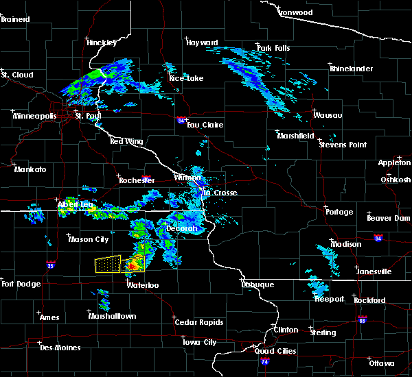 At 322 pm cdt, a severe thunderstorm was located over denver, or near waverly, moving east at 55 mph (trained storm spotters reported golf ball sized hail 3 miles southwest of waverly at 319 pm cdt). Hazards include golf ball size hail. People and animals outdoors will be injured. expect damage to roofs, siding, windows, and vehicles. Locations impacted include, waverly, denver, tripoli and readlyn. At 322 pm cdt, a severe thunderstorm was located over denver, or near waverly, moving east at 55 mph (trained storm spotters reported golf ball sized hail 3 miles southwest of waverly at 319 pm cdt). Hazards include golf ball size hail. People and animals outdoors will be injured. expect damage to roofs, siding, windows, and vehicles. Locations impacted include, waverly, denver, tripoli and readlyn.
|
| 3/23/2017 3:18 PM CDT |
 At 318 pm cdt, a severe thunderstorm was located near waverly, moving east at 50 mph (radar indicated). Hazards include quarter size hail. damage to vehicles is expected At 318 pm cdt, a severe thunderstorm was located near waverly, moving east at 50 mph (radar indicated). Hazards include quarter size hail. damage to vehicles is expected
|
| 3/6/2017 8:21 PM CST |
 The severe thunderstorm warning for black hawk, bremer, northeastern grundy and southeastern butler counties will expire at 830 pm cst, the storms which prompted the warning have moved out of the area. therefore the warning will be allowed to expire. a tornado watch remains in effect until 1000 pm cst for central, north central and northeastern iowa. The severe thunderstorm warning for black hawk, bremer, northeastern grundy and southeastern butler counties will expire at 830 pm cst, the storms which prompted the warning have moved out of the area. therefore the warning will be allowed to expire. a tornado watch remains in effect until 1000 pm cst for central, north central and northeastern iowa.
|
| 3/6/2017 8:03 PM CST |
 At 803 pm cst, severe thunderstorms were located along a line extending from near sumner to 6 miles northeast of traer, moving east at 50 mph (trained weather spotters. these storms have a history of producing thunderstorm wind damage). Hazards include 60 mph wind gusts and nickel size hail. Expect damage to roofs, siding, and trees. locations impacted include, waterloo, cedar falls, waverly, evansdale, jesup, la porte city, hudson, sumner, denver, reinbeck, tripoli, dike, elk run heights, crossroads mall, waterloo municipal airport, uni-dome and mcleod center, janesville, washburn, dunkerton and readlyn. this includes interstate 380 between mile markers 56 and 73. A tornado watch remains in effect until 1000 pm cst for central, north central and northeastern iowa. At 803 pm cst, severe thunderstorms were located along a line extending from near sumner to 6 miles northeast of traer, moving east at 50 mph (trained weather spotters. these storms have a history of producing thunderstorm wind damage). Hazards include 60 mph wind gusts and nickel size hail. Expect damage to roofs, siding, and trees. locations impacted include, waterloo, cedar falls, waverly, evansdale, jesup, la porte city, hudson, sumner, denver, reinbeck, tripoli, dike, elk run heights, crossroads mall, waterloo municipal airport, uni-dome and mcleod center, janesville, washburn, dunkerton and readlyn. this includes interstate 380 between mile markers 56 and 73. A tornado watch remains in effect until 1000 pm cst for central, north central and northeastern iowa.
|
| 3/6/2017 7:32 PM CST |
 At 732 pm cst, severe thunderstorms were located along a line extending from near shell rock to near conrad, moving east at 50 mph (radar indicated). Hazards include 60 mph wind gusts and nickel size hail. expect damage to roofs, siding, and trees At 732 pm cst, severe thunderstorms were located along a line extending from near shell rock to near conrad, moving east at 50 mph (radar indicated). Hazards include 60 mph wind gusts and nickel size hail. expect damage to roofs, siding, and trees
|
| 8/4/2016 6:39 PM CDT |
 The severe thunderstorm warning for northern black hawk and bremer counties will expire at 645 pm cdt, the storm which prompted the warning has weakened below severe limits, and no longer poses an immediate threat to life or property. therefore the warning will be allowed to expire. however heavy rain is still possible with this thunderstorm. a severe thunderstorm watch remains in effect until midnight cdt for northeastern iowa. The severe thunderstorm warning for northern black hawk and bremer counties will expire at 645 pm cdt, the storm which prompted the warning has weakened below severe limits, and no longer poses an immediate threat to life or property. therefore the warning will be allowed to expire. however heavy rain is still possible with this thunderstorm. a severe thunderstorm watch remains in effect until midnight cdt for northeastern iowa.
|
| 8/4/2016 6:24 PM CDT |
 At 624 pm cdt, a severe thunderstorm was located near tripoli, or 12 miles east of waverly, moving east at 35 mph (radar indicated). Hazards include 60 mph wind gusts. Expect damage to roofs. siding. and trees. Locations impacted include, waterloo, cedar falls, waverly, sumner, denver, tripoli, waterloo municipal airport, janesville, dunkerton and readlyn. At 624 pm cdt, a severe thunderstorm was located near tripoli, or 12 miles east of waverly, moving east at 35 mph (radar indicated). Hazards include 60 mph wind gusts. Expect damage to roofs. siding. and trees. Locations impacted include, waterloo, cedar falls, waverly, sumner, denver, tripoli, waterloo municipal airport, janesville, dunkerton and readlyn.
|
| 8/4/2016 5:58 PM CDT |
 At 558 pm cdt, a severe thunderstorm was located near waverly, moving east at 55 mph (radar indicated). Hazards include 60 mph wind gusts. Expect damage to roofs. siding. And trees. At 558 pm cdt, a severe thunderstorm was located near waverly, moving east at 55 mph (radar indicated). Hazards include 60 mph wind gusts. Expect damage to roofs. siding. And trees.
|
| 6/22/2015 8:17 AM CDT |
 At 815 am cdt, severe thunderstorms were located along a line extending from near sumner to near waterloo to 8 miles southwest of eldora, moving east at 75 mph (radar indicated. at 809 am the waterloo airport reported 59 mph). Hazards include 60 mph wind gusts. Expect damage to roofs. siding and trees. locations impacted include, waterloo, cedar falls, waverly, iowa falls, eldora, grundy center, allison, evansdale, jesup, la porte city, hudson, sumner, parkersburg, denver, reinbeck, ackley, clarksville, tripoli, shell rock and dike. This includes interstate 380 between mile markers 57 and 73. At 815 am cdt, severe thunderstorms were located along a line extending from near sumner to near waterloo to 8 miles southwest of eldora, moving east at 75 mph (radar indicated. at 809 am the waterloo airport reported 59 mph). Hazards include 60 mph wind gusts. Expect damage to roofs. siding and trees. locations impacted include, waterloo, cedar falls, waverly, iowa falls, eldora, grundy center, allison, evansdale, jesup, la porte city, hudson, sumner, parkersburg, denver, reinbeck, ackley, clarksville, tripoli, shell rock and dike. This includes interstate 380 between mile markers 57 and 73.
|
| 6/22/2015 7:54 AM CDT |
 At 753 am cdt, severe thunderstorms were located along a line extending from 5 miles southwest of nashua to 3 miles south of aplington to 4 miles southwest of jewell junction, moving east at 75 mph (radar indicated). Hazards include 60 mph wind gusts and penny size hail. Expect damage to roofs. Siding and trees. At 753 am cdt, severe thunderstorms were located along a line extending from 5 miles southwest of nashua to 3 miles south of aplington to 4 miles southwest of jewell junction, moving east at 75 mph (radar indicated). Hazards include 60 mph wind gusts and penny size hail. Expect damage to roofs. Siding and trees.
|
| 1/1/0001 12:00 AM | Quarter sized hail reported 0.7 miles SE of Tripoli, IA |
| 1/1/0001 12:00 AM | Quarter sized hail reported 0.7 miles SE of Tripoli, IA |
Hail Maps for Tripoli, IA


Connect with Interactive Hail Maps