

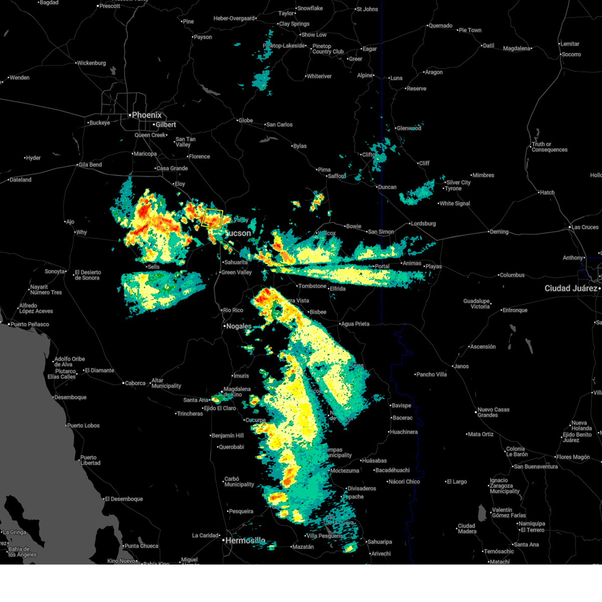
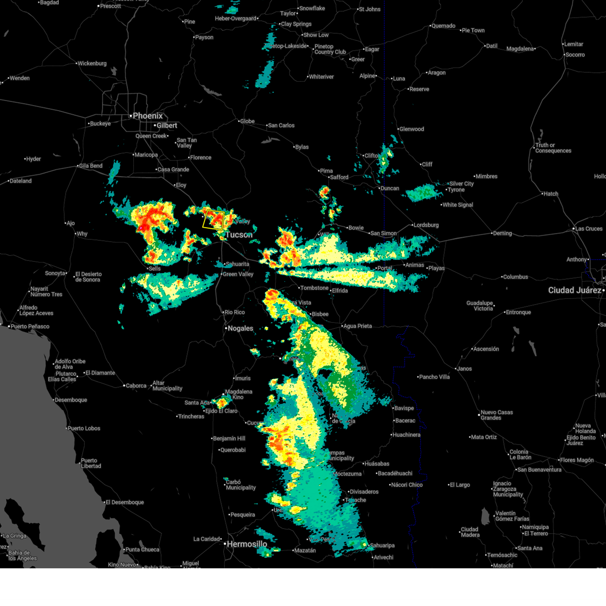
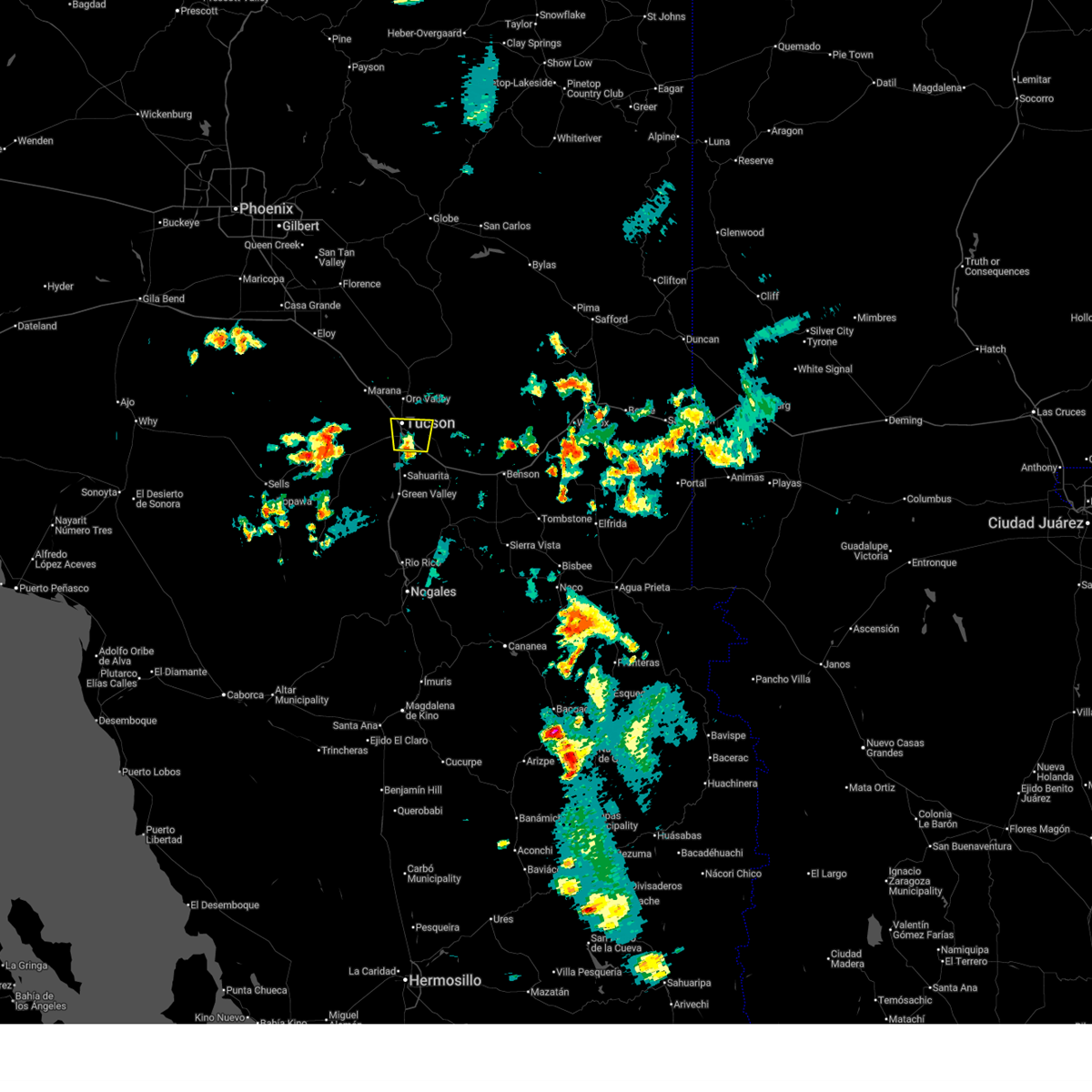
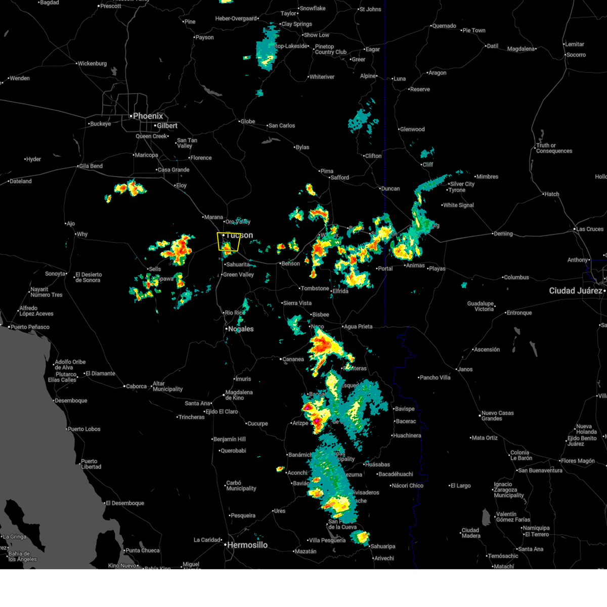
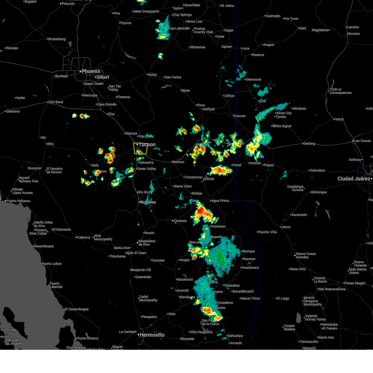
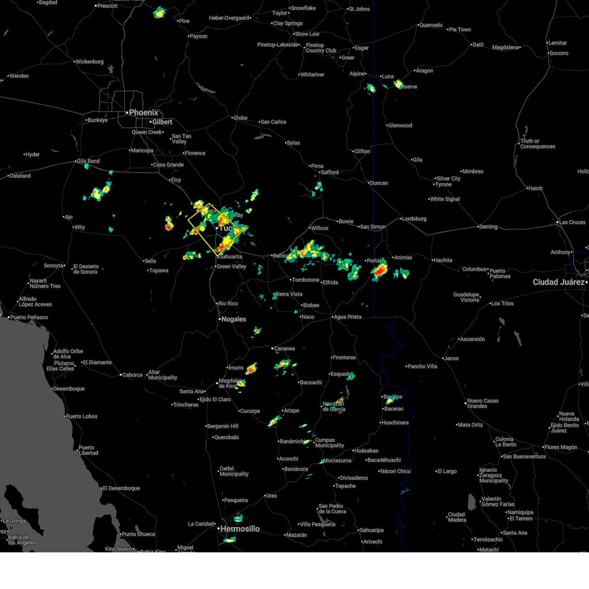
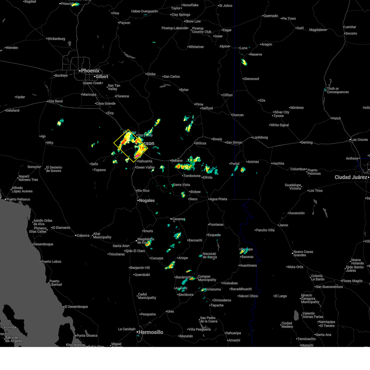
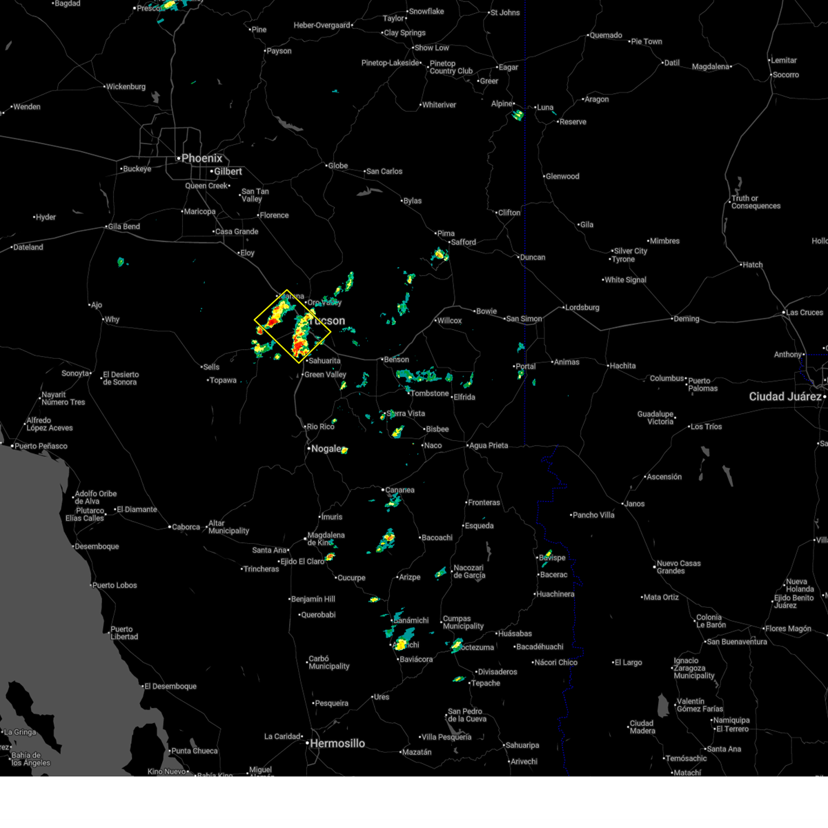
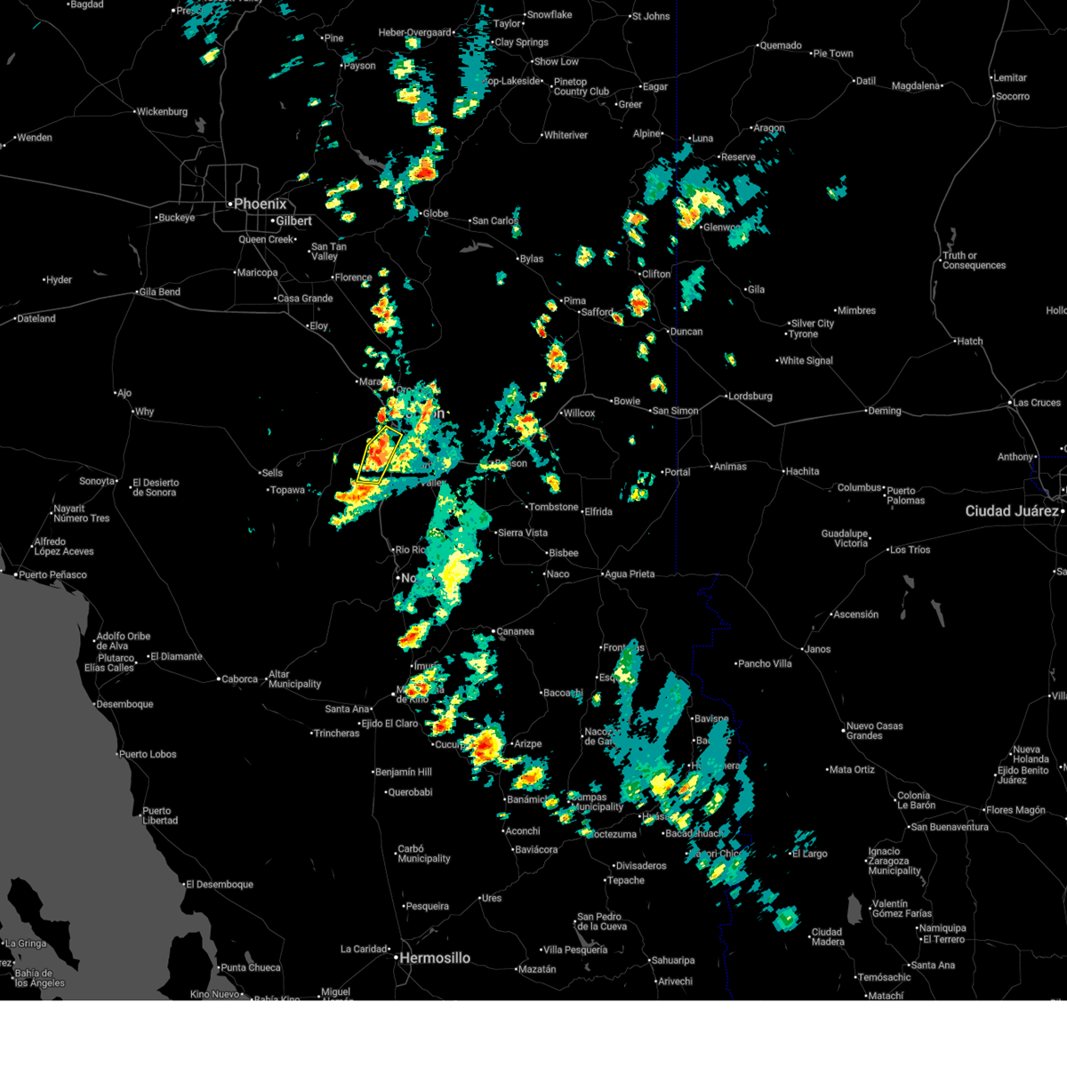
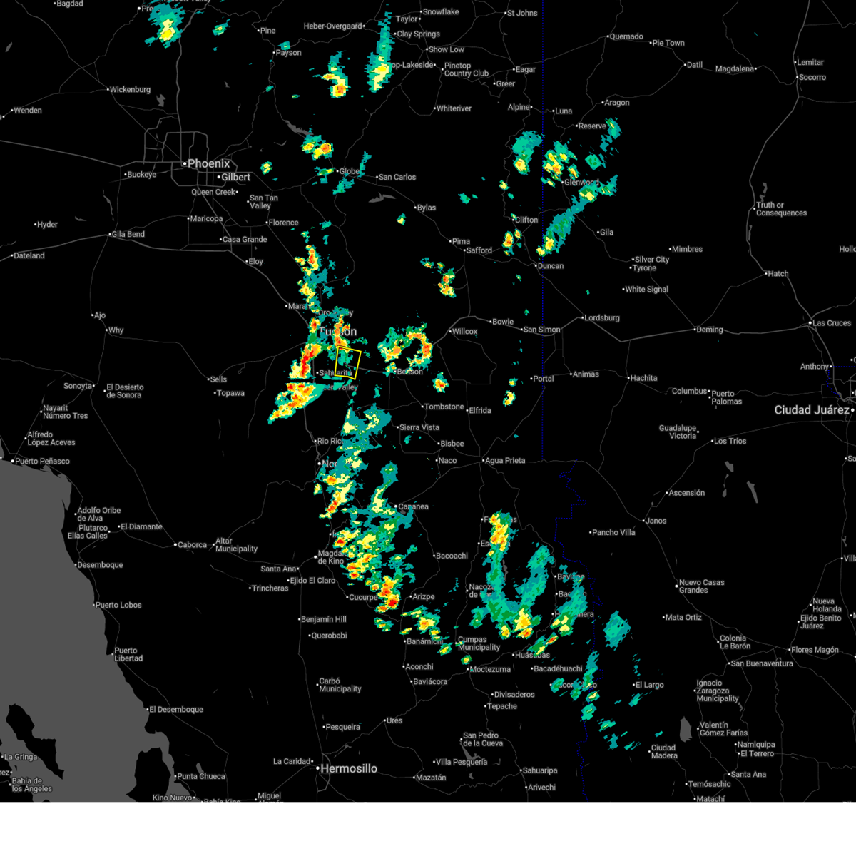
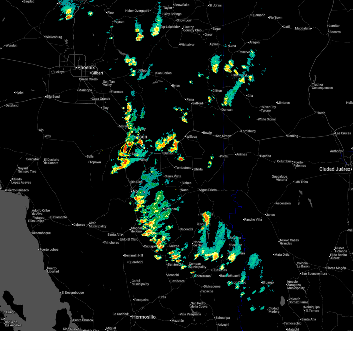
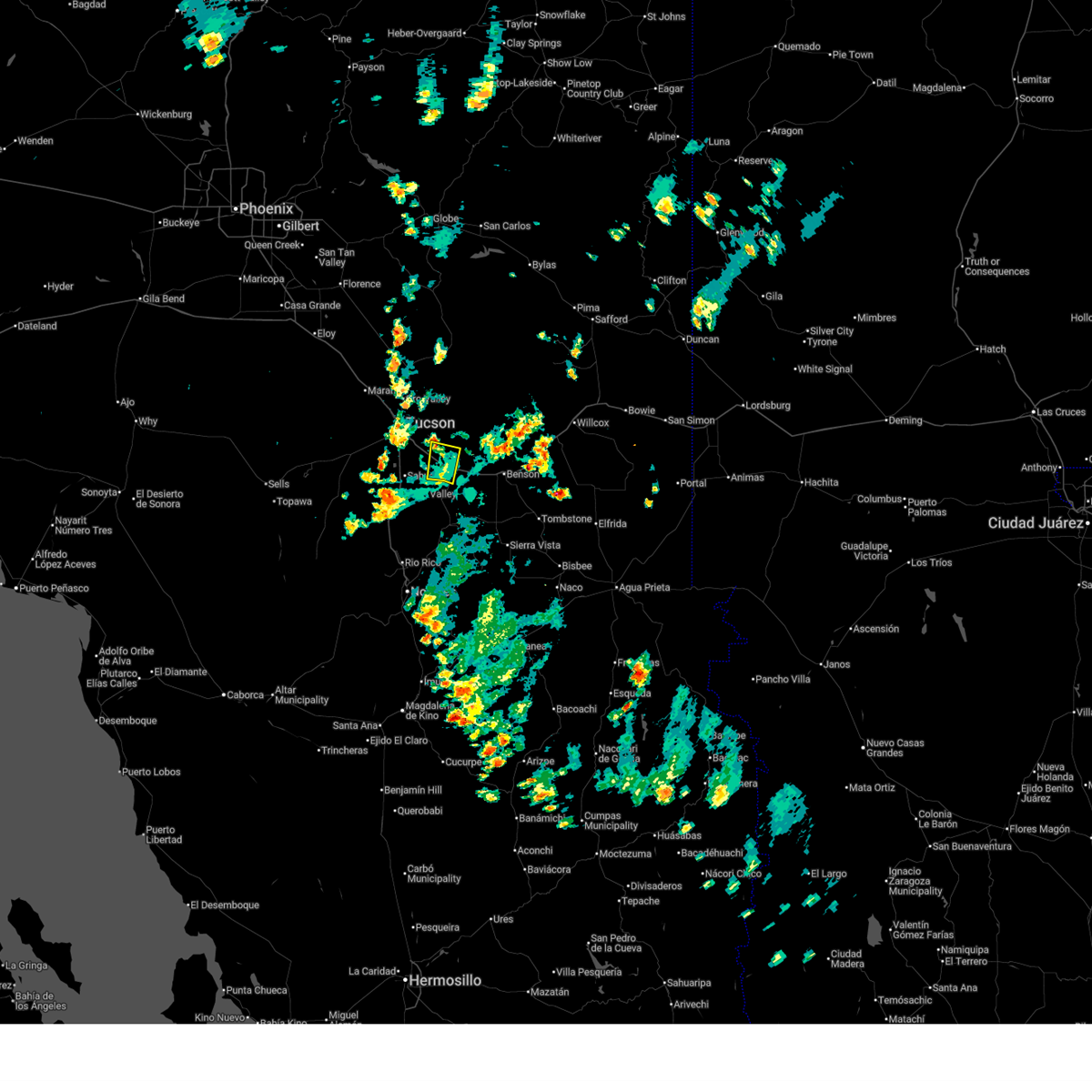
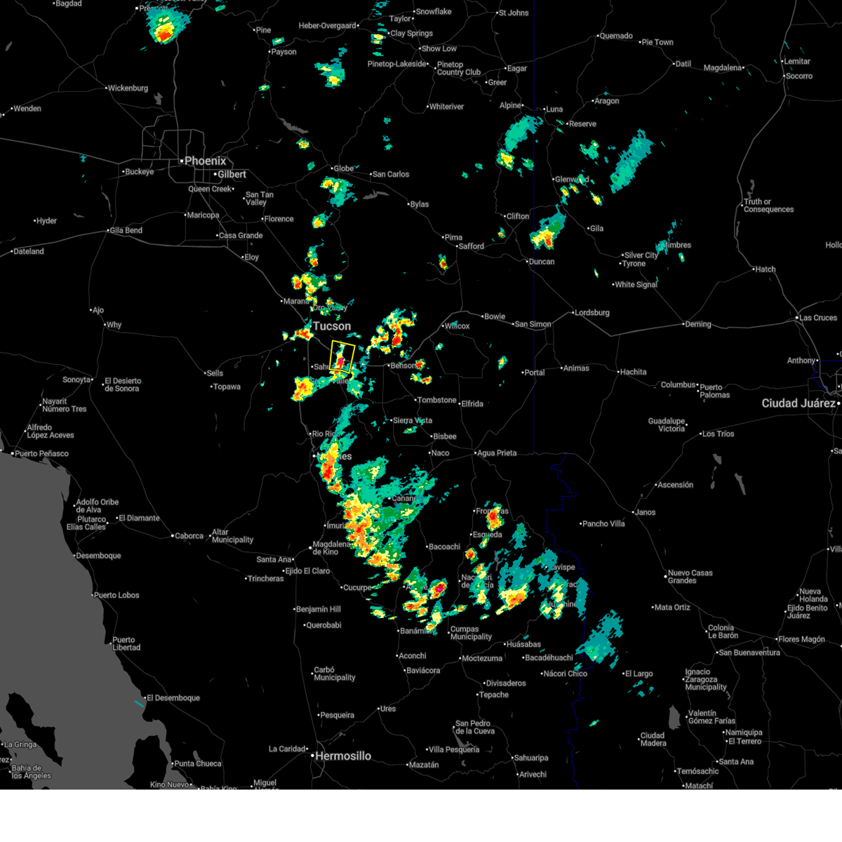
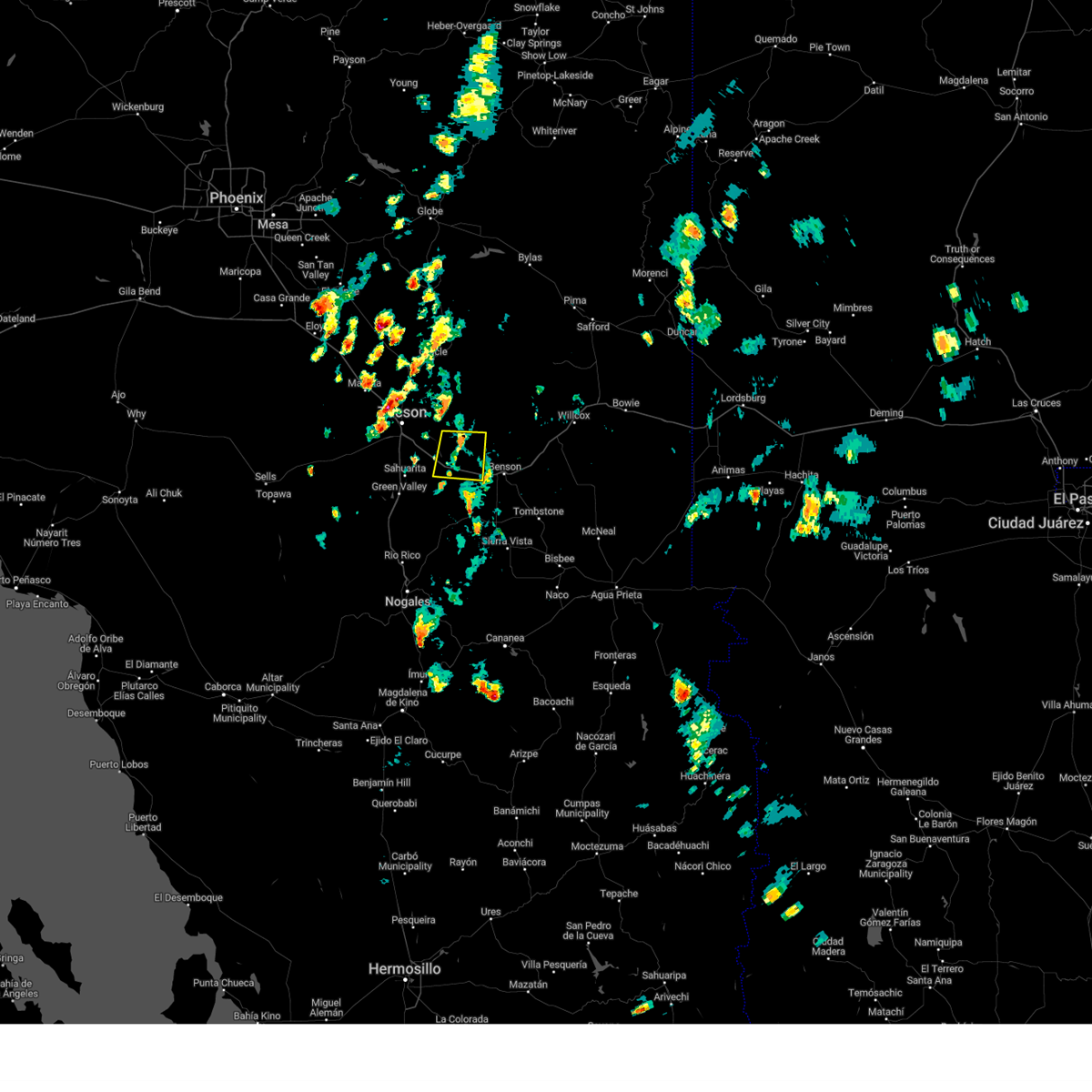
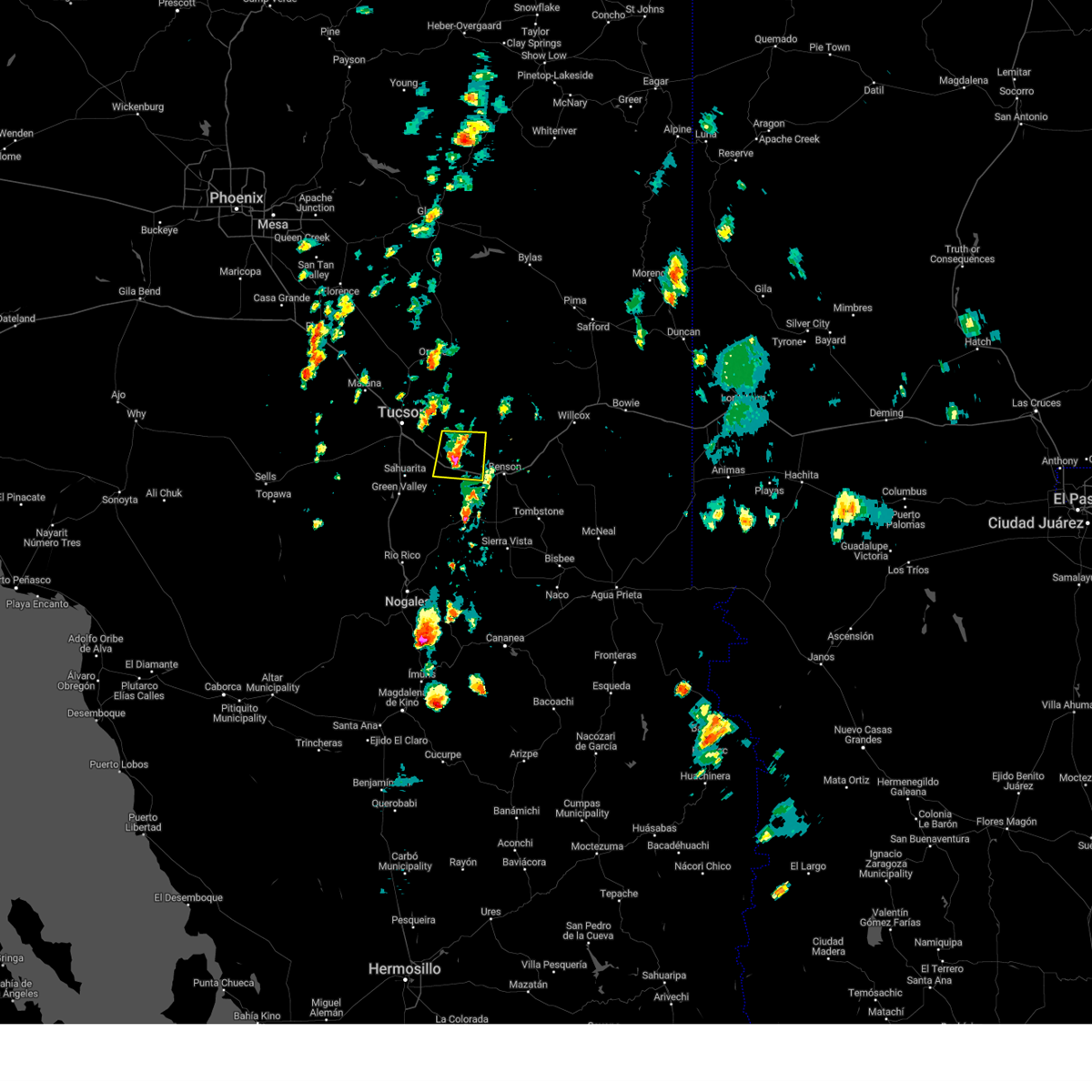
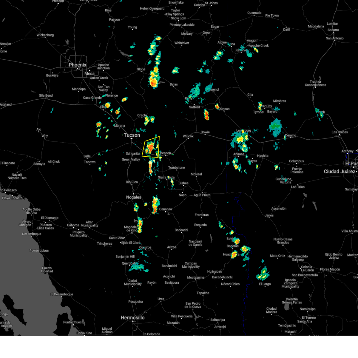
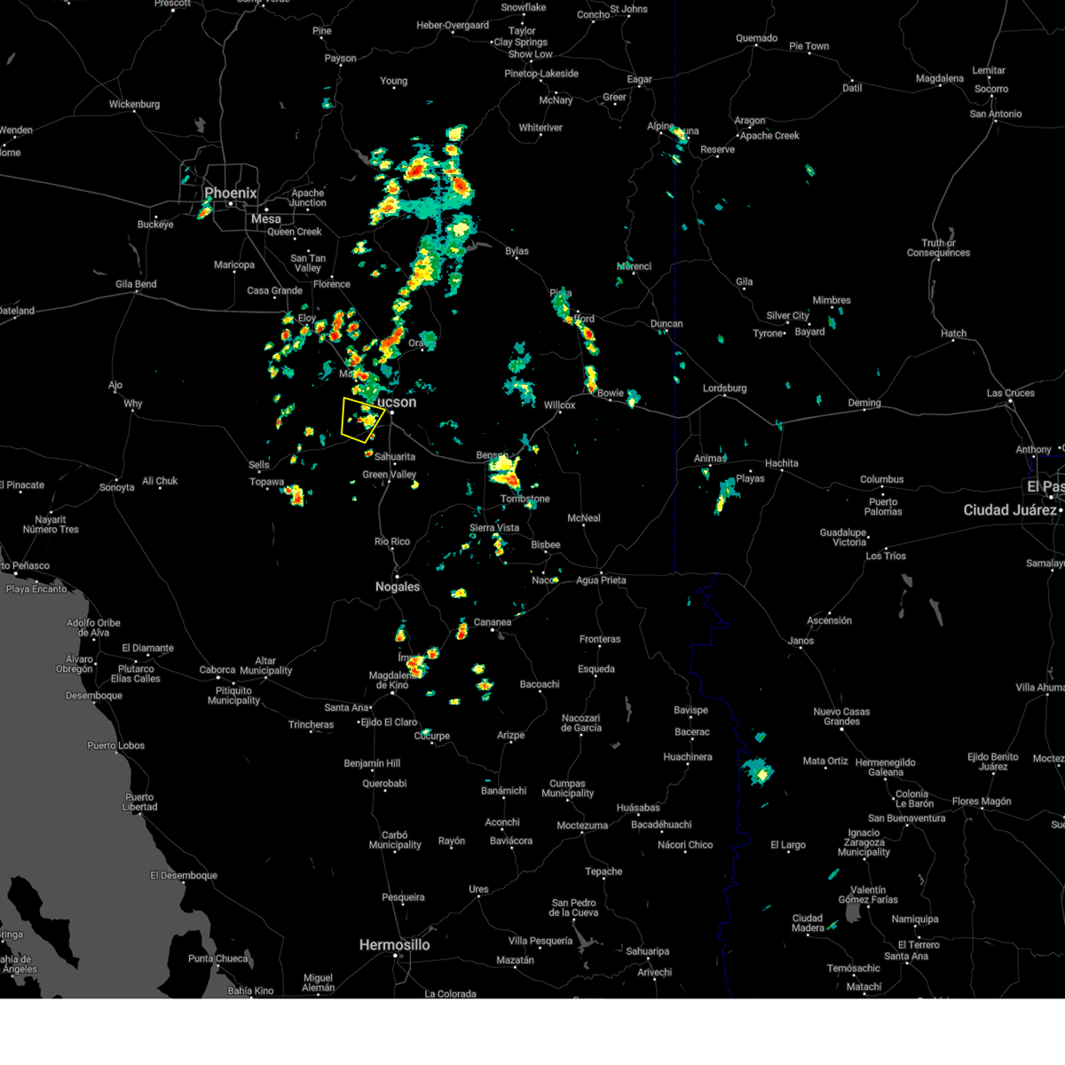
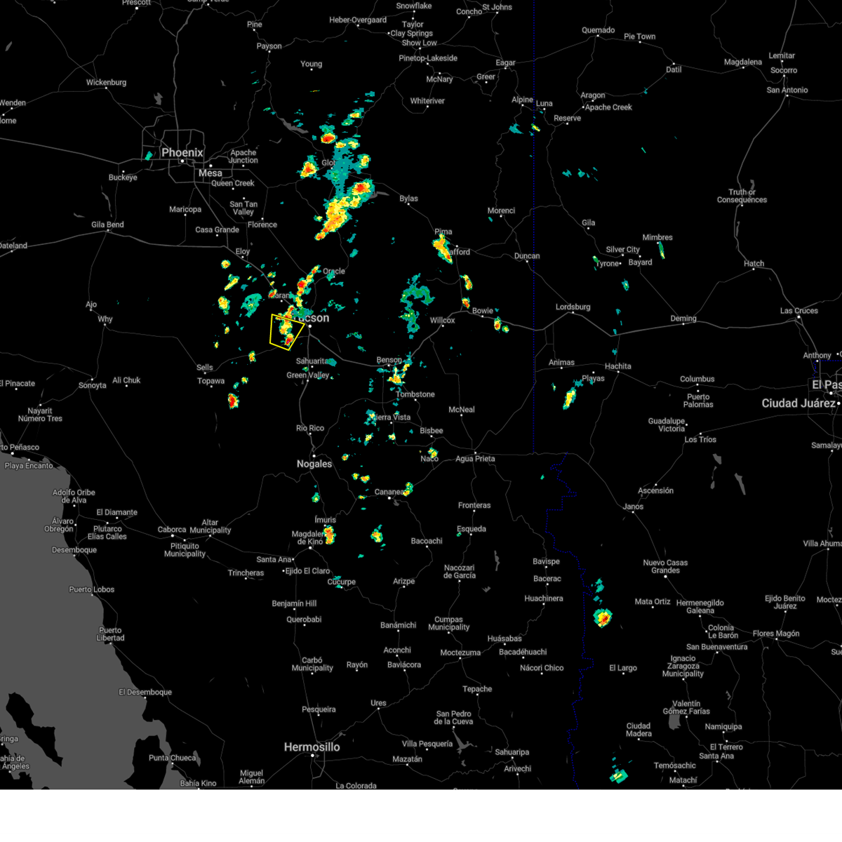
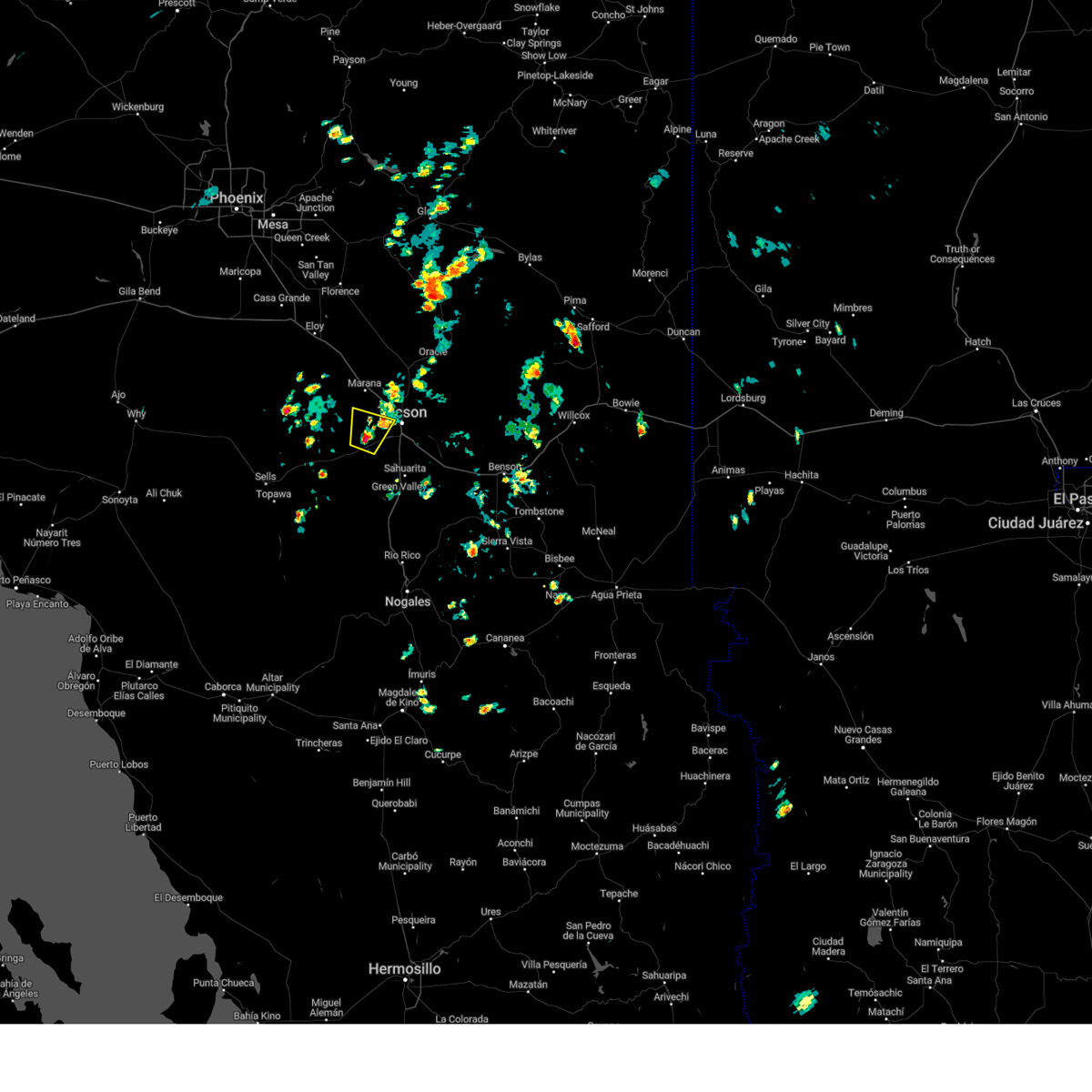
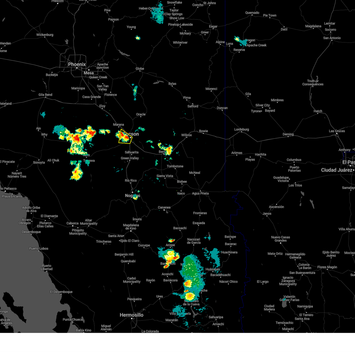
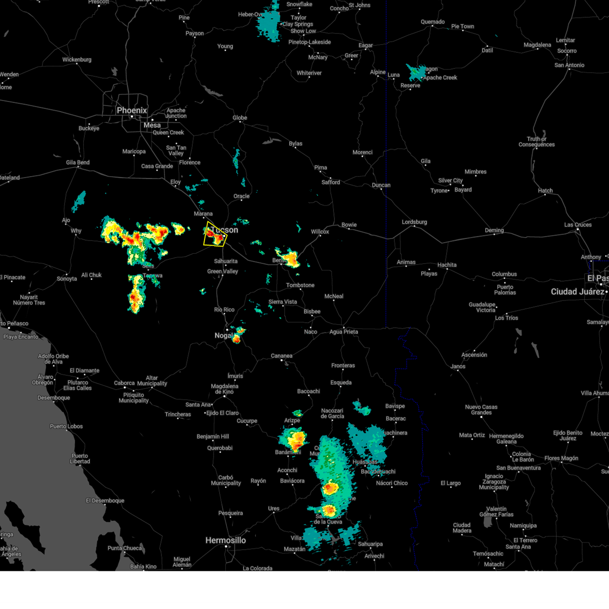
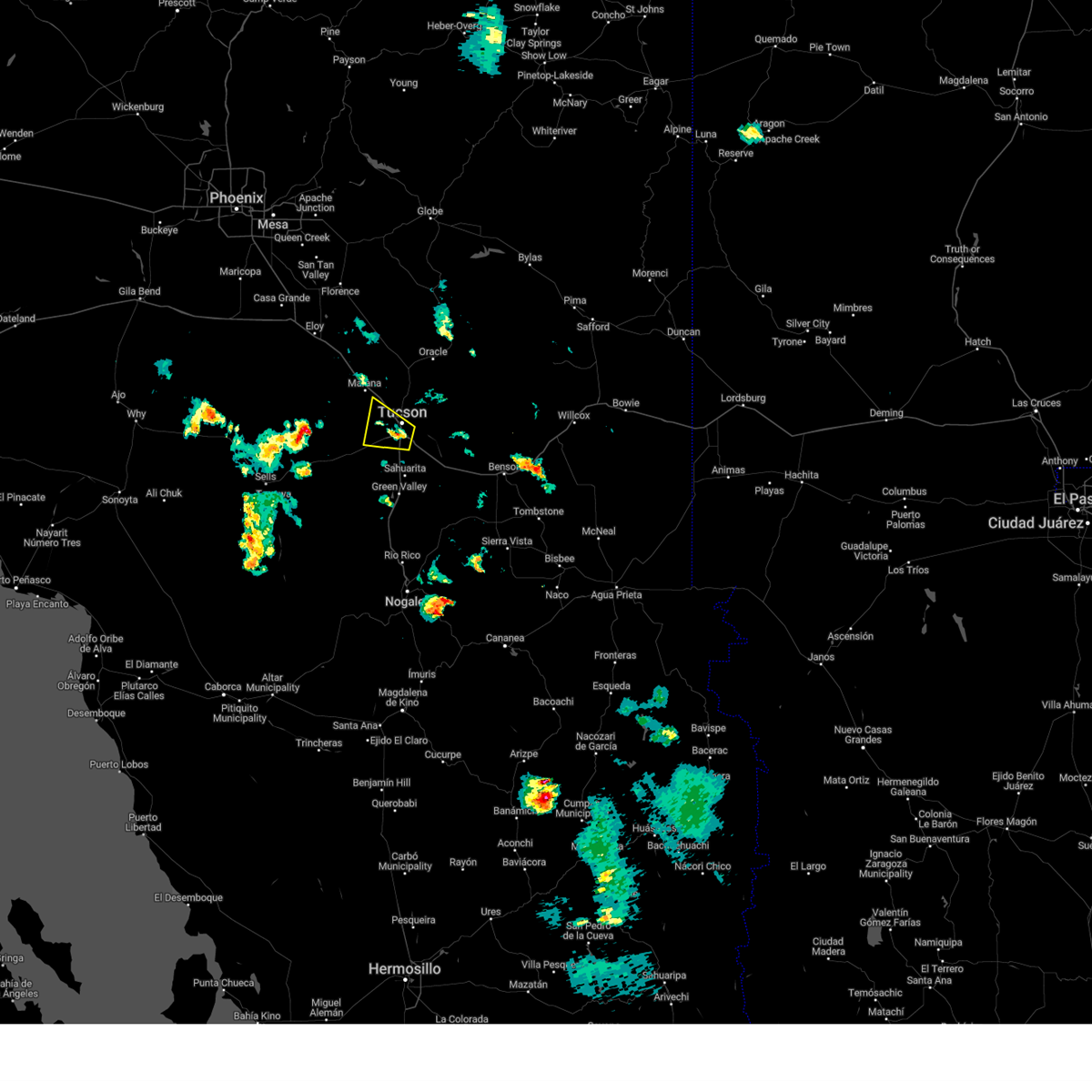
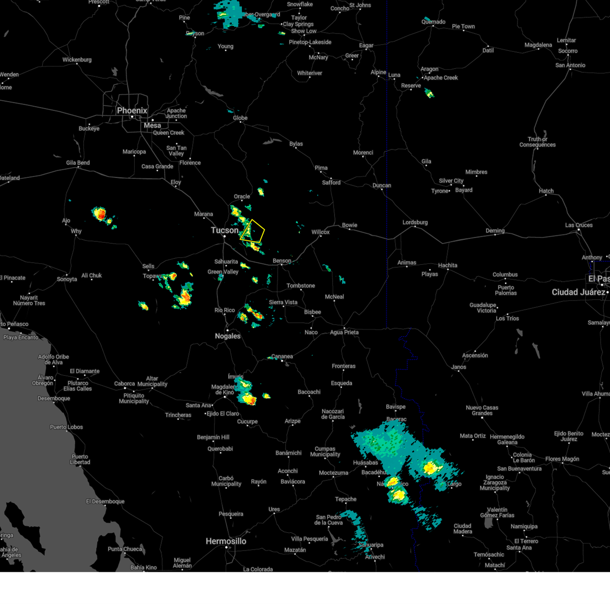
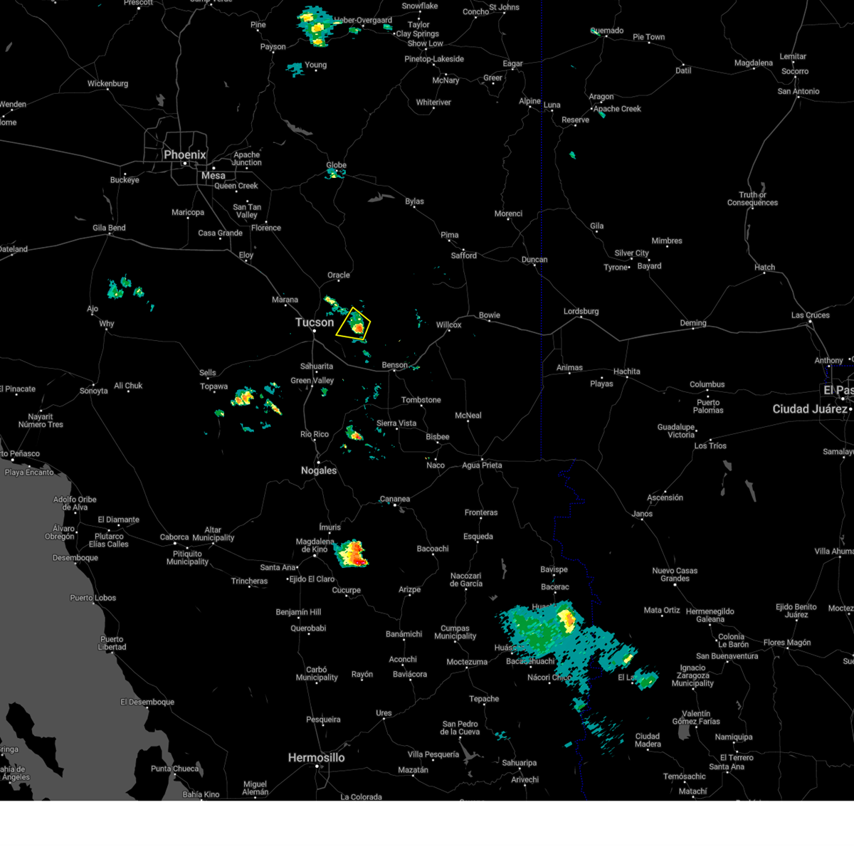
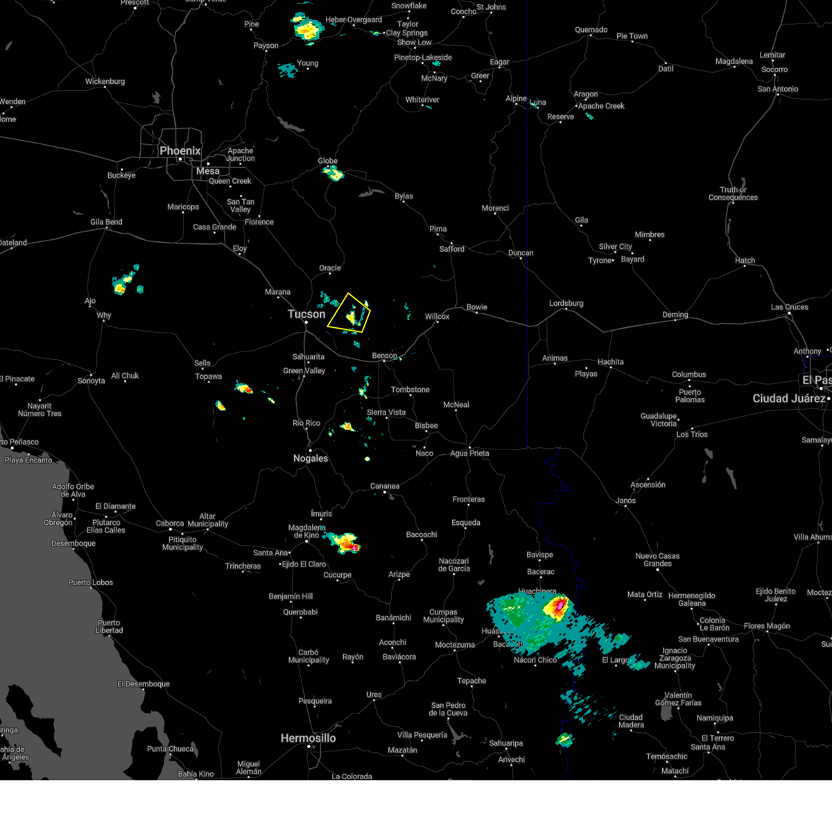
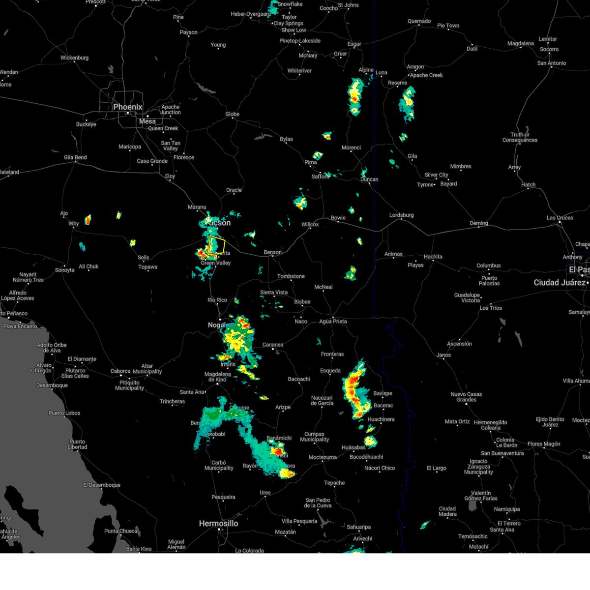
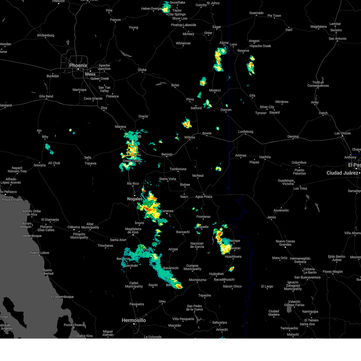
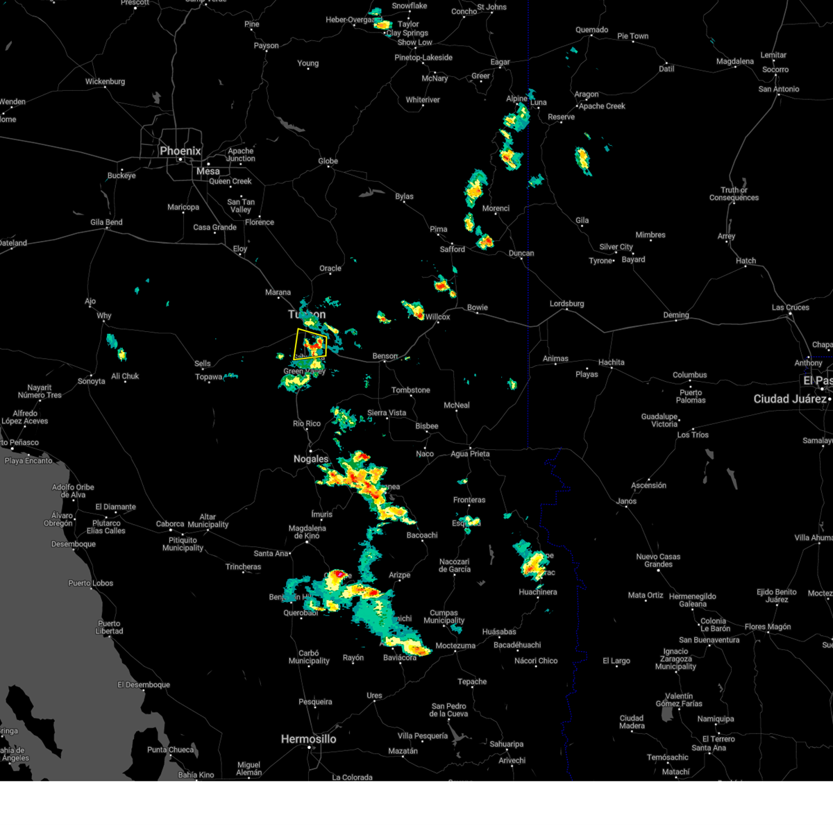
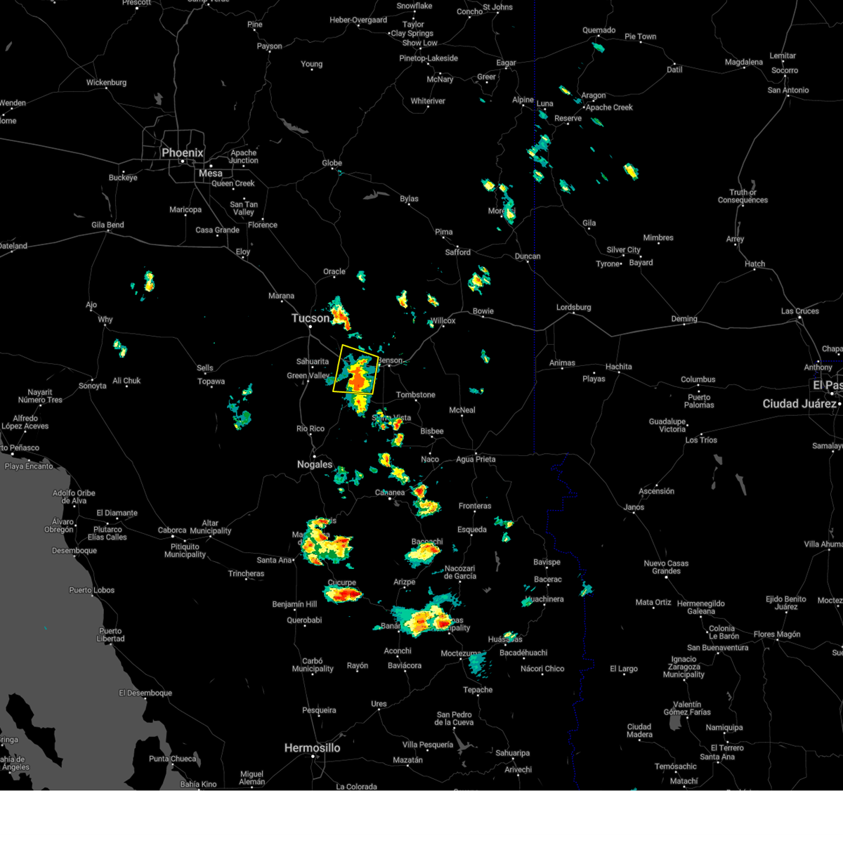
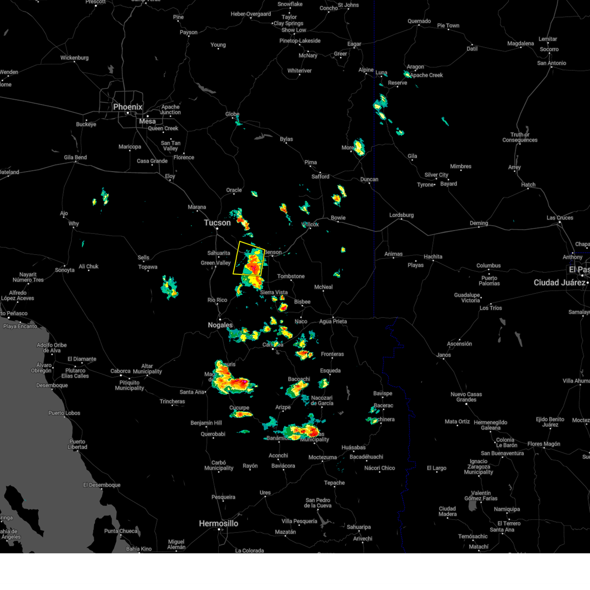
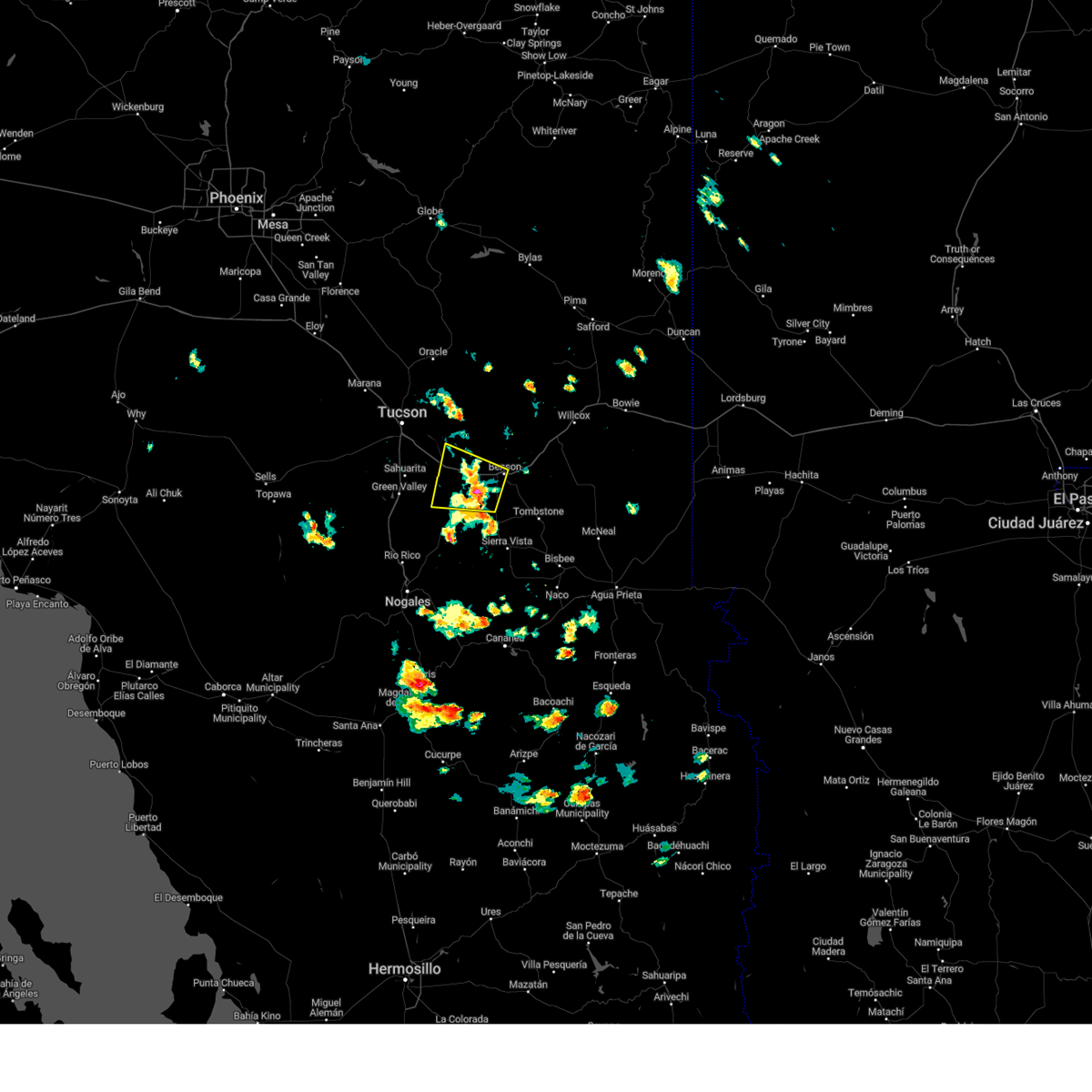
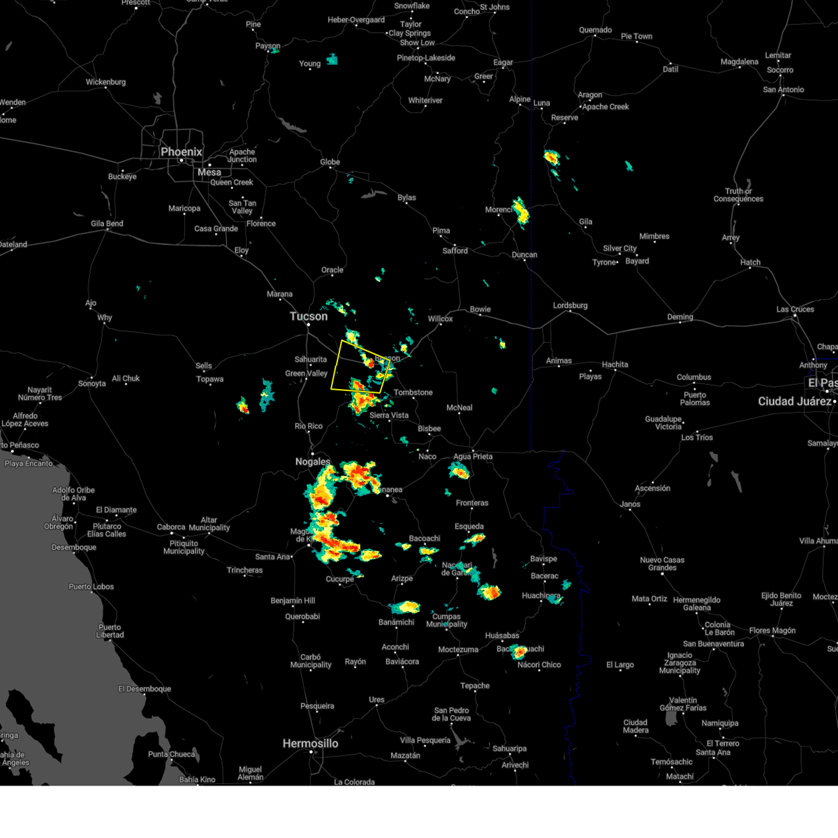
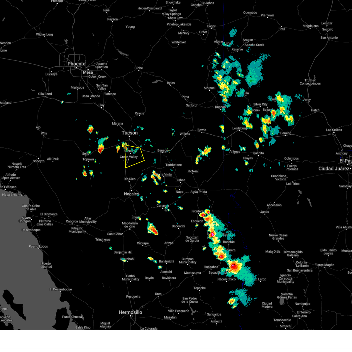
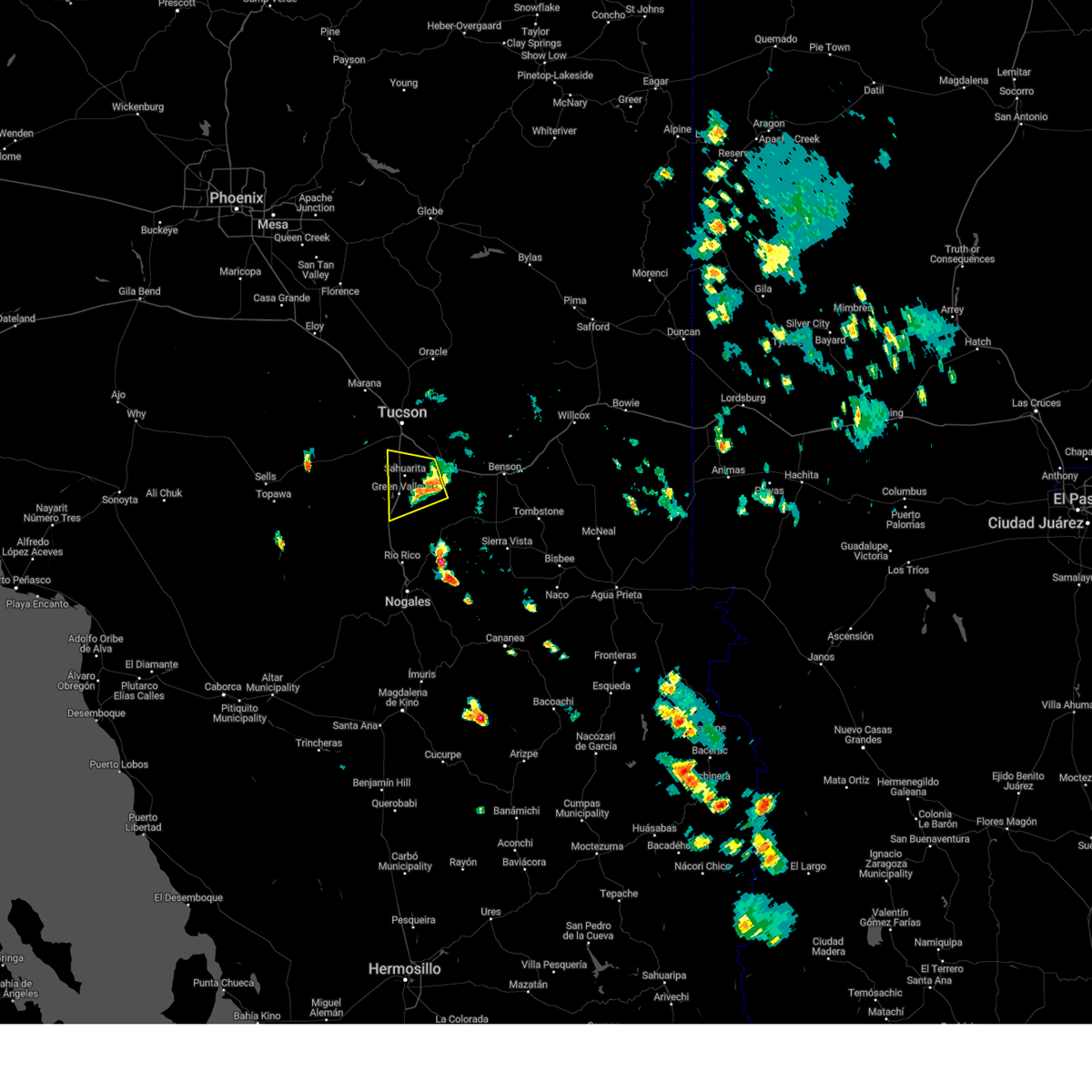
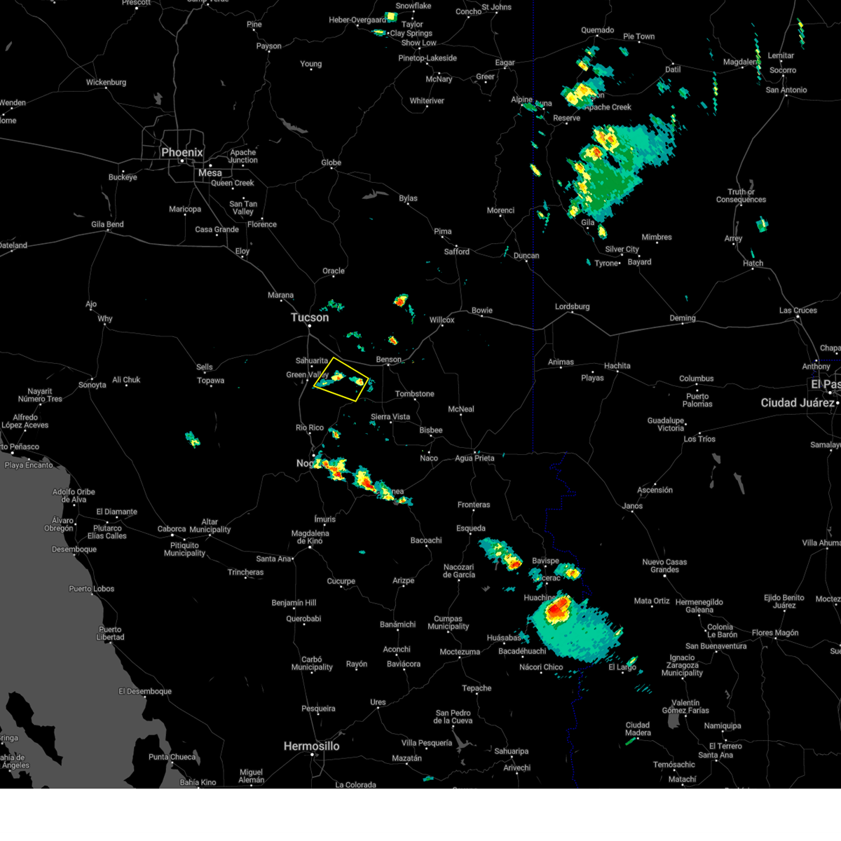
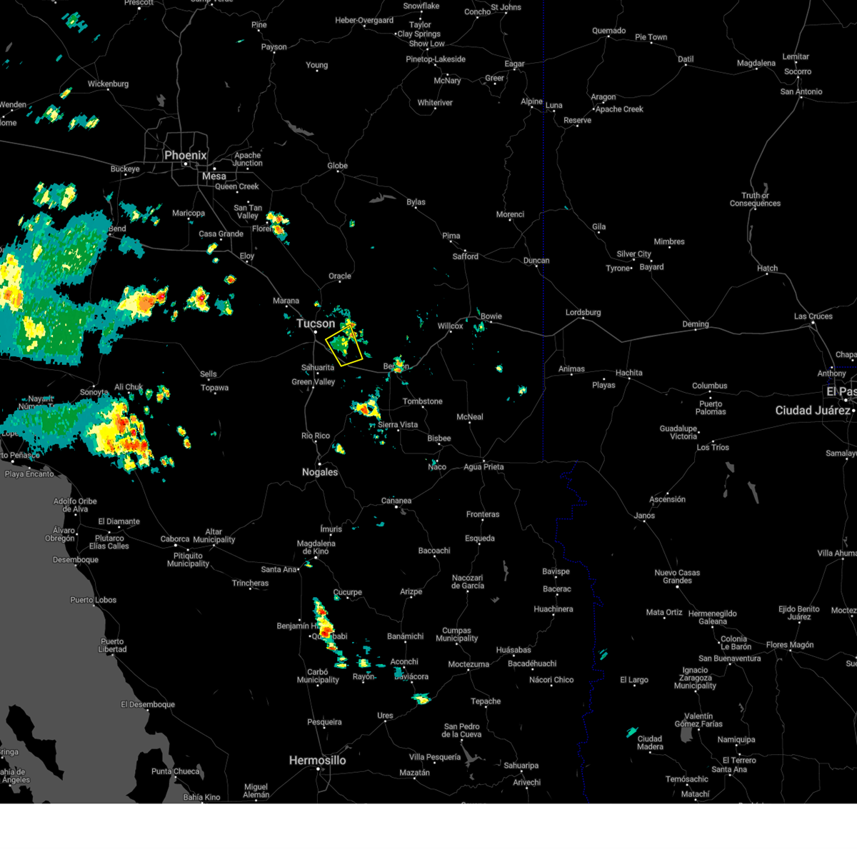
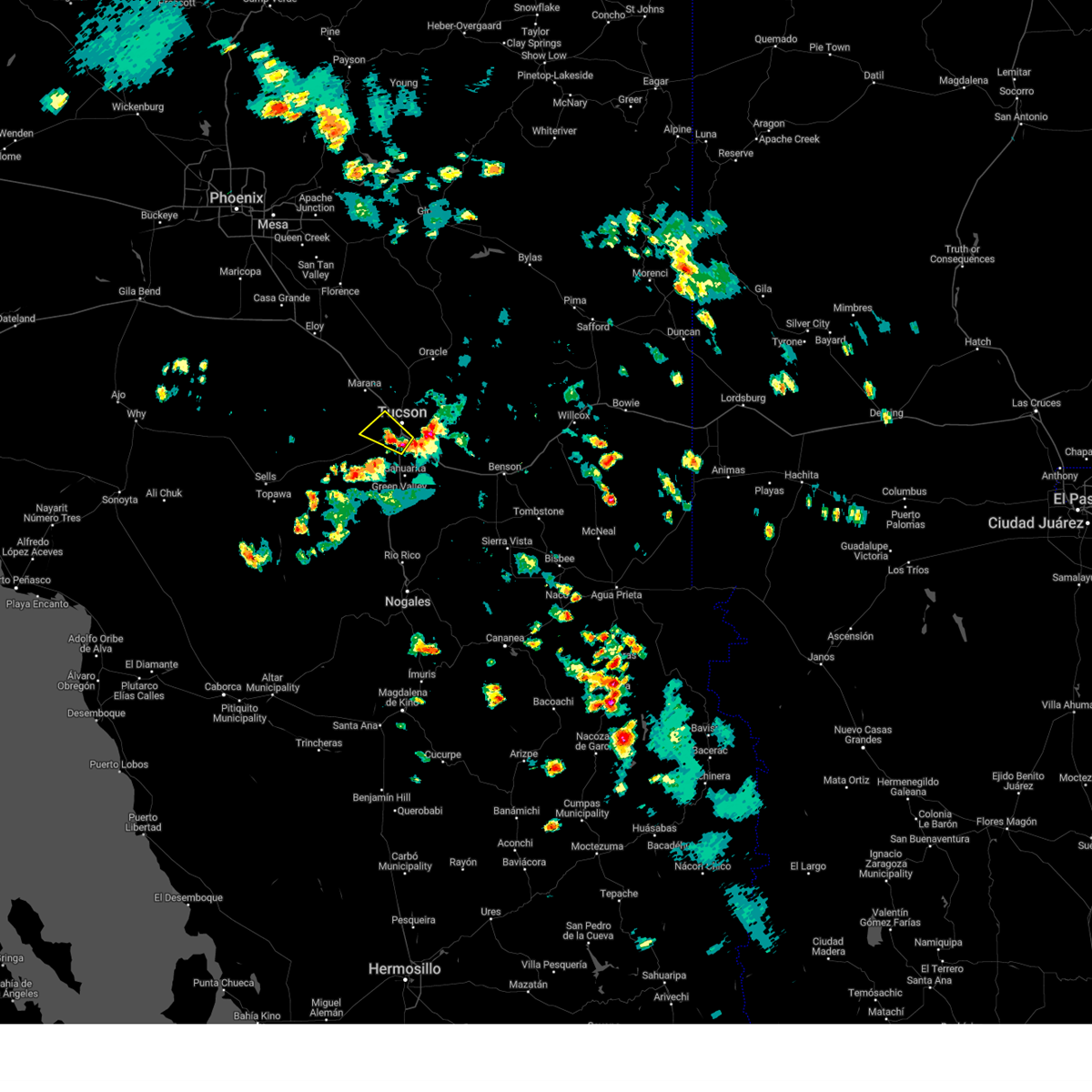
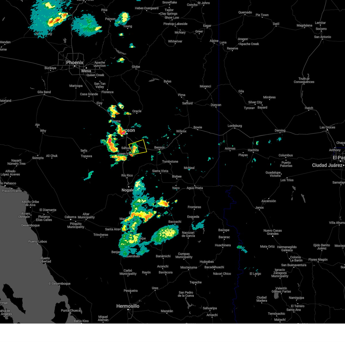
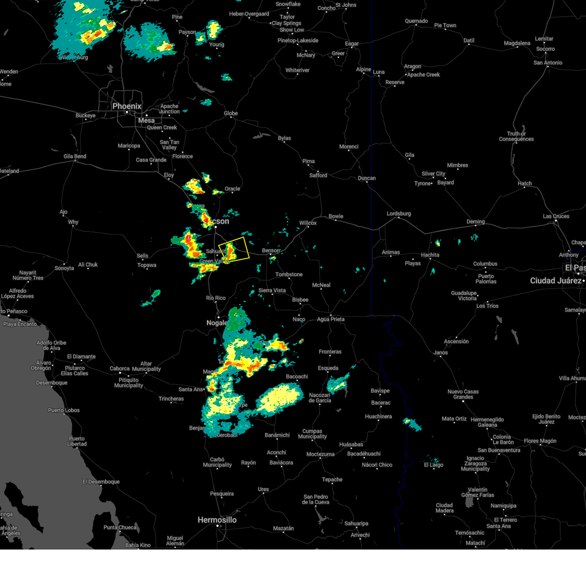
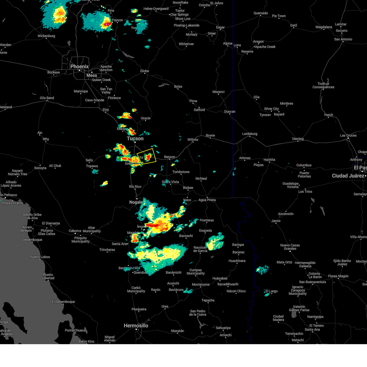
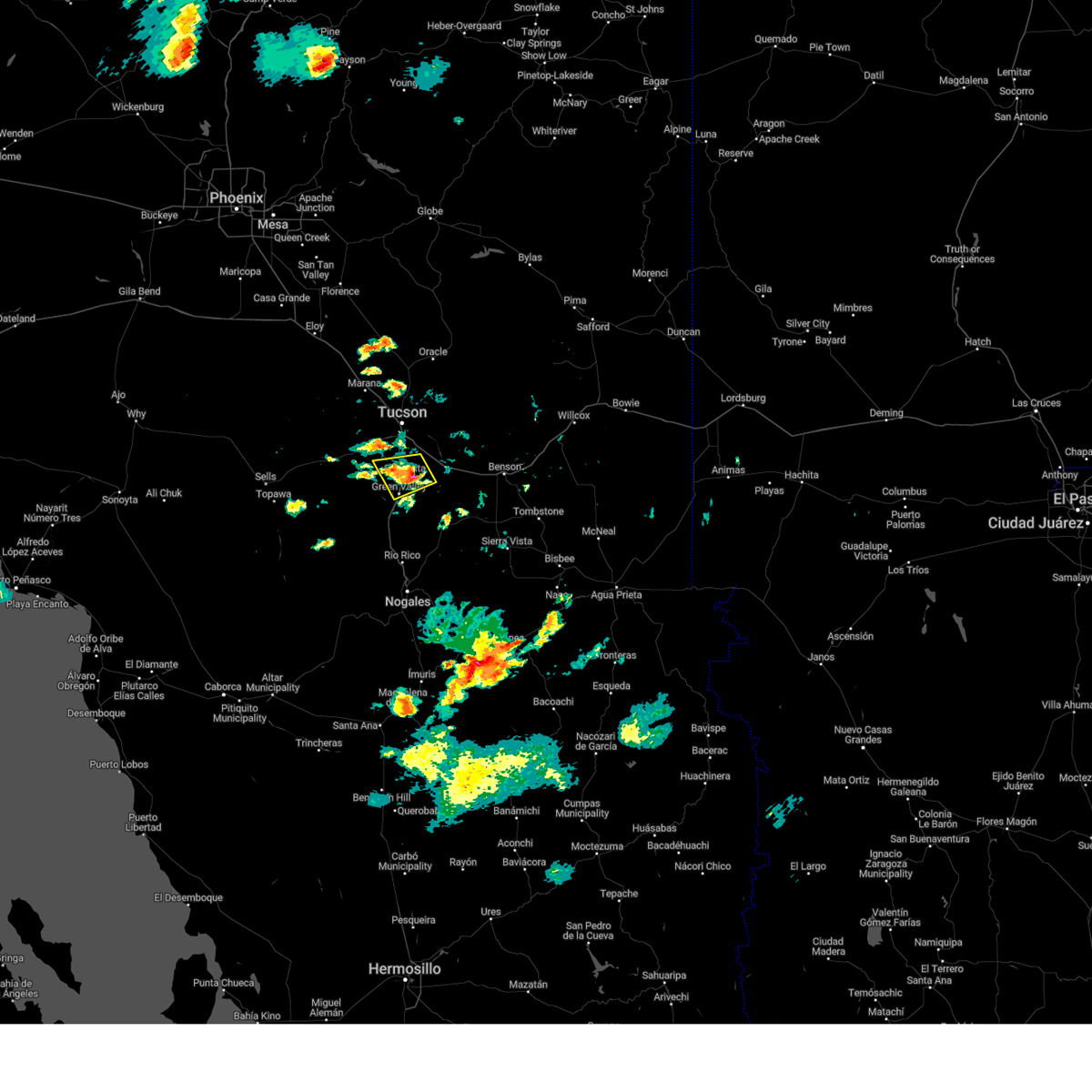
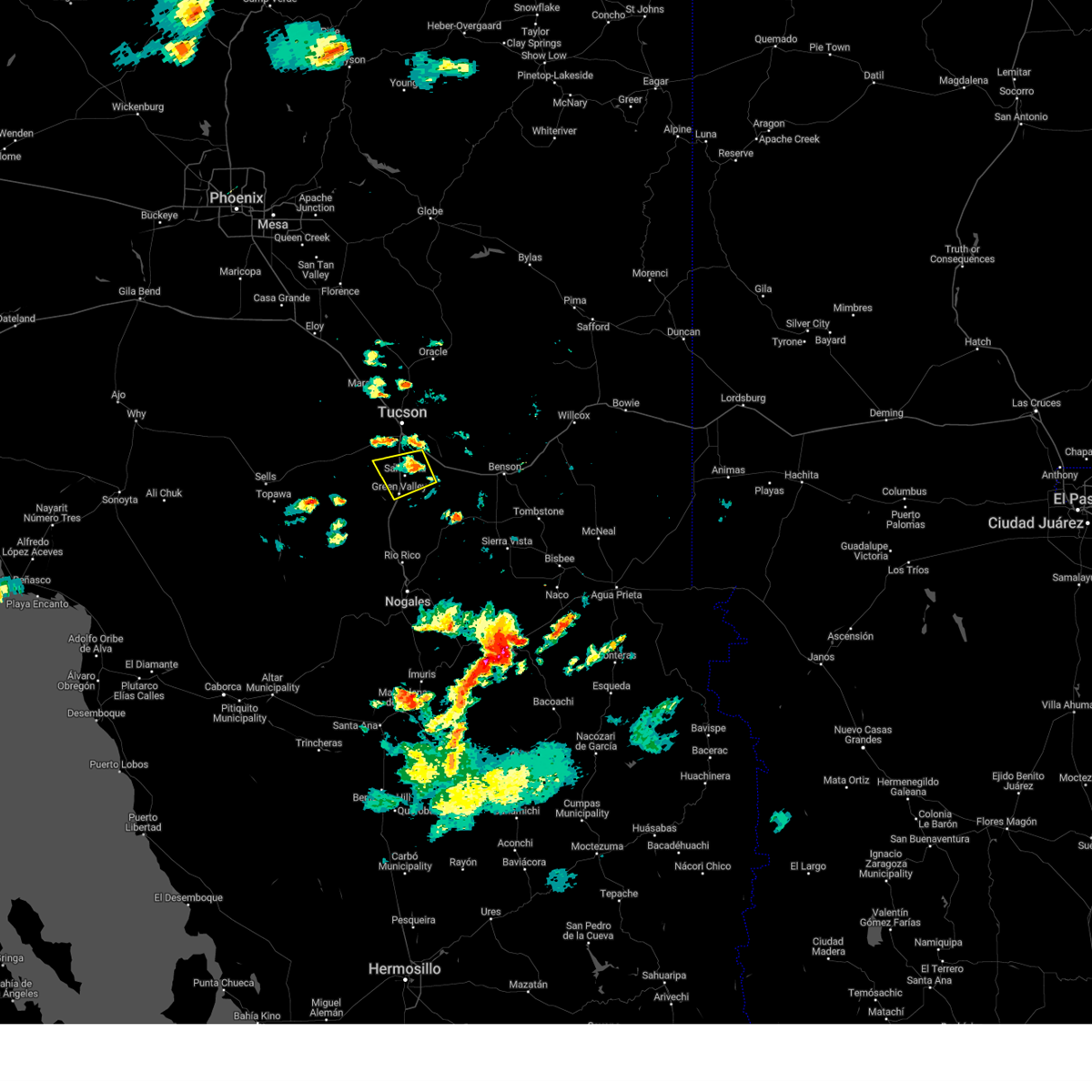
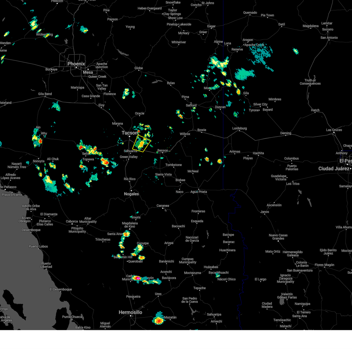
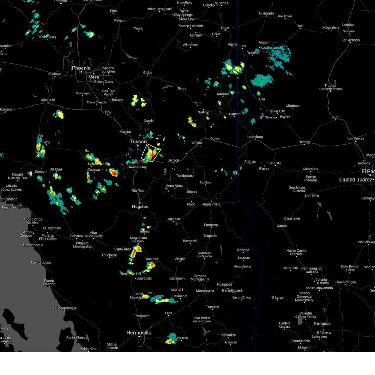
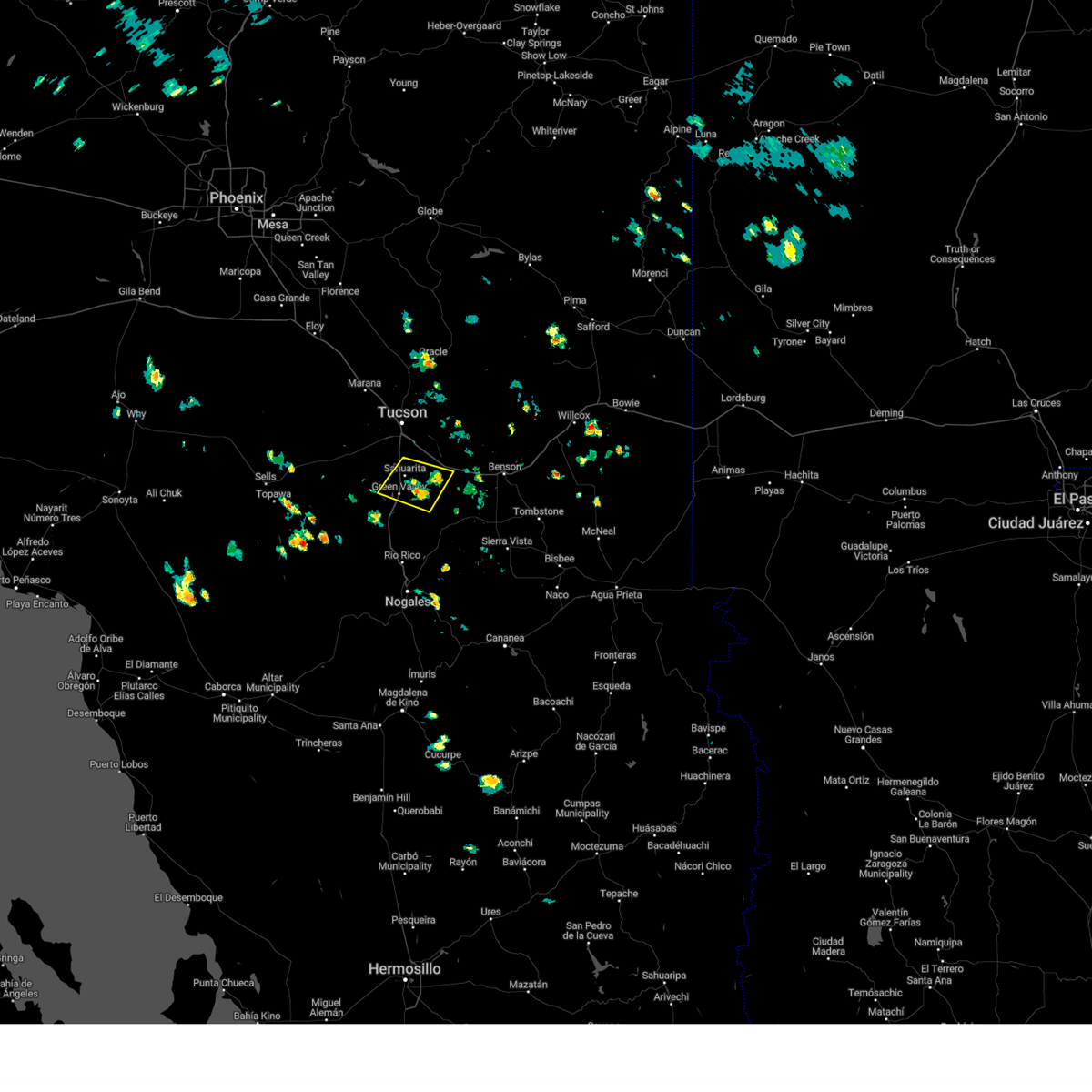
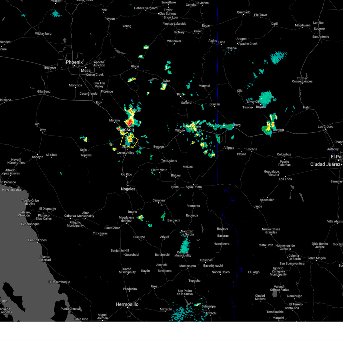
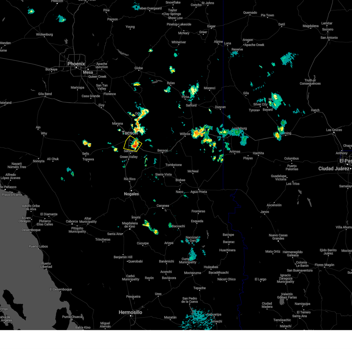
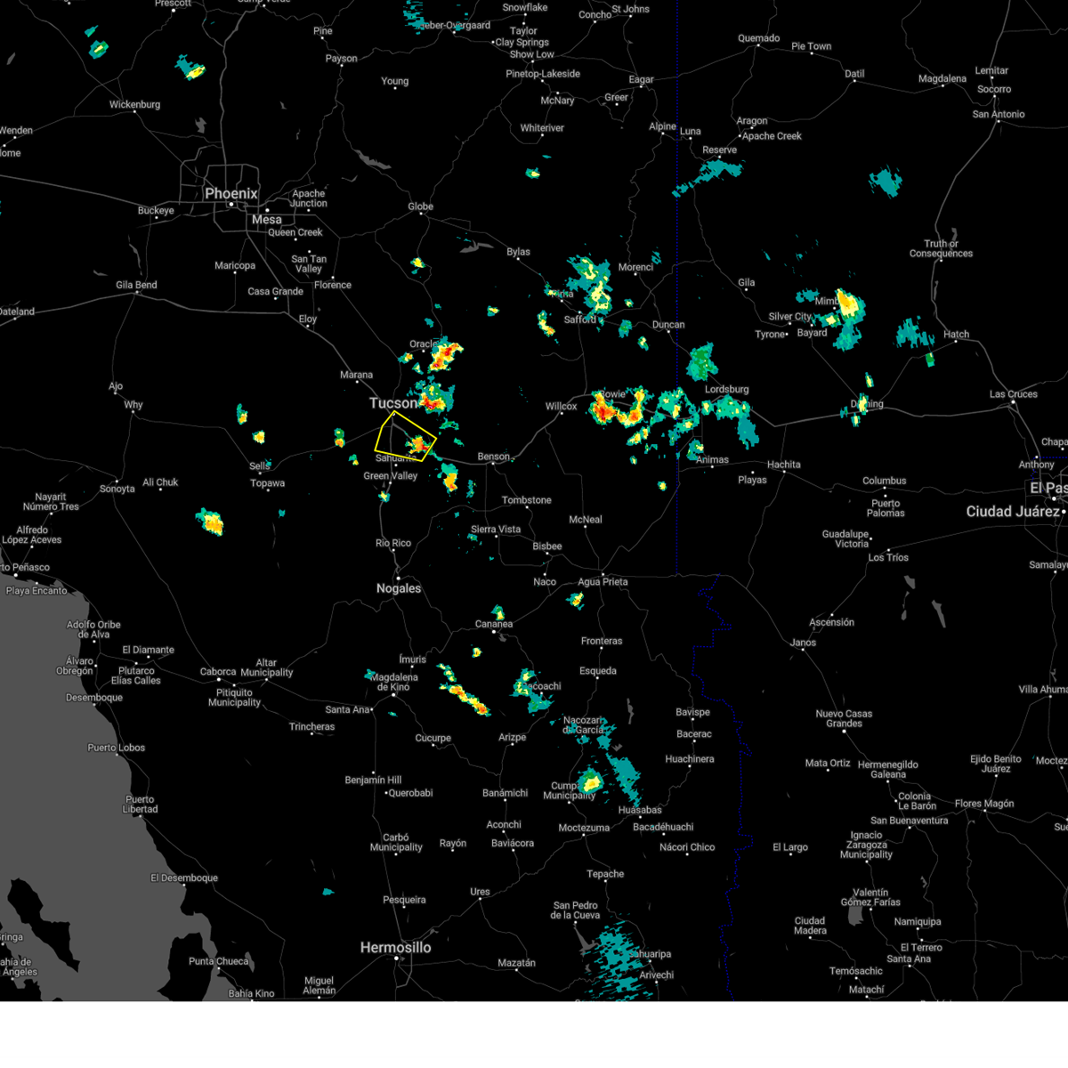
Hail Map for Tucson, AZ
The Tucson, AZ area has had 65 reports of on-the-ground hail by trained spotters, and has been under severe weather warnings 120 times during the past 12 months. Doppler radar has detected hail at or near Tucson, AZ on 117 occasions, including 14 occasions during the past year.
| Name: | Tucson, AZ |
| Where Located: | 4.3 miles SE of Tucson, AZ |
| Map: | Google Map for Tucson, AZ |
| Population: | 520116 |
| Housing Units: | 229762 |
| More Info: | Search Google for Tucson, AZ |
4
The Top Recent Hail Date for Tucson, AZ is Thursday, August 8, 2024 (3rd out of 117)

Hail and Wind Damage Spotted near Tucson, AZ
| Date / Time | Report Details |
|---|---|
| 7/15/2025 8:10 PM MST |
 the severe thunderstorm warning has been cancelled and is no longer in effect the severe thunderstorm warning has been cancelled and is no longer in effect
|
| 7/15/2025 7:46 PM MST |
 Svrtwc the national weather service in tucson has issued a * severe thunderstorm warning for, northeastern pima county in southeastern arizona, * until 830 pm mst. * at 746 pm mst, a severe thunderstorm was located over tortolita, moving south at 5 mph (radar indicated). Hazards include 60 mph wind gusts. expect damage to roofs, siding, and trees Svrtwc the national weather service in tucson has issued a * severe thunderstorm warning for, northeastern pima county in southeastern arizona, * until 830 pm mst. * at 746 pm mst, a severe thunderstorm was located over tortolita, moving south at 5 mph (radar indicated). Hazards include 60 mph wind gusts. expect damage to roofs, siding, and trees
|
| 7/15/2025 5:51 PM MST |
 the severe thunderstorm warning has been cancelled and is no longer in effect the severe thunderstorm warning has been cancelled and is no longer in effect
|
| 7/15/2025 5:46 PM MST |
 At 546 pm mst, a severe thunderstorm was located over tucson international airport, moving southwest at 5 mph (radar indicated). Hazards include 60 mph wind gusts. Expect damage to roofs, siding, and trees. locations impacted include, tucson, davis-monthan air force base, drexel heights, tanque verde, south tucson, san xavier community, tucson international airport, catalina foothills, tucson mountain park, rita ranch and san xavier mission. this includes the following highways, interstate 19 between mile markers 57 and 63. route 86 between mile markers 169 and 171. route 77 near mile marker 70. Interstate 10 between mile markers 254 and 272. At 546 pm mst, a severe thunderstorm was located over tucson international airport, moving southwest at 5 mph (radar indicated). Hazards include 60 mph wind gusts. Expect damage to roofs, siding, and trees. locations impacted include, tucson, davis-monthan air force base, drexel heights, tanque verde, south tucson, san xavier community, tucson international airport, catalina foothills, tucson mountain park, rita ranch and san xavier mission. this includes the following highways, interstate 19 between mile markers 57 and 63. route 86 between mile markers 169 and 171. route 77 near mile marker 70. Interstate 10 between mile markers 254 and 272.
|
| 7/15/2025 5:24 PM MST |
 Svrtwc the national weather service in tucson has issued a * severe thunderstorm warning for, east central pima county in southeastern arizona, * until 600 pm mst. * at 524 pm mst, a severe thunderstorm was located near tucson international airport, moving north at 5 mph (radar indicated). Hazards include 60 mph wind gusts and quarter size hail. Hail damage to vehicles is expected. Expect wind damage to roofs, siding, and trees. Svrtwc the national weather service in tucson has issued a * severe thunderstorm warning for, east central pima county in southeastern arizona, * until 600 pm mst. * at 524 pm mst, a severe thunderstorm was located near tucson international airport, moving north at 5 mph (radar indicated). Hazards include 60 mph wind gusts and quarter size hail. Hail damage to vehicles is expected. Expect wind damage to roofs, siding, and trees.
|
| 7/8/2025 5:54 PM MST | Report of damage to roofing. nearby wind gust of 51 mp in pima county AZ, 7.1 miles WSW of Tucson, AZ |
| 7/3/2025 3:24 PM MST |
 The storm which prompted the warning has weakened below severe limits, and no longer poses an immediate threat to life or property. therefore, the warning will be allowed to expire. however, gusty winds are still possible with this thunderstorm. to report severe weather, contact your nearest law enforcement agency. they will send your report to the national weather service office. The storm which prompted the warning has weakened below severe limits, and no longer poses an immediate threat to life or property. therefore, the warning will be allowed to expire. however, gusty winds are still possible with this thunderstorm. to report severe weather, contact your nearest law enforcement agency. they will send your report to the national weather service office.
|
| 7/3/2025 3:12 PM MST |
 At 312 pm mst, a severe thunderstorm was located 8 miles northwest of vail, moving northeast at 35 mph (radar indicated). Hazards include 60 mph wind gusts and small hail. Expect damage to roofs, siding, and trees. locations impacted include, tucson, sahuarita, san xavier community, summit and tucson international airport. this includes the following highways, interstate 19 between mile markers 49 and 57. Interstate 10 between mile markers 264 and 271. At 312 pm mst, a severe thunderstorm was located 8 miles northwest of vail, moving northeast at 35 mph (radar indicated). Hazards include 60 mph wind gusts and small hail. Expect damage to roofs, siding, and trees. locations impacted include, tucson, sahuarita, san xavier community, summit and tucson international airport. this includes the following highways, interstate 19 between mile markers 49 and 57. Interstate 10 between mile markers 264 and 271.
|
| 7/3/2025 2:48 PM MST |
 The severe thunderstorm warning that was previously in effect has been reissued for pima county and is in effect until 330 pm mst. please refer to that bulletin for the latest severe weather information. The severe thunderstorm warning that was previously in effect has been reissued for pima county and is in effect until 330 pm mst. please refer to that bulletin for the latest severe weather information.
|
| 7/3/2025 2:43 PM MST |
 Svrtwc the national weather service in tucson has issued a * severe thunderstorm warning for, northeastern pima county in southeastern arizona, * until 330 pm mst. * at 243 pm mst, a severe thunderstorm was located near catalina foothills, moving northeast at 10 mph (radar indicated). Hazards include 60 mph wind gusts and small hail. expect damage to roofs, siding, and trees Svrtwc the national weather service in tucson has issued a * severe thunderstorm warning for, northeastern pima county in southeastern arizona, * until 330 pm mst. * at 243 pm mst, a severe thunderstorm was located near catalina foothills, moving northeast at 10 mph (radar indicated). Hazards include 60 mph wind gusts and small hail. expect damage to roofs, siding, and trees
|
| 7/3/2025 2:30 PM MST | Palm tree knocked down due to thunderstorm winds. storm also had nickel sized hai in pima county AZ, 5.9 miles S of Tucson, AZ |
| 7/3/2025 2:18 PM MST |
 At 218 pm mst, a severe thunderstorm was located near saguaro national park west, moving northeast at 15 mph (radar indicated). Hazards include 60 mph wind gusts and small hail. Expect damage to roofs, siding, and trees. locations impacted include, tucson, oro valley, marana, sahuarita, davis-monthan air force base, casas adobes, drexel heights, flowing wells, south tucson, three points, pascua pueblo yaqui reservation, tortolita, san xavier community, tucson mountain park, tucson estates, valencia west, saguaro national park west, tucson international airport, catalina foothills and summit. this includes the following highways, interstate 19 between mile markers 48 and 63. route 86 between mile markers 156 and 171. route 77 between mile markers 70 and 75. Interstate 10 between mile markers 239 and 271. At 218 pm mst, a severe thunderstorm was located near saguaro national park west, moving northeast at 15 mph (radar indicated). Hazards include 60 mph wind gusts and small hail. Expect damage to roofs, siding, and trees. locations impacted include, tucson, oro valley, marana, sahuarita, davis-monthan air force base, casas adobes, drexel heights, flowing wells, south tucson, three points, pascua pueblo yaqui reservation, tortolita, san xavier community, tucson mountain park, tucson estates, valencia west, saguaro national park west, tucson international airport, catalina foothills and summit. this includes the following highways, interstate 19 between mile markers 48 and 63. route 86 between mile markers 156 and 171. route 77 between mile markers 70 and 75. Interstate 10 between mile markers 239 and 271.
|
| 7/3/2025 1:53 PM MST |
 Svrtwc the national weather service in tucson has issued a * severe thunderstorm warning for, northeastern pima county in southeastern arizona, * until 245 pm mst. * at 153 pm mst, a severe thunderstorm was located near saguaro national park west, moving northeast at 15 mph (radar indicated). Hazards include 60 mph wind gusts and small hail. expect damage to roofs, siding, and trees Svrtwc the national weather service in tucson has issued a * severe thunderstorm warning for, northeastern pima county in southeastern arizona, * until 245 pm mst. * at 153 pm mst, a severe thunderstorm was located near saguaro national park west, moving northeast at 15 mph (radar indicated). Hazards include 60 mph wind gusts and small hail. expect damage to roofs, siding, and trees
|
| 7/2/2025 3:11 PM MST |
 storm has weakened below severe limits storm has weakened below severe limits
|
| 7/2/2025 3:09 PM MST |
 At 309 pm mst, a severe thunderstorm was located near pascua pueblo yaqui reservation, moving northeast at 5 mph (radar indicated). Hazards include 60 mph wind gusts and small hail. Expect damage to roofs, siding, and trees. locations impacted include, tucson, sahuarita, drexel heights, pascua pueblo yaqui reservation, san xavier community, summit, valencia west, tucson international airport, tucson mountain park and san xavier mission. This includes interstate 19 between mile markers 49 and 60. At 309 pm mst, a severe thunderstorm was located near pascua pueblo yaqui reservation, moving northeast at 5 mph (radar indicated). Hazards include 60 mph wind gusts and small hail. Expect damage to roofs, siding, and trees. locations impacted include, tucson, sahuarita, drexel heights, pascua pueblo yaqui reservation, san xavier community, summit, valencia west, tucson international airport, tucson mountain park and san xavier mission. This includes interstate 19 between mile markers 49 and 60.
|
| 7/2/2025 2:42 PM MST |
 storm has weakened and moved out of the area storm has weakened and moved out of the area
|
| 7/2/2025 2:38 PM MST | (delayed report) media reported downed power poles near the intersection of south 6th avenue and nebraska stree in pima county AZ, 4.3 miles NE of Tucson, AZ |
| 7/2/2025 2:38 PM MST | (delayed report) some downed tree limbs... over an inch of rai in pima county AZ, 6.1 miles ENE of Tucson, AZ |
| 7/2/2025 2:37 PM MST |
 Svrtwc the national weather service in tucson has issued a * severe thunderstorm warning for, east central pima county in southeastern arizona, * until 315 pm mst. * at 237 pm mst, a severe thunderstorm was located near pascua pueblo yaqui reservation, moving northeast at 5 mph (radar indicated). Hazards include 60 mph wind gusts and small hail. expect damage to roofs, siding, and trees Svrtwc the national weather service in tucson has issued a * severe thunderstorm warning for, east central pima county in southeastern arizona, * until 315 pm mst. * at 237 pm mst, a severe thunderstorm was located near pascua pueblo yaqui reservation, moving northeast at 5 mph (radar indicated). Hazards include 60 mph wind gusts and small hail. expect damage to roofs, siding, and trees
|
| 7/2/2025 2:22 PM MST |
 At 222 pm mst, a severe thunderstorm was located near vail, moving north northeast at 5 mph (radar indicated). Hazards include 60 mph wind gusts and small hail. Expect damage to roofs, siding, and trees. locations impacted include, tucson, vail, corona de tucson and rita ranch. this includes the following highways, interstate 10 between mile markers 275 and 286. Route 83 between mile markers 52 and 58. At 222 pm mst, a severe thunderstorm was located near vail, moving north northeast at 5 mph (radar indicated). Hazards include 60 mph wind gusts and small hail. Expect damage to roofs, siding, and trees. locations impacted include, tucson, vail, corona de tucson and rita ranch. this includes the following highways, interstate 10 between mile markers 275 and 286. Route 83 between mile markers 52 and 58.
|
| 7/2/2025 2:05 PM MST | 56 people without power due to equipment damage from thunderstor in pima county AZ, 5.9 miles E of Tucson, AZ |
| 7/2/2025 1:59 PM MST |
 Svrtwc the national weather service in tucson has issued a * severe thunderstorm warning for, east central pima county in southeastern arizona, * until 245 pm mst. * at 159 pm mst, a severe thunderstorm was located over vail, moving north northeast at 5 mph (radar indicated). Hazards include 60 mph wind gusts and small hail. expect damage to roofs, siding, and trees Svrtwc the national weather service in tucson has issued a * severe thunderstorm warning for, east central pima county in southeastern arizona, * until 245 pm mst. * at 159 pm mst, a severe thunderstorm was located over vail, moving north northeast at 5 mph (radar indicated). Hazards include 60 mph wind gusts and small hail. expect damage to roofs, siding, and trees
|
| 8/23/2024 5:21 PM MST |
 The storm which prompted the warning has weakened below severe limits. therefore, the warning will be allowed to expire. The storm which prompted the warning has weakened below severe limits. therefore, the warning will be allowed to expire.
|
| 8/23/2024 5:06 PM MST |
 The storm which prompted the warning has weakened below severe limits. therefore, the warning will be allowed to expire. however, heavy rain is still possible with this thunderstorm. The storm which prompted the warning has weakened below severe limits. therefore, the warning will be allowed to expire. however, heavy rain is still possible with this thunderstorm.
|
| 8/23/2024 4:52 PM MST |
 Svrtwc the national weather service in tucson has issued a * severe thunderstorm warning for, eastern pima county in southeastern arizona, * until 530 pm mst. * at 451 pm mst, a severe thunderstorm was located near tucson international airport, moving north at 10 mph (radar indicated). Hazards include 60 mph wind gusts and penny size hail. expect damage to roofs, siding, and trees Svrtwc the national weather service in tucson has issued a * severe thunderstorm warning for, eastern pima county in southeastern arizona, * until 530 pm mst. * at 451 pm mst, a severe thunderstorm was located near tucson international airport, moving north at 10 mph (radar indicated). Hazards include 60 mph wind gusts and penny size hail. expect damage to roofs, siding, and trees
|
| 8/23/2024 4:46 PM MST | Tree branches dow in pima county AZ, 12.4 miles SE of Tucson, AZ |
| 8/23/2024 4:26 PM MST |
 Svrtwc the national weather service in tucson has issued a * severe thunderstorm warning for, northeastern pima county in southeastern arizona, * until 515 pm mst. * at 425 pm mst, a severe thunderstorm was located near flowing wells, or 9 miles south of marana, moving north at 10 mph (radar indicated). Hazards include 60 mph wind gusts and nickel size hail. expect damage to roofs, siding, and trees Svrtwc the national weather service in tucson has issued a * severe thunderstorm warning for, northeastern pima county in southeastern arizona, * until 515 pm mst. * at 425 pm mst, a severe thunderstorm was located near flowing wells, or 9 miles south of marana, moving north at 10 mph (radar indicated). Hazards include 60 mph wind gusts and nickel size hail. expect damage to roofs, siding, and trees
|
| 8/23/2024 4:19 PM MST | Quarter sized hail reported 10.6 miles E of Tucson, AZ |
| 8/23/2024 4:13 PM MST | Tree branches down on a car in the home depot parking lot off of w. costco d in pima county AZ, 12.9 miles SE of Tucson, AZ |
| 8/23/2024 4:11 PM MST | Street flooding on w. costco driv in pima county AZ, 12.9 miles SE of Tucson, AZ |
| 8/23/2024 4:04 PM MST |
 the severe thunderstorm warning has been cancelled and is no longer in effect the severe thunderstorm warning has been cancelled and is no longer in effect
|
| 8/23/2024 3:48 PM MST | Report of downed tree branches. fence was also damaged/knocked dow in pima county AZ, 12.4 miles SE of Tucson, AZ |
| 8/23/2024 3:45 PM MST |
 Svrtwc the national weather service in tucson has issued a * severe thunderstorm warning for, northeastern pima county in southeastern arizona, * until 430 pm mst. * at 344 pm mst, a severe thunderstorm was located near saguaro national park west, or 8 miles south of marana, moving north at 10 mph (radar indicated). Hazards include 60 mph wind gusts and penny size hail. expect damage to roofs, siding, and trees Svrtwc the national weather service in tucson has issued a * severe thunderstorm warning for, northeastern pima county in southeastern arizona, * until 430 pm mst. * at 344 pm mst, a severe thunderstorm was located near saguaro national park west, or 8 miles south of marana, moving north at 10 mph (radar indicated). Hazards include 60 mph wind gusts and penny size hail. expect damage to roofs, siding, and trees
|
| 8/23/2024 3:26 PM MST |
 Svrtwc the national weather service in tucson has issued a * severe thunderstorm warning for, east central pima county in southeastern arizona, west central cochise county in southeastern arizona, * until 415 pm mst. * at 326 pm mst, a severe thunderstorm was located near vail, or 17 miles southeast of davis-monthan air force base, moving northeast at 10 mph (radar indicated). Hazards include 60 mph wind gusts and penny size hail. expect damage to roofs, siding, and trees Svrtwc the national weather service in tucson has issued a * severe thunderstorm warning for, east central pima county in southeastern arizona, west central cochise county in southeastern arizona, * until 415 pm mst. * at 326 pm mst, a severe thunderstorm was located near vail, or 17 miles southeast of davis-monthan air force base, moving northeast at 10 mph (radar indicated). Hazards include 60 mph wind gusts and penny size hail. expect damage to roofs, siding, and trees
|
| 8/23/2024 2:41 PM MST |
 Svrtwc the national weather service in tucson has issued a * severe thunderstorm warning for, east central pima county in southeastern arizona, west central cochise county in southeastern arizona, * until 330 pm mst. * at 240 pm mst, a severe thunderstorm was located 5 miles northeast of vail, or 17 miles east of davis-monthan air force base, moving north at 10 mph (radar indicated). Hazards include 60 mph wind gusts and nickel size hail. expect damage to roofs, siding, and trees Svrtwc the national weather service in tucson has issued a * severe thunderstorm warning for, east central pima county in southeastern arizona, west central cochise county in southeastern arizona, * until 330 pm mst. * at 240 pm mst, a severe thunderstorm was located 5 miles northeast of vail, or 17 miles east of davis-monthan air force base, moving north at 10 mph (radar indicated). Hazards include 60 mph wind gusts and nickel size hail. expect damage to roofs, siding, and trees
|
| 8/22/2024 2:50 PM MST |
 The storm which prompted the warning has weakened below severe limits, and no longer poses an immediate threat to life or property. therefore, the warning will be allowed to expire. however, heavy rain is still possible with this thunderstorm. The storm which prompted the warning has weakened below severe limits, and no longer poses an immediate threat to life or property. therefore, the warning will be allowed to expire. however, heavy rain is still possible with this thunderstorm.
|
| 8/22/2024 2:35 PM MST |
 At 235 pm mst, a severe thunderstorm was located over valencia west, or 15 miles west of tucson, moving northeast at 5 mph (radar indicated). Hazards include 60 mph wind gusts and nickel size hail. Expect damage to roofs, siding, and trees. locations impacted include, tucson, three points, saguaro national park west, tucson mountain park, tucson estates, valencia west, picture rocks, and ryan airfield. This includes route 86 between mile markers 156 and 164. At 235 pm mst, a severe thunderstorm was located over valencia west, or 15 miles west of tucson, moving northeast at 5 mph (radar indicated). Hazards include 60 mph wind gusts and nickel size hail. Expect damage to roofs, siding, and trees. locations impacted include, tucson, three points, saguaro national park west, tucson mountain park, tucson estates, valencia west, picture rocks, and ryan airfield. This includes route 86 between mile markers 156 and 164.
|
| 8/22/2024 2:10 PM MST |
 Svrtwc the national weather service in tucson has issued a * severe thunderstorm warning for, northeastern pima county in southeastern arizona, * until 300 pm mst. * at 210 pm mst, a severe thunderstorm was located near tucson estates, or 17 miles south of marana, moving north at 10 mph (radar indicated). Hazards include 60 mph wind gusts and nickel size hail. expect damage to roofs, siding, and trees Svrtwc the national weather service in tucson has issued a * severe thunderstorm warning for, northeastern pima county in southeastern arizona, * until 300 pm mst. * at 210 pm mst, a severe thunderstorm was located near tucson estates, or 17 miles south of marana, moving north at 10 mph (radar indicated). Hazards include 60 mph wind gusts and nickel size hail. expect damage to roofs, siding, and trees
|
| 8/21/2024 12:51 PM MST |
 The storm which prompted the warning has weakened below severe limits, and no longer poses an immediate threat to life or property. therefore, the warning will be allowed to expire. however, gusty winds and heavy rain are still possible with this thunderstorm. The storm which prompted the warning has weakened below severe limits, and no longer poses an immediate threat to life or property. therefore, the warning will be allowed to expire. however, gusty winds and heavy rain are still possible with this thunderstorm.
|
| 8/21/2024 12:35 PM MST |
 At 1235 pm mst, a severe thunderstorm was located over flowing wells, or 9 miles south of oro valley, moving north at 20 mph (radar indicated). Hazards include 60 mph wind gusts and quarter size hail. Hail damage to vehicles is expected. expect wind damage to roofs, siding, and trees. locations impacted include, tucson, catalina, oro valley, marana, casas adobes, flowing wells, avra valley, tortolita, tucson estates, saguaro national park west, tucson mountain park, catalina state park, catalina foothills, and picture rocks. this includes the following highways, interstate 10 between mile markers 240 and 259. Route 77 between mile markers 70 and 84. At 1235 pm mst, a severe thunderstorm was located over flowing wells, or 9 miles south of oro valley, moving north at 20 mph (radar indicated). Hazards include 60 mph wind gusts and quarter size hail. Hail damage to vehicles is expected. expect wind damage to roofs, siding, and trees. locations impacted include, tucson, catalina, oro valley, marana, casas adobes, flowing wells, avra valley, tortolita, tucson estates, saguaro national park west, tucson mountain park, catalina state park, catalina foothills, and picture rocks. this includes the following highways, interstate 10 between mile markers 240 and 259. Route 77 between mile markers 70 and 84.
|
| 8/21/2024 12:23 PM MST | Half Dollar sized hail reported 7.5 miles ESE of Tucson, AZ, trained spotter reported 1.25 inch accumulating hail. |
| 8/21/2024 12:21 PM MST | Quarter sized hail reported 6.9 miles ESE of Tucson, AZ, report from trained spotter of accumulating 1 inch hail. |
| 8/21/2024 12:17 PM MST |
 Svrtwc the national weather service in tucson has issued a * severe thunderstorm warning for, northeastern pima county in southeastern arizona, * until 100 pm mst. * at 1216 pm mst, a severe thunderstorm was located over south tucson, or 7 miles west of tucson, moving north at 20 mph (radar indicated). Hazards include 60 mph wind gusts and quarter size hail. Hail damage to vehicles is expected. Expect wind damage to roofs, siding, and trees. Svrtwc the national weather service in tucson has issued a * severe thunderstorm warning for, northeastern pima county in southeastern arizona, * until 100 pm mst. * at 1216 pm mst, a severe thunderstorm was located over south tucson, or 7 miles west of tucson, moving north at 20 mph (radar indicated). Hazards include 60 mph wind gusts and quarter size hail. Hail damage to vehicles is expected. Expect wind damage to roofs, siding, and trees.
|
| 8/20/2024 6:55 PM MST |
 The storm which prompted the warning near west tucson has weakened below severe limits. therefore, the warning will be allowed to expire. however, gusty winds and heavy rain are still possible with this thunderstorm. The storm which prompted the warning near west tucson has weakened below severe limits. therefore, the warning will be allowed to expire. however, gusty winds and heavy rain are still possible with this thunderstorm.
|
| 8/20/2024 6:43 PM MST |
 At 642 pm mst, a severe thunderstorm was located near tucson mountain park, or 10 miles west of tucson, moving northwest at 10 mph (radar indicated). Hazards include 60 mph wind gusts and penny size hail. Expect damage to roofs, siding, and trees. locations impacted include, west tucson, drexel heights, flowing wells, south tucson, saguaro national park west, tucson mountain park, tucson estates, and picture rocks. this includes the following highways, interstate 10 between mile markers 250 and 260. interstate 19 between mile markers 61 and 63. route 77 between mile markers 70 and 71. Route 86 between mile markers 164 and 171. At 642 pm mst, a severe thunderstorm was located near tucson mountain park, or 10 miles west of tucson, moving northwest at 10 mph (radar indicated). Hazards include 60 mph wind gusts and penny size hail. Expect damage to roofs, siding, and trees. locations impacted include, west tucson, drexel heights, flowing wells, south tucson, saguaro national park west, tucson mountain park, tucson estates, and picture rocks. this includes the following highways, interstate 10 between mile markers 250 and 260. interstate 19 between mile markers 61 and 63. route 77 between mile markers 70 and 71. Route 86 between mile markers 164 and 171.
|
| 8/20/2024 6:18 PM MST |
 Svrtwc the national weather service in tucson has issued a * severe thunderstorm warning for, northeastern pima county in southeastern arizona, * until 700 pm mst. * at 618 pm mst, a severe thunderstorm was located over south tucson, or near tucson, moving northwest at 10 mph (radar indicated). Hazards include 60 mph wind gusts and penny size hail. expect damage to roofs, siding, and trees Svrtwc the national weather service in tucson has issued a * severe thunderstorm warning for, northeastern pima county in southeastern arizona, * until 700 pm mst. * at 618 pm mst, a severe thunderstorm was located over south tucson, or near tucson, moving northwest at 10 mph (radar indicated). Hazards include 60 mph wind gusts and penny size hail. expect damage to roofs, siding, and trees
|
| 8/20/2024 4:35 PM MST |
 The storm which prompted the warning has weakened below severe limits, and no longer poses an immediate threat to life or property. therefore, the warning will be allowed to expire. The storm which prompted the warning has weakened below severe limits, and no longer poses an immediate threat to life or property. therefore, the warning will be allowed to expire.
|
| 8/20/2024 4:13 PM MST |
 the severe thunderstorm warning has been cancelled and is no longer in effect the severe thunderstorm warning has been cancelled and is no longer in effect
|
| 8/20/2024 4:13 PM MST |
 At 412 pm mst, a severe thunderstorm was located near saguaro national park east, or 16 miles northeast of davis-monthan air force base, moving northwest at 10 mph (radar indicated). Hazards include 60 mph wind gusts and quarter size hail. Hail damage to vehicles is expected. expect wind damage to roofs, siding, and trees. Locations impacted include, tanque verde and saguaro national park east. At 412 pm mst, a severe thunderstorm was located near saguaro national park east, or 16 miles northeast of davis-monthan air force base, moving northwest at 10 mph (radar indicated). Hazards include 60 mph wind gusts and quarter size hail. Hail damage to vehicles is expected. expect wind damage to roofs, siding, and trees. Locations impacted include, tanque verde and saguaro national park east.
|
| 8/20/2024 3:57 PM MST |
 Svrtwc the national weather service in tucson has issued a * severe thunderstorm warning for, northeastern pima county in southeastern arizona, northwestern cochise county in southeastern arizona, * until 445 pm mst. * at 357 pm mst, a severe thunderstorm was located near saguaro national park east, or 18 miles east of davis-monthan air force base, moving northwest at 10 mph (radar indicated). Hazards include 60 mph wind gusts and quarter size hail. Hail damage to vehicles is expected. Expect wind damage to roofs, siding, and trees. Svrtwc the national weather service in tucson has issued a * severe thunderstorm warning for, northeastern pima county in southeastern arizona, northwestern cochise county in southeastern arizona, * until 445 pm mst. * at 357 pm mst, a severe thunderstorm was located near saguaro national park east, or 18 miles east of davis-monthan air force base, moving northwest at 10 mph (radar indicated). Hazards include 60 mph wind gusts and quarter size hail. Hail damage to vehicles is expected. Expect wind damage to roofs, siding, and trees.
|
| 8/19/2024 5:53 PM MST |
 The storm which prompted the warning has weakened below severe limits, and has exited the warned area. therefore, the warning will be allowed to expire. The storm which prompted the warning has weakened below severe limits, and has exited the warned area. therefore, the warning will be allowed to expire.
|
| 8/19/2024 5:38 PM MST |
 At 536 pm mst, a severe thunderstorm was located over summit, or 8 miles southwest of davis-monthan air force base, moving west at 10 mph (radar indicated). Hazards include 60 mph wind gusts and quarter size hail. Hail damage to vehicles is expected. expect wind damage to roofs, siding, and trees. locations impacted include, tucson, sahuarita, drexel heights, pascua pueblo yaqui reservation, san xavier community, tucson international airport, summit, and san xavier mission. this includes the following highways, interstate 19 between mile markers 49 and 60. Route 86 near mile marker 167. At 536 pm mst, a severe thunderstorm was located over summit, or 8 miles southwest of davis-monthan air force base, moving west at 10 mph (radar indicated). Hazards include 60 mph wind gusts and quarter size hail. Hail damage to vehicles is expected. expect wind damage to roofs, siding, and trees. locations impacted include, tucson, sahuarita, drexel heights, pascua pueblo yaqui reservation, san xavier community, tucson international airport, summit, and san xavier mission. this includes the following highways, interstate 19 between mile markers 49 and 60. Route 86 near mile marker 167.
|
| 8/19/2024 5:17 PM MST |
 Svrtwc the national weather service in tucson has issued a * severe thunderstorm warning for, eastern pima county in southeastern arizona, * until 600 pm mst. * at 517 pm mst, a severe thunderstorm was located near tucson international airport, or near davis-monthan air force base, moving west at 10 mph (radar indicated). Hazards include 60 mph wind gusts and quarter size hail. Hail damage to vehicles is expected. Expect wind damage to roofs, siding, and trees. Svrtwc the national weather service in tucson has issued a * severe thunderstorm warning for, eastern pima county in southeastern arizona, * until 600 pm mst. * at 517 pm mst, a severe thunderstorm was located near tucson international airport, or near davis-monthan air force base, moving west at 10 mph (radar indicated). Hazards include 60 mph wind gusts and quarter size hail. Hail damage to vehicles is expected. Expect wind damage to roofs, siding, and trees.
|
| 8/19/2024 4:59 PM MST |
 The storm which prompted the warning has weakened below severe limits, and no longer poses an immediate threat to life or property. therefore, the warning will be allowed to expire. The storm which prompted the warning has weakened below severe limits, and no longer poses an immediate threat to life or property. therefore, the warning will be allowed to expire.
|
| 8/19/2024 4:37 PM MST |
 At 437 pm mst, a severe thunderstorm was located near tanque verde, or 7 miles northeast of davis-monthan air force base, moving southwest at 10 mph (radar indicated). Hazards include 60 mph wind gusts and quarter size hail. Hail damage to vehicles is expected. expect wind damage to roofs, siding, and trees. locations impacted include, tucson, davis-monthan air force base, casas adobes, flowing wells, tanque verde, south tucson, sabino canyon recreation area, catalina foothills, tucson international airport, saguaro national park east, rita ranch, and seven falls. this includes the following highways, interstate 10 between mile markers 252 and 274. interstate 19 between mile markers 62 and 63. Route 77 between mile markers 70 and 73. At 437 pm mst, a severe thunderstorm was located near tanque verde, or 7 miles northeast of davis-monthan air force base, moving southwest at 10 mph (radar indicated). Hazards include 60 mph wind gusts and quarter size hail. Hail damage to vehicles is expected. expect wind damage to roofs, siding, and trees. locations impacted include, tucson, davis-monthan air force base, casas adobes, flowing wells, tanque verde, south tucson, sabino canyon recreation area, catalina foothills, tucson international airport, saguaro national park east, rita ranch, and seven falls. this includes the following highways, interstate 10 between mile markers 252 and 274. interstate 19 between mile markers 62 and 63. Route 77 between mile markers 70 and 73.
|
| 8/19/2024 4:36 PM MST | Quarter sized hail reported 9.3 miles WSW of Tucson, AZ, video and comment on social media showing heavy rain and hail with an estimated size of 1 inch diameter. |
| 8/19/2024 4:14 PM MST |
 The storms which prompted the warning have weakened below severe limits, and no longer pose an immediate threat to life or property. therefore, the warning will be allowed to expire. The storms which prompted the warning have weakened below severe limits, and no longer pose an immediate threat to life or property. therefore, the warning will be allowed to expire.
|
| 8/19/2024 4:12 PM MST |
 Svrtwc the national weather service in tucson has issued a * severe thunderstorm warning for, east central pima county in southeastern arizona, * until 500 pm mst. * at 412 pm mst, a severe thunderstorm was located over tanque verde, or 11 miles northeast of davis-monthan air force base, moving southwest at 10 mph (radar indicated). Hazards include 60 mph wind gusts and quarter size hail. Hail damage to vehicles is expected. Expect wind damage to roofs, siding, and trees. Svrtwc the national weather service in tucson has issued a * severe thunderstorm warning for, east central pima county in southeastern arizona, * until 500 pm mst. * at 412 pm mst, a severe thunderstorm was located over tanque verde, or 11 miles northeast of davis-monthan air force base, moving southwest at 10 mph (radar indicated). Hazards include 60 mph wind gusts and quarter size hail. Hail damage to vehicles is expected. Expect wind damage to roofs, siding, and trees.
|
| 8/19/2024 3:56 PM MST |
 At 356 pm mst, severe thunderstorms were located along a line extending from 5 miles east of vail to 7 miles northeast of sonoita, moving west at 15 mph (radar indicated). Hazards include 60 mph wind gusts and quarter size hail. Hail damage to vehicles is expected. expect wind damage to roofs, siding, and trees. locations impacted include, vail and mescal. this includes the following highways, interstate 10 between mile markers 280 and 299. Route 83 between mile markers 41 and 58. At 356 pm mst, severe thunderstorms were located along a line extending from 5 miles east of vail to 7 miles northeast of sonoita, moving west at 15 mph (radar indicated). Hazards include 60 mph wind gusts and quarter size hail. Hail damage to vehicles is expected. expect wind damage to roofs, siding, and trees. locations impacted include, vail and mescal. this includes the following highways, interstate 10 between mile markers 280 and 299. Route 83 between mile markers 41 and 58.
|
| 8/19/2024 3:42 PM MST |
 At 342 pm mst, severe thunderstorms were located along a line extending from 8 miles east of vail to 9 miles northeast of sonoita, moving west at 10 mph (radar indicated). Hazards include 60 mph wind gusts and quarter size hail. Hail damage to vehicles is expected. expect wind damage to roofs, siding, and trees. locations impacted include, benson, vail, kartchner caverns state park, and mescal. this includes the following highways, interstate 10 between mile markers 280 and 306. route 80 between mile markers 293 and 294. route 83 between mile markers 41 and 58. Route 90 between mile markers 290 and 302. At 342 pm mst, severe thunderstorms were located along a line extending from 8 miles east of vail to 9 miles northeast of sonoita, moving west at 10 mph (radar indicated). Hazards include 60 mph wind gusts and quarter size hail. Hail damage to vehicles is expected. expect wind damage to roofs, siding, and trees. locations impacted include, benson, vail, kartchner caverns state park, and mescal. this includes the following highways, interstate 10 between mile markers 280 and 306. route 80 between mile markers 293 and 294. route 83 between mile markers 41 and 58. Route 90 between mile markers 290 and 302.
|
| 8/19/2024 3:23 PM MST |
 Svrtwc the national weather service in tucson has issued a * severe thunderstorm warning for, east central pima county in southeastern arizona, west central cochise county in southeastern arizona, * until 415 pm mst. * at 322 pm mst, severe thunderstorms were located along a line extending from 11 miles east of vail to 10 miles west of kartchner caverns state park, moving west at 10 to 15 mph (radar indicated). Hazards include 60 mph wind gusts and penny size hail. expect damage to roofs, siding, and trees Svrtwc the national weather service in tucson has issued a * severe thunderstorm warning for, east central pima county in southeastern arizona, west central cochise county in southeastern arizona, * until 415 pm mst. * at 322 pm mst, severe thunderstorms were located along a line extending from 11 miles east of vail to 10 miles west of kartchner caverns state park, moving west at 10 to 15 mph (radar indicated). Hazards include 60 mph wind gusts and penny size hail. expect damage to roofs, siding, and trees
|
| 8/17/2024 10:45 PM MST | Mesonet station up550 tucson ruthrauff rd/i-1 in pima county AZ, 10.6 miles SE of Tucson, AZ |
| 8/17/2024 3:30 PM MST |
 the severe thunderstorm warning has been cancelled and is no longer in effect the severe thunderstorm warning has been cancelled and is no longer in effect
|
| 8/17/2024 2:49 PM MST | the severe thunderstorm warning has been cancelled and is no longer in effect |
| 8/17/2024 2:43 PM MST |
 Svrtwc the national weather service in tucson has issued a * severe thunderstorm warning for, east central pima county in southeastern arizona, northwestern santa cruz county in southeastern arizona, * until 345 pm mst. * at 243 pm mst, a severe thunderstorm was located near corona de tucson, or 12 miles east of sahuarita, moving west at 15 mph (radar indicated). Hazards include 60 mph wind gusts and quarter size hail. Hail damage to vehicles is expected. Expect wind damage to roofs, siding, and trees. Svrtwc the national weather service in tucson has issued a * severe thunderstorm warning for, east central pima county in southeastern arizona, northwestern santa cruz county in southeastern arizona, * until 345 pm mst. * at 243 pm mst, a severe thunderstorm was located near corona de tucson, or 12 miles east of sahuarita, moving west at 15 mph (radar indicated). Hazards include 60 mph wind gusts and quarter size hail. Hail damage to vehicles is expected. Expect wind damage to roofs, siding, and trees.
|
| 8/17/2024 2:39 PM MST |
 At 238 pm mst, a severe thunderstorm was located near corona de tucson, or 12 miles east of sahuarita, moving west at 10 mph (radar indicated). Hazards include 60 mph wind gusts and quarter size hail. Hail damage to vehicles is expected. expect wind damage to roofs, siding, and trees. locations impacted include, vail and corona de tucson. this includes the following highways, interstate 10 between mile markers 279 and 286. Route 83 between mile markers 44 and 58. At 238 pm mst, a severe thunderstorm was located near corona de tucson, or 12 miles east of sahuarita, moving west at 10 mph (radar indicated). Hazards include 60 mph wind gusts and quarter size hail. Hail damage to vehicles is expected. expect wind damage to roofs, siding, and trees. locations impacted include, vail and corona de tucson. this includes the following highways, interstate 10 between mile markers 279 and 286. Route 83 between mile markers 44 and 58.
|
| 8/17/2024 2:10 PM MST |
 Svrtwc the national weather service in tucson has issued a * severe thunderstorm warning for, east central pima county in southeastern arizona, * until 300 pm mst. * at 210 pm mst, a severe thunderstorm was located near vail, or 18 miles east of sahuarita, moving north at 10 mph (radar indicated). Hazards include 60 mph wind gusts and quarter size hail. Hail damage to vehicles is expected. Expect wind damage to roofs, siding, and trees. Svrtwc the national weather service in tucson has issued a * severe thunderstorm warning for, east central pima county in southeastern arizona, * until 300 pm mst. * at 210 pm mst, a severe thunderstorm was located near vail, or 18 miles east of sahuarita, moving north at 10 mph (radar indicated). Hazards include 60 mph wind gusts and quarter size hail. Hail damage to vehicles is expected. Expect wind damage to roofs, siding, and trees.
|
| 8/16/2024 4:30 PM MST |
 The storm which prompted the warning has weakened below severe limits, and no longer poses an immediate threat to life or property. therefore, the warning will be allowed to expire. remember, a severe thunderstorm warning still remains in effect for southwestern pima county and western santa cruz counties until 5:15 pm mst. The storm which prompted the warning has weakened below severe limits, and no longer poses an immediate threat to life or property. therefore, the warning will be allowed to expire. remember, a severe thunderstorm warning still remains in effect for southwestern pima county and western santa cruz counties until 5:15 pm mst.
|
| 8/16/2024 3:50 PM MST |
 Svrtwc the national weather service in tucson has issued a * severe thunderstorm warning for, east central pima county in southeastern arizona, northeastern santa cruz county in southeastern arizona, * until 430 pm mst. * at 350 pm mst, a severe thunderstorm was located 7 miles south of corona de tucson, or 15 miles east of sahuarita, moving northwest at 10 mph (radar indicated). Hazards include 60 mph wind gusts and quarter size hail. Hail damage to vehicles is expected. Expect wind damage to roofs, siding, and trees. Svrtwc the national weather service in tucson has issued a * severe thunderstorm warning for, east central pima county in southeastern arizona, northeastern santa cruz county in southeastern arizona, * until 430 pm mst. * at 350 pm mst, a severe thunderstorm was located 7 miles south of corona de tucson, or 15 miles east of sahuarita, moving northwest at 10 mph (radar indicated). Hazards include 60 mph wind gusts and quarter size hail. Hail damage to vehicles is expected. Expect wind damage to roofs, siding, and trees.
|
| 8/12/2024 5:09 PM MST |
 The storm which prompted the warning has weakened below severe limits, and no longer poses an immediate threat to life or property. therefore, the warning will be allowed to expire. The storm which prompted the warning has weakened below severe limits, and no longer poses an immediate threat to life or property. therefore, the warning will be allowed to expire.
|
| 8/12/2024 4:57 PM MST |
 At 457 pm mst, a severe thunderstorm was located near tucson international airport, or near davis-monthan air force base, moving north at 10 mph (radar indicated). Hazards include 60 mph wind gusts and nickel size hail. Expect damage to roofs, siding, and trees. locations impacted include, tucson, davis-monthan air force base, tucson international airport, and rita ranch. This includes interstate 10 between mile markers 263 and 273. At 457 pm mst, a severe thunderstorm was located near tucson international airport, or near davis-monthan air force base, moving north at 10 mph (radar indicated). Hazards include 60 mph wind gusts and nickel size hail. Expect damage to roofs, siding, and trees. locations impacted include, tucson, davis-monthan air force base, tucson international airport, and rita ranch. This includes interstate 10 between mile markers 263 and 273.
|
| 8/12/2024 4:35 PM MST |
 Svrtwc the national weather service in tucson has issued a * severe thunderstorm warning for, eastern pima county in southeastern arizona, * until 515 pm mst. * at 435 pm mst, a severe thunderstorm was located near summit, or 8 miles south of davis-monthan air force base, moving north at 10 mph (radar indicated). Hazards include 60 mph wind gusts and penny size hail. expect damage to roofs, siding, and trees Svrtwc the national weather service in tucson has issued a * severe thunderstorm warning for, eastern pima county in southeastern arizona, * until 515 pm mst. * at 435 pm mst, a severe thunderstorm was located near summit, or 8 miles south of davis-monthan air force base, moving north at 10 mph (radar indicated). Hazards include 60 mph wind gusts and penny size hail. expect damage to roofs, siding, and trees
|
| 8/10/2024 2:41 PM MST |
 The storm which prompted the warning has weakened below severe limits, and no longer poses an immediate threat to life or property. therefore, the warning will be allowed to expire. however, gusty winds and heavy rain are still possible with this thunderstorm. The storm which prompted the warning has weakened below severe limits, and no longer poses an immediate threat to life or property. therefore, the warning will be allowed to expire. however, gusty winds and heavy rain are still possible with this thunderstorm.
|
| 8/10/2024 2:29 PM MST |
 At 229 pm mst, a severe thunderstorm was located near saguaro national park east, or 8 miles east of davis-monthan air force base, moving northwest at 10 mph (radar indicated). Hazards include 60 mph wind gusts and penny size hail. Expect damage to roofs, siding, and trees. locations impacted include, tucson, davis-monthan air force base, tanque verde, vail, saguaro national park east, and rita ranch. This includes interstate 10 between mile markers 273 and 279. At 229 pm mst, a severe thunderstorm was located near saguaro national park east, or 8 miles east of davis-monthan air force base, moving northwest at 10 mph (radar indicated). Hazards include 60 mph wind gusts and penny size hail. Expect damage to roofs, siding, and trees. locations impacted include, tucson, davis-monthan air force base, tanque verde, vail, saguaro national park east, and rita ranch. This includes interstate 10 between mile markers 273 and 279.
|
| 8/10/2024 2:07 PM MST |
 Svrtwc the national weather service in tucson has issued a * severe thunderstorm warning for, eastern pima county in southeastern arizona, * until 245 pm mst. * at 206 pm mst, a severe thunderstorm was located near saguaro national park east, or 11 miles southeast of davis-monthan air force base, moving northwest at 15 mph (radar indicated). Hazards include 60 mph wind gusts and penny size hail. expect damage to roofs, siding, and trees Svrtwc the national weather service in tucson has issued a * severe thunderstorm warning for, eastern pima county in southeastern arizona, * until 245 pm mst. * at 206 pm mst, a severe thunderstorm was located near saguaro national park east, or 11 miles southeast of davis-monthan air force base, moving northwest at 15 mph (radar indicated). Hazards include 60 mph wind gusts and penny size hail. expect damage to roofs, siding, and trees
|
| 8/8/2024 4:58 PM MST |
 The storm which prompted the warning has weakened below severe limits, and no longer poses an immediate threat to life or property. therefore, the warning will be allowed to expire. The storm which prompted the warning has weakened below severe limits, and no longer poses an immediate threat to life or property. therefore, the warning will be allowed to expire.
|
| 8/8/2024 4:51 PM MST |
 The storm which prompted the warning near davis-monthan afb has weakened below severe limits, and has exited the warned area. therefore, the warning will be allowed to expire. remember, a severe thunderstorm warning still remains in effect until 5 pm for the west side of the city of tucson. The storm which prompted the warning near davis-monthan afb has weakened below severe limits, and has exited the warned area. therefore, the warning will be allowed to expire. remember, a severe thunderstorm warning still remains in effect until 5 pm for the west side of the city of tucson.
|
| 8/8/2024 4:30 PM MST | Power pole down near speedway and greasewood r in pima county AZ, 7.5 miles ESE of Tucson, AZ |
| 8/8/2024 4:28 PM MST |
 At 428 pm mst, a severe thunderstorm was located near davis-monthan air force base, moving northwest at 10 mph (radar indicated). Hazards include 60 mph wind gusts and quarter size hail. Hail damage to vehicles is expected. expect wind damage to roofs, siding, and trees. Locations impacted include, tucson, davis-monthan air force base, tanque verde, sabino canyon recreation area, and catalina foothills. At 428 pm mst, a severe thunderstorm was located near davis-monthan air force base, moving northwest at 10 mph (radar indicated). Hazards include 60 mph wind gusts and quarter size hail. Hail damage to vehicles is expected. expect wind damage to roofs, siding, and trees. Locations impacted include, tucson, davis-monthan air force base, tanque verde, sabino canyon recreation area, and catalina foothills.
|
| 8/8/2024 4:22 PM MST | Mesquite tree down near kolb and 22n in pima county AZ, 4.4 miles WSW of Tucson, AZ |
| 8/8/2024 4:19 PM MST |
 Svrtwc the national weather service in tucson has issued a * severe thunderstorm warning for, northeastern pima county in southeastern arizona, * until 500 pm mst. * at 418 pm mst, a severe thunderstorm was located over drexel heights, or 7 miles west of tucson, moving northwest at 25 mph (radar indicated). Hazards include 70 mph wind gusts and quarter size hail. Hail damage to vehicles is expected. expect considerable tree damage. Wind damage is also likely to mobile homes, roofs, and outbuildings. Svrtwc the national weather service in tucson has issued a * severe thunderstorm warning for, northeastern pima county in southeastern arizona, * until 500 pm mst. * at 418 pm mst, a severe thunderstorm was located over drexel heights, or 7 miles west of tucson, moving northwest at 25 mph (radar indicated). Hazards include 70 mph wind gusts and quarter size hail. Hail damage to vehicles is expected. expect considerable tree damage. Wind damage is also likely to mobile homes, roofs, and outbuildings.
|
| 8/8/2024 4:18 PM MST |
 Svrtwc the national weather service in tucson has issued a * severe thunderstorm warning for, northeastern pima county in southeastern arizona, * until 500 pm mst. * at 417 pm mst, a severe thunderstorm was located over drexel heights, or 7 miles west of tucson, moving northwest at 25 mph (radar indicated). Hazards include 70 mph wind gusts and quarter size hail. Hail damage to vehicles is expected. expect considerable tree damage. Wind damage is also likely to mobile homes, roofs, and outbuildings. Svrtwc the national weather service in tucson has issued a * severe thunderstorm warning for, northeastern pima county in southeastern arizona, * until 500 pm mst. * at 417 pm mst, a severe thunderstorm was located over drexel heights, or 7 miles west of tucson, moving northwest at 25 mph (radar indicated). Hazards include 70 mph wind gusts and quarter size hail. Hail damage to vehicles is expected. expect considerable tree damage. Wind damage is also likely to mobile homes, roofs, and outbuildings.
|
| 8/8/2024 4:14 PM MST | Large palo verde tree down near broadway and wilmon in pima county AZ, 3.8 miles SW of Tucson, AZ |
| 8/8/2024 4:10 PM MST | Asos station at tucson international airport recorded a wind gusts of 70 mp in pima county AZ, 4.5 miles NNE of Tucson, AZ |
| 8/8/2024 4:08 PM MST |
 Svrtwc the national weather service in tucson has issued a * severe thunderstorm warning for, east central pima county in southeastern arizona, * until 500 pm mst. * at 407 pm mst, a severe thunderstorm was located near davis-monthan air force base, moving northwest at 10 mph (radar indicated). Hazards include 60 mph wind gusts and quarter size hail. Hail damage to vehicles is expected. Expect wind damage to roofs, siding, and trees. Svrtwc the national weather service in tucson has issued a * severe thunderstorm warning for, east central pima county in southeastern arizona, * until 500 pm mst. * at 407 pm mst, a severe thunderstorm was located near davis-monthan air force base, moving northwest at 10 mph (radar indicated). Hazards include 60 mph wind gusts and quarter size hail. Hail damage to vehicles is expected. Expect wind damage to roofs, siding, and trees.
|
| 8/6/2024 5:27 PM MST |
 The storm which prompted the warning has weakened below severe limits, and no longer poses an immediate threat to life or property. therefore, the warning will be allowed to expire. The storm which prompted the warning has weakened below severe limits, and no longer poses an immediate threat to life or property. therefore, the warning will be allowed to expire.
|
| 8/6/2024 5:01 PM MST |
 the severe thunderstorm warning has been cancelled and is no longer in effect the severe thunderstorm warning has been cancelled and is no longer in effect
|
| 8/6/2024 4:59 PM MST |
 At 459 pm mst, a severe thunderstorm was located near flowing wells, or 10 miles northwest of tucson, moving southwest at 15 mph (radar indicated). Hazards include 70 mph wind gusts and half dollar size hail. Hail damage to vehicles is expected. expect considerable tree damage. wind damage is also likely to mobile homes, roofs, and outbuildings. locations impacted include, tucson, oro valley, marana, casas adobes, drexel heights, flowing wells, south tucson, pascua pueblo yaqui reservation, tortolita, tucson estates, saguaro national park west, valencia west, tucson mountain park, catalina foothills, and picture rocks. this includes the following highways, interstate 10 between mile markers 245 and 259. route 77 between mile markers 70 and 75. Route 86 between mile markers 162 and 170. At 459 pm mst, a severe thunderstorm was located near flowing wells, or 10 miles northwest of tucson, moving southwest at 15 mph (radar indicated). Hazards include 70 mph wind gusts and half dollar size hail. Hail damage to vehicles is expected. expect considerable tree damage. wind damage is also likely to mobile homes, roofs, and outbuildings. locations impacted include, tucson, oro valley, marana, casas adobes, drexel heights, flowing wells, south tucson, pascua pueblo yaqui reservation, tortolita, tucson estates, saguaro national park west, valencia west, tucson mountain park, catalina foothills, and picture rocks. this includes the following highways, interstate 10 between mile markers 245 and 259. route 77 between mile markers 70 and 75. Route 86 between mile markers 162 and 170.
|
| 8/6/2024 4:51 PM MST |
 At 451 pm mst, a severe thunderstorm was located over corona de tucson, or 9 miles east of sahuarita, moving southwest at 15 mph (radar indicated). Hazards include 60 mph wind gusts. Expect damage to roofs, siding, and trees. locations impacted include, tucson, vail, corona de tucson, east sahuarita, summit, saguaro national park east, and rita ranch. this includes the following highways, interstate 10 between mile markers 272 and 288. Route 83 between mile markers 52 and 58. At 451 pm mst, a severe thunderstorm was located over corona de tucson, or 9 miles east of sahuarita, moving southwest at 15 mph (radar indicated). Hazards include 60 mph wind gusts. Expect damage to roofs, siding, and trees. locations impacted include, tucson, vail, corona de tucson, east sahuarita, summit, saguaro national park east, and rita ranch. this includes the following highways, interstate 10 between mile markers 272 and 288. Route 83 between mile markers 52 and 58.
|
| 8/6/2024 4:48 PM MST |
 Svrtwc the national weather service in tucson has issued a * severe thunderstorm warning for, northeastern pima county in southeastern arizona, * until 530 pm mst. * at 448 pm mst, severe thunderstorms were located over flowing wells, or 9 miles northwest of tucson, moving southwest at 15 mph (radar indicated). Hazards include 60 mph wind gusts and quarter size hail. Hail damage to vehicles is expected. Expect wind damage to roofs, siding, and trees. Svrtwc the national weather service in tucson has issued a * severe thunderstorm warning for, northeastern pima county in southeastern arizona, * until 530 pm mst. * at 448 pm mst, severe thunderstorms were located over flowing wells, or 9 miles northwest of tucson, moving southwest at 15 mph (radar indicated). Hazards include 60 mph wind gusts and quarter size hail. Hail damage to vehicles is expected. Expect wind damage to roofs, siding, and trees.
|
| 8/6/2024 4:27 PM MST |
 Svrtwc the national weather service in tucson has issued a * severe thunderstorm warning for, east central pima county in southeastern arizona, * until 515 pm mst. * at 427 pm mst, a severe thunderstorm was located over vail, or 14 miles southeast of davis-monthan air force base, moving southwest at 15 mph (radar indicated). Hazards include 60 mph wind gusts and quarter size hail. Hail damage to vehicles is expected. Expect wind damage to roofs, siding, and trees. Svrtwc the national weather service in tucson has issued a * severe thunderstorm warning for, east central pima county in southeastern arizona, * until 515 pm mst. * at 427 pm mst, a severe thunderstorm was located over vail, or 14 miles southeast of davis-monthan air force base, moving southwest at 15 mph (radar indicated). Hazards include 60 mph wind gusts and quarter size hail. Hail damage to vehicles is expected. Expect wind damage to roofs, siding, and trees.
|
| 8/6/2024 4:18 PM MST |
 At 417 pm mst, a severe thunderstorm was located over east sahuarita, or over sahuarita, moving southwest at 15 mph (radar indicated). Hazards include 60 mph wind gusts and quarter size hail. Hail damage to vehicles is expected. expect wind damage to roofs, siding, and trees. locations impacted include, tucson, sahuarita, green valley, corona de tucson, east sahuarita, and summit. This includes interstate 19 between mile markers 38 and 53. At 417 pm mst, a severe thunderstorm was located over east sahuarita, or over sahuarita, moving southwest at 15 mph (radar indicated). Hazards include 60 mph wind gusts and quarter size hail. Hail damage to vehicles is expected. expect wind damage to roofs, siding, and trees. locations impacted include, tucson, sahuarita, green valley, corona de tucson, east sahuarita, and summit. This includes interstate 19 between mile markers 38 and 53.
|
| 8/6/2024 3:59 PM MST |
 Svrtwc the national weather service in tucson has issued a * severe thunderstorm warning for, east central pima county in southeastern arizona, * until 445 pm mst. * at 359 pm mst, a severe thunderstorm was located near summit, or 7 miles northeast of sahuarita, moving southwest at 15 mph (radar indicated). Hazards include 60 mph wind gusts and quarter size hail. Hail damage to vehicles is expected. Expect wind damage to roofs, siding, and trees. Svrtwc the national weather service in tucson has issued a * severe thunderstorm warning for, east central pima county in southeastern arizona, * until 445 pm mst. * at 359 pm mst, a severe thunderstorm was located near summit, or 7 miles northeast of sahuarita, moving southwest at 15 mph (radar indicated). Hazards include 60 mph wind gusts and quarter size hail. Hail damage to vehicles is expected. Expect wind damage to roofs, siding, and trees.
|
| 8/3/2024 3:42 PM MST |
 the severe thunderstorm warning has been cancelled and is no longer in effect the severe thunderstorm warning has been cancelled and is no longer in effect
|
| 8/3/2024 3:28 PM MST |
 At 328 pm mst, a severe thunderstorm was located near vail, or 9 miles southeast of davis-monthan air force base, moving northwest at 10 mph (radar indicated). Hazards include 60 mph wind gusts. Expect damage to roofs, siding, and trees. locations impacted include, tucson, davis-monthan air force base, tanque verde, vail, saguaro national park east, and rita ranch. this includes the following highways, interstate 10 between mile markers 269 and 282. Route 83 near mile marker 58. At 328 pm mst, a severe thunderstorm was located near vail, or 9 miles southeast of davis-monthan air force base, moving northwest at 10 mph (radar indicated). Hazards include 60 mph wind gusts. Expect damage to roofs, siding, and trees. locations impacted include, tucson, davis-monthan air force base, tanque verde, vail, saguaro national park east, and rita ranch. this includes the following highways, interstate 10 between mile markers 269 and 282. Route 83 near mile marker 58.
|
| 8/3/2024 3:18 PM MST |
 At 318 pm mst, a severe thunderstorm was located near vail, or 11 miles southeast of davis-monthan air force base, moving west at 5 mph (radar indicated). Hazards include 60 mph wind gusts and penny size hail. Expect damage to roofs, siding, and trees. locations impacted include, tucson, sahuarita, davis-monthan air force base, tanque verde, vail, corona de tucson, east sahuarita, tucson international airport, summit, saguaro national park east, catalina foothills, and rita ranch. this includes the following highways, interstate 10 between mile markers 265 and 285. interstate 19 between mile markers 48 and 51. Route 83 between mile markers 56 and 58. At 318 pm mst, a severe thunderstorm was located near vail, or 11 miles southeast of davis-monthan air force base, moving west at 5 mph (radar indicated). Hazards include 60 mph wind gusts and penny size hail. Expect damage to roofs, siding, and trees. locations impacted include, tucson, sahuarita, davis-monthan air force base, tanque verde, vail, corona de tucson, east sahuarita, tucson international airport, summit, saguaro national park east, catalina foothills, and rita ranch. this includes the following highways, interstate 10 between mile markers 265 and 285. interstate 19 between mile markers 48 and 51. Route 83 between mile markers 56 and 58.
|
| 8/3/2024 3:15 PM MST | Weather station measured wind gust of 58 mp in pima county AZ, 14.4 miles WNW of Tucson, AZ |
| 8/3/2024 2:58 PM MST |
 Svrtwc the national weather service in tucson has issued a * severe thunderstorm warning for, east central pima county in southeastern arizona, * until 400 pm mst. * at 257 pm mst, a severe thunderstorm was located near vail, or 11 miles southeast of davis-monthan air force base, moving northwest at 10 mph (radar indicated). Hazards include 60 mph wind gusts and penny size hail. expect damage to roofs, siding, and trees Svrtwc the national weather service in tucson has issued a * severe thunderstorm warning for, east central pima county in southeastern arizona, * until 400 pm mst. * at 257 pm mst, a severe thunderstorm was located near vail, or 11 miles southeast of davis-monthan air force base, moving northwest at 10 mph (radar indicated). Hazards include 60 mph wind gusts and penny size hail. expect damage to roofs, siding, and trees
|
| 8/3/2024 2:35 PM MST | At 235 pm mst, a severe thunderstorm was located over corona de tucson, or 12 miles east of sahuarita, moving northwest at 10 mph (radar indicated). Hazards include 60 mph wind gusts. Expect damage to roofs, siding, and trees. locations impacted include, sahuarita, vail, corona de tucson, east sahuarita, and summit. this includes the following highways, interstate 19 between mile markers 44 and 47. Route 83 between mile markers 55 and 57. |
| 8/3/2024 2:19 PM MST |
 Svrtwc the national weather service in tucson has issued a * severe thunderstorm warning for, east central pima county in southeastern arizona, * until 300 pm mst. * at 219 pm mst, a severe thunderstorm was located near east sahuarita, or near sahuarita, moving northwest at 15 mph (radar indicated). Hazards include 60 mph wind gusts. expect damage to roofs, siding, and trees Svrtwc the national weather service in tucson has issued a * severe thunderstorm warning for, east central pima county in southeastern arizona, * until 300 pm mst. * at 219 pm mst, a severe thunderstorm was located near east sahuarita, or near sahuarita, moving northwest at 15 mph (radar indicated). Hazards include 60 mph wind gusts. expect damage to roofs, siding, and trees
|
| 8/2/2024 7:31 PM MST |
 The storm which prompted the warning has weakened below severe limits, and no longer poses an immediate threat to life or property. therefore, the warning has been allowed to expire. however, heavy rain is still occurring with this thunderstorm. The storm which prompted the warning has weakened below severe limits, and no longer poses an immediate threat to life or property. therefore, the warning has been allowed to expire. however, heavy rain is still occurring with this thunderstorm.
|
| 8/2/2024 6:58 PM MST |
 At 657 pm mst, a severe thunderstorm was located near tortolita, or near marana, moving north at 10 mph (radar indicated). Hazards include 60 mph wind gusts and quarter size hail. Hail damage to vehicles is expected. expect wind damage to roofs, siding, and trees. locations impacted include, tucson, oro valley, marana, casas adobes, flowing wells, tortolita, saguaro national park west, tucson mountain park, tucson estates, catalina foothills, and picture rocks. this includes the following highways, interstate 10 between mile markers 239 and 258. Route 77 between mile markers 70 and 78. At 657 pm mst, a severe thunderstorm was located near tortolita, or near marana, moving north at 10 mph (radar indicated). Hazards include 60 mph wind gusts and quarter size hail. Hail damage to vehicles is expected. expect wind damage to roofs, siding, and trees. locations impacted include, tucson, oro valley, marana, casas adobes, flowing wells, tortolita, saguaro national park west, tucson mountain park, tucson estates, catalina foothills, and picture rocks. this includes the following highways, interstate 10 between mile markers 239 and 258. Route 77 between mile markers 70 and 78.
|
| 8/2/2024 6:49 PM MST | Medium size tree branches snapped. saguaro arms snapped of in pima county AZ, 14.1 miles SE of Tucson, AZ |
| 8/2/2024 6:48 PM MST |
 Svrtwc the national weather service in tucson has issued a * severe thunderstorm warning for, northeastern pima county in southeastern arizona, * until 730 pm mst. * at 648 pm mst, a severe thunderstorm was located near saguaro national park west, or 8 miles southeast of marana, moving north at 5 mph (radar indicated). Hazards include 60 mph wind gusts and quarter size hail. Hail damage to vehicles is expected. Expect wind damage to roofs, siding, and trees. Svrtwc the national weather service in tucson has issued a * severe thunderstorm warning for, northeastern pima county in southeastern arizona, * until 730 pm mst. * at 648 pm mst, a severe thunderstorm was located near saguaro national park west, or 8 miles southeast of marana, moving north at 5 mph (radar indicated). Hazards include 60 mph wind gusts and quarter size hail. Hail damage to vehicles is expected. Expect wind damage to roofs, siding, and trees.
|
| 8/2/2024 6:40 PM MST | Caller reported widespread tree damage with trees toppled over by their roots in the neighborhood just north of w speedway and n greaswood r in pima county AZ, 7.5 miles ESE of Tucson, AZ |
| 8/2/2024 6:30 PM MST |
 The storm which prompted the warning has weakened below severe limits, and no longer poses an immediate threat to life or property. therefore, the warning will be allowed to expire. however, heavy rain is still possible with this thunderstorm. remember, a severe thunderstorm warning still remains in effect for northeastern pima county until 645 pm mst. The storm which prompted the warning has weakened below severe limits, and no longer poses an immediate threat to life or property. therefore, the warning will be allowed to expire. however, heavy rain is still possible with this thunderstorm. remember, a severe thunderstorm warning still remains in effect for northeastern pima county until 645 pm mst.
|
| 8/2/2024 6:09 PM MST |
 At 608 pm mst, a severe thunderstorm was located over tucson international airport, or near davis-monthan air force base, moving northwest at 15 mph (radar indicated). Hazards include 60 mph wind gusts and quarter size hail. Hail damage to vehicles is expected. expect wind damage to roofs, siding, and trees. locations impacted include, tucson, davis-monthan air force base, drexel heights, south tucson, pascua pueblo yaqui reservation, san xavier community, tucson international airport, summit, tucson mountain park, rita ranch, and san xavier mission. this includes the following highways, interstate 10 between mile markers 257 and 275. interstate 19 between mile markers 51 and 63. Route 86 between mile markers 168 and 171. At 608 pm mst, a severe thunderstorm was located over tucson international airport, or near davis-monthan air force base, moving northwest at 15 mph (radar indicated). Hazards include 60 mph wind gusts and quarter size hail. Hail damage to vehicles is expected. expect wind damage to roofs, siding, and trees. locations impacted include, tucson, davis-monthan air force base, drexel heights, south tucson, pascua pueblo yaqui reservation, san xavier community, tucson international airport, summit, tucson mountain park, rita ranch, and san xavier mission. this includes the following highways, interstate 10 between mile markers 257 and 275. interstate 19 between mile markers 51 and 63. Route 86 between mile markers 168 and 171.
|
| 8/2/2024 5:59 PM MST | Private weather statio in pima county AZ, 8.6 miles NNW of Tucson, AZ |
| 8/2/2024 5:51 PM MST |
 Svrtwc the national weather service in tucson has issued a * severe thunderstorm warning for, eastern pima county in southeastern arizona, * until 630 pm mst. * at 550 pm mst, a severe thunderstorm was located near tucson international airport, or near davis-monthan air force base, moving northwest at 15 mph (radar indicated). Hazards include 60 mph wind gusts and quarter size hail. Hail damage to vehicles is expected. Expect wind damage to roofs, siding, and trees. Svrtwc the national weather service in tucson has issued a * severe thunderstorm warning for, eastern pima county in southeastern arizona, * until 630 pm mst. * at 550 pm mst, a severe thunderstorm was located near tucson international airport, or near davis-monthan air force base, moving northwest at 15 mph (radar indicated). Hazards include 60 mph wind gusts and quarter size hail. Hail damage to vehicles is expected. Expect wind damage to roofs, siding, and trees.
|
| 7/25/2024 7:42 PM MST |
 The storm which prompted the warning has weakened below severe limits, and no longer poses an immediate threat to life or property. therefore, the warning will be allowed to expire. however, gusty winds and heavy rain are still possible with this thunderstorm. remember, a flash flood warning still remains in effect for tucson and surrounding areas of the metro this evening. The storm which prompted the warning has weakened below severe limits, and no longer poses an immediate threat to life or property. therefore, the warning will be allowed to expire. however, gusty winds and heavy rain are still possible with this thunderstorm. remember, a flash flood warning still remains in effect for tucson and surrounding areas of the metro this evening.
|
| 7/25/2024 7:12 PM MST |
 At 712 pm mst, a severe thunderstorm was located near tucson mountain park, or 10 miles west of tucson, moving southwest at 10 mph (radar indicated). Hazards include 60 mph wind gusts and penny size hail. Expect damage to roofs, siding, and trees. locations impacted include, tucson, oro valley, marana, davis-monthan air force base, casas adobes, drexel heights, flowing wells, tanque verde, south tucson, pascua pueblo yaqui reservation, san xavier community, sabino canyon recreation area, catalina foothills, valencia west, tucson international airport, tucson mountain park, tucson estates, saguaro national park west, saguaro national park east, and san xavier mission. this includes the following highways, interstate 10 between mile markers 247 and 270. interstate 19 between mile markers 57 and 63. route 77 between mile markers 70 and 78. Route 86 between mile markers 163 and 171. At 712 pm mst, a severe thunderstorm was located near tucson mountain park, or 10 miles west of tucson, moving southwest at 10 mph (radar indicated). Hazards include 60 mph wind gusts and penny size hail. Expect damage to roofs, siding, and trees. locations impacted include, tucson, oro valley, marana, davis-monthan air force base, casas adobes, drexel heights, flowing wells, tanque verde, south tucson, pascua pueblo yaqui reservation, san xavier community, sabino canyon recreation area, catalina foothills, valencia west, tucson international airport, tucson mountain park, tucson estates, saguaro national park west, saguaro national park east, and san xavier mission. this includes the following highways, interstate 10 between mile markers 247 and 270. interstate 19 between mile markers 57 and 63. route 77 between mile markers 70 and 78. Route 86 between mile markers 163 and 171.
|
| 7/25/2024 7:08 PM MST |
 The storm which prompted the warning has weakened below severe limits, and no longer poses an immediate threat to life or property. therefore, the warning will be allowed to expire. however, gusty winds and heavy rain are still possible with this thunderstorm. a flash flood warning remains in effect for the green valley and sahuarita areas. The storm which prompted the warning has weakened below severe limits, and no longer poses an immediate threat to life or property. therefore, the warning will be allowed to expire. however, gusty winds and heavy rain are still possible with this thunderstorm. a flash flood warning remains in effect for the green valley and sahuarita areas.
|
| 7/25/2024 6:48 PM MST |
 Svrtwc the national weather service in tucson has issued a * severe thunderstorm warning for, northeastern pima county in southeastern arizona, * until 745 pm mst. * at 648 pm mst, a severe thunderstorm was located near flowing wells, or 8 miles northwest of tucson, moving southwest at 10 mph (radar indicated). Hazards include 60 mph wind gusts and quarter size hail. Hail damage to vehicles is expected. Expect wind damage to roofs, siding, and trees. Svrtwc the national weather service in tucson has issued a * severe thunderstorm warning for, northeastern pima county in southeastern arizona, * until 745 pm mst. * at 648 pm mst, a severe thunderstorm was located near flowing wells, or 8 miles northwest of tucson, moving southwest at 10 mph (radar indicated). Hazards include 60 mph wind gusts and quarter size hail. Hail damage to vehicles is expected. Expect wind damage to roofs, siding, and trees.
|
| 7/25/2024 6:37 PM MST |
 At 637 pm mst, a severe thunderstorm was located near green valley, moving southwest at 15 mph (radar indicated). Hazards include 60 mph wind gusts and penny size hail. Expect damage to roofs, siding, and trees. locations impacted include, tucson, sahuarita, green valley, drexel heights, corona de tucson, three points, pascua pueblo yaqui reservation, east sahuarita, san xavier community, summit, tucson international airport, valencia west, rita ranch, san xavier mission, and arivaca junction. this includes the following highways, interstate 10 between mile markers 269 and 273. interstate 19 between mile markers 31 and 57. Route 86 between mile markers 152 and 157. At 637 pm mst, a severe thunderstorm was located near green valley, moving southwest at 15 mph (radar indicated). Hazards include 60 mph wind gusts and penny size hail. Expect damage to roofs, siding, and trees. locations impacted include, tucson, sahuarita, green valley, drexel heights, corona de tucson, three points, pascua pueblo yaqui reservation, east sahuarita, san xavier community, summit, tucson international airport, valencia west, rita ranch, san xavier mission, and arivaca junction. this includes the following highways, interstate 10 between mile markers 269 and 273. interstate 19 between mile markers 31 and 57. Route 86 between mile markers 152 and 157.
|
| 7/25/2024 6:12 PM MST |
 the severe thunderstorm warning has been cancelled and is no longer in effect the severe thunderstorm warning has been cancelled and is no longer in effect
|
| 7/25/2024 6:10 PM MST |
 Svrtwc the national weather service in tucson has issued a * severe thunderstorm warning for, east central pima county in southeastern arizona, * until 715 pm mst. * at 610 pm mst, a severe thunderstorm was located over sahuarita, moving southwest at 15 mph (radar indicated). Hazards include 60 mph wind gusts and quarter size hail. Hail damage to vehicles is expected. Expect wind damage to roofs, siding, and trees. Svrtwc the national weather service in tucson has issued a * severe thunderstorm warning for, east central pima county in southeastern arizona, * until 715 pm mst. * at 610 pm mst, a severe thunderstorm was located over sahuarita, moving southwest at 15 mph (radar indicated). Hazards include 60 mph wind gusts and quarter size hail. Hail damage to vehicles is expected. Expect wind damage to roofs, siding, and trees.
|
| 7/25/2024 6:10 PM MST |
 Svrtwc the national weather service in tucson has issued a * severe thunderstorm warning for, east central pima county in southeastern arizona, * until 645 pm mst. * at 610 pm mst, a severe thunderstorm was located 8 miles southeast of saguaro national park east, or 16 miles northwest of benson, moving west at 10 mph (radar indicated). Hazards include 60 mph wind gusts and quarter size hail. Hail damage to vehicles is expected. Expect wind damage to roofs, siding, and trees. Svrtwc the national weather service in tucson has issued a * severe thunderstorm warning for, east central pima county in southeastern arizona, * until 645 pm mst. * at 610 pm mst, a severe thunderstorm was located 8 miles southeast of saguaro national park east, or 16 miles northwest of benson, moving west at 10 mph (radar indicated). Hazards include 60 mph wind gusts and quarter size hail. Hail damage to vehicles is expected. Expect wind damage to roofs, siding, and trees.
|
| 7/25/2024 6:00 PM MST | Tree down on grant and 1st blocking northbound road lane in pima county AZ, 5.4 miles SSE of Tucson, AZ |
| 7/25/2024 5:56 PM MST |
 Svrtwc the national weather service in tucson has issued a * severe thunderstorm warning for, eastern pima county in southeastern arizona, * until 645 pm mst. * at 555 pm mst, a severe thunderstorm was located near saguaro national park east, or 16 miles northeast of davis-monthan air force base, and is nearly stationary (radar indicated). Hazards include 60 mph wind gusts and quarter size hail. Hail damage to vehicles is expected. Expect wind damage to roofs, siding, and trees. Svrtwc the national weather service in tucson has issued a * severe thunderstorm warning for, eastern pima county in southeastern arizona, * until 645 pm mst. * at 555 pm mst, a severe thunderstorm was located near saguaro national park east, or 16 miles northeast of davis-monthan air force base, and is nearly stationary (radar indicated). Hazards include 60 mph wind gusts and quarter size hail. Hail damage to vehicles is expected. Expect wind damage to roofs, siding, and trees.
|
| 7/25/2024 5:51 PM MST |
 At 550 pm mst, a severe thunderstorm was located near summit, or near sahuarita, moving southwest at 5 mph (radar indicated). Hazards include 60 mph wind gusts and quarter size hail. Hail damage to vehicles is expected. expect wind damage to roofs, siding, and trees. locations impacted include, tucson, sahuarita, davis-monthan air force base, drexel heights, vail, corona de tucson, pascua pueblo yaqui reservation, east sahuarita, san xavier community, summit, tucson international airport, valencia west, rita ranch, and san xavier mission. this includes the following highways, interstate 10 between mile markers 267 and 278. Interstate 19 between mile markers 44 and 59. At 550 pm mst, a severe thunderstorm was located near summit, or near sahuarita, moving southwest at 5 mph (radar indicated). Hazards include 60 mph wind gusts and quarter size hail. Hail damage to vehicles is expected. expect wind damage to roofs, siding, and trees. locations impacted include, tucson, sahuarita, davis-monthan air force base, drexel heights, vail, corona de tucson, pascua pueblo yaqui reservation, east sahuarita, san xavier community, summit, tucson international airport, valencia west, rita ranch, and san xavier mission. this includes the following highways, interstate 10 between mile markers 267 and 278. Interstate 19 between mile markers 44 and 59.
|
| 7/25/2024 5:44 PM MST |
 Svrtwc the national weather service in tucson has issued a * severe thunderstorm warning for, northeastern pima county in southeastern arizona, * until 630 pm mst. * at 544 pm mst, a severe thunderstorm was located over casas adobes, or near oro valley, moving southwest at 5 mph (radar indicated). Hazards include 60 mph wind gusts and quarter size hail. Hail damage to vehicles is expected. Expect wind damage to roofs, siding, and trees. Svrtwc the national weather service in tucson has issued a * severe thunderstorm warning for, northeastern pima county in southeastern arizona, * until 630 pm mst. * at 544 pm mst, a severe thunderstorm was located over casas adobes, or near oro valley, moving southwest at 5 mph (radar indicated). Hazards include 60 mph wind gusts and quarter size hail. Hail damage to vehicles is expected. Expect wind damage to roofs, siding, and trees.
|
| 7/25/2024 5:34 PM MST |
 Svrtwc the national weather service in tucson has issued a * severe thunderstorm warning for, east central pima county in southeastern arizona, * until 615 pm mst. * at 534 pm mst, a severe thunderstorm was located over summit, or 8 miles north of sahuarita, moving southwest at 5 mph (radar indicated). Hazards include 60 mph wind gusts and quarter size hail. Hail damage to vehicles is expected. Expect wind damage to roofs, siding, and trees. Svrtwc the national weather service in tucson has issued a * severe thunderstorm warning for, east central pima county in southeastern arizona, * until 615 pm mst. * at 534 pm mst, a severe thunderstorm was located over summit, or 8 miles north of sahuarita, moving southwest at 5 mph (radar indicated). Hazards include 60 mph wind gusts and quarter size hail. Hail damage to vehicles is expected. Expect wind damage to roofs, siding, and trees.
|
| 7/25/2024 5:21 PM MST |
 The storm which prompted the warning has weakened below severe limits, and no longer poses an immediate threat to life or property. therefore, the warning will be allowed to expire. however, gusty winds and heavy rain are still possible with this thunderstorm. to report severe weather, contact your nearest law enforcement agency. they will relay your report to the national weather service tucson. remember, a severe thunderstorm warning still remains in effect for tucson metro in pima county until 6 pm. The storm which prompted the warning has weakened below severe limits, and no longer poses an immediate threat to life or property. therefore, the warning will be allowed to expire. however, gusty winds and heavy rain are still possible with this thunderstorm. to report severe weather, contact your nearest law enforcement agency. they will relay your report to the national weather service tucson. remember, a severe thunderstorm warning still remains in effect for tucson metro in pima county until 6 pm.
|
| 7/25/2024 4:51 PM MST |
 Svrtwc the national weather service in tucson has issued a * severe thunderstorm warning for, northeastern pima county in southeastern arizona, * until 530 pm mst. * at 451 pm mst, a severe thunderstorm was located near catalina state park, or near oro valley, moving southwest at 5 mph (radar indicated). Hazards include 60 mph wind gusts and quarter size hail. Hail damage to vehicles is expected. Expect wind damage to roofs, siding, and trees. Svrtwc the national weather service in tucson has issued a * severe thunderstorm warning for, northeastern pima county in southeastern arizona, * until 530 pm mst. * at 451 pm mst, a severe thunderstorm was located near catalina state park, or near oro valley, moving southwest at 5 mph (radar indicated). Hazards include 60 mph wind gusts and quarter size hail. Hail damage to vehicles is expected. Expect wind damage to roofs, siding, and trees.
|
| 7/25/2024 4:31 PM MST |
 Svrtwc the national weather service in tucson has issued a * severe thunderstorm warning for, eastern pima county in southeastern arizona, * until 515 pm mst. * at 431 pm mst, a severe thunderstorm was located over saguaro national park east, or 12 miles east of davis-monthan air force base, moving southwest at 5 mph (radar indicated). Hazards include 60 mph wind gusts and quarter size hail. Hail damage to vehicles is expected. Expect wind damage to roofs, siding, and trees. Svrtwc the national weather service in tucson has issued a * severe thunderstorm warning for, eastern pima county in southeastern arizona, * until 515 pm mst. * at 431 pm mst, a severe thunderstorm was located over saguaro national park east, or 12 miles east of davis-monthan air force base, moving southwest at 5 mph (radar indicated). Hazards include 60 mph wind gusts and quarter size hail. Hail damage to vehicles is expected. Expect wind damage to roofs, siding, and trees.
|
| 7/25/2024 4:16 PM MST | Several power lines and poles fallen across the roadway near sunrise dr. and pontatoc r in pima county AZ, 8.6 miles S of Tucson, AZ |
| 7/24/2024 4:43 PM MST |
 The storm which prompted the warning has weakened below severe limits, and no longer poses an immediate threat to life or property. therefore, the warning will be allowed to expire. however, gusty winds and heavy rain are still possible with this thunderstorm. a severe thunderstorm watch remains in effect until 900 pm mst for southeastern arizona. remember, a severe thunderstorm warning still remains in effect for portions of pima county until 5:15 pm mst. The storm which prompted the warning has weakened below severe limits, and no longer poses an immediate threat to life or property. therefore, the warning will be allowed to expire. however, gusty winds and heavy rain are still possible with this thunderstorm. a severe thunderstorm watch remains in effect until 900 pm mst for southeastern arizona. remember, a severe thunderstorm warning still remains in effect for portions of pima county until 5:15 pm mst.
|
| 7/24/2024 4:30 PM MST |
 At 429 pm mst, a severe thunderstorm was located over catalina foothills, or near tucson, moving southwest at 10 mph (radar indicated). Hazards include 60 mph wind gusts and quarter size hail. Hail damage to vehicles is expected. expect wind damage to roofs, siding, and trees. locations impacted include, tucson, oro valley, davis-monthan air force base, casas adobes, flowing wells, tanque verde, sabino canyon recreation area, catalina foothills, and catalina state park. This includes route 77 between mile markers 71 and 83. At 429 pm mst, a severe thunderstorm was located over catalina foothills, or near tucson, moving southwest at 10 mph (radar indicated). Hazards include 60 mph wind gusts and quarter size hail. Hail damage to vehicles is expected. expect wind damage to roofs, siding, and trees. locations impacted include, tucson, oro valley, davis-monthan air force base, casas adobes, flowing wells, tanque verde, sabino canyon recreation area, catalina foothills, and catalina state park. This includes route 77 between mile markers 71 and 83.
|
| 7/24/2024 4:19 PM MST | Private weather statio in pima county AZ, 8.2 miles SSW of Tucson, AZ |
| 7/24/2024 4:14 PM MST |
 Svrtwc the national weather service in tucson has issued a * severe thunderstorm warning for, northeastern pima county in southeastern arizona, * until 445 pm mst. * at 414 pm mst, severe thunderstorms were located over catalina foothills, or 8 miles north of tucson, moving southwest at 10 mph (radar indicated). Hazards include 60 mph wind gusts and quarter size hail. Hail damage to vehicles is expected. Expect wind damage to roofs, siding, and trees. Svrtwc the national weather service in tucson has issued a * severe thunderstorm warning for, northeastern pima county in southeastern arizona, * until 445 pm mst. * at 414 pm mst, severe thunderstorms were located over catalina foothills, or 8 miles north of tucson, moving southwest at 10 mph (radar indicated). Hazards include 60 mph wind gusts and quarter size hail. Hail damage to vehicles is expected. Expect wind damage to roofs, siding, and trees.
|
| 7/21/2024 6:44 PM MST |
 The storms which prompted the warning south of tucson have weakened below severe limits. therefore, the warning will be allowed to expire. however, gusty winds and heavy rain are still possible with these thunderstorms. The storms which prompted the warning south of tucson have weakened below severe limits. therefore, the warning will be allowed to expire. however, gusty winds and heavy rain are still possible with these thunderstorms.
|
| 7/21/2024 6:14 PM MST |
 At 614 pm mst, a severe thunderstorm was located near and east of green valley, moving southwest at 15 mph (radar indicated). Hazards include 60 mph wind gusts. Expect damage to roofs, siding, and trees. locations impacted include, sahuarita, green valley, vail, corona de tucson, sonoita, elgin, and madera canyon. this includes the following highways, interstate 19 between mile markers 32 and 45. route 82 between mile markers 31 and 37. Route 83 between mile markers 28 and 54. At 614 pm mst, a severe thunderstorm was located near and east of green valley, moving southwest at 15 mph (radar indicated). Hazards include 60 mph wind gusts. Expect damage to roofs, siding, and trees. locations impacted include, sahuarita, green valley, vail, corona de tucson, sonoita, elgin, and madera canyon. this includes the following highways, interstate 19 between mile markers 32 and 45. route 82 between mile markers 31 and 37. Route 83 between mile markers 28 and 54.
|
| 7/21/2024 6:13 PM MST |
 the severe thunderstorm warning has been cancelled and is no longer in effect the severe thunderstorm warning has been cancelled and is no longer in effect
|
| 7/21/2024 6:01 PM MST |
 Svrtwc the national weather service in tucson has issued a * severe thunderstorm warning for, east central pima county in southeastern arizona, northeastern santa cruz county in southeastern arizona, * until 645 pm mst. * at 600 pm mst, a severe thunderstorm was located 5 to 10 miles southeast of sahuarita, moving southwest at 15 mph (radar indicated). Hazards include 60 mph wind gusts. expect damage to roofs, siding, and trees Svrtwc the national weather service in tucson has issued a * severe thunderstorm warning for, east central pima county in southeastern arizona, northeastern santa cruz county in southeastern arizona, * until 645 pm mst. * at 600 pm mst, a severe thunderstorm was located 5 to 10 miles southeast of sahuarita, moving southwest at 15 mph (radar indicated). Hazards include 60 mph wind gusts. expect damage to roofs, siding, and trees
|
| 7/21/2024 5:55 PM MST |
 Svrtwc the national weather service in tucson has issued a * severe thunderstorm warning for, east central pima county in southeastern arizona, * until 645 pm mst. * at 554 pm mst, a severe thunderstorm was located near southern tucson, or 9 miles north of sahuarita, moving south at 10 mph (radar indicated). Hazards include 60 mph wind gusts. expect damage to roofs, siding, and trees Svrtwc the national weather service in tucson has issued a * severe thunderstorm warning for, east central pima county in southeastern arizona, * until 645 pm mst. * at 554 pm mst, a severe thunderstorm was located near southern tucson, or 9 miles north of sahuarita, moving south at 10 mph (radar indicated). Hazards include 60 mph wind gusts. expect damage to roofs, siding, and trees
|
| 7/21/2024 5:41 PM MST |
 The storm which prompted the warning near southwest tucson has weakened below severe limits. therefore, the warning will be allowed to expire. however, gusty winds to 50 mph and heavy rain are still possible with this thunderstorm. The storm which prompted the warning near southwest tucson has weakened below severe limits. therefore, the warning will be allowed to expire. however, gusty winds to 50 mph and heavy rain are still possible with this thunderstorm.
|
| 7/21/2024 5:26 PM MST | Trees are down in rita ranch caused by thunderstorm wind in pima county AZ, 9.2 miles NW of Tucson, AZ |
| 7/21/2024 5:23 PM MST |
 Svrtwc the national weather service in tucson has issued a * severe thunderstorm warning for, east central pima county in southeastern arizona, west central cochise county in southeastern arizona, * until 600 pm mst. * at 522 pm mst, an area of severe thunderstorms was located from near east tucson down to i-10 and eastward to benson, moving south at 15 mph (radar indicated). Hazards include 60 mph wind gusts. expect damage to roofs, siding, and trees Svrtwc the national weather service in tucson has issued a * severe thunderstorm warning for, east central pima county in southeastern arizona, west central cochise county in southeastern arizona, * until 600 pm mst. * at 522 pm mst, an area of severe thunderstorms was located from near east tucson down to i-10 and eastward to benson, moving south at 15 mph (radar indicated). Hazards include 60 mph wind gusts. expect damage to roofs, siding, and trees
|
| 7/21/2024 5:13 PM MST | Electric equipment damaged du to weather causing power outages for roughly 1800 peopl in pima county AZ, 8.5 miles ENE of Tucson, AZ |
| 7/21/2024 5:10 PM MST |
 The storm which prompted the warning near the western portions of the catalina mountains has weakened below severe limits. therefore, the warning will be allowed to expire. however, gusty winds are still possible with these thunderstorms. The storm which prompted the warning near the western portions of the catalina mountains has weakened below severe limits. therefore, the warning will be allowed to expire. however, gusty winds are still possible with these thunderstorms.
|
| 7/21/2024 5:06 PM MST |
 Svrtwc the national weather service in tucson has issued a * severe thunderstorm warning for, east central pima county in southeastern arizona, * until 545 pm mst. * at 506 pm mst, a severe thunderstorm was located over pascua pueblo yaqui reservation, or 10 miles west of tucson, moving south at 10 mph (radar indicated). Hazards include 60 mph wind gusts. expect damage to roofs, siding, and trees Svrtwc the national weather service in tucson has issued a * severe thunderstorm warning for, east central pima county in southeastern arizona, * until 545 pm mst. * at 506 pm mst, a severe thunderstorm was located over pascua pueblo yaqui reservation, or 10 miles west of tucson, moving south at 10 mph (radar indicated). Hazards include 60 mph wind gusts. expect damage to roofs, siding, and trees
|
| 7/21/2024 4:54 PM MST |
 At 453 pm mst, a severe thunderstorm was located near catalina foothills, or 7 miles southeast of oro valley, moving south at 10 mph (radar indicated). Hazards include 60 mph wind gusts. Expect damage to roofs, siding, and trees. locations impacted include, northern tucson, catalina, oro valley, flowing wells, mount lemmon/summerhaven, sabino canyon recreation area, catalina foothills, catalina state park. This includes route 77 between mile markers 72 and 87. At 453 pm mst, a severe thunderstorm was located near catalina foothills, or 7 miles southeast of oro valley, moving south at 10 mph (radar indicated). Hazards include 60 mph wind gusts. Expect damage to roofs, siding, and trees. locations impacted include, northern tucson, catalina, oro valley, flowing wells, mount lemmon/summerhaven, sabino canyon recreation area, catalina foothills, catalina state park. This includes route 77 between mile markers 72 and 87.
|
| 7/21/2024 4:31 PM MST |
 Svrtwc the national weather service in tucson has issued a * severe thunderstorm warning for, northeastern pima county in southeastern arizona, * until 515 pm mst. * at 430 pm mst, a severe thunderstorm was located near catalina state park, or near catalina, moving south at 10 mph (radar indicated). Hazards include 60 mph wind gusts and penny size hail. expect damage to roofs, siding, and trees Svrtwc the national weather service in tucson has issued a * severe thunderstorm warning for, northeastern pima county in southeastern arizona, * until 515 pm mst. * at 430 pm mst, a severe thunderstorm was located near catalina state park, or near catalina, moving south at 10 mph (radar indicated). Hazards include 60 mph wind gusts and penny size hail. expect damage to roofs, siding, and trees
|
| 7/20/2024 6:26 PM MST |
 The storm which prompted the warning near sahuarita and southwest tucson has weakened below severe limits. therefore, the warning will be allowed to expire. however, gusty winds and heavy rain are still possible with this thunderstorm. The storm which prompted the warning near sahuarita and southwest tucson has weakened below severe limits. therefore, the warning will be allowed to expire. however, gusty winds and heavy rain are still possible with this thunderstorm.
|
| 7/20/2024 5:48 PM MST |
 Svrtwc the national weather service in tucson has issued a * severe thunderstorm warning for, east central pima county in southeastern arizona, * until 630 pm mst. * at 547 pm mst, a severe thunderstorm was located over summit, or 7 miles north of sahuarita, moving northwest at 10 mph (radar indicated). Hazards include 60 mph wind gusts. expect damage to roofs, siding, and trees Svrtwc the national weather service in tucson has issued a * severe thunderstorm warning for, east central pima county in southeastern arizona, * until 630 pm mst. * at 547 pm mst, a severe thunderstorm was located over summit, or 7 miles north of sahuarita, moving northwest at 10 mph (radar indicated). Hazards include 60 mph wind gusts. expect damage to roofs, siding, and trees
|
| 7/20/2024 5:25 PM MST |
 The storms which prompted the warning east of tucson have weakened below severe limits. therefore, the warning will be allowed to expire. however, gusty winds and heavy rain are still possible with these thunderstorms. The storms which prompted the warning east of tucson have weakened below severe limits. therefore, the warning will be allowed to expire. however, gusty winds and heavy rain are still possible with these thunderstorms.
|
| 7/20/2024 4:43 PM MST |
 Svrtwc the national weather service in tucson has issued a * severe thunderstorm warning for, northeastern pima county in southeastern arizona, northwestern cochise county in southeastern arizona, * until 530 pm mst. * at 442 pm mst, severe thunderstorms were located along a line extending from 10 miles northeast of saguaro national park east to 6 miles northwest of kartchner caverns state park, moving west at 10 mph (radar indicated). Hazards include 60 mph wind gusts and penny size hail. expect damage to roofs, siding, and trees Svrtwc the national weather service in tucson has issued a * severe thunderstorm warning for, northeastern pima county in southeastern arizona, northwestern cochise county in southeastern arizona, * until 530 pm mst. * at 442 pm mst, severe thunderstorms were located along a line extending from 10 miles northeast of saguaro national park east to 6 miles northwest of kartchner caverns state park, moving west at 10 mph (radar indicated). Hazards include 60 mph wind gusts and penny size hail. expect damage to roofs, siding, and trees
|
| 7/18/2024 8:36 PM MST |
 The storm which prompted the warning near summerhaven has weakened below severe limits. therefore, the warning will be allowed to expire. however, heavy rain is still expected with this thunderstorm. an urban and small stream flood advisory remains in effect until 1115 pm mst. The storm which prompted the warning near summerhaven has weakened below severe limits. therefore, the warning will be allowed to expire. however, heavy rain is still expected with this thunderstorm. an urban and small stream flood advisory remains in effect until 1115 pm mst.
|
| 7/18/2024 8:03 PM MST |
 Svrtwc the national weather service in tucson has issued a * severe thunderstorm warning for, northeastern pima county in southeastern arizona, * until 845 pm mst. * at 802 pm mst, a severe thunderstorm was located near mount lemmon/summerhaven, or 8 miles southeast of catalina, moving southwest at 10 mph (radar indicated). Hazards include 60 mph wind gusts. expect damage to roofs, siding, and trees Svrtwc the national weather service in tucson has issued a * severe thunderstorm warning for, northeastern pima county in southeastern arizona, * until 845 pm mst. * at 802 pm mst, a severe thunderstorm was located near mount lemmon/summerhaven, or 8 miles southeast of catalina, moving southwest at 10 mph (radar indicated). Hazards include 60 mph wind gusts. expect damage to roofs, siding, and trees
|
| 7/18/2024 7:12 PM MST |
 The storms which prompted the warning over eastern and southern tucson have weakened below severe limits. therefore, the warning will be allowed to expire. however, gusty winds are still possible with these thunderstorms. The storms which prompted the warning over eastern and southern tucson have weakened below severe limits. therefore, the warning will be allowed to expire. however, gusty winds are still possible with these thunderstorms.
|
| 7/18/2024 6:43 PM MST |
 At 642 pm mst, severe thunderstorms were located along a line extending from near catalina foothills to 6 miles southeast of davis-monthan air force base to near summit, moving west at 15 mph (radar indicated). Hazards include 60 mph wind gusts and penny size hail. Expect damage to roofs, siding, and trees. locations impacted include, tucson, sahuarita, davis-monthan air force base, casas adobes, drexel heights, flowing wells, south tucson, pascua pueblo yaqui reservation, san xavier community, sabino canyon recreation area, summit, catalina foothills, tucson international airport. this includes the following highways, interstate 10 between mile markers 250 and 280. interstate 19 between mile markers 47 and 63. route 77 between mile markers 70 and 74. Route 86 between mile markers 167 and 171. At 642 pm mst, severe thunderstorms were located along a line extending from near catalina foothills to 6 miles southeast of davis-monthan air force base to near summit, moving west at 15 mph (radar indicated). Hazards include 60 mph wind gusts and penny size hail. Expect damage to roofs, siding, and trees. locations impacted include, tucson, sahuarita, davis-monthan air force base, casas adobes, drexel heights, flowing wells, south tucson, pascua pueblo yaqui reservation, san xavier community, sabino canyon recreation area, summit, catalina foothills, tucson international airport. this includes the following highways, interstate 10 between mile markers 250 and 280. interstate 19 between mile markers 47 and 63. route 77 between mile markers 70 and 74. Route 86 between mile markers 167 and 171.
|
| 7/18/2024 6:33 PM MST | Poles/ wire dow in pima county AZ, 2.9 miles NE of Tucson, AZ |
| 7/18/2024 6:21 PM MST |
 Svrtwc the national weather service in tucson has issued a * severe thunderstorm warning for, northeastern pima county in southeastern arizona, * until 715 pm mst. * at 617 pm mst, severe thunderstorms were located along a line extending from near tanque verde to near eastern tucson to near east sahuarita, moving west at 10 to 15 mph (radar indicated). Hazards include 60 mph wind gusts and penny size hail. expect damage to roofs, siding, and trees Svrtwc the national weather service in tucson has issued a * severe thunderstorm warning for, northeastern pima county in southeastern arizona, * until 715 pm mst. * at 617 pm mst, severe thunderstorms were located along a line extending from near tanque verde to near eastern tucson to near east sahuarita, moving west at 10 to 15 mph (radar indicated). Hazards include 60 mph wind gusts and penny size hail. expect damage to roofs, siding, and trees
|
| 7/18/2024 6:15 PM MST | Personal weather station reported wind gust of 62 mp in pima county AZ, 8.5 miles WSW of Tucson, AZ |
| 7/18/2024 6:03 PM MST |
 At 602 pm mst, severe thunderstorms were located along a line extending from near mount lemmon/summerhaven to near tanque verde to near saguaro national park east, moving southwest at 10 mph (radar indicated). Hazards include 60 mph wind gusts and penny size hail. Expect damage to roofs, siding, and trees. locations impacted include, east tucson, tanque verde, vail, mount lemmon/summerhaven, sabino canyon recreation area, saguaro national park east, catalina foothills, rita ranch. This includes interstate 10 between mile markers 275 and 277. At 602 pm mst, severe thunderstorms were located along a line extending from near mount lemmon/summerhaven to near tanque verde to near saguaro national park east, moving southwest at 10 mph (radar indicated). Hazards include 60 mph wind gusts and penny size hail. Expect damage to roofs, siding, and trees. locations impacted include, east tucson, tanque verde, vail, mount lemmon/summerhaven, sabino canyon recreation area, saguaro national park east, catalina foothills, rita ranch. This includes interstate 10 between mile markers 275 and 277.
|
| 7/18/2024 5:57 PM MST |
 At 556 pm mst, a severe thunderstorm was located over corona de tucson, or 12 miles east of sahuarita, moving southwest at 5 to 10 mph (radar indicated). Hazards include 60 mph wind gusts and penny size hail. Expect damage to roofs, siding, and trees. locations impacted include, sahuarita, green valley, vail, corona de tucson. this includes the following highways, interstate 10 between mile markers 279 and 281. interstate 19 between mile markers 38 and 50. Route 83 between mile markers 43 and 58. At 556 pm mst, a severe thunderstorm was located over corona de tucson, or 12 miles east of sahuarita, moving southwest at 5 to 10 mph (radar indicated). Hazards include 60 mph wind gusts and penny size hail. Expect damage to roofs, siding, and trees. locations impacted include, sahuarita, green valley, vail, corona de tucson. this includes the following highways, interstate 10 between mile markers 279 and 281. interstate 19 between mile markers 38 and 50. Route 83 between mile markers 43 and 58.
|
| 7/18/2024 5:48 PM MST |
 Svrtwc the national weather service in tucson has issued a * severe thunderstorm warning for, northeastern pima county in southeastern arizona, northwestern cochise county in southeastern arizona, * until 630 pm mst. * at 547 pm mst, severe thunderstorms were located along a line extending from near mount lemmon/summerhaven to near saguaro national park east, moving southwest at 5 to 10 mph (radar indicated). Hazards include 60 mph wind gusts and penny size hail. expect damage to roofs, siding, and trees Svrtwc the national weather service in tucson has issued a * severe thunderstorm warning for, northeastern pima county in southeastern arizona, northwestern cochise county in southeastern arizona, * until 630 pm mst. * at 547 pm mst, severe thunderstorms were located along a line extending from near mount lemmon/summerhaven to near saguaro national park east, moving southwest at 5 to 10 mph (radar indicated). Hazards include 60 mph wind gusts and penny size hail. expect damage to roofs, siding, and trees
|
| 7/18/2024 5:39 PM MST |
 Svrtwc the national weather service in tucson has issued a * severe thunderstorm warning for, east central pima county in southeastern arizona, northwestern santa cruz county in southeastern arizona, * until 630 pm mst. * at 539 pm mst, a severe thunderstorm was located near corona de tucson, or 14 miles east of sahuarita, moving southwest at 5 mph (radar indicated). Hazards include 60 mph wind gusts. expect damage to roofs, siding, and trees Svrtwc the national weather service in tucson has issued a * severe thunderstorm warning for, east central pima county in southeastern arizona, northwestern santa cruz county in southeastern arizona, * until 630 pm mst. * at 539 pm mst, a severe thunderstorm was located near corona de tucson, or 14 miles east of sahuarita, moving southwest at 5 mph (radar indicated). Hazards include 60 mph wind gusts. expect damage to roofs, siding, and trees
|
| 7/15/2024 6:12 PM MST |
 The storm which prompted the warning near i-10 between vail and benson has weakened below severe limits. therefore, the warning will be allowed to expire. however, gusty winds are still possible with this thunderstorm along with patchy blowing dust. The storm which prompted the warning near i-10 between vail and benson has weakened below severe limits. therefore, the warning will be allowed to expire. however, gusty winds are still possible with this thunderstorm along with patchy blowing dust.
|
| 7/15/2024 5:29 PM MST |
 Svrtwc the national weather service in tucson has issued a * severe thunderstorm warning for, east central pima county in southeastern arizona, western cochise county in southeastern arizona, * until 615 pm mst. * at 528 pm mst, a severe thunderstorm was located 5 miles west of benson near i-10, moving west at 15 mph (radar indicated). Hazards include 60 mph wind gusts and penny size hail. expect damage to roofs, siding, and trees Svrtwc the national weather service in tucson has issued a * severe thunderstorm warning for, east central pima county in southeastern arizona, western cochise county in southeastern arizona, * until 615 pm mst. * at 528 pm mst, a severe thunderstorm was located 5 miles west of benson near i-10, moving west at 15 mph (radar indicated). Hazards include 60 mph wind gusts and penny size hail. expect damage to roofs, siding, and trees
|
| 7/14/2024 6:49 PM MST | Awnings torn off homes... debris in the road in pima county AZ, 12.4 miles SE of Tucson, AZ |
| 7/14/2024 6:45 PM MST |
 Svrtwc the national weather service in tucson has issued a * severe thunderstorm warning for, northeastern pima county in southeastern arizona, south central pinal county in southeastern arizona, * until 730 pm mst. * at 644 pm mst, a severe thunderstorm was located near far northwest tucson and marana, moving northwest at 15 mph (radar indicated). Hazards include 70 mph wind gusts and quarter size hail. Hail damage to vehicles is expected. expect considerable tree damage. Wind damage is also likely to mobile homes, roofs, and outbuildings. Svrtwc the national weather service in tucson has issued a * severe thunderstorm warning for, northeastern pima county in southeastern arizona, south central pinal county in southeastern arizona, * until 730 pm mst. * at 644 pm mst, a severe thunderstorm was located near far northwest tucson and marana, moving northwest at 15 mph (radar indicated). Hazards include 70 mph wind gusts and quarter size hail. Hail damage to vehicles is expected. expect considerable tree damage. Wind damage is also likely to mobile homes, roofs, and outbuildings.
|
| 7/14/2024 6:43 PM MST | Report of roof damage and possibly partially blown off in picture rocks... a in pima county AZ, 21.4 miles ESE of Tucson, AZ |
| 7/14/2024 6:43 PM MST |
 The tornado threat has diminished and the tornado warning has been cancelled. however, large hail and damaging winds remain likely and a severe thunderstorm warning remains in effect for the area. remember, a severe thunderstorm warning still remains in effect for northeast pima county and southern pinal county. The tornado threat has diminished and the tornado warning has been cancelled. however, large hail and damaging winds remain likely and a severe thunderstorm warning remains in effect for the area. remember, a severe thunderstorm warning still remains in effect for northeast pima county and southern pinal county.
|
| 7/14/2024 6:34 PM MST |
 At 634 pm mst, severe thunderstorms were located through northwest tucson along a line extending from near mount lemmon/summerhaven to tortolita to near tucson mountain park, moving northwest at 15 mph (radar indicated). Hazards include 80 mph wind gusts and quarter size hail. Flying debris will be dangerous to those caught without shelter. mobile homes will be heavily damaged. expect considerable damage to roofs, windows, and vehicles. extensive tree damage and power outages are likely. locations impacted include, tucson, catalina, oro valley, marana, casas adobes, drexel heights, flowing wells, saddlebrooke, south tucson, tortolita, san xavier community, mount lemmon/summerhaven, catalina state park, tucson estates, saguaro national park west, catalina foothills, tucson mountain park, valencia west, picture rocks, and campo bonito. this includes the following highways, interstate 10 between mile markers 237 and 261. interstate 19 between mile markers 61 and 63. route 77 between mile markers 70 and 90. Route 86 between mile markers 162 and 171. At 634 pm mst, severe thunderstorms were located through northwest tucson along a line extending from near mount lemmon/summerhaven to tortolita to near tucson mountain park, moving northwest at 15 mph (radar indicated). Hazards include 80 mph wind gusts and quarter size hail. Flying debris will be dangerous to those caught without shelter. mobile homes will be heavily damaged. expect considerable damage to roofs, windows, and vehicles. extensive tree damage and power outages are likely. locations impacted include, tucson, catalina, oro valley, marana, casas adobes, drexel heights, flowing wells, saddlebrooke, south tucson, tortolita, san xavier community, mount lemmon/summerhaven, catalina state park, tucson estates, saguaro national park west, catalina foothills, tucson mountain park, valencia west, picture rocks, and campo bonito. this includes the following highways, interstate 10 between mile markers 237 and 261. interstate 19 between mile markers 61 and 63. route 77 between mile markers 70 and 90. Route 86 between mile markers 162 and 171.
|
| 7/14/2024 6:32 PM MST |
 At 632 pm mst, a severe thunderstorm capable of producing a tornado was located near and southeast of marana, moving northwest at 10 mph (radar indicated rotation). Hazards include tornado. Flying debris will be dangerous to those caught without shelter. mobile homes will be damaged or destroyed. damage to roofs, windows, and vehicles will occur. tree damage is likely. this dangerous storm will be near, marana around 635 pm mst. other locations impacted by this tornadic thunderstorm include dove mountain and picture rocks. This includes interstate 10 between mile markers 239 and 250. At 632 pm mst, a severe thunderstorm capable of producing a tornado was located near and southeast of marana, moving northwest at 10 mph (radar indicated rotation). Hazards include tornado. Flying debris will be dangerous to those caught without shelter. mobile homes will be damaged or destroyed. damage to roofs, windows, and vehicles will occur. tree damage is likely. this dangerous storm will be near, marana around 635 pm mst. other locations impacted by this tornadic thunderstorm include dove mountain and picture rocks. This includes interstate 10 between mile markers 239 and 250.
|
| 7/14/2024 6:29 PM MST | Personal weather station measured gust to 7 in pima county AZ, 12.8 miles SE of Tucson, AZ |
| 7/14/2024 6:22 PM MST |
 Tortwc the national weather service in tucson has issued a * tornado warning for, northern pima county in southeastern arizona, * until 645 pm mst. * at 621 pm mst, a severe thunderstorm capable of producing a tornado was located over tortolita just southeast of marana, moving northwest at 15 mph (radar indicated rotation). Hazards include tornado. Flying debris will be dangerous to those caught without shelter. mobile homes will be damaged or destroyed. damage to roofs, windows, and vehicles will occur. tree damage is likely. this dangerous storm will be near, marana and tortolita around 625 pm mst. other locations impacted by this tornadic thunderstorm include dove mountain and picture rocks. This includes interstate 10 between mile markers 239 and 250. Tortwc the national weather service in tucson has issued a * tornado warning for, northern pima county in southeastern arizona, * until 645 pm mst. * at 621 pm mst, a severe thunderstorm capable of producing a tornado was located over tortolita just southeast of marana, moving northwest at 15 mph (radar indicated rotation). Hazards include tornado. Flying debris will be dangerous to those caught without shelter. mobile homes will be damaged or destroyed. damage to roofs, windows, and vehicles will occur. tree damage is likely. this dangerous storm will be near, marana and tortolita around 625 pm mst. other locations impacted by this tornadic thunderstorm include dove mountain and picture rocks. This includes interstate 10 between mile markers 239 and 250.
|
| 7/14/2024 6:16 PM MST |
 At 615 pm mst, severe thunderstorms were located along a line extending from near mount lemmon/summerhaven to oro valley to near tucson mountain park, moving northwest at 15 mph (radar indicated). Hazards include 75 mph wind gusts and quarter size hail. Hail damage to vehicles is expected. expect considerable tree damage. wind damage is also likely to mobile homes, roofs, and outbuildings. locations impacted include, tucson, catalina, oro valley, marana, casas adobes, drexel heights, flowing wells, tanque verde, saddlebrooke, south tucson, pascua pueblo yaqui reservation, tortolita, san xavier community, mount lemmon/summerhaven, sabino canyon recreation area, tucson estates, saguaro national park west, valencia west, and catalina state park. this includes the following highways, interstate 10 between mile markers 237 and 266. interstate 19 between mile markers 57 and 63. route 77 between mile markers 70 and 90. Route 86 between mile markers 160 and 171. At 615 pm mst, severe thunderstorms were located along a line extending from near mount lemmon/summerhaven to oro valley to near tucson mountain park, moving northwest at 15 mph (radar indicated). Hazards include 75 mph wind gusts and quarter size hail. Hail damage to vehicles is expected. expect considerable tree damage. wind damage is also likely to mobile homes, roofs, and outbuildings. locations impacted include, tucson, catalina, oro valley, marana, casas adobes, drexel heights, flowing wells, tanque verde, saddlebrooke, south tucson, pascua pueblo yaqui reservation, tortolita, san xavier community, mount lemmon/summerhaven, sabino canyon recreation area, tucson estates, saguaro national park west, valencia west, and catalina state park. this includes the following highways, interstate 10 between mile markers 237 and 266. interstate 19 between mile markers 57 and 63. route 77 between mile markers 70 and 90. Route 86 between mile markers 160 and 171.
|
| 7/14/2024 6:16 PM MST |
 the severe thunderstorm warning has been cancelled and is no longer in effect the severe thunderstorm warning has been cancelled and is no longer in effect
|
| 7/14/2024 6:15 PM MST | Mesonet station gw4314 tucso in pima county AZ, 16.7 miles SSE of Tucson, AZ |
| 7/14/2024 6:00 PM MST | Large tree down near euclid and n first ave with many other large tree limbs snapped in the are in pima county AZ, 5.4 miles SSE of Tucson, AZ |
| 7/14/2024 6:00 PM MST | West wall blown off of business near southwest corner of w prince rd and n fairview av in pima county AZ, 7.5 miles SE of Tucson, AZ |
| 7/14/2024 5:50 PM MST | Metal covered parking destroyed at granada and alamed in pima county AZ, 4.8 miles ESE of Tucson, AZ |
| 7/14/2024 5:49 PM MST |
 At 548 pm mst, severe thunderstorms were located across tucson along a line extending from 7 miles east of mount lemmon/summerhaven to near catalina foothills to drexel heights, moving northwest at 20 mph (radar indicated). Hazards include 70 mph wind gusts and penny size hail. Expect considerable tree damage. damage is likely to mobile homes, roofs, and outbuildings. locations impacted include, tucson, catalina, oro valley, marana, davis-monthan air force base, casas adobes, drexel heights, flowing wells, tanque verde, saddlebrooke, south tucson, pascua pueblo yaqui reservation, tortolita, san xavier community, mount lemmon/summerhaven, sabino canyon recreation area, summit, tucson estates, saguaro national park west, and valencia west. this includes the following highways, interstate 10 between mile markers 237 and 271. interstate 19 between mile markers 52 and 63. route 77 between mile markers 70 and 90. Route 86 between mile markers 157 and 171. At 548 pm mst, severe thunderstorms were located across tucson along a line extending from 7 miles east of mount lemmon/summerhaven to near catalina foothills to drexel heights, moving northwest at 20 mph (radar indicated). Hazards include 70 mph wind gusts and penny size hail. Expect considerable tree damage. damage is likely to mobile homes, roofs, and outbuildings. locations impacted include, tucson, catalina, oro valley, marana, davis-monthan air force base, casas adobes, drexel heights, flowing wells, tanque verde, saddlebrooke, south tucson, pascua pueblo yaqui reservation, tortolita, san xavier community, mount lemmon/summerhaven, sabino canyon recreation area, summit, tucson estates, saguaro national park west, and valencia west. this includes the following highways, interstate 10 between mile markers 237 and 271. interstate 19 between mile markers 52 and 63. route 77 between mile markers 70 and 90. Route 86 between mile markers 157 and 171.
|
| 7/14/2024 5:45 PM MST | Very large (8-12 in diameter) tree limb down on nws employees ca in pima county AZ, 4.3 miles SE of Tucson, AZ |
| 7/14/2024 5:39 PM MST |
 Svrtwc the national weather service in tucson has issued a * severe thunderstorm warning for, northeastern pima county in southeastern arizona, northwestern cochise county in southeastern arizona, southeastern pinal county in southeastern arizona, * until 645 pm mst. * at 538 pm mst, severe thunderstorms were located along a line extending from 13 miles east of mount lemmon/summerhaven to sabino canyon recreation area to near tucson international airport, moving northwest at 10 mph (radar indicated). Hazards include 60 mph wind gusts and penny size hail. expect damage to roofs, siding, and trees Svrtwc the national weather service in tucson has issued a * severe thunderstorm warning for, northeastern pima county in southeastern arizona, northwestern cochise county in southeastern arizona, southeastern pinal county in southeastern arizona, * until 645 pm mst. * at 538 pm mst, severe thunderstorms were located along a line extending from 13 miles east of mount lemmon/summerhaven to sabino canyon recreation area to near tucson international airport, moving northwest at 10 mph (radar indicated). Hazards include 60 mph wind gusts and penny size hail. expect damage to roofs, siding, and trees
|
| 7/14/2024 5:20 PM MST |
 At 518 pm mst, severe thunderstorms were located near east and southeast tucson along a line extending from 12 miles northeast of saguaro national park east to near tanque verde to near summit, moving west at 15 mph (radar indicated). Hazards include 60 mph wind gusts and penny size hail, along with blowing dust. Expect damage to roofs, siding, and trees. locations impacted include, tucson, sahuarita, davis-monthan air force base, tanque verde, vail, corona de tucson, south tucson, east sahuarita, san xavier community, summit, tucson international airport, saguaro national park east, catalina foothills, rita ranch, and cascabel. this includes the following highways, interstate 10 between mile markers 262 and 283. interstate 19 between mile markers 46 and 57. Route 83 between mile markers 57 and 58. At 518 pm mst, severe thunderstorms were located near east and southeast tucson along a line extending from 12 miles northeast of saguaro national park east to near tanque verde to near summit, moving west at 15 mph (radar indicated). Hazards include 60 mph wind gusts and penny size hail, along with blowing dust. Expect damage to roofs, siding, and trees. locations impacted include, tucson, sahuarita, davis-monthan air force base, tanque verde, vail, corona de tucson, south tucson, east sahuarita, san xavier community, summit, tucson international airport, saguaro national park east, catalina foothills, rita ranch, and cascabel. this includes the following highways, interstate 10 between mile markers 262 and 283. interstate 19 between mile markers 46 and 57. Route 83 between mile markers 57 and 58.
|
| 7/14/2024 5:09 PM MST |
 At 508 pm mst, severe thunderstorms were located near far southeast tucson, along a line extending from near tanque verde to near saguaro national park east to near sahuarita, moving northwest at 15 mph (radar indicated). Hazards include 60 mph wind gusts and nickel size hail. Expect damage to roofs, siding, and trees. locations impacted include, tucson, sahuarita, green valley, davis-monthan air force base, tanque verde, vail, corona de tucson, south tucson, east sahuarita, san xavier community, summit, tucson international airport, saguaro national park east, catalina foothills, rita ranch, and cascabel. this includes the following highways, interstate 10 between mile markers 262 and 284. interstate 19 between mile markers 40 and 58. Route 83 between mile markers 55 and 58. At 508 pm mst, severe thunderstorms were located near far southeast tucson, along a line extending from near tanque verde to near saguaro national park east to near sahuarita, moving northwest at 15 mph (radar indicated). Hazards include 60 mph wind gusts and nickel size hail. Expect damage to roofs, siding, and trees. locations impacted include, tucson, sahuarita, green valley, davis-monthan air force base, tanque verde, vail, corona de tucson, south tucson, east sahuarita, san xavier community, summit, tucson international airport, saguaro national park east, catalina foothills, rita ranch, and cascabel. this includes the following highways, interstate 10 between mile markers 262 and 284. interstate 19 between mile markers 40 and 58. Route 83 between mile markers 55 and 58.
|
| 7/14/2024 4:44 PM MST |
 Svrtwc the national weather service in tucson has issued a * severe thunderstorm warning for, east central pima county in southeastern arizona, northwestern cochise county in southeastern arizona, * until 545 pm mst. * at 444 pm mst, severe thunderstorms were located east of tucson, along a line extending from 14 miles northwest of dragoon to near saguaro national park east to 8 miles south of corona de tucson, moving west at 15 mph (radar indicated). Hazards include 60 mph wind gusts and penny size hail. expect damage to roofs, siding, and trees Svrtwc the national weather service in tucson has issued a * severe thunderstorm warning for, east central pima county in southeastern arizona, northwestern cochise county in southeastern arizona, * until 545 pm mst. * at 444 pm mst, severe thunderstorms were located east of tucson, along a line extending from 14 miles northwest of dragoon to near saguaro national park east to 8 miles south of corona de tucson, moving west at 15 mph (radar indicated). Hazards include 60 mph wind gusts and penny size hail. expect damage to roofs, siding, and trees
|
| 7/11/2024 5:58 PM MST |
 The storms which prompted the warning for the greater tucson area have weakened below severe limits. therefore, the warning will be allowed to expire. heavy rain has caused flooding in some locations with a flash flood warning in effect for portions of the metro area until 730 pm mst. The storms which prompted the warning for the greater tucson area have weakened below severe limits. therefore, the warning will be allowed to expire. heavy rain has caused flooding in some locations with a flash flood warning in effect for portions of the metro area until 730 pm mst.
|
| 7/11/2024 5:41 PM MST |
 At 539 pm mst, several severe thunderstorms were occurring across the greater tucson area. the strongest storms were noted over west tucson, moving southwest at 10 mph (radar indicated). Hazards include 65 mph wind gusts. Expect damage to roofs, siding, and trees. locations impacted include, tucson, catalina, oro valley, marana, davis-monthan air force base, casas adobes, drexel heights, flowing wells, tanque verde, vail, corona de tucson, south tucson, pascua pueblo yaqui reservation, tortolita, san xavier community, sabino canyon recreation area, summit, tucson estates, valencia west, and saguaro national park east. this includes the following highways, interstate 10 between mile markers 244 and 287. interstate 19 between mile markers 53 and 63. route 77 between mile markers 70 and 84. route 83 between mile markers 51 and 58. Route 86 between mile markers 159 and 171. At 539 pm mst, several severe thunderstorms were occurring across the greater tucson area. the strongest storms were noted over west tucson, moving southwest at 10 mph (radar indicated). Hazards include 65 mph wind gusts. Expect damage to roofs, siding, and trees. locations impacted include, tucson, catalina, oro valley, marana, davis-monthan air force base, casas adobes, drexel heights, flowing wells, tanque verde, vail, corona de tucson, south tucson, pascua pueblo yaqui reservation, tortolita, san xavier community, sabino canyon recreation area, summit, tucson estates, valencia west, and saguaro national park east. this includes the following highways, interstate 10 between mile markers 244 and 287. interstate 19 between mile markers 53 and 63. route 77 between mile markers 70 and 84. route 83 between mile markers 51 and 58. Route 86 between mile markers 159 and 171.
|
| 7/11/2024 5:35 PM MST | 3 inch branches down near swan rd. and san fransisco r in pima county AZ, 5.3 miles SSW of Tucson, AZ |
| 7/11/2024 5:35 PM MST | Mesonet station dw4959 tucson star pass r in pima county AZ, 10 miles E of Tucson, AZ |
| 7/11/2024 5:30 PM MST | Damage to roof tiles and broken light fixtur in pima county AZ, 23.8 miles ENE of Tucson, AZ |
| 7/11/2024 5:30 PM MST | Large tree uprooted. time estimated from rada in pima county AZ, 6.9 miles ESE of Tucson, AZ |
| 7/11/2024 5:23 PM MST |
 At 522 pm mst, several severe thunderstorms were occurring across the greater tucson area. the strongest storms were noted over northern and northwest tucson, and east tucson, moving southwest at 10 mph (radar indicated). Hazards include 60 mph wind gusts. Expect damage to roofs, siding, and trees. locations impacted include, tucson, catalina, oro valley, marana, davis-monthan air force base, casas adobes, drexel heights, flowing wells, tanque verde, vail, corona de tucson, south tucson, pascua pueblo yaqui reservation, tortolita, san xavier community, mount lemmon/summerhaven, sabino canyon recreation area, summit, tucson estates, and valencia west. this includes the following highways, interstate 10 between mile markers 244 and 295. interstate 19 between mile markers 53 and 63. route 77 between mile markers 70 and 86. route 83 between mile markers 51 and 58. Route 86 between mile markers 159 and 171. At 522 pm mst, several severe thunderstorms were occurring across the greater tucson area. the strongest storms were noted over northern and northwest tucson, and east tucson, moving southwest at 10 mph (radar indicated). Hazards include 60 mph wind gusts. Expect damage to roofs, siding, and trees. locations impacted include, tucson, catalina, oro valley, marana, davis-monthan air force base, casas adobes, drexel heights, flowing wells, tanque verde, vail, corona de tucson, south tucson, pascua pueblo yaqui reservation, tortolita, san xavier community, mount lemmon/summerhaven, sabino canyon recreation area, summit, tucson estates, and valencia west. this includes the following highways, interstate 10 between mile markers 244 and 295. interstate 19 between mile markers 53 and 63. route 77 between mile markers 70 and 86. route 83 between mile markers 51 and 58. Route 86 between mile markers 159 and 171.
|
| 7/11/2024 5:20 PM MST | Quarter sized hail reported 7.2 miles SE of Tucson, AZ, estimate of 1 inch hail. |
| 7/11/2024 4:58 PM MST |
 Svrtwc the national weather service in tucson has issued a * severe thunderstorm warning for, northeastern pima county in southeastern arizona, * until 600 pm mst. * at 457 pm mst, a large area of severe thunderstorms were developing along multiple thunderstorm outflows across the greater tucson area. storm movement is to the southwest at 10 mph (radar indicated). Hazards include 60 mph wind gusts. expect damage to roofs, siding, and trees Svrtwc the national weather service in tucson has issued a * severe thunderstorm warning for, northeastern pima county in southeastern arizona, * until 600 pm mst. * at 457 pm mst, a large area of severe thunderstorms were developing along multiple thunderstorm outflows across the greater tucson area. storm movement is to the southwest at 10 mph (radar indicated). Hazards include 60 mph wind gusts. expect damage to roofs, siding, and trees
|
| 7/11/2024 4:46 PM MST |
 The storm which prompted the warning has weakened below severe limits, and no longer poses an immediate threat to life or property. therefore, the warning has been allowed to expire. however, gusty winds to 50 mph are still possible with this thunderstorm from vail into the rincon mountain area. The storm which prompted the warning has weakened below severe limits, and no longer poses an immediate threat to life or property. therefore, the warning has been allowed to expire. however, gusty winds to 50 mph are still possible with this thunderstorm from vail into the rincon mountain area.
|
| 7/11/2024 4:18 PM MST |
 Svrtwc the national weather service in tucson has issued a * severe thunderstorm warning for, northeastern pima county in southeastern arizona, * until 500 pm mst. * at 417 pm mst, a severe thunderstorm was located near sabino canyon recreation area, or 8 miles southeast of oro valley, moving southwest at 5 mph (radar indicated). Hazards include 60 mph wind gusts. expect damage to roofs, siding, and trees Svrtwc the national weather service in tucson has issued a * severe thunderstorm warning for, northeastern pima county in southeastern arizona, * until 500 pm mst. * at 417 pm mst, a severe thunderstorm was located near sabino canyon recreation area, or 8 miles southeast of oro valley, moving southwest at 5 mph (radar indicated). Hazards include 60 mph wind gusts. expect damage to roofs, siding, and trees
|
| 7/11/2024 4:07 PM MST |
 Svrtwc the national weather service in tucson has issued a * severe thunderstorm warning for, east central pima county in southeastern arizona, west central cochise county in southeastern arizona, * until 445 pm mst. * at 407 pm mst, a severe thunderstorm was located near saguaro national park east, or 15 miles east of davis-monthan air force base, moving southwest at 10 mph (radar indicated). Hazards include 60 mph wind gusts and penny size hail. expect damage to roofs, siding, and trees Svrtwc the national weather service in tucson has issued a * severe thunderstorm warning for, east central pima county in southeastern arizona, west central cochise county in southeastern arizona, * until 445 pm mst. * at 407 pm mst, a severe thunderstorm was located near saguaro national park east, or 15 miles east of davis-monthan air force base, moving southwest at 10 mph (radar indicated). Hazards include 60 mph wind gusts and penny size hail. expect damage to roofs, siding, and trees
|
| 7/11/2024 3:54 PM MST |
 the severe thunderstorm warning has been cancelled and is no longer in effect the severe thunderstorm warning has been cancelled and is no longer in effect
|
| 7/11/2024 3:41 PM MST |
 Svrtwc the national weather service in tucson has issued a * severe thunderstorm warning for, northeastern pima county in southeastern arizona, * until 430 pm mst. * at 340 pm mst, a severe thunderstorm was located over casas adobes, or near oro valley, moving southwest at 10 mph (radar indicated). Hazards include 60 mph wind gusts. expect damage to roofs, siding, and trees Svrtwc the national weather service in tucson has issued a * severe thunderstorm warning for, northeastern pima county in southeastern arizona, * until 430 pm mst. * at 340 pm mst, a severe thunderstorm was located over casas adobes, or near oro valley, moving southwest at 10 mph (radar indicated). Hazards include 60 mph wind gusts. expect damage to roofs, siding, and trees
|
| 7/10/2024 5:54 PM MST |
 the severe thunderstorm warning has been cancelled and is no longer in effect the severe thunderstorm warning has been cancelled and is no longer in effect
|
| 7/10/2024 5:35 PM MST |
 Svrtwc the national weather service in tucson has issued a * severe thunderstorm warning for, east central pima county in southeastern arizona, * until 615 pm mst. * at 534 pm mst, a severe thunderstorm was located southeast of vail, or 20 miles southeast of davis-monthan air force base, moving west at 15 mph (radar indicated). Hazards include 60 mph wind gusts and areas of blowing dust. expect damage to roofs, siding, and trees Svrtwc the national weather service in tucson has issued a * severe thunderstorm warning for, east central pima county in southeastern arizona, * until 615 pm mst. * at 534 pm mst, a severe thunderstorm was located southeast of vail, or 20 miles southeast of davis-monthan air force base, moving west at 15 mph (radar indicated). Hazards include 60 mph wind gusts and areas of blowing dust. expect damage to roofs, siding, and trees
|
| 7/9/2024 7:11 PM MST |
 The storm which prompted the warning near far northeast and east tucson has weakened below severe limits, and no longer poses an immediate threat to life or property. therefore, the warning will be allowed to expire. however, gusty winds are still possible with this thunderstorm. The storm which prompted the warning near far northeast and east tucson has weakened below severe limits, and no longer poses an immediate threat to life or property. therefore, the warning will be allowed to expire. however, gusty winds are still possible with this thunderstorm.
|
| 7/9/2024 6:37 PM MST |
 Svrtwc the national weather service in tucson has issued a * severe thunderstorm warning for, northeastern pima county in southeastern arizona, western cochise county in southeastern arizona, * until 715 pm mst. * at 636 pm mst, a severe thunderstorm was located near redington, or about 8 miles northeast of saguaro national park east, moving south at 15 to 20 mph (radar indicated). Hazards include 60 mph wind gusts and penny size hail. expect damage to roofs, siding, and trees Svrtwc the national weather service in tucson has issued a * severe thunderstorm warning for, northeastern pima county in southeastern arizona, western cochise county in southeastern arizona, * until 715 pm mst. * at 636 pm mst, a severe thunderstorm was located near redington, or about 8 miles northeast of saguaro national park east, moving south at 15 to 20 mph (radar indicated). Hazards include 60 mph wind gusts and penny size hail. expect damage to roofs, siding, and trees
|
| 7/5/2024 3:45 PM MST | *** 2 inj *** corrects previous tstm wnd dmg report from 7 ssw oro valley. corrects previous tstm wnd dmg report from 7 ssw oro valley. multiple reports from nws employ in pima county AZ, 12.8 miles SSE of Tucson, AZ |
| 7/2/2024 4:35 PM MST |
 The storm which prompted the warning has weakened below severe limits, and no longer poses an immediate threat to life or property. therefore, the warning will be allowed to expire. The storm which prompted the warning has weakened below severe limits, and no longer poses an immediate threat to life or property. therefore, the warning will be allowed to expire.
|
| 7/2/2024 4:22 PM MST |
 At 422 pm mst, a severe thunderstorm was located over tanque verde, or 7 miles northeast of davis-monthan air force base, moving east at 15 mph (radar indicated). Hazards include 60 mph wind gusts and penny size hail. Expect damage to roofs, siding, and trees. locations impacted include, tucson, casas adobes, flowing wells, tanque verde, south tucson, sabino canyon recreation area, catalina foothills, and seven falls. this includes the following highways, interstate 10 between mile markers 256 and 258. Route 77 between mile markers 70 and 76. At 422 pm mst, a severe thunderstorm was located over tanque verde, or 7 miles northeast of davis-monthan air force base, moving east at 15 mph (radar indicated). Hazards include 60 mph wind gusts and penny size hail. Expect damage to roofs, siding, and trees. locations impacted include, tucson, casas adobes, flowing wells, tanque verde, south tucson, sabino canyon recreation area, catalina foothills, and seven falls. this includes the following highways, interstate 10 between mile markers 256 and 258. Route 77 between mile markers 70 and 76.
|
| 7/2/2024 4:10 PM MST | Large tree down near euclid and waverl in pima county AZ, 5.4 miles SSE of Tucson, AZ |
| 7/2/2024 4:10 PM MST | Tree down near oracle and wetmore road in pima county AZ, 8.3 miles SSE of Tucson, AZ |
| 7/2/2024 3:59 PM MST |
 Svrtwc the national weather service in tucson has issued a * severe thunderstorm warning for, northeastern pima county in southeastern arizona, * until 445 pm mst. * at 358 pm mst, a severe thunderstorm was located over catalina foothills, or near tucson, moving northeast at 10 mph (radar indicated). Hazards include 60 mph wind gusts and quarter size hail. Hail damage to vehicles is expected. Expect wind damage to roofs, siding, and trees. Svrtwc the national weather service in tucson has issued a * severe thunderstorm warning for, northeastern pima county in southeastern arizona, * until 445 pm mst. * at 358 pm mst, a severe thunderstorm was located over catalina foothills, or near tucson, moving northeast at 10 mph (radar indicated). Hazards include 60 mph wind gusts and quarter size hail. Hail damage to vehicles is expected. Expect wind damage to roofs, siding, and trees.
|
| 6/30/2024 4:05 PM MST |
 The storm which prompted the warning has weakened below severe limits, and no longer poses an immediate threat to life or property. therefore, the warning will be allowed to expire. however, gusty winds are still possible with this thunderstorm. The storm which prompted the warning has weakened below severe limits, and no longer poses an immediate threat to life or property. therefore, the warning will be allowed to expire. however, gusty winds are still possible with this thunderstorm.
|
| 6/30/2024 3:40 PM MST |
 At 340 pm mst, a severe thunderstorm was located over corona de tucson, or 12 miles east of sahuarita, moving northwest at 20 mph (radar indicated). Hazards include 60 mph wind gusts and penny size hail. Expect damage to roofs, siding, and trees. locations impacted include, sahuarita, vail, corona de tucson, and east sahuarita. this includes the following highways, interstate 10 between mile markers 275 and 287. interstate 19 between mile markers 46 and 47. Route 83 between mile markers 43 and 58. At 340 pm mst, a severe thunderstorm was located over corona de tucson, or 12 miles east of sahuarita, moving northwest at 20 mph (radar indicated). Hazards include 60 mph wind gusts and penny size hail. Expect damage to roofs, siding, and trees. locations impacted include, sahuarita, vail, corona de tucson, and east sahuarita. this includes the following highways, interstate 10 between mile markers 275 and 287. interstate 19 between mile markers 46 and 47. Route 83 between mile markers 43 and 58.
|
| 6/30/2024 3:23 PM MST |
 Svrtwc the national weather service in tucson has issued a * severe thunderstorm warning for, east central pima county in southeastern arizona, * until 415 pm mst. * at 323 pm mst, a severe thunderstorm was located near corona de tucson, or 15 miles east of sahuarita, moving northwest at 25 mph (radar indicated). Hazards include 60 mph wind gusts and quarter size hail. Hail damage to vehicles is expected. Expect wind damage to roofs, siding, and trees. Svrtwc the national weather service in tucson has issued a * severe thunderstorm warning for, east central pima county in southeastern arizona, * until 415 pm mst. * at 323 pm mst, a severe thunderstorm was located near corona de tucson, or 15 miles east of sahuarita, moving northwest at 25 mph (radar indicated). Hazards include 60 mph wind gusts and quarter size hail. Hail damage to vehicles is expected. Expect wind damage to roofs, siding, and trees.
|
| 6/28/2024 4:55 PM MST |
 The storm which prompted the warning has weakened below severe limits, and no longer poses an immediate threat to life or property. therefore, the warning will be allowed to expire. however, heavy rain is still possible with this thunderstorm. The storm which prompted the warning has weakened below severe limits, and no longer poses an immediate threat to life or property. therefore, the warning will be allowed to expire. however, heavy rain is still possible with this thunderstorm.
|
| 6/28/2024 4:49 PM MST |
 At 449 pm mst, a severe thunderstorm was located over marana, moving east at 10 mph (radar indicated). Hazards include 60 mph wind gusts and penny size hail. Expect damage to roofs, siding, and trees. locations impacted include, tucson, oro valley, marana, casas adobes, flowing wells, tortolita, catalina foothills, saguaro national park west, picture rocks, and dove mountain. this includes the following highways, interstate 10 between mile markers 236 and 251. Route 77 between mile markers 72 and 80. At 449 pm mst, a severe thunderstorm was located over marana, moving east at 10 mph (radar indicated). Hazards include 60 mph wind gusts and penny size hail. Expect damage to roofs, siding, and trees. locations impacted include, tucson, oro valley, marana, casas adobes, flowing wells, tortolita, catalina foothills, saguaro national park west, picture rocks, and dove mountain. this includes the following highways, interstate 10 between mile markers 236 and 251. Route 77 between mile markers 72 and 80.
|
| 6/28/2024 4:35 PM MST |
 At 435 pm mst, a severe thunderstorm was located over marana, moving east at 20 mph (radar indicated). Hazards include 60 mph wind gusts and penny size hail. Expect damage to roofs, siding, and trees. locations impacted include, tucson, oro valley, marana, casas adobes, flowing wells, tortolita, saguaro national park west, catalina foothills, picture rocks, and dove mountain. this includes the following highways, interstate 10 between mile markers 236 and 257. Route 77 between mile markers 70 and 80. At 435 pm mst, a severe thunderstorm was located over marana, moving east at 20 mph (radar indicated). Hazards include 60 mph wind gusts and penny size hail. Expect damage to roofs, siding, and trees. locations impacted include, tucson, oro valley, marana, casas adobes, flowing wells, tortolita, saguaro national park west, catalina foothills, picture rocks, and dove mountain. this includes the following highways, interstate 10 between mile markers 236 and 257. Route 77 between mile markers 70 and 80.
|
| 6/28/2024 4:17 PM MST |
 Svrtwc the national weather service in tucson has issued a * severe thunderstorm warning for, northeastern pima county in southeastern arizona, southeastern pinal county in southeastern arizona, * until 500 pm mst. * at 416 pm mst, a severe thunderstorm was located over marana, moving east at 15 mph (radar indicated). Hazards include 60 mph wind gusts and penny size hail. expect damage to roofs, siding, and trees Svrtwc the national weather service in tucson has issued a * severe thunderstorm warning for, northeastern pima county in southeastern arizona, southeastern pinal county in southeastern arizona, * until 500 pm mst. * at 416 pm mst, a severe thunderstorm was located over marana, moving east at 15 mph (radar indicated). Hazards include 60 mph wind gusts and penny size hail. expect damage to roofs, siding, and trees
|
| 6/28/2024 3:44 PM MST |
 At 344 pm mst, a severe thunderstorm was located over tucson mountain park, or 11 miles west of tucson, moving northeast at 10 mph (radar indicated). Hazards include 60 mph wind gusts. Expect damage to roofs, siding, and trees. locations impacted include, tucson, marana, davis-monthan air force base, casas adobes, drexel heights, flowing wells, south tucson, three points, pascua pueblo yaqui reservation, tortolita, san xavier community, tucson estates, valencia west, tucson mountain park, saguaro national park west, tucson international airport, catalina foothills, san xavier mission, and ryan airfield. this includes the following highways, interstate 10 between mile markers 247 and 265. interstate 19 between mile markers 57 and 63. route 77 between mile markers 70 and 73. Route 86 between mile markers 153 and 171. At 344 pm mst, a severe thunderstorm was located over tucson mountain park, or 11 miles west of tucson, moving northeast at 10 mph (radar indicated). Hazards include 60 mph wind gusts. Expect damage to roofs, siding, and trees. locations impacted include, tucson, marana, davis-monthan air force base, casas adobes, drexel heights, flowing wells, south tucson, three points, pascua pueblo yaqui reservation, tortolita, san xavier community, tucson estates, valencia west, tucson mountain park, saguaro national park west, tucson international airport, catalina foothills, san xavier mission, and ryan airfield. this includes the following highways, interstate 10 between mile markers 247 and 265. interstate 19 between mile markers 57 and 63. route 77 between mile markers 70 and 73. Route 86 between mile markers 153 and 171.
|
| 6/28/2024 3:43 PM MST | Relayed via social media. large palo verde tree uprooted and 8 foot saguaro snapped at base. time estimated via rada in pima county AZ, 10 miles E of Tucson, AZ |
| 6/28/2024 3:26 PM MST |
 Svrtwc the national weather service in tucson has issued a * severe thunderstorm warning for, northeastern pima county in southeastern arizona, * until 415 pm mst. * at 326 pm mst, a severe thunderstorm was located over tucson estates, or 14 miles west of tucson, moving northeast at 10 mph (radar indicated). Hazards include 60 mph wind gusts. expect damage to roofs, siding, and trees Svrtwc the national weather service in tucson has issued a * severe thunderstorm warning for, northeastern pima county in southeastern arizona, * until 415 pm mst. * at 326 pm mst, a severe thunderstorm was located over tucson estates, or 14 miles west of tucson, moving northeast at 10 mph (radar indicated). Hazards include 60 mph wind gusts. expect damage to roofs, siding, and trees
|
| 6/28/2024 3:19 PM MST | Asos station ktus tucson international airpor in pima county AZ, 4.5 miles NNE of Tucson, AZ |
| 6/27/2024 7:25 PM MST | Large palo verde tree uprooted on pantano rd near seneca street. time estimate based on rada in pima county AZ, 6.9 miles SW of Tucson, AZ |
| 6/21/2024 3:31 PM MST |
 the severe thunderstorm warning has been cancelled and is no longer in effect the severe thunderstorm warning has been cancelled and is no longer in effect
|
| 6/21/2024 3:15 PM MST |
 At 315 pm mst, a severe thunderstorm was located over tucson, moving north at 20 mph (radar indicated). Hazards include 60 mph wind gusts and quarter size hail. Hail damage to vehicles is expected. expect wind damage to roofs, siding, and trees. locations impacted include, tucson, marana, davis-monthan air force base, casas adobes, drexel heights, flowing wells, tanque verde, south tucson, pascua pueblo yaqui reservation, san xavier community, sabino canyon recreation area, saguaro national park west, catalina foothills, tucson international airport, tucson mountain park, valencia west, tucson estates, rita ranch, picture rocks, and san xavier mission. this includes the following highways, interstate 10 between mile markers 250 and 270. interstate 19 between mile markers 56 and 63. route 77 between mile markers 70 and 75. Route 86 between mile markers 165 and 171. At 315 pm mst, a severe thunderstorm was located over tucson, moving north at 20 mph (radar indicated). Hazards include 60 mph wind gusts and quarter size hail. Hail damage to vehicles is expected. expect wind damage to roofs, siding, and trees. locations impacted include, tucson, marana, davis-monthan air force base, casas adobes, drexel heights, flowing wells, tanque verde, south tucson, pascua pueblo yaqui reservation, san xavier community, sabino canyon recreation area, saguaro national park west, catalina foothills, tucson international airport, tucson mountain park, valencia west, tucson estates, rita ranch, picture rocks, and san xavier mission. this includes the following highways, interstate 10 between mile markers 250 and 270. interstate 19 between mile markers 56 and 63. route 77 between mile markers 70 and 75. Route 86 between mile markers 165 and 171.
|
| 6/21/2024 3:00 PM MST | Tree damage near the intersection of 6th st and n arizona ave. time estimated by rada in pima county AZ, 4.7 miles SE of Tucson, AZ |
| 6/21/2024 2:52 PM MST |
 Svrtwc the national weather service in tucson has issued a * severe thunderstorm warning for, northeastern pima county in southeastern arizona, * until 345 pm mst. * at 251 pm mst, a severe thunderstorm was located over tucson, moving north at 20 mph (radar indicated). Hazards include 60 mph wind gusts and quarter size hail. Hail damage to vehicles is expected. Expect wind damage to roofs, siding, and trees. Svrtwc the national weather service in tucson has issued a * severe thunderstorm warning for, northeastern pima county in southeastern arizona, * until 345 pm mst. * at 251 pm mst, a severe thunderstorm was located over tucson, moving north at 20 mph (radar indicated). Hazards include 60 mph wind gusts and quarter size hail. Hail damage to vehicles is expected. Expect wind damage to roofs, siding, and trees.
|
| 6/21/2024 2:42 PM MST | Asos station ktus tucson international airpor in pima county AZ, 4.5 miles NNE of Tucson, AZ |
| 6/21/2024 2:41 PM MST |
 At 241 pm mst, a severe thunderstorm was located near summit, or near davis-monthan air force base, moving north at 15 mph (radar indicated). Hazards include 60 mph wind gusts and penny size hail. Expect damage to roofs, siding, and trees. locations impacted include, tucson, sahuarita, davis-monthan air force base, drexel heights, corona de tucson, south tucson, east sahuarita, san xavier community, summit, tucson international airport, tucson mountain park, saguaro national park east, rita ranch, and san xavier mission. this includes the following highways, interstate 10 between mile markers 261 and 278. interstate 19 between mile markers 47 and 62. Route 86 between mile markers 168 and 171. At 241 pm mst, a severe thunderstorm was located near summit, or near davis-monthan air force base, moving north at 15 mph (radar indicated). Hazards include 60 mph wind gusts and penny size hail. Expect damage to roofs, siding, and trees. locations impacted include, tucson, sahuarita, davis-monthan air force base, drexel heights, corona de tucson, south tucson, east sahuarita, san xavier community, summit, tucson international airport, tucson mountain park, saguaro national park east, rita ranch, and san xavier mission. this includes the following highways, interstate 10 between mile markers 261 and 278. interstate 19 between mile markers 47 and 62. Route 86 between mile markers 168 and 171.
|
| 6/21/2024 2:37 PM MST | Corrects previous non-tstm wnd gst report from 6 sw tucson. asos station ktus tucson international airpor in pima county AZ, 4.5 miles NNE of Tucson, AZ |
| 6/21/2024 2:25 PM MST |
 At 225 pm mst, a severe thunderstorm was located near summit, or 8 miles northeast of sahuarita, moving north at 15 mph (radar indicated). Hazards include 60 mph wind gusts and quarter size hail. Hail damage to vehicles is expected. expect wind damage to roofs, siding, and trees. locations impacted include, tucson, sahuarita, davis-monthan air force base, drexel heights, corona de tucson, south tucson, east sahuarita, san xavier community, summit, tucson international airport, tucson mountain park, saguaro national park east, rita ranch, and san xavier mission. this includes the following highways, interstate 10 between mile markers 261 and 278. interstate 19 between mile markers 47 and 62. Route 86 between mile markers 168 and 171. At 225 pm mst, a severe thunderstorm was located near summit, or 8 miles northeast of sahuarita, moving north at 15 mph (radar indicated). Hazards include 60 mph wind gusts and quarter size hail. Hail damage to vehicles is expected. expect wind damage to roofs, siding, and trees. locations impacted include, tucson, sahuarita, davis-monthan air force base, drexel heights, corona de tucson, south tucson, east sahuarita, san xavier community, summit, tucson international airport, tucson mountain park, saguaro national park east, rita ranch, and san xavier mission. this includes the following highways, interstate 10 between mile markers 261 and 278. interstate 19 between mile markers 47 and 62. Route 86 between mile markers 168 and 171.
|
| 6/21/2024 2:10 PM MST |
 Svrtwc the national weather service in tucson has issued a * severe thunderstorm warning for, east central pima county in southeastern arizona, * until 300 pm mst. * at 210 pm mst, a severe thunderstorm was located over east sahuarita, or near sahuarita, moving north at 15 mph (radar indicated). Hazards include 60 mph wind gusts and penny size hail. expect damage to roofs, siding, and trees Svrtwc the national weather service in tucson has issued a * severe thunderstorm warning for, east central pima county in southeastern arizona, * until 300 pm mst. * at 210 pm mst, a severe thunderstorm was located over east sahuarita, or near sahuarita, moving north at 15 mph (radar indicated). Hazards include 60 mph wind gusts and penny size hail. expect damage to roofs, siding, and trees
|
| 10/24/2023 2:09 PM MST |
 The severe thunderstorm warning for northeastern pima county will expire at 215 pm mst, the storm which prompted the warning is weakening and is dropping below severe limits, and is exiting the warned area. therefore, the warning will be allowed to expire. The severe thunderstorm warning for northeastern pima county will expire at 215 pm mst, the storm which prompted the warning is weakening and is dropping below severe limits, and is exiting the warned area. therefore, the warning will be allowed to expire.
|
| 10/24/2023 1:57 PM MST |
 At 156 pm mst, a severe thunderstorm was located near sabino canyon recreation area, or 8 miles northeast of tucson, moving north at 25 mph. one inch diameter hail and gusts in excess of 40 mph have been reported with this storm (radar indicated). Hazards include 60 mph wind gusts and quarter size hail. Hail damage to vehicles is expected. expect wind damage to roofs, siding, and trees. locations impacted include, tucson, oro valley, davis-monthan air force base, casas adobes, flowing wells, tanque verde, vail, south tucson, san xavier community, sabino canyon recreation area, catalina foothills, tucson international airport, saguaro national park east, rita ranch, and seven falls. hail threat, radar indicated max hail size, 1. 00 in wind threat, radar indicated max wind gust, 60 mph. At 156 pm mst, a severe thunderstorm was located near sabino canyon recreation area, or 8 miles northeast of tucson, moving north at 25 mph. one inch diameter hail and gusts in excess of 40 mph have been reported with this storm (radar indicated). Hazards include 60 mph wind gusts and quarter size hail. Hail damage to vehicles is expected. expect wind damage to roofs, siding, and trees. locations impacted include, tucson, oro valley, davis-monthan air force base, casas adobes, flowing wells, tanque verde, vail, south tucson, san xavier community, sabino canyon recreation area, catalina foothills, tucson international airport, saguaro national park east, rita ranch, and seven falls. hail threat, radar indicated max hail size, 1. 00 in wind threat, radar indicated max wind gust, 60 mph.
|
| 10/24/2023 1:45 PM MST | Quarter sized hail reported 6.1 miles WNW of Tucson, AZ, estimated quarter sized hail near the intersection of irvington and camino seco. |
| 10/24/2023 1:44 PM MST | Quarter sized hail reported 4.8 miles SW of Tucson, AZ, report from mping: quarter (1.00 in.). |
| 10/24/2023 1:37 PM MST |
 At 137 pm mst, a severe thunderstorm was located near davis-monthan air force base, moving north at 25 mph (radar indicated). Hazards include 60 mph wind gusts and quarter size hail. Hail damage to vehicles is expected. Expect wind damage to roofs, siding, and trees. At 137 pm mst, a severe thunderstorm was located near davis-monthan air force base, moving north at 25 mph (radar indicated). Hazards include 60 mph wind gusts and quarter size hail. Hail damage to vehicles is expected. Expect wind damage to roofs, siding, and trees.
|
| 9/13/2023 1:33 PM MST |
 At 132 pm mst, a severe thunderstorm was located over davis-monthan air force base, moving northeast at 40 mph (radar indicated). Hazards include 60 mph wind gusts. expect damage to roofs, siding, and trees At 132 pm mst, a severe thunderstorm was located over davis-monthan air force base, moving northeast at 40 mph (radar indicated). Hazards include 60 mph wind gusts. expect damage to roofs, siding, and trees
|
| 9/13/2023 12:41 PM MST |
 At 1241 pm mst, a severe thunderstorm was located near vail, or 9 miles southeast of davis-monthan air force base, moving northeast at 10 mph (radar indicated). Hazards include 60 mph wind gusts and penny size hail. expect damage to roofs, siding, and trees At 1241 pm mst, a severe thunderstorm was located near vail, or 9 miles southeast of davis-monthan air force base, moving northeast at 10 mph (radar indicated). Hazards include 60 mph wind gusts and penny size hail. expect damage to roofs, siding, and trees
|
| 8/31/2023 6:31 PM MST | Report of 64 mph wind gus in pima county AZ, 12.7 miles SE of Tucson, AZ |
| 8/31/2023 6:22 PM MST |
 The severe thunderstorm warning for northeastern pima county will expire at 630 pm mst, the storm which prompted the warning has weakened below severe limits, and no longer poses an immediate threat to life or property. therefore, the warning will be allowed to expire. however gusty winds are still possible with this thunderstorm. The severe thunderstorm warning for northeastern pima county will expire at 630 pm mst, the storm which prompted the warning has weakened below severe limits, and no longer poses an immediate threat to life or property. therefore, the warning will be allowed to expire. however gusty winds are still possible with this thunderstorm.
|
| 8/31/2023 6:04 PM MST |
 At 602 pm mst, a severe thunderstorm was located near tucson estates, or 11 miles south of marana, moving northwest at 10 mph (trained weather spotters. at 603 pm, quarter size hail was reported in tucson estates). Hazards include 60 mph wind gusts and quarter size hail. Hail damage to vehicles is expected. expect wind damage to roofs, siding, and trees. locations impacted include, tucson, marana, saguaro national park west, tucson estates, valencia west, picture rocks and ryan airfield. hail threat, observed max hail size, 1. 00 in wind threat, radar indicated max wind gust, 60 mph. At 602 pm mst, a severe thunderstorm was located near tucson estates, or 11 miles south of marana, moving northwest at 10 mph (trained weather spotters. at 603 pm, quarter size hail was reported in tucson estates). Hazards include 60 mph wind gusts and quarter size hail. Hail damage to vehicles is expected. expect wind damage to roofs, siding, and trees. locations impacted include, tucson, marana, saguaro national park west, tucson estates, valencia west, picture rocks and ryan airfield. hail threat, observed max hail size, 1. 00 in wind threat, radar indicated max wind gust, 60 mph.
|
| 8/31/2023 6:01 PM MST | Quarter sized hail reported 10.6 miles E of Tucson, AZ, report of quarter sized hail that caused damage to roofing and broke a window. |
| 8/31/2023 6:00 PM MST | Corrects previous tstm wnd gst report from 9 se marana. report of 64 mph wind gus in pima county AZ, 12.7 miles SE of Tucson, AZ |
| 8/31/2023 5:47 PM MST |
 At 547 pm mst, a severe thunderstorm was located over catalina state park, or near oro valley, moving west at 10 mph (radar indicated). Hazards include 60 mph wind gusts and quarter size hail. Hail damage to vehicles is expected. Expect wind damage to roofs, siding, and trees. At 547 pm mst, a severe thunderstorm was located over catalina state park, or near oro valley, moving west at 10 mph (radar indicated). Hazards include 60 mph wind gusts and quarter size hail. Hail damage to vehicles is expected. Expect wind damage to roofs, siding, and trees.
|
| 8/31/2023 5:43 PM MST |
 At 542 pm mst, a severe thunderstorm was located over tucson estates, or 12 miles west of tucson, moving northwest at 10 mph (radar indicated). Hazards include 60 mph wind gusts and quarter size hail. Hail damage to vehicles is expected. Expect wind damage to roofs, siding, and trees. At 542 pm mst, a severe thunderstorm was located over tucson estates, or 12 miles west of tucson, moving northwest at 10 mph (radar indicated). Hazards include 60 mph wind gusts and quarter size hail. Hail damage to vehicles is expected. Expect wind damage to roofs, siding, and trees.
|
| 8/30/2023 7:25 PM MST |
 The severe thunderstorm warning for east central pima county will expire at 730 pm mst, the storm which prompted the warning near northeast and east tucson has weakened below severe limits. therefore, the warning will be allowed to expire. however gusty winds to 45 mph and locally heavy rain are still possible with thunderstorms in the area. The severe thunderstorm warning for east central pima county will expire at 730 pm mst, the storm which prompted the warning near northeast and east tucson has weakened below severe limits. therefore, the warning will be allowed to expire. however gusty winds to 45 mph and locally heavy rain are still possible with thunderstorms in the area.
|
| 8/30/2023 6:45 PM MST | Mesonet station fw3746 tucson melpomene/old spanish tr in pima county AZ, 9.4 miles W of Tucson, AZ |
| 8/30/2023 6:43 PM MST |
 At 642 pm mst, a severe thunderstorm was located over tanque verde, near northeast tucson, moving southwest at 10 mph (radar indicated). Hazards include 60 mph wind gusts and quarter size hail. Hail damage to vehicles is expected. Expect wind damage to roofs, siding, and trees. At 642 pm mst, a severe thunderstorm was located over tanque verde, near northeast tucson, moving southwest at 10 mph (radar indicated). Hazards include 60 mph wind gusts and quarter size hail. Hail damage to vehicles is expected. Expect wind damage to roofs, siding, and trees.
|
| 8/30/2023 5:24 PM MST |
 The severe thunderstorm warning for east central pima county will expire at 530 pm mst, the storm which prompted the warning near northeast and east tucson has weakened below severe limits. therefore, the warning will be allowed to expire. The severe thunderstorm warning for east central pima county will expire at 530 pm mst, the storm which prompted the warning near northeast and east tucson has weakened below severe limits. therefore, the warning will be allowed to expire.
|
| 8/30/2023 5:00 PM MST | Quarter sized hail reported 7.5 miles WSW of Tucson, AZ, quarter size hail has been coming down for about 10-15 minutes. estimated 40 mph gusts were also reported. |
| 8/30/2023 4:58 PM MST |
 At 456 pm mst, a severe thunderstorm was located over northeast and east tucson, just northeast of davis-monthan air force base, moving southwest at 10 mph (radar indicated). Hazards include 60 mph wind gusts and quarter size hail. Hail damage to vehicles is expected. expect wind damage to roofs, siding, and trees. locations impacted include, tucson, davis-monthan air force base, drexel heights, tanque verde, vail, sabino canyon recreation area, catalina foothills, tucson international airport, summit, saguaro national park east, rita ranch and san xavier mission. hail threat, radar indicated max hail size, 1. 00 in wind threat, radar indicated max wind gust, 60 mph. At 456 pm mst, a severe thunderstorm was located over northeast and east tucson, just northeast of davis-monthan air force base, moving southwest at 10 mph (radar indicated). Hazards include 60 mph wind gusts and quarter size hail. Hail damage to vehicles is expected. expect wind damage to roofs, siding, and trees. locations impacted include, tucson, davis-monthan air force base, drexel heights, tanque verde, vail, sabino canyon recreation area, catalina foothills, tucson international airport, summit, saguaro national park east, rita ranch and san xavier mission. hail threat, radar indicated max hail size, 1. 00 in wind threat, radar indicated max wind gust, 60 mph.
|
| 8/30/2023 4:42 PM MST |
 At 442 pm mst, a severe thunderstorm was located near sabino canyon recreation area, or near northeast tucson, moving southwest at 10 mph (radar indicated). Hazards include 60 mph wind gusts and penny size hail. expect damage to roofs, siding, and trees At 442 pm mst, a severe thunderstorm was located near sabino canyon recreation area, or near northeast tucson, moving southwest at 10 mph (radar indicated). Hazards include 60 mph wind gusts and penny size hail. expect damage to roofs, siding, and trees
|
| 8/30/2023 4:36 PM MST |
 The severe thunderstorm warning for east central pima county will expire at 445 pm mst, the storm which prompted the warning has weakened below severe limits, and no longer poses an immediate threat to life or property. therefore, the warning will be allowed to expire. however gusty winds are still possible with this thunderstorm. The severe thunderstorm warning for east central pima county will expire at 445 pm mst, the storm which prompted the warning has weakened below severe limits, and no longer poses an immediate threat to life or property. therefore, the warning will be allowed to expire. however gusty winds are still possible with this thunderstorm.
|
| 8/30/2023 4:06 PM MST |
 At 406 pm mst, a severe thunderstorm was located near vail, or 13 miles southeast of davis-monthan air force base, moving southwest at 5 mph (radar indicated). Hazards include 60 mph wind gusts and nickel size hail. expect damage to roofs, siding, and trees At 406 pm mst, a severe thunderstorm was located near vail, or 13 miles southeast of davis-monthan air force base, moving southwest at 5 mph (radar indicated). Hazards include 60 mph wind gusts and nickel size hail. expect damage to roofs, siding, and trees
|
| 8/22/2023 3:36 PM MST | Asos station ktus tucson international airpor in pima county AZ, 4.5 miles NNE of Tucson, AZ |
| 8/21/2023 7:50 PM MST |
 The severe thunderstorm warning for northeastern pima county will expire at 800 pm mst, the storms which prompted the warning are now moving out of the area. therefore, the warning will be allowed to expire. The severe thunderstorm warning for northeastern pima county will expire at 800 pm mst, the storms which prompted the warning are now moving out of the area. therefore, the warning will be allowed to expire.
|
| 8/21/2023 7:25 PM MST |
 At 723 pm mst, severe thunderstorms were located near the tucson estates area moving northwest at 30 mph (radar indicated). Hazards include 60 mph wind gusts and penny size hail. Expect damage to roofs, siding, and trees. locations impacted include, west tucson, oro valley, marana, casas adobes, drexel heights, flowing wells, three points, pascua pueblo yaqui reservation, tortolita, tucson estates, saguaro national park west, valencia west, picture rocks, san xavier mission and ryan airfield. hail threat, radar indicated max hail size, 0. 75 in wind threat, observed max wind gust, 60 mph. At 723 pm mst, severe thunderstorms were located near the tucson estates area moving northwest at 30 mph (radar indicated). Hazards include 60 mph wind gusts and penny size hail. Expect damage to roofs, siding, and trees. locations impacted include, west tucson, oro valley, marana, casas adobes, drexel heights, flowing wells, three points, pascua pueblo yaqui reservation, tortolita, tucson estates, saguaro national park west, valencia west, picture rocks, san xavier mission and ryan airfield. hail threat, radar indicated max hail size, 0. 75 in wind threat, observed max wind gust, 60 mph.
|
| 8/21/2023 6:57 PM MST |
 At 655 pm mst, severe thunderstorms were located along a line extending from near vail to near summit to near green valley, moving northwest at 30 mph (radar indicated). Hazards include 70 mph wind gusts and penny size hail. radar is indicating 70 plus mph winds just above the surface northwest of the corona de tucson area. Expect considerable tree damage. Damage is likely to mobile homes, roofs, and outbuildings. At 655 pm mst, severe thunderstorms were located along a line extending from near vail to near summit to near green valley, moving northwest at 30 mph (radar indicated). Hazards include 70 mph wind gusts and penny size hail. radar is indicating 70 plus mph winds just above the surface northwest of the corona de tucson area. Expect considerable tree damage. Damage is likely to mobile homes, roofs, and outbuildings.
|
| 8/21/2023 6:26 PM MST |
 At 624 pm mst, severe thunderstorms were located along a line extending from near kartchner caverns state park to 6 miles west of sonoita, moving northwest at 30 mph (radar indicated). Hazards include 60 mph wind gusts with the leading gust front and quarter size hail. these storms have a history of producing 60 mph wind gusts. Hail damage to vehicles is expected. Expect wind damage to roofs, siding, and trees. At 624 pm mst, severe thunderstorms were located along a line extending from near kartchner caverns state park to 6 miles west of sonoita, moving northwest at 30 mph (radar indicated). Hazards include 60 mph wind gusts with the leading gust front and quarter size hail. these storms have a history of producing 60 mph wind gusts. Hail damage to vehicles is expected. Expect wind damage to roofs, siding, and trees.
|
| 8/21/2023 3:22 PM MST |
 At 322 pm mst, a severe thunderstorm was located over vail, or 14 miles southeast of davis-monthan air force base, moving northwest at 20 mph (radar indicated). Hazards include 60 mph wind gusts and half dollar size hail. Hail damage to vehicles is expected. Expect wind damage to roofs, siding, and trees. At 322 pm mst, a severe thunderstorm was located over vail, or 14 miles southeast of davis-monthan air force base, moving northwest at 20 mph (radar indicated). Hazards include 60 mph wind gusts and half dollar size hail. Hail damage to vehicles is expected. Expect wind damage to roofs, siding, and trees.
|
| 8/21/2023 3:14 PM MST | Ping Pong Ball sized hail reported 3 miles NE of Tucson, AZ, ping pong ball size hail. |
| 8/21/2023 3:13 PM MST | Ping Pong Ball sized hail reported 4.3 miles SE of Tucson, AZ, 1.50 inch hail at the nws tucson office. |
| 8/21/2023 3:11 PM MST | Ping Pong Ball sized hail reported 4.3 miles SE of Tucson, AZ, report from mping: ping pong ball (1.50 in.). |
| 8/21/2023 3:10 PM MST | Quarter sized hail reported 3.5 miles W of Tucson, AZ, 1 inch diameter hail. |
| 8/21/2023 3:01 PM MST | Quarter sized hail reported 4 miles NNE of Tucson, AZ |
| 8/21/2023 2:58 PM MST |
 At 258 pm mst, a severe thunderstorm was located over south tucson, or near tucson, moving north at 20 mph (radar indicated). Hazards include 70 mph wind gusts and ping pong ball size hail. People and animals outdoors will be injured. expect hail damage to roofs, siding, windows, and vehicles. expect considerable tree damage. wind damage is also likely to mobile homes, roofs, and outbuildings. locations impacted include, tucson, sahuarita, davis-monthan air force base, drexel heights, south tucson, pascua pueblo yaqui reservation, east sahuarita, summit, valencia west, tucson international airport, tucson estates, catalina foothills, san xavier mission and ryan airfield. thunderstorm damage threat, considerable hail threat, radar indicated max hail size, 1. 50 in wind threat, radar indicated max wind gust, 70 mph. At 258 pm mst, a severe thunderstorm was located over south tucson, or near tucson, moving north at 20 mph (radar indicated). Hazards include 70 mph wind gusts and ping pong ball size hail. People and animals outdoors will be injured. expect hail damage to roofs, siding, windows, and vehicles. expect considerable tree damage. wind damage is also likely to mobile homes, roofs, and outbuildings. locations impacted include, tucson, sahuarita, davis-monthan air force base, drexel heights, south tucson, pascua pueblo yaqui reservation, east sahuarita, summit, valencia west, tucson international airport, tucson estates, catalina foothills, san xavier mission and ryan airfield. thunderstorm damage threat, considerable hail threat, radar indicated max hail size, 1. 50 in wind threat, radar indicated max wind gust, 70 mph.
|
| 8/21/2023 2:43 PM MST |
 At 242 pm mst, a severe thunderstorm was located over san xavier community, or 8 miles southwest of tucson, moving north at 15 mph (radar indicated). Hazards include 60 mph wind gusts and quarter size hail. Hail damage to vehicles is expected. Expect wind damage to roofs, siding, and trees. At 242 pm mst, a severe thunderstorm was located over san xavier community, or 8 miles southwest of tucson, moving north at 15 mph (radar indicated). Hazards include 60 mph wind gusts and quarter size hail. Hail damage to vehicles is expected. Expect wind damage to roofs, siding, and trees.
|
| 8/21/2023 2:26 PM MST |
 At 225 pm mst, a severe thunderstorm was located near summit, or near sahuarita, moving northwest at 20 mph (radar indicated). Hazards include 60 mph wind gusts and quarter size hail. Hail damage to vehicles is expected. expect wind damage to roofs, siding, and trees. locations impacted include, tucson, sahuarita, drexel heights, south tucson, pascua pueblo yaqui reservation, east sahuarita, summit, valencia west, tucson international airport, tucson estates and san xavier mission. hail threat, radar indicated max hail size, 1. 00 in wind threat, radar indicated max wind gust, 60 mph. At 225 pm mst, a severe thunderstorm was located near summit, or near sahuarita, moving northwest at 20 mph (radar indicated). Hazards include 60 mph wind gusts and quarter size hail. Hail damage to vehicles is expected. expect wind damage to roofs, siding, and trees. locations impacted include, tucson, sahuarita, drexel heights, south tucson, pascua pueblo yaqui reservation, east sahuarita, summit, valencia west, tucson international airport, tucson estates and san xavier mission. hail threat, radar indicated max hail size, 1. 00 in wind threat, radar indicated max wind gust, 60 mph.
|
| 8/21/2023 2:07 PM MST |
 At 207 pm mst, a severe thunderstorm was located over east sahuarita, or near sahuarita, moving northwest at 25 mph (radar indicated). Hazards include 60 mph wind gusts and quarter size hail. Hail damage to vehicles is expected. Expect wind damage to roofs, siding, and trees. At 207 pm mst, a severe thunderstorm was located over east sahuarita, or near sahuarita, moving northwest at 25 mph (radar indicated). Hazards include 60 mph wind gusts and quarter size hail. Hail damage to vehicles is expected. Expect wind damage to roofs, siding, and trees.
|
| 8/18/2023 5:50 PM MST |
 At 548 pm mst, a severe thunderstorm near corona de tucson continues to move west at 20 mph (radar indicated). Hazards include 60 mph wind gusts. Expect damage to roofs, siding, and trees. locations impacted include, tucson, sahuarita, green valley, corona de tucson, tucson international airport and summit. hail threat, radar indicated max hail size, <. 75 in wind threat, radar indicated max wind gust, 60 mph. At 548 pm mst, a severe thunderstorm near corona de tucson continues to move west at 20 mph (radar indicated). Hazards include 60 mph wind gusts. Expect damage to roofs, siding, and trees. locations impacted include, tucson, sahuarita, green valley, corona de tucson, tucson international airport and summit. hail threat, radar indicated max hail size, <. 75 in wind threat, radar indicated max wind gust, 60 mph.
|
| 8/18/2023 5:14 PM MST |
 At 513 pm mst, severe thunderstorms were located along a line extending from 8 miles southeast of vail to 10 miles north of sonoita to 7 miles south of elgin, moving west-northwest at 20 mph. strong winds have been reported with these storms (radar indicated). Hazards include 60 mph wind gusts. expect damage to roofs, siding, and trees At 513 pm mst, severe thunderstorms were located along a line extending from 8 miles southeast of vail to 10 miles north of sonoita to 7 miles south of elgin, moving west-northwest at 20 mph. strong winds have been reported with these storms (radar indicated). Hazards include 60 mph wind gusts. expect damage to roofs, siding, and trees
|
| 8/17/2023 3:35 PM MST | Awos station kavq marana regional airpor in pima county AZ, 23.4 miles SE of Tucson, AZ |
| 8/17/2023 3:30 PM MST | Tractor-trailer overturned avra valley rd. near sandario r in pima county AZ, 23.4 miles SE of Tucson, AZ |
| 8/17/2023 3:16 PM MST |
 At 316 pm mst, a severe thunderstorm was located near saguaro national park west, or near marana, moving north at 10 mph (radar indicated). Hazards include 60 mph wind gusts and quarter size hail. Hail damage to vehicles is expected. expect wind damage to roofs, siding, and trees. locations impacted include, tucson, marana, saguaro national park west, tucson estates, valencia west, picture rocks and ryan airfield. hail threat, radar indicated max hail size, 1. 00 in wind threat, radar indicated max wind gust, 60 mph. At 316 pm mst, a severe thunderstorm was located near saguaro national park west, or near marana, moving north at 10 mph (radar indicated). Hazards include 60 mph wind gusts and quarter size hail. Hail damage to vehicles is expected. expect wind damage to roofs, siding, and trees. locations impacted include, tucson, marana, saguaro national park west, tucson estates, valencia west, picture rocks and ryan airfield. hail threat, radar indicated max hail size, 1. 00 in wind threat, radar indicated max wind gust, 60 mph.
|
| 8/17/2023 3:15 PM MST | Power poles dow in pima county AZ, 22.6 miles SE of Tucson, AZ |
| 8/17/2023 3:12 PM MST | Trees down at marana high schoo in pima county AZ, 22.2 miles SE of Tucson, AZ |
| 8/17/2023 2:55 PM MST |
 At 255 pm mst, a severe thunderstorm was located over tucson estates, or 14 miles south of marana, moving northwest at 10 mph (radar indicated). Hazards include 60 mph wind gusts and quarter size hail. Hail damage to vehicles is expected. Expect wind damage to roofs, siding, and trees. At 255 pm mst, a severe thunderstorm was located over tucson estates, or 14 miles south of marana, moving northwest at 10 mph (radar indicated). Hazards include 60 mph wind gusts and quarter size hail. Hail damage to vehicles is expected. Expect wind damage to roofs, siding, and trees.
|
| 8/16/2023 6:12 PM MST | Large mesquite tree down at northeast corner of n la canada dr and w lambert l in pima county AZ, 15.7 miles SSE of Tucson, AZ |
| 8/16/2023 6:12 PM MST | Large tree down near copper creek elementary schoo in pima county AZ, 16.9 miles SSE of Tucson, AZ |
| 8/8/2023 2:27 PM MST |
 The severe thunderstorm warning for northeastern pima county will expire at 230 pm mst, the storm which prompted the warning has weakened below severe limits, and no longer poses an immediate threat to life or property. therefore, the warning will be allowed to expire. however small hail and gusty winds are still possible with this thunderstorm. The severe thunderstorm warning for northeastern pima county will expire at 230 pm mst, the storm which prompted the warning has weakened below severe limits, and no longer poses an immediate threat to life or property. therefore, the warning will be allowed to expire. however small hail and gusty winds are still possible with this thunderstorm.
|
| 8/8/2023 2:01 PM MST |
 At 201 pm mst, a severe thunderstorm was located near valencia west, or 14 miles northwest of sahuarita, moving northeast at 10 mph (radar indicated). Hazards include 60 mph wind gusts and quarter size hail. Hail damage to vehicles is expected. expect wind damage to roofs, siding, and trees. locations impacted include, tucson, sahuarita, drexel heights, flowing wells, south tucson, three points, pascua pueblo yaqui reservation, east sahuarita, summit, tucson estates, valencia west, tucson international airport, san xavier mission and ryan airfield. hail threat, radar indicated max hail size, 1. 00 in wind threat, radar indicated max wind gust, 60 mph. At 201 pm mst, a severe thunderstorm was located near valencia west, or 14 miles northwest of sahuarita, moving northeast at 10 mph (radar indicated). Hazards include 60 mph wind gusts and quarter size hail. Hail damage to vehicles is expected. expect wind damage to roofs, siding, and trees. locations impacted include, tucson, sahuarita, drexel heights, flowing wells, south tucson, three points, pascua pueblo yaqui reservation, east sahuarita, summit, tucson estates, valencia west, tucson international airport, san xavier mission and ryan airfield. hail threat, radar indicated max hail size, 1. 00 in wind threat, radar indicated max wind gust, 60 mph.
|
| 8/8/2023 1:44 PM MST |
 At 144 pm mst, a severe thunderstorm was located 8 miles east of three points, or 11 miles northwest of sahuarita, moving northeast at 15 mph (radar indicated). Hazards include 60 mph wind gusts and quarter size hail. Hail damage to vehicles is expected. Expect wind damage to roofs, siding, and trees. At 144 pm mst, a severe thunderstorm was located 8 miles east of three points, or 11 miles northwest of sahuarita, moving northeast at 15 mph (radar indicated). Hazards include 60 mph wind gusts and quarter size hail. Hail damage to vehicles is expected. Expect wind damage to roofs, siding, and trees.
|
| 8/7/2023 4:29 PM MST |
 At 428 pm mst, a severe thunderstorm was located 9 miles southeast of three points, or 10 miles northwest of sahuarita, moving northeast at 10 mph (radar indicated). Hazards include 60 mph wind gusts and penny size hail. expect damage to roofs, siding, and trees At 428 pm mst, a severe thunderstorm was located 9 miles southeast of three points, or 10 miles northwest of sahuarita, moving northeast at 10 mph (radar indicated). Hazards include 60 mph wind gusts and penny size hail. expect damage to roofs, siding, and trees
|
| 7/31/2023 7:35 PM MST | Corrects previous tstm wnd gst report from 3 wsw marana. awos station kavq marana regional airpor in pima county AZ, 23.4 miles SE of Tucson, AZ |
| 7/31/2023 7:35 PM MST | Corrects previous tstm wnd gst report from 3 wsw marana. awos station kavq marana regional airpor in pima county AZ, 23.4 miles SE of Tucson, AZ |
| 7/31/2023 7:12 PM MST |
 At 710 pm mst, a line of severe thunderstorms from dove mmountain to almost three points continued to move to the northwest at 15 mph with damaging winds, frequent lightning and very heavy rains the major threats (radar indicated). Hazards include 60 mph wind gusts and penny size hail. Expect damage to roofs, siding, and trees. locations impacted include, tucson, catalina, oro valley, marana, casas adobes, drexel heights, flowing wells, saddlebrooke, three points, avra valley, pascua pueblo yaqui reservation, tortolita, tucson estates, saguaro national park west, valencia west, catalina foothills, picture rocks, dove mountain, san xavier mission and oracle junction. hail threat, radar indicated max hail size, 0. 75 in wind threat, radar indicated max wind gust, 60 mph. At 710 pm mst, a line of severe thunderstorms from dove mmountain to almost three points continued to move to the northwest at 15 mph with damaging winds, frequent lightning and very heavy rains the major threats (radar indicated). Hazards include 60 mph wind gusts and penny size hail. Expect damage to roofs, siding, and trees. locations impacted include, tucson, catalina, oro valley, marana, casas adobes, drexel heights, flowing wells, saddlebrooke, three points, avra valley, pascua pueblo yaqui reservation, tortolita, tucson estates, saguaro national park west, valencia west, catalina foothills, picture rocks, dove mountain, san xavier mission and oracle junction. hail threat, radar indicated max hail size, 0. 75 in wind threat, radar indicated max wind gust, 60 mph.
|
| 7/31/2023 6:41 PM MST |
 At 641 pm mst, severe thunderstorms were located along a line extending from near saddlebrooke to flowing wells to 7 miles south of pascua pueblo yaqui reservation, moving northwest at 15 mph (radar indicated). Hazards include 60 mph wind gusts and penny size hail. expect damage to roofs, siding, and trees At 641 pm mst, severe thunderstorms were located along a line extending from near saddlebrooke to flowing wells to 7 miles south of pascua pueblo yaqui reservation, moving northwest at 15 mph (radar indicated). Hazards include 60 mph wind gusts and penny size hail. expect damage to roofs, siding, and trees
|
| 7/31/2023 6:05 PM MST |
 At 604 pm mst, a severe thunderstorm was located over drexel heights, or 7 miles west of tucson, moving northwest at 20 mph (radar indicated). Hazards include 60 mph wind gusts and quarter size hail. Hail damage to vehicles is expected. Expect wind damage to roofs, siding, and trees. At 604 pm mst, a severe thunderstorm was located over drexel heights, or 7 miles west of tucson, moving northwest at 20 mph (radar indicated). Hazards include 60 mph wind gusts and quarter size hail. Hail damage to vehicles is expected. Expect wind damage to roofs, siding, and trees.
|
| 7/31/2023 5:56 PM MST | Asos station ktus tucson international airpor in pima county AZ, 4.5 miles NNE of Tucson, AZ |
| 7/29/2023 8:55 PM MST |
 The severe thunderstorm warning for east central pima county will expire at 900 pm mst, the severe thunderstorm which prompted the warning has weakened. therefore, the warning will be allowed to expire. however gusty winds and heavy rain are still possible with this thunderstorm. The severe thunderstorm warning for east central pima county will expire at 900 pm mst, the severe thunderstorm which prompted the warning has weakened. therefore, the warning will be allowed to expire. however gusty winds and heavy rain are still possible with this thunderstorm.
|
| 7/29/2023 8:41 PM MST |
 At 840 pm mst, a severe thunderstorm was located over tanque verde, or 9 miles northeast of davis-monthan air force base, moving west at 20 mph (radar indicated). Hazards include 60 mph wind gusts and quarter size hail. Hail damage to vehicles is expected. expect wind damage to roofs, siding, and trees. locations impacted include, tucson, sahuarita, green valley, davis-monthan air force base, drexel heights, tanque verde, vail, south tucson, pascua pueblo yaqui reservation, east sahuarita, summit, tucson estates, corona de tucson, valencia west, tucson international airport, saguaro national park east, catalina foothills, rita ranch and san xavier mission. hail threat, radar indicated max hail size, 1. 00 in wind threat, radar indicated max wind gust, 60 mph. At 840 pm mst, a severe thunderstorm was located over tanque verde, or 9 miles northeast of davis-monthan air force base, moving west at 20 mph (radar indicated). Hazards include 60 mph wind gusts and quarter size hail. Hail damage to vehicles is expected. expect wind damage to roofs, siding, and trees. locations impacted include, tucson, sahuarita, green valley, davis-monthan air force base, drexel heights, tanque verde, vail, south tucson, pascua pueblo yaqui reservation, east sahuarita, summit, tucson estates, corona de tucson, valencia west, tucson international airport, saguaro national park east, catalina foothills, rita ranch and san xavier mission. hail threat, radar indicated max hail size, 1. 00 in wind threat, radar indicated max wind gust, 60 mph.
|
| 7/29/2023 8:31 PM MST |
 At 831 pm mst, a severe thunderstorm was located over davis-monthan air force base, moving southwest at 20 mph (radar indicated). Hazards include 60 mph wind gusts and quarter size hail. Hail damage to vehicles is expected. expect wind damage to roofs, siding, and trees. locations impacted include, tucson, sahuarita, green valley, davis-monthan air force base, drexel heights, tanque verde, vail, south tucson, pascua pueblo yaqui reservation, east sahuarita, summit, tucson estates, corona de tucson, valencia west, tucson international airport, saguaro national park east, catalina foothills, rita ranch and san xavier mission. hail threat, radar indicated max hail size, 1. 00 in wind threat, radar indicated max wind gust, 60 mph. At 831 pm mst, a severe thunderstorm was located over davis-monthan air force base, moving southwest at 20 mph (radar indicated). Hazards include 60 mph wind gusts and quarter size hail. Hail damage to vehicles is expected. expect wind damage to roofs, siding, and trees. locations impacted include, tucson, sahuarita, green valley, davis-monthan air force base, drexel heights, tanque verde, vail, south tucson, pascua pueblo yaqui reservation, east sahuarita, summit, tucson estates, corona de tucson, valencia west, tucson international airport, saguaro national park east, catalina foothills, rita ranch and san xavier mission. hail threat, radar indicated max hail size, 1. 00 in wind threat, radar indicated max wind gust, 60 mph.
|
| 7/29/2023 8:12 PM MST |
 At 811 pm mst, a severe thunderstorm was located over davis-monthan air force base, moving west at 20 mph (radar indicated). Hazards include 60 mph wind gusts and quarter size hail. Hail damage to vehicles is expected. Expect wind damage to roofs, siding, and trees. At 811 pm mst, a severe thunderstorm was located over davis-monthan air force base, moving west at 20 mph (radar indicated). Hazards include 60 mph wind gusts and quarter size hail. Hail damage to vehicles is expected. Expect wind damage to roofs, siding, and trees.
|
| 7/29/2023 7:07 PM MST |
 The severe thunderstorm warning for east central pima county will expire at 715 pm mst, the storm which prompted the warning has weakened below severe limits, and no longer poses an immediate threat to life or property. therefore, the warning will be allowed to expire. however gusty winds and heavy rain are still possible with this thunderstorm. The severe thunderstorm warning for east central pima county will expire at 715 pm mst, the storm which prompted the warning has weakened below severe limits, and no longer poses an immediate threat to life or property. therefore, the warning will be allowed to expire. however gusty winds and heavy rain are still possible with this thunderstorm.
|
| 7/29/2023 6:50 PM MST |
 At 650 pm mst, a severe thunderstorm was located over summit, or 8 miles north of sahuarita, moving west at 10 mph (radar indicated). Hazards include 60 mph wind gusts and quarter size hail. Hail damage to vehicles is expected. expect wind damage to roofs, siding, and trees. locations impacted include, tucson, sahuarita, drexel heights, pascua pueblo yaqui reservation, east sahuarita, tucson international airport, summit, valencia west, rita ranch and san xavier mission. hail threat, radar indicated max hail size, 1. 00 in wind threat, radar indicated max wind gust, 60 mph. At 650 pm mst, a severe thunderstorm was located over summit, or 8 miles north of sahuarita, moving west at 10 mph (radar indicated). Hazards include 60 mph wind gusts and quarter size hail. Hail damage to vehicles is expected. expect wind damage to roofs, siding, and trees. locations impacted include, tucson, sahuarita, drexel heights, pascua pueblo yaqui reservation, east sahuarita, tucson international airport, summit, valencia west, rita ranch and san xavier mission. hail threat, radar indicated max hail size, 1. 00 in wind threat, radar indicated max wind gust, 60 mph.
|
| 7/29/2023 6:29 PM MST |
 At 629 pm mst, a severe thunderstorm was located over summit, or near sahuarita, moving west at 15 mph (radar indicated). Hazards include 60 mph wind gusts and quarter size hail. Hail damage to vehicles is expected. Expect wind damage to roofs, siding, and trees. At 629 pm mst, a severe thunderstorm was located over summit, or near sahuarita, moving west at 15 mph (radar indicated). Hazards include 60 mph wind gusts and quarter size hail. Hail damage to vehicles is expected. Expect wind damage to roofs, siding, and trees.
|
| 7/28/2023 6:57 PM MST |
 At 657 pm mst, a severe thunderstorm was located over tucson estates, or 13 miles west of tucson, moving west at 15 mph (radar indicated). Hazards include 60 mph wind gusts and penny size hail. Expect damage to roofs, siding, and trees. locations impacted include, tucson, sahuarita, davis-monthan air force base, casas adobes, drexel heights, flowing wells, south tucson, pascua pueblo yaqui reservation, east sahuarita, summit, tucson estates, valencia west, tucson international airport, saguaro national park west, catalina foothills, san xavier mission and ryan airfield. hail threat, radar indicated max hail size, 0. 75 in wind threat, radar indicated max wind gust, 60 mph. At 657 pm mst, a severe thunderstorm was located over tucson estates, or 13 miles west of tucson, moving west at 15 mph (radar indicated). Hazards include 60 mph wind gusts and penny size hail. Expect damage to roofs, siding, and trees. locations impacted include, tucson, sahuarita, davis-monthan air force base, casas adobes, drexel heights, flowing wells, south tucson, pascua pueblo yaqui reservation, east sahuarita, summit, tucson estates, valencia west, tucson international airport, saguaro national park west, catalina foothills, san xavier mission and ryan airfield. hail threat, radar indicated max hail size, 0. 75 in wind threat, radar indicated max wind gust, 60 mph.
|
| 7/28/2023 6:35 PM MST | Quarter sized hail reported 3.8 miles S of Tucson, AZ |
| 7/28/2023 6:31 PM MST |
 At 630 pm mst, a severe thunderstorm was located over south tucson, or near tucson, moving southwest at 20 mph (radar indicated). Hazards include golf ball size hail and 70 mph wind gusts. People and animals outdoors will be injured. expect hail damage to roofs, siding, windows, and vehicles. expect considerable tree damage. Wind damage is also likely to mobile homes, roofs, and outbuildings. At 630 pm mst, a severe thunderstorm was located over south tucson, or near tucson, moving southwest at 20 mph (radar indicated). Hazards include golf ball size hail and 70 mph wind gusts. People and animals outdoors will be injured. expect hail damage to roofs, siding, windows, and vehicles. expect considerable tree damage. Wind damage is also likely to mobile homes, roofs, and outbuildings.
|
| 7/28/2023 6:30 PM MST | Quarter sized hail reported 4.5 miles S of Tucson, AZ |
| 7/28/2023 6:30 PM MST | Ping Pong Ball sized hail reported 4.8 miles SSW of Tucson, AZ |
| 7/28/2023 6:25 PM MST | Quarter sized hail reported 4.2 miles SSE of Tucson, AZ |
| 7/28/2023 6:22 PM MST |
 At 620 pm mst, a severe thunderstorm was located near catalina foothills, or near tucson, moving southwest at 15 mph (radar indicated. several reports of quarter to golf ball size hail have been received in the tucson metro). Hazards include golf ball size hail and 70 mph wind gusts. People and animals outdoors will be injured. expect hail damage to roofs, siding, windows, and vehicles. expect considerable tree damage. wind damage is also likely to mobile homes, roofs, and outbuildings. locations impacted include, tucson, oro valley, marana, davis-monthan air force base, casas adobes, flowing wells, tanque verde, south tucson, tortolita, sabino canyon recreation area, catalina state park, catalina foothills, tucson international airport, saguaro national park east and seven falls. thunderstorm damage threat, considerable hail threat, radar indicated max hail size, 1. 75 in wind threat, radar indicated max wind gust, 70 mph. At 620 pm mst, a severe thunderstorm was located near catalina foothills, or near tucson, moving southwest at 15 mph (radar indicated. several reports of quarter to golf ball size hail have been received in the tucson metro). Hazards include golf ball size hail and 70 mph wind gusts. People and animals outdoors will be injured. expect hail damage to roofs, siding, windows, and vehicles. expect considerable tree damage. wind damage is also likely to mobile homes, roofs, and outbuildings. locations impacted include, tucson, oro valley, marana, davis-monthan air force base, casas adobes, flowing wells, tanque verde, south tucson, tortolita, sabino canyon recreation area, catalina state park, catalina foothills, tucson international airport, saguaro national park east and seven falls. thunderstorm damage threat, considerable hail threat, radar indicated max hail size, 1. 75 in wind threat, radar indicated max wind gust, 70 mph.
|
| 7/28/2023 6:20 PM MST | Quarter sized hail reported 4.8 miles SSE of Tucson, AZ |
| 7/28/2023 6:15 PM MST | Quarter sized hail reported 4.8 miles SSE of Tucson, AZ |
| 7/28/2023 6:12 PM MST |
 At 609 pm mst, a severe thunderstorm was located over catalina foothills, or near tucson, moving southwest at 15 mph (radar indicated. at 605 pm mst tree damage was reported in far east tucson near broadway. at 610 pm mst one inch diameter hail was reported near speedway and wilmot). Hazards include 60 mph wind gusts and quarter size hail. Hail damage to vehicles is expected. expect wind damage to roofs, siding, and trees. locations impacted include, tucson, oro valley, marana, davis-monthan air force base, casas adobes, flowing wells, tanque verde, south tucson, tortolita, sabino canyon recreation area, catalina state park, catalina foothills, tucson international airport, saguaro national park east and seven falls. hail threat, radar indicated max hail size, 1. 00 in wind threat, radar indicated max wind gust, 60 mph. At 609 pm mst, a severe thunderstorm was located over catalina foothills, or near tucson, moving southwest at 15 mph (radar indicated. at 605 pm mst tree damage was reported in far east tucson near broadway. at 610 pm mst one inch diameter hail was reported near speedway and wilmot). Hazards include 60 mph wind gusts and quarter size hail. Hail damage to vehicles is expected. expect wind damage to roofs, siding, and trees. locations impacted include, tucson, oro valley, marana, davis-monthan air force base, casas adobes, flowing wells, tanque verde, south tucson, tortolita, sabino canyon recreation area, catalina state park, catalina foothills, tucson international airport, saguaro national park east and seven falls. hail threat, radar indicated max hail size, 1. 00 in wind threat, radar indicated max wind gust, 60 mph.
|
| 7/28/2023 6:11 PM MST | Ping Pong Ball sized hail reported 6.1 miles SSW of Tucson, AZ |
| 7/28/2023 6:10 PM MST | Quarter sized hail reported 4.6 miles SSW of Tucson, AZ |
| 7/28/2023 6:07 PM MST | Estimated gust to 65 mph. large tree branch down in yar in pima county AZ, 6.3 miles WSW of Tucson, AZ |
| 7/28/2023 6:04 PM MST | Quarter sized hail reported 4.8 miles SW of Tucson, AZ, report from mping: quarter (1.00 in.). |
| 7/28/2023 5:56 PM MST |
 At 555 pm mst, a severe thunderstorm was located over sabino canyon recreation area, or 9 miles northeast of tucson, moving southwest at 15 mph (radar indicated). Hazards include 60 mph wind gusts and quarter size hail. Hail damage to vehicles is expected. Expect wind damage to roofs, siding, and trees. At 555 pm mst, a severe thunderstorm was located over sabino canyon recreation area, or 9 miles northeast of tucson, moving southwest at 15 mph (radar indicated). Hazards include 60 mph wind gusts and quarter size hail. Hail damage to vehicles is expected. Expect wind damage to roofs, siding, and trees.
|
| 7/27/2023 9:02 PM MST |
 At 901 pm mst, a severe thunderstorm was located 11 miles south of corona de tucson, or 13 miles east of green valley, moving west at 20 mph (radar indicated). Hazards include 60 mph wind gusts. expect damage to roofs, siding, and trees At 901 pm mst, a severe thunderstorm was located 11 miles south of corona de tucson, or 13 miles east of green valley, moving west at 20 mph (radar indicated). Hazards include 60 mph wind gusts. expect damage to roofs, siding, and trees
|
| 7/27/2023 8:32 PM MST |
 At 832 pm mst, a severe thunderstorm was located near saguaro national park east, or 17 miles east of davis-monthan air force base, moving southwest at 10 mph (radar indicated). Hazards include 60 mph wind gusts and penny size hail. expect damage to roofs, siding, and trees At 832 pm mst, a severe thunderstorm was located near saguaro national park east, or 17 miles east of davis-monthan air force base, moving southwest at 10 mph (radar indicated). Hazards include 60 mph wind gusts and penny size hail. expect damage to roofs, siding, and trees
|
| 7/27/2023 8:25 PM MST | Mesonet station cw8733 tucson snyder/soldier trai in pima county AZ, 12.8 miles SW of Tucson, AZ |
| 7/27/2023 7:07 PM MST |
 The severe thunderstorm warning for east central pima and west central cochise counties will expire at 715 pm mst, the storm now between benson and vail which prompted the warning has weakened below severe limits. therefore, the warning will be allowed to expire. The severe thunderstorm warning for east central pima and west central cochise counties will expire at 715 pm mst, the storm now between benson and vail which prompted the warning has weakened below severe limits. therefore, the warning will be allowed to expire.
|
| 7/27/2023 6:41 PM MST |
 At 640 pm mst, a severe thunderstorm was located near benson, moving west at 10 to 15 mph (radar indicated). Hazards include 60 mph wind gusts and nickel size hail. Expect damage to roofs, siding, and trees. locations impacted include, benson, vail, st. david, kartchner caverns state park and mescal. hail threat, radar indicated max hail size, 0. 88 in wind threat, radar indicated max wind gust, 60 mph. At 640 pm mst, a severe thunderstorm was located near benson, moving west at 10 to 15 mph (radar indicated). Hazards include 60 mph wind gusts and nickel size hail. Expect damage to roofs, siding, and trees. locations impacted include, benson, vail, st. david, kartchner caverns state park and mescal. hail threat, radar indicated max hail size, 0. 88 in wind threat, radar indicated max wind gust, 60 mph.
|
| 7/27/2023 6:16 PM MST |
 At 615 pm mst, a severe thunderstorm was located over benson, moving west at 15 to 20 mph (radar indicated). Hazards include 70 mph wind gusts and quarter size hail. Hail damage to vehicles is expected. expect considerable tree damage. Wind damage is also likely to mobile homes, roofs, and outbuildings. At 615 pm mst, a severe thunderstorm was located over benson, moving west at 15 to 20 mph (radar indicated). Hazards include 70 mph wind gusts and quarter size hail. Hail damage to vehicles is expected. expect considerable tree damage. Wind damage is also likely to mobile homes, roofs, and outbuildings.
|
| 7/26/2023 7:20 PM MST | Estimated 70 mph wind gusts with dime sized hai in pima county AZ, 18.7 miles ENE of Tucson, AZ |
| 7/26/2023 7:12 PM MST |
 At 711 pm mst, a severe thunderstorm was located over valencia west, or 15 miles west of tucson, moving west at 15 to 20 mph (radar indicated). Hazards include 60 mph wind gusts and penny size hail. Expect damage to roofs, siding, and trees. locations impacted include, west tucson, marana, sahuarita, casas adobes, drexel heights, flowing wells, south tucson, pascua pueblo yaqui reservation, summit, tucson estates, saguaro national park west, corona de tucson, valencia west, tucson international airport, rita ranch and picture rocks. hail threat, radar indicated max hail size, 0. 75 in wind threat, radar indicated max wind gust, 60 mph. At 711 pm mst, a severe thunderstorm was located over valencia west, or 15 miles west of tucson, moving west at 15 to 20 mph (radar indicated). Hazards include 60 mph wind gusts and penny size hail. Expect damage to roofs, siding, and trees. locations impacted include, west tucson, marana, sahuarita, casas adobes, drexel heights, flowing wells, south tucson, pascua pueblo yaqui reservation, summit, tucson estates, saguaro national park west, corona de tucson, valencia west, tucson international airport, rita ranch and picture rocks. hail threat, radar indicated max hail size, 0. 75 in wind threat, radar indicated max wind gust, 60 mph.
|
| 7/26/2023 6:25 PM MST |
 At 623 pm mst, a severe thunderstorm was located near central to northern tucson, moving west at 15 to 20 mph. another severe thunderstorm was noted near vail (radar indicated). Hazards include 60 mph wind gusts and penny size hail. expect damage to roofs, siding, and trees At 623 pm mst, a severe thunderstorm was located near central to northern tucson, moving west at 15 to 20 mph. another severe thunderstorm was noted near vail (radar indicated). Hazards include 60 mph wind gusts and penny size hail. expect damage to roofs, siding, and trees
|
| 7/26/2023 5:49 PM MST |
 At 549 pm mst, severe thunderstorms were located along a line extending from near sabino canyon recreation area to near saguaro national park east to 8 miles east of vail, moving southwest at 10 mph (radar indicated). Hazards include 60 mph wind gusts and quarter size hail. Hail damage to vehicles is expected. expect wind damage to roofs, siding, and trees. locations impacted include, east tucson, davis-monthan air force base, tanque verde, vail, sabino canyon recreation area, corona de tucson, saguaro national park east, catalina foothills, rita ranch and seven falls. hail threat, radar indicated max hail size, 1. 00 in wind threat, radar indicated max wind gust, 60 mph. At 549 pm mst, severe thunderstorms were located along a line extending from near sabino canyon recreation area to near saguaro national park east to 8 miles east of vail, moving southwest at 10 mph (radar indicated). Hazards include 60 mph wind gusts and quarter size hail. Hail damage to vehicles is expected. expect wind damage to roofs, siding, and trees. locations impacted include, east tucson, davis-monthan air force base, tanque verde, vail, sabino canyon recreation area, corona de tucson, saguaro national park east, catalina foothills, rita ranch and seven falls. hail threat, radar indicated max hail size, 1. 00 in wind threat, radar indicated max wind gust, 60 mph.
|
| 7/26/2023 5:30 PM MST |
 At 529 pm mst, severe thunderstorms were located along a line extending from near mount lemmon/summerhaven to near saguaro national park east to 10 miles northeast of vail, moving southwest at 5 to 10 mph (radar indicated). Hazards include 60 mph wind gusts and quarter size hail. Hail damage to vehicles is expected. Expect wind damage to roofs, siding, and trees. At 529 pm mst, severe thunderstorms were located along a line extending from near mount lemmon/summerhaven to near saguaro national park east to 10 miles northeast of vail, moving southwest at 5 to 10 mph (radar indicated). Hazards include 60 mph wind gusts and quarter size hail. Hail damage to vehicles is expected. Expect wind damage to roofs, siding, and trees.
|
| 7/23/2023 8:09 PM MST |
 The severe thunderstorm warning for northeastern pima county will expire at 815 pm mst, the storm which prompted the warning has weakened below severe limits, and no longer poses an immediate threat to life or property. therefore, the warning will be allowed to expire. however gusty winds are still possible with this thunderstorm. The severe thunderstorm warning for northeastern pima county will expire at 815 pm mst, the storm which prompted the warning has weakened below severe limits, and no longer poses an immediate threat to life or property. therefore, the warning will be allowed to expire. however gusty winds are still possible with this thunderstorm.
|
| 7/23/2023 7:42 PM MST |
 At 742 pm mst, a severe thunderstorm was located over pascua pueblo yaqui reservation, or 12 miles southwest of tucson, moving west at 10 mph (radar indicated). Hazards include 60 mph wind gusts and blowing dust. Expect damage to roofs, siding, and trees. locations impacted include, tucson, sahuarita, drexel heights, three points, pascua pueblo yaqui reservation, valencia west, tucson estates, saguaro national park west, summit, san xavier mission and ryan airfield. hail threat, radar indicated max hail size, <. 75 in wind threat, radar indicated max wind gust, 60 mph. At 742 pm mst, a severe thunderstorm was located over pascua pueblo yaqui reservation, or 12 miles southwest of tucson, moving west at 10 mph (radar indicated). Hazards include 60 mph wind gusts and blowing dust. Expect damage to roofs, siding, and trees. locations impacted include, tucson, sahuarita, drexel heights, three points, pascua pueblo yaqui reservation, valencia west, tucson estates, saguaro national park west, summit, san xavier mission and ryan airfield. hail threat, radar indicated max hail size, <. 75 in wind threat, radar indicated max wind gust, 60 mph.
|
| 7/23/2023 7:31 PM MST |
 At 731 pm mst, a severe thunderstorm was located over pascua pueblo yaqui reservation, or 10 miles southwest of tucson, moving west at 10 mph (radar indicated). Hazards include 60 mph wind gusts. expect damage to roofs, siding, and trees At 731 pm mst, a severe thunderstorm was located over pascua pueblo yaqui reservation, or 10 miles southwest of tucson, moving west at 10 mph (radar indicated). Hazards include 60 mph wind gusts. expect damage to roofs, siding, and trees
|
| 7/23/2023 7:17 PM MST | Power pole tilted and irvington road close in pima county AZ, 3.4 miles ENE of Tucson, AZ |
| 7/23/2023 6:45 PM MST | Multiple reports of downed power lines and power poles as well as damage to homes in the area south of ajo and west of i-19. time estimated by rada in pima county AZ, 5.4 miles E of Tucson, AZ |
| 7/21/2023 6:57 PM MST |
 At 655 pm mst, a severe thunderstorm was located near vail, or 13 miles southeast of davis-monthan air force base, moving west at 15 mph (radar indicated). Hazards include 60 mph wind gusts. Expect damage to roofs, siding, and trees. locations impacted include, davis-monthan air force base, vail, corona de tucson, saguaro national park east and rita ranch. hail threat, radar indicated max hail size, <. 75 in wind threat, radar indicated max wind gust, 60 mph. At 655 pm mst, a severe thunderstorm was located near vail, or 13 miles southeast of davis-monthan air force base, moving west at 15 mph (radar indicated). Hazards include 60 mph wind gusts. Expect damage to roofs, siding, and trees. locations impacted include, davis-monthan air force base, vail, corona de tucson, saguaro national park east and rita ranch. hail threat, radar indicated max hail size, <. 75 in wind threat, radar indicated max wind gust, 60 mph.
|
| 7/21/2023 6:29 PM MST |
 At 627 pm mst, a severe thunderstorm was located 9 miles southeast of saguaro national park east, or 15 miles northwest of benson, moving west at 10 mph (radar indicated). Hazards include 60 mph wind gusts. expect damage to roofs, siding, and trees At 627 pm mst, a severe thunderstorm was located 9 miles southeast of saguaro national park east, or 15 miles northwest of benson, moving west at 10 mph (radar indicated). Hazards include 60 mph wind gusts. expect damage to roofs, siding, and trees
|
| 7/21/2023 6:11 PM MST |
 At 608 pm mst, severe thunderstorms were located along a line extending from 11 miles northwest of benson to just west of huachuca city, moving west at 10 mph (radar indicated). Hazards include 60 mph wind gusts. Expect damage to roofs, siding, and trees. locations impacted include, vail, sonoita, elgin, kartchner caverns state park, corona de tucson, fort huachuca and mescal. hail threat, radar indicated max hail size, <. 75 in wind threat, radar indicated max wind gust, 60 mph. At 608 pm mst, severe thunderstorms were located along a line extending from 11 miles northwest of benson to just west of huachuca city, moving west at 10 mph (radar indicated). Hazards include 60 mph wind gusts. Expect damage to roofs, siding, and trees. locations impacted include, vail, sonoita, elgin, kartchner caverns state park, corona de tucson, fort huachuca and mescal. hail threat, radar indicated max hail size, <. 75 in wind threat, radar indicated max wind gust, 60 mph.
|
| 7/21/2023 5:50 PM MST |
 At 550 pm mst, severe thunderstorms were located along a line extending from 10 miles northwest of benson to near huachuca city, moving west at 10 mph (radar indicated). Hazards include 60 mph wind gusts. expect damage to roofs, siding, and trees At 550 pm mst, severe thunderstorms were located along a line extending from 10 miles northwest of benson to near huachuca city, moving west at 10 mph (radar indicated). Hazards include 60 mph wind gusts. expect damage to roofs, siding, and trees
|
| 7/19/2023 5:27 PM MST |
 The severe thunderstorm warning for northeastern pima county will expire at 530 pm mst, the storm which prompted the warning has weakened below severe limits. therefore, the warning will be allowed to expire. The severe thunderstorm warning for northeastern pima county will expire at 530 pm mst, the storm which prompted the warning has weakened below severe limits. therefore, the warning will be allowed to expire.
|
| 7/19/2023 5:02 PM MST |
 At 501 pm mst, a severe thunderstorm was located near ryan field and tucson estates, or 10 miles west of tucson, moving northwest at 15 mph (radar indicated). Hazards include 60 mph wind gusts and penny size hail. Expect damage to roofs, siding, and trees. locations impacted include, drexel heights, three points, pascua pueblo yaqui reservation, saguaro national park west, valencia west, summit, tucson estates, san xavier mission and ryan airfield. hail threat, radar indicated max hail size, 0. 75 in wind threat, radar indicated max wind gust, 60 mph. At 501 pm mst, a severe thunderstorm was located near ryan field and tucson estates, or 10 miles west of tucson, moving northwest at 15 mph (radar indicated). Hazards include 60 mph wind gusts and penny size hail. Expect damage to roofs, siding, and trees. locations impacted include, drexel heights, three points, pascua pueblo yaqui reservation, saguaro national park west, valencia west, summit, tucson estates, san xavier mission and ryan airfield. hail threat, radar indicated max hail size, 0. 75 in wind threat, radar indicated max wind gust, 60 mph.
|
| 7/19/2023 4:36 PM MST |
 At 435 pm mst, a severe thunderstorm was located near sahuarita, moving northwest at 15 mph (radar indicated). Hazards include 60 mph wind gusts and penny size hail. expect damage to roofs, siding, and trees At 435 pm mst, a severe thunderstorm was located near sahuarita, moving northwest at 15 mph (radar indicated). Hazards include 60 mph wind gusts and penny size hail. expect damage to roofs, siding, and trees
|
| 7/19/2023 4:13 PM MST |
 At 413 pm mst, a severe thunderstorm was located over sahuarita, moving west at 10 mph (radar indicated). Hazards include 60 mph wind gusts and penny size hail along with areas of blowing dust. Expect damage to roofs, siding, and trees. locations impacted include, southern tucson, sahuarita, green valley, east sahuarita, corona de tucson, tucson international airport and summit. hail threat, radar indicated max hail size, 0. 75 in wind threat, radar indicated max wind gust, 60 mph. At 413 pm mst, a severe thunderstorm was located over sahuarita, moving west at 10 mph (radar indicated). Hazards include 60 mph wind gusts and penny size hail along with areas of blowing dust. Expect damage to roofs, siding, and trees. locations impacted include, southern tucson, sahuarita, green valley, east sahuarita, corona de tucson, tucson international airport and summit. hail threat, radar indicated max hail size, 0. 75 in wind threat, radar indicated max wind gust, 60 mph.
|
| 7/19/2023 3:55 PM MST |
 At 355 pm mst, a severe thunderstorm was located near corona de tucson, or 8 miles east of sahuarita, moving northwest at 10 mph (radar indicated). Hazards include 60 mph wind gusts and penny size hail. expect damage to roofs, siding, and trees At 355 pm mst, a severe thunderstorm was located near corona de tucson, or 8 miles east of sahuarita, moving northwest at 10 mph (radar indicated). Hazards include 60 mph wind gusts and penny size hail. expect damage to roofs, siding, and trees
|
| 7/17/2023 5:50 PM MST | Trees uprooted on sunrise and swan. reported by twitter user @connormcgilltv at approximately 5:50 pm ms in pima county AZ, 8.7 miles S of Tucson, AZ |
| 7/17/2023 5:16 PM MST |
 At 514 pm mst, an area of severe thunderstorms was located near marana and oro valley, moving northwest at 15 mph (radar indicated). Hazards include 60 mph wind gusts and quarter size hail. Hail damage to vehicles is expected. expect wind damage to roofs, siding, and trees. locations impacted include, tucson, catalina, oro valley, marana, casas adobes, drexel heights, flowing wells, saddlebrooke, avra valley, tortolita, catalina state park, tucson estates, saguaro national park west, catalina foothills, valencia west, picture rocks, dove mountain and ryan airfield. hail threat, radar indicated max hail size, 1. 00 in wind threat, radar indicated max wind gust, 60 mph. At 514 pm mst, an area of severe thunderstorms was located near marana and oro valley, moving northwest at 15 mph (radar indicated). Hazards include 60 mph wind gusts and quarter size hail. Hail damage to vehicles is expected. expect wind damage to roofs, siding, and trees. locations impacted include, tucson, catalina, oro valley, marana, casas adobes, drexel heights, flowing wells, saddlebrooke, avra valley, tortolita, catalina state park, tucson estates, saguaro national park west, catalina foothills, valencia west, picture rocks, dove mountain and ryan airfield. hail threat, radar indicated max hail size, 1. 00 in wind threat, radar indicated max wind gust, 60 mph.
|
| 7/17/2023 5:02 PM MST | Tree limbs down wetmore and ston in pima county AZ, 8 miles SSE of Tucson, AZ |
| 7/17/2023 5:00 PM MST | Public report to tom says there was a wreck with power poles down on swan road north of river roa in pima county AZ, 7.3 miles S of Tucson, AZ |
| 7/17/2023 4:50 PM MST | Corrects previous non-tstm wnd dmg report from 8 n tucson. trees and power poles down and roof damage. time estimated from rada in pima county AZ, 8.6 miles S of Tucson, AZ |
| 7/17/2023 4:48 PM MST |
 At 447 pm mst, an are of severe thunderstorms was located over northwest, central and southwest tucson, moving west and northwest at 15 to 20 mph (radar indicated). Hazards include 60 mph wind gusts and quarter size hail. Hail damage to vehicles is expected. Expect wind damage to roofs, siding, and trees. At 447 pm mst, an are of severe thunderstorms was located over northwest, central and southwest tucson, moving west and northwest at 15 to 20 mph (radar indicated). Hazards include 60 mph wind gusts and quarter size hail. Hail damage to vehicles is expected. Expect wind damage to roofs, siding, and trees.
|
| 7/17/2023 4:40 PM MST |
 At 439 pm mst, a severe thunderstorm was located near and south of catalina foothills, or near central to northern tucson, moving northwest at 15 mph (radar indicated). Hazards include 60 mph wind gusts and quarter size hail. Hail damage to vehicles is expected. expect wind damage to roofs, siding, and trees. locations impacted include, tucson, davis-monthan air force base, drexel heights, tanque verde, south tucson, sabino canyon recreation area, catalina foothills, saguaro national park east, rita ranch and seven falls. hail threat, radar indicated max hail size, 1. 00 in wind threat, radar indicated max wind gust, 60 mph. At 439 pm mst, a severe thunderstorm was located near and south of catalina foothills, or near central to northern tucson, moving northwest at 15 mph (radar indicated). Hazards include 60 mph wind gusts and quarter size hail. Hail damage to vehicles is expected. expect wind damage to roofs, siding, and trees. locations impacted include, tucson, davis-monthan air force base, drexel heights, tanque verde, south tucson, sabino canyon recreation area, catalina foothills, saguaro national park east, rita ranch and seven falls. hail threat, radar indicated max hail size, 1. 00 in wind threat, radar indicated max wind gust, 60 mph.
|
| 7/17/2023 4:35 PM MST | Spotter 873 reported 67.5 mph gusts on their home weather station 1200 n sunspot plac in pima county AZ, 8 miles WSW of Tucson, AZ |
| 7/17/2023 4:29 PM MST | Quarter sized hail reported 6.5 miles SW of Tucson, AZ, chris called in 1 inch hail on speedway and pantano. you could hear the hail pelting the car of the caller. |
| 7/17/2023 4:23 PM MST |
 At 423 pm mst, a severe thunderstorm was located near tanque verde, or near davis-monthan air force base, moving northwest at 10 to 15 mph (radar indicated). Hazards include 60 mph wind gusts and penny size hail. expect damage to roofs, siding, and trees At 423 pm mst, a severe thunderstorm was located near tanque verde, or near davis-monthan air force base, moving northwest at 10 to 15 mph (radar indicated). Hazards include 60 mph wind gusts and penny size hail. expect damage to roofs, siding, and trees
|
| 7/17/2023 3:24 PM MST |
 The severe thunderstorm warning for east central pima county will expire at 330 pm mst, the storm which prompted the warning has weakened below severe limits, and no longer poses an immediate threat to life or property. therefore, the warning will be allowed to expire. however gusty winds and heavy rain are still possible with this thunderstorm. The severe thunderstorm warning for east central pima county will expire at 330 pm mst, the storm which prompted the warning has weakened below severe limits, and no longer poses an immediate threat to life or property. therefore, the warning will be allowed to expire. however gusty winds and heavy rain are still possible with this thunderstorm.
|
| 7/17/2023 3:04 PM MST |
 At 304 pm mst, a severe thunderstorm was located 7 miles south of corona de tucson, or 14 miles southeast of sahuarita, moving northwest at 15 mph (radar indicated). Hazards include 60 mph wind gusts and penny size hail. Expect damage to roofs, siding, and trees. locations impacted include, sahuarita, vail, east sahuarita, corona de tucson and madera canyon. hail threat, radar indicated max hail size, 0. 75 in wind threat, radar indicated max wind gust, 60 mph. At 304 pm mst, a severe thunderstorm was located 7 miles south of corona de tucson, or 14 miles southeast of sahuarita, moving northwest at 15 mph (radar indicated). Hazards include 60 mph wind gusts and penny size hail. Expect damage to roofs, siding, and trees. locations impacted include, sahuarita, vail, east sahuarita, corona de tucson and madera canyon. hail threat, radar indicated max hail size, 0. 75 in wind threat, radar indicated max wind gust, 60 mph.
|
| 7/17/2023 2:43 PM MST |
 At 243 pm mst, a severe thunderstorm was located 9 miles south of corona de tucson, or 15 miles southeast of sahuarita, moving northwest at 15 mph (radar indicated). Hazards include 60 mph wind gusts and penny size hail. expect damage to roofs, siding, and trees At 243 pm mst, a severe thunderstorm was located 9 miles south of corona de tucson, or 15 miles southeast of sahuarita, moving northwest at 15 mph (radar indicated). Hazards include 60 mph wind gusts and penny size hail. expect damage to roofs, siding, and trees
|
| 5/14/2023 2:40 PM MST | Tree down blocking the road near golf links and swa in pima county AZ, 1.5 miles SW of Tucson, AZ |
| 5/14/2023 2:40 PM MST | Power pole down blocking road near aviation and 34t in pima county AZ, 0.7 miles ESE of Tucson, AZ |
| 10/15/2022 11:06 AM MST |
 The severe thunderstorm warning for northeastern pima county will expire at 1115 am mst, the storm which prompted the warning has rapidly weakened below severe limits, and no longer poses an immediate threat to life or property. therefore, the warning will be allowed to expire. The severe thunderstorm warning for northeastern pima county will expire at 1115 am mst, the storm which prompted the warning has rapidly weakened below severe limits, and no longer poses an immediate threat to life or property. therefore, the warning will be allowed to expire.
|
| 10/15/2022 11:01 AM MST |
 At 1059 am mst, a severe thunderstorm was located near flowing wells, or near tucson, moving north at 25 mph. slightly larger than nickel size hail was reported with this storm near mission rd. the storm is currently beginning to weaken however severe wind or hail is still possible for a bit longer (radar indicated). Hazards include 60 mph wind gusts and quarter size hail. Hail damage to vehicles is expected. expect wind damage to roofs, siding, and trees. locations impacted include, tucson, marana, davis-monthan air force base, casas adobes, drexel heights, flowing wells, south tucson, pascua pueblo yaqui reservation, catalina foothills, tucson international airport, valencia west, summit, tucson estates and san xavier mission. hail threat, radar indicated max hail size, 1. 00 in wind threat, radar indicated max wind gust, 60 mph. At 1059 am mst, a severe thunderstorm was located near flowing wells, or near tucson, moving north at 25 mph. slightly larger than nickel size hail was reported with this storm near mission rd. the storm is currently beginning to weaken however severe wind or hail is still possible for a bit longer (radar indicated). Hazards include 60 mph wind gusts and quarter size hail. Hail damage to vehicles is expected. expect wind damage to roofs, siding, and trees. locations impacted include, tucson, marana, davis-monthan air force base, casas adobes, drexel heights, flowing wells, south tucson, pascua pueblo yaqui reservation, catalina foothills, tucson international airport, valencia west, summit, tucson estates and san xavier mission. hail threat, radar indicated max hail size, 1. 00 in wind threat, radar indicated max wind gust, 60 mph.
|
| 10/15/2022 10:42 AM MST |
 At 1042 am mst, a severe thunderstorm was located over san xavier community, or near tucson, moving north at 25 mph (radar indicated). Hazards include 60 mph wind gusts and quarter size hail. Hail damage to vehicles is expected. Expect wind damage to roofs, siding, and trees. At 1042 am mst, a severe thunderstorm was located over san xavier community, or near tucson, moving north at 25 mph (radar indicated). Hazards include 60 mph wind gusts and quarter size hail. Hail damage to vehicles is expected. Expect wind damage to roofs, siding, and trees.
|
| 10/7/2022 2:56 PM MST |
 The severe thunderstorm warning for east central pima county will expire at 300 pm mst, the storm which prompted the warning has weakened below severe limits, and no longer poses an immediate threat to life or property. therefore, the warning will be allowed to expire. however gusty winds and heavy rain are still possible with this thunderstorm. The severe thunderstorm warning for east central pima county will expire at 300 pm mst, the storm which prompted the warning has weakened below severe limits, and no longer poses an immediate threat to life or property. therefore, the warning will be allowed to expire. however gusty winds and heavy rain are still possible with this thunderstorm.
|
| 10/7/2022 2:44 PM MST |
 At 243 pm mst, a severe thunderstorm was located over sahuarita, and is nearly stationary (radar indicated). Hazards include 60 mph wind gusts and quarter size hail. Hail damage to vehicles is expected. expect wind damage to roofs, siding, and trees. locations impacted include, sahuarita, green valley, east sahuarita and summit. hail threat, radar indicated max hail size, 1. 00 in wind threat, radar indicated max wind gust, 60 mph. At 243 pm mst, a severe thunderstorm was located over sahuarita, and is nearly stationary (radar indicated). Hazards include 60 mph wind gusts and quarter size hail. Hail damage to vehicles is expected. expect wind damage to roofs, siding, and trees. locations impacted include, sahuarita, green valley, east sahuarita and summit. hail threat, radar indicated max hail size, 1. 00 in wind threat, radar indicated max wind gust, 60 mph.
|
| 10/7/2022 2:25 PM MST |
 At 225 pm mst, a severe thunderstorm was located over sahuarita, and is nearly stationary (radar indicated). Hazards include 60 mph wind gusts and quarter size hail. Hail damage to vehicles is expected. Expect wind damage to roofs, siding, and trees. At 225 pm mst, a severe thunderstorm was located over sahuarita, and is nearly stationary (radar indicated). Hazards include 60 mph wind gusts and quarter size hail. Hail damage to vehicles is expected. Expect wind damage to roofs, siding, and trees.
|
| 10/4/2022 12:09 PM MST |
 At 1209 pm mst, a severe thunderstorm was located over green valley, moving east at 10 mph (radar indicated). Hazards include 60 mph wind gusts and nickel size hail. Expect damage to roofs, siding, and trees. locations impacted include, sahuarita, green valley, east sahuarita and summit. hail threat, radar indicated max hail size, 0. 88 in wind threat, radar indicated max wind gust, 60 mph. At 1209 pm mst, a severe thunderstorm was located over green valley, moving east at 10 mph (radar indicated). Hazards include 60 mph wind gusts and nickel size hail. Expect damage to roofs, siding, and trees. locations impacted include, sahuarita, green valley, east sahuarita and summit. hail threat, radar indicated max hail size, 0. 88 in wind threat, radar indicated max wind gust, 60 mph.
|
| 10/4/2022 11:46 AM MST |
 At 1146 am mst, a severe thunderstorm was located near green valley, moving east at 10 mph (radar indicated). Hazards include 60 mph wind gusts and quarter size hail. Hail damage to vehicles is expected. Expect wind damage to roofs, siding, and trees. At 1146 am mst, a severe thunderstorm was located near green valley, moving east at 10 mph (radar indicated). Hazards include 60 mph wind gusts and quarter size hail. Hail damage to vehicles is expected. Expect wind damage to roofs, siding, and trees.
|
| 9/21/2022 4:39 PM MST | News article on twitter from kold about downed powerlines... and closing the road in pima county AZ, 23.9 miles SE of Tucson, AZ |
| 9/21/2022 3:53 PM MST |
 The severe thunderstorm warning for eastern pima county will expire at 400 pm mst, the storm which prompted the warning has weakened below severe limits, and no longer poses an immediate threat to life or property. therefore, the warning will be allowed to expire. however heavy rain is still possible with this thunderstorm. The severe thunderstorm warning for eastern pima county will expire at 400 pm mst, the storm which prompted the warning has weakened below severe limits, and no longer poses an immediate threat to life or property. therefore, the warning will be allowed to expire. however heavy rain is still possible with this thunderstorm.
|
| 9/21/2022 3:13 PM MST |
 At 313 pm mst, a severe thunderstorm was located 7 miles southeast of davis-monthan air force base, moving north at 20 mph (radar indicated). Hazards include 60 mph wind gusts and quarter size hail. Hail damage to vehicles is expected. Expect wind damage to roofs, siding, and trees. At 313 pm mst, a severe thunderstorm was located 7 miles southeast of davis-monthan air force base, moving north at 20 mph (radar indicated). Hazards include 60 mph wind gusts and quarter size hail. Hail damage to vehicles is expected. Expect wind damage to roofs, siding, and trees.
|
| 9/12/2022 1:29 PM MST | Quarter sized hail reported 12.3 miles ENE of Tucson, AZ, public report received via social media of quarter sized hail near the intersection of valencia road and camino verde. |
| 9/12/2022 1:28 PM MST |
 At 127 pm mst, a severe thunderstorm was located over pascua pueblo yaqui reservation, or 13 miles northwest of sahuarita, moving north at 10 mph (radar indicated). Hazards include 60 mph wind gusts and quarter size hail. Hail damage to vehicles is expected. Expect wind damage to roofs, siding, and trees. At 127 pm mst, a severe thunderstorm was located over pascua pueblo yaqui reservation, or 13 miles northwest of sahuarita, moving north at 10 mph (radar indicated). Hazards include 60 mph wind gusts and quarter size hail. Hail damage to vehicles is expected. Expect wind damage to roofs, siding, and trees.
|
| 9/12/2022 12:49 PM MST |
 At 1248 pm mst, an area of severe thunderstorms was located near green valley, moving north at 15 mph, with another just east of three points (radar indicated). Hazards include 60 mph wind gusts and quarter size hail. Hail damage to vehicles is expected. Expect wind damage to roofs, siding, and trees. At 1248 pm mst, an area of severe thunderstorms was located near green valley, moving north at 15 mph, with another just east of three points (radar indicated). Hazards include 60 mph wind gusts and quarter size hail. Hail damage to vehicles is expected. Expect wind damage to roofs, siding, and trees.
|
| 8/25/2022 6:41 PM MST | The severe thunderstorm warning for east central pima county will expire at 645 pm mst, the storm which prompted the warning has weakened below severe limits, and no longer poses an immediate threat to life or property. therefore, the warning will be allowed to expire. |
| 8/25/2022 6:23 PM MST | At 622 pm mst, a severe thunderstorm was located over tucson international airport, or near tucson, moving east at 5 mph (radar indicated). Hazards include 60 mph wind gusts and penny size hail. Expect damage to roofs, siding, and trees. locations impacted include, tucson, davis-monthan air force base, drexel heights, pascua pueblo yaqui reservation, tucson international airport, summit and san xavier mission. hail threat, radar indicated max hail size, 0. 75 in wind threat, radar indicated max wind gust, 60 mph. |
| 8/25/2022 6:02 PM MST | At 602 pm mst, a severe thunderstorm was located over tucson international airport, or near tucson, moving east at 5 mph (radar indicated). Hazards include 60 mph wind gusts and penny size hail. expect damage to roofs, siding, and trees |
| 8/25/2022 6:00 PM MST | At 600 pm mst, a severe thunderstorm was located over tucson international airport, or near tucson, moving east at 5 mph (radar indicated). Hazards include 60 mph wind gusts and penny size hail. expect damage to roofs, siding, and trees |
| 8/23/2022 8:05 PM MST | The severe thunderstorm warning for east central pima and northwestern cochise counties will expire at 815 pm mst, the storm which prompted the warning has weakened below severe limits, and no longer poses an immediate threat to life or property. therefore, the warning will be allowed to expire. however gusty winds are still possible with this thunderstorm. |
| 8/23/2022 7:37 PM MST | At 737 pm mst, a severe thunderstorm was located 7 miles south of saguaro national park east, or 16 miles east of davis-monthan air force base, moving southeast at 10 mph (radar indicated). Hazards include 60 mph wind gusts and penny size hail. expect damage to roofs, siding, and trees |
| 8/23/2022 7:12 PM MST | At 712 pm mst, a severe thunderstorm was located near summit, or near sahuarita, moving south at 10 mph (radar indicated). Hazards include 60 mph wind gusts and penny size hail. expect damage to roofs, siding, and trees |
| 8/23/2022 6:58 PM MST | At 652 pm mst, a severe thunderstorm was located near san xavier community, or 9 miles north of sahuarita, moving southwest at 15 mph. at 634 pm mst, this storm produced a wind gust of 76 mph at the tucson international airport (radar indicated). Hazards include 60 mph wind gusts. Expect damage to roofs, siding, and trees. locations impacted include, tucson, drexel heights, south tucson, pascua pueblo yaqui reservation, tucson international airport, summit, valencia west and san xavier mission. hail threat, radar indicated max hail size, <. 75 in wind threat, observed max wind gust, 60 mph. |
| 8/23/2022 6:34 PM MST | Wind gust was measured at the tucson international airpor in pima county AZ, 7.1 miles NW of Tucson, AZ |
| 8/23/2022 6:32 PM MST | At 632 pm mst, a severe thunderstorm was located over tucson international airport, or 7 miles southwest of tucson, moving southwest at 15 mph (radar indicated). Hazards include 60 mph wind gusts. expect damage to roofs, siding, and trees |
| 8/23/2022 6:15 PM MST | Social media report of multiple power poles down on kolb between golf links and escalant in pima county AZ, 9.1 miles WNW of Tucson, AZ |
| 8/23/2022 5:47 PM MST | At 547 pm mst, a severe thunderstorm was located over davis-monthan air force base, moving west at 10 mph (radar indicated). Hazards include 60 mph wind gusts and penny size hail. expect damage to roofs, siding, and trees |
| 8/17/2022 7:38 PM MST |
 The severe thunderstorm warning for northeastern pima county will expire at 745 pm mst, the storm which prompted the warning has weakened below severe limits, and no longer poses an immediate threat to life or property. therefore, the warning will be allowed to expire. however small hail, gusty winds and heavy rain are still possible with this thunderstorm. The severe thunderstorm warning for northeastern pima county will expire at 745 pm mst, the storm which prompted the warning has weakened below severe limits, and no longer poses an immediate threat to life or property. therefore, the warning will be allowed to expire. however small hail, gusty winds and heavy rain are still possible with this thunderstorm.
|
| 8/17/2022 7:13 PM MST |
 At 712 pm mst, a severe thunderstorm was located over tucson, moving south at 15 mph (radar indicated). Hazards include 60 mph wind gusts and quarter size hail. Hail damage to vehicles is expected. Expect wind damage to roofs, siding, and trees. At 712 pm mst, a severe thunderstorm was located over tucson, moving south at 15 mph (radar indicated). Hazards include 60 mph wind gusts and quarter size hail. Hail damage to vehicles is expected. Expect wind damage to roofs, siding, and trees.
|
| 8/16/2022 6:37 PM MST | Major tree limbs down and floodin in pima county AZ, 14 miles SSE of Tucson, AZ |
| 8/16/2022 6:29 PM MST |
 At 628 pm mst, a severe thunderstorm was located over casas adobes, or near oro valley, and is nearly stationary (radar indicated). Hazards include 60 mph wind gusts, quarter size hail and brief heavy rain. Hail damage to vehicles is expected. Expect wind damage to roofs, siding, and trees. At 628 pm mst, a severe thunderstorm was located over casas adobes, or near oro valley, and is nearly stationary (radar indicated). Hazards include 60 mph wind gusts, quarter size hail and brief heavy rain. Hail damage to vehicles is expected. Expect wind damage to roofs, siding, and trees.
|
| 8/10/2022 8:23 PM MST |
 The severe thunderstorm warning for northeastern pima county will expire at 830 pm mst, the storm which prompted the warning near northwest tucson has weakened below severe limits, and has exited the warned area. therefore, the warning will be allowed to expire. The severe thunderstorm warning for northeastern pima county will expire at 830 pm mst, the storm which prompted the warning near northwest tucson has weakened below severe limits, and has exited the warned area. therefore, the warning will be allowed to expire.
|
| 8/10/2022 7:41 PM MST |
 At 740 pm mst, a severe thunderstorm was located over flowing wells, or 7 miles south of oro valley, moving northwest at 10 mph (radar indicated). Hazards include 60 mph wind gusts and quarter size hail. Hail damage to vehicles is expected. Expect wind damage to roofs, siding, and trees. At 740 pm mst, a severe thunderstorm was located over flowing wells, or 7 miles south of oro valley, moving northwest at 10 mph (radar indicated). Hazards include 60 mph wind gusts and quarter size hail. Hail damage to vehicles is expected. Expect wind damage to roofs, siding, and trees.
|
| 8/9/2022 4:10 PM MST |
 The severe thunderstorm warning for northeastern pima and southeastern pinal counties will expire at 415 pm mst, the storm which prompted the warning has weakened below severe limits, and no longer poses an immediate threat to life or property. therefore, the warning will be allowed to expire. The severe thunderstorm warning for northeastern pima and southeastern pinal counties will expire at 415 pm mst, the storm which prompted the warning has weakened below severe limits, and no longer poses an immediate threat to life or property. therefore, the warning will be allowed to expire.
|
| 8/9/2022 3:45 PM MST |
 At 343 pm mst, a severe thunderstorm was located near casas adobes, or near marana, moving north at 5 mph (trained weather spotters. at 341 pm a spotter reported a two trees down near thornydale and cortaro roads). Hazards include 60 mph wind gusts and quarter size hail. Hail damage to vehicles is expected. expect wind damage to roofs, siding, and trees. locations impacted include, tucson, oro valley, marana, casas adobes, flowing wells, tortolita, saguaro national park west, catalina foothills, tucson estates, picture rocks and dove mountain. hail threat, radar indicated max hail size, 1. 00 in wind threat, radar indicated max wind gust, 60 mph. At 343 pm mst, a severe thunderstorm was located near casas adobes, or near marana, moving north at 5 mph (trained weather spotters. at 341 pm a spotter reported a two trees down near thornydale and cortaro roads). Hazards include 60 mph wind gusts and quarter size hail. Hail damage to vehicles is expected. expect wind damage to roofs, siding, and trees. locations impacted include, tucson, oro valley, marana, casas adobes, flowing wells, tortolita, saguaro national park west, catalina foothills, tucson estates, picture rocks and dove mountain. hail threat, radar indicated max hail size, 1. 00 in wind threat, radar indicated max wind gust, 60 mph.
|
| 8/9/2022 3:42 PM MST | Trained spotter reports a 20 foot palo verde tree and a mesquite tree fallen over in the neighborhood. pea size hail fell in the are in pima county AZ, 14.6 miles SE of Tucson, AZ |
| 8/9/2022 3:35 PM MST | Power poles down on linda vista blvd between bald eagle ave and waterbuck d in pima county AZ, 16.4 miles SE of Tucson, AZ |
| 8/9/2022 3:33 PM MST |
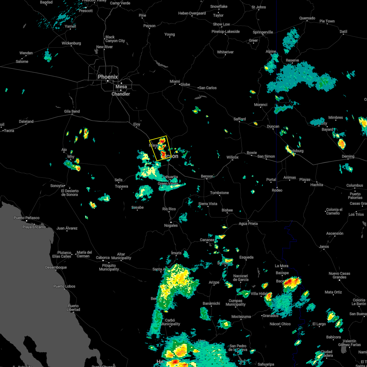 At 333 pm mst, a severe thunderstorm was located near casas adobes, or 7 miles southeast of marana, moving north at 5 mph (radar indicated). Hazards include 60 mph wind gusts and quarter size hail. Hail damage to vehicles is expected. Expect wind damage to roofs, siding, and trees. At 333 pm mst, a severe thunderstorm was located near casas adobes, or 7 miles southeast of marana, moving north at 5 mph (radar indicated). Hazards include 60 mph wind gusts and quarter size hail. Hail damage to vehicles is expected. Expect wind damage to roofs, siding, and trees.
|
| 8/7/2022 9:02 PM MST |
 At 902 pm mst, a severe thunderstorm was located near corona de tucson, or 15 miles east of sahuarita, moving southwest at 10 mph (radar indicated). Hazards include 60 mph wind gusts and penny size hail. expect damage to roofs, siding, and trees At 902 pm mst, a severe thunderstorm was located near corona de tucson, or 15 miles east of sahuarita, moving southwest at 10 mph (radar indicated). Hazards include 60 mph wind gusts and penny size hail. expect damage to roofs, siding, and trees
|
| 8/7/2022 8:41 PM MST |
 At 840 pm mst, a severe thunderstorm was located near corona de tucson, or 14 miles east of sahuarita, moving southwest at 15 mph (radar indicated). Hazards include 60 mph wind gusts and quarter size hail. Hail damage to vehicles is expected. expect wind damage to roofs, siding, and trees. locations impacted include, vail and corona de tucson. hail threat, radar indicated max hail size, 1. 00 in wind threat, radar indicated max wind gust, 60 mph. At 840 pm mst, a severe thunderstorm was located near corona de tucson, or 14 miles east of sahuarita, moving southwest at 15 mph (radar indicated). Hazards include 60 mph wind gusts and quarter size hail. Hail damage to vehicles is expected. expect wind damage to roofs, siding, and trees. locations impacted include, vail and corona de tucson. hail threat, radar indicated max hail size, 1. 00 in wind threat, radar indicated max wind gust, 60 mph.
|
| 8/7/2022 8:20 PM MST |
 At 820 pm mst, a severe thunderstorm was located 11 miles southeast of vail, or 14 miles west of benson, moving southwest at 10 mph (radar indicated). Hazards include 60 mph wind gusts and quarter size hail. Hail damage to vehicles is expected. Expect wind damage to roofs, siding, and trees. At 820 pm mst, a severe thunderstorm was located 11 miles southeast of vail, or 14 miles west of benson, moving southwest at 10 mph (radar indicated). Hazards include 60 mph wind gusts and quarter size hail. Hail damage to vehicles is expected. Expect wind damage to roofs, siding, and trees.
|
| 8/6/2022 9:54 PM MST |
 The severe thunderstorm warning for eastern pima and northeastern santa cruz counties will expire at 1000 pm mst, the storm which prompted the warning has weakened below severe limits, and no longer poses an immediate threat to life or property. therefore, the warning will be allowed to expire. however gusty winds and heavy rain are still possible with this thunderstorm. The severe thunderstorm warning for eastern pima and northeastern santa cruz counties will expire at 1000 pm mst, the storm which prompted the warning has weakened below severe limits, and no longer poses an immediate threat to life or property. therefore, the warning will be allowed to expire. however gusty winds and heavy rain are still possible with this thunderstorm.
|
| 8/6/2022 9:33 PM MST |
 At 932 pm mst, a cluster of severe thunderstorms was located across the tucson metro area extending from green valley northward to tucson, moving west at 30 mph (radar indicated). Hazards include 60 mph wind gusts. Expect damage to roofs, siding, and trees. locations impacted include, tucson, sahuarita, green valley, davis-monthan air force base, casas adobes, drexel heights, flowing wells, tanque verde, vail, south tucson, three points, pascua pueblo yaqui reservation, east sahuarita, sonoita, elgin, sabino canyon recreation area, summit, tucson estates, saguaro national park west and valencia west. hail threat, radar indicated max hail size, <. 75 in wind threat, radar indicated max wind gust, 60 mph. At 932 pm mst, a cluster of severe thunderstorms was located across the tucson metro area extending from green valley northward to tucson, moving west at 30 mph (radar indicated). Hazards include 60 mph wind gusts. Expect damage to roofs, siding, and trees. locations impacted include, tucson, sahuarita, green valley, davis-monthan air force base, casas adobes, drexel heights, flowing wells, tanque verde, vail, south tucson, three points, pascua pueblo yaqui reservation, east sahuarita, sonoita, elgin, sabino canyon recreation area, summit, tucson estates, saguaro national park west and valencia west. hail threat, radar indicated max hail size, <. 75 in wind threat, radar indicated max wind gust, 60 mph.
|
| 8/6/2022 9:23 PM MST | Asos measured gust of 60mph in east tucso in pima county AZ, 4.7 miles SE of Tucson, AZ |
| 8/6/2022 9:15 PM MST | Corrects previous tstm wnd gst report from 6 ssw tucson. asos reported 59mph at 9:10pm update: gusts at 60mph at 9:16p in pima county AZ, 4.8 miles NNE of Tucson, AZ |
| 8/6/2022 9:10 PM MST | Asos reported 59mph at 9:10p in pima county AZ, 4.8 miles NNE of Tucson, AZ |
| 8/6/2022 9:09 PM MST |
 At 908 pm mst, a severe thunderstorm was located near east sahuarita, or 7 miles east of sahuarita, moving west at 40 mph (radar indicated). Hazards include 60 mph wind gusts and penny size hail. expect damage to roofs, siding, and trees At 908 pm mst, a severe thunderstorm was located near east sahuarita, or 7 miles east of sahuarita, moving west at 40 mph (radar indicated). Hazards include 60 mph wind gusts and penny size hail. expect damage to roofs, siding, and trees
|
| 8/1/2022 3:23 PM MST |
 At 323 pm mst, a severe thunderstorm was located near corona de tucson, or 13 miles east of sahuarita, moving north at 5 mph (radar indicated). Hazards include 60 mph wind gusts and quarter size hail. Hail damage to vehicles is expected. expect wind damage to roofs, siding, and trees. locations impacted include, sahuarita, vail, east sahuarita, corona de tucson and madera canyon. hail threat, radar indicated max hail size, 1. 00 in wind threat, radar indicated max wind gust, 60 mph. At 323 pm mst, a severe thunderstorm was located near corona de tucson, or 13 miles east of sahuarita, moving north at 5 mph (radar indicated). Hazards include 60 mph wind gusts and quarter size hail. Hail damage to vehicles is expected. expect wind damage to roofs, siding, and trees. locations impacted include, sahuarita, vail, east sahuarita, corona de tucson and madera canyon. hail threat, radar indicated max hail size, 1. 00 in wind threat, radar indicated max wind gust, 60 mph.
|
| 8/1/2022 3:01 PM MST |
 At 301 pm mst, a severe thunderstorm was located 9 miles south of corona de tucson, or 16 miles southeast of sahuarita, moving north at 10 mph (radar indicated). Hazards include 60 mph wind gusts and quarter size hail. Hail damage to vehicles is expected. Expect wind damage to roofs, siding, and trees. At 301 pm mst, a severe thunderstorm was located 9 miles south of corona de tucson, or 16 miles southeast of sahuarita, moving north at 10 mph (radar indicated). Hazards include 60 mph wind gusts and quarter size hail. Hail damage to vehicles is expected. Expect wind damage to roofs, siding, and trees.
|
| 7/31/2022 6:38 PM MST |
 The severe thunderstorm warning for northeastern pima county will expire at 645 pm mst, the storms which prompted the warning have weakened below severe limits, and have exited the warned area. therefore, the warning will be allowed to expire. however gusty winds and heavy rain are still possible with these thunderstorms. to report severe weather, contact your nearest law enforcement agency. they will relay your report to the national weather service tucson. The severe thunderstorm warning for northeastern pima county will expire at 645 pm mst, the storms which prompted the warning have weakened below severe limits, and have exited the warned area. therefore, the warning will be allowed to expire. however gusty winds and heavy rain are still possible with these thunderstorms. to report severe weather, contact your nearest law enforcement agency. they will relay your report to the national weather service tucson.
|
| 7/31/2022 6:14 PM MST |
 At 614 pm mst, severe thunderstorms were located along a line extending from near catalina foothills to near mount lemmon/summerhaven to 11 miles south of san manuel, moving north at 25 mph (radar indicated). Hazards include 60 mph wind gusts and quarter size hail. Hail damage to vehicles is expected. expect wind damage to roofs, siding, and trees. locations impacted include, tucson, oro valley, marana, casas adobes, tanque verde, mount lemmon/summerhaven, sabino canyon recreation area, catalina foothills, catalina state park and seven falls. hail threat, radar indicated max hail size, 1. 00 in wind threat, radar indicated max wind gust, 60 mph. At 614 pm mst, severe thunderstorms were located along a line extending from near catalina foothills to near mount lemmon/summerhaven to 11 miles south of san manuel, moving north at 25 mph (radar indicated). Hazards include 60 mph wind gusts and quarter size hail. Hail damage to vehicles is expected. expect wind damage to roofs, siding, and trees. locations impacted include, tucson, oro valley, marana, casas adobes, tanque verde, mount lemmon/summerhaven, sabino canyon recreation area, catalina foothills, catalina state park and seven falls. hail threat, radar indicated max hail size, 1. 00 in wind threat, radar indicated max wind gust, 60 mph.
|
| 7/31/2022 5:58 PM MST |
 At 557 pm mst, a severe thunderstorm was located near tanque verde, or near davis-monthan air force base, moving northwest at 15 mph (radar indicated). Hazards include 60 mph wind gusts and quarter size hail. Hail damage to vehicles is expected. Expect wind damage to roofs, siding, and trees. At 557 pm mst, a severe thunderstorm was located near tanque verde, or near davis-monthan air force base, moving northwest at 15 mph (radar indicated). Hazards include 60 mph wind gusts and quarter size hail. Hail damage to vehicles is expected. Expect wind damage to roofs, siding, and trees.
|
| 7/31/2022 5:41 PM MST |
 At 540 pm mst, a severe thunderstorm was located near davis-monthan air force base, moving northwest at 15 mph (radar indicated). Hazards include 60 mph wind gusts and quarter size hail. Hail damage to vehicles is expected. expect wind damage to roofs, siding, and trees. locations impacted include, tucson, davis-monthan air force base, casas adobes, flowing wells, tanque verde, south tucson, sabino canyon recreation area, catalina foothills, saguaro national park east, rita ranch and seven falls. hail threat, radar indicated max hail size, 1. 00 in wind threat, radar indicated max wind gust, 60 mph. At 540 pm mst, a severe thunderstorm was located near davis-monthan air force base, moving northwest at 15 mph (radar indicated). Hazards include 60 mph wind gusts and quarter size hail. Hail damage to vehicles is expected. expect wind damage to roofs, siding, and trees. locations impacted include, tucson, davis-monthan air force base, casas adobes, flowing wells, tanque verde, south tucson, sabino canyon recreation area, catalina foothills, saguaro national park east, rita ranch and seven falls. hail threat, radar indicated max hail size, 1. 00 in wind threat, radar indicated max wind gust, 60 mph.
|
| 7/31/2022 5:38 PM MST |
 The severe thunderstorm warning for northeastern pima county will expire at 545 pm mst, the storm which prompted the warning has moved out of the area. therefore, the warning will be allowed to expire. however gusty winds and heavy rain are still possible with this thunderstorm. to report severe weather, contact your nearest law enforcement agency. they will relay your report to the national weather service tucson. The severe thunderstorm warning for northeastern pima county will expire at 545 pm mst, the storm which prompted the warning has moved out of the area. therefore, the warning will be allowed to expire. however gusty winds and heavy rain are still possible with this thunderstorm. to report severe weather, contact your nearest law enforcement agency. they will relay your report to the national weather service tucson.
|
| 7/31/2022 5:29 PM MST |
 At 528 pm mst, a severe thunderstorm was located near drexel heights, or 10 miles west of tucson, moving north at 20 mph (radar indicated). Hazards include 70 mph wind gusts and quarter size hail. Hail damage to vehicles is expected. expect considerable tree damage. wind damage is also likely to mobile homes, roofs, and outbuildings. Locations impacted include, tucson, marana, casas adobes, drexel heights, flowing wells, pascua pueblo yaqui reservation, saguaro national park west, valencia west, tucson estates, picture rocks and ryan airfield. At 528 pm mst, a severe thunderstorm was located near drexel heights, or 10 miles west of tucson, moving north at 20 mph (radar indicated). Hazards include 70 mph wind gusts and quarter size hail. Hail damage to vehicles is expected. expect considerable tree damage. wind damage is also likely to mobile homes, roofs, and outbuildings. Locations impacted include, tucson, marana, casas adobes, drexel heights, flowing wells, pascua pueblo yaqui reservation, saguaro national park west, valencia west, tucson estates, picture rocks and ryan airfield.
|
| 7/31/2022 5:21 PM MST |
 At 521 pm mst, a cluster of severe thunderstorm was located near davis-monthan air force base, moving northwest at 20 mph (radar indicated). Hazards include 60 mph wind gusts and quarter size hail. Hail damage to vehicles is expected. Expect wind damage to roofs, siding, and trees. At 521 pm mst, a cluster of severe thunderstorm was located near davis-monthan air force base, moving northwest at 20 mph (radar indicated). Hazards include 60 mph wind gusts and quarter size hail. Hail damage to vehicles is expected. Expect wind damage to roofs, siding, and trees.
|
| 7/31/2022 5:06 PM MST |
 At 505 pm mst, a severe thunderstorm was located over pascua pueblo yaqui reservation, or 12 miles southwest of tucson, moving north at 20 mph (radar indicated). Hazards include 70 mph wind gusts and ping pong ball size hail. People and animals outdoors will be injured. expect hail damage to roofs, siding, windows, and vehicles. expect considerable tree damage. Wind damage is also likely to mobile homes, roofs, and outbuildings. At 505 pm mst, a severe thunderstorm was located over pascua pueblo yaqui reservation, or 12 miles southwest of tucson, moving north at 20 mph (radar indicated). Hazards include 70 mph wind gusts and ping pong ball size hail. People and animals outdoors will be injured. expect hail damage to roofs, siding, windows, and vehicles. expect considerable tree damage. Wind damage is also likely to mobile homes, roofs, and outbuildings.
|
| 7/31/2022 4:58 PM MST |
 At 458 pm mst, a severe thunderstorm was located near vail, or 16 miles southeast of davis-monthan air force base, moving northwest at 15 mph (radar indicated). Hazards include 60 mph wind gusts and quarter size hail. Hail damage to vehicles is expected. expect wind damage to roofs, siding, and trees. locations impacted include, vail and saguaro national park east. hail threat, radar indicated max hail size, 1. 00 in wind threat, radar indicated max wind gust, 60 mph. At 458 pm mst, a severe thunderstorm was located near vail, or 16 miles southeast of davis-monthan air force base, moving northwest at 15 mph (radar indicated). Hazards include 60 mph wind gusts and quarter size hail. Hail damage to vehicles is expected. expect wind damage to roofs, siding, and trees. locations impacted include, vail and saguaro national park east. hail threat, radar indicated max hail size, 1. 00 in wind threat, radar indicated max wind gust, 60 mph.
|
| 7/31/2022 4:47 PM MST | Quarter sized hail reported 23.1 miles S of Tucson, AZ, quarter size hail fell in the eagle crest ranch neighborhood. |
| 7/31/2022 4:37 PM MST |
 At 436 pm mst, a severe thunderstorm was located near vail, or 16 miles west of benson, and is nearly stationary (radar indicated). Hazards include 60 mph wind gusts and quarter size hail. Hail damage to vehicles is expected. Expect wind damage to roofs, siding, and trees. At 436 pm mst, a severe thunderstorm was located near vail, or 16 miles west of benson, and is nearly stationary (radar indicated). Hazards include 60 mph wind gusts and quarter size hail. Hail damage to vehicles is expected. Expect wind damage to roofs, siding, and trees.
|
| 7/30/2022 3:51 PM MST |
 The severe thunderstorm warning for east central pima county will expire at 400 pm mst, the storm which prompted the warning has weakened below severe limits, and no longer poses an immediate threat to life or property. therefore, the warning will be allowed to expire. however heavy rain is still possible with this thunderstorm. The severe thunderstorm warning for east central pima county will expire at 400 pm mst, the storm which prompted the warning has weakened below severe limits, and no longer poses an immediate threat to life or property. therefore, the warning will be allowed to expire. however heavy rain is still possible with this thunderstorm.
|
| 7/30/2022 3:27 PM MST |
 At 327 pm mst, a severe thunderstorm was located 9 miles southeast of vail, or 14 miles west of benson, moving northwest at 5 mph (radar indicated). Hazards include 60 mph wind gusts and quarter size hail. Hail damage to vehicles is expected. Expect wind damage to roofs, siding, and trees. At 327 pm mst, a severe thunderstorm was located 9 miles southeast of vail, or 14 miles west of benson, moving northwest at 5 mph (radar indicated). Hazards include 60 mph wind gusts and quarter size hail. Hail damage to vehicles is expected. Expect wind damage to roofs, siding, and trees.
|
| 7/30/2022 2:56 PM MST |
 The severe thunderstorm warning for northeastern pima and southeastern pinal counties will expire at 300 pm mst, the storm which prompted the warning has weakened below severe limits, and no longer poses an immediate threat to life or property. therefore, the warning will be allowed to expire. however gusty winds and heavy rain are still possible with this thunderstorm. The severe thunderstorm warning for northeastern pima and southeastern pinal counties will expire at 300 pm mst, the storm which prompted the warning has weakened below severe limits, and no longer poses an immediate threat to life or property. therefore, the warning will be allowed to expire. however gusty winds and heavy rain are still possible with this thunderstorm.
|
| 7/30/2022 2:34 PM MST |
 At 233 pm mst, a severe thunderstorm was located near marana, moving northwest at 20 mph (radar indicated). Hazards include 60 mph wind gusts and quarter size hail. Hail damage to vehicles is expected. Expect wind damage to roofs, siding, and trees. At 233 pm mst, a severe thunderstorm was located near marana, moving northwest at 20 mph (radar indicated). Hazards include 60 mph wind gusts and quarter size hail. Hail damage to vehicles is expected. Expect wind damage to roofs, siding, and trees.
|
| 7/30/2022 2:29 PM MST | Down power lines near drexel road and s. calle santa cruz roa in pima county AZ, 5.3 miles ENE of Tucson, AZ |
| 7/30/2022 2:10 PM MST | Trained spotter reports tree branches down and power out for the neighborhoo in pima county AZ, 9.7 miles SW of Tucson, AZ |
| 7/30/2022 2:02 PM MST |
 At 201 pm mst, a severe thunderstorm was located over davis-monthan air force base, moving north at 15 mph (radar indicated). Hazards include 60 mph wind gusts and nickel size hail. Expect damage to roofs, siding, and trees. locations impacted include, tucson, davis-monthan air force base, casas adobes, drexel heights, flowing wells, tanque verde, south tucson, sabino canyon recreation area, catalina foothills, tucson international airport, saguaro national park east and rita ranch. hail threat, radar indicated max hail size, 0. 88 in wind threat, radar indicated max wind gust, 60 mph. At 201 pm mst, a severe thunderstorm was located over davis-monthan air force base, moving north at 15 mph (radar indicated). Hazards include 60 mph wind gusts and nickel size hail. Expect damage to roofs, siding, and trees. locations impacted include, tucson, davis-monthan air force base, casas adobes, drexel heights, flowing wells, tanque verde, south tucson, sabino canyon recreation area, catalina foothills, tucson international airport, saguaro national park east and rita ranch. hail threat, radar indicated max hail size, 0. 88 in wind threat, radar indicated max wind gust, 60 mph.
|
| 7/30/2022 1:47 PM MST |
 At 146 pm mst, a severe thunderstorm was located near tucson international airport, or near davis-monthan air force base, moving north at 15 mph (radar indicated). Hazards include 60 mph wind gusts and quarter size hail. Hail damage to vehicles is expected. Expect wind damage to roofs, siding, and trees. At 146 pm mst, a severe thunderstorm was located near tucson international airport, or near davis-monthan air force base, moving north at 15 mph (radar indicated). Hazards include 60 mph wind gusts and quarter size hail. Hail damage to vehicles is expected. Expect wind damage to roofs, siding, and trees.
|
| 7/24/2022 2:45 PM MST | Tree damage reported in subdivision. time estimated based on radar and repor in pima county AZ, 14.6 miles SSE of Tucson, AZ |
| 7/22/2022 4:21 PM MST |
 The severe thunderstorm warning for eastern pima county will expire at 430 pm mst, the storm which prompted the warning has weakened below severe limits, and no longer poses an immediate threat to life or property. therefore, the warning will be allowed to expire. however gusty winds and heavy rain are still possible with this thunderstorm. to report severe weather, contact your nearest law enforcement agency. they will relay your report to the national weather service tucson. The severe thunderstorm warning for eastern pima county will expire at 430 pm mst, the storm which prompted the warning has weakened below severe limits, and no longer poses an immediate threat to life or property. therefore, the warning will be allowed to expire. however gusty winds and heavy rain are still possible with this thunderstorm. to report severe weather, contact your nearest law enforcement agency. they will relay your report to the national weather service tucson.
|
| 7/22/2022 4:06 PM MST |
 At 406 pm mst, a severe thunderstorm was located near vail, or 15 miles southeast of davis-monthan air force base, moving northwest at 5 mph (radar indicated). Hazards include 60 mph wind gusts and quarter size hail. Hail damage to vehicles is expected. expect wind damage to roofs, siding, and trees. locations impacted include, vail. hail threat, radar indicated max hail size, 1. 00 in wind threat, radar indicated max wind gust, 60 mph. At 406 pm mst, a severe thunderstorm was located near vail, or 15 miles southeast of davis-monthan air force base, moving northwest at 5 mph (radar indicated). Hazards include 60 mph wind gusts and quarter size hail. Hail damage to vehicles is expected. expect wind damage to roofs, siding, and trees. locations impacted include, vail. hail threat, radar indicated max hail size, 1. 00 in wind threat, radar indicated max wind gust, 60 mph.
|
| 7/22/2022 3:39 PM MST |
 At 339 pm mst, a severe thunderstorm was located near vail, or 17 miles southeast of davis-monthan air force base, moving northwest at 5 mph (radar indicated). Hazards include 60 mph wind gusts and quarter size hail. Hail damage to vehicles is expected. Expect wind damage to roofs, siding, and trees. At 339 pm mst, a severe thunderstorm was located near vail, or 17 miles southeast of davis-monthan air force base, moving northwest at 5 mph (radar indicated). Hazards include 60 mph wind gusts and quarter size hail. Hail damage to vehicles is expected. Expect wind damage to roofs, siding, and trees.
|
| 7/16/2022 5:12 PM MST |
 The severe thunderstorm warning for northeastern pima county will expire at 515 pm mst, the storm which prompted the warning has weakened below severe limits, and no longer poses an immediate threat to life or property. therefore, the warning will be allowed to expire. The severe thunderstorm warning for northeastern pima county will expire at 515 pm mst, the storm which prompted the warning has weakened below severe limits, and no longer poses an immediate threat to life or property. therefore, the warning will be allowed to expire.
|
| 7/16/2022 4:52 PM MST | Quarter sized hail reported 5.3 miles W of Tucson, AZ, public reported 1 inch hail near the intersection of pantano rd and escalante rd. |
| 7/16/2022 4:49 PM MST | Quarter sized hail reported 2.9 miles W of Tucson, AZ, photo on twitter at golf links and wilmot. |
| 7/16/2022 4:47 PM MST | Quarter sized hail reported 2.3 miles W of Tucson, AZ, near ironwood east of craycroft. |
| 7/16/2022 4:40 PM MST |
 At 440 pm mst, a severe thunderstorm was located over davis-monthan air force base, moving northwest at 20 mph (trained weather spotters). Hazards include ping pong ball size hail and 60 mph wind gusts. People and animals outdoors will be injured. expect hail damage to roofs, siding, windows, and vehicles. expect wind damage to roofs, siding, and trees. locations impacted include, tucson, davis-monthan air force base, casas adobes, drexel heights, flowing wells, south tucson, pascua pueblo yaqui reservation, valencia west, tucson international airport, catalina foothills, saguaro national park east, summit, tucson estates, rita ranch and san xavier mission. hail threat, observed max hail size, 1. 50 in wind threat, radar indicated max wind gust, 60 mph. At 440 pm mst, a severe thunderstorm was located over davis-monthan air force base, moving northwest at 20 mph (trained weather spotters). Hazards include ping pong ball size hail and 60 mph wind gusts. People and animals outdoors will be injured. expect hail damage to roofs, siding, windows, and vehicles. expect wind damage to roofs, siding, and trees. locations impacted include, tucson, davis-monthan air force base, casas adobes, drexel heights, flowing wells, south tucson, pascua pueblo yaqui reservation, valencia west, tucson international airport, catalina foothills, saguaro national park east, summit, tucson estates, rita ranch and san xavier mission. hail threat, observed max hail size, 1. 50 in wind threat, radar indicated max wind gust, 60 mph.
|
| 7/16/2022 4:37 PM MST | Quarter sized hail reported 8.5 miles WNW of Tucson, AZ, near drexel and houghton. |
| 7/16/2022 4:35 PM MST | Ping Pong Ball sized hail reported 8.7 miles WNW of Tucson, AZ, spotter reported measured 1.5 inch hail near the intersection of bilby rd and houghton rd. |
| 7/16/2022 4:34 PM MST |
 At 433 pm mst, a severe thunderstorm was located near davis-monthan air force base, moving west at 25 mph (trained weather spotters). Hazards include 60 mph wind gusts and quarter size hail. Hail damage to vehicles is expected. expect wind damage to roofs, siding, and trees. locations impacted include, tucson, davis-monthan air force base, casas adobes, drexel heights, flowing wells, south tucson, pascua pueblo yaqui reservation, valencia west, tucson international airport, catalina foothills, saguaro national park east, summit, tucson estates, rita ranch and san xavier mission. hail threat, observed max hail size, 1. 00 in wind threat, radar indicated max wind gust, 60 mph. At 433 pm mst, a severe thunderstorm was located near davis-monthan air force base, moving west at 25 mph (trained weather spotters). Hazards include 60 mph wind gusts and quarter size hail. Hail damage to vehicles is expected. expect wind damage to roofs, siding, and trees. locations impacted include, tucson, davis-monthan air force base, casas adobes, drexel heights, flowing wells, south tucson, pascua pueblo yaqui reservation, valencia west, tucson international airport, catalina foothills, saguaro national park east, summit, tucson estates, rita ranch and san xavier mission. hail threat, observed max hail size, 1. 00 in wind threat, radar indicated max wind gust, 60 mph.
|
| 7/16/2022 4:33 PM MST | Quarter sized hail reported 8.7 miles WNW of Tucson, AZ, measured 1 inch hail near the intersection of houghton rd and poorman rd. |
| 7/16/2022 4:31 PM MST | Quarter sized hail reported 8.7 miles WNW of Tucson, AZ, near bilby and houghton. |
| 7/16/2022 4:28 PM MST |
 At 428 pm mst, a severe thunderstorm was located near davis-monthan air force base, moving west at 25 mph (trained weather spotters). Hazards include 60 mph wind gusts and quarter size hail. Hail damage to vehicles is expected. Expect wind damage to roofs, siding, and trees. At 428 pm mst, a severe thunderstorm was located near davis-monthan air force base, moving west at 25 mph (trained weather spotters). Hazards include 60 mph wind gusts and quarter size hail. Hail damage to vehicles is expected. Expect wind damage to roofs, siding, and trees.
|
| 7/16/2022 4:15 PM MST |
 At 415 pm mst, a severe thunderstorm was located near vail, or 11 miles southeast of davis-monthan air force base, moving west at 20 mph (trained weather spotters). Hazards include 60 mph wind gusts and quarter size hail. quarter size hail was reported in the vail area. Hail damage to vehicles is expected. expect wind damage to roofs, siding, and trees. locations impacted include, tucson, vail, east sahuarita, corona de tucson, saguaro national park east and rita ranch. hail threat, radar indicated max hail size, 1. 00 in wind threat, radar indicated max wind gust, 60 mph. At 415 pm mst, a severe thunderstorm was located near vail, or 11 miles southeast of davis-monthan air force base, moving west at 20 mph (trained weather spotters). Hazards include 60 mph wind gusts and quarter size hail. quarter size hail was reported in the vail area. Hail damage to vehicles is expected. expect wind damage to roofs, siding, and trees. locations impacted include, tucson, vail, east sahuarita, corona de tucson, saguaro national park east and rita ranch. hail threat, radar indicated max hail size, 1. 00 in wind threat, radar indicated max wind gust, 60 mph.
|
| 7/16/2022 4:07 PM MST |
 At 407 pm mst, a severe thunderstorm was located near vail, or 13 miles southeast of davis-monthan air force base, moving west at 15 mph (radar indicated). Hazards include 60 mph wind gusts and quarter size hail. Hail damage to vehicles is expected. expect wind damage to roofs, siding, and trees. locations impacted include, tucson, vail, east sahuarita, corona de tucson, saguaro national park east and rita ranch. hail threat, radar indicated max hail size, 1. 00 in wind threat, radar indicated max wind gust, 60 mph. At 407 pm mst, a severe thunderstorm was located near vail, or 13 miles southeast of davis-monthan air force base, moving west at 15 mph (radar indicated). Hazards include 60 mph wind gusts and quarter size hail. Hail damage to vehicles is expected. expect wind damage to roofs, siding, and trees. locations impacted include, tucson, vail, east sahuarita, corona de tucson, saguaro national park east and rita ranch. hail threat, radar indicated max hail size, 1. 00 in wind threat, radar indicated max wind gust, 60 mph.
|
| 7/16/2022 3:46 PM MST |
 At 346 pm mst, a severe thunderstorm was located near vail, or 16 miles west of benson, moving west at 25 mph (radar indicated). Hazards include 60 mph wind gusts and quarter size hail. Hail damage to vehicles is expected. Expect wind damage to roofs, siding, and trees. At 346 pm mst, a severe thunderstorm was located near vail, or 16 miles west of benson, moving west at 25 mph (radar indicated). Hazards include 60 mph wind gusts and quarter size hail. Hail damage to vehicles is expected. Expect wind damage to roofs, siding, and trees.
|
| 7/14/2022 3:42 PM MST |
 The severe thunderstorm warning for east central pima county will expire at 345 pm mst, the storm which prompted the warning has weakened below severe limits, and no longer poses an immediate threat to life or property. therefore, the warning will be allowed to expire. however gusty winds and heavy rain are still possible with this thunderstorm. The severe thunderstorm warning for east central pima county will expire at 345 pm mst, the storm which prompted the warning has weakened below severe limits, and no longer poses an immediate threat to life or property. therefore, the warning will be allowed to expire. however gusty winds and heavy rain are still possible with this thunderstorm.
|
| 7/14/2022 3:23 PM MST |
 At 323 pm mst, a severe thunderstorm was located over summit, or 8 miles southwest of davis-monthan air force base, moving northwest at 10 mph (radar indicated). Hazards include 60 mph wind gusts and quarter size hail. Hail damage to vehicles is expected. expect wind damage to roofs, siding, and trees. locations impacted include, tucson, sahuarita, davis-monthan air force base, drexel heights, south tucson, pascua pueblo yaqui reservation, east sahuarita, valencia west, tucson international airport, summit, tucson estates and san xavier mission. hail threat, radar indicated max hail size, 1. 00 in wind threat, radar indicated max wind gust, 60 mph. At 323 pm mst, a severe thunderstorm was located over summit, or 8 miles southwest of davis-monthan air force base, moving northwest at 10 mph (radar indicated). Hazards include 60 mph wind gusts and quarter size hail. Hail damage to vehicles is expected. expect wind damage to roofs, siding, and trees. locations impacted include, tucson, sahuarita, davis-monthan air force base, drexel heights, south tucson, pascua pueblo yaqui reservation, east sahuarita, valencia west, tucson international airport, summit, tucson estates and san xavier mission. hail threat, radar indicated max hail size, 1. 00 in wind threat, radar indicated max wind gust, 60 mph.
|
| 7/14/2022 3:06 PM MST |
 At 306 pm mst, a severe thunderstorm was located over summit, or 8 miles south of davis-monthan air force base, moving northwest at 10 mph (radar indicated). Hazards include 60 mph wind gusts and quarter size hail. Hail damage to vehicles is expected. Expect wind damage to roofs, siding, and trees. At 306 pm mst, a severe thunderstorm was located over summit, or 8 miles south of davis-monthan air force base, moving northwest at 10 mph (radar indicated). Hazards include 60 mph wind gusts and quarter size hail. Hail damage to vehicles is expected. Expect wind damage to roofs, siding, and trees.
|
| 7/1/2022 4:08 PM MST |
 The severe thunderstorm warning for east central pima county will expire at 415 pm mst, the storm which prompted the warning has weakened below severe limits, and no longer poses an immediate threat to life or property. therefore, the warning will be allowed to expire. The severe thunderstorm warning for east central pima county will expire at 415 pm mst, the storm which prompted the warning has weakened below severe limits, and no longer poses an immediate threat to life or property. therefore, the warning will be allowed to expire.
|
| 7/1/2022 3:56 PM MST |
 The severe thunderstorm warning for northeastern pima county will expire at 400 pm mst, the storm which prompted the warning has weakened below severe limits, and no longer poses an immediate threat to life or property. therefore, the warning will be allowed to expire. however small hail, gusty winds and heavy rain are still possible with this thunderstorm. flash flooding is likely ongoing in the area. to report severe weather, contact your nearest law enforcement agency. they will relay your report to the national weather service tucson. The severe thunderstorm warning for northeastern pima county will expire at 400 pm mst, the storm which prompted the warning has weakened below severe limits, and no longer poses an immediate threat to life or property. therefore, the warning will be allowed to expire. however small hail, gusty winds and heavy rain are still possible with this thunderstorm. flash flooding is likely ongoing in the area. to report severe weather, contact your nearest law enforcement agency. they will relay your report to the national weather service tucson.
|
| 7/1/2022 3:45 PM MST | Tree down on the left lane heading north boun in pima county AZ, 7.3 miles S of Tucson, AZ |
| 7/1/2022 3:37 PM MST |
 At 337 pm mst, a severe thunderstorm was located over davis-monthan air force base, moving north at 10 mph (radar indicated). Hazards include 60 mph wind gusts and quarter size hail. Hail damage to vehicles is expected. Expect wind damage to roofs, siding, and trees. At 337 pm mst, a severe thunderstorm was located over davis-monthan air force base, moving north at 10 mph (radar indicated). Hazards include 60 mph wind gusts and quarter size hail. Hail damage to vehicles is expected. Expect wind damage to roofs, siding, and trees.
|
| 7/1/2022 3:16 PM MST |
 At 316 pm mst, a severe thunderstorm was located over casas adobes, or near oro valley, and is nearly stationary (radar indicated). Hazards include 60 mph wind gusts and quarter size hail. Hail damage to vehicles is expected. expect wind damage to roofs, siding, and trees. locations impacted include, tucson, oro valley, marana, casas adobes, flowing wells, tortolita, catalina foothills and catalina state park. hail threat, radar indicated max hail size, 1. 00 in wind threat, radar indicated max wind gust, 60 mph. At 316 pm mst, a severe thunderstorm was located over casas adobes, or near oro valley, and is nearly stationary (radar indicated). Hazards include 60 mph wind gusts and quarter size hail. Hail damage to vehicles is expected. expect wind damage to roofs, siding, and trees. locations impacted include, tucson, oro valley, marana, casas adobes, flowing wells, tortolita, catalina foothills and catalina state park. hail threat, radar indicated max hail size, 1. 00 in wind threat, radar indicated max wind gust, 60 mph.
|
| 7/1/2022 3:09 PM MST |
 At 308 pm mst, a severe thunderstorm was located over casas adobes, or near oro valley, and is nearly stationary (radar indicated). Hazards include 60 mph wind gusts and penny size hail. expect damage to roofs, siding, and trees At 308 pm mst, a severe thunderstorm was located over casas adobes, or near oro valley, and is nearly stationary (radar indicated). Hazards include 60 mph wind gusts and penny size hail. expect damage to roofs, siding, and trees
|
| 6/18/2022 4:30 PM MST |
 At 430 pm mst, a severe thunderstorm was located over sahuarita, moving north at 20 mph (radar indicated). Hazards include 60 mph wind gusts and quarter size hail. Hail damage to vehicles is expected. expect wind damage to roofs, siding, and trees. locations impacted include, sahuarita, green valley, east sahuarita and summit. hail threat, radar indicated max hail size, 1. 00 in wind threat, radar indicated max wind gust, 60 mph. At 430 pm mst, a severe thunderstorm was located over sahuarita, moving north at 20 mph (radar indicated). Hazards include 60 mph wind gusts and quarter size hail. Hail damage to vehicles is expected. expect wind damage to roofs, siding, and trees. locations impacted include, sahuarita, green valley, east sahuarita and summit. hail threat, radar indicated max hail size, 1. 00 in wind threat, radar indicated max wind gust, 60 mph.
|
| 6/18/2022 4:17 PM MST |
 At 417 pm mst, a severe thunderstorm was located over green valley, moving north at 20 mph (radar indicated). Hazards include 60 mph wind gusts and quarter size hail. Hail damage to vehicles is expected. Expect wind damage to roofs, siding, and trees. At 417 pm mst, a severe thunderstorm was located over green valley, moving north at 20 mph (radar indicated). Hazards include 60 mph wind gusts and quarter size hail. Hail damage to vehicles is expected. Expect wind damage to roofs, siding, and trees.
|
| 6/18/2022 4:10 PM MST | Multiple trees and branches down in nw tucson. damage was located between the intersections of la cholla blvd and oracle rd on w. ina rd. large tree down in whole foods in pima county AZ, 11.4 miles SSE of Tucson, AZ |
| 10/5/2021 4:21 PM MST |
 The severe thunderstorm warning for northeastern pima county will expire at 430 pm mst, the storm which prompted the warning near eastern tucson has weakened below severe limits, and has exited the warned area. therefore, the warning will be allowed to expire. The severe thunderstorm warning for northeastern pima county will expire at 430 pm mst, the storm which prompted the warning near eastern tucson has weakened below severe limits, and has exited the warned area. therefore, the warning will be allowed to expire.
|
| 10/5/2021 4:00 PM MST |
 At 357 pm mst, a severe thunderstorm was located near eastern and northeastern tucson, moving northeast at 20 mph (radar indicated). Hazards include 60 mph wind gusts and quarter size hail. Hail damage to vehicles is expected. expect wind damage to roofs, siding, and trees. locations impacted include, tucson, catalina, tanque verde, mount lemmon/summerhaven, sabino canyon recreation area, catalina foothills, saguaro national park east, seven falls and redington. hail threat, radar indicated max hail size, 1. 00 in wind threat, radar indicated max wind gust, 60 mph. At 357 pm mst, a severe thunderstorm was located near eastern and northeastern tucson, moving northeast at 20 mph (radar indicated). Hazards include 60 mph wind gusts and quarter size hail. Hail damage to vehicles is expected. expect wind damage to roofs, siding, and trees. locations impacted include, tucson, catalina, tanque verde, mount lemmon/summerhaven, sabino canyon recreation area, catalina foothills, saguaro national park east, seven falls and redington. hail threat, radar indicated max hail size, 1. 00 in wind threat, radar indicated max wind gust, 60 mph.
|
| 10/5/2021 3:38 PM MST |
 At 338 pm mst, a severe thunderstorm was located near and southwest of davis-monthan air force base, moving northeast at 25 mph (radar indicated). Hazards include 60 mph wind gusts and quarter size hail. Hail damage to vehicles is expected. Expect wind damage to roofs, siding, and trees. At 338 pm mst, a severe thunderstorm was located near and southwest of davis-monthan air force base, moving northeast at 25 mph (radar indicated). Hazards include 60 mph wind gusts and quarter size hail. Hail damage to vehicles is expected. Expect wind damage to roofs, siding, and trees.
|
| 9/5/2021 6:24 PM MST | Power outages... likely due to severe thunderstor in pima county AZ, 7.4 miles SSE of Tucson, AZ |
| 9/5/2021 5:28 PM MST |
 The severe thunderstorm warning for northeastern pima county will expire at 530 pm mst, the storm which prompted the warning has weakened below severe limits, and no longer poses an immediate threat to life or property. therefore, the warning will be allowed to expire. however heavy rain is still possible with this thunderstorm. The severe thunderstorm warning for northeastern pima county will expire at 530 pm mst, the storm which prompted the warning has weakened below severe limits, and no longer poses an immediate threat to life or property. therefore, the warning will be allowed to expire. however heavy rain is still possible with this thunderstorm.
|
| 9/5/2021 5:15 PM MST |
 At 513 pm mst, a severe thunderstorm was located near mount lemmon/summerhaven, moving south at 15 mph (radar indicated). Hazards include 60 mph wind gusts. Expect damage to roofs, siding, and trees. locations impacted include, tucson, catalina, casas adobes, flowing wells, tanque verde, mount lemmon/summerhaven, sabino canyon recreation area, catalina foothills, catalina state park, saguaro national park east and seven falls. hail threat, radar indicated max hail size, <. 75 in wind threat, radar indicated max wind gust, 60 mph. At 513 pm mst, a severe thunderstorm was located near mount lemmon/summerhaven, moving south at 15 mph (radar indicated). Hazards include 60 mph wind gusts. Expect damage to roofs, siding, and trees. locations impacted include, tucson, catalina, casas adobes, flowing wells, tanque verde, mount lemmon/summerhaven, sabino canyon recreation area, catalina foothills, catalina state park, saguaro national park east and seven falls. hail threat, radar indicated max hail size, <. 75 in wind threat, radar indicated max wind gust, 60 mph.
|
| 9/5/2021 4:47 PM MST |
 At 446 pm mst, a severe thunderstorm was located near mount lemmon/summerhaven, or near catalina, moving south at 15 mph (radar indicated). Hazards include 60 mph wind gusts. expect damage to roofs, siding, and trees At 446 pm mst, a severe thunderstorm was located near mount lemmon/summerhaven, or near catalina, moving south at 15 mph (radar indicated). Hazards include 60 mph wind gusts. expect damage to roofs, siding, and trees
|
| 9/5/2021 4:46 PM MST | Power outages... likely due to severe thunderstor in pima county AZ, 2.7 miles NNE of Tucson, AZ |
| 9/5/2021 4:46 PM MST |
 At 442 pm mst, a severe thunderstorm was located near catalina foothills and northern tucson, or 7 miles north of tucson, moving southwest at 10 mph. the storm near mid-town and south tucson has weakened below severe limits (radar indicated). Hazards include 60 mph wind gusts. Expect damage to roofs, siding, and trees. locations impacted include, northern tucson, oro valley, casas adobes, drexel heights, flowing wells, tortolita, sabino canyon recreation area, catalina foothills, tucson estates and picture rocks. hail threat, radar indicated max hail size, <. 75 in wind threat, radar indicated max wind gust, 60 mph. At 442 pm mst, a severe thunderstorm was located near catalina foothills and northern tucson, or 7 miles north of tucson, moving southwest at 10 mph. the storm near mid-town and south tucson has weakened below severe limits (radar indicated). Hazards include 60 mph wind gusts. Expect damage to roofs, siding, and trees. locations impacted include, northern tucson, oro valley, casas adobes, drexel heights, flowing wells, tortolita, sabino canyon recreation area, catalina foothills, tucson estates and picture rocks. hail threat, radar indicated max hail size, <. 75 in wind threat, radar indicated max wind gust, 60 mph.
|
| 9/5/2021 4:30 PM MST |
 At 429 pm mst, a severe thunderstorm was located near central and western tucson, moving west at 10 mph (radar indicated). Hazards include 60 mph wind gusts. expect damage to roofs, siding, and trees At 429 pm mst, a severe thunderstorm was located near central and western tucson, moving west at 10 mph (radar indicated). Hazards include 60 mph wind gusts. expect damage to roofs, siding, and trees
|
| 9/5/2021 4:26 PM MST | Power outages... likely due to severe thunderstor in pima county AZ, 6.1 miles ESE of Tucson, AZ |
| 9/5/2021 4:16 PM MST | Power outages... likely due to severe thunderstor in pima county AZ, 11 miles SSE of Tucson, AZ |
| 9/5/2021 4:14 PM MST |
 At 413 pm mst, a severe thunderstorm was located near catalina foothills, or near tucson, moving west at 15 mph (radar indicated). Hazards include 60 mph wind gusts and penny size hail. Expect damage to roofs, siding, and trees. locations impacted include, tucson, catalina, oro valley, marana, davis-monthan air force base, casas adobes, drexel heights, flowing wells, tanque verde, south tucson, tortolita, mount lemmon/summerhaven, sabino canyon recreation area, catalina state park, catalina foothills, saguaro national park west, tucson estates, picture rocks, dove mountain and seven falls. hail threat, radar indicated max hail size, 0. 75 in wind threat, radar indicated max wind gust, 60 mph. At 413 pm mst, a severe thunderstorm was located near catalina foothills, or near tucson, moving west at 15 mph (radar indicated). Hazards include 60 mph wind gusts and penny size hail. Expect damage to roofs, siding, and trees. locations impacted include, tucson, catalina, oro valley, marana, davis-monthan air force base, casas adobes, drexel heights, flowing wells, tanque verde, south tucson, tortolita, mount lemmon/summerhaven, sabino canyon recreation area, catalina state park, catalina foothills, saguaro national park west, tucson estates, picture rocks, dove mountain and seven falls. hail threat, radar indicated max hail size, 0. 75 in wind threat, radar indicated max wind gust, 60 mph.
|
| 9/5/2021 3:52 PM MST |
 At 351 pm mst, a severe thunderstorm was located near tanque verde, or 10 miles northeast of davis-monthan air force base, moving west at 15 to 20 mph (radar indicated). Hazards include 60 mph wind gusts and penny size hail. expect damage to roofs, siding, and trees At 351 pm mst, a severe thunderstorm was located near tanque verde, or 10 miles northeast of davis-monthan air force base, moving west at 15 to 20 mph (radar indicated). Hazards include 60 mph wind gusts and penny size hail. expect damage to roofs, siding, and trees
|
| 9/5/2021 3:43 PM MST | Mesonet station cw6532 tucson freeman/old spanish tr in pima county AZ, 9.9 miles W of Tucson, AZ |
| 9/5/2021 3:40 PM MST |
 At 340 pm mst, a severe thunderstorm was located over saguaro national park east, or 13 miles east of davis-monthan air force base, moving southwest at 20 mph (radar indicated). Hazards include 70 mph wind gusts and penny size hail. Expect considerable tree damage. Damage is likely to mobile homes, roofs, and outbuildings. At 340 pm mst, a severe thunderstorm was located over saguaro national park east, or 13 miles east of davis-monthan air force base, moving southwest at 20 mph (radar indicated). Hazards include 70 mph wind gusts and penny size hail. Expect considerable tree damage. Damage is likely to mobile homes, roofs, and outbuildings.
|
| 9/5/2021 3:08 PM MST |
 At 307 pm mst, severe thunderstorms were located along a line extending from near saguaro national park east to 6 miles north of sonoita, moving southwest at 15 to 20 mph (radar indicated). Hazards include 70 mph wind gusts and penny size hail. Expect considerable tree damage. Damage is likely to mobile homes, roofs, and outbuildings. At 307 pm mst, severe thunderstorms were located along a line extending from near saguaro national park east to 6 miles north of sonoita, moving southwest at 15 to 20 mph (radar indicated). Hazards include 70 mph wind gusts and penny size hail. Expect considerable tree damage. Damage is likely to mobile homes, roofs, and outbuildings.
|
| 9/5/2021 2:45 PM MST |
 At 244 pm mst, a severe thunderstorm was located 7 miles southeast of vail over interstate 10, or 15 miles west of benson, moving southwest at 15 mph (radar indicated). Hazards include 70 mph wind gusts and quarter size hail. Hail damage to vehicles is expected. expect considerable tree damage. wind damage is also likely to mobile homes, roofs, and outbuildings. locations impacted include, vail and corona de tucson. thunderstorm damage threat, considerable hail threat, radar indicated max hail size, 1. 00 in wind threat, radar indicated max wind gust, 70 mph. At 244 pm mst, a severe thunderstorm was located 7 miles southeast of vail over interstate 10, or 15 miles west of benson, moving southwest at 15 mph (radar indicated). Hazards include 70 mph wind gusts and quarter size hail. Hail damage to vehicles is expected. expect considerable tree damage. wind damage is also likely to mobile homes, roofs, and outbuildings. locations impacted include, vail and corona de tucson. thunderstorm damage threat, considerable hail threat, radar indicated max hail size, 1. 00 in wind threat, radar indicated max wind gust, 70 mph.
|
| 9/5/2021 2:31 PM MST |
 At 231 pm mst, a severe thunderstorm was located 9 miles east of vail, or 13 miles west of benson, moving southwest at 15 mph (radar indicated). Hazards include 60 mph wind gusts and penny size hail. expect damage to roofs, siding, and trees At 231 pm mst, a severe thunderstorm was located 9 miles east of vail, or 13 miles west of benson, moving southwest at 15 mph (radar indicated). Hazards include 60 mph wind gusts and penny size hail. expect damage to roofs, siding, and trees
|
| 8/29/2021 6:53 PM MST |
 At 652 pm mst, a severe thunderstorm was located over casas adobes, or near oro valley, moving west at 10 mph (trained weather spotters). Hazards include 60 mph wind gusts. expect damage to roofs, siding, and trees At 652 pm mst, a severe thunderstorm was located over casas adobes, or near oro valley, moving west at 10 mph (trained weather spotters). Hazards include 60 mph wind gusts. expect damage to roofs, siding, and trees
|
| 8/29/2021 6:50 PM MST | Multiple trees down at ina and oracl in pima county AZ, 11.4 miles SSE of Tucson, AZ |
| 8/28/2021 5:57 PM MST |
 The severe thunderstorm warning for northeastern pima and southeastern pinal counties will expire at 600 pm mst, the storms which prompted the warning have weakened below severe limits, and no longer pose an immediate threat to life or property. therefore, the warning will be allowed to expire. however gusty winds and heavy rain are still possible with these thunderstorms. a flash flood warning remains in effect for much of the region. The severe thunderstorm warning for northeastern pima and southeastern pinal counties will expire at 600 pm mst, the storms which prompted the warning have weakened below severe limits, and no longer pose an immediate threat to life or property. therefore, the warning will be allowed to expire. however gusty winds and heavy rain are still possible with these thunderstorms. a flash flood warning remains in effect for much of the region.
|
| 8/28/2021 5:27 PM MST |
 At 525 pm mst, severe thunderstorms were located along a line extending from 6 miles north of saddlebrooke to near casas adobes, moving west at 15 mph (radar indicated). Hazards include 60 mph wind gusts and penny size hail. Expect damage to roofs, siding, and trees. locations impacted include, marana, flowing wells, saddlebrooke, avra valley, tortolita, saguaro national park west, picture rocks, red rock, dove mountain hail threat, radar indicated max hail size, 0. 75 in wind threat, radar indicated max wind gust, 60 mph. At 525 pm mst, severe thunderstorms were located along a line extending from 6 miles north of saddlebrooke to near casas adobes, moving west at 15 mph (radar indicated). Hazards include 60 mph wind gusts and penny size hail. Expect damage to roofs, siding, and trees. locations impacted include, marana, flowing wells, saddlebrooke, avra valley, tortolita, saguaro national park west, picture rocks, red rock, dove mountain hail threat, radar indicated max hail size, 0. 75 in wind threat, radar indicated max wind gust, 60 mph.
|
| 8/28/2021 4:58 PM MST |
 At 457 pm mst, severe thunderstorms were located along a line extending from oracle to near flowing wells, moving west at 15 mph (radar indicated). Hazards include 60 mph wind gusts and penny size hail. expect damage to roofs, siding, and trees At 457 pm mst, severe thunderstorms were located along a line extending from oracle to near flowing wells, moving west at 15 mph (radar indicated). Hazards include 60 mph wind gusts and penny size hail. expect damage to roofs, siding, and trees
|
| 8/28/2021 3:58 PM MST |
 At 356 pm mst, a severe thunderstorm was located near sabino canyon recreation area, or 9 miles northeast of davis-monthan air force base, moving west at 15 mph (radar indicated). Hazards include 60 mph wind gusts and penny size hail. expect damage to roofs, siding, and trees At 356 pm mst, a severe thunderstorm was located near sabino canyon recreation area, or 9 miles northeast of davis-monthan air force base, moving west at 15 mph (radar indicated). Hazards include 60 mph wind gusts and penny size hail. expect damage to roofs, siding, and trees
|
| 8/28/2021 3:33 PM MST |
 At 332 pm mst, a severe thunderstorm was located from near vail to saguaro national park east, or 12 miles east of davis-monthan air force base, moving west at 10 mph (radar indicated). Hazards include 60 mph wind gusts and penny size hail. Expect damage to roofs, siding, and trees. locations impacted include, eastern tucson, tanque verde, vail, saguaro national park east and rita ranch. hail threat, radar indicated max hail size, 0. 75 in wind threat, radar indicated max wind gust, 60 mph. At 332 pm mst, a severe thunderstorm was located from near vail to saguaro national park east, or 12 miles east of davis-monthan air force base, moving west at 10 mph (radar indicated). Hazards include 60 mph wind gusts and penny size hail. Expect damage to roofs, siding, and trees. locations impacted include, eastern tucson, tanque verde, vail, saguaro national park east and rita ranch. hail threat, radar indicated max hail size, 0. 75 in wind threat, radar indicated max wind gust, 60 mph.
|
| 8/28/2021 3:13 PM MST |
 At 312 pm mst, a severe thunderstorm was located near saguaro national park east, or 16 miles east of davis-monthan air force base, moving west at 5 to 10 mph (radar indicated). Hazards include 60 mph wind gusts and penny size hail. expect damage to roofs, siding, and trees At 312 pm mst, a severe thunderstorm was located near saguaro national park east, or 16 miles east of davis-monthan air force base, moving west at 5 to 10 mph (radar indicated). Hazards include 60 mph wind gusts and penny size hail. expect damage to roofs, siding, and trees
|
| 8/17/2021 7:54 PM MST |
 The severe thunderstorm warning for east central pima county will expire at 800 pm mst, the storm which prompted the warning has weakened below severe limits, and no longer poses an immediate threat to life or property. therefore, the warning will be allowed to expire. however heavy rain is still possible with this thunderstorm. The severe thunderstorm warning for east central pima county will expire at 800 pm mst, the storm which prompted the warning has weakened below severe limits, and no longer poses an immediate threat to life or property. therefore, the warning will be allowed to expire. however heavy rain is still possible with this thunderstorm.
|
| 8/17/2021 7:33 PM MST | Power poles down at benson hwy and palo verd in pima county AZ, 2.5 miles NNE of Tucson, AZ |
| 8/17/2021 7:33 PM MST |
 At 732 pm mst, a severe thunderstorm was located over davis-monthan air force base, moving northeast at 10 mph. there have been multiple reports of wind damage (trained weather spotters). Hazards include 60 mph wind gusts and quarter size hail. Hail damage to vehicles is expected. expect wind damage to roofs, siding, and trees. locations impacted include, tucson, davis-monthan air force base, tanque verde, south tucson, tucson international airport, saguaro national park east, sabino canyon recreation area, catalina foothills and rita ranch. hail threat, radar indicated max hail size, 1. 00 in wind threat, radar indicated max wind gust, 60 mph. At 732 pm mst, a severe thunderstorm was located over davis-monthan air force base, moving northeast at 10 mph. there have been multiple reports of wind damage (trained weather spotters). Hazards include 60 mph wind gusts and quarter size hail. Hail damage to vehicles is expected. expect wind damage to roofs, siding, and trees. locations impacted include, tucson, davis-monthan air force base, tanque verde, south tucson, tucson international airport, saguaro national park east, sabino canyon recreation area, catalina foothills and rita ranch. hail threat, radar indicated max hail size, 1. 00 in wind threat, radar indicated max wind gust, 60 mph.
|
| 8/17/2021 7:32 PM MST | Pole leaning on irvington east of campbel in pima county AZ, 2.5 miles NE of Tucson, AZ |
| 8/17/2021 7:32 PM MST | Cactus has fallen into the roadway at tucson blvd and drexe in pima county AZ, 2.7 miles NNE of Tucson, AZ |
| 8/17/2021 7:26 PM MST | Wire down at irvington and tucson blv in pima county AZ, 2.5 miles NE of Tucson, AZ |
| 8/17/2021 7:24 PM MST | Traffic light malfunctioning at irvington and country clu in pima county AZ, 4.4 miles WNW of Tucson, AZ |
| 8/17/2021 7:21 PM MST | Tree in roadwa in pima county AZ, 4.4 miles WNW of Tucson, AZ |
| 8/17/2021 7:18 PM MST |
 At 718 pm mst, a severe thunderstorm was located over davis-monthan air force base, moving northeast at 15 mph (radar indicated). Hazards include 60 mph wind gusts and quarter size hail. Hail damage to vehicles is expected. Expect wind damage to roofs, siding, and trees. At 718 pm mst, a severe thunderstorm was located over davis-monthan air force base, moving northeast at 15 mph (radar indicated). Hazards include 60 mph wind gusts and quarter size hail. Hail damage to vehicles is expected. Expect wind damage to roofs, siding, and trees.
|
| 8/16/2021 6:06 PM MST |
 The severe thunderstorm warning for east central pima county will expire at 615 pm mst, the storm which prompted the warning has weakened below severe limits, and no longer poses an immediate threat to life or property. therefore, the warning will be allowed to expire. however gusty winds and heavy rain are still possible with this thunderstorm. a severe thunderstorm watch remains in effect until midnight mst for southeastern arizona. to report severe weather, contact your nearest law enforcement agency. they will relay your report to the national weather service tucson. The severe thunderstorm warning for east central pima county will expire at 615 pm mst, the storm which prompted the warning has weakened below severe limits, and no longer poses an immediate threat to life or property. therefore, the warning will be allowed to expire. however gusty winds and heavy rain are still possible with this thunderstorm. a severe thunderstorm watch remains in effect until midnight mst for southeastern arizona. to report severe weather, contact your nearest law enforcement agency. they will relay your report to the national weather service tucson.
|
| 8/16/2021 5:52 PM MST |
 At 551 pm mst, a severe thunderstorm was located over east sahuarita, or near sahuarita, with another severe storm located south of rita ranch along interstate 10 and is nearly stationary or slowly moving south (radar indicated). Hazards include 60 mph wind gusts. Expect damage to roofs, siding, and trees. locations impacted include, tucson, sahuarita, green valley, vail, east sahuarita and summit. hail threat, radar indicated max hail size, <. 75 in wind threat, radar indicated max wind gust, 60 mph. At 551 pm mst, a severe thunderstorm was located over east sahuarita, or near sahuarita, with another severe storm located south of rita ranch along interstate 10 and is nearly stationary or slowly moving south (radar indicated). Hazards include 60 mph wind gusts. Expect damage to roofs, siding, and trees. locations impacted include, tucson, sahuarita, green valley, vail, east sahuarita and summit. hail threat, radar indicated max hail size, <. 75 in wind threat, radar indicated max wind gust, 60 mph.
|
| 8/16/2021 5:35 PM MST |
 At 534 pm mst, a severe thunderstorm was located over east sahuarita, or near sahuarita, with another severe storm near rita ranch and both are nearly stationary (radar indicated). Hazards include 60 mph wind gusts and quarter size hail. Hail damage to vehicles is expected. Expect wind damage to roofs, siding, and trees. At 534 pm mst, a severe thunderstorm was located over east sahuarita, or near sahuarita, with another severe storm near rita ranch and both are nearly stationary (radar indicated). Hazards include 60 mph wind gusts and quarter size hail. Hail damage to vehicles is expected. Expect wind damage to roofs, siding, and trees.
|
| 8/10/2021 5:23 PM MST |
 The severe thunderstorm warning for east central pima and northeastern santa cruz counties will expire at 530 pm mst, the storm which prompted the warning has weakened below severe limits, and no longer poses an immediate threat to life or property. therefore, the warning will be allowed to expire. however heavy rain is still possible with this thunderstorm. The severe thunderstorm warning for east central pima and northeastern santa cruz counties will expire at 530 pm mst, the storm which prompted the warning has weakened below severe limits, and no longer poses an immediate threat to life or property. therefore, the warning will be allowed to expire. however heavy rain is still possible with this thunderstorm.
|
| 8/10/2021 5:03 PM MST |
 At 503 pm mst, a severe thunderstorm was located 7 miles southeast of corona de tucson, or 18 miles east of sahuarita, moving north at 10 mph (radar indicated). Hazards include 60 mph wind gusts and penny size hail. expect damage to roofs, siding, and trees At 503 pm mst, a severe thunderstorm was located 7 miles southeast of corona de tucson, or 18 miles east of sahuarita, moving north at 10 mph (radar indicated). Hazards include 60 mph wind gusts and penny size hail. expect damage to roofs, siding, and trees
|
| 8/6/2021 5:18 PM MST |
 At 518 pm mst, a severe thunderstorm was located near vail, or 17 miles southeast of davis-monthan air force base, moving west at 5 mph (radar indicated). Hazards include 60 mph wind gusts and penny size hail. expect damage to roofs, siding, and trees At 518 pm mst, a severe thunderstorm was located near vail, or 17 miles southeast of davis-monthan air force base, moving west at 5 mph (radar indicated). Hazards include 60 mph wind gusts and penny size hail. expect damage to roofs, siding, and trees
|
| 8/2/2021 8:35 PM MST |
 At 832 pm mst, the severe thunderstorm that moved through portions of east tucson is weakening. now near vail and southeast tucson, it continues to push to the south at 15 mph (radar indicated). Hazards include 60 mph wind gusts. Expect damage to roofs, siding, and trees. locations impacted include, vail, east sahuarita, corona de tucson, saguaro national park east and rita ranch. this includes the following highways, interstate 10 between mile markers 269 and 288. Route 83 between mile markers 51 and 58. At 832 pm mst, the severe thunderstorm that moved through portions of east tucson is weakening. now near vail and southeast tucson, it continues to push to the south at 15 mph (radar indicated). Hazards include 60 mph wind gusts. Expect damage to roofs, siding, and trees. locations impacted include, vail, east sahuarita, corona de tucson, saguaro national park east and rita ranch. this includes the following highways, interstate 10 between mile markers 269 and 288. Route 83 between mile markers 51 and 58.
|
| 8/2/2021 8:13 PM MST |
 At 812 pm mst, a severe thunderstorm was located near east tucson down to rita ranch. vail, moving south at 15 mph (radar indicated). Hazards include 70 mph wind gusts. Expect considerable tree damage. Damage is likely to mobile homes, roofs, and outbuildings. At 812 pm mst, a severe thunderstorm was located near east tucson down to rita ranch. vail, moving south at 15 mph (radar indicated). Hazards include 70 mph wind gusts. Expect considerable tree damage. Damage is likely to mobile homes, roofs, and outbuildings.
|
| 8/2/2021 7:55 PM MST | Large trees blocking portions of houghton rd just north of old spanish trai in pima county AZ, 8.2 miles W of Tucson, AZ |
| 8/2/2021 7:54 PM MST |
 At 753 pm mst, a severe thunderstorm was located near saguaro national park east, or 6 miles east of davis-monthan air force base, moving south at 15 mph (radar indicated). Hazards include 70 mph wind gusts. Expect considerable tree damage. damage is likely to mobile homes, roofs, and outbuildings. Locations impacted include, east tucson, tanque verde, saguaro national park east, rita ranch and seven falls. At 753 pm mst, a severe thunderstorm was located near saguaro national park east, or 6 miles east of davis-monthan air force base, moving south at 15 mph (radar indicated). Hazards include 70 mph wind gusts. Expect considerable tree damage. damage is likely to mobile homes, roofs, and outbuildings. Locations impacted include, east tucson, tanque verde, saguaro national park east, rita ranch and seven falls.
|
| 8/2/2021 7:31 PM MST |
 At 731 pm mst, a severe thunderstorm was located near tanque verde, or 12 miles northeast of davis-monthan air force base, moving south at 15 mph (radar indicated). Hazards include 60 mph wind gusts. expect damage to roofs, siding, and trees At 731 pm mst, a severe thunderstorm was located near tanque verde, or 12 miles northeast of davis-monthan air force base, moving south at 15 mph (radar indicated). Hazards include 60 mph wind gusts. expect damage to roofs, siding, and trees
|
| 7/30/2021 8:42 PM MST |
 At 840 pm mst, a severe thunderstorm was located over central and southern tucson, moving northwest at 15 mph. a wind gust to 55 mph was measured at davis monthan afb (radar indicated). Hazards include 60 mph wind gusts. Expect damage to roofs, siding, and trees. locations impacted include, tucson, marana, davis-monthan air force base, casas adobes, drexel heights, flowing wells, south tucson, tortolita, tucson estates, saguaro national park west, tucson international airport, and valencia west. this includes the following highways, interstate 10 between mile markers 246 and 267. interstate 19 between mile markers 58 and 63. route 77 between mile markers 70 and 73. Route 86 between mile markers 163 and 171. At 840 pm mst, a severe thunderstorm was located over central and southern tucson, moving northwest at 15 mph. a wind gust to 55 mph was measured at davis monthan afb (radar indicated). Hazards include 60 mph wind gusts. Expect damage to roofs, siding, and trees. locations impacted include, tucson, marana, davis-monthan air force base, casas adobes, drexel heights, flowing wells, south tucson, tortolita, tucson estates, saguaro national park west, tucson international airport, and valencia west. this includes the following highways, interstate 10 between mile markers 246 and 267. interstate 19 between mile markers 58 and 63. route 77 between mile markers 70 and 73. Route 86 between mile markers 163 and 171.
|
| 7/30/2021 8:20 PM MST |
 At 819 pm mst, a severe thunderstorm was located over south tucson, or near tucson, moving northwest at 15 mph (radar indicated). Hazards include 60 mph wind gusts. expect damage to roofs, siding, and trees At 819 pm mst, a severe thunderstorm was located over south tucson, or near tucson, moving northwest at 15 mph (radar indicated). Hazards include 60 mph wind gusts. expect damage to roofs, siding, and trees
|
| 7/30/2021 8:14 PM MST | Asos station ktus tucson international airpor in pima county AZ, 4.5 miles NNE of Tucson, AZ |
| 7/30/2021 8:12 PM MST |
 At 810 pm mst, a severe thunderstorm was located over summit, or 8 miles south of davis-monthan air force base, moving northwest at 15 mph (radar indicated). Hazards include 60 mph wind gusts. Expect damage to roofs, siding, and trees. locations impacted include, southern tucson, sahuarita, vail, corona de tucson, tucson international airport and summit. this includes the following highways, interstate 10 between mile markers 277 and 279. Interstate 19 between mile markers 46 and 53. At 810 pm mst, a severe thunderstorm was located over summit, or 8 miles south of davis-monthan air force base, moving northwest at 15 mph (radar indicated). Hazards include 60 mph wind gusts. Expect damage to roofs, siding, and trees. locations impacted include, southern tucson, sahuarita, vail, corona de tucson, tucson international airport and summit. this includes the following highways, interstate 10 between mile markers 277 and 279. Interstate 19 between mile markers 46 and 53.
|
| 7/30/2021 7:57 PM MST |
 At 756 pm mst, a severe thunderstorm was located near corona de tucson, or 9 miles northeast of sahuarita, moving northwest at 10 to 15 mph (radar indicated). Hazards include 60 mph wind gusts. expect damage to roofs, siding, and trees At 756 pm mst, a severe thunderstorm was located near corona de tucson, or 9 miles northeast of sahuarita, moving northwest at 10 to 15 mph (radar indicated). Hazards include 60 mph wind gusts. expect damage to roofs, siding, and trees
|
| 7/30/2021 7:49 PM MST |
 At 748 pm mst, a severe thunderstorm was located over saguaro national park east, or 11 miles east of davis-monthan air force base, moving northwest at 10 to 15 mph (radar indicated). Hazards include 60 mph wind gusts and penny size hail. expect damage to roofs, siding, and trees At 748 pm mst, a severe thunderstorm was located over saguaro national park east, or 11 miles east of davis-monthan air force base, moving northwest at 10 to 15 mph (radar indicated). Hazards include 60 mph wind gusts and penny size hail. expect damage to roofs, siding, and trees
|
| 7/23/2021 12:20 AM MST |
 At 1217 am mst, an area of severe thunderstorms with extremely heavy rainfall was located near northwest tucson and marana, moving northwest at 15 mph (radar indicated). Hazards include 60 mph wind gusts, torrential downpours. Expect damage to roofs, siding, and trees. locations impacted include, northwest tucson, catalina, oro valley, marana, sahuarita, casas adobes, drexel heights, flowing wells, three points, avra valley, tortolita, east sahuarita, sabino canyon recreation area, summit and tucson estates. this includes the following highways, interstate 10 between mile markers 233 and 280. interstate 19 between mile markers 45 and 63. route 77 between mile markers 70 and 86. route 86 between mile markers 150 and 171. Route 286 between mile markers 44 and 45. At 1217 am mst, an area of severe thunderstorms with extremely heavy rainfall was located near northwest tucson and marana, moving northwest at 15 mph (radar indicated). Hazards include 60 mph wind gusts, torrential downpours. Expect damage to roofs, siding, and trees. locations impacted include, northwest tucson, catalina, oro valley, marana, sahuarita, casas adobes, drexel heights, flowing wells, three points, avra valley, tortolita, east sahuarita, sabino canyon recreation area, summit and tucson estates. this includes the following highways, interstate 10 between mile markers 233 and 280. interstate 19 between mile markers 45 and 63. route 77 between mile markers 70 and 86. route 86 between mile markers 150 and 171. Route 286 between mile markers 44 and 45.
|
| 7/22/2021 11:45 PM MST |
 At 1144 pm mst, an area of severe thunderstorms was located over tucson, moving northwest at 15 mph (radar indicated). Hazards include 60 mph wind gusts. expect damage to roofs, siding, and trees At 1144 pm mst, an area of severe thunderstorms was located over tucson, moving northwest at 15 mph (radar indicated). Hazards include 60 mph wind gusts. expect damage to roofs, siding, and trees
|
| 7/22/2021 4:56 PM MST |
 The severe thunderstorm warning for northeastern pima county will expire at 500 pm mst, the storm which prompted the warning has weakened below severe limits, and no longer poses an immediate threat to life or property. therefore, the warning will be allowed to expire. however heavy rain is still possible with this thunderstorm and a flash flood warning is in effect until 745 pm mst. The severe thunderstorm warning for northeastern pima county will expire at 500 pm mst, the storm which prompted the warning has weakened below severe limits, and no longer poses an immediate threat to life or property. therefore, the warning will be allowed to expire. however heavy rain is still possible with this thunderstorm and a flash flood warning is in effect until 745 pm mst.
|
| 7/22/2021 4:46 PM MST |
 At 446 pm mst, a severe thunderstorm was located near tanque verde, or near davis-monthan air force base, moving north at 5 mph (trained weather spotters). Hazards include 60 mph wind gusts and nickel size hail. Expect damage to roofs, siding, and trees. locations impacted include, tucson, davis-monthan air force base, casas adobes, drexel heights, flowing wells, tanque verde, south tucson, sabino canyon recreation area, catalina foothills, tucson international airport, summit, tucson estates, saguaro national park east, rita ranch and san xavier mission. this includes the following highways, interstate 10 between mile markers 252 and 271. interstate 19 between mile markers 56 and 63. route 77 between mile markers 70 and 73. Route 86 between mile markers 166 and 171. At 446 pm mst, a severe thunderstorm was located near tanque verde, or near davis-monthan air force base, moving north at 5 mph (trained weather spotters). Hazards include 60 mph wind gusts and nickel size hail. Expect damage to roofs, siding, and trees. locations impacted include, tucson, davis-monthan air force base, casas adobes, drexel heights, flowing wells, tanque verde, south tucson, sabino canyon recreation area, catalina foothills, tucson international airport, summit, tucson estates, saguaro national park east, rita ranch and san xavier mission. this includes the following highways, interstate 10 between mile markers 252 and 271. interstate 19 between mile markers 56 and 63. route 77 between mile markers 70 and 73. Route 86 between mile markers 166 and 171.
|
| 7/22/2021 4:21 PM MST |
 At 421 pm mst, a severe thunderstorm was located over davis-monthan air force base, moving north at 5 mph (radar indicated). Hazards include 60 mph wind gusts and quarter size hail. Hail damage to vehicles is expected. expect wind damage to roofs, siding, and trees. locations impacted include, tucson, davis-monthan air force base, casas adobes, drexel heights, flowing wells, tanque verde, south tucson, sabino canyon recreation area, catalina foothills, tucson international airport, summit, tucson estates, saguaro national park east, rita ranch and san xavier mission. this includes the following highways, interstate 10 between mile markers 252 and 271. interstate 19 between mile markers 56 and 63. route 77 between mile markers 70 and 73. Route 86 between mile markers 166 and 171. At 421 pm mst, a severe thunderstorm was located over davis-monthan air force base, moving north at 5 mph (radar indicated). Hazards include 60 mph wind gusts and quarter size hail. Hail damage to vehicles is expected. expect wind damage to roofs, siding, and trees. locations impacted include, tucson, davis-monthan air force base, casas adobes, drexel heights, flowing wells, tanque verde, south tucson, sabino canyon recreation area, catalina foothills, tucson international airport, summit, tucson estates, saguaro national park east, rita ranch and san xavier mission. this includes the following highways, interstate 10 between mile markers 252 and 271. interstate 19 between mile markers 56 and 63. route 77 between mile markers 70 and 73. Route 86 between mile markers 166 and 171.
|
| 7/22/2021 4:01 PM MST |
 At 400 pm mst, a severe thunderstorm was located over tucson, and is nearly stationary (radar indicated). Hazards include 60 mph wind gusts and quarter size hail. Hail damage to vehicles is expected. Expect wind damage to roofs, siding, and trees. At 400 pm mst, a severe thunderstorm was located over tucson, and is nearly stationary (radar indicated). Hazards include 60 mph wind gusts and quarter size hail. Hail damage to vehicles is expected. Expect wind damage to roofs, siding, and trees.
|
| 7/20/2021 10:07 PM MST |
 The severe thunderstorm warning for northeastern pima and southeastern pinal counties will expire at 1015 pm mst, the storm which prompted the warning northwest of tucson has moved northwestward into southern pinal county. therefore, the warning will be allowed to expire. a warning continues for south central pinal county. The severe thunderstorm warning for northeastern pima and southeastern pinal counties will expire at 1015 pm mst, the storm which prompted the warning northwest of tucson has moved northwestward into southern pinal county. therefore, the warning will be allowed to expire. a warning continues for south central pinal county.
|
| 7/20/2021 9:24 PM MST |
 At 923 pm mst, an area of severe thunderstorms was located over near tortolita and oro valley, moving west at 10 mph (radar indicated). Hazards include 60 mph wind gusts and nickel size hail. expect damage to roofs, siding, and trees At 923 pm mst, an area of severe thunderstorms was located over near tortolita and oro valley, moving west at 10 mph (radar indicated). Hazards include 60 mph wind gusts and nickel size hail. expect damage to roofs, siding, and trees
|
| 7/20/2021 9:10 PM MST |
 The severe thunderstorm warning for northeastern pima county will expire at 915 pm mst, the storm which prompted the warning through central to northern tucson has weakened below severe limits, and has moved northwest the warned area. therefore, the warning will be allowed to expire. however heavy rain is still possible with this thunderstorm. The severe thunderstorm warning for northeastern pima county will expire at 915 pm mst, the storm which prompted the warning through central to northern tucson has weakened below severe limits, and has moved northwest the warned area. therefore, the warning will be allowed to expire. however heavy rain is still possible with this thunderstorm.
|
| 7/20/2021 8:37 PM MST |
 At 834 pm mst, a severe thunderstorm was located near north central to northeast tucson, moving west and northwest at 10 mph (radar indicated). Hazards include 60 mph wind gusts and quarter size hail. Hail damage to vehicles is expected. expect wind damage to roofs, siding, and trees. locations impacted include, tucson, davis-monthan air force base, casas adobes, drexel heights, flowing wells, tanque verde, tucson international airport, summit, catalina foothills, and tucson estates. this includes the following highways, interstate 10 between mile markers 251 and 272. interstate 19 between mile markers 54 and 63. route 77 between mile markers 70 and 72. Route 86 between mile markers 164 and 171. At 834 pm mst, a severe thunderstorm was located near north central to northeast tucson, moving west and northwest at 10 mph (radar indicated). Hazards include 60 mph wind gusts and quarter size hail. Hail damage to vehicles is expected. expect wind damage to roofs, siding, and trees. locations impacted include, tucson, davis-monthan air force base, casas adobes, drexel heights, flowing wells, tanque verde, tucson international airport, summit, catalina foothills, and tucson estates. this includes the following highways, interstate 10 between mile markers 251 and 272. interstate 19 between mile markers 54 and 63. route 77 between mile markers 70 and 72. Route 86 between mile markers 164 and 171.
|
| 7/20/2021 8:29 PM MST | Tree knocked over due to strong thunderstorm winds. tanque verde and camino serna are in pima county AZ, 5.7 miles SW of Tucson, AZ |
| 7/20/2021 8:22 PM MST | Twitter photos indicate storm damage to a church. time estimated from rada in pima county AZ, 3.3 miles SW of Tucson, AZ |
| 7/20/2021 8:21 PM MST | 2 large trees down at golf n stuff. time estimated from rada in pima county AZ, 5.7 miles SW of Tucson, AZ |
| 7/20/2021 8:17 PM MST |
 At 816 pm mst, a severe thunderstorm was located near southeast tucson, moving west at 10 mph (radar indicated). Hazards include 60 mph wind gusts and quarter size hail. Hail damage to vehicles is expected. Expect wind damage to roofs, siding, and trees. At 816 pm mst, a severe thunderstorm was located near southeast tucson, moving west at 10 mph (radar indicated). Hazards include 60 mph wind gusts and quarter size hail. Hail damage to vehicles is expected. Expect wind damage to roofs, siding, and trees.
|
| 7/18/2021 8:22 PM MST |
 The severe thunderstorm warning for east central pima county will expire at 830 pm mst, the storm which prompted the warning has weakened below severe limits, and no longer poses an immediate threat to life or property. therefore, the warning will be allowed to expire. however heavy rain is still possible with this thunderstorm. The severe thunderstorm warning for east central pima county will expire at 830 pm mst, the storm which prompted the warning has weakened below severe limits, and no longer poses an immediate threat to life or property. therefore, the warning will be allowed to expire. however heavy rain is still possible with this thunderstorm.
|
| 7/18/2021 8:11 PM MST |
 At 810 pm mst, a severe thunderstorm was located 8 miles southeast of vail, or 14 miles west of benson, moving north at 15 mph (radar indicated). Hazards include 60 mph wind gusts and quarter size hail. Hail damage to vehicles is expected. expect wind damage to roofs, siding, and trees. locations impacted include, vail and corona de tucson. This includes route 83 between mile markers 39 and 58. At 810 pm mst, a severe thunderstorm was located 8 miles southeast of vail, or 14 miles west of benson, moving north at 15 mph (radar indicated). Hazards include 60 mph wind gusts and quarter size hail. Hail damage to vehicles is expected. expect wind damage to roofs, siding, and trees. locations impacted include, vail and corona de tucson. This includes route 83 between mile markers 39 and 58.
|
| 7/18/2021 7:41 PM MST |
 The severe thunderstorm warning for east central pima and west central cochise counties will expire at 745 pm mst, the storm which prompted the warning has weakened below severe limits, and no longer poses an immediate threat to life or property. therefore, the warning will be allowed to expire. however heavy rain is still possible with this thunderstorm. The severe thunderstorm warning for east central pima and west central cochise counties will expire at 745 pm mst, the storm which prompted the warning has weakened below severe limits, and no longer poses an immediate threat to life or property. therefore, the warning will be allowed to expire. however heavy rain is still possible with this thunderstorm.
|
| 7/18/2021 7:29 PM MST |
 At 729 pm mst, a severe thunderstorm was located 9 miles west of kartchner caverns state park, or 14 miles southwest of benson, moving north at 15 mph (radar indicated). Hazards include 60 mph wind gusts and quarter size hail. Hail damage to vehicles is expected. Expect wind damage to roofs, siding, and trees. At 729 pm mst, a severe thunderstorm was located 9 miles west of kartchner caverns state park, or 14 miles southwest of benson, moving north at 15 mph (radar indicated). Hazards include 60 mph wind gusts and quarter size hail. Hail damage to vehicles is expected. Expect wind damage to roofs, siding, and trees.
|
| 7/18/2021 7:28 PM MST |
 At 728 pm mst, a severe thunderstorm was located 8 miles northeast of vail, or 16 miles northwest of benson, moving west at 15 mph (radar indicated). Hazards include 60 mph wind gusts and quarter size hail. Hail damage to vehicles is expected. expect wind damage to roofs, siding, and trees. locations impacted include, vail, saguaro national park east and mescal. this includes the following highways, interstate 10 between mile markers 278 and 297. Route 83 near mile marker 58. At 728 pm mst, a severe thunderstorm was located 8 miles northeast of vail, or 16 miles northwest of benson, moving west at 15 mph (radar indicated). Hazards include 60 mph wind gusts and quarter size hail. Hail damage to vehicles is expected. expect wind damage to roofs, siding, and trees. locations impacted include, vail, saguaro national park east and mescal. this includes the following highways, interstate 10 between mile markers 278 and 297. Route 83 near mile marker 58.
|
| 7/18/2021 7:07 PM MST |
 At 707 pm mst, a severe thunderstorm was located 11 miles northwest of benson, moving west at 15 mph (radar indicated). Hazards include 60 mph wind gusts and quarter size hail. Hail damage to vehicles is expected. Expect wind damage to roofs, siding, and trees. At 707 pm mst, a severe thunderstorm was located 11 miles northwest of benson, moving west at 15 mph (radar indicated). Hazards include 60 mph wind gusts and quarter size hail. Hail damage to vehicles is expected. Expect wind damage to roofs, siding, and trees.
|
| 7/12/2021 9:42 PM MST |
 At 941 pm mst, a severe thunderstorm was located near saguaro national park east moving southwest at 30 mph (radar indicated). Hazards include 60 mph wind gusts. Expect damage to roofs, siding, and trees. locations impacted include, tucson, tanque verde, vail, saguaro national park east and rita ranch. this includes the following highways, interstate 10 between mile markers 271 and 289. Route 83 between mile markers 54 and 58. At 941 pm mst, a severe thunderstorm was located near saguaro national park east moving southwest at 30 mph (radar indicated). Hazards include 60 mph wind gusts. Expect damage to roofs, siding, and trees. locations impacted include, tucson, tanque verde, vail, saguaro national park east and rita ranch. this includes the following highways, interstate 10 between mile markers 271 and 289. Route 83 between mile markers 54 and 58.
|
| 7/12/2021 9:22 PM MST |
 At 921 pm mst, a severe thunderstorm was located 13 miles northeast of saguaro national park east, moving southwest at 30 mph (radar indicated). Hazards include 60 mph wind gusts and nickel size hail. expect damage to roofs, siding, and trees At 921 pm mst, a severe thunderstorm was located 13 miles northeast of saguaro national park east, moving southwest at 30 mph (radar indicated). Hazards include 60 mph wind gusts and nickel size hail. expect damage to roofs, siding, and trees
|
| 7/12/2021 8:51 PM MST |
 At 849 pm mst, a cluster of severe thunderstorms extended from near corona de tucson southwest to madera canyon, moving west at 15 mph (radar indicated). Hazards include 60 mph wind gusts and quarter size hail. Hail damage to vehicles is expected. Expect wind damage to roofs, siding, and trees. At 849 pm mst, a cluster of severe thunderstorms extended from near corona de tucson southwest to madera canyon, moving west at 15 mph (radar indicated). Hazards include 60 mph wind gusts and quarter size hail. Hail damage to vehicles is expected. Expect wind damage to roofs, siding, and trees.
|
| 7/10/2021 8:25 PM MST |
 The severe thunderstorm warning for east central pima and western cochise counties will expire at 830 pm mst, the storm which prompted the warning has moved out of the area. therefore, the warning will be allowed to expire. however heavy rain is still possible with this thunderstorm. a severe thunderstorm watch remains in effect until midnight mst for southeastern arizona. The severe thunderstorm warning for east central pima and western cochise counties will expire at 830 pm mst, the storm which prompted the warning has moved out of the area. therefore, the warning will be allowed to expire. however heavy rain is still possible with this thunderstorm. a severe thunderstorm watch remains in effect until midnight mst for southeastern arizona.
|
| 7/10/2021 8:12 PM MST |
 At 811 pm mst, a number of severe thunderstorms with strong winds are located over the tucson metro, moving west at 20 mph (radar indicated). Hazards include 60 mph wind gusts. expect damage to roofs, siding, and trees At 811 pm mst, a number of severe thunderstorms with strong winds are located over the tucson metro, moving west at 20 mph (radar indicated). Hazards include 60 mph wind gusts. expect damage to roofs, siding, and trees
|
| 7/10/2021 7:48 PM MST |
 At 748 pm mst, a severe thunderstorm was located over south tucson, or over tucson, moving west at 10 mph (radar indicated). Hazards include 60 mph wind gusts. Expect damage to roofs, siding, and trees. locations impacted include, tucson, catalina, oro valley, marana, davis-monthan air force base, casas adobes, drexel heights, flowing wells, tanque verde, south tucson, avra valley, pascua pueblo yaqui reservation, tortolita, mount lemmon/summerhaven, sabino canyon recreation area, tucson estates, saguaro national park west, valencia west, catalina state park and catalina foothills. this includes the following highways, interstate 10 between mile markers 233 and 277. interstate 19 between mile markers 54 and 63. route 77 between mile markers 70 and 86. Route 86 between mile markers 158 and 171. At 748 pm mst, a severe thunderstorm was located over south tucson, or over tucson, moving west at 10 mph (radar indicated). Hazards include 60 mph wind gusts. Expect damage to roofs, siding, and trees. locations impacted include, tucson, catalina, oro valley, marana, davis-monthan air force base, casas adobes, drexel heights, flowing wells, tanque verde, south tucson, avra valley, pascua pueblo yaqui reservation, tortolita, mount lemmon/summerhaven, sabino canyon recreation area, tucson estates, saguaro national park west, valencia west, catalina state park and catalina foothills. this includes the following highways, interstate 10 between mile markers 233 and 277. interstate 19 between mile markers 54 and 63. route 77 between mile markers 70 and 86. Route 86 between mile markers 158 and 171.
|
| 7/10/2021 7:40 PM MST |
 The severe thunderstorm warning for east central pima and northwestern cochise counties will expire at 745 pm mst, the storms that prompted this warning had moved farther west and has been replaced with a new severe thunderstorm warning. remember, a severe thunderstorm watch remains in effect until midnight mst for southeastern arizona. The severe thunderstorm warning for east central pima and northwestern cochise counties will expire at 745 pm mst, the storms that prompted this warning had moved farther west and has been replaced with a new severe thunderstorm warning. remember, a severe thunderstorm watch remains in effect until midnight mst for southeastern arizona.
|
| 7/10/2021 7:35 PM MST |
 At 735 pm mst, a severe thunderstorm was located near saguaro national park east, or 16 miles east of davis-monthan air force base, moving southwest at 20 mph (radar indicated). Hazards include 60 mph wind gusts and quarter size hail. Hail damage to vehicles is expected. Expect wind damage to roofs, siding, and trees. At 735 pm mst, a severe thunderstorm was located near saguaro national park east, or 16 miles east of davis-monthan air force base, moving southwest at 20 mph (radar indicated). Hazards include 60 mph wind gusts and quarter size hail. Hail damage to vehicles is expected. Expect wind damage to roofs, siding, and trees.
|
| 7/10/2021 7:14 PM MST |
 At 714 pm mst, a severe thunderstorm was located over tucson, moving west at 10 mph (radar indicated). Hazards include 60 mph wind gusts. expect damage to roofs, siding, and trees At 714 pm mst, a severe thunderstorm was located over tucson, moving west at 10 mph (radar indicated). Hazards include 60 mph wind gusts. expect damage to roofs, siding, and trees
|
| 7/10/2021 7:06 PM MST |
 At 705 pm mst, a severe thunderstorm was located 13 miles northeast of saguaro national park east, or 25 miles north of benson, moving west at 25 mph (radar indicated). Hazards include 60 mph wind gusts and quarter size hail. Hail damage to vehicles is expected. Expect wind damage to roofs, siding, and trees. At 705 pm mst, a severe thunderstorm was located 13 miles northeast of saguaro national park east, or 25 miles north of benson, moving west at 25 mph (radar indicated). Hazards include 60 mph wind gusts and quarter size hail. Hail damage to vehicles is expected. Expect wind damage to roofs, siding, and trees.
|
| 7/10/2021 6:57 PM MST |
 At 655 pm mst, a cluster of severe thunderstorms was near green valley, moving west at 25 mph. strong and gusty winds along with blowing dust can be expected to accompany these storms (radar indicated). Hazards include 60 mph wind gusts and penny size hail. expect damage to roofs, siding, and trees At 655 pm mst, a cluster of severe thunderstorms was near green valley, moving west at 25 mph. strong and gusty winds along with blowing dust can be expected to accompany these storms (radar indicated). Hazards include 60 mph wind gusts and penny size hail. expect damage to roofs, siding, and trees
|
| 7/2/2021 4:21 PM MST | Large tree knocked down in apartment comple in pima county AZ, 7.4 miles SSE of Tucson, AZ |
| 7/2/2021 4:16 PM MST | Tweeter post showing a shed blown into a traffic light on magee road and la canada driv in pima county AZ, 12.5 miles SSE of Tucson, AZ |
| 7/2/2021 4:11 PM MST |
 The severe thunderstorm warning for northeastern pima county will expire at 415 pm mst, the storms which prompted the warning have weakened below severe limits, and no longer pose an immediate threat to life or property. therefore, the warning will be allowed to expire. however gusty winds and heavy rain are still possible with these thunderstorms. to report severe weather, contact your nearest law enforcement agency. they will relay your report to the national weather service tucson. The severe thunderstorm warning for northeastern pima county will expire at 415 pm mst, the storms which prompted the warning have weakened below severe limits, and no longer pose an immediate threat to life or property. therefore, the warning will be allowed to expire. however gusty winds and heavy rain are still possible with these thunderstorms. to report severe weather, contact your nearest law enforcement agency. they will relay your report to the national weather service tucson.
|
| 7/2/2021 3:55 PM MST |
 At 354 pm mst, severe thunderstorms were located along a line extending from near tucson estates to near saguaro national park west to tortolita, moving northwest at 15 mph (radar indicated). Hazards include 60 mph wind gusts. Expect damage to roofs, siding, and trees. locations impacted include, tucson, marana, casas adobes, flowing wells, avra valley, saguaro national park west, tucson estates, valencia west, picture rocks and ryan airfield. this includes the following highways, interstate 10 between mile markers 245 and 255. route 77 near mile marker 71. Route 86 near mile marker 160. At 354 pm mst, severe thunderstorms were located along a line extending from near tucson estates to near saguaro national park west to tortolita, moving northwest at 15 mph (radar indicated). Hazards include 60 mph wind gusts. Expect damage to roofs, siding, and trees. locations impacted include, tucson, marana, casas adobes, flowing wells, avra valley, saguaro national park west, tucson estates, valencia west, picture rocks and ryan airfield. this includes the following highways, interstate 10 between mile markers 245 and 255. route 77 near mile marker 71. Route 86 near mile marker 160.
|
| 7/2/2021 3:39 PM MST | Tweet of blown down tree on north bound lane of river road and river roa in pima county AZ, 7.6 miles SSE of Tucson, AZ |
| 7/2/2021 3:38 PM MST | Electrical power line down blocking road near 1st ave and wetmore road. vehicle travel restricted to one lan in pima county AZ, 7.8 miles SSE of Tucson, AZ |
| 7/2/2021 3:35 PM MST |
 At 335 pm mst, severe thunderstorms were located along a line extending from tucson estates to 7 miles northwest of valencia west to near saguaro national park west to near oro valley, moving northwest at 15 mph (radar indicated). Hazards include 60 mph wind gusts. expect damage to roofs, siding, and trees At 335 pm mst, severe thunderstorms were located along a line extending from tucson estates to 7 miles northwest of valencia west to near saguaro national park west to near oro valley, moving northwest at 15 mph (radar indicated). Hazards include 60 mph wind gusts. expect damage to roofs, siding, and trees
|
| 7/2/2021 3:15 PM MST |
 At 314 pm mst, a severe thunderstorm was located over catalina foothills, or 7 miles southeast of oro valley, moving west at 10 mph (trained weather spotters). Hazards include 70 mph wind gusts and penny size hail. Expect considerable tree damage. damage is likely to mobile homes, roofs, and outbuildings. locations impacted include, tucson, oro valley, casas adobes, flowing wells, tortolita, catalina foothills and catalina state park. this includes the following highways, interstate 10 between mile markers 251 and 257. Route 77 between mile markers 70 and 82. At 314 pm mst, a severe thunderstorm was located over catalina foothills, or 7 miles southeast of oro valley, moving west at 10 mph (trained weather spotters). Hazards include 70 mph wind gusts and penny size hail. Expect considerable tree damage. damage is likely to mobile homes, roofs, and outbuildings. locations impacted include, tucson, oro valley, casas adobes, flowing wells, tortolita, catalina foothills and catalina state park. this includes the following highways, interstate 10 between mile markers 251 and 257. Route 77 between mile markers 70 and 82.
|
| 7/2/2021 2:48 PM MST |
 At 248 pm mst, a severe thunderstorm was located over sabino canyon recreation area, or 9 miles north of tucson, moving west at 10 mph (radar indicated). Hazards include 60 mph wind gusts and penny size hail. expect damage to roofs, siding, and trees At 248 pm mst, a severe thunderstorm was located over sabino canyon recreation area, or 9 miles north of tucson, moving west at 10 mph (radar indicated). Hazards include 60 mph wind gusts and penny size hail. expect damage to roofs, siding, and trees
|
| 6/23/2021 7:21 PM MST |
 The severe thunderstorm warning for east central pima and northwestern cochise counties will expire at 730 pm mst, the storm which prompted the warning has weakened below severe limits, and no longer poses an immediate threat to life or property. therefore, the warning will be allowed to expire. The severe thunderstorm warning for east central pima and northwestern cochise counties will expire at 730 pm mst, the storm which prompted the warning has weakened below severe limits, and no longer poses an immediate threat to life or property. therefore, the warning will be allowed to expire.
|
| 6/23/2021 7:02 PM MST |
 At 702 pm mst, a severe thunderstorm was located over saguaro national park east, or 14 miles east of davis-monthan air force base, moving north at 25 mph (radar indicated). Hazards include 60 mph wind gusts and penny size hail. Expect damage to roofs, siding, and trees. Locations impacted include, tucson, tanque verde and saguaro national park east. At 702 pm mst, a severe thunderstorm was located over saguaro national park east, or 14 miles east of davis-monthan air force base, moving north at 25 mph (radar indicated). Hazards include 60 mph wind gusts and penny size hail. Expect damage to roofs, siding, and trees. Locations impacted include, tucson, tanque verde and saguaro national park east.
|
| 6/23/2021 6:44 PM MST |
 At 644 pm mst, a severe thunderstorm was located over vail, or 15 miles southeast of davis-monthan air force base, moving north at 25 mph (radar indicated). Hazards include 60 mph wind gusts and penny size hail. expect damage to roofs, siding, and trees At 644 pm mst, a severe thunderstorm was located over vail, or 15 miles southeast of davis-monthan air force base, moving north at 25 mph (radar indicated). Hazards include 60 mph wind gusts and penny size hail. expect damage to roofs, siding, and trees
|
| 8/20/2020 7:26 PM MST | Down tree branches and power loss in the neighborhood. near the intersection of cardinal lane and los reales road... drexel height in pima county AZ, 7.9 miles NE of Tucson, AZ |
| 8/20/2020 7:01 PM MST |
 At 701 pm mst, a severe thunderstorm was located near san xavier community, or 7 miles northwest of sahuarita, moving south at 15 mph (radar indicated). Hazards include 60 mph wind gusts and quarter size hail. Hail damage to vehicles is expected. expect wind damage to roofs, siding, and trees. locations impacted include, tucson, sahuarita, drexel heights, pascua pueblo yaqui reservation, east sahuarita, tucson international airport, summit, valencia west, tucson estates and san xavier mission. this includes the following highways, interstate 19 between mile markers 45 and 61. Route 86 between mile markers 165 and 170. At 701 pm mst, a severe thunderstorm was located near san xavier community, or 7 miles northwest of sahuarita, moving south at 15 mph (radar indicated). Hazards include 60 mph wind gusts and quarter size hail. Hail damage to vehicles is expected. expect wind damage to roofs, siding, and trees. locations impacted include, tucson, sahuarita, drexel heights, pascua pueblo yaqui reservation, east sahuarita, tucson international airport, summit, valencia west, tucson estates and san xavier mission. this includes the following highways, interstate 19 between mile markers 45 and 61. Route 86 between mile markers 165 and 170.
|
| 8/20/2020 6:31 PM MST |
 At 630 pm mst, a severe thunderstorm was located over pascua pueblo yaqui reservation, or 11 miles southwest of tucson, moving south at 10 mph (radar indicated). Hazards include 60 mph wind gusts and quarter size hail. Hail damage to vehicles is expected. Expect wind damage to roofs, siding, and trees. At 630 pm mst, a severe thunderstorm was located over pascua pueblo yaqui reservation, or 11 miles southwest of tucson, moving south at 10 mph (radar indicated). Hazards include 60 mph wind gusts and quarter size hail. Hail damage to vehicles is expected. Expect wind damage to roofs, siding, and trees.
|
| 8/16/2020 5:55 PM MST | Awos station kavq marana regional airpor in pima county AZ, 23.4 miles SE of Tucson, AZ |
| 8/16/2020 5:15 PM MST | Quarter sized hail reported 21.5 miles ESE of Tucson, AZ, dime to quarter size hail. |
| 8/16/2020 4:15 PM MST |
 At 415 pm mst, a severe thunderstorm was located over catalina state park, or over catalina, moving southwest at 15 mph (radar indicated). Hazards include 60 mph wind gusts and quarter size hail. Hail damage to vehicles is expected. expect wind damage to roofs, siding, and trees. locations impacted include, catalina, oro valley, marana, casas adobes, flowing wells, saddlebrooke, tortolita, mount lemmon/summerhaven, catalina state park, catalina foothills, dove mountain, oracle junction and biosphere 2. this includes the following highways, interstate 10 between mile markers 243 and 255. route 77 between mile markers 71 and 96. Route 79 between mile markers 92 and 94. At 415 pm mst, a severe thunderstorm was located over catalina state park, or over catalina, moving southwest at 15 mph (radar indicated). Hazards include 60 mph wind gusts and quarter size hail. Hail damage to vehicles is expected. expect wind damage to roofs, siding, and trees. locations impacted include, catalina, oro valley, marana, casas adobes, flowing wells, saddlebrooke, tortolita, mount lemmon/summerhaven, catalina state park, catalina foothills, dove mountain, oracle junction and biosphere 2. this includes the following highways, interstate 10 between mile markers 243 and 255. route 77 between mile markers 71 and 96. Route 79 between mile markers 92 and 94.
|
| 8/16/2020 3:53 PM MST |
 At 351 pm mst, a severe thunderstorm was located near catalina, moving southwest at 10 to 15 mph (radar indicated). Hazards include 60 mph wind gusts and quarter size hail. Hail damage to vehicles is expected. Expect wind damage to roofs, siding, and trees. At 351 pm mst, a severe thunderstorm was located near catalina, moving southwest at 10 to 15 mph (radar indicated). Hazards include 60 mph wind gusts and quarter size hail. Hail damage to vehicles is expected. Expect wind damage to roofs, siding, and trees.
|
| 8/16/2020 3:35 PM MST |
 At 335 pm mst, a severe thunderstorm was located over oro valley, moving west at 5 to 10 mph (radar indicated). Hazards include 60 mph wind gusts and nickel size hail. Expect damage to roofs, siding, and trees. locations impacted include, north tucson, catalina, oro valley, casas adobes, flowing wells, tortolita, catalina foothills, catalina state park and dove mountain. This includes route 77 between mile markers 70 and 87. At 335 pm mst, a severe thunderstorm was located over oro valley, moving west at 5 to 10 mph (radar indicated). Hazards include 60 mph wind gusts and nickel size hail. Expect damage to roofs, siding, and trees. locations impacted include, north tucson, catalina, oro valley, casas adobes, flowing wells, tortolita, catalina foothills, catalina state park and dove mountain. This includes route 77 between mile markers 70 and 87.
|
| 8/16/2020 3:15 PM MST |
 At 314 pm mst, a severe thunderstorm was located over catalina state park, or over oro valley, moving west at 5 to 10 mph (radar indicated). Hazards include 60 mph wind gusts and nickel size hail. expect damage to roofs, siding, and trees At 314 pm mst, a severe thunderstorm was located over catalina state park, or over oro valley, moving west at 5 to 10 mph (radar indicated). Hazards include 60 mph wind gusts and nickel size hail. expect damage to roofs, siding, and trees
|
| 8/3/2020 3:15 PM MST |
 At 315 pm mst, a severe thunderstorm was located over davis-monthan air force base, moving southeast at 15 mph (radar indicated). Hazards include 60 mph wind gusts and quarter size hail. Hail damage to vehicles is expected. expect wind damage to roofs, siding, and trees. locations impacted include, tucson, davis-monthan air force base, drexel heights, south tucson, tucson international airport, summit, catalina foothills, tucson estates, rita ranch and san xavier mission. this includes the following highways, interstate 10 between mile markers 258 and 273. interstate 19 between mile markers 54 and 63. Route 86 between mile markers 166 and 171. At 315 pm mst, a severe thunderstorm was located over davis-monthan air force base, moving southeast at 15 mph (radar indicated). Hazards include 60 mph wind gusts and quarter size hail. Hail damage to vehicles is expected. expect wind damage to roofs, siding, and trees. locations impacted include, tucson, davis-monthan air force base, drexel heights, south tucson, tucson international airport, summit, catalina foothills, tucson estates, rita ranch and san xavier mission. this includes the following highways, interstate 10 between mile markers 258 and 273. interstate 19 between mile markers 54 and 63. Route 86 between mile markers 166 and 171.
|
| 8/3/2020 2:59 PM MST |
 At 259 pm mst, a severe thunderstorm was located over tucson, moving southeast at 15 mph (radar indicated). Hazards include 60 mph wind gusts and quarter size hail. Hail damage to vehicles is expected. Expect wind damage to roofs, siding, and trees. At 259 pm mst, a severe thunderstorm was located over tucson, moving southeast at 15 mph (radar indicated). Hazards include 60 mph wind gusts and quarter size hail. Hail damage to vehicles is expected. Expect wind damage to roofs, siding, and trees.
|
| 7/11/2020 8:57 PM MST |
 The severe thunderstorm warning for northeastern pima and southeastern pinal counties will expire at 900 pm mst, the storm which prompted the warning has weakened below severe limits, and no longer poses a threat. therefore, the warning will be allowed to expire. however gusty winds are still possible. The severe thunderstorm warning for northeastern pima and southeastern pinal counties will expire at 900 pm mst, the storm which prompted the warning has weakened below severe limits, and no longer poses a threat. therefore, the warning will be allowed to expire. however gusty winds are still possible.
|
| 7/11/2020 8:28 PM MST |
 The severe thunderstorm warning for northeastern pima county will expire at 830 pm mst, the storm which prompted the warning over tucson has moved northwest and prompted a new warning near marana. therefore, this warning will be allowed to expire. however gusty winds are still possible. The severe thunderstorm warning for northeastern pima county will expire at 830 pm mst, the storm which prompted the warning over tucson has moved northwest and prompted a new warning near marana. therefore, this warning will be allowed to expire. however gusty winds are still possible.
|
| 7/11/2020 8:23 PM MST |
 At 822 pm mst, a severe thunderstorm was located near tortolita and just west of marana, moving west at 15 mph (radar indicated). Hazards include 60 mph wind gusts, small hail, blowing dust, and brief heavy rain. expect damage to roofs, siding, and trees At 822 pm mst, a severe thunderstorm was located near tortolita and just west of marana, moving west at 15 mph (radar indicated). Hazards include 60 mph wind gusts, small hail, blowing dust, and brief heavy rain. expect damage to roofs, siding, and trees
|
| 7/11/2020 8:00 PM MST | Downed tree reported at blacklidge and tucson blv in pima county AZ, 5.5 miles SSE of Tucson, AZ |
| 7/11/2020 8:00 PM MST | Fence and tree branches downe in pima county AZ, 6.8 miles SSE of Tucson, AZ |
| 7/11/2020 7:52 PM MST | Large pine tree downe in pima county AZ, 11.4 miles SSE of Tucson, AZ |
| 7/11/2020 7:51 PM MST | Estimated 60 mph wind gusts with downed tree branche in pima county AZ, 12.5 miles SSE of Tucson, AZ |
| 7/11/2020 7:39 PM MST |
 At 737 pm mst, a severe thunderstorm was located over tanque verde, or 8 miles northeast of davis-monthan air force base, moving west at 15 mph (radar indicated). Hazards include 60 mph wind gusts, small hail, dense blowing dust, and heavy rain. expect damage to roofs, siding, and trees At 737 pm mst, a severe thunderstorm was located over tanque verde, or 8 miles northeast of davis-monthan air force base, moving west at 15 mph (radar indicated). Hazards include 60 mph wind gusts, small hail, dense blowing dust, and heavy rain. expect damage to roofs, siding, and trees
|
| 7/11/2020 7:32 PM MST | Power outage related to thunderstorm wind damag in pima county AZ, 10.6 miles WSW of Tucson, AZ |
| 7/11/2020 6:37 PM MST |
 At 635 pm mst, a severe thunderstorm was located 8 miles northwest of benson, moving west at 15 mph (radar indicated). Hazards include 60 mph wind gusts, small hail and blowing dust ahead of the storm. expect damage to roofs, siding, and trees At 635 pm mst, a severe thunderstorm was located 8 miles northwest of benson, moving west at 15 mph (radar indicated). Hazards include 60 mph wind gusts, small hail and blowing dust ahead of the storm. expect damage to roofs, siding, and trees
|
| 6/1/2020 5:42 PM MST |
 The severe thunderstorm warning for east central pima county will expire at 545 pm mst, the storm which prompted the warning is quickly weakening and has started to move west out of the area. therefore, the warning will be allowed to expire. however gusty winds are still possible with this thunderstorm as it continues to weaken and moves across the far western parts of the tucson metro. The severe thunderstorm warning for east central pima county will expire at 545 pm mst, the storm which prompted the warning is quickly weakening and has started to move west out of the area. therefore, the warning will be allowed to expire. however gusty winds are still possible with this thunderstorm as it continues to weaken and moves across the far western parts of the tucson metro.
|
| 6/1/2020 5:23 PM MST |
 At 521 pm mst, a severe thunderstorm was located over davis-monthan air force base, and is now drifting very slowly westward. wind gusts in excess of 50 mph have been recorded with this storm as well as heavy rain (radar and gauge indicated). Hazards include 60 mph wind gusts and quarter size hail. Hail damage to vehicles is expected. expect wind damage to roofs, siding, and trees. locations impacted include, tucson, davis-monthan air force base, tanque verde, south tucson, tucson international airport, catalina foothills, summit and rita ranch. this includes the following highways, interstate 10 between mile markers 258 and 272. interstate 19 between mile markers 61 and 63. Route 77 between mile markers 70 and 71. At 521 pm mst, a severe thunderstorm was located over davis-monthan air force base, and is now drifting very slowly westward. wind gusts in excess of 50 mph have been recorded with this storm as well as heavy rain (radar and gauge indicated). Hazards include 60 mph wind gusts and quarter size hail. Hail damage to vehicles is expected. expect wind damage to roofs, siding, and trees. locations impacted include, tucson, davis-monthan air force base, tanque verde, south tucson, tucson international airport, catalina foothills, summit and rita ranch. this includes the following highways, interstate 10 between mile markers 258 and 272. interstate 19 between mile markers 61 and 63. Route 77 between mile markers 70 and 71.
|
| 6/1/2020 5:01 PM MST |
 At 501 pm mst, a severe thunderstorm was located over davis-monthan air force base, and is nearly stationary (radar indicated). Hazards include 60 mph wind gusts and quarter size hail and heavy rain. Hail damage to vehicles is expected. Expect wind damage to roofs, siding, and trees. At 501 pm mst, a severe thunderstorm was located over davis-monthan air force base, and is nearly stationary (radar indicated). Hazards include 60 mph wind gusts and quarter size hail and heavy rain. Hail damage to vehicles is expected. Expect wind damage to roofs, siding, and trees.
|
| 5/31/2020 2:57 PM MST |
 At 255 pm mst, a severe thunderstorm was located near sahuarita south of tucson, moving north at 5 mph (radar indicated). Hazards include 60 mph wind gusts and penny size hail. Expect damage to roofs, siding, and trees. locations impacted include, sahuarita, corona de tucson and summit. this includes the following highways, interstate 10 between mile markers 278 and 282. interstate 19 between mile markers 37 and 50. Route 83 between mile markers 57 and 58. At 255 pm mst, a severe thunderstorm was located near sahuarita south of tucson, moving north at 5 mph (radar indicated). Hazards include 60 mph wind gusts and penny size hail. Expect damage to roofs, siding, and trees. locations impacted include, sahuarita, corona de tucson and summit. this includes the following highways, interstate 10 between mile markers 278 and 282. interstate 19 between mile markers 37 and 50. Route 83 between mile markers 57 and 58.
|
| 5/31/2020 2:34 PM MST |
 At 232 pm mst, an area of strong to severe thunderstorms was located near sahuarita, corona de tucson and green valley, moving north at 10 mph (radar indicated). Hazards include 60 mph wind gusts and penny size hail. expect damage to roofs, siding, and trees At 232 pm mst, an area of strong to severe thunderstorms was located near sahuarita, corona de tucson and green valley, moving north at 10 mph (radar indicated). Hazards include 60 mph wind gusts and penny size hail. expect damage to roofs, siding, and trees
|
| 11/29/2019 7:30 AM MST |
 At 729 am mst, severe thunderstorms were located along a line extending from 9 miles east of aravaipa canyon wilderness to near green valley, including the tucson metro area, moving east at 35 mph (radar indicated). Hazards include 60 mph wind gusts. expect damage to roofs, siding, and trees At 729 am mst, severe thunderstorms were located along a line extending from 9 miles east of aravaipa canyon wilderness to near green valley, including the tucson metro area, moving east at 35 mph (radar indicated). Hazards include 60 mph wind gusts. expect damage to roofs, siding, and trees
|
| 11/29/2019 7:10 AM MST | Large palo verde tree dow in pima county AZ, 20.3 miles S of Tucson, AZ |
| 11/29/2019 6:58 AM MST |
 At 656 am mst, a line of scattered showers and thunderstorms extended across portions of the area, moving east at 40 mph (radar indicated). Hazards include 60 mph wind gusts. expect damage to roofs, siding, and trees At 656 am mst, a line of scattered showers and thunderstorms extended across portions of the area, moving east at 40 mph (radar indicated). Hazards include 60 mph wind gusts. expect damage to roofs, siding, and trees
|
| 11/29/2019 6:19 AM MST |
 At 617 am mst, a line of scattered showers and thunderstorms was located 13 miles west of avra valley, or 22 miles west of marana, moving east at 30 mph (radar indicated). Hazards include 60 mph wind gusts. expect damage to roofs, siding, and trees At 617 am mst, a line of scattered showers and thunderstorms was located 13 miles west of avra valley, or 22 miles west of marana, moving east at 30 mph (radar indicated). Hazards include 60 mph wind gusts. expect damage to roofs, siding, and trees
|
| 9/23/2019 7:05 PM MST | Tree uprooted... power out... minor roof damage... and sign bent over from strong thunderstorm wind in pima county AZ, 7 miles W of Tucson, AZ |
| 9/16/2019 4:06 PM MST |
 The severe thunderstorm warning for northeastern pima county will expire at 415 pm mst, the storm which prompted the warning has weakened below severe limits, and no longer poses an immediate threat to life or property. therefore, the warning will be allowed to expire. however heavy rain is still possible with this thunderstorm. The severe thunderstorm warning for northeastern pima county will expire at 415 pm mst, the storm which prompted the warning has weakened below severe limits, and no longer poses an immediate threat to life or property. therefore, the warning will be allowed to expire. however heavy rain is still possible with this thunderstorm.
|
| 9/16/2019 3:46 PM MST |
 At 346 pm mst, a severe thunderstorm was located over saguaro national park west, or 8 miles south of marana, and is nearly stationary (radar indicated). Hazards include 60 mph wind gusts and penny size hail. Expect damage to roofs, siding, and trees. locations impacted include, tucson, marana, casas adobes, flowing wells, tortolita, saguaro national park west and picture rocks. This includes interstate 10 between mile markers 245 and 254. At 346 pm mst, a severe thunderstorm was located over saguaro national park west, or 8 miles south of marana, and is nearly stationary (radar indicated). Hazards include 60 mph wind gusts and penny size hail. Expect damage to roofs, siding, and trees. locations impacted include, tucson, marana, casas adobes, flowing wells, tortolita, saguaro national park west and picture rocks. This includes interstate 10 between mile markers 245 and 254.
|
| 9/16/2019 3:27 PM MST |
 At 327 pm mst, a severe thunderstorm was located near saguaro national park west, or 7 miles south of marana, moving east at 5 mph (radar indicated). Hazards include 60 mph wind gusts and quarter size hail. Hail damage to vehicles is expected. Expect wind damage to roofs, siding, and trees. At 327 pm mst, a severe thunderstorm was located near saguaro national park west, or 7 miles south of marana, moving east at 5 mph (radar indicated). Hazards include 60 mph wind gusts and quarter size hail. Hail damage to vehicles is expected. Expect wind damage to roofs, siding, and trees.
|
| 9/3/2019 4:28 PM MST |
 At 428 pm mst, a severe thunderstorm was located over sabino canyon recreation area, or 8 miles southeast of oro valley, moving west at 10 mph (radar indicated). Hazards include 60 mph wind gusts and nickel size hail. expect damage to roofs, siding, and trees At 428 pm mst, a severe thunderstorm was located over sabino canyon recreation area, or 8 miles southeast of oro valley, moving west at 10 mph (radar indicated). Hazards include 60 mph wind gusts and nickel size hail. expect damage to roofs, siding, and trees
|
| 8/28/2019 5:02 PM MST |
 At 501 pm mst, severe thunderstorms were located along a line extending from near davis-monthan air force base to near east sahuarita, moving west at 20 mph (radar indicated). Hazards include 60 mph wind gusts and penny size hail. Expect damage to roofs, siding, and trees. locations impacted include, tucson, sahuarita, green valley, davis-monthan air force base, drexel heights, flowing wells, tanque verde, south tucson, three points, pascua pueblo yaqui reservation, east sahuarita, summit, tucson estates, saguaro national park west, corona de tucson, valencia west, tucson international airport, catalina foothills, rita ranch and picture rocks. this includes the following highways, interstate 10 between mile markers 253 and 278. interstate 19 between mile markers 34 and 63. route 77 between mile markers 70 and 71. Route 86 between mile markers 155 and 171. At 501 pm mst, severe thunderstorms were located along a line extending from near davis-monthan air force base to near east sahuarita, moving west at 20 mph (radar indicated). Hazards include 60 mph wind gusts and penny size hail. Expect damage to roofs, siding, and trees. locations impacted include, tucson, sahuarita, green valley, davis-monthan air force base, drexel heights, flowing wells, tanque verde, south tucson, three points, pascua pueblo yaqui reservation, east sahuarita, summit, tucson estates, saguaro national park west, corona de tucson, valencia west, tucson international airport, catalina foothills, rita ranch and picture rocks. this includes the following highways, interstate 10 between mile markers 253 and 278. interstate 19 between mile markers 34 and 63. route 77 between mile markers 70 and 71. Route 86 between mile markers 155 and 171.
|
| 8/28/2019 4:40 PM MST |
 At 440 pm mst, severe thunderstorms were located along a line extending from near davis-monthan air force base to near corona de tucson, moving west at 20 mph (radar indicated). Hazards include 60 mph wind gusts and quarter size hail. Hail damage to vehicles is expected. Expect wind damage to roofs, siding, and trees. At 440 pm mst, severe thunderstorms were located along a line extending from near davis-monthan air force base to near corona de tucson, moving west at 20 mph (radar indicated). Hazards include 60 mph wind gusts and quarter size hail. Hail damage to vehicles is expected. Expect wind damage to roofs, siding, and trees.
|
| 8/10/2019 12:21 PM MST |
 At 1221 pm mst, a severe thunderstorm was located over summit, or 7 miles northeast of sahuarita, moving south at 15 mph (radar indicated). Hazards include 60 mph wind gusts. Expect damage to roofs, siding, and trees. locations impacted include, tucson, davis-monthan air force base, tucson international airport, saguaro national park east, summit and rita ranch. This includes interstate 10 between mile markers 265 and 274. At 1221 pm mst, a severe thunderstorm was located over summit, or 7 miles northeast of sahuarita, moving south at 15 mph (radar indicated). Hazards include 60 mph wind gusts. Expect damage to roofs, siding, and trees. locations impacted include, tucson, davis-monthan air force base, tucson international airport, saguaro national park east, summit and rita ranch. This includes interstate 10 between mile markers 265 and 274.
|
| 8/10/2019 11:57 AM MST |
 The national weather service in tucson has issued a * severe thunderstorm warning for. eastern pima county in southeastern arizona. until 1245 pm mst. At 1157 am mst, a severe thunderstorm was located near davis-monthan air force base, moving southwest at 10 mph. The national weather service in tucson has issued a * severe thunderstorm warning for. eastern pima county in southeastern arizona. until 1245 pm mst. At 1157 am mst, a severe thunderstorm was located near davis-monthan air force base, moving southwest at 10 mph.
|
| 8/1/2019 7:53 PM MST |
 At 753 pm mst, a severe thunderstorm was located near davis-monthan air force base, moving north at 10 mph (radar indicated). Hazards include 60 mph wind gusts and quarter size hail. Hail damage to vehicles is expected. Expect wind damage to roofs, siding, and trees. At 753 pm mst, a severe thunderstorm was located near davis-monthan air force base, moving north at 10 mph (radar indicated). Hazards include 60 mph wind gusts and quarter size hail. Hail damage to vehicles is expected. Expect wind damage to roofs, siding, and trees.
|
| 7/29/2019 5:38 PM MST |
 At 537 pm mst, a severe thunderstorm was located near sahuarita south of tucson, moving west at 15 to 20 mph (radar indicated). Hazards include 60 mph wind gusts, small hail and heavy rain. expect damage to roofs, siding, and trees At 537 pm mst, a severe thunderstorm was located near sahuarita south of tucson, moving west at 15 to 20 mph (radar indicated). Hazards include 60 mph wind gusts, small hail and heavy rain. expect damage to roofs, siding, and trees
|
| 7/22/2019 7:07 PM MST |
 The severe thunderstorm warning for east central pima county will expire at 715 pm mst, the storm which prompted the warning has weakened below severe limits, and no longer poses an immediate threat to life or property. therefore, the warning will be allowed to expire. however heavy rain is still possible through 730 pm. a severe thunderstorm watch remains in effect until 1100 pm mst for southeastern arizona. The severe thunderstorm warning for east central pima county will expire at 715 pm mst, the storm which prompted the warning has weakened below severe limits, and no longer poses an immediate threat to life or property. therefore, the warning will be allowed to expire. however heavy rain is still possible through 730 pm. a severe thunderstorm watch remains in effect until 1100 pm mst for southeastern arizona.
|
| 7/22/2019 6:32 PM MST |
 At 632 pm mst, a severe thunderstorm was located near tucson international airport, or near davis-monthan air force base, moving west at 25 mph. davis-monthan air force base reported a wind gust of 66 mph (radar indicated). Hazards include 70 mph wind gusts and nickel size hail. Expect considerable tree damage. Damage is likely to mobile homes, roofs, and outbuildings. At 632 pm mst, a severe thunderstorm was located near tucson international airport, or near davis-monthan air force base, moving west at 25 mph. davis-monthan air force base reported a wind gust of 66 mph (radar indicated). Hazards include 70 mph wind gusts and nickel size hail. Expect considerable tree damage. Damage is likely to mobile homes, roofs, and outbuildings.
|
| 7/22/2019 6:17 PM MST | Dma asos reported 66 mph gus in pima county AZ, 3.5 miles W of Tucson, AZ |
| 7/22/2019 4:53 PM MST |
 The severe thunderstorm warning for east central pima county will expire at 500 pm mst, the storm which prompted the warning near saguaro national monument east near far eastern tucson has weakened below severe limits. therefore, the warning will be allowed to expire. however heavy rain is still possible with this thunderstorm. a severe thunderstorm watch remains in effect until 1100 pm mst for southeastern arizona. The severe thunderstorm warning for east central pima county will expire at 500 pm mst, the storm which prompted the warning near saguaro national monument east near far eastern tucson has weakened below severe limits. therefore, the warning will be allowed to expire. however heavy rain is still possible with this thunderstorm. a severe thunderstorm watch remains in effect until 1100 pm mst for southeastern arizona.
|
| 7/22/2019 4:22 PM MST |
 At 421 pm mst, a severe thunderstorm was located near saguaro national park east, or 11 miles east of davis-monthan air force base, moving west at 15 mph (radar indicated). Hazards include 60 mph wind gusts and penny size hail along with very heavy rain. expect damage to roofs, siding, and trees At 421 pm mst, a severe thunderstorm was located near saguaro national park east, or 11 miles east of davis-monthan air force base, moving west at 15 mph (radar indicated). Hazards include 60 mph wind gusts and penny size hail along with very heavy rain. expect damage to roofs, siding, and trees
|
| 7/22/2019 4:12 PM MST |
 The severe thunderstorm warning for east central pima county will expire at 415 pm mst, the storms which prompted the warning near vail has weakened below severe limits, and no longer poses an immediate threat to life or property. therefore, the warning will be allowed to expire. however heavy rain is still possible with these thunderstorms and a flash flood warning remains in effect. a severe thunderstorm watch remains in effect until 1100 pm mst for southeastern arizona. The severe thunderstorm warning for east central pima county will expire at 415 pm mst, the storms which prompted the warning near vail has weakened below severe limits, and no longer poses an immediate threat to life or property. therefore, the warning will be allowed to expire. however heavy rain is still possible with these thunderstorms and a flash flood warning remains in effect. a severe thunderstorm watch remains in effect until 1100 pm mst for southeastern arizona.
|
| 7/22/2019 4:00 PM MST |
 At 358 pm mst, a severe thunderstorm was located just west of vail, or 13 miles east of sahuarita, moving west at 10 mph (radar indicated). Hazards include 60 mph wind gusts and penny size hail. Expect damage to roofs, siding, and trees. locations impacted include, southeast tucson, sahuarita, vail, east sahuarita, corona de tucson, saguaro national park east and rita ranch. this includes the following highways, interstate 10 between mile markers 269 and 291. Route 83 between mile markers 44 and 58. At 358 pm mst, a severe thunderstorm was located just west of vail, or 13 miles east of sahuarita, moving west at 10 mph (radar indicated). Hazards include 60 mph wind gusts and penny size hail. Expect damage to roofs, siding, and trees. locations impacted include, southeast tucson, sahuarita, vail, east sahuarita, corona de tucson, saguaro national park east and rita ranch. this includes the following highways, interstate 10 between mile markers 269 and 291. Route 83 between mile markers 44 and 58.
|
| 7/22/2019 3:27 PM MST |
 At 325 pm mst, a severe thunderstorm was located near vail, or 12 miles east of sahuarita, moving west to northwest at 15 mph (radar indicated). Hazards include 60 mph wind gusts and penny size hail along with heavy rain. expect damage to roofs, siding, and trees At 325 pm mst, a severe thunderstorm was located near vail, or 12 miles east of sahuarita, moving west to northwest at 15 mph (radar indicated). Hazards include 60 mph wind gusts and penny size hail along with heavy rain. expect damage to roofs, siding, and trees
|
| 5/11/2019 8:25 PM MST |
 The severe thunderstorm warning for northeastern pima county will expire at 830 pm mst, the storm which prompted the warning has weakened below severe limits, and no longer poses an immediate threat to life or property. therefore, the warning will be allowed to expire. however gusty winds and heavy rain are still expected with this thunderstorm as it drifts to the west. The severe thunderstorm warning for northeastern pima county will expire at 830 pm mst, the storm which prompted the warning has weakened below severe limits, and no longer poses an immediate threat to life or property. therefore, the warning will be allowed to expire. however gusty winds and heavy rain are still expected with this thunderstorm as it drifts to the west.
|
| 5/11/2019 8:12 PM MST |
 At 808 pm mst, a severe thunderstorm located near saguaro national park west, or 7 miles southeast of marana, moving west-northwest at 15 mph (radar indicates the storm is moving to the west-northwest over drexel heights and the tucson heights area. strong gusts to 60 mph will proceed the storm. less of a threat exists for the oro valley area at this time). Hazards include 60 mph wind gusts. Expect damage to roofs, siding, and trees. locations impacted include, tucson, catalina, oro valley, marana, davis-monthan air force base, casas adobes, drexel heights, flowing wells, south tucson, three points, avra valley, pascua pueblo yaqui reservation, tortolita, summit, catalina state park, tucson estates, saguaro national park west, catalina foothills, valencia west and tucson international airport. this includes the following highways, interstate 10 between mile markers 233 and 268. interstate 19 between mile markers 51 and 63. route 77 between mile markers 70 and 85. Route 86 between mile markers 154 and 171. At 808 pm mst, a severe thunderstorm located near saguaro national park west, or 7 miles southeast of marana, moving west-northwest at 15 mph (radar indicates the storm is moving to the west-northwest over drexel heights and the tucson heights area. strong gusts to 60 mph will proceed the storm. less of a threat exists for the oro valley area at this time). Hazards include 60 mph wind gusts. Expect damage to roofs, siding, and trees. locations impacted include, tucson, catalina, oro valley, marana, davis-monthan air force base, casas adobes, drexel heights, flowing wells, south tucson, three points, avra valley, pascua pueblo yaqui reservation, tortolita, summit, catalina state park, tucson estates, saguaro national park west, catalina foothills, valencia west and tucson international airport. this includes the following highways, interstate 10 between mile markers 233 and 268. interstate 19 between mile markers 51 and 63. route 77 between mile markers 70 and 85. Route 86 between mile markers 154 and 171.
|
| 5/11/2019 7:45 PM MST |
 At 743 pm mst, a severe thunderstorm was located over drexel heights, or near tucson, moving northwest at 25 mph (radar and observation indicated). Hazards include 60 mph wind gusts. winds gusts to 53 mph at afb dm and 56 mph at tucson airport. strong damaging gusts will continue to move northwest. expect damage to roofs, siding, and trees At 743 pm mst, a severe thunderstorm was located over drexel heights, or near tucson, moving northwest at 25 mph (radar and observation indicated). Hazards include 60 mph wind gusts. winds gusts to 53 mph at afb dm and 56 mph at tucson airport. strong damaging gusts will continue to move northwest. expect damage to roofs, siding, and trees
|
| 10/23/2018 12:43 PM MST |
 At 1243 pm mst, a severe thunderstorm was located near three points, or 20 miles south of marana, moving north at 20 mph (radar indicated). Hazards include ping pong ball size hail. People and animals outdoors will be injured. expect damage to roofs, siding, windows, and vehicles. locations impacted include, tucson, marana, green valley, sahuarita, east sahuarita, flowing wells, drexel heights, summit, tucson estates, three points, valencia west, casas adobes, avra valley, south tucson, ryan field, saguaro national park west, san xavier mission, picture rocks, tucson international airport and catalina foothills. this includes the following highways, interstate 10 between mile markers 248 and 263. interstate 19 between mile markers 38 and 63. route 77 between mile markers 70 and 75. route 86 between mile markers 145 and 171. Route 286 between mile markers 26 and 45. At 1243 pm mst, a severe thunderstorm was located near three points, or 20 miles south of marana, moving north at 20 mph (radar indicated). Hazards include ping pong ball size hail. People and animals outdoors will be injured. expect damage to roofs, siding, windows, and vehicles. locations impacted include, tucson, marana, green valley, sahuarita, east sahuarita, flowing wells, drexel heights, summit, tucson estates, three points, valencia west, casas adobes, avra valley, south tucson, ryan field, saguaro national park west, san xavier mission, picture rocks, tucson international airport and catalina foothills. this includes the following highways, interstate 10 between mile markers 248 and 263. interstate 19 between mile markers 38 and 63. route 77 between mile markers 70 and 75. route 86 between mile markers 145 and 171. Route 286 between mile markers 26 and 45.
|
| 10/23/2018 12:35 PM MST | Ping Pong Ball sized hail reported 22.6 miles ENE of Tucson, AZ |
| 10/23/2018 12:26 PM MST |
 At 1225 pm mst, a severe thunderstorm was located near tucson estates, or 14 miles west of tucson, moving north at 30 mph (radar indicated). Hazards include quarter size hail. Damage to vehicles is expected. locations impacted include, tucson, marana, green valley, sahuarita, east sahuarita, flowing wells, drexel heights, summit, tucson estates, three points, valencia west, casas adobes, avra valley, south tucson, ryan field, saguaro national park west, san xavier mission, picture rocks, tucson international airport and catalina foothills. this includes the following highways, interstate 10 between mile markers 248 and 263. interstate 19 between mile markers 38 and 63. route 77 between mile markers 70 and 75. route 86 between mile markers 145 and 171. Route 286 between mile markers 26 and 45. At 1225 pm mst, a severe thunderstorm was located near tucson estates, or 14 miles west of tucson, moving north at 30 mph (radar indicated). Hazards include quarter size hail. Damage to vehicles is expected. locations impacted include, tucson, marana, green valley, sahuarita, east sahuarita, flowing wells, drexel heights, summit, tucson estates, three points, valencia west, casas adobes, avra valley, south tucson, ryan field, saguaro national park west, san xavier mission, picture rocks, tucson international airport and catalina foothills. this includes the following highways, interstate 10 between mile markers 248 and 263. interstate 19 between mile markers 38 and 63. route 77 between mile markers 70 and 75. route 86 between mile markers 145 and 171. Route 286 between mile markers 26 and 45.
|
| 10/23/2018 11:56 AM MST |
 At 1155 am mst, a severe thunderstorm was located 10 miles northwest of green valley, moving north at 30 mph (radar indicated). Hazards include ping pong ball size hail and 60 mph wind gusts. People and animals outdoors will be injured. expect hail damage to roofs, siding, windows, and vehicles. Expect wind damage to roofs, siding, and trees. At 1155 am mst, a severe thunderstorm was located 10 miles northwest of green valley, moving north at 30 mph (radar indicated). Hazards include ping pong ball size hail and 60 mph wind gusts. People and animals outdoors will be injured. expect hail damage to roofs, siding, windows, and vehicles. Expect wind damage to roofs, siding, and trees.
|
| 10/23/2018 11:39 AM MST |
 At 1139 am mst, a severe thunderstorm was located near green valley, moving northeast at 25 mph (radar indicated). Hazards include 60 mph wind gusts and quarter size hail. Hail damage to vehicles is expected. expect wind damage to roofs, siding, and trees. locations impacted include, green valley, sahuarita, east sahuarita, summit, madera canyon, arivaca junction, corona de tucson and amado. This includes interstate 19 between mile markers 30 and 52. At 1139 am mst, a severe thunderstorm was located near green valley, moving northeast at 25 mph (radar indicated). Hazards include 60 mph wind gusts and quarter size hail. Hail damage to vehicles is expected. expect wind damage to roofs, siding, and trees. locations impacted include, green valley, sahuarita, east sahuarita, summit, madera canyon, arivaca junction, corona de tucson and amado. This includes interstate 19 between mile markers 30 and 52.
|
| 10/23/2018 11:20 AM MST |
 At 1120 am mst, a severe thunderstorm was located 7 miles south of green valley, moving north at 30 mph (radar indicated). Hazards include 60 mph wind gusts and quarter size hail. Hail damage to vehicles is expected. Expect wind damage to roofs, siding, and trees. At 1120 am mst, a severe thunderstorm was located 7 miles south of green valley, moving north at 30 mph (radar indicated). Hazards include 60 mph wind gusts and quarter size hail. Hail damage to vehicles is expected. Expect wind damage to roofs, siding, and trees.
|
| 10/21/2018 3:57 PM MST |
 The severe thunderstorm warning for east central pima county will expire at 400 pm mst, the storm which prompted the warning has weakened below severe limits, and no longer poses an immediate threat to life or property. therefore, the warning will be allowed to expire. however small hail and gusty winds are still possible with this thunderstorm. The severe thunderstorm warning for east central pima county will expire at 400 pm mst, the storm which prompted the warning has weakened below severe limits, and no longer poses an immediate threat to life or property. therefore, the warning will be allowed to expire. however small hail and gusty winds are still possible with this thunderstorm.
|
| 10/21/2018 3:29 PM MST |
 At 328 pm mst, a severe thunderstorm was located 8 miles northeast of east sahuarita, or 17 miles northeast of green valley, moving east at 25 mph (radar indicated). Hazards include ping pong ball size hail and 60 mph wind gusts. People and animals outdoors will be injured. expect hail damage to roofs, siding, windows, and vehicles. expect wind damage to roofs, siding, and trees. locations impacted include, green valley, sahuarita, east sahuarita, summit, rita ranch, vail and corona de tucson. this includes the following highways, interstate 10 between mile markers 271 and 290. interstate 19 between mile markers 41 and 53. Route 83 between mile markers 55 and 58. At 328 pm mst, a severe thunderstorm was located 8 miles northeast of east sahuarita, or 17 miles northeast of green valley, moving east at 25 mph (radar indicated). Hazards include ping pong ball size hail and 60 mph wind gusts. People and animals outdoors will be injured. expect hail damage to roofs, siding, windows, and vehicles. expect wind damage to roofs, siding, and trees. locations impacted include, green valley, sahuarita, east sahuarita, summit, rita ranch, vail and corona de tucson. this includes the following highways, interstate 10 between mile markers 271 and 290. interstate 19 between mile markers 41 and 53. Route 83 between mile markers 55 and 58.
|
| 10/21/2018 3:22 PM MST |
 The severe thunderstorm warning for northeastern pima county will expire at 330 pm mst, most of the storms which prompted the warning have weakened below severe limits, and no longer pose an immediate threat to life or property. thus, this warning will be allowed to expire. the strongest storm near sahuarita remains under a severe thunderstorm warning until 400 pm mst. gusty winds and heavy rain are still possible with these thunderstorms. The severe thunderstorm warning for northeastern pima county will expire at 330 pm mst, most of the storms which prompted the warning have weakened below severe limits, and no longer pose an immediate threat to life or property. thus, this warning will be allowed to expire. the strongest storm near sahuarita remains under a severe thunderstorm warning until 400 pm mst. gusty winds and heavy rain are still possible with these thunderstorms.
|
| 10/21/2018 3:10 PM MST |
 At 310 pm mst, a severe thunderstorm was located over east sahuarita, or 10 miles northeast of green valley, moving east at 25 mph (radar indicated). Hazards include ping pong ball size hail and 60 mph wind gusts. People and animals outdoors will be injured. expect hail damage to roofs, siding, windows, and vehicles. Expect wind damage to roofs, siding, and trees. At 310 pm mst, a severe thunderstorm was located over east sahuarita, or 10 miles northeast of green valley, moving east at 25 mph (radar indicated). Hazards include ping pong ball size hail and 60 mph wind gusts. People and animals outdoors will be injured. expect hail damage to roofs, siding, windows, and vehicles. Expect wind damage to roofs, siding, and trees.
|
| 10/21/2018 3:01 PM MST |
 At 301 pm mst, severe thunderstorms were located along a line extending from 15 miles south of avra valley to 6 miles north of three points to 6 miles south of valencia west to near green valley, moving northeast at 20 mph (trained weather spotters). Hazards include 60 mph wind gusts and quarter size hail. Hail damage to vehicles is expected. expect wind damage to roofs, siding, and trees. locations impacted include, tucson, oro valley, marana, green valley, sahuarita, tortolita, summit, tucson estates, avra valley, drexel-alvernon, valencia west, east sahuarita, flowing wells, littletown, drexel heights, three points, casas adobes, south tucson, ryan field and dove mountain. this includes the following highways, interstate 10 between mile markers 235 and 276. interstate 19 between mile markers 40 and 63. route 77 between mile markers 70 and 78. route 86 between mile markers 148 and 171. Route 286 between mile markers 44 and 45. At 301 pm mst, severe thunderstorms were located along a line extending from 15 miles south of avra valley to 6 miles north of three points to 6 miles south of valencia west to near green valley, moving northeast at 20 mph (trained weather spotters). Hazards include 60 mph wind gusts and quarter size hail. Hail damage to vehicles is expected. expect wind damage to roofs, siding, and trees. locations impacted include, tucson, oro valley, marana, green valley, sahuarita, tortolita, summit, tucson estates, avra valley, drexel-alvernon, valencia west, east sahuarita, flowing wells, littletown, drexel heights, three points, casas adobes, south tucson, ryan field and dove mountain. this includes the following highways, interstate 10 between mile markers 235 and 276. interstate 19 between mile markers 40 and 63. route 77 between mile markers 70 and 78. route 86 between mile markers 148 and 171. Route 286 between mile markers 44 and 45.
|
| 10/21/2018 2:44 PM MST |
 At 243 pm mst, severe thunderstorms were located along a line extending from 17 miles west of tucson estates to near three points to 8 miles southwest of valencia west to near green valley, moving northeast at 25 mph. the strongest part of the storm is just west of sahuarita and likely producing damaging hail up to two inches in diameter (radar indicated). Hazards include two inch hail and 60 mph wind gusts. People and animals outdoors will be injured. expect hail damage to roofs, siding, windows, and vehicles. expect wind damage to roofs, siding, and trees. locations impacted include, tucson, oro valley, marana, green valley, sahuarita, tortolita, summit, tucson estates, avra valley, drexel-alvernon, valencia west, east sahuarita, flowing wells, littletown, drexel heights, three points, casas adobes, south tucson, ryan field and dove mountain. this includes the following highways, interstate 10 between mile markers 235 and 276. interstate 19 between mile markers 40 and 63. route 77 between mile markers 70 and 78. route 86 between mile markers 144 and 171. Route 286 between mile markers 40 and 45. At 243 pm mst, severe thunderstorms were located along a line extending from 17 miles west of tucson estates to near three points to 8 miles southwest of valencia west to near green valley, moving northeast at 25 mph. the strongest part of the storm is just west of sahuarita and likely producing damaging hail up to two inches in diameter (radar indicated). Hazards include two inch hail and 60 mph wind gusts. People and animals outdoors will be injured. expect hail damage to roofs, siding, windows, and vehicles. expect wind damage to roofs, siding, and trees. locations impacted include, tucson, oro valley, marana, green valley, sahuarita, tortolita, summit, tucson estates, avra valley, drexel-alvernon, valencia west, east sahuarita, flowing wells, littletown, drexel heights, three points, casas adobes, south tucson, ryan field and dove mountain. this includes the following highways, interstate 10 between mile markers 235 and 276. interstate 19 between mile markers 40 and 63. route 77 between mile markers 70 and 78. route 86 between mile markers 144 and 171. Route 286 between mile markers 40 and 45.
|
| 10/21/2018 2:30 PM MST |
 At 230 pm mst, severe thunderstorms were located along a line extending from 14 miles north of kitt peak to 6 miles south of three points to 10 miles southwest of green valley, moving northeast at 20 mph (radar indicated). Hazards include 60 mph wind gusts and quarter size hail. Hail damage to vehicles is expected. Expect wind damage to roofs, siding, and trees. At 230 pm mst, severe thunderstorms were located along a line extending from 14 miles north of kitt peak to 6 miles south of three points to 10 miles southwest of green valley, moving northeast at 20 mph (radar indicated). Hazards include 60 mph wind gusts and quarter size hail. Hail damage to vehicles is expected. Expect wind damage to roofs, siding, and trees.
|
| 9/4/2018 3:05 PM MST |
 At 305 pm mst, a severe thunderstorm was located 7 miles east of east sahuarita, or 15 miles northeast of green valley, and is nearly stationary (radar indicated). Hazards include 60 mph wind gusts and quarter size hail. Hail damage to vehicles is expected. expect wind damage to roofs, siding, and trees. locations impacted include, east sahuarita, corona de tucson and vail. this includes the following highways, interstate 10 between mile markers 280 and 286. Route 83 between mile markers 45 and 58. At 305 pm mst, a severe thunderstorm was located 7 miles east of east sahuarita, or 15 miles northeast of green valley, and is nearly stationary (radar indicated). Hazards include 60 mph wind gusts and quarter size hail. Hail damage to vehicles is expected. expect wind damage to roofs, siding, and trees. locations impacted include, east sahuarita, corona de tucson and vail. this includes the following highways, interstate 10 between mile markers 280 and 286. Route 83 between mile markers 45 and 58.
|
| 9/4/2018 2:53 PM MST |
 At 253 pm mst, a severe thunderstorm was located 7 miles east of east sahuarita, or 13 miles east of green valley, and is nearly stationary (radar indicated). Hazards include 60 mph wind gusts and quarter size hail. Hail damage to vehicles is expected. Expect wind damage to roofs, siding, and trees. At 253 pm mst, a severe thunderstorm was located 7 miles east of east sahuarita, or 13 miles east of green valley, and is nearly stationary (radar indicated). Hazards include 60 mph wind gusts and quarter size hail. Hail damage to vehicles is expected. Expect wind damage to roofs, siding, and trees.
|
| 9/2/2018 6:24 PM MST |
 At 623 pm mst, a severe thunderstorm was located over drexel- alvernon, or near the tucson international airport, moving east at 5 mph (radar indicated). Hazards include 60 mph wind gusts and quarter size hail. Hail damage to vehicles is expected. Expect wind damage to roofs, siding, and trees. At 623 pm mst, a severe thunderstorm was located over drexel- alvernon, or near the tucson international airport, moving east at 5 mph (radar indicated). Hazards include 60 mph wind gusts and quarter size hail. Hail damage to vehicles is expected. Expect wind damage to roofs, siding, and trees.
|
| 9/2/2018 5:18 PM MST |
 At 517 pm mst, a severe thunderstorm was located over flowing wells, or near tucson, and is nearly stationary (radar indicated). Hazards include 70 mph wind gusts and quarter size hail, especially near camino del cerro and interstate 10. Hail damage to vehicles is expected. expect considerable tree damage. Wind damage is also likely to mobile homes, roofs, and outbuildings. At 517 pm mst, a severe thunderstorm was located over flowing wells, or near tucson, and is nearly stationary (radar indicated). Hazards include 70 mph wind gusts and quarter size hail, especially near camino del cerro and interstate 10. Hail damage to vehicles is expected. expect considerable tree damage. Wind damage is also likely to mobile homes, roofs, and outbuildings.
|
| 9/2/2018 5:08 PM MST |
 At 507 pm mst, a severe thunderstorm was located south of flowing wells, or in northwest tucson, moving east at 5 mph (radar indicated). Hazards include 60 mph wind gusts and quarter size hail. Hail damage to vehicles is expected. Expect wind damage to roofs, siding, and trees. At 507 pm mst, a severe thunderstorm was located south of flowing wells, or in northwest tucson, moving east at 5 mph (radar indicated). Hazards include 60 mph wind gusts and quarter size hail. Hail damage to vehicles is expected. Expect wind damage to roofs, siding, and trees.
|
| 9/2/2018 5:06 PM MST |
 The severe thunderstorm warning for northeastern pima county will expire at 515 pm mst, the storm which prompted the warning has weakened below severe limits, and no longer poses an immediate threat to life or property. therefore, the warning will be allowed to expire. The severe thunderstorm warning for northeastern pima county will expire at 515 pm mst, the storm which prompted the warning has weakened below severe limits, and no longer poses an immediate threat to life or property. therefore, the warning will be allowed to expire.
|
| 9/2/2018 4:32 PM MST |
 At 432 pm mst, a severe thunderstorm was located over casas adobes, or near oro valley, moving east at 10 mph (radar indicated). Hazards include 70 mph wind gusts and quarter size hail. Hail damage to vehicles is expected. expect considerable tree damage. Wind damage is also likely to mobile homes, roofs, and outbuildings. At 432 pm mst, a severe thunderstorm was located over casas adobes, or near oro valley, moving east at 10 mph (radar indicated). Hazards include 70 mph wind gusts and quarter size hail. Hail damage to vehicles is expected. expect considerable tree damage. Wind damage is also likely to mobile homes, roofs, and outbuildings.
|
| 8/22/2018 3:54 PM MST |
 At 354 pm mst, national weather service doppler radar was tracking a severe thunderstorm near littletown, or 11 miles southeast of tucson, moving northeast at 15 mph (radar indicated). Hazards include 60 mph wind gusts. Expect damage to roofs, siding, and trees. locations impacted include, tucson, littletown, drexel-alvernon, summit, tanque verde, rita ranch, tucson international airport, davis-monthan air force base, saguaro national park east and catalina foothills. This includes interstate 10 between mile markers 263 and 278. At 354 pm mst, national weather service doppler radar was tracking a severe thunderstorm near littletown, or 11 miles southeast of tucson, moving northeast at 15 mph (radar indicated). Hazards include 60 mph wind gusts. Expect damage to roofs, siding, and trees. locations impacted include, tucson, littletown, drexel-alvernon, summit, tanque verde, rita ranch, tucson international airport, davis-monthan air force base, saguaro national park east and catalina foothills. This includes interstate 10 between mile markers 263 and 278.
|
| 8/22/2018 3:28 PM MST |
 At 328 pm mst, a severe thunderstorm was located over littletown, or 11 miles southeast of tucson, moving northeast at 15 mph (radar indicated). Hazards include 60 mph wind gusts. expect damage to roofs, siding, and trees At 328 pm mst, a severe thunderstorm was located over littletown, or 11 miles southeast of tucson, moving northeast at 15 mph (radar indicated). Hazards include 60 mph wind gusts. expect damage to roofs, siding, and trees
|
| 8/22/2018 3:20 PM MST | Trees down blocking both directions of ina road just east of oldfather road. winds 55mph or greate in pima county AZ, 13.5 miles SE of Tucson, AZ |
| 8/22/2018 3:00 PM MST |
 At 244 pm mst, a severe thunderstorm was located over tortolita, or near marana, moving north at 10 mph. quarter sized hail has been reported with this storm near tangerine and la canada rd`s (trained weather spotters). Hazards include 60 mph wind gusts and quarter size hail. Hail damage to vehicles is expected. expect wind damage to roofs, siding, and trees. locations impacted include, tucson, oro valley, marana, tortolita, flowing wells, casas adobes, dove mountain, catalina, catalina state park, picture rocks and catalina foothills. this includes the following highways, interstate 10 between mile markers 240 and 253. Route 77 between mile markers 72 and 89. At 244 pm mst, a severe thunderstorm was located over tortolita, or near marana, moving north at 10 mph. quarter sized hail has been reported with this storm near tangerine and la canada rd`s (trained weather spotters). Hazards include 60 mph wind gusts and quarter size hail. Hail damage to vehicles is expected. expect wind damage to roofs, siding, and trees. locations impacted include, tucson, oro valley, marana, tortolita, flowing wells, casas adobes, dove mountain, catalina, catalina state park, picture rocks and catalina foothills. this includes the following highways, interstate 10 between mile markers 240 and 253. Route 77 between mile markers 72 and 89.
|
| 8/22/2018 2:47 PM MST | Spotter a1820 reported damage to parking structures in the area... reports of trees down along portions of ina rd. estimated wind speed of 55mph or mor in pima county AZ, 12.8 miles SSE of Tucson, AZ |
| 8/22/2018 2:45 PM MST | Quarter sized hail reported 17.5 miles SSE of Tucson, AZ, tangerine and la canada. spotter called to report hail of 1 inch. |
| 8/22/2018 2:45 PM MST | Spotter a1820 received word of a mcdonald's that is currently under construction in the area of ina and thornydale was hit by a gust of wind and some lumber landed in t in pima county AZ, 13.5 miles SE of Tucson, AZ |
| 8/22/2018 2:45 PM MST |
 At 244 pm mst, a severe thunderstorm was located over tortolita, or near marana, moving north at 10 mph. quarter sized hail has been reported with this storm near tangerine and la canada rd`s (trained weather spotters). Hazards include 60 mph wind gusts and quarter size hail. Hail damage to vehicles is expected. expect wind damage to roofs, siding, and trees. locations impacted include, tucson, oro valley, marana, tortolita, flowing wells, casas adobes, dove mountain, catalina, catalina state park, picture rocks and catalina foothills. this includes the following highways, interstate 10 between mile markers 240 and 253. Route 77 between mile markers 72 and 89. At 244 pm mst, a severe thunderstorm was located over tortolita, or near marana, moving north at 10 mph. quarter sized hail has been reported with this storm near tangerine and la canada rd`s (trained weather spotters). Hazards include 60 mph wind gusts and quarter size hail. Hail damage to vehicles is expected. expect wind damage to roofs, siding, and trees. locations impacted include, tucson, oro valley, marana, tortolita, flowing wells, casas adobes, dove mountain, catalina, catalina state park, picture rocks and catalina foothills. this includes the following highways, interstate 10 between mile markers 240 and 253. Route 77 between mile markers 72 and 89.
|
| 8/22/2018 2:39 PM MST |
 At 239 pm mst, a severe thunderstorm was located near tortolita, or near marana, moving north at 10 mph (radar indicated). Hazards include 60 mph wind gusts and quarter size hail. Hail damage to vehicles is expected. Expect wind damage to roofs, siding, and trees. At 239 pm mst, a severe thunderstorm was located near tortolita, or near marana, moving north at 10 mph (radar indicated). Hazards include 60 mph wind gusts and quarter size hail. Hail damage to vehicles is expected. Expect wind damage to roofs, siding, and trees.
|
| 8/20/2018 7:22 PM MST |
 The severe thunderstorm warning for eastern pima county will expire at 730 pm mst, the storm which prompted the warning has weakened below severe limits, and no longer poses an immediate threat to life or property. therefore, the warning will be allowed to expire. however heavy rain is still possible with this thunderstorm. The severe thunderstorm warning for eastern pima county will expire at 730 pm mst, the storm which prompted the warning has weakened below severe limits, and no longer poses an immediate threat to life or property. therefore, the warning will be allowed to expire. however heavy rain is still possible with this thunderstorm.
|
| 8/20/2018 6:55 PM MST |
 At 655 pm mst, a severe thunderstorm was located over valencia west, or 12 miles southwest of tucson, moving northwest at 10 mph (radar indicated). Hazards include 60 mph wind gusts and quarter size hail. Hail damage to vehicles is expected. expect wind damage to roofs, siding, and trees. locations impacted include, tucson, three points, drexel heights, valencia west, tucson estates, ryan field and san xavier mission. this includes the following highways, route 86 between mile markers 151 and 171. Route 286 near mile marker 45. At 655 pm mst, a severe thunderstorm was located over valencia west, or 12 miles southwest of tucson, moving northwest at 10 mph (radar indicated). Hazards include 60 mph wind gusts and quarter size hail. Hail damage to vehicles is expected. expect wind damage to roofs, siding, and trees. locations impacted include, tucson, three points, drexel heights, valencia west, tucson estates, ryan field and san xavier mission. this includes the following highways, route 86 between mile markers 151 and 171. Route 286 near mile marker 45.
|
| 8/20/2018 6:31 PM MST |
 At 631 pm mst, a severe thunderstorm was located near drexel heights, or 11 miles southwest of tucson, and is nearly stationary (radar indicated). Hazards include 60 mph wind gusts and quarter size hail. Hail damage to vehicles is expected. Expect wind damage to roofs, siding, and trees. At 631 pm mst, a severe thunderstorm was located near drexel heights, or 11 miles southwest of tucson, and is nearly stationary (radar indicated). Hazards include 60 mph wind gusts and quarter size hail. Hail damage to vehicles is expected. Expect wind damage to roofs, siding, and trees.
|
| 8/20/2018 6:15 PM MST |
 At 614 pm mst, a severe thunderstorm was located near summit, or 14 miles northeast of green valley, moving west at 5 mph (radar indicated). Hazards include 60 mph wind gusts and quarter size hail. Hail damage to vehicles is expected. expect wind damage to roofs, siding, and trees. locations impacted include, tucson, sahuarita, littletown, summit, drexel-alvernon, east sahuarita, corona de tucson, tucson international airport and san xavier mission. this includes the following highways, interstate 10 between mile markers 267 and 279. Interstate 19 between mile markers 49 and 61. At 614 pm mst, a severe thunderstorm was located near summit, or 14 miles northeast of green valley, moving west at 5 mph (radar indicated). Hazards include 60 mph wind gusts and quarter size hail. Hail damage to vehicles is expected. expect wind damage to roofs, siding, and trees. locations impacted include, tucson, sahuarita, littletown, summit, drexel-alvernon, east sahuarita, corona de tucson, tucson international airport and san xavier mission. this includes the following highways, interstate 10 between mile markers 267 and 279. Interstate 19 between mile markers 49 and 61.
|
| 8/20/2018 5:55 PM MST |
 At 555 pm mst, a severe thunderstorm was located near east sahuarita, or 15 miles northeast of green valley, moving west at 5 mph (radar indicated). Hazards include 60 mph wind gusts and quarter size hail. Hail damage to vehicles is expected. Expect wind damage to roofs, siding, and trees. At 555 pm mst, a severe thunderstorm was located near east sahuarita, or 15 miles northeast of green valley, moving west at 5 mph (radar indicated). Hazards include 60 mph wind gusts and quarter size hail. Hail damage to vehicles is expected. Expect wind damage to roofs, siding, and trees.
|
| 8/20/2018 5:32 PM MST | 3 power poles downed near the co-op farms off mission rd near san xavier mission. time estimate based on rada in pima county AZ, 9.2 miles NE of Tucson, AZ |
| 8/14/2018 11:05 PM MST |
 At 1104 pm mst, a severe thunderstorm was located on the eastern portions of the tucson metro area or near tanque verde, moving southeast at 10 mph (radar indicated). Hazards include 60 mph wind gusts and quarter size hail. Hail damage to vehicles is expected. expect wind damage to roofs, siding, and trees. locations impacted include, tucson, oro valley, littletown, drexel-alvernon, tanque verde, casas adobes, rita ranch, vail, davis-monthan air force base, catalina foothills, sabino canyon, seven falls and saguaro national park east. this includes the following highways, interstate 10 between mile markers 262 and 286. route 77 between mile markers 72 and 80. Route 83 between mile markers 57 and 58. At 1104 pm mst, a severe thunderstorm was located on the eastern portions of the tucson metro area or near tanque verde, moving southeast at 10 mph (radar indicated). Hazards include 60 mph wind gusts and quarter size hail. Hail damage to vehicles is expected. expect wind damage to roofs, siding, and trees. locations impacted include, tucson, oro valley, littletown, drexel-alvernon, tanque verde, casas adobes, rita ranch, vail, davis-monthan air force base, catalina foothills, sabino canyon, seven falls and saguaro national park east. this includes the following highways, interstate 10 between mile markers 262 and 286. route 77 between mile markers 72 and 80. Route 83 between mile markers 57 and 58.
|
| 8/14/2018 10:31 PM MST |
 At 1031 pm mst, a severe thunderstorm was located near tucson, and is nearly stationary (radar indicated). Hazards include 60 mph wind gusts and quarter size hail. Hail damage to vehicles is expected. Expect wind damage to roofs, siding, and trees. At 1031 pm mst, a severe thunderstorm was located near tucson, and is nearly stationary (radar indicated). Hazards include 60 mph wind gusts and quarter size hail. Hail damage to vehicles is expected. Expect wind damage to roofs, siding, and trees.
|
| 8/12/2018 7:26 PM MST |
 The severe thunderstorm warning for east central pima county will expire at 730 pm mst, the severe thunderstorm which prompted the warning has weakened significantly, therefore, the warning will be allowed to expire. local gusts to 40 mph (below severe thresholds) are still possible through 7:45 pm. The severe thunderstorm warning for east central pima county will expire at 730 pm mst, the severe thunderstorm which prompted the warning has weakened significantly, therefore, the warning will be allowed to expire. local gusts to 40 mph (below severe thresholds) are still possible through 7:45 pm.
|
| 8/12/2018 6:57 PM MST |
 At 654 pm mst, a severe thunderstorm was located over summit, or 6 miles southeast of the tucson international airport moving southwest at 20 mph. this storm will produce visibilities less than 1/2 mile in blowing dust in advance of a period of very heavy rain and will affect interstate 19 (radar indicated). Hazards include 60 mph wind gusts with blowing dust reducing visibilities to less than 1/2 mile. Expect damage to roofs, siding, and trees. locations impacted include, tucson, green valley, sahuarita, east sahuarita, littletown, drexel heights, summit, drexel-alvernon, valencia west, tucson estates, south tucson, rita ranch, vail, ryan field, davis-monthan air force base, san xavier mission, corona de tucson, tucson international airport and catalina foothills. this includes the following highways, interstate 10 between mile markers 259 and 282. interstate 19 between mile markers 36 and 63. route 83 between mile markers 54 and 58. Route 86 between mile markers 158 and 171. At 654 pm mst, a severe thunderstorm was located over summit, or 6 miles southeast of the tucson international airport moving southwest at 20 mph. this storm will produce visibilities less than 1/2 mile in blowing dust in advance of a period of very heavy rain and will affect interstate 19 (radar indicated). Hazards include 60 mph wind gusts with blowing dust reducing visibilities to less than 1/2 mile. Expect damage to roofs, siding, and trees. locations impacted include, tucson, green valley, sahuarita, east sahuarita, littletown, drexel heights, summit, drexel-alvernon, valencia west, tucson estates, south tucson, rita ranch, vail, ryan field, davis-monthan air force base, san xavier mission, corona de tucson, tucson international airport and catalina foothills. this includes the following highways, interstate 10 between mile markers 259 and 282. interstate 19 between mile markers 36 and 63. route 83 between mile markers 54 and 58. Route 86 between mile markers 158 and 171.
|
| 8/12/2018 6:38 PM MST |
 At 637 pm mst, a severe thunderstorm was located near littletown, or 12 miles south of tucson, moving southwest at 20 mph (radar indicated). Hazards include 60 mph wind gusts. expect damage to roofs, siding, and trees At 637 pm mst, a severe thunderstorm was located near littletown, or 12 miles south of tucson, moving southwest at 20 mph (radar indicated). Hazards include 60 mph wind gusts. expect damage to roofs, siding, and trees
|
| 8/11/2018 6:38 PM MST |
 At 638 pm mst, a severe thunderstorm was located near tucson, and is nearly stationary (radar indicated). Hazards include 60 mph wind gusts. expect damage to roofs, siding, and trees At 638 pm mst, a severe thunderstorm was located near tucson, and is nearly stationary (radar indicated). Hazards include 60 mph wind gusts. expect damage to roofs, siding, and trees
|
| 8/10/2018 5:54 PM MST |
 The severe thunderstorm warning for east central pima county will expire at 600 pm mst, the storm which prompted the warning has weakened below severe limits, and no longer poses an immediate threat to life or property. therefore, the warning will be allowed to expire. however heavy rain is still occurring and an urban and small stream flood advisory remains in effect. The severe thunderstorm warning for east central pima county will expire at 600 pm mst, the storm which prompted the warning has weakened below severe limits, and no longer poses an immediate threat to life or property. therefore, the warning will be allowed to expire. however heavy rain is still occurring and an urban and small stream flood advisory remains in effect.
|
| 8/10/2018 5:35 PM MST |
 At 535 pm mst, a severe thunderstorm was located near green valley, moving southwest at 10 mph (radar indicated). Hazards include 60 mph wind gusts and quarter size hail. Hail damage to vehicles is expected. expect wind damage to roofs, siding, and trees. locations impacted include, green valley, sahuarita and east sahuarita. This includes interstate 19 between mile markers 33 and 47. At 535 pm mst, a severe thunderstorm was located near green valley, moving southwest at 10 mph (radar indicated). Hazards include 60 mph wind gusts and quarter size hail. Hail damage to vehicles is expected. expect wind damage to roofs, siding, and trees. locations impacted include, green valley, sahuarita and east sahuarita. This includes interstate 19 between mile markers 33 and 47.
|
| 8/10/2018 5:17 PM MST |
 At 517 pm mst, a severe thunderstorm was located over east sahuarita, or 7 miles northeast of green valley, moving west at 5 mph (radar indicated). Hazards include 60 mph wind gusts and quarter size hail. Hail damage to vehicles is expected. Expect wind damage to roofs, siding, and trees. At 517 pm mst, a severe thunderstorm was located over east sahuarita, or 7 miles northeast of green valley, moving west at 5 mph (radar indicated). Hazards include 60 mph wind gusts and quarter size hail. Hail damage to vehicles is expected. Expect wind damage to roofs, siding, and trees.
|
| 8/10/2018 4:12 PM MST |
 At 411 pm mst, severe thunderstorms were located along a line extending from near northwest tucson to just east of tanque verde, moving south at 10 mph (radar indicated). Hazards include ping pong ball size hail and 60 mph wind gusts. People and animals outdoors will be injured. expect hail damage to roofs, siding, windows, and vehicles. Expect wind damage to roofs, siding, and trees. At 411 pm mst, severe thunderstorms were located along a line extending from near northwest tucson to just east of tanque verde, moving south at 10 mph (radar indicated). Hazards include ping pong ball size hail and 60 mph wind gusts. People and animals outdoors will be injured. expect hail damage to roofs, siding, windows, and vehicles. Expect wind damage to roofs, siding, and trees.
|
| 8/10/2018 4:01 PM MST |
 At 400 pm mst, a severe thunderstorm was located near oro valley and catalina, moving southwest at 5 mph (radar indicated). Hazards include 60 mph wind gusts and penny size hail, along with heavy rainfall and possible flooding. Expect damage to roofs, siding, and trees. locations impacted include, northwest tucson, oro valley, tortolita, flowing wells, casas adobes, dove mountain, catalina, catalina state park, catalina foothills. this includes the following highways, interstate 10 between mile markers 240 and 259. Route 77 between mile markers 70 and 87. At 400 pm mst, a severe thunderstorm was located near oro valley and catalina, moving southwest at 5 mph (radar indicated). Hazards include 60 mph wind gusts and penny size hail, along with heavy rainfall and possible flooding. Expect damage to roofs, siding, and trees. locations impacted include, northwest tucson, oro valley, tortolita, flowing wells, casas adobes, dove mountain, catalina, catalina state park, catalina foothills. this includes the following highways, interstate 10 between mile markers 240 and 259. Route 77 between mile markers 70 and 87.
|
| 8/10/2018 4:00 PM MST | Golf Ball sized hail reported 20.3 miles S of Tucson, AZ, spotter estimated golf ball size with 2" of rainfall measured in the last hour. |
| 8/10/2018 3:45 PM MST | Quarter sized hail reported 20.3 miles S of Tucson, AZ, cocorahs report of 1" hail north of oro valley. |
| 8/10/2018 3:38 PM MST |
 At 337 pm mst, a severe thunderstorm was located over and near oro valley, moving southwest at 10 mph (radar indicated). Hazards include 60 mph wind gusts and penny size hail, along with heavy rain. expect damage to roofs, siding, and trees At 337 pm mst, a severe thunderstorm was located over and near oro valley, moving southwest at 10 mph (radar indicated). Hazards include 60 mph wind gusts and penny size hail, along with heavy rain. expect damage to roofs, siding, and trees
|
| 8/7/2018 6:27 PM MST |
 At 624 pm mst, a severe thunderstorm was located near sahuarita, moving west at 10 mph. there is a strong thunderstorm near rita ranch that may intensify and impact area near the tucson international airport in the next 15 minutes (radar indicated). Hazards include 60 mph wind gusts and quarter size hail. Hail damage to vehicles is expected. expect wind damage to roofs, siding, and trees. locations impacted include, tucson, sahuarita, san xavier mission and tucson international airport. this includes the following highways, interstate 10 near mile marker 267. Interstate 19 between mile markers 45 and 59. At 624 pm mst, a severe thunderstorm was located near sahuarita, moving west at 10 mph. there is a strong thunderstorm near rita ranch that may intensify and impact area near the tucson international airport in the next 15 minutes (radar indicated). Hazards include 60 mph wind gusts and quarter size hail. Hail damage to vehicles is expected. expect wind damage to roofs, siding, and trees. locations impacted include, tucson, sahuarita, san xavier mission and tucson international airport. this includes the following highways, interstate 10 near mile marker 267. Interstate 19 between mile markers 45 and 59.
|
| 8/7/2018 6:05 PM MST |
 At 604 pm mst, a severe thunderstorm located between the tucson international airport and sahuarita, moving west at 10 mph (radar indicated). Hazards include 60 mph wind gusts, quarter size hail and blowing dust. Hail damage to vehicles is expected. Expect wind damage to roofs, siding, and trees. At 604 pm mst, a severe thunderstorm located between the tucson international airport and sahuarita, moving west at 10 mph (radar indicated). Hazards include 60 mph wind gusts, quarter size hail and blowing dust. Hail damage to vehicles is expected. Expect wind damage to roofs, siding, and trees.
|
| 8/7/2018 5:47 PM MST |
 At 544 pm mst, a severe thunderstorm was located 9 miles southeast of the tucson international airport, moving west southwest at 10 mph (radar indicated). Hazards include 60 mph wind gusts and quarter size hail. Hail damage to vehicles is expected. expect wind damage to roofs, siding, and trees. locations impacted include, southern portions of tucson, sahuarita, and corona de tucson. This includes interstate 19 between mile markers 50 and 53. At 544 pm mst, a severe thunderstorm was located 9 miles southeast of the tucson international airport, moving west southwest at 10 mph (radar indicated). Hazards include 60 mph wind gusts and quarter size hail. Hail damage to vehicles is expected. expect wind damage to roofs, siding, and trees. locations impacted include, southern portions of tucson, sahuarita, and corona de tucson. This includes interstate 19 between mile markers 50 and 53.
|
| 8/7/2018 5:34 PM MST |
 At 533 pm mst, a severe thunderstorm was located near summit, or 14 miles south of tucson, moving west at 10 mph (radar indicated). Hazards include 60 mph wind gusts and quarter size hail. Hail damage to vehicles is expected. Expect wind damage to roofs, siding, and trees. At 533 pm mst, a severe thunderstorm was located near summit, or 14 miles south of tucson, moving west at 10 mph (radar indicated). Hazards include 60 mph wind gusts and quarter size hail. Hail damage to vehicles is expected. Expect wind damage to roofs, siding, and trees.
|
| 8/1/2018 8:34 PM MST |
 At 833 pm mst, severe thunderstorms were located along a line extending from near tortolita to near tucson estates to drexel heights, moving west and northwest at 5 mph (radar indicated). Hazards include 60 mph wind gusts and penny size hail, along with heavy rain. Expect damage to roofs, siding, and trees. locations impacted include, west tucson, oro valley, marana, flowing wells, drexel heights, tucson estates, valencia west, casas adobes, avra valley, tortolita, summit, ryan field, saguaro national park west, picture rocks. this includes the following highways, interstate 10 between mile markers 239 and 255. interstate 19 between mile markers 52 and 58. route 77 between mile markers 73 and 78. Route 86 between mile markers 153 and 169. At 833 pm mst, severe thunderstorms were located along a line extending from near tortolita to near tucson estates to drexel heights, moving west and northwest at 5 mph (radar indicated). Hazards include 60 mph wind gusts and penny size hail, along with heavy rain. Expect damage to roofs, siding, and trees. locations impacted include, west tucson, oro valley, marana, flowing wells, drexel heights, tucson estates, valencia west, casas adobes, avra valley, tortolita, summit, ryan field, saguaro national park west, picture rocks. this includes the following highways, interstate 10 between mile markers 239 and 255. interstate 19 between mile markers 52 and 58. route 77 between mile markers 73 and 78. Route 86 between mile markers 153 and 169.
|
| 8/1/2018 8:14 PM MST |
 At 812 pm mst, severe thunderstorms were located along a line extending from near casas adobes to near tucson estates to near drexel heights, moving west at 5 mph (radar indicated). Hazards include 60 mph wind gusts and penny size hail, along with heavy rain. expect damage to roofs, siding, and trees At 812 pm mst, severe thunderstorms were located along a line extending from near casas adobes to near tucson estates to near drexel heights, moving west at 5 mph (radar indicated). Hazards include 60 mph wind gusts and penny size hail, along with heavy rain. expect damage to roofs, siding, and trees
|
| 8/1/2018 8:10 PM MST | Solar panels knocked off roof of house near rancho vistoso and tangerine. time estimate based on rada in pima county AZ, 16.5 miles S of Tucson, AZ |
| 8/1/2018 7:52 PM MST |
 At 750 pm mst, a severe thunderstorm was located near flowing wells, or near central to northwest tucson and flowing wells, with very little movement. another strong to severe storm was noted near san xavier mission south tucson, also nearly stationary (radar indicated). Hazards include 60 mph wind gusts and heavy rain. Expect damage to roofs, siding, and trees. locations impacted include, tucson, flowing wells, drexel heights, casas adobes, tucson estates, valencia west, south tucson, san xavier mission and catalina foothills. this includes the following highways, interstate 10 between mile markers 251 and 265. interstate 19 between mile markers 56 and 63. route 77 between mile markers 70 and 76. Route 86 between mile markers 163 and 171. At 750 pm mst, a severe thunderstorm was located near flowing wells, or near central to northwest tucson and flowing wells, with very little movement. another strong to severe storm was noted near san xavier mission south tucson, also nearly stationary (radar indicated). Hazards include 60 mph wind gusts and heavy rain. Expect damage to roofs, siding, and trees. locations impacted include, tucson, flowing wells, drexel heights, casas adobes, tucson estates, valencia west, south tucson, san xavier mission and catalina foothills. this includes the following highways, interstate 10 between mile markers 251 and 265. interstate 19 between mile markers 56 and 63. route 77 between mile markers 70 and 76. Route 86 between mile markers 163 and 171.
|
| 8/1/2018 7:27 PM MST |
 At 726 pm mst, a severe thunderstorm was located near tucson, and is nearly stationary (radar indicated). Hazards include 60 mph wind gusts. expect damage to roofs, siding, and trees At 726 pm mst, a severe thunderstorm was located near tucson, and is nearly stationary (radar indicated). Hazards include 60 mph wind gusts. expect damage to roofs, siding, and trees
|
| 8/1/2018 7:13 PM MST | Storm damage reported in pima county AZ, 4.8 miles NNE of Tucson, AZ |
| 8/1/2018 6:40 PM MST | Delayed report. tree damage near sycamore park. time estimated based on rada in pima county AZ, 8 miles NW of Tucson, AZ |
| 7/27/2018 9:16 PM MST |
 At 915 pm mst, a severe thunderstorm was located near tanque verde on the east side of the tucson metro area, moving south at 5 mph (radar indicated). Hazards include 60 mph wind gusts and quarter size hail. Hail damage to vehicles is expected. expect wind damage to roofs, siding, and trees. Locations impacted include, tucson, tanque verde and saguaro national park east. At 915 pm mst, a severe thunderstorm was located near tanque verde on the east side of the tucson metro area, moving south at 5 mph (radar indicated). Hazards include 60 mph wind gusts and quarter size hail. Hail damage to vehicles is expected. expect wind damage to roofs, siding, and trees. Locations impacted include, tucson, tanque verde and saguaro national park east.
|
| 7/27/2018 8:58 PM MST |
 At 858 pm mst, doppler radar indicated a severe thunderstorm capable of producing damaging winds in excess of 60 mph. this storm was located near tanque verde, or 13 miles east of tucson, and moving south at 20 mph. At 858 pm mst, doppler radar indicated a severe thunderstorm capable of producing damaging winds in excess of 60 mph. this storm was located near tanque verde, or 13 miles east of tucson, and moving south at 20 mph.
|
| 7/20/2018 2:07 PM MST |
 The severe thunderstorm warning for east central pima county will expire at 215 pm mst, the storm which prompted the warning has weakened below severe limits, and no longer poses an immediate threat to life or property. therefore, the warning will be allowed to expire on time at 215 pm mst. The severe thunderstorm warning for east central pima county will expire at 215 pm mst, the storm which prompted the warning has weakened below severe limits, and no longer poses an immediate threat to life or property. therefore, the warning will be allowed to expire on time at 215 pm mst.
|
| 7/20/2018 1:52 PM MST |
 At 148 pm mst, a severe thunderstorm was near corona de tucson and moving toward the west at 10 to 15 mph. at weather spotter in corona de tucson reported dime size hail with this storm (radar indicated). Hazards include 60 mph wind gusts and quarter size hail. Hail damage to vehicles is expected. expect wind damage to roofs, siding, and trees. locally heavy rainfall may also result in minor street flooding and elevated flows in normally dry washes. locations impacted include, green valley, sahuarita, east sahuarita, corona de tucson and vail. this includes the following highways, interstate 10 between mile markers 279 and 281. interstate 19 between mile markers 37 and 49. Route 83 between mile markers 47 and 55. At 148 pm mst, a severe thunderstorm was near corona de tucson and moving toward the west at 10 to 15 mph. at weather spotter in corona de tucson reported dime size hail with this storm (radar indicated). Hazards include 60 mph wind gusts and quarter size hail. Hail damage to vehicles is expected. expect wind damage to roofs, siding, and trees. locally heavy rainfall may also result in minor street flooding and elevated flows in normally dry washes. locations impacted include, green valley, sahuarita, east sahuarita, corona de tucson and vail. this includes the following highways, interstate 10 between mile markers 279 and 281. interstate 19 between mile markers 37 and 49. Route 83 between mile markers 47 and 55.
|
| 7/20/2018 1:43 PM MST |
 At 143 pm mst, a severe thunderstorm was located 9 miles east of east sahuarita, or 16 miles northeast of green valley, moving west at 15 mph (radar indicated). Hazards include 60 mph wind gusts and quarter size hail. Hail damage to vehicles is expected. Expect wind damage to roofs, siding, and trees. At 143 pm mst, a severe thunderstorm was located 9 miles east of east sahuarita, or 16 miles northeast of green valley, moving west at 15 mph (radar indicated). Hazards include 60 mph wind gusts and quarter size hail. Hail damage to vehicles is expected. Expect wind damage to roofs, siding, and trees.
|
| 7/10/2018 2:11 PM MST |
 At 210 pm mst, a severe thunderstorm was located near marana, moving northwest at 20 mph (radar indicated). Hazards include 60 mph wind gusts. Expect damage to roofs, siding, and trees. locations impacted include, oro valley, marana, tortolita, casas adobes, flowing wells, red rock, dove mountain and picture rocks. this includes the following highways, interstate 10 between mile markers 226 and 251. Route 77 between mile markers 76 and 82. At 210 pm mst, a severe thunderstorm was located near marana, moving northwest at 20 mph (radar indicated). Hazards include 60 mph wind gusts. Expect damage to roofs, siding, and trees. locations impacted include, oro valley, marana, tortolita, casas adobes, flowing wells, red rock, dove mountain and picture rocks. this includes the following highways, interstate 10 between mile markers 226 and 251. Route 77 between mile markers 76 and 82.
|
| 7/10/2018 1:45 PM MST |
 At 145 pm mst, a severe thunderstorm was located near casas adobes, or near oro valley, moving northwest at 20 mph (radar indicated). Hazards include 60 mph wind gusts. expect damage to roofs, siding, and trees At 145 pm mst, a severe thunderstorm was located near casas adobes, or near oro valley, moving northwest at 20 mph (radar indicated). Hazards include 60 mph wind gusts. expect damage to roofs, siding, and trees
|
| 7/8/2018 7:01 PM MST | Tree down on property near overton road and shannon road in oro valle in pima county AZ, 15.2 miles SSE of Tucson, AZ |
| 7/8/2018 6:48 PM MST |
 At 645 pm mst, a severe thunderstorm was located near casas adobes just northwest of tucson, with another strong to severe storm developing near southeast marana, moving southwest at 20 mph (radar indicated). Hazards include 65 mph wind gusts and quarter size hail. Hail damage to vehicles is expected. expect wind damage to roofs, siding, and trees. locations impacted include, oro valley, marana, tortolita, flowing wells, casas adobes, tucson estates, saguaro national park west, picture rocks and catalina foothills. this includes the following highways, interstate 10 between mile markers 242 and 255. Route 77 between mile markers 71 and 79. At 645 pm mst, a severe thunderstorm was located near casas adobes just northwest of tucson, with another strong to severe storm developing near southeast marana, moving southwest at 20 mph (radar indicated). Hazards include 65 mph wind gusts and quarter size hail. Hail damage to vehicles is expected. expect wind damage to roofs, siding, and trees. locations impacted include, oro valley, marana, tortolita, flowing wells, casas adobes, tucson estates, saguaro national park west, picture rocks and catalina foothills. this includes the following highways, interstate 10 between mile markers 242 and 255. Route 77 between mile markers 71 and 79.
|
| 7/8/2018 6:33 PM MST | Report of trees down at 1st and oracle in oro valle in pima county AZ, 15 miles S of Tucson, AZ |
| 7/8/2018 6:30 PM MST |
 At 629 pm mst, a severe thunderstorm was located over casas adobes, or near oro valley, moving southwest at 15 to 20 mph (radar indicated). Hazards include 60 mph wind gusts and quarter size hail along with heavy rain. Hail damage to vehicles is expected. Expect wind damage to roofs, siding, and trees. At 629 pm mst, a severe thunderstorm was located over casas adobes, or near oro valley, moving southwest at 15 to 20 mph (radar indicated). Hazards include 60 mph wind gusts and quarter size hail along with heavy rain. Hail damage to vehicles is expected. Expect wind damage to roofs, siding, and trees.
|
| 7/7/2018 6:40 PM MST |
 The severe thunderstorm warning for east central pima county will expire at 645 pm mst, the storm which prompted the warning has weakened below severe limits, and no longer poses an immediate threat to life or property. therefore, the warning will be allowed to expire. The severe thunderstorm warning for east central pima county will expire at 645 pm mst, the storm which prompted the warning has weakened below severe limits, and no longer poses an immediate threat to life or property. therefore, the warning will be allowed to expire.
|
| 7/7/2018 6:31 PM MST |
 At 628 pm mst, the most active area of the thunderstorm remained near santa rita and vail, or 12 miles southeast of tucson, moving southwest at 15 mph (radar indicated). Hazards include 60 mph wind gusts. Expect damage to roofs, siding, and trees. locations impacted include, sahuarita, littletown, summit, rita ranch, vail. this includes the following highways, interstate 10 between mile markers 262 and 278. Interstate 19 between mile markers 52 and 61. At 628 pm mst, the most active area of the thunderstorm remained near santa rita and vail, or 12 miles southeast of tucson, moving southwest at 15 mph (radar indicated). Hazards include 60 mph wind gusts. Expect damage to roofs, siding, and trees. locations impacted include, sahuarita, littletown, summit, rita ranch, vail. this includes the following highways, interstate 10 between mile markers 262 and 278. Interstate 19 between mile markers 52 and 61.
|
| 7/7/2018 6:02 PM MST |
 The national weather service in tucson has issued a * severe thunderstorm warning for. east central pima county in southeastern arizona. until 645 pm mst. At 601 pm mst, a severe thunderstorm was located near littletown, or 12 miles southeast of tucson, moving southwest at 15 mph. The national weather service in tucson has issued a * severe thunderstorm warning for. east central pima county in southeastern arizona. until 645 pm mst. At 601 pm mst, a severe thunderstorm was located near littletown, or 12 miles southeast of tucson, moving southwest at 15 mph.
|
| 7/5/2018 3:30 PM MST | Time estimated from radar. video sent to media from public showed large aluminum light fixture knocked over on kino parkway and 22nd st. estimated wind gust 40 kt in pima county AZ, 2.9 miles SE of Tucson, AZ |
| 8/23/2017 4:40 PM MST |
 The severe thunderstorm warning for northeastern pima county will expire at 445 pm mst, the storm which prompted the warning continues to weaken below severe limits, and no longer poses an immediate threat to life or property. therefore the warning will be allowed to expire at 445 pm mst. The severe thunderstorm warning for northeastern pima county will expire at 445 pm mst, the storm which prompted the warning continues to weaken below severe limits, and no longer poses an immediate threat to life or property. therefore the warning will be allowed to expire at 445 pm mst.
|
| 8/23/2017 4:23 PM MST |
 At 421 pm mst, a severe thunderstorm was located 5 miles east of saguaro national park west, or 10 miles south of marana, moving north at 20 mph (radar indicated). Hazards include 60 mph wind gusts. Expect damage to roofs, siding, and trees. Locations impacted include, valencia west, tucson estates, three points, drexel heights, saguaro national park west, ryan field and picture rocks. At 421 pm mst, a severe thunderstorm was located 5 miles east of saguaro national park west, or 10 miles south of marana, moving north at 20 mph (radar indicated). Hazards include 60 mph wind gusts. Expect damage to roofs, siding, and trees. Locations impacted include, valencia west, tucson estates, three points, drexel heights, saguaro national park west, ryan field and picture rocks.
|
| 8/23/2017 4:02 PM MST |
 At 401 pm mst, a severe thunderstorm was located near tucson estates, or 11 miles south of marana, moving north at 20 mph (radar indicated). Hazards include 60 mph wind gusts and quarter size hail. Hail damage to vehicles is expected. Expect wind damage to roofs, siding, and trees. At 401 pm mst, a severe thunderstorm was located near tucson estates, or 11 miles south of marana, moving north at 20 mph (radar indicated). Hazards include 60 mph wind gusts and quarter size hail. Hail damage to vehicles is expected. Expect wind damage to roofs, siding, and trees.
|
| 8/13/2017 2:30 PM MST |
 At 230 pm mst, a severe thunderstorm was located near east sahuarita, or 12 miles northeast of green valley, moving east at 25 mph (radar indicated). Hazards include 60 mph wind gusts and quarter size hail. Hail damage to vehicles is expected. expect wind damage to roofs, siding, and trees. Locations impacted include, green valley, sahuarita, east sahuarita, summit, corona de tucson and vail. At 230 pm mst, a severe thunderstorm was located near east sahuarita, or 12 miles northeast of green valley, moving east at 25 mph (radar indicated). Hazards include 60 mph wind gusts and quarter size hail. Hail damage to vehicles is expected. expect wind damage to roofs, siding, and trees. Locations impacted include, green valley, sahuarita, east sahuarita, summit, corona de tucson and vail.
|
| 8/13/2017 2:15 PM MST |
 At 214 pm mst, a severe thunderstorm was located over sahuarita, or near green valley, moving east at 25 mph (radar indicated). Hazards include 60 mph wind gusts and quarter size hail. Hail damage to vehicles is expected. Expect wind damage to roofs, siding, and trees. At 214 pm mst, a severe thunderstorm was located over sahuarita, or near green valley, moving east at 25 mph (radar indicated). Hazards include 60 mph wind gusts and quarter size hail. Hail damage to vehicles is expected. Expect wind damage to roofs, siding, and trees.
|
| 8/10/2017 5:24 PM MST |
 At 523 pm mst, a severe thunderstorm was located near marana, moving northwest at 35 mph (radar indicated). Hazards include 60 mph wind gusts. Expect damage to roofs, siding, and trees. blowing dust will restrict visibility to generally around 1 mile but also lower at times. Locations impacted include, tucson, oro valley, marana, flowing wells, avra valley, casas adobes, tortolita, saguaro national park west, picture rocks and catalina foothills. At 523 pm mst, a severe thunderstorm was located near marana, moving northwest at 35 mph (radar indicated). Hazards include 60 mph wind gusts. Expect damage to roofs, siding, and trees. blowing dust will restrict visibility to generally around 1 mile but also lower at times. Locations impacted include, tucson, oro valley, marana, flowing wells, avra valley, casas adobes, tortolita, saguaro national park west, picture rocks and catalina foothills.
|
| 8/10/2017 5:04 PM MST |
 At 504 pm mst, a severe thunderstorm was located near flowing wells, or 8 miles southeast of marana, moving northwest at 35 mph (radar indicated). Hazards include 60 mph wind gusts. expect damage to roofs, siding, and trees At 504 pm mst, a severe thunderstorm was located near flowing wells, or 8 miles southeast of marana, moving northwest at 35 mph (radar indicated). Hazards include 60 mph wind gusts. expect damage to roofs, siding, and trees
|
| 8/10/2017 4:50 PM MST | Trees down along ina/la cholla to thornydale in pima county AZ, 13.7 miles SSE of Tucson, AZ |
| 8/10/2017 4:25 PM MST | Speedway/pantano... several large trees down at apt complex... power lost in pima county AZ, 6.1 miles WSW of Tucson, AZ |
| 7/28/2017 4:22 PM MST |
 The severe thunderstorm warning for east central pima county will expire at 430 pm mst, the storm which prompted the warning has weakened below severe limits, therefore the warning will be allowed to expire. however heavy rain is still occuring with this thunderstorm and a flash flood warning remains in effect until 630 pm mst. The severe thunderstorm warning for east central pima county will expire at 430 pm mst, the storm which prompted the warning has weakened below severe limits, therefore the warning will be allowed to expire. however heavy rain is still occuring with this thunderstorm and a flash flood warning remains in effect until 630 pm mst.
|
| 7/28/2017 4:05 PM MST | Tree down on ajo road near kino stadium in pima county AZ, 1.8 miles E of Tucson, AZ |
| 7/28/2017 3:55 PM MST |
 At 355 pm mst, a severe thunderstorm was located over drexel-alvernon, or near tucson, and is nearly stationary (radar indicated). Hazards include 60 mph wind gusts. Expect damage to roofs, siding, and trees. Locations impacted include, tucson, littletown, drexel-alvernon, drexel heights, summit, tucson estates, south tucson, rita ranch, san xavier mission, tucson international airport and davis-monthan air force base. At 355 pm mst, a severe thunderstorm was located over drexel-alvernon, or near tucson, and is nearly stationary (radar indicated). Hazards include 60 mph wind gusts. Expect damage to roofs, siding, and trees. Locations impacted include, tucson, littletown, drexel-alvernon, drexel heights, summit, tucson estates, south tucson, rita ranch, san xavier mission, tucson international airport and davis-monthan air force base.
|
| 7/28/2017 3:39 PM MST |
 At 338 pm mst, a severe thunderstorm was located near drexel-alvernon, or 7 miles southeast of tucson, moving southwest at 5 mph (radar indicated). Hazards include 60 mph wind gusts. expect damage to roofs, siding, and trees At 338 pm mst, a severe thunderstorm was located near drexel-alvernon, or 7 miles southeast of tucson, moving southwest at 5 mph (radar indicated). Hazards include 60 mph wind gusts. expect damage to roofs, siding, and trees
|
| 7/28/2017 3:28 PM MST |
 At 328 pm mst, a severe thunderstorm was located near drexel-alvernon, or 7 miles east of tucson, moving southwest at 5 mph (radar indicated). Hazards include 60 mph wind gusts. Expect damage to roofs, siding, and trees. Locations impacted include, tucson, tanque verde, davis-monthan air force base, saguaro national park east and catalina foothills. At 328 pm mst, a severe thunderstorm was located near drexel-alvernon, or 7 miles east of tucson, moving southwest at 5 mph (radar indicated). Hazards include 60 mph wind gusts. Expect damage to roofs, siding, and trees. Locations impacted include, tucson, tanque verde, davis-monthan air force base, saguaro national park east and catalina foothills.
|
| 7/28/2017 3:27 PM MST | Broadway/houghton 0.8 in 30 min... est. 50mph gust... large tree down in pima county AZ, 8.4 miles WSW of Tucson, AZ |
| 7/28/2017 3:16 PM MST |
 At 316 pm mst, a severe thunderstorm was located near tanque verde, or 8 miles east of tucson, moving west at 5 mph (radar indicated). Hazards include 60 mph wind gusts. expect damage to roofs, siding, and trees At 316 pm mst, a severe thunderstorm was located near tanque verde, or 8 miles east of tucson, moving west at 5 mph (radar indicated). Hazards include 60 mph wind gusts. expect damage to roofs, siding, and trees
|
| 7/23/2017 3:14 PM MST |
 At 314 pm mst, a severe thunderstorm was located over valencia west, or 10 miles southwest of tucson, moving west at 15 mph (radar indicated). Hazards include 60 mph wind gusts. Expect damage to roofs, siding, and trees. Locations impacted include, tucson, drexel heights, valencia west, tucson estates, three points, summit, south tucson, san xavier mission and ryan field. At 314 pm mst, a severe thunderstorm was located over valencia west, or 10 miles southwest of tucson, moving west at 15 mph (radar indicated). Hazards include 60 mph wind gusts. Expect damage to roofs, siding, and trees. Locations impacted include, tucson, drexel heights, valencia west, tucson estates, three points, summit, south tucson, san xavier mission and ryan field.
|
| 7/23/2017 3:01 PM MST |
 At 301 pm mst, a severe thunderstorm was located near drexel heights, or 10 miles southwest of tucson, moving west at 20 mph (radar indicated). Hazards include 60 mph wind gusts and quarter size hail. Hail damage to vehicles is expected. Expect wind damage to roofs, siding, and trees. At 301 pm mst, a severe thunderstorm was located near drexel heights, or 10 miles southwest of tucson, moving west at 20 mph (radar indicated). Hazards include 60 mph wind gusts and quarter size hail. Hail damage to vehicles is expected. Expect wind damage to roofs, siding, and trees.
|
| 7/22/2017 5:30 PM MST |
 At 529 pm mst, a severe thunderstorm was located near tanque verde, or 18 miles east of tucson, moving southwest at 15 mph (radar indicated). Hazards include 60 mph wind gusts and quarter size hail. Hail damage to vehicles is expected. Expect wind damage to roofs, siding, and trees. At 529 pm mst, a severe thunderstorm was located near tanque verde, or 18 miles east of tucson, moving southwest at 15 mph (radar indicated). Hazards include 60 mph wind gusts and quarter size hail. Hail damage to vehicles is expected. Expect wind damage to roofs, siding, and trees.
|
| 7/19/2017 5:48 PM MST | Power pole down at speedway blvd and i-10 in pima county AZ, 5.6 miles SE of Tucson, AZ |
| 7/19/2017 5:25 PM MST | Tree down at 5th street and echols avenue in pima county AZ, 4.7 miles SE of Tucson, AZ |
| 7/19/2017 5:08 PM MST | Large tree down at park avenue and 22nd street in pima county AZ, 3.4 miles ESE of Tucson, AZ |
| 7/19/2017 4:48 PM MST | Large tree down at park avenue and 19th street in pima county AZ, 3.4 miles ESE of Tucson, AZ |
| 7/19/2017 4:25 PM MST | Tree down at 22nd street and euclid avenue in pima county AZ, 3.4 miles ESE of Tucson, AZ |
| 7/19/2017 4:17 PM MST | Large tree down on two cars at mckale center on university of arizona campus in pima county AZ, 3.9 miles SE of Tucson, AZ |
| 7/19/2017 3:56 PM MST |
 At 354 pm mst, a severe thunderstorm was located just west of downtown tucson, or west on interstate 10, moving west at 5 to 10 mph (radar indicated). Hazards include 60 mph wind gusts, pea size hail and torrential rain. Expect damage to roofs, siding, and trees. Locations impacted include, tucson, flowing wells and tucson estates. At 354 pm mst, a severe thunderstorm was located just west of downtown tucson, or west on interstate 10, moving west at 5 to 10 mph (radar indicated). Hazards include 60 mph wind gusts, pea size hail and torrential rain. Expect damage to roofs, siding, and trees. Locations impacted include, tucson, flowing wells and tucson estates.
|
| 7/19/2017 3:45 PM MST | Palo verde uprooted along kino parkway in pima county AZ, 2.6 miles ESE of Tucson, AZ |
| 7/19/2017 3:45 PM MST | Large tree down near stone/6th s in pima county AZ, 3.9 miles SE of Tucson, AZ |
| 7/19/2017 3:39 PM MST |
 At 337 pm mst, a severe thunderstorm was located over central and western sections of tucson, moving northwest at 5 mph (radar indicated). Hazards include 60 mph wind gusts, pea size hail and torrential rain. Expect damage to roofs, siding, and trees. Locations impacted include, tucson, oro valley, marana, and catalina foothills. At 337 pm mst, a severe thunderstorm was located over central and western sections of tucson, moving northwest at 5 mph (radar indicated). Hazards include 60 mph wind gusts, pea size hail and torrential rain. Expect damage to roofs, siding, and trees. Locations impacted include, tucson, oro valley, marana, and catalina foothills.
|
| 7/19/2017 3:28 PM MST |
 At 327 pm mst, a severe thunderstorm was located over tucson, moving northwest at 5 to 10 mph (radar indicated). Hazards include 60 mph wind gusts. expect damage to roofs, siding, and trees At 327 pm mst, a severe thunderstorm was located over tucson, moving northwest at 5 to 10 mph (radar indicated). Hazards include 60 mph wind gusts. expect damage to roofs, siding, and trees
|
| 7/16/2017 4:38 PM MST |
 The severe thunderstorm warning for east central pima county will expire at 445 pm mst, the storm which prompted the warning has weakened below severe limits, and no longer poses an immediate threat to life or property. therefore the warning will be allowed to expire. however gusty winds are still possible with this thunderstorm. The severe thunderstorm warning for east central pima county will expire at 445 pm mst, the storm which prompted the warning has weakened below severe limits, and no longer poses an immediate threat to life or property. therefore the warning will be allowed to expire. however gusty winds are still possible with this thunderstorm.
|
| 7/16/2017 4:23 PM MST |
 At 423 pm mst, a severe thunderstorm was located near summit, or 14 miles southeast of tucson, moving west at 15 mph (radar indicated). Hazards include 60 mph wind gusts. Expect damage to roofs, siding, and trees. Locations impacted include, tucson, sahuarita, east sahuarita, littletown, summit, drexel-alvernon, drexel heights, rita ranch, vail, san xavier mission, tucson international airport, saguaro national park east and corona de tucson. At 423 pm mst, a severe thunderstorm was located near summit, or 14 miles southeast of tucson, moving west at 15 mph (radar indicated). Hazards include 60 mph wind gusts. Expect damage to roofs, siding, and trees. Locations impacted include, tucson, sahuarita, east sahuarita, littletown, summit, drexel-alvernon, drexel heights, rita ranch, vail, san xavier mission, tucson international airport, saguaro national park east and corona de tucson.
|
| 7/16/2017 4:21 PM MST | Roof damage to neighbors house in pima county AZ, 13 miles E of Tucson, AZ |
| 7/16/2017 3:58 PM MST |
 At 358 pm mst, a severe thunderstorm was located 9 miles east of littletown, or 15 miles southeast of tucson, moving west at 15 mph (radar indicated). Hazards include 60 mph wind gusts. expect damage to roofs, siding, and trees At 358 pm mst, a severe thunderstorm was located 9 miles east of littletown, or 15 miles southeast of tucson, moving west at 15 mph (radar indicated). Hazards include 60 mph wind gusts. expect damage to roofs, siding, and trees
|
| 7/13/2017 8:27 PM MST |
 At 824 pm mst, an area of strong to severe thunderstorms was located over tucson, moving southwest at 15 mph (radar indicated). Hazards include 60 mph wind gusts and small hail, along with locally heavy rain. Expect damage to roofs, siding, and trees. Locations impacted include, central to west tucson, flowing wells, drexel heights, tucson estates, casas adobes, south tucson, saguaro national park west, san xavier mission and catalina foothills. At 824 pm mst, an area of strong to severe thunderstorms was located over tucson, moving southwest at 15 mph (radar indicated). Hazards include 60 mph wind gusts and small hail, along with locally heavy rain. Expect damage to roofs, siding, and trees. Locations impacted include, central to west tucson, flowing wells, drexel heights, tucson estates, casas adobes, south tucson, saguaro national park west, san xavier mission and catalina foothills.
|
| 7/13/2017 8:08 PM MST |
 At 806 pm mst, a severe thunderstorm was located near north central tucson, moving southwest at 15 mph (radar indicated). Hazards include 60 mph wind gusts and penny size hail, along with heavy rain. expect damage to roofs, siding, and trees At 806 pm mst, a severe thunderstorm was located near north central tucson, moving southwest at 15 mph (radar indicated). Hazards include 60 mph wind gusts and penny size hail, along with heavy rain. expect damage to roofs, siding, and trees
|
| 7/13/2017 7:42 PM MST |
 The severe thunderstorm warning for east central pima, west central cochise and northeastern santa cruz counties will expire at 745 pm mst, the storms which prompted the warning have weakened below severe limits, and no longer poses an immediate threat to life or property. therefore the warning will be allowed to expire. however gusty winds to 50 mph, blowing dust and heavy rain are still possible with these thunderstorms. The severe thunderstorm warning for east central pima, west central cochise and northeastern santa cruz counties will expire at 745 pm mst, the storms which prompted the warning have weakened below severe limits, and no longer poses an immediate threat to life or property. therefore the warning will be allowed to expire. however gusty winds to 50 mph, blowing dust and heavy rain are still possible with these thunderstorms.
|
| 7/13/2017 7:08 PM MST |
 At 707 pm mst, a severe thunderstorm was located 17 miles southwest of benson, moving west at 15 mph (radar indicated). Hazards include 60 mph wind gusts and nickel size hail. Expect damage to roofs, siding, and trees. Locations impacted include, benson, kartchner caverns state park, sonoita, corona de tucson, vail and elgin. At 707 pm mst, a severe thunderstorm was located 17 miles southwest of benson, moving west at 15 mph (radar indicated). Hazards include 60 mph wind gusts and nickel size hail. Expect damage to roofs, siding, and trees. Locations impacted include, benson, kartchner caverns state park, sonoita, corona de tucson, vail and elgin.
|
| 7/13/2017 6:43 PM MST |
 At 641 pm mst, a severe thunderstorm was located 10 miles southwest of benson, moving west at 15 mph (radar indicated. at 610 pm mst nickel size hail was reported near mescal). Hazards include 60 mph wind gusts and nickel size hail. expect damage to roofs, siding, and trees At 641 pm mst, a severe thunderstorm was located 10 miles southwest of benson, moving west at 15 mph (radar indicated. at 610 pm mst nickel size hail was reported near mescal). Hazards include 60 mph wind gusts and nickel size hail. expect damage to roofs, siding, and trees
|
| 7/10/2017 7:40 PM MST |
 At 724 pm mst, a severe thunderstorm was located over drexel-alvernon, or near tucson, moving south at 15 mph (radar indicated). Hazards include 60 mph wind gusts and quarter size hail. Hail damage to vehicles is expected. Expect wind damage to roofs, siding, and trees. At 724 pm mst, a severe thunderstorm was located over drexel-alvernon, or near tucson, moving south at 15 mph (radar indicated). Hazards include 60 mph wind gusts and quarter size hail. Hail damage to vehicles is expected. Expect wind damage to roofs, siding, and trees.
|
| 7/10/2017 7:24 PM MST |
 At 724 pm mst, a severe thunderstorm was located over drexel-alvernon, or near tucson, moving south at 15 mph (radar indicated). Hazards include 60 mph wind gusts and quarter size hail. Hail damage to vehicles is expected. Expect wind damage to roofs, siding, and trees. At 724 pm mst, a severe thunderstorm was located over drexel-alvernon, or near tucson, moving south at 15 mph (radar indicated). Hazards include 60 mph wind gusts and quarter size hail. Hail damage to vehicles is expected. Expect wind damage to roofs, siding, and trees.
|
| 7/9/2017 2:15 PM MST |
 At 212 pm mst, severe thunderstorms were located east to southeast of tucson and just east of vail, moving northwest at 15 mph (radar indicated). Hazards include 60 mph wind gusts, quarter size hail and brief heavy rain. Hail damage to vehicles is expected. expect wind damage to roofs, siding, and trees. Locations impacted include, tucson, tanque verde, east sahuarita, rita ranch, vail, saguaro national park east. At 212 pm mst, severe thunderstorms were located east to southeast of tucson and just east of vail, moving northwest at 15 mph (radar indicated). Hazards include 60 mph wind gusts, quarter size hail and brief heavy rain. Hail damage to vehicles is expected. expect wind damage to roofs, siding, and trees. Locations impacted include, tucson, tanque verde, east sahuarita, rita ranch, vail, saguaro national park east.
|
| 7/9/2017 1:42 PM MST |
 The national weather service in tucson has issued a * severe thunderstorm warning for. east central pima county in southeastern arizona. western cochise county in southeastern arizona. northeastern santa cruz county in southeastern arizona. Until 230 pm mst. The national weather service in tucson has issued a * severe thunderstorm warning for. east central pima county in southeastern arizona. western cochise county in southeastern arizona. northeastern santa cruz county in southeastern arizona. Until 230 pm mst.
|
| 9/30/2016 1:38 PM MST |
 At 134 pm mst, doppler radar indicated a severe thunderstorm capable of producing damaging winds in excess of 60 mph. this storm was located just south of tucson near corona de tucson, moving northeast at 15 to 20 mph into vail. this storm has generated a broad and strong outflow around 50 mph pushing northeast and east just ahead of the storm. damaging winds may impact areas between corona de tucson and vail including areas of i-10 southeast of tucson. locations impacted include, vail, rita ranch and corona de tucson. At 134 pm mst, doppler radar indicated a severe thunderstorm capable of producing damaging winds in excess of 60 mph. this storm was located just south of tucson near corona de tucson, moving northeast at 15 to 20 mph into vail. this storm has generated a broad and strong outflow around 50 mph pushing northeast and east just ahead of the storm. damaging winds may impact areas between corona de tucson and vail including areas of i-10 southeast of tucson. locations impacted include, vail, rita ranch and corona de tucson.
|
| 9/30/2016 1:26 PM MST |
 At 125 pm mst, doppler radar indicated a severe thunderstorm capable of producing damaging winds in excess of 60 mph. this storm was located just south of tucson about 10 miles east of east sahuarita, or 18 miles northeast of green valley, and moving northeast at 15 mph. At 125 pm mst, doppler radar indicated a severe thunderstorm capable of producing damaging winds in excess of 60 mph. this storm was located just south of tucson about 10 miles east of east sahuarita, or 18 miles northeast of green valley, and moving northeast at 15 mph.
|
| 9/29/2016 6:20 PM MST |
 The severe thunderstorm warning for northeastern pima county will expire at 630 pm mst, the storm which prompted the warning has weakened below severe limits and exited the warned area. therefore the warning will be allowed to expire. residual urban and small stream flooding remains possible across the area. The severe thunderstorm warning for northeastern pima county will expire at 630 pm mst, the storm which prompted the warning has weakened below severe limits and exited the warned area. therefore the warning will be allowed to expire. residual urban and small stream flooding remains possible across the area.
|
| 9/29/2016 6:00 PM MST |
 At 600 pm mst, doppler radar indicated a severe thunderstorm capable of producing quarter size hail and damaging winds in excess of 60 mph. this storm was located near tucson, moving north at 15 mph. locations impacted include, tucson, littletown, drexel-alvernon, tanque verde, south tucson, seven falls, rita ranch, catalina foothills, davis-monthan air force base, sabino canyon, tucson international airport and saguaro national park east. At 600 pm mst, doppler radar indicated a severe thunderstorm capable of producing quarter size hail and damaging winds in excess of 60 mph. this storm was located near tucson, moving north at 15 mph. locations impacted include, tucson, littletown, drexel-alvernon, tanque verde, south tucson, seven falls, rita ranch, catalina foothills, davis-monthan air force base, sabino canyon, tucson international airport and saguaro national park east.
|
| 9/29/2016 5:46 PM MST |
 At 546 pm mst, doppler radar indicated a severe thunderstorm capable of producing quarter size hail and damaging winds in excess of 60 mph. this storm was located over drexel-alvernon, or near tucson, and moving northeast at 15 mph. At 546 pm mst, doppler radar indicated a severe thunderstorm capable of producing quarter size hail and damaging winds in excess of 60 mph. this storm was located over drexel-alvernon, or near tucson, and moving northeast at 15 mph.
|
| 9/29/2016 5:28 PM MST |
 At 528 pm mst, doppler radar indicated a severe thunderstorm capable of producing quarter size hail and damaging winds in excess of 60 mph. this storm was located near summit, or 13 miles south of tucson, and moving northeast at 15 mph. At 528 pm mst, doppler radar indicated a severe thunderstorm capable of producing quarter size hail and damaging winds in excess of 60 mph. this storm was located near summit, or 13 miles south of tucson, and moving northeast at 15 mph.
|
| 9/13/2016 1:48 PM MST | Quarter sized hail reported 25.2 miles S of Tucson, AZ |
| 9/12/2016 2:16 PM MST |
 At 215 pm mst, trained weather spotters reported a severe thunderstorm producing quarter size hail. damaging winds in and in excess of 60 mph are also possible. this storm was located near tanque verde, or 10 miles east of tucson, moving east at 25 mph. locations impacted include, tucson, littletown, drexel-alvernon, tanque verde, rita ranch, davis-monthan air force base, saguaro national park east and catalina foothills. At 215 pm mst, trained weather spotters reported a severe thunderstorm producing quarter size hail. damaging winds in and in excess of 60 mph are also possible. this storm was located near tanque verde, or 10 miles east of tucson, moving east at 25 mph. locations impacted include, tucson, littletown, drexel-alvernon, tanque verde, rita ranch, davis-monthan air force base, saguaro national park east and catalina foothills.
|
| 9/12/2016 2:07 PM MST | Quarter sized hail reported 4.1 miles W of Tucson, AZ |
| 9/12/2016 2:05 PM MST |
 At 205 pm mst, doppler radar indicated a severe thunderstorm capable of producing quarter size hail and damaging winds in excess of 60 mph. this storm was located near littletown, or 8 miles southeast of tucson, and moving east at 25 mph. At 205 pm mst, doppler radar indicated a severe thunderstorm capable of producing quarter size hail and damaging winds in excess of 60 mph. this storm was located near littletown, or 8 miles southeast of tucson, and moving east at 25 mph.
|
| 8/16/2016 7:00 PM MST | Large tree 12+ inches at the base broken in hal in pima county AZ, 11.2 miles SSE of Tucson, AZ |
| 7/29/2016 7:58 PM MST | Cover for scale blown down on ranc in pima county AZ, 5.3 miles NNW of Tucson, AZ |
| 7/29/2016 7:13 PM MST |
 The severe thunderstorm warning for northeastern pima county will expire at 715 pm mst, the storms which prompted the warning have weakened below severe limits and exited the warned area to the west. therefore the warning will be allowed to expire. however gusty winds and heavy rain are still possible with these thunderstorms. The severe thunderstorm warning for northeastern pima county will expire at 715 pm mst, the storms which prompted the warning have weakened below severe limits and exited the warned area to the west. therefore the warning will be allowed to expire. however gusty winds and heavy rain are still possible with these thunderstorms.
|
| 7/29/2016 6:41 PM MST |
 The severe thunderstorm warning for east central pima county will expire at 645 pm mst, the storms which prompted the warning have weakened below severe limits, and no longer poses an immediate threat to life or property. therefore the warning will be allowed to expire. however gusty winds and heavy rain are still possible with these thunderstorms. another severe thunderstorm warning just to the north continues through 715 pm mst. The severe thunderstorm warning for east central pima county will expire at 645 pm mst, the storms which prompted the warning have weakened below severe limits, and no longer poses an immediate threat to life or property. therefore the warning will be allowed to expire. however gusty winds and heavy rain are still possible with these thunderstorms. another severe thunderstorm warning just to the north continues through 715 pm mst.
|
| 7/29/2016 6:15 PM MST | Damage to eeges restaurant at ina and thornydale. twitter report of 74 mph gust at ina and thornydale. time estimate in pima county AZ, 13.8 miles SE of Tucson, AZ |
| 7/29/2016 6:10 PM MST | Large tree down near intersection of ina and mona lisa r in pima county AZ, 11.7 miles SSE of Tucson, AZ |
| 7/29/2016 6:01 PM MST |
 At 559 pm mst, doppler radar indicated a severe thunderstorm capable of producing quarter size hail and damaging winds in excess of 60 mph. this storm was located over tanque verde, or 12 miles east of tucson, and moving west at 15 mph. in addition to the strong and gusty winds and hail, expect blowing dust to accompany this storm as well. motorists should travel with caution if encountering reduced visibilities due to blowing dust. At 559 pm mst, doppler radar indicated a severe thunderstorm capable of producing quarter size hail and damaging winds in excess of 60 mph. this storm was located over tanque verde, or 12 miles east of tucson, and moving west at 15 mph. in addition to the strong and gusty winds and hail, expect blowing dust to accompany this storm as well. motorists should travel with caution if encountering reduced visibilities due to blowing dust.
|
| 7/29/2016 5:53 PM MST | 74 mph wind gust recorded on cwop site cw6532 in pima county AZ, 10.1 miles WSW of Tucson, AZ |
| 7/29/2016 5:45 PM MST | Cover for scale blown down on ranc in pima county AZ, 5.3 miles NNW of Tucson, AZ |
| 7/29/2016 5:43 PM MST |
 At 542 pm mst, doppler radar indicated a severe thunderstorm capable of producing quarter size hail and damaging winds in excess of 60 mph. this storm was located near east sahuarita, or 12 miles northeast of green valley, and moving west southwest at 10 to 15 mph. At 542 pm mst, doppler radar indicated a severe thunderstorm capable of producing quarter size hail and damaging winds in excess of 60 mph. this storm was located near east sahuarita, or 12 miles northeast of green valley, and moving west southwest at 10 to 15 mph.
|
| 7/29/2016 5:16 PM MST |
 At 515 pm mst, doppler radar indicated a severe thunderstorm capable of producing quarter size hail and damaging winds in excess of 60 mph. this storm was located 9 miles northeast of tanque verde, or 20 miles northeast of tucson, and moving west at 15 mph. At 515 pm mst, doppler radar indicated a severe thunderstorm capable of producing quarter size hail and damaging winds in excess of 60 mph. this storm was located 9 miles northeast of tanque verde, or 20 miles northeast of tucson, and moving west at 15 mph.
|
| 7/29/2016 5:07 PM MST |
 At 506 pm mst, doppler radar indicated a severe thunderstorm capable of producing quarter size hail and damaging winds in excess of 60 mph. this storm was located 18 miles southeast of tucson, and moving west at 15 to 20 mph. At 506 pm mst, doppler radar indicated a severe thunderstorm capable of producing quarter size hail and damaging winds in excess of 60 mph. this storm was located 18 miles southeast of tucson, and moving west at 15 to 20 mph.
|
| 7/27/2016 6:57 PM MST |
 At 655 pm mst, doppler radar indicated an area of severe thunderstorms capable of producing damaging winds in excess of 60 mph. these storms were located near vail southward into corona de tucson, sahuarita and green valley, and moving southwest at 15 mph. At 655 pm mst, doppler radar indicated an area of severe thunderstorms capable of producing damaging winds in excess of 60 mph. these storms were located near vail southward into corona de tucson, sahuarita and green valley, and moving southwest at 15 mph.
|
| 7/27/2016 6:44 PM MST |
 At 640 pm mst, doppler radar indicated severe thunderstorms capable of producing damaging winds in excess of 60 mph. these storms were located along a line extending from southeast tucson to near the catalina foothills, moving southwest at 15 mph. locations impacted include, tucson, oro valley, flowing wells, catalina foothills, rita ranch, vail, catalina state park, davis-monthan air force base, tucson international airport and saguaro national park east. At 640 pm mst, doppler radar indicated severe thunderstorms capable of producing damaging winds in excess of 60 mph. these storms were located along a line extending from southeast tucson to near the catalina foothills, moving southwest at 15 mph. locations impacted include, tucson, oro valley, flowing wells, catalina foothills, rita ranch, vail, catalina state park, davis-monthan air force base, tucson international airport and saguaro national park east.
|
| 7/27/2016 6:30 PM MST | Tree uprooted near stella and camino seco in pima county AZ, 5.8 miles W of Tucson, AZ |
| 7/27/2016 6:20 PM MST |
 At 613 pm mst, doppler radar indicated an area of severe thunderstorms capable of producing damaging winds in excess of 60 mph. these storms were immediately north and east of tucson, moving southwest at 20 mph. a very strong outflow will precede these storms with areas of blowing dust. locations impacted include, tucson, oro valley, marana, flowing wells, tanque verde, casas adobes, tortolita, catalina foothills, mount lemmon/summerhaven, rita ranch, vail, davis-monthan air force base and sabino canyon. At 613 pm mst, doppler radar indicated an area of severe thunderstorms capable of producing damaging winds in excess of 60 mph. these storms were immediately north and east of tucson, moving southwest at 20 mph. a very strong outflow will precede these storms with areas of blowing dust. locations impacted include, tucson, oro valley, marana, flowing wells, tanque verde, casas adobes, tortolita, catalina foothills, mount lemmon/summerhaven, rita ranch, vail, davis-monthan air force base and sabino canyon.
|
| 7/27/2016 6:18 PM MST | Storm damage reported in pima county AZ, 1.8 miles WNW of Tucson, AZ |
| 7/27/2016 6:16 PM MST | Storm damage reported in pima county AZ, 1.8 miles WNW of Tucson, AZ |
| 7/27/2016 6:15 PM MST | Tree branches down in pima county AZ, 6.5 miles W of Tucson, AZ |
| 7/27/2016 6:03 PM MST | Storm damage reported in pima county AZ, 10.8 miles SSW of Tucson, AZ |
| 7/27/2016 6:00 PM MST | Power lines down at camino seco and escalante in pima county AZ, 5.8 miles W of Tucson, AZ |
| 7/27/2016 6:00 PM MST |
 At 557 pm mst, doppler radar indicated a line of severe thunderstorms capable of producing damaging winds in excess of 60 mph. these storms were located just north and northeast of tucson from near oracle through the tanque verde area and the rincons, and moving southwest at 20 mph. At 557 pm mst, doppler radar indicated a line of severe thunderstorms capable of producing damaging winds in excess of 60 mph. these storms were located just north and northeast of tucson from near oracle through the tanque verde area and the rincons, and moving southwest at 20 mph.
|
| 7/26/2016 7:56 PM MST |
 At 754 pm mst, doppler radar indicated a severe thunderstorm capable of producing damaging winds in excess of 60 mph. this storm was located near sahuarita, or 5 miles north of green valley, moving west at 5 to 10 mph. locations impacted include, tucson, green valley, sahuarita, drexel heights, valencia west, three points, ryan field, and san xavier mission. At 754 pm mst, doppler radar indicated a severe thunderstorm capable of producing damaging winds in excess of 60 mph. this storm was located near sahuarita, or 5 miles north of green valley, moving west at 5 to 10 mph. locations impacted include, tucson, green valley, sahuarita, drexel heights, valencia west, three points, ryan field, and san xavier mission.
|
| 7/26/2016 7:34 PM MST |
 At 733 pm mst, doppler radar indicated a severe thunderstorm capable of producing damaging winds in excess of 60 mph. this storm was located near sahuarita, or 12 miles north of green valley, and moving west at 10 mph. At 733 pm mst, doppler radar indicated a severe thunderstorm capable of producing damaging winds in excess of 60 mph. this storm was located near sahuarita, or 12 miles north of green valley, and moving west at 10 mph.
|
| 7/26/2016 6:28 PM MST |
 The severe thunderstorm warning for east central pima county will expire at 630 pm mst, the storm which prompted the warning near saguaro national park east has weakened below severe limits and exited the warned area to the south. therefore the warning will be allowed to expire. however gusty winds and heavy rain are still possible with this thunderstorm. The severe thunderstorm warning for east central pima county will expire at 630 pm mst, the storm which prompted the warning near saguaro national park east has weakened below severe limits and exited the warned area to the south. therefore the warning will be allowed to expire. however gusty winds and heavy rain are still possible with this thunderstorm.
|
| 7/26/2016 5:47 PM MST |
 At 546 pm mst, doppler radar indicated a severe thunderstorm capable of producing quarter size hail and damaging winds in excess of 60 mph. this storm was located 12 miles southeast of tanque verde, or 20 miles east of tucson. this storm was nearly stationary. locations impacted include, saguaro national park east, colossal cave, and northeast portions of vail. At 546 pm mst, doppler radar indicated a severe thunderstorm capable of producing quarter size hail and damaging winds in excess of 60 mph. this storm was located 12 miles southeast of tanque verde, or 20 miles east of tucson. this storm was nearly stationary. locations impacted include, saguaro national park east, colossal cave, and northeast portions of vail.
|
| 7/26/2016 5:31 PM MST |
 At 530 pm mst, doppler radar indicated a severe thunderstorm capable of producing quarter size hail and damaging winds in excess of 60 mph. this storm was located 9 miles southeast of tanque verde, or 15 miles east of tucson, and moving west at 5 mph. At 530 pm mst, doppler radar indicated a severe thunderstorm capable of producing quarter size hail and damaging winds in excess of 60 mph. this storm was located 9 miles southeast of tanque verde, or 15 miles east of tucson, and moving west at 5 mph.
|
| 7/19/2016 4:57 PM MST |
 The severe thunderstorm warning for northeastern pima county will expire at 500 pm mst, the storms which prompted the warning have weakened below severe limits, and no longer poses an immediate threat to life or property. therefore the warning will be allowed to expire. however gusty winds are still possible with these thunderstorms as they continue to move to the northwest at 15 to 20 mph. The severe thunderstorm warning for northeastern pima county will expire at 500 pm mst, the storms which prompted the warning have weakened below severe limits, and no longer poses an immediate threat to life or property. therefore the warning will be allowed to expire. however gusty winds are still possible with these thunderstorms as they continue to move to the northwest at 15 to 20 mph.
|
| 7/19/2016 4:39 PM MST |
 At 435 pm mst, doppler radar indicated a cluster of severe thunderstorms that are still capable of producing damaging winds in excess of 60 mph. the latest report from the marana airport indicated sustained winds of 28 mph with gusts to 32 mph. much stronger winds are likely to the west of marana near avra valley and also to the southeast near rillito. this storm was located over avra valley, or near marana, moving northwest at 15 mph. locations impacted include, marana, avra valley, casas adobes, tucson estates, silver bell, picture rocks and saguaro national park west. At 435 pm mst, doppler radar indicated a cluster of severe thunderstorms that are still capable of producing damaging winds in excess of 60 mph. the latest report from the marana airport indicated sustained winds of 28 mph with gusts to 32 mph. much stronger winds are likely to the west of marana near avra valley and also to the southeast near rillito. this storm was located over avra valley, or near marana, moving northwest at 15 mph. locations impacted include, marana, avra valley, casas adobes, tucson estates, silver bell, picture rocks and saguaro national park west.
|
| 7/19/2016 4:11 PM MST |
 At 410 pm mst, doppler radar indicated a cluster of severe thunderstorms capable of producing damaging winds in excess of 60 mph. this storm was located near marana, and moving northwest at 15 mph. At 410 pm mst, doppler radar indicated a cluster of severe thunderstorms capable of producing damaging winds in excess of 60 mph. this storm was located near marana, and moving northwest at 15 mph.
|
| 6/29/2016 3:26 PM MST | The severe thunderstorm warning for eastern pima county will expire at 330 pm mst, the storm which prompted the warning has weakened below severe limits, and no longer poses a threat. therefore the warning will be allowed to expire. |
| 6/29/2016 3:12 PM MST |
 At 310 pm mst, doppler radar indicated a severe thunderstorm capable of producing quarter size hail and damaging winds in excess of 60 mph. this storm was located near valencia west, or 15 miles west of tucson, moving west at 10 mph. locations impacted include, tucson estates, valencia west, three points and ryan field. At 310 pm mst, doppler radar indicated a severe thunderstorm capable of producing quarter size hail and damaging winds in excess of 60 mph. this storm was located near valencia west, or 15 miles west of tucson, moving west at 10 mph. locations impacted include, tucson estates, valencia west, three points and ryan field.
|
| 6/29/2016 3:09 PM MST |
 The severe thunderstorm warning for eastern pima county will expire at 315 pm mst, the storm which prompted the warning has moved out of the area. therefore the warning will be allowed to expire. remember, a severe thunderstorm warning still remains in effect for areas further west, including ryan field and three points. The severe thunderstorm warning for eastern pima county will expire at 315 pm mst, the storm which prompted the warning has moved out of the area. therefore the warning will be allowed to expire. remember, a severe thunderstorm warning still remains in effect for areas further west, including ryan field and three points.
|
| 6/29/2016 2:57 PM MST | Quarter sized hail reported 13 miles E of Tucson, AZ, hail generally 1... although some a little bigger |
| 6/29/2016 2:57 PM MST | Reports of many homes in area with significant roof damag in pima county AZ, 13 miles E of Tucson, AZ |
| 6/29/2016 2:50 PM MST |
 At 249 pm mst, doppler radar indicated a severe thunderstorm capable of producing quarter size hail and damaging winds in excess of 60 mph. this storm was located over valencia west, or 12 miles southwest of tucson, as well as near ryan field, and moving west at 10 mph. At 249 pm mst, doppler radar indicated a severe thunderstorm capable of producing quarter size hail and damaging winds in excess of 60 mph. this storm was located over valencia west, or 12 miles southwest of tucson, as well as near ryan field, and moving west at 10 mph.
|
| 6/29/2016 2:43 PM MST |
 At 240 pm mst, doppler radar indicated a severe thunderstorm capable of producing quarter size hail and damaging winds in excess of 60 mph. a measured wind gust of 58 mph was recorded at tucson international around 235 pm. this storm was located near drexel heights, or 8 miles south of tucson, moving west at 10 mph. locations impacted include, tucson, littletown, drexel-alvernon, summit, drexel heights, south tucson, san xavier mission, and tucson international airport. At 240 pm mst, doppler radar indicated a severe thunderstorm capable of producing quarter size hail and damaging winds in excess of 60 mph. a measured wind gust of 58 mph was recorded at tucson international around 235 pm. this storm was located near drexel heights, or 8 miles south of tucson, moving west at 10 mph. locations impacted include, tucson, littletown, drexel-alvernon, summit, drexel heights, south tucson, san xavier mission, and tucson international airport.
|
| 6/29/2016 2:34 PM MST | Storm damage reported in pima county AZ, 4.5 miles NNE of Tucson, AZ |
| 6/29/2016 2:25 PM MST |
 At 224 pm mst, doppler radar indicated a severe thunderstorm capable of producing quarter size hail and damaging winds in excess of 60 mph. this storm was located near drexel-alvernon near southern tucson and tucson international, and moving west at 10 mph. At 224 pm mst, doppler radar indicated a severe thunderstorm capable of producing quarter size hail and damaging winds in excess of 60 mph. this storm was located near drexel-alvernon near southern tucson and tucson international, and moving west at 10 mph.
|
| 6/26/2016 7:20 PM MST | Ciity of tucson reports power lines down due to storms... mostly affecting the area around 1st and river and campbell and river. in addition a house fire was caused by in pima county AZ, 4.2 miles SSE of Tucson, AZ |
| 6/26/2016 7:13 PM MST |
 At 711 pm mst, doppler radar indicated a severe thunderstorm capable of producing damaging winds in excess of 60 mph. this storm was located southeast of flowing wells, or 7 miles northwest of tucson, and moving northwest at 25 to 30 mph. At 711 pm mst, doppler radar indicated a severe thunderstorm capable of producing damaging winds in excess of 60 mph. this storm was located southeast of flowing wells, or 7 miles northwest of tucson, and moving northwest at 25 to 30 mph.
|
| 6/11/2016 2:30 PM MST |
 At 229 pm mst, doppler radar indicated a severe thunderstorm capable of producing quarter size hail and damaging winds in excess of 60 mph. this storm was located over tortolita, or near marana, moving north at 15 mph. locations impacted include, oro valley, marana, tortolita, dove mountain,. At 229 pm mst, doppler radar indicated a severe thunderstorm capable of producing quarter size hail and damaging winds in excess of 60 mph. this storm was located over tortolita, or near marana, moving north at 15 mph. locations impacted include, oro valley, marana, tortolita, dove mountain,.
|
| 6/11/2016 2:18 PM MST |
 At 217 pm mst, doppler radar indicated a severe thunderstorm capable of producing quarter size hail and damaging winds in excess of 60 mph. this storm was located near marana, and moving north at 12 mph. At 217 pm mst, doppler radar indicated a severe thunderstorm capable of producing quarter size hail and damaging winds in excess of 60 mph. this storm was located near marana, and moving north at 12 mph.
|
| 6/10/2016 6:15 PM MST |
 At 614 pm mst, doppler radar indicated a severe thunderstorm capable of producing quarter size hail and damaging winds in excess of 60 mph. this storm was located near tortolita, or near marana, moving north at 15 mph. blowing dust with low visibilities was also accompanying this storm. locations impacted include, tucson, marana, tortolita. At 614 pm mst, doppler radar indicated a severe thunderstorm capable of producing quarter size hail and damaging winds in excess of 60 mph. this storm was located near tortolita, or near marana, moving north at 15 mph. blowing dust with low visibilities was also accompanying this storm. locations impacted include, tucson, marana, tortolita.
|
| 6/10/2016 6:01 PM MST |
 At 601 pm mst, doppler radar indicated a severe thunderstorm capable of producing quarter size hail and damaging winds in excess of 60 mph. this storm was located near marana, and moving north at 15 mph. At 601 pm mst, doppler radar indicated a severe thunderstorm capable of producing quarter size hail and damaging winds in excess of 60 mph. this storm was located near marana, and moving north at 15 mph.
|
| 10/18/2015 2:09 PM MST | Quarter sized hail reported 15.2 miles SSE of Tucson, AZ, twitter photo shows quarter-sized hail near thornydale and overton roads. |
| 10/18/2015 2:04 PM MST | Quarter sized hail reported 14.9 miles SE of Tucson, AZ, trained weather spotter reports quarter-sized hail near thornydale and cortaro. |
| 10/6/2015 1:07 PM MST |
 The severe thunderstorm warning for northeastern pima county will expire at 115 pm mst, the storm which prompted the warning has weakened below severe limits and exited the warned area. therefore the warning will be allowed to expire. The severe thunderstorm warning for northeastern pima county will expire at 115 pm mst, the storm which prompted the warning has weakened below severe limits and exited the warned area. therefore the warning will be allowed to expire.
|
| 10/6/2015 12:50 PM MST |
 At 1250 pm mst, doppler radar indicated a severe thunderstorm capable of producing quarter size hail and damaging winds in excess of 60 mph. this storm was located near seven falls, moving northeast at 35 mph. locations impacted include, tucson, oro valley, flowing wells, tanque verde, drexel-alvernon, casas adobes, drexel heights, tortolita, tucson estates, south tucson, catalina foothills, mount lemmon/summerhaven, seven falls, catalina state park, davis-monthan air force base, sabino canyon and catalina. At 1250 pm mst, doppler radar indicated a severe thunderstorm capable of producing quarter size hail and damaging winds in excess of 60 mph. this storm was located near seven falls, moving northeast at 35 mph. locations impacted include, tucson, oro valley, flowing wells, tanque verde, drexel-alvernon, casas adobes, drexel heights, tortolita, tucson estates, south tucson, catalina foothills, mount lemmon/summerhaven, seven falls, catalina state park, davis-monthan air force base, sabino canyon and catalina.
|
| 10/6/2015 12:43 PM MST | Quarter sized hail reported 8.2 miles WSW of Tucson, AZ |
| 10/6/2015 12:40 PM MST | Trees blown over at kenyon and sarnoff in pima county AZ, 6.1 miles WSW of Tucson, AZ |
| 10/6/2015 12:40 PM MST | Quarter sized hail reported 11.1 miles SSE of Tucson, AZ |
| 10/6/2015 12:39 PM MST |
 At 1239 pm mst, doppler radar indicated a severe thunderstorm capable of producing quarter size hail and damaging winds in excess of 60 mph. this storm was located over tucson, moving northeast at 40 mph. locations impacted include, tucson, oro valley, marana, flowing wells, littletown, drexel-alvernon, casas adobes, drexel heights, valencia west, tanque verde, tucson estates, summit, tortolita, south tucson, catalina foothills, mount lemmon/summerhaven, seven falls, san xavier mission, catalina state park and davis-monthan air force base. At 1239 pm mst, doppler radar indicated a severe thunderstorm capable of producing quarter size hail and damaging winds in excess of 60 mph. this storm was located over tucson, moving northeast at 40 mph. locations impacted include, tucson, oro valley, marana, flowing wells, littletown, drexel-alvernon, casas adobes, drexel heights, valencia west, tanque verde, tucson estates, summit, tortolita, south tucson, catalina foothills, mount lemmon/summerhaven, seven falls, san xavier mission, catalina state park and davis-monthan air force base.
|
| 10/6/2015 12:26 PM MST |
 At 1226 pm mst, doppler radar indicated a severe thunderstorm capable of producing quarter size hail and damaging winds in excess of 60 mph. this storm was located over drexel heights, and moving northeast at 40 mph. At 1226 pm mst, doppler radar indicated a severe thunderstorm capable of producing quarter size hail and damaging winds in excess of 60 mph. this storm was located over drexel heights, and moving northeast at 40 mph.
|
| 10/6/2015 12:19 PM MST |
 At 1219 pm mst, doppler radar indicated a severe thunderstorm capable of producing quarter size hail and damaging winds in excess of 60 mph. this storm was located near casas adobes, and moving northeast at 25 mph. At 1219 pm mst, doppler radar indicated a severe thunderstorm capable of producing quarter size hail and damaging winds in excess of 60 mph. this storm was located near casas adobes, and moving northeast at 25 mph.
|
| 9/22/2015 3:10 PM MST |
 The severe thunderstorm warning for east central pima county will expire at 315 pm mst, the severe thunderstorm which prompted the warning has weakened as it moved over the rincon mountains. therefore the warning will be allowed to expire at 315 mph. The severe thunderstorm warning for east central pima county will expire at 315 pm mst, the severe thunderstorm which prompted the warning has weakened as it moved over the rincon mountains. therefore the warning will be allowed to expire at 315 mph.
|
| 9/22/2015 2:55 PM MST |
 At 255 pm mst, doppler radar indicated a severe thunderstorm capable of producing quarter size hail and damaging winds in excess of 60 mph. this storm was located over saguaro national park east, moving east at 25 mph. At 255 pm mst, doppler radar indicated a severe thunderstorm capable of producing quarter size hail and damaging winds in excess of 60 mph. this storm was located over saguaro national park east, moving east at 25 mph.
|
| 9/22/2015 2:44 PM MST | Quarter sized hail reported 6.6 miles WNW of Tucson, AZ, off duty meteorologist reports 1 inch hail and a wind gust of 60 mph. |
| 9/22/2015 2:40 PM MST |
 At 239 pm mst, doppler radar indicated a severe thunderstorm capable of producing half-dollar size hail and damaging winds in excess of 60 mph. this storm was located near rita ranch, and moving east at 30 mph. this is a mini-supercell thunderstorm. due to the rotating nature of these storms, they are capable of producing all types of severe weather, including extremely large hail, destructive straight line winds, and possibly tornadoes. At 239 pm mst, doppler radar indicated a severe thunderstorm capable of producing half-dollar size hail and damaging winds in excess of 60 mph. this storm was located near rita ranch, and moving east at 30 mph. this is a mini-supercell thunderstorm. due to the rotating nature of these storms, they are capable of producing all types of severe weather, including extremely large hail, destructive straight line winds, and possibly tornadoes.
|
| 9/22/2015 2:29 PM MST |
 At 228 pm mst, doppler radar indicated a severe thunderstorm capable of producing quarter size hail and damaging winds in excess of 60 mph. this storm was located over drexel-alvernon, moving east at 30 mph. this is a mini-supercell thunderstorm. due to the rotating nature of these storms, they are capable of producing all types of severe weather, including extremely large hail, destructive straight line winds, and possibly tornadoes. At 228 pm mst, doppler radar indicated a severe thunderstorm capable of producing quarter size hail and damaging winds in excess of 60 mph. this storm was located over drexel-alvernon, moving east at 30 mph. this is a mini-supercell thunderstorm. due to the rotating nature of these storms, they are capable of producing all types of severe weather, including extremely large hail, destructive straight line winds, and possibly tornadoes.
|
| 9/22/2015 2:18 PM MST |
 At 217 pm mst, doppler radar indicated a severe thunderstorm capable of producing quarter size hail and damaging winds in excess of 60 mph. this storm was located near the tucson international airport, and moving northeast at 20 mph. At 217 pm mst, doppler radar indicated a severe thunderstorm capable of producing quarter size hail and damaging winds in excess of 60 mph. this storm was located near the tucson international airport, and moving northeast at 20 mph.
|
| 9/3/2015 2:15 PM MST |
 At 214 pm mst, doppler radar indicated a severe thunderstorm capable of producing damaging winds in excess of 60 mph. this storm was located over rita ranch, moving northwest at 10 mph. locations impacted include, tucson, littletown, drexel-alvernon, tanque verde, rita ranch, vail, davis-monthan air force base and saguaro national park east. At 214 pm mst, doppler radar indicated a severe thunderstorm capable of producing damaging winds in excess of 60 mph. this storm was located over rita ranch, moving northwest at 10 mph. locations impacted include, tucson, littletown, drexel-alvernon, tanque verde, rita ranch, vail, davis-monthan air force base and saguaro national park east.
|
| 9/3/2015 1:57 PM MST |
 At 156 pm mst, national weather service meteorologists detected a severe thunderstorm capable of producing damaging winds in excess of 60 mph. this storm was located over vail, and moving northwest at 10 mph. At 156 pm mst, national weather service meteorologists detected a severe thunderstorm capable of producing damaging winds in excess of 60 mph. this storm was located over vail, and moving northwest at 10 mph.
|
| 9/2/2015 1:30 PM MST |
 At 129 pm mst, doppler radar continued to indicate a severe thunderstorm capable of producing quarter size hail and damaging winds in excess of 60 mph. this storm was located near vail, moving north at 15 mph. locations impacted include, vail. At 129 pm mst, doppler radar continued to indicate a severe thunderstorm capable of producing quarter size hail and damaging winds in excess of 60 mph. this storm was located near vail, moving north at 15 mph. locations impacted include, vail.
|
| 9/2/2015 1:15 PM MST |
 At 114 pm mst, national weather service meteorologists detected a severe thunderstorm capable of producing quarter size hail and damaging winds in excess of 60 mph. this storm was located 7 miles southeast of vail, and moving north at 10 mph. At 114 pm mst, national weather service meteorologists detected a severe thunderstorm capable of producing quarter size hail and damaging winds in excess of 60 mph. this storm was located 7 miles southeast of vail, and moving north at 10 mph.
|
| 8/31/2015 8:26 PM MST |
 The severe thunderstorm warning for northeastern pima county will expire at 830 pm mst, the storm which prompted the warning has weakened below severe limits, and no longer poses an immediate threat to life or property. therefore the warning will be allowed to expire. to report severe weather, contact your nearest law enforcement agency. they will relay your report to the national weather service tucson. The severe thunderstorm warning for northeastern pima county will expire at 830 pm mst, the storm which prompted the warning has weakened below severe limits, and no longer poses an immediate threat to life or property. therefore the warning will be allowed to expire. to report severe weather, contact your nearest law enforcement agency. they will relay your report to the national weather service tucson.
|
| 8/31/2015 8:04 PM MST |
 At 803 pm mst, doppler radar indicated a severe thunderstorm capable of producing damaging winds in excess of 60 mph. this storm was located near oro valley, and moving east at 10 mph. At 803 pm mst, doppler radar indicated a severe thunderstorm capable of producing damaging winds in excess of 60 mph. this storm was located near oro valley, and moving east at 10 mph.
|
| 8/31/2015 7:09 PM MST |
 The severe thunderstorm warning for northeastern pima county will expire at 715 pm mst, the storm which prompted the warning has weakened below severe limits, and no longer poses an immediate threat to life or property. therefore the warning will be allowed to expire. however gusty winds, small hail and localized heavy rain are still possible with this thunderstorm. The severe thunderstorm warning for northeastern pima county will expire at 715 pm mst, the storm which prompted the warning has weakened below severe limits, and no longer poses an immediate threat to life or property. therefore the warning will be allowed to expire. however gusty winds, small hail and localized heavy rain are still possible with this thunderstorm.
|
| 8/31/2015 6:40 PM MST |
 At 639 pm mst, doppler radar indicated a severe thunderstorm capable of producing quarter size hail and damaging winds in excess of 60 mph. this storm was located over sabino canyon, and moving northeast at 15 mph. At 639 pm mst, doppler radar indicated a severe thunderstorm capable of producing quarter size hail and damaging winds in excess of 60 mph. this storm was located over sabino canyon, and moving northeast at 15 mph.
|
| 8/25/2015 1:45 PM MST |
 At 144 pm mst, doppler radar indicated a severe thunderstorm capable of producing damaging winds in excess of 60 mph. this storm was located near green valley, moving north at 15 mph. locations impacted include, green valley. At 144 pm mst, doppler radar indicated a severe thunderstorm capable of producing damaging winds in excess of 60 mph. this storm was located near green valley, moving north at 15 mph. locations impacted include, green valley.
|
| 8/25/2015 1:35 PM MST |
 At 134 pm mst, doppler radar indicated a severe thunderstorm capable of producing damaging winds in excess of 60 mph. this storm was located over green valley, and moving north at 20 mph. At 134 pm mst, doppler radar indicated a severe thunderstorm capable of producing damaging winds in excess of 60 mph. this storm was located over green valley, and moving north at 20 mph.
|
| 8/22/2015 4:55 PM MST |
 At 405 pm mst, doppler radar indicated severe thunderstorms capable of producing quarter size hail and damaging winds in excess of 60 mph. these storms were located across the city of tucson to the rincon mountains. these storms were moving south at 5 to 10 mph. At 405 pm mst, doppler radar indicated severe thunderstorms capable of producing quarter size hail and damaging winds in excess of 60 mph. these storms were located across the city of tucson to the rincon mountains. these storms were moving south at 5 to 10 mph.
|
| 8/22/2015 4:45 PM MST | Twitter video shows a roughly 1-1.5 foot diameter tree limb on a car near 4th avenue and e 7th stree in pima county AZ, 4.7 miles SE of Tucson, AZ |
| 8/22/2015 4:24 PM MST |
 At 422 pm mst, doppler radar indicated severe thunderstorms capable of producing quarter size hail and damaging winds in excess of 60 mph moving across the city of tucson. several spotters reported hail size of a quarter of an inch. these storms are generally moving south southeast around 5 to 10 mph. locations impacted include, tucson, tanque verde, littletown, drexel-alvernon, summit, east sahuarita, catalina foothills, seven falls, rita ranch, vail, davis-monthan air force base, sabino canyon, tucson international airport, corona de tucson and saguaro national park east. At 422 pm mst, doppler radar indicated severe thunderstorms capable of producing quarter size hail and damaging winds in excess of 60 mph moving across the city of tucson. several spotters reported hail size of a quarter of an inch. these storms are generally moving south southeast around 5 to 10 mph. locations impacted include, tucson, tanque verde, littletown, drexel-alvernon, summit, east sahuarita, catalina foothills, seven falls, rita ranch, vail, davis-monthan air force base, sabino canyon, tucson international airport, corona de tucson and saguaro national park east.
|
| 8/22/2015 4:12 PM MST | Quarter sized hail reported 3.4 miles ENE of Tucson, AZ, twitter report of quarter sized hail at the park/irvington road area. |
| 8/22/2015 4:12 PM MST |
 At 412 pm mst, doppler radar indicated a severe thunderstorm capable of producing quarter size hail and damaging winds in excess of 60 mph. this storm was located over south tucson. this storm was nearly stationary. locations impacted include, tucson, drexel heights, drexel-alvernon, south tucson, tucson international airport and san xavier mission. At 412 pm mst, doppler radar indicated a severe thunderstorm capable of producing quarter size hail and damaging winds in excess of 60 mph. this storm was located over south tucson. this storm was nearly stationary. locations impacted include, tucson, drexel heights, drexel-alvernon, south tucson, tucson international airport and san xavier mission.
|
| 8/22/2015 4:07 PM MST |
 At 405 pm mst, doppler radar indicated severe thunderstorms capable of producing quarter size hail and damaging winds in excess of 60 mph. these storms were located across the city of tucson to the rincon mountains. these storms were moving south at 5 to 10 mph. At 405 pm mst, doppler radar indicated severe thunderstorms capable of producing quarter size hail and damaging winds in excess of 60 mph. these storms were located across the city of tucson to the rincon mountains. these storms were moving south at 5 to 10 mph.
|
| 8/22/2015 4:06 PM MST | Web report of tree limbs down near the golf links and swan are in pima county AZ, 0.4 miles N of Tucson, AZ |
| 8/22/2015 3:47 PM MST |
 At 346 pm mst, doppler radar indicated a severe thunderstorm capable of producing quarter size hail and damaging winds in excess of 60 mph. this storm was located near south tucson, and moving south southeast at 5 mph. At 346 pm mst, doppler radar indicated a severe thunderstorm capable of producing quarter size hail and damaging winds in excess of 60 mph. this storm was located near south tucson, and moving south southeast at 5 mph.
|
| 8/20/2015 4:14 PM MST |
 At 413 pm mst, doppler radar indicated a severe thunderstorm capable of producing quarter size hail and damaging winds in excess of 60 mph. this storm was located 9 miles northwest of three points, and moving southeast at 5 mph. in addition, these strong winds may produce areas of blowing dust. At 413 pm mst, doppler radar indicated a severe thunderstorm capable of producing quarter size hail and damaging winds in excess of 60 mph. this storm was located 9 miles northwest of three points, and moving southeast at 5 mph. in addition, these strong winds may produce areas of blowing dust.
|
| 8/11/2015 8:10 PM MST |
 The severe thunderstorm warning for east central pima county will expire at 815 pm mst, the severe thunderstorm that was over downtown and the university of arizona area has weakened. therefore the warning will be allowed to expire. however gusty winds and heavy rain are still possible with this thunderstorm through 830 pm mst. The severe thunderstorm warning for east central pima county will expire at 815 pm mst, the severe thunderstorm that was over downtown and the university of arizona area has weakened. therefore the warning will be allowed to expire. however gusty winds and heavy rain are still possible with this thunderstorm through 830 pm mst.
|
| 8/11/2015 8:07 PM MST |
 At 806 pm mst, doppler radar indicated a severe thunderstorm capable of producing quarter size hail and damaging winds in excess of 60 mph. this storm was located between the tucson international airport and sahuatia moving northwest at 10 mph. At 806 pm mst, doppler radar indicated a severe thunderstorm capable of producing quarter size hail and damaging winds in excess of 60 mph. this storm was located between the tucson international airport and sahuatia moving northwest at 10 mph.
|
| 8/11/2015 7:52 PM MST |
 The severe thunderstorm warning for eastern pima county will expire at 800 pm mst, the storm which prompted the warning near rita ranch on the southeast parts of the tucson metro area has weakened and is no longer severe. therefore the warning will be allowed to expire. however heavy rain is still possible with this thunderstorm through 810 pm. The severe thunderstorm warning for eastern pima county will expire at 800 pm mst, the storm which prompted the warning near rita ranch on the southeast parts of the tucson metro area has weakened and is no longer severe. therefore the warning will be allowed to expire. however heavy rain is still possible with this thunderstorm through 810 pm.
|
| 8/11/2015 7:47 PM MST |
 At 746 pm mst, doppler radar indicated a severe thunderstorm capable of producing quarter size hail and damaging winds in excess of 60 mph. this storm was located over tucson, and moving north at 20 mph. At 746 pm mst, doppler radar indicated a severe thunderstorm capable of producing quarter size hail and damaging winds in excess of 60 mph. this storm was located over tucson, and moving north at 20 mph.
|
| 8/11/2015 7:27 PM MST |
 At 727 pm mst, doppler radar indicated a severe thunderstorm capable of producing quarter size hail and damaging winds in excess of 60 mph. this storm was located near rita ranch, and moving north at 15 mph. At 727 pm mst, doppler radar indicated a severe thunderstorm capable of producing quarter size hail and damaging winds in excess of 60 mph. this storm was located near rita ranch, and moving north at 15 mph.
|
| 8/7/2015 2:43 PM MST |
 At 242 pm mst, doppler radar indicated a severe thunderstorm capable of producing quarter size hail and damaging winds in excess of 60 mph. this storm was located over flowing wells near northwest tucson, and moving northeast at 10 mph. At 242 pm mst, doppler radar indicated a severe thunderstorm capable of producing quarter size hail and damaging winds in excess of 60 mph. this storm was located over flowing wells near northwest tucson, and moving northeast at 10 mph.
|
| 8/7/2015 1:00 PM MST |
 At 1259 pm mst, doppler radar indicated a severe thunderstorm capable of producing quarter size hail and damaging winds in excess of 60 mph. this storm was located near tortolita just northwest of tucson, moving north at 5 mph. locations impacted include, oro valley, marana, casas adobes, tortolita, flowing wells, dove mountain and picture rocks. At 1259 pm mst, doppler radar indicated a severe thunderstorm capable of producing quarter size hail and damaging winds in excess of 60 mph. this storm was located near tortolita just northwest of tucson, moving north at 5 mph. locations impacted include, oro valley, marana, casas adobes, tortolita, flowing wells, dove mountain and picture rocks.
|
| 8/7/2015 12:48 PM MST |
 At 1247 pm mst, doppler radar indicated a severe thunderstorm capable of producing quarter size hail and damaging winds in excess of 60 mph. this storm was located just east and southeast of marana near tortolita and interstate 10, and moving north at 5 mph. At 1247 pm mst, doppler radar indicated a severe thunderstorm capable of producing quarter size hail and damaging winds in excess of 60 mph. this storm was located just east and southeast of marana near tortolita and interstate 10, and moving north at 5 mph.
|
| 8/1/2015 4:16 PM MST |
 At 414 pm mst, doppler radar continued to indicate a severe thunderstorm capable of producing damaging winds in excess of 60 mph over the tucson metro area. at this time the storm was nearly stationary and is expected to weaken soon. locations impacted include, tucson, oro valley, marana, flowing wells, drexel-alvernon, casas adobes, drexel heights, tortolita, tucson estates, south tucson, catalina foothills and davis-monthan air force base. At 414 pm mst, doppler radar continued to indicate a severe thunderstorm capable of producing damaging winds in excess of 60 mph over the tucson metro area. at this time the storm was nearly stationary and is expected to weaken soon. locations impacted include, tucson, oro valley, marana, flowing wells, drexel-alvernon, casas adobes, drexel heights, tortolita, tucson estates, south tucson, catalina foothills and davis-monthan air force base.
|
| 8/1/2015 4:15 PM MST | Twitter photos of broken palo verde tree limbs. time is estimate in pima county AZ, 3.4 miles ENE of Tucson, AZ |
| 8/1/2015 4:11 PM MST | Tree down 12th and irvington in pima county AZ, 4.3 miles ENE of Tucson, AZ |
| 8/1/2015 3:55 PM MST |
 At 354 pm mst, doppler radar indicated a severe thunderstorm capable of producing damaging winds in excess of 60 mph. this storm was located over south tucson, and moving north at 15 mph. At 354 pm mst, doppler radar indicated a severe thunderstorm capable of producing damaging winds in excess of 60 mph. this storm was located over south tucson, and moving north at 15 mph.
|
| 8/1/2015 1:42 PM MST | The severe thunderstorm warning for eastern pima county will expire at 145 pm mst, the storm which prompted the warning has weakened below severe limits, and no longer poses an immediate threat to life or property. therefore the warning will be allowed to expire. |
| 8/1/2015 1:20 PM MST |
 At 119 pm mst, doppler radar indicated a severe thunderstorm capable of producing damaging winds in excess of 60 mph. this storm was located 7 miles east of vail. this storm was nearly stationary. At 119 pm mst, doppler radar indicated a severe thunderstorm capable of producing damaging winds in excess of 60 mph. this storm was located 7 miles east of vail. this storm was nearly stationary.
|
| 7/28/2015 5:56 PM MST | The severe thunderstorm warning for east central pima county will expire at 600 pm mst, the storm which prompted the warning has weakened below severe limits, and no longer poses an immediate threat to life or property. therefore the severe thunderstorm warning will be allowed to expire. however a flash flood warning is in effect for much of the tucson metro until 745 pm as heavy rain continues. |
| 7/28/2015 5:37 PM MST |
 At 536 pm mst, doppler radar indicated a severe thunderstorm capable of producing damaging winds in excess of 60 mph. this storm was located over tucson. this storm was nearly stationary. locations impacted include, tucson, flowing wells, littletown, drexel-alvernon, drexel heights, valencia west, summit, tucson estates, tanque verde, casas adobes, south tucson, san xavier mission, davis-monthan air force base, tucson international airport and catalina foothills. At 536 pm mst, doppler radar indicated a severe thunderstorm capable of producing damaging winds in excess of 60 mph. this storm was located over tucson. this storm was nearly stationary. locations impacted include, tucson, flowing wells, littletown, drexel-alvernon, drexel heights, valencia west, summit, tucson estates, tanque verde, casas adobes, south tucson, san xavier mission, davis-monthan air force base, tucson international airport and catalina foothills.
|
| 7/28/2015 5:25 PM MST | Downed power pole on valencia rd between 6th and nogales hwy in pima county AZ, 5.2 miles NE of Tucson, AZ |
| 7/28/2015 5:22 PM MST |
 At 521 pm mst, doppler radar indicated a severe thunderstorm capable of producing damaging winds in excess of 60 mph. this storm was located over davis-monthan air force base, and moving east at 5 mph. At 521 pm mst, doppler radar indicated a severe thunderstorm capable of producing damaging winds in excess of 60 mph. this storm was located over davis-monthan air force base, and moving east at 5 mph.
|
| 7/28/2015 5:21 PM MST | Storm damage reported in pima county AZ, 4.5 miles NNE of Tucson, AZ |
| 7/16/2015 6:12 PM MST | The severe thunderstorm warning for eastern pima county will expire at 615 pm mst, the storm which prompted the warning has weakened below severe limits, and no longer poses an immediate threat. therefore the warning will be allowed to expire. however heavy rain and localized flooding is still expected with this storm. an urban and small stream flood advisory remains in effect until 8 pm. |
| 7/16/2015 6:00 PM MST |
 At 557 pm mst, doppler radar indicated a severe thunderstorm capable of producing damaging winds in excess of 60 mph and very heavy rain. this storm was located near tanque verde and eastern portions of the catalina foothills, showing very little movement. locations impacted include, northeast tucson, tanque verde, seven falls, sabino canyon and catalina foothills. At 557 pm mst, doppler radar indicated a severe thunderstorm capable of producing damaging winds in excess of 60 mph and very heavy rain. this storm was located near tanque verde and eastern portions of the catalina foothills, showing very little movement. locations impacted include, northeast tucson, tanque verde, seven falls, sabino canyon and catalina foothills.
|
| 7/16/2015 5:48 PM MST |
 At 547 pm mst, doppler radar indicated a severe thunderstorm capable of producing damaging winds in excess of 60 mph. this storm was located over tanque verde. this storm was nearly stationary. At 547 pm mst, doppler radar indicated a severe thunderstorm capable of producing damaging winds in excess of 60 mph. this storm was located over tanque verde. this storm was nearly stationary.
|
| 7/12/2015 2:54 PM MST |
 At 253 pm mst, doppler radar indicated a severe thunderstorm capable of producing quarter size hail and damaging winds in excess of 60 mph. this storm was located near drexel heights just southwest of tucson, and moving north at 15 mph. At 253 pm mst, doppler radar indicated a severe thunderstorm capable of producing quarter size hail and damaging winds in excess of 60 mph. this storm was located near drexel heights just southwest of tucson, and moving north at 15 mph.
|
| 7/5/2015 2:05 PM MST |
 At 203 pm mst, doppler radar indicated a severe thunderstorm capable of producing damaging winds in excess of 60 mph. this storm was located over tucson, moving northeast at 10 mph. this storm is also producing areas of blowing dust and torrential rainfall. At 203 pm mst, doppler radar indicated a severe thunderstorm capable of producing damaging winds in excess of 60 mph. this storm was located over tucson, moving northeast at 10 mph. this storm is also producing areas of blowing dust and torrential rainfall.
|
| 7/5/2015 1:52 PM MST |
 At 151 pm mst, doppler radar indicated a severe thunderstorm capable of producing damaging winds in excess of 60 mph and nickel sized hail. this storm was located over tucson, and moving northeast at 10 mph. At 151 pm mst, doppler radar indicated a severe thunderstorm capable of producing damaging winds in excess of 60 mph and nickel sized hail. this storm was located over tucson, and moving northeast at 10 mph.
|
| 7/1/2015 2:26 PM MST | The severe thunderstorm warning for east central pima county will expire at 230 pm mst, the storm which prompted the warning has weakened below severe limits, and no longer poses an immediate threat to life or property. therefore the warning will be allowed to expire. however gusty winds and heavy rain are still possible with this thunderstorm. |
| 7/1/2015 2:10 PM MST |
 At 209 pm mst, doppler radar indicated a severe thunderstorm capable of producing quarter size hail and damaging winds in excess of 60 mph. this storm was located 8 miles southeast of corona de tucson, moving northwest at 15 mph. locations impacted include, corona de tucson and vail. At 209 pm mst, doppler radar indicated a severe thunderstorm capable of producing quarter size hail and damaging winds in excess of 60 mph. this storm was located 8 miles southeast of corona de tucson, moving northwest at 15 mph. locations impacted include, corona de tucson and vail.
|
| 7/1/2015 1:53 PM MST |
 At 152 pm mst, doppler radar indicated a severe thunderstorm capable of producing quarter size hail and damaging winds in excess of 60 mph. this storm was located near highway 83 about 10 miles south of interstate 10, and moving northwest at 10 mph. At 152 pm mst, doppler radar indicated a severe thunderstorm capable of producing quarter size hail and damaging winds in excess of 60 mph. this storm was located near highway 83 about 10 miles south of interstate 10, and moving northwest at 10 mph.
|
| 6/30/2015 7:49 PM MST |
 At 746 pm mst, doppler radar indicated a severe thunderstorm capable of producing quarter size hail and damaging winds in excess of 60 mph. this storm was located over elgin, and moving west at 25 mph. this storm exhibited strong rotation early this evening on doppler radar and the public reported a wall cloud with this storms earlier this evening when it was near huachuca city in southwest cochise county. the strong rotation signature on radar has weakened considerably. At 746 pm mst, doppler radar indicated a severe thunderstorm capable of producing quarter size hail and damaging winds in excess of 60 mph. this storm was located over elgin, and moving west at 25 mph. this storm exhibited strong rotation early this evening on doppler radar and the public reported a wall cloud with this storms earlier this evening when it was near huachuca city in southwest cochise county. the strong rotation signature on radar has weakened considerably.
|
| 6/30/2015 7:27 PM MST |
 At 727 pm mst, doppler radar indicated a severe thunderstorm capable of producing quarter size hail and damaging winds in excess of 60 mph. this storm was located near green valley, and moving west at 30 mph. At 727 pm mst, doppler radar indicated a severe thunderstorm capable of producing quarter size hail and damaging winds in excess of 60 mph. this storm was located near green valley, and moving west at 30 mph.
|
| 6/30/2015 7:15 PM MST |
 At 711 pm mst, doppler radar indicated a severe thunderstorm that has a history of producing large hail and the potential to produce damaging winds in excess of 60 mph. this storm was located near corona de tucson, moving west at 15 mph. spotters have reported golf ball size hail near corona de tucson. locations that will be impacted include, green valley, sahuarita, east sahuarita, summit, tubac, vail, amado, arivaca junction, corona de tucson, madera canyon and sonoita. At 711 pm mst, doppler radar indicated a severe thunderstorm that has a history of producing large hail and the potential to produce damaging winds in excess of 60 mph. this storm was located near corona de tucson, moving west at 15 mph. spotters have reported golf ball size hail near corona de tucson. locations that will be impacted include, green valley, sahuarita, east sahuarita, summit, tubac, vail, amado, arivaca junction, corona de tucson, madera canyon and sonoita.
|
| 6/30/2015 6:47 PM MST |
 At 645 pm mst, doppler radar indicated a severe thunderstorm capable of producing quarter size hail and damaging winds in excess of 60 mph. this storm was located near vail and corona de tucson, and moving west at 15 mph. At 645 pm mst, doppler radar indicated a severe thunderstorm capable of producing quarter size hail and damaging winds in excess of 60 mph. this storm was located near vail and corona de tucson, and moving west at 15 mph.
|
| 6/30/2015 5:54 PM MST |
 At 553 pm mst, doppler radar indicated a severe thunderstorm capable of producing large damaging hail up to golf ball size and damaging winds in excess of 60 mph. this storm was located over valencia west, and moving southwest at 25 mph. this storm has a history of producing damaging hail as large as golf balls. take cover. At 553 pm mst, doppler radar indicated a severe thunderstorm capable of producing large damaging hail up to golf ball size and damaging winds in excess of 60 mph. this storm was located over valencia west, and moving southwest at 25 mph. this storm has a history of producing damaging hail as large as golf balls. take cover.
|
| 6/30/2015 5:48 PM MST | Quarter sized hail reported 13 miles E of Tucson, AZ |
| 6/30/2015 5:46 PM MST | Quarter sized hail reported 4.2 miles SSE of Tucson, AZ, mission and 36th 1 inch hail |
| 6/30/2015 5:42 PM MST | Quarter sized hail reported 11.4 miles SW of Tucson, AZ |
| 6/30/2015 5:42 PM MST | Half Dollar sized hail reported 4.2 miles SSE of Tucson, AZ, 1.25 hail at speedway and silverbell |
| 6/30/2015 5:38 PM MST | Ping Pong Ball sized hail reported 10.7 miles ESE of Tucson, AZ, spotter reported ping pong to baseball sized hail. |
| 6/30/2015 5:33 PM MST | Quarter sized hail reported 8.1 miles SE of Tucson, AZ, quarter size hail with hail covering the ground. |
| 6/30/2015 5:30 PM MST | Quarter sized hail reported 8.8 miles SSE of Tucson, AZ, one inch hail reported at mountain and roger. |
| 6/30/2015 5:30 PM MST | Quarter sized hail reported 7 miles SSE of Tucson, AZ |
| 6/30/2015 5:30 PM MST | Large tree down catalina hs in pima county AZ, 4.5 miles S of Tucson, AZ |
| 6/30/2015 5:30 PM MST | Ping Pong Ball sized hail reported 8.8 miles SSE of Tucson, AZ, 1.5 inch hail reported at mountain and roger. |
| 6/30/2015 5:30 PM MST |
 At 528 pm mst, reports of one inch hail of occurred near campbell and roger. doppler radar incicates this storm will continue to produce large hail and possibly strong winds to 60 mph. locations impacted include, tucson, oro valley, marana, tucson estates, flowing wells, tortolita, casas adobes, drexel heights, valencia west, drexel-alvernon, three points, avra valley, south tucson, ryan field, catalina foothills, picture rocks, san xavier mission, catalina state park, davis-monthan air force base and saguaro national park west. At 528 pm mst, reports of one inch hail of occurred near campbell and roger. doppler radar incicates this storm will continue to produce large hail and possibly strong winds to 60 mph. locations impacted include, tucson, oro valley, marana, tucson estates, flowing wells, tortolita, casas adobes, drexel heights, valencia west, drexel-alvernon, three points, avra valley, south tucson, ryan field, catalina foothills, picture rocks, san xavier mission, catalina state park, davis-monthan air force base and saguaro national park west.
|
| 6/30/2015 5:29 PM MST | Quarter sized hail reported 8.1 miles SE of Tucson, AZ, quarter size hail with hail covering the ground. |
| 6/30/2015 5:19 PM MST |
 At 518 pm mst, doppler radar indicated a severe thunderstorm capable of producing quarter size hail and damaging winds in excess of 60 mph. this storm was located over flowing wells, and moving southwest at 25 mph. At 518 pm mst, doppler radar indicated a severe thunderstorm capable of producing quarter size hail and damaging winds in excess of 60 mph. this storm was located over flowing wells, and moving southwest at 25 mph.
|
| 6/29/2015 4:53 PM MST |
 The severe thunderstorm warning for northeastern pima county will expire at 500 pm mst, the storm which prompted the warning has weakened below severe limits, and no longer poses an immediate threat to life or property. therefore the warning will be allowed to expire. The severe thunderstorm warning for northeastern pima county will expire at 500 pm mst, the storm which prompted the warning has weakened below severe limits, and no longer poses an immediate threat to life or property. therefore the warning will be allowed to expire.
|
| 6/29/2015 4:16 PM MST |
 At 412 pm mst, the public reported a severe thunderstorm producing large damaging hail up to golf ball size and damaging winds in excess of 60 mph. this storm was located just west of sahuarita, and moving northwest at 15 mph. At 412 pm mst, the public reported a severe thunderstorm producing large damaging hail up to golf ball size and damaging winds in excess of 60 mph. this storm was located just west of sahuarita, and moving northwest at 15 mph.
|
| 6/29/2015 3:54 PM MST |
 At 352 pm mst, doppler radar continued to indicated a severe thunderstorm capable of producing quarter size hail, heavy rain and damaging winds in excess of 60 mph. this storm was located 9 miles south of valencia west, moving northwest at 15 mph. locations impacted include, green valley, sahuarita, three points, valencia west, east sahuarita, summit, tucson estates and ryan field. At 352 pm mst, doppler radar continued to indicated a severe thunderstorm capable of producing quarter size hail, heavy rain and damaging winds in excess of 60 mph. this storm was located 9 miles south of valencia west, moving northwest at 15 mph. locations impacted include, green valley, sahuarita, three points, valencia west, east sahuarita, summit, tucson estates and ryan field.
|
| 6/29/2015 3:30 PM MST |
 At 328 pm mst, doppler radar indicated a severe thunderstorm capable of producing quarter size hail, heavy rain and damaging winds in excess of 60 mph. this storm was located near sahuarita, and moving northwest at 10 mph. At 328 pm mst, doppler radar indicated a severe thunderstorm capable of producing quarter size hail, heavy rain and damaging winds in excess of 60 mph. this storm was located near sahuarita, and moving northwest at 10 mph.
|
| 6/27/2015 5:22 PM MST | Storm damage reported in pima county AZ, 4.5 miles NNE of Tucson, AZ |
| 6/25/2015 6:14 PM MST | Microburst produced gust at ktus asos of 60 mph...confirmed with tia towe in pima county AZ, 4.5 miles NNE of Tucson, AZ |
| 10/19/2014 2:40 PM MST | Poles and power lines down ft lowell to river rd from earlier wind. reported by te in pima county AZ, 6.6 miles S of Tucson, AZ |
| 8/16/2014 7:15 PM MST | Quarter sized hail reported 23.1 miles S of Tucson, AZ, hail fell for 20 minutes with the largest pieces being the size of quarters |
| 8/15/2014 6:32 PM MST | Tree down on corner of harrison and broadway in pima county AZ, 6.5 miles SW of Tucson, AZ |
| 7/14/2014 3:35 PM MST | Quarter sized hail reported 19.2 miles S of Tucson, AZ, spotter reports quarter sized hail |
| 7/13/2014 6:31 PM MST | Spotter reports numerous trees and cactus down near 22nd and pantano in pima county AZ, 5 miles WSW of Tucson, AZ |
| 7/13/2014 6:24 PM MST | Spotter reports 5 broken telephone poles and 3 down near fred enke...8 total in pima county AZ, 5.9 miles W of Tucson, AZ |
| 7/13/2014 6:20 PM MST | Power poles down on benson highway and campbell road. picture sent on twitte in pima county AZ, 1.8 miles E of Tucson, AZ |
| 7/13/2014 6:09 PM MST | Storm damage reported in pima county AZ, 1.8 miles WNW of Tucson, AZ |
| 7/13/2014 6:05 PM MST | Spotter reports branches down in roadway estimated lenght of 6 ft in pima county AZ, 5 miles WNW of Tucson, AZ |
| 7/13/2014 6:02 PM MST | Multiple tree limbs down along kolb road. vehicles are driving around branches in the roadwa in pima county AZ, 8.7 miles NW of Tucson, AZ |
| 7/7/2014 12:50 PM MST | Trees down at silverbell and grant. time estimated from rada in pima county AZ, 7.8 miles SE of Tucson, AZ |
| 7/7/2014 12:50 PM MST | 2 trees uprooted at starr pass in pima county AZ, 7.5 miles ESE of Tucson, AZ |
| 7/5/2014 5:35 PM MST | Trained spotter reported 60 mph measured wind gust at the tucson mal in pima county AZ, 4.8 miles SSE of Tucson, AZ |
| 7/5/2014 5:35 PM MST | Trained spotter reported 60 mph measured wind gust at the tucson mal in pima county AZ, 8 miles SSE of Tucson, AZ |
| 7/5/2014 4:55 PM MST | Twitter report of 1600 plus homes without power southeast of houghton and escalante in pima county AZ, 4.8 miles SW of Tucson, AZ |
| 7/5/2014 4:50 PM MST | 4 power poles snapped with numerous large branches down and two large trees uproote in pima county AZ, 5.3 miles NNW of Tucson, AZ |
| 7/5/2014 4:31 PM MST | Measured wind gust in pima county AZ, 3.5 miles W of Tucson, AZ |
| 8/22/2013 4:23 PM MST | 63 mph gust recorded at cw6532 sit in pima county AZ, 9.9 miles W of Tucson, AZ |
| 8/17/2013 4:29 PM MST | Storm damage reported in pima county AZ, 4.5 miles NNE of Tucson, AZ |
| 8/2/2013 2:11 PM MST | Large tree down at speedway and stone in pima county AZ, 4.2 miles SSE of Tucson, AZ |
| 7/26/2013 2:20 PM MST | Down power poles at park and fai in pima county AZ, 4.2 miles SSE of Tucson, AZ |
| 7/26/2013 2:00 PM MST | Roof blown off at van buskirk elem in pima county AZ, 4.2 miles SSE of Tucson, AZ |
| 7/20/2013 3:24 PM MST | Large tree down at scott ave and congress street. time estimated off of rada in pima county AZ, 4.2 miles SSE of Tucson, AZ |
| 7/20/2013 2:33 PM MST | Power lines down at irvington and houghton. also report of a tree down at pantano christian churc in pima county AZ, 4.8 miles WSW of Tucson, AZ |
| 7/15/2013 4:55 PM MST | Downed tree. time estimated by rada in pima county AZ, 8.7 miles NW of Tucson, AZ |
| 7/5/2013 2:28 PM MST | Rita road off of i-10 spotter reports multiple 2 inch diameter tree branches down...tree 6-8 inch diameter downed against building in pima county AZ, 8.7 miles NW of Tucson, AZ |
| 7/5/2013 2:05 PM MST | Wind gust measured at the ktus asos. asos is also reporting hai in pima county AZ, 4.5 miles NNE of Tucson, AZ |
| 7/5/2013 2:05 PM MST | Storm damage reported in pima county AZ, 4.5 miles NNE of Tucson, AZ |
| 7/5/2013 2:05 PM MST | Power lines down and flash flooding at valencia and park in pima county AZ, 4.2 miles SSE of Tucson, AZ |
| 7/2/2013 9:30 PM MST | Storm damage reported in pima county AZ, 1.8 miles WNW of Tucson, AZ |
| 7/1/2013 5:55 PM MST | Local news media reported that power lines were down near ironwood hill and greasewood in pima county AZ, 4.2 miles SSE of Tucson, AZ |
| 6/30/2013 6:56 PM MST | Storm damage reported in pima county AZ, 2.1 miles SE of Tucson, AZ |
| 6/30/2013 6:39 PM MST | Storm damage reported in pima county AZ, 2.1 miles SE of Tucson, AZ |
| 9/2/2012 4:20 PM MST | Report of trees down in median in pima county AZ, 5.2 miles SE of Tucson, AZ |
| 8/21/2012 4:45 PM MST | Local media reports trees down on the corner of oracle and grant in pima county AZ, 4.2 miles SSE of Tucson, AZ |
| 8/19/2012 8:14 PM MST | Storm damage reported in pima county AZ, 7 miles SSE of Tucson, AZ |
| 8/19/2012 8:11 PM MST | U of a atmos wind sensor in pima county AZ, 4.2 miles SSE of Tucson, AZ |
| 8/19/2012 7:38 PM MST | Houghton and drexel 4-6 tree branch down in pima county AZ, 4.2 miles SSE of Tucson, AZ |
| 8/5/2012 6:49 PM MST | Tree from median down on speedway and pantano in pima county AZ, 6.6 miles WSW of Tucson, AZ |
| 8/5/2012 6:30 PM MST | Multiple telephone poles and wires down on south side of tucson in pima county AZ, 4.2 miles SSE of Tucson, AZ |
| 8/5/2012 6:30 PM MST | Multiple trees down in roads throughout tucson in pima county AZ, 4.2 miles SSE of Tucson, AZ |
| 7/21/2012 2:35 PM MST | E shoreline drive and n sabino canyon road...time estimated from radar in pima county AZ, 6.6 miles SW of Tucson, AZ |
| 7/21/2012 2:31 PM MST | Several 4 inch tree limbs down in pima county AZ, 3.1 miles S of Tucson, AZ |
| 7/16/2012 8:10 PM MST | Kold reported via twitter that power poles were down south of interstate 10 at wilmo in pima county AZ, 4.2 miles SSE of Tucson, AZ |
| 7/15/2012 5:22 PM MST | Quarter sized hail reported 4.2 miles SSE of Tucson, AZ, near prince and campbell |
| 7/15/2012 5:20 PM MST | Trained weather spotter reported a wind gusts of 61 mp in pima county AZ, 7 miles SSE of Tucson, AZ |
| 7/15/2012 5:09 PM MST | Quarter sized hail reported 1.5 miles SW of Tucson, AZ, in tucson near alvernon and grant |
| 7/15/2012 4:30 PM MST | Storm damage reported in pima county AZ, 2.1 miles SE of Tucson, AZ |
| 7/14/2012 2:11 PM MST | Quarter sized hail reported 23.8 miles S of Tucson, AZ |
| 1/1/0001 12:00 AM | Storm damage reported in pima county AZ, 4.2 miles SSE of Tucson, AZ |
| 9/15/2011 1:20 PM MST | Ping Pong Ball sized hail reported 3.8 miles N of Tucson, AZ, delayed report |
| 9/10/2011 6:11 PM MST | Quarter sized hail reported 4.2 miles SSE of Tucson, AZ |
| 1/1/0001 12:00 AM | Tucson international airport recorded a wind gust to 66 mp in pima county AZ, 2.1 miles SE of Tucson, AZ |
| 1/1/0001 12:00 AM | Power poles blown down on ina road between thornydale road and interstate 1 in pima county AZ, 4.2 miles SSE of Tucson, AZ |
| 1/1/0001 12:00 AM | Brick wall blown down near snyder and houghton in pima county AZ, 4.2 miles SSE of Tucson, AZ |
| 1/1/0001 12:00 AM | Roof peeled off home near 22nd st and eli st. part of the roof landed in the stree in pima county AZ, 3.9 miles WSW of Tucson, AZ |
| 1/1/0001 12:00 AM | Roof peeled off home near 22nd st and eli st. part of the roof landed in the stree in pima county AZ, 3.9 miles WSW of Tucson, AZ |
| 1/1/0001 12:00 AM | Tree on car in the la cholla corporate center at ina road and la cholla blv in pima county AZ, 4.2 miles SSE of Tucson, AZ |
| 1/1/0001 12:00 AM | Power lines down on oracle road between magee road and hardy roa in pima county AZ, 4.2 miles SSE of Tucson, AZ |
| 1/1/0001 12:00 AM | Quarter sized hail reported 8.6 miles S of Tucson, AZ |
| 1/1/0001 12:00 AM | Several eucalyptus tree limbs dow in pima county AZ, 11.1 miles SE of Tucson, AZ |
| 1/1/0001 12:00 AM | Storm damage reported in pima county AZ, 4.2 miles SSE of Tucson, AZ |
| 1/1/0001 12:00 AM | Part of roof blown off and into backyard in pima county AZ, 4.2 miles SSE of Tucson, AZ |
| 1/1/0001 12:00 AM | Tucson international airport asos recorded a 70 mph wind gus in pima county AZ, 4.2 miles SSE of Tucson, AZ |
| 1/1/0001 12:00 AM | Davis-monthan asos recorded a 72 mph wind gus in pima county AZ, 4.2 miles SSE of Tucson, AZ |
| 1/1/0001 12:00 AM | Davis-monthan asos recorded a 77 mph wind gus in pima county AZ, 4.2 miles SSE of Tucson, AZ |
| 1/1/0001 12:00 AM | Power lines down park and broadway reported by local tv weathercaster in pima county AZ, 4.2 miles SSE of Tucson, AZ |
| 1/1/0001 12:00 AM | Tree blown down along with flat roof blown off in pima county AZ, 9.1 miles WSW of Tucson, AZ |
| 1/1/0001 12:00 AM | Local tv news media reported a large tree down on an apartment complex at st. marys and interstate 1 in pima county AZ, 4.2 miles SSE of Tucson, AZ |
| 1/1/0001 12:00 AM | Local tv news media reported a large tree downed on a car at broadway and craycrof in pima county AZ, 4.2 miles SSE of Tucson, AZ |
| 1/1/0001 12:00 AM | Tree upr in pima county AZ, 5.3 miles E of Tucson, AZ |
| 1/1/0001 12:00 AM | Tree uprooted... tree toppled over and minor roof damage to apartment build in the mission drexel heights area in pima county AZ, 5.3 miles E of Tucson, AZ |
Hail Maps for Tucson, AZ


Connect with Interactive Hail Maps