

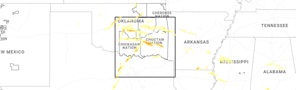
Hail Map for Tuskahoma, OK
The Tuskahoma, OK area has had 9 reports of on-the-ground hail by trained spotters, and has been under severe weather warnings 56 times during the past 12 months. Doppler radar has detected hail at or near Tuskahoma, OK on 69 occasions, including 4 occasions during the past year.
| Name: | Tuskahoma, OK |
| Where Located: | 51.4 miles ENE of Atoka, OK |
| Map: | Google Map for Tuskahoma, OK |
| Population: | 151 |
| Housing Units: | 81 |
| More Info: | Search Google for Tuskahoma, OK |
1
The Top Recent Hail Date for Tuskahoma, OK is Saturday, May 17, 2025 (18th out of 69)
Hail and Wind Damage Spotted near Tuskahoma, OK
| Date / Time | Report Details |
|---|---|
| 5/24/2025 2:05 PM CDT |
 the severe thunderstorm warning has been cancelled and is no longer in effect the severe thunderstorm warning has been cancelled and is no longer in effect
|
| 5/24/2025 1:53 PM CDT |
 At 153 pm cdt, a severe thunderstorm was located 3 miles southwest of yanush, moving east at 35 mph (radar indicated). Hazards include 60 mph wind gusts and quarter size hail. Hail damage to vehicles is expected. expect wind damage to roofs, siding, and trees. Locations in or near the path include, tuskahoma, sardis, yanush, clayton,. At 153 pm cdt, a severe thunderstorm was located 3 miles southwest of yanush, moving east at 35 mph (radar indicated). Hazards include 60 mph wind gusts and quarter size hail. Hail damage to vehicles is expected. expect wind damage to roofs, siding, and trees. Locations in or near the path include, tuskahoma, sardis, yanush, clayton,.
|
| 5/24/2025 1:34 PM CDT |
 Svrtsa the national weather service in tulsa has issued a * severe thunderstorm warning for, north central pushmataha county in southeastern oklahoma, southwestern latimer county in southeastern oklahoma, * until 230 pm cdt. * at 134 pm cdt, a severe thunderstorm was located 8 miles southwest of higgins, moving east at 25 mph (radar indicated). Hazards include 60 mph wind gusts and quarter size hail. Hail damage to vehicles is expected. expect wind damage to roofs, siding, and trees. Locations in or near the path include, clayton lake state park, tuskahoma, sardis, yanush, clayton,. Svrtsa the national weather service in tulsa has issued a * severe thunderstorm warning for, north central pushmataha county in southeastern oklahoma, southwestern latimer county in southeastern oklahoma, * until 230 pm cdt. * at 134 pm cdt, a severe thunderstorm was located 8 miles southwest of higgins, moving east at 25 mph (radar indicated). Hazards include 60 mph wind gusts and quarter size hail. Hail damage to vehicles is expected. expect wind damage to roofs, siding, and trees. Locations in or near the path include, clayton lake state park, tuskahoma, sardis, yanush, clayton,.
|
| 5/24/2025 9:02 AM CDT |
 At 902 am cdt, severe thunderstorms were located along a line extending from 4 miles north of bengal to 7 miles southeast of albion to 2 miles south of nashoba, moving southeast at 55 mph (radar indicated). Hazards include 60 mph wind gusts and penny size hail. Expect damage to roofs, siding, and trees. Locations in or near the path include, talimena state park, octavia, clayton lake state park, red oak, bengal, panola, tuskahoma, summerfield, fanshawe, big cedar, lake wister state park, heavener, nashoba, kiamichi, whitesboro, albion, hodgen, talihina, muse, honobia,. At 902 am cdt, severe thunderstorms were located along a line extending from 4 miles north of bengal to 7 miles southeast of albion to 2 miles south of nashoba, moving southeast at 55 mph (radar indicated). Hazards include 60 mph wind gusts and penny size hail. Expect damage to roofs, siding, and trees. Locations in or near the path include, talimena state park, octavia, clayton lake state park, red oak, bengal, panola, tuskahoma, summerfield, fanshawe, big cedar, lake wister state park, heavener, nashoba, kiamichi, whitesboro, albion, hodgen, talihina, muse, honobia,.
|
| 5/24/2025 8:51 AM CDT |
 At 851 am cdt, severe thunderstorms were located along a line extending from 3 miles northwest of red oak to 3 miles north of albion to 2 miles west of nashoba, moving east at 35 mph (radar indicated). Hazards include 70 mph wind gusts and nickel size hail. Expect considerable tree damage. damage is likely to mobile homes, roofs, and outbuildings. Locations in or near the path include, talimena state park, octavia, panola, tuskahoma, big cedar, howe, kiamichi, whitesboro, talihina, clayton lake state park, red oak, bengal, summerfield, yanush, robbers cave state park, fanshawe, clayton, wilburton, wister, lake wister state park,. At 851 am cdt, severe thunderstorms were located along a line extending from 3 miles northwest of red oak to 3 miles north of albion to 2 miles west of nashoba, moving east at 35 mph (radar indicated). Hazards include 70 mph wind gusts and nickel size hail. Expect considerable tree damage. damage is likely to mobile homes, roofs, and outbuildings. Locations in or near the path include, talimena state park, octavia, panola, tuskahoma, big cedar, howe, kiamichi, whitesboro, talihina, clayton lake state park, red oak, bengal, summerfield, yanush, robbers cave state park, fanshawe, clayton, wilburton, wister, lake wister state park,.
|
| 5/24/2025 8:43 AM CDT |
 At 843 am cdt, severe thunderstorms were located along a line extending from 2 miles southeast of robbers cave state park to 5 miles west of bengal to 2 miles west of kiamichi, moving east at 70 mph (radar indicated). Hazards include 70 mph wind gusts and half dollar size hail. Hail damage to vehicles is expected. expect considerable tree damage. wind damage is also likely to mobile homes, roofs, and outbuildings. Locations in or near the path include, wilburton, red oak, damon, bengal, kiamichi, panola, yanush, robbers cave state park,. At 843 am cdt, severe thunderstorms were located along a line extending from 2 miles southeast of robbers cave state park to 5 miles west of bengal to 2 miles west of kiamichi, moving east at 70 mph (radar indicated). Hazards include 70 mph wind gusts and half dollar size hail. Hail damage to vehicles is expected. expect considerable tree damage. wind damage is also likely to mobile homes, roofs, and outbuildings. Locations in or near the path include, wilburton, red oak, damon, bengal, kiamichi, panola, yanush, robbers cave state park,.
|
| 5/24/2025 8:43 AM CDT |
 the severe thunderstorm warning has been cancelled and is no longer in effect the severe thunderstorm warning has been cancelled and is no longer in effect
|
| 5/24/2025 8:38 AM CDT |
 Svrtsa the national weather service in tulsa has issued a * severe thunderstorm warning for, northeastern pushmataha county in southeastern oklahoma, latimer county in southeastern oklahoma, southern le flore county in southeastern oklahoma, * until 930 am cdt. * at 838 am cdt, severe thunderstorms were located along a line extending from 4 miles east of robbers cave state park to 4 miles northeast of yanush to near clayton, moving east at 60 mph (radar indicated). Hazards include 70 mph wind gusts and half dollar size hail. Hail damage to vehicles is expected. expect considerable tree damage. wind damage is also likely to mobile homes, roofs, and outbuildings. Locations in or near the path include, talimena state park, octavia, panola, tuskahoma, big cedar, stanley, howe, kiamichi, whitesboro, talihina, clayton lake state park, red oak, sardis, damon, bengal, summerfield, yanush, robbers cave state park, fanshawe, clayton,. Svrtsa the national weather service in tulsa has issued a * severe thunderstorm warning for, northeastern pushmataha county in southeastern oklahoma, latimer county in southeastern oklahoma, southern le flore county in southeastern oklahoma, * until 930 am cdt. * at 838 am cdt, severe thunderstorms were located along a line extending from 4 miles east of robbers cave state park to 4 miles northeast of yanush to near clayton, moving east at 60 mph (radar indicated). Hazards include 70 mph wind gusts and half dollar size hail. Hail damage to vehicles is expected. expect considerable tree damage. wind damage is also likely to mobile homes, roofs, and outbuildings. Locations in or near the path include, talimena state park, octavia, panola, tuskahoma, big cedar, stanley, howe, kiamichi, whitesboro, talihina, clayton lake state park, red oak, sardis, damon, bengal, summerfield, yanush, robbers cave state park, fanshawe, clayton,.
|
| 5/24/2025 8:31 AM CDT |
 At 831 am cdt, a severe thunderstorm was located 3 miles north of higgins, moving east at 40 mph (radar indicated). Hazards include 70 mph wind gusts and ping pong ball size hail. People and animals outdoors will be injured. expect hail damage to roofs, siding, windows, and vehicles. expect considerable tree damage. wind damage is also likely to mobile homes, roofs, and outbuildings. Locations in or near the path include, wilburton, red oak, hartshorne, gowen, damon, higgins, bengal, kiamichi, panola, yanush, robbers cave state park,. At 831 am cdt, a severe thunderstorm was located 3 miles north of higgins, moving east at 40 mph (radar indicated). Hazards include 70 mph wind gusts and ping pong ball size hail. People and animals outdoors will be injured. expect hail damage to roofs, siding, windows, and vehicles. expect considerable tree damage. wind damage is also likely to mobile homes, roofs, and outbuildings. Locations in or near the path include, wilburton, red oak, hartshorne, gowen, damon, higgins, bengal, kiamichi, panola, yanush, robbers cave state park,.
|
| 5/24/2025 8:19 AM CDT |
 Svrtsa the national weather service in tulsa has issued a * severe thunderstorm warning for, north central pushmataha county in southeastern oklahoma, latimer county in southeastern oklahoma, southeastern pittsburg county in southeastern oklahoma, * until 900 am cdt. * at 819 am cdt, a severe thunderstorm was located 3 miles north of hartshorne, moving east at 40 mph (radar indicated). Hazards include golf ball size hail and 70 mph wind gusts. People and animals outdoors will be injured. expect hail damage to roofs, siding, windows, and vehicles. expect considerable tree damage. wind damage is also likely to mobile homes, roofs, and outbuildings. Locations in or near the path include, red oak, gowen, damon, higgins, bengal, panola, dow, yanush, robbers cave state park, bache, wilburton, hartshorne, haileyville, kiamichi, alderson,. Svrtsa the national weather service in tulsa has issued a * severe thunderstorm warning for, north central pushmataha county in southeastern oklahoma, latimer county in southeastern oklahoma, southeastern pittsburg county in southeastern oklahoma, * until 900 am cdt. * at 819 am cdt, a severe thunderstorm was located 3 miles north of hartshorne, moving east at 40 mph (radar indicated). Hazards include golf ball size hail and 70 mph wind gusts. People and animals outdoors will be injured. expect hail damage to roofs, siding, windows, and vehicles. expect considerable tree damage. wind damage is also likely to mobile homes, roofs, and outbuildings. Locations in or near the path include, red oak, gowen, damon, higgins, bengal, panola, dow, yanush, robbers cave state park, bache, wilburton, hartshorne, haileyville, kiamichi, alderson,.
|
| 5/20/2025 12:56 AM CDT |
 the severe thunderstorm warning has been cancelled and is no longer in effect the severe thunderstorm warning has been cancelled and is no longer in effect
|
| 5/20/2025 12:50 AM CDT |
 At 1250 am cdt, severe thunderstorms were located along a line extending from 6 miles north of hartshorne to 7 miles northwest of clayton to 4 miles northwest of soper, moving east at 55 mph (radar indicated). Hazards include 60 mph wind gusts and penny size hail. Expect damage to roofs, siding, and trees. Locations in or near the path include, eubanks, kent, sardis, damon, higgins, boswell, tuskahoma, yanush, clayton, darwin, stanley, moyers, kosoma, kellond, dunbar, finley, antlers,. At 1250 am cdt, severe thunderstorms were located along a line extending from 6 miles north of hartshorne to 7 miles northwest of clayton to 4 miles northwest of soper, moving east at 55 mph (radar indicated). Hazards include 60 mph wind gusts and penny size hail. Expect damage to roofs, siding, and trees. Locations in or near the path include, eubanks, kent, sardis, damon, higgins, boswell, tuskahoma, yanush, clayton, darwin, stanley, moyers, kosoma, kellond, dunbar, finley, antlers,.
|
| 5/20/2025 12:24 AM CDT | Svrtsa the national weather service in tulsa has issued a * severe thunderstorm warning for, western pushmataha county in southeastern oklahoma, western latimer county in southeastern oklahoma, northwestern choctaw county in southeastern oklahoma, southern pittsburg county in southeastern oklahoma, * until 115 am cdt. * at 1223 am cdt, severe thunderstorms were located along a line extending from 3 miles south of haywood to 6 miles west of daisy to 3 miles south of bokchito, moving east at 55 mph (radar indicated). Hazards include 60 mph wind gusts and quarter size hail. Hail damage to vehicles is expected. expect wind damage to roofs, siding, and trees. Locations in or near the path include, gowen, mcalester, higgins, pittsburg, tuskahoma, darwin, stanley, hartshorne, haileyville, krebs, alderson, kellond, ashland, eubanks, kent, sardis, damon, boswell, kiowa, dow,. |
| 5/19/2025 8:11 PM CDT | Svrtsa the national weather service in tulsa has issued a * severe thunderstorm warning for, pushmataha county in southeastern oklahoma, southeastern latimer county in southeastern oklahoma, northeastern choctaw county in southeastern oklahoma, southern le flore county in southeastern oklahoma, * until 900 pm cdt. * at 811 pm cdt, severe thunderstorms were located along a line extending from 6 miles north of talimena state park to 2 miles northwest of rattan, moving east at 20 mph (radar indicated). Hazards include 60 mph wind gusts. Expect damage to roofs, siding, and trees. Locations in or near the path include, talimena state park, snow, rattan, sobol, tuskahoma, kiamichi, whitesboro, talihina, clayton lake state park, corinne, bengal, swink, clayton, apple, dela, nashoba, albion, finley, hodgen, muse,. |
| 5/19/2025 12:38 PM CDT |
 The storm which prompted the warning has weakened below severe limits, and no longer poses an immediate threat to life or property. therefore, the warning will be allowed to expire. however, small hail is still possible with this thunderstorm. a tornado watch remains in effect until 700 pm cdt for southeastern oklahoma. The storm which prompted the warning has weakened below severe limits, and no longer poses an immediate threat to life or property. therefore, the warning will be allowed to expire. however, small hail is still possible with this thunderstorm. a tornado watch remains in effect until 700 pm cdt for southeastern oklahoma.
|
| 5/19/2025 12:31 PM CDT |
 At 1231 pm cdt, a severe thunderstorm was located 3 miles northeast of stanley, moving northeast at 50 mph (radar indicated). Hazards include 60 mph wind gusts and quarter size hail. Hail damage to vehicles is expected. expect wind damage to roofs, siding, and trees. Locations in or near the path include, clayton lake state park, stanley, sardis, kiamichi, dunbar, tuskahoma, yanush, clayton,. At 1231 pm cdt, a severe thunderstorm was located 3 miles northeast of stanley, moving northeast at 50 mph (radar indicated). Hazards include 60 mph wind gusts and quarter size hail. Hail damage to vehicles is expected. expect wind damage to roofs, siding, and trees. Locations in or near the path include, clayton lake state park, stanley, sardis, kiamichi, dunbar, tuskahoma, yanush, clayton,.
|
| 5/19/2025 12:15 PM CDT |
 the severe thunderstorm warning has been cancelled and is no longer in effect the severe thunderstorm warning has been cancelled and is no longer in effect
|
| 5/19/2025 12:15 PM CDT |
 At 1215 pm cdt, a severe thunderstorm was located near dunbar, moving northeast at 50 mph (radar indicated). Hazards include ping pong ball size hail and 60 mph wind gusts. People and animals outdoors will be injured. expect hail damage to roofs, siding, windows, and vehicles. expect wind damage to roofs, siding, and trees. Locations in or near the path include, eubanks, clayton lake state park, stanley, sardis, snow, nashoba, kiamichi, dunbar, tuskahoma, yanush, clayton,. At 1215 pm cdt, a severe thunderstorm was located near dunbar, moving northeast at 50 mph (radar indicated). Hazards include ping pong ball size hail and 60 mph wind gusts. People and animals outdoors will be injured. expect hail damage to roofs, siding, windows, and vehicles. expect wind damage to roofs, siding, and trees. Locations in or near the path include, eubanks, clayton lake state park, stanley, sardis, snow, nashoba, kiamichi, dunbar, tuskahoma, yanush, clayton,.
|
| 5/19/2025 12:05 PM CDT |
 At 1205 pm cdt, a severe thunderstorm was located 5 miles northwest of kosoma, moving northeast at 55 mph (radar indicated). Hazards include 60 mph wind gusts and quarter size hail. Hail damage to vehicles is expected. expect wind damage to roofs, siding, and trees. Locations in or near the path include, eubanks, clayton lake state park, sardis, snow, tuskahoma, yanush, clayton, darwin, stanley, moyers, nashoba, kiamichi, kosoma, dunbar,. At 1205 pm cdt, a severe thunderstorm was located 5 miles northwest of kosoma, moving northeast at 55 mph (radar indicated). Hazards include 60 mph wind gusts and quarter size hail. Hail damage to vehicles is expected. expect wind damage to roofs, siding, and trees. Locations in or near the path include, eubanks, clayton lake state park, sardis, snow, tuskahoma, yanush, clayton, darwin, stanley, moyers, nashoba, kiamichi, kosoma, dunbar,.
|
| 5/19/2025 11:50 AM CDT |
 Svrtsa the national weather service in tulsa has issued a * severe thunderstorm warning for, central pushmataha county in southeastern oklahoma, southwestern latimer county in southeastern oklahoma, southeastern pittsburg county in southeastern oklahoma, * until 1245 pm cdt. * at 1150 am cdt, a severe thunderstorm was located 6 miles east of lane, moving northeast at 55 mph (radar indicated). Hazards include 60 mph wind gusts and half dollar size hail. Hail damage to vehicles is expected. expect wind damage to roofs, siding, and trees. Locations in or near the path include, eubanks, clayton lake state park, sardis, snow, higgins, tuskahoma, yanush, clayton, darwin, stanley, moyers, nashoba, kiamichi, kosoma, dunbar,. Svrtsa the national weather service in tulsa has issued a * severe thunderstorm warning for, central pushmataha county in southeastern oklahoma, southwestern latimer county in southeastern oklahoma, southeastern pittsburg county in southeastern oklahoma, * until 1245 pm cdt. * at 1150 am cdt, a severe thunderstorm was located 6 miles east of lane, moving northeast at 55 mph (radar indicated). Hazards include 60 mph wind gusts and half dollar size hail. Hail damage to vehicles is expected. expect wind damage to roofs, siding, and trees. Locations in or near the path include, eubanks, clayton lake state park, sardis, snow, higgins, tuskahoma, yanush, clayton, darwin, stanley, moyers, nashoba, kiamichi, kosoma, dunbar,.
|
| 5/17/2025 9:32 PM CDT |
 the severe thunderstorm warning has been cancelled and is no longer in effect the severe thunderstorm warning has been cancelled and is no longer in effect
|
| 5/17/2025 9:25 PM CDT |
 At 925 pm cdt, a severe thunderstorm was located near clayton lake state park, moving east at 15 mph (radar indicated). Hazards include ping pong ball size hail and 60 mph wind gusts. People and animals outdoors will be injured. expect hail damage to roofs, siding, windows, and vehicles. expect wind damage to roofs, siding, and trees. Locations in or near the path include, sardis, clayton lake state park, clayton,. At 925 pm cdt, a severe thunderstorm was located near clayton lake state park, moving east at 15 mph (radar indicated). Hazards include ping pong ball size hail and 60 mph wind gusts. People and animals outdoors will be injured. expect hail damage to roofs, siding, windows, and vehicles. expect wind damage to roofs, siding, and trees. Locations in or near the path include, sardis, clayton lake state park, clayton,.
|
| 5/17/2025 9:23 PM CDT |
 Svrtsa the national weather service in tulsa has issued a * severe thunderstorm warning for, northeastern pushmataha county in southeastern oklahoma, * until 1000 pm cdt. * at 923 pm cdt, a severe thunderstorm was located over clayton lake state park, moving east at 15 mph (radar indicated). Hazards include ping pong ball size hail and 60 mph wind gusts. People and animals outdoors will be injured. expect hail damage to roofs, siding, windows, and vehicles. expect wind damage to roofs, siding, and trees. Locations in or near the path include, kiamichi, tuskahoma, nashoba, clayton lake state park,. Svrtsa the national weather service in tulsa has issued a * severe thunderstorm warning for, northeastern pushmataha county in southeastern oklahoma, * until 1000 pm cdt. * at 923 pm cdt, a severe thunderstorm was located over clayton lake state park, moving east at 15 mph (radar indicated). Hazards include ping pong ball size hail and 60 mph wind gusts. People and animals outdoors will be injured. expect hail damage to roofs, siding, windows, and vehicles. expect wind damage to roofs, siding, and trees. Locations in or near the path include, kiamichi, tuskahoma, nashoba, clayton lake state park,.
|
| 5/17/2025 9:17 PM CDT |
 At 917 pm cdt, a severe thunderstorm was located 3 miles southwest of clayton, moving east at 25 mph (radar indicated). Hazards include 60 mph wind gusts and quarter size hail. Hail damage to vehicles is expected. expect wind damage to roofs, siding, and trees. Locations in or near the path include, clayton lake state park, stanley, sardis, clayton,. At 917 pm cdt, a severe thunderstorm was located 3 miles southwest of clayton, moving east at 25 mph (radar indicated). Hazards include 60 mph wind gusts and quarter size hail. Hail damage to vehicles is expected. expect wind damage to roofs, siding, and trees. Locations in or near the path include, clayton lake state park, stanley, sardis, clayton,.
|
| 5/17/2025 9:17 PM CDT |
 the severe thunderstorm warning has been cancelled and is no longer in effect the severe thunderstorm warning has been cancelled and is no longer in effect
|
| 5/17/2025 9:16 PM CDT |
 Svrtsa the national weather service in tulsa has issued a * severe thunderstorm warning for, northwestern pushmataha county in southeastern oklahoma, * until 1000 pm cdt. * at 915 pm cdt, a severe thunderstorm was located 3 miles northeast of stanley, moving east at 15 mph (radar indicated). Hazards include 60 mph wind gusts and quarter size hail. Hail damage to vehicles is expected. expect wind damage to roofs, siding, and trees. Locations in or near the path include, clayton lake state park, stanley, sardis, clayton,. Svrtsa the national weather service in tulsa has issued a * severe thunderstorm warning for, northwestern pushmataha county in southeastern oklahoma, * until 1000 pm cdt. * at 915 pm cdt, a severe thunderstorm was located 3 miles northeast of stanley, moving east at 15 mph (radar indicated). Hazards include 60 mph wind gusts and quarter size hail. Hail damage to vehicles is expected. expect wind damage to roofs, siding, and trees. Locations in or near the path include, clayton lake state park, stanley, sardis, clayton,.
|
| 5/17/2025 8:55 PM CDT |
 At 855 pm cdt, a severe thunderstorm was located 5 miles northwest of stanley, moving east at 25 mph (radar indicated). Hazards include 60 mph wind gusts and quarter size hail. Hail damage to vehicles is expected. expect wind damage to roofs, siding, and trees. Locations in or near the path include, clayton lake state park, dunbar, stanley, sardis, clayton,. At 855 pm cdt, a severe thunderstorm was located 5 miles northwest of stanley, moving east at 25 mph (radar indicated). Hazards include 60 mph wind gusts and quarter size hail. Hail damage to vehicles is expected. expect wind damage to roofs, siding, and trees. Locations in or near the path include, clayton lake state park, dunbar, stanley, sardis, clayton,.
|
| 5/17/2025 8:40 PM CDT |
 Svrtsa the national weather service in tulsa has issued a * severe thunderstorm warning for, northwestern pushmataha county in southeastern oklahoma, south central pittsburg county in southeastern oklahoma, * until 930 pm cdt. * at 840 pm cdt, a severe thunderstorm was located 5 miles east of daisy, moving east at 25 mph (radar indicated). Hazards include 60 mph wind gusts and half dollar size hail. Hail damage to vehicles is expected. expect wind damage to roofs, siding, and trees. Locations in or near the path include, eubanks, clayton lake state park, stanley, sardis, snow, dunbar, clayton,. Svrtsa the national weather service in tulsa has issued a * severe thunderstorm warning for, northwestern pushmataha county in southeastern oklahoma, south central pittsburg county in southeastern oklahoma, * until 930 pm cdt. * at 840 pm cdt, a severe thunderstorm was located 5 miles east of daisy, moving east at 25 mph (radar indicated). Hazards include 60 mph wind gusts and half dollar size hail. Hail damage to vehicles is expected. expect wind damage to roofs, siding, and trees. Locations in or near the path include, eubanks, clayton lake state park, stanley, sardis, snow, dunbar, clayton,.
|
| 4/30/2025 12:10 PM CDT |
 Svrtsa the national weather service in tulsa has issued a * severe thunderstorm warning for, eastern pushmataha county in southeastern oklahoma, south central le flore county in southeastern oklahoma, * until 100 pm cdt. * at 1209 pm cdt, severe thunderstorms were located along a line extending from near clayton to 6 miles southeast of nashoba to 8 miles north of manchester, moving northeast at 40 mph (radar indicated). Hazards include 60 mph wind gusts. Expect damage to roofs, siding, and trees. Locations in or near the path include, octavia, clayton lake state park, nashoba, kiamichi, albion, tuskahoma, honobia, muse, clayton,. Svrtsa the national weather service in tulsa has issued a * severe thunderstorm warning for, eastern pushmataha county in southeastern oklahoma, south central le flore county in southeastern oklahoma, * until 100 pm cdt. * at 1209 pm cdt, severe thunderstorms were located along a line extending from near clayton to 6 miles southeast of nashoba to 8 miles north of manchester, moving northeast at 40 mph (radar indicated). Hazards include 60 mph wind gusts. Expect damage to roofs, siding, and trees. Locations in or near the path include, octavia, clayton lake state park, nashoba, kiamichi, albion, tuskahoma, honobia, muse, clayton,.
|
| 4/30/2025 12:10 PM CDT |
 the tornado warning has been cancelled and is no longer in effect the tornado warning has been cancelled and is no longer in effect
|
| 4/30/2025 11:58 AM CDT |
 Tortsa the national weather service in tulsa has issued a * tornado warning for, central pushmataha county in southeastern oklahoma, * until 1230 pm cdt. * at 1157 am cdt, severe thunderstorms capable of producing a tornado were located 2 miles west of snow another circulation was located 5 miles west of cloudy, moving northeast at 30 mph (radar indicated rotation). Hazards include tornado. Flying debris will be dangerous to those caught without shelter. mobile homes will be damaged or destroyed. damage to roofs, windows, and vehicles will occur. tree damage is likely. Locations in or near the path include, clayton lake state park, tuskahoma, snow, clayton, cloudy, nashoba,. Tortsa the national weather service in tulsa has issued a * tornado warning for, central pushmataha county in southeastern oklahoma, * until 1230 pm cdt. * at 1157 am cdt, severe thunderstorms capable of producing a tornado were located 2 miles west of snow another circulation was located 5 miles west of cloudy, moving northeast at 30 mph (radar indicated rotation). Hazards include tornado. Flying debris will be dangerous to those caught without shelter. mobile homes will be damaged or destroyed. damage to roofs, windows, and vehicles will occur. tree damage is likely. Locations in or near the path include, clayton lake state park, tuskahoma, snow, clayton, cloudy, nashoba,.
|
| 4/30/2025 11:49 AM CDT |
 At 1149 am cdt, severe thunderstorms were located along a line extending from 5 miles north of lake eufaula state park to 2 miles southwest of kinta to 3 miles northwest of tuskahoma, moving east at 30 mph (radar indicated). Hazards include 60 mph wind gusts. Expect damage to roofs, siding, and trees. Locations in or near the path include, panola, whitefield, mccurtain, oktaha, kinta, mc curtain, porum, warner, pierce, stigler, checotah, eram, lake eufaula state park, morris, talihina, lequire, wainwright, red oak, sardis, damon, this includes interstate 40 in oklahoma between mile markers 250 and 277. At 1149 am cdt, severe thunderstorms were located along a line extending from 5 miles north of lake eufaula state park to 2 miles southwest of kinta to 3 miles northwest of tuskahoma, moving east at 30 mph (radar indicated). Hazards include 60 mph wind gusts. Expect damage to roofs, siding, and trees. Locations in or near the path include, panola, whitefield, mccurtain, oktaha, kinta, mc curtain, porum, warner, pierce, stigler, checotah, eram, lake eufaula state park, morris, talihina, lequire, wainwright, red oak, sardis, damon, this includes interstate 40 in oklahoma between mile markers 250 and 277.
|
| 4/30/2025 11:37 AM CDT |
 Svrtsa the national weather service in tulsa has issued a * severe thunderstorm warning for, pushmataha county in southeastern oklahoma, northeastern choctaw county in southeastern oklahoma, * until 1215 pm cdt. * at 1137 am cdt, severe thunderstorms were located along a line extending from 3 miles southeast of dunbar to near rattan to 2 miles northeast of sawyer, moving northeast at 40 mph (radar indicated). Hazards include 60 mph wind gusts. Expect damage to roofs, siding, and trees. Locations in or near the path include, eubanks, clayton lake state park, corinne, snow, rattan, sobol, tuskahoma, clayton, hugo lake state park, apple, stanley, nashoba, kiamichi, kosoma, dunbar, finley, oleta, fort towson, honobia, cloudy,. Svrtsa the national weather service in tulsa has issued a * severe thunderstorm warning for, pushmataha county in southeastern oklahoma, northeastern choctaw county in southeastern oklahoma, * until 1215 pm cdt. * at 1137 am cdt, severe thunderstorms were located along a line extending from 3 miles southeast of dunbar to near rattan to 2 miles northeast of sawyer, moving northeast at 40 mph (radar indicated). Hazards include 60 mph wind gusts. Expect damage to roofs, siding, and trees. Locations in or near the path include, eubanks, clayton lake state park, corinne, snow, rattan, sobol, tuskahoma, clayton, hugo lake state park, apple, stanley, nashoba, kiamichi, kosoma, dunbar, finley, oleta, fort towson, honobia, cloudy,.
|
| 4/30/2025 11:30 AM CDT |
 Svrtsa the national weather service in tulsa has issued a * severe thunderstorm warning for, northeastern pushmataha county in southeastern oklahoma, haskell county in southeastern oklahoma, mcintosh county in southeastern oklahoma, latimer county in southeastern oklahoma, west central le flore county in southeastern oklahoma, eastern pittsburg county in southeastern oklahoma, southeastern okmulgee county in northeastern oklahoma, central muskogee county in east central oklahoma, * until 1215 pm cdt. * at 1130 am cdt, severe thunderstorms were located along a line extending from 4 miles southeast of hoffman to 4 miles southwest of quinton to 6 miles northwest of clayton, moving east at 30 mph (radar indicated). Hazards include 60 mph wind gusts. Expect damage to roofs, siding, and trees. Locations in or near the path include, gowen, higgins, panola, whitefield, mccurtain, oktaha, vivian, kinta, mc curtain, porum, warner, pierce, schulter, featherston, stigler, kiamichi, checotah, eram, lake eufaula state park, morris, this includes interstate 40 in oklahoma between mile markers 243 and 277. Svrtsa the national weather service in tulsa has issued a * severe thunderstorm warning for, northeastern pushmataha county in southeastern oklahoma, haskell county in southeastern oklahoma, mcintosh county in southeastern oklahoma, latimer county in southeastern oklahoma, west central le flore county in southeastern oklahoma, eastern pittsburg county in southeastern oklahoma, southeastern okmulgee county in northeastern oklahoma, central muskogee county in east central oklahoma, * until 1215 pm cdt. * at 1130 am cdt, severe thunderstorms were located along a line extending from 4 miles southeast of hoffman to 4 miles southwest of quinton to 6 miles northwest of clayton, moving east at 30 mph (radar indicated). Hazards include 60 mph wind gusts. Expect damage to roofs, siding, and trees. Locations in or near the path include, gowen, higgins, panola, whitefield, mccurtain, oktaha, vivian, kinta, mc curtain, porum, warner, pierce, schulter, featherston, stigler, kiamichi, checotah, eram, lake eufaula state park, morris, this includes interstate 40 in oklahoma between mile markers 243 and 277.
|
| 4/30/2025 11:12 AM CDT |
 Svrtsa the national weather service in tulsa has issued a * severe thunderstorm warning for, northwestern pushmataha county in southeastern oklahoma, southwestern latimer county in southeastern oklahoma, southeastern pittsburg county in southeastern oklahoma, * until 1130 am cdt. * at 1112 am cdt, a severe thunderstorm was located 9 miles southwest of higgins, moving east at 40 mph (radar indicated). Hazards include 60 mph wind gusts. Expect damage to roofs, siding, and trees. Locations in or near the path include, kiamichi, albion, tuskahoma, sardis, higgins, yanush,. Svrtsa the national weather service in tulsa has issued a * severe thunderstorm warning for, northwestern pushmataha county in southeastern oklahoma, southwestern latimer county in southeastern oklahoma, southeastern pittsburg county in southeastern oklahoma, * until 1130 am cdt. * at 1112 am cdt, a severe thunderstorm was located 9 miles southwest of higgins, moving east at 40 mph (radar indicated). Hazards include 60 mph wind gusts. Expect damage to roofs, siding, and trees. Locations in or near the path include, kiamichi, albion, tuskahoma, sardis, higgins, yanush,.
|
| 4/20/2025 1:55 AM CDT |
 At 155 am cdt, severe thunderstorms were located along a line extending from 4 miles northeast of kinta to 6 miles northeast of wilburton to 4 miles northwest of clayton, moving east at 30 mph (radar indicated). Hazards include 70 mph wind gusts and quarter size hail. Hail damage to vehicles is expected. expect considerable tree damage. wind damage is also likely to mobile homes, roofs, and outbuildings. Locations in or near the path include, mc curtain, wilburton, red oak, gowen, higgins, sardis, damon, panola, mccurtain, yanush, lequire, clayton,. At 155 am cdt, severe thunderstorms were located along a line extending from 4 miles northeast of kinta to 6 miles northeast of wilburton to 4 miles northwest of clayton, moving east at 30 mph (radar indicated). Hazards include 70 mph wind gusts and quarter size hail. Hail damage to vehicles is expected. expect considerable tree damage. wind damage is also likely to mobile homes, roofs, and outbuildings. Locations in or near the path include, mc curtain, wilburton, red oak, gowen, higgins, sardis, damon, panola, mccurtain, yanush, lequire, clayton,.
|
| 4/20/2025 1:55 AM CDT |
 the severe thunderstorm warning has been cancelled and is no longer in effect the severe thunderstorm warning has been cancelled and is no longer in effect
|
| 4/20/2025 1:36 AM CDT |
 Svrtsa the national weather service in tulsa has issued a * severe thunderstorm warning for, northwestern pushmataha county in southeastern oklahoma, south central haskell county in southeastern oklahoma, latimer county in southeastern oklahoma, southeastern pittsburg county in southeastern oklahoma, * until 215 am cdt. * at 135 am cdt, severe thunderstorms were located along a line extending from 4 miles southwest of kinta to near damon to 2 miles northwest of kosoma, moving northeast at 30 mph (radar indicated). Hazards include 70 mph wind gusts and quarter size hail. Hail damage to vehicles is expected. expect considerable tree damage. wind damage is also likely to mobile homes, roofs, and outbuildings. Locations in or near the path include, eubanks, red oak, gowen, higgins, sardis, damon, panola, mccurtain, yanush, clayton, mc curtain, wilburton, stanley, dunbar, lequire,. Svrtsa the national weather service in tulsa has issued a * severe thunderstorm warning for, northwestern pushmataha county in southeastern oklahoma, south central haskell county in southeastern oklahoma, latimer county in southeastern oklahoma, southeastern pittsburg county in southeastern oklahoma, * until 215 am cdt. * at 135 am cdt, severe thunderstorms were located along a line extending from 4 miles southwest of kinta to near damon to 2 miles northwest of kosoma, moving northeast at 30 mph (radar indicated). Hazards include 70 mph wind gusts and quarter size hail. Hail damage to vehicles is expected. expect considerable tree damage. wind damage is also likely to mobile homes, roofs, and outbuildings. Locations in or near the path include, eubanks, red oak, gowen, higgins, sardis, damon, panola, mccurtain, yanush, clayton, mc curtain, wilburton, stanley, dunbar, lequire,.
|
| 4/20/2025 1:15 AM CDT |
 At 115 am cdt, severe thunderstorms were located along a line extending from 4 miles north of higgins to 8 miles west of yanush to 3 miles west of dunbar, moving northeast at 40 mph (radar indicated). Hazards include 70 mph wind gusts and quarter size hail. Hail damage to vehicles is expected. expect considerable tree damage. wind damage is also likely to mobile homes, roofs, and outbuildings. Locations in or near the path include, eubanks, gowen, higgins, sardis, damon, panola, tuskahoma, yanush, clayton, wilburton, stanley, dunbar, hartshorne,. At 115 am cdt, severe thunderstorms were located along a line extending from 4 miles north of higgins to 8 miles west of yanush to 3 miles west of dunbar, moving northeast at 40 mph (radar indicated). Hazards include 70 mph wind gusts and quarter size hail. Hail damage to vehicles is expected. expect considerable tree damage. wind damage is also likely to mobile homes, roofs, and outbuildings. Locations in or near the path include, eubanks, gowen, higgins, sardis, damon, panola, tuskahoma, yanush, clayton, wilburton, stanley, dunbar, hartshorne,.
|
| 4/20/2025 1:02 AM CDT | At 101 am cdt, severe thunderstorms were located along a line extending from 4 miles south of hartshorne to 8 miles northwest of stanley to 5 miles northwest of moyers, moving northeast at 45 mph (radar indicated). Hazards include 70 mph wind gusts and quarter size hail. Hail damage to vehicles is expected. expect considerable tree damage. wind damage is also likely to mobile homes, roofs, and outbuildings. Locations in or near the path include, eubanks, gowen, higgins, sardis, damon, panola, tuskahoma, yanush, clayton, wilburton, stanley, dunbar, hartshorne,. |
| 4/20/2025 1:02 AM CDT | the severe thunderstorm warning has been cancelled and is no longer in effect |
| 4/20/2025 12:44 AM CDT |
 Svrtsa the national weather service in tulsa has issued a * severe thunderstorm warning for, northwestern pushmataha county in southeastern oklahoma, latimer county in southeastern oklahoma, west central le flore county in southeastern oklahoma, southeastern pittsburg county in southeastern oklahoma, * until 130 am cdt. * at 1244 am cdt, severe thunderstorms were located along a line extending from 6 miles southeast of blanco to 2 miles southeast of daisy to 4 miles east of lane, moving northeast at 40 mph (radar indicated). Hazards include 70 mph wind gusts and nickel size hail. Expect considerable tree damage. damage is likely to mobile homes, roofs, and outbuildings. Locations in or near the path include, eubanks, clayton lake state park, talimena state park, gowen, higgins, sardis, damon, bengal, panola, tuskahoma, yanush, clayton, wilburton, stanley, kiamichi, albion, dunbar, talihina, kosoma, red oak,. Svrtsa the national weather service in tulsa has issued a * severe thunderstorm warning for, northwestern pushmataha county in southeastern oklahoma, latimer county in southeastern oklahoma, west central le flore county in southeastern oklahoma, southeastern pittsburg county in southeastern oklahoma, * until 130 am cdt. * at 1244 am cdt, severe thunderstorms were located along a line extending from 6 miles southeast of blanco to 2 miles southeast of daisy to 4 miles east of lane, moving northeast at 40 mph (radar indicated). Hazards include 70 mph wind gusts and nickel size hail. Expect considerable tree damage. damage is likely to mobile homes, roofs, and outbuildings. Locations in or near the path include, eubanks, clayton lake state park, talimena state park, gowen, higgins, sardis, damon, bengal, panola, tuskahoma, yanush, clayton, wilburton, stanley, kiamichi, albion, dunbar, talihina, kosoma, red oak,.
|
| 4/3/2025 9:48 AM CDT |
 the severe thunderstorm warning has been cancelled and is no longer in effect the severe thunderstorm warning has been cancelled and is no longer in effect
|
| 4/3/2025 9:10 AM CDT |
 Svrtsa the national weather service in tulsa has issued a * severe thunderstorm warning for, northwestern pushmataha county in southeastern oklahoma, southwestern mcintosh county in southeastern oklahoma, latimer county in southeastern oklahoma, pittsburg county in southeastern oklahoma, * until 1000 am cdt. * at 909 am cdt, a severe thunderstorm was located over coalgate, moving northeast at 65 mph (radar indicated). Hazards include 60 mph wind gusts and quarter size hail. Hail damage to vehicles is expected. expect wind damage to roofs, siding, and trees. Locations in or near the path include, arpelar, gowen, higgins, mcalester, canadian, pittsburg, raiford, panola, haywood, vivian, hanna, stanley, hartshorne, haileyville, featherston, krebs, alderson, ashland, sardis, damon,. Svrtsa the national weather service in tulsa has issued a * severe thunderstorm warning for, northwestern pushmataha county in southeastern oklahoma, southwestern mcintosh county in southeastern oklahoma, latimer county in southeastern oklahoma, pittsburg county in southeastern oklahoma, * until 1000 am cdt. * at 909 am cdt, a severe thunderstorm was located over coalgate, moving northeast at 65 mph (radar indicated). Hazards include 60 mph wind gusts and quarter size hail. Hail damage to vehicles is expected. expect wind damage to roofs, siding, and trees. Locations in or near the path include, arpelar, gowen, higgins, mcalester, canadian, pittsburg, raiford, panola, haywood, vivian, hanna, stanley, hartshorne, haileyville, featherston, krebs, alderson, ashland, sardis, damon,.
|
| 4/3/2025 7:02 AM CDT |
 Svrtsa the national weather service in tulsa has issued a * severe thunderstorm warning for, northeastern pushmataha county in southeastern oklahoma, southeastern latimer county in southeastern oklahoma, southern le flore county in southeastern oklahoma, * until 745 am cdt. * at 702 am cdt, a severe thunderstorm was located 4 miles north of nashoba, moving northeast at 60 mph (radar indicated). Hazards include quarter size hail. Damage to vehicles is expected. Locations in or near the path include, clayton lake state park, talimena state park, bengal, tuskahoma, summerfield, clayton, fanshawe, big cedar, lake wister state park, nashoba, kiamichi, whitesboro, albion, hodgen, talihina, muse, honobia,. Svrtsa the national weather service in tulsa has issued a * severe thunderstorm warning for, northeastern pushmataha county in southeastern oklahoma, southeastern latimer county in southeastern oklahoma, southern le flore county in southeastern oklahoma, * until 745 am cdt. * at 702 am cdt, a severe thunderstorm was located 4 miles north of nashoba, moving northeast at 60 mph (radar indicated). Hazards include quarter size hail. Damage to vehicles is expected. Locations in or near the path include, clayton lake state park, talimena state park, bengal, tuskahoma, summerfield, clayton, fanshawe, big cedar, lake wister state park, nashoba, kiamichi, whitesboro, albion, hodgen, talihina, muse, honobia,.
|
| 4/2/2025 8:28 AM CDT | At 828 am cdt, severe thunderstorms were located along a line extending from 2 miles east of cookson to 4 miles south of damon, moving east at 55 mph (radar indicated). Hazards include 60 mph wind gusts and quarter size hail. Hail damage to vehicles is expected. expect wind damage to roofs, siding, and trees. Locations in or near the path include, kanima, brushy, mcalester, pittsburg, raiford, whitefield, panola, haywood, summit, pumpkin center, webbers falls, mc curtain, porum, braggs, pierce, haileyville, lake eufaula state park, gore, lake tenkiller state park, keefeton, this includes interstate 40 in oklahoma between mile markers 251 and 313. |
| 4/2/2025 7:59 AM CDT |
 Svrtsa the national weather service in tulsa has issued a * severe thunderstorm warning for, northwestern pushmataha county in southeastern oklahoma, haskell county in southeastern oklahoma, mcintosh county in southeastern oklahoma, sequoyah county in east central oklahoma, latimer county in southeastern oklahoma, southern adair county in northeastern oklahoma, northwestern le flore county in southeastern oklahoma, southeastern cherokee county in east central oklahoma, pittsburg county in southeastern oklahoma, muskogee county in east central oklahoma, * until 845 am cdt. * at 759 am cdt, severe thunderstorms were located along a line extending from 3 miles north of braggs to 10 miles southeast of blanco, moving northeast at 55 mph (radar indicated). Hazards include 60 mph wind gusts and quarter size hail. Hail damage to vehicles is expected. expect wind damage to roofs, siding, and trees. Locations in or near the path include, kanima, arpelar, brushy, mcalester, pittsburg, raiford, whitefield, panola, haywood, summit, pumpkin center, webbers falls, mc curtain, porum, braggs, pierce, haileyville, lake eufaula state park, gore, lake tenkiller state park, this includes interstate 40 in oklahoma between mile markers 244 and 313. Svrtsa the national weather service in tulsa has issued a * severe thunderstorm warning for, northwestern pushmataha county in southeastern oklahoma, haskell county in southeastern oklahoma, mcintosh county in southeastern oklahoma, sequoyah county in east central oklahoma, latimer county in southeastern oklahoma, southern adair county in northeastern oklahoma, northwestern le flore county in southeastern oklahoma, southeastern cherokee county in east central oklahoma, pittsburg county in southeastern oklahoma, muskogee county in east central oklahoma, * until 845 am cdt. * at 759 am cdt, severe thunderstorms were located along a line extending from 3 miles north of braggs to 10 miles southeast of blanco, moving northeast at 55 mph (radar indicated). Hazards include 60 mph wind gusts and quarter size hail. Hail damage to vehicles is expected. expect wind damage to roofs, siding, and trees. Locations in or near the path include, kanima, arpelar, brushy, mcalester, pittsburg, raiford, whitefield, panola, haywood, summit, pumpkin center, webbers falls, mc curtain, porum, braggs, pierce, haileyville, lake eufaula state park, gore, lake tenkiller state park, this includes interstate 40 in oklahoma between mile markers 244 and 313.
|
| 3/4/2025 7:14 AM CST |
 At 714 am cst, severe thunderstorms were located along a line extending from 4 miles northwest of kinta to 6 miles east of oleta, moving east at 45 mph (radar indicated). Hazards include 70 mph wind gusts. Expect considerable tree damage. damage is likely to mobile homes, roofs, and outbuildings. Locations in or near the path include, clayton lake state park, corinne, sardis, higgins, damon, snow, rattan, sobol, panola, tuskahoma, yanush, robbers cave state park, clayton, kinta, wilburton, quinton, stigler, nashoba, kiamichi, oleta,. At 714 am cst, severe thunderstorms were located along a line extending from 4 miles northwest of kinta to 6 miles east of oleta, moving east at 45 mph (radar indicated). Hazards include 70 mph wind gusts. Expect considerable tree damage. damage is likely to mobile homes, roofs, and outbuildings. Locations in or near the path include, clayton lake state park, corinne, sardis, higgins, damon, snow, rattan, sobol, panola, tuskahoma, yanush, robbers cave state park, clayton, kinta, wilburton, quinton, stigler, nashoba, kiamichi, oleta,.
|
| 3/4/2025 7:12 AM CST |
 The tornado threat has diminished and the tornado warning has been cancelled. however, damaging winds remain likely and a severe thunderstorm warning remains in effect for the area. a tornado watch remains in effect until 1100 am cst for southeastern oklahoma. The tornado threat has diminished and the tornado warning has been cancelled. however, damaging winds remain likely and a severe thunderstorm warning remains in effect for the area. a tornado watch remains in effect until 1100 am cst for southeastern oklahoma.
|
| 3/4/2025 6:50 AM CST |
 At 650 am cst, a severe thunderstorm capable of producing a tornado was located 7 miles northwest of stanley, moving northeast at 55 mph (radar indicated rotation). Hazards include tornado. Flying debris will be dangerous to those caught without shelter. mobile homes will be damaged or destroyed. damage to roofs, windows, and vehicles will occur. tree damage is likely. Locations in or near the path include, stanley, sardis, higgins, damon, kiamichi, albion, tuskahoma, yanush, clayton, wilburton,. At 650 am cst, a severe thunderstorm capable of producing a tornado was located 7 miles northwest of stanley, moving northeast at 55 mph (radar indicated rotation). Hazards include tornado. Flying debris will be dangerous to those caught without shelter. mobile homes will be damaged or destroyed. damage to roofs, windows, and vehicles will occur. tree damage is likely. Locations in or near the path include, stanley, sardis, higgins, damon, kiamichi, albion, tuskahoma, yanush, clayton, wilburton,.
|
| 3/4/2025 6:41 AM CST |
 Svrtsa the national weather service in tulsa has issued a * severe thunderstorm warning for, pushmataha county in southeastern oklahoma, southwestern haskell county in southeastern oklahoma, latimer county in southeastern oklahoma, southeastern pittsburg county in southeastern oklahoma, * until 730 am cst. * at 641 am cst, severe thunderstorms were located along a line extending from 3 miles southwest of blocker to 4 miles north of kent, moving northeast at 40 mph (radar indicated). Hazards include 70 mph wind gusts. Expect considerable tree damage. damage is likely to mobile homes, roofs, and outbuildings. Locations in or near the path include, gowen, higgins, snow, rattan, sobol, panola, tuskahoma, kinta, stanley, hartshorne, haileyville, featherston, stigler, kiamichi, kellond, alderson, eubanks, clayton lake state park, corinne, sardis,. Svrtsa the national weather service in tulsa has issued a * severe thunderstorm warning for, pushmataha county in southeastern oklahoma, southwestern haskell county in southeastern oklahoma, latimer county in southeastern oklahoma, southeastern pittsburg county in southeastern oklahoma, * until 730 am cst. * at 641 am cst, severe thunderstorms were located along a line extending from 3 miles southwest of blocker to 4 miles north of kent, moving northeast at 40 mph (radar indicated). Hazards include 70 mph wind gusts. Expect considerable tree damage. damage is likely to mobile homes, roofs, and outbuildings. Locations in or near the path include, gowen, higgins, snow, rattan, sobol, panola, tuskahoma, kinta, stanley, hartshorne, haileyville, featherston, stigler, kiamichi, kellond, alderson, eubanks, clayton lake state park, corinne, sardis,.
|
| 3/4/2025 6:39 AM CST |
 Tortsa the national weather service in tulsa has issued a * tornado warning for, northwestern pushmataha county in southeastern oklahoma, southwestern latimer county in southeastern oklahoma, southeastern pittsburg county in southeastern oklahoma, * until 715 am cst. * at 639 am cst, a severe thunderstorm capable of producing a tornado was located 3 miles northeast of daisy, moving northeast at 55 mph (radar indicated rotation). Hazards include tornado. Flying debris will be dangerous to those caught without shelter. mobile homes will be damaged or destroyed. damage to roofs, windows, and vehicles will occur. tree damage is likely. Locations in or near the path include, stanley, sardis, higgins, damon, kiamichi, albion, tuskahoma, yanush, clayton, wilburton,. Tortsa the national weather service in tulsa has issued a * tornado warning for, northwestern pushmataha county in southeastern oklahoma, southwestern latimer county in southeastern oklahoma, southeastern pittsburg county in southeastern oklahoma, * until 715 am cst. * at 639 am cst, a severe thunderstorm capable of producing a tornado was located 3 miles northeast of daisy, moving northeast at 55 mph (radar indicated rotation). Hazards include tornado. Flying debris will be dangerous to those caught without shelter. mobile homes will be damaged or destroyed. damage to roofs, windows, and vehicles will occur. tree damage is likely. Locations in or near the path include, stanley, sardis, higgins, damon, kiamichi, albion, tuskahoma, yanush, clayton, wilburton,.
|
| 11/4/2024 6:01 PM CST |
 The storm which prompted the warning has weakened below severe limits, and no longer poses an immediate threat to life or property. therefore, the warning has been allowed to expire. a tornado watch remains in effect until 800 pm cst for southeastern oklahoma. The storm which prompted the warning has weakened below severe limits, and no longer poses an immediate threat to life or property. therefore, the warning has been allowed to expire. a tornado watch remains in effect until 800 pm cst for southeastern oklahoma.
|
| 11/4/2024 5:36 PM CST |
 At 536 pm cst, a severe thunderstorm was located 3 miles north of cloudy, moving northeast at 45 mph (radar indicated). Hazards include 60 mph wind gusts and quarter size hail. Hail damage to vehicles is expected. expect wind damage to roofs, siding, and trees. Locations in or near the path include, clayton, clayton lake state park, snow, nashoba, kiamichi, tuskahoma, oleta, cloudy, corinne, finley,. At 536 pm cst, a severe thunderstorm was located 3 miles north of cloudy, moving northeast at 45 mph (radar indicated). Hazards include 60 mph wind gusts and quarter size hail. Hail damage to vehicles is expected. expect wind damage to roofs, siding, and trees. Locations in or near the path include, clayton, clayton lake state park, snow, nashoba, kiamichi, tuskahoma, oleta, cloudy, corinne, finley,.
|
| 11/4/2024 5:36 PM CST |
 the severe thunderstorm warning has been cancelled and is no longer in effect the severe thunderstorm warning has been cancelled and is no longer in effect
|
| 11/4/2024 5:13 PM CST |
 Svrtsa the national weather service in tulsa has issued a * severe thunderstorm warning for, central pushmataha county in southeastern oklahoma, north central choctaw county in southeastern oklahoma, * until 600 pm cst. * at 512 pm cst, a severe thunderstorm was located 5 miles north of messer, moving northeast at 45 mph (radar indicated). Hazards include 60 mph wind gusts and quarter size hail. Hail damage to vehicles is expected. expect wind damage to roofs, siding, and trees. Locations in or near the path include, antlers, clayton, rattan, clayton lake state park, snow, tuskahoma, messer, nashoba, kiamichi, oleta, cloudy, corinne, apple, speer, dela, finley,. Svrtsa the national weather service in tulsa has issued a * severe thunderstorm warning for, central pushmataha county in southeastern oklahoma, north central choctaw county in southeastern oklahoma, * until 600 pm cst. * at 512 pm cst, a severe thunderstorm was located 5 miles north of messer, moving northeast at 45 mph (radar indicated). Hazards include 60 mph wind gusts and quarter size hail. Hail damage to vehicles is expected. expect wind damage to roofs, siding, and trees. Locations in or near the path include, antlers, clayton, rattan, clayton lake state park, snow, tuskahoma, messer, nashoba, kiamichi, oleta, cloudy, corinne, apple, speer, dela, finley,.
|
| 6/26/2024 9:46 AM CDT |
 At 946 am cdt, severe thunderstorms were located along a line extending from 5 miles south of wardville to 6 miles northwest of stanley to 3 miles southeast of talihina, moving south at 45 mph (radar indicated). Hazards include 60 mph wind gusts. Expect damage to roofs, siding, and trees. Locations in or near the path include, clayton, talihina, kiowa, albion, ashland, clayton lake state park, talimena state park, snow, bengal, tuskahoma, yanush, stanley, nashoba, kiamichi, kosoma, dunbar, blanco, pittsburg, eubanks, sardis,. At 946 am cdt, severe thunderstorms were located along a line extending from 5 miles south of wardville to 6 miles northwest of stanley to 3 miles southeast of talihina, moving south at 45 mph (radar indicated). Hazards include 60 mph wind gusts. Expect damage to roofs, siding, and trees. Locations in or near the path include, clayton, talihina, kiowa, albion, ashland, clayton lake state park, talimena state park, snow, bengal, tuskahoma, yanush, stanley, nashoba, kiamichi, kosoma, dunbar, blanco, pittsburg, eubanks, sardis,.
|
| 6/26/2024 9:09 AM CDT |
 Svrtsa the national weather service in tulsa has issued a * severe thunderstorm warning for, pushmataha county in southeastern oklahoma, latimer county in southeastern oklahoma, southwestern le flore county in southeastern oklahoma, southern pittsburg county in southeastern oklahoma, * until 1015 am cdt. * at 909 am cdt, severe thunderstorms were located along a line extending from 3 miles northwest of stuart to 3 miles northeast of krebs to 4 miles south of kinta, moving south at 45 mph (radar indicated). Hazards include 70 mph wind gusts. Expect considerable tree damage. damage is likely to mobile homes, roofs, and outbuildings. Locations in or near the path include, wilburton, clayton, hartshorne, talihina, kiowa, savanna, red oak, albion, ashland, talimena state park, higgins, snow, tuskahoma, stanley, kiamichi, clayton lake state park, damon, bengal, yanush, nashoba,. Svrtsa the national weather service in tulsa has issued a * severe thunderstorm warning for, pushmataha county in southeastern oklahoma, latimer county in southeastern oklahoma, southwestern le flore county in southeastern oklahoma, southern pittsburg county in southeastern oklahoma, * until 1015 am cdt. * at 909 am cdt, severe thunderstorms were located along a line extending from 3 miles northwest of stuart to 3 miles northeast of krebs to 4 miles south of kinta, moving south at 45 mph (radar indicated). Hazards include 70 mph wind gusts. Expect considerable tree damage. damage is likely to mobile homes, roofs, and outbuildings. Locations in or near the path include, wilburton, clayton, hartshorne, talihina, kiowa, savanna, red oak, albion, ashland, talimena state park, higgins, snow, tuskahoma, stanley, kiamichi, clayton lake state park, damon, bengal, yanush, nashoba,.
|
| 6/4/2024 4:42 AM CDT |
 Svrtsa the national weather service in tulsa has issued a * severe thunderstorm warning for, eastern pushmataha county in southeastern oklahoma, latimer county in southeastern oklahoma, northeastern choctaw county in southeastern oklahoma, southern le flore county in southeastern oklahoma, * until 530 am cdt. * at 442 am cdt, severe thunderstorms were located along a line extending from robbers cave state park to 4 miles south of kiamichi to 4 miles north of hugo lake state park, moving east at 45 mph (radar indicated). Hazards include 70 mph wind gusts and quarter size hail. Hail damage to vehicles is expected. expect considerable tree damage. wind damage is also likely to mobile homes, roofs, and outbuildings. Locations in or near the path include, poteau, wilburton, heavener, talihina, wister, howe, red oak, fort towson, fanshawe, rattan, albion, octavia, talimena state park, tuskahoma, big cedar, hugo lake state park, kiamichi, whitesboro, damon, bengal,. Svrtsa the national weather service in tulsa has issued a * severe thunderstorm warning for, eastern pushmataha county in southeastern oklahoma, latimer county in southeastern oklahoma, northeastern choctaw county in southeastern oklahoma, southern le flore county in southeastern oklahoma, * until 530 am cdt. * at 442 am cdt, severe thunderstorms were located along a line extending from robbers cave state park to 4 miles south of kiamichi to 4 miles north of hugo lake state park, moving east at 45 mph (radar indicated). Hazards include 70 mph wind gusts and quarter size hail. Hail damage to vehicles is expected. expect considerable tree damage. wind damage is also likely to mobile homes, roofs, and outbuildings. Locations in or near the path include, poteau, wilburton, heavener, talihina, wister, howe, red oak, fort towson, fanshawe, rattan, albion, octavia, talimena state park, tuskahoma, big cedar, hugo lake state park, kiamichi, whitesboro, damon, bengal,.
|
| 6/4/2024 4:31 AM CDT |
 At 431 am cdt, severe thunderstorms were located along a line extending from 6 miles north of higgins to 4 miles southwest of clayton lake state park to near kent, moving east at 45 mph (radar indicated). Hazards include 70 mph wind gusts and quarter size hail. Hail damage to vehicles is expected. expect considerable tree damage. wind damage is also likely to mobile homes, roofs, and outbuildings. Locations in or near the path include, hugo, wilburton, antlers, clayton, hartshorne, boswell, red oak, rattan, soper, albion, snow, clayton lake state park, damon, goodland, robbers cave state park, moyers, nashoba, kosoma, dunbar, higgins,. At 431 am cdt, severe thunderstorms were located along a line extending from 6 miles north of higgins to 4 miles southwest of clayton lake state park to near kent, moving east at 45 mph (radar indicated). Hazards include 70 mph wind gusts and quarter size hail. Hail damage to vehicles is expected. expect considerable tree damage. wind damage is also likely to mobile homes, roofs, and outbuildings. Locations in or near the path include, hugo, wilburton, antlers, clayton, hartshorne, boswell, red oak, rattan, soper, albion, snow, clayton lake state park, damon, goodland, robbers cave state park, moyers, nashoba, kosoma, dunbar, higgins,.
|
| 6/4/2024 4:14 AM CDT |
 Svrtsa the national weather service in tulsa has issued a * severe thunderstorm warning for, pushmataha county in southeastern oklahoma, latimer county in southeastern oklahoma, choctaw county in southeastern oklahoma, southeastern pittsburg county in southeastern oklahoma, * until 500 am cdt. * at 414 am cdt, severe thunderstorms were located along a line extending from 5 miles northeast of krebs to 5 miles west of stanley to 6 miles south of lane, moving east at 45 mph (radar indicated). Hazards include 70 mph wind gusts and quarter size hail. Hail damage to vehicles is expected. expect considerable tree damage. wind damage is also likely to mobile homes, roofs, and outbuildings. Locations in or near the path include, hugo, wilburton, antlers, clayton, hartshorne, boswell, red oak, rattan, soper, albion, snow, clayton lake state park, damon, goodland, robbers cave state park, moyers, nashoba, kosoma, dunbar, higgins,. Svrtsa the national weather service in tulsa has issued a * severe thunderstorm warning for, pushmataha county in southeastern oklahoma, latimer county in southeastern oklahoma, choctaw county in southeastern oklahoma, southeastern pittsburg county in southeastern oklahoma, * until 500 am cdt. * at 414 am cdt, severe thunderstorms were located along a line extending from 5 miles northeast of krebs to 5 miles west of stanley to 6 miles south of lane, moving east at 45 mph (radar indicated). Hazards include 70 mph wind gusts and quarter size hail. Hail damage to vehicles is expected. expect considerable tree damage. wind damage is also likely to mobile homes, roofs, and outbuildings. Locations in or near the path include, hugo, wilburton, antlers, clayton, hartshorne, boswell, red oak, rattan, soper, albion, snow, clayton lake state park, damon, goodland, robbers cave state park, moyers, nashoba, kosoma, dunbar, higgins,.
|
| 6/4/2024 4:04 AM CDT |
 At 404 am cdt, severe thunderstorms were located along a line extending from 6 miles east of blanco to 5 miles southwest of daisy to 3 miles southeast of tushka, moving east at 45 mph (radar indicated). Hazards include 70 mph wind gusts and quarter size hail. Hail damage to vehicles is expected. expect considerable tree damage. wind damage is also likely to mobile homes, roofs, and outbuildings. Locations in or near the path include, mcalester, antlers, clayton, kiowa, boswell, savanna, rattan, soper, albion, snow, haywood, tuskahoma, stanley, kiamichi, kellond, clayton lake state park, kent, yanush, mcalester regional airport, moyers,. At 404 am cdt, severe thunderstorms were located along a line extending from 6 miles east of blanco to 5 miles southwest of daisy to 3 miles southeast of tushka, moving east at 45 mph (radar indicated). Hazards include 70 mph wind gusts and quarter size hail. Hail damage to vehicles is expected. expect considerable tree damage. wind damage is also likely to mobile homes, roofs, and outbuildings. Locations in or near the path include, mcalester, antlers, clayton, kiowa, boswell, savanna, rattan, soper, albion, snow, haywood, tuskahoma, stanley, kiamichi, kellond, clayton lake state park, kent, yanush, mcalester regional airport, moyers,.
|
| 6/4/2024 3:36 AM CDT |
 Svrtsa the national weather service in tulsa has issued a * severe thunderstorm warning for, pushmataha county in southeastern oklahoma, southwestern latimer county in southeastern oklahoma, western choctaw county in southeastern oklahoma, southern pittsburg county in southeastern oklahoma, * until 430 am cdt. * at 336 am cdt, severe thunderstorms were located along a line extending from 4 miles southwest of haywood to 5 miles northeast of coalgate to 2 miles south of bromide, moving east to southeast at 45 mph (radar indicated). Hazards include 70 mph wind gusts and quarter size hail. Hail damage to vehicles is expected. expect considerable tree damage. wind damage is also likely to mobile homes, roofs, and outbuildings. Locations in or near the path include, mcalester, antlers, clayton, kiowa, boswell, savanna, rattan, soper, albion, ashland, snow, haywood, tuskahoma, stanley, kiamichi, kellond, clayton lake state park, kent, yanush, mcalester regional airport,. Svrtsa the national weather service in tulsa has issued a * severe thunderstorm warning for, pushmataha county in southeastern oklahoma, southwestern latimer county in southeastern oklahoma, western choctaw county in southeastern oklahoma, southern pittsburg county in southeastern oklahoma, * until 430 am cdt. * at 336 am cdt, severe thunderstorms were located along a line extending from 4 miles southwest of haywood to 5 miles northeast of coalgate to 2 miles south of bromide, moving east to southeast at 45 mph (radar indicated). Hazards include 70 mph wind gusts and quarter size hail. Hail damage to vehicles is expected. expect considerable tree damage. wind damage is also likely to mobile homes, roofs, and outbuildings. Locations in or near the path include, mcalester, antlers, clayton, kiowa, boswell, savanna, rattan, soper, albion, ashland, snow, haywood, tuskahoma, stanley, kiamichi, kellond, clayton lake state park, kent, yanush, mcalester regional airport,.
|
| 5/22/2024 2:59 PM CDT |
 At 258 pm cdt, a severe thunderstorm was located 3 miles northeast of yanush, moving northeast at 50 mph (radar indicated). Hazards include 60 mph wind gusts and half dollar size hail. Hail damage to vehicles is expected. expect wind damage to roofs, siding, and trees. Locations in or near the path include, kiamichi, yanush, tuskahoma,. At 258 pm cdt, a severe thunderstorm was located 3 miles northeast of yanush, moving northeast at 50 mph (radar indicated). Hazards include 60 mph wind gusts and half dollar size hail. Hail damage to vehicles is expected. expect wind damage to roofs, siding, and trees. Locations in or near the path include, kiamichi, yanush, tuskahoma,.
|
| 5/22/2024 2:48 PM CDT |
 the severe thunderstorm warning has been cancelled and is no longer in effect the severe thunderstorm warning has been cancelled and is no longer in effect
|
| 5/22/2024 2:48 PM CDT |
 At 248 pm cdt, a severe thunderstorm was located 4 miles northwest of clayton, moving northeast at 40 mph (radar indicated). Hazards include ping pong ball size hail and 60 mph wind gusts. People and animals outdoors will be injured. expect hail damage to roofs, siding, windows, and vehicles. expect wind damage to roofs, siding, and trees. Locations in or near the path include, clayton, tuskahoma, yanush, kiamichi, sardis,. At 248 pm cdt, a severe thunderstorm was located 4 miles northwest of clayton, moving northeast at 40 mph (radar indicated). Hazards include ping pong ball size hail and 60 mph wind gusts. People and animals outdoors will be injured. expect hail damage to roofs, siding, windows, and vehicles. expect wind damage to roofs, siding, and trees. Locations in or near the path include, clayton, tuskahoma, yanush, kiamichi, sardis,.
|
| 5/22/2024 2:41 PM CDT |
 At 240 pm cdt, a severe thunderstorm was located 3 miles north of stanley, moving northeast at 50 mph (radar indicated). Hazards include ping pong ball size hail and 60 mph wind gusts. People and animals outdoors will be injured. expect hail damage to roofs, siding, windows, and vehicles. expect wind damage to roofs, siding, and trees. Locations in or near the path include, wilburton, clayton, stanley, damon, tuskahoma, yanush, kiamichi, sardis,. At 240 pm cdt, a severe thunderstorm was located 3 miles north of stanley, moving northeast at 50 mph (radar indicated). Hazards include ping pong ball size hail and 60 mph wind gusts. People and animals outdoors will be injured. expect hail damage to roofs, siding, windows, and vehicles. expect wind damage to roofs, siding, and trees. Locations in or near the path include, wilburton, clayton, stanley, damon, tuskahoma, yanush, kiamichi, sardis,.
|
| 5/22/2024 2:29 PM CDT |
 Svrtsa the national weather service in tulsa has issued a * severe thunderstorm warning for, northwestern pushmataha county in southeastern oklahoma, southwestern latimer county in southeastern oklahoma, south central pittsburg county in southeastern oklahoma, * until 315 pm cdt. * at 229 pm cdt, a severe thunderstorm was located 4 miles northwest of dunbar, moving northeast at 40 mph (radar indicated). Hazards include 60 mph wind gusts and quarter size hail. Hail damage to vehicles is expected. expect wind damage to roofs, siding, and trees. Locations in or near the path include, wilburton, clayton, stanley, higgins, damon, dunbar, tuskahoma, yanush, kiamichi, eubanks, sardis,. Svrtsa the national weather service in tulsa has issued a * severe thunderstorm warning for, northwestern pushmataha county in southeastern oklahoma, southwestern latimer county in southeastern oklahoma, south central pittsburg county in southeastern oklahoma, * until 315 pm cdt. * at 229 pm cdt, a severe thunderstorm was located 4 miles northwest of dunbar, moving northeast at 40 mph (radar indicated). Hazards include 60 mph wind gusts and quarter size hail. Hail damage to vehicles is expected. expect wind damage to roofs, siding, and trees. Locations in or near the path include, wilburton, clayton, stanley, higgins, damon, dunbar, tuskahoma, yanush, kiamichi, eubanks, sardis,.
|
| 5/22/2024 1:40 PM CDT |
 Svrtsa the national weather service in tulsa has issued a * severe thunderstorm warning for, northeastern pushmataha county in southeastern oklahoma, southwestern le flore county in southeastern oklahoma, * until 230 pm cdt. * at 139 pm cdt, a severe thunderstorm was located 3 miles east of clayton lake state park, moving east at 45 mph. this is a destructive storm for nashoba and locations north of nashoba (radar indicated). Hazards include baseball size hail and 60 mph wind gusts. People and animals outdoors will be severely injured. expect shattered windows, extensive damage to roofs, siding, and vehicles. Locations in or near the path include, albion, octavia, clayton lake state park, nashoba, kiamichi, tuskahoma, muse, big cedar, honobia,. Svrtsa the national weather service in tulsa has issued a * severe thunderstorm warning for, northeastern pushmataha county in southeastern oklahoma, southwestern le flore county in southeastern oklahoma, * until 230 pm cdt. * at 139 pm cdt, a severe thunderstorm was located 3 miles east of clayton lake state park, moving east at 45 mph. this is a destructive storm for nashoba and locations north of nashoba (radar indicated). Hazards include baseball size hail and 60 mph wind gusts. People and animals outdoors will be severely injured. expect shattered windows, extensive damage to roofs, siding, and vehicles. Locations in or near the path include, albion, octavia, clayton lake state park, nashoba, kiamichi, tuskahoma, muse, big cedar, honobia,.
|
| 5/22/2024 1:34 PM CDT |
 At 134 pm cdt, a severe thunderstorm was located near clayton lake state park, moving east at 45 mph (radar indicated). Hazards include two inch hail and 60 mph wind gusts. People and animals outdoors will be injured. expect hail damage to roofs, siding, windows, and vehicles. expect wind damage to roofs, siding, and trees. Locations in or near the path include, clayton, kiamichi, tuskahoma,. At 134 pm cdt, a severe thunderstorm was located near clayton lake state park, moving east at 45 mph (radar indicated). Hazards include two inch hail and 60 mph wind gusts. People and animals outdoors will be injured. expect hail damage to roofs, siding, windows, and vehicles. expect wind damage to roofs, siding, and trees. Locations in or near the path include, clayton, kiamichi, tuskahoma,.
|
| 5/22/2024 1:34 PM CDT |
 the severe thunderstorm warning has been cancelled and is no longer in effect the severe thunderstorm warning has been cancelled and is no longer in effect
|
| 5/22/2024 1:23 PM CDT |
 At 123 pm cdt, a severe thunderstorm was located near stanley, moving east at 40 mph. this is a destructive storm for stanley (radar indicated). Hazards include baseball size hail and 60 mph wind gusts. People and animals outdoors will be severely injured. expect shattered windows, extensive damage to roofs, siding, and vehicles. Locations in or near the path include, clayton, kiamichi, tuskahoma, yanush, sardis,. At 123 pm cdt, a severe thunderstorm was located near stanley, moving east at 40 mph. this is a destructive storm for stanley (radar indicated). Hazards include baseball size hail and 60 mph wind gusts. People and animals outdoors will be severely injured. expect shattered windows, extensive damage to roofs, siding, and vehicles. Locations in or near the path include, clayton, kiamichi, tuskahoma, yanush, sardis,.
|
| 5/22/2024 1:16 PM CDT |
 the severe thunderstorm warning has been cancelled and is no longer in effect the severe thunderstorm warning has been cancelled and is no longer in effect
|
| 5/22/2024 1:16 PM CDT |
 At 116 pm cdt, a severe thunderstorm was located 4 miles west of stanley, moving east at 40 mph (radar indicated). Hazards include two inch hail and 60 mph wind gusts. People and animals outdoors will be injured. expect hail damage to roofs, siding, windows, and vehicles. expect wind damage to roofs, siding, and trees. Locations in or near the path include, clayton, kiamichi, stanley, tuskahoma, yanush, sardis,. At 116 pm cdt, a severe thunderstorm was located 4 miles west of stanley, moving east at 40 mph (radar indicated). Hazards include two inch hail and 60 mph wind gusts. People and animals outdoors will be injured. expect hail damage to roofs, siding, windows, and vehicles. expect wind damage to roofs, siding, and trees. Locations in or near the path include, clayton, kiamichi, stanley, tuskahoma, yanush, sardis,.
|
| 5/22/2024 1:00 PM CDT |
 At 1259 pm cdt, a severe thunderstorm was located 5 miles north of daisy, moving east at 45 mph (radar indicated). Hazards include golf ball size hail and 60 mph wind gusts. People and animals outdoors will be injured. expect hail damage to roofs, siding, windows, and vehicles. expect wind damage to roofs, siding, and trees. Locations in or near the path include, clayton, stanley, higgins, damon, kiamichi, tuskahoma, yanush, sardis,. At 1259 pm cdt, a severe thunderstorm was located 5 miles north of daisy, moving east at 45 mph (radar indicated). Hazards include golf ball size hail and 60 mph wind gusts. People and animals outdoors will be injured. expect hail damage to roofs, siding, windows, and vehicles. expect wind damage to roofs, siding, and trees. Locations in or near the path include, clayton, stanley, higgins, damon, kiamichi, tuskahoma, yanush, sardis,.
|
| 5/22/2024 12:53 PM CDT |
 Svrtsa the national weather service in tulsa has issued a * severe thunderstorm warning for, northern pushmataha county in southeastern oklahoma, southwestern latimer county in southeastern oklahoma, southeastern pittsburg county in southeastern oklahoma, * until 145 pm cdt. * at 1252 pm cdt, a severe thunderstorm was located 7 miles northwest of daisy, moving east at 45 mph (radar indicated). Hazards include golf ball size hail and 60 mph wind gusts. People and animals outdoors will be injured. expect hail damage to roofs, siding, windows, and vehicles. expect wind damage to roofs, siding, and trees. Locations in or near the path include, clayton, stanley, higgins, damon, kiamichi, tuskahoma, yanush, pittsburg, sardis,. Svrtsa the national weather service in tulsa has issued a * severe thunderstorm warning for, northern pushmataha county in southeastern oklahoma, southwestern latimer county in southeastern oklahoma, southeastern pittsburg county in southeastern oklahoma, * until 145 pm cdt. * at 1252 pm cdt, a severe thunderstorm was located 7 miles northwest of daisy, moving east at 45 mph (radar indicated). Hazards include golf ball size hail and 60 mph wind gusts. People and animals outdoors will be injured. expect hail damage to roofs, siding, windows, and vehicles. expect wind damage to roofs, siding, and trees. Locations in or near the path include, clayton, stanley, higgins, damon, kiamichi, tuskahoma, yanush, pittsburg, sardis,.
|
| 5/22/2024 11:29 AM CDT |
 the severe thunderstorm warning has been cancelled and is no longer in effect the severe thunderstorm warning has been cancelled and is no longer in effect
|
| 5/22/2024 11:29 AM CDT |
 At 1129 am cdt, a severe thunderstorm was located 4 miles east of dunbar, moving east at 40 mph (radar indicated). Hazards include 60 mph wind gusts and nickel size hail. Expect damage to roofs, siding, and trees. Locations in or near the path include, clayton, albion, clayton lake state park, snow, tuskahoma, yanush, stanley, moyers, nashoba, kiamichi, kosoma, dunbar, cloudy, eubanks, sardis, finley,. At 1129 am cdt, a severe thunderstorm was located 4 miles east of dunbar, moving east at 40 mph (radar indicated). Hazards include 60 mph wind gusts and nickel size hail. Expect damage to roofs, siding, and trees. Locations in or near the path include, clayton, albion, clayton lake state park, snow, tuskahoma, yanush, stanley, moyers, nashoba, kiamichi, kosoma, dunbar, cloudy, eubanks, sardis, finley,.
|
| 5/22/2024 11:17 AM CDT |
 the severe thunderstorm warning has been cancelled and is no longer in effect the severe thunderstorm warning has been cancelled and is no longer in effect
|
| 5/22/2024 11:17 AM CDT |
 At 1116 am cdt, a severe thunderstorm was located 4 miles south of dunbar, moving east at 55 mph (radar indicated). Hazards include 60 mph wind gusts and nickel size hail. Expect damage to roofs, siding, and trees. Locations in or near the path include, antlers, clayton, stanley, snow, moyers, kosoma, kellond, dunbar, eubanks, sardis, finley,. At 1116 am cdt, a severe thunderstorm was located 4 miles south of dunbar, moving east at 55 mph (radar indicated). Hazards include 60 mph wind gusts and nickel size hail. Expect damage to roofs, siding, and trees. Locations in or near the path include, antlers, clayton, stanley, snow, moyers, kosoma, kellond, dunbar, eubanks, sardis, finley,.
|
| 5/22/2024 11:11 AM CDT |
 Svrtsa the national weather service in tulsa has issued a * severe thunderstorm warning for, pushmataha county in southeastern oklahoma, southwestern latimer county in southeastern oklahoma, southeastern pittsburg county in southeastern oklahoma, * until noon cdt. * at 1110 am cdt, a severe thunderstorm was located 6 miles south of daisy, moving east at 40 mph (radar indicated). Hazards include 60 mph wind gusts and nickel size hail. Expect damage to roofs, siding, and trees. Locations in or near the path include, antlers, clayton, albion, clayton lake state park, snow, tuskahoma, yanush, stanley, moyers, nashoba, kiamichi, kosoma, kellond, dunbar, blanco, cloudy, eubanks, sardis, finley,. Svrtsa the national weather service in tulsa has issued a * severe thunderstorm warning for, pushmataha county in southeastern oklahoma, southwestern latimer county in southeastern oklahoma, southeastern pittsburg county in southeastern oklahoma, * until noon cdt. * at 1110 am cdt, a severe thunderstorm was located 6 miles south of daisy, moving east at 40 mph (radar indicated). Hazards include 60 mph wind gusts and nickel size hail. Expect damage to roofs, siding, and trees. Locations in or near the path include, antlers, clayton, albion, clayton lake state park, snow, tuskahoma, yanush, stanley, moyers, nashoba, kiamichi, kosoma, kellond, dunbar, blanco, cloudy, eubanks, sardis, finley,.
|
| 5/22/2024 11:01 AM CDT |
 At 1101 am cdt, a severe thunderstorm was located 9 miles northwest of moyers, moving east at 45 mph (radar indicated). Hazards include 70 mph wind gusts and quarter size hail. Hail damage to vehicles is expected. expect considerable tree damage. wind damage is also likely to mobile homes, roofs, and outbuildings. Locations in or near the path include, antlers, clayton, kent, snow, stanley, moyers, kosoma, kellond, dunbar, eubanks, sardis, darwin, speer, dela, finley,. At 1101 am cdt, a severe thunderstorm was located 9 miles northwest of moyers, moving east at 45 mph (radar indicated). Hazards include 70 mph wind gusts and quarter size hail. Hail damage to vehicles is expected. expect considerable tree damage. wind damage is also likely to mobile homes, roofs, and outbuildings. Locations in or near the path include, antlers, clayton, kent, snow, stanley, moyers, kosoma, kellond, dunbar, eubanks, sardis, darwin, speer, dela, finley,.
|
| 5/22/2024 10:40 AM CDT |
 Svrtsa the national weather service in tulsa has issued a * severe thunderstorm warning for, western pushmataha county in southeastern oklahoma, western choctaw county in southeastern oklahoma, southwestern pittsburg county in southeastern oklahoma, * until 1130 am cdt. * at 1040 am cdt, a severe thunderstorm was located near atoka, moving east at 50 mph (radar indicated). Hazards include 60 mph wind gusts and half dollar size hail. Hail damage to vehicles is expected. expect wind damage to roofs, siding, and trees. Locations in or near the path include, antlers, clayton, boswell, soper, kent, snow, stanley, moyers, kosoma, kellond, dunbar, pittsburg, eubanks, sardis, darwin, speer, dela, unger, finley, gay,. Svrtsa the national weather service in tulsa has issued a * severe thunderstorm warning for, western pushmataha county in southeastern oklahoma, western choctaw county in southeastern oklahoma, southwestern pittsburg county in southeastern oklahoma, * until 1130 am cdt. * at 1040 am cdt, a severe thunderstorm was located near atoka, moving east at 50 mph (radar indicated). Hazards include 60 mph wind gusts and half dollar size hail. Hail damage to vehicles is expected. expect wind damage to roofs, siding, and trees. Locations in or near the path include, antlers, clayton, boswell, soper, kent, snow, stanley, moyers, kosoma, kellond, dunbar, pittsburg, eubanks, sardis, darwin, speer, dela, unger, finley, gay,.
|
| 5/21/2024 3:36 PM CDT |
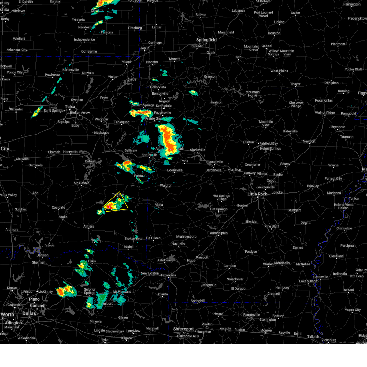 At 336 pm cdt, a severe thunderstorm was located 3 miles southeast of tuskahoma, moving northeast at 50 mph (radar indicated). Hazards include quarter size hail. Damage to vehicles is expected. Locations in or near the path include, talihina, albion, kiamichi, tuskahoma,. At 336 pm cdt, a severe thunderstorm was located 3 miles southeast of tuskahoma, moving northeast at 50 mph (radar indicated). Hazards include quarter size hail. Damage to vehicles is expected. Locations in or near the path include, talihina, albion, kiamichi, tuskahoma,.
|
| 5/21/2024 3:24 PM CDT |
 Svrtsa the national weather service in tulsa has issued a * severe thunderstorm warning for, northeastern pushmataha county in southeastern oklahoma, south central latimer county in southeastern oklahoma, southwestern le flore county in southeastern oklahoma, * until 400 pm cdt. * at 324 pm cdt, a severe thunderstorm was located 4 miles southwest of clayton, moving east at 50 mph (radar indicated). Hazards include quarter size hail. Damage to vehicles is expected. Locations in or near the path include, clayton, talihina, albion, clayton lake state park, stanley, kiamichi, tuskahoma, honobia,. Svrtsa the national weather service in tulsa has issued a * severe thunderstorm warning for, northeastern pushmataha county in southeastern oklahoma, south central latimer county in southeastern oklahoma, southwestern le flore county in southeastern oklahoma, * until 400 pm cdt. * at 324 pm cdt, a severe thunderstorm was located 4 miles southwest of clayton, moving east at 50 mph (radar indicated). Hazards include quarter size hail. Damage to vehicles is expected. Locations in or near the path include, clayton, talihina, albion, clayton lake state park, stanley, kiamichi, tuskahoma, honobia,.
|
| 5/21/2024 3:18 PM CDT |
 At 318 pm cdt, a severe thunderstorm was located near stanley, moving east at 55 mph (radar indicated). Hazards include quarter size hail. Damage to vehicles is expected. Locations in or near the path include, clayton, albion, clayton lake state park, stanley, nashoba, kiamichi, dunbar, tuskahoma, yanush,. At 318 pm cdt, a severe thunderstorm was located near stanley, moving east at 55 mph (radar indicated). Hazards include quarter size hail. Damage to vehicles is expected. Locations in or near the path include, clayton, albion, clayton lake state park, stanley, nashoba, kiamichi, dunbar, tuskahoma, yanush,.
|
| 5/21/2024 3:07 PM CDT |
 Svrtsa the national weather service in tulsa has issued a * severe thunderstorm warning for, northern pushmataha county in southeastern oklahoma, south central latimer county in southeastern oklahoma, * until 330 pm cdt. * at 307 pm cdt, a severe thunderstorm was located near dunbar, moving northeast at 60 mph (radar indicated). Hazards include half dollar size hail. Damage to vehicles is expected. Locations in or near the path include, clayton, albion, clayton lake state park, stanley, nashoba, kiamichi, dunbar, tuskahoma, yanush, eubanks, sardis,. Svrtsa the national weather service in tulsa has issued a * severe thunderstorm warning for, northern pushmataha county in southeastern oklahoma, south central latimer county in southeastern oklahoma, * until 330 pm cdt. * at 307 pm cdt, a severe thunderstorm was located near dunbar, moving northeast at 60 mph (radar indicated). Hazards include half dollar size hail. Damage to vehicles is expected. Locations in or near the path include, clayton, albion, clayton lake state park, stanley, nashoba, kiamichi, dunbar, tuskahoma, yanush, eubanks, sardis,.
|
| 5/8/2024 7:55 PM CDT |
 the severe thunderstorm warning has been cancelled and is no longer in effect the severe thunderstorm warning has been cancelled and is no longer in effect
|
| 5/8/2024 7:55 PM CDT |
 At 755 pm cdt, a severe thunderstorm was located 6 miles southwest of yanush, moving northeast at 45 mph (radar indicated). Hazards include 60 mph wind gusts and quarter size hail. Hail damage to vehicles is expected. expect wind damage to roofs, siding, and trees. Locations in or near the path include, wilburton, clayton, albion, clayton lake state park, higgins, damon, kiamichi, tuskahoma, yanush, sardis,. At 755 pm cdt, a severe thunderstorm was located 6 miles southwest of yanush, moving northeast at 45 mph (radar indicated). Hazards include 60 mph wind gusts and quarter size hail. Hail damage to vehicles is expected. expect wind damage to roofs, siding, and trees. Locations in or near the path include, wilburton, clayton, albion, clayton lake state park, higgins, damon, kiamichi, tuskahoma, yanush, sardis,.
|
| 5/8/2024 7:36 PM CDT |
 Svrtsa the national weather service in tulsa has issued a * severe thunderstorm warning for, northwestern pushmataha county in southeastern oklahoma, southwestern latimer county in southeastern oklahoma, southeastern pittsburg county in southeastern oklahoma, * until 815 pm cdt. * at 736 pm cdt, a severe thunderstorm was located near dunbar, moving northeast at 45 mph (radar indicated). Hazards include 60 mph wind gusts and half dollar size hail. Hail damage to vehicles is expected. expect wind damage to roofs, siding, and trees. Locations in or near the path include, wilburton, clayton, albion, clayton lake state park, higgins, damon, snow, tuskahoma, yanush, stanley, kiamichi, dunbar, sardis,. Svrtsa the national weather service in tulsa has issued a * severe thunderstorm warning for, northwestern pushmataha county in southeastern oklahoma, southwestern latimer county in southeastern oklahoma, southeastern pittsburg county in southeastern oklahoma, * until 815 pm cdt. * at 736 pm cdt, a severe thunderstorm was located near dunbar, moving northeast at 45 mph (radar indicated). Hazards include 60 mph wind gusts and half dollar size hail. Hail damage to vehicles is expected. expect wind damage to roofs, siding, and trees. Locations in or near the path include, wilburton, clayton, albion, clayton lake state park, higgins, damon, snow, tuskahoma, yanush, stanley, kiamichi, dunbar, sardis,.
|
| 4/28/2024 5:44 PM CDT |
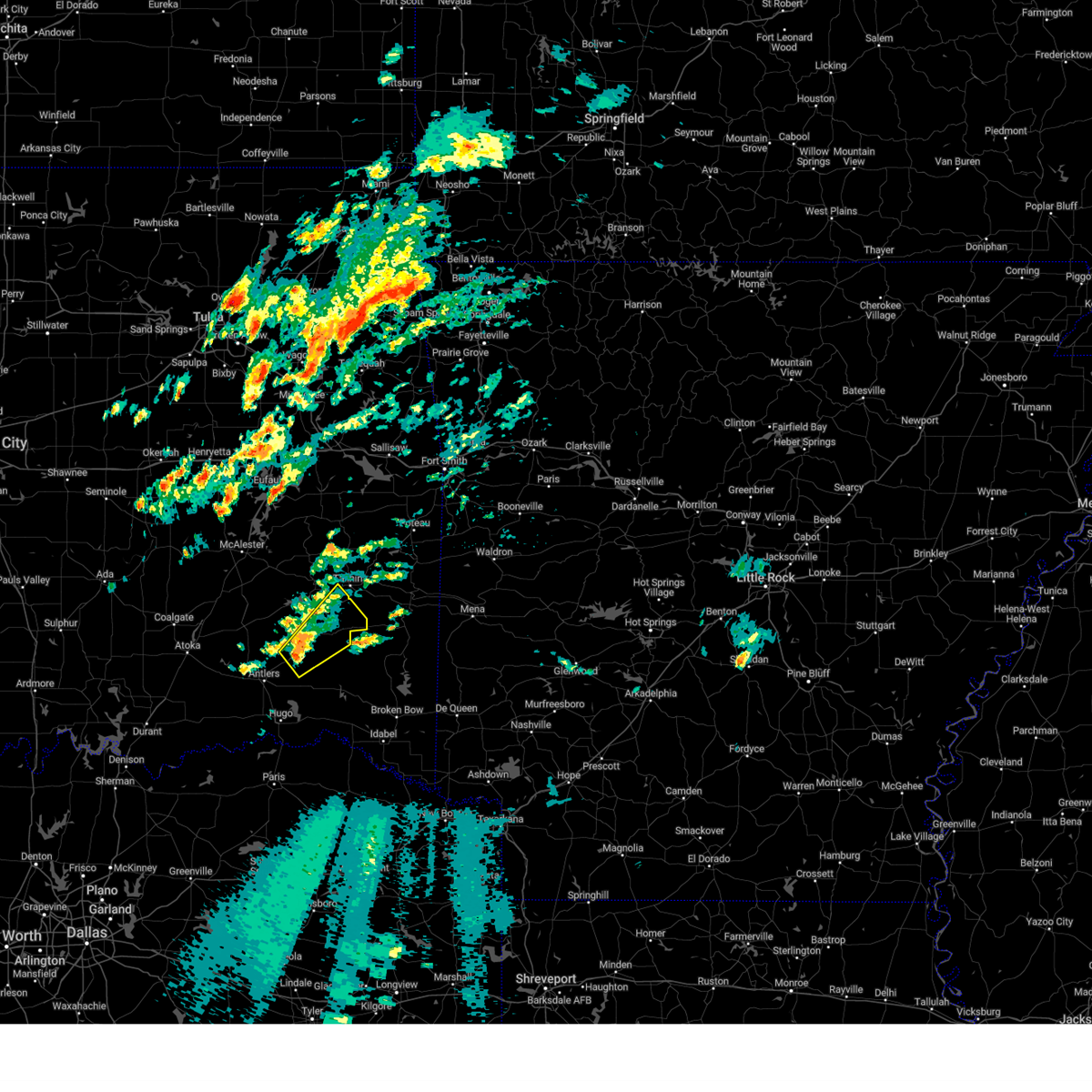 Svrtsa the national weather service in tulsa has issued a * severe thunderstorm warning for, eastern pushmataha county in southeastern oklahoma, south central latimer county in southeastern oklahoma, * until 630 pm cdt. * at 543 pm cdt, a severe thunderstorm was located near snow, moving northeast at 30 mph (radar indicated). Hazards include 60 mph wind gusts and penny size hail. Expect damage to roofs, siding, and trees. Locations in or near the path include, albion, kiamichi, clayton lake state park, tuskahoma, snow, nashoba,. Svrtsa the national weather service in tulsa has issued a * severe thunderstorm warning for, eastern pushmataha county in southeastern oklahoma, south central latimer county in southeastern oklahoma, * until 630 pm cdt. * at 543 pm cdt, a severe thunderstorm was located near snow, moving northeast at 30 mph (radar indicated). Hazards include 60 mph wind gusts and penny size hail. Expect damage to roofs, siding, and trees. Locations in or near the path include, albion, kiamichi, clayton lake state park, tuskahoma, snow, nashoba,.
|
| 4/28/2024 4:11 AM CDT |
 Svrtsa the national weather service in tulsa has issued a * severe thunderstorm warning for, northeastern pushmataha county in southeastern oklahoma, southeastern latimer county in southeastern oklahoma, southern le flore county in southeastern oklahoma, * until 500 am cdt. * at 411 am cdt, severe thunderstorms were located along a line extending from 7 miles northeast of yanush to 4 miles southwest of nashoba, moving east at 45 mph (radar indicated). Hazards include 60 mph wind gusts. Expect damage to roofs, siding, and trees. Locations in or near the path include, heavener, talihina, howe, albion, octavia, talimena state park, bengal, tuskahoma, big cedar, nashoba, kiamichi, whitesboro, muse, summerfield, hodgen, honobia,. Svrtsa the national weather service in tulsa has issued a * severe thunderstorm warning for, northeastern pushmataha county in southeastern oklahoma, southeastern latimer county in southeastern oklahoma, southern le flore county in southeastern oklahoma, * until 500 am cdt. * at 411 am cdt, severe thunderstorms were located along a line extending from 7 miles northeast of yanush to 4 miles southwest of nashoba, moving east at 45 mph (radar indicated). Hazards include 60 mph wind gusts. Expect damage to roofs, siding, and trees. Locations in or near the path include, heavener, talihina, howe, albion, octavia, talimena state park, bengal, tuskahoma, big cedar, nashoba, kiamichi, whitesboro, muse, summerfield, hodgen, honobia,.
|
| 4/26/2024 8:46 AM CDT |
 Svrtsa the national weather service in tulsa has issued a * severe thunderstorm warning for, northeastern pushmataha county in southeastern oklahoma, southeastern latimer county in southeastern oklahoma, southwestern le flore county in southeastern oklahoma, * until 930 am cdt. * at 845 am cdt, severe thunderstorms were located along a line extending from 4 miles east of damon to 2 miles north of clayton lake state park, moving east at 30 mph (radar indicated). Hazards include 60 mph wind gusts and penny size hail. Expect damage to roofs, siding, and trees. Locations in or near the path include, talihina, albion, octavia, clayton lake state park, talimena state park, bengal, tuskahoma, big cedar, kiamichi, whitesboro, muse, summerfield, honobia,. Svrtsa the national weather service in tulsa has issued a * severe thunderstorm warning for, northeastern pushmataha county in southeastern oklahoma, southeastern latimer county in southeastern oklahoma, southwestern le flore county in southeastern oklahoma, * until 930 am cdt. * at 845 am cdt, severe thunderstorms were located along a line extending from 4 miles east of damon to 2 miles north of clayton lake state park, moving east at 30 mph (radar indicated). Hazards include 60 mph wind gusts and penny size hail. Expect damage to roofs, siding, and trees. Locations in or near the path include, talihina, albion, octavia, clayton lake state park, talimena state park, bengal, tuskahoma, big cedar, kiamichi, whitesboro, muse, summerfield, honobia,.
|
| 4/26/2024 8:33 AM CDT |
 At 832 am cdt, severe thunderstorms were located along a line extending from 5 miles southeast of damon to 3 miles north of kosoma, moving northeast at 25 mph (radar indicated). Hazards include 70 mph wind gusts and penny size hail. Expect considerable tree damage. damage is likely to mobile homes, roofs, and outbuildings. Locations in or near the path include, clayton, albion, clayton lake state park, snow, tuskahoma, yanush, stanley, moyers, nashoba, kiamichi, kosoma, dunbar, eubanks, sardis, finley,. At 832 am cdt, severe thunderstorms were located along a line extending from 5 miles southeast of damon to 3 miles north of kosoma, moving northeast at 25 mph (radar indicated). Hazards include 70 mph wind gusts and penny size hail. Expect considerable tree damage. damage is likely to mobile homes, roofs, and outbuildings. Locations in or near the path include, clayton, albion, clayton lake state park, snow, tuskahoma, yanush, stanley, moyers, nashoba, kiamichi, kosoma, dunbar, eubanks, sardis, finley,.
|
| 4/26/2024 8:33 AM CDT |
 the severe thunderstorm warning has been cancelled and is no longer in effect the severe thunderstorm warning has been cancelled and is no longer in effect
|
| 4/26/2024 7:57 AM CDT |
 Svrtsa the national weather service in tulsa has issued a * severe thunderstorm warning for, pushmataha county in southeastern oklahoma, southwestern latimer county in southeastern oklahoma, south central pittsburg county in southeastern oklahoma, * until 845 am cdt. * at 756 am cdt, severe thunderstorms were located along a line extending from 7 miles northwest of stanley to near lane, moving northeast at 45 mph (radar indicated). Hazards include 70 mph wind gusts and penny size hail. Expect considerable tree damage. damage is likely to mobile homes, roofs, and outbuildings. Locations in or near the path include, antlers, clayton, albion, clayton lake state park, snow, tuskahoma, yanush, stanley, moyers, nashoba, kiamichi, kosoma, kellond, dunbar, cloudy, eubanks, sardis, darwin, dela, finley,. Svrtsa the national weather service in tulsa has issued a * severe thunderstorm warning for, pushmataha county in southeastern oklahoma, southwestern latimer county in southeastern oklahoma, south central pittsburg county in southeastern oklahoma, * until 845 am cdt. * at 756 am cdt, severe thunderstorms were located along a line extending from 7 miles northwest of stanley to near lane, moving northeast at 45 mph (radar indicated). Hazards include 70 mph wind gusts and penny size hail. Expect considerable tree damage. damage is likely to mobile homes, roofs, and outbuildings. Locations in or near the path include, antlers, clayton, albion, clayton lake state park, snow, tuskahoma, yanush, stanley, moyers, nashoba, kiamichi, kosoma, kellond, dunbar, cloudy, eubanks, sardis, darwin, dela, finley,.
|
| 4/26/2024 7:42 AM CDT |
 Svrtsa the national weather service in tulsa has issued a * severe thunderstorm warning for, northeastern pushmataha county in southeastern oklahoma, southeastern haskell county in southeastern oklahoma, latimer county in southeastern oklahoma, western le flore county in southeastern oklahoma, * until 830 am cdt. * at 742 am cdt, severe thunderstorms were located along a line extending from near quinton to 4 miles east of higgins, moving east at 45 mph (radar indicated). Hazards include 60 mph wind gusts and penny size hail. Expect damage to roofs, siding, and trees. Locations in or near the path include, wilburton, talihina, wister, red oak, mccurtain, bokoshe, fanshawe, kinta, albion, talimena state park, damon, bengal, yanush, mc curtain, lake wister state park, whitesboro, lequire, muse, panola, summerfield,. Svrtsa the national weather service in tulsa has issued a * severe thunderstorm warning for, northeastern pushmataha county in southeastern oklahoma, southeastern haskell county in southeastern oklahoma, latimer county in southeastern oklahoma, western le flore county in southeastern oklahoma, * until 830 am cdt. * at 742 am cdt, severe thunderstorms were located along a line extending from near quinton to 4 miles east of higgins, moving east at 45 mph (radar indicated). Hazards include 60 mph wind gusts and penny size hail. Expect damage to roofs, siding, and trees. Locations in or near the path include, wilburton, talihina, wister, red oak, mccurtain, bokoshe, fanshawe, kinta, albion, talimena state park, damon, bengal, yanush, mc curtain, lake wister state park, whitesboro, lequire, muse, panola, summerfield,.
|
| 9/24/2023 12:42 AM CDT |
 At 1242 am cdt, a severe thunderstorm was located 4 miles southeast of higgins, moving east at 25 mph (radar indicated). Hazards include 60 mph wind gusts and quarter size hail. Hail damage to vehicles is expected. expect wind damage to roofs, siding, and trees. locations in or near the path include, clayton, albion, higgins, kiamichi, tuskahoma, yanush, sardis, hail threat, radar indicated max hail size, 1. 00 in wind threat, radar indicated max wind gust, 60 mph. At 1242 am cdt, a severe thunderstorm was located 4 miles southeast of higgins, moving east at 25 mph (radar indicated). Hazards include 60 mph wind gusts and quarter size hail. Hail damage to vehicles is expected. expect wind damage to roofs, siding, and trees. locations in or near the path include, clayton, albion, higgins, kiamichi, tuskahoma, yanush, sardis, hail threat, radar indicated max hail size, 1. 00 in wind threat, radar indicated max wind gust, 60 mph.
|
| 9/24/2023 12:37 AM CDT |
 At 1237 am cdt, a severe thunderstorm was located 5 miles south of higgins, moving southeast at 20 mph (radar indicated). Hazards include ping pong ball size hail and 60 mph wind gusts. People and animals outdoors will be injured. expect hail damage to roofs, siding, windows, and vehicles. expect wind damage to roofs, siding, and trees. locations in or near the path include, clayton, albion, clayton lake state park, higgins, kiamichi, tuskahoma, yanush, sardis, hail threat, radar indicated max hail size, 1. 50 in wind threat, radar indicated max wind gust, 60 mph. At 1237 am cdt, a severe thunderstorm was located 5 miles south of higgins, moving southeast at 20 mph (radar indicated). Hazards include ping pong ball size hail and 60 mph wind gusts. People and animals outdoors will be injured. expect hail damage to roofs, siding, windows, and vehicles. expect wind damage to roofs, siding, and trees. locations in or near the path include, clayton, albion, clayton lake state park, higgins, kiamichi, tuskahoma, yanush, sardis, hail threat, radar indicated max hail size, 1. 50 in wind threat, radar indicated max wind gust, 60 mph.
|
| 9/24/2023 12:30 AM CDT |
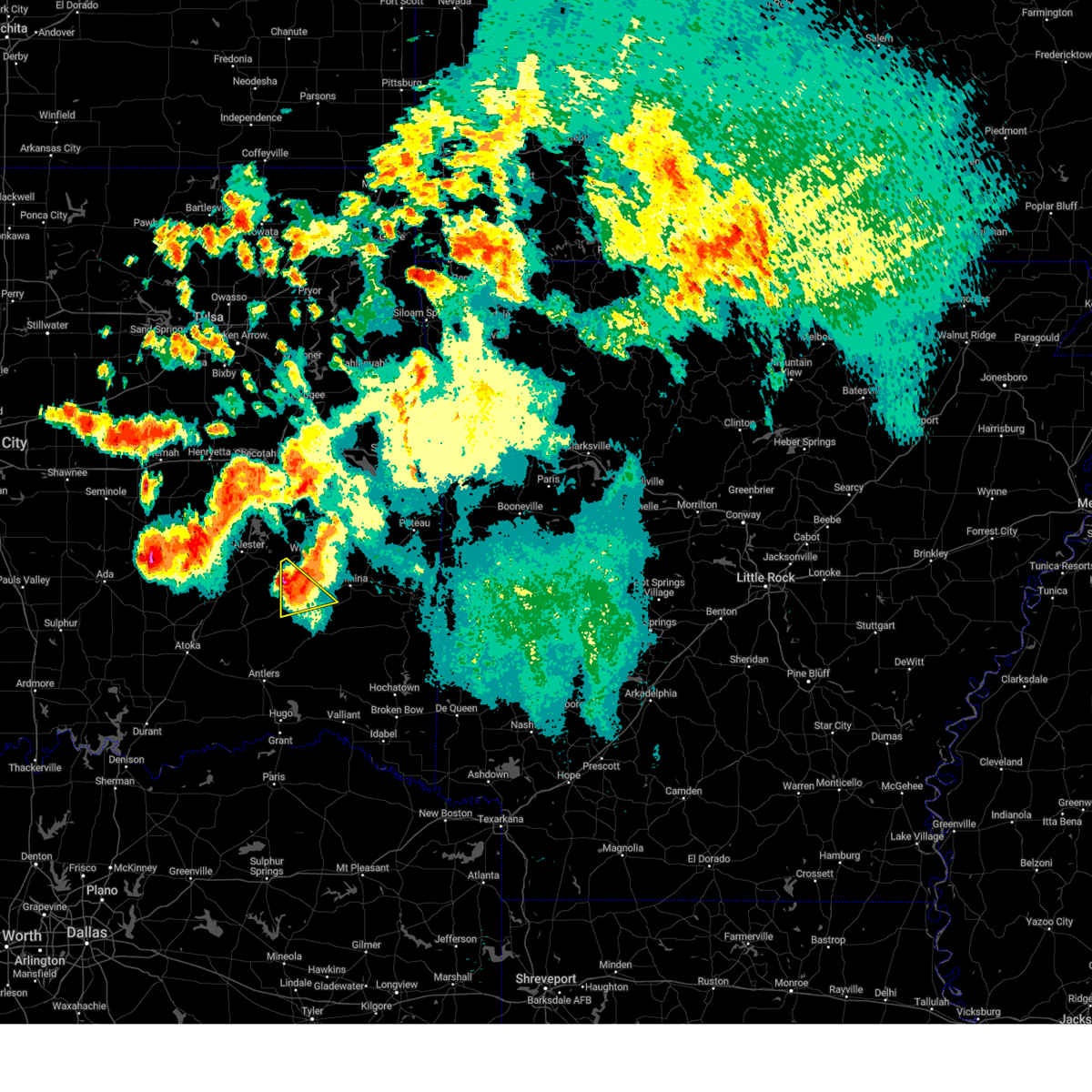 At 1230 am cdt, a severe thunderstorm was located 3 miles southwest of higgins, moving southeast at 20 mph (radar indicated). Hazards include two inch hail and 70 mph wind gusts. People and animals outdoors will be injured. expect hail damage to roofs, siding, windows, and vehicles. expect considerable tree damage. wind damage is also likely to mobile homes, roofs, and outbuildings. locations in or near the path include, higgins, yanush, gowen, sardis, thunderstorm damage threat, considerable hail threat, radar indicated max hail size, 2. 00 in wind threat, radar indicated max wind gust, 70 mph. At 1230 am cdt, a severe thunderstorm was located 3 miles southwest of higgins, moving southeast at 20 mph (radar indicated). Hazards include two inch hail and 70 mph wind gusts. People and animals outdoors will be injured. expect hail damage to roofs, siding, windows, and vehicles. expect considerable tree damage. wind damage is also likely to mobile homes, roofs, and outbuildings. locations in or near the path include, higgins, yanush, gowen, sardis, thunderstorm damage threat, considerable hail threat, radar indicated max hail size, 2. 00 in wind threat, radar indicated max wind gust, 70 mph.
|
| 9/24/2023 12:17 AM CDT |
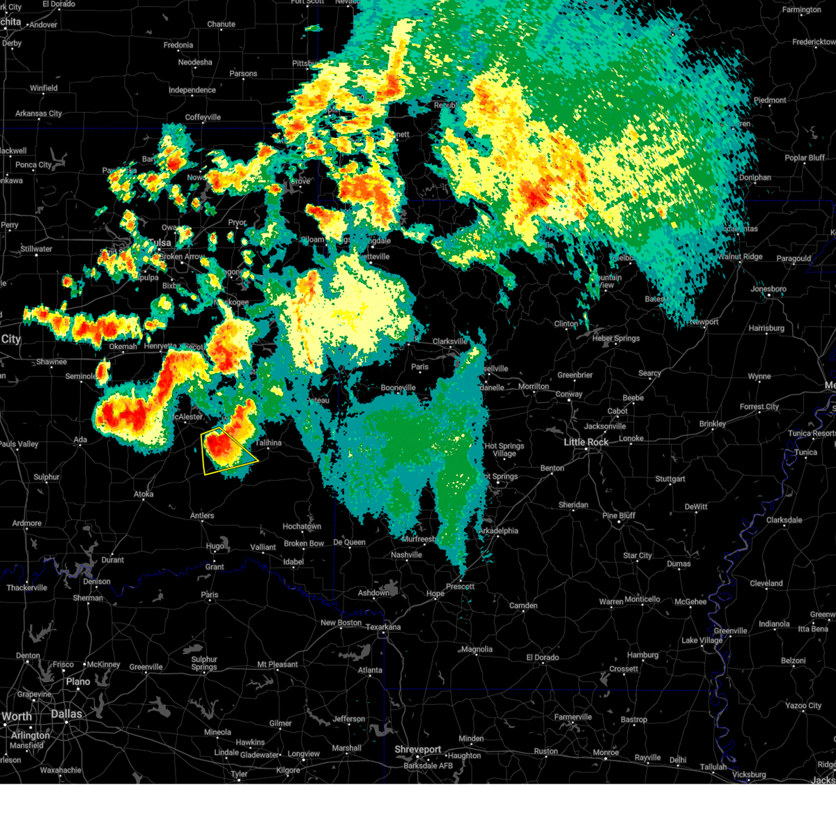 At 1217 am cdt, a severe thunderstorm was located 3 miles south of hartshorne, moving southeast at 20 mph (radar indicated). Hazards include golf ball size hail and 70 mph wind gusts. People and animals outdoors will be injured. expect hail damage to roofs, siding, windows, and vehicles. expect considerable tree damage. wind damage is also likely to mobile homes, roofs, and outbuildings. locations in or near the path include, hartshorne, higgins, yanush, haileyville, gowen, sardis, thunderstorm damage threat, considerable hail threat, radar indicated max hail size, 1. 75 in wind threat, radar indicated max wind gust, 70 mph. At 1217 am cdt, a severe thunderstorm was located 3 miles south of hartshorne, moving southeast at 20 mph (radar indicated). Hazards include golf ball size hail and 70 mph wind gusts. People and animals outdoors will be injured. expect hail damage to roofs, siding, windows, and vehicles. expect considerable tree damage. wind damage is also likely to mobile homes, roofs, and outbuildings. locations in or near the path include, hartshorne, higgins, yanush, haileyville, gowen, sardis, thunderstorm damage threat, considerable hail threat, radar indicated max hail size, 1. 75 in wind threat, radar indicated max wind gust, 70 mph.
|
| 9/23/2023 11:55 PM CDT |
 At 1154 pm cdt, a severe thunderstorm was located over hartshorne, moving southeast at 20 mph (radar indicated). Hazards include two inch hail and 70 mph wind gusts. People and animals outdoors will be injured. expect hail damage to roofs, siding, windows, and vehicles. expect considerable tree damage. wind damage is also likely to mobile homes, roofs, and outbuildings. locations in or near the path include, hartshorne, krebs, alderson, higgins, yanush, haileyville, gowen, sardis, dow, bache, this storm has had a history of producing very large damaging hail and wind damage. this is a dangerous storm! thunderstorm damage threat, considerable hail threat, radar indicated max hail size, 2. 00 in wind threat, radar indicated max wind gust, 70 mph. At 1154 pm cdt, a severe thunderstorm was located over hartshorne, moving southeast at 20 mph (radar indicated). Hazards include two inch hail and 70 mph wind gusts. People and animals outdoors will be injured. expect hail damage to roofs, siding, windows, and vehicles. expect considerable tree damage. wind damage is also likely to mobile homes, roofs, and outbuildings. locations in or near the path include, hartshorne, krebs, alderson, higgins, yanush, haileyville, gowen, sardis, dow, bache, this storm has had a history of producing very large damaging hail and wind damage. this is a dangerous storm! thunderstorm damage threat, considerable hail threat, radar indicated max hail size, 2. 00 in wind threat, radar indicated max wind gust, 70 mph.
|
| 9/23/2023 11:40 PM CDT |
 At 1140 pm cdt, a severe thunderstorm was located 3 miles east of alderson, moving south at 20 mph. this is a destructive storm (radar indicated). Hazards include 80 mph wind gusts and baseball size hail. Flying debris will be dangerous to those caught without shelter. mobile homes will be heavily damaged. expect considerable damage to roofs, windows, and vehicles. extensive tree damage and power outages are likely. locations in or near the path include, mcalester, hartshorne, krebs, alderson, higgins, blocker, yanush, mcalester regional airport, haileyville, gowen, sardis, dow, bache, thunderstorm damage threat, destructive hail threat, radar indicated max hail size, 2. 75 in wind threat, radar indicated max wind gust, 80 mph. At 1140 pm cdt, a severe thunderstorm was located 3 miles east of alderson, moving south at 20 mph. this is a destructive storm (radar indicated). Hazards include 80 mph wind gusts and baseball size hail. Flying debris will be dangerous to those caught without shelter. mobile homes will be heavily damaged. expect considerable damage to roofs, windows, and vehicles. extensive tree damage and power outages are likely. locations in or near the path include, mcalester, hartshorne, krebs, alderson, higgins, blocker, yanush, mcalester regional airport, haileyville, gowen, sardis, dow, bache, thunderstorm damage threat, destructive hail threat, radar indicated max hail size, 2. 75 in wind threat, radar indicated max wind gust, 80 mph.
|
| 8/8/2023 7:12 AM CDT |
 At 712 am cdt, a severe thunderstorm was located near kiamichi, moving southeast at 40 mph (radar indicated). Hazards include 60 mph wind gusts and quarter size hail. Hail damage to vehicles is expected. expect wind damage to roofs, siding, and trees. locations in or near the path include, clayton, albion, kiamichi, clayton lake state park, tuskahoma, nashoba, hail threat, radar indicated max hail size, 1. 00 in wind threat, radar indicated max wind gust, 60 mph. At 712 am cdt, a severe thunderstorm was located near kiamichi, moving southeast at 40 mph (radar indicated). Hazards include 60 mph wind gusts and quarter size hail. Hail damage to vehicles is expected. expect wind damage to roofs, siding, and trees. locations in or near the path include, clayton, albion, kiamichi, clayton lake state park, tuskahoma, nashoba, hail threat, radar indicated max hail size, 1. 00 in wind threat, radar indicated max wind gust, 60 mph.
|
| 8/8/2023 6:51 AM CDT |
 At 651 am cdt, a severe thunderstorm was located 4 miles west of yanush, moving southeast at 40 mph (radar indicated). Hazards include 60 mph wind gusts and quarter size hail. Hail damage to vehicles is expected. expect wind damage to roofs, siding, and trees. locations in or near the path include, clayton, albion, clayton lake state park, higgins, nashoba, kiamichi, tuskahoma, yanush, sardis, hail threat, radar indicated max hail size, 1. 00 in wind threat, radar indicated max wind gust, 60 mph. At 651 am cdt, a severe thunderstorm was located 4 miles west of yanush, moving southeast at 40 mph (radar indicated). Hazards include 60 mph wind gusts and quarter size hail. Hail damage to vehicles is expected. expect wind damage to roofs, siding, and trees. locations in or near the path include, clayton, albion, clayton lake state park, higgins, nashoba, kiamichi, tuskahoma, yanush, sardis, hail threat, radar indicated max hail size, 1. 00 in wind threat, radar indicated max wind gust, 60 mph.
|
| 6/18/2023 12:02 AM CDT |
 At 1202 am cdt, severe thunderstorms were located along a line extending from 4 miles southwest of red oak to rattan, moving east at 50 mph (radar indicated). Hazards include 70 mph wind gusts and quarter size hail. Hail damage to vehicles is expected. expect considerable tree damage. wind damage is also likely to mobile homes, roofs, and outbuildings. locations in or near the path include, antlers, clayton, red oak, rattan, clayton lake state park, snow, tuskahoma, yanush, stanley, moyers, kiamichi, kosoma, kellond, dunbar, eubanks, sardis, dela, finley, thunderstorm damage threat, considerable hail threat, radar indicated max hail size, 1. 00 in wind threat, radar indicated max wind gust, 70 mph. At 1202 am cdt, severe thunderstorms were located along a line extending from 4 miles southwest of red oak to rattan, moving east at 50 mph (radar indicated). Hazards include 70 mph wind gusts and quarter size hail. Hail damage to vehicles is expected. expect considerable tree damage. wind damage is also likely to mobile homes, roofs, and outbuildings. locations in or near the path include, antlers, clayton, red oak, rattan, clayton lake state park, snow, tuskahoma, yanush, stanley, moyers, kiamichi, kosoma, kellond, dunbar, eubanks, sardis, dela, finley, thunderstorm damage threat, considerable hail threat, radar indicated max hail size, 1. 00 in wind threat, radar indicated max wind gust, 70 mph.
|
| 6/17/2023 11:19 PM CDT |
 At 1119 pm cdt, severe thunderstorms were located along a line extending from 6 miles west of daisy to 5 miles south of lane, moving northeast at 65 mph (radar indicated). Hazards include 70 mph wind gusts and quarter size hail. Hail damage to vehicles is expected. expect considerable tree damage. wind damage is also likely to mobile homes, roofs, and outbuildings. locations in or near the path include, antlers, clayton, red oak, rattan, clayton lake state park, snow, tuskahoma, yanush, stanley, moyers, kiamichi, kosoma, kellond, dunbar, eubanks, sardis, darwin, dela, finley, thunderstorm damage threat, considerable hail threat, radar indicated max hail size, 1. 00 in wind threat, radar indicated max wind gust, 70 mph. At 1119 pm cdt, severe thunderstorms were located along a line extending from 6 miles west of daisy to 5 miles south of lane, moving northeast at 65 mph (radar indicated). Hazards include 70 mph wind gusts and quarter size hail. Hail damage to vehicles is expected. expect considerable tree damage. wind damage is also likely to mobile homes, roofs, and outbuildings. locations in or near the path include, antlers, clayton, red oak, rattan, clayton lake state park, snow, tuskahoma, yanush, stanley, moyers, kiamichi, kosoma, kellond, dunbar, eubanks, sardis, darwin, dela, finley, thunderstorm damage threat, considerable hail threat, radar indicated max hail size, 1. 00 in wind threat, radar indicated max wind gust, 70 mph.
|
| 5/12/2023 1:34 AM CDT |
 At 134 am cdt, severe thunderstorms were located along a line extending from 4 miles south of lequire to 3 miles south of talihina to near snow, moving east at 30 mph (radar indicated). Hazards include 60 mph wind gusts and quarter size hail. Hail damage to vehicles is expected. expect wind damage to roofs, siding, and trees. locations in or near the path include, wilburton, clayton, talihina, wister, red oak, mccurtain, bokoshe, fanshawe, albion, talimena state park, snow, tuskahoma, mc curtain, stanley, kiamichi, whitesboro, lequire, clayton lake state park, bengal, robbers cave state park, hail threat, radar indicated max hail size, 1. 00 in wind threat, radar indicated max wind gust, 60 mph. At 134 am cdt, severe thunderstorms were located along a line extending from 4 miles south of lequire to 3 miles south of talihina to near snow, moving east at 30 mph (radar indicated). Hazards include 60 mph wind gusts and quarter size hail. Hail damage to vehicles is expected. expect wind damage to roofs, siding, and trees. locations in or near the path include, wilburton, clayton, talihina, wister, red oak, mccurtain, bokoshe, fanshawe, albion, talimena state park, snow, tuskahoma, mc curtain, stanley, kiamichi, whitesboro, lequire, clayton lake state park, bengal, robbers cave state park, hail threat, radar indicated max hail size, 1. 00 in wind threat, radar indicated max wind gust, 60 mph.
|
| 5/12/2023 1:06 AM CDT |
 At 106 am cdt, severe thunderstorms were located along a line extending from 4 miles southeast of quinton to 2 miles southwest of yanush to 4 miles northwest of moyers, moving east at 60 mph (radar indicated). Hazards include 60 mph wind gusts and quarter size hail. Hail damage to vehicles is expected. expect wind damage to roofs, siding, and trees. locations in or near the path include, poteau, wilburton, clayton, pocola, heavener, spiro, panama, talihina, wister, howe, red oak, mccurtain, bokoshe, fanshawe, cameron, kinta, albion, talimena state park, snow, tuskahoma, hail threat, radar indicated max hail size, 1. 00 in wind threat, radar indicated max wind gust, 60 mph. At 106 am cdt, severe thunderstorms were located along a line extending from 4 miles southeast of quinton to 2 miles southwest of yanush to 4 miles northwest of moyers, moving east at 60 mph (radar indicated). Hazards include 60 mph wind gusts and quarter size hail. Hail damage to vehicles is expected. expect wind damage to roofs, siding, and trees. locations in or near the path include, poteau, wilburton, clayton, pocola, heavener, spiro, panama, talihina, wister, howe, red oak, mccurtain, bokoshe, fanshawe, cameron, kinta, albion, talimena state park, snow, tuskahoma, hail threat, radar indicated max hail size, 1. 00 in wind threat, radar indicated max wind gust, 60 mph.
|
| 4/20/2023 2:02 PM CDT |
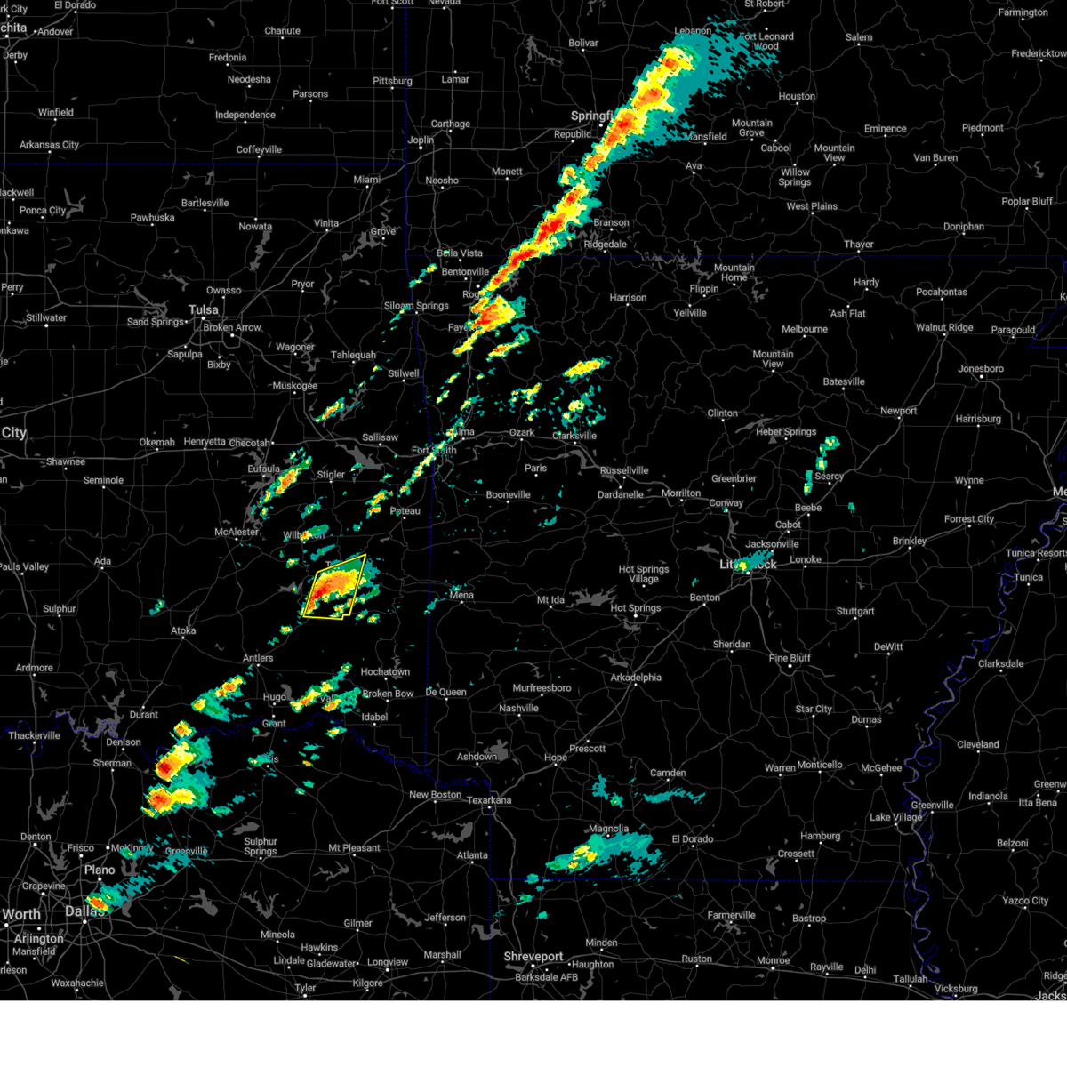 At 202 pm cdt, severe thunderstorms were located along a line extending from 3 miles south of talihina to 4 miles south of kiamichi, moving east at 30 mph (radar indicated). Hazards include ping pong ball size hail and 60 mph wind gusts. People and animals outdoors will be injured. expect hail damage to roofs, siding, windows, and vehicles. expect wind damage to roofs, siding, and trees. locations in or near the path include, talihina, albion, kiamichi, talimena state park, hail threat, radar indicated max hail size, 1. 50 in wind threat, radar indicated max wind gust, 60 mph. At 202 pm cdt, severe thunderstorms were located along a line extending from 3 miles south of talihina to 4 miles south of kiamichi, moving east at 30 mph (radar indicated). Hazards include ping pong ball size hail and 60 mph wind gusts. People and animals outdoors will be injured. expect hail damage to roofs, siding, windows, and vehicles. expect wind damage to roofs, siding, and trees. locations in or near the path include, talihina, albion, kiamichi, talimena state park, hail threat, radar indicated max hail size, 1. 50 in wind threat, radar indicated max wind gust, 60 mph.
|
| 4/20/2023 1:56 PM CDT |
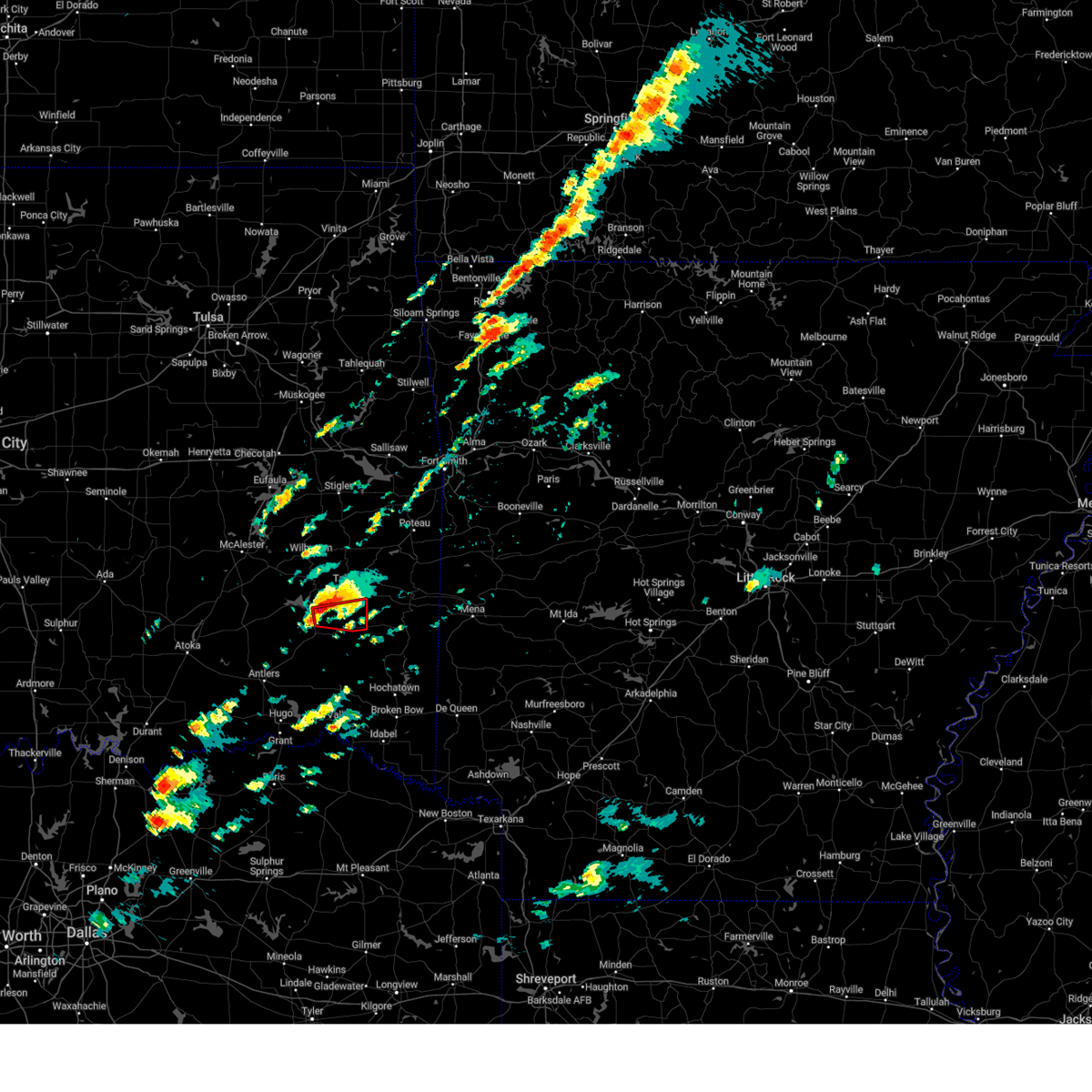 At 156 pm cdt, a severe thunderstorm capable of producing a tornado was located 3 miles southeast of tuskahoma, moving east at 25 mph (radar indicated rotation). Hazards include tornado and quarter size hail. Flying debris will be dangerous to those caught without shelter. mobile homes will be damaged or destroyed. damage to roofs, windows, and vehicles will occur. tree damage is likely. Locations in or near the path include, albion, kiamichi, tuskahoma,. At 156 pm cdt, a severe thunderstorm capable of producing a tornado was located 3 miles southeast of tuskahoma, moving east at 25 mph (radar indicated rotation). Hazards include tornado and quarter size hail. Flying debris will be dangerous to those caught without shelter. mobile homes will be damaged or destroyed. damage to roofs, windows, and vehicles will occur. tree damage is likely. Locations in or near the path include, albion, kiamichi, tuskahoma,.
|
| 4/20/2023 1:44 PM CDT |
 At 144 pm cdt, severe thunderstorms were located along a line extending from 2 miles north of kiamichi to near clayton lake state park, moving east at 25 mph (radar indicated). Hazards include 60 mph wind gusts and quarter size hail. Hail damage to vehicles is expected. expect wind damage to roofs, siding, and trees. locations in or near the path include, clayton, talihina, albion, clayton lake state park, talimena state park, nashoba, kiamichi, tuskahoma, yanush, hail threat, radar indicated max hail size, 1. 00 in wind threat, radar indicated max wind gust, 60 mph. At 144 pm cdt, severe thunderstorms were located along a line extending from 2 miles north of kiamichi to near clayton lake state park, moving east at 25 mph (radar indicated). Hazards include 60 mph wind gusts and quarter size hail. Hail damage to vehicles is expected. expect wind damage to roofs, siding, and trees. locations in or near the path include, clayton, talihina, albion, clayton lake state park, talimena state park, nashoba, kiamichi, tuskahoma, yanush, hail threat, radar indicated max hail size, 1. 00 in wind threat, radar indicated max wind gust, 60 mph.
|
| 4/20/2023 1:26 PM CDT |
 At 125 pm cdt, severe thunderstorms were located along a line extending from yanush to near stanley, moving east at 30 mph (radar indicated). Hazards include 60 mph wind gusts and quarter size hail. Hail damage to vehicles is expected. expect wind damage to roofs, siding, and trees. locations in or near the path include, clayton, talihina, albion, clayton lake state park, talimena state park, stanley, bengal, nashoba, kiamichi, tuskahoma, yanush, sardis, hail threat, radar indicated max hail size, 1. 00 in wind threat, radar indicated max wind gust, 60 mph. At 125 pm cdt, severe thunderstorms were located along a line extending from yanush to near stanley, moving east at 30 mph (radar indicated). Hazards include 60 mph wind gusts and quarter size hail. Hail damage to vehicles is expected. expect wind damage to roofs, siding, and trees. locations in or near the path include, clayton, talihina, albion, clayton lake state park, talimena state park, stanley, bengal, nashoba, kiamichi, tuskahoma, yanush, sardis, hail threat, radar indicated max hail size, 1. 00 in wind threat, radar indicated max wind gust, 60 mph.
|
| 3/16/2023 6:04 PM CDT |
 At 604 pm cdt, severe thunderstorms were located along a line extending from near tuskahoma to near clayton lake state park to 7 miles southeast of kosoma, moving east at 55 mph (radar indicated). Hazards include 60 mph wind gusts. Expect damage to roofs, siding, and trees. locations in or near the path include, antlers, clayton, albion, clayton lake state park, stanley, snow, kiamichi, kellond, tuskahoma, kosoma, finley, hail threat, radar indicated max hail size, <. 75 in wind threat, radar indicated max wind gust, 60 mph. At 604 pm cdt, severe thunderstorms were located along a line extending from near tuskahoma to near clayton lake state park to 7 miles southeast of kosoma, moving east at 55 mph (radar indicated). Hazards include 60 mph wind gusts. Expect damage to roofs, siding, and trees. locations in or near the path include, antlers, clayton, albion, clayton lake state park, stanley, snow, kiamichi, kellond, tuskahoma, kosoma, finley, hail threat, radar indicated max hail size, <. 75 in wind threat, radar indicated max wind gust, 60 mph.
|
| 3/16/2023 5:51 PM CDT |
 At 551 pm cdt, severe thunderstorms were located along a line extending from 7 miles northwest of clayton to 3 miles west of stanley to 3 miles northwest of kellond, moving east at 35 mph (radar indicated). Hazards include 60 mph wind gusts and penny size hail. Expect damage to roofs, siding, and trees. locations in or near the path include, antlers, clayton, albion, clayton lake state park, snow, tuskahoma, stanley, moyers, kiamichi, kosoma, kellond, dunbar, eubanks, darwin, finley, hail threat, radar indicated max hail size, 0. 75 in wind threat, radar indicated max wind gust, 60 mph. At 551 pm cdt, severe thunderstorms were located along a line extending from 7 miles northwest of clayton to 3 miles west of stanley to 3 miles northwest of kellond, moving east at 35 mph (radar indicated). Hazards include 60 mph wind gusts and penny size hail. Expect damage to roofs, siding, and trees. locations in or near the path include, antlers, clayton, albion, clayton lake state park, snow, tuskahoma, stanley, moyers, kiamichi, kosoma, kellond, dunbar, eubanks, darwin, finley, hail threat, radar indicated max hail size, 0. 75 in wind threat, radar indicated max wind gust, 60 mph.
|
| 3/16/2023 5:28 PM CDT |
 At 528 pm cdt, severe thunderstorms were located along a line extending from near daisy to 4 miles east of lane, moving east at 55 mph (radar indicated). Hazards include 60 mph wind gusts and penny size hail. Expect damage to roofs, siding, and trees. locations in or near the path include, antlers, clayton, albion, clayton lake state park, snow, tuskahoma, stanley, moyers, nashoba, kiamichi, kosoma, kellond, dunbar, cloudy, eubanks, darwin, finley, hail threat, radar indicated max hail size, 0. 75 in wind threat, radar indicated max wind gust, 60 mph. At 528 pm cdt, severe thunderstorms were located along a line extending from near daisy to 4 miles east of lane, moving east at 55 mph (radar indicated). Hazards include 60 mph wind gusts and penny size hail. Expect damage to roofs, siding, and trees. locations in or near the path include, antlers, clayton, albion, clayton lake state park, snow, tuskahoma, stanley, moyers, nashoba, kiamichi, kosoma, kellond, dunbar, cloudy, eubanks, darwin, finley, hail threat, radar indicated max hail size, 0. 75 in wind threat, radar indicated max wind gust, 60 mph.
|
| 3/2/2023 7:55 PM CST |
 At 755 pm cst, severe thunderstorms were located along a line extending from near clayton to near cloudy, moving northeast at 40 mph (radar indicated). Hazards include 60 mph wind gusts and quarter size hail. Hail damage to vehicles is expected. expect wind damage to roofs, siding, and trees. locations in or near the path include, clayton, albion, clayton lake state park, snow, nashoba, kiamichi, tuskahoma, cloudy, hail threat, radar indicated max hail size, 1. 00 in wind threat, radar indicated max wind gust, 60 mph. At 755 pm cst, severe thunderstorms were located along a line extending from near clayton to near cloudy, moving northeast at 40 mph (radar indicated). Hazards include 60 mph wind gusts and quarter size hail. Hail damage to vehicles is expected. expect wind damage to roofs, siding, and trees. locations in or near the path include, clayton, albion, clayton lake state park, snow, nashoba, kiamichi, tuskahoma, cloudy, hail threat, radar indicated max hail size, 1. 00 in wind threat, radar indicated max wind gust, 60 mph.
|
| 3/2/2023 7:42 PM CST |
 At 741 pm cst, severe thunderstorms were located along a line extending from 3 miles south of stanley to 2 miles northeast of rattan, moving northeast at 40 mph (radar indicated). Hazards include 60 mph wind gusts and quarter size hail. Hail damage to vehicles is expected. expect wind damage to roofs, siding, and trees. locations in or near the path include, clayton, rattan, albion, clayton lake state park, stanley, snow, nashoba, kiamichi, tuskahoma, oleta, cloudy, hail threat, radar indicated max hail size, 1. 00 in wind threat, radar indicated max wind gust, 60 mph. At 741 pm cst, severe thunderstorms were located along a line extending from 3 miles south of stanley to 2 miles northeast of rattan, moving northeast at 40 mph (radar indicated). Hazards include 60 mph wind gusts and quarter size hail. Hail damage to vehicles is expected. expect wind damage to roofs, siding, and trees. locations in or near the path include, clayton, rattan, albion, clayton lake state park, stanley, snow, nashoba, kiamichi, tuskahoma, oleta, cloudy, hail threat, radar indicated max hail size, 1. 00 in wind threat, radar indicated max wind gust, 60 mph.
|
| 3/2/2023 6:09 PM CST |
 The severe thunderstorm warning for northeastern pushmataha, southern latimer and west central le flore counties will expire at 615 pm cst, the storm which prompted the warning has weakened below severe limits, and no longer poses an immediate threat to life or property. therefore, the warning will be allowed to expire. however gusty winds are still possible with this thunderstorm. a tornado watch remains in effect until 1000 pm cst for southeastern oklahoma. The severe thunderstorm warning for northeastern pushmataha, southern latimer and west central le flore counties will expire at 615 pm cst, the storm which prompted the warning has weakened below severe limits, and no longer poses an immediate threat to life or property. therefore, the warning will be allowed to expire. however gusty winds are still possible with this thunderstorm. a tornado watch remains in effect until 1000 pm cst for southeastern oklahoma.
|
| 3/2/2023 5:58 PM CST |
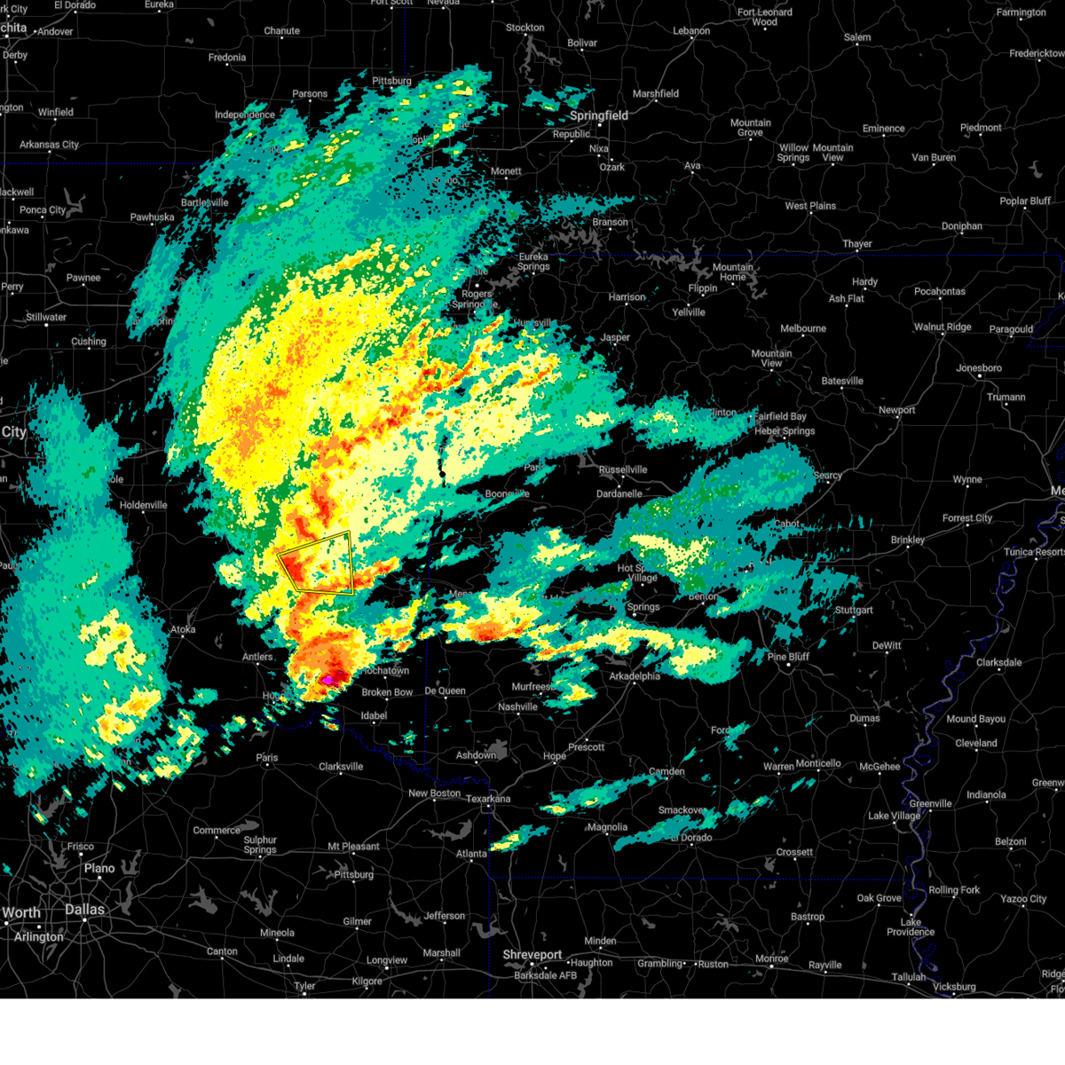 At 557 pm cst, a severe thunderstorm was located 4 miles north of yanush, moving east at 40 mph (radar indicated). Hazards include 60 mph wind gusts and nickel size hail. Expect damage to roofs, siding, and trees. locations in or near the path include, talihina, red oak, albion, higgins, damon, bengal, kiamichi, yanush, hail threat, radar indicated max hail size, 0. 88 in wind threat, radar indicated max wind gust, 60 mph. At 557 pm cst, a severe thunderstorm was located 4 miles north of yanush, moving east at 40 mph (radar indicated). Hazards include 60 mph wind gusts and nickel size hail. Expect damage to roofs, siding, and trees. locations in or near the path include, talihina, red oak, albion, higgins, damon, bengal, kiamichi, yanush, hail threat, radar indicated max hail size, 0. 88 in wind threat, radar indicated max wind gust, 60 mph.
|
| 3/2/2023 5:47 PM CST |
 At 546 pm cst, severe thunderstorms were located along a line extending from 2 miles east of dunbar to near snow to 7 miles north of rattan, moving northeast at 30 mph (radar indicated). Hazards include 60 mph wind gusts. Expect damage to roofs, siding, and trees. locations in or near the path include, clayton, clayton lake state park, stanley, snow, nashoba, dunbar, cloudy, tuskahoma, finley, hail threat, radar indicated max hail size, <. 75 in wind threat, radar indicated max wind gust, 60 mph. At 546 pm cst, severe thunderstorms were located along a line extending from 2 miles east of dunbar to near snow to 7 miles north of rattan, moving northeast at 30 mph (radar indicated). Hazards include 60 mph wind gusts. Expect damage to roofs, siding, and trees. locations in or near the path include, clayton, clayton lake state park, stanley, snow, nashoba, dunbar, cloudy, tuskahoma, finley, hail threat, radar indicated max hail size, <. 75 in wind threat, radar indicated max wind gust, 60 mph.
|
| 3/2/2023 5:35 PM CST |
 At 534 pm cst, a severe thunderstorm was located 10 miles north of stanley, moving east at 45 mph (radar indicated). Hazards include 60 mph wind gusts and quarter size hail. Hail damage to vehicles is expected. expect wind damage to roofs, siding, and trees. locations in or near the path include, clayton, talihina, red oak, albion, higgins, damon, bengal, kiamichi, tuskahoma, yanush, sardis, hail threat, radar indicated max hail size, 1. 00 in wind threat, radar indicated max wind gust, 60 mph. At 534 pm cst, a severe thunderstorm was located 10 miles north of stanley, moving east at 45 mph (radar indicated). Hazards include 60 mph wind gusts and quarter size hail. Hail damage to vehicles is expected. expect wind damage to roofs, siding, and trees. locations in or near the path include, clayton, talihina, red oak, albion, higgins, damon, bengal, kiamichi, tuskahoma, yanush, sardis, hail threat, radar indicated max hail size, 1. 00 in wind threat, radar indicated max wind gust, 60 mph.
|
| 3/2/2023 5:31 PM CST |
 At 531 pm cst, severe thunderstorms were located along a line extending from 2 miles north of kosoma to 6 miles east of moyers to 4 miles east of antlers, moving northeast at 30 mph (radar indicated). Hazards include 60 mph wind gusts and penny size hail. Expect damage to roofs, siding, and trees. locations in or near the path include, clayton, clayton lake state park, stanley, snow, moyers, nashoba, kosoma, dunbar, cloudy, tuskahoma, eubanks, finley, hail threat, radar indicated max hail size, 0. 75 in wind threat, radar indicated max wind gust, 60 mph. At 531 pm cst, severe thunderstorms were located along a line extending from 2 miles north of kosoma to 6 miles east of moyers to 4 miles east of antlers, moving northeast at 30 mph (radar indicated). Hazards include 60 mph wind gusts and penny size hail. Expect damage to roofs, siding, and trees. locations in or near the path include, clayton, clayton lake state park, stanley, snow, moyers, nashoba, kosoma, dunbar, cloudy, tuskahoma, eubanks, finley, hail threat, radar indicated max hail size, 0. 75 in wind threat, radar indicated max wind gust, 60 mph.
|
| 2/16/2023 12:26 AM CST |
 At 1226 am cst, severe thunderstorms were located along a line extending from 3 miles south of panama to 7 miles northeast of talimena state park to 4 miles north of snow, moving east at 30 mph (radar indicated). Hazards include 60 mph wind gusts and quarter size hail. Hail damage to vehicles is expected. expect wind damage to roofs, siding, and trees. locations in or near the path include, poteau, clayton, heavener, panama, talihina, wister, howe, fanshawe, cameron, albion, talimena state park, snow, tuskahoma, kiamichi, whitesboro, clayton lake state park, bengal, lake wister state park, nashoba, muse, hail threat, radar indicated max hail size, 1. 00 in wind threat, radar indicated max wind gust, 60 mph. At 1226 am cst, severe thunderstorms were located along a line extending from 3 miles south of panama to 7 miles northeast of talimena state park to 4 miles north of snow, moving east at 30 mph (radar indicated). Hazards include 60 mph wind gusts and quarter size hail. Hail damage to vehicles is expected. expect wind damage to roofs, siding, and trees. locations in or near the path include, poteau, clayton, heavener, panama, talihina, wister, howe, fanshawe, cameron, albion, talimena state park, snow, tuskahoma, kiamichi, whitesboro, clayton lake state park, bengal, lake wister state park, nashoba, muse, hail threat, radar indicated max hail size, 1. 00 in wind threat, radar indicated max wind gust, 60 mph.
|
| 2/16/2023 12:07 AM CST |
 At 1206 am cst, severe thunderstorms were located along a line extending from 7 miles south of bokoshe to 3 miles northwest of talimena state park to 2 miles south of dunbar, moving east at 50 mph (radar indicated). Hazards include 60 mph wind gusts and quarter size hail. Hail damage to vehicles is expected. expect wind damage to roofs, siding, and trees. locations in or near the path include, poteau, wilburton, clayton, heavener, panama, talihina, wister, howe, red oak, mccurtain, fanshawe, cameron, albion, talimena state park, snow, tuskahoma, mc curtain, stanley, kiamichi, whitesboro, hail threat, radar indicated max hail size, 1. 00 in wind threat, radar indicated max wind gust, 60 mph. At 1206 am cst, severe thunderstorms were located along a line extending from 7 miles south of bokoshe to 3 miles northwest of talimena state park to 2 miles south of dunbar, moving east at 50 mph (radar indicated). Hazards include 60 mph wind gusts and quarter size hail. Hail damage to vehicles is expected. expect wind damage to roofs, siding, and trees. locations in or near the path include, poteau, wilburton, clayton, heavener, panama, talihina, wister, howe, red oak, mccurtain, fanshawe, cameron, albion, talimena state park, snow, tuskahoma, mc curtain, stanley, kiamichi, whitesboro, hail threat, radar indicated max hail size, 1. 00 in wind threat, radar indicated max wind gust, 60 mph.
|
| 1/11/2023 7:30 PM CST |
 At 730 pm cst, a severe thunderstorm was located 5 miles north of kiamichi, moving northeast at 55 mph (radar indicated). Hazards include 60 mph wind gusts and half dollar size hail. Hail damage to vehicles is expected. expect wind damage to roofs, siding, and trees. locations in or near the path include, talihina, albion, kiamichi, talimena state park, tuskahoma, bengal, hail threat, radar indicated max hail size, 1. 25 in wind threat, radar indicated max wind gust, 60 mph. At 730 pm cst, a severe thunderstorm was located 5 miles north of kiamichi, moving northeast at 55 mph (radar indicated). Hazards include 60 mph wind gusts and half dollar size hail. Hail damage to vehicles is expected. expect wind damage to roofs, siding, and trees. locations in or near the path include, talihina, albion, kiamichi, talimena state park, tuskahoma, bengal, hail threat, radar indicated max hail size, 1. 25 in wind threat, radar indicated max wind gust, 60 mph.
|
| 1/11/2023 7:12 PM CST |
 At 712 pm cst, a severe thunderstorm was located 3 miles north of stanley, moving northeast at 55 mph (radar indicated). Hazards include 60 mph wind gusts and quarter size hail. Hail damage to vehicles is expected. expect wind damage to roofs, siding, and trees. locations in or near the path include, clayton, talihina, albion, clayton lake state park, talimena state park, stanley, bengal, kiamichi, tuskahoma, yanush, sardis, hail threat, radar indicated max hail size, 1. 00 in wind threat, radar indicated max wind gust, 60 mph. At 712 pm cst, a severe thunderstorm was located 3 miles north of stanley, moving northeast at 55 mph (radar indicated). Hazards include 60 mph wind gusts and quarter size hail. Hail damage to vehicles is expected. expect wind damage to roofs, siding, and trees. locations in or near the path include, clayton, talihina, albion, clayton lake state park, talimena state park, stanley, bengal, kiamichi, tuskahoma, yanush, sardis, hail threat, radar indicated max hail size, 1. 00 in wind threat, radar indicated max wind gust, 60 mph.
|
| 1/11/2023 6:59 PM CST |
 At 659 pm cst, a severe thunderstorm was located 5 miles northwest of dunbar, moving northeast at 60 mph (radar indicated). Hazards include 60 mph wind gusts and quarter size hail. Hail damage to vehicles is expected. expect wind damage to roofs, siding, and trees. locations in or near the path include, clayton, talihina, albion, clayton lake state park, talimena state park, bengal, tuskahoma, yanush, stanley, kiamichi, dunbar, eubanks, sardis, hail threat, radar indicated max hail size, 1. 00 in wind threat, radar indicated max wind gust, 60 mph. At 659 pm cst, a severe thunderstorm was located 5 miles northwest of dunbar, moving northeast at 60 mph (radar indicated). Hazards include 60 mph wind gusts and quarter size hail. Hail damage to vehicles is expected. expect wind damage to roofs, siding, and trees. locations in or near the path include, clayton, talihina, albion, clayton lake state park, talimena state park, bengal, tuskahoma, yanush, stanley, kiamichi, dunbar, eubanks, sardis, hail threat, radar indicated max hail size, 1. 00 in wind threat, radar indicated max wind gust, 60 mph.
|
| 11/4/2022 3:40 PM CDT |
 At 339 pm cdt, a severe thunderstorm was located 4 miles southwest of yanush, moving northeast at 45 mph. another severe thunderstorm was near wilburton, moving northeast at 45 mph (radar indicated). Hazards include 60 mph wind gusts and penny size hail. Expect damage to roofs, siding, and trees. locations in or near the path include, wilburton, clayton, higgins, damon, bengal, yanush, robbers cave state park, gowen, sardis, panola, hail threat, radar indicated max hail size, 0. 75 in wind threat, radar indicated max wind gust, 60 mph. At 339 pm cdt, a severe thunderstorm was located 4 miles southwest of yanush, moving northeast at 45 mph. another severe thunderstorm was near wilburton, moving northeast at 45 mph (radar indicated). Hazards include 60 mph wind gusts and penny size hail. Expect damage to roofs, siding, and trees. locations in or near the path include, wilburton, clayton, higgins, damon, bengal, yanush, robbers cave state park, gowen, sardis, panola, hail threat, radar indicated max hail size, 0. 75 in wind threat, radar indicated max wind gust, 60 mph.
|
| 11/4/2022 3:25 PM CDT |
 At 325 pm cdt, a severe thunderstorm was located near stanley, moving northeast at 45 mph (radar indicated). Hazards include 60 mph wind gusts and penny size hail. Expect damage to roofs, siding, and trees. locations in or near the path include, wilburton, clayton, hartshorne, higgins, damon, bengal, tuskahoma, yanush, robbers cave state park, stanley, dunbar, haileyville, gowen, sardis, panola, dow, bache, hail threat, radar indicated max hail size, 0. 75 in wind threat, radar indicated max wind gust, 60 mph. At 325 pm cdt, a severe thunderstorm was located near stanley, moving northeast at 45 mph (radar indicated). Hazards include 60 mph wind gusts and penny size hail. Expect damage to roofs, siding, and trees. locations in or near the path include, wilburton, clayton, hartshorne, higgins, damon, bengal, tuskahoma, yanush, robbers cave state park, stanley, dunbar, haileyville, gowen, sardis, panola, dow, bache, hail threat, radar indicated max hail size, 0. 75 in wind threat, radar indicated max wind gust, 60 mph.
|
| 5/5/2022 2:40 AM CDT |
 At 240 am cdt, severe thunderstorms were located along a line extending from 6 miles north of keota to 3 miles north of red oak to 3 miles northwest of clayton, moving east at 45 mph (radar indicated). Hazards include 60 mph wind gusts and quarter size hail. Hail damage to vehicles is expected. expect wind damage to roofs, siding, and trees. locations in or near the path include, sallisaw, wilburton, stigler, clayton, muldrow, roland, spiro, hartshorne, vian, panama, talihina, quinton, keota, red oak, mccurtain, bokoshe, fanshawe, whitefield, gans, kinta, this includes interstate 40 in oklahoma between mile markers 290 and 328. hail threat, radar indicated max hail size, 1. 00 in wind threat, radar indicated max wind gust, 60 mph. At 240 am cdt, severe thunderstorms were located along a line extending from 6 miles north of keota to 3 miles north of red oak to 3 miles northwest of clayton, moving east at 45 mph (radar indicated). Hazards include 60 mph wind gusts and quarter size hail. Hail damage to vehicles is expected. expect wind damage to roofs, siding, and trees. locations in or near the path include, sallisaw, wilburton, stigler, clayton, muldrow, roland, spiro, hartshorne, vian, panama, talihina, quinton, keota, red oak, mccurtain, bokoshe, fanshawe, whitefield, gans, kinta, this includes interstate 40 in oklahoma between mile markers 290 and 328. hail threat, radar indicated max hail size, 1. 00 in wind threat, radar indicated max wind gust, 60 mph.
|
| 5/5/2022 2:18 AM CDT |
 At 218 am cdt, severe thunderstorms were located along a line extending from 7 miles east of porum to 2 miles north of robbers cave state park to 8 miles northeast of daisy, moving east at 40 mph (radar indicated). Hazards include 60 mph wind gusts and quarter size hail. Hail damage to vehicles is expected. expect wind damage to roofs, siding, and trees. locations in or near the path include, sallisaw, wilburton, stigler, clayton, muldrow, roland, spiro, hartshorne, vian, panama, talihina, quinton, porum, webbers falls, keota, red oak, mccurtain, bokoshe, fanshawe, whitefield, this includes interstate 40 in oklahoma between mile markers 277 and 328. hail threat, radar indicated max hail size, 1. 00 in wind threat, radar indicated max wind gust, 60 mph. At 218 am cdt, severe thunderstorms were located along a line extending from 7 miles east of porum to 2 miles north of robbers cave state park to 8 miles northeast of daisy, moving east at 40 mph (radar indicated). Hazards include 60 mph wind gusts and quarter size hail. Hail damage to vehicles is expected. expect wind damage to roofs, siding, and trees. locations in or near the path include, sallisaw, wilburton, stigler, clayton, muldrow, roland, spiro, hartshorne, vian, panama, talihina, quinton, porum, webbers falls, keota, red oak, mccurtain, bokoshe, fanshawe, whitefield, this includes interstate 40 in oklahoma between mile markers 277 and 328. hail threat, radar indicated max hail size, 1. 00 in wind threat, radar indicated max wind gust, 60 mph.
|
| 5/5/2022 2:08 AM CDT |
 At 207 am cdt, severe thunderstorms were located along a line extending from 6 miles southwest of warner to 5 miles west of quinton to 5 miles south of blanco, moving southeast at 35 mph (radar indicated). Hazards include 60 mph wind gusts and quarter size hail. Hail damage to vehicles is expected. expect wind damage to roofs, siding, and trees. Locations in or near the path include, mcalester, wilburton, eufaula, stigler, checotah, hartshorne, krebs, warner, quinton, kiowa, porum, savanna, webbers falls, crowder, whitefield, alderson, kinta, canadian, indianola, hanna, this includes interstate 40 in oklahoma between mile markers 246 and 288. At 207 am cdt, severe thunderstorms were located along a line extending from 6 miles southwest of warner to 5 miles west of quinton to 5 miles south of blanco, moving southeast at 35 mph (radar indicated). Hazards include 60 mph wind gusts and quarter size hail. Hail damage to vehicles is expected. expect wind damage to roofs, siding, and trees. Locations in or near the path include, mcalester, wilburton, eufaula, stigler, checotah, hartshorne, krebs, warner, quinton, kiowa, porum, savanna, webbers falls, crowder, whitefield, alderson, kinta, canadian, indianola, hanna, this includes interstate 40 in oklahoma between mile markers 246 and 288.
|
| 5/5/2022 1:49 AM CDT |
 At 149 am cdt, severe thunderstorms were located along a line extending from 3 miles east of lake eufaula state park to 6 miles south of blanco, moving east at 35 mph (radar indicated). Hazards include 60 mph wind gusts and quarter size hail. Hail damage to vehicles is expected. expect wind damage to roofs, siding, and trees. locations in or near the path include, mcalester, wilburton, eufaula, stigler, checotah, hartshorne, krebs, warner, quinton, kiowa, porum, savanna, webbers falls, crowder, whitefield, alderson, kinta, canadian, indianola, hanna, this includes interstate 40 in oklahoma between mile markers 246 and 288. hail threat, radar indicated max hail size, 1. 00 in wind threat, radar indicated max wind gust, 60 mph. At 149 am cdt, severe thunderstorms were located along a line extending from 3 miles east of lake eufaula state park to 6 miles south of blanco, moving east at 35 mph (radar indicated). Hazards include 60 mph wind gusts and quarter size hail. Hail damage to vehicles is expected. expect wind damage to roofs, siding, and trees. locations in or near the path include, mcalester, wilburton, eufaula, stigler, checotah, hartshorne, krebs, warner, quinton, kiowa, porum, savanna, webbers falls, crowder, whitefield, alderson, kinta, canadian, indianola, hanna, this includes interstate 40 in oklahoma between mile markers 246 and 288. hail threat, radar indicated max hail size, 1. 00 in wind threat, radar indicated max wind gust, 60 mph.
|
| 5/2/2022 11:15 PM CDT |
 At 1114 pm cdt, severe thunderstorms were located along a line extending from talihina to 8 miles southeast of cloudy, moving east at 50 mph (radar indicated). Hazards include 60 mph wind gusts and penny size hail. Expect damage to roofs, siding, and trees. locations in or near the path include, rattan, albion, clayton lake state park, snow, nashoba, kiamichi, oleta, cloudy, corinne, finley, dela, hail threat, radar indicated max hail size, 0. 75 in wind threat, radar indicated max wind gust, 60 mph. At 1114 pm cdt, severe thunderstorms were located along a line extending from talihina to 8 miles southeast of cloudy, moving east at 50 mph (radar indicated). Hazards include 60 mph wind gusts and penny size hail. Expect damage to roofs, siding, and trees. locations in or near the path include, rattan, albion, clayton lake state park, snow, nashoba, kiamichi, oleta, cloudy, corinne, finley, dela, hail threat, radar indicated max hail size, 0. 75 in wind threat, radar indicated max wind gust, 60 mph.
|
| 5/2/2022 10:54 PM CDT |
 At 1053 pm cdt, severe thunderstorms were located along a line extending from 3 miles south of damon to 6 miles south of snow, moving east at 50 mph (radar indicated). Hazards include 60 mph wind gusts and penny size hail. Expect damage to roofs, siding, and trees. locations in or near the path include, clayton, talihina, rattan, albion, clayton lake state park, talimena state park, higgins, damon, snow, bengal, tuskahoma, yanush, stanley, nashoba, kiamichi, oleta, cloudy, corinne, gowen, sardis, hail threat, radar indicated max hail size, 0. 75 in wind threat, radar indicated max wind gust, 60 mph. At 1053 pm cdt, severe thunderstorms were located along a line extending from 3 miles south of damon to 6 miles south of snow, moving east at 50 mph (radar indicated). Hazards include 60 mph wind gusts and penny size hail. Expect damage to roofs, siding, and trees. locations in or near the path include, clayton, talihina, rattan, albion, clayton lake state park, talimena state park, higgins, damon, snow, bengal, tuskahoma, yanush, stanley, nashoba, kiamichi, oleta, cloudy, corinne, gowen, sardis, hail threat, radar indicated max hail size, 0. 75 in wind threat, radar indicated max wind gust, 60 mph.
|
| 5/2/2022 10:33 PM CDT |
 At 1032 pm cdt, severe thunderstorms were located along a line extending from 4 miles southeast of tamaha to 4 miles east of fanshawe to 4 miles east of albion, moving east at 50 mph. a second severe thundestorm was located near blanco (radar indicated). Hazards include 60 mph wind gusts and penny size hail. Expect damage to roofs, siding, and trees. Locations in or near the path include, mcalester, poteau, wilburton, stigler, antlers, clayton, pocola, muldrow, heavener, roland, spiro, hartshorne, krebs, arkoma, panama, talihina, wister, quinton, howe, kiowa, this includes interstate 40 in oklahoma between mile markers 312 and 328. At 1032 pm cdt, severe thunderstorms were located along a line extending from 4 miles southeast of tamaha to 4 miles east of fanshawe to 4 miles east of albion, moving east at 50 mph. a second severe thundestorm was located near blanco (radar indicated). Hazards include 60 mph wind gusts and penny size hail. Expect damage to roofs, siding, and trees. Locations in or near the path include, mcalester, poteau, wilburton, stigler, antlers, clayton, pocola, muldrow, heavener, roland, spiro, hartshorne, krebs, arkoma, panama, talihina, wister, quinton, howe, kiowa, this includes interstate 40 in oklahoma between mile markers 312 and 328.
|
| 5/2/2022 10:10 PM CDT |
 At 1010 pm cdt, severe thunderstorms were located along a line extending from near whitefield to 5 miles southwest of red oak to 4 miles east of daisy, moving east at 55 mph (radar indicated). Hazards include 60 mph wind gusts and penny size hail. Expect damage to roofs, siding, and trees. locations in or near the path include, mcalester, poteau, wilburton, stigler, antlers, clayton, pocola, muldrow, heavener, roland, spiro, hartshorne, krebs, arkoma, panama, talihina, wister, quinton, howe, kiowa, this includes interstate 40 in oklahoma between mile markers 312 and 328. hail threat, radar indicated max hail size, 0. 75 in wind threat, radar indicated max wind gust, 60 mph. At 1010 pm cdt, severe thunderstorms were located along a line extending from near whitefield to 5 miles southwest of red oak to 4 miles east of daisy, moving east at 55 mph (radar indicated). Hazards include 60 mph wind gusts and penny size hail. Expect damage to roofs, siding, and trees. locations in or near the path include, mcalester, poteau, wilburton, stigler, antlers, clayton, pocola, muldrow, heavener, roland, spiro, hartshorne, krebs, arkoma, panama, talihina, wister, quinton, howe, kiowa, this includes interstate 40 in oklahoma between mile markers 312 and 328. hail threat, radar indicated max hail size, 0. 75 in wind threat, radar indicated max wind gust, 60 mph.
|
| 5/2/2022 10:03 PM CDT |
 At 1003 pm cdt, severe thunderstorms were located along a line extending from 2 miles northeast of quinton to 2 miles southeast of wilburton to 11 miles southeast of blanco, moving east at 55 mph (radar indicated). Hazards include 60 mph wind gusts and nickel size hail. Expect damage to roofs, siding, and trees. locations in or near the path include, mcalester, wilburton, clayton, hartshorne, krebs, quinton, kiowa, savanna, red oak, mccurtain, crowder, alderson, kinta, albion, ashland, higgins, haywood, tuskahoma, mc curtain, kiamichi, hail threat, radar indicated max hail size, 0. 88 in wind threat, radar indicated max wind gust, 60 mph. At 1003 pm cdt, severe thunderstorms were located along a line extending from 2 miles northeast of quinton to 2 miles southeast of wilburton to 11 miles southeast of blanco, moving east at 55 mph (radar indicated). Hazards include 60 mph wind gusts and nickel size hail. Expect damage to roofs, siding, and trees. locations in or near the path include, mcalester, wilburton, clayton, hartshorne, krebs, quinton, kiowa, savanna, red oak, mccurtain, crowder, alderson, kinta, albion, ashland, higgins, haywood, tuskahoma, mc curtain, kiamichi, hail threat, radar indicated max hail size, 0. 88 in wind threat, radar indicated max wind gust, 60 mph.
|
| 5/2/2022 9:28 PM CDT |
 At 928 pm cdt, severe thunderstorms were located along a line extending from crowder to 3 miles northeast of krebs to 3 miles east of ashland, moving east at 60 mph (radar indicated). Hazards include 60 mph wind gusts and nickel size hail. Expect damage to roofs, siding, and trees. locations in or near the path include, mcalester, wilburton, clayton, hartshorne, krebs, quinton, kiowa, savanna, red oak, mccurtain, crowder, alderson, kinta, canadian, indianola, albion, ashland, higgins, haywood, tuskahoma, hail threat, radar indicated max hail size, 0. 88 in wind threat, radar indicated max wind gust, 60 mph. At 928 pm cdt, severe thunderstorms were located along a line extending from crowder to 3 miles northeast of krebs to 3 miles east of ashland, moving east at 60 mph (radar indicated). Hazards include 60 mph wind gusts and nickel size hail. Expect damage to roofs, siding, and trees. locations in or near the path include, mcalester, wilburton, clayton, hartshorne, krebs, quinton, kiowa, savanna, red oak, mccurtain, crowder, alderson, kinta, canadian, indianola, albion, ashland, higgins, haywood, tuskahoma, hail threat, radar indicated max hail size, 0. 88 in wind threat, radar indicated max wind gust, 60 mph.
|
| 4/24/2022 7:21 PM CDT | Quarter sized hail reported 6.1 miles W of Tuskahoma, OK, report from mping: quarter (1.00 in.). |
| 4/11/2022 11:15 PM CDT |
 At 1115 pm cdt, a severe thunderstorm was located 6 miles north of stanley, moving east at 20 mph (radar indicated). Hazards include 60 mph wind gusts and half dollar size hail. Hail damage to vehicles is expected. expect wind damage to roofs, siding, and trees. locations in or near the path include, clayton, kiamichi, tuskahoma, yanush, stanley, sardis, hail threat, radar indicated max hail size, 1. 25 in wind threat, radar indicated max wind gust, 60 mph. At 1115 pm cdt, a severe thunderstorm was located 6 miles north of stanley, moving east at 20 mph (radar indicated). Hazards include 60 mph wind gusts and half dollar size hail. Hail damage to vehicles is expected. expect wind damage to roofs, siding, and trees. locations in or near the path include, clayton, kiamichi, tuskahoma, yanush, stanley, sardis, hail threat, radar indicated max hail size, 1. 25 in wind threat, radar indicated max wind gust, 60 mph.
|
| 4/11/2022 10:59 PM CDT |
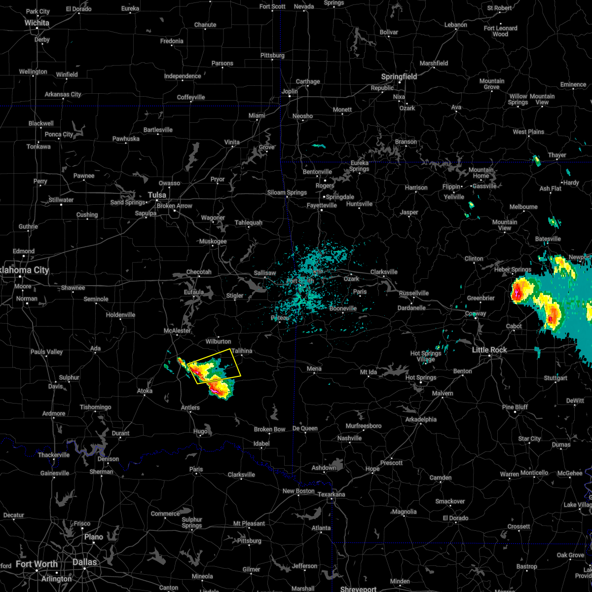 At 1059 pm cdt, a severe thunderstorm was located 6 miles northwest of stanley, moving east at 30 mph (radar indicated). Hazards include ping pong ball size hail and 60 mph wind gusts. People and animals outdoors will be injured. expect hail damage to roofs, siding, windows, and vehicles. expect wind damage to roofs, siding, and trees. locations in or near the path include, clayton, clayton lake state park, stanley, kiamichi, tuskahoma, yanush, sardis, hail threat, radar indicated max hail size, 1. 50 in wind threat, radar indicated max wind gust, 60 mph. At 1059 pm cdt, a severe thunderstorm was located 6 miles northwest of stanley, moving east at 30 mph (radar indicated). Hazards include ping pong ball size hail and 60 mph wind gusts. People and animals outdoors will be injured. expect hail damage to roofs, siding, windows, and vehicles. expect wind damage to roofs, siding, and trees. locations in or near the path include, clayton, clayton lake state park, stanley, kiamichi, tuskahoma, yanush, sardis, hail threat, radar indicated max hail size, 1. 50 in wind threat, radar indicated max wind gust, 60 mph.
|
| 2/21/2022 10:32 PM CST |
 At 1032 pm cst, a severe thunderstorm was located near clayton lake state park, moving northeast at 45 mph (radar indicated). Hazards include 60 mph wind gusts and quarter size hail. Hail damage to vehicles is expected. expect wind damage to roofs, siding, and trees. locations in or near the path include, clayton, talihina, albion, clayton lake state park, talimena state park, bengal, tuskahoma, yanush, nashoba, kiamichi, whitesboro, muse, sardis, honobia, hail threat, radar indicated max hail size, 1. 00 in wind threat, radar indicated max wind gust, 60 mph. At 1032 pm cst, a severe thunderstorm was located near clayton lake state park, moving northeast at 45 mph (radar indicated). Hazards include 60 mph wind gusts and quarter size hail. Hail damage to vehicles is expected. expect wind damage to roofs, siding, and trees. locations in or near the path include, clayton, talihina, albion, clayton lake state park, talimena state park, bengal, tuskahoma, yanush, nashoba, kiamichi, whitesboro, muse, sardis, honobia, hail threat, radar indicated max hail size, 1. 00 in wind threat, radar indicated max wind gust, 60 mph.
|
| 11/10/2021 10:20 PM CST |
 At 1018 pm cst, severe thunderstorms were located near talihina and clayton , moving east at 25 mph. these storms were still exhibiting weak rotation at these particular locations (radar indicated). Hazards include 60 mph wind gusts and penny size hail. Expect damage to roofs, siding, and trees. Locations in or near the path include, clayton, talihina, albion, clayton lake state park, talimena state park, bengal, tuskahoma, yanush, stanley, nashoba, kiamichi, whitesboro, sardis, summerfield, honobia,. At 1018 pm cst, severe thunderstorms were located near talihina and clayton , moving east at 25 mph. these storms were still exhibiting weak rotation at these particular locations (radar indicated). Hazards include 60 mph wind gusts and penny size hail. Expect damage to roofs, siding, and trees. Locations in or near the path include, clayton, talihina, albion, clayton lake state park, talimena state park, bengal, tuskahoma, yanush, stanley, nashoba, kiamichi, whitesboro, sardis, summerfield, honobia,.
|
| 11/10/2021 10:06 PM CST |
 At 1004 pm cst, severe thunderstorms were located just west of talihina and over stanley, moving east at 25 mph. these particular locations are exhibiting weak rotation (radar indicated). Hazards include 60 mph wind gusts and penny size hail. Expect damage to roofs, siding, and trees. Locations in or near the path include, clayton, talihina, albion, clayton lake state park, talimena state park, bengal, tuskahoma, yanush, stanley, nashoba, kiamichi, whitesboro, dunbar, eubanks, sardis, summerfield, honobia,. At 1004 pm cst, severe thunderstorms were located just west of talihina and over stanley, moving east at 25 mph. these particular locations are exhibiting weak rotation (radar indicated). Hazards include 60 mph wind gusts and penny size hail. Expect damage to roofs, siding, and trees. Locations in or near the path include, clayton, talihina, albion, clayton lake state park, talimena state park, bengal, tuskahoma, yanush, stanley, nashoba, kiamichi, whitesboro, dunbar, eubanks, sardis, summerfield, honobia,.
|
| 11/10/2021 9:44 PM CST |
 At 942 pm cst, severe thunderstorms were near yanush and just east of daisy, moving east at 25 mph (radar indicated). Hazards include 60 mph wind gusts and penny size hail. Expect damage to roofs, siding, and trees. Locations in or near the path include, clayton, talihina, albion, clayton lake state park, talimena state park, bengal, tuskahoma, yanush, stanley, nashoba, kiamichi, whitesboro, dunbar, eubanks, sardis, summerfield, honobia,. At 942 pm cst, severe thunderstorms were near yanush and just east of daisy, moving east at 25 mph (radar indicated). Hazards include 60 mph wind gusts and penny size hail. Expect damage to roofs, siding, and trees. Locations in or near the path include, clayton, talihina, albion, clayton lake state park, talimena state park, bengal, tuskahoma, yanush, stanley, nashoba, kiamichi, whitesboro, dunbar, eubanks, sardis, summerfield, honobia,.
|
| 10/10/2021 11:38 PM CDT |
 At 1138 pm cdt, a severe thunderstorm was located 3 miles southeast of snow, moving northeast at 50 mph (radar indicated). Hazards include 60 mph wind gusts. Expect damage to roofs, siding, and trees. locations in or near the path include, clayton, clayton lake state park, stanley, snow, nashoba, dunbar, tuskahoma, yanush, cloudy, sardis, finley, hail threat, radar indicated max hail size, <. 75 in wind threat, radar indicated max wind gust, 60 mph. At 1138 pm cdt, a severe thunderstorm was located 3 miles southeast of snow, moving northeast at 50 mph (radar indicated). Hazards include 60 mph wind gusts. Expect damage to roofs, siding, and trees. locations in or near the path include, clayton, clayton lake state park, stanley, snow, nashoba, dunbar, tuskahoma, yanush, cloudy, sardis, finley, hail threat, radar indicated max hail size, <. 75 in wind threat, radar indicated max wind gust, 60 mph.
|
| 10/10/2021 11:09 PM CDT |
 At 1109 pm cdt, severe thunderstorms were located along a line extending from 4 miles northwest of dunbar to 2 miles southeast of goodland, moving northeast at 70 mph (radar indicated). Hazards include 60 mph wind gusts. Expect damage to roofs, siding, and trees. locations in or near the path include, hugo, antlers, clayton, fort towson, sawyer, rattan, snow, tuskahoma, hugo lake state park, stanley, kellond, clayton lake state park, kent, goodland, yanush, messer, raymond gary state park, moyers, nashoba, kosoma, hail threat, radar indicated max hail size, <. 75 in wind threat, radar indicated max wind gust, 60 mph. At 1109 pm cdt, severe thunderstorms were located along a line extending from 4 miles northwest of dunbar to 2 miles southeast of goodland, moving northeast at 70 mph (radar indicated). Hazards include 60 mph wind gusts. Expect damage to roofs, siding, and trees. locations in or near the path include, hugo, antlers, clayton, fort towson, sawyer, rattan, snow, tuskahoma, hugo lake state park, stanley, kellond, clayton lake state park, kent, goodland, yanush, messer, raymond gary state park, moyers, nashoba, kosoma, hail threat, radar indicated max hail size, <. 75 in wind threat, radar indicated max wind gust, 60 mph.
|
| 10/10/2021 10:53 PM CDT |
 At 1052 pm cdt, severe thunderstorms were located along a line extending from 2 miles northeast of blanco to 6 miles south of soper, moving northeast at 75 mph (radar indicated). Hazards include 60 mph wind gusts. Expect damage to roofs, siding, and trees. locations in or near the path include, hugo, antlers, clayton, boswell, fort towson, sawyer, rattan, soper, snow, tuskahoma, hugo lake state park, stanley, kellond, clayton lake state park, kent, goodland, yanush, messer, raymond gary state park, moyers, hail threat, radar indicated max hail size, <. 75 in wind threat, radar indicated max wind gust, 60 mph. At 1052 pm cdt, severe thunderstorms were located along a line extending from 2 miles northeast of blanco to 6 miles south of soper, moving northeast at 75 mph (radar indicated). Hazards include 60 mph wind gusts. Expect damage to roofs, siding, and trees. locations in or near the path include, hugo, antlers, clayton, boswell, fort towson, sawyer, rattan, soper, snow, tuskahoma, hugo lake state park, stanley, kellond, clayton lake state park, kent, goodland, yanush, messer, raymond gary state park, moyers, hail threat, radar indicated max hail size, <. 75 in wind threat, radar indicated max wind gust, 60 mph.
|
| 8/1/2021 1:41 PM CDT |
 At 140 pm cdt, severe thunderstorms were located along a line extending from 4 miles east of stanley to 4 miles southeast of snow to 2 miles northwest of oleta, moving southeast at 25 mph (radar indicated). Hazards include 60 mph wind gusts. Expect damage to roofs, siding, and trees. Locations in or near the path include, clayton, clayton lake state park, stanley, snow, nashoba, dunbar, tuskahoma, oleta, cloudy, eubanks, finley,. At 140 pm cdt, severe thunderstorms were located along a line extending from 4 miles east of stanley to 4 miles southeast of snow to 2 miles northwest of oleta, moving southeast at 25 mph (radar indicated). Hazards include 60 mph wind gusts. Expect damage to roofs, siding, and trees. Locations in or near the path include, clayton, clayton lake state park, stanley, snow, nashoba, dunbar, tuskahoma, oleta, cloudy, eubanks, finley,.
|
| 8/1/2021 1:19 PM CDT |
 At 119 pm cdt, severe thunderstorms were located along a line extending from 2 miles north of stanley to 2 miles east of kellond, moving southeast at 20 mph (radar indicated). Hazards include 60 mph wind gusts and quarter size hail. Hail damage to vehicles is expected. expect wind damage to roofs, siding, and trees. Locations in or near the path include, antlers, clayton, rattan, clayton lake state park, snow, tuskahoma, stanley, moyers, nashoba, kosoma, kellond, dunbar, oleta, cloudy, eubanks, apple, dela, finley,. At 119 pm cdt, severe thunderstorms were located along a line extending from 2 miles north of stanley to 2 miles east of kellond, moving southeast at 20 mph (radar indicated). Hazards include 60 mph wind gusts and quarter size hail. Hail damage to vehicles is expected. expect wind damage to roofs, siding, and trees. Locations in or near the path include, antlers, clayton, rattan, clayton lake state park, snow, tuskahoma, stanley, moyers, nashoba, kosoma, kellond, dunbar, oleta, cloudy, eubanks, apple, dela, finley,.
|
| 6/17/2021 6:28 PM CDT |
 At 628 pm cdt, a severe thunderstorm was located near nashoba, moving west at 20 mph (radar indicated). Hazards include 60 mph wind gusts and quarter size hail. Hail damage to vehicles is expected. expect wind damage to roofs, siding, and trees. Locations in or near the path include, clayton, clayton lake state park, tuskahoma, snow, cloudy, nashoba,. At 628 pm cdt, a severe thunderstorm was located near nashoba, moving west at 20 mph (radar indicated). Hazards include 60 mph wind gusts and quarter size hail. Hail damage to vehicles is expected. expect wind damage to roofs, siding, and trees. Locations in or near the path include, clayton, clayton lake state park, tuskahoma, snow, cloudy, nashoba,.
|
| 6/17/2021 6:00 PM CDT |
 At 600 pm cdt, a severe thunderstorm was located 10 miles east of nashoba, moving west at 25 mph (radar indicated). Hazards include 60 mph wind gusts and quarter size hail. Hail damage to vehicles is expected. expect wind damage to roofs, siding, and trees. Locations in or near the path include, clayton, clayton lake state park, snow, nashoba, kiamichi, tuskahoma, cloudy,. At 600 pm cdt, a severe thunderstorm was located 10 miles east of nashoba, moving west at 25 mph (radar indicated). Hazards include 60 mph wind gusts and quarter size hail. Hail damage to vehicles is expected. expect wind damage to roofs, siding, and trees. Locations in or near the path include, clayton, clayton lake state park, snow, nashoba, kiamichi, tuskahoma, cloudy,.
|
| 4/9/2021 10:05 PM CDT |
 At 1005 pm cdt, severe thunderstorms were located along a line extending from 2 miles west of red oak to 2 miles north of talimena state park to 7 miles southwest of whitesboro, moving east at 45 mph (radar indicated). Hazards include 60 mph wind gusts and quarter size hail. Hail damage to vehicles is expected. expect wind damage to roofs, siding, and trees. Locations in or near the path include, poteau, talihina, wister, howe, red oak, fanshawe, albion, talimena state park, bengal, big cedar, lake wister state park, kiamichi, whitesboro, muse, summerfield, hodgen,. At 1005 pm cdt, severe thunderstorms were located along a line extending from 2 miles west of red oak to 2 miles north of talimena state park to 7 miles southwest of whitesboro, moving east at 45 mph (radar indicated). Hazards include 60 mph wind gusts and quarter size hail. Hail damage to vehicles is expected. expect wind damage to roofs, siding, and trees. Locations in or near the path include, poteau, talihina, wister, howe, red oak, fanshawe, albion, talimena state park, bengal, big cedar, lake wister state park, kiamichi, whitesboro, muse, summerfield, hodgen,.
|
| 4/9/2021 9:58 PM CDT |
 At 957 pm cdt, severe thunderstorms were located along a line extending from 5 miles east of snow to near kent to 8 miles southeast of goodland, moving east at 40 mph (radar indicated). Hazards include 60 mph wind gusts and quarter size hail. Hail damage to vehicles is expected. expect wind damage to roofs, siding, and trees. Locations in or near the path include, hugo, antlers, fort towson, sawyer, rattan, octavia, snow, hugo lake state park, clayton lake state park, kent, goodland, messer, raymond gary state park, nashoba, oleta, cloudy, grant, ord, fallon, sobol,. At 957 pm cdt, severe thunderstorms were located along a line extending from 5 miles east of snow to near kent to 8 miles southeast of goodland, moving east at 40 mph (radar indicated). Hazards include 60 mph wind gusts and quarter size hail. Hail damage to vehicles is expected. expect wind damage to roofs, siding, and trees. Locations in or near the path include, hugo, antlers, fort towson, sawyer, rattan, octavia, snow, hugo lake state park, clayton lake state park, kent, goodland, messer, raymond gary state park, nashoba, oleta, cloudy, grant, ord, fallon, sobol,.
|
| 4/9/2021 9:50 PM CDT |
 At 950 pm cdt, severe thunderstorms were located along a line extending from 2 miles southeast of robbers cave state park to 2 miles west of bengal to near kiamichi, moving east at 55 mph (radar indicated). Hazards include 60 mph wind gusts and quarter size hail. Hail damage to vehicles is expected. expect wind damage to roofs, siding, and trees. Locations in or near the path include, poteau, wilburton, talihina, wister, howe, red oak, fanshawe, albion, talimena state park, damon, bengal, tuskahoma, robbers cave state park, big cedar, lake wister state park, kiamichi, whitesboro, muse, panola, summerfield,. At 950 pm cdt, severe thunderstorms were located along a line extending from 2 miles southeast of robbers cave state park to 2 miles west of bengal to near kiamichi, moving east at 55 mph (radar indicated). Hazards include 60 mph wind gusts and quarter size hail. Hail damage to vehicles is expected. expect wind damage to roofs, siding, and trees. Locations in or near the path include, poteau, wilburton, talihina, wister, howe, red oak, fanshawe, albion, talimena state park, damon, bengal, tuskahoma, robbers cave state park, big cedar, lake wister state park, kiamichi, whitesboro, muse, panola, summerfield,.
|
| 4/9/2021 9:35 PM CDT |
 At 935 pm cdt, severe thunderstorms were located along a line extending from 3 miles west of wilburton to 2 miles west of yanush, moving east at 40 mph (radar indicated). Hazards include 60 mph wind gusts and quarter size hail. Hail damage to vehicles is expected. expect wind damage to roofs, siding, and trees. Locations in or near the path include, poteau, wilburton, talihina, wister, howe, red oak, fanshawe, albion, talimena state park, higgins, damon, bengal, tuskahoma, yanush, robbers cave state park, big cedar, lake wister state park, kiamichi, whitesboro, muse,. At 935 pm cdt, severe thunderstorms were located along a line extending from 3 miles west of wilburton to 2 miles west of yanush, moving east at 40 mph (radar indicated). Hazards include 60 mph wind gusts and quarter size hail. Hail damage to vehicles is expected. expect wind damage to roofs, siding, and trees. Locations in or near the path include, poteau, wilburton, talihina, wister, howe, red oak, fanshawe, albion, talimena state park, higgins, damon, bengal, tuskahoma, yanush, robbers cave state park, big cedar, lake wister state park, kiamichi, whitesboro, muse,.
|
| 4/9/2021 9:31 PM CDT |
 At 931 pm cdt, severe thunderstorms were located along a line extending from 6 miles east of daisy to 4 miles northwest of yanush to 5 miles west of robbers cave state park, moving east at 45 mph (radar indicated). Hazards include 60 mph wind gusts and quarter size hail. Hail damage to vehicles is expected. expect wind damage to roofs, siding, and trees. Locations in or near the path include, wilburton, clayton, hartshorne, stanley, higgins, damon, dunbar, yanush, eubanks, sardis, gowen, panola,. At 931 pm cdt, severe thunderstorms were located along a line extending from 6 miles east of daisy to 4 miles northwest of yanush to 5 miles west of robbers cave state park, moving east at 45 mph (radar indicated). Hazards include 60 mph wind gusts and quarter size hail. Hail damage to vehicles is expected. expect wind damage to roofs, siding, and trees. Locations in or near the path include, wilburton, clayton, hartshorne, stanley, higgins, damon, dunbar, yanush, eubanks, sardis, gowen, panola,.
|
| 4/9/2021 8:59 PM CDT |
 At 859 pm cdt, severe thunderstorms were located along a line extending from kiowa to mcalester regional airport, moving east at 35 mph (radar indicated). Hazards include 60 mph wind gusts and penny size hail. Expect damage to roofs, siding, and trees. Locations in or near the path include, mcalester, wilburton, clayton, hartshorne, krebs, kiowa, savanna, alderson, higgins, damon, yanush, stanley, mcalester regional airport, dunbar, blanco, haileyville, pittsburg, eubanks, sardis, gowen,. At 859 pm cdt, severe thunderstorms were located along a line extending from kiowa to mcalester regional airport, moving east at 35 mph (radar indicated). Hazards include 60 mph wind gusts and penny size hail. Expect damage to roofs, siding, and trees. Locations in or near the path include, mcalester, wilburton, clayton, hartshorne, krebs, kiowa, savanna, alderson, higgins, damon, yanush, stanley, mcalester regional airport, dunbar, blanco, haileyville, pittsburg, eubanks, sardis, gowen,.
|
| 7/30/2020 9:26 PM CDT |
 The severe thunderstorm warning for eastern pushmataha and eastern choctaw counties will expire at 930 pm cdt, the storms which prompted the warning have moved out of the area. therefore the warning will be allowed to expire. a severe thunderstorm watch remains in effect until 1100 pm cdt for southeastern oklahoma. The severe thunderstorm warning for eastern pushmataha and eastern choctaw counties will expire at 930 pm cdt, the storms which prompted the warning have moved out of the area. therefore the warning will be allowed to expire. a severe thunderstorm watch remains in effect until 1100 pm cdt for southeastern oklahoma.
|
| 7/30/2020 9:12 PM CDT |
 At 911 pm cdt, severe thunderstorms were located along a line extending from 9 miles southeast of albion to 8 miles south of raymond gary state park, moving east at 30 mph (radar indicated). Hazards include 60 mph wind gusts. Expect damage to roofs, siding, and trees. Locations in or near the path include, hugo, clayton, heavener, talihina, fort towson, sawyer, albion, octavia, talimena state park, heavener runestone state park, tuskahoma, big cedar, hugo lake state park, kiamichi, whitesboro, clayton lake state park, bengal, yanush, raymond gary state park, nashoba,. At 911 pm cdt, severe thunderstorms were located along a line extending from 9 miles southeast of albion to 8 miles south of raymond gary state park, moving east at 30 mph (radar indicated). Hazards include 60 mph wind gusts. Expect damage to roofs, siding, and trees. Locations in or near the path include, hugo, clayton, heavener, talihina, fort towson, sawyer, albion, octavia, talimena state park, heavener runestone state park, tuskahoma, big cedar, hugo lake state park, kiamichi, whitesboro, clayton lake state park, bengal, yanush, raymond gary state park, nashoba,.
|
| 7/30/2020 9:09 PM CDT |
 At 908 pm cdt, severe thunderstorms were located along a line extending from albion to 10 miles southeast of cloudy to 9 miles south of sawyer, moving east at 35 mph (radar indicated). Hazards include 60 mph wind gusts. Expect damage to roofs, siding, and trees. Locations in or near the path include, hugo, clayton, fort towson, sawyer, clayton lake state park, tuskahoma, hugo lake state park, raymond gary state park, nashoba, oleta, cloudy, grant, ord, corinne, fallon, sobol, swink, frogville, apple, huskey,. At 908 pm cdt, severe thunderstorms were located along a line extending from albion to 10 miles southeast of cloudy to 9 miles south of sawyer, moving east at 35 mph (radar indicated). Hazards include 60 mph wind gusts. Expect damage to roofs, siding, and trees. Locations in or near the path include, hugo, clayton, fort towson, sawyer, clayton lake state park, tuskahoma, hugo lake state park, raymond gary state park, nashoba, oleta, cloudy, grant, ord, corinne, fallon, sobol, swink, frogville, apple, huskey,.
|
| 7/30/2020 9:02 PM CDT |
 At 900 pm cdt, severe thunderstorms were located along a line extending from 4 miles southeast of albion to 7 miles south of sawyer, moving east at 30 mph (public). Hazards include 60 mph wind gusts. public reported trees down and power out in the city of hugo. additional tree damage was located near the border of mccurtain county. Expect damage to roofs, siding, and trees. Locations in or near the path include, hugo, antlers, clayton, heavener, talihina, fort towson, sawyer, rattan, soper, albion, octavia, talimena state park, snow, heavener runestone state park, tuskahoma, big cedar, hugo lake state park, kiamichi, whitesboro, clayton lake state park,. At 900 pm cdt, severe thunderstorms were located along a line extending from 4 miles southeast of albion to 7 miles south of sawyer, moving east at 30 mph (public). Hazards include 60 mph wind gusts. public reported trees down and power out in the city of hugo. additional tree damage was located near the border of mccurtain county. Expect damage to roofs, siding, and trees. Locations in or near the path include, hugo, antlers, clayton, heavener, talihina, fort towson, sawyer, rattan, soper, albion, octavia, talimena state park, snow, heavener runestone state park, tuskahoma, big cedar, hugo lake state park, kiamichi, whitesboro, clayton lake state park,.
|
| 7/30/2020 8:56 PM CDT |
 At 856 pm cdt, severe thunderstorms were located along a line extending from 4 miles southeast of albion to 7 miles south of sawyer, moving east at 30 mph (radar indicated). Hazards include 60 mph wind gusts. Expect damage to roofs, siding, and trees. Locations in or near the path include, hugo, antlers, clayton, heavener, talihina, fort towson, sawyer, rattan, soper, albion, octavia, talimena state park, snow, heavener runestone state park, tuskahoma, big cedar, hugo lake state park, kiamichi, whitesboro, clayton lake state park,. At 856 pm cdt, severe thunderstorms were located along a line extending from 4 miles southeast of albion to 7 miles south of sawyer, moving east at 30 mph (radar indicated). Hazards include 60 mph wind gusts. Expect damage to roofs, siding, and trees. Locations in or near the path include, hugo, antlers, clayton, heavener, talihina, fort towson, sawyer, rattan, soper, albion, octavia, talimena state park, snow, heavener runestone state park, tuskahoma, big cedar, hugo lake state park, kiamichi, whitesboro, clayton lake state park,.
|
| 7/30/2020 8:51 PM CDT |
 At 850 pm cdt, severe thunderstorms were located along a line extending from near yanush to 3 miles northeast of oleta to 5 miles south of goodland, moving east at 35 mph (radar indicated). Hazards include 60 mph wind gusts and penny size hail. Expect damage to roofs, siding, and trees. Locations in or near the path include, hugo, antlers, clayton, fort towson, sawyer, rattan, soper, snow, tuskahoma, hugo lake state park, stanley, clayton lake state park, kent, goodland, messer, raymond gary state park, nashoba, oleta, cloudy, grant,. At 850 pm cdt, severe thunderstorms were located along a line extending from near yanush to 3 miles northeast of oleta to 5 miles south of goodland, moving east at 35 mph (radar indicated). Hazards include 60 mph wind gusts and penny size hail. Expect damage to roofs, siding, and trees. Locations in or near the path include, hugo, antlers, clayton, fort towson, sawyer, rattan, soper, snow, tuskahoma, hugo lake state park, stanley, clayton lake state park, kent, goodland, messer, raymond gary state park, nashoba, oleta, cloudy, grant,.
|
| 7/30/2020 8:13 PM CDT |
 At 812 pm cdt, severe thunderstorms were located along a line extending from 4 miles east of blanco to 3 miles southwest of moyers to 4 miles southeast of bennington, moving east at 35 mph (radar indicated). Hazards include 60 mph wind gusts and penny size hail. Expect damage to roofs, siding, and trees. Locations in or near the path include, hugo, antlers, clayton, boswell, fort towson, sawyer, rattan, soper, snow, tuskahoma, hugo lake state park, stanley, kellond, clayton lake state park, kent, goodland, messer, raymond gary state park, moyers, nashoba,. At 812 pm cdt, severe thunderstorms were located along a line extending from 4 miles east of blanco to 3 miles southwest of moyers to 4 miles southeast of bennington, moving east at 35 mph (radar indicated). Hazards include 60 mph wind gusts and penny size hail. Expect damage to roofs, siding, and trees. Locations in or near the path include, hugo, antlers, clayton, boswell, fort towson, sawyer, rattan, soper, snow, tuskahoma, hugo lake state park, stanley, kellond, clayton lake state park, kent, goodland, messer, raymond gary state park, moyers, nashoba,.
|
| 7/12/2020 12:19 AM CDT |
 At 1219 am cdt, severe thunderstorms were located along a line extending from stringtown to 5 miles west of rattan to 9 miles northeast of fort towson to 8 miles northwest of de queen, moving south at 35 mph (radar indicated). Hazards include 70 mph wind gusts. Expect considerable tree damage. damage is likely to mobile homes, roofs, and outbuildings. Locations in or near the path include, antlers, clayton, kiowa, rattan, clayton lake state park, snow, tuskahoma, stanley, moyers, nashoba, kiamichi, kosoma, kellond, dunbar, oleta, cloudy, pittsburg, eubanks, corinne, sobol,. At 1219 am cdt, severe thunderstorms were located along a line extending from stringtown to 5 miles west of rattan to 9 miles northeast of fort towson to 8 miles northwest of de queen, moving south at 35 mph (radar indicated). Hazards include 70 mph wind gusts. Expect considerable tree damage. damage is likely to mobile homes, roofs, and outbuildings. Locations in or near the path include, antlers, clayton, kiowa, rattan, clayton lake state park, snow, tuskahoma, stanley, moyers, nashoba, kiamichi, kosoma, kellond, dunbar, oleta, cloudy, pittsburg, eubanks, corinne, sobol,.
|
| 7/12/2020 12:06 AM CDT |
 At 1206 am cdt, severe thunderstorms were located along a line extending from 6 miles north of stringtown to 6 miles east of kosoma to 11 miles southeast of cloudy to 7 miles west of grannis, moving south at 35 mph (radar indicated). Hazards include 70 mph wind gusts. Expect considerable tree damage. damage is likely to mobile homes, roofs, and outbuildings. Locations in or near the path include, mcalester, antlers, clayton, hartshorne, krebs, kiowa, savanna, rattan, alderson, albion, ashland, octavia, snow, higgins, haywood, tuskahoma, stanley, kiamichi, kellond, clayton lake state park,. At 1206 am cdt, severe thunderstorms were located along a line extending from 6 miles north of stringtown to 6 miles east of kosoma to 11 miles southeast of cloudy to 7 miles west of grannis, moving south at 35 mph (radar indicated). Hazards include 70 mph wind gusts. Expect considerable tree damage. damage is likely to mobile homes, roofs, and outbuildings. Locations in or near the path include, mcalester, antlers, clayton, hartshorne, krebs, kiowa, savanna, rattan, alderson, albion, ashland, octavia, snow, higgins, haywood, tuskahoma, stanley, kiamichi, kellond, clayton lake state park,.
|
| 7/11/2020 11:54 PM CDT |
 At 1153 pm cdt, severe thunderstorms were located along a line extending from near wardville to 3 miles southeast of dunbar to 8 miles east of cloudy to 6 miles west of wickes, moving south at 35 mph (radar indicated. trees were reported down across latimer county). Hazards include 70 mph wind gusts and quarter size hail. Hail damage to vehicles is expected. expect considerable tree damage. wind damage is also likely to mobile homes, roofs, and outbuildings. Locations in or near the path include, mcalester, antlers, clayton, hartshorne, krebs, talihina, kiowa, savanna, rattan, alderson, albion, ashland, octavia, snow, haywood, big cedar, whitesboro, clayton lake state park, damon, moyers,. At 1153 pm cdt, severe thunderstorms were located along a line extending from near wardville to 3 miles southeast of dunbar to 8 miles east of cloudy to 6 miles west of wickes, moving south at 35 mph (radar indicated. trees were reported down across latimer county). Hazards include 70 mph wind gusts and quarter size hail. Hail damage to vehicles is expected. expect considerable tree damage. wind damage is also likely to mobile homes, roofs, and outbuildings. Locations in or near the path include, mcalester, antlers, clayton, hartshorne, krebs, talihina, kiowa, savanna, rattan, alderson, albion, ashland, octavia, snow, haywood, big cedar, whitesboro, clayton lake state park, damon, moyers,.
|
| 7/11/2020 11:44 PM CDT |
 At 1142 pm cdt, severe thunderstorms were located along a line extending from near ashland to 2 miles southwest of stanley to 7 miles southeast of nashoba to 5 miles west of vandervoort, moving south at 35 mph (radar indicated. winds gusted to 60 mph in mcalester). Hazards include 65 mph wind gusts and quarter size hail. Hail damage to vehicles is expected. expect wind damage to roofs, siding, and trees. Locations in or near the path include, mcalester, wilburton, antlers, clayton, hartshorne, krebs, talihina, kiowa, savanna, rattan, alderson, albion, ashland, octavia, snow, haywood, big cedar, whitesboro, clayton lake state park, damon,. At 1142 pm cdt, severe thunderstorms were located along a line extending from near ashland to 2 miles southwest of stanley to 7 miles southeast of nashoba to 5 miles west of vandervoort, moving south at 35 mph (radar indicated. winds gusted to 60 mph in mcalester). Hazards include 65 mph wind gusts and quarter size hail. Hail damage to vehicles is expected. expect wind damage to roofs, siding, and trees. Locations in or near the path include, mcalester, wilburton, antlers, clayton, hartshorne, krebs, talihina, kiowa, savanna, rattan, alderson, albion, ashland, octavia, snow, haywood, big cedar, whitesboro, clayton lake state park, damon,.
|
| 7/11/2020 11:33 PM CDT |
 At 1129 pm cdt, the initial strong winds from severe thunderstorms were located along a line extending from 4 miles south of kiamichi to 7 miles south of hartshorne to 2 miles southeast of haywood, moving south at 45 mph. the leading edge of the heavy rain and additional strong winds was from near albion to wilburton to savanna (radar indicated. power outages were reported in wilburton. wind gusts to 60 mph were reported in mcalester). Hazards include 70 mph wind gusts and quarter size hail. Hail damage to vehicles is expected. expect considerable tree damage. wind damage is also likely to mobile homes, roofs, and outbuildings. Locations in or near the path include, mcalester, wilburton, eufaula, clayton, hartshorne, krebs, quinton, dewar, kiowa, porum, savanna, crowder, whitefield, alderson, kinta, canadian, indianola, grayson, hanna, hoffman, this includes interstate 40 in oklahoma between mile markers 240 and 273. At 1129 pm cdt, the initial strong winds from severe thunderstorms were located along a line extending from 4 miles south of kiamichi to 7 miles south of hartshorne to 2 miles southeast of haywood, moving south at 45 mph. the leading edge of the heavy rain and additional strong winds was from near albion to wilburton to savanna (radar indicated. power outages were reported in wilburton. wind gusts to 60 mph were reported in mcalester). Hazards include 70 mph wind gusts and quarter size hail. Hail damage to vehicles is expected. expect considerable tree damage. wind damage is also likely to mobile homes, roofs, and outbuildings. Locations in or near the path include, mcalester, wilburton, eufaula, clayton, hartshorne, krebs, quinton, dewar, kiowa, porum, savanna, crowder, whitefield, alderson, kinta, canadian, indianola, grayson, hanna, hoffman, this includes interstate 40 in oklahoma between mile markers 240 and 273.
|
| 7/11/2020 11:00 PM CDT |
 At 1059 pm cdt, severe thunderstorms were located along a line extending from 6 miles east of damon to 3 miles west of blocker to 4 miles southwest of hanna, moving south at 45 mph (radar indicated). Hazards include 70 mph wind gusts and quarter size hail. Hail damage to vehicles is expected. expect considerable tree damage. wind damage is also likely to mobile homes, roofs, and outbuildings. Locations in or near the path include, mcalester, okmulgee, wilburton, eufaula, clayton, henryetta, hartshorne, krebs, morris, quinton, dewar, kiowa, porum, savanna, schulter, crowder, whitefield, alderson, kinta, canadian, this includes interstate 40 in oklahoma between mile markers 236 and 273. At 1059 pm cdt, severe thunderstorms were located along a line extending from 6 miles east of damon to 3 miles west of blocker to 4 miles southwest of hanna, moving south at 45 mph (radar indicated). Hazards include 70 mph wind gusts and quarter size hail. Hail damage to vehicles is expected. expect considerable tree damage. wind damage is also likely to mobile homes, roofs, and outbuildings. Locations in or near the path include, mcalester, okmulgee, wilburton, eufaula, clayton, henryetta, hartshorne, krebs, morris, quinton, dewar, kiowa, porum, savanna, schulter, crowder, whitefield, alderson, kinta, canadian, this includes interstate 40 in oklahoma between mile markers 236 and 273.
|
| 5/8/2020 3:12 AM CDT |
 At 312 am cdt, severe thunderstorms were located along a line extending from 3 miles west of kinta to 5 miles southeast of damon to 4 miles north of kent, moving east at 55 mph (radar indicated). Hazards include 70 mph wind gusts and quarter size hail. Hail damage to vehicles is expected. expect considerable tree damage. wind damage is also likely to mobile homes, roofs, and outbuildings. Locations in or near the path include, wilburton, antlers, clayton, spiro, panama, talihina, wister, quinton, red oak, mccurtain, bokoshe, fanshawe, rattan, kinta, albion, snow, mc curtain, whitesboro, lequire, clayton lake state park,. At 312 am cdt, severe thunderstorms were located along a line extending from 3 miles west of kinta to 5 miles southeast of damon to 4 miles north of kent, moving east at 55 mph (radar indicated). Hazards include 70 mph wind gusts and quarter size hail. Hail damage to vehicles is expected. expect considerable tree damage. wind damage is also likely to mobile homes, roofs, and outbuildings. Locations in or near the path include, wilburton, antlers, clayton, spiro, panama, talihina, wister, quinton, red oak, mccurtain, bokoshe, fanshawe, rattan, kinta, albion, snow, mc curtain, whitesboro, lequire, clayton lake state park,.
|
| 5/8/2020 2:49 AM CDT |
 At 247 am cdt, severe thunderstorms were located along a line extending from arrowhead state park to 3 miles northwest of hartshorne to 5 miles east of atoka, moving east at 55 mph (radar indicated. at 243 am 64 mph winds were measured at the mcalester regional airport). Hazards include 65 mph wind gusts. Expect damage to roofs, siding, and trees. Locations in or near the path include, wilburton, antlers, clayton, spiro, panama, talihina, wister, quinton, red oak, mccurtain, bokoshe, fanshawe, rattan, kinta, albion, snow, mc curtain, whitesboro, lequire, clayton lake state park,. At 247 am cdt, severe thunderstorms were located along a line extending from arrowhead state park to 3 miles northwest of hartshorne to 5 miles east of atoka, moving east at 55 mph (radar indicated. at 243 am 64 mph winds were measured at the mcalester regional airport). Hazards include 65 mph wind gusts. Expect damage to roofs, siding, and trees. Locations in or near the path include, wilburton, antlers, clayton, spiro, panama, talihina, wister, quinton, red oak, mccurtain, bokoshe, fanshawe, rattan, kinta, albion, snow, mc curtain, whitesboro, lequire, clayton lake state park,.
|
| 4/28/2020 9:43 PM CDT |
 At 943 pm cdt, severe thunderstorms were located along a line extending from near moyers to 7 miles northwest of mountain fork, moving southeast at 45 mph (radar indicated). Hazards include 60 mph wind gusts and quarter size hail. Hail damage to vehicles is expected. expect wind damage to roofs, siding, and trees. Locations in or near the path include, hugo, antlers, clayton, heavener, talihina, fort towson, sawyer, rattan, albion, octavia, talimena state park, snow, heavener runestone state park, tuskahoma, big cedar, hugo lake state park, stanley, kiamichi, whitesboro, kellond, a tornado watch remains in effect until 1100 pm cdt for west central arkansas, and southeastern oklahoma. At 943 pm cdt, severe thunderstorms were located along a line extending from near moyers to 7 miles northwest of mountain fork, moving southeast at 45 mph (radar indicated). Hazards include 60 mph wind gusts and quarter size hail. Hail damage to vehicles is expected. expect wind damage to roofs, siding, and trees. Locations in or near the path include, hugo, antlers, clayton, heavener, talihina, fort towson, sawyer, rattan, albion, octavia, talimena state park, snow, heavener runestone state park, tuskahoma, big cedar, hugo lake state park, stanley, kiamichi, whitesboro, kellond, a tornado watch remains in effect until 1100 pm cdt for west central arkansas, and southeastern oklahoma.
|
| 4/28/2020 9:31 PM CDT |
 At 931 pm cdt, a severe thunderstorm capable of producing a tornado was located 3 miles southwest of kiamichi, moving southeast at 45 mph (radar indicated rotation). Hazards include tornado and half dollar size hail. Flying debris will be dangerous to those caught without shelter. mobile homes will be damaged or destroyed. damage to roofs, windows, and vehicles will occur. tree damage is likely. Locations in or near the path include, clayton, kiamichi, tuskahoma,. At 931 pm cdt, a severe thunderstorm capable of producing a tornado was located 3 miles southwest of kiamichi, moving southeast at 45 mph (radar indicated rotation). Hazards include tornado and half dollar size hail. Flying debris will be dangerous to those caught without shelter. mobile homes will be damaged or destroyed. damage to roofs, windows, and vehicles will occur. tree damage is likely. Locations in or near the path include, clayton, kiamichi, tuskahoma,.
|
| 4/28/2020 9:29 PM CDT |
 At 928 pm cdt, severe thunderstorms were located along a line extending from 7 miles southwest of daisy to 2 miles south of heavener, moving southeast at 45 mph (radar indicated). Hazards include 60 mph wind gusts and half dollar size hail. Hail damage to vehicles is expected. expect wind damage to roofs, siding, and trees. Locations in or near the path include, poteau, hugo, antlers, clayton, heavener, talihina, wister, howe, fort towson, fanshawe, sawyer, rattan, albion, octavia, snow, big cedar, whitesboro, clayton lake state park, goodland, raymond gary state park, a tornado watch remains in effect until 1100 pm cdt for west central arkansas, and southeastern oklahoma. At 928 pm cdt, severe thunderstorms were located along a line extending from 7 miles southwest of daisy to 2 miles south of heavener, moving southeast at 45 mph (radar indicated). Hazards include 60 mph wind gusts and half dollar size hail. Hail damage to vehicles is expected. expect wind damage to roofs, siding, and trees. Locations in or near the path include, poteau, hugo, antlers, clayton, heavener, talihina, wister, howe, fort towson, fanshawe, sawyer, rattan, albion, octavia, snow, big cedar, whitesboro, clayton lake state park, goodland, raymond gary state park, a tornado watch remains in effect until 1100 pm cdt for west central arkansas, and southeastern oklahoma.
|
| 4/28/2020 9:27 PM CDT |
 At 927 pm cdt, a severe thunderstorm capable of producing a tornado was located 3 miles northeast of stanley, moving southeast at 40 mph (radar indicated rotation). Hazards include tornado and half dollar size hail. Flying debris will be dangerous to those caught without shelter. mobile homes will be damaged or destroyed. damage to roofs, windows, and vehicles will occur. tree damage is likely. Locations in or near the path include, clayton, clayton lake state park, stanley, nashoba, kiamichi, tuskahoma, sardis,. At 927 pm cdt, a severe thunderstorm capable of producing a tornado was located 3 miles northeast of stanley, moving southeast at 40 mph (radar indicated rotation). Hazards include tornado and half dollar size hail. Flying debris will be dangerous to those caught without shelter. mobile homes will be damaged or destroyed. damage to roofs, windows, and vehicles will occur. tree damage is likely. Locations in or near the path include, clayton, clayton lake state park, stanley, nashoba, kiamichi, tuskahoma, sardis,.
|
| 4/28/2020 9:18 PM CDT |
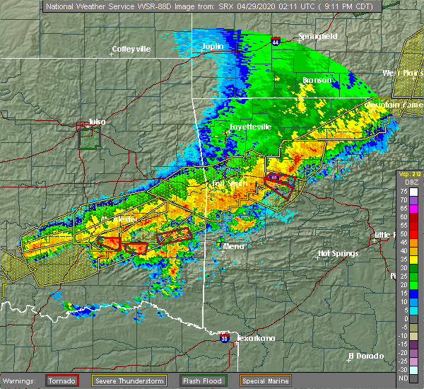 At 918 pm cdt, a severe thunderstorm with strong low level rotation that could produce a tornado at any time was located near tuskahoma, moving east at 20 mph (radar indicated rotation). Hazards include tornado. Flying debris will be dangerous to those caught without shelter. mobile homes will be damaged or destroyed. damage to roofs, windows, and vehicles will occur. tree damage is likely. Locations in or near the path include, tuskahoma,. At 918 pm cdt, a severe thunderstorm with strong low level rotation that could produce a tornado at any time was located near tuskahoma, moving east at 20 mph (radar indicated rotation). Hazards include tornado. Flying debris will be dangerous to those caught without shelter. mobile homes will be damaged or destroyed. damage to roofs, windows, and vehicles will occur. tree damage is likely. Locations in or near the path include, tuskahoma,.
|
| 4/28/2020 9:16 PM CDT |
 At 916 pm cdt, a severe thunderstorm capable of producing a tornado was located 9 miles northwest of stanley, moving east at 40 mph (radar indicated rotation). Hazards include tornado and hail up to two inches in diameter. Flying debris will be dangerous to those caught without shelter. mobile homes will be damaged or destroyed. damage to roofs, windows, and vehicles will occur. tree damage is likely. Locations in or near the path include, clayton, clayton lake state park, stanley, nashoba, kiamichi, tuskahoma, sardis,. At 916 pm cdt, a severe thunderstorm capable of producing a tornado was located 9 miles northwest of stanley, moving east at 40 mph (radar indicated rotation). Hazards include tornado and hail up to two inches in diameter. Flying debris will be dangerous to those caught without shelter. mobile homes will be damaged or destroyed. damage to roofs, windows, and vehicles will occur. tree damage is likely. Locations in or near the path include, clayton, clayton lake state park, stanley, nashoba, kiamichi, tuskahoma, sardis,.
|
| 4/28/2020 9:13 PM CDT |
 At 913 pm cdt, a severe thunderstorm capable of producing a tornado was located 3 miles north of clayton, moving east at 15 mph (radar indicated rotation). Hazards include tornado. Flying debris will be dangerous to those caught without shelter. mobile homes will be damaged or destroyed. damage to roofs, windows, and vehicles will occur. tree damage is likely. Locations in or near the path include, tuskahoma,. At 913 pm cdt, a severe thunderstorm capable of producing a tornado was located 3 miles north of clayton, moving east at 15 mph (radar indicated rotation). Hazards include tornado. Flying debris will be dangerous to those caught without shelter. mobile homes will be damaged or destroyed. damage to roofs, windows, and vehicles will occur. tree damage is likely. Locations in or near the path include, tuskahoma,.
|
| 4/28/2020 9:07 PM CDT |
 At 907 pm cdt, severe thunderstorms were located along a line extending from 5 miles south of bokoshe to 4 miles east of ashland, moving southeast at 40 mph (radar indicated). Hazards include 60 mph wind gusts and quarter size hail. Hail damage to vehicles is expected. expect wind damage to roofs, siding, and trees. Locations in or near the path include, mcalester, poteau, wilburton, clayton, heavener, hartshorne, krebs, talihina, wister, quinton, howe, kiowa, savanna, red oak, mccurtain, fanshawe, alderson, kinta, albion, ashland, a tornado watch remains in effect until 1100 pm cdt for west central arkansas, and southeastern oklahoma. At 907 pm cdt, severe thunderstorms were located along a line extending from 5 miles south of bokoshe to 4 miles east of ashland, moving southeast at 40 mph (radar indicated). Hazards include 60 mph wind gusts and quarter size hail. Hail damage to vehicles is expected. expect wind damage to roofs, siding, and trees. Locations in or near the path include, mcalester, poteau, wilburton, clayton, heavener, hartshorne, krebs, talihina, wister, quinton, howe, kiowa, savanna, red oak, mccurtain, fanshawe, alderson, kinta, albion, ashland, a tornado watch remains in effect until 1100 pm cdt for west central arkansas, and southeastern oklahoma.
|
| 4/28/2020 9:04 PM CDT |
 At 904 pm cdt, a severe thunderstorm capable of producing a tornado was located near clayton, moving east at 20 mph (radar indicated rotation). Hazards include tornado. Flying debris will be dangerous to those caught without shelter. mobile homes will be damaged or destroyed. damage to roofs, windows, and vehicles will occur. tree damage is likely. Locations in or near the path include, clayton, tuskahoma, sardis,. At 904 pm cdt, a severe thunderstorm capable of producing a tornado was located near clayton, moving east at 20 mph (radar indicated rotation). Hazards include tornado. Flying debris will be dangerous to those caught without shelter. mobile homes will be damaged or destroyed. damage to roofs, windows, and vehicles will occur. tree damage is likely. Locations in or near the path include, clayton, tuskahoma, sardis,.
|
| 4/28/2020 8:57 PM CDT |
 At 857 pm cdt, a severe thunderstorm capable of producing a tornado was located 3 miles northwest of clayton, moving east at 20 mph (radar indicated rotation). Hazards include tornado. Flying debris will be dangerous to those caught without shelter. mobile homes will be damaged or destroyed. damage to roofs, windows, and vehicles will occur. tree damage is likely. Locations in or near the path include, clayton, clayton lake state park, tuskahoma, sardis,. At 857 pm cdt, a severe thunderstorm capable of producing a tornado was located 3 miles northwest of clayton, moving east at 20 mph (radar indicated rotation). Hazards include tornado. Flying debris will be dangerous to those caught without shelter. mobile homes will be damaged or destroyed. damage to roofs, windows, and vehicles will occur. tree damage is likely. Locations in or near the path include, clayton, clayton lake state park, tuskahoma, sardis,.
|
| 4/28/2020 8:50 PM CDT |
 At 850 pm cdt, a severe thunderstorm capable of producing a tornado was located 4 miles northeast of stanley, moving east at 20 mph (radar indicated rotation). Hazards include tornado. Flying debris will be dangerous to those caught without shelter. mobile homes will be damaged or destroyed. damage to roofs, windows, and vehicles will occur. tree damage is likely. Locations in or near the path include, clayton, clayton lake state park, stanley, tuskahoma, sardis,. At 850 pm cdt, a severe thunderstorm capable of producing a tornado was located 4 miles northeast of stanley, moving east at 20 mph (radar indicated rotation). Hazards include tornado. Flying debris will be dangerous to those caught without shelter. mobile homes will be damaged or destroyed. damage to roofs, windows, and vehicles will occur. tree damage is likely. Locations in or near the path include, clayton, clayton lake state park, stanley, tuskahoma, sardis,.
|
| 4/28/2020 8:33 PM CDT |
 At 833 pm cdt, a severe thunderstorm capable of producing a tornado was located 5 miles northwest of stanley, moving east at 20 mph (radar indicated rotation). Hazards include tornado. Flying debris will be dangerous to those caught without shelter. mobile homes will be damaged or destroyed. damage to roofs, windows, and vehicles will occur. tree damage is likely. Locations in or near the path include, clayton, clayton lake state park, stanley, tuskahoma, nashoba, sardis,. At 833 pm cdt, a severe thunderstorm capable of producing a tornado was located 5 miles northwest of stanley, moving east at 20 mph (radar indicated rotation). Hazards include tornado. Flying debris will be dangerous to those caught without shelter. mobile homes will be damaged or destroyed. damage to roofs, windows, and vehicles will occur. tree damage is likely. Locations in or near the path include, clayton, clayton lake state park, stanley, tuskahoma, nashoba, sardis,.
|
| 4/28/2020 8:23 PM CDT |
 At 823 pm cdt, a severe thunderstorm capable of producing a tornado was located 9 miles northeast of daisy, moving east at 20 mph (radar indicated rotation). Hazards include tornado. Flying debris will be dangerous to those caught without shelter. mobile homes will be damaged or destroyed. damage to roofs, windows, and vehicles will occur. tree damage is likely. Locations in or near the path include, clayton, clayton lake state park, stanley, tuskahoma, nashoba, sardis,. At 823 pm cdt, a severe thunderstorm capable of producing a tornado was located 9 miles northeast of daisy, moving east at 20 mph (radar indicated rotation). Hazards include tornado. Flying debris will be dangerous to those caught without shelter. mobile homes will be damaged or destroyed. damage to roofs, windows, and vehicles will occur. tree damage is likely. Locations in or near the path include, clayton, clayton lake state park, stanley, tuskahoma, nashoba, sardis,.
|
| 4/24/2020 8:31 PM CDT |
 At 831 pm cdt, severe thunderstorms were located along a line extending from 2 miles north of cameron to 6 miles northeast of talimena state park to 5 miles southeast of stanley, moving east at 40 mph (radar indicated). Hazards include 60 mph wind gusts and quarter size hail. Hail damage to vehicles is expected. expect wind damage to roofs, siding, and trees. Locations in or near the path include, poteau, clayton, heavener, panama, talihina, wister, howe, hartford, huntington, midland, cameron, albion, talimena state park, heavener runestone state park, tuskahoma, big cedar, stanley, kiamichi, whitesboro, clayton lake state park, a tornado watch remains in effect until midnight cdt for southeastern oklahoma. At 831 pm cdt, severe thunderstorms were located along a line extending from 2 miles north of cameron to 6 miles northeast of talimena state park to 5 miles southeast of stanley, moving east at 40 mph (radar indicated). Hazards include 60 mph wind gusts and quarter size hail. Hail damage to vehicles is expected. expect wind damage to roofs, siding, and trees. Locations in or near the path include, poteau, clayton, heavener, panama, talihina, wister, howe, hartford, huntington, midland, cameron, albion, talimena state park, heavener runestone state park, tuskahoma, big cedar, stanley, kiamichi, whitesboro, clayton lake state park, a tornado watch remains in effect until midnight cdt for southeastern oklahoma.
|
| 4/24/2020 8:08 PM CDT |
 The national weather service in tulsa has issued a * severe thunderstorm warning for. southwestern sebastian county in west central arkansas. southeastern haskell county in southeastern oklahoma. northern pushmataha county in southeastern oklahoma. Central latimer county in southeastern oklahoma. The national weather service in tulsa has issued a * severe thunderstorm warning for. southwestern sebastian county in west central arkansas. southeastern haskell county in southeastern oklahoma. northern pushmataha county in southeastern oklahoma. Central latimer county in southeastern oklahoma.
|
| 4/24/2020 8:08 PM CDT |
 At 808 pm cdt, severe thunderstorms were located along a line extending from near bokoshe to 4 miles northwest of bengal to 4 miles west of stanley, moving east at 40 mph (radar indicated). Hazards include 60 mph wind gusts and quarter size hail. Hail damage to vehicles is expected. expect wind damage to roofs, siding, and trees. Locations in or near the path include, poteau, clayton, heavener, panama, talihina, wister, howe, hartford, huntington, red oak, mccurtain, bokoshe, fanshawe, midland, cameron, albion, talimena state park, heavener runestone state park, tuskahoma, big cedar, a tornado watch remains in effect until midnight cdt for southeastern oklahoma. At 808 pm cdt, severe thunderstorms were located along a line extending from near bokoshe to 4 miles northwest of bengal to 4 miles west of stanley, moving east at 40 mph (radar indicated). Hazards include 60 mph wind gusts and quarter size hail. Hail damage to vehicles is expected. expect wind damage to roofs, siding, and trees. Locations in or near the path include, poteau, clayton, heavener, panama, talihina, wister, howe, hartford, huntington, red oak, mccurtain, bokoshe, fanshawe, midland, cameron, albion, talimena state park, heavener runestone state park, tuskahoma, big cedar, a tornado watch remains in effect until midnight cdt for southeastern oklahoma.
|
| 4/24/2020 7:59 PM CDT |
 At 758 pm cdt, severe thunderstorms were located along a line extending from 3 miles southwest of keota to near damon to 8 miles northeast of daisy, moving east at 30 mph (radar indicated). Hazards include 60 mph wind gusts and quarter size hail. Hail damage to vehicles is expected. expect wind damage to roofs, siding, and trees. Locations in or near the path include, wilburton, clayton, talihina, keota, red oak, mccurtain, bokoshe, fanshawe, clayton lake state park, higgins, damon, bengal, tuskahoma, yanush, robbers cave state park, mc curtain, stanley, kiamichi, lequire, kanima, a tornado watch remains in effect until midnight cdt for southeastern oklahoma. At 758 pm cdt, severe thunderstorms were located along a line extending from 3 miles southwest of keota to near damon to 8 miles northeast of daisy, moving east at 30 mph (radar indicated). Hazards include 60 mph wind gusts and quarter size hail. Hail damage to vehicles is expected. expect wind damage to roofs, siding, and trees. Locations in or near the path include, wilburton, clayton, talihina, keota, red oak, mccurtain, bokoshe, fanshawe, clayton lake state park, higgins, damon, bengal, tuskahoma, yanush, robbers cave state park, mc curtain, stanley, kiamichi, lequire, kanima, a tornado watch remains in effect until midnight cdt for southeastern oklahoma.
|
| 4/24/2020 7:30 PM CDT |
 At 729 pm cdt, severe thunderstorms were located along a line extending from briartown to 3 miles northwest of hartshorne to 6 miles south of kiowa, moving east at 30 mph (radar indicated). Hazards include 60 mph wind gusts and quarter size hail. Hail damage to vehicles is expected. expect wind damage to roofs, siding, and trees. Locations in or near the path include, wilburton, stigler, clayton, hartshorne, krebs, talihina, quinton, keota, red oak, mccurtain, bokoshe, fanshawe, whitefield, alderson, kinta, higgins, tuskahoma, mc curtain, stanley, kiamichi, a tornado watch remains in effect until midnight cdt for southeastern oklahoma. At 729 pm cdt, severe thunderstorms were located along a line extending from briartown to 3 miles northwest of hartshorne to 6 miles south of kiowa, moving east at 30 mph (radar indicated). Hazards include 60 mph wind gusts and quarter size hail. Hail damage to vehicles is expected. expect wind damage to roofs, siding, and trees. Locations in or near the path include, wilburton, stigler, clayton, hartshorne, krebs, talihina, quinton, keota, red oak, mccurtain, bokoshe, fanshawe, whitefield, alderson, kinta, higgins, tuskahoma, mc curtain, stanley, kiamichi, a tornado watch remains in effect until midnight cdt for southeastern oklahoma.
|
| 4/22/2020 12:23 PM CDT |
 At 1223 pm cdt, a severe thunderstorm was located 4 miles east of yanush, moving northeast at 55 mph (radar indicated). Hazards include 60 mph wind gusts and quarter size hail. Hail damage to vehicles is expected. expect wind damage to roofs, siding, and trees. Locations in or near the path include, talihina, red oak, albion, talimena state park, bengal, kiamichi, tuskahoma, yanush,. At 1223 pm cdt, a severe thunderstorm was located 4 miles east of yanush, moving northeast at 55 mph (radar indicated). Hazards include 60 mph wind gusts and quarter size hail. Hail damage to vehicles is expected. expect wind damage to roofs, siding, and trees. Locations in or near the path include, talihina, red oak, albion, talimena state park, bengal, kiamichi, tuskahoma, yanush,.
|
| 4/22/2020 12:13 PM CDT |
 At 1213 pm cdt, a severe thunderstorm was located near clayton, moving northeast at 55 mph (radar indicated). Hazards include 60 mph wind gusts and half dollar size hail. Hail damage to vehicles is expected. expect wind damage to roofs, siding, and trees. Locations in or near the path include, clayton, talihina, red oak, albion, clayton lake state park, talimena state park, bengal, tuskahoma, yanush, stanley, kiamichi, whitesboro, sardis,. At 1213 pm cdt, a severe thunderstorm was located near clayton, moving northeast at 55 mph (radar indicated). Hazards include 60 mph wind gusts and half dollar size hail. Hail damage to vehicles is expected. expect wind damage to roofs, siding, and trees. Locations in or near the path include, clayton, talihina, red oak, albion, clayton lake state park, talimena state park, bengal, tuskahoma, yanush, stanley, kiamichi, whitesboro, sardis,.
|
| 10/21/2019 12:42 AM CDT |
 At 1241 am cdt, severe thunderstorms were located along a line extending from 3 miles northeast of bengal to cloudy, moving east at 50 mph (radar indicated). Hazards include 60 mph wind gusts and quarter size hail. Hail damage to vehicles is expected. expect wind damage to roofs, siding, and trees. Locations in or near the path include, poteau, wilburton, clayton, heavener, talihina, wister, howe, hartford, red oak, fanshawe, rattan, albion, octavia, talimena state park, snow, heavener runestone state park, tuskahoma, big cedar, kiamichi, whitesboro, a tornado watch remains in effect until 300 am cdt for west central arkansas, and southeastern oklahoma. At 1241 am cdt, severe thunderstorms were located along a line extending from 3 miles northeast of bengal to cloudy, moving east at 50 mph (radar indicated). Hazards include 60 mph wind gusts and quarter size hail. Hail damage to vehicles is expected. expect wind damage to roofs, siding, and trees. Locations in or near the path include, poteau, wilburton, clayton, heavener, talihina, wister, howe, hartford, red oak, fanshawe, rattan, albion, octavia, talimena state park, snow, heavener runestone state park, tuskahoma, big cedar, kiamichi, whitesboro, a tornado watch remains in effect until 300 am cdt for west central arkansas, and southeastern oklahoma.
|
| 10/21/2019 12:25 AM CDT |
 A severe thunderstorm warning remains in effect until 100 am cdt for pushmataha and latimer counties. at 1224 am cdt, severe thunderstorms were located along a line extending from higgins to stanley to 2 miles southeast of moyers, moving northeast at 65 mph. hazard. 60 mph wind gusts. A severe thunderstorm warning remains in effect until 100 am cdt for pushmataha and latimer counties. at 1224 am cdt, severe thunderstorms were located along a line extending from higgins to stanley to 2 miles southeast of moyers, moving northeast at 65 mph. hazard. 60 mph wind gusts.
|
| 10/21/2019 12:07 AM CDT |
 At 1207 am cdt, severe thunderstorms were located along a line extending from 5 miles south of blanco to 6 miles south of daisy to 6 miles south of lane, moving northeast at 60 mph (radar indicated). Hazards include 60 mph wind gusts. Expect damage to roofs, siding, and trees. Locations in or near the path include, wilburton, antlers, clayton, red oak, albion, snow, higgins, tuskahoma, stanley, kiamichi, kellond, clayton lake state park, damon, bengal, yanush, moyers, nashoba, kosoma, dunbar, cloudy, a tornado watch remains in effect until 300 am cdt for southeastern oklahoma. At 1207 am cdt, severe thunderstorms were located along a line extending from 5 miles south of blanco to 6 miles south of daisy to 6 miles south of lane, moving northeast at 60 mph (radar indicated). Hazards include 60 mph wind gusts. Expect damage to roofs, siding, and trees. Locations in or near the path include, wilburton, antlers, clayton, red oak, albion, snow, higgins, tuskahoma, stanley, kiamichi, kellond, clayton lake state park, damon, bengal, yanush, moyers, nashoba, kosoma, dunbar, cloudy, a tornado watch remains in effect until 300 am cdt for southeastern oklahoma.
|
| 10/10/2019 6:22 PM CDT | Quarter sized hail reported 7.2 miles S of Tuskahoma, OK, reports of quarter size hail in buffalo valley |
| 10/10/2019 5:01 PM CDT |
 At 501 pm cdt, severe thunderstorms were located along a line extending from 2 miles northeast of krebs to 5 miles north of daisy, moving east at 40 mph (radar indicated). Hazards include 60 mph wind gusts and half dollar size hail. Hail damage to vehicles is expected. expect wind damage to roofs, siding, and trees. Locations in or near the path include, mcalester, wilburton, clayton, hartshorne, krebs, red oak, alderson, albion, higgins, tuskahoma, stanley, kiamichi, lequire, clayton lake state park, damon, bengal, yanush, robbers cave state park, mcalester regional airport, blanco,. At 501 pm cdt, severe thunderstorms were located along a line extending from 2 miles northeast of krebs to 5 miles north of daisy, moving east at 40 mph (radar indicated). Hazards include 60 mph wind gusts and half dollar size hail. Hail damage to vehicles is expected. expect wind damage to roofs, siding, and trees. Locations in or near the path include, mcalester, wilburton, clayton, hartshorne, krebs, red oak, alderson, albion, higgins, tuskahoma, stanley, kiamichi, lequire, clayton lake state park, damon, bengal, yanush, robbers cave state park, mcalester regional airport, blanco,.
|
| 6/19/2019 4:04 AM CDT |
 At 404 am cdt, severe thunderstorms were located along a line extending from 2 miles west of briartown to 5 miles west of red oak to 7 miles east of nashoba to 3 miles north of manchester, moving east at 55 mph (radar indicated). Hazards include 60 mph wind gusts and penny size hail. Expect damage to roofs, siding, and trees. Locations in or near the path include, poteau, hugo, wilburton, stigler, clayton, heavener, panama, talihina, wister, quinton, howe, keota, red oak, fort towson, mccurtain, bokoshe, fanshawe, whitefield, sawyer, rattan,. At 404 am cdt, severe thunderstorms were located along a line extending from 2 miles west of briartown to 5 miles west of red oak to 7 miles east of nashoba to 3 miles north of manchester, moving east at 55 mph (radar indicated). Hazards include 60 mph wind gusts and penny size hail. Expect damage to roofs, siding, and trees. Locations in or near the path include, poteau, hugo, wilburton, stigler, clayton, heavener, panama, talihina, wister, quinton, howe, keota, red oak, fort towson, mccurtain, bokoshe, fanshawe, whitefield, sawyer, rattan,.
|
| 6/19/2019 3:45 AM CDT |
 At 344 am cdt, severe thunderstorms were located along a line extending from 3 miles northeast of eufaula to 7 miles southeast of blocker to 3 miles west of clayton lake state park to 8 miles south of sawyer, moving east at 55 mph (radar indicated). Hazards include 65 mph wind gusts and penny size hail. Expect damage to roofs, siding, and trees. Locations in or near the path include, poteau, hugo, wilburton, stigler, clayton, heavener, hartshorne, panama, talihina, wister, quinton, howe, keota, red oak, fort towson, mccurtain, bokoshe, fanshawe, whitefield, sawyer,. At 344 am cdt, severe thunderstorms were located along a line extending from 3 miles northeast of eufaula to 7 miles southeast of blocker to 3 miles west of clayton lake state park to 8 miles south of sawyer, moving east at 55 mph (radar indicated). Hazards include 65 mph wind gusts and penny size hail. Expect damage to roofs, siding, and trees. Locations in or near the path include, poteau, hugo, wilburton, stigler, clayton, heavener, hartshorne, panama, talihina, wister, quinton, howe, keota, red oak, fort towson, mccurtain, bokoshe, fanshawe, whitefield, sawyer,.
|
| 6/19/2019 3:17 AM CDT |
 At 316 am cdt, severe thunderstorms were located along a line extending from 4 miles northwest of raiford to 6 miles southeast of scipio to 5 miles northwest of daisy to 9 miles southeast of boswell, moving northeast at 50 mph (radar indicated). Hazards include 70 mph wind gusts and penny size hail. Expect considerable tree damage. damage is likely to mobile homes, roofs, and outbuildings. Locations in or near the path include, mcalester, hugo, wilburton, eufaula, stigler, antlers, clayton, hartshorne, krebs, quinton, kiowa, porum, boswell, savanna, keota, red oak, fort towson, mccurtain, crowder, whitefield,. At 316 am cdt, severe thunderstorms were located along a line extending from 4 miles northwest of raiford to 6 miles southeast of scipio to 5 miles northwest of daisy to 9 miles southeast of boswell, moving northeast at 50 mph (radar indicated). Hazards include 70 mph wind gusts and penny size hail. Expect considerable tree damage. damage is likely to mobile homes, roofs, and outbuildings. Locations in or near the path include, mcalester, hugo, wilburton, eufaula, stigler, antlers, clayton, hartshorne, krebs, quinton, kiowa, porum, boswell, savanna, keota, red oak, fort towson, mccurtain, crowder, whitefield,.
|
| 6/19/2019 2:48 AM CDT |
 At 248 am cdt, severe thunderstorms were located along a line extending from 4 miles west of dustin to 4 miles northwest of calvin to 3 miles northwest of gerty to 6 miles north of coalgate to 2 miles southeast of olney to 2 miles northwest of caney to 8 miles east of albany, moving east at 50 mph (radar indicated). Hazards include 70 mph wind gusts and penny size hail. Expect considerable tree damage. damage is likely to mobile homes, roofs, and outbuildings. Locations in or near the path include, mcalester, hugo, wilburton, eufaula, stigler, antlers, clayton, hartshorne, krebs, quinton, kiowa, porum, boswell, savanna, keota, red oak, fort towson, mccurtain, crowder, whitefield,. At 248 am cdt, severe thunderstorms were located along a line extending from 4 miles west of dustin to 4 miles northwest of calvin to 3 miles northwest of gerty to 6 miles north of coalgate to 2 miles southeast of olney to 2 miles northwest of caney to 8 miles east of albany, moving east at 50 mph (radar indicated). Hazards include 70 mph wind gusts and penny size hail. Expect considerable tree damage. damage is likely to mobile homes, roofs, and outbuildings. Locations in or near the path include, mcalester, hugo, wilburton, eufaula, stigler, antlers, clayton, hartshorne, krebs, quinton, kiowa, porum, boswell, savanna, keota, red oak, fort towson, mccurtain, crowder, whitefield,.
|
| 5/21/2019 9:22 AM CDT |
 At 921 am cdt, severe thunderstorms were located along a line extending from 2 miles southwest of tamaha to 2 miles northwest of cloudy, moving northeast at 60 mph (radar indicated). Hazards include 60 mph wind gusts and quarter size hail. Hail damage to vehicles is expected. expect wind damage to roofs, siding, and trees. Locations in or near the path include, wilburton, stigler, clayton, talihina, keota, red oak, mccurtain, bokoshe, fanshawe, whitefield, rattan, kinta, albion, talimena state park, tuskahoma, mc curtain, kiamichi, whitesboro, lequire, clayton lake state park, a tornado watch remains in effect until noon cdt for southeastern and east central oklahoma. At 921 am cdt, severe thunderstorms were located along a line extending from 2 miles southwest of tamaha to 2 miles northwest of cloudy, moving northeast at 60 mph (radar indicated). Hazards include 60 mph wind gusts and quarter size hail. Hail damage to vehicles is expected. expect wind damage to roofs, siding, and trees. Locations in or near the path include, wilburton, stigler, clayton, talihina, keota, red oak, mccurtain, bokoshe, fanshawe, whitefield, rattan, kinta, albion, talimena state park, tuskahoma, mc curtain, kiamichi, whitesboro, lequire, clayton lake state park, a tornado watch remains in effect until noon cdt for southeastern and east central oklahoma.
|
| 5/21/2019 9:04 AM CDT |
 At 904 am cdt, a severe thunderstorm capable of producing a tornado was located over tuskahoma, moving northeast at 40 mph (radar indicated rotation). Hazards include tornado and quarter size hail. Flying debris will be dangerous to those caught without shelter. mobile homes will be damaged or destroyed. damage to roofs, windows, and vehicles will occur. tree damage is likely. Locations in or near the path include, talihina, red oak, albion, talimena state park, bengal, kiamichi, tuskahoma,. At 904 am cdt, a severe thunderstorm capable of producing a tornado was located over tuskahoma, moving northeast at 40 mph (radar indicated rotation). Hazards include tornado and quarter size hail. Flying debris will be dangerous to those caught without shelter. mobile homes will be damaged or destroyed. damage to roofs, windows, and vehicles will occur. tree damage is likely. Locations in or near the path include, talihina, red oak, albion, talimena state park, bengal, kiamichi, tuskahoma,.
|
| 5/21/2019 8:57 AM CDT |
 At 857 am cdt, a severe thunderstorm capable of producing a tornado was located over clayton, moving northeast at 45 mph (radar indicated rotation). Hazards include tornado. Flying debris will be dangerous to those caught without shelter. mobile homes will be damaged or destroyed. damage to roofs, windows, and vehicles will occur. tree damage is likely. Locations in or near the path include, clayton, talihina, red oak, albion, clayton lake state park, talimena state park, bengal, kiamichi, tuskahoma, yanush,. At 857 am cdt, a severe thunderstorm capable of producing a tornado was located over clayton, moving northeast at 45 mph (radar indicated rotation). Hazards include tornado. Flying debris will be dangerous to those caught without shelter. mobile homes will be damaged or destroyed. damage to roofs, windows, and vehicles will occur. tree damage is likely. Locations in or near the path include, clayton, talihina, red oak, albion, clayton lake state park, talimena state park, bengal, kiamichi, tuskahoma, yanush,.
|
| 5/21/2019 8:42 AM CDT |
 At 842 am cdt, severe thunderstorms were located along a line extending from 5 miles west of porum to 2 miles west of rattan, moving northeast at 50 mph (radar indicated). Hazards include 60 mph wind gusts and quarter size hail. Hail damage to vehicles is expected. expect wind damage to roofs, siding, and trees. Locations in or near the path include, wilburton, stigler, clayton, talihina, keota, red oak, mccurtain, bokoshe, fanshawe, whitefield, rattan, kinta, albion, talimena state park, snow, higgins, tuskahoma, mc curtain, stanley, kiamichi, a tornado watch remains in effect until noon cdt for southeastern and east central oklahoma. At 842 am cdt, severe thunderstorms were located along a line extending from 5 miles west of porum to 2 miles west of rattan, moving northeast at 50 mph (radar indicated). Hazards include 60 mph wind gusts and quarter size hail. Hail damage to vehicles is expected. expect wind damage to roofs, siding, and trees. Locations in or near the path include, wilburton, stigler, clayton, talihina, keota, red oak, mccurtain, bokoshe, fanshawe, whitefield, rattan, kinta, albion, talimena state park, snow, higgins, tuskahoma, mc curtain, stanley, kiamichi, a tornado watch remains in effect until noon cdt for southeastern and east central oklahoma.
|
| 5/21/2019 8:29 AM CDT |
 At 829 am cdt, severe thunderstorms were located along a line extending from checotah to 6 miles southwest of robbers cave state park to 5 miles west of snow, moving northeast at 35 mph (radar indicated). Hazards include 60 mph wind gusts and quarter size hail. Hail damage to vehicles is expected. expect wind damage to roofs, siding, and trees. locations in or near the path include, wilburton, eufaula, clayton, checotah, hartshorne, quinton, crowder, kinta, canadian, rentiesville, stidham, snow, higgins, tuskahoma, vivian, stanley, kiamichi, lake eufaula state park, clayton lake state park, damon, this includes interstate 40 in oklahoma between mile markers 255 and 270. A tornado watch remains in effect until noon cdt for southeastern and east central oklahoma. At 829 am cdt, severe thunderstorms were located along a line extending from checotah to 6 miles southwest of robbers cave state park to 5 miles west of snow, moving northeast at 35 mph (radar indicated). Hazards include 60 mph wind gusts and quarter size hail. Hail damage to vehicles is expected. expect wind damage to roofs, siding, and trees. locations in or near the path include, wilburton, eufaula, clayton, checotah, hartshorne, quinton, crowder, kinta, canadian, rentiesville, stidham, snow, higgins, tuskahoma, vivian, stanley, kiamichi, lake eufaula state park, clayton lake state park, damon, this includes interstate 40 in oklahoma between mile markers 255 and 270. A tornado watch remains in effect until noon cdt for southeastern and east central oklahoma.
|
| 5/21/2019 7:54 AM CDT |
 At 754 am cdt, severe thunderstorms were located along a line extending from near scipio to 2 miles west of blanco to 8 miles east of lane, moving northeast at 50 mph (radar indicated). Hazards include 60 mph wind gusts and quarter size hail. Hail damage to vehicles is expected. expect wind damage to roofs, siding, and trees. locations in or near the path include, mcalester, wilburton, eufaula, clayton, checotah, hartshorne, krebs, quinton, savanna, crowder, alderson, kinta, canadian, indianola, hanna, rentiesville, stidham, snow, raiford, lake eufaula state park, this includes interstate 40 in oklahoma between mile markers 256 and 270. A tornado watch remains in effect until noon cdt for southeastern and east central oklahoma. At 754 am cdt, severe thunderstorms were located along a line extending from near scipio to 2 miles west of blanco to 8 miles east of lane, moving northeast at 50 mph (radar indicated). Hazards include 60 mph wind gusts and quarter size hail. Hail damage to vehicles is expected. expect wind damage to roofs, siding, and trees. locations in or near the path include, mcalester, wilburton, eufaula, clayton, checotah, hartshorne, krebs, quinton, savanna, crowder, alderson, kinta, canadian, indianola, hanna, rentiesville, stidham, snow, raiford, lake eufaula state park, this includes interstate 40 in oklahoma between mile markers 256 and 270. A tornado watch remains in effect until noon cdt for southeastern and east central oklahoma.
|
| 5/18/2019 12:57 PM CDT |
 At 1256 pm cdt, severe thunderstorms were located along a line extending from 3 miles northeast of briartown to talihina to 6 miles northeast of cloudy to 5 miles south of goodland, moving east at 40 mph (radar indicated). Hazards include 60 mph wind gusts. Expect damage to roofs, siding, and trees. Locations in or near the path include, poteau, hugo, wilburton, eufaula, stigler, antlers, clayton, pocola, heavener, spiro, hartshorne, arkoma, panama, talihina, wister, quinton, howe, bonanza, keota, red oak, a tornado watch remains in effect until 500 pm cdt for west central arkansas, and southeastern and east central oklahoma. At 1256 pm cdt, severe thunderstorms were located along a line extending from 3 miles northeast of briartown to talihina to 6 miles northeast of cloudy to 5 miles south of goodland, moving east at 40 mph (radar indicated). Hazards include 60 mph wind gusts. Expect damage to roofs, siding, and trees. Locations in or near the path include, poteau, hugo, wilburton, eufaula, stigler, antlers, clayton, pocola, heavener, spiro, hartshorne, arkoma, panama, talihina, wister, quinton, howe, bonanza, keota, red oak, a tornado watch remains in effect until 500 pm cdt for west central arkansas, and southeastern and east central oklahoma.
|
| 5/18/2019 12:38 PM CDT |
 At 1237 pm cdt, severe thunderstorms were located along a line extending from 4 miles north of enterprise to near clayton to 10 miles north of boswell, moving east at 40 mph (radar indicated). Hazards include 60 mph wind gusts. Expect damage to roofs, siding, and trees. Locations in or near the path include, wilburton, eufaula, stigler, antlers, clayton, hartshorne, quinton, keota, red oak, mccurtain, whitefield, rattan, kinta, canadian, snow, mc curtain, lequire, clayton lake state park, damon, briartown, a tornado watch remains in effect until 500 pm cdt for southeastern and east central oklahoma. At 1237 pm cdt, severe thunderstorms were located along a line extending from 4 miles north of enterprise to near clayton to 10 miles north of boswell, moving east at 40 mph (radar indicated). Hazards include 60 mph wind gusts. Expect damage to roofs, siding, and trees. Locations in or near the path include, wilburton, eufaula, stigler, antlers, clayton, hartshorne, quinton, keota, red oak, mccurtain, whitefield, rattan, kinta, canadian, snow, mc curtain, lequire, clayton lake state park, damon, briartown, a tornado watch remains in effect until 500 pm cdt for southeastern and east central oklahoma.
|
| 5/18/2019 12:10 PM CDT |
 The national weather service in tulsa has issued a * severe thunderstorm warning for. haskell county in southeastern oklahoma. pushmataha county in southeastern oklahoma. southern mcintosh county in southeastern oklahoma. Latimer county in southeastern oklahoma. The national weather service in tulsa has issued a * severe thunderstorm warning for. haskell county in southeastern oklahoma. pushmataha county in southeastern oklahoma. southern mcintosh county in southeastern oklahoma. Latimer county in southeastern oklahoma.
|
| 3/9/2019 5:57 AM CST |
 The severe thunderstorm warning for northern pushmataha county will expire at 600 am cst, the storm which prompted the warning has weakened below severe limits, and no longer poses an immediate threat to life or property. therefore the warning will be allowed to expire. however gusty winds are still possible with this thunderstorm. a severe thunderstorm watch remains in effect until 1100 am cst for southeastern oklahoma. The severe thunderstorm warning for northern pushmataha county will expire at 600 am cst, the storm which prompted the warning has weakened below severe limits, and no longer poses an immediate threat to life or property. therefore the warning will be allowed to expire. however gusty winds are still possible with this thunderstorm. a severe thunderstorm watch remains in effect until 1100 am cst for southeastern oklahoma.
|
| 3/9/2019 5:25 AM CST |
 At 525 am cst, a severe thunderstorm was located 3 miles north of snow, moving northeast at 70 mph (radar indicated). Hazards include 60 mph wind gusts and quarter size hail. Hail damage to vehicles is expected. expect wind damage to roofs, siding, and trees. Locations in or near the path include, clayton, albion, clayton lake state park, stanley, snow, nashoba, kiamichi, dunbar, tuskahoma, eubanks, sardis,. At 525 am cst, a severe thunderstorm was located 3 miles north of snow, moving northeast at 70 mph (radar indicated). Hazards include 60 mph wind gusts and quarter size hail. Hail damage to vehicles is expected. expect wind damage to roofs, siding, and trees. Locations in or near the path include, clayton, albion, clayton lake state park, stanley, snow, nashoba, kiamichi, dunbar, tuskahoma, eubanks, sardis,.
|
| 3/9/2019 5:16 AM CST |
 At 516 am cst, a severe thunderstorm was located over kosoma, moving northeast at 65 mph (radar indicated). Hazards include 60 mph wind gusts and quarter size hail. Hail damage to vehicles is expected. expect wind damage to roofs, siding, and trees. Locations in or near the path include, clayton, albion, clayton lake state park, snow, tuskahoma, stanley, moyers, nashoba, kiamichi, kosoma, dunbar, eubanks, sardis, finley,. At 516 am cst, a severe thunderstorm was located over kosoma, moving northeast at 65 mph (radar indicated). Hazards include 60 mph wind gusts and quarter size hail. Hail damage to vehicles is expected. expect wind damage to roofs, siding, and trees. Locations in or near the path include, clayton, albion, clayton lake state park, snow, tuskahoma, stanley, moyers, nashoba, kiamichi, kosoma, dunbar, eubanks, sardis, finley,.
|
| 11/30/2018 10:18 PM CST |
 The national weather service in tulsa has issued a * severe thunderstorm warning for. southeastern haskell county in southeastern oklahoma. eastern pushmataha county in southeastern oklahoma. southeastern sequoyah county in east central oklahoma. Latimer county in southeastern oklahoma. The national weather service in tulsa has issued a * severe thunderstorm warning for. southeastern haskell county in southeastern oklahoma. eastern pushmataha county in southeastern oklahoma. southeastern sequoyah county in east central oklahoma. Latimer county in southeastern oklahoma.
|
| 11/30/2018 10:15 PM CST |
 At 948 pm cst, severe thunderstorms were located along a line extending from 4 miles east of ashland to 5 miles west of daisy to 4 miles west of boswell, moving northeast at 70 mph (radar indicated). Hazards include 70 mph wind gusts and nickel size hail. Expect considerable tree damage. damage is likely to mobile homes, roofs, and outbuildings. Locations in or near the path include, mcalester, hugo, wilburton, antlers, clayton, hartshorne, krebs, quinton, kiowa, boswell, savanna, fort towson, sawyer, rattan, alderson, soper, ashland, snow, clayton lake state park, damon, a tornado watch remains in effect until midnight cst for southeastern oklahoma. At 948 pm cst, severe thunderstorms were located along a line extending from 4 miles east of ashland to 5 miles west of daisy to 4 miles west of boswell, moving northeast at 70 mph (radar indicated). Hazards include 70 mph wind gusts and nickel size hail. Expect considerable tree damage. damage is likely to mobile homes, roofs, and outbuildings. Locations in or near the path include, mcalester, hugo, wilburton, antlers, clayton, hartshorne, krebs, quinton, kiowa, boswell, savanna, fort towson, sawyer, rattan, alderson, soper, ashland, snow, clayton lake state park, damon, a tornado watch remains in effect until midnight cst for southeastern oklahoma.
|
| 11/30/2018 10:15 PM CST |
 At 1008 pm cst, a severe thunderstorm capable of producing a tornado was located 4 miles southwest of clayton lake state park, moving northeast at 35 mph (radar indicated rotation). Hazards include tornado. Flying debris will be dangerous to those caught without shelter. mobile homes will be damaged or destroyed. damage to roofs, windows, and vehicles will occur. tree damage is likely. Locations in or near the path include, clayton, albion, kiamichi, clayton lake state park, tuskahoma, nashoba,. At 1008 pm cst, a severe thunderstorm capable of producing a tornado was located 4 miles southwest of clayton lake state park, moving northeast at 35 mph (radar indicated rotation). Hazards include tornado. Flying debris will be dangerous to those caught without shelter. mobile homes will be damaged or destroyed. damage to roofs, windows, and vehicles will occur. tree damage is likely. Locations in or near the path include, clayton, albion, kiamichi, clayton lake state park, tuskahoma, nashoba,.
|
| 11/30/2018 10:08 PM CST |
 At 1008 pm cst, a severe thunderstorm capable of producing a tornado was located 4 miles southwest of clayton lake state park, moving northeast at 35 mph (radar indicated rotation). Hazards include tornado. Flying debris will be dangerous to those caught without shelter. mobile homes will be damaged or destroyed. damage to roofs, windows, and vehicles will occur. tree damage is likely. Locations in or near the path include, clayton, albion, kiamichi, clayton lake state park, tuskahoma, nashoba,. At 1008 pm cst, a severe thunderstorm capable of producing a tornado was located 4 miles southwest of clayton lake state park, moving northeast at 35 mph (radar indicated rotation). Hazards include tornado. Flying debris will be dangerous to those caught without shelter. mobile homes will be damaged or destroyed. damage to roofs, windows, and vehicles will occur. tree damage is likely. Locations in or near the path include, clayton, albion, kiamichi, clayton lake state park, tuskahoma, nashoba,.
|
| 11/30/2018 9:49 PM CST |
 At 948 pm cst, severe thunderstorms were located along a line extending from 4 miles east of ashland to 5 miles west of daisy to 4 miles west of boswell, moving northeast at 70 mph (radar indicated). Hazards include 70 mph wind gusts and nickel size hail. Expect considerable tree damage. damage is likely to mobile homes, roofs, and outbuildings. Locations in or near the path include, mcalester, hugo, wilburton, antlers, clayton, hartshorne, krebs, quinton, kiowa, boswell, savanna, fort towson, sawyer, rattan, alderson, soper, ashland, snow, clayton lake state park, damon, a tornado watch remains in effect until midnight cst for southeastern oklahoma. At 948 pm cst, severe thunderstorms were located along a line extending from 4 miles east of ashland to 5 miles west of daisy to 4 miles west of boswell, moving northeast at 70 mph (radar indicated). Hazards include 70 mph wind gusts and nickel size hail. Expect considerable tree damage. damage is likely to mobile homes, roofs, and outbuildings. Locations in or near the path include, mcalester, hugo, wilburton, antlers, clayton, hartshorne, krebs, quinton, kiowa, boswell, savanna, fort towson, sawyer, rattan, alderson, soper, ashland, snow, clayton lake state park, damon, a tornado watch remains in effect until midnight cst for southeastern oklahoma.
|
| 6/24/2018 4:48 PM CDT |
 At 448 pm cdt, severe thunderstorms were located along a line extending from 3 miles north of wister to 2 miles south of kiamichi to 7 miles north of bokchito, moving east at 35 mph (radar indicated). Hazards include 60 mph wind gusts and nickel size hail. Expect damage to roofs, siding, and trees. Locations in or near the path include, poteau, antlers, clayton, heavener, talihina, wister, howe, boswell, fanshawe, rattan, albion, talimena state park, snow, heavener runestone state park, tuskahoma, stanley, kiamichi, whitesboro, kellond, clayton lake state park,. At 448 pm cdt, severe thunderstorms were located along a line extending from 3 miles north of wister to 2 miles south of kiamichi to 7 miles north of bokchito, moving east at 35 mph (radar indicated). Hazards include 60 mph wind gusts and nickel size hail. Expect damage to roofs, siding, and trees. Locations in or near the path include, poteau, antlers, clayton, heavener, talihina, wister, howe, boswell, fanshawe, rattan, albion, talimena state park, snow, heavener runestone state park, tuskahoma, stanley, kiamichi, whitesboro, kellond, clayton lake state park,.
|
| 6/24/2018 4:24 PM CDT |
 At 423 pm cdt, severe thunderstorms were located along a line extending from 6 miles south of mccurtain to 6 miles southwest of yanush to caney, moving southeast at 30 mph (radar indicated). Hazards include 60 mph wind gusts and nickel size hail. Expect damage to roofs, siding, and trees. Locations in or near the path include, poteau, antlers, clayton, heavener, talihina, wister, howe, boswell, red oak, fanshawe, rattan, albion, talimena state park, snow, heavener runestone state park, tuskahoma, stanley, kiamichi, whitesboro, kellond,. At 423 pm cdt, severe thunderstorms were located along a line extending from 6 miles south of mccurtain to 6 miles southwest of yanush to caney, moving southeast at 30 mph (radar indicated). Hazards include 60 mph wind gusts and nickel size hail. Expect damage to roofs, siding, and trees. Locations in or near the path include, poteau, antlers, clayton, heavener, talihina, wister, howe, boswell, red oak, fanshawe, rattan, albion, talimena state park, snow, heavener runestone state park, tuskahoma, stanley, kiamichi, whitesboro, kellond,.
|
| 6/24/2018 4:10 PM CDT |
 At 409 pm cdt, severe thunderstorms were located along a line extending from 5 miles southwest of quinton to 9 miles south of hartshorne to near atoka, moving southeast at 45 mph (radar indicated). Hazards include 60 mph wind gusts and nickel size hail. Expect damage to roofs, siding, and trees. Locations in or near the path include, mcalester, wilburton, clayton, hartshorne, krebs, kiowa, savanna, red oak, alderson, higgins, snow, haywood, tuskahoma, stanley, clayton lake state park, damon, yanush, robbers cave state park, mcalester regional airport, moyers,. At 409 pm cdt, severe thunderstorms were located along a line extending from 5 miles southwest of quinton to 9 miles south of hartshorne to near atoka, moving southeast at 45 mph (radar indicated). Hazards include 60 mph wind gusts and nickel size hail. Expect damage to roofs, siding, and trees. Locations in or near the path include, mcalester, wilburton, clayton, hartshorne, krebs, kiowa, savanna, red oak, alderson, higgins, snow, haywood, tuskahoma, stanley, clayton lake state park, damon, yanush, robbers cave state park, mcalester regional airport, moyers,.
|
| 6/24/2018 3:49 PM CDT |
 At 349 pm cdt, severe thunderstorms were located along a line extending from 5 miles south of hanna to 2 miles northwest of atoka, moving east at 40 mph (radar indicated). Hazards include 60 mph wind gusts and nickel size hail. Expect damage to roofs, siding, and trees. Locations in or near the path include, mcalester, wilburton, clayton, hartshorne, krebs, kiowa, savanna, red oak, crowder, alderson, ashland, higgins, snow, haywood, tuskahoma, stanley, clayton lake state park, damon, blocker, yanush,. At 349 pm cdt, severe thunderstorms were located along a line extending from 5 miles south of hanna to 2 miles northwest of atoka, moving east at 40 mph (radar indicated). Hazards include 60 mph wind gusts and nickel size hail. Expect damage to roofs, siding, and trees. Locations in or near the path include, mcalester, wilburton, clayton, hartshorne, krebs, kiowa, savanna, red oak, crowder, alderson, ashland, higgins, snow, haywood, tuskahoma, stanley, clayton lake state park, damon, blocker, yanush,.
|
| 6/24/2018 6:40 AM CDT |
 At 640 am cdt, severe thunderstorms were located along a line extending from 3 miles northeast of fanshawe to 4 miles east of bengal to 5 miles northwest of albion to near kiamichi to 5 miles southwest of clayton lake state park, moving southeast at 40 mph (radar indicated). Hazards include 60 mph wind gusts and half dollar size hail. Hail damage to vehicles is expected. expect wind damage to roofs, siding, and trees. Locations in or near the path include, clayton, heavener, talihina, wister, howe, red oak, fanshawe, albion, octavia, talimena state park, snow, heavener runestone state park, tuskahoma, big cedar, kiamichi, whitesboro, clayton lake state park, damon, bengal, yanush,. At 640 am cdt, severe thunderstorms were located along a line extending from 3 miles northeast of fanshawe to 4 miles east of bengal to 5 miles northwest of albion to near kiamichi to 5 miles southwest of clayton lake state park, moving southeast at 40 mph (radar indicated). Hazards include 60 mph wind gusts and half dollar size hail. Hail damage to vehicles is expected. expect wind damage to roofs, siding, and trees. Locations in or near the path include, clayton, heavener, talihina, wister, howe, red oak, fanshawe, albion, octavia, talimena state park, snow, heavener runestone state park, tuskahoma, big cedar, kiamichi, whitesboro, clayton lake state park, damon, bengal, yanush,.
|
| 6/24/2018 6:19 AM CDT |
 At 618 am cdt, severe thunderstorms were located along a line extending from 5 miles south of kinta to 3 miles south of damon to 7 miles north of daisy, moving southeast at 45 mph (radar indicated). Hazards include 60 mph wind gusts and half dollar size hail. Hail damage to vehicles is expected. expect wind damage to roofs, siding, and trees. Locations in or near the path include, wilburton, clayton, heavener, talihina, wister, howe, red oak, fanshawe, kinta, albion, octavia, talimena state park, snow, heavener runestone state park, tuskahoma, big cedar, stanley, kiamichi, whitesboro, clayton lake state park,. At 618 am cdt, severe thunderstorms were located along a line extending from 5 miles south of kinta to 3 miles south of damon to 7 miles north of daisy, moving southeast at 45 mph (radar indicated). Hazards include 60 mph wind gusts and half dollar size hail. Hail damage to vehicles is expected. expect wind damage to roofs, siding, and trees. Locations in or near the path include, wilburton, clayton, heavener, talihina, wister, howe, red oak, fanshawe, kinta, albion, octavia, talimena state park, snow, heavener runestone state park, tuskahoma, big cedar, stanley, kiamichi, whitesboro, clayton lake state park,.
|
| 6/24/2018 5:47 AM CDT |
 At 547 am cdt, severe thunderstorms were located along a line extending from near arrowhead state park to 4 miles north of krebs to 4 miles west of haywood, moving southeast at 55 mph (radar indicated). Hazards include 60 mph wind gusts. Expect damage to roofs, siding, and trees. Locations in or near the path include, mcalester, wilburton, clayton, hartshorne, krebs, quinton, kiowa, savanna, red oak, crowder, alderson, canadian, albion, ashland, higgins, haywood, tuskahoma, stanley, kiamichi, damon,. At 547 am cdt, severe thunderstorms were located along a line extending from near arrowhead state park to 4 miles north of krebs to 4 miles west of haywood, moving southeast at 55 mph (radar indicated). Hazards include 60 mph wind gusts. Expect damage to roofs, siding, and trees. Locations in or near the path include, mcalester, wilburton, clayton, hartshorne, krebs, quinton, kiowa, savanna, red oak, crowder, alderson, canadian, albion, ashland, higgins, haywood, tuskahoma, stanley, kiamichi, damon,.
|
| 6/23/2018 2:22 AM CDT |
 The severe thunderstorm warning for pushmataha, latimer and southeastern pittsburg counties will expire at 230 am cdt, the storms which prompted the warning have weakened below severe limits, and no longer pose an immediate threat to life or property. therefore the warning will be allowed to expire. however gusty winds and heavy rain are still possible with these thunderstorms. a wind gust to 41 mph was reported by the oklahoma mesonet at clayton and antlers within the hour. a severe thunderstorm watch remains in effect until 500 am cdt for southeastern oklahoma. a severe thunderstorm watch also remains in effect until 700 am cdt for southeastern oklahoma. The severe thunderstorm warning for pushmataha, latimer and southeastern pittsburg counties will expire at 230 am cdt, the storms which prompted the warning have weakened below severe limits, and no longer pose an immediate threat to life or property. therefore the warning will be allowed to expire. however gusty winds and heavy rain are still possible with these thunderstorms. a wind gust to 41 mph was reported by the oklahoma mesonet at clayton and antlers within the hour. a severe thunderstorm watch remains in effect until 500 am cdt for southeastern oklahoma. a severe thunderstorm watch also remains in effect until 700 am cdt for southeastern oklahoma.
|
| 6/23/2018 2:10 AM CDT |
 At 209 am cdt, severe thunderstorms were located along a line extending from 5 miles north of red oak to 3 miles southwest of kellond, moving east at 45 mph (radar indicated). Hazards include 60 mph wind gusts and nickel size hail. Expect damage to roofs, siding, and trees. Locations in or near the path include, wilburton, antlers, clayton, hartshorne, krebs, red oak, rattan, alderson, albion, higgins, snow, tuskahoma, stanley, kiamichi, kellond, clayton lake state park, damon, bengal, blocker, yanush,. At 209 am cdt, severe thunderstorms were located along a line extending from 5 miles north of red oak to 3 miles southwest of kellond, moving east at 45 mph (radar indicated). Hazards include 60 mph wind gusts and nickel size hail. Expect damage to roofs, siding, and trees. Locations in or near the path include, wilburton, antlers, clayton, hartshorne, krebs, red oak, rattan, alderson, albion, higgins, snow, tuskahoma, stanley, kiamichi, kellond, clayton lake state park, damon, bengal, blocker, yanush,.
|
| 6/23/2018 1:50 AM CDT |
 At 149 am cdt, severe thunderstorms were located along a line extending from 4 miles southeast of quinton to 2 miles southeast of lane, moving east at 45 mph (radar indicated). Hazards include 60 mph wind gusts and nickel size hail. Expect damage to roofs, siding, and trees. Locations in or near the path include, wilburton, antlers, clayton, hartshorne, krebs, red oak, rattan, alderson, albion, higgins, snow, tuskahoma, stanley, kiamichi, kellond, clayton lake state park, damon, bengal, blocker, yanush,. At 149 am cdt, severe thunderstorms were located along a line extending from 4 miles southeast of quinton to 2 miles southeast of lane, moving east at 45 mph (radar indicated). Hazards include 60 mph wind gusts and nickel size hail. Expect damage to roofs, siding, and trees. Locations in or near the path include, wilburton, antlers, clayton, hartshorne, krebs, red oak, rattan, alderson, albion, higgins, snow, tuskahoma, stanley, kiamichi, kellond, clayton lake state park, damon, bengal, blocker, yanush,.
|
| 4/13/2018 6:26 PM CDT |
 The national weather service in tulsa has issued a * severe thunderstorm warning for. northeastern pushmataha county in southeastern oklahoma. southeastern latimer county in southeastern oklahoma. southwestern le flore county in southeastern oklahoma. Until 715 pm cdt. The national weather service in tulsa has issued a * severe thunderstorm warning for. northeastern pushmataha county in southeastern oklahoma. southeastern latimer county in southeastern oklahoma. southwestern le flore county in southeastern oklahoma. Until 715 pm cdt.
|
| 4/13/2018 6:15 PM CDT |
 At 615 pm cdt, severe thunderstorms were located along a line extending from 5 miles southeast of stanley to 4 miles east of kent, moving northeast at 45 mph (radar indicated). Hazards include 60 mph wind gusts and quarter size hail. Hail damage to vehicles is expected. expect wind damage to roofs, siding, and trees. Locations in or near the path include, antlers, clayton, rattan, clayton lake state park, kent, snow, tuskahoma, messer, stanley, nashoba, kiamichi, dunbar, cloudy, oleta, corinne, sobol, apple, speer, dela, finley, a tornado watch remains in effect until 1000 pm cdt for southeastern oklahoma. At 615 pm cdt, severe thunderstorms were located along a line extending from 5 miles southeast of stanley to 4 miles east of kent, moving northeast at 45 mph (radar indicated). Hazards include 60 mph wind gusts and quarter size hail. Hail damage to vehicles is expected. expect wind damage to roofs, siding, and trees. Locations in or near the path include, antlers, clayton, rattan, clayton lake state park, kent, snow, tuskahoma, messer, stanley, nashoba, kiamichi, dunbar, cloudy, oleta, corinne, sobol, apple, speer, dela, finley, a tornado watch remains in effect until 1000 pm cdt for southeastern oklahoma.
|
| 4/13/2018 5:59 PM CDT |
 At 559 pm cdt, severe thunderstorms were located along a line extending from 2 miles northeast of kosoma to 3 miles northeast of soper, moving northeast at 45 mph (radar indicated). Hazards include 60 mph wind gusts and quarter size hail. Hail damage to vehicles is expected. expect wind damage to roofs, siding, and trees. Locations in or near the path include, antlers, clayton, rattan, soper, snow, tuskahoma, stanley, kiamichi, kellond, clayton lake state park, kent, messer, moyers, nashoba, kosoma, dunbar, cloudy, oleta, sobol, eubanks, a tornado watch remains in effect until 1000 pm cdt for southeastern oklahoma. At 559 pm cdt, severe thunderstorms were located along a line extending from 2 miles northeast of kosoma to 3 miles northeast of soper, moving northeast at 45 mph (radar indicated). Hazards include 60 mph wind gusts and quarter size hail. Hail damage to vehicles is expected. expect wind damage to roofs, siding, and trees. Locations in or near the path include, antlers, clayton, rattan, soper, snow, tuskahoma, stanley, kiamichi, kellond, clayton lake state park, kent, messer, moyers, nashoba, kosoma, dunbar, cloudy, oleta, sobol, eubanks, a tornado watch remains in effect until 1000 pm cdt for southeastern oklahoma.
|
| 4/13/2018 5:30 PM CDT |
 At 530 pm cdt, severe thunderstorms were located along a line extending from 5 miles north of higgins to 5 miles northwest of clayton, moving northeast at 55 mph (radar indicated). Hazards include 60 mph wind gusts and half dollar size hail. Hail damage to vehicles is expected. expect wind damage to roofs, siding, and trees. Locations in or near the path include, wilburton, talihina, keota, red oak, mccurtain, fanshawe, albion, talimena state park, higgins, damon, bengal, yanush, robbers cave state park, mc curtain, lequire, gowen, sardis, panola, a tornado watch remains in effect until 1000 pm cdt for southeastern oklahoma. At 530 pm cdt, severe thunderstorms were located along a line extending from 5 miles north of higgins to 5 miles northwest of clayton, moving northeast at 55 mph (radar indicated). Hazards include 60 mph wind gusts and half dollar size hail. Hail damage to vehicles is expected. expect wind damage to roofs, siding, and trees. Locations in or near the path include, wilburton, talihina, keota, red oak, mccurtain, fanshawe, albion, talimena state park, higgins, damon, bengal, yanush, robbers cave state park, mc curtain, lequire, gowen, sardis, panola, a tornado watch remains in effect until 1000 pm cdt for southeastern oklahoma.
|
| 10/22/2017 12:37 AM CDT |
 The severe thunderstorm warning for southwestern haskell, central pushmataha, western latimer and southeastern pittsburg counties will expire at 1245 am cdt, the storms which prompted the warning have weakened below severe limits, and no longer pose an immediate threat to life or property. therefore the warning will be allowed to expire. however gusty winds and heavy rain are still possible with these thunderstorms. a tornado watch remains in effect until 200 am cdt for southeastern oklahoma. The severe thunderstorm warning for southwestern haskell, central pushmataha, western latimer and southeastern pittsburg counties will expire at 1245 am cdt, the storms which prompted the warning have weakened below severe limits, and no longer pose an immediate threat to life or property. therefore the warning will be allowed to expire. however gusty winds and heavy rain are still possible with these thunderstorms. a tornado watch remains in effect until 200 am cdt for southeastern oklahoma.
|
| 10/22/2017 12:23 AM CDT |
 At 1222 am cdt, severe thunderstorms were located along a line extending from near kinta to 4 miles east of kosoma, moving east at 30 mph (radar indicated). Hazards include 60 mph wind gusts. Expect damage to roofs, siding, and trees. Locations in or near the path include, wilburton, clayton, quinton, kinta, clayton lake state park, damon, snow, higgins, yanush, robbers cave state park, stanley, moyers, kosoma, dunbar, eubanks, sardis, gowen, panola, finley, lewisville, a tornado watch remains in effect until 200 am cdt for southeastern oklahoma. At 1222 am cdt, severe thunderstorms were located along a line extending from near kinta to 4 miles east of kosoma, moving east at 30 mph (radar indicated). Hazards include 60 mph wind gusts. Expect damage to roofs, siding, and trees. Locations in or near the path include, wilburton, clayton, quinton, kinta, clayton lake state park, damon, snow, higgins, yanush, robbers cave state park, stanley, moyers, kosoma, dunbar, eubanks, sardis, gowen, panola, finley, lewisville, a tornado watch remains in effect until 200 am cdt for southeastern oklahoma.
|
| 10/22/2017 12:04 AM CDT |
 At 1204 am cdt, severe thunderstorms were located along a line extending from 3 miles southwest of kinta to 2 miles west of moyers, moving east at 25 mph (radar indicated). Hazards include 60 mph wind gusts. Expect damage to roofs, siding, and trees. Locations in or near the path include, wilburton, clayton, hartshorne, quinton, alderson, kinta, snow, higgins, tuskahoma, stanley, clayton lake state park, damon, blocker, yanush, robbers cave state park, moyers, kosoma, dunbar, arrowhead state park, haileyville, a tornado watch remains in effect until 200 am cdt for southeastern oklahoma. At 1204 am cdt, severe thunderstorms were located along a line extending from 3 miles southwest of kinta to 2 miles west of moyers, moving east at 25 mph (radar indicated). Hazards include 60 mph wind gusts. Expect damage to roofs, siding, and trees. Locations in or near the path include, wilburton, clayton, hartshorne, quinton, alderson, kinta, snow, higgins, tuskahoma, stanley, clayton lake state park, damon, blocker, yanush, robbers cave state park, moyers, kosoma, dunbar, arrowhead state park, haileyville, a tornado watch remains in effect until 200 am cdt for southeastern oklahoma.
|
| 8/17/2017 1:57 AM CDT |
 The severe thunderstorm warning for southeastern haskell, northwestern pushmataha, central latimer and south central pittsburg counties will expire at 200 am cdt, the storms which prompted the warning have weakened below severe limits, and no longer pose an immediate threat to life or property. therefore the warning will be allowed to expire. however gusty winds are still possible with these thunderstorms. The severe thunderstorm warning for southeastern haskell, northwestern pushmataha, central latimer and south central pittsburg counties will expire at 200 am cdt, the storms which prompted the warning have weakened below severe limits, and no longer pose an immediate threat to life or property. therefore the warning will be allowed to expire. however gusty winds are still possible with these thunderstorms.
|
| 8/17/2017 1:39 AM CDT |
 At 139 am cdt, severe thunderstorms were located along a line extending from 2 miles east of lequire to 4 miles south of damon to 4 miles north of daisy, moving southeast at 35 mph (radar indicated). Hazards include 60 mph wind gusts. Expect damage to roofs, siding, and trees. Locations in or near the path include, clayton, red oak, mccurtain, albion, bengal, tuskahoma, yanush, mc curtain, stanley, kiamichi, dunbar, lequire, sardis, panola,. At 139 am cdt, severe thunderstorms were located along a line extending from 2 miles east of lequire to 4 miles south of damon to 4 miles north of daisy, moving southeast at 35 mph (radar indicated). Hazards include 60 mph wind gusts. Expect damage to roofs, siding, and trees. Locations in or near the path include, clayton, red oak, mccurtain, albion, bengal, tuskahoma, yanush, mc curtain, stanley, kiamichi, dunbar, lequire, sardis, panola,.
|
| 8/17/2017 1:18 AM CDT |
 At 117 am cdt, severe thunderstorms were located along a line extending from 4 miles south of whitefield to 4 miles northwest of higgins to 3 miles southwest of kiowa, moving southeast at 35 mph (radar indicated. at 107 pm, wind damgage to trees and power poles was reported 2 miles north northeast of mcalester airport). Hazards include 60 mph wind gusts. Expect damage to roofs, siding, and trees. Locations in or near the path include, wilburton, clayton, hartshorne, quinton, kiowa, red oak, mccurtain, whitefield, kinta, albion, higgins, tuskahoma, mc curtain, stanley, kiamichi, lequire, damon, bengal, yanush, robbers cave state park,. At 117 am cdt, severe thunderstorms were located along a line extending from 4 miles south of whitefield to 4 miles northwest of higgins to 3 miles southwest of kiowa, moving southeast at 35 mph (radar indicated. at 107 pm, wind damgage to trees and power poles was reported 2 miles north northeast of mcalester airport). Hazards include 60 mph wind gusts. Expect damage to roofs, siding, and trees. Locations in or near the path include, wilburton, clayton, hartshorne, quinton, kiowa, red oak, mccurtain, whitefield, kinta, albion, higgins, tuskahoma, mc curtain, stanley, kiamichi, lequire, damon, bengal, yanush, robbers cave state park,.
|
| 6/30/2017 9:48 PM CDT |
 At 948 pm cdt, severe thunderstorms were located along a line extending from 6 miles southwest of hartford to near big cedar to 4 miles southwest of clayton lake state park, moving southeast at 50 mph (radar indicated). Hazards include 60 mph wind gusts and penny size hail. Expect damage to roofs, siding, and trees. Locations in or near the path include, poteau, clayton, heavener, talihina, wister, howe, fanshawe, albion, octavia, clayton lake state park, talimena state park, heavener runestone state park, tuskahoma, big cedar, stanley, lake wister state park, nashoba, kiamichi, whitesboro, muse,. At 948 pm cdt, severe thunderstorms were located along a line extending from 6 miles southwest of hartford to near big cedar to 4 miles southwest of clayton lake state park, moving southeast at 50 mph (radar indicated). Hazards include 60 mph wind gusts and penny size hail. Expect damage to roofs, siding, and trees. Locations in or near the path include, poteau, clayton, heavener, talihina, wister, howe, fanshawe, albion, octavia, clayton lake state park, talimena state park, heavener runestone state park, tuskahoma, big cedar, stanley, lake wister state park, nashoba, kiamichi, whitesboro, muse,.
|
| 6/30/2017 9:23 PM CDT |
 At 923 pm cdt, severe thunderstorms were located along a line extending from 6 miles north of fanshawe to talimena state park to 2 miles north of stanley, moving southeast at 35 mph (radar indicated). Hazards include 70 mph wind gusts and nickel size hail. Expect considerable tree damage. damage is likely to mobile homes, roofs, and outbuildings. Locations in or near the path include, poteau, clayton, heavener, talihina, wister, howe, red oak, fanshawe, albion, octavia, talimena state park, heavener runestone state park, tuskahoma, big cedar, stanley, kiamichi, whitesboro, clayton lake state park, damon, bengal,. At 923 pm cdt, severe thunderstorms were located along a line extending from 6 miles north of fanshawe to talimena state park to 2 miles north of stanley, moving southeast at 35 mph (radar indicated). Hazards include 70 mph wind gusts and nickel size hail. Expect considerable tree damage. damage is likely to mobile homes, roofs, and outbuildings. Locations in or near the path include, poteau, clayton, heavener, talihina, wister, howe, red oak, fanshawe, albion, octavia, talimena state park, heavener runestone state park, tuskahoma, big cedar, stanley, kiamichi, whitesboro, clayton lake state park, damon, bengal,.
|
| 6/30/2017 9:14 PM CDT |
 At 914 pm cdt, severe thunderstorms were located along a line extending from 8 miles south of bokoshe to 5 miles south of mccurtain to 3 miles northeast of bengal to 8 miles northwest of stanley, moving east at 55 mph (radar indicated). Hazards include 70 mph wind gusts and quarter size hail. Hail damage to vehicles is expected. expect considerable tree damage. wind damage is also likely to mobile homes, roofs, and outbuildings. Locations in or near the path include, wilburton, clayton, hartshorne, talihina, red oak, fanshawe, kinta, albion, higgins, tuskahoma, stanley, lequire, damon, bengal, yanush, robbers cave state park, blanco, haileyville, pittsburg, gowen,. At 914 pm cdt, severe thunderstorms were located along a line extending from 8 miles south of bokoshe to 5 miles south of mccurtain to 3 miles northeast of bengal to 8 miles northwest of stanley, moving east at 55 mph (radar indicated). Hazards include 70 mph wind gusts and quarter size hail. Hail damage to vehicles is expected. expect considerable tree damage. wind damage is also likely to mobile homes, roofs, and outbuildings. Locations in or near the path include, wilburton, clayton, hartshorne, talihina, red oak, fanshawe, kinta, albion, higgins, tuskahoma, stanley, lequire, damon, bengal, yanush, robbers cave state park, blanco, haileyville, pittsburg, gowen,.
|
| 6/30/2017 8:53 PM CDT |
 At 853 pm cdt, severe thunderstorms were located along a line extending from 4 miles west of mccurtain to 3 miles north of lequire to near hartshorne to near kiowa, moving southeast at 40 mph (radar indicated). Hazards include 70 mph wind gusts and quarter size hail. Hail damage to vehicles is expected. expect considerable tree damage. wind damage is also likely to mobile homes, roofs, and outbuildings. Locations in or near the path include, mcalester, wilburton, clayton, hartshorne, krebs, talihina, quinton, kiowa, savanna, red oak, fanshawe, alderson, kinta, albion, ashland, higgins, tuskahoma, stanley, lequire, damon,. At 853 pm cdt, severe thunderstorms were located along a line extending from 4 miles west of mccurtain to 3 miles north of lequire to near hartshorne to near kiowa, moving southeast at 40 mph (radar indicated). Hazards include 70 mph wind gusts and quarter size hail. Hail damage to vehicles is expected. expect considerable tree damage. wind damage is also likely to mobile homes, roofs, and outbuildings. Locations in or near the path include, mcalester, wilburton, clayton, hartshorne, krebs, talihina, quinton, kiowa, savanna, red oak, fanshawe, alderson, kinta, albion, ashland, higgins, tuskahoma, stanley, lequire, damon,.
|
| 6/30/2017 8:37 PM CDT |
 At 837 pm cdt, severe thunderstorms were located along a line extending from 5 miles north of kinta to 3 miles south of whitefield to alderson to near ashland, moving southeast at 40 mph (radar indicated). Hazards include 70 mph wind gusts and half dollar size hail. Hail damage to vehicles is expected. expect considerable tree damage. wind damage is also likely to mobile homes, roofs, and outbuildings. Locations in or near the path include, mcalester, wilburton, clayton, hartshorne, krebs, talihina, quinton, kiowa, savanna, red oak, fanshawe, alderson, kinta, albion, ashland, higgins, tuskahoma, stanley, lequire, damon,. At 837 pm cdt, severe thunderstorms were located along a line extending from 5 miles north of kinta to 3 miles south of whitefield to alderson to near ashland, moving southeast at 40 mph (radar indicated). Hazards include 70 mph wind gusts and half dollar size hail. Hail damage to vehicles is expected. expect considerable tree damage. wind damage is also likely to mobile homes, roofs, and outbuildings. Locations in or near the path include, mcalester, wilburton, clayton, hartshorne, krebs, talihina, quinton, kiowa, savanna, red oak, fanshawe, alderson, kinta, albion, ashland, higgins, tuskahoma, stanley, lequire, damon,.
|
| 6/18/2017 9:08 AM CDT |
 At 907 am cdt, severe thunderstorms were located along a line extending from 3 miles east of poteau to 5 miles north of muse to 2 miles east of clayton lake state park, moving southeast at 30 mph (radar indicated). Hazards include 60 mph wind gusts and half dollar size hail. Hail damage to vehicles is expected. expect wind damage to roofs, siding, and trees. Locations in or near the path include, poteau, heavener, spiro, panama, mansfield, talihina, wister, hackett, howe, hartford, huntington, fanshawe, midland, cameron, albion, octavia, talimena state park, heavener runestone state park, tuskahoma, big cedar,. At 907 am cdt, severe thunderstorms were located along a line extending from 3 miles east of poteau to 5 miles north of muse to 2 miles east of clayton lake state park, moving southeast at 30 mph (radar indicated). Hazards include 60 mph wind gusts and half dollar size hail. Hail damage to vehicles is expected. expect wind damage to roofs, siding, and trees. Locations in or near the path include, poteau, heavener, spiro, panama, mansfield, talihina, wister, hackett, howe, hartford, huntington, fanshawe, midland, cameron, albion, octavia, talimena state park, heavener runestone state park, tuskahoma, big cedar,.
|
| 6/17/2017 11:51 AM CDT |
 At 1151 am cdt, a severe thunderstorm was located 3 miles northwest of nashoba, moving south at 35 mph (radar indicated). Hazards include 60 mph wind gusts and penny size hail. Expect damage to roofs, siding, and trees. Locations in or near the path include, clayton, talihina, albion, clayton lake state park, talimena state park, bengal, nashoba, kiamichi, tuskahoma, yanush, honobia,. At 1151 am cdt, a severe thunderstorm was located 3 miles northwest of nashoba, moving south at 35 mph (radar indicated). Hazards include 60 mph wind gusts and penny size hail. Expect damage to roofs, siding, and trees. Locations in or near the path include, clayton, talihina, albion, clayton lake state park, talimena state park, bengal, nashoba, kiamichi, tuskahoma, yanush, honobia,.
|
| 6/17/2017 11:12 AM CDT |
 At 1111 am cdt, a severe thunderstorm was located 5 miles east of damon, moving south at 35 mph (radar indicated). Hazards include 60 mph wind gusts and quarter size hail. Hail damage to vehicles is expected. expect wind damage to roofs, siding, and trees. Locations in or near the path include, wilburton, clayton, talihina, red oak, albion, clayton lake state park, talimena state park, damon, snow, higgins, bengal, tuskahoma, yanush, robbers cave state park, stanley, nashoba, kiamichi, sardis, panola, honobia,. At 1111 am cdt, a severe thunderstorm was located 5 miles east of damon, moving south at 35 mph (radar indicated). Hazards include 60 mph wind gusts and quarter size hail. Hail damage to vehicles is expected. expect wind damage to roofs, siding, and trees. Locations in or near the path include, wilburton, clayton, talihina, red oak, albion, clayton lake state park, talimena state park, damon, snow, higgins, bengal, tuskahoma, yanush, robbers cave state park, stanley, nashoba, kiamichi, sardis, panola, honobia,.
|
| 5/28/2017 12:26 AM CDT |
 At 1226 am cdt, severe thunderstorms were located along a line extending from 5 miles west of talihina to 12 miles southeast of albion to 8 miles east of cloudy, moving east at 50 mph (radar indicated). Hazards include 60 mph wind gusts and penny size hail. Expect damage to roofs, siding, and trees. Locations in or near the path include, clayton, talihina, rattan, albion, octavia, clayton lake state park, snow, tuskahoma, yanush, nashoba, kiamichi, whitesboro, oleta, muse, cloudy, sardis, dela, finley, honobia, a tornado watch remains in effect until 200 am cdt for southeastern oklahoma. At 1226 am cdt, severe thunderstorms were located along a line extending from 5 miles west of talihina to 12 miles southeast of albion to 8 miles east of cloudy, moving east at 50 mph (radar indicated). Hazards include 60 mph wind gusts and penny size hail. Expect damage to roofs, siding, and trees. Locations in or near the path include, clayton, talihina, rattan, albion, octavia, clayton lake state park, snow, tuskahoma, yanush, nashoba, kiamichi, whitesboro, oleta, muse, cloudy, sardis, dela, finley, honobia, a tornado watch remains in effect until 200 am cdt for southeastern oklahoma.
|
| 5/28/2017 12:05 AM CDT |
 At 1205 am cdt, severe thunderstorms were located along a line extending from 4 miles south of higgins to 3 miles south of clayton lake state park to 5 miles northwest of rattan, moving east at 50 mph (radar indicated). Hazards include 60 mph wind gusts and quarter size hail. Hail damage to vehicles is expected. expect wind damage to roofs, siding, and trees. Locations in or near the path include, clayton, talihina, rattan, albion, octavia, talimena state park, snow, tuskahoma, big cedar, stanley, kiamichi, whitesboro, clayton lake state park, bengal, yanush, nashoba, oleta, muse, cloudy, lake wister state park, a tornado watch remains in effect until 200 am cdt for southeastern oklahoma. At 1205 am cdt, severe thunderstorms were located along a line extending from 4 miles south of higgins to 3 miles south of clayton lake state park to 5 miles northwest of rattan, moving east at 50 mph (radar indicated). Hazards include 60 mph wind gusts and quarter size hail. Hail damage to vehicles is expected. expect wind damage to roofs, siding, and trees. Locations in or near the path include, clayton, talihina, rattan, albion, octavia, talimena state park, snow, tuskahoma, big cedar, stanley, kiamichi, whitesboro, clayton lake state park, bengal, yanush, nashoba, oleta, muse, cloudy, lake wister state park, a tornado watch remains in effect until 200 am cdt for southeastern oklahoma.
|
| 5/27/2017 11:31 PM CDT |
 At 1131 pm cdt, severe thunderstorms were located along a line extending from 2 miles southeast of kiowa to 7 miles northeast of lane to 5 miles northwest of caney, moving east at 45 mph (radar indicated). Hazards include 70 mph wind gusts and quarter size hail. Hail damage to vehicles is expected. expect considerable tree damage. wind damage is also likely to mobile homes, roofs, and outbuildings. Locations in or near the path include, antlers, clayton, kiowa, ashland, clayton lake state park, snow, tuskahoma, stanley, moyers, kosoma, kellond, dunbar, blanco, cloudy, pittsburg, eubanks, sardis, finley, a tornado watch remains in effect until midnight cdt for southeastern oklahoma. At 1131 pm cdt, severe thunderstorms were located along a line extending from 2 miles southeast of kiowa to 7 miles northeast of lane to 5 miles northwest of caney, moving east at 45 mph (radar indicated). Hazards include 70 mph wind gusts and quarter size hail. Hail damage to vehicles is expected. expect considerable tree damage. wind damage is also likely to mobile homes, roofs, and outbuildings. Locations in or near the path include, antlers, clayton, kiowa, ashland, clayton lake state park, snow, tuskahoma, stanley, moyers, kosoma, kellond, dunbar, blanco, cloudy, pittsburg, eubanks, sardis, finley, a tornado watch remains in effect until midnight cdt for southeastern oklahoma.
|
| 5/27/2017 11:10 PM CDT |
 At 1110 pm cdt, severe thunderstorms were located along a line extending from 5 miles southwest of ashland to 2 miles west of atoka to 3 miles northwest of fillmore, moving east at 45 mph (radar indicated). Hazards include 70 mph wind gusts and quarter size hail. Hail damage to vehicles is expected. expect considerable tree damage. wind damage is also likely to mobile homes, roofs, and outbuildings. Locations in or near the path include, antlers, clayton, kiowa, ashland, clayton lake state park, snow, tuskahoma, stanley, moyers, kosoma, kellond, dunbar, blanco, cloudy, pittsburg, eubanks, sardis, finley, a tornado watch remains in effect until midnight cdt for southeastern oklahoma. At 1110 pm cdt, severe thunderstorms were located along a line extending from 5 miles southwest of ashland to 2 miles west of atoka to 3 miles northwest of fillmore, moving east at 45 mph (radar indicated). Hazards include 70 mph wind gusts and quarter size hail. Hail damage to vehicles is expected. expect considerable tree damage. wind damage is also likely to mobile homes, roofs, and outbuildings. Locations in or near the path include, antlers, clayton, kiowa, ashland, clayton lake state park, snow, tuskahoma, stanley, moyers, kosoma, kellond, dunbar, blanco, cloudy, pittsburg, eubanks, sardis, finley, a tornado watch remains in effect until midnight cdt for southeastern oklahoma.
|
| 5/19/2017 12:43 AM CDT |
 At 1243 am cdt, severe thunderstorms were located along a line extending from 2 miles northwest of huntington to 4 miles east of heavener runestone state park to 7 miles southeast of albion, moving east at 45 mph (radar indicated). Hazards include 60 mph wind gusts and quarter size hail. Hail damage to vehicles is expected. expect wind damage to roofs, siding, and trees. locations in or near the path include, poteau, wilburton, heavener, mansfield, talihina, wister, howe, hartford, red oak, fanshawe, albion, octavia, talimena state park, heavener runestone state park, tuskahoma, big cedar, kiamichi, whitesboro, clayton lake state park, damon, a tornado watch remains in effect until 100 am cdt for southeastern oklahoma. A tornado watch also remains in effect until 300 am cdt for west central arkansas. At 1243 am cdt, severe thunderstorms were located along a line extending from 2 miles northwest of huntington to 4 miles east of heavener runestone state park to 7 miles southeast of albion, moving east at 45 mph (radar indicated). Hazards include 60 mph wind gusts and quarter size hail. Hail damage to vehicles is expected. expect wind damage to roofs, siding, and trees. locations in or near the path include, poteau, wilburton, heavener, mansfield, talihina, wister, howe, hartford, red oak, fanshawe, albion, octavia, talimena state park, heavener runestone state park, tuskahoma, big cedar, kiamichi, whitesboro, clayton lake state park, damon, a tornado watch remains in effect until 100 am cdt for southeastern oklahoma. A tornado watch also remains in effect until 300 am cdt for west central arkansas.
|
| 5/19/2017 12:35 AM CDT |
 At 1235 am cdt, severe thunderstorms were located along a line extending from 2 miles west of midland to near heavener runestone state park to 5 miles southeast of kiamichi, moving east at 40 mph (radar indicated). Hazards include 60 mph wind gusts and nickel size hail. Expect damage to roofs, siding, and trees. locations in or near the path include, poteau, wilburton, clayton, heavener, mansfield, talihina, wister, howe, hartford, red oak, fanshawe, albion, octavia, talimena state park, heavener runestone state park, tuskahoma, big cedar, stanley, kiamichi, whitesboro, a tornado watch remains in effect until 100 am cdt for southeastern oklahoma. A tornado watch also remains in effect until 300 am cdt for west central arkansas. At 1235 am cdt, severe thunderstorms were located along a line extending from 2 miles west of midland to near heavener runestone state park to 5 miles southeast of kiamichi, moving east at 40 mph (radar indicated). Hazards include 60 mph wind gusts and nickel size hail. Expect damage to roofs, siding, and trees. locations in or near the path include, poteau, wilburton, clayton, heavener, mansfield, talihina, wister, howe, hartford, red oak, fanshawe, albion, octavia, talimena state park, heavener runestone state park, tuskahoma, big cedar, stanley, kiamichi, whitesboro, a tornado watch remains in effect until 100 am cdt for southeastern oklahoma. A tornado watch also remains in effect until 300 am cdt for west central arkansas.
|
| 5/18/2017 11:58 PM CDT |
 The national weather service in tulsa has issued a * severe thunderstorm warning for. southwestern sebastian county in west central arkansas. pushmataha county in southeastern oklahoma. latimer county in southeastern oklahoma. Le flore county in southeastern oklahoma. The national weather service in tulsa has issued a * severe thunderstorm warning for. southwestern sebastian county in west central arkansas. pushmataha county in southeastern oklahoma. latimer county in southeastern oklahoma. Le flore county in southeastern oklahoma.
|
| 5/18/2017 11:37 PM CDT |
 At 1136 pm cdt, severe thunderstorms were located along a line extending from near gans to 5 miles southwest of fanshawe to 2 miles north of stanley, moving east at 30 mph (radar indicated). Hazards include 60 mph wind gusts and nickel size hail. Expect damage to roofs, siding, and trees. Locations in or near the path include, poteau, wilburton, stigler, clayton, spiro, hartshorne, panama, talihina, wister, keota, red oak, mccurtain, bokoshe, fanshawe, kinta, albion, talimena state park, snow, higgins, tuskahoma, a tornado watch remains in effect until midnight cdt for southeastern and east central oklahoma. At 1136 pm cdt, severe thunderstorms were located along a line extending from near gans to 5 miles southwest of fanshawe to 2 miles north of stanley, moving east at 30 mph (radar indicated). Hazards include 60 mph wind gusts and nickel size hail. Expect damage to roofs, siding, and trees. Locations in or near the path include, poteau, wilburton, stigler, clayton, spiro, hartshorne, panama, talihina, wister, keota, red oak, mccurtain, bokoshe, fanshawe, kinta, albion, talimena state park, snow, higgins, tuskahoma, a tornado watch remains in effect until midnight cdt for southeastern and east central oklahoma.
|
| 5/18/2017 11:12 PM CDT |
 At 1111 pm cdt, severe thunderstorms were located along a line extending from 4 miles northeast of tamaha to 5 miles east of wilburton to 4 miles northeast of daisy, moving east at 30 mph (radar indicated). Hazards include 60 mph wind gusts and nickel size hail. Expect damage to roofs, siding, and trees. Locations in or near the path include, mcalester, poteau, wilburton, stigler, clayton, spiro, hartshorne, krebs, panama, talihina, wister, quinton, savanna, keota, red oak, mccurtain, bokoshe, fanshawe, whitefield, alderson, a tornado watch remains in effect until midnight cdt for southeastern and east central oklahoma. At 1111 pm cdt, severe thunderstorms were located along a line extending from 4 miles northeast of tamaha to 5 miles east of wilburton to 4 miles northeast of daisy, moving east at 30 mph (radar indicated). Hazards include 60 mph wind gusts and nickel size hail. Expect damage to roofs, siding, and trees. Locations in or near the path include, mcalester, poteau, wilburton, stigler, clayton, spiro, hartshorne, krebs, panama, talihina, wister, quinton, savanna, keota, red oak, mccurtain, bokoshe, fanshawe, whitefield, alderson, a tornado watch remains in effect until midnight cdt for southeastern and east central oklahoma.
|
| 4/21/2017 12:10 PM CDT |
 At 1210 pm cdt, severe thunderstorms were located along a line extending from 3 miles east of stigler to 7 miles east of robbers cave state park to 7 miles southwest of higgins, moving east at 55 mph (radar indicated). Hazards include 60 mph wind gusts. Expect damage to roofs, siding, and trees. Locations in or near the path include, poteau, wilburton, stigler, pocola, heavener, spiro, panama, talihina, wister, howe, keota, red oak, mccurtain, bokoshe, fanshawe, cameron, albion, talimena state park, higgins, heavener runestone state park,. At 1210 pm cdt, severe thunderstorms were located along a line extending from 3 miles east of stigler to 7 miles east of robbers cave state park to 7 miles southwest of higgins, moving east at 55 mph (radar indicated). Hazards include 60 mph wind gusts. Expect damage to roofs, siding, and trees. Locations in or near the path include, poteau, wilburton, stigler, pocola, heavener, spiro, panama, talihina, wister, howe, keota, red oak, mccurtain, bokoshe, fanshawe, cameron, albion, talimena state park, higgins, heavener runestone state park,.
|
| 3/7/2017 1:28 AM CST |
 At 127 am cst, severe thunderstorms were located along a line extending from 4 miles northwest of wister to 9 miles east of stringtown, moving east at 75 mph (radar indicated). Hazards include 60 mph wind gusts. Expect damage to roofs, siding, and trees. Locations in or near the path include, poteau, clayton, heavener, mansfield, talihina, wister, howe, hartford, huntington, fanshawe, midland, albion, octavia, talimena state park, heavener runestone state park, tuskahoma, big cedar, stanley, kiamichi, whitesboro, a tornado watch remains in effect until 300 am cst for west central arkansas, and southeastern oklahoma. At 127 am cst, severe thunderstorms were located along a line extending from 4 miles northwest of wister to 9 miles east of stringtown, moving east at 75 mph (radar indicated). Hazards include 60 mph wind gusts. Expect damage to roofs, siding, and trees. Locations in or near the path include, poteau, clayton, heavener, mansfield, talihina, wister, howe, hartford, huntington, fanshawe, midland, albion, octavia, talimena state park, heavener runestone state park, tuskahoma, big cedar, stanley, kiamichi, whitesboro, a tornado watch remains in effect until 300 am cst for west central arkansas, and southeastern oklahoma.
|
| 3/7/2017 12:51 AM CST |
 At 1249 am cst, severe thunderstorms were located along a line extending from robbers cave state park to 3 miles northwest of tishomingo, moving east at 45 mph (radar indicated. at 12:40 am, a wind gust to 64 mph was observed at the mesonet site 2 miles southwest of wilburton). Hazards include 70 mph wind gusts. Expect considerable tree damage. damage is likely to mobile homes, roofs, and outbuildings. Locations in or near the path include, poteau, wilburton, antlers, clayton, heavener, hartshorne, talihina, wister, howe, kiowa, hartford, red oak, fanshawe, albion, talimena state park, snow, higgins, heavener runestone state park, tuskahoma, stanley, a tornado watch remains in effect until 300 am cst for west central arkansas, and southeastern oklahoma. At 1249 am cst, severe thunderstorms were located along a line extending from robbers cave state park to 3 miles northwest of tishomingo, moving east at 45 mph (radar indicated. at 12:40 am, a wind gust to 64 mph was observed at the mesonet site 2 miles southwest of wilburton). Hazards include 70 mph wind gusts. Expect considerable tree damage. damage is likely to mobile homes, roofs, and outbuildings. Locations in or near the path include, poteau, wilburton, antlers, clayton, heavener, hartshorne, talihina, wister, howe, kiowa, hartford, red oak, fanshawe, albion, talimena state park, snow, higgins, heavener runestone state park, tuskahoma, stanley, a tornado watch remains in effect until 300 am cst for west central arkansas, and southeastern oklahoma.
|
| 3/1/2017 1:05 AM CST |
 At 104 am cst, a severe thunderstorm was located 3 miles west of yanush, moving east at 70 mph (radar indicated). Hazards include 60 mph wind gusts and quarter size hail. Hail damage to vehicles is expected. expect wind damage to roofs, siding, and trees. Locations in or near the path include, clayton, talihina, fanshawe, albion, talimena state park, damon, higgins, bengal, tuskahoma, yanush, kiamichi, whitesboro, sardis, summerfield, a tornado watch remains in effect until 600 am cst for southeastern oklahoma. At 104 am cst, a severe thunderstorm was located 3 miles west of yanush, moving east at 70 mph (radar indicated). Hazards include 60 mph wind gusts and quarter size hail. Hail damage to vehicles is expected. expect wind damage to roofs, siding, and trees. Locations in or near the path include, clayton, talihina, fanshawe, albion, talimena state park, damon, higgins, bengal, tuskahoma, yanush, kiamichi, whitesboro, sardis, summerfield, a tornado watch remains in effect until 600 am cst for southeastern oklahoma.
|
| 3/1/2017 12:49 AM CST |
 At 1249 am cst, a severe thunderstorm was located 8 miles north of daisy, moving east at 60 mph (radar indicated). Hazards include 60 mph wind gusts and quarter size hail. Hail damage to vehicles is expected. expect wind damage to roofs, siding, and trees. Locations in or near the path include, clayton, talihina, red oak, fanshawe, albion, talimena state park, damon, higgins, bengal, tuskahoma, yanush, kiamichi, whitesboro, blanco, sardis, summerfield, a tornado watch remains in effect until 600 am cst for southeastern oklahoma. At 1249 am cst, a severe thunderstorm was located 8 miles north of daisy, moving east at 60 mph (radar indicated). Hazards include 60 mph wind gusts and quarter size hail. Hail damage to vehicles is expected. expect wind damage to roofs, siding, and trees. Locations in or near the path include, clayton, talihina, red oak, fanshawe, albion, talimena state park, damon, higgins, bengal, tuskahoma, yanush, kiamichi, whitesboro, blanco, sardis, summerfield, a tornado watch remains in effect until 600 am cst for southeastern oklahoma.
|
| 9/17/2016 8:19 PM CDT |
 At 819 pm cdt, severe thunderstorms were located along a line extending from 6 miles northwest of stanley to near dunbar to 8 miles south of daisy, moving east at 25 mph (radar indicated). Hazards include golf ball size hail and 70 mph wind gusts. People and animals outdoors will be injured. expect hail damage to roofs, siding, windows, and vehicles. expect considerable tree damage. wind damage is also likely to mobile homes, roofs, and outbuildings. Locations in or near the path include, clayton, kosoma, snow, dunbar, stanley, moyers, clayton lake state park, tuskahoma, eubanks, finley,. At 819 pm cdt, severe thunderstorms were located along a line extending from 6 miles northwest of stanley to near dunbar to 8 miles south of daisy, moving east at 25 mph (radar indicated). Hazards include golf ball size hail and 70 mph wind gusts. People and animals outdoors will be injured. expect hail damage to roofs, siding, windows, and vehicles. expect considerable tree damage. wind damage is also likely to mobile homes, roofs, and outbuildings. Locations in or near the path include, clayton, kosoma, snow, dunbar, stanley, moyers, clayton lake state park, tuskahoma, eubanks, finley,.
|
| 9/17/2016 8:14 PM CDT |
 At 814 pm cdt, severe thunderstorms were located along a line extending from 7 miles northeast of daisy to 2 miles northwest of dunbar to 10 miles northwest of moyers, moving east at 20 mph (radar indicated). Hazards include 60 mph wind gusts and half dollar size hail. Hail damage to vehicles is expected. expect wind damage to roofs, siding, and trees. Locations in or near the path include, clayton, kosoma, snow, dunbar, stanley, moyers, clayton lake state park, tuskahoma, eubanks, finley,. At 814 pm cdt, severe thunderstorms were located along a line extending from 7 miles northeast of daisy to 2 miles northwest of dunbar to 10 miles northwest of moyers, moving east at 20 mph (radar indicated). Hazards include 60 mph wind gusts and half dollar size hail. Hail damage to vehicles is expected. expect wind damage to roofs, siding, and trees. Locations in or near the path include, clayton, kosoma, snow, dunbar, stanley, moyers, clayton lake state park, tuskahoma, eubanks, finley,.
|
| 9/17/2016 8:06 PM CDT |
 At 806 pm cdt, severe thunderstorms were located along a line extending from 5 miles northeast of daisy to 4 miles west of dunbar to 10 miles northeast of lane, moving east at 20 mph (radar indicated). Hazards include 60 mph wind gusts and quarter size hail. Hail damage to vehicles is expected. expect wind damage to roofs, siding, and trees. Locations in or near the path include, clayton, kosoma, snow, dunbar, stanley, moyers, clayton lake state park, tuskahoma, eubanks, finley,. At 806 pm cdt, severe thunderstorms were located along a line extending from 5 miles northeast of daisy to 4 miles west of dunbar to 10 miles northeast of lane, moving east at 20 mph (radar indicated). Hazards include 60 mph wind gusts and quarter size hail. Hail damage to vehicles is expected. expect wind damage to roofs, siding, and trees. Locations in or near the path include, clayton, kosoma, snow, dunbar, stanley, moyers, clayton lake state park, tuskahoma, eubanks, finley,.
|
| 7/14/2016 3:52 PM CDT |
 The severe thunderstorm warning for le flore, southeastern latimer and pushmataha counties will expire at 400 pm cdt, the storms which prompted the warning have weakened below severe limits, and have exited the warned area. therefore the warning will be allowed to expire. a severe thunderstorm watch remains in effect until 500 pm cdt for west central arkansas, and southeastern oklahoma. The severe thunderstorm warning for le flore, southeastern latimer and pushmataha counties will expire at 400 pm cdt, the storms which prompted the warning have weakened below severe limits, and have exited the warned area. therefore the warning will be allowed to expire. a severe thunderstorm watch remains in effect until 500 pm cdt for west central arkansas, and southeastern oklahoma.
|
| 7/14/2016 3:02 PM CDT |
 At 302 pm cdt, severe thunderstorms were located along a line extending from 3 miles north of wister to 2 miles northeast of talihina to near clayton to near daisy, moving east at 30 mph (radar indicated). Hazards include 60 mph wind gusts and quarter size hail. Hail damage to vehicles is expected. expect wind damage to roofs, siding, and trees. Locations in or near the path include, poteau, antlers, clayton, heavener, talihina, wister, howe, fanshawe, rattan, albion, octavia, heavener runestone state park, cloudy, tuskahoma, big cedar, stanley, muse, talimena state park, nashoba, clayton lake state park,. At 302 pm cdt, severe thunderstorms were located along a line extending from 3 miles north of wister to 2 miles northeast of talihina to near clayton to near daisy, moving east at 30 mph (radar indicated). Hazards include 60 mph wind gusts and quarter size hail. Hail damage to vehicles is expected. expect wind damage to roofs, siding, and trees. Locations in or near the path include, poteau, antlers, clayton, heavener, talihina, wister, howe, fanshawe, rattan, albion, octavia, heavener runestone state park, cloudy, tuskahoma, big cedar, stanley, muse, talimena state park, nashoba, clayton lake state park,.
|
| 7/14/2016 2:49 PM CDT |
 At 249 pm cdt, severe thunderstorms were located along a line extending from 4 miles north of yanush to 6 miles north of stringtown, moving southeast at 30 mph (radar indicated). Hazards include 60 mph wind gusts and quarter size hail. Hail damage to vehicles is expected. expect wind damage to roofs, siding, and trees. Locations in or near the path include, clayton, hartshorne, kiowa, savanna, ashland, kosoma, yanush, blanco, snow, kiamichi, moyers, higgins, dunbar, tuskahoma, stanley, nashoba, clayton lake state park, haileyville, pittsburg, bache,. At 249 pm cdt, severe thunderstorms were located along a line extending from 4 miles north of yanush to 6 miles north of stringtown, moving southeast at 30 mph (radar indicated). Hazards include 60 mph wind gusts and quarter size hail. Hail damage to vehicles is expected. expect wind damage to roofs, siding, and trees. Locations in or near the path include, clayton, hartshorne, kiowa, savanna, ashland, kosoma, yanush, blanco, snow, kiamichi, moyers, higgins, dunbar, tuskahoma, stanley, nashoba, clayton lake state park, haileyville, pittsburg, bache,.
|
| 7/14/2016 2:21 PM CDT |
 At 221 pm cdt, severe thunderstorms were located along a line extending from 5 miles north of hartshorne to 4 miles northwest of wardville, moving southeast at 25 mph (radar indicated). Hazards include 60 mph wind gusts and nickel size hail. Expect damage to roofs. siding. and trees. Locations in or near the path include, clayton, hartshorne, kiowa, savanna, ashland, kosoma, yanush, blanco, snow, kiamichi, moyers, higgins, dunbar, tuskahoma, stanley, nashoba, clayton lake state park, haileyville, pittsburg, bache,. At 221 pm cdt, severe thunderstorms were located along a line extending from 5 miles north of hartshorne to 4 miles northwest of wardville, moving southeast at 25 mph (radar indicated). Hazards include 60 mph wind gusts and nickel size hail. Expect damage to roofs. siding. and trees. Locations in or near the path include, clayton, hartshorne, kiowa, savanna, ashland, kosoma, yanush, blanco, snow, kiamichi, moyers, higgins, dunbar, tuskahoma, stanley, nashoba, clayton lake state park, haileyville, pittsburg, bache,.
|
| 7/14/2016 4:12 AM CDT | The severe thunderstorm warning for southern pittsburg, le flore, latimer, northern pushmataha and southeastern haskell counties will expire at 415 am cdt, the storms which prompted the warning have weakened below severe limits, and no longer pose an immediate threat to life or property. therefore the warning will be allowed to expire. however gusty winds are still possible with these thunderstorms. |
| 7/14/2016 3:32 AM CDT |
 At 332 am cdt, severe thunderstorms were located along a line extending from 3 miles northwest of mccurtain to 4 miles northeast of higgins to 4 miles southwest of savanna, moving southeast at 30 mph (radar indicated). Hazards include 60 mph wind gusts and penny size hail. Expect damage to roofs. siding. and trees. Locations in or near the path include, mcalester, poteau, wilburton, clayton, heavener, hartshorne, talihina, wister, howe, savanna, red oak, mccurtain, fanshawe, alderson, kinta, albion, blanco, heavener runestone state park, higgins, tuskahoma,. At 332 am cdt, severe thunderstorms were located along a line extending from 3 miles northwest of mccurtain to 4 miles northeast of higgins to 4 miles southwest of savanna, moving southeast at 30 mph (radar indicated). Hazards include 60 mph wind gusts and penny size hail. Expect damage to roofs. siding. and trees. Locations in or near the path include, mcalester, poteau, wilburton, clayton, heavener, hartshorne, talihina, wister, howe, savanna, red oak, mccurtain, fanshawe, alderson, kinta, albion, blanco, heavener runestone state park, higgins, tuskahoma,.
|
| 5/12/2016 3:26 AM CDT |
 At 325 am cdt, severe thunderstorms were located along a line extending from 4 miles north of bokoshe to 3 miles northwest of robbers cave state park to 7 miles north of stanley, moving east at 40 mph (radar indicated). Hazards include 60 mph wind gusts and quarter size hail. Hail damage to vehicles is expected. expect wind damage to roofs, siding, and trees. Locations in or near the path include, fort smith, poteau, wilburton, stigler, charleston, clayton, greenwood, barling, pocola, heavener, spiro, arkoma, panama, mansfield, talihina, wister, quinton, hackett, howe, hartford, this includes interstate 540 between mile markers 12 and 14. At 325 am cdt, severe thunderstorms were located along a line extending from 4 miles north of bokoshe to 3 miles northwest of robbers cave state park to 7 miles north of stanley, moving east at 40 mph (radar indicated). Hazards include 60 mph wind gusts and quarter size hail. Hail damage to vehicles is expected. expect wind damage to roofs, siding, and trees. Locations in or near the path include, fort smith, poteau, wilburton, stigler, charleston, clayton, greenwood, barling, pocola, heavener, spiro, arkoma, panama, mansfield, talihina, wister, quinton, hackett, howe, hartford, this includes interstate 540 between mile markers 12 and 14.
|
| 4/29/2016 4:28 AM CDT |
 At 428 am cdt, a severe thunderstorm was located over nashoba, moving northeast at 40 mph (radar indicated). Hazards include half dollar size hail. Damage to vehicles is expected. Locations in or near the path include, clayton, talihina, albion, tuskahoma, kiamichi, bengal, muse, whitesboro, talimena state park, nashoba, clayton lake state park, honobia,. At 428 am cdt, a severe thunderstorm was located over nashoba, moving northeast at 40 mph (radar indicated). Hazards include half dollar size hail. Damage to vehicles is expected. Locations in or near the path include, clayton, talihina, albion, tuskahoma, kiamichi, bengal, muse, whitesboro, talimena state park, nashoba, clayton lake state park, honobia,.
|
| 4/29/2016 3:51 AM CDT |
 At 350 am cdt, a severe thunderstorm was located 4 miles southeast of cloudy, and is nearly stationary (radar indicated). Hazards include golf ball size hail. People and animals outdoors will be injured. expect damage to roofs, siding, windows, and vehicles. Locations in or near the path include, clayton, rattan, cloudy, tuskahoma, kiamichi, nashoba, clayton lake state park, oleta, sobol, corinne,. At 350 am cdt, a severe thunderstorm was located 4 miles southeast of cloudy, and is nearly stationary (radar indicated). Hazards include golf ball size hail. People and animals outdoors will be injured. expect damage to roofs, siding, windows, and vehicles. Locations in or near the path include, clayton, rattan, cloudy, tuskahoma, kiamichi, nashoba, clayton lake state park, oleta, sobol, corinne,.
|
| 4/29/2016 3:45 AM CDT |
 At 345 am cdt, a severe thunderstorm was located 5 miles east of oleta, moving north at 40 mph (radar indicated). Hazards include half dollar size hail. Damage to vehicles is expected. Locations in or near the path include, clayton, rattan, cloudy, tuskahoma, kiamichi, nashoba, clayton lake state park, oleta, sobol, corinne,. At 345 am cdt, a severe thunderstorm was located 5 miles east of oleta, moving north at 40 mph (radar indicated). Hazards include half dollar size hail. Damage to vehicles is expected. Locations in or near the path include, clayton, rattan, cloudy, tuskahoma, kiamichi, nashoba, clayton lake state park, oleta, sobol, corinne,.
|
| 4/27/2016 12:02 AM CDT |
 At 1201 am cdt, severe thunderstorms were located along a line extending from 4 miles east of yanush to 9 miles west of idabel, moving northeast at 80 mph (radar indicated). Hazards include 70 mph wind gusts. Expect considerable tree damage. damage is likely to mobile homes, roofs, and outbuildings. Locations in or near the path include, albion, whitesboro, nashoba, kiamichi, honobia,. At 1201 am cdt, severe thunderstorms were located along a line extending from 4 miles east of yanush to 9 miles west of idabel, moving northeast at 80 mph (radar indicated). Hazards include 70 mph wind gusts. Expect considerable tree damage. damage is likely to mobile homes, roofs, and outbuildings. Locations in or near the path include, albion, whitesboro, nashoba, kiamichi, honobia,.
|
| 4/26/2016 11:43 PM CDT |
 At 1143 pm cdt, severe thunderstorms were located along a line extending from near webbers falls to 2 miles north of tuskahoma, moving northeast at 45 mph (radar indicated). Hazards include 70 mph wind gusts. Expect considerable tree damage. damage is likely to mobile homes, roofs, and outbuildings. Locations in or near the path include, sallisaw, poteau, wilburton, stigler, pocola, muldrow, heavener, roland, spiro, arkoma, panama, talihina, wister, howe, keota, red oak, mccurtain, bokoshe, fanshawe, gans, this includes interstate 40 in oklahoma between mile markers 299 and 328. At 1143 pm cdt, severe thunderstorms were located along a line extending from near webbers falls to 2 miles north of tuskahoma, moving northeast at 45 mph (radar indicated). Hazards include 70 mph wind gusts. Expect considerable tree damage. damage is likely to mobile homes, roofs, and outbuildings. Locations in or near the path include, sallisaw, poteau, wilburton, stigler, pocola, muldrow, heavener, roland, spiro, arkoma, panama, talihina, wister, howe, keota, red oak, mccurtain, bokoshe, fanshawe, gans, this includes interstate 40 in oklahoma between mile markers 299 and 328.
|
| 4/26/2016 11:27 PM CDT |
 At 1126 pm cdt, severe thunderstorms were located along a line extending from 4 miles north of stanley to 5 miles northeast of paris, moving east at 55 mph (radar indicated). Hazards include 70 mph wind gusts. Expect considerable tree damage. damage is likely to mobile homes, roofs, and outbuildings. Locations in or near the path include, hugo, clayton, fort towson, sawyer, rattan, albion, hugo lake state park, octavia, messer, cloudy, tuskahoma, big cedar, stanley, muse, nashoba, clayton lake state park, snow, kiamichi, whitesboro, raymond gary state park,. At 1126 pm cdt, severe thunderstorms were located along a line extending from 4 miles north of stanley to 5 miles northeast of paris, moving east at 55 mph (radar indicated). Hazards include 70 mph wind gusts. Expect considerable tree damage. damage is likely to mobile homes, roofs, and outbuildings. Locations in or near the path include, hugo, clayton, fort towson, sawyer, rattan, albion, hugo lake state park, octavia, messer, cloudy, tuskahoma, big cedar, stanley, muse, nashoba, clayton lake state park, snow, kiamichi, whitesboro, raymond gary state park,.
|
| 4/26/2016 10:51 PM CDT |
 At 1051 pm cdt, severe thunderstorms were located along a line extending from 9 miles west of daisy to 4 miles southeast of bonham state park, moving east at 35 mph (radar indicated). Hazards include 70 mph wind gusts. Expect considerable tree damage. damage is likely to mobile homes, roofs, and outbuildings. Locations in or near the path include, hugo, antlers, clayton, boswell, rattan, soper, hugo lake state park, messer, kent, tuskahoma, stanley, clayton lake state park, kosoma, yanush, snow, kellond, moyers, dunbar, goodland, oleta,. At 1051 pm cdt, severe thunderstorms were located along a line extending from 9 miles west of daisy to 4 miles southeast of bonham state park, moving east at 35 mph (radar indicated). Hazards include 70 mph wind gusts. Expect considerable tree damage. damage is likely to mobile homes, roofs, and outbuildings. Locations in or near the path include, hugo, antlers, clayton, boswell, rattan, soper, hugo lake state park, messer, kent, tuskahoma, stanley, clayton lake state park, kosoma, yanush, snow, kellond, moyers, dunbar, goodland, oleta,.
|
| 4/11/2016 3:18 PM CDT | Quarter sized hail reported 20 miles NNW of Tuskahoma, OK |
| 3/23/2016 8:52 PM CDT |
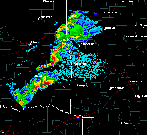 At 852 pm cdt, a severe thunderstorm capable of producing a tornado was located near yanush, moving east at 40 mph (radar indicated rotation). Hazards include tornado and golf ball size hail. Flying debris will be dangerous to those caught without shelter. mobile homes will be damaged or destroyed. damage to roofs, windows, and vehicles will occur. tree damage is likely. Locations in or near the path include, albion, bengal, yanush, tuskahoma, kiamichi, sardis,. At 852 pm cdt, a severe thunderstorm capable of producing a tornado was located near yanush, moving east at 40 mph (radar indicated rotation). Hazards include tornado and golf ball size hail. Flying debris will be dangerous to those caught without shelter. mobile homes will be damaged or destroyed. damage to roofs, windows, and vehicles will occur. tree damage is likely. Locations in or near the path include, albion, bengal, yanush, tuskahoma, kiamichi, sardis,.
|
| 3/23/2016 8:50 PM CDT | Quarter sized hail reported 6.1 miles SSE of Tuskahoma, OK |
| 3/23/2016 8:43 PM CDT |
 At 842 pm cdt, a severe thunderstorm capable of producing a tornado was located 6 miles west of yanush, moving northeast at 45 mph (radar indicated rotation). Hazards include tornado and tennis ball size hail. Flying debris will be dangerous to those caught without shelter. mobile homes will be damaged or destroyed. damage to roofs, windows, and vehicles will occur. tree damage is likely. Locations in or near the path include, clayton, albion, yanush, tuskahoma, kiamichi, bengal, sardis,. At 842 pm cdt, a severe thunderstorm capable of producing a tornado was located 6 miles west of yanush, moving northeast at 45 mph (radar indicated rotation). Hazards include tornado and tennis ball size hail. Flying debris will be dangerous to those caught without shelter. mobile homes will be damaged or destroyed. damage to roofs, windows, and vehicles will occur. tree damage is likely. Locations in or near the path include, clayton, albion, yanush, tuskahoma, kiamichi, bengal, sardis,.
|
| 3/23/2016 8:40 PM CDT |
 At 840 pm cdt, a severe thunderstorm capable of producing a tornado was located 7 miles northwest of clayton, moving northeast at 40 mph (radar indicated rotation). Hazards include tornado. Flying debris will be dangerous to those caught without shelter. mobile homes will be damaged or destroyed. damage to roofs, windows, and vehicles will occur. tree damage is likely. Locations in or near the path include, clayton, albion, yanush, tuskahoma, kiamichi, bengal, sardis,. At 840 pm cdt, a severe thunderstorm capable of producing a tornado was located 7 miles northwest of clayton, moving northeast at 40 mph (radar indicated rotation). Hazards include tornado. Flying debris will be dangerous to those caught without shelter. mobile homes will be damaged or destroyed. damage to roofs, windows, and vehicles will occur. tree damage is likely. Locations in or near the path include, clayton, albion, yanush, tuskahoma, kiamichi, bengal, sardis,.
|
| 11/17/2015 6:50 AM CST |
 At 649 am cst, severe thunderstorms were located along a line extending from near red oak to near nashoba to 8 miles southeast of cloudy, moving east at 25 mph (radar indicated). Hazards include 60 mph wind gusts. Damage to roofs. siding and trees will be possible. Locations in or near the path include, wilburton, talihina, wister, red oak, fanshawe, albion, yanush, kiamichi, bengal, octavia, whitesboro, damon, tuskahoma, muse, lake wister state park, talimena state park, nashoba, clayton lake state park, honobia, panola,. At 649 am cst, severe thunderstorms were located along a line extending from near red oak to near nashoba to 8 miles southeast of cloudy, moving east at 25 mph (radar indicated). Hazards include 60 mph wind gusts. Damage to roofs. siding and trees will be possible. Locations in or near the path include, wilburton, talihina, wister, red oak, fanshawe, albion, yanush, kiamichi, bengal, octavia, whitesboro, damon, tuskahoma, muse, lake wister state park, talimena state park, nashoba, clayton lake state park, honobia, panola,.
|
| 11/17/2015 6:29 AM CST |
 At 628 am cst, severe thunderstorms were located along a line extending from 2 miles south of damon to 6 miles southwest of raymond gary state park, moving east at 30 mph (radar indicated). Hazards include 60 mph wind gusts. Damage to roofs. siding and trees will be possible. Locations in or near the path include, wilburton, clayton, talihina, wister, red oak, fort towson, fanshawe, sawyer, albion, hugo lake state park, octavia, cloudy, tuskahoma, muse, talimena state park, nashoba, clayton lake state park, yanush, kiamichi, bengal,. At 628 am cst, severe thunderstorms were located along a line extending from 2 miles south of damon to 6 miles southwest of raymond gary state park, moving east at 30 mph (radar indicated). Hazards include 60 mph wind gusts. Damage to roofs. siding and trees will be possible. Locations in or near the path include, wilburton, clayton, talihina, wister, red oak, fort towson, fanshawe, sawyer, albion, hugo lake state park, octavia, cloudy, tuskahoma, muse, talimena state park, nashoba, clayton lake state park, yanush, kiamichi, bengal,.
|
| 11/17/2015 6:19 AM CST |
 At 618 am cst, severe thunderstorms were located along a line extending from 4 miles west of red oak to 2 miles northwest of snow, moving east at 40 mph (radar indicated). Hazards include 60 mph wind gusts. Damage to roofs. siding and trees will be possible. Locations in or near the path include, wilburton, clayton, red oak, albion, yanush, kiamichi, bengal, higgins, damon, tuskahoma, stanley, nashoba, clayton lake state park, sardis, panola,. At 618 am cst, severe thunderstorms were located along a line extending from 4 miles west of red oak to 2 miles northwest of snow, moving east at 40 mph (radar indicated). Hazards include 60 mph wind gusts. Damage to roofs. siding and trees will be possible. Locations in or near the path include, wilburton, clayton, red oak, albion, yanush, kiamichi, bengal, higgins, damon, tuskahoma, stanley, nashoba, clayton lake state park, sardis, panola,.
|
| 11/17/2015 6:00 AM CST |
 At 559 am cst, severe thunderstorms were located along a line extending from 3 miles southwest of wilburton to 3 miles northwest of kosoma, moving east at 25 mph (radar indicated). Hazards include 60 mph wind gusts. Damage to roofs. siding and trees will be possible. Locations in or near the path include, wilburton, clayton, red oak, albion, yanush, kiamichi, bengal, higgins, damon, dunbar, tuskahoma, stanley, nashoba, clayton lake state park, sardis, panola, gowen, eubanks,. At 559 am cst, severe thunderstorms were located along a line extending from 3 miles southwest of wilburton to 3 miles northwest of kosoma, moving east at 25 mph (radar indicated). Hazards include 60 mph wind gusts. Damage to roofs. siding and trees will be possible. Locations in or near the path include, wilburton, clayton, red oak, albion, yanush, kiamichi, bengal, higgins, damon, dunbar, tuskahoma, stanley, nashoba, clayton lake state park, sardis, panola, gowen, eubanks,.
|
| 11/17/2015 5:23 AM CST |
 At 523 am cst, severe thunderstorms were located along a line extending from 2 miles southeast of blanco to 3 miles south of daisy, moving east at 40 mph (radar indicated). Hazards include 60 mph wind gusts. Damage to roofs. siding and trees will be possible. Locations in or near the path include, wilburton, clayton, hartshorne, red oak, albion, yanush, blanco, kiamichi, bengal, higgins, damon, dunbar, tuskahoma, stanley, nashoba, clayton lake state park, haileyville, pittsburg, sardis, panola,. At 523 am cst, severe thunderstorms were located along a line extending from 2 miles southeast of blanco to 3 miles south of daisy, moving east at 40 mph (radar indicated). Hazards include 60 mph wind gusts. Damage to roofs. siding and trees will be possible. Locations in or near the path include, wilburton, clayton, hartshorne, red oak, albion, yanush, blanco, kiamichi, bengal, higgins, damon, dunbar, tuskahoma, stanley, nashoba, clayton lake state park, haileyville, pittsburg, sardis, panola,.
|
| 11/5/2015 5:28 PM CST |
 At 527 pm cst, severe thunderstorms were located along a line extending from 4 miles north of brushy to 3 miles southwest of bokoshe to 2 miles northwest of tuskahoma, moving east at 30 mph (radar indicated). Hazards include 60 mph wind gusts. Expect damage to roofs. siding and trees. locations in or near the path include, fort smith, van buren, sallisaw, poteau, cedarville, clayton, mountainburg, natural dam, greenwood, alma, barling, pocola, muldrow, heavener, roland, spiro, arkoma, panama, talihina, wister, this includes the following highways, interstate 40 in arkansas between mile markers 0 and 14. interstate 40 in oklahoma between mile markers 303 and 328. a tornado watch remains in effect until 800 pm cst for eastern oklahoma. A tornado watch also remains in effect until 900 pm cst for northwestern arkansas. At 527 pm cst, severe thunderstorms were located along a line extending from 4 miles north of brushy to 3 miles southwest of bokoshe to 2 miles northwest of tuskahoma, moving east at 30 mph (radar indicated). Hazards include 60 mph wind gusts. Expect damage to roofs. siding and trees. locations in or near the path include, fort smith, van buren, sallisaw, poteau, cedarville, clayton, mountainburg, natural dam, greenwood, alma, barling, pocola, muldrow, heavener, roland, spiro, arkoma, panama, talihina, wister, this includes the following highways, interstate 40 in arkansas between mile markers 0 and 14. interstate 40 in oklahoma between mile markers 303 and 328. a tornado watch remains in effect until 800 pm cst for eastern oklahoma. A tornado watch also remains in effect until 900 pm cst for northwestern arkansas.
|
| 11/5/2015 5:15 PM CST |
 At 514 pm cst, severe thunderstorms were located along a line extending from 3 miles northwest of bunch to 3 miles west of mccurtain to 6 miles north of stanley, moving northeast at 50 mph (radar indicated). Hazards include 60 mph wind gusts. Expect damage to roofs. siding and trees. locations in or near the path include, sallisaw, wilburton, stigler, clayton, muldrow, spiro, vian, panama, talihina, quinton, gore, webbers falls, keota, red oak, mccurtain, bokoshe, fanshawe, whitefield, gans, kinta, this includes interstate 40 in oklahoma between mile markers 285 and 321. A tornado watch remains in effect until 800 pm cst for southeastern oklahoma. At 514 pm cst, severe thunderstorms were located along a line extending from 3 miles northwest of bunch to 3 miles west of mccurtain to 6 miles north of stanley, moving northeast at 50 mph (radar indicated). Hazards include 60 mph wind gusts. Expect damage to roofs. siding and trees. locations in or near the path include, sallisaw, wilburton, stigler, clayton, muldrow, spiro, vian, panama, talihina, quinton, gore, webbers falls, keota, red oak, mccurtain, bokoshe, fanshawe, whitefield, gans, kinta, this includes interstate 40 in oklahoma between mile markers 285 and 321. A tornado watch remains in effect until 800 pm cst for southeastern oklahoma.
|
| 11/5/2015 4:56 PM CST |
 The national weather service in tulsa has issued a * severe thunderstorm warning for. sequoyah county in east central oklahoma. east central mcintosh county in southeastern oklahoma. eastern pittsburg county in southeastern oklahoma. Western le flore county in southeastern oklahoma. The national weather service in tulsa has issued a * severe thunderstorm warning for. sequoyah county in east central oklahoma. east central mcintosh county in southeastern oklahoma. eastern pittsburg county in southeastern oklahoma. Western le flore county in southeastern oklahoma.
|
| 7/8/2015 3:11 PM CDT |
 At 310 pm cdt, severe thunderstorms were located along a line extending from 3 miles north of albion to 10 miles southeast of nashoba, moving northeast at 50 mph (radar indicated). Hazards include 60 mph wind gusts. Expect damage to roofs. siding and trees. Locations impacted include, clayton, talihina, fanshawe, albion, kiamichi, bengal, whitesboro, cloudy, tuskahoma, talimena state park, nashoba, clayton lake state park, corinne, honobia and sobol. At 310 pm cdt, severe thunderstorms were located along a line extending from 3 miles north of albion to 10 miles southeast of nashoba, moving northeast at 50 mph (radar indicated). Hazards include 60 mph wind gusts. Expect damage to roofs. siding and trees. Locations impacted include, clayton, talihina, fanshawe, albion, kiamichi, bengal, whitesboro, cloudy, tuskahoma, talimena state park, nashoba, clayton lake state park, corinne, honobia and sobol.
|
| 7/8/2015 2:55 PM CDT |
 At 255 pm cdt, severe thunderstorms were located along a line extending from near tuskahoma to near cloudy, moving northeast at 50 mph (radar indicated). Hazards include 60 mph wind gusts. Expect damage to roofs. Siding and trees. At 255 pm cdt, severe thunderstorms were located along a line extending from near tuskahoma to near cloudy, moving northeast at 50 mph (radar indicated). Hazards include 60 mph wind gusts. Expect damage to roofs. Siding and trees.
|
| 7/3/2015 7:26 PM CDT |
 At 726 pm cdt, severe thunderstorms were located along a line extending from 2 miles south of red oak to 3 miles northwest of kiamichi to 8 miles northwest of stanley to near kiowa, moving southeast at 30 mph (radar indicated). Hazards include 60 mph wind gusts. Expect damage to roofs. siding and trees. Locations impacted include, mcalester, wilburton, clayton, hartshorne, savanna, red oak, alderson, yanush, blanco, kiamichi, haywood, higgins, damon, dunbar, tuskahoma, stanley, nashoba, clayton lake state park, haileyville and pittsburg. At 726 pm cdt, severe thunderstorms were located along a line extending from 2 miles south of red oak to 3 miles northwest of kiamichi to 8 miles northwest of stanley to near kiowa, moving southeast at 30 mph (radar indicated). Hazards include 60 mph wind gusts. Expect damage to roofs. siding and trees. Locations impacted include, mcalester, wilburton, clayton, hartshorne, savanna, red oak, alderson, yanush, blanco, kiamichi, haywood, higgins, damon, dunbar, tuskahoma, stanley, nashoba, clayton lake state park, haileyville and pittsburg.
|
| 7/3/2015 7:04 PM CDT |
 At 704 pm cdt, severe thunderstorms were located along a line extending from 3 miles southeast of wilburton to 5 miles west of yanush to 2 miles northwest of blanco, moving southeast at 30 mph (radar indicated). Hazards include 60 mph wind gusts and nickel size hail. Expect damage to roofs. siding and trees. Locations impacted include, mcalester, wilburton, clayton, hartshorne, krebs, savanna, red oak, alderson, blanco, haywood, higgins, tuskahoma, stanley, nashoba, clayton lake state park, robbers cave state park, yanush, kiamichi, damon and dunbar. At 704 pm cdt, severe thunderstorms were located along a line extending from 3 miles southeast of wilburton to 5 miles west of yanush to 2 miles northwest of blanco, moving southeast at 30 mph (radar indicated). Hazards include 60 mph wind gusts and nickel size hail. Expect damage to roofs. siding and trees. Locations impacted include, mcalester, wilburton, clayton, hartshorne, krebs, savanna, red oak, alderson, blanco, haywood, higgins, tuskahoma, stanley, nashoba, clayton lake state park, robbers cave state park, yanush, kiamichi, damon and dunbar.
|
| 7/3/2015 6:45 PM CDT |
 At 645 pm cdt, a severe thunderstorm was located over hartshorne, moving southeast at 30 mph (radar indicated). Hazards include 60 mph wind gusts. Expect damage to roofs. Siding and trees. At 645 pm cdt, a severe thunderstorm was located over hartshorne, moving southeast at 30 mph (radar indicated). Hazards include 60 mph wind gusts. Expect damage to roofs. Siding and trees.
|
| 6/29/2015 7:48 PM CDT |
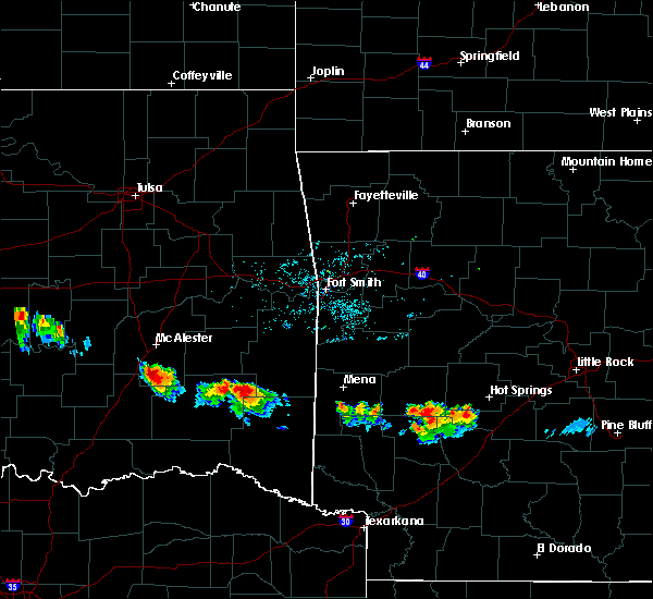 At 748 pm cdt, a severe thunderstorm was located 5 miles southeast of kiamichi, moving west at 15 mph (radar indicated). Hazards include 60 mph wind gusts and nickel size hail. Expect damage to roofs. Siding and trees. At 748 pm cdt, a severe thunderstorm was located 5 miles southeast of kiamichi, moving west at 15 mph (radar indicated). Hazards include 60 mph wind gusts and nickel size hail. Expect damage to roofs. Siding and trees.
|
| 5/25/2015 5:06 PM CDT | At 503 pm cdt, severe thunderstorms were located along a line extending from 5 miles southwest of robbers cave state park to yanush to 7 miles east of nashoba, and moving northeast at 45 mph (radar indicated). Hazards include 60 mph wind gusts and quarter size hail. Hail damage to vehicles is expected. expect wind damage to roofs, siding and trees. Locations in or near the path include, wilburton, albion, robbers cave state park, panola, talihina, bengal, red oak, talimena state park and whitesboro. |
| 5/25/2015 4:52 PM CDT | At 450 pm cdt, severe thunderstorms were located along a line extending from 5 miles west of hartshorne to yanush to nashoba, and moving northeast at 45 mph (radar indicated). Hazards include 60 mph wind gusts and quarter size hail. Hail damage to vehicles is expected. expect wind damage to roofs, siding and trees. Locations in or near the path include, tuskahoma, bache, yanush, hartshorne, haileyville, dow, higgins, kiamichi, gowen, albion, damon, wilburton, talihina, bengal, panola, robbers cave state park, talimena state park, red oak and whitesboro. |
| 5/25/2015 4:52 PM CDT | At 450 pm cdt, a severe thunderstorm with strong low level rotation that could produce an extremely dangerous tornado was located near clayton lake state park, and moving north at 45 mph. this is a particularly dangerous situation (radar indicated rotation). Hazards include damaging tornado. You are in a life threatening situation. flying debris will be deadly to those caught without shelter. mobile homes will be destroyed. considerable damage to homes, businesses and vehicles is likely and complete destruction possible. Locations in or near the path include, tuskahoma, kiamichi, talihina, bengal and red oak. |
| 5/25/2015 4:21 PM CDT | At 419 pm cdt, a severe thunderstorm was located 5 miles south of snow, and moving northeast at 35 mph (radar indicated). Hazards include 60 mph wind gusts and quarter size hail. Hail damage to vehicles is expected. expect wind damage to roofs, siding and trees. Locations in or near the path include, snow, nashoba, clayton lake state park, clayton, tuskahoma, albion and kiamichi. |
| 5/17/2015 2:52 AM CDT | At 250 am cdt, severe thunderstorms were located along a line extending from 6 miles northwest of bengal to nashoba to sawyer, and moving east at 50 mph (radar indicated). Hazards include 60 mph wind gusts and penny size hail. Expect damage to roofs. siding and trees. locations in or near the path include, albion, fort towson, bengal, raymond gary state park and swink , 0. 75in. |
| 5/17/2015 2:39 AM CDT | At 238 am cdt, severe thunderstorms were located along a line extending from damon to snow to 6 miles south of goodland, and moving east at 50 mph (radar indicated). Hazards include 60 mph wind gusts and penny size hail. Expect damage to roofs. siding and trees. locations in or near the path include, tuskahoma, fallon, oleta, hugo lake state park, sawyer, cloudy, nashoba, corinne, kiamichi, frogville, sobol, huskey, fort towson, raymond gary state park, albion, bengal and swink , 0. 75in. |
| 5/17/2015 2:02 AM CDT | At 200 am cdt, severe thunderstorms were located along a line extending from kiowa to 9 miles southeast of lane to 14 miles southeast of albany, and moving east at 50 mph (radar indicated). Hazards include 60 mph wind gusts and penny size hail. Expect damage to roofs. siding and trees. locations in or near the path include, boswell, unger, moyers, soper, kosoma, kellond, antlers, eubanks, kent, dunbar, gay, finley, speer, dela, stanley, goodland, hugo, grant, snow, messer, ord, sardis, rattan, apple, clayton, clayton lake state park, fallon, oleta, yanush, hugo lake state park, sawyer, tuskahoma, cloudy, corinne, frogville, nashoba, huskey, kiamichi, fort towson, sobol, raymond gary state park, albion, swink and bengal. 0. 75in. |
| 5/10/2015 6:46 PM CDT | At 644 pm cdt, a severe thunderstorm capable of producing a tornado was located 6 miles west of stanley, and moving northeast at 35 mph (radar indicated rotation). Hazards include tornado and ping pong ball size hail. Flying debris will be dangerous to those caught without shelter. mobile homes will be damaged or destroyed. damage to roofs, windows and vehicles will occur. tree damage is likely. Locations in or near the path include, stanley and sardis , radar indicated. |
| 5/10/2015 6:36 PM CDT | At 634 pm cdt, a severe thunderstorm capable of producing a tornado was located near dunbar, and moving northeast at 40 mph (radar indicated rotation). Hazards include tornado and ping pong ball size hail. Flying debris will be dangerous to those caught without shelter. mobile homes will be damaged or destroyed. damage to roofs, windows and vehicles will occur. tree damage is likely. locations in or near the path include, stanley, clayton and sardis. Radar indicated. |
| 5/10/2015 10:05 AM CDT | At 1001 am cdt, severe thunderstorms were located along a line extending from webbers falls to mccurtain to whitesboro to 16 miles southeast of cloudy, and moving east at 40 mph (radar indicated). Hazards include 60 mph wind gusts and penny size hail. Expect damage to roofs. siding and trees. locations in or near the path include, gore, keota, tamaha, milton, lake wister state park, bokoshe, vian, muse, box, wister, mc key, hodgen, octavia, cowlington, panama, howe, shady point, big cedar, heavener, poteau, sallisaw, heavener runestone state park, brushy lake state park, scullyville, spiro, cameron, marble city and gans this includes interstate 40 between mile markers 279 and 317. 0. 75in. |
| 5/10/2015 9:54 AM CDT | At 951 am cdt, severe thunderstorms were located along a line extending from warner to lequire to 5 miles east of albion to 12 miles east of oleta, and moving east at 40 mph (radar indicated). Hazards include 60 mph wind gusts and penny size hail. Expect damage to roofs. siding and trees. locations in or near the path include, talimena state park, honobia, mccurtain, whitesboro, kanima, fanshawe, webbers falls, gore, summerfield, keota, tamaha, milton, muse, vian, lake wister state park, box, bokoshe, mc key, wister, octavia, cowlington, big cedar, hodgen, sallisaw, panama, howe, shady point, heavener runestone state park, brushy lake state park, scullyville, spiro, cameron, heavener, poteau, marble city and gans this includes interstate 40 between mile markers 277 and 317. 0. 75in. |
| 5/10/2015 9:25 AM CDT | At 922 am cdt, severe thunderstorms were located along a line extending from eufaula to robbers cave state park to clayton lake state park to messer, and moving northeast at 50 mph (radar indicated). Hazards include 60 mph wind gusts and penny size hail. Expect damage to roofs. siding and trees. locations in or near the path include, hugo lake state park, oleta, wilburton, quinton, huskey, kiamichi, cloudy, enterprise, nashoba, raymond gary state park, fort towson, corinne, lewisville, panola, albion, kinta, swink, sobol, whitefield, talihina, bengal, red oak, briartown, porum, lequire, talimena state park, stigler, whitesboro, honobia, fanshawe, kanima, mccurtain, webbers falls, summerfield, gore, keota, tamaha, milton, muse, lake wister state park, vian, wister, bokoshe, box, hodgen, octavia, mc key, cowlington, howe, big cedar, heavener, panama, shady point, sallisaw, brushy lake state park, heavener runestone state park, poteau, marble city, gans, spiro, scullyville and cameron. this includes interstate 40 between mile markers 277 and 317. 0. 75in. |
| 4/19/2015 5:31 PM CDT | A severe thunderstorm warning remains in effect for pushmataha county until 600 pm cdt. at 530 pm cdt. a severe thunderstorm was located near stanley. and moving east at 40 mph. hazard. 60 mph wind gusts and nickel size hail. source. Radar indicated. |
| 4/19/2015 5:12 PM CDT | The national weather service in tulsa has issued a * severe thunderstorm warning for. pushmataha county in southeast oklahoma. until 600 pm cdt * at 510 pm cdt. a severe thunderstorm was located near daisy. And moving southeast at 45 mph. |
| 3/26/2015 12:20 AM CDT | A severe thunderstorm warning remains in effect for south central latimer and central pushmataha counties until 1230 am cdt. at 1218 am cdt. severe thunderstorms were located along a line extending from kiamichi to 5 miles northeast of cloudy. and moving east at 30 mph. hazard. 60 mph wind gusts and quarter size hail. |
| 3/26/2015 12:12 AM CDT | A severe thunderstorm warning remains in effect for south central latimer and central pushmataha counties until 1230 am cdt. at 1210 am cdt. severe thunderstorms were located along a line extending from tuskahoma to cloudy. and moving east at 40 mph. hazard. 60 mph wind gusts and quarter size hail. source. Radar indicated. |
| 3/25/2015 11:56 PM CDT | A severe thunderstorm warning remains in effect for southwestern latimer. central pushmataha and extreme southeastern pittsburg counties until 1230 am cdt. at 1154 pm cdt. severe thunderstorms were located along a line extending from 5 miles west of clayton to snow. And moving east at 40 mph. |
| 3/25/2015 11:44 PM CDT | The national weather service in tulsa has issued a * severe thunderstorm warning for. southwestern latimer county in southeast oklahoma. southeastern pittsburg county in southeast oklahoma. central pushmataha county in southeast oklahoma. Until 1230 am cdt. |
| 3/25/2015 11:20 PM CDT | A severe thunderstorm warning remains in effect for central pushmataha and extreme south central pittsburg counties until 1145 pm cdt. at 1118 pm cdt. severe thunderstorms were located along a line extending from 5 miles northwest of daisy to 9 miles west of moyers. And moving east at 40 mph. |
| 3/25/2015 11:07 PM CDT | The national weather service in tulsa has issued a * severe thunderstorm warning for. extreme south central pittsburg county in southeast oklahoma. central pushmataha county in southeast oklahoma. until 1145 pm cdt * at 1104 pm cdt. A severe thunderstorm was located 7 miles east of. |
| 10/13/2012 9:50 PM CDT | Several trees down in pushmataha county OK, 17.9 miles NNW of Tuskahoma, OK |
| 10/13/2012 9:50 PM CDT | Several large trees down in pushmataha county OK, 19.1 miles NNW of Tuskahoma, OK |
| 3/8/2012 3:38 PM CST | Quarter sized hail reported 6.1 miles SSE of Tuskahoma, OK |
| 1/1/0001 12:00 AM | Tennis Ball sized hail reported 10.8 miles NNW of Tuskahoma, OK, severely damaged body of car. broke out windshield. |
| 1/1/0001 12:00 AM | Trees down and damage to the porch of a house in yanush. time estimated based on rada in latimer county OK, 6.1 miles SSE of Tuskahoma, OK |
| 1/1/0001 12:00 AM | Tennis Ball sized hail reported 13.3 miles WSW of Tuskahoma, OK |
| 1/1/0001 12:00 AM | Quarter sized hail reported 10.8 miles NNW of Tuskahoma, OK |
| 1/1/0001 12:00 AM | 2 homes with roof damage and significant tree damage on nolia loop road east of nashoba. possible tornad in pushmataha county OK, 12 miles NNW of Tuskahoma, OK |
| 1/1/0001 12:00 AM | Large trees down on us 271 and 4 star road. possible tornad in pushmataha county OK, 2.6 miles SW of Tuskahoma, OK |
| 1/1/0001 12:00 AM | Golf Ball sized hail reported 10.8 miles NNW of Tuskahoma, OK |
| 1/1/0001 12:00 AM | Trees down. possible tornad in latimer county OK, 6.1 miles SSE of Tuskahoma, OK |
Hail Maps for Tuskahoma, OK
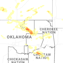

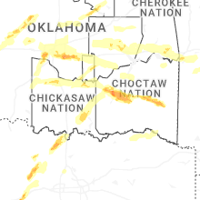
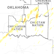


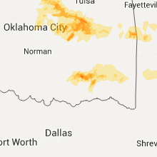


Connect with Interactive Hail Maps