

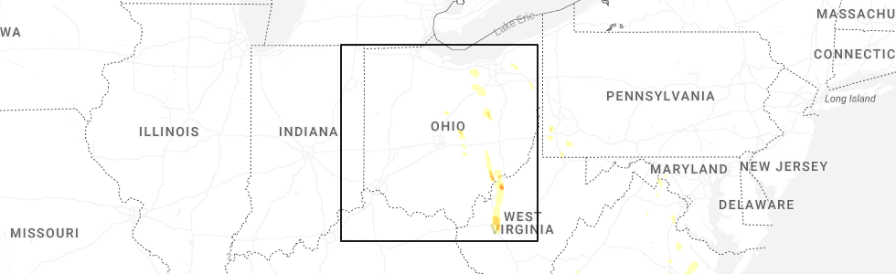
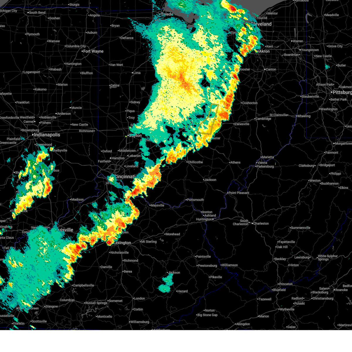
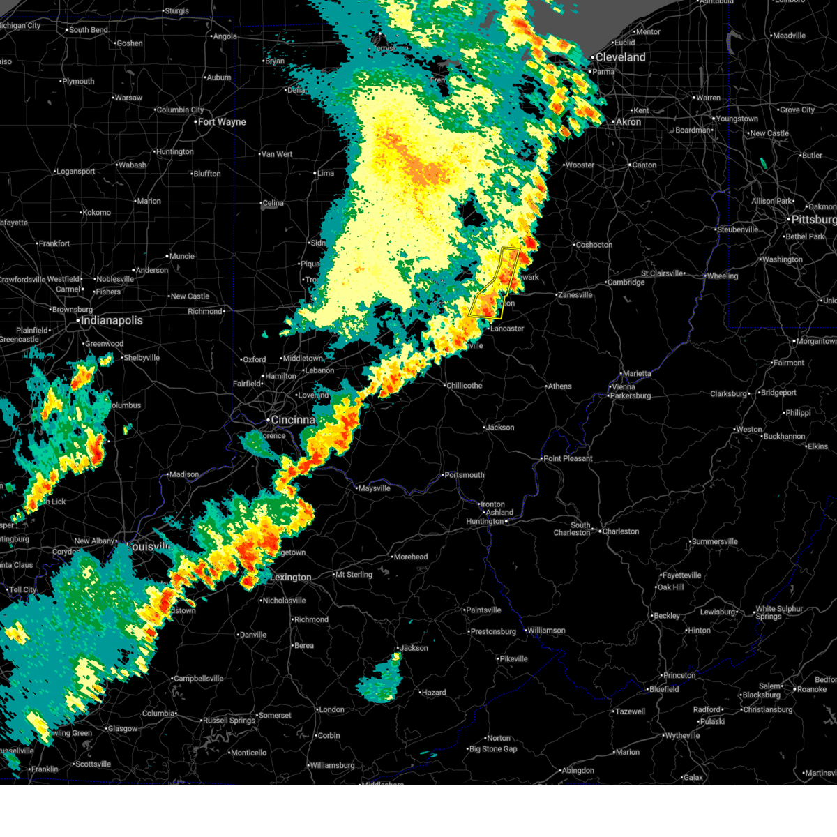
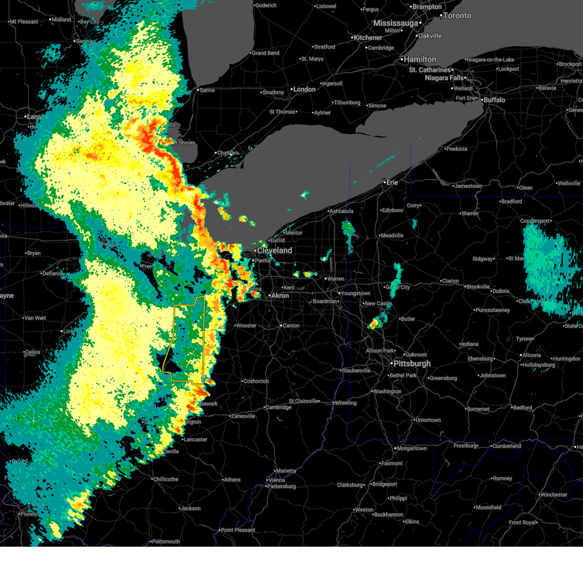
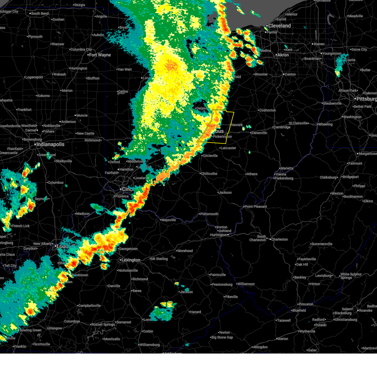
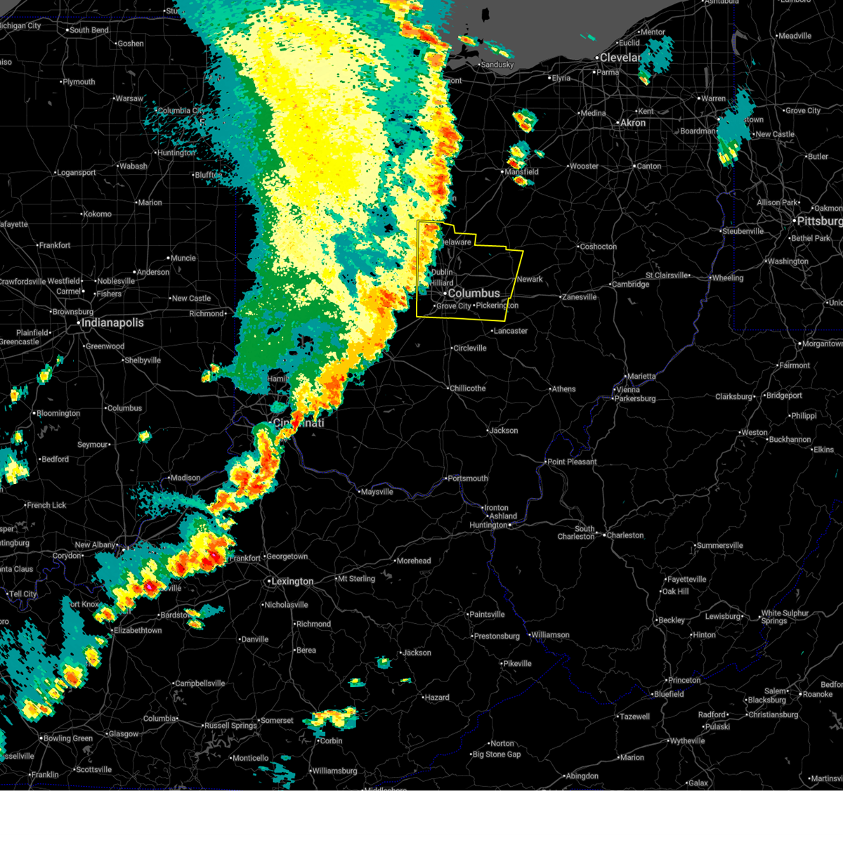
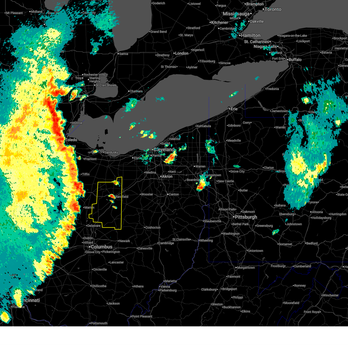
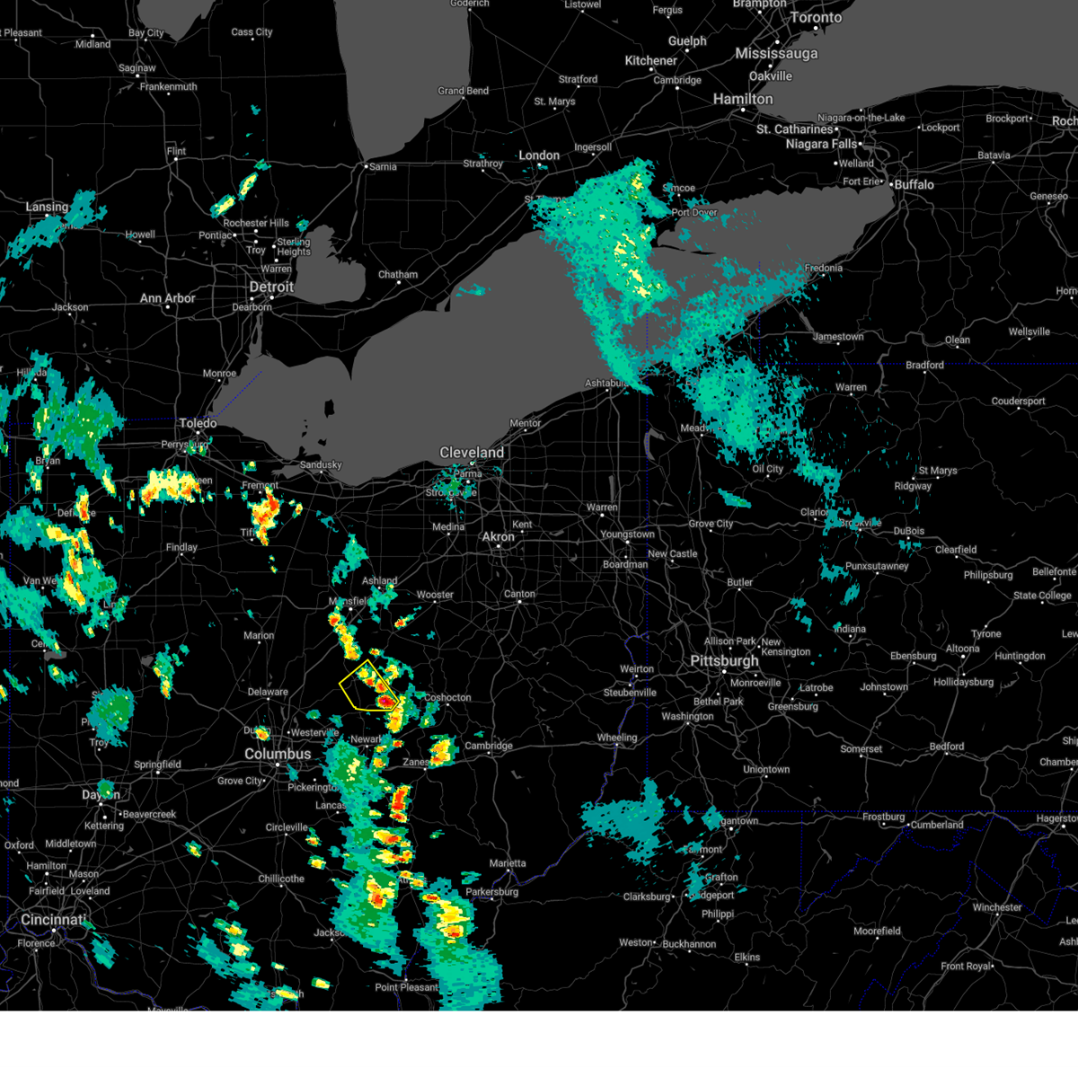
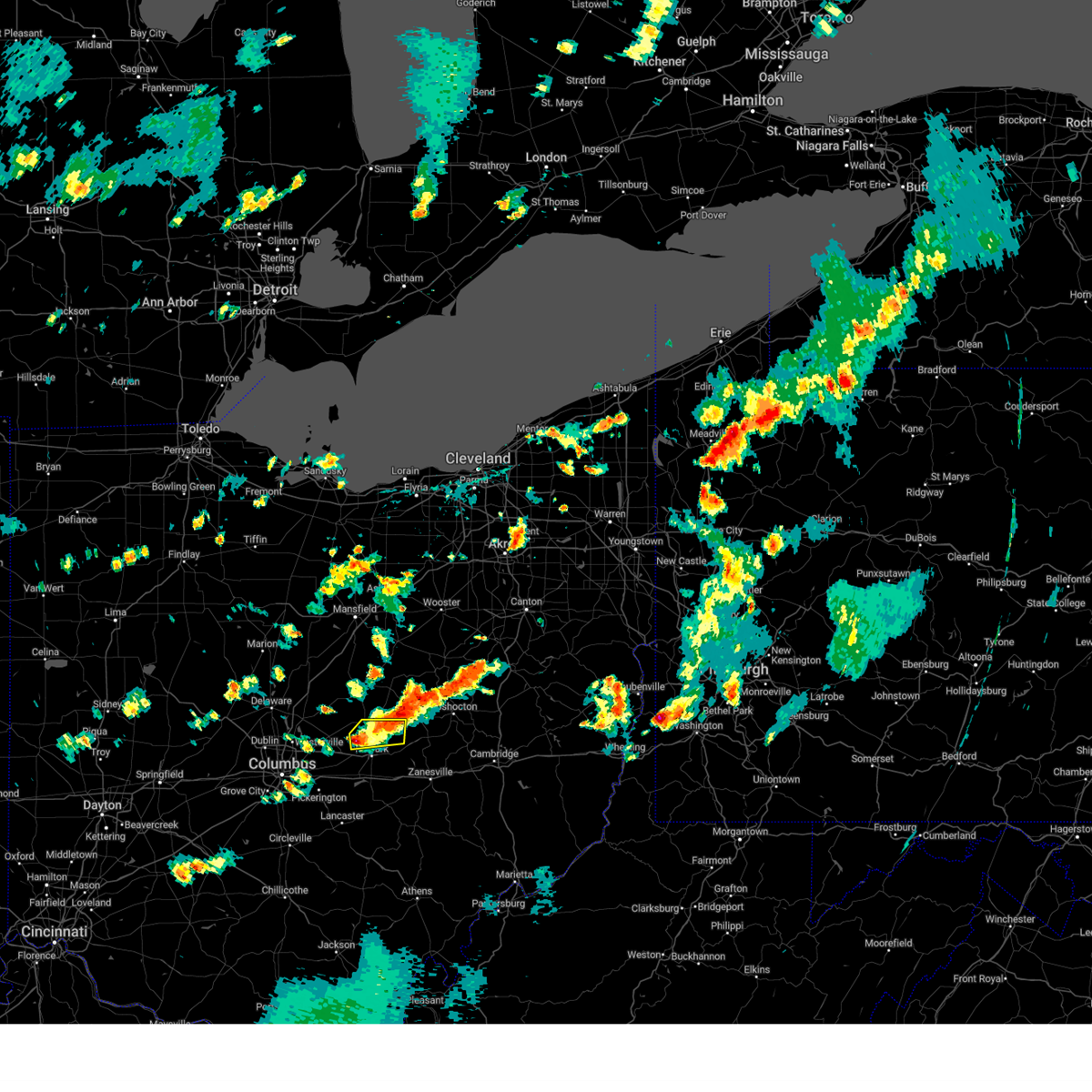
Hail Map for Utica, OH
The Utica, OH area has had 3 reports of on-the-ground hail by trained spotters, and has been under severe weather warnings 70 times during the past 12 months. Doppler radar has detected hail at or near Utica, OH on 29 occasions, including 3 occasions during the past year.
| Name: | Utica, OH |
| Where Located: | 35 miles ENE of Columbus, OH |
| Map: | Google Map for Utica, OH |
| Population: | 2132 |
| Housing Units: | 937 |
| More Info: | Search Google for Utica, OH |
0
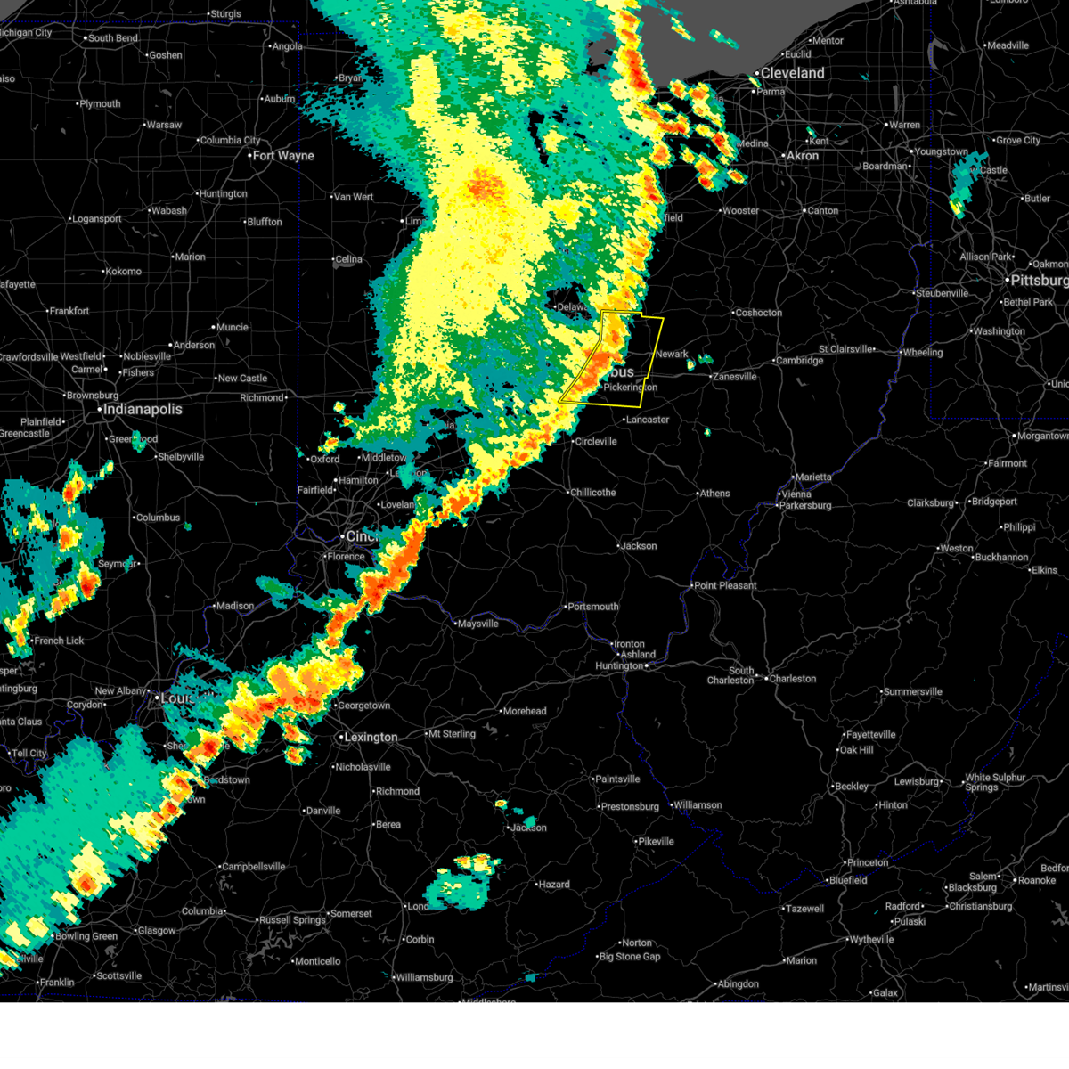
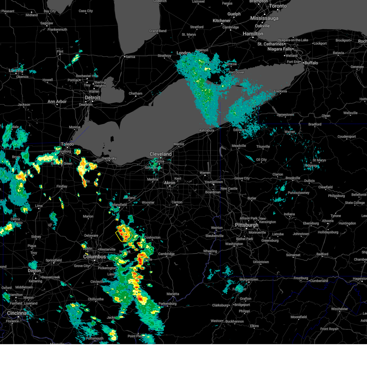
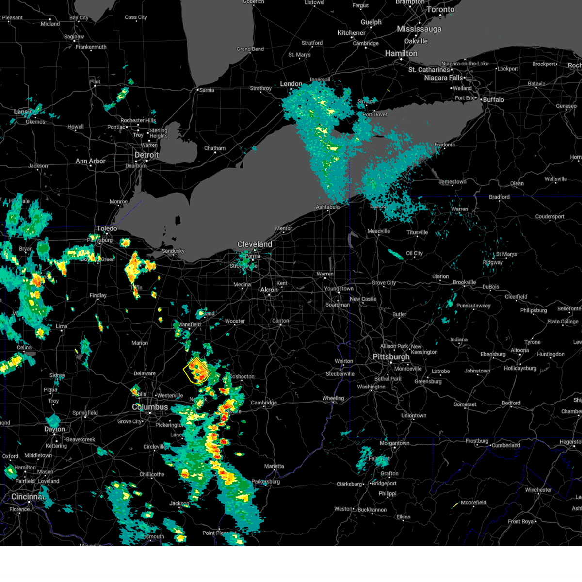
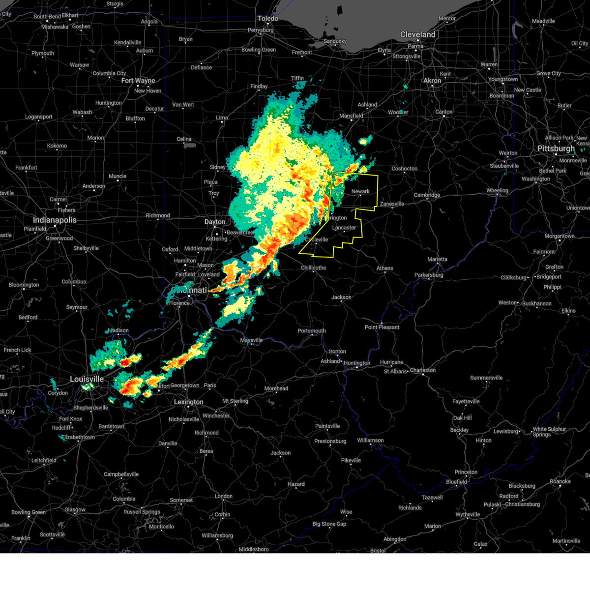
The Top Recent Hail Date for Utica, OH is Monday, May 5, 2025 (16th out of 29)
Hail and Wind Damage Spotted near Utica, OH
| Date / Time | Report Details |
|---|---|
| 6/26/2025 4:21 PM EDT |
 The storms which prompted the warning have weakened below severe limits, and no longer pose an immediate threat to life or property. therefore, the warning will be allowed to expire. however, heavy rain is still possible with these thunderstorms. The storms which prompted the warning have weakened below severe limits, and no longer pose an immediate threat to life or property. therefore, the warning will be allowed to expire. however, heavy rain is still possible with these thunderstorms.
|
| 6/26/2025 4:13 PM EDT |
 the severe thunderstorm warning has been cancelled and is no longer in effect the severe thunderstorm warning has been cancelled and is no longer in effect
|
| 6/26/2025 4:13 PM EDT |
 At 413 pm edt, severe thunderstorms were located along a line extending from near fredericktown to near centerburg, moving southeast at 20 mph (radar indicated). Hazards include 60 mph wind gusts. Expect damage to trees and power lines. Locations impacted include, mount vernon, fredericktown, gambier, utica, centerburg, danville, waterford, and gann. At 413 pm edt, severe thunderstorms were located along a line extending from near fredericktown to near centerburg, moving southeast at 20 mph (radar indicated). Hazards include 60 mph wind gusts. Expect damage to trees and power lines. Locations impacted include, mount vernon, fredericktown, gambier, utica, centerburg, danville, waterford, and gann.
|
| 6/26/2025 3:47 PM EDT |
 Svrcle the national weather service in cleveland has issued a * severe thunderstorm warning for, southeastern morrow county in north central ohio, knox county in north central ohio, * until 430 pm edt. * at 347 pm edt, severe thunderstorms were located along a line extending from near chesterville to sunbury, moving southeast at 20 mph (radar indicated). Hazards include 60 mph wind gusts and penny size hail. expect damage to trees and power lines Svrcle the national weather service in cleveland has issued a * severe thunderstorm warning for, southeastern morrow county in north central ohio, knox county in north central ohio, * until 430 pm edt. * at 347 pm edt, severe thunderstorms were located along a line extending from near chesterville to sunbury, moving southeast at 20 mph (radar indicated). Hazards include 60 mph wind gusts and penny size hail. expect damage to trees and power lines
|
| 6/18/2025 9:12 PM EDT |
 The storms which prompted the warning have moved out of the area. therefore, the warning will be allowed to expire. however, gusty winds are still possible with these thunderstorms. a severe thunderstorm watch remains in effect until 1000 pm edt for central ohio. please report previous wind damage or hail to the national weather service by going to our website at weather.gov/iln and submitting your report via social media. The storms which prompted the warning have moved out of the area. therefore, the warning will be allowed to expire. however, gusty winds are still possible with these thunderstorms. a severe thunderstorm watch remains in effect until 1000 pm edt for central ohio. please report previous wind damage or hail to the national weather service by going to our website at weather.gov/iln and submitting your report via social media.
|
| 6/18/2025 8:56 PM EDT |
 the severe thunderstorm warning has been cancelled and is no longer in effect the severe thunderstorm warning has been cancelled and is no longer in effect
|
| 6/18/2025 8:56 PM EDT |
 At 856 pm edt, severe thunderstorms were located along a line extending from near mount vernon to 6 miles south of canal winchester, moving east at 30 mph (radar indicated). Hazards include 60 mph wind gusts. Expect damage to trees and power lines. locations impacted include, newark, heath, granville, baltimore, buckeye lake, hebron, utica, millersport, pleasantville, fairfield beach, granville south, harbor hills, etna, thurston, kirkersville, carroll, st. louisville, state route 158 at state route 204, and interstate 70 at state route 37. This includes i-70 in ohio between mile markers 119 and 131. At 856 pm edt, severe thunderstorms were located along a line extending from near mount vernon to 6 miles south of canal winchester, moving east at 30 mph (radar indicated). Hazards include 60 mph wind gusts. Expect damage to trees and power lines. locations impacted include, newark, heath, granville, baltimore, buckeye lake, hebron, utica, millersport, pleasantville, fairfield beach, granville south, harbor hills, etna, thurston, kirkersville, carroll, st. louisville, state route 158 at state route 204, and interstate 70 at state route 37. This includes i-70 in ohio between mile markers 119 and 131.
|
| 6/18/2025 8:55 PM EDT |
 The storms which prompted the warning have moved out of the area. therefore, the warning will be allowed to expire. however, gusty winds and heavy rain are still possible with these thunderstorms. a severe thunderstorm watch remains in effect until 1000 pm edt for north central ohio. The storms which prompted the warning have moved out of the area. therefore, the warning will be allowed to expire. however, gusty winds and heavy rain are still possible with these thunderstorms. a severe thunderstorm watch remains in effect until 1000 pm edt for north central ohio.
|
| 6/18/2025 8:39 PM EDT |
 At 839 pm edt, severe thunderstorms were located along a line extending from sparta to near ashville, moving east at 30 mph (radar indicated). Hazards include 60 mph wind gusts. Expect damage to trees and power lines. locations impacted include, columbus, newark, reynoldsburg, grove city, gahanna, pickerington, heath, granville, pataskala, canal winchester, groveport, johnstown, baltimore, buckeye lake, hebron, utica, millersport, pleasantville, granville south, and fairfield beach. This includes i-70 in ohio between mile markers 106 and 131. At 839 pm edt, severe thunderstorms were located along a line extending from sparta to near ashville, moving east at 30 mph (radar indicated). Hazards include 60 mph wind gusts. Expect damage to trees and power lines. locations impacted include, columbus, newark, reynoldsburg, grove city, gahanna, pickerington, heath, granville, pataskala, canal winchester, groveport, johnstown, baltimore, buckeye lake, hebron, utica, millersport, pleasantville, granville south, and fairfield beach. This includes i-70 in ohio between mile markers 106 and 131.
|
| 6/18/2025 8:39 PM EDT |
 the severe thunderstorm warning has been cancelled and is no longer in effect the severe thunderstorm warning has been cancelled and is no longer in effect
|
| 6/18/2025 8:31 PM EDT | At 831 pm edt, severe thunderstorms were located along a line extending from near sparta to near ashville, moving east at 30 mph (radar indicated). Hazards include 60 mph wind gusts. Expect damage to trees and power lines. locations impacted include, columbus, newark, westerville, reynoldsburg, grove city, gahanna, pickerington, bexley, heath, granville, pataskala, canal winchester, groveport, johnstown, sunbury, baltimore, buckeye lake, hebron, utica, and minerva park. this includes the following interstates, i-70 in ohio between mile markers 101 and 131. I-71 in ohio between mile markers 108 and 109. |
| 6/18/2025 8:31 PM EDT | the severe thunderstorm warning has been cancelled and is no longer in effect |
| 6/18/2025 8:27 PM EDT | the severe thunderstorm warning has been cancelled and is no longer in effect |
| 6/18/2025 8:27 PM EDT | At 827 pm edt, severe thunderstorms were located along a line extending from 6 miles northeast of shelby to 7 miles east of mansfield to near fredericktown, moving east at 55 mph (radar indicated). Hazards include 60 mph wind gusts. Expect damage to trees and power lines. Locations impacted include, mansfield, ashland, mount vernon, shelby, ontario, lexington, fredericktown, gambier, utica, bellville, plymouth, centerburg, savannah, chesterville, sparta, waterford, butler, lucas, bailey lakes, and marengo. |
| 6/18/2025 8:22 PM EDT |
 At 822 pm edt, severe thunderstorms were located along a line extending from near ashley to near grove city, moving east at 30 mph (radar indicated). Hazards include 60 mph wind gusts. Expect damage to trees and power lines. locations impacted include, columbus, newark, dublin, westerville, reynoldsburg, grove city, upper arlington, gahanna, hilliard, pickerington, worthington, bexley, heath, granville, pataskala, powell, canal winchester, groveport, johnstown, and sunbury. this includes the following interstates, i-70 in ohio between mile markers 87 and 131. I-71 in ohio between mile markers 91 and 138. At 822 pm edt, severe thunderstorms were located along a line extending from near ashley to near grove city, moving east at 30 mph (radar indicated). Hazards include 60 mph wind gusts. Expect damage to trees and power lines. locations impacted include, columbus, newark, dublin, westerville, reynoldsburg, grove city, upper arlington, gahanna, hilliard, pickerington, worthington, bexley, heath, granville, pataskala, powell, canal winchester, groveport, johnstown, and sunbury. this includes the following interstates, i-70 in ohio between mile markers 87 and 131. I-71 in ohio between mile markers 91 and 138.
|
| 6/18/2025 8:22 PM EDT |
 the severe thunderstorm warning has been cancelled and is no longer in effect the severe thunderstorm warning has been cancelled and is no longer in effect
|
| 6/18/2025 8:13 PM EDT |
 At 812 pm edt, severe thunderstorms were located along a line extending from ashley to 6 miles southwest of grove city, moving east at 30 mph (a 56 mph wind gust was reported at columbus ohio state university aiport at 759 pm). Hazards include 60 mph wind gusts. Expect damage to trees and power lines. locations impacted include, columbus, newark, dublin, westerville, reynoldsburg, grove city, delaware, upper arlington, gahanna, hilliard, pickerington, worthington, bexley, heath, granville, pataskala, powell, canal winchester, groveport, and johnstown. this includes the following interstates, i-70 in ohio between mile markers 87 and 131. I-71 in ohio between mile markers 91 and 138. At 812 pm edt, severe thunderstorms were located along a line extending from ashley to 6 miles southwest of grove city, moving east at 30 mph (a 56 mph wind gust was reported at columbus ohio state university aiport at 759 pm). Hazards include 60 mph wind gusts. Expect damage to trees and power lines. locations impacted include, columbus, newark, dublin, westerville, reynoldsburg, grove city, delaware, upper arlington, gahanna, hilliard, pickerington, worthington, bexley, heath, granville, pataskala, powell, canal winchester, groveport, and johnstown. this includes the following interstates, i-70 in ohio between mile markers 87 and 131. I-71 in ohio between mile markers 91 and 138.
|
| 6/18/2025 7:55 PM EDT |
 Svriln the national weather service in wilmington has issued a * severe thunderstorm warning for, franklin county in central ohio, northwestern fairfield county in central ohio, delaware county in central ohio, licking county in central ohio, southeastern union county in central ohio, northeastern madison county in central ohio, * until 915 pm edt. * at 755 pm edt, severe thunderstorms were located along a line extending from near waldo to 7 miles north of mount sterling, moving east at 30 mph (radar indicated). Hazards include 60 mph wind gusts. expect damage to trees and power lines Svriln the national weather service in wilmington has issued a * severe thunderstorm warning for, franklin county in central ohio, northwestern fairfield county in central ohio, delaware county in central ohio, licking county in central ohio, southeastern union county in central ohio, northeastern madison county in central ohio, * until 915 pm edt. * at 755 pm edt, severe thunderstorms were located along a line extending from near waldo to 7 miles north of mount sterling, moving east at 30 mph (radar indicated). Hazards include 60 mph wind gusts. expect damage to trees and power lines
|
| 6/18/2025 7:43 PM EDT |
 Svrcle the national weather service in cleveland has issued a * severe thunderstorm warning for, richland county in north central ohio, northwestern ashland county in north central ohio, morrow county in north central ohio, eastern crawford county in north central ohio, knox county in north central ohio, * until 900 pm edt. * at 743 pm edt, severe thunderstorms were located along a line extending from near upper sandusky to near marion to near marysville, moving east at 55 mph (radar indicated). Hazards include 70 mph wind gusts. Expect considerable tree damage. Damage is likely to mobile homes, roofs, and outbuildings. Svrcle the national weather service in cleveland has issued a * severe thunderstorm warning for, richland county in north central ohio, northwestern ashland county in north central ohio, morrow county in north central ohio, eastern crawford county in north central ohio, knox county in north central ohio, * until 900 pm edt. * at 743 pm edt, severe thunderstorms were located along a line extending from near upper sandusky to near marion to near marysville, moving east at 55 mph (radar indicated). Hazards include 70 mph wind gusts. Expect considerable tree damage. Damage is likely to mobile homes, roofs, and outbuildings.
|
| 5/16/2025 10:52 PM EDT | At 1051 pm edt, severe thunderstorms were located along a line extending from polk to near killbuck, moving east at 60 mph (radar indicated). Hazards include 60 mph wind gusts. Expect damage to trees and power lines. Locations impacted include, wooster, ashland, mount vernon, millersburg, wadsworth, orrville, berlin, rittman, walnut creek, doylestown, lodi, loudonville, gambier, creston, utica, dalton, shreve, west salem, danville, and killbuck. |
| 5/16/2025 10:52 PM EDT | the severe thunderstorm warning has been cancelled and is no longer in effect |
| 5/16/2025 10:52 PM EDT | The storms which prompted the warning have moved out of the area. therefore, the warning will be allowed to expire. however, a severe thunderstorm warning still exists in fairfield county. a tornado watch remains in effect until 300 am edt for central ohio. please report previous wind damage or hail to the national weather service by going to our website at weather.gov/iln and submitting your report via social media. |
| 5/16/2025 10:41 PM EDT | the severe thunderstorm warning has been cancelled and is no longer in effect |
| 5/16/2025 10:41 PM EDT | At 1040 pm edt, severe thunderstorms were located along a line extending from near gambier to near bremen, moving east at 45 mph (radar indicated). Hazards include 60 mph wind gusts. Expect damage to trees and power lines. locations impacted include, hanover, millersport, us route 62 at state route 661, purity, brownsville, utica, harbor hills, kirkersville, granville south, state route 158 at state route 204, hebron, alexandria, marne, gratiot, st. louisville, fairfield beach, buckeye lake, toboso, fredonia, and interstate 70 at state route 37. This includes i-70 in ohio between mile markers 122 and 142, and near mile marker 144. |
| 5/16/2025 10:27 PM EDT | Svrcle the national weather service in cleveland has issued a * severe thunderstorm warning for, richland county in north central ohio, southern medina county in northeastern ohio, ashland county in north central ohio, eastern morrow county in north central ohio, southeastern crawford county in north central ohio, wayne county in northeastern ohio, holmes county in northeastern ohio, knox county in north central ohio, * until 1130 pm edt. * at 1025 pm edt, severe thunderstorms were located along a line extending from near shelby to near mount vernon, moving east at 65 mph. mansfield asos reported 60 mph wind gusts at 10:25 pm (radar indicated). Hazards include 60 mph wind gusts. expect damage to trees and power lines |
| 5/16/2025 10:09 PM EDT | Svriln the national weather service in wilmington has issued a * severe thunderstorm warning for, eastern franklin county in central ohio, northern fairfield county in central ohio, southeastern delaware county in central ohio, licking county in central ohio, * until 1100 pm edt. * at 1009 pm edt, severe thunderstorms were located along a line extending from 7 miles west of sparta to near ashville, moving east at 45 mph (radar indicated). Hazards include 60 mph wind gusts. expect damage to trees and power lines |
| 5/13/2025 6:54 PM EDT |
 The storm which prompted the warning has weakened below severe limits, and no longer poses an immediate threat to life or property. therefore, the warning will be allowed to expire. however, heavy rain is still possible with this thunderstorm. The storm which prompted the warning has weakened below severe limits, and no longer poses an immediate threat to life or property. therefore, the warning will be allowed to expire. however, heavy rain is still possible with this thunderstorm.
|
| 5/13/2025 6:47 PM EDT |
 At 647 pm edt, a severe thunderstorm was located over gambier, or over mount vernon, moving northwest at 15 mph (radar indicated). Hazards include 60 mph wind gusts. Expect damage to trees and power lines. Locations impacted include, gambier, mount vernon, martinsburg, and utica. At 647 pm edt, a severe thunderstorm was located over gambier, or over mount vernon, moving northwest at 15 mph (radar indicated). Hazards include 60 mph wind gusts. Expect damage to trees and power lines. Locations impacted include, gambier, mount vernon, martinsburg, and utica.
|
| 5/13/2025 6:18 PM EDT |
 Svrcle the national weather service in cleveland has issued a * severe thunderstorm warning for, eastern knox county in north central ohio, * until 700 pm edt. * at 618 pm edt, a severe thunderstorm was located near gambier, or 10 miles southeast of mount vernon, moving northwest at 15 mph (radar indicated). Hazards include 60 mph wind gusts and quarter size hail. Minor damage to vehicles is possible. Expect damage to trees and power lines. Svrcle the national weather service in cleveland has issued a * severe thunderstorm warning for, eastern knox county in north central ohio, * until 700 pm edt. * at 618 pm edt, a severe thunderstorm was located near gambier, or 10 miles southeast of mount vernon, moving northwest at 15 mph (radar indicated). Hazards include 60 mph wind gusts and quarter size hail. Minor damage to vehicles is possible. Expect damage to trees and power lines.
|
| 5/5/2025 5:55 PM EDT | The storm which prompted the warning has weakened below severe limits, and no longer poses an immediate threat to life or property. therefore, the warning will be allowed to expire. however, small hail and heavy rain are still possible with this thunderstorm. a severe thunderstorm watch remains in effect until 900 pm edt for north central ohio. |
| 5/5/2025 5:55 PM EDT | the severe thunderstorm warning has been cancelled and is no longer in effect |
| 5/5/2025 5:48 PM EDT |
 At 547 pm edt, a severe thunderstorm was located 7 miles west of utica, or 10 miles southwest of mount vernon, moving northwest at 25 mph (radar indicated). Hazards include 60 mph wind gusts and quarter size hail. Minor damage to vehicles is possible. expect damage to trees and power lines. Locations impacted include, mount vernon, gambier, utica, centerburg, sparta, martinsburg, and bladensburg. At 547 pm edt, a severe thunderstorm was located 7 miles west of utica, or 10 miles southwest of mount vernon, moving northwest at 25 mph (radar indicated). Hazards include 60 mph wind gusts and quarter size hail. Minor damage to vehicles is possible. expect damage to trees and power lines. Locations impacted include, mount vernon, gambier, utica, centerburg, sparta, martinsburg, and bladensburg.
|
| 5/5/2025 5:46 PM EDT |
 At 545 pm edt, a severe thunderstorm was located near utica, moving northwest at 20 mph (radar indicated). Hazards include quarter size hail. Minor damage to vehicles is possible. locations impacted include, st. Louisville, utica, and fredonia. At 545 pm edt, a severe thunderstorm was located near utica, moving northwest at 20 mph (radar indicated). Hazards include quarter size hail. Minor damage to vehicles is possible. locations impacted include, st. Louisville, utica, and fredonia.
|
| 5/5/2025 5:38 PM EDT |
 At 538 pm edt, a severe thunderstorm was located near utica, or 10 miles north of granville, moving northwest at 25 mph (radar indicated). Hazards include 60 mph wind gusts and half dollar size hail. People and animals outdoors will be injured. expect hail damage to roofs, siding, windows, and vehicles. expect damage to trees and power lines. Locations impacted include, mount vernon, gambier, utica, centerburg, sparta, martinsburg, and bladensburg. At 538 pm edt, a severe thunderstorm was located near utica, or 10 miles north of granville, moving northwest at 25 mph (radar indicated). Hazards include 60 mph wind gusts and half dollar size hail. People and animals outdoors will be injured. expect hail damage to roofs, siding, windows, and vehicles. expect damage to trees and power lines. Locations impacted include, mount vernon, gambier, utica, centerburg, sparta, martinsburg, and bladensburg.
|
| 5/5/2025 5:35 PM EDT |
 At 534 pm edt, a severe thunderstorm was located 3 miles north of fredonia, moving north at 20 mph (radar indicated). Hazards include half dollar size hail. Minor damage to vehicles is possible. locations impacted include, st. Louisville, fredonia, fallsburg, purity, and utica. At 534 pm edt, a severe thunderstorm was located 3 miles north of fredonia, moving north at 20 mph (radar indicated). Hazards include half dollar size hail. Minor damage to vehicles is possible. locations impacted include, st. Louisville, fredonia, fallsburg, purity, and utica.
|
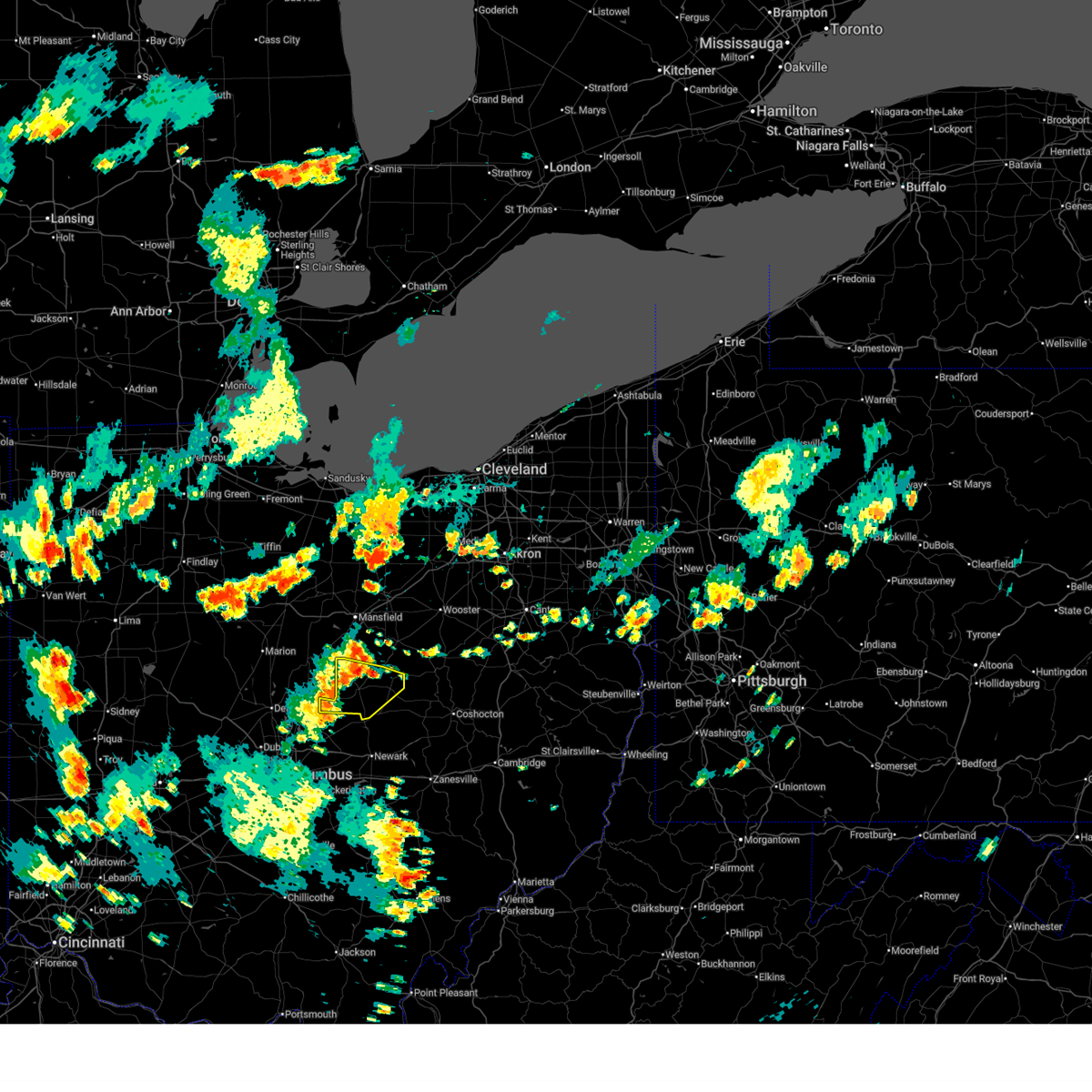
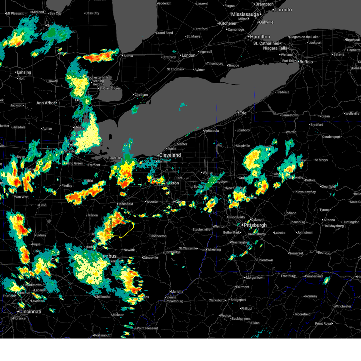
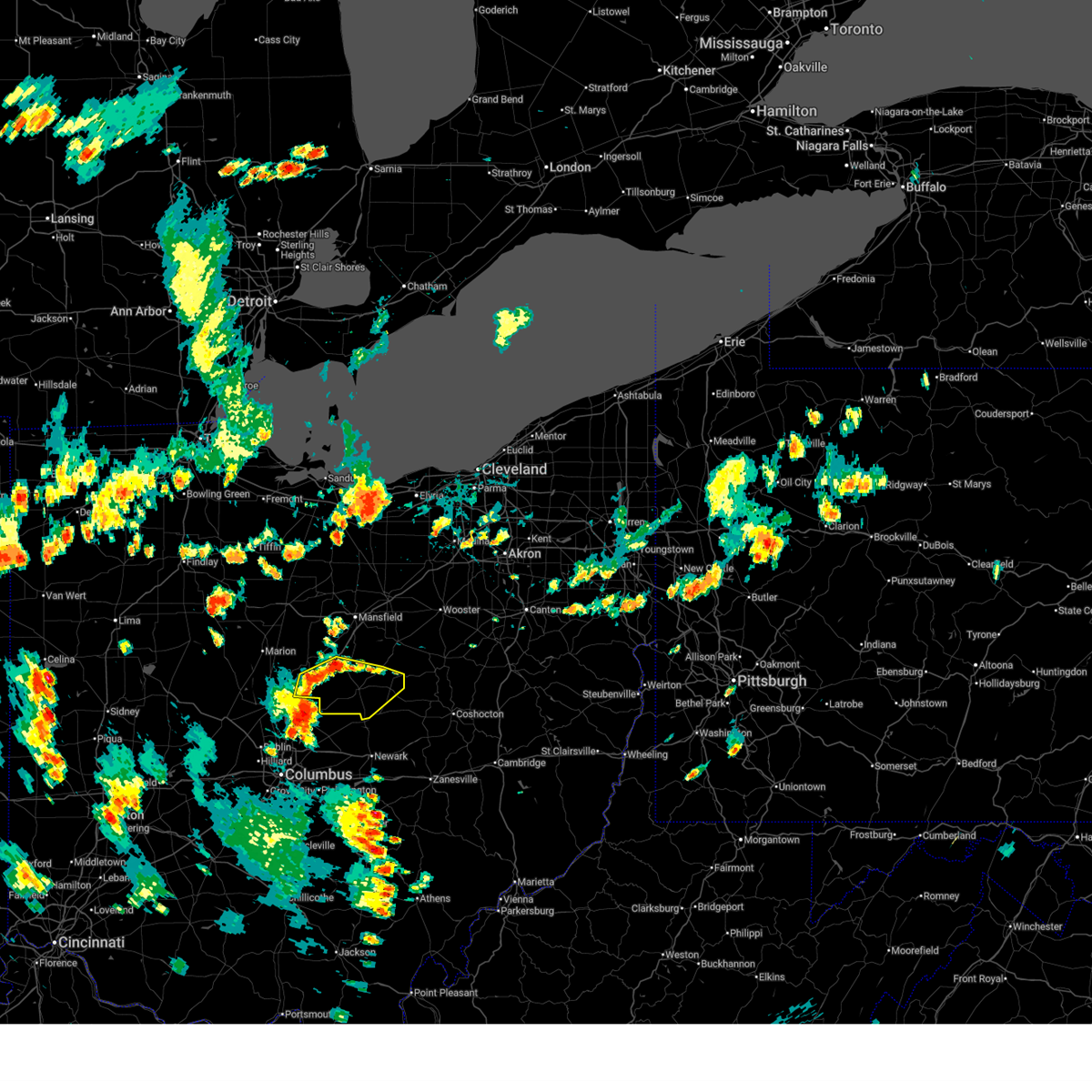
| 5/5/2025 5:34 PM EDT | Quarter sized hail reported 4.1 miles ENE of Utica, OH, estimated time based on radar data. |
| 5/5/2025 5:22 PM EDT | At 521 pm edt, a severe thunderstorm was located near fredonia, moving north at 20 mph (radar indicated). Hazards include ping pong ball size hail. People and animals outdoors will be injured. expect damage to roofs, siding, windows, and vehicles. locations impacted include, newark, hanover, st. Louisville, toboso, fredonia, fallsburg, purity, utica, marne, and granville. |
| 5/5/2025 5:17 PM EDT |
 Svrcle the national weather service in cleveland has issued a * severe thunderstorm warning for, southeastern morrow county in north central ohio, southern knox county in north central ohio, * until 600 pm edt. * at 517 pm edt, a severe thunderstorm was located near newark, moving north at 20 mph (radar indicated). Hazards include ping pong ball size hail and 60 mph wind gusts. People and animals outdoors will be injured. expect hail damage to roofs, siding, windows, and vehicles. Expect damage to trees and power lines. Svrcle the national weather service in cleveland has issued a * severe thunderstorm warning for, southeastern morrow county in north central ohio, southern knox county in north central ohio, * until 600 pm edt. * at 517 pm edt, a severe thunderstorm was located near newark, moving north at 20 mph (radar indicated). Hazards include ping pong ball size hail and 60 mph wind gusts. People and animals outdoors will be injured. expect hail damage to roofs, siding, windows, and vehicles. Expect damage to trees and power lines.
|
| 5/5/2025 5:17 PM EDT |
 At 517 pm edt, a severe thunderstorm was located near newark, moving north at 20 mph (radar indicated). Hazards include half dollar size hail. Minor damage to vehicles is possible. locations impacted include, newark, hanover, st. Louisville, toboso, fredonia, purity, utica, fallsburg, granville, marne, and heath. At 517 pm edt, a severe thunderstorm was located near newark, moving north at 20 mph (radar indicated). Hazards include half dollar size hail. Minor damage to vehicles is possible. locations impacted include, newark, hanover, st. Louisville, toboso, fredonia, purity, utica, fallsburg, granville, marne, and heath.
|
| 5/5/2025 5:10 PM EDT |
 Svriln the national weather service in wilmington has issued a * severe thunderstorm warning for, licking county in central ohio, * until 615 pm edt. * at 509 pm edt, a severe thunderstorm was located over newark, moving north at 20 mph (trained weather spotters reported hail to one inch in diameter in newark). Hazards include quarter size hail. minor damage to vehicles is possible Svriln the national weather service in wilmington has issued a * severe thunderstorm warning for, licking county in central ohio, * until 615 pm edt. * at 509 pm edt, a severe thunderstorm was located over newark, moving north at 20 mph (trained weather spotters reported hail to one inch in diameter in newark). Hazards include quarter size hail. minor damage to vehicles is possible
|
| 5/2/2025 3:09 PM EDT | The storm which prompted the warning has weakened below severe limits, and has exited the warned area. therefore, the warning will be allowed to expire. a severe thunderstorm watch remains in effect until 700 pm edt for north central ohio. |
| 5/2/2025 3:03 PM EDT | At 303 pm edt, a severe thunderstorm was located near gambier, or 7 miles southeast of mount vernon, moving east at 35 mph (radar indicated). Hazards include 60 mph wind gusts and quarter size hail. Minor damage to vehicles is possible. expect damage to trees and power lines. Locations impacted include, mount vernon, gambier, utica, danville, martinsburg, gann, and bladensburg. |
| 5/2/2025 2:50 PM EDT | At 250 pm edt, a severe thunderstorm was located near utica, or near mount vernon, moving east at 35 mph (radar indicated). Hazards include 60 mph wind gusts and quarter size hail. Minor damage to vehicles is possible. expect damage to trees and power lines. Locations impacted include, mount vernon, gambier, utica, danville, martinsburg, gann, and bladensburg. |
| 5/2/2025 2:46 PM EDT | the severe thunderstorm warning has been cancelled and is no longer in effect |
| 5/2/2025 2:44 PM EDT | Quarter sized hail reported 4.2 miles ESE of Utica, OH, photo verified. |
| 5/2/2025 2:31 PM EDT | At 230 pm edt, a severe thunderstorm was located near centerburg, moving east at 25 mph (radar indicated). Hazards include 60 mph wind gusts and quarter size hail. Minor hail damage to vehicles is possible. expect wind damage to trees and power lines. Locations impacted include, utica, hartford, and us route 62 at state route 661. |
| 5/2/2025 2:31 PM EDT | the severe thunderstorm warning has been cancelled and is no longer in effect |
| 5/2/2025 2:24 PM EDT | Svrcle the national weather service in cleveland has issued a * severe thunderstorm warning for, southern knox county in north central ohio, * until 315 pm edt. * at 223 pm edt, a severe thunderstorm was located near centerburg, or 11 miles northeast of westerville, moving east at 35 mph (radar indicated). Hazards include 60 mph wind gusts and quarter size hail. Minor damage to vehicles is possible. Expect damage to trees and power lines. |
| 5/2/2025 2:22 PM EDT | Svriln the national weather service in wilmington has issued a * severe thunderstorm warning for, southeastern delaware county in central ohio, northwestern licking county in central ohio, * until 300 pm edt. * at 221 pm edt, a severe thunderstorm was located near sunbury, moving east at 25 mph (radar indicated). Hazards include 60 mph wind gusts and quarter size hail. Minor hail damage to vehicles is possible. Expect wind damage to trees and power lines. |
| 4/29/2025 3:12 PM EDT |
 At 312 pm edt, a severe thunderstorm was located over heath, moving east at 55 mph (radar indicated). Hazards include 60 mph wind gusts and penny size hail. Expect damage to trees and power lines. locations impacted include, east ringgold, us route 22 at state route 159, millersport, purity, brownsville, utica, clearport, kirkersville, state route 158 at state route 204, north berne, pleasantville, marne, gratiot, st. louisville, fairfield beach, toboso, beechwood trails, amanda, logan elm village, and rushville. This includes i-70 in ohio between mile markers 117 and 142, and near mile marker 144. At 312 pm edt, a severe thunderstorm was located over heath, moving east at 55 mph (radar indicated). Hazards include 60 mph wind gusts and penny size hail. Expect damage to trees and power lines. locations impacted include, east ringgold, us route 22 at state route 159, millersport, purity, brownsville, utica, clearport, kirkersville, state route 158 at state route 204, north berne, pleasantville, marne, gratiot, st. louisville, fairfield beach, toboso, beechwood trails, amanda, logan elm village, and rushville. This includes i-70 in ohio between mile markers 117 and 142, and near mile marker 144.
|
| 4/29/2025 3:02 PM EDT |
 At 301 pm edt, a severe thunderstorm was located near beechwood trails, moving east at 60 mph (radar indicated). Hazards include 60 mph wind gusts and penny size hail. Expect damage to trees and power lines. locations impacted include, east ringgold, us route 22 at state route 159, millersport, us route 62 at state route 661, purity, johnstown, brownsville, utica, clearport, kirkersville, state route 158 at state route 204, north berne, pleasantville, alexandria, jersey, marne, gratiot, st. louisville, fairfield beach, and toboso. This includes i-70 in ohio between mile markers 113 and 142, and near mile marker 144. At 301 pm edt, a severe thunderstorm was located near beechwood trails, moving east at 60 mph (radar indicated). Hazards include 60 mph wind gusts and penny size hail. Expect damage to trees and power lines. locations impacted include, east ringgold, us route 22 at state route 159, millersport, us route 62 at state route 661, purity, johnstown, brownsville, utica, clearport, kirkersville, state route 158 at state route 204, north berne, pleasantville, alexandria, jersey, marne, gratiot, st. louisville, fairfield beach, and toboso. This includes i-70 in ohio between mile markers 113 and 142, and near mile marker 144.
|
| 4/29/2025 2:55 PM EDT |
 Svrcle the national weather service in cleveland has issued a * severe thunderstorm warning for, knox county in north central ohio, * until 345 pm edt. * at 254 pm edt, a severe thunderstorm was located over sunbury, or 8 miles north of westerville, moving east at 60 mph (radar indicated). Hazards include 60 mph wind gusts and quarter size hail. Minor damage to vehicles is possible. Expect damage to trees and power lines. Svrcle the national weather service in cleveland has issued a * severe thunderstorm warning for, knox county in north central ohio, * until 345 pm edt. * at 254 pm edt, a severe thunderstorm was located over sunbury, or 8 miles north of westerville, moving east at 60 mph (radar indicated). Hazards include 60 mph wind gusts and quarter size hail. Minor damage to vehicles is possible. Expect damage to trees and power lines.
|
| 4/29/2025 2:47 PM EDT |
 Svriln the national weather service in wilmington has issued a * severe thunderstorm warning for, fairfield county in central ohio, eastern pickaway county in central ohio, licking county in central ohio, * until 345 pm edt. * at 247 pm edt, a severe thunderstorm was located over easton, moving east at 55 mph (radar indicated). Hazards include 60 mph wind gusts and penny size hail. expect damage to trees and power lines Svriln the national weather service in wilmington has issued a * severe thunderstorm warning for, fairfield county in central ohio, eastern pickaway county in central ohio, licking county in central ohio, * until 345 pm edt. * at 247 pm edt, a severe thunderstorm was located over easton, moving east at 55 mph (radar indicated). Hazards include 60 mph wind gusts and penny size hail. expect damage to trees and power lines
|
| 4/3/2025 2:32 AM EDT |
 At 231 am edt, a severe thunderstorm was located over bremen, moving northeast at 65 mph (radar indicated). Hazards include 60 mph wind gusts. Expect damage to trees and power lines. locations impacted include, hanover, hocking hills state park, millersport, starr, purity, brownsville, ilesboro, new straitsville, haydenville, utica, harbor hills, south bloomingville, bremen, thornport, hebron, north berne, pleasantville, murray city, union furnace, and hide-a-way hills. This includes i-70 in ohio between mile markers 127 and 142, and near mile marker 144. At 231 am edt, a severe thunderstorm was located over bremen, moving northeast at 65 mph (radar indicated). Hazards include 60 mph wind gusts. Expect damage to trees and power lines. locations impacted include, hanover, hocking hills state park, millersport, starr, purity, brownsville, ilesboro, new straitsville, haydenville, utica, harbor hills, south bloomingville, bremen, thornport, hebron, north berne, pleasantville, murray city, union furnace, and hide-a-way hills. This includes i-70 in ohio between mile markers 127 and 142, and near mile marker 144.
|
| 4/3/2025 2:27 AM EDT | The storms which prompted the warning have weakened below severe limits, and have exited the warned area. therefore, the warning will be allowed to expire. a tornado watch remains in effect until 400 am edt for north central and northeastern ohio. to report severe weather, contact your nearest law enforcement agency. they will relay your report to the national weather service cleveland. |
| 4/3/2025 2:03 AM EDT | At 202 am edt, severe thunderstorms were located along a line extending from near mansfield to near centerburg, moving northeast at 70 mph (radar indicated). Hazards include 60 mph wind gusts. Expect damage to trees and power lines. Locations impacted include, mansfield, ashland, mount vernon, ontario, lexington, loudonville, fredericktown, gambier, utica, bellville, centerburg, danville, hayesville, polk, chesterville, sparta, waterford, butler, perrysville, and lucas. |
| 4/3/2025 2:02 AM EDT | Svriln the national weather service in wilmington has issued a * severe thunderstorm warning for, fairfield county in central ohio, hocking county in central ohio, licking county in central ohio, * until 300 am edt. * at 202 am edt, a severe thunderstorm was located over canal winchester, moving northeast at 75 mph (radar indicated). Hazards include 60 mph wind gusts. expect damage to trees and power lines |
| 4/3/2025 1:48 AM EDT | Svrcle the national weather service in cleveland has issued a * severe thunderstorm warning for, richland county in north central ohio, ashland county in north central ohio, morrow county in north central ohio, northwestern holmes county in northeastern ohio, knox county in north central ohio, * until 230 am edt. * at 148 am edt, severe thunderstorms were located along a line extending from 7 miles northeast of mount gilead to near delaware, moving northeast at 65 mph (radar indicated). Hazards include 60 mph wind gusts and penny size hail. expect damage to trees and power lines |
| 4/2/2025 11:12 AM EDT |
 the severe thunderstorm warning has been cancelled and is no longer in effect the severe thunderstorm warning has been cancelled and is no longer in effect
|
| 4/2/2025 11:09 AM EDT |
 At 1108 am edt, a severe thunderstorm was located over johnstown, moving northeast at 60 mph (radar indicated). Hazards include quarter size hail. Minor damage to vehicles is possible. locations impacted include, st. Louisville, fredonia, us route 62 at state route 661, fallsburg, purity, johnstown, alexandria, utica, and hartford. At 1108 am edt, a severe thunderstorm was located over johnstown, moving northeast at 60 mph (radar indicated). Hazards include quarter size hail. Minor damage to vehicles is possible. locations impacted include, st. Louisville, fredonia, us route 62 at state route 661, fallsburg, purity, johnstown, alexandria, utica, and hartford.
|
| 4/2/2025 11:09 AM EDT |
 the severe thunderstorm warning has been cancelled and is no longer in effect the severe thunderstorm warning has been cancelled and is no longer in effect
|
| 4/2/2025 11:05 AM EDT |
 Svriln the national weather service in wilmington has issued a * severe thunderstorm warning for, northeastern franklin county in central ohio, southeastern delaware county in central ohio, northern licking county in central ohio, * until 1130 am edt. * at 1105 am edt, a severe thunderstorm was located near johnstown, moving northeast at 60 mph (radar indicated). Hazards include half dollar size hail. minor damage to vehicles is possible Svriln the national weather service in wilmington has issued a * severe thunderstorm warning for, northeastern franklin county in central ohio, southeastern delaware county in central ohio, northern licking county in central ohio, * until 1130 am edt. * at 1105 am edt, a severe thunderstorm was located near johnstown, moving northeast at 60 mph (radar indicated). Hazards include half dollar size hail. minor damage to vehicles is possible
|
| 3/30/2025 11:07 PM EDT | The storms which prompted the warning have moved out of the area. therefore, the warning will be allowed to expire. a tornado watch remains in effect until 100 am edt for central ohio. please report previous wind damage or hail to the national weather service by going to our website at weather.gov/iln and submitting your report via social media. remember, a severe thunderstorm warning still remains in effect for southern fairfield county!. |
| 3/30/2025 10:49 PM EDT | At 1048 pm edt, severe thunderstorms were located along a line extending from 6 miles north of danville to near pleasantville, moving east at 60 mph (radar indicated). Hazards include 60 mph wind gusts and penny size hail. Expect damage to trees and power lines. locations impacted include, hanover, millersport, purity, brownsville, utica, harbor hills, bremen, hebron, north berne, pleasantville, west rushville, marne, gratiot, st. louisville, fairfield beach, buckeye lake, toboso, lancaster, rushville, and interstate 70 at state route 37. This includes i-70 in ohio between mile markers 125 and 142, and near mile marker 144. |
| 3/30/2025 10:43 PM EDT | A couple of trees down in utica. time estimated from rada in licking county OH, 0.5 miles SSW of Utica, OH |
| 3/30/2025 10:41 PM EDT | Multiple trees downed in utica. time estimated by rada in licking county OH, 0.3 miles NW of Utica, OH |
| 3/30/2025 10:23 PM EDT | Svriln the national weather service in wilmington has issued a * severe thunderstorm warning for, fairfield county in central ohio, licking county in central ohio, * until 1115 pm edt. * at 1022 pm edt, severe thunderstorms were located along a line extending from sparta to near circleville, moving northeast at 60 mph (radar indicated). Hazards include 60 mph wind gusts and penny size hail. expect damage to trees and power lines |
| 8/17/2024 5:38 PM EDT |
 the severe thunderstorm warning has been cancelled and is no longer in effect the severe thunderstorm warning has been cancelled and is no longer in effect
|
| 8/17/2024 5:34 PM EDT |
 At 533 pm edt, a severe thunderstorm was located near newark, moving east at 30 mph (radar indicated). Hazards include 60 mph wind gusts and quarter size hail. Minor hail damage to vehicles is possible. expect wind damage to trees and power lines. locations impacted include, newark, utica, st. Louisville, purity, fredonia, and fallsburg. At 533 pm edt, a severe thunderstorm was located near newark, moving east at 30 mph (radar indicated). Hazards include 60 mph wind gusts and quarter size hail. Minor hail damage to vehicles is possible. expect wind damage to trees and power lines. locations impacted include, newark, utica, st. Louisville, purity, fredonia, and fallsburg.
|
| 8/17/2024 5:20 PM EDT | Svriln the national weather service in wilmington has issued a * severe thunderstorm warning for, central licking county in central ohio, * until 600 pm edt. * at 520 pm edt, a severe thunderstorm was located near granville south, moving east at 25 mph (radar indicated). Hazards include 60 mph wind gusts and quarter size hail. Minor hail damage to vehicles is possible. Expect wind damage to trees and power lines. |
| 7/17/2024 4:28 PM EDT | The storm which prompted the warning has weakened below severe limits and no longer poses an immediate threat to life or property. therefore, the warning will be allowed to expire. however, gusty winds are still possible with this thunderstorm, so light damage is still possible. please report previous wind damage or hail to the national weather service by going to our website at weather.gov/iln and submitting your report via social media. |
| 7/17/2024 4:21 PM EDT |
 At 420 pm edt, a severe thunderstorm was located over newark, moving east at 45 mph (radar indicated). Hazards include 60 mph wind gusts. Expect damage to trees and power lines. locations impacted include, newark, reynoldsburg, heath, granville, pataskala, johnstown, hebron, utica, hanover, beechwood trails, granville south, summit station, marne, new albany, jersey, alexandria, st. louisville, gratiot, fredonia, and toboso. This includes i-70 in ohio between mile markers 138 and 142, and near mile marker 144. At 420 pm edt, a severe thunderstorm was located over newark, moving east at 45 mph (radar indicated). Hazards include 60 mph wind gusts. Expect damage to trees and power lines. locations impacted include, newark, reynoldsburg, heath, granville, pataskala, johnstown, hebron, utica, hanover, beechwood trails, granville south, summit station, marne, new albany, jersey, alexandria, st. louisville, gratiot, fredonia, and toboso. This includes i-70 in ohio between mile markers 138 and 142, and near mile marker 144.
|
| 7/17/2024 4:21 PM EDT |
 the severe thunderstorm warning has been cancelled and is no longer in effect the severe thunderstorm warning has been cancelled and is no longer in effect
|
| 7/17/2024 4:07 PM EDT |
 Svriln the national weather service in wilmington has issued a * severe thunderstorm warning for, east central franklin county in central ohio, southeastern delaware county in central ohio, licking county in central ohio, * until 430 pm edt. * at 407 pm edt, a severe thunderstorm was located near johnstown, moving east at 45 mph (radar indicated). Hazards include 60 mph wind gusts. expect damage to trees and power lines Svriln the national weather service in wilmington has issued a * severe thunderstorm warning for, east central franklin county in central ohio, southeastern delaware county in central ohio, licking county in central ohio, * until 430 pm edt. * at 407 pm edt, a severe thunderstorm was located near johnstown, moving east at 45 mph (radar indicated). Hazards include 60 mph wind gusts. expect damage to trees and power lines
|
| 6/17/2024 2:57 PM EDT |
 Svriln the national weather service in wilmington has issued a * severe thunderstorm warning for, central licking county in central ohio, * until 345 pm edt. * at 257 pm edt, a severe thunderstorm was located near beechwood trails, moving northeast at 15 mph (radar indicated). Hazards include 60 mph wind gusts. expect damage to trees and power lines Svriln the national weather service in wilmington has issued a * severe thunderstorm warning for, central licking county in central ohio, * until 345 pm edt. * at 257 pm edt, a severe thunderstorm was located near beechwood trails, moving northeast at 15 mph (radar indicated). Hazards include 60 mph wind gusts. expect damage to trees and power lines
|
| 6/5/2024 9:11 PM EDT |
 Torcle the national weather service in cleveland has issued a * tornado warning for, southeastern knox county in north central ohio, * until 1015 pm edt. * at 910 pm edt, a severe thunderstorm capable of producing a tornado was located near mount vernon, moving east at 15 mph (radar indicated rotation). Hazards include tornado. Flying debris will be dangerous to those caught without shelter. mobile homes will be damaged or destroyed. damage to roofs, windows, and vehicles will occur. Tree damage is likely. Torcle the national weather service in cleveland has issued a * tornado warning for, southeastern knox county in north central ohio, * until 1015 pm edt. * at 910 pm edt, a severe thunderstorm capable of producing a tornado was located near mount vernon, moving east at 15 mph (radar indicated rotation). Hazards include tornado. Flying debris will be dangerous to those caught without shelter. mobile homes will be damaged or destroyed. damage to roofs, windows, and vehicles will occur. Tree damage is likely.
|
| 6/5/2024 9:05 PM EDT |
 At 904 pm edt, a severe thunderstorm capable of producing a tornado was located near mount vernon, moving east at 20 mph (radar indicated rotation). Hazards include tornado. Flying debris will be dangerous to those caught without shelter. mobile homes will be damaged or destroyed. damage to roofs, windows, and vehicles will occur. tree damage is likely. Locations impacted include, mount vernon, gambier, utica, and martinsburg. At 904 pm edt, a severe thunderstorm capable of producing a tornado was located near mount vernon, moving east at 20 mph (radar indicated rotation). Hazards include tornado. Flying debris will be dangerous to those caught without shelter. mobile homes will be damaged or destroyed. damage to roofs, windows, and vehicles will occur. tree damage is likely. Locations impacted include, mount vernon, gambier, utica, and martinsburg.
|
| 6/5/2024 8:44 PM EDT |
 At 844 pm edt, a severe thunderstorm capable of producing a tornado was located 7 miles southwest of mount vernon, moving east at 20 mph (radar indicated rotation). Hazards include tornado. Flying debris will be dangerous to those caught without shelter. mobile homes will be damaged or destroyed. damage to roofs, windows, and vehicles will occur. tree damage is likely. Other locations impacted by this tornadic thunderstorm include martinsburg. At 844 pm edt, a severe thunderstorm capable of producing a tornado was located 7 miles southwest of mount vernon, moving east at 20 mph (radar indicated rotation). Hazards include tornado. Flying debris will be dangerous to those caught without shelter. mobile homes will be damaged or destroyed. damage to roofs, windows, and vehicles will occur. tree damage is likely. Other locations impacted by this tornadic thunderstorm include martinsburg.
|
| 6/5/2024 8:29 PM EDT |
 Torcle the national weather service in cleveland has issued a * tornado warning for, southwestern knox county in north central ohio, * until 915 pm edt. * at 829 pm edt, a confirmed tornado was located over centerburg, or 11 miles southwest of mount vernon, moving east at 20 mph (emergency management reported tornado). Hazards include damaging tornado. Flying debris will be dangerous to those caught without shelter. mobile homes will be damaged or destroyed. damage to roofs, windows, and vehicles will occur. tree damage is likely. the tornado will be near, mount vernon around 850 pm edt. Other locations impacted by this tornadic thunderstorm include martinsburg. Torcle the national weather service in cleveland has issued a * tornado warning for, southwestern knox county in north central ohio, * until 915 pm edt. * at 829 pm edt, a confirmed tornado was located over centerburg, or 11 miles southwest of mount vernon, moving east at 20 mph (emergency management reported tornado). Hazards include damaging tornado. Flying debris will be dangerous to those caught without shelter. mobile homes will be damaged or destroyed. damage to roofs, windows, and vehicles will occur. tree damage is likely. the tornado will be near, mount vernon around 850 pm edt. Other locations impacted by this tornadic thunderstorm include martinsburg.
|
| 5/7/2024 11:50 PM EDT |
 The storm which prompted the warning has weakened below severe limits and no longer appears capable of producing a tornado. therefore, the warning has been allowed to expire. however, gusty winds and heavy rain are still possible with this thunderstorm. a tornado watch remains in effect until 200 am edt for central ohio. please report previous tornadoes, wind damage or hail to the national weather service by going to our website at weather.gov/iln and submitting your report via social media. The storm which prompted the warning has weakened below severe limits and no longer appears capable of producing a tornado. therefore, the warning has been allowed to expire. however, gusty winds and heavy rain are still possible with this thunderstorm. a tornado watch remains in effect until 200 am edt for central ohio. please report previous tornadoes, wind damage or hail to the national weather service by going to our website at weather.gov/iln and submitting your report via social media.
|
| 5/7/2024 11:15 PM EDT |
 Toriln the national weather service in wilmington has issued a * tornado warning for, licking county in central ohio, * until 1145 pm edt. * at 1115 pm edt, a severe thunderstorm capable of producing a tornado was located over johnstown, moving east at 40 mph (radar indicated rotation). Hazards include tornado and quarter size hail. Flying debris will be dangerous to those caught without shelter. mobile homes will be damaged or destroyed. damage to roofs, windows, and vehicles will occur. Tree damage is likely. Toriln the national weather service in wilmington has issued a * tornado warning for, licking county in central ohio, * until 1145 pm edt. * at 1115 pm edt, a severe thunderstorm capable of producing a tornado was located over johnstown, moving east at 40 mph (radar indicated rotation). Hazards include tornado and quarter size hail. Flying debris will be dangerous to those caught without shelter. mobile homes will be damaged or destroyed. damage to roofs, windows, and vehicles will occur. Tree damage is likely.
|
| 4/17/2024 6:09 PM EDT |
 The warning will be allowed to expire. however, small hail and gusty winds are still possible with these thunderstorms. a tornado watch remains in effect until 700 pm edt for central ohio. please report previous wind damage or hail to the national weather service by going to our website at weather.gov/iln and submitting your report via social media. remember, a severe thunderstorm warning still remains in effect for eastern licking county!. The warning will be allowed to expire. however, small hail and gusty winds are still possible with these thunderstorms. a tornado watch remains in effect until 700 pm edt for central ohio. please report previous wind damage or hail to the national weather service by going to our website at weather.gov/iln and submitting your report via social media. remember, a severe thunderstorm warning still remains in effect for eastern licking county!.
|
| 4/17/2024 5:59 PM EDT |
 the severe thunderstorm warning has been cancelled and is no longer in effect the severe thunderstorm warning has been cancelled and is no longer in effect
|
| 4/17/2024 5:59 PM EDT |
 At 559 pm edt, severe thunderstorms were located along a line extending from near marne to near beechwood trails, moving east at 50 mph (radar indicated). Hazards include 60 mph wind gusts and quarter size hail. Minor hail damage to vehicles is possible. expect wind damage to trees and power lines. locations impacted include, newark, reynoldsburg, heath, granville, pataskala, johnstown, hebron, utica, beechwood trails, granville south, summit station, etna, new albany, jersey, kirkersville, alexandria, st. louisville, fredonia, purity, and state route 310 at state route 161. This includes i-70 in ohio between mile markers 127 and 128. At 559 pm edt, severe thunderstorms were located along a line extending from near marne to near beechwood trails, moving east at 50 mph (radar indicated). Hazards include 60 mph wind gusts and quarter size hail. Minor hail damage to vehicles is possible. expect wind damage to trees and power lines. locations impacted include, newark, reynoldsburg, heath, granville, pataskala, johnstown, hebron, utica, beechwood trails, granville south, summit station, etna, new albany, jersey, kirkersville, alexandria, st. louisville, fredonia, purity, and state route 310 at state route 161. This includes i-70 in ohio between mile markers 127 and 128.
|
| 4/17/2024 5:36 PM EDT |
 the severe thunderstorm warning has been cancelled and is no longer in effect the severe thunderstorm warning has been cancelled and is no longer in effect
|
| 4/17/2024 5:36 PM EDT |
 At 536 pm edt, severe thunderstorms were located along a line extending from johnstown to columbus, moving east at 30 mph (radar indicated). Hazards include 60 mph wind gusts and half dollar size hail. Minor hail damage to vehicles is possible. expect wind damage to trees and power lines. locations impacted include, columbus, newark, dublin, westerville, reynoldsburg, upper arlington, gahanna, hilliard, worthington, bexley, heath, granville, pataskala, johnstown, hebron, utica, minerva park, granville south, ohio state university, and beechwood trails. this includes the following interstates, i-70 in ohio between mile markers 127 and 128. I-71 in ohio between mile markers 110 and 121. At 536 pm edt, severe thunderstorms were located along a line extending from johnstown to columbus, moving east at 30 mph (radar indicated). Hazards include 60 mph wind gusts and half dollar size hail. Minor hail damage to vehicles is possible. expect wind damage to trees and power lines. locations impacted include, columbus, newark, dublin, westerville, reynoldsburg, upper arlington, gahanna, hilliard, worthington, bexley, heath, granville, pataskala, johnstown, hebron, utica, minerva park, granville south, ohio state university, and beechwood trails. this includes the following interstates, i-70 in ohio between mile markers 127 and 128. I-71 in ohio between mile markers 110 and 121.
|
| 4/17/2024 5:15 PM EDT |
 Svriln the national weather service in wilmington has issued a * severe thunderstorm warning for, northern franklin county in central ohio, southeastern delaware county in central ohio, licking county in central ohio, * until 615 pm edt. * at 514 pm edt, severe thunderstorms were located along a line extending from near sunbury to near hilliard, moving east at 50 mph (radar indicated). Hazards include 60 mph wind gusts and quarter size hail. a 59 mph wind gust was recently observed at ohio state airport. Minor hail damage to vehicles is possible. Expect wind damage to trees and power lines. Svriln the national weather service in wilmington has issued a * severe thunderstorm warning for, northern franklin county in central ohio, southeastern delaware county in central ohio, licking county in central ohio, * until 615 pm edt. * at 514 pm edt, severe thunderstorms were located along a line extending from near sunbury to near hilliard, moving east at 50 mph (radar indicated). Hazards include 60 mph wind gusts and quarter size hail. a 59 mph wind gust was recently observed at ohio state airport. Minor hail damage to vehicles is possible. Expect wind damage to trees and power lines.
|
| 4/17/2024 4:32 PM EDT |
 Svrcle the national weather service in cleveland has issued a * severe thunderstorm warning for, richland county in north central ohio, eastern marion county in north central ohio, ashland county in north central ohio, morrow county in north central ohio, southeastern crawford county in north central ohio, knox county in north central ohio, western holmes county in northeastern ohio, * until 530 pm edt. * at 432 pm edt, severe thunderstorms were located along a line extending from shelby to 6 miles northeast of mount gilead to 6 miles south of prospect, moving east at 45 mph (radar indicated). Hazards include 60 mph wind gusts and quarter size hail. Minor damage to vehicles is possible. Expect damage to trees and power lines. Svrcle the national weather service in cleveland has issued a * severe thunderstorm warning for, richland county in north central ohio, eastern marion county in north central ohio, ashland county in north central ohio, morrow county in north central ohio, southeastern crawford county in north central ohio, knox county in north central ohio, western holmes county in northeastern ohio, * until 530 pm edt. * at 432 pm edt, severe thunderstorms were located along a line extending from shelby to 6 miles northeast of mount gilead to 6 miles south of prospect, moving east at 45 mph (radar indicated). Hazards include 60 mph wind gusts and quarter size hail. Minor damage to vehicles is possible. Expect damage to trees and power lines.
|
| 3/30/2024 6:11 PM EDT |
 At 611 pm edt, a severe thunderstorm was located near utica, moving east at 45 mph (radar indicated). Hazards include 60 mph wind gusts and quarter size hail. Minor hail damage to vehicles is possible. expect wind damage to trees and power lines. locations impacted include, newark, utica, hanover, marne, st. Louisville, fredonia, toboso, fallsburg, and purity. At 611 pm edt, a severe thunderstorm was located near utica, moving east at 45 mph (radar indicated). Hazards include 60 mph wind gusts and quarter size hail. Minor hail damage to vehicles is possible. expect wind damage to trees and power lines. locations impacted include, newark, utica, hanover, marne, st. Louisville, fredonia, toboso, fallsburg, and purity.
|
| 3/30/2024 5:58 PM EDT |
 Svriln the national weather service in wilmington has issued a * severe thunderstorm warning for, northern licking county in central ohio, * until 645 pm edt. * at 557 pm edt, a severe thunderstorm was located near johnstown, moving east at 45 mph (radar indicated). Hazards include 60 mph wind gusts and quarter size hail. Minor hail damage to vehicles is possible. Expect wind damage to trees and power lines. Svriln the national weather service in wilmington has issued a * severe thunderstorm warning for, northern licking county in central ohio, * until 645 pm edt. * at 557 pm edt, a severe thunderstorm was located near johnstown, moving east at 45 mph (radar indicated). Hazards include 60 mph wind gusts and quarter size hail. Minor hail damage to vehicles is possible. Expect wind damage to trees and power lines.
|
| 3/14/2024 10:07 PM EDT |
 The storm which prompted the warning has weakened below severe limits and is moving out of the warned area. therefore, the warning will be allowed to expire. a tornado watch remains in effect until midnight edt for central ohio. please report previous tornadoes, wind damage or hail to the national weather service by going to our website at weather.gov/iln and submitting your report via social media. The storm which prompted the warning has weakened below severe limits and is moving out of the warned area. therefore, the warning will be allowed to expire. a tornado watch remains in effect until midnight edt for central ohio. please report previous tornadoes, wind damage or hail to the national weather service by going to our website at weather.gov/iln and submitting your report via social media.
|
| 3/14/2024 9:51 PM EDT |
 At 951 pm edt, a severe thunderstorm capable of producing a tornado was located 5 miles north of newark, moving east at 40 mph (radar indicated rotation). Hazards include tornado and quarter size hail. Flying debris will be dangerous to those caught without shelter. mobile homes will be damaged or destroyed. damage to roofs, windows, and vehicles will occur. tree damage is likely. locations impacted include, newark, heath, granville, utica, hanover, marne, st. Louisville, fredonia, toboso, fallsburg, and purity. At 951 pm edt, a severe thunderstorm capable of producing a tornado was located 5 miles north of newark, moving east at 40 mph (radar indicated rotation). Hazards include tornado and quarter size hail. Flying debris will be dangerous to those caught without shelter. mobile homes will be damaged or destroyed. damage to roofs, windows, and vehicles will occur. tree damage is likely. locations impacted include, newark, heath, granville, utica, hanover, marne, st. Louisville, fredonia, toboso, fallsburg, and purity.
|
| 3/14/2024 9:32 PM EDT |
 At 931 pm edt, a severe thunderstorm capable of producing a tornado was located 4 miles north of johnstown, moving east at 45 mph (radar indicated rotation). Hazards include tornado and quarter size hail. Flying debris will be dangerous to those caught without shelter. mobile homes will be damaged or destroyed. damage to roofs, windows, and vehicles will occur. tree damage is likely. locations impacted include, newark, heath, granville, johnstown, utica, hanover, granville south, marne, alexandria, hartford, st. Louisville, fredonia, toboso, us route 62 at state route 661, purity, and fallsburg. At 931 pm edt, a severe thunderstorm capable of producing a tornado was located 4 miles north of johnstown, moving east at 45 mph (radar indicated rotation). Hazards include tornado and quarter size hail. Flying debris will be dangerous to those caught without shelter. mobile homes will be damaged or destroyed. damage to roofs, windows, and vehicles will occur. tree damage is likely. locations impacted include, newark, heath, granville, johnstown, utica, hanover, granville south, marne, alexandria, hartford, st. Louisville, fredonia, toboso, us route 62 at state route 661, purity, and fallsburg.
|
| 3/14/2024 9:17 PM EDT |
 The storm which prompted the warning has moved out of the area. therefore, the warning has been allowed to expire. however, heavy rain is still possible with this thunderstorm. a tornado watch remains in effect until midnight edt for north central ohio. The storm which prompted the warning has moved out of the area. therefore, the warning has been allowed to expire. however, heavy rain is still possible with this thunderstorm. a tornado watch remains in effect until midnight edt for north central ohio.
|
| 3/14/2024 9:16 PM EDT |
 Toriln the national weather service in wilmington has issued a * tornado warning for, licking county in central ohio, * until 1015 pm edt. * at 915 pm edt, a severe thunderstorm capable of producing a tornado was located near sunbury, moving east at 45 mph (radar indicated rotation). Hazards include tornado and half dollar size hail. Flying debris will be dangerous to those caught without shelter. mobile homes will be damaged or destroyed. damage to roofs, windows, and vehicles will occur. Tree damage is likely. Toriln the national weather service in wilmington has issued a * tornado warning for, licking county in central ohio, * until 1015 pm edt. * at 915 pm edt, a severe thunderstorm capable of producing a tornado was located near sunbury, moving east at 45 mph (radar indicated rotation). Hazards include tornado and half dollar size hail. Flying debris will be dangerous to those caught without shelter. mobile homes will be damaged or destroyed. damage to roofs, windows, and vehicles will occur. Tree damage is likely.
|
| 3/14/2024 8:58 PM EDT |
 At 857 pm edt, a severe thunderstorm was located near utica, or near mount vernon, moving east at 40 mph (radar indicated). Hazards include 60 mph wind gusts and quarter size hail. Minor damage to vehicles is possible. expect damage to trees and power lines. Locations impacted include, mount vernon, gambier, utica, martinsburg, and bladensburg. At 857 pm edt, a severe thunderstorm was located near utica, or near mount vernon, moving east at 40 mph (radar indicated). Hazards include 60 mph wind gusts and quarter size hail. Minor damage to vehicles is possible. expect damage to trees and power lines. Locations impacted include, mount vernon, gambier, utica, martinsburg, and bladensburg.
|
| 3/14/2024 8:38 PM EDT |
 Svrcle the national weather service in cleveland has issued a * severe thunderstorm warning for, southern knox county in north central ohio, * until 915 pm edt. * at 838 pm edt, a severe thunderstorm was located near centerburg, or 12 miles southwest of mount vernon, moving east at 40 mph (radar indicated). Hazards include 60 mph wind gusts and quarter size hail. Minor damage to vehicles is possible. Expect damage to trees and power lines. Svrcle the national weather service in cleveland has issued a * severe thunderstorm warning for, southern knox county in north central ohio, * until 915 pm edt. * at 838 pm edt, a severe thunderstorm was located near centerburg, or 12 miles southwest of mount vernon, moving east at 40 mph (radar indicated). Hazards include 60 mph wind gusts and quarter size hail. Minor damage to vehicles is possible. Expect damage to trees and power lines.
|
| 2/28/2024 6:11 AM EST |
 The storm which prompted the warning has moved out of the area. therefore, the warning will be allowed to expire. however, gusty winds are still possible this morning. a tornado watch remains in effect until 1000 am est for north central ohio. The storm which prompted the warning has moved out of the area. therefore, the warning will be allowed to expire. however, gusty winds are still possible this morning. a tornado watch remains in effect until 1000 am est for north central ohio.
|
| 2/28/2024 5:53 AM EST |
 Toriln the national weather service in wilmington has issued a * tornado warning for, licking county in central ohio, * until 645 am est. * at 553 am est, a severe thunderstorm with strong rotation was located over pataskala, moving east at 50 mph. a tornado is occurring or imminent (radar indicated rotation). Hazards include tornado. Flying debris will be dangerous to those caught without shelter. mobile homes will be damaged or destroyed. damage to roofs, windows, and vehicles will occur. Tree damage is likely. Toriln the national weather service in wilmington has issued a * tornado warning for, licking county in central ohio, * until 645 am est. * at 553 am est, a severe thunderstorm with strong rotation was located over pataskala, moving east at 50 mph. a tornado is occurring or imminent (radar indicated rotation). Hazards include tornado. Flying debris will be dangerous to those caught without shelter. mobile homes will be damaged or destroyed. damage to roofs, windows, and vehicles will occur. Tree damage is likely.
|
| 2/28/2024 5:51 AM EST |
 At 550 am est, a severe thunderstorm capable of producing a tornado was located near gambier, or near mount vernon, moving east at 55 mph (radar indicated rotation). Hazards include tornado. Flying debris will be dangerous to those caught without shelter. mobile homes will be damaged or destroyed. damage to roofs, windows, and vehicles will occur. tree damage is likely. This tornadic thunderstorm will remain over mainly rural areas of southeastern knox county, including the following locations, martinsburg, bladensburg, and gann. At 550 am est, a severe thunderstorm capable of producing a tornado was located near gambier, or near mount vernon, moving east at 55 mph (radar indicated rotation). Hazards include tornado. Flying debris will be dangerous to those caught without shelter. mobile homes will be damaged or destroyed. damage to roofs, windows, and vehicles will occur. tree damage is likely. This tornadic thunderstorm will remain over mainly rural areas of southeastern knox county, including the following locations, martinsburg, bladensburg, and gann.
|
| 2/28/2024 5:35 AM EST |
 Torcle the national weather service in cleveland has issued a * tornado warning for, knox county in north central ohio, * until 615 am est. * at 535 am est, a severe thunderstorm capable of producing a tornado was located over centerburg, or 10 miles southwest of mount vernon, moving east at 35 mph (radar indicated rotation). Hazards include tornado. Flying debris will be dangerous to those caught without shelter. mobile homes will be damaged or destroyed. damage to roofs, windows, and vehicles will occur. tree damage is likely. this dangerous storm will be near, mount vernon around 545 am est. gambier around 550 am est. Other locations impacted by this tornadic thunderstorm include martinsburg, bladensburg, and gann. Torcle the national weather service in cleveland has issued a * tornado warning for, knox county in north central ohio, * until 615 am est. * at 535 am est, a severe thunderstorm capable of producing a tornado was located over centerburg, or 10 miles southwest of mount vernon, moving east at 35 mph (radar indicated rotation). Hazards include tornado. Flying debris will be dangerous to those caught without shelter. mobile homes will be damaged or destroyed. damage to roofs, windows, and vehicles will occur. tree damage is likely. this dangerous storm will be near, mount vernon around 545 am est. gambier around 550 am est. Other locations impacted by this tornadic thunderstorm include martinsburg, bladensburg, and gann.
|
| 8/25/2023 4:07 AM EDT |
 The severe thunderstorm warning for licking county will expire at 415 am edt, the storm which prompted the warning has weakened below severe limits, and no longer poses an immediate threat to life or property. therefore, the warning will be allowed to expire. however gusty winds are still possible with this thunderstorm. please report previous wind damage or hail to the national weather service by going to our website at weather.gov/iln and submitting your report via social media. The severe thunderstorm warning for licking county will expire at 415 am edt, the storm which prompted the warning has weakened below severe limits, and no longer poses an immediate threat to life or property. therefore, the warning will be allowed to expire. however gusty winds are still possible with this thunderstorm. please report previous wind damage or hail to the national weather service by going to our website at weather.gov/iln and submitting your report via social media.
|
| 8/25/2023 3:54 AM EDT |
 At 354 am edt, a severe thunderstorm was located over newark, moving southeast at 40 mph (radar indicated). Hazards include 60 mph wind gusts. Expect damage to trees and power lines. locations impacted include, newark, heath, granville, pataskala, johnstown, buckeye lake, hebron, utica, hanover, harbor hills, granville south, thornport, marne, beechwood trails, fairfield beach, new albany, jersey, kirkersville, alexandria, and hartford. this includes i-70 in ohio between mile markers 122 and 142, and near mile marker 144. hail threat, radar indicated max hail size, <. 75 in wind threat, radar indicated max wind gust, 60 mph. At 354 am edt, a severe thunderstorm was located over newark, moving southeast at 40 mph (radar indicated). Hazards include 60 mph wind gusts. Expect damage to trees and power lines. locations impacted include, newark, heath, granville, pataskala, johnstown, buckeye lake, hebron, utica, hanover, harbor hills, granville south, thornport, marne, beechwood trails, fairfield beach, new albany, jersey, kirkersville, alexandria, and hartford. this includes i-70 in ohio between mile markers 122 and 142, and near mile marker 144. hail threat, radar indicated max hail size, <. 75 in wind threat, radar indicated max wind gust, 60 mph.
|
| 8/25/2023 3:33 AM EDT |
 At 333 am edt, severe thunderstorms were located along a line extending from near danville to near delaware, moving southeast at 50 mph (radar indicated). Hazards include 70 mph wind gusts and penny size hail. Expect considerable tree damage. damage is likely to mobile homes, roofs, and outbuildings. locations impacted include, mount vernon, gambier, utica, centerburg, ashley, sparta, marengo, fulton, martinsburg and bladensburg. thunderstorm damage threat, considerable hail threat, radar indicated max hail size, 0. 75 in wind threat, radar indicated max wind gust, 70 mph. At 333 am edt, severe thunderstorms were located along a line extending from near danville to near delaware, moving southeast at 50 mph (radar indicated). Hazards include 70 mph wind gusts and penny size hail. Expect considerable tree damage. damage is likely to mobile homes, roofs, and outbuildings. locations impacted include, mount vernon, gambier, utica, centerburg, ashley, sparta, marengo, fulton, martinsburg and bladensburg. thunderstorm damage threat, considerable hail threat, radar indicated max hail size, 0. 75 in wind threat, radar indicated max wind gust, 70 mph.
|
| 8/25/2023 3:20 AM EDT |
 At 319 am edt, severe thunderstorms were located along a line extending from 7 miles northwest of danville to prospect, moving southeast at 35 mph (radar indicated). Hazards include 70 mph wind gusts and penny size hail. Expect considerable tree damage. damage is likely to mobile homes, roofs, and outbuildings. locations impacted include, marion, mount vernon, mount gilead, fredericktown, gambier, utica, cardington, centerburg, ashley, danville, waldo, chesterville, sparta, waterford, edison, marengo, fulton, martinsburg, north liberty and bladensburg. thunderstorm damage threat, considerable hail threat, radar indicated max hail size, 0. 75 in wind threat, radar indicated max wind gust, 70 mph. At 319 am edt, severe thunderstorms were located along a line extending from 7 miles northwest of danville to prospect, moving southeast at 35 mph (radar indicated). Hazards include 70 mph wind gusts and penny size hail. Expect considerable tree damage. damage is likely to mobile homes, roofs, and outbuildings. locations impacted include, marion, mount vernon, mount gilead, fredericktown, gambier, utica, cardington, centerburg, ashley, danville, waldo, chesterville, sparta, waterford, edison, marengo, fulton, martinsburg, north liberty and bladensburg. thunderstorm damage threat, considerable hail threat, radar indicated max hail size, 0. 75 in wind threat, radar indicated max wind gust, 70 mph.
|
| 8/25/2023 3:16 AM EDT |
 At 316 am edt, a severe thunderstorm was located near fredericktown, moving southeast at 40 mph (radar indicated). Hazards include 60 mph wind gusts. expect damage to trees and power lines At 316 am edt, a severe thunderstorm was located near fredericktown, moving southeast at 40 mph (radar indicated). Hazards include 60 mph wind gusts. expect damage to trees and power lines
|
| 8/25/2023 3:04 AM EDT |
 At 303 am edt, severe thunderstorms were located along a line extending from 8 miles northwest of danville to prospect, moving southeast at 45 mph (radar indicated). Hazards include 60 mph wind gusts and penny size hail. Expect damage to trees and power lines. locations impacted include, mansfield, marion, mount vernon, mount gilead, lexington, fredericktown, gambier, utica, cardington, bellville, centerburg, ashley, prospect, danville, waldo, chesterville, sparta, waterford, butler and caledonia. hail threat, radar indicated max hail size, 0. 75 in wind threat, radar indicated max wind gust, 60 mph. At 303 am edt, severe thunderstorms were located along a line extending from 8 miles northwest of danville to prospect, moving southeast at 45 mph (radar indicated). Hazards include 60 mph wind gusts and penny size hail. Expect damage to trees and power lines. locations impacted include, mansfield, marion, mount vernon, mount gilead, lexington, fredericktown, gambier, utica, cardington, bellville, centerburg, ashley, prospect, danville, waldo, chesterville, sparta, waterford, butler and caledonia. hail threat, radar indicated max hail size, 0. 75 in wind threat, radar indicated max wind gust, 60 mph.
|
| 8/25/2023 2:41 AM EDT |
 At 240 am edt, severe thunderstorms were located along a line extending from near lexington to near marseilles, moving southeast at 50 mph (radar indicated). Hazards include 60 mph wind gusts. expect damage to trees and power lines At 240 am edt, severe thunderstorms were located along a line extending from near lexington to near marseilles, moving southeast at 50 mph (radar indicated). Hazards include 60 mph wind gusts. expect damage to trees and power lines
|
| 7/29/2023 5:22 AM EDT |
 At 522 am edt, severe thunderstorms were located along a line extending from near savannah to gambier, moving east at 55 mph (radar indicated). Hazards include 60 mph wind gusts. Expect damage to trees and power lines. locations impacted include, mansfield, ashland, mount vernon, lexington, fredericktown, new london, gambier, utica, bellville, hayesville, savannah, polk, sullivan, butler, perrysville, lucas, bailey lakes, mifflin, north liberty and nova. hail threat, radar indicated max hail size, <. 75 in wind threat, radar indicated max wind gust, 60 mph. At 522 am edt, severe thunderstorms were located along a line extending from near savannah to gambier, moving east at 55 mph (radar indicated). Hazards include 60 mph wind gusts. Expect damage to trees and power lines. locations impacted include, mansfield, ashland, mount vernon, lexington, fredericktown, new london, gambier, utica, bellville, hayesville, savannah, polk, sullivan, butler, perrysville, lucas, bailey lakes, mifflin, north liberty and nova. hail threat, radar indicated max hail size, <. 75 in wind threat, radar indicated max wind gust, 60 mph.
|
| 7/29/2023 5:04 AM EDT |
 At 504 am edt, severe thunderstorms were located along a line extending from near new washington to near waldo, moving east at 45 mph (radar indicated). Hazards include 60 mph wind gusts. expect damage to trees and power lines At 504 am edt, severe thunderstorms were located along a line extending from near new washington to near waldo, moving east at 45 mph (radar indicated). Hazards include 60 mph wind gusts. expect damage to trees and power lines
|
| 7/23/2023 5:36 PM EDT |
 At 535 pm edt, a severe thunderstorm was located over centerburg, or 11 miles southwest of mount vernon, moving northeast at 45 mph (radar indicated). Hazards include 60 mph wind gusts and quarter size hail. Minor damage to vehicles is possible. Expect damage to trees and power lines. At 535 pm edt, a severe thunderstorm was located over centerburg, or 11 miles southwest of mount vernon, moving northeast at 45 mph (radar indicated). Hazards include 60 mph wind gusts and quarter size hail. Minor damage to vehicles is possible. Expect damage to trees and power lines.
|
| 7/20/2023 9:12 PM EDT |
 The severe thunderstorm warning for knox county will expire at 915 pm edt, the storms which prompted the warning have weakened below severe limits, and no longer pose an immediate threat to life or property. therefore, the warning will be allowed to expire. however gusty winds are still possible across the far eastern part of eastern knox county, including cities such as martinsburg and danville. a severe thunderstorm watch remains in effect until 1100 pm edt for north central and northeastern ohio. The severe thunderstorm warning for knox county will expire at 915 pm edt, the storms which prompted the warning have weakened below severe limits, and no longer pose an immediate threat to life or property. therefore, the warning will be allowed to expire. however gusty winds are still possible across the far eastern part of eastern knox county, including cities such as martinsburg and danville. a severe thunderstorm watch remains in effect until 1100 pm edt for north central and northeastern ohio.
|
| 7/20/2023 8:57 PM EDT |
 At 857 pm edt, severe thunderstorms were located along a line extending from fredericktown to near centerburg, moving east at 45 mph (radar indicated). Hazards include 60 mph wind gusts. Expect damage to trees and power lines. locations impacted include, mount vernon, fredericktown, gambier, utica, centerburg, danville, waterford, martinsburg, gann and bladensburg. hail threat, radar indicated max hail size, <. 75 in wind threat, radar indicated max wind gust, 60 mph. At 857 pm edt, severe thunderstorms were located along a line extending from fredericktown to near centerburg, moving east at 45 mph (radar indicated). Hazards include 60 mph wind gusts. Expect damage to trees and power lines. locations impacted include, mount vernon, fredericktown, gambier, utica, centerburg, danville, waterford, martinsburg, gann and bladensburg. hail threat, radar indicated max hail size, <. 75 in wind threat, radar indicated max wind gust, 60 mph.
|
| 7/20/2023 8:52 PM EDT |
 At 851 pm edt, a severe thunderstorm was located near johnstown, moving southeast at 40 mph (radar indicated). Hazards include 60 mph wind gusts. Expect damage to trees and power lines. locations impacted include, westerville, granville, johnstown, sunbury, utica, granville south, polaris, galena, alexandria, hartford, interstate 71 at us route 36/state route 37, alum creek state park, fredonia, us route 62 at state route 661, center village and lewis center. this includes i-71 in ohio between mile markers 122 and 131. hail threat, radar indicated max hail size, <. 75 in wind threat, radar indicated max wind gust, 60 mph. At 851 pm edt, a severe thunderstorm was located near johnstown, moving southeast at 40 mph (radar indicated). Hazards include 60 mph wind gusts. Expect damage to trees and power lines. locations impacted include, westerville, granville, johnstown, sunbury, utica, granville south, polaris, galena, alexandria, hartford, interstate 71 at us route 36/state route 37, alum creek state park, fredonia, us route 62 at state route 661, center village and lewis center. this includes i-71 in ohio between mile markers 122 and 131. hail threat, radar indicated max hail size, <. 75 in wind threat, radar indicated max wind gust, 60 mph.
|
| 7/20/2023 8:41 PM EDT |
 At 841 pm edt, a severe thunderstorm was located near sparta, or 10 miles south of mount gilead, moving east at 45 mph (radar indicated). Hazards include 60 mph wind gusts and penny size hail. Expect damage to trees and power lines. locations impacted include, mount vernon, mount gilead, fredericktown, gambier, utica, cardington, centerburg, ashley, danville, chesterville, sparta, waterford, edison, marengo, fulton, martinsburg, gann and bladensburg. hail threat, radar indicated max hail size, 0. 75 in wind threat, radar indicated max wind gust, 60 mph. At 841 pm edt, a severe thunderstorm was located near sparta, or 10 miles south of mount gilead, moving east at 45 mph (radar indicated). Hazards include 60 mph wind gusts and penny size hail. Expect damage to trees and power lines. locations impacted include, mount vernon, mount gilead, fredericktown, gambier, utica, cardington, centerburg, ashley, danville, chesterville, sparta, waterford, edison, marengo, fulton, martinsburg, gann and bladensburg. hail threat, radar indicated max hail size, 0. 75 in wind threat, radar indicated max wind gust, 60 mph.
|
| 7/20/2023 8:32 PM EDT |
 At 832 pm edt, a severe thunderstorm was located near sunbury, moving southeast at 40 mph (radar indicated). Hazards include 70 mph wind gusts. Expect considerable tree damage. Damage is likely to mobile homes, roofs, and outbuildings. At 832 pm edt, a severe thunderstorm was located near sunbury, moving southeast at 40 mph (radar indicated). Hazards include 70 mph wind gusts. Expect considerable tree damage. Damage is likely to mobile homes, roofs, and outbuildings.
|
| 7/20/2023 8:26 PM EDT |
 At 825 pm edt, a severe thunderstorm was located near ashley, or 9 miles north of delaware, moving east at 50 mph (radar indicated). Hazards include 60 mph wind gusts and quarter size hail. Minor damage to vehicles is possible. Expect damage to trees and power lines. At 825 pm edt, a severe thunderstorm was located near ashley, or 9 miles north of delaware, moving east at 50 mph (radar indicated). Hazards include 60 mph wind gusts and quarter size hail. Minor damage to vehicles is possible. Expect damage to trees and power lines.
|
| 7/2/2023 8:28 PM EDT |
 The severe thunderstorm warning for western licking county will expire at 830 pm edt, the storm which prompted the warning has weakened below severe limits, and no longer poses an immediate threat to life or property. therefore, the warning will be allowed to expire. however gusty winds are still possible with this thunderstorm. a severe thunderstorm watch remains in effect until 900 pm edt for central ohio. please report previous wind damage or hail to the national weather service by going to our website at weather.gov/iln and submitting your report via social media. The severe thunderstorm warning for western licking county will expire at 830 pm edt, the storm which prompted the warning has weakened below severe limits, and no longer poses an immediate threat to life or property. therefore, the warning will be allowed to expire. however gusty winds are still possible with this thunderstorm. a severe thunderstorm watch remains in effect until 900 pm edt for central ohio. please report previous wind damage or hail to the national weather service by going to our website at weather.gov/iln and submitting your report via social media.
|
| 7/2/2023 8:19 PM EDT |
 At 819 pm edt, a severe thunderstorm was located over johnstown, moving northeast at 40 mph (radar indicated). Hazards include 60 mph wind gusts. Expect damage to trees and power lines. locations impacted include, newark, reynoldsburg, heath, granville, pataskala, johnstown, buckeye lake, hebron, utica, beechwood trails, harbor hills, granville south, summit station, etna, new albany, jersey, kirkersville, alexandria, hartford and st. louisville. this includes i-70 in ohio between mile markers 116 and 131. hail threat, radar indicated max hail size, <. 75 in wind threat, radar indicated max wind gust, 60 mph. At 819 pm edt, a severe thunderstorm was located over johnstown, moving northeast at 40 mph (radar indicated). Hazards include 60 mph wind gusts. Expect damage to trees and power lines. locations impacted include, newark, reynoldsburg, heath, granville, pataskala, johnstown, buckeye lake, hebron, utica, beechwood trails, harbor hills, granville south, summit station, etna, new albany, jersey, kirkersville, alexandria, hartford and st. louisville. this includes i-70 in ohio between mile markers 116 and 131. hail threat, radar indicated max hail size, <. 75 in wind threat, radar indicated max wind gust, 60 mph.
|
| 7/2/2023 8:07 PM EDT |
 At 807 pm edt, a severe thunderstorm was located near easton, moving east at 40 mph (radar indicated). Hazards include 60 mph wind gusts. Expect damage to trees and power lines. locations impacted include, columbus, newark, westerville, reynoldsburg, gahanna, pickerington, bexley, heath, granville, pataskala, canal winchester, groveport, johnstown, buckeye lake, hebron, utica, minerva park, millersport, harbor hills and granville south. this includes the following interstates, i-70 in ohio between mile markers 105 and 131. i-71 in ohio between mile markers 119 and 125. hail threat, radar indicated max hail size, <. 75 in wind threat, radar indicated max wind gust, 60 mph. At 807 pm edt, a severe thunderstorm was located near easton, moving east at 40 mph (radar indicated). Hazards include 60 mph wind gusts. Expect damage to trees and power lines. locations impacted include, columbus, newark, westerville, reynoldsburg, gahanna, pickerington, bexley, heath, granville, pataskala, canal winchester, groveport, johnstown, buckeye lake, hebron, utica, minerva park, millersport, harbor hills and granville south. this includes the following interstates, i-70 in ohio between mile markers 105 and 131. i-71 in ohio between mile markers 119 and 125. hail threat, radar indicated max hail size, <. 75 in wind threat, radar indicated max wind gust, 60 mph.
|
| 7/2/2023 7:52 PM EDT |
 At 752 pm edt, a severe thunderstorm was located over upper arlington, moving northeast at 40 mph (radar indicated). Hazards include 60 mph wind gusts. expect damage to trees and power lines At 752 pm edt, a severe thunderstorm was located over upper arlington, moving northeast at 40 mph (radar indicated). Hazards include 60 mph wind gusts. expect damage to trees and power lines
|
| 4/1/2023 12:22 PM EDT |
 The severe thunderstorm warning for southern richland, southeastern ashland and knox counties will expire at 1230 pm edt, the storms which prompted the warning have moved out of the area. therefore, the warning will be allowed to expire. wind gusts in excess of 50 mph will continue for the next several hours and a wind advisory remains in effect until 800 pm edt. a severe thunderstorm watch remains in effect until 600 pm edt for northeastern ohio. The severe thunderstorm warning for southern richland, southeastern ashland and knox counties will expire at 1230 pm edt, the storms which prompted the warning have moved out of the area. therefore, the warning will be allowed to expire. wind gusts in excess of 50 mph will continue for the next several hours and a wind advisory remains in effect until 800 pm edt. a severe thunderstorm watch remains in effect until 600 pm edt for northeastern ohio.
|
| 4/1/2023 12:10 PM EDT |
 At 1208 pm edt, severe thunderstorms were located along a line extending from near nashville to 7 miles east of utica, moving east at 60 mph (radar indicated). Hazards include 60 mph wind gusts. Expect damage to trees and power lines. locations impacted include, mansfield, mount vernon, lexington, loudonville, fredericktown, gambier, utica, bellville, centerburg, danville, waterford, butler, perrysville, lucas, martinsburg, gann, north liberty and bladensburg. hail threat, radar indicated max hail size, <. 75 in wind threat, radar indicated max wind gust, 60 mph. At 1208 pm edt, severe thunderstorms were located along a line extending from near nashville to 7 miles east of utica, moving east at 60 mph (radar indicated). Hazards include 60 mph wind gusts. Expect damage to trees and power lines. locations impacted include, mansfield, mount vernon, lexington, loudonville, fredericktown, gambier, utica, bellville, centerburg, danville, waterford, butler, perrysville, lucas, martinsburg, gann, north liberty and bladensburg. hail threat, radar indicated max hail size, <. 75 in wind threat, radar indicated max wind gust, 60 mph.
|
| 4/1/2023 11:33 AM EDT |
 At 1132 am edt, severe thunderstorms were located along a line extending from near bucyrus to near richwood, moving east at 55 mph (radar indicated). Hazards include 60 mph wind gusts and penny size hail. expect damage to trees and power lines At 1132 am edt, severe thunderstorms were located along a line extending from near bucyrus to near richwood, moving east at 55 mph (radar indicated). Hazards include 60 mph wind gusts and penny size hail. expect damage to trees and power lines
|
| 2/27/2023 4:52 PM EST |
 At 452 pm est, a severe thunderstorm was located over pataskala, moving northeast at 60 mph (radar indicated). Hazards include 60 mph wind gusts. Expect damage to trees and power lines. locations impacted include, newark, reynoldsburg, heath, granville, pataskala, utica, beechwood trails, granville south, summit station, etna, jersey, kirkersville, alexandria, st. louisville, fredonia and state route 310 at state route 161. this includes i-70 in ohio between mile markers 114 and 119. hail threat, radar indicated max hail size, <. 75 in wind threat, radar indicated max wind gust, 60 mph. At 452 pm est, a severe thunderstorm was located over pataskala, moving northeast at 60 mph (radar indicated). Hazards include 60 mph wind gusts. Expect damage to trees and power lines. locations impacted include, newark, reynoldsburg, heath, granville, pataskala, utica, beechwood trails, granville south, summit station, etna, jersey, kirkersville, alexandria, st. louisville, fredonia and state route 310 at state route 161. this includes i-70 in ohio between mile markers 114 and 119. hail threat, radar indicated max hail size, <. 75 in wind threat, radar indicated max wind gust, 60 mph.
|
| 2/27/2023 4:41 PM EST |
 At 441 pm est, a severe thunderstorm was located over reynoldsburg, moving northeast at 60 mph (radar indicated). Hazards include 60 mph wind gusts. Expect damage to trees and power lines. locations impacted include, columbus, newark, reynoldsburg, gahanna, pickerington, bexley, heath, granville, pataskala, groveport, johnstown, utica, hanover, granville south, marne, beechwood trails, summit station, whitehall, etna and new albany. This includes i-70 in ohio near mile marker 103, and between mile markers 105 and 120. At 441 pm est, a severe thunderstorm was located over reynoldsburg, moving northeast at 60 mph (radar indicated). Hazards include 60 mph wind gusts. Expect damage to trees and power lines. locations impacted include, columbus, newark, reynoldsburg, gahanna, pickerington, bexley, heath, granville, pataskala, groveport, johnstown, utica, hanover, granville south, marne, beechwood trails, summit station, whitehall, etna and new albany. This includes i-70 in ohio near mile marker 103, and between mile markers 105 and 120.
|
| 2/27/2023 4:20 PM EST |
 At 420 pm est, a severe thunderstorm was located over bexley, moving northeast at 50 mph (radar indicated). Hazards include 60 mph wind gusts. expect damage to trees and power lines At 420 pm est, a severe thunderstorm was located over bexley, moving northeast at 50 mph (radar indicated). Hazards include 60 mph wind gusts. expect damage to trees and power lines
|
| 8/21/2022 3:40 PM EDT |
 The severe thunderstorm warning for central licking county will expire at 345 pm edt, the storm which prompted the warning has weakened below severe limits, and no longer poses an immediate threat to life or property. therefore, the warning will be allowed to expire. however gusty winds and heavy rain are still possible with this thunderstorm. please report previous wind damage or hail to the national weather service by going to our website at weather.gov/iln and submitting your report via social media. The severe thunderstorm warning for central licking county will expire at 345 pm edt, the storm which prompted the warning has weakened below severe limits, and no longer poses an immediate threat to life or property. therefore, the warning will be allowed to expire. however gusty winds and heavy rain are still possible with this thunderstorm. please report previous wind damage or hail to the national weather service by going to our website at weather.gov/iln and submitting your report via social media.
|
| 8/21/2022 3:28 PM EDT |
 At 328 pm edt, a severe thunderstorm was located over newark, moving northeast at 35 mph (radar indicated). Hazards include 60 mph wind gusts and quarter size hail. Minor hail damage to vehicles is possible. expect wind damage to trees and power lines. locations impacted include, newark, heath, granville, buckeye lake, hebron, utica, hanover, harbor hills, marne, granville south, st. louisville, gratiot, fredonia, purity, brownsville and interstate 70 at state route 13. hail threat, radar indicated max hail size, 1. 00 in wind threat, radar indicated max wind gust, 60 mph. At 328 pm edt, a severe thunderstorm was located over newark, moving northeast at 35 mph (radar indicated). Hazards include 60 mph wind gusts and quarter size hail. Minor hail damage to vehicles is possible. expect wind damage to trees and power lines. locations impacted include, newark, heath, granville, buckeye lake, hebron, utica, hanover, harbor hills, marne, granville south, st. louisville, gratiot, fredonia, purity, brownsville and interstate 70 at state route 13. hail threat, radar indicated max hail size, 1. 00 in wind threat, radar indicated max wind gust, 60 mph.
|
| 8/21/2022 3:19 PM EDT |
 At 319 pm edt, a severe thunderstorm was located over granville, moving northeast at 35 mph (radar indicated). Hazards include 60 mph wind gusts and quarter size hail. Minor hail damage to vehicles is possible. expect wind damage to trees and power lines. locations impacted include, newark, heath, granville, buckeye lake, hebron, utica, hanover, harbor hills, granville south, marne, beechwood trails, kirkersville, alexandria, st. louisville, gratiot, fredonia, purity, brownsville, interstate 70 at state route 37 and interstate 70 at state route 13. hail threat, radar indicated max hail size, 1. 00 in wind threat, radar indicated max wind gust, 60 mph. At 319 pm edt, a severe thunderstorm was located over granville, moving northeast at 35 mph (radar indicated). Hazards include 60 mph wind gusts and quarter size hail. Minor hail damage to vehicles is possible. expect wind damage to trees and power lines. locations impacted include, newark, heath, granville, buckeye lake, hebron, utica, hanover, harbor hills, granville south, marne, beechwood trails, kirkersville, alexandria, st. louisville, gratiot, fredonia, purity, brownsville, interstate 70 at state route 37 and interstate 70 at state route 13. hail threat, radar indicated max hail size, 1. 00 in wind threat, radar indicated max wind gust, 60 mph.
|
| 8/21/2022 3:09 PM EDT |
 At 309 pm edt, a severe thunderstorm was located near granville south, moving northeast at 35 mph (radar indicated). Hazards include 60 mph wind gusts and quarter size hail. Minor hail damage to vehicles is possible. Expect wind damage to trees and power lines. At 309 pm edt, a severe thunderstorm was located near granville south, moving northeast at 35 mph (radar indicated). Hazards include 60 mph wind gusts and quarter size hail. Minor hail damage to vehicles is possible. Expect wind damage to trees and power lines.
|
| 7/20/2022 10:55 PM EDT |
 The severe thunderstorm warning for east central franklin and central licking counties will expire at 1100 pm edt, the storms which prompted the warning have weakened below severe limits, and no longer pose an immediate threat to life or property. therefore, the warning will be allowed to expire. gusty winds are still possible with these thunderstorms. please report previous wind damage or hail to the national weather service by going to our website at weather.gov/iln and submitting your report via social media. The severe thunderstorm warning for east central franklin and central licking counties will expire at 1100 pm edt, the storms which prompted the warning have weakened below severe limits, and no longer pose an immediate threat to life or property. therefore, the warning will be allowed to expire. gusty winds are still possible with these thunderstorms. please report previous wind damage or hail to the national weather service by going to our website at weather.gov/iln and submitting your report via social media.
|
| 7/20/2022 10:47 PM EDT |
 At 1047 pm edt, severe thunderstorms were located along a line extending from near hanover to near pataskala, moving east at 35 mph (radar indicated). Hazards include 60 mph wind gusts. Expect damage to trees and power lines. locations impacted include, columbus, newark, reynoldsburg, gahanna, bexley, heath, granville, pataskala, hebron, hanover, beechwood trails, granville south, summit station, marne, whitehall, etna, kirkersville, alexandria, st. louisville and port columbus airport. this includes i-70 in ohio near mile marker 103, and between mile markers 114 and 124. hail threat, radar indicated max hail size, <. 75 in wind threat, radar indicated max wind gust, 60 mph. At 1047 pm edt, severe thunderstorms were located along a line extending from near hanover to near pataskala, moving east at 35 mph (radar indicated). Hazards include 60 mph wind gusts. Expect damage to trees and power lines. locations impacted include, columbus, newark, reynoldsburg, gahanna, bexley, heath, granville, pataskala, hebron, hanover, beechwood trails, granville south, summit station, marne, whitehall, etna, kirkersville, alexandria, st. louisville and port columbus airport. this includes i-70 in ohio near mile marker 103, and between mile markers 114 and 124. hail threat, radar indicated max hail size, <. 75 in wind threat, radar indicated max wind gust, 60 mph.
|
| 7/20/2022 10:35 PM EDT |
 At 1035 pm edt, severe thunderstorms were located along a line extending from marne to summit station, moving east at 45 mph (radar indicated). Hazards include 60 mph wind gusts. Expect damage to trees and power lines. locations impacted include, columbus, newark, reynoldsburg, upper arlington, gahanna, bexley, heath, granville, pataskala, hebron, utica, hanover, granville south, marne, ohio state university, beechwood trails, easton, summit station, whitehall and etna. this includes the following interstates, i-70 in ohio between mile markers 95 and 103, and between mile markers 113 and 124. i-71 in ohio between mile markers 106 and 114. hail threat, radar indicated max hail size, <. 75 in wind threat, radar indicated max wind gust, 60 mph. At 1035 pm edt, severe thunderstorms were located along a line extending from marne to summit station, moving east at 45 mph (radar indicated). Hazards include 60 mph wind gusts. Expect damage to trees and power lines. locations impacted include, columbus, newark, reynoldsburg, upper arlington, gahanna, bexley, heath, granville, pataskala, hebron, utica, hanover, granville south, marne, ohio state university, beechwood trails, easton, summit station, whitehall and etna. this includes the following interstates, i-70 in ohio between mile markers 95 and 103, and between mile markers 113 and 124. i-71 in ohio between mile markers 106 and 114. hail threat, radar indicated max hail size, <. 75 in wind threat, radar indicated max wind gust, 60 mph.
|
| 7/20/2022 10:25 PM EDT |
 At 1025 pm edt, severe thunderstorms were located along a line extending from utica to bexley, moving east at 45 mph (radar indicated). Hazards include 60 mph wind gusts. Expect damage to trees and power lines. locations impacted include, columbus, newark, westerville, reynoldsburg, upper arlington, gahanna, hilliard, worthington, bexley, heath, granville, pataskala, johnstown, hebron, utica, minerva park, hanover, granville south, marne and ohio state university. this includes the following interstates, i-70 in ohio between mile markers 92 and 103, and between mile markers 113 and 124. i-71 in ohio between mile markers 106 and 119. hail threat, radar indicated max hail size, <. 75 in wind threat, radar indicated max wind gust, 60 mph. At 1025 pm edt, severe thunderstorms were located along a line extending from utica to bexley, moving east at 45 mph (radar indicated). Hazards include 60 mph wind gusts. Expect damage to trees and power lines. locations impacted include, columbus, newark, westerville, reynoldsburg, upper arlington, gahanna, hilliard, worthington, bexley, heath, granville, pataskala, johnstown, hebron, utica, minerva park, hanover, granville south, marne and ohio state university. this includes the following interstates, i-70 in ohio between mile markers 92 and 103, and between mile markers 113 and 124. i-71 in ohio between mile markers 106 and 119. hail threat, radar indicated max hail size, <. 75 in wind threat, radar indicated max wind gust, 60 mph.
|
| 7/20/2022 10:19 PM EDT |
 At 1018 pm edt, severe thunderstorms were located along a line extending from 6 miles southwest of utica to near upper arlington, moving east at 40 mph (radar indicated). Hazards include 60 mph wind gusts. expect damage to trees and power lines At 1018 pm edt, severe thunderstorms were located along a line extending from 6 miles southwest of utica to near upper arlington, moving east at 40 mph (radar indicated). Hazards include 60 mph wind gusts. expect damage to trees and power lines
|
| 6/16/2022 4:28 PM EDT |
 The severe thunderstorm warning for northeastern licking county will expire at 430 pm edt, the storm which prompted the warning has weakened below severe limits, and no longer poses an immediate threat to life or property. therefore, the warning will be allowed to expire. however gusty winds are still possible with this thunderstorm. a severe thunderstorm watch remains in effect until 900 pm edt for central ohio. please report previous wind damage or hail to the national weather service by going to our website at weather.gov/iln and submitting your report via social media. The severe thunderstorm warning for northeastern licking county will expire at 430 pm edt, the storm which prompted the warning has weakened below severe limits, and no longer poses an immediate threat to life or property. therefore, the warning will be allowed to expire. however gusty winds are still possible with this thunderstorm. a severe thunderstorm watch remains in effect until 900 pm edt for central ohio. please report previous wind damage or hail to the national weather service by going to our website at weather.gov/iln and submitting your report via social media.
|
| 6/16/2022 4:02 PM EDT |
 At 401 pm edt, a severe thunderstorm was located near utica, moving east at 40 mph (radar indicated). Hazards include 60 mph wind gusts and nickel size hail. Expect damage to trees and power lines. locations impacted include, newark, utica, hanover, st. louisville, fredonia, us route 62 at state route 661, fallsburg and purity. hail threat, radar indicated max hail size, 0. 88 in wind threat, radar indicated max wind gust, 60 mph. At 401 pm edt, a severe thunderstorm was located near utica, moving east at 40 mph (radar indicated). Hazards include 60 mph wind gusts and nickel size hail. Expect damage to trees and power lines. locations impacted include, newark, utica, hanover, st. louisville, fredonia, us route 62 at state route 661, fallsburg and purity. hail threat, radar indicated max hail size, 0. 88 in wind threat, radar indicated max wind gust, 60 mph.
|
| 6/16/2022 3:50 PM EDT |
 At 350 pm edt, a severe thunderstorm was located over centerburg, moving east at 40 mph (radar indicated). Hazards include 60 mph wind gusts and nickel size hail. expect damage to trees and power lines At 350 pm edt, a severe thunderstorm was located over centerburg, moving east at 40 mph (radar indicated). Hazards include 60 mph wind gusts and nickel size hail. expect damage to trees and power lines
|
| 6/14/2022 3:55 AM EDT | Trees and power lines down in north central licking count in licking county OH, 4.6 miles E of Utica, OH |
| 6/14/2022 1:06 AM EDT |
 At 106 am edt, a severe thunderstorm was located near lancaster, moving southeast at 65 mph (radar indicated). Hazards include 60 mph wind gusts. Expect damage to trees and power lines. locations impacted include, newark, lancaster, reynoldsburg, pickerington, heath, granville, pataskala, canal winchester, johnstown, baltimore, buckeye lake, hebron, utica, bremen, millersport, pleasantville, hanover, marne, fairfield beach and beechwood trails. this includes i-70 in ohio between mile markers 112 and 143. hail threat, radar indicated max hail size, <. 75 in wind threat, radar indicated max wind gust, 60 mph. At 106 am edt, a severe thunderstorm was located near lancaster, moving southeast at 65 mph (radar indicated). Hazards include 60 mph wind gusts. Expect damage to trees and power lines. locations impacted include, newark, lancaster, reynoldsburg, pickerington, heath, granville, pataskala, canal winchester, johnstown, baltimore, buckeye lake, hebron, utica, bremen, millersport, pleasantville, hanover, marne, fairfield beach and beechwood trails. this includes i-70 in ohio between mile markers 112 and 143. hail threat, radar indicated max hail size, <. 75 in wind threat, radar indicated max wind gust, 60 mph.
|
| 6/14/2022 1:03 AM EDT |
 At 103 am edt, a severe thunderstorm was located over lancaster, moving southeast at 60 mph (radar indicated). Hazards include 60 mph wind gusts and penny size hail. Expect damage to trees and power lines. locations impacted include, newark, lancaster, reynoldsburg, pickerington, heath, granville, pataskala, canal winchester, johnstown, ashville, baltimore, buckeye lake, hebron, utica, south bloomfield, bremen, millersport, pleasantville, hanover and marne. this includes the following interstates, i-70 in ohio between mile markers 112 and 142. i-71 in ohio near mile marker 90. hail threat, radar indicated max hail size, 0. 75 in wind threat, radar indicated max wind gust, 60 mph. At 103 am edt, a severe thunderstorm was located over lancaster, moving southeast at 60 mph (radar indicated). Hazards include 60 mph wind gusts and penny size hail. Expect damage to trees and power lines. locations impacted include, newark, lancaster, reynoldsburg, pickerington, heath, granville, pataskala, canal winchester, johnstown, ashville, baltimore, buckeye lake, hebron, utica, south bloomfield, bremen, millersport, pleasantville, hanover and marne. this includes the following interstates, i-70 in ohio between mile markers 112 and 142. i-71 in ohio near mile marker 90. hail threat, radar indicated max hail size, 0. 75 in wind threat, radar indicated max wind gust, 60 mph.
|
| 6/14/2022 12:45 AM EDT |
 At 1245 am edt, a severe thunderstorm was located over groveport, moving southeast at 65 mph (radar indicated). Hazards include 60 mph wind gusts and penny size hail. Expect damage to trees and power lines. locations impacted include, columbus, newark, lancaster, reynoldsburg, grove city, gahanna, pickerington, bexley, heath, granville, pataskala, canal winchester, groveport, johnstown, ashville, baltimore, buckeye lake, hebron, utica and south bloomfield. this includes the following interstates, i-70 in ohio between mile markers 96 and 142. i-71 in ohio between mile markers 90 and 109. hail threat, radar indicated max hail size, 0. 75 in wind threat, radar indicated max wind gust, 60 mph. At 1245 am edt, a severe thunderstorm was located over groveport, moving southeast at 65 mph (radar indicated). Hazards include 60 mph wind gusts and penny size hail. Expect damage to trees and power lines. locations impacted include, columbus, newark, lancaster, reynoldsburg, grove city, gahanna, pickerington, bexley, heath, granville, pataskala, canal winchester, groveport, johnstown, ashville, baltimore, buckeye lake, hebron, utica and south bloomfield. this includes the following interstates, i-70 in ohio between mile markers 96 and 142. i-71 in ohio between mile markers 90 and 109. hail threat, radar indicated max hail size, 0. 75 in wind threat, radar indicated max wind gust, 60 mph.
|
| 6/14/2022 12:38 AM EDT |
 At 1237 am edt, a severe thunderstorm was located over columbus, moving southeast at 65 mph (radar indicated). Hazards include 70 mph wind gusts and penny size hail. Expect considerable tree damage. Damage is likely to mobile homes, roofs, and outbuildings. At 1237 am edt, a severe thunderstorm was located over columbus, moving southeast at 65 mph (radar indicated). Hazards include 70 mph wind gusts and penny size hail. Expect considerable tree damage. Damage is likely to mobile homes, roofs, and outbuildings.
|
| 6/13/2022 11:31 PM EDT |
 At 1131 pm edt, a severe thunderstorm was located over centerburg, moving southeast at 60 mph (radar indicated). Hazards include 70 mph wind gusts and penny size hail. Expect considerable tree damage. Damage is likely to mobile homes, roofs, and outbuildings. At 1131 pm edt, a severe thunderstorm was located over centerburg, moving southeast at 60 mph (radar indicated). Hazards include 70 mph wind gusts and penny size hail. Expect considerable tree damage. Damage is likely to mobile homes, roofs, and outbuildings.
|
| 6/8/2022 8:33 PM EDT |
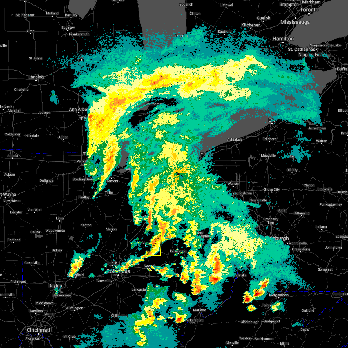 At 833 pm edt, severe thunderstorms were located along a line extending from glenmont to 7 miles southwest of killbuck to 8 miles east of utica, moving east at 45 mph (radar indicated). Hazards include 60 mph wind gusts. Expect damage to trees and power lines. locations impacted include, utica, danville, martinsburg, gann and bladensburg. hail threat, radar indicated max hail size, <. 75 in wind threat, radar indicated max wind gust, 60 mph. At 833 pm edt, severe thunderstorms were located along a line extending from glenmont to 7 miles southwest of killbuck to 8 miles east of utica, moving east at 45 mph (radar indicated). Hazards include 60 mph wind gusts. Expect damage to trees and power lines. locations impacted include, utica, danville, martinsburg, gann and bladensburg. hail threat, radar indicated max hail size, <. 75 in wind threat, radar indicated max wind gust, 60 mph.
|
| 6/8/2022 8:22 PM EDT |
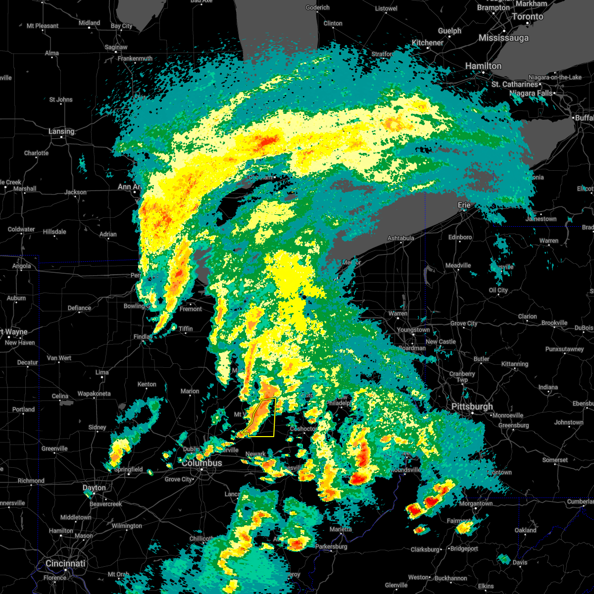 At 821 pm edt, severe thunderstorms were located along a line extending from near glenmont to danville to near utica, moving east at 45 mph (radar indicated). Hazards include 60 mph wind gusts. Expect damage to trees and power lines. locations impacted include, gambier, utica, danville, martinsburg, gann and bladensburg. hail threat, radar indicated max hail size, <. 75 in wind threat, radar indicated max wind gust, 60 mph. At 821 pm edt, severe thunderstorms were located along a line extending from near glenmont to danville to near utica, moving east at 45 mph (radar indicated). Hazards include 60 mph wind gusts. Expect damage to trees and power lines. locations impacted include, gambier, utica, danville, martinsburg, gann and bladensburg. hail threat, radar indicated max hail size, <. 75 in wind threat, radar indicated max wind gust, 60 mph.
|
| 6/8/2022 8:16 PM EDT |
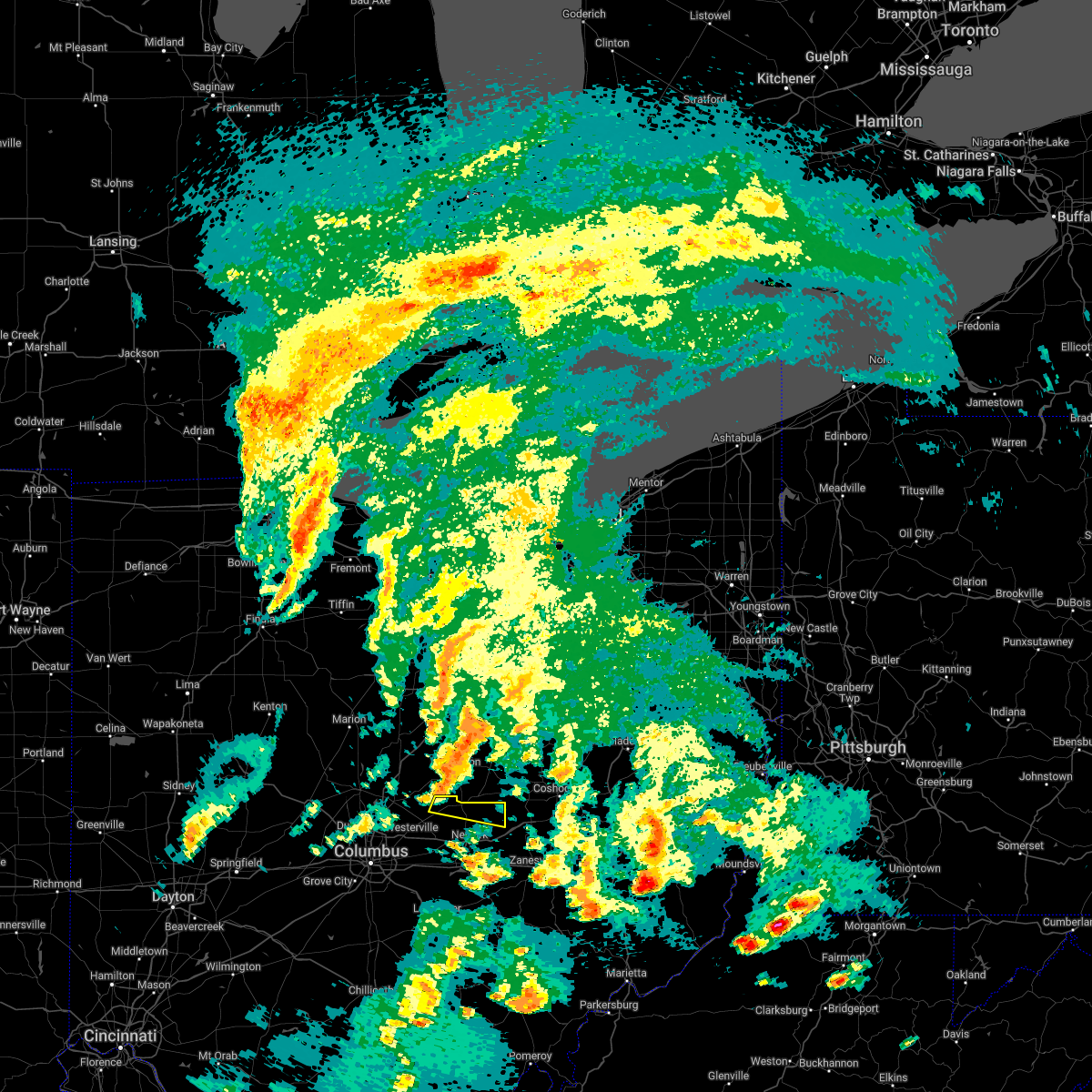 At 816 pm edt, a severe thunderstorm was located near utica, moving east at 35 mph (radar indicated). Hazards include 60 mph wind gusts. Expect damage to trees and power lines. locations impacted include, utica, st. louisville, purity and fallsburg. hail threat, radar indicated max hail size, <. 75 in wind threat, radar indicated max wind gust, 60 mph. At 816 pm edt, a severe thunderstorm was located near utica, moving east at 35 mph (radar indicated). Hazards include 60 mph wind gusts. Expect damage to trees and power lines. locations impacted include, utica, st. louisville, purity and fallsburg. hail threat, radar indicated max hail size, <. 75 in wind threat, radar indicated max wind gust, 60 mph.
|
| 6/8/2022 8:09 PM EDT |
 At 809 pm edt, severe thunderstorms were located along a line extending from 7 miles southwest of loudonville to mount vernon to 7 miles northwest of utica, moving east at 60 mph (radar indicated). Hazards include 60 mph wind gusts. Expect damage to trees and power lines. locations impacted include, mount vernon, fredericktown, gambier, utica, danville, martinsburg, gann, north liberty and bladensburg. hail threat, radar indicated max hail size, <. 75 in wind threat, radar indicated max wind gust, 60 mph. At 809 pm edt, severe thunderstorms were located along a line extending from 7 miles southwest of loudonville to mount vernon to 7 miles northwest of utica, moving east at 60 mph (radar indicated). Hazards include 60 mph wind gusts. Expect damage to trees and power lines. locations impacted include, mount vernon, fredericktown, gambier, utica, danville, martinsburg, gann, north liberty and bladensburg. hail threat, radar indicated max hail size, <. 75 in wind threat, radar indicated max wind gust, 60 mph.
|
| 6/8/2022 8:07 PM EDT |
 At 807 pm edt, a severe thunderstorm was located near johnstown, moving southeast at 35 mph (radar indicated). Hazards include 60 mph wind gusts. Expect damage to trees and power lines. locations impacted include, newark, johnstown, utica, hanover, marne, hartford, st. louisville, toboso, fredonia, fallsburg and purity. hail threat, radar indicated max hail size, <. 75 in wind threat, radar indicated max wind gust, 60 mph. At 807 pm edt, a severe thunderstorm was located near johnstown, moving southeast at 35 mph (radar indicated). Hazards include 60 mph wind gusts. Expect damage to trees and power lines. locations impacted include, newark, johnstown, utica, hanover, marne, hartford, st. louisville, toboso, fredonia, fallsburg and purity. hail threat, radar indicated max hail size, <. 75 in wind threat, radar indicated max wind gust, 60 mph.
|
| 6/8/2022 7:52 PM EDT |
 At 752 pm edt, a severe thunderstorm was located near sunbury, moving east at 40 mph (radar indicated). Hazards include 60 mph wind gusts. expect damage to trees and power lines At 752 pm edt, a severe thunderstorm was located near sunbury, moving east at 40 mph (radar indicated). Hazards include 60 mph wind gusts. expect damage to trees and power lines
|
| 6/8/2022 7:48 PM EDT |
 At 748 pm edt, severe thunderstorms were located along a line extending from near mount gilead to near sparta to near sunbury, moving east at 40 mph (radar indicated). Hazards include 60 mph wind gusts. expect damage to trees and power lines At 748 pm edt, severe thunderstorms were located along a line extending from near mount gilead to near sparta to near sunbury, moving east at 40 mph (radar indicated). Hazards include 60 mph wind gusts. expect damage to trees and power lines
|
| 8/11/2021 5:43 PM EDT |
 At 543 pm edt, a severe thunderstorm was located near beechwood trails, moving east at 40 mph (radar indicated). Hazards include 60 mph wind gusts. Expect damage to trees and power lines. locations impacted include, newark, reynoldsburg, heath, granville, pataskala, johnstown, buckeye lake, hebron, utica, hanover, granville south, marne, beechwood trails, summit station, harbor hills, etna, new albany, jersey, kirkersville and alexandria. this includes i-70 in ohio between mile markers 115 and 125, and between mile markers 127 and 132. hail threat, radar indicated max hail size, <. 75 in wind threat, radar indicated max wind gust, 60 mph. At 543 pm edt, a severe thunderstorm was located near beechwood trails, moving east at 40 mph (radar indicated). Hazards include 60 mph wind gusts. Expect damage to trees and power lines. locations impacted include, newark, reynoldsburg, heath, granville, pataskala, johnstown, buckeye lake, hebron, utica, hanover, granville south, marne, beechwood trails, summit station, harbor hills, etna, new albany, jersey, kirkersville and alexandria. this includes i-70 in ohio between mile markers 115 and 125, and between mile markers 127 and 132. hail threat, radar indicated max hail size, <. 75 in wind threat, radar indicated max wind gust, 60 mph.
|
| 8/11/2021 5:30 PM EDT |
 At 530 pm edt, a severe thunderstorm was located near westerville, moving east at 40 mph (radar indicated). Hazards include 60 mph wind gusts. expect damage to trees and power lines At 530 pm edt, a severe thunderstorm was located near westerville, moving east at 40 mph (radar indicated). Hazards include 60 mph wind gusts. expect damage to trees and power lines
|
| 8/11/2021 5:29 PM EDT |
 At 529 pm edt, severe thunderstorms were located along a line extending from 7 miles northwest of loudonville to danville to near centerburg, moving east at 55 mph (radar indicated). Hazards include 60 mph wind gusts. expect damage to trees and power lines At 529 pm edt, severe thunderstorms were located along a line extending from 7 miles northwest of loudonville to danville to near centerburg, moving east at 55 mph (radar indicated). Hazards include 60 mph wind gusts. expect damage to trees and power lines
|
| 8/11/2021 5:11 PM EDT |
 At 511 pm edt, severe thunderstorms were located along a line extending from near savannah to bellville to near sunbury, moving east at 45 mph (radar indicated). Hazards include 60 mph wind gusts. Expect damage to trees and power lines. locations impacted include, mansfield, mount vernon, mount gilead, lexington, loudonville, fredericktown, gambier, utica, cardington, bellville, centerburg, ashley, danville, chesterville, sparta, waterford, butler, perrysville, lucas and marengo. hail threat, radar indicated max hail size, <. 75 in wind threat, radar indicated max wind gust, 60 mph. At 511 pm edt, severe thunderstorms were located along a line extending from near savannah to bellville to near sunbury, moving east at 45 mph (radar indicated). Hazards include 60 mph wind gusts. Expect damage to trees and power lines. locations impacted include, mansfield, mount vernon, mount gilead, lexington, loudonville, fredericktown, gambier, utica, cardington, bellville, centerburg, ashley, danville, chesterville, sparta, waterford, butler, perrysville, lucas and marengo. hail threat, radar indicated max hail size, <. 75 in wind threat, radar indicated max wind gust, 60 mph.
|
| 8/11/2021 4:30 PM EDT |
 At 429 pm edt, severe thunderstorms were located along a line extending from near bucyrus to near marion to near west mansfield, moving east at 40 mph (radar indicated). Hazards include 60 mph wind gusts. expect damage to trees and power lines At 429 pm edt, severe thunderstorms were located along a line extending from near bucyrus to near marion to near west mansfield, moving east at 40 mph (radar indicated). Hazards include 60 mph wind gusts. expect damage to trees and power lines
|
| 7/16/2021 4:29 PM EDT |
 At 428 pm edt, a severe thunderstorm was located near gambier, or 7 miles southeast of mount vernon, moving northeast at 35 mph (radar indicated). Hazards include 60 mph wind gusts. expect damage to trees and power lines At 428 pm edt, a severe thunderstorm was located near gambier, or 7 miles southeast of mount vernon, moving northeast at 35 mph (radar indicated). Hazards include 60 mph wind gusts. expect damage to trees and power lines
|
| 11/15/2020 12:53 PM EST |
 The severe thunderstorm warning for northeastern fairfield and eastern licking counties will expire at 100 pm est, the storms which prompted the warning have moved out of the area. therefore, the warning will be allowed to expire. however gusty winds are still possible with these thunderstorms. a severe thunderstorm watch remains in effect until 400 pm est for central ohio. please report previous wind damage or hail to the national weather service by going to our website at weather.gov/iln and submitting your report via social media. The severe thunderstorm warning for northeastern fairfield and eastern licking counties will expire at 100 pm est, the storms which prompted the warning have moved out of the area. therefore, the warning will be allowed to expire. however gusty winds are still possible with these thunderstorms. a severe thunderstorm watch remains in effect until 400 pm est for central ohio. please report previous wind damage or hail to the national weather service by going to our website at weather.gov/iln and submitting your report via social media.
|
| 11/15/2020 12:48 PM EST |
 At 1248 pm est, severe thunderstorms were located along a line extending from 9 miles west of coshocton to near perry state forest, moving east at 70 mph (radar indicated). Hazards include 60 mph wind gusts. Expect damage to trees and power lines. locations impacted include, newark, lancaster, heath, granville, buckeye lake, hebron, utica, bremen, pleasantville, hanover, harbor hills, marne, fairfield beach, thornport, hide-a-way hills, granville south, st. louisville, rushville, gratiot and west rushville. This includes i-70 in ohio between mile markers 127 and 142, and near mile marker 144. At 1248 pm est, severe thunderstorms were located along a line extending from 9 miles west of coshocton to near perry state forest, moving east at 70 mph (radar indicated). Hazards include 60 mph wind gusts. Expect damage to trees and power lines. locations impacted include, newark, lancaster, heath, granville, buckeye lake, hebron, utica, bremen, pleasantville, hanover, harbor hills, marne, fairfield beach, thornport, hide-a-way hills, granville south, st. louisville, rushville, gratiot and west rushville. This includes i-70 in ohio between mile markers 127 and 142, and near mile marker 144.
|
| 11/15/2020 12:21 PM EST |
 At 1220 pm est, severe thunderstorms were located along a line extending from near centerburg to 7 miles northwest of lancaster, moving east at 70 mph (radar indicated). Hazards include 60 mph wind gusts. expect damage to trees and power lines At 1220 pm est, severe thunderstorms were located along a line extending from near centerburg to 7 miles northwest of lancaster, moving east at 70 mph (radar indicated). Hazards include 60 mph wind gusts. expect damage to trees and power lines
|
| 9/7/2020 6:05 PM EDT |
 At 604 pm edt, a severe thunderstorm was located over newark, moving southeast at 45 mph (radar indicated). Hazards include 60 mph wind gusts. Expect damage to trees and power lines. locations impacted include, newark, utica, hanover, marne, st. Louisville, toboso, fallsburg and purity. At 604 pm edt, a severe thunderstorm was located over newark, moving southeast at 45 mph (radar indicated). Hazards include 60 mph wind gusts. Expect damage to trees and power lines. locations impacted include, newark, utica, hanover, marne, st. Louisville, toboso, fallsburg and purity.
|
| 9/7/2020 5:57 PM EDT |
 A severe thunderstorm warning remains in effect until 615 pm edt for knox county. at 556 pm edt, a severe thunderstorm was located near danville, or 8 miles east of mount vernon, moving east at 20 mph. hazard. 60 mph wind gusts and quarter size hail. source. Radar indicated. A severe thunderstorm warning remains in effect until 615 pm edt for knox county. at 556 pm edt, a severe thunderstorm was located near danville, or 8 miles east of mount vernon, moving east at 20 mph. hazard. 60 mph wind gusts and quarter size hail. source. Radar indicated.
|
| 9/7/2020 5:48 PM EDT | Numerous trees and wires dow in licking county OH, 4 miles E of Utica, OH |
| 9/7/2020 5:48 PM EDT |
 At 548 pm edt, a severe thunderstorm capable of producing a tornado was located over gambier, or near mount vernon, moving east at 25 mph (radar indicated rotation). Hazards include tornado and quarter size hail. Flying debris will be dangerous to those caught without shelter. mobile homes will be damaged or destroyed. damage to roofs, windows, and vehicles will occur. Tree damage is likely. At 548 pm edt, a severe thunderstorm capable of producing a tornado was located over gambier, or near mount vernon, moving east at 25 mph (radar indicated rotation). Hazards include tornado and quarter size hail. Flying debris will be dangerous to those caught without shelter. mobile homes will be damaged or destroyed. damage to roofs, windows, and vehicles will occur. Tree damage is likely.
|
| 9/7/2020 5:48 PM EDT |
 At 547 pm edt, a severe thunderstorm was located near johnstown, moving southeast at 45 mph (radar indicated). Hazards include 60 mph wind gusts. Expect damage to trees and power lines. locations impacted include, newark, heath, granville, johnstown, buckeye lake, hebron, utica, hanover, harbor hills, granville south, marne, thornport, alexandria, st. louisville, gratiot, toboso, fredonia, us route 62 at state route 661, purity and brownsville. This includes i-70 in ohio between mile markers 130 and 142, and near mile marker 144. At 547 pm edt, a severe thunderstorm was located near johnstown, moving southeast at 45 mph (radar indicated). Hazards include 60 mph wind gusts. Expect damage to trees and power lines. locations impacted include, newark, heath, granville, johnstown, buckeye lake, hebron, utica, hanover, harbor hills, granville south, marne, thornport, alexandria, st. louisville, gratiot, toboso, fredonia, us route 62 at state route 661, purity and brownsville. This includes i-70 in ohio between mile markers 130 and 142, and near mile marker 144.
|
| 9/7/2020 5:37 PM EDT |
 At 535 pm edt, a severe thunderstorm was located near centerburg, moving southeast at 45 mph. a tornado warning remains in effect for western and central licking county through 600 pm edt (radar indicated). Hazards include 60 mph wind gusts. expect damage to trees and power lines At 535 pm edt, a severe thunderstorm was located near centerburg, moving southeast at 45 mph. a tornado warning remains in effect for western and central licking county through 600 pm edt (radar indicated). Hazards include 60 mph wind gusts. expect damage to trees and power lines
|
| 9/7/2020 5:32 PM EDT |
 At 532 pm edt, a severe thunderstorm was located over mount vernon, moving east at 30 mph (radar indicated). Hazards include 60 mph wind gusts and quarter size hail. Minor damage to vehicles is possible. expect damage to trees and power lines. Locations impacted include, mount vernon, fredericktown, gambier, utica, centerburg, danville, chesterville, sparta, marengo, fulton, martinsburg, gann, north liberty and bladensburg. At 532 pm edt, a severe thunderstorm was located over mount vernon, moving east at 30 mph (radar indicated). Hazards include 60 mph wind gusts and quarter size hail. Minor damage to vehicles is possible. expect damage to trees and power lines. Locations impacted include, mount vernon, fredericktown, gambier, utica, centerburg, danville, chesterville, sparta, marengo, fulton, martinsburg, gann, north liberty and bladensburg.
|
| 9/7/2020 5:16 PM EDT |
 At 516 pm edt, a severe thunderstorm was located near sparta, or near mount vernon, moving east at 30 mph (radar indicated). Hazards include 60 mph wind gusts and quarter size hail. Minor damage to vehicles is possible. Expect damage to trees and power lines. At 516 pm edt, a severe thunderstorm was located near sparta, or near mount vernon, moving east at 30 mph (radar indicated). Hazards include 60 mph wind gusts and quarter size hail. Minor damage to vehicles is possible. Expect damage to trees and power lines.
|
| 8/28/2020 1:48 PM EDT |
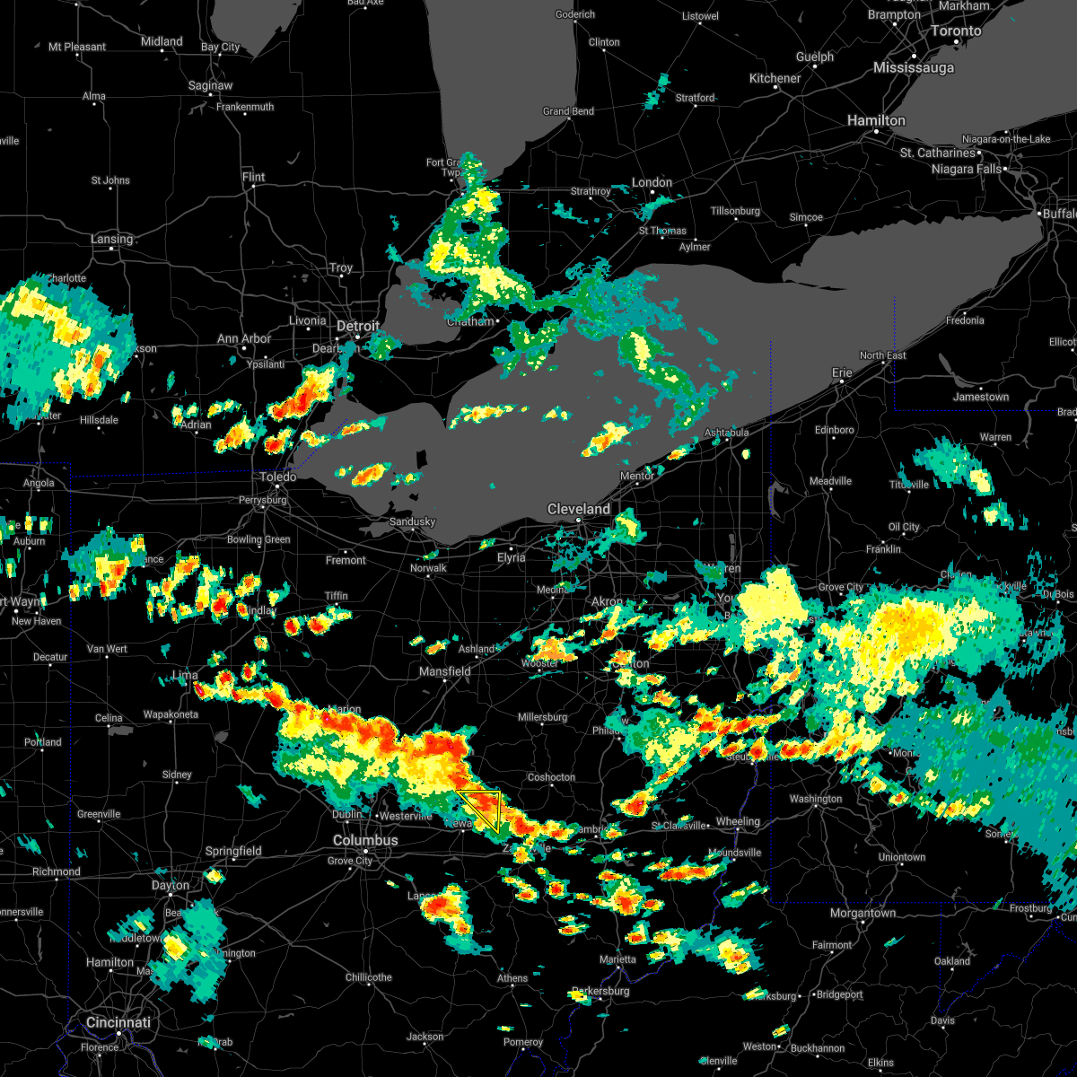 At 148 pm edt, severe thunderstorms were located along a line extending from near utica to near hanover, moving northeast at 30 mph (radar indicated). Hazards include 60 mph wind gusts. Expect damage to trees and power lines. Locations impacted include, utica, purity and fallsburg. At 148 pm edt, severe thunderstorms were located along a line extending from near utica to near hanover, moving northeast at 30 mph (radar indicated). Hazards include 60 mph wind gusts. Expect damage to trees and power lines. Locations impacted include, utica, purity and fallsburg.
|
| 8/28/2020 1:39 PM EDT |
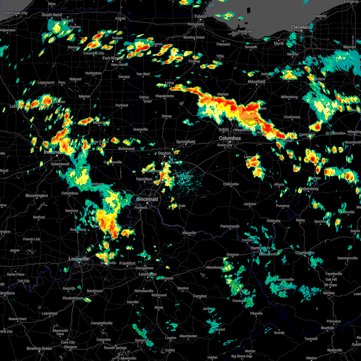 The severe thunderstorm warning for northwestern licking county will expire at 145 pm edt, the storm which prompted the warning has moved out of the area. therefore, the warning will be allowed to expire. please report previous wind damage or hail to the national weather service by going to our website at weather.gov/iln and submitting your report via social media. remember, a severe thunderstorm warning still remains in effect for northeast licking county until 215 pm. The severe thunderstorm warning for northwestern licking county will expire at 145 pm edt, the storm which prompted the warning has moved out of the area. therefore, the warning will be allowed to expire. please report previous wind damage or hail to the national weather service by going to our website at weather.gov/iln and submitting your report via social media. remember, a severe thunderstorm warning still remains in effect for northeast licking county until 215 pm.
|
| 8/28/2020 1:37 PM EDT |
 At 137 pm edt, severe thunderstorms were located along a line extending from utica to near hanover, moving northeast at 30 mph (radar indicated). Hazards include 60 mph wind gusts. expect damage to trees and power lines At 137 pm edt, severe thunderstorms were located along a line extending from utica to near hanover, moving northeast at 30 mph (radar indicated). Hazards include 60 mph wind gusts. expect damage to trees and power lines
|
| 8/28/2020 1:27 PM EDT |
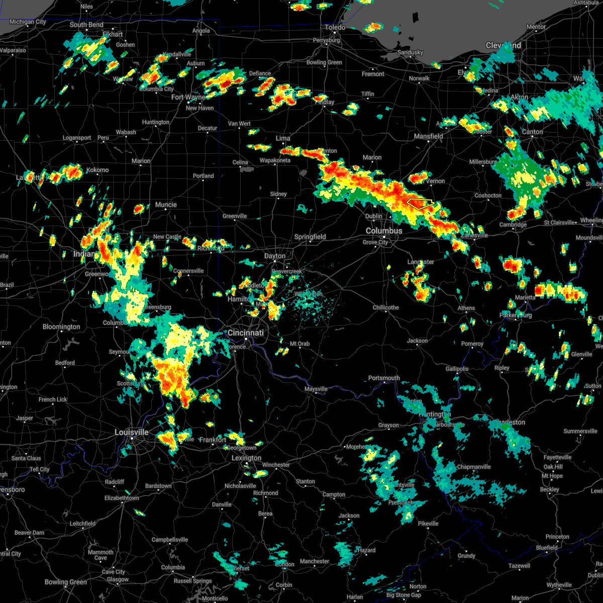 At 127 pm edt, a severe thunderstorm was located near centerburg, moving northeast at 40 mph (radar indicated). Hazards include 70 mph wind gusts. Expect considerable tree damage. damage is likely to mobile homes, roofs, and outbuildings. Locations impacted include, utica, hartford and us route 62 at state route 661. At 127 pm edt, a severe thunderstorm was located near centerburg, moving northeast at 40 mph (radar indicated). Hazards include 70 mph wind gusts. Expect considerable tree damage. damage is likely to mobile homes, roofs, and outbuildings. Locations impacted include, utica, hartford and us route 62 at state route 661.
|
| 8/28/2020 1:22 PM EDT |
 At 121 pm edt, severe thunderstorms were located along a line extending from 6 miles west of kenton to near utica, moving northeast at 35 mph (radar indicated). Hazards include 60 mph wind gusts. expect damage to trees and power lines At 121 pm edt, severe thunderstorms were located along a line extending from 6 miles west of kenton to near utica, moving northeast at 35 mph (radar indicated). Hazards include 60 mph wind gusts. expect damage to trees and power lines
|
| 8/28/2020 1:13 PM EDT |
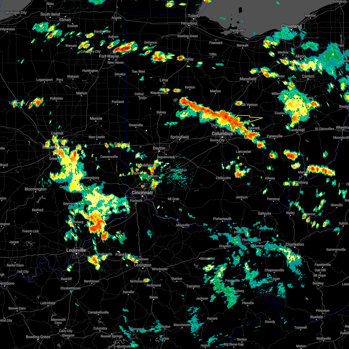 At 113 pm edt, a severe thunderstorm was located near johnstown, moving northeast at 40 mph (radar indicated). Hazards include 60 mph wind gusts. Expect damage to trees and power lines. Locations impacted include, johnstown, utica, hartford, center village and us route 62 at state route 661. At 113 pm edt, a severe thunderstorm was located near johnstown, moving northeast at 40 mph (radar indicated). Hazards include 60 mph wind gusts. Expect damage to trees and power lines. Locations impacted include, johnstown, utica, hartford, center village and us route 62 at state route 661.
|
| 8/28/2020 12:52 PM EDT |
 At 1252 pm edt, a severe thunderstorm was located over easton, moving northeast at 45 mph (radar indicated). Hazards include 60 mph wind gusts and penny size hail. expect damage to trees and power lines At 1252 pm edt, a severe thunderstorm was located over easton, moving northeast at 45 mph (radar indicated). Hazards include 60 mph wind gusts and penny size hail. expect damage to trees and power lines
|
| 7/10/2020 4:24 PM EDT |
 The severe thunderstorm warning for knox county will expire at 430 pm edt, the storm which prompted the warning has weakened below severe limits, and no longer poses an immediate threat to life or property. therefore, the warning will be allowed to expire. however gusty winds and heavy rain are still possible with this thunderstorm. The severe thunderstorm warning for knox county will expire at 430 pm edt, the storm which prompted the warning has weakened below severe limits, and no longer poses an immediate threat to life or property. therefore, the warning will be allowed to expire. however gusty winds and heavy rain are still possible with this thunderstorm.
|
| 7/10/2020 4:11 PM EDT |
 At 411 pm edt, severe thunderstorms were located along a line extending from 6 miles northwest of utica to near granville to near millersport, moving northeast at 25 mph (radar indicated). Hazards include 60 mph wind gusts. Expect damage to trees and power lines. Locations impacted include, newark, reynoldsburg, heath, granville, pataskala, johnstown, buckeye lake, hebron, utica, hanover, harbor hills, granville south, marne, beechwood trails, summit station, thornport, etna, new albany, jersey and kirkersville. At 411 pm edt, severe thunderstorms were located along a line extending from 6 miles northwest of utica to near granville to near millersport, moving northeast at 25 mph (radar indicated). Hazards include 60 mph wind gusts. Expect damage to trees and power lines. Locations impacted include, newark, reynoldsburg, heath, granville, pataskala, johnstown, buckeye lake, hebron, utica, hanover, harbor hills, granville south, marne, beechwood trails, summit station, thornport, etna, new albany, jersey and kirkersville.
|
| 7/10/2020 3:59 PM EDT |
 A severe thunderstorm warning remains in effect until 430 pm edt for knox county. at 359 pm edt, a severe thunderstorm was located over chesterville, or 10 miles northwest of mount vernon, moving northeast at 35 mph. hazard. 60 mph wind gusts. source. Radar indicated. A severe thunderstorm warning remains in effect until 430 pm edt for knox county. at 359 pm edt, a severe thunderstorm was located over chesterville, or 10 miles northwest of mount vernon, moving northeast at 35 mph. hazard. 60 mph wind gusts. source. Radar indicated.
|
| 7/10/2020 3:32 PM EDT |
 At 332 pm edt, a severe thunderstorm was located near sunbury, or 11 miles east of delaware, moving northeast at 35 mph (radar indicated). Hazards include 60 mph wind gusts. expect damage to trees and power lines At 332 pm edt, a severe thunderstorm was located near sunbury, or 11 miles east of delaware, moving northeast at 35 mph (radar indicated). Hazards include 60 mph wind gusts. expect damage to trees and power lines
|
| 7/10/2020 3:27 PM EDT |
 At 327 pm edt, severe thunderstorms were located along a line extending from near sunbury to near canal winchester, moving east at 25 mph (radar indicated). Hazards include 60 mph wind gusts. expect damage to trees and power lines At 327 pm edt, severe thunderstorms were located along a line extending from near sunbury to near canal winchester, moving east at 25 mph (radar indicated). Hazards include 60 mph wind gusts. expect damage to trees and power lines
|
| 7/10/2020 1:56 PM EDT |
 The severe thunderstorm warning for eastern morrow and knox counties will expire at 200 pm edt, the storms which prompted the warning have weakened below severe limits, and no longer pose an immediate threat to life or property. therefore, the warning will be allowed to expire. however gusty winds are still possible with these thunderstorms. The severe thunderstorm warning for eastern morrow and knox counties will expire at 200 pm edt, the storms which prompted the warning have weakened below severe limits, and no longer pose an immediate threat to life or property. therefore, the warning will be allowed to expire. however gusty winds are still possible with these thunderstorms.
|
| 7/10/2020 1:31 PM EDT |
 At 131 pm edt, severe thunderstorms were located along a line extending from 6 miles northeast of mount gilead to near fredericktown to near utica, moving north at 30 mph (radar indicated). Hazards include 60 mph wind gusts. Expect damage to trees and power lines. Locations impacted include, mount vernon, mount gilead, fredericktown, gambier, utica, chesterville, sparta, waterford, martinsburg, north liberty, iberia and shauck. At 131 pm edt, severe thunderstorms were located along a line extending from 6 miles northeast of mount gilead to near fredericktown to near utica, moving north at 30 mph (radar indicated). Hazards include 60 mph wind gusts. Expect damage to trees and power lines. Locations impacted include, mount vernon, mount gilead, fredericktown, gambier, utica, chesterville, sparta, waterford, martinsburg, north liberty, iberia and shauck.
|
| 7/10/2020 1:05 PM EDT |
 At 105 pm edt, severe thunderstorms were located along a line extending from cardington to near sparta to near johnstown, moving northeast at 35 mph (radar indicated). Hazards include 60 mph wind gusts and penny size hail. expect damage to trees and power lines At 105 pm edt, severe thunderstorms were located along a line extending from cardington to near sparta to near johnstown, moving northeast at 35 mph (radar indicated). Hazards include 60 mph wind gusts and penny size hail. expect damage to trees and power lines
|
| 6/26/2020 6:23 PM EDT |
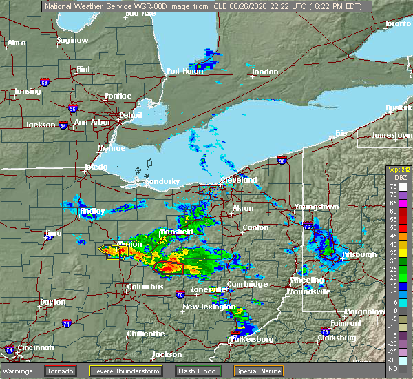 At 622 pm edt, a severe thunderstorm capable of producing a tornado was located near utica, or near mount vernon, moving southeast at 30 mph (radar indicated rotation). Hazards include tornado and quarter size hail. Flying debris will be dangerous to those caught without shelter. mobile homes will be damaged or destroyed. damage to roofs, windows, and vehicles will occur. tree damage is likely. Locations impacted include, utica, martinsburg and bladensburg. At 622 pm edt, a severe thunderstorm capable of producing a tornado was located near utica, or near mount vernon, moving southeast at 30 mph (radar indicated rotation). Hazards include tornado and quarter size hail. Flying debris will be dangerous to those caught without shelter. mobile homes will be damaged or destroyed. damage to roofs, windows, and vehicles will occur. tree damage is likely. Locations impacted include, utica, martinsburg and bladensburg.
|
| 6/26/2020 6:11 PM EDT |
 At 611 pm edt, a severe thunderstorm capable of producing a tornado was located near mount vernon, moving southeast at 25 mph (radar indicated rotation). Hazards include tornado and quarter size hail. Flying debris will be dangerous to those caught without shelter. mobile homes will be damaged or destroyed. damage to roofs, windows, and vehicles will occur. Tree damage is likely. At 611 pm edt, a severe thunderstorm capable of producing a tornado was located near mount vernon, moving southeast at 25 mph (radar indicated rotation). Hazards include tornado and quarter size hail. Flying debris will be dangerous to those caught without shelter. mobile homes will be damaged or destroyed. damage to roofs, windows, and vehicles will occur. Tree damage is likely.
|
| 6/21/2020 6:54 PM EDT |
 At 654 pm edt, a severe thunderstorm was located over centerburg, or 12 miles southwest of mount vernon, moving northeast at 35 mph (radar indicated). Hazards include 60 mph wind gusts and nickel size hail. expect damage to trees and power lines At 654 pm edt, a severe thunderstorm was located over centerburg, or 12 miles southwest of mount vernon, moving northeast at 35 mph (radar indicated). Hazards include 60 mph wind gusts and nickel size hail. expect damage to trees and power lines
|
| 6/10/2020 7:38 PM EDT |
 At 737 pm edt, a severe thunderstorm was located 7 miles southeast of gambier, or 11 miles southeast of mount vernon, moving northeast at 55 mph. the strongest winds will move across southeastern knox county. this is a very dangerous storm (radar indicated). Hazards include 80 mph wind gusts and nickel size hail. Flying debris will be dangerous to those caught without shelter. mobile homes will be heavily damaged. expect considerable damage to roofs, windows, and vehicles. extensive tree damage and power outages are likely. Locations impacted include, mount vernon, millersburg, berlin, walnut creek, gambier, utica, danville, killbuck, glenmont, winesburg, farmerstown, baltic, martinsburg, gann, bladensburg, mount hope and charm. At 737 pm edt, a severe thunderstorm was located 7 miles southeast of gambier, or 11 miles southeast of mount vernon, moving northeast at 55 mph. the strongest winds will move across southeastern knox county. this is a very dangerous storm (radar indicated). Hazards include 80 mph wind gusts and nickel size hail. Flying debris will be dangerous to those caught without shelter. mobile homes will be heavily damaged. expect considerable damage to roofs, windows, and vehicles. extensive tree damage and power outages are likely. Locations impacted include, mount vernon, millersburg, berlin, walnut creek, gambier, utica, danville, killbuck, glenmont, winesburg, farmerstown, baltic, martinsburg, gann, bladensburg, mount hope and charm.
|
| 6/10/2020 7:30 PM EDT |
 At 730 pm edt, a severe thunderstorm was located near granville, moving northeast at 55 mph (radar indicated). Hazards include 60 mph wind gusts. expect damage to trees and power lines At 730 pm edt, a severe thunderstorm was located near granville, moving northeast at 55 mph (radar indicated). Hazards include 60 mph wind gusts. expect damage to trees and power lines
|
| 6/10/2020 7:27 PM EDT |
 The severe thunderstorm warning for northern licking county will expire at 730 pm edt, the severe thunderstorm which prompted the warning has moved out of the warned area. therefore, the warning will be allowed to expire. a severe thunderstorm watch remains in effect until 1000 pm edt for central ohio. please report previous wind damage or hail to the national weather service by going to our website at weather.gov/iln and submitting your report via social media. The severe thunderstorm warning for northern licking county will expire at 730 pm edt, the severe thunderstorm which prompted the warning has moved out of the warned area. therefore, the warning will be allowed to expire. a severe thunderstorm watch remains in effect until 1000 pm edt for central ohio. please report previous wind damage or hail to the national weather service by going to our website at weather.gov/iln and submitting your report via social media.
|
| 6/10/2020 7:20 PM EDT |
 At 720 pm edt, a severe thunderstorm was located near granville, moving northeast at 55 mph (radar indicated). Hazards include 70 mph wind gusts and nickel size hail. Expect considerable tree damage. Damage is likely to mobile homes, roofs, and outbuildings. At 720 pm edt, a severe thunderstorm was located near granville, moving northeast at 55 mph (radar indicated). Hazards include 70 mph wind gusts and nickel size hail. Expect considerable tree damage. Damage is likely to mobile homes, roofs, and outbuildings.
|
| 6/10/2020 7:16 PM EDT |
 At 716 pm edt, a severe thunderstorm was located near utica, moving northeast at 40 mph (radar indicated). Hazards include 60 mph wind gusts. Expect damage to trees and power lines. locations impacted include, newark, reynoldsburg, granville, pataskala, johnstown, utica, summit station, beechwood trails, granville south, new albany, jersey, alexandria, hartford, st. Louisville, fredonia, us route 62 at state route 661, purity, state route 310 at state route 161 and fallsburg. At 716 pm edt, a severe thunderstorm was located near utica, moving northeast at 40 mph (radar indicated). Hazards include 60 mph wind gusts. Expect damage to trees and power lines. locations impacted include, newark, reynoldsburg, granville, pataskala, johnstown, utica, summit station, beechwood trails, granville south, new albany, jersey, alexandria, hartford, st. Louisville, fredonia, us route 62 at state route 661, purity, state route 310 at state route 161 and fallsburg.
|
| 6/10/2020 7:05 PM EDT |
 At 705 pm edt, a severe thunderstorm was located near johnstown, moving northeast at 40 mph (radar indicated). Hazards include 60 mph wind gusts. Expect damage to trees and power lines. locations impacted include, columbus, newark, westerville, reynoldsburg, gahanna, granville, pataskala, johnstown, utica, minerva park, beechwood trails, easton, summit station, granville south, whitehall, new albany, jersey, alexandria, hartford and st. Louisville. At 705 pm edt, a severe thunderstorm was located near johnstown, moving northeast at 40 mph (radar indicated). Hazards include 60 mph wind gusts. Expect damage to trees and power lines. locations impacted include, columbus, newark, westerville, reynoldsburg, gahanna, granville, pataskala, johnstown, utica, minerva park, beechwood trails, easton, summit station, granville south, whitehall, new albany, jersey, alexandria, hartford and st. Louisville.
|
| 6/10/2020 6:45 PM EDT |
 At 644 pm edt, a severe thunderstorm was located near westerville, moving northeast at 40 mph (radar indicated). Hazards include 60 mph wind gusts. expect damage to trees and power lines At 644 pm edt, a severe thunderstorm was located near westerville, moving northeast at 40 mph (radar indicated). Hazards include 60 mph wind gusts. expect damage to trees and power lines
|
| 6/4/2020 1:25 PM EDT |
 At 124 pm edt, a severe thunderstorm was located over fredericktown, or near mount vernon, moving east at 40 mph (radar indicated). Hazards include 60 mph wind gusts and quarter size hail. Minor damage to vehicles is possible. expect damage to trees and power lines. Locations impacted include, mount vernon, fredericktown, gambier, utica, danville, waterford, martinsburg, gann, north liberty and bladensburg. At 124 pm edt, a severe thunderstorm was located over fredericktown, or near mount vernon, moving east at 40 mph (radar indicated). Hazards include 60 mph wind gusts and quarter size hail. Minor damage to vehicles is possible. expect damage to trees and power lines. Locations impacted include, mount vernon, fredericktown, gambier, utica, danville, waterford, martinsburg, gann, north liberty and bladensburg.
|
| 6/4/2020 1:04 PM EDT |
 At 103 pm edt, a severe thunderstorm was located over sparta, or 11 miles southeast of mount gilead, moving east at 40 mph (radar indicated). Hazards include 60 mph wind gusts and quarter size hail. Minor damage to vehicles is possible. Expect damage to trees and power lines. At 103 pm edt, a severe thunderstorm was located over sparta, or 11 miles southeast of mount gilead, moving east at 40 mph (radar indicated). Hazards include 60 mph wind gusts and quarter size hail. Minor damage to vehicles is possible. Expect damage to trees and power lines.
|
| 6/4/2020 12:52 PM EDT |
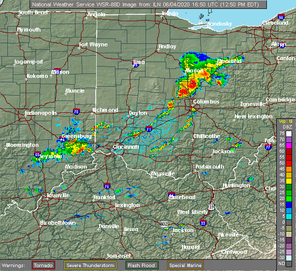 At 1251 pm edt, a severe thunderstorm was located near sunbury, moving east at 40 mph (radar indicated). Hazards include 60 mph wind gusts and quarter size hail. Minor hail damage to vehicles is possible. Expect wind damage to trees and power lines. At 1251 pm edt, a severe thunderstorm was located near sunbury, moving east at 40 mph (radar indicated). Hazards include 60 mph wind gusts and quarter size hail. Minor hail damage to vehicles is possible. Expect wind damage to trees and power lines.
|
| 5/14/2020 6:57 PM EDT |
 The severe thunderstorm warning for central licking county will expire at 700 pm edt, the storms which prompted the warning have moved out of the area. therefore, the warning will be allowed to expire. please report previous wind damage or hail to the national weather service by going to our website at weather.gov/iln and submitting your report via social media. The severe thunderstorm warning for central licking county will expire at 700 pm edt, the storms which prompted the warning have moved out of the area. therefore, the warning will be allowed to expire. please report previous wind damage or hail to the national weather service by going to our website at weather.gov/iln and submitting your report via social media.
|
| 5/14/2020 6:32 PM EDT |
 At 631 pm edt, severe thunderstorms were located along a line extending from near utica to 6 miles northwest of granville to beechwood trails, moving east at 40 mph (radar indicated). Hazards include 60 mph wind gusts. Expect damage to trees and power lines. locations impacted include, newark, heath, granville, pataskala, utica, hanover, granville south, marne, beechwood trails, alexandria, st. Louisville, toboso, fredonia, us route 62 at state route 661, purity, state route 310 at state route 161 and fallsburg. At 631 pm edt, severe thunderstorms were located along a line extending from near utica to 6 miles northwest of granville to beechwood trails, moving east at 40 mph (radar indicated). Hazards include 60 mph wind gusts. Expect damage to trees and power lines. locations impacted include, newark, heath, granville, pataskala, utica, hanover, granville south, marne, beechwood trails, alexandria, st. Louisville, toboso, fredonia, us route 62 at state route 661, purity, state route 310 at state route 161 and fallsburg.
|
| 5/14/2020 6:28 PM EDT |
 At 628 pm edt, a severe thunderstorm was located near utica, or near mount vernon, moving east at 50 mph (radar indicated). Hazards include 60 mph wind gusts and penny size hail. Expect damage to trees and power lines. Locations impacted include, mount vernon, gambier, utica, martinsburg and bladensburg. At 628 pm edt, a severe thunderstorm was located near utica, or near mount vernon, moving east at 50 mph (radar indicated). Hazards include 60 mph wind gusts and penny size hail. Expect damage to trees and power lines. Locations impacted include, mount vernon, gambier, utica, martinsburg and bladensburg.
|
| 5/14/2020 6:12 PM EDT |
 At 611 pm edt, severe thunderstorms were located along a line extending from near sunbury to near westerville to minerva park, moving east at 45 mph (radar indicated). Hazards include 60 mph wind gusts. expect damage to trees and power lines At 611 pm edt, severe thunderstorms were located along a line extending from near sunbury to near westerville to minerva park, moving east at 45 mph (radar indicated). Hazards include 60 mph wind gusts. expect damage to trees and power lines
|
| 5/14/2020 6:06 PM EDT |
 At 606 pm edt, severe thunderstorms were located along a line extending from near lexington to near sparta, moving southeast at 50 mph (radar indicated). Hazards include 60 mph wind gusts and quarter size hail. Minor damage to vehicles is possible. Expect damage to trees and power lines. At 606 pm edt, severe thunderstorms were located along a line extending from near lexington to near sparta, moving southeast at 50 mph (radar indicated). Hazards include 60 mph wind gusts and quarter size hail. Minor damage to vehicles is possible. Expect damage to trees and power lines.
|
| 3/28/2020 9:04 PM EDT |
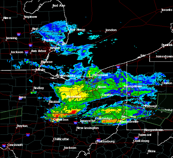 At 904 pm edt, a severe thunderstorm was located near utica, or 10 miles southeast of mount vernon, moving east at 30 mph (radar indicated). Hazards include quarter size hail. minor damage to vehicles is possible At 904 pm edt, a severe thunderstorm was located near utica, or 10 miles southeast of mount vernon, moving east at 30 mph (radar indicated). Hazards include quarter size hail. minor damage to vehicles is possible
|
| 9/1/2019 6:56 PM EDT |
 At 655 pm edt, a severe thunderstorm was located over mount vernon, moving northeast at 30 mph (radar indicated). Hazards include 60 mph wind gusts. Expect damage to trees and power lines. Locations impacted include, mount vernon, fredericktown, gambier, utica, danville, martinsburg and north liberty. At 655 pm edt, a severe thunderstorm was located over mount vernon, moving northeast at 30 mph (radar indicated). Hazards include 60 mph wind gusts. Expect damage to trees and power lines. Locations impacted include, mount vernon, fredericktown, gambier, utica, danville, martinsburg and north liberty.
|
| 9/1/2019 6:25 PM EDT |
 The national weather service in cleveland has issued a * severe thunderstorm warning for. southeastern morrow county in north central ohio. knox county in north central ohio. until 730 pm edt. At 625 pm edt, a severe thunderstorm was located near johnstown, or. The national weather service in cleveland has issued a * severe thunderstorm warning for. southeastern morrow county in north central ohio. knox county in north central ohio. until 730 pm edt. At 625 pm edt, a severe thunderstorm was located near johnstown, or.
|
| 9/1/2019 6:25 PM EDT |
 A severe thunderstorm warning remains in effect until 700 pm edt for northwestern licking county. at 622 pm edt, a severe thunderstorm was located near johnstown, moving northeast at 30 mph. hazard. 60 mph wind gusts and penny size hail. source. Radar indicated. A severe thunderstorm warning remains in effect until 700 pm edt for northwestern licking county. at 622 pm edt, a severe thunderstorm was located near johnstown, moving northeast at 30 mph. hazard. 60 mph wind gusts and penny size hail. source. Radar indicated.
|
| 9/1/2019 6:15 PM EDT |
 At 615 pm edt, a severe thunderstorm was located over johnstown, moving northeast at 30 mph (radar indicated). Hazards include 60 mph wind gusts and penny size hail. Expect damage to trees and power lines. locations impacted include, columbus, newark, westerville, reynoldsburg, gahanna, heath, granville, pataskala, johnstown, sunbury, utica, minerva park, granville south, beechwood trails, easton, summit station, whitehall, new albany, jersey and galena. This includes i-71 in ohio between mile markers 113 and 114. At 615 pm edt, a severe thunderstorm was located over johnstown, moving northeast at 30 mph (radar indicated). Hazards include 60 mph wind gusts and penny size hail. Expect damage to trees and power lines. locations impacted include, columbus, newark, westerville, reynoldsburg, gahanna, heath, granville, pataskala, johnstown, sunbury, utica, minerva park, granville south, beechwood trails, easton, summit station, whitehall, new albany, jersey and galena. This includes i-71 in ohio between mile markers 113 and 114.
|
| 9/1/2019 6:08 PM EDT |
 At 608 pm edt, a severe thunderstorm was located near johnstown, moving northeast at 30 mph (radar indicated). Hazards include 60 mph wind gusts and penny size hail. expect damage to trees and power lines At 608 pm edt, a severe thunderstorm was located near johnstown, moving northeast at 30 mph (radar indicated). Hazards include 60 mph wind gusts and penny size hail. expect damage to trees and power lines
|
| 8/19/2019 12:39 AM EDT |
 The severe thunderstorm warning for knox county will expire at 1245 am edt, the storms which prompted the warning have weakened below severe limits, and have exited the warned area. therefore, the warning will be allowed to expire. however gusty winds are still possible with these thunderstorms. The severe thunderstorm warning for knox county will expire at 1245 am edt, the storms which prompted the warning have weakened below severe limits, and have exited the warned area. therefore, the warning will be allowed to expire. however gusty winds are still possible with these thunderstorms.
|
| 8/19/2019 12:21 AM EDT |
 The severe thunderstorm warning for licking county will expire at 1230 am edt, the severe thunderstorm which prompted the warning has weakened. therefore, the warning will be allowed to expire. however gusty winds and heavy rain are still possible with this thunderstorm. please report previous wind damage or hail to the national weather service by going to our website at weather.gov/iln and submitting your report via social media. The severe thunderstorm warning for licking county will expire at 1230 am edt, the severe thunderstorm which prompted the warning has weakened. therefore, the warning will be allowed to expire. however gusty winds and heavy rain are still possible with this thunderstorm. please report previous wind damage or hail to the national weather service by going to our website at weather.gov/iln and submitting your report via social media.
|
| 8/19/2019 12:19 AM EDT |
 At 1219 am edt, severe thunderstorms were located along a line extending from 7 miles northeast of fredericktown to granville south, moving east at 45 mph (radar indicated). Hazards include 60 mph wind gusts. Expect damage to trees and power lines. Locations impacted include, mount vernon, fredericktown, gambier, utica, centerburg, danville, martinsburg, gann, north liberty and bladensburg. At 1219 am edt, severe thunderstorms were located along a line extending from 7 miles northeast of fredericktown to granville south, moving east at 45 mph (radar indicated). Hazards include 60 mph wind gusts. Expect damage to trees and power lines. Locations impacted include, mount vernon, fredericktown, gambier, utica, centerburg, danville, martinsburg, gann, north liberty and bladensburg.
|
| 8/19/2019 12:05 AM EDT |
 At 1204 am edt, a severe thunderstorm was located over johnstown, moving east at 30 mph (radar indicated). Hazards include 60 mph wind gusts. Expect damage to trees and power lines. locations impacted include, newark, heath, granville, pataskala, johnstown, hebron, utica, hanover, beechwood trails, granville south, marne, new albany, jersey, alexandria, hartford, st. louisville, gratiot, toboso, fredonia and us route 62 at state route 661. This includes i-70 in ohio between mile markers 136 and 142, and near mile marker 144. At 1204 am edt, a severe thunderstorm was located over johnstown, moving east at 30 mph (radar indicated). Hazards include 60 mph wind gusts. Expect damage to trees and power lines. locations impacted include, newark, heath, granville, pataskala, johnstown, hebron, utica, hanover, beechwood trails, granville south, marne, new albany, jersey, alexandria, hartford, st. louisville, gratiot, toboso, fredonia and us route 62 at state route 661. This includes i-70 in ohio between mile markers 136 and 142, and near mile marker 144.
|
| 8/18/2019 11:47 PM EDT |
 At 1146 pm edt, severe thunderstorms were located along a line extending from near cardington to bexley, moving east at 45 mph (radar indicated). Hazards include 60 mph wind gusts. expect damage to trees and power lines At 1146 pm edt, severe thunderstorms were located along a line extending from near cardington to bexley, moving east at 45 mph (radar indicated). Hazards include 60 mph wind gusts. expect damage to trees and power lines
|
| 8/18/2019 11:38 PM EDT |
 At 1137 pm edt, a severe thunderstorm was located over sunbury, moving east at 40 mph (radar indicated). Hazards include 60 mph wind gusts. expect damage to trees and power lines At 1137 pm edt, a severe thunderstorm was located over sunbury, moving east at 40 mph (radar indicated). Hazards include 60 mph wind gusts. expect damage to trees and power lines
|
| 8/8/2019 12:09 PM EDT |
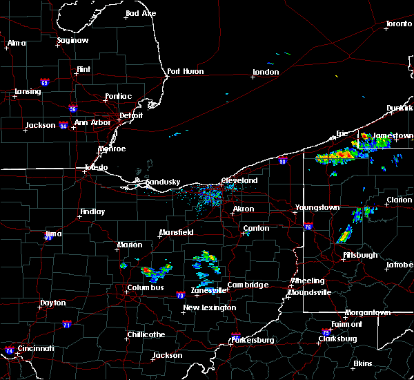 The national weather service in cleveland has issued a * severe thunderstorm warning for. southwestern knox county in north central ohio. until 100 pm edt. At 1209 pm edt, a severe thunderstorm was located near centerburg, or 11 miles southwest of mount vernon, moving southeast at 40 mph. The national weather service in cleveland has issued a * severe thunderstorm warning for. southwestern knox county in north central ohio. until 100 pm edt. At 1209 pm edt, a severe thunderstorm was located near centerburg, or 11 miles southwest of mount vernon, moving southeast at 40 mph.
|
| 7/11/2019 4:07 PM EDT |
 The severe thunderstorm warning for northeastern licking county will expire at 415 pm edt. the storm which prompted the warning has weakened below severe limits, and no longer poses an immediate threat to life or property. therefore, the warning will be allowed to expire. However small hail and gusty winds are still possible with this thunderstorm. The severe thunderstorm warning for northeastern licking county will expire at 415 pm edt. the storm which prompted the warning has weakened below severe limits, and no longer poses an immediate threat to life or property. therefore, the warning will be allowed to expire. However small hail and gusty winds are still possible with this thunderstorm.
|
| 7/11/2019 3:47 PM EDT |
 At 346 pm edt, a severe thunderstorm was located near newark, moving east at 20 mph (radar indicated). Hazards include 60 mph wind gusts and quarter size hail. Minor hail damage to vehicles is possible. expect wind damage to trees and power lines. locations impacted include, newark, heath, granville, utica, hanover, marne, granville south, st. Louisville, toboso, fredonia, us route 62 at state route 661, purity and fallsburg. At 346 pm edt, a severe thunderstorm was located near newark, moving east at 20 mph (radar indicated). Hazards include 60 mph wind gusts and quarter size hail. Minor hail damage to vehicles is possible. expect wind damage to trees and power lines. locations impacted include, newark, heath, granville, utica, hanover, marne, granville south, st. Louisville, toboso, fredonia, us route 62 at state route 661, purity and fallsburg.
|
| 7/11/2019 3:35 PM EDT |
 At 334 pm edt, a severe thunderstorm was located near granville, moving east at 20 mph (radar indicated). Hazards include 60 mph wind gusts and quarter size hail. Minor hail damage to vehicles is possible. Expect wind damage to trees and power lines. At 334 pm edt, a severe thunderstorm was located near granville, moving east at 20 mph (radar indicated). Hazards include 60 mph wind gusts and quarter size hail. Minor hail damage to vehicles is possible. Expect wind damage to trees and power lines.
|
| 7/2/2019 9:02 PM EDT |
 At 901 pm edt, severe thunderstorms were located along a line extending from near mount vernon to near centerburg, moving east at 25 mph (radar indicated). Hazards include 60 mph wind gusts and penny size hail. Expect damage to trees and power lines. Locations impacted include, mount vernon, fredericktown, gambier, utica, centerburg, danville, waterford, martinsburg and bladensburg. At 901 pm edt, severe thunderstorms were located along a line extending from near mount vernon to near centerburg, moving east at 25 mph (radar indicated). Hazards include 60 mph wind gusts and penny size hail. Expect damage to trees and power lines. Locations impacted include, mount vernon, fredericktown, gambier, utica, centerburg, danville, waterford, martinsburg and bladensburg.
|
| 7/2/2019 8:30 PM EDT |
 At 830 pm edt, severe thunderstorms were located along a line extending from near chesterville to near delaware, moving east at 25 mph (radar indicated). Hazards include 60 mph wind gusts and quarter size hail. Minor damage to vehicles is possible. Expect damage to trees and power lines. At 830 pm edt, severe thunderstorms were located along a line extending from near chesterville to near delaware, moving east at 25 mph (radar indicated). Hazards include 60 mph wind gusts and quarter size hail. Minor damage to vehicles is possible. Expect damage to trees and power lines.
|
| 7/2/2019 7:07 PM EDT |
 The severe thunderstorm warning for southeastern knox county will expire at 715 pm edt, the storms which prompted the warning have moved out of the area. therefore, the warning will be allowed to expire. The severe thunderstorm warning for southeastern knox county will expire at 715 pm edt, the storms which prompted the warning have moved out of the area. therefore, the warning will be allowed to expire.
|
| 7/2/2019 6:49 PM EDT |
 At 649 pm edt, severe thunderstorms were located along a line extending from near killbuck to near utica, moving southeast at 30 mph (radar indicated). Hazards include 60 mph wind gusts and quarter size hail. Minor damage to vehicles is possible. expect damage to trees and power lines. Locations impacted include, mount vernon, gambier, utica, danville, martinsburg, gann and bladensburg. At 649 pm edt, severe thunderstorms were located along a line extending from near killbuck to near utica, moving southeast at 30 mph (radar indicated). Hazards include 60 mph wind gusts and quarter size hail. Minor damage to vehicles is possible. expect damage to trees and power lines. Locations impacted include, mount vernon, gambier, utica, danville, martinsburg, gann and bladensburg.
|
| 7/2/2019 6:47 PM EDT | Corrects previous tstm wnd dmg report from 5 wsw martinsburg. trees dow in knox county OH, 1.2 miles SSE of Utica, OH |
| 7/2/2019 6:28 PM EDT |
 At 628 pm edt, severe thunderstorms were located along a line extending from near glenmont to centerburg, moving southeast at 30 mph (radar indicated). Hazards include 60 mph wind gusts and quarter size hail. Minor damage to vehicles is possible. Expect damage to trees and power lines. At 628 pm edt, severe thunderstorms were located along a line extending from near glenmont to centerburg, moving southeast at 30 mph (radar indicated). Hazards include 60 mph wind gusts and quarter size hail. Minor damage to vehicles is possible. Expect damage to trees and power lines.
|
| 7/2/2019 6:22 PM EDT |
 At 621 pm edt, severe thunderstorms were located along a line extending from near loudonville to 6 miles southeast of centerburg, moving east at 30 mph (radar indicated). Hazards include 60 mph wind gusts and quarter size hail. Minor damage to vehicles is possible. expect damage to trees and power lines. Locations impacted include, mount vernon, fredericktown, gambier, utica, centerburg, danville, waterford, martinsburg, gann, north liberty and bladensburg. At 621 pm edt, severe thunderstorms were located along a line extending from near loudonville to 6 miles southeast of centerburg, moving east at 30 mph (radar indicated). Hazards include 60 mph wind gusts and quarter size hail. Minor damage to vehicles is possible. expect damage to trees and power lines. Locations impacted include, mount vernon, fredericktown, gambier, utica, centerburg, danville, waterford, martinsburg, gann, north liberty and bladensburg.
|
| 7/2/2019 6:10 PM EDT |
 At 610 pm edt, severe thunderstorms were located along a line extending from 6 miles east of bellville to centerburg, moving east at 30 mph (radar indicated). Hazards include 60 mph wind gusts and quarter size hail. Minor damage to vehicles is possible. expect damage to trees and power lines. Locations impacted include, mount vernon, fredericktown, gambier, utica, bellville, centerburg, danville, chesterville, sparta, waterford, marengo, fulton, martinsburg, gann, north liberty and bladensburg. At 610 pm edt, severe thunderstorms were located along a line extending from 6 miles east of bellville to centerburg, moving east at 30 mph (radar indicated). Hazards include 60 mph wind gusts and quarter size hail. Minor damage to vehicles is possible. expect damage to trees and power lines. Locations impacted include, mount vernon, fredericktown, gambier, utica, bellville, centerburg, danville, chesterville, sparta, waterford, marengo, fulton, martinsburg, gann, north liberty and bladensburg.
|
| 7/2/2019 5:47 PM EDT | Trees dow in knox county OH, 1.2 miles SSE of Utica, OH |
| 7/2/2019 5:34 PM EDT |
 At 534 pm edt, severe thunderstorms were located along a line extending from near lexington to near ashley, moving southeast at 25 mph (radar indicated). Hazards include 60 mph wind gusts and quarter size hail. Minor damage to vehicles is possible. Expect damage to trees and power lines. At 534 pm edt, severe thunderstorms were located along a line extending from near lexington to near ashley, moving southeast at 25 mph (radar indicated). Hazards include 60 mph wind gusts and quarter size hail. Minor damage to vehicles is possible. Expect damage to trees and power lines.
|
| 6/5/2019 6:00 PM EDT | Multiple trees knocked down from thunderstorm wind in licking county OH, 5 miles W of Utica, OH |
| 6/5/2019 5:57 PM EDT |
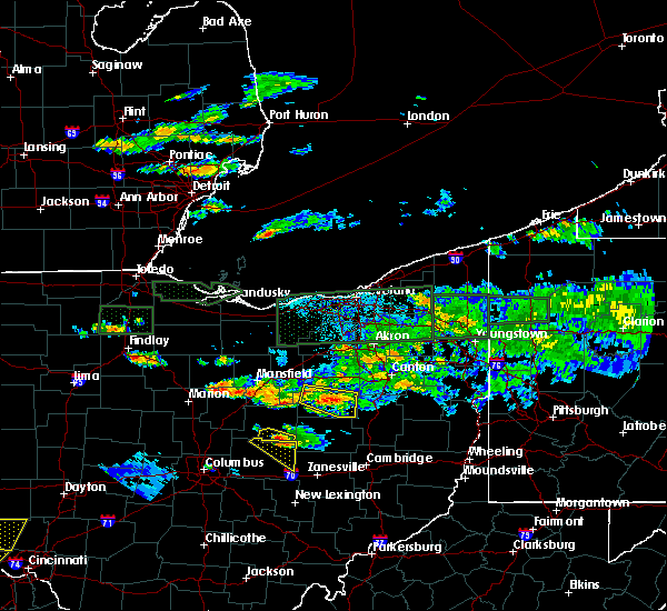 At 557 pm edt, a severe thunderstorm was located near utica, or 11 miles southeast of mount vernon, moving southeast at 25 mph (radar indicated). Hazards include 60 mph wind gusts and quarter size hail. Minor damage to vehicles is possible. expect damage to trees and power lines. Locations impacted include, utica, martinsburg and bladensburg. At 557 pm edt, a severe thunderstorm was located near utica, or 11 miles southeast of mount vernon, moving southeast at 25 mph (radar indicated). Hazards include 60 mph wind gusts and quarter size hail. Minor damage to vehicles is possible. expect damage to trees and power lines. Locations impacted include, utica, martinsburg and bladensburg.
|
| 6/5/2019 5:48 PM EDT |
 At 548 pm edt, a severe thunderstorm was located over utica, moving southeast at 20 mph (trained weather spotters). Hazards include 60 mph wind gusts. expect damage to trees and power lines At 548 pm edt, a severe thunderstorm was located over utica, moving southeast at 20 mph (trained weather spotters). Hazards include 60 mph wind gusts. expect damage to trees and power lines
|
| 6/5/2019 5:45 PM EDT |
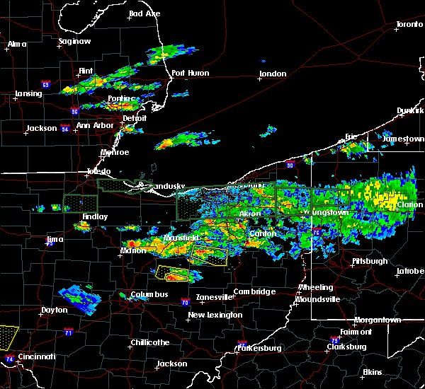 At 545 pm edt, a severe thunderstorm was located near gambier, or near mount vernon, moving east at 25 mph (radar indicated). Hazards include 60 mph wind gusts and quarter size hail. Minor damage to vehicles is possible. expect damage to trees and power lines. Locations impacted include, utica, martinsburg and bladensburg. At 545 pm edt, a severe thunderstorm was located near gambier, or near mount vernon, moving east at 25 mph (radar indicated). Hazards include 60 mph wind gusts and quarter size hail. Minor damage to vehicles is possible. expect damage to trees and power lines. Locations impacted include, utica, martinsburg and bladensburg.
|
| 6/5/2019 5:40 PM EDT |
 At 539 pm edt, a severe thunderstorm was located near mount vernon, moving east at 25 mph (radar indicated). Hazards include 60 mph wind gusts and quarter size hail. Minor damage to vehicles is possible. Expect damage to trees and power lines. At 539 pm edt, a severe thunderstorm was located near mount vernon, moving east at 25 mph (radar indicated). Hazards include 60 mph wind gusts and quarter size hail. Minor damage to vehicles is possible. Expect damage to trees and power lines.
|
| 6/5/2019 5:27 PM EDT |
 At 527 pm edt, a severe thunderstorm was located near mount vernon, moving east at 25 mph (radar indicated). Hazards include 60 mph wind gusts and quarter size hail. Minor damage to vehicles is possible. Expect damage to trees and power lines. At 527 pm edt, a severe thunderstorm was located near mount vernon, moving east at 25 mph (radar indicated). Hazards include 60 mph wind gusts and quarter size hail. Minor damage to vehicles is possible. Expect damage to trees and power lines.
|
| 6/2/2019 2:12 AM EDT |
 The severe thunderstorm warning for northeastern franklin, southeastern delaware and western licking counties will expire at 215 am edt, the storm which prompted the warning has weakened below severe limits, and no longer poses an immediate threat to life or property. therefore, the warning will be allowed to expire. please report previous wind damage or hail to the national weather service by going to our website at weather.gov/iln and submitting your report via social media. The severe thunderstorm warning for northeastern franklin, southeastern delaware and western licking counties will expire at 215 am edt, the storm which prompted the warning has weakened below severe limits, and no longer poses an immediate threat to life or property. therefore, the warning will be allowed to expire. please report previous wind damage or hail to the national weather service by going to our website at weather.gov/iln and submitting your report via social media.
|
| 6/2/2019 2:01 AM EDT |
 At 201 am edt, a severe thunderstorm was located near johnstown, moving southeast at 40 mph (radar indicated). Hazards include 60 mph wind gusts. Expect damage to trees and power lines. locations impacted include, columbus, westerville, reynoldsburg, gahanna, worthington, granville, pataskala, johnstown, sunbury, utica, minerva park, granville south, beechwood trails, easton, summit station, etna, new albany, jersey, galena and kirkersville. this includes the following interstates, i-70 in ohio between mile markers 115 and 124. I-71 in ohio between mile markers 117 and 121. At 201 am edt, a severe thunderstorm was located near johnstown, moving southeast at 40 mph (radar indicated). Hazards include 60 mph wind gusts. Expect damage to trees and power lines. locations impacted include, columbus, westerville, reynoldsburg, gahanna, worthington, granville, pataskala, johnstown, sunbury, utica, minerva park, granville south, beechwood trails, easton, summit station, etna, new albany, jersey, galena and kirkersville. this includes the following interstates, i-70 in ohio between mile markers 115 and 124. I-71 in ohio between mile markers 117 and 121.
|
| 6/2/2019 1:44 AM EDT |
 At 144 am edt, a severe thunderstorm was located near sunbury, moving southeast at 40 mph (radar indicated). Hazards include 60 mph wind gusts. expect damage to trees and power lines At 144 am edt, a severe thunderstorm was located near sunbury, moving southeast at 40 mph (radar indicated). Hazards include 60 mph wind gusts. expect damage to trees and power lines
|
| 5/26/2019 7:57 AM EDT |
 The severe thunderstorm warning for northeastern franklin, southeastern delaware and western licking counties will expire at 800 am edt, the storms which prompted the warning have weakened below severe limits, and no longer pose an immediate threat to life or property. therefore, the warning will be allowed to expire. some strong wind gusts will remain possible in licking county with this storm. a severe thunderstorm watch remains in effect until 1000 am edt for central ohio. please report previous wind damage or hail to the national weather service by going to our website at weather.gov/iln and submitting your report via social media. The severe thunderstorm warning for northeastern franklin, southeastern delaware and western licking counties will expire at 800 am edt, the storms which prompted the warning have weakened below severe limits, and no longer pose an immediate threat to life or property. therefore, the warning will be allowed to expire. some strong wind gusts will remain possible in licking county with this storm. a severe thunderstorm watch remains in effect until 1000 am edt for central ohio. please report previous wind damage or hail to the national weather service by going to our website at weather.gov/iln and submitting your report via social media.
|
| 5/26/2019 7:46 AM EDT |
 At 745 am edt, severe thunderstorms were located along a line extending from near centerburg to easton, moving east at 40 mph (radar indicated). Hazards include 60 mph wind gusts. Expect damage to trees and power lines. locations impacted include, columbus, westerville, reynoldsburg, gahanna, worthington, pataskala, johnstown, sunbury, utica, minerva park, easton, summit station, beechwood trails, new albany, jersey, galena, riverlea, alexandria, hartford and us route 62 at state route 661. This includes i-71 in ohio between mile markers 115 and 119. At 745 am edt, severe thunderstorms were located along a line extending from near centerburg to easton, moving east at 40 mph (radar indicated). Hazards include 60 mph wind gusts. Expect damage to trees and power lines. locations impacted include, columbus, westerville, reynoldsburg, gahanna, worthington, pataskala, johnstown, sunbury, utica, minerva park, easton, summit station, beechwood trails, new albany, jersey, galena, riverlea, alexandria, hartford and us route 62 at state route 661. This includes i-71 in ohio between mile markers 115 and 119.
|
| 5/26/2019 7:31 AM EDT |
 At 730 am edt, severe thunderstorms were located along a line extending from near ashley to dublin, moving east at 35 mph (radar indicated). Hazards include 60 mph wind gusts. expect damage to trees and power lines At 730 am edt, severe thunderstorms were located along a line extending from near ashley to dublin, moving east at 35 mph (radar indicated). Hazards include 60 mph wind gusts. expect damage to trees and power lines
|
| 5/17/2019 6:58 PM EDT |
 At 658 pm edt, a severe thunderstorm was located near utica, or 8 miles south of mount vernon, moving southeast at 30 mph (radar indicated). Hazards include quarter size hail. Minor damage to vehicles is possible. Locations impacted include, utica, martinsburg and bladensburg. At 658 pm edt, a severe thunderstorm was located near utica, or 8 miles south of mount vernon, moving southeast at 30 mph (radar indicated). Hazards include quarter size hail. Minor damage to vehicles is possible. Locations impacted include, utica, martinsburg and bladensburg.
|
| 5/17/2019 6:47 PM EDT |
 At 647 pm edt, a severe thunderstorm was located near centerburg, or near mount vernon, moving southeast at 35 mph (radar indicated). Hazards include 60 mph wind gusts and quarter size hail. Minor damage to vehicles is possible. expect damage to trees and power lines. Locations impacted include, mount vernon, gambier, utica, martinsburg and bladensburg. At 647 pm edt, a severe thunderstorm was located near centerburg, or near mount vernon, moving southeast at 35 mph (radar indicated). Hazards include 60 mph wind gusts and quarter size hail. Minor damage to vehicles is possible. expect damage to trees and power lines. Locations impacted include, mount vernon, gambier, utica, martinsburg and bladensburg.
|
| 5/17/2019 6:33 PM EDT |
 At 633 pm edt, a severe thunderstorm was located over sparta, or 10 miles southeast of mount gilead, moving southeast at 25 mph (radar indicated). Hazards include 60 mph wind gusts and quarter size hail. Minor damage to vehicles is possible. Expect damage to trees and power lines. At 633 pm edt, a severe thunderstorm was located over sparta, or 10 miles southeast of mount gilead, moving southeast at 25 mph (radar indicated). Hazards include 60 mph wind gusts and quarter size hail. Minor damage to vehicles is possible. Expect damage to trees and power lines.
|
| 4/14/2019 7:10 PM EDT |
 The severe thunderstorm warning for northeastern fairfield and eastern licking counties will expire at 715 pm edt, the storms which prompted the warning have weakened below severe limits, and have exited the warned area. therefore, the warning will be allowed to expire. please report previous wind damage or hail to the national weather service by going to our website at weather.gov/iln and submitting your report via social media. The severe thunderstorm warning for northeastern fairfield and eastern licking counties will expire at 715 pm edt, the storms which prompted the warning have weakened below severe limits, and have exited the warned area. therefore, the warning will be allowed to expire. please report previous wind damage or hail to the national weather service by going to our website at weather.gov/iln and submitting your report via social media.
|
| 4/14/2019 7:06 PM EDT |
 At 705 pm edt, severe thunderstorms were located along a line extending from 9 miles east of utica to near bremen, moving east at 35 mph (radar indicated). Hazards include 60 mph wind gusts. Expect damage to trees and power lines. locations impacted include, newark, heath, granville, buckeye lake, hebron, utica, pleasantville, hanover, fairfield beach, harbor hills, marne, thornport, granville south, st. louisville, gratiot, toboso, purity, brownsville, interstate 70 at state route 13 and fallsburg. This includes i-70 in ohio between mile markers 127 and 142, and near mile marker 144. At 705 pm edt, severe thunderstorms were located along a line extending from 9 miles east of utica to near bremen, moving east at 35 mph (radar indicated). Hazards include 60 mph wind gusts. Expect damage to trees and power lines. locations impacted include, newark, heath, granville, buckeye lake, hebron, utica, pleasantville, hanover, fairfield beach, harbor hills, marne, thornport, granville south, st. louisville, gratiot, toboso, purity, brownsville, interstate 70 at state route 13 and fallsburg. This includes i-70 in ohio between mile markers 127 and 142, and near mile marker 144.
|
| 4/14/2019 6:59 PM EDT |
 At 659 pm edt, severe thunderstorms were located along a line extending from near danville to near somerset, moving east at 45 mph (radar indicated). Hazards include 60 mph wind gusts. Expect damage to trees and power lines. locations impacted include, newark, heath, granville, buckeye lake, hebron, utica, pleasantville, hanover, fairfield beach, harbor hills, marne, thornport, granville south, st. louisville, gratiot, toboso, purity, brownsville, interstate 70 at state route 13 and fallsburg. This includes i-70 in ohio between mile markers 127 and 142, and near mile marker 144. At 659 pm edt, severe thunderstorms were located along a line extending from near danville to near somerset, moving east at 45 mph (radar indicated). Hazards include 60 mph wind gusts. Expect damage to trees and power lines. locations impacted include, newark, heath, granville, buckeye lake, hebron, utica, pleasantville, hanover, fairfield beach, harbor hills, marne, thornport, granville south, st. louisville, gratiot, toboso, purity, brownsville, interstate 70 at state route 13 and fallsburg. This includes i-70 in ohio between mile markers 127 and 142, and near mile marker 144.
|
| 4/14/2019 6:51 PM EDT | Metal roofs partially removed from several unoccupied structures. numerous trees downed in the vicinity of school st. and central ave. as well as near central ave. and in licking county OH, 0.4 miles ENE of Utica, OH |
| 4/14/2019 6:33 PM EDT |
 At 633 pm edt, severe thunderstorms were located along a line extending from near chesterville to near lancaster, moving east at 45 mph (radar indicated). Hazards include 60 mph wind gusts. expect damage to trees and power lines At 633 pm edt, severe thunderstorms were located along a line extending from near chesterville to near lancaster, moving east at 45 mph (radar indicated). Hazards include 60 mph wind gusts. expect damage to trees and power lines
|
| 3/14/2019 10:22 PM EDT |
 At 1022 pm edt, a severe thunderstorm was located over granville south, moving northeast at 60 mph (radar indicated). Hazards include 60 mph wind gusts. Expect damage to trees and power lines. locations impacted include, newark, heath, granville, pataskala, hebron, utica, hanover, beechwood trails, granville south, marne, new albany, jersey, kirkersville, alexandria, st. louisville, toboso, fredonia, us route 62 at state route 661, purity and state route 310 at state route 161. This includes i-70 in ohio near mile marker 123. At 1022 pm edt, a severe thunderstorm was located over granville south, moving northeast at 60 mph (radar indicated). Hazards include 60 mph wind gusts. Expect damage to trees and power lines. locations impacted include, newark, heath, granville, pataskala, hebron, utica, hanover, beechwood trails, granville south, marne, new albany, jersey, kirkersville, alexandria, st. louisville, toboso, fredonia, us route 62 at state route 661, purity and state route 310 at state route 161. This includes i-70 in ohio near mile marker 123.
|
| 3/14/2019 10:22 PM EDT |
 At 1021 pm edt, a severe thunderstorm was located over granville south, moving northeast at 60 mph (radar indicated). Hazards include 60 mph wind gusts. Expect damage to trees and power lines. locations impacted include, newark, heath, granville, pataskala, buckeye lake, hebron, utica, hanover, granville south, marne, beechwood trails, harbor hills, new albany, jersey, kirkersville, alexandria, st. louisville, us route 62 at state route 661, purity and toboso. This includes i-70 in ohio between mile markers 120 and 130. At 1021 pm edt, a severe thunderstorm was located over granville south, moving northeast at 60 mph (radar indicated). Hazards include 60 mph wind gusts. Expect damage to trees and power lines. locations impacted include, newark, heath, granville, pataskala, buckeye lake, hebron, utica, hanover, granville south, marne, beechwood trails, harbor hills, new albany, jersey, kirkersville, alexandria, st. louisville, us route 62 at state route 661, purity and toboso. This includes i-70 in ohio between mile markers 120 and 130.
|
| 3/14/2019 10:12 PM EDT |
 At 1012 pm edt, a severe thunderstorm was located over summit station, moving northeast at 60 mph (radar indicated). Hazards include 60 mph wind gusts. expect damage to trees and power lines At 1012 pm edt, a severe thunderstorm was located over summit station, moving northeast at 60 mph (radar indicated). Hazards include 60 mph wind gusts. expect damage to trees and power lines
|
| 3/14/2019 7:32 PM EDT |
 At 732 pm edt, a severe thunderstorm was located near utica, moving northeast at 70 mph (radar indicated). Hazards include 60 mph wind gusts. expect damage to trees and power lines At 732 pm edt, a severe thunderstorm was located near utica, moving northeast at 70 mph (radar indicated). Hazards include 60 mph wind gusts. expect damage to trees and power lines
|
| 3/14/2019 7:31 PM EDT |
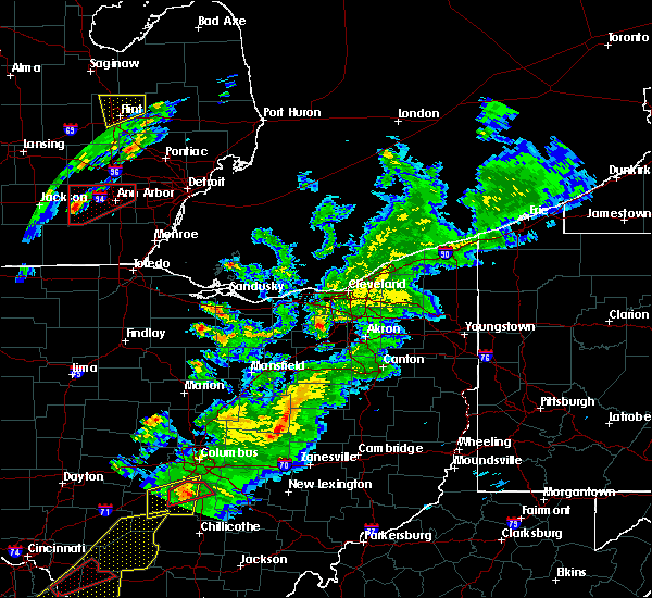 At 731 pm edt, a severe thunderstorm was located near utica, or 12 miles north of newark, moving northeast at 55 mph (radar indicated). Hazards include 60 mph wind gusts and quarter size hail. Minor damage to vehicles is possible. Expect damage to trees and power lines. At 731 pm edt, a severe thunderstorm was located near utica, or 12 miles north of newark, moving northeast at 55 mph (radar indicated). Hazards include 60 mph wind gusts and quarter size hail. Minor damage to vehicles is possible. Expect damage to trees and power lines.
|
| 3/14/2019 7:26 PM EDT |
 The severe thunderstorm warning for central licking county will expire at 730 pm edt, the storm which prompted the warning has weakened below severe limits, and no longer poses an immediate threat to life or property. therefore, the warning will be allowed to expire. however gusty winds are still possible with this thunderstorm. a severe thunderstorm watch remains in effect until 1000 pm edt for central ohio. please report previous wind damage or hail to the national weather service by going to our website at weather.gov/iln and submitting your report via social media. The severe thunderstorm warning for central licking county will expire at 730 pm edt, the storm which prompted the warning has weakened below severe limits, and no longer poses an immediate threat to life or property. therefore, the warning will be allowed to expire. however gusty winds are still possible with this thunderstorm. a severe thunderstorm watch remains in effect until 1000 pm edt for central ohio. please report previous wind damage or hail to the national weather service by going to our website at weather.gov/iln and submitting your report via social media.
|
| 3/14/2019 7:12 PM EDT |
 At 712 pm edt, a severe thunderstorm was located over granville south, moving east at 65 mph (radar indicated). Hazards include 60 mph wind gusts. Expect damage to trees and power lines. locations impacted include, newark, heath, granville, pataskala, hebron, utica, hanover, beechwood trails, granville south, marne, etna, new albany, jersey, kirkersville, alexandria, st. Louisville, toboso, fredonia, purity and state route 310 at state route 161. At 712 pm edt, a severe thunderstorm was located over granville south, moving east at 65 mph (radar indicated). Hazards include 60 mph wind gusts. Expect damage to trees and power lines. locations impacted include, newark, heath, granville, pataskala, hebron, utica, hanover, beechwood trails, granville south, marne, etna, new albany, jersey, kirkersville, alexandria, st. Louisville, toboso, fredonia, purity and state route 310 at state route 161.
|
| 3/14/2019 7:05 PM EDT |
 At 704 pm edt, a severe thunderstorm was located over pataskala, moving east at 65 mph (radar indicated). Hazards include 60 mph wind gusts. expect damage to trees and power lines At 704 pm edt, a severe thunderstorm was located over pataskala, moving east at 65 mph (radar indicated). Hazards include 60 mph wind gusts. expect damage to trees and power lines
|
| 9/21/2018 5:42 PM EDT | Large tree reported down. time estimated from rada in licking county OH, 4.2 miles ENE of Utica, OH |
| 5/14/2018 1:19 PM EDT |
 At 118 pm edt, severe thunderstorms were located along a line extending from 7 miles east of utica to near newark to near beechwood trails, moving east at 45 mph (emergency management reported power outages in westerville, oh. a couple of trees were reported down along route 3 in galena, oh). Hazards include 60 mph wind gusts and quarter size hail. Minor hail damage to vehicles is possible. expect wind damage to trees and power lines. locations impacted include, newark, heath, granville, pataskala, hebron, utica, hanover, granville south, marne, beechwood trails, alexandria, st. louisville, gratiot, toboso, fredonia, purity, brownsville and fallsburg. This includes i-70 in ohio between mile markers 137 and 142, and near mile marker 144. At 118 pm edt, severe thunderstorms were located along a line extending from 7 miles east of utica to near newark to near beechwood trails, moving east at 45 mph (emergency management reported power outages in westerville, oh. a couple of trees were reported down along route 3 in galena, oh). Hazards include 60 mph wind gusts and quarter size hail. Minor hail damage to vehicles is possible. expect wind damage to trees and power lines. locations impacted include, newark, heath, granville, pataskala, hebron, utica, hanover, granville south, marne, beechwood trails, alexandria, st. louisville, gratiot, toboso, fredonia, purity, brownsville and fallsburg. This includes i-70 in ohio between mile markers 137 and 142, and near mile marker 144.
|
| 5/14/2018 1:10 PM EDT |
 At 110 pm edt, severe thunderstorms were located along a line extending from utica to near granville to near beechwood trails, moving east at 45 mph (radar indicated). Hazards include 60 mph wind gusts and quarter size hail. Minor hail damage to vehicles is possible. expect wind damage to trees and power lines. locations impacted include, newark, heath, granville, pataskala, johnstown, hebron, utica, hanover, granville south, marne, beechwood trails, new albany, jersey, alexandria, st. louisville, gratiot, toboso, fredonia, us route 62 at state route 661 and purity. This includes i-70 in ohio between mile markers 137 and 142, and near mile marker 144. At 110 pm edt, severe thunderstorms were located along a line extending from utica to near granville to near beechwood trails, moving east at 45 mph (radar indicated). Hazards include 60 mph wind gusts and quarter size hail. Minor hail damage to vehicles is possible. expect wind damage to trees and power lines. locations impacted include, newark, heath, granville, pataskala, johnstown, hebron, utica, hanover, granville south, marne, beechwood trails, new albany, jersey, alexandria, st. louisville, gratiot, toboso, fredonia, us route 62 at state route 661 and purity. This includes i-70 in ohio between mile markers 137 and 142, and near mile marker 144.
|
| 5/14/2018 1:04 PM EDT |
 At 1248 pm edt, severe thunderstorms were located along a line extending from centerburg to near johnstown to polaris, moving east at 45 mph (radar indicated). Hazards include 60 mph wind gusts and penny size hail. expect damage to trees and power lines At 1248 pm edt, severe thunderstorms were located along a line extending from centerburg to near johnstown to polaris, moving east at 45 mph (radar indicated). Hazards include 60 mph wind gusts and penny size hail. expect damage to trees and power lines
|
| 5/14/2018 12:49 PM EDT |
 At 1248 pm edt, severe thunderstorms were located along a line extending from centerburg to near johnstown to polaris, moving east at 45 mph (radar indicated). Hazards include 60 mph wind gusts and penny size hail. expect damage to trees and power lines At 1248 pm edt, severe thunderstorms were located along a line extending from centerburg to near johnstown to polaris, moving east at 45 mph (radar indicated). Hazards include 60 mph wind gusts and penny size hail. expect damage to trees and power lines
|
| 1/22/2018 11:41 PM EST |
 At 1141 pm est, a severe thunderstorm was located near marne, moving northeast at 55 mph (radar indicated). Hazards include 60 mph wind gusts. expect damage to trees and power lines At 1141 pm est, a severe thunderstorm was located near marne, moving northeast at 55 mph (radar indicated). Hazards include 60 mph wind gusts. expect damage to trees and power lines
|
| 11/5/2017 7:26 PM EST |
 The severe thunderstorm warning for eastern franklin, northwestern fairfield, northern pickaway, southeastern delaware and western licking counties will expire at 730 pm est, the storm which prompted the warning has moved out of the area. therefore, the warning will be allowed to expire. however heavy rain is still possible with this thunderstorm. a severe thunderstorm watch remains in effect until 100 am est for central ohio. please report previous wind damage or hail to the national weather service by going to our website at weather.gov/iln and submitting your report via social media. The severe thunderstorm warning for eastern franklin, northwestern fairfield, northern pickaway, southeastern delaware and western licking counties will expire at 730 pm est, the storm which prompted the warning has moved out of the area. therefore, the warning will be allowed to expire. however heavy rain is still possible with this thunderstorm. a severe thunderstorm watch remains in effect until 100 am est for central ohio. please report previous wind damage or hail to the national weather service by going to our website at weather.gov/iln and submitting your report via social media.
|
| 11/5/2017 7:16 PM EST |
 At 716 pm est, a severe thunderstorm was located over pataskala, moving east at 45 mph (radar indicated). Hazards include 60 mph wind gusts. expect damage to trees and power lines At 716 pm est, a severe thunderstorm was located over pataskala, moving east at 45 mph (radar indicated). Hazards include 60 mph wind gusts. expect damage to trees and power lines
|
| 11/5/2017 7:08 PM EST |
 At 708 pm est, a severe thunderstorm was located near bexley, moving east at 45 mph (radar indicated). Hazards include 60 mph wind gusts. Expect damage to trees and power lines. locations impacted include, columbus, westerville, reynoldsburg, grove city, gahanna, pickerington, bexley, granville, pataskala, canal winchester, groveport, johnstown, ashville, utica, south bloomfield, granville south, beechwood trails, easton, summit station and whitehall. this includes the following interstates, i-70 in ohio between mile markers 99 and 122. I-71 in ohio between mile markers 95 and 110. At 708 pm est, a severe thunderstorm was located near bexley, moving east at 45 mph (radar indicated). Hazards include 60 mph wind gusts. Expect damage to trees and power lines. locations impacted include, columbus, westerville, reynoldsburg, grove city, gahanna, pickerington, bexley, granville, pataskala, canal winchester, groveport, johnstown, ashville, utica, south bloomfield, granville south, beechwood trails, easton, summit station and whitehall. this includes the following interstates, i-70 in ohio between mile markers 99 and 122. I-71 in ohio between mile markers 95 and 110.
|
| 11/5/2017 7:56 PM EDT |
 At 655 pm est, a severe thunderstorm was located near ohio state university, moving east at 45 mph (radar indicated). Hazards include 60 mph wind gusts. expect damage to trees and power lines At 655 pm est, a severe thunderstorm was located near ohio state university, moving east at 45 mph (radar indicated). Hazards include 60 mph wind gusts. expect damage to trees and power lines
|
| 8/22/2017 1:39 PM EDT |
 The severe thunderstorm warning for eastern licking county will expire at 145 pm edt, the storm which prompted the warning has weakened below severe limits, and has exited the warned area. therefore, the warning will be allowed to expire. a severe thunderstorm watch remains in effect until 900 pm edt for central ohio. please report previous wind damage or hail to the national weather service by going to our website at weather.gov/iln and submitting your report via social media. The severe thunderstorm warning for eastern licking county will expire at 145 pm edt, the storm which prompted the warning has weakened below severe limits, and has exited the warned area. therefore, the warning will be allowed to expire. a severe thunderstorm watch remains in effect until 900 pm edt for central ohio. please report previous wind damage or hail to the national weather service by going to our website at weather.gov/iln and submitting your report via social media.
|
| 8/22/2017 1:26 PM EDT |
 At 126 pm edt, a severe thunderstorm was located over hanover, moving east at 45 mph (radar indicated). Hazards include 60 mph wind gusts. Expect damage to trees and power lines. locations impacted include, newark, heath, utica, hanover, marne, st. Louisville, toboso, fallsburg and purity. At 126 pm edt, a severe thunderstorm was located over hanover, moving east at 45 mph (radar indicated). Hazards include 60 mph wind gusts. Expect damage to trees and power lines. locations impacted include, newark, heath, utica, hanover, marne, st. Louisville, toboso, fallsburg and purity.
|
| 8/22/2017 1:05 PM EDT |
 At 104 pm edt, a severe thunderstorm was located near granville south, moving east at 45 mph (radar indicated and trained spotter confirmed). Hazards include 60 mph wind gusts. wind damage was reported in gahanna in franklin county with this storm. expect damage to trees and power lines At 104 pm edt, a severe thunderstorm was located near granville south, moving east at 45 mph (radar indicated and trained spotter confirmed). Hazards include 60 mph wind gusts. wind damage was reported in gahanna in franklin county with this storm. expect damage to trees and power lines
|
| 8/19/2017 3:01 PM EDT |
 At 301 pm edt, a severe thunderstorm was located over gambier, or near mount vernon, moving east at 20 mph (radar indicated). Hazards include 60 mph wind gusts and quarter size hail. Minor damage to vehicles is possible. Expect damage to trees and power lines. At 301 pm edt, a severe thunderstorm was located over gambier, or near mount vernon, moving east at 20 mph (radar indicated). Hazards include 60 mph wind gusts and quarter size hail. Minor damage to vehicles is possible. Expect damage to trees and power lines.
|
| 8/19/2017 2:40 PM EDT |
 At 239 pm edt, a severe thunderstorm was located near newark, moving east at 25 mph (radar indicated). Hazards include 60 mph wind gusts and quarter size hail. Minor hail damage to vehicles is possible. expect wind damage to trees and power lines. locations impacted include, newark, heath, granville, hanover, marne, granville south, st. louisville, gratiot, fredonia, toboso, us route 62 at state route 661, purity and brownsville. This includes i-70 in ohio mile marker 142 and near mile marker 144. At 239 pm edt, a severe thunderstorm was located near newark, moving east at 25 mph (radar indicated). Hazards include 60 mph wind gusts and quarter size hail. Minor hail damage to vehicles is possible. expect wind damage to trees and power lines. locations impacted include, newark, heath, granville, hanover, marne, granville south, st. louisville, gratiot, fredonia, toboso, us route 62 at state route 661, purity and brownsville. This includes i-70 in ohio mile marker 142 and near mile marker 144.
|
| 8/19/2017 2:28 PM EDT |
 At 227 pm edt, a severe thunderstorm was located near granville, moving east at 25 mph (radar indicated). Hazards include 60 mph wind gusts and quarter size hail. Minor hail damage to vehicles is possible. Expect wind damage to trees and power lines. At 227 pm edt, a severe thunderstorm was located near granville, moving east at 25 mph (radar indicated). Hazards include 60 mph wind gusts and quarter size hail. Minor hail damage to vehicles is possible. Expect wind damage to trees and power lines.
|
| 7/22/2017 6:55 AM EDT |
 At 655 am edt, a severe thunderstorm was located over centerburg, or 12 miles west of mount vernon, moving east at 45 mph (radar indicated). Hazards include 60 mph wind gusts and quarter size hail. Minor damage to vehicles is possible. Expect damage to trees and power lines. At 655 am edt, a severe thunderstorm was located over centerburg, or 12 miles west of mount vernon, moving east at 45 mph (radar indicated). Hazards include 60 mph wind gusts and quarter size hail. Minor damage to vehicles is possible. Expect damage to trees and power lines.
|
| 7/10/2017 3:47 PM EDT |
 At 346 pm edt, severe thunderstorms were located along a line extending from near utica to near pickerington, moving east at 40 mph (radar indicated). Hazards include 70 mph wind gusts and quarter size hail. Minor hail damage to vehicles is possible. expect considerable tree damage. Wind damage is also likely to mobile homes, roofs, and outbuildings. At 346 pm edt, severe thunderstorms were located along a line extending from near utica to near pickerington, moving east at 40 mph (radar indicated). Hazards include 70 mph wind gusts and quarter size hail. Minor hail damage to vehicles is possible. expect considerable tree damage. Wind damage is also likely to mobile homes, roofs, and outbuildings.
|
| 7/7/2017 1:31 PM EDT |
 At 129 pm edt, a band of severe thunderstorms was located in knox county moving southeast into mount vernon at 30 mph (radar indicated). Hazards include 60 mph wind gusts and quarter size hail. Minor damage to vehicles is possible. expect damage to trees and power lines. Locations impacted include, mount vernon, fredericktown, gambier, utica, centerburg, danville, martinsburg, gann, north liberty and bladensburg. At 129 pm edt, a band of severe thunderstorms was located in knox county moving southeast into mount vernon at 30 mph (radar indicated). Hazards include 60 mph wind gusts and quarter size hail. Minor damage to vehicles is possible. expect damage to trees and power lines. Locations impacted include, mount vernon, fredericktown, gambier, utica, centerburg, danville, martinsburg, gann, north liberty and bladensburg.
|
| 7/7/2017 12:47 PM EDT |
 At 1246 pm edt, a severe thunderstorm was located near chesterville, or near mount gilead, moving southeast at 45 mph (radar indicated). Hazards include 60 mph wind gusts and quarter size hail. Minor damage to vehicles is possible. Expect damage to trees and power lines. At 1246 pm edt, a severe thunderstorm was located near chesterville, or near mount gilead, moving southeast at 45 mph (radar indicated). Hazards include 60 mph wind gusts and quarter size hail. Minor damage to vehicles is possible. Expect damage to trees and power lines.
|
| 3/26/2017 9:13 PM EDT |
 The severe thunderstorm warning for northeastern licking county will expire at 915 pm edt, the storm which prompted the warning has weakened below severe limits, and no longer poses an immediate threat to life or property. therefore, the warning will be allowed to expire. however gusty winds are still possible with this thunderstorm. please report previous wind damage or hail to the national weather service by going to our website at weather.gov/iln and submitting your report via social media. The severe thunderstorm warning for northeastern licking county will expire at 915 pm edt, the storm which prompted the warning has weakened below severe limits, and no longer poses an immediate threat to life or property. therefore, the warning will be allowed to expire. however gusty winds are still possible with this thunderstorm. please report previous wind damage or hail to the national weather service by going to our website at weather.gov/iln and submitting your report via social media.
|
| 3/26/2017 9:01 PM EDT |
 At 901 pm edt, a severe thunderstorm was located near utica, moving northeast at 35 mph (radar indicated). Hazards include 60 mph wind gusts and nickel size hail. tornado possible. Expect damage to roofs, siding, and trees. locations impacted include, newark, granville, utica, hanover, marne, granville south, st. Louisville, fredonia, us route 62 at state route 661 and purity. At 901 pm edt, a severe thunderstorm was located near utica, moving northeast at 35 mph (radar indicated). Hazards include 60 mph wind gusts and nickel size hail. tornado possible. Expect damage to roofs, siding, and trees. locations impacted include, newark, granville, utica, hanover, marne, granville south, st. Louisville, fredonia, us route 62 at state route 661 and purity.
|
| 3/26/2017 8:47 PM EDT |
 At 846 pm edt, a severe thunderstorm was located near granville, moving northeast at 35 mph (radar indicated). Hazards include 60 mph wind gusts and nickel size hail. tornado possible. Expect damage to roofs, siding, and trees. locations impacted include, newark, heath, granville, johnstown, utica, hanover, granville south, marne, alexandria, st. Louisville, fredonia, us route 62 at state route 661 and purity. At 846 pm edt, a severe thunderstorm was located near granville, moving northeast at 35 mph (radar indicated). Hazards include 60 mph wind gusts and nickel size hail. tornado possible. Expect damage to roofs, siding, and trees. locations impacted include, newark, heath, granville, johnstown, utica, hanover, granville south, marne, alexandria, st. Louisville, fredonia, us route 62 at state route 661 and purity.
|
| 3/26/2017 8:45 PM EDT |
 At 844 pm edt, a severe thunderstorm capable of producing a tornado was located near granville south, moving northeast at 25 mph (radar indicated rotation). Hazards include tornado. Flying debris will be dangerous to those caught without shelter. mobile homes will be damaged or destroyed. damage to roofs, windows, and vehicles will occur. tree damage is likely. locations impacted include, newark, granville, johnstown, utica, granville south, alexandria, st. Louisville, fredonia and us route 62 at state route 661. At 844 pm edt, a severe thunderstorm capable of producing a tornado was located near granville south, moving northeast at 25 mph (radar indicated rotation). Hazards include tornado. Flying debris will be dangerous to those caught without shelter. mobile homes will be damaged or destroyed. damage to roofs, windows, and vehicles will occur. tree damage is likely. locations impacted include, newark, granville, johnstown, utica, granville south, alexandria, st. Louisville, fredonia and us route 62 at state route 661.
|
| 3/26/2017 8:34 PM EDT |
 At 833 pm edt, a severe thunderstorm was located over beechwood trails, moving northeast at 35 mph (radar indicated). Hazards include 60 mph wind gusts and nickel size hail. tornado possible. expect damage to roofs, siding, and trees At 833 pm edt, a severe thunderstorm was located over beechwood trails, moving northeast at 35 mph (radar indicated). Hazards include 60 mph wind gusts and nickel size hail. tornado possible. expect damage to roofs, siding, and trees
|
| 3/26/2017 8:34 PM EDT |
 At 834 pm edt, a severe thunderstorm capable of producing a tornado was located over beechwood trails, moving northeast at 35 mph (radar indicated rotation). Hazards include tornado. Flying debris will be dangerous to those caught without shelter. mobile homes will be damaged or destroyed. damage to roofs, windows, and vehicles will occur. Tree damage is likely. At 834 pm edt, a severe thunderstorm capable of producing a tornado was located over beechwood trails, moving northeast at 35 mph (radar indicated rotation). Hazards include tornado. Flying debris will be dangerous to those caught without shelter. mobile homes will be damaged or destroyed. damage to roofs, windows, and vehicles will occur. Tree damage is likely.
|
| 2/24/2017 10:38 PM EST |
 The severe thunderstorm warning for eastern franklin, northwestern fairfield and western licking counties will expire at 1045 pm est, the storms which prompted the warning have weakened below severe limits, and no longer pose an immediate threat to life or property. therefore, the warning will be allowed to expire. however gusty winds are still possible with these thunderstorms. a severe thunderstorm watch remains in effect until 200 am est for central ohio. please report previous wind damage or hail to the national weather service by going to our website at weather.gov/iln and submitting your report via social media. The severe thunderstorm warning for eastern franklin, northwestern fairfield and western licking counties will expire at 1045 pm est, the storms which prompted the warning have weakened below severe limits, and no longer pose an immediate threat to life or property. therefore, the warning will be allowed to expire. however gusty winds are still possible with these thunderstorms. a severe thunderstorm watch remains in effect until 200 am est for central ohio. please report previous wind damage or hail to the national weather service by going to our website at weather.gov/iln and submitting your report via social media.
|
| 2/24/2017 10:29 PM EST |
 At 1028 pm est, severe thunderstorms were located along a line extending from near johnstown to reynoldsburg to canal winchester, moving northeast at 65 mph (radar indicated). Hazards include 60 mph wind gusts. Expect damage to roofs, siding, and trees. locations impacted include, columbus, newark, reynoldsburg, gahanna, pickerington, heath, granville, pataskala, canal winchester, groveport, johnstown, baltimore, buckeye lake, hebron, utica, millersport, granville south, fairfield beach, beechwood trails and summit station. This includes i-70 in ohio between mile markers 108 and 130. At 1028 pm est, severe thunderstorms were located along a line extending from near johnstown to reynoldsburg to canal winchester, moving northeast at 65 mph (radar indicated). Hazards include 60 mph wind gusts. Expect damage to roofs, siding, and trees. locations impacted include, columbus, newark, reynoldsburg, gahanna, pickerington, heath, granville, pataskala, canal winchester, groveport, johnstown, baltimore, buckeye lake, hebron, utica, millersport, granville south, fairfield beach, beechwood trails and summit station. This includes i-70 in ohio between mile markers 108 and 130.
|
| 2/24/2017 10:13 PM EST |
 At 1013 pm est, severe thunderstorms were located along a line extending from near worthington to near grove city to near south bloomfield, moving northeast at 65 mph (radar indicated). Hazards include 60 mph wind gusts. expect damage to roofs, siding, and trees At 1013 pm est, severe thunderstorms were located along a line extending from near worthington to near grove city to near south bloomfield, moving northeast at 65 mph (radar indicated). Hazards include 60 mph wind gusts. expect damage to roofs, siding, and trees
|
| 3/31/2016 7:42 PM EDT | The severe thunderstorm warning for northeastern fairfield and western licking counties will expire at 745 pm edt, the storm which prompted the warning has weakened below severe limits. therefore the warning will be allowed to expire. please report previous wind damage or hail to the national weather service by going to our website at weather.gov/iln and submit your report via social media. |
| 3/31/2016 7:35 PM EDT |
 At 734 pm edt, radar indicated a severe thunderstorm located over granville south, moving northeast at 60 mph. storm hazards include, winds to 60 mph, penny size hail, locations impacted include, newark, lancaster, heath, granville, pataskala, baltimore, buckeye lake, hebron, millersport, pleasantville, granville south, harbor hills, fairfield beach, beechwood trails, etna, thurston, kirkersville, alexandria, st. louisville and dumontville. this includes i-70 in ohio between mile markers 119 and 134. At 734 pm edt, radar indicated a severe thunderstorm located over granville south, moving northeast at 60 mph. storm hazards include, winds to 60 mph, penny size hail, locations impacted include, newark, lancaster, heath, granville, pataskala, baltimore, buckeye lake, hebron, millersport, pleasantville, granville south, harbor hills, fairfield beach, beechwood trails, etna, thurston, kirkersville, alexandria, st. louisville and dumontville. this includes i-70 in ohio between mile markers 119 and 134.
|
| 3/31/2016 7:28 PM EDT |
 At 728 pm edt, radar indicated a severe thunderstorm located over beechwood trails, moving northeast at 60 mph. storm hazards include, winds to 60 mph, penny size hail, locations impacted include, columbus, newark, lancaster, reynoldsburg, gahanna, pickerington, heath, granville, pataskala, canal winchester, baltimore, buckeye lake, hebron, millersport, pleasantville, granville south, summit station, harbor hills, fairfield beach and beechwood trails. this includes i-70 in ohio between mile markers 112 and 134. At 728 pm edt, radar indicated a severe thunderstorm located over beechwood trails, moving northeast at 60 mph. storm hazards include, winds to 60 mph, penny size hail, locations impacted include, columbus, newark, lancaster, reynoldsburg, gahanna, pickerington, heath, granville, pataskala, canal winchester, baltimore, buckeye lake, hebron, millersport, pleasantville, granville south, summit station, harbor hills, fairfield beach and beechwood trails. this includes i-70 in ohio between mile markers 112 and 134.
|
| 3/31/2016 7:10 PM EDT |
 At 709 pm edt, radar indicated a severe thunderstorm located over groveport, moving northeast at 60 mph. storm hazards include, winds to 60 mph, penny size hail,. At 709 pm edt, radar indicated a severe thunderstorm located over groveport, moving northeast at 60 mph. storm hazards include, winds to 60 mph, penny size hail,.
|
| 7/14/2015 2:18 PM EDT |
 At 218 pm edt, a severe thunderstorm was located near gambier, or near mount vernon, moving east at 40 mph (radar indicated). Hazards include 60 mph wind gusts. Expect damage to roofs. siding and trees. Locations impacted include, mount vernon, fredericktown, gambier, utica, danville, martinsburg, gann, amity and bladensburg. At 218 pm edt, a severe thunderstorm was located near gambier, or near mount vernon, moving east at 40 mph (radar indicated). Hazards include 60 mph wind gusts. Expect damage to roofs. siding and trees. Locations impacted include, mount vernon, fredericktown, gambier, utica, danville, martinsburg, gann, amity and bladensburg.
|
| 7/14/2015 2:13 PM EDT |
 At 213 pm edt, a severe thunderstorm capable of producing a tornado was located near utica, or near mount vernon, moving east at 50 mph (radar indicated rotation). Hazards include tornado and quarter size hail. Flying debris will be dangerous to those caught without shelter. mobile homes will be damaged or destroyed. damage to roofs, windows and vehicles will occur. tree damage is likely. This tornadic thunderstorm will remain over mainly rural areas of southeastern knox county, including the following locations, martinsburg and bladensburg. At 213 pm edt, a severe thunderstorm capable of producing a tornado was located near utica, or near mount vernon, moving east at 50 mph (radar indicated rotation). Hazards include tornado and quarter size hail. Flying debris will be dangerous to those caught without shelter. mobile homes will be damaged or destroyed. damage to roofs, windows and vehicles will occur. tree damage is likely. This tornadic thunderstorm will remain over mainly rural areas of southeastern knox county, including the following locations, martinsburg and bladensburg.
|
| 7/14/2015 1:57 PM EDT |
 At 157 pm edt, a severe thunderstorm capable of producing a tornado was located over centerburg, or 12 miles southwest of mount vernon, moving east at 70 mph (radar indicated rotation). Hazards include tornado and quarter size hail. Flying debris will be dangerous to those caught without shelter. mobile homes will be damaged or destroyed. damage to roofs, windows and vehicles will occur. tree damage is likely. this dangerous storm will be near, utica around 210 pm edt. Other locations impacted by this tornadic thunderstorm include martinsburg and bladensburg. At 157 pm edt, a severe thunderstorm capable of producing a tornado was located over centerburg, or 12 miles southwest of mount vernon, moving east at 70 mph (radar indicated rotation). Hazards include tornado and quarter size hail. Flying debris will be dangerous to those caught without shelter. mobile homes will be damaged or destroyed. damage to roofs, windows and vehicles will occur. tree damage is likely. this dangerous storm will be near, utica around 210 pm edt. Other locations impacted by this tornadic thunderstorm include martinsburg and bladensburg.
|
| 7/14/2015 1:49 PM EDT |
 At 148 pm edt, a severe thunderstorm was located near sparta, or 11 miles south of mount gilead, moving east at 40 mph (radar indicated). Hazards include 70 mph wind gusts. Expect considerable tree damage. Damage is likely to mobile homes, roofs and outbuildings. At 148 pm edt, a severe thunderstorm was located near sparta, or 11 miles south of mount gilead, moving east at 40 mph (radar indicated). Hazards include 70 mph wind gusts. Expect considerable tree damage. Damage is likely to mobile homes, roofs and outbuildings.
|
| 6/18/2015 7:53 PM EDT | At 752 pm edt, radar indicated a severe thunderstorm located near sunbury, moving southeast at 45 mph. storm hazards include, winds to 60 mph, very heavy rain which may cause minor flooding,. |
| 5/11/2015 5:55 PM EDT | At 548 pm edt, a severe thunderstorm was located 5 miles south of danville, and moving northeast at 60 mph (radar indicated). Hazards include 60 mph wind gusts. Expect damage to roofs. siding and trees. locations impacted include, , <. 75in. |
| 5/11/2015 5:46 PM EDT | At 544 pm edt, radar continued to indicate severe thunderstorms located along a line extending from 8 miles north of purity to interstate 70 at state route 13, moving east at 30 mph. storm hazards include, winds to 60 mph, quarter size hail, these storms will affect mainly rural areas of eastern licking and northeastern fairfield counties, including hanover, fallsburg, brownsville, toboso and gratiot. this includes the following interstate, i-70 between mile markers 128 and 142, , 1.00in. |
| 5/11/2015 5:39 PM EDT | At 532 pm edt, a severe thunderstorm was located 5 miles north of utica, and moving northeast at 60 mph (radar indicated). Hazards include 60 mph wind gusts. Expect damage to roofs. siding and trees. locations impacted include, danville and gann. 75in. |
| 5/11/2015 5:25 PM EDT | At 521 pm edt, a severe thunderstorm was located 7 miles west of utica, and moving northeast at 60 mph (radar indicated). Hazards include 70 mph wind gusts. Expect considerable tree damage. Damage is likely to mobile homes, roofs and outbuildings. |
| 5/11/2015 4:58 PM EDT | At 456 pm edt, radar indicated severe thunderstorms located along a line extending from hartford to groveport, moving east at 30 mph. storm hazards include, damaging winds to 70 mph, quarter size hail,. |
| 7/26/2012 4:18 PM EDT | Several trees dow in knox county OH, 2.2 miles ESE of Utica, OH |
| 3/30/2012 7:42 PM EDT | Half Dollar sized hail reported 2.1 miles WSW of Utica, OH |
Hail Maps for Utica, OH
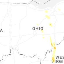


Connect with Interactive Hail Maps