

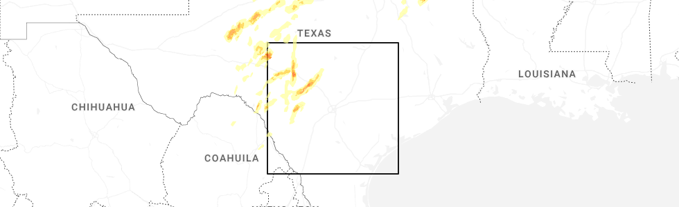
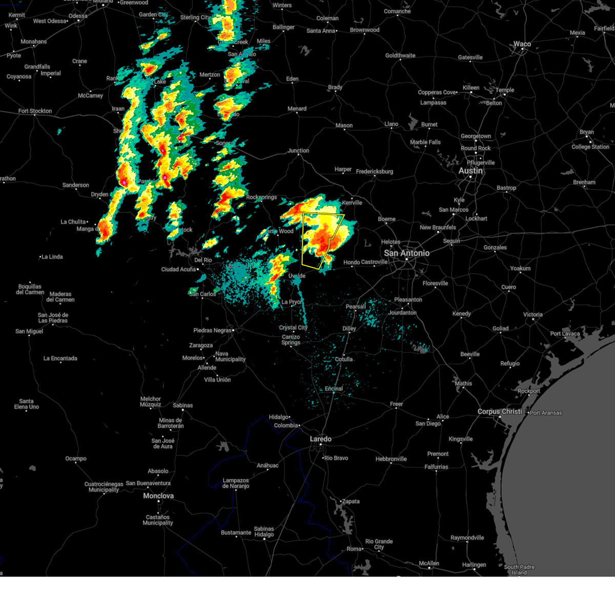
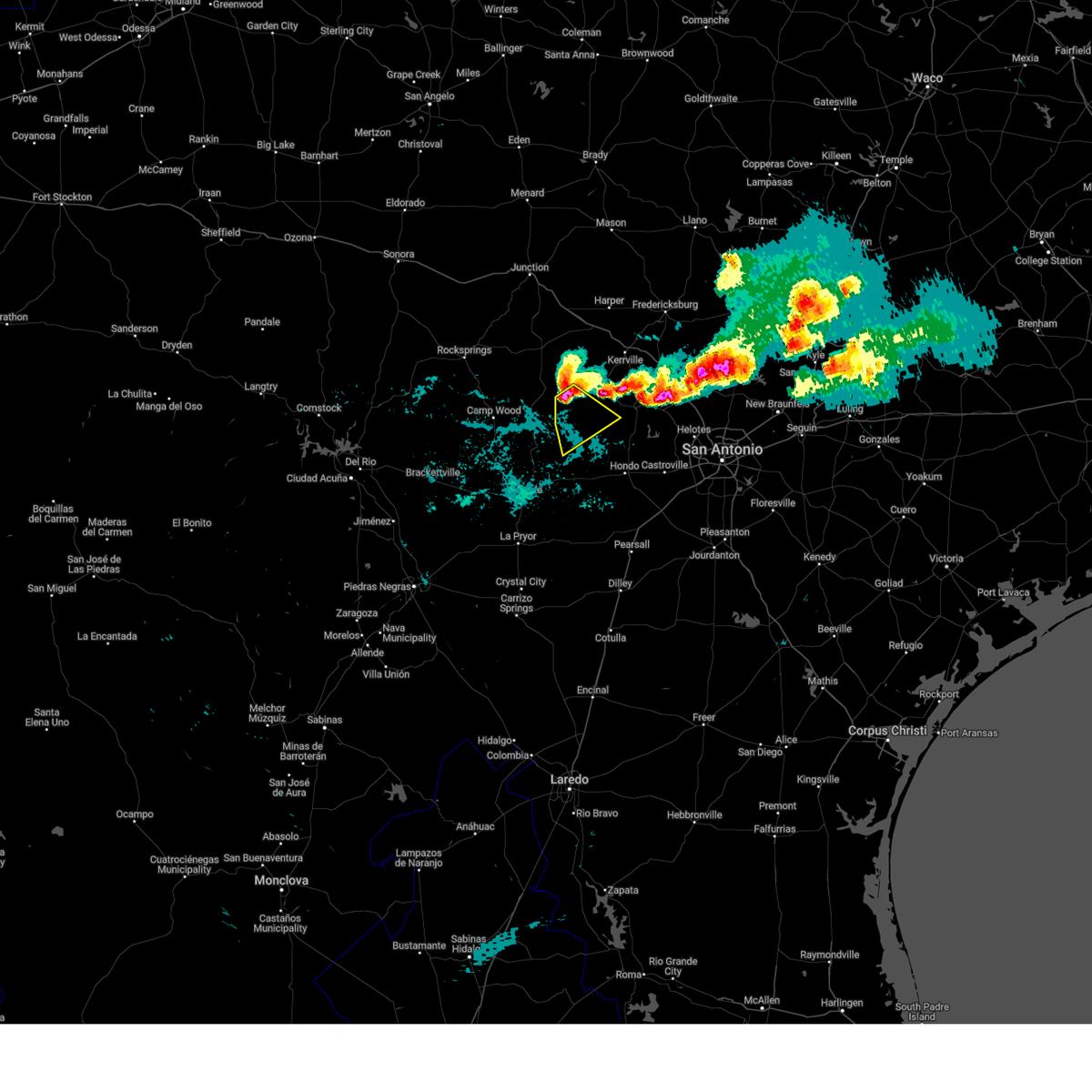
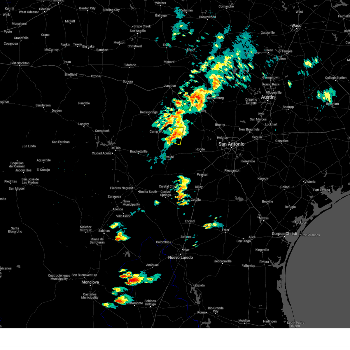
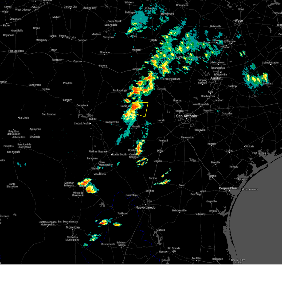
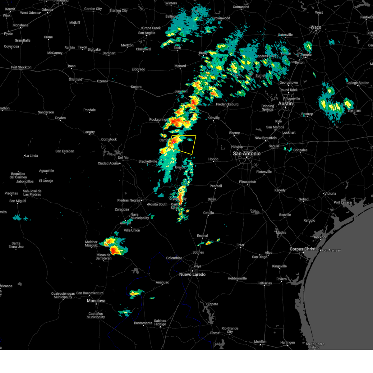
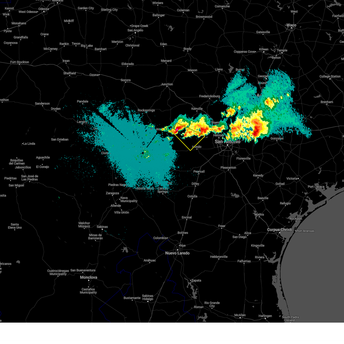
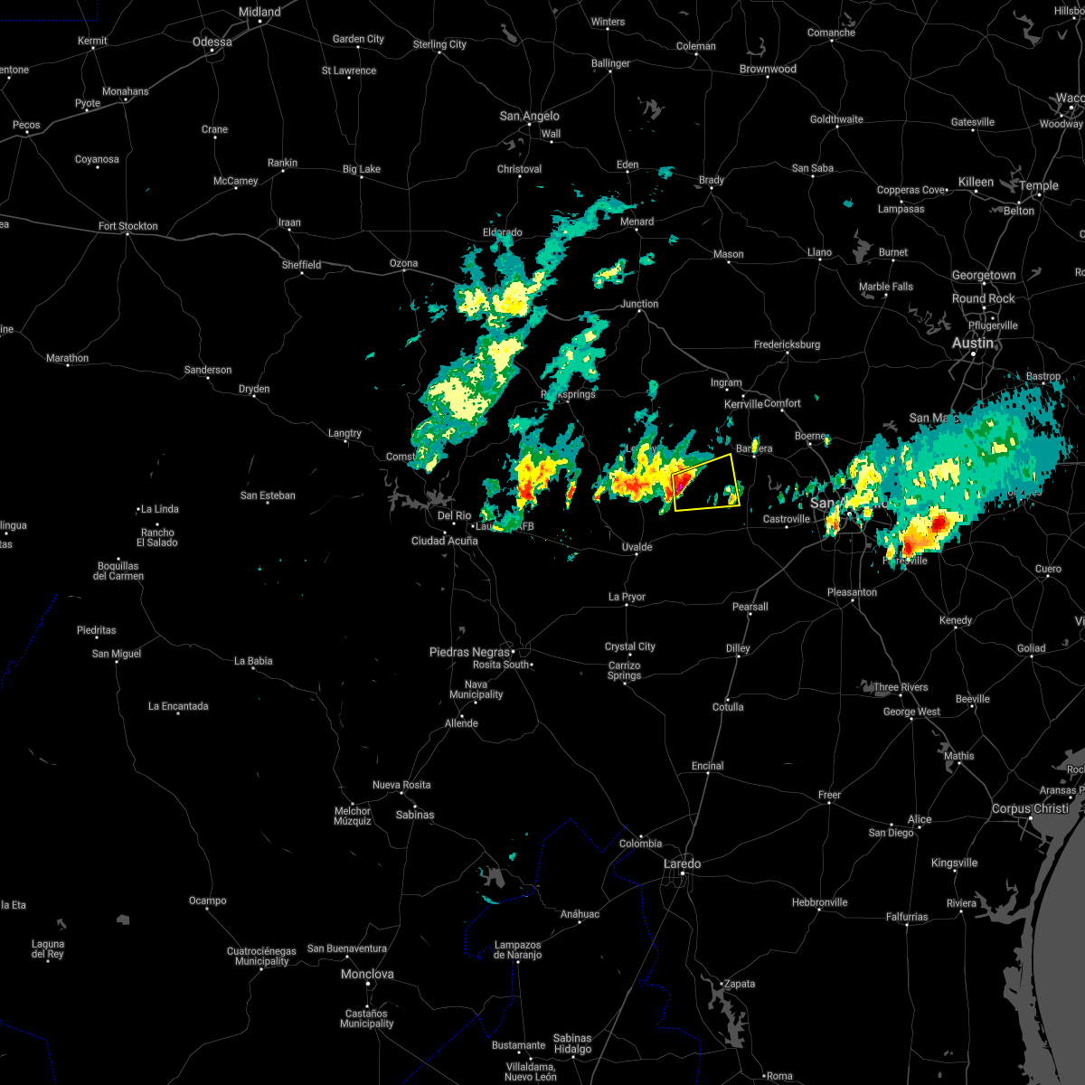
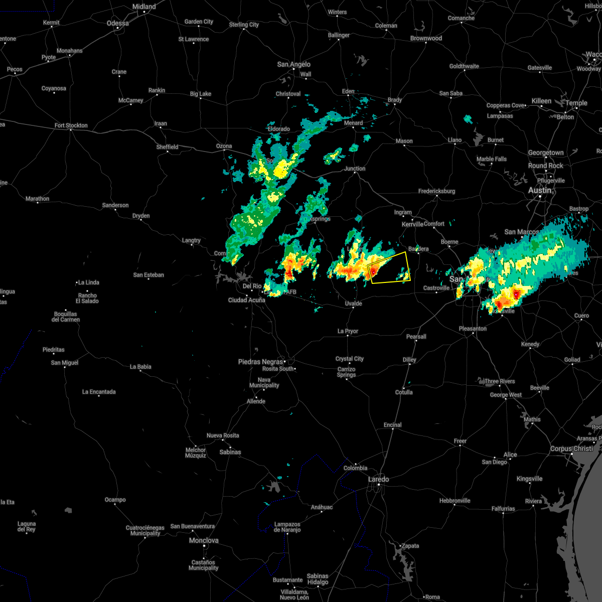
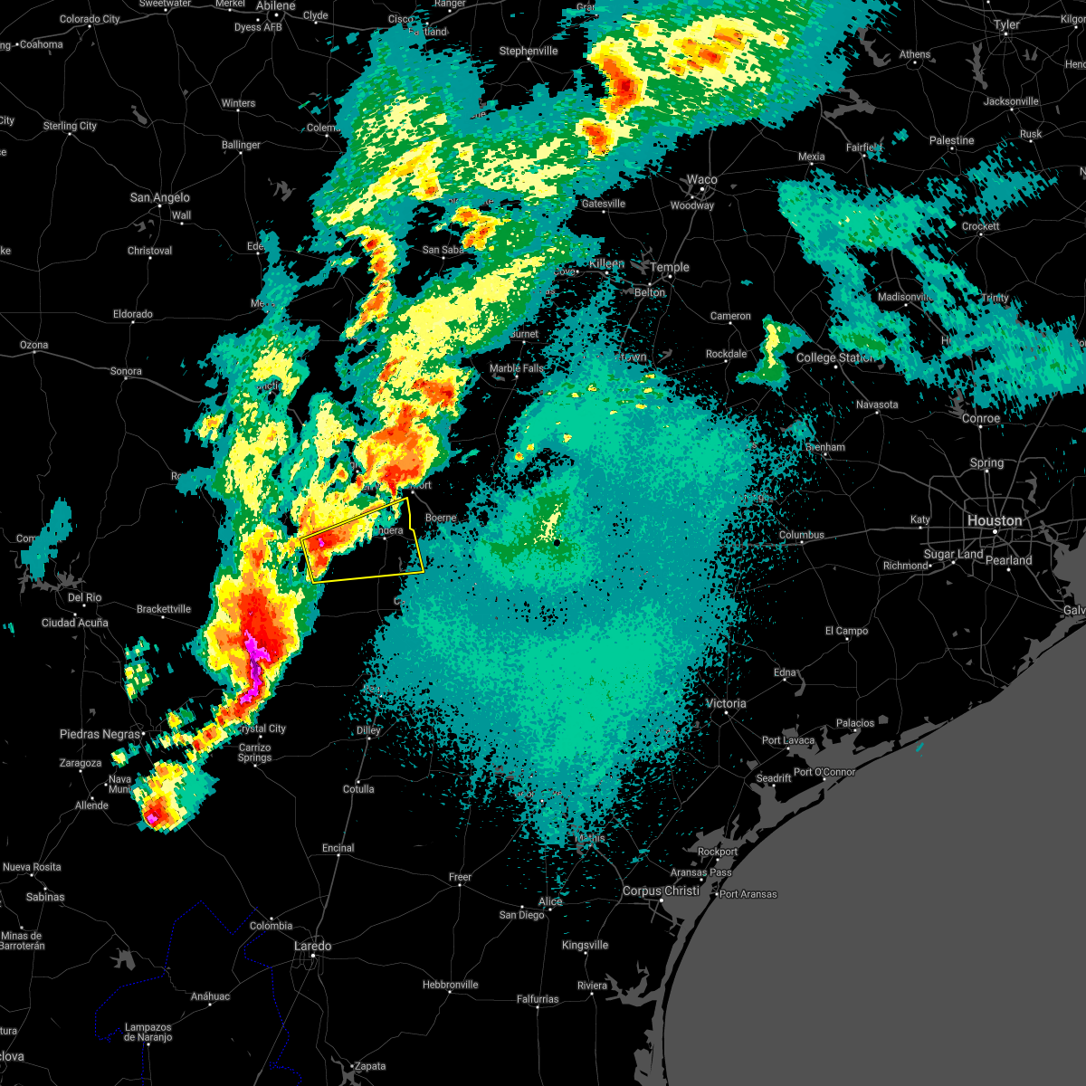
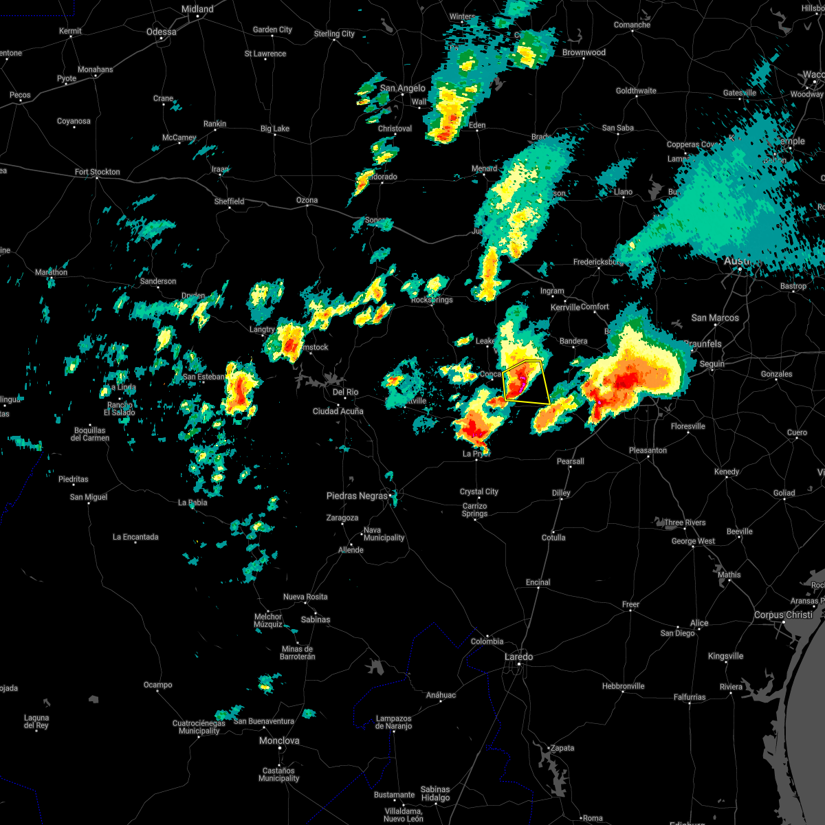
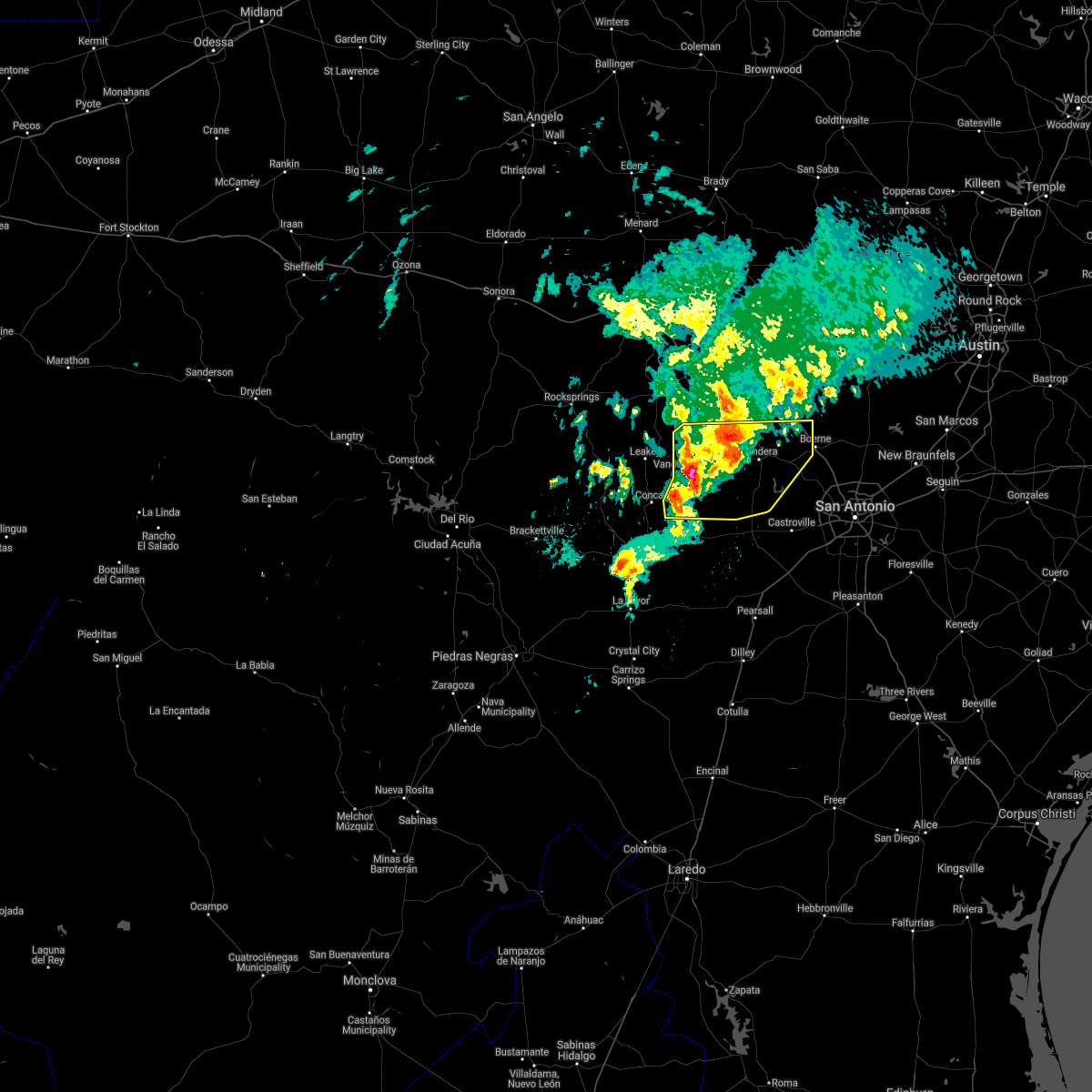
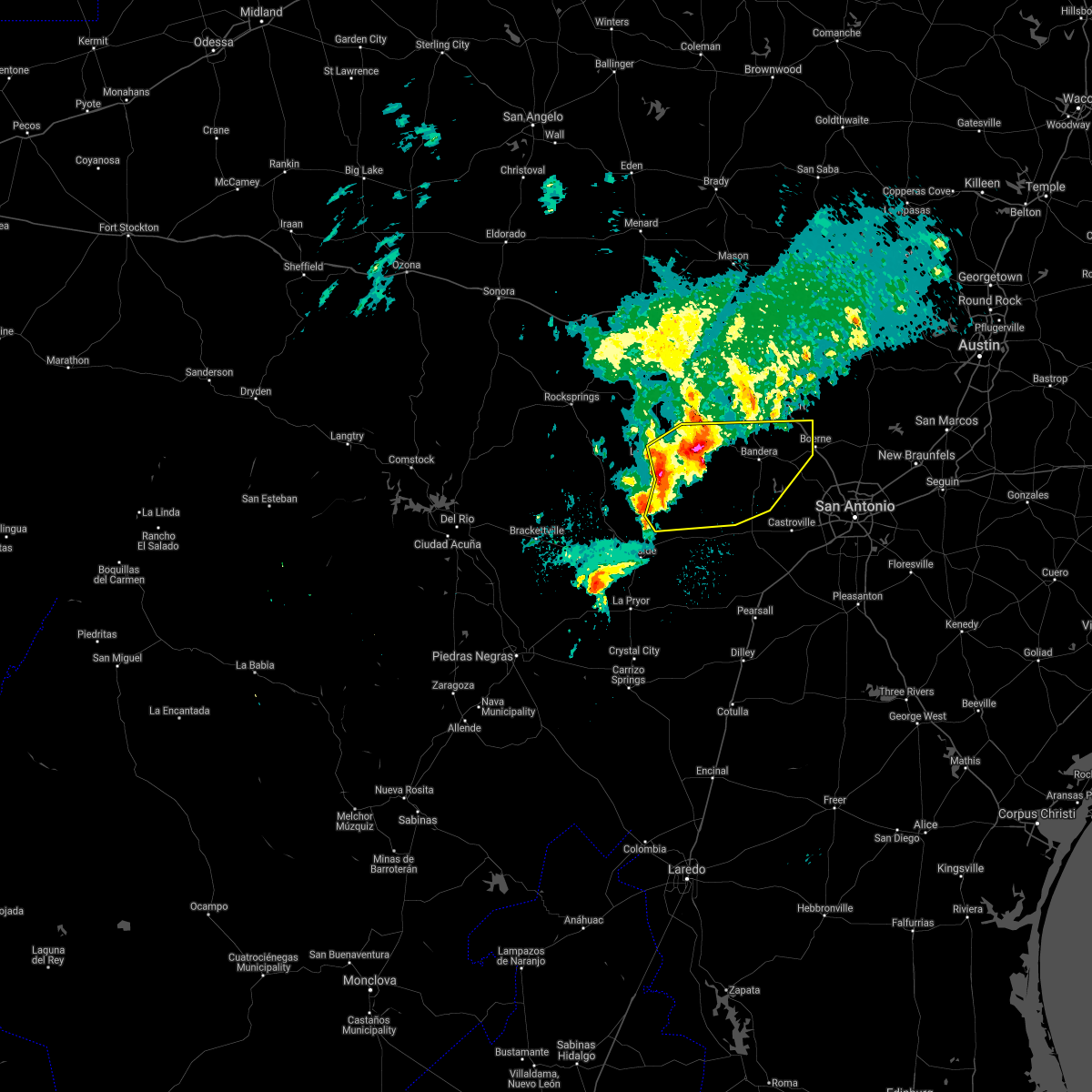
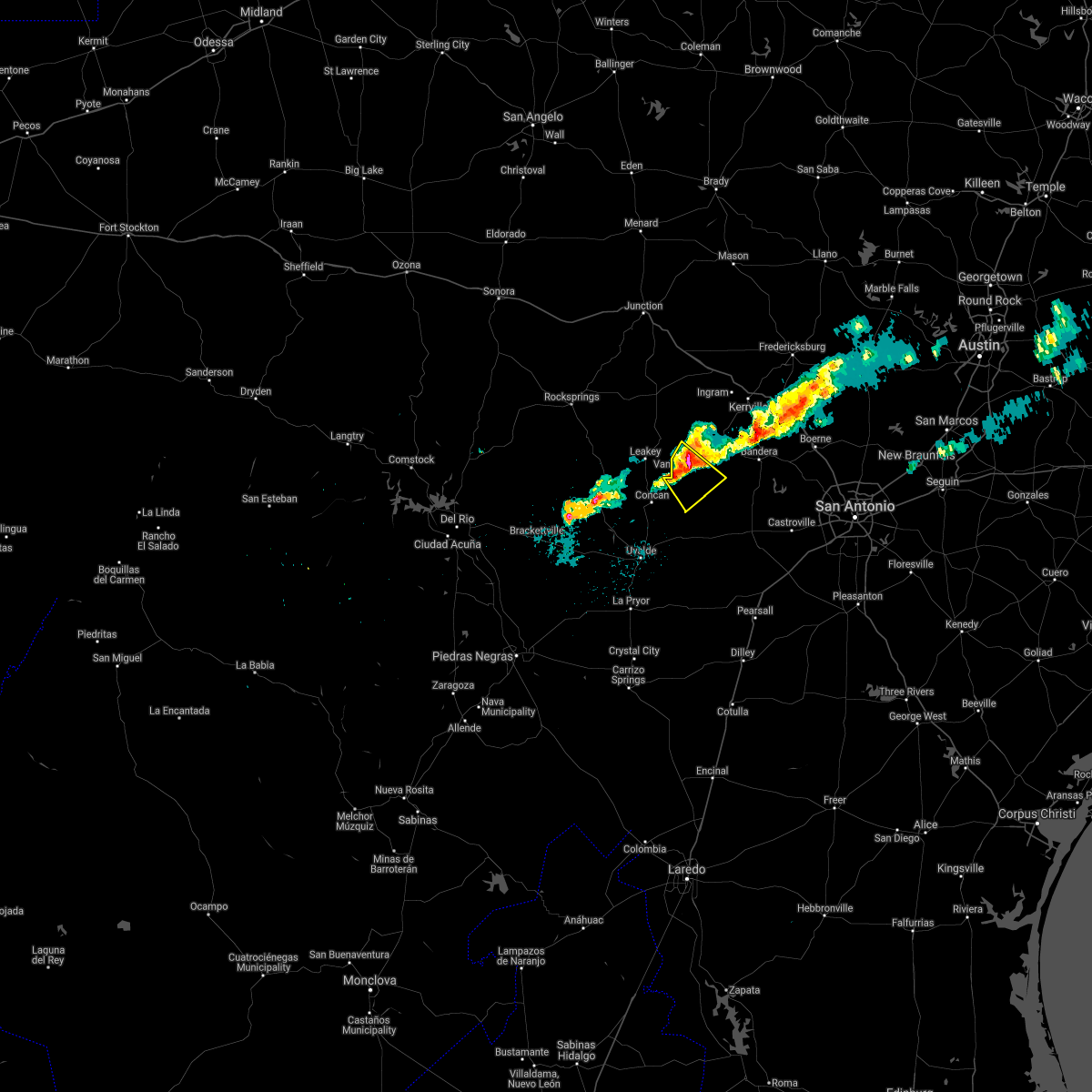
Hail Map for Utopia, TX
The Utopia, TX area has had 12 reports of on-the-ground hail by trained spotters, and has been under severe weather warnings 12 times during the past 12 months. Doppler radar has detected hail at or near Utopia, TX on 46 occasions, including 2 occasions during the past year.
| Name: | Utopia, TX |
| Where Located: | 62.9 miles WNW of San Antonio, TX |
| Map: | Google Map for Utopia, TX |
| Population: | 227 |
| Housing Units: | 138 |
| More Info: | Search Google for Utopia, TX |
0
The Top Recent Hail Date for Utopia, TX is Friday, April 4, 2025 (33rd out of 46)
Hail and Wind Damage Spotted near Utopia, TX
| Date / Time | Report Details |
|---|---|
| 6/11/2025 12:13 AM CDT |
 The storms which prompted the warning have moved out of the area. therefore, the warning will be allowed to expire. however small hail, gusty winds and heavy rain are still possible with these thunderstorms. a severe thunderstorm watch remains in effect until 200 am cdt for south central texas. remember, a severe thunderstorm warning still remains in effect for portions of medina, bandera, frio, bexar, kendall, kerr, and atascosa. The storms which prompted the warning have moved out of the area. therefore, the warning will be allowed to expire. however small hail, gusty winds and heavy rain are still possible with these thunderstorms. a severe thunderstorm watch remains in effect until 200 am cdt for south central texas. remember, a severe thunderstorm warning still remains in effect for portions of medina, bandera, frio, bexar, kendall, kerr, and atascosa.
|
| 6/10/2025 11:31 PM CDT |
 Svrewx the national weather service in austin san antonio has issued a * severe thunderstorm warning for, medina county in south central texas, bandera county in south central texas, southeastern kerr county in south central texas, eastern uvalde county in south central texas, eastern zavala county in south central texas, frio county in south central texas, northwestern atascosa county in south central texas, southwestern kendall county in south central texas, western bexar county in south central texas, southeastern real county in south central texas, * until 1215 am cdt. * at 1130 pm cdt, severe thunderstorms were located along a line extending from 8 miles east of vanderpool to near hondo to bluff, moving northeast at 35 mph (radar indicated). Hazards include 60 mph wind gusts and quarter size hail. Hail damage to vehicles is expected. Expect wind damage to roofs, siding, and trees. Svrewx the national weather service in austin san antonio has issued a * severe thunderstorm warning for, medina county in south central texas, bandera county in south central texas, southeastern kerr county in south central texas, eastern uvalde county in south central texas, eastern zavala county in south central texas, frio county in south central texas, northwestern atascosa county in south central texas, southwestern kendall county in south central texas, western bexar county in south central texas, southeastern real county in south central texas, * until 1215 am cdt. * at 1130 pm cdt, severe thunderstorms were located along a line extending from 8 miles east of vanderpool to near hondo to bluff, moving northeast at 35 mph (radar indicated). Hazards include 60 mph wind gusts and quarter size hail. Hail damage to vehicles is expected. Expect wind damage to roofs, siding, and trees.
|
| 6/10/2025 11:00 PM CDT |
 At 1100 pm cdt, severe thunderstorms were located along a line extending from 8 miles west of medina to 8 miles south of sabinal to near asherton, moving east at 35 mph (radar indicated). Hazards include 60 mph wind gusts and half dollar size hail. Hail damage to vehicles is expected. expect wind damage to roofs, siding, and trees. Locations impacted include, medina, kerrville, uvalde, pearsall, hondo, crystal city, carrizo springs, dilley, bandera, big wells, leakey, la pryor, tarpley, vanderpool, batesville, sabinal, asherton, north pearsall, chula vista-river spur, and d'hanis. At 1100 pm cdt, severe thunderstorms were located along a line extending from 8 miles west of medina to 8 miles south of sabinal to near asherton, moving east at 35 mph (radar indicated). Hazards include 60 mph wind gusts and half dollar size hail. Hail damage to vehicles is expected. expect wind damage to roofs, siding, and trees. Locations impacted include, medina, kerrville, uvalde, pearsall, hondo, crystal city, carrizo springs, dilley, bandera, big wells, leakey, la pryor, tarpley, vanderpool, batesville, sabinal, asherton, north pearsall, chula vista-river spur, and d'hanis.
|
| 6/10/2025 10:40 PM CDT |
 Svrewx the national weather service in austin san antonio has issued a * severe thunderstorm warning for, medina county in south central texas, bandera county in south central texas, southern kerr county in south central texas, eastern maverick county in south central texas, dimmit county in south central texas, uvalde county in south central texas, zavala county in south central texas, western frio county in south central texas, real county in south central texas, * until 1130 pm cdt. * at 1039 pm cdt, severe thunderstorms were located along a line extending from lost maples state natural area to 6 miles southeast of knippa to 6 miles southwest of carrizo hill, moving east at 35 mph (radar indicated). Hazards include ping pong ball size hail and 60 mph wind gusts. People and animals outdoors will be injured. expect hail damage to roofs, siding, windows, and vehicles. Expect wind damage to roofs, siding, and trees. Svrewx the national weather service in austin san antonio has issued a * severe thunderstorm warning for, medina county in south central texas, bandera county in south central texas, southern kerr county in south central texas, eastern maverick county in south central texas, dimmit county in south central texas, uvalde county in south central texas, zavala county in south central texas, western frio county in south central texas, real county in south central texas, * until 1130 pm cdt. * at 1039 pm cdt, severe thunderstorms were located along a line extending from lost maples state natural area to 6 miles southeast of knippa to 6 miles southwest of carrizo hill, moving east at 35 mph (radar indicated). Hazards include ping pong ball size hail and 60 mph wind gusts. People and animals outdoors will be injured. expect hail damage to roofs, siding, windows, and vehicles. Expect wind damage to roofs, siding, and trees.
|
| 5/1/2025 9:00 PM CDT |
 the severe thunderstorm warning has been cancelled and is no longer in effect the severe thunderstorm warning has been cancelled and is no longer in effect
|
| 5/1/2025 8:22 PM CDT |
 Svrewx the national weather service in austin san antonio has issued a * severe thunderstorm warning for, central medina county in south central texas, central bandera county in south central texas, eastern uvalde county in south central texas, * until 915 pm cdt. * at 822 pm cdt, a severe thunderstorm was located 9 miles south of utopia, or 18 miles south of vanderpool, moving east at 25 mph (radar indicated). Hazards include 60 mph wind gusts and nickel size hail. expect damage to roofs, siding, and trees Svrewx the national weather service in austin san antonio has issued a * severe thunderstorm warning for, central medina county in south central texas, central bandera county in south central texas, eastern uvalde county in south central texas, * until 915 pm cdt. * at 822 pm cdt, a severe thunderstorm was located 9 miles south of utopia, or 18 miles south of vanderpool, moving east at 25 mph (radar indicated). Hazards include 60 mph wind gusts and nickel size hail. expect damage to roofs, siding, and trees
|
| 4/5/2025 12:00 AM CDT |
 the severe thunderstorm warning has been cancelled and is no longer in effect the severe thunderstorm warning has been cancelled and is no longer in effect
|
| 4/4/2025 11:42 PM CDT |
 Svrewx the national weather service in austin san antonio has issued a * severe thunderstorm warning for, western bandera county in south central texas, northeastern uvalde county in south central texas, southeastern real county in south central texas, * until 1245 am cdt. * at 1142 pm cdt, a severe thunderstorm was located 7 miles southeast of concan, or 18 miles northeast of uvalde, moving northeast at 20 mph (radar indicated). Hazards include ping pong ball size hail. People and animals outdoors will be injured. Expect damage to roofs, siding, windows, and vehicles. Svrewx the national weather service in austin san antonio has issued a * severe thunderstorm warning for, western bandera county in south central texas, northeastern uvalde county in south central texas, southeastern real county in south central texas, * until 1245 am cdt. * at 1142 pm cdt, a severe thunderstorm was located 7 miles southeast of concan, or 18 miles northeast of uvalde, moving northeast at 20 mph (radar indicated). Hazards include ping pong ball size hail. People and animals outdoors will be injured. Expect damage to roofs, siding, windows, and vehicles.
|
| 4/4/2025 11:30 PM CDT | At 1129 pm cdt, a severe thunderstorm was located near concan, or 16 miles northeast of uvalde, moving northeast at 35 mph (radar indicated). Hazards include quarter size hail. Damage to vehicles is expected. Locations impacted include, knippa, uvalde estates, vanderpool, uvalde, tuff, garner state park, rio frio, reagan wells, utopia, leakey, concan, and lost maples state natural area. |
| 4/4/2025 11:03 PM CDT | At 1102 pm cdt, a severe thunderstorm was located near uvalde, moving north at 55 mph (radar indicated). Hazards include half dollar size hail. Damage to vehicles is expected. Locations impacted include, knippa, uvalde estates, vanderpool, uvalde, tuff, garner state park, rio frio, reagan wells, utopia, leakey, concan, and lost maples state natural area. |
| 4/4/2025 10:49 PM CDT | Svrewx the national weather service in austin san antonio has issued a * severe thunderstorm warning for, western bandera county in south central texas, central uvalde county in south central texas, southern real county in south central texas, * until 1145 pm cdt. * at 1049 pm cdt, a severe thunderstorm was located near uvalde estates, or near uvalde, moving north at 55 mph (radar indicated). Hazards include quarter size hail. damage to vehicles is expected |
| 3/23/2025 9:07 PM CDT |
 Svrewx the national weather service in austin san antonio has issued a * severe thunderstorm warning for, northwestern medina county in south central texas, western bandera county in south central texas, northeastern uvalde county in south central texas, * until 945 pm cdt. * at 907 pm cdt, a severe thunderstorm was located near vanderpool, moving southeast at 25 mph (radar indicated). Hazards include golf ball size hail. People and animals outdoors will be injured. Expect damage to roofs, siding, windows, and vehicles. Svrewx the national weather service in austin san antonio has issued a * severe thunderstorm warning for, northwestern medina county in south central texas, western bandera county in south central texas, northeastern uvalde county in south central texas, * until 945 pm cdt. * at 907 pm cdt, a severe thunderstorm was located near vanderpool, moving southeast at 25 mph (radar indicated). Hazards include golf ball size hail. People and animals outdoors will be injured. Expect damage to roofs, siding, windows, and vehicles.
|
| 5/13/2024 9:57 AM CDT |
 Svrewx the national weather service in austin san antonio has issued a * severe thunderstorm warning for, west central medina county in south central texas, southwestern bandera county in south central texas, northeastern uvalde county in south central texas, * until 1100 am cdt. * at 957 am cdt, a severe thunderstorm was located near concan, or 18 miles south of leakey, moving northeast at 20 mph (radar indicated). Hazards include 60 mph wind gusts and half dollar size hail. Hail damage to vehicles is expected. Expect wind damage to roofs, siding, and trees. Svrewx the national weather service in austin san antonio has issued a * severe thunderstorm warning for, west central medina county in south central texas, southwestern bandera county in south central texas, northeastern uvalde county in south central texas, * until 1100 am cdt. * at 957 am cdt, a severe thunderstorm was located near concan, or 18 miles south of leakey, moving northeast at 20 mph (radar indicated). Hazards include 60 mph wind gusts and half dollar size hail. Hail damage to vehicles is expected. Expect wind damage to roofs, siding, and trees.
|
| 4/20/2024 7:44 PM CDT |
 At 743 pm cdt, a severe thunderstorm was located near rio frio, or 7 miles southeast of leakey, moving east at 30 mph (radar indicated). Hazards include quarter size hail. Damage to vehicles is expected. Locations impacted include, vanderpool, garner state park, rio frio and utopia. At 743 pm cdt, a severe thunderstorm was located near rio frio, or 7 miles southeast of leakey, moving east at 30 mph (radar indicated). Hazards include quarter size hail. Damage to vehicles is expected. Locations impacted include, vanderpool, garner state park, rio frio and utopia.
|
| 4/20/2024 7:25 PM CDT |
 At 724 pm cdt, a severe thunderstorm was located near leakey, moving east at 25 mph (radar indicated). Hazards include quarter size hail. Damage to vehicles is expected. locations impacted include, leakey, vanderpool, garner state park, tuff, rio frio, reagan wells, utopia and u. s. Highway 83. At 724 pm cdt, a severe thunderstorm was located near leakey, moving east at 25 mph (radar indicated). Hazards include quarter size hail. Damage to vehicles is expected. locations impacted include, leakey, vanderpool, garner state park, tuff, rio frio, reagan wells, utopia and u. s. Highway 83.
|
| 4/20/2024 7:16 PM CDT |
 At 715 pm cdt, a severe thunderstorm was located 7 miles southwest of leakey, moving east at 30 mph (radar indicated). Hazards include ping pong ball size hail. People and animals outdoors will be injured. expect damage to roofs, siding, windows, and vehicles. locations impacted include, leakey, vanderpool, garner state park, tuff, rio frio, reagan wells, utopia and u. s. Highway 83. At 715 pm cdt, a severe thunderstorm was located 7 miles southwest of leakey, moving east at 30 mph (radar indicated). Hazards include ping pong ball size hail. People and animals outdoors will be injured. expect damage to roofs, siding, windows, and vehicles. locations impacted include, leakey, vanderpool, garner state park, tuff, rio frio, reagan wells, utopia and u. s. Highway 83.
|
| 4/20/2024 7:01 PM CDT |
 Svrewx the national weather service in austin san antonio has issued a * severe thunderstorm warning for, west central bandera county in south central texas, northeastern uvalde county in south central texas, southern real county in south central texas, * until 800 pm cdt. * at 701 pm cdt, a severe thunderstorm was located over camp wood, or 13 miles west of leakey, moving east at 30 mph (radar indicated). Hazards include quarter size hail. damage to vehicles is expected Svrewx the national weather service in austin san antonio has issued a * severe thunderstorm warning for, west central bandera county in south central texas, northeastern uvalde county in south central texas, southern real county in south central texas, * until 800 pm cdt. * at 701 pm cdt, a severe thunderstorm was located over camp wood, or 13 miles west of leakey, moving east at 30 mph (radar indicated). Hazards include quarter size hail. damage to vehicles is expected
|
| 8/22/2023 4:01 PM CDT |
 At 400 pm cdt, severe thunderstorms were located along a line extending from bandera to near quihi, moving west at 50 mph (radar indicated). Hazards include 60 mph wind gusts. Expect damage to roofs, siding, and trees. locations impacted include, bandera, vanderpool, tarpley, lakehills, cliff, bandera falls, mico, pipe creek, kronkosky state natural area, utopia, hill country state natural area, rio medina, and lake medina shores. hail threat, radar indicated max hail size, <. 75 in wind threat, radar indicated max wind gust, 60 mph. At 400 pm cdt, severe thunderstorms were located along a line extending from bandera to near quihi, moving west at 50 mph (radar indicated). Hazards include 60 mph wind gusts. Expect damage to roofs, siding, and trees. locations impacted include, bandera, vanderpool, tarpley, lakehills, cliff, bandera falls, mico, pipe creek, kronkosky state natural area, utopia, hill country state natural area, rio medina, and lake medina shores. hail threat, radar indicated max hail size, <. 75 in wind threat, radar indicated max wind gust, 60 mph.
|
| 8/22/2023 3:49 PM CDT |
 At 348 pm cdt, severe thunderstorms were located along a line extending from near kronkosky state natural area to near rio medina, moving west at 50 mph (radar indicated). Hazards include 60 mph wind gusts. expect damage to roofs, siding, and trees At 348 pm cdt, severe thunderstorms were located along a line extending from near kronkosky state natural area to near rio medina, moving west at 50 mph (radar indicated). Hazards include 60 mph wind gusts. expect damage to roofs, siding, and trees
|
| 6/4/2023 3:13 PM CDT |
 At 313 pm cdt, a severe thunderstorm was located 9 miles southeast of utopia, or 15 miles southwest of tarpley, moving southeast at 10 mph (radar indicated). Hazards include 60 mph wind gusts and quarter size hail. Hail damage to vehicles is expected. expect wind damage to roofs, siding, and trees. locations impacted include, utopia. hail threat, radar indicated max hail size, 1. 00 in wind threat, radar indicated max wind gust, 60 mph. At 313 pm cdt, a severe thunderstorm was located 9 miles southeast of utopia, or 15 miles southwest of tarpley, moving southeast at 10 mph (radar indicated). Hazards include 60 mph wind gusts and quarter size hail. Hail damage to vehicles is expected. expect wind damage to roofs, siding, and trees. locations impacted include, utopia. hail threat, radar indicated max hail size, 1. 00 in wind threat, radar indicated max wind gust, 60 mph.
|
| 6/4/2023 2:57 PM CDT |
 At 257 pm cdt, a severe thunderstorm was located 7 miles south of utopia, or 15 miles southwest of tarpley, moving southeast at 5 mph (radar indicated). Hazards include 60 mph wind gusts and quarter size hail. Hail damage to vehicles is expected. Expect wind damage to roofs, siding, and trees. At 257 pm cdt, a severe thunderstorm was located 7 miles south of utopia, or 15 miles southwest of tarpley, moving southeast at 5 mph (radar indicated). Hazards include 60 mph wind gusts and quarter size hail. Hail damage to vehicles is expected. Expect wind damage to roofs, siding, and trees.
|
| 6/2/2023 11:12 PM CDT |
 At 1112 pm cdt, severe thunderstorms were located along a line extending from near kerrville to 7 miles southeast of camp verde to near sabinal, moving east at 45 mph (radar indicated). Hazards include 60 mph wind gusts and quarter size hail. Hail damage to vehicles is expected. Expect wind damage to roofs, siding, and trees. At 1112 pm cdt, severe thunderstorms were located along a line extending from near kerrville to 7 miles southeast of camp verde to near sabinal, moving east at 45 mph (radar indicated). Hazards include 60 mph wind gusts and quarter size hail. Hail damage to vehicles is expected. Expect wind damage to roofs, siding, and trees.
|
| 6/2/2023 10:43 PM CDT |
 At 1042 pm cdt, severe thunderstorms were located along a line extending from near vanderpool to near concan to blewett, moving east at 45 mph (radar indicated). Hazards include two inch hail and 70 mph wind gusts. People and animals outdoors will be injured. expect hail damage to roofs, siding, windows, and vehicles. expect considerable tree damage. wind damage is also likely to mobile homes, roofs, and outbuildings. locations impacted include, uvalde, hondo, bandera, leakey, vanderpool, tarpley, sabinal, laguna, knippa, blewett, d`hanis, bandera falls, rio frio, concan, uvalde estates, pipe creek, cline, garner state park, reagan wells and utopia. thunderstorm damage threat, considerable hail threat, radar indicated max hail size, 2. 00 in wind threat, radar indicated max wind gust, 70 mph. At 1042 pm cdt, severe thunderstorms were located along a line extending from near vanderpool to near concan to blewett, moving east at 45 mph (radar indicated). Hazards include two inch hail and 70 mph wind gusts. People and animals outdoors will be injured. expect hail damage to roofs, siding, windows, and vehicles. expect considerable tree damage. wind damage is also likely to mobile homes, roofs, and outbuildings. locations impacted include, uvalde, hondo, bandera, leakey, vanderpool, tarpley, sabinal, laguna, knippa, blewett, d`hanis, bandera falls, rio frio, concan, uvalde estates, pipe creek, cline, garner state park, reagan wells and utopia. thunderstorm damage threat, considerable hail threat, radar indicated max hail size, 2. 00 in wind threat, radar indicated max wind gust, 70 mph.
|
| 6/2/2023 10:41 PM CDT |
 At 1041 pm cdt, severe thunderstorms were located along a line extending from near vanderpool to near concan to blewett, moving east at 45 mph (radar indicated). Hazards include golf ball size hail and 70 mph wind gusts. People and animals outdoors will be injured. expect hail damage to roofs, siding, windows, and vehicles. expect considerable tree damage. Wind damage is also likely to mobile homes, roofs, and outbuildings. At 1041 pm cdt, severe thunderstorms were located along a line extending from near vanderpool to near concan to blewett, moving east at 45 mph (radar indicated). Hazards include golf ball size hail and 70 mph wind gusts. People and animals outdoors will be injured. expect hail damage to roofs, siding, windows, and vehicles. expect considerable tree damage. Wind damage is also likely to mobile homes, roofs, and outbuildings.
|
| 5/20/2023 1:23 AM CDT |
 At 122 am cdt, a severe thunderstorm was located near camp wood, or 11 miles southwest of leakey, moving southeast at 25 mph (radar indicated). Hazards include 60 mph wind gusts and quarter size hail. Hail damage to vehicles is expected. Expect wind damage to roofs, siding, and trees. At 122 am cdt, a severe thunderstorm was located near camp wood, or 11 miles southwest of leakey, moving southeast at 25 mph (radar indicated). Hazards include 60 mph wind gusts and quarter size hail. Hail damage to vehicles is expected. Expect wind damage to roofs, siding, and trees.
|
| 5/12/2023 11:25 PM CDT |
 At 1125 pm cdt, severe thunderstorms were located along a line extending from 10 miles southeast of utopia to near yancey, moving northeast at 25 mph (radar indicated). Hazards include 60 mph wind gusts and penny size hail. Expect damage to roofs, siding, and trees. locations impacted include, san antonio, medina, hondo, castroville, bandera, tarpley, sabinal, lacoste, camp verde, d`hanis, bandera falls, noonan, quihi, dunlay, mico, pearson, pipe creek, utopia, sea world and bader. hail threat, radar indicated max hail size, 0. 75 in wind threat, radar indicated max wind gust, 60 mph. At 1125 pm cdt, severe thunderstorms were located along a line extending from 10 miles southeast of utopia to near yancey, moving northeast at 25 mph (radar indicated). Hazards include 60 mph wind gusts and penny size hail. Expect damage to roofs, siding, and trees. locations impacted include, san antonio, medina, hondo, castroville, bandera, tarpley, sabinal, lacoste, camp verde, d`hanis, bandera falls, noonan, quihi, dunlay, mico, pearson, pipe creek, utopia, sea world and bader. hail threat, radar indicated max hail size, 0. 75 in wind threat, radar indicated max wind gust, 60 mph.
|
| 5/12/2023 11:13 PM CDT |
 At 1113 pm cdt, severe thunderstorms were located along a line extending from 9 miles north of sabinal to near yancey, moving northeast at 25 mph (radar indicated). Hazards include 60 mph wind gusts and penny size hail. expect damage to roofs, siding, and trees At 1113 pm cdt, severe thunderstorms were located along a line extending from 9 miles north of sabinal to near yancey, moving northeast at 25 mph (radar indicated). Hazards include 60 mph wind gusts and penny size hail. expect damage to roofs, siding, and trees
|
| 5/12/2023 9:21 PM CDT |
 At 921 pm cdt, severe thunderstorms were located along a line extending from near kerr wildlife management area to near utopia to 10 miles southeast of uvalde, moving east at 25 mph (radar indicated). Hazards include 60 mph wind gusts and penny size hail. Expect damage to roofs, siding, and trees. locations impacted include, medina, uvalde, leakey, vanderpool, tarpley, sabinal, hunt, knippa, d`hanis, tuff, rio frio, concan, kerr wildlife management area, washer, uvalde estates, garner state park, reagan wells, utopia, hill country state natural area and lost maples state natural area. hail threat, radar indicated max hail size, 0. 75 in wind threat, radar indicated max wind gust, 60 mph. At 921 pm cdt, severe thunderstorms were located along a line extending from near kerr wildlife management area to near utopia to 10 miles southeast of uvalde, moving east at 25 mph (radar indicated). Hazards include 60 mph wind gusts and penny size hail. Expect damage to roofs, siding, and trees. locations impacted include, medina, uvalde, leakey, vanderpool, tarpley, sabinal, hunt, knippa, d`hanis, tuff, rio frio, concan, kerr wildlife management area, washer, uvalde estates, garner state park, reagan wells, utopia, hill country state natural area and lost maples state natural area. hail threat, radar indicated max hail size, 0. 75 in wind threat, radar indicated max wind gust, 60 mph.
|
| 5/12/2023 9:07 PM CDT |
 At 907 pm cdt, severe thunderstorms were located along a line extending from 9 miles west of kerr wildlife management area to near utopia to 7 miles southeast of uvalde estates, moving east at 25 mph (radar indicated). Hazards include 60 mph wind gusts and penny size hail. expect damage to roofs, siding, and trees At 907 pm cdt, severe thunderstorms were located along a line extending from 9 miles west of kerr wildlife management area to near utopia to 7 miles southeast of uvalde estates, moving east at 25 mph (radar indicated). Hazards include 60 mph wind gusts and penny size hail. expect damage to roofs, siding, and trees
|
| 5/12/2023 8:50 PM CDT |
 At 850 pm cdt, severe thunderstorms were located along a line extending from 16 miles west of kerr wildlife management area to 6 miles east of leakey to uvalde, moving east at 35 mph (radar indicated). Hazards include 60 mph wind gusts and penny size hail. Expect damage to roofs, siding, and trees. locations impacted include, uvalde, leakey, vanderpool, sabinal, camp wood, laguna, knippa, blewett, barksdale, tuff, rio frio, concan, vance, uvalde estates, montell, dabney, cline, garner state park, reagan wells and utopia. hail threat, radar indicated max hail size, 0. 75 in wind threat, radar indicated max wind gust, 60 mph. At 850 pm cdt, severe thunderstorms were located along a line extending from 16 miles west of kerr wildlife management area to 6 miles east of leakey to uvalde, moving east at 35 mph (radar indicated). Hazards include 60 mph wind gusts and penny size hail. Expect damage to roofs, siding, and trees. locations impacted include, uvalde, leakey, vanderpool, sabinal, camp wood, laguna, knippa, blewett, barksdale, tuff, rio frio, concan, vance, uvalde estates, montell, dabney, cline, garner state park, reagan wells and utopia. hail threat, radar indicated max hail size, 0. 75 in wind threat, radar indicated max wind gust, 60 mph.
|
| 5/12/2023 8:17 PM CDT |
 At 817 pm cdt, severe thunderstorms were located along a line extending from 8 miles east of rocksprings to near camp wood to near blewett, moving east at 35 mph (radar indicated). Hazards include 70 mph wind gusts and penny size hail. Expect considerable tree damage. Damage is likely to mobile homes, roofs, and outbuildings. At 817 pm cdt, severe thunderstorms were located along a line extending from 8 miles east of rocksprings to near camp wood to near blewett, moving east at 35 mph (radar indicated). Hazards include 70 mph wind gusts and penny size hail. Expect considerable tree damage. Damage is likely to mobile homes, roofs, and outbuildings.
|
| 4/20/2023 11:53 PM CDT |
 At 1153 pm cdt, a severe thunderstorm was located near utopia, or 9 miles southeast of vanderpool, moving southeast at 35 mph (radar indicated). Hazards include ping pong ball size hail and 60 mph wind gusts. People and animals outdoors will be injured. expect hail damage to roofs, siding, windows, and vehicles. expect wind damage to roofs, siding, and trees. locations impacted include, tarpley, utopia, hill country state natural area, d`hanis and lakehills. hail threat, radar indicated max hail size, 1. 50 in wind threat, radar indicated max wind gust, 60 mph. At 1153 pm cdt, a severe thunderstorm was located near utopia, or 9 miles southeast of vanderpool, moving southeast at 35 mph (radar indicated). Hazards include ping pong ball size hail and 60 mph wind gusts. People and animals outdoors will be injured. expect hail damage to roofs, siding, windows, and vehicles. expect wind damage to roofs, siding, and trees. locations impacted include, tarpley, utopia, hill country state natural area, d`hanis and lakehills. hail threat, radar indicated max hail size, 1. 50 in wind threat, radar indicated max wind gust, 60 mph.
|
| 4/20/2023 11:41 PM CDT |
 At 1141 pm cdt, a severe thunderstorm was located near vanderpool, moving southeast at 35 mph (radar indicated). Hazards include two inch hail and 60 mph wind gusts. People and animals outdoors will be injured. expect hail damage to roofs, siding, windows, and vehicles. Expect wind damage to roofs, siding, and trees. At 1141 pm cdt, a severe thunderstorm was located near vanderpool, moving southeast at 35 mph (radar indicated). Hazards include two inch hail and 60 mph wind gusts. People and animals outdoors will be injured. expect hail damage to roofs, siding, windows, and vehicles. Expect wind damage to roofs, siding, and trees.
|
| 5/24/2022 11:27 PM CDT |
 At 1127 pm cdt, severe thunderstorms were located along a line extending from near buda to near canyon lake dam to 8 miles north of sabinal, moving east at 60 mph (radar indicated). Hazards include 60 mph wind gusts and quarter size hail. Hail damage to vehicles is expected. expect wind damage to roofs, siding, and trees. locations impacted include, san antonio, new braunfels, san marcos, boerne, hondo, wimberley, bandera, leakey, tarpley, vanderpool, canyon lake dam, canyon lake, helotes, fair oaks ranch, bulverde, garden ridge, shavano park, hollywood park, cross mountain and sabinal. hail threat, radar indicated max hail size, 1. 00 in wind threat, radar indicated max wind gust, 60 mph. At 1127 pm cdt, severe thunderstorms were located along a line extending from near buda to near canyon lake dam to 8 miles north of sabinal, moving east at 60 mph (radar indicated). Hazards include 60 mph wind gusts and quarter size hail. Hail damage to vehicles is expected. expect wind damage to roofs, siding, and trees. locations impacted include, san antonio, new braunfels, san marcos, boerne, hondo, wimberley, bandera, leakey, tarpley, vanderpool, canyon lake dam, canyon lake, helotes, fair oaks ranch, bulverde, garden ridge, shavano park, hollywood park, cross mountain and sabinal. hail threat, radar indicated max hail size, 1. 00 in wind threat, radar indicated max wind gust, 60 mph.
|
| 5/24/2022 11:01 PM CDT |
 At 1100 pm cdt, severe thunderstorms were located along a line extending from 6 miles north of woodcreek to near kendalia to near vanderpool, moving east at 50 mph (radar indicated). Hazards include 60 mph wind gusts and quarter size hail. Hail damage to vehicles is expected. Expect wind damage to roofs, siding, and trees. At 1100 pm cdt, severe thunderstorms were located along a line extending from 6 miles north of woodcreek to near kendalia to near vanderpool, moving east at 50 mph (radar indicated). Hazards include 60 mph wind gusts and quarter size hail. Hail damage to vehicles is expected. Expect wind damage to roofs, siding, and trees.
|
| 5/4/2022 10:04 PM CDT |
 At 1004 pm cdt, a severe thunderstorm was located 7 miles north of sabinal, or 17 miles west of hondo, moving east at 40 mph (radar indicated). Hazards include 70 mph wind gusts and ping pong ball size hail. People and animals outdoors will be injured. expect hail damage to roofs, siding, windows, and vehicles. expect considerable tree damage. wind damage is also likely to mobile homes, roofs, and outbuildings. locations impacted include, sabinal, knippa, concan, and garner state park. thunderstorm damage threat, considerable hail threat, radar indicated max hail size, 1. 50 in wind threat, radar indicated max wind gust, 70 mph. At 1004 pm cdt, a severe thunderstorm was located 7 miles north of sabinal, or 17 miles west of hondo, moving east at 40 mph (radar indicated). Hazards include 70 mph wind gusts and ping pong ball size hail. People and animals outdoors will be injured. expect hail damage to roofs, siding, windows, and vehicles. expect considerable tree damage. wind damage is also likely to mobile homes, roofs, and outbuildings. locations impacted include, sabinal, knippa, concan, and garner state park. thunderstorm damage threat, considerable hail threat, radar indicated max hail size, 1. 50 in wind threat, radar indicated max wind gust, 70 mph.
|
| 5/4/2022 9:47 PM CDT |
 At 947 pm cdt, a severe thunderstorm was located near knippa, or 13 miles northeast of uvalde, moving east at 40 mph (radar indicated). Hazards include two inch hail and 70 mph wind gusts. People and animals outdoors will be injured. expect hail damage to roofs, siding, windows, and vehicles. expect considerable tree damage. wind damage is also likely to mobile homes, roofs, and outbuildings. locations impacted include, uvalde, sabinal, knippa, uvalde estates, reagan wells, concan, and garner state park. thunderstorm damage threat, considerable hail threat, radar indicated max hail size, 2. 00 in wind threat, radar indicated max wind gust, 70 mph. At 947 pm cdt, a severe thunderstorm was located near knippa, or 13 miles northeast of uvalde, moving east at 40 mph (radar indicated). Hazards include two inch hail and 70 mph wind gusts. People and animals outdoors will be injured. expect hail damage to roofs, siding, windows, and vehicles. expect considerable tree damage. wind damage is also likely to mobile homes, roofs, and outbuildings. locations impacted include, uvalde, sabinal, knippa, uvalde estates, reagan wells, concan, and garner state park. thunderstorm damage threat, considerable hail threat, radar indicated max hail size, 2. 00 in wind threat, radar indicated max wind gust, 70 mph.
|
| 5/4/2022 9:23 PM CDT |
 At 922 pm cdt, a severe thunderstorm was located 8 miles southeast of laguna, or 11 miles northwest of uvalde, moving east at 40 mph (radar indicated). Hazards include two inch hail and 70 mph wind gusts. People and animals outdoors will be injured. expect hail damage to roofs, siding, windows, and vehicles. expect considerable tree damage. Wind damage is also likely to mobile homes, roofs, and outbuildings. At 922 pm cdt, a severe thunderstorm was located 8 miles southeast of laguna, or 11 miles northwest of uvalde, moving east at 40 mph (radar indicated). Hazards include two inch hail and 70 mph wind gusts. People and animals outdoors will be injured. expect hail damage to roofs, siding, windows, and vehicles. expect considerable tree damage. Wind damage is also likely to mobile homes, roofs, and outbuildings.
|
| 12/18/2021 10:30 AM CST |
 At 1029 am cst, a severe thunderstorm was located near utopia, or 13 miles south of vanderpool, moving east at 20 mph (radar indicated). Hazards include golf ball size hail. People and animals outdoors will be injured. expect damage to roofs, siding, windows, and vehicles. locations impacted include, tarpley, utopia and hill country state natural area. thunderstorm damage threat, considerable hail threat, radar indicated max hail size, 1. 75 in wind threat, radar indicated max wind gust, <50 mph. At 1029 am cst, a severe thunderstorm was located near utopia, or 13 miles south of vanderpool, moving east at 20 mph (radar indicated). Hazards include golf ball size hail. People and animals outdoors will be injured. expect damage to roofs, siding, windows, and vehicles. locations impacted include, tarpley, utopia and hill country state natural area. thunderstorm damage threat, considerable hail threat, radar indicated max hail size, 1. 75 in wind threat, radar indicated max wind gust, <50 mph.
|
| 12/18/2021 10:21 AM CST |
 At 1021 am cst, a severe thunderstorm was located near utopia, or 13 miles south of vanderpool, moving east at 20 mph (public). Hazards include quarter size hail. damage to vehicles is expected At 1021 am cst, a severe thunderstorm was located near utopia, or 13 miles south of vanderpool, moving east at 20 mph (public). Hazards include quarter size hail. damage to vehicles is expected
|
| 10/27/2021 4:15 AM CDT |
 At 414 am cdt, severe thunderstorms were located along a line extending from near medina to near sabinal, moving east at 50 mph (radar indicated). Hazards include 60 mph wind gusts and penny size hail. Expect damage to roofs, siding, and trees. locations impacted include, medina, boerne, hondo, castroville, bandera, tarpley, sabinal, camp verde, d`hanis, bandera falls, quihi, dunlay, mico, pipe creek, welfare, nelson city, utopia, bader, lakehills and new fountain. hail threat, radar indicated max hail size, 0. 75 in wind threat, radar indicated max wind gust, 60 mph. At 414 am cdt, severe thunderstorms were located along a line extending from near medina to near sabinal, moving east at 50 mph (radar indicated). Hazards include 60 mph wind gusts and penny size hail. Expect damage to roofs, siding, and trees. locations impacted include, medina, boerne, hondo, castroville, bandera, tarpley, sabinal, camp verde, d`hanis, bandera falls, quihi, dunlay, mico, pipe creek, welfare, nelson city, utopia, bader, lakehills and new fountain. hail threat, radar indicated max hail size, 0. 75 in wind threat, radar indicated max wind gust, 60 mph.
|
| 10/27/2021 4:08 AM CDT |
 At 408 am cdt, severe thunderstorms were located along a line extending from near medina to near sabinal, moving east at 50 mph (radar indicated). Hazards include 60 mph wind gusts and penny size hail. expect damage to roofs, siding, and trees At 408 am cdt, severe thunderstorms were located along a line extending from near medina to near sabinal, moving east at 50 mph (radar indicated). Hazards include 60 mph wind gusts and penny size hail. expect damage to roofs, siding, and trees
|
| 10/13/2021 5:07 PM CDT |
 At 506 pm cdt, severe thunderstorms were located along a line extending from tuff to near rio frio to near concan, moving northeast at 45 mph (radar indicated). Hazards include 60 mph wind gusts. Expect damage to roofs, siding, and trees. locations impacted include, uvalde, leakey, vanderpool, sabinal, camp wood, knippa, tuff, rio frio, concan, garner state park, reagan wells, utopia, lost maples state natural area and uvalde estates. hail threat, radar indicated max hail size, <. 75 in wind threat, radar indicated max wind gust, 60 mph. At 506 pm cdt, severe thunderstorms were located along a line extending from tuff to near rio frio to near concan, moving northeast at 45 mph (radar indicated). Hazards include 60 mph wind gusts. Expect damage to roofs, siding, and trees. locations impacted include, uvalde, leakey, vanderpool, sabinal, camp wood, knippa, tuff, rio frio, concan, garner state park, reagan wells, utopia, lost maples state natural area and uvalde estates. hail threat, radar indicated max hail size, <. 75 in wind threat, radar indicated max wind gust, 60 mph.
|
| 10/13/2021 4:48 PM CDT |
 At 448 pm cdt, severe thunderstorms were located along a line extending from 6 miles northwest of reagan wells to 6 miles southwest of concan to near uvalde estates, moving northeast at 40 mph (radar indicated). Hazards include 60 mph wind gusts. expect damage to roofs, siding, and trees At 448 pm cdt, severe thunderstorms were located along a line extending from 6 miles northwest of reagan wells to 6 miles southwest of concan to near uvalde estates, moving northeast at 40 mph (radar indicated). Hazards include 60 mph wind gusts. expect damage to roofs, siding, and trees
|
| 5/29/2021 4:46 AM CDT |
 At 445 am cdt, a severe thunderstorm was located over rio frio, or 7 miles south of leakey, moving southeast at 35 mph (radar indicated). Hazards include 60 mph wind gusts and quarter size hail. Hail damage to vehicles is expected. Expect wind damage to roofs, siding, and trees. At 445 am cdt, a severe thunderstorm was located over rio frio, or 7 miles south of leakey, moving southeast at 35 mph (radar indicated). Hazards include 60 mph wind gusts and quarter size hail. Hail damage to vehicles is expected. Expect wind damage to roofs, siding, and trees.
|
| 5/28/2021 8:44 PM CDT |
 At 844 pm cdt, severe thunderstorms were located along a line extending from near center point to near pipe creek to near hill country state natural area to near tuff, moving southeast at 40 mph (radar indicated). Hazards include 60 mph wind gusts and quarter size hail. Hail damage to vehicles is expected. Expect wind damage to roofs, siding, and trees. At 844 pm cdt, severe thunderstorms were located along a line extending from near center point to near pipe creek to near hill country state natural area to near tuff, moving southeast at 40 mph (radar indicated). Hazards include 60 mph wind gusts and quarter size hail. Hail damage to vehicles is expected. Expect wind damage to roofs, siding, and trees.
|
| 5/10/2021 9:52 PM CDT |
 At 951 pm cdt, severe thunderstorms were located along a line extending from near utopia to near sabinal, moving east at 30 mph (radar indicated). Hazards include 70 mph wind gusts and quarter size hail. Hail damage to vehicles is expected. expect considerable tree damage. Wind damage is also likely to mobile homes, roofs, and outbuildings. At 951 pm cdt, severe thunderstorms were located along a line extending from near utopia to near sabinal, moving east at 30 mph (radar indicated). Hazards include 70 mph wind gusts and quarter size hail. Hail damage to vehicles is expected. expect considerable tree damage. Wind damage is also likely to mobile homes, roofs, and outbuildings.
|
| 5/10/2021 9:43 PM CDT |
 At 943 pm cdt, severe thunderstorms were located along a line extending from near utopia to near sabinal, moving east at 40 mph (radar indicated). Hazards include 60 mph wind gusts and nickel size hail. Expect damage to roofs, siding, and trees. Locations impacted include, medina, bandera, tarpley, sabinal, knippa, utopia and hill country state natural area. At 943 pm cdt, severe thunderstorms were located along a line extending from near utopia to near sabinal, moving east at 40 mph (radar indicated). Hazards include 60 mph wind gusts and nickel size hail. Expect damage to roofs, siding, and trees. Locations impacted include, medina, bandera, tarpley, sabinal, knippa, utopia and hill country state natural area.
|
| 5/10/2021 9:17 PM CDT |
 At 917 pm cdt, severe thunderstorms were located along a line extending from reagan wells to near knippa, moving northeast at 35 mph (radar indicated). Hazards include 60 mph wind gusts and nickel size hail. Expect damage to roofs, siding, and trees. Locations impacted include, medina, uvalde, bandera, leakey, vanderpool, tarpley, sabinal, knippa, tuff, rio frio, concan, montell, garner state park, reagan wells, utopia, hill country state natural area, lost maples state natural area and prade ranch. At 917 pm cdt, severe thunderstorms were located along a line extending from reagan wells to near knippa, moving northeast at 35 mph (radar indicated). Hazards include 60 mph wind gusts and nickel size hail. Expect damage to roofs, siding, and trees. Locations impacted include, medina, uvalde, bandera, leakey, vanderpool, tarpley, sabinal, knippa, tuff, rio frio, concan, montell, garner state park, reagan wells, utopia, hill country state natural area, lost maples state natural area and prade ranch.
|
| 5/10/2021 8:58 PM CDT |
 At 858 pm cdt, severe thunderstorms were located along a line extending from 6 miles northwest of laguna to near uvalde, moving northeast at 55 mph (radar indicated). Hazards include 60 mph wind gusts and nickel size hail. expect damage to roofs, siding, and trees At 858 pm cdt, severe thunderstorms were located along a line extending from 6 miles northwest of laguna to near uvalde, moving northeast at 55 mph (radar indicated). Hazards include 60 mph wind gusts and nickel size hail. expect damage to roofs, siding, and trees
|
| 5/10/2021 8:43 PM CDT |
 A severe thunderstorm warning remains in effect until 900 pm cdt for eastern kinney. uvalde. northwestern zavala. south central edwards and southern real counties. At 842 pm cdt, severe thunderstorms were located along a line extending from 11 miles northwest of cline to uvalde, moving northeast at 45 mph. A severe thunderstorm warning remains in effect until 900 pm cdt for eastern kinney. uvalde. northwestern zavala. south central edwards and southern real counties. At 842 pm cdt, severe thunderstorms were located along a line extending from 11 miles northwest of cline to uvalde, moving northeast at 45 mph.
|
| 5/10/2021 8:06 PM CDT |
 At 806 pm cdt, severe thunderstorms were located along a line extending from near darling to 14 miles northwest of cometa, moving northeast at 50 mph (radar indicated). Hazards include 60 mph wind gusts and quarter size hail. Hail damage to vehicles is expected. Expect wind damage to roofs, siding, and trees. At 806 pm cdt, severe thunderstorms were located along a line extending from near darling to 14 miles northwest of cometa, moving northeast at 50 mph (radar indicated). Hazards include 60 mph wind gusts and quarter size hail. Hail damage to vehicles is expected. Expect wind damage to roofs, siding, and trees.
|
| 4/29/2021 12:27 AM CDT |
 At 1226 am cdt, a severe thunderstorm was located near utopia, or 8 miles southeast of vanderpool, moving east at 35 mph (radar indicated). Hazards include two inch hail and 60 mph wind gusts. People and animals outdoors will be injured. expect hail damage to roofs, siding, windows, and vehicles. Expect wind damage to roofs, siding, and trees. At 1226 am cdt, a severe thunderstorm was located near utopia, or 8 miles southeast of vanderpool, moving east at 35 mph (radar indicated). Hazards include two inch hail and 60 mph wind gusts. People and animals outdoors will be injured. expect hail damage to roofs, siding, windows, and vehicles. Expect wind damage to roofs, siding, and trees.
|
| 4/29/2021 12:23 AM CDT | Tennis Ball sized hail reported 0.9 miles ESE of Utopia, TX, just under tennis ball size hail near the town of utopia. |
| 4/28/2021 11:50 PM CDT |
 At 1150 pm cdt, a severe thunderstorm was located over reagan wells, or 13 miles southwest of leakey, moving northeast at 35 mph (radar indicated). Hazards include two inch hail and 60 mph wind gusts. People and animals outdoors will be injured. expect hail damage to roofs, siding, windows, and vehicles. expect wind damage to roofs, siding, and trees. Locations impacted include, leakey, vanderpool, garner state park, tuff, rio frio, reagan wells, utopia, concan and lost maples state natural area. At 1150 pm cdt, a severe thunderstorm was located over reagan wells, or 13 miles southwest of leakey, moving northeast at 35 mph (radar indicated). Hazards include two inch hail and 60 mph wind gusts. People and animals outdoors will be injured. expect hail damage to roofs, siding, windows, and vehicles. expect wind damage to roofs, siding, and trees. Locations impacted include, leakey, vanderpool, garner state park, tuff, rio frio, reagan wells, utopia, concan and lost maples state natural area.
|
| 4/28/2021 11:36 PM CDT |
 At 1136 pm cdt, a severe thunderstorm was located over montell, or 20 miles southwest of leakey, moving northeast at 35 mph (radar indicated). Hazards include ping pong ball size hail. People and animals outdoors will be injured. Expect damage to roofs, siding, windows, and vehicles. At 1136 pm cdt, a severe thunderstorm was located over montell, or 20 miles southwest of leakey, moving northeast at 35 mph (radar indicated). Hazards include ping pong ball size hail. People and animals outdoors will be injured. Expect damage to roofs, siding, windows, and vehicles.
|
| 4/28/2021 8:38 PM CDT |
 At 837 pm cdt, a severe thunderstorm was located 10 miles southeast of utopia, or 15 miles southwest of tarpley, moving east at 55 mph (radar indicated). Hazards include ping pong ball size hail and 60 mph wind gusts. People and animals outdoors will be injured. expect hail damage to roofs, siding, windows, and vehicles. expect wind damage to roofs, siding, and trees. Locations impacted include, d`hanis and utopia. At 837 pm cdt, a severe thunderstorm was located 10 miles southeast of utopia, or 15 miles southwest of tarpley, moving east at 55 mph (radar indicated). Hazards include ping pong ball size hail and 60 mph wind gusts. People and animals outdoors will be injured. expect hail damage to roofs, siding, windows, and vehicles. expect wind damage to roofs, siding, and trees. Locations impacted include, d`hanis and utopia.
|
| 4/28/2021 8:22 PM CDT |
 At 822 pm cdt, a severe thunderstorm was located near concan, or 18 miles northeast of uvalde, moving east at 60 mph (radar indicated). Hazards include tennis ball size hail and 70 mph wind gusts. People and animals outdoors will be injured. expect hail damage to roofs, siding, windows, and vehicles. expect considerable tree damage. wind damage is also likely to mobile homes, roofs, and outbuildings. Locations impacted include, sabinal, knippa, d`hanis, utopia, concan, garner state park and reagan wells. At 822 pm cdt, a severe thunderstorm was located near concan, or 18 miles northeast of uvalde, moving east at 60 mph (radar indicated). Hazards include tennis ball size hail and 70 mph wind gusts. People and animals outdoors will be injured. expect hail damage to roofs, siding, windows, and vehicles. expect considerable tree damage. wind damage is also likely to mobile homes, roofs, and outbuildings. Locations impacted include, sabinal, knippa, d`hanis, utopia, concan, garner state park and reagan wells.
|
| 4/28/2021 8:12 PM CDT |
 At 811 pm cdt, a severe thunderstorm was located 7 miles south of reagan wells, or 14 miles north of uvalde, moving east at 60 mph (radar indicated). Hazards include ping pong ball size hail and 60 mph wind gusts. People and animals outdoors will be injured. expect hail damage to roofs, siding, windows, and vehicles. Expect wind damage to roofs, siding, and trees. At 811 pm cdt, a severe thunderstorm was located 7 miles south of reagan wells, or 14 miles north of uvalde, moving east at 60 mph (radar indicated). Hazards include ping pong ball size hail and 60 mph wind gusts. People and animals outdoors will be injured. expect hail damage to roofs, siding, windows, and vehicles. Expect wind damage to roofs, siding, and trees.
|
| 4/28/2021 7:10 PM CDT |
 At 710 pm cdt, a severe thunderstorm was located 8 miles northwest of sabinal, or 20 miles northeast of uvalde, moving east at 45 mph (radar indicated). Hazards include two inch hail and 70 mph wind gusts. People and animals outdoors will be injured. expect hail damage to roofs, siding, windows, and vehicles. expect considerable tree damage. Wind damage is also likely to mobile homes, roofs, and outbuildings. At 710 pm cdt, a severe thunderstorm was located 8 miles northwest of sabinal, or 20 miles northeast of uvalde, moving east at 45 mph (radar indicated). Hazards include two inch hail and 70 mph wind gusts. People and animals outdoors will be injured. expect hail damage to roofs, siding, windows, and vehicles. expect considerable tree damage. Wind damage is also likely to mobile homes, roofs, and outbuildings.
|
| 4/28/2021 6:52 PM CDT |
 At 651 pm cdt, a pair of severe thunderstorms were located 8 miles northwest of uvalde and 13 miles northeast of uvalde, moving east at 40 mph. these are very dangerous storms (public). Hazards include softball size hail and 70 mph wind gusts. People and animals outdoors will be severely injured. expect shattered windows, extensive damage to roofs, siding, and vehicles. Locations impacted include, uvalde, sabinal, knippa, uvalde estates, garner state park, rio frio, reagan wells, utopia, concan and d`hanis. At 651 pm cdt, a pair of severe thunderstorms were located 8 miles northwest of uvalde and 13 miles northeast of uvalde, moving east at 40 mph. these are very dangerous storms (public). Hazards include softball size hail and 70 mph wind gusts. People and animals outdoors will be severely injured. expect shattered windows, extensive damage to roofs, siding, and vehicles. Locations impacted include, uvalde, sabinal, knippa, uvalde estates, garner state park, rio frio, reagan wells, utopia, concan and d`hanis.
|
| 4/28/2021 6:40 PM CDT |
 At 639 pm cdt, a pair of severe thunderstorms were located 7 miles east of cline, or 13 miles northwest of uvalde, and 5 miles north-northeast of uvalde, moving east at 50 mph. these are very dangerous storms (public). Hazards include baseball size hail and 70 mph wind gusts. People and animals outdoors will be severely injured. expect shattered windows, extensive damage to roofs, siding, and vehicles. Locations impacted include, uvalde, sabinal, knippa, laguna, blewett, rio frio, concan, uvalde estates, montell, cline, garner state park, reagan wells, utopia and d`hanis. At 639 pm cdt, a pair of severe thunderstorms were located 7 miles east of cline, or 13 miles northwest of uvalde, and 5 miles north-northeast of uvalde, moving east at 50 mph. these are very dangerous storms (public). Hazards include baseball size hail and 70 mph wind gusts. People and animals outdoors will be severely injured. expect shattered windows, extensive damage to roofs, siding, and vehicles. Locations impacted include, uvalde, sabinal, knippa, laguna, blewett, rio frio, concan, uvalde estates, montell, cline, garner state park, reagan wells, utopia and d`hanis.
|
| 4/28/2021 6:26 PM CDT |
 At 626 pm cdt, a pair of severe thunderstorms were located near cline, or 13 miles east of brackettville, and 6 miles northwest of uvalde, moving east at 40 mph. these are very dangerous storms (public). Hazards include baseball size hail and 70 mph wind gusts. People and animals outdoors will be severely injured. expect shattered windows, extensive damage to roofs, siding, and vehicles. Locations impacted include, uvalde, sabinal, knippa, laguna, blewett, rio frio, concan, uvalde estates, montell, cline, garner state park, anacacho, reagan wells, utopia, d`hanis and turkey mountain. At 626 pm cdt, a pair of severe thunderstorms were located near cline, or 13 miles east of brackettville, and 6 miles northwest of uvalde, moving east at 40 mph. these are very dangerous storms (public). Hazards include baseball size hail and 70 mph wind gusts. People and animals outdoors will be severely injured. expect shattered windows, extensive damage to roofs, siding, and vehicles. Locations impacted include, uvalde, sabinal, knippa, laguna, blewett, rio frio, concan, uvalde estates, montell, cline, garner state park, anacacho, reagan wells, utopia, d`hanis and turkey mountain.
|
| 4/28/2021 6:09 PM CDT |
 At 608 pm cdt, a pair of severe thunderstorms were located over brackettville and a few miles north of cline, moving east at 40 mph (radar indicated). Hazards include two inch hail and 70 mph wind gusts. People and animals outdoors will be injured. expect hail damage to roofs, siding, windows, and vehicles. expect considerable tree damage. Wind damage is also likely to mobile homes, roofs, and outbuildings. At 608 pm cdt, a pair of severe thunderstorms were located over brackettville and a few miles north of cline, moving east at 40 mph (radar indicated). Hazards include two inch hail and 70 mph wind gusts. People and animals outdoors will be injured. expect hail damage to roofs, siding, windows, and vehicles. expect considerable tree damage. Wind damage is also likely to mobile homes, roofs, and outbuildings.
|
| 3/25/2021 2:11 AM CDT |
 At 211 am cdt, a severe thunderstorm was located near medina, moving east at 40 mph (radar indicated). Hazards include 60 mph wind gusts and quarter size hail. Hail damage to vehicles is expected. expect wind damage to roofs, siding, and trees. Locations impacted include, medina, boerne, bandera, vanderpool, tarpley, lakehills, camp verde, bandera falls, pipe creek, welfare, nelson city, kronkosky state natural area, utopia, hill country state natural area, lost maples state natural area and lake medina shores. At 211 am cdt, a severe thunderstorm was located near medina, moving east at 40 mph (radar indicated). Hazards include 60 mph wind gusts and quarter size hail. Hail damage to vehicles is expected. expect wind damage to roofs, siding, and trees. Locations impacted include, medina, boerne, bandera, vanderpool, tarpley, lakehills, camp verde, bandera falls, pipe creek, welfare, nelson city, kronkosky state natural area, utopia, hill country state natural area, lost maples state natural area and lake medina shores.
|
| 3/25/2021 1:59 AM CDT |
 At 159 am cdt, a severe thunderstorm was located 7 miles southwest of medina, moving east at 40 mph (radar indicated). Hazards include 60 mph wind gusts and quarter size hail. Hail damage to vehicles is expected. expect wind damage to roofs, siding, and trees. Locations impacted include, medina, boerne, bandera, vanderpool, tarpley, lakehills, camp verde, bandera falls, concan, pipe creek, welfare, nelson city, kronkosky state natural area, utopia, hill country state natural area, lost maples state natural area and lake medina shores. At 159 am cdt, a severe thunderstorm was located 7 miles southwest of medina, moving east at 40 mph (radar indicated). Hazards include 60 mph wind gusts and quarter size hail. Hail damage to vehicles is expected. expect wind damage to roofs, siding, and trees. Locations impacted include, medina, boerne, bandera, vanderpool, tarpley, lakehills, camp verde, bandera falls, concan, pipe creek, welfare, nelson city, kronkosky state natural area, utopia, hill country state natural area, lost maples state natural area and lake medina shores.
|
| 3/25/2021 1:44 AM CDT |
 At 144 am cdt, severe thunderstorms were located along a line extending from vanderpool to near laguna, moving east at 40 mph (radar indicated). Hazards include 60 mph wind gusts and quarter size hail. Hail damage to vehicles is expected. Expect wind damage to roofs, siding, and trees. At 144 am cdt, severe thunderstorms were located along a line extending from vanderpool to near laguna, moving east at 40 mph (radar indicated). Hazards include 60 mph wind gusts and quarter size hail. Hail damage to vehicles is expected. Expect wind damage to roofs, siding, and trees.
|
| 3/25/2021 1:30 AM CDT |
 At 130 am cdt, a severe thunderstorm was located near montell, or 15 miles southwest of leakey, moving east at 40 mph (public). Hazards include 60 mph wind gusts and quarter size hail. Hail damage to vehicles is expected. expect wind damage to roofs, siding, and trees. Locations impacted include, leakey, vanderpool, camp wood, laguna, tuff, rio frio, concan, vance, montell, cline, garner state park, reagan wells, utopia and lost maples state natural area. At 130 am cdt, a severe thunderstorm was located near montell, or 15 miles southwest of leakey, moving east at 40 mph (public). Hazards include 60 mph wind gusts and quarter size hail. Hail damage to vehicles is expected. expect wind damage to roofs, siding, and trees. Locations impacted include, leakey, vanderpool, camp wood, laguna, tuff, rio frio, concan, vance, montell, cline, garner state park, reagan wells, utopia and lost maples state natural area.
|
| 3/25/2021 1:15 AM CDT |
 At 115 am cdt, a severe thunderstorm was located near montell, or 23 miles northeast of brackettville, moving east at 40 mph (radar indicated). Hazards include 60 mph wind gusts and quarter size hail. Hail damage to vehicles is expected. expect wind damage to roofs, siding, and trees. Locations impacted include, brackettville, leakey, vanderpool, camp wood, laguna, barksdale, tuff, rio frio, concan, vance, montell, cline, garner state park, reagan wells, utopia, alamo village, lost maples state natural area, turkey mountain and fort clark springs. At 115 am cdt, a severe thunderstorm was located near montell, or 23 miles northeast of brackettville, moving east at 40 mph (radar indicated). Hazards include 60 mph wind gusts and quarter size hail. Hail damage to vehicles is expected. expect wind damage to roofs, siding, and trees. Locations impacted include, brackettville, leakey, vanderpool, camp wood, laguna, barksdale, tuff, rio frio, concan, vance, montell, cline, garner state park, reagan wells, utopia, alamo village, lost maples state natural area, turkey mountain and fort clark springs.
|
| 3/25/2021 12:54 AM CDT |
 At 1253 am cdt, a severe thunderstorm was located near alamo village, or 11 miles northeast of brackettville, moving east at 40 mph (radar indicated). Hazards include 60 mph wind gusts and quarter size hail. Hail damage to vehicles is expected. expect wind damage to roofs, siding, and trees. Locations impacted include, brackettville, leakey, vanderpool, camp wood, laguna, barksdale, tuff, rio frio, concan, vance, montell, cline, garner state park, reagan wells, standart, utopia, alamo village, lost maples state natural area, kickapoo cavern state park and turkey mountain. At 1253 am cdt, a severe thunderstorm was located near alamo village, or 11 miles northeast of brackettville, moving east at 40 mph (radar indicated). Hazards include 60 mph wind gusts and quarter size hail. Hail damage to vehicles is expected. expect wind damage to roofs, siding, and trees. Locations impacted include, brackettville, leakey, vanderpool, camp wood, laguna, barksdale, tuff, rio frio, concan, vance, montell, cline, garner state park, reagan wells, standart, utopia, alamo village, lost maples state natural area, kickapoo cavern state park and turkey mountain.
|
| 3/25/2021 12:44 AM CDT |
 At 1243 am cdt, a severe thunderstorm was located near barksdale, or 21 miles west of leakey, moving east at 40 mph (radar indicated). Hazards include 60 mph wind gusts and quarter size hail. Hail damage to vehicles is expected. Expect wind damage to roofs, siding, and trees. At 1243 am cdt, a severe thunderstorm was located near barksdale, or 21 miles west of leakey, moving east at 40 mph (radar indicated). Hazards include 60 mph wind gusts and quarter size hail. Hail damage to vehicles is expected. Expect wind damage to roofs, siding, and trees.
|
| 3/23/2021 12:25 AM CDT |
 At 1225 am cdt, a severe thunderstorm was located 7 miles northeast of utopia, or 8 miles southeast of vanderpool, moving east at 40 mph (radar indicated). Hazards include 60 mph wind gusts and quarter size hail. Hail damage to vehicles is expected. Expect wind damage to roofs, siding, and trees. At 1225 am cdt, a severe thunderstorm was located 7 miles northeast of utopia, or 8 miles southeast of vanderpool, moving east at 40 mph (radar indicated). Hazards include 60 mph wind gusts and quarter size hail. Hail damage to vehicles is expected. Expect wind damage to roofs, siding, and trees.
|
| 3/23/2021 12:16 AM CDT |
 At 1216 am cdt, a severe thunderstorm was located over utopia, or near vanderpool, moving southeast at 35 mph (radar indicated). Hazards include 60 mph wind gusts and half dollar size hail. Hail damage to vehicles is expected. expect wind damage to roofs, siding, and trees. Locations impacted include, vanderpool and utopia. At 1216 am cdt, a severe thunderstorm was located over utopia, or near vanderpool, moving southeast at 35 mph (radar indicated). Hazards include 60 mph wind gusts and half dollar size hail. Hail damage to vehicles is expected. expect wind damage to roofs, siding, and trees. Locations impacted include, vanderpool and utopia.
|
| 3/22/2021 11:57 PM CDT |
 A severe thunderstorm warning remains in effect until 1230 am cdt for northwestern medina. southwestern bandera. northeastern uvalde and southeastern real counties. at 1156 pm cdt, a severe thunderstorm was located near tuff, or near leakey, moving southeast at 35 mph. hazard. 60 mph wind gusts and half dollar size hail. A severe thunderstorm warning remains in effect until 1230 am cdt for northwestern medina. southwestern bandera. northeastern uvalde and southeastern real counties. at 1156 pm cdt, a severe thunderstorm was located near tuff, or near leakey, moving southeast at 35 mph. hazard. 60 mph wind gusts and half dollar size hail.
|
| 3/22/2021 11:31 PM CDT |
 At 1131 pm cdt, a severe thunderstorm was located near vance, or 12 miles northwest of leakey, moving southeast at 35 mph (radar indicated). Hazards include 60 mph wind gusts and half dollar size hail. Hail damage to vehicles is expected. Expect wind damage to roofs, siding, and trees. At 1131 pm cdt, a severe thunderstorm was located near vance, or 12 miles northwest of leakey, moving southeast at 35 mph (radar indicated). Hazards include 60 mph wind gusts and half dollar size hail. Hail damage to vehicles is expected. Expect wind damage to roofs, siding, and trees.
|
| 5/27/2020 11:44 PM CDT |
 At 1143 pm cdt, a severe thunderstorm was located 8 miles north of sabinal, or 17 miles west of hondo, moving southeast at 30 mph. another severe thunderstorm was located near leakey, moving southeast at 30 mph (radar indicated). Hazards include 60 mph wind gusts and half dollar size hail. Hail damage to vehicles is expected. expect wind damage to roofs, siding, and trees. Locations impacted include, sabinal, d`hanis, garner state park, rio frio and utopia. At 1143 pm cdt, a severe thunderstorm was located 8 miles north of sabinal, or 17 miles west of hondo, moving southeast at 30 mph. another severe thunderstorm was located near leakey, moving southeast at 30 mph (radar indicated). Hazards include 60 mph wind gusts and half dollar size hail. Hail damage to vehicles is expected. expect wind damage to roofs, siding, and trees. Locations impacted include, sabinal, d`hanis, garner state park, rio frio and utopia.
|
| 5/27/2020 11:06 PM CDT |
 At 1106 pm cdt, a severe thunderstorm was located near rio frio, or 8 miles southwest of vanderpool, moving southeast at 35 mph (radar indicated). Hazards include golf ball size hail and 60 mph wind gusts. People and animals outdoors will be injured. expect hail damage to roofs, siding, windows, and vehicles. Expect wind damage to roofs, siding, and trees. At 1106 pm cdt, a severe thunderstorm was located near rio frio, or 8 miles southwest of vanderpool, moving southeast at 35 mph (radar indicated). Hazards include golf ball size hail and 60 mph wind gusts. People and animals outdoors will be injured. expect hail damage to roofs, siding, windows, and vehicles. Expect wind damage to roofs, siding, and trees.
|
| 5/27/2020 10:09 PM CDT |
 At 1009 pm cdt, a severe thunderstorm was located near utopia, or 15 miles south of vanderpool, moving southeast at 35 mph. this is a very dangerous storm (radar indicated). Hazards include baseball size hail and 60 mph wind gusts. People and animals outdoors will be severely injured. Expect shattered windows, extensive damage to roofs, siding, and vehicles. At 1009 pm cdt, a severe thunderstorm was located near utopia, or 15 miles south of vanderpool, moving southeast at 35 mph. this is a very dangerous storm (radar indicated). Hazards include baseball size hail and 60 mph wind gusts. People and animals outdoors will be severely injured. Expect shattered windows, extensive damage to roofs, siding, and vehicles.
|
| 5/27/2020 10:08 PM CDT | Quarter sized hail reported 1 miles ENE of Utopia, TX |
| 5/27/2020 10:00 PM CDT | A large tree is down due to high winds... blocking jones cemetery roa in uvalde county TX, 1.3 miles SE of Utopia, TX |
| 5/27/2020 10:00 PM CDT | The public reports roof and awning damage in utopi in uvalde county TX, 1 miles ENE of Utopia, TX |
| 5/27/2020 10:00 PM CDT |
 At 1000 pm cdt, a severe thunderstorm was located over utopia, or 10 miles south of vanderpool, moving southeast at 35 mph (radar indicated). Hazards include tennis ball size hail and 60 mph wind gusts. People and animals outdoors will be injured. expect hail damage to roofs, siding, windows, and vehicles. expect wind damage to roofs, siding, and trees. Locations impacted include, utopia. At 1000 pm cdt, a severe thunderstorm was located over utopia, or 10 miles south of vanderpool, moving southeast at 35 mph (radar indicated). Hazards include tennis ball size hail and 60 mph wind gusts. People and animals outdoors will be injured. expect hail damage to roofs, siding, windows, and vehicles. expect wind damage to roofs, siding, and trees. Locations impacted include, utopia.
|
| 5/27/2020 9:45 PM CDT | Quarter sized hail reported 9.9 miles S of Utopia, TX |
| 5/27/2020 9:30 PM CDT |
 At 930 pm cdt, a severe thunderstorm was located near lost maples state natural area, or near vanderpool, moving southeast at 35 mph (radar indicated). Hazards include golf ball size hail and 60 mph wind gusts. People and animals outdoors will be injured. expect hail damage to roofs, siding, windows, and vehicles. Expect wind damage to roofs, siding, and trees. At 930 pm cdt, a severe thunderstorm was located near lost maples state natural area, or near vanderpool, moving southeast at 35 mph (radar indicated). Hazards include golf ball size hail and 60 mph wind gusts. People and animals outdoors will be injured. expect hail damage to roofs, siding, windows, and vehicles. Expect wind damage to roofs, siding, and trees.
|
| 5/15/2020 8:43 PM CDT |
 At 842 pm cdt, a severe thunderstorm was located near lost maples state natural area, or 9 miles northwest of vanderpool, moving east at 40 mph (radar indicated). Hazards include 60 mph wind gusts and nickel size hail. Expect damage to roofs, siding, and trees. Locations impacted include, leakey, vanderpool, camp wood, tuff, garner state park, rio frio, utopia, lost maples state natural area, vance, kerr wildlife management area, and prade ranch. At 842 pm cdt, a severe thunderstorm was located near lost maples state natural area, or 9 miles northwest of vanderpool, moving east at 40 mph (radar indicated). Hazards include 60 mph wind gusts and nickel size hail. Expect damage to roofs, siding, and trees. Locations impacted include, leakey, vanderpool, camp wood, tuff, garner state park, rio frio, utopia, lost maples state natural area, vance, kerr wildlife management area, and prade ranch.
|
| 5/15/2020 8:13 PM CDT |
 At 813 pm cdt, a severe thunderstorm was located near vance, or 16 miles northwest of leakey, moving east at 40 mph (radar indicated). Hazards include 60 mph wind gusts and nickel size hail. expect damage to roofs, siding, and trees At 813 pm cdt, a severe thunderstorm was located near vance, or 16 miles northwest of leakey, moving east at 40 mph (radar indicated). Hazards include 60 mph wind gusts and nickel size hail. expect damage to roofs, siding, and trees
|
| 3/4/2020 4:17 AM CST |
 At 417 am cst, severe thunderstorms were located along a line extending from near mountain home to near waltonia to 7 miles southwest of medina to near sabinal, moving east at 40 mph (radar indicated). Hazards include 60 mph wind gusts and penny size hail. Expect damage to roofs, siding, and trees. Locations impacted include, medina, kerrville, hondo, bandera, tarpley, ingram, sabinal, hunt, camp verde, d`hanis, kerrville-schreiner park, waltonia, harper, cypress creek, mountain home, center point, utopia, hill country state natural area and knippa. At 417 am cst, severe thunderstorms were located along a line extending from near mountain home to near waltonia to 7 miles southwest of medina to near sabinal, moving east at 40 mph (radar indicated). Hazards include 60 mph wind gusts and penny size hail. Expect damage to roofs, siding, and trees. Locations impacted include, medina, kerrville, hondo, bandera, tarpley, ingram, sabinal, hunt, camp verde, d`hanis, kerrville-schreiner park, waltonia, harper, cypress creek, mountain home, center point, utopia, hill country state natural area and knippa.
|
| 3/4/2020 3:56 AM CST |
 At 355 am cst, severe thunderstorms were located along a line extending from 16 miles south of segovia to near kerr wildlife management area to vanderpool to 6 miles northwest of knippa, moving east at 40 mph (radar indicated). Hazards include 60 mph wind gusts and penny size hail. expect damage to roofs, siding, and trees At 355 am cst, severe thunderstorms were located along a line extending from 16 miles south of segovia to near kerr wildlife management area to vanderpool to 6 miles northwest of knippa, moving east at 40 mph (radar indicated). Hazards include 60 mph wind gusts and penny size hail. expect damage to roofs, siding, and trees
|
| 3/4/2020 3:40 AM CST |
 At 340 am cst, severe thunderstorms were located along a line extending from 9 miles west of kerr wildlife management area to near lost maples state natural area to near concan to near uvalde, moving east at 50 mph (radar indicated). Hazards include 60 mph wind gusts and penny size hail. Expect damage to roofs, siding, and trees. Locations impacted include, uvalde, leakey, vanderpool, knippa, tuff, garner state park, rio frio, reagan wells, concan, utopia, lost maples state natural area and kerr wildlife management area. At 340 am cst, severe thunderstorms were located along a line extending from 9 miles west of kerr wildlife management area to near lost maples state natural area to near concan to near uvalde, moving east at 50 mph (radar indicated). Hazards include 60 mph wind gusts and penny size hail. Expect damage to roofs, siding, and trees. Locations impacted include, uvalde, leakey, vanderpool, knippa, tuff, garner state park, rio frio, reagan wells, concan, utopia, lost maples state natural area and kerr wildlife management area.
|
| 3/4/2020 3:13 AM CST |
 At 312 am cst, severe thunderstorms were located along a line extending from 13 miles east of rocksprings to 6 miles southeast of vance to near cline to near dabney, moving east at 40 mph (radar indicated). Hazards include 60 mph wind gusts and penny size hail. expect damage to roofs, siding, and trees At 312 am cst, severe thunderstorms were located along a line extending from 13 miles east of rocksprings to 6 miles southeast of vance to near cline to near dabney, moving east at 40 mph (radar indicated). Hazards include 60 mph wind gusts and penny size hail. expect damage to roofs, siding, and trees
|
| 6/17/2019 12:16 AM CDT |
 At 1215 am cdt, severe thunderstorms were located along a line extending from near bergheim to helotes to near tarpley, moving southeast at 25 mph (radar indicated). Hazards include 60 mph wind gusts and penny size hail. Expect damage to roofs, siding, and trees. Locations impacted include, san antonio, medina, boerne, hondo, castroville, bandera, tarpley, canyon lake, leon valley, helotes, fair oaks ranch, bulverde, shavano park, cross mountain, lacoste, guadalupe river state park, d`hanis, bandera falls, the dominion and dunlay. At 1215 am cdt, severe thunderstorms were located along a line extending from near bergheim to helotes to near tarpley, moving southeast at 25 mph (radar indicated). Hazards include 60 mph wind gusts and penny size hail. Expect damage to roofs, siding, and trees. Locations impacted include, san antonio, medina, boerne, hondo, castroville, bandera, tarpley, canyon lake, leon valley, helotes, fair oaks ranch, bulverde, shavano park, cross mountain, lacoste, guadalupe river state park, d`hanis, bandera falls, the dominion and dunlay.
|
| 6/17/2019 12:02 AM CDT |
 At 1201 am cdt, severe thunderstorms were located along a line extending from near bergheim to near lakehills to near tarpley, moving southeast at 35 mph (radar indicated). Hazards include 60 mph wind gusts and quarter size hail. Hail damage to vehicles is expected. expect wind damage to roofs, siding, and trees. Locations impacted include, san antonio, medina, boerne, hondo, castroville, bandera, tarpley, canyon lake, leon valley, helotes, fair oaks ranch, bulverde, shavano park, cross mountain, lacoste, guadalupe river state park, d`hanis, bandera falls, the dominion and dunlay. At 1201 am cdt, severe thunderstorms were located along a line extending from near bergheim to near lakehills to near tarpley, moving southeast at 35 mph (radar indicated). Hazards include 60 mph wind gusts and quarter size hail. Hail damage to vehicles is expected. expect wind damage to roofs, siding, and trees. Locations impacted include, san antonio, medina, boerne, hondo, castroville, bandera, tarpley, canyon lake, leon valley, helotes, fair oaks ranch, bulverde, shavano park, cross mountain, lacoste, guadalupe river state park, d`hanis, bandera falls, the dominion and dunlay.
|
| 6/16/2019 11:28 PM CDT |
 The national weather service in austin san antonio has issued a * severe thunderstorm warning for. medina county in south central texas. bandera county in south central texas. southeastern kerr county in south central texas. Northeastern uvalde county in south central texas. The national weather service in austin san antonio has issued a * severe thunderstorm warning for. medina county in south central texas. bandera county in south central texas. southeastern kerr county in south central texas. Northeastern uvalde county in south central texas.
|
| 6/9/2019 9:01 PM CDT |
 At 901 pm cdt, severe thunderstorms were located along a line extending from near fair oaks ranch to medina to 13 miles north of vance, moving south at 15 mph (radar indicated). Hazards include 60 mph wind gusts and quarter size hail. Hail damage to vehicles is expected. expect wind damage to roofs, siding, and trees. Locations impacted include, san antonio, medina, boerne, hondo, castroville, bandera, leakey, stinson municipal airport, tarpley, san antonio int airport, vanderpool, leon valley, helotes, fair oaks ranch, alamo heights, terrell hills, shavano park, hollywood park, cross mountain and lytle. At 901 pm cdt, severe thunderstorms were located along a line extending from near fair oaks ranch to medina to 13 miles north of vance, moving south at 15 mph (radar indicated). Hazards include 60 mph wind gusts and quarter size hail. Hail damage to vehicles is expected. expect wind damage to roofs, siding, and trees. Locations impacted include, san antonio, medina, boerne, hondo, castroville, bandera, leakey, stinson municipal airport, tarpley, san antonio int airport, vanderpool, leon valley, helotes, fair oaks ranch, alamo heights, terrell hills, shavano park, hollywood park, cross mountain and lytle.
|
| 6/9/2019 8:35 PM CDT |
 At 835 pm cdt, severe thunderstorms were located along a line extending from fair oaks ranch to medina to 15 miles north of vance, moving southwest at 40 mph (radar indicated). Hazards include 60 mph wind gusts and quarter size hail. Hail damage to vehicles is expected. Expect wind damage to roofs, siding, and trees. At 835 pm cdt, severe thunderstorms were located along a line extending from fair oaks ranch to medina to 15 miles north of vance, moving southwest at 40 mph (radar indicated). Hazards include 60 mph wind gusts and quarter size hail. Hail damage to vehicles is expected. Expect wind damage to roofs, siding, and trees.
|
| 5/18/2019 4:33 PM CDT |
 A severe thunderstorm warning remains in effect until 500 pm cdt for northwestern medina and northeastern uvalde counties. at 433 pm cdt, a severe thunderstorm was located near utopia, or 11 miles south of vanderpool, moving southeast at 15 mph. hazard. two inch hail and 60 mph wind gusts. source. Public. A severe thunderstorm warning remains in effect until 500 pm cdt for northwestern medina and northeastern uvalde counties. at 433 pm cdt, a severe thunderstorm was located near utopia, or 11 miles south of vanderpool, moving southeast at 15 mph. hazard. two inch hail and 60 mph wind gusts. source. Public.
|
| 5/18/2019 4:32 PM CDT | Tennis Ball sized hail reported 2.9 miles ENE of Utopia, TX, trained spotter reported tennis ball sized hail. |
| 5/18/2019 4:28 PM CDT | Quarter sized hail reported 2 miles NNE of Utopia, TX |
| 5/18/2019 4:23 PM CDT |
 At 423 pm cdt, a severe thunderstorm was located over utopia, or 9 miles south of vanderpool, moving east at 25 mph (public). Hazards include 60 mph wind gusts and quarter size hail. Hail damage to vehicles is expected. expect wind damage to roofs, siding, and trees. Locations impacted include, utopia. At 423 pm cdt, a severe thunderstorm was located over utopia, or 9 miles south of vanderpool, moving east at 25 mph (public). Hazards include 60 mph wind gusts and quarter size hail. Hail damage to vehicles is expected. expect wind damage to roofs, siding, and trees. Locations impacted include, utopia.
|
| 5/18/2019 4:21 PM CDT | Quarter sized hail reported 2.7 miles E of Utopia, TX |
| 5/18/2019 3:59 PM CDT |
 At 359 pm cdt, a severe thunderstorm was located near rio frio, or near leakey, moving east at 20 mph (radar indicated). Hazards include 60 mph wind gusts and quarter size hail. Hail damage to vehicles is expected. Expect wind damage to roofs, siding, and trees. At 359 pm cdt, a severe thunderstorm was located near rio frio, or near leakey, moving east at 20 mph (radar indicated). Hazards include 60 mph wind gusts and quarter size hail. Hail damage to vehicles is expected. Expect wind damage to roofs, siding, and trees.
|
| 5/9/2019 4:56 PM CDT |
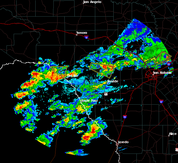 At 456 pm cdt, a severe thunderstorm was located near leakey, moving east at 25 mph (radar indicated). Hazards include 60 mph wind gusts and quarter size hail. Hail damage to vehicles is expected. Expect wind damage to roofs, siding, and trees. At 456 pm cdt, a severe thunderstorm was located near leakey, moving east at 25 mph (radar indicated). Hazards include 60 mph wind gusts and quarter size hail. Hail damage to vehicles is expected. Expect wind damage to roofs, siding, and trees.
|
| 4/17/2019 11:41 PM CDT |
 At 1141 pm cdt, a severe thunderstorm was located near d`hanis, or miles southwest of hondo, moving east at 40 mph (radar indicated). Hazards include 60 mph wind gusts and penny size hail. Expect damage to roofs, siding, and trees. Locations impacted include, uvalde, batesville, la pryor, sabinal, knippa, loma vista, utopia, concan and garner state park. At 1141 pm cdt, a severe thunderstorm was located near d`hanis, or miles southwest of hondo, moving east at 40 mph (radar indicated). Hazards include 60 mph wind gusts and penny size hail. Expect damage to roofs, siding, and trees. Locations impacted include, uvalde, batesville, la pryor, sabinal, knippa, loma vista, utopia, concan and garner state park.
|
| 4/17/2019 11:23 PM CDT |
 At 1122 pm cdt, a severe thunderstorm was located over uvalde, moving east at 40 mph (radar indicated). Hazards include 70 mph wind gusts and nickel size hail. Expect considerable tree damage. damage is likely to mobile homes, roofs, and outbuildings. Locations impacted include, uvalde, la pryor, batesville, sabinal, knippa, laguna, blewett, concan, washer, uvalde estates, garner state park, reagan wells, loma vista and utopia. At 1122 pm cdt, a severe thunderstorm was located over uvalde, moving east at 40 mph (radar indicated). Hazards include 70 mph wind gusts and nickel size hail. Expect considerable tree damage. damage is likely to mobile homes, roofs, and outbuildings. Locations impacted include, uvalde, la pryor, batesville, sabinal, knippa, laguna, blewett, concan, washer, uvalde estates, garner state park, reagan wells, loma vista and utopia.
|
| 4/17/2019 10:56 PM CDT |
 At 1055 pm cdt, a severe thunderstorm was located over dabney, or 16 miles east of spofford, moving east at 40 mph (radar indicated). Hazards include 70 mph wind gusts and quarter size hail. Hail damage to vehicles is expected. expect considerable tree damage. Wind damage is also likely to mobile homes, roofs, and outbuildings. At 1055 pm cdt, a severe thunderstorm was located over dabney, or 16 miles east of spofford, moving east at 40 mph (radar indicated). Hazards include 70 mph wind gusts and quarter size hail. Hail damage to vehicles is expected. expect considerable tree damage. Wind damage is also likely to mobile homes, roofs, and outbuildings.
|
| 4/7/2019 5:39 AM CDT |
 At 539 am cdt, severe thunderstorms were located along a line extending from near tarpley to charlotte, moving east at 45 mph (radar indicated). Hazards include 60 mph wind gusts and penny size hail. expect damage to roofs, siding, and trees At 539 am cdt, severe thunderstorms were located along a line extending from near tarpley to charlotte, moving east at 45 mph (radar indicated). Hazards include 60 mph wind gusts and penny size hail. expect damage to roofs, siding, and trees
|
| 4/7/2019 5:14 AM CDT |
 At 513 am cdt, a severe thunderstorm was located 8 miles southeast of utopia, or 14 miles southwest of tarpley, moving northeast at 45 mph (radar indicated). Hazards include 60 mph wind gusts and penny size hail. Expect damage to roofs, siding, and trees. Locations impacted include, tarpley, utopia, concan and garner state park. At 513 am cdt, a severe thunderstorm was located 8 miles southeast of utopia, or 14 miles southwest of tarpley, moving northeast at 45 mph (radar indicated). Hazards include 60 mph wind gusts and penny size hail. Expect damage to roofs, siding, and trees. Locations impacted include, tarpley, utopia, concan and garner state park.
|
| 4/7/2019 5:00 AM CDT |
 At 459 am cdt, severe thunderstorms were located along a line extending from garner state park to near yancey, moving east northeast at 35 mph (radar indicated). Hazards include 60 mph wind gusts and penny size hail. Expect damage to roofs, siding, and trees. Locations impacted include, uvalde, hondo, leakey, tarpley, vanderpool, sabinal, knippa, d`hanis, rio frio, concan, garner state park, reagan wells, utopia and hill country state natural area. At 459 am cdt, severe thunderstorms were located along a line extending from garner state park to near yancey, moving east northeast at 35 mph (radar indicated). Hazards include 60 mph wind gusts and penny size hail. Expect damage to roofs, siding, and trees. Locations impacted include, uvalde, hondo, leakey, tarpley, vanderpool, sabinal, knippa, d`hanis, rio frio, concan, garner state park, reagan wells, utopia and hill country state natural area.
|
| 4/7/2019 4:32 AM CDT |
 At 432 am cdt, severe thunderstorms were located along a line extending from montell to 11 miles northwest of frio town, moving northeast at 50 mph (radar indicated). Hazards include 60 mph wind gusts and nickel size hail. expect damage to roofs, siding, and trees At 432 am cdt, severe thunderstorms were located along a line extending from montell to 11 miles northwest of frio town, moving northeast at 50 mph (radar indicated). Hazards include 60 mph wind gusts and nickel size hail. expect damage to roofs, siding, and trees
|
| 10/9/2018 7:49 AM CDT |
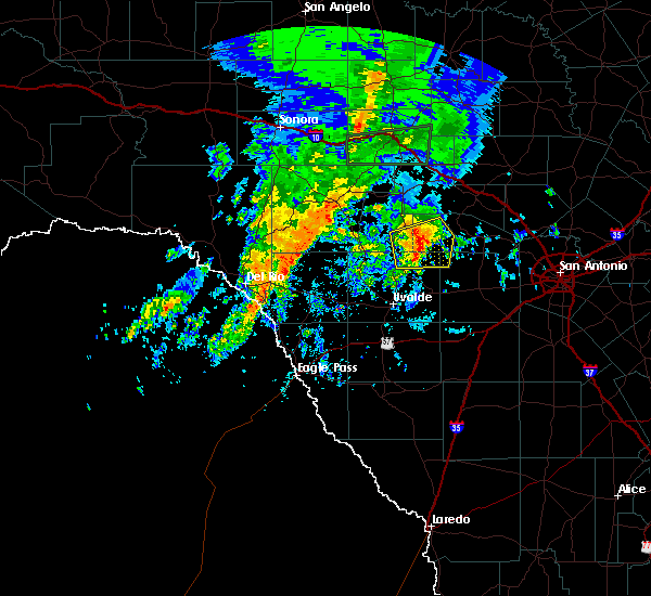 At 749 am cdt, a severe thunderstorm was located near vanderpool, moving northeast at 20 mph (radar indicated). Hazards include 60 mph wind gusts and quarter size hail. Hail damage to vehicles is expected. expect wind damage to roofs, siding, and trees. Locations impacted include, leakey, vanderpool, tuff, garner state park, rio frio, utopia, concan and lost maples state natural area. At 749 am cdt, a severe thunderstorm was located near vanderpool, moving northeast at 20 mph (radar indicated). Hazards include 60 mph wind gusts and quarter size hail. Hail damage to vehicles is expected. expect wind damage to roofs, siding, and trees. Locations impacted include, leakey, vanderpool, tuff, garner state park, rio frio, utopia, concan and lost maples state natural area.
|
| 10/9/2018 7:28 AM CDT |
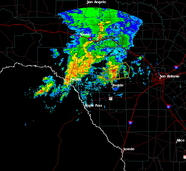 At 727 am cdt, a severe thunderstorm was located over rio frio, or 7 miles south of leakey, moving northeast at 20 mph (radar indicated). Hazards include 60 mph wind gusts and quarter size hail. Hail damage to vehicles is expected. Expect wind damage to roofs, siding, and trees. At 727 am cdt, a severe thunderstorm was located over rio frio, or 7 miles south of leakey, moving northeast at 20 mph (radar indicated). Hazards include 60 mph wind gusts and quarter size hail. Hail damage to vehicles is expected. Expect wind damage to roofs, siding, and trees.
|
| 5/15/2018 10:47 PM CDT |
 At 1047 pm cdt, a severe thunderstorm was located 7 miles northeast of sabinal, or 15 miles west of hondo, moving south at 45 mph (radar indicated). Hazards include 60 mph wind gusts and penny size hail. Expect damage to roofs, siding, and trees. Locations impacted include, hondo, sabinal, utopia and d`hanis. At 1047 pm cdt, a severe thunderstorm was located 7 miles northeast of sabinal, or 15 miles west of hondo, moving south at 45 mph (radar indicated). Hazards include 60 mph wind gusts and penny size hail. Expect damage to roofs, siding, and trees. Locations impacted include, hondo, sabinal, utopia and d`hanis.
|
| 5/15/2018 10:32 PM CDT |
 At 1031 pm cdt, a severe thunderstorm was located 7 miles southeast of utopia, or 9 miles southwest of tarpley, moving southeast at 40 mph (radar indicated). Hazards include 60 mph wind gusts and quarter size hail. Hail damage to vehicles is expected. expect wind damage to roofs, siding, and trees. Locations impacted include, hondo, sabinal, utopia and d`hanis. At 1031 pm cdt, a severe thunderstorm was located 7 miles southeast of utopia, or 9 miles southwest of tarpley, moving southeast at 40 mph (radar indicated). Hazards include 60 mph wind gusts and quarter size hail. Hail damage to vehicles is expected. expect wind damage to roofs, siding, and trees. Locations impacted include, hondo, sabinal, utopia and d`hanis.
|
| 5/15/2018 10:07 PM CDT |
 At 1007 pm cdt, a severe thunderstorm was located 8 miles east of lost maples state natural area, or 8 miles northeast of vanderpool, moving south at 40 mph (radar indicated). Hazards include 60 mph wind gusts and quarter size hail. Hail damage to vehicles is expected. expect wind damage to roofs, siding, and trees. Locations impacted include, hondo, tarpley, sabinal, utopia and d`hanis. At 1007 pm cdt, a severe thunderstorm was located 8 miles east of lost maples state natural area, or 8 miles northeast of vanderpool, moving south at 40 mph (radar indicated). Hazards include 60 mph wind gusts and quarter size hail. Hail damage to vehicles is expected. expect wind damage to roofs, siding, and trees. Locations impacted include, hondo, tarpley, sabinal, utopia and d`hanis.
|
| 5/15/2018 9:55 PM CDT |
 At 954 pm cdt, a severe thunderstorm was located 11 miles northeast of lost maples state natural area, or 12 miles northwest of medina, moving south at 45 mph (radar indicated). Hazards include golf ball size hail and 60 mph wind gusts. People and animals outdoors will be injured. expect hail damage to roofs, siding, windows, and vehicles. Expect wind damage to roofs, siding, and trees. At 954 pm cdt, a severe thunderstorm was located 11 miles northeast of lost maples state natural area, or 12 miles northwest of medina, moving south at 45 mph (radar indicated). Hazards include golf ball size hail and 60 mph wind gusts. People and animals outdoors will be injured. expect hail damage to roofs, siding, windows, and vehicles. Expect wind damage to roofs, siding, and trees.
|
| 5/4/2018 7:46 AM CDT |
 At 745 am cdt, a severe thunderstorm was located near tarpley, moving east at 40 mph (radar indicated). Hazards include 60 mph wind gusts and quarter size hail. Hail damage to vehicles is expected. Expect wind damage to roofs, siding, and trees. At 745 am cdt, a severe thunderstorm was located near tarpley, moving east at 40 mph (radar indicated). Hazards include 60 mph wind gusts and quarter size hail. Hail damage to vehicles is expected. Expect wind damage to roofs, siding, and trees.
|
| 5/4/2018 7:30 AM CDT | Raws sensor measured 58 mp in bandera county TX, 3.4 miles ESE of Utopia, TX |
| 5/4/2018 7:16 AM CDT |
 At 716 am cdt, severe thunderstorms were located along a line extending from 12 miles north of leakey to near tuff to garner state park, moving east at 30 mph (radar indicated). Hazards include 70 mph wind gusts and half dollar size hail. Hail damage to vehicles is expected. expect considerable tree damage. wind damage is also likely to mobile homes, roofs, and outbuildings. Locations impacted include, leakey, vanderpool, tuff, garner state park, rio frio, reagan wells, utopia, concan, lost maples state natural area and prade ranch. At 716 am cdt, severe thunderstorms were located along a line extending from 12 miles north of leakey to near tuff to garner state park, moving east at 30 mph (radar indicated). Hazards include 70 mph wind gusts and half dollar size hail. Hail damage to vehicles is expected. expect considerable tree damage. wind damage is also likely to mobile homes, roofs, and outbuildings. Locations impacted include, leakey, vanderpool, tuff, garner state park, rio frio, reagan wells, utopia, concan, lost maples state natural area and prade ranch.
|
| 5/4/2018 7:03 AM CDT |
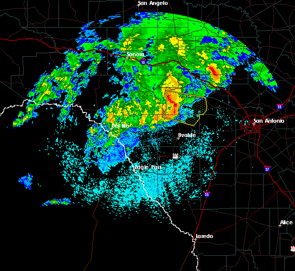 A severe thunderstorm warning remains in effect until 745 am cdt for western bandera. west central kerr. northeastern uvalde and real counties. At 702 am cdt, severe thunderstorms were located along a line extending from 12 miles north of tuff to near leakey to near reagan wells, moving east at 35 mph. A severe thunderstorm warning remains in effect until 745 am cdt for western bandera. west central kerr. northeastern uvalde and real counties. At 702 am cdt, severe thunderstorms were located along a line extending from 12 miles north of tuff to near leakey to near reagan wells, moving east at 35 mph.
|
| 5/4/2018 6:40 AM CDT |
 At 639 am cdt, severe thunderstorms were located along a line extending from 14 miles east of rocksprings to vance to 7 miles west of camp wood, moving east at 45 mph (radar indicated). Hazards include 70 mph wind gusts and penny size hail. Expect considerable tree damage. Damage is likely to mobile homes, roofs, and outbuildings. At 639 am cdt, severe thunderstorms were located along a line extending from 14 miles east of rocksprings to vance to 7 miles west of camp wood, moving east at 45 mph (radar indicated). Hazards include 70 mph wind gusts and penny size hail. Expect considerable tree damage. Damage is likely to mobile homes, roofs, and outbuildings.
|
| 5/28/2017 5:54 PM CDT |
 At 554 pm cdt, a severe thunderstorm was located near leakey, moving east at 10 mph (radar indicated). Hazards include 60 mph wind gusts and quarter size hail. Hail damage to vehicles is expected. expect wind damage to roofs, siding, and trees. Locations impacted include, leakey, vanderpool, lost maples state park, tuff and rio frio. At 554 pm cdt, a severe thunderstorm was located near leakey, moving east at 10 mph (radar indicated). Hazards include 60 mph wind gusts and quarter size hail. Hail damage to vehicles is expected. expect wind damage to roofs, siding, and trees. Locations impacted include, leakey, vanderpool, lost maples state park, tuff and rio frio.
|
| 5/28/2017 5:29 PM CDT |
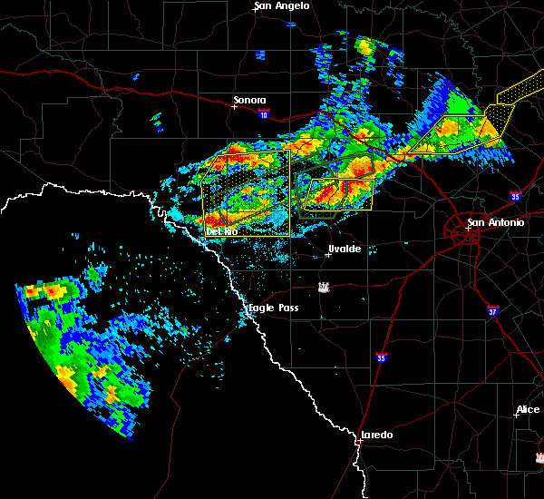 At 529 pm cdt, a severe thunderstorm was located 7 miles northeast of camp wood, or 8 miles west of leakey, moving east at 10 mph (radar indicated). Hazards include ping pong ball size hail and 60 mph wind gusts. People and animals outdoors will be injured. expect hail damage to roofs, siding, windows, and vehicles. Expect wind damage to roofs, siding, and trees. At 529 pm cdt, a severe thunderstorm was located 7 miles northeast of camp wood, or 8 miles west of leakey, moving east at 10 mph (radar indicated). Hazards include ping pong ball size hail and 60 mph wind gusts. People and animals outdoors will be injured. expect hail damage to roofs, siding, windows, and vehicles. Expect wind damage to roofs, siding, and trees.
|
| 4/2/2017 7:23 AM CDT |
 The severe thunderstorm warning for west central medina, southwestern bandera and northeastern uvalde counties will expire at 730 am cdt, the storm which prompted the warning has moved out of the area. therefore the warning will be allowed to expire. however small hail is still possible with this thunderstorm. a tornado watch remains in effect until 100 pm cdt for south central texas. remember, a severe thunderstorm warning still remains in effect for 730 am cdt. The severe thunderstorm warning for west central medina, southwestern bandera and northeastern uvalde counties will expire at 730 am cdt, the storm which prompted the warning has moved out of the area. therefore the warning will be allowed to expire. however small hail is still possible with this thunderstorm. a tornado watch remains in effect until 100 pm cdt for south central texas. remember, a severe thunderstorm warning still remains in effect for 730 am cdt.
|
| 4/2/2017 6:40 AM CDT |
 At 640 am cdt, a severe thunderstorm was located near concan, or 14 miles north of uvalde, moving northeast at 25 mph (radar indicated). Hazards include two inch hail and 60 mph wind gusts. People and animals outdoors will be injured. expect hail damage to roofs, siding, windows, and vehicles. expect wind damage to roofs, siding, and trees. locations impacted include, knippa, utopia and concan. A tornado watch remains in effect until 100 pm cdt for south central texas. At 640 am cdt, a severe thunderstorm was located near concan, or 14 miles north of uvalde, moving northeast at 25 mph (radar indicated). Hazards include two inch hail and 60 mph wind gusts. People and animals outdoors will be injured. expect hail damage to roofs, siding, windows, and vehicles. expect wind damage to roofs, siding, and trees. locations impacted include, knippa, utopia and concan. A tornado watch remains in effect until 100 pm cdt for south central texas.
|
| 4/2/2017 6:32 AM CDT |
 At 632 am cdt, a severe thunderstorm was located 9 miles south of concan, or 12 miles north of uvalde, moving northeast at 25 mph (radar indicated). Hazards include 60 mph wind gusts and quarter size hail. Hail damage to vehicles is expected. Expect wind damage to roofs, siding, and trees. At 632 am cdt, a severe thunderstorm was located 9 miles south of concan, or 12 miles north of uvalde, moving northeast at 25 mph (radar indicated). Hazards include 60 mph wind gusts and quarter size hail. Hail damage to vehicles is expected. Expect wind damage to roofs, siding, and trees.
|
| 3/29/2017 12:41 AM CDT |
 At 1240 am cdt, severe thunderstorms were located along a line extending from near tarpley to near sabinal to 8 miles southeast of uvalde, moving east at 40 mph (radar indicated). Hazards include 60 mph wind gusts and quarter size hail. Hail damage to vehicles is expected. expect wind damage to roofs, siding, and trees. Locations impacted include, uvalde, hondo, tarpley, sabinal, knippa, uvalde estates, blewett, d`hanis and utopia. At 1240 am cdt, severe thunderstorms were located along a line extending from near tarpley to near sabinal to 8 miles southeast of uvalde, moving east at 40 mph (radar indicated). Hazards include 60 mph wind gusts and quarter size hail. Hail damage to vehicles is expected. expect wind damage to roofs, siding, and trees. Locations impacted include, uvalde, hondo, tarpley, sabinal, knippa, uvalde estates, blewett, d`hanis and utopia.
|
| 3/29/2017 12:12 AM CDT |
 At 1211 am cdt, a severe thunderstorm was located 7 miles southeast of laguna, or 11 miles northwest of uvalde, moving east at 45 mph (radar indicated). Hazards include 60 mph wind gusts and quarter size hail. Hail damage to vehicles is expected. Expect wind damage to roofs, siding, and trees. At 1211 am cdt, a severe thunderstorm was located 7 miles southeast of laguna, or 11 miles northwest of uvalde, moving east at 45 mph (radar indicated). Hazards include 60 mph wind gusts and quarter size hail. Hail damage to vehicles is expected. Expect wind damage to roofs, siding, and trees.
|
| 2/19/2017 8:35 PM CST |
 At 835 pm cst, severe thunderstorms were located along a line extending from concan to 9 miles west of bluff, moving northeast at 40 mph (radar indicated). Hazards include 60 mph wind gusts and penny size hail. Expect damage to roofs, siding, and trees. Locations impacted include, uvalde, crystal city, la pryor, batesville, sabinal, knippa, chula vista-river spur, concan, washer, las colonias, uvalde estates, garner state park, reagan wells, utopia, loma vista and brundage. At 835 pm cst, severe thunderstorms were located along a line extending from concan to 9 miles west of bluff, moving northeast at 40 mph (radar indicated). Hazards include 60 mph wind gusts and penny size hail. Expect damage to roofs, siding, and trees. Locations impacted include, uvalde, crystal city, la pryor, batesville, sabinal, knippa, chula vista-river spur, concan, washer, las colonias, uvalde estates, garner state park, reagan wells, utopia, loma vista and brundage.
|
| 2/19/2017 8:24 PM CST |
 At 824 pm cst, severe thunderstorms were located along a line extending from 6 miles south of reagan wells to near loma vista, moving northeast at 35 mph (radar indicated). Hazards include 60 mph wind gusts and penny size hail. Expect damage to roofs, siding, and trees. Locations impacted include, uvalde, crystal city, la pryor, batesville, sabinal, laguna, knippa, chula vista-river spur, blewett, concan, washer, las colonias, uvalde estates, cometa, dabney, montell, cline, garner state park, reagan wells and utopia. At 824 pm cst, severe thunderstorms were located along a line extending from 6 miles south of reagan wells to near loma vista, moving northeast at 35 mph (radar indicated). Hazards include 60 mph wind gusts and penny size hail. Expect damage to roofs, siding, and trees. Locations impacted include, uvalde, crystal city, la pryor, batesville, sabinal, laguna, knippa, chula vista-river spur, blewett, concan, washer, las colonias, uvalde estates, cometa, dabney, montell, cline, garner state park, reagan wells and utopia.
|
| 2/19/2017 8:06 PM CST |
 At 806 pm cst, severe thunderstorms were located along a line extending from near reagan wells to near winter haven, moving northeast at 35 mph (radar indicated). Hazards include 60 mph wind gusts and penny size hail. expect damage to roofs, siding, and trees At 806 pm cst, severe thunderstorms were located along a line extending from near reagan wells to near winter haven, moving northeast at 35 mph (radar indicated). Hazards include 60 mph wind gusts and penny size hail. expect damage to roofs, siding, and trees
|
| 1/15/2017 7:20 PM CST | Golf Ball sized hail reported 8.8 miles SSE of Utopia, TX |
| 5/29/2016 12:55 AM CDT |
 At 1255 am cdt, severe thunderstorms were located along a line extending from bandera falls to 10 miles southeast of tarpley to 8 miles southeast of utopia, moving southeast at 20 mph (radar indicated). Hazards include 60 mph wind gusts and quarter size hail. Hail damage to vehicles is expected. Expect wind damage to roofs, siding, and trees. At 1255 am cdt, severe thunderstorms were located along a line extending from bandera falls to 10 miles southeast of tarpley to 8 miles southeast of utopia, moving southeast at 20 mph (radar indicated). Hazards include 60 mph wind gusts and quarter size hail. Hail damage to vehicles is expected. Expect wind damage to roofs, siding, and trees.
|
| 5/29/2016 12:11 AM CDT |
 At 1210 am cdt, severe thunderstorms were located along a line extending from welfare to bandera falls to near utopia to 7 miles west of montell, moving south at 15 mph. this incluses garner state park where ongoing camping is high for the holiday weekend (radar indicated). Hazards include 60 mph wind gusts and quarter size hail. Hail damage to vehicles is expected. expect wind damage to roofs, siding, and trees. Locations impacted include, medina, kerrville, boerne, comfort, bandera, leakey, vanderpool, tarpley, camp wood, montell, lost maples state park, waring, concan, pipe creek, walnut grove, utopia, welfare, sisterdale, bandera falls and mico. At 1210 am cdt, severe thunderstorms were located along a line extending from welfare to bandera falls to near utopia to 7 miles west of montell, moving south at 15 mph. this incluses garner state park where ongoing camping is high for the holiday weekend (radar indicated). Hazards include 60 mph wind gusts and quarter size hail. Hail damage to vehicles is expected. expect wind damage to roofs, siding, and trees. Locations impacted include, medina, kerrville, boerne, comfort, bandera, leakey, vanderpool, tarpley, camp wood, montell, lost maples state park, waring, concan, pipe creek, walnut grove, utopia, welfare, sisterdale, bandera falls and mico.
|
| 5/28/2016 11:59 PM CDT |
 At 1158 pm cdt, severe thunderstorms were located along a line extending from comfort to pipe creek to near utopia to 7 miles west of montell, moving south to south-southeast at 15 mph (radar indicated). Hazards include 60 mph wind gusts and quarter size hail. Hail damage to vehicles is expected. Expect wind damage to roofs, siding, and trees. At 1158 pm cdt, severe thunderstorms were located along a line extending from comfort to pipe creek to near utopia to 7 miles west of montell, moving south to south-southeast at 15 mph (radar indicated). Hazards include 60 mph wind gusts and quarter size hail. Hail damage to vehicles is expected. Expect wind damage to roofs, siding, and trees.
|
| 5/28/2016 10:03 PM CDT |
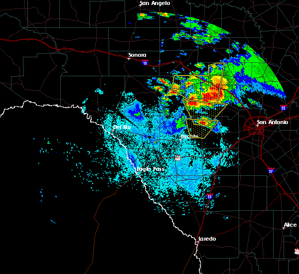 At 1002 pm cdt, a severe thunderstorm was located 8 miles southeast of utopia, or 12 miles southwest of tarpley, moving north at 15 mph (radar indicated). Hazards include 60 mph wind gusts and half dollar size hail. Hail damage to vehicles is expected. Expect wind damage to roofs, siding, and trees. At 1002 pm cdt, a severe thunderstorm was located 8 miles southeast of utopia, or 12 miles southwest of tarpley, moving north at 15 mph (radar indicated). Hazards include 60 mph wind gusts and half dollar size hail. Hail damage to vehicles is expected. Expect wind damage to roofs, siding, and trees.
|
| 5/28/2016 9:55 PM CDT | Golf Ball sized hail reported 9.8 miles NNW of Utopia, TX |
| 5/17/2016 10:50 PM CDT |
 At 1050 pm cdt, a severe thunderstorm was located near utopia, or 7 miles southeast of vanderpool, moving east at 30 mph (radar indicated). Hazards include 60 mph wind gusts and quarter size hail. Hail damage to vehicles is expected. expect wind damage to roofs, siding, and trees. Locations impacted include, vanderpool and utopia. At 1050 pm cdt, a severe thunderstorm was located near utopia, or 7 miles southeast of vanderpool, moving east at 30 mph (radar indicated). Hazards include 60 mph wind gusts and quarter size hail. Hail damage to vehicles is expected. expect wind damage to roofs, siding, and trees. Locations impacted include, vanderpool and utopia.
|
| 5/17/2016 10:14 PM CDT |
 At 1014 pm cdt, a severe thunderstorm was located over leakey, moving east at 30 mph (radar indicated). Hazards include ping pong ball size hail and 60 mph wind gusts. People and animals outdoors will be injured. expect hail damage to roofs, siding, windows, and vehicles. Expect wind damage to roofs, siding, and trees. At 1014 pm cdt, a severe thunderstorm was located over leakey, moving east at 30 mph (radar indicated). Hazards include ping pong ball size hail and 60 mph wind gusts. People and animals outdoors will be injured. expect hail damage to roofs, siding, windows, and vehicles. Expect wind damage to roofs, siding, and trees.
|
| 4/30/2016 2:40 AM CDT |
 At 240 am cdt, severe thunderstorms were located along a line extending from 6 miles west of nelson city to near tarpley to 9 miles southeast of utopia to 7 miles northwest of knippa to 8 miles northwest of uvalde to near brackettville, moving east at 40 mph. these are very dangerous storms (radar indicated). Hazards include baseball size hail and 60 mph wind gusts. People and animals outdoors will be severely injured. expect shattered windows, extensive damage to roofs, siding, and vehicles. Locations impacted include, medina, kerrville, uvalde, boerne, hondo, comfort, brackettville, bandera, spofford, tarpley, sabinal, laguna, d`hanis, waring, blewett, alamo village, concan, pipe creek, standart and walnut grove. At 240 am cdt, severe thunderstorms were located along a line extending from 6 miles west of nelson city to near tarpley to 9 miles southeast of utopia to 7 miles northwest of knippa to 8 miles northwest of uvalde to near brackettville, moving east at 40 mph. these are very dangerous storms (radar indicated). Hazards include baseball size hail and 60 mph wind gusts. People and animals outdoors will be severely injured. expect shattered windows, extensive damage to roofs, siding, and vehicles. Locations impacted include, medina, kerrville, uvalde, boerne, hondo, comfort, brackettville, bandera, spofford, tarpley, sabinal, laguna, d`hanis, waring, blewett, alamo village, concan, pipe creek, standart and walnut grove.
|
| 4/30/2016 2:27 AM CDT |
 At 226 am cdt, severe thunderstorms were located along a line extending from near camp verde to near tarpley to 8 miles south of utopia to 10 miles southwest of concan to near cline to 7 miles south of standart, moving east at 35 mph (radar indicated). Hazards include quarter size hail. damage to vehicles is expected At 226 am cdt, severe thunderstorms were located along a line extending from near camp verde to near tarpley to 8 miles south of utopia to 10 miles southwest of concan to near cline to 7 miles south of standart, moving east at 35 mph (radar indicated). Hazards include quarter size hail. damage to vehicles is expected
|
| 4/12/2016 8:47 PM CDT |
 At 846 pm cdt, a severe thunderstorm was located over concan, moving east at 30 mph. this storm will move across county roads 421, 392 and 349 (radar indicated). Hazards include ping pong ball size hail and 60 mph wind gusts. People and animals outdoors will be injured. expect hail damage to roofs, siding, windows, and vehicles. expect wind damage to roofs, siding, and trees. Locations impacted include, hondo, concan, garner state park and utopia. At 846 pm cdt, a severe thunderstorm was located over concan, moving east at 30 mph. this storm will move across county roads 421, 392 and 349 (radar indicated). Hazards include ping pong ball size hail and 60 mph wind gusts. People and animals outdoors will be injured. expect hail damage to roofs, siding, windows, and vehicles. expect wind damage to roofs, siding, and trees. Locations impacted include, hondo, concan, garner state park and utopia.
|
| 4/12/2016 8:24 PM CDT |
 At 822 pm cdt, a severe thunderstorm was located near reagan wells, moving east at 35 mph. this storm will cross highway 83 in the concan area and will cross county roads 720, 392 and 349 (radar indicated). Hazards include 60 mph wind gusts and quarter size hail. Hail damage to vehicles is expected. Expect wind damage to roofs, siding, and trees. At 822 pm cdt, a severe thunderstorm was located near reagan wells, moving east at 35 mph. this storm will cross highway 83 in the concan area and will cross county roads 720, 392 and 349 (radar indicated). Hazards include 60 mph wind gusts and quarter size hail. Hail damage to vehicles is expected. Expect wind damage to roofs, siding, and trees.
|
| 3/18/2016 8:05 PM CDT |
 At 804 pm cdt, a severe thunderstorm was located near utopia, or 8 miles south of vanderpool, moving southeast at 10 mph. this storm has produced quarter size hail two miles east of leakey (radar indicated). Hazards include quarter size hail. Damage to vehicles is expected. Locations impacted include, vanderpool, concan, reagan wells, garner state park and utopia. At 804 pm cdt, a severe thunderstorm was located near utopia, or 8 miles south of vanderpool, moving southeast at 10 mph. this storm has produced quarter size hail two miles east of leakey (radar indicated). Hazards include quarter size hail. Damage to vehicles is expected. Locations impacted include, vanderpool, concan, reagan wells, garner state park and utopia.
|
| 3/18/2016 7:14 PM CDT |
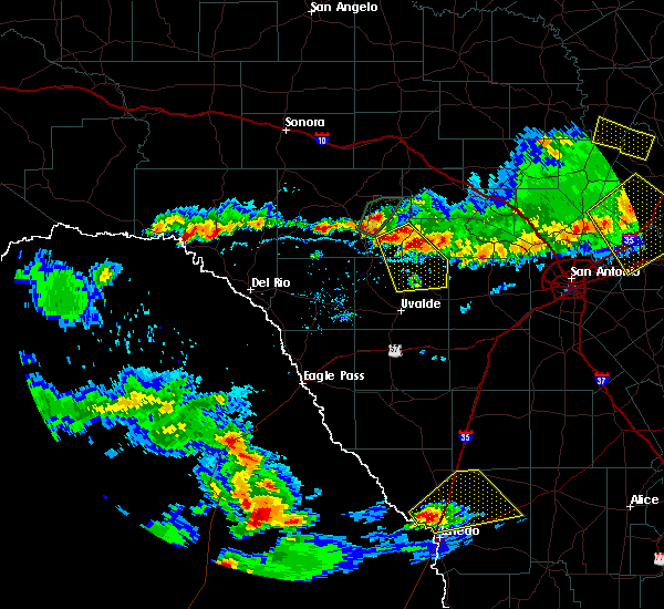 At 714 pm cdt, a severe thunderstorm was located near leakey, moving southeast at 10 mph (radar indicated). Hazards include 60 mph wind gusts and quarter size hail. Hail damage to vehicles is expected. Expect wind damage to roofs, siding, and trees. At 714 pm cdt, a severe thunderstorm was located near leakey, moving southeast at 10 mph (radar indicated). Hazards include 60 mph wind gusts and quarter size hail. Hail damage to vehicles is expected. Expect wind damage to roofs, siding, and trees.
|
| 3/8/2016 9:18 PM CST |
 At 918 pm cst, severe thunderstorms were located along a line extending from near utopia to 8 miles northwest of d`hanis to 10 miles southeast of sabinal, moving north at 25 mph (radar indicated). Hazards include 60 mph wind gusts and quarter size hail. Hail damage to vehicles is expected. expect wind damage to roofs, siding, and trees. Locations impacted include, medina, hondo, tarpley, vanderpool, sabinal, d`hanis and utopia. At 918 pm cst, severe thunderstorms were located along a line extending from near utopia to 8 miles northwest of d`hanis to 10 miles southeast of sabinal, moving north at 25 mph (radar indicated). Hazards include 60 mph wind gusts and quarter size hail. Hail damage to vehicles is expected. expect wind damage to roofs, siding, and trees. Locations impacted include, medina, hondo, tarpley, vanderpool, sabinal, d`hanis and utopia.
|
| 3/8/2016 8:54 PM CST |
 At 853 pm cst, a severe thunderstorm was located over sabinal, or 19 miles northeast of uvalde, moving northeast at 35 mph (radar indicated). Hazards include 60 mph wind gusts and quarter size hail. Hail damage to vehicles is expected. expect wind damage to roofs, siding, and trees. Locations impacted include, sabinal and utopia. At 853 pm cst, a severe thunderstorm was located over sabinal, or 19 miles northeast of uvalde, moving northeast at 35 mph (radar indicated). Hazards include 60 mph wind gusts and quarter size hail. Hail damage to vehicles is expected. expect wind damage to roofs, siding, and trees. Locations impacted include, sabinal and utopia.
|
| 3/8/2016 8:50 PM CST |
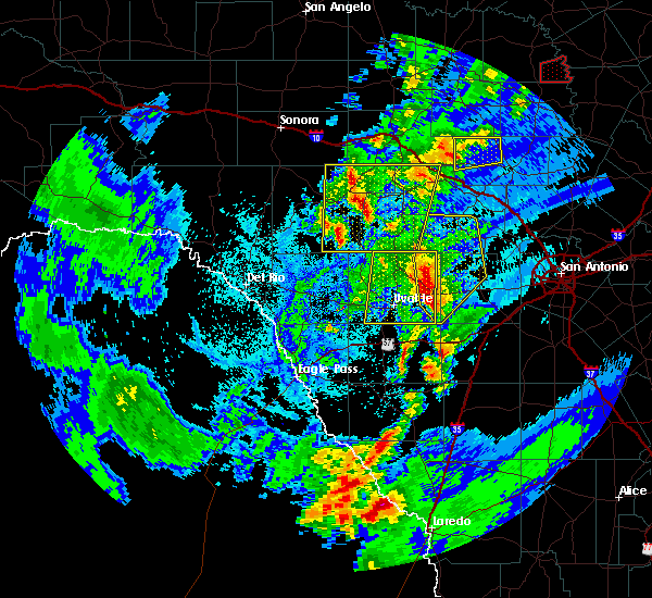 At 850 pm cst, severe thunderstorms were located along a line extending from near utopia to 6 miles north of frio town, moving northeast at 35 mph (radar indicated). Hazards include 60 mph wind gusts and quarter size hail. Hail damage to vehicles is expected. Expect wind damage to roofs, siding, and trees. At 850 pm cst, severe thunderstorms were located along a line extending from near utopia to 6 miles north of frio town, moving northeast at 35 mph (radar indicated). Hazards include 60 mph wind gusts and quarter size hail. Hail damage to vehicles is expected. Expect wind damage to roofs, siding, and trees.
|
| 3/8/2016 7:56 PM CST |
 At 755 pm cst, a severe thunderstorm was located near concan, or 15 miles north of uvalde, moving north at 20 mph (radar indicated). Hazards include 60 mph wind gusts and quarter size hail. Hail damage to vehicles is expected. expect wind damage to roofs, siding, and trees. This storm has had a history of producing quarter sized hail based on reports from an emergency manager. At 755 pm cst, a severe thunderstorm was located near concan, or 15 miles north of uvalde, moving north at 20 mph (radar indicated). Hazards include 60 mph wind gusts and quarter size hail. Hail damage to vehicles is expected. expect wind damage to roofs, siding, and trees. This storm has had a history of producing quarter sized hail based on reports from an emergency manager.
|
| 3/8/2016 7:42 PM CST |
 At 742 pm cst, a severe thunderstorm was located near concan, or 16 miles north of uvalde, moving northeast at 15 to 20 mph (radar indicated). Hazards include 60 mph wind gusts and half dollar size hail. Hail damage to vehicles is expected. expect wind damage to roofs, siding, and trees. Locations impacted include, uvalde, concan, knippa, garner state park, utopia, uvalde estates and reagan wells. At 742 pm cst, a severe thunderstorm was located near concan, or 16 miles north of uvalde, moving northeast at 15 to 20 mph (radar indicated). Hazards include 60 mph wind gusts and half dollar size hail. Hail damage to vehicles is expected. expect wind damage to roofs, siding, and trees. Locations impacted include, uvalde, concan, knippa, garner state park, utopia, uvalde estates and reagan wells.
|
| 3/8/2016 7:10 PM CST |
 At 710 pm cst, a severe thunderstorm was located 9 miles northwest of knippa, or 9 miles north of uvalde, moving northeast at 15 mph (radar indicated). Hazards include 60 mph wind gusts and quarter size hail. Hail damage to vehicles is expected. Expect wind damage to roofs, siding, and trees. At 710 pm cst, a severe thunderstorm was located 9 miles northwest of knippa, or 9 miles north of uvalde, moving northeast at 15 mph (radar indicated). Hazards include 60 mph wind gusts and quarter size hail. Hail damage to vehicles is expected. Expect wind damage to roofs, siding, and trees.
|
| 2/22/2016 11:29 PM CST |
 At 1129 pm cst, severe thunderstorms were located along a line extending from 6 miles northwest of laguna to dabney to 14 miles southeast of anacacho to 7 miles northeast of darling, moving southeast at 50 mph (radar indicated). Hazards include 70 mph wind gusts and quarter size hail. Hail damage to vehicles is expected. expect considerable tree damage. wind damage is also likely to mobile homes, roofs, and outbuildings. Locations impacted include, uvalde, spofford, la pryor, batesville, laguna, garner state park, darling, washer, montell, uvalde estates, blewett, concan, knippa, utopia, dabney, anacacho, reagan wells, cline and turkey mountain. At 1129 pm cst, severe thunderstorms were located along a line extending from 6 miles northwest of laguna to dabney to 14 miles southeast of anacacho to 7 miles northeast of darling, moving southeast at 50 mph (radar indicated). Hazards include 70 mph wind gusts and quarter size hail. Hail damage to vehicles is expected. expect considerable tree damage. wind damage is also likely to mobile homes, roofs, and outbuildings. Locations impacted include, uvalde, spofford, la pryor, batesville, laguna, garner state park, darling, washer, montell, uvalde estates, blewett, concan, knippa, utopia, dabney, anacacho, reagan wells, cline and turkey mountain.
|
| 2/22/2016 10:58 PM CST |
 At 1057 pm cst, a severe thunderstorm was located over brackettville, moving east at 45 mph (radar indicated). Hazards include 70 mph wind gusts and quarter size hail. Hail damage to vehicles is expected. expect considerable tree damage. Wind damage is also likely to mobile homes, roofs, and outbuildings. At 1057 pm cst, a severe thunderstorm was located over brackettville, moving east at 45 mph (radar indicated). Hazards include 70 mph wind gusts and quarter size hail. Hail damage to vehicles is expected. expect considerable tree damage. Wind damage is also likely to mobile homes, roofs, and outbuildings.
|
| 5/11/2015 7:15 AM CDT | At 714 am cdt, a severe thunderstorm was located near utopia, or 13 miles southwest of tarpley, moving east at 25 mph (radar indicated). Hazards include 60 mph wind gusts and quarter size hail. Hail damage to vehicles is expected. expect wind damage to roofs, siding and trees. locations impacted include, vanderpool, tarpley and utopia. 1. 00in. |
| 5/11/2015 6:56 AM CDT | At 656 am cdt, a severe thunderstorm was located near utopia, or 13 miles south of vanderpool, moving east at 25 mph (radar indicated). Hazards include 60 mph wind gusts and quarter size hail. Hail damage to vehicles is expected. Expect wind damage to roofs, siding and trees. |
| 4/27/2015 12:37 AM CDT | At 1233 am cdt, severe thunderstorms were located along a line extending from near bandera falls to near d`hanis to near sabinal to 9 miles south of knippa, moving east at 45 mph (radar indicated). Hazards include 70 mph wind gusts and penny size hail. Expect considerable tree damage. damage is likely to mobile homes, roofs and outbuildings. locations impacted include, uvalde, hondo, devine, castroville, bandera, tarpley, lytle, sabinal, natalia, lacoste, d`hanis, pearson, bader, noonan, pipe creek, knippa, utopia, quihi, bandera falls and mico. 0. 75in. |
| 4/27/2015 12:14 AM CDT | At 1214 am cdt, severe thunderstorms were located along a line extending from near medina to 6 miles north of knippa to 7 miles east of washer, moving east at 70 mph (radar indicated). Hazards include 60 mph wind gusts and penny size hail. Expect damage to roofs. Siding and trees. |
| 4/26/2015 11:40 PM CDT | At 1139 pm cdt, severe thunderstorms were located along a line extending from 7 miles northwest of tuff to 7 miles northwest of darling, moving southeast at 60 mph (radar indicated). Hazards include 70 mph wind gusts and quarter size hail. Hail damage to vehicles is expected. expect considerable tree damage. Wind damage is also likely to mobile homes, roofs and outbuildings. |
| 5/9/2014 10:35 AM CDT | Quarter sized hail reported 10.3 miles SSE of Utopia, TX, putting vehicles under carports to protect from large hail |
| 3/19/2012 10:00 PM CDT | Golf Ball sized hail reported 3.3 miles E of Utopia, TX, hail ranged in size from pea to golf ball size |
| 3/19/2012 9:20 PM CDT | Tennis Ball sized hail reported 0.9 miles ESE of Utopia, TX |
| 3/19/2012 6:12 PM CDT | Golf Ball sized hail reported 2.2 miles W of Utopia, TX, quarter up to golfball hail in utopia. |
Hail Maps for Utopia, TX
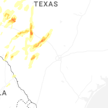


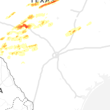


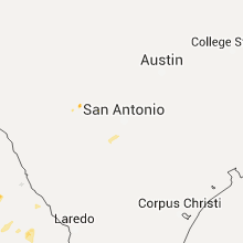
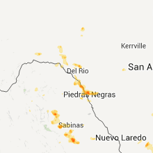


Connect with Interactive Hail Maps