

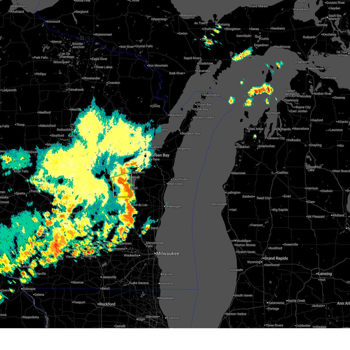
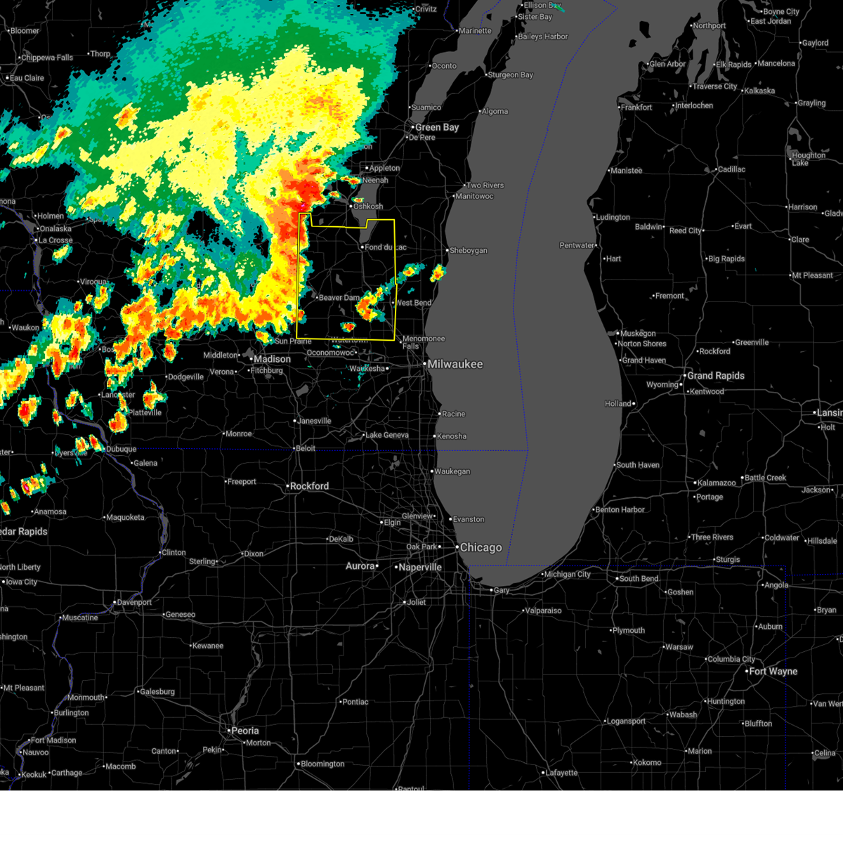
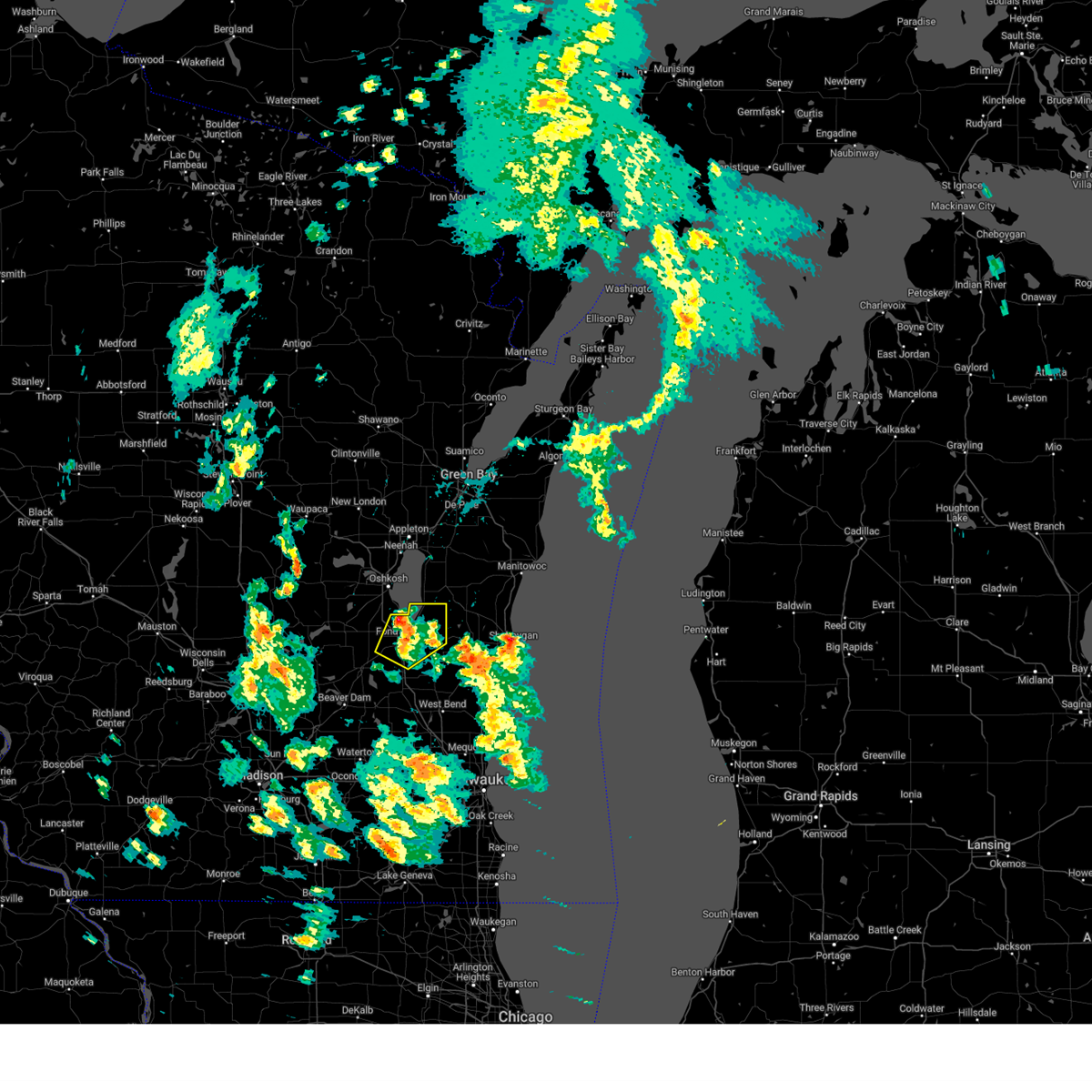
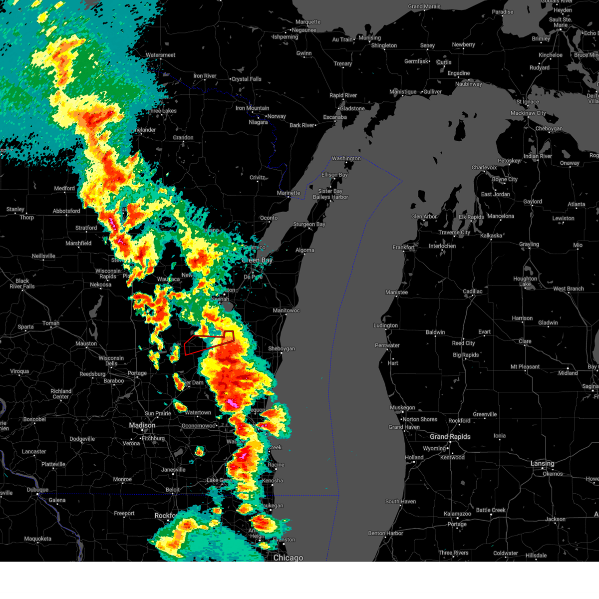
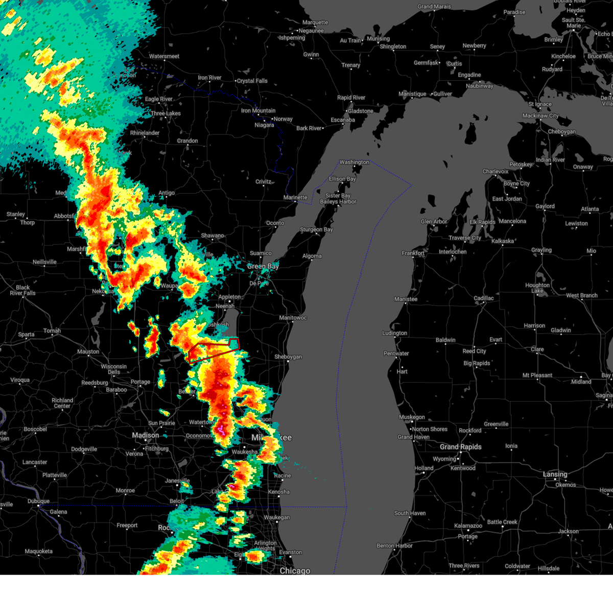
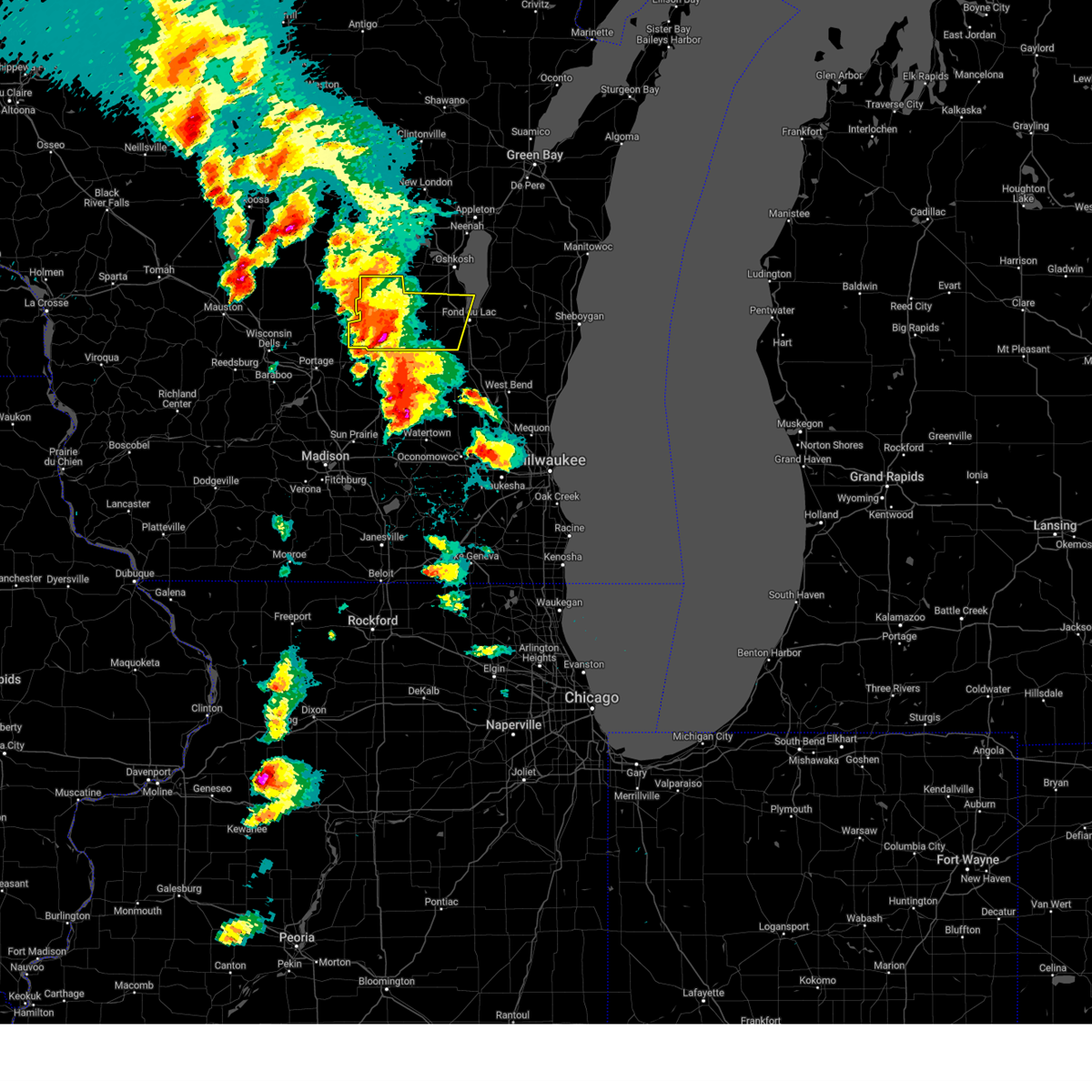
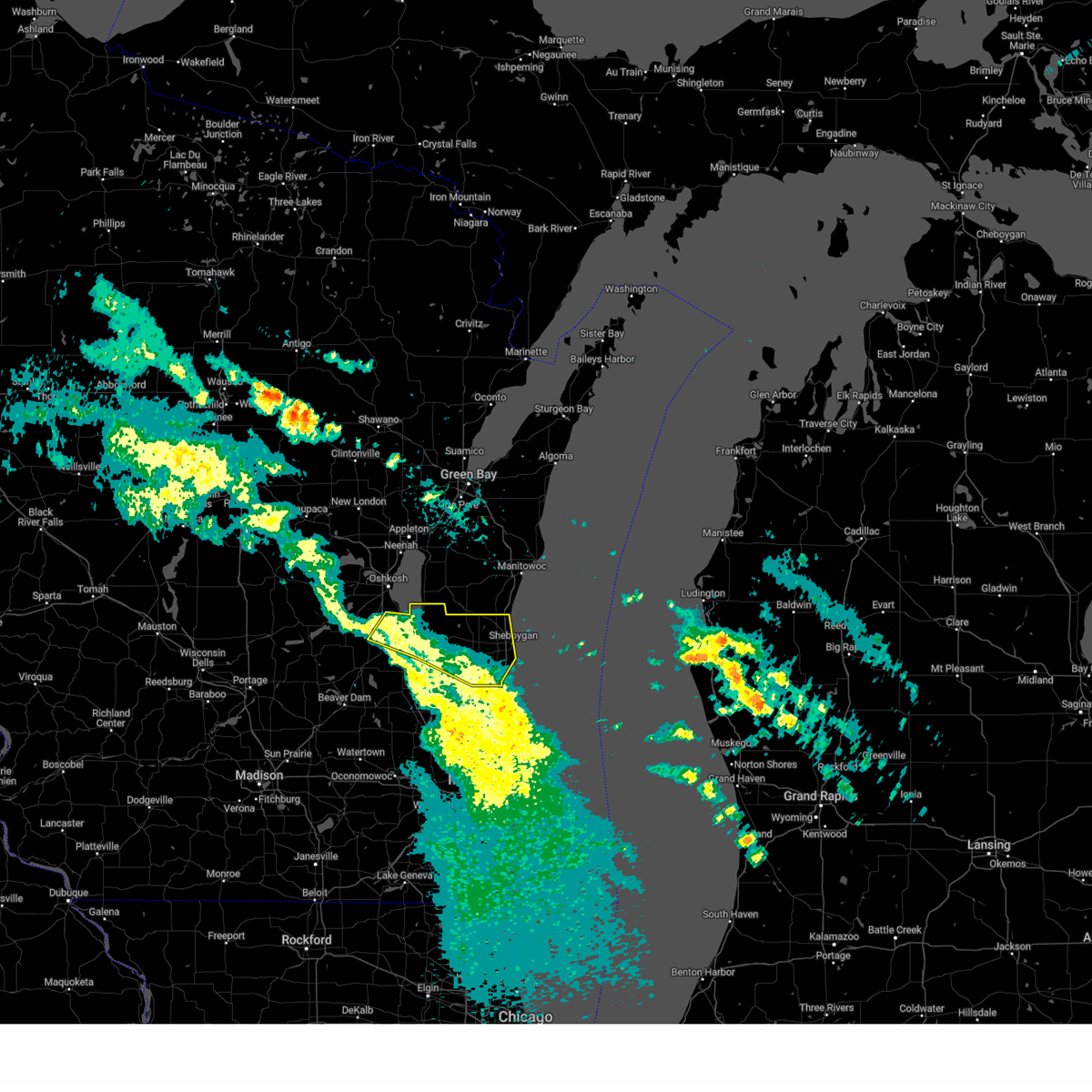
Hail Map for Van Dyne, WI
The Van Dyne, WI area has had 1 report of on-the-ground hail by trained spotters, and has been under severe weather warnings 26 times during the past 12 months. Doppler radar has detected hail at or near Van Dyne, WI on 39 occasions.
| Name: | Van Dyne, WI |
| Where Located: | 49.6 miles SSW of Green Bay, WI |
| Map: | Google Map for Van Dyne, WI |
| Population: | 279 |
| Housing Units: | 122 |
| More Info: | Search Google for Van Dyne, WI |
2
The Top Recent Hail Date for Van Dyne, WI is Thursday, August 3, 2023 (7th out of 39)

Hail and Wind Damage Spotted near Van Dyne, WI
| Date / Time | Report Details |
|---|---|
| 7/16/2025 4:00 PM CDT | Trees down and uprooted. garbage bins blown 75 yards. pea size hail. estimated winds of 60 mp in fond du lac county WI, 2 miles N of Van Dyne, WI |
| 6/23/2025 6:59 PM CDT |
 At 658 pm cdt, severe thunderstorms were located along a line extending from near st anna to near lisbon, moving east at 45 mph (public. uprooted trees were reported in waupun at 638 pm cdt). Hazards include 60 mph wind gusts. Expect damage to roofs, siding, and trees. Locations impacted include, fond du lac, west bend, watertown, hartford, jackson, mayville, slinger, north fond du lac, kewaskum, horicon, juneau, germantown, lomira, campbellsport, theresa, hustisford, oakfield, iron ridge, southern lake winnebago, and richfield. At 658 pm cdt, severe thunderstorms were located along a line extending from near st anna to near lisbon, moving east at 45 mph (public. uprooted trees were reported in waupun at 638 pm cdt). Hazards include 60 mph wind gusts. Expect damage to roofs, siding, and trees. Locations impacted include, fond du lac, west bend, watertown, hartford, jackson, mayville, slinger, north fond du lac, kewaskum, horicon, juneau, germantown, lomira, campbellsport, theresa, hustisford, oakfield, iron ridge, southern lake winnebago, and richfield.
|
| 6/23/2025 6:55 PM CDT |
 The storms which prompted the warning have weakened below severe limits, and no longer pose an immediate threat to life or property. therefore, the warning will be allowed to expire. however, heavy rain is still possible with these thunderstorms. a severe thunderstorm watch remains in effect until 900 pm cdt for east central wisconsin. The storms which prompted the warning have weakened below severe limits, and no longer pose an immediate threat to life or property. therefore, the warning will be allowed to expire. however, heavy rain is still possible with these thunderstorms. a severe thunderstorm watch remains in effect until 900 pm cdt for east central wisconsin.
|
| 6/23/2025 6:44 PM CDT |
 At 644 pm cdt, severe thunderstorms were located along a line extending from near menasha to near oshkosh to 6 miles southwest of central lake winnebago, moving northeast at 45 mph (radar indicated). Hazards include 60 mph wind gusts. Expect damage to roofs, siding, and trees. Locations impacted include, appleton, oshkosh, menasha, central lake winnebago, northern lake winnebago, neenah, omro, winneconne, pickett, and butte des morts. At 644 pm cdt, severe thunderstorms were located along a line extending from near menasha to near oshkosh to 6 miles southwest of central lake winnebago, moving northeast at 45 mph (radar indicated). Hazards include 60 mph wind gusts. Expect damage to roofs, siding, and trees. Locations impacted include, appleton, oshkosh, menasha, central lake winnebago, northern lake winnebago, neenah, omro, winneconne, pickett, and butte des morts.
|
| 6/23/2025 6:36 PM CDT |
 the severe thunderstorm warning has been cancelled and is no longer in effect the severe thunderstorm warning has been cancelled and is no longer in effect
|
| 6/23/2025 6:36 PM CDT |
 At 634 pm cdt, severe thunderstorms were located along a line extending from 6 miles southwest of oshkosh to near watertown, moving east at 40 mph (law enforcement. scattered trees were reported down earlier when these storms moved through columbia and green lake counties). Hazards include 60 mph wind gusts. Expect damage to roofs, siding, and trees. Locations impacted include, fond du lac, west bend, watertown, beaver dam, hartford, waupun, ripon, jackson, mayville, slinger, north fond du lac, kewaskum, horicon, juneau, germantown, lomira, campbellsport, theresa, hustisford, and oakfield. At 634 pm cdt, severe thunderstorms were located along a line extending from 6 miles southwest of oshkosh to near watertown, moving east at 40 mph (law enforcement. scattered trees were reported down earlier when these storms moved through columbia and green lake counties). Hazards include 60 mph wind gusts. Expect damage to roofs, siding, and trees. Locations impacted include, fond du lac, west bend, watertown, beaver dam, hartford, waupun, ripon, jackson, mayville, slinger, north fond du lac, kewaskum, horicon, juneau, germantown, lomira, campbellsport, theresa, hustisford, and oakfield.
|
| 6/23/2025 6:32 PM CDT | Svrgrb the national weather service in green bay has issued a * severe thunderstorm warning for, winnebago county in east central wisconsin, * until 700 pm cdt. * at 631 pm cdt, severe thunderstorms were located along a line extending from 10 miles west of menasha to 8 miles west of oshkosh to 6 miles east of rush lake, moving northeast at 45 mph (radar indicated). Hazards include 60 mph wind gusts. expect damage to roofs, siding, and trees |
| 6/23/2025 6:31 PM CDT |
 At 629 pm cdt, severe thunderstorms were located along a line extending from 7 miles northeast of rush lake to near watertown, moving east at 40 mph (radar indicated and reports from law enforcement. scattered tree damage occurred earlier with these storms in green lake and columbia counties). Hazards include 60 mph wind gusts. Expect damage to roofs, siding, and trees. Locations impacted include, fond du lac, west bend, watertown, beaver dam, hartford, waupun, ripon, jackson, berlin, mayville, slinger, north fond du lac, kewaskum, horicon, juneau, germantown, lomira, campbellsport, markesan, and theresa. At 629 pm cdt, severe thunderstorms were located along a line extending from 7 miles northeast of rush lake to near watertown, moving east at 40 mph (radar indicated and reports from law enforcement. scattered tree damage occurred earlier with these storms in green lake and columbia counties). Hazards include 60 mph wind gusts. Expect damage to roofs, siding, and trees. Locations impacted include, fond du lac, west bend, watertown, beaver dam, hartford, waupun, ripon, jackson, berlin, mayville, slinger, north fond du lac, kewaskum, horicon, juneau, germantown, lomira, campbellsport, markesan, and theresa.
|
| 6/23/2025 6:19 PM CDT |
 Svrmkx the national weather service in milwaukee/sullivan has issued a * severe thunderstorm warning for, fond du lac county in east central wisconsin, eastern green lake county in south central wisconsin, washington county in southeastern wisconsin, dodge county in southeastern wisconsin, * until 730 pm cdt. * at 618 pm cdt, severe thunderstorms were located along a line extending from near rush lake to 7 miles northeast of waterloo, moving east at 40 mph (radar indicated). Hazards include 60 mph wind gusts. expect damage to roofs, siding, and trees Svrmkx the national weather service in milwaukee/sullivan has issued a * severe thunderstorm warning for, fond du lac county in east central wisconsin, eastern green lake county in south central wisconsin, washington county in southeastern wisconsin, dodge county in southeastern wisconsin, * until 730 pm cdt. * at 618 pm cdt, severe thunderstorms were located along a line extending from near rush lake to 7 miles northeast of waterloo, moving east at 40 mph (radar indicated). Hazards include 60 mph wind gusts. expect damage to roofs, siding, and trees
|
| 5/16/2025 5:39 PM CDT | The storm which prompted the warning has weakened below severe limits, and has exited the warned area. therefore, the warning will be allowed to expire. |
| 5/16/2025 5:22 PM CDT | the severe thunderstorm warning has been cancelled and is no longer in effect |
| 5/16/2025 5:22 PM CDT | At 522 pm cdt, severe thunderstorms were located along a line extending from new london to 7 miles west of appleton to oshkosh, moving northeast at 50 mph (radar indicated). Hazards include 70 mph wind gusts. Expect considerable tree damage. damage is likely to mobile homes, roofs, and outbuildings. these severe storms will be near, appleton, oshkosh, menasha, northern lake winnebago, and central lake winnebago around 525 pm cdt. little chute, kimberly, black creek, and darboy around 530 pm cdt. kaukauna and high cliff state park around 535 pm cdt. Other locations impacted by these severe thunderstorms include pickett, mackville, leeman, butte des morts, larsen, northport, orihula, wolf river bottoms wildlife area, brothertown, and winneconne. |
| 5/16/2025 5:18 PM CDT | Svrmkx the national weather service in milwaukee/sullivan has issued a * severe thunderstorm warning for, central fond du lac county in east central wisconsin, * until 545 pm cdt. * at 518 pm cdt, a severe thunderstorm was located near oakfield, or near waupun, moving northeast at 55 mph (radar indicated). Hazards include 60 mph wind gusts. expect damage to roofs, siding, and trees |
| 5/16/2025 5:02 PM CDT | Svrgrb the national weather service in green bay has issued a * severe thunderstorm warning for, western calumet county in east central wisconsin, winnebago county in east central wisconsin, eastern waushara county in central wisconsin, southeastern waupaca county in northeastern wisconsin, southwestern outagamie county in northeastern wisconsin, * until 545 pm cdt. * at 502 pm cdt, severe thunderstorms were located along a line extending from 6 miles west of fremont to near lake poygan to near rush lake, moving northeast at 55 mph (radar indicated). Hazards include 60 mph wind gusts. Expect damage to roofs, siding, and trees. severe thunderstorms will be near, fremont and lake poygan around 505 pm cdt. oshkosh around 510 pm cdt. new london and central lake winnebago around 515 pm cdt. menasha and northern lake winnebago around 520 pm cdt. appleton around 525 pm cdt. kaukauna, little chute, kimberly, black creek, darboy, and high cliff state park around 530 pm cdt. Other locations impacted by these severe thunderstorms include pickett, mackville, leeman, butte des morts, larsen, northport, orihula, wolf river bottoms wildlife area, borth, and brothertown. |
| 5/16/2025 4:31 PM CDT |
 At 430 pm cdt, a severe thunderstorm was located near fond du lac, moving northeast at 60 mph (radar indicated). Hazards include 60 mph wind gusts. Expect damage to roofs, siding, and trees. locations impacted include, fond du lac, north fond du lac, oakfield, southern lake winnebago, taycheedah, lamartine, byron, eden, mount calvary, st. Cloud, van dyne, peebles, pipe, calvary, marytown, town of forest, and johnsburg. At 430 pm cdt, a severe thunderstorm was located near fond du lac, moving northeast at 60 mph (radar indicated). Hazards include 60 mph wind gusts. Expect damage to roofs, siding, and trees. locations impacted include, fond du lac, north fond du lac, oakfield, southern lake winnebago, taycheedah, lamartine, byron, eden, mount calvary, st. Cloud, van dyne, peebles, pipe, calvary, marytown, town of forest, and johnsburg.
|
| 5/16/2025 4:31 PM CDT |
 the severe thunderstorm warning has been cancelled and is no longer in effect the severe thunderstorm warning has been cancelled and is no longer in effect
|
| 5/16/2025 4:10 PM CDT |
 Svrmkx the national weather service in milwaukee/sullivan has issued a * severe thunderstorm warning for, fond du lac county in east central wisconsin, northeastern dodge county in southeastern wisconsin, * until 445 pm cdt. * at 410 pm cdt, a severe thunderstorm was located near mayville, moving northeast at 60 mph (radar indicated). Hazards include 60 mph wind gusts. expect damage to roofs, siding, and trees Svrmkx the national weather service in milwaukee/sullivan has issued a * severe thunderstorm warning for, fond du lac county in east central wisconsin, northeastern dodge county in southeastern wisconsin, * until 445 pm cdt. * at 410 pm cdt, a severe thunderstorm was located near mayville, moving northeast at 60 mph (radar indicated). Hazards include 60 mph wind gusts. expect damage to roofs, siding, and trees
|
| 5/15/2025 6:28 PM CDT |
 the tornado warning has been cancelled and is no longer in effect the tornado warning has been cancelled and is no longer in effect
|
| 5/15/2025 6:12 PM CDT |
 Tormkx the national weather service in milwaukee/sullivan has issued a * tornado warning for, northern fond du lac county in east central wisconsin, * until 645 pm cdt. * at 612 pm cdt, a severe thunderstorm capable of producing a tornado was located near brandon, or near ripon, moving northeast at 40 mph (radar indicated rotation). Hazards include tornado and ping pong ball size hail. Flying debris will be dangerous to those caught without shelter. mobile homes will be damaged or destroyed. damage to roofs, windows, and vehicles will occur. Tree damage is likely. Tormkx the national weather service in milwaukee/sullivan has issued a * tornado warning for, northern fond du lac county in east central wisconsin, * until 645 pm cdt. * at 612 pm cdt, a severe thunderstorm capable of producing a tornado was located near brandon, or near ripon, moving northeast at 40 mph (radar indicated rotation). Hazards include tornado and ping pong ball size hail. Flying debris will be dangerous to those caught without shelter. mobile homes will be damaged or destroyed. damage to roofs, windows, and vehicles will occur. Tree damage is likely.
|
| 5/15/2025 6:07 PM CDT | At 607 pm cdt, severe thunderstorms were located along a line extending from near berlin to 6 miles north of rosendale to near southern lake winnebago, moving northeast at 55 mph (radar indicated). Hazards include ping pong ball size hail and 60 mph wind gusts. People and animals outdoors will be injured. expect hail damage to roofs, siding, windows, and vehicles. expect wind damage to roofs, siding, and trees. Locations impacted include, fond du lac, ripon, berlin, north fond du lac, markesan, princeton, oakfield, rosendale, green lake, brandon, southern lake winnebago, lamartine, eldorado, alto, fairwater, van dyne, oak center, lagoda, and west rosendale. |
| 5/15/2025 5:37 PM CDT |
 Svrmkx the national weather service in milwaukee/sullivan has issued a * severe thunderstorm warning for, western fond du lac county in east central wisconsin, green lake county in south central wisconsin, * until 645 pm cdt. * at 537 pm cdt, severe thunderstorms were located along a line extending from 8 miles southeast of montello to near randolph to near waupun, moving northeast at 55 mph (radar indicated). Hazards include ping pong ball size hail and 60 mph wind gusts. People and animals outdoors will be injured. expect hail damage to roofs, siding, windows, and vehicles. Expect wind damage to roofs, siding, and trees. Svrmkx the national weather service in milwaukee/sullivan has issued a * severe thunderstorm warning for, western fond du lac county in east central wisconsin, green lake county in south central wisconsin, * until 645 pm cdt. * at 537 pm cdt, severe thunderstorms were located along a line extending from 8 miles southeast of montello to near randolph to near waupun, moving northeast at 55 mph (radar indicated). Hazards include ping pong ball size hail and 60 mph wind gusts. People and animals outdoors will be injured. expect hail damage to roofs, siding, windows, and vehicles. Expect wind damage to roofs, siding, and trees.
|
| 3/15/2025 2:13 AM CDT | the severe thunderstorm warning has been cancelled and is no longer in effect |
| 3/15/2025 1:50 AM CDT |
 the severe thunderstorm warning has been cancelled and is no longer in effect the severe thunderstorm warning has been cancelled and is no longer in effect
|
| 3/15/2025 1:50 AM CDT |
 At 150 am cdt, severe thunderstorms were located along a line extending from near southern lake winnebago to near plymouth to 6 miles southeast of oostburg, moving northeast at 45 mph (radar indicated). Hazards include 60 mph wind gusts. Expect damage to roofs, siding, and trees. locations impacted include, adell, haven, southern lake winnebago, eldorado, cedar grove, eden, johnsonville, sheboygan falls, waucousta, calvary, north fond du lac, marytown, van dyne, hingham, st. Cloud, sheboygan, johnsburg, howards grove, cascade, and peebles. At 150 am cdt, severe thunderstorms were located along a line extending from near southern lake winnebago to near plymouth to 6 miles southeast of oostburg, moving northeast at 45 mph (radar indicated). Hazards include 60 mph wind gusts. Expect damage to roofs, siding, and trees. locations impacted include, adell, haven, southern lake winnebago, eldorado, cedar grove, eden, johnsonville, sheboygan falls, waucousta, calvary, north fond du lac, marytown, van dyne, hingham, st. Cloud, sheboygan, johnsburg, howards grove, cascade, and peebles.
|
| 3/15/2025 1:47 AM CDT |
 Svrmkx the national weather service in milwaukee/sullivan has issued a * severe thunderstorm warning for, northeastern fond du lac county in east central wisconsin, sheboygan county in east central wisconsin, * until 230 am cdt. * at 146 am cdt, severe thunderstorms were located along a line extending from near southern lake winnebago to near plymouth to 8 miles southeast of cedar grove, moving northeast at 60 mph (radar indicated). Hazards include 60 mph wind gusts. expect damage to roofs, siding, and trees Svrmkx the national weather service in milwaukee/sullivan has issued a * severe thunderstorm warning for, northeastern fond du lac county in east central wisconsin, sheboygan county in east central wisconsin, * until 230 am cdt. * at 146 am cdt, severe thunderstorms were located along a line extending from near southern lake winnebago to near plymouth to 8 miles southeast of cedar grove, moving northeast at 60 mph (radar indicated). Hazards include 60 mph wind gusts. expect damage to roofs, siding, and trees
|
| 3/15/2025 1:11 AM CDT | Svrmkx the national weather service in milwaukee/sullivan has issued a * severe thunderstorm warning for, ozaukee county in southeastern wisconsin, fond du lac county in east central wisconsin, milwaukee county in southeastern wisconsin, northeastern waukesha county in southeastern wisconsin, washington county in southeastern wisconsin, northern dodge county in southeastern wisconsin, sheboygan county in east central wisconsin, * until 200 am cdt. * at 110 am cdt, severe thunderstorms were located along a line extending from near central lake winnebago to near random lake to 9 miles east of whitefish bay, moving northeast at 40 mph (radar indicated). Hazards include 60 mph wind gusts. expect damage to roofs, siding, and trees |
| 3/15/2025 12:42 AM CDT | Svrmkx the national weather service in milwaukee/sullivan has issued a * severe thunderstorm warning for, fond du lac county in east central wisconsin, green lake county in south central wisconsin, northeastern marquette county in south central wisconsin, northern dodge county in southeastern wisconsin, sheboygan county in east central wisconsin, * until 115 am cdt. * at 1242 am cdt, severe thunderstorms were located along a line extending from near wautoma to green lake to near theresa, moving northeast at 60 mph (radar indicated). Hazards include 60 mph wind gusts. expect damage to roofs, siding, and trees |
| 7/13/2024 8:29 PM CDT |
 At 829 pm cdt, a severe thunderstorm was located 8 miles east of fond du lac, moving east at 30 mph (radar indicated). Hazards include 60 mph wind gusts. Expect damage to roofs, siding, and trees. Locations impacted include, sheboygan, fond du lac, plymouth, sheboygan falls, mayville, north fond du lac, kewaskum, howards grove, oostburg, lomira, belgium, fredonia, kohler, cedar grove, campbellsport, random lake, theresa, oakfield, elkhart lake, and southern lake winnebago. At 829 pm cdt, a severe thunderstorm was located 8 miles east of fond du lac, moving east at 30 mph (radar indicated). Hazards include 60 mph wind gusts. Expect damage to roofs, siding, and trees. Locations impacted include, sheboygan, fond du lac, plymouth, sheboygan falls, mayville, north fond du lac, kewaskum, howards grove, oostburg, lomira, belgium, fredonia, kohler, cedar grove, campbellsport, random lake, theresa, oakfield, elkhart lake, and southern lake winnebago.
|
| 7/13/2024 8:12 PM CDT |
 Svrmkx the national weather service in milwaukee/sullivan has issued a * severe thunderstorm warning for, northern ozaukee county in southeastern wisconsin, fond du lac county in east central wisconsin, northern washington county in southeastern wisconsin, northeastern dodge county in southeastern wisconsin, sheboygan county in east central wisconsin, * until 915 pm cdt. * at 812 pm cdt, a severe thunderstorm was located over fond du lac, moving east at 30 mph (radar indicated). Hazards include 70 mph wind gusts. Expect considerable tree damage. Damage is likely to mobile homes, roofs, and outbuildings. Svrmkx the national weather service in milwaukee/sullivan has issued a * severe thunderstorm warning for, northern ozaukee county in southeastern wisconsin, fond du lac county in east central wisconsin, northern washington county in southeastern wisconsin, northeastern dodge county in southeastern wisconsin, sheboygan county in east central wisconsin, * until 915 pm cdt. * at 812 pm cdt, a severe thunderstorm was located over fond du lac, moving east at 30 mph (radar indicated). Hazards include 70 mph wind gusts. Expect considerable tree damage. Damage is likely to mobile homes, roofs, and outbuildings.
|
| 5/21/2024 9:17 PM CDT |
 The storms which prompted the warning have moved out of the warned area. therefore, the warning will be allowed to expire. a tornado watch remains in effect until midnight cdt for central, north central, northeastern and east central wisconsin. remember, a severe thunderstorm warning still remains in effect for eastern menominee, eastern shawano, eastern outagamie, eastern winnebago counties. The storms which prompted the warning have moved out of the warned area. therefore, the warning will be allowed to expire. a tornado watch remains in effect until midnight cdt for central, north central, northeastern and east central wisconsin. remember, a severe thunderstorm warning still remains in effect for eastern menominee, eastern shawano, eastern outagamie, eastern winnebago counties.
|
| 5/21/2024 9:03 PM CDT |
 Svrmkx the national weather service in milwaukee/sullivan has issued a * severe thunderstorm warning for, northwestern fond du lac county in east central wisconsin, * until 930 pm cdt. * at 902 pm cdt, a severe thunderstorm was located over rosendale, or 9 miles southeast of ripon, moving northeast at 80 mph (trained weather spotters. there have been multiple reports of tree and power line damage in dodge county). Hazards include 60 mph wind gusts. expect damage to roofs, siding, and trees Svrmkx the national weather service in milwaukee/sullivan has issued a * severe thunderstorm warning for, northwestern fond du lac county in east central wisconsin, * until 930 pm cdt. * at 902 pm cdt, a severe thunderstorm was located over rosendale, or 9 miles southeast of ripon, moving northeast at 80 mph (trained weather spotters. there have been multiple reports of tree and power line damage in dodge county). Hazards include 60 mph wind gusts. expect damage to roofs, siding, and trees
|
| 5/21/2024 8:52 PM CDT |
 At 851 pm cdt, severe thunderstorms were located along a line extending from near new london to near northern lake winnebago to near fond du lac, moving northeast at 60 mph (radar indicated). Hazards include 70 mph wind gusts. Expect considerable tree damage. damage is likely to mobile homes, roofs, and outbuildings. Locations impacted include, green bay, appleton, oshkosh, menasha, kaukauna, little chute, new london, kimberly, clintonville, and chilton. At 851 pm cdt, severe thunderstorms were located along a line extending from near new london to near northern lake winnebago to near fond du lac, moving northeast at 60 mph (radar indicated). Hazards include 70 mph wind gusts. Expect considerable tree damage. damage is likely to mobile homes, roofs, and outbuildings. Locations impacted include, green bay, appleton, oshkosh, menasha, kaukauna, little chute, new london, kimberly, clintonville, and chilton.
|
| 5/21/2024 8:47 PM CDT |
 Svrgrb the national weather service in green bay has issued a * severe thunderstorm warning for, brown county in northeastern wisconsin, calumet county in east central wisconsin, winnebago county in east central wisconsin, eastern waupaca county in northeastern wisconsin, outagamie county in northeastern wisconsin, western manitowoc county in east central wisconsin, * until 945 pm cdt. * at 847 pm cdt, severe thunderstorms were located along a line extending from near new london to near oshkosh to near oakfield, moving northeast at 60 mph (radar indicated). Hazards include 70 mph wind gusts. Expect considerable tree damage. Damage is likely to mobile homes, roofs, and outbuildings. Svrgrb the national weather service in green bay has issued a * severe thunderstorm warning for, brown county in northeastern wisconsin, calumet county in east central wisconsin, winnebago county in east central wisconsin, eastern waupaca county in northeastern wisconsin, outagamie county in northeastern wisconsin, western manitowoc county in east central wisconsin, * until 945 pm cdt. * at 847 pm cdt, severe thunderstorms were located along a line extending from near new london to near oshkosh to near oakfield, moving northeast at 60 mph (radar indicated). Hazards include 70 mph wind gusts. Expect considerable tree damage. Damage is likely to mobile homes, roofs, and outbuildings.
|
| 5/21/2024 8:41 PM CDT |
 Tormkx the national weather service in milwaukee/sullivan has issued a * tornado warning for, eastern fond du lac county in east central wisconsin, * until 915 pm cdt. * at 841 pm cdt, a severe thunderstorm capable of producing a tornado was located over oakfield, or 7 miles southwest of fond du lac, moving northeast at 60 mph (radar indicated rotation). Hazards include tornado and quarter size hail. Flying debris will be dangerous to those caught without shelter. mobile homes will be damaged or destroyed. damage to roofs, windows, and vehicles will occur. Tree damage is likely. Tormkx the national weather service in milwaukee/sullivan has issued a * tornado warning for, eastern fond du lac county in east central wisconsin, * until 915 pm cdt. * at 841 pm cdt, a severe thunderstorm capable of producing a tornado was located over oakfield, or 7 miles southwest of fond du lac, moving northeast at 60 mph (radar indicated rotation). Hazards include tornado and quarter size hail. Flying debris will be dangerous to those caught without shelter. mobile homes will be damaged or destroyed. damage to roofs, windows, and vehicles will occur. Tree damage is likely.
|
| 5/21/2024 8:38 PM CDT |
 At 837 pm cdt, severe thunderstorms were located along a line extending from near antigo to 7 miles east of wittenberg to near napowan scout camp, moving east at 60 mph (radar indicated). Hazards include 70 mph wind gusts. Expect considerable tree damage. damage is likely to mobile homes, roofs, and outbuildings. Locations impacted include, appleton, oshkosh, shawano, antigo, waupaca, wautoma, menasha, new london, clintonville, and redgranite. At 837 pm cdt, severe thunderstorms were located along a line extending from near antigo to 7 miles east of wittenberg to near napowan scout camp, moving east at 60 mph (radar indicated). Hazards include 70 mph wind gusts. Expect considerable tree damage. damage is likely to mobile homes, roofs, and outbuildings. Locations impacted include, appleton, oshkosh, shawano, antigo, waupaca, wautoma, menasha, new london, clintonville, and redgranite.
|
| 5/21/2024 8:38 PM CDT |
 the severe thunderstorm warning has been cancelled and is no longer in effect the severe thunderstorm warning has been cancelled and is no longer in effect
|
| 5/21/2024 8:36 PM CDT |
 At 836 pm cdt, severe thunderstorms capable of producing tornadoes were located along a line extending from lake poygan to near oakfield, moving northeast at 55 mph (radar indicated rotation). Hazards include tornado and quarter size hail. Flying debris will be dangerous to those caught without shelter. mobile homes will be damaged or destroyed. damage to roofs, windows, and vehicles will occur. tree damage is likely. locations impacted include, fond du lac, north fond du lac, rosendale, southern lake winnebago, taycheedah, lamartine, eldorado, mount calvary, st. Cloud, van dyne, peebles, pipe, lagoda, calvary, marytown, johnsburg, west rosendale, and town of forest. At 836 pm cdt, severe thunderstorms capable of producing tornadoes were located along a line extending from lake poygan to near oakfield, moving northeast at 55 mph (radar indicated rotation). Hazards include tornado and quarter size hail. Flying debris will be dangerous to those caught without shelter. mobile homes will be damaged or destroyed. damage to roofs, windows, and vehicles will occur. tree damage is likely. locations impacted include, fond du lac, north fond du lac, rosendale, southern lake winnebago, taycheedah, lamartine, eldorado, mount calvary, st. Cloud, van dyne, peebles, pipe, lagoda, calvary, marytown, johnsburg, west rosendale, and town of forest.
|
| 5/21/2024 8:36 PM CDT |
 the tornado warning has been cancelled and is no longer in effect the tornado warning has been cancelled and is no longer in effect
|
| 5/21/2024 8:18 PM CDT |
 Svrgrb the national weather service in green bay has issued a * severe thunderstorm warning for, eastern portage county in central wisconsin, eastern marathon county in central wisconsin, menominee county in northeastern wisconsin, winnebago county in east central wisconsin, waushara county in central wisconsin, waupaca county in northeastern wisconsin, western outagamie county in northeastern wisconsin, southern langlade county in north central wisconsin, shawano county in northeastern wisconsin, * until 915 pm cdt. * at 817 pm cdt, severe thunderstorms were located along a line extending from 12 miles northeast of wausau to near bevent to 7 miles southwest of plainfield, moving east at 60 mph (radar indicated). Hazards include 70 mph wind gusts. Expect considerable tree damage. Damage is likely to mobile homes, roofs, and outbuildings. Svrgrb the national weather service in green bay has issued a * severe thunderstorm warning for, eastern portage county in central wisconsin, eastern marathon county in central wisconsin, menominee county in northeastern wisconsin, winnebago county in east central wisconsin, waushara county in central wisconsin, waupaca county in northeastern wisconsin, western outagamie county in northeastern wisconsin, southern langlade county in north central wisconsin, shawano county in northeastern wisconsin, * until 915 pm cdt. * at 817 pm cdt, severe thunderstorms were located along a line extending from 12 miles northeast of wausau to near bevent to 7 miles southwest of plainfield, moving east at 60 mph (radar indicated). Hazards include 70 mph wind gusts. Expect considerable tree damage. Damage is likely to mobile homes, roofs, and outbuildings.
|
| 5/21/2024 8:11 PM CDT |
 Tormkx the national weather service in milwaukee/sullivan has issued a * tornado warning for, fond du lac county in east central wisconsin, green lake county in south central wisconsin, northeastern marquette county in south central wisconsin, * until 845 pm cdt. * at 811 pm cdt, severe thunderstorms capable of producing tornadoes were located along a line extending from 6 miles southwest of redgranite to near randolph, moving northeast at 55 mph (radar indicated rotation). Hazards include tornado and quarter size hail. Flying debris will be dangerous to those caught without shelter. mobile homes will be damaged or destroyed. damage to roofs, windows, and vehicles will occur. Tree damage is likely. Tormkx the national weather service in milwaukee/sullivan has issued a * tornado warning for, fond du lac county in east central wisconsin, green lake county in south central wisconsin, northeastern marquette county in south central wisconsin, * until 845 pm cdt. * at 811 pm cdt, severe thunderstorms capable of producing tornadoes were located along a line extending from 6 miles southwest of redgranite to near randolph, moving northeast at 55 mph (radar indicated rotation). Hazards include tornado and quarter size hail. Flying debris will be dangerous to those caught without shelter. mobile homes will be damaged or destroyed. damage to roofs, windows, and vehicles will occur. Tree damage is likely.
|
| 5/21/2024 8:04 PM CDT |
 Svrmkx the national weather service in milwaukee/sullivan has issued a * severe thunderstorm warning for, fond du lac county in east central wisconsin, green lake county in south central wisconsin, eastern columbia county in south central wisconsin, northwestern washington county in southeastern wisconsin, northeastern marquette county in south central wisconsin, northeastern dane county in south central wisconsin, dodge county in southeastern wisconsin, * until 900 pm cdt. * at 803 pm cdt, severe thunderstorms were located along a line extending from near wautoma to near markesan to near columbus, moving northeast at 55 mph (trained weather spotters. these storms have a history of producing widespread tree damage). Hazards include 70 mph wind gusts and quarter size hail. Hail damage to vehicles is expected. expect considerable tree damage. Wind damage is also likely to mobile homes, roofs, and outbuildings. Svrmkx the national weather service in milwaukee/sullivan has issued a * severe thunderstorm warning for, fond du lac county in east central wisconsin, green lake county in south central wisconsin, eastern columbia county in south central wisconsin, northwestern washington county in southeastern wisconsin, northeastern marquette county in south central wisconsin, northeastern dane county in south central wisconsin, dodge county in southeastern wisconsin, * until 900 pm cdt. * at 803 pm cdt, severe thunderstorms were located along a line extending from near wautoma to near markesan to near columbus, moving northeast at 55 mph (trained weather spotters. these storms have a history of producing widespread tree damage). Hazards include 70 mph wind gusts and quarter size hail. Hail damage to vehicles is expected. expect considerable tree damage. Wind damage is also likely to mobile homes, roofs, and outbuildings.
|
| 8/3/2023 7:51 PM CDT |
 The severe thunderstorm warning for southeastern winnebago county will expire at 800 pm cdt, the storm which prompted the warning has moved out of the area. therefore, the warning will be allowed to expire. however, heavy rain is still possible with this thunderstorm. The severe thunderstorm warning for southeastern winnebago county will expire at 800 pm cdt, the storm which prompted the warning has moved out of the area. therefore, the warning will be allowed to expire. however, heavy rain is still possible with this thunderstorm.
|
| 8/3/2023 7:49 PM CDT |
 At 749 pm cdt, a severe thunderstorm was located near southern lake winnebago, or near fond du lac, moving southeast at 25 mph (radar indicated). Hazards include 60 mph wind gusts and penny size hail. Expect damage to roofs, siding, and trees. locations impacted include, fond du lac, north fond du lac, oakfield, southern lake winnebago, taycheedah, lamartine, byron, eldorado, eden, van dyne, oak center, waucousta, and peebles. hail threat, radar indicated max hail size, 0. 75 in wind threat, radar indicated max wind gust, 60 mph. At 749 pm cdt, a severe thunderstorm was located near southern lake winnebago, or near fond du lac, moving southeast at 25 mph (radar indicated). Hazards include 60 mph wind gusts and penny size hail. Expect damage to roofs, siding, and trees. locations impacted include, fond du lac, north fond du lac, oakfield, southern lake winnebago, taycheedah, lamartine, byron, eldorado, eden, van dyne, oak center, waucousta, and peebles. hail threat, radar indicated max hail size, 0. 75 in wind threat, radar indicated max wind gust, 60 mph.
|
| 8/3/2023 7:37 PM CDT |
 At 736 pm cdt, a severe thunderstorm was located near southern lake winnebago, or near north fond du lac, moving south at 15 mph (radar indicated). Hazards include 60 mph wind gusts and quarter size hail. Hail damage to vehicles is expected. expect wind damage to roofs, siding, and trees. locations impacted include, central lake winnebago, black wolf point, fisk and ring. hail threat, radar indicated max hail size, 1. 00 in wind threat, observed max wind gust, 60 mph. At 736 pm cdt, a severe thunderstorm was located near southern lake winnebago, or near north fond du lac, moving south at 15 mph (radar indicated). Hazards include 60 mph wind gusts and quarter size hail. Hail damage to vehicles is expected. expect wind damage to roofs, siding, and trees. locations impacted include, central lake winnebago, black wolf point, fisk and ring. hail threat, radar indicated max hail size, 1. 00 in wind threat, observed max wind gust, 60 mph.
|
| 8/3/2023 7:28 PM CDT |
 At 726 pm cdt, a severe thunderstorm was located near oshkosh, moving southeast at 25 mph (radar indicated). Hazards include 60 mph wind gusts and quarter size hail. Hail damage to vehicles is expected. Expect wind damage to roofs, siding, and trees. At 726 pm cdt, a severe thunderstorm was located near oshkosh, moving southeast at 25 mph (radar indicated). Hazards include 60 mph wind gusts and quarter size hail. Hail damage to vehicles is expected. Expect wind damage to roofs, siding, and trees.
|
| 8/3/2023 7:21 PM CDT |
 At 719 pm cdt, a severe thunderstorm was located near southern lake winnebago, or 7 miles north of north fond du lac, moving south at 20 mph. wittman field in oskosh reported a 56 mph wind gust as this thunderstorm moved through (radar indicated). Hazards include 60 mph wind gusts and quarter size hail. Hail damage to vehicles is expected. expect wind damage to roofs, siding, and trees. locations impacted include, oshkosh, central lake winnebago, highland shore, lake butte des morts, eaa, winnebago, rivermoor, ford festival grounds, black wolf point and harbor springs. hail threat, radar indicated max hail size, 1. 00 in wind threat, observed max wind gust, 60 mph. At 719 pm cdt, a severe thunderstorm was located near southern lake winnebago, or 7 miles north of north fond du lac, moving south at 20 mph. wittman field in oskosh reported a 56 mph wind gust as this thunderstorm moved through (radar indicated). Hazards include 60 mph wind gusts and quarter size hail. Hail damage to vehicles is expected. expect wind damage to roofs, siding, and trees. locations impacted include, oshkosh, central lake winnebago, highland shore, lake butte des morts, eaa, winnebago, rivermoor, ford festival grounds, black wolf point and harbor springs. hail threat, radar indicated max hail size, 1. 00 in wind threat, observed max wind gust, 60 mph.
|
| 8/3/2023 7:09 PM CDT |
 At 709 pm cdt, a severe thunderstorm was located near oshkosh, moving south at 20 mph (radar indicated). Hazards include 60 mph wind gusts and quarter size hail. Hail damage to vehicles is expected. expect wind damage to roofs, siding, and trees. this severe thunderstorm will remain over mainly rural areas of southeastern winnebago county, including the following locations, highland shore, lake butte des morts, eaa, winnebago, rivermoor, ford festival grounds, black wolf point, harbor springs, ring and wittman field. hail threat, radar indicated max hail size, 1. 00 in wind threat, radar indicated max wind gust, 60 mph. At 709 pm cdt, a severe thunderstorm was located near oshkosh, moving south at 20 mph (radar indicated). Hazards include 60 mph wind gusts and quarter size hail. Hail damage to vehicles is expected. expect wind damage to roofs, siding, and trees. this severe thunderstorm will remain over mainly rural areas of southeastern winnebago county, including the following locations, highland shore, lake butte des morts, eaa, winnebago, rivermoor, ford festival grounds, black wolf point, harbor springs, ring and wittman field. hail threat, radar indicated max hail size, 1. 00 in wind threat, radar indicated max wind gust, 60 mph.
|
| 7/28/2023 10:04 PM CDT |
 At 1003 pm cdt, severe thunderstorms were located along a line extending from near rosendale to near watertown to near waterloo to near deerfield, moving southeast at 55 mph (radar indicated). Hazards include 70 mph wind gusts and penny size hail. Expect considerable tree damage. Damage is likely to mobile homes, roofs, and outbuildings. At 1003 pm cdt, severe thunderstorms were located along a line extending from near rosendale to near watertown to near waterloo to near deerfield, moving southeast at 55 mph (radar indicated). Hazards include 70 mph wind gusts and penny size hail. Expect considerable tree damage. Damage is likely to mobile homes, roofs, and outbuildings.
|
| 4/4/2023 11:10 PM CDT |
 At 1110 pm cdt, severe thunderstorms were located along a line extending from wisconsin dells to near rio to near columbus, moving northeast at 50 mph (radar indicated). Hazards include half dollar size hail. damage to vehicles is expected At 1110 pm cdt, severe thunderstorms were located along a line extending from wisconsin dells to near rio to near columbus, moving northeast at 50 mph (radar indicated). Hazards include half dollar size hail. damage to vehicles is expected
|
| 7/23/2022 6:17 PM CDT |
 At 616 pm cdt, severe thunderstorms were located along a line extending from near st anna to near lomira, moving east at 45 mph (radar indicated). Hazards include 60 mph wind gusts. expect damage to roofs, siding, and trees At 616 pm cdt, severe thunderstorms were located along a line extending from near st anna to near lomira, moving east at 45 mph (radar indicated). Hazards include 60 mph wind gusts. expect damage to roofs, siding, and trees
|
| 7/23/2022 6:10 PM CDT |
 The severe thunderstorm warning for winnebago county will expire at 615 pm cdt, the storms which prompted the warning have moved out of the area. therefore, the warning will be allowed to expire. however heavy rain is still possible with these thunderstorms. a severe thunderstorm watch remains in effect until 1100 pm cdt for east central wisconsin. The severe thunderstorm warning for winnebago county will expire at 615 pm cdt, the storms which prompted the warning have moved out of the area. therefore, the warning will be allowed to expire. however heavy rain is still possible with these thunderstorms. a severe thunderstorm watch remains in effect until 1100 pm cdt for east central wisconsin.
|
| 7/23/2022 6:04 PM CDT |
 At 604 pm cdt, severe thunderstorms were located along a line extending from north fond du lac to near oakfield to near beaver dam, moving southeast at 45 mph (radar indicated). Hazards include 60 mph wind gusts. Expect damage to roofs, siding, and trees. locations impacted include, fond du lac, ripon, north fond du lac, rosendale, brandon, southern lake winnebago, lamartine, eldorado, fairwater, van dyne, west rosendale and lagoda. people attending the fond du lac county fair should seek safe shelter immediately! hail threat, radar indicated max hail size, <. 75 in wind threat, observed max wind gust, 60 mph. At 604 pm cdt, severe thunderstorms were located along a line extending from north fond du lac to near oakfield to near beaver dam, moving southeast at 45 mph (radar indicated). Hazards include 60 mph wind gusts. Expect damage to roofs, siding, and trees. locations impacted include, fond du lac, ripon, north fond du lac, rosendale, brandon, southern lake winnebago, lamartine, eldorado, fairwater, van dyne, west rosendale and lagoda. people attending the fond du lac county fair should seek safe shelter immediately! hail threat, radar indicated max hail size, <. 75 in wind threat, observed max wind gust, 60 mph.
|
| 7/23/2022 6:00 PM CDT |
 At 559 pm cdt, severe thunderstorms were located along a line extending from 9 miles northwest of menasha to appleton to near high cliff state park to near northern lake winnebago to near central lake winnebago, moving northeast at 55 mph (trained weather spotters). Hazards include 70 mph wind gusts. Expect considerable tree damage. damage is likely to mobile homes, roofs, and outbuildings. locations impacted include, appleton, oshkosh, menasha, central lake winnebago, northern lake winnebago, neenah, pickett, butte des morts, larsen and lake butte des morts. thunderstorm damage threat, considerable hail threat, radar indicated max hail size, <. 75 in wind threat, observed max wind gust, 70 mph. At 559 pm cdt, severe thunderstorms were located along a line extending from 9 miles northwest of menasha to appleton to near high cliff state park to near northern lake winnebago to near central lake winnebago, moving northeast at 55 mph (trained weather spotters). Hazards include 70 mph wind gusts. Expect considerable tree damage. damage is likely to mobile homes, roofs, and outbuildings. locations impacted include, appleton, oshkosh, menasha, central lake winnebago, northern lake winnebago, neenah, pickett, butte des morts, larsen and lake butte des morts. thunderstorm damage threat, considerable hail threat, radar indicated max hail size, <. 75 in wind threat, observed max wind gust, 70 mph.
|
| 7/23/2022 5:45 PM CDT |
 At 544 pm cdt, severe thunderstorms were located along a line extending from 8 miles northeast of lake poygan to 10 miles west of menasha to 9 miles northwest of central lake winnebago to near oshkosh to 8 miles northwest of southern lake winnebago, moving northeast at 60 mph (radar indicated). Hazards include 70 mph wind gusts and penny size hail. Expect considerable tree damage. damage is likely to mobile homes, roofs, and outbuildings. these severe storms will be near, menasha and central lake winnebago around 555 pm cdt. appleton and northern lake winnebago around 600 pm cdt. Other locations impacted by these severe thunderstorms include pickett, butte des morts, larsen, lake butte des morts, rivermoor, winneconne, eaa, harbor springs, allenville, lake butte des mor and fisk. At 544 pm cdt, severe thunderstorms were located along a line extending from 8 miles northeast of lake poygan to 10 miles west of menasha to 9 miles northwest of central lake winnebago to near oshkosh to 8 miles northwest of southern lake winnebago, moving northeast at 60 mph (radar indicated). Hazards include 70 mph wind gusts and penny size hail. Expect considerable tree damage. damage is likely to mobile homes, roofs, and outbuildings. these severe storms will be near, menasha and central lake winnebago around 555 pm cdt. appleton and northern lake winnebago around 600 pm cdt. Other locations impacted by these severe thunderstorms include pickett, butte des morts, larsen, lake butte des morts, rivermoor, winneconne, eaa, harbor springs, allenville, lake butte des mor and fisk.
|
| 7/23/2022 5:39 PM CDT |
 At 539 pm cdt, severe thunderstorms were located along a line extending from near lake poygan to 14 miles southeast of fremont to near oshkosh to 7 miles northeast of rush lake to near rosendale, moving east at 50 mph (radar indicated). Hazards include 70 mph wind gusts and penny size hail. Expect considerable tree damage. damage is likely to mobile homes, roofs, and outbuildings. these severe storms will be near, oshkosh and eaa around 545 pm cdt. menasha, northern lake winnebago and central lake winnebago around 600 pm cdt. appleton around 605 pm cdt. Other locations impacted by these severe thunderstorms include pickett, butte des morts, larsen, lake butte des morts, rivermoor, winneconne, harbor springs, allenville, lake butte des mor and fisk. At 539 pm cdt, severe thunderstorms were located along a line extending from near lake poygan to 14 miles southeast of fremont to near oshkosh to 7 miles northeast of rush lake to near rosendale, moving east at 50 mph (radar indicated). Hazards include 70 mph wind gusts and penny size hail. Expect considerable tree damage. damage is likely to mobile homes, roofs, and outbuildings. these severe storms will be near, oshkosh and eaa around 545 pm cdt. menasha, northern lake winnebago and central lake winnebago around 600 pm cdt. appleton around 605 pm cdt. Other locations impacted by these severe thunderstorms include pickett, butte des morts, larsen, lake butte des morts, rivermoor, winneconne, harbor springs, allenville, lake butte des mor and fisk.
|
| 7/23/2022 5:38 PM CDT |
 At 537 pm cdt, severe thunderstorms were located along a line extending from near lake poygan to 6 miles west of oshkosh to rosendale, moving northeast at 60 mph (law enforcement reported multiple trees down across northern green lake county). Hazards include 60 mph wind gusts. Expect damage to roofs, siding, and trees. locations impacted include, fond du lac, ripon, berlin, north fond du lac, rosendale, green lake, brandon, southern lake winnebago, lamartine, eldorado, fairwater, van dyne, lagoda and west rosendale. hail threat, radar indicated max hail size, <. 75 in wind threat, radar indicated max wind gust, 60 mph. At 537 pm cdt, severe thunderstorms were located along a line extending from near lake poygan to 6 miles west of oshkosh to rosendale, moving northeast at 60 mph (law enforcement reported multiple trees down across northern green lake county). Hazards include 60 mph wind gusts. Expect damage to roofs, siding, and trees. locations impacted include, fond du lac, ripon, berlin, north fond du lac, rosendale, green lake, brandon, southern lake winnebago, lamartine, eldorado, fairwater, van dyne, lagoda and west rosendale. hail threat, radar indicated max hail size, <. 75 in wind threat, radar indicated max wind gust, 60 mph.
|
| 7/23/2022 5:29 PM CDT |
 At 529 pm cdt, severe thunderstorms were located along a line extending from 6 miles east of redgranite to near berlin to near ripon, moving northeast at 55 mph (radar indicated). Hazards include 70 mph wind gusts and penny size hail. Expect considerable tree damage. damage is likely to mobile homes, roofs, and outbuildings. these severe storms will be near, oshkosh and eaa around 550 pm cdt. central lake winnebago around 555 pm cdt. appleton, menasha and northern lake winnebago around 600 pm cdt. Other locations impacted by these severe thunderstorms include pickett, butte des morts, larsen, lake butte des morts, rivermoor, borth, winneconne, harbor springs, allenville and lake butte des mor. At 529 pm cdt, severe thunderstorms were located along a line extending from 6 miles east of redgranite to near berlin to near ripon, moving northeast at 55 mph (radar indicated). Hazards include 70 mph wind gusts and penny size hail. Expect considerable tree damage. damage is likely to mobile homes, roofs, and outbuildings. these severe storms will be near, oshkosh and eaa around 550 pm cdt. central lake winnebago around 555 pm cdt. appleton, menasha and northern lake winnebago around 600 pm cdt. Other locations impacted by these severe thunderstorms include pickett, butte des morts, larsen, lake butte des morts, rivermoor, borth, winneconne, harbor springs, allenville and lake butte des mor.
|
| 7/23/2022 5:23 PM CDT |
 At 522 pm cdt, severe thunderstorms were located along a line extending from near redgranite to near ripon to near brandon, moving northeast at 45 mph (radar indicated). Hazards include 60 mph wind gusts. expect damage to roofs, siding, and trees At 522 pm cdt, severe thunderstorms were located along a line extending from near redgranite to near ripon to near brandon, moving northeast at 45 mph (radar indicated). Hazards include 60 mph wind gusts. expect damage to roofs, siding, and trees
|
| 7/23/2022 5:22 PM CDT |
 At 522 pm cdt, severe thunderstorms were located along a line extending from redgranite to berlin to near ripon, moving northeast at 55 mph (radar indicated). Hazards include 60 mph wind gusts and penny size hail. Expect damage to roofs, siding, and trees. these severe storms will be near, rush lake around 530 pm cdt. lake poygan around 535 pm cdt. oshkosh around 545 pm cdt. central lake winnebago around 555 pm cdt. appleton, menasha and northern lake winnebago around 600 pm cdt. Other locations impacted by these severe thunderstorms include pickett, butte des morts, larsen, lake butte des morts, rivermoor, borth, winneconne, harbor springs, allenville and lake butte des mor. At 522 pm cdt, severe thunderstorms were located along a line extending from redgranite to berlin to near ripon, moving northeast at 55 mph (radar indicated). Hazards include 60 mph wind gusts and penny size hail. Expect damage to roofs, siding, and trees. these severe storms will be near, rush lake around 530 pm cdt. lake poygan around 535 pm cdt. oshkosh around 545 pm cdt. central lake winnebago around 555 pm cdt. appleton, menasha and northern lake winnebago around 600 pm cdt. Other locations impacted by these severe thunderstorms include pickett, butte des morts, larsen, lake butte des morts, rivermoor, borth, winneconne, harbor springs, allenville and lake butte des mor.
|
| 7/23/2022 5:17 PM CDT |
 At 516 pm cdt, severe thunderstorms were located along a line extending from 6 miles southwest of redgranite to near princeton to near markesan, moving northeast at 50 mph (radar indicated). Hazards include 60 mph wind gusts and penny size hail. Expect damage to roofs, siding, and trees. severe thunderstorms will be near, redgranite around 525 pm cdt. rush lake around 530 pm cdt. lake poygan around 540 pm cdt. oshkosh around 555 pm cdt. central lake winnebago around 600 pm cdt. menasha and northern lake winnebago around 605 pm cdt. appleton around 610 pm cdt. other locations impacted by these severe thunderstorms include pickett, butte des morts, larsen, lake butte des morts, rivermoor, borth, winneconne, harbor springs, allenville and lake butte des mor. hail threat, radar indicated max hail size, 0. 75 in wind threat, radar indicated max wind gust, 60 mph. At 516 pm cdt, severe thunderstorms were located along a line extending from 6 miles southwest of redgranite to near princeton to near markesan, moving northeast at 50 mph (radar indicated). Hazards include 60 mph wind gusts and penny size hail. Expect damage to roofs, siding, and trees. severe thunderstorms will be near, redgranite around 525 pm cdt. rush lake around 530 pm cdt. lake poygan around 540 pm cdt. oshkosh around 555 pm cdt. central lake winnebago around 600 pm cdt. menasha and northern lake winnebago around 605 pm cdt. appleton around 610 pm cdt. other locations impacted by these severe thunderstorms include pickett, butte des morts, larsen, lake butte des morts, rivermoor, borth, winneconne, harbor springs, allenville and lake butte des mor. hail threat, radar indicated max hail size, 0. 75 in wind threat, radar indicated max wind gust, 60 mph.
|
| 6/15/2022 7:03 PM CDT |
 At 702 pm cdt, severe thunderstorms were located along a line extending from 6 miles southeast of black creek to near kaukauna to near southern lake winnebago, moving northeast at 50 mph (radar indicated). Hazards include 60 mph wind gusts. Expect damage to roofs, siding, and trees. locations impacted include, chilton, northern lake winnebago, high cliff state park and brillion. hail threat, radar indicated max hail size, <. 75 in wind threat, radar indicated max wind gust, 60 mph. At 702 pm cdt, severe thunderstorms were located along a line extending from 6 miles southeast of black creek to near kaukauna to near southern lake winnebago, moving northeast at 50 mph (radar indicated). Hazards include 60 mph wind gusts. Expect damage to roofs, siding, and trees. locations impacted include, chilton, northern lake winnebago, high cliff state park and brillion. hail threat, radar indicated max hail size, <. 75 in wind threat, radar indicated max wind gust, 60 mph.
|
| 6/15/2022 6:43 PM CDT |
 At 643 pm cdt, severe thunderstorms were located along a line extending from 8 miles northeast of lake poygan to 6 miles west of northern lake winnebago to near rosendale, moving northeast at 70 mph (radar indicated). Hazards include 60 mph wind gusts. Expect damage to roofs, siding, and trees. severe thunderstorms will be near, menasha and northern lake winnebago around 650 pm cdt. appleton, little chute, kimberly, darboy and high cliff state park around 655 pm cdt. kaukauna and central lake winnebago around 700 pm cdt. other locations in the path of these severe thunderstorms include st anna, chilton and brillion. hail threat, radar indicated max hail size, <. 75 in wind threat, radar indicated max wind gust, 60 mph. At 643 pm cdt, severe thunderstorms were located along a line extending from 8 miles northeast of lake poygan to 6 miles west of northern lake winnebago to near rosendale, moving northeast at 70 mph (radar indicated). Hazards include 60 mph wind gusts. Expect damage to roofs, siding, and trees. severe thunderstorms will be near, menasha and northern lake winnebago around 650 pm cdt. appleton, little chute, kimberly, darboy and high cliff state park around 655 pm cdt. kaukauna and central lake winnebago around 700 pm cdt. other locations in the path of these severe thunderstorms include st anna, chilton and brillion. hail threat, radar indicated max hail size, <. 75 in wind threat, radar indicated max wind gust, 60 mph.
|
| 6/15/2022 6:34 PM CDT |
 At 633 pm cdt, severe thunderstorms were located along a line extending from ripon to columbus, moving east at 65 mph (radar indicated). Hazards include 60 mph wind gusts. expect damage to roofs, siding, and trees At 633 pm cdt, severe thunderstorms were located along a line extending from ripon to columbus, moving east at 65 mph (radar indicated). Hazards include 60 mph wind gusts. expect damage to roofs, siding, and trees
|
| 6/15/2022 6:33 PM CDT |
 At 633 pm cdt, severe thunderstorms were located along a line extending from near lake poygan to 10 miles northeast of berlin to near rush lake, moving northeast at 60 mph (radar indicated). Hazards include 60 mph wind gusts. Expect damage to roofs, siding, and trees. these severe storms will be near, oshkosh around 650 pm cdt. menasha around 705 pm cdt. appleton around 710 pm cdt. Other locations impacted by these severe thunderstorms include pickett, butte des morts, larsen, lake butte des morts, orihula, rivermoor, winneconne, zittau, harbor springs and allenville. At 633 pm cdt, severe thunderstorms were located along a line extending from near lake poygan to 10 miles northeast of berlin to near rush lake, moving northeast at 60 mph (radar indicated). Hazards include 60 mph wind gusts. Expect damage to roofs, siding, and trees. these severe storms will be near, oshkosh around 650 pm cdt. menasha around 705 pm cdt. appleton around 710 pm cdt. Other locations impacted by these severe thunderstorms include pickett, butte des morts, larsen, lake butte des morts, orihula, rivermoor, winneconne, zittau, harbor springs and allenville.
|
| 6/15/2022 5:40 PM CDT |
 At 539 pm cdt, severe thunderstorms were located along a line extending from near napowan scout camp to near redgranite to near berlin to near montello, moving northeast at 65 mph (radar indicated). Hazards include 70 mph wind gusts. Expect considerable tree damage. damage is likely to mobile homes, roofs, and outbuildings. severe thunderstorms will be near, lake poygan around 550 pm cdt. fremont around 555 pm cdt. new london and rush lake around 605 pm cdt. appleton and menasha around 610 pm cdt. little chute and darboy around 615 pm cdt. oshkosh, kaukauna, kimberly and black creek around 620 pm cdt. northern lake winnebago around 630 pm cdt. Other locations impacted by these severe thunderstorms include pickett, butte des morts, mackville, larsen, orihula, rose lawn, freedom, winneconne, zittau and harbor springs. At 539 pm cdt, severe thunderstorms were located along a line extending from near napowan scout camp to near redgranite to near berlin to near montello, moving northeast at 65 mph (radar indicated). Hazards include 70 mph wind gusts. Expect considerable tree damage. damage is likely to mobile homes, roofs, and outbuildings. severe thunderstorms will be near, lake poygan around 550 pm cdt. fremont around 555 pm cdt. new london and rush lake around 605 pm cdt. appleton and menasha around 610 pm cdt. little chute and darboy around 615 pm cdt. oshkosh, kaukauna, kimberly and black creek around 620 pm cdt. northern lake winnebago around 630 pm cdt. Other locations impacted by these severe thunderstorms include pickett, butte des morts, mackville, larsen, orihula, rose lawn, freedom, winneconne, zittau and harbor springs.
|
| 3/5/2022 10:35 PM CST |
 At 1035 pm cst, severe thunderstorms were located along a line extending from near southern lake winnebago to near slinger to richmond, moving east at 45 mph (radar indicated). Hazards include 60 mph wind gusts. expect damage to roofs, siding, and trees At 1035 pm cst, severe thunderstorms were located along a line extending from near southern lake winnebago to near slinger to richmond, moving east at 45 mph (radar indicated). Hazards include 60 mph wind gusts. expect damage to roofs, siding, and trees
|
| 3/5/2022 6:21 PM CST |
 The severe thunderstorm warning for northeastern fond du lac county will expire at 630 pm cst, the storm which prompted the warning has weakened below severe limits, and will exit the warned area soon. therefore, the warning will be allowed to expire. The severe thunderstorm warning for northeastern fond du lac county will expire at 630 pm cst, the storm which prompted the warning has weakened below severe limits, and will exit the warned area soon. therefore, the warning will be allowed to expire.
|
| 3/5/2022 6:10 PM CST |
 At 609 pm cst, a severe thunderstorm was located near lomira, or 9 miles south of fond du lac, moving northeast at 60 mph (radar indicated). Hazards include 60 mph wind gusts and quarter size hail. Hail damage to vehicles is expected. expect wind damage to roofs, siding, and trees. locations impacted include, fond du lac, north fond du lac, rosendale, southern lake winnebago, eldorado, van dyne, marytown, johnsburg and pipe. hail threat, radar indicated max hail size, 1. 00 in wind threat, radar indicated max wind gust, 60 mph. At 609 pm cst, a severe thunderstorm was located near lomira, or 9 miles south of fond du lac, moving northeast at 60 mph (radar indicated). Hazards include 60 mph wind gusts and quarter size hail. Hail damage to vehicles is expected. expect wind damage to roofs, siding, and trees. locations impacted include, fond du lac, north fond du lac, rosendale, southern lake winnebago, eldorado, van dyne, marytown, johnsburg and pipe. hail threat, radar indicated max hail size, 1. 00 in wind threat, radar indicated max wind gust, 60 mph.
|
| 3/5/2022 5:59 PM CST |
 At 559 pm cst, a severe thunderstorm was located near mayville, moving northeast at 60 mph (radar indicated). Hazards include 60 mph wind gusts and quarter size hail. Hail damage to vehicles is expected. expect wind damage to roofs, siding, and trees. locations impacted include, fond du lac, ripon, north fond du lac, rosendale, brandon, southern lake winnebago, eldorado, alto, van dyne, pipe, lagoda, marytown, johnsburg and west rosendale. hail threat, radar indicated max hail size, 1. 00 in wind threat, radar indicated max wind gust, 60 mph. At 559 pm cst, a severe thunderstorm was located near mayville, moving northeast at 60 mph (radar indicated). Hazards include 60 mph wind gusts and quarter size hail. Hail damage to vehicles is expected. expect wind damage to roofs, siding, and trees. locations impacted include, fond du lac, ripon, north fond du lac, rosendale, brandon, southern lake winnebago, eldorado, alto, van dyne, pipe, lagoda, marytown, johnsburg and west rosendale. hail threat, radar indicated max hail size, 1. 00 in wind threat, radar indicated max wind gust, 60 mph.
|
| 3/5/2022 5:46 PM CST |
 At 545 pm cst, a severe thunderstorm was located over markesan, or 12 miles southwest of ripon, moving northeast at 60 mph (radar indicated). Hazards include 60 mph wind gusts and quarter size hail. Hail damage to vehicles is expected. expect wind damage to roofs, siding, and trees. locations impacted include, fond du lac, ripon, north fond du lac, randolph, markesan, rosendale, green lake, brandon, southern lake winnebago, eldorado, alto, manchester, fairwater, friesland, kingston, van dyne, marquette, pipe, lagoda and marytown. hail threat, radar indicated max hail size, 1. 00 in wind threat, radar indicated max wind gust, 60 mph. At 545 pm cst, a severe thunderstorm was located over markesan, or 12 miles southwest of ripon, moving northeast at 60 mph (radar indicated). Hazards include 60 mph wind gusts and quarter size hail. Hail damage to vehicles is expected. expect wind damage to roofs, siding, and trees. locations impacted include, fond du lac, ripon, north fond du lac, randolph, markesan, rosendale, green lake, brandon, southern lake winnebago, eldorado, alto, manchester, fairwater, friesland, kingston, van dyne, marquette, pipe, lagoda and marytown. hail threat, radar indicated max hail size, 1. 00 in wind threat, radar indicated max wind gust, 60 mph.
|
| 3/5/2022 5:33 PM CST |
 At 532 pm cst, a severe thunderstorm was located near pardeeville, or 13 miles east of portage, moving northeast at 60 mph (radar indicated). Hazards include 60 mph wind gusts and quarter size hail. Hail damage to vehicles is expected. Expect wind damage to roofs, siding, and trees. At 532 pm cst, a severe thunderstorm was located near pardeeville, or 13 miles east of portage, moving northeast at 60 mph (radar indicated). Hazards include 60 mph wind gusts and quarter size hail. Hail damage to vehicles is expected. Expect wind damage to roofs, siding, and trees.
|
| 9/7/2021 10:23 AM CDT |
 The severe thunderstorm warning for calumet, southeastern winnebago and southwestern manitowoc counties will expire at 1030 am cdt, the severe thunderstorm which prompted the warning will be allowed to expire. however, a new severe thunderstorm warning is now in effect for these storms. large hail up to golf ball size remains possible. The severe thunderstorm warning for calumet, southeastern winnebago and southwestern manitowoc counties will expire at 1030 am cdt, the severe thunderstorm which prompted the warning will be allowed to expire. however, a new severe thunderstorm warning is now in effect for these storms. large hail up to golf ball size remains possible.
|
| 9/7/2021 10:08 AM CDT |
 At 1007 am cdt, a severe thunderstorm was located near st. nazianz, or 16 miles northwest of howards grove, moving east at 45 mph (trained weather spotters. half dollar sized hail was reported at chilton high school at 1004 am cdt). Hazards include 60 mph wind gusts and half dollar size hail. Hail damage to vehicles is expected. expect wind damage to roofs, siding, and trees. locations impacted include, chilton, cleveland, valders, st. nazianz, st anna, central lake winnebago, camp rokilio scout camp, harrison, kiel and new holstein. hail threat, observed max hail size, 1. 25 in wind threat, radar indicated max wind gust, 60 mph. At 1007 am cdt, a severe thunderstorm was located near st. nazianz, or 16 miles northwest of howards grove, moving east at 45 mph (trained weather spotters. half dollar sized hail was reported at chilton high school at 1004 am cdt). Hazards include 60 mph wind gusts and half dollar size hail. Hail damage to vehicles is expected. expect wind damage to roofs, siding, and trees. locations impacted include, chilton, cleveland, valders, st. nazianz, st anna, central lake winnebago, camp rokilio scout camp, harrison, kiel and new holstein. hail threat, observed max hail size, 1. 25 in wind threat, radar indicated max wind gust, 60 mph.
|
| 9/7/2021 10:03 AM CDT |
 At 1002 am cdt, a severe thunderstorm was located near north fond du lac, moving east at 45 mph (radar indicated). Hazards include two inch hail and 60 mph wind gusts. People and animals outdoors will be injured. expect hail damage to roofs, siding, windows, and vehicles. expect wind damage to roofs, siding, and trees. locations impacted include, north fond du lac, rosendale, southern lake winnebago, eldorado, mount calvary, st. cloud, van dyne, peebles, pipe, calvary, marytown, johnsburg and west rosendale. thunderstorm damage threat, considerable hail threat, radar indicated max hail size, 2. 00 in wind threat, radar indicated max wind gust, 60 mph. At 1002 am cdt, a severe thunderstorm was located near north fond du lac, moving east at 45 mph (radar indicated). Hazards include two inch hail and 60 mph wind gusts. People and animals outdoors will be injured. expect hail damage to roofs, siding, windows, and vehicles. expect wind damage to roofs, siding, and trees. locations impacted include, north fond du lac, rosendale, southern lake winnebago, eldorado, mount calvary, st. cloud, van dyne, peebles, pipe, calvary, marytown, johnsburg and west rosendale. thunderstorm damage threat, considerable hail threat, radar indicated max hail size, 2. 00 in wind threat, radar indicated max wind gust, 60 mph.
|
| 9/7/2021 9:57 AM CDT |
 At 955 am cdt, a severe thunderstorm was located near chilton, or 16 miles east of oshkosh, moving east at 55 mph. another thunderstorm was located in southeast winnebago county, which is southeast of wittman field (trained weather spotters). Hazards include 60 mph wind gusts and quarter size hail. Hail damage to vehicles is expected. expect wind damage to roofs, siding, and trees. locations impacted include, oshkosh, chilton, cleveland, valders, st. nazianz, st anna, central lake winnebago, camp rokilio scout camp, northern lake winnebago and harrison. hail threat, radar indicated max hail size, 1. 00 in wind threat, radar indicated max wind gust, 60 mph. At 955 am cdt, a severe thunderstorm was located near chilton, or 16 miles east of oshkosh, moving east at 55 mph. another thunderstorm was located in southeast winnebago county, which is southeast of wittman field (trained weather spotters). Hazards include 60 mph wind gusts and quarter size hail. Hail damage to vehicles is expected. expect wind damage to roofs, siding, and trees. locations impacted include, oshkosh, chilton, cleveland, valders, st. nazianz, st anna, central lake winnebago, camp rokilio scout camp, northern lake winnebago and harrison. hail threat, radar indicated max hail size, 1. 00 in wind threat, radar indicated max wind gust, 60 mph.
|
| 9/7/2021 9:54 AM CDT |
 At 954 am cdt, a severe thunderstorm was located over rosendale, or 8 miles east of ripon, moving east at 40 mph (radar indicated). Hazards include two inch hail and 60 mph wind gusts. People and animals outdoors will be injured. expect hail damage to roofs, siding, windows, and vehicles. expect wind damage to roofs, siding, and trees. locations impacted include, north fond du lac, rosendale, southern lake winnebago, eldorado, mount calvary, st. cloud, van dyne, peebles, pipe, calvary, marytown, johnsburg and west rosendale. thunderstorm damage threat, considerable hail threat, radar indicated max hail size, 2. 00 in wind threat, radar indicated max wind gust, 60 mph. At 954 am cdt, a severe thunderstorm was located over rosendale, or 8 miles east of ripon, moving east at 40 mph (radar indicated). Hazards include two inch hail and 60 mph wind gusts. People and animals outdoors will be injured. expect hail damage to roofs, siding, windows, and vehicles. expect wind damage to roofs, siding, and trees. locations impacted include, north fond du lac, rosendale, southern lake winnebago, eldorado, mount calvary, st. cloud, van dyne, peebles, pipe, calvary, marytown, johnsburg and west rosendale. thunderstorm damage threat, considerable hail threat, radar indicated max hail size, 2. 00 in wind threat, radar indicated max wind gust, 60 mph.
|
| 9/7/2021 9:46 AM CDT |
 At 945 am cdt, a severe thunderstorm was located just east of ripon, moving east at 40 mph (radar indicated). Hazards include ping pong ball size hail and 60 mph wind gusts. People and animals outdoors will be injured. expect hail damage to roofs, siding, windows, and vehicles. expect wind damage to roofs, siding, and trees. locations impacted include, ripon, north fond du lac, rosendale, southern lake winnebago, eldorado, mount calvary, st. cloud, van dyne, peebles, pipe, calvary, marytown, johnsburg and west rosendale. hail threat, radar indicated max hail size, 1. 50 in wind threat, radar indicated max wind gust, 60 mph. At 945 am cdt, a severe thunderstorm was located just east of ripon, moving east at 40 mph (radar indicated). Hazards include ping pong ball size hail and 60 mph wind gusts. People and animals outdoors will be injured. expect hail damage to roofs, siding, windows, and vehicles. expect wind damage to roofs, siding, and trees. locations impacted include, ripon, north fond du lac, rosendale, southern lake winnebago, eldorado, mount calvary, st. cloud, van dyne, peebles, pipe, calvary, marytown, johnsburg and west rosendale. hail threat, radar indicated max hail size, 1. 50 in wind threat, radar indicated max wind gust, 60 mph.
|
| 9/7/2021 9:44 AM CDT |
 At 943 am cdt, a severe thunderstorm was located over central lake winnebago, or 8 miles east of oshkosh, moving east at 60 mph (trained weather spotters). Hazards include 60 mph wind gusts and quarter size hail. Hail damage to vehicles is expected. expect wind damage to roofs, siding, and trees. this severe storm will be near, chilton and st anna around 955 am cdt. camp rokilio scout camp around 1005 am cdt. valders and st. nazianz around 1010 am cdt. cleveland around 1020 am cdt. other locations impacted by this severe thunderstorm include louis corners, st nazianz, pickett, killsnake wildlife area, jericho, kiel, madsen, millhome, charlesburg and brothertown. hail threat, observed max hail size, 1. 00 in wind threat, radar indicated max wind gust, 60 mph. At 943 am cdt, a severe thunderstorm was located over central lake winnebago, or 8 miles east of oshkosh, moving east at 60 mph (trained weather spotters). Hazards include 60 mph wind gusts and quarter size hail. Hail damage to vehicles is expected. expect wind damage to roofs, siding, and trees. this severe storm will be near, chilton and st anna around 955 am cdt. camp rokilio scout camp around 1005 am cdt. valders and st. nazianz around 1010 am cdt. cleveland around 1020 am cdt. other locations impacted by this severe thunderstorm include louis corners, st nazianz, pickett, killsnake wildlife area, jericho, kiel, madsen, millhome, charlesburg and brothertown. hail threat, observed max hail size, 1. 00 in wind threat, radar indicated max wind gust, 60 mph.
|
| 9/7/2021 9:34 AM CDT |
 At 934 am cdt, a severe thunderstorm was located over ripon, moving east at 50 mph (radar indicated). Hazards include 60 mph wind gusts and quarter size hail. Hail damage to vehicles is expected. Expect wind damage to roofs, siding, and trees. At 934 am cdt, a severe thunderstorm was located over ripon, moving east at 50 mph (radar indicated). Hazards include 60 mph wind gusts and quarter size hail. Hail damage to vehicles is expected. Expect wind damage to roofs, siding, and trees.
|
| 9/7/2021 9:30 AM CDT |
 At 929 am cdt, a severe thunderstorm was located near rush lake, or 9 miles west of oshkosh, moving east at 60 mph. spotters reported one inch hail just north of berlin (trained weather spotters). Hazards include 60 mph wind gusts and quarter size hail. Hail damage to vehicles is expected. expect wind damage to roofs, siding, and trees. this severe thunderstorm will be near, oshkosh around 940 am cdt. other locations in the path of this severe thunderstorm include central lake winnebago, northern lake winnebago, chilton, st. nazianz, camp rokilio scout camp and valders. hail threat, observed max hail size, 1. 00 in wind threat, radar indicated max wind gust, 60 mph. At 929 am cdt, a severe thunderstorm was located near rush lake, or 9 miles west of oshkosh, moving east at 60 mph. spotters reported one inch hail just north of berlin (trained weather spotters). Hazards include 60 mph wind gusts and quarter size hail. Hail damage to vehicles is expected. expect wind damage to roofs, siding, and trees. this severe thunderstorm will be near, oshkosh around 940 am cdt. other locations in the path of this severe thunderstorm include central lake winnebago, northern lake winnebago, chilton, st. nazianz, camp rokilio scout camp and valders. hail threat, observed max hail size, 1. 00 in wind threat, radar indicated max wind gust, 60 mph.
|
| 7/28/2021 11:47 PM CDT |
 At 1147 pm cdt, a severe thunderstorm was located near rush lake, or near ripon, moving southeast at 35 mph. this is a very dangerous storm (radar indicated). Hazards include 80 mph wind gusts. Flying debris will be dangerous to those caught without shelter. mobile homes will be heavily damaged. expect considerable damage to roofs, windows, and vehicles. extensive tree damage and power outages are likely. Locations impacted include, oshkosh, rush lake, central lake winnebago, omro, eureka, pickett, eaa, ford festival grounds, black wolf point and ring. At 1147 pm cdt, a severe thunderstorm was located near rush lake, or near ripon, moving southeast at 35 mph. this is a very dangerous storm (radar indicated). Hazards include 80 mph wind gusts. Flying debris will be dangerous to those caught without shelter. mobile homes will be heavily damaged. expect considerable damage to roofs, windows, and vehicles. extensive tree damage and power outages are likely. Locations impacted include, oshkosh, rush lake, central lake winnebago, omro, eureka, pickett, eaa, ford festival grounds, black wolf point and ring.
|
| 7/28/2021 11:44 PM CDT |
 At 1143 pm cdt, severe thunderstorms were located along a line extending from near southern lake winnebago to near ripon to 6 miles north of westfield, moving southeast at 55 mph (radar indicated). Hazards include 70 mph wind gusts and penny size hail. Expect considerable tree damage. damage is likely to mobile homes, roofs, and outbuildings. locations impacted include, fond du lac, waupun, ripon, berlin, north fond du lac, campbellsport, montello, markesan, westfield, princeton, oakfield, rosendale, green lake, brandon, southern lake winnebago, lawrence, taycheedah, ashford, lamartine and byron. People attending fond du lac airport should seek safe shelter immediately!. At 1143 pm cdt, severe thunderstorms were located along a line extending from near southern lake winnebago to near ripon to 6 miles north of westfield, moving southeast at 55 mph (radar indicated). Hazards include 70 mph wind gusts and penny size hail. Expect considerable tree damage. damage is likely to mobile homes, roofs, and outbuildings. locations impacted include, fond du lac, waupun, ripon, berlin, north fond du lac, campbellsport, montello, markesan, westfield, princeton, oakfield, rosendale, green lake, brandon, southern lake winnebago, lawrence, taycheedah, ashford, lamartine and byron. People attending fond du lac airport should seek safe shelter immediately!.
|
| 7/28/2021 11:38 PM CDT |
 At 1137 pm cdt, a severe thunderstorm was located over rush lake, or near ripon, moving southeast at 35 mph. this is a very dangerous storm (radar indicated). Hazards include 80 mph wind gusts. Flying debris will be dangerous to those caught without shelter. mobile homes will be heavily damaged. expect considerable damage to roofs, windows, and vehicles. extensive tree damage and power outages are likely. Locations impacted include, oshkosh, rush lake, central lake winnebago, omro, winneconne, eureka, pickett, butte des morts, lake butte des morts and rivermoor. At 1137 pm cdt, a severe thunderstorm was located over rush lake, or near ripon, moving southeast at 35 mph. this is a very dangerous storm (radar indicated). Hazards include 80 mph wind gusts. Flying debris will be dangerous to those caught without shelter. mobile homes will be heavily damaged. expect considerable damage to roofs, windows, and vehicles. extensive tree damage and power outages are likely. Locations impacted include, oshkosh, rush lake, central lake winnebago, omro, winneconne, eureka, pickett, butte des morts, lake butte des morts and rivermoor.
|
| 7/28/2021 11:26 PM CDT |
 At 1125 pm cdt, severe thunderstorms were located along a line extending from near plainfield to redgranite to near oshkosh, moving southeast at 15 mph (radar indicated). Hazards include 70 mph wind gusts. Expect considerable tree damage. damage is likely to mobile homes, roofs, and outbuildings. Locations impacted include, oshkosh, wautoma, redgranite, plainfield, napowan scout camp, lake poygan, rush lake, central lake winnebago, omro and silver lake. At 1125 pm cdt, severe thunderstorms were located along a line extending from near plainfield to redgranite to near oshkosh, moving southeast at 15 mph (radar indicated). Hazards include 70 mph wind gusts. Expect considerable tree damage. damage is likely to mobile homes, roofs, and outbuildings. Locations impacted include, oshkosh, wautoma, redgranite, plainfield, napowan scout camp, lake poygan, rush lake, central lake winnebago, omro and silver lake.
|
| 7/28/2021 11:18 PM CDT |
 At 1118 pm cdt, severe thunderstorms were located along a line extending from 8 miles west of menasha to near redgranite to 8 miles south of lake wazeecha, moving southeast at 45 mph (radar indicated). Hazards include 60 mph wind gusts and penny size hail. expect damage to roofs, siding, and trees At 1118 pm cdt, severe thunderstorms were located along a line extending from 8 miles west of menasha to near redgranite to 8 miles south of lake wazeecha, moving southeast at 45 mph (radar indicated). Hazards include 60 mph wind gusts and penny size hail. expect damage to roofs, siding, and trees
|
| 7/28/2021 11:12 PM CDT |
 At 1112 pm cdt, severe thunderstorms were located along a line extending from 7 miles southeast of lake wazeecha to near napowan scout camp to near oshkosh, moving southeast at 15 mph (radar indicated). Hazards include 70 mph wind gusts. Expect considerable tree damage. damage is likely to mobile homes, roofs, and outbuildings. severe thunderstorms will be near, oshkosh around 1115 pm cdt. redgranite around 1125 pm cdt. Other locations in the path of these severe thunderstorms include plainfield and rush lake. At 1112 pm cdt, severe thunderstorms were located along a line extending from 7 miles southeast of lake wazeecha to near napowan scout camp to near oshkosh, moving southeast at 15 mph (radar indicated). Hazards include 70 mph wind gusts. Expect considerable tree damage. damage is likely to mobile homes, roofs, and outbuildings. severe thunderstorms will be near, oshkosh around 1115 pm cdt. redgranite around 1125 pm cdt. Other locations in the path of these severe thunderstorms include plainfield and rush lake.
|
| 7/28/2021 10:53 PM CDT |
 At 1053 pm cdt, severe thunderstorms were located along a line extending from 6 miles east of lake poygan to near napowan scout camp, moving southeast at 20 mph (radar indicated). Hazards include 60 mph wind gusts. Expect damage to roofs, siding, and trees. Locations impacted include, oshkosh and rush lake. At 1053 pm cdt, severe thunderstorms were located along a line extending from 6 miles east of lake poygan to near napowan scout camp, moving southeast at 20 mph (radar indicated). Hazards include 60 mph wind gusts. Expect damage to roofs, siding, and trees. Locations impacted include, oshkosh and rush lake.
|
| 7/28/2021 10:40 PM CDT |
 At 1040 pm cdt, severe thunderstorms were located along a line extending from near fremont to near napowan scout camp, moving southeast at 30 mph (radar indicated). Hazards include 60 mph wind gusts. Expect damage to roofs, siding, and trees. Locations impacted include, redgranite, lake poygan, oshkosh and rush lake. At 1040 pm cdt, severe thunderstorms were located along a line extending from near fremont to near napowan scout camp, moving southeast at 30 mph (radar indicated). Hazards include 60 mph wind gusts. Expect damage to roofs, siding, and trees. Locations impacted include, redgranite, lake poygan, oshkosh and rush lake.
|
| 7/28/2021 10:25 PM CDT |
 At 1025 pm cdt, severe thunderstorms were located along a line extending from 6 miles west of new london to near hartman creek state park, moving southeast at 30 mph (radar indicated). Hazards include 60 mph wind gusts and quarter size hail. Hail damage to vehicles is expected. expect wind damage to roofs, siding, and trees. these severe storms will be near, new london around 1030 pm cdt. Other locations in the path of these severe thunderstorms include napowan scout camp, fremont, redgranite, lake poygan, oshkosh and rush lake. At 1025 pm cdt, severe thunderstorms were located along a line extending from 6 miles west of new london to near hartman creek state park, moving southeast at 30 mph (radar indicated). Hazards include 60 mph wind gusts and quarter size hail. Hail damage to vehicles is expected. expect wind damage to roofs, siding, and trees. these severe storms will be near, new london around 1030 pm cdt. Other locations in the path of these severe thunderstorms include napowan scout camp, fremont, redgranite, lake poygan, oshkosh and rush lake.
|
| 7/28/2021 10:10 PM CDT |
 At 1010 pm cdt, severe thunderstorms were located along a line extending from 10 miles northeast of waupaca to hartman creek state park, moving southeast at 30 mph (radar indicated). Hazards include 60 mph wind gusts and quarter size hail. Hail damage to vehicles is expected. expect wind damage to roofs, siding, and trees. severe thunderstorms will be near, waupaca around 1025 pm cdt. new london around 1030 pm cdt. Other locations in the path of these severe thunderstorms include napowan scout camp, fremont, redgranite, lake poygan, oshkosh and rush lake. At 1010 pm cdt, severe thunderstorms were located along a line extending from 10 miles northeast of waupaca to hartman creek state park, moving southeast at 30 mph (radar indicated). Hazards include 60 mph wind gusts and quarter size hail. Hail damage to vehicles is expected. expect wind damage to roofs, siding, and trees. severe thunderstorms will be near, waupaca around 1025 pm cdt. new london around 1030 pm cdt. Other locations in the path of these severe thunderstorms include napowan scout camp, fremont, redgranite, lake poygan, oshkosh and rush lake.
|
| 6/24/2021 8:11 AM CDT |
 At 811 am cdt, severe thunderstorms were located along a line extending from near brillion to 10 miles east of lake poygan to near napowan scout camp to 9 miles west of wautoma, moving southeast at 40 mph (radar indicated). Hazards include 60 mph wind gusts and quarter size hail. Hail damage to vehicles is expected. expect wind damage to roofs, siding, and trees. Locations impacted include, appleton, oshkosh, waupaca, wautoma, menasha, kaukauna, little chute, new london, kimberly and chilton. At 811 am cdt, severe thunderstorms were located along a line extending from near brillion to 10 miles east of lake poygan to near napowan scout camp to 9 miles west of wautoma, moving southeast at 40 mph (radar indicated). Hazards include 60 mph wind gusts and quarter size hail. Hail damage to vehicles is expected. expect wind damage to roofs, siding, and trees. Locations impacted include, appleton, oshkosh, waupaca, wautoma, menasha, kaukauna, little chute, new london, kimberly and chilton.
|
| 6/24/2021 7:56 AM CDT |
 A severe thunderstorm warning remains in effect until 845 am cdt for southeastern portage. calumet. winnebago. waushara. waupaca and outagamie counties. At 755 am cdt, severe thunderstorms were located along a line extending from 6 miles north of little chute to near fremont to near chain o` lakes-king to 9 miles southwest of plainfield, moving south. A severe thunderstorm warning remains in effect until 845 am cdt for southeastern portage. calumet. winnebago. waushara. waupaca and outagamie counties. At 755 am cdt, severe thunderstorms were located along a line extending from 6 miles north of little chute to near fremont to near chain o` lakes-king to 9 miles southwest of plainfield, moving south.
|
| 6/24/2021 7:39 AM CDT |
 At 739 am cdt, severe thunderstorms were located along a line extending from near black creek to 6 miles north of fremont to near amherst to near new rome, moving southeast at 45 mph (radar indicated). Hazards include 60 mph wind gusts and quarter size hail. Hail damage to vehicles is expected. Expect wind damage to roofs, siding, and trees. At 739 am cdt, severe thunderstorms were located along a line extending from near black creek to 6 miles north of fremont to near amherst to near new rome, moving southeast at 45 mph (radar indicated). Hazards include 60 mph wind gusts and quarter size hail. Hail damage to vehicles is expected. Expect wind damage to roofs, siding, and trees.
|
| 6/13/2021 10:40 PM CDT |
 The severe thunderstorm warning for south central kewaunee, calumet, eastern winnebago and manitowoc counties will expire at 1045 pm cdt, the storms which prompted the warning have weakened below severe limits, and no longer pose an immediate threat to life or property. therefore, the warning will be allowed to expire. however gusty winds are still possible with these thunderstorms. The severe thunderstorm warning for south central kewaunee, calumet, eastern winnebago and manitowoc counties will expire at 1045 pm cdt, the storms which prompted the warning have weakened below severe limits, and no longer pose an immediate threat to life or property. therefore, the warning will be allowed to expire. however gusty winds are still possible with these thunderstorms.
|
| 6/13/2021 10:23 PM CDT |
 At 1022 pm cdt, severe thunderstorms and a strong gust front were located along a line extending from 10 miles east of two creeks to near manitowoc to near chilton to near oshkosh, moving south at 40 mph (trained weather spotters). Hazards include 60 mph wind gusts. Expect damage to roofs, siding, and trees. locations impacted include, oshkosh, manitowoc, kewaunee, chilton, brillion, cleveland, valders, st. Nazianz, two creeks and st anna. At 1022 pm cdt, severe thunderstorms and a strong gust front were located along a line extending from 10 miles east of two creeks to near manitowoc to near chilton to near oshkosh, moving south at 40 mph (trained weather spotters). Hazards include 60 mph wind gusts. Expect damage to roofs, siding, and trees. locations impacted include, oshkosh, manitowoc, kewaunee, chilton, brillion, cleveland, valders, st. Nazianz, two creeks and st anna.
|
| 6/13/2021 10:12 PM CDT |
 At 1011 pm cdt, severe thunderstorms were located along a line extending from 6 miles east of kewaunee to near valders to 7 miles southwest of menasha, moving south at 45 mph. a weather spotter on the south side of appleton reported a gust to 57 mph at 10 pm (trained weather spotters). Hazards include 60 mph wind gusts. Expect damage to roofs, siding, and trees. Locations impacted include, appleton, oshkosh, manitowoc, kewaunee, menasha, kaukauna, little chute, kimberly, chilton and brillion. At 1011 pm cdt, severe thunderstorms were located along a line extending from 6 miles east of kewaunee to near valders to 7 miles southwest of menasha, moving south at 45 mph. a weather spotter on the south side of appleton reported a gust to 57 mph at 10 pm (trained weather spotters). Hazards include 60 mph wind gusts. Expect damage to roofs, siding, and trees. Locations impacted include, appleton, oshkosh, manitowoc, kewaunee, menasha, kaukauna, little chute, kimberly, chilton and brillion.
|
| 6/13/2021 10:05 PM CDT |
 At 1004 pm cdt, severe thunderstorms were located along a line extending from near kewaunee to near brillion to 8 miles west of menasha, moving south at 45 mph. numerous reports of wind damage have occurred in outagamie and brown counties (radar indicated). Hazards include 60 mph wind gusts. expect damage to roofs, siding, and trees At 1004 pm cdt, severe thunderstorms were located along a line extending from near kewaunee to near brillion to 8 miles west of menasha, moving south at 45 mph. numerous reports of wind damage have occurred in outagamie and brown counties (radar indicated). Hazards include 60 mph wind gusts. expect damage to roofs, siding, and trees
|
| 8/8/2020 11:20 PM CDT |
 At 1120 pm cdt, severe thunderstorms were located along a line extending from near oshkosh to near rosendale, moving east at 25 mph (radar indicated). Hazards include 60 mph wind gusts and quarter size hail. Hail damage to vehicles is expected. expect wind damage to roofs, siding, and trees. Locations impacted include, oshkosh, central lake winnebago, pickett, eaa, ring, wittman field, ford festival grounds, black wolf point and fisk. At 1120 pm cdt, severe thunderstorms were located along a line extending from near oshkosh to near rosendale, moving east at 25 mph (radar indicated). Hazards include 60 mph wind gusts and quarter size hail. Hail damage to vehicles is expected. expect wind damage to roofs, siding, and trees. Locations impacted include, oshkosh, central lake winnebago, pickett, eaa, ring, wittman field, ford festival grounds, black wolf point and fisk.
|
| 8/8/2020 11:04 PM CDT |
 At 1104 pm cdt, a severe thunderstorm was located near rush lake, or 7 miles northeast of ripon, moving east at 30 mph (radar indicated). Hazards include 60 mph wind gusts and quarter size hail. Hail damage to vehicles is expected. Expect wind damage to roofs, siding, and trees. At 1104 pm cdt, a severe thunderstorm was located near rush lake, or 7 miles northeast of ripon, moving east at 30 mph (radar indicated). Hazards include 60 mph wind gusts and quarter size hail. Hail damage to vehicles is expected. Expect wind damage to roofs, siding, and trees.
|
| 7/28/2020 5:58 PM CDT |
 At 558 pm cdt, a severe thunderstorm was located near north fond du lac, moving east at 45 mph (radar indicated). Hazards include 70 mph wind gusts. Expect considerable tree damage. damage is likely to mobile homes, roofs, and outbuildings. Locations impacted include, fond du lac, north fond du lac, rosendale, southern lake winnebago, taycheedah, lamartine, eldorado, eden, mount calvary, van dyne, peebles, pipe, calvary, johnsburg, marytown and town of forest. At 558 pm cdt, a severe thunderstorm was located near north fond du lac, moving east at 45 mph (radar indicated). Hazards include 70 mph wind gusts. Expect considerable tree damage. damage is likely to mobile homes, roofs, and outbuildings. Locations impacted include, fond du lac, north fond du lac, rosendale, southern lake winnebago, taycheedah, lamartine, eldorado, eden, mount calvary, van dyne, peebles, pipe, calvary, johnsburg, marytown and town of forest.
|
| 7/28/2020 5:57 PM CDT |
 The national weather service in green bay has issued a * severe thunderstorm warning for. southern calumet county in east central wisconsin. southeastern winnebago county in east central wisconsin. until 645 pm cdt. At 556 pm cdt, a severe thunderstorm was located over southern lake. The national weather service in green bay has issued a * severe thunderstorm warning for. southern calumet county in east central wisconsin. southeastern winnebago county in east central wisconsin. until 645 pm cdt. At 556 pm cdt, a severe thunderstorm was located over southern lake.
|
| 7/28/2020 5:50 PM CDT |
 At 549 pm cdt, a severe thunderstorm was located 7 miles northwest of north fond du lac, moving east at 45 mph (radar indicated). Hazards include 60 mph wind gusts and penny size hail. Expect damage to roofs, siding, and trees. this severe storm will be near, central lake winnebago around 605 pm cdt. Other locations impacted by this severe thunderstorm include pickett, eaa, ring, wittman field, ford festival grounds, black wolf point and fisk. At 549 pm cdt, a severe thunderstorm was located 7 miles northwest of north fond du lac, moving east at 45 mph (radar indicated). Hazards include 60 mph wind gusts and penny size hail. Expect damage to roofs, siding, and trees. this severe storm will be near, central lake winnebago around 605 pm cdt. Other locations impacted by this severe thunderstorm include pickett, eaa, ring, wittman field, ford festival grounds, black wolf point and fisk.
|
| 7/28/2020 5:41 PM CDT |
 At 541 pm cdt, a severe thunderstorm was located near rush lake, or near ripon, moving east at 45 mph (radar indicated). Hazards include 60 mph wind gusts and penny size hail. Expect damage to roofs, siding, and trees. Locations impacted include, fond du lac, ripon, north fond du lac, rosendale, southern lake winnebago, taycheedah, lamartine, eldorado, eden, mount calvary, van dyne, peebles, pipe, calvary, johnsburg, west rosendale, marytown and town of forest. At 541 pm cdt, a severe thunderstorm was located near rush lake, or near ripon, moving east at 45 mph (radar indicated). Hazards include 60 mph wind gusts and penny size hail. Expect damage to roofs, siding, and trees. Locations impacted include, fond du lac, ripon, north fond du lac, rosendale, southern lake winnebago, taycheedah, lamartine, eldorado, eden, mount calvary, van dyne, peebles, pipe, calvary, johnsburg, west rosendale, marytown and town of forest.
|
| 7/28/2020 5:37 PM CDT |
 At 536 pm cdt, a severe thunderstorm was located near rush lake, or 9 miles northeast of ripon, moving east at 45 mph (radar indicated). Hazards include 60 mph wind gusts and penny size hail. Expect damage to roofs, siding, and trees. this severe storm will be near, central lake winnebago around 605 pm cdt. Other locations impacted by this severe thunderstorm include pickett, highland shore, lake butte des morts, eaa, winnebago, rivermoor, ford festival grounds, black wolf point, harbor springs and ring. At 536 pm cdt, a severe thunderstorm was located near rush lake, or 9 miles northeast of ripon, moving east at 45 mph (radar indicated). Hazards include 60 mph wind gusts and penny size hail. Expect damage to roofs, siding, and trees. this severe storm will be near, central lake winnebago around 605 pm cdt. Other locations impacted by this severe thunderstorm include pickett, highland shore, lake butte des morts, eaa, winnebago, rivermoor, ford festival grounds, black wolf point, harbor springs and ring.
|
| 7/28/2020 5:24 PM CDT |
 At 523 pm cdt, a severe thunderstorm was located over berlin, moving east at 45 mph (radar indicated). Hazards include 60 mph wind gusts and penny size hail. expect damage to roofs, siding, and trees At 523 pm cdt, a severe thunderstorm was located over berlin, moving east at 45 mph (radar indicated). Hazards include 60 mph wind gusts and penny size hail. expect damage to roofs, siding, and trees
|
| 7/28/2020 5:22 PM CDT |
 At 522 pm cdt, a severe thunderstorm was located near berlin, moving east at 40 mph (radar indicated). Hazards include 60 mph wind gusts and quarter size hail. Hail damage to vehicles is expected. expect wind damage to roofs, siding, and trees. this severe thunderstorm will be near, rush lake around 535 pm cdt. Other locations impacted by this severe thunderstorm include pickett, butte des morts, highland shore, lake butte des morts, eaa, winnebago, rivermoor, auroraville, ford festival grounds and black wolf point. At 522 pm cdt, a severe thunderstorm was located near berlin, moving east at 40 mph (radar indicated). Hazards include 60 mph wind gusts and quarter size hail. Hail damage to vehicles is expected. expect wind damage to roofs, siding, and trees. this severe thunderstorm will be near, rush lake around 535 pm cdt. Other locations impacted by this severe thunderstorm include pickett, butte des morts, highland shore, lake butte des morts, eaa, winnebago, rivermoor, auroraville, ford festival grounds and black wolf point.
|
| 7/7/2020 4:54 PM CDT |
 At 453 pm cdt, a severe thunderstorm was located over fond du lac, moving northeast at 10 mph (radar indicated). Hazards include 60 mph wind gusts and quarter size hail. Hail damage to vehicles is expected. Expect wind damage to roofs, siding, and trees. At 453 pm cdt, a severe thunderstorm was located over fond du lac, moving northeast at 10 mph (radar indicated). Hazards include 60 mph wind gusts and quarter size hail. Hail damage to vehicles is expected. Expect wind damage to roofs, siding, and trees.
|
| 6/2/2020 8:53 PM CDT |
 The severe thunderstorm warning for calumet and southeastern winnebago counties will expire at 900 pm cdt, the storms which prompted the warning have weakened below severe limits, and have exited the warned area. therefore, the warning will be allowed to expire. however small hail, gusty winds and heavy rain are still possible with these thunderstorms. a severe thunderstorm watch remains in effect until midnight cdt for east central wisconsin. a severe thunderstorm warning still remains in effect for eastern calumet county until 9:45 pm. The severe thunderstorm warning for calumet and southeastern winnebago counties will expire at 900 pm cdt, the storms which prompted the warning have weakened below severe limits, and have exited the warned area. therefore, the warning will be allowed to expire. however small hail, gusty winds and heavy rain are still possible with these thunderstorms. a severe thunderstorm watch remains in effect until midnight cdt for east central wisconsin. a severe thunderstorm warning still remains in effect for eastern calumet county until 9:45 pm.
|
| 6/2/2020 8:27 PM CDT |
 At 826 pm cdt, severe thunderstorms were located along a line extending from near camp rokilio scout camp to 6 miles southwest of oakfield, moving east at 45 mph (radar indicated). Hazards include 60 mph wind gusts and quarter size hail. Hail damage to vehicles is expected. Expect wind damage to roofs, siding, and trees. At 826 pm cdt, severe thunderstorms were located along a line extending from near camp rokilio scout camp to 6 miles southwest of oakfield, moving east at 45 mph (radar indicated). Hazards include 60 mph wind gusts and quarter size hail. Hail damage to vehicles is expected. Expect wind damage to roofs, siding, and trees.
|
| 6/2/2020 8:19 PM CDT |
 At 818 pm cdt, severe thunderstorms were located along a line extending from central lake winnebago to near southern lake winnebago to near rosendale to near ripon, moving southeast at 20 mph (law enforcement). Hazards include 60 mph wind gusts and quarter size hail. Hail damage to vehicles is expected. expect wind damage to roofs, siding, and trees. Locations impacted include, appleton, oshkosh, menasha, central lake winnebago, rush lake, northern lake winnebago, neenah, omro, eureka and pickett. At 818 pm cdt, severe thunderstorms were located along a line extending from central lake winnebago to near southern lake winnebago to near rosendale to near ripon, moving southeast at 20 mph (law enforcement). Hazards include 60 mph wind gusts and quarter size hail. Hail damage to vehicles is expected. expect wind damage to roofs, siding, and trees. Locations impacted include, appleton, oshkosh, menasha, central lake winnebago, rush lake, northern lake winnebago, neenah, omro, eureka and pickett.
|
| 6/2/2020 8:12 PM CDT |
 At 811 pm cdt, severe thunderstorms were located along a line extending from northern lake winnebago to central lake winnebago to near oshkosh to 8 miles northwest of north fond du lac, moving east at 35 mph (trained weather spotters). Hazards include 60 mph wind gusts and half dollar size hail. Hail damage to vehicles is expected. Expect wind damage to roofs, siding, and trees. At 811 pm cdt, severe thunderstorms were located along a line extending from northern lake winnebago to central lake winnebago to near oshkosh to 8 miles northwest of north fond du lac, moving east at 35 mph (trained weather spotters). Hazards include 60 mph wind gusts and half dollar size hail. Hail damage to vehicles is expected. Expect wind damage to roofs, siding, and trees.
|
| 6/2/2020 8:03 PM CDT |
 At 802 pm cdt, severe thunderstorms were located along a line extending from oshkosh to 9 miles southwest of central lake winnebago to 7 miles north of rosendale to near rush lake, moving southeast at 40 mph (law enforcement and trained spotters). Hazards include ping pong ball size hail and 60 mph wind gusts. People and animals outdoors will be injured. expect hail damage to roofs, siding, windows, and vehicles. Locations impacted include, appleton, oshkosh, menasha, central lake winnebago, lake poygan, rush lake, northern lake winnebago, neenah, omro and winneconne. At 802 pm cdt, severe thunderstorms were located along a line extending from oshkosh to 9 miles southwest of central lake winnebago to 7 miles north of rosendale to near rush lake, moving southeast at 40 mph (law enforcement and trained spotters). Hazards include ping pong ball size hail and 60 mph wind gusts. People and animals outdoors will be injured. expect hail damage to roofs, siding, windows, and vehicles. Locations impacted include, appleton, oshkosh, menasha, central lake winnebago, lake poygan, rush lake, northern lake winnebago, neenah, omro and winneconne.
|
| 6/2/2020 7:51 PM CDT |
 At 751 pm cdt, severe thunderstorms were located along a line extending from central lake winnebago to near green lake, moving east at 40 mph (radar indicated). Hazards include 60 mph wind gusts and quarter size hail. Hail damage to vehicles is expected. Expect wind damage to roofs, siding, and trees. At 751 pm cdt, severe thunderstorms were located along a line extending from central lake winnebago to near green lake, moving east at 40 mph (radar indicated). Hazards include 60 mph wind gusts and quarter size hail. Hail damage to vehicles is expected. Expect wind damage to roofs, siding, and trees.
|
| 6/2/2020 7:41 PM CDT |
 At 724 pm cdt, severe thunderstorms were located along a line extending from near lake poygan to 6 miles north of berlin to redgranite, moving southeast at 35 mph (radar indicated). Hazards include 60 mph wind gusts and quarter size hail. Hail damage to vehicles is expected. Expect wind damage to roofs, siding, and trees. At 724 pm cdt, severe thunderstorms were located along a line extending from near lake poygan to 6 miles north of berlin to redgranite, moving southeast at 35 mph (radar indicated). Hazards include 60 mph wind gusts and quarter size hail. Hail damage to vehicles is expected. Expect wind damage to roofs, siding, and trees.
|
| 6/2/2020 7:24 PM CDT |
 At 724 pm cdt, severe thunderstorms were located along a line extending from near lake poygan to 6 miles north of berlin to redgranite, moving southeast at 35 mph (radar indicated). Hazards include 60 mph wind gusts and quarter size hail. Hail damage to vehicles is expected. Expect wind damage to roofs, siding, and trees. At 724 pm cdt, severe thunderstorms were located along a line extending from near lake poygan to 6 miles north of berlin to redgranite, moving southeast at 35 mph (radar indicated). Hazards include 60 mph wind gusts and quarter size hail. Hail damage to vehicles is expected. Expect wind damage to roofs, siding, and trees.
|
| 4/20/2020 7:40 PM CDT |
 The severe thunderstorm warning for winnebago, eastern waushara, eastern waupaca, outagamie and eastern shawano counties will expire at 745 pm cdt, the storms which prompted the warning have moved out of the area. therefore, the warning will be allowed to expire. however, a severe thunderstorm warning has been reissued for eastern outagamie and winnebago county until 845 pm. The severe thunderstorm warning for winnebago, eastern waushara, eastern waupaca, outagamie and eastern shawano counties will expire at 745 pm cdt, the storms which prompted the warning have moved out of the area. therefore, the warning will be allowed to expire. however, a severe thunderstorm warning has been reissued for eastern outagamie and winnebago county until 845 pm.
|
| 4/20/2020 7:37 PM CDT |
 At 736 pm cdt, severe thunderstorms were located along a line extending from 6 miles northeast of black creek to appleton to near rush lake, moving east at 60 mph (radar indicated). Hazards include 60 mph wind gusts and penny size hail. Expect damage to roofs, siding, and trees. severe thunderstorms will be near, appleton, menasha, little chute, kimberly and darboy around 740 pm cdt. kaukauna and high cliff state park around 745 pm cdt. green bay, brillion and bellevue town around 755 pm cdt. central lake winnebago around 805 pm cdt. luxemburg around 810 pm cdt. st anna around 815 pm cdt. kewaunee and two creeks around 820 pm cdt. st. nazianz and camp rokilio scout camp around 825 pm cdt. Other locations impacted by these severe thunderstorms include pickett, butte des morts, curran, wayside, gregorville, rankin, rose lawn, freedom, newtonberg and harbor springs. At 736 pm cdt, severe thunderstorms were located along a line extending from 6 miles northeast of black creek to appleton to near rush lake, moving east at 60 mph (radar indicated). Hazards include 60 mph wind gusts and penny size hail. Expect damage to roofs, siding, and trees. severe thunderstorms will be near, appleton, menasha, little chute, kimberly and darboy around 740 pm cdt. kaukauna and high cliff state park around 745 pm cdt. green bay, brillion and bellevue town around 755 pm cdt. central lake winnebago around 805 pm cdt. luxemburg around 810 pm cdt. st anna around 815 pm cdt. kewaunee and two creeks around 820 pm cdt. st. nazianz and camp rokilio scout camp around 825 pm cdt. Other locations impacted by these severe thunderstorms include pickett, butte des morts, curran, wayside, gregorville, rankin, rose lawn, freedom, newtonberg and harbor springs.
|
| 4/20/2020 7:29 PM CDT |
 At 728 pm cdt, severe thunderstorms were located along a line extending from near navarino wildlife area to near lake poygan to montello, moving southeast at 55 mph (radar indicated). Hazards include 60 mph wind gusts and penny size hail. Expect damage to roofs, siding, and trees. these severe storms will be near, black creek around 735 pm cdt. oshkosh around 745 pm cdt. central lake winnebago around 800 pm cdt. Other locations impacted by these severe thunderstorms include pickett, butte des morts, mackville, leeman, larsen, northport, orihula, sugar bush, rose lawn and freedom. At 728 pm cdt, severe thunderstorms were located along a line extending from near navarino wildlife area to near lake poygan to montello, moving southeast at 55 mph (radar indicated). Hazards include 60 mph wind gusts and penny size hail. Expect damage to roofs, siding, and trees. these severe storms will be near, black creek around 735 pm cdt. oshkosh around 745 pm cdt. central lake winnebago around 800 pm cdt. Other locations impacted by these severe thunderstorms include pickett, butte des morts, mackville, leeman, larsen, northport, orihula, sugar bush, rose lawn and freedom.
|
| 4/20/2020 7:15 PM CDT |
 At 715 pm cdt, severe thunderstorms were located along a line extending from near navarino wildlife area to near lake poygan to near westfield, moving southeast at 55 mph (radar indicated). Hazards include 60 mph wind gusts. Expect damage to roofs, siding, and trees. these severe storms will be near, fremont, lake poygan and navarino wildlife area around 720 pm cdt. black creek around 730 pm cdt. oshkosh around 740 pm cdt. Other locations impacted by these severe thunderstorms include pickett, butte des morts, northport, rose lawn, freedom, borth, zittau, harbor springs, allenville and frazer corners. At 715 pm cdt, severe thunderstorms were located along a line extending from near navarino wildlife area to near lake poygan to near westfield, moving southeast at 55 mph (radar indicated). Hazards include 60 mph wind gusts. Expect damage to roofs, siding, and trees. these severe storms will be near, fremont, lake poygan and navarino wildlife area around 720 pm cdt. black creek around 730 pm cdt. oshkosh around 740 pm cdt. Other locations impacted by these severe thunderstorms include pickett, butte des morts, northport, rose lawn, freedom, borth, zittau, harbor springs, allenville and frazer corners.
|
| 4/20/2020 6:58 PM CDT |
 At 657 pm cdt, severe thunderstorms were located along a line extending from 10 miles northwest of embarrass to near chain o` lakes-king to 6 miles east of adams, moving southeast at 55 mph (radar indicated). Hazards include 60 mph wind gusts. Expect damage to roofs, siding, and trees. severe thunderstorms will be near, waupaca and napowan scout camp around 705 pm cdt. shawano, clintonville and embarrass around 710 pm cdt. fremont around 715 pm cdt. lake poygan and navarino wildlife area around 720 pm cdt. black creek around 730 pm cdt. oshkosh around 735 pm cdt. central lake winnebago around 745 pm cdt. Other locations impacted by these severe thunderstorms include pickett, butte des morts, northport, rose lawn, freedom, borth, whitcomb, zittau, harbor springs and allenville. At 657 pm cdt, severe thunderstorms were located along a line extending from 10 miles northwest of embarrass to near chain o` lakes-king to 6 miles east of adams, moving southeast at 55 mph (radar indicated). Hazards include 60 mph wind gusts. Expect damage to roofs, siding, and trees. severe thunderstorms will be near, waupaca and napowan scout camp around 705 pm cdt. shawano, clintonville and embarrass around 710 pm cdt. fremont around 715 pm cdt. lake poygan and navarino wildlife area around 720 pm cdt. black creek around 730 pm cdt. oshkosh around 735 pm cdt. central lake winnebago around 745 pm cdt. Other locations impacted by these severe thunderstorms include pickett, butte des morts, northport, rose lawn, freedom, borth, whitcomb, zittau, harbor springs and allenville.
|
| 8/7/2019 8:22 PM CDT |
 At 819 pm cdt, severe thunderstorms were located from waukau, oshkosh and brillion, east to manitowoc. the storms were moving east at 40 mph (radar indicated). Hazards include 60 mph wind gusts and quarter size hail. Hail damage to vehicles is expected. expect wind damage to roofs, siding, and trees. locations impacted include, oshkosh, manitowoc, chilton, brillion, cleveland, valders, st. Nazianz, st anna, camp rokilio scout camp and high cliff state park. At 819 pm cdt, severe thunderstorms were located from waukau, oshkosh and brillion, east to manitowoc. the storms were moving east at 40 mph (radar indicated). Hazards include 60 mph wind gusts and quarter size hail. Hail damage to vehicles is expected. expect wind damage to roofs, siding, and trees. locations impacted include, oshkosh, manitowoc, chilton, brillion, cleveland, valders, st. Nazianz, st anna, camp rokilio scout camp and high cliff state park.
|
| 8/7/2019 8:20 PM CDT |
 At 820 pm cdt, severe thunderstorms were located along a line extending from near green lake to southern lake winnebago to near chilton, moving southeast at 25 mph (radar indicated). Hazards include 70 mph wind gusts and ping pong ball size hail. People and animals outdoors will be injured. expect hail damage to roofs, siding, windows, and vehicles. expect considerable tree damage. wind damage is also likely to mobile homes, roofs, and outbuildings. locations impacted include, fond du lac, ripon, north fond du lac, rosendale, elkhart lake, southern lake winnebago, taycheedah, mount calvary, st. Cloud, glenbeulah, peebles, pipe, calvary, marytown, johnsburg and west rosendale. At 820 pm cdt, severe thunderstorms were located along a line extending from near green lake to southern lake winnebago to near chilton, moving southeast at 25 mph (radar indicated). Hazards include 70 mph wind gusts and ping pong ball size hail. People and animals outdoors will be injured. expect hail damage to roofs, siding, windows, and vehicles. expect considerable tree damage. wind damage is also likely to mobile homes, roofs, and outbuildings. locations impacted include, fond du lac, ripon, north fond du lac, rosendale, elkhart lake, southern lake winnebago, taycheedah, mount calvary, st. Cloud, glenbeulah, peebles, pipe, calvary, marytown, johnsburg and west rosendale.
|
| 8/7/2019 8:12 PM CDT |
 At 809 pm cdt, severe thunderstorms were located near oshkosh, neenah and chilton eastward to near manitowoc, moving east at 45 mph. oshkosh asos mearsured 71 mph wind gust at 759 pm cdt (radar indicated). Hazards include 65 mph wind gusts and quarter size hail. Hail damage to vehicles is expected. expect wind damage to roofs, siding, and trees. locations impacted include, appleton, oshkosh, manitowoc, menasha, chilton, brillion, cleveland, valders, st. Nazianz and st anna. At 809 pm cdt, severe thunderstorms were located near oshkosh, neenah and chilton eastward to near manitowoc, moving east at 45 mph. oshkosh asos mearsured 71 mph wind gust at 759 pm cdt (radar indicated). Hazards include 65 mph wind gusts and quarter size hail. Hail damage to vehicles is expected. expect wind damage to roofs, siding, and trees. locations impacted include, appleton, oshkosh, manitowoc, menasha, chilton, brillion, cleveland, valders, st. Nazianz and st anna.
|
| 8/7/2019 8:08 PM CDT |
 At 808 pm cdt, severe thunderstorms were located along a line extending from near green lake to near southern lake winnebago to near chilton, moving southeast at 25 mph (radar indicated). Hazards include ping pong ball size hail and 60 mph wind gusts. People and animals outdoors will be injured. expect hail damage to roofs, siding, windows, and vehicles. Expect wind damage to roofs, siding, and trees. At 808 pm cdt, severe thunderstorms were located along a line extending from near green lake to near southern lake winnebago to near chilton, moving southeast at 25 mph (radar indicated). Hazards include ping pong ball size hail and 60 mph wind gusts. People and animals outdoors will be injured. expect hail damage to roofs, siding, windows, and vehicles. Expect wind damage to roofs, siding, and trees.
|
| 8/7/2019 8:01 PM CDT |
 At 758 pm cdt, severe thunderstorms were located near lake poygan, menasha,oshkosh and chilton eastward into manitowoc county near manitowoc. storms were moving east at 40 mph (radar indicated). Hazards include 60 mph wind gusts and quarter size hail. Hail damage to vehicles is expected. Expect wind damage to roofs, siding, and trees. At 758 pm cdt, severe thunderstorms were located near lake poygan, menasha,oshkosh and chilton eastward into manitowoc county near manitowoc. storms were moving east at 40 mph (radar indicated). Hazards include 60 mph wind gusts and quarter size hail. Hail damage to vehicles is expected. Expect wind damage to roofs, siding, and trees.
|
| 7/20/2019 11:45 AM CDT |
 At 1144 am cdt, severe thunderstorms were located along a line extending from near legend lake to near pulaski to 8 miles west of green bay to 9 miles west of denmark to near brillion to near southern lake winnebago, moving east at 55 mph (radar indicated). Hazards include 70 mph wind gusts and quarter size hail. Hail damage to vehicles is expected. expect considerable tree damage. wind damage is also likely to mobile homes, roofs, and outbuildings. these severe storms will be near, green bay and brillion around 1150 am cdt. denmark, valders and bellevue town around 1155 am cdt. bay shore park, chilton and st anna around 1205 pm cdt. luxemburg and two creeks around 1210 pm cdt. kewaunee, st. nazianz and camp rokilio scout camp around 1215 pm cdt. other locations impacted by these severe thunderstorms include wayside, gregorville, freedom, whitcomb, allenville, frazer corners, metz, buckbee, uw fox valley and dyckesville. People at pulaski community park, downtown green bay, ford festival park, and experimental aircraft association grounds should seek safe shelter immediately! a tornado warning remains in effect until noon for western brown and outagamie counties. At 1144 am cdt, severe thunderstorms were located along a line extending from near legend lake to near pulaski to 8 miles west of green bay to 9 miles west of denmark to near brillion to near southern lake winnebago, moving east at 55 mph (radar indicated). Hazards include 70 mph wind gusts and quarter size hail. Hail damage to vehicles is expected. expect considerable tree damage. wind damage is also likely to mobile homes, roofs, and outbuildings. these severe storms will be near, green bay and brillion around 1150 am cdt. denmark, valders and bellevue town around 1155 am cdt. bay shore park, chilton and st anna around 1205 pm cdt. luxemburg and two creeks around 1210 pm cdt. kewaunee, st. nazianz and camp rokilio scout camp around 1215 pm cdt. other locations impacted by these severe thunderstorms include wayside, gregorville, freedom, whitcomb, allenville, frazer corners, metz, buckbee, uw fox valley and dyckesville. People at pulaski community park, downtown green bay, ford festival park, and experimental aircraft association grounds should seek safe shelter immediately! a tornado warning remains in effect until noon for western brown and outagamie counties.
|
| 7/20/2019 11:21 AM CDT |
 The national weather service in green bay has issued a * severe thunderstorm warning for. brown county in northeastern wisconsin. kewaunee county in northeastern wisconsin. calumet county in east central wisconsin. Winnebago county in east central wisconsin. The national weather service in green bay has issued a * severe thunderstorm warning for. brown county in northeastern wisconsin. kewaunee county in northeastern wisconsin. calumet county in east central wisconsin. Winnebago county in east central wisconsin.
|
| 7/20/2019 11:12 AM CDT |
 At 1112 am cdt, severe thunderstorms were located along a line extending from near wittenberg to 12 miles west of clintonville to new london to 6 miles east of fremont to near redgranite, moving east at 60 mph (radar indicated). Hazards include 70 mph wind gusts and penny size hail. Expect considerable tree damage. damage is likely to mobile homes, roofs, and outbuildings. these severe storms will be near, new london around 1115 am cdt. appleton, menasha, berlin, clintonville, black creek and embarrass around 1125 am cdt. navarino wildlife area, rush lake and keshena around 1130 am cdt. oshkosh around 1130 am cdt. other locations impacted by these severe thunderstorms include pickett, butte des morts, northport, borth, whitcomb, zittau, harbor springs, allenville, iola and metz. People at ford festival park, and experimental aircraft association grounds should seek safe shelter immediately!. At 1112 am cdt, severe thunderstorms were located along a line extending from near wittenberg to 12 miles west of clintonville to new london to 6 miles east of fremont to near redgranite, moving east at 60 mph (radar indicated). Hazards include 70 mph wind gusts and penny size hail. Expect considerable tree damage. damage is likely to mobile homes, roofs, and outbuildings. these severe storms will be near, new london around 1115 am cdt. appleton, menasha, berlin, clintonville, black creek and embarrass around 1125 am cdt. navarino wildlife area, rush lake and keshena around 1130 am cdt. oshkosh around 1130 am cdt. other locations impacted by these severe thunderstorms include pickett, butte des morts, northport, borth, whitcomb, zittau, harbor springs, allenville, iola and metz. People at ford festival park, and experimental aircraft association grounds should seek safe shelter immediately!.
|
| 7/20/2019 11:04 AM CDT |
 At 1103 am cdt, severe thunderstorms were located along a line extending from 7 miles northwest of wittenberg to 13 miles southeast of bevent to 7 miles northeast of waupaca to near fremont to 6 miles southwest of wautoma, moving east at 55 mph (radar indicated). Hazards include 70 mph wind gusts and quarter size hail. Hail damage to vehicles is expected. expect considerable tree damage. wind damage is also likely to mobile homes, roofs, and outbuildings. these severe storms will be near, fremont and lake poygan around 1110 am cdt. new london and redgranite around 1115 am cdt. berlin and clintonville around 1125 am cdt. appleton, menasha, black creek, embarrass, rush lake and navarino wildlife area around 1130 am cdt. other locations impacted by these severe thunderstorms include pickett, butte des morts, big eau pleine county park, northport, moon, coddington, borth, fenwood, kellner and whitcomb. People at ford festival park, and experimental aircraft association grounds should seek safe shelter immediately!. At 1103 am cdt, severe thunderstorms were located along a line extending from 7 miles northwest of wittenberg to 13 miles southeast of bevent to 7 miles northeast of waupaca to near fremont to 6 miles southwest of wautoma, moving east at 55 mph (radar indicated). Hazards include 70 mph wind gusts and quarter size hail. Hail damage to vehicles is expected. expect considerable tree damage. wind damage is also likely to mobile homes, roofs, and outbuildings. these severe storms will be near, fremont and lake poygan around 1110 am cdt. new london and redgranite around 1115 am cdt. berlin and clintonville around 1125 am cdt. appleton, menasha, black creek, embarrass, rush lake and navarino wildlife area around 1130 am cdt. other locations impacted by these severe thunderstorms include pickett, butte des morts, big eau pleine county park, northport, moon, coddington, borth, fenwood, kellner and whitcomb. People at ford festival park, and experimental aircraft association grounds should seek safe shelter immediately!.
|
| 7/20/2019 10:34 AM CDT |
 At 1033 am cdt, severe thunderstorms were located along a line extending from 10 miles west of rib mountain to 9 miles south of mosinee to near whiting to near plainfield to 10 miles southeast of new rome, moving east at 60 mph (radar indicated). Hazards include 70 mph wind gusts and quarter size hail. Hail damage to vehicles is expected. expect considerable tree damage. wind damage is also likely to mobile homes, roofs, and outbuildings. severe thunderstorms will be near, plainfield around 1040 am cdt. amherst around 1045 am cdt. weston and hartman creek state park around 1050 am cdt. wautoma and chain o` lakes-king around 1055 am cdt. waupaca, bevent and napowan scout camp around 1100 am cdt. redgranite and wittenberg around 1105 am cdt. fremont around 1110 am cdt. new london and lake poygan around 1115 am cdt. oshkosh around 1130 am cdt. other locations impacted by these severe thunderstorms include pickett, butte des morts, big eau pleine county park, northport, moon, coddington, borth, fenwood, kellner and whitcomb. People at ford festival park, and experimental aircraft association grounds should seek safe shelter immediately!. At 1033 am cdt, severe thunderstorms were located along a line extending from 10 miles west of rib mountain to 9 miles south of mosinee to near whiting to near plainfield to 10 miles southeast of new rome, moving east at 60 mph (radar indicated). Hazards include 70 mph wind gusts and quarter size hail. Hail damage to vehicles is expected. expect considerable tree damage. wind damage is also likely to mobile homes, roofs, and outbuildings. severe thunderstorms will be near, plainfield around 1040 am cdt. amherst around 1045 am cdt. weston and hartman creek state park around 1050 am cdt. wautoma and chain o` lakes-king around 1055 am cdt. waupaca, bevent and napowan scout camp around 1100 am cdt. redgranite and wittenberg around 1105 am cdt. fremont around 1110 am cdt. new london and lake poygan around 1115 am cdt. oshkosh around 1130 am cdt. other locations impacted by these severe thunderstorms include pickett, butte des morts, big eau pleine county park, northport, moon, coddington, borth, fenwood, kellner and whitcomb. People at ford festival park, and experimental aircraft association grounds should seek safe shelter immediately!.
|
| 7/19/2019 10:32 PM CDT |
 At 1032 pm cdt, severe thunderstorms were located along a line extending from 6 miles southeast of manitowoc to near ripon, moving southwest at 30 mph (radar indicated). Hazards include 60 mph wind gusts. expect damage to roofs, siding, and trees At 1032 pm cdt, severe thunderstorms were located along a line extending from 6 miles southeast of manitowoc to near ripon, moving southwest at 30 mph (radar indicated). Hazards include 60 mph wind gusts. expect damage to roofs, siding, and trees
|
| 7/19/2019 10:19 PM CDT |
 At 1019 pm cdt, severe thunderstorms were located along a line extending from 21 miles northwest of the big sable point lighthouse to 7 miles southeast of manitowoc to near green lake, moving east at 45 mph (radar indicated). Hazards include 60 mph wind gusts. Expect damage to roofs, siding, and trees. locations impacted include, oshkosh, manitowoc, chilton, brillion, cleveland, valders, st. nazianz, st anna, camp rokilio scout camp and central lake winnebago. People at ford festival park should seek safe shelter immediately!. At 1019 pm cdt, severe thunderstorms were located along a line extending from 21 miles northwest of the big sable point lighthouse to 7 miles southeast of manitowoc to near green lake, moving east at 45 mph (radar indicated). Hazards include 60 mph wind gusts. Expect damage to roofs, siding, and trees. locations impacted include, oshkosh, manitowoc, chilton, brillion, cleveland, valders, st. nazianz, st anna, camp rokilio scout camp and central lake winnebago. People at ford festival park should seek safe shelter immediately!.
|
| 7/19/2019 10:08 PM CDT |
 At 1008 pm cdt, severe thunderstorms were located along a line extending from 22 miles northwest of the big sable point lighthouse to 6 miles northeast of cleveland to near green lake, moving southeast at 50 mph (radar indicated). Hazards include 60 mph wind gusts. Expect damage to roofs, siding, and trees. locations impacted include, appleton, oshkosh, manitowoc, kewaunee, wautoma, menasha, kaukauna, kimberly, berlin and chilton. People at ford festival park should seek safe shelter immediately!. At 1008 pm cdt, severe thunderstorms were located along a line extending from 22 miles northwest of the big sable point lighthouse to 6 miles northeast of cleveland to near green lake, moving southeast at 50 mph (radar indicated). Hazards include 60 mph wind gusts. Expect damage to roofs, siding, and trees. locations impacted include, appleton, oshkosh, manitowoc, kewaunee, wautoma, menasha, kaukauna, kimberly, berlin and chilton. People at ford festival park should seek safe shelter immediately!.
|
| 7/19/2019 9:40 PM CDT |
 At 940 pm cdt, severe thunderstorms were located along a line extending from near algoma to near kaukauna to 11 miles southwest of plainfield, moving southeast at 70 mph (radar indicated). Hazards include 60 mph wind gusts. expect damage to roofs, siding, and trees At 940 pm cdt, severe thunderstorms were located along a line extending from near algoma to near kaukauna to 11 miles southwest of plainfield, moving southeast at 70 mph (radar indicated). Hazards include 60 mph wind gusts. expect damage to roofs, siding, and trees
|
| 6/27/2019 5:11 PM CDT |
 The severe thunderstorm warning for fond du lac county will expire at 515 pm cdt, the strongest winds with the line of storms will have moved into sheboygan county by 515 pm cdt. therefore, the warning will be allowed to expire. however gusty winds to 30 to 40 mph are still possible with these thunderstorms over eastern fond du lac county until 530 pm. a severe thunderstorm watch remains in effect until 900 pm cdt for southeastern and east central wisconsin. The severe thunderstorm warning for fond du lac county will expire at 515 pm cdt, the strongest winds with the line of storms will have moved into sheboygan county by 515 pm cdt. therefore, the warning will be allowed to expire. however gusty winds to 30 to 40 mph are still possible with these thunderstorms over eastern fond du lac county until 530 pm. a severe thunderstorm watch remains in effect until 900 pm cdt for southeastern and east central wisconsin.
|
| 6/27/2019 5:10 PM CDT |
 The severe thunderstorm warning for winnebago county will expire at 515 pm cdt, the storms which prompted the warning have moved out of the area. therefore, the warning will be allowed to expire. however heavy rain is still possible with these thunderstorms. a severe thunderstorm watch remains in effect until 700 pm cdt for northeastern and east central wisconsin. The severe thunderstorm warning for winnebago county will expire at 515 pm cdt, the storms which prompted the warning have moved out of the area. therefore, the warning will be allowed to expire. however heavy rain is still possible with these thunderstorms. a severe thunderstorm watch remains in effect until 700 pm cdt for northeastern and east central wisconsin.
|
| 6/27/2019 4:56 PM CDT |
 At 454 pm cdt, severe thunderstorms were located along a line extending from near central lake winnebago to near campbellsport, moving east at 45 mph (airport observation). Hazards include 60 mph wind gusts. a 62 mph wind has occurred at fond du lac airport. Expect damage to roofs, siding, and trees. locations impacted include, fond du lac, waupun, ripon, north fond du lac, campbellsport, oakfield, rosendale, brandon, southern lake winnebago, taycheedah, ashford, lamartine, byron, alto, eden, mount calvary, st. Cloud, fairwater, lagoda and waucousta. At 454 pm cdt, severe thunderstorms were located along a line extending from near central lake winnebago to near campbellsport, moving east at 45 mph (airport observation). Hazards include 60 mph wind gusts. a 62 mph wind has occurred at fond du lac airport. Expect damage to roofs, siding, and trees. locations impacted include, fond du lac, waupun, ripon, north fond du lac, campbellsport, oakfield, rosendale, brandon, southern lake winnebago, taycheedah, ashford, lamartine, byron, alto, eden, mount calvary, st. Cloud, fairwater, lagoda and waucousta.
|
| 6/27/2019 4:51 PM CDT |
 At 451 pm cdt, severe thunderstorms were located along a line extending from 8 miles west of menasha to near northern lake winnebago to near southern lake winnebago, moving northeast at 40 mph (radar indicated). Hazards include 60 mph wind gusts. Expect damage to roofs, siding, and trees. locations impacted include, appleton, oshkosh, menasha, central lake winnebago, northern lake winnebago, neenah, omro, winneconne, butte des morts and larsen. People at ford festival park should seek safe shelter immediately!. At 451 pm cdt, severe thunderstorms were located along a line extending from 8 miles west of menasha to near northern lake winnebago to near southern lake winnebago, moving northeast at 40 mph (radar indicated). Hazards include 60 mph wind gusts. Expect damage to roofs, siding, and trees. locations impacted include, appleton, oshkosh, menasha, central lake winnebago, northern lake winnebago, neenah, omro, winneconne, butte des morts and larsen. People at ford festival park should seek safe shelter immediately!.
|
| 6/27/2019 4:37 PM CDT |
 At 437 pm cdt, severe thunderstorms were located along a line extending from 6 miles southwest of oshkosh to 6 miles south of oakfield, moving east at 45 mph (radar indicated. these storms have a history of producing wind gusts between 50 and 65 mph with sporadic trees down). Hazards include 60 mph wind gusts and penny size hail. Expect damage to roofs, siding, and trees. locations impacted include, fond du lac, waupun, ripon, north fond du lac, campbellsport, oakfield, rosendale, brandon, southern lake winnebago, taycheedah, ashford, lamartine, byron, alto, eden, mount calvary, st. Cloud, fairwater, lagoda and waucousta. At 437 pm cdt, severe thunderstorms were located along a line extending from 6 miles southwest of oshkosh to 6 miles south of oakfield, moving east at 45 mph (radar indicated. these storms have a history of producing wind gusts between 50 and 65 mph with sporadic trees down). Hazards include 60 mph wind gusts and penny size hail. Expect damage to roofs, siding, and trees. locations impacted include, fond du lac, waupun, ripon, north fond du lac, campbellsport, oakfield, rosendale, brandon, southern lake winnebago, taycheedah, ashford, lamartine, byron, alto, eden, mount calvary, st. Cloud, fairwater, lagoda and waucousta.
|
| 6/27/2019 4:32 PM CDT |
 At 432 pm cdt, severe thunderstorms were located along a line extending from near fremont to 8 miles southeast of lake poygan to 7 miles southwest of oshkosh, moving east at 45 mph (radar indicated). Hazards include 60 mph wind gusts and penny size hail. Expect damage to roofs, siding, and trees. these severe storms will be near, oshkosh around 445 pm cdt. central lake winnebago around 455 pm cdt. appleton, menasha and northern lake winnebago around 500 pm cdt. other locations impacted by these severe thunderstorms include pickett, butte des morts, larsen, lake butte des morts, orihula, rivermoor, winneconne, zittau, harbor springs and allenville. People at ford festival park should seek safe shelter immediately!. At 432 pm cdt, severe thunderstorms were located along a line extending from near fremont to 8 miles southeast of lake poygan to 7 miles southwest of oshkosh, moving east at 45 mph (radar indicated). Hazards include 60 mph wind gusts and penny size hail. Expect damage to roofs, siding, and trees. these severe storms will be near, oshkosh around 445 pm cdt. central lake winnebago around 455 pm cdt. appleton, menasha and northern lake winnebago around 500 pm cdt. other locations impacted by these severe thunderstorms include pickett, butte des morts, larsen, lake butte des morts, orihula, rivermoor, winneconne, zittau, harbor springs and allenville. People at ford festival park should seek safe shelter immediately!.
|
| 6/27/2019 4:13 PM CDT |
 At 412 pm cdt, severe thunderstorms were located along a line extending from berlin to near randolph, moving east at 50 mph (radar indicated. these storms have a history of producing wind gusts between 50 and 60 mph with sporadic trees down). Hazards include 60 mph wind gusts and penny size hail. expect damage to roofs, siding, and trees At 412 pm cdt, severe thunderstorms were located along a line extending from berlin to near randolph, moving east at 50 mph (radar indicated. these storms have a history of producing wind gusts between 50 and 60 mph with sporadic trees down). Hazards include 60 mph wind gusts and penny size hail. expect damage to roofs, siding, and trees
|
| 6/27/2019 4:13 PM CDT |
 At 412 pm cdt, severe thunderstorms were located along a line extending from near napowan scout camp to near redgranite to near berlin, moving east at 40 mph (radar indicated). Hazards include 60 mph wind gusts and penny size hail. Expect damage to roofs, siding, and trees. severe thunderstorms will be near, rush lake around 430 pm cdt. lake poygan around 435 pm cdt. oshkosh around 450 pm cdt. northern lake winnebago around 505 pm cdt. menasha and central lake winnebago around 510 pm cdt. appleton around 515 pm cdt. other locations impacted by these severe thunderstorms include pickett, butte des morts, larsen, lake butte des morts, orihula, rivermoor, winneconne, zittau, harbor springs and allenville. People at ford festival park should seek safe shelter immediately!. At 412 pm cdt, severe thunderstorms were located along a line extending from near napowan scout camp to near redgranite to near berlin, moving east at 40 mph (radar indicated). Hazards include 60 mph wind gusts and penny size hail. Expect damage to roofs, siding, and trees. severe thunderstorms will be near, rush lake around 430 pm cdt. lake poygan around 435 pm cdt. oshkosh around 450 pm cdt. northern lake winnebago around 505 pm cdt. menasha and central lake winnebago around 510 pm cdt. appleton around 515 pm cdt. other locations impacted by these severe thunderstorms include pickett, butte des morts, larsen, lake butte des morts, orihula, rivermoor, winneconne, zittau, harbor springs and allenville. People at ford festival park should seek safe shelter immediately!.
|
| 8/28/2018 4:08 PM CDT |
 At 407 pm cdt, severe thunderstorms were located along a line extending from 6 miles northwest of north fond du lac to near waupun, moving east at 45 mph (emergency management. 70 mph winds were estimated in the brandon and waupun areas). Hazards include 70 mph wind gusts and quarter size hail. Hail damage to vehicles is expected. expect considerable tree damage. wind damage is also likely to mobile homes, roofs, and outbuildings. locations impacted include, fond du lac, waupun, ripon, north fond du lac, lomira, campbellsport, oakfield, rosendale, brandon, southern lake winnebago, taycheedah, ashford, lamartine, byron, alto, eden, mount calvary, brownsville, st. Cloud and fairwater. At 407 pm cdt, severe thunderstorms were located along a line extending from 6 miles northwest of north fond du lac to near waupun, moving east at 45 mph (emergency management. 70 mph winds were estimated in the brandon and waupun areas). Hazards include 70 mph wind gusts and quarter size hail. Hail damage to vehicles is expected. expect considerable tree damage. wind damage is also likely to mobile homes, roofs, and outbuildings. locations impacted include, fond du lac, waupun, ripon, north fond du lac, lomira, campbellsport, oakfield, rosendale, brandon, southern lake winnebago, taycheedah, ashford, lamartine, byron, alto, eden, mount calvary, brownsville, st. Cloud and fairwater.
|
| 8/28/2018 4:07 PM CDT |
 The severe thunderstorm warning for winnebago county will expire at 415 pm cdt, the storms which prompted the warning have moved out of the area. therefore, the warning will be allowed to expire. however gusty winds and heavy rain are still possible with these thunderstorms. a severe thunderstorm watch remains in effect until 900 pm cdt for east central wisconsin. remember, a severe thunderstorm warning still remains in effect for eastern winnebago county until 445 pm cdt. The severe thunderstorm warning for winnebago county will expire at 415 pm cdt, the storms which prompted the warning have moved out of the area. therefore, the warning will be allowed to expire. however gusty winds and heavy rain are still possible with these thunderstorms. a severe thunderstorm watch remains in effect until 900 pm cdt for east central wisconsin. remember, a severe thunderstorm warning still remains in effect for eastern winnebago county until 445 pm cdt.
|
| 8/28/2018 4:03 PM CDT |
 At 403 pm cdt, severe thunderstorms were located along a line extending from darboy to 6 miles west of southern lake winnebago, moving east at 35 mph (radar indicated). Hazards include 60 mph wind gusts. expect damage to roofs, siding, and trees At 403 pm cdt, severe thunderstorms were located along a line extending from darboy to 6 miles west of southern lake winnebago, moving east at 35 mph (radar indicated). Hazards include 60 mph wind gusts. expect damage to roofs, siding, and trees
|
| 8/28/2018 4:02 PM CDT |
 At 401 pm cdt, severe thunderstorms were located along a line extending from near rosendale to near waupun, moving east at 40 mph (emergency management. numerous trees have been reported down with these storms. winds are estimated to be between 70 and 80 mph at times). Hazards include 70 mph wind gusts and quarter size hail. Hail damage to vehicles is expected. expect considerable tree damage. wind damage is also likely to mobile homes, roofs, and outbuildings. locations impacted include, fond du lac, waupun, ripon, north fond du lac, lomira, campbellsport, oakfield, rosendale, brandon, southern lake winnebago, taycheedah, ashford, lamartine, byron, alto, eden, mount calvary, brownsville, st. Cloud and fairwater. At 401 pm cdt, severe thunderstorms were located along a line extending from near rosendale to near waupun, moving east at 40 mph (emergency management. numerous trees have been reported down with these storms. winds are estimated to be between 70 and 80 mph at times). Hazards include 70 mph wind gusts and quarter size hail. Hail damage to vehicles is expected. expect considerable tree damage. wind damage is also likely to mobile homes, roofs, and outbuildings. locations impacted include, fond du lac, waupun, ripon, north fond du lac, lomira, campbellsport, oakfield, rosendale, brandon, southern lake winnebago, taycheedah, ashford, lamartine, byron, alto, eden, mount calvary, brownsville, st. Cloud and fairwater.
|
| 8/28/2018 3:54 PM CDT |
 At 354 pm cdt, a severe thunderstorm capable of producing a tornado was located near ripon, moving east at 35 mph (radar indicated rotation). Hazards include tornado and quarter size hail. Flying debris will be dangerous to those caught without shelter. mobile homes will be damaged or destroyed. damage to roofs, windows, and vehicles will occur. tree damage is likely. Locations impacted include, ripon, north fond du lac, rosendale, brandon, lamartine, alto, fairwater, west rosendale and lagoda. At 354 pm cdt, a severe thunderstorm capable of producing a tornado was located near ripon, moving east at 35 mph (radar indicated rotation). Hazards include tornado and quarter size hail. Flying debris will be dangerous to those caught without shelter. mobile homes will be damaged or destroyed. damage to roofs, windows, and vehicles will occur. tree damage is likely. Locations impacted include, ripon, north fond du lac, rosendale, brandon, lamartine, alto, fairwater, west rosendale and lagoda.
|
| 8/28/2018 3:49 PM CDT |
 At 349 pm cdt, severe thunderstorms were located along a line extending from near menasha to 6 miles east of rush lake, moving east at 30 mph (radar indicated). Hazards include 60 mph wind gusts and quarter size hail. Hail damage to vehicles is expected. expect wind damage to roofs, siding, and trees. Locations impacted include, appleton, oshkosh, menasha, central lake winnebago, rush lake, northern lake winnebago, neenah, omro, pickett and butte des morts. At 349 pm cdt, severe thunderstorms were located along a line extending from near menasha to 6 miles east of rush lake, moving east at 30 mph (radar indicated). Hazards include 60 mph wind gusts and quarter size hail. Hail damage to vehicles is expected. expect wind damage to roofs, siding, and trees. Locations impacted include, appleton, oshkosh, menasha, central lake winnebago, rush lake, northern lake winnebago, neenah, omro, pickett and butte des morts.
|
| 8/28/2018 3:38 PM CDT |
 At 337 pm cdt, severe thunderstorms were located along a line extending from 7 miles west of menasha to rush lake, moving east at 35 mph (radar indicated). Hazards include 60 mph wind gusts and quarter size hail. Hail damage to vehicles is expected. expect wind damage to roofs, siding, and trees. Locations impacted include, appleton, oshkosh, menasha, central lake winnebago, lake poygan, rush lake, northern lake winnebago, neenah, omro and winneconne. At 337 pm cdt, severe thunderstorms were located along a line extending from 7 miles west of menasha to rush lake, moving east at 35 mph (radar indicated). Hazards include 60 mph wind gusts and quarter size hail. Hail damage to vehicles is expected. expect wind damage to roofs, siding, and trees. Locations impacted include, appleton, oshkosh, menasha, central lake winnebago, lake poygan, rush lake, northern lake winnebago, neenah, omro and winneconne.
|
| 8/28/2018 3:38 PM CDT |
 At 337 pm cdt, a confirmed tornado was located near green lake, or 8 miles southwest of ripon, moving east at 35 mph (public confirmed tornado. a tornado was reported near green lake. there has been considerable wind damage reported with this storm). Hazards include damaging tornado and quarter size hail. Flying debris will be dangerous to those caught without shelter. mobile homes will be damaged or destroyed. damage to roofs, windows, and vehicles will occur. Tree damage is likely. At 337 pm cdt, a confirmed tornado was located near green lake, or 8 miles southwest of ripon, moving east at 35 mph (public confirmed tornado. a tornado was reported near green lake. there has been considerable wind damage reported with this storm). Hazards include damaging tornado and quarter size hail. Flying debris will be dangerous to those caught without shelter. mobile homes will be damaged or destroyed. damage to roofs, windows, and vehicles will occur. Tree damage is likely.
|
| 8/28/2018 3:35 PM CDT |
 At 334 pm cdt, severe thunderstorms were located along a line extending from 7 miles north of rush lake to near cambria, moving east at 40 mph (emergency management. widespread tree damage and numerous reports of 70 to 80 mph winds have been reported with these storms). Hazards include 70 mph wind gusts and quarter size hail. Hail damage to vehicles is expected. expect considerable tree damage. Wind damage is also likely to mobile homes, roofs, and outbuildings. At 334 pm cdt, severe thunderstorms were located along a line extending from 7 miles north of rush lake to near cambria, moving east at 40 mph (emergency management. widespread tree damage and numerous reports of 70 to 80 mph winds have been reported with these storms). Hazards include 70 mph wind gusts and quarter size hail. Hail damage to vehicles is expected. expect considerable tree damage. Wind damage is also likely to mobile homes, roofs, and outbuildings.
|
| 8/28/2018 3:24 PM CDT |
 At 323 pm cdt, severe thunderstorms were located along a line extending from 6 miles east of lake poygan to near berlin, moving east at 30 mph (radar indicated). Hazards include 60 mph wind gusts and quarter size hail. Hail damage to vehicles is expected. Expect wind damage to roofs, siding, and trees. At 323 pm cdt, severe thunderstorms were located along a line extending from 6 miles east of lake poygan to near berlin, moving east at 30 mph (radar indicated). Hazards include 60 mph wind gusts and quarter size hail. Hail damage to vehicles is expected. Expect wind damage to roofs, siding, and trees.
|
| 8/26/2018 5:18 PM CDT |
 At 517 pm cdt, severe thunderstorms were located along a line extending from 6 miles southwest of clintonville to 8 miles southeast of new london to near southern lake winnebago, moving east at 40 mph (radar indicated). Hazards include 60 mph wind gusts and penny size hail. Expect damage to roofs, siding, and trees. Locations impacted include, appleton, oshkosh, menasha, new london, clintonville, fremont, embarrass, central lake winnebago, northern lake winnebago and neenah. At 517 pm cdt, severe thunderstorms were located along a line extending from 6 miles southwest of clintonville to 8 miles southeast of new london to near southern lake winnebago, moving east at 40 mph (radar indicated). Hazards include 60 mph wind gusts and penny size hail. Expect damage to roofs, siding, and trees. Locations impacted include, appleton, oshkosh, menasha, new london, clintonville, fremont, embarrass, central lake winnebago, northern lake winnebago and neenah.
|
| 8/26/2018 5:14 PM CDT |
 At 513 pm cdt, severe thunderstorms were located along a line extending from 6 miles east of rush lake to near waupun to near beaver dam, moving east at 35 mph (radar indicated). Hazards include 60 mph wind gusts and penny size hail. Expect damage to roofs, siding, and trees. Locations impacted include, fond du lac, beaver dam, waupun, ripon, mayville, north fond du lac, horicon, lomira, theresa, oakfield, rosendale, brandon, southern lake winnebago, burnett, taycheedah, lamartine, byron, fox lake, alto and brownsville. At 513 pm cdt, severe thunderstorms were located along a line extending from 6 miles east of rush lake to near waupun to near beaver dam, moving east at 35 mph (radar indicated). Hazards include 60 mph wind gusts and penny size hail. Expect damage to roofs, siding, and trees. Locations impacted include, fond du lac, beaver dam, waupun, ripon, mayville, north fond du lac, horicon, lomira, theresa, oakfield, rosendale, brandon, southern lake winnebago, burnett, taycheedah, lamartine, byron, fox lake, alto and brownsville.
|
| 8/26/2018 5:05 PM CDT |
 At 448 pm cdt, severe thunderstorms were located along a line extending from 6 miles north of amherst to near waupaca to near green lake, moving east at 40 mph (radar indicated). Hazards include 60 mph wind gusts and nickel size hail. expect damage to roofs, siding, and trees At 448 pm cdt, severe thunderstorms were located along a line extending from 6 miles north of amherst to near waupaca to near green lake, moving east at 40 mph (radar indicated). Hazards include 60 mph wind gusts and nickel size hail. expect damage to roofs, siding, and trees
|
| 8/26/2018 4:49 PM CDT |
 The national weather service in green bay has issued a * severe thunderstorm warning for. winnebago county in east central wisconsin. eastern waushara county in central wisconsin. waupaca county in northeastern wisconsin. Western outagamie county in northeastern wisconsin. The national weather service in green bay has issued a * severe thunderstorm warning for. winnebago county in east central wisconsin. eastern waushara county in central wisconsin. waupaca county in northeastern wisconsin. Western outagamie county in northeastern wisconsin.
|
| 8/26/2018 4:41 PM CDT |
 At 440 pm cdt, severe thunderstorms were located along a line extending from near princeton to randolph to 6 miles south of rio, moving east at 35 mph (law enforcement. multiple trees have been reported down across sauk and columbia counties over the last hour with this line of storms). Hazards include 60 mph wind gusts and penny size hail. expect damage to roofs, siding, and trees At 440 pm cdt, severe thunderstorms were located along a line extending from near princeton to randolph to 6 miles south of rio, moving east at 35 mph (law enforcement. multiple trees have been reported down across sauk and columbia counties over the last hour with this line of storms). Hazards include 60 mph wind gusts and penny size hail. expect damage to roofs, siding, and trees
|
| 7/13/2018 5:20 PM CDT |
 At 520 pm cdt, a severe thunderstorm was located near southern lake winnebago, or 10 miles northeast of north fond du lac, moving east at 20 mph (radar indicated). Hazards include 60 mph wind gusts and half dollar size hail. Hail damage to vehicles is expected. expect wind damage to roofs, siding, and trees. locations impacted include, north fond du lac, southern lake winnebago, mount calvary, st. Cloud, calvary, marytown, johnsburg, pipe and peebles. At 520 pm cdt, a severe thunderstorm was located near southern lake winnebago, or 10 miles northeast of north fond du lac, moving east at 20 mph (radar indicated). Hazards include 60 mph wind gusts and half dollar size hail. Hail damage to vehicles is expected. expect wind damage to roofs, siding, and trees. locations impacted include, north fond du lac, southern lake winnebago, mount calvary, st. Cloud, calvary, marytown, johnsburg, pipe and peebles.
|
| 7/13/2018 5:03 PM CDT |
 At 502 pm cdt, a severe thunderstorm was located near southern lake winnebago, or near north fond du lac, moving east at 25 mph (radar indicated). Hazards include 60 mph wind gusts and half dollar size hail. Hail damage to vehicles is expected. expect wind damage to roofs, siding, and trees. locations impacted include, north fond du lac, southern lake winnebago, mount calvary, st. Cloud, calvary, marytown, johnsburg, pipe and peebles. At 502 pm cdt, a severe thunderstorm was located near southern lake winnebago, or near north fond du lac, moving east at 25 mph (radar indicated). Hazards include 60 mph wind gusts and half dollar size hail. Hail damage to vehicles is expected. expect wind damage to roofs, siding, and trees. locations impacted include, north fond du lac, southern lake winnebago, mount calvary, st. Cloud, calvary, marytown, johnsburg, pipe and peebles.
|
| 7/13/2018 4:47 PM CDT |
 At 447 pm cdt, a severe thunderstorm was located near north fond du lac, moving east at 20 mph (radar indicated). Hazards include 60 mph wind gusts and half dollar size hail. Hail damage to vehicles is expected. Expect wind damage to roofs, siding, and trees. At 447 pm cdt, a severe thunderstorm was located near north fond du lac, moving east at 20 mph (radar indicated). Hazards include 60 mph wind gusts and half dollar size hail. Hail damage to vehicles is expected. Expect wind damage to roofs, siding, and trees.
|
| 7/15/2017 9:56 PM CDT |
 At 955 pm cdt, a severe thunderstorm was located 7 miles northeast of campbellsport, or 10 miles north of kewaskum, moving south at 30 mph (radar indicated). Hazards include 60 mph wind gusts and penny size hail. Expect damage to roofs, siding, and trees. Locations impacted include, fond du lac, waupun, plymouth, sheboygan falls, north fond du lac, cedar grove, campbellsport, random lake, oakfield, rosendale, elkhart lake, southern lake winnebago, taycheedah, ashford, lamartine, byron, greenbush, eden, mount calvary and cascade. At 955 pm cdt, a severe thunderstorm was located 7 miles northeast of campbellsport, or 10 miles north of kewaskum, moving south at 30 mph (radar indicated). Hazards include 60 mph wind gusts and penny size hail. Expect damage to roofs, siding, and trees. Locations impacted include, fond du lac, waupun, plymouth, sheboygan falls, north fond du lac, cedar grove, campbellsport, random lake, oakfield, rosendale, elkhart lake, southern lake winnebago, taycheedah, ashford, lamartine, byron, greenbush, eden, mount calvary and cascade.
|
| 7/15/2017 9:28 PM CDT |
 At 928 pm cdt, a severe thunderstorm was located near st anna, or 11 miles northeast of fond du lac, moving south at 30 mph (radar indicated). Hazards include 60 mph wind gusts and penny size hail. Expect damage to roofs, siding, and trees. Locations impacted include, sheboygan, fond du lac, waupun, plymouth, sheboygan falls, north fond du lac, howards grove, oostburg, kohler, cedar grove, campbellsport, random lake, oakfield, rosendale, elkhart lake, southern lake winnebago, taycheedah, ashford, lamartine and byron. At 928 pm cdt, a severe thunderstorm was located near st anna, or 11 miles northeast of fond du lac, moving south at 30 mph (radar indicated). Hazards include 60 mph wind gusts and penny size hail. Expect damage to roofs, siding, and trees. Locations impacted include, sheboygan, fond du lac, waupun, plymouth, sheboygan falls, north fond du lac, howards grove, oostburg, kohler, cedar grove, campbellsport, random lake, oakfield, rosendale, elkhart lake, southern lake winnebago, taycheedah, ashford, lamartine and byron.
|
| 7/15/2017 9:09 PM CDT |
 At 908 pm cdt, a severe thunderstorm was located near chilton, or 18 miles northwest of plymouth, moving south at 40 mph (radar indicated). Hazards include 60 mph wind gusts and penny size hail. expect damage to roofs, siding, and trees At 908 pm cdt, a severe thunderstorm was located near chilton, or 18 miles northwest of plymouth, moving south at 40 mph (radar indicated). Hazards include 60 mph wind gusts and penny size hail. expect damage to roofs, siding, and trees
|
| 6/14/2017 3:19 PM CDT |
 At 317 pm cdt, severe thunderstorms were located along a line extending from near north fond du lac to 6 miles northwest of mayville, moving northeast at 40 mph. in addition, there is a severe thunderstorm over rural north central dodge county moving north at 45 mph (radar indicated). Hazards include 60 mph wind gusts and quarter size hail. Hail damage to vehicles is expected. Expect wind damage to roofs, siding, and trees. At 317 pm cdt, severe thunderstorms were located along a line extending from near north fond du lac to 6 miles northwest of mayville, moving northeast at 40 mph. in addition, there is a severe thunderstorm over rural north central dodge county moving north at 45 mph (radar indicated). Hazards include 60 mph wind gusts and quarter size hail. Hail damage to vehicles is expected. Expect wind damage to roofs, siding, and trees.
|
| 6/14/2017 3:07 PM CDT |
 At 305 pm cdt, severe thunderstorms were located along a line extending from near chain o` lakes-king to near waupaca to near fremont to near rush lake, moving northeast at 45 mph (radar indicated). Hazards include 60 mph wind gusts and quarter size hail. Hail damage to vehicles is expected. expect wind damage to roofs, siding, and trees. Locations impacted include, appleton, oshkosh, waupaca, menasha, new london, berlin, clintonville, black creek, fremont and lake poygan. At 305 pm cdt, severe thunderstorms were located along a line extending from near chain o` lakes-king to near waupaca to near fremont to near rush lake, moving northeast at 45 mph (radar indicated). Hazards include 60 mph wind gusts and quarter size hail. Hail damage to vehicles is expected. expect wind damage to roofs, siding, and trees. Locations impacted include, appleton, oshkosh, waupaca, menasha, new london, berlin, clintonville, black creek, fremont and lake poygan.
|
| 6/14/2017 3:02 PM CDT |
 At 301 pm cdt, severe thunderstorms were located along a line extending from 6 miles northeast of berlin to near rush lake to near waupun, moving east at 50 mph. in addition there is a severe thunderstorm near the city of fond de lac moving north at 50 mph (radar indicated). Hazards include 60 mph wind gusts and quarter size hail. Hail damage to vehicles is expected. expect wind damage to roofs, siding, and trees. locations impacted include, fond du lac, waupun, ripon, north fond du lac, oakfield, rosendale, brandon, southern lake winnebago, taycheedah, lamartine, alto, mount calvary, st. Cloud, fairwater, peebles, oak center, pipe, lagoda, calvary and marytown. At 301 pm cdt, severe thunderstorms were located along a line extending from 6 miles northeast of berlin to near rush lake to near waupun, moving east at 50 mph. in addition there is a severe thunderstorm near the city of fond de lac moving north at 50 mph (radar indicated). Hazards include 60 mph wind gusts and quarter size hail. Hail damage to vehicles is expected. expect wind damage to roofs, siding, and trees. locations impacted include, fond du lac, waupun, ripon, north fond du lac, oakfield, rosendale, brandon, southern lake winnebago, taycheedah, lamartine, alto, mount calvary, st. Cloud, fairwater, peebles, oak center, pipe, lagoda, calvary and marytown.
|
| 6/14/2017 2:52 PM CDT |
 At 251 pm cdt, severe thunderstorms were located along a line extending from 6 miles southwest of hartman creek state park to 8 miles southwest of chain o` lakes-king to 10 miles north of redgranite to near berlin, moving northeast at 45 mph (radar indicated). Hazards include 60 mph wind gusts and quarter size hail. Hail damage to vehicles is expected. Expect wind damage to roofs, siding, and trees. At 251 pm cdt, severe thunderstorms were located along a line extending from 6 miles southwest of hartman creek state park to 8 miles southwest of chain o` lakes-king to 10 miles north of redgranite to near berlin, moving northeast at 45 mph (radar indicated). Hazards include 60 mph wind gusts and quarter size hail. Hail damage to vehicles is expected. Expect wind damage to roofs, siding, and trees.
|
| 6/14/2017 2:50 PM CDT |
 At 250 pm cdt, severe thunderstorms were located along a line extending from redgranite to 7 miles southeast of markesan, moving northeast at 50 mph (radar indicated). Hazards include 60 mph wind gusts and quarter size hail. Hail damage to vehicles is expected. Expect wind damage to roofs, siding, and trees. At 250 pm cdt, severe thunderstorms were located along a line extending from redgranite to 7 miles southeast of markesan, moving northeast at 50 mph (radar indicated). Hazards include 60 mph wind gusts and quarter size hail. Hail damage to vehicles is expected. Expect wind damage to roofs, siding, and trees.
|
| 6/12/2017 7:20 PM CDT |
 At 720 pm cdt, severe thunderstorms were located along a line extending from near elkhart lake to 7 miles west of random lake to near hartford, moving east at 55 mph (trained weather spotters). Hazards include 70 mph wind gusts. Expect considerable tree damage. damage is likely to mobile homes, roofs, and outbuildings. locations impacted include, sheboygan, fond du lac, west bend, watertown, mequon, hartford, grafton, cedarburg, port washington, plymouth, sheboygan falls, jackson, mayville, slinger, north fond du lac, saukville, kewaskum, horicon, thiensville and howards grove. People attending erin hills golf course, and lenz field house should seek safe shelter immediately!. At 720 pm cdt, severe thunderstorms were located along a line extending from near elkhart lake to 7 miles west of random lake to near hartford, moving east at 55 mph (trained weather spotters). Hazards include 70 mph wind gusts. Expect considerable tree damage. damage is likely to mobile homes, roofs, and outbuildings. locations impacted include, sheboygan, fond du lac, west bend, watertown, mequon, hartford, grafton, cedarburg, port washington, plymouth, sheboygan falls, jackson, mayville, slinger, north fond du lac, saukville, kewaskum, horicon, thiensville and howards grove. People attending erin hills golf course, and lenz field house should seek safe shelter immediately!.
|
| 6/12/2017 7:06 PM CDT |
 At 706 pm cdt, severe thunderstorms were located along a line extending from near southern lake winnebago to near campbellsport to near watertown, moving east at 55 mph (trained weather spotters). Hazards include 70 mph wind gusts. Expect considerable tree damage. damage is likely to mobile homes, roofs, and outbuildings. locations impacted include, sheboygan, fond du lac, west bend, watertown, mequon, beaver dam, hartford, grafton, cedarburg, port washington, plymouth, sheboygan falls, jackson, mayville, slinger, north fond du lac, saukville, kewaskum, horicon and thiensville. People attending erin hills golf course, and lenz field house should seek safe shelter immediately!. At 706 pm cdt, severe thunderstorms were located along a line extending from near southern lake winnebago to near campbellsport to near watertown, moving east at 55 mph (trained weather spotters). Hazards include 70 mph wind gusts. Expect considerable tree damage. damage is likely to mobile homes, roofs, and outbuildings. locations impacted include, sheboygan, fond du lac, west bend, watertown, mequon, beaver dam, hartford, grafton, cedarburg, port washington, plymouth, sheboygan falls, jackson, mayville, slinger, north fond du lac, saukville, kewaskum, horicon and thiensville. People attending erin hills golf course, and lenz field house should seek safe shelter immediately!.
|
| 6/12/2017 6:58 PM CDT |
 At 658 pm cdt, severe thunderstorms were located along a line extending from southern lake winnebago to lomira to 6 miles northwest of watertown, moving east at 55 mph (radar indicated). Hazards include 70 mph wind gusts. Expect considerable tree damage. damage is likely to mobile homes, roofs, and outbuildings. locations impacted include, sheboygan, fond du lac, west bend, watertown, mequon, beaver dam, hartford, grafton, cedarburg, port washington, plymouth, sheboygan falls, jackson, mayville, slinger, north fond du lac, saukville, kewaskum, horicon and thiensville. People attending erin hills golf course, and lenz field house should seek safe shelter immediately!. At 658 pm cdt, severe thunderstorms were located along a line extending from southern lake winnebago to lomira to 6 miles northwest of watertown, moving east at 55 mph (radar indicated). Hazards include 70 mph wind gusts. Expect considerable tree damage. damage is likely to mobile homes, roofs, and outbuildings. locations impacted include, sheboygan, fond du lac, west bend, watertown, mequon, beaver dam, hartford, grafton, cedarburg, port washington, plymouth, sheboygan falls, jackson, mayville, slinger, north fond du lac, saukville, kewaskum, horicon and thiensville. People attending erin hills golf course, and lenz field house should seek safe shelter immediately!.
|
| 6/12/2017 6:53 PM CDT |
 At 653 pm cdt, a severe thunderstorm was located 7 miles northeast of rush lake, or 8 miles west of oshkosh, moving northeast at 50 mph (radar indicated). Hazards include 60 mph wind gusts and penny size hail. expect damage to roofs, siding, and trees At 653 pm cdt, a severe thunderstorm was located 7 miles northeast of rush lake, or 8 miles west of oshkosh, moving northeast at 50 mph (radar indicated). Hazards include 60 mph wind gusts and penny size hail. expect damage to roofs, siding, and trees
|
| 6/12/2017 6:52 PM CDT |
 At 651 pm cdt, severe thunderstorms were located along a line extending from near north fond du lac to 6 miles south of oakfield to 7 miles northeast of waterloo, moving east at 55 mph (radar indicated). Hazards include 70 mph wind gusts. Expect considerable tree damage. Damage is likely to mobile homes, roofs, and outbuildings. At 651 pm cdt, severe thunderstorms were located along a line extending from near north fond du lac to 6 miles south of oakfield to 7 miles northeast of waterloo, moving east at 55 mph (radar indicated). Hazards include 70 mph wind gusts. Expect considerable tree damage. Damage is likely to mobile homes, roofs, and outbuildings.
|
| 6/12/2017 6:38 PM CDT |
 At 638 pm cdt, severe thunderstorms were located along a line extending from near rush lake to near brandon to near fall river to near columbus, moving east at 70 mph (law enforcement). Hazards include 60 mph wind gusts. Expect damage to roofs, siding, and trees. locations impacted include, fond du lac, beaver dam, waupun, ripon, berlin, mayville, north fond du lac, columbus, horicon, juneau, lodi, poynette, lomira, pardeeville, fall river, markesan, theresa, princeton, hustisford and oakfield. People attending lenz field house should seek safe shelter immediately!. At 638 pm cdt, severe thunderstorms were located along a line extending from near rush lake to near brandon to near fall river to near columbus, moving east at 70 mph (law enforcement). Hazards include 60 mph wind gusts. Expect damage to roofs, siding, and trees. locations impacted include, fond du lac, beaver dam, waupun, ripon, berlin, mayville, north fond du lac, columbus, horicon, juneau, lodi, poynette, lomira, pardeeville, fall river, markesan, theresa, princeton, hustisford and oakfield. People attending lenz field house should seek safe shelter immediately!.
|
| 6/12/2017 6:29 PM CDT |
 At 628 pm cdt, severe thunderstorms were located along a line extending from berlin to markesan to rio to near lodi, moving east at 55 mph (radar indicated). Hazards include 60 mph wind gusts. Expect damage to roofs, siding, and trees. locations impacted include, fond du lac, beaver dam, waupun, portage, ripon, mayville, north fond du lac, columbus, horicon, juneau, lake wisconsin, berlin, lodi, poynette, lomira, pardeeville, fall river, montello, markesan and theresa. People attending lenz field house should seek safe shelter immediately!. At 628 pm cdt, severe thunderstorms were located along a line extending from berlin to markesan to rio to near lodi, moving east at 55 mph (radar indicated). Hazards include 60 mph wind gusts. Expect damage to roofs, siding, and trees. locations impacted include, fond du lac, beaver dam, waupun, portage, ripon, mayville, north fond du lac, columbus, horicon, juneau, lake wisconsin, berlin, lodi, poynette, lomira, pardeeville, fall river, montello, markesan and theresa. People attending lenz field house should seek safe shelter immediately!.
|
| 6/12/2017 6:21 PM CDT |
 At 621 pm cdt, severe thunderstorms were located along a line extending from near redgranite to near markesan to near rio to lodi, moving east at 70 mph (radar indicated). Hazards include 60 mph wind gusts. expect damage to roofs, siding, and trees At 621 pm cdt, severe thunderstorms were located along a line extending from near redgranite to near markesan to near rio to lodi, moving east at 70 mph (radar indicated). Hazards include 60 mph wind gusts. expect damage to roofs, siding, and trees
|
| 6/12/2017 5:09 PM CDT |
 At 509 pm cdt, a severe thunderstorm was located over rosendale, or 8 miles east of ripon, moving northeast at 20 mph (radar indicated). Hazards include quarter size hail. Damage to vehicles is expected. Locations impacted include, ripon, north fond du lac, rosendale, brandon and west rosendale. At 509 pm cdt, a severe thunderstorm was located over rosendale, or 8 miles east of ripon, moving northeast at 20 mph (radar indicated). Hazards include quarter size hail. Damage to vehicles is expected. Locations impacted include, ripon, north fond du lac, rosendale, brandon and west rosendale.
|
| 6/12/2017 5:00 PM CDT |
 At 500 pm cdt, a severe thunderstorm was located near rosendale, or near ripon, moving northeast at 20 mph (radar indicated). Hazards include quarter size hail. Damage to vehicles is expected. Locations impacted include, fond du lac, ripon, north fond du lac, rosendale, brandon, southern lake winnebago and west rosendale. At 500 pm cdt, a severe thunderstorm was located near rosendale, or near ripon, moving northeast at 20 mph (radar indicated). Hazards include quarter size hail. Damage to vehicles is expected. Locations impacted include, fond du lac, ripon, north fond du lac, rosendale, brandon, southern lake winnebago and west rosendale.
|
| 6/12/2017 4:52 PM CDT |
 At 452 pm cdt, a severe thunderstorm was located near ripon, moving northeast at 20 mph (radar indicated). Hazards include quarter size hail. damage to vehicles is expected At 452 pm cdt, a severe thunderstorm was located near ripon, moving northeast at 20 mph (radar indicated). Hazards include quarter size hail. damage to vehicles is expected
|
| 5/17/2017 9:53 PM CDT |
 At 953 pm cdt, severe thunderstorms were located along a line extending from near weston to near randolph to near new london to near oakfield, moving northeast at 65 mph (radar indicated). Hazards include 60 mph wind gusts. Expect damage to roofs, siding, and trees. locations impacted include, appleton, oshkosh, shawano, waupaca, menasha, little chute, new london, kimberly, clintonville and randolph. A tornado watch remains in effect until 100 am cdt for central, north central, northeastern and east central wisconsin. At 953 pm cdt, severe thunderstorms were located along a line extending from near weston to near randolph to near new london to near oakfield, moving northeast at 65 mph (radar indicated). Hazards include 60 mph wind gusts. Expect damage to roofs, siding, and trees. locations impacted include, appleton, oshkosh, shawano, waupaca, menasha, little chute, new london, kimberly, clintonville and randolph. A tornado watch remains in effect until 100 am cdt for central, north central, northeastern and east central wisconsin.
|
| 5/17/2017 9:50 PM CDT |
 The severe thunderstorm warning for fond du lac, washington and dodge counties will expire at 1000 pm cdt, the storms which prompted the warning have weakened below severe limits, and no longer pose an immediate threat to life or property. therefore the warning will be allowed to expire. however gusty winds are still possible with these thunderstorms. a tornado watch remains in effect until 100 am cdt for southeastern and east central wisconsin. The severe thunderstorm warning for fond du lac, washington and dodge counties will expire at 1000 pm cdt, the storms which prompted the warning have weakened below severe limits, and no longer pose an immediate threat to life or property. therefore the warning will be allowed to expire. however gusty winds are still possible with these thunderstorms. a tornado watch remains in effect until 100 am cdt for southeastern and east central wisconsin.
|
| 5/17/2017 9:43 PM CDT |
 At 943 pm cdt, severe thunderstorms were located along a line extending from 7 miles east of mosinee to 6 miles south of randolph to near fremont to near horicon, moving northeast at 60 mph (radar indicated). Hazards include 70 mph wind gusts and nickel size hail. Expect considerable tree damage. damage is likely to mobile homes, roofs, and outbuildings. locations impacted include, appleton, oshkosh, stevens point, shawano, waupaca, menasha, little chute, new london, kimberly and clintonville. A tornado watch remains in effect until 100 am cdt for central, north central, northeastern and east central wisconsin. At 943 pm cdt, severe thunderstorms were located along a line extending from 7 miles east of mosinee to 6 miles south of randolph to near fremont to near horicon, moving northeast at 60 mph (radar indicated). Hazards include 70 mph wind gusts and nickel size hail. Expect considerable tree damage. damage is likely to mobile homes, roofs, and outbuildings. locations impacted include, appleton, oshkosh, stevens point, shawano, waupaca, menasha, little chute, new london, kimberly and clintonville. A tornado watch remains in effect until 100 am cdt for central, north central, northeastern and east central wisconsin.
|
| 5/17/2017 9:34 PM CDT |
 At 934 pm cdt, severe thunderstorms were located along a line extending from near berlin to near waupun to 7 miles northwest of watertown, moving east at 50 mph (radar indicated). Hazards include 60 mph wind gusts. Expect damage to roofs, siding, and trees. locations impacted include, fond du lac, west bend, watertown, beaver dam, hartford, waupun, ripon, jackson, mayville, slinger, north fond du lac, kewaskum, horicon, juneau, lomira, campbellsport, theresa, hustisford, oakfield and rosendale. A tornado watch remains in effect until 100 am cdt for southeastern and east central wisconsin. At 934 pm cdt, severe thunderstorms were located along a line extending from near berlin to near waupun to 7 miles northwest of watertown, moving east at 50 mph (radar indicated). Hazards include 60 mph wind gusts. Expect damage to roofs, siding, and trees. locations impacted include, fond du lac, west bend, watertown, beaver dam, hartford, waupun, ripon, jackson, mayville, slinger, north fond du lac, kewaskum, horicon, juneau, lomira, campbellsport, theresa, hustisford, oakfield and rosendale. A tornado watch remains in effect until 100 am cdt for southeastern and east central wisconsin.
|
| 5/17/2017 9:26 PM CDT |
 At 925 pm cdt, severe thunderstorms were located along a line extending from whiting to 10 miles northeast of wautoma to near princeton to near waterloo, moving northeast at 65 mph (radar indicated). Hazards include 70 mph wind gusts. Expect considerable tree damage. Damage is likely to mobile homes, roofs, and outbuildings. At 925 pm cdt, severe thunderstorms were located along a line extending from whiting to 10 miles northeast of wautoma to near princeton to near waterloo, moving northeast at 65 mph (radar indicated). Hazards include 70 mph wind gusts. Expect considerable tree damage. Damage is likely to mobile homes, roofs, and outbuildings.
|
| 5/17/2017 9:22 PM CDT |
 At 922 pm cdt, severe thunderstorms were located along a line extending from 6 miles southwest of redgranite to near markesan to near columbus, moving east at 50 mph (radar indicated). Hazards include 60 mph wind gusts and penny size hail. expect damage to roofs, siding, and trees At 922 pm cdt, severe thunderstorms were located along a line extending from 6 miles southwest of redgranite to near markesan to near columbus, moving east at 50 mph (radar indicated). Hazards include 60 mph wind gusts and penny size hail. expect damage to roofs, siding, and trees
|
| 7/21/2016 9:30 AM CDT |
 At 929 am cdt, a severe thunderstorm was located near fairwater, moving southeast at 40 mph (radar indicated). Hazards include 60 mph wind gusts. Expect damage to roofs. siding. and trees. locations impacted include, fond du lac, waupun, ripon, north fond du lac, oakfield, rosendale, brandon, southern lake winnebago, taycheedah, lamartine, byron, alto, eden, mount calvary, st. cloud, fairwater, peebles, oak center, pipe and marytown. People attending the fond du lac county fair should seek safe shelter immediately!. At 929 am cdt, a severe thunderstorm was located near fairwater, moving southeast at 40 mph (radar indicated). Hazards include 60 mph wind gusts. Expect damage to roofs. siding. and trees. locations impacted include, fond du lac, waupun, ripon, north fond du lac, oakfield, rosendale, brandon, southern lake winnebago, taycheedah, lamartine, byron, alto, eden, mount calvary, st. cloud, fairwater, peebles, oak center, pipe and marytown. People attending the fond du lac county fair should seek safe shelter immediately!.
|
| 7/21/2016 9:20 AM CDT |
 At 919 am cdt, a severe thunderstorm was located near north fond du lac, moving southeast at 40 mph (radar indicated). Hazards include 60 mph wind gusts. Expect damage to roofs. siding. and trees. locations impacted include, fond du lac, waupun, ripon, north fond du lac, oakfield, rosendale, brandon, southern lake winnebago, taycheedah, lamartine, byron, alto, eden, mount calvary, st. cloud, fairwater, peebles, oak center, pipe and marytown. People attending the fond du lac county fair should seek safe shelter immediately!. At 919 am cdt, a severe thunderstorm was located near north fond du lac, moving southeast at 40 mph (radar indicated). Hazards include 60 mph wind gusts. Expect damage to roofs. siding. and trees. locations impacted include, fond du lac, waupun, ripon, north fond du lac, oakfield, rosendale, brandon, southern lake winnebago, taycheedah, lamartine, byron, alto, eden, mount calvary, st. cloud, fairwater, peebles, oak center, pipe and marytown. People attending the fond du lac county fair should seek safe shelter immediately!.
|
| 7/21/2016 9:01 AM CDT |
 At 901 am cdt, severe thunderstorms were located along a line extending from 6 miles southwest of brillion to near rush lake, moving south at 35 mph (radar indicated). Hazards include 60 mph wind gusts and nickel size hail. Expect damage to roofs. siding. and trees. these severe storms will be near, chilton around 915 am cdt. st anna around 930 am cdt. Other locations impacted by these severe thunderstorms include wittman field, jericho, allenville, ring, harrison, forest junction, pickett, sherwood, harbor springs and eureka. At 901 am cdt, severe thunderstorms were located along a line extending from 6 miles southwest of brillion to near rush lake, moving south at 35 mph (radar indicated). Hazards include 60 mph wind gusts and nickel size hail. Expect damage to roofs. siding. and trees. these severe storms will be near, chilton around 915 am cdt. st anna around 930 am cdt. Other locations impacted by these severe thunderstorms include wittman field, jericho, allenville, ring, harrison, forest junction, pickett, sherwood, harbor springs and eureka.
|
| 7/21/2016 8:54 AM CDT |
 At 853 am cdt, a severe thunderstorm was located over rush lake, or near ripon, moving southeast at 40 mph (radar indicated). Hazards include 60 mph wind gusts. Expect damage to roofs. siding. and trees. locations impacted include, fond du lac, waupun, ripon, north fond du lac, oakfield, rosendale, brandon, southern lake winnebago, taycheedah, lamartine, byron, alto, eden, mount calvary, st. cloud, fairwater, peebles, oak center, pipe and marytown. People attending the fond du lac county fair should seek safe shelter immediately!. At 853 am cdt, a severe thunderstorm was located over rush lake, or near ripon, moving southeast at 40 mph (radar indicated). Hazards include 60 mph wind gusts. Expect damage to roofs. siding. and trees. locations impacted include, fond du lac, waupun, ripon, north fond du lac, oakfield, rosendale, brandon, southern lake winnebago, taycheedah, lamartine, byron, alto, eden, mount calvary, st. cloud, fairwater, peebles, oak center, pipe and marytown. People attending the fond du lac county fair should seek safe shelter immediately!.
|
| 7/21/2016 8:41 AM CDT |
 At 841 am cdt, a severe thunderstorm was located near berlin, moving southeast at 40 mph (radar indicated). Hazards include 60 mph wind gusts. Expect damage to roofs. siding. And trees. At 841 am cdt, a severe thunderstorm was located near berlin, moving southeast at 40 mph (radar indicated). Hazards include 60 mph wind gusts. Expect damage to roofs. siding. And trees.
|
| 7/21/2016 8:37 AM CDT |
 At 837 am cdt, severe thunderstorms were located along a line extending from near kaukauna to near lake poygan, moving east at 55 mph (radar indicated). Hazards include 60 mph wind gusts and nickel size hail. Expect damage to roofs. siding. and trees. these severe storms will be near, oshkosh around 855 am cdt. southern lake winnebago around 900 am cdt. central lake winnebago around 905 am cdt. chilton around 915 am cdt. st anna around 920 am cdt. Other locations impacted by these severe thunderstorms include wittman field, jericho, allenville, ring, harrison, forest junction, pickett, sherwood, mikesville and harbor springs. At 837 am cdt, severe thunderstorms were located along a line extending from near kaukauna to near lake poygan, moving east at 55 mph (radar indicated). Hazards include 60 mph wind gusts and nickel size hail. Expect damage to roofs. siding. and trees. these severe storms will be near, oshkosh around 855 am cdt. southern lake winnebago around 900 am cdt. central lake winnebago around 905 am cdt. chilton around 915 am cdt. st anna around 920 am cdt. Other locations impacted by these severe thunderstorms include wittman field, jericho, allenville, ring, harrison, forest junction, pickett, sherwood, mikesville and harbor springs.
|
| 7/21/2016 8:16 AM CDT |
 At 816 am cdt, severe thunderstorms were located along a line extending from new london to 8 miles south of chain o` lakes- king, moving southeast at 45 mph (law enforcement). Hazards include 60 mph wind gusts and quarter size hail. Hail damage to vehicles is expected. expect wind damage to roofs, siding, and trees. severe thunderstorms will be near, lake poygan around 830 am cdt. appleton around 835 am cdt. menasha around 840 am cdt. rush lake around 845 am cdt. northern lake winnebago and high cliff state park around 850 am cdt. chilton and southern lake winnebago around 905 am cdt. st anna around 910 am cdt. Other locations impacted by these severe thunderstorms include wittman field, jericho, allenville, ring, harrison, forest junction, pickett, sherwood, mikesville and harbor springs. At 816 am cdt, severe thunderstorms were located along a line extending from new london to 8 miles south of chain o` lakes- king, moving southeast at 45 mph (law enforcement). Hazards include 60 mph wind gusts and quarter size hail. Hail damage to vehicles is expected. expect wind damage to roofs, siding, and trees. severe thunderstorms will be near, lake poygan around 830 am cdt. appleton around 835 am cdt. menasha around 840 am cdt. rush lake around 845 am cdt. northern lake winnebago and high cliff state park around 850 am cdt. chilton and southern lake winnebago around 905 am cdt. st anna around 910 am cdt. Other locations impacted by these severe thunderstorms include wittman field, jericho, allenville, ring, harrison, forest junction, pickett, sherwood, mikesville and harbor springs.
|
| 5/28/2016 7:16 PM CDT |
 At 715 pm cdt, severe thunderstorms were located along a line extending from near berlin to near rosendale to near waupun, moving northeast at 40 mph (radar indicated). Hazards include 60 mph wind gusts and nickel size hail. Expect damage to roofs. siding. and trees. Locations impacted include, fond du lac, waupun, ripon, north fond du lac, berlin, markesan, princeton, rosendale, green lake, brandon, lamartine, fox lake, alto, fairwater, west rosendale and lagoda. At 715 pm cdt, severe thunderstorms were located along a line extending from near berlin to near rosendale to near waupun, moving northeast at 40 mph (radar indicated). Hazards include 60 mph wind gusts and nickel size hail. Expect damage to roofs. siding. and trees. Locations impacted include, fond du lac, waupun, ripon, north fond du lac, berlin, markesan, princeton, rosendale, green lake, brandon, lamartine, fox lake, alto, fairwater, west rosendale and lagoda.
|
| 5/28/2016 7:05 PM CDT |
 At 704 pm cdt, severe thunderstorms were located along a line extending from near green lake to near brandon to 6 miles west of waupun, moving northeast at 55 mph (radar indicated). Hazards include 60 mph wind gusts and nickel size hail. Expect damage to roofs. siding. And trees. At 704 pm cdt, severe thunderstorms were located along a line extending from near green lake to near brandon to 6 miles west of waupun, moving northeast at 55 mph (radar indicated). Hazards include 60 mph wind gusts and nickel size hail. Expect damage to roofs. siding. And trees.
|
| 8/14/2015 5:52 PM CDT |
 At 551 pm cdt, severe thunderstorms were located along a line extending from near cleveland to near sheboygan falls to near rosendale, moving southeast at 55 mph. wind gusts to 55 mph were reported near kiel in southern manitowoc county around 540 pm (radar indicated). Hazards include 60 mph wind gusts and quarter size hail. Hail damage to vehicles is expected. expect wind damage to roofs, siding and trees. these severe storms will be near, sheboygan, plymouth, sheboygan falls, howards grove and kohler around 555 pm cdt. other locations impacted by these severe thunderstorms include johnsburg, mount calvary, greenbush, glenbeulah, dundee, waldo, peebles, taycheedah, waucousta and west rosendale. those attending the pga championship in haven are in the path of these storms and should prepare for imminent dangerous weather conditions. Seek shelter now!. At 551 pm cdt, severe thunderstorms were located along a line extending from near cleveland to near sheboygan falls to near rosendale, moving southeast at 55 mph. wind gusts to 55 mph were reported near kiel in southern manitowoc county around 540 pm (radar indicated). Hazards include 60 mph wind gusts and quarter size hail. Hail damage to vehicles is expected. expect wind damage to roofs, siding and trees. these severe storms will be near, sheboygan, plymouth, sheboygan falls, howards grove and kohler around 555 pm cdt. other locations impacted by these severe thunderstorms include johnsburg, mount calvary, greenbush, glenbeulah, dundee, waldo, peebles, taycheedah, waucousta and west rosendale. those attending the pga championship in haven are in the path of these storms and should prepare for imminent dangerous weather conditions. Seek shelter now!.
|
| 8/14/2015 5:37 PM CDT |
 At 535 pm cdt, severe thunderstorms were located along a line extending from near cleveland to elkhart lake to 6 miles southeast of oshkosh, moving southeast at 50 mph (radar indicated). Hazards include 60 mph wind gusts and quarter size hail. Hail damage to vehicles is expected. expect wind damage to roofs, siding and trees. these severe storms will be near, plymouth and elkhart lake around 540 pm cdt. howards grove around 545 pm cdt. sheboygan, sheboygan falls and kohler around 550 pm cdt. other locations impacted by these severe thunderstorms include johnsburg, mount calvary, greenbush, glenbeulah, dundee, waldo, peebles, taycheedah, waucousta and west rosendale. those attending the pga championship in haven are in the path of these storms and should prepare for imminent dangerous weather conditions. Seek shelter now!. At 535 pm cdt, severe thunderstorms were located along a line extending from near cleveland to elkhart lake to 6 miles southeast of oshkosh, moving southeast at 50 mph (radar indicated). Hazards include 60 mph wind gusts and quarter size hail. Hail damage to vehicles is expected. expect wind damage to roofs, siding and trees. these severe storms will be near, plymouth and elkhart lake around 540 pm cdt. howards grove around 545 pm cdt. sheboygan, sheboygan falls and kohler around 550 pm cdt. other locations impacted by these severe thunderstorms include johnsburg, mount calvary, greenbush, glenbeulah, dundee, waldo, peebles, taycheedah, waucousta and west rosendale. those attending the pga championship in haven are in the path of these storms and should prepare for imminent dangerous weather conditions. Seek shelter now!.
|
| 8/14/2015 5:28 PM CDT |
 At 527 pm cdt, severe thunderstorms were located along a line extending from near valders to near st. nazianz to near chilton to 6 miles north of oshkosh to near lake poygan, moving south at 30 mph (public). Hazards include 60 mph wind gusts and penny size hail. Expect damage to roofs. siding and trees. these severe storms will be near, oshkosh around 535 pm cdt. st anna around 550 pm cdt. Other locations impacted by these severe thunderstorms include millhome, boom bay, rivermoor, omro, new holstein, grimms, st nazianz, eaa, dundas and ring. At 527 pm cdt, severe thunderstorms were located along a line extending from near valders to near st. nazianz to near chilton to 6 miles north of oshkosh to near lake poygan, moving south at 30 mph (public). Hazards include 60 mph wind gusts and penny size hail. Expect damage to roofs. siding and trees. these severe storms will be near, oshkosh around 535 pm cdt. st anna around 550 pm cdt. Other locations impacted by these severe thunderstorms include millhome, boom bay, rivermoor, omro, new holstein, grimms, st nazianz, eaa, dundas and ring.
|
| 8/14/2015 5:19 PM CDT |
 At 517 pm cdt, a severe thunderstorm was located over chilton, and near oshkosh, moving south at 45 mph (radar indicated). Hazards include 60 mph wind gusts and nickel size hail. Expect damage to roofs. siding and trees. This severe thunderstorm will remain over mainly rural areas of sheboygan and fond du lac counties, including the following locations, johnsburg, mount calvary, greenbush, glenbeulah, dundee, waldo, peebles, taycheedah, waucousta and west rosendale. At 517 pm cdt, a severe thunderstorm was located over chilton, and near oshkosh, moving south at 45 mph (radar indicated). Hazards include 60 mph wind gusts and nickel size hail. Expect damage to roofs. siding and trees. This severe thunderstorm will remain over mainly rural areas of sheboygan and fond du lac counties, including the following locations, johnsburg, mount calvary, greenbush, glenbeulah, dundee, waldo, peebles, taycheedah, waucousta and west rosendale.
|
| 8/14/2015 5:12 PM CDT |
 At 512 pm cdt, severe thunderstorms were located along a line extending from 7 miles southeast of denmark to near brillion to 6 miles east of high cliff state park to near menasha to near fremont, moving south at 30 mph (public). Hazards include 60 mph wind gusts and penny size hail. Expect damage to roofs. siding and trees. severe thunderstorms will be near, menasha and high cliff state park around 515 pm cdt. fremont around 520 pm cdt. chilton around 525 pm cdt. oshkosh and lake poygan around 530 pm cdt. st. nazianz around 535 pm cdt. st anna around 550 pm cdt. Other locations impacted by these severe thunderstorms include greenville, millhome, boom bay, rivermoor, omro, new holstein, grimms, hortonville, st nazianz and eaa. At 512 pm cdt, severe thunderstorms were located along a line extending from 7 miles southeast of denmark to near brillion to 6 miles east of high cliff state park to near menasha to near fremont, moving south at 30 mph (public). Hazards include 60 mph wind gusts and penny size hail. Expect damage to roofs. siding and trees. severe thunderstorms will be near, menasha and high cliff state park around 515 pm cdt. fremont around 520 pm cdt. chilton around 525 pm cdt. oshkosh and lake poygan around 530 pm cdt. st. nazianz around 535 pm cdt. st anna around 550 pm cdt. Other locations impacted by these severe thunderstorms include greenville, millhome, boom bay, rivermoor, omro, new holstein, grimms, hortonville, st nazianz and eaa.
|
| 8/2/2015 5:23 PM CDT |
 At 522 pm cdt, severe thunderstorms were located along a line extending from near plymouth to 9 miles northeast of campbellsport, moving southeast at 45 mph. at 514 pm cdt quarter sized hail was reported in fond du lac (public). Hazards include 70 mph wind gusts and half dollar size hail. Hail damage to vehicles is expected. expect considerable tree damage. wind damage is also likely to mobile homes, roofs and outbuildings. locations impacted include, fond du lac, ripon, north fond du lac, oakfield, rosendale, brandon, taycheedah, lamartine, eden, mount calvary, st. Cloud, fairwater, johnsburg, peebles, west rosendale, lagoda, pipe, marytown and calvary. At 522 pm cdt, severe thunderstorms were located along a line extending from near plymouth to 9 miles northeast of campbellsport, moving southeast at 45 mph. at 514 pm cdt quarter sized hail was reported in fond du lac (public). Hazards include 70 mph wind gusts and half dollar size hail. Hail damage to vehicles is expected. expect considerable tree damage. wind damage is also likely to mobile homes, roofs and outbuildings. locations impacted include, fond du lac, ripon, north fond du lac, oakfield, rosendale, brandon, taycheedah, lamartine, eden, mount calvary, st. Cloud, fairwater, johnsburg, peebles, west rosendale, lagoda, pipe, marytown and calvary.
|
| 8/2/2015 5:19 PM CDT |
 At 518 pm cdt, severe thunderstorms were located along a line extending from 6 miles southwest of elkhart lake to 9 miles north of campbellsport, moving southeast at 45 mph. at 514 pm cdt quarter sized hail was reported in fond du lac (public). Hazards include 70 mph wind gusts and half dollar size hail. Hail damage to vehicles is expected. expect considerable tree damage. wind damage is also likely to mobile homes, roofs and outbuildings. locations impacted include, fond du lac, ripon, north fond du lac, oakfield, rosendale, green lake, brandon, taycheedah, lamartine, eden, mount calvary, st. Cloud, fairwater, johnsburg, peebles, west rosendale, lagoda, pipe, marytown and calvary. At 518 pm cdt, severe thunderstorms were located along a line extending from 6 miles southwest of elkhart lake to 9 miles north of campbellsport, moving southeast at 45 mph. at 514 pm cdt quarter sized hail was reported in fond du lac (public). Hazards include 70 mph wind gusts and half dollar size hail. Hail damage to vehicles is expected. expect considerable tree damage. wind damage is also likely to mobile homes, roofs and outbuildings. locations impacted include, fond du lac, ripon, north fond du lac, oakfield, rosendale, green lake, brandon, taycheedah, lamartine, eden, mount calvary, st. Cloud, fairwater, johnsburg, peebles, west rosendale, lagoda, pipe, marytown and calvary.
|
| 8/2/2015 5:12 PM CDT |
 At 511 pm cdt, severe thunderstorms were located along a line extending from 7 miles southwest of st anna to 6 miles east of fond du lac, moving southeast at 50 mph. at 510 pm cdt, half inch sized hail was reported in saint peter (public). Hazards include 70 mph wind gusts and half dollar size hail. Hail damage to vehicles is expected. expect considerable tree damage. wind damage is also likely to mobile homes, roofs and outbuildings. locations impacted include, fond du lac, ripon, north fond du lac, oakfield, rosendale, green lake, brandon, taycheedah, lamartine, eden, mount calvary, st. Cloud, fairwater, johnsburg, peebles, west rosendale, lagoda, pipe, marytown and calvary. At 511 pm cdt, severe thunderstorms were located along a line extending from 7 miles southwest of st anna to 6 miles east of fond du lac, moving southeast at 50 mph. at 510 pm cdt, half inch sized hail was reported in saint peter (public). Hazards include 70 mph wind gusts and half dollar size hail. Hail damage to vehicles is expected. expect considerable tree damage. wind damage is also likely to mobile homes, roofs and outbuildings. locations impacted include, fond du lac, ripon, north fond du lac, oakfield, rosendale, green lake, brandon, taycheedah, lamartine, eden, mount calvary, st. Cloud, fairwater, johnsburg, peebles, west rosendale, lagoda, pipe, marytown and calvary.
|
| 8/2/2015 4:55 PM CDT |
 At 455 pm cdt, severe thunderstorms were located along a line extending from 7 miles north of fond du lac to near north fond du lac, moving southeast at 50 mph. this storm has a history of producing golf ball sized hail (trained weather spotters). Hazards include golf ball size hail and 70 mph wind gusts. People and animals outdoors will be injured. expect hail damage to roofs, siding, windows and vehicles. expect considerable tree damage. wind damage is also likely to mobile homes, roofs and outbuildings. locations impacted include, fond du lac, ripon, berlin, north fond du lac, oakfield, rosendale, green lake, brandon, taycheedah, lamartine, eden, mount calvary, st. Cloud, fairwater, johnsburg, peebles, west rosendale, lagoda, pipe and marytown. At 455 pm cdt, severe thunderstorms were located along a line extending from 7 miles north of fond du lac to near north fond du lac, moving southeast at 50 mph. this storm has a history of producing golf ball sized hail (trained weather spotters). Hazards include golf ball size hail and 70 mph wind gusts. People and animals outdoors will be injured. expect hail damage to roofs, siding, windows and vehicles. expect considerable tree damage. wind damage is also likely to mobile homes, roofs and outbuildings. locations impacted include, fond du lac, ripon, berlin, north fond du lac, oakfield, rosendale, green lake, brandon, taycheedah, lamartine, eden, mount calvary, st. Cloud, fairwater, johnsburg, peebles, west rosendale, lagoda, pipe and marytown.
|
| 8/2/2015 4:50 PM CDT |
 At 450 pm cdt, severe thunderstorms were located along a line extending from 6 miles south of high cliff state park to 6 miles south of oshkosh to near green lake, moving southeast at 40 mph (radar indicated). Hazards include golf ball size hail and 60 mph wind gusts. People and animals outdoors will be injured. expect hail damage to roofs, siding, windows and vehicles. Expect wind damage to roofs, siding and trees. At 450 pm cdt, severe thunderstorms were located along a line extending from 6 miles south of high cliff state park to 6 miles south of oshkosh to near green lake, moving southeast at 40 mph (radar indicated). Hazards include golf ball size hail and 60 mph wind gusts. People and animals outdoors will be injured. expect hail damage to roofs, siding, windows and vehicles. Expect wind damage to roofs, siding and trees.
|
| 8/2/2015 4:47 PM CDT |
 At 444 pm cdt, severe thunderstorms were located along a line extending from near oshkosh to berlin, moving southeast at 45 mph. at 430 pm cdt, golf ball sized hail was reported near poy sippi (trained weather spotters). Hazards include golf ball size hail and 60 mph wind gusts. People and animals outdoors will be injured. expect hail damage to roofs, siding, windows and vehicles. expect wind damage to roofs, siding and trees. locations impacted include, fond du lac, ripon, berlin, north fond du lac, oakfield, rosendale, green lake, brandon, taycheedah, lamartine, eden, mount calvary, st. Cloud, fairwater, johnsburg, peebles, west rosendale, lagoda, pipe and marytown. At 444 pm cdt, severe thunderstorms were located along a line extending from near oshkosh to berlin, moving southeast at 45 mph. at 430 pm cdt, golf ball sized hail was reported near poy sippi (trained weather spotters). Hazards include golf ball size hail and 60 mph wind gusts. People and animals outdoors will be injured. expect hail damage to roofs, siding, windows and vehicles. expect wind damage to roofs, siding and trees. locations impacted include, fond du lac, ripon, berlin, north fond du lac, oakfield, rosendale, green lake, brandon, taycheedah, lamartine, eden, mount calvary, st. Cloud, fairwater, johnsburg, peebles, west rosendale, lagoda, pipe and marytown.
|
| 8/2/2015 4:41 PM CDT | Quarter sized hail reported 4.3 miles SW of Van Dyne, WI, report via social media with picture. time estimated by radar. |
| 8/2/2015 4:28 PM CDT |
 At 427 pm cdt, severe thunderstorms were located along a line extending from 7 miles southeast of lake poygan to near redgranite, moving southeast at 45 mph (radar indicated). Hazards include golf ball size hail and 60 mph wind gusts. People and animals outdoors will be injured. expect hail damage to roofs, siding, windows and vehicles. expect wind damage to roofs, siding and trees. severe thunderstorms will be near, green lake around 445 pm cdt. ripon around 450 pm cdt. rosendale around 505 pm cdt. north fond du lac around 515 pm cdt. fond du lac and oakfield around 520 pm cdt. other locations impacted by these severe thunderstorms include johnsburg, mount calvary, peebles, taycheedah, west rosendale, lagoda, lamartine, pipe, st. Cloud and marytown. At 427 pm cdt, severe thunderstorms were located along a line extending from 7 miles southeast of lake poygan to near redgranite, moving southeast at 45 mph (radar indicated). Hazards include golf ball size hail and 60 mph wind gusts. People and animals outdoors will be injured. expect hail damage to roofs, siding, windows and vehicles. expect wind damage to roofs, siding and trees. severe thunderstorms will be near, green lake around 445 pm cdt. ripon around 450 pm cdt. rosendale around 505 pm cdt. north fond du lac around 515 pm cdt. fond du lac and oakfield around 520 pm cdt. other locations impacted by these severe thunderstorms include johnsburg, mount calvary, peebles, taycheedah, west rosendale, lagoda, lamartine, pipe, st. Cloud and marytown.
|
| 7/18/2015 5:51 AM CDT |
 At 550 am cdt, severe thunderstorms were located along a line extending from near rosendale to near waunakee, and are nearly stationary (radar indicated). Hazards include 60 mph wind gusts and torrential rainfall. Expect damage to roofs. siding and trees. Locations impacted include, beaver dam, waupun, columbus, randolph, fall river, rosendale, brandon, cambria, fox lake, alto, otsego, doylestown, astico, south beaver dam, west rosendale and lagoda. At 550 am cdt, severe thunderstorms were located along a line extending from near rosendale to near waunakee, and are nearly stationary (radar indicated). Hazards include 60 mph wind gusts and torrential rainfall. Expect damage to roofs. siding and trees. Locations impacted include, beaver dam, waupun, columbus, randolph, fall river, rosendale, brandon, cambria, fox lake, alto, otsego, doylestown, astico, south beaver dam, west rosendale and lagoda.
|
| 7/18/2015 5:40 AM CDT |
 At 538 am cdt, severe thunderstorms were located along a line extending from near navarino wildlife area to near menasha to 6 miles oshkosh, moving east at 50 mph. a trained weather spotter reported wind gusts to 60 mph on the southwest side of oshkosh at 535 am cdt (trained weather spotters). Hazards include 60 mph wind gusts. Expect damage to roofs. siding and trees. these severe storms will be near, appleton around 545 am cdt. little chute, kimberly and darboy around 550 am cdt. kaukauna around 555 am cdt. Other locations impacted by these severe thunderstorms include greenville, metz, northport, adams beach, boom bay, rivermoor, omro, hortonville, wolf river bottoms wildlife area and eaa. At 538 am cdt, severe thunderstorms were located along a line extending from near navarino wildlife area to near menasha to 6 miles oshkosh, moving east at 50 mph. a trained weather spotter reported wind gusts to 60 mph on the southwest side of oshkosh at 535 am cdt (trained weather spotters). Hazards include 60 mph wind gusts. Expect damage to roofs. siding and trees. these severe storms will be near, appleton around 545 am cdt. little chute, kimberly and darboy around 550 am cdt. kaukauna around 555 am cdt. Other locations impacted by these severe thunderstorms include greenville, metz, northport, adams beach, boom bay, rivermoor, omro, hortonville, wolf river bottoms wildlife area and eaa.
|
| 7/18/2015 5:34 AM CDT |
 At 533 am cdt, severe thunderstorms were located along a line extending from near rosendale to near waunakee, moving east at 50 mph (radar indicated). Hazards include 60 mph wind gusts. torrential rainfall can also be expected. Expect damage to roofs. siding and trees. Locations impacted include, beaver dam, waupun, ripon, columbus, poynette, pardeeville, randolph, fall river, markesan, rosendale, rio, green lake, brandon, cambria, fox lake, alto, manchester, arlington, wyocena and otsego. At 533 am cdt, severe thunderstorms were located along a line extending from near rosendale to near waunakee, moving east at 50 mph (radar indicated). Hazards include 60 mph wind gusts. torrential rainfall can also be expected. Expect damage to roofs. siding and trees. Locations impacted include, beaver dam, waupun, ripon, columbus, poynette, pardeeville, randolph, fall river, markesan, rosendale, rio, green lake, brandon, cambria, fox lake, alto, manchester, arlington, wyocena and otsego.
|
| 7/18/2015 5:30 AM CDT |
 At 528 am cdt, severe thunderstorms were located along a line extending from near embarrass to 7 miles east of fremont to near rush lake, moving east at 50 mph (radar indicated). Hazards include 60 mph wind gusts. Expect damage to roofs. siding and trees. these severe storms will be near, appleton, menasha and oshkosh around 545 am cdt. little chute, kimberly and darboy around 550 am cdt. kaukauna around 555 am cdt. Other locations impacted by these severe thunderstorms include greenville, metz, northport, adams beach, boom bay, rivermoor, omro, hortonville, wolf river bottoms wildlife area and eaa. At 528 am cdt, severe thunderstorms were located along a line extending from near embarrass to 7 miles east of fremont to near rush lake, moving east at 50 mph (radar indicated). Hazards include 60 mph wind gusts. Expect damage to roofs. siding and trees. these severe storms will be near, appleton, menasha and oshkosh around 545 am cdt. little chute, kimberly and darboy around 550 am cdt. kaukauna around 555 am cdt. Other locations impacted by these severe thunderstorms include greenville, metz, northport, adams beach, boom bay, rivermoor, omro, hortonville, wolf river bottoms wildlife area and eaa.
|
| 7/18/2015 5:15 AM CDT |
 At 515 am cdt, severe thunderstorms were located along a line extending from near rush lake to near lake wisconsin, moving east at 50 mph (radar indicated). Hazards include 60 mph wind gusts and quarter size hail. Hail damage to vehicles is expected. Expect wind damage to roofs, siding and trees. At 515 am cdt, severe thunderstorms were located along a line extending from near rush lake to near lake wisconsin, moving east at 50 mph (radar indicated). Hazards include 60 mph wind gusts and quarter size hail. Hail damage to vehicles is expected. Expect wind damage to roofs, siding and trees.
|
| 7/18/2015 5:14 AM CDT |
 At 512 am cdt, severe thunderstorms were located along a line extending from 10 miles northwest of embarrass to near fremont to near green lake, moving east at 45 mph (law enforcement). Hazards include 60 mph wind gusts. Expect damage to roofs. siding and trees. severe thunderstorms will be near, new london, clintonville, embarrass and rush lake around 525 am cdt. appleton, menasha and oshkosh around 545 am cdt. kaukauna, little chute, kimberly and darboy around 555 am cdt. other locations impacted by these severe thunderstorms include greenville, metz, northport, adams beach, manawa, boom bay, rivermoor, omro, hortonville and wolf river bottoms wildlife area. People attending rock usa and eaa should seek safe shelter immediately!. At 512 am cdt, severe thunderstorms were located along a line extending from 10 miles northwest of embarrass to near fremont to near green lake, moving east at 45 mph (law enforcement). Hazards include 60 mph wind gusts. Expect damage to roofs. siding and trees. severe thunderstorms will be near, new london, clintonville, embarrass and rush lake around 525 am cdt. appleton, menasha and oshkosh around 545 am cdt. kaukauna, little chute, kimberly and darboy around 555 am cdt. other locations impacted by these severe thunderstorms include greenville, metz, northport, adams beach, manawa, boom bay, rivermoor, omro, hortonville and wolf river bottoms wildlife area. People attending rock usa and eaa should seek safe shelter immediately!.
|
| 7/13/2015 3:53 AM CDT |
 At 353 am cdt, severe thunderstorms were located along a line extending from near new london to 8 miles west of menasha to 6 miles north of north fond du lac, moving northeast at 45 mph (radar indicated). Hazards include 60 mph wind gusts and penny size hail. Expect damage to roofs. siding and trees. these severe storms will be near, menasha around 410 am cdt. Other locations impacted by these severe thunderstorms include boom bay, rivermoor, omro, neenah, fisk, eaa, ring, mikesville, pickett and butte des morts. At 353 am cdt, severe thunderstorms were located along a line extending from near new london to 8 miles west of menasha to 6 miles north of north fond du lac, moving northeast at 45 mph (radar indicated). Hazards include 60 mph wind gusts and penny size hail. Expect damage to roofs. siding and trees. these severe storms will be near, menasha around 410 am cdt. Other locations impacted by these severe thunderstorms include boom bay, rivermoor, omro, neenah, fisk, eaa, ring, mikesville, pickett and butte des morts.
|
| 7/13/2015 3:32 AM CDT |
 At 332 am cdt, severe thunderstorms were located along a line extending from near fremont to rush lake, moving east at 45 mph (radar indicated). Hazards include 60 mph wind gusts and penny size hail. Expect damage to roofs. siding and trees. severe thunderstorms will be near, rush lake around 335 am cdt. menasha around 400 am cdt. Other locations impacted by these severe thunderstorms include boom bay, rivermoor, omro, neenah, fisk, eaa, ring, mikesville, pickett and butte des morts. At 332 am cdt, severe thunderstorms were located along a line extending from near fremont to rush lake, moving east at 45 mph (radar indicated). Hazards include 60 mph wind gusts and penny size hail. Expect damage to roofs. siding and trees. severe thunderstorms will be near, rush lake around 335 am cdt. menasha around 400 am cdt. Other locations impacted by these severe thunderstorms include boom bay, rivermoor, omro, neenah, fisk, eaa, ring, mikesville, pickett and butte des morts.
|
| 7/2/2012 7:28 PM CDT | Relayed spotter report by e in fond du lac county WI, 2.3 miles ENE of Van Dyne, WI |
| 1/1/0001 12:00 AM | Power line down just east of u.s. highway 41 near fond du lac county/winnebago county line. time estimated from rada in fond du lac county WI, 0.3 miles ESE of Van Dyne, WI |
Hail Maps for Van Dyne, WI


Connect with Interactive Hail Maps