

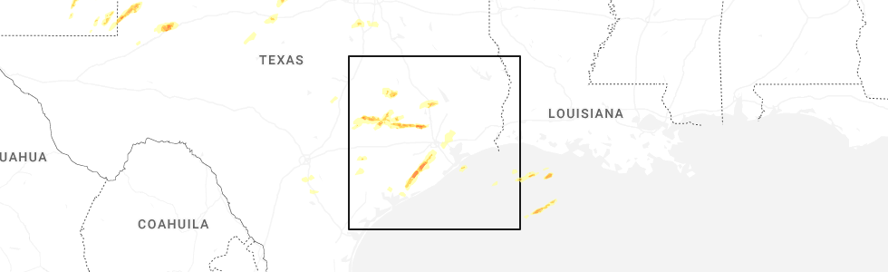
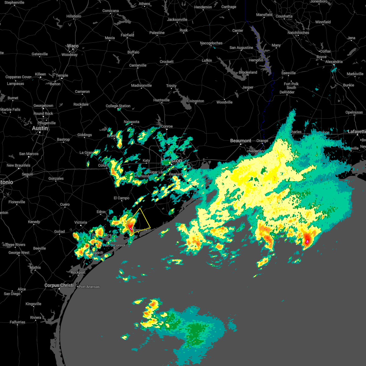
Hail Map for Van Vleck, TX
The Van Vleck, TX area has had 2 reports of on-the-ground hail by trained spotters, and has been under severe weather warnings 2 times during the past 12 months. Doppler radar has detected hail at or near Van Vleck, TX on 29 occasions, including 1 occasion during the past year.
| Name: | Van Vleck, TX |
| Where Located: | 58.6 miles SSW of Houston, TX |
| Map: | Google Map for Van Vleck, TX |
| Population: | 1844 |
| Housing Units: | 721 |
| More Info: | Search Google for Van Vleck, TX |
5
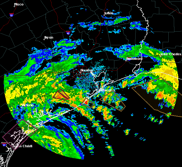
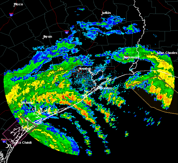
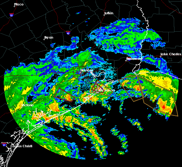
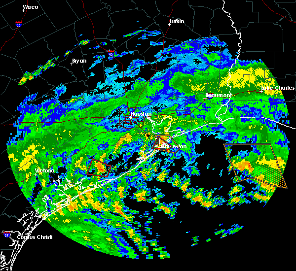
The Top Recent Hail Date for Van Vleck, TX is Monday, May 5, 2025 (1st out of 29)
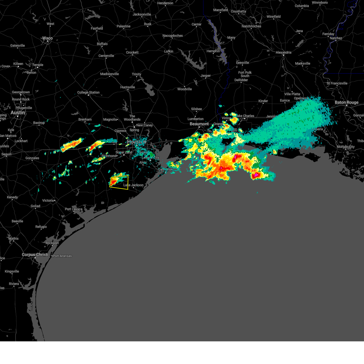
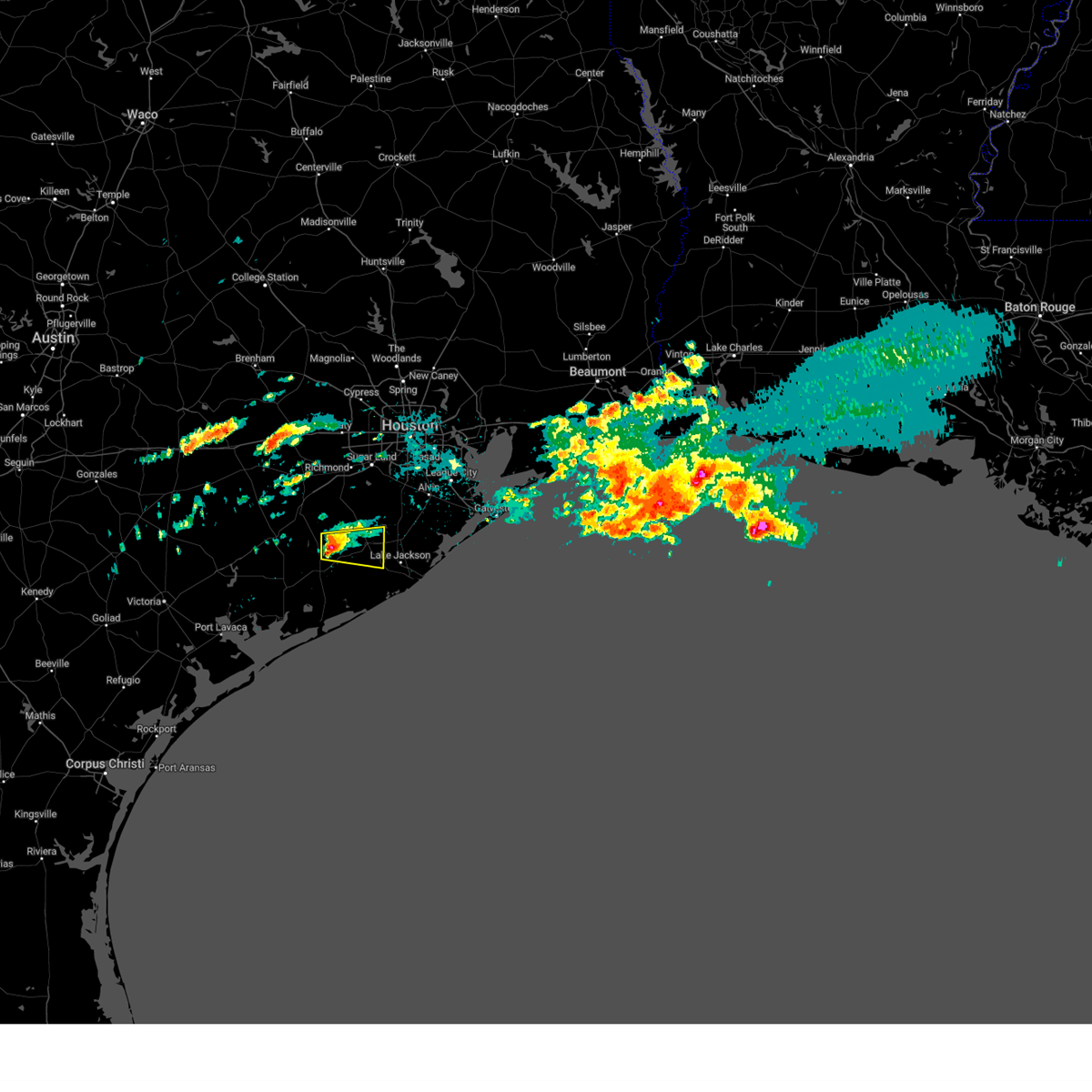
Hail and Wind Damage Spotted near Van Vleck, TX
| Date / Time | Report Details |
|---|---|
| 5/5/2025 4:03 PM CDT |
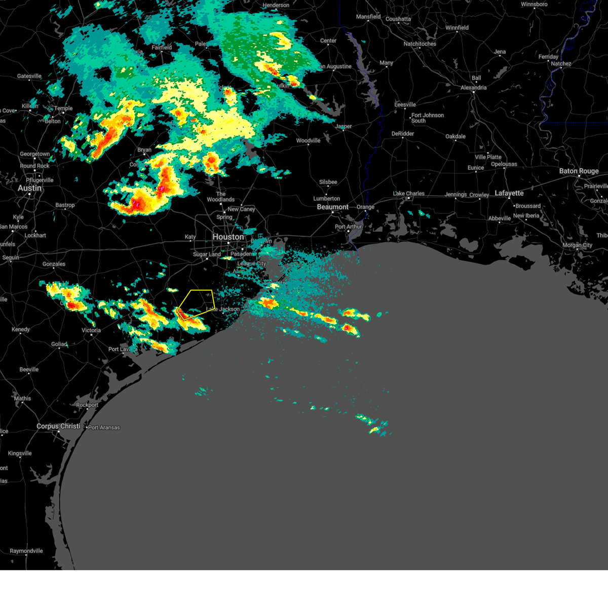 At 403 pm cdt, a severe thunderstorm was located near sweeny, moving northeast at 40 mph (radar indicated). Hazards include 60 mph wind gusts and half dollar size hail. Hail damage to vehicles is expected. expect wind damage to roofs, siding, and trees. Locations impacted include, eastern bay city, west columbia, sweeny, van vleck, wild peach village, and damon. At 403 pm cdt, a severe thunderstorm was located near sweeny, moving northeast at 40 mph (radar indicated). Hazards include 60 mph wind gusts and half dollar size hail. Hail damage to vehicles is expected. expect wind damage to roofs, siding, and trees. Locations impacted include, eastern bay city, west columbia, sweeny, van vleck, wild peach village, and damon.
|
| 5/5/2025 3:50 PM CDT | Svrhgx the national weather service in league city has issued a * severe thunderstorm warning for, southwestern brazoria county in southeastern texas, northeastern matagorda county in southeastern texas, * until 430 pm cdt. * at 349 pm cdt, a severe thunderstorm was located near bay city, moving northeast at 40 mph (radar indicated). Hazards include 60 mph wind gusts and quarter size hail. Hail damage to vehicles is expected. Expect wind damage to roofs, siding, and trees. |
| 5/28/2024 2:16 PM CDT |
 Svrhgx the national weather service in league city has issued a * severe thunderstorm warning for, east central wharton county in southeastern texas, southwestern fort bend county in southeastern texas, west central brazoria county in southeastern texas, north central matagorda county in southeastern texas, * until 245 pm cdt. * at 215 pm cdt, a severe thunderstorm was located over boling-iago, or 8 miles southeast of wharton, moving southeast at 25 mph (radar indicated). Hazards include 60 mph wind gusts and quarter size hail. Hail damage to vehicles is expected. Expect wind damage to roofs, siding, and trees. Svrhgx the national weather service in league city has issued a * severe thunderstorm warning for, east central wharton county in southeastern texas, southwestern fort bend county in southeastern texas, west central brazoria county in southeastern texas, north central matagorda county in southeastern texas, * until 245 pm cdt. * at 215 pm cdt, a severe thunderstorm was located over boling-iago, or 8 miles southeast of wharton, moving southeast at 25 mph (radar indicated). Hazards include 60 mph wind gusts and quarter size hail. Hail damage to vehicles is expected. Expect wind damage to roofs, siding, and trees.
|
| 5/13/2024 4:22 PM CDT |
 The storm which prompted the warning has weakened below severe limits, and no longer poses an immediate threat to life or property. therefore, the warning will be allowed to expire. however, small hail, gusty winds and heavy rain are still possible with this thunderstorm. a severe thunderstorm watch remains in effect until 800 pm cdt for southeastern texas. The storm which prompted the warning has weakened below severe limits, and no longer poses an immediate threat to life or property. therefore, the warning will be allowed to expire. however, small hail, gusty winds and heavy rain are still possible with this thunderstorm. a severe thunderstorm watch remains in effect until 800 pm cdt for southeastern texas.
|
| 5/13/2024 4:13 PM CDT |
 the severe thunderstorm warning has been cancelled and is no longer in effect the severe thunderstorm warning has been cancelled and is no longer in effect
|
| 5/13/2024 4:13 PM CDT |
 At 412 pm cdt, a severe thunderstorm was located near sweeny, moving east at 45 mph (radar indicated). Hazards include 60 mph wind gusts and quarter size hail. Hail damage to vehicles is expected. expect wind damage to roofs, siding, and trees. Locations impacted include, lake jackson, angleton, northwestern freeport, clute, west columbia, sweeny, richwood, brazoria, jones creek, holiday lakes, bailey's prairie, wild peach village, and van vleck. At 412 pm cdt, a severe thunderstorm was located near sweeny, moving east at 45 mph (radar indicated). Hazards include 60 mph wind gusts and quarter size hail. Hail damage to vehicles is expected. expect wind damage to roofs, siding, and trees. Locations impacted include, lake jackson, angleton, northwestern freeport, clute, west columbia, sweeny, richwood, brazoria, jones creek, holiday lakes, bailey's prairie, wild peach village, and van vleck.
|
| 5/13/2024 3:54 PM CDT |
 Svrhgx the national weather service in league city has issued a * severe thunderstorm warning for, southeastern wharton county in southeastern texas, southwestern brazoria county in southeastern texas, northeastern matagorda county in southeastern texas, * until 430 pm cdt. * at 354 pm cdt, a severe thunderstorm was located over van vleck, or near bay city, moving east at 45 mph (radar indicated). Hazards include 60 mph wind gusts and quarter size hail. Hail damage to vehicles is expected. Expect wind damage to roofs, siding, and trees. Svrhgx the national weather service in league city has issued a * severe thunderstorm warning for, southeastern wharton county in southeastern texas, southwestern brazoria county in southeastern texas, northeastern matagorda county in southeastern texas, * until 430 pm cdt. * at 354 pm cdt, a severe thunderstorm was located over van vleck, or near bay city, moving east at 45 mph (radar indicated). Hazards include 60 mph wind gusts and quarter size hail. Hail damage to vehicles is expected. Expect wind damage to roofs, siding, and trees.
|
| 4/21/2023 3:46 AM CDT |
 At 346 am cdt, severe thunderstorms were located along a line extending from needville to 7 miles southeast of boling-iago to 6 miles northwest of van vleck to near markham, moving east at 50 mph (radar indicated). Hazards include 60 mph wind gusts and penny size hail. Expect damage to roofs, siding, and trees. locations impacted include, bay city, wharton, needville, fairchilds, kendleton, markham, van vleck, boling-iago, damon, hungerford and danevang. hail threat, radar indicated max hail size, 0. 75 in wind threat, radar indicated max wind gust, 60 mph. At 346 am cdt, severe thunderstorms were located along a line extending from needville to 7 miles southeast of boling-iago to 6 miles northwest of van vleck to near markham, moving east at 50 mph (radar indicated). Hazards include 60 mph wind gusts and penny size hail. Expect damage to roofs, siding, and trees. locations impacted include, bay city, wharton, needville, fairchilds, kendleton, markham, van vleck, boling-iago, damon, hungerford and danevang. hail threat, radar indicated max hail size, 0. 75 in wind threat, radar indicated max wind gust, 60 mph.
|
| 4/21/2023 3:27 AM CDT |
 At 326 am cdt, severe thunderstorms were located along a line extending from near kendleton to near wharton to 6 miles south of pierce to 9 miles east of ganado, moving east at 45 mph (radar indicated). Hazards include 60 mph wind gusts and penny size hail. expect damage to roofs, siding, and trees At 326 am cdt, severe thunderstorms were located along a line extending from near kendleton to near wharton to 6 miles south of pierce to 9 miles east of ganado, moving east at 45 mph (radar indicated). Hazards include 60 mph wind gusts and penny size hail. expect damage to roofs, siding, and trees
|
| 3/28/2023 2:15 AM CDT |
 At 214 am cdt, a severe thunderstorm was located 7 miles northeast of van vleck, or 8 miles northwest of sweeny, moving east at 30 mph (radar indicated). Hazards include quarter size hail. Damage to vehicles is expected. locations impacted include, west columbia, sweeny, brazoria, wild peach village and van vleck. hail threat, radar indicated max hail size, 1. 00 in wind threat, radar indicated max wind gust, <50 mph. At 214 am cdt, a severe thunderstorm was located 7 miles northeast of van vleck, or 8 miles northwest of sweeny, moving east at 30 mph (radar indicated). Hazards include quarter size hail. Damage to vehicles is expected. locations impacted include, west columbia, sweeny, brazoria, wild peach village and van vleck. hail threat, radar indicated max hail size, 1. 00 in wind threat, radar indicated max wind gust, <50 mph.
|
| 3/28/2023 2:08 AM CDT |
 At 207 am cdt, a severe thunderstorm was located near van vleck, or 10 miles northeast of bay city, moving east at 30 mph (radar indicated). Hazards include quarter size hail. damage to vehicles is expected At 207 am cdt, a severe thunderstorm was located near van vleck, or 10 miles northeast of bay city, moving east at 30 mph (radar indicated). Hazards include quarter size hail. damage to vehicles is expected
|
| 11/25/2022 4:28 PM CST |
 At 427 pm cst, a severe thunderstorm was located over south texas nuclear plant, moving northeast at 30 to 40 mph (radar indicated). Hazards include 60 mph wind gusts and nickel size hail. expect damage to roofs, siding, and trees At 427 pm cst, a severe thunderstorm was located over south texas nuclear plant, moving northeast at 30 to 40 mph (radar indicated). Hazards include 60 mph wind gusts and nickel size hail. expect damage to roofs, siding, and trees
|
| 5/19/2021 3:25 AM CDT |
 At 325 am cdt, severe thunderstorms located near ganado, or near edna, moving east at 50-60 mph (radar indicated). Hazards include 60 mph wind gusts and penny size hail. expect damage to roofs, siding, and trees At 325 am cdt, severe thunderstorms located near ganado, or near edna, moving east at 50-60 mph (radar indicated). Hazards include 60 mph wind gusts and penny size hail. expect damage to roofs, siding, and trees
|
| 5/16/2020 2:32 AM CDT |
 At 232 am cdt, a severe thunderstorm was located over south texas nuclear plant, moving northeast at 25 mph (radar indicated). Hazards include 60 mph wind gusts and quarter size hail. Hail damage to vehicles is expected. Expect wind damage to roofs, siding, and trees. At 232 am cdt, a severe thunderstorm was located over south texas nuclear plant, moving northeast at 25 mph (radar indicated). Hazards include 60 mph wind gusts and quarter size hail. Hail damage to vehicles is expected. Expect wind damage to roofs, siding, and trees.
|
| 4/19/2020 1:48 PM CDT |
 At 148 pm cdt, a severe thunderstorm was located near boling-iago, or 14 miles west of west columbia, moving east at 35 mph (radar indicated). Hazards include 60 mph wind gusts and half dollar size hail. Hail damage to vehicles is expected. expect wind damage to roofs, siding, and trees. Locations impacted include, west columbia, sweeny, wild peach village, boling-iago, van vleck and damon. At 148 pm cdt, a severe thunderstorm was located near boling-iago, or 14 miles west of west columbia, moving east at 35 mph (radar indicated). Hazards include 60 mph wind gusts and half dollar size hail. Hail damage to vehicles is expected. expect wind damage to roofs, siding, and trees. Locations impacted include, west columbia, sweeny, wild peach village, boling-iago, van vleck and damon.
|
| 4/19/2020 1:26 PM CDT |
 At 125 pm cdt, a severe thunderstorm was located 8 miles southwest of boling-iago, or 10 miles south of wharton, moving east at 30 mph (radar indicated). Hazards include 60 mph wind gusts and half dollar size hail. Hail damage to vehicles is expected. Expect wind damage to roofs, siding, and trees. At 125 pm cdt, a severe thunderstorm was located 8 miles southwest of boling-iago, or 10 miles south of wharton, moving east at 30 mph (radar indicated). Hazards include 60 mph wind gusts and half dollar size hail. Hail damage to vehicles is expected. Expect wind damage to roofs, siding, and trees.
|
| 4/19/2020 1:00 PM CDT |
 At 1259 pm cdt, a severe thunderstorm was located near pierce, or 8 miles east of el campo, moving east at 25 mph (radar indicated). Hazards include ping pong ball size hail and 60 mph wind gusts. People and animals outdoors will be injured. expect hail damage to roofs, siding, windows, and vehicles. expect wind damage to roofs, siding, and trees. Locations impacted include, el campo, wharton, pierce, boling-iago, van vleck, hungerford and danevang. At 1259 pm cdt, a severe thunderstorm was located near pierce, or 8 miles east of el campo, moving east at 25 mph (radar indicated). Hazards include ping pong ball size hail and 60 mph wind gusts. People and animals outdoors will be injured. expect hail damage to roofs, siding, windows, and vehicles. expect wind damage to roofs, siding, and trees. Locations impacted include, el campo, wharton, pierce, boling-iago, van vleck, hungerford and danevang.
|
| 4/19/2020 12:44 PM CDT |
 At 1243 pm cdt, a severe thunderstorm was located near el campo, moving east at 35 mph (radar indicated). Hazards include 60 mph wind gusts and half dollar size hail. Hail damage to vehicles is expected. Wind damage to roofs, siding, and trees is possible. At 1243 pm cdt, a severe thunderstorm was located near el campo, moving east at 35 mph (radar indicated). Hazards include 60 mph wind gusts and half dollar size hail. Hail damage to vehicles is expected. Wind damage to roofs, siding, and trees is possible.
|
| 9/18/2019 6:39 PM CDT |
 The severe thunderstorm warning for east central wharton, west central brazoria and north central matagorda counties will expire at 645 pm cdt, the storm which prompted the warning has moved out of the area. therefore, the warning will be allowed to expire. to report severe weather, contact your nearest law enforcement agency. they will relay your report to the national weather service league city. The severe thunderstorm warning for east central wharton, west central brazoria and north central matagorda counties will expire at 645 pm cdt, the storm which prompted the warning has moved out of the area. therefore, the warning will be allowed to expire. to report severe weather, contact your nearest law enforcement agency. they will relay your report to the national weather service league city.
|
| 9/18/2019 6:05 PM CDT |
 At 605 pm cdt, a severe thunderstorm was located 9 miles west of west columbia, moving east at 25 mph (radar indicated). Hazards include 60 mph wind gusts. Expect damage to roofs, siding, and trees. Locations impacted include, boling-iago and van vleck. At 605 pm cdt, a severe thunderstorm was located 9 miles west of west columbia, moving east at 25 mph (radar indicated). Hazards include 60 mph wind gusts. Expect damage to roofs, siding, and trees. Locations impacted include, boling-iago and van vleck.
|
| 9/18/2019 5:54 PM CDT |
 At 554 pm cdt, a severe thunderstorm was located 7 miles southwest of boling-iago, or 11 miles southeast of wharton, moving east at 15 mph (radar indicated). Hazards include 60 mph wind gusts. expect damage to roofs, siding, and trees At 554 pm cdt, a severe thunderstorm was located 7 miles southwest of boling-iago, or 11 miles southeast of wharton, moving east at 15 mph (radar indicated). Hazards include 60 mph wind gusts. expect damage to roofs, siding, and trees
|
| 5/10/2019 12:10 AM CDT |
 At 1138 pm cdt, a severe thunderstorm was located over van vleck, or 7 miles northeast of bay city, moving northeast at 25 mph (radar indicated). Hazards include quarter size hail. damage to vehicles is expected At 1138 pm cdt, a severe thunderstorm was located over van vleck, or 7 miles northeast of bay city, moving northeast at 25 mph (radar indicated). Hazards include quarter size hail. damage to vehicles is expected
|
| 5/9/2019 11:40 PM CDT | Quarter sized hail reported 0.6 miles SE of Van Vleck, TX |
| 5/9/2019 11:40 PM CDT | Ping Pong Ball sized hail reported 0.6 miles SE of Van Vleck, TX |
| 5/9/2019 11:39 PM CDT |
 At 1138 pm cdt, a severe thunderstorm was located over van vleck, or 7 miles northeast of bay city, moving northeast at 25 mph (radar indicated). Hazards include quarter size hail. damage to vehicles is expected At 1138 pm cdt, a severe thunderstorm was located over van vleck, or 7 miles northeast of bay city, moving northeast at 25 mph (radar indicated). Hazards include quarter size hail. damage to vehicles is expected
|
| 4/7/2019 11:45 AM CDT |
 At 1144 am cdt, severe thunderstorms were located along a line extending from near brookshire to 6 miles southwest of brazos bend state park, moving northeast at 50 mph. in excess of 70 mph winds approaching southern fort bend county (radar indicated). Hazards include 60 mph wind gusts. Expect damage to roofs, siding, and trees. Locations impacted include, sugar land, southwestern missouri city, rosenberg, lake jackson, angleton, stafford, eastern bay city, katy, freeport, richmond, clute, wharton, sealy, prairie view, brookshire, west columbia, sweeny, surfside beach, mission bend and town west. At 1144 am cdt, severe thunderstorms were located along a line extending from near brookshire to 6 miles southwest of brazos bend state park, moving northeast at 50 mph. in excess of 70 mph winds approaching southern fort bend county (radar indicated). Hazards include 60 mph wind gusts. Expect damage to roofs, siding, and trees. Locations impacted include, sugar land, southwestern missouri city, rosenberg, lake jackson, angleton, stafford, eastern bay city, katy, freeport, richmond, clute, wharton, sealy, prairie view, brookshire, west columbia, sweeny, surfside beach, mission bend and town west.
|
| 4/7/2019 11:23 AM CDT |
 At 1122 am cdt, severe thunderstorms were located along a line extending from near east bernard to near van vleck, moving northeast at 50 mph (radar indicated). Hazards include 60 mph wind gusts. expect damage to roofs, siding, and trees At 1122 am cdt, severe thunderstorms were located along a line extending from near east bernard to near van vleck, moving northeast at 50 mph (radar indicated). Hazards include 60 mph wind gusts. expect damage to roofs, siding, and trees
|
| 4/7/2019 11:18 AM CDT |
 At 1118 am cdt, a severe thunderstorm was located near van vleck, or near bay city, moving northeast at 35 mph (radar indicated). Hazards include 60 mph wind gusts. Expect damage to roofs, siding, and trees. Locations impacted include, matagorda, bay city, el campo, wharton, eagle lake, south texas nuclear plant, sargent, pierce, markham, van vleck, boling-iago, egypt, hungerford, wadsworth and garwood. At 1118 am cdt, a severe thunderstorm was located near van vleck, or near bay city, moving northeast at 35 mph (radar indicated). Hazards include 60 mph wind gusts. Expect damage to roofs, siding, and trees. Locations impacted include, matagorda, bay city, el campo, wharton, eagle lake, south texas nuclear plant, sargent, pierce, markham, van vleck, boling-iago, egypt, hungerford, wadsworth and garwood.
|
| 4/7/2019 11:05 AM CDT |
 At 1104 am cdt, a severe thunderstorm was located over markham, or near bay city, moving northeast at 35 mph. this line of thunderstorms produced wind damage earlier this morning near ganado (radar indicated). Hazards include 60 mph wind gusts. expect damage to roofs, siding, and trees At 1104 am cdt, a severe thunderstorm was located over markham, or near bay city, moving northeast at 35 mph. this line of thunderstorms produced wind damage earlier this morning near ganado (radar indicated). Hazards include 60 mph wind gusts. expect damage to roofs, siding, and trees
|
| 3/29/2018 2:20 AM CDT |
 At 219 am cdt, severe thunderstorms were located along a line extending from near west columbia to 6 miles southwest of south texas nuclear plant, moving east at 45 mph (radar indicated). Hazards include 60 mph wind gusts and quarter size hail. Hail damage to vehicles is expected. expect wind damage to roofs, siding, and trees. Locations impacted include, matagorda, northwestern lake jackson, angleton, bay city, palacios, west columbia, sweeny, south texas nuclear plant, brazoria, holiday lakes, bailey`s prairie, bonney, sargent, wild peach village, van vleck, damon, wadsworth and rosharon. At 219 am cdt, severe thunderstorms were located along a line extending from near west columbia to 6 miles southwest of south texas nuclear plant, moving east at 45 mph (radar indicated). Hazards include 60 mph wind gusts and quarter size hail. Hail damage to vehicles is expected. expect wind damage to roofs, siding, and trees. Locations impacted include, matagorda, northwestern lake jackson, angleton, bay city, palacios, west columbia, sweeny, south texas nuclear plant, brazoria, holiday lakes, bailey`s prairie, bonney, sargent, wild peach village, van vleck, damon, wadsworth and rosharon.
|
| 3/29/2018 1:52 AM CDT |
 At 151 am cdt, severe thunderstorms were located along a line extending from near boling-iago to near point comfort, moving east at 45 mph (radar indicated). Hazards include 60 mph wind gusts and quarter size hail. Hail damage to vehicles is expected. Expect wind damage to roofs, siding, and trees. At 151 am cdt, severe thunderstorms were located along a line extending from near boling-iago to near point comfort, moving east at 45 mph (radar indicated). Hazards include 60 mph wind gusts and quarter size hail. Hail damage to vehicles is expected. Expect wind damage to roofs, siding, and trees.
|
| 8/27/2017 3:12 AM CDT |
 At 312 am cdt, a severe thunderstorm capable of producing a tornado was located near van vleck, or near sweeny, moving north at 40 mph (radar indicated rotation). Hazards include tornado. Flying debris will be dangerous to those caught without shelter. mobile homes will be damaged or destroyed. damage to roofs, windows, and vehicles will occur. Tree damage is likely. At 312 am cdt, a severe thunderstorm capable of producing a tornado was located near van vleck, or near sweeny, moving north at 40 mph (radar indicated rotation). Hazards include tornado. Flying debris will be dangerous to those caught without shelter. mobile homes will be damaged or destroyed. damage to roofs, windows, and vehicles will occur. Tree damage is likely.
|
| 8/27/2017 2:58 AM CDT |
 The national weather service in league city has issued a * tornado warning for. southwestern brazoria county in southeastern texas. northeastern matagorda county in southeastern texas. until 315 am cdt. At 258 am cdt, a severe thunderstorm capable of producing a tornado. The national weather service in league city has issued a * tornado warning for. southwestern brazoria county in southeastern texas. northeastern matagorda county in southeastern texas. until 315 am cdt. At 258 am cdt, a severe thunderstorm capable of producing a tornado.
|
| 8/25/2017 6:01 PM CDT |
 At 600 pm cdt, a severe thunderstorm capable of producing a tornado was located near boling-iago, or 11 miles southeast of wharton, moving northwest at 40 mph (radar indicated rotation). Hazards include tornado. Flying debris will be dangerous to those caught without shelter. mobile homes will be damaged or destroyed. damage to roofs, windows, and vehicles will occur. tree damage is likely. Locations impacted include, wharton, boling-iago and van vleck. At 600 pm cdt, a severe thunderstorm capable of producing a tornado was located near boling-iago, or 11 miles southeast of wharton, moving northwest at 40 mph (radar indicated rotation). Hazards include tornado. Flying debris will be dangerous to those caught without shelter. mobile homes will be damaged or destroyed. damage to roofs, windows, and vehicles will occur. tree damage is likely. Locations impacted include, wharton, boling-iago and van vleck.
|
| 8/25/2017 5:42 PM CDT |
 At 541 pm cdt, severe thunderstorms capable of producing tornadoes were located along a line extending from 9 miles south of boling- iago to 6 miles northeast of van vleck to near sweeny, moving northwest at 40 mph (radar indicated rotation). Hazards include tornado. Flying debris will be dangerous to those caught without shelter. mobile homes will be damaged or destroyed. damage to roofs, windows, and vehicles will occur. Tree damage is likely. At 541 pm cdt, severe thunderstorms capable of producing tornadoes were located along a line extending from 9 miles south of boling- iago to 6 miles northeast of van vleck to near sweeny, moving northwest at 40 mph (radar indicated rotation). Hazards include tornado. Flying debris will be dangerous to those caught without shelter. mobile homes will be damaged or destroyed. damage to roofs, windows, and vehicles will occur. Tree damage is likely.
|
| 8/25/2017 5:33 PM CDT |
 At 533 pm cdt, a severe thunderstorm capable of producing a tornado was located near van vleck, or 7 miles north of bay city, moving northwest at 45 mph (radar indicated rotation). Hazards include tornado. Flying debris will be dangerous to those caught without shelter. mobile homes will be damaged or destroyed. damage to roofs, windows, and vehicles will occur. tree damage is likely. Locations impacted include, van vleck. At 533 pm cdt, a severe thunderstorm capable of producing a tornado was located near van vleck, or 7 miles north of bay city, moving northwest at 45 mph (radar indicated rotation). Hazards include tornado. Flying debris will be dangerous to those caught without shelter. mobile homes will be damaged or destroyed. damage to roofs, windows, and vehicles will occur. tree damage is likely. Locations impacted include, van vleck.
|
| 8/25/2017 5:19 PM CDT |
 At 519 pm cdt, a severe thunderstorm capable of producing a tornado was located near sweeny, moving northwest at 45 mph (radar indicated rotation). Hazards include tornado. Flying debris will be dangerous to those caught without shelter. mobile homes will be damaged or destroyed. damage to roofs, windows, and vehicles will occur. Tree damage is likely. At 519 pm cdt, a severe thunderstorm capable of producing a tornado was located near sweeny, moving northwest at 45 mph (radar indicated rotation). Hazards include tornado. Flying debris will be dangerous to those caught without shelter. mobile homes will be damaged or destroyed. damage to roofs, windows, and vehicles will occur. Tree damage is likely.
|
| 8/25/2017 3:48 PM CDT |
 At 347 pm cdt, a severe thunderstorm capable of producing a tornado was located over wild peach village, or near sweeny, moving northwest at 40 mph (radar indicated rotation). Hazards include tornado. Flying debris will be dangerous to those caught without shelter. mobile homes will be damaged or destroyed. damage to roofs, windows, and vehicles will occur. Tree damage is likely. At 347 pm cdt, a severe thunderstorm capable of producing a tornado was located over wild peach village, or near sweeny, moving northwest at 40 mph (radar indicated rotation). Hazards include tornado. Flying debris will be dangerous to those caught without shelter. mobile homes will be damaged or destroyed. damage to roofs, windows, and vehicles will occur. Tree damage is likely.
|
| 8/25/2017 2:24 PM CDT |
 At 223 pm cdt, a severe thunderstorm capable of producing a tornado was located 10 miles northwest of sargent, or 10 miles southeast of bay city, moving west at 35 mph (radar indicated rotation). Hazards include tornado. Flying debris will be dangerous to those caught without shelter. mobile homes will be damaged or destroyed. damage to roofs, windows, and vehicles will occur. tree damage is likely. Locations impacted include, bay city, van vleck and wadsworth. At 223 pm cdt, a severe thunderstorm capable of producing a tornado was located 10 miles northwest of sargent, or 10 miles southeast of bay city, moving west at 35 mph (radar indicated rotation). Hazards include tornado. Flying debris will be dangerous to those caught without shelter. mobile homes will be damaged or destroyed. damage to roofs, windows, and vehicles will occur. tree damage is likely. Locations impacted include, bay city, van vleck and wadsworth.
|
| 8/25/2017 2:08 PM CDT |
 At 208 pm cdt, a severe thunderstorm capable of producing a tornado was located over sargent, or 13 miles south of sweeny, moving west at 35 mph (radar indicated rotation). Hazards include tornado. Flying debris will be dangerous to those caught without shelter. mobile homes will be damaged or destroyed. damage to roofs, windows, and vehicles will occur. Tree damage is likely. At 208 pm cdt, a severe thunderstorm capable of producing a tornado was located over sargent, or 13 miles south of sweeny, moving west at 35 mph (radar indicated rotation). Hazards include tornado. Flying debris will be dangerous to those caught without shelter. mobile homes will be damaged or destroyed. damage to roofs, windows, and vehicles will occur. Tree damage is likely.
|
| 2/14/2017 7:25 AM CST |
 At 724 am cst, severe thunderstorms were located along a line extending from near wallis to near lolita, moving east at 30 mph (radar indicated). Hazards include 60 mph wind gusts. expect damage to roofs, siding, and trees At 724 am cst, severe thunderstorms were located along a line extending from near wallis to near lolita, moving east at 30 mph (radar indicated). Hazards include 60 mph wind gusts. expect damage to roofs, siding, and trees
|
| 4/13/2016 2:16 AM CDT |
 At 215 am cdt, a severe thunderstorm was located over van vleck, or near bay city, moving east at 35 mph (radar indicated). Hazards include quarter size hail. damage to vehicles is expected At 215 am cdt, a severe thunderstorm was located over van vleck, or near bay city, moving east at 35 mph (radar indicated). Hazards include quarter size hail. damage to vehicles is expected
|
| 5/26/2015 12:58 AM CDT | At 1258 am cdt, doppler radar indicated a severe thunderstorm capable of producing damaging winds in excess of 60 mph. this storm was located 9 miles southeast of pierce, or 11 miles southeast of el campo, and moving east at 35 mph. |
| 5/24/2015 5:39 AM CDT | At 535 am cdt, doppler radar indicated a line of severe thunderstorms capable of producing damaging winds in excess of 60 mph. these storms were located along a line extending from near bellville to near san felipe to kendleton to 7 miles west of sargent to 25 miles southeast of matagorda, moving east northeast at 20 mph. the segment of the line between bellville to simonton to wallis appears to be bowing out which signals potentially damaging winds as the line pushes through austin, waller, northern fort bend and western harris counties. locations impacted include, sugar land, missouri city, rosenberg, lake jackson, angleton, stafford, eastern bay city, katy, freeport, richmond, clute, sealy, hempstead, prairie view, brookshire, bellville, west columbia, sweeny, surfside beach and town west. |
| 5/24/2015 5:16 AM CDT | At 516 am cdt, doppler radar indicated a line of severe thunderstorms capable of producing damaging winds in excess of 60 mph. these storms were located along a line extending from near bellville to near sealy to near kendleton to 11 miles west of sargent to 23 miles southeast of matagorda, and moving northeast at 20 mph. |
| 5/24/2015 4:20 AM CDT | At 419 am cdt, doppler radar indicated a line of severe thunderstorms capable of producing damaging winds in excess of 60 mph. these storms were located along a line extending from near weimar to 7 miles west of eagle lake to 13 miles northwest of wharton to 8 miles southwest of el campo to 17 miles east of port oconnor, and moving east northeast at 40 mph. |
| 4/17/2015 6:56 PM CDT | At 655 pm cdt, doppler radar indicated a line of severe thunderstorms capable of producing damaging winds in excess of 60 mph. these storms were located along a line extending from near east bernard to near brazoria, and moving northeast at 35 mph. |
| 4/17/2015 6:21 PM CDT | At 620 pm cdt, doppler radar indicated a line of severe thunderstorms capable of producing damaging winds in excess of 60 mph. these storms were located along a line extending from near columbus to near el campo to lolita, and moving northeast at 45 mph. this storm has a history of producing wind damage in jackson county earlier this evening. |
| 4/16/2015 6:15 PM CDT | The national weather service in league city has issued a * tornado warning for. matagorda county in southeastern texas. until 645 pm cdt * at 614 pm cdt. doppler radar indicated a severe thunderstorm capable of producing a tornado. This dangerous storm was located. |
Hail Maps for Van Vleck, TX


Connect with Interactive Hail Maps