

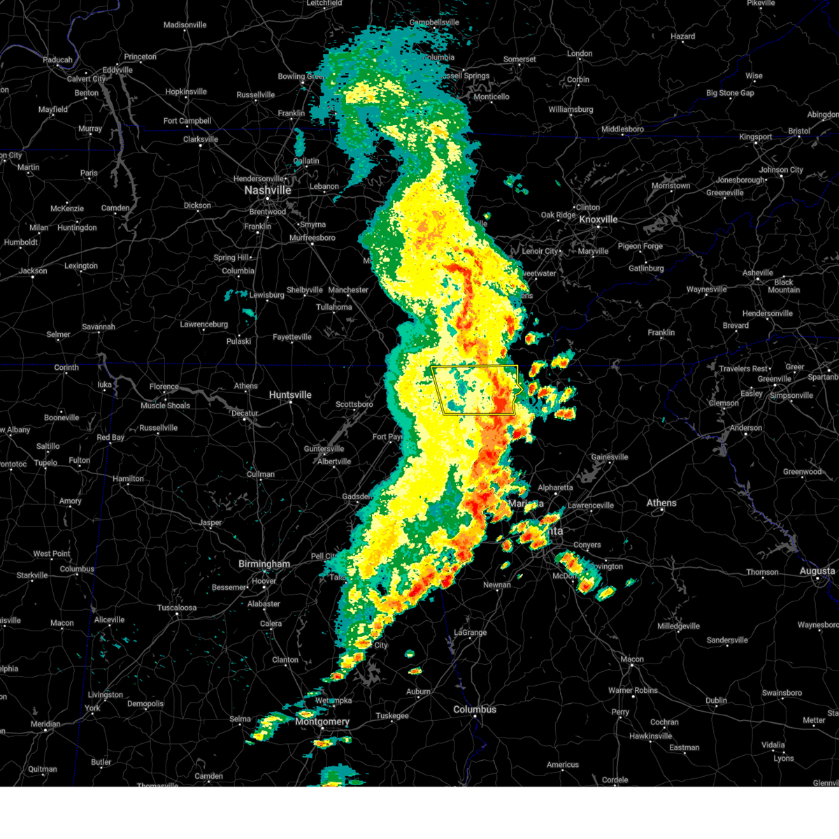
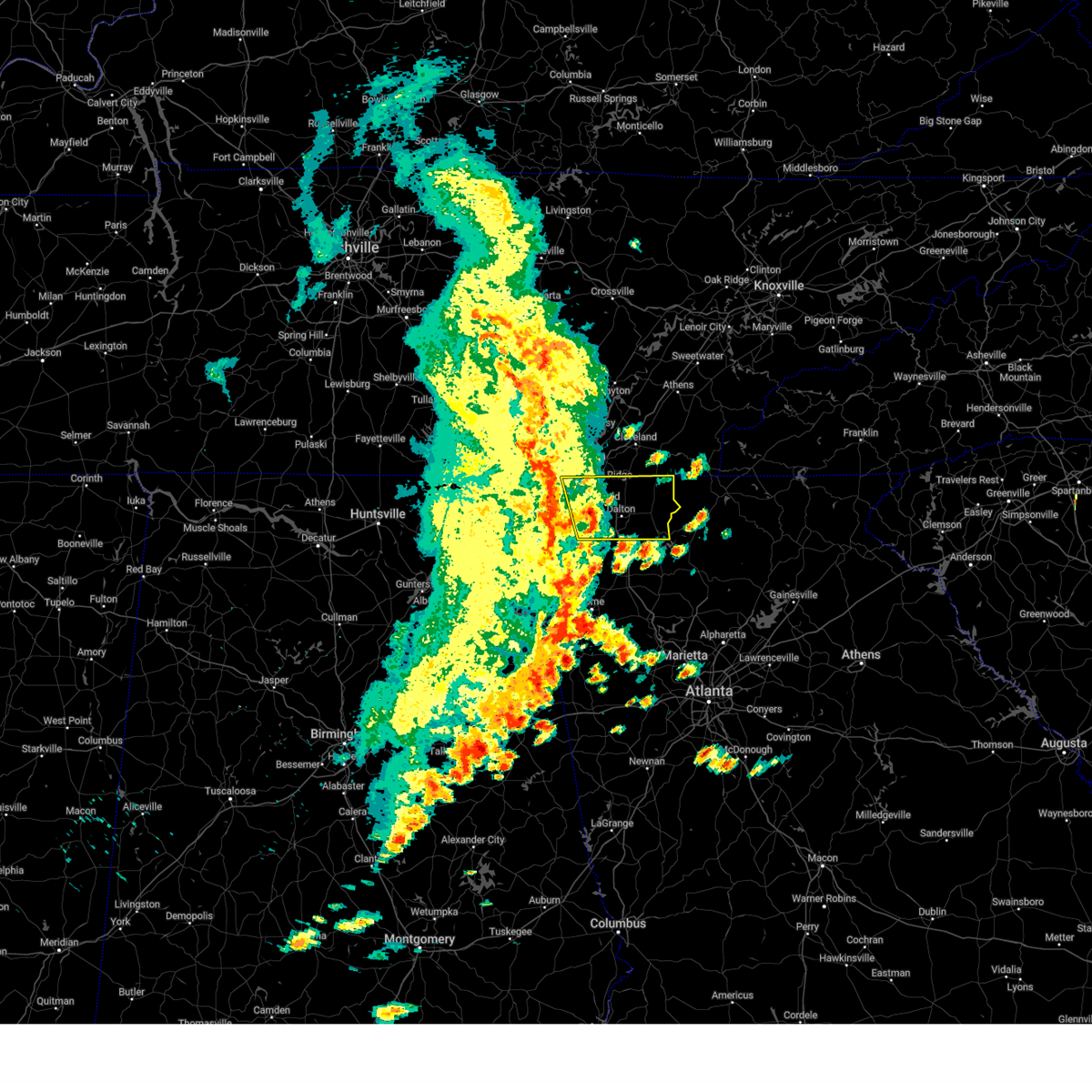
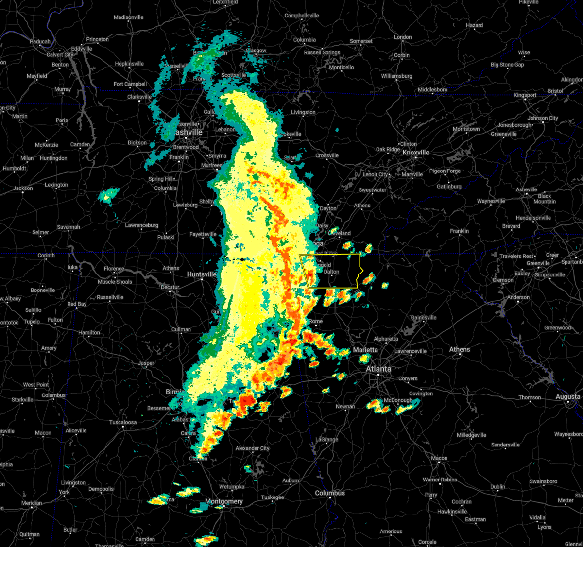
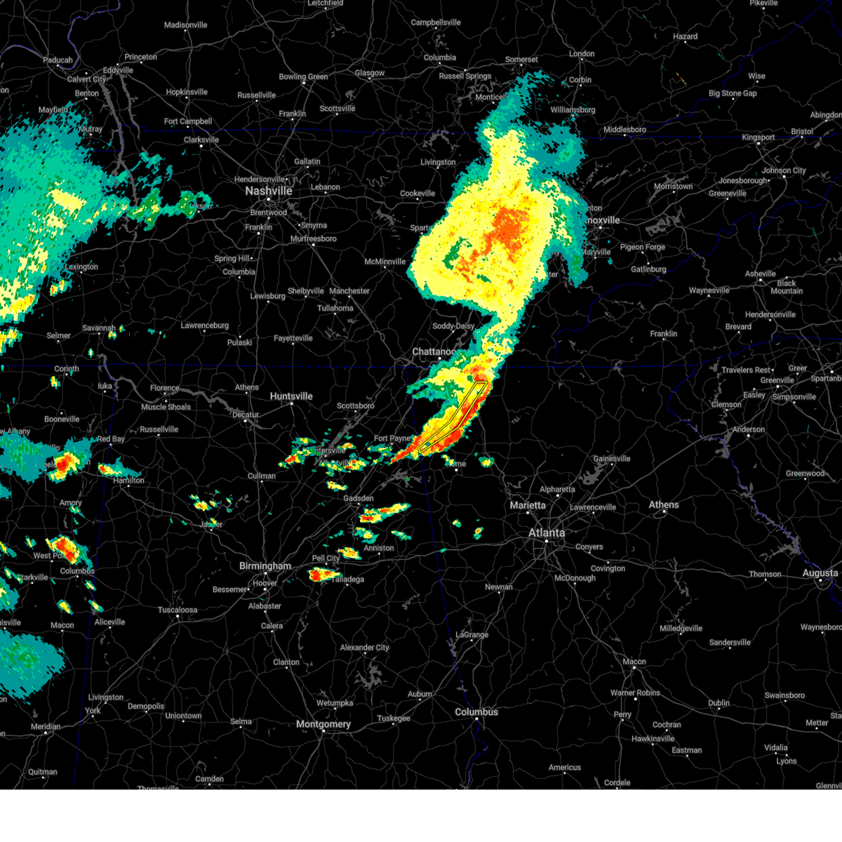
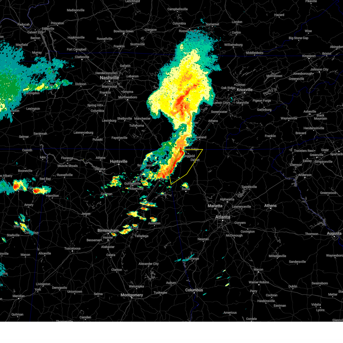
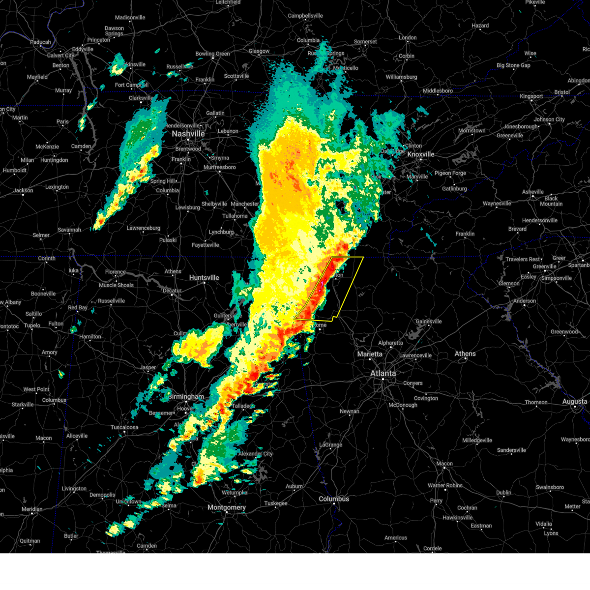
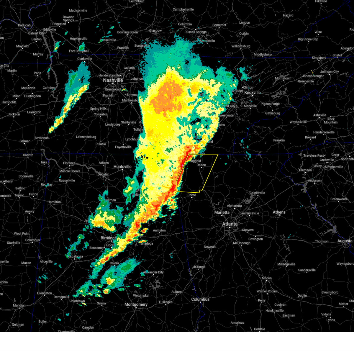
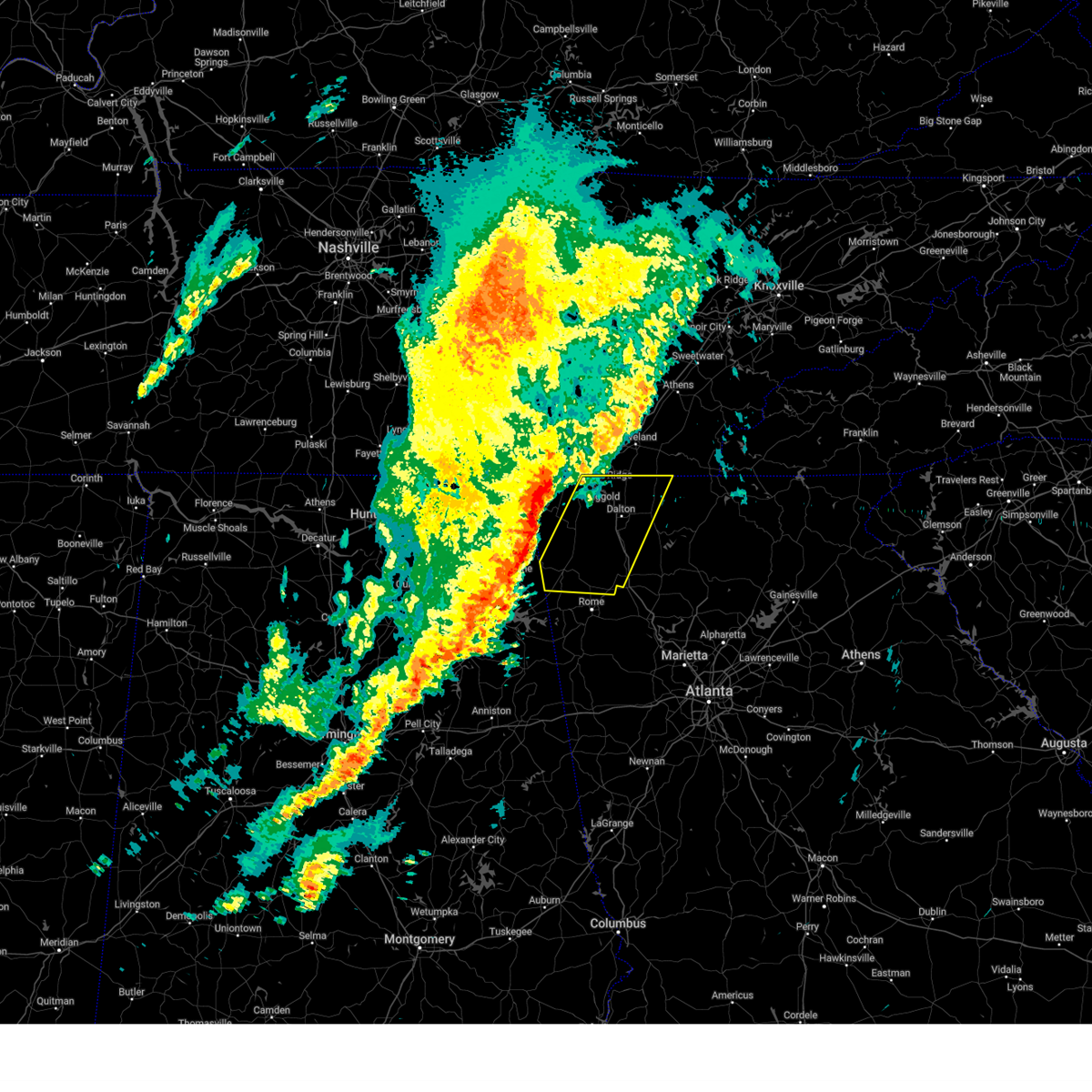
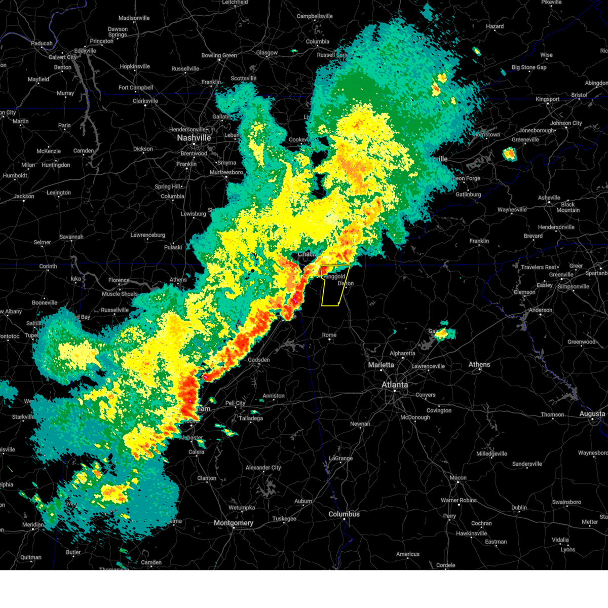
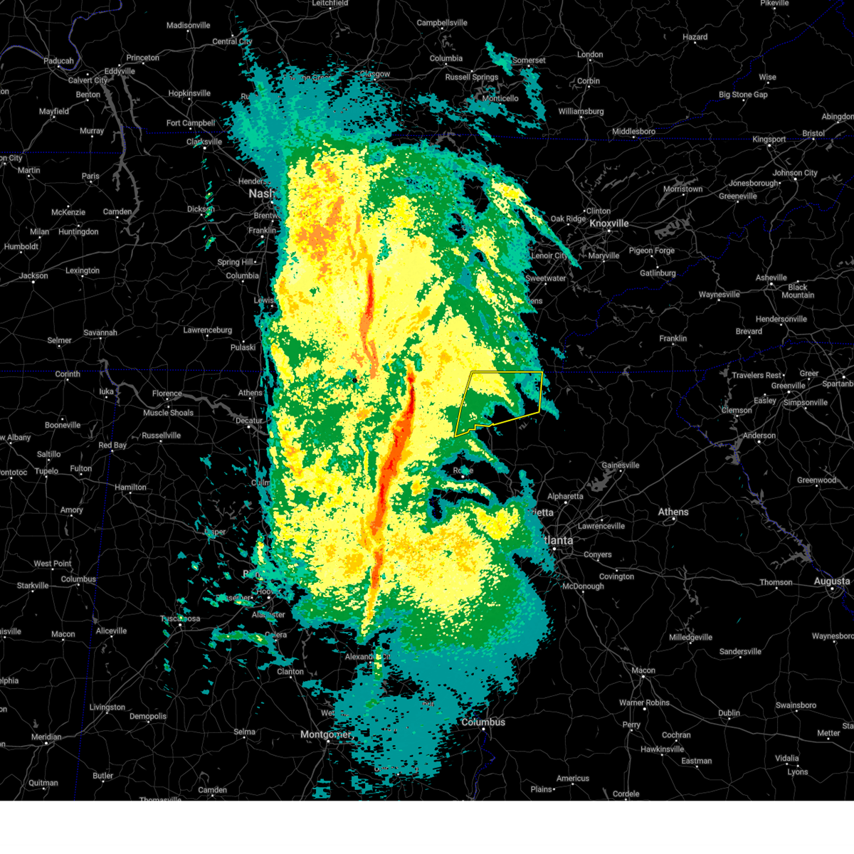
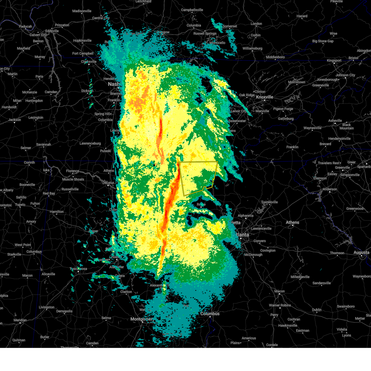
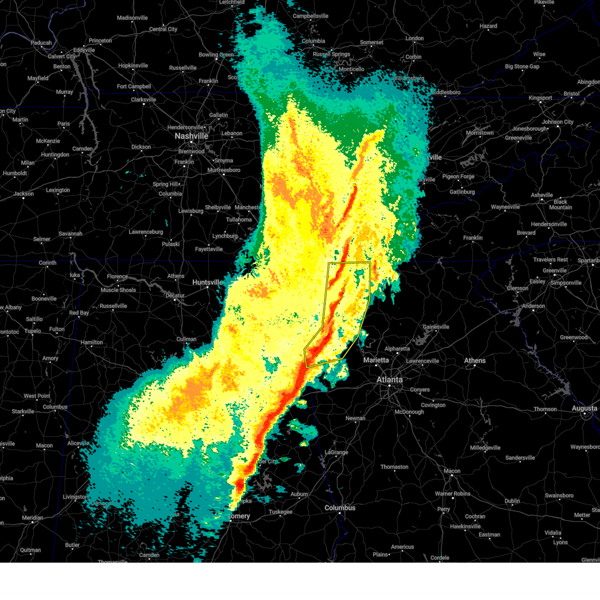
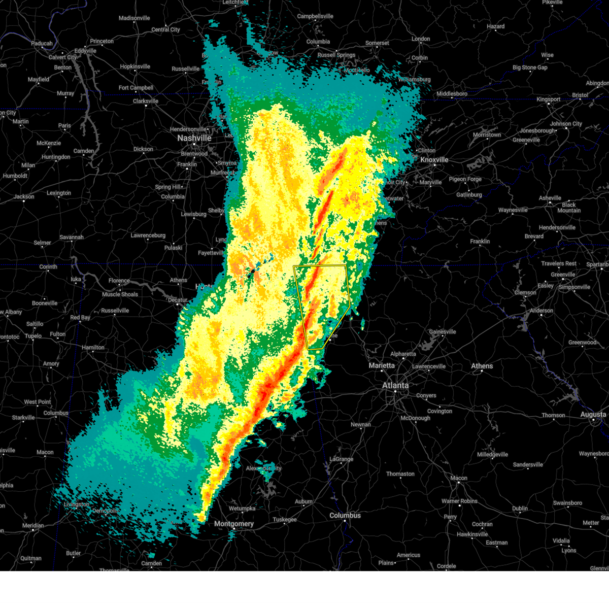
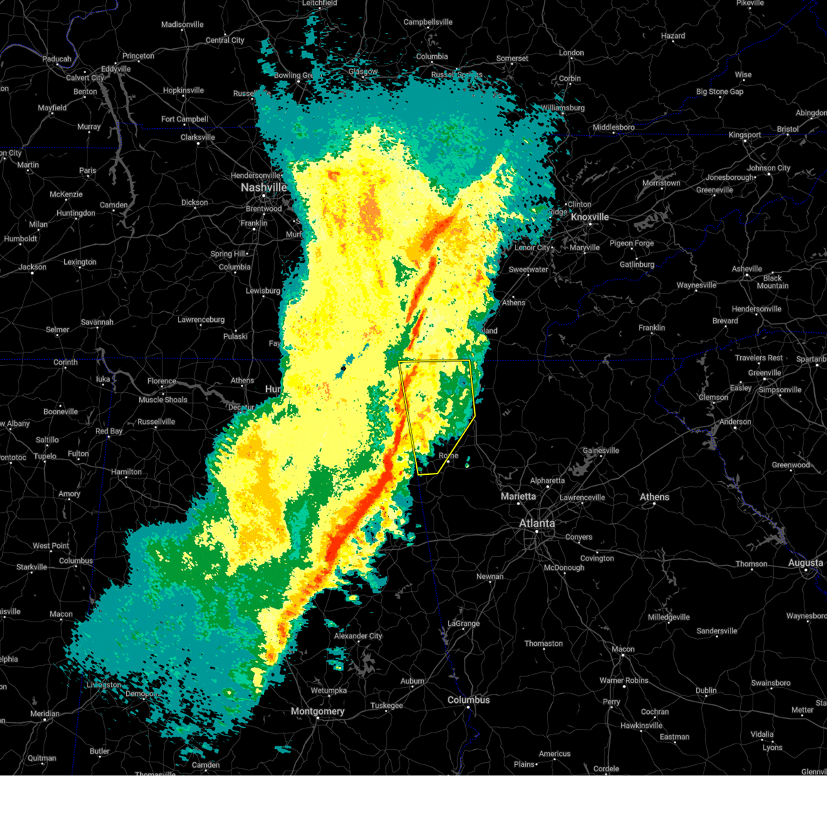
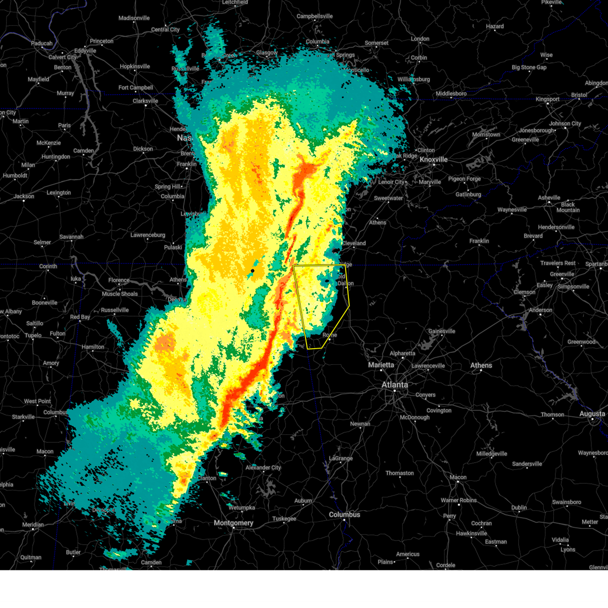
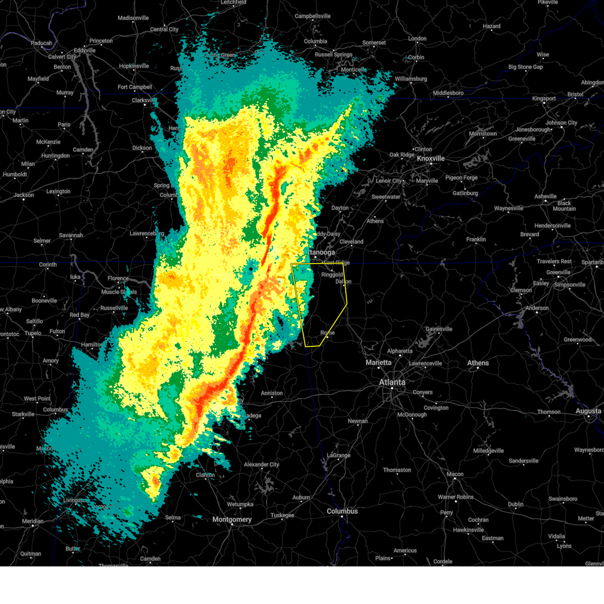
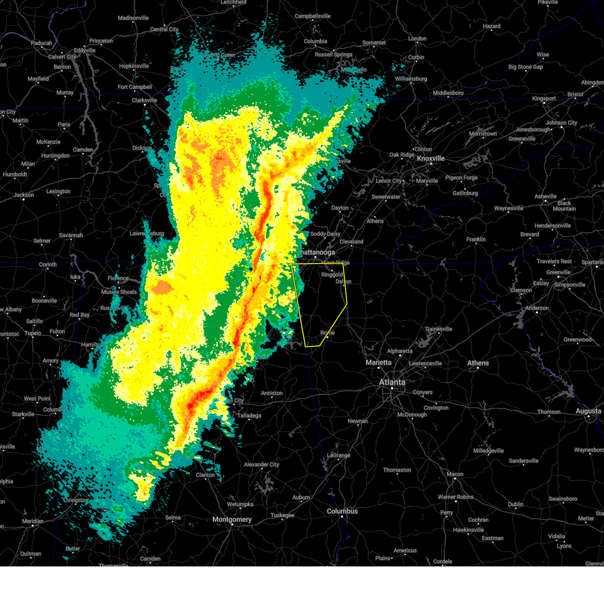
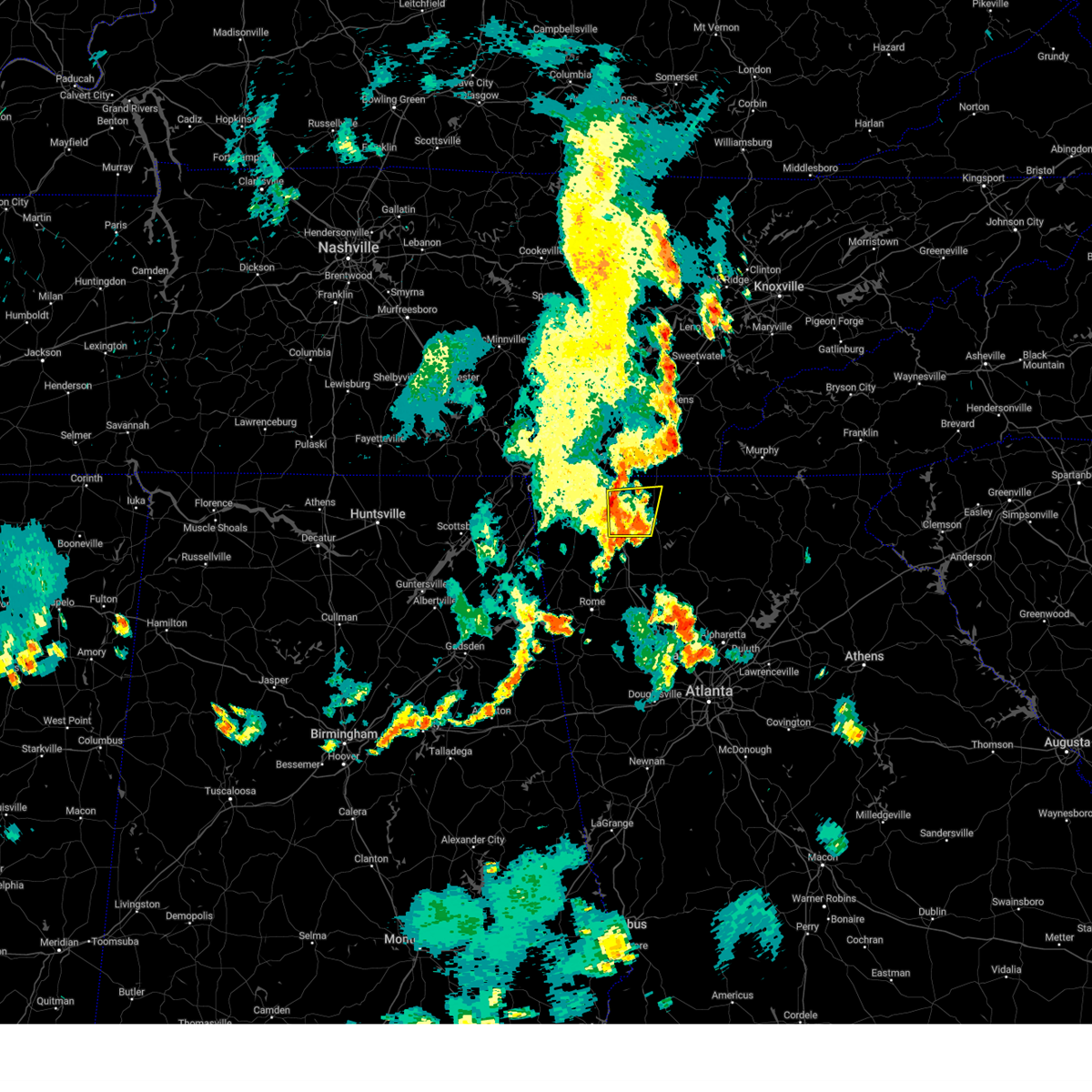
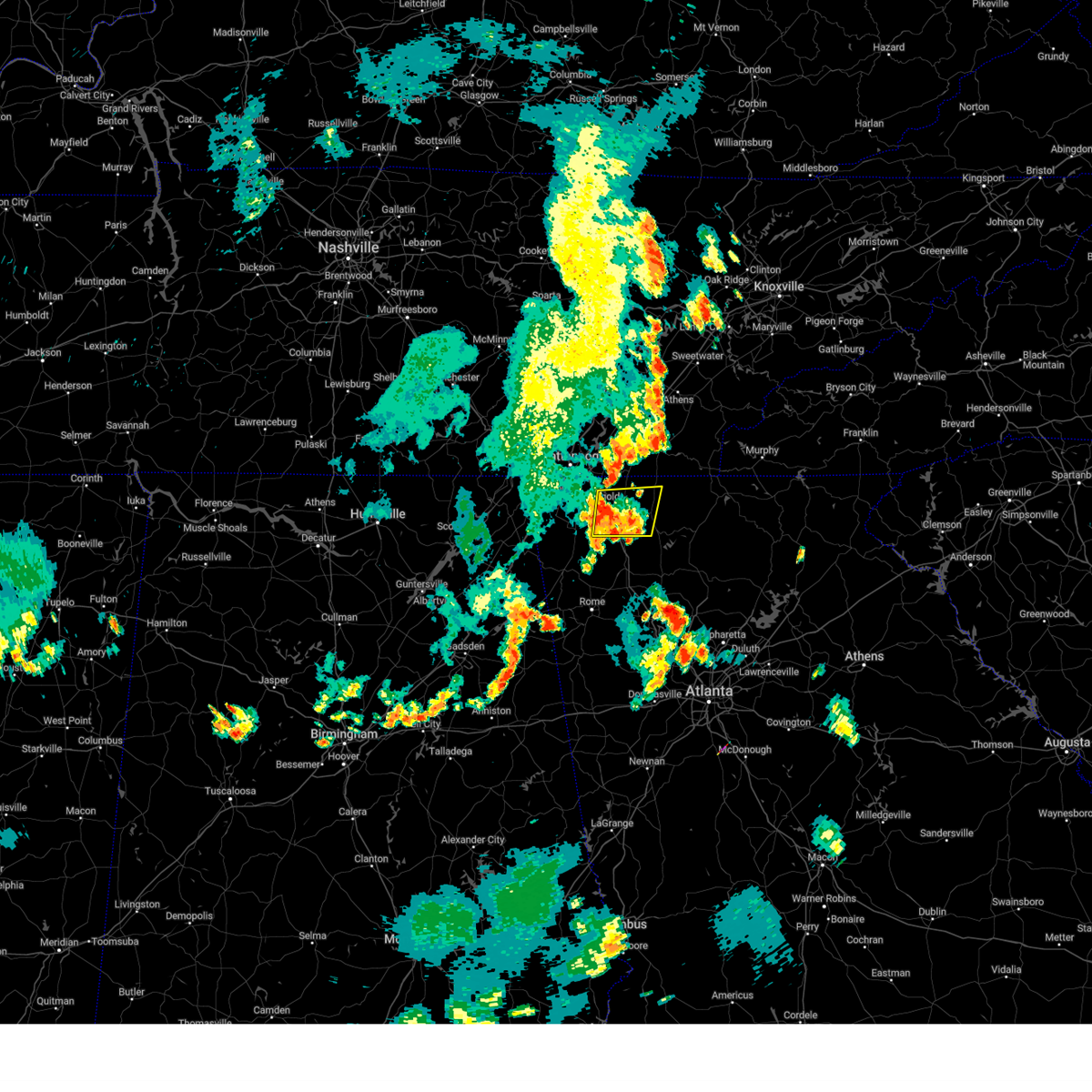
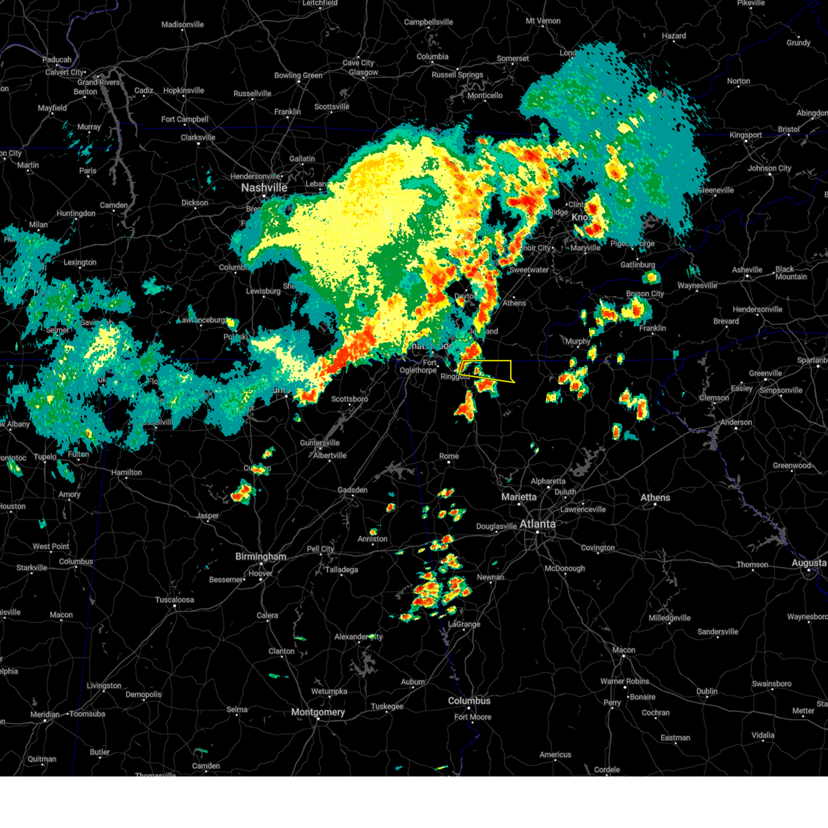
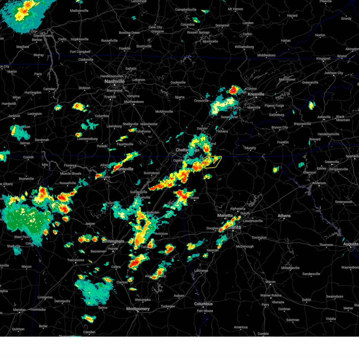
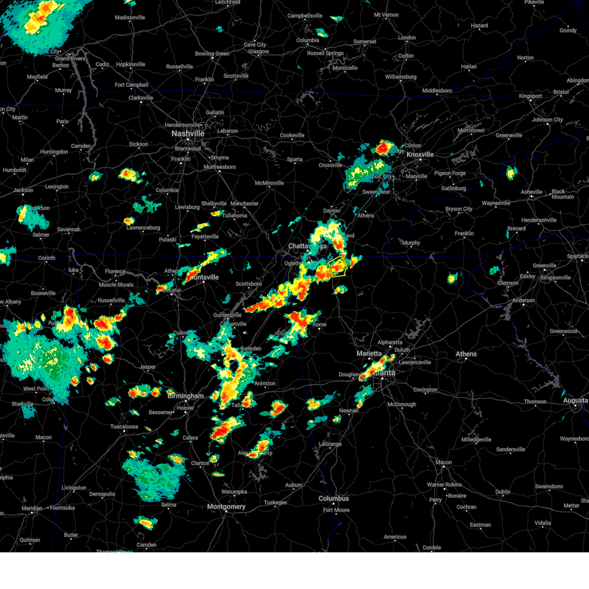
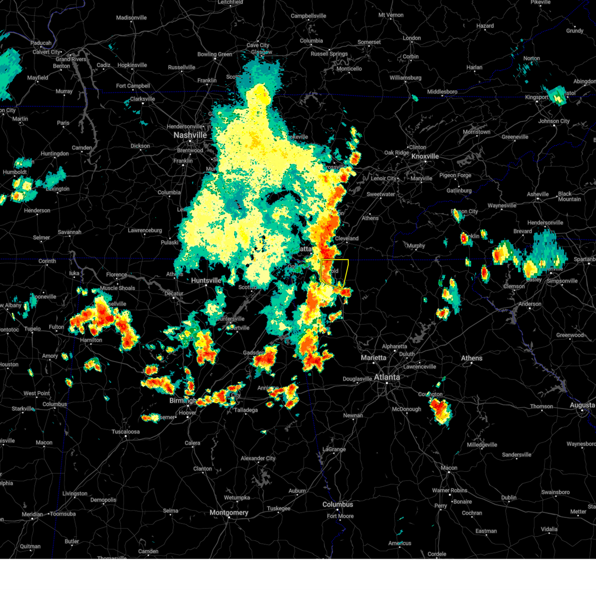
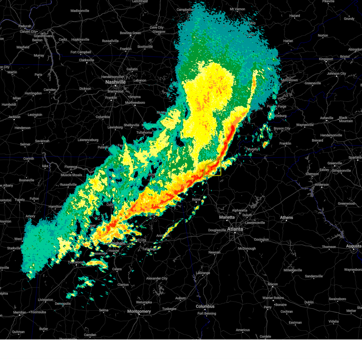
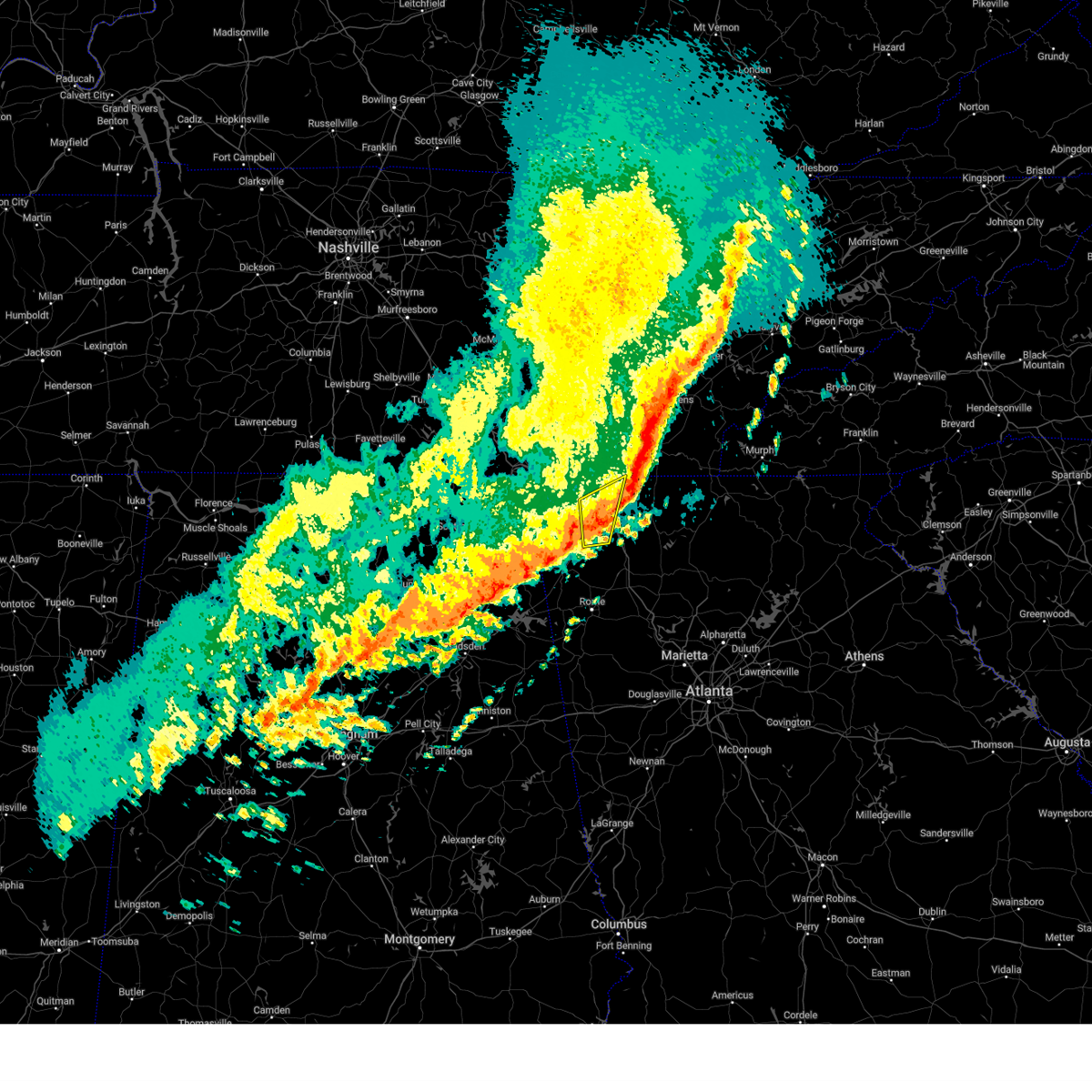
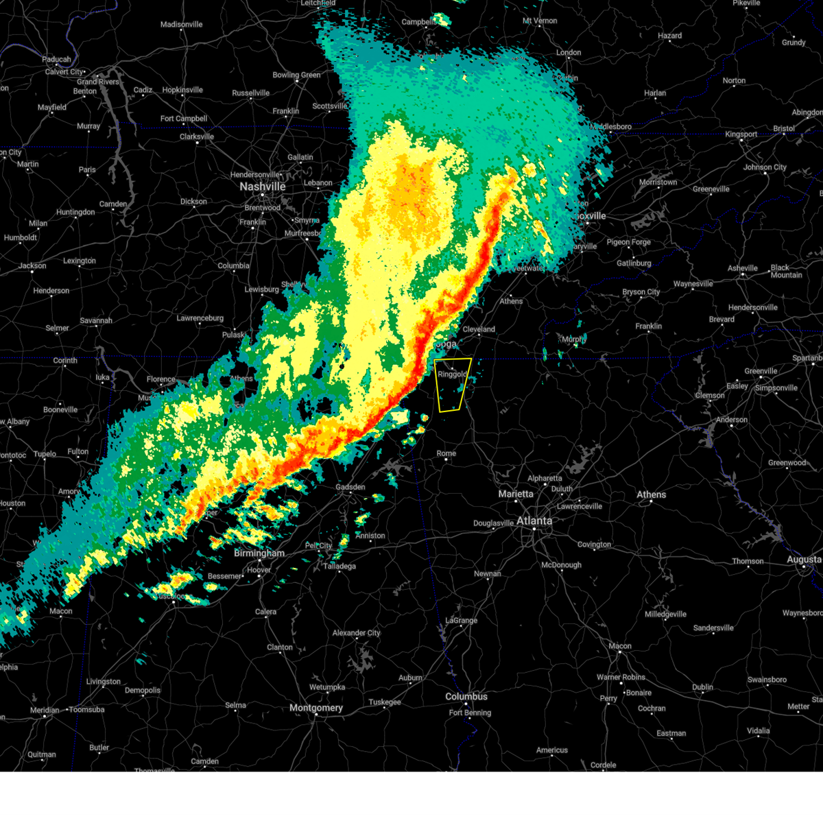
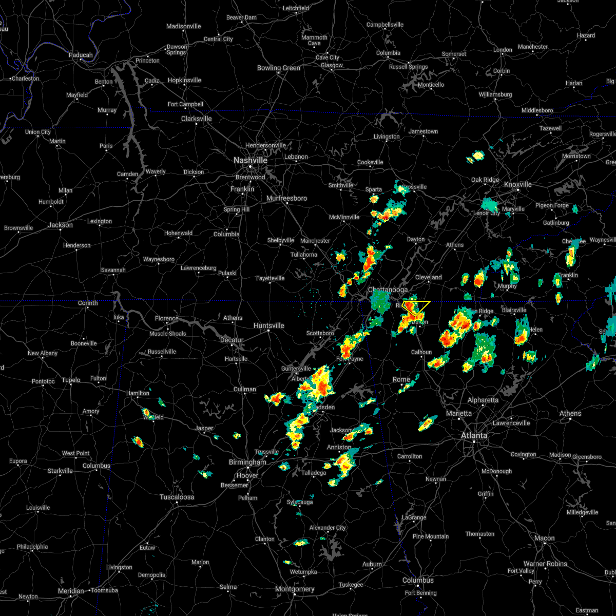
Hail Map for Varnell, GA
The Varnell, GA area has had 0 reports of on-the-ground hail by trained spotters, and has been under severe weather warnings 32 times during the past 12 months. Doppler radar has detected hail at or near Varnell, GA on 52 occasions, including 5 occasions during the past year.
| Name: | Varnell, GA |
| Where Located: | 22.2 miles ESE of Chattanooga, TN |
| Map: | Google Map for Varnell, GA |
| Population: | 1744 |
| Housing Units: | 625 |
| More Info: | Search Google for Varnell, GA |
5
The Top Recent Hail Date for Varnell, GA is Tuesday, July 30, 2024 (3rd out of 52)

Hail and Wind Damage Spotted near Varnell, GA
| Date / Time | Report Details |
|---|---|
| 6/7/2025 5:15 PM EDT |
 The storms which prompted the warning have moved out of the area. therefore, the warning will be allowed to expire. however, gusty winds are still possible with these thunderstorms. a severe thunderstorm watch remains in effect until 900 pm edt for north central and northwestern georgia. remember, a severe thunderstorm warning still remains in effect for whitfield and murray counties. The storms which prompted the warning have moved out of the area. therefore, the warning will be allowed to expire. however, gusty winds are still possible with these thunderstorms. a severe thunderstorm watch remains in effect until 900 pm edt for north central and northwestern georgia. remember, a severe thunderstorm warning still remains in effect for whitfield and murray counties.
|
| 6/7/2025 4:44 PM EDT |
 At 444 pm edt, severe thunderstorms were located along a line extending from lookout mountain to near suttles mill, moving east at 55 mph (radar indicated). Hazards include 70 mph wind gusts. Expect considerable tree damage. damage is likely to mobile homes, roofs, and outbuildings. Locations impacted include, dalton, lafayette, chatsworth, ringgold, fort oglethorpe, chickamauga, varnell, lookout mountain, eton, tunnel hill, cohutta, chattanooga valley, la fayette, crandall, sumac, gregory, blue spring, fairview, conasauga lake, and beaverdale. At 444 pm edt, severe thunderstorms were located along a line extending from lookout mountain to near suttles mill, moving east at 55 mph (radar indicated). Hazards include 70 mph wind gusts. Expect considerable tree damage. damage is likely to mobile homes, roofs, and outbuildings. Locations impacted include, dalton, lafayette, chatsworth, ringgold, fort oglethorpe, chickamauga, varnell, lookout mountain, eton, tunnel hill, cohutta, chattanooga valley, la fayette, crandall, sumac, gregory, blue spring, fairview, conasauga lake, and beaverdale.
|
| 6/7/2025 4:35 PM EDT |
 Svrffc the national weather service in peachtree city has issued a * severe thunderstorm warning for, catoosa county in northwestern georgia, murray county in northwestern georgia, whitfield county in northwestern georgia, central walker county in northwestern georgia, * until 515 pm edt. * at 435 pm edt, severe thunderstorms were located along a line extending from lookout mountain to suttles mill, moving east at 40 mph (radar indicated). Hazards include 60 mph wind gusts. expect damage to roofs, siding, and trees Svrffc the national weather service in peachtree city has issued a * severe thunderstorm warning for, catoosa county in northwestern georgia, murray county in northwestern georgia, whitfield county in northwestern georgia, central walker county in northwestern georgia, * until 515 pm edt. * at 435 pm edt, severe thunderstorms were located along a line extending from lookout mountain to suttles mill, moving east at 40 mph (radar indicated). Hazards include 60 mph wind gusts. expect damage to roofs, siding, and trees
|
| 5/25/2025 6:56 PM EDT |
 The storms which prompted the warning have moved out of the area. therefore, the warning will be allowed to expire. a severe thunderstorm watch remains in effect until midnight edt for northwestern georgia. remember, a severe thunderstorm warning still remains in effect for southeast whitfield and eastern chattooga until 730 pm edt. The storms which prompted the warning have moved out of the area. therefore, the warning will be allowed to expire. a severe thunderstorm watch remains in effect until midnight edt for northwestern georgia. remember, a severe thunderstorm warning still remains in effect for southeast whitfield and eastern chattooga until 730 pm edt.
|
| 5/25/2025 6:51 PM EDT | At 651 pm edt, severe thunderstorms were located along a line extending from lynnville to near goodspring to near lexington, moving east at 40 mph (radar indicated). Hazards include 60 mph wind gusts. Expect damage to roofs, siding, and trees. Locations impacted include, dalton, summerville, trion, varnell, mill creek, subligna, suttles mill, villanow, berryton, and rocky face. |
| 5/25/2025 6:51 PM EDT | the severe thunderstorm warning has been cancelled and is no longer in effect |
| 5/25/2025 6:26 PM EDT |
 At 625 pm edt, severe thunderstorms were located along a line extending from near winchester to near larkin to ryland, moving east at 40 mph (radar indicated). Hazards include 60 mph wind gusts. Expect damage to roofs, siding, and trees. Locations impacted include, dalton, lafayette, summerville, ringgold, fort oglethorpe, chickamauga, trion, varnell, tunnel hill, cohutta, la fayette, chattanooga valley, menlo, center post, subligna, blue spring, fairview, linwood, cloudland, and villanow. At 625 pm edt, severe thunderstorms were located along a line extending from near winchester to near larkin to ryland, moving east at 40 mph (radar indicated). Hazards include 60 mph wind gusts. Expect damage to roofs, siding, and trees. Locations impacted include, dalton, lafayette, summerville, ringgold, fort oglethorpe, chickamauga, trion, varnell, tunnel hill, cohutta, la fayette, chattanooga valley, menlo, center post, subligna, blue spring, fairview, linwood, cloudland, and villanow.
|
| 5/25/2025 6:26 PM EDT |
 the severe thunderstorm warning has been cancelled and is no longer in effect the severe thunderstorm warning has been cancelled and is no longer in effect
|
| 5/25/2025 6:12 PM EDT | Svrffc the national weather service in peachtree city has issued a * severe thunderstorm warning for, catoosa county in northwestern georgia, central whitfield county in northwestern georgia, walker county in northwestern georgia, central dade county in northwestern georgia, northern chattooga county in northwestern georgia, * until 700 pm edt. * at 611 pm edt, severe thunderstorms were located along a line extending from lookout mountain to sulpher springs to near sylvania, moving east at 40 mph (radar indicated). Hazards include 60 mph wind gusts. expect damage to roofs, siding, and trees |
| 5/3/2025 6:01 PM EDT |
 At 601 pm edt, severe thunderstorms were located along a line extending from near red clay state park to near everett springs, moving east at 40 mph (trained weather spotters). Hazards include 60 mph wind gusts and penny size hail. Expect damage to roofs, siding, and trees. Locations impacted include, rome, dalton, calhoun, summerville, chatsworth, trion, varnell, eton, tunnel hill, cohutta, resaca, plainville, shannon, lyerly, crandall, pinson, sumac, subligna, gregory, and lake marvin. At 601 pm edt, severe thunderstorms were located along a line extending from near red clay state park to near everett springs, moving east at 40 mph (trained weather spotters). Hazards include 60 mph wind gusts and penny size hail. Expect damage to roofs, siding, and trees. Locations impacted include, rome, dalton, calhoun, summerville, chatsworth, trion, varnell, eton, tunnel hill, cohutta, resaca, plainville, shannon, lyerly, crandall, pinson, sumac, subligna, gregory, and lake marvin.
|
| 5/3/2025 5:38 PM EDT |
 At 538 pm edt, severe thunderstorms were located along a line extending from graysville to near berryton, moving east at 40 mph (radar indicated). Hazards include 60 mph wind gusts and penny size hail. Expect damage to roofs, siding, and trees. locations impacted include, center post, crandall, pinson, subligna, beaverdale, villanow, dalton, james h. Floyd state park, plainville, wood station, indian springs, varnell, tidings, summerville, armuchee, tilton, lyerly, ringgold, tennga, and cohutta. At 538 pm edt, severe thunderstorms were located along a line extending from graysville to near berryton, moving east at 40 mph (radar indicated). Hazards include 60 mph wind gusts and penny size hail. Expect damage to roofs, siding, and trees. locations impacted include, center post, crandall, pinson, subligna, beaverdale, villanow, dalton, james h. Floyd state park, plainville, wood station, indian springs, varnell, tidings, summerville, armuchee, tilton, lyerly, ringgold, tennga, and cohutta.
|
| 5/3/2025 5:20 PM EDT |
 Svrffc the national weather service in peachtree city has issued a * severe thunderstorm warning for, catoosa county in northwestern georgia, central murray county in northwestern georgia, northeastern floyd county in northwestern georgia, whitfield county in northwestern georgia, walker county in northwestern georgia, western gordon county in northwestern georgia, chattooga county in northwestern georgia, * until 615 pm edt. * at 520 pm edt, severe thunderstorms were located along a line extending from lookout mountain to desoto state park, moving east at 40 mph (radar indicated). Hazards include 60 mph wind gusts and penny size hail. expect damage to roofs, siding, and trees Svrffc the national weather service in peachtree city has issued a * severe thunderstorm warning for, catoosa county in northwestern georgia, central murray county in northwestern georgia, northeastern floyd county in northwestern georgia, whitfield county in northwestern georgia, walker county in northwestern georgia, western gordon county in northwestern georgia, chattooga county in northwestern georgia, * until 615 pm edt. * at 520 pm edt, severe thunderstorms were located along a line extending from lookout mountain to desoto state park, moving east at 40 mph (radar indicated). Hazards include 60 mph wind gusts and penny size hail. expect damage to roofs, siding, and trees
|
| 5/2/2025 7:17 PM EDT | Svrffc the national weather service in peachtree city has issued a * severe thunderstorm warning for, murray county in northwestern georgia, whitfield county in northwestern georgia, northwestern gordon county in northwestern georgia, northwestern fannin county in north central georgia, * until 815 pm edt. * at 717 pm edt, severe thunderstorms were located along a line extending from cohutta to near lake marvin, moving east at 35 mph (radar indicated). Hazards include 60 mph wind gusts and quarter size hail. Hail damage to vehicles is expected. Expect wind damage to roofs, siding, and trees. |
| 5/2/2025 6:37 PM EDT |
 Svrffc the national weather service in peachtree city has issued a * severe thunderstorm warning for, catoosa county in northwestern georgia, western whitfield county in northwestern georgia, eastern walker county in northwestern georgia, * until 730 pm edt. * at 637 pm edt, severe thunderstorms were located along a line extending from near morganville to 6 miles southeast of sulpher springs, moving east at 45 mph (radar indicated). Hazards include 60 mph wind gusts and quarter size hail. Hail damage to vehicles is expected. Expect wind damage to roofs, siding, and trees. Svrffc the national weather service in peachtree city has issued a * severe thunderstorm warning for, catoosa county in northwestern georgia, western whitfield county in northwestern georgia, eastern walker county in northwestern georgia, * until 730 pm edt. * at 637 pm edt, severe thunderstorms were located along a line extending from near morganville to 6 miles southeast of sulpher springs, moving east at 45 mph (radar indicated). Hazards include 60 mph wind gusts and quarter size hail. Hail damage to vehicles is expected. Expect wind damage to roofs, siding, and trees.
|
| 5/2/2025 2:46 PM EDT | Svrffc the national weather service in peachtree city has issued a * severe thunderstorm warning for, northwestern gilmer county in north central georgia, murray county in northwestern georgia, northeastern whitfield county in northwestern georgia, northwestern fannin county in north central georgia, * until 330 pm edt. * at 246 pm edt, a severe thunderstorm was located near dawnville, or near chatsworth, moving north at 25 mph (radar indicated). Hazards include 60 mph wind gusts and quarter size hail. Hail damage to vehicles is expected. Expect wind damage to roofs, siding, and trees. |
| 3/5/2025 12:29 AM EST |
 The storms which prompted the warning have moved out of the area. therefore, the warning will be allowed to expire. a severe thunderstorm watch remains in effect until 400 am est for northwestern georgia. remember, a severe thunderstorm warning still remains in effect for catoosa, eastern walker, and whitfield counties. The storms which prompted the warning have moved out of the area. therefore, the warning will be allowed to expire. a severe thunderstorm watch remains in effect until 400 am est for northwestern georgia. remember, a severe thunderstorm warning still remains in effect for catoosa, eastern walker, and whitfield counties.
|
| 3/5/2025 12:27 AM EST |
 Svrffc the national weather service in peachtree city has issued a * severe thunderstorm warning for, eastern catoosa county in northwestern georgia, northwestern gilmer county in north central georgia, murray county in northwestern georgia, whitfield county in northwestern georgia, southeastern walker county in northwestern georgia, northeastern chattooga county in northwestern georgia, northwestern fannin county in north central georgia, * until 115 am est. * at 1227 am est, severe thunderstorms were located along a line extending from near apison to near wood station to subligna, moving northeast at 40 mph (radar indicated). Hazards include 60 mph wind gusts. expect damage to roofs, siding, and trees Svrffc the national weather service in peachtree city has issued a * severe thunderstorm warning for, eastern catoosa county in northwestern georgia, northwestern gilmer county in north central georgia, murray county in northwestern georgia, whitfield county in northwestern georgia, southeastern walker county in northwestern georgia, northeastern chattooga county in northwestern georgia, northwestern fannin county in north central georgia, * until 115 am est. * at 1227 am est, severe thunderstorms were located along a line extending from near apison to near wood station to subligna, moving northeast at 40 mph (radar indicated). Hazards include 60 mph wind gusts. expect damage to roofs, siding, and trees
|
| 3/5/2025 12:13 AM EST |
 At 1212 am est, severe thunderstorms were located along a line extending from graysville to near naomi to summerville, moving northeast at 100 mph (radar indicated). Hazards include 60 mph wind gusts. Expect damage to roofs, siding, and trees. Locations impacted include, dalton, lafayette, summerville, ringgold, fort oglethorpe, trion, varnell, tunnel hill, cohutta, resaca, la fayette, center post, subligna, blue spring, linwood, villanow, rock spring, naomi, suttles mill, and noble. At 1212 am est, severe thunderstorms were located along a line extending from graysville to near naomi to summerville, moving northeast at 100 mph (radar indicated). Hazards include 60 mph wind gusts. Expect damage to roofs, siding, and trees. Locations impacted include, dalton, lafayette, summerville, ringgold, fort oglethorpe, trion, varnell, tunnel hill, cohutta, resaca, la fayette, center post, subligna, blue spring, linwood, villanow, rock spring, naomi, suttles mill, and noble.
|
| 3/5/2025 12:13 AM EST |
 the severe thunderstorm warning has been cancelled and is no longer in effect the severe thunderstorm warning has been cancelled and is no longer in effect
|
| 3/4/2025 11:42 PM EST |
 Svrffc the national weather service in peachtree city has issued a * severe thunderstorm warning for, catoosa county in northwestern georgia, whitfield county in northwestern georgia, walker county in northwestern georgia, northwestern gordon county in northwestern georgia, dade county in northwestern georgia, northern chattooga county in northwestern georgia, * until 1230 am est. * at 1142 pm est, severe thunderstorms were located along a line extending from cole city to sulpher springs to near chesterfield, moving northeast at 45 mph (radar indicated). Hazards include 60 mph wind gusts. expect damage to roofs, siding, and trees Svrffc the national weather service in peachtree city has issued a * severe thunderstorm warning for, catoosa county in northwestern georgia, whitfield county in northwestern georgia, walker county in northwestern georgia, northwestern gordon county in northwestern georgia, dade county in northwestern georgia, northern chattooga county in northwestern georgia, * until 1230 am est. * at 1142 pm est, severe thunderstorms were located along a line extending from cole city to sulpher springs to near chesterfield, moving northeast at 45 mph (radar indicated). Hazards include 60 mph wind gusts. expect damage to roofs, siding, and trees
|
| 2/16/2025 3:24 AM EST |
 At 324 am est, severe thunderstorms were located along a line extending from tilton to near rome to near esom hill, moving east at 60 mph (radar indicated). Hazards include 60 mph wind gusts. Expect damage to roofs, siding, and trees. Locations impacted include, rome, dalton, cartersville, calhoun, cedartown, chatsworth, ringgold, adairsville, rockmart, euharlee, varnell, aragon, cave spring, eton, tunnel hill, white, cohutta, kingston, resaca, and plainville. At 324 am est, severe thunderstorms were located along a line extending from tilton to near rome to near esom hill, moving east at 60 mph (radar indicated). Hazards include 60 mph wind gusts. Expect damage to roofs, siding, and trees. Locations impacted include, rome, dalton, cartersville, calhoun, cedartown, chatsworth, ringgold, adairsville, rockmart, euharlee, varnell, aragon, cave spring, eton, tunnel hill, white, cohutta, kingston, resaca, and plainville.
|
| 2/16/2025 3:12 AM EST |
 At 312 am est, severe thunderstorms were located along a line extending from near villanow to near coosa to near spring garden, moving northeast at 75 mph (radar indicated). Hazards include 60 mph wind gusts. Expect damage to roofs, siding, and trees. Locations impacted include, rome, dalton, cartersville, calhoun, cedartown, lafayette, summerville, chatsworth, ringgold, fort oglethorpe, adairsville, rockmart, euharlee, trion, varnell, aragon, cave spring, eton, tunnel hill, and white. At 312 am est, severe thunderstorms were located along a line extending from near villanow to near coosa to near spring garden, moving northeast at 75 mph (radar indicated). Hazards include 60 mph wind gusts. Expect damage to roofs, siding, and trees. Locations impacted include, rome, dalton, cartersville, calhoun, cedartown, lafayette, summerville, chatsworth, ringgold, fort oglethorpe, adairsville, rockmart, euharlee, trion, varnell, aragon, cave spring, eton, tunnel hill, and white.
|
| 2/16/2025 3:00 AM EST |
 The storms which prompted the warning have moved out of the area. therefore, the warning will be allowed to expire. a tornado watch remains in effect until 900 am est for northwestern georgia. remember, a severe thunderstorm warning still remains in effect for portions of catoosa, walker, chattooga, and whitfield counties. The storms which prompted the warning have moved out of the area. therefore, the warning will be allowed to expire. a tornado watch remains in effect until 900 am est for northwestern georgia. remember, a severe thunderstorm warning still remains in effect for portions of catoosa, walker, chattooga, and whitfield counties.
|
| 2/16/2025 2:59 AM EST |
 Svrffc the national weather service in peachtree city has issued a * severe thunderstorm warning for, catoosa county in northwestern georgia, west central gilmer county in north central georgia, murray county in northwestern georgia, floyd county in northwestern georgia, whitfield county in northwestern georgia, walker county in northwestern georgia, gordon county in northwestern georgia, polk county in northwestern georgia, chattooga county in northwestern georgia, bartow county in northwestern georgia, * until 345 am est. * at 259 am est, severe thunderstorms were located along a line extending from center post to waterhouse to near sulphur springs, moving northeast at 75 mph (radar indicated). Hazards include 60 mph wind gusts. expect damage to roofs, siding, and trees Svrffc the national weather service in peachtree city has issued a * severe thunderstorm warning for, catoosa county in northwestern georgia, west central gilmer county in north central georgia, murray county in northwestern georgia, floyd county in northwestern georgia, whitfield county in northwestern georgia, walker county in northwestern georgia, gordon county in northwestern georgia, polk county in northwestern georgia, chattooga county in northwestern georgia, bartow county in northwestern georgia, * until 345 am est. * at 259 am est, severe thunderstorms were located along a line extending from center post to waterhouse to near sulphur springs, moving northeast at 75 mph (radar indicated). Hazards include 60 mph wind gusts. expect damage to roofs, siding, and trees
|
| 2/16/2025 2:51 AM EST |
 At 251 am est, severe thunderstorms were located along a line extending from hicks gap state park to near sulpher springs to near cedar bluff, moving east at 65 mph (radar indicated). Hazards include 60 mph wind gusts. Expect damage to roofs, siding, and trees. Locations impacted include, rome, dalton, lafayette, summerville, ringgold, trenton, fort oglethorpe, rossville, chickamauga, trion, varnell, lookout mountain, tunnel hill, cohutta, resaca, chattanooga valley, la fayette, lyerly, menlo, and center post. At 251 am est, severe thunderstorms were located along a line extending from hicks gap state park to near sulpher springs to near cedar bluff, moving east at 65 mph (radar indicated). Hazards include 60 mph wind gusts. Expect damage to roofs, siding, and trees. Locations impacted include, rome, dalton, lafayette, summerville, ringgold, trenton, fort oglethorpe, rossville, chickamauga, trion, varnell, lookout mountain, tunnel hill, cohutta, resaca, chattanooga valley, la fayette, lyerly, menlo, and center post.
|
| 2/16/2025 2:41 AM EST |
 At 241 am est, severe thunderstorms were located along a line extending from jasper to near ider to near sand rock, moving east at 40 mph (radar indicated). Hazards include 60 mph wind gusts. Expect damage to roofs, siding, and trees. Locations impacted include, rome, dalton, lafayette, summerville, ringgold, trenton, fort oglethorpe, rossville, chickamauga, trion, varnell, lookout mountain, tunnel hill, cohutta, resaca, chattanooga valley, la fayette, lyerly, menlo, and center post. At 241 am est, severe thunderstorms were located along a line extending from jasper to near ider to near sand rock, moving east at 40 mph (radar indicated). Hazards include 60 mph wind gusts. Expect damage to roofs, siding, and trees. Locations impacted include, rome, dalton, lafayette, summerville, ringgold, trenton, fort oglethorpe, rossville, chickamauga, trion, varnell, lookout mountain, tunnel hill, cohutta, resaca, chattanooga valley, la fayette, lyerly, menlo, and center post.
|
| 2/16/2025 2:20 AM EST |
 At 219 am est, severe thunderstorms were located along a line extending from near sherwood to martintown to near mcville, moving east at 65 mph (radar indicated). Hazards include 60 mph wind gusts. Expect damage to roofs, siding, and trees. Locations impacted include, rome, dalton, lafayette, summerville, ringgold, trenton, fort oglethorpe, rossville, chickamauga, trion, varnell, lookout mountain, tunnel hill, cohutta, resaca, chattanooga valley, la fayette, lyerly, menlo, and center post. At 219 am est, severe thunderstorms were located along a line extending from near sherwood to martintown to near mcville, moving east at 65 mph (radar indicated). Hazards include 60 mph wind gusts. Expect damage to roofs, siding, and trees. Locations impacted include, rome, dalton, lafayette, summerville, ringgold, trenton, fort oglethorpe, rossville, chickamauga, trion, varnell, lookout mountain, tunnel hill, cohutta, resaca, chattanooga valley, la fayette, lyerly, menlo, and center post.
|
| 2/16/2025 2:12 AM EST |
 Svrffc the national weather service in peachtree city has issued a * severe thunderstorm warning for, catoosa county in northwestern georgia, central floyd county in northwestern georgia, central whitfield county in northwestern georgia, walker county in northwestern georgia, northwestern gordon county in northwestern georgia, dade county in northwestern georgia, chattooga county in northwestern georgia, * until 300 am est. * at 212 am est, severe thunderstorms were located along a line extending from cowan to near hollywood to guntersville, moving east at 65 mph (radar indicated). Hazards include 60 mph wind gusts. expect damage to roofs, siding, and trees Svrffc the national weather service in peachtree city has issued a * severe thunderstorm warning for, catoosa county in northwestern georgia, central floyd county in northwestern georgia, central whitfield county in northwestern georgia, walker county in northwestern georgia, northwestern gordon county in northwestern georgia, dade county in northwestern georgia, chattooga county in northwestern georgia, * until 300 am est. * at 212 am est, severe thunderstorms were located along a line extending from cowan to near hollywood to guntersville, moving east at 65 mph (radar indicated). Hazards include 60 mph wind gusts. expect damage to roofs, siding, and trees
|
| 8/17/2024 4:38 PM EDT |
 At 438 pm edt, a severe thunderstorm was located over cisco, or 10 miles north of chatsworth, moving east at 30 mph (radar indicated). Hazards include 60 mph wind gusts and quarter size hail. Hail damage to vehicles is expected. expect wind damage to roofs, siding, and trees. Locations impacted include, chatsworth, varnell, eton, tunnel hill, cohutta, crandall, sumac, gregory, conasauga lake, tennga, beaverdale, dawnville, cisco, red clay state park, and apison. At 438 pm edt, a severe thunderstorm was located over cisco, or 10 miles north of chatsworth, moving east at 30 mph (radar indicated). Hazards include 60 mph wind gusts and quarter size hail. Hail damage to vehicles is expected. expect wind damage to roofs, siding, and trees. Locations impacted include, chatsworth, varnell, eton, tunnel hill, cohutta, crandall, sumac, gregory, conasauga lake, tennga, beaverdale, dawnville, cisco, red clay state park, and apison.
|
| 8/17/2024 4:08 PM EDT | Svrffc the national weather service in peachtree city has issued a * severe thunderstorm warning for, northeastern catoosa county in northwestern georgia, northeastern murray county in northwestern georgia, northeastern whitfield county in northwestern georgia, * until 445 pm edt. * at 407 pm edt, a severe thunderstorm was located over varnell, or 8 miles east of ringgold, moving east at 30 mph (radar indicated). Hazards include 60 mph wind gusts and quarter size hail. Hail damage to vehicles is expected. Expect wind damage to roofs, siding, and trees. |
| 7/30/2024 6:21 PM EDT |
 Svrffc the national weather service in peachtree city has issued a * severe thunderstorm warning for, catoosa county in northwestern georgia, murray county in northwestern georgia, whitfield county in northwestern georgia, central walker county in northwestern georgia, dade county in northwestern georgia, * until 700 pm edt. * at 621 pm edt, severe thunderstorms were located along a line extending from near parksville to ooltewah to near sequatchie cave, moving south at 35 mph (radar indicated). Hazards include 60 mph wind gusts and quarter size hail. Hail damage to vehicles is expected. Expect wind damage to roofs, siding, and trees. Svrffc the national weather service in peachtree city has issued a * severe thunderstorm warning for, catoosa county in northwestern georgia, murray county in northwestern georgia, whitfield county in northwestern georgia, central walker county in northwestern georgia, dade county in northwestern georgia, * until 700 pm edt. * at 621 pm edt, severe thunderstorms were located along a line extending from near parksville to ooltewah to near sequatchie cave, moving south at 35 mph (radar indicated). Hazards include 60 mph wind gusts and quarter size hail. Hail damage to vehicles is expected. Expect wind damage to roofs, siding, and trees.
|
| 7/29/2024 5:41 PM EDT |
 Svrffc the national weather service in peachtree city has issued a * severe thunderstorm warning for, northeastern catoosa county in northwestern georgia, central murray county in northwestern georgia, whitfield county in northwestern georgia, * until 630 pm edt. * at 541 pm edt, severe thunderstorms were located along a line extending from near east ridge to near gap springs, moving southeast at 30 mph (radar indicated). Hazards include 60 mph wind gusts and penny size hail. expect damage to roofs, siding, and trees Svrffc the national weather service in peachtree city has issued a * severe thunderstorm warning for, northeastern catoosa county in northwestern georgia, central murray county in northwestern georgia, whitfield county in northwestern georgia, * until 630 pm edt. * at 541 pm edt, severe thunderstorms were located along a line extending from near east ridge to near gap springs, moving southeast at 30 mph (radar indicated). Hazards include 60 mph wind gusts and penny size hail. expect damage to roofs, siding, and trees
|
| 5/27/2024 4:57 AM EDT |
 The storm which prompted the warning has moved out of the area. therefore, the warning will be allowed to expire. a tornado watch remains in effect until 900 am edt for northwestern georgia. remember, a severe thunderstorm warning still remains in effect for whitfield county!. The storm which prompted the warning has moved out of the area. therefore, the warning will be allowed to expire. a tornado watch remains in effect until 900 am edt for northwestern georgia. remember, a severe thunderstorm warning still remains in effect for whitfield county!.
|
| 5/27/2024 4:51 AM EDT |
 Svrffc the national weather service in peachtree city has issued a * severe thunderstorm warning for, northwestern gilmer county in north central georgia, murray county in northwestern georgia, whitfield county in northwestern georgia, northwestern fannin county in north central georgia, * until 515 am edt. * at 451 am edt, severe thunderstorms were located along a line extending from near beaverdale to near dawnville to near dalton to near villanow, moving east at 40 mph (radar indicated). Hazards include 60 mph wind gusts and quarter size hail. Hail damage to vehicles is expected. Expect wind damage to roofs, siding, and trees. Svrffc the national weather service in peachtree city has issued a * severe thunderstorm warning for, northwestern gilmer county in north central georgia, murray county in northwestern georgia, whitfield county in northwestern georgia, northwestern fannin county in north central georgia, * until 515 am edt. * at 451 am edt, severe thunderstorms were located along a line extending from near beaverdale to near dawnville to near dalton to near villanow, moving east at 40 mph (radar indicated). Hazards include 60 mph wind gusts and quarter size hail. Hail damage to vehicles is expected. Expect wind damage to roofs, siding, and trees.
|
| 5/27/2024 4:25 AM EDT |
 Svrffc the national weather service in peachtree city has issued a * severe thunderstorm warning for, catoosa county in northwestern georgia, whitfield county in northwestern georgia, central walker county in northwestern georgia, * until 500 am edt. * at 425 am edt, a severe thunderstorm was located over boynton, or near ringgold, moving east at 40 mph (radar indicated). Hazards include 60 mph wind gusts and quarter size hail. Hail damage to vehicles is expected. Expect wind damage to roofs, siding, and trees. Svrffc the national weather service in peachtree city has issued a * severe thunderstorm warning for, catoosa county in northwestern georgia, whitfield county in northwestern georgia, central walker county in northwestern georgia, * until 500 am edt. * at 425 am edt, a severe thunderstorm was located over boynton, or near ringgold, moving east at 40 mph (radar indicated). Hazards include 60 mph wind gusts and quarter size hail. Hail damage to vehicles is expected. Expect wind damage to roofs, siding, and trees.
|
| 5/9/2024 6:27 AM EDT |
 At 627 am edt, severe thunderstorms were located along a line extending from near dawnville to near hammondville, moving southeast at 40 mph (radar indicated). Hazards include 60 mph wind gusts and penny size hail. Expect damage to roofs, siding, and trees. Locations impacted include, dalton, lafayette, varnell, tunnel hill, la fayette, naomi, center post, rising fawn, suttles mill, noble, wood station, rocky face, tilton, mill creek, linwood, beaumont, beaverdale, dawnville, villanow, and cloudland canyon state park. At 627 am edt, severe thunderstorms were located along a line extending from near dawnville to near hammondville, moving southeast at 40 mph (radar indicated). Hazards include 60 mph wind gusts and penny size hail. Expect damage to roofs, siding, and trees. Locations impacted include, dalton, lafayette, varnell, tunnel hill, la fayette, naomi, center post, rising fawn, suttles mill, noble, wood station, rocky face, tilton, mill creek, linwood, beaumont, beaverdale, dawnville, villanow, and cloudland canyon state park.
|
| 5/9/2024 5:43 AM EDT |
 Svrffc the national weather service in peachtree city has issued a * severe thunderstorm warning for, catoosa county in northwestern georgia, whitfield county in northwestern georgia, walker county in northwestern georgia, dade county in northwestern georgia, * until 645 am edt. * at 541 am edt, severe thunderstorms were located along a line extending from lakesite to near skyline, moving southeast at 45 mph (radar indicated). Hazards include 60 mph wind gusts and quarter size hail. Hail damage to vehicles is expected. Expect wind damage to roofs, siding, and trees. Svrffc the national weather service in peachtree city has issued a * severe thunderstorm warning for, catoosa county in northwestern georgia, whitfield county in northwestern georgia, walker county in northwestern georgia, dade county in northwestern georgia, * until 645 am edt. * at 541 am edt, severe thunderstorms were located along a line extending from lakesite to near skyline, moving southeast at 45 mph (radar indicated). Hazards include 60 mph wind gusts and quarter size hail. Hail damage to vehicles is expected. Expect wind damage to roofs, siding, and trees.
|
| 5/8/2024 11:13 PM EDT |
 Svrffc the national weather service in peachtree city has issued a * severe thunderstorm warning for, southwestern catoosa county in northwestern georgia, murray county in northwestern georgia, whitfield county in northwestern georgia, east central walker county in northwestern georgia, * until 1215 am edt. * at 1113 pm edt, a severe thunderstorm was located over noble, or near lafayette, moving east at 35 mph (radar indicated). Hazards include golf ball size hail and 60 mph wind gusts. People and animals outdoors will be injured. expect hail damage to roofs, siding, windows, and vehicles. Expect wind damage to roofs, siding, and trees. Svrffc the national weather service in peachtree city has issued a * severe thunderstorm warning for, southwestern catoosa county in northwestern georgia, murray county in northwestern georgia, whitfield county in northwestern georgia, east central walker county in northwestern georgia, * until 1215 am edt. * at 1113 pm edt, a severe thunderstorm was located over noble, or near lafayette, moving east at 35 mph (radar indicated). Hazards include golf ball size hail and 60 mph wind gusts. People and animals outdoors will be injured. expect hail damage to roofs, siding, windows, and vehicles. Expect wind damage to roofs, siding, and trees.
|
| 8/13/2023 8:17 PM EDT |
 At 817 pm edt, a severe thunderstorm was located near dalton, moving east at 25 mph (radar indicated). Hazards include 60 mph wind gusts and quarter size hail. Hail damage to vehicles is expected. expect wind damage to roofs, siding, and trees. locations impacted include, dalton, chatsworth, varnell, eton, tunnel hill, crandall, sumac, rocky face, tilton, mill creek, beaverdale, dawnville, and north georgia speedway. hail threat, radar indicated max hail size, 1. 00 in wind threat, radar indicated max wind gust, 60 mph. At 817 pm edt, a severe thunderstorm was located near dalton, moving east at 25 mph (radar indicated). Hazards include 60 mph wind gusts and quarter size hail. Hail damage to vehicles is expected. expect wind damage to roofs, siding, and trees. locations impacted include, dalton, chatsworth, varnell, eton, tunnel hill, crandall, sumac, rocky face, tilton, mill creek, beaverdale, dawnville, and north georgia speedway. hail threat, radar indicated max hail size, 1. 00 in wind threat, radar indicated max wind gust, 60 mph.
|
| 8/13/2023 8:04 PM EDT |
 At 804 pm edt, a severe thunderstorm was located over rocky face, or near dalton, moving east at 25 mph (radar indicated). Hazards include 60 mph wind gusts and quarter size hail. Hail damage to vehicles is expected. Expect wind damage to roofs, siding, and trees. At 804 pm edt, a severe thunderstorm was located over rocky face, or near dalton, moving east at 25 mph (radar indicated). Hazards include 60 mph wind gusts and quarter size hail. Hail damage to vehicles is expected. Expect wind damage to roofs, siding, and trees.
|
| 8/12/2023 4:06 PM EDT |
 The severe thunderstorm warning for catoosa, northwestern whitfield, western walker and central dade counties will expire at 415 pm edt, the storms which prompted the warning have weakened below severe limits, and no longer pose an immediate threat to life or property. therefore, the warning will be allowed to expire. however, gusty winds and heavy rain are still possible with these thunderstorms. a severe thunderstorm watch remains in effect until 700 pm edt for northwestern georgia. The severe thunderstorm warning for catoosa, northwestern whitfield, western walker and central dade counties will expire at 415 pm edt, the storms which prompted the warning have weakened below severe limits, and no longer pose an immediate threat to life or property. therefore, the warning will be allowed to expire. however, gusty winds and heavy rain are still possible with these thunderstorms. a severe thunderstorm watch remains in effect until 700 pm edt for northwestern georgia.
|
| 8/12/2023 4:01 PM EDT |
 At 401 pm edt, severe thunderstorms were located along a line extending from ringgold to near cooper heights, moving east at 35 mph (radar indicated). Hazards include 60 mph wind gusts. Expect damage to roofs, siding, and trees. locations impacted include, ringgold, fort oglethorpe, chickamauga, varnell, cohutta, chattanooga valley, la fayette, rising fawn, noble, lakeview, wood station, indian springs, graysville, blue spring, fairview, boynton, beaumont, chattanooga valley, cloudland canyon state park, and cooper heights. hail threat, radar indicated max hail size, <. 75 in wind threat, radar indicated max wind gust, 60 mph. At 401 pm edt, severe thunderstorms were located along a line extending from ringgold to near cooper heights, moving east at 35 mph (radar indicated). Hazards include 60 mph wind gusts. Expect damage to roofs, siding, and trees. locations impacted include, ringgold, fort oglethorpe, chickamauga, varnell, cohutta, chattanooga valley, la fayette, rising fawn, noble, lakeview, wood station, indian springs, graysville, blue spring, fairview, boynton, beaumont, chattanooga valley, cloudland canyon state park, and cooper heights. hail threat, radar indicated max hail size, <. 75 in wind threat, radar indicated max wind gust, 60 mph.
|
| 8/12/2023 3:29 PM EDT |
 At 328 pm edt, severe thunderstorms were located along a line extending from near lookout mountain to near higdon, moving southeast at 35 mph (radar indicated). Hazards include 60 mph wind gusts. expect damage to roofs, siding, and trees At 328 pm edt, severe thunderstorms were located along a line extending from near lookout mountain to near higdon, moving southeast at 35 mph (radar indicated). Hazards include 60 mph wind gusts. expect damage to roofs, siding, and trees
|
| 8/12/2023 3:01 PM EDT |
 At 301 pm edt, a severe thunderstorm was located over cohutta, or 8 miles east of ringgold, moving east at 25 mph (radar indicated). Hazards include 60 mph wind gusts and quarter size hail. Hail damage to vehicles is expected. Expect wind damage to roofs, siding, and trees. At 301 pm edt, a severe thunderstorm was located over cohutta, or 8 miles east of ringgold, moving east at 25 mph (radar indicated). Hazards include 60 mph wind gusts and quarter size hail. Hail damage to vehicles is expected. Expect wind damage to roofs, siding, and trees.
|
| 8/7/2023 2:31 PM EDT |
 At 230 pm edt, the leading edge of a line of severe thunderstorms were located along a line extending from red clay state park to near ringgold to cooper heights, moving east at 40 mph (radar indicated). Hazards include 70 mph wind gusts and quarter size hail. Hail damage to vehicles is expected. expect considerable tree damage. wind damage is also likely to mobile homes, roofs, and outbuildings. locations impacted include, lafayette, ringgold, fort oglethorpe, chickamauga, varnell, tunnel hill, cohutta, la fayette, naomi, suttles mill, noble, wood station, indian springs, rocky face, graysville, blue spring, linwood, boynton, beaumont, and villanow. thunderstorm damage threat, considerable hail threat, radar indicated max hail size, 1. 00 in wind threat, radar indicated max wind gust, 70 mph. At 230 pm edt, the leading edge of a line of severe thunderstorms were located along a line extending from red clay state park to near ringgold to cooper heights, moving east at 40 mph (radar indicated). Hazards include 70 mph wind gusts and quarter size hail. Hail damage to vehicles is expected. expect considerable tree damage. wind damage is also likely to mobile homes, roofs, and outbuildings. locations impacted include, lafayette, ringgold, fort oglethorpe, chickamauga, varnell, tunnel hill, cohutta, la fayette, naomi, suttles mill, noble, wood station, indian springs, rocky face, graysville, blue spring, linwood, boynton, beaumont, and villanow. thunderstorm damage threat, considerable hail threat, radar indicated max hail size, 1. 00 in wind threat, radar indicated max wind gust, 70 mph.
|
| 8/7/2023 2:22 PM EDT |
 At 221 pm edt, severe thunderstorms were located along a line extending from near apison to near beaumont to near rising fawn, moving east at 50 mph (radar indicated). Hazards include 70 mph wind gusts and quarter size hail. Hail damage to vehicles is expected. expect considerable tree damage. Wind damage is also likely to mobile homes, roofs, and outbuildings. At 221 pm edt, severe thunderstorms were located along a line extending from near apison to near beaumont to near rising fawn, moving east at 50 mph (radar indicated). Hazards include 70 mph wind gusts and quarter size hail. Hail damage to vehicles is expected. expect considerable tree damage. Wind damage is also likely to mobile homes, roofs, and outbuildings.
|
| 8/7/2023 2:19 PM EDT |
 At 218 pm edt, severe thunderstorms were located along a line extending from near graysville to blue spring to near rising fawn, moving east at 50 mph (radar indicated). Hazards include 70 mph wind gusts and quarter size hail. Hail damage to vehicles is expected. expect considerable tree damage. wind damage is also likely to mobile homes, roofs, and outbuildings. locations impacted include, lafayette, ringgold, fort oglethorpe, chickamauga, varnell, tunnel hill, cohutta, chattanooga valley, la fayette, blue spring, fairview, linwood, villanow, chattanooga valley, cloudland canyon state park, cooper heights, rock spring, naomi, rising fawn, and suttles mill. thunderstorm damage threat, considerable hail threat, radar indicated max hail size, 1. 00 in wind threat, radar indicated max wind gust, 70 mph. At 218 pm edt, severe thunderstorms were located along a line extending from near graysville to blue spring to near rising fawn, moving east at 50 mph (radar indicated). Hazards include 70 mph wind gusts and quarter size hail. Hail damage to vehicles is expected. expect considerable tree damage. wind damage is also likely to mobile homes, roofs, and outbuildings. locations impacted include, lafayette, ringgold, fort oglethorpe, chickamauga, varnell, tunnel hill, cohutta, chattanooga valley, la fayette, blue spring, fairview, linwood, villanow, chattanooga valley, cloudland canyon state park, cooper heights, rock spring, naomi, rising fawn, and suttles mill. thunderstorm damage threat, considerable hail threat, radar indicated max hail size, 1. 00 in wind threat, radar indicated max wind gust, 70 mph.
|
| 8/7/2023 1:59 PM EDT |
 At 159 pm edt, a severe thunderstorm was located over chattanooga valley, or 7 miles east of trenton, moving east at 35 mph (radar indicated). Hazards include 70 mph wind gusts and quarter size hail. Hail damage to vehicles is expected. expect considerable tree damage. Wind damage is also likely to mobile homes, roofs, and outbuildings. At 159 pm edt, a severe thunderstorm was located over chattanooga valley, or 7 miles east of trenton, moving east at 35 mph (radar indicated). Hazards include 70 mph wind gusts and quarter size hail. Hail damage to vehicles is expected. expect considerable tree damage. Wind damage is also likely to mobile homes, roofs, and outbuildings.
|
| 8/6/2023 5:28 PM EDT |
 At 528 pm edt, severe thunderstorms were located along a line extending from near lookout mountain to near chickamauga to james h. floyd state park, moving northeast at 30 mph (radar indicated). Hazards include 60 mph wind gusts and penny size hail. expect damage to roofs, siding, and trees At 528 pm edt, severe thunderstorms were located along a line extending from near lookout mountain to near chickamauga to james h. floyd state park, moving northeast at 30 mph (radar indicated). Hazards include 60 mph wind gusts and penny size hail. expect damage to roofs, siding, and trees
|
| 7/20/2023 4:12 PM EDT |
 At 411 pm edt, severe thunderstorms were located along a line extending from near east cleveland to near hooker, moving southeast at 40 mph (radar indicated). Hazards include 60 mph wind gusts and quarter size hail. Hail damage to vehicles is expected. Expect wind damage to roofs, siding, and trees. At 411 pm edt, severe thunderstorms were located along a line extending from near east cleveland to near hooker, moving southeast at 40 mph (radar indicated). Hazards include 60 mph wind gusts and quarter size hail. Hail damage to vehicles is expected. Expect wind damage to roofs, siding, and trees.
|
| 7/2/2023 4:59 PM EDT |
 At 459 pm edt, severe thunderstorms were located along a line extending from near cohutta wilderness to near cloudland, moving east at 25 mph (radar indicated). Hazards include 60 mph wind gusts and penny size hail. expect damage to roofs, siding, and trees At 459 pm edt, severe thunderstorms were located along a line extending from near cohutta wilderness to near cloudland, moving east at 25 mph (radar indicated). Hazards include 60 mph wind gusts and penny size hail. expect damage to roofs, siding, and trees
|
| 7/2/2023 4:51 PM EDT |
 At 450 pm edt, a severe thunderstorm was located over varnell, or 7 miles north of dalton, moving east at 15 mph (radar indicated). Hazards include 60 mph wind gusts. expect damage to roofs, siding, and trees At 450 pm edt, a severe thunderstorm was located over varnell, or 7 miles north of dalton, moving east at 15 mph (radar indicated). Hazards include 60 mph wind gusts. expect damage to roofs, siding, and trees
|
| 7/2/2023 4:50 PM EDT |
 At 449 pm edt, a severe thunderstorm was located over varnell, or 7 miles north of dalton, moving east at 15 mph (radar indicated). Hazards include 60 mph wind gusts. expect damage to roofs, siding, and trees At 449 pm edt, a severe thunderstorm was located over varnell, or 7 miles north of dalton, moving east at 15 mph (radar indicated). Hazards include 60 mph wind gusts. expect damage to roofs, siding, and trees
|
| 7/2/2023 4:29 PM EDT |
 At 429 pm edt, a severe thunderstorm was located over noble, or near lafayette, moving east at 25 mph (radar indicated). Hazards include 60 mph wind gusts and penny size hail. expect damage to roofs, siding, and trees At 429 pm edt, a severe thunderstorm was located over noble, or near lafayette, moving east at 25 mph (radar indicated). Hazards include 60 mph wind gusts and penny size hail. expect damage to roofs, siding, and trees
|
| 7/1/2023 4:58 PM EDT |
 At 457 pm edt, severe thunderstorms were located along a line extending from ooltewah to near wood station, moving east at 15 mph (radar indicated). Hazards include 60 mph wind gusts and quarter size hail. Hail damage to vehicles is expected. Expect wind damage to roofs, siding, and trees. At 457 pm edt, severe thunderstorms were located along a line extending from ooltewah to near wood station, moving east at 15 mph (radar indicated). Hazards include 60 mph wind gusts and quarter size hail. Hail damage to vehicles is expected. Expect wind damage to roofs, siding, and trees.
|
| 6/25/2023 4:48 PM EDT |
 At 447 pm edt, severe thunderstorms were located along a line extending from near fausett lake to ranger to near villanow, moving south at 30 mph (radar indicated). Hazards include 60 mph wind gusts and penny size hail. Expect damage to roofs, siding, and trees. locations impacted include, dalton, calhoun, chatsworth, jasper, ringgold, ellijay, fort oglethorpe, varnell, eton, tunnel hill, cohutta, east ellijay, resaca, talking rock, fairmount, ranger, amicalola falls state park, crandall, fausett lake and beaverdale. hail threat, radar indicated max hail size, 0. 75 in wind threat, radar indicated max wind gust, 60 mph. At 447 pm edt, severe thunderstorms were located along a line extending from near fausett lake to ranger to near villanow, moving south at 30 mph (radar indicated). Hazards include 60 mph wind gusts and penny size hail. Expect damage to roofs, siding, and trees. locations impacted include, dalton, calhoun, chatsworth, jasper, ringgold, ellijay, fort oglethorpe, varnell, eton, tunnel hill, cohutta, east ellijay, resaca, talking rock, fairmount, ranger, amicalola falls state park, crandall, fausett lake and beaverdale. hail threat, radar indicated max hail size, 0. 75 in wind threat, radar indicated max wind gust, 60 mph.
|
| 6/25/2023 4:27 PM EDT |
 At 426 pm edt, severe thunderstorms were located along a line extending from near stover creek shelter to carters to near tunnel hill, moving south at 30 mph (radar indicated). Hazards include 60 mph wind gusts and penny size hail. Expect damage to roofs, siding, and trees. locations impacted include, dalton, calhoun, chatsworth, jasper, ringgold, ellijay, fort oglethorpe, varnell, eton, tunnel hill, cohutta, east ellijay, resaca, talking rock, fairmount, ranger, amicalola falls state park, crandall, fausett lake and beaverdale. hail threat, radar indicated max hail size, 0. 75 in wind threat, radar indicated max wind gust, 60 mph. At 426 pm edt, severe thunderstorms were located along a line extending from near stover creek shelter to carters to near tunnel hill, moving south at 30 mph (radar indicated). Hazards include 60 mph wind gusts and penny size hail. Expect damage to roofs, siding, and trees. locations impacted include, dalton, calhoun, chatsworth, jasper, ringgold, ellijay, fort oglethorpe, varnell, eton, tunnel hill, cohutta, east ellijay, resaca, talking rock, fairmount, ranger, amicalola falls state park, crandall, fausett lake and beaverdale. hail threat, radar indicated max hail size, 0. 75 in wind threat, radar indicated max wind gust, 60 mph.
|
| 6/25/2023 4:12 PM EDT |
 At 412 pm edt, severe thunderstorms were located along a line extending from near cherry log to near chatsworth to ringgold, moving south at 30 mph (radar indicated). Hazards include 60 mph wind gusts. expect damage to roofs, siding, and trees At 412 pm edt, severe thunderstorms were located along a line extending from near cherry log to near chatsworth to ringgold, moving south at 30 mph (radar indicated). Hazards include 60 mph wind gusts. expect damage to roofs, siding, and trees
|
| 6/25/2023 3:37 PM EDT |
 At 336 pm edt, severe thunderstorms were located along a line extending from copperhill to gap springs to near middle valley, moving south at 45 mph (this line of storms has a history of producing tree damage across southeastern tennessee). Hazards include 60 mph wind gusts and quarter size hail. Hail damage to vehicles is expected. Expect wind damage to roofs, siding, and trees. At 336 pm edt, severe thunderstorms were located along a line extending from copperhill to gap springs to near middle valley, moving south at 45 mph (this line of storms has a history of producing tree damage across southeastern tennessee). Hazards include 60 mph wind gusts and quarter size hail. Hail damage to vehicles is expected. Expect wind damage to roofs, siding, and trees.
|
| 3/25/2023 3:35 AM EDT |
 At 335 am edt, a severe thunderstorm was located over big frog mountain, or 8 miles southwest of ducktown, moving east at 55 mph (radar indicated). Hazards include 60 mph wind gusts. Expect damage to roofs, siding, and trees. locations impacted include, dalton, chatsworth, eton, crandall, dawnville, sumac, ramhurst, cisco, fort mountain state park, north georgia speedway and beaverdale. hail threat, radar indicated max hail size, <. 75 in wind threat, radar indicated max wind gust, 60 mph. At 335 am edt, a severe thunderstorm was located over big frog mountain, or 8 miles southwest of ducktown, moving east at 55 mph (radar indicated). Hazards include 60 mph wind gusts. Expect damage to roofs, siding, and trees. locations impacted include, dalton, chatsworth, eton, crandall, dawnville, sumac, ramhurst, cisco, fort mountain state park, north georgia speedway and beaverdale. hail threat, radar indicated max hail size, <. 75 in wind threat, radar indicated max wind gust, 60 mph.
|
| 3/25/2023 3:20 AM EDT |
 At 320 am edt, a severe thunderstorm was located over conasauga, or 12 miles south of benton, moving east at 65 mph (radar indicated). Hazards include 60 mph wind gusts. Expect damage to roofs, siding, and trees. Locations impacted include, dalton, ringgold, varnell, tunnel hill, cohutta, naomi, suttles mill, wood station, rocky face, mill creek, beaumont, villanow and rock spring. At 320 am edt, a severe thunderstorm was located over conasauga, or 12 miles south of benton, moving east at 65 mph (radar indicated). Hazards include 60 mph wind gusts. Expect damage to roofs, siding, and trees. Locations impacted include, dalton, ringgold, varnell, tunnel hill, cohutta, naomi, suttles mill, wood station, rocky face, mill creek, beaumont, villanow and rock spring.
|
| 3/25/2023 3:06 AM EDT |
 At 306 am edt, a severe thunderstorm was located over varnell, or 7 miles east of ringgold, moving east at 55 mph (radar indicated). Hazards include 60 mph wind gusts. expect damage to roofs, siding, and trees At 306 am edt, a severe thunderstorm was located over varnell, or 7 miles east of ringgold, moving east at 55 mph (radar indicated). Hazards include 60 mph wind gusts. expect damage to roofs, siding, and trees
|
| 3/25/2023 2:49 AM EDT |
 At 248 am edt, a severe thunderstorm was located over chickamauga, or 9 miles west of ringgold, moving east at 65 mph (radar indicated). Hazards include 60 mph wind gusts. expect damage to roofs, siding, and trees At 248 am edt, a severe thunderstorm was located over chickamauga, or 9 miles west of ringgold, moving east at 65 mph (radar indicated). Hazards include 60 mph wind gusts. expect damage to roofs, siding, and trees
|
| 3/3/2023 2:54 PM EST |
 At 254 pm est, severe thunderstorms were located along a line extending from benton to near conasauga to sumac to mill creek, moving east at 50 mph (radar indicated). Hazards include 70 mph wind gusts. Expect considerable tree damage. damage is likely to mobile homes, roofs, and outbuildings. Locations impacted include, dalton, calhoun, chatsworth, ellijay, varnell, eton, cohutta, east ellijay, resaca, crandall, sumac, jones mill, higdon, redbud, gregory, cohutta wilderness, epworth, conasauga lake, beaverdale and oakman. At 254 pm est, severe thunderstorms were located along a line extending from benton to near conasauga to sumac to mill creek, moving east at 50 mph (radar indicated). Hazards include 70 mph wind gusts. Expect considerable tree damage. damage is likely to mobile homes, roofs, and outbuildings. Locations impacted include, dalton, calhoun, chatsworth, ellijay, varnell, eton, cohutta, east ellijay, resaca, crandall, sumac, jones mill, higdon, redbud, gregory, cohutta wilderness, epworth, conasauga lake, beaverdale and oakman.
|
| 3/3/2023 2:27 PM EST |
 At 227 pm est, severe thunderstorms were located along a line extending from ooltewah to ringgold to near noble to near center post, moving northeast at 80 mph (radar indicated). Hazards include 70 mph wind gusts. Expect considerable tree damage. Damage is likely to mobile homes, roofs, and outbuildings. At 227 pm est, severe thunderstorms were located along a line extending from ooltewah to ringgold to near noble to near center post, moving northeast at 80 mph (radar indicated). Hazards include 70 mph wind gusts. Expect considerable tree damage. Damage is likely to mobile homes, roofs, and outbuildings.
|
| 1/3/2023 3:20 PM EST |
 At 320 pm est, severe thunderstorms were located along a line extending from near beaverdale to near dalton to near mill creek to near trion, moving east at 35 mph (radar indicated). Hazards include 60 mph wind gusts. Expect damage to roofs, siding, and trees. locations impacted include, dalton, chatsworth, trion, eton, resaca, naomi, center post, crandall, sumac, subligna, suttles mill, rocky face, gregory, tilton, tennga, mill creek, beaverdale, dawnville, villanow and cisco. hail threat, radar indicated max hail size, <. 75 in wind threat, radar indicated max wind gust, 60 mph. At 320 pm est, severe thunderstorms were located along a line extending from near beaverdale to near dalton to near mill creek to near trion, moving east at 35 mph (radar indicated). Hazards include 60 mph wind gusts. Expect damage to roofs, siding, and trees. locations impacted include, dalton, chatsworth, trion, eton, resaca, naomi, center post, crandall, sumac, subligna, suttles mill, rocky face, gregory, tilton, tennga, mill creek, beaverdale, dawnville, villanow and cisco. hail threat, radar indicated max hail size, <. 75 in wind threat, radar indicated max wind gust, 60 mph.
|
| 1/3/2023 2:55 PM EST |
 At 254 pm est, severe thunderstorms were located along a line extending from near varnell to center post, moving southeast at 40 mph (radar indicated). Hazards include 60 mph wind gusts. Expect damage to roofs, siding, and trees. locations impacted include, ringgold, fort oglethorpe, chickamauga, varnell, cohutta, chattanooga valley, la fayette, noble, lakeview, indian springs, graysville, blue spring, fairview, boynton, beaumont, chattanooga valley, cooper heights, rock spring and red clay state park. hail threat, radar indicated max hail size, <. 75 in wind threat, radar indicated max wind gust, 60 mph. At 254 pm est, severe thunderstorms were located along a line extending from near varnell to center post, moving southeast at 40 mph (radar indicated). Hazards include 60 mph wind gusts. Expect damage to roofs, siding, and trees. locations impacted include, ringgold, fort oglethorpe, chickamauga, varnell, cohutta, chattanooga valley, la fayette, noble, lakeview, indian springs, graysville, blue spring, fairview, boynton, beaumont, chattanooga valley, cooper heights, rock spring and red clay state park. hail threat, radar indicated max hail size, <. 75 in wind threat, radar indicated max wind gust, 60 mph.
|
| 1/3/2023 2:53 PM EST |
 At 252 pm est, severe thunderstorms were located along a line extending from near ringgold to near beaumont to near linwood to near mentone, moving southeast at 35 mph (radar indicated). Hazards include 60 mph wind gusts. expect damage to roofs, siding, and trees At 252 pm est, severe thunderstorms were located along a line extending from near ringgold to near beaumont to near linwood to near mentone, moving southeast at 35 mph (radar indicated). Hazards include 60 mph wind gusts. expect damage to roofs, siding, and trees
|
| 1/3/2023 2:23 PM EST |
 At 223 pm est, severe thunderstorms were located along a line extending from near red bank to near ider, moving southeast at 40 mph (radar indicated). Hazards include 60 mph wind gusts. expect damage to roofs, siding, and trees At 223 pm est, severe thunderstorms were located along a line extending from near red bank to near ider, moving southeast at 40 mph (radar indicated). Hazards include 60 mph wind gusts. expect damage to roofs, siding, and trees
|
| 7/8/2022 7:40 PM EDT |
 At 740 pm edt, severe thunderstorms were located along a line extending from near ooltewah to boynton to chickamauga, moving east at 15 mph (radar indicated). Hazards include 60 mph wind gusts and quarter size hail. Hail damage to vehicles is expected. Expect wind damage to roofs, siding, and trees. At 740 pm edt, severe thunderstorms were located along a line extending from near ooltewah to boynton to chickamauga, moving east at 15 mph (radar indicated). Hazards include 60 mph wind gusts and quarter size hail. Hail damage to vehicles is expected. Expect wind damage to roofs, siding, and trees.
|
| 5/6/2022 4:20 PM EDT |
 The severe thunderstorm warning for catoosa, north central murray and northern whitfield counties will expire at 430 pm edt, the storm which prompted the warning has moved out of the area. therefore, the warning will be allowed to expire. however gusty winds are still possible with this thunderstorm. a tornado watch remains in effect until 800 pm edt for northwestern georgia. The severe thunderstorm warning for catoosa, north central murray and northern whitfield counties will expire at 430 pm edt, the storm which prompted the warning has moved out of the area. therefore, the warning will be allowed to expire. however gusty winds are still possible with this thunderstorm. a tornado watch remains in effect until 800 pm edt for northwestern georgia.
|
| 5/6/2022 4:10 PM EDT |
 At 407 pm edt, a severe thunderstorm was located over beaverdale, or 13 miles northeast of dalton, moving east at 60 mph (observations with radar indicated). Hazards include 60 mph wind gusts with several 50-65 mph wind gusts have been observed in the warning area. Expect damage to roofs, siding, and trees. locations impacted include, dalton, ringgold, fort oglethorpe, varnell, tunnel hill, cohutta, sumac, indian springs, gregory, graysville, blue spring, boynton, beaumont, beaverdale, dawnville, red clay s. p. east ridge and apison. hail threat, radar indicated max hail size, <. 75 in wind threat, observed max wind gust, 60 mph. At 407 pm edt, a severe thunderstorm was located over beaverdale, or 13 miles northeast of dalton, moving east at 60 mph (observations with radar indicated). Hazards include 60 mph wind gusts with several 50-65 mph wind gusts have been observed in the warning area. Expect damage to roofs, siding, and trees. locations impacted include, dalton, ringgold, fort oglethorpe, varnell, tunnel hill, cohutta, sumac, indian springs, gregory, graysville, blue spring, boynton, beaumont, beaverdale, dawnville, red clay s. p. east ridge and apison. hail threat, radar indicated max hail size, <. 75 in wind threat, observed max wind gust, 60 mph.
|
| 5/6/2022 3:59 PM EDT |
 At 357 pm edt, a severe thunderstorm was located over ringgold, moving east at 60 mph (radar indicated). Hazards include 60 mph wind gusts. gusts of 56 mph were observed in chattanooga. expect damage to roofs, siding, and trees At 357 pm edt, a severe thunderstorm was located over ringgold, moving east at 60 mph (radar indicated). Hazards include 60 mph wind gusts. gusts of 56 mph were observed in chattanooga. expect damage to roofs, siding, and trees
|
| 7/30/2021 4:39 PM EDT |
 At 438 pm edt, a severe thunderstorm was located over dawnville, or near dalton, moving southeast at 15 mph (radar indicated). Hazards include 60 mph wind gusts and penny size hail. expect damage to roofs, siding, and trees At 438 pm edt, a severe thunderstorm was located over dawnville, or near dalton, moving southeast at 15 mph (radar indicated). Hazards include 60 mph wind gusts and penny size hail. expect damage to roofs, siding, and trees
|
| 6/3/2021 2:24 PM EDT |
 The severe thunderstorm warning for central catoosa, northwestern whitfield and central walker counties will expire at 230 pm edt, the storm which prompted the warning has weakened below severe limits, and has exited the warned area. therefore, the warning will be allowed to expire. to report severe weather, contact your nearest law enforcement agency. they will relay your report to the national weather service peachtree city. The severe thunderstorm warning for central catoosa, northwestern whitfield and central walker counties will expire at 230 pm edt, the storm which prompted the warning has weakened below severe limits, and has exited the warned area. therefore, the warning will be allowed to expire. to report severe weather, contact your nearest law enforcement agency. they will relay your report to the national weather service peachtree city.
|
| 6/3/2021 1:39 PM EDT |
 At 139 pm edt, a severe thunderstorm was located over noble, or near lafayette, moving east at 20 mph (radar indicated). Hazards include 60 mph wind gusts and quarter size hail. Hail damage to vehicles is expected. Expect wind damage to roofs, siding, and trees. At 139 pm edt, a severe thunderstorm was located over noble, or near lafayette, moving east at 20 mph (radar indicated). Hazards include 60 mph wind gusts and quarter size hail. Hail damage to vehicles is expected. Expect wind damage to roofs, siding, and trees.
|
| 5/4/2021 11:25 AM EDT |
 At 1124 am edt, a severe thunderstorm was located over mill creek, or near dalton, moving east at 55 mph (radar indicated). Hazards include 60 mph wind gusts. expect damage to roofs, siding, and trees At 1124 am edt, a severe thunderstorm was located over mill creek, or near dalton, moving east at 55 mph (radar indicated). Hazards include 60 mph wind gusts. expect damage to roofs, siding, and trees
|
| 4/9/2021 4:51 PM EDT |
 At 450 pm edt, a severe thunderstorm was located over tilton, or 7 miles south of dalton, moving north at 20 mph (radar indicated). Hazards include 60 mph wind gusts and quarter size hail. Hail damage to vehicles is expected. Expect wind damage to roofs, siding, and trees. At 450 pm edt, a severe thunderstorm was located over tilton, or 7 miles south of dalton, moving north at 20 mph (radar indicated). Hazards include 60 mph wind gusts and quarter size hail. Hail damage to vehicles is expected. Expect wind damage to roofs, siding, and trees.
|
| 8/19/2020 2:50 PM EDT |
 At 250 pm edt, a severe thunderstorm was located over dawnville, or near dalton, moving south at 5 mph (radar indicated). Hazards include 60 mph wind gusts and quarter size hail. Hail damage to vehicles is expected. Expect wind damage to roofs, siding, and trees. At 250 pm edt, a severe thunderstorm was located over dawnville, or near dalton, moving south at 5 mph (radar indicated). Hazards include 60 mph wind gusts and quarter size hail. Hail damage to vehicles is expected. Expect wind damage to roofs, siding, and trees.
|
| 8/19/2020 2:37 PM EDT |
 At 237 pm edt, a severe thunderstorm was located over ringgold, moving northeast at 25 mph (radar indicated). Hazards include 60 mph wind gusts and quarter size hail. Hail damage to vehicles is expected. Expect wind damage to roofs, siding, and trees. At 237 pm edt, a severe thunderstorm was located over ringgold, moving northeast at 25 mph (radar indicated). Hazards include 60 mph wind gusts and quarter size hail. Hail damage to vehicles is expected. Expect wind damage to roofs, siding, and trees.
|
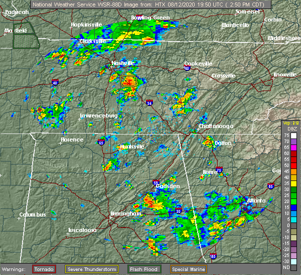
| 8/12/2020 4:26 PM EDT |
 The severe thunderstorm warning for catoosa and central whitfield counties will expire at 430 pm edt, the storm which prompted the warning has weakened below severe limits, and no longer poses an immediate threat to life or property. therefore, the warning will be allowed to expire. however gusty winds and heavy rain are still possible with this thunderstorm. The severe thunderstorm warning for catoosa and central whitfield counties will expire at 430 pm edt, the storm which prompted the warning has weakened below severe limits, and no longer poses an immediate threat to life or property. therefore, the warning will be allowed to expire. however gusty winds and heavy rain are still possible with this thunderstorm.
|
| 8/12/2020 4:15 PM EDT |
 At 415 pm edt, a severe thunderstorm was located over ringgold, moving northeast at 5 mph (radar indicated). Hazards include 60 mph wind gusts and quarter size hail. Hail damage to vehicles is expected. expect wind damage to roofs, siding, and trees. Locations impacted include, dalton, ringgold, varnell, tunnel hill, cohutta, wood station, rocky face, graysville, blue spring, boynton, beaumont, indian springs and apison. At 415 pm edt, a severe thunderstorm was located over ringgold, moving northeast at 5 mph (radar indicated). Hazards include 60 mph wind gusts and quarter size hail. Hail damage to vehicles is expected. expect wind damage to roofs, siding, and trees. Locations impacted include, dalton, ringgold, varnell, tunnel hill, cohutta, wood station, rocky face, graysville, blue spring, boynton, beaumont, indian springs and apison.
|
| 8/12/2020 3:58 PM EDT |
 At 358 pm edt, a severe thunderstorm was located near ringgold, moving northeast at 5 mph (radar indicated). Hazards include 60 mph wind gusts and nickel size hail. expect damage to roofs, siding, and trees At 358 pm edt, a severe thunderstorm was located near ringgold, moving northeast at 5 mph (radar indicated). Hazards include 60 mph wind gusts and nickel size hail. expect damage to roofs, siding, and trees
|
| 6/30/2020 2:38 PM EDT |
 At 238 pm edt, severe thunderstorms were located along a line extending from apison to near naomi to near holland, moving east at 30 mph (radar indicated). Hazards include 60 mph wind gusts and penny size hail. expect damage to roofs, siding, and trees At 238 pm edt, severe thunderstorms were located along a line extending from apison to near naomi to near holland, moving east at 30 mph (radar indicated). Hazards include 60 mph wind gusts and penny size hail. expect damage to roofs, siding, and trees
|
| 6/29/2020 5:35 PM EDT |
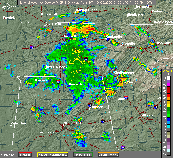 At 534 pm edt, a severe thunderstorm was located over cohutta, or 9 miles east of ringgold, moving east at 15 mph (radar indicated). Hazards include 60 mph wind gusts and penny size hail. Expect damage to roofs, siding, and trees. locations impacted include, varnell, tunnel hill, cohutta, beaverdale, dawnville, sumac, red clay s. p. And apison. At 534 pm edt, a severe thunderstorm was located over cohutta, or 9 miles east of ringgold, moving east at 15 mph (radar indicated). Hazards include 60 mph wind gusts and penny size hail. Expect damage to roofs, siding, and trees. locations impacted include, varnell, tunnel hill, cohutta, beaverdale, dawnville, sumac, red clay s. p. And apison.
|
| 6/29/2020 5:09 PM EDT |
 At 509 pm edt, a severe thunderstorm was located near ringgold, moving east at 20 mph (radar indicated). Hazards include 60 mph wind gusts and quarter size hail. Hail damage to vehicles is expected. Expect wind damage to roofs, siding, and trees. At 509 pm edt, a severe thunderstorm was located near ringgold, moving east at 20 mph (radar indicated). Hazards include 60 mph wind gusts and quarter size hail. Hail damage to vehicles is expected. Expect wind damage to roofs, siding, and trees.
|
| 6/14/2020 4:19 PM EDT |
 At 419 pm edt, a severe thunderstorm was located over rocky face, or near dalton, moving southeast at 15 mph (radar indicated). Hazards include 60 mph wind gusts and quarter size hail. Hail damage to vehicles is expected. Expect wind damage to roofs, siding, and trees. At 419 pm edt, a severe thunderstorm was located over rocky face, or near dalton, moving southeast at 15 mph (radar indicated). Hazards include 60 mph wind gusts and quarter size hail. Hail damage to vehicles is expected. Expect wind damage to roofs, siding, and trees.
|
| 5/5/2020 12:09 AM EDT |
 At 1208 am edt, severe thunderstorms were located along a line extending from near beaverdale to near sugar valley to armuchee, moving east at 65 mph (radar indicated). Hazards include 60 mph wind gusts. expect damage to roofs, siding, and trees At 1208 am edt, severe thunderstorms were located along a line extending from near beaverdale to near sugar valley to armuchee, moving east at 65 mph (radar indicated). Hazards include 60 mph wind gusts. expect damage to roofs, siding, and trees
|
| 5/3/2020 7:32 PM EDT |
 At 732 pm edt, severe thunderstorms were located along a line extending from lookout mountain to near mentone, moving east at 50 mph (radar indicated). Hazards include 60 mph wind gusts. Expect damage to roofs, siding, and trees. Locations impacted include, dalton, lafayette, ringgold, fort oglethorpe, chickamauga, trion, varnell, tunnel hill, cohutta, center post, subligna, blue spring, lake marvin, fairview, linwood, villanow, chattanooga valley, cooper heights, rock spring and naomi. At 732 pm edt, severe thunderstorms were located along a line extending from lookout mountain to near mentone, moving east at 50 mph (radar indicated). Hazards include 60 mph wind gusts. Expect damage to roofs, siding, and trees. Locations impacted include, dalton, lafayette, ringgold, fort oglethorpe, chickamauga, trion, varnell, tunnel hill, cohutta, center post, subligna, blue spring, lake marvin, fairview, linwood, villanow, chattanooga valley, cooper heights, rock spring and naomi.
|
| 5/3/2020 7:13 PM EDT |
 At 713 pm edt, severe thunderstorms were located along a line extending from haletown (guild) to near ider, moving east at 50 mph (radar indicated). Hazards include 60 mph wind gusts. expect damage to roofs, siding, and trees At 713 pm edt, severe thunderstorms were located along a line extending from haletown (guild) to near ider, moving east at 50 mph (radar indicated). Hazards include 60 mph wind gusts. expect damage to roofs, siding, and trees
|
| 4/13/2020 12:34 AM EDT |
 At 1233 am edt, severe thunderstorms were located along a line extending from near hot house to near sonoraville, moving east at 65 mph (radar indicated). Hazards include 60 mph wind gusts. Expect damage to roofs, siding, and trees. Locations impacted include, dalton, calhoun, chatsworth, ellijay, blue ridge, varnell, eton, east ellijay, resaca, morganton, fairmount, ranger, crandall, sumac, jones mill, higdon, redbud, gregory, loving and lake marvin. At 1233 am edt, severe thunderstorms were located along a line extending from near hot house to near sonoraville, moving east at 65 mph (radar indicated). Hazards include 60 mph wind gusts. Expect damage to roofs, siding, and trees. Locations impacted include, dalton, calhoun, chatsworth, ellijay, blue ridge, varnell, eton, east ellijay, resaca, morganton, fairmount, ranger, crandall, sumac, jones mill, higdon, redbud, gregory, loving and lake marvin.
|
| 4/13/2020 12:24 AM EDT |
 At 1223 am edt, severe thunderstorms were located along a line extending from near copperhill to oostanaula, moving east at 65 mph (radar indicated). Hazards include 60 mph wind gusts. Expect damage to roofs, siding, and trees. Locations impacted include, dalton, calhoun, chatsworth, ellijay, blue ridge, varnell, eton, tunnel hill, cohutta, east ellijay, resaca, morganton, fairmount, ranger, crandall, subligna, jones mill, cohutta wilderness, beaverdale and mineral bluff. At 1223 am edt, severe thunderstorms were located along a line extending from near copperhill to oostanaula, moving east at 65 mph (radar indicated). Hazards include 60 mph wind gusts. Expect damage to roofs, siding, and trees. Locations impacted include, dalton, calhoun, chatsworth, ellijay, blue ridge, varnell, eton, tunnel hill, cohutta, east ellijay, resaca, morganton, fairmount, ranger, crandall, subligna, jones mill, cohutta wilderness, beaverdale and mineral bluff.
|
| 4/13/2020 12:07 AM EDT |
 At 1207 am edt, severe thunderstorms were located along a line extending from tennga to near summerville, moving east at 65 mph (radar indicated). Hazards include 60 mph wind gusts. expect damage to roofs, siding, and trees At 1207 am edt, severe thunderstorms were located along a line extending from tennga to near summerville, moving east at 65 mph (radar indicated). Hazards include 60 mph wind gusts. expect damage to roofs, siding, and trees
|
| 4/12/2020 11:26 PM EDT |
 At 1126 pm edt, severe thunderstorms were located along a line extending from indian springs to linwood to chesterfield, moving east at 50 mph (radar indicated). Hazards include 60 mph wind gusts. expect damage to roofs, siding, and trees At 1126 pm edt, severe thunderstorms were located along a line extending from indian springs to linwood to chesterfield, moving east at 50 mph (radar indicated). Hazards include 60 mph wind gusts. expect damage to roofs, siding, and trees
|
| 2/6/2020 4:49 AM EST |
 At 448 am est, severe thunderstorms were located along a line extending from near summerville to near waterhouse, moving northeast at 55 mph (radar indicated). Hazards include 60 mph wind gusts. expect damage to roofs, siding, and trees At 448 am est, severe thunderstorms were located along a line extending from near summerville to near waterhouse, moving northeast at 55 mph (radar indicated). Hazards include 60 mph wind gusts. expect damage to roofs, siding, and trees
|
| 1/11/2020 4:24 PM EST |
 The severe thunderstorm warning for catoosa, western murray, floyd, whitfield, southeastern walker, western gordon, northeastern chattooga and western bartow counties will expire at 430 pm est, the storms which prompted the warning have moved out of the area. therefore, the warning will be allowed to expire. however, a new warning has been issued just downstream a tornado watch remains in effect until 900 pm est for northwestern georgia. The severe thunderstorm warning for catoosa, western murray, floyd, whitfield, southeastern walker, western gordon, northeastern chattooga and western bartow counties will expire at 430 pm est, the storms which prompted the warning have moved out of the area. therefore, the warning will be allowed to expire. however, a new warning has been issued just downstream a tornado watch remains in effect until 900 pm est for northwestern georgia.
|
| 1/11/2020 4:07 PM EST |
 At 406 pm est, severe thunderstorms were located along a line extending from collegedale to near oostanaula to near lindale, moving northeast at 45 mph (radar indicated). Hazards include 60 mph wind gusts. Expect damage to roofs, siding, and trees. Locations impacted include, rome, dalton, calhoun, chatsworth, ringgold, adairsville, varnell, cave spring, tunnel hill, cohutta, kingston, resaca, plainville, taylorsville, shannon, pinson, subligna, lake marvin, beaverdale and coosa. At 406 pm est, severe thunderstorms were located along a line extending from collegedale to near oostanaula to near lindale, moving northeast at 45 mph (radar indicated). Hazards include 60 mph wind gusts. Expect damage to roofs, siding, and trees. Locations impacted include, rome, dalton, calhoun, chatsworth, ringgold, adairsville, varnell, cave spring, tunnel hill, cohutta, kingston, resaca, plainville, taylorsville, shannon, pinson, subligna, lake marvin, beaverdale and coosa.
|
| 1/11/2020 3:42 PM EST |
 At 341 pm est, severe thunderstorms were located along a line extending from fairview to near tidings to near forney, moving northeast at 45 mph (radar indicated). Hazards include 60 mph wind gusts. expect damage to roofs, siding, and trees At 341 pm est, severe thunderstorms were located along a line extending from fairview to near tidings to near forney, moving northeast at 45 mph (radar indicated). Hazards include 60 mph wind gusts. expect damage to roofs, siding, and trees
|
| 8/23/2019 4:17 PM EDT |
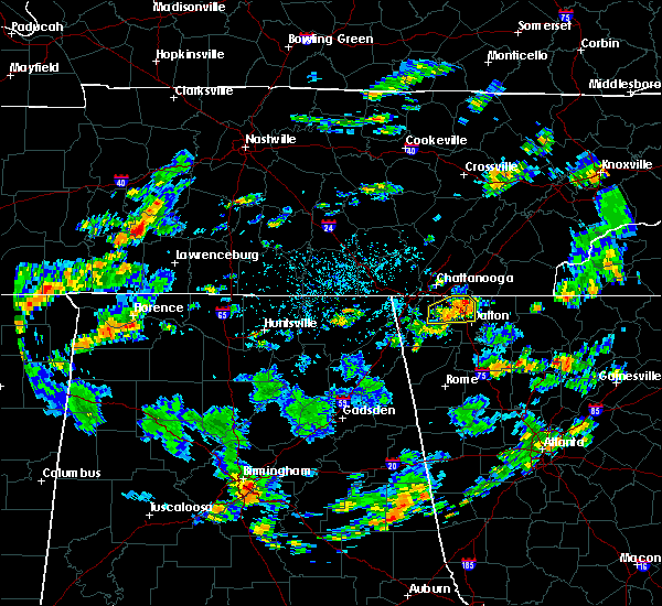 At 416 pm edt, a severe thunderstorm was located over tunnel hill, or near ringgold, moving east at 20 mph (radar indicated). Hazards include 60 mph wind gusts and quarter size hail. Hail damage to vehicles is expected. expect wind damage to roofs, siding, and trees. Locations impacted include, dalton, ringgold, varnell, tunnel hill, cohutta, rocky face and apison. At 416 pm edt, a severe thunderstorm was located over tunnel hill, or near ringgold, moving east at 20 mph (radar indicated). Hazards include 60 mph wind gusts and quarter size hail. Hail damage to vehicles is expected. expect wind damage to roofs, siding, and trees. Locations impacted include, dalton, ringgold, varnell, tunnel hill, cohutta, rocky face and apison.
|
| 8/23/2019 3:48 PM EDT |
 At 348 pm edt, a severe thunderstorm was located over blue spring, or near ringgold, moving northeast at 10 mph (radar indicated). Hazards include 60 mph wind gusts and quarter size hail. Hail damage to vehicles is expected. Expect wind damage to roofs, siding, and trees. At 348 pm edt, a severe thunderstorm was located over blue spring, or near ringgold, moving northeast at 10 mph (radar indicated). Hazards include 60 mph wind gusts and quarter size hail. Hail damage to vehicles is expected. Expect wind damage to roofs, siding, and trees.
|
| 8/13/2019 9:15 PM EDT |
 At 914 pm edt, a severe thunderstorm was located near varnell, or near dalton, moving east at 20 mph (radar indicated). Hazards include 60 mph wind gusts and penny size hail. Expect damage to roofs, siding, and trees. Locations impacted include, dalton, ringgold, varnell, tunnel hill, cohutta, rocky face, graysville and indian springs. At 914 pm edt, a severe thunderstorm was located near varnell, or near dalton, moving east at 20 mph (radar indicated). Hazards include 60 mph wind gusts and penny size hail. Expect damage to roofs, siding, and trees. Locations impacted include, dalton, ringgold, varnell, tunnel hill, cohutta, rocky face, graysville and indian springs.
|
| 8/13/2019 8:53 PM EDT |
 At 852 pm edt, a severe thunderstorm was located over ringgold, moving east at 20 mph (radar indicated). Hazards include 60 mph wind gusts and penny size hail. expect damage to roofs, siding, and trees At 852 pm edt, a severe thunderstorm was located over ringgold, moving east at 20 mph (radar indicated). Hazards include 60 mph wind gusts and penny size hail. expect damage to roofs, siding, and trees
|
| 6/22/2019 8:41 PM EDT |
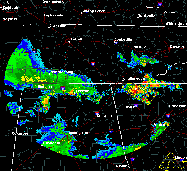 At 840 pm edt, a severe thunderstorm was located near dawnville, or near dalton, moving southeast at 45 mph (radar indicated). Hazards include 60 mph wind gusts and penny size hail. expect damage to roofs, siding, and trees At 840 pm edt, a severe thunderstorm was located near dawnville, or near dalton, moving southeast at 45 mph (radar indicated). Hazards include 60 mph wind gusts and penny size hail. expect damage to roofs, siding, and trees
|
| 6/22/2019 8:20 PM EDT |
 At 820 pm edt, a severe thunderstorm was located over indian springs, or over ringgold, moving southeast at 25 mph (radar indicated). Hazards include 60 mph wind gusts and penny size hail. expect damage to roofs, siding, and trees At 820 pm edt, a severe thunderstorm was located over indian springs, or over ringgold, moving southeast at 25 mph (radar indicated). Hazards include 60 mph wind gusts and penny size hail. expect damage to roofs, siding, and trees
|
| 6/22/2019 12:19 AM EDT |
 At 1218 am edt, severe thunderstorms were located along a line extending from near sugar valley to waterhouse, and are nearly stationary (radar indicated). Hazards include 60 mph wind gusts. Expect damage to roofs, siding, and trees. Locations impacted include, rome, dalton, calhoun, lafayette, summerville, chatsworth, ringgold, trion, varnell, cave spring, eton, tunnel hill, cohutta, resaca, plainville, shannon, lyerly, menlo, center post and crandall. At 1218 am edt, severe thunderstorms were located along a line extending from near sugar valley to waterhouse, and are nearly stationary (radar indicated). Hazards include 60 mph wind gusts. Expect damage to roofs, siding, and trees. Locations impacted include, rome, dalton, calhoun, lafayette, summerville, chatsworth, ringgold, trion, varnell, cave spring, eton, tunnel hill, cohutta, resaca, plainville, shannon, lyerly, menlo, center post and crandall.
|
| 6/21/2019 11:57 PM EDT |
 At 1157 pm edt, severe thunderstorms were located along a line extending from mill creek to chesterfield, moving south at 60 mph (radar indicated). Hazards include 60 mph wind gusts. expect damage to roofs, siding, and trees At 1157 pm edt, severe thunderstorms were located along a line extending from mill creek to chesterfield, moving south at 60 mph (radar indicated). Hazards include 60 mph wind gusts. expect damage to roofs, siding, and trees
|
| 6/21/2019 11:04 PM EDT |
 At 1103 pm edt, severe thunderstorms were located along a line extending from near lone oak to near skyline, moving southeast at 45 mph (radar indicated). Hazards include 60 mph wind gusts. expect damage to roofs, siding, and trees At 1103 pm edt, severe thunderstorms were located along a line extending from near lone oak to near skyline, moving southeast at 45 mph (radar indicated). Hazards include 60 mph wind gusts. expect damage to roofs, siding, and trees
|
| 3/25/2019 5:55 PM EDT |
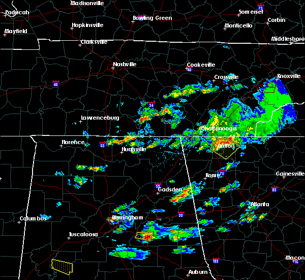 At 555 pm edt, a severe thunderstorm was located over dawnville, or 7 miles northeast of dalton, moving southeast at 30 mph (radar indicated). Hazards include 60 mph wind gusts and quarter size hail. Hail damage to vehicles is expected. Expect wind damage to roofs, siding, and trees. At 555 pm edt, a severe thunderstorm was located over dawnville, or 7 miles northeast of dalton, moving southeast at 30 mph (radar indicated). Hazards include 60 mph wind gusts and quarter size hail. Hail damage to vehicles is expected. Expect wind damage to roofs, siding, and trees.
|
| 11/6/2018 4:52 AM EST |
 At 452 am est, severe thunderstorms were located along a line extending from near flint springs to rocky face to near naomi, moving east at 50 mph (radar indicated). Hazards include 60 mph wind gusts. expect damage to roofs, siding, and trees At 452 am est, severe thunderstorms were located along a line extending from near flint springs to rocky face to near naomi, moving east at 50 mph (radar indicated). Hazards include 60 mph wind gusts. expect damage to roofs, siding, and trees
|
| 11/6/2018 4:44 AM EST |
 At 444 am est, severe thunderstorms were located along a line extending from apison to wood station to near lafayette, moving east at 50 mph (radar indicated). Hazards include 60 mph wind gusts. Expect damage to roofs, siding, and trees. locations impacted include, dalton, lafayette, ringgold, varnell, tunnel hill, cohutta, naomi, wood station, rocky face, mill creek, beaverdale, villanow, red clay s. p. and apison. A tornado watch remains in effect until 900 am est for northwestern georgia. At 444 am est, severe thunderstorms were located along a line extending from apison to wood station to near lafayette, moving east at 50 mph (radar indicated). Hazards include 60 mph wind gusts. Expect damage to roofs, siding, and trees. locations impacted include, dalton, lafayette, ringgold, varnell, tunnel hill, cohutta, naomi, wood station, rocky face, mill creek, beaverdale, villanow, red clay s. p. and apison. A tornado watch remains in effect until 900 am est for northwestern georgia.
|
| 11/6/2018 4:26 AM EST |
 At 425 am est, severe thunderstorms were located along a line extending from fairview to near sulpher springs, moving east at 45 mph (radar indicated). Hazards include 60 mph wind gusts. Expect damage to roofs, siding, and trees. locations impacted include, dalton, lafayette, ringgold, fort oglethorpe, chickamauga, varnell, lookout mountain, tunnel hill, cohutta, blue spring, fairview, linwood, beaverdale, villanow, chattanooga valley, cooper heights, rock spring, naomi, noble and lakeview. A tornado watch remains in effect until 900 am est for northwestern georgia. At 425 am est, severe thunderstorms were located along a line extending from fairview to near sulpher springs, moving east at 45 mph (radar indicated). Hazards include 60 mph wind gusts. Expect damage to roofs, siding, and trees. locations impacted include, dalton, lafayette, ringgold, fort oglethorpe, chickamauga, varnell, lookout mountain, tunnel hill, cohutta, blue spring, fairview, linwood, beaverdale, villanow, chattanooga valley, cooper heights, rock spring, naomi, noble and lakeview. A tornado watch remains in effect until 900 am est for northwestern georgia.
|
| 11/6/2018 3:58 AM EST |
 At 358 am est, severe thunderstorms were located along a line extending from near fabius to near dutton, moving east at 50 mph (radar indicated). Hazards include up to 70 mph wind gusts. Expect considerable tree damage. Damage is likely to mobile homes, roofs, and outbuildings. At 358 am est, severe thunderstorms were located along a line extending from near fabius to near dutton, moving east at 50 mph (radar indicated). Hazards include up to 70 mph wind gusts. Expect considerable tree damage. Damage is likely to mobile homes, roofs, and outbuildings.
|
| 8/30/2018 8:56 PM EDT |
 At 856 pm edt, a severe thunderstorm was located over dawnville, or near dalton, moving north at 5 mph (radar indicated). Hazards include 60 mph wind gusts. expect damage to roofs, siding, and trees At 856 pm edt, a severe thunderstorm was located over dawnville, or near dalton, moving north at 5 mph (radar indicated). Hazards include 60 mph wind gusts. expect damage to roofs, siding, and trees
|
| 8/17/2018 9:34 PM EDT |
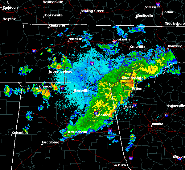 At 932 pm edt, a severe thunderstorm was located over ringgold, moving east at 35 mph (radar indicated). Hazards include 60 mph wind gusts. Expect damage to roofs, siding, and trees. Locations impacted include, dalton, ringgold, fort oglethorpe, varnell, tunnel hill, cohutta, indian springs, wood station, rocky face, graysville, blue spring, boynton, beaumont, beaverdale, dawnville, lakeview, east ridge and apison. At 932 pm edt, a severe thunderstorm was located over ringgold, moving east at 35 mph (radar indicated). Hazards include 60 mph wind gusts. Expect damage to roofs, siding, and trees. Locations impacted include, dalton, ringgold, fort oglethorpe, varnell, tunnel hill, cohutta, indian springs, wood station, rocky face, graysville, blue spring, boynton, beaumont, beaverdale, dawnville, lakeview, east ridge and apison.
|
| 8/17/2018 9:21 PM EDT |
 At 920 pm edt, a severe thunderstorm was located over blue spring, or near ringgold, moving east at 35 mph (radar indicated). Hazards include 60 mph wind gusts. expect damage to roofs, siding, and trees At 920 pm edt, a severe thunderstorm was located over blue spring, or near ringgold, moving east at 35 mph (radar indicated). Hazards include 60 mph wind gusts. expect damage to roofs, siding, and trees
|
| 8/8/2018 3:39 PM EDT |
 At 338 pm edt, a severe thunderstorm was located near beaverdale, or 12 miles east of ringgold, moving northeast at 35 mph (radar indicated). Hazards include 60 mph wind gusts and nickel size hail. expect damage to roofs, siding, and trees At 338 pm edt, a severe thunderstorm was located near beaverdale, or 12 miles east of ringgold, moving northeast at 35 mph (radar indicated). Hazards include 60 mph wind gusts and nickel size hail. expect damage to roofs, siding, and trees
|
| 7/21/2018 6:26 PM EDT |
 The severe thunderstorm warning for northeastern whitfield county will expire at 630 pm edt, the storm which prompted the warning has weakened below severe limits, and no longer poses an immediate threat to life or property. therefore, the warning will be allowed to expire. however small hail and heavy rain are still possible with this thunderstorm. a severe thunderstorm watch remains in effect until 200 am edt for northwestern georgia. The severe thunderstorm warning for northeastern whitfield county will expire at 630 pm edt, the storm which prompted the warning has weakened below severe limits, and no longer poses an immediate threat to life or property. therefore, the warning will be allowed to expire. however small hail and heavy rain are still possible with this thunderstorm. a severe thunderstorm watch remains in effect until 200 am edt for northwestern georgia.
|
| 7/21/2018 6:22 PM EDT |
 At 621 pm edt, a severe thunderstorm was located over beaverdale, or 10 miles northwest of chatsworth, moving southeast at 35 mph (radar indicated). Hazards include 60 mph wind gusts and quarter size hail. Hail damage to vehicles is expected. expect wind damage to roofs, siding, and trees. Locations impacted include, varnell, cohutta, beaverdale and red clay state park. At 621 pm edt, a severe thunderstorm was located over beaverdale, or 10 miles northwest of chatsworth, moving southeast at 35 mph (radar indicated). Hazards include 60 mph wind gusts and quarter size hail. Hail damage to vehicles is expected. expect wind damage to roofs, siding, and trees. Locations impacted include, varnell, cohutta, beaverdale and red clay state park.
|
| 7/21/2018 6:01 PM EDT |
 At 601 pm edt, a severe thunderstorm was located over apison, or near ringgold, moving southeast at 35 mph (radar indicated). Hazards include 60 mph wind gusts and quarter size hail. Hail damage to vehicles is expected. Expect wind damage to roofs, siding, and trees. At 601 pm edt, a severe thunderstorm was located over apison, or near ringgold, moving southeast at 35 mph (radar indicated). Hazards include 60 mph wind gusts and quarter size hail. Hail damage to vehicles is expected. Expect wind damage to roofs, siding, and trees.
|
| 7/21/2018 4:27 AM EDT |
 At 426 am edt, severe thunderstorms were located along a line extending from near crandall to near dawnville to near tunnel hill, moving southeast at 30 mph (radar indicated). Hazards include 60 mph wind gusts. expect damage to roofs, siding, and trees At 426 am edt, severe thunderstorms were located along a line extending from near crandall to near dawnville to near tunnel hill, moving southeast at 30 mph (radar indicated). Hazards include 60 mph wind gusts. expect damage to roofs, siding, and trees
|
| 7/6/2018 5:00 PM EDT |
 At 500 pm edt, a severe thunderstorm was located over eton, or near chatsworth, moving west at 20 mph (radar indicated). Hazards include 60 mph wind gusts and nickel size hail. expect damage to roofs, siding, and trees At 500 pm edt, a severe thunderstorm was located over eton, or near chatsworth, moving west at 20 mph (radar indicated). Hazards include 60 mph wind gusts and nickel size hail. expect damage to roofs, siding, and trees
|
| 6/28/2018 11:15 AM EDT |
 At 1114 am edt, severe thunderstorms were located along a line extending from signal mountain to near rocky face to ramhurst, moving southeast at 40 mph (radar indicated). Hazards include 60 mph wind gusts. expect damage to roofs, siding, and trees At 1114 am edt, severe thunderstorms were located along a line extending from signal mountain to near rocky face to ramhurst, moving southeast at 40 mph (radar indicated). Hazards include 60 mph wind gusts. expect damage to roofs, siding, and trees
|
| 6/28/2018 10:50 AM EDT |
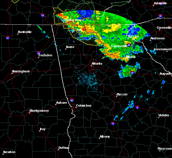 At 1049 am edt, severe thunderstorms were located along a line extending from near salem to north of ellijay to near cherry log, moving southeast at 45 mph (radar indicated). Hazards include 60 mph wind gusts. expect damage to roofs, siding, and trees At 1049 am edt, severe thunderstorms were located along a line extending from near salem to north of ellijay to near cherry log, moving southeast at 45 mph (radar indicated). Hazards include 60 mph wind gusts. expect damage to roofs, siding, and trees
|
| 6/28/2018 10:27 AM EDT |
 At 1026 am edt, severe thunderstorms were located along a line extending from near cohutta wilderness to near red clay state park to collegedale, moving southeast at 30 mph (radar indicated). Hazards include 60 mph wind gusts. expect damage to roofs, siding, and trees At 1026 am edt, severe thunderstorms were located along a line extending from near cohutta wilderness to near red clay state park to collegedale, moving southeast at 30 mph (radar indicated). Hazards include 60 mph wind gusts. expect damage to roofs, siding, and trees
|
| 6/23/2018 2:27 PM EDT |
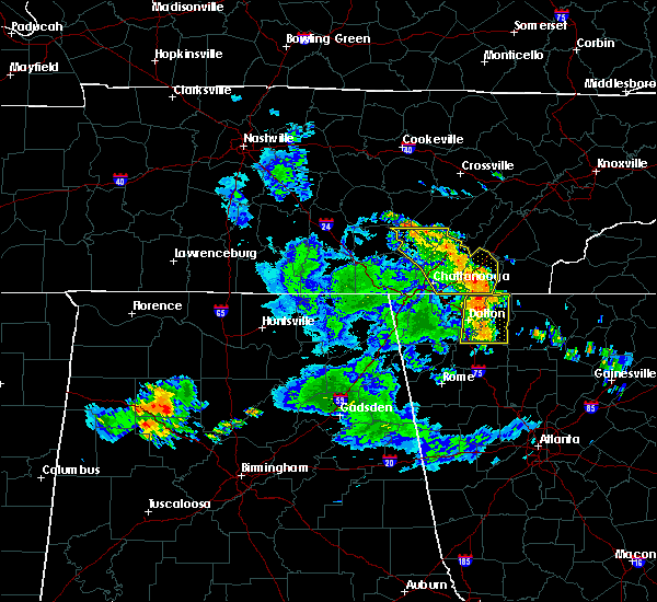 At 226 pm edt, severe thunderstorms were located along a line extending from near varnell to near resaca, moving east at 60 mph (radar indicated). Hazards include 60 mph wind gusts. Expect damage to roofs, siding, and trees. Locations impacted include, dalton, chatsworth, varnell, eton, cohutta, crandall, carters, sumac, ramhurst, gregory, tilton, conasauga lake, tennga, beaverdale, dawnville, cisco, fort mountain state park, nickelsville and north georgia speedway. At 226 pm edt, severe thunderstorms were located along a line extending from near varnell to near resaca, moving east at 60 mph (radar indicated). Hazards include 60 mph wind gusts. Expect damage to roofs, siding, and trees. Locations impacted include, dalton, chatsworth, varnell, eton, cohutta, crandall, carters, sumac, ramhurst, gregory, tilton, conasauga lake, tennga, beaverdale, dawnville, cisco, fort mountain state park, nickelsville and north georgia speedway.
|
| 6/23/2018 2:02 PM EDT |
 At 202 pm edt, severe thunderstorms were located along a line extending from chattanooga valley to near center post, moving east at 60 mph (radar indicated). Hazards include 60 mph wind gusts. expect damage to roofs, siding, and trees At 202 pm edt, severe thunderstorms were located along a line extending from chattanooga valley to near center post, moving east at 60 mph (radar indicated). Hazards include 60 mph wind gusts. expect damage to roofs, siding, and trees
|
| 6/3/2018 4:00 PM EDT |
 At 359 pm edt, severe thunderstorms were located along a line extending from beaumont to near dawnville, moving south at 20 mph (radar indicated). Hazards include 60 mph wind gusts and quarter size hail. Hail damage to vehicles is expected. expect wind damage to roofs, siding, and trees. Locations impacted include, dalton, chatsworth, ringgold, varnell, eton, tunnel hill, mill creek, dawnville and rocky face. At 359 pm edt, severe thunderstorms were located along a line extending from beaumont to near dawnville, moving south at 20 mph (radar indicated). Hazards include 60 mph wind gusts and quarter size hail. Hail damage to vehicles is expected. expect wind damage to roofs, siding, and trees. Locations impacted include, dalton, chatsworth, ringgold, varnell, eton, tunnel hill, mill creek, dawnville and rocky face.
|
| 6/3/2018 3:44 PM EDT |
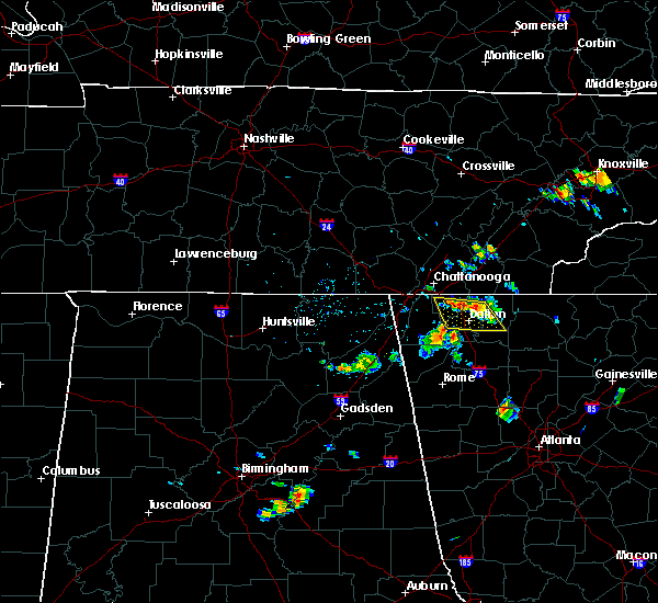 At 344 pm edt, severe thunderstorms were located along a line extending from boynton to near sumac, moving south at 20 mph (radar indicated). Hazards include 60 mph wind gusts and quarter size hail. Hail damage to vehicles is expected. Expect wind damage to roofs, siding, and trees. At 344 pm edt, severe thunderstorms were located along a line extending from boynton to near sumac, moving south at 20 mph (radar indicated). Hazards include 60 mph wind gusts and quarter size hail. Hail damage to vehicles is expected. Expect wind damage to roofs, siding, and trees.
|
| 5/31/2018 9:36 PM EDT |
 At 935 pm edt, a severe thunderstorm was located over ringgold, moving southeast at 15 mph (radar indicated). Hazards include 60 mph wind gusts and quarter size hail. Hail damage to vehicles is expected. Expect wind damage to roofs, siding, and trees. At 935 pm edt, a severe thunderstorm was located over ringgold, moving southeast at 15 mph (radar indicated). Hazards include 60 mph wind gusts and quarter size hail. Hail damage to vehicles is expected. Expect wind damage to roofs, siding, and trees.
|
| 5/31/2018 4:25 PM EDT |
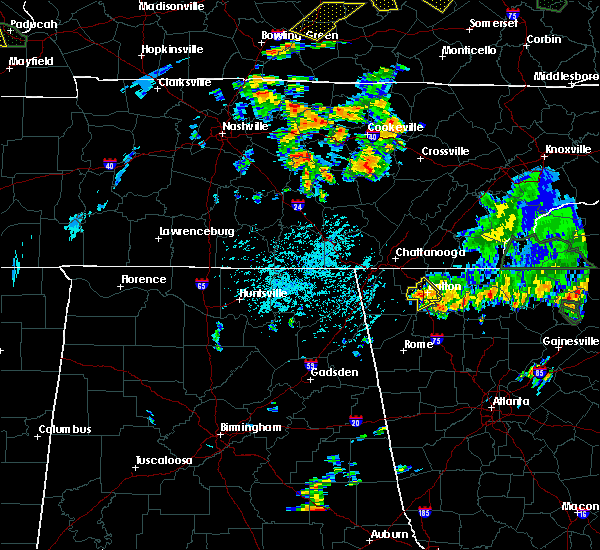 At 424 pm edt, a severe thunderstorm was located over mill creek, or near dalton, moving southeast at 5 mph (radar indicated). Hazards include 60 mph wind gusts and quarter size hail. Hail damage to vehicles is expected. expect wind damage to roofs, siding, and trees. Locations impacted include, dalton, varnell, tunnel hill, rocky face and mill creek. At 424 pm edt, a severe thunderstorm was located over mill creek, or near dalton, moving southeast at 5 mph (radar indicated). Hazards include 60 mph wind gusts and quarter size hail. Hail damage to vehicles is expected. expect wind damage to roofs, siding, and trees. Locations impacted include, dalton, varnell, tunnel hill, rocky face and mill creek.
|
| 5/31/2018 3:58 PM EDT |
 The national weather service in peachtree city has issued a * severe thunderstorm warning for. southeastern catoosa county in northwestern georgia. whitfield county in northwestern georgia. until 445 pm edt. At 357 pm edt, a severe thunderstorm was located over rocky face,. The national weather service in peachtree city has issued a * severe thunderstorm warning for. southeastern catoosa county in northwestern georgia. whitfield county in northwestern georgia. until 445 pm edt. At 357 pm edt, a severe thunderstorm was located over rocky face,.
|
| 5/31/2018 3:48 PM EDT |
 At 347 pm edt, a severe thunderstorm was located over tunnel hill, or near ringgold, moving southeast at 10 mph (radar indicated). Hazards include 60 mph wind gusts and quarter size hail. Hail damage to vehicles is expected. expect wind damage to roofs, siding, and trees. locations impacted include, dalton, ringgold, varnell, tunnel hill, cohutta, beaverdale, rocky face, red clay s. p. And apison. At 347 pm edt, a severe thunderstorm was located over tunnel hill, or near ringgold, moving southeast at 10 mph (radar indicated). Hazards include 60 mph wind gusts and quarter size hail. Hail damage to vehicles is expected. expect wind damage to roofs, siding, and trees. locations impacted include, dalton, ringgold, varnell, tunnel hill, cohutta, beaverdale, rocky face, red clay s. p. And apison.
|
| 5/31/2018 3:20 PM EDT |
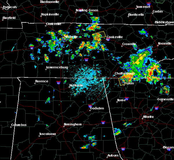 At 320 pm edt, a severe thunderstorm was located over apison, or 7 miles northeast of ringgold, moving southeast at 10 mph (radar indicated). Hazards include 60 mph wind gusts and quarter size hail. Hail damage to vehicles is expected. Expect wind damage to roofs, siding, and trees. At 320 pm edt, a severe thunderstorm was located over apison, or 7 miles northeast of ringgold, moving southeast at 10 mph (radar indicated). Hazards include 60 mph wind gusts and quarter size hail. Hail damage to vehicles is expected. Expect wind damage to roofs, siding, and trees.
|
| 4/4/2018 1:45 AM EDT |
 At 144 am edt, severe thunderstorms were located along a line extending from near east cleveland to near conasauga lake to redbud, moving east at 65 mph (radar indicated). Hazards include 60 mph wind gusts. Expect damage to roofs, siding, and trees. Locations impacted include, dalton, calhoun, chatsworth, varnell, eton, cohutta, resaca, fairmount, ranger, crandall, sumac, redbud, gregory, conasauga lake, beaverdale, oakman, fort mountain state park, carters, sonoraville and ramhurst. At 144 am edt, severe thunderstorms were located along a line extending from near east cleveland to near conasauga lake to redbud, moving east at 65 mph (radar indicated). Hazards include 60 mph wind gusts. Expect damage to roofs, siding, and trees. Locations impacted include, dalton, calhoun, chatsworth, varnell, eton, cohutta, resaca, fairmount, ranger, crandall, sumac, redbud, gregory, conasauga lake, beaverdale, oakman, fort mountain state park, carters, sonoraville and ramhurst.
|
| 4/4/2018 1:11 AM EDT |
 At 110 am edt, severe thunderstorms were located along a line extending from hooker to noble to lyerly, moving east at 65 mph (radar indicated). Hazards include 60 mph wind gusts. expect damage to roofs, siding, and trees At 110 am edt, severe thunderstorms were located along a line extending from hooker to noble to lyerly, moving east at 65 mph (radar indicated). Hazards include 60 mph wind gusts. expect damage to roofs, siding, and trees
|
| 6/15/2017 3:29 PM EDT |
 At 329 pm edt, a severe thunderstorm was located over tunnel hill, or near dalton, moving southeast at 20 mph (radar indicated). Hazards include 60 mph wind gusts. expect damage to roofs, siding, and trees At 329 pm edt, a severe thunderstorm was located over tunnel hill, or near dalton, moving southeast at 20 mph (radar indicated). Hazards include 60 mph wind gusts. expect damage to roofs, siding, and trees
|
| 5/27/2017 11:14 PM EDT |
 At 1113 pm edt, severe thunderstorms were located along a line extending from around cohutta to fort oglethorpe and cole city, moving southeast at 65 mph (radar indicated). Hazards include 60 mph wind gusts and nickel size hail. Expect damage to roofs, siding, and trees. Locations impacted include, dalton, lafayette, chatsworth, ringgold, trenton, fort oglethorpe, rossville, chickamauga, varnell, lookout mountain, eton, tunnel hill, cohutta, center post, crandall, fairview, beaverdale, villanow, chattanooga valley and cloudland canyon state park. At 1113 pm edt, severe thunderstorms were located along a line extending from around cohutta to fort oglethorpe and cole city, moving southeast at 65 mph (radar indicated). Hazards include 60 mph wind gusts and nickel size hail. Expect damage to roofs, siding, and trees. Locations impacted include, dalton, lafayette, chatsworth, ringgold, trenton, fort oglethorpe, rossville, chickamauga, varnell, lookout mountain, eton, tunnel hill, cohutta, center post, crandall, fairview, beaverdale, villanow, chattanooga valley and cloudland canyon state park.
|
| 5/27/2017 10:47 PM EDT |
 At 1044 pm edt, severe thunderstorms extended from northwest of chattanooga tennessee to north of huntsville alabama, moving southeast at 70 mph (radar indicated). Hazards include 60 mph wind gusts and nickel size hail. expect damage to roofs, siding, and trees At 1044 pm edt, severe thunderstorms extended from northwest of chattanooga tennessee to north of huntsville alabama, moving southeast at 70 mph (radar indicated). Hazards include 60 mph wind gusts and nickel size hail. expect damage to roofs, siding, and trees
|
| 4/5/2017 8:41 PM EDT |
 At 841 pm edt, a severe thunderstorm was located near sulpher springs, or 9 miles west of lafayette, moving northeast at 50 mph (radar indicated). Hazards include ping pong ball size hail and 60 mph wind gusts. People and animals outdoors will be injured. expect hail damage to roofs, siding, windows, and vehicles. Expect wind damage to roofs, siding, and trees. At 841 pm edt, a severe thunderstorm was located near sulpher springs, or 9 miles west of lafayette, moving northeast at 50 mph (radar indicated). Hazards include ping pong ball size hail and 60 mph wind gusts. People and animals outdoors will be injured. expect hail damage to roofs, siding, windows, and vehicles. Expect wind damage to roofs, siding, and trees.
|
| 3/21/2017 8:24 PM EDT |
 The severe thunderstorm warning for murray, gilmer, central floyd, eastern whitfield, gordon, western pickens, chattooga, northern bartow and northwestern fannin counties will expire at 830 pm edt, the storms which prompted the warning have moved out of the area. therefore the warning will be allowed to expire. however gusty winds and heavy rain are still possible with these thunderstorms. a severe thunderstorm watch remains in effect until 1100 pm edt for north central and northwestern georgia. The severe thunderstorm warning for murray, gilmer, central floyd, eastern whitfield, gordon, western pickens, chattooga, northern bartow and northwestern fannin counties will expire at 830 pm edt, the storms which prompted the warning have moved out of the area. therefore the warning will be allowed to expire. however gusty winds and heavy rain are still possible with these thunderstorms. a severe thunderstorm watch remains in effect until 1100 pm edt for north central and northwestern georgia.
|
| 3/21/2017 7:52 PM EDT |
 The severe thunderstorm warning for catoosa, northeastern floyd, whitfield, walker, northwestern gordon and chattooga counties will expire at 800 pm edt, the storms which prompted the warning have moved southeast of extreme northwest georgia. therefore the warning will be allowed to expire. however, gusty winds and heavy rain are still possible through 900 pm. a severe thunderstorm watch remains in effect until 1100 pm edt for northwestern georgia. remember, a severe thunderstorm warning still remains in effect for portions of chatooga, gordon, whitfield, and floyd county. The severe thunderstorm warning for catoosa, northeastern floyd, whitfield, walker, northwestern gordon and chattooga counties will expire at 800 pm edt, the storms which prompted the warning have moved southeast of extreme northwest georgia. therefore the warning will be allowed to expire. however, gusty winds and heavy rain are still possible through 900 pm. a severe thunderstorm watch remains in effect until 1100 pm edt for northwestern georgia. remember, a severe thunderstorm warning still remains in effect for portions of chatooga, gordon, whitfield, and floyd county.
|
| 3/21/2017 7:48 PM EDT |
 At 746 pm edt, severe thunderstorms were located extending from near gap springs to near chatsworth to oostanaula to near chattoogaville, moving east-southeast at 45 mph (reports of trees and powerlines down have occurred in dade, catoosa, and whitfield counties). Hazards include 60 mph wind gusts and quarter size hail. Hail damage to vehicles is expected. Expect wind damage to roofs, siding, and trees. At 746 pm edt, severe thunderstorms were located extending from near gap springs to near chatsworth to oostanaula to near chattoogaville, moving east-southeast at 45 mph (reports of trees and powerlines down have occurred in dade, catoosa, and whitfield counties). Hazards include 60 mph wind gusts and quarter size hail. Hail damage to vehicles is expected. Expect wind damage to roofs, siding, and trees.
|
| 3/21/2017 7:25 PM EDT |
 At 724 pm edt, severe thunderstorms were located extending from cohutta to near villanow to menlo to geraldine, moving southeast at 50 mph (radar indicated). Hazards include 70 mph wind gusts and nickel size hail. Expect considerable tree damage. damage is likely to mobile homes, roofs, and outbuildings. Locations impacted include, dalton, calhoun, lafayette, summerville, ringgold, fort oglethorpe, chickamauga, trion, varnell, tunnel hill, cohutta, resaca, lyerly, menlo, center post, subligna, blue spring, lake marvin, fairview and linwood. At 724 pm edt, severe thunderstorms were located extending from cohutta to near villanow to menlo to geraldine, moving southeast at 50 mph (radar indicated). Hazards include 70 mph wind gusts and nickel size hail. Expect considerable tree damage. damage is likely to mobile homes, roofs, and outbuildings. Locations impacted include, dalton, calhoun, lafayette, summerville, ringgold, fort oglethorpe, chickamauga, trion, varnell, tunnel hill, cohutta, resaca, lyerly, menlo, center post, subligna, blue spring, lake marvin, fairview and linwood.
|
| 3/21/2017 7:11 PM EDT |
 At 710 pm edt, severe thunderstorms were located extending from ridgeside to linwood to near hammondville to near columbus city, moving southeast at 35 mph (radar indicated). Hazards include 70 mph wind gusts and nickel size hail. Expect considerable tree damage. Damage is likely to mobile homes, roofs, and outbuildings. At 710 pm edt, severe thunderstorms were located extending from ridgeside to linwood to near hammondville to near columbus city, moving southeast at 35 mph (radar indicated). Hazards include 70 mph wind gusts and nickel size hail. Expect considerable tree damage. Damage is likely to mobile homes, roofs, and outbuildings.
|
| 3/21/2017 4:57 PM EDT |
 At 456 pm edt, a severe thunderstorm was located over dalton, moving southeast at 15 mph (radar indicated). Hazards include quarter to ping pong ball size hail and 60 mph wind gusts. Hail damage to vehicles is expected. Expect wind damage to roofs, siding, and trees. At 456 pm edt, a severe thunderstorm was located over dalton, moving southeast at 15 mph (radar indicated). Hazards include quarter to ping pong ball size hail and 60 mph wind gusts. Hail damage to vehicles is expected. Expect wind damage to roofs, siding, and trees.
|
| 7/9/2016 12:59 AM EDT |
 At 1258 am edt, a severe thunderstorm was located near varnell, or near dalton, moving east at 30 mph (radar indicated). Hazards include 60 mph wind gusts and penny size hail. Expect damage to roofs. siding. and trees. Other locations in the warning include but are not limited to dalton, chatsworth, varnell, eton, cohutta, dawnville, cranda ll, mountaintown, cisco, tennga, fort mountain state park, conasauga lake, north georgia speedway, beaverdale, gregory, roundtop, sumac, tails creek, jones mill and ramhurst. At 1258 am edt, a severe thunderstorm was located near varnell, or near dalton, moving east at 30 mph (radar indicated). Hazards include 60 mph wind gusts and penny size hail. Expect damage to roofs. siding. and trees. Other locations in the warning include but are not limited to dalton, chatsworth, varnell, eton, cohutta, dawnville, cranda ll, mountaintown, cisco, tennga, fort mountain state park, conasauga lake, north georgia speedway, beaverdale, gregory, roundtop, sumac, tails creek, jones mill and ramhurst.
|
| 7/9/2016 12:33 AM EDT |
 At 1232 am edt, a severe thunderstorm was located near ringgold, moving east at 25 mph (radar indicated). Hazards include 60 mph wind gusts and quarter size hail. Hail damage to vehicles is expected. expect wind damage to roofs, siding, and trees. other locations in the warning include but are not limited to dalton, ringgold, fort oglethorpe, varnell, tunnel hill, cohutta, graysville, boynton, blue spring, rocky face, beaumont, indian springs and red clay s. P At 1232 am edt, a severe thunderstorm was located near ringgold, moving east at 25 mph (radar indicated). Hazards include 60 mph wind gusts and quarter size hail. Hail damage to vehicles is expected. expect wind damage to roofs, siding, and trees. other locations in the warning include but are not limited to dalton, ringgold, fort oglethorpe, varnell, tunnel hill, cohutta, graysville, boynton, blue spring, rocky face, beaumont, indian springs and red clay s. P
|
| 7/9/2016 12:16 AM EDT |
 At 1216 am edt, a severe thunderstorm was located over rossville, or 8 miles south of chattanooga, moving east at 25 mph (radar indicated). Hazards include 60 mph wind gusts and quarter size hail. Hail damage to vehicles is expected. expect wind damage to roofs, siding, and trees. other locations in the warning include but are not limited to dalton, ringgold, fort oglethorpe, chickamauga, varnell, lookout mountain, tunnel hill, cohutta, lakeview, chattanooga valley, graysville, blue spring, boynton, rocky face, beaumont, rock spring, indian springs, fairview, wood station and red clay s. P At 1216 am edt, a severe thunderstorm was located over rossville, or 8 miles south of chattanooga, moving east at 25 mph (radar indicated). Hazards include 60 mph wind gusts and quarter size hail. Hail damage to vehicles is expected. expect wind damage to roofs, siding, and trees. other locations in the warning include but are not limited to dalton, ringgold, fort oglethorpe, chickamauga, varnell, lookout mountain, tunnel hill, cohutta, lakeview, chattanooga valley, graysville, blue spring, boynton, rocky face, beaumont, rock spring, indian springs, fairview, wood station and red clay s. P
|
| 12/24/2015 3:11 AM EST | At 311 am est, a severe thunderstorm was located near ringgold, moving northeast at 60 mph (radar indicated). Hazards include 60 mph wind gusts. Expect damage to roofs. siding and trees. other locations in the warning include but are not limited to ringgold, varnell, tunnel hill, cohutta, rocky face, graysville, indian springs, beaumont, beaverdale and wood station. A tornado watch remains in effect until 500 am est for northwestern georgia. |
| 12/24/2015 2:53 AM EST | At 253 am est, a severe thunderstorm was located over chickamauga, or 10 miles west of ringgold, moving northeast at 60 mph (radar indicated). Hazards include 60 mph wind gusts. Expect damage to roofs. siding and trees. other locations in the warning include but are not limited to lafayette, ringgold, fort oglethorpe, chickamauga, varnell, lookout mountain, tunnel hill, cohutta, la fayette, lakeview, chattanooga valley, graysville, blue spring, beaverdale, boynton, noble, cooper heights, rocky face, beaumont and rock spring. A tornado watch remains in effect until 500 am est for northwestern georgia. |
| 7/14/2015 7:08 PM EDT |
 At 706 pm edt, severe thunderstorms were located extending from near trenton to near varnell to northeast of eton, moving east at 35 mph (radar indicated). Hazards include 60 mph wind gusts and nickel size hail. Expect damage to roofs. siding and trees. Other locations in the warning include but are not limited to dalton, lafayette, chatsworth, ringgold, trenton, fort oglethorpe, rossville, chickamauga, varnell, lookout mountain, eton, tunnel hill, cohutta, chattanooga valley, lafayette, lakeview, naomi, cisco, conasauga lake and boynton. At 706 pm edt, severe thunderstorms were located extending from near trenton to near varnell to northeast of eton, moving east at 35 mph (radar indicated). Hazards include 60 mph wind gusts and nickel size hail. Expect damage to roofs. siding and trees. Other locations in the warning include but are not limited to dalton, lafayette, chatsworth, ringgold, trenton, fort oglethorpe, rossville, chickamauga, varnell, lookout mountain, eton, tunnel hill, cohutta, chattanooga valley, lafayette, lakeview, naomi, cisco, conasauga lake and boynton.
|
| 7/14/2015 6:24 PM EDT |
 At 623 pm edt, severe thunderstorms were located extending from near kimball to near lookout mountain to south cleveland, moving east at 40 mph (radar indicated). Hazards include 60 mph wind gusts and quarter size hail. Hail damage to vehicles is expected. expect wind damage to roofs, siding and trees. Other locations in the warning include but are not limited to dalton, lafayette, chatsworth, ringgold, trenton, fort oglethorpe, rossville, chickamauga, varnell, lookout mountain, eton, tunnel hill, cohutta, chattanooga valley, la fayette, lakeview, naomi, cisco, conasauga lake and boynton. At 623 pm edt, severe thunderstorms were located extending from near kimball to near lookout mountain to south cleveland, moving east at 40 mph (radar indicated). Hazards include 60 mph wind gusts and quarter size hail. Hail damage to vehicles is expected. expect wind damage to roofs, siding and trees. Other locations in the warning include but are not limited to dalton, lafayette, chatsworth, ringgold, trenton, fort oglethorpe, rossville, chickamauga, varnell, lookout mountain, eton, tunnel hill, cohutta, chattanooga valley, la fayette, lakeview, naomi, cisco, conasauga lake and boynton.
|
| 6/30/2015 10:07 AM EDT |
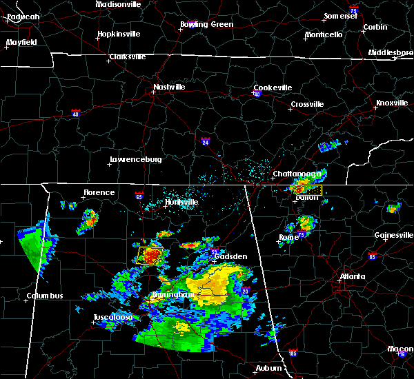 At 1007 am edt, a severe thunderstorm was located near cohutta, or 11 miles northeast of dalton, moving east at 30 mph (radar indicated). Hazards include 60 mph wind gusts and quarter size hail. Hail damage to vehicles is expected. expect wind damage to roofs, siding and trees. Other locations in the warning include but are not limited to varnell, cohutta, crandall, cisco, tennga, beaverdale, conasauga lake, gregory and sumac. At 1007 am edt, a severe thunderstorm was located near cohutta, or 11 miles northeast of dalton, moving east at 30 mph (radar indicated). Hazards include 60 mph wind gusts and quarter size hail. Hail damage to vehicles is expected. expect wind damage to roofs, siding and trees. Other locations in the warning include but are not limited to varnell, cohutta, crandall, cisco, tennga, beaverdale, conasauga lake, gregory and sumac.
|
| 6/26/2015 3:32 PM EDT | At 331 pm edt, a severe thunderstorm was located near dalton, moving northeast at 5 mph (radar indicated). Hazards include 60 mph wind gusts and nickel size hail. Expect damage to roofs. siding and trees. other locations in the warning include but are not limited to dalton, varnell, cohutta, dawnville, beaverdale and red clay s. P |
| 6/24/2015 4:55 PM EDT | Tree down across roadway at highway 2 and lake kathy roa in whitfield county GA, 2.8 miles E of Varnell, GA |
| 6/24/2015 4:51 PM EDT |
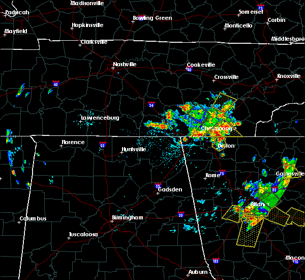 At 451 pm edt, a severe thunderstorm was located over varnell, or 9 miles east of ringgold, moving south at 15 mph (radar indicated). Hazards include 60 mph wind gusts and quarter size hail. Hail damage to vehicles is expected. expect wind damage to roofs, siding and trees. other locations in the warning include but are not limited to dalton, varnell, tunnel hill, cohutta, dawnville, rocky face, beaverdale and red clay s. P At 451 pm edt, a severe thunderstorm was located over varnell, or 9 miles east of ringgold, moving south at 15 mph (radar indicated). Hazards include 60 mph wind gusts and quarter size hail. Hail damage to vehicles is expected. expect wind damage to roofs, siding and trees. other locations in the warning include but are not limited to dalton, varnell, tunnel hill, cohutta, dawnville, rocky face, beaverdale and red clay s. P
|
| 6/8/2015 7:21 PM EDT | At 720 pm edt, a severe thunderstorm was located over tunnel hill, or near dalton, moving east at 30 mph (radar indicated). Hazards include 60 mph wind gusts. Expect damage to roofs. siding and trees. Other locations in the warning include but are not limited to varnell, tunnel hill and wood station. |
| 6/8/2015 7:19 PM EDT | At 718 pm edt, severe thunderstorms were located along a line extending from near cohutta to near tunnel hill, moving east at 40 mph (radar indicated). Hazards include 60 mph wind gusts. Expect damage to roofs. siding and trees. other locations in the warning include but are not limited to dalton, varnell, tunnel hill, cohutta, crandall, rocky face, cisco, tennga, beaverdale, gregory, sumac and red clay s. P |
| 6/8/2015 7:02 PM EDT | At 702 pm edt, a severe thunderstorm was located 7 miles southwest of ringgold, moving east at 30 mph (radar indicated). Hazards include 60 mph wind gusts and quarter size hail. Hail damage to vehicles is expected. expect wind damage to roofs, siding and trees. Other locations in the warning include but are not limited to varnell, tunnel hill, beaumont and wood station. |
| 8/20/2014 6:47 PM EDT | Trees down along boyles mill road and oakdale roa in whitfield county GA, 5.9 miles WNW of Varnell, GA |
| 8/20/2014 6:28 PM EDT | Trees down on mcgaughy chapel and strain roads in whitfield county GA, 2.7 miles WSW of Varnell, GA |
| 3/5/2013 3:35 PM EST | A home on concord drive received damage from a tree falling on i in whitfield county GA, 2.8 miles N of Varnell, GA |
| 1/1/0001 12:00 AM | Whitfield county emergency management relayed a report of a tree downed onto a house causing heavy structural damag in whitfield county GA, 1.1 miles E of Varnell, GA |
| 1/1/0001 12:00 AM | Whitfield county emergency management relayed a report of a tree downed onto a house causing structural damag in whitfield county GA, 1.1 miles E of Varnell, GA |
Hail Maps for Varnell, GA


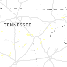


Connect with Interactive Hail Maps