

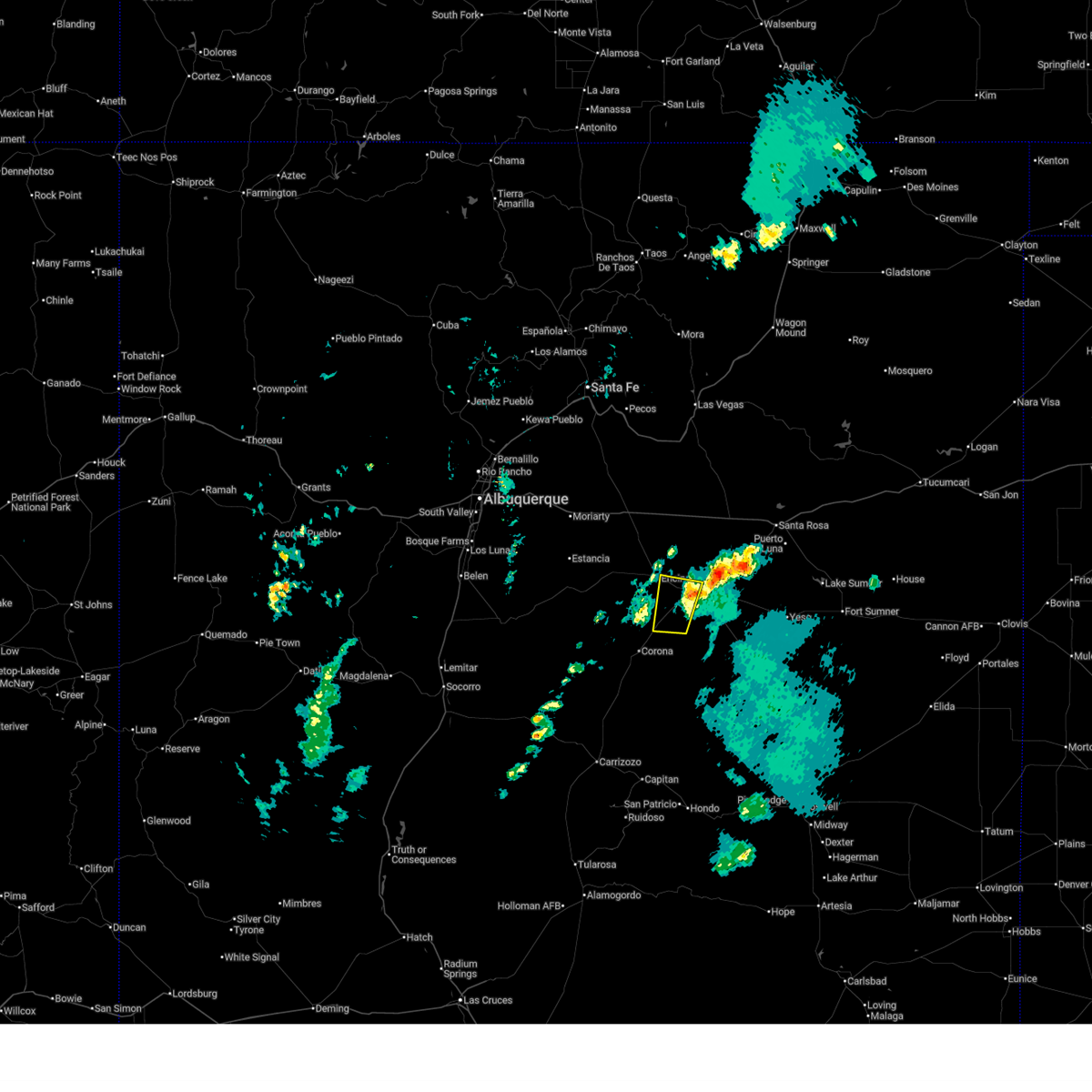
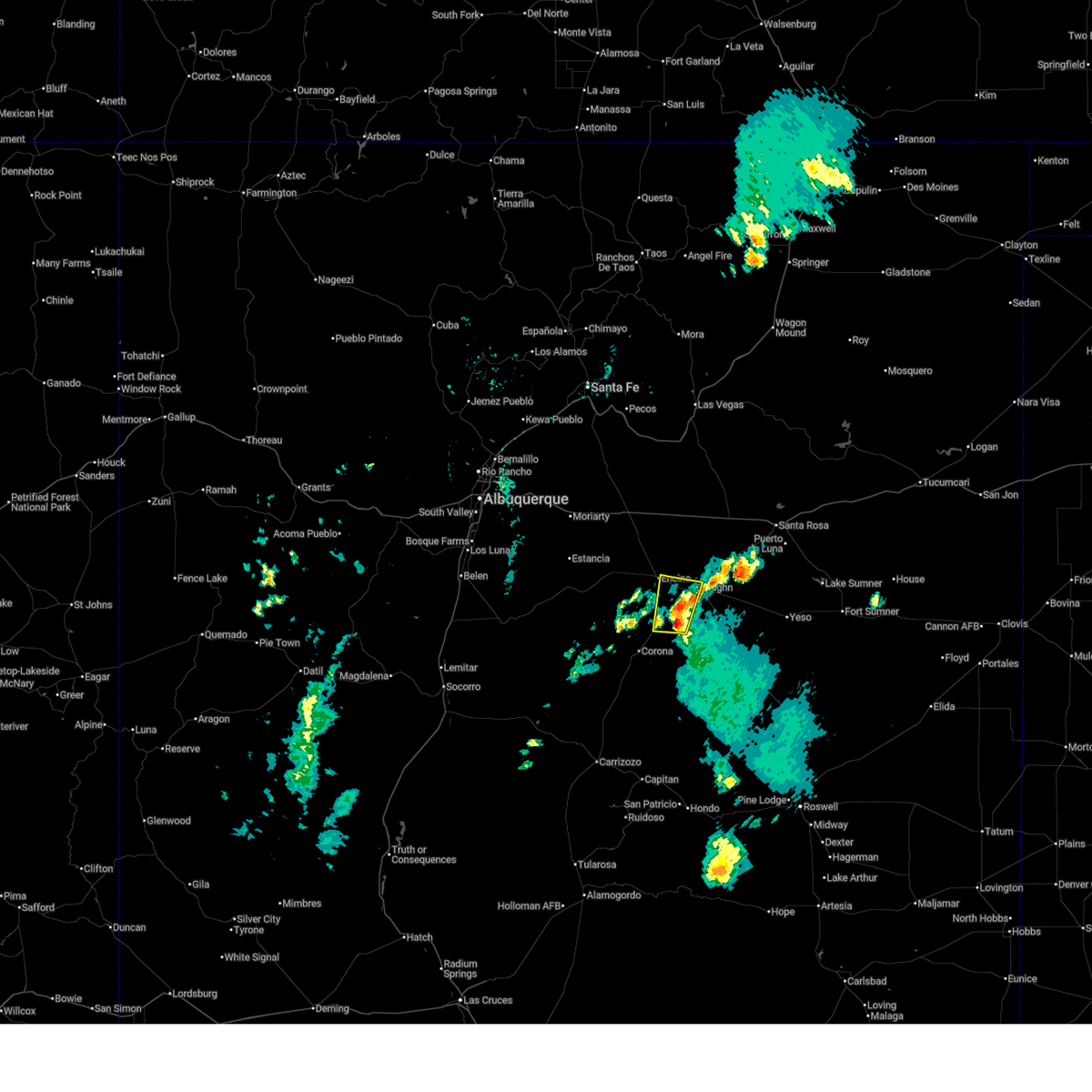
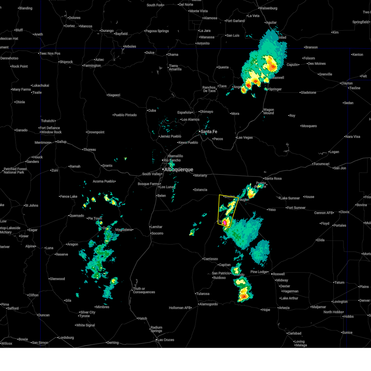
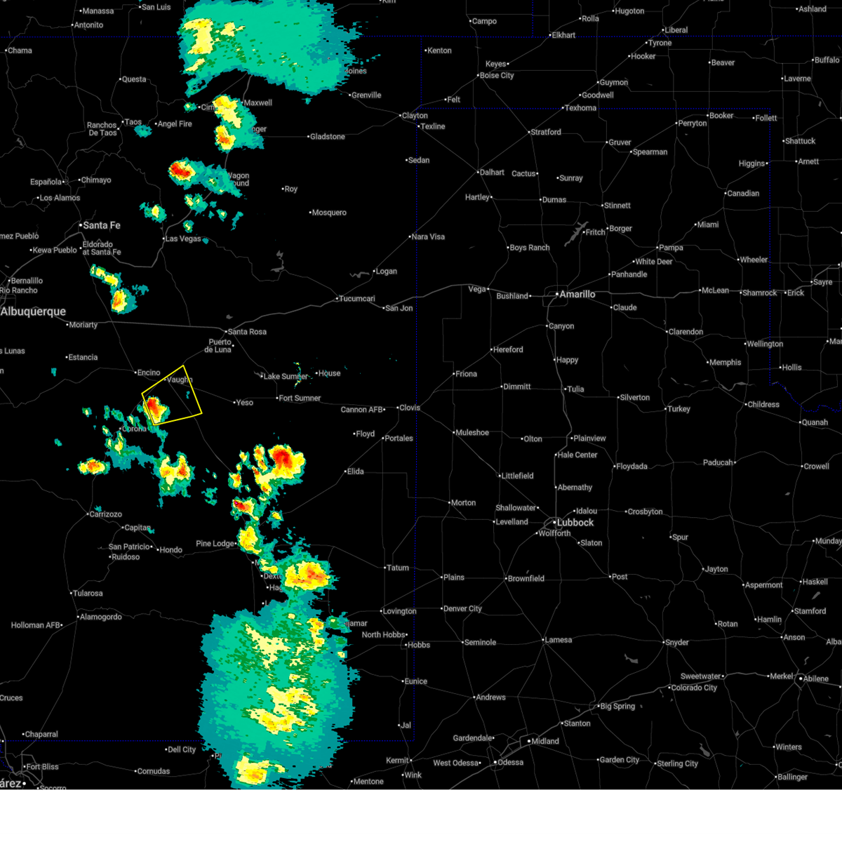
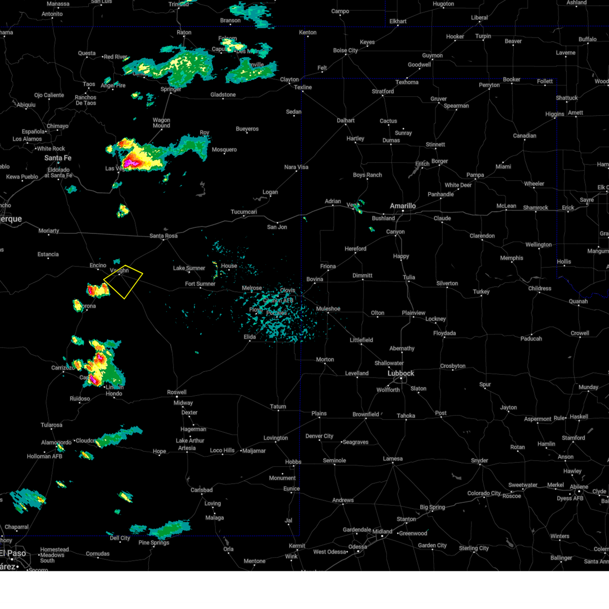
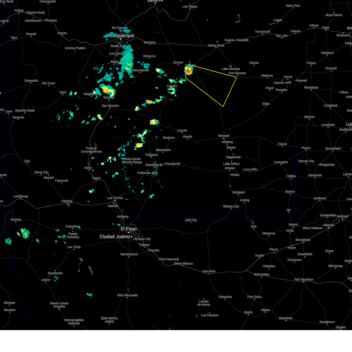
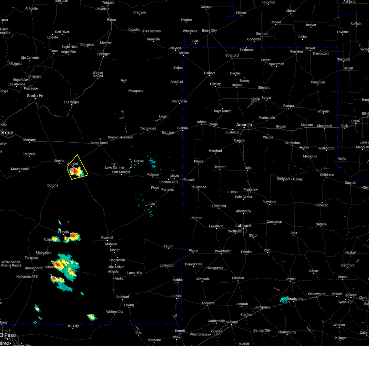
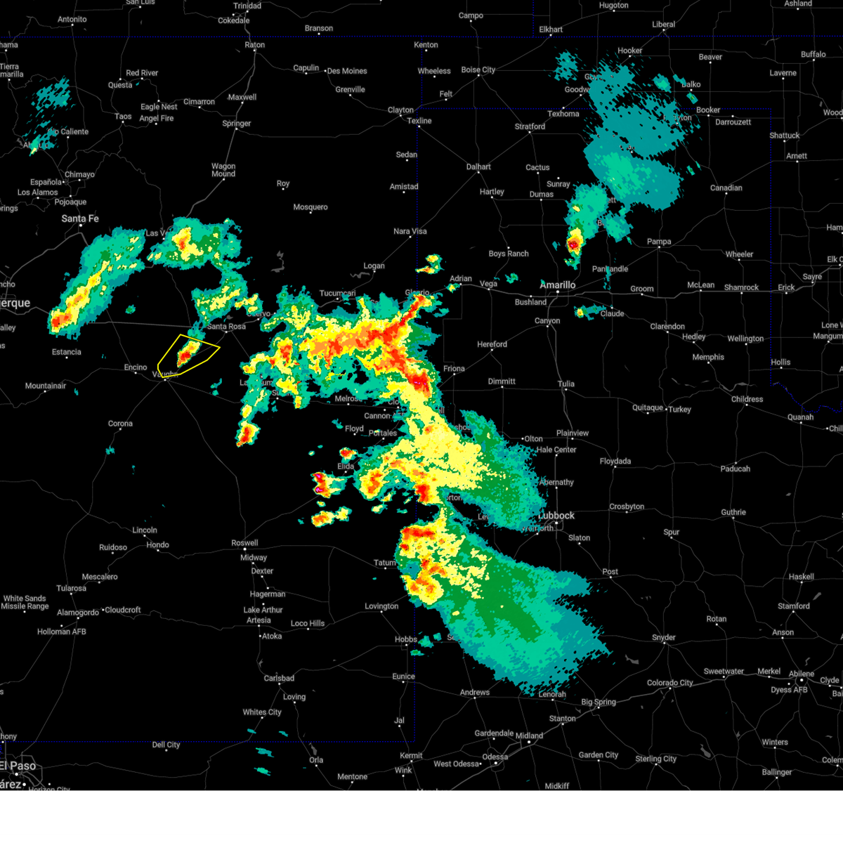
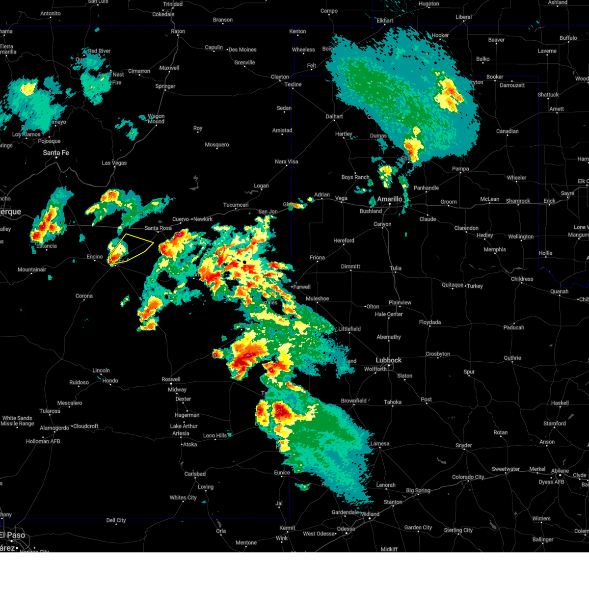
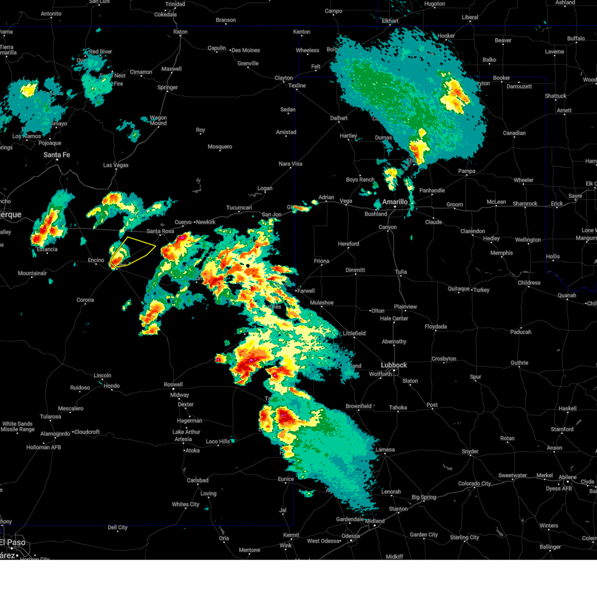
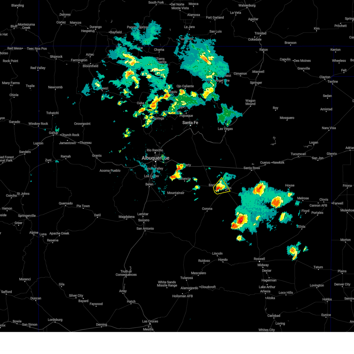
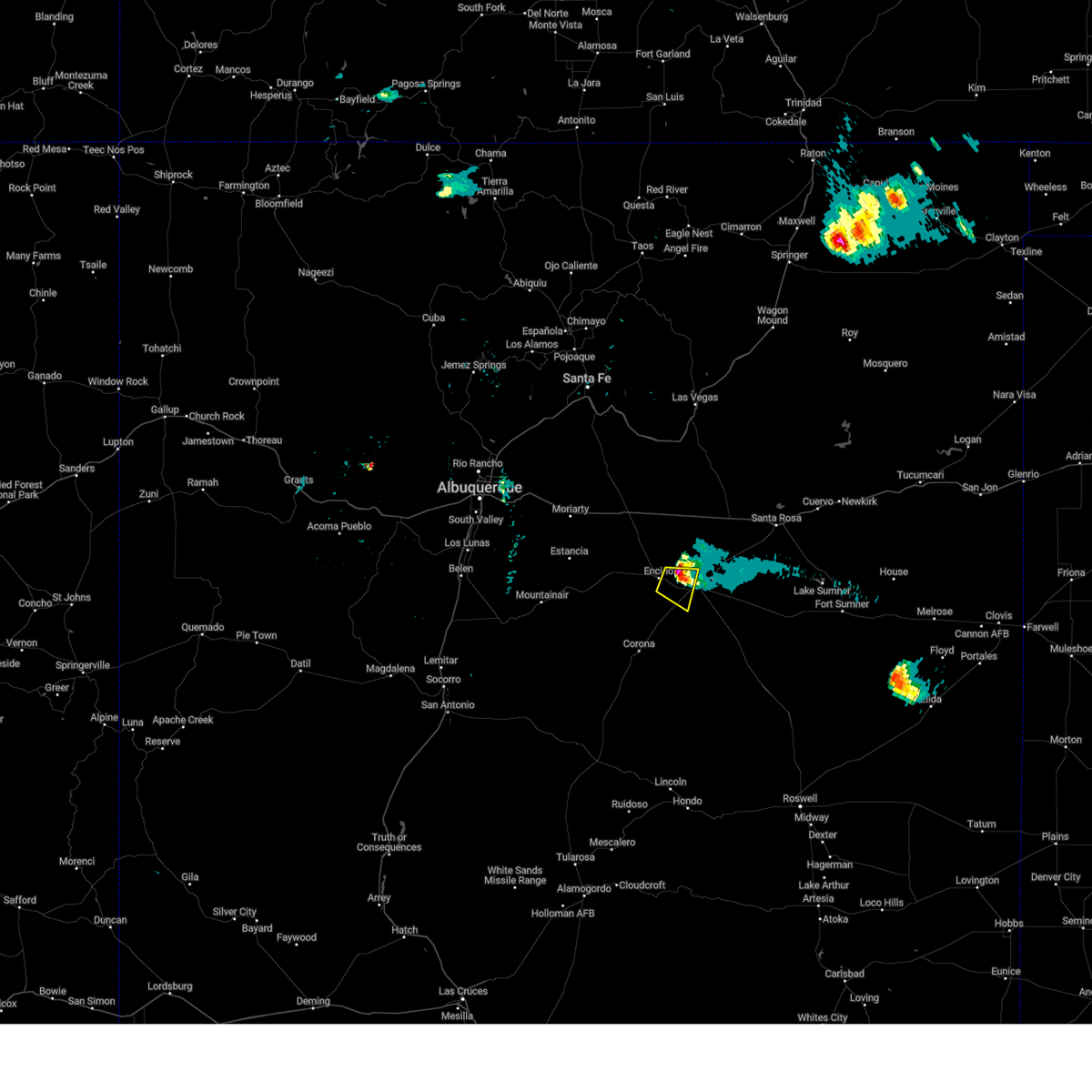
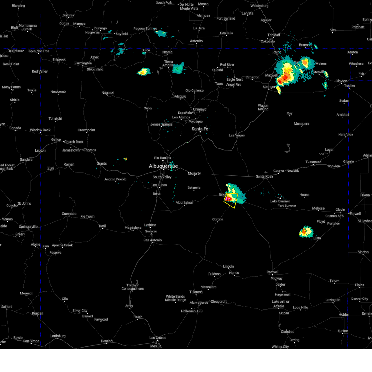
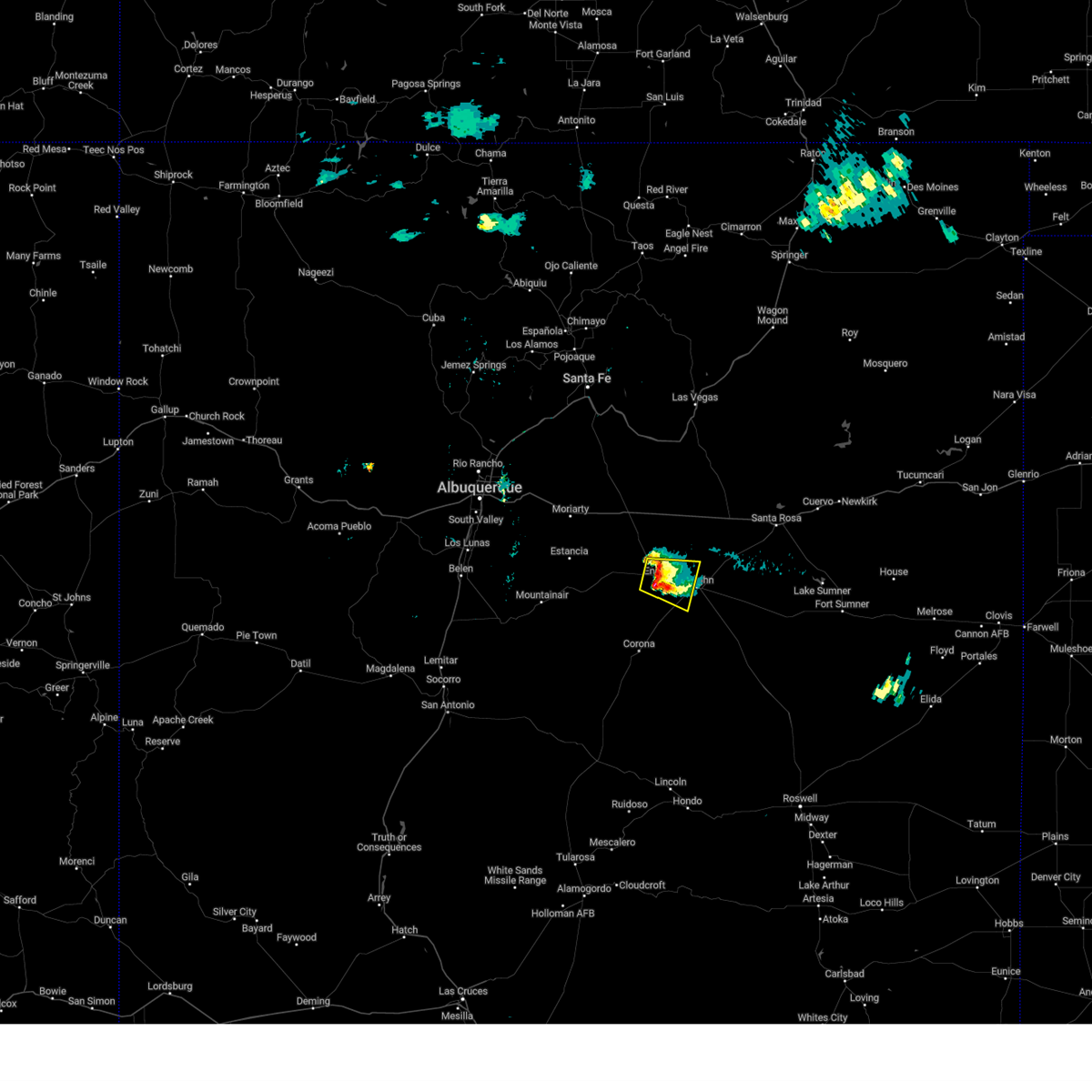
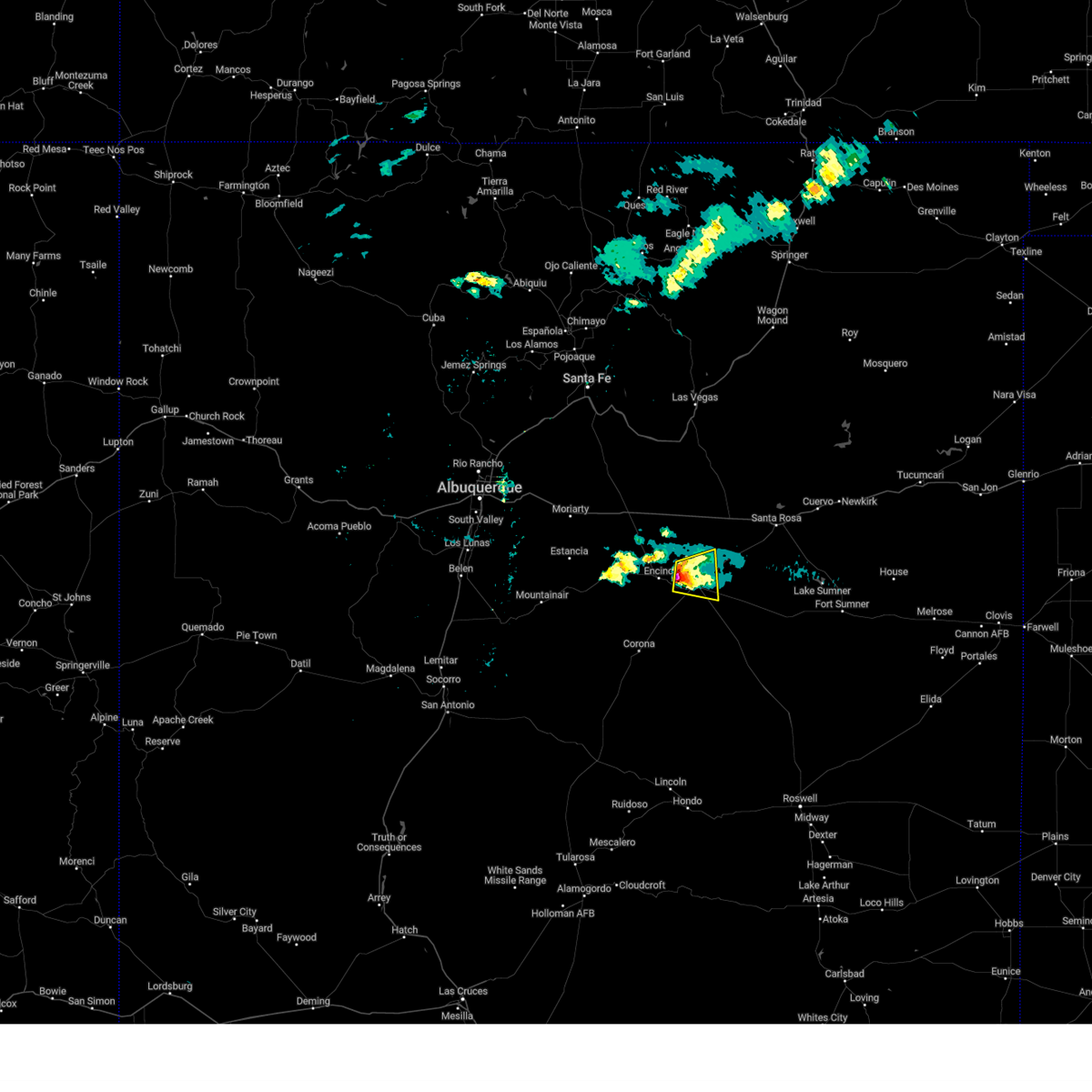
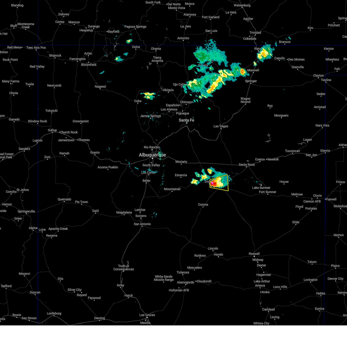
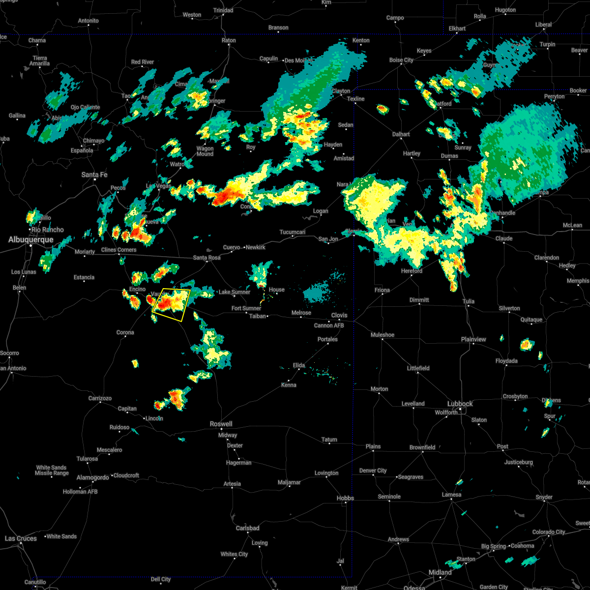
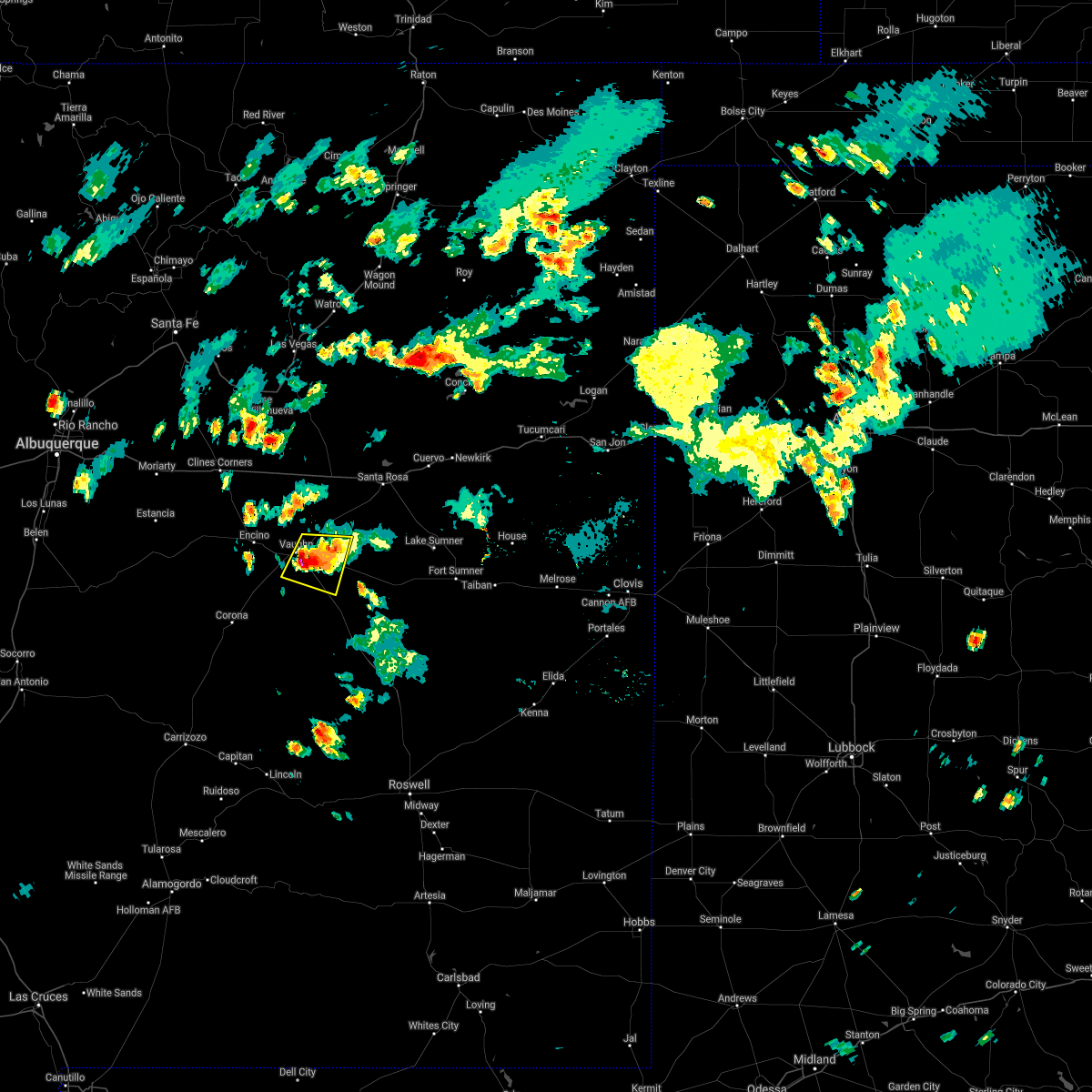
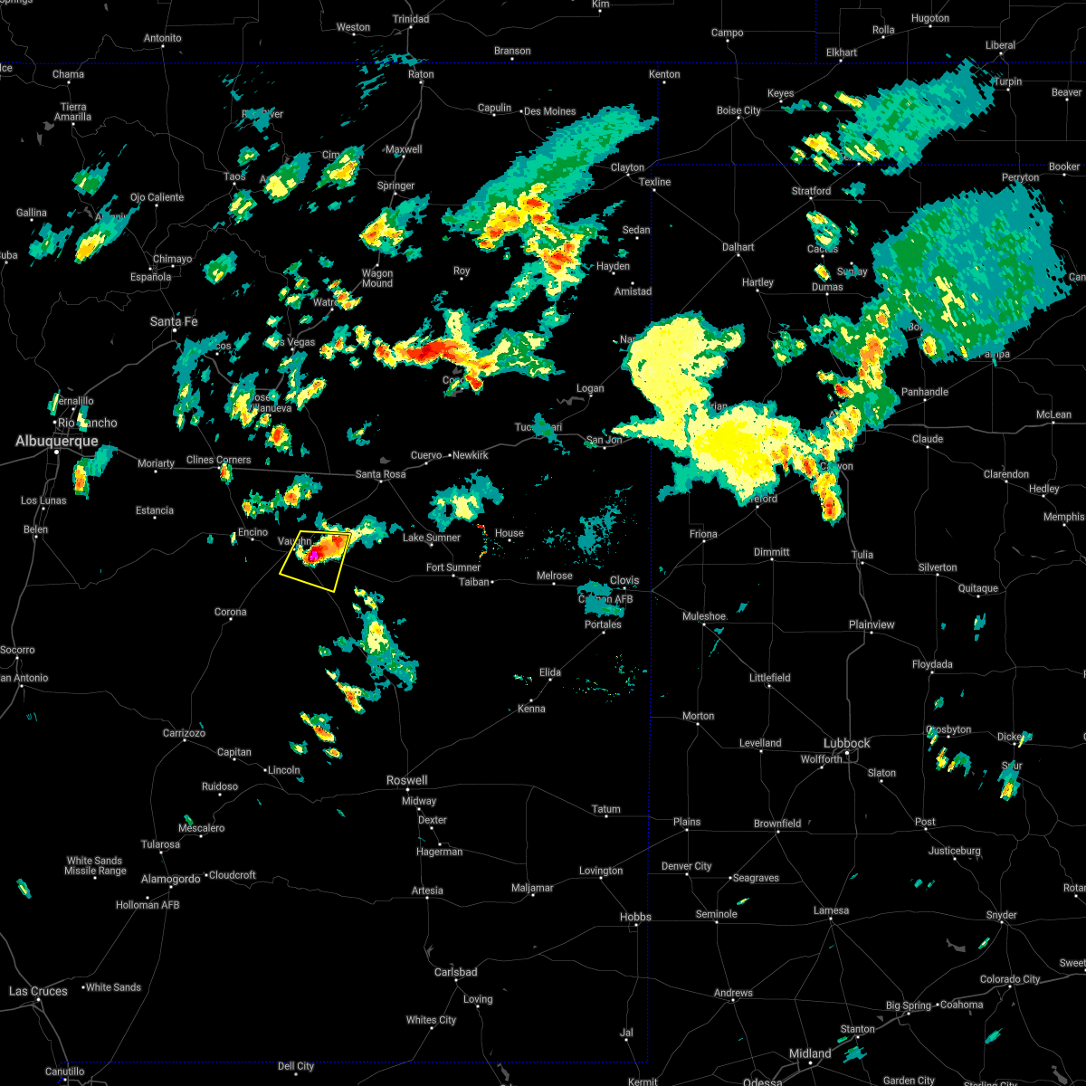
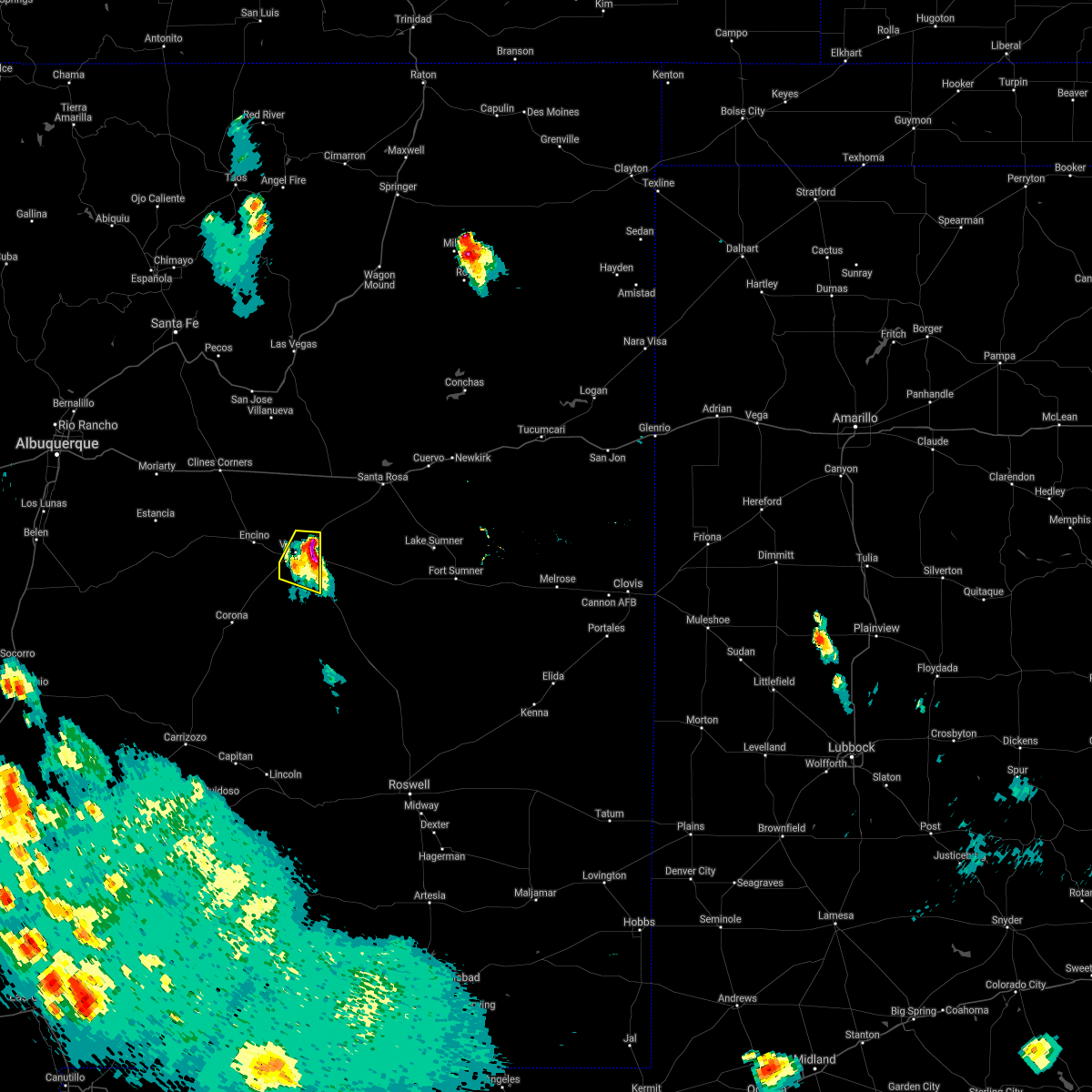
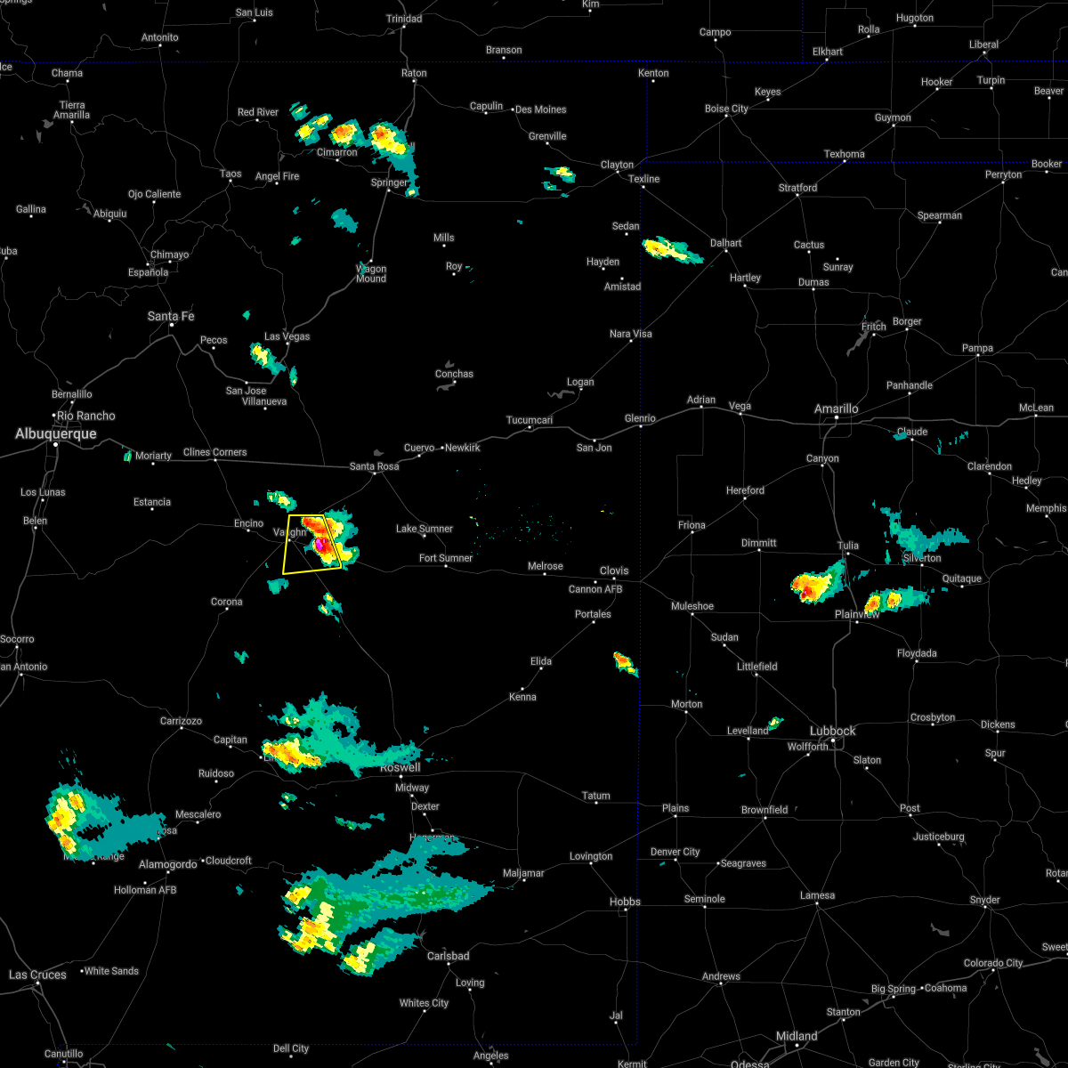
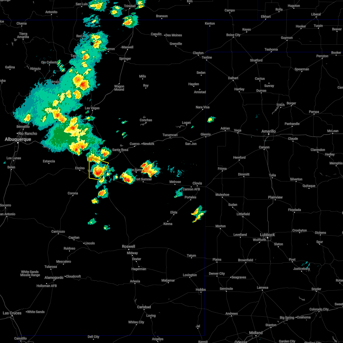
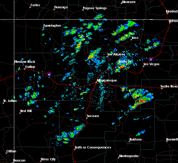
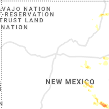
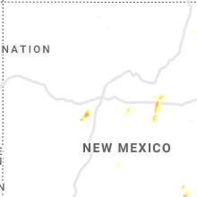
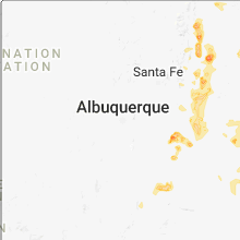
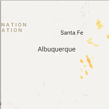
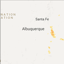
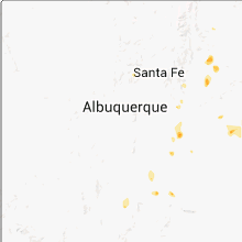
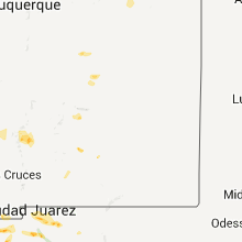
Hail Map for Vaughn, NM
The Vaughn, NM area has had 2 reports of on-the-ground hail by trained spotters, and has been under severe weather warnings 8 times during the past 12 months. Doppler radar has detected hail at or near Vaughn, NM on 49 occasions, including 4 occasions during the past year.
| Name: | Vaughn, NM |
| Where Located: | 87.9 miles ESE of Albuquerque, NM |
| Map: | Google Map for Vaughn, NM |
| Population: | 446 |
| Housing Units: | 320 |
| More Info: | Search Google for Vaughn, NM |
2
The Top Recent Hail Date for Vaughn, NM is Friday, July 5, 2024 (8th out of 49)

Hail and Wind Damage Spotted near Vaughn, NM
| Date / Time | Report Details |
|---|---|
| 6/23/2025 3:37 PM MDT |
 The storm which prompted the warning has weakened below severe limits, and no longer poses an immediate threat to life or property. therefore, the warning will be allowed to expire. a severe thunderstorm warning still remains in effect for central guadalupe county near santa rosa. The storm which prompted the warning has weakened below severe limits, and no longer poses an immediate threat to life or property. therefore, the warning will be allowed to expire. a severe thunderstorm warning still remains in effect for central guadalupe county near santa rosa.
|
| 6/23/2025 3:20 PM MDT |
 the severe thunderstorm warning has been cancelled and is no longer in effect the severe thunderstorm warning has been cancelled and is no longer in effect
|
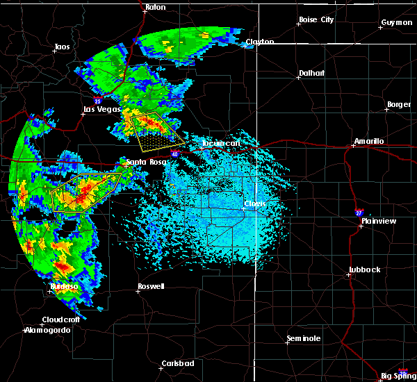
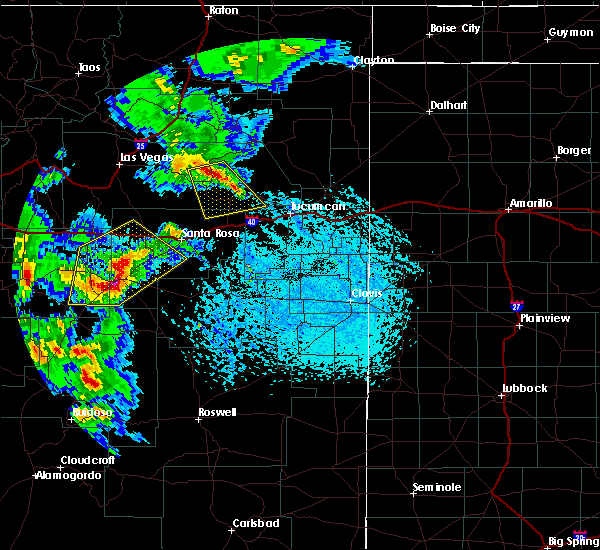
| 6/23/2025 3:20 PM MDT |
 At 320 pm mdt, a severe thunderstorm was located 9 miles southwest of vaughn, moving north at 30 mph (radar indicated). Hazards include 60 mph wind gusts and quarter size hail. Hail damage to vehicles is expected. expect wind damage to roofs, siding, and trees. locations impacted include, vaughn, encino and duran. This includes highway 60 between mile markers 254 and 267. At 320 pm mdt, a severe thunderstorm was located 9 miles southwest of vaughn, moving north at 30 mph (radar indicated). Hazards include 60 mph wind gusts and quarter size hail. Hail damage to vehicles is expected. expect wind damage to roofs, siding, and trees. locations impacted include, vaughn, encino and duran. This includes highway 60 between mile markers 254 and 267.
|
| 6/23/2025 2:50 PM MDT |
 Svrabq the national weather service in albuquerque has issued a * severe thunderstorm warning for, northern lincoln county in central new mexico, southeastern torrance county in central new mexico, southwestern guadalupe county in east central new mexico, * until 345 pm mdt. * at 250 pm mdt, a severe thunderstorm was located 7 miles east of corona, moving north at 25 mph (radar indicated). Hazards include 60 mph wind gusts and quarter size hail. Hail damage to vehicles is expected. Expect wind damage to roofs, siding, and trees. Svrabq the national weather service in albuquerque has issued a * severe thunderstorm warning for, northern lincoln county in central new mexico, southeastern torrance county in central new mexico, southwestern guadalupe county in east central new mexico, * until 345 pm mdt. * at 250 pm mdt, a severe thunderstorm was located 7 miles east of corona, moving north at 25 mph (radar indicated). Hazards include 60 mph wind gusts and quarter size hail. Hail damage to vehicles is expected. Expect wind damage to roofs, siding, and trees.
|
| 6/15/2025 5:08 PM MDT |
 Svrabq the national weather service in albuquerque has issued a * severe thunderstorm warning for, northern lincoln county in central new mexico, east central torrance county in central new mexico, southwestern guadalupe county in east central new mexico, * until 600 pm mdt. * at 508 pm mdt, a severe thunderstorm was located 12 miles south of vaughn, moving east at 15 mph (radar indicated). Hazards include 60 mph wind gusts and quarter size hail. Hail damage to vehicles is expected. Expect wind damage to roofs, siding, and trees. Svrabq the national weather service in albuquerque has issued a * severe thunderstorm warning for, northern lincoln county in central new mexico, east central torrance county in central new mexico, southwestern guadalupe county in east central new mexico, * until 600 pm mdt. * at 508 pm mdt, a severe thunderstorm was located 12 miles south of vaughn, moving east at 15 mph (radar indicated). Hazards include 60 mph wind gusts and quarter size hail. Hail damage to vehicles is expected. Expect wind damage to roofs, siding, and trees.
|
| 5/19/2025 3:11 PM MDT | Mesonet station up426 vaughn 4 e (upr in guadalupe county NM, 4 miles WSW of Vaughn, NM |
| 5/19/2025 3:05 PM MDT | Mesonet station svan5 se vaugh in guadalupe county NM, 11.6 miles NW of Vaughn, NM |
| 5/19/2025 12:40 PM MDT | Mesonet station svan5 se vaugh in guadalupe county NM, 11.6 miles NW of Vaughn, NM |
| 7/5/2024 6:18 PM MDT |
 At 618 pm mdt, a severe thunderstorm was located 9 miles southeast of vaughn, moving southeast at 10 mph (radar indicated). Hazards include 60 mph wind gusts and penny size hail. Expect damage to roofs, siding, and trees. Locations impacted include, vaughn. At 618 pm mdt, a severe thunderstorm was located 9 miles southeast of vaughn, moving southeast at 10 mph (radar indicated). Hazards include 60 mph wind gusts and penny size hail. Expect damage to roofs, siding, and trees. Locations impacted include, vaughn.
|
| 7/5/2024 5:58 PM MDT |
 At 558 pm mdt, a severe thunderstorm was located near vaughn, moving southeast at 10 mph (radar indicated). Hazards include 60 mph wind gusts and quarter size hail. Hail damage to vehicles is expected. expect wind damage to roofs, siding, and trees. Locations impacted include, vaughn. At 558 pm mdt, a severe thunderstorm was located near vaughn, moving southeast at 10 mph (radar indicated). Hazards include 60 mph wind gusts and quarter size hail. Hail damage to vehicles is expected. expect wind damage to roofs, siding, and trees. Locations impacted include, vaughn.
|
| 7/5/2024 5:38 PM MDT |
 Svrabq the national weather service in albuquerque has issued a * severe thunderstorm warning for, southwestern guadalupe county in east central new mexico, east central torrance county in central new mexico, * until 645 pm mdt. * at 538 pm mdt, a severe thunderstorm was located over vaughn, moving southeast at 10 mph (radar indicated). Hazards include ping pong ball size hail and 60 mph wind gusts. People and animals outdoors will be injured. expect hail damage to roofs, siding, windows, and vehicles. Expect wind damage to roofs, siding, and trees. Svrabq the national weather service in albuquerque has issued a * severe thunderstorm warning for, southwestern guadalupe county in east central new mexico, east central torrance county in central new mexico, * until 645 pm mdt. * at 538 pm mdt, a severe thunderstorm was located over vaughn, moving southeast at 10 mph (radar indicated). Hazards include ping pong ball size hail and 60 mph wind gusts. People and animals outdoors will be injured. expect hail damage to roofs, siding, windows, and vehicles. Expect wind damage to roofs, siding, and trees.
|
| 9/11/2023 3:00 PM MDT |
 At 300 pm mdt, a severe thunderstorm was located 7 miles south of vaughn, moving southeast at 45 mph (radar indicated). Hazards include 60 mph wind gusts and half dollar size hail. Hail damage to vehicles is expected. Expect wind damage to roofs, siding, and trees. At 300 pm mdt, a severe thunderstorm was located 7 miles south of vaughn, moving southeast at 45 mph (radar indicated). Hazards include 60 mph wind gusts and half dollar size hail. Hail damage to vehicles is expected. Expect wind damage to roofs, siding, and trees.
|
| 7/7/2023 4:10 PM MDT | Mesonet station svan5 se vaugh in guadalupe county NM, 11.6 miles NW of Vaughn, NM |
| 7/6/2023 2:43 PM MDT |
 At 243 pm mdt, a severe thunderstorm was located near vaughn, moving northeast at 5 mph (radar indicated). Hazards include 60 mph wind gusts and quarter size hail. Hail damage to vehicles is expected. expect wind damage to roofs, siding, and trees. locations impacted include, vaughn. this includes the following highways, highway 285 between mile markers 191 and 204. highway 60 between mile markers 266 and 285. hail threat, radar indicated max hail size, 1. 00 in wind threat, radar indicated max wind gust, 60 mph. At 243 pm mdt, a severe thunderstorm was located near vaughn, moving northeast at 5 mph (radar indicated). Hazards include 60 mph wind gusts and quarter size hail. Hail damage to vehicles is expected. expect wind damage to roofs, siding, and trees. locations impacted include, vaughn. this includes the following highways, highway 285 between mile markers 191 and 204. highway 60 between mile markers 266 and 285. hail threat, radar indicated max hail size, 1. 00 in wind threat, radar indicated max wind gust, 60 mph.
|
| 7/6/2023 2:25 PM MDT |
 At 225 pm mdt, a severe thunderstorm was located near vaughn, moving northeast at 5 mph (radar indicated). Hazards include 60 mph wind gusts and half dollar size hail. Hail damage to vehicles is expected. Expect wind damage to roofs, siding, and trees. At 225 pm mdt, a severe thunderstorm was located near vaughn, moving northeast at 5 mph (radar indicated). Hazards include 60 mph wind gusts and half dollar size hail. Hail damage to vehicles is expected. Expect wind damage to roofs, siding, and trees.
|
| 5/31/2023 5:36 PM MDT |
 The severe thunderstorm warning for west central guadalupe county will expire at 545 pm mdt, the storm that prompted the warning has weakened below severe limits, and no longer poses an immediate threat to life or property. therefore, the warning will be allowed to expire. a severe thunderstorm watch remains in effect until 900 pm mdt for east central new mexico. The severe thunderstorm warning for west central guadalupe county will expire at 545 pm mdt, the storm that prompted the warning has weakened below severe limits, and no longer poses an immediate threat to life or property. therefore, the warning will be allowed to expire. a severe thunderstorm watch remains in effect until 900 pm mdt for east central new mexico.
|
| 5/31/2023 5:03 PM MDT |
 At 503 pm mdt, a severe thunderstorm was located near vaughn, moving northeast at 15 mph (radar indicated). Hazards include 60 mph wind gusts and half dollar size hail. Hail damage to vehicles is expected. expect wind damage to roofs, siding, and trees. Locations impacted include, pastura and pintada. At 503 pm mdt, a severe thunderstorm was located near vaughn, moving northeast at 15 mph (radar indicated). Hazards include 60 mph wind gusts and half dollar size hail. Hail damage to vehicles is expected. expect wind damage to roofs, siding, and trees. Locations impacted include, pastura and pintada.
|
| 5/31/2023 4:58 PM MDT |
 At 457 pm mdt, a severe thunderstorm was located near vaughn, moving northeast at 20 mph (radar indicated). Hazards include 60 mph wind gusts and half dollar size hail. Hail damage to vehicles is expected. Expect wind damage to roofs, siding, and trees. At 457 pm mdt, a severe thunderstorm was located near vaughn, moving northeast at 20 mph (radar indicated). Hazards include 60 mph wind gusts and half dollar size hail. Hail damage to vehicles is expected. Expect wind damage to roofs, siding, and trees.
|
| 5/31/2023 4:22 PM MDT |
 At 421 pm mdt, a severe thunderstorm was located near encino, or 10 miles west of vaughn, moving northeast at 5 mph (radar indicated). Hazards include 60 mph wind gusts and quarter size hail. Hail damage to vehicles is expected. Expect wind damage to roofs, siding, and trees. At 421 pm mdt, a severe thunderstorm was located near encino, or 10 miles west of vaughn, moving northeast at 5 mph (radar indicated). Hazards include 60 mph wind gusts and quarter size hail. Hail damage to vehicles is expected. Expect wind damage to roofs, siding, and trees.
|
| 5/26/2023 8:23 PM MDT |
 The severe thunderstorm warning for west central guadalupe and east central torrance counties will expire at 830 pm mdt, the storm which prompted the warning has weakened below severe limits, and has exited the warned area. therefore, the warning will be allowed to expire. however small hail, gusty winds and heavy rain are still possible with this thunderstorm. a tornado watch remains in effect until 1000 pm mdt for central and east central new mexico. to report severe weather, contact your local law enforcement and the national weather service in albuquerque. The severe thunderstorm warning for west central guadalupe and east central torrance counties will expire at 830 pm mdt, the storm which prompted the warning has weakened below severe limits, and has exited the warned area. therefore, the warning will be allowed to expire. however small hail, gusty winds and heavy rain are still possible with this thunderstorm. a tornado watch remains in effect until 1000 pm mdt for central and east central new mexico. to report severe weather, contact your local law enforcement and the national weather service in albuquerque.
|
| 5/26/2023 7:51 PM MDT |
 At 750 pm mdt, a severe thunderstorm was located near encino, or 10 miles west of vaughn, moving east at 10 mph (radar indicated). Hazards include ping pong ball size hail and 60 mph wind gusts. People and animals outdoors will be injured. expect hail damage to roofs, siding, windows, and vehicles. expect wind damage to roofs, siding, and trees. locations impacted include, vaughn and encino. this includes highway 60 between mile markers 255 and 267. hail threat, radar indicated max hail size, 1. 50 in wind threat, radar indicated max wind gust, 60 mph. At 750 pm mdt, a severe thunderstorm was located near encino, or 10 miles west of vaughn, moving east at 10 mph (radar indicated). Hazards include ping pong ball size hail and 60 mph wind gusts. People and animals outdoors will be injured. expect hail damage to roofs, siding, windows, and vehicles. expect wind damage to roofs, siding, and trees. locations impacted include, vaughn and encino. this includes highway 60 between mile markers 255 and 267. hail threat, radar indicated max hail size, 1. 50 in wind threat, radar indicated max wind gust, 60 mph.
|
| 5/26/2023 7:30 PM MDT |
 At 729 pm mdt, a severe thunderstorm was located over encino, or 14 miles west of vaughn, moving east at 15 mph (radar indicated). Hazards include 60 mph wind gusts and quarter size hail. Hail damage to vehicles is expected. Expect wind damage to roofs, siding, and trees. At 729 pm mdt, a severe thunderstorm was located over encino, or 14 miles west of vaughn, moving east at 15 mph (radar indicated). Hazards include 60 mph wind gusts and quarter size hail. Hail damage to vehicles is expected. Expect wind damage to roofs, siding, and trees.
|
| 5/26/2023 6:01 PM MDT |
 At 601 pm mdt, a severe thunderstorm was located near vaughn, moving east at 15 mph (radar indicated). Hazards include 70 mph wind gusts and ping pong ball size hail. People and animals outdoors will be injured. expect hail damage to roofs, siding, windows, and vehicles. expect considerable tree damage. wind damage is also likely to mobile homes, roofs, and outbuildings. locations impacted include, vaughn. this includes the following highways, highway 285 between mile markers 201 and 204. highway 60 between mile markers 260 and 277. thunderstorm damage threat, considerable hail threat, radar indicated max hail size, 1. 50 in wind threat, radar indicated max wind gust, 70 mph. At 601 pm mdt, a severe thunderstorm was located near vaughn, moving east at 15 mph (radar indicated). Hazards include 70 mph wind gusts and ping pong ball size hail. People and animals outdoors will be injured. expect hail damage to roofs, siding, windows, and vehicles. expect considerable tree damage. wind damage is also likely to mobile homes, roofs, and outbuildings. locations impacted include, vaughn. this includes the following highways, highway 285 between mile markers 201 and 204. highway 60 between mile markers 260 and 277. thunderstorm damage threat, considerable hail threat, radar indicated max hail size, 1. 50 in wind threat, radar indicated max wind gust, 70 mph.
|
| 5/26/2023 5:43 PM MDT |
 At 543 pm mdt, a severe thunderstorm was located near encino, or 9 miles west of vaughn, moving east at 15 mph (radar indicated). Hazards include golf ball size hail and 70 mph wind gusts. People and animals outdoors will be injured. expect hail damage to roofs, siding, windows, and vehicles. expect considerable tree damage. Wind damage is also likely to mobile homes, roofs, and outbuildings. At 543 pm mdt, a severe thunderstorm was located near encino, or 9 miles west of vaughn, moving east at 15 mph (radar indicated). Hazards include golf ball size hail and 70 mph wind gusts. People and animals outdoors will be injured. expect hail damage to roofs, siding, windows, and vehicles. expect considerable tree damage. Wind damage is also likely to mobile homes, roofs, and outbuildings.
|
| 6/3/2022 5:14 PM MDT |
 At 514 pm mdt, a severe thunderstorm was located 12 miles northwest of yeso, or 25 miles east of vaughn, moving east at 15 mph (radar indicated). Hazards include 60 mph wind gusts and quarter size hail. Hail damage to vehicles is expected. Expect wind damage to roofs, siding, and trees. At 514 pm mdt, a severe thunderstorm was located 12 miles northwest of yeso, or 25 miles east of vaughn, moving east at 15 mph (radar indicated). Hazards include 60 mph wind gusts and quarter size hail. Hail damage to vehicles is expected. Expect wind damage to roofs, siding, and trees.
|
| 6/3/2022 4:38 PM MDT |
 At 438 pm mdt, a severe thunderstorm was located 9 miles southeast of pastura, or 17 miles southwest of santa rosa, moving east at 15 mph (radar indicated). Hazards include 60 mph wind gusts and quarter size hail. Hail damage to vehicles is expected. expect wind damage to roofs, siding, and trees. locations impacted include, vaughn, puerto de luna and pastura. this includes the following highways, highway 285 between mile markers 201 and 204. highway 60 between mile markers 272 and 300. hail threat, radar indicated max hail size, 1. 00 in wind threat, radar indicated max wind gust, 60 mph. At 438 pm mdt, a severe thunderstorm was located 9 miles southeast of pastura, or 17 miles southwest of santa rosa, moving east at 15 mph (radar indicated). Hazards include 60 mph wind gusts and quarter size hail. Hail damage to vehicles is expected. expect wind damage to roofs, siding, and trees. locations impacted include, vaughn, puerto de luna and pastura. this includes the following highways, highway 285 between mile markers 201 and 204. highway 60 between mile markers 272 and 300. hail threat, radar indicated max hail size, 1. 00 in wind threat, radar indicated max wind gust, 60 mph.
|
| 6/3/2022 4:14 PM MDT |
 At 413 pm mdt, a severe thunderstorm was located near pastura, or 18 miles northeast of vaughn, moving east at 15 mph (radar indicated). Hazards include 60 mph wind gusts and quarter size hail. Hail damage to vehicles is expected. Expect wind damage to roofs, siding, and trees. At 413 pm mdt, a severe thunderstorm was located near pastura, or 18 miles northeast of vaughn, moving east at 15 mph (radar indicated). Hazards include 60 mph wind gusts and quarter size hail. Hail damage to vehicles is expected. Expect wind damage to roofs, siding, and trees.
|
| 8/29/2021 5:54 PM MDT |
 The severe thunderstorm warning for southwestern guadalupe county will expire at 600 pm mdt, the storm which prompted the warning has weakened below severe limits, and no longer poses an immediate threat to life or property. therefore, the warning will be allowed to expire. however gusty winds, small hail, and heavy rain are still possible with this thunderstorm. The severe thunderstorm warning for southwestern guadalupe county will expire at 600 pm mdt, the storm which prompted the warning has weakened below severe limits, and no longer poses an immediate threat to life or property. therefore, the warning will be allowed to expire. however gusty winds, small hail, and heavy rain are still possible with this thunderstorm.
|
| 8/29/2021 5:43 PM MDT |
 At 542 pm mdt, a severe thunderstorm was located 7 miles southeast of vaughn, moving southwest at 10 mph (radar indicated). Hazards include 60 mph wind gusts and nickel size hail. Expect damage to roofs, siding, and trees. locations impacted include, vaughn. this includes the following highways, highway 285 between mile markers 189 and 204. highway 60 between mile markers 272 and 286. hail threat, radar indicated max hail size, 0. 88 in wind threat, radar indicated max wind gust, 60 mph. At 542 pm mdt, a severe thunderstorm was located 7 miles southeast of vaughn, moving southwest at 10 mph (radar indicated). Hazards include 60 mph wind gusts and nickel size hail. Expect damage to roofs, siding, and trees. locations impacted include, vaughn. this includes the following highways, highway 285 between mile markers 189 and 204. highway 60 between mile markers 272 and 286. hail threat, radar indicated max hail size, 0. 88 in wind threat, radar indicated max wind gust, 60 mph.
|
| 8/29/2021 5:28 PM MDT |
 At 527 pm mdt, a severe thunderstorm was located 7 miles east of vaughn, moving southwest at 10 mph (radar indicated). Hazards include 60 mph wind gusts and quarter size hail. Hail damage to vehicles is expected. Expect wind damage to roofs, siding, and trees. At 527 pm mdt, a severe thunderstorm was located 7 miles east of vaughn, moving southwest at 10 mph (radar indicated). Hazards include 60 mph wind gusts and quarter size hail. Hail damage to vehicles is expected. Expect wind damage to roofs, siding, and trees.
|
| 7/11/2021 7:09 PM MDT |
 At 709 pm mdt, a severe thunderstorm was located near vaughn, moving southeast at 15 mph (radar indicated). Hazards include ping pong ball size hail and 60 mph wind gusts. People and animals outdoors will be injured. expect hail damage to roofs, siding, windows, and vehicles. expect wind damage to roofs, siding, and trees. locations impacted include, vaughn. this includes the following highways, highway 285 between mile markers 192 and 204. Highway 60 between mile markers 265 and 278. At 709 pm mdt, a severe thunderstorm was located near vaughn, moving southeast at 15 mph (radar indicated). Hazards include ping pong ball size hail and 60 mph wind gusts. People and animals outdoors will be injured. expect hail damage to roofs, siding, windows, and vehicles. expect wind damage to roofs, siding, and trees. locations impacted include, vaughn. this includes the following highways, highway 285 between mile markers 192 and 204. Highway 60 between mile markers 265 and 278.
|
| 7/11/2021 6:50 PM MDT |
 At 650 pm mdt, a severe thunderstorm was located over vaughn, moving south at 25 mph (radar indicated). Hazards include 60 mph wind gusts and quarter size hail. Hail damage to vehicles is expected. Expect wind damage to roofs, siding, and trees. At 650 pm mdt, a severe thunderstorm was located over vaughn, moving south at 25 mph (radar indicated). Hazards include 60 mph wind gusts and quarter size hail. Hail damage to vehicles is expected. Expect wind damage to roofs, siding, and trees.
|
| 6/1/2021 4:27 PM MDT |
 At 427 pm mdt, a severe thunderstorm was located 9 miles east of vaughn, moving south at 20 mph (radar indicated). Hazards include 60 mph wind gusts and half dollar size hail. Hail damage to vehicles is expected. expect wind damage to roofs, siding, and trees. locations impacted include, vaughn. this includes the following highways, highway 285 between mile markers 192 and 204. Highway 60 between mile markers 272 and 287. At 427 pm mdt, a severe thunderstorm was located 9 miles east of vaughn, moving south at 20 mph (radar indicated). Hazards include 60 mph wind gusts and half dollar size hail. Hail damage to vehicles is expected. expect wind damage to roofs, siding, and trees. locations impacted include, vaughn. this includes the following highways, highway 285 between mile markers 192 and 204. Highway 60 between mile markers 272 and 287.
|
| 6/1/2021 4:12 PM MDT |
 At 412 pm mdt, a severe thunderstorm was located 9 miles northeast of vaughn, moving south at 15 mph (radar indicated). Hazards include 60 mph wind gusts and quarter size hail. Hail damage to vehicles is expected. Expect wind damage to roofs, siding, and trees. At 412 pm mdt, a severe thunderstorm was located 9 miles northeast of vaughn, moving south at 15 mph (radar indicated). Hazards include 60 mph wind gusts and quarter size hail. Hail damage to vehicles is expected. Expect wind damage to roofs, siding, and trees.
|
| 5/28/2021 4:36 PM MDT |
 At 436 pm mdt, a severe thunderstorm was located over vaughn, moving southeast at 15 mph (radar indicated). Hazards include 60 mph wind gusts and half dollar size hail. Hail damage to vehicles is expected. Expect wind damage to roofs, siding, and trees. At 436 pm mdt, a severe thunderstorm was located over vaughn, moving southeast at 15 mph (radar indicated). Hazards include 60 mph wind gusts and half dollar size hail. Hail damage to vehicles is expected. Expect wind damage to roofs, siding, and trees.
|
| 5/28/2021 4:00 PM MDT |
 At 400 pm mdt, a severe thunderstorm was located 9 miles northwest of vaughn, moving east at 25 mph (radar indicated). Hazards include 60 mph wind gusts and quarter size hail. Hail damage to vehicles is expected. expect wind damage to roofs, siding, and trees. locations impacted include, vaughn and encino. this includes the following highways, highway 285 between mile markers 223 and 227. Highway 60 between mile markers 251 and 267. At 400 pm mdt, a severe thunderstorm was located 9 miles northwest of vaughn, moving east at 25 mph (radar indicated). Hazards include 60 mph wind gusts and quarter size hail. Hail damage to vehicles is expected. expect wind damage to roofs, siding, and trees. locations impacted include, vaughn and encino. this includes the following highways, highway 285 between mile markers 223 and 227. Highway 60 between mile markers 251 and 267.
|
| 5/28/2021 3:47 PM MDT |
 At 347 pm mdt, a severe thunderstorm was located over encino, or 15 miles west of vaughn, moving east at 15 mph (radar indicated). Hazards include 60 mph wind gusts and half dollar size hail. Hail damage to vehicles is expected. Expect wind damage to roofs, siding, and trees. At 347 pm mdt, a severe thunderstorm was located over encino, or 15 miles west of vaughn, moving east at 15 mph (radar indicated). Hazards include 60 mph wind gusts and half dollar size hail. Hail damage to vehicles is expected. Expect wind damage to roofs, siding, and trees.
|
| 5/22/2021 5:42 PM MDT |
 At 541 pm mdt, a severe thunderstorm was located 10 miles west of ramon, or 27 miles south of vaughn, moving north at 45 mph (radar indicated). Hazards include 60 mph wind gusts and quarter size hail. Hail damage to vehicles is expected. expect wind damage to roofs, siding, and trees. locations impacted include, vaughn, ramon and yeso. this includes the following highways, highway 285 between mile markers 166 and 204. Highway 60 between mile markers 266 and 310. At 541 pm mdt, a severe thunderstorm was located 10 miles west of ramon, or 27 miles south of vaughn, moving north at 45 mph (radar indicated). Hazards include 60 mph wind gusts and quarter size hail. Hail damage to vehicles is expected. expect wind damage to roofs, siding, and trees. locations impacted include, vaughn, ramon and yeso. this includes the following highways, highway 285 between mile markers 166 and 204. Highway 60 between mile markers 266 and 310.
|
| 5/22/2021 5:29 PM MDT |
 At 529 pm mdt, a severe thunderstorm was located 16 miles southwest of ramon, or 29 miles southeast of corona, moving north at 45 mph (radar indicated). Hazards include 60 mph wind gusts and quarter size hail. Hail damage to vehicles is expected. Expect wind damage to roofs, siding, and trees. At 529 pm mdt, a severe thunderstorm was located 16 miles southwest of ramon, or 29 miles southeast of corona, moving north at 45 mph (radar indicated). Hazards include 60 mph wind gusts and quarter size hail. Hail damage to vehicles is expected. Expect wind damage to roofs, siding, and trees.
|
| 5/17/2021 2:37 PM MDT |
 At 237 pm mdt, a severe thunderstorm was located near vaughn, moving northeast at 15 mph (radar indicated). Hazards include 60 mph wind gusts and quarter size hail. Hail damage to vehicles is expected. expect wind damage to roofs, siding, and trees. locations impacted include, vaughn. this includes the following highways, highway 285 between mile markers 197 and 204. Highway 60 between mile markers 265 and 278. At 237 pm mdt, a severe thunderstorm was located near vaughn, moving northeast at 15 mph (radar indicated). Hazards include 60 mph wind gusts and quarter size hail. Hail damage to vehicles is expected. expect wind damage to roofs, siding, and trees. locations impacted include, vaughn. this includes the following highways, highway 285 between mile markers 197 and 204. Highway 60 between mile markers 265 and 278.
|
| 5/17/2021 2:19 PM MDT |
 At 219 pm mdt, a severe thunderstorm was located over vaughn, moving north at 10 mph (radar indicated). Hazards include 60 mph wind gusts and half dollar size hail. Hail damage to vehicles is expected. Expect wind damage to roofs, siding, and trees. At 219 pm mdt, a severe thunderstorm was located over vaughn, moving north at 10 mph (radar indicated). Hazards include 60 mph wind gusts and half dollar size hail. Hail damage to vehicles is expected. Expect wind damage to roofs, siding, and trees.
|
| 6/23/2020 4:45 PM MDT |
 At 444 pm mdt, a severe thunderstorm was located near vaughn, moving southeast at 25 mph (radar indicated). Hazards include 60 mph wind gusts and half dollar size hail. Hail damage to vehicles is expected. Expect wind damage to roofs, siding, and trees. At 444 pm mdt, a severe thunderstorm was located near vaughn, moving southeast at 25 mph (radar indicated). Hazards include 60 mph wind gusts and half dollar size hail. Hail damage to vehicles is expected. Expect wind damage to roofs, siding, and trees.
|
| 6/23/2020 4:36 PM MDT |
 At 436 pm mdt, severe thunderstorms were located along a line extending from 7 miles east of vaughn to 13 miles southeast of encino, moving south at 40 mph (radar indicated). Hazards include golf ball size hail and 70 mph wind gusts. People and animals outdoors will be injured. expect hail damage to roofs, siding, windows, and vehicles. expect considerable tree damage. wind damage is also likely to mobile homes, roofs, and outbuildings. locations impacted include, vaughn, encino, pastura and duran. this includes the following highways, highway 285 between mile markers 194 and 225. Highway 60 between mile markers 249 and 283. At 436 pm mdt, severe thunderstorms were located along a line extending from 7 miles east of vaughn to 13 miles southeast of encino, moving south at 40 mph (radar indicated). Hazards include golf ball size hail and 70 mph wind gusts. People and animals outdoors will be injured. expect hail damage to roofs, siding, windows, and vehicles. expect considerable tree damage. wind damage is also likely to mobile homes, roofs, and outbuildings. locations impacted include, vaughn, encino, pastura and duran. this includes the following highways, highway 285 between mile markers 194 and 225. Highway 60 between mile markers 249 and 283.
|
| 6/23/2020 4:01 PM MDT |
 At 400 pm mdt, severe thunderstorms were located along a line extending from 14 miles south of anton chico to 12 miles north of encino, moving south at 35 mph (radar indicated). Hazards include 60 mph wind gusts and quarter size hail. Hail damage to vehicles is expected. Expect wind damage to roofs, siding, and trees. At 400 pm mdt, severe thunderstorms were located along a line extending from 14 miles south of anton chico to 12 miles north of encino, moving south at 35 mph (radar indicated). Hazards include 60 mph wind gusts and quarter size hail. Hail damage to vehicles is expected. Expect wind damage to roofs, siding, and trees.
|
| 6/17/2019 5:42 PM MDT |
 At 540 pm mdt, a severe thunderstorm was located near vaughn, moving southeast at 15 mph. a weather spotter reported a funnel cloud with this storm at 524 pm mdt (radar indicated). Hazards include 60 mph wind gusts and half dollar size hail. Hail damage to vehicles is expected. expect wind damage to roofs, siding, and trees. locations impacted include, vaughn. This includes highway 285 between mile markers 183 and 204. At 540 pm mdt, a severe thunderstorm was located near vaughn, moving southeast at 15 mph. a weather spotter reported a funnel cloud with this storm at 524 pm mdt (radar indicated). Hazards include 60 mph wind gusts and half dollar size hail. Hail damage to vehicles is expected. expect wind damage to roofs, siding, and trees. locations impacted include, vaughn. This includes highway 285 between mile markers 183 and 204.
|
| 6/17/2019 5:21 PM MDT |
 At 520 pm mdt, a severe thunderstorm was located over vaughn, moving southeast at 15 mph (radar indicated). Hazards include 60 mph wind gusts and quarter size hail. Hail damage to vehicles is expected. Expect wind damage to roofs, siding, and trees. At 520 pm mdt, a severe thunderstorm was located over vaughn, moving southeast at 15 mph (radar indicated). Hazards include 60 mph wind gusts and quarter size hail. Hail damage to vehicles is expected. Expect wind damage to roofs, siding, and trees.
|
| 6/17/2019 3:43 PM MDT |
 The severe thunderstorm warning for southwestern guadalupe and east central torrance counties will expire at 345 pm mdt, the storm which prompted the warning has weakened below severe limits, and no longer poses an immediate threat to life or property. therefore the warning will be allowed to expire. however small hail, gusty winds and heavy rain are still possible with this thunderstorm. a severe thunderstorm watch remains in effect until 900 pm mdt for central and east central new mexico. The severe thunderstorm warning for southwestern guadalupe and east central torrance counties will expire at 345 pm mdt, the storm which prompted the warning has weakened below severe limits, and no longer poses an immediate threat to life or property. therefore the warning will be allowed to expire. however small hail, gusty winds and heavy rain are still possible with this thunderstorm. a severe thunderstorm watch remains in effect until 900 pm mdt for central and east central new mexico.
|
| 6/17/2019 3:14 PM MDT |
 At 314 pm mdt, a severe thunderstorm was located 7 miles west of vaughn, moving east at 15 mph (radar indicated). Hazards include 60 mph wind gusts and nickel size hail. Expect damage to roofs, siding, and trees. locations impacted include, vaughn and encino. This includes highway 285 between mile markers 198 and 204. At 314 pm mdt, a severe thunderstorm was located 7 miles west of vaughn, moving east at 15 mph (radar indicated). Hazards include 60 mph wind gusts and nickel size hail. Expect damage to roofs, siding, and trees. locations impacted include, vaughn and encino. This includes highway 285 between mile markers 198 and 204.
|
| 6/17/2019 3:00 PM MDT |
 At 300 pm mdt, a severe thunderstorm was located near encino, or 10 miles west of vaughn, moving east at 15 mph (radar indicated). Hazards include 70 mph wind gusts and ping pong ball size hail. People and animals outdoors will be injured. expect hail damage to roofs, siding, windows, and vehicles. expect considerable tree damage. Wind damage is also likely to mobile homes, roofs, and outbuildings. At 300 pm mdt, a severe thunderstorm was located near encino, or 10 miles west of vaughn, moving east at 15 mph (radar indicated). Hazards include 70 mph wind gusts and ping pong ball size hail. People and animals outdoors will be injured. expect hail damage to roofs, siding, windows, and vehicles. expect considerable tree damage. Wind damage is also likely to mobile homes, roofs, and outbuildings.
|
| 6/3/2019 2:18 PM MDT |
 At 217 pm mdt, a severe thunderstorm was located 10 miles northwest of vaughn, moving north at 35 mph (radar indicated). Hazards include 60 mph wind gusts and quarter size hail. Hail damage to vehicles is expected. Expect wind damage to roofs, siding, and trees. At 217 pm mdt, a severe thunderstorm was located 10 miles northwest of vaughn, moving north at 35 mph (radar indicated). Hazards include 60 mph wind gusts and quarter size hail. Hail damage to vehicles is expected. Expect wind damage to roofs, siding, and trees.
|
| 6/2/2019 3:06 PM MDT |
 At 305 pm mdt, a severe thunderstorm was located 8 miles west of vaughn, moving east at 15 mph (radar indicated). Hazards include 70 mph wind gusts and quarter size hail. Hail damage to vehicles is expected. expect considerable tree damage. wind damage is also likely to mobile homes, roofs, and outbuildings. locations impacted include, vaughn and duran. This includes highway 285 near mile marker 204. At 305 pm mdt, a severe thunderstorm was located 8 miles west of vaughn, moving east at 15 mph (radar indicated). Hazards include 70 mph wind gusts and quarter size hail. Hail damage to vehicles is expected. expect considerable tree damage. wind damage is also likely to mobile homes, roofs, and outbuildings. locations impacted include, vaughn and duran. This includes highway 285 near mile marker 204.
|
| 6/2/2019 2:43 PM MDT |
 At 243 pm mdt, a severe thunderstorm was located 9 miles south of encino, or 16 miles west of vaughn, moving east at 15 mph. this is a very dangerous storm (radar indicated). Hazards include 80 mph wind gusts and three inch hail. Flying debris will be dangerous to those caught without shelter. mobile homes will be heavily damaged. expect considerable damage to roofs, windows, and vehicles. Extensive tree damage and power outages are likely. At 243 pm mdt, a severe thunderstorm was located 9 miles south of encino, or 16 miles west of vaughn, moving east at 15 mph. this is a very dangerous storm (radar indicated). Hazards include 80 mph wind gusts and three inch hail. Flying debris will be dangerous to those caught without shelter. mobile homes will be heavily damaged. expect considerable damage to roofs, windows, and vehicles. Extensive tree damage and power outages are likely.
|
| 4/25/2019 8:19 PM MDT |
 At 819 pm mdt, a severe thunderstorm was located 9 miles northeast of vaughn, moving southeast at 20 mph (public). Hazards include 70 mph wind gusts and nickel size hail. Expect considerable tree damage. damage is likely to mobile homes, roofs, and outbuildings. locations impacted include, vaughn. This includes highway 285 between mile markers 191 and 204. At 819 pm mdt, a severe thunderstorm was located 9 miles northeast of vaughn, moving southeast at 20 mph (public). Hazards include 70 mph wind gusts and nickel size hail. Expect considerable tree damage. damage is likely to mobile homes, roofs, and outbuildings. locations impacted include, vaughn. This includes highway 285 between mile markers 191 and 204.
|
| 4/25/2019 7:59 PM MDT |
 At 758 pm mdt, a severe thunderstorm was located 11 miles north of vaughn, moving southeast at 20 mph (public). Hazards include 60 mph wind gusts and nickel size hail. expect damage to roofs, siding, and trees At 758 pm mdt, a severe thunderstorm was located 11 miles north of vaughn, moving southeast at 20 mph (public). Hazards include 60 mph wind gusts and nickel size hail. expect damage to roofs, siding, and trees
|
| 4/25/2019 7:47 PM MDT |
 At 746 pm mdt, a severe thunderstorm was located 14 miles north of vaughn, moving southeast at 20 mph (public). Hazards include 60 mph wind gusts and nickel size hail. Expect damage to roofs, siding, and trees. Locations impacted include, pintada. At 746 pm mdt, a severe thunderstorm was located 14 miles north of vaughn, moving southeast at 20 mph (public). Hazards include 60 mph wind gusts and nickel size hail. Expect damage to roofs, siding, and trees. Locations impacted include, pintada.
|
| 4/25/2019 7:31 PM MDT |
 At 730 pm mdt, a severe thunderstorm was located 18 miles north of vaughn, moving southeast at 20 mph (public). Hazards include 60 mph wind gusts and nickel size hail. expect damage to roofs, siding, and trees At 730 pm mdt, a severe thunderstorm was located 18 miles north of vaughn, moving southeast at 20 mph (public). Hazards include 60 mph wind gusts and nickel size hail. expect damage to roofs, siding, and trees
|
| 8/8/2018 6:23 PM MDT |
 At 623 pm mdt, a severe thunderstorm was located near vaughn, moving southeast at 15 mph (radar indicated). Hazards include 60 mph wind gusts and quarter size hail. Hail damage to vehicles is expected. Expect wind damage to roofs, siding, and trees. At 623 pm mdt, a severe thunderstorm was located near vaughn, moving southeast at 15 mph (radar indicated). Hazards include 60 mph wind gusts and quarter size hail. Hail damage to vehicles is expected. Expect wind damage to roofs, siding, and trees.
|
| 5/21/2018 6:28 PM MDT |
 At 628 pm mdt, severe thunderstorms were located along a line extending from 17 miles northwest of vaughn to near encino, moving east at 25 mph (radar indicated). Hazards include 60 mph wind gusts and quarter size hail. Hail damage to vehicles is expected. expect wind damage to roofs, siding, and trees. locations impacted include, vaughn, encino, duran and pintada. This includes highway 285 between mile markers 190 and 233. At 628 pm mdt, severe thunderstorms were located along a line extending from 17 miles northwest of vaughn to near encino, moving east at 25 mph (radar indicated). Hazards include 60 mph wind gusts and quarter size hail. Hail damage to vehicles is expected. expect wind damage to roofs, siding, and trees. locations impacted include, vaughn, encino, duran and pintada. This includes highway 285 between mile markers 190 and 233.
|
| 5/21/2018 5:57 PM MDT |
 At 557 pm mdt, severe thunderstorms were located along a line extending from 22 miles east of willard to 9 miles southwest of encino to 7 miles northeast of cedarvale, moving east at 25 mph (radar indicated). Hazards include 60 mph wind gusts and quarter size hail. Hail damage to vehicles is expected. Expect wind damage to roofs, siding, and trees. At 557 pm mdt, severe thunderstorms were located along a line extending from 22 miles east of willard to 9 miles southwest of encino to 7 miles northeast of cedarvale, moving east at 25 mph (radar indicated). Hazards include 60 mph wind gusts and quarter size hail. Hail damage to vehicles is expected. Expect wind damage to roofs, siding, and trees.
|
| 8/8/2017 8:15 PM MDT |
 At 814 pm mdt, a severe thunderstorm was located 8 miles northeast of vaughn, moving southeast at 10 mph (radar indicated). Hazards include 60 mph wind gusts and quarter size hail. Hail damage to vehicles is expected. Expect wind damage to roofs, siding, and trees. At 814 pm mdt, a severe thunderstorm was located 8 miles northeast of vaughn, moving southeast at 10 mph (radar indicated). Hazards include 60 mph wind gusts and quarter size hail. Hail damage to vehicles is expected. Expect wind damage to roofs, siding, and trees.
|
| 8/8/2017 7:54 PM MDT |
 At 753 pm mdt, a severe thunderstorm was located 10 miles northeast of vaughn, moving southeast at 10 mph (radar indicated). Hazards include 60 mph wind gusts and quarter size hail. Hail damage to vehicles is expected. expect wind damage to roofs, siding, and trees. locations impacted include, vaughn. This includes highway 285 between mile markers 202 and 204. At 753 pm mdt, a severe thunderstorm was located 10 miles northeast of vaughn, moving southeast at 10 mph (radar indicated). Hazards include 60 mph wind gusts and quarter size hail. Hail damage to vehicles is expected. expect wind damage to roofs, siding, and trees. locations impacted include, vaughn. This includes highway 285 between mile markers 202 and 204.
|
| 8/8/2017 7:30 PM MDT |
 At 728 pm mdt, a severe thunderstorm was located 12 miles west of pastura, or 13 miles north of vaughn, moving southeast at 10 mph (radar indicated). Hazards include 60 mph wind gusts and quarter size hail. Hail damage to vehicles is expected. Expect wind damage to roofs, siding, and trees. At 728 pm mdt, a severe thunderstorm was located 12 miles west of pastura, or 13 miles north of vaughn, moving southeast at 10 mph (radar indicated). Hazards include 60 mph wind gusts and quarter size hail. Hail damage to vehicles is expected. Expect wind damage to roofs, siding, and trees.
|
| 8/8/2017 7:11 PM MDT |
 At 711 pm mdt, a severe thunderstorm was located 12 miles west of pastura, or 13 miles north of vaughn, moving south at 10 mph (radar indicated). Hazards include 60 mph wind gusts and quarter size hail. Hail damage to vehicles is expected. expect wind damage to roofs, siding, and trees. Locations impacted include, vaughn and pintada. At 711 pm mdt, a severe thunderstorm was located 12 miles west of pastura, or 13 miles north of vaughn, moving south at 10 mph (radar indicated). Hazards include 60 mph wind gusts and quarter size hail. Hail damage to vehicles is expected. expect wind damage to roofs, siding, and trees. Locations impacted include, vaughn and pintada.
|
| 8/8/2017 6:44 PM MDT |
 At 643 pm mdt, a severe thunderstorm was located 14 miles west of pastura, or 17 miles north of vaughn, moving south at 10 mph (radar indicated). Hazards include golf ball size hail and 60 mph wind gusts. People and animals outdoors will be injured. expect hail damage to roofs, siding, windows, and vehicles. Expect wind damage to roofs, siding, and trees. At 643 pm mdt, a severe thunderstorm was located 14 miles west of pastura, or 17 miles north of vaughn, moving south at 10 mph (radar indicated). Hazards include golf ball size hail and 60 mph wind gusts. People and animals outdoors will be injured. expect hail damage to roofs, siding, windows, and vehicles. Expect wind damage to roofs, siding, and trees.
|
| 7/1/2017 5:07 PM MDT |
 At 507 pm mdt, a severe thunderstorm was located over encino, or 13 miles west of vaughn, moving east at 20 mph (radar indicated). Hazards include 60 mph wind gusts and quarter size hail. Hail damage to vehicles is expected. Expect wind damage to roofs, siding, and trees. At 507 pm mdt, a severe thunderstorm was located over encino, or 13 miles west of vaughn, moving east at 20 mph (radar indicated). Hazards include 60 mph wind gusts and quarter size hail. Hail damage to vehicles is expected. Expect wind damage to roofs, siding, and trees.
|
| 6/30/2017 7:39 PM MDT |
 The severe thunderstorm warning for west central guadalupe and east central torrance counties will expire at 745 pm mdt, the storm which prompted the warning has weakened below severe limits, and no longer pose an immediate threat to life or property. therefore the warning will be allowed to expire. however small hail, gusty winds and heavy rain are still possible with this thunderstorm. remember, severe thunderstorm warnings remains in effect for guadalupe county for areas east of santa rosa to newkirk. The severe thunderstorm warning for west central guadalupe and east central torrance counties will expire at 745 pm mdt, the storm which prompted the warning has weakened below severe limits, and no longer pose an immediate threat to life or property. therefore the warning will be allowed to expire. however small hail, gusty winds and heavy rain are still possible with this thunderstorm. remember, severe thunderstorm warnings remains in effect for guadalupe county for areas east of santa rosa to newkirk.
|
| 6/30/2017 7:25 PM MDT |
 At 725 pm mdt, a severe thunderstorm was located 13 miles north of vaughn, moving southeast at 15 mph (radar indicated). Hazards include 60 mph wind gusts and quarter size hail. Hail damage to vehicles is expected. expect wind damage to roofs, siding, and trees. locations impacted include, vaughn and milagro. This includes highway 285 between mile markers 203 and 204. At 725 pm mdt, a severe thunderstorm was located 13 miles north of vaughn, moving southeast at 15 mph (radar indicated). Hazards include 60 mph wind gusts and quarter size hail. Hail damage to vehicles is expected. expect wind damage to roofs, siding, and trees. locations impacted include, vaughn and milagro. This includes highway 285 between mile markers 203 and 204.
|
| 6/30/2017 7:03 PM MDT |
 At 703 pm mdt, a severe thunderstorm was located 14 miles northeast of encino, or 16 miles northwest of vaughn, moving southeast at 15 mph (radar indicated). Hazards include 60 mph wind gusts and half dollar size hail. Hail damage to vehicles is expected. Expect wind damage to roofs, siding, and trees. At 703 pm mdt, a severe thunderstorm was located 14 miles northeast of encino, or 16 miles northwest of vaughn, moving southeast at 15 mph (radar indicated). Hazards include 60 mph wind gusts and half dollar size hail. Hail damage to vehicles is expected. Expect wind damage to roofs, siding, and trees.
|
| 6/30/2017 6:57 PM MDT |
 The national weather service in albuquerque has issued a * severe thunderstorm warning for. west central guadalupe county in east central new mexico. east central torrance county in central new mexico. until 745 pm mdt. At 656 pm mdt, a severe thunderstorm was located 14 miles northeast. The national weather service in albuquerque has issued a * severe thunderstorm warning for. west central guadalupe county in east central new mexico. east central torrance county in central new mexico. until 745 pm mdt. At 656 pm mdt, a severe thunderstorm was located 14 miles northeast.
|
| 6/25/2017 5:15 PM MDT |
 At 514 pm mdt, a severe thunderstorm was located near ribera, or 15 miles southwest of las vegas, and is nearly stationary (radar indicated). Hazards include golf ball size hail and 60 mph wind gusts. People and animals outdoors will be injured. expect hail damage to roofs, siding, windows, and vehicles. expect wind damage to roofs, siding, and trees. locations impacted include, vaughn, encino and duran. This includes highway 285 between mile markers 198 and 203, and between mile markers 223 and 225. At 514 pm mdt, a severe thunderstorm was located near ribera, or 15 miles southwest of las vegas, and is nearly stationary (radar indicated). Hazards include golf ball size hail and 60 mph wind gusts. People and animals outdoors will be injured. expect hail damage to roofs, siding, windows, and vehicles. expect wind damage to roofs, siding, and trees. locations impacted include, vaughn, encino and duran. This includes highway 285 between mile markers 198 and 203, and between mile markers 223 and 225.
|
| 6/25/2017 5:00 PM MDT |
 At 500 pm mdt, a severe thunderstorm was located near encino, or 17 miles west of vaughn, moving southeast at 20 mph (radar indicated). Hazards include golf ball size hail and 60 mph wind gusts. People and animals outdoors will be injured. expect hail damage to roofs, siding, windows, and vehicles. Expect wind damage to roofs, siding, and trees. At 500 pm mdt, a severe thunderstorm was located near encino, or 17 miles west of vaughn, moving southeast at 20 mph (radar indicated). Hazards include golf ball size hail and 60 mph wind gusts. People and animals outdoors will be injured. expect hail damage to roofs, siding, windows, and vehicles. Expect wind damage to roofs, siding, and trees.
|
| 6/7/2017 5:49 PM MDT |
 At 549 pm mdt, a severe thunderstorm was located near vaughn, moving south at 10 mph (radar indicated). Hazards include 60 mph wind gusts and quarter size hail. Hail damage to vehicles is expected. Expect wind damage to roofs, siding, and trees. At 549 pm mdt, a severe thunderstorm was located near vaughn, moving south at 10 mph (radar indicated). Hazards include 60 mph wind gusts and quarter size hail. Hail damage to vehicles is expected. Expect wind damage to roofs, siding, and trees.
|
| 6/7/2017 5:39 PM MDT |
 The severe thunderstorm warning for west central guadalupe and east central torrance counties will expire at 545 pm mdt, the storm which prompted the warning has weakened below severe limits, and no longer pose an immediate threat to life or property. therefore the warning will be allowed to expire. however small hail, gusty winds and heavy rain are still possible with this thunderstorm. The severe thunderstorm warning for west central guadalupe and east central torrance counties will expire at 545 pm mdt, the storm which prompted the warning has weakened below severe limits, and no longer pose an immediate threat to life or property. therefore the warning will be allowed to expire. however small hail, gusty winds and heavy rain are still possible with this thunderstorm.
|
| 6/7/2017 5:23 PM MDT |
 At 522 pm mdt, a severe thunderstorm was located 11 miles north of vaughn, moving south at 20 mph (radar indicated). Hazards include 60 mph wind gusts and quarter size hail. Hail damage to vehicles is expected. expect wind damage to roofs, siding, and trees. locations impacted include, vaughn. This includes highway 285 between mile markers 202 and 204. At 522 pm mdt, a severe thunderstorm was located 11 miles north of vaughn, moving south at 20 mph (radar indicated). Hazards include 60 mph wind gusts and quarter size hail. Hail damage to vehicles is expected. expect wind damage to roofs, siding, and trees. locations impacted include, vaughn. This includes highway 285 between mile markers 202 and 204.
|
| 6/7/2017 4:57 PM MDT |
 At 457 pm mdt, a severe thunderstorm was located 17 miles northwest of pastura, or 19 miles north of vaughn, moving south at 20 mph (radar indicated). Hazards include ping pong ball size hail and 60 mph wind gusts. People and animals outdoors will be injured. expect hail damage to roofs, siding, windows, and vehicles. Expect wind damage to roofs, siding, and trees. At 457 pm mdt, a severe thunderstorm was located 17 miles northwest of pastura, or 19 miles north of vaughn, moving south at 20 mph (radar indicated). Hazards include ping pong ball size hail and 60 mph wind gusts. People and animals outdoors will be injured. expect hail damage to roofs, siding, windows, and vehicles. Expect wind damage to roofs, siding, and trees.
|
| 6/6/2017 3:23 PM MDT |
 At 323 pm mdt, a severe thunderstorm was located over vaughn, moving south at 30 mph (radar indicated). Hazards include 60 mph wind gusts and quarter size hail. Hail damage to vehicles is expected. expect wind damage to roofs, siding, and trees. locations impacted include, vaughn and duran. This includes highway 285 between mile markers 192 and 204. At 323 pm mdt, a severe thunderstorm was located over vaughn, moving south at 30 mph (radar indicated). Hazards include 60 mph wind gusts and quarter size hail. Hail damage to vehicles is expected. expect wind damage to roofs, siding, and trees. locations impacted include, vaughn and duran. This includes highway 285 between mile markers 192 and 204.
|
| 6/6/2017 2:42 PM MDT |
 At 241 pm mdt, a severe thunderstorm was located 15 miles northeast of encino, or 15 miles north of vaughn, moving south at 40 mph (radar indicated). Hazards include 60 mph wind gusts and quarter size hail. Hail damage to vehicles is expected. Expect wind damage to roofs, siding, and trees. At 241 pm mdt, a severe thunderstorm was located 15 miles northeast of encino, or 15 miles north of vaughn, moving south at 40 mph (radar indicated). Hazards include 60 mph wind gusts and quarter size hail. Hail damage to vehicles is expected. Expect wind damage to roofs, siding, and trees.
|
| 5/9/2017 5:09 PM MDT |
 At 509 pm mdt, a severe thunderstorm was located 18 miles south of vaughn, moving north at 35 mph (radar indicated). Hazards include 60 mph wind gusts and half dollar size hail. Hail damage to vehicles is expected. expect wind damage to roofs, siding, and trees. locations impacted include, vaughn and duran. this includes highway 285 between mile markers 189 and 204. A tornado watch remains in effect until 1000 pm mdt for central and east central new mexico. At 509 pm mdt, a severe thunderstorm was located 18 miles south of vaughn, moving north at 35 mph (radar indicated). Hazards include 60 mph wind gusts and half dollar size hail. Hail damage to vehicles is expected. expect wind damage to roofs, siding, and trees. locations impacted include, vaughn and duran. this includes highway 285 between mile markers 189 and 204. A tornado watch remains in effect until 1000 pm mdt for central and east central new mexico.
|
| 5/9/2017 4:47 PM MDT |
 At 447 pm mdt, a severe thunderstorm was located 17 miles east of corona, moving north at 40 mph (radar indicated). Hazards include 60 mph wind gusts and half dollar size hail. Hail damage to vehicles is expected. Expect wind damage to roofs, siding, and trees. At 447 pm mdt, a severe thunderstorm was located 17 miles east of corona, moving north at 40 mph (radar indicated). Hazards include 60 mph wind gusts and half dollar size hail. Hail damage to vehicles is expected. Expect wind damage to roofs, siding, and trees.
|
| 5/9/2017 3:10 PM MDT | Half Dollar sized hail reported 1 miles WNW of Vaughn, NM, byron morton reported hail near exit 252 on i-40. |
| 5/9/2017 2:25 PM MDT |
 At 225 pm mdt, a severe thunderstorm was located 7 miles north of vaughn, moving north at 30 mph (radar indicated). Hazards include 60 mph wind gusts and half dollar size hail. Hail damage to vehicles is expected. expect wind damage to roofs, siding, and trees. locations impacted include, vaughn and pintada. this includes highway 285 between mile markers 203 and 204. A tornado watch remains in effect until 1000 pm mdt for east central new mexico. At 225 pm mdt, a severe thunderstorm was located 7 miles north of vaughn, moving north at 30 mph (radar indicated). Hazards include 60 mph wind gusts and half dollar size hail. Hail damage to vehicles is expected. expect wind damage to roofs, siding, and trees. locations impacted include, vaughn and pintada. this includes highway 285 between mile markers 203 and 204. A tornado watch remains in effect until 1000 pm mdt for east central new mexico.
|
| 5/9/2017 2:12 PM MDT |
 At 211 pm mdt, a severe thunderstorm was located over vaughn, moving north at 30 mph (radar indicated). Hazards include 60 mph wind gusts and half dollar size hail. Hail damage to vehicles is expected. expect wind damage to roofs, siding, and trees. locations impacted include, vaughn and pintada. This includes highway 285 between mile markers 198 and 204. At 211 pm mdt, a severe thunderstorm was located over vaughn, moving north at 30 mph (radar indicated). Hazards include 60 mph wind gusts and half dollar size hail. Hail damage to vehicles is expected. expect wind damage to roofs, siding, and trees. locations impacted include, vaughn and pintada. This includes highway 285 between mile markers 198 and 204.
|
| 5/9/2017 2:05 PM MDT |
 At 204 pm mdt, a severe thunderstorm was located 13 miles east of corona, moving north at 35 mph (radar indicated). Hazards include 60 mph wind gusts and half dollar size hail. Hail damage to vehicles is expected. Expect wind damage to roofs, siding, and trees. At 204 pm mdt, a severe thunderstorm was located 13 miles east of corona, moving north at 35 mph (radar indicated). Hazards include 60 mph wind gusts and half dollar size hail. Hail damage to vehicles is expected. Expect wind damage to roofs, siding, and trees.
|
| 5/9/2017 2:03 PM MDT |
 At 203 pm mdt, a severe thunderstorm was located near vaughn, moving north at 30 mph (radar indicated). Hazards include 60 mph wind gusts and half dollar size hail. Hail damage to vehicles is expected. Expect wind damage to roofs, siding, and trees. At 203 pm mdt, a severe thunderstorm was located near vaughn, moving north at 30 mph (radar indicated). Hazards include 60 mph wind gusts and half dollar size hail. Hail damage to vehicles is expected. Expect wind damage to roofs, siding, and trees.
|
| 9/14/2016 2:10 PM MDT |
 At 210 pm mdt, a severe thunderstorm was located near vaughn, moving east at 10 mph (radar indicated). Hazards include 60 mph wind gusts and quarter size hail. Hail damage to vehicles is expected. expect wind damage to roofs, siding, and trees. locations impacted include, vaughn. This includes highway 285 between mile markers 194 and 204. At 210 pm mdt, a severe thunderstorm was located near vaughn, moving east at 10 mph (radar indicated). Hazards include 60 mph wind gusts and quarter size hail. Hail damage to vehicles is expected. expect wind damage to roofs, siding, and trees. locations impacted include, vaughn. This includes highway 285 between mile markers 194 and 204.
|
| 9/14/2016 1:44 PM MDT |
 At 144 pm mdt, a severe thunderstorm was located near vaughn, moving east at 20 mph (radar indicated). Hazards include 60 mph wind gusts and half dollar size hail. Hail damage to vehicles is expected. Expect wind damage to roofs, siding, and trees. At 144 pm mdt, a severe thunderstorm was located near vaughn, moving east at 20 mph (radar indicated). Hazards include 60 mph wind gusts and half dollar size hail. Hail damage to vehicles is expected. Expect wind damage to roofs, siding, and trees.
|
| 9/14/2016 1:17 PM MDT |
 At 116 pm mdt, a severe thunderstorm was located near vaughn, moving northeast at 10 mph (radar indicated). Hazards include 60 mph wind gusts and quarter size hail. Hail damage to vehicles is expected. expect wind damage to roofs, siding, and trees. locations impacted include, vaughn and duran. This includes highway 285 between mile markers 201 and 204. At 116 pm mdt, a severe thunderstorm was located near vaughn, moving northeast at 10 mph (radar indicated). Hazards include 60 mph wind gusts and quarter size hail. Hail damage to vehicles is expected. expect wind damage to roofs, siding, and trees. locations impacted include, vaughn and duran. This includes highway 285 between mile markers 201 and 204.
|
| 9/14/2016 1:06 PM MDT |
 At 106 pm mdt, a severe thunderstorm was located 9 miles southwest of vaughn, moving northeast at 10 mph (radar indicated). Hazards include 65 mph wind gusts and dime size hail. Expect damage to roofs. siding. And trees. At 106 pm mdt, a severe thunderstorm was located 9 miles southwest of vaughn, moving northeast at 10 mph (radar indicated). Hazards include 65 mph wind gusts and dime size hail. Expect damage to roofs. siding. And trees.
|
| 6/13/2015 2:27 PM MDT |
 The national weather service in albuquerque has issued a * severe thunderstorm warning for. northwestern guadalupe county in east central new mexico. until 315 pm mdt * at 226 pm mdt. a severe thunderstorm was located over vaughn. Moving northeast at 25 mph. The national weather service in albuquerque has issued a * severe thunderstorm warning for. northwestern guadalupe county in east central new mexico. until 315 pm mdt * at 226 pm mdt. a severe thunderstorm was located over vaughn. Moving northeast at 25 mph.
|
| 6/6/2015 2:33 PM MDT | At 233 pm mdt, a severe thunderstorm was located near vaughn, moving northeast at 35 mph (radar indicated). Hazards include 60 mph wind gusts and quarter size hail. Hail damage to vehicles is expected. expect wind damage to roofs, siding and trees. locations impacted include, vaughn. This includes highway 285 between mile markers 202 and 204. |
| 6/6/2015 2:20 PM MDT | At 220 pm mdt, a severe thunderstorm was located 12 miles southwest of vaughn, moving north at 30 mph (radar indicated). Hazards include 60 mph wind gusts and quarter size hail. Hail damage to vehicles is expected. expect wind damage to roofs, siding and trees. locations impacted include, vaughn, encino and duran. This includes highway 285 between mile markers 202 and 204. |
| 6/6/2015 2:10 PM MDT | At 209 pm mdt, a severe thunderstorm was located 14 miles northeast of corona, moving northeast at 30 mph (radar indicated). Hazards include 60 mph wind gusts and quarter size hail. Hail damage to vehicles is expected. expect wind damage to roofs, siding and trees. locations impacted include, vaughn, encino and duran. This includes highway 285 between mile markers 202 and 204. |
| 6/6/2015 1:56 PM MDT | At 155 pm mdt, a severe thunderstorm was located 8 miles east of corona, moving north at 25 mph (radar indicated). Hazards include half dollar size hail and 60 mph wind gusts. Hail damage to vehicles is expected. Expect wind damage to roofs, siding and trees. |
| 5/18/2015 10:00 PM MDT | At 1000 pm mdt, a severe thunderstorm was located near vaughn, moving northeast at 45 mph (radar indicated). Hazards include 60 mph wind gusts and quarter size hail. Hail damage to vehicles is expected. expect wind damage to roofs, siding and trees. locations impacted include, vaughn. 1. 00in. |
| 5/18/2015 9:41 PM MDT | At 940 pm mdt, a severe thunderstorm was located 10 miles south of encino, or 15 miles southwest of vaughn, moving northeast at 30 mph (radar indicated). Hazards include quarter size hail and 60 mph wind gusts. Hail damage to vehicles is expected. Expect wind damage to roofs, siding and trees. |
| 5/14/2015 4:29 PM MDT | At 427 pm mdt, a severe thunderstorm was located 8 miles east of vaughn, and moving northeast at 20 mph (radar indicated). Hazards include 60 mph wind gusts and quarter size hail. Hail damage to vehicles is expected. expect wind damage to roofs, siding and trees. the severe thunderstorm will be near, pastura around 510 pm mdt. this will impact highway 285 between mile markers 201 and 204, , 1. 00in. |
| 9/29/2014 4:05 PM MDT | Quarter sized hail reported 1 miles WNW of Vaughn, NM |
Hail Maps for Vaughn, NM


Connect with Interactive Hail Maps