

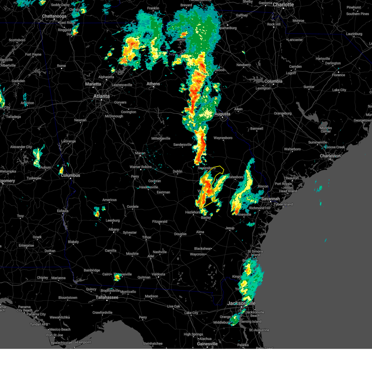
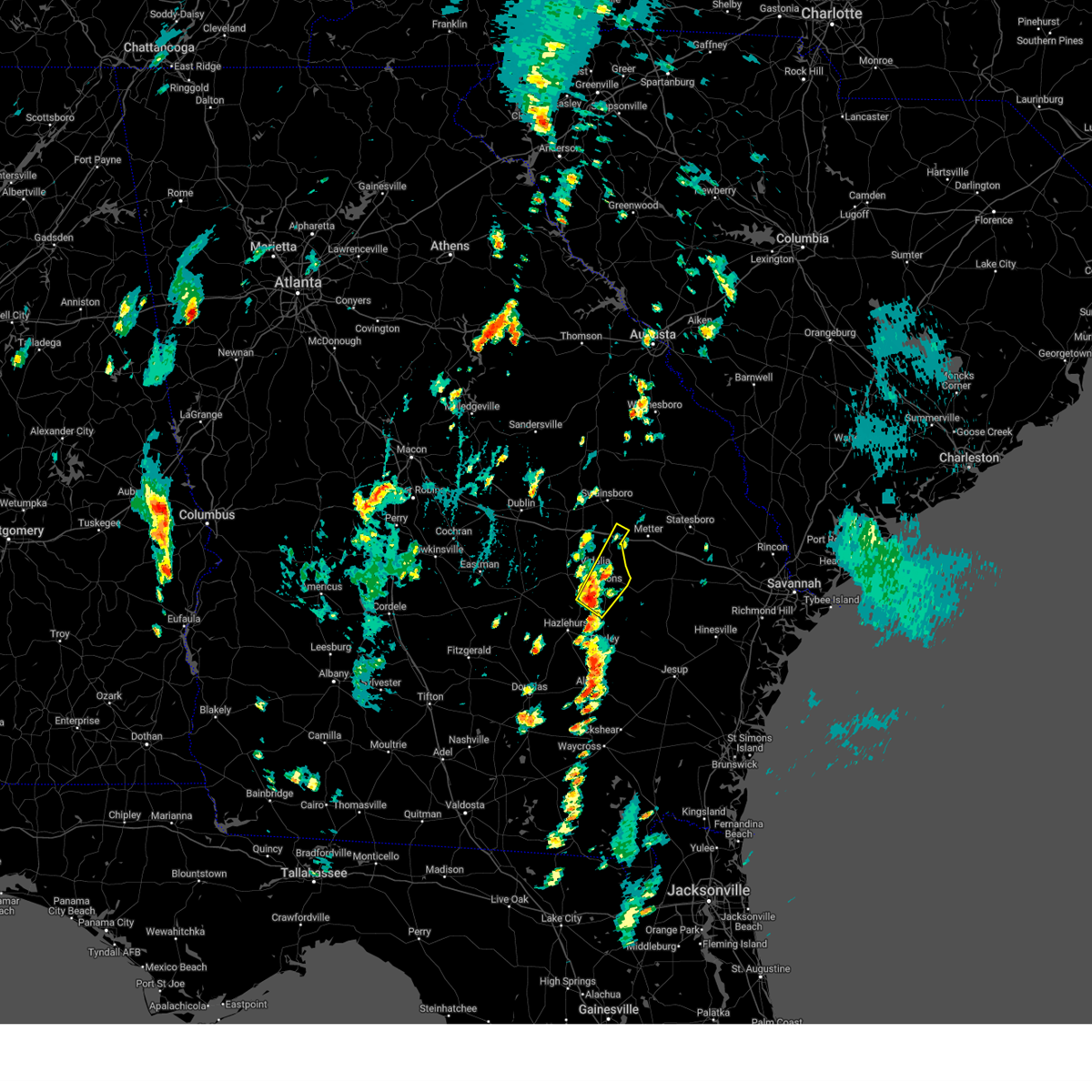
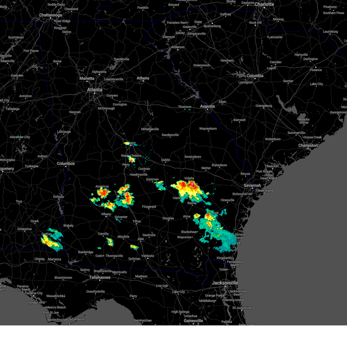
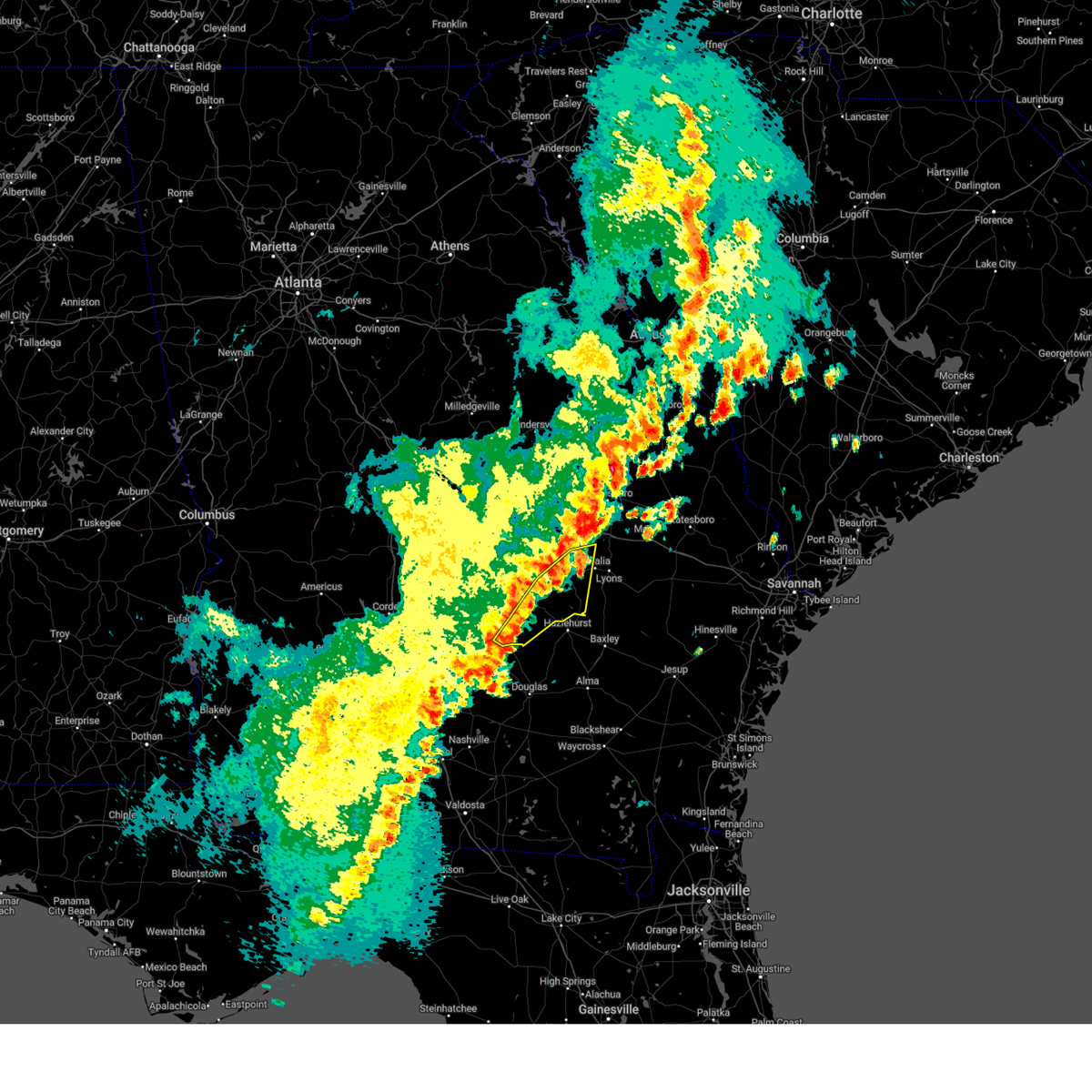
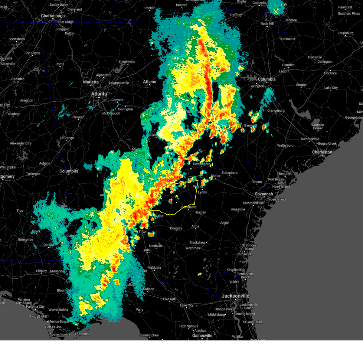
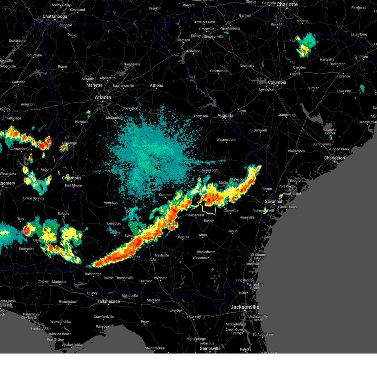
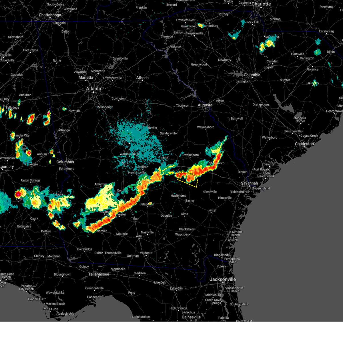
Hail Map for Vidalia, GA
The Vidalia, GA area has had 5 reports of on-the-ground hail by trained spotters, and has been under severe weather warnings 32 times during the past 12 months. Doppler radar has detected hail at or near Vidalia, GA on 77 occasions, including 5 occasions during the past year.
| Name: | Vidalia, GA |
| Where Located: | 55 miles NNE of Douglas, GA |
| Map: | Google Map for Vidalia, GA |
| Population: | 10473 |
| Housing Units: | 4691 |
| More Info: | Search Google for Vidalia, GA |
1
The Top Recent Hail Date for Vidalia, GA is Sunday, April 27, 2025 (20th out of 77)
Hail and Wind Damage Spotted near Vidalia, GA
| Date / Time | Report Details |
|---|---|
| 6/26/2025 12:18 AM EDT |
 Svrffc the national weather service in peachtree city has issued a * severe thunderstorm warning for, toombs county in southeastern georgia, south central emanuel county in east central georgia, eastern treutlen county in east central georgia, east central wheeler county in central georgia, montgomery county in central georgia, * until 100 am edt. * at 1218 am edt, severe thunderstorms were located along a line extending from norristown to aline, moving south at 45 mph (radar indicated). Hazards include 60 mph wind gusts and quarter size hail. Hail damage to vehicles is expected. Expect wind damage to roofs, siding, and trees. Svrffc the national weather service in peachtree city has issued a * severe thunderstorm warning for, toombs county in southeastern georgia, south central emanuel county in east central georgia, eastern treutlen county in east central georgia, east central wheeler county in central georgia, montgomery county in central georgia, * until 100 am edt. * at 1218 am edt, severe thunderstorms were located along a line extending from norristown to aline, moving south at 45 mph (radar indicated). Hazards include 60 mph wind gusts and quarter size hail. Hail damage to vehicles is expected. Expect wind damage to roofs, siding, and trees.
|
| 6/11/2025 9:30 PM EDT |
 Svrffc the national weather service in peachtree city has issued a * severe thunderstorm warning for, central toombs county in southeastern georgia, * until 1000 pm edt. * at 930 pm edt, a severe thunderstorm was located over johnson corner, or 7 miles south of lyons, moving northeast at 5 mph (radar indicated). Hazards include 60 mph wind gusts. expect damage to roofs, siding, and trees Svrffc the national weather service in peachtree city has issued a * severe thunderstorm warning for, central toombs county in southeastern georgia, * until 1000 pm edt. * at 930 pm edt, a severe thunderstorm was located over johnson corner, or 7 miles south of lyons, moving northeast at 5 mph (radar indicated). Hazards include 60 mph wind gusts. expect damage to roofs, siding, and trees
|
| 5/12/2025 8:49 PM EDT |
 the severe thunderstorm warning has been cancelled and is no longer in effect the severe thunderstorm warning has been cancelled and is no longer in effect
|
| 5/12/2025 8:28 PM EDT |
 At 827 pm edt, severe thunderstorms were located along a line extending from lexsy to south thompson, moving northeast at 25 mph (radar indicated). Hazards include 60 mph wind gusts and penny size hail. Expect damage to roofs, siding, and trees. Locations impacted include, swainsboro, lyons, vidalia, twin city, stillmore, oak park, garfield, santa claus, nunez, center, toombs central, ohoopee, new branch, ponderosa, mcnatt falls, south thompson, rock springs, cedar crossing, johnson corner, and lexsy. At 827 pm edt, severe thunderstorms were located along a line extending from lexsy to south thompson, moving northeast at 25 mph (radar indicated). Hazards include 60 mph wind gusts and penny size hail. Expect damage to roofs, siding, and trees. Locations impacted include, swainsboro, lyons, vidalia, twin city, stillmore, oak park, garfield, santa claus, nunez, center, toombs central, ohoopee, new branch, ponderosa, mcnatt falls, south thompson, rock springs, cedar crossing, johnson corner, and lexsy.
|
| 5/12/2025 8:28 PM EDT |
 the severe thunderstorm warning has been cancelled and is no longer in effect the severe thunderstorm warning has been cancelled and is no longer in effect
|
| 5/12/2025 8:12 PM EDT |
 Svrffc the national weather service in peachtree city has issued a * severe thunderstorm warning for, toombs county in southeastern georgia, southeastern emanuel county in east central georgia, east central treutlen county in east central georgia, eastern montgomery county in central georgia, * until 900 pm edt. * at 812 pm edt, severe thunderstorms were located along a line extending from near nunez to rock springs, moving northeast at 25 mph (radar indicated). Hazards include 60 mph wind gusts and penny size hail. expect damage to roofs, siding, and trees Svrffc the national weather service in peachtree city has issued a * severe thunderstorm warning for, toombs county in southeastern georgia, southeastern emanuel county in east central georgia, east central treutlen county in east central georgia, eastern montgomery county in central georgia, * until 900 pm edt. * at 812 pm edt, severe thunderstorms were located along a line extending from near nunez to rock springs, moving northeast at 25 mph (radar indicated). Hazards include 60 mph wind gusts and penny size hail. expect damage to roofs, siding, and trees
|
| 5/12/2025 4:52 PM EDT |
 The storm which prompted the warning has weakened below severe limits, and no longer poses an immediate threat to life or property. therefore, the warning will be allowed to expire. however, gusty winds and heavy rain are still possible with this thunderstorm. to report severe weather, contact your nearest law enforcement agency. they will relay your report to the national weather service peachtree city. The storm which prompted the warning has weakened below severe limits, and no longer poses an immediate threat to life or property. therefore, the warning will be allowed to expire. however, gusty winds and heavy rain are still possible with this thunderstorm. to report severe weather, contact your nearest law enforcement agency. they will relay your report to the national weather service peachtree city.
|
| 5/12/2025 4:44 PM EDT |
 At 443 pm edt, a severe thunderstorm was located over lyons, moving northeast at 30 mph (radar indicated). Hazards include 60 mph wind gusts and penny size hail. Expect damage to roofs, siding, and trees. Locations impacted include, lyons, vidalia, stillmore, oak park, santa claus, south thompson, center, ohoopee, new branch, ponderosa, and johnson corner. At 443 pm edt, a severe thunderstorm was located over lyons, moving northeast at 30 mph (radar indicated). Hazards include 60 mph wind gusts and penny size hail. Expect damage to roofs, siding, and trees. Locations impacted include, lyons, vidalia, stillmore, oak park, santa claus, south thompson, center, ohoopee, new branch, ponderosa, and johnson corner.
|
| 5/12/2025 4:44 PM EDT |
 the severe thunderstorm warning has been cancelled and is no longer in effect the severe thunderstorm warning has been cancelled and is no longer in effect
|
| 5/12/2025 4:22 PM EDT |
 Svrffc the national weather service in peachtree city has issued a * severe thunderstorm warning for, toombs county in southeastern georgia, south central emanuel county in east central georgia, southeastern montgomery county in central georgia, * until 500 pm edt. * at 421 pm edt, a severe thunderstorm was located over rock springs, or 9 miles northwest of plant hatch, moving northeast at 30 mph (radar indicated). Hazards include 60 mph wind gusts and penny size hail. expect damage to roofs, siding, and trees Svrffc the national weather service in peachtree city has issued a * severe thunderstorm warning for, toombs county in southeastern georgia, south central emanuel county in east central georgia, southeastern montgomery county in central georgia, * until 500 pm edt. * at 421 pm edt, a severe thunderstorm was located over rock springs, or 9 miles northwest of plant hatch, moving northeast at 30 mph (radar indicated). Hazards include 60 mph wind gusts and penny size hail. expect damage to roofs, siding, and trees
|
| 4/27/2025 8:49 PM EDT |
 the severe thunderstorm warning has been cancelled and is no longer in effect the severe thunderstorm warning has been cancelled and is no longer in effect
|
| 4/27/2025 8:38 PM EDT |
 At 838 pm edt, a severe thunderstorm was located over center, or near lyons, moving northeast at 5 mph (radar indicated). Hazards include quarter size hail. Damage to vehicles is expected. Locations impacted include, lyons, santa claus, and vidalia. At 838 pm edt, a severe thunderstorm was located over center, or near lyons, moving northeast at 5 mph (radar indicated). Hazards include quarter size hail. Damage to vehicles is expected. Locations impacted include, lyons, santa claus, and vidalia.
|
| 4/27/2025 8:36 PM EDT |
 Svrffc the national weather service in peachtree city has issued a * severe thunderstorm warning for, northeastern toombs county in southeastern georgia, south central emanuel county in east central georgia, * until 915 pm edt. * at 836 pm edt, a severe thunderstorm was located over lyons, moving northeast at 5 mph (radar indicated). Hazards include quarter size hail. damage to vehicles is expected Svrffc the national weather service in peachtree city has issued a * severe thunderstorm warning for, northeastern toombs county in southeastern georgia, south central emanuel county in east central georgia, * until 915 pm edt. * at 836 pm edt, a severe thunderstorm was located over lyons, moving northeast at 5 mph (radar indicated). Hazards include quarter size hail. damage to vehicles is expected
|
| 4/27/2025 8:25 PM EDT |
 the severe thunderstorm warning has been cancelled and is no longer in effect the severe thunderstorm warning has been cancelled and is no longer in effect
|
| 4/27/2025 8:25 PM EDT |
 At 824 pm edt, a severe thunderstorm was located over center, or 7 miles southwest of lyons, moving northeast at 5 mph (radar indicated). Hazards include 60 mph wind gusts and quarter size hail. Hail damage to vehicles is expected. expect wind damage to roofs, siding, and trees. Locations impacted include, lyons, south thompson, center, santa claus, and vidalia. At 824 pm edt, a severe thunderstorm was located over center, or 7 miles southwest of lyons, moving northeast at 5 mph (radar indicated). Hazards include 60 mph wind gusts and quarter size hail. Hail damage to vehicles is expected. expect wind damage to roofs, siding, and trees. Locations impacted include, lyons, south thompson, center, santa claus, and vidalia.
|
| 4/27/2025 8:09 PM EDT |
 Svrffc the national weather service in peachtree city has issued a * severe thunderstorm warning for, southwestern toombs county in southeastern georgia, southeastern montgomery county in central georgia, * until 900 pm edt. * at 809 pm edt, a severe thunderstorm was located over rock springs, or 8 miles southwest of lyons, moving northeast at 5 mph (radar indicated). Hazards include 60 mph wind gusts and quarter size hail. Hail damage to vehicles is expected. Expect wind damage to roofs, siding, and trees. Svrffc the national weather service in peachtree city has issued a * severe thunderstorm warning for, southwestern toombs county in southeastern georgia, southeastern montgomery county in central georgia, * until 900 pm edt. * at 809 pm edt, a severe thunderstorm was located over rock springs, or 8 miles southwest of lyons, moving northeast at 5 mph (radar indicated). Hazards include 60 mph wind gusts and quarter size hail. Hail damage to vehicles is expected. Expect wind damage to roofs, siding, and trees.
|
| 3/31/2025 4:23 PM EDT |
 At 423 pm edt, severe thunderstorms were located along a line extending from center to near lumber city, moving east at 45 mph (radar indicated). Hazards include 60 mph wind gusts. Expect damage to roofs, siding, and trees. Locations impacted include, uvalda, towns, horse creek wma, spring hill, higgston, alston, jordan, charlotteville, lumber city, ailey, mount vernon, and vidalia. At 423 pm edt, severe thunderstorms were located along a line extending from center to near lumber city, moving east at 45 mph (radar indicated). Hazards include 60 mph wind gusts. Expect damage to roofs, siding, and trees. Locations impacted include, uvalda, towns, horse creek wma, spring hill, higgston, alston, jordan, charlotteville, lumber city, ailey, mount vernon, and vidalia.
|
| 3/31/2025 4:10 PM EDT |
 the severe thunderstorm warning has been cancelled and is no longer in effect the severe thunderstorm warning has been cancelled and is no longer in effect
|
| 3/31/2025 4:10 PM EDT |
 At 409 pm edt, severe thunderstorms were located along a line extending from near mount vernon to 6 miles northeast of horse creek wma, moving east at 40 mph (radar indicated). Hazards include 60 mph wind gusts. Expect damage to roofs, siding, and trees. Locations impacted include, horse creek wma, spring hill, higgston, landsburg, glenwood, scotland, tarrytown, lumber city, kibbee, uvalda, towns, mount vernon, alston, jordan, charlotteville, jacksonville, ailey, alamo, workmore, and mcrae. At 409 pm edt, severe thunderstorms were located along a line extending from near mount vernon to 6 miles northeast of horse creek wma, moving east at 40 mph (radar indicated). Hazards include 60 mph wind gusts. Expect damage to roofs, siding, and trees. Locations impacted include, horse creek wma, spring hill, higgston, landsburg, glenwood, scotland, tarrytown, lumber city, kibbee, uvalda, towns, mount vernon, alston, jordan, charlotteville, jacksonville, ailey, alamo, workmore, and mcrae.
|
| 3/31/2025 4:01 PM EDT |
 Svrffc the national weather service in peachtree city has issued a * severe thunderstorm warning for, toombs county in southeastern georgia, * until 445 pm edt. * at 401 pm edt, severe thunderstorms were located along a line extending from tarrytown to workmore, moving east at 40 mph (radar indicated). Hazards include 60 mph wind gusts. expect damage to roofs, siding, and trees Svrffc the national weather service in peachtree city has issued a * severe thunderstorm warning for, toombs county in southeastern georgia, * until 445 pm edt. * at 401 pm edt, severe thunderstorms were located along a line extending from tarrytown to workmore, moving east at 40 mph (radar indicated). Hazards include 60 mph wind gusts. expect damage to roofs, siding, and trees
|
| 3/31/2025 3:59 PM EDT |
 At 358 pm edt, severe thunderstorms were located along a line extending from alamo to near jacksonville, moving east at 45 mph (radar indicated). Hazards include 60 mph wind gusts. Expect damage to roofs, siding, and trees. Locations impacted include, horse creek wma, spring hill, cedar grove, scotland, barnhill, uvalda, towns, china hill, mount vernon, helena, alston, jordan, jacksonville, ailey, alamo, higgston, landsburg, glenwood, tarrytown, and mcrae. At 358 pm edt, severe thunderstorms were located along a line extending from alamo to near jacksonville, moving east at 45 mph (radar indicated). Hazards include 60 mph wind gusts. Expect damage to roofs, siding, and trees. Locations impacted include, horse creek wma, spring hill, cedar grove, scotland, barnhill, uvalda, towns, china hill, mount vernon, helena, alston, jordan, jacksonville, ailey, alamo, higgston, landsburg, glenwood, tarrytown, and mcrae.
|
| 3/31/2025 3:59 PM EDT |
 the severe thunderstorm warning has been cancelled and is no longer in effect the severe thunderstorm warning has been cancelled and is no longer in effect
|
| 3/31/2025 3:39 PM EDT |
 Svrffc the national weather service in peachtree city has issued a * severe thunderstorm warning for, southeastern laurens county in central georgia, southeastern dodge county in central georgia, telfair county in central georgia, southern treutlen county in east central georgia, southeastern wilcox county in central georgia, wheeler county in central georgia, montgomery county in central georgia, * until 430 pm edt. * at 338 pm edt, severe thunderstorms were located along a line extending from chauncey to bowens mill, moving east at 45 mph (radar indicated). Hazards include 60 mph wind gusts. expect damage to roofs, siding, and trees Svrffc the national weather service in peachtree city has issued a * severe thunderstorm warning for, southeastern laurens county in central georgia, southeastern dodge county in central georgia, telfair county in central georgia, southern treutlen county in east central georgia, southeastern wilcox county in central georgia, wheeler county in central georgia, montgomery county in central georgia, * until 430 pm edt. * at 338 pm edt, severe thunderstorms were located along a line extending from chauncey to bowens mill, moving east at 45 mph (radar indicated). Hazards include 60 mph wind gusts. expect damage to roofs, siding, and trees
|
| 2/16/2025 7:48 AM EST |
 Svrffc the national weather service in peachtree city has issued a * severe thunderstorm warning for, toombs county in southeastern georgia, montgomery county in central georgia, * until 815 am est. * at 748 am est, severe thunderstorms were located along a line extending from near normantown to near ailey to near spring hill, moving east at 45 mph (radar indicated). Hazards include 60 mph wind gusts. expect damage to roofs, siding, and trees Svrffc the national weather service in peachtree city has issued a * severe thunderstorm warning for, toombs county in southeastern georgia, montgomery county in central georgia, * until 815 am est. * at 748 am est, severe thunderstorms were located along a line extending from near normantown to near ailey to near spring hill, moving east at 45 mph (radar indicated). Hazards include 60 mph wind gusts. expect damage to roofs, siding, and trees
|
| 2/16/2025 7:37 AM EST |
 At 736 am est, severe thunderstorms were located along a line extending from near landsburg to towns to ocilla, moving southeast at 45 mph (radar indicated). Hazards include 60 mph wind gusts. Expect damage to roofs, siding, and trees. Locations impacted include, mcrae, alamo, mount vernon, vidalia, helena, lumber city, glenwood, milan, uvalda, ailey, scotland, higgston, alston, jacksonville, tarrytown, towns, horse creek wma, spring hill, barnhill, and china hill. At 736 am est, severe thunderstorms were located along a line extending from near landsburg to towns to ocilla, moving southeast at 45 mph (radar indicated). Hazards include 60 mph wind gusts. Expect damage to roofs, siding, and trees. Locations impacted include, mcrae, alamo, mount vernon, vidalia, helena, lumber city, glenwood, milan, uvalda, ailey, scotland, higgston, alston, jacksonville, tarrytown, towns, horse creek wma, spring hill, barnhill, and china hill.
|
| 2/16/2025 7:37 AM EST |
 the severe thunderstorm warning has been cancelled and is no longer in effect the severe thunderstorm warning has been cancelled and is no longer in effect
|
| 2/16/2025 6:57 AM EST |
 Svrffc the national weather service in peachtree city has issued a * severe thunderstorm warning for, southern laurens county in central georgia, northwestern toombs county in southeastern georgia, dodge county in central georgia, telfair county in central georgia, southwestern treutlen county in east central georgia, wilcox county in central georgia, wheeler county in central georgia, southeastern crisp county in central georgia, montgomery county in central georgia, * until 800 am est. * at 657 am est, severe thunderstorms were located along a line extending from dexter to near eastman to dakota, moving southeast at 45 mph (radar indicated). Hazards include 60 mph wind gusts. expect damage to roofs, siding, and trees Svrffc the national weather service in peachtree city has issued a * severe thunderstorm warning for, southern laurens county in central georgia, northwestern toombs county in southeastern georgia, dodge county in central georgia, telfair county in central georgia, southwestern treutlen county in east central georgia, wilcox county in central georgia, wheeler county in central georgia, southeastern crisp county in central georgia, montgomery county in central georgia, * until 800 am est. * at 657 am est, severe thunderstorms were located along a line extending from dexter to near eastman to dakota, moving southeast at 45 mph (radar indicated). Hazards include 60 mph wind gusts. expect damage to roofs, siding, and trees
|
| 8/18/2024 9:13 PM EDT |
 Svrffc the national weather service in peachtree city has issued a * severe thunderstorm warning for, toombs county in southeastern georgia, east central montgomery county in central georgia, * until 1015 pm edt. * at 913 pm edt, a severe thunderstorm was located over santa claus, or near lyons, moving southeast at 25 mph (radar indicated). Hazards include 60 mph wind gusts. expect damage to roofs, siding, and trees Svrffc the national weather service in peachtree city has issued a * severe thunderstorm warning for, toombs county in southeastern georgia, east central montgomery county in central georgia, * until 1015 pm edt. * at 913 pm edt, a severe thunderstorm was located over santa claus, or near lyons, moving southeast at 25 mph (radar indicated). Hazards include 60 mph wind gusts. expect damage to roofs, siding, and trees
|
| 8/18/2024 8:43 PM EDT |
 Svrffc the national weather service in peachtree city has issued a * severe thunderstorm warning for, central toombs county in southeastern georgia, northern montgomery county in central georgia, * until 915 pm edt. * at 843 pm edt, a severe thunderstorm was located near kibbee, or near mount vernon, moving east at 25 mph (radar indicated). Hazards include 60 mph wind gusts. expect damage to roofs, siding, and trees Svrffc the national weather service in peachtree city has issued a * severe thunderstorm warning for, central toombs county in southeastern georgia, northern montgomery county in central georgia, * until 915 pm edt. * at 843 pm edt, a severe thunderstorm was located near kibbee, or near mount vernon, moving east at 25 mph (radar indicated). Hazards include 60 mph wind gusts. expect damage to roofs, siding, and trees
|
| 8/18/2024 8:41 PM EDT |
 At 840 pm edt, a severe thunderstorm was located over ohoopee, or 7 miles northwest of reidsville, moving southeast at 30 mph (radar indicated). Hazards include 60 mph wind gusts. Expect damage to roofs, siding, and trees. Locations impacted include, lyons, vidalia, oak park, and normantown. At 840 pm edt, a severe thunderstorm was located over ohoopee, or 7 miles northwest of reidsville, moving southeast at 30 mph (radar indicated). Hazards include 60 mph wind gusts. Expect damage to roofs, siding, and trees. Locations impacted include, lyons, vidalia, oak park, and normantown.
|
| 8/18/2024 8:41 PM EDT |
 the severe thunderstorm warning has been cancelled and is no longer in effect the severe thunderstorm warning has been cancelled and is no longer in effect
|
| 8/18/2024 8:17 PM EDT | Svrffc the national weather service in peachtree city has issued a * severe thunderstorm warning for, northern toombs county in southeastern georgia, south central emanuel county in east central georgia, southeastern treutlen county in east central georgia, northeastern montgomery county in central georgia, * until 900 pm edt. * at 816 pm edt, a severe thunderstorm was located over normantown, or near lyons, moving southeast at 30 mph (radar indicated). Hazards include 60 mph wind gusts. expect damage to roofs, siding, and trees |
| 5/25/2024 3:16 PM EDT |
 The storm which prompted the warning has weakened below severe limits, and no longer poses an immediate threat to life or property. therefore, the warning will be allowed to expire. however, small hail, gusty winds and heavy rain are still possible with this thunderstorm. a severe thunderstorm watch remains in effect until 800 pm edt for central, southeastern and east central georgia. to report severe weather, contact your nearest law enforcement agency. they will relay your report to the national weather service peachtree city. The storm which prompted the warning has weakened below severe limits, and no longer poses an immediate threat to life or property. therefore, the warning will be allowed to expire. however, small hail, gusty winds and heavy rain are still possible with this thunderstorm. a severe thunderstorm watch remains in effect until 800 pm edt for central, southeastern and east central georgia. to report severe weather, contact your nearest law enforcement agency. they will relay your report to the national weather service peachtree city.
|
| 5/25/2024 2:34 PM EDT |
 Svrffc the national weather service in peachtree city has issued a * severe thunderstorm warning for, northwestern toombs county in southeastern georgia, southwestern treutlen county in east central georgia, northeastern wheeler county in central georgia, montgomery county in central georgia, * until 315 pm edt. * at 233 pm edt, a severe thunderstorm was located near barnhill, or 7 miles northwest of mount vernon, moving southeast at 15 mph (radar indicated). Hazards include 60 mph wind gusts and quarter size hail. Hail damage to vehicles is expected. Expect wind damage to roofs, siding, and trees. Svrffc the national weather service in peachtree city has issued a * severe thunderstorm warning for, northwestern toombs county in southeastern georgia, southwestern treutlen county in east central georgia, northeastern wheeler county in central georgia, montgomery county in central georgia, * until 315 pm edt. * at 233 pm edt, a severe thunderstorm was located near barnhill, or 7 miles northwest of mount vernon, moving southeast at 15 mph (radar indicated). Hazards include 60 mph wind gusts and quarter size hail. Hail damage to vehicles is expected. Expect wind damage to roofs, siding, and trees.
|
| 5/9/2024 2:28 PM EDT | Report from mping: trees uprooted or snapped; roof blown of in toombs county GA, 2.3 miles ENE of Vidalia, GA |
| 5/9/2024 2:15 PM EDT |
 the tornado warning has been cancelled and is no longer in effect the tornado warning has been cancelled and is no longer in effect
|
| 5/9/2024 2:04 PM EDT | Significant wind damage reported near the walmart on ga-280. tornado possibl in toombs county GA, 2.1 miles WSW of Vidalia, GA |
| 5/9/2024 2:01 PM EDT |
 At 201 pm edt, a severe thunderstorm was located over johnson corner, or 8 miles south of lyons, moving east at 40 mph (radar indicated). Hazards include 60 mph wind gusts and quarter size hail. Hail damage to vehicles is expected. expect wind damage to roofs, siding, and trees. Locations impacted include, lyons, vidalia, santa claus, alston, center, toombs central, ohoopee, new branch, ponderosa, south thompson, english eddy, rock springs, cedar crossing, johnson corner, and normantown. At 201 pm edt, a severe thunderstorm was located over johnson corner, or 8 miles south of lyons, moving east at 40 mph (radar indicated). Hazards include 60 mph wind gusts and quarter size hail. Hail damage to vehicles is expected. expect wind damage to roofs, siding, and trees. Locations impacted include, lyons, vidalia, santa claus, alston, center, toombs central, ohoopee, new branch, ponderosa, south thompson, english eddy, rock springs, cedar crossing, johnson corner, and normantown.
|
| 5/9/2024 2:01 PM EDT |
 the severe thunderstorm warning has been cancelled and is no longer in effect the severe thunderstorm warning has been cancelled and is no longer in effect
|
| 5/9/2024 1:59 PM EDT |
 the tornado warning has been cancelled and is no longer in effect the tornado warning has been cancelled and is no longer in effect
|
| 5/9/2024 1:59 PM EDT |
 At 159 pm edt, a severe thunderstorm capable of producing a tornado was located over johnson corner, or 8 miles north of plant hatch, moving east at 55 mph (radar indicated rotation). Hazards include tornado and quarter size hail. Flying debris will be dangerous to those caught without shelter. mobile homes will be damaged or destroyed. damage to roofs, windows, and vehicles will occur. tree damage is likely. Locations impacted include, lyons, vidalia, santa claus, center, toombs central, ohoopee, new branch, south thompson, english eddy, grays landing, rock springs, cedar crossing, and johnson corner. At 159 pm edt, a severe thunderstorm capable of producing a tornado was located over johnson corner, or 8 miles north of plant hatch, moving east at 55 mph (radar indicated rotation). Hazards include tornado and quarter size hail. Flying debris will be dangerous to those caught without shelter. mobile homes will be damaged or destroyed. damage to roofs, windows, and vehicles will occur. tree damage is likely. Locations impacted include, lyons, vidalia, santa claus, center, toombs central, ohoopee, new branch, south thompson, english eddy, grays landing, rock springs, cedar crossing, and johnson corner.
|
| 5/9/2024 1:50 PM EDT | Ema volunteer reports a large tree uprooted and toppled in the clyde blvd area. tornado possibl in toombs county GA, 0.3 miles WNW of Vidalia, GA |
| 5/9/2024 1:48 PM EDT | Wind damage reported in downtown vidalia. tornado possibl in toombs county GA, 1.5 miles SE of Vidalia, GA |
| 5/9/2024 1:48 PM EDT |
 At 147 pm edt, a severe thunderstorm was located over rock springs, or 10 miles southwest of lyons, moving east at 55 mph (radar indicated). Hazards include 60 mph wind gusts and quarter size hail. Hail damage to vehicles is expected. expect wind damage to roofs, siding, and trees. Locations impacted include, lyons, mount vernon, vidalia, uvalda, ailey, higgston, santa claus, alston, center, toombs central, ohoopee, new branch, ponderosa, kibbee, south thompson, english eddy, rock springs, cedar crossing, johnson corner, and charlotteville. At 147 pm edt, a severe thunderstorm was located over rock springs, or 10 miles southwest of lyons, moving east at 55 mph (radar indicated). Hazards include 60 mph wind gusts and quarter size hail. Hail damage to vehicles is expected. expect wind damage to roofs, siding, and trees. Locations impacted include, lyons, mount vernon, vidalia, uvalda, ailey, higgston, santa claus, alston, center, toombs central, ohoopee, new branch, ponderosa, kibbee, south thompson, english eddy, rock springs, cedar crossing, johnson corner, and charlotteville.
|
| 5/9/2024 1:43 PM EDT |
 Torffc the national weather service in peachtree city has issued a * tornado warning for, toombs county in southeastern georgia, southeastern wheeler county in central georgia, montgomery county in central georgia, * until 230 pm edt. * at 143 pm edt, a confirmed tornado was located near alston, or near mount vernon, moving east at 55 mph (weather spotters confirmed tornado). Hazards include damaging tornado. Flying debris will be dangerous to those caught without shelter. mobile homes will be damaged or destroyed. damage to roofs, windows, and vehicles will occur. Tree damage is likely. Torffc the national weather service in peachtree city has issued a * tornado warning for, toombs county in southeastern georgia, southeastern wheeler county in central georgia, montgomery county in central georgia, * until 230 pm edt. * at 143 pm edt, a confirmed tornado was located near alston, or near mount vernon, moving east at 55 mph (weather spotters confirmed tornado). Hazards include damaging tornado. Flying debris will be dangerous to those caught without shelter. mobile homes will be damaged or destroyed. damage to roofs, windows, and vehicles will occur. Tree damage is likely.
|
| 5/9/2024 1:35 PM EDT |
 Svrffc the national weather service in peachtree city has issued a * severe thunderstorm warning for, toombs county in southeastern georgia, northeastern wheeler county in central georgia, montgomery county in central georgia, * until 215 pm edt. * at 135 pm edt, a severe thunderstorm was located over glenwood, or near mount vernon, moving east at 40 mph (radar indicated). Hazards include 60 mph wind gusts and quarter size hail. Hail damage to vehicles is expected. Expect wind damage to roofs, siding, and trees. Svrffc the national weather service in peachtree city has issued a * severe thunderstorm warning for, toombs county in southeastern georgia, northeastern wheeler county in central georgia, montgomery county in central georgia, * until 215 pm edt. * at 135 pm edt, a severe thunderstorm was located over glenwood, or near mount vernon, moving east at 40 mph (radar indicated). Hazards include 60 mph wind gusts and quarter size hail. Hail damage to vehicles is expected. Expect wind damage to roofs, siding, and trees.
|
| 1/9/2024 1:08 PM EST |
 At 107 pm est, severe thunderstorms were located along a line extending from near twin city to cedar crossing, moving east at 40 mph (radar indicated). Hazards include 60 mph wind gusts. Expect damage to roofs, siding, and trees. Locations impacted include, swainsboro, lyons, vidalia, twin city, stillmore, oak park, higgston, santa claus, alston, nunez, ohoopee, new branch, mcnatt falls, south thompson, english eddy, cedar crossing, johnson corner, george l smith state park, center, and toombs central. At 107 pm est, severe thunderstorms were located along a line extending from near twin city to cedar crossing, moving east at 40 mph (radar indicated). Hazards include 60 mph wind gusts. Expect damage to roofs, siding, and trees. Locations impacted include, swainsboro, lyons, vidalia, twin city, stillmore, oak park, higgston, santa claus, alston, nunez, ohoopee, new branch, mcnatt falls, south thompson, english eddy, cedar crossing, johnson corner, george l smith state park, center, and toombs central.
|
| 1/9/2024 12:38 PM EST |
 At 1237 pm est, severe thunderstorms were located along a line extending from near blackville to 6 miles southwest of lumber city, moving northeast at 45 mph (radar indicated). Hazards include 60 mph wind gusts. expect damage to roofs, siding, and trees At 1237 pm est, severe thunderstorms were located along a line extending from near blackville to 6 miles southwest of lumber city, moving northeast at 45 mph (radar indicated). Hazards include 60 mph wind gusts. expect damage to roofs, siding, and trees
|
| 1/9/2024 12:38 PM EST |
 At 1237 pm est, severe thunderstorms were located along a line extending from near scott to near orland to near landsburg, moving east at 35 mph (radar indicated). Hazards include 60 mph wind gusts. Expect damage to roofs, siding, and trees. Locations impacted include, swainsboro, soperton, vidalia, adrian, oak park, higgston, nunez, tarrytown, lothair, covena, landsburg, orland, orianna, norristown, barnhill, kibbee, norristown junction, blackville, zaidee, and gillis springs. At 1237 pm est, severe thunderstorms were located along a line extending from near scott to near orland to near landsburg, moving east at 35 mph (radar indicated). Hazards include 60 mph wind gusts. Expect damage to roofs, siding, and trees. Locations impacted include, swainsboro, soperton, vidalia, adrian, oak park, higgston, nunez, tarrytown, lothair, covena, landsburg, orland, orianna, norristown, barnhill, kibbee, norristown junction, blackville, zaidee, and gillis springs.
|
| 1/9/2024 12:10 PM EST |
 At 1209 pm est, severe thunderstorms were located along a line extending from near east dublin to near cedar grove, moving east at 45 mph (radar indicated). Hazards include 60 mph wind gusts. expect damage to roofs, siding, and trees At 1209 pm est, severe thunderstorms were located along a line extending from near east dublin to near cedar grove, moving east at 45 mph (radar indicated). Hazards include 60 mph wind gusts. expect damage to roofs, siding, and trees
|
| 9/17/2023 2:51 PM EDT |
 The severe thunderstorm warning for northern toombs and south central emanuel counties will expire at 300 pm edt, the storm which prompted the warning has weakened below severe limits, and no longer poses an immediate threat to life or property. therefore, the warning will be allowed to expire. The severe thunderstorm warning for northern toombs and south central emanuel counties will expire at 300 pm edt, the storm which prompted the warning has weakened below severe limits, and no longer poses an immediate threat to life or property. therefore, the warning will be allowed to expire.
|
| 9/17/2023 2:39 PM EDT |
 At 239 pm edt, a severe thunderstorm was located near lyons, moving east at 30 mph (radar indicated). Hazards include 60 mph wind gusts and nickel size hail. Expect damage to roofs, siding, and trees. locations impacted include, lyons, vidalia, oak park, santa claus, ohoopee, ponderosa, and normantown. hail threat, radar indicated max hail size, 0. 88 in wind threat, radar indicated max wind gust, 60 mph. At 239 pm edt, a severe thunderstorm was located near lyons, moving east at 30 mph (radar indicated). Hazards include 60 mph wind gusts and nickel size hail. Expect damage to roofs, siding, and trees. locations impacted include, lyons, vidalia, oak park, santa claus, ohoopee, ponderosa, and normantown. hail threat, radar indicated max hail size, 0. 88 in wind threat, radar indicated max wind gust, 60 mph.
|
| 9/17/2023 2:32 PM EDT |
 At 232 pm edt, a severe thunderstorm was located near vidalia, or near lyons, moving east at 30 mph (radar indicated). Hazards include 60 mph wind gusts and nickel size hail. Expect damage to roofs, siding, and trees. locations impacted include, lyons, vidalia, oak park, higgston, santa claus, ohoopee, ponderosa, and normantown. hail threat, radar indicated max hail size, 0. 88 in wind threat, radar indicated max wind gust, 60 mph. At 232 pm edt, a severe thunderstorm was located near vidalia, or near lyons, moving east at 30 mph (radar indicated). Hazards include 60 mph wind gusts and nickel size hail. Expect damage to roofs, siding, and trees. locations impacted include, lyons, vidalia, oak park, higgston, santa claus, ohoopee, ponderosa, and normantown. hail threat, radar indicated max hail size, 0. 88 in wind threat, radar indicated max wind gust, 60 mph.
|
| 9/17/2023 2:22 PM EDT |
 At 222 pm edt, a severe thunderstorm was located over higgston, or near mount vernon, moving east at 30 mph (radar indicated). Hazards include 60 mph wind gusts and nickel size hail. expect damage to roofs, siding, and trees At 222 pm edt, a severe thunderstorm was located over higgston, or near mount vernon, moving east at 30 mph (radar indicated). Hazards include 60 mph wind gusts and nickel size hail. expect damage to roofs, siding, and trees
|
| 9/7/2023 5:37 PM EDT |
 The severe thunderstorm warning for southeastern laurens, treutlen, northern wheeler and montgomery counties will expire at 545 pm edt, the storm which prompted the warning has weakened below severe limits, and no longer poses an immediate threat to life or property. therefore, the warning will be allowed to expire. The severe thunderstorm warning for southeastern laurens, treutlen, northern wheeler and montgomery counties will expire at 545 pm edt, the storm which prompted the warning has weakened below severe limits, and no longer poses an immediate threat to life or property. therefore, the warning will be allowed to expire.
|
| 9/7/2023 5:07 PM EDT |
 At 506 pm edt, a severe thunderstorm was located near lowery, or 10 miles southwest of soperton, moving east at 25 mph (radar indicated). Hazards include 60 mph wind gusts and penny size hail. expect damage to roofs, siding, and trees At 506 pm edt, a severe thunderstorm was located near lowery, or 10 miles southwest of soperton, moving east at 25 mph (radar indicated). Hazards include 60 mph wind gusts and penny size hail. expect damage to roofs, siding, and trees
|
| 8/8/2023 7:26 PM EDT |
 The severe thunderstorm warning for toombs, southwestern emanuel and northeastern treutlen counties will expire at 730 pm edt, the storms which prompted the warning have moved out of the area. therefore, the warning will be allowed to expire. a severe thunderstorm watch remains in effect until 1100 pm edt for central, southeastern and east central georgia. to report severe weather, contact your nearest law enforcement agency. they will relay your report to the national weather service peachtree city. The severe thunderstorm warning for toombs, southwestern emanuel and northeastern treutlen counties will expire at 730 pm edt, the storms which prompted the warning have moved out of the area. therefore, the warning will be allowed to expire. a severe thunderstorm watch remains in effect until 1100 pm edt for central, southeastern and east central georgia. to report severe weather, contact your nearest law enforcement agency. they will relay your report to the national weather service peachtree city.
|
| 8/8/2023 7:06 PM EDT |
 At 706 pm edt, severe thunderstorms were located along a line extending from covena to near normantown to toombs central, moving east at 65 mph (radar indicated). Hazards include 70 mph wind gusts and penny size hail. Expect considerable tree damage. damage is likely to mobile homes, roofs, and outbuildings. locations impacted include, swainsboro, lyons, vidalia, stillmore, oak park, santa claus, nunez, center, toombs central, ohoopee, new branch, covena, ponderosa, norristown, south thompson, english eddy, norristown junction, rock springs, cedar crossing, and lexsy. thunderstorm damage threat, considerable hail threat, radar indicated max hail size, 0. 75 in wind threat, radar indicated max wind gust, 70 mph. At 706 pm edt, severe thunderstorms were located along a line extending from covena to near normantown to toombs central, moving east at 65 mph (radar indicated). Hazards include 70 mph wind gusts and penny size hail. Expect considerable tree damage. damage is likely to mobile homes, roofs, and outbuildings. locations impacted include, swainsboro, lyons, vidalia, stillmore, oak park, santa claus, nunez, center, toombs central, ohoopee, new branch, covena, ponderosa, norristown, south thompson, english eddy, norristown junction, rock springs, cedar crossing, and lexsy. thunderstorm damage threat, considerable hail threat, radar indicated max hail size, 0. 75 in wind threat, radar indicated max wind gust, 70 mph.
|
| 8/8/2023 6:44 PM EDT |
 At 644 pm edt, severe thunderstorms were located along a line extending from near scott to near lothair to near landsburg, moving east at 50 mph (radar indicated). Hazards include 60 mph wind gusts and quarter size hail. Hail damage to vehicles is expected. Expect wind damage to roofs, siding, and trees. At 644 pm edt, severe thunderstorms were located along a line extending from near scott to near lothair to near landsburg, moving east at 50 mph (radar indicated). Hazards include 60 mph wind gusts and quarter size hail. Hail damage to vehicles is expected. Expect wind damage to roofs, siding, and trees.
|
| 7/30/2023 6:44 PM EDT |
 At 643 pm edt, a severe thunderstorm was located over johnson corner, or 7 miles north of plant hatch, moving east at 25 mph (radar indicated). Hazards include 60 mph wind gusts. Expect damage to roofs, siding, and trees. locations impacted include, lyons, vidalia, santa claus, center, toombs central, ohoopee, new branch, ponderosa, mcnatt falls, south thompson, english eddy, grays landing, rock springs, cedar crossing, johnson corner, and normantown. hail threat, radar indicated max hail size, <. 75 in wind threat, radar indicated max wind gust, 60 mph. At 643 pm edt, a severe thunderstorm was located over johnson corner, or 7 miles north of plant hatch, moving east at 25 mph (radar indicated). Hazards include 60 mph wind gusts. Expect damage to roofs, siding, and trees. locations impacted include, lyons, vidalia, santa claus, center, toombs central, ohoopee, new branch, ponderosa, mcnatt falls, south thompson, english eddy, grays landing, rock springs, cedar crossing, johnson corner, and normantown. hail threat, radar indicated max hail size, <. 75 in wind threat, radar indicated max wind gust, 60 mph.
|
| 7/30/2023 6:10 PM EDT |
 At 609 pm edt, a severe thunderstorm was located near ailey, or near mount vernon, moving east at 25 mph (radar indicated). Hazards include 60 mph wind gusts and quarter size hail. Hail damage to vehicles is expected. Expect wind damage to roofs, siding, and trees. At 609 pm edt, a severe thunderstorm was located near ailey, or near mount vernon, moving east at 25 mph (radar indicated). Hazards include 60 mph wind gusts and quarter size hail. Hail damage to vehicles is expected. Expect wind damage to roofs, siding, and trees.
|
| 7/30/2023 5:47 PM EDT |
 At 547 pm edt, a severe thunderstorm was located near landsburg, or near alamo, moving east at 20 mph (radar indicated). Hazards include 60 mph wind gusts and quarter size hail. Hail damage to vehicles is expected. Expect wind damage to roofs, siding, and trees. At 547 pm edt, a severe thunderstorm was located near landsburg, or near alamo, moving east at 20 mph (radar indicated). Hazards include 60 mph wind gusts and quarter size hail. Hail damage to vehicles is expected. Expect wind damage to roofs, siding, and trees.
|
| 6/14/2023 9:33 AM EDT |
 At 932 am edt, severe thunderstorms were located along a line extending from near tarrytown to mount vernon to near jordan, moving east at 50 mph (radar indicated). Hazards include 60 mph wind gusts. Expect damage to roofs, siding, and trees. locations impacted include, soperton, mount vernon, vidalia, glenwood, uvalda, ailey, higgston, alston, tarrytown, lothair, landsburg, barnhill, kibbee, jordan, charlotteville and zaidee. hail threat, radar indicated max hail size, <. 75 in wind threat, radar indicated max wind gust, 60 mph. At 932 am edt, severe thunderstorms were located along a line extending from near tarrytown to mount vernon to near jordan, moving east at 50 mph (radar indicated). Hazards include 60 mph wind gusts. Expect damage to roofs, siding, and trees. locations impacted include, soperton, mount vernon, vidalia, glenwood, uvalda, ailey, higgston, alston, tarrytown, lothair, landsburg, barnhill, kibbee, jordan, charlotteville and zaidee. hail threat, radar indicated max hail size, <. 75 in wind threat, radar indicated max wind gust, 60 mph.
|
| 6/14/2023 9:15 AM EDT |
 At 915 am edt, severe thunderstorms were located along a line extending from near lowery to near cedar grove to near little ocmulgee state park, moving east at 50 mph (radar indicated). Hazards include 60 mph wind gusts. expect damage to roofs, siding, and trees At 915 am edt, severe thunderstorms were located along a line extending from near lowery to near cedar grove to near little ocmulgee state park, moving east at 50 mph (radar indicated). Hazards include 60 mph wind gusts. expect damage to roofs, siding, and trees
|
| 6/12/2023 6:04 PM EDT |
 At 604 pm edt, a severe thunderstorm was located near lothair, or near soperton, moving east at 35 mph (radar indicated). Hazards include 60 mph wind gusts and quarter size hail. Hail damage to vehicles is expected. Expect wind damage to roofs, siding, and trees. At 604 pm edt, a severe thunderstorm was located near lothair, or near soperton, moving east at 35 mph (radar indicated). Hazards include 60 mph wind gusts and quarter size hail. Hail damage to vehicles is expected. Expect wind damage to roofs, siding, and trees.
|
| 6/11/2023 3:51 PM EDT |
 The severe thunderstorm warning for northeastern toombs and south central emanuel counties will expire at 400 pm edt, the storm which prompted the warning has moved out of the area. therefore, the warning will be allowed to expire. The severe thunderstorm warning for northeastern toombs and south central emanuel counties will expire at 400 pm edt, the storm which prompted the warning has moved out of the area. therefore, the warning will be allowed to expire.
|
| 6/11/2023 3:34 PM EDT |
 At 334 pm edt, a severe thunderstorm was located near ponderosa, or near lyons, moving east at 20 mph (radar indicated). Hazards include 60 mph wind gusts and quarter size hail. Hail damage to vehicles is expected. Expect wind damage to roofs, siding, and trees. At 334 pm edt, a severe thunderstorm was located near ponderosa, or near lyons, moving east at 20 mph (radar indicated). Hazards include 60 mph wind gusts and quarter size hail. Hail damage to vehicles is expected. Expect wind damage to roofs, siding, and trees.
|
| 3/25/2023 5:58 PM EDT |
 At 557 pm edt, a severe thunderstorm was located over kibbee, or near mount vernon, moving east at 40 mph (radar indicated). Hazards include 60 mph wind gusts and penny size hail. Expect damage to roofs, siding, and trees. locations impacted include, lyons, vidalia, higgston, tarrytown, kibbee and normantown. hail threat, radar indicated max hail size, 0. 75 in wind threat, radar indicated max wind gust, 60 mph. At 557 pm edt, a severe thunderstorm was located over kibbee, or near mount vernon, moving east at 40 mph (radar indicated). Hazards include 60 mph wind gusts and penny size hail. Expect damage to roofs, siding, and trees. locations impacted include, lyons, vidalia, higgston, tarrytown, kibbee and normantown. hail threat, radar indicated max hail size, 0. 75 in wind threat, radar indicated max wind gust, 60 mph.
|
| 3/25/2023 5:38 PM EDT |
 At 537 pm edt, a severe thunderstorm was located near lowery, or 8 miles north of alamo, moving east at 40 mph (radar indicated). Hazards include ping pong ball size hail and 60 mph wind gusts. People and animals outdoors will be injured. expect hail damage to roofs, siding, windows, and vehicles. Expect wind damage to roofs, siding, and trees. At 537 pm edt, a severe thunderstorm was located near lowery, or 8 miles north of alamo, moving east at 40 mph (radar indicated). Hazards include ping pong ball size hail and 60 mph wind gusts. People and animals outdoors will be injured. expect hail damage to roofs, siding, windows, and vehicles. Expect wind damage to roofs, siding, and trees.
|
| 3/25/2023 5:26 PM EDT |
 The severe thunderstorm warning for northwestern toombs, south central emanuel, treutlen and northern montgomery counties will expire at 530 pm edt, the storm which prompted the warning has moved out of the area. therefore, the warning will be allowed to expire. a severe thunderstorm watch remains in effect until 700 pm edt for central, southeastern and east central georgia. The severe thunderstorm warning for northwestern toombs, south central emanuel, treutlen and northern montgomery counties will expire at 530 pm edt, the storm which prompted the warning has moved out of the area. therefore, the warning will be allowed to expire. a severe thunderstorm watch remains in effect until 700 pm edt for central, southeastern and east central georgia.
|
| 3/25/2023 4:53 PM EDT |
 At 453 pm edt, a severe thunderstorm was located over lothair, or near soperton, moving east at 35 mph (radar indicated). Hazards include golf ball size hail and 60 mph wind gusts. People and animals outdoors will be injured. expect hail damage to roofs, siding, windows, and vehicles. expect wind damage to roofs, siding, and trees. locations impacted include, soperton, vidalia, oak park, higgston, tarrytown, lothair, barnhill, zaidee, kibbee and normantown. thunderstorm damage threat, considerable hail threat, radar indicated max hail size, 1. 75 in wind threat, radar indicated max wind gust, 60 mph. At 453 pm edt, a severe thunderstorm was located over lothair, or near soperton, moving east at 35 mph (radar indicated). Hazards include golf ball size hail and 60 mph wind gusts. People and animals outdoors will be injured. expect hail damage to roofs, siding, windows, and vehicles. expect wind damage to roofs, siding, and trees. locations impacted include, soperton, vidalia, oak park, higgston, tarrytown, lothair, barnhill, zaidee, kibbee and normantown. thunderstorm damage threat, considerable hail threat, radar indicated max hail size, 1. 75 in wind threat, radar indicated max wind gust, 60 mph.
|
| 3/25/2023 4:40 PM EDT |
 At 440 pm edt, a severe thunderstorm was located near lowery, or 10 miles west of soperton, moving east at 35 mph (radar indicated). Hazards include golf ball size hail and 60 mph wind gusts. People and animals outdoors will be injured. expect hail damage to roofs, siding, windows, and vehicles. Expect wind damage to roofs, siding, and trees. At 440 pm edt, a severe thunderstorm was located near lowery, or 10 miles west of soperton, moving east at 35 mph (radar indicated). Hazards include golf ball size hail and 60 mph wind gusts. People and animals outdoors will be injured. expect hail damage to roofs, siding, windows, and vehicles. Expect wind damage to roofs, siding, and trees.
|
| 1/12/2023 8:36 PM EST |
 The severe thunderstorm warning for toombs, south central emanuel, southern treutlen, eastern wheeler and montgomery counties will expire at 845 pm est, the storms which prompted the warning have weakened below severe limits, and no longer pose an immediate threat to life or property. therefore, the warning will be allowed to expire. a tornado watch remains in effect until 900 pm est for central, southeastern and east central georgia. The severe thunderstorm warning for toombs, south central emanuel, southern treutlen, eastern wheeler and montgomery counties will expire at 845 pm est, the storms which prompted the warning have weakened below severe limits, and no longer pose an immediate threat to life or property. therefore, the warning will be allowed to expire. a tornado watch remains in effect until 900 pm est for central, southeastern and east central georgia.
|
| 1/12/2023 7:57 PM EST |
 At 757 pm est, severe thunderstorms were located along a line extending from near soperton to near higgston to near alston to spring hill, moving east at 55 mph (radar indicated). Hazards include 60 mph wind gusts. expect damage to roofs, siding, and trees At 757 pm est, severe thunderstorms were located along a line extending from near soperton to near higgston to near alston to spring hill, moving east at 55 mph (radar indicated). Hazards include 60 mph wind gusts. expect damage to roofs, siding, and trees
|
| 6/17/2022 8:35 PM EDT |
 At 835 pm edt, a severe thunderstorm was located near stillmore, or 9 miles west of metter, moving southeast at 10 mph (radar indicated). Hazards include 60 mph wind gusts and quarter size hail. Hail damage to vehicles is expected. Expect wind damage to roofs, siding, and trees. At 835 pm edt, a severe thunderstorm was located near stillmore, or 9 miles west of metter, moving southeast at 10 mph (radar indicated). Hazards include 60 mph wind gusts and quarter size hail. Hail damage to vehicles is expected. Expect wind damage to roofs, siding, and trees.
|
| 6/14/2022 1:14 PM EDT |
 At 114 pm edt, a severe thunderstorm was located over vidalia, or near lyons, moving south at 15 mph (radar indicated). Hazards include 60 mph wind gusts and quarter size hail. Hail damage to vehicles is expected. Expect wind damage to roofs, siding, and trees. At 114 pm edt, a severe thunderstorm was located over vidalia, or near lyons, moving south at 15 mph (radar indicated). Hazards include 60 mph wind gusts and quarter size hail. Hail damage to vehicles is expected. Expect wind damage to roofs, siding, and trees.
|
| 5/24/2022 6:40 PM EDT |
 At 640 pm edt, a severe thunderstorm was located over vidalia, or near lyons, moving north at 25 mph (radar indicated). Hazards include 60 mph wind gusts and quarter size hail. Hail damage to vehicles is expected. expect wind damage to roofs, siding, and trees. locations impacted include, lyons, vidalia, higgston, santa claus, center, kibbee and normantown. hail threat, radar indicated max hail size, 1. 00 in wind threat, radar indicated max wind gust, 60 mph. At 640 pm edt, a severe thunderstorm was located over vidalia, or near lyons, moving north at 25 mph (radar indicated). Hazards include 60 mph wind gusts and quarter size hail. Hail damage to vehicles is expected. expect wind damage to roofs, siding, and trees. locations impacted include, lyons, vidalia, higgston, santa claus, center, kibbee and normantown. hail threat, radar indicated max hail size, 1. 00 in wind threat, radar indicated max wind gust, 60 mph.
|
| 5/24/2022 6:29 PM EDT |
 At 629 pm edt, a severe thunderstorm was located over center, or 7 miles southwest of lyons, moving north at 25 mph (radar indicated). Hazards include 60 mph wind gusts and quarter size hail. Hail damage to vehicles is expected. Expect wind damage to roofs, siding, and trees. At 629 pm edt, a severe thunderstorm was located over center, or 7 miles southwest of lyons, moving north at 25 mph (radar indicated). Hazards include 60 mph wind gusts and quarter size hail. Hail damage to vehicles is expected. Expect wind damage to roofs, siding, and trees.
|
| 5/22/2022 3:29 PM EDT |
 At 329 pm edt, a severe thunderstorm was located over uvalda, or 10 miles northwest of plant hatch, moving northeast at 20 mph (radar indicated). Hazards include 60 mph wind gusts and quarter size hail. Hail damage to vehicles is expected. Expect wind damage to roofs, siding, and trees. At 329 pm edt, a severe thunderstorm was located over uvalda, or 10 miles northwest of plant hatch, moving northeast at 20 mph (radar indicated). Hazards include 60 mph wind gusts and quarter size hail. Hail damage to vehicles is expected. Expect wind damage to roofs, siding, and trees.
|
| 5/6/2022 3:30 PM EDT |
 At 330 pm edt, a severe thunderstorm was located over normantown, or 8 miles north of lyons, moving northeast at 40 mph (radar indicated). Hazards include 60 mph wind gusts and quarter size hail. Hail damage to vehicles is expected. Expect wind damage to roofs, siding, and trees. At 330 pm edt, a severe thunderstorm was located over normantown, or 8 miles north of lyons, moving northeast at 40 mph (radar indicated). Hazards include 60 mph wind gusts and quarter size hail. Hail damage to vehicles is expected. Expect wind damage to roofs, siding, and trees.
|
| 5/6/2022 3:18 PM EDT | Half Dollar sized hail reported 9.5 miles SE of Vidalia, GA, half-dollar sized hail reported in kibbee... ga. |
| 5/6/2022 3:06 PM EDT |
 At 306 pm edt, a severe thunderstorm was located over mount vernon, moving northeast at 40 mph (radar indicated). Hazards include 60 mph wind gusts and quarter size hail. Hail damage to vehicles is expected. Expect wind damage to roofs, siding, and trees. At 306 pm edt, a severe thunderstorm was located over mount vernon, moving northeast at 40 mph (radar indicated). Hazards include 60 mph wind gusts and quarter size hail. Hail damage to vehicles is expected. Expect wind damage to roofs, siding, and trees.
|
| 5/3/2022 4:20 PM EDT |
 The severe thunderstorm warning for central toombs, southeastern wheeler and southeastern montgomery counties will expire at 430 pm edt, the storm which prompted the warning has weakened below severe limits, and no longer poses an immediate threat to life or property. therefore, the warning will be allowed to expire. The severe thunderstorm warning for central toombs, southeastern wheeler and southeastern montgomery counties will expire at 430 pm edt, the storm which prompted the warning has weakened below severe limits, and no longer poses an immediate threat to life or property. therefore, the warning will be allowed to expire.
|
| 5/3/2022 3:58 PM EDT |
 At 358 pm edt, a severe thunderstorm was located over uvalda, or 10 miles northwest of plant hatch, moving northeast at 15 mph (radar indicated). Hazards include 60 mph wind gusts and quarter size hail. Hail damage to vehicles is expected. expect wind damage to roofs, siding, and trees. locations impacted include, lyons, vidalia, uvalda, higgston, santa claus, alston, center, toombs central, mcnatt falls, south thompson, english eddy, rock springs, cedar crossing, johnson corner, charlotteville and grays landing. hail threat, radar indicated max hail size, 1. 00 in wind threat, radar indicated max wind gust, 60 mph. At 358 pm edt, a severe thunderstorm was located over uvalda, or 10 miles northwest of plant hatch, moving northeast at 15 mph (radar indicated). Hazards include 60 mph wind gusts and quarter size hail. Hail damage to vehicles is expected. expect wind damage to roofs, siding, and trees. locations impacted include, lyons, vidalia, uvalda, higgston, santa claus, alston, center, toombs central, mcnatt falls, south thompson, english eddy, rock springs, cedar crossing, johnson corner, charlotteville and grays landing. hail threat, radar indicated max hail size, 1. 00 in wind threat, radar indicated max wind gust, 60 mph.
|
| 5/3/2022 3:44 PM EDT |
 At 344 pm edt, a severe thunderstorm was located over uvalda, or 11 miles southeast of mount vernon, moving northeast at 10 mph (radar indicated). Hazards include 60 mph wind gusts and quarter size hail. Hail damage to vehicles is expected. Expect wind damage to roofs, siding, and trees. At 344 pm edt, a severe thunderstorm was located over uvalda, or 11 miles southeast of mount vernon, moving northeast at 10 mph (radar indicated). Hazards include 60 mph wind gusts and quarter size hail. Hail damage to vehicles is expected. Expect wind damage to roofs, siding, and trees.
|
| 4/6/2022 8:35 PM EDT | Several trees and powerlines down near the community of kibbee per e in montgomery county GA, 10 miles SE of Vidalia, GA |
| 4/6/2022 8:34 PM EDT |
 At 833 pm edt, severe thunderstorms were located along a line extending from near dellwood to near gillis springs to ailey, moving east at 45 mph (radar indicated). Hazards include 60 mph wind gusts. Expect damage to roofs, siding, and trees. Locations impacted include, swainsboro, lyons, mount vernon, vidalia, twin city, stillmore, oak park, ailey, higgston, garfield, santa claus, nunez, ohoopee, new branch, covena, modoc, canoochee, norristown, south thompson and dellwood. At 833 pm edt, severe thunderstorms were located along a line extending from near dellwood to near gillis springs to ailey, moving east at 45 mph (radar indicated). Hazards include 60 mph wind gusts. Expect damage to roofs, siding, and trees. Locations impacted include, swainsboro, lyons, mount vernon, vidalia, twin city, stillmore, oak park, ailey, higgston, garfield, santa claus, nunez, ohoopee, new branch, covena, modoc, canoochee, norristown, south thompson and dellwood.
|
| 4/6/2022 8:12 PM EDT |
 At 811 pm edt, severe thunderstorms were located along a line extending from near spann to near cedar grove to near jay bird springs, moving east at 65 mph (radar indicated). Hazards include 60 mph wind gusts. expect damage to roofs, siding, and trees At 811 pm edt, severe thunderstorms were located along a line extending from near spann to near cedar grove to near jay bird springs, moving east at 65 mph (radar indicated). Hazards include 60 mph wind gusts. expect damage to roofs, siding, and trees
|
| 4/5/2022 5:47 PM EDT |
 At 547 pm edt, severe thunderstorms were located along a line extending from jenkins county hospital to parish to near reidsville, moving east at 50 mph (radar indicated). Hazards include 60 mph wind gusts and penny size hail. Expect damage to roofs, siding, and trees. locations impacted include, lyons, vidalia, twin city, uvalda, stillmore, oak park, garfield, santa claus, summertown, alston, ohoopee, new branch, canoochee, mcnatt falls, south thompson, english eddy, cedar crossing, johnson corner, george l smith state park and center. hail threat, radar indicated max hail size, 0. 75 in wind threat, radar indicated max wind gust, 60 mph. At 547 pm edt, severe thunderstorms were located along a line extending from jenkins county hospital to parish to near reidsville, moving east at 50 mph (radar indicated). Hazards include 60 mph wind gusts and penny size hail. Expect damage to roofs, siding, and trees. locations impacted include, lyons, vidalia, twin city, uvalda, stillmore, oak park, garfield, santa claus, summertown, alston, ohoopee, new branch, canoochee, mcnatt falls, south thompson, english eddy, cedar crossing, johnson corner, george l smith state park and center. hail threat, radar indicated max hail size, 0. 75 in wind threat, radar indicated max wind gust, 60 mph.
|
| 4/5/2022 5:38 PM EDT |
 At 538 pm edt, severe thunderstorms were located along a line extending from near rogers to metter municiple airport to near new branch, moving east at 50 mph (radar indicated). Hazards include 60 mph wind gusts and penny size hail. Expect damage to roofs, siding, and trees. locations impacted include, swainsboro, lyons, vidalia, twin city, uvalda, stillmore, oak park, garfield, santa claus, summertown, alston, nunez, ohoopee, new branch, modoc, canoochee, mcnatt falls, south thompson, english eddy and cedar crossing. hail threat, radar indicated max hail size, 0. 75 in wind threat, radar indicated max wind gust, 60 mph. At 538 pm edt, severe thunderstorms were located along a line extending from near rogers to metter municiple airport to near new branch, moving east at 50 mph (radar indicated). Hazards include 60 mph wind gusts and penny size hail. Expect damage to roofs, siding, and trees. locations impacted include, swainsboro, lyons, vidalia, twin city, uvalda, stillmore, oak park, garfield, santa claus, summertown, alston, nunez, ohoopee, new branch, modoc, canoochee, mcnatt falls, south thompson, english eddy and cedar crossing. hail threat, radar indicated max hail size, 0. 75 in wind threat, radar indicated max wind gust, 60 mph.
|
| 4/5/2022 5:25 PM EDT |
 At 521 pm edt, severe thunderstorms were located along a line extending from near colemans lake to near lexsy to alston, moving east at 50 mph (radar indicated). Hazards include 60 mph wind gusts and penny size hail. expect damage to roofs, siding, and trees At 521 pm edt, severe thunderstorms were located along a line extending from near colemans lake to near lexsy to alston, moving east at 50 mph (radar indicated). Hazards include 60 mph wind gusts and penny size hail. expect damage to roofs, siding, and trees
|
| 4/5/2022 5:18 PM EDT |
 At 518 pm edt, severe thunderstorms were located along a line extending from near waynesboro to near canoochee to near higgston, moving northeast at 75 mph (radar indicated). Hazards include 60 mph wind gusts and penny size hail. Expect damage to roofs, siding, and trees. locations impacted include, swainsboro, mcrae, lyons, soperton, mount vernon, wrightsville, vidalia, wadley, twin city, glenwood, adrian, stillmore, oak park, ailey, scotland, higgston, garfield, santa claus, summertown and alston. hail threat, radar indicated max hail size, 0. 75 in wind threat, radar indicated max wind gust, 60 mph. At 518 pm edt, severe thunderstorms were located along a line extending from near waynesboro to near canoochee to near higgston, moving northeast at 75 mph (radar indicated). Hazards include 60 mph wind gusts and penny size hail. Expect damage to roofs, siding, and trees. locations impacted include, swainsboro, mcrae, lyons, soperton, mount vernon, wrightsville, vidalia, wadley, twin city, glenwood, adrian, stillmore, oak park, ailey, scotland, higgston, garfield, santa claus, summertown and alston. hail threat, radar indicated max hail size, 0. 75 in wind threat, radar indicated max wind gust, 60 mph.
|
| 4/5/2022 4:47 PM EDT |
 At 446 pm edt, severe thunderstorms were located along a line extending from donovan to lowery to near china hill, moving northeast at 60 mph (radar indicated). Hazards include 60 mph wind gusts and penny size hail. expect damage to roofs, siding, and trees At 446 pm edt, severe thunderstorms were located along a line extending from donovan to lowery to near china hill, moving northeast at 60 mph (radar indicated). Hazards include 60 mph wind gusts and penny size hail. expect damage to roofs, siding, and trees
|
| 1/2/2022 7:00 PM EST | Homes damaged. fire station number 1 destroyed. possible tornad in toombs county GA, 0.4 miles ENE of Vidalia, GA |
| 12/30/2021 7:42 PM EST |
 At 742 pm est, a severe thunderstorm was located over tarrytown, or near soperton, moving east at 30 mph (radar indicated). Hazards include 60 mph wind gusts. expect damage to roofs, siding, and trees At 742 pm est, a severe thunderstorm was located over tarrytown, or near soperton, moving east at 30 mph (radar indicated). Hazards include 60 mph wind gusts. expect damage to roofs, siding, and trees
|
| 8/25/2020 6:56 PM EDT |
 At 656 pm edt, a severe thunderstorm was located over ponderosa, or near lyons, and is nearly stationary (radar indicated). Hazards include 60 mph wind gusts. Expect damage to roofs, siding, and trees. Locations impacted include, lyons, vidalia, santa claus, south thompson, center, ohoopee, ponderosa, rock springs and johnson corner. At 656 pm edt, a severe thunderstorm was located over ponderosa, or near lyons, and is nearly stationary (radar indicated). Hazards include 60 mph wind gusts. Expect damage to roofs, siding, and trees. Locations impacted include, lyons, vidalia, santa claus, south thompson, center, ohoopee, ponderosa, rock springs and johnson corner.
|
| 8/25/2020 6:27 PM EDT |
 At 627 pm edt, a severe thunderstorm was located over ohoopee, or near lyons, and is nearly stationary (radar indicated). Hazards include 60 mph wind gusts. expect damage to roofs, siding, and trees At 627 pm edt, a severe thunderstorm was located over ohoopee, or near lyons, and is nearly stationary (radar indicated). Hazards include 60 mph wind gusts. expect damage to roofs, siding, and trees
|
| 8/18/2020 3:20 PM EDT |
 At 320 pm edt, a severe thunderstorm was located over lyons, moving northeast at 10 mph (radar indicated). Hazards include 60 mph wind gusts and quarter size hail. Hail damage to vehicles is expected. expect wind damage to roofs, siding, and trees. Locations impacted include, lyons, vidalia, santa claus, south thompson, ohoopee and ponderosa. At 320 pm edt, a severe thunderstorm was located over lyons, moving northeast at 10 mph (radar indicated). Hazards include 60 mph wind gusts and quarter size hail. Hail damage to vehicles is expected. expect wind damage to roofs, siding, and trees. Locations impacted include, lyons, vidalia, santa claus, south thompson, ohoopee and ponderosa.
|
| 8/18/2020 2:58 PM EDT | Report of a tree down with powerlines on aimwell rd on the se side of vidali in toombs county GA, 0.9 miles NNE of Vidalia, GA |
| 8/18/2020 2:58 PM EDT |
 The national weather service in peachtree city has issued a * severe thunderstorm warning for. northern toombs county in southeastern georgia. until 345 pm edt. At 258 pm edt, a severe thunderstorm was located over lyons, moving northeast at 10 mph. The national weather service in peachtree city has issued a * severe thunderstorm warning for. northern toombs county in southeastern georgia. until 345 pm edt. At 258 pm edt, a severe thunderstorm was located over lyons, moving northeast at 10 mph.
|
| 8/8/2020 3:41 PM EDT |
 The national weather service in peachtree city has issued a * severe thunderstorm warning for. southern toombs county in southeastern georgia. until 430 pm edt. At 340 pm edt, a severe thunderstorm was located over johnson corner, moving east at 5 mph. The national weather service in peachtree city has issued a * severe thunderstorm warning for. southern toombs county in southeastern georgia. until 430 pm edt. At 340 pm edt, a severe thunderstorm was located over johnson corner, moving east at 5 mph.
|
| 8/8/2020 2:45 PM EDT | A power line was downed on church stree in toombs county GA, 1.5 miles E of Vidalia, GA |
| 6/8/2020 7:17 PM EDT |
 At 716 pm edt, a severe thunderstorm was located over santa claus, or near lyons, moving north at 15 mph (radar indicated). Hazards include 60 mph wind gusts and penny size hail. Expect damage to roofs, siding, and trees. Locations impacted include, lyons, vidalia, santa claus, alston, south thompson, center, toombs central, ohoopee, new branch, ponderosa, rock springs and johnson corner. At 716 pm edt, a severe thunderstorm was located over santa claus, or near lyons, moving north at 15 mph (radar indicated). Hazards include 60 mph wind gusts and penny size hail. Expect damage to roofs, siding, and trees. Locations impacted include, lyons, vidalia, santa claus, alston, south thompson, center, toombs central, ohoopee, new branch, ponderosa, rock springs and johnson corner.
|
| 6/8/2020 6:48 PM EDT |
 At 648 pm edt, a severe thunderstorm was located over cedar crossing, or near plant hatch, moving north at 20 mph (radar indicated). Hazards include 60 mph wind gusts and penny size hail. expect damage to roofs, siding, and trees At 648 pm edt, a severe thunderstorm was located over cedar crossing, or near plant hatch, moving north at 20 mph (radar indicated). Hazards include 60 mph wind gusts and penny size hail. expect damage to roofs, siding, and trees
|
| 4/13/2020 6:14 AM EDT |
 At 612 am edt, severe thunderstorms were located along a line extending from near oak park to near english eddy, moving east at 40 mph (radar indicated). Hazards include 60 mph wind gusts and penny size hail. expect damage to roofs, siding, and trees At 612 am edt, severe thunderstorms were located along a line extending from near oak park to near english eddy, moving east at 40 mph (radar indicated). Hazards include 60 mph wind gusts and penny size hail. expect damage to roofs, siding, and trees
|
| 4/13/2020 4:58 AM EDT |
 At 458 am edt, severe thunderstorms were located along a line extending from gillis springs to mcrae, moving east at 40 mph (radar indicated). Hazards include 60 mph wind gusts. expect damage to roofs, siding, and trees At 458 am edt, severe thunderstorms were located along a line extending from gillis springs to mcrae, moving east at 40 mph (radar indicated). Hazards include 60 mph wind gusts. expect damage to roofs, siding, and trees
|
| 9/9/2019 2:20 PM EDT | Ping Pong Ball sized hail reported 7 miles SE of Vidalia, GA, public reported quarter to ping pong ball sized hail at the intersection of hamilton rd and thompson pond rd. |
| 6/22/2019 10:49 PM EDT |
 At 1049 pm edt, severe thunderstorms were located along a line extending from near ponderosa to near mcnatt falls, moving east at 40 mph (radar indicated). Hazards include 60 mph wind gusts. Expect damage to roofs, siding, and trees. Locations impacted include, lyons, vidalia, uvalda, higgston, santa claus, alston, center, toombs central, ohoopee, new branch, ponderosa, mcnatt falls, south thompson, english eddy, grays landing, rock springs, cedar crossing, johnson corner, charlotteville and normantown. At 1049 pm edt, severe thunderstorms were located along a line extending from near ponderosa to near mcnatt falls, moving east at 40 mph (radar indicated). Hazards include 60 mph wind gusts. Expect damage to roofs, siding, and trees. Locations impacted include, lyons, vidalia, uvalda, higgston, santa claus, alston, center, toombs central, ohoopee, new branch, ponderosa, mcnatt falls, south thompson, english eddy, grays landing, rock springs, cedar crossing, johnson corner, charlotteville and normantown.
|
| 6/22/2019 10:20 PM EDT |
 At 1019 pm edt, severe thunderstorms were located along a line extending from near mount vernon to near horse creek wma, moving east at 40 mph (radar indicated). Hazards include 60 mph wind gusts and quarter size hail. Hail damage to vehicles is expected. Expect wind damage to roofs, siding, and trees. At 1019 pm edt, severe thunderstorms were located along a line extending from near mount vernon to near horse creek wma, moving east at 40 mph (radar indicated). Hazards include 60 mph wind gusts and quarter size hail. Hail damage to vehicles is expected. Expect wind damage to roofs, siding, and trees.
|
| 6/20/2019 6:58 PM EDT |
 At 658 pm edt, a severe thunderstorm was located over johnson corner, or 7 miles north of plant hatch, moving east at 45 mph (radar indicated). Hazards include 60 mph wind gusts. Expect damage to roofs, siding, and trees. Locations impacted include, lyons, mount vernon, vidalia, lumber city, uvalda, oak park, ailey, higgston, santa claus, alston, jacksonville, towns, ohoopee, horse creek wma, new branch, spring hill, mcnatt falls, south thompson, english eddy and cedar crossing. At 658 pm edt, a severe thunderstorm was located over johnson corner, or 7 miles north of plant hatch, moving east at 45 mph (radar indicated). Hazards include 60 mph wind gusts. Expect damage to roofs, siding, and trees. Locations impacted include, lyons, mount vernon, vidalia, lumber city, uvalda, oak park, ailey, higgston, santa claus, alston, jacksonville, towns, ohoopee, horse creek wma, new branch, spring hill, mcnatt falls, south thompson, english eddy and cedar crossing.
|
| 6/20/2019 6:43 PM EDT |
 At 643 pm edt, a severe thunderstorm was located over alston, or 9 miles southeast of mount vernon, moving east at 45 mph (radar indicated). Hazards include 60 mph wind gusts. Expect damage to roofs, siding, and trees. Locations impacted include, mcrae, lyons, alamo, mount vernon, vidalia, lumber city, glenwood, uvalda, stillmore, oak park, ailey, scotland, higgston, santa claus, alston, jacksonville, tarrytown, towns, ohoopee and horse creek wma. At 643 pm edt, a severe thunderstorm was located over alston, or 9 miles southeast of mount vernon, moving east at 45 mph (radar indicated). Hazards include 60 mph wind gusts. Expect damage to roofs, siding, and trees. Locations impacted include, mcrae, lyons, alamo, mount vernon, vidalia, lumber city, glenwood, uvalda, stillmore, oak park, ailey, scotland, higgston, santa claus, alston, jacksonville, tarrytown, towns, ohoopee and horse creek wma.
|
| 6/20/2019 6:36 PM EDT |
 At 636 pm edt, a severe thunderstorm was located near mount vernon, moving east at 45 mph (radar indicated). Hazards include 60 mph wind gusts. Expect damage to roofs, siding, and trees. Locations impacted include, mcrae, lyons, soperton, alamo, mount vernon, vidalia, helena, lumber city, glenwood, uvalda, stillmore, oak park, ailey, scotland, higgston, santa claus, alston, jacksonville, tarrytown and towns. At 636 pm edt, a severe thunderstorm was located near mount vernon, moving east at 45 mph (radar indicated). Hazards include 60 mph wind gusts. Expect damage to roofs, siding, and trees. Locations impacted include, mcrae, lyons, soperton, alamo, mount vernon, vidalia, helena, lumber city, glenwood, uvalda, stillmore, oak park, ailey, scotland, higgston, santa claus, alston, jacksonville, tarrytown and towns.
|
| 6/20/2019 6:17 PM EDT |
 At 616 pm edt, a severe thunderstorm was located near alamo, moving east at 45 mph (radar indicated). Hazards include 60 mph wind gusts. expect damage to roofs, siding, and trees At 616 pm edt, a severe thunderstorm was located near alamo, moving east at 45 mph (radar indicated). Hazards include 60 mph wind gusts. expect damage to roofs, siding, and trees
|
| 6/4/2019 2:19 PM EDT |
 At 202 pm edt, a severe thunderstorm was located over tarrytown, or near soperton, moving southeast at 10 mph (radar indicated). Hazards include 60 mph wind gusts and quarter size hail. Hail damage to vehicles is possible. Expect wind damage to roofs, siding, and trees. At 202 pm edt, a severe thunderstorm was located over tarrytown, or near soperton, moving southeast at 10 mph (radar indicated). Hazards include 60 mph wind gusts and quarter size hail. Hail damage to vehicles is possible. Expect wind damage to roofs, siding, and trees.
|
| 6/4/2019 2:04 PM EDT | A few tree tops were broken along thompson pond road near the county lin in montgomery county GA, 4.8 miles SE of Vidalia, GA |
| 6/4/2019 2:03 PM EDT |
 At 202 pm edt, a severe thunderstorm was located over tarrytown, or near soperton, moving southeast at 10 mph (radar indicated). Hazards include 60 mph wind gusts and quarter size hail. Hail damage to vehicles is possible. Expect wind damage to roofs, siding, and trees. At 202 pm edt, a severe thunderstorm was located over tarrytown, or near soperton, moving southeast at 10 mph (radar indicated). Hazards include 60 mph wind gusts and quarter size hail. Hail damage to vehicles is possible. Expect wind damage to roofs, siding, and trees.
|
| 5/5/2019 12:08 AM EDT |
 At 1207 am edt, a severe thunderstorm was located over vidalia, or near lyons, moving east at 35 mph (radar indicated). Hazards include 60 mph wind gusts. expect damage to roofs, siding, and trees At 1207 am edt, a severe thunderstorm was located over vidalia, or near lyons, moving east at 35 mph (radar indicated). Hazards include 60 mph wind gusts. expect damage to roofs, siding, and trees
|
| 4/19/2019 11:10 AM EDT |
 At 1109 am edt, a severe thunderstorm was located over grays landing, or near plant hatch, moving northeast at 55 mph (radar indicated). Hazards include 60 mph wind gusts and penny size hail. expect damage to roofs, siding, and trees At 1109 am edt, a severe thunderstorm was located over grays landing, or near plant hatch, moving northeast at 55 mph (radar indicated). Hazards include 60 mph wind gusts and penny size hail. expect damage to roofs, siding, and trees
|
| 8/9/2018 4:08 PM EDT |
 The severe thunderstorm warning for northeastern wheeler and montgomery counties will expire at 415 pm edt, the storm which prompted the warning has weakened below severe limits, and no longer poses an immediate threat to life or property. therefore, the warning will be allowed to expire. however gusty winds and heavy rain are still possible with this thunderstorm. The severe thunderstorm warning for northeastern wheeler and montgomery counties will expire at 415 pm edt, the storm which prompted the warning has weakened below severe limits, and no longer poses an immediate threat to life or property. therefore, the warning will be allowed to expire. however gusty winds and heavy rain are still possible with this thunderstorm.
|
| 8/9/2018 3:46 PM EDT |
 At 346 pm edt, a severe thunderstorm was located over mount vernon, moving east at 5 mph (radar indicated). Hazards include 60 mph wind gusts and quarter size hail. Hail damage to vehicles is expected. Expect wind damage to roofs, siding, and trees. At 346 pm edt, a severe thunderstorm was located over mount vernon, moving east at 5 mph (radar indicated). Hazards include 60 mph wind gusts and quarter size hail. Hail damage to vehicles is expected. Expect wind damage to roofs, siding, and trees.
|
| 4/23/2018 7:32 PM EDT |
 At 732 pm edt, a severe thunderstorm was located over vidalia, or near lyons, moving northeast at 20 mph (radar indicated). Hazards include 60 mph wind gusts and nickel size hail. expect damage to roofs, siding, and trees At 732 pm edt, a severe thunderstorm was located over vidalia, or near lyons, moving northeast at 20 mph (radar indicated). Hazards include 60 mph wind gusts and nickel size hail. expect damage to roofs, siding, and trees
|
| 4/23/2018 6:51 PM EDT |
 At 651 pm edt, a severe thunderstorm was located near glenwood, or near alamo, moving northeast at 20 mph (radar indicated). Hazards include 60 mph wind gusts and nickel size hail. expect damage to roofs, siding, and trees At 651 pm edt, a severe thunderstorm was located near glenwood, or near alamo, moving northeast at 20 mph (radar indicated). Hazards include 60 mph wind gusts and nickel size hail. expect damage to roofs, siding, and trees
|
| 4/15/2018 12:11 PM EDT |
 At 1211 pm edt, severe thunderstorms were located along a line extending from near covena to near oak park to 6 miles east of normantown to new branch to near baxley, moving northeast at 50 mph (radar indicated). Hazards include 60 mph wind gusts. Expect damage to roofs, siding, and trees. locations impacted include, lyons, vidalia, stillmore, oak park, santa claus, center, toombs central, ohoopee, new branch, ponderosa, south thompson, english eddy, rock springs, cedar crossing, lexsy, johnson corner, normantown and grays landing. A tornado watch remains in effect until 600 pm edt for central, southeastern and east central georgia. At 1211 pm edt, severe thunderstorms were located along a line extending from near covena to near oak park to 6 miles east of normantown to new branch to near baxley, moving northeast at 50 mph (radar indicated). Hazards include 60 mph wind gusts. Expect damage to roofs, siding, and trees. locations impacted include, lyons, vidalia, stillmore, oak park, santa claus, center, toombs central, ohoopee, new branch, ponderosa, south thompson, english eddy, rock springs, cedar crossing, lexsy, johnson corner, normantown and grays landing. A tornado watch remains in effect until 600 pm edt for central, southeastern and east central georgia.
|
| 4/15/2018 11:51 AM EDT |
 At 1151 am edt, severe thunderstorms were located along a line extending from near kibbee to near vidalia to south thompson to near plant hatch to near new lacy, moving northeast at 50 mph (radar indicated). Hazards include 60 mph wind gusts. expect damage to roofs, siding, and trees At 1151 am edt, severe thunderstorms were located along a line extending from near kibbee to near vidalia to south thompson to near plant hatch to near new lacy, moving northeast at 50 mph (radar indicated). Hazards include 60 mph wind gusts. expect damage to roofs, siding, and trees
|
| 4/15/2018 11:46 AM EDT |
 At 1146 am edt, severe thunderstorms were located along a line extending from near jordan to near uvalda to near alston to mcnatt falls to near pine grove, moving northeast at 50 mph (radar indicated). Hazards include 60 mph wind gusts. Expect damage to roofs, siding, and trees. locations impacted include, lyons, mount vernon, vidalia, uvalda, ailey, higgston, santa claus, alston, tarrytown, center, mcnatt falls, kibbee, south thompson, grays landing, rock springs, cedar crossing, charlotteville and normantown. A tornado watch remains in effect until 600 pm edt for central, southeastern and east central georgia. At 1146 am edt, severe thunderstorms were located along a line extending from near jordan to near uvalda to near alston to mcnatt falls to near pine grove, moving northeast at 50 mph (radar indicated). Hazards include 60 mph wind gusts. Expect damage to roofs, siding, and trees. locations impacted include, lyons, mount vernon, vidalia, uvalda, ailey, higgston, santa claus, alston, tarrytown, center, mcnatt falls, kibbee, south thompson, grays landing, rock springs, cedar crossing, charlotteville and normantown. A tornado watch remains in effect until 600 pm edt for central, southeastern and east central georgia.
|
| 4/15/2018 11:35 AM EDT |
 At 1134 am edt, severe thunderstorms were located along a line extending from near lumber city to near jordan to near charlotteville to near hazlehurst to 6 miles south of graham, moving northeast at 50 mph (radar indicated). Hazards include 60 mph wind gusts. Expect damage to roofs, siding, and trees. locations impacted include, lyons, alamo, mount vernon, vidalia, glenwood, uvalda, ailey, scotland, higgston, santa claus, alston, tarrytown, center, spring hill, landsburg, mcnatt falls, kibbee, south thompson, grays landing and rock springs. A tornado watch remains in effect until 600 pm edt for central, southeastern and east central georgia. At 1134 am edt, severe thunderstorms were located along a line extending from near lumber city to near jordan to near charlotteville to near hazlehurst to 6 miles south of graham, moving northeast at 50 mph (radar indicated). Hazards include 60 mph wind gusts. Expect damage to roofs, siding, and trees. locations impacted include, lyons, alamo, mount vernon, vidalia, glenwood, uvalda, ailey, scotland, higgston, santa claus, alston, tarrytown, center, spring hill, landsburg, mcnatt falls, kibbee, south thompson, grays landing and rock springs. A tornado watch remains in effect until 600 pm edt for central, southeastern and east central georgia.
|
| 4/15/2018 11:18 AM EDT |
 At 1117 am edt, severe thunderstorms were located along a line extending from near horse creek wma to near snipesville to denton to near nicholls, moving northeast at 50 mph (radar indicated). Hazards include 60 mph wind gusts. expect damage to roofs, siding, and trees At 1117 am edt, severe thunderstorms were located along a line extending from near horse creek wma to near snipesville to denton to near nicholls, moving northeast at 50 mph (radar indicated). Hazards include 60 mph wind gusts. expect damage to roofs, siding, and trees
|
| 9/1/2017 1:29 PM EDT |
 At 129 pm edt, a severe thunderstorm was located over vidalia, or near lyons, moving northeast at 30 mph (radar indicated). Hazards include 60 mph wind gusts. Expect damage to roofs, siding, and trees. Locations impacted include, lyons, vidalia, oak park, santa claus, alston, south thompson, center, ohoopee, ponderosa and normantown. At 129 pm edt, a severe thunderstorm was located over vidalia, or near lyons, moving northeast at 30 mph (radar indicated). Hazards include 60 mph wind gusts. Expect damage to roofs, siding, and trees. Locations impacted include, lyons, vidalia, oak park, santa claus, alston, south thompson, center, ohoopee, ponderosa and normantown.
|
| 9/1/2017 1:10 PM EDT |
 At 110 pm edt, a severe thunderstorm was located near higgston, or near mount vernon, moving northeast at 30 mph (radar indicated). Hazards include 60 mph wind gusts. expect damage to roofs, siding, and trees At 110 pm edt, a severe thunderstorm was located near higgston, or near mount vernon, moving northeast at 30 mph (radar indicated). Hazards include 60 mph wind gusts. expect damage to roofs, siding, and trees
|
| 8/31/2017 4:48 PM EDT |
 At 448 pm edt, a severe thunderstorm was located over ponderosa, or near lyons, moving northeast at 40 mph (radar indicated). Hazards include 60 mph wind gusts. expect damage to roofs, siding, and trees At 448 pm edt, a severe thunderstorm was located over ponderosa, or near lyons, moving northeast at 40 mph (radar indicated). Hazards include 60 mph wind gusts. expect damage to roofs, siding, and trees
|
| 7/15/2017 4:55 PM EDT |
 At 455 pm edt, a severe thunderstorm was located over glenwood, or near mount vernon, moving southeast at 10 mph (radar indicated). Hazards include 60 mph wind gusts and quarter size hail. Hail damage to vehicles is expected. Expect wind damage to roofs, siding, and trees. At 455 pm edt, a severe thunderstorm was located over glenwood, or near mount vernon, moving southeast at 10 mph (radar indicated). Hazards include 60 mph wind gusts and quarter size hail. Hail damage to vehicles is expected. Expect wind damage to roofs, siding, and trees.
|
| 5/24/2017 11:13 PM EDT | Flagpole bent in half at brantleys marine and gun in toombs county GA, 1.5 miles WSW of Vidalia, GA |
| 5/24/2017 11:12 PM EDT | Multiple trees and powerlines near meadows regional medical center. also streetlights are down along highway 280 near the hospita in toombs county GA, 1 miles WSW of Vidalia, GA |
| 5/23/2017 2:00 PM EDT |
 At 159 pm edt, a severe thunderstorm was located near higgston, or near mount vernon, moving east at 35 mph (radar indicated). Hazards include 60 mph wind gusts and quarter size hail. Hail damage to vehicles is expected. expect wind damage to roofs, siding, and trees. locations impacted include, lyons, vidalia, santa claus, ohoopee, ponderosa and center. A tornado watch remains in effect until 600 pm edt for central, southeastern and east central georgia. At 159 pm edt, a severe thunderstorm was located near higgston, or near mount vernon, moving east at 35 mph (radar indicated). Hazards include 60 mph wind gusts and quarter size hail. Hail damage to vehicles is expected. expect wind damage to roofs, siding, and trees. locations impacted include, lyons, vidalia, santa claus, ohoopee, ponderosa and center. A tornado watch remains in effect until 600 pm edt for central, southeastern and east central georgia.
|
| 5/23/2017 1:42 PM EDT |
 At 142 pm edt, a severe thunderstorm was located near mount vernon, moving east at 30 mph (radar indicated). Hazards include 60 mph wind gusts and quarter size hail. Hail damage to vehicles is expected. Expect wind damage to roofs, siding, and trees. At 142 pm edt, a severe thunderstorm was located near mount vernon, moving east at 30 mph (radar indicated). Hazards include 60 mph wind gusts and quarter size hail. Hail damage to vehicles is expected. Expect wind damage to roofs, siding, and trees.
|
| 4/5/2017 6:14 PM EDT |
 At 614 pm edt, a large and extremely dangerous tornado was located over santa claus, or near lyons, moving northeast at 45 mph. this is a particularly dangerous situation. take cover now! (radar indicated rotation). Hazards include damaging tornado. You are in a life-threatening situation. flying debris may be deadly to those caught without shelter. mobile homes will be destroyed. considerable damage to homes, businesses, and vehicles is likely and complete destruction is possible. Locations impacted include, lyons, vidalia, santa claus, south thompson, center, toombs central, ohoopee, new branch, ponderosa, rock springs, cedar crossing and johnson corner. At 614 pm edt, a large and extremely dangerous tornado was located over santa claus, or near lyons, moving northeast at 45 mph. this is a particularly dangerous situation. take cover now! (radar indicated rotation). Hazards include damaging tornado. You are in a life-threatening situation. flying debris may be deadly to those caught without shelter. mobile homes will be destroyed. considerable damage to homes, businesses, and vehicles is likely and complete destruction is possible. Locations impacted include, lyons, vidalia, santa claus, south thompson, center, toombs central, ohoopee, new branch, ponderosa, rock springs, cedar crossing and johnson corner.
|
| 4/5/2017 5:55 PM EDT |
 At 555 pm edt, a severe thunderstorm capable of producing a tornado was located near charlotteville, or 9 miles south of mount vernon, moving northeast at 35 mph (radar indicated rotation). Hazards include tornado. Flying debris will be dangerous to those caught without shelter. mobile homes will be damaged or destroyed. damage to roofs, windows, and vehicles will occur. Tree damage is likely. At 555 pm edt, a severe thunderstorm capable of producing a tornado was located near charlotteville, or 9 miles south of mount vernon, moving northeast at 35 mph (radar indicated rotation). Hazards include tornado. Flying debris will be dangerous to those caught without shelter. mobile homes will be damaged or destroyed. damage to roofs, windows, and vehicles will occur. Tree damage is likely.
|
| 4/5/2017 5:25 PM EDT |
 At 524 pm edt, a severe thunderstorm was located near higgston, or 7 miles east of mount vernon, moving northeast at 35 mph (radar indicated). Hazards include 60 mph wind gusts and quarter size hail. Hail damage to vehicles is expected. expect wind damage to roofs, siding, and trees. locations impacted include, lyons, vidalia, santa claus, center, toombs central, ohoopee, new branch, ponderosa, mcnatt falls, south thompson, rock springs, cedar crossing, johnson corner and normantown. A tornado watch remains in effect until 800 pm edt for central, southeastern and east central georgia. At 524 pm edt, a severe thunderstorm was located near higgston, or 7 miles east of mount vernon, moving northeast at 35 mph (radar indicated). Hazards include 60 mph wind gusts and quarter size hail. Hail damage to vehicles is expected. expect wind damage to roofs, siding, and trees. locations impacted include, lyons, vidalia, santa claus, center, toombs central, ohoopee, new branch, ponderosa, mcnatt falls, south thompson, rock springs, cedar crossing, johnson corner and normantown. A tornado watch remains in effect until 800 pm edt for central, southeastern and east central georgia.
|
| 4/5/2017 4:40 PM EDT |
 At 440 pm edt, a severe thunderstorm was located near towns, or 10 miles southeast of mcrae, moving northeast at 35 mph (radar indicated). Hazards include 60 mph wind gusts and quarter size hail. Hail damage to vehicles is expected. Expect wind damage to roofs, siding, and trees. At 440 pm edt, a severe thunderstorm was located near towns, or 10 miles southeast of mcrae, moving northeast at 35 mph (radar indicated). Hazards include 60 mph wind gusts and quarter size hail. Hail damage to vehicles is expected. Expect wind damage to roofs, siding, and trees.
|
| 4/5/2017 4:30 PM EDT |
 At 429 pm edt, a severe thunderstorm was located over workmore, or 11 miles south of mcrae, moving northeast at 35 mph (radar indicated). Hazards include 60 mph wind gusts and quarter size hail. Hail damage to vehicles is expected. expect wind damage to roofs, siding, and trees. locations impacted include, mcrae, alamo, mount vernon, vidalia, helena, lumber city, glenwood, milan, uvalda, ailey, scotland, chauncey, higgston, alston, jacksonville, towns, horse creek wma, spring hill, mcnatt falls and jay bird springs. A tornado watch remains in effect until 800 pm edt for central and southeastern georgia. At 429 pm edt, a severe thunderstorm was located over workmore, or 11 miles south of mcrae, moving northeast at 35 mph (radar indicated). Hazards include 60 mph wind gusts and quarter size hail. Hail damage to vehicles is expected. expect wind damage to roofs, siding, and trees. locations impacted include, mcrae, alamo, mount vernon, vidalia, helena, lumber city, glenwood, milan, uvalda, ailey, scotland, chauncey, higgston, alston, jacksonville, towns, horse creek wma, spring hill, mcnatt falls and jay bird springs. A tornado watch remains in effect until 800 pm edt for central and southeastern georgia.
|
| 4/5/2017 4:15 PM EDT |
 At 415 pm edt, severe thunderstorms were located along a line extending from near scott to near gillis springs to near mount vernon, moving east at 45 mph (radar indicated). Hazards include 60 mph wind gusts and quarter size hail. Hail damage to vehicles is expected. Expect wind damage to roofs, siding, and trees. At 415 pm edt, severe thunderstorms were located along a line extending from near scott to near gillis springs to near mount vernon, moving east at 45 mph (radar indicated). Hazards include 60 mph wind gusts and quarter size hail. Hail damage to vehicles is expected. Expect wind damage to roofs, siding, and trees.
|
| 4/5/2017 4:04 PM EDT |
 At 404 pm edt, a severe thunderstorm was located over china hill, or 14 miles northeast of fitzgerald, moving east at 60 mph (radar indicated). Hazards include 60 mph wind gusts and quarter size hail. Hail damage to vehicles is expected. Expect wind damage to roofs, siding, and trees. At 404 pm edt, a severe thunderstorm was located over china hill, or 14 miles northeast of fitzgerald, moving east at 60 mph (radar indicated). Hazards include 60 mph wind gusts and quarter size hail. Hail damage to vehicles is expected. Expect wind damage to roofs, siding, and trees.
|
| 4/3/2017 3:51 PM EDT |
 The severe thunderstorm warning for southeastern laurens, southeastern dodge, northern toombs, central telfair, southern treutlen, wheeler and montgomery counties will expire at 400 pm edt, the storm which prompted the warning has moved out of the area. therefore the warning will be allowed to expire. however gusty winds and heavy rain are still possible with this thunderstorm. a tornado watch remains in effect until 900 pm edt for central, southeastern and east central georgia. The severe thunderstorm warning for southeastern laurens, southeastern dodge, northern toombs, central telfair, southern treutlen, wheeler and montgomery counties will expire at 400 pm edt, the storm which prompted the warning has moved out of the area. therefore the warning will be allowed to expire. however gusty winds and heavy rain are still possible with this thunderstorm. a tornado watch remains in effect until 900 pm edt for central, southeastern and east central georgia.
|
| 4/3/2017 3:49 PM EDT |
 At 349 pm edt, a severe thunderstorm was located over normantown, or 9 miles northwest of lyons, moving northeast at 70 mph (radar indicated). Hazards include 60 mph wind gusts and nickel size hail. expect damage to roofs, siding, and trees At 349 pm edt, a severe thunderstorm was located over normantown, or 9 miles northwest of lyons, moving northeast at 70 mph (radar indicated). Hazards include 60 mph wind gusts and nickel size hail. expect damage to roofs, siding, and trees
|
| 4/3/2017 3:10 PM EDT |
 At 310 pm edt, a severe thunderstorm was located over milan, or 9 miles west of mcrae, moving northeast at 55 mph (radar indicated). Hazards include 60 mph wind gusts and quarter size hail. Hail damage to vehicles is expected. Expect wind damage to roofs, siding, and trees. At 310 pm edt, a severe thunderstorm was located over milan, or 9 miles west of mcrae, moving northeast at 55 mph (radar indicated). Hazards include 60 mph wind gusts and quarter size hail. Hail damage to vehicles is expected. Expect wind damage to roofs, siding, and trees.
|
| 1/21/2017 2:12 PM EST |
 At 211 pm est, severe thunderstorms extended from herndon to near garfield to near oak park to near uvalda to near horse creek, moving east at 45 mph (radar indicated). Hazards include 60 mph wind gusts. expect damage to roofs, siding, and trees At 211 pm est, severe thunderstorms extended from herndon to near garfield to near oak park to near uvalda to near horse creek, moving east at 45 mph (radar indicated). Hazards include 60 mph wind gusts. expect damage to roofs, siding, and trees
|
| 1/21/2017 1:31 PM EST |
 At 130 pm est, severe thunderstorms were located extending from near lowery to near jay bird springs to near bowens mill, moving east at 50 mph (radar indicated). Hazards include 60 mph wind gusts. expect damage to roofs, siding, and trees At 130 pm est, severe thunderstorms were located extending from near lowery to near jay bird springs to near bowens mill, moving east at 50 mph (radar indicated). Hazards include 60 mph wind gusts. expect damage to roofs, siding, and trees
|
| 1/3/2017 12:30 AM EST |
 At 1229 am est, a severe thunderstorm was located near landsburg, or near mount vernon, moving northeast at 45 mph (radar indicated). Hazards include 70 mph wind gusts. Expect considerable tree damage. Damage is likely to mobile homes, roofs, and outbuildings. At 1229 am est, a severe thunderstorm was located near landsburg, or near mount vernon, moving northeast at 45 mph (radar indicated). Hazards include 70 mph wind gusts. Expect considerable tree damage. Damage is likely to mobile homes, roofs, and outbuildings.
|
| 6/17/2016 6:12 PM EDT |
 At 612 pm edt, severe thunderstorms were located along a line extending from near lyons to near glenwood, moving southeast at 35 mph (radar indicated). Hazards include 60 mph wind gusts and quarter size hail. Hail damage to vehicles is expected. expect wind damage to roofs, siding, and trees. Other locations in the warning include but are not limited to lyons, mount vernon, vidalia, uvalda, ailey, higgston, santa claus, alston, cedar crossing, johnson corner, rock springs, charlotteville, ponderosa, toombs central, ohoopee, south thompson, english eddy, center, grays landing and new branch. At 612 pm edt, severe thunderstorms were located along a line extending from near lyons to near glenwood, moving southeast at 35 mph (radar indicated). Hazards include 60 mph wind gusts and quarter size hail. Hail damage to vehicles is expected. expect wind damage to roofs, siding, and trees. Other locations in the warning include but are not limited to lyons, mount vernon, vidalia, uvalda, ailey, higgston, santa claus, alston, cedar crossing, johnson corner, rock springs, charlotteville, ponderosa, toombs central, ohoopee, south thompson, english eddy, center, grays landing and new branch.
|
| 6/17/2016 6:01 PM EDT |
 At 600 pm edt, a severe thunderstorm was located over lyons, moving southeast at 45 mph (radar indicated). Hazards include 60 mph wind gusts and quarter size hail. Hail damage to vehicles is expected. expect wind damage to roofs, siding, and trees. Other locations in the warning include but are not limited to lyons, vidalia, stillmore, oak park, higgston, santa claus, tarrytown, ponderosa, ohoopee, normantown, kibbee and new branch. At 600 pm edt, a severe thunderstorm was located over lyons, moving southeast at 45 mph (radar indicated). Hazards include 60 mph wind gusts and quarter size hail. Hail damage to vehicles is expected. expect wind damage to roofs, siding, and trees. Other locations in the warning include but are not limited to lyons, vidalia, stillmore, oak park, higgston, santa claus, tarrytown, ponderosa, ohoopee, normantown, kibbee and new branch.
|
| 6/17/2016 5:29 PM EDT |
 At 529 pm edt, a severe thunderstorm was located 7 miles west of soperton, moving southeast at 45 mph (radar indicated). Hazards include 60 mph wind gusts and quarter size hail. Hail damage to vehicles is expected. expect wind damage to roofs, siding, and trees. Other locations in the warning include but are not limited to lyons, soperton, vidalia, stillmore, oak park, higgston, santa claus, tarrytown, gillis springs, barnhill, ponderosa, normantown, lothair, orland, orianna, zaidee, ohoopee, blackville, kibbee and new branch. At 529 pm edt, a severe thunderstorm was located 7 miles west of soperton, moving southeast at 45 mph (radar indicated). Hazards include 60 mph wind gusts and quarter size hail. Hail damage to vehicles is expected. expect wind damage to roofs, siding, and trees. Other locations in the warning include but are not limited to lyons, soperton, vidalia, stillmore, oak park, higgston, santa claus, tarrytown, gillis springs, barnhill, ponderosa, normantown, lothair, orland, orianna, zaidee, ohoopee, blackville, kibbee and new branch.
|
| 6/2/2016 3:20 PM EDT | Multiple trees and 4 broken power poles between alston and cente in toombs county GA, 6 miles NNE of Vidalia, GA |
| 6/2/2016 3:19 PM EDT |
 At 318 pm edt, a severe thunderstorm was located over alston, or 9 miles southeast of mount vernon, moving north at 15 mph (radar indicated). Hazards include 60 mph wind gusts and penny size hail. Expect damage to roofs. siding. and trees. Other locations in the warning include but are not limited to lyons, vidalia, uvalda, ailey, higgston, santa claus, alston, cedar crossing, rock springs, south thompson, center and charlotteville. At 318 pm edt, a severe thunderstorm was located over alston, or 9 miles southeast of mount vernon, moving north at 15 mph (radar indicated). Hazards include 60 mph wind gusts and penny size hail. Expect damage to roofs. siding. and trees. Other locations in the warning include but are not limited to lyons, vidalia, uvalda, ailey, higgston, santa claus, alston, cedar crossing, rock springs, south thompson, center and charlotteville.
|
| 6/1/2016 6:48 PM EDT |
 At 648 pm edt, a severe thunderstorm was located near lyons, moving west at 5 mph (radar indicated). Hazards include 60 mph wind gusts and quarter size hail. Hail damage to vehicles is expected. expect wind damage to roofs, siding, and trees. Other locations in the warning include but are not limited to lyons, vidalia, santa claus, johnson corner, toombs central, ponderosa, ohoopee, south thompson, center and new branch. At 648 pm edt, a severe thunderstorm was located near lyons, moving west at 5 mph (radar indicated). Hazards include 60 mph wind gusts and quarter size hail. Hail damage to vehicles is expected. expect wind damage to roofs, siding, and trees. Other locations in the warning include but are not limited to lyons, vidalia, santa claus, johnson corner, toombs central, ponderosa, ohoopee, south thompson, center and new branch.
|
| 5/3/2016 6:40 PM EDT |
 At 640 pm edt, a severe thunderstorm was located over lumber city, or near hazlehurst, moving northeast at 40 mph (radar indicated). Hazards include 60 mph wind gusts and half dollar size hail. Hail damage to vehicles is expected. expect wind damage to roofs, siding, and trees. Other locations in the warning include but are not limited to lyons, vidalia, uvalda, santa claus, alston, cedar crossing, johnson corner, rock springs, charlotteville, toombs central, jordan, south thompson, english eddy, center, grays landing, new branch, spring hill and mcnatt falls. At 640 pm edt, a severe thunderstorm was located over lumber city, or near hazlehurst, moving northeast at 40 mph (radar indicated). Hazards include 60 mph wind gusts and half dollar size hail. Hail damage to vehicles is expected. expect wind damage to roofs, siding, and trees. Other locations in the warning include but are not limited to lyons, vidalia, uvalda, santa claus, alston, cedar crossing, johnson corner, rock springs, charlotteville, toombs central, jordan, south thompson, english eddy, center, grays landing, new branch, spring hill and mcnatt falls.
|
| 11/2/2015 5:41 PM EST |
 The tornado warning for southern montgomery and southwestern toombs counties will expire at 545 pm est, the tornadic thunderstorm which prompted the warning has weakened. therefore the warning will be allowed to expire. gusty winds and heavy rain will still be possible with this storm through at least 600 pm est. a tornado watch remains in effect until 700 pm est for southeastern georgia. The tornado warning for southern montgomery and southwestern toombs counties will expire at 545 pm est, the tornadic thunderstorm which prompted the warning has weakened. therefore the warning will be allowed to expire. gusty winds and heavy rain will still be possible with this storm through at least 600 pm est. a tornado watch remains in effect until 700 pm est for southeastern georgia.
|
| 11/2/2015 5:15 PM EST |
 At 514 pm est, a severe thunderstorm capable of producing a tornado was located just west of uvalda, or 11 miles south of mount vernon, moving northeast at 30 mph (radar indicated rotation). Hazards include tornado. Flying debris will be dangerous to those caught without shelter. mobile homes will be damaged or destroyed. damage to roofs, windows and vehicles will occur. tree damage is likely. Other locations in the warning include but are not limited to vidalia, uvalda, santa claus, alston, cedar crossing, toombs central, johnson corner, rock springs, charlotteville, south thompson and center. At 514 pm est, a severe thunderstorm capable of producing a tornado was located just west of uvalda, or 11 miles south of mount vernon, moving northeast at 30 mph (radar indicated rotation). Hazards include tornado. Flying debris will be dangerous to those caught without shelter. mobile homes will be damaged or destroyed. damage to roofs, windows and vehicles will occur. tree damage is likely. Other locations in the warning include but are not limited to vidalia, uvalda, santa claus, alston, cedar crossing, toombs central, johnson corner, rock springs, charlotteville, south thompson and center.
|
| 11/2/2015 4:59 PM EST |
 At 459 pm est, a severe thunderstorm capable of producing a tornado was located near lumber city, or 9 miles north of hazlehurst, moving northeast at 40 mph (radar indicated rotation). Hazards include tornado. Flying debris will be dangerous to those caught without shelter. mobile homes will be damaged or destroyed. damage to roofs, windows and vehicles will occur. tree damage is likely. Other locations in the warning include but are not limited to vidalia, uvalda, santa claus, alston, cedar crossing, johnson corner, rock springs, charlotteville, toombs central, jordan, south thompson, center, spring hill and mcnatt falls. At 459 pm est, a severe thunderstorm capable of producing a tornado was located near lumber city, or 9 miles north of hazlehurst, moving northeast at 40 mph (radar indicated rotation). Hazards include tornado. Flying debris will be dangerous to those caught without shelter. mobile homes will be damaged or destroyed. damage to roofs, windows and vehicles will occur. tree damage is likely. Other locations in the warning include but are not limited to vidalia, uvalda, santa claus, alston, cedar crossing, johnson corner, rock springs, charlotteville, toombs central, jordan, south thompson, center, spring hill and mcnatt falls.
|
| 4/25/2015 8:24 PM EDT | At 824 pm edt, a severe thunderstorm was located near gordonia altamaha state park, or near reidsville, moving southeast at 30 mph (radar indicated). Hazards include 60 mph wind gusts and penny size hail. Expect damage to roofs. siding and trees. other locations in the warning include but are not limited to lyons, vidalia, santa claus, ponderosa, ohoopee and new branch. 0. 75in. |
| 4/25/2015 7:55 PM EDT | At 755 pm edt, a severe thunderstorm was located near tarrytown, or 7 miles southeast of soperton, moving east at 50 mph (radar indicated). Hazards include 70 mph wind gusts and penny size hail. Expect considerable tree damage. damage is likely to mobile homes, roofs and outbuildings. other locations in the warning include but are not limited to lyons, soperton, vidalia, stillmore, oak park, ailey, higgston, santa claus, nunez, tarrytown, gillis springs, barnhill, ponderosa, normantown, lothair, orland, zaidee, ohoopee, lexsy and kibbee. 0. 75in. |
| 4/25/2015 7:45 PM EDT | At 745 pm edt, a severe thunderstorm was located over soperton, moving east at 40 mph (radar indicated). Hazards include 60 mph wind gusts and penny size hail. Expect damage to roofs. siding and trees. other locations in the warning include but are not limited to swainsboro, lyons, soperton, vidalia, adrian, oak park, nunez, tarrytown, gillis springs, covena, barnhill, normantown, lothair, orland, orianna, zaidee, blackville, lexsy, kibbee and norristown. 0. 75in. |
| 4/25/2015 7:08 PM EDT | At 707 pm edt, a severe thunderstorm was located near soperton, moving east at 50 mph (radar indicated). Hazards include 60 mph wind gusts and quarter size hail. Hail damage to vehicles is expected. expect wind damage to roofs, siding and trees. other locations in the warning include but are not limited to swainsboro, lyons, soperton, vidalia, adrian, oak park, nunez, tarrytown, modoc, gillis springs, covena, meeks, barnhill, normantown, norristown junction, lothair, dellwood, orland, orianna and zaidee. 1. 00in. |
| 3/31/2015 11:49 PM EST | Numerous trees down in and around vidalia in toombs county GA, 1.5 miles SE of Vidalia, GA |
| 3/31/2015 10:07 PM EDT | The national weather service in peachtree city has issued a * severe thunderstorm warning for. montgomery county in central georgia. toombs county in southeastern georgia. wheeler county in central georgia. Eastern telfair county in central georgia. |
| 6/5/2012 12:40 PM EDT | Golf Ball sized hail reported 1.5 miles SE of Vidalia, GA |
| 3/13/2012 9:25 PM EDT | Quarter sized hail reported 1.5 miles SE of Vidalia, GA, one inch hail and several trees blown down were reported in vidalia. |
| 1/1/0001 12:00 AM | Half Dollar sized hail reported 1.5 miles SE of Vidalia, GA |
Hail Maps for Vidalia, GA


Connect with Interactive Hail Maps