

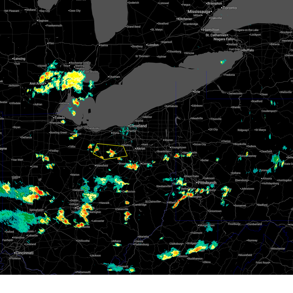
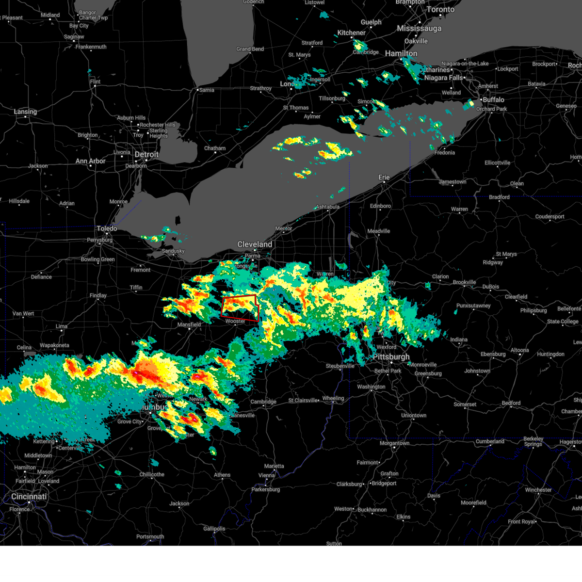
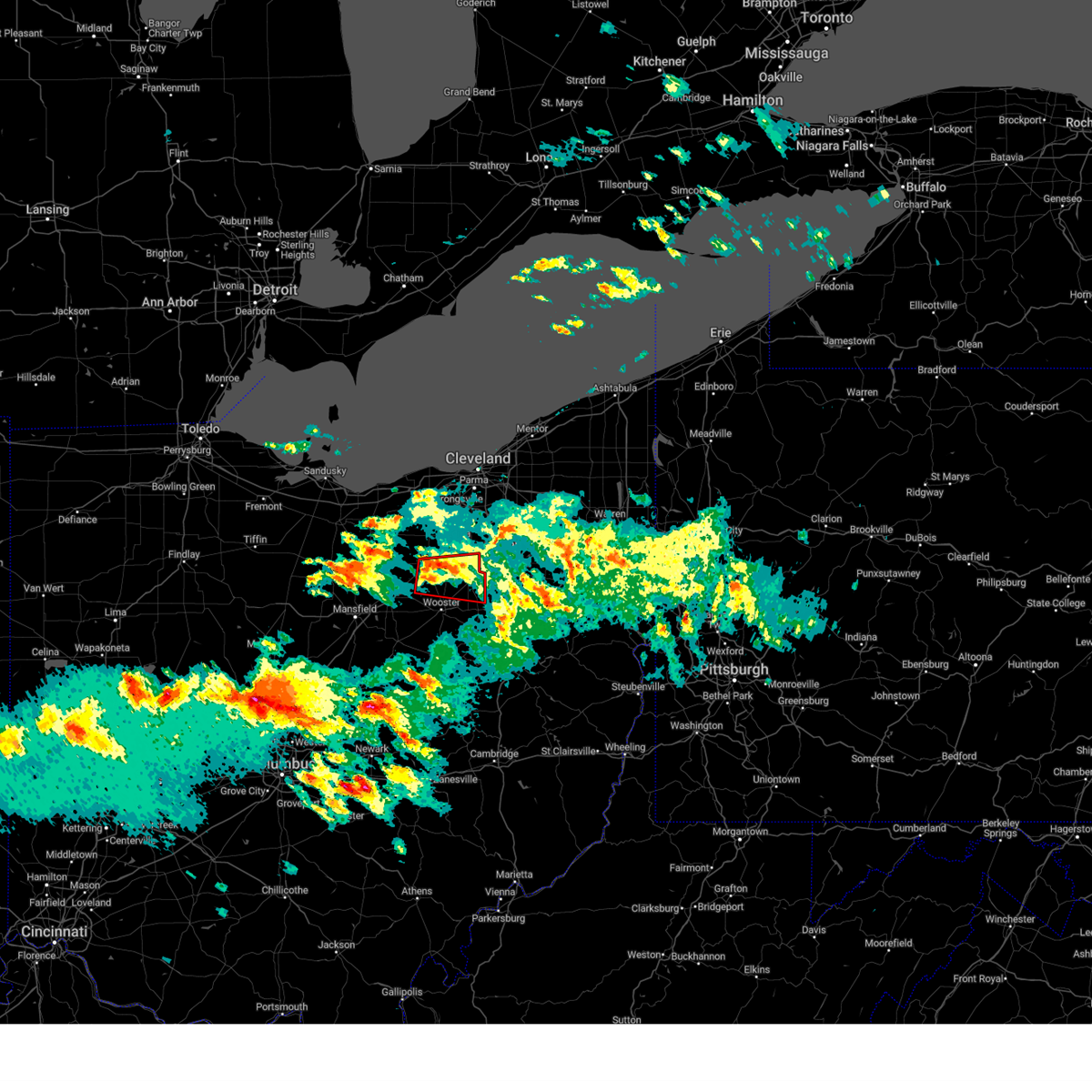
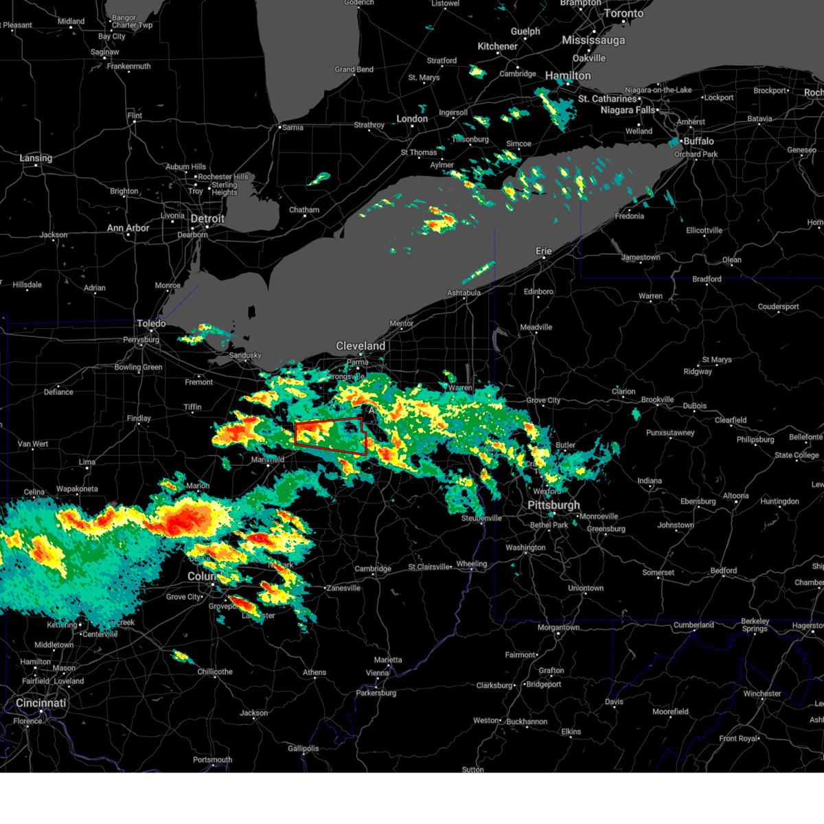
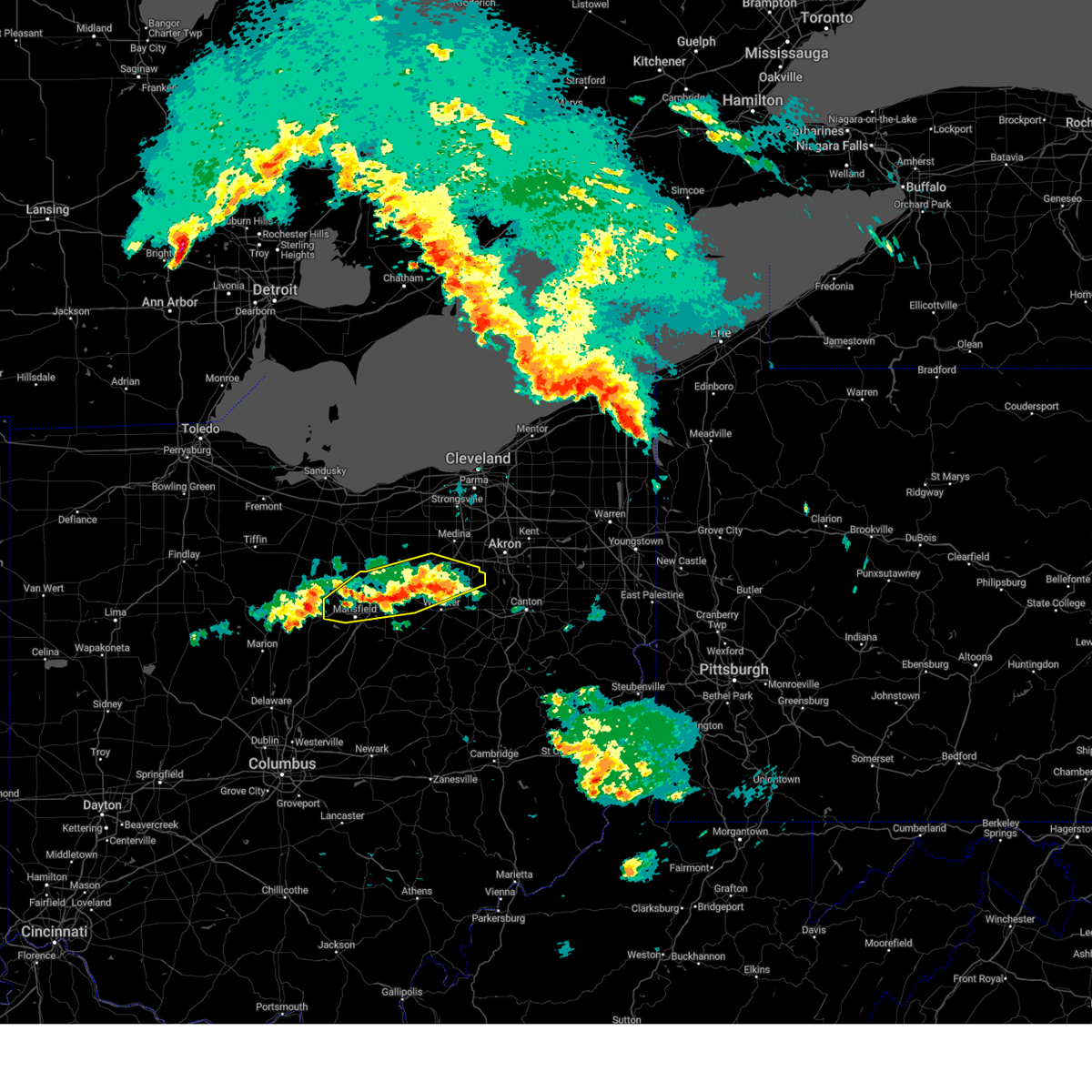
Hail Map for Wadsworth, OH
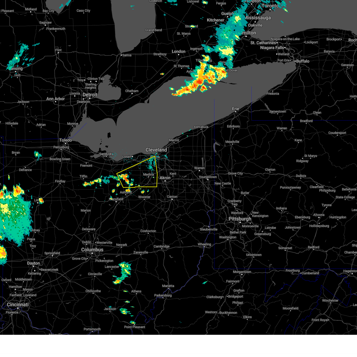
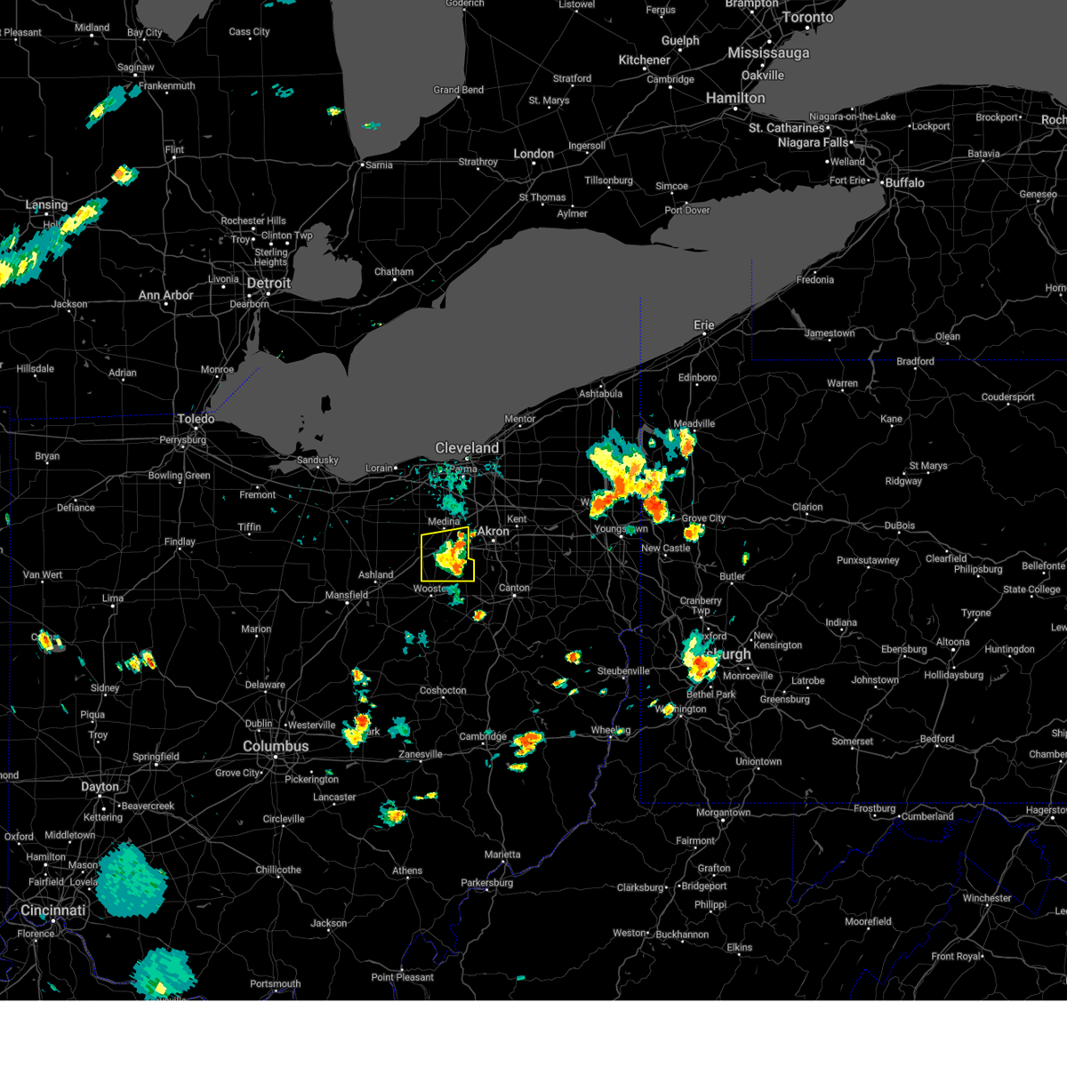
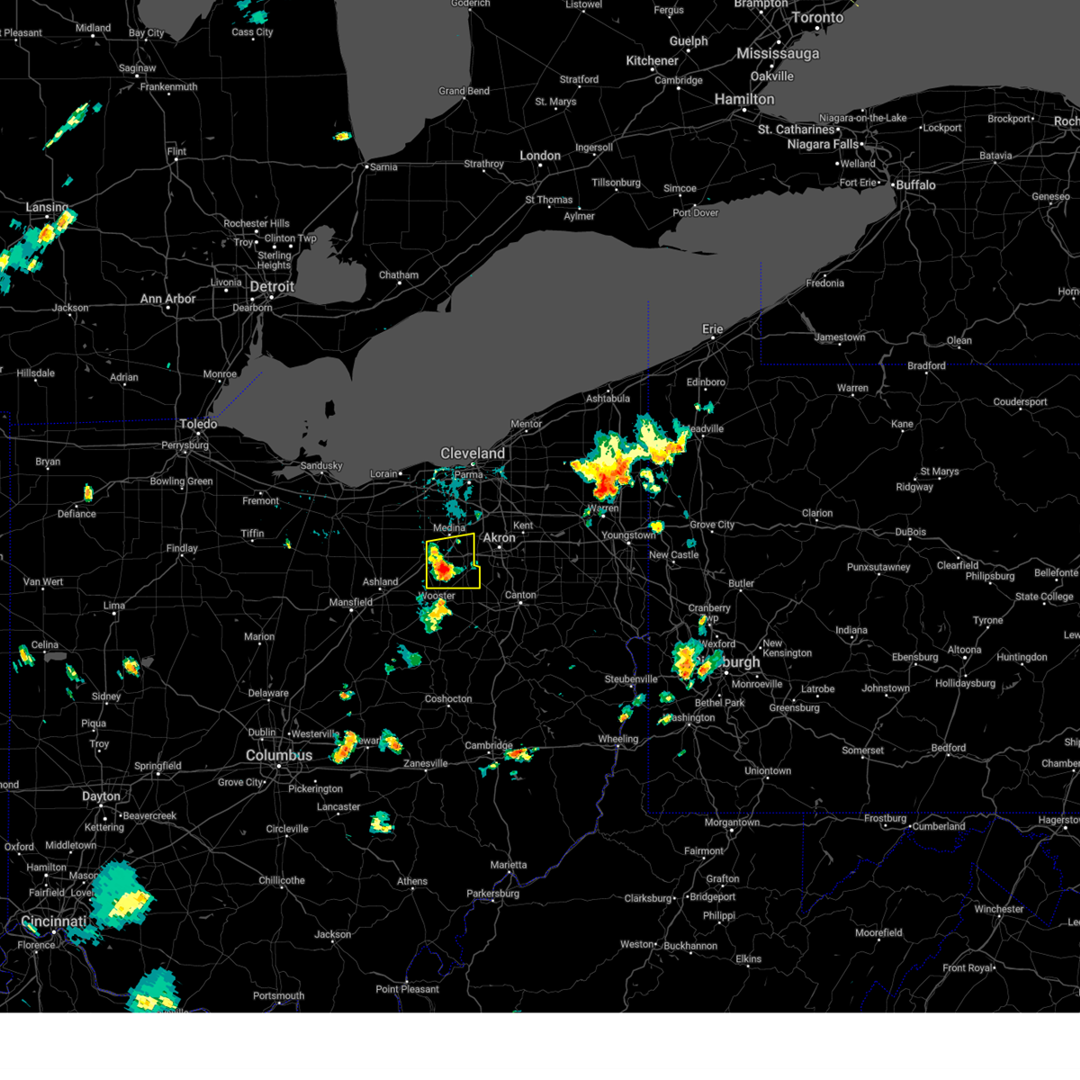
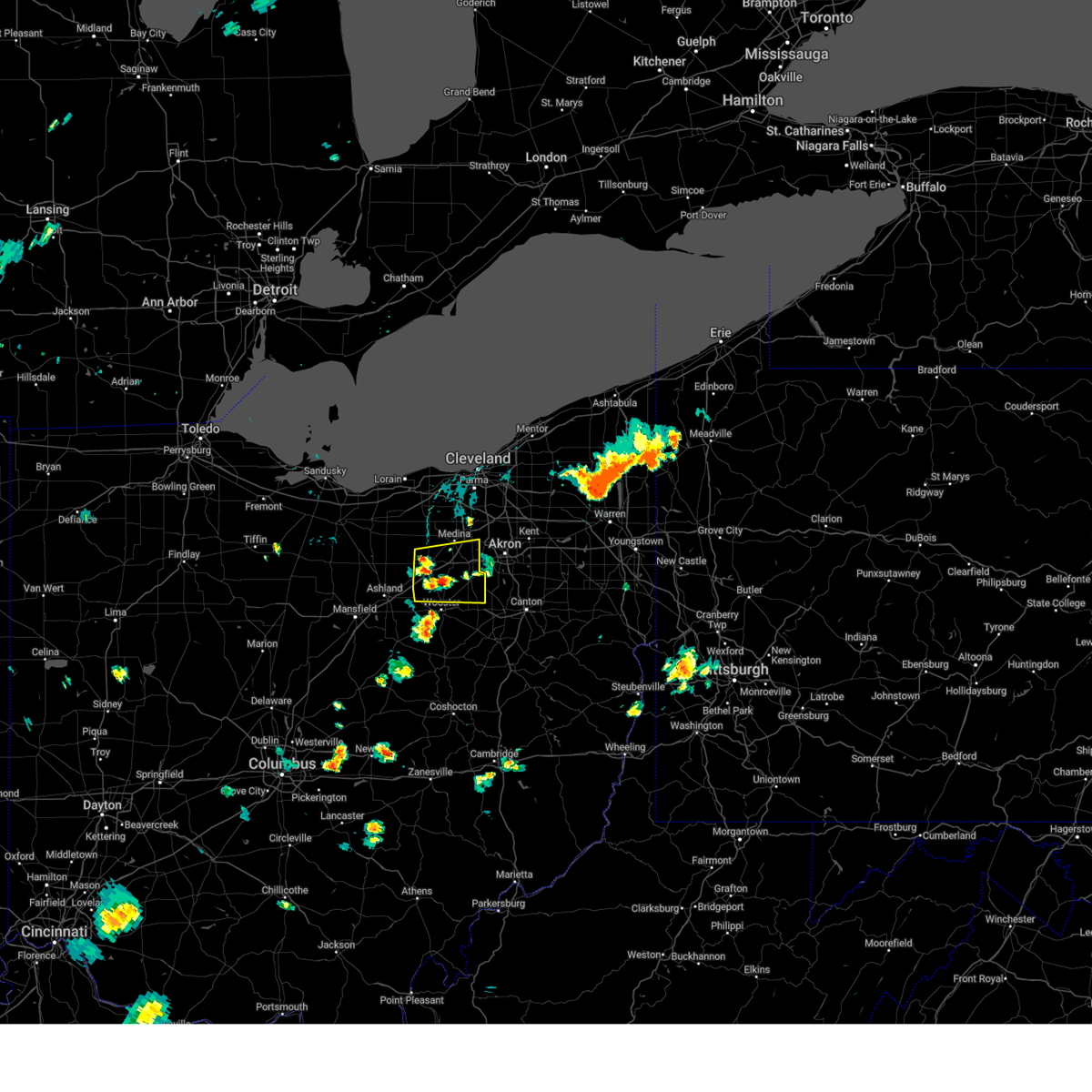
The Wadsworth, OH area has had 9 reports of on-the-ground hail by trained spotters, and has been under severe weather warnings 48 times during the past 12 months. Doppler radar has detected hail at or near Wadsworth, OH on 36 occasions, including 1 occasion during the past year.
| Name: | Wadsworth, OH |
| Where Located: | 32.7 miles S of Cleveland, OH |
| Map: | Google Map for Wadsworth, OH |
| Population: | 21567 |
| Housing Units: | 9320 |
| More Info: | Search Google for Wadsworth, OH |
1
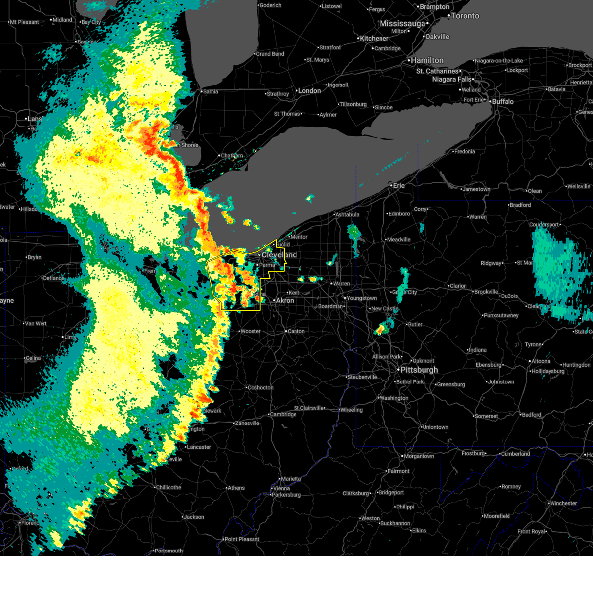
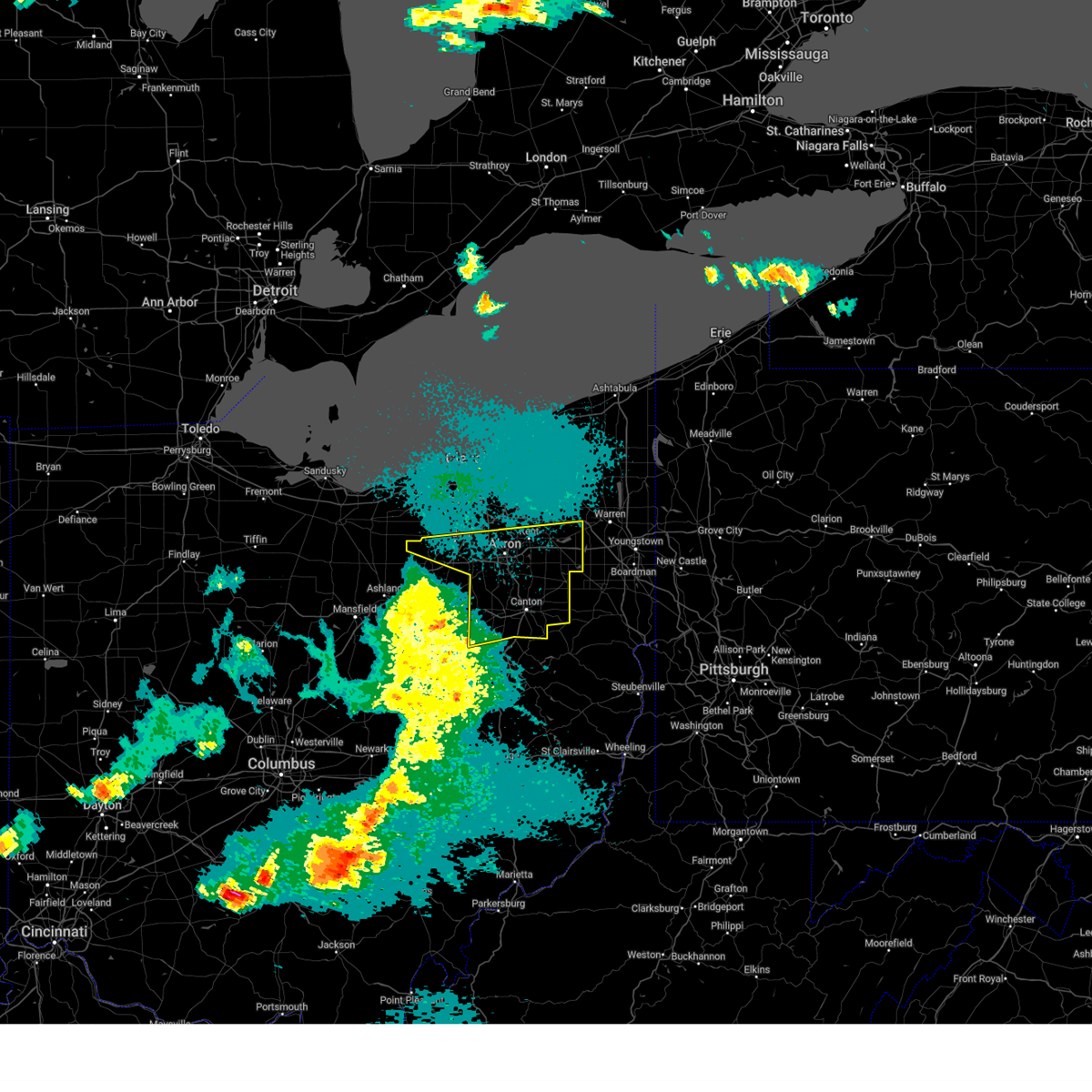
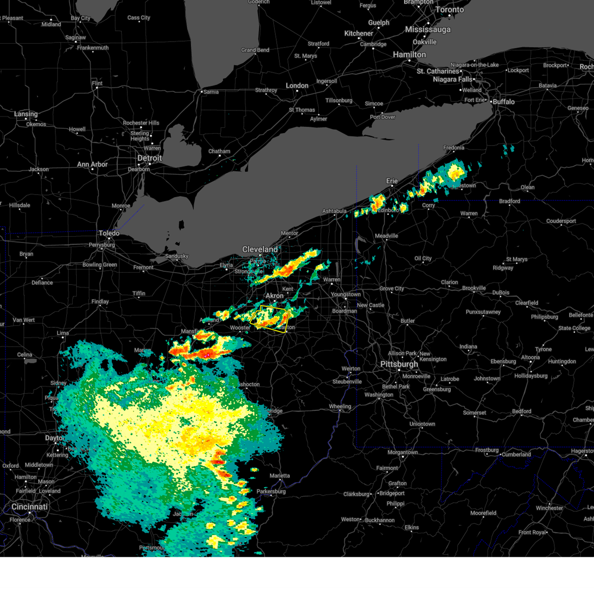
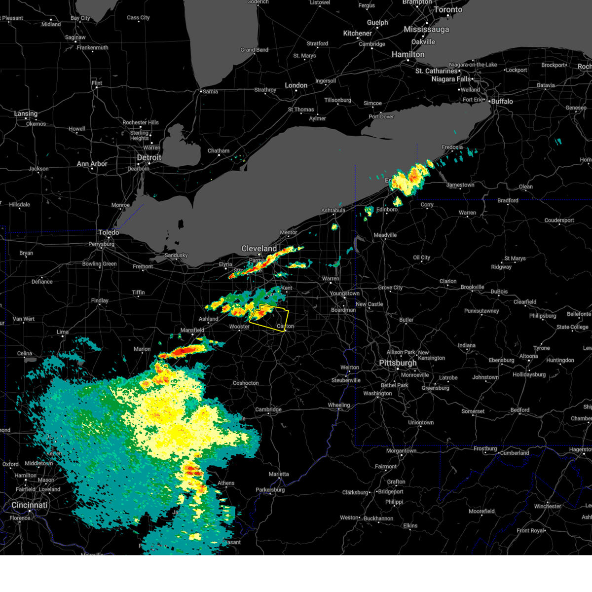
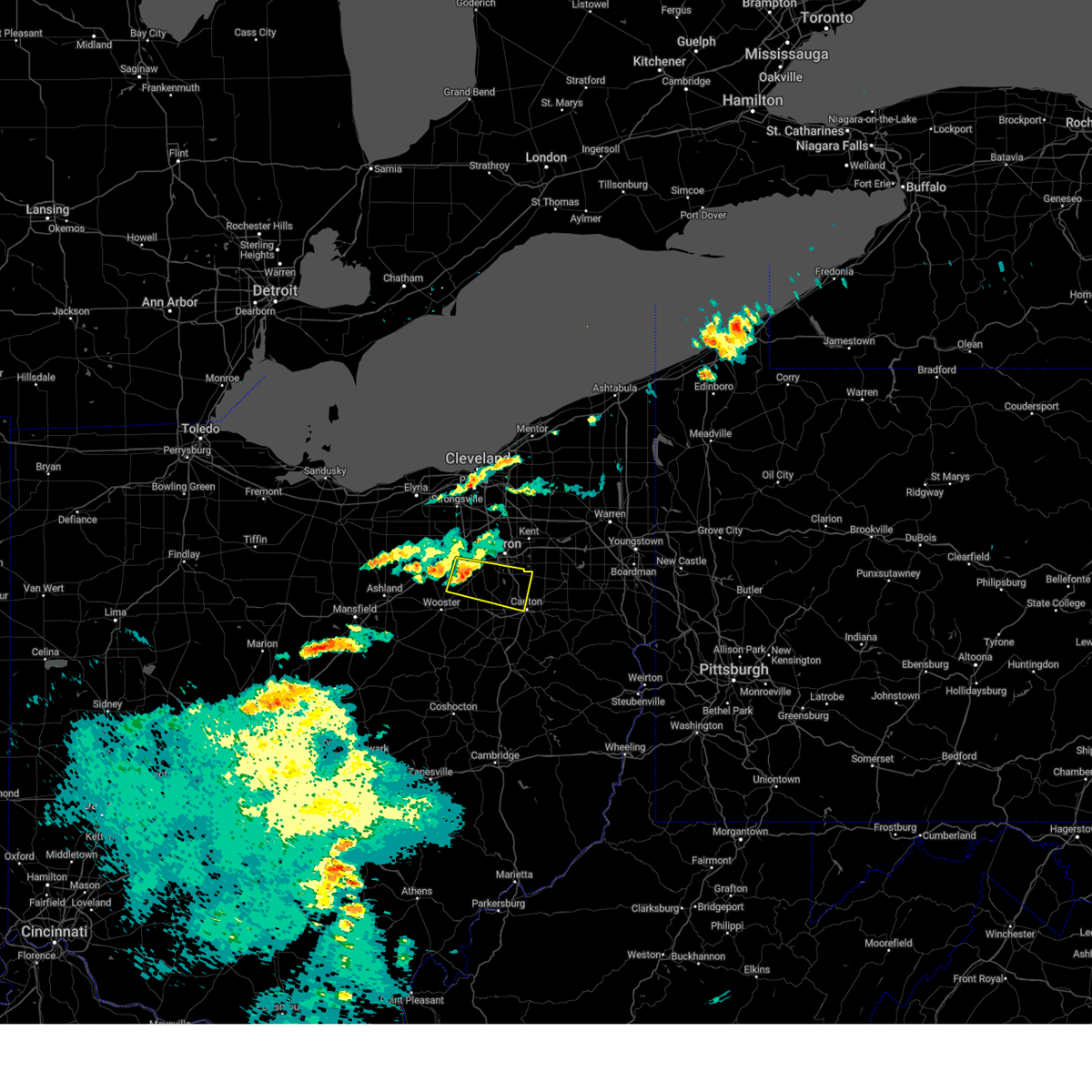
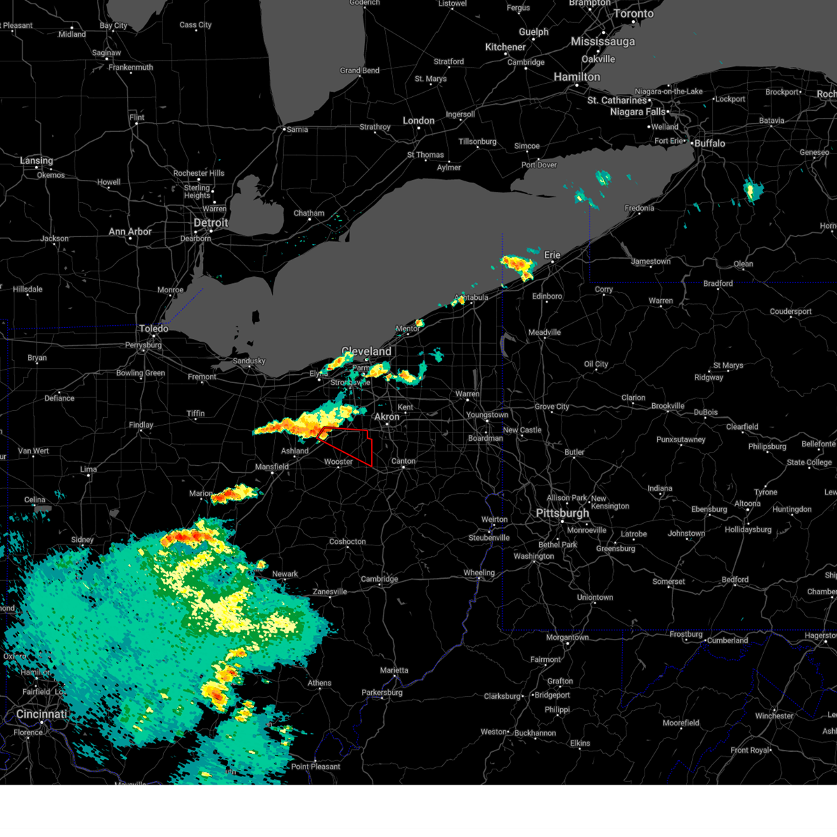
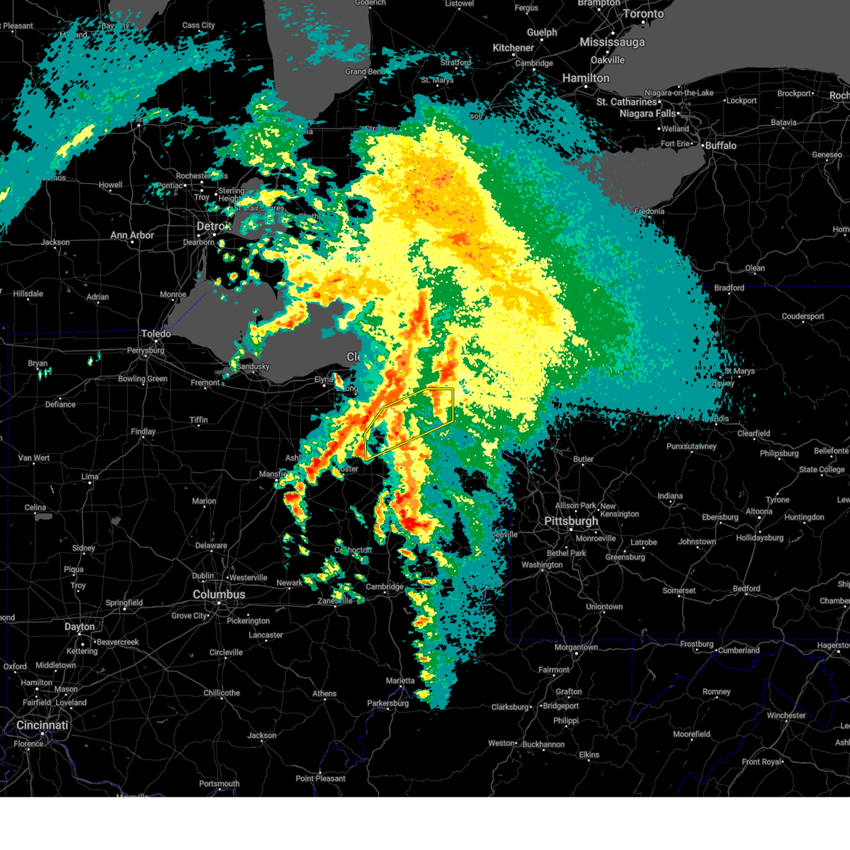
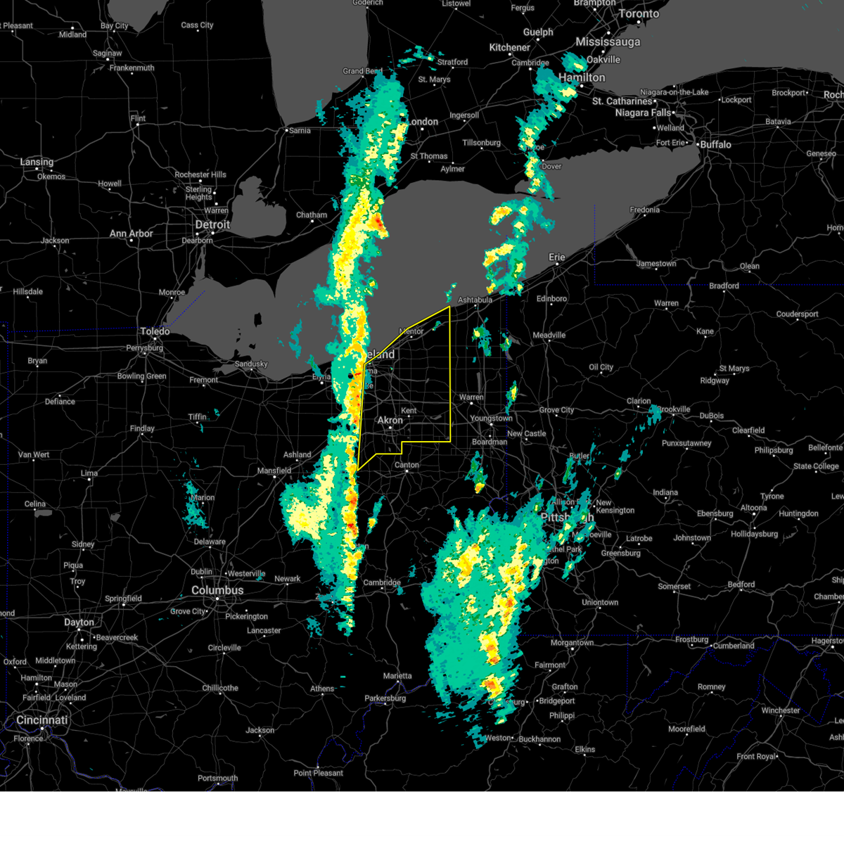
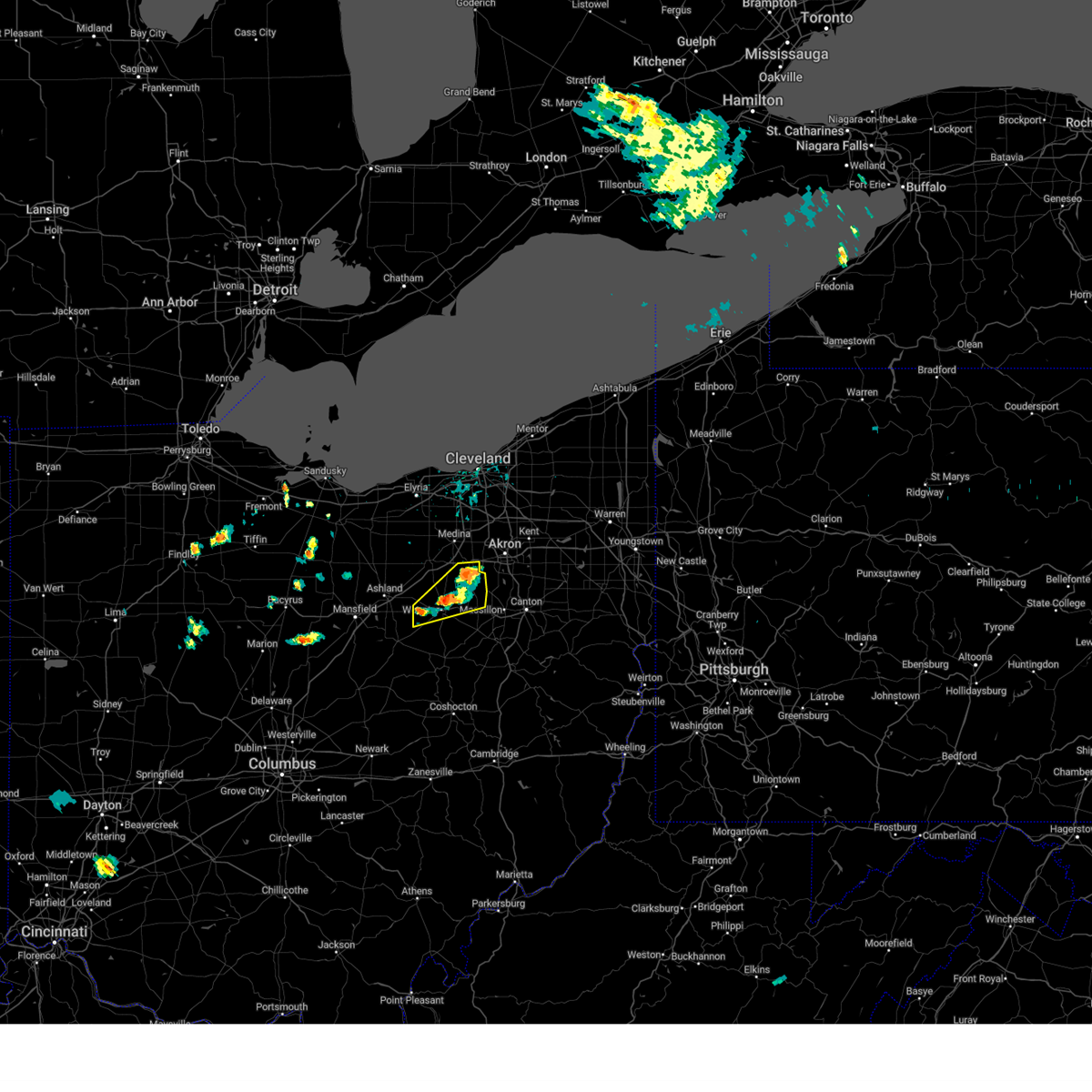
The Top Recent Hail Date for Wadsworth, OH is Wednesday, April 2, 2025 (9th out of 36)

Hail and Wind Damage Spotted near Wadsworth, OH
| Date / Time | Report Details |
|---|---|
| 6/25/2025 4:53 PM EDT | At 453 pm edt, a severe thunderstorm was located over chippewa lake, or near medina, moving east at 20 mph (radar indicated). Hazards include 60 mph wind gusts. Expect damage to trees and power lines. Locations impacted include, medina, ashland, wadsworth, rittman, lodi, new london, creston, west salem, chippewa lake, savannah, polk, sullivan, seville, greenwich, westfield center, spencer, gloria glens park, bailey lakes, burbank, and congress. |
| 6/25/2025 4:25 PM EDT |
 Svrcle the national weather service in cleveland has issued a * severe thunderstorm warning for, southeastern huron county in north central ohio, north central richland county in north central ohio, southern medina county in northeastern ohio, northern ashland county in north central ohio, northern wayne county in northeastern ohio, southwestern lorain county in north central ohio, * until 515 pm edt. * at 425 pm edt, a severe thunderstorm was located near lodi, or 13 miles southwest of medina, moving east at 20 mph (radar indicated). Hazards include 60 mph wind gusts. expect damage to trees and power lines Svrcle the national weather service in cleveland has issued a * severe thunderstorm warning for, southeastern huron county in north central ohio, north central richland county in north central ohio, southern medina county in northeastern ohio, northern ashland county in north central ohio, northern wayne county in northeastern ohio, southwestern lorain county in north central ohio, * until 515 pm edt. * at 425 pm edt, a severe thunderstorm was located near lodi, or 13 miles southwest of medina, moving east at 20 mph (radar indicated). Hazards include 60 mph wind gusts. expect damage to trees and power lines
|
| 6/24/2025 10:45 PM EDT |
 the severe thunderstorm warning has been cancelled and is no longer in effect the severe thunderstorm warning has been cancelled and is no longer in effect
|
| 6/24/2025 10:39 PM EDT |
 At 1039 pm edt, a severe thunderstorm was located over creston, or 9 miles north of wooster, moving east at 15 mph (radar indicated). Hazards include 60 mph wind gusts. Expect damage to trees and power lines. Locations impacted include, wooster, wadsworth, orrville, rittman, creston, seville, smithville, westfield center, and burbank. At 1039 pm edt, a severe thunderstorm was located over creston, or 9 miles north of wooster, moving east at 15 mph (radar indicated). Hazards include 60 mph wind gusts. Expect damage to trees and power lines. Locations impacted include, wooster, wadsworth, orrville, rittman, creston, seville, smithville, westfield center, and burbank.
|
| 6/24/2025 10:29 PM EDT |
 Svrcle the national weather service in cleveland has issued a * severe thunderstorm warning for, southeastern medina county in northeastern ohio, northern wayne county in northeastern ohio, * until 1115 pm edt. * at 1025 pm edt, a severe thunderstorm was located near west salem, or 10 miles north of wooster, moving east at 15 mph (radar indicated). Hazards include 60 mph wind gusts. expect damage to trees and power lines Svrcle the national weather service in cleveland has issued a * severe thunderstorm warning for, southeastern medina county in northeastern ohio, northern wayne county in northeastern ohio, * until 1115 pm edt. * at 1025 pm edt, a severe thunderstorm was located near west salem, or 10 miles north of wooster, moving east at 15 mph (radar indicated). Hazards include 60 mph wind gusts. expect damage to trees and power lines
|
| 6/18/2025 8:54 PM EDT |
 At 854 pm edt, severe thunderstorms were located along a line extending from near lorain to 6 miles west of medina, moving northeast at 45 mph. an 81 mph wind gust was measured in the city of lorain at 8:47 pm (radar indicated). Hazards include 70 mph wind gusts. Expect considerable tree damage. damage is likely to mobile homes, roofs, and outbuildings. Locations impacted include, cleveland, lorain, elyria, medina, vermilion, parma, lakewood, euclid, cleveland heights, strongsville, brunswick, westlake, north royalton, north ridgeville, solon, avon lake, wadsworth, warrensville heights, amherst, and grafton. At 854 pm edt, severe thunderstorms were located along a line extending from near lorain to 6 miles west of medina, moving northeast at 45 mph. an 81 mph wind gust was measured in the city of lorain at 8:47 pm (radar indicated). Hazards include 70 mph wind gusts. Expect considerable tree damage. damage is likely to mobile homes, roofs, and outbuildings. Locations impacted include, cleveland, lorain, elyria, medina, vermilion, parma, lakewood, euclid, cleveland heights, strongsville, brunswick, westlake, north royalton, north ridgeville, solon, avon lake, wadsworth, warrensville heights, amherst, and grafton.
|
| 6/18/2025 8:52 PM EDT |
 At 851 pm edt, severe thunderstorms were located along a line extending from near lorain to 7 miles north of lodi, moving northeast at 45 mph. an 81 mph wind gust was measured in the city of lorain at 7:47 pm (radar indicated). Hazards include 70 mph wind gusts. Expect considerable tree damage. damage is likely to mobile homes, roofs, and outbuildings. Locations impacted include, cleveland, lorain, elyria, medina, vermilion, parma, lakewood, euclid, cleveland heights, strongsville, brunswick, westlake, north royalton, north ridgeville, solon, avon lake, wadsworth, warrensville heights, amherst, and grafton. At 851 pm edt, severe thunderstorms were located along a line extending from near lorain to 7 miles north of lodi, moving northeast at 45 mph. an 81 mph wind gust was measured in the city of lorain at 7:47 pm (radar indicated). Hazards include 70 mph wind gusts. Expect considerable tree damage. damage is likely to mobile homes, roofs, and outbuildings. Locations impacted include, cleveland, lorain, elyria, medina, vermilion, parma, lakewood, euclid, cleveland heights, strongsville, brunswick, westlake, north royalton, north ridgeville, solon, avon lake, wadsworth, warrensville heights, amherst, and grafton.
|
| 6/18/2025 8:49 PM EDT | Several trees down. time estimated via rada in medina county OH, 4.7 miles S of Wadsworth, OH |
| 6/18/2025 8:18 PM EDT | Svrcle the national weather service in cleveland has issued a * severe thunderstorm warning for, cuyahoga county in northeastern ohio, medina county in northeastern ohio, lorain county in north central ohio, * until 930 pm edt. * at 818 pm edt, severe thunderstorms were located along a line extending from near kelleys island to near plymouth, moving east at 55 mph (radar indicated). Hazards include 70 mph wind gusts. Expect considerable tree damage. Damage is likely to mobile homes, roofs, and outbuildings. |
| 6/18/2025 3:12 PM EDT | Svrcle the national weather service in cleveland has issued a * severe thunderstorm warning for, southwestern portage county in northeastern ohio, southeastern medina county in northeastern ohio, northwestern stark county in northeastern ohio, southern summit county in northeastern ohio, northeastern wayne county in northeastern ohio, * until 400 pm edt. * at 312 pm edt, a severe thunderstorm was located over doylestown, or 9 miles southwest of akron, moving east at 30 mph (radar indicated). Hazards include 60 mph wind gusts and penny size hail. expect damage to trees and power lines |
| 6/18/2025 2:57 PM EDT | At 257 pm edt, a severe thunderstorm was located over wadsworth, or 8 miles southeast of medina, moving east at 25 mph (radar indicated). Hazards include 60 mph wind gusts and penny size hail. Expect damage to trees and power lines. Locations impacted include, medina, barberton, wadsworth, rittman, doylestown, creston, chippewa lake, norton, fairlawn, seville, westfield center, marshallville, gloria glens park, burbank, chippewa-on-the-lake, briarwood beach, pigeon creek, and montrose-ghent. |
| 6/18/2025 2:41 PM EDT |
 At 240 pm edt, a severe thunderstorm was located over chippewa lake, or near medina, moving east at 35 mph (radar indicated). Hazards include 60 mph wind gusts and penny size hail. Expect damage to trees and power lines. Locations impacted include, medina, barberton, wadsworth, rittman, doylestown, lodi, creston, chippewa lake, norton, fairlawn, richfield, seville, westfield center, marshallville, gloria glens park, burbank, chippewa-on-the-lake, montrose-ghent, briarwood beach, and pigeon creek. At 240 pm edt, a severe thunderstorm was located over chippewa lake, or near medina, moving east at 35 mph (radar indicated). Hazards include 60 mph wind gusts and penny size hail. Expect damage to trees and power lines. Locations impacted include, medina, barberton, wadsworth, rittman, doylestown, lodi, creston, chippewa lake, norton, fairlawn, richfield, seville, westfield center, marshallville, gloria glens park, burbank, chippewa-on-the-lake, montrose-ghent, briarwood beach, and pigeon creek.
|
| 6/18/2025 2:41 PM EDT |
 the severe thunderstorm warning has been cancelled and is no longer in effect the severe thunderstorm warning has been cancelled and is no longer in effect
|
| 6/18/2025 2:25 PM EDT |
 Svrcle the national weather service in cleveland has issued a * severe thunderstorm warning for, medina county in northeastern ohio, northeastern ashland county in north central ohio, west central summit county in northeastern ohio, northern wayne county in northeastern ohio, south central lorain county in north central ohio, * until 315 pm edt. * at 225 pm edt, a severe thunderstorm was located over lodi, or 10 miles southwest of medina, moving east at 35 mph (radar indicated). Hazards include 60 mph wind gusts and penny size hail. expect damage to trees and power lines Svrcle the national weather service in cleveland has issued a * severe thunderstorm warning for, medina county in northeastern ohio, northeastern ashland county in north central ohio, west central summit county in northeastern ohio, northern wayne county in northeastern ohio, south central lorain county in north central ohio, * until 315 pm edt. * at 225 pm edt, a severe thunderstorm was located over lodi, or 10 miles southwest of medina, moving east at 35 mph (radar indicated). Hazards include 60 mph wind gusts and penny size hail. expect damage to trees and power lines
|
| 5/16/2025 11:59 PM EDT |
 The storms which prompted the warning have moved out of the warned area. therefore, the warning will be allowed to expire. a severe thunderstorm watch remains in effect until 400 am edt for northeastern ohio. The storms which prompted the warning have moved out of the warned area. therefore, the warning will be allowed to expire. a severe thunderstorm watch remains in effect until 400 am edt for northeastern ohio.
|
| 5/16/2025 11:30 PM EDT | the severe thunderstorm warning has been cancelled and is no longer in effect |
| 5/16/2025 11:30 PM EDT | At 1130 pm edt, severe thunderstorms were located along a line extending from near akron to near uhrichsville, moving east at 55 mph (radar indicated). Hazards include 60 mph wind gusts. Expect damage to trees and power lines. Locations impacted include, akron, canton, ravenna, cuyahoga falls, massillon, kent, barberton, green, alliance, hudson, tallmadge, north canton, streetsboro, louisville, mogadore, minerva, hartville, brewster, navarre, and waynesburg. |
| 5/16/2025 11:29 PM EDT | The storms which prompted the warning have moved out of the area. therefore, the warning will be allowed to expire. a severe thunderstorm watch remains in effect until 400 am edt for north central and northeastern ohio. |
| 5/16/2025 11:08 PM EDT |
 At 1108 pm edt, severe thunderstorms were located along a line extending from near creston to near farmerstown, moving east at 55 mph (radar indicated). Hazards include 60 mph wind gusts. Expect damage to trees and power lines. Locations impacted include, wooster, millersburg, wadsworth, orrville, berlin, rittman, walnut creek, doylestown, lodi, creston, dalton, shreve, west salem, killbuck, holmesville, glenmont, mount eaton, nashville, winesburg, and farmerstown. At 1108 pm edt, severe thunderstorms were located along a line extending from near creston to near farmerstown, moving east at 55 mph (radar indicated). Hazards include 60 mph wind gusts. Expect damage to trees and power lines. Locations impacted include, wooster, millersburg, wadsworth, orrville, berlin, rittman, walnut creek, doylestown, lodi, creston, dalton, shreve, west salem, killbuck, holmesville, glenmont, mount eaton, nashville, winesburg, and farmerstown.
|
| 5/16/2025 11:08 PM EDT |
 the severe thunderstorm warning has been cancelled and is no longer in effect the severe thunderstorm warning has been cancelled and is no longer in effect
|
| 5/16/2025 11:07 PM EDT |
 Svrcle the national weather service in cleveland has issued a * severe thunderstorm warning for, portage county in northeastern ohio, southern medina county in northeastern ohio, stark county in northeastern ohio, summit county in northeastern ohio, eastern wayne county in northeastern ohio, northeastern holmes county in northeastern ohio, * until midnight edt. * at 1107 pm edt, severe thunderstorms were located along a line extending from lodi to near west lafayette, moving east at 55 mph (radar indicated). Hazards include 60 mph wind gusts. expect damage to trees and power lines Svrcle the national weather service in cleveland has issued a * severe thunderstorm warning for, portage county in northeastern ohio, southern medina county in northeastern ohio, stark county in northeastern ohio, summit county in northeastern ohio, eastern wayne county in northeastern ohio, northeastern holmes county in northeastern ohio, * until midnight edt. * at 1107 pm edt, severe thunderstorms were located along a line extending from lodi to near west lafayette, moving east at 55 mph (radar indicated). Hazards include 60 mph wind gusts. expect damage to trees and power lines
|
| 5/16/2025 10:52 PM EDT | the severe thunderstorm warning has been cancelled and is no longer in effect |
| 5/16/2025 10:52 PM EDT | At 1051 pm edt, severe thunderstorms were located along a line extending from polk to near killbuck, moving east at 60 mph (radar indicated). Hazards include 60 mph wind gusts. Expect damage to trees and power lines. Locations impacted include, wooster, ashland, mount vernon, millersburg, wadsworth, orrville, berlin, rittman, walnut creek, doylestown, lodi, loudonville, gambier, creston, utica, dalton, shreve, west salem, danville, and killbuck. |
| 5/16/2025 10:27 PM EDT | Svrcle the national weather service in cleveland has issued a * severe thunderstorm warning for, richland county in north central ohio, southern medina county in northeastern ohio, ashland county in north central ohio, eastern morrow county in north central ohio, southeastern crawford county in north central ohio, wayne county in northeastern ohio, holmes county in northeastern ohio, knox county in north central ohio, * until 1130 pm edt. * at 1025 pm edt, severe thunderstorms were located along a line extending from near shelby to near mount vernon, moving east at 65 mph. mansfield asos reported 60 mph wind gusts at 10:25 pm (radar indicated). Hazards include 60 mph wind gusts. expect damage to trees and power lines |
| 5/5/2025 7:46 PM EDT |
 At 746 pm edt, a severe thunderstorm was located over medina, moving north at 20 mph (radar indicated). Hazards include 60 mph wind gusts and quarter size hail. Minor damage to vehicles is possible. expect damage to trees and power lines. Locations impacted include, akron, medina, barberton, wadsworth, rittman, doylestown, lodi, creston, chippewa lake, norton, fairlawn, seville, westfield center, gloria glens park, chippewa-on-the-lake, montrose-ghent, briarwood beach, and pigeon creek. At 746 pm edt, a severe thunderstorm was located over medina, moving north at 20 mph (radar indicated). Hazards include 60 mph wind gusts and quarter size hail. Minor damage to vehicles is possible. expect damage to trees and power lines. Locations impacted include, akron, medina, barberton, wadsworth, rittman, doylestown, lodi, creston, chippewa lake, norton, fairlawn, seville, westfield center, gloria glens park, chippewa-on-the-lake, montrose-ghent, briarwood beach, and pigeon creek.
|
| 5/5/2025 7:33 PM EDT |
 At 733 pm edt, a severe thunderstorm was located over chippewa lake, or near medina, moving north at 45 mph (radar indicated). Hazards include 60 mph wind gusts and quarter size hail. Minor damage to vehicles is possible. expect damage to trees and power lines. Locations impacted include, akron, medina, cuyahoga falls, barberton, wadsworth, orrville, rittman, doylestown, creston, chippewa lake, stow, norton, fairlawn, seville, clinton, westfield center, marshallville, gloria glens park, chippewa-on-the-lake, and montrose-ghent. At 733 pm edt, a severe thunderstorm was located over chippewa lake, or near medina, moving north at 45 mph (radar indicated). Hazards include 60 mph wind gusts and quarter size hail. Minor damage to vehicles is possible. expect damage to trees and power lines. Locations impacted include, akron, medina, cuyahoga falls, barberton, wadsworth, orrville, rittman, doylestown, creston, chippewa lake, stow, norton, fairlawn, seville, clinton, westfield center, marshallville, gloria glens park, chippewa-on-the-lake, and montrose-ghent.
|
| 5/5/2025 7:33 PM EDT |
 the severe thunderstorm warning has been cancelled and is no longer in effect the severe thunderstorm warning has been cancelled and is no longer in effect
|
| 5/5/2025 7:22 PM EDT |
 Svrcle the national weather service in cleveland has issued a * severe thunderstorm warning for, southeastern medina county in northeastern ohio, west central stark county in northeastern ohio, southwestern summit county in northeastern ohio, northeastern wayne county in northeastern ohio, * until 800 pm edt. * at 721 pm edt, a severe thunderstorm was located near creston, or 9 miles northeast of wooster, moving north at 45 mph (radar indicated). Hazards include 60 mph wind gusts and quarter size hail. Minor damage to vehicles is possible. Expect damage to trees and power lines. Svrcle the national weather service in cleveland has issued a * severe thunderstorm warning for, southeastern medina county in northeastern ohio, west central stark county in northeastern ohio, southwestern summit county in northeastern ohio, northeastern wayne county in northeastern ohio, * until 800 pm edt. * at 721 pm edt, a severe thunderstorm was located near creston, or 9 miles northeast of wooster, moving north at 45 mph (radar indicated). Hazards include 60 mph wind gusts and quarter size hail. Minor damage to vehicles is possible. Expect damage to trees and power lines.
|
| 4/29/2025 9:14 PM EDT |
 the severe thunderstorm warning has been cancelled and is no longer in effect the severe thunderstorm warning has been cancelled and is no longer in effect
|
| 4/29/2025 8:55 PM EDT |
 At 855 pm edt, a severe thunderstorm was located near barberton, or 10 miles southwest of akron, moving east at 40 mph (radar indicated). Hazards include 60 mph wind gusts. Expect damage to trees and power lines. Locations impacted include, akron, canton, massillon, barberton, green, north canton, orrville, rittman, doylestown, hartville, new franklin, norton, canal fulton, clinton, marshallville, meyers lake, hills and dales, greentown, portage lakes, and north lawrence. At 855 pm edt, a severe thunderstorm was located near barberton, or 10 miles southwest of akron, moving east at 40 mph (radar indicated). Hazards include 60 mph wind gusts. Expect damage to trees and power lines. Locations impacted include, akron, canton, massillon, barberton, green, north canton, orrville, rittman, doylestown, hartville, new franklin, norton, canal fulton, clinton, marshallville, meyers lake, hills and dales, greentown, portage lakes, and north lawrence.
|
| 4/29/2025 8:55 PM EDT |
 the severe thunderstorm warning has been cancelled and is no longer in effect the severe thunderstorm warning has been cancelled and is no longer in effect
|
| 4/29/2025 8:44 PM EDT |
 the tornado warning has been cancelled and is no longer in effect the tornado warning has been cancelled and is no longer in effect
|
| 4/29/2025 8:42 PM EDT |
 Svrcle the national weather service in cleveland has issued a * severe thunderstorm warning for, southeastern medina county in northeastern ohio, northwestern stark county in northeastern ohio, southern summit county in northeastern ohio, northeastern wayne county in northeastern ohio, * until 930 pm edt. * at 842 pm edt, a severe thunderstorm was located over rittman, or 13 miles southeast of medina, moving east at 50 mph (radar indicated). Hazards include 60 mph wind gusts. expect damage to trees and power lines Svrcle the national weather service in cleveland has issued a * severe thunderstorm warning for, southeastern medina county in northeastern ohio, northwestern stark county in northeastern ohio, southern summit county in northeastern ohio, northeastern wayne county in northeastern ohio, * until 930 pm edt. * at 842 pm edt, a severe thunderstorm was located over rittman, or 13 miles southeast of medina, moving east at 50 mph (radar indicated). Hazards include 60 mph wind gusts. expect damage to trees and power lines
|
| 4/29/2025 8:23 PM EDT |
 Torcle the national weather service in cleveland has issued a * tornado warning for, southeastern medina county in northeastern ohio, northeastern wayne county in northeastern ohio, * until 900 pm edt. * at 823 pm edt, a severe thunderstorm capable of producing a tornado was located over lodi, or 12 miles southwest of medina, moving east at 40 mph (radar indicated rotation). Hazards include tornado. Flying debris will be dangerous to those caught without shelter. mobile homes will be damaged or destroyed. damage to roofs, windows, and vehicles will occur. tree damage is likely. this dangerous storm will be near, creston around 830 pm edt. rittman around 835 pm edt. wadsworth around 840 pm edt. doylestown around 845 pm edt. Other locations impacted by this tornadic thunderstorm include westfield center, marshallville, burbank, and seville. Torcle the national weather service in cleveland has issued a * tornado warning for, southeastern medina county in northeastern ohio, northeastern wayne county in northeastern ohio, * until 900 pm edt. * at 823 pm edt, a severe thunderstorm capable of producing a tornado was located over lodi, or 12 miles southwest of medina, moving east at 40 mph (radar indicated rotation). Hazards include tornado. Flying debris will be dangerous to those caught without shelter. mobile homes will be damaged or destroyed. damage to roofs, windows, and vehicles will occur. tree damage is likely. this dangerous storm will be near, creston around 830 pm edt. rittman around 835 pm edt. wadsworth around 840 pm edt. doylestown around 845 pm edt. Other locations impacted by this tornadic thunderstorm include westfield center, marshallville, burbank, and seville.
|
| 4/3/2025 2:42 AM EDT | Svrcle the national weather service in cleveland has issued a * severe thunderstorm warning for, western mahoning county in northeastern ohio, portage county in northeastern ohio, eastern medina county in northeastern ohio, stark county in northeastern ohio, summit county in northeastern ohio, eastern wayne county in northeastern ohio, holmes county in northeastern ohio, * until 330 am edt. * at 242 am edt, severe thunderstorms were located along a line extending from 7 miles northeast of wadsworth to near millersburg, moving east at 70 mph (radar indicated). Hazards include 60 mph wind gusts. expect damage to trees and power lines |
| 4/2/2025 12:40 PM EDT |
 Svrcle the national weather service in cleveland has issued a * severe thunderstorm warning for, portage county in northeastern ohio, southeastern medina county in northeastern ohio, summit county in northeastern ohio, northeastern wayne county in northeastern ohio, * until 115 pm edt. * at 1240 pm edt, a severe thunderstorm was located over barberton, or 7 miles southwest of akron, moving northeast at 75 mph (radar indicated). Hazards include quarter size hail. minor damage to vehicles is possible Svrcle the national weather service in cleveland has issued a * severe thunderstorm warning for, portage county in northeastern ohio, southeastern medina county in northeastern ohio, summit county in northeastern ohio, northeastern wayne county in northeastern ohio, * until 115 pm edt. * at 1240 pm edt, a severe thunderstorm was located over barberton, or 7 miles southwest of akron, moving northeast at 75 mph (radar indicated). Hazards include quarter size hail. minor damage to vehicles is possible
|
| 4/2/2025 12:18 PM EDT |
 the severe thunderstorm warning has been cancelled and is no longer in effect the severe thunderstorm warning has been cancelled and is no longer in effect
|
| 4/2/2025 12:11 PM EDT |
 the severe thunderstorm warning has been cancelled and is no longer in effect the severe thunderstorm warning has been cancelled and is no longer in effect
|
| 4/2/2025 12:11 PM EDT |
 At 1211 pm edt, a severe thunderstorm was located near lodi, or 8 miles southwest of medina, moving northeast at 65 mph (radar indicated). Hazards include quarter size hail. Minor damage to vehicles is possible. Locations impacted include, medina, wadsworth, rittman, lodi, creston, chippewa lake, seville, westfield center, spencer, gloria glens park, burbank, chippewa-on-the-lake, valley city, and briarwood beach. At 1211 pm edt, a severe thunderstorm was located near lodi, or 8 miles southwest of medina, moving northeast at 65 mph (radar indicated). Hazards include quarter size hail. Minor damage to vehicles is possible. Locations impacted include, medina, wadsworth, rittman, lodi, creston, chippewa lake, seville, westfield center, spencer, gloria glens park, burbank, chippewa-on-the-lake, valley city, and briarwood beach.
|
| 4/2/2025 12:01 PM EDT | the severe thunderstorm warning has been cancelled and is no longer in effect |
| 4/2/2025 12:01 PM EDT | At 1201 pm edt, a severe thunderstorm was located near polk, or 10 miles northeast of ashland, moving northeast at 55 mph (radar indicated). Hazards include quarter size hail. Minor damage to vehicles is possible. Locations impacted include, medina, wadsworth, rittman, lodi, creston, west salem, chippewa lake, polk, sullivan, seville, westfield center, spencer, gloria glens park, burbank, chippewa-on-the-lake, nova, nankin, valley city, and briarwood beach. |
| 4/2/2025 11:53 AM EDT |
 Svrcle the national weather service in cleveland has issued a * severe thunderstorm warning for, northeastern richland county in north central ohio, medina county in northeastern ohio, northern ashland county in north central ohio, northwestern wayne county in northeastern ohio, southeastern lorain county in north central ohio, * until 1230 pm edt. * at 1153 am edt, a severe thunderstorm was located over savannah, or near ashland, moving northeast at 65 mph (radar indicated). Hazards include quarter size hail. minor damage to vehicles is possible Svrcle the national weather service in cleveland has issued a * severe thunderstorm warning for, northeastern richland county in north central ohio, medina county in northeastern ohio, northern ashland county in north central ohio, northwestern wayne county in northeastern ohio, southeastern lorain county in north central ohio, * until 1230 pm edt. * at 1153 am edt, a severe thunderstorm was located over savannah, or near ashland, moving northeast at 65 mph (radar indicated). Hazards include quarter size hail. minor damage to vehicles is possible
|
| 3/16/2025 12:01 PM EDT |
 Svrcle the national weather service in cleveland has issued a * severe thunderstorm warning for, portage county in northeastern ohio, geauga county in northeastern ohio, cuyahoga county in northeastern ohio, eastern medina county in northeastern ohio, lake county in northeastern ohio, summit county in northeastern ohio, northeastern wayne county in northeastern ohio, * until 100 pm edt. * at 1201 pm edt, severe thunderstorms were located along a line extending from 6 miles north of cleveland to parma to 6 miles southeast of brunswick, moving northeast at 70 mph (radar indicated). Hazards include 60 mph wind gusts. expect damage to trees and power lines Svrcle the national weather service in cleveland has issued a * severe thunderstorm warning for, portage county in northeastern ohio, geauga county in northeastern ohio, cuyahoga county in northeastern ohio, eastern medina county in northeastern ohio, lake county in northeastern ohio, summit county in northeastern ohio, northeastern wayne county in northeastern ohio, * until 100 pm edt. * at 1201 pm edt, severe thunderstorms were located along a line extending from 6 miles north of cleveland to parma to 6 miles southeast of brunswick, moving northeast at 70 mph (radar indicated). Hazards include 60 mph wind gusts. expect damage to trees and power lines
|
| 8/31/2024 12:10 AM EDT |
 Svrcle the national weather service in cleveland has issued a * severe thunderstorm warning for, east central huron county in north central ohio, southwestern cuyahoga county in northeastern ohio, medina county in northeastern ohio, northeastern ashland county in north central ohio, southern lorain county in north central ohio, * until 100 am edt. * at 1210 am edt, a severe thunderstorm was located near wellington, or 17 miles north of ashland, moving east at 40 mph (radar indicated). Hazards include 60 mph wind gusts and penny size hail. expect damage to trees and power lines Svrcle the national weather service in cleveland has issued a * severe thunderstorm warning for, east central huron county in north central ohio, southwestern cuyahoga county in northeastern ohio, medina county in northeastern ohio, northeastern ashland county in north central ohio, southern lorain county in north central ohio, * until 100 am edt. * at 1210 am edt, a severe thunderstorm was located near wellington, or 17 miles north of ashland, moving east at 40 mph (radar indicated). Hazards include 60 mph wind gusts and penny size hail. expect damage to trees and power lines
|
| 8/30/2024 5:26 PM EDT |
 The storm which prompted the warning has weakened below severe limits, and no longer poses an immediate threat to life or property. therefore, the warning will be allowed to expire. The storm which prompted the warning has weakened below severe limits, and no longer poses an immediate threat to life or property. therefore, the warning will be allowed to expire.
|
| 8/30/2024 5:05 PM EDT |
 At 504 pm edt, a severe thunderstorm was located over creston, or 10 miles north of wooster, moving east at 25 mph (radar indicated). Hazards include 60 mph wind gusts and quarter size hail. Minor damage to vehicles is possible. expect damage to trees and power lines. Locations impacted include, medina, wadsworth, rittman, doylestown, lodi, creston, chippewa lake, seville, westfield center, marshallville, gloria glens park, burbank, chippewa-on-the-lake, and briarwood beach. At 504 pm edt, a severe thunderstorm was located over creston, or 10 miles north of wooster, moving east at 25 mph (radar indicated). Hazards include 60 mph wind gusts and quarter size hail. Minor damage to vehicles is possible. expect damage to trees and power lines. Locations impacted include, medina, wadsworth, rittman, doylestown, lodi, creston, chippewa lake, seville, westfield center, marshallville, gloria glens park, burbank, chippewa-on-the-lake, and briarwood beach.
|
| 8/30/2024 4:49 PM EDT |
 Svrcle the national weather service in cleveland has issued a * severe thunderstorm warning for, southern medina county in northeastern ohio, northern wayne county in northeastern ohio, * until 530 pm edt. * at 448 pm edt, a severe thunderstorm cluster was centered near creston, or 7 miles north of wooster, moving east at 10 mph (radar indicated). Hazards include 60 mph wind gusts and quarter size hail. Minor damage to vehicles is possible. Expect damage to trees and power lines. Svrcle the national weather service in cleveland has issued a * severe thunderstorm warning for, southern medina county in northeastern ohio, northern wayne county in northeastern ohio, * until 530 pm edt. * at 448 pm edt, a severe thunderstorm cluster was centered near creston, or 7 miles north of wooster, moving east at 10 mph (radar indicated). Hazards include 60 mph wind gusts and quarter size hail. Minor damage to vehicles is possible. Expect damage to trees and power lines.
|
| 8/6/2024 4:06 PM EDT |
 Svrcle the national weather service in cleveland has issued a * severe thunderstorm warning for, summit county in northeastern ohio, * until 500 pm edt. * at 405 pm edt, severe thunderstorms were located along a line extending from near strongsville to 7 miles north of lodi to new london, moving east at 55 mph (trained weather spotters). Hazards include 60 mph wind gusts. expect damage to trees and power lines Svrcle the national weather service in cleveland has issued a * severe thunderstorm warning for, summit county in northeastern ohio, * until 500 pm edt. * at 405 pm edt, severe thunderstorms were located along a line extending from near strongsville to 7 miles north of lodi to new london, moving east at 55 mph (trained weather spotters). Hazards include 60 mph wind gusts. expect damage to trees and power lines
|
| 8/6/2024 3:51 PM EDT |
 Svrcle the national weather service in cleveland has issued a * severe thunderstorm warning for, medina county in northeastern ohio, northern ashland county in north central ohio, southern lorain county in north central ohio, * until 445 pm edt. * at 351 pm edt, severe thunderstorms were located along a line extending from grafton to near wellington to near willard, moving east at 55 mph (radar indicated). Hazards include 60 mph wind gusts. expect damage to trees and power lines Svrcle the national weather service in cleveland has issued a * severe thunderstorm warning for, medina county in northeastern ohio, northern ashland county in north central ohio, southern lorain county in north central ohio, * until 445 pm edt. * at 351 pm edt, severe thunderstorms were located along a line extending from grafton to near wellington to near willard, moving east at 55 mph (radar indicated). Hazards include 60 mph wind gusts. expect damage to trees and power lines
|
| 6/17/2024 3:43 PM EDT |
 The storms which prompted the warning have weakened below severe limits, and no longer pose an immediate threat to life or property. therefore, the warning will be allowed to expire. however, small hail and gusty winds are still possible with these thunderstorms. The storms which prompted the warning have weakened below severe limits, and no longer pose an immediate threat to life or property. therefore, the warning will be allowed to expire. however, small hail and gusty winds are still possible with these thunderstorms.
|
| 6/17/2024 3:29 PM EDT |
 the severe thunderstorm warning has been cancelled and is no longer in effect the severe thunderstorm warning has been cancelled and is no longer in effect
|
| 6/17/2024 3:29 PM EDT |
 At 328 pm edt, severe thunderstorms were located along a line extending from macedonia to near cuyahoga falls to near akron to near barberton, moving east at 30 mph (radar indicated). Hazards include 60 mph wind gusts and quarter size hail. Minor damage to vehicles is possible. expect damage to trees and power lines. Locations impacted include, akron, cuyahoga falls, barberton, hudson, wadsworth, twinsburg, tallmadge, macedonia, stow, brecksville, norton, fairlawn, munroe falls, northfield, richfield, silver lake, boston heights, peninsula, portage lakes, and montrose-ghent. At 328 pm edt, severe thunderstorms were located along a line extending from macedonia to near cuyahoga falls to near akron to near barberton, moving east at 30 mph (radar indicated). Hazards include 60 mph wind gusts and quarter size hail. Minor damage to vehicles is possible. expect damage to trees and power lines. Locations impacted include, akron, cuyahoga falls, barberton, hudson, wadsworth, twinsburg, tallmadge, macedonia, stow, brecksville, norton, fairlawn, munroe falls, northfield, richfield, silver lake, boston heights, peninsula, portage lakes, and montrose-ghent.
|
| 6/17/2024 2:59 PM EDT |
 Svrcle the national weather service in cleveland has issued a * severe thunderstorm warning for, south central cuyahoga county in northeastern ohio, eastern medina county in northeastern ohio, summit county in northeastern ohio, * until 345 pm edt. * at 258 pm edt, severe thunderstorms were located along a line extending from near strongsville to near medina to wadsworth to near creston, moving east at 30 mph (radar indicated). Hazards include 60 mph wind gusts and quarter size hail. Minor damage to vehicles is possible. Expect damage to trees and power lines. Svrcle the national weather service in cleveland has issued a * severe thunderstorm warning for, south central cuyahoga county in northeastern ohio, eastern medina county in northeastern ohio, summit county in northeastern ohio, * until 345 pm edt. * at 258 pm edt, severe thunderstorms were located along a line extending from near strongsville to near medina to wadsworth to near creston, moving east at 30 mph (radar indicated). Hazards include 60 mph wind gusts and quarter size hail. Minor damage to vehicles is possible. Expect damage to trees and power lines.
|
| 6/17/2024 1:40 PM EDT |
 The severe thunderstorm which prompted the warning has weakened. therefore, the warning will be allowed to expire. however, gusty winds are still possible with this thunderstorm. The severe thunderstorm which prompted the warning has weakened. therefore, the warning will be allowed to expire. however, gusty winds are still possible with this thunderstorm.
|
| 6/17/2024 1:01 PM EDT |
 Svrcle the national weather service in cleveland has issued a * severe thunderstorm warning for, southeastern medina county in northeastern ohio, central wayne county in northeastern ohio, * until 145 pm edt. * at 100 pm edt, a severe thunderstorm was located over wooster, moving east at 10 mph (radar indicated). Hazards include 60 mph wind gusts and quarter size hail. Minor damage to vehicles is possible. Expect damage to trees and power lines. Svrcle the national weather service in cleveland has issued a * severe thunderstorm warning for, southeastern medina county in northeastern ohio, central wayne county in northeastern ohio, * until 145 pm edt. * at 100 pm edt, a severe thunderstorm was located over wooster, moving east at 10 mph (radar indicated). Hazards include 60 mph wind gusts and quarter size hail. Minor damage to vehicles is possible. Expect damage to trees and power lines.
|
| 4/17/2024 4:09 PM EDT |
 Svrcle the national weather service in cleveland has issued a * severe thunderstorm warning for, medina county in northeastern ohio, northern ashland county in north central ohio, northwestern wayne county in northeastern ohio, * until 500 pm edt. * at 409 pm edt, a severe thunderstorm was located over ashland, moving northeast at 40 mph (radar indicated). Hazards include 60 mph wind gusts and quarter size hail. Minor damage to vehicles is possible. Expect damage to trees and power lines. Svrcle the national weather service in cleveland has issued a * severe thunderstorm warning for, medina county in northeastern ohio, northern ashland county in north central ohio, northwestern wayne county in northeastern ohio, * until 500 pm edt. * at 409 pm edt, a severe thunderstorm was located over ashland, moving northeast at 40 mph (radar indicated). Hazards include 60 mph wind gusts and quarter size hail. Minor damage to vehicles is possible. Expect damage to trees and power lines.
|
| 4/14/2024 9:48 PM EDT |
 At 948 pm edt, a severe thunderstorm was located near barberton, or near akron, moving east at 40 mph (radar indicated). Hazards include 60 mph wind gusts and quarter size hail. Minor damage to vehicles is possible. expect damage to trees and power lines. Locations impacted include, akron, cuyahoga falls, barberton, green, wadsworth, tallmadge, mogadore, new franklin, norton, fairlawn, munroe falls, lakemore, clinton, portage lakes, pigeon creek, montrose-ghent, and uniontown. At 948 pm edt, a severe thunderstorm was located near barberton, or near akron, moving east at 40 mph (radar indicated). Hazards include 60 mph wind gusts and quarter size hail. Minor damage to vehicles is possible. expect damage to trees and power lines. Locations impacted include, akron, cuyahoga falls, barberton, green, wadsworth, tallmadge, mogadore, new franklin, norton, fairlawn, munroe falls, lakemore, clinton, portage lakes, pigeon creek, montrose-ghent, and uniontown.
|
| 4/14/2024 9:33 PM EDT |
 Svrcle the national weather service in cleveland has issued a * severe thunderstorm warning for, southeastern medina county in northeastern ohio, southern summit county in northeastern ohio, * until 1015 pm edt. * at 933 pm edt, a severe thunderstorm was located near chippewa lake, or near medina, moving east at 45 mph (radar indicated). Hazards include 60 mph wind gusts and quarter size hail. Minor damage to vehicles is possible. Expect damage to trees and power lines. Svrcle the national weather service in cleveland has issued a * severe thunderstorm warning for, southeastern medina county in northeastern ohio, southern summit county in northeastern ohio, * until 1015 pm edt. * at 933 pm edt, a severe thunderstorm was located near chippewa lake, or near medina, moving east at 45 mph (radar indicated). Hazards include 60 mph wind gusts and quarter size hail. Minor damage to vehicles is possible. Expect damage to trees and power lines.
|
| 3/14/2024 10:07 PM EDT |
 The storm which prompted the warning has moved out of the area. therefore, the warning will be allowed to expire. a tornado watch remains in effect until midnight edt for northeastern ohio. The storm which prompted the warning has moved out of the area. therefore, the warning will be allowed to expire. a tornado watch remains in effect until midnight edt for northeastern ohio.
|
| 3/14/2024 9:52 PM EDT |
 Svrcle the national weather service in cleveland has issued a * severe thunderstorm warning for, southern portage county in northeastern ohio, northeastern stark county in northeastern ohio, southern summit county in northeastern ohio, * until 1030 pm edt. * at 952 pm edt, a severe thunderstorm was located over wadsworth, or 9 miles west of akron, moving east at 50 mph (radar indicated). Hazards include ping pong ball size hail and 60 mph wind gusts. People and animals outdoors will be injured. expect hail damage to roofs, siding, windows, and vehicles. Expect damage to trees and power lines. Svrcle the national weather service in cleveland has issued a * severe thunderstorm warning for, southern portage county in northeastern ohio, northeastern stark county in northeastern ohio, southern summit county in northeastern ohio, * until 1030 pm edt. * at 952 pm edt, a severe thunderstorm was located over wadsworth, or 9 miles west of akron, moving east at 50 mph (radar indicated). Hazards include ping pong ball size hail and 60 mph wind gusts. People and animals outdoors will be injured. expect hail damage to roofs, siding, windows, and vehicles. Expect damage to trees and power lines.
|
| 3/14/2024 9:50 PM EDT |
 At 950 pm edt, a severe thunderstorm was located over wadsworth, or 8 miles southeast of medina, moving east at 45 mph (radar indicated). Hazards include ping pong ball size hail and 60 mph wind gusts. People and animals outdoors will be injured. expect hail damage to roofs, siding, windows, and vehicles. expect damage to trees and power lines. Locations impacted include, medina, wadsworth, and rittman. At 950 pm edt, a severe thunderstorm was located over wadsworth, or 8 miles southeast of medina, moving east at 45 mph (radar indicated). Hazards include ping pong ball size hail and 60 mph wind gusts. People and animals outdoors will be injured. expect hail damage to roofs, siding, windows, and vehicles. expect damage to trees and power lines. Locations impacted include, medina, wadsworth, and rittman.
|
| 3/14/2024 9:36 PM EDT |
 Svrcle the national weather service in cleveland has issued a * severe thunderstorm warning for, medina county in northeastern ohio, * until 1015 pm edt. * at 936 pm edt, a severe thunderstorm was located near lodi, or 8 miles southwest of medina, moving east at 45 mph (radar indicated). Hazards include 60 mph wind gusts and quarter size hail. Minor damage to vehicles is possible. Expect damage to trees and power lines. Svrcle the national weather service in cleveland has issued a * severe thunderstorm warning for, medina county in northeastern ohio, * until 1015 pm edt. * at 936 pm edt, a severe thunderstorm was located near lodi, or 8 miles southwest of medina, moving east at 45 mph (radar indicated). Hazards include 60 mph wind gusts and quarter size hail. Minor damage to vehicles is possible. Expect damage to trees and power lines.
|
| 3/14/2024 9:05 PM EDT |
 At 905 pm edt, a severe thunderstorm capable of producing a tornado was located near creston, or 8 miles north of wooster, moving east at 45 mph (radar indicated rotation). Hazards include tornado and quarter size hail. Flying debris will be dangerous to those caught without shelter. mobile homes will be damaged or destroyed. damage to roofs, windows, and vehicles will occur. tree damage is likely. this dangerous storm will be near, orrville and rittman around 910 pm edt. doylestown around 915 pm edt. Other locations impacted by this tornadic thunderstorm include westfield center, marshallville, gloria glens park, seville, smithville, and burbank. At 905 pm edt, a severe thunderstorm capable of producing a tornado was located near creston, or 8 miles north of wooster, moving east at 45 mph (radar indicated rotation). Hazards include tornado and quarter size hail. Flying debris will be dangerous to those caught without shelter. mobile homes will be damaged or destroyed. damage to roofs, windows, and vehicles will occur. tree damage is likely. this dangerous storm will be near, orrville and rittman around 910 pm edt. doylestown around 915 pm edt. Other locations impacted by this tornadic thunderstorm include westfield center, marshallville, gloria glens park, seville, smithville, and burbank.
|
| 3/14/2024 8:56 PM EDT |
 At 855 pm edt, a severe thunderstorm capable of producing a tornado was located near west salem, or 10 miles northwest of wooster, moving east at 40 mph (radar indicated rotation). Hazards include tornado and quarter size hail. Flying debris will be dangerous to those caught without shelter. mobile homes will be damaged or destroyed. damage to roofs, windows, and vehicles will occur. tree damage is likely. this dangerous storm will be near, creston around 900 pm edt. rittman around 905 pm edt. wadsworth around 910 pm edt. doylestown around 915 pm edt. Other locations impacted by this tornadic thunderstorm include congress, smithville, westfield center, marshallville, burbank, gloria glens park, and seville. At 855 pm edt, a severe thunderstorm capable of producing a tornado was located near west salem, or 10 miles northwest of wooster, moving east at 40 mph (radar indicated rotation). Hazards include tornado and quarter size hail. Flying debris will be dangerous to those caught without shelter. mobile homes will be damaged or destroyed. damage to roofs, windows, and vehicles will occur. tree damage is likely. this dangerous storm will be near, creston around 900 pm edt. rittman around 905 pm edt. wadsworth around 910 pm edt. doylestown around 915 pm edt. Other locations impacted by this tornadic thunderstorm include congress, smithville, westfield center, marshallville, burbank, gloria glens park, and seville.
|
| 3/14/2024 8:56 PM EDT |
 the tornado warning has been cancelled and is no longer in effect the tornado warning has been cancelled and is no longer in effect
|
| 3/14/2024 8:43 PM EDT |
 Torcle the national weather service in cleveland has issued a * tornado warning for, southern medina county in northeastern ohio, northeastern ashland county in north central ohio, northern wayne county in northeastern ohio, * until 930 pm edt. * at 843 pm edt, a severe thunderstorm capable of producing a tornado was located over polk, or 9 miles northeast of ashland, moving east at 40 mph (radar indicated rotation). Hazards include tornado and quarter size hail. Flying debris will be dangerous to those caught without shelter. mobile homes will be damaged or destroyed. damage to roofs, windows, and vehicles will occur. tree damage is likely. this dangerous storm will be near, west salem around 850 pm edt. creston around 900 pm edt. rittman around 905 pm edt. wadsworth and doylestown around 915 pm edt. Other locations impacted by this tornadic thunderstorm include congress, sullivan, smithville, westfield center, marshallville, burbank, gloria glens park, and seville. Torcle the national weather service in cleveland has issued a * tornado warning for, southern medina county in northeastern ohio, northeastern ashland county in north central ohio, northern wayne county in northeastern ohio, * until 930 pm edt. * at 843 pm edt, a severe thunderstorm capable of producing a tornado was located over polk, or 9 miles northeast of ashland, moving east at 40 mph (radar indicated rotation). Hazards include tornado and quarter size hail. Flying debris will be dangerous to those caught without shelter. mobile homes will be damaged or destroyed. damage to roofs, windows, and vehicles will occur. tree damage is likely. this dangerous storm will be near, west salem around 850 pm edt. creston around 900 pm edt. rittman around 905 pm edt. wadsworth and doylestown around 915 pm edt. Other locations impacted by this tornadic thunderstorm include congress, sullivan, smithville, westfield center, marshallville, burbank, gloria glens park, and seville.
|
| 3/14/2024 8:03 PM EDT |
 the severe thunderstorm warning has been cancelled and is no longer in effect the severe thunderstorm warning has been cancelled and is no longer in effect
|
| 3/14/2024 7:43 PM EDT |
 At 743 pm edt, a severe thunderstorm was located over chippewa lake, or near medina, moving east at 55 mph (radar indicated). Hazards include ping pong ball size hail and 60 mph wind gusts. People and animals outdoors will be injured. expect hail damage to roofs, siding, windows, and vehicles. expect damage to trees and power lines. Locations impacted include, medina, brunswick, wadsworth, lodi, chippewa lake, seville, penfield, westfield center, spencer, gloria glens park, burbank, chippewa-on-the-lake, valley city, and briarwood beach. At 743 pm edt, a severe thunderstorm was located over chippewa lake, or near medina, moving east at 55 mph (radar indicated). Hazards include ping pong ball size hail and 60 mph wind gusts. People and animals outdoors will be injured. expect hail damage to roofs, siding, windows, and vehicles. expect damage to trees and power lines. Locations impacted include, medina, brunswick, wadsworth, lodi, chippewa lake, seville, penfield, westfield center, spencer, gloria glens park, burbank, chippewa-on-the-lake, valley city, and briarwood beach.
|
| 3/14/2024 7:43 PM EDT |
 the severe thunderstorm warning has been cancelled and is no longer in effect the severe thunderstorm warning has been cancelled and is no longer in effect
|
| 3/14/2024 7:27 PM EDT |
 Svrcle the national weather service in cleveland has issued a * severe thunderstorm warning for, medina county in northeastern ohio, northeastern ashland county in north central ohio, southern lorain county in north central ohio, * until 815 pm edt. * at 727 pm edt, a severe thunderstorm was located near polk, or 12 miles northeast of ashland, moving east at 60 mph (radar indicated). Hazards include 60 mph wind gusts and quarter size hail. Minor damage to vehicles is possible. Expect damage to trees and power lines. Svrcle the national weather service in cleveland has issued a * severe thunderstorm warning for, medina county in northeastern ohio, northeastern ashland county in north central ohio, southern lorain county in north central ohio, * until 815 pm edt. * at 727 pm edt, a severe thunderstorm was located near polk, or 12 miles northeast of ashland, moving east at 60 mph (radar indicated). Hazards include 60 mph wind gusts and quarter size hail. Minor damage to vehicles is possible. Expect damage to trees and power lines.
|
| 2/28/2024 2:01 AM EST |
 At 200 am est, severe thunderstorms were located along a line extending from ashland to near creston, moving northeast at 45 mph (trained weather spotters reported quarter sized hail in ashland at 1:52 am). Hazards include quarter size hail. Minor damage to vehicles is possible. Locations impacted include, mansfield, wooster, ashland, wadsworth, shelby, rittman, ontario, doylestown, lodi, creston, west salem, hayesville, savannah, polk, sullivan, seville, smithville, westfield center, marshallville, and jeromesville. At 200 am est, severe thunderstorms were located along a line extending from ashland to near creston, moving northeast at 45 mph (trained weather spotters reported quarter sized hail in ashland at 1:52 am). Hazards include quarter size hail. Minor damage to vehicles is possible. Locations impacted include, mansfield, wooster, ashland, wadsworth, shelby, rittman, ontario, doylestown, lodi, creston, west salem, hayesville, savannah, polk, sullivan, seville, smithville, westfield center, marshallville, and jeromesville.
|
| 2/28/2024 1:31 AM EST |
 Svrcle the national weather service in cleveland has issued a * severe thunderstorm warning for, central richland county in north central ohio, southern medina county in northeastern ohio, ashland county in north central ohio, northern wayne county in northeastern ohio, southwestern lorain county in north central ohio, * until 215 am est. * at 131 am est, severe thunderstorms were located along a line extending from crestline to 6 miles east of mansfield, moving northeast at 60 mph (radar indicated). Hazards include quarter size hail. minor damage to vehicles is possible Svrcle the national weather service in cleveland has issued a * severe thunderstorm warning for, central richland county in north central ohio, southern medina county in northeastern ohio, ashland county in north central ohio, northern wayne county in northeastern ohio, southwestern lorain county in north central ohio, * until 215 am est. * at 131 am est, severe thunderstorms were located along a line extending from crestline to 6 miles east of mansfield, moving northeast at 60 mph (radar indicated). Hazards include quarter size hail. minor damage to vehicles is possible
|
| 8/25/2023 12:20 AM EDT |
 At 1219 am edt, severe thunderstorms were located along a line extending from near mantua to lodi, moving southeast at 75 mph (radar indicated). Hazards include 70 mph wind gusts. Expect considerable tree damage. Damage is likely to mobile homes, roofs, and outbuildings. At 1219 am edt, severe thunderstorms were located along a line extending from near mantua to lodi, moving southeast at 75 mph (radar indicated). Hazards include 70 mph wind gusts. Expect considerable tree damage. Damage is likely to mobile homes, roofs, and outbuildings.
|
| 8/25/2023 12:15 AM EDT |
 At 1214 am edt, severe thunderstorms were located along a line extending from solon to 6 miles west of lodi, moving southeast at 55 mph (radar indicated). Hazards include 70 mph wind gusts. Expect considerable tree damage. damage is likely to mobile homes, roofs, and outbuildings. Locations impacted include, cleveland, akron, medina, parma, cuyahoga falls, strongsville, brunswick, north royalton, solon, hudson, wadsworth, twinsburg, streetsboro, warrensville heights, macedonia, rittman, wellington, lodi, creston and highland hills. At 1214 am edt, severe thunderstorms were located along a line extending from solon to 6 miles west of lodi, moving southeast at 55 mph (radar indicated). Hazards include 70 mph wind gusts. Expect considerable tree damage. damage is likely to mobile homes, roofs, and outbuildings. Locations impacted include, cleveland, akron, medina, parma, cuyahoga falls, strongsville, brunswick, north royalton, solon, hudson, wadsworth, twinsburg, streetsboro, warrensville heights, macedonia, rittman, wellington, lodi, creston and highland hills.
|
| 8/24/2023 11:34 PM EDT |
 At 1133 pm edt, severe thunderstorms were located along a line extending from 16 miles north of avon lake to 8 miles southeast of kelleys island, moving southeast at 65 mph (radar indicated). Hazards include 70 mph wind gusts. Expect considerable tree damage. Damage is likely to mobile homes, roofs, and outbuildings. At 1133 pm edt, severe thunderstorms were located along a line extending from 16 miles north of avon lake to 8 miles southeast of kelleys island, moving southeast at 65 mph (radar indicated). Hazards include 70 mph wind gusts. Expect considerable tree damage. Damage is likely to mobile homes, roofs, and outbuildings.
|
| 8/23/2023 9:40 PM EDT |
 At 940 pm edt, a severe thunderstorm was located over wellington, or 16 miles south of elyria, moving south at 25 mph (radar indicated). Hazards include two inch hail and 70 mph wind gusts. People and animals outdoors will be injured. expect hail damage to roofs, siding, windows, and vehicles. expect considerable tree damage. wind damage is also likely to mobile homes, roofs, and outbuildings. locations impacted include, medina, wadsworth, rittman, wellington, doylestown, lodi, creston, west salem, wakeman, chippewa lake, norton, oberlin, sullivan, seville, lagrange, penfield, pittsfield, westfield center, spencer and gloria glens park. thunderstorm damage threat, considerable hail threat, radar indicated max hail size, 2. 00 in wind threat, radar indicated max wind gust, 70 mph. At 940 pm edt, a severe thunderstorm was located over wellington, or 16 miles south of elyria, moving south at 25 mph (radar indicated). Hazards include two inch hail and 70 mph wind gusts. People and animals outdoors will be injured. expect hail damage to roofs, siding, windows, and vehicles. expect considerable tree damage. wind damage is also likely to mobile homes, roofs, and outbuildings. locations impacted include, medina, wadsworth, rittman, wellington, doylestown, lodi, creston, west salem, wakeman, chippewa lake, norton, oberlin, sullivan, seville, lagrange, penfield, pittsfield, westfield center, spencer and gloria glens park. thunderstorm damage threat, considerable hail threat, radar indicated max hail size, 2. 00 in wind threat, radar indicated max wind gust, 70 mph.
|
| 8/23/2023 9:15 PM EDT |
 At 915 pm edt, severe thunderstorms were located along a line extending from 6 miles east of wakeman to near grafton to near brunswick, moving southeast at 40 mph (radar indicated). Hazards include two inch hail and 70 mph wind gusts. People and animals outdoors will be injured. expect hail damage to roofs, siding, windows, and vehicles. expect considerable tree damage. wind damage is also likely to mobile homes, roofs, and outbuildings. locations impacted include, medina, brunswick, wadsworth, grafton, rittman, wellington, doylestown, lodi, creston, west salem, wakeman, chippewa lake, norton, oberlin, sullivan, seville, lagrange, penfield, south amherst and pittsfield. thunderstorm damage threat, considerable hail threat, radar indicated max hail size, 2. 00 in wind threat, radar indicated max wind gust, 70 mph. At 915 pm edt, severe thunderstorms were located along a line extending from 6 miles east of wakeman to near grafton to near brunswick, moving southeast at 40 mph (radar indicated). Hazards include two inch hail and 70 mph wind gusts. People and animals outdoors will be injured. expect hail damage to roofs, siding, windows, and vehicles. expect considerable tree damage. wind damage is also likely to mobile homes, roofs, and outbuildings. locations impacted include, medina, brunswick, wadsworth, grafton, rittman, wellington, doylestown, lodi, creston, west salem, wakeman, chippewa lake, norton, oberlin, sullivan, seville, lagrange, penfield, south amherst and pittsfield. thunderstorm damage threat, considerable hail threat, radar indicated max hail size, 2. 00 in wind threat, radar indicated max wind gust, 70 mph.
|
| 8/23/2023 8:58 PM EDT |
 At 858 pm edt, severe thunderstorms were located along a line extending from vermilion to elyria to near north ridgeville, moving south at 25 mph (radar indicated). Hazards include 60 mph wind gusts and quarter size hail. Minor damage to vehicles is possible. Expect damage to trees and power lines. At 858 pm edt, severe thunderstorms were located along a line extending from vermilion to elyria to near north ridgeville, moving south at 25 mph (radar indicated). Hazards include 60 mph wind gusts and quarter size hail. Minor damage to vehicles is possible. Expect damage to trees and power lines.
|
| 8/23/2023 2:55 PM EDT |
 The severe thunderstorm warning for medina, southwestern summit and northern wayne counties will expire at 300 pm edt, the storms which prompted the warning have moved out of the area. therefore, the warning will be allowed to expire. remember, a severe thunderstorm warning still remains in effect for wayne and stark counties until 330 pm edt. The severe thunderstorm warning for medina, southwestern summit and northern wayne counties will expire at 300 pm edt, the storms which prompted the warning have moved out of the area. therefore, the warning will be allowed to expire. remember, a severe thunderstorm warning still remains in effect for wayne and stark counties until 330 pm edt.
|
| 8/23/2023 2:32 PM EDT |
 At 232 pm edt, severe thunderstorms were located along a line extending from near wadsworth to west salem, moving southeast at 55 mph (radar indicated). Hazards include 70 mph wind gusts and heavy rainfall. Expect considerable tree damage. damage is likely to mobile homes, roofs, and outbuildings. locations impacted include, medina, wooster, barberton, wadsworth, orrville, rittman, doylestown, lodi, creston, west salem, chippewa lake, norton, seville, smithville, clinton, westfield center, marshallville, spencer, gloria glens park and burbank. thunderstorm damage threat, considerable hail threat, radar indicated max hail size, <. 75 in wind threat, radar indicated max wind gust, 70 mph. At 232 pm edt, severe thunderstorms were located along a line extending from near wadsworth to west salem, moving southeast at 55 mph (radar indicated). Hazards include 70 mph wind gusts and heavy rainfall. Expect considerable tree damage. damage is likely to mobile homes, roofs, and outbuildings. locations impacted include, medina, wooster, barberton, wadsworth, orrville, rittman, doylestown, lodi, creston, west salem, chippewa lake, norton, seville, smithville, clinton, westfield center, marshallville, spencer, gloria glens park and burbank. thunderstorm damage threat, considerable hail threat, radar indicated max hail size, <. 75 in wind threat, radar indicated max wind gust, 70 mph.
|
| 8/23/2023 2:18 PM EDT |
 At 217 pm edt, severe thunderstorms were located along a line extending from near brunswick to wellington, moving southeast at 40 mph (radar indicated). Hazards include 60 mph wind gusts and heavy rainfall. expect damage to trees and power lines At 217 pm edt, severe thunderstorms were located along a line extending from near brunswick to wellington, moving southeast at 40 mph (radar indicated). Hazards include 60 mph wind gusts and heavy rainfall. expect damage to trees and power lines
|
| 8/12/2023 3:32 PM EDT |
 At 331 pm edt, a severe thunderstorm was located near wadsworth, or 8 miles west of akron, moving east at 30 mph (radar indicated). Hazards include 60 mph wind gusts. expect damage to trees and power lines At 331 pm edt, a severe thunderstorm was located near wadsworth, or 8 miles west of akron, moving east at 30 mph (radar indicated). Hazards include 60 mph wind gusts. expect damage to trees and power lines
|
| 8/12/2023 2:53 PM EDT |
 The severe thunderstorm warning for medina and northern wayne counties will expire at 300 pm edt, the storm which prompted the warning has weakened below severe limits, and no longer poses an immediate threat to life or property. therefore, the warning will be allowed to expire. however gusty winds are still possible with this thunderstorm. a tornado watch remains in effect until 900 pm edt for north central and northeastern ohio. The severe thunderstorm warning for medina and northern wayne counties will expire at 300 pm edt, the storm which prompted the warning has weakened below severe limits, and no longer poses an immediate threat to life or property. therefore, the warning will be allowed to expire. however gusty winds are still possible with this thunderstorm. a tornado watch remains in effect until 900 pm edt for north central and northeastern ohio.
|
| 8/12/2023 2:43 PM EDT |
 At 242 pm edt, a severe thunderstorm was located over lodi, or 12 miles southwest of medina, moving east at 30 mph (radar indicated). Hazards include 60 mph wind gusts and penny size hail. Expect damage to trees and power lines. locations impacted include, medina, wadsworth, rittman, doylestown, lodi, creston, west salem, chippewa lake, seville, clinton, westfield center, marshallville, spencer, gloria glens park, burbank, chippewa-on-the-lake and briarwood beach. hail threat, radar indicated max hail size, 0. 75 in wind threat, radar indicated max wind gust, 60 mph. At 242 pm edt, a severe thunderstorm was located over lodi, or 12 miles southwest of medina, moving east at 30 mph (radar indicated). Hazards include 60 mph wind gusts and penny size hail. Expect damage to trees and power lines. locations impacted include, medina, wadsworth, rittman, doylestown, lodi, creston, west salem, chippewa lake, seville, clinton, westfield center, marshallville, spencer, gloria glens park, burbank, chippewa-on-the-lake and briarwood beach. hail threat, radar indicated max hail size, 0. 75 in wind threat, radar indicated max wind gust, 60 mph.
|
| 8/12/2023 2:18 PM EDT |
 At 218 pm edt, a severe thunderstorm was located near polk, or 12 miles northeast of ashland, moving east at 40 mph (radar indicated). Hazards include 60 mph wind gusts and quarter size hail. Minor damage to vehicles is possible. Expect damage to trees and power lines. At 218 pm edt, a severe thunderstorm was located near polk, or 12 miles northeast of ashland, moving east at 40 mph (radar indicated). Hazards include 60 mph wind gusts and quarter size hail. Minor damage to vehicles is possible. Expect damage to trees and power lines.
|
| 7/29/2023 5:49 AM EDT |
 At 548 am edt, severe thunderstorms were located along a line extending from near creston to near glenmont, moving east at 55 mph (radar indicated). Hazards include 60 mph wind gusts. Expect damage to trees and power lines. locations impacted include, wooster, millersburg, wadsworth, orrville, berlin, rittman, walnut creek, doylestown, lodi, loudonville, creston, dalton, shreve, killbuck, chippewa lake, holmesville, glenmont, mount eaton, nashville and winesburg. hail threat, radar indicated max hail size, <. 75 in wind threat, radar indicated max wind gust, 60 mph. At 548 am edt, severe thunderstorms were located along a line extending from near creston to near glenmont, moving east at 55 mph (radar indicated). Hazards include 60 mph wind gusts. Expect damage to trees and power lines. locations impacted include, wooster, millersburg, wadsworth, orrville, berlin, rittman, walnut creek, doylestown, lodi, loudonville, creston, dalton, shreve, killbuck, chippewa lake, holmesville, glenmont, mount eaton, nashville and winesburg. hail threat, radar indicated max hail size, <. 75 in wind threat, radar indicated max wind gust, 60 mph.
|
| 7/29/2023 5:28 AM EDT |
 At 527 am edt, severe thunderstorms were located along a line extending from near new london to 7 miles northwest of loudonville, moving east at 55 mph (radar indicated). Hazards include 60 mph wind gusts. expect damage to trees and power lines At 527 am edt, severe thunderstorms were located along a line extending from near new london to 7 miles northwest of loudonville, moving east at 55 mph (radar indicated). Hazards include 60 mph wind gusts. expect damage to trees and power lines
|
| 7/26/2023 6:36 PM EDT |
 At 636 pm edt, severe thunderstorms were located along a line extending from near cleveland heights to near brunswick to near chippewa lake, moving east at 50 mph (radar indicated). Hazards include 60 mph wind gusts. Expect damage to trees and power lines. locations impacted include, cleveland, akron, medina, parma, lakewood, cuyahoga falls, euclid, cleveland heights, strongsville, brunswick, north royalton, north ridgeville, kent, solon, hudson, wadsworth, twinsburg, tallmadge, streetsboro and warrensville heights. hail threat, radar indicated max hail size, <. 75 in wind threat, radar indicated max wind gust, 60 mph. At 636 pm edt, severe thunderstorms were located along a line extending from near cleveland heights to near brunswick to near chippewa lake, moving east at 50 mph (radar indicated). Hazards include 60 mph wind gusts. Expect damage to trees and power lines. locations impacted include, cleveland, akron, medina, parma, lakewood, cuyahoga falls, euclid, cleveland heights, strongsville, brunswick, north royalton, north ridgeville, kent, solon, hudson, wadsworth, twinsburg, tallmadge, streetsboro and warrensville heights. hail threat, radar indicated max hail size, <. 75 in wind threat, radar indicated max wind gust, 60 mph.
|
| 7/26/2023 6:14 PM EDT |
 At 613 pm edt, severe thunderstorms were located along a line extending from 8 miles northeast of lakewood to near brunswick to near wellington, moving east at 25 mph (radar indicated). Hazards include 60 mph wind gusts and penny size hail. Expect damage to trees and power lines. locations impacted include, cleveland, akron, lorain, elyria, medina, parma, lakewood, cuyahoga falls, euclid, cleveland heights, strongsville, brunswick, westlake, north royalton, north ridgeville, kent, solon, avon lake, hudson and wadsworth. hail threat, radar indicated max hail size, 0. 75 in wind threat, radar indicated max wind gust, 60 mph. At 613 pm edt, severe thunderstorms were located along a line extending from 8 miles northeast of lakewood to near brunswick to near wellington, moving east at 25 mph (radar indicated). Hazards include 60 mph wind gusts and penny size hail. Expect damage to trees and power lines. locations impacted include, cleveland, akron, lorain, elyria, medina, parma, lakewood, cuyahoga falls, euclid, cleveland heights, strongsville, brunswick, westlake, north royalton, north ridgeville, kent, solon, avon lake, hudson and wadsworth. hail threat, radar indicated max hail size, 0. 75 in wind threat, radar indicated max wind gust, 60 mph.
|
| 7/26/2023 6:07 PM EDT |
 At 607 pm edt, severe thunderstorms were located along a line extending from 8 miles north of lakewood to near grafton to near wellington, moving east at 35 mph (radar indicated). Hazards include 60 mph wind gusts and penny size hail. Expect damage to trees and power lines. locations impacted include, cleveland, akron, lorain, elyria, medina, vermilion, parma, lakewood, cuyahoga falls, euclid, cleveland heights, strongsville, brunswick, westlake, north royalton, north ridgeville, kent, solon, avon lake and hudson. hail threat, radar indicated max hail size, 0. 75 in wind threat, radar indicated max wind gust, 60 mph. At 607 pm edt, severe thunderstorms were located along a line extending from 8 miles north of lakewood to near grafton to near wellington, moving east at 35 mph (radar indicated). Hazards include 60 mph wind gusts and penny size hail. Expect damage to trees and power lines. locations impacted include, cleveland, akron, lorain, elyria, medina, vermilion, parma, lakewood, cuyahoga falls, euclid, cleveland heights, strongsville, brunswick, westlake, north royalton, north ridgeville, kent, solon, avon lake and hudson. hail threat, radar indicated max hail size, 0. 75 in wind threat, radar indicated max wind gust, 60 mph.
|
| 7/26/2023 5:56 PM EDT |
 At 555 pm edt, severe thunderstorms were located along a line extending from 10 miles north of lakewood to near grafton to near wellington, moving east-northeast at 40 mph (radar indicated). Hazards include 60 mph wind gusts and penny size hail. expect damage to trees and power lines At 555 pm edt, severe thunderstorms were located along a line extending from 10 miles north of lakewood to near grafton to near wellington, moving east-northeast at 40 mph (radar indicated). Hazards include 60 mph wind gusts and penny size hail. expect damage to trees and power lines
|
| 7/20/2023 8:57 PM EDT |
 The severe thunderstorm warning for southern medina, northeastern ashland and wayne counties will expire at 900 pm edt, the storms which prompted the warning have moved out of the area. therefore, the warning will be allowed to expire. however heavy rain is still possible with these thunderstorms. a severe thunderstorm watch remains in effect until 1100 pm edt for north central and northeastern ohio. The severe thunderstorm warning for southern medina, northeastern ashland and wayne counties will expire at 900 pm edt, the storms which prompted the warning have moved out of the area. therefore, the warning will be allowed to expire. however heavy rain is still possible with these thunderstorms. a severe thunderstorm watch remains in effect until 1100 pm edt for north central and northeastern ohio.
|
| 7/20/2023 8:29 PM EDT |
 At 828 pm edt, severe thunderstorms were located along a line extending from near barberton to 7 miles northeast of hayesville, moving east at 50 mph (radar indicated). Hazards include 60 mph wind gusts and penny size hail. Expect damage to trees and power lines. locations impacted include, wooster, wadsworth, orrville, rittman, doylestown, lodi, creston, dalton, shreve, west salem, polk, mount eaton, seville, smithville, apple creek, westfield center, marshallville, jeromesville, fredericksburg and burbank. hail threat, radar indicated max hail size, 0. 75 in wind threat, radar indicated max wind gust, 60 mph. At 828 pm edt, severe thunderstorms were located along a line extending from near barberton to 7 miles northeast of hayesville, moving east at 50 mph (radar indicated). Hazards include 60 mph wind gusts and penny size hail. Expect damage to trees and power lines. locations impacted include, wooster, wadsworth, orrville, rittman, doylestown, lodi, creston, dalton, shreve, west salem, polk, mount eaton, seville, smithville, apple creek, westfield center, marshallville, jeromesville, fredericksburg and burbank. hail threat, radar indicated max hail size, 0. 75 in wind threat, radar indicated max wind gust, 60 mph.
|
| 7/20/2023 8:12 PM EDT |
 At 812 pm edt, a severe thunderstorm capable of producing a tornado was located near creston, or 8 miles south of medina, moving southeast at 30 mph (radar indicated rotation). Hazards include tornado and quarter size hail. Flying debris will be dangerous to those caught without shelter. mobile homes will be damaged or destroyed. damage to roofs, windows, and vehicles will occur. Tree damage is likely. At 812 pm edt, a severe thunderstorm capable of producing a tornado was located near creston, or 8 miles south of medina, moving southeast at 30 mph (radar indicated rotation). Hazards include tornado and quarter size hail. Flying debris will be dangerous to those caught without shelter. mobile homes will be damaged or destroyed. damage to roofs, windows, and vehicles will occur. Tree damage is likely.
|
| 7/20/2023 8:05 PM EDT |
 At 805 pm edt, severe thunderstorms were located along a line extending from near mantua to cuyahoga falls to near wellington, moving southeast at 25 mph (radar indicated). Hazards include 60 mph wind gusts and quarter size hail. Minor damage to vehicles is possible. expect damage to trees and power lines. locations impacted include, akron, medina, ravenna, cuyahoga falls, brunswick, kent, hudson, wadsworth, twinsburg, tallmadge, streetsboro, macedonia, wellington, lodi, garrettsville, mantua, chippewa lake, stow, aurora and brecksville. hail threat, radar indicated max hail size, 1. 00 in wind threat, radar indicated max wind gust, 60 mph. At 805 pm edt, severe thunderstorms were located along a line extending from near mantua to cuyahoga falls to near wellington, moving southeast at 25 mph (radar indicated). Hazards include 60 mph wind gusts and quarter size hail. Minor damage to vehicles is possible. expect damage to trees and power lines. locations impacted include, akron, medina, ravenna, cuyahoga falls, brunswick, kent, hudson, wadsworth, twinsburg, tallmadge, streetsboro, macedonia, wellington, lodi, garrettsville, mantua, chippewa lake, stow, aurora and brecksville. hail threat, radar indicated max hail size, 1. 00 in wind threat, radar indicated max wind gust, 60 mph.
|
| 7/20/2023 8:04 PM EDT |
 At 803 pm edt, severe thunderstorms were located along a line extending from 6 miles northeast of wadsworth to 6 miles west of savannah, moving east at 55 mph (emergency management reported. trees were reported down in new london with these thunderstorms). Hazards include 60 mph wind gusts and penny size hail. expect damage to trees and power lines At 803 pm edt, severe thunderstorms were located along a line extending from 6 miles northeast of wadsworth to 6 miles west of savannah, moving east at 55 mph (emergency management reported. trees were reported down in new london with these thunderstorms). Hazards include 60 mph wind gusts and penny size hail. expect damage to trees and power lines
|
| 7/20/2023 7:38 PM EDT |
 At 737 pm edt, severe thunderstorms were located along a line extending from near garrettsville to 6 miles northwest of cuyahoga falls to near wellington, moving southeast at 25 mph (radar indicated). Hazards include 60 mph wind gusts and quarter size hail. Minor damage to vehicles is possible. expect damage to trees and power lines. locations impacted include, cleveland, akron, elyria, medina, ravenna, parma, cuyahoga falls, strongsville, brunswick, westlake, north royalton, north ridgeville, kent, solon, hudson, wadsworth, twinsburg, tallmadge, streetsboro and warrensville heights. hail threat, radar indicated max hail size, 1. 00 in wind threat, radar indicated max wind gust, 60 mph. At 737 pm edt, severe thunderstorms were located along a line extending from near garrettsville to 6 miles northwest of cuyahoga falls to near wellington, moving southeast at 25 mph (radar indicated). Hazards include 60 mph wind gusts and quarter size hail. Minor damage to vehicles is possible. expect damage to trees and power lines. locations impacted include, cleveland, akron, elyria, medina, ravenna, parma, cuyahoga falls, strongsville, brunswick, westlake, north royalton, north ridgeville, kent, solon, hudson, wadsworth, twinsburg, tallmadge, streetsboro and warrensville heights. hail threat, radar indicated max hail size, 1. 00 in wind threat, radar indicated max wind gust, 60 mph.
|
| 7/20/2023 6:59 PM EDT |
 At 659 pm edt, severe thunderstorms were located along a line extending from near burton to parma to near vermilion, moving southeast at 30 mph (radar indicated). Hazards include 70 mph wind gusts and quarter size hail. Minor damage to vehicles is possible. expect considerable tree damage. Wind damage is also likely to mobile homes, roofs, and outbuildings. At 659 pm edt, severe thunderstorms were located along a line extending from near burton to parma to near vermilion, moving southeast at 30 mph (radar indicated). Hazards include 70 mph wind gusts and quarter size hail. Minor damage to vehicles is possible. expect considerable tree damage. Wind damage is also likely to mobile homes, roofs, and outbuildings.
|
| 4/1/2023 1:11 PM EDT |
 The severe thunderstorm warning for portage and summit counties will expire at 115 pm edt, the storms which prompted the warning have moved out of the area. therefore, the warning will be allowed to expire. wind gusts in excess of 50 mph will continue for the next several hours and a wind advisory remains in effect until 800 pm edt. a severe thunderstorm watch remains in effect until 600 pm edt for northeastern ohio. The severe thunderstorm warning for portage and summit counties will expire at 115 pm edt, the storms which prompted the warning have moved out of the area. therefore, the warning will be allowed to expire. wind gusts in excess of 50 mph will continue for the next several hours and a wind advisory remains in effect until 800 pm edt. a severe thunderstorm watch remains in effect until 600 pm edt for northeastern ohio.
|
| 4/1/2023 12:33 PM EDT |
 At 1232 pm edt, severe thunderstorms were located along a line extending from near macedonia to wadsworth, moving east at 55 mph (radar indicated. at 1232 pm edt, a trained spotter reported three large trees down with nickel sized hail in richfield). Hazards include 70 mph wind gusts and quarter size hail. Minor damage to vehicles is possible. expect considerable tree damage. wind damage is also likely to mobile homes, roofs, and outbuildings. locations impacted include, akron, ravenna, cuyahoga falls, kent, barberton, green, solon, hudson, twinsburg, tallmadge, streetsboro, macedonia, mogadore, garrettsville, mantua, stow, broadview heights, aurora, new franklin and brecksville. thunderstorm damage threat, considerable hail threat, radar indicated max hail size, 1. 00 in wind threat, radar indicated max wind gust, 70 mph. At 1232 pm edt, severe thunderstorms were located along a line extending from near macedonia to wadsworth, moving east at 55 mph (radar indicated. at 1232 pm edt, a trained spotter reported three large trees down with nickel sized hail in richfield). Hazards include 70 mph wind gusts and quarter size hail. Minor damage to vehicles is possible. expect considerable tree damage. wind damage is also likely to mobile homes, roofs, and outbuildings. locations impacted include, akron, ravenna, cuyahoga falls, kent, barberton, green, solon, hudson, twinsburg, tallmadge, streetsboro, macedonia, mogadore, garrettsville, mantua, stow, broadview heights, aurora, new franklin and brecksville. thunderstorm damage threat, considerable hail threat, radar indicated max hail size, 1. 00 in wind threat, radar indicated max wind gust, 70 mph.
|
| 4/1/2023 12:18 PM EDT |
 At 1217 pm edt, severe thunderstorms were located along a line extending from 6 miles north of cleveland to near lodi, moving east at 60 mph. additional thunderstorms are developing ahead of this line across cuyahoga county (law enforcement. numerous trees were downed in northern ashland county. lorain county airport gusted to 61 mph). Hazards include 70 mph wind gusts and penny size hail. Expect considerable tree damage. damage is likely to mobile homes, roofs, and outbuildings. locations impacted include, cleveland, medina, parma, lakewood, euclid, cleveland heights, strongsville, brunswick, westlake, north royalton, solon, wadsworth, warrensville heights, rittman, lodi, highland hills, chippewa lake, north olmsted, garfield heights and shaker heights. thunderstorm damage threat, considerable hail threat, radar indicated max hail size, 0. 75 in wind threat, observed max wind gust, 70 mph. At 1217 pm edt, severe thunderstorms were located along a line extending from 6 miles north of cleveland to near lodi, moving east at 60 mph. additional thunderstorms are developing ahead of this line across cuyahoga county (law enforcement. numerous trees were downed in northern ashland county. lorain county airport gusted to 61 mph). Hazards include 70 mph wind gusts and penny size hail. Expect considerable tree damage. damage is likely to mobile homes, roofs, and outbuildings. locations impacted include, cleveland, medina, parma, lakewood, euclid, cleveland heights, strongsville, brunswick, westlake, north royalton, solon, wadsworth, warrensville heights, rittman, lodi, highland hills, chippewa lake, north olmsted, garfield heights and shaker heights. thunderstorm damage threat, considerable hail threat, radar indicated max hail size, 0. 75 in wind threat, observed max wind gust, 70 mph.
|
| 4/1/2023 12:17 PM EDT |
 At 1216 pm edt, severe thunderstorms were located along a line extending from near south russell to 6 miles southwest of green, moving northeast at 55 mph (radar indicated). Hazards include 60 mph wind gusts and nickel size hail. expect damage to trees and power lines At 1216 pm edt, severe thunderstorms were located along a line extending from near south russell to 6 miles southwest of green, moving northeast at 55 mph (radar indicated). Hazards include 60 mph wind gusts and nickel size hail. expect damage to trees and power lines
|
| 4/1/2023 11:59 AM EDT |
 At 1158 am edt, severe thunderstorms were located along a line extending from avon lake to near savannah, moving northeast at 55 mph. strong wind gusts in excess of 50 mph will continue even after the rain exits (public reported. there have been several measured wind gusts in excess of 60 mph and reports of down trees and power-lines with this line of thunderstorms). Hazards include 60 mph wind gusts and penny size hail. expect damage to trees and power lines At 1158 am edt, severe thunderstorms were located along a line extending from avon lake to near savannah, moving northeast at 55 mph. strong wind gusts in excess of 50 mph will continue even after the rain exits (public reported. there have been several measured wind gusts in excess of 60 mph and reports of down trees and power-lines with this line of thunderstorms). Hazards include 60 mph wind gusts and penny size hail. expect damage to trees and power lines
|
| 1/19/2023 6:05 PM EST |
 At 605 pm est, severe thunderstorms were located along a line extending from 9 miles northwest of western vermilion to near wellington to near bellville, moving east at 60 mph (radar indicated). Hazards include 60 mph wind gusts. expect damage to trees and power lines At 605 pm est, severe thunderstorms were located along a line extending from 9 miles northwest of western vermilion to near wellington to near bellville, moving east at 60 mph (radar indicated). Hazards include 60 mph wind gusts. expect damage to trees and power lines
|
| 8/8/2022 9:10 PM EDT |
 The severe thunderstorm warning for medina, southwestern summit and northern wayne counties will expire at 915 pm edt, the storm which prompted the warning has weakened below severe limits, and no longer poses an immediate threat to life or property. therefore, the warning will be allowed to expire. The severe thunderstorm warning for medina, southwestern summit and northern wayne counties will expire at 915 pm edt, the storm which prompted the warning has weakened below severe limits, and no longer poses an immediate threat to life or property. therefore, the warning will be allowed to expire.
|
| 8/8/2022 8:50 PM EDT |
 At 850 pm edt, a severe thunderstorm was located over chippewa lake, or near medina, moving east at 35 mph (radar indicated). Hazards include 60 mph wind gusts. Expect damage to trees and power lines. locations impacted include, akron, medina, cuyahoga falls, brunswick, barberton, wadsworth, orrville, rittman, doylestown, lodi, creston, west salem, chippewa lake, stow, new franklin, norton, fairlawn, seville, clinton and westfield center. hail threat, radar indicated max hail size, <. 75 in wind threat, radar indicated max wind gust, 60 mph. At 850 pm edt, a severe thunderstorm was located over chippewa lake, or near medina, moving east at 35 mph (radar indicated). Hazards include 60 mph wind gusts. Expect damage to trees and power lines. locations impacted include, akron, medina, cuyahoga falls, brunswick, barberton, wadsworth, orrville, rittman, doylestown, lodi, creston, west salem, chippewa lake, stow, new franklin, norton, fairlawn, seville, clinton and westfield center. hail threat, radar indicated max hail size, <. 75 in wind threat, radar indicated max wind gust, 60 mph.
|
| 8/8/2022 8:34 PM EDT |
 At 833 pm edt, a severe thunderstorm was located near lodi, or 12 miles west of medina, moving southeast at 35 mph (radar indicated). Hazards include 60 mph wind gusts. expect damage to trees and power lines At 833 pm edt, a severe thunderstorm was located near lodi, or 12 miles west of medina, moving southeast at 35 mph (radar indicated). Hazards include 60 mph wind gusts. expect damage to trees and power lines
|
| 7/13/2022 5:25 PM EDT |
 The severe thunderstorm warning for southwestern portage, southeastern medina, western stark, southern summit and northeastern wayne counties will expire at 530 pm edt, the storm which prompted the warning has weakened below severe limits, and no longer poses an immediate threat to life or property. therefore, the warning will be allowed to expire. The severe thunderstorm warning for southwestern portage, southeastern medina, western stark, southern summit and northeastern wayne counties will expire at 530 pm edt, the storm which prompted the warning has weakened below severe limits, and no longer poses an immediate threat to life or property. therefore, the warning will be allowed to expire.
|
| 7/13/2022 4:58 PM EDT |
 At 458 pm edt, a severe thunderstorm was located over doylestown, or 9 miles southwest of akron, moving southeast at 45 mph (radar indicated). Hazards include 60 mph wind gusts. Expect damage to trees and power lines. locations impacted include, akron, canton, massillon, barberton, green, wadsworth, tallmadge, north canton, rittman, mogadore, doylestown, hartville, creston, navarre, new franklin, norton, fairlawn, canal fulton, lakemore and seville. hail threat, radar indicated max hail size, <. 75 in wind threat, radar indicated max wind gust, 60 mph. At 458 pm edt, a severe thunderstorm was located over doylestown, or 9 miles southwest of akron, moving southeast at 45 mph (radar indicated). Hazards include 60 mph wind gusts. Expect damage to trees and power lines. locations impacted include, akron, canton, massillon, barberton, green, wadsworth, tallmadge, north canton, rittman, mogadore, doylestown, hartville, creston, navarre, new franklin, norton, fairlawn, canal fulton, lakemore and seville. hail threat, radar indicated max hail size, <. 75 in wind threat, radar indicated max wind gust, 60 mph.
|
| 7/13/2022 4:54 PM EDT | Tree fell onto a car and power lines reported down. time estimated via rada in medina county OH, 0.6 miles S of Wadsworth, OH |
| 7/13/2022 4:46 PM EDT |
 At 446 pm edt, a severe thunderstorm was located near chippewa lake, or near medina, moving southeast at 45 mph (radar indicated). Hazards include 60 mph wind gusts. expect damage to trees and power lines At 446 pm edt, a severe thunderstorm was located near chippewa lake, or near medina, moving southeast at 45 mph (radar indicated). Hazards include 60 mph wind gusts. expect damage to trees and power lines
|
| 6/13/2022 11:34 PM EDT |
 At 1134 pm edt, severe thunderstorms were located along a line extending from 6 miles southeast of wellington to near polk to near mansfield, moving southeast at 45 mph (radar indicated). Hazards include 70 mph wind gusts and penny size hail. Expect considerable tree damage. Damage is likely to mobile homes, roofs, and outbuildings. At 1134 pm edt, severe thunderstorms were located along a line extending from 6 miles southeast of wellington to near polk to near mansfield, moving southeast at 45 mph (radar indicated). Hazards include 70 mph wind gusts and penny size hail. Expect considerable tree damage. Damage is likely to mobile homes, roofs, and outbuildings.
|
| 5/14/2022 5:51 PM EDT |
 The severe thunderstorm warning for northeastern medina and western summit counties will expire at 600 pm edt, the storm which prompted the warning has weakened below severe limits, and no longer poses an immediate threat to life or property. therefore, the warning will be allowed to expire. The severe thunderstorm warning for northeastern medina and western summit counties will expire at 600 pm edt, the storm which prompted the warning has weakened below severe limits, and no longer poses an immediate threat to life or property. therefore, the warning will be allowed to expire.
|
| 5/14/2022 5:17 PM EDT |
 At 516 pm edt, a severe thunderstorm was located near brunswick, or 7 miles northeast of medina, moving east at 15 mph (radar indicated). Hazards include 60 mph wind gusts and nickel size hail along with a heavy downpour. Expect damage to trees and power lines. locations impacted include, akron, medina, cuyahoga falls, north royalton, barberton, wadsworth, norton, hinckley, fairlawn, richfield, boston heights, peninsula, montrose-ghent and pigeon creek. hail threat, radar indicated max hail size, 0. 88 in wind threat, radar indicated max wind gust, 60 mph. At 516 pm edt, a severe thunderstorm was located near brunswick, or 7 miles northeast of medina, moving east at 15 mph (radar indicated). Hazards include 60 mph wind gusts and nickel size hail along with a heavy downpour. Expect damage to trees and power lines. locations impacted include, akron, medina, cuyahoga falls, north royalton, barberton, wadsworth, norton, hinckley, fairlawn, richfield, boston heights, peninsula, montrose-ghent and pigeon creek. hail threat, radar indicated max hail size, 0. 88 in wind threat, radar indicated max wind gust, 60 mph.
|
| 5/14/2022 4:53 PM EDT |
 At 452 pm edt, a severe thunderstorm was located 7 miles southeast of brunswick, or 9 miles east of medina, moving east at 15 mph (radar indicated). Hazards include 60 mph wind gusts and nickel size hail. expect damage to trees and power lines At 452 pm edt, a severe thunderstorm was located 7 miles southeast of brunswick, or 9 miles east of medina, moving east at 15 mph (radar indicated). Hazards include 60 mph wind gusts and nickel size hail. expect damage to trees and power lines
|
| 10/21/2021 4:58 PM EDT |
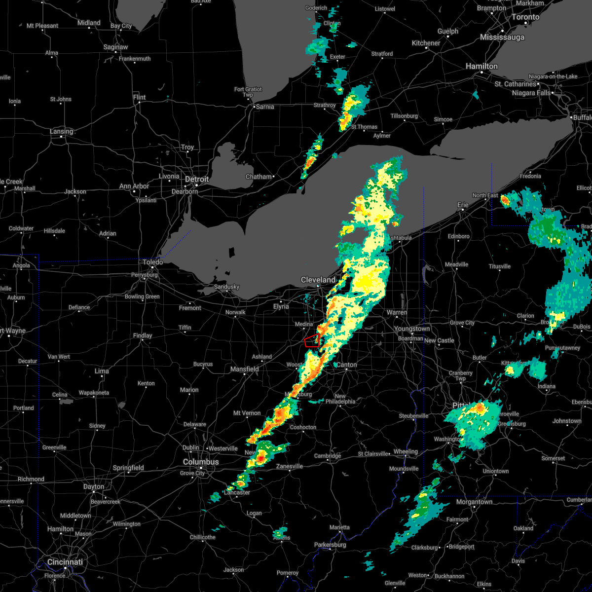 The tornado warning for southeastern medina county will expire at 500 pm edt, the storm which prompted the warning has moved out of the area. therefore, the warning will be allowed to expire. to report severe weather, contact your nearest law enforcement agency. they will relay your report to the national weather service cleveland. The tornado warning for southeastern medina county will expire at 500 pm edt, the storm which prompted the warning has moved out of the area. therefore, the warning will be allowed to expire. to report severe weather, contact your nearest law enforcement agency. they will relay your report to the national weather service cleveland.
|
| 10/21/2021 4:47 PM EDT |
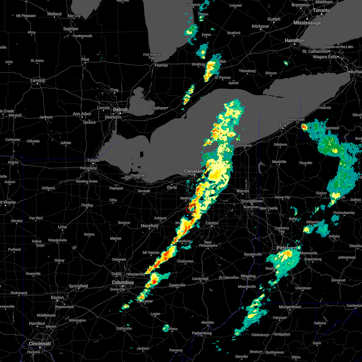 At 446 pm edt, a confirmed tornado was located near rittman, or 8 miles south of medina, moving east at 20 mph (radar confirmed tornado). Hazards include damaging tornado. Flying debris will be dangerous to those caught without shelter. mobile homes will be damaged or destroyed. damage to roofs, windows, and vehicles will occur. tree damage is likely. This tornado will be near, wadsworth around 500 pm edt. At 446 pm edt, a confirmed tornado was located near rittman, or 8 miles south of medina, moving east at 20 mph (radar confirmed tornado). Hazards include damaging tornado. Flying debris will be dangerous to those caught without shelter. mobile homes will be damaged or destroyed. damage to roofs, windows, and vehicles will occur. tree damage is likely. This tornado will be near, wadsworth around 500 pm edt.
|
| 10/21/2021 4:35 PM EDT |
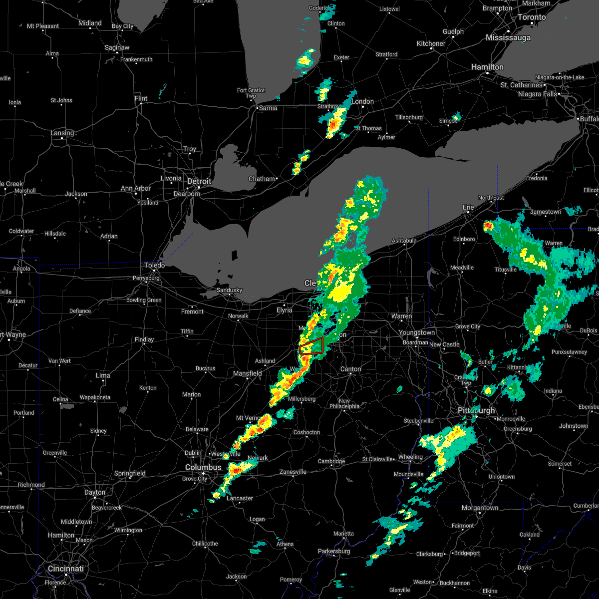 At 434 pm edt, a severe thunderstorm capable of producing a tornado was located over creston, or 8 miles south of medina, moving east at 30 mph (radar indicated rotation). Hazards include tornado. Flying debris will be dangerous to those caught without shelter. mobile homes will be damaged or destroyed. damage to roofs, windows, and vehicles will occur. tree damage is likely. this dangerous storm will be near, rittman around 440 pm edt. wadsworth and doylestown around 450 pm edt. Other locations impacted by this tornadic thunderstorm include seville and westfield center. At 434 pm edt, a severe thunderstorm capable of producing a tornado was located over creston, or 8 miles south of medina, moving east at 30 mph (radar indicated rotation). Hazards include tornado. Flying debris will be dangerous to those caught without shelter. mobile homes will be damaged or destroyed. damage to roofs, windows, and vehicles will occur. tree damage is likely. this dangerous storm will be near, rittman around 440 pm edt. wadsworth and doylestown around 450 pm edt. Other locations impacted by this tornadic thunderstorm include seville and westfield center.
|
| 10/21/2021 4:26 PM EDT |
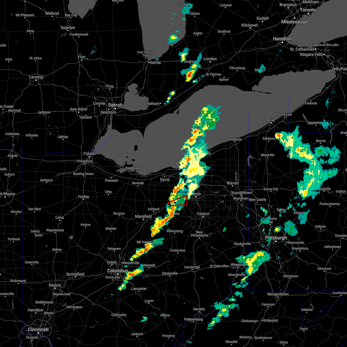 At 425 pm edt, a severe thunderstorm capable of producing a tornado was located near creston, or 11 miles north of wooster, moving east at 35 mph (radar indicated rotation). Hazards include tornado. Flying debris will be dangerous to those caught without shelter. mobile homes will be damaged or destroyed. damage to roofs, windows, and vehicles will occur. tree damage is likely. this dangerous storm will be near, creston around 435 pm edt. rittman around 440 pm edt. wadsworth and doylestown around 450 pm edt. Other locations impacted by this tornadic thunderstorm include westfield center, burbank and seville. At 425 pm edt, a severe thunderstorm capable of producing a tornado was located near creston, or 11 miles north of wooster, moving east at 35 mph (radar indicated rotation). Hazards include tornado. Flying debris will be dangerous to those caught without shelter. mobile homes will be damaged or destroyed. damage to roofs, windows, and vehicles will occur. tree damage is likely. this dangerous storm will be near, creston around 435 pm edt. rittman around 440 pm edt. wadsworth and doylestown around 450 pm edt. Other locations impacted by this tornadic thunderstorm include westfield center, burbank and seville.
|
| 10/21/2021 4:17 PM EDT |
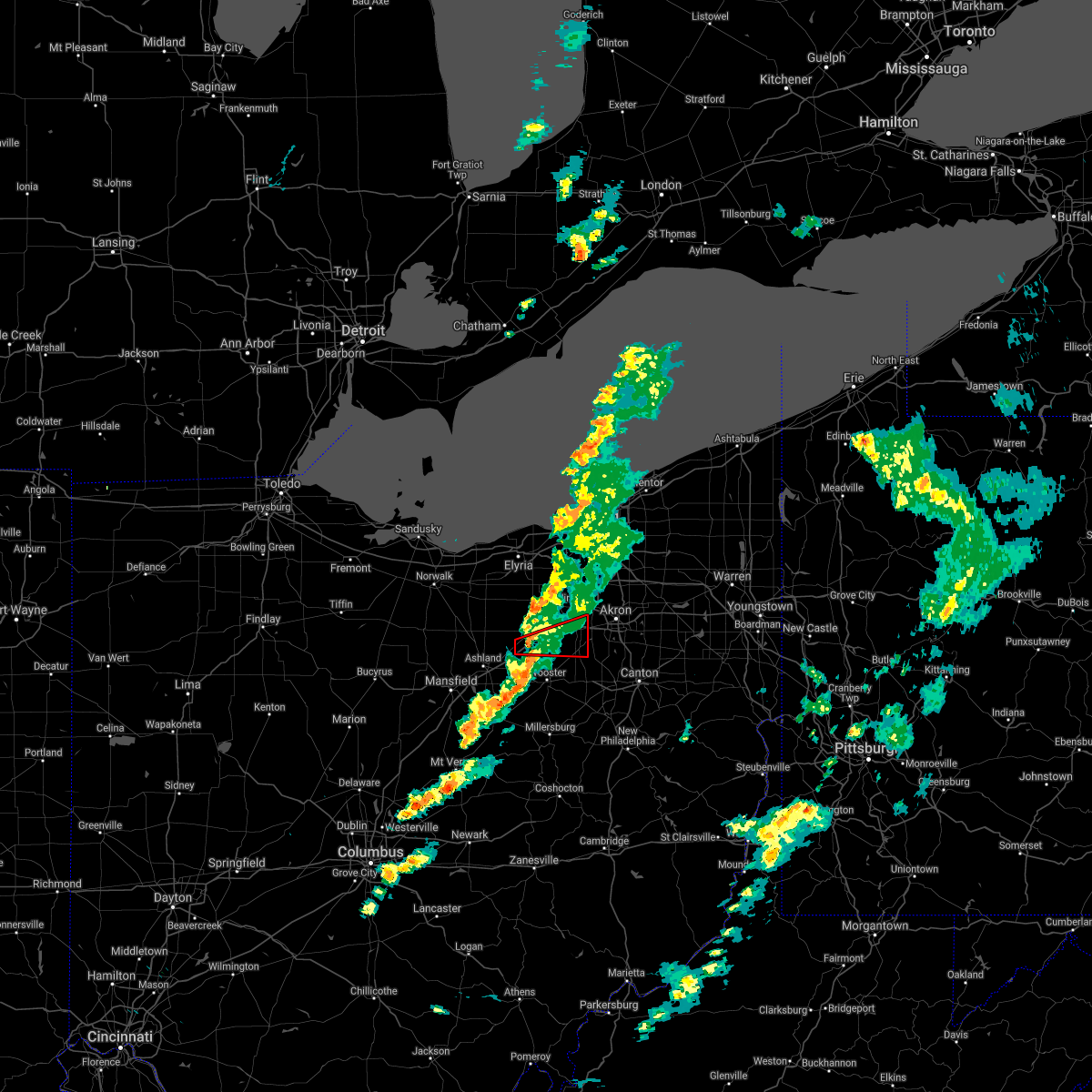 At 416 pm edt, a severe thunderstorm capable of producing a tornado was located over west salem, or 11 miles northwest of wooster, moving east at 35 mph (radar indicated rotation). Hazards include tornado. Flying debris will be dangerous to those caught without shelter. mobile homes will be damaged or destroyed. damage to roofs, windows, and vehicles will occur. tree damage is likely. this dangerous storm will be near, creston around 435 pm edt. rittman around 440 pm edt. wadsworth and doylestown around 450 pm edt. Other locations impacted by this tornadic thunderstorm include congress, westfield center, burbank and seville. At 416 pm edt, a severe thunderstorm capable of producing a tornado was located over west salem, or 11 miles northwest of wooster, moving east at 35 mph (radar indicated rotation). Hazards include tornado. Flying debris will be dangerous to those caught without shelter. mobile homes will be damaged or destroyed. damage to roofs, windows, and vehicles will occur. tree damage is likely. this dangerous storm will be near, creston around 435 pm edt. rittman around 440 pm edt. wadsworth and doylestown around 450 pm edt. Other locations impacted by this tornadic thunderstorm include congress, westfield center, burbank and seville.
|
| 10/21/2021 4:08 PM EDT |
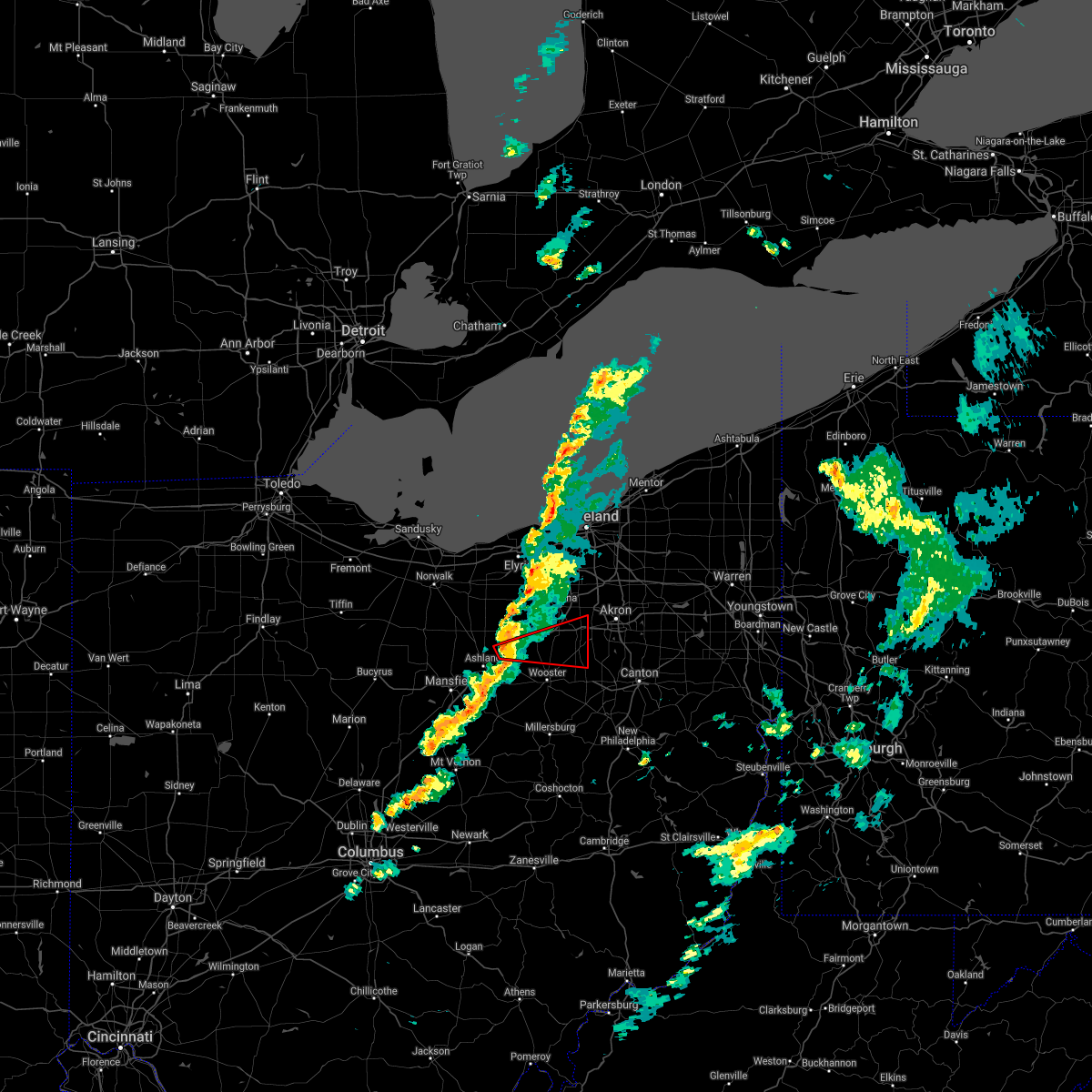 At 407 pm edt, a severe thunderstorm capable of producing a tornado was located near west salem, or 10 miles northeast of ashland, moving east at 35 mph (radar indicated rotation). Hazards include tornado. Flying debris will be dangerous to those caught without shelter. mobile homes will be damaged or destroyed. damage to roofs, windows, and vehicles will occur. tree damage is likely. this dangerous storm will be near, creston around 435 pm edt. rittman around 440 pm edt. wadsworth and doylestown around 450 pm edt. Other locations impacted by this tornadic thunderstorm include congress, westfield center, marshallville, burbank and seville. At 407 pm edt, a severe thunderstorm capable of producing a tornado was located near west salem, or 10 miles northeast of ashland, moving east at 35 mph (radar indicated rotation). Hazards include tornado. Flying debris will be dangerous to those caught without shelter. mobile homes will be damaged or destroyed. damage to roofs, windows, and vehicles will occur. tree damage is likely. this dangerous storm will be near, creston around 435 pm edt. rittman around 440 pm edt. wadsworth and doylestown around 450 pm edt. Other locations impacted by this tornadic thunderstorm include congress, westfield center, marshallville, burbank and seville.
|
| 9/22/2021 2:09 PM EDT |
 At 209 pm edt, a severe thunderstorm was located over barberton, or near akron, moving north at 30 mph (radar indicated). Hazards include 60 mph wind gusts. expect damage to trees and power lines At 209 pm edt, a severe thunderstorm was located over barberton, or near akron, moving north at 30 mph (radar indicated). Hazards include 60 mph wind gusts. expect damage to trees and power lines
|
| 8/11/2021 6:01 PM EDT |
 At 601 pm edt, a line of severe thunderstorms was located from hudson to massillon, moving east at 45 mph (radar indicated). Hazards include 70 mph wind gusts and penny size hail. Expect considerable tree damage. damage is likely to mobile homes, roofs, and outbuildings. locations impacted include, akron, canton, ravenna, cuyahoga falls, massillon, kent, barberton, green, alliance, hudson, wadsworth, tallmadge, north canton, streetsboro, macedonia, louisville, orrville, rittman, sebring and mogadore. thunderstorm damage threat, considerable hail threat, radar indicated max hail size, 0. 75 in wind threat, radar indicated max wind gust, 70 mph. At 601 pm edt, a line of severe thunderstorms was located from hudson to massillon, moving east at 45 mph (radar indicated). Hazards include 70 mph wind gusts and penny size hail. Expect considerable tree damage. damage is likely to mobile homes, roofs, and outbuildings. locations impacted include, akron, canton, ravenna, cuyahoga falls, massillon, kent, barberton, green, alliance, hudson, wadsworth, tallmadge, north canton, streetsboro, macedonia, louisville, orrville, rittman, sebring and mogadore. thunderstorm damage threat, considerable hail threat, radar indicated max hail size, 0. 75 in wind threat, radar indicated max wind gust, 70 mph.
|
| 8/11/2021 5:40 PM EDT | Estimated 60-65 mph wind gust... tree limbs down and shingles off building in medina county OH, 0.6 miles S of Wadsworth, OH |
| 8/11/2021 5:36 PM EDT |
 At 535 pm edt, a line of severe thunderstorm was located near brunswick to wooster, moving east at 45 mph (radar indicated). Hazards include 70 mph wind gusts and penny size hail. Expect considerable tree damage. Damage is likely to mobile homes, roofs, and outbuildings. At 535 pm edt, a line of severe thunderstorm was located near brunswick to wooster, moving east at 45 mph (radar indicated). Hazards include 70 mph wind gusts and penny size hail. Expect considerable tree damage. Damage is likely to mobile homes, roofs, and outbuildings.
|
| 6/29/2021 5:42 PM EDT |
 At 542 pm edt, a severe thunderstorm was located over wadsworth, or 9 miles southeast of medina, moving east at 15 mph (radar indicated). Hazards include 60 mph wind gusts. expect damage to trees and power lines At 542 pm edt, a severe thunderstorm was located over wadsworth, or 9 miles southeast of medina, moving east at 15 mph (radar indicated). Hazards include 60 mph wind gusts. expect damage to trees and power lines
|
| 6/21/2021 12:43 PM EDT |
 At 1243 pm edt, a severe thunderstorm was located over barberton, or near akron, moving east at 40 mph (radar indicated). Hazards include 60 mph wind gusts. expect damage to trees and power lines At 1243 pm edt, a severe thunderstorm was located over barberton, or near akron, moving east at 40 mph (radar indicated). Hazards include 60 mph wind gusts. expect damage to trees and power lines
|
| 6/21/2021 6:43 AM EDT |
 At 642 am edt, severe thunderstorms were located along a line extending from near twinsburg to cuyahoga falls, moving east at 55 mph (radar indicated). Hazards include 60 mph wind gusts and quarter size hail. Minor damage to vehicles is possible. Expect damage to trees and power lines. At 642 am edt, severe thunderstorms were located along a line extending from near twinsburg to cuyahoga falls, moving east at 55 mph (radar indicated). Hazards include 60 mph wind gusts and quarter size hail. Minor damage to vehicles is possible. Expect damage to trees and power lines.
|
| 5/26/2021 1:14 PM EDT |
 At 114 pm edt, a severe thunderstorm was located over barberton, or 7 miles southwest of akron, moving east at 35 mph (radar indicated). Hazards include 60 mph wind gusts and penny size hail. expect damage to trees and power lines At 114 pm edt, a severe thunderstorm was located over barberton, or 7 miles southwest of akron, moving east at 35 mph (radar indicated). Hazards include 60 mph wind gusts and penny size hail. expect damage to trees and power lines
|
| 11/15/2020 12:57 PM EST |
 At 1256 pm est, severe thunderstorms were located along a line extending from 11 miles north of avon lake to 7 miles southwest of loudonville, moving east at 50 mph. at 12:53 pm, cleveland hopkins airport reported a 62 knot wind gust (radar indicated). Hazards include 70 mph wind gusts. Expect considerable tree damage. damage is likely to mobile homes, roofs, and outbuildings. Locations impacted include, cleveland, medina, wooster, millersburg, parma, lakewood, strongsville, brunswick, westlake, north royalton, north ridgeville, avon lake, wadsworth, grafton, rittman, lodi, creston, shreve, west salem and killbuck. At 1256 pm est, severe thunderstorms were located along a line extending from 11 miles north of avon lake to 7 miles southwest of loudonville, moving east at 50 mph. at 12:53 pm, cleveland hopkins airport reported a 62 knot wind gust (radar indicated). Hazards include 70 mph wind gusts. Expect considerable tree damage. damage is likely to mobile homes, roofs, and outbuildings. Locations impacted include, cleveland, medina, wooster, millersburg, parma, lakewood, strongsville, brunswick, westlake, north royalton, north ridgeville, avon lake, wadsworth, grafton, rittman, lodi, creston, shreve, west salem and killbuck.
|
| 11/15/2020 12:54 PM EST |
 At 1254 pm est, severe thunderstorms were located along a line extending from 12 miles north of lakewood to near loudonville, moving east at 50 mph (radar indicated). Hazards include 60 mph wind gusts. Expect damage to trees and power lines. Locations impacted include, cleveland, medina, wooster, millersburg, parma, lakewood, strongsville, brunswick, westlake, north royalton, north ridgeville, avon lake, wadsworth, grafton, rittman, lodi, creston, shreve, west salem and killbuck. At 1254 pm est, severe thunderstorms were located along a line extending from 12 miles north of lakewood to near loudonville, moving east at 50 mph (radar indicated). Hazards include 60 mph wind gusts. Expect damage to trees and power lines. Locations impacted include, cleveland, medina, wooster, millersburg, parma, lakewood, strongsville, brunswick, westlake, north royalton, north ridgeville, avon lake, wadsworth, grafton, rittman, lodi, creston, shreve, west salem and killbuck.
|
| 11/15/2020 12:46 PM EST |
 At 1244 pm est, severe thunderstorms were located along a line extending from 10 miles north of avon lake to 8 miles northwest of danville, moving east at 50 mph (radar indicated). Hazards include 60 mph wind gusts. Expect damage to trees and power lines. Locations impacted include, cleveland, lorain, elyria, medina, wooster, ashland, millersburg, parma, lakewood, strongsville, brunswick, westlake, north royalton, north ridgeville, avon lake, wadsworth, grafton, rittman, wellington and lodi. At 1244 pm est, severe thunderstorms were located along a line extending from 10 miles north of avon lake to 8 miles northwest of danville, moving east at 50 mph (radar indicated). Hazards include 60 mph wind gusts. Expect damage to trees and power lines. Locations impacted include, cleveland, lorain, elyria, medina, wooster, ashland, millersburg, parma, lakewood, strongsville, brunswick, westlake, north royalton, north ridgeville, avon lake, wadsworth, grafton, rittman, wellington and lodi.
|
| 11/15/2020 12:19 PM EST |
 At 1219 pm est, severe thunderstorms were located along a line extending from 11 miles north of vermilion to near chesterville, moving east at 50 mph (radar indicated). Hazards include 60 mph wind gusts. expect damage to trees and power lines At 1219 pm est, severe thunderstorms were located along a line extending from 11 miles north of vermilion to near chesterville, moving east at 50 mph (radar indicated). Hazards include 60 mph wind gusts. expect damage to trees and power lines
|
| 8/28/2020 3:08 PM EDT |
 The severe thunderstorm warning for central huron, medina, northern ashland, northern wayne and southern lorain counties will expire at 315 pm edt, the storms which prompted the warning have weakened below severe limits, and no longer pose an immediate threat to life or property. therefore, the warning will be allowed to expire. however gusty winds and heavy rain are still possible with these thunderstorms. The severe thunderstorm warning for central huron, medina, northern ashland, northern wayne and southern lorain counties will expire at 315 pm edt, the storms which prompted the warning have weakened below severe limits, and no longer pose an immediate threat to life or property. therefore, the warning will be allowed to expire. however gusty winds and heavy rain are still possible with these thunderstorms.
|
| 8/28/2020 2:36 PM EDT |
 At 235 pm edt, severe thunderstorms were located along a line extending from near new washington to near savannah to 6 miles northeast of hayesville, moving northeast at 35 mph (radar indicated). Hazards include 60 mph wind gusts and nickel size hail. expect damage to trees and power lines At 235 pm edt, severe thunderstorms were located along a line extending from near new washington to near savannah to 6 miles northeast of hayesville, moving northeast at 35 mph (radar indicated). Hazards include 60 mph wind gusts and nickel size hail. expect damage to trees and power lines
|
| 8/28/2020 12:07 PM EDT |
 At 1206 pm edt, a severe thunderstorm was located over barberton, or 8 miles southwest of akron, moving east at 20 mph (radar indicated). Hazards include 60 mph wind gusts and quarter size hail. Minor damage to vehicles is possible. expect damage to trees and power lines. Locations impacted include, akron, barberton, green, rittman, doylestown, norton, clinton and portage lakes. At 1206 pm edt, a severe thunderstorm was located over barberton, or 8 miles southwest of akron, moving east at 20 mph (radar indicated). Hazards include 60 mph wind gusts and quarter size hail. Minor damage to vehicles is possible. expect damage to trees and power lines. Locations impacted include, akron, barberton, green, rittman, doylestown, norton, clinton and portage lakes.
|
| 8/28/2020 11:48 AM EDT |
 At 1148 am edt, a severe thunderstorm was located over wadsworth, or 10 miles southeast of medina, moving east at 20 mph (radar indicated). Hazards include 60 mph wind gusts and quarter size hail. Minor damage to vehicles is possible. Expect damage to trees and power lines. At 1148 am edt, a severe thunderstorm was located over wadsworth, or 10 miles southeast of medina, moving east at 20 mph (radar indicated). Hazards include 60 mph wind gusts and quarter size hail. Minor damage to vehicles is possible. Expect damage to trees and power lines.
|
| 8/27/2020 6:18 PM EDT |
 At 618 pm edt, a severe thunderstorm was located over creston, or 9 miles north of wooster, moving southeast at 25 mph (radar indicated). Hazards include 60 mph wind gusts. Expect damage to trees and power lines. Locations impacted include, wadsworth, rittman, lodi, creston, chippewa lake, seville, smithville, westfield center, spencer, gloria glens park, burbank, chippewa-on-the-lake and briarwood beach. At 618 pm edt, a severe thunderstorm was located over creston, or 9 miles north of wooster, moving southeast at 25 mph (radar indicated). Hazards include 60 mph wind gusts. Expect damage to trees and power lines. Locations impacted include, wadsworth, rittman, lodi, creston, chippewa lake, seville, smithville, westfield center, spencer, gloria glens park, burbank, chippewa-on-the-lake and briarwood beach.
|
| 8/27/2020 5:55 PM EDT |
 At 555 pm edt, a severe thunderstorm was located near creston, or 11 miles north of wooster, moving southeast at 25 mph (radar indicated). Hazards include 60 mph wind gusts. Expect damage to trees and power lines. Locations impacted include, wadsworth, rittman, lodi, creston, chippewa lake, seville, smithville, westfield center, spencer, gloria glens park, burbank, chippewa-on-the-lake and briarwood beach. At 555 pm edt, a severe thunderstorm was located near creston, or 11 miles north of wooster, moving southeast at 25 mph (radar indicated). Hazards include 60 mph wind gusts. Expect damage to trees and power lines. Locations impacted include, wadsworth, rittman, lodi, creston, chippewa lake, seville, smithville, westfield center, spencer, gloria glens park, burbank, chippewa-on-the-lake and briarwood beach.
|
| 8/27/2020 5:41 PM EDT |
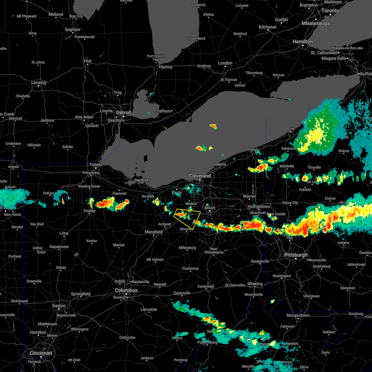 At 540 pm edt, a severe thunderstorm was located over lodi, or 11 miles southwest of medina, moving southeast at 35 mph (radar indicated). Hazards include 60 mph wind gusts. expect damage to trees and power lines At 540 pm edt, a severe thunderstorm was located over lodi, or 11 miles southwest of medina, moving southeast at 35 mph (radar indicated). Hazards include 60 mph wind gusts. expect damage to trees and power lines
|
| 6/21/2020 5:45 PM EDT | Tree blocking sr-162 at burdett roa in medina county OH, 4.3 miles SSW of Wadsworth, OH |
| 6/21/2020 5:39 PM EDT |
 At 539 pm edt, a severe thunderstorm was located near wadsworth, or 7 miles southeast of medina, moving east at 15 mph (radar indicated). Hazards include 60 mph wind gusts and quarter size hail. Minor damage to vehicles is possible. Expect damage to trees and power lines. At 539 pm edt, a severe thunderstorm was located near wadsworth, or 7 miles southeast of medina, moving east at 15 mph (radar indicated). Hazards include 60 mph wind gusts and quarter size hail. Minor damage to vehicles is possible. Expect damage to trees and power lines.
|
| 6/21/2020 5:36 PM EDT | Quarter sized hail reported 2.6 miles S of Wadsworth, OH, nickel to quarter-sized hail. also estimated 50 to 60 mph winds. |
| 6/10/2020 8:05 PM EDT |
 At 805 pm edt, severe thunderstorms were located along a line extending from 8 miles southeast of brunswick to 6 miles southwest of cuyahoga falls to barberton, moving northeast at 50 mph (radar indicated). Hazards include 60 mph wind gusts. expect damage to trees and power lines At 805 pm edt, severe thunderstorms were located along a line extending from 8 miles southeast of brunswick to 6 miles southwest of cuyahoga falls to barberton, moving northeast at 50 mph (radar indicated). Hazards include 60 mph wind gusts. expect damage to trees and power lines
|
| 6/10/2020 7:49 PM EDT |
 At 749 pm edt, a severe thunderstorm was located over creston, or 10 miles north of wooster, moving northeast at 60 mph (radar indicated). Hazards include 60 mph wind gusts and nickel size hail. Expect damage to trees and power lines. Locations impacted include, medina, wooster, brunswick, north royalton, wadsworth, orrville, rittman, doylestown, loudonville, creston, dalton, shreve, west salem, chippewa lake, holmesville, mount eaton, nashville, broadview heights, hinckley and seville. At 749 pm edt, a severe thunderstorm was located over creston, or 10 miles north of wooster, moving northeast at 60 mph (radar indicated). Hazards include 60 mph wind gusts and nickel size hail. Expect damage to trees and power lines. Locations impacted include, medina, wooster, brunswick, north royalton, wadsworth, orrville, rittman, doylestown, loudonville, creston, dalton, shreve, west salem, chippewa lake, holmesville, mount eaton, nashville, broadview heights, hinckley and seville.
|
| 6/10/2020 7:14 PM EDT |
 At 714 pm edt, a severe thunderstorm was located near lodi, or 11 miles west of medina, moving northeast at 60 mph (radar indicated). Hazards include 70 mph wind gusts and nickel size hail. Expect considerable tree damage. Damage is likely to mobile homes, roofs, and outbuildings. At 714 pm edt, a severe thunderstorm was located near lodi, or 11 miles west of medina, moving northeast at 60 mph (radar indicated). Hazards include 70 mph wind gusts and nickel size hail. Expect considerable tree damage. Damage is likely to mobile homes, roofs, and outbuildings.
|
| 5/14/2020 6:42 PM EDT |
 The severe thunderstorm warning for eastern medina county will expire at 645 pm edt, the storms which prompted the warning have moved out of the area. therefore, the warning will be allowed to expire. however gusty winds are still possible with these thunderstorms. The severe thunderstorm warning for eastern medina county will expire at 645 pm edt, the storms which prompted the warning have moved out of the area. therefore, the warning will be allowed to expire. however gusty winds are still possible with these thunderstorms.
|
| 5/14/2020 6:34 PM EDT |
 At 633 pm edt, severe thunderstorms were located along a line extending from near hinckley to near wadsworth, moving northeast at 50 mph (radar indicated). Hazards include 60 mph wind gusts. Expect damage to trees and power lines. Locations impacted include, medina, brunswick, wadsworth, hinckley and seville. At 633 pm edt, severe thunderstorms were located along a line extending from near hinckley to near wadsworth, moving northeast at 50 mph (radar indicated). Hazards include 60 mph wind gusts. Expect damage to trees and power lines. Locations impacted include, medina, brunswick, wadsworth, hinckley and seville.
|
| 5/14/2020 6:14 PM EDT |
 At 613 pm edt, severe thunderstorms were located along a line extending from grafton to 9 miles south of elyria to near lodi, moving east at 40 mph. the strongest part of this line was located in southeast lorain county, south of grafton, heading towards northwest medina county (radar indicated). Hazards include 60 mph wind gusts. Expect damage to trees and power lines. Locations impacted include, medina, strongsville, brunswick, north royalton, wadsworth, rittman, lodi, creston, chippewa lake, broadview heights, hinckley, seville, westfield center, spencer, gloria glens park, burbank, chippewa-on-the-lake, valley city and briarwood beach. At 613 pm edt, severe thunderstorms were located along a line extending from grafton to 9 miles south of elyria to near lodi, moving east at 40 mph. the strongest part of this line was located in southeast lorain county, south of grafton, heading towards northwest medina county (radar indicated). Hazards include 60 mph wind gusts. Expect damage to trees and power lines. Locations impacted include, medina, strongsville, brunswick, north royalton, wadsworth, rittman, lodi, creston, chippewa lake, broadview heights, hinckley, seville, westfield center, spencer, gloria glens park, burbank, chippewa-on-the-lake, valley city and briarwood beach.
|
| 5/14/2020 6:04 PM EDT |
 At 604 pm edt, severe thunderstorms were located along a line extending from 6 miles southwest of elyria to near wellington, moving east at 40 mph (radar indicated). Hazards include 60 mph wind gusts. expect damage to trees and power lines At 604 pm edt, severe thunderstorms were located along a line extending from 6 miles southwest of elyria to near wellington, moving east at 40 mph (radar indicated). Hazards include 60 mph wind gusts. expect damage to trees and power lines
|
| 4/8/2020 12:15 AM EDT |
 At 1215 am edt, severe thunderstorms were located along a line extending from 7 miles north of sebring to near brewster to near savannah, moving southeast at 70 mph (radar indicated). Hazards include 70 mph wind gusts and quarter size hail. Minor damage to vehicles is possible. expect considerable tree damage. wind damage is also likely to mobile homes, roofs, and outbuildings. Locations impacted include, akron, canton, wooster, salem, millersburg, massillon, barberton, green, alliance, wadsworth, tallmadge, north canton, louisville, orrville, berlin, rittman, sebring, mogadore, walnut creek and minerva. At 1215 am edt, severe thunderstorms were located along a line extending from 7 miles north of sebring to near brewster to near savannah, moving southeast at 70 mph (radar indicated). Hazards include 70 mph wind gusts and quarter size hail. Minor damage to vehicles is possible. expect considerable tree damage. wind damage is also likely to mobile homes, roofs, and outbuildings. Locations impacted include, akron, canton, wooster, salem, millersburg, massillon, barberton, green, alliance, wadsworth, tallmadge, north canton, louisville, orrville, berlin, rittman, sebring, mogadore, walnut creek and minerva.
|
| 4/7/2020 11:55 PM EDT |
 The tornado warning for southeastern medina county will expire at midnight edt, the tornado threat has ended and the tornado warning has been cancelled. however, large hail and damaging winds remain likely and a severe thunderstorm warning remains in effect for the area. a severe thunderstorm watch remains in effect until 300 am edt for northeastern ohio. The tornado warning for southeastern medina county will expire at midnight edt, the tornado threat has ended and the tornado warning has been cancelled. however, large hail and damaging winds remain likely and a severe thunderstorm warning remains in effect for the area. a severe thunderstorm watch remains in effect until 300 am edt for northeastern ohio.
|
| 4/7/2020 11:45 PM EDT |
 At 1145 pm edt, a severe thunderstorm capable of producing a tornado was located near wadsworth, or 7 miles southeast of medina, moving southeast at 50 mph (radar indicated rotation). Hazards include tornado and quarter size hail. Flying debris will be dangerous to those caught without shelter. mobile homes will be damaged or destroyed. damage to roofs, windows, and vehicles will occur. Tree damage is likely. At 1145 pm edt, a severe thunderstorm capable of producing a tornado was located near wadsworth, or 7 miles southeast of medina, moving southeast at 50 mph (radar indicated rotation). Hazards include tornado and quarter size hail. Flying debris will be dangerous to those caught without shelter. mobile homes will be damaged or destroyed. damage to roofs, windows, and vehicles will occur. Tree damage is likely.
|
| 4/7/2020 11:43 PM EDT |
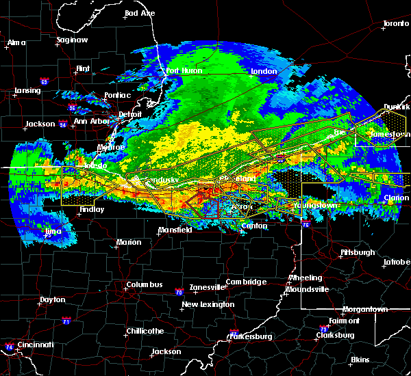 At 1143 pm edt, a severe thunderstorm capable of producing a tornado was located near wadsworth, or near medina, moving southeast at 50 mph (radar indicated rotation). Hazards include tornado and quarter size hail. Flying debris will be dangerous to those caught without shelter. mobile homes will be damaged or destroyed. damage to roofs, windows, and vehicles will occur. tree damage is likely. Locations impacted include, medina, wadsworth, rittman, creston, chippewa lake, seville, westfield center, gloria glens park, chippewa-on-the-lake and briarwood beach. At 1143 pm edt, a severe thunderstorm capable of producing a tornado was located near wadsworth, or near medina, moving southeast at 50 mph (radar indicated rotation). Hazards include tornado and quarter size hail. Flying debris will be dangerous to those caught without shelter. mobile homes will be damaged or destroyed. damage to roofs, windows, and vehicles will occur. tree damage is likely. Locations impacted include, medina, wadsworth, rittman, creston, chippewa lake, seville, westfield center, gloria glens park, chippewa-on-the-lake and briarwood beach.
|
| 4/7/2020 11:38 PM EDT |
 At 1137 pm edt, severe thunderstorms were located along a line extending from solon to 6 miles northwest of lodi to near norwalk, moving southeast at 45 mph (radar indicated). Hazards include 70 mph wind gusts and quarter size hail. Minor damage to vehicles is possible. expect considerable tree damage. Wind damage is also likely to mobile homes, roofs, and outbuildings. At 1137 pm edt, severe thunderstorms were located along a line extending from solon to 6 miles northwest of lodi to near norwalk, moving southeast at 45 mph (radar indicated). Hazards include 70 mph wind gusts and quarter size hail. Minor damage to vehicles is possible. expect considerable tree damage. Wind damage is also likely to mobile homes, roofs, and outbuildings.
|
| 4/7/2020 11:34 PM EDT |
 At 1134 pm edt, severe thunderstorms were located along a line extending from highland hills to 7 miles west of medina to 6 miles southwest of wakeman, moving southeast at 70 mph (radar indicated). Hazards include 70 mph wind gusts and quarter size hail. Minor damage to vehicles is possible. expect considerable tree damage. wind damage is also likely to mobile homes, roofs, and outbuildings. Locations impacted include, cleveland, akron, lorain, elyria, medina, ravenna, vermilion, parma, lakewood, cuyahoga falls, euclid, cleveland heights, strongsville, brunswick, westlake, north royalton, north ridgeville, kent, barberton and solon. At 1134 pm edt, severe thunderstorms were located along a line extending from highland hills to 7 miles west of medina to 6 miles southwest of wakeman, moving southeast at 70 mph (radar indicated). Hazards include 70 mph wind gusts and quarter size hail. Minor damage to vehicles is possible. expect considerable tree damage. wind damage is also likely to mobile homes, roofs, and outbuildings. Locations impacted include, cleveland, akron, lorain, elyria, medina, ravenna, vermilion, parma, lakewood, cuyahoga falls, euclid, cleveland heights, strongsville, brunswick, westlake, north royalton, north ridgeville, kent, barberton and solon.
|
| 4/7/2020 11:29 PM EDT |
 The national weather service in cleveland has issued a * tornado warning for. medina county in northeastern ohio. east central lorain county in north central ohio. until midnight edt. At 1129 pm edt, a severe thunderstorm capable of producing a. The national weather service in cleveland has issued a * tornado warning for. medina county in northeastern ohio. east central lorain county in north central ohio. until midnight edt. At 1129 pm edt, a severe thunderstorm capable of producing a.
|
| 4/7/2020 11:17 PM EDT |
 At 1117 pm edt, severe thunderstorms were located along a line extending from 6 miles north of cleveland to 6 miles south of amherst to near northern milan, moving south at 50 mph (trained weather spotters reported half dollar size hail in avon recently). Hazards include 70 mph wind gusts and half dollar size hail. People and animals outdoors will be injured. expect hail damage to roofs, siding, windows, and vehicles. expect considerable tree damage. wind damage is also likely to mobile homes, roofs, and outbuildings. Locations impacted include, cleveland, akron, lorain, elyria, medina, sandusky, ravenna, western vermilion, vermilion, parma, lakewood, cuyahoga falls, euclid, cleveland heights, strongsville, brunswick, westlake, north royalton, north ridgeville and kent. At 1117 pm edt, severe thunderstorms were located along a line extending from 6 miles north of cleveland to 6 miles south of amherst to near northern milan, moving south at 50 mph (trained weather spotters reported half dollar size hail in avon recently). Hazards include 70 mph wind gusts and half dollar size hail. People and animals outdoors will be injured. expect hail damage to roofs, siding, windows, and vehicles. expect considerable tree damage. wind damage is also likely to mobile homes, roofs, and outbuildings. Locations impacted include, cleveland, akron, lorain, elyria, medina, sandusky, ravenna, western vermilion, vermilion, parma, lakewood, cuyahoga falls, euclid, cleveland heights, strongsville, brunswick, westlake, north royalton, north ridgeville and kent.
|
| 4/7/2020 11:01 PM EDT |
 At 1100 pm edt, severe thunderstorms were located along a line extending from 16 miles northwest of lakeline to near lorain to 7 miles east of sandusky, moving southeast at 55 mph (radar indicated). Hazards include 60 mph wind gusts and quarter size hail. Minor damage to vehicles is possible. Expect damage to trees and power lines. At 1100 pm edt, severe thunderstorms were located along a line extending from 16 miles northwest of lakeline to near lorain to 7 miles east of sandusky, moving southeast at 55 mph (radar indicated). Hazards include 60 mph wind gusts and quarter size hail. Minor damage to vehicles is possible. Expect damage to trees and power lines.
|
| 3/28/2020 1:26 PM EDT |
 The severe thunderstorm warning for east central medina county will expire at 130 pm edt, the severe thunderstorm which prompted the warning has moved out of the warned area. therefore, the warning will be allowed to expire. The severe thunderstorm warning for east central medina county will expire at 130 pm edt, the severe thunderstorm which prompted the warning has moved out of the warned area. therefore, the warning will be allowed to expire.
|
| 3/28/2020 1:20 PM EDT |
 At 120 pm edt, a severe thunderstorm was located 8 miles north of wadsworth, or 9 miles east of medina, moving east at 75 mph (radar indicated). Hazards include golf ball size hail and 60 mph wind gusts. People and animals outdoors will be injured. expect hail damage to roofs, siding, windows, and vehicles. expect damage to trees and power lines. This severe thunderstorm will remain over mainly rural areas of east central medina county. At 120 pm edt, a severe thunderstorm was located 8 miles north of wadsworth, or 9 miles east of medina, moving east at 75 mph (radar indicated). Hazards include golf ball size hail and 60 mph wind gusts. People and animals outdoors will be injured. expect hail damage to roofs, siding, windows, and vehicles. expect damage to trees and power lines. This severe thunderstorm will remain over mainly rural areas of east central medina county.
|
| 3/28/2020 1:17 PM EDT |
 At 116 pm edt, a severe thunderstorm was located near medina, moving east at 70 mph (radar indicated). Hazards include golf ball size hail and 60 mph wind gusts. People and animals outdoors will be injured. expect hail damage to roofs, siding, windows, and vehicles. Expect damage to trees and power lines. At 116 pm edt, a severe thunderstorm was located near medina, moving east at 70 mph (radar indicated). Hazards include golf ball size hail and 60 mph wind gusts. People and animals outdoors will be injured. expect hail damage to roofs, siding, windows, and vehicles. Expect damage to trees and power lines.
|
| 3/28/2020 12:56 PM EDT |
 At 1256 pm edt, a severe thunderstorm was located near wellington, or 18 miles north of ashland, moving east at 60 mph (radar indicated). Hazards include quarter size hail. minor damage to vehicles is possible At 1256 pm edt, a severe thunderstorm was located near wellington, or 18 miles north of ashland, moving east at 60 mph (radar indicated). Hazards include quarter size hail. minor damage to vehicles is possible
|
| 3/28/2020 12:39 PM EDT |
 At 1239 pm edt, severe thunderstorms were located along a line extending from near streetsboro to near wadsworth, moving east at 65 mph (radar indicated). Hazards include 60 mph wind gusts and half dollar size hail. People and animals outdoors will be injured. expect hail damage to roofs, siding, windows, and vehicles. Expect damage to trees and power lines. At 1239 pm edt, severe thunderstorms were located along a line extending from near streetsboro to near wadsworth, moving east at 65 mph (radar indicated). Hazards include 60 mph wind gusts and half dollar size hail. People and animals outdoors will be injured. expect hail damage to roofs, siding, windows, and vehicles. Expect damage to trees and power lines.
|
| 3/20/2020 12:18 PM EDT |
 At 1218 pm edt, severe thunderstorms were located along a line extending from near green to near lexington, moving east-southeast at 45 mph (radar indicated). Hazards include 60 mph wind gusts. expect damage to trees and power lines At 1218 pm edt, severe thunderstorms were located along a line extending from near green to near lexington, moving east-southeast at 45 mph (radar indicated). Hazards include 60 mph wind gusts. expect damage to trees and power lines
|
| 8/20/2019 6:42 PM EDT |
 At 641 pm edt, severe thunderstorms were located along a line extending from near wellington to chippewa lake to near wooster, moving northeast at 15 mph (radar indicated). Hazards include 60 mph wind gusts. Expect damage to trees and power lines. Locations impacted include, medina, wooster, brunswick, wadsworth, grafton, rittman, wellington, doylestown, creston, chippewa lake, hinckley, seville, lagrange, penfield, pittsfield, westfield center and spencer. At 641 pm edt, severe thunderstorms were located along a line extending from near wellington to chippewa lake to near wooster, moving northeast at 15 mph (radar indicated). Hazards include 60 mph wind gusts. Expect damage to trees and power lines. Locations impacted include, medina, wooster, brunswick, wadsworth, grafton, rittman, wellington, doylestown, creston, chippewa lake, hinckley, seville, lagrange, penfield, pittsfield, westfield center and spencer.
|
| 8/20/2019 6:16 PM EDT |
 At 615 pm edt, severe thunderstorms were located along a line extending from near savannah to 7 miles south of west salem, moving northeast at 25 mph (radar indicated). Hazards include 60 mph wind gusts and penny size hail. expect damage to trees and power lines At 615 pm edt, severe thunderstorms were located along a line extending from near savannah to 7 miles south of west salem, moving northeast at 25 mph (radar indicated). Hazards include 60 mph wind gusts and penny size hail. expect damage to trees and power lines
|
| 8/18/2019 5:57 PM EDT |
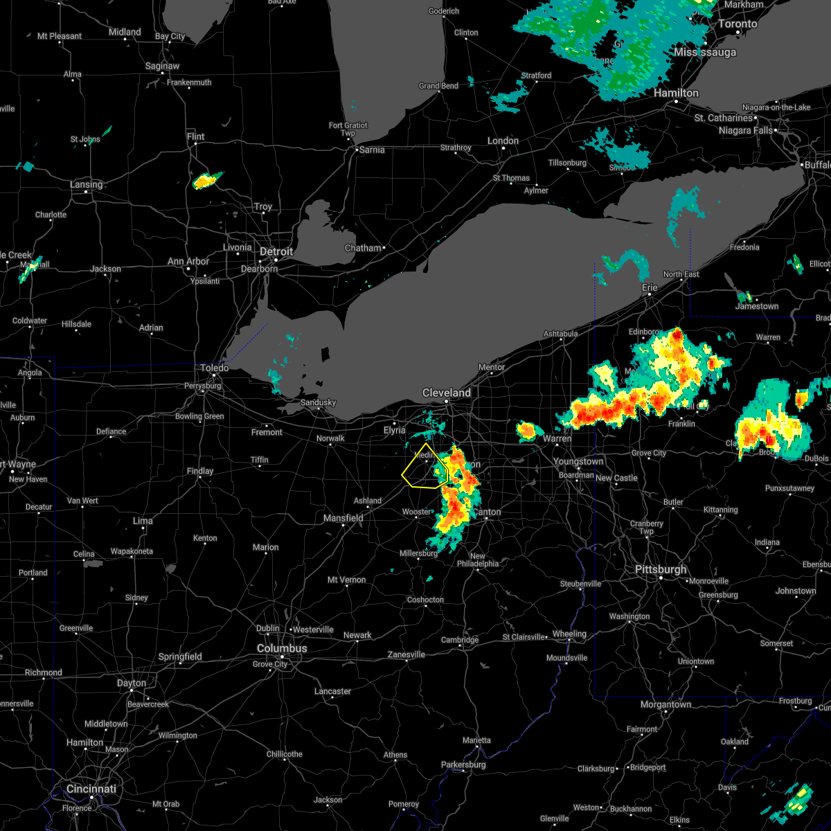 The severe thunderstorm warning for eastern medina county will expire at 600 pm edt, the storm which prompted the warning has moved out of the area. therefore, the warning will be allowed to expire. a severe thunderstorm watch remains in effect until 1000 pm edt for northeastern ohio. The severe thunderstorm warning for eastern medina county will expire at 600 pm edt, the storm which prompted the warning has moved out of the area. therefore, the warning will be allowed to expire. a severe thunderstorm watch remains in effect until 1000 pm edt for northeastern ohio.
|
| 8/18/2019 5:50 PM EDT | Tree dow in medina county OH, 6.2 miles S of Wadsworth, OH |
| 8/18/2019 5:29 PM EDT |
 At 528 pm edt, a severe thunderstorm was located over chippewa lake, or near medina, moving northeast at 15 mph (radar indicated). Hazards include 70 mph wind gusts and quarter size hail. Minor damage to vehicles is possible. expect considerable tree damage. Wind damage is also likely to mobile homes, roofs, and outbuildings. At 528 pm edt, a severe thunderstorm was located over chippewa lake, or near medina, moving northeast at 15 mph (radar indicated). Hazards include 70 mph wind gusts and quarter size hail. Minor damage to vehicles is possible. expect considerable tree damage. Wind damage is also likely to mobile homes, roofs, and outbuildings.
|
| 8/15/2019 3:08 PM EDT |
 The severe thunderstorm warning for southern summit county will expire at 315 pm edt, the storm which prompted the warning has weakened below severe limits, and no longer poses an immediate threat to life or property. therefore, the warning will be allowed to expire. The severe thunderstorm warning for southern summit county will expire at 315 pm edt, the storm which prompted the warning has weakened below severe limits, and no longer poses an immediate threat to life or property. therefore, the warning will be allowed to expire.
|
| 8/15/2019 3:03 PM EDT |
 A severe thunderstorm warning remains in effect until 315 pm edt for southern summit county. at 303 pm edt, a severe thunderstorm was located near akron, moving east at 20 mph. hazard. 60 mph wind gusts and quarter size hail. source. Radar indicated. A severe thunderstorm warning remains in effect until 315 pm edt for southern summit county. at 303 pm edt, a severe thunderstorm was located near akron, moving east at 20 mph. hazard. 60 mph wind gusts and quarter size hail. source. Radar indicated.
|
| 8/15/2019 2:47 PM EDT |
 At 247 pm edt, a severe thunderstorm was located near wadsworth, or 9 miles southeast of medina, moving east at 20 mph (radar indicated). Hazards include 60 mph wind gusts and quarter size hail. Minor damage to vehicles is possible. expect damage to trees and power lines. Locations impacted include, akron, cuyahoga falls, barberton, green, hudson, wadsworth, tallmadge, rittman, mogadore, stow, norton, fairlawn, munroe falls, lakemore, silver lake, boston heights, portage lakes, montrose-ghent and pigeon creek. At 247 pm edt, a severe thunderstorm was located near wadsworth, or 9 miles southeast of medina, moving east at 20 mph (radar indicated). Hazards include 60 mph wind gusts and quarter size hail. Minor damage to vehicles is possible. expect damage to trees and power lines. Locations impacted include, akron, cuyahoga falls, barberton, green, hudson, wadsworth, tallmadge, rittman, mogadore, stow, norton, fairlawn, munroe falls, lakemore, silver lake, boston heights, portage lakes, montrose-ghent and pigeon creek.
|
| 8/15/2019 2:25 PM EDT |
 At 225 pm edt, a severe thunderstorm was located near medina, moving east at 20 mph (radar indicated). Hazards include 60 mph wind gusts and penny size hail. expect damage to trees and power lines At 225 pm edt, a severe thunderstorm was located near medina, moving east at 20 mph (radar indicated). Hazards include 60 mph wind gusts and penny size hail. expect damage to trees and power lines
|
| 8/6/2019 3:36 PM EDT |
 At 335 pm edt, severe thunderstorms were located along a line extending from near medina to near rittman to near shreve, moving east at 20 mph (radar indicated). Hazards include 60 mph wind gusts. Expect damage to trees and power lines. Locations impacted include, medina, wooster, wadsworth, orrville, rittman, doylestown, creston, dalton, shreve, chippewa lake, mount eaton, hinckley, seville, smithville, apple creek, westfield center, marshallville, gloria glens park and fredericksburg. At 335 pm edt, severe thunderstorms were located along a line extending from near medina to near rittman to near shreve, moving east at 20 mph (radar indicated). Hazards include 60 mph wind gusts. Expect damage to trees and power lines. Locations impacted include, medina, wooster, wadsworth, orrville, rittman, doylestown, creston, dalton, shreve, chippewa lake, mount eaton, hinckley, seville, smithville, apple creek, westfield center, marshallville, gloria glens park and fredericksburg.
|
| 8/6/2019 3:19 PM EDT |
 At 318 pm edt, severe thunderstorms were located along a line extending from near grafton to near lodi to near wooster to near shreve, moving east at 30 mph (radar indicated). Hazards include 60 mph wind gusts. Expect damage to trees and power lines. Locations impacted include, medina, wooster, brunswick, wadsworth, orrville, grafton, rittman, doylestown, lodi, creston, dalton, shreve, west salem, chippewa lake, mount eaton, eaton, hinckley, seville and lagrange. At 318 pm edt, severe thunderstorms were located along a line extending from near grafton to near lodi to near wooster to near shreve, moving east at 30 mph (radar indicated). Hazards include 60 mph wind gusts. Expect damage to trees and power lines. Locations impacted include, medina, wooster, brunswick, wadsworth, orrville, grafton, rittman, doylestown, lodi, creston, dalton, shreve, west salem, chippewa lake, mount eaton, eaton, hinckley, seville and lagrange.
|
| 8/6/2019 2:57 PM EDT |
 At 257 pm edt, severe thunderstorms were located along a line extending from wellington to near loudonville, moving northeast at 30 mph (radar indicated). Hazards include 60 mph wind gusts. expect damage to trees and power lines At 257 pm edt, severe thunderstorms were located along a line extending from wellington to near loudonville, moving northeast at 30 mph (radar indicated). Hazards include 60 mph wind gusts. expect damage to trees and power lines
|
| 7/15/2019 8:15 PM EDT |
 At 815 pm edt, a severe thunderstorm was located over barberton, or 7 miles southwest of akron, moving east at 20 mph (radar indicated). Hazards include 60 mph wind gusts and quarter size hail. Minor damage to vehicles is possible. Expect damage to trees and power lines. At 815 pm edt, a severe thunderstorm was located over barberton, or 7 miles southwest of akron, moving east at 20 mph (radar indicated). Hazards include 60 mph wind gusts and quarter size hail. Minor damage to vehicles is possible. Expect damage to trees and power lines.
|
| 7/15/2019 8:11 PM EDT | Numerous trees reported dow in medina county OH, 0.6 miles WNW of Wadsworth, OH |
| 7/15/2019 8:07 PM EDT |
 At 807 pm edt, a severe thunderstorm was located over doylestown, or 9 miles southwest of akron, moving east at 25 mph (radar indicated). Hazards include 60 mph wind gusts and quarter size hail. Minor damage to vehicles is possible. expect damage to trees and power lines. Locations impacted include, akron, cuyahoga falls, barberton, green, wadsworth, rittman, doylestown, norton, fairlawn, clinton, portage lakes, montrose-ghent and pigeon creek. At 807 pm edt, a severe thunderstorm was located over doylestown, or 9 miles southwest of akron, moving east at 25 mph (radar indicated). Hazards include 60 mph wind gusts and quarter size hail. Minor damage to vehicles is possible. expect damage to trees and power lines. Locations impacted include, akron, cuyahoga falls, barberton, green, wadsworth, rittman, doylestown, norton, fairlawn, clinton, portage lakes, montrose-ghent and pigeon creek.
|
| 7/15/2019 7:49 PM EDT |
 At 749 pm edt, a severe thunderstorm was located over rittman, or 10 miles south of medina, moving east at 25 mph (radar indicated). Hazards include 60 mph wind gusts. expect damage to trees and power lines At 749 pm edt, a severe thunderstorm was located over rittman, or 10 miles south of medina, moving east at 25 mph (radar indicated). Hazards include 60 mph wind gusts. expect damage to trees and power lines
|
| 7/2/2019 5:31 PM EDT |
 At 530 pm edt, severe thunderstorms were located along a line extending from near green to near danville, moving southeast at 40 mph (radar indicated). Hazards include 60 mph wind gusts and quarter size hail. Minor damage to vehicles is possible. expect damage to trees and power lines. Locations impacted include, akron, canton, mansfield, wooster, millersburg, massillon, barberton, green, alliance, wadsworth, tallmadge, north canton, louisville, orrville, berlin, rittman, ontario, lexington, mogadore and walnut creek. At 530 pm edt, severe thunderstorms were located along a line extending from near green to near danville, moving southeast at 40 mph (radar indicated). Hazards include 60 mph wind gusts and quarter size hail. Minor damage to vehicles is possible. expect damage to trees and power lines. Locations impacted include, akron, canton, mansfield, wooster, millersburg, massillon, barberton, green, alliance, wadsworth, tallmadge, north canton, louisville, orrville, berlin, rittman, ontario, lexington, mogadore and walnut creek.
|
| 7/2/2019 5:14 PM EDT |
 At 513 pm edt, severe thunderstorms were located along a line extending from near wadsworth to 6 miles east of bellville, moving southeast at 40 mph (radar indicated). Hazards include 60 mph wind gusts and quarter size hail. Minor damage to vehicles is possible. Expect damage to trees and power lines. At 513 pm edt, severe thunderstorms were located along a line extending from near wadsworth to 6 miles east of bellville, moving southeast at 40 mph (radar indicated). Hazards include 60 mph wind gusts and quarter size hail. Minor damage to vehicles is possible. Expect damage to trees and power lines.
|
| 7/2/2019 5:06 PM EDT |
 At 505 pm edt, severe thunderstorms were located along a line extending from near westlake to near west salem, moving east at 35 mph (radar indicated). Hazards include 70 mph wind gusts and quarter size hail. Minor damage to vehicles is possible. expect considerable tree damage. wind damage is also likely to mobile homes, roofs, and outbuildings. Locations impacted include, cleveland, elyria, medina, parma, lakewood, strongsville, brunswick, westlake, north royalton, north ridgeville, avon lake, wadsworth, grafton, rittman, lodi, creston, chippewa lake, polk, north olmsted and avon. At 505 pm edt, severe thunderstorms were located along a line extending from near westlake to near west salem, moving east at 35 mph (radar indicated). Hazards include 70 mph wind gusts and quarter size hail. Minor damage to vehicles is possible. expect considerable tree damage. wind damage is also likely to mobile homes, roofs, and outbuildings. Locations impacted include, cleveland, elyria, medina, parma, lakewood, strongsville, brunswick, westlake, north royalton, north ridgeville, avon lake, wadsworth, grafton, rittman, lodi, creston, chippewa lake, polk, north olmsted and avon.
|
| 7/2/2019 4:47 PM EDT |
 At 447 pm edt, severe thunderstorms were located along a line extending from near north ridgeville to near polk, moving southeast at 35 mph (radar indicated). Hazards include 70 mph wind gusts and quarter size hail. Minor damage to vehicles is possible. expect considerable tree damage. wind damage is also likely to mobile homes, roofs, and outbuildings. Locations impacted include, cleveland, lorain, elyria, medina, vermilion, parma, lakewood, strongsville, brunswick, westlake, north royalton, north ridgeville, avon lake, wadsworth, amherst, grafton, rittman, wellington, lodi and creston. At 447 pm edt, severe thunderstorms were located along a line extending from near north ridgeville to near polk, moving southeast at 35 mph (radar indicated). Hazards include 70 mph wind gusts and quarter size hail. Minor damage to vehicles is possible. expect considerable tree damage. wind damage is also likely to mobile homes, roofs, and outbuildings. Locations impacted include, cleveland, lorain, elyria, medina, vermilion, parma, lakewood, strongsville, brunswick, westlake, north royalton, north ridgeville, avon lake, wadsworth, amherst, grafton, rittman, wellington, lodi and creston.
|
| 7/2/2019 4:10 PM EDT |
 At 410 pm edt, severe thunderstorms were located along a line extending from 10 miles northwest of vermilion to 6 miles northeast of willard, moving east at 35 mph (radar indicated). Hazards include 70 mph wind gusts and quarter size hail. Minor damage to vehicles is possible. expect considerable tree damage. Wind damage is also likely to mobile homes, roofs, and outbuildings. At 410 pm edt, severe thunderstorms were located along a line extending from 10 miles northwest of vermilion to 6 miles northeast of willard, moving east at 35 mph (radar indicated). Hazards include 70 mph wind gusts and quarter size hail. Minor damage to vehicles is possible. expect considerable tree damage. Wind damage is also likely to mobile homes, roofs, and outbuildings.
|
| 6/28/2019 8:03 PM EDT | Quarter sized hail reported 2.9 miles SW of Wadsworth, OH |
| 6/28/2019 7:46 PM EDT |
 At 746 pm edt, a severe thunderstorm was located over wadsworth, or 10 miles southeast of medina, moving southeast at 30 mph (radar indicated). Hazards include 60 mph wind gusts and quarter size hail. Minor damage to vehicles is possible. Expect damage to trees and power lines. At 746 pm edt, a severe thunderstorm was located over wadsworth, or 10 miles southeast of medina, moving southeast at 30 mph (radar indicated). Hazards include 60 mph wind gusts and quarter size hail. Minor damage to vehicles is possible. Expect damage to trees and power lines.
|
| 6/28/2019 7:38 PM EDT |
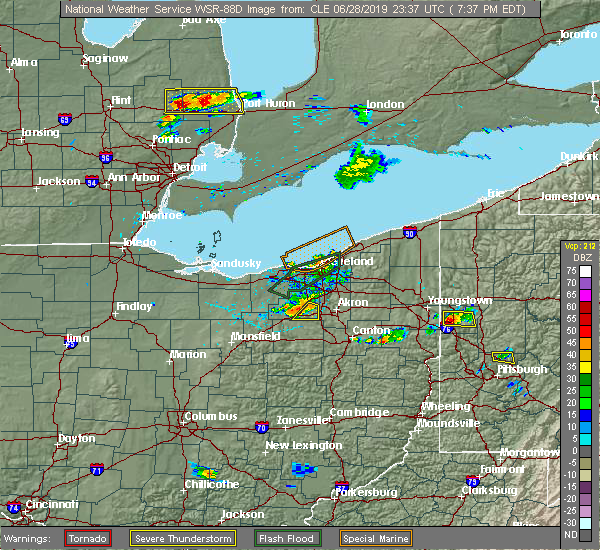 At 737 pm edt, a severe thunderstorm was located near wadsworth, or 7 miles southeast of medina, moving southeast at 35 mph (radar indicated). Hazards include 60 mph wind gusts. Expect damage to trees and power lines. Locations impacted include, wadsworth, rittman, creston and seville. At 737 pm edt, a severe thunderstorm was located near wadsworth, or 7 miles southeast of medina, moving southeast at 35 mph (radar indicated). Hazards include 60 mph wind gusts. Expect damage to trees and power lines. Locations impacted include, wadsworth, rittman, creston and seville.
|
| 6/28/2019 7:31 PM EDT |
 At 731 pm edt, a severe thunderstorm was located near chippewa lake, or near medina, moving southeast at 40 mph (radar indicated). Hazards include 60 mph wind gusts and quarter size hail. Minor damage to vehicles is possible. Expect damage to trees and power lines. At 731 pm edt, a severe thunderstorm was located near chippewa lake, or near medina, moving southeast at 40 mph (radar indicated). Hazards include 60 mph wind gusts and quarter size hail. Minor damage to vehicles is possible. Expect damage to trees and power lines.
|
| 6/2/2019 1:09 AM EDT |
 At 1251 am edt, a severe thunderstorm was located 7 miles southeast of ravenna, moving east at 35 mph. another strong storm was located between akron and portage lakes also moving east at 35 mph (radar indicated). Hazards include 60 mph wind gusts and quarter size hail. Minor damage to vehicles is possible. expect damage to trees and power lines. Locations impacted include, akron, cuyahoga falls, kent, barberton, green, tallmadge, mogadore, norton, brimfield, fairlawn, randolph, lakemore, atwater, edinburg, deerfield, limaville, portage lakes, pigeon creek and uniontown. At 1251 am edt, a severe thunderstorm was located 7 miles southeast of ravenna, moving east at 35 mph. another strong storm was located between akron and portage lakes also moving east at 35 mph (radar indicated). Hazards include 60 mph wind gusts and quarter size hail. Minor damage to vehicles is possible. expect damage to trees and power lines. Locations impacted include, akron, cuyahoga falls, kent, barberton, green, tallmadge, mogadore, norton, brimfield, fairlawn, randolph, lakemore, atwater, edinburg, deerfield, limaville, portage lakes, pigeon creek and uniontown.
|
| 6/2/2019 12:52 AM EDT |
 At 1251 am edt, a severe thunderstorm was located 7 miles southeast of ravenna, moving east at 35 mph. another strong storm was located between akron and portage lakes also moving east at 35 mph (radar indicated). Hazards include 60 mph wind gusts and quarter size hail. Minor damage to vehicles is possible. expect damage to trees and power lines. Locations impacted include, akron, cuyahoga falls, kent, barberton, green, tallmadge, mogadore, norton, brimfield, fairlawn, randolph, lakemore, atwater, edinburg, deerfield, limaville, portage lakes, pigeon creek and uniontown. At 1251 am edt, a severe thunderstorm was located 7 miles southeast of ravenna, moving east at 35 mph. another strong storm was located between akron and portage lakes also moving east at 35 mph (radar indicated). Hazards include 60 mph wind gusts and quarter size hail. Minor damage to vehicles is possible. expect damage to trees and power lines. Locations impacted include, akron, cuyahoga falls, kent, barberton, green, tallmadge, mogadore, norton, brimfield, fairlawn, randolph, lakemore, atwater, edinburg, deerfield, limaville, portage lakes, pigeon creek and uniontown.
|
| 6/2/2019 12:32 AM EDT |
 At 1231 am edt, a severe thunderstorm was located near mogadore, or near akron, moving east at 35 mph (radar indicated). Hazards include 60 mph wind gusts and quarter size hail. Minor damage to vehicles is possible. Expect damage to trees and power lines. At 1231 am edt, a severe thunderstorm was located near mogadore, or near akron, moving east at 35 mph (radar indicated). Hazards include 60 mph wind gusts and quarter size hail. Minor damage to vehicles is possible. Expect damage to trees and power lines.
|
| 5/25/2019 4:15 PM EDT |
 At 414 pm edt, a severe thunderstorm was located near wooster, moving east at 45 mph (radar indicated). Hazards include 60 mph wind gusts and quarter size hail. Minor damage to vehicles is possible. Expect damage to trees and power lines. At 414 pm edt, a severe thunderstorm was located near wooster, moving east at 45 mph (radar indicated). Hazards include 60 mph wind gusts and quarter size hail. Minor damage to vehicles is possible. Expect damage to trees and power lines.
|
| 5/23/2019 8:40 AM EDT |
 At 839 am edt, severe thunderstorms were located along a line extending from near twinsburg to 6 miles northwest of mount eaton, moving east at 60 mph (radar indicated). Hazards include 60 mph wind gusts. Expect damage to trees and power lines. Locations impacted include, cleveland, akron, canton, wooster, painesville, willowick, millersburg, cuyahoga falls, euclid, mentor, cleveland heights, massillon, kent, barberton, green, solon, willoughby, hudson, wadsworth and twinsburg. At 839 am edt, severe thunderstorms were located along a line extending from near twinsburg to 6 miles northwest of mount eaton, moving east at 60 mph (radar indicated). Hazards include 60 mph wind gusts. Expect damage to trees and power lines. Locations impacted include, cleveland, akron, canton, wooster, painesville, willowick, millersburg, cuyahoga falls, euclid, mentor, cleveland heights, massillon, kent, barberton, green, solon, willoughby, hudson, wadsworth and twinsburg.
|
| 5/23/2019 8:32 AM EDT |
 At 832 am edt, severe thunderstorms were located along a line extending from near macedonia to near wooster, moving east at 45 mph (radar indicated). Hazards include 60 mph wind gusts. Expect damage to trees and power lines. Locations impacted include, cleveland, akron, canton, medina, wooster, painesville, mount vernon, willowick, millersburg, parma, cuyahoga falls, euclid, mentor, cleveland heights, strongsville, brunswick, massillon, north royalton, kent and barberton. At 832 am edt, severe thunderstorms were located along a line extending from near macedonia to near wooster, moving east at 45 mph (radar indicated). Hazards include 60 mph wind gusts. Expect damage to trees and power lines. Locations impacted include, cleveland, akron, canton, medina, wooster, painesville, mount vernon, willowick, millersburg, parma, cuyahoga falls, euclid, mentor, cleveland heights, strongsville, brunswick, massillon, north royalton, kent and barberton.
|
| 5/23/2019 8:19 AM EDT |
 At 819 am edt, severe thunderstorms were located along a line extending from near north royalton to near shreve, moving east at 45 mph (radar indicated). Hazards include 60 mph wind gusts. Expect damage to trees and power lines. Locations impacted include, cleveland, akron, canton, medina, wooster, painesville, mount vernon, willowick, millersburg, parma, lakewood, cuyahoga falls, euclid, mentor, cleveland heights, strongsville, brunswick, westlake, massillon and north royalton. At 819 am edt, severe thunderstorms were located along a line extending from near north royalton to near shreve, moving east at 45 mph (radar indicated). Hazards include 60 mph wind gusts. Expect damage to trees and power lines. Locations impacted include, cleveland, akron, canton, medina, wooster, painesville, mount vernon, willowick, millersburg, parma, lakewood, cuyahoga falls, euclid, mentor, cleveland heights, strongsville, brunswick, westlake, massillon and north royalton.
|
| 5/23/2019 8:17 AM EDT |
 At 817 am edt, severe thunderstorms were located along a line extending from near north royalton to near shreve, moving east at 45 mph (radar indicated). Hazards include 60 mph wind gusts. expect damage to trees and power lines At 817 am edt, severe thunderstorms were located along a line extending from near north royalton to near shreve, moving east at 45 mph (radar indicated). Hazards include 60 mph wind gusts. expect damage to trees and power lines
|
| 1/8/2019 3:27 PM EST |
 At 326 pm est, a severe thunderstorm was located over barberton, or near akron, moving east at 45 mph (radar indicated). Hazards include 60 mph wind gusts and quarter size hail. Minor damage to vehicles is possible. Expect damage to trees and power lines. At 326 pm est, a severe thunderstorm was located over barberton, or near akron, moving east at 45 mph (radar indicated). Hazards include 60 mph wind gusts and quarter size hail. Minor damage to vehicles is possible. Expect damage to trees and power lines.
|
| 5/22/2018 2:31 PM EDT |
 At 229 pm edt, a severe thunderstorm was located near richfield, or 10 miles north of akron, moving east at 35 mph. damaging winds will sweep through peninsula and hudson by 245 pm (radar indicated). Hazards include 70 mph wind gusts and quarter size hail. Minor damage to vehicles is possible. expect considerable tree damage. wind damage is also likely to mobile homes, roofs, and outbuildings. Locations impacted include, akron, medina, parma, cuyahoga falls, strongsville, brunswick, north royalton, kent, barberton, solon, hudson, wadsworth, twinsburg, tallmadge, streetsboro, warrensville heights, macedonia, rittman, mogadore and south russell. At 229 pm edt, a severe thunderstorm was located near richfield, or 10 miles north of akron, moving east at 35 mph. damaging winds will sweep through peninsula and hudson by 245 pm (radar indicated). Hazards include 70 mph wind gusts and quarter size hail. Minor damage to vehicles is possible. expect considerable tree damage. wind damage is also likely to mobile homes, roofs, and outbuildings. Locations impacted include, akron, medina, parma, cuyahoga falls, strongsville, brunswick, north royalton, kent, barberton, solon, hudson, wadsworth, twinsburg, tallmadge, streetsboro, warrensville heights, macedonia, rittman, mogadore and south russell.
|
| 5/22/2018 2:25 PM EDT |
 At 223 pm edt, a severe thunderstorm was located near cuyahoga falls, or 11 miles north of akron, moving east at 35 mph (radar indicated. quarter sized hail was reported in north royalton with this storm). Hazards include 60 mph wind gusts and quarter size hail. Minor damage to vehicles is possible. expect damage to trees and power lines. torrential rainfall is also occurring with this storm. Locations impacted include, akron, medina, parma, cuyahoga falls, strongsville, brunswick, north royalton, kent, barberton, solon, hudson, wadsworth, twinsburg, tallmadge, streetsboro, warrensville heights, macedonia, rittman, mogadore and south russell. At 223 pm edt, a severe thunderstorm was located near cuyahoga falls, or 11 miles north of akron, moving east at 35 mph (radar indicated. quarter sized hail was reported in north royalton with this storm). Hazards include 60 mph wind gusts and quarter size hail. Minor damage to vehicles is possible. expect damage to trees and power lines. torrential rainfall is also occurring with this storm. Locations impacted include, akron, medina, parma, cuyahoga falls, strongsville, brunswick, north royalton, kent, barberton, solon, hudson, wadsworth, twinsburg, tallmadge, streetsboro, warrensville heights, macedonia, rittman, mogadore and south russell.
|
| 5/22/2018 2:12 PM EDT |
 At 212 pm edt, a severe thunderstorm was located near brunswick, or 9 miles northeast of medina, moving southeast at 35 mph (radar indicated). Hazards include 60 mph wind gusts and quarter size hail. Minor damage to vehicles is possible. Expect damage to trees and power lines. At 212 pm edt, a severe thunderstorm was located near brunswick, or 9 miles northeast of medina, moving southeast at 35 mph (radar indicated). Hazards include 60 mph wind gusts and quarter size hail. Minor damage to vehicles is possible. Expect damage to trees and power lines.
|
| 5/4/2018 2:57 PM EDT |
 At 256 pm edt, severe thunderstorms were located along a line extending from 7 miles northeast of wadsworth to near lexington, moving east at 60 mph (radar indicated. at 2:42pm a wind gust to 58 mph was reported in mansfield). Hazards include 60 mph wind gusts and nickel size hail. expect damage to trees and power lines At 256 pm edt, severe thunderstorms were located along a line extending from 7 miles northeast of wadsworth to near lexington, moving east at 60 mph (radar indicated. at 2:42pm a wind gust to 58 mph was reported in mansfield). Hazards include 60 mph wind gusts and nickel size hail. expect damage to trees and power lines
|
| 11/5/2017 7:02 PM EDT |
 At 601 pm est, severe thunderstorms were located along a line extending from cuyahoga falls to near mount eaton, moving northeast at 75 mph (radar indicated). Hazards include 60 mph wind gusts. expect damage to trees and power lines At 601 pm est, severe thunderstorms were located along a line extending from cuyahoga falls to near mount eaton, moving northeast at 75 mph (radar indicated). Hazards include 60 mph wind gusts. expect damage to trees and power lines
|
| 11/5/2017 7:01 PM EDT |
 At 600 pm est, a severe thunderstorm was located over parma, or 9 miles south of cleveland, moving east at 65 mph (radar indicated). Hazards include 70 mph wind gusts. Expect considerable tree damage. damage is likely to mobile homes, roofs, and outbuildings. locations impacted include, cleveland, medina, parma, lakewood, strongsville, brunswick, westlake, north royalton, north ridgeville, avon lake, wadsworth, grafton, rittman, lodi, creston, chippewa lake, north olmsted, avon, parma heights and rocky river. A tornado watch remains in effect until 700 pm est for north central and northeastern ohio. At 600 pm est, a severe thunderstorm was located over parma, or 9 miles south of cleveland, moving east at 65 mph (radar indicated). Hazards include 70 mph wind gusts. Expect considerable tree damage. damage is likely to mobile homes, roofs, and outbuildings. locations impacted include, cleveland, medina, parma, lakewood, strongsville, brunswick, westlake, north royalton, north ridgeville, avon lake, wadsworth, grafton, rittman, lodi, creston, chippewa lake, north olmsted, avon, parma heights and rocky river. A tornado watch remains in effect until 700 pm est for north central and northeastern ohio.
|
| 11/5/2017 6:31 PM EDT |
 At 530 pm est, severe thunderstorms were located along a line extending from near avon lake to near lodi, moving northeast at 100 mph (radar indicated). Hazards include 70 mph wind gusts. Expect considerable tree damage. Damage is likely to mobile homes, roofs, and outbuildings. At 530 pm est, severe thunderstorms were located along a line extending from near avon lake to near lodi, moving northeast at 100 mph (radar indicated). Hazards include 70 mph wind gusts. Expect considerable tree damage. Damage is likely to mobile homes, roofs, and outbuildings.
|
| 8/17/2017 4:24 PM EDT |
 At 423 pm edt, a severe thunderstorm was located near chippewa lake, or 7 miles southwest of medina, moving northeast at 30 mph (radar indicated). Hazards include 60 mph wind gusts and quarter size hail. Minor damage to vehicles is possible. Expect damage to trees and power lines. At 423 pm edt, a severe thunderstorm was located near chippewa lake, or 7 miles southwest of medina, moving northeast at 30 mph (radar indicated). Hazards include 60 mph wind gusts and quarter size hail. Minor damage to vehicles is possible. Expect damage to trees and power lines.
|
| 7/11/2017 4:27 PM EDT |
 The severe thunderstorm warning for southeastern medina, west central stark, southwestern summit and northeastern wayne counties will expire at 430 pm edt, the storm which prompted the warning has weakened below severe limits, and no longer poses an immediate threat to life or property. therefore the warning will be allowed to expire. however gusty winds are still possible with this thunderstorm. to report severe weather, contact your nearest law enforcement agency. they will relay your report to the national weather service cleveland. The severe thunderstorm warning for southeastern medina, west central stark, southwestern summit and northeastern wayne counties will expire at 430 pm edt, the storm which prompted the warning has weakened below severe limits, and no longer poses an immediate threat to life or property. therefore the warning will be allowed to expire. however gusty winds are still possible with this thunderstorm. to report severe weather, contact your nearest law enforcement agency. they will relay your report to the national weather service cleveland.
|
| 7/11/2017 4:13 PM EDT |
 At 413 pm edt, a severe thunderstorm was located near rittman, or 11 miles northeast of wooster, moving northeast at 25 mph (radar indicated). Hazards include 60 mph wind gusts and quarter size hail. Minor damage to vehicles is possible. expect damage to trees and power lines. Locations impacted include, akron, barberton, green, wadsworth, north canton, orrville, rittman, doylestown, creston, norton, canal fulton, smithville, clinton, marshallville, portage lakes and north lawrence. At 413 pm edt, a severe thunderstorm was located near rittman, or 11 miles northeast of wooster, moving northeast at 25 mph (radar indicated). Hazards include 60 mph wind gusts and quarter size hail. Minor damage to vehicles is possible. expect damage to trees and power lines. Locations impacted include, akron, barberton, green, wadsworth, north canton, orrville, rittman, doylestown, creston, norton, canal fulton, smithville, clinton, marshallville, portage lakes and north lawrence.
|
| 7/11/2017 3:49 PM EDT |
 At 349 pm edt, a severe thunderstorm was located over wooster, moving northeast at 25 mph (radar indicated). Hazards include 60 mph wind gusts and quarter size hail. Minor damage to vehicles is possible. Expect damage to trees and power lines. At 349 pm edt, a severe thunderstorm was located over wooster, moving northeast at 25 mph (radar indicated). Hazards include 60 mph wind gusts and quarter size hail. Minor damage to vehicles is possible. Expect damage to trees and power lines.
|
| 7/7/2017 8:01 AM EDT |
 At 801 am edt, a severe thunderstorm was located near medina, moving east at 45 mph (radar indicated). Hazards include 60 mph wind gusts. Expect damage to trees and power lines. Locations impacted include, medina, brunswick, wadsworth, rittman, lodi, creston, chippewa lake, hinckley, seville, westfield center, gloria glens park, burbank, chippewa-on-the-lake and briarwood beach. At 801 am edt, a severe thunderstorm was located near medina, moving east at 45 mph (radar indicated). Hazards include 60 mph wind gusts. Expect damage to trees and power lines. Locations impacted include, medina, brunswick, wadsworth, rittman, lodi, creston, chippewa lake, hinckley, seville, westfield center, gloria glens park, burbank, chippewa-on-the-lake and briarwood beach.
|
| 7/7/2017 7:44 AM EDT |
 At 743 am edt, a severe thunderstorm was located near lodi, or 8 miles west of medina, moving east at 45 mph (radar indicated). Hazards include 60 mph wind gusts. Expect damage to trees and power lines. Locations impacted include, medina, brunswick, wadsworth, grafton, rittman, wellington, lodi, creston, chippewa lake, broadview heights, hinckley, sullivan, seville, lagrange, penfield, westfield center, spencer, gloria glens park, burbank and rochester. At 743 am edt, a severe thunderstorm was located near lodi, or 8 miles west of medina, moving east at 45 mph (radar indicated). Hazards include 60 mph wind gusts. Expect damage to trees and power lines. Locations impacted include, medina, brunswick, wadsworth, grafton, rittman, wellington, lodi, creston, chippewa lake, broadview heights, hinckley, sullivan, seville, lagrange, penfield, westfield center, spencer, gloria glens park, burbank and rochester.
|
| 7/7/2017 7:21 AM EDT |
 At 720 am edt, a severe thunderstorm was located near new london, or 15 miles southeast of norwalk, moving east at 50 mph (radar indicated). Hazards include 60 mph wind gusts. expect damage to trees and power lines At 720 am edt, a severe thunderstorm was located near new london, or 15 miles southeast of norwalk, moving east at 50 mph (radar indicated). Hazards include 60 mph wind gusts. expect damage to trees and power lines
|
| 6/4/2017 3:57 PM EDT |
 At 355 pm edt, a severe thunderstorm was located near creston, or 7 miles north of wooster, moving east at 40 mph (radar indicated). Hazards include 60 mph wind gusts and quarter size hail. Minor damage to vehicles is possible. expect damage to trees and power lines. Locations impacted include, wooster, wadsworth, orrville, rittman, doylestown, lodi, creston, dalton, west salem, chippewa lake, mount eaton, seville, smithville, apple creek, westfield center, marshallville, gloria glens park, burbank, congress and chippewa-on-the-lake. At 355 pm edt, a severe thunderstorm was located near creston, or 7 miles north of wooster, moving east at 40 mph (radar indicated). Hazards include 60 mph wind gusts and quarter size hail. Minor damage to vehicles is possible. expect damage to trees and power lines. Locations impacted include, wooster, wadsworth, orrville, rittman, doylestown, lodi, creston, dalton, west salem, chippewa lake, mount eaton, seville, smithville, apple creek, westfield center, marshallville, gloria glens park, burbank, congress and chippewa-on-the-lake.
|
| 6/4/2017 3:32 PM EDT |
 At 332 pm edt, a severe thunderstorm was located near polk, or 11 miles northeast of ashland, moving east at 40 mph (radar indicated). Hazards include 60 mph wind gusts and quarter size hail. Minor damage to vehicles is possible. Expect damage to trees and power lines. At 332 pm edt, a severe thunderstorm was located near polk, or 11 miles northeast of ashland, moving east at 40 mph (radar indicated). Hazards include 60 mph wind gusts and quarter size hail. Minor damage to vehicles is possible. Expect damage to trees and power lines.
|
| 5/18/2017 8:52 PM EDT |
 At 852 pm edt, severe thunderstorms were located along a line extending from near chippewa lake to near west salem, moving east at 30 mph (radar indicated). Hazards include 60 mph wind gusts and quarter size hail. Hail damage to vehicles is expected. Expect wind damage to roofs, siding, and trees. At 852 pm edt, severe thunderstorms were located along a line extending from near chippewa lake to near west salem, moving east at 30 mph (radar indicated). Hazards include 60 mph wind gusts and quarter size hail. Hail damage to vehicles is expected. Expect wind damage to roofs, siding, and trees.
|
| 3/1/2017 6:09 AM EST |
 The tornado warning for southeastern medina and southern summit counties will expire at 615 am est, the storm which prompted the warning has weakened below severe limits, and has exited the warned area. therefore, the warning will be allowed to expire. a severe thunderstorm watch remains in effect until 800 am est for northeastern ohio. The tornado warning for southeastern medina and southern summit counties will expire at 615 am est, the storm which prompted the warning has weakened below severe limits, and has exited the warned area. therefore, the warning will be allowed to expire. a severe thunderstorm watch remains in effect until 800 am est for northeastern ohio.
|
| 3/1/2017 6:01 AM EST |
 At 600 am est, severe thunderstorms were located along a line extending from near mantua to doylestown, moving east at 60 mph (radar indicated). Hazards include 60 mph wind gusts and penny size hail. Expect damage to roofs, siding, and trees. Locations impacted include, akron, ravenna, cuyahoga falls, kent, barberton, hudson, wadsworth, tallmadge, streetsboro, macedonia, rittman, mogadore, garrettsville, mantua, stow, aurora, norton, brimfield, fairlawn and munroe falls. At 600 am est, severe thunderstorms were located along a line extending from near mantua to doylestown, moving east at 60 mph (radar indicated). Hazards include 60 mph wind gusts and penny size hail. Expect damage to roofs, siding, and trees. Locations impacted include, akron, ravenna, cuyahoga falls, kent, barberton, hudson, wadsworth, tallmadge, streetsboro, macedonia, rittman, mogadore, garrettsville, mantua, stow, aurora, norton, brimfield, fairlawn and munroe falls.
|
| 3/1/2017 5:55 AM EST |
 At 555 am est, a severe squall line capable of producing both tornadoes and extensive straight line wind damage was located near wadsworth, or 8 miles west of akron, moving east at 50 mph (radar indicated rotation). Hazards include tornado. Flying debris will be dangerous to those caught without shelter. mobile homes will be damaged or destroyed. damage to roofs, windows, and vehicles will occur. tree damage is likely. these dangerous storms will be near, barberton around 605 am est. tallmadge around 610 am est. mogadore around 615 am est. Other locations impacted by this tornadic thunderstorm include fairlawn, norton, lakemore, pigeon creek, montrose-ghent and portage lakes. At 555 am est, a severe squall line capable of producing both tornadoes and extensive straight line wind damage was located near wadsworth, or 8 miles west of akron, moving east at 50 mph (radar indicated rotation). Hazards include tornado. Flying debris will be dangerous to those caught without shelter. mobile homes will be damaged or destroyed. damage to roofs, windows, and vehicles will occur. tree damage is likely. these dangerous storms will be near, barberton around 605 am est. tallmadge around 610 am est. mogadore around 615 am est. Other locations impacted by this tornadic thunderstorm include fairlawn, norton, lakemore, pigeon creek, montrose-ghent and portage lakes.
|
| 3/1/2017 5:49 AM EST |
 At 549 am est, severe thunderstorms were located along a line extending from twinsburg to near creston, moving east at 60 mph (radar indicated). Hazards include 60 mph wind gusts and penny size hail. Expect damage to roofs, siding, and trees. Locations impacted include, akron, medina, ravenna, cuyahoga falls, kent, barberton, hudson, wadsworth, tallmadge, streetsboro, macedonia, rittman, mogadore, lodi, garrettsville, creston, mantua, chippewa lake, stow and broadview heights. At 549 am est, severe thunderstorms were located along a line extending from twinsburg to near creston, moving east at 60 mph (radar indicated). Hazards include 60 mph wind gusts and penny size hail. Expect damage to roofs, siding, and trees. Locations impacted include, akron, medina, ravenna, cuyahoga falls, kent, barberton, hudson, wadsworth, tallmadge, streetsboro, macedonia, rittman, mogadore, lodi, garrettsville, creston, mantua, chippewa lake, stow and broadview heights.
|
| 3/1/2017 5:49 AM EST |
 At 548 am est, severe thunderstorms capable of producing both tornadoes and extensive straight line wind damage were located near medina, moving east at 50 mph (radar indicated rotation). Hazards include tornado. Flying debris will be dangerous to those caught without shelter. mobile homes will be damaged or destroyed. damage to roofs, windows, and vehicles will occur. tree damage is likely. these dangerous storms will be near, akron around 600 am est. barberton around 605 am est. tallmadge around 610 am est. mogadore around 615 am est. Other locations impacted by this tornadic thunderstorm include fairlawn, chippewa-on-the-lake, norton, lakemore, montrose-ghent, briarwood beach, gloria glens park, pigeon creek, portage lakes and seville. At 548 am est, severe thunderstorms capable of producing both tornadoes and extensive straight line wind damage were located near medina, moving east at 50 mph (radar indicated rotation). Hazards include tornado. Flying debris will be dangerous to those caught without shelter. mobile homes will be damaged or destroyed. damage to roofs, windows, and vehicles will occur. tree damage is likely. these dangerous storms will be near, akron around 600 am est. barberton around 605 am est. tallmadge around 610 am est. mogadore around 615 am est. Other locations impacted by this tornadic thunderstorm include fairlawn, chippewa-on-the-lake, norton, lakemore, montrose-ghent, briarwood beach, gloria glens park, pigeon creek, portage lakes and seville.
|
| 3/1/2017 5:24 AM EST |
 At 524 am est, a severe thunderstorm was located near grafton, or 10 miles south of elyria, moving east at 60 mph (radar indicated). Hazards include 60 mph wind gusts and penny size hail. expect damage to roofs, siding, and trees At 524 am est, a severe thunderstorm was located near grafton, or 10 miles south of elyria, moving east at 60 mph (radar indicated). Hazards include 60 mph wind gusts and penny size hail. expect damage to roofs, siding, and trees
|
| 3/1/2017 4:01 AM EST |
 At 400 am est, a severe thunderstorm was located near alliance, or 12 miles northeast of canton, moving northeast at 35 mph (radar indicated). Hazards include 60 mph wind gusts. expect damage to roofs, siding, and trees At 400 am est, a severe thunderstorm was located near alliance, or 12 miles northeast of canton, moving northeast at 35 mph (radar indicated). Hazards include 60 mph wind gusts. expect damage to roofs, siding, and trees
|
| 3/1/2017 1:15 AM EST |
 At 115 am est, severe thunderstorms were located along a line extending from norwalk to near medina to rittman to 7 miles west of wooster, moving east at 95 mph (radar indicated). Hazards include 70 mph wind gusts and quarter size hail. Hail damage to vehicles is expected. expect considerable tree damage. Wind damage is also likely to mobile homes, roofs, and outbuildings. At 115 am est, severe thunderstorms were located along a line extending from norwalk to near medina to rittman to 7 miles west of wooster, moving east at 95 mph (radar indicated). Hazards include 70 mph wind gusts and quarter size hail. Hail damage to vehicles is expected. expect considerable tree damage. Wind damage is also likely to mobile homes, roofs, and outbuildings.
|
| 9/10/2016 5:12 PM EDT |
 At 511 pm edt, severe thunderstorms were located along a line extending from near strongsville to 6 miles southwest of lexington, moving northeast at 45 mph (radar indicated). Hazards include 60 mph wind gusts and nickel size hail. Expect damage to roofs. siding and trees. Locations impacted include, mansfield, medina, wooster, ashland, mount vernon, mount gilead, brunswick, wadsworth, rittman, ontario, lexington, lodi, loudonville, fredericktown, creston, cardington, bellville, centerburg, west salem and chippewa lake. At 511 pm edt, severe thunderstorms were located along a line extending from near strongsville to 6 miles southwest of lexington, moving northeast at 45 mph (radar indicated). Hazards include 60 mph wind gusts and nickel size hail. Expect damage to roofs. siding and trees. Locations impacted include, mansfield, medina, wooster, ashland, mount vernon, mount gilead, brunswick, wadsworth, rittman, ontario, lexington, lodi, loudonville, fredericktown, creston, cardington, bellville, centerburg, west salem and chippewa lake.
|
| 9/10/2016 4:44 PM EDT |
 At 442 pm edt, severe thunderstorms were located along a line extending from near wellington to ashley, moving northeast at 45 mph. another severe thunderstorm was located near mount gilead. this storm is also moving northeast at 45 mph (radar indicated). Hazards include 60 mph wind gusts and nickel size hail. Expect damage to roofs. Siding and trees. At 442 pm edt, severe thunderstorms were located along a line extending from near wellington to ashley, moving northeast at 45 mph. another severe thunderstorm was located near mount gilead. this storm is also moving northeast at 45 mph (radar indicated). Hazards include 60 mph wind gusts and nickel size hail. Expect damage to roofs. Siding and trees.
|
| 8/28/2016 5:50 PM EDT |
 At 548 pm edt, a severe thunderstorm was located over wadsworth, or 9 miles southeast of medina, moving northeast at 10 mph. another severe thunderstorms was located over northern holmes county, .6 miles east of holmesville. this storm was drifting to the southeast around 5 mph (radar indicated). Hazards include 60 mph wind gusts and quarter size hail. Hail damage to vehicles is expected. expect damage to roofs, siding and trees. Locations impacted include, wooster, millersburg, barberton, wadsworth, orrville, berlin, rittman, walnut creek, doylestown, loudonville, creston, dalton, shreve, killbuck, holmesville, glenmont, mount eaton, nashville, winesburg and farmerstown. At 548 pm edt, a severe thunderstorm was located over wadsworth, or 9 miles southeast of medina, moving northeast at 10 mph. another severe thunderstorms was located over northern holmes county, .6 miles east of holmesville. this storm was drifting to the southeast around 5 mph (radar indicated). Hazards include 60 mph wind gusts and quarter size hail. Hail damage to vehicles is expected. expect damage to roofs, siding and trees. Locations impacted include, wooster, millersburg, barberton, wadsworth, orrville, berlin, rittman, walnut creek, doylestown, loudonville, creston, dalton, shreve, killbuck, holmesville, glenmont, mount eaton, nashville, winesburg and farmerstown.
|
| 8/28/2016 5:25 PM EDT |
 At 524 pm edt, a severe thunderstorm was located over rittman, or 9 miles south of medina, moving northeast at 10 mph. additional severe thunderstorms were located from loudonville to northern holmes county. these were drifts south at under 10 mph (radar indicated). Hazards include 60 mph wind gusts and quarter size hail. Hail damage to wehicles is expected. Expect damage to roofs, siding and trees. At 524 pm edt, a severe thunderstorm was located over rittman, or 9 miles south of medina, moving northeast at 10 mph. additional severe thunderstorms were located from loudonville to northern holmes county. these were drifts south at under 10 mph (radar indicated). Hazards include 60 mph wind gusts and quarter size hail. Hail damage to wehicles is expected. Expect damage to roofs, siding and trees.
|
| 7/24/2016 1:05 PM EDT |
 At 1259 pm edt, several strong to severe thunderstorms were occurring in southeast medina county and summit county. a strong storm was just east of copley. another strong storm was near akron. the storms were moving east at 25 mph (radar indicated). Hazards include 60 mph wind gusts and quarter size hail. Hail damage to vehicles is possible. expect wind damage to roofs, siding and trees. Locations impacted include, akron, cuyahoga falls, kent, barberton, hudson, wadsworth, tallmadge, streetsboro, mogadore, stow, norton, fairlawn, munroe falls, lakemore, silver lake, pigeon creek, montrose-ghent and portage lakes. At 1259 pm edt, several strong to severe thunderstorms were occurring in southeast medina county and summit county. a strong storm was just east of copley. another strong storm was near akron. the storms were moving east at 25 mph (radar indicated). Hazards include 60 mph wind gusts and quarter size hail. Hail damage to vehicles is possible. expect wind damage to roofs, siding and trees. Locations impacted include, akron, cuyahoga falls, kent, barberton, hudson, wadsworth, tallmadge, streetsboro, mogadore, stow, norton, fairlawn, munroe falls, lakemore, silver lake, pigeon creek, montrose-ghent and portage lakes.
|
| 7/24/2016 12:35 PM EDT |
 At 1234 pm edt, a severe thunderstorm was located near wadsworth, or 7 miles southeast of medina, moving east at 25 mph (radar indicated). Hazards include 60 mph wind gusts and quarter size hail. Hail damage to vehicles is expected. Expect wind damage to roofs, siding and trees. At 1234 pm edt, a severe thunderstorm was located near wadsworth, or 7 miles southeast of medina, moving east at 25 mph (radar indicated). Hazards include 60 mph wind gusts and quarter size hail. Hail damage to vehicles is expected. Expect wind damage to roofs, siding and trees.
|
| 7/8/2016 11:26 PM EDT |
 At 1125 pm edt, a severe thunderstorm was located near wadsworth, moving southeast at 40 mph (radar indicated). Hazards include 60 mph wind gusts and quarter size hail. Hail damage to vehicles is expected. Expect wind damage to roofs, siding and trees. At 1125 pm edt, a severe thunderstorm was located near wadsworth, moving southeast at 40 mph (radar indicated). Hazards include 60 mph wind gusts and quarter size hail. Hail damage to vehicles is expected. Expect wind damage to roofs, siding and trees.
|
| 6/16/2016 1:40 PM EDT |
 At 139 pm edt, severe thunderstorms were located along a line extending from near cuyahoga falls to akron to near barberton, moving southeast at 20 mph (radar indicated). Hazards include 60 mph wind gusts and quarter size hail. Hail damage to vehicles is possible. expect wind damage to roofs, siding and trees. Locations impacted include, akron, ravenna, cuyahoga falls, kent, barberton, green, hudson, tallmadge, streetsboro, mogadore, stow, norton, brimfield, fairlawn, randolph, munroe falls, lakemore, atwater, silver lake and clinton. At 139 pm edt, severe thunderstorms were located along a line extending from near cuyahoga falls to akron to near barberton, moving southeast at 20 mph (radar indicated). Hazards include 60 mph wind gusts and quarter size hail. Hail damage to vehicles is possible. expect wind damage to roofs, siding and trees. Locations impacted include, akron, ravenna, cuyahoga falls, kent, barberton, green, hudson, tallmadge, streetsboro, mogadore, stow, norton, brimfield, fairlawn, randolph, munroe falls, lakemore, atwater, silver lake and clinton.
|
| 6/16/2016 1:26 PM EDT |
 At 126 pm edt, severe thunderstorms were located along a line extending from near hudson to near cuyahoga falls to wadsworth, moving southeast at 30 mph (radar indicated). Hazards include 60 mph wind gusts and quarter size hail. Hail damage to vehicles is possible. expect wind damage to roofs, siding and trees. Locations impacted include, akron, ravenna, cuyahoga falls, kent, barberton, green, solon, hudson, twinsburg, tallmadge, streetsboro, macedonia, mogadore, garrettsville, mantua, stow, broadview heights, aurora, brecksville and norton. At 126 pm edt, severe thunderstorms were located along a line extending from near hudson to near cuyahoga falls to wadsworth, moving southeast at 30 mph (radar indicated). Hazards include 60 mph wind gusts and quarter size hail. Hail damage to vehicles is possible. expect wind damage to roofs, siding and trees. Locations impacted include, akron, ravenna, cuyahoga falls, kent, barberton, green, solon, hudson, twinsburg, tallmadge, streetsboro, macedonia, mogadore, garrettsville, mantua, stow, broadview heights, aurora, brecksville and norton.
|
| 6/16/2016 1:21 PM EDT |
 At 121 pm edt, severe thunderstorms were located along a line extending from near macedonia to near cuyahoga falls to near wadsworth, moving east at 30 mph (radar indicated). Hazards include 60 mph wind gusts and quarter size hail. Hail damage to vehicles is expected. Expect wind damage to roofs, siding and trees. At 121 pm edt, severe thunderstorms were located along a line extending from near macedonia to near cuyahoga falls to near wadsworth, moving east at 30 mph (radar indicated). Hazards include 60 mph wind gusts and quarter size hail. Hail damage to vehicles is expected. Expect wind damage to roofs, siding and trees.
|
| 6/5/2016 3:55 PM EDT |
 At 354 pm edt, severe thunderstorms were located along a line extending from near middlefield to streetsboro to barberton, moving east at 40 mph (radar indicated). Hazards include 60 mph wind gusts and quarter size hail. Hail damage to vehicles is expected. expect wind damage to roofs, siding and trees. Locations impacted include, akron, ravenna, chardon, cuyahoga falls, kent, barberton, hudson, twinsburg, tallmadge, streetsboro, mogadore, south russell, middlefield, garrettsville, burton, mantua, stow, aurora, norton and brimfield. At 354 pm edt, severe thunderstorms were located along a line extending from near middlefield to streetsboro to barberton, moving east at 40 mph (radar indicated). Hazards include 60 mph wind gusts and quarter size hail. Hail damage to vehicles is expected. expect wind damage to roofs, siding and trees. Locations impacted include, akron, ravenna, chardon, cuyahoga falls, kent, barberton, hudson, twinsburg, tallmadge, streetsboro, mogadore, south russell, middlefield, garrettsville, burton, mantua, stow, aurora, norton and brimfield.
|
| 6/5/2016 3:31 PM EDT |
 At 330 pm edt, severe thunderstorms were located along a line extending from near highland hills to near wadsworth, moving east at 45 mph (radar indicated). Hazards include 60 mph wind gusts and quarter size hail. Hail damage to vehicles is expected. Expect wind damage to roofs, siding and trees. At 330 pm edt, severe thunderstorms were located along a line extending from near highland hills to near wadsworth, moving east at 45 mph (radar indicated). Hazards include 60 mph wind gusts and quarter size hail. Hail damage to vehicles is expected. Expect wind damage to roofs, siding and trees.
|
| 9/3/2015 4:16 PM EDT |
 At 415 pm edt, a severe thunderstorm was located over wadsworth, or 11 miles southwest of akron, moving southeast at 25 mph. this is a very dangerous storm (radar indicated). Hazards include 80 mph wind gusts and quarter size hail. Flying debris will be dangerous to those caught without shelter. mobile homes will be heavily damaged. expect considerable damage to roofs, windows and vehicles. Extensive tree damage and power outages are likely. At 415 pm edt, a severe thunderstorm was located over wadsworth, or 11 miles southwest of akron, moving southeast at 25 mph. this is a very dangerous storm (radar indicated). Hazards include 80 mph wind gusts and quarter size hail. Flying debris will be dangerous to those caught without shelter. mobile homes will be heavily damaged. expect considerable damage to roofs, windows and vehicles. Extensive tree damage and power outages are likely.
|
| 7/14/2015 2:05 PM EDT |
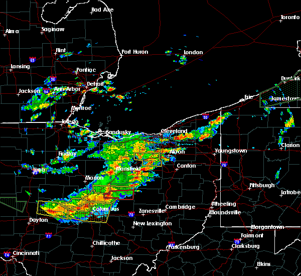 At 204 pm edt, a severe thunderstorm was located near lodi, or 12 miles north of wooster, moving east at 40 mph. hail one inch in diameter was reported with this storm when it went through lodi (radar indicated). Hazards include 60 mph wind gusts and quarter size hail. Hail damage to vehicles is expected. expect wind damage to roofs, siding and trees. Locations impacted include, medina, wadsworth, rittman, doylestown, lodi, creston, chippewa lake, seville, westfield center, marshallville, spencer, gloria glens park, burbank, briarwood beach and chippewa-on-the-lake. At 204 pm edt, a severe thunderstorm was located near lodi, or 12 miles north of wooster, moving east at 40 mph. hail one inch in diameter was reported with this storm when it went through lodi (radar indicated). Hazards include 60 mph wind gusts and quarter size hail. Hail damage to vehicles is expected. expect wind damage to roofs, siding and trees. Locations impacted include, medina, wadsworth, rittman, doylestown, lodi, creston, chippewa lake, seville, westfield center, marshallville, spencer, gloria glens park, burbank, briarwood beach and chippewa-on-the-lake.
|
| 7/14/2015 1:36 PM EDT |
 At 136 pm edt, a severe thunderstorm was located over west salem, or 13 miles northwest of wooster, moving east at 30 mph (radar indicated). Hazards include 60 mph wind gusts and quarter size hail. Hail damage to vehicles is expected. Expect wind damage to roofs, siding and trees. At 136 pm edt, a severe thunderstorm was located over west salem, or 13 miles northwest of wooster, moving east at 30 mph (radar indicated). Hazards include 60 mph wind gusts and quarter size hail. Hail damage to vehicles is expected. Expect wind damage to roofs, siding and trees.
|
| 5/26/2015 6:31 PM EDT | At 630 pm edt, a severe thunderstorm was located near creston, or 7 miles north of wooster, moving north at 45 mph (radar indicated). Hazards include 60 mph wind gusts and quarter size hail. Hail damage to vehicles is expected. Expect wind damage to roofs, siding and trees. |
| 7/10/2013 4:05 PM EDT | Numerous trees down mainly in sharon townshi in medina county OH, 4 miles S of Wadsworth, OH |
| 8/8/2012 4:15 PM EDT | A lot of large branches down over a quarter mile path and 3 houses had some structural damage from falling branche in medina county OH, 0.8 miles N of Wadsworth, OH |
| 7/5/2012 7:25 AM EDT | Some trees and powerlines down in wadsworth townshi in medina county OH, 0.8 miles N of Wadsworth, OH |
| 7/3/2012 12:10 PM EDT | Tree down in wadsworth townshi in medina county OH, 0.8 miles N of Wadsworth, OH |
| 7/1/2012 8:06 PM EDT | Numerous tree down along route 94 in medina county OH, 4.9 miles SSE of Wadsworth, OH |
| 1/1/0001 12:00 AM | Quarter sized hail reported 0.8 miles N of Wadsworth, OH |
| 1/1/0001 12:00 AM | Half Dollar sized hail reported 0.8 miles N of Wadsworth, OH |
| 1/1/0001 12:00 AM | Quarter sized hail reported 0.8 miles N of Wadsworth, OH |
| 1/1/0001 12:00 AM | Half Dollar sized hail reported 0.8 miles N of Wadsworth, OH |
| 1/1/0001 12:00 AM | Half Dollar sized hail reported 0.8 miles N of Wadsworth, OH |
| 1/1/0001 12:00 AM | Golf Ball sized hail reported 0.8 miles N of Wadsworth, OH |
| 1/1/0001 12:00 AM | Quarter sized hail reported 0.8 miles N of Wadsworth, OH |
Hail Maps for Wadsworth, OH


Connect with Interactive Hail Maps