

Hail Map for Warren, MI
The Warren, MI area has had 7 reports of on-the-ground hail by trained spotters, and has been under severe weather warnings 64 times during the past 12 months. Doppler radar has detected hail at or near Warren, MI on 30 occasions, including 1 occasion during the past year.
| Name: | Warren, MI |
| Where Located: | 49.5 miles SE of Flint, MI |
| Map: | Google Map for Warren, MI |
| Population: | 134056 |
| Housing Units: | 57938 |
| More Info: | Search Google for Warren, MI |
1
The Top Recent Hail Date for Warren, MI is Tuesday, July 23, 2024 (11th out of 30)

Hail and Wind Damage Spotted near Warren, MI
| Date / Time | Report Details |
|---|---|
| 7/12/2025 2:11 PM EDT |
 the severe thunderstorm warning has been cancelled and is no longer in effect the severe thunderstorm warning has been cancelled and is no longer in effect
|
| 7/12/2025 2:04 PM EDT |
 At 204 pm edt, severe thunderstorms were located along a line extending from mount clemens to near grosse pointe to belle isle, moving east at 25 mph (radar indicated). Hazards include 60 mph wind gusts. Expect damage to roofs, siding, and trees. these severe storms will be near, st. clair shores, mount clemens, grosse pointe, and clinton township around 210 pm edt. other locations impacted by these severe thunderstorms include northeast detroit, harper woods, grosse pointe shores, center line, roseville, hamtramck, grosse pointe woods, grosse pointe park, grosse pointe farms, and utica. People attending comerica park should seek safe shelter immediately!. At 204 pm edt, severe thunderstorms were located along a line extending from mount clemens to near grosse pointe to belle isle, moving east at 25 mph (radar indicated). Hazards include 60 mph wind gusts. Expect damage to roofs, siding, and trees. these severe storms will be near, st. clair shores, mount clemens, grosse pointe, and clinton township around 210 pm edt. other locations impacted by these severe thunderstorms include northeast detroit, harper woods, grosse pointe shores, center line, roseville, hamtramck, grosse pointe woods, grosse pointe park, grosse pointe farms, and utica. People attending comerica park should seek safe shelter immediately!.
|
| 7/12/2025 2:04 PM EDT |
 the severe thunderstorm warning has been cancelled and is no longer in effect the severe thunderstorm warning has been cancelled and is no longer in effect
|
| 7/12/2025 1:38 PM EDT |
 At 137 pm edt, severe thunderstorms were located along a line extending from near sterling heights to detroit to near wyandotte, moving east at 25 mph (radar indicated). Hazards include 60 mph wind gusts. Expect damage to roofs, siding, and trees. these severe storms will be near, warren, sterling heights, clinton township, and belle isle around 145 pm edt. st. clair shores, mount clemens, and grosse pointe around 150 pm edt. other locations impacted by these severe thunderstorms include melvindale, roseville, utica, harper woods, pleasant ridge, grosse pointe shores, ecorse, center line, huntington woods, and grosse pointe woods. People attending royal oak outdoor art fair , and comerica park should seek safe shelter immediately!. At 137 pm edt, severe thunderstorms were located along a line extending from near sterling heights to detroit to near wyandotte, moving east at 25 mph (radar indicated). Hazards include 60 mph wind gusts. Expect damage to roofs, siding, and trees. these severe storms will be near, warren, sterling heights, clinton township, and belle isle around 145 pm edt. st. clair shores, mount clemens, and grosse pointe around 150 pm edt. other locations impacted by these severe thunderstorms include melvindale, roseville, utica, harper woods, pleasant ridge, grosse pointe shores, ecorse, center line, huntington woods, and grosse pointe woods. People attending royal oak outdoor art fair , and comerica park should seek safe shelter immediately!.
|
| 7/12/2025 1:07 PM EDT |
 Svrdtx the national weather service in detroit/pontiac has issued a * severe thunderstorm warning for, northeastern wayne county in southeastern michigan, southeastern oakland county in southeastern michigan, southern macomb county in southeastern michigan, * until 230 pm edt. * at 106 pm edt, severe thunderstorms were located along a line extending from near west bloomfield to near livonia to romulus, moving east at 25 mph (radar indicated). Hazards include 60 mph wind gusts. Expect damage to roofs, siding, and trees. severe thunderstorms will be near, livonia, southfield, taylor, pontiac, romulus, and dearborn around 110 pm edt. birmingham and greenfield village around 115 pm edt. troy and royal oak around 120 pm edt. detroit zoo around 130 pm edt. detroit and sterling heights around 135 pm edt. warren and downtown detroit around 140 pm edt. belle isle around 150 pm edt. clinton township around 155 pm edt. other locations impacted by these severe thunderstorms include franklin, keego harbor, melvindale, roseville, utica, lathrup village, bingham farms, harper woods, pleasant ridge, and grosse pointe shores. People attending royal oak outdoor art fair , and comerica park should seek safe shelter immediately!. Svrdtx the national weather service in detroit/pontiac has issued a * severe thunderstorm warning for, northeastern wayne county in southeastern michigan, southeastern oakland county in southeastern michigan, southern macomb county in southeastern michigan, * until 230 pm edt. * at 106 pm edt, severe thunderstorms were located along a line extending from near west bloomfield to near livonia to romulus, moving east at 25 mph (radar indicated). Hazards include 60 mph wind gusts. Expect damage to roofs, siding, and trees. severe thunderstorms will be near, livonia, southfield, taylor, pontiac, romulus, and dearborn around 110 pm edt. birmingham and greenfield village around 115 pm edt. troy and royal oak around 120 pm edt. detroit zoo around 130 pm edt. detroit and sterling heights around 135 pm edt. warren and downtown detroit around 140 pm edt. belle isle around 150 pm edt. clinton township around 155 pm edt. other locations impacted by these severe thunderstorms include franklin, keego harbor, melvindale, roseville, utica, lathrup village, bingham farms, harper woods, pleasant ridge, and grosse pointe shores. People attending royal oak outdoor art fair , and comerica park should seek safe shelter immediately!.
|
| 6/24/2025 4:10 PM EDT |
 the severe thunderstorm warning has been cancelled and is no longer in effect the severe thunderstorm warning has been cancelled and is no longer in effect
|
| 6/24/2025 3:59 PM EDT |
 At 359 pm edt, severe thunderstorms were located along a line extending from near macomb township to near st. clair shores to near grosse pointe, moving northeast at 20 mph (radar indicated). Hazards include 60 mph wind gusts. Expect damage to roofs, siding, and trees. these severe storms will be near, st. clair shores and new baltimore around 405 pm edt. Other locations impacted by these severe thunderstorms include harper woods, grosse pointe shores, roseville, grosse pointe woods, clinton township, grosse pointe farms, fraser, eastpointe, chesterfield township, and grosse pointe park. At 359 pm edt, severe thunderstorms were located along a line extending from near macomb township to near st. clair shores to near grosse pointe, moving northeast at 20 mph (radar indicated). Hazards include 60 mph wind gusts. Expect damage to roofs, siding, and trees. these severe storms will be near, st. clair shores and new baltimore around 405 pm edt. Other locations impacted by these severe thunderstorms include harper woods, grosse pointe shores, roseville, grosse pointe woods, clinton township, grosse pointe farms, fraser, eastpointe, chesterfield township, and grosse pointe park.
|
| 6/24/2025 3:47 PM EDT |
 At 347 pm edt, severe thunderstorms were located along a line extending from near mount clemens to near st. clair shores to near dearborn, moving east at 35 mph (radar indicated). Hazards include 60 mph wind gusts. Expect damage to roofs, siding, and trees. these severe storms will be near, st. clair shores, mount clemens, grosse pointe, downtown detroit, detroit, dearborn, clinton, and belle isle around 350 pm edt. new baltimore around 355 pm edt. Other locations impacted by these severe thunderstorms include melvindale, roseville, shelby township, utica, harper woods, grosse pointe shores, center line, grosse pointe woods, chesterfield township, and clinton township. At 347 pm edt, severe thunderstorms were located along a line extending from near mount clemens to near st. clair shores to near dearborn, moving east at 35 mph (radar indicated). Hazards include 60 mph wind gusts. Expect damage to roofs, siding, and trees. these severe storms will be near, st. clair shores, mount clemens, grosse pointe, downtown detroit, detroit, dearborn, clinton, and belle isle around 350 pm edt. new baltimore around 355 pm edt. Other locations impacted by these severe thunderstorms include melvindale, roseville, shelby township, utica, harper woods, grosse pointe shores, center line, grosse pointe woods, chesterfield township, and clinton township.
|
| 6/24/2025 3:45 PM EDT |
 The storm which prompted the warning has moved out of the area. therefore, the warning has been allowed to expire. to report severe weather, contact your nearest law enforcement agency. they will relay your report to the national weather service detroit/pontiac. The storm which prompted the warning has moved out of the area. therefore, the warning has been allowed to expire. to report severe weather, contact your nearest law enforcement agency. they will relay your report to the national weather service detroit/pontiac.
|
| 6/24/2025 3:40 PM EDT |
 At 339 pm edt, a severe thunderstorm was located over troy, moving east at 30 mph (radar indicated). Hazards include 60 mph wind gusts. Expect damage to roofs, siding, and trees. Other locations impacted by these severe thunderstorms include rochester hills, madison heights, clawson, berkley, oak park, hazel park, lathrup village, pleasant ridge, huntington woods, and ferndale. At 339 pm edt, a severe thunderstorm was located over troy, moving east at 30 mph (radar indicated). Hazards include 60 mph wind gusts. Expect damage to roofs, siding, and trees. Other locations impacted by these severe thunderstorms include rochester hills, madison heights, clawson, berkley, oak park, hazel park, lathrup village, pleasant ridge, huntington woods, and ferndale.
|
| 6/24/2025 3:34 PM EDT |
 At 334 pm edt, a cluster of severe thunderstorms were located from near sterling heights to near st. clair shores to near detroit, moving east at 35 mph (radar indicated). Hazards include 60 mph wind gusts. Expect damage to roofs, siding, and trees. these severe storms will be near, st. clair shores, mount clemens, grosse pointe, downtown detroit, sterling heights, clinton, macomb township, and belle isle around 340 pm edt. Other locations impacted by these severe thunderstorms include melvindale, roseville, shelby township, utica, harper woods, grosse pointe shores, center line, grosse pointe woods, chesterfield township, and clinton township. At 334 pm edt, a cluster of severe thunderstorms were located from near sterling heights to near st. clair shores to near detroit, moving east at 35 mph (radar indicated). Hazards include 60 mph wind gusts. Expect damage to roofs, siding, and trees. these severe storms will be near, st. clair shores, mount clemens, grosse pointe, downtown detroit, sterling heights, clinton, macomb township, and belle isle around 340 pm edt. Other locations impacted by these severe thunderstorms include melvindale, roseville, shelby township, utica, harper woods, grosse pointe shores, center line, grosse pointe woods, chesterfield township, and clinton township.
|
| 6/24/2025 3:27 PM EDT |
 At 327 pm edt, a severe thunderstorm was located over royal oak, or near warren, moving east at 30 mph (radar indicated). Hazards include 60 mph wind gusts. Expect damage to roofs, siding, and trees. this severe storm will be near, troy around 330 pm edt. Other locations impacted by this severe thunderstorm include rochester hills, franklin, madison heights, clawson, berkley, oak park, hazel park, lathrup village, bingham farms, and bloomfield hills. At 327 pm edt, a severe thunderstorm was located over royal oak, or near warren, moving east at 30 mph (radar indicated). Hazards include 60 mph wind gusts. Expect damage to roofs, siding, and trees. this severe storm will be near, troy around 330 pm edt. Other locations impacted by this severe thunderstorm include rochester hills, franklin, madison heights, clawson, berkley, oak park, hazel park, lathrup village, bingham farms, and bloomfield hills.
|
| 6/24/2025 3:22 PM EDT |
 Svrdtx the national weather service in detroit/pontiac has issued a * severe thunderstorm warning for, northeastern wayne county in southeastern michigan, southern macomb county in southeastern michigan, * until 430 pm edt. * at 320 pm edt, a severe thunderstorm was located over birmingham, or near southfield, moving east at 35 mph. there is an additional severe thunderstorm located over northwest detroit also moving east at 35 mph (radar indicated). Hazards include 60 mph wind gusts. Expect damage to roofs, siding, and trees. this severe thunderstorm will be near, warren and sterling heights around 325 pm edt. clinton around 340 pm edt. st. clair shores and mount clemens around 345 pm edt. Other locations impacted by this severe thunderstorm include melvindale, roseville, shelby township, utica, harper woods, grosse pointe shores, center line, grosse pointe woods, chesterfield township, and clinton township. Svrdtx the national weather service in detroit/pontiac has issued a * severe thunderstorm warning for, northeastern wayne county in southeastern michigan, southern macomb county in southeastern michigan, * until 430 pm edt. * at 320 pm edt, a severe thunderstorm was located over birmingham, or near southfield, moving east at 35 mph. there is an additional severe thunderstorm located over northwest detroit also moving east at 35 mph (radar indicated). Hazards include 60 mph wind gusts. Expect damage to roofs, siding, and trees. this severe thunderstorm will be near, warren and sterling heights around 325 pm edt. clinton around 340 pm edt. st. clair shores and mount clemens around 345 pm edt. Other locations impacted by this severe thunderstorm include melvindale, roseville, shelby township, utica, harper woods, grosse pointe shores, center line, grosse pointe woods, chesterfield township, and clinton township.
|
| 6/24/2025 3:15 PM EDT |
 At 314 pm edt, a severe thunderstorm was located over detroit zoo, or near southfield, moving east at 35 mph (radar indicated). Hazards include 60 mph wind gusts and penny size hail. Expect damage to roofs, siding, and trees. this severe storm will be near, troy and royal oak around 320 pm edt. Other locations impacted by this severe thunderstorm include franklin, keego harbor, waterford, orchard lake, lathrup village, bingham farms, farmington hills, pleasant ridge, huntington woods, and rochester hills. At 314 pm edt, a severe thunderstorm was located over detroit zoo, or near southfield, moving east at 35 mph (radar indicated). Hazards include 60 mph wind gusts and penny size hail. Expect damage to roofs, siding, and trees. this severe storm will be near, troy and royal oak around 320 pm edt. Other locations impacted by this severe thunderstorm include franklin, keego harbor, waterford, orchard lake, lathrup village, bingham farms, farmington hills, pleasant ridge, huntington woods, and rochester hills.
|
| 6/24/2025 3:04 PM EDT |
 At 303 pm edt, a severe thunderstorm was located over west bloomfield, or near southfield, moving east at 35 mph (trained spotter confirmed damaging wind in novi). Hazards include 60 mph wind gusts and nickel size hail. Expect damage to roofs, siding, and trees. this severe storm will be near, troy, southfield, royal oak, and birmingham around 310 pm edt. Other locations impacted by this severe thunderstorm include franklin, keego harbor, waterford, orchard lake, commerce, lathrup village, bingham farms, farmington hills, pleasant ridge, and white lake. At 303 pm edt, a severe thunderstorm was located over west bloomfield, or near southfield, moving east at 35 mph (trained spotter confirmed damaging wind in novi). Hazards include 60 mph wind gusts and nickel size hail. Expect damage to roofs, siding, and trees. this severe storm will be near, troy, southfield, royal oak, and birmingham around 310 pm edt. Other locations impacted by this severe thunderstorm include franklin, keego harbor, waterford, orchard lake, commerce, lathrup village, bingham farms, farmington hills, pleasant ridge, and white lake.
|
| 6/24/2025 2:53 PM EDT |
 At 252 pm edt, a severe thunderstorm was located near novi, moving east at 35 mph (radar indicated). Hazards include 60 mph wind gusts and quarter size hail. Hail damage to vehicles is expected. expect wind damage to roofs, siding, and trees. this severe storm will be near, southfield and west bloomfield around 300 pm edt. birmingham around 305 pm edt. troy and royal oak around 310 pm edt. Other locations impacted by this severe thunderstorm include franklin, keego harbor, waterford, orchard lake, commerce, lathrup village, bingham farms, farmington hills, pleasant ridge, and white lake. At 252 pm edt, a severe thunderstorm was located near novi, moving east at 35 mph (radar indicated). Hazards include 60 mph wind gusts and quarter size hail. Hail damage to vehicles is expected. expect wind damage to roofs, siding, and trees. this severe storm will be near, southfield and west bloomfield around 300 pm edt. birmingham around 305 pm edt. troy and royal oak around 310 pm edt. Other locations impacted by this severe thunderstorm include franklin, keego harbor, waterford, orchard lake, commerce, lathrup village, bingham farms, farmington hills, pleasant ridge, and white lake.
|
| 6/24/2025 2:46 PM EDT |
 Svrdtx the national weather service in detroit/pontiac has issued a * severe thunderstorm warning for, southern oakland county in southeastern michigan, * until 345 pm edt. * at 246 pm edt, a severe thunderstorm was located near milford, moving east at 30 mph (radar indicated). Hazards include 60 mph wind gusts. Expect damage to roofs, siding, and trees. this severe thunderstorm will be near, novi and milford around 250 pm edt. west bloomfield around 300 pm edt. southfield around 310 pm edt. pontiac and birmingham around 315 pm edt. troy and royal oak around 320 pm edt. Other locations impacted by this severe thunderstorm include franklin, keego harbor, waterford, orchard lake, commerce, lathrup village, bingham farms, farmington hills, pleasant ridge, and white lake. Svrdtx the national weather service in detroit/pontiac has issued a * severe thunderstorm warning for, southern oakland county in southeastern michigan, * until 345 pm edt. * at 246 pm edt, a severe thunderstorm was located near milford, moving east at 30 mph (radar indicated). Hazards include 60 mph wind gusts. Expect damage to roofs, siding, and trees. this severe thunderstorm will be near, novi and milford around 250 pm edt. west bloomfield around 300 pm edt. southfield around 310 pm edt. pontiac and birmingham around 315 pm edt. troy and royal oak around 320 pm edt. Other locations impacted by this severe thunderstorm include franklin, keego harbor, waterford, orchard lake, commerce, lathrup village, bingham farms, farmington hills, pleasant ridge, and white lake.
|
| 6/18/2025 1:22 PM EDT |
 the tornado warning has been cancelled and is no longer in effect the tornado warning has been cancelled and is no longer in effect
|
| 6/18/2025 1:12 PM EDT |
 Tordtx the national weather service in detroit/pontiac has issued a * tornado warning for, southwestern macomb county in southeastern michigan, * until 200 pm edt. * at 112 pm edt, a severe thunderstorm capable of producing a tornado was located over royal oak, or near troy, moving northeast at 35 mph (radar indicated rotation). Hazards include tornado. Flying debris will be dangerous to those caught without shelter. mobile homes will be damaged or destroyed. damage to roofs, windows, and vehicles will occur. tree damage is likely. this dangerous storm will be near, warren and sterling heights around 115 pm edt. clinton around 120 pm edt. other locations impacted by this tornadic thunderstorm include fraser, roseville, and clinton township. This includes i-94 between mile markers 230 and 231. Tordtx the national weather service in detroit/pontiac has issued a * tornado warning for, southwestern macomb county in southeastern michigan, * until 200 pm edt. * at 112 pm edt, a severe thunderstorm capable of producing a tornado was located over royal oak, or near troy, moving northeast at 35 mph (radar indicated rotation). Hazards include tornado. Flying debris will be dangerous to those caught without shelter. mobile homes will be damaged or destroyed. damage to roofs, windows, and vehicles will occur. tree damage is likely. this dangerous storm will be near, warren and sterling heights around 115 pm edt. clinton around 120 pm edt. other locations impacted by this tornadic thunderstorm include fraser, roseville, and clinton township. This includes i-94 between mile markers 230 and 231.
|
| 5/16/2025 1:32 AM EDT |
 the severe thunderstorm warning has been cancelled and is no longer in effect the severe thunderstorm warning has been cancelled and is no longer in effect
|
| 5/16/2025 1:14 AM EDT |
 At 113 am edt, severe thunderstorms were located along a line extending from northville to canton to near maybee, moving east at 55 mph (radar indicated). Hazards include 60 mph wind gusts and penny size hail. Expect damage to roofs, siding, and trees. these severe storms will be near, livonia, southfield, taylor, romulus, flat rock, and dearborn around 120 am edt. wyandotte, trenton, and greenfield village around 125 am edt. detroit and grosse ile around 130 am edt. downtown detroit around 135 am edt. grosse pointe and belle isle around 140 am edt. Other locations impacted by these severe thunderstorms include melvindale, gibraltar, new boston, rockwood, harper woods, westland, grosse pointe shores, ecorse, grosse pointe woods, and woodhaven. At 113 am edt, severe thunderstorms were located along a line extending from northville to canton to near maybee, moving east at 55 mph (radar indicated). Hazards include 60 mph wind gusts and penny size hail. Expect damage to roofs, siding, and trees. these severe storms will be near, livonia, southfield, taylor, romulus, flat rock, and dearborn around 120 am edt. wyandotte, trenton, and greenfield village around 125 am edt. detroit and grosse ile around 130 am edt. downtown detroit around 135 am edt. grosse pointe and belle isle around 140 am edt. Other locations impacted by these severe thunderstorms include melvindale, gibraltar, new boston, rockwood, harper woods, westland, grosse pointe shores, ecorse, grosse pointe woods, and woodhaven.
|
| 5/16/2025 1:10 AM EDT |
 The storms which prompted the warning have moved out of the area. therefore, the warning will be allowed to expire. a tornado watch remains in effect until 500 am edt for southeastern michigan. The storms which prompted the warning have moved out of the area. therefore, the warning will be allowed to expire. a tornado watch remains in effect until 500 am edt for southeastern michigan.
|
| 5/16/2025 1:09 AM EDT |
 At 108 am edt, severe thunderstorms were located along a line extending from near capac to near armada to detroit, moving east at 50 mph (radar indicated). Hazards include 60 mph wind gusts and penny size hail. Expect damage to roofs, siding, and trees. these severe storms will be near, warren, st. clair shores, mount clemens, new baltimore, richmond, sterling heights, clinton, memphis, and macomb township around 115 am edt. Other locations impacted by these severe thunderstorms include roseville, shelby township, ray center, utica, fraser, eastpointe, washington, new haven, center line, and chesterfield township. At 108 am edt, severe thunderstorms were located along a line extending from near capac to near armada to detroit, moving east at 50 mph (radar indicated). Hazards include 60 mph wind gusts and penny size hail. Expect damage to roofs, siding, and trees. these severe storms will be near, warren, st. clair shores, mount clemens, new baltimore, richmond, sterling heights, clinton, memphis, and macomb township around 115 am edt. Other locations impacted by these severe thunderstorms include roseville, shelby township, ray center, utica, fraser, eastpointe, washington, new haven, center line, and chesterfield township.
|
| 5/16/2025 12:55 AM EDT |
 At 1255 am edt, a severe thunderstorm was located near greenfield village, or near livonia, moving east at 40 mph (radar indicated). Hazards include 60 mph wind gusts. Expect damage to roofs, siding, and trees. this severe storm will be near, taylor, dearborn, and greenfield village around 100 am edt. wyandotte around 105 am edt. Other locations impacted by this severe thunderstorm include melvindale, gibraltar, new boston, rockwood, harper woods, westland, grosse pointe shores, ecorse, grosse pointe woods, and woodhaven. At 1255 am edt, a severe thunderstorm was located near greenfield village, or near livonia, moving east at 40 mph (radar indicated). Hazards include 60 mph wind gusts. Expect damage to roofs, siding, and trees. this severe storm will be near, taylor, dearborn, and greenfield village around 100 am edt. wyandotte around 105 am edt. Other locations impacted by this severe thunderstorm include melvindale, gibraltar, new boston, rockwood, harper woods, westland, grosse pointe shores, ecorse, grosse pointe woods, and woodhaven.
|
| 5/16/2025 12:48 AM EDT |
 At 1247 am edt, severe thunderstorms were located along a line extending from near metamora to near clarkston to near northville, moving east at 65 mph (radar indicated). Hazards include 70 mph wind gusts and penny size hail. Expect considerable tree damage. damage is likely to mobile homes, roofs, and outbuildings. these severe storms will be near, troy, southfield, pontiac, royal oak, birmingham, rochester, and detroit zoo around 1255 am edt. warren and sterling heights around 100 am edt. Other locations impacted by these severe thunderstorms include franklin, keego harbor, waterford, orchard lake, commerce, lathrup village, auburn hills, bingham farms, lake angelus, and farmington hills. At 1247 am edt, severe thunderstorms were located along a line extending from near metamora to near clarkston to near northville, moving east at 65 mph (radar indicated). Hazards include 70 mph wind gusts and penny size hail. Expect considerable tree damage. damage is likely to mobile homes, roofs, and outbuildings. these severe storms will be near, troy, southfield, pontiac, royal oak, birmingham, rochester, and detroit zoo around 1255 am edt. warren and sterling heights around 100 am edt. Other locations impacted by these severe thunderstorms include franklin, keego harbor, waterford, orchard lake, commerce, lathrup village, auburn hills, bingham farms, lake angelus, and farmington hills.
|
| 5/16/2025 12:48 AM EDT |
 the severe thunderstorm warning has been cancelled and is no longer in effect the severe thunderstorm warning has been cancelled and is no longer in effect
|
| 5/16/2025 12:46 AM EDT |
 Svrdtx the national weather service in detroit/pontiac has issued a * severe thunderstorm warning for, macomb county in southeastern michigan, * until 145 am edt. * at 1246 am edt, severe thunderstorms were located along a line extending from near lapeer to near oxford to near northville, moving east at 55 mph (radar indicated). Hazards include 60 mph wind gusts and penny size hail. Expect damage to roofs, siding, and trees. severe thunderstorms will be near, romeo and sterling heights around 1255 am edt. warren, clinton, and armada around 100 am edt. mount clemens, richmond, memphis, and macomb township around 105 am edt. st. clair shores and new baltimore around 110 am edt. Other locations impacted by these severe thunderstorms include roseville, shelby township, ray center, utica, fraser, eastpointe, washington, new haven, stoney creek metro park, and center line. Svrdtx the national weather service in detroit/pontiac has issued a * severe thunderstorm warning for, macomb county in southeastern michigan, * until 145 am edt. * at 1246 am edt, severe thunderstorms were located along a line extending from near lapeer to near oxford to near northville, moving east at 55 mph (radar indicated). Hazards include 60 mph wind gusts and penny size hail. Expect damage to roofs, siding, and trees. severe thunderstorms will be near, romeo and sterling heights around 1255 am edt. warren, clinton, and armada around 100 am edt. mount clemens, richmond, memphis, and macomb township around 105 am edt. st. clair shores and new baltimore around 110 am edt. Other locations impacted by these severe thunderstorms include roseville, shelby township, ray center, utica, fraser, eastpointe, washington, new haven, stoney creek metro park, and center line.
|
| 5/16/2025 12:38 AM EDT |
 Svrdtx the national weather service in detroit/pontiac has issued a * severe thunderstorm warning for, wayne county in southeastern michigan, * until 200 am edt. * at 1236 am edt, a severe thunderstorm was located over northville, or near novi, moving east at 50 mph (radar indicated). Hazards include 60 mph wind gusts. Expect damage to roofs, siding, and trees. this severe thunderstorm will be near, livonia, novi, and northville around 1240 am edt. southfield around 1245 am edt. detroit around 1255 am edt. grosse pointe around 110 am edt. other locations impacted by this severe thunderstorm include melvindale, gibraltar, new boston, rockwood, harper woods, westland, grosse pointe shores, ecorse, grosse pointe woods, and woodhaven. Additional strong storms are located behind this initial storm and may bring severe weather. Svrdtx the national weather service in detroit/pontiac has issued a * severe thunderstorm warning for, wayne county in southeastern michigan, * until 200 am edt. * at 1236 am edt, a severe thunderstorm was located over northville, or near novi, moving east at 50 mph (radar indicated). Hazards include 60 mph wind gusts. Expect damage to roofs, siding, and trees. this severe thunderstorm will be near, livonia, novi, and northville around 1240 am edt. southfield around 1245 am edt. detroit around 1255 am edt. grosse pointe around 110 am edt. other locations impacted by this severe thunderstorm include melvindale, gibraltar, new boston, rockwood, harper woods, westland, grosse pointe shores, ecorse, grosse pointe woods, and woodhaven. Additional strong storms are located behind this initial storm and may bring severe weather.
|
| 5/16/2025 12:37 AM EDT |
 At 1236 am edt, severe thunderstorms were located along a line extending from near otisville to near clarkston to near salem, moving east at 65 mph (radar indicated). Hazards include 70 mph wind gusts and quarter size hail. Hail damage to vehicles is expected. expect considerable tree damage. wind damage is also likely to mobile homes, roofs, and outbuildings. these severe storms will be near, pontiac, novi, ortonville, west bloomfield, and clarkston around 1240 am edt. southfield and oxford around 1245 am edt. troy, royal oak, birmingham, and rochester around 1250 am edt. sterling heights and detroit zoo around 1255 am edt. warren around 100 am edt. Other locations impacted by these severe thunderstorms include franklin, keego harbor, waterford, orchard lake, holly state recreation area, commerce, rose center, lathrup village, auburn hills, and bingham farms. At 1236 am edt, severe thunderstorms were located along a line extending from near otisville to near clarkston to near salem, moving east at 65 mph (radar indicated). Hazards include 70 mph wind gusts and quarter size hail. Hail damage to vehicles is expected. expect considerable tree damage. wind damage is also likely to mobile homes, roofs, and outbuildings. these severe storms will be near, pontiac, novi, ortonville, west bloomfield, and clarkston around 1240 am edt. southfield and oxford around 1245 am edt. troy, royal oak, birmingham, and rochester around 1250 am edt. sterling heights and detroit zoo around 1255 am edt. warren around 100 am edt. Other locations impacted by these severe thunderstorms include franklin, keego harbor, waterford, orchard lake, holly state recreation area, commerce, rose center, lathrup village, auburn hills, and bingham farms.
|
| 5/16/2025 12:10 AM EDT |
 At 1209 am edt, severe thunderstorms were located along a line extending from near new lothrop to oak grove to near chelsea, moving east at 65 mph (radar indicated). Hazards include 70 mph wind gusts and penny size hail. Expect considerable tree damage. damage is likely to mobile homes, roofs, and outbuildings. these severe storms will be near, hartland, howell, brighton, and pinckney around 1215 am edt. fenton, holly, hamburg, lake fenton, and whitmore lake around 1220 am edt. milford and south lyon around 1225 am edt. novi, ortonville, and clarkston around 1230 am edt. northville around 1235 am edt. southfield, pontiac, oxford, and west bloomfield around 1240 am edt. troy, birmingham, and rochester around 1245 am edt. sterling heights, royal oak, and detroit zoo around 1250 am edt. Other locations impacted by these severe thunderstorms include franklin, keego harbor, waterford, orchard lake, plainfield, holly state recreation area, commerce, rose center, pinckney state recreation area, and conway township. At 1209 am edt, severe thunderstorms were located along a line extending from near new lothrop to oak grove to near chelsea, moving east at 65 mph (radar indicated). Hazards include 70 mph wind gusts and penny size hail. Expect considerable tree damage. damage is likely to mobile homes, roofs, and outbuildings. these severe storms will be near, hartland, howell, brighton, and pinckney around 1215 am edt. fenton, holly, hamburg, lake fenton, and whitmore lake around 1220 am edt. milford and south lyon around 1225 am edt. novi, ortonville, and clarkston around 1230 am edt. northville around 1235 am edt. southfield, pontiac, oxford, and west bloomfield around 1240 am edt. troy, birmingham, and rochester around 1245 am edt. sterling heights, royal oak, and detroit zoo around 1250 am edt. Other locations impacted by these severe thunderstorms include franklin, keego harbor, waterford, orchard lake, plainfield, holly state recreation area, commerce, rose center, pinckney state recreation area, and conway township.
|
| 5/15/2025 11:45 PM EDT |
 Svrdtx the national weather service in detroit/pontiac has issued a * severe thunderstorm warning for, oakland county in southeastern michigan, livingston county in southeastern michigan, * until 115 am edt. * at 1144 pm edt, severe thunderstorms were located along a line extending from 8 miles west of elsie to near lansing to near albion, moving east at 65 mph (radar indicated). Hazards include 70 mph wind gusts. Expect considerable tree damage. damage is likely to mobile homes, roofs, and outbuildings. severe thunderstorms will be near, fowlerville around 1200 am edt. cohoctah, gregory, and oak grove around 1205 am edt. howell around 1210 am edt. hartland and pinckney around 1215 am edt. fenton, brighton, holly, hamburg, and lake fenton around 1220 am edt. milford and whitmore lake around 1225 am edt. south lyon, ortonville, and clarkston around 1230 am edt. novi and northville around 1235 am edt. Other locations impacted by these severe thunderstorms include franklin, keego harbor, waterford, orchard lake, plainfield, holly state recreation area, commerce, rose center, pinckney state recreation area, and conway township. Svrdtx the national weather service in detroit/pontiac has issued a * severe thunderstorm warning for, oakland county in southeastern michigan, livingston county in southeastern michigan, * until 115 am edt. * at 1144 pm edt, severe thunderstorms were located along a line extending from 8 miles west of elsie to near lansing to near albion, moving east at 65 mph (radar indicated). Hazards include 70 mph wind gusts. Expect considerable tree damage. damage is likely to mobile homes, roofs, and outbuildings. severe thunderstorms will be near, fowlerville around 1200 am edt. cohoctah, gregory, and oak grove around 1205 am edt. howell around 1210 am edt. hartland and pinckney around 1215 am edt. fenton, brighton, holly, hamburg, and lake fenton around 1220 am edt. milford and whitmore lake around 1225 am edt. south lyon, ortonville, and clarkston around 1230 am edt. novi and northville around 1235 am edt. Other locations impacted by these severe thunderstorms include franklin, keego harbor, waterford, orchard lake, plainfield, holly state recreation area, commerce, rose center, pinckney state recreation area, and conway township.
|
| 3/30/2025 7:42 PM EDT |
 At 742 pm edt, severe thunderstorms were located along a line extending from near almont to near romeo to near st. clair shores, moving east at 60 mph (radar indicated). Hazards include 70 mph wind gusts and penny size hail. Expect considerable tree damage. damage is likely to mobile homes, roofs, and outbuildings. these severe storms will be near, armada, mount clemens, romeo, st. clair shores, macomb township, and clinton around 745 pm edt. new baltimore, memphis, and richmond around 750 pm edt. other locations impacted by these severe thunderstorms include roseville, shelby township, ray center, utica, fraser, eastpointe, washington, new haven, stoney creek metro park, and chesterfield township. this includes the following highways, i-94 between mile markers 226 and 249. i-696 between mile markers 25 and 28. m-39 between mile markers 16 and 24. m-53 between mile markers 16 and 24. M-59 near mile marker 49. At 742 pm edt, severe thunderstorms were located along a line extending from near almont to near romeo to near st. clair shores, moving east at 60 mph (radar indicated). Hazards include 70 mph wind gusts and penny size hail. Expect considerable tree damage. damage is likely to mobile homes, roofs, and outbuildings. these severe storms will be near, armada, mount clemens, romeo, st. clair shores, macomb township, and clinton around 745 pm edt. new baltimore, memphis, and richmond around 750 pm edt. other locations impacted by these severe thunderstorms include roseville, shelby township, ray center, utica, fraser, eastpointe, washington, new haven, stoney creek metro park, and chesterfield township. this includes the following highways, i-94 between mile markers 226 and 249. i-696 between mile markers 25 and 28. m-39 between mile markers 16 and 24. m-53 between mile markers 16 and 24. M-59 near mile marker 49.
|
| 3/30/2025 7:40 PM EDT |
 The storms which prompted the warning have moved out of the warned area. therefore, the warning will be allowed to expire. a severe thunderstorm watch remains in effect until 1000 pm edt for southeastern michigan. The storms which prompted the warning have moved out of the warned area. therefore, the warning will be allowed to expire. a severe thunderstorm watch remains in effect until 1000 pm edt for southeastern michigan.
|
| 3/30/2025 7:31 PM EDT | At 731 pm edt, severe thunderstorms were located along a line extending from near metamora to near rochester to near detroit zoo, moving east at 60 mph (radar indicated). Hazards include 70 mph wind gusts and penny size hail. Expect considerable tree damage. damage is likely to mobile homes, roofs, and outbuildings. these severe storms will be near, warren, romeo, and sterling heights around 735 pm edt. mount clemens, st. clair shores, macomb township, and clinton around 740 pm edt. armada around 745 pm edt. new baltimore, memphis, and richmond around 750 pm edt. other locations impacted by these severe thunderstorms include roseville, shelby township, ray center, utica, fraser, eastpointe, washington, new haven, stoney creek metro park, and center line. this includes the following highways, i-94 between mile markers 226 and 249. i-696 between mile markers 21 and 28. m-39 between mile markers 16 and 24. m-53 between mile markers 16 and 24. M-59 near mile marker 49. |
| 3/30/2025 7:29 PM EDT |
 At 729 pm edt, severe thunderstorms were located along a line extending from otter lake to lapeer to metamora to near rochester, moving northeast at 60 mph (radar indicated). Hazards include 70 mph wind gusts and penny size hail. Expect considerable tree damage. damage is likely to mobile homes, roofs, and outbuildings. these severe storms will be near, rochester around 735 pm edt. other locations impacted by these severe thunderstorms include rochester hills, madison heights, lakeville, clawson, berkley, oak park, hazel park, lake orion, lathrup village, and auburn hills. this includes the following highways, i-75 between mile markers 60 and 87. i-696 between mile markers 11 and 19. m-10 between mile markers 13 and 18. M-59 between mile markers 38 and 48. At 729 pm edt, severe thunderstorms were located along a line extending from otter lake to lapeer to metamora to near rochester, moving northeast at 60 mph (radar indicated). Hazards include 70 mph wind gusts and penny size hail. Expect considerable tree damage. damage is likely to mobile homes, roofs, and outbuildings. these severe storms will be near, rochester around 735 pm edt. other locations impacted by these severe thunderstorms include rochester hills, madison heights, lakeville, clawson, berkley, oak park, hazel park, lake orion, lathrup village, and auburn hills. this includes the following highways, i-75 between mile markers 60 and 87. i-696 between mile markers 11 and 19. m-10 between mile markers 13 and 18. M-59 between mile markers 38 and 48.
|
| 3/30/2025 7:29 PM EDT |
 the severe thunderstorm warning has been cancelled and is no longer in effect the severe thunderstorm warning has been cancelled and is no longer in effect
|
| 3/30/2025 7:19 PM EDT |
 Svrdtx the national weather service in detroit/pontiac has issued a * severe thunderstorm warning for, macomb county in southeastern michigan, * until 815 pm edt. * at 719 pm edt, severe thunderstorms were located along a line extending from ortonville to near pontiac to near livonia, moving east at 60 mph (radar indicated). Hazards include 70 mph wind gusts and penny size hail. Expect considerable tree damage. damage is likely to mobile homes, roofs, and outbuildings. severe thunderstorms will be near, warren and sterling heights around 730 pm edt. romeo, st. clair shores, and clinton around 735 pm edt. armada, mount clemens, and macomb township around 740 pm edt. new baltimore and richmond around 745 pm edt. memphis around 750 pm edt. other locations impacted by these severe thunderstorms include roseville, shelby township, ray center, utica, fraser, eastpointe, washington, new haven, stoney creek metro park, and center line. this includes the following highways, i-94 between mile markers 226 and 249. i-696 between mile markers 21 and 28. m-39 between mile markers 16 and 24. m-53 between mile markers 16 and 24. M-59 near mile marker 49. Svrdtx the national weather service in detroit/pontiac has issued a * severe thunderstorm warning for, macomb county in southeastern michigan, * until 815 pm edt. * at 719 pm edt, severe thunderstorms were located along a line extending from ortonville to near pontiac to near livonia, moving east at 60 mph (radar indicated). Hazards include 70 mph wind gusts and penny size hail. Expect considerable tree damage. damage is likely to mobile homes, roofs, and outbuildings. severe thunderstorms will be near, warren and sterling heights around 730 pm edt. romeo, st. clair shores, and clinton around 735 pm edt. armada, mount clemens, and macomb township around 740 pm edt. new baltimore and richmond around 745 pm edt. memphis around 750 pm edt. other locations impacted by these severe thunderstorms include roseville, shelby township, ray center, utica, fraser, eastpointe, washington, new haven, stoney creek metro park, and center line. this includes the following highways, i-94 between mile markers 226 and 249. i-696 between mile markers 21 and 28. m-39 between mile markers 16 and 24. m-53 between mile markers 16 and 24. M-59 near mile marker 49.
|
| 3/30/2025 7:16 PM EDT | At 716 pm edt, severe thunderstorms were located along a line extending from crossroads village to goodrich to near ortonville to near west bloomfield, moving northeast at 60 mph (radar indicated). Hazards include 80 mph wind gusts and penny size hail. Flying debris will be dangerous to those caught without shelter. mobile homes will be heavily damaged. expect considerable damage to roofs, windows, and vehicles. extensive tree damage and power outages are likely. these severe storms will be near, burton, goodrich, ortonville, davison, birmingham, otisville, troy, clarkston, pontiac, and crossroads village around 720 pm edt. rochester and oxford around 725 pm edt. otter lake and sterling heights around 730 pm edt. other locations impacted by these severe thunderstorms include franklin, keego harbor, waterford, orchard lake, holly state recreation area, commerce, lathrup village, auburn hills, bingham farms, and genesee. this includes the following highways, i-75 between mile markers 60 and 133. i-475 between mile markers 1 and 16. i-96 between mile markers 164 and 167. i-696 between mile markers 1 and 19. i-69 between mile markers 133 and 148. m-10 between mile markers 13 and 18. m-59 between mile markers 38 and 48. Us-23 near mile marker 90. |
| 3/30/2025 7:03 PM EDT |
 At 703 pm edt, severe thunderstorms were located along a line extending from near swartz creek to fenton to near holly to near salem, moving northeast at 65 mph (radar indicated). Hazards include 80 mph wind gusts and penny size hail. Flying debris will be dangerous to those caught without shelter. mobile homes will be heavily damaged. expect considerable damage to roofs, windows, and vehicles. extensive tree damage and power outages are likely. these severe storms will be near, mount morris, burton, goodrich, grand blanc, ortonville, west bloomfield, flint, beecher, clarkston, and novi around 710 pm edt. davison, birmingham, pontiac, and southfield around 715 pm edt. oxford, otisville, and troy around 720 pm edt. rochester, otter lake, and sterling heights around 725 pm edt. other locations impacted by these severe thunderstorms include franklin, keego harbor, waterford, orchard lake, rankin, holly state recreation area, commerce, rose center, lathrup village, and auburn hills. this includes the following highways, i-75 between mile markers 60 and 133. i-475 between mile markers 1 and 16. i-96 between mile markers 154 and 167. i-696 between mile markers 1 and 19. i-69 between mile markers 124 and 148. m-10 between mile markers 13 and 18. m-59 between mile markers 38 and 48. Us-23 between mile markers 80 and 90. At 703 pm edt, severe thunderstorms were located along a line extending from near swartz creek to fenton to near holly to near salem, moving northeast at 65 mph (radar indicated). Hazards include 80 mph wind gusts and penny size hail. Flying debris will be dangerous to those caught without shelter. mobile homes will be heavily damaged. expect considerable damage to roofs, windows, and vehicles. extensive tree damage and power outages are likely. these severe storms will be near, mount morris, burton, goodrich, grand blanc, ortonville, west bloomfield, flint, beecher, clarkston, and novi around 710 pm edt. davison, birmingham, pontiac, and southfield around 715 pm edt. oxford, otisville, and troy around 720 pm edt. rochester, otter lake, and sterling heights around 725 pm edt. other locations impacted by these severe thunderstorms include franklin, keego harbor, waterford, orchard lake, rankin, holly state recreation area, commerce, rose center, lathrup village, and auburn hills. this includes the following highways, i-75 between mile markers 60 and 133. i-475 between mile markers 1 and 16. i-96 between mile markers 154 and 167. i-696 between mile markers 1 and 19. i-69 between mile markers 124 and 148. m-10 between mile markers 13 and 18. m-59 between mile markers 38 and 48. Us-23 between mile markers 80 and 90.
|
| 3/30/2025 6:53 PM EDT |
 At 653 pm edt, severe thunderstorms were located along a line extending from 6 miles north of laingsburg to oak grove to near whitmore lake, moving northeast at 60 mph (radar indicated). Hazards include 70 mph wind gusts and penny size hail. Expect considerable tree damage. damage is likely to mobile homes, roofs, and outbuildings. these severe storms will be near, south lyon, milford, linden, gaines, fenton, and novi around 700 pm edt. lake fenton, lennon, swartz creek, and holly around 705 pm edt. burton, grand blanc, flint, and flushing around 710 pm edt. goodrich, ortonville, montrose, beecher, clarkston, and pontiac around 715 pm edt. mount morris, clio, davison, and crossroads village around 720 pm edt. oxford and otisville around 725 pm edt. otter lake around 730 pm edt. other locations impacted by these severe thunderstorms include franklin, keego harbor, waterford, orchard lake, rankin, holly state recreation area, commerce, rose center, lathrup village, and auburn hills. this includes the following highways, i-75 between mile markers 60 and 133. i-475 between mile markers 1 and 16. i-96 between mile markers 154 and 167. i-696 between mile markers 1 and 19. i-69 between mile markers 124 and 148. m-10 between mile markers 13 and 18. m-59 between mile markers 38 and 48. Us-23 between mile markers 78 and 90. At 653 pm edt, severe thunderstorms were located along a line extending from 6 miles north of laingsburg to oak grove to near whitmore lake, moving northeast at 60 mph (radar indicated). Hazards include 70 mph wind gusts and penny size hail. Expect considerable tree damage. damage is likely to mobile homes, roofs, and outbuildings. these severe storms will be near, south lyon, milford, linden, gaines, fenton, and novi around 700 pm edt. lake fenton, lennon, swartz creek, and holly around 705 pm edt. burton, grand blanc, flint, and flushing around 710 pm edt. goodrich, ortonville, montrose, beecher, clarkston, and pontiac around 715 pm edt. mount morris, clio, davison, and crossroads village around 720 pm edt. oxford and otisville around 725 pm edt. otter lake around 730 pm edt. other locations impacted by these severe thunderstorms include franklin, keego harbor, waterford, orchard lake, rankin, holly state recreation area, commerce, rose center, lathrup village, and auburn hills. this includes the following highways, i-75 between mile markers 60 and 133. i-475 between mile markers 1 and 16. i-96 between mile markers 154 and 167. i-696 between mile markers 1 and 19. i-69 between mile markers 124 and 148. m-10 between mile markers 13 and 18. m-59 between mile markers 38 and 48. Us-23 between mile markers 78 and 90.
|
| 3/30/2025 6:52 PM EDT |
 Svrdtx the national weather service in detroit/pontiac has issued a * severe thunderstorm warning for, oakland county in southeastern michigan, genesee county in southeastern michigan, * until 745 pm edt. * at 651 pm edt, severe thunderstorms were located along a line extending from near laingsburg to oak grove to near whitmore lake, moving northeast at 60 mph (radar indicated). Hazards include 70 mph wind gusts and penny size hail. Expect considerable tree damage. damage is likely to mobile homes, roofs, and outbuildings. severe thunderstorms will be near, south lyon around 655 pm edt. milford, linden, gaines, fenton, and novi around 700 pm edt. lake fenton, flint, lennon, swartz creek, and holly around 705 pm edt. burton, grand blanc, west bloomfield, and flushing around 710 pm edt. mount morris, goodrich, ortonville, montrose, beecher, clarkston, and pontiac around 715 pm edt. clio, davison, and crossroads village around 720 pm edt. oxford and otisville around 725 pm edt. otter lake around 730 pm edt. other locations impacted by these severe thunderstorms include franklin, keego harbor, waterford, orchard lake, rankin, holly state recreation area, commerce, rose center, lathrup village, and auburn hills. this includes the following highways, i-75 between mile markers 60 and 133. i-475 between mile markers 1 and 16. i-96 between mile markers 154 and 167. i-696 between mile markers 1 and 19. i-69 between mile markers 124 and 148. m-10 between mile markers 13 and 18. m-59 between mile markers 38 and 48. Us-23 between mile markers 78 and 90. Svrdtx the national weather service in detroit/pontiac has issued a * severe thunderstorm warning for, oakland county in southeastern michigan, genesee county in southeastern michigan, * until 745 pm edt. * at 651 pm edt, severe thunderstorms were located along a line extending from near laingsburg to oak grove to near whitmore lake, moving northeast at 60 mph (radar indicated). Hazards include 70 mph wind gusts and penny size hail. Expect considerable tree damage. damage is likely to mobile homes, roofs, and outbuildings. severe thunderstorms will be near, south lyon around 655 pm edt. milford, linden, gaines, fenton, and novi around 700 pm edt. lake fenton, flint, lennon, swartz creek, and holly around 705 pm edt. burton, grand blanc, west bloomfield, and flushing around 710 pm edt. mount morris, goodrich, ortonville, montrose, beecher, clarkston, and pontiac around 715 pm edt. clio, davison, and crossroads village around 720 pm edt. oxford and otisville around 725 pm edt. otter lake around 730 pm edt. other locations impacted by these severe thunderstorms include franklin, keego harbor, waterford, orchard lake, rankin, holly state recreation area, commerce, rose center, lathrup village, and auburn hills. this includes the following highways, i-75 between mile markers 60 and 133. i-475 between mile markers 1 and 16. i-96 between mile markers 154 and 167. i-696 between mile markers 1 and 19. i-69 between mile markers 124 and 148. m-10 between mile markers 13 and 18. m-59 between mile markers 38 and 48. Us-23 between mile markers 78 and 90.
|
| 8/27/2024 6:38 PM EDT |
 The storms which prompted the warning have moved out of the area. therefore, the warning will be allowed to expire. a severe thunderstorm watch remains in effect until 900 pm edt for southeastern michigan. The storms which prompted the warning have moved out of the area. therefore, the warning will be allowed to expire. a severe thunderstorm watch remains in effect until 900 pm edt for southeastern michigan.
|
| 8/27/2024 6:21 PM EDT |
 At 620 pm edt, severe thunderstorms were located along a line extending from near lakeport to st. clair to near grosse pointe, moving east at 45 mph (radar indicated). Hazards include 60 mph wind gusts and penny size hail. Expect damage to roofs, siding, and trees. these severe storms will be near, st. clair shores, port huron, st. clair, algonac, lakeport, marysville, marine city, and harsens island around 625 pm edt. other locations impacted by these severe thunderstorms include anchorville, north street, adair, roseville, rattle run, goodells, fraser, smiths creek, eastpointe, and fair haven. this includes the following highways, i-94 between mile markers 227 and 273. i-696 between mile markers 21 and 28. I-69 between mile markers 189 and 199. At 620 pm edt, severe thunderstorms were located along a line extending from near lakeport to st. clair to near grosse pointe, moving east at 45 mph (radar indicated). Hazards include 60 mph wind gusts and penny size hail. Expect damage to roofs, siding, and trees. these severe storms will be near, st. clair shores, port huron, st. clair, algonac, lakeport, marysville, marine city, and harsens island around 625 pm edt. other locations impacted by these severe thunderstorms include anchorville, north street, adair, roseville, rattle run, goodells, fraser, smiths creek, eastpointe, and fair haven. this includes the following highways, i-94 between mile markers 227 and 273. i-696 between mile markers 21 and 28. I-69 between mile markers 189 and 199.
|
| 8/27/2024 6:21 PM EDT |
 the severe thunderstorm warning has been cancelled and is no longer in effect the severe thunderstorm warning has been cancelled and is no longer in effect
|
| 8/27/2024 6:14 PM EDT |
 the severe thunderstorm warning has been cancelled and is no longer in effect the severe thunderstorm warning has been cancelled and is no longer in effect
|
| 8/27/2024 6:01 PM EDT |
 At 601 pm edt, severe thunderstorms were located along a line extending from 6 miles northeast of lexington to near memphis to near warren, moving east at 45 mph (radar indicated). Hazards include 70 mph wind gusts and penny size hail. Expect considerable tree damage. damage is likely to mobile homes, roofs, and outbuildings. these severe storms will be near, st. clair shores, port huron, mount clemens, new baltimore, lakeport, marysville, and clinton around 605 pm edt. st. clair around 610 pm edt. algonac, marine city, and harsens island around 615 pm edt. other locations impacted by these severe thunderstorms include anchorville, north street, roseville, shelby township, lynn township, amador, ray center, brockway, utica, and washington. this includes the following highways, i-94 between mile markers 226 and 273. i-696 between mile markers 19 and 28. i-69 between mile markers 173 and 199. m-39 between mile markers 16 and 24. m-53 between mile markers 16 and 24. M-59 near mile marker 49. At 601 pm edt, severe thunderstorms were located along a line extending from 6 miles northeast of lexington to near memphis to near warren, moving east at 45 mph (radar indicated). Hazards include 70 mph wind gusts and penny size hail. Expect considerable tree damage. damage is likely to mobile homes, roofs, and outbuildings. these severe storms will be near, st. clair shores, port huron, mount clemens, new baltimore, lakeport, marysville, and clinton around 605 pm edt. st. clair around 610 pm edt. algonac, marine city, and harsens island around 615 pm edt. other locations impacted by these severe thunderstorms include anchorville, north street, roseville, shelby township, lynn township, amador, ray center, brockway, utica, and washington. this includes the following highways, i-94 between mile markers 226 and 273. i-696 between mile markers 19 and 28. i-69 between mile markers 173 and 199. m-39 between mile markers 16 and 24. m-53 between mile markers 16 and 24. M-59 near mile marker 49.
|
| 8/27/2024 6:00 PM EDT |
 At 600 pm edt, severe thunderstorms were located along a line extending from near sterling heights to royal oak to near livonia, moving southeast at 35 mph (radar indicated). Hazards include 70 mph wind gusts and penny size hail. Expect considerable tree damage. damage is likely to mobile homes, roofs, and outbuildings. these severe storms will be near, warren, southfield, royal oak, and detroit zoo around 605 pm edt. other locations impacted by these severe thunderstorms include rochester hills, franklin, madison heights, clawson, berkley, oak park, hazel park, lathrup village, bingham farms, and farmington hills. this includes the following highways, i-75 between mile markers 60 and 79. i-96 between mile markers 161 and 167. i-696 between mile markers 1 and 19. m-10 between mile markers 13 and 18. M-59 between mile markers 40 and 48. At 600 pm edt, severe thunderstorms were located along a line extending from near sterling heights to royal oak to near livonia, moving southeast at 35 mph (radar indicated). Hazards include 70 mph wind gusts and penny size hail. Expect considerable tree damage. damage is likely to mobile homes, roofs, and outbuildings. these severe storms will be near, warren, southfield, royal oak, and detroit zoo around 605 pm edt. other locations impacted by these severe thunderstorms include rochester hills, franklin, madison heights, clawson, berkley, oak park, hazel park, lathrup village, bingham farms, and farmington hills. this includes the following highways, i-75 between mile markers 60 and 79. i-96 between mile markers 161 and 167. i-696 between mile markers 1 and 19. m-10 between mile markers 13 and 18. M-59 between mile markers 40 and 48.
|
| 8/27/2024 5:59 PM EDT |
 At 558 pm edt, severe thunderstorms were located along a line extending from sterling heights to near greenfield village to 6 miles north of britton, moving east at 45 mph (radar indicated). Hazards include 70 mph wind gusts and penny size hail. Expect considerable tree damage. damage is likely to mobile homes, roofs, and outbuildings. these severe storms will be near, taylor, romulus, detroit, dearborn, belleville, and greenfield village around 605 pm edt. grosse pointe, downtown detroit, and wyandotte around 610 pm edt. flat rock and trenton around 615 pm edt. grosse ile around 620 pm edt. other locations impacted by these severe thunderstorms include melvindale, gibraltar, new boston, rockwood, harper woods, westland, grosse pointe shores, ecorse, grosse pointe woods, and woodhaven. this includes the following highways, i-75 between mile markers 27 and 58. i-275 between mile markers 8 and 29. i-94 between mile markers 188 and 225. i-96 between mile markers 168 and 192. m-10 between mile markers 1 and 12. M-14 between mile markers 16 and 21. At 558 pm edt, severe thunderstorms were located along a line extending from sterling heights to near greenfield village to 6 miles north of britton, moving east at 45 mph (radar indicated). Hazards include 70 mph wind gusts and penny size hail. Expect considerable tree damage. damage is likely to mobile homes, roofs, and outbuildings. these severe storms will be near, taylor, romulus, detroit, dearborn, belleville, and greenfield village around 605 pm edt. grosse pointe, downtown detroit, and wyandotte around 610 pm edt. flat rock and trenton around 615 pm edt. grosse ile around 620 pm edt. other locations impacted by these severe thunderstorms include melvindale, gibraltar, new boston, rockwood, harper woods, westland, grosse pointe shores, ecorse, grosse pointe woods, and woodhaven. this includes the following highways, i-75 between mile markers 27 and 58. i-275 between mile markers 8 and 29. i-94 between mile markers 188 and 225. i-96 between mile markers 168 and 192. m-10 between mile markers 1 and 12. M-14 between mile markers 16 and 21.
|
| 8/27/2024 5:46 PM EDT |
 At 546 pm edt, severe thunderstorms were located along a line extending from near romeo to near livonia to 6 miles east of manchester, moving east at 45 mph (radar indicated). Hazards include 60 mph wind gusts and penny size hail. Expect damage to roofs, siding, and trees. these severe storms will be near, livonia, southfield, and canton around 550 pm edt. romulus, dearborn, and belleville around 555 pm edt. taylor, detroit, and greenfield village around 600 pm edt. downtown detroit around 605 pm edt. grosse pointe and wyandotte around 610 pm edt. flat rock and trenton around 615 pm edt. grosse ile around 620 pm edt. other locations impacted by these severe thunderstorms include melvindale, gibraltar, new boston, rockwood, harper woods, westland, grosse pointe shores, ecorse, grosse pointe woods, and woodhaven. this includes the following highways, i-75 between mile markers 27 and 58. i-275 between mile markers 8 and 29. i-94 between mile markers 188 and 225. i-96 between mile markers 168 and 192. m-10 between mile markers 1 and 12. M-14 between mile markers 16 and 21. At 546 pm edt, severe thunderstorms were located along a line extending from near romeo to near livonia to 6 miles east of manchester, moving east at 45 mph (radar indicated). Hazards include 60 mph wind gusts and penny size hail. Expect damage to roofs, siding, and trees. these severe storms will be near, livonia, southfield, and canton around 550 pm edt. romulus, dearborn, and belleville around 555 pm edt. taylor, detroit, and greenfield village around 600 pm edt. downtown detroit around 605 pm edt. grosse pointe and wyandotte around 610 pm edt. flat rock and trenton around 615 pm edt. grosse ile around 620 pm edt. other locations impacted by these severe thunderstorms include melvindale, gibraltar, new boston, rockwood, harper woods, westland, grosse pointe shores, ecorse, grosse pointe woods, and woodhaven. this includes the following highways, i-75 between mile markers 27 and 58. i-275 between mile markers 8 and 29. i-94 between mile markers 188 and 225. i-96 between mile markers 168 and 192. m-10 between mile markers 1 and 12. M-14 between mile markers 16 and 21.
|
| 8/27/2024 5:44 PM EDT |
 At 544 pm edt, severe thunderstorms were located along a line extending from near romeo to near pontiac to near salem, moving southeast at 45 mph (radar indicated). Hazards include 70 mph wind gusts and penny size hail. Expect considerable tree damage. damage is likely to mobile homes, roofs, and outbuildings. these severe storms will be near, troy, southfield, sterling heights, royal oak, birmingham, and rochester around 550 pm edt. warren and detroit zoo around 555 pm edt. other locations impacted by these severe thunderstorms include franklin, keego harbor, waterford, orchard lake, commerce, rose center, lathrup village, auburn hills, bingham farms, and lake angelus. this includes the following highways, i-75 between mile markers 60 and 98. i-96 between mile markers 154 and 167. i-696 between mile markers 1 and 19. m-10 between mile markers 13 and 18. M-59 between mile markers 38 and 48. At 544 pm edt, severe thunderstorms were located along a line extending from near romeo to near pontiac to near salem, moving southeast at 45 mph (radar indicated). Hazards include 70 mph wind gusts and penny size hail. Expect considerable tree damage. damage is likely to mobile homes, roofs, and outbuildings. these severe storms will be near, troy, southfield, sterling heights, royal oak, birmingham, and rochester around 550 pm edt. warren and detroit zoo around 555 pm edt. other locations impacted by these severe thunderstorms include franklin, keego harbor, waterford, orchard lake, commerce, rose center, lathrup village, auburn hills, bingham farms, and lake angelus. this includes the following highways, i-75 between mile markers 60 and 98. i-96 between mile markers 154 and 167. i-696 between mile markers 1 and 19. m-10 between mile markers 13 and 18. M-59 between mile markers 38 and 48.
|
| 8/27/2024 5:43 PM EDT |
 At 543 pm edt, severe thunderstorms were located along a line extending from near carsonville to near capac to near novi, moving east at 50 mph (radar indicated). Hazards include 70 mph wind gusts and penny size hail. Expect considerable tree damage. damage is likely to mobile homes, roofs, and outbuildings. these severe storms will be near, warren, troy, richmond, romeo, croswell, lexington, port sanilac, sterling heights, armada, and memphis around 550 pm edt. lakeport, clinton, and macomb township around 555 pm edt. st. clair shores, mount clemens, and new baltimore around 600 pm edt. port huron and marysville around 605 pm edt. st. clair around 610 pm edt. algonac, marine city, and harsens island around 615 pm edt. other locations impacted by these severe thunderstorms include anchorville, north street, roseville, shelby township, lynn township, amador, ray center, brockway, utica, and washington. this includes the following highways, i-94 between mile markers 226 and 273. i-696 between mile markers 19 and 28. i-69 between mile markers 173 and 199. m-39 between mile markers 16 and 24. m-53 between mile markers 16 and 24. M-59 near mile marker 49. At 543 pm edt, severe thunderstorms were located along a line extending from near carsonville to near capac to near novi, moving east at 50 mph (radar indicated). Hazards include 70 mph wind gusts and penny size hail. Expect considerable tree damage. damage is likely to mobile homes, roofs, and outbuildings. these severe storms will be near, warren, troy, richmond, romeo, croswell, lexington, port sanilac, sterling heights, armada, and memphis around 550 pm edt. lakeport, clinton, and macomb township around 555 pm edt. st. clair shores, mount clemens, and new baltimore around 600 pm edt. port huron and marysville around 605 pm edt. st. clair around 610 pm edt. algonac, marine city, and harsens island around 615 pm edt. other locations impacted by these severe thunderstorms include anchorville, north street, roseville, shelby township, lynn township, amador, ray center, brockway, utica, and washington. this includes the following highways, i-94 between mile markers 226 and 273. i-696 between mile markers 19 and 28. i-69 between mile markers 173 and 199. m-39 between mile markers 16 and 24. m-53 between mile markers 16 and 24. M-59 near mile marker 49.
|
| 8/27/2024 5:30 PM EDT |
 Svrdtx the national weather service in detroit/pontiac has issued a * severe thunderstorm warning for, wayne county in southeastern michigan, * until 645 pm edt. * at 530 pm edt, severe thunderstorms were located along a line extending from near oxford to near salem to near manchester, moving east at 45 mph (radar indicated). Hazards include 60 mph wind gusts and penny size hail. Expect damage to roofs, siding, and trees. severe thunderstorms will be near, livonia, novi, canton, and northville around 535 pm edt. southfield around 540 pm edt. romulus and dearborn around 550 pm edt. taylor, belleville, and greenfield village around 555 pm edt. detroit around 600 pm edt. downtown detroit and wyandotte around 605 pm edt. grosse pointe around 610 pm edt. flat rock and trenton around 615 pm edt. other locations impacted by these severe thunderstorms include melvindale, gibraltar, new boston, rockwood, harper woods, westland, grosse pointe shores, ecorse, grosse pointe woods, and woodhaven. this includes the following highways, i-75 between mile markers 27 and 58. i-275 between mile markers 8 and 29. i-94 between mile markers 188 and 225. i-96 between mile markers 168 and 192. m-10 between mile markers 1 and 12. M-14 between mile markers 16 and 21. Svrdtx the national weather service in detroit/pontiac has issued a * severe thunderstorm warning for, wayne county in southeastern michigan, * until 645 pm edt. * at 530 pm edt, severe thunderstorms were located along a line extending from near oxford to near salem to near manchester, moving east at 45 mph (radar indicated). Hazards include 60 mph wind gusts and penny size hail. Expect damage to roofs, siding, and trees. severe thunderstorms will be near, livonia, novi, canton, and northville around 535 pm edt. southfield around 540 pm edt. romulus and dearborn around 550 pm edt. taylor, belleville, and greenfield village around 555 pm edt. detroit around 600 pm edt. downtown detroit and wyandotte around 605 pm edt. grosse pointe around 610 pm edt. flat rock and trenton around 615 pm edt. other locations impacted by these severe thunderstorms include melvindale, gibraltar, new boston, rockwood, harper woods, westland, grosse pointe shores, ecorse, grosse pointe woods, and woodhaven. this includes the following highways, i-75 between mile markers 27 and 58. i-275 between mile markers 8 and 29. i-94 between mile markers 188 and 225. i-96 between mile markers 168 and 192. m-10 between mile markers 1 and 12. M-14 between mile markers 16 and 21.
|
| 8/27/2024 5:25 PM EDT |
 Svrdtx the national weather service in detroit/pontiac has issued a * severe thunderstorm warning for, southern sanilac county in southeastern michigan, macomb county in southeastern michigan, st. clair county in southeastern michigan, * until 645 pm edt. * at 525 pm edt, severe thunderstorms were located along a line extending from 6 miles northeast of marlette to near clarkston to whitmore lake, moving east at 45 mph (radar indicated). Hazards include 60 mph wind gusts and penny size hail. Expect damage to roofs, siding, and trees. severe thunderstorms will be near, brown city around 530 pm edt. sandusky around 535 pm edt. capac, peck, and melvin around 540 pm edt. romeo, yale, and applegate around 545 pm edt. troy, croswell, sterling heights, armada, and emmett around 550 pm edt. warren, lexington, clinton, memphis, and macomb township around 555 pm edt. mount clemens and richmond around 600 pm edt. st. clair shores, new baltimore, and lakeport around 605 pm edt. other locations impacted by these severe thunderstorms include anchorville, north street, roseville, shelby township, lynn township, amador, ray center, brockway, juhl, and utica. this includes the following highways, i-94 between mile markers 226 and 273. i-696 between mile markers 19 and 28. i-69 between mile markers 174 and 199. m-39 between mile markers 16 and 24. m-53 between mile markers 16 and 24. M-59 near mile marker 49. Svrdtx the national weather service in detroit/pontiac has issued a * severe thunderstorm warning for, southern sanilac county in southeastern michigan, macomb county in southeastern michigan, st. clair county in southeastern michigan, * until 645 pm edt. * at 525 pm edt, severe thunderstorms were located along a line extending from 6 miles northeast of marlette to near clarkston to whitmore lake, moving east at 45 mph (radar indicated). Hazards include 60 mph wind gusts and penny size hail. Expect damage to roofs, siding, and trees. severe thunderstorms will be near, brown city around 530 pm edt. sandusky around 535 pm edt. capac, peck, and melvin around 540 pm edt. romeo, yale, and applegate around 545 pm edt. troy, croswell, sterling heights, armada, and emmett around 550 pm edt. warren, lexington, clinton, memphis, and macomb township around 555 pm edt. mount clemens and richmond around 600 pm edt. st. clair shores, new baltimore, and lakeport around 605 pm edt. other locations impacted by these severe thunderstorms include anchorville, north street, roseville, shelby township, lynn township, amador, ray center, brockway, juhl, and utica. this includes the following highways, i-94 between mile markers 226 and 273. i-696 between mile markers 19 and 28. i-69 between mile markers 174 and 199. m-39 between mile markers 16 and 24. m-53 between mile markers 16 and 24. M-59 near mile marker 49.
|
| 8/27/2024 5:25 PM EDT |
 At 525 pm edt, severe thunderstorms were located along a line extending from metamora to near clarkston to hamburg, moving southeast at 45 mph (radar indicated). Hazards include 70 mph wind gusts and penny size hail. Expect considerable tree damage. damage is likely to mobile homes, roofs, and outbuildings. these severe storms will be near, pontiac, novi, milford, oxford, south lyon, and clarkston around 530 pm edt. northville and west bloomfield around 535 pm edt. troy, southfield, birmingham, and rochester around 540 pm edt. royal oak around 545 pm edt. sterling heights and detroit zoo around 550 pm edt. warren around 555 pm edt. other locations impacted by these severe thunderstorms include franklin, keego harbor, waterford, orchard lake, holly state recreation area, commerce, rose center, lathrup village, auburn hills, and bingham farms. this includes the following highways, i-75 between mile markers 60 and 105. i-96 between mile markers 154 and 167. i-696 between mile markers 1 and 19. m-10 between mile markers 13 and 18. M-59 between mile markers 38 and 48. At 525 pm edt, severe thunderstorms were located along a line extending from metamora to near clarkston to hamburg, moving southeast at 45 mph (radar indicated). Hazards include 70 mph wind gusts and penny size hail. Expect considerable tree damage. damage is likely to mobile homes, roofs, and outbuildings. these severe storms will be near, pontiac, novi, milford, oxford, south lyon, and clarkston around 530 pm edt. northville and west bloomfield around 535 pm edt. troy, southfield, birmingham, and rochester around 540 pm edt. royal oak around 545 pm edt. sterling heights and detroit zoo around 550 pm edt. warren around 555 pm edt. other locations impacted by these severe thunderstorms include franklin, keego harbor, waterford, orchard lake, holly state recreation area, commerce, rose center, lathrup village, auburn hills, and bingham farms. this includes the following highways, i-75 between mile markers 60 and 105. i-96 between mile markers 154 and 167. i-696 between mile markers 1 and 19. m-10 between mile markers 13 and 18. M-59 between mile markers 38 and 48.
|
| 8/27/2024 5:15 PM EDT |
 At 515 pm edt, severe thunderstorms were located along a line extending from hadley to near holly to near pinckney, moving east at 45 mph (radar indicated). Hazards include 60 mph wind gusts and penny size hail. Expect damage to roofs, siding, and trees. these severe storms will be near, milford, ortonville, and clarkston around 520 pm edt. oxford and south lyon around 525 pm edt. pontiac and novi around 530 pm edt. northville and west bloomfield around 535 pm edt. troy, southfield, and rochester around 540 pm edt. sterling heights, royal oak, and birmingham around 545 pm edt. warren and detroit zoo around 555 pm edt. other locations impacted by these severe thunderstorms include franklin, keego harbor, waterford, orchard lake, holly state recreation area, commerce, rose center, lathrup village, auburn hills, and bingham farms. this includes the following highways, i-75 between mile markers 60 and 105. i-96 between mile markers 154 and 167. i-696 between mile markers 1 and 19. m-10 between mile markers 13 and 18. M-59 between mile markers 38 and 48. At 515 pm edt, severe thunderstorms were located along a line extending from hadley to near holly to near pinckney, moving east at 45 mph (radar indicated). Hazards include 60 mph wind gusts and penny size hail. Expect damage to roofs, siding, and trees. these severe storms will be near, milford, ortonville, and clarkston around 520 pm edt. oxford and south lyon around 525 pm edt. pontiac and novi around 530 pm edt. northville and west bloomfield around 535 pm edt. troy, southfield, and rochester around 540 pm edt. sterling heights, royal oak, and birmingham around 545 pm edt. warren and detroit zoo around 555 pm edt. other locations impacted by these severe thunderstorms include franklin, keego harbor, waterford, orchard lake, holly state recreation area, commerce, rose center, lathrup village, auburn hills, and bingham farms. this includes the following highways, i-75 between mile markers 60 and 105. i-96 between mile markers 154 and 167. i-696 between mile markers 1 and 19. m-10 between mile markers 13 and 18. M-59 between mile markers 38 and 48.
|
| 8/27/2024 5:02 PM EDT |
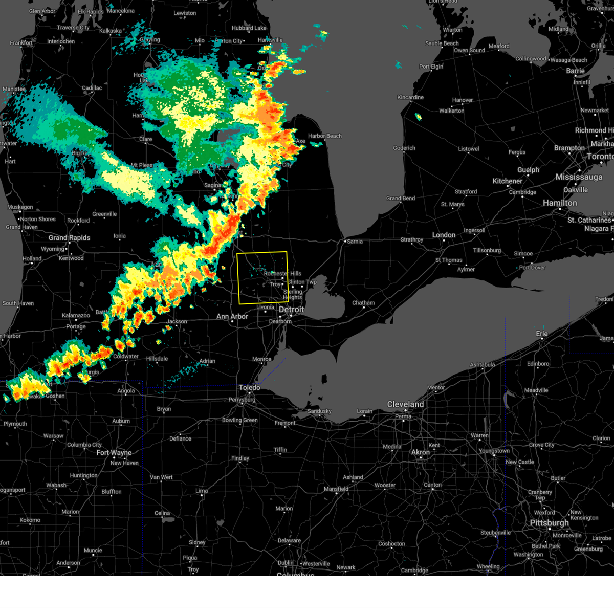 Svrdtx the national weather service in detroit/pontiac has issued a * severe thunderstorm warning for, oakland county in southeastern michigan, * until 630 pm edt. * at 502 pm edt, severe thunderstorms were located along a line extending from near clio to near gaines to near fowlerville, moving southeast at 45 mph (radar indicated). Hazards include 60 mph wind gusts and penny size hail. Expect damage to roofs, siding, and trees. severe thunderstorms will be near, holly around 515 pm edt. milford, south lyon, and ortonville around 525 pm edt. novi and clarkston around 530 pm edt. northville around 535 pm edt. pontiac, oxford, and west bloomfield around 540 pm edt. southfield around 545 pm edt. troy, birmingham, and rochester around 550 pm edt. sterling heights and royal oak around 555 pm edt. other locations impacted by these severe thunderstorms include franklin, keego harbor, waterford, orchard lake, holly state recreation area, commerce, rose center, lathrup village, auburn hills, and bingham farms. this includes the following highways, i-75 between mile markers 60 and 105. i-96 between mile markers 154 and 167. i-696 between mile markers 1 and 19. m-10 between mile markers 13 and 18. M-59 between mile markers 38 and 48. Svrdtx the national weather service in detroit/pontiac has issued a * severe thunderstorm warning for, oakland county in southeastern michigan, * until 630 pm edt. * at 502 pm edt, severe thunderstorms were located along a line extending from near clio to near gaines to near fowlerville, moving southeast at 45 mph (radar indicated). Hazards include 60 mph wind gusts and penny size hail. Expect damage to roofs, siding, and trees. severe thunderstorms will be near, holly around 515 pm edt. milford, south lyon, and ortonville around 525 pm edt. novi and clarkston around 530 pm edt. northville around 535 pm edt. pontiac, oxford, and west bloomfield around 540 pm edt. southfield around 545 pm edt. troy, birmingham, and rochester around 550 pm edt. sterling heights and royal oak around 555 pm edt. other locations impacted by these severe thunderstorms include franklin, keego harbor, waterford, orchard lake, holly state recreation area, commerce, rose center, lathrup village, auburn hills, and bingham farms. this includes the following highways, i-75 between mile markers 60 and 105. i-96 between mile markers 154 and 167. i-696 between mile markers 1 and 19. m-10 between mile markers 13 and 18. M-59 between mile markers 38 and 48.
|
| 7/23/2024 9:59 PM EDT |
 the severe thunderstorm warning has been cancelled and is no longer in effect the severe thunderstorm warning has been cancelled and is no longer in effect
|
| 7/23/2024 9:46 PM EDT |
 At 945 pm edt, severe thunderstorms were located along a line extending from near armada to near mount clemens to st. clair shores, moving east at 30 mph (radar indicated). Hazards include 60 mph wind gusts. Expect damage to roofs, siding, and trees. these severe storms will be near, st. clair shores, new baltimore, and clinton around 950 pm edt. harsens island around 1005 pm edt. algonac around 1010 pm edt. marine city around 1015 pm edt. other locations impacted by these severe thunderstorms include anchorville, new haven, pearl beach, chesterfield township, clinton township, fraser, washington, fair haven, roseville, and utica. this includes the following highways, i-94 between mile markers 231 and 253. m-39 between mile markers 18 and 24. M-53 between mile markers 18 and 24. At 945 pm edt, severe thunderstorms were located along a line extending from near armada to near mount clemens to st. clair shores, moving east at 30 mph (radar indicated). Hazards include 60 mph wind gusts. Expect damage to roofs, siding, and trees. these severe storms will be near, st. clair shores, new baltimore, and clinton around 950 pm edt. harsens island around 1005 pm edt. algonac around 1010 pm edt. marine city around 1015 pm edt. other locations impacted by these severe thunderstorms include anchorville, new haven, pearl beach, chesterfield township, clinton township, fraser, washington, fair haven, roseville, and utica. this includes the following highways, i-94 between mile markers 231 and 253. m-39 between mile markers 18 and 24. M-53 between mile markers 18 and 24.
|
| 7/23/2024 9:25 PM EDT |
 Svrdtx the national weather service in detroit/pontiac has issued a * severe thunderstorm warning for, macomb county in southeastern michigan, southeastern st. clair county in southeastern michigan, * until 1045 pm edt. * at 924 pm edt, severe thunderstorms were located along a line extending from near rochester to sterling heights to near detroit zoo, moving east at 30 mph (radar indicated). Hazards include 60 mph wind gusts. Expect damage to roofs, siding, and trees. severe thunderstorms will be near, warren, st. clair shores, mount clemens, sterling heights, clinton, and macomb township around 930 pm edt. new baltimore around 945 pm edt. algonac and harsens island around 1005 pm edt. marine city around 1015 pm edt. other locations impacted by these severe thunderstorms include anchorville, roseville, shelby township, ray center, utica, fraser, eastpointe, washington, fair haven, and new haven. this includes the following highways, i-94 between mile markers 226 and 253. i-696 between mile markers 21 and 28. m-39 between mile markers 16 and 24. m-53 between mile markers 16 and 24. M-59 near mile marker 49. Svrdtx the national weather service in detroit/pontiac has issued a * severe thunderstorm warning for, macomb county in southeastern michigan, southeastern st. clair county in southeastern michigan, * until 1045 pm edt. * at 924 pm edt, severe thunderstorms were located along a line extending from near rochester to sterling heights to near detroit zoo, moving east at 30 mph (radar indicated). Hazards include 60 mph wind gusts. Expect damage to roofs, siding, and trees. severe thunderstorms will be near, warren, st. clair shores, mount clemens, sterling heights, clinton, and macomb township around 930 pm edt. new baltimore around 945 pm edt. algonac and harsens island around 1005 pm edt. marine city around 1015 pm edt. other locations impacted by these severe thunderstorms include anchorville, roseville, shelby township, ray center, utica, fraser, eastpointe, washington, fair haven, and new haven. this includes the following highways, i-94 between mile markers 226 and 253. i-696 between mile markers 21 and 28. m-39 between mile markers 16 and 24. m-53 between mile markers 16 and 24. M-59 near mile marker 49.
|
| 7/23/2024 4:59 PM EDT |
 The storm which prompted the warning has moved out of the area. therefore, the warning will be allowed to expire. The storm which prompted the warning has moved out of the area. therefore, the warning will be allowed to expire.
|
| 7/23/2024 4:41 PM EDT |
 At 440 pm edt, a severe thunderstorm was located over st. clair shores, moving east at 15 mph (radar indicated). Hazards include 60 mph wind gusts and quarter size hail. Hail damage to vehicles is expected. expect wind damage to roofs, siding, and trees. this severe storm will be near, st. clair shores, mount clemens, and clinton around 445 pm edt. other locations impacted by this severe thunderstorm include center line, roseville, clinton township, fraser, eastpointe, grosse pointe shores, harper woods, and grosse pointe woods. this includes the following highways, i-94 between mile markers 226 and 239. I-696 between mile markers 22 and 28. At 440 pm edt, a severe thunderstorm was located over st. clair shores, moving east at 15 mph (radar indicated). Hazards include 60 mph wind gusts and quarter size hail. Hail damage to vehicles is expected. expect wind damage to roofs, siding, and trees. this severe storm will be near, st. clair shores, mount clemens, and clinton around 445 pm edt. other locations impacted by this severe thunderstorm include center line, roseville, clinton township, fraser, eastpointe, grosse pointe shores, harper woods, and grosse pointe woods. this includes the following highways, i-94 between mile markers 226 and 239. I-696 between mile markers 22 and 28.
|
| 7/23/2024 4:22 PM EDT |
 the severe thunderstorm warning has been cancelled and is no longer in effect the severe thunderstorm warning has been cancelled and is no longer in effect
|
| 7/23/2024 4:22 PM EDT |
 At 422 pm edt, a severe thunderstorm was located over warren, moving east at 15 mph (radar indicated). Hazards include 60 mph wind gusts and quarter size hail. Hail damage to vehicles is expected. expect wind damage to roofs, siding, and trees. this severe storm will be near, warren, st. clair shores, sterling heights, and clinton around 425 pm edt. other locations impacted by this severe thunderstorm include center line, roseville, clinton township, fraser, eastpointe, grosse pointe shores, harper woods, madison heights, and grosse pointe woods. this includes the following highways, i-94 between mile markers 226 and 239. i-696 between mile markers 21 and 28. m-39 between mile markers 16 and 17. M-53 between mile markers 16 and 17. At 422 pm edt, a severe thunderstorm was located over warren, moving east at 15 mph (radar indicated). Hazards include 60 mph wind gusts and quarter size hail. Hail damage to vehicles is expected. expect wind damage to roofs, siding, and trees. this severe storm will be near, warren, st. clair shores, sterling heights, and clinton around 425 pm edt. other locations impacted by this severe thunderstorm include center line, roseville, clinton township, fraser, eastpointe, grosse pointe shores, harper woods, madison heights, and grosse pointe woods. this includes the following highways, i-94 between mile markers 226 and 239. i-696 between mile markers 21 and 28. m-39 between mile markers 16 and 17. M-53 between mile markers 16 and 17.
|
| 7/23/2024 4:10 PM EDT | Photo sent via twitter of a tree down on 12 mile and palm beac in macomb county MI, 2.1 miles SSW of Warren, MI |
| 7/23/2024 4:03 PM EDT |
 Svrdtx the national weather service in detroit/pontiac has issued a * severe thunderstorm warning for, southeastern oakland county in southeastern michigan, southern macomb county in southeastern michigan, * until 500 pm edt. * at 403 pm edt, a severe thunderstorm was located near royal oak, or near warren, moving east at 15 mph (radar indicated). Hazards include 60 mph wind gusts and quarter size hail. Hail damage to vehicles is expected. expect wind damage to roofs, siding, and trees. this severe thunderstorm will be near, warren, sterling heights, and clinton around 410 pm edt. st. clair shores around 420 pm edt. mount clemens around 430 pm edt. other locations impacted by this severe thunderstorm include madison heights, roseville, clawson, hazel park, fraser, eastpointe, center line, clinton township, ferndale, and pleasant ridge. this includes the following highways, i-75 between mile markers 60 and 71. i-94 between mile markers 226 and 239. i-696 between mile markers 17 and 28. m-39 between mile markers 16 and 17. M-53 between mile markers 16 and 17. Svrdtx the national weather service in detroit/pontiac has issued a * severe thunderstorm warning for, southeastern oakland county in southeastern michigan, southern macomb county in southeastern michigan, * until 500 pm edt. * at 403 pm edt, a severe thunderstorm was located near royal oak, or near warren, moving east at 15 mph (radar indicated). Hazards include 60 mph wind gusts and quarter size hail. Hail damage to vehicles is expected. expect wind damage to roofs, siding, and trees. this severe thunderstorm will be near, warren, sterling heights, and clinton around 410 pm edt. st. clair shores around 420 pm edt. mount clemens around 430 pm edt. other locations impacted by this severe thunderstorm include madison heights, roseville, clawson, hazel park, fraser, eastpointe, center line, clinton township, ferndale, and pleasant ridge. this includes the following highways, i-75 between mile markers 60 and 71. i-94 between mile markers 226 and 239. i-696 between mile markers 17 and 28. m-39 between mile markers 16 and 17. M-53 between mile markers 16 and 17.
|
| 7/16/2024 3:40 AM EDT |
 The storm which prompted the warning has moved out of the area. therefore, the warning will be allowed to expire. a severe thunderstorm watch remains in effect until 500 am edt for southeastern michigan. The storm which prompted the warning has moved out of the area. therefore, the warning will be allowed to expire. a severe thunderstorm watch remains in effect until 500 am edt for southeastern michigan.
|
| 7/16/2024 3:30 AM EDT |
 At 329 am edt, severe thunderstorms were located along a line extending from near rochester to mount clemens to 8 miles northeast of st. clair shores, moving northeast at 40 mph (radar indicated). Hazards include 60 mph wind gusts. Expect damage to roofs, siding, and trees. these severe storms will be near, new baltimore and romeo around 335 am edt. armada around 340 am edt. richmond around 345 am edt. marine city and memphis around 350 am edt. st. clair and emmett around 400 am edt. marysville around 405 am edt. port huron around 415 am edt. lakeport around 425 am edt. other locations impacted by these severe thunderstorms include anchorville, north street, roseville, shelby township, ray center, brockway, utica, washington, fort gratiot, and avoca. this includes the following highways, i-94 between mile markers 226 and 273. i-696 between mile markers 21 and 28. i-69 between mile markers 173 and 199. m-39 between mile markers 16 and 24. m-53 between mile markers 16 and 24. M-59 near mile marker 49. At 329 am edt, severe thunderstorms were located along a line extending from near rochester to mount clemens to 8 miles northeast of st. clair shores, moving northeast at 40 mph (radar indicated). Hazards include 60 mph wind gusts. Expect damage to roofs, siding, and trees. these severe storms will be near, new baltimore and romeo around 335 am edt. armada around 340 am edt. richmond around 345 am edt. marine city and memphis around 350 am edt. st. clair and emmett around 400 am edt. marysville around 405 am edt. port huron around 415 am edt. lakeport around 425 am edt. other locations impacted by these severe thunderstorms include anchorville, north street, roseville, shelby township, ray center, brockway, utica, washington, fort gratiot, and avoca. this includes the following highways, i-94 between mile markers 226 and 273. i-696 between mile markers 21 and 28. i-69 between mile markers 173 and 199. m-39 between mile markers 16 and 24. m-53 between mile markers 16 and 24. M-59 near mile marker 49.
|
| 7/16/2024 3:21 AM EDT |
 At 321 am edt, a severe thunderstorm was located over troy, moving northeast at 35 mph (radar indicated). Hazards include 60 mph wind gusts. Expect damage to roofs, siding, and trees. this severe storm will be near, troy, sterling heights, and rochester around 325 am edt. other locations impacted by this severe thunderstorm include rochester hills, franklin, madison heights, keego harbor, lakeville, waterford, clawson, berkley, oak park, and hazel park. this includes the following highways, i-75 between mile markers 60 and 92. i-696 between mile markers 11 and 19. m-10 between mile markers 13 and 18. M-59 between mile markers 38 and 48. At 321 am edt, a severe thunderstorm was located over troy, moving northeast at 35 mph (radar indicated). Hazards include 60 mph wind gusts. Expect damage to roofs, siding, and trees. this severe storm will be near, troy, sterling heights, and rochester around 325 am edt. other locations impacted by this severe thunderstorm include rochester hills, franklin, madison heights, keego harbor, lakeville, waterford, clawson, berkley, oak park, and hazel park. this includes the following highways, i-75 between mile markers 60 and 92. i-696 between mile markers 11 and 19. m-10 between mile markers 13 and 18. M-59 between mile markers 38 and 48.
|
| 7/16/2024 3:08 AM EDT |
 Svrdtx the national weather service in detroit/pontiac has issued a * severe thunderstorm warning for, macomb county in southeastern michigan, st. clair county in southeastern michigan, * until 430 am edt. * at 307 am edt, severe thunderstorms were located along a line extending from near birmingham to near warren to grosse pointe, moving northeast at 50 mph (radar indicated). Hazards include 60 mph wind gusts. Expect damage to roofs, siding, and trees. severe thunderstorms will be near, warren, st. clair shores, sterling heights, and clinton around 310 am edt. mount clemens around 315 am edt. macomb township around 320 am edt. new baltimore and romeo around 325 am edt. armada around 330 am edt. richmond around 335 am edt. capac and memphis around 340 am edt. st. clair and emmett around 345 am edt. other locations impacted by these severe thunderstorms include anchorville, north street, roseville, shelby township, ray center, brockway, utica, washington, fort gratiot, and avoca. this includes the following highways, i-94 between mile markers 226 and 273. i-696 between mile markers 21 and 28. i-69 between mile markers 173 and 199. m-39 between mile markers 16 and 24. m-53 between mile markers 16 and 24. M-59 near mile marker 49. Svrdtx the national weather service in detroit/pontiac has issued a * severe thunderstorm warning for, macomb county in southeastern michigan, st. clair county in southeastern michigan, * until 430 am edt. * at 307 am edt, severe thunderstorms were located along a line extending from near birmingham to near warren to grosse pointe, moving northeast at 50 mph (radar indicated). Hazards include 60 mph wind gusts. Expect damage to roofs, siding, and trees. severe thunderstorms will be near, warren, st. clair shores, sterling heights, and clinton around 310 am edt. mount clemens around 315 am edt. macomb township around 320 am edt. new baltimore and romeo around 325 am edt. armada around 330 am edt. richmond around 335 am edt. capac and memphis around 340 am edt. st. clair and emmett around 345 am edt. other locations impacted by these severe thunderstorms include anchorville, north street, roseville, shelby township, ray center, brockway, utica, washington, fort gratiot, and avoca. this includes the following highways, i-94 between mile markers 226 and 273. i-696 between mile markers 21 and 28. i-69 between mile markers 173 and 199. m-39 between mile markers 16 and 24. m-53 between mile markers 16 and 24. M-59 near mile marker 49.
|
| 7/16/2024 3:08 AM EDT |
 At 308 am edt, severe thunderstorms were located along a line extending from near clarkston to near birmingham to near detroit zoo, moving northeast at 40 mph (radar indicated). Hazards include 60 mph wind gusts. Expect damage to roofs, siding, and trees. these severe storms will be near, troy, pontiac, sterling heights, rochester, and clarkston around 315 am edt. oxford around 325 am edt. other locations impacted by these severe thunderstorms include franklin, keego harbor, waterford, orchard lake, commerce, rose center, lathrup village, auburn hills, bingham farms, and lake angelus. this includes the following highways, i-75 between mile markers 60 and 100. i-96 between mile markers 160 and 167. i-696 between mile markers 1 and 19. m-10 between mile markers 13 and 18. M-59 between mile markers 38 and 48. At 308 am edt, severe thunderstorms were located along a line extending from near clarkston to near birmingham to near detroit zoo, moving northeast at 40 mph (radar indicated). Hazards include 60 mph wind gusts. Expect damage to roofs, siding, and trees. these severe storms will be near, troy, pontiac, sterling heights, rochester, and clarkston around 315 am edt. oxford around 325 am edt. other locations impacted by these severe thunderstorms include franklin, keego harbor, waterford, orchard lake, commerce, rose center, lathrup village, auburn hills, bingham farms, and lake angelus. this includes the following highways, i-75 between mile markers 60 and 100. i-96 between mile markers 160 and 167. i-696 between mile markers 1 and 19. m-10 between mile markers 13 and 18. M-59 between mile markers 38 and 48.
|
| 7/16/2024 2:48 AM EDT |
 Svrdtx the national weather service in detroit/pontiac has issued a * severe thunderstorm warning for, oakland county in southeastern michigan, * until 345 am edt. * at 247 am edt, severe thunderstorms were located along a line extending from hartland to near brighton to south lyon, moving northeast at 50 mph (radar indicated). Hazards include 60 mph wind gusts. Expect damage to roofs, siding, and trees. severe thunderstorms will be near, novi, milford, and south lyon around 250 am edt. west bloomfield around 300 am edt. pontiac and clarkston around 305 am edt. troy and oxford around 315 am edt. rochester around 320 am edt. other locations impacted by these severe thunderstorms include franklin, keego harbor, waterford, orchard lake, commerce, rose center, lathrup village, auburn hills, bingham farms, and lake angelus. this includes the following highways, i-75 between mile markers 60 and 100. i-96 between mile markers 154 and 167. i-696 between mile markers 1 and 19. m-10 between mile markers 13 and 18. M-59 between mile markers 38 and 48. Svrdtx the national weather service in detroit/pontiac has issued a * severe thunderstorm warning for, oakland county in southeastern michigan, * until 345 am edt. * at 247 am edt, severe thunderstorms were located along a line extending from hartland to near brighton to south lyon, moving northeast at 50 mph (radar indicated). Hazards include 60 mph wind gusts. Expect damage to roofs, siding, and trees. severe thunderstorms will be near, novi, milford, and south lyon around 250 am edt. west bloomfield around 300 am edt. pontiac and clarkston around 305 am edt. troy and oxford around 315 am edt. rochester around 320 am edt. other locations impacted by these severe thunderstorms include franklin, keego harbor, waterford, orchard lake, commerce, rose center, lathrup village, auburn hills, bingham farms, and lake angelus. this includes the following highways, i-75 between mile markers 60 and 100. i-96 between mile markers 154 and 167. i-696 between mile markers 1 and 19. m-10 between mile markers 13 and 18. M-59 between mile markers 38 and 48.
|
| 6/20/2024 4:06 PM EDT |
 The storms which prompted the warning have weakened below severe limits, and no longer pose an immediate threat to life or property. therefore, the warning will be allowed to expire. The storms which prompted the warning have weakened below severe limits, and no longer pose an immediate threat to life or property. therefore, the warning will be allowed to expire.
|
| 6/20/2024 3:48 PM EDT |
 At 348 pm edt, severe thunderstorms were located along a line extending from near macomb township to near clinton to near detroit, moving east at 10 mph (radar indicated). Hazards include 60 mph wind gusts and quarter size hail. Hail damage to vehicles is expected. expect wind damage to roofs, siding, and trees. these severe storms will be near, warren, st. clair shores, mount clemens, new baltimore, and clinton around 355 pm edt. other locations impacted by these severe thunderstorms include roseville, utica, harper woods, pleasant ridge, grosse pointe shores, center line, huntington woods, grosse pointe woods, chesterfield township, and clinton township. this includes the following highways, i-75 between mile markers 55 and 68. i-94 between mile markers 220 and 245. i-696 between mile markers 12 and 28. m-10 between mile markers 7 and 15. m-39 between mile markers 16 and 19. m-53 between mile markers 16 and 19. M-59 near mile marker 49. At 348 pm edt, severe thunderstorms were located along a line extending from near macomb township to near clinton to near detroit, moving east at 10 mph (radar indicated). Hazards include 60 mph wind gusts and quarter size hail. Hail damage to vehicles is expected. expect wind damage to roofs, siding, and trees. these severe storms will be near, warren, st. clair shores, mount clemens, new baltimore, and clinton around 355 pm edt. other locations impacted by these severe thunderstorms include roseville, utica, harper woods, pleasant ridge, grosse pointe shores, center line, huntington woods, grosse pointe woods, chesterfield township, and clinton township. this includes the following highways, i-75 between mile markers 55 and 68. i-94 between mile markers 220 and 245. i-696 between mile markers 12 and 28. m-10 between mile markers 7 and 15. m-39 between mile markers 16 and 19. m-53 between mile markers 16 and 19. M-59 near mile marker 49.
|
| 6/20/2024 3:37 PM EDT |
 At 337 pm edt, severe thunderstorms were located along a line extending from near macomb township to clinton to near detroit, moving east at 20 mph (radar indicated). Hazards include 60 mph wind gusts and quarter size hail. Hail damage to vehicles is expected. expect wind damage to roofs, siding, and trees. these severe storms will be near, warren, st. clair shores, mount clemens, new baltimore, and clinton around 345 pm edt. grosse pointe around 355 pm edt. other locations impacted by these severe thunderstorms include roseville, shelby township, utica, lathrup village, harper woods, pleasant ridge, grosse pointe shores, center line, huntington woods, and grosse pointe woods. this includes the following highways, i-75 between mile markers 55 and 71. i-94 between mile markers 220 and 245. i-696 between mile markers 11 and 28. m-10 between mile markers 7 and 17. m-39 between mile markers 16 and 21. m-53 between mile markers 16 and 21. M-59 between mile markers 46 and 49. At 337 pm edt, severe thunderstorms were located along a line extending from near macomb township to clinton to near detroit, moving east at 20 mph (radar indicated). Hazards include 60 mph wind gusts and quarter size hail. Hail damage to vehicles is expected. expect wind damage to roofs, siding, and trees. these severe storms will be near, warren, st. clair shores, mount clemens, new baltimore, and clinton around 345 pm edt. grosse pointe around 355 pm edt. other locations impacted by these severe thunderstorms include roseville, shelby township, utica, lathrup village, harper woods, pleasant ridge, grosse pointe shores, center line, huntington woods, and grosse pointe woods. this includes the following highways, i-75 between mile markers 55 and 71. i-94 between mile markers 220 and 245. i-696 between mile markers 11 and 28. m-10 between mile markers 7 and 17. m-39 between mile markers 16 and 21. m-53 between mile markers 16 and 21. M-59 between mile markers 46 and 49.
|
| 6/20/2024 3:15 PM EDT |
 Svrdtx the national weather service in detroit/pontiac has issued a * severe thunderstorm warning for, northeastern wayne county in southeastern michigan, southeastern oakland county in southeastern michigan, southern macomb county in southeastern michigan, * until 415 pm edt. * at 315 pm edt, severe thunderstorms were located along a line extending from near macomb township to near sterling heights to near southfield, moving east at 10 mph (radar indicated). Hazards include 60 mph wind gusts and quarter size hail. Hail damage to vehicles is expected. expect wind damage to roofs, siding, and trees. severe thunderstorms will be near, warren, troy, southfield, mount clemens, sterling heights, royal oak, clinton, macomb township, and detroit zoo around 320 pm edt. st. clair shores around 335 pm edt. other locations impacted by these severe thunderstorms include roseville, shelby township, utica, lathrup village, bingham farms, harper woods, pleasant ridge, grosse pointe shores, center line, and huntington woods. this includes the following highways, i-75 between mile markers 55 and 74. i-94 between mile markers 220 and 245. i-696 between mile markers 8 and 28. m-10 between mile markers 7 and 18. m-39 between mile markers 16 and 20. m-53 between mile markers 16 and 20. M-59 between mile markers 43 and 49. Svrdtx the national weather service in detroit/pontiac has issued a * severe thunderstorm warning for, northeastern wayne county in southeastern michigan, southeastern oakland county in southeastern michigan, southern macomb county in southeastern michigan, * until 415 pm edt. * at 315 pm edt, severe thunderstorms were located along a line extending from near macomb township to near sterling heights to near southfield, moving east at 10 mph (radar indicated). Hazards include 60 mph wind gusts and quarter size hail. Hail damage to vehicles is expected. expect wind damage to roofs, siding, and trees. severe thunderstorms will be near, warren, troy, southfield, mount clemens, sterling heights, royal oak, clinton, macomb township, and detroit zoo around 320 pm edt. st. clair shores around 335 pm edt. other locations impacted by these severe thunderstorms include roseville, shelby township, utica, lathrup village, bingham farms, harper woods, pleasant ridge, grosse pointe shores, center line, and huntington woods. this includes the following highways, i-75 between mile markers 55 and 74. i-94 between mile markers 220 and 245. i-696 between mile markers 8 and 28. m-10 between mile markers 7 and 18. m-39 between mile markers 16 and 20. m-53 between mile markers 16 and 20. M-59 between mile markers 43 and 49.
|
| 6/19/2024 9:23 PM EDT |
 The storms which prompted the warning have weakened below severe limits, and no longer pose an immediate threat to life or property. therefore, the warning will be allowed to expire. however, small hail, gusty winds and heavy rain are still possible with these thunderstorms. The storms which prompted the warning have weakened below severe limits, and no longer pose an immediate threat to life or property. therefore, the warning will be allowed to expire. however, small hail, gusty winds and heavy rain are still possible with these thunderstorms.
|
| 6/19/2024 8:54 PM EDT |
 At 853 pm edt, a cluster of thunderstorms continue to develop along a line extending from 6 miles west of st. clair to new baltimore to st. clair shores. these storms are moving slowly to the east at 5 mph (radar indicated). Hazards include 60 mph wind gusts and penny size hail. Expect damage to roofs, siding, and trees. these severe storms will be near, st. clair shores, mount clemens, new baltimore, and clinton around 900 pm edt. other locations impacted by these severe thunderstorms include anchorville, new haven, adair, roseville, rattle run, chesterfield township, clinton township, fraser, and fair haven. this includes the following highways, i-94 between mile markers 229 and 262. I-696 near mile marker 28. At 853 pm edt, a cluster of thunderstorms continue to develop along a line extending from 6 miles west of st. clair to new baltimore to st. clair shores. these storms are moving slowly to the east at 5 mph (radar indicated). Hazards include 60 mph wind gusts and penny size hail. Expect damage to roofs, siding, and trees. these severe storms will be near, st. clair shores, mount clemens, new baltimore, and clinton around 900 pm edt. other locations impacted by these severe thunderstorms include anchorville, new haven, adair, roseville, rattle run, chesterfield township, clinton township, fraser, and fair haven. this includes the following highways, i-94 between mile markers 229 and 262. I-696 near mile marker 28.
|
| 6/19/2024 8:39 PM EDT |
 At 839 pm edt, severe thunderstorms were located along a line extending from near richmond to new baltimore to near st. clair shores, moving east at 5 mph (radar indicated). Hazards include 60 mph wind gusts and penny size hail. Expect damage to roofs, siding, and trees. these severe storms will be near, st. clair shores, mount clemens, new baltimore, and clinton around 845 pm edt. other locations impacted by these severe thunderstorms include anchorville, new haven, adair, roseville, rattle run, chesterfield township, clinton township, fraser, and fair haven. this includes the following highways, i-94 between mile markers 228 and 262. I-696 between mile markers 27 and 28. At 839 pm edt, severe thunderstorms were located along a line extending from near richmond to new baltimore to near st. clair shores, moving east at 5 mph (radar indicated). Hazards include 60 mph wind gusts and penny size hail. Expect damage to roofs, siding, and trees. these severe storms will be near, st. clair shores, mount clemens, new baltimore, and clinton around 845 pm edt. other locations impacted by these severe thunderstorms include anchorville, new haven, adair, roseville, rattle run, chesterfield township, clinton township, fraser, and fair haven. this includes the following highways, i-94 between mile markers 228 and 262. I-696 between mile markers 27 and 28.
|
| 6/19/2024 8:26 PM EDT |
 Svrdtx the national weather service in detroit/pontiac has issued a * severe thunderstorm warning for, southeastern macomb county in southeastern michigan, central st. clair county in southeastern michigan, * until 930 pm edt. * at 825 pm edt, severe thunderstorms were located along a line extending from near richmond to near new baltimore to near st. clair shores, moving east at 5 mph (radar indicated). Hazards include 60 mph wind gusts and penny size hail. Expect damage to roofs, siding, and trees. severe thunderstorms will be near, warren, st. clair shores, mount clemens, new baltimore, richmond, and clinton around 830 pm edt. other locations impacted by these severe thunderstorms include anchorville, adair, roseville, rattle run, fraser, eastpointe, fair haven, new haven, center line, and chesterfield township. this includes the following highways, i-94 between mile markers 226 and 262. I-696 between mile markers 23 and 28. Svrdtx the national weather service in detroit/pontiac has issued a * severe thunderstorm warning for, southeastern macomb county in southeastern michigan, central st. clair county in southeastern michigan, * until 930 pm edt. * at 825 pm edt, severe thunderstorms were located along a line extending from near richmond to near new baltimore to near st. clair shores, moving east at 5 mph (radar indicated). Hazards include 60 mph wind gusts and penny size hail. Expect damage to roofs, siding, and trees. severe thunderstorms will be near, warren, st. clair shores, mount clemens, new baltimore, richmond, and clinton around 830 pm edt. other locations impacted by these severe thunderstorms include anchorville, adair, roseville, rattle run, fraser, eastpointe, fair haven, new haven, center line, and chesterfield township. this includes the following highways, i-94 between mile markers 226 and 262. I-696 between mile markers 23 and 28.
|
| 5/20/2024 5:03 PM EDT |
 Svrdtx the national weather service in detroit/pontiac has issued a * severe thunderstorm warning for, central macomb county in southeastern michigan, * until 600 pm edt. * at 503 pm edt, a severe thunderstorm was located over sterling heights, or near warren, moving northeast at 20 mph (radar indicated). Hazards include 60 mph wind gusts and quarter size hail. Hail damage to vehicles is expected. expect wind damage to roofs, siding, and trees. this severe thunderstorm will be near, sterling heights and clinton around 510 pm edt. mount clemens around 515 pm edt. macomb township around 520 pm edt. Other locations impacted by this severe thunderstorm include new haven, shelby township, chesterfield township, clinton township, utica, fraser, washington, and roseville. Svrdtx the national weather service in detroit/pontiac has issued a * severe thunderstorm warning for, central macomb county in southeastern michigan, * until 600 pm edt. * at 503 pm edt, a severe thunderstorm was located over sterling heights, or near warren, moving northeast at 20 mph (radar indicated). Hazards include 60 mph wind gusts and quarter size hail. Hail damage to vehicles is expected. expect wind damage to roofs, siding, and trees. this severe thunderstorm will be near, sterling heights and clinton around 510 pm edt. mount clemens around 515 pm edt. macomb township around 520 pm edt. Other locations impacted by this severe thunderstorm include new haven, shelby township, chesterfield township, clinton township, utica, fraser, washington, and roseville.
|
| 5/19/2024 6:53 PM EDT |
 the severe thunderstorm warning has been cancelled and is no longer in effect the severe thunderstorm warning has been cancelled and is no longer in effect
|
| 5/19/2024 6:45 PM EDT |
 At 645 pm edt, a severe thunderstorm was located over sterling heights, or near troy, moving southeast at 10 mph (radar indicated). Hazards include 60 mph wind gusts and quarter size hail. Hail damage to vehicles is expected. expect wind damage to roofs, siding, and trees. this severe storm will be near, warren, troy, and sterling heights around 650 pm edt. clinton around 655 pm edt. st. clair shores around 715 pm edt. Other locations impacted by this severe thunderstorm include madison heights, roseville, clawson, hazel park, utica, fraser, eastpointe, center line, clinton township, and shelby township. At 645 pm edt, a severe thunderstorm was located over sterling heights, or near troy, moving southeast at 10 mph (radar indicated). Hazards include 60 mph wind gusts and quarter size hail. Hail damage to vehicles is expected. expect wind damage to roofs, siding, and trees. this severe storm will be near, warren, troy, and sterling heights around 650 pm edt. clinton around 655 pm edt. st. clair shores around 715 pm edt. Other locations impacted by this severe thunderstorm include madison heights, roseville, clawson, hazel park, utica, fraser, eastpointe, center line, clinton township, and shelby township.
|
| 5/19/2024 6:28 PM EDT |
 Svrdtx the national weather service in detroit/pontiac has issued a * severe thunderstorm warning for, southeastern oakland county in southeastern michigan, southwestern macomb county in southeastern michigan, * until 730 pm edt. * at 627 pm edt, a severe thunderstorm was located over troy, moving southeast at 10 mph (radar indicated). Hazards include 60 mph wind gusts and quarter size hail. Hail damage to vehicles is expected. expect wind damage to roofs, siding, and trees. this severe thunderstorm will be near, troy and sterling heights around 630 pm edt. warren around 640 pm edt. clinton around 655 pm edt. st. clair shores around 715 pm edt. Other locations impacted by this severe thunderstorm include rochester hills, madison heights, roseville, shelby township, clawson, hazel park, utica, fraser, eastpointe, and stoney creek metro park. Svrdtx the national weather service in detroit/pontiac has issued a * severe thunderstorm warning for, southeastern oakland county in southeastern michigan, southwestern macomb county in southeastern michigan, * until 730 pm edt. * at 627 pm edt, a severe thunderstorm was located over troy, moving southeast at 10 mph (radar indicated). Hazards include 60 mph wind gusts and quarter size hail. Hail damage to vehicles is expected. expect wind damage to roofs, siding, and trees. this severe thunderstorm will be near, troy and sterling heights around 630 pm edt. warren around 640 pm edt. clinton around 655 pm edt. st. clair shores around 715 pm edt. Other locations impacted by this severe thunderstorm include rochester hills, madison heights, roseville, shelby township, clawson, hazel park, utica, fraser, eastpointe, and stoney creek metro park.
|
| 5/19/2024 5:57 PM EDT |
 At 556 pm edt, a severe thunderstorm was located near mount clemens, moving east at 10 mph (radar indicated). Hazards include 60 mph wind gusts and quarter size hail. Hail damage to vehicles is expected. expect wind damage to roofs, siding, and trees. this severe storm will be near, mount clemens and new baltimore around 600 pm edt. Other locations impacted by this severe thunderstorm include roseville, shelby township, ray center, utica, fraser, eastpointe, washington, new haven, stoney creek metro park, and center line. At 556 pm edt, a severe thunderstorm was located near mount clemens, moving east at 10 mph (radar indicated). Hazards include 60 mph wind gusts and quarter size hail. Hail damage to vehicles is expected. expect wind damage to roofs, siding, and trees. this severe storm will be near, mount clemens and new baltimore around 600 pm edt. Other locations impacted by this severe thunderstorm include roseville, shelby township, ray center, utica, fraser, eastpointe, washington, new haven, stoney creek metro park, and center line.
|
| 5/19/2024 5:45 PM EDT |
 the severe thunderstorm warning has been cancelled and is no longer in effect the severe thunderstorm warning has been cancelled and is no longer in effect
|
| 5/19/2024 5:45 PM EDT |
 At 544 pm edt, a severe thunderstorm was located near macomb township, or 7 miles northwest of mount clemens, moving east at 10 mph (radar indicated). Hazards include 60 mph wind gusts and quarter size hail. Hail damage to vehicles is expected. expect wind damage to roofs, siding, and trees. this severe storm will be near, sterling heights, clinton, and macomb township around 550 pm edt. mount clemens around 600 pm edt. Other locations impacted by this severe thunderstorm include roseville, shelby township, ray center, utica, fraser, eastpointe, washington, new haven, stoney creek metro park, and center line. At 544 pm edt, a severe thunderstorm was located near macomb township, or 7 miles northwest of mount clemens, moving east at 10 mph (radar indicated). Hazards include 60 mph wind gusts and quarter size hail. Hail damage to vehicles is expected. expect wind damage to roofs, siding, and trees. this severe storm will be near, sterling heights, clinton, and macomb township around 550 pm edt. mount clemens around 600 pm edt. Other locations impacted by this severe thunderstorm include roseville, shelby township, ray center, utica, fraser, eastpointe, washington, new haven, stoney creek metro park, and center line.
|
| 5/19/2024 5:29 PM EDT |
 Svrdtx the national weather service in detroit/pontiac has issued a * severe thunderstorm warning for, eastern oakland county in southeastern michigan, macomb county in southeastern michigan, * until 630 pm edt. * at 528 pm edt, a severe thunderstorm was located near rochester, or 7 miles northeast of troy, moving southeast at 10 mph (radar indicated). Hazards include 60 mph wind gusts and quarter size hail. Hail damage to vehicles is expected. expect wind damage to roofs, siding, and trees. this severe thunderstorm will be near, sterling heights around 535 pm edt. clinton around 540 pm edt. macomb township around 550 pm edt. Other locations impacted by this severe thunderstorm include rochester hills, madison heights, roseville, shelby township, clawson, ray center, utica, fraser, eastpointe, and washington. Svrdtx the national weather service in detroit/pontiac has issued a * severe thunderstorm warning for, eastern oakland county in southeastern michigan, macomb county in southeastern michigan, * until 630 pm edt. * at 528 pm edt, a severe thunderstorm was located near rochester, or 7 miles northeast of troy, moving southeast at 10 mph (radar indicated). Hazards include 60 mph wind gusts and quarter size hail. Hail damage to vehicles is expected. expect wind damage to roofs, siding, and trees. this severe thunderstorm will be near, sterling heights around 535 pm edt. clinton around 540 pm edt. macomb township around 550 pm edt. Other locations impacted by this severe thunderstorm include rochester hills, madison heights, roseville, shelby township, clawson, ray center, utica, fraser, eastpointe, and washington.
|
| 4/17/2024 4:09 PM EDT |
 the severe thunderstorm warning has been cancelled and is no longer in effect the severe thunderstorm warning has been cancelled and is no longer in effect
|
| 4/17/2024 4:08 PM EDT |
 At 408 pm edt, severe thunderstorms were located along a line extending from dryden to near macomb township to near st. clair shores, moving northeast at 40 mph (radar indicated). Hazards include 60 mph wind gusts. Expect damage to roofs, siding, and trees. these severe storms will be near, st. clair shores, mount clemens, imlay city, romeo, almont, clinton, armada, and macomb township around 415 pm edt. new baltimore around 420 pm edt. richmond and memphis around 425 pm edt. Other locations impacted by these severe thunderstorms include lakeville, roseville, shelby township, ray center, utica, fraser, eastpointe, washington, thornville, and new haven. At 408 pm edt, severe thunderstorms were located along a line extending from dryden to near macomb township to near st. clair shores, moving northeast at 40 mph (radar indicated). Hazards include 60 mph wind gusts. Expect damage to roofs, siding, and trees. these severe storms will be near, st. clair shores, mount clemens, imlay city, romeo, almont, clinton, armada, and macomb township around 415 pm edt. new baltimore around 420 pm edt. richmond and memphis around 425 pm edt. Other locations impacted by these severe thunderstorms include lakeville, roseville, shelby township, ray center, utica, fraser, eastpointe, washington, thornville, and new haven.
|
| 4/17/2024 4:02 PM EDT |
 At 402 pm edt, severe thunderstorms were located along a line extending from near dryden to near rochester to near warren, moving northeast at 40 mph (radar indicated). Hazards include 60 mph wind gusts. Expect damage to roofs, siding, and trees. these severe storms will be near, warren, st. clair shores, imlay city, romeo, almont, sterling heights, clinton, and dryden around 405 pm edt. mount clemens and macomb township around 410 pm edt. armada around 415 pm edt. new baltimore around 420 pm edt. richmond and memphis around 425 pm edt. Other locations impacted by these severe thunderstorms include roseville, shelby township, ray center, utica, washington, pleasant ridge, center line, leonard, chesterfield township, and clinton township. At 402 pm edt, severe thunderstorms were located along a line extending from near dryden to near rochester to near warren, moving northeast at 40 mph (radar indicated). Hazards include 60 mph wind gusts. Expect damage to roofs, siding, and trees. these severe storms will be near, warren, st. clair shores, imlay city, romeo, almont, sterling heights, clinton, and dryden around 405 pm edt. mount clemens and macomb township around 410 pm edt. armada around 415 pm edt. new baltimore around 420 pm edt. richmond and memphis around 425 pm edt. Other locations impacted by these severe thunderstorms include roseville, shelby township, ray center, utica, washington, pleasant ridge, center line, leonard, chesterfield township, and clinton township.
|
| 4/17/2024 3:59 PM EDT | Large tree limb fell on the roa in macomb county MI, 3.9 miles SSE of Warren, MI |
| 4/17/2024 3:50 PM EDT |
 At 350 pm edt, a severe thunderstorm was located near detroit, or near warren, moving northeast at 50 mph (radar indicated). Hazards include 60 mph wind gusts and penny size hail. Expect damage to roofs, siding, and trees. this severe storm will be near, warren around 355 pm edt. Other locations impacted by this severe thunderstorm include highland park, melvindale, northeast detroit, northwest detroit, harper woods, grosse pointe shores, ecorse, southwest detroit, allen park, and dearborn heights. At 350 pm edt, a severe thunderstorm was located near detroit, or near warren, moving northeast at 50 mph (radar indicated). Hazards include 60 mph wind gusts and penny size hail. Expect damage to roofs, siding, and trees. this severe storm will be near, warren around 355 pm edt. Other locations impacted by this severe thunderstorm include highland park, melvindale, northeast detroit, northwest detroit, harper woods, grosse pointe shores, ecorse, southwest detroit, allen park, and dearborn heights.
|
| 4/17/2024 3:48 PM EDT |
 Svrdtx the national weather service in detroit/pontiac has issued a * severe thunderstorm warning for, southern lapeer county in southeastern michigan, eastern oakland county in southeastern michigan, macomb county in southeastern michigan, * until 445 pm edt. * at 347 pm edt, severe thunderstorms were located along a line extending from metamora to near pontiac to near southfield, moving northeast at 70 mph (radar indicated). Hazards include 60 mph wind gusts. Expect damage to roofs, siding, and trees. severe thunderstorms will be near, troy, southfield, pontiac, oxford, royal oak, birmingham, rochester, dryden, and metamora around 350 pm edt. imlay city, romeo, almont, and sterling heights around 355 pm edt. armada and macomb township around 405 pm edt. richmond and memphis around 410 pm edt. Other locations impacted by these severe thunderstorms include franklin, keego harbor, roseville, shelby township, ray center, utica, washington, lathrup village, auburn hills, and bingham farms. Svrdtx the national weather service in detroit/pontiac has issued a * severe thunderstorm warning for, southern lapeer county in southeastern michigan, eastern oakland county in southeastern michigan, macomb county in southeastern michigan, * until 445 pm edt. * at 347 pm edt, severe thunderstorms were located along a line extending from metamora to near pontiac to near southfield, moving northeast at 70 mph (radar indicated). Hazards include 60 mph wind gusts. Expect damage to roofs, siding, and trees. severe thunderstorms will be near, troy, southfield, pontiac, oxford, royal oak, birmingham, rochester, dryden, and metamora around 350 pm edt. imlay city, romeo, almont, and sterling heights around 355 pm edt. armada and macomb township around 405 pm edt. richmond and memphis around 410 pm edt. Other locations impacted by these severe thunderstorms include franklin, keego harbor, roseville, shelby township, ray center, utica, washington, lathrup village, auburn hills, and bingham farms.
|
| 4/17/2024 3:41 PM EDT |
 the severe thunderstorm warning has been cancelled and is no longer in effect the severe thunderstorm warning has been cancelled and is no longer in effect
|
| 4/17/2024 3:41 PM EDT |
 At 340 pm edt, a severe thunderstorm was located over dearborn, or 8 miles southeast of livonia, moving northeast at 50 mph (radar indicated). Hazards include 60 mph wind gusts and penny size hail. Expect damage to roofs, siding, and trees. this severe storm will be near, detroit and dearborn around 345 pm edt. warren around 350 pm edt. Other locations impacted by this severe thunderstorm include melvindale, gibraltar, harper woods, westland, grosse pointe shores, ecorse, grosse pointe woods, woodhaven, lincoln park, and grosse pointe park. At 340 pm edt, a severe thunderstorm was located over dearborn, or 8 miles southeast of livonia, moving northeast at 50 mph (radar indicated). Hazards include 60 mph wind gusts and penny size hail. Expect damage to roofs, siding, and trees. this severe storm will be near, detroit and dearborn around 345 pm edt. warren around 350 pm edt. Other locations impacted by this severe thunderstorm include melvindale, gibraltar, harper woods, westland, grosse pointe shores, ecorse, grosse pointe woods, woodhaven, lincoln park, and grosse pointe park.
|
| 4/17/2024 3:34 PM EDT |
 Svrdtx the national weather service in detroit/pontiac has issued a * severe thunderstorm warning for, northeastern monroe county in southeastern michigan, wayne county in southeastern michigan, * until 430 pm edt. * at 334 pm edt, a severe thunderstorm was located near greenfield village, or near taylor, moving northeast at 50 mph (radar indicated). Hazards include 60 mph wind gusts and penny size hail. Expect damage to roofs, siding, and trees. this severe thunderstorm will be near, dearborn and greenfield village around 340 pm edt. detroit around 345 pm edt. warren around 350 pm edt. Other locations impacted by this severe thunderstorm include melvindale, gibraltar, new boston, rockwood, harper woods, westland, grosse pointe shores, ecorse, grosse pointe woods, and woodhaven. Svrdtx the national weather service in detroit/pontiac has issued a * severe thunderstorm warning for, northeastern monroe county in southeastern michigan, wayne county in southeastern michigan, * until 430 pm edt. * at 334 pm edt, a severe thunderstorm was located near greenfield village, or near taylor, moving northeast at 50 mph (radar indicated). Hazards include 60 mph wind gusts and penny size hail. Expect damage to roofs, siding, and trees. this severe thunderstorm will be near, dearborn and greenfield village around 340 pm edt. detroit around 345 pm edt. warren around 350 pm edt. Other locations impacted by this severe thunderstorm include melvindale, gibraltar, new boston, rockwood, harper woods, westland, grosse pointe shores, ecorse, grosse pointe woods, and woodhaven.
|
| 8/24/2023 10:31 PM EDT |
 At 1031 pm edt, severe thunderstorms were located along a line extending from harsens island to 6 miles east of st. clair shores to near warren, moving southeast at 35 mph (radar indicated). Hazards include 60 mph wind gusts. Expect damage to roofs, siding, and trees. these severe storms will be near, grosse pointe around 1030 pm edt. other locations impacted by these severe thunderstorms include anchorville, roseville, shelby township, utica, fraser, eastpointe, fair haven, center line, pearl beach and chesterfield township. people attending jimmy johns field should seek safe shelter immediately! hail threat, radar indicated max hail size, <. 75 in wind threat, radar indicated max wind gust, 60 mph. At 1031 pm edt, severe thunderstorms were located along a line extending from harsens island to 6 miles east of st. clair shores to near warren, moving southeast at 35 mph (radar indicated). Hazards include 60 mph wind gusts. Expect damage to roofs, siding, and trees. these severe storms will be near, grosse pointe around 1030 pm edt. other locations impacted by these severe thunderstorms include anchorville, roseville, shelby township, utica, fraser, eastpointe, fair haven, center line, pearl beach and chesterfield township. people attending jimmy johns field should seek safe shelter immediately! hail threat, radar indicated max hail size, <. 75 in wind threat, radar indicated max wind gust, 60 mph.
|
| 8/24/2023 10:30 PM EDT |
 At 1029 pm edt, severe thunderstorms were located along a line extending from near detroit to near dearborn to near romulus, moving southeast at 40 mph (radar indicated). Hazards include 60 mph wind gusts. Expect damage to roofs, siding, and trees. these severe thunderstorms will remain over mainly rural areas of southern oakland county, including the following locations, franklin, keego harbor, waterford, orchard lake, commerce, lathrup village, auburn hills, bingham farms, farmington hills and pleasant ridge. hail threat, radar indicated max hail size, <. 75 in wind threat, radar indicated max wind gust, 60 mph. At 1029 pm edt, severe thunderstorms were located along a line extending from near detroit to near dearborn to near romulus, moving southeast at 40 mph (radar indicated). Hazards include 60 mph wind gusts. Expect damage to roofs, siding, and trees. these severe thunderstorms will remain over mainly rural areas of southern oakland county, including the following locations, franklin, keego harbor, waterford, orchard lake, commerce, lathrup village, auburn hills, bingham farms, farmington hills and pleasant ridge. hail threat, radar indicated max hail size, <. 75 in wind threat, radar indicated max wind gust, 60 mph.
|
| 8/24/2023 10:18 PM EDT |
 At 1018 pm edt, severe thunderstorms were located along a line extending from near new baltimore to mount clemens to near royal oak, moving south at 25 mph (radar indicated). Hazards include 60 mph wind gusts. Expect damage to roofs, siding, and trees. severe thunderstorms will be near, warren around 1025 pm edt. st. clair shores around 1030 pm edt. algonac around 1035 pm edt. harsens island around 1040 pm edt. grosse pointe around 1045 pm edt. other locations impacted by these severe thunderstorms include anchorville, roseville, shelby township, ray center, utica, fraser, eastpointe, washington, fair haven and new haven. people attending jimmy johns field should seek safe shelter immediately! hail threat, radar indicated max hail size, <. 75 in wind threat, radar indicated max wind gust, 60 mph. At 1018 pm edt, severe thunderstorms were located along a line extending from near new baltimore to mount clemens to near royal oak, moving south at 25 mph (radar indicated). Hazards include 60 mph wind gusts. Expect damage to roofs, siding, and trees. severe thunderstorms will be near, warren around 1025 pm edt. st. clair shores around 1030 pm edt. algonac around 1035 pm edt. harsens island around 1040 pm edt. grosse pointe around 1045 pm edt. other locations impacted by these severe thunderstorms include anchorville, roseville, shelby township, ray center, utica, fraser, eastpointe, washington, fair haven and new haven. people attending jimmy johns field should seek safe shelter immediately! hail threat, radar indicated max hail size, <. 75 in wind threat, radar indicated max wind gust, 60 mph.
|
| 8/24/2023 10:16 PM EDT |
 At 1016 pm edt, severe thunderstorms were located along a line extending from birmingham to near southfield to northville, moving south at 35 mph (radar indicated). Hazards include 60 mph wind gusts. Expect damage to roofs, siding, and trees. these severe storms will be near, warren, southfield and royal oak around 1020 pm edt. detroit zoo around 1025 pm edt. other locations impacted by these severe thunderstorms include franklin, keego harbor, waterford, orchard lake, commerce, rose center, lathrup village, auburn hills, bingham farms and lake angelus. hail threat, radar indicated max hail size, <. 75 in wind threat, radar indicated max wind gust, 60 mph. At 1016 pm edt, severe thunderstorms were located along a line extending from birmingham to near southfield to northville, moving south at 35 mph (radar indicated). Hazards include 60 mph wind gusts. Expect damage to roofs, siding, and trees. these severe storms will be near, warren, southfield and royal oak around 1020 pm edt. detroit zoo around 1025 pm edt. other locations impacted by these severe thunderstorms include franklin, keego harbor, waterford, orchard lake, commerce, rose center, lathrup village, auburn hills, bingham farms and lake angelus. hail threat, radar indicated max hail size, <. 75 in wind threat, radar indicated max wind gust, 60 mph.
|
| 8/24/2023 9:52 PM EDT |
 At 952 pm edt, severe thunderstorms were located along a line extending from near pontiac to near west bloomfield to milford, moving southeast at 35 mph (radar indicated). Hazards include 60 mph wind gusts. Expect damage to roofs, siding, and trees. these severe storms will be near, pontiac and west bloomfield around 1000 pm edt. novi around 1005 pm edt. troy and birmingham around 1010 pm edt. southfield, royal oak and northville around 1015 pm edt. warren and detroit zoo around 1020 pm edt. other locations impacted by these severe thunderstorms include franklin, keego harbor, waterford, orchard lake, holly state recreation area, commerce, rose center, lathrup village, auburn hills and bingham farms. hail threat, radar indicated max hail size, <. 75 in wind threat, radar indicated max wind gust, 60 mph. At 952 pm edt, severe thunderstorms were located along a line extending from near pontiac to near west bloomfield to milford, moving southeast at 35 mph (radar indicated). Hazards include 60 mph wind gusts. Expect damage to roofs, siding, and trees. these severe storms will be near, pontiac and west bloomfield around 1000 pm edt. novi around 1005 pm edt. troy and birmingham around 1010 pm edt. southfield, royal oak and northville around 1015 pm edt. warren and detroit zoo around 1020 pm edt. other locations impacted by these severe thunderstorms include franklin, keego harbor, waterford, orchard lake, holly state recreation area, commerce, rose center, lathrup village, auburn hills and bingham farms. hail threat, radar indicated max hail size, <. 75 in wind threat, radar indicated max wind gust, 60 mph.
|
| 8/24/2023 9:33 PM EDT |
 At 932 pm edt, a severe thunderstorm was located near grand blanc, moving southeast at 25 mph (radar indicated). Hazards include 60 mph wind gusts. Expect damage to roofs, siding, and trees. this severe thunderstorm will be near, holly and ortonville around 940 pm edt. clarkston around 1000 pm edt. milford around 1010 pm edt. west bloomfield around 1025 pm edt. novi around 1030 pm edt. northville around 1040 pm edt. southfield around 1045 pm edt. other locations impacted by this severe thunderstorm include franklin, keego harbor, waterford, orchard lake, holly state recreation area, commerce, rose center, lathrup village, auburn hills and bingham farms. hail threat, radar indicated max hail size, <. 75 in wind threat, radar indicated max wind gust, 60 mph. At 932 pm edt, a severe thunderstorm was located near grand blanc, moving southeast at 25 mph (radar indicated). Hazards include 60 mph wind gusts. Expect damage to roofs, siding, and trees. this severe thunderstorm will be near, holly and ortonville around 940 pm edt. clarkston around 1000 pm edt. milford around 1010 pm edt. west bloomfield around 1025 pm edt. novi around 1030 pm edt. northville around 1040 pm edt. southfield around 1045 pm edt. other locations impacted by this severe thunderstorm include franklin, keego harbor, waterford, orchard lake, holly state recreation area, commerce, rose center, lathrup village, auburn hills and bingham farms. hail threat, radar indicated max hail size, <. 75 in wind threat, radar indicated max wind gust, 60 mph.
|
| 8/24/2023 3:44 AM EDT |
 At 343 am edt, a severe thunderstorm was located over canton, moving southeast at 35 mph (radar indicated). Hazards include 60 mph wind gusts. Expect damage to roofs, siding, and trees. this severe storm will be near, belleville around 355 am edt. flat rock around 410 am edt. other locations impacted by this severe thunderstorm include melvindale, gibraltar, new boston, westland, ecorse, woodhaven, lincoln park, southgate, inkster and brownstown township. hail threat, radar indicated max hail size, <. 75 in wind threat, radar indicated max wind gust, 60 mph. At 343 am edt, a severe thunderstorm was located over canton, moving southeast at 35 mph (radar indicated). Hazards include 60 mph wind gusts. Expect damage to roofs, siding, and trees. this severe storm will be near, belleville around 355 am edt. flat rock around 410 am edt. other locations impacted by this severe thunderstorm include melvindale, gibraltar, new boston, westland, ecorse, woodhaven, lincoln park, southgate, inkster and brownstown township. hail threat, radar indicated max hail size, <. 75 in wind threat, radar indicated max wind gust, 60 mph.
|
| 8/24/2023 3:31 AM EDT |
 At 330 am edt, a severe thunderstorm was located near greenfield village, or near livonia, moving southeast at 35 mph (radar indicated). Hazards include 60 mph wind gusts. Expect damage to roofs, siding, and trees. this severe storm will be near, romulus around 335 am edt. taylor, detroit, dearborn and greenfield village around 340 am edt. downtown detroit around 345 am edt. wyandotte around 350 am edt. trenton around 355 am edt. grosse ile around 400 am edt. other locations impacted by this severe thunderstorm include franklin, keego harbor, melvindale, gibraltar, commerce, pleasant ridge, westland, huntington woods, wolverine lake and woodhaven. hail threat, radar indicated max hail size, <. 75 in wind threat, radar indicated max wind gust, 60 mph. At 330 am edt, a severe thunderstorm was located near greenfield village, or near livonia, moving southeast at 35 mph (radar indicated). Hazards include 60 mph wind gusts. Expect damage to roofs, siding, and trees. this severe storm will be near, romulus around 335 am edt. taylor, detroit, dearborn and greenfield village around 340 am edt. downtown detroit around 345 am edt. wyandotte around 350 am edt. trenton around 355 am edt. grosse ile around 400 am edt. other locations impacted by this severe thunderstorm include franklin, keego harbor, melvindale, gibraltar, commerce, pleasant ridge, westland, huntington woods, wolverine lake and woodhaven. hail threat, radar indicated max hail size, <. 75 in wind threat, radar indicated max wind gust, 60 mph.
|
| 8/24/2023 3:06 AM EDT |
 At 305 am edt, severe thunderstorms were located along a line extending from novi to near livonia to near detroit, moving southeast at 25 mph (radar indicated). Hazards include 60 mph wind gusts. Expect damage to roofs, siding, and trees. severe thunderstorms will be near, detroit and dearborn around 310 am edt. downtown detroit around 315 am edt. belle isle around 320 am edt. wyandotte and greenfield village around 325 am edt. taylor and canton around 330 am edt. romulus and trenton around 350 am edt. grosse ile around 355 am edt. flat rock around 400 am edt. other locations impacted by these severe thunderstorms include franklin, keego harbor, melvindale, gibraltar, commerce, pleasant ridge, westland, huntington woods, wolverine lake and woodhaven. hail threat, radar indicated max hail size, <. 75 in wind threat, radar indicated max wind gust, 60 mph. At 305 am edt, severe thunderstorms were located along a line extending from novi to near livonia to near detroit, moving southeast at 25 mph (radar indicated). Hazards include 60 mph wind gusts. Expect damage to roofs, siding, and trees. severe thunderstorms will be near, detroit and dearborn around 310 am edt. downtown detroit around 315 am edt. belle isle around 320 am edt. wyandotte and greenfield village around 325 am edt. taylor and canton around 330 am edt. romulus and trenton around 350 am edt. grosse ile around 355 am edt. flat rock around 400 am edt. other locations impacted by these severe thunderstorms include franklin, keego harbor, melvindale, gibraltar, commerce, pleasant ridge, westland, huntington woods, wolverine lake and woodhaven. hail threat, radar indicated max hail size, <. 75 in wind threat, radar indicated max wind gust, 60 mph.
|
| 8/23/2023 10:28 AM EDT |
 At 1028 am edt, a severe thunderstorm was located over mount clemens, moving southeast at 50 mph (radar indicated). Hazards include quarter size hail. Damage to vehicles is expected. this severe thunderstorm will remain over mainly rural areas of eastern oakland and macomb counties, including the following locations, roseville, shelby township, ray center, utica, washington, auburn hills, pleasant ridge, center line, chesterfield township and clinton township. hail threat, radar indicated max hail size, 1. 00 in wind threat, radar indicated max wind gust, <50 mph. At 1028 am edt, a severe thunderstorm was located over mount clemens, moving southeast at 50 mph (radar indicated). Hazards include quarter size hail. Damage to vehicles is expected. this severe thunderstorm will remain over mainly rural areas of eastern oakland and macomb counties, including the following locations, roseville, shelby township, ray center, utica, washington, auburn hills, pleasant ridge, center line, chesterfield township and clinton township. hail threat, radar indicated max hail size, 1. 00 in wind threat, radar indicated max wind gust, <50 mph.
|
| 8/23/2023 10:15 AM EDT |
 At 1015 am edt, a severe thunderstorm was located near macomb township, or near romeo, moving southeast at 40 mph (radar indicated). Hazards include quarter size hail. Damage to vehicles is expected. this severe storm will be near, sterling heights and macomb township around 1020 am edt. clinton around 1025 am edt. mount clemens around 1030 am edt. st. clair shores around 1035 am edt. other locations impacted by this severe thunderstorm include roseville, shelby township, ray center, utica, washington, auburn hills, pleasant ridge, center line, leonard and chesterfield township. hail threat, radar indicated max hail size, 1. 00 in wind threat, radar indicated max wind gust, <50 mph. At 1015 am edt, a severe thunderstorm was located near macomb township, or near romeo, moving southeast at 40 mph (radar indicated). Hazards include quarter size hail. Damage to vehicles is expected. this severe storm will be near, sterling heights and macomb township around 1020 am edt. clinton around 1025 am edt. mount clemens around 1030 am edt. st. clair shores around 1035 am edt. other locations impacted by this severe thunderstorm include roseville, shelby township, ray center, utica, washington, auburn hills, pleasant ridge, center line, leonard and chesterfield township. hail threat, radar indicated max hail size, 1. 00 in wind threat, radar indicated max wind gust, <50 mph.
|
| 8/23/2023 9:40 AM EDT |
 At 939 am edt, a severe thunderstorm was located over dryden, or near almont, moving southeast at 50 mph (radar indicated). Hazards include quarter size hail. Damage to vehicles is expected. this severe thunderstorm will be near, romeo around 950 am edt. rochester around 955 am edt. sterling heights, clinton and macomb township around 1005 am edt. mount clemens around 1010 am edt. st. clair shores around 1015 am edt. other locations impacted by this severe thunderstorm include roseville, shelby township, ray center, utica, washington, auburn hills, pleasant ridge, center line, leonard and chesterfield township. hail threat, radar indicated max hail size, 1. 00 in wind threat, radar indicated max wind gust, <50 mph. At 939 am edt, a severe thunderstorm was located over dryden, or near almont, moving southeast at 50 mph (radar indicated). Hazards include quarter size hail. Damage to vehicles is expected. this severe thunderstorm will be near, romeo around 950 am edt. rochester around 955 am edt. sterling heights, clinton and macomb township around 1005 am edt. mount clemens around 1010 am edt. st. clair shores around 1015 am edt. other locations impacted by this severe thunderstorm include roseville, shelby township, ray center, utica, washington, auburn hills, pleasant ridge, center line, leonard and chesterfield township. hail threat, radar indicated max hail size, 1. 00 in wind threat, radar indicated max wind gust, <50 mph.
|
| 8/11/2023 9:28 PM EDT |
 At 928 pm edt, a severe thunderstorm was located near novi, moving east at 20 mph (radar indicated). Hazards include 60 mph wind gusts and quarter size hail. Hail damage to vehicles is expected. expect wind damage to roofs, siding, and trees. this severe storm will be near, novi around 950 pm edt. west bloomfield around 1000 pm edt. southfield and birmingham around 1025 pm edt. detroit zoo around 1030 pm edt. royal oak around 1035 pm edt. troy around 1045 pm edt. other locations impacted by this severe thunderstorm include franklin, keego harbor, orchard lake, commerce, lathrup village, bingham farms, farmington hills, pleasant ridge, huntington woods and wolverine lake. People attending milford memories summer festival should seek safe shelter immediately!. At 928 pm edt, a severe thunderstorm was located near novi, moving east at 20 mph (radar indicated). Hazards include 60 mph wind gusts and quarter size hail. Hail damage to vehicles is expected. expect wind damage to roofs, siding, and trees. this severe storm will be near, novi around 950 pm edt. west bloomfield around 1000 pm edt. southfield and birmingham around 1025 pm edt. detroit zoo around 1030 pm edt. royal oak around 1035 pm edt. troy around 1045 pm edt. other locations impacted by this severe thunderstorm include franklin, keego harbor, orchard lake, commerce, lathrup village, bingham farms, farmington hills, pleasant ridge, huntington woods and wolverine lake. People attending milford memories summer festival should seek safe shelter immediately!.
|
| 8/11/2023 9:08 PM EDT |
 At 908 pm edt, a severe thunderstorm was located over south lyon, or 7 miles south of milford, moving east at 25 mph (radar indicated). Hazards include 60 mph wind gusts and quarter size hail. Hail damage to vehicles is expected. expect wind damage to roofs, siding, and trees. this severe thunderstorm will be near, milford around 915 pm edt. novi around 935 pm edt. west bloomfield around 945 pm edt. birmingham around 1000 pm edt. southfield around 1005 pm edt. royal oak and detroit zoo around 1010 pm edt. troy around 1015 pm edt. other locations impacted by this severe thunderstorm include franklin, keego harbor, orchard lake, commerce, lathrup village, bingham farms, farmington hills, pleasant ridge, huntington woods and wolverine lake. People attending milford memories summer festival should seek safe shelter immediately!. At 908 pm edt, a severe thunderstorm was located over south lyon, or 7 miles south of milford, moving east at 25 mph (radar indicated). Hazards include 60 mph wind gusts and quarter size hail. Hail damage to vehicles is expected. expect wind damage to roofs, siding, and trees. this severe thunderstorm will be near, milford around 915 pm edt. novi around 935 pm edt. west bloomfield around 945 pm edt. birmingham around 1000 pm edt. southfield around 1005 pm edt. royal oak and detroit zoo around 1010 pm edt. troy around 1015 pm edt. other locations impacted by this severe thunderstorm include franklin, keego harbor, orchard lake, commerce, lathrup village, bingham farms, farmington hills, pleasant ridge, huntington woods and wolverine lake. People attending milford memories summer festival should seek safe shelter immediately!.
|
| 7/26/2023 4:05 PM EDT |
 At 404 pm edt, severe thunderstorms were located along a line extending from near macomb township to near mount clemens to 7 miles east of st. clair shores, moving east at 50 mph (radar indicated). Hazards include 60 mph wind gusts. Expect damage to roofs, siding, and trees. these severe storms will be near, new baltimore around 415 pm edt. richmond around 420 pm edt. other locations impacted by these severe thunderstorms include roseville, shelby township, ray center, utica, fraser, eastpointe, washington, new haven, stoney creek metro park and chesterfield township. hail threat, radar indicated max hail size, <. 75 in wind threat, radar indicated max wind gust, 60 mph. At 404 pm edt, severe thunderstorms were located along a line extending from near macomb township to near mount clemens to 7 miles east of st. clair shores, moving east at 50 mph (radar indicated). Hazards include 60 mph wind gusts. Expect damage to roofs, siding, and trees. these severe storms will be near, new baltimore around 415 pm edt. richmond around 420 pm edt. other locations impacted by these severe thunderstorms include roseville, shelby township, ray center, utica, fraser, eastpointe, washington, new haven, stoney creek metro park and chesterfield township. hail threat, radar indicated max hail size, <. 75 in wind threat, radar indicated max wind gust, 60 mph.
|
| 7/26/2023 3:48 PM EDT |
 At 346 pm edt, severe thunderstorms were located along a line extending from near pontiac to sterling heights to near st. clair shores, moving northeast at 50 mph (radar indicated). Hazards include 60 mph wind gusts. Expect damage to roofs, siding, and trees. these severe storms will be near, st. clair shores and clinton around 355 pm edt. mount clemens and macomb township around 400 pm edt. romeo around 405 pm edt. new baltimore and armada around 410 pm edt. richmond around 415 pm edt. memphis around 420 pm edt. other locations impacted by these severe thunderstorms include roseville, shelby township, ray center, utica, fraser, eastpointe, washington, new haven, stoney creek metro park and center line. hail threat, radar indicated max hail size, <. 75 in wind threat, radar indicated max wind gust, 60 mph. At 346 pm edt, severe thunderstorms were located along a line extending from near pontiac to sterling heights to near st. clair shores, moving northeast at 50 mph (radar indicated). Hazards include 60 mph wind gusts. Expect damage to roofs, siding, and trees. these severe storms will be near, st. clair shores and clinton around 355 pm edt. mount clemens and macomb township around 400 pm edt. romeo around 405 pm edt. new baltimore and armada around 410 pm edt. richmond around 415 pm edt. memphis around 420 pm edt. other locations impacted by these severe thunderstorms include roseville, shelby township, ray center, utica, fraser, eastpointe, washington, new haven, stoney creek metro park and center line. hail threat, radar indicated max hail size, <. 75 in wind threat, radar indicated max wind gust, 60 mph.
|
| 7/26/2023 3:28 PM EDT |
 At 327 pm edt, severe thunderstorms were located along a line extending from near milford to near livonia to wyandotte, moving east at 55 mph (radar indicated). Hazards include 60 mph wind gusts. Expect damage to roofs, siding, and trees. severe thunderstorms will be near, warren around 340 pm edt. sterling heights and clinton around 350 pm edt. st. clair shores and mount clemens around 355 pm edt. romeo around 400 pm edt. new baltimore around 405 pm edt. armada around 410 pm edt. richmond and memphis around 415 pm edt. other locations impacted by these severe thunderstorms include roseville, shelby township, ray center, utica, fraser, eastpointe, washington, new haven, stoney creek metro park and center line. hail threat, radar indicated max hail size, <. 75 in wind threat, radar indicated max wind gust, 60 mph. At 327 pm edt, severe thunderstorms were located along a line extending from near milford to near livonia to wyandotte, moving east at 55 mph (radar indicated). Hazards include 60 mph wind gusts. Expect damage to roofs, siding, and trees. severe thunderstorms will be near, warren around 340 pm edt. sterling heights and clinton around 350 pm edt. st. clair shores and mount clemens around 355 pm edt. romeo around 400 pm edt. new baltimore around 405 pm edt. armada around 410 pm edt. richmond and memphis around 415 pm edt. other locations impacted by these severe thunderstorms include roseville, shelby township, ray center, utica, fraser, eastpointe, washington, new haven, stoney creek metro park and center line. hail threat, radar indicated max hail size, <. 75 in wind threat, radar indicated max wind gust, 60 mph.
|
| 7/26/2023 3:26 PM EDT |
 At 325 pm edt, severe thunderstorms were located along a line extending from near livonia to near greenfield village to trenton, moving east at 45 mph (radar indicated). Hazards include 70 mph wind gusts. Expect considerable tree damage. damage is likely to mobile homes, roofs, and outbuildings. these severe storms will be near, grosse ile around 330 pm edt. dearborn and wyandotte around 335 pm edt. southfield, downtown detroit and detroit around 340 pm edt. belle isle around 345 pm edt. grosse pointe around 350 pm edt. other locations impacted by these severe thunderstorms include melvindale, gibraltar, new boston, rockwood, harper woods, westland, grosse pointe shores, ecorse, grosse pointe woods and woodhaven. people attending comerica park , and the aretha franklin amphitheater should seek safe shelter immediately! thunderstorm damage threat, considerable hail threat, radar indicated max hail size, <. 75 in wind threat, radar indicated max wind gust, 70 mph. At 325 pm edt, severe thunderstorms were located along a line extending from near livonia to near greenfield village to trenton, moving east at 45 mph (radar indicated). Hazards include 70 mph wind gusts. Expect considerable tree damage. damage is likely to mobile homes, roofs, and outbuildings. these severe storms will be near, grosse ile around 330 pm edt. dearborn and wyandotte around 335 pm edt. southfield, downtown detroit and detroit around 340 pm edt. belle isle around 345 pm edt. grosse pointe around 350 pm edt. other locations impacted by these severe thunderstorms include melvindale, gibraltar, new boston, rockwood, harper woods, westland, grosse pointe shores, ecorse, grosse pointe woods and woodhaven. people attending comerica park , and the aretha franklin amphitheater should seek safe shelter immediately! thunderstorm damage threat, considerable hail threat, radar indicated max hail size, <. 75 in wind threat, radar indicated max wind gust, 70 mph.
|
| 7/26/2023 3:05 PM EDT |
 At 304 pm edt, severe thunderstorms were located along a line extending from near pinckney to ann arbor to milan, moving northeast at 60 mph (radar indicated). Hazards include 60 mph wind gusts. Expect damage to roofs, siding, and trees. severe thunderstorms will be near, belleville around 315 pm edt. canton and northville around 320 pm edt. livonia, novi, romulus and flat rock around 325 pm edt. taylor, wyandotte, trenton and greenfield village around 330 pm edt. southfield, detroit and dearborn around 335 pm edt. downtown detroit and belle isle around 340 pm edt. grosse pointe around 345 pm edt. other locations impacted by these severe thunderstorms include melvindale, gibraltar, new boston, rockwood, harper woods, westland, grosse pointe shores, ecorse, grosse pointe woods and woodhaven. people attending comerica park , and the aretha franklin amphitheater should seek safe shelter immediately! hail threat, radar indicated max hail size, <. 75 in wind threat, radar indicated max wind gust, 60 mph. At 304 pm edt, severe thunderstorms were located along a line extending from near pinckney to ann arbor to milan, moving northeast at 60 mph (radar indicated). Hazards include 60 mph wind gusts. Expect damage to roofs, siding, and trees. severe thunderstorms will be near, belleville around 315 pm edt. canton and northville around 320 pm edt. livonia, novi, romulus and flat rock around 325 pm edt. taylor, wyandotte, trenton and greenfield village around 330 pm edt. southfield, detroit and dearborn around 335 pm edt. downtown detroit and belle isle around 340 pm edt. grosse pointe around 345 pm edt. other locations impacted by these severe thunderstorms include melvindale, gibraltar, new boston, rockwood, harper woods, westland, grosse pointe shores, ecorse, grosse pointe woods and woodhaven. people attending comerica park , and the aretha franklin amphitheater should seek safe shelter immediately! hail threat, radar indicated max hail size, <. 75 in wind threat, radar indicated max wind gust, 60 mph.
|
| 7/20/2023 4:26 PM EDT |
 At 426 pm edt, a severe thunderstorm was located over st. clair shores, moving east at 45 mph (radar indicated). Hazards include 60 mph wind gusts and quarter size hail. Hail damage to vehicles is expected. expect wind damage to roofs, siding, and trees. this severe thunderstorm will remain over mainly rural areas of southern macomb county, including the following locations, center line, roseville, fraser, eastpointe, harper woods, grosse pointe woods and grosse pointe shores. people attending fraser lions club carnival should seek safe shelter immediately! hail threat, observed max hail size, 1. 00 in wind threat, radar indicated max wind gust, 60 mph. At 426 pm edt, a severe thunderstorm was located over st. clair shores, moving east at 45 mph (radar indicated). Hazards include 60 mph wind gusts and quarter size hail. Hail damage to vehicles is expected. expect wind damage to roofs, siding, and trees. this severe thunderstorm will remain over mainly rural areas of southern macomb county, including the following locations, center line, roseville, fraser, eastpointe, harper woods, grosse pointe woods and grosse pointe shores. people attending fraser lions club carnival should seek safe shelter immediately! hail threat, observed max hail size, 1. 00 in wind threat, radar indicated max wind gust, 60 mph.
|
| 7/20/2023 4:05 PM EDT |
 At 405 pm edt, a severe thunderstorm was located over sterling heights, or near warren, moving east at 40 mph (radar indicated). Hazards include ping pong ball size hail and 60 mph wind gusts. People and animals outdoors will be injured. expect hail damage to roofs, siding, windows, and vehicles. expect wind damage to roofs, siding, and trees. this severe storm will be near, clinton around 410 pm edt. mount clemens and macomb township around 415 pm edt. st. clair shores around 420 pm edt. other locations impacted by this severe thunderstorm include center line, roseville, chesterfield township, clinton township, utica, fraser, eastpointe, grosse pointe shores, grosse pointe farms and harper woods. people attending fraser lions club carnival , and jimmy johns field should seek safe shelter immediately! hail threat, observed max hail size, 1. 50 in wind threat, radar indicated max wind gust, 60 mph. At 405 pm edt, a severe thunderstorm was located over sterling heights, or near warren, moving east at 40 mph (radar indicated). Hazards include ping pong ball size hail and 60 mph wind gusts. People and animals outdoors will be injured. expect hail damage to roofs, siding, windows, and vehicles. expect wind damage to roofs, siding, and trees. this severe storm will be near, clinton around 410 pm edt. mount clemens and macomb township around 415 pm edt. st. clair shores around 420 pm edt. other locations impacted by this severe thunderstorm include center line, roseville, chesterfield township, clinton township, utica, fraser, eastpointe, grosse pointe shores, grosse pointe farms and harper woods. people attending fraser lions club carnival , and jimmy johns field should seek safe shelter immediately! hail threat, observed max hail size, 1. 50 in wind threat, radar indicated max wind gust, 60 mph.
|
| 7/20/2023 4:04 PM EDT |
 At 404 pm edt, severe thunderstorms were located along a line extending from near southfield to near livonia to near ypsilanti, moving east at 40 mph (radar indicated). Hazards include 60 mph wind gusts and quarter size hail. Hail damage to vehicles is expected. expect wind damage to roofs, siding, and trees. these severe storms will be near, southfield around 410 pm edt. greenfield village around 415 pm edt. dearborn around 420 pm edt. detroit around 425 pm edt. romulus, grosse pointe and downtown detroit around 430 pm edt. taylor, flat rock and belle isle around 435 pm edt. wyandotte, trenton and grosse ile around 445 pm edt. other locations impacted by these severe thunderstorms include melvindale, gibraltar, new boston, rockwood, harper woods, westland, grosse pointe shores, ecorse, grosse pointe woods and woodhaven. hail threat, radar indicated max hail size, 1. 00 in wind threat, radar indicated max wind gust, 60 mph. At 404 pm edt, severe thunderstorms were located along a line extending from near southfield to near livonia to near ypsilanti, moving east at 40 mph (radar indicated). Hazards include 60 mph wind gusts and quarter size hail. Hail damage to vehicles is expected. expect wind damage to roofs, siding, and trees. these severe storms will be near, southfield around 410 pm edt. greenfield village around 415 pm edt. dearborn around 420 pm edt. detroit around 425 pm edt. romulus, grosse pointe and downtown detroit around 430 pm edt. taylor, flat rock and belle isle around 435 pm edt. wyandotte, trenton and grosse ile around 445 pm edt. other locations impacted by these severe thunderstorms include melvindale, gibraltar, new boston, rockwood, harper woods, westland, grosse pointe shores, ecorse, grosse pointe woods and woodhaven. hail threat, radar indicated max hail size, 1. 00 in wind threat, radar indicated max wind gust, 60 mph.
|
| 7/20/2023 3:56 PM EDT |
 At 356 pm edt, severe thunderstorms were located along a line extending from near royal oak to near livonia to near ann arbor, moving east at 40 mph (radar indicated). Hazards include 60 mph wind gusts and half dollar size hail. Hail damage to vehicles is expected. expect wind damage to roofs, siding, and trees. these severe storms will be near, warren, troy, southfield, royal oak and detroit zoo around 400 pm edt. sterling heights around 405 pm edt. other locations impacted by these severe thunderstorms include franklin, keego harbor, orchard lake, commerce, lathrup village, auburn hills, bingham farms, farmington hills, pleasant ridge and huntington woods. people attending founders festival should seek safe shelter immediately! hail threat, radar indicated max hail size, 1. 25 in wind threat, radar indicated max wind gust, 60 mph. At 356 pm edt, severe thunderstorms were located along a line extending from near royal oak to near livonia to near ann arbor, moving east at 40 mph (radar indicated). Hazards include 60 mph wind gusts and half dollar size hail. Hail damage to vehicles is expected. expect wind damage to roofs, siding, and trees. these severe storms will be near, warren, troy, southfield, royal oak and detroit zoo around 400 pm edt. sterling heights around 405 pm edt. other locations impacted by these severe thunderstorms include franklin, keego harbor, orchard lake, commerce, lathrup village, auburn hills, bingham farms, farmington hills, pleasant ridge and huntington woods. people attending founders festival should seek safe shelter immediately! hail threat, radar indicated max hail size, 1. 25 in wind threat, radar indicated max wind gust, 60 mph.
|
| 7/20/2023 3:50 PM EDT |
 At 350 pm edt, severe thunderstorms were located along a line extending from near romeo to birmingham to near salem, moving southeast at 40 mph (radar indicated). Hazards include 60 mph wind gusts and half dollar size hail. Hail damage to vehicles is expected. expect wind damage to roofs, siding, and trees. these severe storms will be near, troy, sterling heights, royal oak and detroit zoo around 355 pm edt. warren around 400 pm edt. other locations impacted by these severe thunderstorms include franklin, keego harbor, orchard lake, commerce, lathrup village, auburn hills, bingham farms, farmington hills, pleasant ridge and huntington woods. people attending founders festival should seek safe shelter immediately! hail threat, radar indicated max hail size, 1. 25 in wind threat, radar indicated max wind gust, 60 mph. At 350 pm edt, severe thunderstorms were located along a line extending from near romeo to birmingham to near salem, moving southeast at 40 mph (radar indicated). Hazards include 60 mph wind gusts and half dollar size hail. Hail damage to vehicles is expected. expect wind damage to roofs, siding, and trees. these severe storms will be near, troy, sterling heights, royal oak and detroit zoo around 355 pm edt. warren around 400 pm edt. other locations impacted by these severe thunderstorms include franklin, keego harbor, orchard lake, commerce, lathrup village, auburn hills, bingham farms, farmington hills, pleasant ridge and huntington woods. people attending founders festival should seek safe shelter immediately! hail threat, radar indicated max hail size, 1. 25 in wind threat, radar indicated max wind gust, 60 mph.
|
| 7/20/2023 3:48 PM EDT |
 At 347 pm edt, severe thunderstorms were located along a line extending from near armada to near sterling heights to near detroit zoo, moving east at 55 mph (radar indicated). Hazards include ping pong ball size hail and 60 mph wind gusts. People and animals outdoors will be injured. expect hail damage to roofs, siding, windows, and vehicles. expect wind damage to roofs, siding, and trees. these severe storms will be near, st. clair shores, richmond and memphis around 355 pm edt. grosse pointe around 405 pm edt. other locations impacted by these severe thunderstorms include roseville, shelby township, ray center, utica, fraser, eastpointe, washington, new haven, center line and chesterfield township. people attending fraser lions club carnival , and jimmy johns field should seek safe shelter immediately! hail threat, observed max hail size, 1. 50 in wind threat, radar indicated max wind gust, 60 mph. At 347 pm edt, severe thunderstorms were located along a line extending from near armada to near sterling heights to near detroit zoo, moving east at 55 mph (radar indicated). Hazards include ping pong ball size hail and 60 mph wind gusts. People and animals outdoors will be injured. expect hail damage to roofs, siding, windows, and vehicles. expect wind damage to roofs, siding, and trees. these severe storms will be near, st. clair shores, richmond and memphis around 355 pm edt. grosse pointe around 405 pm edt. other locations impacted by these severe thunderstorms include roseville, shelby township, ray center, utica, fraser, eastpointe, washington, new haven, center line and chesterfield township. people attending fraser lions club carnival , and jimmy johns field should seek safe shelter immediately! hail threat, observed max hail size, 1. 50 in wind threat, radar indicated max wind gust, 60 mph.
|
| 7/20/2023 3:43 PM EDT |
 At 343 pm edt, a severe thunderstorm was located over salem, or 7 miles northwest of canton, moving east at 35 mph (radar indicated). Hazards include 60 mph wind gusts and quarter size hail. Hail damage to vehicles is expected. expect wind damage to roofs, siding, and trees. this severe thunderstorm will be near, northville around 355 pm edt. canton around 400 pm edt. livonia and romulus around 410 pm edt. taylor and greenfield village around 420 pm edt. dearborn around 425 pm edt. detroit and wyandotte around 430 pm edt. downtown detroit around 435 pm edt. belle isle around 440 pm edt. other locations impacted by this severe thunderstorm include melvindale, gibraltar, new boston, rockwood, harper woods, westland, grosse pointe shores, ecorse, grosse pointe woods and woodhaven. hail threat, radar indicated max hail size, 1. 00 in wind threat, radar indicated max wind gust, 60 mph. At 343 pm edt, a severe thunderstorm was located over salem, or 7 miles northwest of canton, moving east at 35 mph (radar indicated). Hazards include 60 mph wind gusts and quarter size hail. Hail damage to vehicles is expected. expect wind damage to roofs, siding, and trees. this severe thunderstorm will be near, northville around 355 pm edt. canton around 400 pm edt. livonia and romulus around 410 pm edt. taylor and greenfield village around 420 pm edt. dearborn around 425 pm edt. detroit and wyandotte around 430 pm edt. downtown detroit around 435 pm edt. belle isle around 440 pm edt. other locations impacted by this severe thunderstorm include melvindale, gibraltar, new boston, rockwood, harper woods, westland, grosse pointe shores, ecorse, grosse pointe woods and woodhaven. hail threat, radar indicated max hail size, 1. 00 in wind threat, radar indicated max wind gust, 60 mph.
|
| 7/20/2023 3:38 PM EDT |
 At 337 pm edt, severe thunderstorms were located along a line extending from 6 miles west of romeo to near pontiac to whitmore lake, moving southeast at 40 mph (radar indicated). Hazards include 60 mph wind gusts and half dollar size hail. Hail damage to vehicles is expected. expect wind damage to roofs, siding, and trees. these severe storms will be near, pontiac, birmingham and rochester around 345 pm edt. troy, southfield and royal oak around 350 pm edt. warren, northville and detroit zoo around 355 pm edt. sterling heights around 400 pm edt. other locations impacted by these severe thunderstorms include franklin, keego harbor, waterford, orchard lake, commerce, lathrup village, auburn hills, bingham farms, lake angelus and farmington hills. people attending founders festival should seek safe shelter immediately! hail threat, radar indicated max hail size, 1. 25 in wind threat, radar indicated max wind gust, 60 mph. At 337 pm edt, severe thunderstorms were located along a line extending from 6 miles west of romeo to near pontiac to whitmore lake, moving southeast at 40 mph (radar indicated). Hazards include 60 mph wind gusts and half dollar size hail. Hail damage to vehicles is expected. expect wind damage to roofs, siding, and trees. these severe storms will be near, pontiac, birmingham and rochester around 345 pm edt. troy, southfield and royal oak around 350 pm edt. warren, northville and detroit zoo around 355 pm edt. sterling heights around 400 pm edt. other locations impacted by these severe thunderstorms include franklin, keego harbor, waterford, orchard lake, commerce, lathrup village, auburn hills, bingham farms, lake angelus and farmington hills. people attending founders festival should seek safe shelter immediately! hail threat, radar indicated max hail size, 1. 25 in wind threat, radar indicated max wind gust, 60 mph.
|
| 7/20/2023 3:31 PM EDT |
 At 330 pm edt, a severe thunderstorm was located over st. clair shores, moving northeast at 35 mph (radar indicated). Hazards include ping pong ball size hail and 60 mph wind gusts. People and animals outdoors will be injured. expect hail damage to roofs, siding, windows, and vehicles. expect wind damage to roofs, siding, and trees. this severe storm will be near, mount clemens around 340 pm edt. other locations impacted by this severe thunderstorm include roseville, shelby township, ray center, utica, fraser, eastpointe, washington, new haven, center line and chesterfield township. people attending fraser lions club carnival , and jimmy johns field should seek safe shelter immediately! hail threat, observed max hail size, 1. 50 in wind threat, radar indicated max wind gust, 60 mph. At 330 pm edt, a severe thunderstorm was located over st. clair shores, moving northeast at 35 mph (radar indicated). Hazards include ping pong ball size hail and 60 mph wind gusts. People and animals outdoors will be injured. expect hail damage to roofs, siding, windows, and vehicles. expect wind damage to roofs, siding, and trees. this severe storm will be near, mount clemens around 340 pm edt. other locations impacted by this severe thunderstorm include roseville, shelby township, ray center, utica, fraser, eastpointe, washington, new haven, center line and chesterfield township. people attending fraser lions club carnival , and jimmy johns field should seek safe shelter immediately! hail threat, observed max hail size, 1. 50 in wind threat, radar indicated max wind gust, 60 mph.
|
| 7/20/2023 3:26 PM EDT |
 At 326 pm edt, severe thunderstorms were located along a line extending from near dryden to near clarkston to near pinckney, moving east at 40 mph (radar indicated). Hazards include 60 mph wind gusts and half dollar size hail. Hail damage to vehicles is expected. expect wind damage to roofs, siding, and trees. these severe storms will be near, west bloomfield around 335 pm edt. pontiac and south lyon around 340 pm edt. birmingham around 345 pm edt. troy, southfield, royal oak and rochester around 350 pm edt. warren and northville around 355 pm edt. sterling heights around 400 pm edt. other locations impacted by these severe thunderstorms include franklin, keego harbor, waterford, orchard lake, holly state recreation area, commerce, rose center, lathrup village, auburn hills and bingham farms. people attending founders festival should seek safe shelter immediately! hail threat, radar indicated max hail size, 1. 25 in wind threat, radar indicated max wind gust, 60 mph. At 326 pm edt, severe thunderstorms were located along a line extending from near dryden to near clarkston to near pinckney, moving east at 40 mph (radar indicated). Hazards include 60 mph wind gusts and half dollar size hail. Hail damage to vehicles is expected. expect wind damage to roofs, siding, and trees. these severe storms will be near, west bloomfield around 335 pm edt. pontiac and south lyon around 340 pm edt. birmingham around 345 pm edt. troy, southfield, royal oak and rochester around 350 pm edt. warren and northville around 355 pm edt. sterling heights around 400 pm edt. other locations impacted by these severe thunderstorms include franklin, keego harbor, waterford, orchard lake, holly state recreation area, commerce, rose center, lathrup village, auburn hills and bingham farms. people attending founders festival should seek safe shelter immediately! hail threat, radar indicated max hail size, 1. 25 in wind threat, radar indicated max wind gust, 60 mph.
|
| 7/20/2023 3:16 PM EDT |
 At 316 pm edt, a severe thunderstorm was located over detroit zoo, or near warren, moving northeast at 30 mph (radar indicated). Hazards include ping pong ball size hail and 60 mph wind gusts. People and animals outdoors will be injured. expect hail damage to roofs, siding, windows, and vehicles. expect wind damage to roofs, siding, and trees. this severe storm will be near, warren around 330 pm edt. sterling heights and clinton around 345 pm edt. st. clair shores around 350 pm edt. mount clemens and macomb township around 355 pm edt. new baltimore around 415 pm edt. other locations impacted by this severe thunderstorm include roseville, shelby township, ray center, utica, washington, harper woods, grosse pointe shores, center line, grosse pointe woods and chesterfield township. people attending fraser lions club carnival , and jimmy johns field should seek safe shelter immediately! hail threat, observed max hail size, 1. 50 in wind threat, radar indicated max wind gust, 60 mph. At 316 pm edt, a severe thunderstorm was located over detroit zoo, or near warren, moving northeast at 30 mph (radar indicated). Hazards include ping pong ball size hail and 60 mph wind gusts. People and animals outdoors will be injured. expect hail damage to roofs, siding, windows, and vehicles. expect wind damage to roofs, siding, and trees. this severe storm will be near, warren around 330 pm edt. sterling heights and clinton around 345 pm edt. st. clair shores around 350 pm edt. mount clemens and macomb township around 355 pm edt. new baltimore around 415 pm edt. other locations impacted by this severe thunderstorm include roseville, shelby township, ray center, utica, washington, harper woods, grosse pointe shores, center line, grosse pointe woods and chesterfield township. people attending fraser lions club carnival , and jimmy johns field should seek safe shelter immediately! hail threat, observed max hail size, 1. 50 in wind threat, radar indicated max wind gust, 60 mph.
|
| 7/20/2023 3:13 PM EDT |
 At 313 pm edt, severe thunderstorms were located along a line extending from metamora to near holly to near howell, moving southeast at 45 mph (radar indicated). Hazards include 60 mph wind gusts and half dollar size hail. Hail damage to vehicles is expected. expect wind damage to roofs, siding, and trees. these severe storms will be near, clarkston around 325 pm edt. pontiac and west bloomfield around 335 pm edt. south lyon around 340 pm edt. birmingham around 345 pm edt. troy, southfield, royal oak and northville around 350 pm edt. warren, sterling heights and detroit zoo around 355 pm edt. other locations impacted by these severe thunderstorms include franklin, keego harbor, waterford, orchard lake, holly state recreation area, commerce, rose center, lathrup village, auburn hills and bingham farms. people attending founders festival should seek safe shelter immediately! hail threat, radar indicated max hail size, 1. 25 in wind threat, radar indicated max wind gust, 60 mph. At 313 pm edt, severe thunderstorms were located along a line extending from metamora to near holly to near howell, moving southeast at 45 mph (radar indicated). Hazards include 60 mph wind gusts and half dollar size hail. Hail damage to vehicles is expected. expect wind damage to roofs, siding, and trees. these severe storms will be near, clarkston around 325 pm edt. pontiac and west bloomfield around 335 pm edt. south lyon around 340 pm edt. birmingham around 345 pm edt. troy, southfield, royal oak and northville around 350 pm edt. warren, sterling heights and detroit zoo around 355 pm edt. other locations impacted by these severe thunderstorms include franklin, keego harbor, waterford, orchard lake, holly state recreation area, commerce, rose center, lathrup village, auburn hills and bingham farms. people attending founders festival should seek safe shelter immediately! hail threat, radar indicated max hail size, 1. 25 in wind threat, radar indicated max wind gust, 60 mph.
|
| 7/20/2023 3:08 PM EDT |
 At 308 pm edt, a severe thunderstorm was located near detroit, or near southfield, moving northeast at 30 mph (radar indicated). Hazards include 60 mph wind gusts and quarter size hail. Hail damage to vehicles is expected. expect wind damage to roofs, siding, and trees. this severe thunderstorm will be near, warren around 330 pm edt. sterling heights around 345 pm edt. st. clair shores and clinton around 350 pm edt. mount clemens and macomb township around 355 pm edt. new baltimore around 415 pm edt. other locations impacted by this severe thunderstorm include roseville, shelby township, ray center, utica, washington, harper woods, grosse pointe shores, center line, grosse pointe woods and chesterfield township. people attending fraser lions club carnival , and jimmy johns field should seek safe shelter immediately! hail threat, radar indicated max hail size, 1. 00 in wind threat, radar indicated max wind gust, 60 mph. At 308 pm edt, a severe thunderstorm was located near detroit, or near southfield, moving northeast at 30 mph (radar indicated). Hazards include 60 mph wind gusts and quarter size hail. Hail damage to vehicles is expected. expect wind damage to roofs, siding, and trees. this severe thunderstorm will be near, warren around 330 pm edt. sterling heights around 345 pm edt. st. clair shores and clinton around 350 pm edt. mount clemens and macomb township around 355 pm edt. new baltimore around 415 pm edt. other locations impacted by this severe thunderstorm include roseville, shelby township, ray center, utica, washington, harper woods, grosse pointe shores, center line, grosse pointe woods and chesterfield township. people attending fraser lions club carnival , and jimmy johns field should seek safe shelter immediately! hail threat, radar indicated max hail size, 1. 00 in wind threat, radar indicated max wind gust, 60 mph.
|
| 7/20/2023 2:52 PM EDT |
 At 250 pm edt, severe thunderstorms were located along a line extending from near davison to near gaines to near williamston, moving southeast at 45 mph (radar indicated). Hazards include 60 mph wind gusts and half dollar size hail. Hail damage to vehicles is expected. expect wind damage to roofs, siding, and trees. severe thunderstorms will be near, holly around 305 pm edt. clarkston around 320 pm edt. west bloomfield around 330 pm edt. pontiac and south lyon around 335 pm edt. birmingham around 340 pm edt. troy, southfield and royal oak around 345 pm edt. warren and detroit zoo around 350 pm edt. other locations impacted by these severe thunderstorms include franklin, keego harbor, waterford, orchard lake, holly state recreation area, commerce, rose center, lathrup village, auburn hills and bingham farms. people attending founders festival should seek safe shelter immediately! hail threat, radar indicated max hail size, 1. 25 in wind threat, radar indicated max wind gust, 60 mph. At 250 pm edt, severe thunderstorms were located along a line extending from near davison to near gaines to near williamston, moving southeast at 45 mph (radar indicated). Hazards include 60 mph wind gusts and half dollar size hail. Hail damage to vehicles is expected. expect wind damage to roofs, siding, and trees. severe thunderstorms will be near, holly around 305 pm edt. clarkston around 320 pm edt. west bloomfield around 330 pm edt. pontiac and south lyon around 335 pm edt. birmingham around 340 pm edt. troy, southfield and royal oak around 345 pm edt. warren and detroit zoo around 350 pm edt. other locations impacted by these severe thunderstorms include franklin, keego harbor, waterford, orchard lake, holly state recreation area, commerce, rose center, lathrup village, auburn hills and bingham farms. people attending founders festival should seek safe shelter immediately! hail threat, radar indicated max hail size, 1. 25 in wind threat, radar indicated max wind gust, 60 mph.
|
| 7/14/2023 4:28 PM EDT |
 At 427 pm edt, a severe thunderstorm was located near mount clemens, moving east at 25 mph (radar indicated). Hazards include 60 mph wind gusts and quarter size hail. Hail damage to vehicles is expected. expect wind damage to roofs, siding, and trees. this severe storm will be near, mount clemens around 435 pm edt. st. clair shores around 440 pm edt. other locations impacted by this severe thunderstorm include roseville, shelby township, utica, fraser, eastpointe, washington, stoney creek metro park, center line, chesterfield township and clinton township. hail threat, observed max hail size, 1. 00 in wind threat, radar indicated max wind gust, 60 mph. At 427 pm edt, a severe thunderstorm was located near mount clemens, moving east at 25 mph (radar indicated). Hazards include 60 mph wind gusts and quarter size hail. Hail damage to vehicles is expected. expect wind damage to roofs, siding, and trees. this severe storm will be near, mount clemens around 435 pm edt. st. clair shores around 440 pm edt. other locations impacted by this severe thunderstorm include roseville, shelby township, utica, fraser, eastpointe, washington, stoney creek metro park, center line, chesterfield township and clinton township. hail threat, observed max hail size, 1. 00 in wind threat, radar indicated max wind gust, 60 mph.
|
| 7/14/2023 4:07 PM EDT |
 At 406 pm edt, a severe thunderstorm was located over rochester, or near troy, moving east at 25 mph (radar indicated). Hazards include 60 mph wind gusts and quarter size hail. Hail damage to vehicles is expected. expect wind damage to roofs, siding, and trees. this severe thunderstorm will be near, warren around 415 pm edt. sterling heights around 420 pm edt. clinton around 425 pm edt. macomb township around 430 pm edt. mount clemens around 435 pm edt. st. clair shores around 440 pm edt. other locations impacted by this severe thunderstorm include rochester hills, roseville, shelby township, utica, fraser, eastpointe, washington, auburn hills, stoney creek metro park and center line. hail threat, radar indicated max hail size, 1. 00 in wind threat, radar indicated max wind gust, 60 mph. At 406 pm edt, a severe thunderstorm was located over rochester, or near troy, moving east at 25 mph (radar indicated). Hazards include 60 mph wind gusts and quarter size hail. Hail damage to vehicles is expected. expect wind damage to roofs, siding, and trees. this severe thunderstorm will be near, warren around 415 pm edt. sterling heights around 420 pm edt. clinton around 425 pm edt. macomb township around 430 pm edt. mount clemens around 435 pm edt. st. clair shores around 440 pm edt. other locations impacted by this severe thunderstorm include rochester hills, roseville, shelby township, utica, fraser, eastpointe, washington, auburn hills, stoney creek metro park and center line. hail threat, radar indicated max hail size, 1. 00 in wind threat, radar indicated max wind gust, 60 mph.
|
| 7/14/2023 4:01 PM EDT |
 At 401 pm edt, severe thunderstorms were located along a line extending from near livonia to near canton to willis, moving east at 25 mph (radar indicated). Hazards include 60 mph wind gusts and quarter size hail. Hail damage to vehicles is expected. expect wind damage to roofs, siding, and trees. severe thunderstorms will be near, livonia around 415 pm edt. romulus around 420 pm edt. taylor and greenfield village around 430 pm edt. flat rock, detroit and dearborn around 440 pm edt. wyandotte and trenton around 445 pm edt. downtown detroit and grosse ile around 450 pm edt. belle isle around 500 pm edt. grosse pointe around 505 pm edt. Other locations impacted by these severe thunderstorms include melvindale, whittaker, gibraltar, new boston, rockwood, harper woods, westland, grosse pointe shores, ecorse and grosse pointe woods. At 401 pm edt, severe thunderstorms were located along a line extending from near livonia to near canton to willis, moving east at 25 mph (radar indicated). Hazards include 60 mph wind gusts and quarter size hail. Hail damage to vehicles is expected. expect wind damage to roofs, siding, and trees. severe thunderstorms will be near, livonia around 415 pm edt. romulus around 420 pm edt. taylor and greenfield village around 430 pm edt. flat rock, detroit and dearborn around 440 pm edt. wyandotte and trenton around 445 pm edt. downtown detroit and grosse ile around 450 pm edt. belle isle around 500 pm edt. grosse pointe around 505 pm edt. Other locations impacted by these severe thunderstorms include melvindale, whittaker, gibraltar, new boston, rockwood, harper woods, westland, grosse pointe shores, ecorse and grosse pointe woods.
|
| 6/25/2023 7:21 PM EDT |
 At 721 pm edt, a severe thunderstorm was located over macomb township, or near mount clemens, moving northeast at 40 mph (radar indicated). Hazards include 60 mph wind gusts. Expect damage to roofs, siding, and trees. this severe storm will be near, new baltimore around 735 pm edt. richmond around 740 pm edt. memphis around 745 pm edt. other locations impacted by this severe thunderstorm include roseville, shelby township, ray center, utica, fraser, eastpointe, washington, new haven, stoney creek metro park and center line. hail threat, radar indicated max hail size, <. 75 in wind threat, radar indicated max wind gust, 60 mph. At 721 pm edt, a severe thunderstorm was located over macomb township, or near mount clemens, moving northeast at 40 mph (radar indicated). Hazards include 60 mph wind gusts. Expect damage to roofs, siding, and trees. this severe storm will be near, new baltimore around 735 pm edt. richmond around 740 pm edt. memphis around 745 pm edt. other locations impacted by this severe thunderstorm include roseville, shelby township, ray center, utica, fraser, eastpointe, washington, new haven, stoney creek metro park and center line. hail threat, radar indicated max hail size, <. 75 in wind threat, radar indicated max wind gust, 60 mph.
|
| 6/25/2023 7:08 PM EDT |
 At 708 pm edt, a severe thunderstorm was located near romeo, moving northeast at 55 mph (radar indicated). Hazards include 60 mph wind gusts. Expect damage to roofs, siding, and trees. this severe thunderstorm will remain over mainly rural areas of oakland county, including the following locations, rochester hills, madison heights, keego harbor, lakeville, waterford, davisburg, clawson, holly state recreation area, rose center and hazel park. people attending m1 concourse , and pine knob music theatre should seek safe shelter immediately! hail threat, radar indicated max hail size, <. 75 in wind threat, radar indicated max wind gust, 60 mph. At 708 pm edt, a severe thunderstorm was located near romeo, moving northeast at 55 mph (radar indicated). Hazards include 60 mph wind gusts. Expect damage to roofs, siding, and trees. this severe thunderstorm will remain over mainly rural areas of oakland county, including the following locations, rochester hills, madison heights, keego harbor, lakeville, waterford, davisburg, clawson, holly state recreation area, rose center and hazel park. people attending m1 concourse , and pine knob music theatre should seek safe shelter immediately! hail threat, radar indicated max hail size, <. 75 in wind threat, radar indicated max wind gust, 60 mph.
|
| 6/25/2023 7:07 PM EDT |
 At 706 pm edt, a severe thunderstorm was located over clinton, or near warren, moving northeast at 40 mph (radar indicated). Hazards include 60 mph wind gusts. Expect damage to roofs, siding, and trees. this severe storm will be near, st. clair shores and clinton around 715 pm edt. mount clemens around 720 pm edt. macomb township around 725 pm edt. new baltimore around 735 pm edt. richmond around 745 pm edt. memphis around 750 pm edt. other locations impacted by this severe thunderstorm include roseville, shelby township, ray center, utica, fraser, eastpointe, washington, new haven, stoney creek metro park and center line. hail threat, radar indicated max hail size, <. 75 in wind threat, radar indicated max wind gust, 60 mph. At 706 pm edt, a severe thunderstorm was located over clinton, or near warren, moving northeast at 40 mph (radar indicated). Hazards include 60 mph wind gusts. Expect damage to roofs, siding, and trees. this severe storm will be near, st. clair shores and clinton around 715 pm edt. mount clemens around 720 pm edt. macomb township around 725 pm edt. new baltimore around 735 pm edt. richmond around 745 pm edt. memphis around 750 pm edt. other locations impacted by this severe thunderstorm include roseville, shelby township, ray center, utica, fraser, eastpointe, washington, new haven, stoney creek metro park and center line. hail threat, radar indicated max hail size, <. 75 in wind threat, radar indicated max wind gust, 60 mph.
|
| 6/25/2023 6:55 PM EDT | 14 inch diameter tree downed near 10 mile and mound r in macomb county MI, 0.9 miles E of Warren, MI |
| 6/25/2023 6:55 PM EDT |
 At 654 pm edt, a severe thunderstorm was located over pontiac, moving northeast at 40 mph (radar indicated). Hazards include 60 mph wind gusts. Expect damage to roofs, siding, and trees. this severe storm will be near, oxford and rochester around 705 pm edt. other locations impacted by this severe thunderstorm include franklin, keego harbor, waterford, orchard lake, holly state recreation area, commerce, rose center, lathrup village, auburn hills and bingham farms. people attending m1 concourse , and pine knob music theatre should seek safe shelter immediately! hail threat, radar indicated max hail size, <. 75 in wind threat, radar indicated max wind gust, 60 mph. At 654 pm edt, a severe thunderstorm was located over pontiac, moving northeast at 40 mph (radar indicated). Hazards include 60 mph wind gusts. Expect damage to roofs, siding, and trees. this severe storm will be near, oxford and rochester around 705 pm edt. other locations impacted by this severe thunderstorm include franklin, keego harbor, waterford, orchard lake, holly state recreation area, commerce, rose center, lathrup village, auburn hills and bingham farms. people attending m1 concourse , and pine knob music theatre should seek safe shelter immediately! hail threat, radar indicated max hail size, <. 75 in wind threat, radar indicated max wind gust, 60 mph.
|
| 6/25/2023 6:53 PM EDT |
 At 653 pm edt, a severe thunderstorm was located over detroit zoo, or near warren, moving northeast at 40 mph (radar indicated). Hazards include 60 mph wind gusts. Expect damage to roofs, siding, and trees. this severe storm will be near, warren around 700 pm edt. sterling heights and clinton around 710 pm edt. st. clair shores, mount clemens and macomb township around 715 pm edt. new baltimore around 730 pm edt. other locations impacted by this severe thunderstorm include roseville, shelby township, ray center, utica, fraser, eastpointe, washington, new haven, stoney creek metro park and center line. hail threat, radar indicated max hail size, <. 75 in wind threat, radar indicated max wind gust, 60 mph. At 653 pm edt, a severe thunderstorm was located over detroit zoo, or near warren, moving northeast at 40 mph (radar indicated). Hazards include 60 mph wind gusts. Expect damage to roofs, siding, and trees. this severe storm will be near, warren around 700 pm edt. sterling heights and clinton around 710 pm edt. st. clair shores, mount clemens and macomb township around 715 pm edt. new baltimore around 730 pm edt. other locations impacted by this severe thunderstorm include roseville, shelby township, ray center, utica, fraser, eastpointe, washington, new haven, stoney creek metro park and center line. hail threat, radar indicated max hail size, <. 75 in wind threat, radar indicated max wind gust, 60 mph.
|
| 6/25/2023 6:37 PM EDT |
 At 636 pm edt, a severe thunderstorm was located over livonia, moving northeast at 40 mph (radar indicated). Hazards include 60 mph wind gusts and penny size hail. Expect damage to roofs, siding, and trees. this severe thunderstorm will be near, warren around 700 pm edt. sterling heights and clinton around 710 pm edt. st. clair shores, mount clemens and macomb township around 715 pm edt. new baltimore around 730 pm edt. other locations impacted by this severe thunderstorm include roseville, shelby township, ray center, utica, fraser, eastpointe, washington, new haven, stoney creek metro park and center line. hail threat, radar indicated max hail size, 0. 75 in wind threat, radar indicated max wind gust, 60 mph. At 636 pm edt, a severe thunderstorm was located over livonia, moving northeast at 40 mph (radar indicated). Hazards include 60 mph wind gusts and penny size hail. Expect damage to roofs, siding, and trees. this severe thunderstorm will be near, warren around 700 pm edt. sterling heights and clinton around 710 pm edt. st. clair shores, mount clemens and macomb township around 715 pm edt. new baltimore around 730 pm edt. other locations impacted by this severe thunderstorm include roseville, shelby township, ray center, utica, fraser, eastpointe, washington, new haven, stoney creek metro park and center line. hail threat, radar indicated max hail size, 0. 75 in wind threat, radar indicated max wind gust, 60 mph.
|
| 6/25/2023 6:36 PM EDT |
 At 636 pm edt, a severe thunderstorm was located near novi, moving northeast at 45 mph (radar indicated). Hazards include 60 mph wind gusts and penny size hail. Expect damage to roofs, siding, and trees. this severe storm will be near, west bloomfield around 645 pm edt. clarkston around 655 pm edt. pontiac around 700 pm edt. oxford around 705 pm edt. rochester around 710 pm edt. other locations impacted by this severe thunderstorm include franklin, keego harbor, waterford, orchard lake, holly state recreation area, commerce, rose center, lathrup village, auburn hills and bingham farms. people attending m1 concourse , and pine knob music theatre should seek safe shelter immediately! hail threat, radar indicated max hail size, 0. 75 in wind threat, radar indicated max wind gust, 60 mph. At 636 pm edt, a severe thunderstorm was located near novi, moving northeast at 45 mph (radar indicated). Hazards include 60 mph wind gusts and penny size hail. Expect damage to roofs, siding, and trees. this severe storm will be near, west bloomfield around 645 pm edt. clarkston around 655 pm edt. pontiac around 700 pm edt. oxford around 705 pm edt. rochester around 710 pm edt. other locations impacted by this severe thunderstorm include franklin, keego harbor, waterford, orchard lake, holly state recreation area, commerce, rose center, lathrup village, auburn hills and bingham farms. people attending m1 concourse , and pine knob music theatre should seek safe shelter immediately! hail threat, radar indicated max hail size, 0. 75 in wind threat, radar indicated max wind gust, 60 mph.
|
| 6/25/2023 6:19 PM EDT |
 At 619 pm edt, a severe thunderstorm was located near whitmore lake, or 8 miles north of ann arbor, moving northeast at 55 mph (radar indicated). Hazards include 60 mph wind gusts. Expect damage to roofs, siding, and trees. this severe thunderstorm will be near, northville around 630 pm edt. novi and milford around 635 pm edt. west bloomfield around 640 pm edt. birmingham around 650 pm edt. troy and pontiac around 655 pm edt. rochester around 700 pm edt. other locations impacted by this severe thunderstorm include franklin, keego harbor, waterford, orchard lake, holly state recreation area, commerce, rose center, lathrup village, auburn hills and bingham farms. people attending m1 concourse , and pine knob music theatre should seek safe shelter immediately! hail threat, radar indicated max hail size, <. 75 in wind threat, radar indicated max wind gust, 60 mph. At 619 pm edt, a severe thunderstorm was located near whitmore lake, or 8 miles north of ann arbor, moving northeast at 55 mph (radar indicated). Hazards include 60 mph wind gusts. Expect damage to roofs, siding, and trees. this severe thunderstorm will be near, northville around 630 pm edt. novi and milford around 635 pm edt. west bloomfield around 640 pm edt. birmingham around 650 pm edt. troy and pontiac around 655 pm edt. rochester around 700 pm edt. other locations impacted by this severe thunderstorm include franklin, keego harbor, waterford, orchard lake, holly state recreation area, commerce, rose center, lathrup village, auburn hills and bingham farms. people attending m1 concourse , and pine knob music theatre should seek safe shelter immediately! hail threat, radar indicated max hail size, <. 75 in wind threat, radar indicated max wind gust, 60 mph.
|
| 9/21/2022 11:31 AM EDT |
 At 1130 am edt, a severe thunderstorm was located near belle isle, or near grosse pointe, moving southeast at 45 mph (radar indicated). Hazards include 60 mph wind gusts and quarter size hail. Hail damage to vehicles is expected. expect wind damage to roofs, siding, and trees. this severe storm will be near, grosse pointe around 1135 am edt. other locations impacted by this severe thunderstorm include highland park, northeast detroit, northwest detroit, harper woods, southwest detroit, hamtramck, river rouge, grosse pointe park, grosse pointe farms and ferndale. people attending theâ north american international auto show should seek safe shelter immediately! hail threat, radar indicated max hail size, 1. 00 in wind threat, radar indicated max wind gust, 60 mph. At 1130 am edt, a severe thunderstorm was located near belle isle, or near grosse pointe, moving southeast at 45 mph (radar indicated). Hazards include 60 mph wind gusts and quarter size hail. Hail damage to vehicles is expected. expect wind damage to roofs, siding, and trees. this severe storm will be near, grosse pointe around 1135 am edt. other locations impacted by this severe thunderstorm include highland park, northeast detroit, northwest detroit, harper woods, southwest detroit, hamtramck, river rouge, grosse pointe park, grosse pointe farms and ferndale. people attending theâ north american international auto show should seek safe shelter immediately! hail threat, radar indicated max hail size, 1. 00 in wind threat, radar indicated max wind gust, 60 mph.
|
| 9/21/2022 11:19 AM EDT |
 At 1119 am edt, a severe thunderstorm was located near detroit zoo, or near southfield, moving southeast at 50 mph (radar indicated). Hazards include 60 mph wind gusts and quarter size hail. Hail damage to vehicles is expected. expect wind damage to roofs, siding, and trees. this severe thunderstorm will be near, downtown detroit and belle isle around 1130 am edt. grosse pointe around 1135 am edt. other locations impacted by this severe thunderstorm include highland park, madison heights, redford, berkley, oak park, hazel park, lathrup village, northeast detroit, northwest detroit and harper woods. people attending theâ north american international auto show should seek safe shelter immediately! hail threat, radar indicated max hail size, 1. 00 in wind threat, radar indicated max wind gust, 60 mph. At 1119 am edt, a severe thunderstorm was located near detroit zoo, or near southfield, moving southeast at 50 mph (radar indicated). Hazards include 60 mph wind gusts and quarter size hail. Hail damage to vehicles is expected. expect wind damage to roofs, siding, and trees. this severe thunderstorm will be near, downtown detroit and belle isle around 1130 am edt. grosse pointe around 1135 am edt. other locations impacted by this severe thunderstorm include highland park, madison heights, redford, berkley, oak park, hazel park, lathrup village, northeast detroit, northwest detroit and harper woods. people attending theâ north american international auto show should seek safe shelter immediately! hail threat, radar indicated max hail size, 1. 00 in wind threat, radar indicated max wind gust, 60 mph.
|
| 8/29/2022 6:57 PM EDT |
 The severe thunderstorm warning for northeastern wayne and macomb counties will expire at 700 pm edt, the storms which prompted the warning have moved out of the area. therefore, the warning will be allowed to expire. The severe thunderstorm warning for northeastern wayne and macomb counties will expire at 700 pm edt, the storms which prompted the warning have moved out of the area. therefore, the warning will be allowed to expire.
|
| 8/29/2022 6:48 PM EDT |
 At 647 pm edt, severe thunderstorms were located along a line extending from 7 miles east of memphis to near algonac to 10 miles east of grosse pointe, moving northeast at 55 mph (radar indicated). Hazards include 60 mph wind gusts and penny size hail. Expect damage to roofs, siding, and trees. these severe thunderstorms will remain over the following locations, roseville, ray center, utica, fraser, eastpointe, northeast detroit, new haven, harper woods, grosse pointe shores and center line. hail threat, radar indicated max hail size, 0. 75 in wind threat, radar indicated max wind gust, 60 mph. At 647 pm edt, severe thunderstorms were located along a line extending from 7 miles east of memphis to near algonac to 10 miles east of grosse pointe, moving northeast at 55 mph (radar indicated). Hazards include 60 mph wind gusts and penny size hail. Expect damage to roofs, siding, and trees. these severe thunderstorms will remain over the following locations, roseville, ray center, utica, fraser, eastpointe, northeast detroit, new haven, harper woods, grosse pointe shores and center line. hail threat, radar indicated max hail size, 0. 75 in wind threat, radar indicated max wind gust, 60 mph.
|
| 8/29/2022 6:32 PM EDT |
 At 631 pm edt, severe thunderstorms were located along a line extending from near richmond to 7 miles southeast of st. clair shores to near trenton, moving east at 45 mph (radar indicated). Hazards include 60 mph wind gusts and penny size hail. Expect damage to roofs, siding, and trees. these severe storms will be near, richmond and memphis around 635 pm edt. other locations impacted by these severe thunderstorms include melvindale, gibraltar, shelby township, ray center, utica, harper woods, pleasant ridge, grosse pointe shores, huntington woods and leonard. hail threat, radar indicated max hail size, 0. 75 in wind threat, radar indicated max wind gust, 60 mph. At 631 pm edt, severe thunderstorms were located along a line extending from near richmond to 7 miles southeast of st. clair shores to near trenton, moving east at 45 mph (radar indicated). Hazards include 60 mph wind gusts and penny size hail. Expect damage to roofs, siding, and trees. these severe storms will be near, richmond and memphis around 635 pm edt. other locations impacted by these severe thunderstorms include melvindale, gibraltar, shelby township, ray center, utica, harper woods, pleasant ridge, grosse pointe shores, huntington woods and leonard. hail threat, radar indicated max hail size, 0. 75 in wind threat, radar indicated max wind gust, 60 mph.
|
| 8/29/2022 6:09 PM EDT |
 At 609 pm edt, severe thunderstorms were located along a line extending from near almont to near sterling heights to near taylor, moving east at 55 mph (radar indicated). Hazards include 60 mph wind gusts and penny size hail. Expect damage to roofs, siding, and trees. these severe storms will be near, clinton, armada and macomb township around 615 pm edt. st. clair shores and mount clemens around 620 pm edt. richmond and memphis around 625 pm edt. other locations impacted by these severe thunderstorms include franklin, keego harbor, melvindale, gibraltar, waterford, shelby township, commerce, ray center, utica and auburn hills. hail threat, radar indicated max hail size, 0. 75 in wind threat, radar indicated max wind gust, 60 mph. At 609 pm edt, severe thunderstorms were located along a line extending from near almont to near sterling heights to near taylor, moving east at 55 mph (radar indicated). Hazards include 60 mph wind gusts and penny size hail. Expect damage to roofs, siding, and trees. these severe storms will be near, clinton, armada and macomb township around 615 pm edt. st. clair shores and mount clemens around 620 pm edt. richmond and memphis around 625 pm edt. other locations impacted by these severe thunderstorms include franklin, keego harbor, melvindale, gibraltar, waterford, shelby township, commerce, ray center, utica and auburn hills. hail threat, radar indicated max hail size, 0. 75 in wind threat, radar indicated max wind gust, 60 mph.
|
| 8/29/2022 5:50 PM EDT |
 At 550 pm edt, severe thunderstorms were located along a line extending from near metamora to near west bloomfield to ypsilanti, moving east at 50 mph (radar indicated). Hazards include 60 mph wind gusts and penny size hail. Expect damage to roofs, siding, and trees. these severe storms will be near, pontiac and birmingham around 600 pm edt. canton around 605 pm edt. troy, romulus and rochester around 610 pm edt. taylor, sterling heights, clinton and greenfield village around 615 pm edt. romeo, dearborn, wyandotte and macomb township around 620 pm edt. downtown detroit, detroit and armada around 625 pm edt. new baltimore, richmond and grosse pointe around 635 pm edt. other locations impacted by these severe thunderstorms include franklin, keego harbor, melvindale, gibraltar, waterford, shelby township, holly state recreation area, commerce, ray center and utica. hail threat, radar indicated max hail size, 0. 75 in wind threat, radar indicated max wind gust, 60 mph. At 550 pm edt, severe thunderstorms were located along a line extending from near metamora to near west bloomfield to ypsilanti, moving east at 50 mph (radar indicated). Hazards include 60 mph wind gusts and penny size hail. Expect damage to roofs, siding, and trees. these severe storms will be near, pontiac and birmingham around 600 pm edt. canton around 605 pm edt. troy, romulus and rochester around 610 pm edt. taylor, sterling heights, clinton and greenfield village around 615 pm edt. romeo, dearborn, wyandotte and macomb township around 620 pm edt. downtown detroit, detroit and armada around 625 pm edt. new baltimore, richmond and grosse pointe around 635 pm edt. other locations impacted by these severe thunderstorms include franklin, keego harbor, melvindale, gibraltar, waterford, shelby township, holly state recreation area, commerce, ray center and utica. hail threat, radar indicated max hail size, 0. 75 in wind threat, radar indicated max wind gust, 60 mph.
|
| 8/29/2022 5:31 PM EDT |
 At 530 pm edt, severe thunderstorms were located along a line extending from grand blanc to near brighton to near manchester, moving east at 60 mph (radar indicated). Hazards include 60 mph wind gusts and penny size hail. Expect damage to roofs, siding, and trees. severe thunderstorms will be near, south lyon around 535 pm edt. milford and ortonville around 540 pm edt. novi around 545 pm edt. west bloomfield around 550 pm edt. pontiac and belleville around 555 pm edt. southfield, royal oak and birmingham around 600 pm edt. warren, troy and rochester around 605 pm edt. flat rock, sterling heights and clinton around 610 pm edt. other locations impacted by these severe thunderstorms include franklin, keego harbor, melvindale, gibraltar, waterford, shelby township, holly state recreation area, commerce, ray center and utica. scattered thunderstorms ahead of this line will also be capable of 60 mph wind gusts and penny size hail. hail threat, radar indicated max hail size, 0. 75 in wind threat, radar indicated max wind gust, 60 mph. At 530 pm edt, severe thunderstorms were located along a line extending from grand blanc to near brighton to near manchester, moving east at 60 mph (radar indicated). Hazards include 60 mph wind gusts and penny size hail. Expect damage to roofs, siding, and trees. severe thunderstorms will be near, south lyon around 535 pm edt. milford and ortonville around 540 pm edt. novi around 545 pm edt. west bloomfield around 550 pm edt. pontiac and belleville around 555 pm edt. southfield, royal oak and birmingham around 600 pm edt. warren, troy and rochester around 605 pm edt. flat rock, sterling heights and clinton around 610 pm edt. other locations impacted by these severe thunderstorms include franklin, keego harbor, melvindale, gibraltar, waterford, shelby township, holly state recreation area, commerce, ray center and utica. scattered thunderstorms ahead of this line will also be capable of 60 mph wind gusts and penny size hail. hail threat, radar indicated max hail size, 0. 75 in wind threat, radar indicated max wind gust, 60 mph.
|
| 8/3/2022 7:12 PM EDT |
 At 712 pm edt, a severe thunderstorm was located over belleville, or near romulus, moving east at 40 mph (radar indicated). Hazards include 60 mph wind gusts. Expect damage to roofs, siding, and trees. this severe storm will be near, romulus and flat rock around 725 pm edt. taylor and greenfield village around 730 pm edt. trenton and grosse ile around 735 pm edt. wyandotte around 740 pm edt. downtown detroit around 745 pm edt. belle isle around 750 pm edt. other locations impacted by this severe thunderstorm include melvindale, whittaker, new boston, harper woods, westland, grosse pointe shores, ecorse, grosse pointe woods, woodhaven and lincoln park. hail threat, radar indicated max hail size, <. 75 in wind threat, radar indicated max wind gust, 60 mph. At 712 pm edt, a severe thunderstorm was located over belleville, or near romulus, moving east at 40 mph (radar indicated). Hazards include 60 mph wind gusts. Expect damage to roofs, siding, and trees. this severe storm will be near, romulus and flat rock around 725 pm edt. taylor and greenfield village around 730 pm edt. trenton and grosse ile around 735 pm edt. wyandotte around 740 pm edt. downtown detroit around 745 pm edt. belle isle around 750 pm edt. other locations impacted by this severe thunderstorm include melvindale, whittaker, new boston, harper woods, westland, grosse pointe shores, ecorse, grosse pointe woods, woodhaven and lincoln park. hail threat, radar indicated max hail size, <. 75 in wind threat, radar indicated max wind gust, 60 mph.
|
| 8/3/2022 7:11 PM EDT |
 The severe thunderstorm warning for southern oakland and southern macomb counties will expire at 715 pm edt, the storm which prompted the warning has moved out of the area. therefore, the warning will be allowed to expire. however gusty winds and heavy rain are still possible with additional thunderstorms in the area. a severe thunderstorm watch remains in effect until 900 pm edt for southeastern michigan. The severe thunderstorm warning for southern oakland and southern macomb counties will expire at 715 pm edt, the storm which prompted the warning has moved out of the area. therefore, the warning will be allowed to expire. however gusty winds and heavy rain are still possible with additional thunderstorms in the area. a severe thunderstorm watch remains in effect until 900 pm edt for southeastern michigan.
|
| 8/3/2022 6:47 PM EDT |
 At 646 pm edt, a severe thunderstorm was located near saline, moving east at 35 mph (radar indicated). Hazards include 60 mph wind gusts. Expect damage to roofs, siding, and trees. this severe storm will be near, dixboro around 655 pm edt. ypsilanti and willis around 700 pm edt. belleville around 710 pm edt. canton around 715 pm edt. romulus around 725 pm edt. taylor and greenfield village around 730 pm edt. trenton around 735 pm edt. dearborn and wyandotte around 740 pm edt. other locations impacted by this severe thunderstorm include melvindale, whittaker, new boston, delhi mills, pleasant lake, harper woods, westland, grosse pointe shores, ecorse and grosse pointe woods. people attending the aretha franklin amphitheater should seek safe shelter immediately! hail threat, radar indicated max hail size, <. 75 in wind threat, radar indicated max wind gust, 60 mph. At 646 pm edt, a severe thunderstorm was located near saline, moving east at 35 mph (radar indicated). Hazards include 60 mph wind gusts. Expect damage to roofs, siding, and trees. this severe storm will be near, dixboro around 655 pm edt. ypsilanti and willis around 700 pm edt. belleville around 710 pm edt. canton around 715 pm edt. romulus around 725 pm edt. taylor and greenfield village around 730 pm edt. trenton around 735 pm edt. dearborn and wyandotte around 740 pm edt. other locations impacted by this severe thunderstorm include melvindale, whittaker, new boston, delhi mills, pleasant lake, harper woods, westland, grosse pointe shores, ecorse and grosse pointe woods. people attending the aretha franklin amphitheater should seek safe shelter immediately! hail threat, radar indicated max hail size, <. 75 in wind threat, radar indicated max wind gust, 60 mph.
|
| 8/3/2022 6:45 PM EDT |
 At 644 pm edt, a severe thunderstorm was located near st. clair shores, moving east at 25 mph (radar indicated). Hazards include 60 mph wind gusts. Expect damage to roofs, siding, and trees. this severe storm will be near, st. clair shores and mount clemens around 655 pm edt. other locations impacted by this severe thunderstorm include franklin, keego harbor, orchard lake, roseville, shelby township, commerce, utica, lathrup village, bingham farms and farmington hills. hail threat, radar indicated max hail size, <. 75 in wind threat, radar indicated max wind gust, 60 mph. At 644 pm edt, a severe thunderstorm was located near st. clair shores, moving east at 25 mph (radar indicated). Hazards include 60 mph wind gusts. Expect damage to roofs, siding, and trees. this severe storm will be near, st. clair shores and mount clemens around 655 pm edt. other locations impacted by this severe thunderstorm include franklin, keego harbor, orchard lake, roseville, shelby township, commerce, utica, lathrup village, bingham farms and farmington hills. hail threat, radar indicated max hail size, <. 75 in wind threat, radar indicated max wind gust, 60 mph.
|
| 8/3/2022 6:25 PM EDT |
 At 625 pm edt, a severe thunderstorm was located over clinton, or near warren, moving east at 30 mph (radar indicated). Hazards include 70 mph wind gusts. Expect considerable tree damage. damage is likely to mobile homes, roofs, and outbuildings. this severe storm will be near, st. clair shores and mount clemens around 635 pm edt. other locations impacted by this severe thunderstorm include franklin, keego harbor, waterford, orchard lake, roseville, shelby township, commerce, ray center, utica and washington. thunderstorm damage threat, considerable hail threat, radar indicated max hail size, <. 75 in wind threat, radar indicated max wind gust, 70 mph. At 625 pm edt, a severe thunderstorm was located over clinton, or near warren, moving east at 30 mph (radar indicated). Hazards include 70 mph wind gusts. Expect considerable tree damage. damage is likely to mobile homes, roofs, and outbuildings. this severe storm will be near, st. clair shores and mount clemens around 635 pm edt. other locations impacted by this severe thunderstorm include franklin, keego harbor, waterford, orchard lake, roseville, shelby township, commerce, ray center, utica and washington. thunderstorm damage threat, considerable hail threat, radar indicated max hail size, <. 75 in wind threat, radar indicated max wind gust, 70 mph.
|
| 8/3/2022 6:24 PM EDT |
 At 624 pm edt, a severe thunderstorm was located near manchester, moving east at 60 mph (radar indicated). Hazards include 60 mph wind gusts. Expect damage to roofs, siding, and trees. this severe thunderstorm will be near, ann arbor and saline around 635 pm edt. ypsilanti, dixboro and willis around 645 pm edt. belleville around 650 pm edt. canton around 655 pm edt. romulus around 700 pm edt. taylor and greenfield village around 705 pm edt. detroit, dearborn and wyandotte around 710 pm edt. downtown detroit and belle isle around 715 pm edt. other locations impacted by this severe thunderstorm include melvindale, whittaker, hudson mills metropark, new boston, delhi mills, pleasant lake, harper woods, westland, grosse pointe shores and ecorse. people attending the aretha franklin amphitheater should seek safe shelter immediately! hail threat, radar indicated max hail size, <. 75 in wind threat, radar indicated max wind gust, 60 mph. At 624 pm edt, a severe thunderstorm was located near manchester, moving east at 60 mph (radar indicated). Hazards include 60 mph wind gusts. Expect damage to roofs, siding, and trees. this severe thunderstorm will be near, ann arbor and saline around 635 pm edt. ypsilanti, dixboro and willis around 645 pm edt. belleville around 650 pm edt. canton around 655 pm edt. romulus around 700 pm edt. taylor and greenfield village around 705 pm edt. detroit, dearborn and wyandotte around 710 pm edt. downtown detroit and belle isle around 715 pm edt. other locations impacted by this severe thunderstorm include melvindale, whittaker, hudson mills metropark, new boston, delhi mills, pleasant lake, harper woods, westland, grosse pointe shores and ecorse. people attending the aretha franklin amphitheater should seek safe shelter immediately! hail threat, radar indicated max hail size, <. 75 in wind threat, radar indicated max wind gust, 60 mph.
|
| 8/3/2022 6:09 PM EDT |
 At 608 pm edt, a severe thunderstorm was located over southfield, moving east at 50 mph (radar indicated). Hazards include 60 mph wind gusts. Expect damage to roofs, siding, and trees. this severe thunderstorm will be near, warren around 620 pm edt. sterling heights and clinton around 625 pm edt. mount clemens around 630 pm edt. st. clair shores around 635 pm edt. other locations impacted by this severe thunderstorm include franklin, keego harbor, waterford, orchard lake, roseville, shelby township, commerce, ray center, utica and washington. hail threat, radar indicated max hail size, <. 75 in wind threat, radar indicated max wind gust, 60 mph. At 608 pm edt, a severe thunderstorm was located over southfield, moving east at 50 mph (radar indicated). Hazards include 60 mph wind gusts. Expect damage to roofs, siding, and trees. this severe thunderstorm will be near, warren around 620 pm edt. sterling heights and clinton around 625 pm edt. mount clemens around 630 pm edt. st. clair shores around 635 pm edt. other locations impacted by this severe thunderstorm include franklin, keego harbor, waterford, orchard lake, roseville, shelby township, commerce, ray center, utica and washington. hail threat, radar indicated max hail size, <. 75 in wind threat, radar indicated max wind gust, 60 mph.
|
| 8/3/2022 5:51 PM EDT |
 At 551 pm edt, severe thunderstorms were located along a line extending from 7 miles northwest of st. clair to richmond to near romeo, moving east at 35 mph (radar indicated). Hazards include 60 mph wind gusts. Expect damage to roofs, siding, and trees. these severe storms will be near, memphis around 555 pm edt. marysville around 605 pm edt. port huron and richmond around 610 pm edt. st. clair around 635 pm edt. other locations impacted by these severe thunderstorms include anchorville, north street, roseville, shelby township, ray center, utica, washington, fort gratiot, center line and berville. hail threat, radar indicated max hail size, <. 75 in wind threat, radar indicated max wind gust, 60 mph. At 551 pm edt, severe thunderstorms were located along a line extending from 7 miles northwest of st. clair to richmond to near romeo, moving east at 35 mph (radar indicated). Hazards include 60 mph wind gusts. Expect damage to roofs, siding, and trees. these severe storms will be near, memphis around 555 pm edt. marysville around 605 pm edt. port huron and richmond around 610 pm edt. st. clair around 635 pm edt. other locations impacted by these severe thunderstorms include anchorville, north street, roseville, shelby township, ray center, utica, washington, fort gratiot, center line and berville. hail threat, radar indicated max hail size, <. 75 in wind threat, radar indicated max wind gust, 60 mph.
|
| 8/3/2022 5:25 PM EDT |
 At 525 pm edt, severe thunderstorms were located along a line extending from near memphis to near armada to macomb township, moving east at 40 mph (radar indicated). Hazards include 60 mph wind gusts. Expect damage to roofs, siding, and trees. these severe storms will be near, richmond, memphis and emmett around 530 pm edt. new baltimore around 540 pm edt. port huron and marysville around 550 pm edt. st. clair and marine city around 555 pm edt. other locations impacted by these severe thunderstorms include anchorville, north street, roseville, shelby township, ray center, utica, washington, fort gratiot, center line and berville. hail threat, radar indicated max hail size, <. 75 in wind threat, radar indicated max wind gust, 60 mph. At 525 pm edt, severe thunderstorms were located along a line extending from near memphis to near armada to macomb township, moving east at 40 mph (radar indicated). Hazards include 60 mph wind gusts. Expect damage to roofs, siding, and trees. these severe storms will be near, richmond, memphis and emmett around 530 pm edt. new baltimore around 540 pm edt. port huron and marysville around 550 pm edt. st. clair and marine city around 555 pm edt. other locations impacted by these severe thunderstorms include anchorville, north street, roseville, shelby township, ray center, utica, washington, fort gratiot, center line and berville. hail threat, radar indicated max hail size, <. 75 in wind threat, radar indicated max wind gust, 60 mph.
|
| 8/3/2022 5:09 PM EDT |
 At 508 pm edt, severe thunderstorms were located along a line extending from near capac to near romeo to pontiac, moving east at 40 mph (radar indicated). Hazards include 60 mph wind gusts. Expect damage to roofs, siding, and trees. severe thunderstorms will be near, armada around 510 pm edt. richmond and sterling heights around 525 pm edt. clinton and macomb township around 530 pm edt. st. clair shores, port huron, mount clemens and marysville around 535 pm edt. new baltimore and st. clair around 545 pm edt. harsens island around 555 pm edt. algonac and marine city around 600 pm edt. other locations impacted by these severe thunderstorms include anchorville, north street, roseville, shelby township, ray center, utica, washington, fort gratiot, center line and berville. hail threat, radar indicated max hail size, <. 75 in wind threat, radar indicated max wind gust, 60 mph. At 508 pm edt, severe thunderstorms were located along a line extending from near capac to near romeo to pontiac, moving east at 40 mph (radar indicated). Hazards include 60 mph wind gusts. Expect damage to roofs, siding, and trees. severe thunderstorms will be near, armada around 510 pm edt. richmond and sterling heights around 525 pm edt. clinton and macomb township around 530 pm edt. st. clair shores, port huron, mount clemens and marysville around 535 pm edt. new baltimore and st. clair around 545 pm edt. harsens island around 555 pm edt. algonac and marine city around 600 pm edt. other locations impacted by these severe thunderstorms include anchorville, north street, roseville, shelby township, ray center, utica, washington, fort gratiot, center line and berville. hail threat, radar indicated max hail size, <. 75 in wind threat, radar indicated max wind gust, 60 mph.
|
| 8/3/2022 5:01 PM EDT |
 At 500 pm edt, severe thunderstorms were located along a line extending from near rochester to near pontiac to near milford, moving southeast at 45 mph (radar indicated). Hazards include 60 mph wind gusts and penny size hail. Expect damage to roofs, siding, and trees. these severe storms will be near, rochester around 505 pm edt. troy, southfield and birmingham around 510 pm edt. warren, sterling heights, royal oak and detroit zoo around 515 pm edt. other locations impacted by these severe thunderstorms include franklin, keego harbor, waterford, orchard lake, commerce, lathrup village, auburn hills, bingham farms, lake angelus and farmington hills. people attending pine knob music theatre should seek safe shelter immediately! hail threat, radar indicated max hail size, 0. 75 in wind threat, radar indicated max wind gust, 60 mph. At 500 pm edt, severe thunderstorms were located along a line extending from near rochester to near pontiac to near milford, moving southeast at 45 mph (radar indicated). Hazards include 60 mph wind gusts and penny size hail. Expect damage to roofs, siding, and trees. these severe storms will be near, rochester around 505 pm edt. troy, southfield and birmingham around 510 pm edt. warren, sterling heights, royal oak and detroit zoo around 515 pm edt. other locations impacted by these severe thunderstorms include franklin, keego harbor, waterford, orchard lake, commerce, lathrup village, auburn hills, bingham farms, lake angelus and farmington hills. people attending pine knob music theatre should seek safe shelter immediately! hail threat, radar indicated max hail size, 0. 75 in wind threat, radar indicated max wind gust, 60 mph.
|
| 8/3/2022 4:39 PM EDT |
 At 439 pm edt, severe thunderstorms were located along a line extending from ortonville to near holly to near oak grove, moving southeast at 35 mph (radar indicated). Hazards include 60 mph wind gusts and penny size hail. Expect damage to roofs, siding, and trees. these severe storms will be near, ortonville around 445 pm edt. oxford and clarkston around 450 pm edt. milford around 500 pm edt. pontiac and south lyon around 505 pm edt. rochester around 510 pm edt. troy, southfield and birmingham around 515 pm edt. novi, royal oak, northville and west bloomfield around 520 pm edt. warren, sterling heights and detroit zoo around 525 pm edt. other locations impacted by these severe thunderstorms include franklin, keego harbor, waterford, orchard lake, rankin, holly state recreation area, commerce, rose center, conway township and lathrup village. people attending pine knob music theatre should seek safe shelter immediately! hail threat, radar indicated max hail size, 0. 75 in wind threat, radar indicated max wind gust, 60 mph. At 439 pm edt, severe thunderstorms were located along a line extending from ortonville to near holly to near oak grove, moving southeast at 35 mph (radar indicated). Hazards include 60 mph wind gusts and penny size hail. Expect damage to roofs, siding, and trees. these severe storms will be near, ortonville around 445 pm edt. oxford and clarkston around 450 pm edt. milford around 500 pm edt. pontiac and south lyon around 505 pm edt. rochester around 510 pm edt. troy, southfield and birmingham around 515 pm edt. novi, royal oak, northville and west bloomfield around 520 pm edt. warren, sterling heights and detroit zoo around 525 pm edt. other locations impacted by these severe thunderstorms include franklin, keego harbor, waterford, orchard lake, rankin, holly state recreation area, commerce, rose center, conway township and lathrup village. people attending pine knob music theatre should seek safe shelter immediately! hail threat, radar indicated max hail size, 0. 75 in wind threat, radar indicated max wind gust, 60 mph.
|
| 8/3/2022 4:23 PM EDT |
 At 422 pm edt, severe thunderstorms were located along a line extending from near flint to near linden to near fowlerville, moving southeast at 35 mph (radar indicated). Hazards include 60 mph wind gusts and penny size hail. Expect damage to roofs, siding, and trees. severe thunderstorms will be near, linden around 425 pm edt. fenton, grand blanc and lake fenton around 430 pm edt. goodrich and oak grove around 435 pm edt. howell and holly around 440 pm edt. ortonville around 445 pm edt. hartland around 450 pm edt. brighton and clarkston around 455 pm edt. oxford around 500 pm edt. other locations impacted by these severe thunderstorms include franklin, keego harbor, waterford, orchard lake, rankin, holly state recreation area, commerce, rose center, conway township and lathrup village. people attending pine knob music theatre should seek safe shelter immediately! hail threat, radar indicated max hail size, 0. 75 in wind threat, radar indicated max wind gust, 60 mph. At 422 pm edt, severe thunderstorms were located along a line extending from near flint to near linden to near fowlerville, moving southeast at 35 mph (radar indicated). Hazards include 60 mph wind gusts and penny size hail. Expect damage to roofs, siding, and trees. severe thunderstorms will be near, linden around 425 pm edt. fenton, grand blanc and lake fenton around 430 pm edt. goodrich and oak grove around 435 pm edt. howell and holly around 440 pm edt. ortonville around 445 pm edt. hartland around 450 pm edt. brighton and clarkston around 455 pm edt. oxford around 500 pm edt. other locations impacted by these severe thunderstorms include franklin, keego harbor, waterford, orchard lake, rankin, holly state recreation area, commerce, rose center, conway township and lathrup village. people attending pine knob music theatre should seek safe shelter immediately! hail threat, radar indicated max hail size, 0. 75 in wind threat, radar indicated max wind gust, 60 mph.
|
| 6/1/2022 1:06 PM EDT |
 The severe thunderstorm warning for northeastern wayne county will expire at 115 pm edt, the storms which prompted the warning have moved out of the area. therefore, the warning will be allowed to expire. however gusty winds are still possible with these thunderstorms. The severe thunderstorm warning for northeastern wayne county will expire at 115 pm edt, the storms which prompted the warning have moved out of the area. therefore, the warning will be allowed to expire. however gusty winds are still possible with these thunderstorms.
|
| 6/1/2022 12:59 PM EDT |
 At 1258 pm edt, severe thunderstorms were located along a line extending from near grosse pointe to 6 miles east of belle isle to 12 miles east of grosse ile, moving east at 45 mph (radar indicated). Hazards include 60 mph wind gusts. Expect damage to roofs, siding, and trees. these severe thunderstorms will remain over mainly rural areas of northeastern wayne county, including the following locations, northeast detroit, highland park, harper woods, grosse pointe shores, hamtramck, grosse pointe woods, grosse pointe park, grosse pointe farms, ferndale and hazel park. hail threat, radar indicated max hail size, <. 75 in wind threat, radar indicated max wind gust, 60 mph. At 1258 pm edt, severe thunderstorms were located along a line extending from near grosse pointe to 6 miles east of belle isle to 12 miles east of grosse ile, moving east at 45 mph (radar indicated). Hazards include 60 mph wind gusts. Expect damage to roofs, siding, and trees. these severe thunderstorms will remain over mainly rural areas of northeastern wayne county, including the following locations, northeast detroit, highland park, harper woods, grosse pointe shores, hamtramck, grosse pointe woods, grosse pointe park, grosse pointe farms, ferndale and hazel park. hail threat, radar indicated max hail size, <. 75 in wind threat, radar indicated max wind gust, 60 mph.
|
| 6/1/2022 12:38 PM EDT |
 At 1238 pm edt, severe thunderstorms were located along a line extending from near greenfield village to near dearborn to near grosse ile, moving east at 45 mph (radar indicated). Hazards include 60 mph wind gusts. Expect damage to roofs, siding, and trees. these severe storms will be near, downtown detroit around 1245 pm edt. belle isle around 1250 pm edt. grosse pointe around 100 pm edt. st. clair shores around 105 pm edt. other locations impacted by these severe thunderstorms include melvindale, roseville, harper woods, pleasant ridge, grosse pointe shores, ecorse, center line, grosse pointe woods, lincoln park and grosse pointe park. hail threat, radar indicated max hail size, <. 75 in wind threat, radar indicated max wind gust, 60 mph. At 1238 pm edt, severe thunderstorms were located along a line extending from near greenfield village to near dearborn to near grosse ile, moving east at 45 mph (radar indicated). Hazards include 60 mph wind gusts. Expect damage to roofs, siding, and trees. these severe storms will be near, downtown detroit around 1245 pm edt. belle isle around 1250 pm edt. grosse pointe around 100 pm edt. st. clair shores around 105 pm edt. other locations impacted by these severe thunderstorms include melvindale, roseville, harper woods, pleasant ridge, grosse pointe shores, ecorse, center line, grosse pointe woods, lincoln park and grosse pointe park. hail threat, radar indicated max hail size, <. 75 in wind threat, radar indicated max wind gust, 60 mph.
|
| 5/21/2022 10:16 AM EDT |
 At 1015 am edt, severe thunderstorms were located along a line extending from near almont to grosse pointe, moving northeast at 60 mph (radar indicated). Hazards include 60 mph wind gusts and penny size hail. Expect damage to roofs, siding, and trees. severe thunderstorms will be near, almont and armada around 1020 am edt. capac around 1025 am edt. memphis and emmett around 1030 am edt. yale and harsens island around 1035 am edt. algonac around 1040 am edt. lakeport and marine city around 1045 am edt. other locations impacted by these severe thunderstorms include anchorville, north street, roseville, shelby township, lynn township, ray center, brockway, utica, washington and fort gratiot. hail threat, radar indicated max hail size, 0. 75 in wind threat, radar indicated max wind gust, 60 mph. At 1015 am edt, severe thunderstorms were located along a line extending from near almont to grosse pointe, moving northeast at 60 mph (radar indicated). Hazards include 60 mph wind gusts and penny size hail. Expect damage to roofs, siding, and trees. severe thunderstorms will be near, almont and armada around 1020 am edt. capac around 1025 am edt. memphis and emmett around 1030 am edt. yale and harsens island around 1035 am edt. algonac around 1040 am edt. lakeport and marine city around 1045 am edt. other locations impacted by these severe thunderstorms include anchorville, north street, roseville, shelby township, lynn township, ray center, brockway, utica, washington and fort gratiot. hail threat, radar indicated max hail size, 0. 75 in wind threat, radar indicated max wind gust, 60 mph.
|
| 9/14/2021 8:51 PM EDT |
 At 851 pm edt, severe thunderstorms were located along a line extending from near mount clemens to grosse pointe to near wyandotte, moving east at 45 mph (radar indicated). Hazards include 60 mph wind gusts. Expect damage to roofs, siding, and trees. these severe storms will be near, st. clair shores around 855 pm edt. other locations impacted by these severe thunderstorms include melvindale, gibraltar, roseville, rockwood, harper woods, grosse pointe shores, ecorse, center line, grosse pointe woods and woodhaven. people attending the aretha franklin amphitheater, fox theatre, comerica park, the garden party on belle isle, and little caesars arena should seek safe shelter immediately! hail threat, radar indicated max hail size, <. 75 in wind threat, radar indicated max wind gust, 60 mph. At 851 pm edt, severe thunderstorms were located along a line extending from near mount clemens to grosse pointe to near wyandotte, moving east at 45 mph (radar indicated). Hazards include 60 mph wind gusts. Expect damage to roofs, siding, and trees. these severe storms will be near, st. clair shores around 855 pm edt. other locations impacted by these severe thunderstorms include melvindale, gibraltar, roseville, rockwood, harper woods, grosse pointe shores, ecorse, center line, grosse pointe woods and woodhaven. people attending the aretha franklin amphitheater, fox theatre, comerica park, the garden party on belle isle, and little caesars arena should seek safe shelter immediately! hail threat, radar indicated max hail size, <. 75 in wind threat, radar indicated max wind gust, 60 mph.
|
| 9/14/2021 8:30 PM EDT |
 At 830 pm edt, severe thunderstorms were located along a line extending from near warren to dearborn to near romulus, moving east at 45 mph (radar indicated). Hazards include 60 mph wind gusts. Expect damage to roofs, siding, and trees. severe thunderstorms will be near, warren around 835 pm edt. downtown detroit and detroit around 840 pm edt. st. clair shores, mount clemens, grosse ile and belle isle around 845 pm edt. grosse pointe around 850 pm edt. other locations impacted by these severe thunderstorms include melvindale, gibraltar, roseville, new boston, rockwood, harper woods, westland, grosse pointe shores, ecorse and center line. people attending the aretha franklin amphitheater, fox theatre, comerica park, the garden party on belle isle, and little caesars arena should seek safe shelter immediately! hail threat, radar indicated max hail size, <. 75 in wind threat, radar indicated max wind gust, 60 mph. At 830 pm edt, severe thunderstorms were located along a line extending from near warren to dearborn to near romulus, moving east at 45 mph (radar indicated). Hazards include 60 mph wind gusts. Expect damage to roofs, siding, and trees. severe thunderstorms will be near, warren around 835 pm edt. downtown detroit and detroit around 840 pm edt. st. clair shores, mount clemens, grosse ile and belle isle around 845 pm edt. grosse pointe around 850 pm edt. other locations impacted by these severe thunderstorms include melvindale, gibraltar, roseville, new boston, rockwood, harper woods, westland, grosse pointe shores, ecorse and center line. people attending the aretha franklin amphitheater, fox theatre, comerica park, the garden party on belle isle, and little caesars arena should seek safe shelter immediately! hail threat, radar indicated max hail size, <. 75 in wind threat, radar indicated max wind gust, 60 mph.
|
| 9/14/2021 4:26 PM EDT |
 At 425 pm edt, a severe thunderstorm was located over sterling heights, or near warren, moving northeast at 40 mph (radar indicated). Hazards include 60 mph wind gusts. Expect damage to roofs, siding, and trees. this severe storm will be near, st. clair shores and mount clemens around 435 pm edt. macomb township around 440 pm edt. new baltimore around 455 pm edt. other locations impacted by this severe thunderstorm include new haven, grosse pointe shores, center line, roseville, chesterfield township, clinton township, fraser, utica, eastpointe and harper woods. hail threat, radar indicated max hail size, <. 75 in wind threat, radar indicated max wind gust, 60 mph. At 425 pm edt, a severe thunderstorm was located over sterling heights, or near warren, moving northeast at 40 mph (radar indicated). Hazards include 60 mph wind gusts. Expect damage to roofs, siding, and trees. this severe storm will be near, st. clair shores and mount clemens around 435 pm edt. macomb township around 440 pm edt. new baltimore around 455 pm edt. other locations impacted by this severe thunderstorm include new haven, grosse pointe shores, center line, roseville, chesterfield township, clinton township, fraser, utica, eastpointe and harper woods. hail threat, radar indicated max hail size, <. 75 in wind threat, radar indicated max wind gust, 60 mph.
|
| 9/14/2021 4:11 PM EDT |
 At 410 pm edt, a severe thunderstorm was located over detroit zoo, or near southfield, moving northeast at 40 mph (radar indicated). Hazards include 60 mph wind gusts and quarter size hail. Hail damage to vehicles is expected. expect wind damage to roofs, siding, and trees. this severe thunderstorm will be near, royal oak around 415 pm edt. warren around 420 pm edt. troy around 425 pm edt. st. clair shores, sterling heights and clinton around 435 pm edt. mount clemens and macomb township around 440 pm edt. new baltimore around 455 pm edt. other locations impacted by this severe thunderstorm include roseville, utica, lathrup village, harper woods, pleasant ridge, grosse pointe shores, center line, huntington woods, grosse pointe woods and chesterfield township. hail threat, radar indicated max hail size, 1. 00 in wind threat, radar indicated max wind gust, 60 mph. At 410 pm edt, a severe thunderstorm was located over detroit zoo, or near southfield, moving northeast at 40 mph (radar indicated). Hazards include 60 mph wind gusts and quarter size hail. Hail damage to vehicles is expected. expect wind damage to roofs, siding, and trees. this severe thunderstorm will be near, royal oak around 415 pm edt. warren around 420 pm edt. troy around 425 pm edt. st. clair shores, sterling heights and clinton around 435 pm edt. mount clemens and macomb township around 440 pm edt. new baltimore around 455 pm edt. other locations impacted by this severe thunderstorm include roseville, utica, lathrup village, harper woods, pleasant ridge, grosse pointe shores, center line, huntington woods, grosse pointe woods and chesterfield township. hail threat, radar indicated max hail size, 1. 00 in wind threat, radar indicated max wind gust, 60 mph.
|
| 8/29/2021 7:40 PM EDT |
 At 739 pm edt, severe thunderstorms were located along a line extending from near lakeport to marysville to near marine city to near st. clair shores, moving east at 40 mph (radar indicated). Hazards include 60 mph wind gusts. Expect damage to roofs, siding, and trees. these severe storms will be near, port huron, st. clair, lakeport, marysville and marine city around 745 pm edt. other locations impacted by these severe thunderstorms include anchorville, north street, roseville, shelby township, ray center, utica, fort gratiot, avoca, grosse pointe shores and center line. hail threat, radar indicated max hail size, <. 75 in wind threat, radar indicated max wind gust, 60 mph. At 739 pm edt, severe thunderstorms were located along a line extending from near lakeport to marysville to near marine city to near st. clair shores, moving east at 40 mph (radar indicated). Hazards include 60 mph wind gusts. Expect damage to roofs, siding, and trees. these severe storms will be near, port huron, st. clair, lakeport, marysville and marine city around 745 pm edt. other locations impacted by these severe thunderstorms include anchorville, north street, roseville, shelby township, ray center, utica, fort gratiot, avoca, grosse pointe shores and center line. hail threat, radar indicated max hail size, <. 75 in wind threat, radar indicated max wind gust, 60 mph.
|
| 8/29/2021 7:32 PM EDT |
 At 732 pm edt, severe thunderstorms were located along a line extending from near lakeport to near marysville to near new baltimore to st. clair shores, moving east at 40 mph (radar indicated). Hazards include 60 mph wind gusts. Expect damage to roofs, siding, and trees. these severe storms will be near, st. clair, algonac, lakeport and marysville around 740 pm edt. port huron and marine city around 745 pm edt. other locations impacted by these severe thunderstorms include anchorville, north street, roseville, shelby township, lynn township, ray center, brockway, utica, washington and fort gratiot. hail threat, radar indicated max hail size, <. 75 in wind threat, radar indicated max wind gust, 60 mph. At 732 pm edt, severe thunderstorms were located along a line extending from near lakeport to near marysville to near new baltimore to st. clair shores, moving east at 40 mph (radar indicated). Hazards include 60 mph wind gusts. Expect damage to roofs, siding, and trees. these severe storms will be near, st. clair, algonac, lakeport and marysville around 740 pm edt. port huron and marine city around 745 pm edt. other locations impacted by these severe thunderstorms include anchorville, north street, roseville, shelby township, lynn township, ray center, brockway, utica, washington and fort gratiot. hail threat, radar indicated max hail size, <. 75 in wind threat, radar indicated max wind gust, 60 mph.
|
| 8/29/2021 7:21 PM EDT |
 At 721 pm edt, severe thunderstorms were located along a line extending from near lakeport to near marysville to new baltimore to near st. clair shores, moving east at 40 mph (radar indicated). Hazards include 60 mph wind gusts. Expect damage to roofs, siding, and trees. these severe storms will be near, lakeport around 725 pm edt. marysville around 730 pm edt. port huron around 735 pm edt. algonac around 740 pm edt. st. clair and marine city around 745 pm edt. harsens island around 755 pm edt. other locations impacted by these severe thunderstorms include anchorville, north street, roseville, shelby township, lynn township, ray center, brockway, utica, washington and fort gratiot. hail threat, radar indicated max hail size, <. 75 in wind threat, radar indicated max wind gust, 60 mph. At 721 pm edt, severe thunderstorms were located along a line extending from near lakeport to near marysville to new baltimore to near st. clair shores, moving east at 40 mph (radar indicated). Hazards include 60 mph wind gusts. Expect damage to roofs, siding, and trees. these severe storms will be near, lakeport around 725 pm edt. marysville around 730 pm edt. port huron around 735 pm edt. algonac around 740 pm edt. st. clair and marine city around 745 pm edt. harsens island around 755 pm edt. other locations impacted by these severe thunderstorms include anchorville, north street, roseville, shelby township, lynn township, ray center, brockway, utica, washington and fort gratiot. hail threat, radar indicated max hail size, <. 75 in wind threat, radar indicated max wind gust, 60 mph.
|
| 8/29/2021 7:01 PM EDT |
 At 701 pm edt, severe thunderstorms were located along a line extending from near yale to near capac to near rochester to southfield, moving east at 40 mph (radar indicated). Hazards include 60 mph wind gusts. Expect damage to roofs, siding, and trees. these severe storms will be near, yale, capac and memphis around 705 pm edt. emmett around 710 pm edt. new baltimore and richmond around 725 pm edt. st. clair shores and mount clemens around 730 pm edt. port huron and lakeport around 735 pm edt. marine city around 745 pm edt. st. clair and marysville around 750 pm edt. harsens island around 755 pm edt. other locations impacted by these severe thunderstorms include anchorville, north street, roseville, shelby township, lynn township, ray center, brockway, utica, washington and fort gratiot. hail threat, radar indicated max hail size, <. 75 in wind threat, radar indicated max wind gust, 60 mph. At 701 pm edt, severe thunderstorms were located along a line extending from near yale to near capac to near rochester to southfield, moving east at 40 mph (radar indicated). Hazards include 60 mph wind gusts. Expect damage to roofs, siding, and trees. these severe storms will be near, yale, capac and memphis around 705 pm edt. emmett around 710 pm edt. new baltimore and richmond around 725 pm edt. st. clair shores and mount clemens around 730 pm edt. port huron and lakeport around 735 pm edt. marine city around 745 pm edt. st. clair and marysville around 750 pm edt. harsens island around 755 pm edt. other locations impacted by these severe thunderstorms include anchorville, north street, roseville, shelby township, lynn township, ray center, brockway, utica, washington and fort gratiot. hail threat, radar indicated max hail size, <. 75 in wind threat, radar indicated max wind gust, 60 mph.
|
| 8/29/2021 6:52 PM EDT |
 At 651 pm edt, severe thunderstorms were located along a line extending from near melvin to near capac to rochester to near southfield, moving east at 40 mph (radar indicated). Hazards include 60 mph wind gusts. Expect damage to roofs, siding, and trees. these severe storms will be near, yale and capac around 655 pm edt. romeo and emmett around 705 pm edt. warren and macomb township around 710 pm edt. armada around 715 pm edt. new baltimore, richmond and clinton around 725 pm edt. st. clair shores, port huron, mount clemens and lakeport around 730 pm edt. st. clair around 745 pm edt. marysville around 750 pm edt. other locations impacted by these severe thunderstorms include anchorville, north street, roseville, shelby township, lynn township, ray center, brockway, utica, washington and fort gratiot. hail threat, radar indicated max hail size, <. 75 in wind threat, radar indicated max wind gust, 60 mph. At 651 pm edt, severe thunderstorms were located along a line extending from near melvin to near capac to rochester to near southfield, moving east at 40 mph (radar indicated). Hazards include 60 mph wind gusts. Expect damage to roofs, siding, and trees. these severe storms will be near, yale and capac around 655 pm edt. romeo and emmett around 705 pm edt. warren and macomb township around 710 pm edt. armada around 715 pm edt. new baltimore, richmond and clinton around 725 pm edt. st. clair shores, port huron, mount clemens and lakeport around 730 pm edt. st. clair around 745 pm edt. marysville around 750 pm edt. other locations impacted by these severe thunderstorms include anchorville, north street, roseville, shelby township, lynn township, ray center, brockway, utica, washington and fort gratiot. hail threat, radar indicated max hail size, <. 75 in wind threat, radar indicated max wind gust, 60 mph.
|
| 8/29/2021 6:37 PM EDT |
 At 636 pm edt, severe thunderstorms were located along a line extending from near brown city to near dryden to near clarkston to near novi, moving east at 40 mph (radar indicated). Hazards include 60 mph wind gusts. Expect damage to roofs, siding, and trees. severe thunderstorms will be near, capac around 655 pm edt. romeo, sterling heights, clinton and emmett around 705 pm edt. memphis and macomb township around 710 pm edt. warren around 715 pm edt. new baltimore and richmond around 725 pm edt. mount clemens, lakeport and marysville around 730 pm edt. st. clair shores and port huron around 735 pm edt. st. clair and marine city around 745 pm edt. other locations impacted by these severe thunderstorms include anchorville, north street, roseville, shelby township, lynn township, ray center, brockway, utica, washington and fort gratiot. hail threat, radar indicated max hail size, <. 75 in wind threat, radar indicated max wind gust, 60 mph. At 636 pm edt, severe thunderstorms were located along a line extending from near brown city to near dryden to near clarkston to near novi, moving east at 40 mph (radar indicated). Hazards include 60 mph wind gusts. Expect damage to roofs, siding, and trees. severe thunderstorms will be near, capac around 655 pm edt. romeo, sterling heights, clinton and emmett around 705 pm edt. memphis and macomb township around 710 pm edt. warren around 715 pm edt. new baltimore and richmond around 725 pm edt. mount clemens, lakeport and marysville around 730 pm edt. st. clair shores and port huron around 735 pm edt. st. clair and marine city around 745 pm edt. other locations impacted by these severe thunderstorms include anchorville, north street, roseville, shelby township, lynn township, ray center, brockway, utica, washington and fort gratiot. hail threat, radar indicated max hail size, <. 75 in wind threat, radar indicated max wind gust, 60 mph.
|
| 8/12/2021 7:32 AM EDT |
 At 732 am edt, a severe thunderstorm was located over dearborn, or 8 miles southeast of livonia, moving east at 45 mph (radar indicated). Hazards include 60 mph wind gusts. Expect damage to roofs, siding, and trees. this severe storm will be near, detroit and detroit zoo around 740 am edt. downtown detroit around 745 am edt. belle isle around 750 am edt. grosse pointe around 755 am edt. st. clair shores around 805 am edt. other locations impacted by this severe thunderstorm include melvindale, roseville, harper woods, pleasant ridge, westland, grosse pointe shores, ecorse, center line, huntington woods and grosse pointe woods. hail threat, radar indicated max hail size, <. 75 in wind threat, radar indicated max wind gust, 60 mph. At 732 am edt, a severe thunderstorm was located over dearborn, or 8 miles southeast of livonia, moving east at 45 mph (radar indicated). Hazards include 60 mph wind gusts. Expect damage to roofs, siding, and trees. this severe storm will be near, detroit and detroit zoo around 740 am edt. downtown detroit around 745 am edt. belle isle around 750 am edt. grosse pointe around 755 am edt. st. clair shores around 805 am edt. other locations impacted by this severe thunderstorm include melvindale, roseville, harper woods, pleasant ridge, westland, grosse pointe shores, ecorse, center line, huntington woods and grosse pointe woods. hail threat, radar indicated max hail size, <. 75 in wind threat, radar indicated max wind gust, 60 mph.
|
| 8/12/2021 7:09 AM EDT |
 At 708 am edt, a severe thunderstorm was located near ypsilanti, moving northeast at 65 mph (radar indicated). Hazards include 60 mph wind gusts. Expect damage to roofs, siding, and trees. this severe thunderstorm will be near, romulus around 720 am edt. livonia, taylor and greenfield village around 725 am edt. southfield, detroit, dearborn and detroit zoo around 730 am edt. warren, downtown detroit and belle isle around 735 am edt. grosse pointe around 740 am edt. st. clair shores around 745 am edt. other locations impacted by this severe thunderstorm include melvindale, gibraltar, roseville, new boston, rockwood, harper woods, pleasant ridge, westland, grosse pointe shores and ecorse. hail threat, radar indicated max hail size, <. 75 in wind threat, radar indicated max wind gust, 60 mph. At 708 am edt, a severe thunderstorm was located near ypsilanti, moving northeast at 65 mph (radar indicated). Hazards include 60 mph wind gusts. Expect damage to roofs, siding, and trees. this severe thunderstorm will be near, romulus around 720 am edt. livonia, taylor and greenfield village around 725 am edt. southfield, detroit, dearborn and detroit zoo around 730 am edt. warren, downtown detroit and belle isle around 735 am edt. grosse pointe around 740 am edt. st. clair shores around 745 am edt. other locations impacted by this severe thunderstorm include melvindale, gibraltar, roseville, new boston, rockwood, harper woods, pleasant ridge, westland, grosse pointe shores and ecorse. hail threat, radar indicated max hail size, <. 75 in wind threat, radar indicated max wind gust, 60 mph.
|
| 8/11/2021 4:03 PM EDT |
 At 402 pm edt, severe thunderstorms were located along a line extending from near lapeer to near oxford to near warren, moving east at 50 mph (radar indicated). Hazards include 60 mph wind gusts. Expect damage to roofs, siding, and trees. these severe thunderstorms will remain over mainly rural areas of eastern oakland county, including the following locations, rochester hills, madison heights, lakeville, clawson, berkley, oak park, hazel park, lake orion, sylvan lake and lathrup village. hail threat, radar indicated max hail size, <. 75 in wind threat, radar indicated max wind gust, 60 mph. At 402 pm edt, severe thunderstorms were located along a line extending from near lapeer to near oxford to near warren, moving east at 50 mph (radar indicated). Hazards include 60 mph wind gusts. Expect damage to roofs, siding, and trees. these severe thunderstorms will remain over mainly rural areas of eastern oakland county, including the following locations, rochester hills, madison heights, lakeville, clawson, berkley, oak park, hazel park, lake orion, sylvan lake and lathrup village. hail threat, radar indicated max hail size, <. 75 in wind threat, radar indicated max wind gust, 60 mph.
|
| 8/11/2021 3:59 PM EDT |
 At 357 pm edt, severe thunderstorms were located along a line extending from near columbiaville to almont to near mount clemens, moving northeast at 55 mph (radar indicated). Hazards include 70 mph wind gusts. Expect considerable tree damage. damage is likely to mobile homes, roofs, and outbuildings. these severe storms will be near, armada around 405 pm edt. new baltimore and capac around 410 pm edt. brown city, memphis, emmett and harsens island around 415 pm edt. algonac and yale around 420 pm edt. marine city and peck around 425 pm edt. st. clair around 430 pm edt. lakeport around 435 pm edt. other locations impacted by these severe thunderstorms include anchorville, north street, goodland township, roseville, shelby township, lynn township, amador, ray center, brockway and utica. thunderstorm damage threat, considerable hail threat, radar indicated max hail size, <. 75 in wind threat, observed max wind gust, 70 mph. At 357 pm edt, severe thunderstorms were located along a line extending from near columbiaville to almont to near mount clemens, moving northeast at 55 mph (radar indicated). Hazards include 70 mph wind gusts. Expect considerable tree damage. damage is likely to mobile homes, roofs, and outbuildings. these severe storms will be near, armada around 405 pm edt. new baltimore and capac around 410 pm edt. brown city, memphis, emmett and harsens island around 415 pm edt. algonac and yale around 420 pm edt. marine city and peck around 425 pm edt. st. clair around 430 pm edt. lakeport around 435 pm edt. other locations impacted by these severe thunderstorms include anchorville, north street, goodland township, roseville, shelby township, lynn township, amador, ray center, brockway and utica. thunderstorm damage threat, considerable hail threat, radar indicated max hail size, <. 75 in wind threat, observed max wind gust, 70 mph.
|
| 8/11/2021 3:51 PM EDT |
 At 350 pm edt, severe thunderstorms were located along a line extending from columbiaville to near oxford to warren, moving northeast at 50 mph (radar indicated). Hazards include 60 mph wind gusts. Expect damage to roofs, siding, and trees. these severe storms will be near, dryden around 355 pm edt. imlay city, romeo and almont around 400 pm edt. st. clair shores, mount clemens and macomb township around 405 pm edt. capac and north branch around 410 pm edt. new baltimore and emmett around 415 pm edt. yale, brown city and harsens island around 420 pm edt. algonac around 425 pm edt. marine city and peck around 430 pm edt. other locations impacted by these severe thunderstorms include anchorville, north street, goodland township, roseville, shelby township, lynn township, amador, ray center, brockway and utica. hail threat, radar indicated max hail size, <. 75 in wind threat, observed max wind gust, 60 mph. At 350 pm edt, severe thunderstorms were located along a line extending from columbiaville to near oxford to warren, moving northeast at 50 mph (radar indicated). Hazards include 60 mph wind gusts. Expect damage to roofs, siding, and trees. these severe storms will be near, dryden around 355 pm edt. imlay city, romeo and almont around 400 pm edt. st. clair shores, mount clemens and macomb township around 405 pm edt. capac and north branch around 410 pm edt. new baltimore and emmett around 415 pm edt. yale, brown city and harsens island around 420 pm edt. algonac around 425 pm edt. marine city and peck around 430 pm edt. other locations impacted by these severe thunderstorms include anchorville, north street, goodland township, roseville, shelby township, lynn township, amador, ray center, brockway and utica. hail threat, radar indicated max hail size, <. 75 in wind threat, observed max wind gust, 60 mph.
|
| 8/11/2021 3:36 PM EDT |
 At 336 pm edt, severe thunderstorms were located along a line extending from near flint to near southfield, moving northeast at 55 mph (radar indicated). Hazards include 60 mph wind gusts. Expect damage to roofs, siding, and trees. severe thunderstorms will be near, warren and hadley around 350 pm edt. columbiaville, sterling heights and clinton around 355 pm edt. st. clair shores, mount clemens, lapeer and macomb township around 400 pm edt. lum around 405 pm edt. new baltimore and north branch around 410 pm edt. harsens island around 415 pm edt. algonac and brown city around 420 pm edt. marine city and melvin around 425 pm edt. other locations impacted by these severe thunderstorms include anchorville, north street, goodland township, roseville, shelby township, lynn township, amador, ray center, brockway and utica. hail threat, radar indicated max hail size, <. 75 in wind threat, radar indicated max wind gust, 60 mph. At 336 pm edt, severe thunderstorms were located along a line extending from near flint to near southfield, moving northeast at 55 mph (radar indicated). Hazards include 60 mph wind gusts. Expect damage to roofs, siding, and trees. severe thunderstorms will be near, warren and hadley around 350 pm edt. columbiaville, sterling heights and clinton around 355 pm edt. st. clair shores, mount clemens, lapeer and macomb township around 400 pm edt. lum around 405 pm edt. new baltimore and north branch around 410 pm edt. harsens island around 415 pm edt. algonac and brown city around 420 pm edt. marine city and melvin around 425 pm edt. other locations impacted by these severe thunderstorms include anchorville, north street, goodland township, roseville, shelby township, lynn township, amador, ray center, brockway and utica. hail threat, radar indicated max hail size, <. 75 in wind threat, radar indicated max wind gust, 60 mph.
|
| 8/11/2021 3:36 PM EDT |
 At 335 pm edt, severe thunderstorms were located along a line extending from near metamora to near clarkston to southfield, moving east at 50 mph (radar indicated). Hazards include 60 mph wind gusts. Expect damage to roofs, siding, and trees. these severe storms will be near, oxford around 340 pm edt. royal oak and detroit zoo around 345 pm edt. warren and rochester around 350 pm edt. sterling heights around 355 pm edt. other locations impacted by these severe thunderstorms include franklin, keego harbor, waterford, orchard lake, holly state recreation area, commerce, rose center, lathrup village, auburn hills and bingham farms. people attending dte energy music theatre, and festival of the hills should seek safe shelter immediately! hail threat, radar indicated max hail size, <. 75 in wind threat, radar indicated max wind gust, 60 mph. At 335 pm edt, severe thunderstorms were located along a line extending from near metamora to near clarkston to southfield, moving east at 50 mph (radar indicated). Hazards include 60 mph wind gusts. Expect damage to roofs, siding, and trees. these severe storms will be near, oxford around 340 pm edt. royal oak and detroit zoo around 345 pm edt. warren and rochester around 350 pm edt. sterling heights around 355 pm edt. other locations impacted by these severe thunderstorms include franklin, keego harbor, waterford, orchard lake, holly state recreation area, commerce, rose center, lathrup village, auburn hills and bingham farms. people attending dte energy music theatre, and festival of the hills should seek safe shelter immediately! hail threat, radar indicated max hail size, <. 75 in wind threat, radar indicated max wind gust, 60 mph.
|
| 8/11/2021 3:21 PM EDT |
 At 320 pm edt, severe thunderstorms were located along a line extending from near goodrich to near salem, moving east at 50 mph (radar indicated). Hazards include 60 mph wind gusts. Expect damage to roofs, siding, and trees. these severe storms will be near, ortonville around 325 pm edt. oxford and west bloomfield around 335 pm edt. southfield and birmingham around 340 pm edt. royal oak and detroit zoo around 345 pm edt. warren and troy around 350 pm edt. sterling heights around 355 pm edt. other locations impacted by these severe thunderstorms include franklin, keego harbor, waterford, orchard lake, holly state recreation area, commerce, rose center, lathrup village, auburn hills and bingham farms. people attending dte energy music theatre, and festival of the hills should seek safe shelter immediately! hail threat, radar indicated max hail size, <. 75 in wind threat, radar indicated max wind gust, 60 mph. At 320 pm edt, severe thunderstorms were located along a line extending from near goodrich to near salem, moving east at 50 mph (radar indicated). Hazards include 60 mph wind gusts. Expect damage to roofs, siding, and trees. these severe storms will be near, ortonville around 325 pm edt. oxford and west bloomfield around 335 pm edt. southfield and birmingham around 340 pm edt. royal oak and detroit zoo around 345 pm edt. warren and troy around 350 pm edt. sterling heights around 355 pm edt. other locations impacted by these severe thunderstorms include franklin, keego harbor, waterford, orchard lake, holly state recreation area, commerce, rose center, lathrup village, auburn hills and bingham farms. people attending dte energy music theatre, and festival of the hills should seek safe shelter immediately! hail threat, radar indicated max hail size, <. 75 in wind threat, radar indicated max wind gust, 60 mph.
|
| 8/11/2021 3:09 PM EDT |
 At 309 pm edt, a severe thunderstorm was located near brighton, moving east at 45 mph (radar indicated). Hazards include 60 mph wind gusts. Expect damage to roofs, siding, and trees. this severe thunderstorm will be near, milford around 320 pm edt. novi around 325 pm edt. west bloomfield around 330 pm edt. pontiac and birmingham around 340 pm edt. troy and rochester around 350 pm edt. sterling heights around 355 pm edt. other locations impacted by this severe thunderstorm include franklin, keego harbor, waterford, orchard lake, holly state recreation area, commerce, rose center, lathrup village, auburn hills and bingham farms. people attending dte energy music theatre, and festival of the hills should seek safe shelter immediately! hail threat, radar indicated max hail size, <. 75 in wind threat, radar indicated max wind gust, 60 mph. At 309 pm edt, a severe thunderstorm was located near brighton, moving east at 45 mph (radar indicated). Hazards include 60 mph wind gusts. Expect damage to roofs, siding, and trees. this severe thunderstorm will be near, milford around 320 pm edt. novi around 325 pm edt. west bloomfield around 330 pm edt. pontiac and birmingham around 340 pm edt. troy and rochester around 350 pm edt. sterling heights around 355 pm edt. other locations impacted by this severe thunderstorm include franklin, keego harbor, waterford, orchard lake, holly state recreation area, commerce, rose center, lathrup village, auburn hills and bingham farms. people attending dte energy music theatre, and festival of the hills should seek safe shelter immediately! hail threat, radar indicated max hail size, <. 75 in wind threat, radar indicated max wind gust, 60 mph.
|
| 8/9/2021 3:24 PM EDT |
 At 322 pm edt, a severe thunderstorm was located near mount clemens, moving northeast at 35 mph (radar indicated). Hazards include 60 mph wind gusts. Expect damage to roofs, siding, and trees. this severe storm will be near, mount clemens around 325 pm edt. macomb township around 330 pm edt. new baltimore around 345 pm edt. other locations impacted by this severe thunderstorm include roseville, ray center, fraser, eastpointe, new haven, center line, chesterfield township, clinton township, grosse pointe farms and grosse pointe shores. hail threat, radar indicated max hail size, <. 75 in wind threat, radar indicated max wind gust, 60 mph. At 322 pm edt, a severe thunderstorm was located near mount clemens, moving northeast at 35 mph (radar indicated). Hazards include 60 mph wind gusts. Expect damage to roofs, siding, and trees. this severe storm will be near, mount clemens around 325 pm edt. macomb township around 330 pm edt. new baltimore around 345 pm edt. other locations impacted by this severe thunderstorm include roseville, ray center, fraser, eastpointe, new haven, center line, chesterfield township, clinton township, grosse pointe farms and grosse pointe shores. hail threat, radar indicated max hail size, <. 75 in wind threat, radar indicated max wind gust, 60 mph.
|
| 8/9/2021 3:13 PM EDT |
 At 313 pm edt, a severe thunderstorm was located near warren, moving northeast at 25 mph (radar indicated). Hazards include 60 mph wind gusts. Expect damage to roofs, siding, and trees. this severe thunderstorm will be near, st. clair shores and sterling heights around 330 pm edt. mount clemens around 335 pm edt. macomb township around 340 pm edt. new baltimore around 400 pm edt. richmond around 410 pm edt. memphis around 415 pm edt. other locations impacted by this severe thunderstorm include roseville, ray center, fraser, eastpointe, northeast detroit, new haven, harper woods, grosse pointe shores, center line and grosse pointe woods. hail threat, radar indicated max hail size, <. 75 in wind threat, radar indicated max wind gust, 60 mph. At 313 pm edt, a severe thunderstorm was located near warren, moving northeast at 25 mph (radar indicated). Hazards include 60 mph wind gusts. Expect damage to roofs, siding, and trees. this severe thunderstorm will be near, st. clair shores and sterling heights around 330 pm edt. mount clemens around 335 pm edt. macomb township around 340 pm edt. new baltimore around 400 pm edt. richmond around 410 pm edt. memphis around 415 pm edt. other locations impacted by this severe thunderstorm include roseville, ray center, fraser, eastpointe, northeast detroit, new haven, harper woods, grosse pointe shores, center line and grosse pointe woods. hail threat, radar indicated max hail size, <. 75 in wind threat, radar indicated max wind gust, 60 mph.
|
| 7/24/2021 8:57 PM EDT |
 At 841 pm edt, severe thunderstorms were located along a line extending from near mount clemens to near southfield to near south lyon, moving southeast at 30 mph (radar indicated). Hazards include 60 mph wind gusts. Expect damage to roofs, siding, and trees. locations impacted include, troy, southfield, novi, royal oak, birmingham, northville, detroit zoo, farmington hills, rochester hills, madison heights, oak park, ferndale, hazel park, berkley, clawson, farmington, beverly hills, huntington woods, lathrup village and bloomfield hills. People attending orchard lake fine art show should seek safe shelter immediately!. At 841 pm edt, severe thunderstorms were located along a line extending from near mount clemens to near southfield to near south lyon, moving southeast at 30 mph (radar indicated). Hazards include 60 mph wind gusts. Expect damage to roofs, siding, and trees. locations impacted include, troy, southfield, novi, royal oak, birmingham, northville, detroit zoo, farmington hills, rochester hills, madison heights, oak park, ferndale, hazel park, berkley, clawson, farmington, beverly hills, huntington woods, lathrup village and bloomfield hills. People attending orchard lake fine art show should seek safe shelter immediately!.
|
| 7/24/2021 8:41 PM EDT |
 At 841 pm edt, severe thunderstorms were located along a line extending from near mount clemens to near southfield to near south lyon, moving southeast at 30 mph (radar indicated). Hazards include 60 mph wind gusts. Expect damage to roofs, siding, and trees. locations impacted include, troy, southfield, novi, royal oak, birmingham, northville, detroit zoo, farmington hills, rochester hills, madison heights, oak park, ferndale, hazel park, berkley, clawson, farmington, beverly hills, huntington woods, lathrup village and bloomfield hills. People attending orchard lake fine art show should seek safe shelter immediately!. At 841 pm edt, severe thunderstorms were located along a line extending from near mount clemens to near southfield to near south lyon, moving southeast at 30 mph (radar indicated). Hazards include 60 mph wind gusts. Expect damage to roofs, siding, and trees. locations impacted include, troy, southfield, novi, royal oak, birmingham, northville, detroit zoo, farmington hills, rochester hills, madison heights, oak park, ferndale, hazel park, berkley, clawson, farmington, beverly hills, huntington woods, lathrup village and bloomfield hills. People attending orchard lake fine art show should seek safe shelter immediately!.
|
| 7/24/2021 8:37 PM EDT |
 At 837 pm edt, a severe thunderstorm was located over mount clemens, moving southeast at 25 mph (radar indicated). Hazards include 60 mph wind gusts. Expect damage to roofs, siding, and trees. this severe thunderstorm will remain over mainly rural areas of southern macomb county, including the following locations, center line, roseville, clinton township, fraser, utica, eastpointe, grosse pointe shores, harper woods and grosse pointe woods. People attending jimmy john field should seek safe shelter immediately!. At 837 pm edt, a severe thunderstorm was located over mount clemens, moving southeast at 25 mph (radar indicated). Hazards include 60 mph wind gusts. Expect damage to roofs, siding, and trees. this severe thunderstorm will remain over mainly rural areas of southern macomb county, including the following locations, center line, roseville, clinton township, fraser, utica, eastpointe, grosse pointe shores, harper woods and grosse pointe woods. People attending jimmy john field should seek safe shelter immediately!.
|
| 7/24/2021 8:27 PM EDT |
 At 826 pm edt, severe thunderstorms were located along a line extending from near mount clemens to near livonia to near south lyon, moving southeast at 30 mph (radar indicated). Hazards include 60 mph wind gusts. Expect damage to roofs, siding, and trees. these severe thunderstorms will remain over mainly rural areas of southern oakland county, including the following locations, franklin, keego harbor, waterford, orchard lake, commerce, lathrup village, auburn hills, bingham farms, lake angelus and farmington hills. People attending eddies christmas in july fireworks show, orchard lake fine art show, and kensington marathon should seek safe shelter immediately!. At 826 pm edt, severe thunderstorms were located along a line extending from near mount clemens to near livonia to near south lyon, moving southeast at 30 mph (radar indicated). Hazards include 60 mph wind gusts. Expect damage to roofs, siding, and trees. these severe thunderstorms will remain over mainly rural areas of southern oakland county, including the following locations, franklin, keego harbor, waterford, orchard lake, commerce, lathrup village, auburn hills, bingham farms, lake angelus and farmington hills. People attending eddies christmas in july fireworks show, orchard lake fine art show, and kensington marathon should seek safe shelter immediately!.
|
| 7/24/2021 8:20 PM EDT |
 At 819 pm edt, a severe thunderstorm was located near sterling heights, or near mount clemens, moving southeast at 25 mph (radar indicated). Hazards include 60 mph wind gusts. Expect damage to roofs, siding, and trees. this severe storm will be near, mount clemens around 830 pm edt. st. clair shores around 840 pm edt. other locations impacted by this severe thunderstorm include center line, roseville, shelby township, chesterfield township, clinton township, fraser, utica, eastpointe, grosse pointe shores and harper woods. People attending jimmy john field should seek safe shelter immediately!. At 819 pm edt, a severe thunderstorm was located near sterling heights, or near mount clemens, moving southeast at 25 mph (radar indicated). Hazards include 60 mph wind gusts. Expect damage to roofs, siding, and trees. this severe storm will be near, mount clemens around 830 pm edt. st. clair shores around 840 pm edt. other locations impacted by this severe thunderstorm include center line, roseville, shelby township, chesterfield township, clinton township, fraser, utica, eastpointe, grosse pointe shores and harper woods. People attending jimmy john field should seek safe shelter immediately!.
|
| 7/24/2021 8:12 PM EDT |
 At 811 pm edt, severe thunderstorms were located along a line extending from near rochester to near west bloomfield to near howell, moving southeast at 20 mph (radar indicated). Hazards include 60 mph wind gusts. Expect damage to roofs, siding, and trees. these severe storms will be near, troy and rochester around 815 pm edt. novi and west bloomfield around 820 pm edt. warren and northville around 830 pm edt. hamburg around 840 pm edt. whitmore lake around 845 pm edt. other locations impacted by these severe thunderstorms include franklin, keego harbor, waterford, orchard lake, plainfield, commerce, pinckney state recreation area, lathrup village, auburn hills and bingham farms. People attending eddies christmas in july fireworks show, orchard lake fine art show, and kensington marathon should seek safe shelter immediately!. At 811 pm edt, severe thunderstorms were located along a line extending from near rochester to near west bloomfield to near howell, moving southeast at 20 mph (radar indicated). Hazards include 60 mph wind gusts. Expect damage to roofs, siding, and trees. these severe storms will be near, troy and rochester around 815 pm edt. novi and west bloomfield around 820 pm edt. warren and northville around 830 pm edt. hamburg around 840 pm edt. whitmore lake around 845 pm edt. other locations impacted by these severe thunderstorms include franklin, keego harbor, waterford, orchard lake, plainfield, commerce, pinckney state recreation area, lathrup village, auburn hills and bingham farms. People attending eddies christmas in july fireworks show, orchard lake fine art show, and kensington marathon should seek safe shelter immediately!.
|
| 7/24/2021 8:01 PM EDT |
 At 800 pm edt, a severe thunderstorm was located over rochester, or 7 miles north of troy, moving southeast at 25 mph (radar indicated). Hazards include 60 mph wind gusts. Expect damage to roofs, siding, and trees. this severe thunderstorm will be near, warren and sterling heights around 820 pm edt. other locations in the path of this severe thunderstorm include macomb township, mount clemens and st. clair shores. People attending jimmy john field should seek safe shelter immediately!. At 800 pm edt, a severe thunderstorm was located over rochester, or 7 miles north of troy, moving southeast at 25 mph (radar indicated). Hazards include 60 mph wind gusts. Expect damage to roofs, siding, and trees. this severe thunderstorm will be near, warren and sterling heights around 820 pm edt. other locations in the path of this severe thunderstorm include macomb township, mount clemens and st. clair shores. People attending jimmy john field should seek safe shelter immediately!.
|
| 7/24/2021 7:58 PM EDT |
 At 757 pm edt, severe thunderstorms were located along a line extending from rochester to near milford to near howell, moving southeast at 40 mph (radar indicated). Hazards include 60 mph wind gusts. Expect damage to roofs, siding, and trees. these severe storms will be near, troy and rochester around 805 pm edt. novi, sterling heights and west bloomfield around 810 pm edt. hamburg and birmingham around 820 pm edt. southfield, royal oak and whitmore lake around 825 pm edt. south lyon and detroit zoo around 830 pm edt. northville around 840 pm edt. other locations impacted by these severe thunderstorms include franklin, keego harbor, waterford, orchard lake, plainfield, commerce, rose center, pinckney state recreation area, lathrup village and auburn hills. People attending eddies christmas in july fireworks show should seek safe shelter immediately!. At 757 pm edt, severe thunderstorms were located along a line extending from rochester to near milford to near howell, moving southeast at 40 mph (radar indicated). Hazards include 60 mph wind gusts. Expect damage to roofs, siding, and trees. these severe storms will be near, troy and rochester around 805 pm edt. novi, sterling heights and west bloomfield around 810 pm edt. hamburg and birmingham around 820 pm edt. southfield, royal oak and whitmore lake around 825 pm edt. south lyon and detroit zoo around 830 pm edt. northville around 840 pm edt. other locations impacted by these severe thunderstorms include franklin, keego harbor, waterford, orchard lake, plainfield, commerce, rose center, pinckney state recreation area, lathrup village and auburn hills. People attending eddies christmas in july fireworks show should seek safe shelter immediately!.
|
| 7/24/2021 7:40 PM EDT |
 At 739 pm edt, a line of severe thunderstorms were located from webberville to lake orion moving southeast at 25 mph (radar indicated). Hazards include 60 mph wind gusts. expect damage to roofs, siding, and trees At 739 pm edt, a line of severe thunderstorms were located from webberville to lake orion moving southeast at 25 mph (radar indicated). Hazards include 60 mph wind gusts. expect damage to roofs, siding, and trees
|
| 7/20/2021 7:57 PM EDT |
 At 756 pm edt, severe thunderstorms were located along a line extending from near canton to near greenfield village to near detroit, moving south at 25 mph (radar indicated). Hazards include 60 mph wind gusts. Expect damage to roofs, siding, and trees. these severe storms will be near, romulus, downtown detroit, dearborn, greenfield village and belle isle around 800 pm edt. taylor around 805 pm edt. wyandotte around 810 pm edt. trenton and belleville around 820 pm edt. flat rock and grosse ile around 825 pm edt. Other locations impacted by these severe thunderstorms include melvindale, gibraltar, new boston, rockwood, westland, ecorse, woodhaven, lincoln park, southgate and brownstown township. At 756 pm edt, severe thunderstorms were located along a line extending from near canton to near greenfield village to near detroit, moving south at 25 mph (radar indicated). Hazards include 60 mph wind gusts. Expect damage to roofs, siding, and trees. these severe storms will be near, romulus, downtown detroit, dearborn, greenfield village and belle isle around 800 pm edt. taylor around 805 pm edt. wyandotte around 810 pm edt. trenton and belleville around 820 pm edt. flat rock and grosse ile around 825 pm edt. Other locations impacted by these severe thunderstorms include melvindale, gibraltar, new boston, rockwood, westland, ecorse, woodhaven, lincoln park, southgate and brownstown township.
|
| 7/20/2021 7:34 PM EDT |
 At 733 pm edt, severe thunderstorms were located along a line extending from southfield to detroit zoo to near warren, moving south at 25 mph (radar indicated). Hazards include 60 mph wind gusts. Expect damage to roofs, siding, and trees. these severe thunderstorms will remain over mainly rural areas of southeastern oakland and southwestern macomb counties. Additional locations include, madison heights, clawson, berkley, oak park, hazel park, eastpointe, lathrup village, bingham farms, beverly hills and pleasant ridge. At 733 pm edt, severe thunderstorms were located along a line extending from southfield to detroit zoo to near warren, moving south at 25 mph (radar indicated). Hazards include 60 mph wind gusts. Expect damage to roofs, siding, and trees. these severe thunderstorms will remain over mainly rural areas of southeastern oakland and southwestern macomb counties. Additional locations include, madison heights, clawson, berkley, oak park, hazel park, eastpointe, lathrup village, bingham farms, beverly hills and pleasant ridge.
|
| 7/20/2021 7:12 PM EDT |
 At 712 pm edt, severe thunderstorms were located along a line extending from near west bloomfield to birmingham to near sterling heights, moving south at 20 mph (radar indicated). Hazards include 60 mph wind gusts. Expect damage to roofs, siding, and trees. these severe storms will be near, warren, southfield, sterling heights and royal oak around 715 pm edt. detroit zoo around 725 pm edt. Other locations impacted by these severe thunderstorms include madison heights, clawson, berkley, oak park, hazel park, eastpointe, lathrup village, bingham farms, bloomfield hills and beverly hills. At 712 pm edt, severe thunderstorms were located along a line extending from near west bloomfield to birmingham to near sterling heights, moving south at 20 mph (radar indicated). Hazards include 60 mph wind gusts. Expect damage to roofs, siding, and trees. these severe storms will be near, warren, southfield, sterling heights and royal oak around 715 pm edt. detroit zoo around 725 pm edt. Other locations impacted by these severe thunderstorms include madison heights, clawson, berkley, oak park, hazel park, eastpointe, lathrup village, bingham farms, bloomfield hills and beverly hills.
|
| 7/20/2021 6:48 PM EDT |
 At 647 pm edt, severe thunderstorms were located along a line extending from near pontiac to rochester to macomb township, moving south at 20 mph (radar indicated). Hazards include 60 mph wind gusts. Expect damage to roofs, siding, and trees. these severe storms will be near, macomb township around 650 pm edt. troy, sterling heights and clinton around 655 pm edt. mount clemens around 700 pm edt. royal oak around 710 pm edt. warren, st. clair shores and birmingham around 715 pm edt. southfield and detroit zoo around 725 pm edt. Other locations impacted by these severe thunderstorms include roseville, shelby township, utica, lathrup village, auburn hills, bingham farms, lake angelus, pleasant ridge, center line and huntington woods. At 647 pm edt, severe thunderstorms were located along a line extending from near pontiac to rochester to macomb township, moving south at 20 mph (radar indicated). Hazards include 60 mph wind gusts. Expect damage to roofs, siding, and trees. these severe storms will be near, macomb township around 650 pm edt. troy, sterling heights and clinton around 655 pm edt. mount clemens around 700 pm edt. royal oak around 710 pm edt. warren, st. clair shores and birmingham around 715 pm edt. southfield and detroit zoo around 725 pm edt. Other locations impacted by these severe thunderstorms include roseville, shelby township, utica, lathrup village, auburn hills, bingham farms, lake angelus, pleasant ridge, center line and huntington woods.
|
| 7/20/2021 6:43 PM EDT |
 At 642 pm edt, severe thunderstorms were located along a line extending from near clarkston to rochester to near macomb township, moving south at 20 mph (radar indicated). Hazards include 60 mph wind gusts. Expect damage to roofs, siding, and trees. severe thunderstorms will be near, rochester around 645 pm edt. macomb township around 650 pm edt. troy, sterling heights and clinton around 655 pm edt. mount clemens around 700 pm edt. royal oak around 710 pm edt. warren, st. clair shores and birmingham around 715 pm edt. detroit zoo around 720 pm edt. southfield around 725 pm edt. Other locations impacted by these severe thunderstorms include roseville, shelby township, utica, lathrup village, auburn hills, bingham farms, lake angelus, pleasant ridge, center line and huntington woods. At 642 pm edt, severe thunderstorms were located along a line extending from near clarkston to rochester to near macomb township, moving south at 20 mph (radar indicated). Hazards include 60 mph wind gusts. Expect damage to roofs, siding, and trees. severe thunderstorms will be near, rochester around 645 pm edt. macomb township around 650 pm edt. troy, sterling heights and clinton around 655 pm edt. mount clemens around 700 pm edt. royal oak around 710 pm edt. warren, st. clair shores and birmingham around 715 pm edt. detroit zoo around 720 pm edt. southfield around 725 pm edt. Other locations impacted by these severe thunderstorms include roseville, shelby township, utica, lathrup village, auburn hills, bingham farms, lake angelus, pleasant ridge, center line and huntington woods.
|
| 7/8/2021 5:04 PM EDT |
 At 504 pm edt, a severe thunderstorm was located over grosse pointe, moving southeast at 10 mph (radar indicated). Hazards include 60 mph wind gusts. Expect damage to roofs, siding, and trees. Locations impacted include, grosse pointe, grosse pointe woods, harper woods, grosse pointe park, grosse pointe farms and grosse pointe shores. At 504 pm edt, a severe thunderstorm was located over grosse pointe, moving southeast at 10 mph (radar indicated). Hazards include 60 mph wind gusts. Expect damage to roofs, siding, and trees. Locations impacted include, grosse pointe, grosse pointe woods, harper woods, grosse pointe park, grosse pointe farms and grosse pointe shores.
|
| 7/8/2021 4:57 PM EDT |
 At 457 pm edt, a severe thunderstorm was located near grosse pointe woods, moving east at 10 mph (radar indicated). Hazards include 60 mph wind gusts and quarter size hail. Hail damage to vehicles is expected. expect wind damage to roofs, siding, and trees. locations impacted include, st. Clair shores, grosse pointe, roseville, eastpointe, grosse pointe woods, harper woods, grosse pointe park, grosse pointe farms and grosse pointe shores. At 457 pm edt, a severe thunderstorm was located near grosse pointe woods, moving east at 10 mph (radar indicated). Hazards include 60 mph wind gusts and quarter size hail. Hail damage to vehicles is expected. expect wind damage to roofs, siding, and trees. locations impacted include, st. Clair shores, grosse pointe, roseville, eastpointe, grosse pointe woods, harper woods, grosse pointe park, grosse pointe farms and grosse pointe shores.
|
| 7/8/2021 4:44 PM EDT |
 At 444 pm edt, a severe thunderstorm was located near grosse pointe, moving east at 20 mph (radar indicated). Hazards include 60 mph wind gusts and quarter size hail. Hail damage to vehicles is expected. expect wind damage to roofs, siding, and trees. This severe thunderstorm will remain over mainly rural areas of northeastern wayne and south central macomb counties, including the following locations, harper woods, grosse pointe shores, grosse pointe woods, grosse pointe park, grosse pointe farms, eastpointe and roseville. At 444 pm edt, a severe thunderstorm was located near grosse pointe, moving east at 20 mph (radar indicated). Hazards include 60 mph wind gusts and quarter size hail. Hail damage to vehicles is expected. expect wind damage to roofs, siding, and trees. This severe thunderstorm will remain over mainly rural areas of northeastern wayne and south central macomb counties, including the following locations, harper woods, grosse pointe shores, grosse pointe woods, grosse pointe park, grosse pointe farms, eastpointe and roseville.
|
| 7/7/2021 5:39 PM EDT |
 At 539 pm edt, severe thunderstorms were located along a line extending from near mount clemens to near st. clair shores to near warren, moving east at 25 mph (radar indicated). Hazards include 60 mph wind gusts and penny size hail. Expect damage to roofs, siding, and trees. these severe storms will be near, new baltimore around 555 pm edt. Other locations impacted by these severe thunderstorms include center line, roseville, clinton township, fraser, eastpointe, grosse pointe shores, harper woods and grosse pointe woods. At 539 pm edt, severe thunderstorms were located along a line extending from near mount clemens to near st. clair shores to near warren, moving east at 25 mph (radar indicated). Hazards include 60 mph wind gusts and penny size hail. Expect damage to roofs, siding, and trees. these severe storms will be near, new baltimore around 555 pm edt. Other locations impacted by these severe thunderstorms include center line, roseville, clinton township, fraser, eastpointe, grosse pointe shores, harper woods and grosse pointe woods.
|
| 7/7/2021 5:21 PM EDT |
 At 520 pm edt, severe thunderstorms were located along a line extending from sterling heights to near warren to near detroit zoo, moving east at 30 mph (radar indicated). Hazards include 60 mph wind gusts and penny size hail. Expect damage to roofs, siding, and trees. these severe storms will be near, mount clemens around 535 pm edt. st. clair shores around 540 pm edt. Other locations impacted by these severe thunderstorms include center line, roseville, clinton township, fraser, utica, eastpointe, grosse pointe shores, harper woods and grosse pointe woods. At 520 pm edt, severe thunderstorms were located along a line extending from sterling heights to near warren to near detroit zoo, moving east at 30 mph (radar indicated). Hazards include 60 mph wind gusts and penny size hail. Expect damage to roofs, siding, and trees. these severe storms will be near, mount clemens around 535 pm edt. st. clair shores around 540 pm edt. Other locations impacted by these severe thunderstorms include center line, roseville, clinton township, fraser, utica, eastpointe, grosse pointe shores, harper woods and grosse pointe woods.
|
| 7/7/2021 5:09 PM EDT |
 At 508 pm edt, a severe thunderstorm was located over detroit zoo, or near warren, moving east at 45 mph (radar indicated). Hazards include 60 mph wind gusts and penny size hail. Expect damage to roofs, siding, and trees. this severe thunderstorm will be near, warren around 515 pm edt. st. clair shores around 525 pm edt. Other locations impacted by this severe thunderstorm include center line, roseville, clinton township, fraser, utica, eastpointe, grosse pointe shores, harper woods and grosse pointe woods. At 508 pm edt, a severe thunderstorm was located over detroit zoo, or near warren, moving east at 45 mph (radar indicated). Hazards include 60 mph wind gusts and penny size hail. Expect damage to roofs, siding, and trees. this severe thunderstorm will be near, warren around 515 pm edt. st. clair shores around 525 pm edt. Other locations impacted by this severe thunderstorm include center line, roseville, clinton township, fraser, utica, eastpointe, grosse pointe shores, harper woods and grosse pointe woods.
|
| 7/7/2021 4:51 PM EDT |
 At 451 pm edt, a severe thunderstorm was located over west bloomfield, or near novi, moving east at 35 mph (radar indicated). Hazards include 60 mph wind gusts and quarter size hail. Hail damage to vehicles is expected. expect wind damage to roofs, siding, and trees. this severe storm will be near, southfield and birmingham around 505 pm edt. royal oak and detroit zoo around 510 pm edt. troy around 515 pm edt. Other locations impacted by this severe thunderstorm include franklin, keego harbor, waterford, orchard lake, commerce, lathrup village, auburn hills, bingham farms, lake angelus and farmington hills. At 451 pm edt, a severe thunderstorm was located over west bloomfield, or near novi, moving east at 35 mph (radar indicated). Hazards include 60 mph wind gusts and quarter size hail. Hail damage to vehicles is expected. expect wind damage to roofs, siding, and trees. this severe storm will be near, southfield and birmingham around 505 pm edt. royal oak and detroit zoo around 510 pm edt. troy around 515 pm edt. Other locations impacted by this severe thunderstorm include franklin, keego harbor, waterford, orchard lake, commerce, lathrup village, auburn hills, bingham farms, lake angelus and farmington hills.
|
| 7/7/2021 4:40 PM EDT |
 At 440 pm edt, a severe thunderstorm was located near novi, moving east at 30 mph (radar indicated). Hazards include 60 mph wind gusts and quarter size hail. Hail damage to vehicles is expected. expect wind damage to roofs, siding, and trees. this severe storm will be near, west bloomfield around 450 pm edt. birmingham around 505 pm edt. southfield, royal oak and detroit zoo around 510 pm edt. troy around 515 pm edt. Other locations impacted by this severe thunderstorm include franklin, keego harbor, waterford, orchard lake, commerce, lathrup village, auburn hills, bingham farms, lake angelus and farmington hills. At 440 pm edt, a severe thunderstorm was located near novi, moving east at 30 mph (radar indicated). Hazards include 60 mph wind gusts and quarter size hail. Hail damage to vehicles is expected. expect wind damage to roofs, siding, and trees. this severe storm will be near, west bloomfield around 450 pm edt. birmingham around 505 pm edt. southfield, royal oak and detroit zoo around 510 pm edt. troy around 515 pm edt. Other locations impacted by this severe thunderstorm include franklin, keego harbor, waterford, orchard lake, commerce, lathrup village, auburn hills, bingham farms, lake angelus and farmington hills.
|
| 7/7/2021 4:18 PM EDT |
 At 417 pm edt, a severe thunderstorm was located near brighton, moving east at 35 mph (radar indicated). Hazards include 60 mph wind gusts and quarter size hail. Hail damage to vehicles is expected. expect wind damage to roofs, siding, and trees. this severe thunderstorm will be near, south lyon around 425 pm edt. milford around 430 pm edt. northville around 440 pm edt. novi around 445 pm edt. west bloomfield around 450 pm edt. southfield and birmingham around 505 pm edt. troy, royal oak and detroit zoo around 510 pm edt. warren around 515 pm edt. Other locations impacted by this severe thunderstorm include franklin, keego harbor, waterford, orchard lake, commerce, lathrup village, auburn hills, bingham farms, lake angelus and farmington hills. At 417 pm edt, a severe thunderstorm was located near brighton, moving east at 35 mph (radar indicated). Hazards include 60 mph wind gusts and quarter size hail. Hail damage to vehicles is expected. expect wind damage to roofs, siding, and trees. this severe thunderstorm will be near, south lyon around 425 pm edt. milford around 430 pm edt. northville around 440 pm edt. novi around 445 pm edt. west bloomfield around 450 pm edt. southfield and birmingham around 505 pm edt. troy, royal oak and detroit zoo around 510 pm edt. warren around 515 pm edt. Other locations impacted by this severe thunderstorm include franklin, keego harbor, waterford, orchard lake, commerce, lathrup village, auburn hills, bingham farms, lake angelus and farmington hills.
|
| 7/7/2021 4:01 PM EDT |
 At 401 pm edt, severe thunderstorms were located along a line extending from near new baltimore to near st. clair shores, moving east at 25 mph (radar indicated). Hazards include 60 mph wind gusts and quarter size hail. Hail damage to vehicles is expected. expect wind damage to roofs, siding, and trees. These severe thunderstorms will remain over mainly rural areas of macomb county, including the following locations, roseville, shelby township, ray center, fraser, utica, eastpointe, washington, new haven, center line and chesterfield township. At 401 pm edt, severe thunderstorms were located along a line extending from near new baltimore to near st. clair shores, moving east at 25 mph (radar indicated). Hazards include 60 mph wind gusts and quarter size hail. Hail damage to vehicles is expected. expect wind damage to roofs, siding, and trees. These severe thunderstorms will remain over mainly rural areas of macomb county, including the following locations, roseville, shelby township, ray center, fraser, utica, eastpointe, washington, new haven, center line and chesterfield township.
|
| 7/7/2021 3:42 PM EDT |
 At 341 pm edt, severe thunderstorms were located along a line extending from near romeo to sterling heights, moving east at 25 mph (radar indicated). Hazards include 60 mph wind gusts and quarter size hail. Hail damage to vehicles is expected. expect wind damage to roofs, siding, and trees. these severe storms will be near, mount clemens and armada around 400 pm edt. st. clair shores around 405 pm edt. richmond and memphis around 415 pm edt. Other locations impacted by these severe thunderstorms include roseville, shelby township, ray center, fraser, utica, eastpointe, washington, new haven, stoney creek metro park and center line. At 341 pm edt, severe thunderstorms were located along a line extending from near romeo to sterling heights, moving east at 25 mph (radar indicated). Hazards include 60 mph wind gusts and quarter size hail. Hail damage to vehicles is expected. expect wind damage to roofs, siding, and trees. these severe storms will be near, mount clemens and armada around 400 pm edt. st. clair shores around 405 pm edt. richmond and memphis around 415 pm edt. Other locations impacted by these severe thunderstorms include roseville, shelby township, ray center, fraser, utica, eastpointe, washington, new haven, stoney creek metro park and center line.
|
| 7/7/2021 3:26 PM EDT |
 At 322 pm edt, a severe thunderstorm was located over troy, moving east at 35 mph (radar indicated). Hazards include 60 mph wind gusts and quarter size hail. Hail damage to vehicles is expected. expect wind damage to roofs, siding, and trees. this severe thunderstorm will be near, warren around 330 pm edt. sterling heights around 335 pm edt. macomb township around 340 pm edt. st. clair shores and mount clemens around 345 pm edt. new baltimore around 400 pm edt. other locations impacted by this severe thunderstorm include roseville, shelby township, ray center, fraser, utica, eastpointe, washington, new haven, stoney creek metro park and center line. Another severe thunderstorm will also track into the romeo, armada and richmond areas over the next half hour or so. At 322 pm edt, a severe thunderstorm was located over troy, moving east at 35 mph (radar indicated). Hazards include 60 mph wind gusts and quarter size hail. Hail damage to vehicles is expected. expect wind damage to roofs, siding, and trees. this severe thunderstorm will be near, warren around 330 pm edt. sterling heights around 335 pm edt. macomb township around 340 pm edt. st. clair shores and mount clemens around 345 pm edt. new baltimore around 400 pm edt. other locations impacted by this severe thunderstorm include roseville, shelby township, ray center, fraser, utica, eastpointe, washington, new haven, stoney creek metro park and center line. Another severe thunderstorm will also track into the romeo, armada and richmond areas over the next half hour or so.
|
| 7/7/2021 3:17 PM EDT |
 At 317 pm edt, a severe thunderstorm was located over birmingham, or near troy, moving east at 25 mph (radar indicated). Hazards include 60 mph wind gusts and quarter size hail. Hail damage to vehicles is expected. expect wind damage to roofs, siding, and trees. this severe storm will be near, royal oak and detroit zoo around 325 pm edt. warren and troy around 330 pm edt. sterling heights around 345 pm edt. Other locations impacted by this severe thunderstorm include rochester hills, franklin, madison heights, keego harbor, clawson, berkley, oak park, hazel park, sylvan lake and lathrup village. At 317 pm edt, a severe thunderstorm was located over birmingham, or near troy, moving east at 25 mph (radar indicated). Hazards include 60 mph wind gusts and quarter size hail. Hail damage to vehicles is expected. expect wind damage to roofs, siding, and trees. this severe storm will be near, royal oak and detroit zoo around 325 pm edt. warren and troy around 330 pm edt. sterling heights around 345 pm edt. Other locations impacted by this severe thunderstorm include rochester hills, franklin, madison heights, keego harbor, clawson, berkley, oak park, hazel park, sylvan lake and lathrup village.
|
| 7/7/2021 3:04 PM EDT |
 At 304 pm edt, a severe thunderstorm was located near west bloomfield, or near southfield, moving east at 35 mph (radar indicated). Hazards include 60 mph wind gusts and quarter size hail. Hail damage to vehicles is expected. expect wind damage to roofs, siding, and trees. this severe storm will be near, southfield and birmingham around 315 pm edt. troy, royal oak and detroit zoo around 320 pm edt. warren around 325 pm edt. sterling heights around 335 pm edt. Other locations impacted by this severe thunderstorm include rochester hills, franklin, madison heights, keego harbor, orchard lake, clawson, berkley, oak park, hazel park and sylvan lake. At 304 pm edt, a severe thunderstorm was located near west bloomfield, or near southfield, moving east at 35 mph (radar indicated). Hazards include 60 mph wind gusts and quarter size hail. Hail damage to vehicles is expected. expect wind damage to roofs, siding, and trees. this severe storm will be near, southfield and birmingham around 315 pm edt. troy, royal oak and detroit zoo around 320 pm edt. warren around 325 pm edt. sterling heights around 335 pm edt. Other locations impacted by this severe thunderstorm include rochester hills, franklin, madison heights, keego harbor, orchard lake, clawson, berkley, oak park, hazel park and sylvan lake.
|
| 7/7/2021 2:54 PM EDT |
 At 254 pm edt, a severe thunderstorm was located over west bloomfield, or near novi, moving east at 25 mph (radar indicated). Hazards include 60 mph wind gusts and quarter size hail. Hail damage to vehicles is expected. expect wind damage to roofs, siding, and trees. this severe thunderstorm will be near, west bloomfield around 300 pm edt. southfield and birmingham around 320 pm edt. royal oak and detroit zoo around 325 pm edt. troy around 330 pm edt. warren around 335 pm edt. sterling heights around 345 pm edt. Other locations impacted by this severe thunderstorm include franklin, keego harbor, orchard lake, commerce, lathrup village, bingham farms, farmington hills, pleasant ridge, huntington woods and wolverine lake. At 254 pm edt, a severe thunderstorm was located over west bloomfield, or near novi, moving east at 25 mph (radar indicated). Hazards include 60 mph wind gusts and quarter size hail. Hail damage to vehicles is expected. expect wind damage to roofs, siding, and trees. this severe thunderstorm will be near, west bloomfield around 300 pm edt. southfield and birmingham around 320 pm edt. royal oak and detroit zoo around 325 pm edt. troy around 330 pm edt. warren around 335 pm edt. sterling heights around 345 pm edt. Other locations impacted by this severe thunderstorm include franklin, keego harbor, orchard lake, commerce, lathrup village, bingham farms, farmington hills, pleasant ridge, huntington woods and wolverine lake.
|
| 6/29/2021 3:23 PM EDT |
 At 322 pm edt, a severe thunderstorm was located near grosse pointe, moving northeast at 30 mph (radar indicated). Hazards include 60 mph wind gusts. Expect damage to roofs, siding, and trees. locations impacted include, st. Clair shores. At 322 pm edt, a severe thunderstorm was located near grosse pointe, moving northeast at 30 mph (radar indicated). Hazards include 60 mph wind gusts. Expect damage to roofs, siding, and trees. locations impacted include, st. Clair shores.
|
| 6/29/2021 3:09 PM EDT |
 At 308 pm edt, a severe thunderstorm was located near dearborn, or near taylor, moving northeast at 20 mph (radar indicated). Hazards include 60 mph wind gusts and penny size hail. Expect damage to roofs, siding, and trees. this severe thunderstorm will be near, detroit around 325 pm edt. other locations in the path of this severe thunderstorm include downtown detroit, belle isle, grosse pointe and st. clair shores. People attending detroit golf club should seek safe shelter immediately!. At 308 pm edt, a severe thunderstorm was located near dearborn, or near taylor, moving northeast at 20 mph (radar indicated). Hazards include 60 mph wind gusts and penny size hail. Expect damage to roofs, siding, and trees. this severe thunderstorm will be near, detroit around 325 pm edt. other locations in the path of this severe thunderstorm include downtown detroit, belle isle, grosse pointe and st. clair shores. People attending detroit golf club should seek safe shelter immediately!.
|
| 6/20/2021 10:37 PM EDT |
 At 1037 pm edt, severe thunderstorms were located along a line extending from 6 miles southwest of clarkston to near west bloomfield to detroit zoo, moving northeast at 45 mph (radar indicated). Hazards include 60 mph wind gusts. Expect damage to roofs, siding, and trees. these severe storms will be near, royal oak, birmingham and detroit zoo around 1040 pm edt. warren, troy and clarkston around 1045 pm edt. ortonville around 1050 pm edt. pontiac, oxford and around 1055 pm edt. rochester around 1105 pm edt. Other locations impacted by these severe thunderstorms include franklin, keego harbor, waterford, orchard lake, holly state recreation area, commerce, rose center, lathrup village, auburn hills and bingham farms. At 1037 pm edt, severe thunderstorms were located along a line extending from 6 miles southwest of clarkston to near west bloomfield to detroit zoo, moving northeast at 45 mph (radar indicated). Hazards include 60 mph wind gusts. Expect damage to roofs, siding, and trees. these severe storms will be near, royal oak, birmingham and detroit zoo around 1040 pm edt. warren, troy and clarkston around 1045 pm edt. ortonville around 1050 pm edt. pontiac, oxford and around 1055 pm edt. rochester around 1105 pm edt. Other locations impacted by these severe thunderstorms include franklin, keego harbor, waterford, orchard lake, holly state recreation area, commerce, rose center, lathrup village, auburn hills and bingham farms.
|
| 6/20/2021 10:35 PM EDT |
 The severe thunderstorm warning for wayne and northeastern washtenaw counties will expire at 1045 pm edt, the storms which prompted the warning have weakened below severe limits, and have exited the warned area. therefore, the warning will be allowed to expire. however heavy rain is still possible with these thunderstorms. a severe thunderstorm watch remains in effect until 100 am edt for southeastern michigan. The severe thunderstorm warning for wayne and northeastern washtenaw counties will expire at 1045 pm edt, the storms which prompted the warning have weakened below severe limits, and have exited the warned area. therefore, the warning will be allowed to expire. however heavy rain is still possible with these thunderstorms. a severe thunderstorm watch remains in effect until 100 am edt for southeastern michigan.
|
| 6/20/2021 10:25 PM EDT |
 At 1024 pm edt, severe thunderstorms were located along a line extending from near whitmore lake to near canton to near greenfield village, moving northeast at 40 mph (radar indicated). Hazards include 60 mph wind gusts. Expect damage to roofs, siding, and trees. severe thunderstorms will be near, detroit zoo around 1040 pm edt. novi around 1045 pm edt. southfield and west bloomfield around 1050 pm edt. royal oak and birmingham around 1055 pm edt. clarkston around 1100 pm edt. troy and pontiac around 1105 pm edt. rochester around 1110 pm edt. oxford around 1115 pm edt. Other locations impacted by these severe thunderstorms include franklin, keego harbor, waterford, orchard lake, holly state recreation area, commerce, rose center, lathrup village, auburn hills and bingham farms. At 1024 pm edt, severe thunderstorms were located along a line extending from near whitmore lake to near canton to near greenfield village, moving northeast at 40 mph (radar indicated). Hazards include 60 mph wind gusts. Expect damage to roofs, siding, and trees. severe thunderstorms will be near, detroit zoo around 1040 pm edt. novi around 1045 pm edt. southfield and west bloomfield around 1050 pm edt. royal oak and birmingham around 1055 pm edt. clarkston around 1100 pm edt. troy and pontiac around 1105 pm edt. rochester around 1110 pm edt. oxford around 1115 pm edt. Other locations impacted by these severe thunderstorms include franklin, keego harbor, waterford, orchard lake, holly state recreation area, commerce, rose center, lathrup village, auburn hills and bingham farms.
|
| 6/20/2021 10:23 PM EDT |
 At 1022 pm edt, severe thunderstorms were located along a line extending from south lyon to northville to near detroit, moving northeast at 55 mph (radar indicated). Hazards include 60 mph wind gusts. Expect damage to roofs, siding, and trees. these severe storms will be near, detroit around 1030 pm edt. Other locations impacted by these severe thunderstorms include inkster, highland park, melvindale, redford, plymouth, garden city, barton hills, wayne, northwest detroit and westland. At 1022 pm edt, severe thunderstorms were located along a line extending from south lyon to northville to near detroit, moving northeast at 55 mph (radar indicated). Hazards include 60 mph wind gusts. Expect damage to roofs, siding, and trees. these severe storms will be near, detroit around 1030 pm edt. Other locations impacted by these severe thunderstorms include inkster, highland park, melvindale, redford, plymouth, garden city, barton hills, wayne, northwest detroit and westland.
|
| 6/20/2021 10:13 PM EDT |
 At 1013 pm edt, severe thunderstorms were located along a line extending from near dexter to near ypsilanti to near taylor, moving northeast at 45 mph (radar indicated). Hazards include 60 mph wind gusts. Expect damage to roofs, siding, and trees. these severe storms will be near, taylor and greenfield village around 1020 pm edt. dearborn and salem around 1025 pm edt. detroit and northville around 1030 pm edt. livonia around 1040 pm edt. southfield around 1050 pm edt. Other locations impacted by these severe thunderstorms include melvindale, hudson mills metropark, new boston, delhi mills, westland, woodhaven, lincoln park, southgate, brownstown township and inkster. At 1013 pm edt, severe thunderstorms were located along a line extending from near dexter to near ypsilanti to near taylor, moving northeast at 45 mph (radar indicated). Hazards include 60 mph wind gusts. Expect damage to roofs, siding, and trees. these severe storms will be near, taylor and greenfield village around 1020 pm edt. dearborn and salem around 1025 pm edt. detroit and northville around 1030 pm edt. livonia around 1040 pm edt. southfield around 1050 pm edt. Other locations impacted by these severe thunderstorms include melvindale, hudson mills metropark, new boston, delhi mills, westland, woodhaven, lincoln park, southgate, brownstown township and inkster.
|
| 6/20/2021 10:01 PM EDT |
 At 1001 pm edt, severe thunderstorms were located along a line extending from near chelsea to near saline to near romulus, moving northeast at 30 mph (radar indicated). Hazards include 60 mph wind gusts. Expect damage to roofs, siding, and trees. Locations impacted include, flat rock, romulus, ypsilanti, trenton, belleville, dixboro, taylor, greenfield village, salem, whitmore lake, canton, detroit, dearborn, northville, livonia and novi. At 1001 pm edt, severe thunderstorms were located along a line extending from near chelsea to near saline to near romulus, moving northeast at 30 mph (radar indicated). Hazards include 60 mph wind gusts. Expect damage to roofs, siding, and trees. Locations impacted include, flat rock, romulus, ypsilanti, trenton, belleville, dixboro, taylor, greenfield village, salem, whitmore lake, canton, detroit, dearborn, northville, livonia and novi.
|
| 6/20/2021 9:56 PM EDT |
 At 956 pm edt, a severe thunderstorm was located near grosse pointe, moving northeast at 30 mph (radar indicated). Hazards include 60 mph wind gusts and penny size hail. Expect damage to roofs, siding, and trees. this severe storm will be near, warren around 1010 pm edt. Other locations impacted by this severe thunderstorm include highland park, gibraltar, riverview, northeast detroit, harper woods, grosse pointe shores, ecorse, southwest detroit, hamtramck and river rouge. At 956 pm edt, a severe thunderstorm was located near grosse pointe, moving northeast at 30 mph (radar indicated). Hazards include 60 mph wind gusts and penny size hail. Expect damage to roofs, siding, and trees. this severe storm will be near, warren around 1010 pm edt. Other locations impacted by this severe thunderstorm include highland park, gibraltar, riverview, northeast detroit, harper woods, grosse pointe shores, ecorse, southwest detroit, hamtramck and river rouge.
|
| 6/20/2021 9:42 PM EDT |
 At 942 pm edt, severe thunderstorms were located along a line extending from near manchester to near britton to maybee, moving northeast at 55 mph (radar indicated). Hazards include 60 mph wind gusts. Expect damage to roofs, siding, and trees. severe thunderstorms will be near, maybee around 945 pm edt. saline, milan and carleton around 950 pm edt. chelsea around 955 pm edt. ann arbor, ypsilanti, flat rock, dexter, willis and dixboro around 1000 pm edt. Other locations in the path of these severe thunderstorms include taylor, romulus, trenton, belleville, salem, greenfield village, canton, detroit, dearborn, northville, whitmore lake and livonia. At 942 pm edt, severe thunderstorms were located along a line extending from near manchester to near britton to maybee, moving northeast at 55 mph (radar indicated). Hazards include 60 mph wind gusts. Expect damage to roofs, siding, and trees. severe thunderstorms will be near, maybee around 945 pm edt. saline, milan and carleton around 950 pm edt. chelsea around 955 pm edt. ann arbor, ypsilanti, flat rock, dexter, willis and dixboro around 1000 pm edt. Other locations in the path of these severe thunderstorms include taylor, romulus, trenton, belleville, salem, greenfield village, canton, detroit, dearborn, northville, whitmore lake and livonia.
|
| 6/20/2021 9:40 PM EDT |
 At 940 pm edt, a severe thunderstorm was located over downtown detroit, moving north at 30 mph (radar indicated). Hazards include 60 mph wind gusts and quarter size hail. Hail damage to vehicles is expected. expect wind damage to roofs, siding, and trees. this severe storm will be near, detroit and belle isle around 945 pm edt. grosse pointe around 955 pm edt. warren around 1010 pm edt. Other locations impacted by this severe thunderstorm include highland park, gibraltar, riverview, northeast detroit, harper woods, grosse pointe shores, ecorse, southwest detroit, hamtramck and river rouge. At 940 pm edt, a severe thunderstorm was located over downtown detroit, moving north at 30 mph (radar indicated). Hazards include 60 mph wind gusts and quarter size hail. Hail damage to vehicles is expected. expect wind damage to roofs, siding, and trees. this severe storm will be near, detroit and belle isle around 945 pm edt. grosse pointe around 955 pm edt. warren around 1010 pm edt. Other locations impacted by this severe thunderstorm include highland park, gibraltar, riverview, northeast detroit, harper woods, grosse pointe shores, ecorse, southwest detroit, hamtramck and river rouge.
|
| 6/20/2021 9:28 PM EDT |
 At 927 pm edt, a severe thunderstorm was located near wyandotte, or near downtown detroit, moving northeast at 30 mph (radar indicated). Hazards include 60 mph wind gusts and quarter size hail. Hail damage to vehicles is expected. expect wind damage to roofs, siding, and trees. this severe storm will be near, downtown detroit around 940 pm edt. detroit and belle isle around 945 pm edt. grosse pointe around 955 pm edt. Other locations impacted by this severe thunderstorm include highland park, gibraltar, riverview, northeast detroit, harper woods, grosse pointe shores, ecorse, southwest detroit, hamtramck and river rouge. At 927 pm edt, a severe thunderstorm was located near wyandotte, or near downtown detroit, moving northeast at 30 mph (radar indicated). Hazards include 60 mph wind gusts and quarter size hail. Hail damage to vehicles is expected. expect wind damage to roofs, siding, and trees. this severe storm will be near, downtown detroit around 940 pm edt. detroit and belle isle around 945 pm edt. grosse pointe around 955 pm edt. Other locations impacted by this severe thunderstorm include highland park, gibraltar, riverview, northeast detroit, harper woods, grosse pointe shores, ecorse, southwest detroit, hamtramck and river rouge.
|
| 6/20/2021 9:12 PM EDT |
 At 911 pm edt, a severe thunderstorm was located over grosse ile, or near flat rock, moving northeast at 30 mph (radar indicated). Hazards include 60 mph wind gusts and quarter size hail. Hail damage to vehicles is expected. expect wind damage to roofs, siding, and trees. this severe thunderstorm will be near, wyandotte around 930 pm edt. downtown detroit and detroit around 945 pm edt. belle isle around 950 pm edt. grosse pointe around 1000 pm edt. Other locations impacted by this severe thunderstorm include highland park, gibraltar, riverview, northeast detroit, harper woods, grosse pointe shores, ecorse, southwest detroit, hamtramck and river rouge. At 911 pm edt, a severe thunderstorm was located over grosse ile, or near flat rock, moving northeast at 30 mph (radar indicated). Hazards include 60 mph wind gusts and quarter size hail. Hail damage to vehicles is expected. expect wind damage to roofs, siding, and trees. this severe thunderstorm will be near, wyandotte around 930 pm edt. downtown detroit and detroit around 945 pm edt. belle isle around 950 pm edt. grosse pointe around 1000 pm edt. Other locations impacted by this severe thunderstorm include highland park, gibraltar, riverview, northeast detroit, harper woods, grosse pointe shores, ecorse, southwest detroit, hamtramck and river rouge.
|
| 10/23/2020 4:47 PM EDT |
 At 447 pm edt, severe thunderstorms were located along a line extending from near belle isle to near monroe, moving east at 45 mph (radar indicated). Hazards include 60 mph wind gusts and penny size hail. Expect damage to roofs, siding, and trees. these severe storms will be near, grosse pointe and belle isle around 450 pm edt. Other locations impacted by these severe thunderstorms include newport, gibraltar, erie, woodland beach, stony point, bolles harbor, rockwood, samaria, harper woods and grosse pointe shores. At 447 pm edt, severe thunderstorms were located along a line extending from near belle isle to near monroe, moving east at 45 mph (radar indicated). Hazards include 60 mph wind gusts and penny size hail. Expect damage to roofs, siding, and trees. these severe storms will be near, grosse pointe and belle isle around 450 pm edt. Other locations impacted by these severe thunderstorms include newport, gibraltar, erie, woodland beach, stony point, bolles harbor, rockwood, samaria, harper woods and grosse pointe shores.
|
| 10/23/2020 4:24 PM EDT |
 At 423 pm edt, severe thunderstorms were located along a line extending from dearborn to near ida, moving east at 50 mph (radar indicated). Hazards include 60 mph wind gusts and penny size hail. Expect damage to roofs, siding, and trees. these severe storms will be near, downtown detroit, detroit, dearborn, wyandotte and greenfield village around 430 pm edt. belle isle around 435 pm edt. grosse pointe and carleton around 440 pm edt. grosse ile around 455 pm edt. Other locations impacted by these severe thunderstorms include newport, melvindale, gibraltar, erie, new boston, woodland beach, stony point, bolles harbor, rockwood and samaria. At 423 pm edt, severe thunderstorms were located along a line extending from dearborn to near ida, moving east at 50 mph (radar indicated). Hazards include 60 mph wind gusts and penny size hail. Expect damage to roofs, siding, and trees. these severe storms will be near, downtown detroit, detroit, dearborn, wyandotte and greenfield village around 430 pm edt. belle isle around 435 pm edt. grosse pointe and carleton around 440 pm edt. grosse ile around 455 pm edt. Other locations impacted by these severe thunderstorms include newport, melvindale, gibraltar, erie, new boston, woodland beach, stony point, bolles harbor, rockwood and samaria.
|
| 10/23/2020 4:00 PM EDT |
 At 359 pm edt, severe thunderstorms were located along a line extending from near willis to near blissfield, moving northeast at 40 mph (radar indicated). Hazards include 60 mph wind gusts and penny size hail. Expect damage to roofs, siding, and trees. severe thunderstorms will be near, ypsilanti and willis around 405 pm edt. belleville around 410 pm edt. dundee and ida around 420 pm edt. romulus, milan and canton around 425 pm edt. taylor and maybee around 430 pm edt. greenfield village around 435 pm edt. carleton and dearborn around 440 pm edt. detroit around 445 pm edt. Other locations impacted by these severe thunderstorms include melvindale, gibraltar, erie, stony point, samaria, azalia, harper woods, westland, grosse pointe shores and scofield. At 359 pm edt, severe thunderstorms were located along a line extending from near willis to near blissfield, moving northeast at 40 mph (radar indicated). Hazards include 60 mph wind gusts and penny size hail. Expect damage to roofs, siding, and trees. severe thunderstorms will be near, ypsilanti and willis around 405 pm edt. belleville around 410 pm edt. dundee and ida around 420 pm edt. romulus, milan and canton around 425 pm edt. taylor and maybee around 430 pm edt. greenfield village around 435 pm edt. carleton and dearborn around 440 pm edt. detroit around 445 pm edt. Other locations impacted by these severe thunderstorms include melvindale, gibraltar, erie, stony point, samaria, azalia, harper woods, westland, grosse pointe shores and scofield.
|
| 7/19/2020 12:38 PM EDT |
 The severe thunderstorm warning for southern macomb and southeastern st. clair counties will expire at 1245 pm edt, the storms which prompted the warning have weakened below severe limits, and no longer pose an immediate threat to life or property. therefore, the warning will be allowed to expire. however gusty winds and heavy rain are still possible with these thunderstorms. The severe thunderstorm warning for southern macomb and southeastern st. clair counties will expire at 1245 pm edt, the storms which prompted the warning have weakened below severe limits, and no longer pose an immediate threat to life or property. therefore, the warning will be allowed to expire. however gusty winds and heavy rain are still possible with these thunderstorms.
|
| 7/19/2020 12:16 PM EDT |
 At 1215 pm edt, severe thunderstorms were located along a line extending from near st. clair to near mount clemens to near warren, moving southeast at 20 mph (radar indicated). Hazards include 60 mph wind gusts. Expect damage to roofs, siding, and trees. these severe storms will be near, marine city around 1240 pm edt. algonac around 1250 pm edt. Other locations impacted by these severe thunderstorms include anchorville, adair, roseville, fraser, eastpointe, fair haven, center line, pearl beach, clinton township and grosse pointe shores. At 1215 pm edt, severe thunderstorms were located along a line extending from near st. clair to near mount clemens to near warren, moving southeast at 20 mph (radar indicated). Hazards include 60 mph wind gusts. Expect damage to roofs, siding, and trees. these severe storms will be near, marine city around 1240 pm edt. algonac around 1250 pm edt. Other locations impacted by these severe thunderstorms include anchorville, adair, roseville, fraser, eastpointe, fair haven, center line, pearl beach, clinton township and grosse pointe shores.
|
| 7/19/2020 11:49 AM EDT |
 At 1149 am edt, a severe thunderstorm was located over romeo, moving east at 50 mph (radar indicated). Hazards include 60 mph wind gusts. Expect damage to roofs, siding, and trees. this severe thunderstorm will be near, richmond around 1200 pm edt. new baltimore around 1205 pm edt. marine city around 1215 pm edt. st. clair around 1220 pm edt. Other locations impacted by this severe thunderstorm include anchorville, adair, roseville, shelby township, rattle run, ray center, fraser, utica, eastpointe and washington. At 1149 am edt, a severe thunderstorm was located over romeo, moving east at 50 mph (radar indicated). Hazards include 60 mph wind gusts. Expect damage to roofs, siding, and trees. this severe thunderstorm will be near, richmond around 1200 pm edt. new baltimore around 1205 pm edt. marine city around 1215 pm edt. st. clair around 1220 pm edt. Other locations impacted by this severe thunderstorm include anchorville, adair, roseville, shelby township, rattle run, ray center, fraser, utica, eastpointe and washington.
|
| 7/10/2020 1:23 PM EDT |
 At 122 pm edt, a severe thunderstorm was located over rochester, or near troy, moving northeast at 35 mph (radar indicated). Hazards include 60 mph wind gusts. Expect damage to roofs, siding, and trees. this severe thunderstorm will be near, macomb township around 135 pm edt. romeo around 145 pm edt. armada around 150 pm edt. richmond around 155 pm edt. memphis around 205 pm edt. Other locations impacted by this severe thunderstorm include keego harbor, waterford, orchard lake, roseville, shelby township, ray center, utica, washington, auburn hills and lake angelus. At 122 pm edt, a severe thunderstorm was located over rochester, or near troy, moving northeast at 35 mph (radar indicated). Hazards include 60 mph wind gusts. Expect damage to roofs, siding, and trees. this severe thunderstorm will be near, macomb township around 135 pm edt. romeo around 145 pm edt. armada around 150 pm edt. richmond around 155 pm edt. memphis around 205 pm edt. Other locations impacted by this severe thunderstorm include keego harbor, waterford, orchard lake, roseville, shelby township, ray center, utica, washington, auburn hills and lake angelus.
|
| 6/27/2020 12:17 AM EDT |
 At 1217 am edt, severe thunderstorms were located along a line extending from near sterling heights to near belle isle to near grosse ile, moving east at 50 mph (radar indicated). Hazards include 60 mph wind gusts. Expect damage to roofs, siding, and trees. these severe storms will be near, warren, sterling heights and belle isle around 1220 am edt. grosse pointe around 1225 am edt. st. clair shores and mount clemens around 1230 am edt. Other locations impacted by these severe thunderstorms include melvindale, gibraltar, roseville, rockwood, harper woods, pleasant ridge, grosse pointe shores, ecorse, center line and grosse pointe woods. At 1217 am edt, severe thunderstorms were located along a line extending from near sterling heights to near belle isle to near grosse ile, moving east at 50 mph (radar indicated). Hazards include 60 mph wind gusts. Expect damage to roofs, siding, and trees. these severe storms will be near, warren, sterling heights and belle isle around 1220 am edt. grosse pointe around 1225 am edt. st. clair shores and mount clemens around 1230 am edt. Other locations impacted by these severe thunderstorms include melvindale, gibraltar, roseville, rockwood, harper woods, pleasant ridge, grosse pointe shores, ecorse, center line and grosse pointe woods.
|
| 6/27/2020 12:06 AM EDT |
 At 1206 am edt, severe thunderstorms were located along a line extending from birmingham to near dearborn to near carleton, moving east at 45 mph (radar indicated). Hazards include 60 mph wind gusts. Expect damage to roofs, siding, and trees. these severe storms will be near, detroit, royal oak, birmingham and detroit zoo around 1210 am edt. warren, troy and downtown detroit around 1215 am edt. trenton, grosse ile and belle isle around 1220 am edt. grosse pointe, sterling heights and clinton around 1225 am edt. mount clemens around 1230 am edt. st. clair shores around 1235 am edt. Other locations impacted by these severe thunderstorms include franklin, melvindale, gibraltar, harper woods, pleasant ridge, westland, grosse pointe shores, huntington woods, woodhaven and southgate. At 1206 am edt, severe thunderstorms were located along a line extending from birmingham to near dearborn to near carleton, moving east at 45 mph (radar indicated). Hazards include 60 mph wind gusts. Expect damage to roofs, siding, and trees. these severe storms will be near, detroit, royal oak, birmingham and detroit zoo around 1210 am edt. warren, troy and downtown detroit around 1215 am edt. trenton, grosse ile and belle isle around 1220 am edt. grosse pointe, sterling heights and clinton around 1225 am edt. mount clemens around 1230 am edt. st. clair shores around 1235 am edt. Other locations impacted by these severe thunderstorms include franklin, melvindale, gibraltar, harper woods, pleasant ridge, westland, grosse pointe shores, huntington woods, woodhaven and southgate.
|
| 6/26/2020 11:51 PM EDT |
 At 1150 pm edt, severe thunderstorms were located along a line extending from near milford to near canton to milan, moving east at 60 mph (radar indicated). Hazards include 60 mph wind gusts and penny size hail. Expect damage to roofs, siding, and trees. these severe storms will be near, livonia around 1155 pm edt. taylor, romulus, west bloomfield and greenfield village around 1200 am edt. dearborn and birmingham around 1205 am edt. troy, southfield, downtown detroit, detroit, royal oak and detroit zoo around 1210 am edt. warren, flat rock and belle isle around 1215 am edt. grosse pointe, sterling heights, trenton, grosse ile and clinton around 1220 am edt. st. clair shores and mount clemens around 1225 am edt. Other locations impacted by these severe thunderstorms include franklin, melvindale, gibraltar, harper woods, pleasant ridge, westland, grosse pointe shores, huntington woods, wolverine lake and woodhaven. At 1150 pm edt, severe thunderstorms were located along a line extending from near milford to near canton to milan, moving east at 60 mph (radar indicated). Hazards include 60 mph wind gusts and penny size hail. Expect damage to roofs, siding, and trees. these severe storms will be near, livonia around 1155 pm edt. taylor, romulus, west bloomfield and greenfield village around 1200 am edt. dearborn and birmingham around 1205 am edt. troy, southfield, downtown detroit, detroit, royal oak and detroit zoo around 1210 am edt. warren, flat rock and belle isle around 1215 am edt. grosse pointe, sterling heights, trenton, grosse ile and clinton around 1220 am edt. st. clair shores and mount clemens around 1225 am edt. Other locations impacted by these severe thunderstorms include franklin, melvindale, gibraltar, harper woods, pleasant ridge, westland, grosse pointe shores, huntington woods, wolverine lake and woodhaven.
|
| 6/26/2020 11:39 PM EDT |
 The national weather service in detroit/pontiac has issued a * severe thunderstorm warning for. wayne county in southeastern michigan. southern oakland county in southeastern michigan. southern macomb county in southeastern michigan. Until 100 am edt. The national weather service in detroit/pontiac has issued a * severe thunderstorm warning for. wayne county in southeastern michigan. southern oakland county in southeastern michigan. southern macomb county in southeastern michigan. Until 100 am edt.
|
| 6/10/2020 6:53 PM EDT |
 The severe thunderstorm warning for macomb and st. clair counties will expire at 700 pm edt, the storms which prompted the warning have weakened below severe limits, and no longer pose an immediate threat to life or property. therefore, the warning will be allowed to expire. however gusty winds, heavy rain, and small hail are still possible with these thunderstorms. a severe thunderstorm watch remains in effect until 800 pm edt for southeastern michigan. The severe thunderstorm warning for macomb and st. clair counties will expire at 700 pm edt, the storms which prompted the warning have weakened below severe limits, and no longer pose an immediate threat to life or property. therefore, the warning will be allowed to expire. however gusty winds, heavy rain, and small hail are still possible with these thunderstorms. a severe thunderstorm watch remains in effect until 800 pm edt for southeastern michigan.
|
| 6/10/2020 6:35 PM EDT |
 At 634 pm edt, a severe thunderstorm was located over mount clemens, moving northeast at 80 mph (radar indicated). Hazards include 60 mph wind gusts and quarter size hail. Hail damage to vehicles is expected. expect wind damage to roofs, siding, and trees. this severe storm will be near, new baltimore around 645 pm edt. richmond and memphis around 650 pm edt. marysville around 655 pm edt. lakeport around 705 pm edt. Other locations impacted by this severe thunderstorm include anchorville, north street, roseville, ray center, brockway, avoca, center line, fargo, chesterfield township and clinton township. At 634 pm edt, a severe thunderstorm was located over mount clemens, moving northeast at 80 mph (radar indicated). Hazards include 60 mph wind gusts and quarter size hail. Hail damage to vehicles is expected. expect wind damage to roofs, siding, and trees. this severe storm will be near, new baltimore around 645 pm edt. richmond and memphis around 650 pm edt. marysville around 655 pm edt. lakeport around 705 pm edt. Other locations impacted by this severe thunderstorm include anchorville, north street, roseville, ray center, brockway, avoca, center line, fargo, chesterfield township and clinton township.
|
| 6/10/2020 6:22 PM EDT |
 At 621 pm edt, severe thunderstorms were located along a line extending from near lakeport to 6 miles south of new baltimore, moving northeast at 50 mph (radar indicated). Hazards include 60 mph wind gusts and quarter size hail. Hail damage to vehicles is expected. expect wind damage to roofs, siding, and trees. these severe storms will be near, lakeport around 625 pm edt. algonac around 635 pm edt. marine city around 640 pm edt. st. clair around 645 pm edt. marysville around 655 pm edt. Other locations impacted by these severe thunderstorms include anchorville, north street, roseville, ray center, brockway, avoca, center line, fargo, chesterfield township and clinton township. At 621 pm edt, severe thunderstorms were located along a line extending from near lakeport to 6 miles south of new baltimore, moving northeast at 50 mph (radar indicated). Hazards include 60 mph wind gusts and quarter size hail. Hail damage to vehicles is expected. expect wind damage to roofs, siding, and trees. these severe storms will be near, lakeport around 625 pm edt. algonac around 635 pm edt. marine city around 640 pm edt. st. clair around 645 pm edt. marysville around 655 pm edt. Other locations impacted by these severe thunderstorms include anchorville, north street, roseville, ray center, brockway, avoca, center line, fargo, chesterfield township and clinton township.
|
| 6/10/2020 6:11 PM EDT |
 At 610 pm edt, severe thunderstorms were located along a line extending from near lakeport to near st. clair shores, moving northeast at 45 mph (radar indicated). Hazards include 60 mph wind gusts and quarter size hail. Hail damage to vehicles is expected. expect wind damage to roofs, siding, and trees. these severe storms will be near, lakeport around 615 pm edt. new baltimore and harsens island around 625 pm edt. algonac around 630 pm edt. marine city around 640 pm edt. st. clair around 645 pm edt. Other locations impacted by these severe thunderstorms include anchorville, north street, roseville, ray center, brockway, avoca, center line, fargo, chesterfield township and clinton township. At 610 pm edt, severe thunderstorms were located along a line extending from near lakeport to near st. clair shores, moving northeast at 45 mph (radar indicated). Hazards include 60 mph wind gusts and quarter size hail. Hail damage to vehicles is expected. expect wind damage to roofs, siding, and trees. these severe storms will be near, lakeport around 615 pm edt. new baltimore and harsens island around 625 pm edt. algonac around 630 pm edt. marine city around 640 pm edt. st. clair around 645 pm edt. Other locations impacted by these severe thunderstorms include anchorville, north street, roseville, ray center, brockway, avoca, center line, fargo, chesterfield township and clinton township.
|
| 6/10/2020 6:06 PM EDT |
 The severe thunderstorm warning for northeastern wayne county will expire at 615 pm edt, the storm which prompted the warning has moved out of the area. therefore, the warning will be allowed to expire. however gusty winds and heavy rain are still possible with this thunderstorm. a severe thunderstorm watch remains in effect until 800 pm edt for southeastern michigan. The severe thunderstorm warning for northeastern wayne county will expire at 615 pm edt, the storm which prompted the warning has moved out of the area. therefore, the warning will be allowed to expire. however gusty winds and heavy rain are still possible with this thunderstorm. a severe thunderstorm watch remains in effect until 800 pm edt for southeastern michigan.
|
| 6/10/2020 5:59 PM EDT |
 The national weather service in detroit/pontiac has issued a * severe thunderstorm warning for. macomb county in southeastern michigan. st. clair county in southeastern michigan. until 700 pm edt. At 558 pm edt, severe thunderstorms were located along a line. The national weather service in detroit/pontiac has issued a * severe thunderstorm warning for. macomb county in southeastern michigan. st. clair county in southeastern michigan. until 700 pm edt. At 558 pm edt, severe thunderstorms were located along a line.
|
| 6/10/2020 5:52 PM EDT |
 At 552 pm edt, a severe thunderstorm was located near grosse pointe, moving north at 55 mph (radar indicated). Hazards include 60 mph wind gusts and quarter size hail. Hail damage to vehicles is expected. expect wind damage to roofs, siding, and trees. This severe thunderstorm will remain over areas of northeastern wayne county, including the following locations, northeast detroit, highland park, harper woods, grosse pointe shores, hamtramck, grosse pointe woods, grosse pointe park, grosse pointe farms and hazel park. At 552 pm edt, a severe thunderstorm was located near grosse pointe, moving north at 55 mph (radar indicated). Hazards include 60 mph wind gusts and quarter size hail. Hail damage to vehicles is expected. expect wind damage to roofs, siding, and trees. This severe thunderstorm will remain over areas of northeastern wayne county, including the following locations, northeast detroit, highland park, harper woods, grosse pointe shores, hamtramck, grosse pointe woods, grosse pointe park, grosse pointe farms and hazel park.
|
| 6/10/2020 5:47 PM EDT |
 At 547 pm edt, a severe thunderstorm was located near st. clair shores, moving north at 55 mph (radar indicated). Hazards include 60 mph wind gusts. Expect damage to roofs, siding, and trees. this severe storm will be near, macomb township around 600 pm edt. richmond and armada around 610 pm edt. memphis around 615 pm edt. emmett around 620 pm edt. yale around 630 pm edt. Other locations impacted by this severe thunderstorm include anchorville, north street, roseville, ray center, brockway, fort gratiot, avoca, center line, fargo and chesterfield township. At 547 pm edt, a severe thunderstorm was located near st. clair shores, moving north at 55 mph (radar indicated). Hazards include 60 mph wind gusts. Expect damage to roofs, siding, and trees. this severe storm will be near, macomb township around 600 pm edt. richmond and armada around 610 pm edt. memphis around 615 pm edt. emmett around 620 pm edt. yale around 630 pm edt. Other locations impacted by this severe thunderstorm include anchorville, north street, roseville, ray center, brockway, fort gratiot, avoca, center line, fargo and chesterfield township.
|
| 6/10/2020 5:42 PM EDT |
 At 542 pm edt, a severe thunderstorm was located over downtown detroit, moving north at 55 mph (radar indicated). Hazards include 60 mph wind gusts and quarter size hail. Hail damage to vehicles is expected. expect wind damage to roofs, siding, and trees. this severe thunderstorm will be near, grosse pointe around 550 pm edt. warren around 555 pm edt. Other locations impacted by this severe thunderstorm include highland park, melvindale, northeast detroit, harper woods, grosse pointe shores, ecorse, southwest detroit, hamtramck, river rouge and grosse pointe woods. At 542 pm edt, a severe thunderstorm was located over downtown detroit, moving north at 55 mph (radar indicated). Hazards include 60 mph wind gusts and quarter size hail. Hail damage to vehicles is expected. expect wind damage to roofs, siding, and trees. this severe thunderstorm will be near, grosse pointe around 550 pm edt. warren around 555 pm edt. Other locations impacted by this severe thunderstorm include highland park, melvindale, northeast detroit, harper woods, grosse pointe shores, ecorse, southwest detroit, hamtramck, river rouge and grosse pointe woods.
|
| 6/10/2020 5:37 PM EDT |
 At 536 pm edt, severe thunderstorms were located along a line extending from emmett to near richmond to near mount clemens, moving northeast at 30 mph (radar indicated). Hazards include 60 mph wind gusts. Expect damage to roofs, siding, and trees. these severe storms will be near, richmond and emmett around 540 pm edt. yale and memphis around 550 pm edt. st. clair around 620 pm edt. marysville around 630 pm edt. port huron around 640 pm edt. lakeport around 655 pm edt. Other locations impacted by these severe thunderstorms include anchorville, north street, roseville, ray center, brockway, fort gratiot, avoca, center line, fargo and chesterfield township. At 536 pm edt, severe thunderstorms were located along a line extending from emmett to near richmond to near mount clemens, moving northeast at 30 mph (radar indicated). Hazards include 60 mph wind gusts. Expect damage to roofs, siding, and trees. these severe storms will be near, richmond and emmett around 540 pm edt. yale and memphis around 550 pm edt. st. clair around 620 pm edt. marysville around 630 pm edt. port huron around 640 pm edt. lakeport around 655 pm edt. Other locations impacted by these severe thunderstorms include anchorville, north street, roseville, ray center, brockway, fort gratiot, avoca, center line, fargo and chesterfield township.
|
| 6/10/2020 5:30 PM EDT |
 At 530 pm edt, a severe thunderstorm was located near salem, or near canton, moving northeast at 70 mph (radar indicated). Hazards include 60 mph wind gusts. Expect damage to roofs, siding, and trees. this severe storm will be near, northville around 535 pm edt. livonia around 540 pm edt. Other locations impacted by this severe thunderstorm include inkster, pittsfield township, cone, whittaker, redford, plymouth, sumpter township, new boston, garden city and wayne. At 530 pm edt, a severe thunderstorm was located near salem, or near canton, moving northeast at 70 mph (radar indicated). Hazards include 60 mph wind gusts. Expect damage to roofs, siding, and trees. this severe storm will be near, northville around 535 pm edt. livonia around 540 pm edt. Other locations impacted by this severe thunderstorm include inkster, pittsfield township, cone, whittaker, redford, plymouth, sumpter township, new boston, garden city and wayne.
|
| 6/10/2020 5:23 PM EDT |
 At 523 pm edt, a severe thunderstorm was located over mount clemens, moving north at 55 mph (radar indicated). Hazards include 60 mph wind gusts. Expect damage to roofs, siding, and trees. this severe storm will be near, new baltimore around 535 pm edt. richmond and armada around 545 pm edt. memphis around 550 pm edt. emmett around 555 pm edt. yale around 605 pm edt. Other locations impacted by this severe thunderstorm include anchorville, north street, roseville, ray center, brockway, fort gratiot, avoca, center line, fargo and chesterfield township. At 523 pm edt, a severe thunderstorm was located over mount clemens, moving north at 55 mph (radar indicated). Hazards include 60 mph wind gusts. Expect damage to roofs, siding, and trees. this severe storm will be near, new baltimore around 535 pm edt. richmond and armada around 545 pm edt. memphis around 550 pm edt. emmett around 555 pm edt. yale around 605 pm edt. Other locations impacted by this severe thunderstorm include anchorville, north street, roseville, ray center, brockway, fort gratiot, avoca, center line, fargo and chesterfield township.
|
| 6/10/2020 5:17 PM EDT |
 At 517 pm edt, a severe thunderstorm was located over milan, moving northeast at 65 mph (radar indicated). Hazards include 60 mph wind gusts. Expect damage to roofs, siding, and trees. this severe thunderstorm will be near, ypsilanti and willis around 525 pm edt. belleville around 530 pm edt. canton around 535 pm edt. taylor and romulus around 540 pm edt. livonia, dearborn and greenfield village around 545 pm edt. Other locations impacted by this severe thunderstorm include inkster, pittsfield township, cone, whittaker, redford, plymouth, sumpter township, new boston, garden city and wayne. At 517 pm edt, a severe thunderstorm was located over milan, moving northeast at 65 mph (radar indicated). Hazards include 60 mph wind gusts. Expect damage to roofs, siding, and trees. this severe thunderstorm will be near, ypsilanti and willis around 525 pm edt. belleville around 530 pm edt. canton around 535 pm edt. taylor and romulus around 540 pm edt. livonia, dearborn and greenfield village around 545 pm edt. Other locations impacted by this severe thunderstorm include inkster, pittsfield township, cone, whittaker, redford, plymouth, sumpter township, new boston, garden city and wayne.
|
| 6/10/2020 5:09 PM EDT |
 At 509 pm edt, severe thunderstorms were located along a line extending from near peck to armada to near troy, moving northeast at 25 mph. an additional thunderstorm is moving northeast from windsor (radar indicated). Hazards include 60 mph wind gusts. Expect damage to roofs, siding, and trees. these severe storms will be near, richmond around 520 pm edt. memphis around 530 pm edt. mount clemens, emmett and macomb township around 535 pm edt. new baltimore and marysville around 600 pm edt. port huron and lakeport around 615 pm edt. marine city around 625 pm edt. st. clair around 630 pm edt. Other locations impacted by these severe thunderstorms include anchorville, north street, roseville, shelby township, lynn township, ray center, brockway, utica, washington and fort gratiot. At 509 pm edt, severe thunderstorms were located along a line extending from near peck to armada to near troy, moving northeast at 25 mph. an additional thunderstorm is moving northeast from windsor (radar indicated). Hazards include 60 mph wind gusts. Expect damage to roofs, siding, and trees. these severe storms will be near, richmond around 520 pm edt. memphis around 530 pm edt. mount clemens, emmett and macomb township around 535 pm edt. new baltimore and marysville around 600 pm edt. port huron and lakeport around 615 pm edt. marine city around 625 pm edt. st. clair around 630 pm edt. Other locations impacted by these severe thunderstorms include anchorville, north street, roseville, shelby township, lynn township, ray center, brockway, utica, washington and fort gratiot.
|
| 6/10/2020 4:52 PM EDT |
 At 452 pm edt, severe thunderstorms were located along a line extending from near sandusky to near capac to near rochester, moving northeast at 55 mph (radar indicated). Hazards include 70 mph wind gusts and quarter size hail. Hail damage to vehicles is expected. expect considerable tree damage. wind damage is also likely to mobile homes, roofs, and outbuildings. these severe storms will be near, yale and armada around 505 pm edt. richmond around 510 pm edt. emmett around 520 pm edt. lakeport around 535 pm edt. Other locations impacted by these severe thunderstorms include anchorville, north street, roseville, shelby township, lynn township, ray center, brockway, utica, washington and fort gratiot. At 452 pm edt, severe thunderstorms were located along a line extending from near sandusky to near capac to near rochester, moving northeast at 55 mph (radar indicated). Hazards include 70 mph wind gusts and quarter size hail. Hail damage to vehicles is expected. expect considerable tree damage. wind damage is also likely to mobile homes, roofs, and outbuildings. these severe storms will be near, yale and armada around 505 pm edt. richmond around 510 pm edt. emmett around 520 pm edt. lakeport around 535 pm edt. Other locations impacted by these severe thunderstorms include anchorville, north street, roseville, shelby township, lynn township, ray center, brockway, utica, washington and fort gratiot.
|
| 6/10/2020 4:48 PM EDT |
 At 448 pm edt, a severe thunderstorm was located over rochester, or near pontiac, moving northeast at 40 mph (radar indicated). Hazards include 60 mph wind gusts and half dollar size hail. Hail damage to vehicles is expected. expect wind damage to roofs, siding, and trees. Locations impacted include, warren, livonia, troy, southfield, pontiac, novi, oxford, sterling heights, royal oak, birmingham, rochester, northville, ortonville, detroit zoo, clarkston, west bloomfield, farmington hills, rochester hills, madison heights and oak park. At 448 pm edt, a severe thunderstorm was located over rochester, or near pontiac, moving northeast at 40 mph (radar indicated). Hazards include 60 mph wind gusts and half dollar size hail. Hail damage to vehicles is expected. expect wind damage to roofs, siding, and trees. Locations impacted include, warren, livonia, troy, southfield, pontiac, novi, oxford, sterling heights, royal oak, birmingham, rochester, northville, ortonville, detroit zoo, clarkston, west bloomfield, farmington hills, rochester hills, madison heights and oak park.
|
| 6/10/2020 4:40 PM EDT |
 At 440 pm edt, severe thunderstorms were located along a line extending from brown city to near romeo to near pontiac, moving northeast at 55 mph (radar indicated). Hazards include 70 mph wind gusts and quarter size hail. Hail damage to vehicles is expected. expect considerable tree damage. wind damage is also likely to mobile homes, roofs, and outbuildings. severe thunderstorms will be near, capac around 455 pm edt. yale around 505 pm edt. richmond around 510 pm edt. memphis and emmett around 515 pm edt. lakeport around 535 pm edt. Other locations impacted by these severe thunderstorms include anchorville, north street, roseville, shelby township, lynn township, ray center, brockway, utica, washington and fort gratiot. At 440 pm edt, severe thunderstorms were located along a line extending from brown city to near romeo to near pontiac, moving northeast at 55 mph (radar indicated). Hazards include 70 mph wind gusts and quarter size hail. Hail damage to vehicles is expected. expect considerable tree damage. wind damage is also likely to mobile homes, roofs, and outbuildings. severe thunderstorms will be near, capac around 455 pm edt. yale around 505 pm edt. richmond around 510 pm edt. memphis and emmett around 515 pm edt. lakeport around 535 pm edt. Other locations impacted by these severe thunderstorms include anchorville, north street, roseville, shelby township, lynn township, ray center, brockway, utica, washington and fort gratiot.
|
| 6/10/2020 4:32 PM EDT |
 At 432 pm edt, a severe thunderstorm was located near rochester, or near oxford, moving north at 55 mph (radar indicated). Hazards include 70 mph wind gusts and half dollar size hail. Hail damage to vehicles is expected. expect considerable tree damage. wind damage is also likely to mobile homes, roofs, and outbuildings. This severe thunderstorm will remain over mainly rural areas of oakland county, including the following locations, franklin, keego harbor, waterford, orchard lake, commerce, lathrup village, auburn hills, bingham farms, lake angelus and farmington hills. At 432 pm edt, a severe thunderstorm was located near rochester, or near oxford, moving north at 55 mph (radar indicated). Hazards include 70 mph wind gusts and half dollar size hail. Hail damage to vehicles is expected. expect considerable tree damage. wind damage is also likely to mobile homes, roofs, and outbuildings. This severe thunderstorm will remain over mainly rural areas of oakland county, including the following locations, franklin, keego harbor, waterford, orchard lake, commerce, lathrup village, auburn hills, bingham farms, lake angelus and farmington hills.
|
| 9/13/2019 4:09 PM EDT |
 At 356 pm edt, a severe thunderstorm was located near rochester, or near oxford, moving northeast at 50 mph (radar indicated). Hazards include 60 mph wind gusts and quarter size hail. Hail damage to vehicles is expected. expect wind damage to roofs, siding, and trees. this severe thunderstorm will remain over mainly rural areas of eastern oakland county, including the following locations, rochester hills, franklin, madison heights, keego harbor, lakeville, waterford, clawson, berkley, oak park and hazel park. People attending troy family daze festival should seek safe shelter immediately!. At 356 pm edt, a severe thunderstorm was located near rochester, or near oxford, moving northeast at 50 mph (radar indicated). Hazards include 60 mph wind gusts and quarter size hail. Hail damage to vehicles is expected. expect wind damage to roofs, siding, and trees. this severe thunderstorm will remain over mainly rural areas of eastern oakland county, including the following locations, rochester hills, franklin, madison heights, keego harbor, lakeville, waterford, clawson, berkley, oak park and hazel park. People attending troy family daze festival should seek safe shelter immediately!.
|
| 9/13/2019 3:57 PM EDT |
 At 342 pm edt, a severe thunderstorm was located near west bloomfield, or near pontiac, moving northeast at 50 mph (radar indicated). Hazards include 60 mph wind gusts and quarter size hail. Hail damage to vehicles is expected. expect wind damage to roofs, siding, and trees. this severe storm will be near, troy around 355 pm edt. oxford and rochester around 400 pm edt. other locations impacted by this severe thunderstorm include franklin, keego harbor, waterford, orchard lake, commerce, lathrup village, auburn hills, bingham farms, lake angelus and farmington hills. People attending troy family daze festival should seek safe shelter immediately!. At 342 pm edt, a severe thunderstorm was located near west bloomfield, or near pontiac, moving northeast at 50 mph (radar indicated). Hazards include 60 mph wind gusts and quarter size hail. Hail damage to vehicles is expected. expect wind damage to roofs, siding, and trees. this severe storm will be near, troy around 355 pm edt. oxford and rochester around 400 pm edt. other locations impacted by this severe thunderstorm include franklin, keego harbor, waterford, orchard lake, commerce, lathrup village, auburn hills, bingham farms, lake angelus and farmington hills. People attending troy family daze festival should seek safe shelter immediately!.
|
| 9/13/2019 3:43 PM EDT |
 At 327 pm edt, a severe thunderstorm was located near novi, moving northeast at 50 mph (radar indicated). Hazards include 60 mph wind gusts and quarter size hail. Hail damage to vehicles is expected. expect wind damage to roofs, siding, and trees. this severe storm will be near, milford around 330 pm edt. novi around 335 pm edt. west bloomfield around 340 pm edt. pontiac and clarkston around 350 pm edt. oxford and rochester around 400 pm edt. other locations impacted by this severe thunderstorm include franklin, keego harbor, waterford, orchard lake, commerce, lathrup village, auburn hills, bingham farms, lake angelus and farmington hills. People attending troy family daze festival should seek safe shelter immediately!. At 327 pm edt, a severe thunderstorm was located near novi, moving northeast at 50 mph (radar indicated). Hazards include 60 mph wind gusts and quarter size hail. Hail damage to vehicles is expected. expect wind damage to roofs, siding, and trees. this severe storm will be near, milford around 330 pm edt. novi around 335 pm edt. west bloomfield around 340 pm edt. pontiac and clarkston around 350 pm edt. oxford and rochester around 400 pm edt. other locations impacted by this severe thunderstorm include franklin, keego harbor, waterford, orchard lake, commerce, lathrup village, auburn hills, bingham farms, lake angelus and farmington hills. People attending troy family daze festival should seek safe shelter immediately!.
|
| 9/13/2019 3:27 PM EDT |
 At 327 pm edt, a severe thunderstorm was located near novi, moving northeast at 50 mph (radar indicated). Hazards include 60 mph wind gusts and quarter size hail. Hail damage to vehicles is expected. expect wind damage to roofs, siding, and trees. this severe storm will be near, milford around 330 pm edt. novi around 335 pm edt. west bloomfield around 340 pm edt. pontiac and clarkston around 350 pm edt. oxford and rochester around 400 pm edt. other locations impacted by this severe thunderstorm include franklin, keego harbor, waterford, orchard lake, commerce, lathrup village, auburn hills, bingham farms, lake angelus and farmington hills. People attending troy family daze festival should seek safe shelter immediately!. At 327 pm edt, a severe thunderstorm was located near novi, moving northeast at 50 mph (radar indicated). Hazards include 60 mph wind gusts and quarter size hail. Hail damage to vehicles is expected. expect wind damage to roofs, siding, and trees. this severe storm will be near, milford around 330 pm edt. novi around 335 pm edt. west bloomfield around 340 pm edt. pontiac and clarkston around 350 pm edt. oxford and rochester around 400 pm edt. other locations impacted by this severe thunderstorm include franklin, keego harbor, waterford, orchard lake, commerce, lathrup village, auburn hills, bingham farms, lake angelus and farmington hills. People attending troy family daze festival should seek safe shelter immediately!.
|
| 9/13/2019 3:16 PM EDT |
 The national weather service in detroit/pontiac has issued a * severe thunderstorm warning for. oakland county in southeastern michigan. southeastern livingston county in southeastern michigan. until 415 pm edt. At 316 pm edt, a severe thunderstorm was located near whitmore. The national weather service in detroit/pontiac has issued a * severe thunderstorm warning for. oakland county in southeastern michigan. southeastern livingston county in southeastern michigan. until 415 pm edt. At 316 pm edt, a severe thunderstorm was located near whitmore.
|
| 8/18/2019 8:33 PM EDT |
 At 833 pm edt, a severe thunderstorm was located near macomb township, or near new baltimore, moving east at 45 mph (radar indicated). Hazards include 60 mph wind gusts. Expect damage to roofs, siding, and trees. this severe storm will be near, harsens island around 850 pm edt. algonac and marine city around 855 pm edt. Other locations impacted by this severe thunderstorm include anchorville, adair, shelby township, rattle run, ray center, fraser, utica, smiths creek, washington and fair haven. At 833 pm edt, a severe thunderstorm was located near macomb township, or near new baltimore, moving east at 45 mph (radar indicated). Hazards include 60 mph wind gusts. Expect damage to roofs, siding, and trees. this severe storm will be near, harsens island around 850 pm edt. algonac and marine city around 855 pm edt. Other locations impacted by this severe thunderstorm include anchorville, adair, shelby township, rattle run, ray center, fraser, utica, smiths creek, washington and fair haven.
|
| 8/18/2019 8:13 PM EDT |
 At 813 pm edt, a severe thunderstorm was located near rochester, or near troy, moving east at 40 mph (radar indicated). Hazards include 60 mph wind gusts. Expect damage to roofs, siding, and trees. this severe thunderstorm will be near, sterling heights around 825 pm edt. mount clemens and macomb township around 830 pm edt. new baltimore around 845 pm edt. harsens island around 855 pm edt. algonac around 900 pm edt. st. clair and marine city around 905 pm edt. Other locations impacted by this severe thunderstorm include anchorville, adair, shelby township, rattle run, ray center, fraser, utica, smiths creek, washington and fair haven. At 813 pm edt, a severe thunderstorm was located near rochester, or near troy, moving east at 40 mph (radar indicated). Hazards include 60 mph wind gusts. Expect damage to roofs, siding, and trees. this severe thunderstorm will be near, sterling heights around 825 pm edt. mount clemens and macomb township around 830 pm edt. new baltimore around 845 pm edt. harsens island around 855 pm edt. algonac around 900 pm edt. st. clair and marine city around 905 pm edt. Other locations impacted by this severe thunderstorm include anchorville, adair, shelby township, rattle run, ray center, fraser, utica, smiths creek, washington and fair haven.
|
| 8/18/2019 8:08 PM EDT |
 At 808 pm edt, a severe thunderstorm was located over pontiac, moving east at 45 mph (radar indicated). Hazards include 60 mph wind gusts. Expect damage to roofs, siding, and trees. this severe storm will be near, royal oak around 815 pm edt. troy around 820 pm edt. rochester around 825 pm edt. sterling heights around 830 pm edt. Other locations impacted by this severe thunderstorm include franklin, keego harbor, waterford, orchard lake, commerce, lathrup village, auburn hills, bingham farms, lake angelus and farmington hills. At 808 pm edt, a severe thunderstorm was located over pontiac, moving east at 45 mph (radar indicated). Hazards include 60 mph wind gusts. Expect damage to roofs, siding, and trees. this severe storm will be near, royal oak around 815 pm edt. troy around 820 pm edt. rochester around 825 pm edt. sterling heights around 830 pm edt. Other locations impacted by this severe thunderstorm include franklin, keego harbor, waterford, orchard lake, commerce, lathrup village, auburn hills, bingham farms, lake angelus and farmington hills.
|
| 8/18/2019 7:55 PM EDT |
 A severe thunderstorm warning remains in effect until 845 pm edt for oakland county. at 755 pm edt, a severe thunderstorm was located near milford, moving east at 45 mph. hazard. 60 mph wind gusts. source. Radar indicated. A severe thunderstorm warning remains in effect until 845 pm edt for oakland county. at 755 pm edt, a severe thunderstorm was located near milford, moving east at 45 mph. hazard. 60 mph wind gusts. source. Radar indicated.
|
| 8/18/2019 7:44 PM EDT |
 At 744 pm edt, a severe thunderstorm was located over milford, moving east at 40 mph (radar indicated). Hazards include 60 mph wind gusts. Expect damage to roofs, siding, and trees. this severe thunderstorm will be near, novi around 800 pm edt. west bloomfield around 805 pm edt. southfield, pontiac and birmingham around 815 pm edt. royal oak around 820 pm edt. troy and rochester around 825 pm edt. sterling heights around 835 pm edt. Other locations impacted by this severe thunderstorm include franklin, keego harbor, waterford, orchard lake, commerce, lathrup village, auburn hills, bingham farms, lake angelus and farmington hills. At 744 pm edt, a severe thunderstorm was located over milford, moving east at 40 mph (radar indicated). Hazards include 60 mph wind gusts. Expect damage to roofs, siding, and trees. this severe thunderstorm will be near, novi around 800 pm edt. west bloomfield around 805 pm edt. southfield, pontiac and birmingham around 815 pm edt. royal oak around 820 pm edt. troy and rochester around 825 pm edt. sterling heights around 835 pm edt. Other locations impacted by this severe thunderstorm include franklin, keego harbor, waterford, orchard lake, commerce, lathrup village, auburn hills, bingham farms, lake angelus and farmington hills.
|
| 7/28/2019 6:18 PM EDT |
 At 617 pm edt, a severe thunderstorm was located near west bloomfield, or near pontiac, moving east at 25 mph (radar indicated). Hazards include 60 mph wind gusts and penny size hail. Expect damage to roofs, siding, and trees. this severe storm will be near, pontiac around 625 pm edt. birmingham around 640 pm edt. troy, southfield and royal oak around 645 pm edt. Other locations impacted by this severe thunderstorm include rochester hills, madison heights, keego harbor, waterford, orchard lake, clawson, commerce, sylvan lake, auburn hills and lake angelus. At 617 pm edt, a severe thunderstorm was located near west bloomfield, or near pontiac, moving east at 25 mph (radar indicated). Hazards include 60 mph wind gusts and penny size hail. Expect damage to roofs, siding, and trees. this severe storm will be near, pontiac around 625 pm edt. birmingham around 640 pm edt. troy, southfield and royal oak around 645 pm edt. Other locations impacted by this severe thunderstorm include rochester hills, madison heights, keego harbor, waterford, orchard lake, clawson, commerce, sylvan lake, auburn hills and lake angelus.
|
| 7/28/2019 6:03 PM EDT |
 At 602 pm edt, a severe thunderstorm was located near white lake, or 7 miles northeast of milford, moving east at 30 mph (radar indicated). Hazards include 60 mph wind gusts and nickel size hail. Expect damage to roofs, siding, and trees. this severe storm will be near, clarkston around 610 pm edt. west bloomfield around 620 pm edt. pontiac around 630 pm edt. birmingham around 635 pm edt. troy, royal oak and rochester around 645 pm edt. Other locations impacted by this severe thunderstorm include rochester hills, madison heights, keego harbor, waterford, orchard lake, clawson, commerce, rose center, sylvan lake and auburn hills. At 602 pm edt, a severe thunderstorm was located near white lake, or 7 miles northeast of milford, moving east at 30 mph (radar indicated). Hazards include 60 mph wind gusts and nickel size hail. Expect damage to roofs, siding, and trees. this severe storm will be near, clarkston around 610 pm edt. west bloomfield around 620 pm edt. pontiac around 630 pm edt. birmingham around 635 pm edt. troy, royal oak and rochester around 645 pm edt. Other locations impacted by this severe thunderstorm include rochester hills, madison heights, keego harbor, waterford, orchard lake, clawson, commerce, rose center, sylvan lake and auburn hills.
|
| 7/28/2019 5:52 PM EDT |
 At 551 pm edt, a severe thunderstorm was located near holly, moving east at 30 mph (radar indicated). Hazards include 60 mph wind gusts and penny size hail. Expect damage to roofs, siding, and trees. this severe thunderstorm will be near, milford around 600 pm edt. clarkston around 615 pm edt. west bloomfield around 620 pm edt. pontiac around 630 pm edt. birmingham around 640 pm edt. troy, sterling heights, royal oak and rochester around 645 pm edt. other locations impacted by this severe thunderstorm include franklin, keego harbor, waterford, orchard lake, commerce, rose center, lathrup village, auburn hills, bingham farms and lake angelus. People attending hot works orchard lake fine art show should seek safe shelter immediately!. At 551 pm edt, a severe thunderstorm was located near holly, moving east at 30 mph (radar indicated). Hazards include 60 mph wind gusts and penny size hail. Expect damage to roofs, siding, and trees. this severe thunderstorm will be near, milford around 600 pm edt. clarkston around 615 pm edt. west bloomfield around 620 pm edt. pontiac around 630 pm edt. birmingham around 640 pm edt. troy, sterling heights, royal oak and rochester around 645 pm edt. other locations impacted by this severe thunderstorm include franklin, keego harbor, waterford, orchard lake, commerce, rose center, lathrup village, auburn hills, bingham farms and lake angelus. People attending hot works orchard lake fine art show should seek safe shelter immediately!.
|
| 7/20/2019 7:01 PM EDT |
 At 646 pm edt, a severe thunderstorm was located over southfield, moving east at 40 mph (radar indicated). Hazards include 60 mph wind gusts. Expect damage to roofs, siding, and trees. this severe storm will be near, birmingham around 650 pm edt. royal oak and detroit zoo around 655 pm edt. detroit and dearborn around 700 pm edt. downtown detroit around 705 pm edt. belle isle around 710 pm edt. grosse pointe around 715 pm edt. other locations impacted by this severe thunderstorm include franklin, melvindale, lathrup village, bingham farms, farmington hills, pleasant ridge, westland, ecorse, huntington woods and wolverine lake. People attending czech and slovak festival, comerica park, and festival of hope should seek safe shelter immediately!. At 646 pm edt, a severe thunderstorm was located over southfield, moving east at 40 mph (radar indicated). Hazards include 60 mph wind gusts. Expect damage to roofs, siding, and trees. this severe storm will be near, birmingham around 650 pm edt. royal oak and detroit zoo around 655 pm edt. detroit and dearborn around 700 pm edt. downtown detroit around 705 pm edt. belle isle around 710 pm edt. grosse pointe around 715 pm edt. other locations impacted by this severe thunderstorm include franklin, melvindale, lathrup village, bingham farms, farmington hills, pleasant ridge, westland, ecorse, huntington woods and wolverine lake. People attending czech and slovak festival, comerica park, and festival of hope should seek safe shelter immediately!.
|
| 7/20/2019 6:47 PM EDT |
 At 646 pm edt, a severe thunderstorm was located over southfield, moving east at 40 mph (radar indicated). Hazards include 60 mph wind gusts. Expect damage to roofs, siding, and trees. this severe storm will be near, birmingham around 650 pm edt. royal oak and detroit zoo around 655 pm edt. detroit and dearborn around 700 pm edt. downtown detroit around 705 pm edt. belle isle around 710 pm edt. grosse pointe around 715 pm edt. other locations impacted by this severe thunderstorm include franklin, melvindale, lathrup village, bingham farms, farmington hills, pleasant ridge, westland, ecorse, huntington woods and wolverine lake. People attending czech and slovak festival, comerica park, and festival of hope should seek safe shelter immediately!. At 646 pm edt, a severe thunderstorm was located over southfield, moving east at 40 mph (radar indicated). Hazards include 60 mph wind gusts. Expect damage to roofs, siding, and trees. this severe storm will be near, birmingham around 650 pm edt. royal oak and detroit zoo around 655 pm edt. detroit and dearborn around 700 pm edt. downtown detroit around 705 pm edt. belle isle around 710 pm edt. grosse pointe around 715 pm edt. other locations impacted by this severe thunderstorm include franklin, melvindale, lathrup village, bingham farms, farmington hills, pleasant ridge, westland, ecorse, huntington woods and wolverine lake. People attending czech and slovak festival, comerica park, and festival of hope should seek safe shelter immediately!.
|
| 7/20/2019 6:32 PM EDT |
 At 631 pm edt, a severe thunderstorm was located over northville, or over novi, moving east at 40 mph (radar indicated). Hazards include 60 mph wind gusts. Expect damage to roofs, siding, and trees. this severe storm will be near, northville around 635 pm edt. canton around 640 pm edt. livonia around 650 pm edt. southfield around 655 pm edt. detroit zoo and greenfield village around 700 pm edt. detroit and dearborn around 705 pm edt. downtown detroit around 710 pm edt. grosse pointe and belle isle around 715 pm edt. other locations impacted by this severe thunderstorm include franklin, melvindale, lathrup village, bingham farms, farmington hills, pleasant ridge, westland, ecorse, huntington woods and wolverine lake. People attending czech and slovak festival, comerica park, and festival of hope should seek safe shelter immediately!. At 631 pm edt, a severe thunderstorm was located over northville, or over novi, moving east at 40 mph (radar indicated). Hazards include 60 mph wind gusts. Expect damage to roofs, siding, and trees. this severe storm will be near, northville around 635 pm edt. canton around 640 pm edt. livonia around 650 pm edt. southfield around 655 pm edt. detroit zoo and greenfield village around 700 pm edt. detroit and dearborn around 705 pm edt. downtown detroit around 710 pm edt. grosse pointe and belle isle around 715 pm edt. other locations impacted by this severe thunderstorm include franklin, melvindale, lathrup village, bingham farms, farmington hills, pleasant ridge, westland, ecorse, huntington woods and wolverine lake. People attending czech and slovak festival, comerica park, and festival of hope should seek safe shelter immediately!.
|
| 7/20/2019 6:18 PM EDT |
 At 618 pm edt, a severe thunderstorm was located over south lyon, or near brighton, moving east at 40 mph (radar indicated). Hazards include 60 mph wind gusts. Expect damage to roofs, siding, and trees. this severe thunderstorm will be near, salem around 630 pm edt. northville around 635 pm edt. novi and canton around 640 pm edt. livonia around 650 pm edt. southfield, detroit zoo and greenfield village around 700 pm edt. detroit and dearborn around 705 pm edt. grosse pointe, downtown detroit and belle isle around 715 pm edt. other locations impacted by this severe thunderstorm include franklin, melvindale, lathrup village, bingham farms, farmington hills, pleasant ridge, westland, ecorse, huntington woods and wolverine lake. People attending czech and slovak festival, comerica park, and festival of hope should seek safe shelter immediately!. At 618 pm edt, a severe thunderstorm was located over south lyon, or near brighton, moving east at 40 mph (radar indicated). Hazards include 60 mph wind gusts. Expect damage to roofs, siding, and trees. this severe thunderstorm will be near, salem around 630 pm edt. northville around 635 pm edt. novi and canton around 640 pm edt. livonia around 650 pm edt. southfield, detroit zoo and greenfield village around 700 pm edt. detroit and dearborn around 705 pm edt. grosse pointe, downtown detroit and belle isle around 715 pm edt. other locations impacted by this severe thunderstorm include franklin, melvindale, lathrup village, bingham farms, farmington hills, pleasant ridge, westland, ecorse, huntington woods and wolverine lake. People attending czech and slovak festival, comerica park, and festival of hope should seek safe shelter immediately!.
|
| 7/19/2019 7:20 PM EDT |
 At 658 pm edt, a severe thunderstorm was located over hartland, moving southeast at 25 mph (radar indicated). Hazards include 60 mph wind gusts and penny size hail. Expect damage to roofs, siding, and trees. this severe thunderstorm will be near, milford around 720 pm edt. south lyon around 725 pm edt. novi and west bloomfield around 745 pm edt. northville around 750 pm edt. southfield around 810 pm edt. detroit zoo around 815 pm edt. other locations impacted by this severe thunderstorm include franklin, keego harbor, orchard lake, plainfield, commerce, rose center, pinckney state recreation area, conway township, lathrup village and bingham farms. People attending farmington founders festival, and festival of hope should seek safe shelter immediately!. At 658 pm edt, a severe thunderstorm was located over hartland, moving southeast at 25 mph (radar indicated). Hazards include 60 mph wind gusts and penny size hail. Expect damage to roofs, siding, and trees. this severe thunderstorm will be near, milford around 720 pm edt. south lyon around 725 pm edt. novi and west bloomfield around 745 pm edt. northville around 750 pm edt. southfield around 810 pm edt. detroit zoo around 815 pm edt. other locations impacted by this severe thunderstorm include franklin, keego harbor, orchard lake, plainfield, commerce, rose center, pinckney state recreation area, conway township, lathrup village and bingham farms. People attending farmington founders festival, and festival of hope should seek safe shelter immediately!.
|
| 7/19/2019 6:58 PM EDT |
 At 658 pm edt, a severe thunderstorm was located over hartland, moving southeast at 25 mph (radar indicated). Hazards include 60 mph wind gusts and penny size hail. Expect damage to roofs, siding, and trees. this severe thunderstorm will be near, milford around 720 pm edt. south lyon around 725 pm edt. novi and west bloomfield around 745 pm edt. northville around 750 pm edt. southfield around 810 pm edt. detroit zoo around 815 pm edt. other locations impacted by this severe thunderstorm include franklin, keego harbor, orchard lake, plainfield, commerce, rose center, pinckney state recreation area, conway township, lathrup village and bingham farms. People attending farmington founders festival, and festival of hope should seek safe shelter immediately!. At 658 pm edt, a severe thunderstorm was located over hartland, moving southeast at 25 mph (radar indicated). Hazards include 60 mph wind gusts and penny size hail. Expect damage to roofs, siding, and trees. this severe thunderstorm will be near, milford around 720 pm edt. south lyon around 725 pm edt. novi and west bloomfield around 745 pm edt. northville around 750 pm edt. southfield around 810 pm edt. detroit zoo around 815 pm edt. other locations impacted by this severe thunderstorm include franklin, keego harbor, orchard lake, plainfield, commerce, rose center, pinckney state recreation area, conway township, lathrup village and bingham farms. People attending farmington founders festival, and festival of hope should seek safe shelter immediately!.
|
| 7/2/2019 7:31 PM EDT |
 At 731 pm edt, a severe thunderstorm was located over detroit, or near downtown detroit, moving east at 25 mph (radar indicated). Hazards include 60 mph wind gusts and quarter size hail. Hail damage to vehicles is expected. expect wind damage to roofs, siding, and trees. this severe thunderstorm will be near, downtown detroit around 735 pm edt. belle isle around 745 pm edt. grosse pointe around 750 pm edt. Other locations impacted by this severe thunderstorm include lathrup village, farmington hills, harper woods, pleasant ridge, grosse pointe shores, huntington woods, grosse pointe woods, grosse pointe park, highland park and redford. At 731 pm edt, a severe thunderstorm was located over detroit, or near downtown detroit, moving east at 25 mph (radar indicated). Hazards include 60 mph wind gusts and quarter size hail. Hail damage to vehicles is expected. expect wind damage to roofs, siding, and trees. this severe thunderstorm will be near, downtown detroit around 735 pm edt. belle isle around 745 pm edt. grosse pointe around 750 pm edt. Other locations impacted by this severe thunderstorm include lathrup village, farmington hills, harper woods, pleasant ridge, grosse pointe shores, huntington woods, grosse pointe woods, grosse pointe park, highland park and redford.
|
| 6/28/2019 4:25 PM EDT |
 At 425 pm edt, a severe thunderstorm was located over st. clair shores, moving east at 10 mph (radar indicated). Hazards include 60 mph wind gusts and half dollar size hail. Hail damage to vehicles is expected. expect wind damage to roofs, siding, and trees. this severe thunderstorm will be near, st. clair shores around 435 pm edt. other locations impacted by this severe thunderstorm include center line, roseville, clinton township, fraser, utica, eastpointe, grosse pointe shores, harper woods and grosse pointe woods. People attending freedom hill amphitheatre should seek safe shelter immediately!. At 425 pm edt, a severe thunderstorm was located over st. clair shores, moving east at 10 mph (radar indicated). Hazards include 60 mph wind gusts and half dollar size hail. Hail damage to vehicles is expected. expect wind damage to roofs, siding, and trees. this severe thunderstorm will be near, st. clair shores around 435 pm edt. other locations impacted by this severe thunderstorm include center line, roseville, clinton township, fraser, utica, eastpointe, grosse pointe shores, harper woods and grosse pointe woods. People attending freedom hill amphitheatre should seek safe shelter immediately!.
|
| 6/1/2019 3:02 PM EDT |
 At 302 pm edt, severe thunderstorms were located along a line extending from near yale to grosse ile, moving east at 35 mph (radar indicated). Hazards include 60 mph wind gusts and quarter size hail. Hail damage to vehicles is expected. expect wind damage to roofs, siding, and trees. these severe storms will be near, yale and emmett around 305 pm edt. lakeport around 330 pm edt. port huron around 340 pm edt. other locations impacted by these severe thunderstorms include anchorville, melvindale, gibraltar, amador, ray center, fort gratiot, harper woods, grosse pointe shores, fargo and woodhaven. People attending detroit grand prix should seek safe shelter immediately!. At 302 pm edt, severe thunderstorms were located along a line extending from near yale to grosse ile, moving east at 35 mph (radar indicated). Hazards include 60 mph wind gusts and quarter size hail. Hail damage to vehicles is expected. expect wind damage to roofs, siding, and trees. these severe storms will be near, yale and emmett around 305 pm edt. lakeport around 330 pm edt. port huron around 340 pm edt. other locations impacted by these severe thunderstorms include anchorville, melvindale, gibraltar, amador, ray center, fort gratiot, harper woods, grosse pointe shores, fargo and woodhaven. People attending detroit grand prix should seek safe shelter immediately!.
|
| 6/1/2019 2:56 PM EDT |
 At 256 pm edt, severe thunderstorms were located along a line extending from near capac to grosse ile, moving east at 35 mph (radar indicated). Hazards include 60 mph wind gusts and quarter size hail. Hail damage to vehicles is expected. expect wind damage to roofs, siding, and trees. these severe storms will be near, capac around 300 pm edt. yale and emmett around 305 pm edt. lakeport around 330 pm edt. port huron around 340 pm edt. other locations impacted by these severe thunderstorms include anchorville, franklin, auburn hills, fort gratiot, harper woods, pleasant ridge, westland, fargo, scofield and huntington woods. People attending art on the grand, birmingham village fair, and detroit grand prix should seek safe shelter immediately!. At 256 pm edt, severe thunderstorms were located along a line extending from near capac to grosse ile, moving east at 35 mph (radar indicated). Hazards include 60 mph wind gusts and quarter size hail. Hail damage to vehicles is expected. expect wind damage to roofs, siding, and trees. these severe storms will be near, capac around 300 pm edt. yale and emmett around 305 pm edt. lakeport around 330 pm edt. port huron around 340 pm edt. other locations impacted by these severe thunderstorms include anchorville, franklin, auburn hills, fort gratiot, harper woods, pleasant ridge, westland, fargo, scofield and huntington woods. People attending art on the grand, birmingham village fair, and detroit grand prix should seek safe shelter immediately!.
|
| 6/1/2019 2:43 PM EDT |
 At 243 pm edt, severe thunderstorms were located along a line extending from near imlay city to near flat rock, moving east at 35 mph (radar indicated). Hazards include 60 mph wind gusts and quarter size hail. Hail damage to vehicles is expected. expect wind damage to roofs, siding, and trees. severe thunderstorms will be near, capac around 250 pm edt. wyandotte around 300 pm edt. yale and emmett around 305 pm edt. lakeport around 330 pm edt. port huron around 335 pm edt. other locations impacted by these severe thunderstorms include anchorville, franklin, auburn hills, fort gratiot, harper woods, pleasant ridge, westland, fargo, scofield and huntington woods. People attending art on the grand, birmingham village fair, and detroit grand prix should seek safe shelter immediately!. At 243 pm edt, severe thunderstorms were located along a line extending from near imlay city to near flat rock, moving east at 35 mph (radar indicated). Hazards include 60 mph wind gusts and quarter size hail. Hail damage to vehicles is expected. expect wind damage to roofs, siding, and trees. severe thunderstorms will be near, capac around 250 pm edt. wyandotte around 300 pm edt. yale and emmett around 305 pm edt. lakeport around 330 pm edt. port huron around 335 pm edt. other locations impacted by these severe thunderstorms include anchorville, franklin, auburn hills, fort gratiot, harper woods, pleasant ridge, westland, fargo, scofield and huntington woods. People attending art on the grand, birmingham village fair, and detroit grand prix should seek safe shelter immediately!.
|
| 6/1/2019 2:13 PM EDT |
 At 213 pm edt, a severe thunderstorm was located near west bloomfield, or near novi, moving east at 35 mph (radar indicated). Hazards include 60 mph wind gusts and quarter size hail. Hail damage to vehicles is expected. expect wind damage to roofs, siding, and trees. this severe thunderstorm will be near, southfield, pontiac and birmingham around 230 pm edt. royal oak around 235 pm edt. troy around 240 pm edt. rochester around 250 pm edt. sterling heights around 255 pm edt. other locations impacted by this severe thunderstorm include franklin, keego harbor, waterford, orchard lake, holly state recreation area, commerce, lathrup village, auburn hills, bingham farms and lake angelus. People attending art on the grand, and birmingham village fair should seek safe shelter immediately!. At 213 pm edt, a severe thunderstorm was located near west bloomfield, or near novi, moving east at 35 mph (radar indicated). Hazards include 60 mph wind gusts and quarter size hail. Hail damage to vehicles is expected. expect wind damage to roofs, siding, and trees. this severe thunderstorm will be near, southfield, pontiac and birmingham around 230 pm edt. royal oak around 235 pm edt. troy around 240 pm edt. rochester around 250 pm edt. sterling heights around 255 pm edt. other locations impacted by this severe thunderstorm include franklin, keego harbor, waterford, orchard lake, holly state recreation area, commerce, lathrup village, auburn hills, bingham farms and lake angelus. People attending art on the grand, and birmingham village fair should seek safe shelter immediately!.
|
| 10/20/2018 2:46 PM EDT |
 At 245 pm edt, a severe thunderstorm was located over new baltimore, moving east at 40 mph (radar indicated). Hazards include 60 mph wind gusts. Expect damage to roofs, siding, and trees. this severe storm will be near, harsens island around 305 pm edt. algonac and marine city around 310 pm edt. Other locations impacted by this severe thunderstorm include anchorville, new haven, roseville, pearl beach, chesterfield township, clinton township, fraser, eastpointe, fair haven and harper woods. At 245 pm edt, a severe thunderstorm was located over new baltimore, moving east at 40 mph (radar indicated). Hazards include 60 mph wind gusts. Expect damage to roofs, siding, and trees. this severe storm will be near, harsens island around 305 pm edt. algonac and marine city around 310 pm edt. Other locations impacted by this severe thunderstorm include anchorville, new haven, roseville, pearl beach, chesterfield township, clinton township, fraser, eastpointe, fair haven and harper woods.
|
| 10/20/2018 2:38 PM EDT |
 At 237 pm edt, a severe thunderstorm was located over macomb township, or 7 miles north of mount clemens, moving east at 40 mph (radar indicated). Hazards include 60 mph wind gusts. Expect damage to roofs, siding, and trees. this severe storm will be near, new baltimore around 250 pm edt. harsens island around 305 pm edt. algonac and marine city around 310 pm edt. Other locations impacted by this severe thunderstorm include anchorville, melvindale, shelby township, ray center, utica, harper woods, pleasant ridge, grosse pointe shores, huntington woods and leonard. At 237 pm edt, a severe thunderstorm was located over macomb township, or 7 miles north of mount clemens, moving east at 40 mph (radar indicated). Hazards include 60 mph wind gusts. Expect damage to roofs, siding, and trees. this severe storm will be near, new baltimore around 250 pm edt. harsens island around 305 pm edt. algonac and marine city around 310 pm edt. Other locations impacted by this severe thunderstorm include anchorville, melvindale, shelby township, ray center, utica, harper woods, pleasant ridge, grosse pointe shores, huntington woods and leonard.
|
| 10/20/2018 2:20 PM EDT |
 At 220 pm edt, a severe thunderstorm was located near rochester, or near romeo, moving east at 40 mph (radar indicated). Hazards include 60 mph wind gusts. Expect damage to roofs, siding, and trees. this severe thunderstorm will be near, romeo and sterling heights around 230 pm edt. clinton and macomb township around 235 pm edt. mount clemens around 240 pm edt. new baltimore around 250 pm edt. harsens island around 305 pm edt. algonac and marine city around 310 pm edt. Other locations impacted by this severe thunderstorm include anchorville, melvindale, shelby township, ray center, utica, harper woods, pleasant ridge, grosse pointe shores, huntington woods and leonard. At 220 pm edt, a severe thunderstorm was located near rochester, or near romeo, moving east at 40 mph (radar indicated). Hazards include 60 mph wind gusts. Expect damage to roofs, siding, and trees. this severe thunderstorm will be near, romeo and sterling heights around 230 pm edt. clinton and macomb township around 235 pm edt. mount clemens around 240 pm edt. new baltimore around 250 pm edt. harsens island around 305 pm edt. algonac and marine city around 310 pm edt. Other locations impacted by this severe thunderstorm include anchorville, melvindale, shelby township, ray center, utica, harper woods, pleasant ridge, grosse pointe shores, huntington woods and leonard.
|
| 9/5/2018 8:51 PM EDT |
 At 850 pm edt, a severe thunderstorm was located over pontiac, moving east at 25 mph (radar indicated). Hazards include 60 mph wind gusts. Expect damage to roofs, siding, and trees. this severe thunderstorm will be near, troy around 910 pm edt. rochester around 915 pm edt. sterling heights around 930 pm edt. Other locations impacted by this severe thunderstorm include rochester hills, keego harbor, stoney creek metro park, shelby township, sylvan lake, utica, washington, auburn hills, lake angelus and bloomfield hills. At 850 pm edt, a severe thunderstorm was located over pontiac, moving east at 25 mph (radar indicated). Hazards include 60 mph wind gusts. Expect damage to roofs, siding, and trees. this severe thunderstorm will be near, troy around 910 pm edt. rochester around 915 pm edt. sterling heights around 930 pm edt. Other locations impacted by this severe thunderstorm include rochester hills, keego harbor, stoney creek metro park, shelby township, sylvan lake, utica, washington, auburn hills, lake angelus and bloomfield hills.
|
| 8/1/2018 1:20 AM EDT |
 At 119 am edt, a severe thunderstorm was located near detroit, or near downtown detroit, moving northeast at 20 mph (radar indicated). Hazards include 60 mph wind gusts. Expect damage to roofs, siding, and trees. this severe storm will be near, grosse pointe around 135 am edt. warren around 140 am edt. st. clair shores around 145 am edt. Other locations impacted by this severe thunderstorm include highland park, roseville, fraser, eastpointe, northeast detroit, harper woods, grosse pointe shores, center line, hamtramck and grosse pointe woods. At 119 am edt, a severe thunderstorm was located near detroit, or near downtown detroit, moving northeast at 20 mph (radar indicated). Hazards include 60 mph wind gusts. Expect damage to roofs, siding, and trees. this severe storm will be near, grosse pointe around 135 am edt. warren around 140 am edt. st. clair shores around 145 am edt. Other locations impacted by this severe thunderstorm include highland park, roseville, fraser, eastpointe, northeast detroit, harper woods, grosse pointe shores, center line, hamtramck and grosse pointe woods.
|
| 8/1/2018 1:05 AM EDT |
 At 105 am edt, a severe thunderstorm was located over downtown detroit, moving northeast at 20 mph (radar indicated). Hazards include 60 mph wind gusts. Expect damage to roofs, siding, and trees. this severe thunderstorm will be near, downtown detroit and detroit around 110 am edt. belle isle around 115 am edt. grosse pointe around 130 am edt. warren around 140 am edt. st. clair shores around 145 am edt. Other locations impacted by this severe thunderstorm include highland park, roseville, fraser, eastpointe, northeast detroit, harper woods, grosse pointe shores, center line, southwest detroit and hamtramck. At 105 am edt, a severe thunderstorm was located over downtown detroit, moving northeast at 20 mph (radar indicated). Hazards include 60 mph wind gusts. Expect damage to roofs, siding, and trees. this severe thunderstorm will be near, downtown detroit and detroit around 110 am edt. belle isle around 115 am edt. grosse pointe around 130 am edt. warren around 140 am edt. st. clair shores around 145 am edt. Other locations impacted by this severe thunderstorm include highland park, roseville, fraser, eastpointe, northeast detroit, harper woods, grosse pointe shores, center line, southwest detroit and hamtramck.
|
| 7/26/2018 1:39 PM EDT |
 At 138 pm edt, a severe thunderstorm was located over belleville, or near romulus, moving east at 40 mph (radar indicated). Hazards include 70 mph wind gusts and half dollar size hail. Hail damage to vehicles is expected. expect considerable tree damage. wind damage is also likely to mobile homes, roofs, and outbuildings. this severe storm will be near, flat rock around 150 pm edt. taylor and greenfield village around 155 pm edt. trenton and grosse ile around 200 pm edt. wyandotte around 205 pm edt. Other locations impacted by this severe thunderstorm include melvindale, gibraltar, new boston, rockwood, harper woods, westland, grosse pointe shores, ecorse, grosse pointe woods and woodhaven. At 138 pm edt, a severe thunderstorm was located over belleville, or near romulus, moving east at 40 mph (radar indicated). Hazards include 70 mph wind gusts and half dollar size hail. Hail damage to vehicles is expected. expect considerable tree damage. wind damage is also likely to mobile homes, roofs, and outbuildings. this severe storm will be near, flat rock around 150 pm edt. taylor and greenfield village around 155 pm edt. trenton and grosse ile around 200 pm edt. wyandotte around 205 pm edt. Other locations impacted by this severe thunderstorm include melvindale, gibraltar, new boston, rockwood, harper woods, westland, grosse pointe shores, ecorse, grosse pointe woods and woodhaven.
|
| 7/26/2018 1:23 PM EDT |
 At 123 pm edt, a severe thunderstorm was located near ypsilanti, moving east at 40 mph (radar indicated). Hazards include 70 mph wind gusts and quarter size hail. Hail damage to vehicles is expected. expect considerable tree damage. wind damage is also likely to mobile homes, roofs, and outbuildings. this severe thunderstorm will be near, belleville around 135 pm edt. romulus and flat rock around 150 pm edt. taylor and greenfield village around 155 pm edt. trenton and grosse ile around 200 pm edt. wyandotte around 205 pm edt. Other locations impacted by this severe thunderstorm include melvindale, gibraltar, new boston, rockwood, harper woods, westland, grosse pointe shores, ecorse, grosse pointe woods and woodhaven. At 123 pm edt, a severe thunderstorm was located near ypsilanti, moving east at 40 mph (radar indicated). Hazards include 70 mph wind gusts and quarter size hail. Hail damage to vehicles is expected. expect considerable tree damage. wind damage is also likely to mobile homes, roofs, and outbuildings. this severe thunderstorm will be near, belleville around 135 pm edt. romulus and flat rock around 150 pm edt. taylor and greenfield village around 155 pm edt. trenton and grosse ile around 200 pm edt. wyandotte around 205 pm edt. Other locations impacted by this severe thunderstorm include melvindale, gibraltar, new boston, rockwood, harper woods, westland, grosse pointe shores, ecorse, grosse pointe woods and woodhaven.
|
| 7/16/2018 9:42 PM EDT |
 At 942 pm edt, severe thunderstorms were located along a line extending from near pontiac to northville, moving southeast at 25 mph (radar indicated). Hazards include 60 mph wind gusts. Expect damage to roofs, siding, and trees. these severe storms will be near, birmingham around 950 pm edt. troy around 955 pm edt. southfield and royal oak around 1000 pm edt. warren and detroit zoo around 1005 pm edt. Other locations impacted by these severe thunderstorms include franklin, keego harbor, waterford, orchard lake, commerce, lathrup village, auburn hills, bingham farms, farmington hills and pleasant ridge. At 942 pm edt, severe thunderstorms were located along a line extending from near pontiac to northville, moving southeast at 25 mph (radar indicated). Hazards include 60 mph wind gusts. Expect damage to roofs, siding, and trees. these severe storms will be near, birmingham around 950 pm edt. troy around 955 pm edt. southfield and royal oak around 1000 pm edt. warren and detroit zoo around 1005 pm edt. Other locations impacted by these severe thunderstorms include franklin, keego harbor, waterford, orchard lake, commerce, lathrup village, auburn hills, bingham farms, farmington hills and pleasant ridge.
|
| 7/16/2018 9:29 PM EDT |
 At 929 pm edt, severe thunderstorms were located along a line extending from near pontiac to near south lyon, moving southeast at 25 mph (radar indicated). Hazards include 60 mph wind gusts. Expect damage to roofs, siding, and trees. these severe storms will be near, pontiac and west bloomfield around 935 pm edt. novi around 940 pm edt. birmingham around 950 pm edt. troy and southfield around 955 pm edt. royal oak around 1000 pm edt. warren and detroit zoo around 1005 pm edt. Other locations impacted by these severe thunderstorms include franklin, keego harbor, waterford, orchard lake, commerce, lathrup village, auburn hills, bingham farms, lake angelus and farmington hills. At 929 pm edt, severe thunderstorms were located along a line extending from near pontiac to near south lyon, moving southeast at 25 mph (radar indicated). Hazards include 60 mph wind gusts. Expect damage to roofs, siding, and trees. these severe storms will be near, pontiac and west bloomfield around 935 pm edt. novi around 940 pm edt. birmingham around 950 pm edt. troy and southfield around 955 pm edt. royal oak around 1000 pm edt. warren and detroit zoo around 1005 pm edt. Other locations impacted by these severe thunderstorms include franklin, keego harbor, waterford, orchard lake, commerce, lathrup village, auburn hills, bingham farms, lake angelus and farmington hills.
|
| 7/16/2018 9:24 PM EDT |
 At 924 pm edt, severe thunderstorms were located along a line extending from near clarkston to near milford, moving southeast at 25 mph (radar indicated). Hazards include 60 mph wind gusts. Expect damage to roofs, siding, and trees. these severe storms will be near, pontiac around 935 pm edt. novi around 940 pm edt. rochester around 950 pm edt. troy and birmingham around 955 pm edt. southfield and royal oak around 1000 pm edt. warren and detroit zoo around 1010 pm edt. Other locations impacted by these severe thunderstorms include franklin, keego harbor, waterford, orchard lake, holly state recreation area, commerce, rose center, lathrup village, auburn hills and bingham farms. At 924 pm edt, severe thunderstorms were located along a line extending from near clarkston to near milford, moving southeast at 25 mph (radar indicated). Hazards include 60 mph wind gusts. Expect damage to roofs, siding, and trees. these severe storms will be near, pontiac around 935 pm edt. novi around 940 pm edt. rochester around 950 pm edt. troy and birmingham around 955 pm edt. southfield and royal oak around 1000 pm edt. warren and detroit zoo around 1010 pm edt. Other locations impacted by these severe thunderstorms include franklin, keego harbor, waterford, orchard lake, holly state recreation area, commerce, rose center, lathrup village, auburn hills and bingham farms.
|
| 7/16/2018 9:13 PM EDT |
 At 913 pm edt, severe thunderstorms were located along a line extending from clarkston to near milford, moving southeast at 25 mph (radar indicated). Hazards include 60 mph wind gusts. Expect damage to roofs, siding, and trees. severe thunderstorms will be near, pontiac around 935 pm edt. novi around 940 pm edt. birmingham around 950 pm edt. troy around 955 pm edt. southfield and royal oak around 1000 pm edt. warren and detroit zoo around 1005 pm edt. Other locations impacted by these severe thunderstorms include franklin, keego harbor, waterford, orchard lake, holly state recreation area, commerce, rose center, lathrup village, auburn hills and bingham farms. At 913 pm edt, severe thunderstorms were located along a line extending from clarkston to near milford, moving southeast at 25 mph (radar indicated). Hazards include 60 mph wind gusts. Expect damage to roofs, siding, and trees. severe thunderstorms will be near, pontiac around 935 pm edt. novi around 940 pm edt. birmingham around 950 pm edt. troy around 955 pm edt. southfield and royal oak around 1000 pm edt. warren and detroit zoo around 1005 pm edt. Other locations impacted by these severe thunderstorms include franklin, keego harbor, waterford, orchard lake, holly state recreation area, commerce, rose center, lathrup village, auburn hills and bingham farms.
|
| 7/16/2018 4:44 PM EDT |
 At 443 pm edt, severe thunderstorms were located along a line extending from near rochester to near west bloomfield, moving east at 20 mph (radar indicated). Hazards include 60 mph wind gusts and nickel size hail. Expect damage to roofs, siding, and trees. these severe storms will be near, troy and rochester around 450 pm edt. sterling heights around 505 pm edt. birmingham around 515 pm edt. Other locations impacted by these severe thunderstorms include rochester hills, keego harbor, lakeville, waterford, orchard lake, clawson, commerce, lake orion, sylvan lake and walled lake. At 443 pm edt, severe thunderstorms were located along a line extending from near rochester to near west bloomfield, moving east at 20 mph (radar indicated). Hazards include 60 mph wind gusts and nickel size hail. Expect damage to roofs, siding, and trees. these severe storms will be near, troy and rochester around 450 pm edt. sterling heights around 505 pm edt. birmingham around 515 pm edt. Other locations impacted by these severe thunderstorms include rochester hills, keego harbor, lakeville, waterford, orchard lake, clawson, commerce, lake orion, sylvan lake and walled lake.
|
| 7/16/2018 4:22 PM EDT |
 At 421 pm edt, severe thunderstorms were located along a line extending from near rochester to near milford, moving east at 25 mph (radar indicated). Hazards include 60 mph wind gusts and nickel size hail. Expect damage to roofs, siding, and trees. these severe storms will be near, rochester around 425 pm edt. sterling heights around 440 pm edt. west bloomfield around 450 pm edt. troy, royal oak and birmingham around 515 pm edt. other locations impacted by these severe thunderstorms include keego harbor, waterford, orchard lake, commerce, rose center, auburn hills, lake angelus, white lake, leonard and wolverine lake. Another strong thunderstorm near hartland may become severe as well as it tracks east. At 421 pm edt, severe thunderstorms were located along a line extending from near rochester to near milford, moving east at 25 mph (radar indicated). Hazards include 60 mph wind gusts and nickel size hail. Expect damage to roofs, siding, and trees. these severe storms will be near, rochester around 425 pm edt. sterling heights around 440 pm edt. west bloomfield around 450 pm edt. troy, royal oak and birmingham around 515 pm edt. other locations impacted by these severe thunderstorms include keego harbor, waterford, orchard lake, commerce, rose center, auburn hills, lake angelus, white lake, leonard and wolverine lake. Another strong thunderstorm near hartland may become severe as well as it tracks east.
|
| 7/16/2018 4:01 PM EDT |
 At 400 pm edt, a severe thunderstorm was located near hartland, moving east at 25 mph (radar indicated). Hazards include 60 mph wind gusts and penny size hail. Expect damage to roofs, siding, and trees. this severe thunderstorm will be near, holly around 410 pm edt. milford around 415 pm edt. clarkston around 435 pm edt. west bloomfield around 445 pm edt. pontiac around 455 pm edt. birmingham around 505 pm edt. troy, sterling heights and rochester around 515 pm edt. other locations impacted by this severe thunderstorm include keego harbor, waterford, orchard lake, commerce, rose center, auburn hills, lake angelus, white lake, leonard and wolverine lake. Another strong storm north of rochester may also become severe. At 400 pm edt, a severe thunderstorm was located near hartland, moving east at 25 mph (radar indicated). Hazards include 60 mph wind gusts and penny size hail. Expect damage to roofs, siding, and trees. this severe thunderstorm will be near, holly around 410 pm edt. milford around 415 pm edt. clarkston around 435 pm edt. west bloomfield around 445 pm edt. pontiac around 455 pm edt. birmingham around 505 pm edt. troy, sterling heights and rochester around 515 pm edt. other locations impacted by this severe thunderstorm include keego harbor, waterford, orchard lake, commerce, rose center, auburn hills, lake angelus, white lake, leonard and wolverine lake. Another strong storm north of rochester may also become severe.
|
| 5/4/2018 1:21 PM EDT |
 At 121 pm edt, severe thunderstorms were located along a line extending from near warren to trenton, moving east at 55 mph (radar indicated). Hazards include 70 mph wind gusts. Expect considerable tree damage. damage is likely to mobile homes, roofs, and outbuildings. these severe storms will be near, grosse pointe around 125 pm edt. st. clair shores around 130 pm edt. other locations impacted by these severe thunderstorms include warren, flat rock, taylor, grosse pointe, downtown detroit, st. Clair shores, detroit, belle isle, grosse ile and trenton. At 121 pm edt, severe thunderstorms were located along a line extending from near warren to trenton, moving east at 55 mph (radar indicated). Hazards include 70 mph wind gusts. Expect considerable tree damage. damage is likely to mobile homes, roofs, and outbuildings. these severe storms will be near, grosse pointe around 125 pm edt. st. clair shores around 130 pm edt. other locations impacted by these severe thunderstorms include warren, flat rock, taylor, grosse pointe, downtown detroit, st. Clair shores, detroit, belle isle, grosse ile and trenton.
|
| 5/4/2018 1:12 PM EDT |
 At 111 pm edt, severe thunderstorms were located along a line extending from near warren to near carleton, moving east at 60 mph (radar indicated). Hazards include 70 mph wind gusts. Expect considerable tree damage. damage is likely to mobile homes, roofs, and outbuildings. severe thunderstorms will be near, warren around 115 pm edt. st. clair shores around 120 pm edt. trenton and grosse ile around 125 pm edt. other locations impacted by these severe thunderstorms include warren, flat rock, taylor, grosse pointe, downtown detroit, st. Clair shores, detroit, belle isle, grosse ile and greenfield village. At 111 pm edt, severe thunderstorms were located along a line extending from near warren to near carleton, moving east at 60 mph (radar indicated). Hazards include 70 mph wind gusts. Expect considerable tree damage. damage is likely to mobile homes, roofs, and outbuildings. severe thunderstorms will be near, warren around 115 pm edt. st. clair shores around 120 pm edt. trenton and grosse ile around 125 pm edt. other locations impacted by these severe thunderstorms include warren, flat rock, taylor, grosse pointe, downtown detroit, st. Clair shores, detroit, belle isle, grosse ile and greenfield village.
|
| 10/15/2017 1:11 PM EDT |
 The severe thunderstorm warning for southeastern sanilac, macomb and st. clair counties will expire at 115 pm edt, the heavy showers producing damaging winds which prompted the warning have moved out of the area. therefore the warning will be allowed to expire. however gusty winds to around 45 mph remain likely this afternoon. The severe thunderstorm warning for southeastern sanilac, macomb and st. clair counties will expire at 115 pm edt, the heavy showers producing damaging winds which prompted the warning have moved out of the area. therefore the warning will be allowed to expire. however gusty winds to around 45 mph remain likely this afternoon.
|
| 10/15/2017 12:47 PM EDT |
 At 1246 pm edt, heavy showers producing damaging winds located along a line extending from near lexington to 7 miles northwest of marysville to near st. clair shores, moving northeast at 65 mph (radar indicated). Hazards include 60 mph wind gusts. Expect damage to roofs, siding, and trees. these severe storms will be near, port huron around 1255 pm edt. harsens island around 100 pm edt. algonac and marine city around 105 pm edt. other locations impacted by these severe thunderstorms include lexington, st. Clair, algonac, richmond, lakeport, port huron, mount clemens, warren, new baltimore and croswell. At 1246 pm edt, heavy showers producing damaging winds located along a line extending from near lexington to 7 miles northwest of marysville to near st. clair shores, moving northeast at 65 mph (radar indicated). Hazards include 60 mph wind gusts. Expect damage to roofs, siding, and trees. these severe storms will be near, port huron around 1255 pm edt. harsens island around 100 pm edt. algonac and marine city around 105 pm edt. other locations impacted by these severe thunderstorms include lexington, st. Clair, algonac, richmond, lakeport, port huron, mount clemens, warren, new baltimore and croswell.
|
| 10/15/2017 12:35 PM EDT |
 At 1233 pm edt, heavy showers producing damaging winds located along a line extending from near yale to near armada to near sterling heights, moving northeast at 65 mph (radar indicated). Hazards include 60 mph wind gusts. Expect damage to roofs, siding, and trees. severe thunderstorms will be near, croswell and emmett around 1240 pm edt. lexington around 1245 pm edt. new baltimore and richmond around 1250 pm edt. lakeport around 1255 pm edt. st. clair around 100 pm edt. marysville around 105 pm edt. port huron around 110 pm edt. other locations impacted include yale, lexington, st. Clair, algonac, richmond, lakeport, port huron, mount clemens, warren and new baltimore. At 1233 pm edt, heavy showers producing damaging winds located along a line extending from near yale to near armada to near sterling heights, moving northeast at 65 mph (radar indicated). Hazards include 60 mph wind gusts. Expect damage to roofs, siding, and trees. severe thunderstorms will be near, croswell and emmett around 1240 pm edt. lexington around 1245 pm edt. new baltimore and richmond around 1250 pm edt. lakeport around 1255 pm edt. st. clair around 100 pm edt. marysville around 105 pm edt. port huron around 110 pm edt. other locations impacted include yale, lexington, st. Clair, algonac, richmond, lakeport, port huron, mount clemens, warren and new baltimore.
|
| 8/11/2017 2:33 PM EDT |
 At 232 pm edt, severe thunderstorms were located along a line extending from near romeo to near pontiac, moving east at 25 mph (radar indicated). Hazards include 60 mph wind gusts and quarter size hail. Hail damage to vehicles is expected. expect wind damage to roofs, siding, and trees. these severe storms will be near, armada around 245 pm edt. troy around 255 pm edt. richmond and rochester around 300 pm edt. new baltimore around 305 pm edt. sterling heights and clinton around 315 pm edt. macomb township around 320 pm edt. mount clemens around 325 pm edt. Other locations impacted by these severe thunderstorms include mount clemens, new baltimore, richmond, armada, sterling heights and rochester. At 232 pm edt, severe thunderstorms were located along a line extending from near romeo to near pontiac, moving east at 25 mph (radar indicated). Hazards include 60 mph wind gusts and quarter size hail. Hail damage to vehicles is expected. expect wind damage to roofs, siding, and trees. these severe storms will be near, armada around 245 pm edt. troy around 255 pm edt. richmond and rochester around 300 pm edt. new baltimore around 305 pm edt. sterling heights and clinton around 315 pm edt. macomb township around 320 pm edt. mount clemens around 325 pm edt. Other locations impacted by these severe thunderstorms include mount clemens, new baltimore, richmond, armada, sterling heights and rochester.
|
| 8/11/2017 2:12 PM EDT |
 At 211 pm edt, severe thunderstorms were located along a line extending from near rochester to 6 miles north of milford, moving east at 20 mph (radar indicated). Hazards include 60 mph wind gusts and quarter size hail. Hail damage to vehicles is expected. expect wind damage to roofs, siding, and trees. severe thunderstorms will be near, romeo and clarkston around 230 pm edt. pontiac around 250 pm edt. richmond around 305 pm edt. new baltimore around 310 pm edt. troy around 315 pm edt. rochester around 320 pm edt. sterling heights, clinton and macomb township around 330 pm edt. other locations impacted by these severe thunderstorms include mount clemens, new baltimore, holly, oxford, milford, pontiac, romeo, troy, richmond and armada. People attending milford memories should seek safe shelter immediately!. At 211 pm edt, severe thunderstorms were located along a line extending from near rochester to 6 miles north of milford, moving east at 20 mph (radar indicated). Hazards include 60 mph wind gusts and quarter size hail. Hail damage to vehicles is expected. expect wind damage to roofs, siding, and trees. severe thunderstorms will be near, romeo and clarkston around 230 pm edt. pontiac around 250 pm edt. richmond around 305 pm edt. new baltimore around 310 pm edt. troy around 315 pm edt. rochester around 320 pm edt. sterling heights, clinton and macomb township around 330 pm edt. other locations impacted by these severe thunderstorms include mount clemens, new baltimore, holly, oxford, milford, pontiac, romeo, troy, richmond and armada. People attending milford memories should seek safe shelter immediately!.
|
| 7/7/2017 7:17 PM EDT |
 At 716 pm edt, a severe thunderstorm was located near livonia, moving southeast at 20 mph (radar indicated). Hazards include 60 mph wind gusts and quarter size hail. Hail damage to vehicles is expected. expect wind damage to roofs, siding, and trees. this severe thunderstorm will be near, livonia around 730 pm edt. taylor around 755 pm edt. detroit and dearborn around 800 pm edt. downtown detroit and wyandotte around 815 pm edt. other locations impacted by this severe thunderstorm include livonia, southfield, taylor, flat rock, novi, grosse pointe, downtown detroit, romulus, canton and detroit. People attending uncle sam jam should seek safe shelter immediately!. At 716 pm edt, a severe thunderstorm was located near livonia, moving southeast at 20 mph (radar indicated). Hazards include 60 mph wind gusts and quarter size hail. Hail damage to vehicles is expected. expect wind damage to roofs, siding, and trees. this severe thunderstorm will be near, livonia around 730 pm edt. taylor around 755 pm edt. detroit and dearborn around 800 pm edt. downtown detroit and wyandotte around 815 pm edt. other locations impacted by this severe thunderstorm include livonia, southfield, taylor, flat rock, novi, grosse pointe, downtown detroit, romulus, canton and detroit. People attending uncle sam jam should seek safe shelter immediately!.
|
| 7/7/2017 6:15 PM EDT |
 At 614 pm edt, a severe thunderstorm was located near macomb township, or near new baltimore, moving east at 25 mph (radar indicated). Hazards include 60 mph wind gusts and quarter size hail. Hail damage to vehicles is expected. expect wind damage to roofs, siding, and trees. this severe thunderstorm will be near, new baltimore around 630 pm edt. harsens island around 650 pm edt. algonac and marine city around 655 pm edt. other locations impacted by this severe thunderstorm include mount clemens, new baltimore, st. Clair, algonac, richmond, harsens island, macomb township, sterling heights, marine city and anchorville. At 614 pm edt, a severe thunderstorm was located near macomb township, or near new baltimore, moving east at 25 mph (radar indicated). Hazards include 60 mph wind gusts and quarter size hail. Hail damage to vehicles is expected. expect wind damage to roofs, siding, and trees. this severe thunderstorm will be near, new baltimore around 630 pm edt. harsens island around 650 pm edt. algonac and marine city around 655 pm edt. other locations impacted by this severe thunderstorm include mount clemens, new baltimore, st. Clair, algonac, richmond, harsens island, macomb township, sterling heights, marine city and anchorville.
|
| 7/7/2017 2:26 AM EDT |
 At 226 am edt, a severe thunderstorm was located near new baltimore, moving east at 35 mph (radar indicated). Hazards include 60 mph wind gusts. Expect damage to roofs, siding, and trees. this severe storm will be near, new baltimore around 230 am edt. other locations impacted by this severe thunderstorm include mount clemens, warren, new baltimore, st. Clair shores, macomb township, roseville, fraser, eastpointe, new haven and center line. At 226 am edt, a severe thunderstorm was located near new baltimore, moving east at 35 mph (radar indicated). Hazards include 60 mph wind gusts. Expect damage to roofs, siding, and trees. this severe storm will be near, new baltimore around 230 am edt. other locations impacted by this severe thunderstorm include mount clemens, warren, new baltimore, st. Clair shores, macomb township, roseville, fraser, eastpointe, new haven and center line.
|
| 7/7/2017 2:05 AM EDT |
 At 205 am edt, a severe thunderstorm was located near pontiac, moving southeast at 35 mph (radar indicated). Hazards include 60 mph wind gusts. Expect damage to roofs, siding, and trees. this severe storm will be near, troy and birmingham around 220 am edt. southfield and royal oak around 225 am edt. Other locations impacted by this severe thunderstorm include southfield, oxford, pontiac, troy, rochester, royal oak, birmingham, clarkston, franklin and keego harbor. At 205 am edt, a severe thunderstorm was located near pontiac, moving southeast at 35 mph (radar indicated). Hazards include 60 mph wind gusts. Expect damage to roofs, siding, and trees. this severe storm will be near, troy and birmingham around 220 am edt. southfield and royal oak around 225 am edt. Other locations impacted by this severe thunderstorm include southfield, oxford, pontiac, troy, rochester, royal oak, birmingham, clarkston, franklin and keego harbor.
|
| 7/7/2017 1:51 AM EDT |
 At 150 am edt, a severe thunderstorm was located near oxford, moving east at 35 mph (radar indicated). Hazards include 60 mph wind gusts and penny size hail. Expect damage to roofs, siding, and trees. this severe thunderstorm will be near, romeo around 205 am edt. new baltimore around 235 am edt. other locations impacted by this severe thunderstorm include mount clemens, romeo, warren, new baltimore, st. Clair shores, richmond, armada, macomb township, sterling heights and shelby township. At 150 am edt, a severe thunderstorm was located near oxford, moving east at 35 mph (radar indicated). Hazards include 60 mph wind gusts and penny size hail. Expect damage to roofs, siding, and trees. this severe thunderstorm will be near, romeo around 205 am edt. new baltimore around 235 am edt. other locations impacted by this severe thunderstorm include mount clemens, romeo, warren, new baltimore, st. Clair shores, richmond, armada, macomb township, sterling heights and shelby township.
|
| 7/7/2017 1:43 AM EDT |
 At 143 am edt, a severe thunderstorm was located near oxford, moving southeast at 40 mph (radar indicated). Hazards include 60 mph wind gusts and penny size hail. Expect damage to roofs, siding, and trees. this severe storm will be near, pontiac around 150 am edt. rochester around 200 am edt. troy around 205 am edt. Other locations impacted by this severe thunderstorm include southfield, holly, oxford, pontiac, troy, ortonville, rochester, royal oak, birmingham and clarkston. At 143 am edt, a severe thunderstorm was located near oxford, moving southeast at 40 mph (radar indicated). Hazards include 60 mph wind gusts and penny size hail. Expect damage to roofs, siding, and trees. this severe storm will be near, pontiac around 150 am edt. rochester around 200 am edt. troy around 205 am edt. Other locations impacted by this severe thunderstorm include southfield, holly, oxford, pontiac, troy, ortonville, rochester, royal oak, birmingham and clarkston.
|
| 7/7/2017 1:24 AM EDT |
 At 123 am edt, a severe thunderstorm was located over goodrich, or near grand blanc, moving southeast at 40 mph (radar indicated). Hazards include 60 mph wind gusts and penny size hail. Expect damage to roofs, siding, and trees. this severe thunderstorm will be near, ortonville around 130 am edt. oxford around 140 am edt. pontiac around 150 am edt. rochester around 200 am edt. troy around 205 am edt. Other locations impacted by this severe thunderstorm include southfield, pontiac, troy, grand blanc, holly, oxford, milford, ortonville, rochester and hadley. At 123 am edt, a severe thunderstorm was located over goodrich, or near grand blanc, moving southeast at 40 mph (radar indicated). Hazards include 60 mph wind gusts and penny size hail. Expect damage to roofs, siding, and trees. this severe thunderstorm will be near, ortonville around 130 am edt. oxford around 140 am edt. pontiac around 150 am edt. rochester around 200 am edt. troy around 205 am edt. Other locations impacted by this severe thunderstorm include southfield, pontiac, troy, grand blanc, holly, oxford, milford, ortonville, rochester and hadley.
|
| 3/1/2017 12:18 AM EST |
 At 1218 am est, severe thunderstorms were located along a line extending from near detroit to near lambertville, moving east at 50 mph (radar indicated). Hazards include 60 mph wind gusts and penny size hail. Expect damage to roofs, siding, and trees. these severe storms will be near, grosse pointe around 1225 am est. st. clair shores and monroe around 1235 am est. Other locations impacted by these severe thunderstorms include taylor, dundee, carleton, flat rock, monroe, temperance, grosse pointe, downtown detroit, romulus and detroit. At 1218 am est, severe thunderstorms were located along a line extending from near detroit to near lambertville, moving east at 50 mph (radar indicated). Hazards include 60 mph wind gusts and penny size hail. Expect damage to roofs, siding, and trees. these severe storms will be near, grosse pointe around 1225 am est. st. clair shores and monroe around 1235 am est. Other locations impacted by these severe thunderstorms include taylor, dundee, carleton, flat rock, monroe, temperance, grosse pointe, downtown detroit, romulus and detroit.
|
| 3/1/2017 12:05 AM EST |
 At 1205 am est, severe thunderstorms were located along a line extending from near southfield to near blissfield, moving east at 55 mph (radar indicated). Hazards include 60 mph wind gusts and penny size hail. Expect damage to roofs, siding, and trees. these severe storms will be near, detroit and dearborn around 1210 am est. grosse pointe, temperance and lambertville around 1220 am est. st. clair shores around 1225 am est. monroe and luna pier around 1230 am est. Other locations impacted by these severe thunderstorms include livonia, taylor, dundee, carleton, flat rock, monroe, temperance, grosse pointe, downtown detroit and romulus. At 1205 am est, severe thunderstorms were located along a line extending from near southfield to near blissfield, moving east at 55 mph (radar indicated). Hazards include 60 mph wind gusts and penny size hail. Expect damage to roofs, siding, and trees. these severe storms will be near, detroit and dearborn around 1210 am est. grosse pointe, temperance and lambertville around 1220 am est. st. clair shores around 1225 am est. monroe and luna pier around 1230 am est. Other locations impacted by these severe thunderstorms include livonia, taylor, dundee, carleton, flat rock, monroe, temperance, grosse pointe, downtown detroit and romulus.
|
| 2/28/2017 11:56 PM EST |
 At 1156 pm est, severe thunderstorms were located along a line extending from livonia to 8 miles southwest of blissfield, moving east at 50 mph (radar indicated). Hazards include 60 mph wind gusts and penny size hail. Expect damage to roofs, siding, and trees. severe thunderstorms will be near, livonia around 1200 am est. dearborn around 1205 am est. detroit and ottawa lake around 1210 am est. grosse pointe, temperance and lambertville around 1220 am est. luna pier around 1230 am est. Other locations impacted by these severe thunderstorms include livonia, taylor, dundee, carleton, flat rock, monroe, temperance, grosse pointe, downtown detroit and romulus. At 1156 pm est, severe thunderstorms were located along a line extending from livonia to 8 miles southwest of blissfield, moving east at 50 mph (radar indicated). Hazards include 60 mph wind gusts and penny size hail. Expect damage to roofs, siding, and trees. severe thunderstorms will be near, livonia around 1200 am est. dearborn around 1205 am est. detroit and ottawa lake around 1210 am est. grosse pointe, temperance and lambertville around 1220 am est. luna pier around 1230 am est. Other locations impacted by these severe thunderstorms include livonia, taylor, dundee, carleton, flat rock, monroe, temperance, grosse pointe, downtown detroit and romulus.
|
| 2/24/2017 4:03 PM EST |
 At 403 pm est, severe thunderstorms were located along a line extending from near mount clemens to st. clair shores to near detroit, moving northeast at 55 mph (radar indicated). Hazards include 60 mph wind gusts and penny size hail. Expect damage to roofs, siding, and trees. locations impacted include, warren, st. Clair shores, mount clemens, grosse pointe, downtown detroit, detroit, sterling heights, roseville, eastpointe, hamtramck, hazel park, grosse pointe woods, fraser, harper woods, highland park, grosse pointe park, grosse pointe farms, center line, northeast detroit and grosse pointe shores. At 403 pm est, severe thunderstorms were located along a line extending from near mount clemens to st. clair shores to near detroit, moving northeast at 55 mph (radar indicated). Hazards include 60 mph wind gusts and penny size hail. Expect damage to roofs, siding, and trees. locations impacted include, warren, st. Clair shores, mount clemens, grosse pointe, downtown detroit, detroit, sterling heights, roseville, eastpointe, hamtramck, hazel park, grosse pointe woods, fraser, harper woods, highland park, grosse pointe park, grosse pointe farms, center line, northeast detroit and grosse pointe shores.
|
| 2/24/2017 3:52 PM EST |
 At 352 pm est, severe thunderstorms were located along a line extending from near st. clair shores to near detroit to near dearborn, moving northeast at 70 mph (radar indicated). Hazards include 60 mph wind gusts and quarter size hail. Hail damage to vehicles is expected. expect wind damage to roofs, siding, and trees. these severe storms will be near, st. clair shores and mount clemens around 355 pm est. downtown detroit and detroit around 400 pm est. grosse pointe around 410 pm est. other locations impacted by these severe thunderstorms include mount clemens, warren, taylor, grosse pointe, downtown detroit, st. Clair shores, detroit, dearborn, melvindale and roseville. At 352 pm est, severe thunderstorms were located along a line extending from near st. clair shores to near detroit to near dearborn, moving northeast at 70 mph (radar indicated). Hazards include 60 mph wind gusts and quarter size hail. Hail damage to vehicles is expected. expect wind damage to roofs, siding, and trees. these severe storms will be near, st. clair shores and mount clemens around 355 pm est. downtown detroit and detroit around 400 pm est. grosse pointe around 410 pm est. other locations impacted by these severe thunderstorms include mount clemens, warren, taylor, grosse pointe, downtown detroit, st. Clair shores, detroit, dearborn, melvindale and roseville.
|
| 2/24/2017 3:43 PM EST |
 At 342 pm est, severe thunderstorms were located along a line extending from near southfield to near carleton, moving northeast at 55 mph (radar indicated). Hazards include 60 mph wind gusts and quarter size hail. Hail damage to vehicles is expected. expect wind damage to roofs, siding, and trees. these severe storms will be near, southfield and royal oak around 350 pm est. warren, taylor and trenton around 355 pm est. sterling heights, wyandotte and clinton around 400 pm est. st. clair shores, mount clemens and downtown detroit around 405 pm est. grosse pointe around 415 pm est. other locations impacted by these severe thunderstorms include livonia, southfield, taylor, mount clemens, warren, grosse pointe, downtown detroit, st. Clair shores, romulus and detroit. At 342 pm est, severe thunderstorms were located along a line extending from near southfield to near carleton, moving northeast at 55 mph (radar indicated). Hazards include 60 mph wind gusts and quarter size hail. Hail damage to vehicles is expected. expect wind damage to roofs, siding, and trees. these severe storms will be near, southfield and royal oak around 350 pm est. warren, taylor and trenton around 355 pm est. sterling heights, wyandotte and clinton around 400 pm est. st. clair shores, mount clemens and downtown detroit around 405 pm est. grosse pointe around 415 pm est. other locations impacted by these severe thunderstorms include livonia, southfield, taylor, mount clemens, warren, grosse pointe, downtown detroit, st. Clair shores, romulus and detroit.
|
| 2/24/2017 3:32 PM EST |
 At 332 pm est, severe thunderstorms were located along a line extending from livonia to near maybee, moving northeast at 55 mph (radar indicated). Hazards include 60 mph wind gusts and quarter size hail. Hail damage to vehicles is expected. expect wind damage to roofs, siding, and trees. these severe storms will be near, livonia around 340 pm est. southfield around 345 pm est. romulus, flat rock and royal oak around 350 pm est. warren, taylor and trenton around 355 pm est. sterling heights, wyandotte and clinton around 400 pm est. st. clair shores, mount clemens and downtown detroit around 405 pm est. grosse pointe around 415 pm est. other locations impacted by these severe thunderstorms include livonia, southfield, taylor, mount clemens, warren, flat rock, grosse pointe, downtown detroit, st. Clair shores and romulus. At 332 pm est, severe thunderstorms were located along a line extending from livonia to near maybee, moving northeast at 55 mph (radar indicated). Hazards include 60 mph wind gusts and quarter size hail. Hail damage to vehicles is expected. expect wind damage to roofs, siding, and trees. these severe storms will be near, livonia around 340 pm est. southfield around 345 pm est. romulus, flat rock and royal oak around 350 pm est. warren, taylor and trenton around 355 pm est. sterling heights, wyandotte and clinton around 400 pm est. st. clair shores, mount clemens and downtown detroit around 405 pm est. grosse pointe around 415 pm est. other locations impacted by these severe thunderstorms include livonia, southfield, taylor, mount clemens, warren, flat rock, grosse pointe, downtown detroit, st. Clair shores and romulus.
|
| 2/24/2017 3:19 PM EST |
 At 319 pm est, severe thunderstorms were located along a line extending from near canton to near dundee, moving northeast at 55 mph (radar indicated). Hazards include 60 mph wind gusts and quarter size hail. Hail damage to vehicles is expected. expect wind damage to roofs, siding, and trees. severe thunderstorms will be near, canton around 330 pm est. livonia around 335 pm est. belleville around 340 pm est. southfield, flat rock and royal oak around 345 pm est. warren and romulus around 350 pm est. taylor, wyandotte and trenton around 355 pm est. st. clair shores, sterling heights and clinton around 400 pm est. mount clemens and downtown detroit around 405 pm est. other locations impacted by these severe thunderstorms include livonia, southfield, taylor, mount clemens, warren, flat rock, grosse pointe, downtown detroit, st. Clair shores and romulus. At 319 pm est, severe thunderstorms were located along a line extending from near canton to near dundee, moving northeast at 55 mph (radar indicated). Hazards include 60 mph wind gusts and quarter size hail. Hail damage to vehicles is expected. expect wind damage to roofs, siding, and trees. severe thunderstorms will be near, canton around 330 pm est. livonia around 335 pm est. belleville around 340 pm est. southfield, flat rock and royal oak around 345 pm est. warren and romulus around 350 pm est. taylor, wyandotte and trenton around 355 pm est. st. clair shores, sterling heights and clinton around 400 pm est. mount clemens and downtown detroit around 405 pm est. other locations impacted by these severe thunderstorms include livonia, southfield, taylor, mount clemens, warren, flat rock, grosse pointe, downtown detroit, st. Clair shores and romulus.
|
| 7/18/2016 4:12 AM EDT |
 At 411 am edt, a severe thunderstorm was located near new baltimore, moving east at 45 mph (radar indicated). Hazards include 60 mph wind gusts. Expect damage to roofs. siding. and trees. locations impacted include, warren, st. Clair shores, mount clemens, new baltimore, sterling heights, macomb township, roseville, eastpointe, grosse pointe woods, fraser, utica, new haven, chesterfield township, clinton township, shelby township and grosse pointe shores. At 411 am edt, a severe thunderstorm was located near new baltimore, moving east at 45 mph (radar indicated). Hazards include 60 mph wind gusts. Expect damage to roofs. siding. and trees. locations impacted include, warren, st. Clair shores, mount clemens, new baltimore, sterling heights, macomb township, roseville, eastpointe, grosse pointe woods, fraser, utica, new haven, chesterfield township, clinton township, shelby township and grosse pointe shores.
|
| 7/18/2016 4:06 AM EDT |
 At 406 am edt, severe thunderstorms were located along a line extending from near mount clemens to near grosse pointe, moving east at 45 mph (radar indicated). Hazards include 60 mph wind gusts and penny size hail. Expect damage to roofs. siding. and trees. locations impacted include, warren, st. Clair shores, mount clemens, new baltimore, grosse pointe, downtown detroit, sterling heights, macomb township, roseville, eastpointe, hamtramck, grosse pointe woods, fraser, harper woods, grosse pointe park, grosse pointe farms, center line, utica, new haven and chesterfield township. At 406 am edt, severe thunderstorms were located along a line extending from near mount clemens to near grosse pointe, moving east at 45 mph (radar indicated). Hazards include 60 mph wind gusts and penny size hail. Expect damage to roofs. siding. and trees. locations impacted include, warren, st. Clair shores, mount clemens, new baltimore, grosse pointe, downtown detroit, sterling heights, macomb township, roseville, eastpointe, hamtramck, grosse pointe woods, fraser, harper woods, grosse pointe park, grosse pointe farms, center line, utica, new haven and chesterfield township.
|
| 7/18/2016 4:00 AM EDT |
 At 359 am edt, severe thunderstorms were located along a line extending from mount clemens to near wyandotte, moving east at 55 mph (radar indicated). Hazards include 60 mph wind gusts and penny size hail. Expect damage to roofs. siding. and trees. these severe thunderstorms will remain over mainly rural areas of eastern wayne and macomb counties, including the following locations: new baltimore, downtown detroit, mount clemens, grosse pointe, st. Clair shores, warren, macomb township, detroit, wyandotte and sterling heights. At 359 am edt, severe thunderstorms were located along a line extending from mount clemens to near wyandotte, moving east at 55 mph (radar indicated). Hazards include 60 mph wind gusts and penny size hail. Expect damage to roofs. siding. and trees. these severe thunderstorms will remain over mainly rural areas of eastern wayne and macomb counties, including the following locations: new baltimore, downtown detroit, mount clemens, grosse pointe, st. Clair shores, warren, macomb township, detroit, wyandotte and sterling heights.
|
| 7/18/2016 3:51 AM EDT |
 At 351 am edt, severe thunderstorms were located along a line extending from near sterling heights to wyandotte, moving east at 55 mph (radar indicated). Hazards include 60 mph wind gusts and penny size hail. Expect damage to roofs. siding. and trees. these severe storms will be near, sterling heights around 355 am edt. mount clemens and macomb township around 400 am edt. new baltimore around 410 am edt. other locations impacted by these severe thunderstorms include troy, new baltimore, downtown detroit, st. Clair shores, warren, southfield, taylor, pontiac, mount clemens and grosse pointe. At 351 am edt, severe thunderstorms were located along a line extending from near sterling heights to wyandotte, moving east at 55 mph (radar indicated). Hazards include 60 mph wind gusts and penny size hail. Expect damage to roofs. siding. and trees. these severe storms will be near, sterling heights around 355 am edt. mount clemens and macomb township around 400 am edt. new baltimore around 410 am edt. other locations impacted by these severe thunderstorms include troy, new baltimore, downtown detroit, st. Clair shores, warren, southfield, taylor, pontiac, mount clemens and grosse pointe.
|
| 7/18/2016 3:42 AM EDT |
 At 341 am edt, severe thunderstorms were located along a line extending from near milford to near willis, moving east at 55 mph (radar indicated). Hazards include 60 mph wind gusts and penny size hail. Expect damage to roofs. siding. and trees. severe thunderstorms will be near, novi and west bloomfield around 345 am edt. birmingham around 355 am edt. troy, romulus, flat rock and royal oak around 400 am edt. warren, taylor, trenton and grosse ile around 405 am edt. sterling heights, wyandotte and clinton around 410 am edt. st. clair shores, mount clemens and macomb township around 415 am edt. new baltimore around 425 am edt. other locations impacted by these severe thunderstorms include troy, new baltimore, downtown detroit, novi, st. Clair shores, livonia, southfield, pontiac, flat rock and grosse pointe. At 341 am edt, severe thunderstorms were located along a line extending from near milford to near willis, moving east at 55 mph (radar indicated). Hazards include 60 mph wind gusts and penny size hail. Expect damage to roofs. siding. and trees. severe thunderstorms will be near, novi and west bloomfield around 345 am edt. birmingham around 355 am edt. troy, romulus, flat rock and royal oak around 400 am edt. warren, taylor, trenton and grosse ile around 405 am edt. sterling heights, wyandotte and clinton around 410 am edt. st. clair shores, mount clemens and macomb township around 415 am edt. new baltimore around 425 am edt. other locations impacted by these severe thunderstorms include troy, new baltimore, downtown detroit, novi, st. Clair shores, livonia, southfield, pontiac, flat rock and grosse pointe.
|
| 7/8/2016 7:21 PM EDT |
 At 719 pm edt, a severe thunderstorm was located near taylor, moving east at 40 mph (radar indicated). Hazards include 60 mph wind gusts and quarter size hail. Hail damage to vehicles is expected. expect wind damage to roofs, siding, and trees. this severe storm will be near, wyandotte and trenton around 735 pm edt. a second severe storm over central washtenaw county will also affect locations over northeastern washtenaw county. other locations impacted by this severe thunderstorm include livonia, taylor, downtown detroit, ypsilanti, grosse pointe, romulus, canton, northville, detroit and wyandotte. People attending uncle sam jam festival should seek safe shelter immediately!. At 719 pm edt, a severe thunderstorm was located near taylor, moving east at 40 mph (radar indicated). Hazards include 60 mph wind gusts and quarter size hail. Hail damage to vehicles is expected. expect wind damage to roofs, siding, and trees. this severe storm will be near, wyandotte and trenton around 735 pm edt. a second severe storm over central washtenaw county will also affect locations over northeastern washtenaw county. other locations impacted by this severe thunderstorm include livonia, taylor, downtown detroit, ypsilanti, grosse pointe, romulus, canton, northville, detroit and wyandotte. People attending uncle sam jam festival should seek safe shelter immediately!.
|
| 7/8/2016 7:06 PM EDT |
 At 705 pm edt, a severe thunderstorm was located near canton, moving east at 40 mph (radar indicated). Hazards include 60 mph wind gusts and quarter size hail. Hail damage to vehicles is expected. expect wind damage to roofs, siding, and trees. this severe storm will be near, romulus around 715 pm edt. taylor around 725 pm edt. wyandotte around 730 pm edt. other locations impacted by this severe thunderstorm include downtown detroit, novi, ypsilanti, livonia, taylor, grosse pointe, romulus, canton, northville and wyandotte. People attending uncle sam jam festival should seek safe shelter immediately!. At 705 pm edt, a severe thunderstorm was located near canton, moving east at 40 mph (radar indicated). Hazards include 60 mph wind gusts and quarter size hail. Hail damage to vehicles is expected. expect wind damage to roofs, siding, and trees. this severe storm will be near, romulus around 715 pm edt. taylor around 725 pm edt. wyandotte around 730 pm edt. other locations impacted by this severe thunderstorm include downtown detroit, novi, ypsilanti, livonia, taylor, grosse pointe, romulus, canton, northville and wyandotte. People attending uncle sam jam festival should seek safe shelter immediately!.
|
| 7/8/2016 7:00 PM EDT |
 At 700 pm edt, a severe thunderstorm was located over canton, moving east at 40 mph (radar indicated). Hazards include 60 mph wind gusts and quarter size hail. Hail damage to vehicles is expected. expect wind damage to roofs, siding, and trees. this severe thunderstorm will be near, romulus around 715 pm edt. taylor around 720 pm edt. wyandotte and trenton around 730 pm edt. other locations impacted by this severe thunderstorm include downtown detroit, novi, ypsilanti, ann arbor, livonia, taylor, flat rock, grosse pointe, romulus and canton. People attending uncle sam jam festival should seek safe shelter immediately!. At 700 pm edt, a severe thunderstorm was located over canton, moving east at 40 mph (radar indicated). Hazards include 60 mph wind gusts and quarter size hail. Hail damage to vehicles is expected. expect wind damage to roofs, siding, and trees. this severe thunderstorm will be near, romulus around 715 pm edt. taylor around 720 pm edt. wyandotte and trenton around 730 pm edt. other locations impacted by this severe thunderstorm include downtown detroit, novi, ypsilanti, ann arbor, livonia, taylor, flat rock, grosse pointe, romulus and canton. People attending uncle sam jam festival should seek safe shelter immediately!.
|
| 5/29/2016 4:54 PM EDT |
 At 454 pm edt, a severe thunderstorm was located over pontiac, moving northeast at 30 mph (radar indicated). Hazards include 60 mph wind gusts and quarter size hail. Hail damage to vehicles is expected. expect wind damage to roofs, siding, and trees. this severe storm will be near, rochester around 510 pm edt. Other locations impacted by this severe thunderstorm include rochester, oak park, hazel park, troy, pleasant ridge, clawson, berkley, southfield, auburn hills and pontiac. At 454 pm edt, a severe thunderstorm was located over pontiac, moving northeast at 30 mph (radar indicated). Hazards include 60 mph wind gusts and quarter size hail. Hail damage to vehicles is expected. expect wind damage to roofs, siding, and trees. this severe storm will be near, rochester around 510 pm edt. Other locations impacted by this severe thunderstorm include rochester, oak park, hazel park, troy, pleasant ridge, clawson, berkley, southfield, auburn hills and pontiac.
|
| 5/29/2016 4:46 PM EDT |
 At 446 pm edt, a severe thunderstorm was located near pontiac, moving northeast at 45 mph (radar indicated). Hazards include 60 mph wind gusts and quarter size hail. Hail damage to vehicles is expected. expect wind damage to roofs, siding, and trees. this severe storm will be near, troy around 500 pm edt. rochester around 505 pm edt. Other locations impacted by this severe thunderstorm include rochester, oak park, hazel park, waterford, northville, walled lake, keego harbor, wolverine lake, troy and pleasant ridge. At 446 pm edt, a severe thunderstorm was located near pontiac, moving northeast at 45 mph (radar indicated). Hazards include 60 mph wind gusts and quarter size hail. Hail damage to vehicles is expected. expect wind damage to roofs, siding, and trees. this severe storm will be near, troy around 500 pm edt. rochester around 505 pm edt. Other locations impacted by this severe thunderstorm include rochester, oak park, hazel park, waterford, northville, walled lake, keego harbor, wolverine lake, troy and pleasant ridge.
|
| 5/29/2016 4:32 PM EDT |
 At 431 pm edt, a severe thunderstorm was located over west bloomfield, or 7 miles northwest of southfield, moving northeast at 30 mph (radar indicated). Hazards include 60 mph wind gusts and quarter size hail. Hail damage to vehicles is expected. expect wind damage to roofs, siding, and trees. this severe thunderstorm will be near, southfield and birmingham around 445 pm edt. royal oak around 450 pm edt. troy around 500 pm edt. rochester around 505 pm edt. Other locations impacted by this severe thunderstorm include rochester, oak park, hazel park, waterford, northville, walled lake, keego harbor, wolverine lake, troy and pleasant ridge. At 431 pm edt, a severe thunderstorm was located over west bloomfield, or 7 miles northwest of southfield, moving northeast at 30 mph (radar indicated). Hazards include 60 mph wind gusts and quarter size hail. Hail damage to vehicles is expected. expect wind damage to roofs, siding, and trees. this severe thunderstorm will be near, southfield and birmingham around 445 pm edt. royal oak around 450 pm edt. troy around 500 pm edt. rochester around 505 pm edt. Other locations impacted by this severe thunderstorm include rochester, oak park, hazel park, waterford, northville, walled lake, keego harbor, wolverine lake, troy and pleasant ridge.
|
| 3/16/2016 2:39 PM EDT |
 The severe thunderstorm warning for central macomb county will expire at 245 pm edt, the storms which prompted the warning have moved out of the area. therefore the warning will be allowed to expire. however gusty winds are still possible throughout the remainder of the afternoon. The severe thunderstorm warning for central macomb county will expire at 245 pm edt, the storms which prompted the warning have moved out of the area. therefore the warning will be allowed to expire. however gusty winds are still possible throughout the remainder of the afternoon.
|
| 3/16/2016 2:26 PM EDT |
 At 225 pm edt, severe thunderstorms were located along a line extending from near capac to near armada to near rochester, moving northeast at 50 mph (radar indicated). Hazards include 60 mph wind gusts. Expect damage to roofs. siding and trees. these severe storms will be near, memphis around 240 pm edt. new baltimore and richmond around 245 pm edt. Other locations impacted by these severe thunderstorms include ray center, new haven, chesterfield township, clinton township, fraser and utica. At 225 pm edt, severe thunderstorms were located along a line extending from near capac to near armada to near rochester, moving northeast at 50 mph (radar indicated). Hazards include 60 mph wind gusts. Expect damage to roofs. siding and trees. these severe storms will be near, memphis around 240 pm edt. new baltimore and richmond around 245 pm edt. Other locations impacted by these severe thunderstorms include ray center, new haven, chesterfield township, clinton township, fraser and utica.
|
| 3/16/2016 2:12 PM EDT |
 At 211 pm edt, severe thunderstorms were located along a line extending from imlay city to near rochester to near birmingham, moving northeast at 50 mph (radar indicated). Hazards include 60 mph wind gusts. Expect damage to roofs. siding and trees. these severe storms will be near, imlay city around 215 pm edt. warren and romeo around 220 pm edt. sterling heights, clinton and armada around 230 pm edt. memphis and macomb township around 235 pm edt. new baltimore and richmond around 245 pm edt. Other locations impacted by these severe thunderstorms include clinton township, ray center, shelby township, lakeville, utica, pleasant ridge, stoney creek metro park, clawson, leonard and berkley. At 211 pm edt, severe thunderstorms were located along a line extending from imlay city to near rochester to near birmingham, moving northeast at 50 mph (radar indicated). Hazards include 60 mph wind gusts. Expect damage to roofs. siding and trees. these severe storms will be near, imlay city around 215 pm edt. warren and romeo around 220 pm edt. sterling heights, clinton and armada around 230 pm edt. memphis and macomb township around 235 pm edt. new baltimore and richmond around 245 pm edt. Other locations impacted by these severe thunderstorms include clinton township, ray center, shelby township, lakeville, utica, pleasant ridge, stoney creek metro park, clawson, leonard and berkley.
|
| 3/16/2016 1:57 PM EDT |
 At 155 pm edt, severe thunderstorms were located along a line extending from near metamora to near pontiac to novi, moving northeast at 50 mph (radar indicated). Hazards include 60 mph wind gusts. Expect damage to roofs. siding and trees. these severe storms will be near, metamora around 200 pm edt. dryden around 205 pm edt. southfield, imlay city and almont around 210 pm edt. royal oak and birmingham around 215 pm edt. warren, troy and romeo around 220 pm edt. sterling heights and rochester around 225 pm edt. clinton and armada around 230 pm edt. memphis and macomb township around 235 pm edt. Other locations impacted by these severe thunderstorms include clinton township, waterford, ray center, walled lake, shelby township, lakeville, keego harbor, wolverine lake, lake orion and utica. At 155 pm edt, severe thunderstorms were located along a line extending from near metamora to near pontiac to novi, moving northeast at 50 mph (radar indicated). Hazards include 60 mph wind gusts. Expect damage to roofs. siding and trees. these severe storms will be near, metamora around 200 pm edt. dryden around 205 pm edt. southfield, imlay city and almont around 210 pm edt. royal oak and birmingham around 215 pm edt. warren, troy and romeo around 220 pm edt. sterling heights and rochester around 225 pm edt. clinton and armada around 230 pm edt. memphis and macomb township around 235 pm edt. Other locations impacted by these severe thunderstorms include clinton township, waterford, ray center, walled lake, shelby township, lakeville, keego harbor, wolverine lake, lake orion and utica.
|
| 3/16/2016 1:45 PM EDT |
 At 144 pm edt, severe thunderstorms were located along a line extending from ortonville to near milford to salem, moving northeast at 50 mph (radar indicated). Hazards include 60 mph wind gusts. Expect damage to roofs. siding and trees. severe thunderstorms will be near, ortonville around 150 pm edt. oxford, metamora and clarkston around 155 pm edt. pontiac and novi around 200 pm edt. dryden and west bloomfield around 205 pm edt. southfield, imlay city, almont and birmingham around 210 pm edt. royal oak around 215 pm edt. troy and romeo around 220 pm edt. sterling heights, rochester, clinton and armada around 225 pm edt. Other locations impacted by these severe thunderstorms include clinton township, davisburg, waterford, ray center, walled lake, shelby township, lakeville, keego harbor, wolverine lake and lake orion. At 144 pm edt, severe thunderstorms were located along a line extending from ortonville to near milford to salem, moving northeast at 50 mph (radar indicated). Hazards include 60 mph wind gusts. Expect damage to roofs. siding and trees. severe thunderstorms will be near, ortonville around 150 pm edt. oxford, metamora and clarkston around 155 pm edt. pontiac and novi around 200 pm edt. dryden and west bloomfield around 205 pm edt. southfield, imlay city, almont and birmingham around 210 pm edt. royal oak around 215 pm edt. troy and romeo around 220 pm edt. sterling heights, rochester, clinton and armada around 225 pm edt. Other locations impacted by these severe thunderstorms include clinton township, davisburg, waterford, ray center, walled lake, shelby township, lakeville, keego harbor, wolverine lake and lake orion.
|
| 9/3/2015 2:56 PM EDT |
 The severe thunderstorm warning for eastern st. clair and southeastern macomb counties will expire at 300 pm edt, the storms which prompted the warning have moved out of the area. therefore the warning will be allowed to expire. The severe thunderstorm warning for eastern st. clair and southeastern macomb counties will expire at 300 pm edt, the storms which prompted the warning have moved out of the area. therefore the warning will be allowed to expire.
|
| 9/3/2015 2:43 PM EDT |
 At 243 pm edt, severe thunderstorms were located along a line extending from port huron to near warren, moving east at 25 mph (radar indicated). Hazards include 60 mph wind gusts and penny size hail. Expect damage to roofs. siding and trees. these severe storms will be near, port huron around 250 pm edt. Other locations impacted by these severe thunderstorms include pearl beach, adair, chesterfield township, clinton township, wadhams, fair haven, roseville, anchorville, new haven and north street. At 243 pm edt, severe thunderstorms were located along a line extending from port huron to near warren, moving east at 25 mph (radar indicated). Hazards include 60 mph wind gusts and penny size hail. Expect damage to roofs. siding and trees. these severe storms will be near, port huron around 250 pm edt. Other locations impacted by these severe thunderstorms include pearl beach, adair, chesterfield township, clinton township, wadhams, fair haven, roseville, anchorville, new haven and north street.
|
| 9/3/2015 2:29 PM EDT |
 At 228 pm edt, severe thunderstorms were located along a line extending from near port huron to near warren, moving east at 25 mph (radar indicated). Hazards include 60 mph wind gusts and penny size hail. Expect damage to roofs. siding and trees. these severe storms will be near, marysville around 235 pm edt. port huron around 240 pm edt. Other locations impacted by these severe thunderstorms include pearl beach, adair, washington, chesterfield township, center line, clinton township, ruby, wadhams, ray center and shelby township. At 228 pm edt, severe thunderstorms were located along a line extending from near port huron to near warren, moving east at 25 mph (radar indicated). Hazards include 60 mph wind gusts and penny size hail. Expect damage to roofs. siding and trees. these severe storms will be near, marysville around 235 pm edt. port huron around 240 pm edt. Other locations impacted by these severe thunderstorms include pearl beach, adair, washington, chesterfield township, center line, clinton township, ruby, wadhams, ray center and shelby township.
|
| 9/3/2015 2:26 PM EDT |
 The severe thunderstorm warning for eastern oakland county will expire at 230 pm edt, the storms which prompted the warning have moved out of the area. therefore the warning will be allowed to expire. The severe thunderstorm warning for eastern oakland county will expire at 230 pm edt, the storms which prompted the warning have moved out of the area. therefore the warning will be allowed to expire.
|
| 9/3/2015 2:02 PM EDT |
 At 202 pm edt, severe thunderstorms were located along a line extending from capac to near rochester to southfield, moving east at 15 mph (radar indicated). Hazards include 60 mph wind gusts and penny size hail. Expect damage to roofs. siding and trees. These severe thunderstorms will remain over mainly rural areas of eastern oakland county, including the following locations, rochester hills, oak park, madison heights, franklin, hazel park, lathrup village, lakeville, bloomfield township, huntington woods and lake orion. At 202 pm edt, severe thunderstorms were located along a line extending from capac to near rochester to southfield, moving east at 15 mph (radar indicated). Hazards include 60 mph wind gusts and penny size hail. Expect damage to roofs. siding and trees. These severe thunderstorms will remain over mainly rural areas of eastern oakland county, including the following locations, rochester hills, oak park, madison heights, franklin, hazel park, lathrup village, lakeville, bloomfield township, huntington woods and lake orion.
|
| 9/3/2015 1:57 PM EDT |
 At 157 pm edt, severe thunderstorms were located along a line extending from yale to near southfield, moving east at 20 mph (radar indicated). Hazards include 60 mph wind gusts and penny size hail. Expect damage to roofs. siding and trees. these severe storms will be near, yale around 205 pm edt. warren around 230 pm edt. lakeport around 235 pm edt. st. clair shores around 300 pm edt. Other locations impacted by these severe thunderstorms include clinton township, ray center, shelby township, fargo, roseville, anchorville, utica, lynn township, fort gratiot and columbus. At 157 pm edt, severe thunderstorms were located along a line extending from yale to near southfield, moving east at 20 mph (radar indicated). Hazards include 60 mph wind gusts and penny size hail. Expect damage to roofs. siding and trees. these severe storms will be near, yale around 205 pm edt. warren around 230 pm edt. lakeport around 235 pm edt. st. clair shores around 300 pm edt. Other locations impacted by these severe thunderstorms include clinton township, ray center, shelby township, fargo, roseville, anchorville, utica, lynn township, fort gratiot and columbus.
|
| 9/3/2015 1:45 PM EDT |
 At 145 pm edt, severe thunderstorms were located along a line extending from near imlay city to near oxford to near livonia, moving east at 25 mph (radar indicated). Hazards include 60 mph wind gusts and penny size hail. Expect damage to roofs. siding and trees. these severe storms will be near, rochester around 200 pm edt. southfield around 205 pm edt. warren around 220 pm edt. Other locations impacted by these severe thunderstorms include oak park, hazel park, waterford, walled lake, lakeville, keego harbor, wolverine lake, lake orion, pleasant ridge and clawson. At 145 pm edt, severe thunderstorms were located along a line extending from near imlay city to near oxford to near livonia, moving east at 25 mph (radar indicated). Hazards include 60 mph wind gusts and penny size hail. Expect damage to roofs. siding and trees. these severe storms will be near, rochester around 200 pm edt. southfield around 205 pm edt. warren around 220 pm edt. Other locations impacted by these severe thunderstorms include oak park, hazel park, waterford, walled lake, lakeville, keego harbor, wolverine lake, lake orion, pleasant ridge and clawson.
|
| 9/3/2015 1:43 PM EDT |
 At 142 pm edt, severe thunderstorms were located along a line extending from near capac to near novi, moving east at 20 mph (radar indicated). Hazards include 60 mph wind gusts and penny size hail. Expect damage to roofs. siding and trees. severe thunderstorms will be near, capac around 150 pm edt. emmett around 210 pm edt. port huron and marysville around 300 pm edt. Other locations impacted by these severe thunderstorms include clinton township, ray center, shelby township, fargo, roseville, anchorville, utica, lynn township, fort gratiot and columbus. At 142 pm edt, severe thunderstorms were located along a line extending from near capac to near novi, moving east at 20 mph (radar indicated). Hazards include 60 mph wind gusts and penny size hail. Expect damage to roofs. siding and trees. severe thunderstorms will be near, capac around 150 pm edt. emmett around 210 pm edt. port huron and marysville around 300 pm edt. Other locations impacted by these severe thunderstorms include clinton township, ray center, shelby township, fargo, roseville, anchorville, utica, lynn township, fort gratiot and columbus.
|
| 9/3/2015 1:29 PM EDT |
 At 129 pm edt, severe thunderstorms were located along a line extending from near imlay city to near clarkston to northville, moving east at 15 mph (radar indicated). Hazards include 60 mph wind gusts and penny size hail. Expect damage to roofs. siding and trees. severe thunderstorms will be near, imlay city and dryden around 135 pm edt. oxford around 145 pm edt. pontiac around 150 pm edt. southfield and rochester around 220 pm edt. Other locations impacted by these severe thunderstorms include oak park, davisburg, hazel park, waterford, walled lake, lakeville, keego harbor, wolverine lake, lake orion and pleasant ridge. At 129 pm edt, severe thunderstorms were located along a line extending from near imlay city to near clarkston to northville, moving east at 15 mph (radar indicated). Hazards include 60 mph wind gusts and penny size hail. Expect damage to roofs. siding and trees. severe thunderstorms will be near, imlay city and dryden around 135 pm edt. oxford around 145 pm edt. pontiac around 150 pm edt. southfield and rochester around 220 pm edt. Other locations impacted by these severe thunderstorms include oak park, davisburg, hazel park, waterford, walled lake, lakeville, keego harbor, wolverine lake, lake orion and pleasant ridge.
|
| 8/14/2015 8:05 PM EDT | 4 inch tree limb downed in macomb county MI, 4.7 miles SW of Warren, MI |
| 8/14/2015 7:38 PM EDT |
 At 737 pm edt, severe thunderstorms were located along a line extending from near romeo to near west bloomfield to near milford, moving south at 35 mph (radar indicated). Hazards include 60 mph wind gusts. Expect damage to roofs. siding and trees. these severe storms will be near, birmingham and south lyon around 745 pm edt. southfield around 750 pm edt. livonia, troy and sterling heights around 755 pm edt. warren around 805 pm edt. Other locations impacted by these severe thunderstorms include oak park, hazel park, waterford, walled lake, keego harbor, wolverine lake, pleasant ridge, clawson, commerce and lake angelus. At 737 pm edt, severe thunderstorms were located along a line extending from near romeo to near west bloomfield to near milford, moving south at 35 mph (radar indicated). Hazards include 60 mph wind gusts. Expect damage to roofs. siding and trees. these severe storms will be near, birmingham and south lyon around 745 pm edt. southfield around 750 pm edt. livonia, troy and sterling heights around 755 pm edt. warren around 805 pm edt. Other locations impacted by these severe thunderstorms include oak park, hazel park, waterford, walled lake, keego harbor, wolverine lake, pleasant ridge, clawson, commerce and lake angelus.
|
| 8/14/2015 7:23 PM EDT |
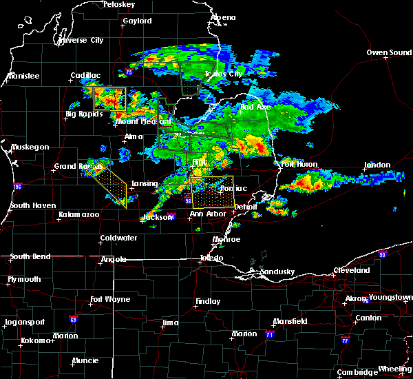 At 723 pm edt, a severe thunderstorm was located over clarkston, or 9 miles northwest of pontiac, moving southeast at 50 mph (trained weather spotters). Hazards include 60 mph wind gusts. Expect damage to roofs. siding and trees. this severe storm will be near, pontiac around 730 pm edt. west bloomfield around 735 pm edt. birmingham around 740 pm edt. southfield and royal oak around 745 pm edt. Other locations impacted by this severe thunderstorm include oak park, davisburg, rose center, hazel park, waterford, walled lake, lakeville, keego harbor, wolverine lake and lake orion. At 723 pm edt, a severe thunderstorm was located over clarkston, or 9 miles northwest of pontiac, moving southeast at 50 mph (trained weather spotters). Hazards include 60 mph wind gusts. Expect damage to roofs. siding and trees. this severe storm will be near, pontiac around 730 pm edt. west bloomfield around 735 pm edt. birmingham around 740 pm edt. southfield and royal oak around 745 pm edt. Other locations impacted by this severe thunderstorm include oak park, davisburg, rose center, hazel park, waterford, walled lake, lakeville, keego harbor, wolverine lake and lake orion.
|
| 8/14/2015 7:12 PM EDT |
 At 712 pm edt, a severe thunderstorm was located near goodrich, or near grand blanc, moving southeast at 45 mph (emergency management). Hazards include 60 mph wind gusts. Expect damage to roofs. siding and trees. this severe thunderstorm will be near, ortonville around 715 pm edt. clarkston around 725 pm edt. pontiac around 735 pm edt. west bloomfield around 740 pm edt. southfield, royal oak and birmingham around 750 pm edt. warren around 755 pm edt. other locations impacted by this severe thunderstorm include oak park, davisburg, rose center, hazel park, waterford, walled lake, lakeville, keego harbor, wolverine lake and lake orion. People attending a concert at dte energy music theatre should seek safe shelter immediately!. At 712 pm edt, a severe thunderstorm was located near goodrich, or near grand blanc, moving southeast at 45 mph (emergency management). Hazards include 60 mph wind gusts. Expect damage to roofs. siding and trees. this severe thunderstorm will be near, ortonville around 715 pm edt. clarkston around 725 pm edt. pontiac around 735 pm edt. west bloomfield around 740 pm edt. southfield, royal oak and birmingham around 750 pm edt. warren around 755 pm edt. other locations impacted by this severe thunderstorm include oak park, davisburg, rose center, hazel park, waterford, walled lake, lakeville, keego harbor, wolverine lake and lake orion. People attending a concert at dte energy music theatre should seek safe shelter immediately!.
|
| 8/2/2015 11:05 PM EDT |
 At 1105 pm edt, severe thunderstorms were located along a line extending from near st. clair shores to near south lyon, moving southeast at 25 mph (radar indicated). Hazards include 60 mph wind gusts. Expect damage to roofs. siding and trees. severe thunderstorms will be near, st. clair shores around 1110 pm edt. northville around 1125 pm edt. canton around 1140 pm edt. romulus and belleville around 1155 pm edt. flat rock around 1220 am edt. Other locations impacted by these severe thunderstorms include clinton township, willow, hazel park, wolverine lake, allen park, pleasant ridge, lincoln park, commerce, berkley and redford. At 1105 pm edt, severe thunderstorms were located along a line extending from near st. clair shores to near south lyon, moving southeast at 25 mph (radar indicated). Hazards include 60 mph wind gusts. Expect damage to roofs. siding and trees. severe thunderstorms will be near, st. clair shores around 1110 pm edt. northville around 1125 pm edt. canton around 1140 pm edt. romulus and belleville around 1155 pm edt. flat rock around 1220 am edt. Other locations impacted by these severe thunderstorms include clinton township, willow, hazel park, wolverine lake, allen park, pleasant ridge, lincoln park, commerce, berkley and redford.
|
| 5/30/2015 12:30 PM EDT | At 1229 pm edt, a severe thunderstorm was located near macomb township, or near mount clemens, moving east at 45 mph (radar indicated). Hazards include 60 mph wind gusts. Expect damage to roofs. siding and trees. this severe storm will be near, new baltimore around 1240 pm edt. Other locations impacted by this severe thunderstorm include utica, new haven, chesterfield township, center line, clinton township, ray center, fraser and roseville. |
| 5/30/2015 12:14 PM EDT | At 1214 pm edt, a severe thunderstorm was located near rochester, or 7 miles northeast of troy, moving east at 50 mph (radar indicated). Hazards include 60 mph wind gusts. Expect damage to roofs. siding and trees. this severe thunderstorm will be near, mount clemens and macomb township around 1220 pm edt. new baltimore and richmond around 1235 pm edt. Other locations impacted by this severe thunderstorm include utica, new haven, washington, chesterfield township, center line, clinton township, ray center, stoney creek metro park, shelby township and fraser. |
| 5/27/2015 3:50 PM EDT | At 348 pm edt, a severe thunderstorm was located near richmond, moving east at 45 mph (radar indicated). Hazards include 60 mph wind gusts and penny size hail. Expect damage to roofs. siding and trees. this severe thunderstorm will remain over mainly rural areas of east central macomb county. another strong storm was over troy and will move near sterling heights and utica around 400 pm edt. The warning includes the following locations, new haven, washington, utica, chesterfield township, clinton township, ray center, shelby township, fraser and roseville. |
| 5/27/2015 3:29 PM EDT | At 329 pm edt, a severe thunderstorm was located near macomb township, or near new baltimore, moving east at 45 mph (radar indicated). Hazards include 60 mph wind gusts and quarter size hail. Hail damage to vehicles is expected. expect wind damage to roofs, siding and trees. this severe storm will be near, new baltimore and richmond around 335 pm edt. Other locations impacted by this severe thunderstorm include utica, new haven, washington, chesterfield township, clinton township, ray center, shelby township, fraser and roseville. |
| 5/27/2015 3:26 PM EDT | At 326 pm edt, a severe thunderstorm was located over novi, moving east at 40 mph (radar indicated). Hazards include 60 mph wind gusts and penny size hail. Expect damage to roofs. siding and trees. this severe storm will be near, west bloomfield around 335 pm edt. livonia around 340 pm edt. southfield, royal oak and birmingham around 345 pm edt. Other locations impacted by this severe thunderstorm include oak park, hazel park, walled lake, keego harbor, wolverine lake, pleasant ridge, clawson, commerce, berkley and auburn hills. |
| 5/27/2015 3:15 PM EDT | At 314 pm edt, a severe thunderstorm was located over rochester, or near troy, moving east at 45 mph (radar indicated). Hazards include 60 mph wind gusts and quarter size hail. Hail damage to vehicles is expected. expect wind damage to roofs, siding and trees. this severe storm will be near, mount clemens and macomb township around 325 pm edt. new baltimore around 340 pm edt. a second severe thunderstorm was located macomb township and will be near richmond by 330 pm edt. Other locations impacted by this severe thunderstorm include utica, new haven, washington, chesterfield township, clinton township, stoney creek metro park, ray center, shelby township, fraser and roseville. |
| 5/27/2015 3:10 PM EDT | At 309 pm edt, a severe thunderstorm was located near troy, moving east at 45 mph (radar indicated). Hazards include 60 mph wind gusts and quarter size hail. Hail damage to vehicles is expected. expect wind damage to roofs, siding and trees. this severe storm will remain near rochester and troy through 330 pm edt. a second severe storm was located just west of brighton and will move into south lyon and milford by 330 pm edt. Other locations impacted by this severe thunderstorm include oak park, hazel park, waterford, walled lake, keego harbor, wolverine lake, pleasant ridge, clawson, commerce and lake angelus. |
| 5/27/2015 3:06 PM EDT | At 306 pm edt, a severe thunderstorm was located over pontiac, moving east at 45 mph (radar indicated). Hazards include 60 mph wind gusts and quarter size hail. Hail damage to vehicles is expected. expect wind damage to roofs, siding and trees. this severe thunderstorm will be near, sterling heights and clinton around 320 pm edt. mount clemens and macomb township around 325 pm edt. new baltimore and richmond around 340 pm edt. Other locations impacted by this severe thunderstorm include utica, new haven, washington, chesterfield township, clinton township, stoney creek metro park, ray center, shelby township, fraser and roseville. |
| 5/27/2015 2:52 PM EDT | At 252 pm edt, a severe thunderstorm was located near west bloomfield, or 7 miles north of novi, moving east at 45 mph (radar indicated). Hazards include 60 mph wind gusts and quarter size hail. Hail damage to vehicles is expected. expect wind damage to roofs, siding and trees. this severe storm will be near, southfield, pontiac and birmingham around 305 pm edt. royal oak around 310 pm edt. troy around 315 pm edt. rochester around 320 pm edt. Other locations impacted by this severe thunderstorm include oak park, hazel park, waterford, walled lake, keego harbor, wolverine lake, pleasant ridge, clawson, commerce and lake angelus. |
| 5/27/2015 2:40 PM EDT | At 239 pm edt, a severe thunderstorm was located near south lyon, or near milford, moving east at 45 mph (radar indicated). Hazards include 60 mph wind gusts and quarter size hail. Hail damage to vehicles is expected. expect wind damage to roofs, siding and trees. this severe thunderstorm will be near, northville around 250 pm edt. novi around 255 pm edt. west bloomfield around 300 pm edt. pontiac around 305 pm edt. southfield, royal oak and birmingham around 310 pm edt. troy around 315 pm edt. rochester around 320 pm edt. Other locations impacted by this severe thunderstorm include oak park, hazel park, waterford, walled lake, keego harbor, wolverine lake, pleasant ridge, clawson, commerce and lake angelus. |
| 5/11/2015 4:25 PM EDT | At 423 pm edt, a severe thunderstorm was located between highland park and southfield, moving northeast at 45 mph (radar indicated). Hazards include 60 mph wind gusts. Expect damage to roofs. siding and trees. this severe storm will be near, warren around 435 pm edt. other locations impacted by this severe thunderstorm include northeast detroit, highland park, hamtramck, northwest detroit and redford. a tornado watch remains in effect until 800 pm edt for southeastern michigan. 75in. |
| 5/11/2015 4:10 PM EDT | At 409 pm edt, a severe thunderstorm was located near livonia, moving northeast at 50 mph (radar indicated). Hazards include 60 mph wind gusts. Expect damage to roofs. siding and trees. this severe thunderstorm will be near, dearborn around 420 pm edt. detroit around 425 pm edt. southfield around 430 pm edt. warren around 435 pm edt. other locations impacted by this severe thunderstorm include northeast detroit, hamtramck, dearborn heights, northwest detroit, garden city, inkster, highland park, westland, redford and wayne. a tornado watch remains in effect until 800 pm edt for southeastern michigan. 75in. |
| 4/9/2015 7:50 PM EDT | The national weather service in detroit/pontiac has issued a * severe thunderstorm warning for. wayne county in southeastern michigan. southeastern washtenaw county in southeastern michigan. until 845 pm edt * at 750 pm edt. Severe thunderstorms were located along a line. |
| 9/5/2014 8:13 PM EDT | Large limbs down near 11 mile and hoover in macomb county MI, 1.3 miles WSW of Warren, MI |
| 7/27/2014 5:30 PM EDT | Quarter sized hail reported 1.7 miles SW of Warren, MI, at martin and hoover |
| 5/13/2014 3:38 PM EDT | Just north of 11 mile rd on hoover in warre in macomb county MI, 1.3 miles WSW of Warren, MI |
| 7/19/2013 6:13 PM EDT | Numerous trees down near the general motors technical cente in macomb county MI, 2.7 miles S of Warren, MI |
| 7/4/2012 7:25 PM EDT | Golf Ball sized hail reported 2.5 miles WSW of Warren, MI |
| 7/4/2012 7:19 PM EDT | Quarter sized hail reported 1.3 miles WSW of Warren, MI |
| 7/4/2012 6:04 PM EDT | Quarter sized hail reported 1.4 miles N of Warren, MI, at 9 mile and van dyke |
| 7/4/2012 6:01 PM EDT | Golf Ball sized hail reported 1.3 miles WSW of Warren, MI, at 11 mile and hoover |
| 7/4/2012 6:00 PM EDT | Half Dollar sized hail reported 1.3 miles WSW of Warren, MI |
| 3/15/2012 11:58 AM EDT | Golf Ball sized hail reported 2.1 miles W of Warren, MI |
| 1/1/0001 12:00 AM | Large tree and powerlines dow in macomb county MI, 1.7 miles NNE of Warren, MI |
Hail Maps for Warren, MI


Connect with Interactive Hail Maps