

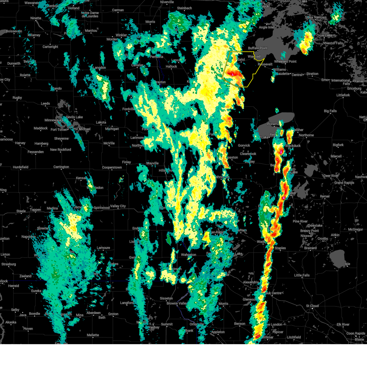
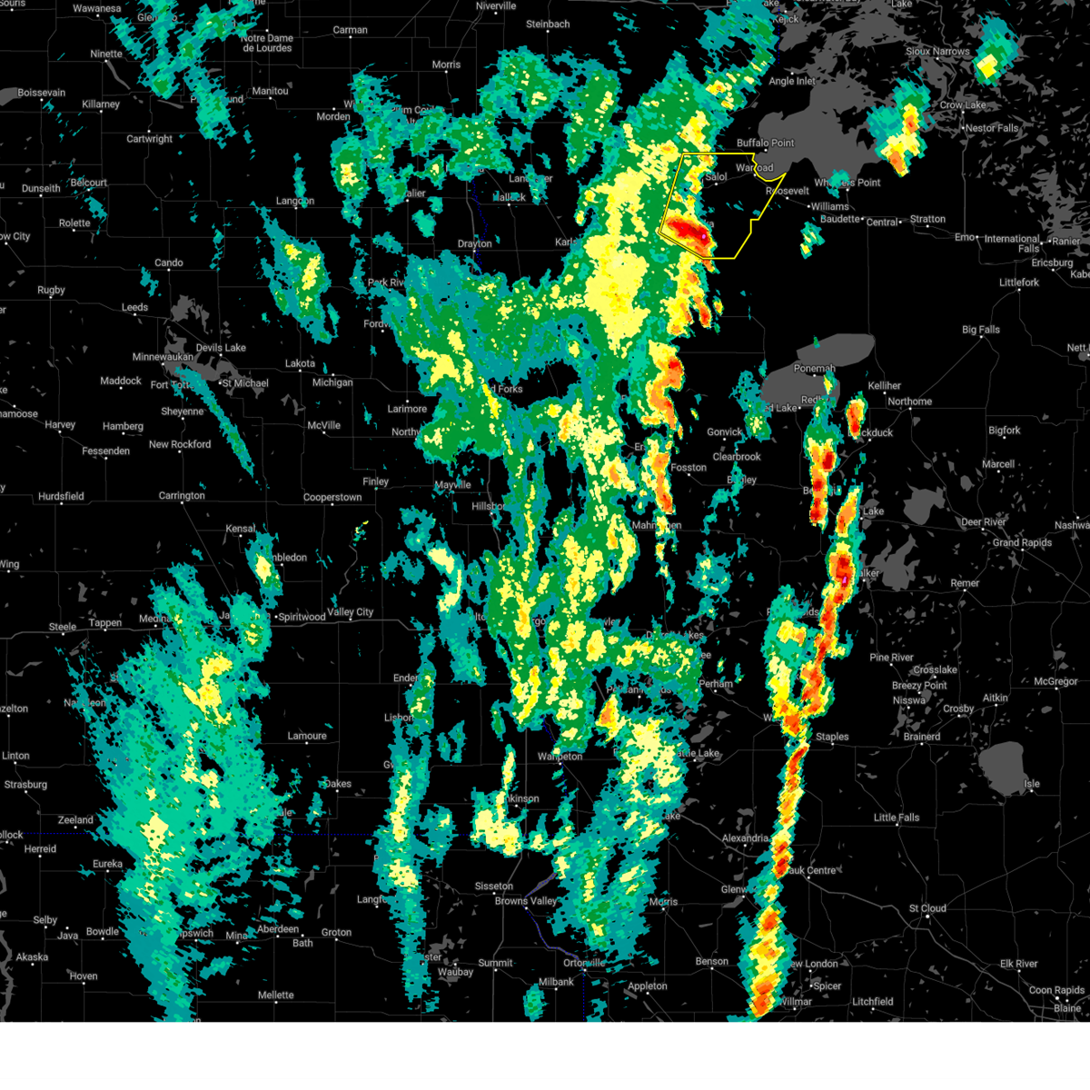
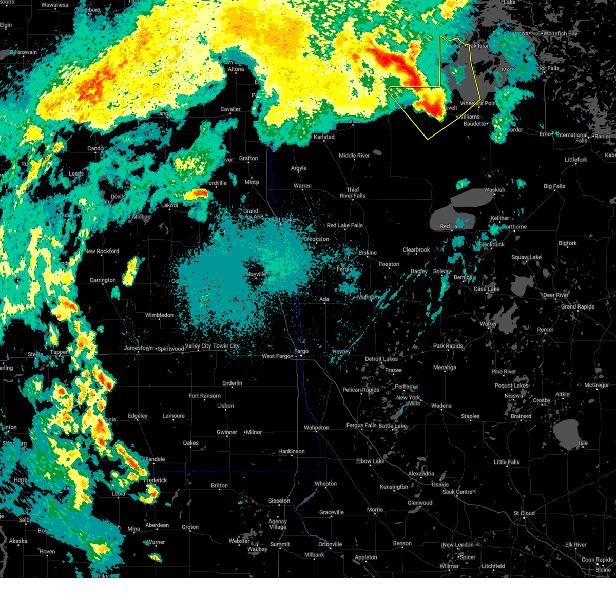
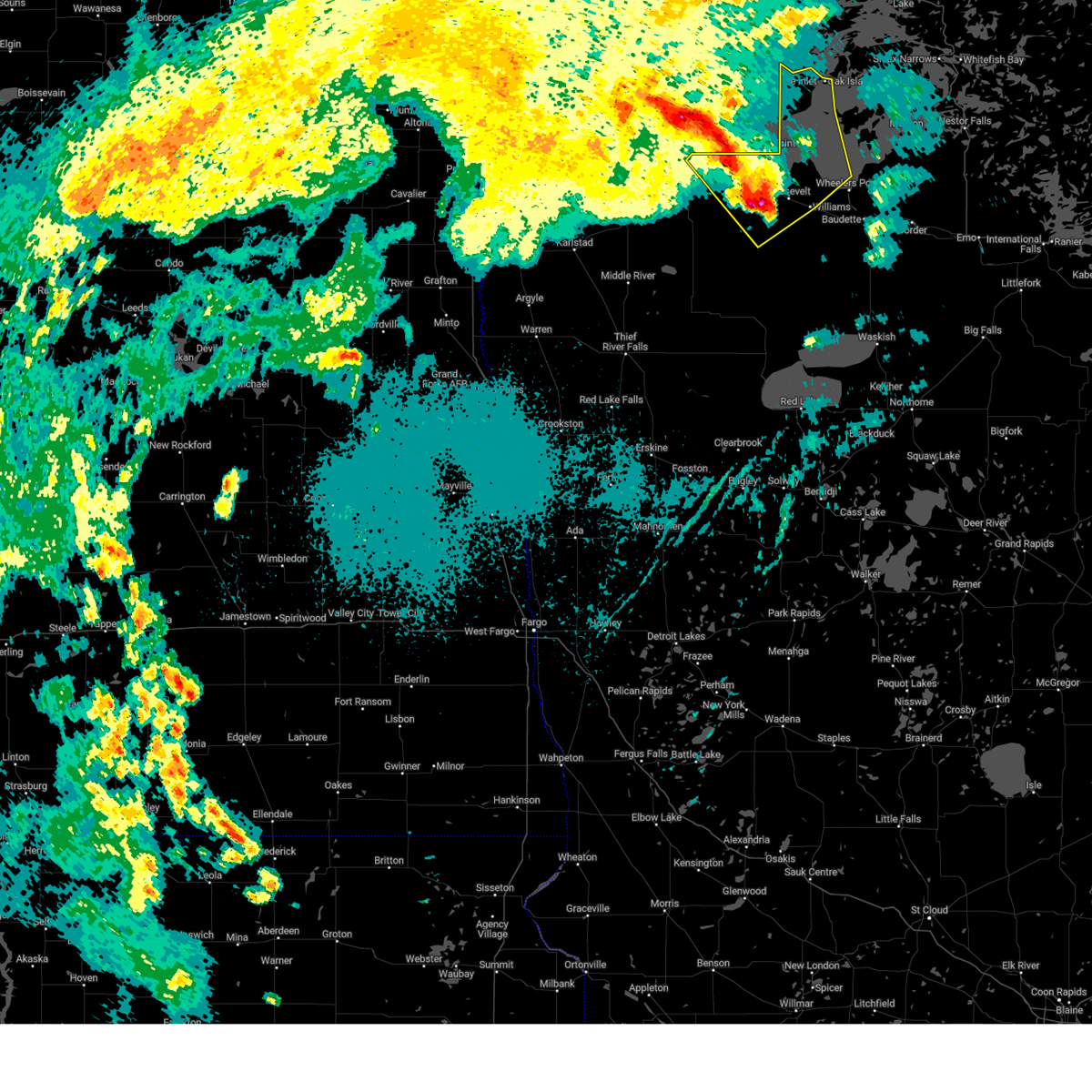
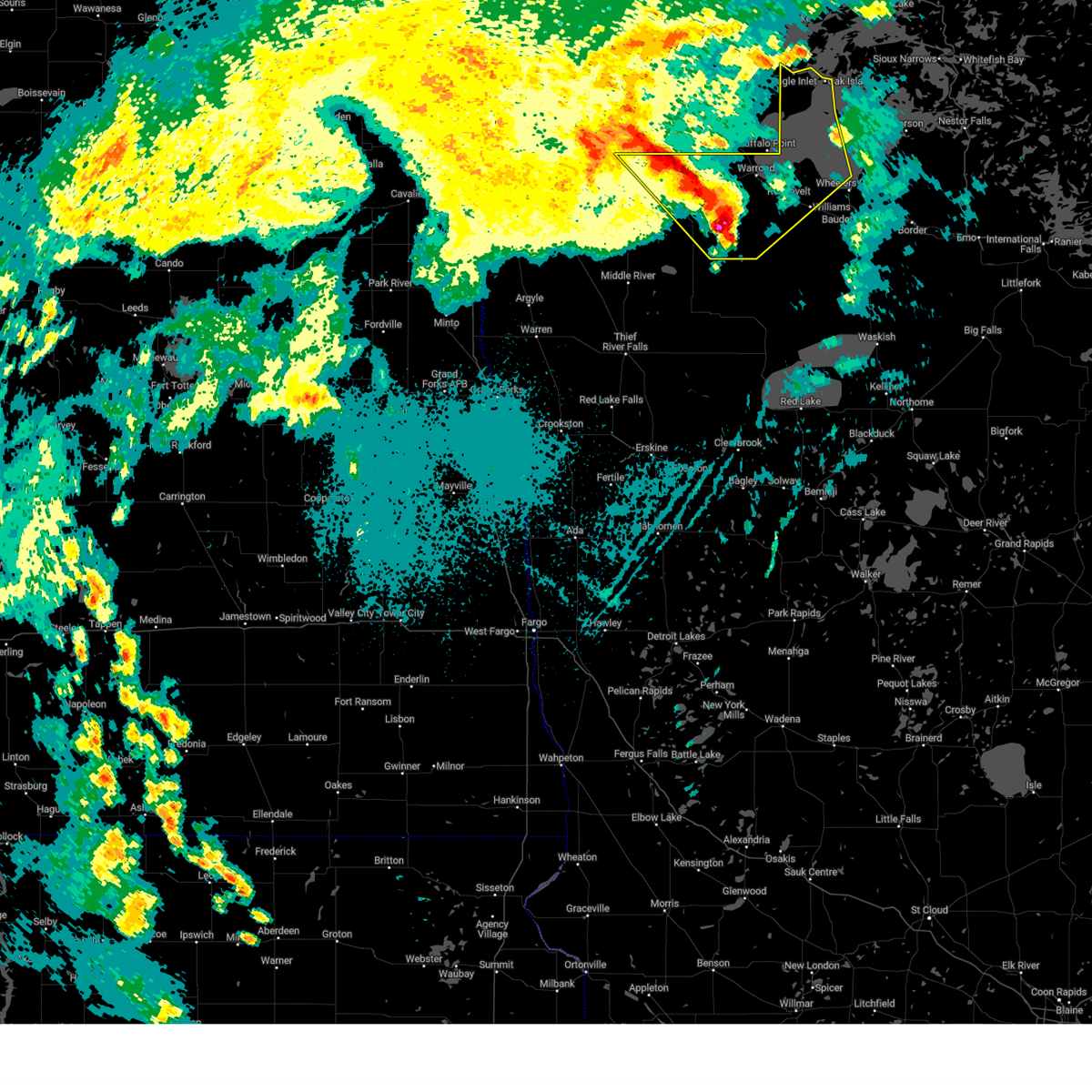
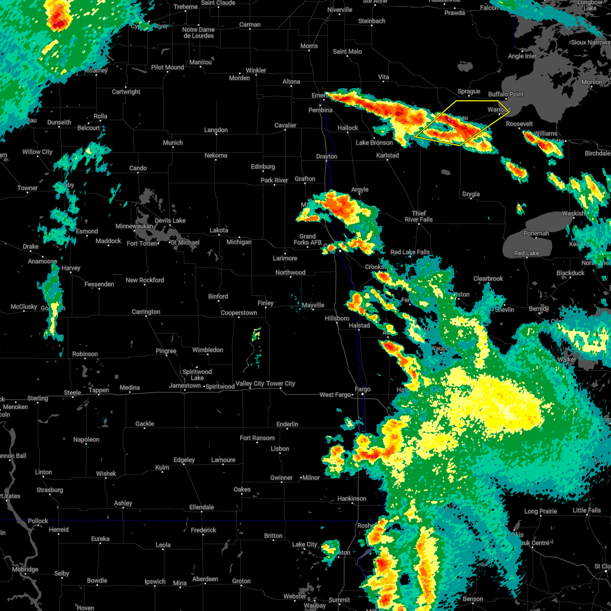
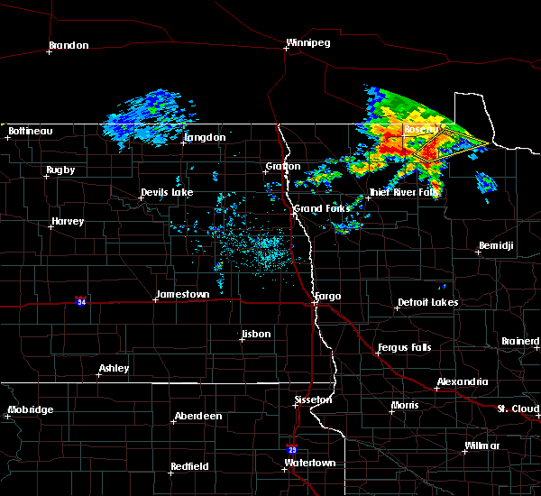
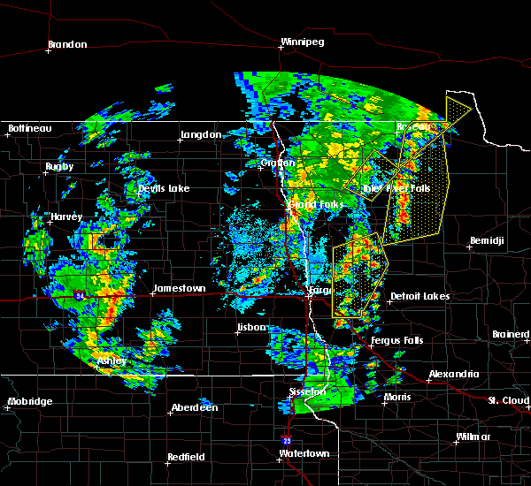
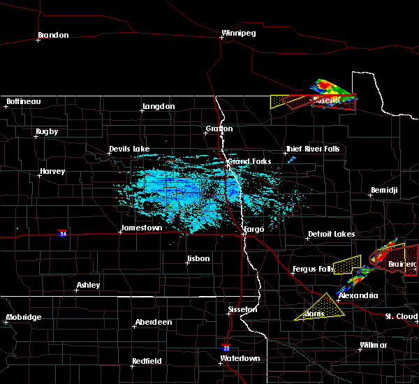
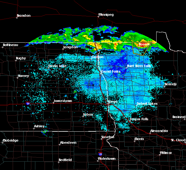
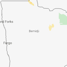
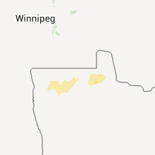
Hail Map for Warroad, MN
The Warroad, MN area has had 9 reports of on-the-ground hail by trained spotters, and has been under severe weather warnings 0 times during the past 12 months. Doppler radar has detected hail at or near Warroad, MN on 19 occasions, including 2 occasions during the past year.
| Name: | Warroad, MN |
| Where Located: | 20.9 miles ENE of Roseau, MN |
| Map: | Google Map for Warroad, MN |
| Population: | 1781 |
| Housing Units: | 839 |
| More Info: | Search Google for Warroad, MN |
4
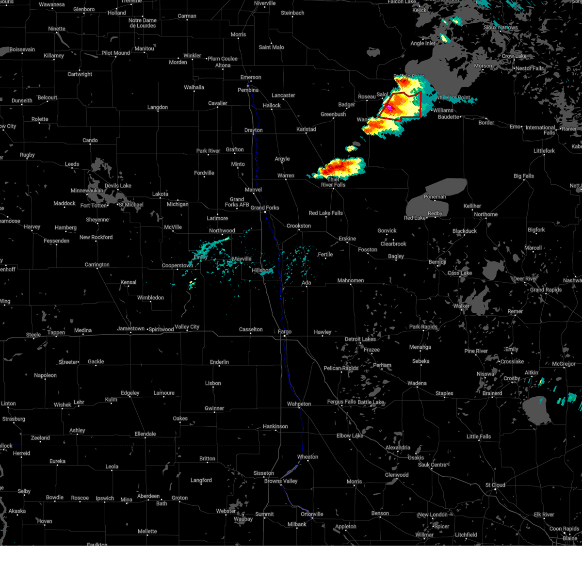
The Top Recent Hail Date for Warroad, MN is Saturday, August 3, 2024 (2nd out of 19)

Hail and Wind Damage Spotted near Warroad, MN
| Date / Time | Report Details |
|---|---|
| 8/3/2024 10:50 AM CDT | Half Dollar sized hail reported 0.4 miles NNW of Warroad, MN |
| 8/3/2024 10:45 AM CDT | Quarter sized hail reported 2 miles ESE of Warroad, MN |
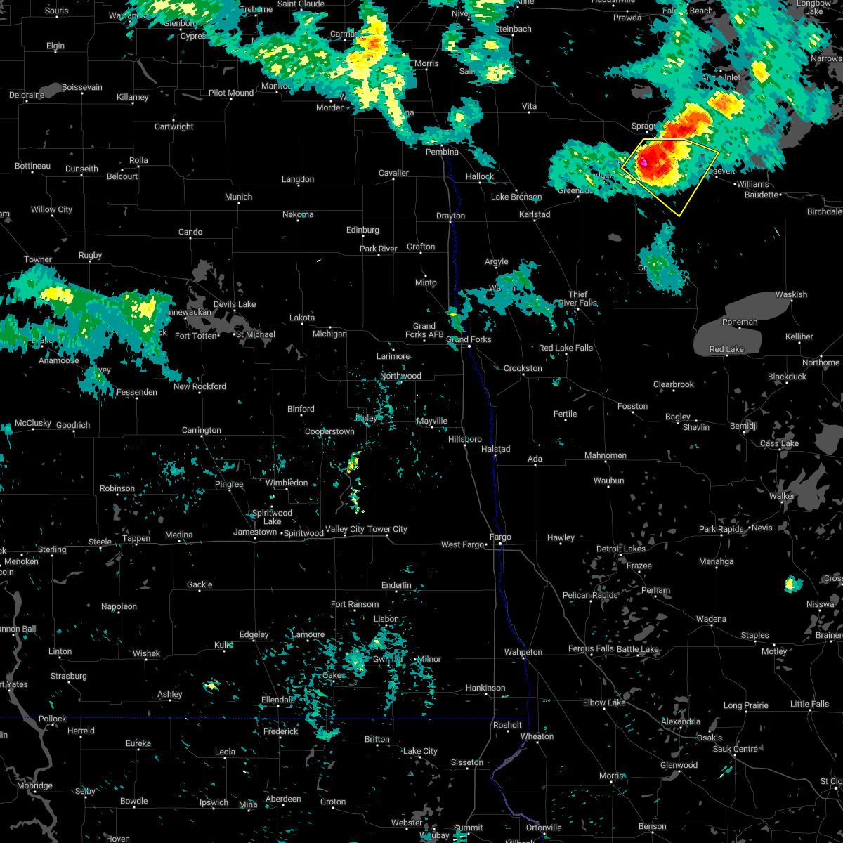
| 6/24/2024 6:06 PM CDT |
 At 606 pm cdt, a severe thunderstorm capable of producing a tornado was located 7 miles southwest of swift, or 18 miles east of roseau, moving east at 35 mph (radar indicated rotation). Hazards include tornado and half dollar size hail. Flying debris will be dangerous to those caught without shelter. mobile homes will be damaged or destroyed. damage to roofs, windows, and vehicles will occur. tree damage is likely. Locations impacted include, warroad, roosevelt, and swift. At 606 pm cdt, a severe thunderstorm capable of producing a tornado was located 7 miles southwest of swift, or 18 miles east of roseau, moving east at 35 mph (radar indicated rotation). Hazards include tornado and half dollar size hail. Flying debris will be dangerous to those caught without shelter. mobile homes will be damaged or destroyed. damage to roofs, windows, and vehicles will occur. tree damage is likely. Locations impacted include, warroad, roosevelt, and swift.
|
| 6/24/2024 6:05 PM CDT |
 At 605 pm cdt, a severe thunderstorm was located 7 miles southwest of swift, or 19 miles east of roseau, moving east at 35 mph (radar indicated). Hazards include 60 mph wind gusts and half dollar size hail. Hail damage to vehicles is expected. expect wind damage to roofs, siding, and trees. Locations impacted include, warroad, williams, roosevelt, birch beach, swift, and pencer. At 605 pm cdt, a severe thunderstorm was located 7 miles southwest of swift, or 19 miles east of roseau, moving east at 35 mph (radar indicated). Hazards include 60 mph wind gusts and half dollar size hail. Hail damage to vehicles is expected. expect wind damage to roofs, siding, and trees. Locations impacted include, warroad, williams, roosevelt, birch beach, swift, and pencer.
|
| 6/24/2024 5:54 PM CDT |
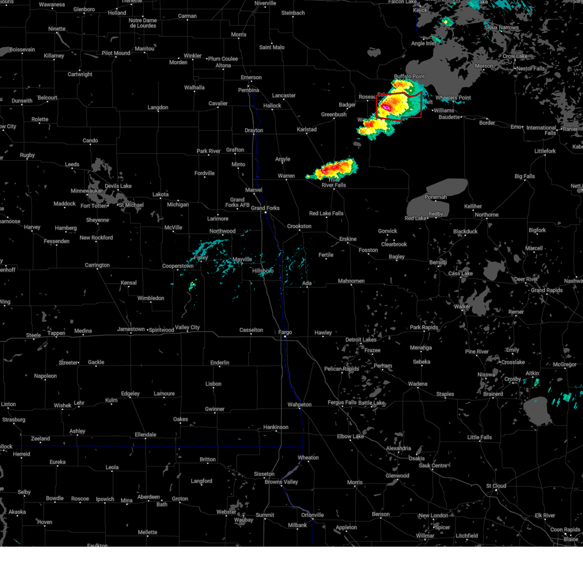 Torfgf the national weather service in grand forks has issued a * tornado warning for, northeastern roseau county in northwestern minnesota, * until 630 pm cdt. * at 554 pm cdt, a severe thunderstorm capable of producing a tornado was located near salol, or 10 miles east of roseau, moving east at 30 mph (weather spotters reported funnel cloud). Hazards include tornado and half dollar size hail. Flying debris will be dangerous to those caught without shelter. mobile homes will be damaged or destroyed. damage to roofs, windows, and vehicles will occur. Tree damage is likely. Torfgf the national weather service in grand forks has issued a * tornado warning for, northeastern roseau county in northwestern minnesota, * until 630 pm cdt. * at 554 pm cdt, a severe thunderstorm capable of producing a tornado was located near salol, or 10 miles east of roseau, moving east at 30 mph (weather spotters reported funnel cloud). Hazards include tornado and half dollar size hail. Flying debris will be dangerous to those caught without shelter. mobile homes will be damaged or destroyed. damage to roofs, windows, and vehicles will occur. Tree damage is likely.
|
| 6/24/2024 5:46 PM CDT |
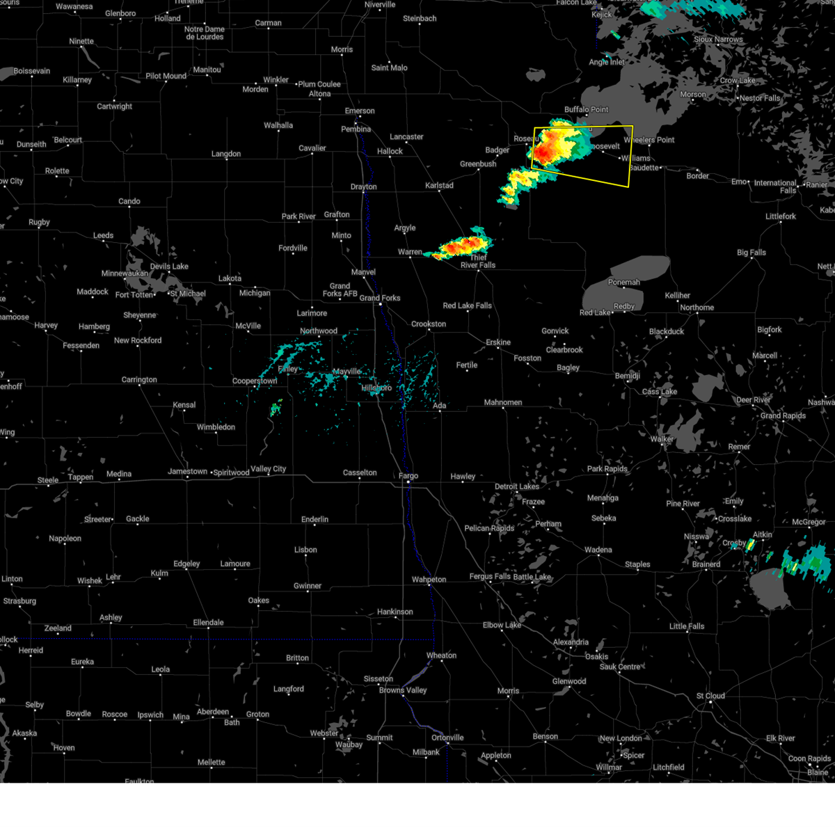 Svrfgf the national weather service in grand forks has issued a * severe thunderstorm warning for, northeastern roseau county in northwestern minnesota, west central lake of the woods county in north central minnesota, * until 630 pm cdt. * at 546 pm cdt, a severe thunderstorm was located near salol, or 8 miles southeast of roseau, moving east at 35 mph (radar indicated). Hazards include 60 mph wind gusts and half dollar size hail. Hail damage to vehicles is expected. Expect wind damage to roofs, siding, and trees. Svrfgf the national weather service in grand forks has issued a * severe thunderstorm warning for, northeastern roseau county in northwestern minnesota, west central lake of the woods county in north central minnesota, * until 630 pm cdt. * at 546 pm cdt, a severe thunderstorm was located near salol, or 8 miles southeast of roseau, moving east at 35 mph (radar indicated). Hazards include 60 mph wind gusts and half dollar size hail. Hail damage to vehicles is expected. Expect wind damage to roofs, siding, and trees.
|
| 6/4/2024 2:09 PM CDT |
 At 209 pm cdt, a severe thunderstorm was located near salol, or 11 miles northeast of roseau, moving north at 45 mph (radar indicated). Hazards include 60 mph wind gusts and quarter size hail. Hail damage to vehicles is expected. expect wind damage to roofs, siding, and trees. Locations impacted include, roseau, warroad, springsteel island, salol, longworth, malung, and swift. At 209 pm cdt, a severe thunderstorm was located near salol, or 11 miles northeast of roseau, moving north at 45 mph (radar indicated). Hazards include 60 mph wind gusts and quarter size hail. Hail damage to vehicles is expected. expect wind damage to roofs, siding, and trees. Locations impacted include, roseau, warroad, springsteel island, salol, longworth, malung, and swift.
|
| 6/4/2024 1:50 PM CDT |
 At 150 pm cdt, a severe thunderstorm was located over pencer, or 10 miles southeast of roseau, moving north at 45 mph (radar indicated). Hazards include 60 mph wind gusts and quarter size hail. Hail damage to vehicles is expected. expect wind damage to roofs, siding, and trees. Locations impacted include, roseau, warroad, springsteel island, wannaska, salol, longworth, and malung. At 150 pm cdt, a severe thunderstorm was located over pencer, or 10 miles southeast of roseau, moving north at 45 mph (radar indicated). Hazards include 60 mph wind gusts and quarter size hail. Hail damage to vehicles is expected. expect wind damage to roofs, siding, and trees. Locations impacted include, roseau, warroad, springsteel island, wannaska, salol, longworth, and malung.
|
| 6/4/2024 1:45 PM CDT |
 Svrfgf the national weather service in grand forks has issued a * severe thunderstorm warning for, central roseau county in northwestern minnesota, * until 230 pm cdt. * at 145 pm cdt, a severe thunderstorm was located over wannaska, or 14 miles south of roseau, moving north at 50 mph (radar indicated). Hazards include 60 mph wind gusts and quarter size hail. Hail damage to vehicles is expected. Expect wind damage to roofs, siding, and trees. Svrfgf the national weather service in grand forks has issued a * severe thunderstorm warning for, central roseau county in northwestern minnesota, * until 230 pm cdt. * at 145 pm cdt, a severe thunderstorm was located over wannaska, or 14 miles south of roseau, moving north at 50 mph (radar indicated). Hazards include 60 mph wind gusts and quarter size hail. Hail damage to vehicles is expected. Expect wind damage to roofs, siding, and trees.
|
| 9/5/2023 2:37 AM CDT |
 The severe thunderstorm warning for northeastern roseau and northwestern lake of the woods counties will expire at 245 am cdt, the storm which prompted the warning has weakened below severe limits, and no longer poses an immediate threat to life or property. therefore, the warning will be allowed to expire. a severe thunderstorm watch remains in effect until 300 am cdt for north central and northwestern minnesota. The severe thunderstorm warning for northeastern roseau and northwestern lake of the woods counties will expire at 245 am cdt, the storm which prompted the warning has weakened below severe limits, and no longer poses an immediate threat to life or property. therefore, the warning will be allowed to expire. a severe thunderstorm watch remains in effect until 300 am cdt for north central and northwestern minnesota.
|
| 9/5/2023 2:30 AM CDT |
 At 230 am cdt, a severe thunderstorm was located near swift, or 22 miles east of roseau, moving northeast at 60 mph (radar indicated). Hazards include 60 mph wind gusts and quarter size hail. Hail damage to vehicles is expected. expect wind damage to roofs, siding, and trees. locations impacted include, warroad, arnesen, springsteel island, williams, angle inlet, roosevelt and lude. hail threat, radar indicated max hail size, 1. 00 in wind threat, observed max wind gust, 60 mph. At 230 am cdt, a severe thunderstorm was located near swift, or 22 miles east of roseau, moving northeast at 60 mph (radar indicated). Hazards include 60 mph wind gusts and quarter size hail. Hail damage to vehicles is expected. expect wind damage to roofs, siding, and trees. locations impacted include, warroad, arnesen, springsteel island, williams, angle inlet, roosevelt and lude. hail threat, radar indicated max hail size, 1. 00 in wind threat, observed max wind gust, 60 mph.
|
| 9/5/2023 2:18 AM CDT |
 At 218 am cdt, severe thunderstorms were located along a line extending from 10 miles north of pinecreek to near warroad to 7 miles east of hayes lake state park, moving northeast at 65 mph (radar indicated). Hazards include 70 mph wind gusts and quarter size hail. Hail damage to vehicles is expected. expect considerable tree damage. wind damage is also likely to mobile homes, roofs, and outbuildings. locations impacted include, roseau, warroad, arnesen, springsteel island, williams, angle inlet and roosevelt. thunderstorm damage threat, considerable hail threat, radar indicated max hail size, 1. 00 in wind threat, observed max wind gust, 70 mph. At 218 am cdt, severe thunderstorms were located along a line extending from 10 miles north of pinecreek to near warroad to 7 miles east of hayes lake state park, moving northeast at 65 mph (radar indicated). Hazards include 70 mph wind gusts and quarter size hail. Hail damage to vehicles is expected. expect considerable tree damage. wind damage is also likely to mobile homes, roofs, and outbuildings. locations impacted include, roseau, warroad, arnesen, springsteel island, williams, angle inlet and roosevelt. thunderstorm damage threat, considerable hail threat, radar indicated max hail size, 1. 00 in wind threat, observed max wind gust, 70 mph.
|
| 9/5/2023 1:49 AM CDT |
 At 148 am cdt, severe thunderstorms were located along a line extending from 7 miles north of lake bronson state park to near badger to gatzke, moving northeast at 65 mph. this storm has a history of producing up to 80 mph winds! these are destructive storms for the roseau area! (radar indicated). Hazards include 80 mph wind gusts. Flying debris will be dangerous to those caught without shelter. mobile homes will be heavily damaged. expect considerable damage to roofs, windows, and vehicles. Extensive tree damage and power outages are likely. At 148 am cdt, severe thunderstorms were located along a line extending from 7 miles north of lake bronson state park to near badger to gatzke, moving northeast at 65 mph. this storm has a history of producing up to 80 mph winds! these are destructive storms for the roseau area! (radar indicated). Hazards include 80 mph wind gusts. Flying debris will be dangerous to those caught without shelter. mobile homes will be heavily damaged. expect considerable damage to roofs, windows, and vehicles. Extensive tree damage and power outages are likely.
|
| 7/19/2023 2:42 PM CDT |
 At 241 pm cdt, a severe thunderstorm was located over springsteel island, or 22 miles northeast of roseau, moving southeast at 15 mph (radar indicated). Hazards include quarter size hail. damage to vehicles is expected At 241 pm cdt, a severe thunderstorm was located over springsteel island, or 22 miles northeast of roseau, moving southeast at 15 mph (radar indicated). Hazards include quarter size hail. damage to vehicles is expected
|
| 7/9/2023 7:47 PM CDT |
 At 747 pm cdt, a severe thunderstorm was located near arnesen, or 27 miles east of roseau, moving southeast at 45 mph (radar indicated). Hazards include 60 mph wind gusts and quarter size hail. Hail damage to vehicles is expected. Expect wind damage to roofs, siding, and trees. At 747 pm cdt, a severe thunderstorm was located near arnesen, or 27 miles east of roseau, moving southeast at 45 mph (radar indicated). Hazards include 60 mph wind gusts and quarter size hail. Hail damage to vehicles is expected. Expect wind damage to roofs, siding, and trees.
|
| 7/19/2022 2:29 AM CDT |
 At 229 am cdt, a severe thunderstorm was located over roseau, moving northeast at 30 mph (radar indicated). Hazards include 60 mph wind gusts and quarter size hail. Hail damage to vehicles is expected. expect wind damage to roofs, siding, and trees. locations impacted include, salol, longworth, springsteel island and warroad. hail threat, radar indicated max hail size, 1. 00 in wind threat, radar indicated max wind gust, 60 mph. At 229 am cdt, a severe thunderstorm was located over roseau, moving northeast at 30 mph (radar indicated). Hazards include 60 mph wind gusts and quarter size hail. Hail damage to vehicles is expected. expect wind damage to roofs, siding, and trees. locations impacted include, salol, longworth, springsteel island and warroad. hail threat, radar indicated max hail size, 1. 00 in wind threat, radar indicated max wind gust, 60 mph.
|
| 7/19/2022 2:00 AM CDT |
 At 200 am cdt, a severe thunderstorm was located near badger, or 13 miles southwest of roseau, moving northeast at 30 mph (radar indicated). Hazards include 60 mph wind gusts and half dollar size hail. Hail damage to vehicles is expected. expect wind damage to roofs, siding, and trees. this severe thunderstorm will be near, fox around 215 am cdt. other locations in the path of this severe thunderstorm include malung, roseau, salol, longworth, springsteel island and warroad. hail threat, radar indicated max hail size, 1. 25 in wind threat, radar indicated max wind gust, 60 mph. At 200 am cdt, a severe thunderstorm was located near badger, or 13 miles southwest of roseau, moving northeast at 30 mph (radar indicated). Hazards include 60 mph wind gusts and half dollar size hail. Hail damage to vehicles is expected. expect wind damage to roofs, siding, and trees. this severe thunderstorm will be near, fox around 215 am cdt. other locations in the path of this severe thunderstorm include malung, roseau, salol, longworth, springsteel island and warroad. hail threat, radar indicated max hail size, 1. 25 in wind threat, radar indicated max wind gust, 60 mph.
|
| 7/18/2022 5:54 AM CDT |
 At 554 am cdt, a severe thunderstorm was located over salol, or 8 miles east of roseau, moving southeast at 45 mph (trained weather spotters). Hazards include ping pong ball size hail. People and animals outdoors will be injured. expect damage to roofs, siding, windows, and vehicles. locations impacted include, swift. hail threat, observed max hail size, 1. 50 in wind threat, radar indicated max wind gust, <50 mph. At 554 am cdt, a severe thunderstorm was located over salol, or 8 miles east of roseau, moving southeast at 45 mph (trained weather spotters). Hazards include ping pong ball size hail. People and animals outdoors will be injured. expect damage to roofs, siding, windows, and vehicles. locations impacted include, swift. hail threat, observed max hail size, 1. 50 in wind threat, radar indicated max wind gust, <50 mph.
|
| 7/18/2022 5:32 AM CDT |
 At 532 am cdt, a severe thunderstorm was located near pinecreek, or 9 miles northwest of roseau, moving southeast at 45 mph (radar indicated). Hazards include quarter size hail. Damage to vehicles is expected. this severe thunderstorm will be near, roseau around 545 am cdt. other locations in the path of this severe thunderstorm include salol. hail threat, radar indicated max hail size, 1. 00 in wind threat, radar indicated max wind gust, <50 mph. At 532 am cdt, a severe thunderstorm was located near pinecreek, or 9 miles northwest of roseau, moving southeast at 45 mph (radar indicated). Hazards include quarter size hail. Damage to vehicles is expected. this severe thunderstorm will be near, roseau around 545 am cdt. other locations in the path of this severe thunderstorm include salol. hail threat, radar indicated max hail size, 1. 00 in wind threat, radar indicated max wind gust, <50 mph.
|
| 6/24/2022 10:28 PM CDT |
 At 1028 pm cdt, severe thunderstorms were located along a line extending from near hayes lake state park to near carp to lower red lake, moving northeast at 20 mph (radar indicated). Hazards include 70 mph wind gusts and nickel size hail. Expect considerable tree damage. damage is likely to mobile homes, roofs, and outbuildings. severe thunderstorms will be near, carp around 1030 pm cdt. Other locations in the path of these severe thunderstorms include shotley, otto, norris camp, clementson and waskish. At 1028 pm cdt, severe thunderstorms were located along a line extending from near hayes lake state park to near carp to lower red lake, moving northeast at 20 mph (radar indicated). Hazards include 70 mph wind gusts and nickel size hail. Expect considerable tree damage. damage is likely to mobile homes, roofs, and outbuildings. severe thunderstorms will be near, carp around 1030 pm cdt. Other locations in the path of these severe thunderstorms include shotley, otto, norris camp, clementson and waskish.
|
| 6/24/2022 10:15 PM CDT |
 At 1015 pm cdt, severe thunderstorms were located along a line extending from near hayes lake state park to near faunce to 10 miles north of upper red lake, moving northeast at 40 mph (radar indicated). Hazards include 70 mph wind gusts and nickel size hail. Expect considerable tree damage. damage is likely to mobile homes, roofs, and outbuildings. Locations impacted include, faunce, graceton, pitt, baudette, carp, swift, warroad and springsteel island. At 1015 pm cdt, severe thunderstorms were located along a line extending from near hayes lake state park to near faunce to 10 miles north of upper red lake, moving northeast at 40 mph (radar indicated). Hazards include 70 mph wind gusts and nickel size hail. Expect considerable tree damage. damage is likely to mobile homes, roofs, and outbuildings. Locations impacted include, faunce, graceton, pitt, baudette, carp, swift, warroad and springsteel island.
|
| 6/24/2022 9:34 PM CDT |
 At 933 pm cdt, severe thunderstorms were located along a line extending from 8 miles east of middle river to near malcolm to red lake nation, moving northeast at 60 mph (radar indicated). Hazards include 70 mph wind gusts and nickel size hail. Expect considerable tree damage. damage is likely to mobile homes, roofs, and outbuildings. severe thunderstorms will be near, gates corner and malcolm around 935 pm cdt. thorhult around 940 pm cdt. western upper red lake around 945 pm cdt. wannaska, torfin and casperson around 950 pm cdt. Other locations in the path of these severe thunderstorms include faunce, pencer and hayes lake state park. At 933 pm cdt, severe thunderstorms were located along a line extending from 8 miles east of middle river to near malcolm to red lake nation, moving northeast at 60 mph (radar indicated). Hazards include 70 mph wind gusts and nickel size hail. Expect considerable tree damage. damage is likely to mobile homes, roofs, and outbuildings. severe thunderstorms will be near, gates corner and malcolm around 935 pm cdt. thorhult around 940 pm cdt. western upper red lake around 945 pm cdt. wannaska, torfin and casperson around 950 pm cdt. Other locations in the path of these severe thunderstorms include faunce, pencer and hayes lake state park.
|
| 6/24/2022 9:04 AM CDT |
 At 904 am cdt, severe thunderstorms were located along a line extending from near roseau to near gatzke to red lake falls, moving east at 30 mph (radar indicated). Hazards include two inch hail and 60 mph wind gusts. People and animals outdoors will be injured. expect hail damage to roofs, siding, windows, and vehicles. expect wind damage to roofs, siding, and trees. these severe storms will be near, roseau, gatzke and malung around 905 am cdt. other locations in the path of these severe thunderstorms include salol, st. hilaire, grygla, hazel and plummer. thunderstorm damage threat, considerable hail threat, radar indicated max hail size, 2. 00 in wind threat, radar indicated max wind gust, 60 mph. At 904 am cdt, severe thunderstorms were located along a line extending from near roseau to near gatzke to red lake falls, moving east at 30 mph (radar indicated). Hazards include two inch hail and 60 mph wind gusts. People and animals outdoors will be injured. expect hail damage to roofs, siding, windows, and vehicles. expect wind damage to roofs, siding, and trees. these severe storms will be near, roseau, gatzke and malung around 905 am cdt. other locations in the path of these severe thunderstorms include salol, st. hilaire, grygla, hazel and plummer. thunderstorm damage threat, considerable hail threat, radar indicated max hail size, 2. 00 in wind threat, radar indicated max wind gust, 60 mph.
|
| 6/24/2022 8:50 AM CDT |
 At 850 am cdt, severe thunderstorms were located along a line extending from near roseau to 8 miles southwest of gatzke to near huot, moving east at 30 mph (radar indicated). Hazards include ping pong ball size hail and 60 mph wind gusts. People and animals outdoors will be injured. expect hail damage to roofs, siding, windows, and vehicles. expect wind damage to roofs, siding, and trees. severe thunderstorms will be near, roseau and malung around 900 am cdt. gatzke around 905 am cdt. other locations in the path of these severe thunderstorms include salol, grygla and hazel. hail threat, radar indicated max hail size, 1. 50 in wind threat, radar indicated max wind gust, 60 mph. At 850 am cdt, severe thunderstorms were located along a line extending from near roseau to 8 miles southwest of gatzke to near huot, moving east at 30 mph (radar indicated). Hazards include ping pong ball size hail and 60 mph wind gusts. People and animals outdoors will be injured. expect hail damage to roofs, siding, windows, and vehicles. expect wind damage to roofs, siding, and trees. severe thunderstorms will be near, roseau and malung around 900 am cdt. gatzke around 905 am cdt. other locations in the path of these severe thunderstorms include salol, grygla and hazel. hail threat, radar indicated max hail size, 1. 50 in wind threat, radar indicated max wind gust, 60 mph.
|
| 6/24/2022 8:44 AM CDT |
 At 842 am cdt, severe thunderstorms were located along a line extending from near fox to 9 miles northwest of gatzke to 6 miles east of holt, moving east at 30 mph (public report of quarter to ping pong size hail in greenbush). Hazards include ping pong ball size hail and 60 mph wind gusts. People and animals outdoors will be injured. expect hail damage to roofs, siding, windows, and vehicles. expect wind damage to roofs, siding, and trees. these severe storms will be near, fox around 845 am cdt. other locations in the path of these severe thunderstorms include malung, roseau, casperson, torfin, pencer, gatzke, skime and salol. hail threat, radar indicated max hail size, 1. 50 in wind threat, radar indicated max wind gust, 60 mph. At 842 am cdt, severe thunderstorms were located along a line extending from near fox to 9 miles northwest of gatzke to 6 miles east of holt, moving east at 30 mph (public report of quarter to ping pong size hail in greenbush). Hazards include ping pong ball size hail and 60 mph wind gusts. People and animals outdoors will be injured. expect hail damage to roofs, siding, windows, and vehicles. expect wind damage to roofs, siding, and trees. these severe storms will be near, fox around 845 am cdt. other locations in the path of these severe thunderstorms include malung, roseau, casperson, torfin, pencer, gatzke, skime and salol. hail threat, radar indicated max hail size, 1. 50 in wind threat, radar indicated max wind gust, 60 mph.
|
| 6/24/2022 8:26 AM CDT |
 At 824 am cdt, severe thunderstorms were located along a line extending from near badger to near strathcona to holt, moving east at 30 mph (public report of quarter size to ping pong size hail in greenbush). Hazards include ping pong ball size hail and 60 mph wind gusts. People and animals outdoors will be injured. expect hail damage to roofs, siding, windows, and vehicles. expect wind damage to roofs, siding, and trees. these severe storms will be near, badger around 830 am cdt. other locations in the path of these severe thunderstorms include fox, malung, gatzke, roseau, torfin, pencer and casperson. hail threat, radar indicated max hail size, 1. 50 in wind threat, radar indicated max wind gust, 60 mph. At 824 am cdt, severe thunderstorms were located along a line extending from near badger to near strathcona to holt, moving east at 30 mph (public report of quarter size to ping pong size hail in greenbush). Hazards include ping pong ball size hail and 60 mph wind gusts. People and animals outdoors will be injured. expect hail damage to roofs, siding, windows, and vehicles. expect wind damage to roofs, siding, and trees. these severe storms will be near, badger around 830 am cdt. other locations in the path of these severe thunderstorms include fox, malung, gatzke, roseau, torfin, pencer and casperson. hail threat, radar indicated max hail size, 1. 50 in wind threat, radar indicated max wind gust, 60 mph.
|
| 6/24/2022 8:15 AM CDT |
 At 815 am cdt, severe thunderstorms were located along a line extending from near greenbush to near strathcona to near newfolden, moving east at 30 mph (radar indicated). Hazards include ping pong ball size hail and 60 mph wind gusts. People and animals outdoors will be injured. expect hail damage to roofs, siding, windows, and vehicles. expect wind damage to roofs, siding, and trees. severe thunderstorms will be near, strathcona, haug and greenbush around 820 am cdt. badger around 830 am cdt. other locations in the path of these severe thunderstorms include fox, malung, torfin, roseau, casperson and pencer. hail threat, radar indicated max hail size, 1. 50 in wind threat, radar indicated max wind gust, 60 mph. At 815 am cdt, severe thunderstorms were located along a line extending from near greenbush to near strathcona to near newfolden, moving east at 30 mph (radar indicated). Hazards include ping pong ball size hail and 60 mph wind gusts. People and animals outdoors will be injured. expect hail damage to roofs, siding, windows, and vehicles. expect wind damage to roofs, siding, and trees. severe thunderstorms will be near, strathcona, haug and greenbush around 820 am cdt. badger around 830 am cdt. other locations in the path of these severe thunderstorms include fox, malung, torfin, roseau, casperson and pencer. hail threat, radar indicated max hail size, 1. 50 in wind threat, radar indicated max wind gust, 60 mph.
|
| 6/12/2022 2:40 PM CDT |
 At 240 pm cdt, a severe thunderstorm was located 11 miles northeast of longworth, or 31 miles northeast of roseau, moving east at 30 mph (radar indicated). Hazards include 70 mph wind gusts and half dollar size hail. Hail damage to vehicles is expected. expect considerable tree damage. wind damage is also likely to mobile homes, roofs, and outbuildings. locations impacted include, warroad, arnesen, springsteel island, lude, birch beach, long point and longworth. thunderstorm damage threat, considerable hail threat, radar indicated max hail size, 1. 25 in wind threat, radar indicated max wind gust, 70 mph. At 240 pm cdt, a severe thunderstorm was located 11 miles northeast of longworth, or 31 miles northeast of roseau, moving east at 30 mph (radar indicated). Hazards include 70 mph wind gusts and half dollar size hail. Hail damage to vehicles is expected. expect considerable tree damage. wind damage is also likely to mobile homes, roofs, and outbuildings. locations impacted include, warroad, arnesen, springsteel island, lude, birch beach, long point and longworth. thunderstorm damage threat, considerable hail threat, radar indicated max hail size, 1. 25 in wind threat, radar indicated max wind gust, 70 mph.
|
| 6/12/2022 2:14 PM CDT |
 At 213 pm cdt, a severe thunderstorm was located 13 miles north of longworth, or 25 miles northeast of roseau, moving east at 30 mph (radar indicated). Hazards include 70 mph wind gusts and half dollar size hail. Hail damage to vehicles is expected. expect considerable tree damage. Wind damage is also likely to mobile homes, roofs, and outbuildings. At 213 pm cdt, a severe thunderstorm was located 13 miles north of longworth, or 25 miles northeast of roseau, moving east at 30 mph (radar indicated). Hazards include 70 mph wind gusts and half dollar size hail. Hail damage to vehicles is expected. expect considerable tree damage. Wind damage is also likely to mobile homes, roofs, and outbuildings.
|
| 8/9/2020 3:18 PM CDT |
 At 317 pm cdt, severe thunderstorms were located along a line extending from near arnesen to near gates corner to near gully, moving east at 50 mph (radar indicated). Hazards include 70 mph wind gusts and nickel size hail. Expect considerable tree damage. damage is likely to mobile homes, roofs, and outbuildings. severe thunderstorms will be near, arnesen around 320 pm cdt. birch beach, lude and long point around 330 pm cdt. lower red lake and zippel bay state park around 335 pm cdt. debs, little rock and red lake around 345 pm cdt. Island lake in beltrami county around 350 pm cdt. At 317 pm cdt, severe thunderstorms were located along a line extending from near arnesen to near gates corner to near gully, moving east at 50 mph (radar indicated). Hazards include 70 mph wind gusts and nickel size hail. Expect considerable tree damage. damage is likely to mobile homes, roofs, and outbuildings. severe thunderstorms will be near, arnesen around 320 pm cdt. birch beach, lude and long point around 330 pm cdt. lower red lake and zippel bay state park around 335 pm cdt. debs, little rock and red lake around 345 pm cdt. Island lake in beltrami county around 350 pm cdt.
|
| 8/9/2020 2:49 PM CDT |
 At 248 pm cdt, severe thunderstorms were located along a line extending from near longworth to 6 miles northwest of gatzke, moving east at 30 mph (radar indicated). Hazards include 70 mph wind gusts and penny size hail. Expect considerable tree damage. damage is likely to mobile homes, roofs, and outbuildings. severe thunderstorms will be near, longworth around 255 pm cdt. springsteel island and warroad around 300 pm cdt. torfin around 305 pm cdt. casperson around 310 pm cdt. Skime around 315 pm cdt. At 248 pm cdt, severe thunderstorms were located along a line extending from near longworth to 6 miles northwest of gatzke, moving east at 30 mph (radar indicated). Hazards include 70 mph wind gusts and penny size hail. Expect considerable tree damage. damage is likely to mobile homes, roofs, and outbuildings. severe thunderstorms will be near, longworth around 255 pm cdt. springsteel island and warroad around 300 pm cdt. torfin around 305 pm cdt. casperson around 310 pm cdt. Skime around 315 pm cdt.
|
| 6/17/2020 10:19 PM CDT |
 At 1019 pm cdt, severe thunderstorms were located along a line extending from fox to near gates corner, moving northeast at 45 mph (radar indicated). Hazards include 70 mph wind gusts and penny size hail. Expect considerable tree damage. damage is likely to mobile homes, roofs, and outbuildings. These severe thunderstorms will remain over mainly rural areas of northeastern marshall, northeastern kittson, roseau, northwestern beltrami and west central lake of the woods counties. At 1019 pm cdt, severe thunderstorms were located along a line extending from fox to near gates corner, moving northeast at 45 mph (radar indicated). Hazards include 70 mph wind gusts and penny size hail. Expect considerable tree damage. damage is likely to mobile homes, roofs, and outbuildings. These severe thunderstorms will remain over mainly rural areas of northeastern marshall, northeastern kittson, roseau, northwestern beltrami and west central lake of the woods counties.
|
| 6/17/2020 9:43 PM CDT |
 At 942 pm cdt, severe thunderstorms were located along a line extending from 8 miles southeast of caribou to near torfin, moving northeast at 45 mph (radar indicated). Hazards include 70 mph wind gusts and penny size hail. Expect considerable tree damage. damage is likely to mobile homes, roofs, and outbuildings. severe thunderstorms will be near, torfin, casperson and skime around 950 pm cdt. wannaska and hayes lake state park around 955 pm cdt. pencer around 1000 pm cdt. malung around 1005 pm cdt. Salol around 1015 pm cdt. At 942 pm cdt, severe thunderstorms were located along a line extending from 8 miles southeast of caribou to near torfin, moving northeast at 45 mph (radar indicated). Hazards include 70 mph wind gusts and penny size hail. Expect considerable tree damage. damage is likely to mobile homes, roofs, and outbuildings. severe thunderstorms will be near, torfin, casperson and skime around 950 pm cdt. wannaska and hayes lake state park around 955 pm cdt. pencer around 1000 pm cdt. malung around 1005 pm cdt. Salol around 1015 pm cdt.
|
| 6/17/2020 9:35 PM CDT |
 At 935 pm cdt, severe thunderstorms were located along a line extending from near haug to badger to near wannaska, moving northeast at 45 mph (radar indicated). Hazards include 70 mph wind gusts and penny size hail. Expect considerable tree damage. damage is likely to mobile homes, roofs, and outbuildings. Locations impacted include, roseau, warroad, karlstad, greenbush, badger, springsteel island and strandquist. At 935 pm cdt, severe thunderstorms were located along a line extending from near haug to badger to near wannaska, moving northeast at 45 mph (radar indicated). Hazards include 70 mph wind gusts and penny size hail. Expect considerable tree damage. damage is likely to mobile homes, roofs, and outbuildings. Locations impacted include, roseau, warroad, karlstad, greenbush, badger, springsteel island and strandquist.
|
| 6/17/2020 9:02 PM CDT |
 At 901 pm cdt, severe thunderstorms were located along a line extending from 15 miles north of pinecreek to ross to near middle river, moving northeast at 50 mph (radar indicated). Hazards include 70 mph wind gusts and penny size hail. Expect considerable tree damage. Damage is likely to mobile homes, roofs, and outbuildings. At 901 pm cdt, severe thunderstorms were located along a line extending from 15 miles north of pinecreek to ross to near middle river, moving northeast at 50 mph (radar indicated). Hazards include 70 mph wind gusts and penny size hail. Expect considerable tree damage. Damage is likely to mobile homes, roofs, and outbuildings.
|
| 6/8/2020 10:03 PM CDT |
 At 1003 pm cdt, a severe thunderstorm was located over salol, or 11 miles east of roseau, moving northeast at 45 mph (radar indicated). Hazards include quarter size hail. Damage to vehicles is expected. this severe storm will be near, warroad around 1010 pm cdt. Longworth and springsteel island around 1015 pm cdt. At 1003 pm cdt, a severe thunderstorm was located over salol, or 11 miles east of roseau, moving northeast at 45 mph (radar indicated). Hazards include quarter size hail. Damage to vehicles is expected. this severe storm will be near, warroad around 1010 pm cdt. Longworth and springsteel island around 1015 pm cdt.
|
| 6/8/2020 9:52 PM CDT |
 At 952 pm cdt, a severe thunderstorm was located near salol, or 7 miles southeast of roseau, moving northeast at 40 mph (radar indicated). Hazards include ping pong ball size hail. People and animals outdoors will be injured. expect damage to roofs, siding, windows, and vehicles. this severe thunderstorm will be near, salol around 1000 pm cdt. Longworth, springsteel island and warroad around 1010 pm cdt. At 952 pm cdt, a severe thunderstorm was located near salol, or 7 miles southeast of roseau, moving northeast at 40 mph (radar indicated). Hazards include ping pong ball size hail. People and animals outdoors will be injured. expect damage to roofs, siding, windows, and vehicles. this severe thunderstorm will be near, salol around 1000 pm cdt. Longworth, springsteel island and warroad around 1010 pm cdt.
|
| 6/8/2020 8:57 PM CDT |
 The severe thunderstorm warning for northeastern roseau and west central lake of the woods counties will expire at 900 pm cdt, the storm which prompted the warning has moved out of the area. therefore, the warning will be allowed to expire. a severe thunderstorm watch remains in effect until 1100 pm cdt for north central and northwestern minnesota. The severe thunderstorm warning for northeastern roseau and west central lake of the woods counties will expire at 900 pm cdt, the storm which prompted the warning has moved out of the area. therefore, the warning will be allowed to expire. a severe thunderstorm watch remains in effect until 1100 pm cdt for north central and northwestern minnesota.
|
| 6/8/2020 8:39 PM CDT |
 At 839 pm cdt, a severe thunderstorm was located near norris camp, or 25 miles southeast of roseau, moving northeast at 45 mph (radar indicated). Hazards include quarter size hail. Damage to vehicles is expected. this severe storm will be near, swift around 850 pm cdt. roosevelt around 855 pm cdt. Northwestern zippel bay state park, birch beach and lude around 910 pm cdt. At 839 pm cdt, a severe thunderstorm was located near norris camp, or 25 miles southeast of roseau, moving northeast at 45 mph (radar indicated). Hazards include quarter size hail. Damage to vehicles is expected. this severe storm will be near, swift around 850 pm cdt. roosevelt around 855 pm cdt. Northwestern zippel bay state park, birch beach and lude around 910 pm cdt.
|
| 6/8/2020 8:17 PM CDT |
 At 817 pm cdt, a severe thunderstorm was located over hayes lake state park, or 17 miles southeast of roseau, moving northeast at 45 mph (radar indicated). Hazards include quarter size hail. Damage to vehicles is expected. this severe thunderstorm will be near, swift and warroad around 845 pm cdt. roosevelt around 850 pm cdt. Arnesen, lude and long point around 900 pm cdt. At 817 pm cdt, a severe thunderstorm was located over hayes lake state park, or 17 miles southeast of roseau, moving northeast at 45 mph (radar indicated). Hazards include quarter size hail. Damage to vehicles is expected. this severe thunderstorm will be near, swift and warroad around 845 pm cdt. roosevelt around 850 pm cdt. Arnesen, lude and long point around 900 pm cdt.
|
| 6/7/2020 11:27 PM CDT |
 At 1127 pm cdt, severe thunderstorms were located along a line extending from near roosevelt to norris camp to near malcolm, moving northeast at 40 mph (radar indicated). Hazards include 60 mph wind gusts. Expect damage to roofs, siding, and trees. these severe storms will be near, roosevelt, norris camp and swift around 1130 pm cdt. arnesen around 1140 pm cdt. birch beach, lude and williams around 1150 pm cdt. zippel bay state park and faunce around 1200 am cdt. Graceton around 1215 am cdt. At 1127 pm cdt, severe thunderstorms were located along a line extending from near roosevelt to norris camp to near malcolm, moving northeast at 40 mph (radar indicated). Hazards include 60 mph wind gusts. Expect damage to roofs, siding, and trees. these severe storms will be near, roosevelt, norris camp and swift around 1130 pm cdt. arnesen around 1140 pm cdt. birch beach, lude and williams around 1150 pm cdt. zippel bay state park and faunce around 1200 am cdt. Graceton around 1215 am cdt.
|
| 6/7/2020 10:45 PM CDT |
 At 1045 pm cdt, severe thunderstorms were located along a line extending from near badger to near gatzke to 7 miles southeast of espelie, moving northeast at 55 mph (radar indicated). Hazards include 60 mph wind gusts. Expect damage to roofs, siding, and trees. severe thunderstorms will be near, fox and skime around 1055 pm cdt. jelle, carmel and ross around 1100 pm cdt. roseau, thorhult and fourtown around 1105 pm cdt. salol around 1110 pm cdt. Norris camp around 1115 pm cdt. At 1045 pm cdt, severe thunderstorms were located along a line extending from near badger to near gatzke to 7 miles southeast of espelie, moving northeast at 55 mph (radar indicated). Hazards include 60 mph wind gusts. Expect damage to roofs, siding, and trees. severe thunderstorms will be near, fox and skime around 1055 pm cdt. jelle, carmel and ross around 1100 pm cdt. roseau, thorhult and fourtown around 1105 pm cdt. salol around 1110 pm cdt. Norris camp around 1115 pm cdt.
|
| 9/20/2019 10:44 PM CDT |
 At 1044 pm cdt, a severe thunderstorm was located near gatzke, or 27 miles northeast of thief river falls, moving northeast at 50 mph (radar indicated). Hazards include 60 mph wind gusts and penny size hail. Expect damage to roofs, siding, and trees. this severe storm will be near, gatzke around 1045 pm cdt. torfin, wannaska and casperson around 1100 pm cdt. hayes lake state park around 1105 pm cdt. pencer and malung around 1110 pm cdt. Salol around 1115 pm cdt. At 1044 pm cdt, a severe thunderstorm was located near gatzke, or 27 miles northeast of thief river falls, moving northeast at 50 mph (radar indicated). Hazards include 60 mph wind gusts and penny size hail. Expect damage to roofs, siding, and trees. this severe storm will be near, gatzke around 1045 pm cdt. torfin, wannaska and casperson around 1100 pm cdt. hayes lake state park around 1105 pm cdt. pencer and malung around 1110 pm cdt. Salol around 1115 pm cdt.
|
| 9/20/2019 10:11 PM CDT |
 At 1011 pm cdt, a severe thunderstorm was located near middle river, or 17 miles north of thief river falls, moving northeast at 45 mph (radar indicated). Hazards include 60 mph wind gusts and penny size hail. Expect damage to roofs, siding, and trees. this severe thunderstorm will be near, middle river around 1020 pm cdt. strathcona around 1025 pm cdt. badger around 1050 pm cdt. malung around 1055 pm cdt. Fox around 1100 pm cdt. At 1011 pm cdt, a severe thunderstorm was located near middle river, or 17 miles north of thief river falls, moving northeast at 45 mph (radar indicated). Hazards include 60 mph wind gusts and penny size hail. Expect damage to roofs, siding, and trees. this severe thunderstorm will be near, middle river around 1020 pm cdt. strathcona around 1025 pm cdt. badger around 1050 pm cdt. malung around 1055 pm cdt. Fox around 1100 pm cdt.
|
| 9/20/2019 2:18 PM CDT |
 At 217 pm cdt, a severe thunderstorm was located near wannaska, or 13 miles south of roseau, moving northeast at 40 mph (radar indicated). Hazards include 60 mph wind gusts and quarter size hail. Hail damage to vehicles is expected. expect wind damage to roofs, siding, and trees. this severe storm will be near, wannaska around 220 pm cdt. malung and pencer around 230 pm cdt. roseau around 235 pm cdt. Salol around 245 pm cdt. At 217 pm cdt, a severe thunderstorm was located near wannaska, or 13 miles south of roseau, moving northeast at 40 mph (radar indicated). Hazards include 60 mph wind gusts and quarter size hail. Hail damage to vehicles is expected. expect wind damage to roofs, siding, and trees. this severe storm will be near, wannaska around 220 pm cdt. malung and pencer around 230 pm cdt. roseau around 235 pm cdt. Salol around 245 pm cdt.
|
| 9/20/2019 1:55 PM CDT |
 At 155 pm cdt, a severe thunderstorm was located over wannaska, or 10 miles south of roseau, moving northeast at 45 mph (radar indicated). Hazards include 60 mph wind gusts and quarter size hail. Hail damage to vehicles is expected. expect wind damage to roofs, siding, and trees. this severe thunderstorm will be near, pencer and malung around 200 pm cdt. roseau around 205 pm cdt. salol around 215 pm cdt. Longworth, springsteel island and warroad around 230 pm cdt. At 155 pm cdt, a severe thunderstorm was located over wannaska, or 10 miles south of roseau, moving northeast at 45 mph (radar indicated). Hazards include 60 mph wind gusts and quarter size hail. Hail damage to vehicles is expected. expect wind damage to roofs, siding, and trees. this severe thunderstorm will be near, pencer and malung around 200 pm cdt. roseau around 205 pm cdt. salol around 215 pm cdt. Longworth, springsteel island and warroad around 230 pm cdt.
|
| 9/20/2019 1:53 PM CDT |
 At 153 pm cdt, a severe thunderstorm was located near hayes lake state park, or 17 miles southeast of roseau, moving northeast at 45 mph (radar indicated). Hazards include 60 mph wind gusts and quarter size hail. Hail damage to vehicles is expected. expect wind damage to roofs, siding, and trees. this severe storm will be near, swift around 215 pm cdt. Warroad and roosevelt around 220 pm cdt. At 153 pm cdt, a severe thunderstorm was located near hayes lake state park, or 17 miles southeast of roseau, moving northeast at 45 mph (radar indicated). Hazards include 60 mph wind gusts and quarter size hail. Hail damage to vehicles is expected. expect wind damage to roofs, siding, and trees. this severe storm will be near, swift around 215 pm cdt. Warroad and roosevelt around 220 pm cdt.
|
| 9/20/2019 1:30 PM CDT |
 At 130 pm cdt, a severe thunderstorm was located over hayes lake state park, or 20 miles southeast of roseau, moving northeast at 35 mph (radar indicated). Hazards include 60 mph wind gusts and quarter size hail. Hail damage to vehicles is expected. expect wind damage to roofs, siding, and trees. This severe thunderstorm will be near, roosevelt and swift around 205 pm cdt. At 130 pm cdt, a severe thunderstorm was located over hayes lake state park, or 20 miles southeast of roseau, moving northeast at 35 mph (radar indicated). Hazards include 60 mph wind gusts and quarter size hail. Hail damage to vehicles is expected. expect wind damage to roofs, siding, and trees. This severe thunderstorm will be near, roosevelt and swift around 205 pm cdt.
|
| 7/15/2019 11:22 AM CDT |
 At 1121 am cdt, severe thunderstorms were located along a line extending from 7 miles northeast of springsteel island to 7 miles south of thorhult, moving east at 45 mph (radar indicated). Hazards include 60 mph wind gusts and quarter size hail. Hail damage to vehicles is expected. expect wind damage to roofs, siding, and trees. Locations impacted include, warroad, baudette, arnesen, springsteel island, upper red lake, williams and angle inlet. At 1121 am cdt, severe thunderstorms were located along a line extending from 7 miles northeast of springsteel island to 7 miles south of thorhult, moving east at 45 mph (radar indicated). Hazards include 60 mph wind gusts and quarter size hail. Hail damage to vehicles is expected. expect wind damage to roofs, siding, and trees. Locations impacted include, warroad, baudette, arnesen, springsteel island, upper red lake, williams and angle inlet.
|
| 7/15/2019 11:00 AM CDT |
 At 1100 am cdt, severe thunderstorms were located along a line extending from 8 miles west of longworth to 7 miles south of espelie, moving east at 45 mph (radar indicated). Hazards include 60 mph wind gusts and quarter size hail. Hail damage to vehicles is expected. Expect wind damage to roofs, siding, and trees. At 1100 am cdt, severe thunderstorms were located along a line extending from 8 miles west of longworth to 7 miles south of espelie, moving east at 45 mph (radar indicated). Hazards include 60 mph wind gusts and quarter size hail. Hail damage to vehicles is expected. Expect wind damage to roofs, siding, and trees.
|
| 7/8/2019 6:18 PM CDT |
 At 617 pm cdt, a severe thunderstorm was located near pencer, or 8 miles southeast of roseau, moving northeast at 35 mph (radar indicated). Hazards include 60 mph wind gusts and quarter size hail. Hail damage to vehicles is expected. Expect wind damage to roofs, siding, and trees. At 617 pm cdt, a severe thunderstorm was located near pencer, or 8 miles southeast of roseau, moving northeast at 35 mph (radar indicated). Hazards include 60 mph wind gusts and quarter size hail. Hail damage to vehicles is expected. Expect wind damage to roofs, siding, and trees.
|
| 6/8/2019 3:56 PM CDT |
 At 356 pm cdt, a severe thunderstorm was located near arnesen, or 27 miles east of roseau, moving east at 50 mph (radar indicated). Hazards include 60 mph wind gusts and quarter size hail. Hail damage to vehicles is expected. expect wind damage to roofs, siding, and trees. This severe thunderstorm will remain over mainly rural areas of northeastern marshall, eastern roseau and northwestern lake of the woods counties. At 356 pm cdt, a severe thunderstorm was located near arnesen, or 27 miles east of roseau, moving east at 50 mph (radar indicated). Hazards include 60 mph wind gusts and quarter size hail. Hail damage to vehicles is expected. expect wind damage to roofs, siding, and trees. This severe thunderstorm will remain over mainly rural areas of northeastern marshall, eastern roseau and northwestern lake of the woods counties.
|
| 6/8/2019 3:18 PM CDT |
 At 317 pm cdt, a severe thunderstorm was located over pencer, or 13 miles south of roseau, moving northeast at 50 mph (radar indicated). Hazards include 60 mph wind gusts and quarter size hail. Hail damage to vehicles is expected. expect wind damage to roofs, siding, and trees. this severe thunderstorm will be near, pencer and hayes lake state park around 320 pm cdt. malung around 325 pm cdt. salol around 335 pm cdt. warroad and swift around 345 pm cdt. Springsteel island and longworth around 350 pm cdt. At 317 pm cdt, a severe thunderstorm was located over pencer, or 13 miles south of roseau, moving northeast at 50 mph (radar indicated). Hazards include 60 mph wind gusts and quarter size hail. Hail damage to vehicles is expected. expect wind damage to roofs, siding, and trees. this severe thunderstorm will be near, pencer and hayes lake state park around 320 pm cdt. malung around 325 pm cdt. salol around 335 pm cdt. warroad and swift around 345 pm cdt. Springsteel island and longworth around 350 pm cdt.
|
| 8/26/2018 11:45 PM CDT |
 At 1145 pm cdt, severe thunderstorms were located along a line extending from 12 miles north of pinecreek to carmel, moving east at 45 mph (radar indicated). Hazards include 60 mph wind gusts and quarter size hail. Hail damage to vehicles is expected. expect wind damage to roofs, siding, and trees. severe thunderstorms will be near, jelle and carmel around 1150 pm cdt. fourtown and malcolm around 1155 pm cdt. thorhult around 1200 am cdt. Garden island state recreation area around 1245 am cdt. At 1145 pm cdt, severe thunderstorms were located along a line extending from 12 miles north of pinecreek to carmel, moving east at 45 mph (radar indicated). Hazards include 60 mph wind gusts and quarter size hail. Hail damage to vehicles is expected. expect wind damage to roofs, siding, and trees. severe thunderstorms will be near, jelle and carmel around 1150 pm cdt. fourtown and malcolm around 1155 pm cdt. thorhult around 1200 am cdt. Garden island state recreation area around 1245 am cdt.
|
| 7/20/2016 10:32 PM CDT |
 At 1031 pm cdt, a severe thunderstorm was located near fox, or 10 miles west of roseau, moving east at 40 mph (radar indicated). Hazards include 60 mph wind gusts and quarter size hail. Hail damage to vehicles is expected. expect wind damage to roofs, siding, and trees. this severe storm will be near, ross around 1035 pm cdt. fox around 1040 pm cdt. roseau and malung around 1050 pm cdt. Salol around 1100 pm cdt. At 1031 pm cdt, a severe thunderstorm was located near fox, or 10 miles west of roseau, moving east at 40 mph (radar indicated). Hazards include 60 mph wind gusts and quarter size hail. Hail damage to vehicles is expected. expect wind damage to roofs, siding, and trees. this severe storm will be near, ross around 1035 pm cdt. fox around 1040 pm cdt. roseau and malung around 1050 pm cdt. Salol around 1100 pm cdt.
|
| 7/20/2016 9:59 PM CDT |
 At 958 pm cdt, a severe thunderstorm was located 10 miles northwest of leo, or 31 miles west of roseau, moving east at 45 mph. wind gusts of 80 mph were reported in hallock from this storm. this is a very dangerous storm (radar indicated). Hazards include 80 mph wind gusts and quarter size hail. Flying debris will be dangerous to those caught without shelter. mobile homes will be heavily damaged. expect considerable damage to roofs, windows, and vehicles. extensive tree damage and power outages are likely. this severe thunderstorm will be near, leo around 1010 pm cdt. haug around 1015 pm cdt. badger around 1025 pm cdt. fox and ross around 1030 pm cdt. Roseau and malung around 1040 pm cdt. At 958 pm cdt, a severe thunderstorm was located 10 miles northwest of leo, or 31 miles west of roseau, moving east at 45 mph. wind gusts of 80 mph were reported in hallock from this storm. this is a very dangerous storm (radar indicated). Hazards include 80 mph wind gusts and quarter size hail. Flying debris will be dangerous to those caught without shelter. mobile homes will be heavily damaged. expect considerable damage to roofs, windows, and vehicles. extensive tree damage and power outages are likely. this severe thunderstorm will be near, leo around 1010 pm cdt. haug around 1015 pm cdt. badger around 1025 pm cdt. fox and ross around 1030 pm cdt. Roseau and malung around 1040 pm cdt.
|
| 6/25/2016 2:42 AM CDT |
 The severe thunderstorm warning for central roseau, southwestern lake of the woods, northwestern beltrami and eastern marshall counties will expire at 245 am cdt, the storm which prompted the warning has weakened below severe limits, and no longer pose an immediate threat to life or property. therefore the warning will be allowed to expire. the warning just issued for a part of northwestern beltrami into southern lake of the woods will remain in effect as that is from a different storm. The severe thunderstorm warning for central roseau, southwestern lake of the woods, northwestern beltrami and eastern marshall counties will expire at 245 am cdt, the storm which prompted the warning has weakened below severe limits, and no longer pose an immediate threat to life or property. therefore the warning will be allowed to expire. the warning just issued for a part of northwestern beltrami into southern lake of the woods will remain in effect as that is from a different storm.
|
| 6/25/2016 2:13 AM CDT |
 At 213 am cdt, a severe thunderstorm was located over casperson, or 20 miles south of roseau, moving northeast at 45 mph (radar indicated). Hazards include quarter size hail. Damage to vehicles is expected. this severe storm will be near, casperson and skime around 215 am cdt. wannaska around 220 am cdt. hayes lake state park and pencer around 225 am cdt. Warroad and salol around 245 am cdt. At 213 am cdt, a severe thunderstorm was located over casperson, or 20 miles south of roseau, moving northeast at 45 mph (radar indicated). Hazards include quarter size hail. Damage to vehicles is expected. this severe storm will be near, casperson and skime around 215 am cdt. wannaska around 220 am cdt. hayes lake state park and pencer around 225 am cdt. Warroad and salol around 245 am cdt.
|
| 6/25/2016 1:50 AM CDT |
 At 150 am cdt, a severe thunderstorm was located near espelie, or 22 miles northeast of thief river falls, moving northeast at 45 mph (radar indicated). Hazards include ping pong ball size hail and 60 mph wind gusts. People and animals outdoors will be injured. expect hail damage to roofs, siding, windows, and vehicles. expect wind damage to roofs, siding, and trees. this severe thunderstorm will be near, grygla around 155 am cdt. gatzke around 200 am cdt. skime around 215 am cdt. hayes lake state park around 225 am cdt. Roosevelt and swift around 245 am cdt. At 150 am cdt, a severe thunderstorm was located near espelie, or 22 miles northeast of thief river falls, moving northeast at 45 mph (radar indicated). Hazards include ping pong ball size hail and 60 mph wind gusts. People and animals outdoors will be injured. expect hail damage to roofs, siding, windows, and vehicles. expect wind damage to roofs, siding, and trees. this severe thunderstorm will be near, grygla around 155 am cdt. gatzke around 200 am cdt. skime around 215 am cdt. hayes lake state park around 225 am cdt. Roosevelt and swift around 245 am cdt.
|
| 6/19/2016 6:40 PM CDT | Quarter sized hail reported 3.8 miles S of Warroad, MN |
| 6/19/2016 6:40 PM CDT | Golf Ball sized hail reported 0.4 miles SSW of Warroad, MN, photo from social media. |
| 6/19/2016 6:40 PM CDT | Baseball sized hail reported 1.8 miles S of Warroad, MN, report via social media. |
| 6/19/2016 6:40 PM CDT |
 At 639 pm cdt, a severe thunderstorm capable of producing a tornado was located near longworth, or 15 miles northeast of roseau, moving east at 30 mph (radar indicated rotation). Hazards include tornado and ping pong ball size hail. Expect damage to mobile homes. roofs. and vehicles. this dangerous storm will be near, longworth around 645 pm cdt. warroad around 650 pm cdt. springsteel island around 655 pm cdt. Swift around 700 pm cdt. At 639 pm cdt, a severe thunderstorm capable of producing a tornado was located near longworth, or 15 miles northeast of roseau, moving east at 30 mph (radar indicated rotation). Hazards include tornado and ping pong ball size hail. Expect damage to mobile homes. roofs. and vehicles. this dangerous storm will be near, longworth around 645 pm cdt. warroad around 650 pm cdt. springsteel island around 655 pm cdt. Swift around 700 pm cdt.
|
| 6/19/2016 6:22 PM CDT |
 At 621 pm cdt, a severe thunderstorm capable of producing a tornado was located near salol, or 8 miles northeast of roseau, moving east at 30 mph (radar indicated rotation). Hazards include tornado and ping pong ball size hail. Expect damage to mobile homes. roofs. and vehicles. this dangerous storm will be near, salol around 625 pm cdt. longworth around 645 pm cdt. warroad and springsteel island around 650 pm cdt. Swift around 700 pm cdt. At 621 pm cdt, a severe thunderstorm capable of producing a tornado was located near salol, or 8 miles northeast of roseau, moving east at 30 mph (radar indicated rotation). Hazards include tornado and ping pong ball size hail. Expect damage to mobile homes. roofs. and vehicles. this dangerous storm will be near, salol around 625 pm cdt. longworth around 645 pm cdt. warroad and springsteel island around 650 pm cdt. Swift around 700 pm cdt.
|
| 6/17/2016 9:50 AM CDT | Quarter sized hail reported 0.4 miles NNW of Warroad, MN, public report and photo posted to social media. report near warroad. exact location unknown. time estimated based on radar. |
| 6/17/2016 9:27 AM CDT |
 At 926 am cdt, severe thunderstorms were located along a line extending from 8 miles east of caribou to near gates corner to 7 miles west of little rock, moving east at 60 mph (radar indicated). Hazards include 60 mph wind gusts and quarter size hail. Hail damage to vehicles is expected. expect wind damage to roofs, siding, and trees. these severe storms will be near, lower red lake and gates corner around 930 am cdt. pinecreek, oaks corner and ross around 940 am cdt. Saum and shotley around 950 am cdt. At 926 am cdt, severe thunderstorms were located along a line extending from 8 miles east of caribou to near gates corner to 7 miles west of little rock, moving east at 60 mph (radar indicated). Hazards include 60 mph wind gusts and quarter size hail. Hail damage to vehicles is expected. expect wind damage to roofs, siding, and trees. these severe storms will be near, lower red lake and gates corner around 930 am cdt. pinecreek, oaks corner and ross around 940 am cdt. Saum and shotley around 950 am cdt.
|
| 6/17/2016 8:59 AM CDT |
 At 858 am cdt, severe thunderstorms were located along a line extending from near hallock to 7 miles southeast of middle river to near berner, moving northeast at 50 mph (radar indicated). Hazards include 60 mph wind gusts and quarter size hail. Hail damage to vehicles is expected. expect wind damage to roofs, siding, and trees. severe thunderstorms will be near, berner and gully around 900 am cdt. lower red lake and gatzke around 915 am cdt. skime and casperson around 925 am cdt. hayes lake state park around 930 am cdt. Ponemah around 935 am cdt. At 858 am cdt, severe thunderstorms were located along a line extending from near hallock to 7 miles southeast of middle river to near berner, moving northeast at 50 mph (radar indicated). Hazards include 60 mph wind gusts and quarter size hail. Hail damage to vehicles is expected. expect wind damage to roofs, siding, and trees. severe thunderstorms will be near, berner and gully around 900 am cdt. lower red lake and gatzke around 915 am cdt. skime and casperson around 925 am cdt. hayes lake state park around 930 am cdt. Ponemah around 935 am cdt.
|
| 8/12/2015 8:10 PM CDT | Ping Pong Ball sized hail reported 7.5 miles ESE of Warroad, MN |
| 8/7/2015 9:11 PM CDT |
 At 910 pm cdt, severe thunderstorms were located along a line extending from 8 miles south of angle inlet to near roosevelt to near red lake falls, moving east at 20 mph (radar indicated). Hazards include quarter size hail. Damage to vehicles is expected. severe thunderstorms will be near, swift around 915 pm cdt. roosevelt and oak island around 920 pm cdt. williams around 925 pm cdt. graceton around 935 pm cdt. Pitt around 940 pm cdt. At 910 pm cdt, severe thunderstorms were located along a line extending from 8 miles south of angle inlet to near roosevelt to near red lake falls, moving east at 20 mph (radar indicated). Hazards include quarter size hail. Damage to vehicles is expected. severe thunderstorms will be near, swift around 915 pm cdt. roosevelt and oak island around 920 pm cdt. williams around 925 pm cdt. graceton around 935 pm cdt. Pitt around 940 pm cdt.
|
| 8/7/2015 9:07 PM CDT |
 At 906 pm cdt, severe thunderstorms were located along a line extending from 11 miles southwest of angle inlet to near hayes lake state park, moving east at 30 mph (radar indicated). Hazards include quarter size hail. Damage to vehicles is expected. These severe thunderstorms will remain over mainly rural areas of eastern roseau county. At 906 pm cdt, severe thunderstorms were located along a line extending from 11 miles southwest of angle inlet to near hayes lake state park, moving east at 30 mph (radar indicated). Hazards include quarter size hail. Damage to vehicles is expected. These severe thunderstorms will remain over mainly rural areas of eastern roseau county.
|
| 8/7/2015 8:10 PM CDT |
 At 809 pm cdt, severe thunderstorms were located along a line extending from 9 miles west of pinecreek to near pencer, moving east at 25 mph (radar indicated). Hazards include quarter size hail. Damage to vehicles is expected. severe thunderstorms will be near, salol around 825 pm cdt. warroad around 835 pm cdt. swift around 840 pm cdt. Roosevelt around 845 pm cdt. At 809 pm cdt, severe thunderstorms were located along a line extending from 9 miles west of pinecreek to near pencer, moving east at 25 mph (radar indicated). Hazards include quarter size hail. Damage to vehicles is expected. severe thunderstorms will be near, salol around 825 pm cdt. warroad around 835 pm cdt. swift around 840 pm cdt. Roosevelt around 845 pm cdt.
|
| 8/2/2015 12:01 AM CDT |
 At 1200 am cdt, a severe thunderstorm was located near salol, or 12 miles east of roseau, moving southeast at 35 mph (radar indicated). Hazards include quarter size hail. Damage to vehicles is expected. this severe thunderstorm will be near, swift around 1215 am cdt. roosevelt and norris camp around 1225 am cdt. williams around 1230 am cdt. faunce and graceton around 1240 am cdt. Carp around 100 am cdt. At 1200 am cdt, a severe thunderstorm was located near salol, or 12 miles east of roseau, moving southeast at 35 mph (radar indicated). Hazards include quarter size hail. Damage to vehicles is expected. this severe thunderstorm will be near, swift around 1215 am cdt. roosevelt and norris camp around 1225 am cdt. williams around 1230 am cdt. faunce and graceton around 1240 am cdt. Carp around 100 am cdt.
|
| 8/1/2015 11:51 PM CDT |
 At 1150 pm cdt, a severe thunderstorm was located near salol, or 7 miles northeast of roseau, moving southeast at 80 mph (radar indicated). Hazards include quarter size hail. Damage to vehicles is expected. This severe thunderstorm will remain over mainly rural areas of central roseau county. At 1150 pm cdt, a severe thunderstorm was located near salol, or 7 miles northeast of roseau, moving southeast at 80 mph (radar indicated). Hazards include quarter size hail. Damage to vehicles is expected. This severe thunderstorm will remain over mainly rural areas of central roseau county.
|
| 8/1/2015 11:42 PM CDT |
 At 1141 pm cdt, a severe thunderstorm was located near lancaster, or 42 miles west of roseau, moving east at 35 mph (trained weather spotters). Hazards include quarter size hail. Damage to vehicles is expected. this severe storm will be near, leo and haug around 1200 am cdt. greenbush around 1205 am cdt. badger around 1210 am cdt. Fox and malung around 1215 am cdt. At 1141 pm cdt, a severe thunderstorm was located near lancaster, or 42 miles west of roseau, moving east at 35 mph (trained weather spotters). Hazards include quarter size hail. Damage to vehicles is expected. this severe storm will be near, leo and haug around 1200 am cdt. greenbush around 1205 am cdt. badger around 1210 am cdt. Fox and malung around 1215 am cdt.
|
| 8/1/2015 11:22 PM CDT |
 At 1121 pm cdt, a severe thunderstorm was located near humboldt, or 42 miles north of grafton, moving east at 35 mph (radar indicated). Hazards include half dollar size hail. Damage to vehicles is expected. this severe thunderstorm will be near, orleans around 1130 pm cdt. lancaster around 1140 pm cdt. caribou around 1200 am cdt. Haug and leo around 1215 am cdt. At 1121 pm cdt, a severe thunderstorm was located near humboldt, or 42 miles north of grafton, moving east at 35 mph (radar indicated). Hazards include half dollar size hail. Damage to vehicles is expected. this severe thunderstorm will be near, orleans around 1130 pm cdt. lancaster around 1140 pm cdt. caribou around 1200 am cdt. Haug and leo around 1215 am cdt.
|
| 9/19/2014 8:40 PM CDT | Trees 6 inches in diameter and larger felled. difficult to see extent of damage in the dar in roseau county MN, 0.4 miles SSW of Warroad, MN |
| 8/31/2013 7:30 PM CDT | Tree down at campground along canadian border in roseau county MN, 3.8 miles S of Warroad, MN |
| 8/24/2013 7:15 PM CDT | Quarter sized hail reported 7.2 miles N of Warroad, MN |
| 7/12/2012 5:50 PM CDT | Report relayed via facebook. pea to nickel size hail also reporte in roseau county MN, 0.4 miles NNW of Warroad, MN |
| 7/12/2012 5:40 PM CDT | Quarter sized hail reported 1.9 miles SSE of Warroad, MN, relayed by nssl shave |
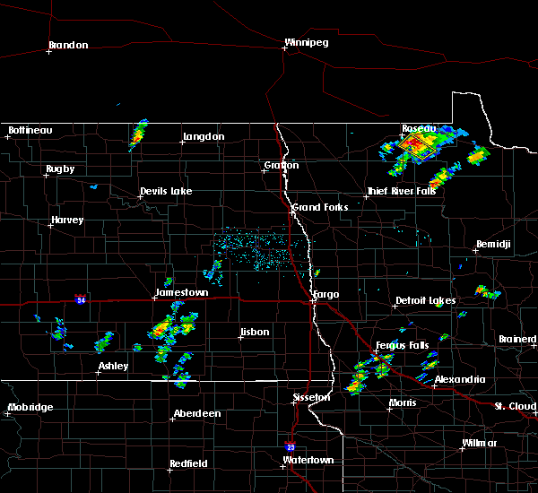
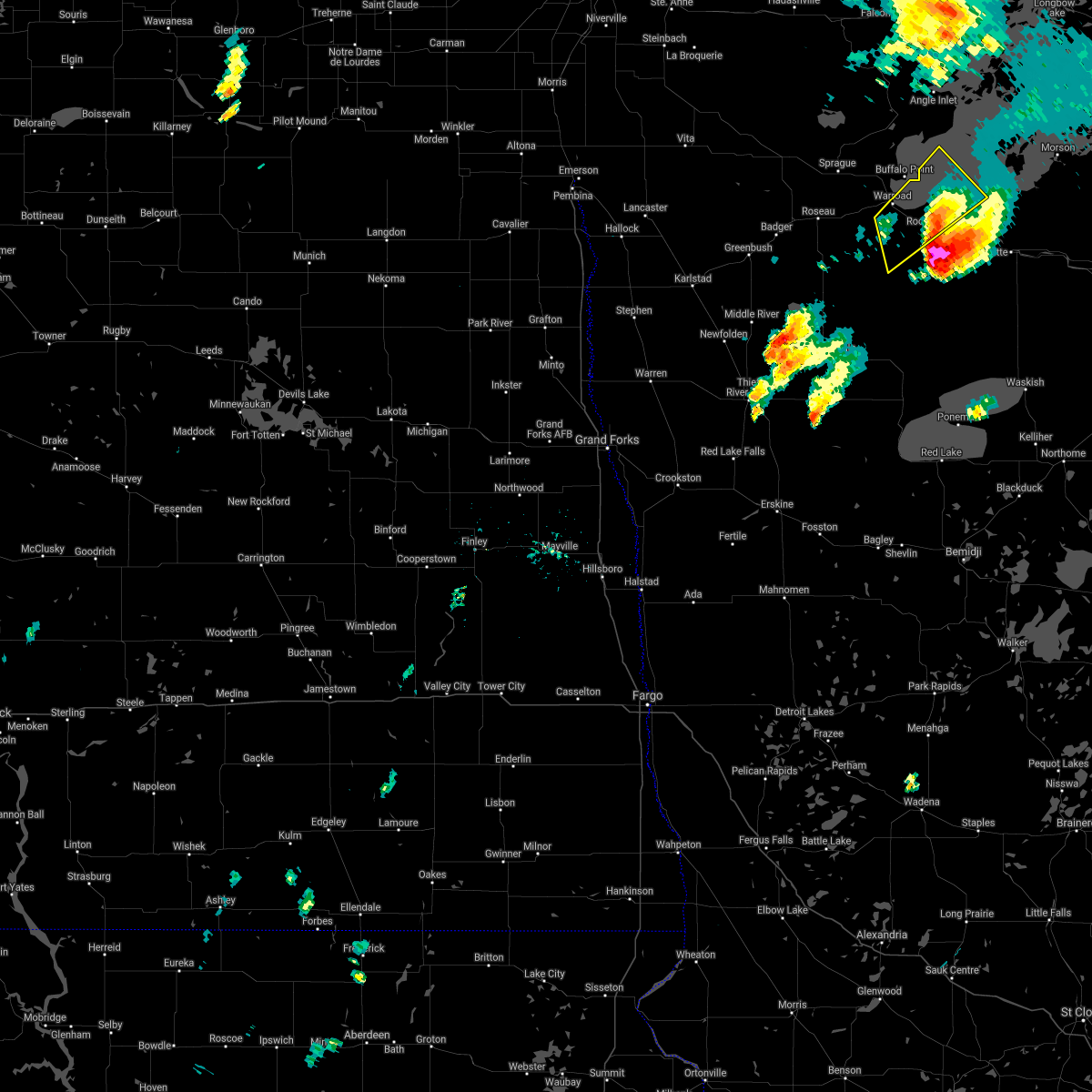
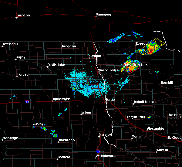
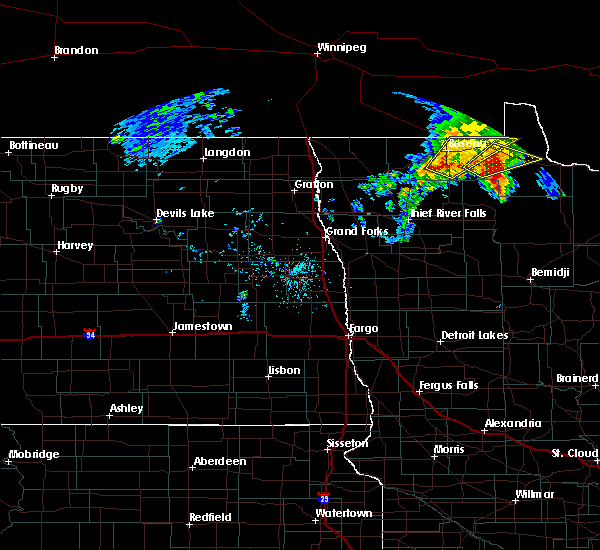
Hail Maps for Warroad, MN


Connect with Interactive Hail Maps