

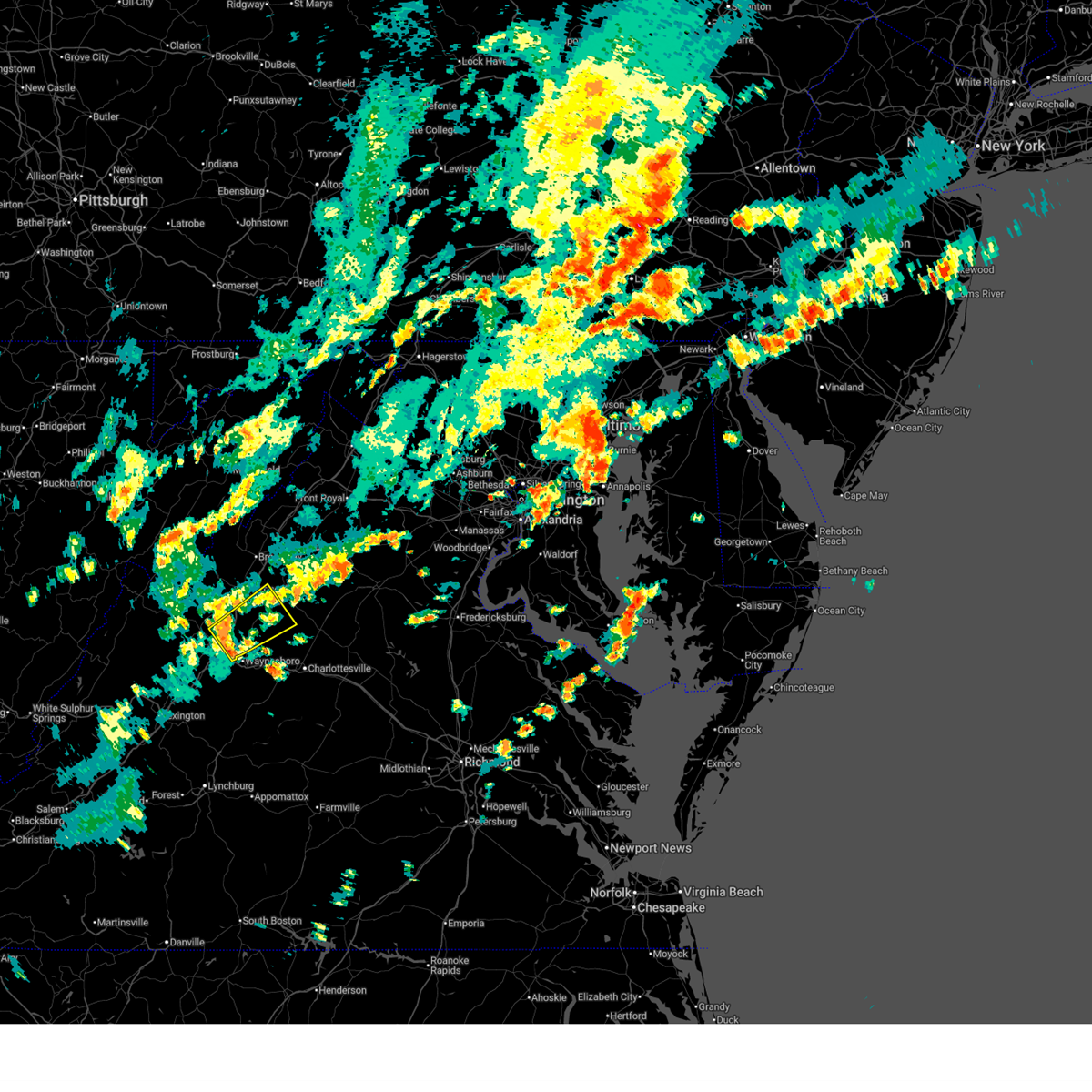
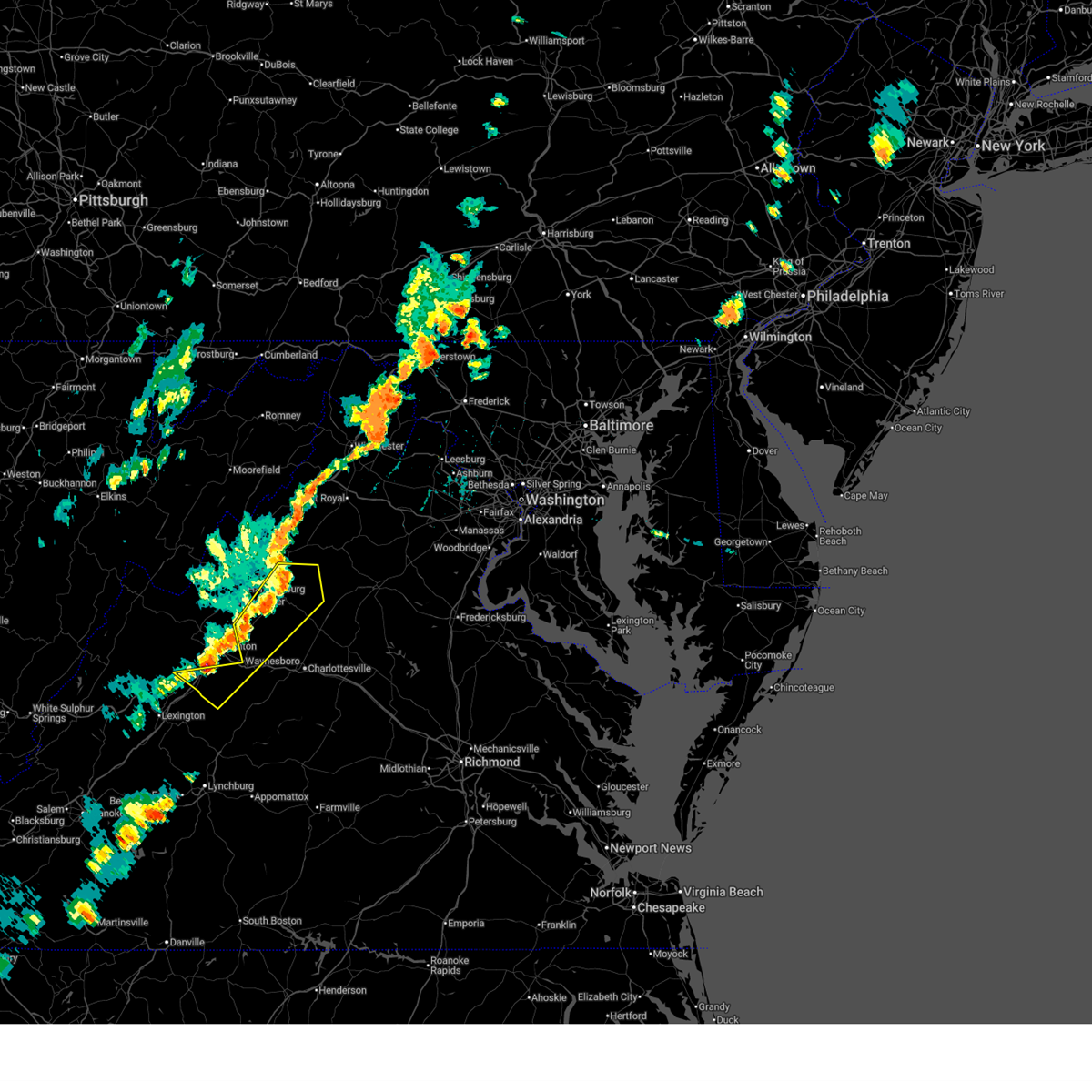
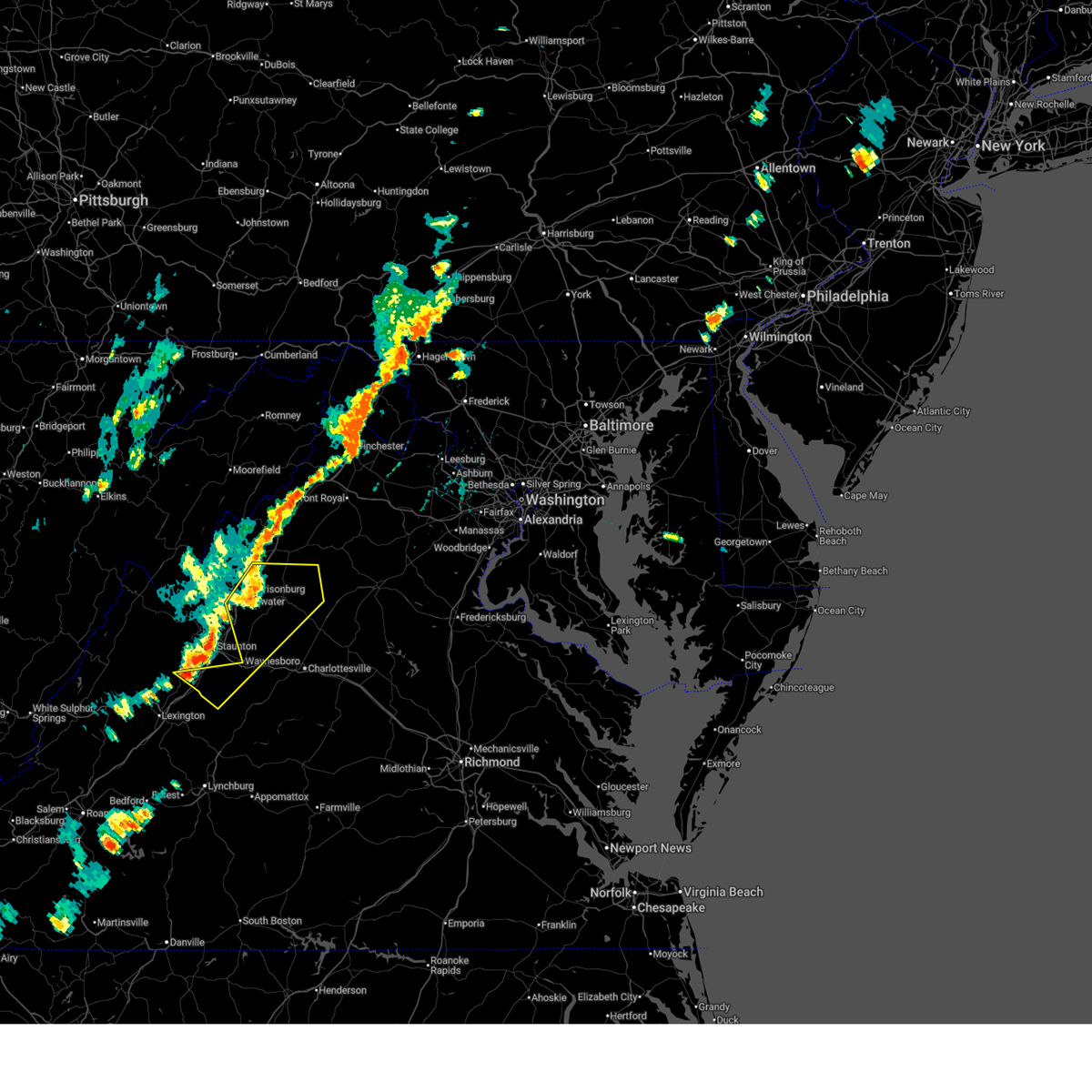
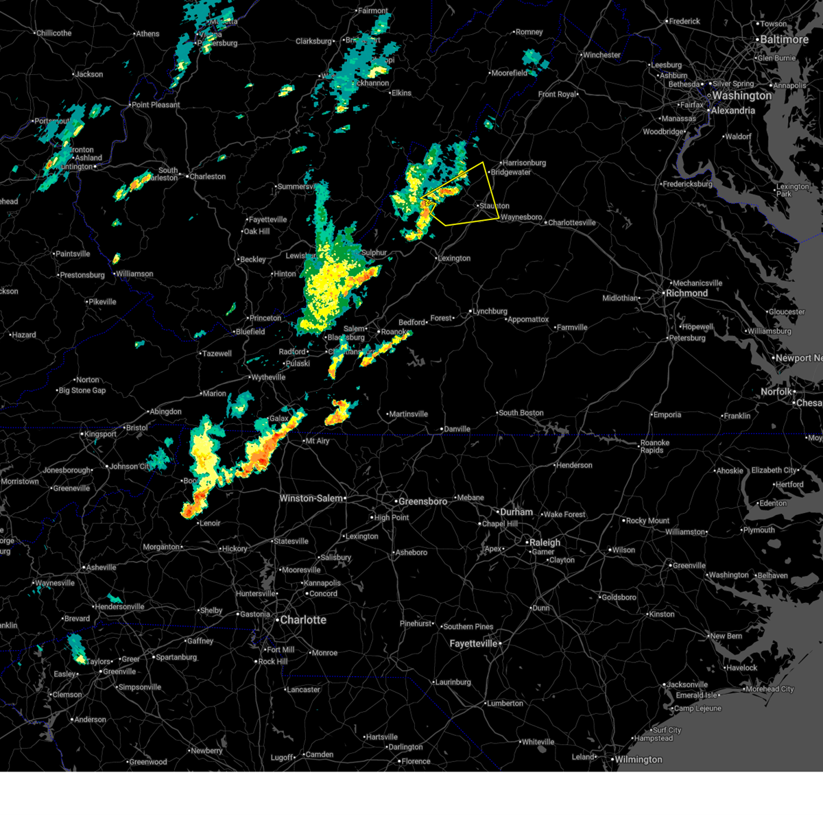
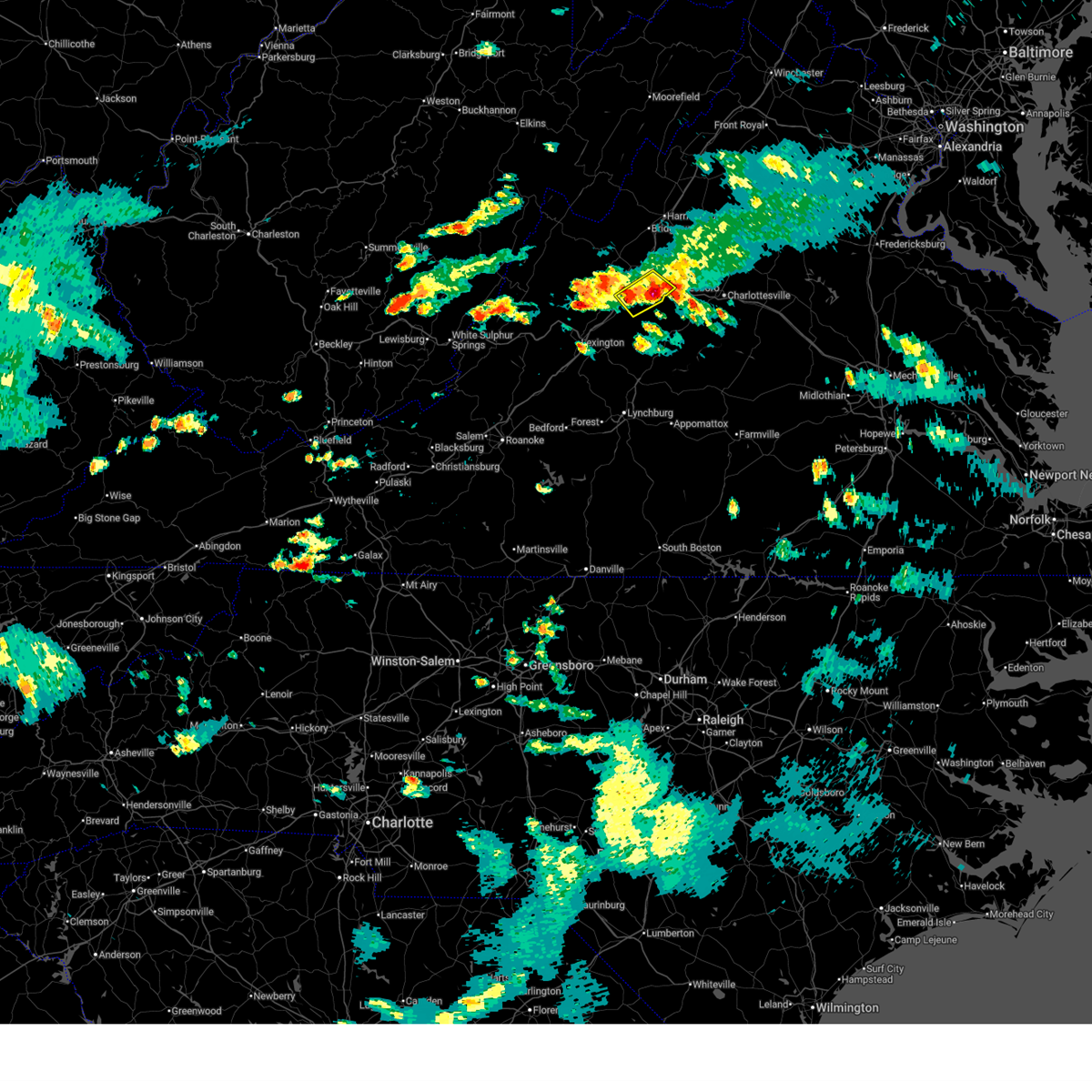
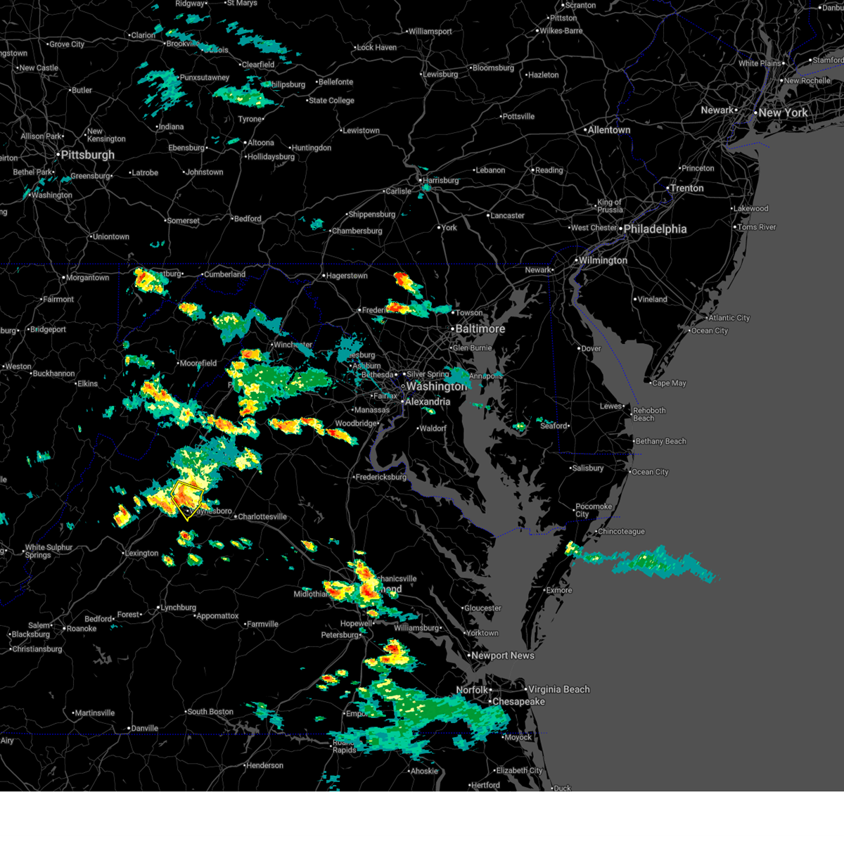
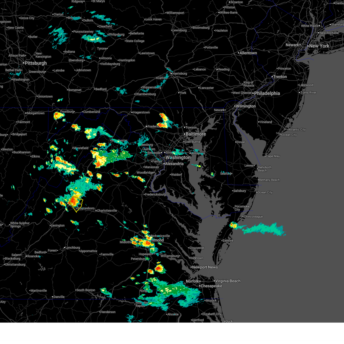
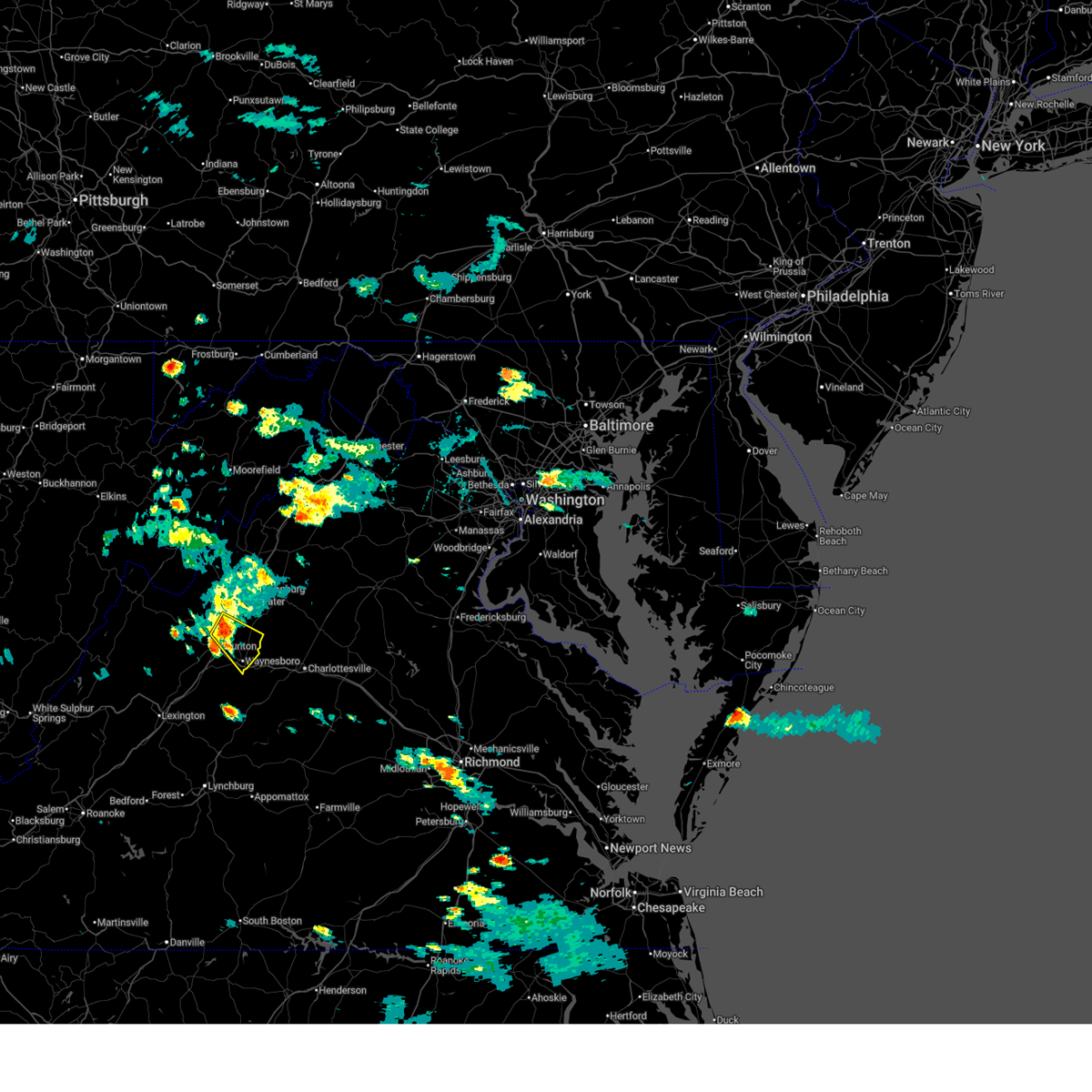
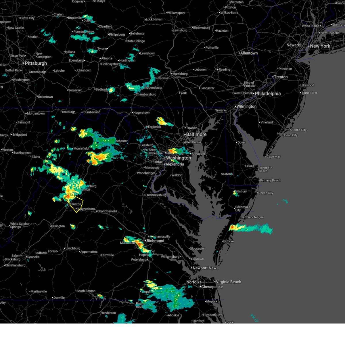
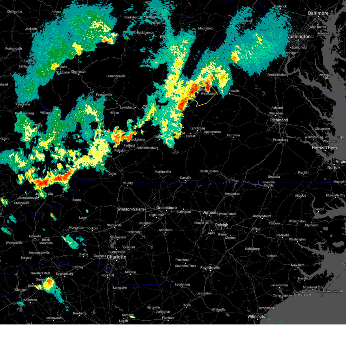
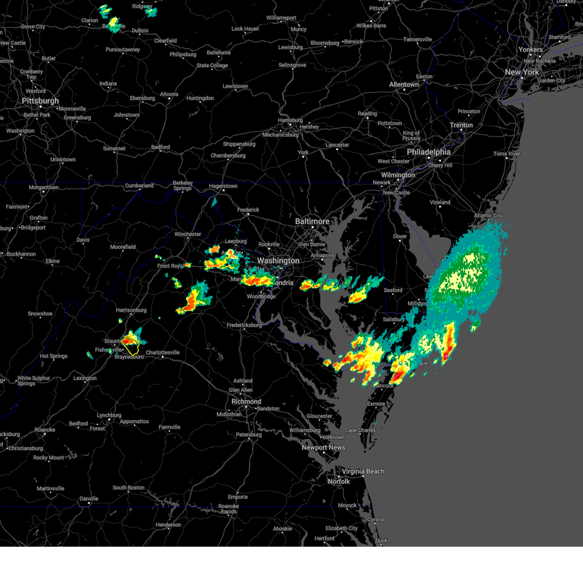
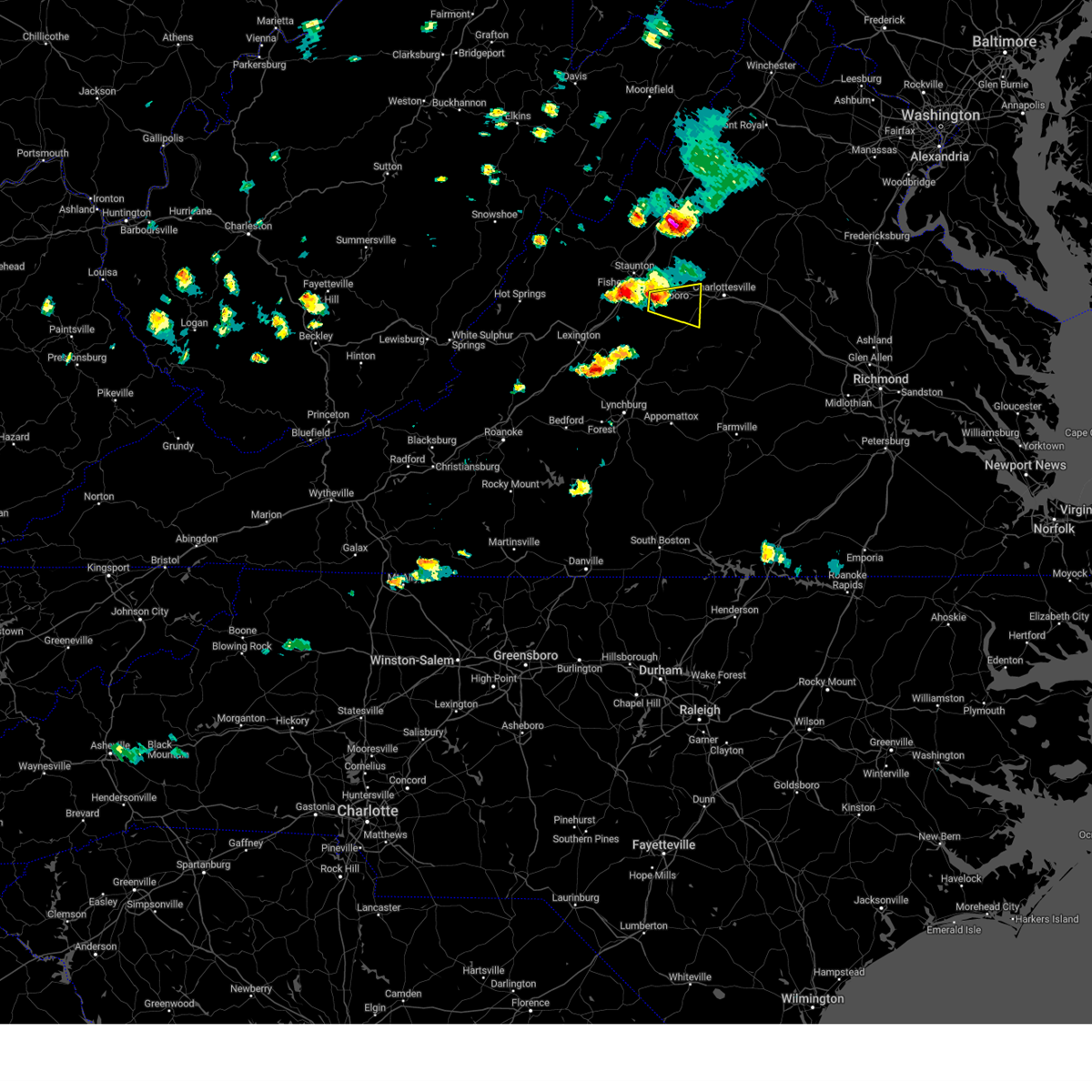
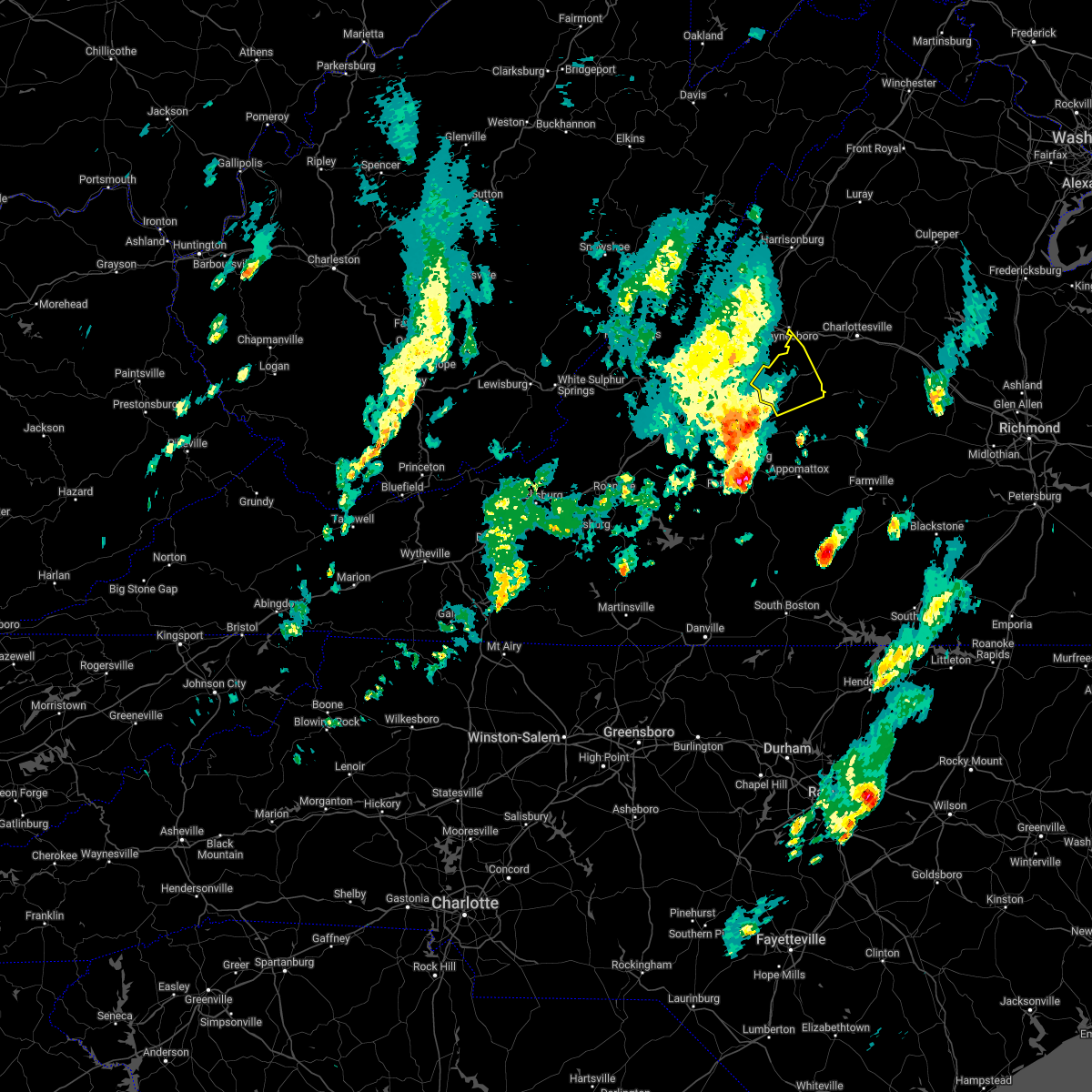
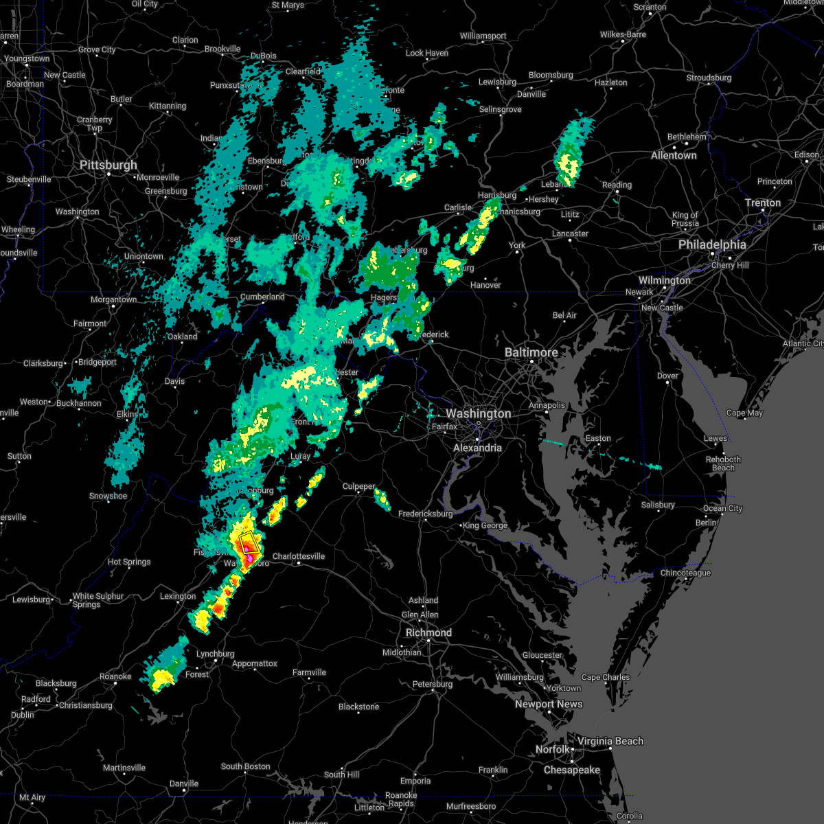
Hail Map for Waynesboro, VA
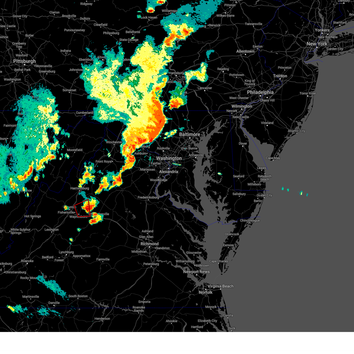
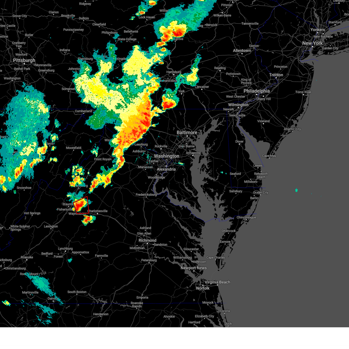
The Waynesboro, VA area has had 9 reports of on-the-ground hail by trained spotters, and has been under severe weather warnings 23 times during the past 12 months. Doppler radar has detected hail at or near Waynesboro, VA on 41 occasions, including 1 occasion during the past year.
| Name: | Waynesboro, VA |
| Where Located: | 78.3 miles SE of Elkins, WV |
| Map: | Google Map for Waynesboro, VA |
| Population: | 21006 |
| Housing Units: | 9717 |
| More Info: | Search Google for Waynesboro, VA |
2
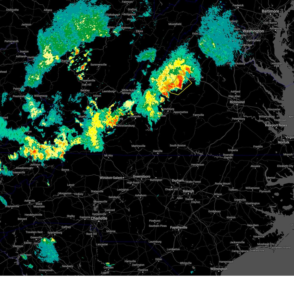
The Top Recent Hail Date for Waynesboro, VA is Saturday, August 31, 2024 (2nd out of 41)

Hail and Wind Damage Spotted near Waynesboro, VA
| Date / Time | Report Details |
|---|---|
| 7/1/2025 4:16 PM EDT |
 Svrlwx the national weather service in sterling virginia has issued a * severe thunderstorm warning for, southeastern rockingham county in western virginia, northwestern albemarle county in central virginia, southwestern greene county in central virginia, east central augusta county in western virginia, the northeastern city of staunton in western virginia, * until 445 pm edt. * at 416 pm edt, a severe thunderstorm was located near staunton, moving northeast at 30 mph (radar indicated). Hazards include 60 mph wind gusts. Damaging winds will cause some trees and large branches to fall. this could injure those outdoors, as well as damage homes and vehicles. roadways may become blocked by downed trees. localized power outages are possible. Unsecured light objects may become projectiles. Svrlwx the national weather service in sterling virginia has issued a * severe thunderstorm warning for, southeastern rockingham county in western virginia, northwestern albemarle county in central virginia, southwestern greene county in central virginia, east central augusta county in western virginia, the northeastern city of staunton in western virginia, * until 445 pm edt. * at 416 pm edt, a severe thunderstorm was located near staunton, moving northeast at 30 mph (radar indicated). Hazards include 60 mph wind gusts. Damaging winds will cause some trees and large branches to fall. this could injure those outdoors, as well as damage homes and vehicles. roadways may become blocked by downed trees. localized power outages are possible. Unsecured light objects may become projectiles.
|
| 6/19/2025 2:40 PM EDT | Several trees blew down around doom in augusta county VA, 3.7 miles SW of Waynesboro, VA |
| 6/19/2025 2:40 PM EDT | Numerous trees... branches... and wires blew down in the city of waynesbor in city of waynesboro county VA, 1.1 miles WSW of Waynesboro, VA |
| 6/19/2025 2:34 PM EDT |
 the severe thunderstorm warning has been cancelled and is no longer in effect the severe thunderstorm warning has been cancelled and is no longer in effect
|
| 6/19/2025 2:34 PM EDT |
 At 233 pm edt, severe thunderstorms were located along a line extending from near shenandoah to stuarts draft, moving east at 40 mph (radar indicated). Hazards include 60 mph wind gusts. Damaging winds will cause some trees and large branches to fall. this could injure those outdoors, as well as damage homes and vehicles. roadways may become blocked by downed trees. localized power outages are possible. unsecured light objects may become projectiles. Locations impacted include, waynesboro, stuarts draft, grottoes, shenandoah, massanutten, crimora, stanley, sherando, wintergreen, afton, big meadows, elkton, weyers cave, lyndhurst, nellysford, greenville, new hope, rocky bar, ingham, and penn laird. At 233 pm edt, severe thunderstorms were located along a line extending from near shenandoah to stuarts draft, moving east at 40 mph (radar indicated). Hazards include 60 mph wind gusts. Damaging winds will cause some trees and large branches to fall. this could injure those outdoors, as well as damage homes and vehicles. roadways may become blocked by downed trees. localized power outages are possible. unsecured light objects may become projectiles. Locations impacted include, waynesboro, stuarts draft, grottoes, shenandoah, massanutten, crimora, stanley, sherando, wintergreen, afton, big meadows, elkton, weyers cave, lyndhurst, nellysford, greenville, new hope, rocky bar, ingham, and penn laird.
|
| 6/19/2025 2:19 PM EDT |
 Svrlwx the national weather service in sterling virginia has issued a * severe thunderstorm warning for, northwestern nelson county in central virginia, west central madison county in northwestern virginia, southeastern rockingham county in western virginia, southwestern page county in northwestern virginia, northwestern albemarle county in central virginia, central greene county in central virginia, eastern augusta county in western virginia, the city of waynesboro in western virginia, the city of harrisonburg in western virginia, * until 245 pm edt. * at 218 pm edt, severe thunderstorms were located along a line extending from near harrisonburg to 8 miles northeast of brownsburg, moving east at 40 mph (radar indicated). Hazards include 60 mph wind gusts. Damaging winds will cause some trees and large branches to fall. this could injure those outdoors, as well as damage homes and vehicles. roadways may become blocked by downed trees. localized power outages are possible. Unsecured light objects may become projectiles. Svrlwx the national weather service in sterling virginia has issued a * severe thunderstorm warning for, northwestern nelson county in central virginia, west central madison county in northwestern virginia, southeastern rockingham county in western virginia, southwestern page county in northwestern virginia, northwestern albemarle county in central virginia, central greene county in central virginia, eastern augusta county in western virginia, the city of waynesboro in western virginia, the city of harrisonburg in western virginia, * until 245 pm edt. * at 218 pm edt, severe thunderstorms were located along a line extending from near harrisonburg to 8 miles northeast of brownsburg, moving east at 40 mph (radar indicated). Hazards include 60 mph wind gusts. Damaging winds will cause some trees and large branches to fall. this could injure those outdoors, as well as damage homes and vehicles. roadways may become blocked by downed trees. localized power outages are possible. Unsecured light objects may become projectiles.
|
| 6/19/2025 2:10 PM EDT | the severe thunderstorm warning has been cancelled and is no longer in effect |
| 6/19/2025 2:10 PM EDT | At 209 pm edt, a severe thunderstorm was located 7 miles west of staunton, moving east at 45 mph (radar indicated). Hazards include 60 mph wind gusts and quarter size hail. Damaging winds will cause some trees and large branches to fall. this could injure those outdoors, as well as damage homes and vehicles. roadways may become blocked by downed trees. localized power outages are possible. unsecured light objects may become projectiles. Locations impacted include, staunton, waynesboro, stuarts draft, fishersville, verona, mount sidney, augusta springs, middlebrook, churchville, mint spring, moscow, buffalo gap, summerdean, trimbles mill, mount solon, sangerville, christian, fort defiance, and swoope. |
| 6/19/2025 1:45 PM EDT |
 Svrlwx the national weather service in sterling virginia has issued a * severe thunderstorm warning for, southwestern rockingham county in western virginia, augusta county in western virginia, the city of staunton in western virginia, the northwestern city of waynesboro in western virginia, southeastern highland county in western virginia, * until 230 pm edt. * at 145 pm edt, a severe thunderstorm was located near yost, or 8 miles north of goshen, moving east at 45 mph (radar indicated). Hazards include 60 mph wind gusts and quarter size hail. Damaging winds will cause some trees and large branches to fall. this could injure those outdoors, as well as damage homes and vehicles. roadways may become blocked by downed trees. localized power outages are possible. Unsecured light objects may become projectiles. Svrlwx the national weather service in sterling virginia has issued a * severe thunderstorm warning for, southwestern rockingham county in western virginia, augusta county in western virginia, the city of staunton in western virginia, the northwestern city of waynesboro in western virginia, southeastern highland county in western virginia, * until 230 pm edt. * at 145 pm edt, a severe thunderstorm was located near yost, or 8 miles north of goshen, moving east at 45 mph (radar indicated). Hazards include 60 mph wind gusts and quarter size hail. Damaging winds will cause some trees and large branches to fall. this could injure those outdoors, as well as damage homes and vehicles. roadways may become blocked by downed trees. localized power outages are possible. Unsecured light objects may become projectiles.
|
| 6/13/2025 7:03 PM EDT | the severe thunderstorm warning has been cancelled and is no longer in effect |
| 6/13/2025 6:55 PM EDT | Large tree limbs blew down in lyndhurs in augusta county VA, 3.3 miles NE of Waynesboro, VA |
| 6/13/2025 6:50 PM EDT | Several greenhouses were destroyed at a nursery between lyndhurst and waynesbor in augusta county VA, 2.8 miles NE of Waynesboro, VA |
| 6/13/2025 6:45 PM EDT | Trees blew down in the unit block of harvest roa in augusta county VA, 6.1 miles E of Waynesboro, VA |
| 6/13/2025 6:44 PM EDT | Trees blew down near the intersection of va-631 ladd road and warren oaks lan in augusta county VA, 3 miles ENE of Waynesboro, VA |
| 6/13/2025 6:39 PM EDT |
 Svrlwx the national weather service in sterling virginia has issued a * severe thunderstorm warning for, southeastern augusta county in western virginia, the city of waynesboro in western virginia, * until 715 pm edt. * at 639 pm edt, a severe thunderstorm was located near waynesboro, moving southeast at 10 mph (radar indicated). Hazards include 60 mph wind gusts. Damaging winds will cause some trees and large branches to fall. this could injure those outdoors, as well as damage homes and vehicles. roadways may become blocked by downed trees. localized power outages are possible. Unsecured light objects may become projectiles. Svrlwx the national weather service in sterling virginia has issued a * severe thunderstorm warning for, southeastern augusta county in western virginia, the city of waynesboro in western virginia, * until 715 pm edt. * at 639 pm edt, a severe thunderstorm was located near waynesboro, moving southeast at 10 mph (radar indicated). Hazards include 60 mph wind gusts. Damaging winds will cause some trees and large branches to fall. this could injure those outdoors, as well as damage homes and vehicles. roadways may become blocked by downed trees. localized power outages are possible. Unsecured light objects may become projectiles.
|
| 6/13/2025 6:23 PM EDT | Trees blew down in the 600 block of sv-865 rockfish roa in augusta county VA, 3.5 miles SSW of Waynesboro, VA |
| 6/13/2025 6:10 PM EDT | Trees blew down in the 600 block of va-782 brower roa in augusta county VA, 4.5 miles S of Waynesboro, VA |
| 6/13/2025 6:09 PM EDT |
 The storm which prompted the warning has weakened below severe limits, and no longer poses an immediate threat to life or property. therefore, the warning will be allowed to expire. to report severe weather, contact your nearest law enforcement agency. they will relay your report to the national weather service sterling virginia. The storm which prompted the warning has weakened below severe limits, and no longer poses an immediate threat to life or property. therefore, the warning will be allowed to expire. to report severe weather, contact your nearest law enforcement agency. they will relay your report to the national weather service sterling virginia.
|
| 6/13/2025 6:08 PM EDT | Trees blew down in the 800 block of va-619 hildebrand church roa in augusta county VA, 5.2 miles S of Waynesboro, VA |
| 6/13/2025 6:00 PM EDT | Trees blew down on va-782 north point school road in the 200 bloc in augusta county VA, 5.8 miles S of Waynesboro, VA |
| 6/13/2025 6:00 PM EDT | Corrects previous tstm wnd dmg report from 2 ese hermitage. trees blew down in the 500 block of oak grove church roa in augusta county VA, 4.5 miles S of Waynesboro, VA |
| 6/13/2025 6:00 PM EDT | Trees blew down in the 500 block of oak grove church roa in augusta county VA, 4.5 miles S of Waynesboro, VA |
| 6/13/2025 5:52 PM EDT |
 the severe thunderstorm warning has been cancelled and is no longer in effect the severe thunderstorm warning has been cancelled and is no longer in effect
|
| 6/13/2025 5:52 PM EDT |
 At 551 pm edt, a severe thunderstorm was located near crimora, or 8 miles east of staunton, moving southeast at 15 mph (radar indicated). Hazards include 60 mph wind gusts. Damaging winds will cause some trees and large branches to fall. this could injure those outdoors, as well as damage homes and vehicles. roadways may become blocked by downed trees. localized power outages are possible. unsecured light objects may become projectiles. Locations impacted include, staunton, waynesboro, crimora, fishersville, verona, lyndhurst, new hope, mount sidney, hermitage, fort defiance, and afton mountain. At 551 pm edt, a severe thunderstorm was located near crimora, or 8 miles east of staunton, moving southeast at 15 mph (radar indicated). Hazards include 60 mph wind gusts. Damaging winds will cause some trees and large branches to fall. this could injure those outdoors, as well as damage homes and vehicles. roadways may become blocked by downed trees. localized power outages are possible. unsecured light objects may become projectiles. Locations impacted include, staunton, waynesboro, crimora, fishersville, verona, lyndhurst, new hope, mount sidney, hermitage, fort defiance, and afton mountain.
|
| 6/13/2025 5:39 PM EDT |
 At 539 pm edt, a severe thunderstorm was located 7 miles northeast of staunton, moving southeast at 15 mph (radar indicated). Hazards include 60 mph wind gusts. Damaging winds will cause some trees and large branches to fall. this could injure those outdoors, as well as damage homes and vehicles. roadways may become blocked by downed trees. localized power outages are possible. unsecured light objects may become projectiles. Locations impacted include, staunton, waynesboro, crimora, fishersville, verona, weyers cave, lyndhurst, new hope, mount sidney, hermitage, fort defiance, afton mountain, and staunton airport. At 539 pm edt, a severe thunderstorm was located 7 miles northeast of staunton, moving southeast at 15 mph (radar indicated). Hazards include 60 mph wind gusts. Damaging winds will cause some trees and large branches to fall. this could injure those outdoors, as well as damage homes and vehicles. roadways may become blocked by downed trees. localized power outages are possible. unsecured light objects may become projectiles. Locations impacted include, staunton, waynesboro, crimora, fishersville, verona, weyers cave, lyndhurst, new hope, mount sidney, hermitage, fort defiance, afton mountain, and staunton airport.
|
| 6/13/2025 5:30 PM EDT |
 Svrlwx the national weather service in sterling virginia has issued a * severe thunderstorm warning for, east central augusta county in western virginia, the northeastern city of staunton in western virginia, the city of waynesboro in western virginia, * until 615 pm edt. * at 530 pm edt, a severe thunderstorm was located 7 miles northeast of staunton, moving southeast at 15 mph (radar indicated). Hazards include 60 mph wind gusts. Damaging winds will cause some trees and large branches to fall. this could injure those outdoors, as well as damage homes and vehicles. roadways may become blocked by downed trees. localized power outages are possible. Unsecured light objects may become projectiles. Svrlwx the national weather service in sterling virginia has issued a * severe thunderstorm warning for, east central augusta county in western virginia, the northeastern city of staunton in western virginia, the city of waynesboro in western virginia, * until 615 pm edt. * at 530 pm edt, a severe thunderstorm was located 7 miles northeast of staunton, moving southeast at 15 mph (radar indicated). Hazards include 60 mph wind gusts. Damaging winds will cause some trees and large branches to fall. this could injure those outdoors, as well as damage homes and vehicles. roadways may become blocked by downed trees. localized power outages are possible. Unsecured light objects may become projectiles.
|
| 5/30/2025 5:45 PM EDT | Trees and wires blew down in the 700 block of maple avenue... and near the intersection of south ellison lane and us-340 rosser avenu in city of waynesboro county VA, 0.4 miles N of Waynesboro, VA |
| 8/31/2024 6:56 PM EDT | Tree down at the intersection of rockfish gap turnpike and afton mountain rd in nelson county VA, 3.7 miles WNW of Waynesboro, VA |
| 8/31/2024 6:56 PM EDT |
 At 656 pm edt, a severe thunderstorm was located near wintergreen, or 9 miles south of waynesboro, moving southeast at 25 mph (radar indicated). Hazards include 60 mph wind gusts. Damaging winds will cause some trees and large branches to fall. this could injure those outdoors, as well as damage homes and vehicles. roadways may become blocked by downed trees. localized power outages are possible. unsecured light objects may become projectiles. Locations impacted include, waynesboro, crozet, crimora, sherando, wintergreen, montebello, afton, lyndhurst, nellysford, lovingston, bryant, greenwood, north garden, batesville, covesville, yancey mills, tyro, greenfield, jonesboro, and afton mountain. At 656 pm edt, a severe thunderstorm was located near wintergreen, or 9 miles south of waynesboro, moving southeast at 25 mph (radar indicated). Hazards include 60 mph wind gusts. Damaging winds will cause some trees and large branches to fall. this could injure those outdoors, as well as damage homes and vehicles. roadways may become blocked by downed trees. localized power outages are possible. unsecured light objects may become projectiles. Locations impacted include, waynesboro, crozet, crimora, sherando, wintergreen, montebello, afton, lyndhurst, nellysford, lovingston, bryant, greenwood, north garden, batesville, covesville, yancey mills, tyro, greenfield, jonesboro, and afton mountain.
|
| 8/31/2024 6:44 PM EDT |
 Svrlwx the national weather service in sterling virginia has issued a * severe thunderstorm warning for, central nelson county in central virginia, west central albemarle county in central virginia, southeastern augusta county in western virginia, the city of waynesboro in western virginia, * until 715 pm edt. * at 644 pm edt, a severe thunderstorm was located over afton, or near waynesboro, moving southeast at 20 mph (radar indicated). Hazards include 60 mph wind gusts. Damaging winds will cause some trees and large branches to fall. this could injure those outdoors, as well as damage homes and vehicles. roadways may become blocked by downed trees. localized power outages are possible. Unsecured light objects may become projectiles. Svrlwx the national weather service in sterling virginia has issued a * severe thunderstorm warning for, central nelson county in central virginia, west central albemarle county in central virginia, southeastern augusta county in western virginia, the city of waynesboro in western virginia, * until 715 pm edt. * at 644 pm edt, a severe thunderstorm was located over afton, or near waynesboro, moving southeast at 20 mph (radar indicated). Hazards include 60 mph wind gusts. Damaging winds will cause some trees and large branches to fall. this could injure those outdoors, as well as damage homes and vehicles. roadways may become blocked by downed trees. localized power outages are possible. Unsecured light objects may become projectiles.
|
| 8/31/2024 6:34 PM EDT |
 At 634 pm edt, severe thunderstorms were located along a line extending from waynesboro to near stuarts draft to 6 miles north of vesuvius, moving southeast at 20 mph (radar indicated). Hazards include 60 mph wind gusts. Damaging winds will cause some trees and large branches to fall. this could injure those outdoors, as well as damage homes and vehicles. roadways may become blocked by downed trees. localized power outages are possible. unsecured light objects may become projectiles. Locations impacted include, staunton, waynesboro, stuarts draft, crimora, sherando, wintergreen, montebello, afton, fishersville, lyndhurst, nellysford, greenville, new hope, middlebrook, greenwood, hermitage, mint spring, spottswood, and afton mountain. At 634 pm edt, severe thunderstorms were located along a line extending from waynesboro to near stuarts draft to 6 miles north of vesuvius, moving southeast at 20 mph (radar indicated). Hazards include 60 mph wind gusts. Damaging winds will cause some trees and large branches to fall. this could injure those outdoors, as well as damage homes and vehicles. roadways may become blocked by downed trees. localized power outages are possible. unsecured light objects may become projectiles. Locations impacted include, staunton, waynesboro, stuarts draft, crimora, sherando, wintergreen, montebello, afton, fishersville, lyndhurst, nellysford, greenville, new hope, middlebrook, greenwood, hermitage, mint spring, spottswood, and afton mountain.
|
| 8/31/2024 6:22 PM EDT |
 Svrlwx the national weather service in sterling virginia has issued a * severe thunderstorm warning for, northwestern nelson county in central virginia, western albemarle county in central virginia, southeastern augusta county in western virginia, the city of staunton in western virginia, the city of waynesboro in western virginia, * until 645 pm edt. * at 622 pm edt, severe thunderstorms were located along a line extending from near waynesboro to 7 miles southwest of staunton to 8 miles northeast of brownsburg, moving southeast at 20 mph (radar indicated). Hazards include 60 mph wind gusts. Damaging winds will cause some trees and large branches to fall. this could injure those outdoors, as well as damage homes and vehicles. roadways may become blocked by downed trees. localized power outages are possible. Unsecured light objects may become projectiles. Svrlwx the national weather service in sterling virginia has issued a * severe thunderstorm warning for, northwestern nelson county in central virginia, western albemarle county in central virginia, southeastern augusta county in western virginia, the city of staunton in western virginia, the city of waynesboro in western virginia, * until 645 pm edt. * at 622 pm edt, severe thunderstorms were located along a line extending from near waynesboro to 7 miles southwest of staunton to 8 miles northeast of brownsburg, moving southeast at 20 mph (radar indicated). Hazards include 60 mph wind gusts. Damaging winds will cause some trees and large branches to fall. this could injure those outdoors, as well as damage homes and vehicles. roadways may become blocked by downed trees. localized power outages are possible. Unsecured light objects may become projectiles.
|
| 7/17/2024 4:03 PM EDT | Multiple trees down in the afton mountain are in nelson county VA, 4.1 miles NW of Waynesboro, VA |
| 7/17/2024 3:59 PM EDT | Large tree down in waynesbor in city of waynesboro county VA, 0.3 miles S of Waynesboro, VA |
| 7/17/2024 3:56 PM EDT |
 At 356 pm edt, severe thunderstorms were located along a line extending from 7 miles southeast of crozet to near shipman, moving east at 65 mph (public). Hazards include 60 mph wind gusts. Damaging winds will cause some trees and large branches to fall. this could injure those outdoors, as well as damage homes and vehicles. roadways may become blocked by downed trees. localized power outages are possible. unsecured light objects may become projectiles. Locations impacted include, waynesboro, stuarts draft, crozet, sherando, wintergreen, montebello, afton, fishersville, lyndhurst, nellysford, ivy, bryant, greenwood, batesville, yancey mills, tyro, greenfield, jonesboro, afton mountain, and massies mill. At 356 pm edt, severe thunderstorms were located along a line extending from 7 miles southeast of crozet to near shipman, moving east at 65 mph (public). Hazards include 60 mph wind gusts. Damaging winds will cause some trees and large branches to fall. this could injure those outdoors, as well as damage homes and vehicles. roadways may become blocked by downed trees. localized power outages are possible. unsecured light objects may become projectiles. Locations impacted include, waynesboro, stuarts draft, crozet, sherando, wintergreen, montebello, afton, fishersville, lyndhurst, nellysford, ivy, bryant, greenwood, batesville, yancey mills, tyro, greenfield, jonesboro, afton mountain, and massies mill.
|
| 7/17/2024 3:49 PM EDT |
 At 349 pm edt, severe thunderstorms were located along a line extending from near afton to near lowesville, moving east at 65 mph (radar indicated). Hazards include 60 mph wind gusts. Damaging winds will cause some trees and large branches to fall. this could injure those outdoors, as well as damage homes and vehicles. roadways may become blocked by downed trees. localized power outages are possible. unsecured light objects may become projectiles. Locations impacted include, staunton, waynesboro, stuarts draft, crozet, sherando, wintergreen, montebello, afton, fishersville, lyndhurst, nellysford, ivy, greenville, hermitage, yancey mills, tyro, jonesboro, afton mountain, massies mill, and bryant. At 349 pm edt, severe thunderstorms were located along a line extending from near afton to near lowesville, moving east at 65 mph (radar indicated). Hazards include 60 mph wind gusts. Damaging winds will cause some trees and large branches to fall. this could injure those outdoors, as well as damage homes and vehicles. roadways may become blocked by downed trees. localized power outages are possible. unsecured light objects may become projectiles. Locations impacted include, staunton, waynesboro, stuarts draft, crozet, sherando, wintergreen, montebello, afton, fishersville, lyndhurst, nellysford, ivy, greenville, hermitage, yancey mills, tyro, jonesboro, afton mountain, massies mill, and bryant.
|
| 7/17/2024 3:32 PM EDT |
 Svrlwx the national weather service in sterling virginia has issued a * severe thunderstorm warning for, northwestern nelson county in central virginia, west central albemarle county in central virginia, southeastern augusta county in western virginia, the city of staunton in western virginia, the city of waynesboro in western virginia, * until 415 pm edt. * at 331 pm edt, severe thunderstorms were located along a line extending from near stuarts draft to near cornwall, moving southeast at 65 mph (radar indicated). Hazards include 60 mph wind gusts. Damaging winds will cause some trees and large branches to fall. this could injure those outdoors, as well as damage homes and vehicles. roadways may become blocked by downed trees. localized power outages are possible. Unsecured light objects may become projectiles. Svrlwx the national weather service in sterling virginia has issued a * severe thunderstorm warning for, northwestern nelson county in central virginia, west central albemarle county in central virginia, southeastern augusta county in western virginia, the city of staunton in western virginia, the city of waynesboro in western virginia, * until 415 pm edt. * at 331 pm edt, severe thunderstorms were located along a line extending from near stuarts draft to near cornwall, moving southeast at 65 mph (radar indicated). Hazards include 60 mph wind gusts. Damaging winds will cause some trees and large branches to fall. this could injure those outdoors, as well as damage homes and vehicles. roadways may become blocked by downed trees. localized power outages are possible. Unsecured light objects may become projectiles.
|
| 7/16/2024 7:00 PM EDT | Several reports of trees down in waynesboro are in city of waynesboro county VA, 0.4 miles N of Waynesboro, VA |
| 7/16/2024 6:55 PM EDT |
 At 655 pm edt, a severe thunderstorm was located over sherando, or near waynesboro, moving east at 15 mph (radar indicated). Hazards include 60 mph wind gusts. Damaging winds will cause some trees and large branches to fall. this could injure those outdoors, as well as damage homes and vehicles. roadways may become blocked by downed trees. localized power outages are possible. unsecured light objects may become projectiles. Locations impacted include, waynesboro, stuarts draft, sherando, wintergreen, afton, lyndhurst, nellysford, greenfield, greenwood, and afton mountain. At 655 pm edt, a severe thunderstorm was located over sherando, or near waynesboro, moving east at 15 mph (radar indicated). Hazards include 60 mph wind gusts. Damaging winds will cause some trees and large branches to fall. this could injure those outdoors, as well as damage homes and vehicles. roadways may become blocked by downed trees. localized power outages are possible. unsecured light objects may become projectiles. Locations impacted include, waynesboro, stuarts draft, sherando, wintergreen, afton, lyndhurst, nellysford, greenfield, greenwood, and afton mountain.
|
| 7/16/2024 6:48 PM EDT |
 Svrlwx the national weather service in sterling virginia has issued a * severe thunderstorm warning for, northeastern nelson county in central virginia, west central albemarle county in central virginia, southeastern augusta county in western virginia, the southern city of waynesboro in western virginia, * until 715 pm edt. * at 648 pm edt, a severe thunderstorm was located over sherando, or near waynesboro, moving east at 15 mph (radar indicated). Hazards include 60 mph wind gusts. Damaging winds will cause some trees and large branches to fall. this could injure those outdoors, as well as damage homes and vehicles. roadways may become blocked by downed trees. localized power outages are possible. Unsecured light objects may become projectiles. Svrlwx the national weather service in sterling virginia has issued a * severe thunderstorm warning for, northeastern nelson county in central virginia, west central albemarle county in central virginia, southeastern augusta county in western virginia, the southern city of waynesboro in western virginia, * until 715 pm edt. * at 648 pm edt, a severe thunderstorm was located over sherando, or near waynesboro, moving east at 15 mph (radar indicated). Hazards include 60 mph wind gusts. Damaging winds will cause some trees and large branches to fall. this could injure those outdoors, as well as damage homes and vehicles. roadways may become blocked by downed trees. localized power outages are possible. Unsecured light objects may become projectiles.
|
| 5/26/2024 8:12 PM EDT |
 the severe thunderstorm warning has been cancelled and is no longer in effect the severe thunderstorm warning has been cancelled and is no longer in effect
|
| 5/26/2024 8:12 PM EDT |
 At 811 pm edt, severe thunderstorms were located along a line extending from 9 miles southwest of petersburg to 6 miles south of brandywine to near afton to near tower hill, moving east at 45 mph (radar indicated). Hazards include 60 mph wind gusts and quarter size hail. Damaging winds will cause some trees and large branches to fall. this could injure those outdoors, as well as damage homes and vehicles. roadways may become blocked by downed trees. localized power outages are possible. unsecured light objects may become projectiles. Locations impacted include, harrisonburg, staunton, waynesboro, franklin, stuarts draft, bridgewater, crozet, broadway, grottoes, timberville, massanutten, crimora, sherando, shipman, schuyler, wintergreen, afton, dale enterprise, fishersville, and verona. At 811 pm edt, severe thunderstorms were located along a line extending from 9 miles southwest of petersburg to 6 miles south of brandywine to near afton to near tower hill, moving east at 45 mph (radar indicated). Hazards include 60 mph wind gusts and quarter size hail. Damaging winds will cause some trees and large branches to fall. this could injure those outdoors, as well as damage homes and vehicles. roadways may become blocked by downed trees. localized power outages are possible. unsecured light objects may become projectiles. Locations impacted include, harrisonburg, staunton, waynesboro, franklin, stuarts draft, bridgewater, crozet, broadway, grottoes, timberville, massanutten, crimora, sherando, shipman, schuyler, wintergreen, afton, dale enterprise, fishersville, and verona.
|
| 5/26/2024 7:42 PM EDT |
 Svrlwx the national weather service in sterling virginia has issued a * severe thunderstorm warning for, nelson county in central virginia, rockingham county in western virginia, western albemarle county in central virginia, western greene county in central virginia, augusta county in western virginia, the city of staunton in western virginia, the city of harrisonburg in western virginia, the city of waynesboro in western virginia, eastern highland county in western virginia, pendleton county in eastern west virginia, southwestern hardy county in eastern west virginia, * until 845 pm edt. * at 742 pm edt, severe thunderstorms were located along a line extending from 13 miles southeast of elkins to monterey to near fairfield to near evington, moving east at 40 mph (radar indicated). Hazards include 60 mph wind gusts. Damaging winds will cause some trees and large branches to fall. this could injure those outdoors, as well as damage homes and vehicles. roadways may become blocked by downed trees. localized power outages are possible. Unsecured light objects may become projectiles. Svrlwx the national weather service in sterling virginia has issued a * severe thunderstorm warning for, nelson county in central virginia, rockingham county in western virginia, western albemarle county in central virginia, western greene county in central virginia, augusta county in western virginia, the city of staunton in western virginia, the city of harrisonburg in western virginia, the city of waynesboro in western virginia, eastern highland county in western virginia, pendleton county in eastern west virginia, southwestern hardy county in eastern west virginia, * until 845 pm edt. * at 742 pm edt, severe thunderstorms were located along a line extending from 13 miles southeast of elkins to monterey to near fairfield to near evington, moving east at 40 mph (radar indicated). Hazards include 60 mph wind gusts. Damaging winds will cause some trees and large branches to fall. this could injure those outdoors, as well as damage homes and vehicles. roadways may become blocked by downed trees. localized power outages are possible. Unsecured light objects may become projectiles.
|
| 8/7/2023 4:51 PM EDT |
 The tornado warning for northern nelson, southeastern rockingham, northwestern albemarle, and east central augusta counties and the city of waynesboro will expire at 500 pm edt, the tornado threat has diminished and the tornado warning has been cancelled. however, large hail and damaging winds remain likely and a severe thunderstorm warning remains in effect for the area. a tornado watch remains in effect until 900 pm edt for central and western virginia. The tornado warning for northern nelson, southeastern rockingham, northwestern albemarle, and east central augusta counties and the city of waynesboro will expire at 500 pm edt, the tornado threat has diminished and the tornado warning has been cancelled. however, large hail and damaging winds remain likely and a severe thunderstorm warning remains in effect for the area. a tornado watch remains in effect until 900 pm edt for central and western virginia.
|
| 8/7/2023 4:34 PM EDT |
 At 432 pm edt, a severe thunderstorm capable of producing a tornado was located near waynesboro, moving east at 45 mph (radar indicated rotation. a trained spotter reported a funnel cloud over the city of waynesboro). Hazards include tornado and ping pong ball size hail. For those in the direct path of a tornado touchdown, flying debris will be dangerous to those caught without shelter. damage to roofs, siding, and windows may occur. mobile homes may be damaged or destroyed. tree damage is likely. this dangerous storm will be near, crozet around 440 pm edt. Other locations impacted by this tornadic thunderstorm include yancey mills, new hope, greenwood, hermitage, white hall and fishersville. At 432 pm edt, a severe thunderstorm capable of producing a tornado was located near waynesboro, moving east at 45 mph (radar indicated rotation. a trained spotter reported a funnel cloud over the city of waynesboro). Hazards include tornado and ping pong ball size hail. For those in the direct path of a tornado touchdown, flying debris will be dangerous to those caught without shelter. damage to roofs, siding, and windows may occur. mobile homes may be damaged or destroyed. tree damage is likely. this dangerous storm will be near, crozet around 440 pm edt. Other locations impacted by this tornadic thunderstorm include yancey mills, new hope, greenwood, hermitage, white hall and fishersville.
|
| 8/7/2023 4:29 PM EDT | Hen Egg sized hail reported 2.4 miles SE of Waynesboro, VA |
| 8/7/2023 4:25 PM EDT |
 At 425 pm edt, a severe thunderstorm capable of producing a tornado was located near stuarts draft, or near waynesboro, moving east at 35 mph (radar indicated rotation). Hazards include tornado and ping pong ball size hail. For those in the direct path of a tornado touchdown, flying debris will be dangerous to those caught without shelter. damage to roofs, siding, and windows may occur. mobile homes may be damaged or destroyed. tree damage is likely. this dangerous storm will be near, waynesboro, crimora and afton around 440 pm edt. crozet around 450 pm edt. Other locations impacted by this tornadic thunderstorm include fishersville, greenwood, hermitage, yancey mills, verona, new hope, white hall and lyndhurst. At 425 pm edt, a severe thunderstorm capable of producing a tornado was located near stuarts draft, or near waynesboro, moving east at 35 mph (radar indicated rotation). Hazards include tornado and ping pong ball size hail. For those in the direct path of a tornado touchdown, flying debris will be dangerous to those caught without shelter. damage to roofs, siding, and windows may occur. mobile homes may be damaged or destroyed. tree damage is likely. this dangerous storm will be near, waynesboro, crimora and afton around 440 pm edt. crozet around 450 pm edt. Other locations impacted by this tornadic thunderstorm include fishersville, greenwood, hermitage, yancey mills, verona, new hope, white hall and lyndhurst.
|
| 8/7/2023 4:19 PM EDT |
 At 419 pm edt, a severe thunderstorm capable of producing a tornado was located over staunton, moving northeast at 45 mph (radar indicated rotation). Hazards include tornado and ping pong ball size hail. For those in the direct path of a tornado touchdown, flying debris will be dangerous to those caught without shelter. damage to roofs, siding, and windows may occur. mobile homes may be damaged or destroyed. tree damage is likely. This tornadic thunderstorm will remain over mainly rural areas of southeastern augusta , the city of staunton and the western city of waynesboro, including the following locations, fort defiance, mint spring, verona, fishersville, lyndhurst and greenville. At 419 pm edt, a severe thunderstorm capable of producing a tornado was located over staunton, moving northeast at 45 mph (radar indicated rotation). Hazards include tornado and ping pong ball size hail. For those in the direct path of a tornado touchdown, flying debris will be dangerous to those caught without shelter. damage to roofs, siding, and windows may occur. mobile homes may be damaged or destroyed. tree damage is likely. This tornadic thunderstorm will remain over mainly rural areas of southeastern augusta , the city of staunton and the western city of waynesboro, including the following locations, fort defiance, mint spring, verona, fishersville, lyndhurst and greenville.
|
| 8/7/2023 4:09 PM EDT |
 At 408 pm edt, a severe thunderstorm capable of producing a tornado was located 8 miles southwest of staunton, moving east at 35 mph (radar indicated rotation). Hazards include tornado and two inch hail. For those in the direct path of a tornado touchdown, flying debris will be dangerous to those caught without shelter. damage to roofs, siding, and windows may occur. mobile homes may be damaged or destroyed. tree damage is likely. this dangerous storm will be near, staunton and stuarts draft around 425 pm edt. waynesboro around 435 pm edt. Other locations impacted by this tornadic thunderstorm include summerdean, fishersville, lyndhurst, trimbles mill, greenville, fort defiance, mint spring, middlebrook, verona and swoope. At 408 pm edt, a severe thunderstorm capable of producing a tornado was located 8 miles southwest of staunton, moving east at 35 mph (radar indicated rotation). Hazards include tornado and two inch hail. For those in the direct path of a tornado touchdown, flying debris will be dangerous to those caught without shelter. damage to roofs, siding, and windows may occur. mobile homes may be damaged or destroyed. tree damage is likely. this dangerous storm will be near, staunton and stuarts draft around 425 pm edt. waynesboro around 435 pm edt. Other locations impacted by this tornadic thunderstorm include summerdean, fishersville, lyndhurst, trimbles mill, greenville, fort defiance, mint spring, middlebrook, verona and swoope.
|
| 8/7/2023 3:59 PM EDT |
 At 359 pm edt, a severe thunderstorm capable of producing a tornado was located 8 miles east of bells valley, or 12 miles east of goshen, moving east at 35 mph (radar indicated rotation). Hazards include tornado and ping pong ball size hail. For those in the direct path of a tornado touchdown, flying debris will be dangerous to those caught without shelter. damage to roofs, siding, and windows may occur. mobile homes may be damaged or destroyed. tree damage is likely. this dangerous storm will be near, stuarts draft around 425 pm edt. staunton, waynesboro and sherando around 430 pm edt. Other locations impacted by this tornadic thunderstorm include summerdean, fishersville, lyndhurst, trimbles mill, greenville, craigsville, fort defiance, mint spring, middlebrook and verona. At 359 pm edt, a severe thunderstorm capable of producing a tornado was located 8 miles east of bells valley, or 12 miles east of goshen, moving east at 35 mph (radar indicated rotation). Hazards include tornado and ping pong ball size hail. For those in the direct path of a tornado touchdown, flying debris will be dangerous to those caught without shelter. damage to roofs, siding, and windows may occur. mobile homes may be damaged or destroyed. tree damage is likely. this dangerous storm will be near, stuarts draft around 425 pm edt. staunton, waynesboro and sherando around 430 pm edt. Other locations impacted by this tornadic thunderstorm include summerdean, fishersville, lyndhurst, trimbles mill, greenville, craigsville, fort defiance, mint spring, middlebrook and verona.
|
| 7/28/2023 7:17 PM EDT |
 At 716 pm edt, severe thunderstorms were located along a line extending from 6 miles east of timberville to near clifford, moving east at 30 mph (law enforcement). Hazards include 60 mph wind gusts. Damaging winds will cause some trees and large branches to fall. this could injure those outdoors, as well as damage homes and vehicles. roadways may become blocked by downed trees. localized power outages are possible. unsecured light objects may become projectiles. locations impacted include, waynesboro, stuarts draft, crozet, grottoes, shenandoah, massanutten, crimora, stanley, sherando, shipman, schuyler, free union, wintergreen, afton, big meadows, fishersville, elkton, weyers cave, new market and lyndhurst. hail threat, radar indicated max hail size, <. 75 in wind threat, observed max wind gust, 60 mph. At 716 pm edt, severe thunderstorms were located along a line extending from 6 miles east of timberville to near clifford, moving east at 30 mph (law enforcement). Hazards include 60 mph wind gusts. Damaging winds will cause some trees and large branches to fall. this could injure those outdoors, as well as damage homes and vehicles. roadways may become blocked by downed trees. localized power outages are possible. unsecured light objects may become projectiles. locations impacted include, waynesboro, stuarts draft, crozet, grottoes, shenandoah, massanutten, crimora, stanley, sherando, shipman, schuyler, free union, wintergreen, afton, big meadows, fishersville, elkton, weyers cave, new market and lyndhurst. hail threat, radar indicated max hail size, <. 75 in wind threat, observed max wind gust, 60 mph.
|
| 7/28/2023 6:29 PM EDT |
 At 628 pm edt, severe thunderstorms were located along a line extending from 10 miles east of brandywine to near glasgow, moving east at 30 mph (radar indicated). Hazards include 60 mph wind gusts. Damaging winds will cause some trees and large branches to fall. this could injure those outdoors, as well as damage homes and vehicles. roadways may become blocked by downed trees. localized power outages are possible. Unsecured light objects may become projectiles. At 628 pm edt, severe thunderstorms were located along a line extending from 10 miles east of brandywine to near glasgow, moving east at 30 mph (radar indicated). Hazards include 60 mph wind gusts. Damaging winds will cause some trees and large branches to fall. this could injure those outdoors, as well as damage homes and vehicles. roadways may become blocked by downed trees. localized power outages are possible. Unsecured light objects may become projectiles.
|
| 7/25/2023 7:33 PM EDT | Tree down on powerlines on 1600 block of rockfish road in augusta county VA, 4.6 miles SSW of Waynesboro, VA |
| 7/25/2023 7:33 PM EDT |
 At 733 pm edt, a severe thunderstorm was located over crimora, or near waynesboro, moving southeast at 10 mph (radar indicated). Hazards include 60 mph wind gusts and quarter size hail. Damaging winds will cause some trees and large branches to fall. this could injure those outdoors, as well as damage homes and vehicles. roadways may become blocked by downed trees. localized power outages are possible. unsecured light objects may become projectiles. locations impacted include, waynesboro, crimora and hermitage. hail threat, radar indicated max hail size, 1. 00 in wind threat, radar indicated max wind gust, 60 mph. At 733 pm edt, a severe thunderstorm was located over crimora, or near waynesboro, moving southeast at 10 mph (radar indicated). Hazards include 60 mph wind gusts and quarter size hail. Damaging winds will cause some trees and large branches to fall. this could injure those outdoors, as well as damage homes and vehicles. roadways may become blocked by downed trees. localized power outages are possible. unsecured light objects may become projectiles. locations impacted include, waynesboro, crimora and hermitage. hail threat, radar indicated max hail size, 1. 00 in wind threat, radar indicated max wind gust, 60 mph.
|
| 7/25/2023 7:23 PM EDT | Multiple trees down between the cities of verona and dooms in augusta county VA, 6.6 miles S of Waynesboro, VA |
| 7/25/2023 7:23 PM EDT |
 At 723 pm edt, a severe thunderstorm was located near crimora, or 7 miles north of waynesboro, moving southeast at 20 mph (radar indicated). Hazards include 60 mph wind gusts and quarter size hail. Damaging winds will cause some trees and large branches to fall. this could injure those outdoors, as well as damage homes and vehicles. roadways may become blocked by downed trees. localized power outages are possible. unsecured light objects may become projectiles. locations impacted include, waynesboro, crimora, verona, new hope and hermitage. hail threat, radar indicated max hail size, 1. 00 in wind threat, radar indicated max wind gust, 60 mph. At 723 pm edt, a severe thunderstorm was located near crimora, or 7 miles north of waynesboro, moving southeast at 20 mph (radar indicated). Hazards include 60 mph wind gusts and quarter size hail. Damaging winds will cause some trees and large branches to fall. this could injure those outdoors, as well as damage homes and vehicles. roadways may become blocked by downed trees. localized power outages are possible. unsecured light objects may become projectiles. locations impacted include, waynesboro, crimora, verona, new hope and hermitage. hail threat, radar indicated max hail size, 1. 00 in wind threat, radar indicated max wind gust, 60 mph.
|
| 7/25/2023 7:08 PM EDT |
 At 707 pm edt, a severe thunderstorm was located near staunton, moving southeast at 20 mph (radar indicated). Hazards include 60 mph wind gusts and quarter size hail. Damaging winds will cause some trees and large branches to fall. this could injure those outdoors, as well as damage homes and vehicles. roadways may become blocked by downed trees. localized power outages are possible. Unsecured light objects may become projectiles. At 707 pm edt, a severe thunderstorm was located near staunton, moving southeast at 20 mph (radar indicated). Hazards include 60 mph wind gusts and quarter size hail. Damaging winds will cause some trees and large branches to fall. this could injure those outdoors, as well as damage homes and vehicles. roadways may become blocked by downed trees. localized power outages are possible. Unsecured light objects may become projectiles.
|
| 7/25/2023 4:03 PM EDT |
 At 403 pm edt, a severe thunderstorm was located near stuarts draft, or near waynesboro, moving east at 10 mph (radar indicated). Hazards include 60 mph wind gusts and quarter size hail. Damaging winds will cause some trees and large branches to fall. this could injure those outdoors, as well as damage homes and vehicles. roadways may become blocked by downed trees. localized power outages are possible. unsecured light objects may become projectiles. locations impacted include, waynesboro, stuarts draft, crimora, fishersville and lyndhurst. hail threat, radar indicated max hail size, 1. 00 in wind threat, radar indicated max wind gust, 60 mph. At 403 pm edt, a severe thunderstorm was located near stuarts draft, or near waynesboro, moving east at 10 mph (radar indicated). Hazards include 60 mph wind gusts and quarter size hail. Damaging winds will cause some trees and large branches to fall. this could injure those outdoors, as well as damage homes and vehicles. roadways may become blocked by downed trees. localized power outages are possible. unsecured light objects may become projectiles. locations impacted include, waynesboro, stuarts draft, crimora, fishersville and lyndhurst. hail threat, radar indicated max hail size, 1. 00 in wind threat, radar indicated max wind gust, 60 mph.
|
| 7/25/2023 3:48 PM EDT |
 At 348 pm edt, a severe thunderstorm was located near stuarts draft, or near staunton, moving east at 10 mph (radar indicated). Hazards include 60 mph wind gusts and quarter size hail. Damaging winds will cause some trees and large branches to fall. this could injure those outdoors, as well as damage homes and vehicles. roadways may become blocked by downed trees. localized power outages are possible. Unsecured light objects may become projectiles. At 348 pm edt, a severe thunderstorm was located near stuarts draft, or near staunton, moving east at 10 mph (radar indicated). Hazards include 60 mph wind gusts and quarter size hail. Damaging winds will cause some trees and large branches to fall. this could injure those outdoors, as well as damage homes and vehicles. roadways may become blocked by downed trees. localized power outages are possible. Unsecured light objects may become projectiles.
|
| 6/26/2023 4:40 PM EDT |
 At 440 pm edt, a severe thunderstorm was located near stuarts draft, or 7 miles south of staunton, moving east at 15 mph (radar indicated). Hazards include 60 mph wind gusts and quarter size hail. Damaging winds will cause some trees and large branches to fall. this could injure those outdoors, as well as damage homes and vehicles. roadways may become blocked by downed trees. localized power outages are possible. unsecured light objects may become projectiles. locations impacted include, staunton, waynesboro, stuarts draft, sherando, fishersville, verona, lyndhurst, greenville, mint spring, afton mountain and hermitage. hail threat, radar indicated max hail size, 1. 00 in wind threat, radar indicated max wind gust, 60 mph. At 440 pm edt, a severe thunderstorm was located near stuarts draft, or 7 miles south of staunton, moving east at 15 mph (radar indicated). Hazards include 60 mph wind gusts and quarter size hail. Damaging winds will cause some trees and large branches to fall. this could injure those outdoors, as well as damage homes and vehicles. roadways may become blocked by downed trees. localized power outages are possible. unsecured light objects may become projectiles. locations impacted include, staunton, waynesboro, stuarts draft, sherando, fishersville, verona, lyndhurst, greenville, mint spring, afton mountain and hermitage. hail threat, radar indicated max hail size, 1. 00 in wind threat, radar indicated max wind gust, 60 mph.
|
| 6/26/2023 4:28 PM EDT |
 At 428 pm edt, a severe thunderstorm was located near stuarts draft, or 9 miles southwest of staunton, moving east at 15 mph (radar indicated). Hazards include 60 mph wind gusts and half dollar size hail. Damaging winds will cause some trees and large branches to fall. this could injure those outdoors, as well as damage homes and vehicles. roadways may become blocked by downed trees. localized power outages are possible. Unsecured light objects may become projectiles. At 428 pm edt, a severe thunderstorm was located near stuarts draft, or 9 miles southwest of staunton, moving east at 15 mph (radar indicated). Hazards include 60 mph wind gusts and half dollar size hail. Damaging winds will cause some trees and large branches to fall. this could injure those outdoors, as well as damage homes and vehicles. roadways may become blocked by downed trees. localized power outages are possible. Unsecured light objects may become projectiles.
|
| 6/26/2023 4:26 PM EDT |
 At 425 pm edt, a severe thunderstorm was located over stuarts draft, or near waynesboro, moving east at 25 mph (trained weather spotters reported quarter-sized hail in stuarts draft). Hazards include 60 mph wind gusts and quarter size hail. Damaging winds will cause some trees and large branches to fall. this could injure those outdoors, as well as damage homes and vehicles. roadways may become blocked by downed trees. localized power outages are possible. unsecured light objects may become projectiles. locations impacted include, waynesboro, stuarts draft, fishersville and lyndhurst. hail threat, radar indicated max hail size, 1. 00 in wind threat, radar indicated max wind gust, 60 mph. At 425 pm edt, a severe thunderstorm was located over stuarts draft, or near waynesboro, moving east at 25 mph (trained weather spotters reported quarter-sized hail in stuarts draft). Hazards include 60 mph wind gusts and quarter size hail. Damaging winds will cause some trees and large branches to fall. this could injure those outdoors, as well as damage homes and vehicles. roadways may become blocked by downed trees. localized power outages are possible. unsecured light objects may become projectiles. locations impacted include, waynesboro, stuarts draft, fishersville and lyndhurst. hail threat, radar indicated max hail size, 1. 00 in wind threat, radar indicated max wind gust, 60 mph.
|
| 6/26/2023 4:12 PM EDT | Quarter sized hail reported 4.1 miles NW of Waynesboro, VA, broadcast media relayed report of quarter-sized hail at afton. time estimated from radar. |
| 6/26/2023 4:12 PM EDT |
 At 412 pm edt, a severe thunderstorm was located near stuarts draft, or 9 miles south of staunton, moving east at 25 mph (radar indicated). Hazards include 60 mph wind gusts and quarter size hail. Damaging winds will cause some trees and large branches to fall. this could injure those outdoors, as well as damage homes and vehicles. roadways may become blocked by downed trees. localized power outages are possible. Unsecured light objects may become projectiles. At 412 pm edt, a severe thunderstorm was located near stuarts draft, or 9 miles south of staunton, moving east at 25 mph (radar indicated). Hazards include 60 mph wind gusts and quarter size hail. Damaging winds will cause some trees and large branches to fall. this could injure those outdoors, as well as damage homes and vehicles. roadways may become blocked by downed trees. localized power outages are possible. Unsecured light objects may become projectiles.
|
| 6/26/2023 4:07 PM EDT |
 At 407 pm edt, a severe thunderstorm was located over sherando, or near waynesboro, moving east at 20 mph (radar indicated). Hazards include 60 mph wind gusts and quarter size hail. Damaging winds will cause some trees and large branches to fall. this could injure those outdoors, as well as damage homes and vehicles. roadways may become blocked by downed trees. localized power outages are possible. Unsecured light objects may become projectiles. At 407 pm edt, a severe thunderstorm was located over sherando, or near waynesboro, moving east at 20 mph (radar indicated). Hazards include 60 mph wind gusts and quarter size hail. Damaging winds will cause some trees and large branches to fall. this could injure those outdoors, as well as damage homes and vehicles. roadways may become blocked by downed trees. localized power outages are possible. Unsecured light objects may become projectiles.
|
| 6/26/2023 3:48 PM EDT |
 At 348 pm edt, a severe thunderstorm was located near stuarts draft, or 10 miles south of staunton, moving east at 15 mph (radar indicated). Hazards include 60 mph wind gusts and quarter size hail. Damaging winds will cause some trees and large branches to fall. this could injure those outdoors, as well as damage homes and vehicles. roadways may become blocked by downed trees. localized power outages are possible. unsecured light objects may become projectiles. locations impacted include, staunton, waynesboro, stuarts draft, sherando, wintergreen, fishersville, lyndhurst, greenville, middlebrook, mint spring and spottswood. hail threat, radar indicated max hail size, 1. 00 in wind threat, radar indicated max wind gust, 60 mph. At 348 pm edt, a severe thunderstorm was located near stuarts draft, or 10 miles south of staunton, moving east at 15 mph (radar indicated). Hazards include 60 mph wind gusts and quarter size hail. Damaging winds will cause some trees and large branches to fall. this could injure those outdoors, as well as damage homes and vehicles. roadways may become blocked by downed trees. localized power outages are possible. unsecured light objects may become projectiles. locations impacted include, staunton, waynesboro, stuarts draft, sherando, wintergreen, fishersville, lyndhurst, greenville, middlebrook, mint spring and spottswood. hail threat, radar indicated max hail size, 1. 00 in wind threat, radar indicated max wind gust, 60 mph.
|
| 6/26/2023 3:31 PM EDT |
 At 330 pm edt, a severe thunderstorm was located 7 miles north of vesuvius, or 12 miles southwest of staunton, moving east at 15 mph (radar indicated). Hazards include 60 mph wind gusts and quarter size hail. Damaging winds will cause some trees and large branches to fall. this could injure those outdoors, as well as damage homes and vehicles. roadways may become blocked by downed trees. localized power outages are possible. Unsecured light objects may become projectiles. At 330 pm edt, a severe thunderstorm was located 7 miles north of vesuvius, or 12 miles southwest of staunton, moving east at 15 mph (radar indicated). Hazards include 60 mph wind gusts and quarter size hail. Damaging winds will cause some trees and large branches to fall. this could injure those outdoors, as well as damage homes and vehicles. roadways may become blocked by downed trees. localized power outages are possible. Unsecured light objects may become projectiles.
|
| 7/6/2022 4:36 PM EDT |
 The severe thunderstorm warning for north central nelson, west central albemarle, and southeastern augusta counties and the city of waynesboro will expire at 445 pm edt, the storm which prompted the warning has weakened below severe limits, and no longer poses an immediate threat to life or property. therefore, the warning will be allowed to expire. however gusty winds and heavy rain are still possible with this thunderstorm. The severe thunderstorm warning for north central nelson, west central albemarle, and southeastern augusta counties and the city of waynesboro will expire at 445 pm edt, the storm which prompted the warning has weakened below severe limits, and no longer poses an immediate threat to life or property. therefore, the warning will be allowed to expire. however gusty winds and heavy rain are still possible with this thunderstorm.
|
| 7/6/2022 4:30 PM EDT | Tree down on lyndhurst roa in augusta county VA, 2.8 miles NE of Waynesboro, VA |
| 7/6/2022 4:23 PM EDT |
 At 422 pm edt, a severe thunderstorm was located near waynesboro, moving southeast at 30 mph (radar indicated). Hazards include 60 mph wind gusts and quarter size hail. Damaging winds will cause some trees and large branches to fall. this could injure those outdoors, as well as damage homes and vehicles. roadways may become blocked by downed trees. localized power outages are possible. unsecured light objects may become projectiles. locations impacted include, waynesboro, stuarts draft, sherando, wintergreen, afton, fishersville, lyndhurst, nellysford, hermitage, batesville, mint spring and afton mountain. hail threat, radar indicated max hail size, 1. 00 in wind threat, radar indicated max wind gust, 60 mph. At 422 pm edt, a severe thunderstorm was located near waynesboro, moving southeast at 30 mph (radar indicated). Hazards include 60 mph wind gusts and quarter size hail. Damaging winds will cause some trees and large branches to fall. this could injure those outdoors, as well as damage homes and vehicles. roadways may become blocked by downed trees. localized power outages are possible. unsecured light objects may become projectiles. locations impacted include, waynesboro, stuarts draft, sherando, wintergreen, afton, fishersville, lyndhurst, nellysford, hermitage, batesville, mint spring and afton mountain. hail threat, radar indicated max hail size, 1. 00 in wind threat, radar indicated max wind gust, 60 mph.
|
| 7/6/2022 4:06 PM EDT |
 At 405 pm edt, a severe thunderstorm was located over staunton, moving southeast at 20 mph (radar indicated). Hazards include 60 mph wind gusts and quarter size hail. Damaging winds will cause some trees and large branches to fall. this could injure those outdoors, as well as damage homes and vehicles. roadways may become blocked by downed trees. localized power outages are possible. Unsecured light objects may become projectiles. At 405 pm edt, a severe thunderstorm was located over staunton, moving southeast at 20 mph (radar indicated). Hazards include 60 mph wind gusts and quarter size hail. Damaging winds will cause some trees and large branches to fall. this could injure those outdoors, as well as damage homes and vehicles. roadways may become blocked by downed trees. localized power outages are possible. Unsecured light objects may become projectiles.
|
| 6/2/2022 3:36 PM EDT |
 At 336 pm edt, a severe thunderstorm was located over cornwall, or 7 miles northeast of buena vista, moving east at 40 mph (radar indicated). Hazards include 60 mph wind gusts and quarter size hail. Damaging winds will cause some trees and large branches to fall. this could injure those outdoors, as well as damage homes and vehicles. roadways may become blocked by downed trees. localized power outages are possible. Unsecured light objects may become projectiles. At 336 pm edt, a severe thunderstorm was located over cornwall, or 7 miles northeast of buena vista, moving east at 40 mph (radar indicated). Hazards include 60 mph wind gusts and quarter size hail. Damaging winds will cause some trees and large branches to fall. this could injure those outdoors, as well as damage homes and vehicles. roadways may become blocked by downed trees. localized power outages are possible. Unsecured light objects may become projectiles.
|
| 5/27/2022 5:55 PM EDT |
 At 554 pm edt, a severe thunderstorm was located over clifford, moving northeast at 30 mph (radar indicated). Hazards include 60 mph wind gusts and quarter size hail. Damaging winds will cause some trees and large branches to fall. this could injure those outdoors, as well as damage homes and vehicles. roadways may become blocked by downed trees. localized power outages are possible. Unsecured light objects may become projectiles. At 554 pm edt, a severe thunderstorm was located over clifford, moving northeast at 30 mph (radar indicated). Hazards include 60 mph wind gusts and quarter size hail. Damaging winds will cause some trees and large branches to fall. this could injure those outdoors, as well as damage homes and vehicles. roadways may become blocked by downed trees. localized power outages are possible. Unsecured light objects may become projectiles.
|
| 5/27/2022 9:20 AM EDT | Tree onto powerlines. lines down. power pole was sparking near reservoir street and 5th in augusta county VA, 1.6 miles W of Waynesboro, VA |
| 5/27/2022 8:34 AM EDT |
 At 833 am edt, a severe thunderstorm was located near lowesville, or 10 miles north of clifford, moving northeast at 40 mph (radar indicated). Hazards include 60 mph wind gusts and quarter size hail. Damaging winds will cause some trees and large branches to fall. this could injure those outdoors, as well as damage homes and vehicles. roadways may become blocked by downed trees. localized power outages are possible. unsecured light objects may become projectiles. Locations impacted include, waynesboro, stuarts draft, crimora, sherando, shipman, schuyler, wintergreen, afton, fishersville, lyndhurst, nellysford, arrington, esmont, lovingston, piney river, north garden, covesville, yancey mills, tyro and jonesboro. At 833 am edt, a severe thunderstorm was located near lowesville, or 10 miles north of clifford, moving northeast at 40 mph (radar indicated). Hazards include 60 mph wind gusts and quarter size hail. Damaging winds will cause some trees and large branches to fall. this could injure those outdoors, as well as damage homes and vehicles. roadways may become blocked by downed trees. localized power outages are possible. unsecured light objects may become projectiles. Locations impacted include, waynesboro, stuarts draft, crimora, sherando, shipman, schuyler, wintergreen, afton, fishersville, lyndhurst, nellysford, arrington, esmont, lovingston, piney river, north garden, covesville, yancey mills, tyro and jonesboro.
|
| 5/27/2022 8:10 AM EDT |
 At 810 am edt, a severe thunderstorm was located over lowesville, or near clifford, moving northeast at 40 mph (radar indicated). Hazards include 60 mph wind gusts. Damaging winds will cause some trees and large branches to fall. this could injure those outdoors, as well as damage homes and vehicles. roadways may become blocked by downed trees. localized power outages are possible. unsecured light objects may become projectiles. Locations impacted include, waynesboro, stuarts draft, crimora, sherando, shipman, schuyler, wintergreen, afton, fishersville, lyndhurst, nellysford, arrington, esmont, lovingston, piney river, north garden, covesville, yancey mills, tyro and jonesboro. At 810 am edt, a severe thunderstorm was located over lowesville, or near clifford, moving northeast at 40 mph (radar indicated). Hazards include 60 mph wind gusts. Damaging winds will cause some trees and large branches to fall. this could injure those outdoors, as well as damage homes and vehicles. roadways may become blocked by downed trees. localized power outages are possible. unsecured light objects may become projectiles. Locations impacted include, waynesboro, stuarts draft, crimora, sherando, shipman, schuyler, wintergreen, afton, fishersville, lyndhurst, nellysford, arrington, esmont, lovingston, piney river, north garden, covesville, yancey mills, tyro and jonesboro.
|
| 5/27/2022 7:54 AM EDT |
 At 753 am edt, a severe thunderstorm was located near pleasant view, or 7 miles south of forks of buffalo, moving northeast at 45 mph (radar indicated). Hazards include 60 mph wind gusts. Damaging winds will cause some trees and large branches to fall. this could injure those outdoors, as well as damage homes and vehicles. roadways may become blocked by downed trees. localized power outages are possible. Unsecured light objects may become projectiles. At 753 am edt, a severe thunderstorm was located near pleasant view, or 7 miles south of forks of buffalo, moving northeast at 45 mph (radar indicated). Hazards include 60 mph wind gusts. Damaging winds will cause some trees and large branches to fall. this could injure those outdoors, as well as damage homes and vehicles. roadways may become blocked by downed trees. localized power outages are possible. Unsecured light objects may become projectiles.
|
| 5/6/2022 9:26 PM EDT | Tree down on 5th street near n delphine av in augusta county VA, 1.6 miles W of Waynesboro, VA |
| 5/6/2022 9:24 PM EDT | Trees down on grandview driv in augusta county VA, 2.8 miles E of Waynesboro, VA |
| 5/6/2022 9:16 PM EDT |
 At 916 pm edt, severe thunderstorms were located along a line extending from near stuarts draft to near wintergreen to near new glasgow, moving east at 45 mph (radar indicated). Hazards include 60 mph wind gusts. Damaging winds will cause some trees and large branches to fall. this could injure those outdoors, as well as damage homes and vehicles. roadways may become blocked by downed trees. localized power outages are possible. unsecured light objects may become projectiles. locations impacted include, waynesboro, stuarts draft, sherando, shipman, wintergreen, afton, fishersville, lyndhurst, nellysford, arrington, lovingston, bryant, tye river, roseland, greenfield and afton mountain. hail threat, radar indicated max hail size, <. 75 in wind threat, radar indicated max wind gust, 60 mph. At 916 pm edt, severe thunderstorms were located along a line extending from near stuarts draft to near wintergreen to near new glasgow, moving east at 45 mph (radar indicated). Hazards include 60 mph wind gusts. Damaging winds will cause some trees and large branches to fall. this could injure those outdoors, as well as damage homes and vehicles. roadways may become blocked by downed trees. localized power outages are possible. unsecured light objects may become projectiles. locations impacted include, waynesboro, stuarts draft, sherando, shipman, wintergreen, afton, fishersville, lyndhurst, nellysford, arrington, lovingston, bryant, tye river, roseland, greenfield and afton mountain. hail threat, radar indicated max hail size, <. 75 in wind threat, radar indicated max wind gust, 60 mph.
|
| 5/6/2022 8:42 PM EDT |
 At 842 pm edt, severe thunderstorms were located along a line extending from near goshen to cornwall to near naola, moving east at 30 mph (radar indicated). Hazards include 60 mph wind gusts. Damaging winds will cause some trees and large branches to fall. this could injure those outdoors, as well as damage homes and vehicles. roadways may become blocked by downed trees. localized power outages are possible. Unsecured light objects may become projectiles. At 842 pm edt, severe thunderstorms were located along a line extending from near goshen to cornwall to near naola, moving east at 30 mph (radar indicated). Hazards include 60 mph wind gusts. Damaging winds will cause some trees and large branches to fall. this could injure those outdoors, as well as damage homes and vehicles. roadways may become blocked by downed trees. localized power outages are possible. Unsecured light objects may become projectiles.
|
| 4/26/2022 1:41 PM EDT | Several trees blown down and large hail estimated up to ping pong ball size between fishersville and waynesbor in augusta county VA, 2.8 miles SE of Waynesboro, VA |
| 4/26/2022 1:41 PM EDT | Ping Pong Ball sized hail reported 2.8 miles SE of Waynesboro, VA, several trees blown down and large hail estimated up to ping pong ball size between fishersville and waynesboro. |
| 4/26/2022 1:22 PM EDT |
 At 122 pm edt, a severe thunderstorm was located over crimora, or near waynesboro, moving east at 30 mph (radar indicated). Hazards include 60 mph wind gusts and quarter size hail. Damaging winds will cause some trees and large branches to fall. this could injure those outdoors, as well as damage homes and vehicles. roadways may become blocked by downed trees. localized power outages are possible. unsecured light objects may become projectiles. locations impacted include, waynesboro, crimora, new hope and hermitage. hail threat, radar indicated max hail size, 1. 00 in wind threat, radar indicated max wind gust, 60 mph. At 122 pm edt, a severe thunderstorm was located over crimora, or near waynesboro, moving east at 30 mph (radar indicated). Hazards include 60 mph wind gusts and quarter size hail. Damaging winds will cause some trees and large branches to fall. this could injure those outdoors, as well as damage homes and vehicles. roadways may become blocked by downed trees. localized power outages are possible. unsecured light objects may become projectiles. locations impacted include, waynesboro, crimora, new hope and hermitage. hail threat, radar indicated max hail size, 1. 00 in wind threat, radar indicated max wind gust, 60 mph.
|
| 4/26/2022 1:18 PM EDT | Quarter sized hail reported 0.3 miles S of Waynesboro, VA |
| 4/26/2022 1:16 PM EDT |
 At 116 pm edt, a severe thunderstorm was located near crimora, or near waynesboro, moving east at 30 mph (radar indicated). Hazards include 60 mph wind gusts and quarter size hail. Damaging winds will cause some trees and large branches to fall. this could injure those outdoors, as well as damage homes and vehicles. roadways may become blocked by downed trees. localized power outages are possible. unsecured light objects may become projectiles. locations impacted include, staunton, waynesboro, crimora, fishersville, verona, weyers cave, new hope, hermitage and staunton airport. hail threat, radar indicated max hail size, 1. 00 in wind threat, radar indicated max wind gust, 60 mph. At 116 pm edt, a severe thunderstorm was located near crimora, or near waynesboro, moving east at 30 mph (radar indicated). Hazards include 60 mph wind gusts and quarter size hail. Damaging winds will cause some trees and large branches to fall. this could injure those outdoors, as well as damage homes and vehicles. roadways may become blocked by downed trees. localized power outages are possible. unsecured light objects may become projectiles. locations impacted include, staunton, waynesboro, crimora, fishersville, verona, weyers cave, new hope, hermitage and staunton airport. hail threat, radar indicated max hail size, 1. 00 in wind threat, radar indicated max wind gust, 60 mph.
|
| 4/26/2022 1:15 PM EDT |
 At 115 pm edt, a severe thunderstorm was located over waynesboro, moving east at 30 mph (radar indicated). Hazards include 60 mph wind gusts and quarter size hail. Damaging winds will cause some trees and large branches to fall. this could injure those outdoors, as well as damage homes and vehicles. roadways may become blocked by downed trees. localized power outages are possible. Unsecured light objects may become projectiles. At 115 pm edt, a severe thunderstorm was located over waynesboro, moving east at 30 mph (radar indicated). Hazards include 60 mph wind gusts and quarter size hail. Damaging winds will cause some trees and large branches to fall. this could injure those outdoors, as well as damage homes and vehicles. roadways may become blocked by downed trees. localized power outages are possible. Unsecured light objects may become projectiles.
|
| 4/26/2022 1:13 PM EDT | Multiple trees and wires down near pine avenue. one tree onto a she in augusta county VA, 0.3 miles S of Waynesboro, VA |
| 4/26/2022 1:12 PM EDT | Steeple blown off church roof on cortland stree in augusta county VA, 1.2 miles ESE of Waynesboro, VA |
| 4/26/2022 1:12 PM EDT | Multiple trees and wires down on rosser ave in waynesbor in augusta county VA, 0.6 miles ESE of Waynesboro, VA |
| 4/26/2022 1:12 PM EDT | Tree down on a house off of lew dewitt blv in augusta county VA, 1.7 miles E of Waynesboro, VA |
| 4/26/2022 1:10 PM EDT | Multiple trees down off of lowery lan in augusta county VA, 0.7 miles NE of Waynesboro, VA |
| 4/26/2022 1:07 PM EDT | Multiple trees and branches down on red top orchard driv in augusta county VA, 2.8 miles E of Waynesboro, VA |
| 4/26/2022 1:07 PM EDT |
 At 107 pm edt, a severe thunderstorm was located near staunton, moving east at 30 mph (radar indicated). Hazards include 60 mph wind gusts and quarter size hail. Damaging winds will cause some trees and large branches to fall. this could injure those outdoors, as well as damage homes and vehicles. roadways may become blocked by downed trees. localized power outages are possible. unsecured light objects may become projectiles. locations impacted include, staunton, waynesboro, stuarts draft, crimora, fishersville, verona, weyers cave, new hope, mount sidney, hermitage, mint spring, fort defiance and staunton airport. hail threat, radar indicated max hail size, 1. 00 in wind threat, radar indicated max wind gust, 60 mph. At 107 pm edt, a severe thunderstorm was located near staunton, moving east at 30 mph (radar indicated). Hazards include 60 mph wind gusts and quarter size hail. Damaging winds will cause some trees and large branches to fall. this could injure those outdoors, as well as damage homes and vehicles. roadways may become blocked by downed trees. localized power outages are possible. unsecured light objects may become projectiles. locations impacted include, staunton, waynesboro, stuarts draft, crimora, fishersville, verona, weyers cave, new hope, mount sidney, hermitage, mint spring, fort defiance and staunton airport. hail threat, radar indicated max hail size, 1. 00 in wind threat, radar indicated max wind gust, 60 mph.
|
| 4/26/2022 12:51 PM EDT |
 At 1251 pm edt, a severe thunderstorm was located 8 miles southwest of staunton, moving east at 30 mph (radar indicated). Hazards include 60 mph wind gusts and quarter size hail. Damaging winds will cause some trees and large branches to fall. this could injure those outdoors, as well as damage homes and vehicles. roadways may become blocked by downed trees. localized power outages are possible. Unsecured light objects may become projectiles. At 1251 pm edt, a severe thunderstorm was located 8 miles southwest of staunton, moving east at 30 mph (radar indicated). Hazards include 60 mph wind gusts and quarter size hail. Damaging winds will cause some trees and large branches to fall. this could injure those outdoors, as well as damage homes and vehicles. roadways may become blocked by downed trees. localized power outages are possible. Unsecured light objects may become projectiles.
|
| 8/31/2021 11:51 PM EDT |
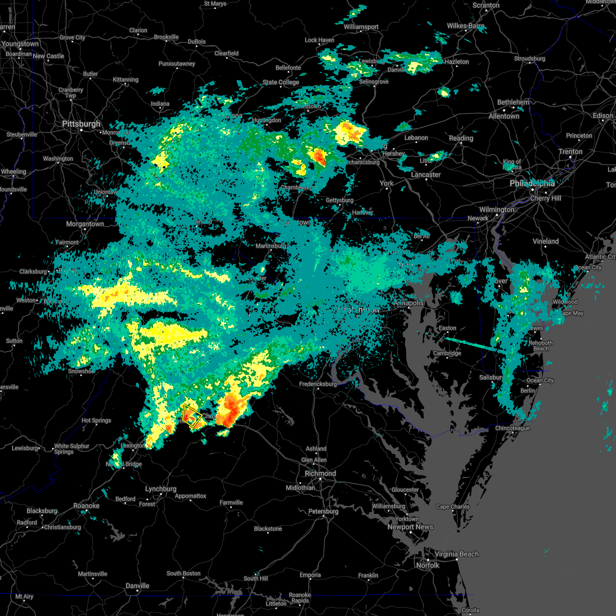 At 1151 pm edt, a severe thunderstorm was located near crimora, or 8 miles northeast of waynesboro, moving northeast at 30 mph (radar indicated). Hazards include 60 mph wind gusts. Damaging winds will cause some trees and large branches to fall. this could injure those outdoors, as well as damage homes and vehicles. roadways may become blocked by downed trees. localized power outages are possible. unsecured light objects may become projectiles. Locations impacted include, waynesboro, crozet, crimora, afton and greenwood. At 1151 pm edt, a severe thunderstorm was located near crimora, or 8 miles northeast of waynesboro, moving northeast at 30 mph (radar indicated). Hazards include 60 mph wind gusts. Damaging winds will cause some trees and large branches to fall. this could injure those outdoors, as well as damage homes and vehicles. roadways may become blocked by downed trees. localized power outages are possible. unsecured light objects may become projectiles. Locations impacted include, waynesboro, crozet, crimora, afton and greenwood.
|
| 8/31/2021 11:49 PM EDT |
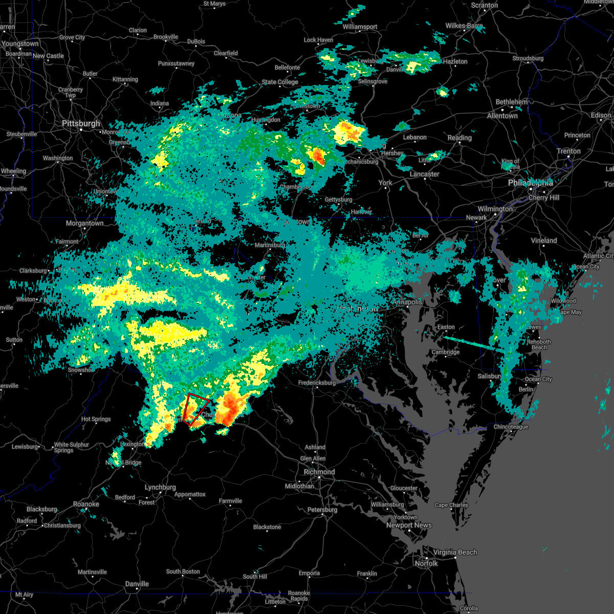 At 1148 pm edt, a severe thunderstorm capable of producing a tornado was located over afton, or near waynesboro, moving northeast at 30 mph (radar indicated rotation). Hazards include tornado. For those in the direct path of a tornado touchdown, flying debris will be dangerous to those caught without shelter. damage to roofs, siding, and windows may occur. mobile homes may be damaged or destroyed. tree damage is likely. this dangerous storm will be near, crimora around 1200 am edt. Other locations impacted by this tornadic thunderstorm include afton mountain and greenwood. At 1148 pm edt, a severe thunderstorm capable of producing a tornado was located over afton, or near waynesboro, moving northeast at 30 mph (radar indicated rotation). Hazards include tornado. For those in the direct path of a tornado touchdown, flying debris will be dangerous to those caught without shelter. damage to roofs, siding, and windows may occur. mobile homes may be damaged or destroyed. tree damage is likely. this dangerous storm will be near, crimora around 1200 am edt. Other locations impacted by this tornadic thunderstorm include afton mountain and greenwood.
|
| 8/31/2021 11:28 PM EDT |
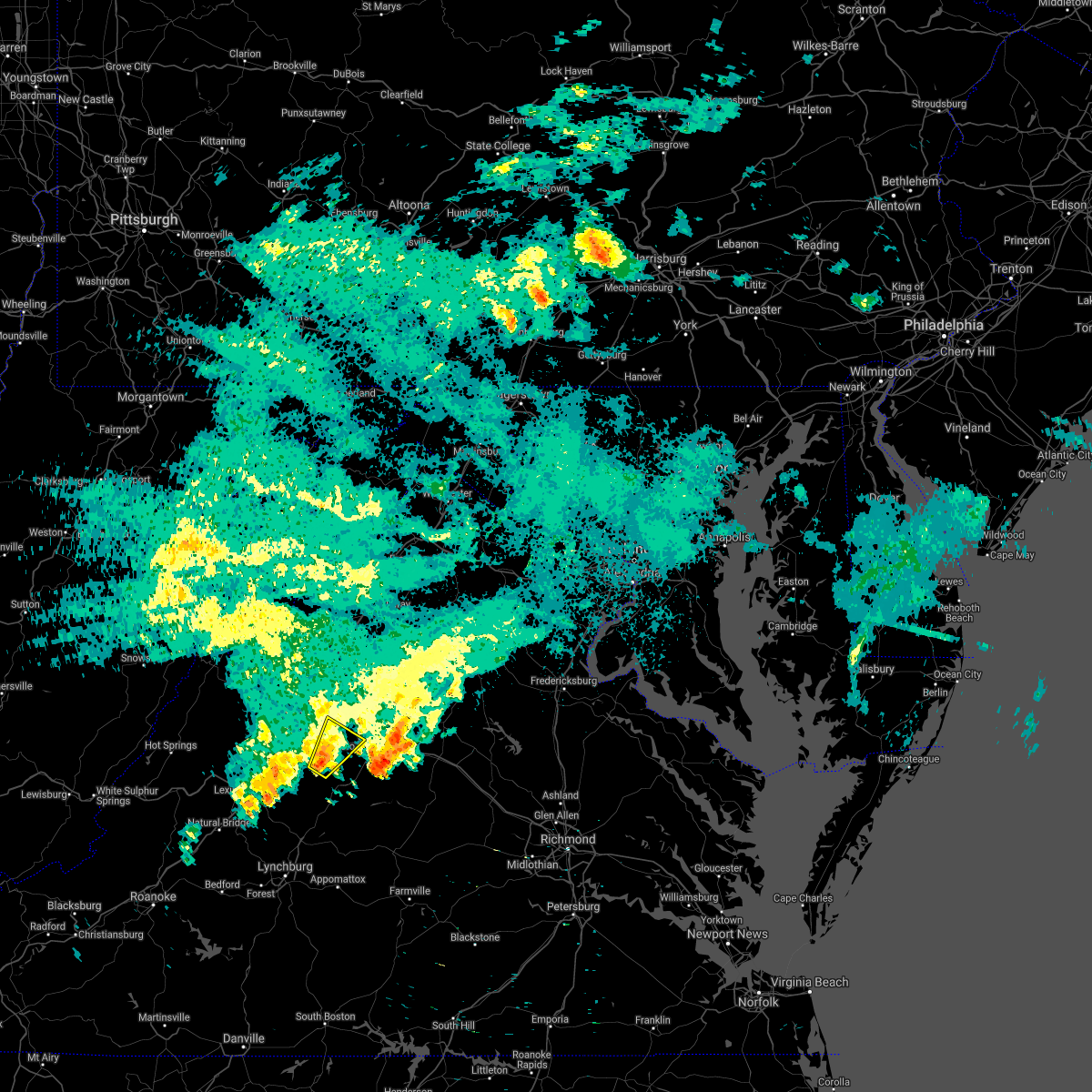 At 1128 pm edt, a severe thunderstorm was located near sherando, or near waynesboro, moving northeast at 30 mph (radar indicated). Hazards include 60 mph wind gusts. Damaging winds will cause some trees and large branches to fall. this could injure those outdoors, as well as damage homes and vehicles. roadways may become blocked by downed trees. localized power outages are possible. unsecured light objects may become projectiles. Locations impacted include, waynesboro, crozet, crimora, sherando, wintergreen, afton, lyndhurst, nellysford, greenfield, greenwood, yancey mills and afton mountain. At 1128 pm edt, a severe thunderstorm was located near sherando, or near waynesboro, moving northeast at 30 mph (radar indicated). Hazards include 60 mph wind gusts. Damaging winds will cause some trees and large branches to fall. this could injure those outdoors, as well as damage homes and vehicles. roadways may become blocked by downed trees. localized power outages are possible. unsecured light objects may become projectiles. Locations impacted include, waynesboro, crozet, crimora, sherando, wintergreen, afton, lyndhurst, nellysford, greenfield, greenwood, yancey mills and afton mountain.
|
| 8/31/2021 11:13 PM EDT |
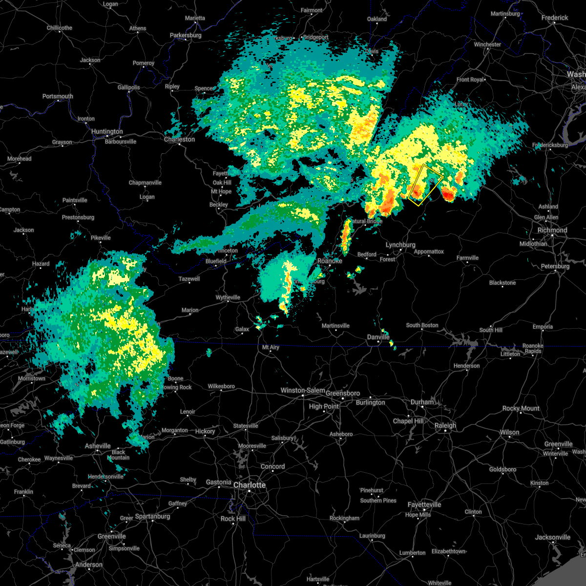 At 1112 pm edt, a severe thunderstorm was located over wintergreen, or 12 miles south of waynesboro, moving northeast at 30 mph (radar indicated). Hazards include 60 mph wind gusts. Damaging winds will cause some trees and large branches to fall. this could injure those outdoors, as well as damage homes and vehicles. roadways may become blocked by downed trees. localized power outages are possible. Unsecured light objects may become projectiles. At 1112 pm edt, a severe thunderstorm was located over wintergreen, or 12 miles south of waynesboro, moving northeast at 30 mph (radar indicated). Hazards include 60 mph wind gusts. Damaging winds will cause some trees and large branches to fall. this could injure those outdoors, as well as damage homes and vehicles. roadways may become blocked by downed trees. localized power outages are possible. Unsecured light objects may become projectiles.
|
| 8/13/2021 3:32 PM EDT | Tree down near intersection of rockfish gap turnpike and critzers shop rd in albemarle county VA, 5.5 miles WNW of Waynesboro, VA |
| 8/13/2021 2:51 PM EDT |
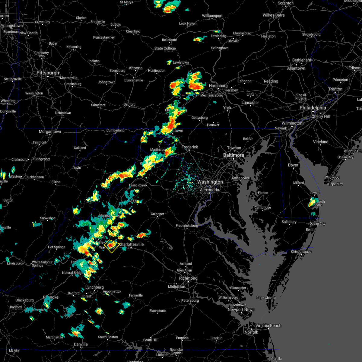 At 251 pm edt, a severe thunderstorm was located over waynesboro, and is nearly stationary (radar indicated). Hazards include 60 mph wind gusts. Damaging winds will cause some trees and large branches to fall. this could injure those outdoors, as well as damage homes and vehicles. roadways may become blocked by downed trees. localized power outages are possible. Unsecured light objects may become projectiles. At 251 pm edt, a severe thunderstorm was located over waynesboro, and is nearly stationary (radar indicated). Hazards include 60 mph wind gusts. Damaging winds will cause some trees and large branches to fall. this could injure those outdoors, as well as damage homes and vehicles. roadways may become blocked by downed trees. localized power outages are possible. Unsecured light objects may become projectiles.
|
| 7/27/2021 11:26 PM EDT | Three trees down on critzer shop road near rockfish gap turnpik in albemarle county VA, 5.5 miles WNW of Waynesboro, VA |
| 7/27/2021 11:25 PM EDT |
 The severe thunderstorm warning for northern nelson, west central albemarle, and southeastern augusta counties and the city of waynesboro will expire at 1130 pm edt, the storm which prompted the warning has moved out of the area. therefore, the warning will be allowed to expire. The severe thunderstorm warning for northern nelson, west central albemarle, and southeastern augusta counties and the city of waynesboro will expire at 1130 pm edt, the storm which prompted the warning has moved out of the area. therefore, the warning will be allowed to expire.
|
| 7/27/2021 11:14 PM EDT | Tree down on stagecoach road near afton mountain roa in nelson county VA, 3.7 miles NW of Waynesboro, VA |
| 7/27/2021 11:12 PM EDT | Tree down on old turnpike road near afton mountain roa in nelson county VA, 4.1 miles NW of Waynesboro, VA |
| 7/27/2021 11:08 PM EDT |
 At 1107 pm edt, a severe thunderstorm was located over afton, or near waynesboro, moving southeast at 30 mph (radar indicated). Hazards include 60 mph wind gusts and quarter size hail. Damaging winds will cause some trees and large branches to fall. this could injure those outdoors, as well as damage homes and vehicles. roadways may become blocked by downed trees. localized power outages are possible. unsecured light objects may become projectiles. Locations impacted include, waynesboro, stuarts draft, crozet, crimora, sherando, afton, fishersville, lyndhurst, ivy, greenwood, hermitage, batesville, yancey mills, flordon and afton mountain. At 1107 pm edt, a severe thunderstorm was located over afton, or near waynesboro, moving southeast at 30 mph (radar indicated). Hazards include 60 mph wind gusts and quarter size hail. Damaging winds will cause some trees and large branches to fall. this could injure those outdoors, as well as damage homes and vehicles. roadways may become blocked by downed trees. localized power outages are possible. unsecured light objects may become projectiles. Locations impacted include, waynesboro, stuarts draft, crozet, crimora, sherando, afton, fishersville, lyndhurst, ivy, greenwood, hermitage, batesville, yancey mills, flordon and afton mountain.
|
| 7/27/2021 10:54 PM EDT |
 At 1054 pm edt, a severe thunderstorm was located over waynesboro, moving southeast at 30 mph (radar indicated). Hazards include 60 mph wind gusts and quarter size hail. Damaging winds will cause some trees and large branches to fall. this could injure those outdoors, as well as damage homes and vehicles. roadways may become blocked by downed trees. localized power outages are possible. Unsecured light objects may become projectiles. At 1054 pm edt, a severe thunderstorm was located over waynesboro, moving southeast at 30 mph (radar indicated). Hazards include 60 mph wind gusts and quarter size hail. Damaging winds will cause some trees and large branches to fall. this could injure those outdoors, as well as damage homes and vehicles. roadways may become blocked by downed trees. localized power outages are possible. Unsecured light objects may become projectiles.
|
| 7/26/2021 2:57 PM EDT |
 The severe thunderstorm warning for northeastern nelson, west central albemarle, and southeastern augusta counties and the city of waynesboro will expire at 300 pm edt, the storm which prompted the warning has moved out of the area. therefore, the warning will be allowed to expire. a severe thunderstorm watch remains in effect until 800 pm edt for central virginia. The severe thunderstorm warning for northeastern nelson, west central albemarle, and southeastern augusta counties and the city of waynesboro will expire at 300 pm edt, the storm which prompted the warning has moved out of the area. therefore, the warning will be allowed to expire. a severe thunderstorm watch remains in effect until 800 pm edt for central virginia.
|
| 7/26/2021 2:31 PM EDT |
 At 231 pm edt, a severe thunderstorm was located near afton, or 7 miles south of waynesboro, moving southeast at 35 mph (radar indicated). Hazards include 60 mph wind gusts and quarter size hail. Damaging winds will cause some trees and large branches to fall. this could injure those outdoors, as well as damage homes and vehicles. roadways may become blocked by downed trees. localized power outages are possible. unsecured light objects may become projectiles. Locations impacted include, waynesboro, stuarts draft, sherando, wintergreen, afton, fishersville, lyndhurst, nellysford, north garden, batesville, covesville, greenfield, faber and afton mountain. At 231 pm edt, a severe thunderstorm was located near afton, or 7 miles south of waynesboro, moving southeast at 35 mph (radar indicated). Hazards include 60 mph wind gusts and quarter size hail. Damaging winds will cause some trees and large branches to fall. this could injure those outdoors, as well as damage homes and vehicles. roadways may become blocked by downed trees. localized power outages are possible. unsecured light objects may become projectiles. Locations impacted include, waynesboro, stuarts draft, sherando, wintergreen, afton, fishersville, lyndhurst, nellysford, north garden, batesville, covesville, greenfield, faber and afton mountain.
|
| 7/26/2021 2:14 PM EDT |
 At 214 pm edt, a severe thunderstorm was located near stuarts draft, or near waynesboro, moving southeast at 35 mph (radar indicated). Hazards include 60 mph wind gusts and half dollar size hail. Damaging winds will cause some trees and large branches to fall. this could injure those outdoors, as well as damage homes and vehicles. roadways may become blocked by downed trees. localized power outages are possible. Unsecured light objects may become projectiles. At 214 pm edt, a severe thunderstorm was located near stuarts draft, or near waynesboro, moving southeast at 35 mph (radar indicated). Hazards include 60 mph wind gusts and half dollar size hail. Damaging winds will cause some trees and large branches to fall. this could injure those outdoors, as well as damage homes and vehicles. roadways may become blocked by downed trees. localized power outages are possible. Unsecured light objects may become projectiles.
|
| 7/26/2021 2:03 PM EDT |
 At 203 pm edt, a severe thunderstorm was located over staunton, moving southeast at 25 mph (radar indicated). Hazards include ping pong ball size hail and 60 mph wind gusts. Damaging winds will cause some trees and large branches to fall. this could injure those outdoors, as well as damage homes and vehicles. roadways may become blocked by downed trees. localized power outages are possible. unsecured light objects may become projectiles. Locations impacted include, staunton, waynesboro, stuarts draft, fishersville, verona and lyndhurst. At 203 pm edt, a severe thunderstorm was located over staunton, moving southeast at 25 mph (radar indicated). Hazards include ping pong ball size hail and 60 mph wind gusts. Damaging winds will cause some trees and large branches to fall. this could injure those outdoors, as well as damage homes and vehicles. roadways may become blocked by downed trees. localized power outages are possible. unsecured light objects may become projectiles. Locations impacted include, staunton, waynesboro, stuarts draft, fishersville, verona and lyndhurst.
|
| 7/26/2021 1:53 PM EDT |
 At 153 pm edt, a severe thunderstorm was located over staunton, moving southeast at 30 mph (radar indicated). Hazards include 60 mph wind gusts and quarter size hail. Damaging winds will cause some trees and large branches to fall. this could injure those outdoors, as well as damage homes and vehicles. roadways may become blocked by downed trees. localized power outages are possible. unsecured light objects may become projectiles. Locations impacted include, staunton, waynesboro, stuarts draft, fishersville, verona and lyndhurst. At 153 pm edt, a severe thunderstorm was located over staunton, moving southeast at 30 mph (radar indicated). Hazards include 60 mph wind gusts and quarter size hail. Damaging winds will cause some trees and large branches to fall. this could injure those outdoors, as well as damage homes and vehicles. roadways may become blocked by downed trees. localized power outages are possible. unsecured light objects may become projectiles. Locations impacted include, staunton, waynesboro, stuarts draft, fishersville, verona and lyndhurst.
|
| 7/26/2021 1:34 PM EDT |
 At 134 pm edt, a severe thunderstorm was located near staunton, moving southeast at 30 mph (radar indicated). Hazards include 60 mph wind gusts and quarter size hail. Damaging winds will cause some trees and large branches to fall. this could injure those outdoors, as well as damage homes and vehicles. roadways may become blocked by downed trees. localized power outages are possible. Unsecured light objects may become projectiles. At 134 pm edt, a severe thunderstorm was located near staunton, moving southeast at 30 mph (radar indicated). Hazards include 60 mph wind gusts and quarter size hail. Damaging winds will cause some trees and large branches to fall. this could injure those outdoors, as well as damage homes and vehicles. roadways may become blocked by downed trees. localized power outages are possible. Unsecured light objects may become projectiles.
|
| 6/13/2021 4:05 PM EDT | A few trees and wires blew down in the stuarts draft are in augusta county VA, 4 miles ENE of Waynesboro, VA |
| 6/13/2021 4:05 PM EDT |
 At 405 pm edt, a severe thunderstorm was located near stuarts draft, or near waynesboro, moving southeast at 10 mph (radar indicated). Hazards include 60 mph wind gusts and quarter size hail. Damaging winds will cause some trees and large branches to fall. this could injure those outdoors, as well as damage homes and vehicles. roadways may become blocked by downed trees. localized power outages are possible. unsecured light objects may become projectiles. Locations impacted include, waynesboro, stuarts draft and fishersville. At 405 pm edt, a severe thunderstorm was located near stuarts draft, or near waynesboro, moving southeast at 10 mph (radar indicated). Hazards include 60 mph wind gusts and quarter size hail. Damaging winds will cause some trees and large branches to fall. this could injure those outdoors, as well as damage homes and vehicles. roadways may become blocked by downed trees. localized power outages are possible. unsecured light objects may become projectiles. Locations impacted include, waynesboro, stuarts draft and fishersville.
|
| 6/13/2021 4:04 PM EDT |
 At 404 pm edt, a severe thunderstorm was located near stuarts draft, or near waynesboro, moving southeast at 15 mph (radar indicated). Hazards include 60 mph wind gusts and quarter size hail. Damaging winds will cause some trees and large branches to fall. this could injure those outdoors, as well as damage homes and vehicles. roadways may become blocked by downed trees. localized power outages are possible. Unsecured light objects may become projectiles. At 404 pm edt, a severe thunderstorm was located near stuarts draft, or near waynesboro, moving southeast at 15 mph (radar indicated). Hazards include 60 mph wind gusts and quarter size hail. Damaging winds will cause some trees and large branches to fall. this could injure those outdoors, as well as damage homes and vehicles. roadways may become blocked by downed trees. localized power outages are possible. Unsecured light objects may become projectiles.
|
| 6/13/2021 3:56 PM EDT |
 At 356 pm edt, a severe thunderstorm was located near staunton, moving southeast at 10 mph (radar indicated). Hazards include 60 mph wind gusts and quarter size hail. Damaging winds will cause some trees and large branches to fall. this could injure those outdoors, as well as damage homes and vehicles. roadways may become blocked by downed trees. localized power outages are possible. unsecured light objects may become projectiles. Locations impacted include, staunton, waynesboro, stuarts draft, fishersville and verona. At 356 pm edt, a severe thunderstorm was located near staunton, moving southeast at 10 mph (radar indicated). Hazards include 60 mph wind gusts and quarter size hail. Damaging winds will cause some trees and large branches to fall. this could injure those outdoors, as well as damage homes and vehicles. roadways may become blocked by downed trees. localized power outages are possible. unsecured light objects may become projectiles. Locations impacted include, staunton, waynesboro, stuarts draft, fishersville and verona.
|
| 6/13/2021 3:46 PM EDT |
 At 346 pm edt, a severe thunderstorm was located over staunton, moving southeast at 10 mph (radar indicated). Hazards include 60 mph wind gusts and quarter size hail. Damaging winds will cause some trees and large branches to fall. this could injure those outdoors, as well as damage homes and vehicles. roadways may become blocked by downed trees. localized power outages are possible. Unsecured light objects may become projectiles. At 346 pm edt, a severe thunderstorm was located over staunton, moving southeast at 10 mph (radar indicated). Hazards include 60 mph wind gusts and quarter size hail. Damaging winds will cause some trees and large branches to fall. this could injure those outdoors, as well as damage homes and vehicles. roadways may become blocked by downed trees. localized power outages are possible. Unsecured light objects may become projectiles.
|
| 5/4/2021 3:09 PM EDT |
 The severe thunderstorm warning for southeastern augusta and the city of waynesboro will expire at 315 pm edt, the storm which prompted the warning has weakened below severe limits, and no longer poses an immediate threat to life or property. therefore, the warning will be allowed to expire. a severe thunderstorm watch remains in effect until 800 pm edt for western and central virginia. to report severe weather, contact your nearest law enforcement agency. they will relay your report to the national weather service sterling virginia. remember, a severe thunderstorm warning still remains in effect for a different storm in southeast augusta county southeast of spotswood. The severe thunderstorm warning for southeastern augusta and the city of waynesboro will expire at 315 pm edt, the storm which prompted the warning has weakened below severe limits, and no longer poses an immediate threat to life or property. therefore, the warning will be allowed to expire. a severe thunderstorm watch remains in effect until 800 pm edt for western and central virginia. to report severe weather, contact your nearest law enforcement agency. they will relay your report to the national weather service sterling virginia. remember, a severe thunderstorm warning still remains in effect for a different storm in southeast augusta county southeast of spotswood.
|
| 5/4/2021 2:32 PM EDT |
 At 231 pm edt, a severe thunderstorm was located near vesuvius, or 11 miles east of rockbridge baths, moving northeast at 25 mph (radar indicated). Hazards include 60 mph wind gusts and quarter size hail. Damaging winds will cause some trees and large branches to fall. this could injure those outdoors, as well as damage homes and vehicles. roadways may become blocked by downed trees. localized power outages are possible. Unsecured light objects may become projectiles. At 231 pm edt, a severe thunderstorm was located near vesuvius, or 11 miles east of rockbridge baths, moving northeast at 25 mph (radar indicated). Hazards include 60 mph wind gusts and quarter size hail. Damaging winds will cause some trees and large branches to fall. this could injure those outdoors, as well as damage homes and vehicles. roadways may become blocked by downed trees. localized power outages are possible. Unsecured light objects may become projectiles.
|
| 8/7/2020 7:50 PM EDT |
 The severe thunderstorm warning for southeastern augusta and the city of waynesboro will expire at 800 pm edt, the storm which prompted the warning has weakened below severe limits, and no longer poses an immediate threat to life or property. therefore, the warning will be allowed to expire. to report severe weather, contact your nearest law enforcement agency. they will relay your report to the national weather service sterling virginia. The severe thunderstorm warning for southeastern augusta and the city of waynesboro will expire at 800 pm edt, the storm which prompted the warning has weakened below severe limits, and no longer poses an immediate threat to life or property. therefore, the warning will be allowed to expire. to report severe weather, contact your nearest law enforcement agency. they will relay your report to the national weather service sterling virginia.
|
| 8/7/2020 7:32 PM EDT |
 At 731 pm edt, a severe thunderstorm was located over stuarts draft, or near waynesboro, moving southeast at 20 mph (radar indicated). Hazards include 60 mph wind gusts. Damaging winds will cause some trees and large branches to fall. this could injure those outdoors, as well as damage homes and vehicles. roadways may become blocked by downed trees. localized power outages are possible. unsecured light objects may become projectiles. Locations impacted include, waynesboro, stuarts draft, sherando, fishersville, lyndhurst and afton mountain. At 731 pm edt, a severe thunderstorm was located over stuarts draft, or near waynesboro, moving southeast at 20 mph (radar indicated). Hazards include 60 mph wind gusts. Damaging winds will cause some trees and large branches to fall. this could injure those outdoors, as well as damage homes and vehicles. roadways may become blocked by downed trees. localized power outages are possible. unsecured light objects may become projectiles. Locations impacted include, waynesboro, stuarts draft, sherando, fishersville, lyndhurst and afton mountain.
|
| 8/7/2020 7:08 PM EDT |
 At 708 pm edt, a severe thunderstorm was located near stuarts draft, or near staunton, moving southeast at 20 mph (radar indicated). Hazards include 60 mph wind gusts. Damaging winds will cause some trees and large branches to fall. this could injure those outdoors, as well as damage homes and vehicles. roadways may become blocked by downed trees. localized power outages are possible. Unsecured light objects may become projectiles. At 708 pm edt, a severe thunderstorm was located near stuarts draft, or near staunton, moving southeast at 20 mph (radar indicated). Hazards include 60 mph wind gusts. Damaging winds will cause some trees and large branches to fall. this could injure those outdoors, as well as damage homes and vehicles. roadways may become blocked by downed trees. localized power outages are possible. Unsecured light objects may become projectiles.
|
| 8/7/2020 5:33 PM EDT |
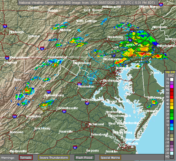 At 533 pm edt, a severe thunderstorm was located over crimora, or near waynesboro, moving southeast at 15 mph (radar indicated). Hazards include 60 mph wind gusts. Damaging winds will cause some trees and large branches to fall. this could injure those outdoors, as well as damage homes and vehicles. roadways may become blocked by downed trees. localized power outages are possible. unsecured light objects may become projectiles. Locations impacted include, waynesboro, crimora, new hope and hermitage. At 533 pm edt, a severe thunderstorm was located over crimora, or near waynesboro, moving southeast at 15 mph (radar indicated). Hazards include 60 mph wind gusts. Damaging winds will cause some trees and large branches to fall. this could injure those outdoors, as well as damage homes and vehicles. roadways may become blocked by downed trees. localized power outages are possible. unsecured light objects may become projectiles. Locations impacted include, waynesboro, crimora, new hope and hermitage.
|
| 8/7/2020 5:13 PM EDT |
 At 512 pm edt, a severe thunderstorm was located near crimora, or 8 miles northeast of staunton, moving southeast at 20 mph (radar indicated). Hazards include 60 mph wind gusts and quarter size hail. Damaging winds will cause some trees and large branches to fall. this could injure those outdoors, as well as damage homes and vehicles. roadways may become blocked by downed trees. localized power outages are possible. Unsecured light objects may become projectiles. At 512 pm edt, a severe thunderstorm was located near crimora, or 8 miles northeast of staunton, moving southeast at 20 mph (radar indicated). Hazards include 60 mph wind gusts and quarter size hail. Damaging winds will cause some trees and large branches to fall. this could injure those outdoors, as well as damage homes and vehicles. roadways may become blocked by downed trees. localized power outages are possible. Unsecured light objects may become projectiles.
|
| 8/6/2020 3:47 PM EDT |
 At 347 pm edt, a severe thunderstorm was located just north of staunton, and is nearly stationary (radar indicated). Hazards include isolated damaging wind gusts up to 60 mph. Damaging winds will cause some trees and large branches to fall. this could injure those outdoors, as well as damage homes and vehicles. roadways may become blocked by downed trees. localized power outages are possible. Unsecured light objects may become projectiles. At 347 pm edt, a severe thunderstorm was located just north of staunton, and is nearly stationary (radar indicated). Hazards include isolated damaging wind gusts up to 60 mph. Damaging winds will cause some trees and large branches to fall. this could injure those outdoors, as well as damage homes and vehicles. roadways may become blocked by downed trees. localized power outages are possible. Unsecured light objects may become projectiles.
|
| 7/22/2020 1:11 PM EDT |
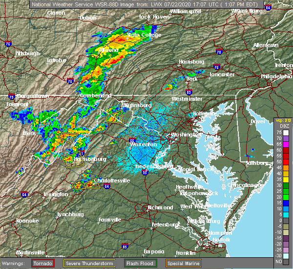 The severe thunderstorm warning for northern nelson, west central albemarle, and east central augusta counties and the southeastern city of waynesboro will expire at 115 pm edt, the storm which prompted the warning has weakened below severe limits, and no longer poses an immediate threat to life or property. therefore, the warning will be allowed to expire. however gusty winds are still possible with this thunderstorm. a severe thunderstorm watch remains in effect until 700 pm edt for central and western virginia. The severe thunderstorm warning for northern nelson, west central albemarle, and east central augusta counties and the southeastern city of waynesboro will expire at 115 pm edt, the storm which prompted the warning has weakened below severe limits, and no longer poses an immediate threat to life or property. therefore, the warning will be allowed to expire. however gusty winds are still possible with this thunderstorm. a severe thunderstorm watch remains in effect until 700 pm edt for central and western virginia.
|
| 7/22/2020 1:03 PM EDT |
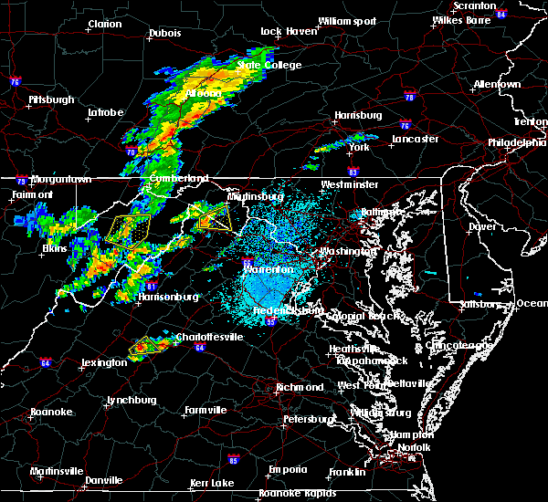 At 103 pm edt, a severe thunderstorm was located over afton, or near waynesboro, moving east at 10 mph (radar indicated). Hazards include 60 mph wind gusts and quarter size hail. Damaging winds will cause some trees and large branches to fall. this could injure those outdoors, as well as damage homes and vehicles. roadways may become blocked by downed trees. localized power outages are possible. unsecured light objects may become projectiles. Locations impacted include, waynesboro, afton, yancey mills, afton mountain, greenwood and batesville. At 103 pm edt, a severe thunderstorm was located over afton, or near waynesboro, moving east at 10 mph (radar indicated). Hazards include 60 mph wind gusts and quarter size hail. Damaging winds will cause some trees and large branches to fall. this could injure those outdoors, as well as damage homes and vehicles. roadways may become blocked by downed trees. localized power outages are possible. unsecured light objects may become projectiles. Locations impacted include, waynesboro, afton, yancey mills, afton mountain, greenwood and batesville.
|
| 7/22/2020 12:48 PM EDT | Numerous trees down in the 600 block of afton mountain roa in nelson county VA, 4.1 miles NW of Waynesboro, VA |
| 7/22/2020 12:48 PM EDT | Numerous trees down in the 1700 block of afton mountain roa in nelson county VA, 4.5 miles NW of Waynesboro, VA |
| 7/22/2020 12:39 PM EDT |
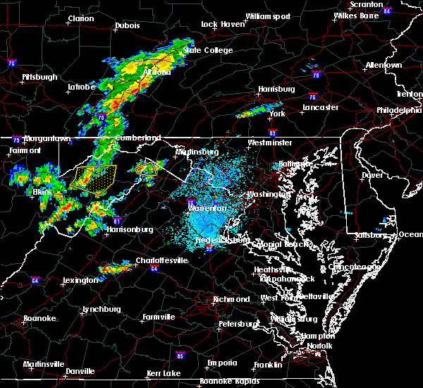 At 1239 pm edt, a severe thunderstorm was located over sherando, or near waynesboro, moving northeast at 10 mph (radar indicated). Hazards include 60 mph wind gusts and quarter size hail. Damaging winds will cause some trees and large branches to fall. this could injure those outdoors, as well as damage homes and vehicles. roadways may become blocked by downed trees. localized power outages are possible. Unsecured light objects may become projectiles. At 1239 pm edt, a severe thunderstorm was located over sherando, or near waynesboro, moving northeast at 10 mph (radar indicated). Hazards include 60 mph wind gusts and quarter size hail. Damaging winds will cause some trees and large branches to fall. this could injure those outdoors, as well as damage homes and vehicles. roadways may become blocked by downed trees. localized power outages are possible. Unsecured light objects may become projectiles.
|
| 7/21/2020 5:49 PM EDT | Trees down in the area of crimora in augusta county VA, 7.1 miles SW of Waynesboro, VA |
| 7/6/2020 5:00 PM EDT |
 At 500 pm edt, a severe thunderstorm was located over afton, or over waynesboro, and is nearly stationary (radar indicated). Hazards include 60 mph wind gusts. Damaging winds will cause some trees and large branches to fall. this could injure those outdoors, as well as damage homes and vehicles. roadways may become blocked by downed trees. localized power outages are possible. unsecured light objects may become projectiles. Locations impacted include, waynesboro, stuarts draft, sherando, fishersville, lyndhurst and afton mountain. At 500 pm edt, a severe thunderstorm was located over afton, or over waynesboro, and is nearly stationary (radar indicated). Hazards include 60 mph wind gusts. Damaging winds will cause some trees and large branches to fall. this could injure those outdoors, as well as damage homes and vehicles. roadways may become blocked by downed trees. localized power outages are possible. unsecured light objects may become projectiles. Locations impacted include, waynesboro, stuarts draft, sherando, fishersville, lyndhurst and afton mountain.
|
| 7/6/2020 4:43 PM EDT |
 At 443 pm edt, a severe thunderstorm was located over waynesboro, and is nearly stationary (radar indicated). Hazards include 60 mph wind gusts. Damaging winds will cause some trees and large branches to fall. this could injure those outdoors, as well as damage homes and vehicles. roadways may become blocked by downed trees. localized power outages are possible. Unsecured light objects may become projectiles. At 443 pm edt, a severe thunderstorm was located over waynesboro, and is nearly stationary (radar indicated). Hazards include 60 mph wind gusts. Damaging winds will cause some trees and large branches to fall. this could injure those outdoors, as well as damage homes and vehicles. roadways may become blocked by downed trees. localized power outages are possible. Unsecured light objects may become projectiles.
|
| 7/6/2020 4:36 PM EDT | Tree blocking roadway at the intersection of rosser ave and south ellison l in city of waynesboro county VA, 1.2 miles ESE of Waynesboro, VA |
| 7/5/2020 5:42 PM EDT |
 At 542 pm edt, a severe thunderstorm was located near staunton, moving southeast at 10 mph (radar indicated). Hazards include 60 mph wind gusts and quarter size hail. Damaging winds will cause some trees and large branches to fall. this could injure those outdoors, as well as damage homes and vehicles. roadways may become blocked by downed trees. localized power outages are possible. Unsecured light objects may become projectiles. At 542 pm edt, a severe thunderstorm was located near staunton, moving southeast at 10 mph (radar indicated). Hazards include 60 mph wind gusts and quarter size hail. Damaging winds will cause some trees and large branches to fall. this could injure those outdoors, as well as damage homes and vehicles. roadways may become blocked by downed trees. localized power outages are possible. Unsecured light objects may become projectiles.
|
| 7/5/2020 5:37 PM EDT |
 The severe thunderstorm warning for southeastern augusta , the city of staunton and the city of waynesboro will expire at 545 pm edt, the storm which prompted the warning has moved out of the area. therefore, the warning will be allowed to expire. The severe thunderstorm warning for southeastern augusta , the city of staunton and the city of waynesboro will expire at 545 pm edt, the storm which prompted the warning has moved out of the area. therefore, the warning will be allowed to expire.
|
| 7/5/2020 4:55 PM EDT |
 At 455 pm edt, a severe thunderstorm was located near staunton, moving southeast at 15 mph (radar indicated). Hazards include 60 mph wind gusts and quarter size hail. Damaging winds will cause some trees and large branches to fall. this could injure those outdoors, as well as damage homes and vehicles. roadways may become blocked by downed trees. localized power outages are possible. Unsecured light objects may become projectiles. At 455 pm edt, a severe thunderstorm was located near staunton, moving southeast at 15 mph (radar indicated). Hazards include 60 mph wind gusts and quarter size hail. Damaging winds will cause some trees and large branches to fall. this could injure those outdoors, as well as damage homes and vehicles. roadways may become blocked by downed trees. localized power outages are possible. Unsecured light objects may become projectiles.
|
| 6/4/2020 4:22 PM EDT |
 At 422 pm edt, a severe thunderstorm was located over vesuvius, or 13 miles east of rockbridge baths, moving northeast at 25 mph (radar indicated). Hazards include 60 mph wind gusts and quarter size hail. Damaging winds will cause some trees and large branches to fall. this could injure those outdoors, as well as damage homes and vehicles. roadways may become blocked by downed trees. localized power outages are possible. Unsecured light objects may become projectiles. At 422 pm edt, a severe thunderstorm was located over vesuvius, or 13 miles east of rockbridge baths, moving northeast at 25 mph (radar indicated). Hazards include 60 mph wind gusts and quarter size hail. Damaging winds will cause some trees and large branches to fall. this could injure those outdoors, as well as damage homes and vehicles. roadways may become blocked by downed trees. localized power outages are possible. Unsecured light objects may become projectiles.
|
| 6/4/2020 3:50 PM EDT |
 At 350 pm edt, a severe thunderstorm was located over buena vista, moving northeast at 30 mph (radar indicated). Hazards include 60 mph wind gusts and quarter size hail. Damaging winds will cause some trees and large branches to fall. this could injure those outdoors, as well as damage homes and vehicles. roadways may become blocked by downed trees. localized power outages are possible. Unsecured light objects may become projectiles. At 350 pm edt, a severe thunderstorm was located over buena vista, moving northeast at 30 mph (radar indicated). Hazards include 60 mph wind gusts and quarter size hail. Damaging winds will cause some trees and large branches to fall. this could injure those outdoors, as well as damage homes and vehicles. roadways may become blocked by downed trees. localized power outages are possible. Unsecured light objects may become projectiles.
|
| 4/9/2020 4:05 AM EDT |
 The severe thunderstorm warning for augusta , the city of staunton and the city of waynesboro will expire at 415 am edt, the storms which prompted the warning have moved out of the area. therefore, the warning will be allowed to expire. a severe thunderstorm watch remains in effect until 600 am edt for central and western virginia. to report severe weather, contact your nearest law enforcement agency. they will relay your report to the national weather service sterling virginia. The severe thunderstorm warning for augusta , the city of staunton and the city of waynesboro will expire at 415 am edt, the storms which prompted the warning have moved out of the area. therefore, the warning will be allowed to expire. a severe thunderstorm watch remains in effect until 600 am edt for central and western virginia. to report severe weather, contact your nearest law enforcement agency. they will relay your report to the national weather service sterling virginia.
|
| 4/9/2020 3:55 AM EDT |
 At 355 am edt, severe thunderstorms were located along a line extending from 6 miles southwest of bridgewater to 6 miles northwest of stuarts draft, moving east at 60 mph (radar indicated). Hazards include 60 mph wind gusts. Damaging winds will cause some trees and large branches to fall. this could injure those outdoors, as well as damage homes and vehicles. roadways may become blocked by downed trees. localized power outages are possible. unsecured light objects may become projectiles. Locations impacted include, staunton, waynesboro, stuarts draft, grottoes, crimora, sherando, fishersville, verona, weyers cave, lyndhurst, greenville, new hope, mount sidney, augusta springs, middlebrook, churchville, hermitage, moscow, buffalo gap and afton mountain. At 355 am edt, severe thunderstorms were located along a line extending from 6 miles southwest of bridgewater to 6 miles northwest of stuarts draft, moving east at 60 mph (radar indicated). Hazards include 60 mph wind gusts. Damaging winds will cause some trees and large branches to fall. this could injure those outdoors, as well as damage homes and vehicles. roadways may become blocked by downed trees. localized power outages are possible. unsecured light objects may become projectiles. Locations impacted include, staunton, waynesboro, stuarts draft, grottoes, crimora, sherando, fishersville, verona, weyers cave, lyndhurst, greenville, new hope, mount sidney, augusta springs, middlebrook, churchville, hermitage, moscow, buffalo gap and afton mountain.
|
| 4/9/2020 3:44 AM EDT |
 At 344 am edt, severe thunderstorms were located along a line extending from 14 miles northwest of staunton to near brownsburg, moving east at 65 mph (radar indicated). Hazards include 60 mph wind gusts. Damaging winds will cause some trees and large branches to fall. this could injure those outdoors, as well as damage homes and vehicles. roadways may become blocked by downed trees. localized power outages are possible. unsecured light objects may become projectiles. Locations impacted include, staunton, waynesboro, stuarts draft, grottoes, crimora, sherando, fishersville, verona, weyers cave, lyndhurst, craigsville, greenville, new hope, mount sidney, augusta springs, middlebrook, churchville, deerfield, hermitage and moscow. At 344 am edt, severe thunderstorms were located along a line extending from 14 miles northwest of staunton to near brownsburg, moving east at 65 mph (radar indicated). Hazards include 60 mph wind gusts. Damaging winds will cause some trees and large branches to fall. this could injure those outdoors, as well as damage homes and vehicles. roadways may become blocked by downed trees. localized power outages are possible. unsecured light objects may become projectiles. Locations impacted include, staunton, waynesboro, stuarts draft, grottoes, crimora, sherando, fishersville, verona, weyers cave, lyndhurst, craigsville, greenville, new hope, mount sidney, augusta springs, middlebrook, churchville, deerfield, hermitage and moscow.
|
| 4/9/2020 3:14 AM EDT |
 At 314 am edt, severe thunderstorms were located along a line extending from near burnsville to near nimrod hall, moving east at 65 mph (radar indicated). Hazards include 60 mph wind gusts and quarter size hail. Damaging winds will cause some trees and large branches to fall. this could injure those outdoors, as well as damage homes and vehicles. roadways may become blocked by downed trees. localized power outages are possible. Unsecured light objects may become projectiles. At 314 am edt, severe thunderstorms were located along a line extending from near burnsville to near nimrod hall, moving east at 65 mph (radar indicated). Hazards include 60 mph wind gusts and quarter size hail. Damaging winds will cause some trees and large branches to fall. this could injure those outdoors, as well as damage homes and vehicles. roadways may become blocked by downed trees. localized power outages are possible. Unsecured light objects may become projectiles.
|
| 4/8/2020 5:54 AM EDT |
 At 554 am edt, severe thunderstorms were located along a line extending from 9 miles southwest of bridgewater to 6 miles southwest of staunton to near bells valley, moving southeast at 55 mph (radar indicated). Hazards include 60 mph wind gusts and quarter size hail. Damaging winds will cause some trees and large branches to fall. this could injure those outdoors, as well as damage homes and vehicles. roadways may become blocked by downed trees. localized power outages are possible. unsecured light objects may become projectiles. Locations impacted include, staunton, waynesboro, stuarts draft, crimora, sherando, fishersville, verona, lyndhurst, greenville, new hope, mount sidney, middlebrook, churchville, hermitage, mint spring, summerdean, trimbles mill, christian, fort defiance and swoope. At 554 am edt, severe thunderstorms were located along a line extending from 9 miles southwest of bridgewater to 6 miles southwest of staunton to near bells valley, moving southeast at 55 mph (radar indicated). Hazards include 60 mph wind gusts and quarter size hail. Damaging winds will cause some trees and large branches to fall. this could injure those outdoors, as well as damage homes and vehicles. roadways may become blocked by downed trees. localized power outages are possible. unsecured light objects may become projectiles. Locations impacted include, staunton, waynesboro, stuarts draft, crimora, sherando, fishersville, verona, lyndhurst, greenville, new hope, mount sidney, middlebrook, churchville, hermitage, mint spring, summerdean, trimbles mill, christian, fort defiance and swoope.
|
| 4/8/2020 5:32 AM EDT |
 At 532 am edt, a severe thunderstorm was located 15 miles northwest of staunton, moving southeast at 70 mph (radar indicated). Hazards include 60 mph wind gusts and quarter size hail. Damaging winds will cause some trees and large branches to fall. this could injure those outdoors, as well as damage homes and vehicles. roadways may become blocked by downed trees. localized power outages are possible. Unsecured light objects may become projectiles. At 532 am edt, a severe thunderstorm was located 15 miles northwest of staunton, moving southeast at 70 mph (radar indicated). Hazards include 60 mph wind gusts and quarter size hail. Damaging winds will cause some trees and large branches to fall. this could injure those outdoors, as well as damage homes and vehicles. roadways may become blocked by downed trees. localized power outages are possible. Unsecured light objects may become projectiles.
|
| 9/28/2019 3:26 PM EDT |
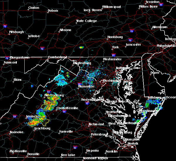 The severe thunderstorm warning for southeastern rockingham, northwestern albemarle, and east central augusta counties and the northeastern city of waynesboro will expire at 330 pm edt, the storm which prompted the warning has weakened below severe limits, and has exited the warned area. therefore, the warning will be allowed to expire. however gusty winds are still possible with this thunderstorm. to report severe weather, contact your nearest law enforcement agency. they will relay your report to the national weather service sterling virginia. remember, a severe thunderstorm warning still remains in effect for portions of augusta and albemarle counties until 4 pm. The severe thunderstorm warning for southeastern rockingham, northwestern albemarle, and east central augusta counties and the northeastern city of waynesboro will expire at 330 pm edt, the storm which prompted the warning has weakened below severe limits, and has exited the warned area. therefore, the warning will be allowed to expire. however gusty winds are still possible with this thunderstorm. to report severe weather, contact your nearest law enforcement agency. they will relay your report to the national weather service sterling virginia. remember, a severe thunderstorm warning still remains in effect for portions of augusta and albemarle counties until 4 pm.
|
| 9/28/2019 3:06 PM EDT |
 At 305 pm edt, a severe thunderstorm was located over crimora, or near waynesboro, moving east at 15 mph (radar indicated). Hazards include 60 mph wind gusts and quarter size hail. Damaging winds will cause some trees and large branches to fall. this could injure those outdoors, as well as damage homes and vehicles. roadways may become blocked by downed trees. localized power outages are possible. unsecured light objects may become projectiles. Locations impacted include, waynesboro, crimora, fishersville, new hope and hermitage. At 305 pm edt, a severe thunderstorm was located over crimora, or near waynesboro, moving east at 15 mph (radar indicated). Hazards include 60 mph wind gusts and quarter size hail. Damaging winds will cause some trees and large branches to fall. this could injure those outdoors, as well as damage homes and vehicles. roadways may become blocked by downed trees. localized power outages are possible. unsecured light objects may become projectiles. Locations impacted include, waynesboro, crimora, fishersville, new hope and hermitage.
|
| 9/28/2019 2:52 PM EDT |
 At 252 pm edt, a severe thunderstorm was located near crimora, or near waynesboro, moving east at 15 mph (radar indicated). Hazards include 60 mph wind gusts. Damaging winds will cause some trees and large branches to fall. this could injure those outdoors, as well as damage homes and vehicles. roadways may become blocked by downed trees. localized power outages are possible. Unsecured light objects may become projectiles. At 252 pm edt, a severe thunderstorm was located near crimora, or near waynesboro, moving east at 15 mph (radar indicated). Hazards include 60 mph wind gusts. Damaging winds will cause some trees and large branches to fall. this could injure those outdoors, as well as damage homes and vehicles. roadways may become blocked by downed trees. localized power outages are possible. Unsecured light objects may become projectiles.
|
| 9/11/2019 4:36 PM EDT |
 At 436 pm edt, a severe thunderstorm was located over stuarts draft, or 7 miles southwest of waynesboro, moving southeast at 20 mph (radar indicated). Hazards include 60 mph wind gusts and quarter size hail. Damaging winds will cause some trees and large branches to fall. this could injure those outdoors, as well as damage homes and vehicles. roadways may become blocked by downed trees. localized power outages are possible. Unsecured light objects may become projectiles. At 436 pm edt, a severe thunderstorm was located over stuarts draft, or 7 miles southwest of waynesboro, moving southeast at 20 mph (radar indicated). Hazards include 60 mph wind gusts and quarter size hail. Damaging winds will cause some trees and large branches to fall. this could injure those outdoors, as well as damage homes and vehicles. roadways may become blocked by downed trees. localized power outages are possible. Unsecured light objects may become projectiles.
|
| 9/9/2019 4:15 PM EDT |
 At 415 pm edt, a severe thunderstorm was located near stuarts draft, or 7 miles southwest of staunton, moving southeast at 25 mph (radar indicated). Hazards include 60 mph wind gusts and quarter size hail. Damaging winds will cause some trees and large branches to fall. this could injure those outdoors, as well as damage homes and vehicles. roadways may become blocked by downed trees. localized power outages are possible. unsecured light objects may become projectiles. Locations impacted include, staunton, stuarts draft, fishersville, lyndhurst, greenville, middlebrook and mint spring. At 415 pm edt, a severe thunderstorm was located near stuarts draft, or 7 miles southwest of staunton, moving southeast at 25 mph (radar indicated). Hazards include 60 mph wind gusts and quarter size hail. Damaging winds will cause some trees and large branches to fall. this could injure those outdoors, as well as damage homes and vehicles. roadways may become blocked by downed trees. localized power outages are possible. unsecured light objects may become projectiles. Locations impacted include, staunton, stuarts draft, fishersville, lyndhurst, greenville, middlebrook and mint spring.
|
| 9/9/2019 4:01 PM EDT |
 The national weather service in sterling virginia has issued a * severe thunderstorm warning for. southeastern augusta county in western virginia. the southern city of staunton in western virginia. until 445 pm edt. At 401 pm edt, a severe thunderstorm was located 7 miles west of. The national weather service in sterling virginia has issued a * severe thunderstorm warning for. southeastern augusta county in western virginia. the southern city of staunton in western virginia. until 445 pm edt. At 401 pm edt, a severe thunderstorm was located 7 miles west of.
|
| 8/1/2019 6:06 PM EDT |
 The severe thunderstorm warning for southeastern augusta , the southeastern city of staunton and the city of waynesboro will expire at 615 pm edt, the storm which prompted the warning has moved out of the area. therefore, the warning will be allowed to expire. The severe thunderstorm warning for southeastern augusta , the southeastern city of staunton and the city of waynesboro will expire at 615 pm edt, the storm which prompted the warning has moved out of the area. therefore, the warning will be allowed to expire.
|
| 8/1/2019 5:32 PM EDT |
 The national weather service in sterling virginia has issued a * severe thunderstorm warning for. southeastern augusta county in western virginia. the southeastern city of staunton in western virginia. the city of waynesboro in western virginia. Until 615 pm edt. The national weather service in sterling virginia has issued a * severe thunderstorm warning for. southeastern augusta county in western virginia. the southeastern city of staunton in western virginia. the city of waynesboro in western virginia. Until 615 pm edt.
|
| 7/31/2019 3:50 PM EDT |
 At 349 pm edt, severe thunderstorms were located along a line extending from near free union to 6 miles south of crozet, moving east at 15 mph (radar indicated). Hazards include 60 mph wind gusts. Damaging winds will cause some trees and large branches to fall. this could injure those outdoors, as well as damage homes and vehicles. roadways may become blocked by downed trees. localized power outages are possible. Unsecured light objects may become projectiles. At 349 pm edt, severe thunderstorms were located along a line extending from near free union to 6 miles south of crozet, moving east at 15 mph (radar indicated). Hazards include 60 mph wind gusts. Damaging winds will cause some trees and large branches to fall. this could injure those outdoors, as well as damage homes and vehicles. roadways may become blocked by downed trees. localized power outages are possible. Unsecured light objects may become projectiles.
|
| 7/21/2019 5:06 PM EDT |
 The severe thunderstorm warning for northwestern albemarle, and east central augusta counties, the city of staunton and the northeastern city of waynesboro will expire at 515 pm edt, the storm which prompted the warning has weakened below severe limits, and no longer poses an immediate threat to life or property. therefore, the warning will be allowed to expire. however heavy rain is still possible with this thunderstorm. The severe thunderstorm warning for northwestern albemarle, and east central augusta counties, the city of staunton and the northeastern city of waynesboro will expire at 515 pm edt, the storm which prompted the warning has weakened below severe limits, and no longer poses an immediate threat to life or property. therefore, the warning will be allowed to expire. however heavy rain is still possible with this thunderstorm.
|
| 7/21/2019 4:50 PM EDT |
 At 450 pm edt, a severe thunderstorm was located near crimora, or 9 miles east of staunton, moving northeast at 25 mph (radar indicated). Hazards include 60 mph wind gusts and quarter size hail. Damaging winds will cause some trees and large branches to fall. this could injure those outdoors, as well as damage homes and vehicles. roadways may become blocked by downed trees. localized power outages are possible. unsecured light objects may become projectiles. Locations impacted include, staunton, waynesboro, crimora, fishersville, verona, new hope, churchville and hermitage. At 450 pm edt, a severe thunderstorm was located near crimora, or 9 miles east of staunton, moving northeast at 25 mph (radar indicated). Hazards include 60 mph wind gusts and quarter size hail. Damaging winds will cause some trees and large branches to fall. this could injure those outdoors, as well as damage homes and vehicles. roadways may become blocked by downed trees. localized power outages are possible. unsecured light objects may become projectiles. Locations impacted include, staunton, waynesboro, crimora, fishersville, verona, new hope, churchville and hermitage.
|
| 7/21/2019 4:35 PM EDT |
 At 435 pm edt, a severe thunderstorm was located near staunton, moving northeast at 20 mph (radar indicated). Hazards include 60 mph wind gusts and quarter size hail. Damaging winds will cause some trees and large branches to fall. this could injure those outdoors, as well as damage homes and vehicles. roadways may become blocked by downed trees. localized power outages are possible. Unsecured light objects may become projectiles. At 435 pm edt, a severe thunderstorm was located near staunton, moving northeast at 20 mph (radar indicated). Hazards include 60 mph wind gusts and quarter size hail. Damaging winds will cause some trees and large branches to fall. this could injure those outdoors, as well as damage homes and vehicles. roadways may become blocked by downed trees. localized power outages are possible. Unsecured light objects may become projectiles.
|
| 7/17/2019 3:07 PM EDT |
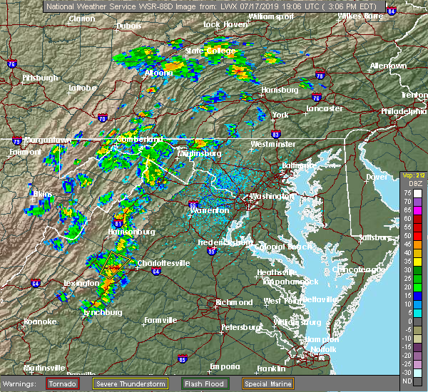 At 307 pm edt, a severe thunderstorm was located near crozet, or 7 miles east of waynesboro, moving northeast at 25 mph (radar indicated). Hazards include 60 mph wind gusts and quarter size hail. Damaging winds will cause some trees and large branches to fall. this could injure those outdoors, as well as damage homes and vehicles. roadways may become blocked by downed trees. localized power outages are possible. unsecured light objects may become projectiles. Locations impacted include, crozet, afton, yancey mills, greenwood and white hall. At 307 pm edt, a severe thunderstorm was located near crozet, or 7 miles east of waynesboro, moving northeast at 25 mph (radar indicated). Hazards include 60 mph wind gusts and quarter size hail. Damaging winds will cause some trees and large branches to fall. this could injure those outdoors, as well as damage homes and vehicles. roadways may become blocked by downed trees. localized power outages are possible. unsecured light objects may become projectiles. Locations impacted include, crozet, afton, yancey mills, greenwood and white hall.
|
| 7/17/2019 2:54 PM EDT |
 At 253 pm edt, a severe thunderstorm was located near sherando, or near waynesboro, moving northeast at 25 mph (radar indicated). Hazards include 60 mph wind gusts. Damaging winds will cause some trees and large branches to fall. this could injure those outdoors, as well as damage homes and vehicles. roadways may become blocked by downed trees. localized power outages are possible. Unsecured light objects may become projectiles. At 253 pm edt, a severe thunderstorm was located near sherando, or near waynesboro, moving northeast at 25 mph (radar indicated). Hazards include 60 mph wind gusts. Damaging winds will cause some trees and large branches to fall. this could injure those outdoors, as well as damage homes and vehicles. roadways may become blocked by downed trees. localized power outages are possible. Unsecured light objects may become projectiles.
|
| 7/15/2019 2:50 PM EDT |
 The severe thunderstorm warning for north central nelson, and southeastern augusta counties, the southeastern city of staunton and the southwestern city of waynesboro will expire at 300 pm edt, the storm which prompted the warning has weakened below severe limits, and no longer poses an immediate threat to life or property. therefore, the warning will be allowed to expire. however gusty winds and heavy rain are still possible with this thunderstorm. The severe thunderstorm warning for north central nelson, and southeastern augusta counties, the southeastern city of staunton and the southwestern city of waynesboro will expire at 300 pm edt, the storm which prompted the warning has weakened below severe limits, and no longer poses an immediate threat to life or property. therefore, the warning will be allowed to expire. however gusty winds and heavy rain are still possible with this thunderstorm.
|
| 7/15/2019 2:32 PM EDT |
 At 231 pm edt, a severe thunderstorm was located near staunton, moving southeast at 15 mph (radar indicated). Hazards include 60 mph wind gusts and quarter size hail. Damaging winds will cause some trees and large branches to fall. this could injure those outdoors, as well as damage homes and vehicles. roadways may become blocked by downed trees. localized power outages are possible. unsecured light objects may become projectiles. Locations impacted include, staunton, waynesboro, stuarts draft, sherando, wintergreen, fishersville, lyndhurst, nellysford, greenville, mint spring and afton mountain. At 231 pm edt, a severe thunderstorm was located near staunton, moving southeast at 15 mph (radar indicated). Hazards include 60 mph wind gusts and quarter size hail. Damaging winds will cause some trees and large branches to fall. this could injure those outdoors, as well as damage homes and vehicles. roadways may become blocked by downed trees. localized power outages are possible. unsecured light objects may become projectiles. Locations impacted include, staunton, waynesboro, stuarts draft, sherando, wintergreen, fishersville, lyndhurst, nellysford, greenville, mint spring and afton mountain.
|
| 7/15/2019 2:30 PM EDT | Tree down on the 300 block of hall school r in augusta county VA, 5.2 miles ENE of Waynesboro, VA |
| 7/15/2019 2:12 PM EDT |
 At 212 pm edt, a severe thunderstorm was located near staunton, moving southeast at 20 mph (radar indicated). Hazards include 60 mph wind gusts and half dollar size hail. Damaging winds will cause some trees and large branches to fall. this could injure those outdoors, as well as damage homes and vehicles. roadways may become blocked by downed trees. localized power outages are possible. Unsecured light objects may become projectiles. At 212 pm edt, a severe thunderstorm was located near staunton, moving southeast at 20 mph (radar indicated). Hazards include 60 mph wind gusts and half dollar size hail. Damaging winds will cause some trees and large branches to fall. this could injure those outdoors, as well as damage homes and vehicles. roadways may become blocked by downed trees. localized power outages are possible. Unsecured light objects may become projectiles.
|
| 7/11/2019 4:22 PM EDT |
 At 407 pm edt, a severe thunderstorm was located over stuarts draft, or 10 miles southwest of waynesboro, moving east at 35 mph (radar indicated). Hazards include 60 mph wind gusts. Damaging winds will cause some trees and large branches to fall. this could injure those outdoors, as well as damage homes and vehicles. roadways may become blocked by downed trees. localized power outages are possible. unsecured light objects may become projectiles. Locations impacted include, waynesboro, stuarts draft, sherando, fishersville, lyndhurst, greenville, middlebrook, hermitage, mint spring and spottswood. At 407 pm edt, a severe thunderstorm was located over stuarts draft, or 10 miles southwest of waynesboro, moving east at 35 mph (radar indicated). Hazards include 60 mph wind gusts. Damaging winds will cause some trees and large branches to fall. this could injure those outdoors, as well as damage homes and vehicles. roadways may become blocked by downed trees. localized power outages are possible. unsecured light objects may become projectiles. Locations impacted include, waynesboro, stuarts draft, sherando, fishersville, lyndhurst, greenville, middlebrook, hermitage, mint spring and spottswood.
|
| 7/11/2019 4:20 PM EDT | Tree down on red top orchard rd between harvard rd and apple tree lane in city of waynesboro county VA, 2.2 miles E of Waynesboro, VA |
| 7/11/2019 4:11 PM EDT | Tree down on sherwood dr in augusta county VA, 5.6 miles E of Waynesboro, VA |
| 7/11/2019 4:08 PM EDT |
 At 407 pm edt, a severe thunderstorm was located over stuarts draft, or 10 miles southwest of waynesboro, moving east at 35 mph (radar indicated). Hazards include 60 mph wind gusts. Damaging winds will cause some trees and large branches to fall. this could injure those outdoors, as well as damage homes and vehicles. roadways may become blocked by downed trees. localized power outages are possible. unsecured light objects may become projectiles. Locations impacted include, waynesboro, stuarts draft, sherando, fishersville, lyndhurst, greenville, middlebrook, hermitage, mint spring and spottswood. At 407 pm edt, a severe thunderstorm was located over stuarts draft, or 10 miles southwest of waynesboro, moving east at 35 mph (radar indicated). Hazards include 60 mph wind gusts. Damaging winds will cause some trees and large branches to fall. this could injure those outdoors, as well as damage homes and vehicles. roadways may become blocked by downed trees. localized power outages are possible. unsecured light objects may become projectiles. Locations impacted include, waynesboro, stuarts draft, sherando, fishersville, lyndhurst, greenville, middlebrook, hermitage, mint spring and spottswood.
|
| 7/11/2019 3:45 PM EDT |
 At 345 pm edt, a severe thunderstorm was located 8 miles north of brownsburg, or 12 miles northeast of rockbridge baths, moving northeast at 45 mph (radar indicated). Hazards include 60 mph wind gusts. Damaging winds will cause some trees and large branches to fall. this could injure those outdoors, as well as damage homes and vehicles. roadways may become blocked by downed trees. localized power outages are possible. Unsecured light objects may become projectiles. At 345 pm edt, a severe thunderstorm was located 8 miles north of brownsburg, or 12 miles northeast of rockbridge baths, moving northeast at 45 mph (radar indicated). Hazards include 60 mph wind gusts. Damaging winds will cause some trees and large branches to fall. this could injure those outdoors, as well as damage homes and vehicles. roadways may become blocked by downed trees. localized power outages are possible. Unsecured light objects may become projectiles.
|
| 7/4/2019 4:00 PM EDT | Trees and wires down on a vehicle on s. oak ln. in the city of waynesboro in city of waynesboro county VA, 1.6 miles NE of Waynesboro, VA |
| 4/14/2019 6:32 PM EDT |
 At 632 pm edt, a severe thunderstorm was located near crozet, or 11 miles northwest of charlottesville, moving northeast at 45 mph (radar indicated). Hazards include 60 mph wind gusts. Damaging winds will cause some trees and large branches to fall. this could injure those outdoors, as well as damage homes and vehicles. roadways may become blocked by downed trees. localized power outages are possible. unsecured light objects may become projectiles. Locations impacted include, charlottesville, waynesboro, crozet, grottoes, crimora, sherando, free union, wintergreen, afton, westmoreland, hollymead, lyndhurst, nellysford, ivy, new hope, north garden, covesville, yancey mills, stony point and flordon. At 632 pm edt, a severe thunderstorm was located near crozet, or 11 miles northwest of charlottesville, moving northeast at 45 mph (radar indicated). Hazards include 60 mph wind gusts. Damaging winds will cause some trees and large branches to fall. this could injure those outdoors, as well as damage homes and vehicles. roadways may become blocked by downed trees. localized power outages are possible. unsecured light objects may become projectiles. Locations impacted include, charlottesville, waynesboro, crozet, grottoes, crimora, sherando, free union, wintergreen, afton, westmoreland, hollymead, lyndhurst, nellysford, ivy, new hope, north garden, covesville, yancey mills, stony point and flordon.
|
| 4/14/2019 6:21 PM EDT | Tree down near handley way at plank rd in albemarle county VA, 6.3 miles WNW of Waynesboro, VA |
| 4/14/2019 6:14 PM EDT | Tree down near intersection of rockfish gap trnpk and afton mtn rd in nelson county VA, 3.7 miles WNW of Waynesboro, VA |
| 4/14/2019 5:59 PM EDT |
 At 558 pm edt, a severe thunderstorm was located near wintergreen, or 14 miles north of clifford, moving northeast at 45 mph (radar indicated). Hazards include 60 mph wind gusts and quarter size hail. Damaging winds will cause some trees and large branches to fall. this could injure those outdoors, as well as damage homes and vehicles. roadways may become blocked by downed trees. localized power outages are possible. Unsecured light objects may become projectiles. At 558 pm edt, a severe thunderstorm was located near wintergreen, or 14 miles north of clifford, moving northeast at 45 mph (radar indicated). Hazards include 60 mph wind gusts and quarter size hail. Damaging winds will cause some trees and large branches to fall. this could injure those outdoors, as well as damage homes and vehicles. roadways may become blocked by downed trees. localized power outages are possible. Unsecured light objects may become projectiles.
|
| 9/26/2018 4:53 PM EDT |
 At 453 pm edt, a severe thunderstorm was located over stuarts draft, or 8 miles south of staunton, moving east at 20 mph (radar indicated). Hazards include 60 mph wind gusts. Damaging winds will cause some trees and large branches to fall. this could injure those outdoors, as well as damage homes and vehicles. roadways may become blocked by downed trees. localized power outages are possible. unsecured light objects may become projectiles. Locations impacted include, waynesboro, stuarts draft, crimora, sherando, wintergreen, fishersville, lyndhurst, greenville, hermitage and mint spring. At 453 pm edt, a severe thunderstorm was located over stuarts draft, or 8 miles south of staunton, moving east at 20 mph (radar indicated). Hazards include 60 mph wind gusts. Damaging winds will cause some trees and large branches to fall. this could injure those outdoors, as well as damage homes and vehicles. roadways may become blocked by downed trees. localized power outages are possible. unsecured light objects may become projectiles. Locations impacted include, waynesboro, stuarts draft, crimora, sherando, wintergreen, fishersville, lyndhurst, greenville, hermitage and mint spring.
|
| 9/26/2018 4:41 PM EDT |
 The national weather service in sterling virginia has issued a * severe thunderstorm warning for. southeastern augusta county in western virginia. the city of waynesboro in western virginia. until 530 pm edt. At 441 pm edt, a severe thunderstorm was located near stuarts. The national weather service in sterling virginia has issued a * severe thunderstorm warning for. southeastern augusta county in western virginia. the city of waynesboro in western virginia. until 530 pm edt. At 441 pm edt, a severe thunderstorm was located near stuarts.
|
| 8/30/2018 5:35 PM EDT |
 The severe thunderstorm warning for southeastern augusta , the city of staunton and the city of waynesboro will expire at 545 pm edt, the storm which prompted the warning has weakened below severe limits, and no longer pose an immediate threat to life or property. therefore the warning will be allowed to expire. however heavy rain is still possible with this thunderstorm. to report severe weather, contact your nearest law enforcement agency. they will relay your report to the national weather service sterling virginia. The severe thunderstorm warning for southeastern augusta , the city of staunton and the city of waynesboro will expire at 545 pm edt, the storm which prompted the warning has weakened below severe limits, and no longer pose an immediate threat to life or property. therefore the warning will be allowed to expire. however heavy rain is still possible with this thunderstorm. to report severe weather, contact your nearest law enforcement agency. they will relay your report to the national weather service sterling virginia.
|
| 8/30/2018 5:20 PM EDT |
 At 519 pm edt, a severe thunderstorm was located near waynesboro, moving northeast at 10 mph (radar indicated). Hazards include 60 mph wind gusts. Damaging winds will cause some trees and large branches to fall. this could injure those outdoors, as well as damage homes and vehicles. roadways may become blocked by downed trees. localized power outages are possible. unsecured light objects may become projectiles. Locations impacted include, staunton, waynesboro, stuarts draft, grottoes, crimora, sherando, wintergreen, fishersville, verona, weyers cave, lyndhurst, greenville, new hope, mount sidney, middlebrook, hermitage, mint spring, fort defiance, spottswood and staunton airport. At 519 pm edt, a severe thunderstorm was located near waynesboro, moving northeast at 10 mph (radar indicated). Hazards include 60 mph wind gusts. Damaging winds will cause some trees and large branches to fall. this could injure those outdoors, as well as damage homes and vehicles. roadways may become blocked by downed trees. localized power outages are possible. unsecured light objects may become projectiles. Locations impacted include, staunton, waynesboro, stuarts draft, grottoes, crimora, sherando, wintergreen, fishersville, verona, weyers cave, lyndhurst, greenville, new hope, mount sidney, middlebrook, hermitage, mint spring, fort defiance, spottswood and staunton airport.
|
| 8/30/2018 5:02 PM EDT |
 At 502 pm edt, a severe thunderstorm was located near stuarts draft, or near staunton, moving northeast at 10 mph (radar indicated). Hazards include 60 mph wind gusts. Damaging winds will cause some trees and large branches to fall. this could injure those outdoors, as well as damage homes and vehicles. roadways may become blocked by downed trees. localized power outages are possible. Unsecured light objects may become projectiles. At 502 pm edt, a severe thunderstorm was located near stuarts draft, or near staunton, moving northeast at 10 mph (radar indicated). Hazards include 60 mph wind gusts. Damaging winds will cause some trees and large branches to fall. this could injure those outdoors, as well as damage homes and vehicles. roadways may become blocked by downed trees. localized power outages are possible. Unsecured light objects may become projectiles.
|
| 8/8/2018 5:55 PM EDT | Tree down on 700 block of hildebrand church roa in augusta county VA, 5.2 miles SSW of Waynesboro, VA |
| 8/8/2018 5:51 PM EDT |
 At 551 pm edt, severe thunderstorms were located along a line extending from 8 miles west of stanardsville to near grottoes to near crimora, moving east at 25 mph (radar indicated). Hazards include 60 mph wind gusts. Damaging winds will cause some trees and large branches to fall. this could injure those outdoors, as well as damage homes and vehicles. roadways may become blocked by downed trees. localized power outages are possible. Unsecured light objects may become projectiles. At 551 pm edt, severe thunderstorms were located along a line extending from 8 miles west of stanardsville to near grottoes to near crimora, moving east at 25 mph (radar indicated). Hazards include 60 mph wind gusts. Damaging winds will cause some trees and large branches to fall. this could injure those outdoors, as well as damage homes and vehicles. roadways may become blocked by downed trees. localized power outages are possible. Unsecured light objects may become projectiles.
|
| 8/8/2018 5:42 PM EDT | Tree down on 100 block of eakle roa in augusta county VA, 6.9 miles SSE of Waynesboro, VA |
| 8/7/2018 5:31 PM EDT | Several trees snapped off and uprooted at residence in augusta county VA, 5.2 miles SSE of Waynesboro, VA |
| 6/24/2018 2:11 PM EDT |
 At 210 pm edt, a severe thunderstorm was located over staunton, moving east at 35 mph (radar indicated). Hazards include 60 mph wind gusts and quarter size hail. Damaging winds will cause some trees and large branches to fall. this could injure those outdoors, as well as damage homes and vehicles. roadways may become blocked by downed trees. localized power outages are possible. unsecured light objects may become projectiles. Locations impacted include, staunton, waynesboro, grottoes, crimora, fishersville, verona, weyers cave, lyndhurst, new hope, mount sidney, hermitage, fort defiance and staunton airport. At 210 pm edt, a severe thunderstorm was located over staunton, moving east at 35 mph (radar indicated). Hazards include 60 mph wind gusts and quarter size hail. Damaging winds will cause some trees and large branches to fall. this could injure those outdoors, as well as damage homes and vehicles. roadways may become blocked by downed trees. localized power outages are possible. unsecured light objects may become projectiles. Locations impacted include, staunton, waynesboro, grottoes, crimora, fishersville, verona, weyers cave, lyndhurst, new hope, mount sidney, hermitage, fort defiance and staunton airport.
|
| 6/24/2018 1:46 PM EDT |
 At 146 pm edt, a severe thunderstorm was located 12 miles west of staunton, moving east at 40 mph (radar indicated). Hazards include 60 mph wind gusts and quarter size hail. Damaging winds will cause some trees and large branches to fall. this could injure those outdoors, as well as damage homes and vehicles. roadways may become blocked by downed trees. localized power outages are possible. Unsecured light objects may become projectiles. At 146 pm edt, a severe thunderstorm was located 12 miles west of staunton, moving east at 40 mph (radar indicated). Hazards include 60 mph wind gusts and quarter size hail. Damaging winds will cause some trees and large branches to fall. this could injure those outdoors, as well as damage homes and vehicles. roadways may become blocked by downed trees. localized power outages are possible. Unsecured light objects may become projectiles.
|
| 5/14/2018 5:42 PM EDT |
 At 542 pm edt, severe thunderstorms were located along a line extending from bridgewater to 7 miles northeast of bells valley, moving southeast at 30 mph (radar indicated). Hazards include 60 mph wind gusts and quarter size hail. Damaging winds will cause some trees and large branches to fall. this could injure those outdoors, as well as damage homes and vehicles. roadways may become blocked by downed trees. localized power outages are possible. Unsecured light objects may become projectiles. At 542 pm edt, severe thunderstorms were located along a line extending from bridgewater to 7 miles northeast of bells valley, moving southeast at 30 mph (radar indicated). Hazards include 60 mph wind gusts and quarter size hail. Damaging winds will cause some trees and large branches to fall. this could injure those outdoors, as well as damage homes and vehicles. roadways may become blocked by downed trees. localized power outages are possible. Unsecured light objects may become projectiles.
|
| 5/14/2018 3:45 PM EDT | Golf Ball sized hail reported 6.5 miles NW of Waynesboro, VA |
| 5/14/2018 2:50 PM EDT |
 At 250 pm edt, a severe thunderstorm with a history of producing wind damage was located over crimora, or 8 miles northeast of waynesboro, moving east at 20 mph (radar indicated. wind damage was reported near verona). Hazards include ping pong ball size hail and 60 mph wind gusts. Damaging winds will cause some trees and large branches to fall. this could injure those outdoors, as well as damage homes and vehicles. roadways may become blocked by downed trees. localized power outages are possible. unsecured light objects may become projectiles. Locations impacted include, staunton, waynesboro, crimora, fishersville, verona, new hope, hermitage and fort defiance. At 250 pm edt, a severe thunderstorm with a history of producing wind damage was located over crimora, or 8 miles northeast of waynesboro, moving east at 20 mph (radar indicated. wind damage was reported near verona). Hazards include ping pong ball size hail and 60 mph wind gusts. Damaging winds will cause some trees and large branches to fall. this could injure those outdoors, as well as damage homes and vehicles. roadways may become blocked by downed trees. localized power outages are possible. unsecured light objects may become projectiles. Locations impacted include, staunton, waynesboro, crimora, fishersville, verona, new hope, hermitage and fort defiance.
|
| 5/14/2018 2:38 PM EDT |
 At 238 pm edt, a severe thunderstorm was located over crimora, or 7 miles north of waynesboro, moving east at 20 mph (radar indicated). Hazards include ping pong ball size hail and 60 mph wind gusts. Damaging winds will cause some trees and large branches to fall. this could injure those outdoors, as well as damage homes and vehicles. roadways may become blocked by downed trees. localized power outages are possible. unsecured light objects may become projectiles. Locations impacted include, staunton, waynesboro, crimora, fishersville, verona, new hope, hermitage and fort defiance. At 238 pm edt, a severe thunderstorm was located over crimora, or 7 miles north of waynesboro, moving east at 20 mph (radar indicated). Hazards include ping pong ball size hail and 60 mph wind gusts. Damaging winds will cause some trees and large branches to fall. this could injure those outdoors, as well as damage homes and vehicles. roadways may become blocked by downed trees. localized power outages are possible. unsecured light objects may become projectiles. Locations impacted include, staunton, waynesboro, crimora, fishersville, verona, new hope, hermitage and fort defiance.
|
| 5/14/2018 2:32 PM EDT |
 At 218 pm edt, a severe thunderstorm was located near staunton, moving east at 20 mph (radar indicated). Hazards include 60 mph wind gusts and quarter size hail. Damaging winds will cause some trees and large branches to fall. this could injure those outdoors, as well as damage homes and vehicles. roadways may become blocked by downed trees. localized power outages are possible. Unsecured light objects may become projectiles. At 218 pm edt, a severe thunderstorm was located near staunton, moving east at 20 mph (radar indicated). Hazards include 60 mph wind gusts and quarter size hail. Damaging winds will cause some trees and large branches to fall. this could injure those outdoors, as well as damage homes and vehicles. roadways may become blocked by downed trees. localized power outages are possible. Unsecured light objects may become projectiles.
|
| 5/14/2018 2:19 PM EDT |
 At 218 pm edt, a severe thunderstorm was located near staunton, moving east at 20 mph (radar indicated). Hazards include 60 mph wind gusts and quarter size hail. Damaging winds will cause some trees and large branches to fall. this could injure those outdoors, as well as damage homes and vehicles. roadways may become blocked by downed trees. localized power outages are possible. Unsecured light objects may become projectiles. At 218 pm edt, a severe thunderstorm was located near staunton, moving east at 20 mph (radar indicated). Hazards include 60 mph wind gusts and quarter size hail. Damaging winds will cause some trees and large branches to fall. this could injure those outdoors, as well as damage homes and vehicles. roadways may become blocked by downed trees. localized power outages are possible. Unsecured light objects may become projectiles.
|
| 5/10/2018 1:40 PM EDT | Tree down on pheasnt run causing gas line rupture and fir in augusta county VA, 2.8 miles E of Waynesboro, VA |
| 5/10/2018 1:35 PM EDT |
 At 134 pm edt, a severe thunderstorm was located over waynesboro, moving east at 30 mph (radar indicated). Hazards include 60 mph wind gusts and quarter size hail. Damaging winds will cause some trees and large branches to fall. this could injure those outdoors, as well as damage homes and vehicles. roadways may become blocked by downed trees. localized power outages are possible. unsecured light objects may become projectiles. Locations impacted include, waynesboro, stuarts draft, crozet, crimora, sherando, afton, fishersville, lyndhurst, ivy, greenwood, hermitage, north garden, batesville, yancey mills, afton mountain and white hall. At 134 pm edt, a severe thunderstorm was located over waynesboro, moving east at 30 mph (radar indicated). Hazards include 60 mph wind gusts and quarter size hail. Damaging winds will cause some trees and large branches to fall. this could injure those outdoors, as well as damage homes and vehicles. roadways may become blocked by downed trees. localized power outages are possible. unsecured light objects may become projectiles. Locations impacted include, waynesboro, stuarts draft, crozet, crimora, sherando, afton, fishersville, lyndhurst, ivy, greenwood, hermitage, north garden, batesville, yancey mills, afton mountain and white hall.
|
| 5/10/2018 1:19 PM EDT |
 At 119 pm edt, a severe thunderstorm was located near stuarts draft, or near staunton, moving east at 30 mph (radar indicated). Hazards include 60 mph wind gusts and quarter size hail. Damaging winds will cause some trees and large branches to fall. this could injure those outdoors, as well as damage homes and vehicles. roadways may become blocked by downed trees. localized power outages are possible. Unsecured light objects may become projectiles. At 119 pm edt, a severe thunderstorm was located near stuarts draft, or near staunton, moving east at 30 mph (radar indicated). Hazards include 60 mph wind gusts and quarter size hail. Damaging winds will cause some trees and large branches to fall. this could injure those outdoors, as well as damage homes and vehicles. roadways may become blocked by downed trees. localized power outages are possible. Unsecured light objects may become projectiles.
|
| 4/15/2018 8:05 PM EDT |
 At 805 pm edt, a severe thunderstorm capable of producing a tornado was located near stuarts draft, or near waynesboro, moving north at 55 mph (radar indicated rotation). Hazards include tornado and quarter size hail. For those in the direct path of a tornado touchdown, flying debris will be dangerous to those caught without shelter. damage to roofs, siding, and windows may occur. mobile homes may be damaged or destroyed. Tree damage is likely. At 805 pm edt, a severe thunderstorm capable of producing a tornado was located near stuarts draft, or near waynesboro, moving north at 55 mph (radar indicated rotation). Hazards include tornado and quarter size hail. For those in the direct path of a tornado touchdown, flying debris will be dangerous to those caught without shelter. damage to roofs, siding, and windows may occur. mobile homes may be damaged or destroyed. Tree damage is likely.
|
| 4/15/2018 7:55 PM EDT |
 At 755 pm edt, a severe thunderstorm capable of producing a tornado was located near montebello, or 13 miles southwest of waynesboro, moving northeast at 45 mph (radar indicated rotation). Hazards include tornado and quarter size hail. For those in the direct path of a tornado touchdown, flying debris will be dangerous to those caught without shelter. damage to roofs, siding, and windows may occur. mobile homes may be damaged or destroyed. tree damage is likely. Locations impacted include, stuarts draft, sherando, wintergreen, lyndhurst, nellysford, greenville, middlebrook, summerdean, spottswood and afton mountain. At 755 pm edt, a severe thunderstorm capable of producing a tornado was located near montebello, or 13 miles southwest of waynesboro, moving northeast at 45 mph (radar indicated rotation). Hazards include tornado and quarter size hail. For those in the direct path of a tornado touchdown, flying debris will be dangerous to those caught without shelter. damage to roofs, siding, and windows may occur. mobile homes may be damaged or destroyed. tree damage is likely. Locations impacted include, stuarts draft, sherando, wintergreen, lyndhurst, nellysford, greenville, middlebrook, summerdean, spottswood and afton mountain.
|
| 4/15/2018 7:50 PM EDT |
 At 749 pm edt, a line of severe thunderstorms were located along a line extending from 14 miles southeast of monterey to 7 miles southwest of staunton to near lowesville, moving north at 40 mph (radar indicated). Hazards include 60 mph wind gusts and quarter size hail. Damaging winds will cause some trees and large branches to fall. this could injure those outdoors, as well as damage homes and vehicles. roadways may become blocked by downed trees. localized power outages are possible. unsecured light objects may become projectiles. Locations impacted include, staunton, waynesboro, stuarts draft, sherando, shipman, schuyler, wintergreen, montebello, fishersville, verona, lyndhurst, nellysford, craigsville, greenville, arrington, lovingston, augusta springs, middlebrook, churchville and deerfield. At 749 pm edt, a line of severe thunderstorms were located along a line extending from 14 miles southeast of monterey to 7 miles southwest of staunton to near lowesville, moving north at 40 mph (radar indicated). Hazards include 60 mph wind gusts and quarter size hail. Damaging winds will cause some trees and large branches to fall. this could injure those outdoors, as well as damage homes and vehicles. roadways may become blocked by downed trees. localized power outages are possible. unsecured light objects may become projectiles. Locations impacted include, staunton, waynesboro, stuarts draft, sherando, shipman, schuyler, wintergreen, montebello, fishersville, verona, lyndhurst, nellysford, craigsville, greenville, arrington, lovingston, augusta springs, middlebrook, churchville and deerfield.
|
| 4/15/2018 7:47 PM EDT |
 At 747 pm edt, severe thunderstorms were located along a line extending from schuyler to near buckingham to near sheppards, moving northeast at 50 mph (radar indicated). Hazards include 60 mph wind gusts and quarter size hail. Damaging winds will cause some trees and large branches to fall. this could injure those outdoors, as well as damage homes and vehicles. roadways may become blocked by downed trees. localized power outages are possible. Unsecured light objects may become projectiles. At 747 pm edt, severe thunderstorms were located along a line extending from schuyler to near buckingham to near sheppards, moving northeast at 50 mph (radar indicated). Hazards include 60 mph wind gusts and quarter size hail. Damaging winds will cause some trees and large branches to fall. this could injure those outdoors, as well as damage homes and vehicles. roadways may become blocked by downed trees. localized power outages are possible. Unsecured light objects may become projectiles.
|
| 4/15/2018 7:29 PM EDT |
 At 728 pm edt, a confirmed tornado was located near forks of buffalo, moving north at 50 mph (weather spotters confirmed tornado). Hazards include damaging tornado and quarter size hail. For those in the direct path of a tornado touchdown, flying debris will be dangerous to those caught without shelter. damage to roofs, siding, and windows may occur. mobile homes may be damaged or destroyed. tree damage is likely. the tornado will be near, montebello around 750 pm edt. stuarts draft around 805 pm edt. Other locations impacted by this tornadic thunderstorm include summerdean, piney river, lyndhurst, greenville, middlebrook, tyro, spottswood, afton mountain, massies mill and jonesboro. At 728 pm edt, a confirmed tornado was located near forks of buffalo, moving north at 50 mph (weather spotters confirmed tornado). Hazards include damaging tornado and quarter size hail. For those in the direct path of a tornado touchdown, flying debris will be dangerous to those caught without shelter. damage to roofs, siding, and windows may occur. mobile homes may be damaged or destroyed. tree damage is likely. the tornado will be near, montebello around 750 pm edt. stuarts draft around 805 pm edt. Other locations impacted by this tornadic thunderstorm include summerdean, piney river, lyndhurst, greenville, middlebrook, tyro, spottswood, afton mountain, massies mill and jonesboro.
|
| 4/15/2018 7:10 PM EDT |
 At 708 pm edt, a line of severe thunderstorms were located along a line extending from near goshen to cornwall to near madison heights, moving north at 50 mph (radar indicated). Hazards include 60 mph wind gusts and quarter size hail. Damaging winds will cause some trees and large branches to fall. this could injure those outdoors, as well as damage homes and vehicles. roadways may become blocked by downed trees. localized power outages are possible. Unsecured light objects may become projectiles. At 708 pm edt, a line of severe thunderstorms were located along a line extending from near goshen to cornwall to near madison heights, moving north at 50 mph (radar indicated). Hazards include 60 mph wind gusts and quarter size hail. Damaging winds will cause some trees and large branches to fall. this could injure those outdoors, as well as damage homes and vehicles. roadways may become blocked by downed trees. localized power outages are possible. Unsecured light objects may become projectiles.
|
| 9/5/2017 3:58 PM EDT |
 At 357 pm edt, a severe thunderstorm was located near afton, or near waynesboro, moving northeast at 55 mph (radar indicated). Hazards include 60 mph wind gusts. Damaging winds will cause some trees and large branches to fall. this could injure those outdoors, as well as damage homes and vehicles. roadways may become blocked by downed trees. localized power outages are possible. unsecured light objects may become projectiles. Locations impacted include, charlottesville, waynesboro, stuarts draft, crozet, crimora, sherando, free union, wintergreen, montebello, afton, westmoreland, hollymead, fishersville, lyndhurst, nellysford, ivy, yancey mills, stony point, tyro and flordon. At 357 pm edt, a severe thunderstorm was located near afton, or near waynesboro, moving northeast at 55 mph (radar indicated). Hazards include 60 mph wind gusts. Damaging winds will cause some trees and large branches to fall. this could injure those outdoors, as well as damage homes and vehicles. roadways may become blocked by downed trees. localized power outages are possible. unsecured light objects may become projectiles. Locations impacted include, charlottesville, waynesboro, stuarts draft, crozet, crimora, sherando, free union, wintergreen, montebello, afton, westmoreland, hollymead, fishersville, lyndhurst, nellysford, ivy, yancey mills, stony point, tyro and flordon.
|
| 9/5/2017 3:36 PM EDT |
 At 336 pm edt, a severe thunderstorm was located near montebello, or 15 miles north of forks of buffalo, moving northeast at 55 mph (radar indicated). Hazards include 60 mph wind gusts. Damaging winds will cause some trees and large branches to fall. this could injure those outdoors, as well as damage homes and vehicles. roadways may become blocked by downed trees. localized power outages are possible. Unsecured light objects may become projectiles. At 336 pm edt, a severe thunderstorm was located near montebello, or 15 miles north of forks of buffalo, moving northeast at 55 mph (radar indicated). Hazards include 60 mph wind gusts. Damaging winds will cause some trees and large branches to fall. this could injure those outdoors, as well as damage homes and vehicles. roadways may become blocked by downed trees. localized power outages are possible. Unsecured light objects may become projectiles.
|
| 6/18/2017 5:16 PM EDT |
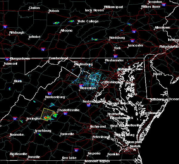 At 516 pm edt, a severe thunderstorm was located near wintergreen, or 13 miles south of waynesboro, moving north at 25 mph (radar indicated). Hazards include 60 mph wind gusts and quarter size hail. Damaging winds will cause some trees and large branches to fall. this could injure those outdoors, as well as damage homes and vehicles. roadways may become blocked by downed trees. localized power outages are possible. Unsecured light objects may become projectiles. At 516 pm edt, a severe thunderstorm was located near wintergreen, or 13 miles south of waynesboro, moving north at 25 mph (radar indicated). Hazards include 60 mph wind gusts and quarter size hail. Damaging winds will cause some trees and large branches to fall. this could injure those outdoors, as well as damage homes and vehicles. roadways may become blocked by downed trees. localized power outages are possible. Unsecured light objects may become projectiles.
|
| 3/1/2017 12:34 PM EST |
 At 1234 pm est, severe thunderstorms were located along a line extending from near front royal to near afton, moving east at 50 mph (radar indicated). Hazards include 60 mph wind gusts. Damaging winds will cause some trees and large branches to fall. this could injure those outdoors, as well as damage homes and vehicles. roadways may become blocked by downed trees. localized power outages are possible. unsecured light objects may become projectiles. Locations impacted include, waynesboro, front royal, strasburg, stuarts draft, crozet, luray, grottoes, shenandoah, massanutten, crimora, stanley, sherando, wintergreen, afton, big meadows, fishersville, elkton, lyndhurst, nellysford and new hope. At 1234 pm est, severe thunderstorms were located along a line extending from near front royal to near afton, moving east at 50 mph (radar indicated). Hazards include 60 mph wind gusts. Damaging winds will cause some trees and large branches to fall. this could injure those outdoors, as well as damage homes and vehicles. roadways may become blocked by downed trees. localized power outages are possible. unsecured light objects may become projectiles. Locations impacted include, waynesboro, front royal, strasburg, stuarts draft, crozet, luray, grottoes, shenandoah, massanutten, crimora, stanley, sherando, wintergreen, afton, big meadows, fishersville, elkton, lyndhurst, nellysford and new hope.
|
| 3/1/2017 12:16 PM EST |
 At 1215 pm est, severe thunderstorms were located along a line extending from woodstock to near stuarts draft, moving east at 50 mph (radar indicated). Hazards include 60 mph wind gusts. Damaging winds will cause some trees and large branches to fall. this could injure those outdoors, as well as damage homes and vehicles. roadways may become blocked by downed trees. localized power outages are possible. unsecured light objects may become projectiles. Locations impacted include, harrisonburg, staunton, waynesboro, front royal, strasburg, woodstock, stuarts draft, bridgewater, crozet, luray, broadway, grottoes, timberville, shenandoah, massanutten, crimora, mount jackson, stanley, sherando and wintergreen. At 1215 pm est, severe thunderstorms were located along a line extending from woodstock to near stuarts draft, moving east at 50 mph (radar indicated). Hazards include 60 mph wind gusts. Damaging winds will cause some trees and large branches to fall. this could injure those outdoors, as well as damage homes and vehicles. roadways may become blocked by downed trees. localized power outages are possible. unsecured light objects may become projectiles. Locations impacted include, harrisonburg, staunton, waynesboro, front royal, strasburg, woodstock, stuarts draft, bridgewater, crozet, luray, broadway, grottoes, timberville, shenandoah, massanutten, crimora, mount jackson, stanley, sherando and wintergreen.
|
| 3/1/2017 12:08 PM EST |
 At 1208 pm est, severe thunderstorms were located along a line extending from near mathias to near bells valley, moving east at 50 mph (radar indicated). Hazards include 60 mph wind gusts. Damaging winds will cause some trees and large branches to fall. this could injure those outdoors, as well as damage homes and vehicles. roadways may become blocked by downed trees. localized power outages are possible. unsecured light objects may become projectiles. Locations impacted include, harrisonburg, staunton, waynesboro, front royal, strasburg, woodstock, stuarts draft, bridgewater, crozet, luray, broadway, grottoes, timberville, shenandoah, massanutten, crimora, mount jackson, stanley, sherando and wintergreen. At 1208 pm est, severe thunderstorms were located along a line extending from near mathias to near bells valley, moving east at 50 mph (radar indicated). Hazards include 60 mph wind gusts. Damaging winds will cause some trees and large branches to fall. this could injure those outdoors, as well as damage homes and vehicles. roadways may become blocked by downed trees. localized power outages are possible. unsecured light objects may become projectiles. Locations impacted include, harrisonburg, staunton, waynesboro, front royal, strasburg, woodstock, stuarts draft, bridgewater, crozet, luray, broadway, grottoes, timberville, shenandoah, massanutten, crimora, mount jackson, stanley, sherando and wintergreen.
|
| 3/1/2017 11:56 AM EST |
 At 1156 am est, severe thunderstorms were located along a line extending from near rough run to near yost, moving east at 50 mph (radar indicated). Hazards include 60 mph wind gusts. Damaging winds will cause some trees and large branches to fall. this could injure those outdoors, as well as damage homes and vehicles. roadways may become blocked by downed trees. localized power outages are possible. Unsecured light objects may become projectiles. At 1156 am est, severe thunderstorms were located along a line extending from near rough run to near yost, moving east at 50 mph (radar indicated). Hazards include 60 mph wind gusts. Damaging winds will cause some trees and large branches to fall. this could injure those outdoors, as well as damage homes and vehicles. roadways may become blocked by downed trees. localized power outages are possible. Unsecured light objects may become projectiles.
|
| 8/31/2016 5:29 PM EDT | Two trees down near lyndhurst post office in augusta county VA, 3.3 miles NE of Waynesboro, VA |
| 7/27/2016 2:08 PM EDT | Trees down on power lines near crimor in augusta county VA, 6.1 miles SSW of Waynesboro, VA |
| 7/27/2016 1:59 PM EDT |
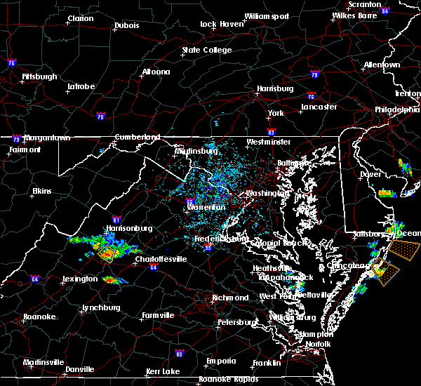 At 158 pm edt, a severe thunderstorm was located over crimora, or 7 miles northeast of waynesboro, moving southeast at 20 mph (radar indicated). Hazards include 60 mph wind gusts and quarter size hail. Damaging winds will cause some trees and large branches to fall. this could injure those outdoors, as well as damage homes and vehicles. roadways may become blocked by downed trees. localized power outages are possible. unsecured light objects may become projectiles. Locations impacted include, grottoes, crimora, new hope and hermitage. At 158 pm edt, a severe thunderstorm was located over crimora, or 7 miles northeast of waynesboro, moving southeast at 20 mph (radar indicated). Hazards include 60 mph wind gusts and quarter size hail. Damaging winds will cause some trees and large branches to fall. this could injure those outdoors, as well as damage homes and vehicles. roadways may become blocked by downed trees. localized power outages are possible. unsecured light objects may become projectiles. Locations impacted include, grottoes, crimora, new hope and hermitage.
|
| 7/27/2016 1:45 PM EDT |
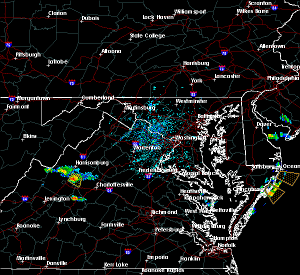 At 145 pm edt, a severe thunderstorm was located near crimora, or 8 miles east of staunton, moving southeast at 20 mph (radar indicated). Hazards include 60 mph wind gusts and quarter size hail. Damaging winds will cause some trees and large branches to fall. this could injure those outdoors, as well as damage homes and vehicles. roadways may become blocked by downed trees. localized power outages are possible. Unsecured light objects may become projectiles. At 145 pm edt, a severe thunderstorm was located near crimora, or 8 miles east of staunton, moving southeast at 20 mph (radar indicated). Hazards include 60 mph wind gusts and quarter size hail. Damaging winds will cause some trees and large branches to fall. this could injure those outdoors, as well as damage homes and vehicles. roadways may become blocked by downed trees. localized power outages are possible. Unsecured light objects may become projectiles.
|
| 7/16/2016 4:26 PM EDT |
 At 426 pm edt, a severe thunderstorm was located near afton, or 8 miles southeast of waynesboro, moving east at 25 mph (radar indicated). Hazards include 60 mph wind gusts. Damaging winds will cause some trees and large branches to fall. this could injure those outdoors, as well as damage homes and vehicles. roadways may become blocked by downed trees. localized power outages are possible. Unsecured light objects may become projectiles. At 426 pm edt, a severe thunderstorm was located near afton, or 8 miles southeast of waynesboro, moving east at 25 mph (radar indicated). Hazards include 60 mph wind gusts. Damaging winds will cause some trees and large branches to fall. this could injure those outdoors, as well as damage homes and vehicles. roadways may become blocked by downed trees. localized power outages are possible. Unsecured light objects may become projectiles.
|
| 6/28/2016 4:34 PM EDT |
 At 433 pm edt, a severe thunderstorm was located 7 miles northeast of staunton, and is nearly stationary (radar indicated). Hazards include 60 mph wind gusts and quarter size hail. Damaging winds will cause some trees and large branches to fall. this could injure those outdoors, as well as damage homes and vehicles. roadways may become blocked by downed trees. localized power outages are possible. Unsecured light objects may become projectiles. At 433 pm edt, a severe thunderstorm was located 7 miles northeast of staunton, and is nearly stationary (radar indicated). Hazards include 60 mph wind gusts and quarter size hail. Damaging winds will cause some trees and large branches to fall. this could injure those outdoors, as well as damage homes and vehicles. roadways may become blocked by downed trees. localized power outages are possible. Unsecured light objects may become projectiles.
|
| 6/16/2016 7:50 PM EDT |
 At 750 pm edt, severe thunderstorms were located along a line extending from front royal to near stanley to near waynesboro, moving east at 45 mph (radar indicated). Hazards include 60 mph wind gusts and quarter size hail. Damaging winds will cause some trees and large branches to fall. this could injure those outdoors, as well as damage homes and vehicles. roadways may become blocked by downed trees. localized power outages are possible. unsecured light objects may become projectiles. Locations impacted include, waynesboro, stuarts draft, luray, grottoes, shenandoah, massanutten, crimora, stanley, big meadows, fishersville, elkton, lyndhurst, greenville, new hope, hermitage, kimball, jollett, ida, glen echo and riverside. At 750 pm edt, severe thunderstorms were located along a line extending from front royal to near stanley to near waynesboro, moving east at 45 mph (radar indicated). Hazards include 60 mph wind gusts and quarter size hail. Damaging winds will cause some trees and large branches to fall. this could injure those outdoors, as well as damage homes and vehicles. roadways may become blocked by downed trees. localized power outages are possible. unsecured light objects may become projectiles. Locations impacted include, waynesboro, stuarts draft, luray, grottoes, shenandoah, massanutten, crimora, stanley, big meadows, fishersville, elkton, lyndhurst, greenville, new hope, hermitage, kimball, jollett, ida, glen echo and riverside.
|
| 6/16/2016 7:48 PM EDT |
 At 748 pm edt, severe thunderstorms were located along a line extending from near shenandoah to near crimora to near sherando, moving east at 50 mph (radar indicated). Hazards include 60 mph wind gusts and quarter size hail. Damaging winds will cause some trees and large branches to fall. this could injure those outdoors, as well as damage homes and vehicles. roadways may become blocked by downed trees. localized power outages are possible. Unsecured light objects may become projectiles. At 748 pm edt, severe thunderstorms were located along a line extending from near shenandoah to near crimora to near sherando, moving east at 50 mph (radar indicated). Hazards include 60 mph wind gusts and quarter size hail. Damaging winds will cause some trees and large branches to fall. this could injure those outdoors, as well as damage homes and vehicles. roadways may become blocked by downed trees. localized power outages are possible. Unsecured light objects may become projectiles.
|
| 6/16/2016 7:22 PM EDT |
 At 722 pm edt, severe thunderstorms were located along a line extending from 7 miles southeast of wardensville to near broadway to 12 miles west of staunton, moving east at 45 mph (radar indicated). Hazards include 60 mph wind gusts and quarter size hail. Damaging winds will cause some trees and large branches to fall. this could injure those outdoors, as well as damage homes and vehicles. roadways may become blocked by downed trees. localized power outages are possible. unsecured light objects may become projectiles. Locations impacted include, harrisonburg, staunton, waynesboro, stuarts draft, bridgewater, luray, broadway, grottoes, timberville, shenandoah, massanutten, crimora, mount jackson, stanley, dale enterprise, big meadows, basye-bryce mountain, fishersville, woodstock and verona. At 722 pm edt, severe thunderstorms were located along a line extending from 7 miles southeast of wardensville to near broadway to 12 miles west of staunton, moving east at 45 mph (radar indicated). Hazards include 60 mph wind gusts and quarter size hail. Damaging winds will cause some trees and large branches to fall. this could injure those outdoors, as well as damage homes and vehicles. roadways may become blocked by downed trees. localized power outages are possible. unsecured light objects may become projectiles. Locations impacted include, harrisonburg, staunton, waynesboro, stuarts draft, bridgewater, luray, broadway, grottoes, timberville, shenandoah, massanutten, crimora, mount jackson, stanley, dale enterprise, big meadows, basye-bryce mountain, fishersville, woodstock and verona.
|
| 6/16/2016 6:55 PM EDT |
 At 654 pm edt, severe thunderstorms were located along a line extending from 6 miles east of moorefield to near brandywine to 6 miles northeast of burnsville, moving east at 45 mph (radar indicated). Hazards include 60 mph wind gusts and quarter size hail. Damaging winds will cause some trees and large branches to fall. this could injure those outdoors, as well as damage homes and vehicles. roadways may become blocked by downed trees. localized power outages are possible. Unsecured light objects may become projectiles. At 654 pm edt, severe thunderstorms were located along a line extending from 6 miles east of moorefield to near brandywine to 6 miles northeast of burnsville, moving east at 45 mph (radar indicated). Hazards include 60 mph wind gusts and quarter size hail. Damaging winds will cause some trees and large branches to fall. this could injure those outdoors, as well as damage homes and vehicles. roadways may become blocked by downed trees. localized power outages are possible. Unsecured light objects may become projectiles.
|
| 5/11/2016 5:41 PM EDT |
 The severe thunderstorm warning for east central augusta, west central albemarle and northeastern nelson counties and the eastern city of waynesboro will expire at 545 pm edt, the storm which prompted the warning has weakened.therefore the warning will be allowed to expire. however heavy rain and lightning are still possible with this thunderstorm. to report severe weather, contact your nearest law enforcement agency. they will relay your report to the national weather service in sterling virginia. The severe thunderstorm warning for east central augusta, west central albemarle and northeastern nelson counties and the eastern city of waynesboro will expire at 545 pm edt, the storm which prompted the warning has weakened.therefore the warning will be allowed to expire. however heavy rain and lightning are still possible with this thunderstorm. to report severe weather, contact your nearest law enforcement agency. they will relay your report to the national weather service in sterling virginia.
|
| 5/11/2016 5:28 PM EDT |
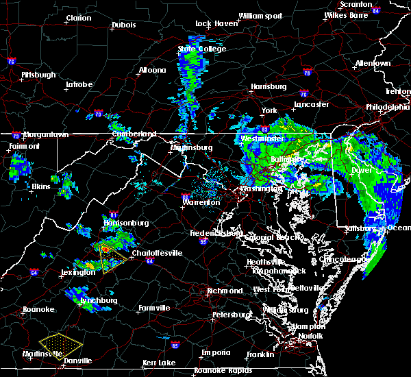 At 527 pm edt, a severe thunderstorm was located over crimora, or 7 miles north of waynesboro, moving southeast at 20 mph (radar indicated). Hazards include 60 mph wind gusts and quarter size hail. Expect wind damage to trees and power lines. Locations impacted include, waynesboro, crozet, crimora, afton, nellysford, ivy, new hope, afton mountain, greenfield, batesville, greenwood and yancey mills. At 527 pm edt, a severe thunderstorm was located over crimora, or 7 miles north of waynesboro, moving southeast at 20 mph (radar indicated). Hazards include 60 mph wind gusts and quarter size hail. Expect wind damage to trees and power lines. Locations impacted include, waynesboro, crozet, crimora, afton, nellysford, ivy, new hope, afton mountain, greenfield, batesville, greenwood and yancey mills.
|
| 5/11/2016 5:04 PM EDT |
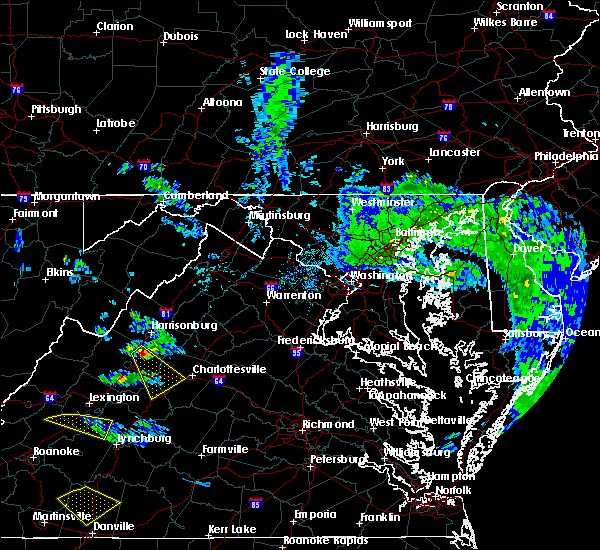 At 504 pm edt, a severe thunderstorm was located near grottoes, or 9 miles northeast of staunton, moving southeast at 30 mph (radar indicated). Hazards include 60 mph wind gusts and quarter size hail. Hail damage to vehicles is expected. Expect wind damage to roofs, siding, and trees. At 504 pm edt, a severe thunderstorm was located near grottoes, or 9 miles northeast of staunton, moving southeast at 30 mph (radar indicated). Hazards include 60 mph wind gusts and quarter size hail. Hail damage to vehicles is expected. Expect wind damage to roofs, siding, and trees.
|
| 9/9/2015 6:51 PM EDT |
 The severe thunderstorm warning for east central augusta, northwestern albemarle and northern nelson counties and the city of waynesboro will expire at 700 pm edt, the storm which prompted the warning has weakened below severe limits, and no longer poses an immediate threat to life or property. therefore the warning will be allowed to expire. however gusty winds and heavy rain are still possible with this thunderstorm. The severe thunderstorm warning for east central augusta, northwestern albemarle and northern nelson counties and the city of waynesboro will expire at 700 pm edt, the storm which prompted the warning has weakened below severe limits, and no longer poses an immediate threat to life or property. therefore the warning will be allowed to expire. however gusty winds and heavy rain are still possible with this thunderstorm.
|
| 9/9/2015 6:30 PM EDT |
 At 630 pm edt, doppler radar indicated a severe thunderstorm capable of producing damaging winds in excess of 60 mph. this storm was located over crimora, or near waynesboro, moving northeast at 15 mph. locations impacted include, waynesboro, crimora, afton, new hope and hermitage. At 630 pm edt, doppler radar indicated a severe thunderstorm capable of producing damaging winds in excess of 60 mph. this storm was located over crimora, or near waynesboro, moving northeast at 15 mph. locations impacted include, waynesboro, crimora, afton, new hope and hermitage.
|
| 9/9/2015 6:12 PM EDT |
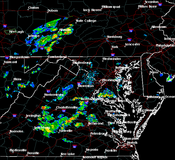 At 612 pm edt, doppler radar indicated a severe thunderstorm capable of producing quarter size hail and damaging winds in excess of 60 mph. this storm was located over waynesboro, and moving northeast at 15 mph. At 612 pm edt, doppler radar indicated a severe thunderstorm capable of producing quarter size hail and damaging winds in excess of 60 mph. this storm was located over waynesboro, and moving northeast at 15 mph.
|
| 9/2/2015 4:30 PM EDT | A large tree fell on a vehicle. another tree downed nearb in city of waynesboro county VA, 0.4 miles N of Waynesboro, VA |
| 4/19/2013 5:15 PM EDT | A 70 foot tall spruce tree down in city of waynesboro county VA, 0.3 miles S of Waynesboro, VA |
| 9/18/2012 1:15 PM EDT | One tree down in the afton are in nelson county VA, 4.1 miles NW of Waynesboro, VA |
| 7/4/2012 5:23 PM EDT | Nickles to quarters in nelson county VA, 3.7 miles NW of Waynesboro, VA |
| 6/29/2012 9:22 PM EDT | Fallen trees damaged 10 apartments in 800 block of lyndhurst road in waynesboro in city of waynesboro county VA, 0.3 miles S of Waynesboro, VA |
| 6/29/2012 9:16 PM EDT | *** 1 inj *** fallen trees damaged 10 apartments in 800 block of lyndhurst road in waynesboro in city of waynesboro county VA, 0.3 miles S of Waynesboro, VA |
| 6/29/2012 9:16 PM EDT | Fallen trees damaged 10 apartments in 800 block of lyndhurst road in waynesboro in city of waynesboro county VA, 0.3 miles S of Waynesboro, VA |
| 7/3/2011 4:12 PM EDT | Quarter sized hail reported 3.3 miles NW of Waynesboro, VA, quarter size hail at exit 99 i-64 |
| 7/3/2011 4:07 PM EDT | Quarter sized hail reported 1.7 miles WNW of Waynesboro, VA |
| 1/1/0001 12:00 AM | Quarter sized hail reported 4.9 miles SW of Waynesboro, VA |
| 1/1/0001 12:00 AM | Quarter sized hail reported 4.9 miles SW of Waynesboro, VA, hail ranging in size from dimes and nickels to quarters. |
Hail Maps for Waynesboro, VA


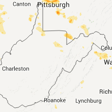


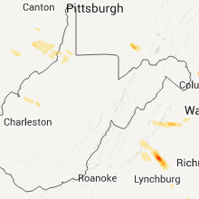


Connect with Interactive Hail Maps