

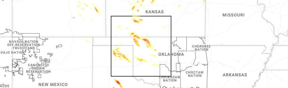
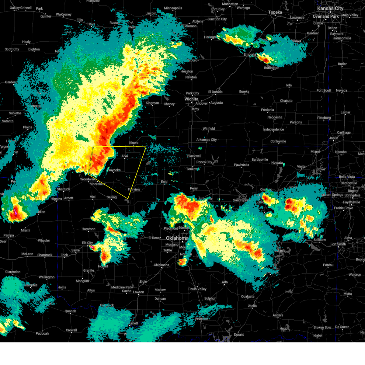
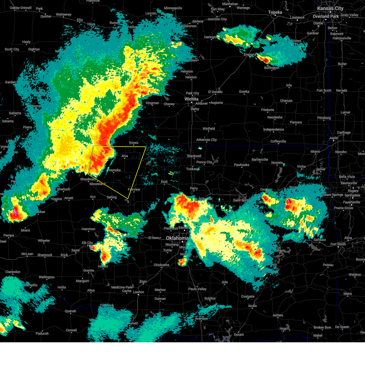
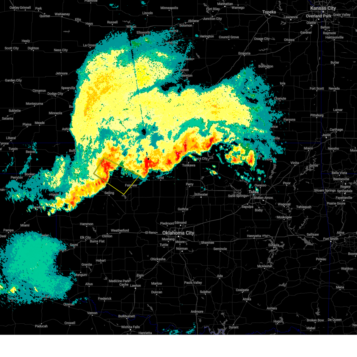
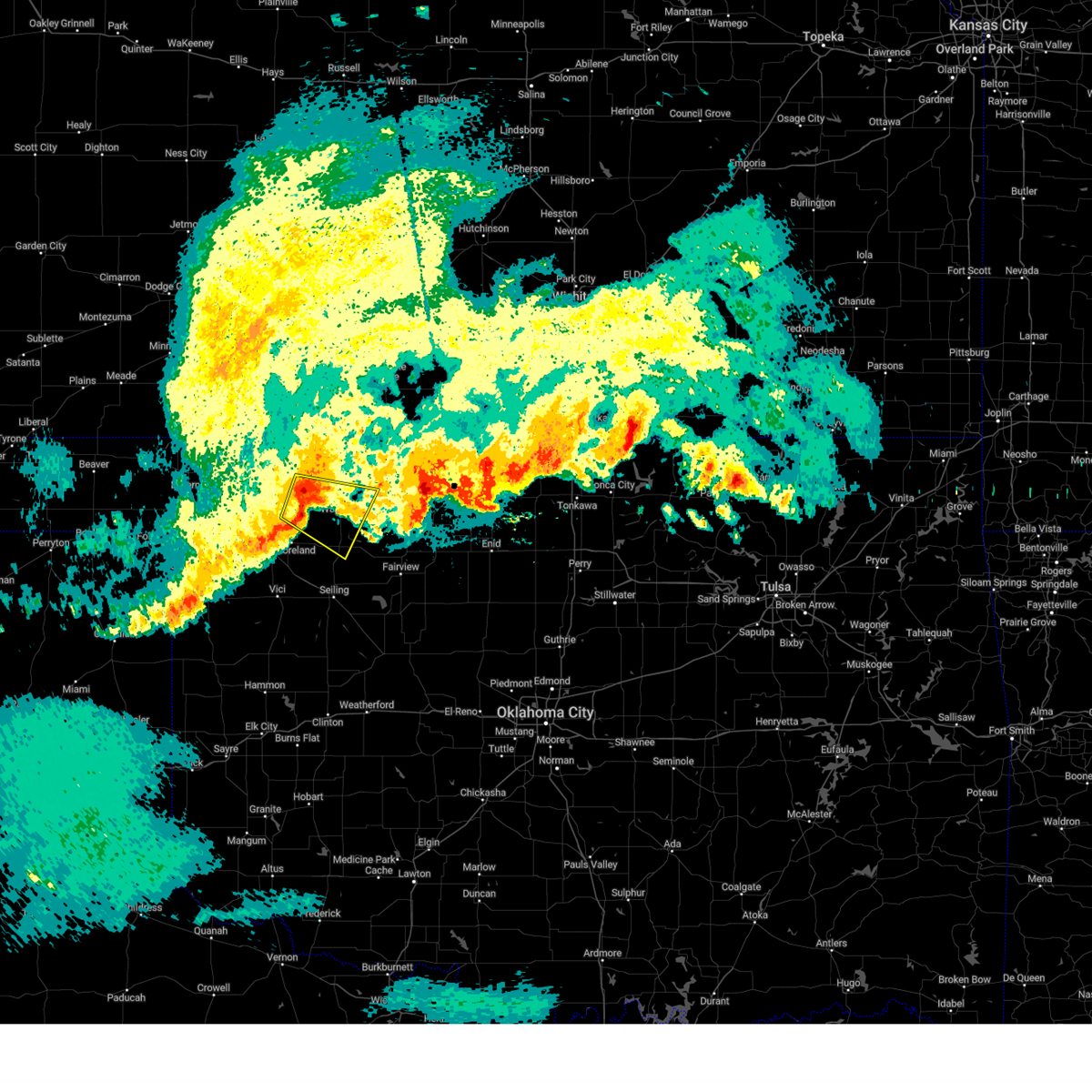
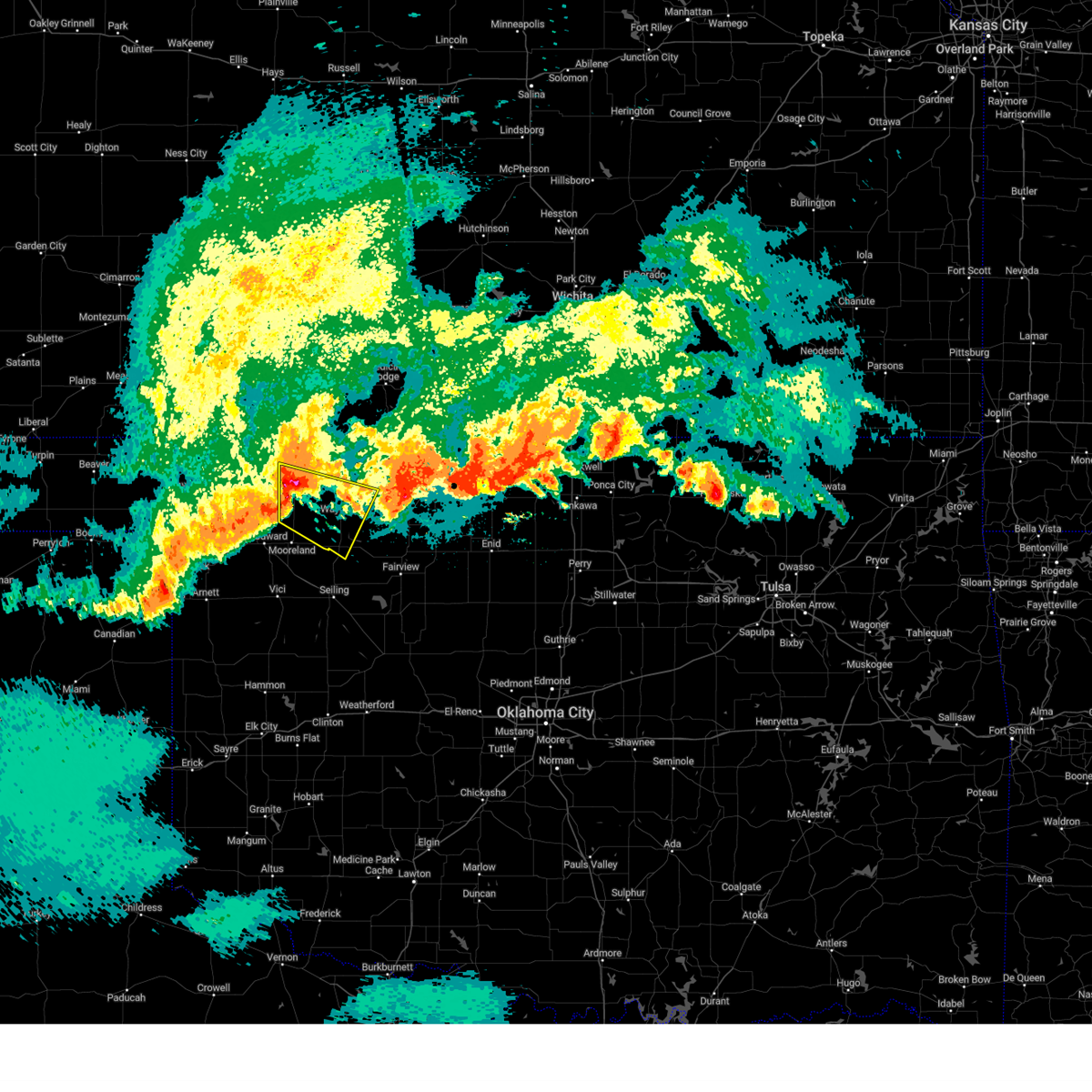
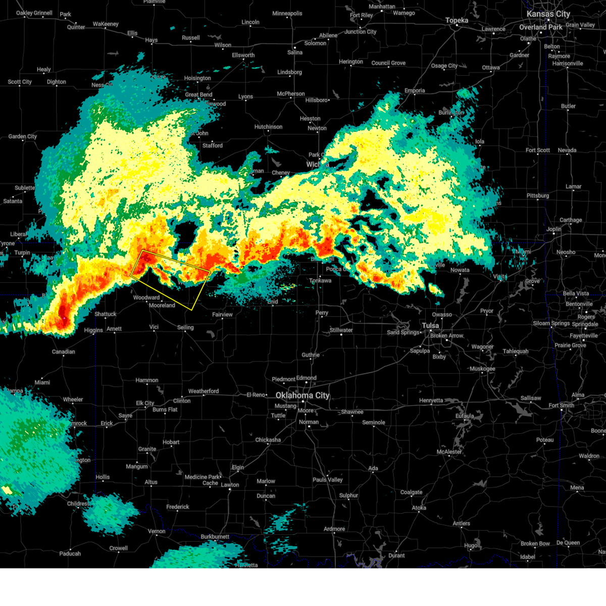
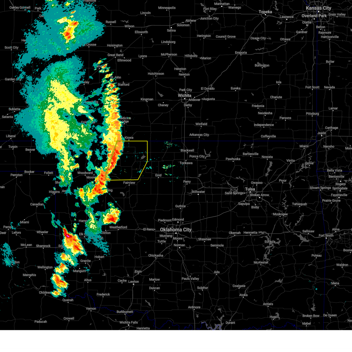
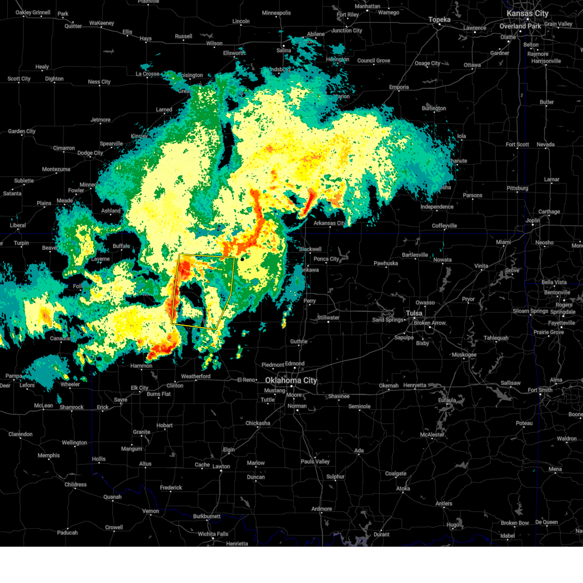
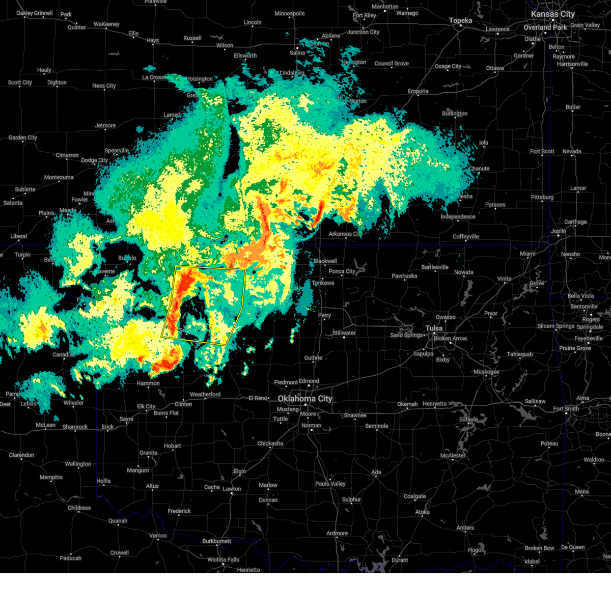
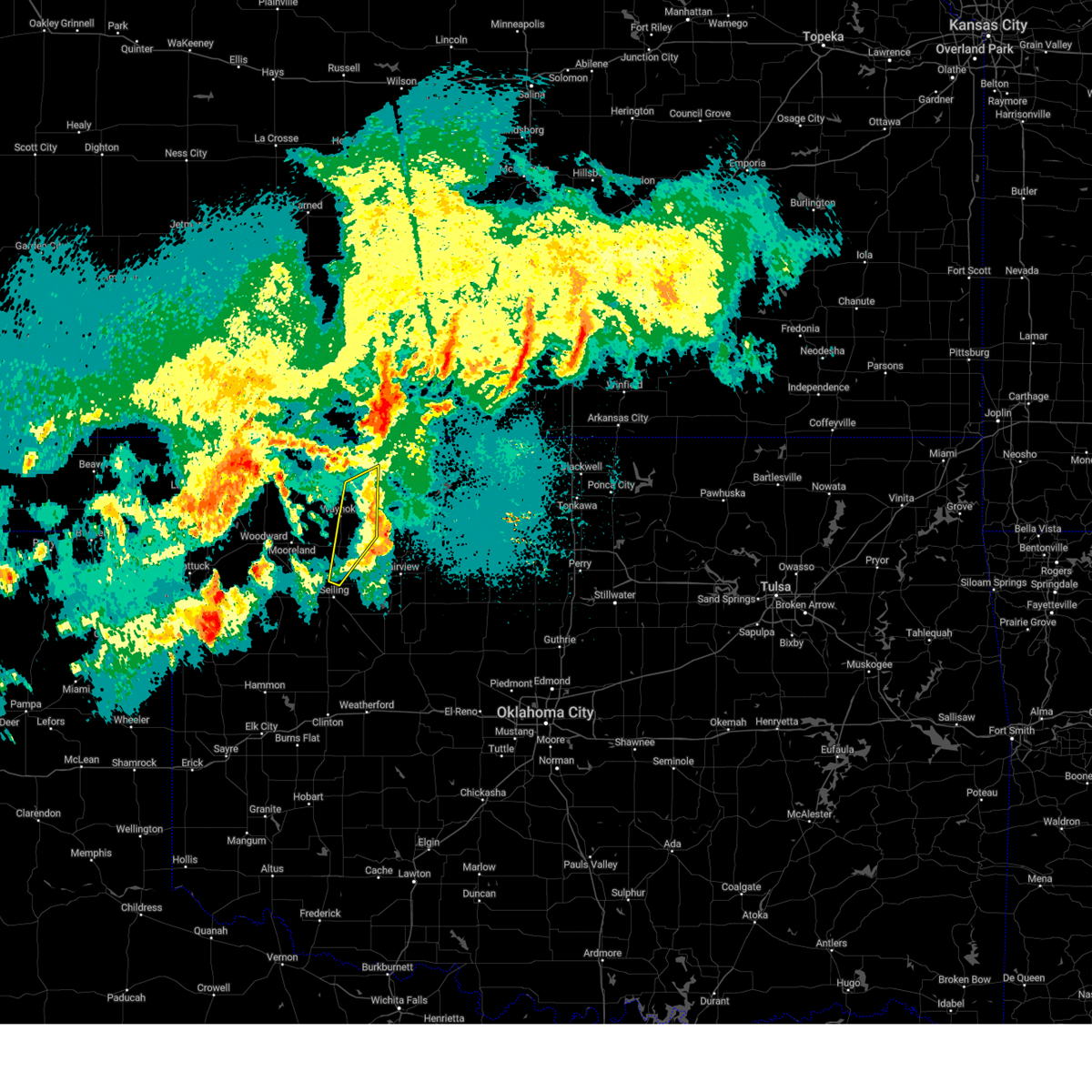
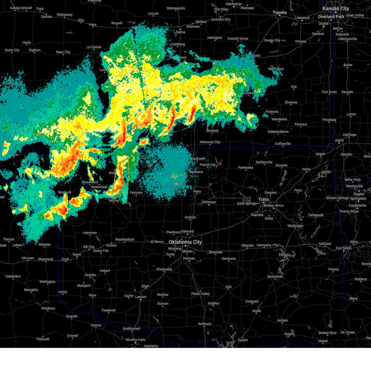
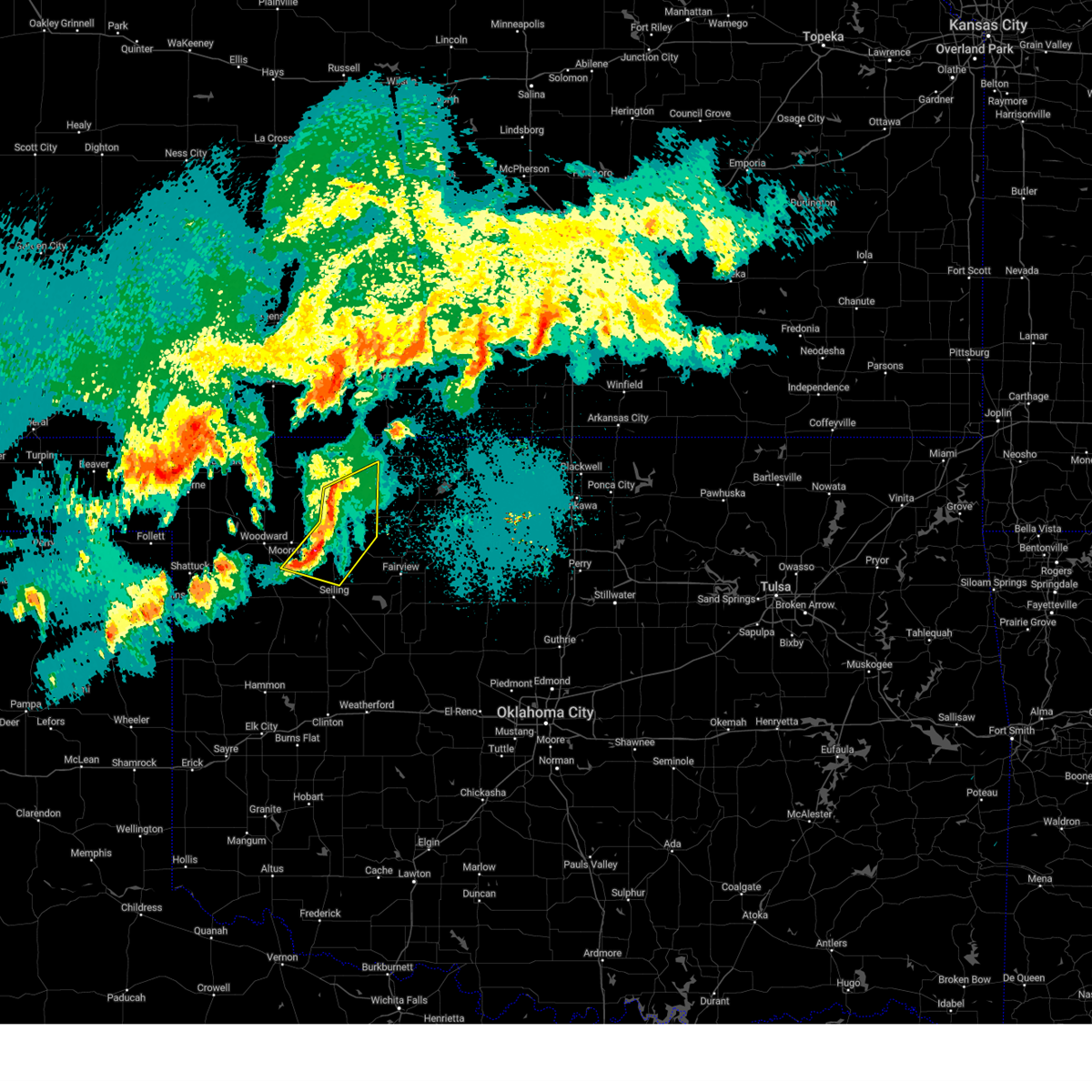
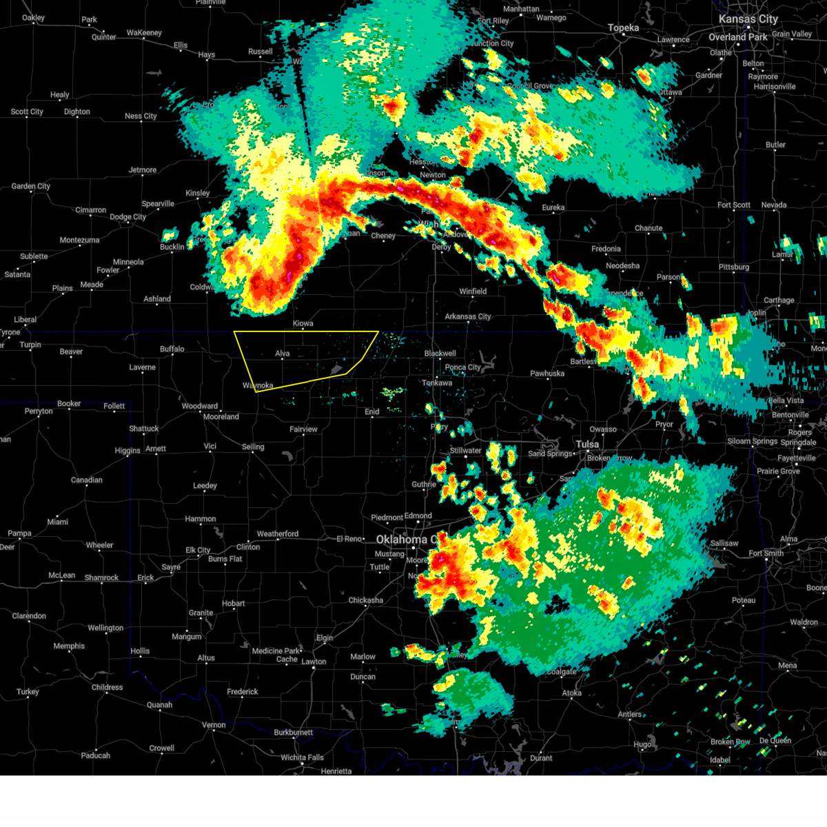
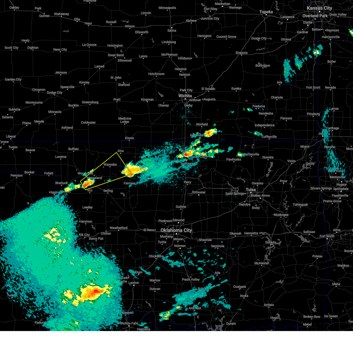
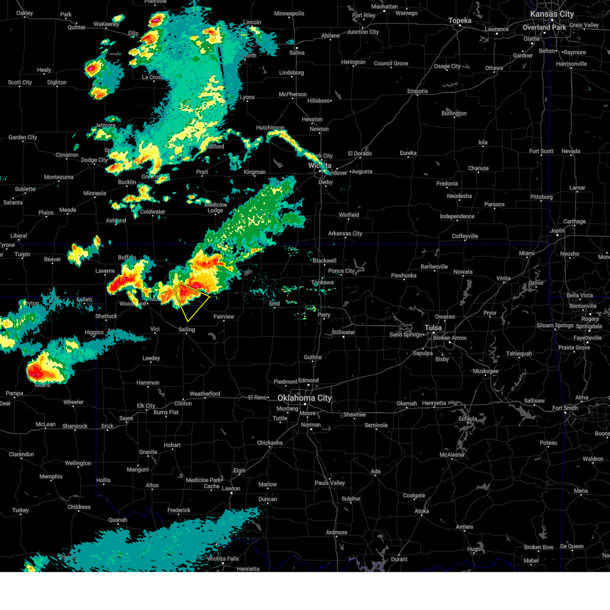
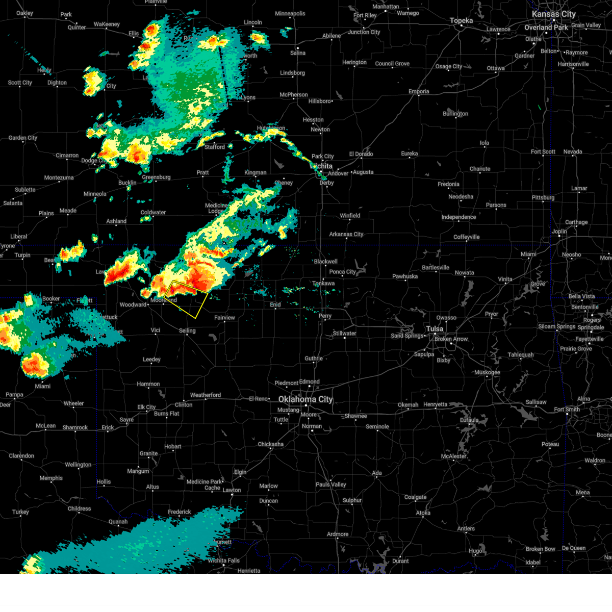
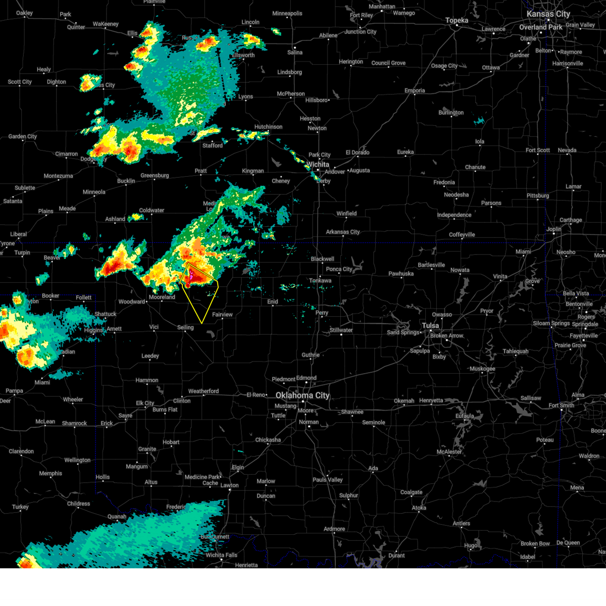
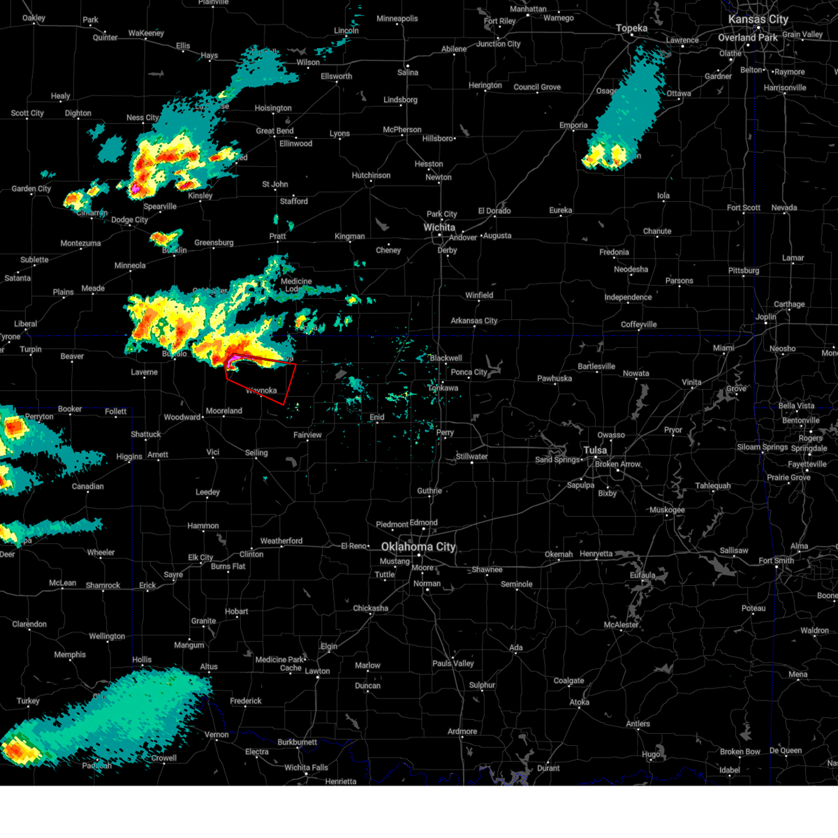
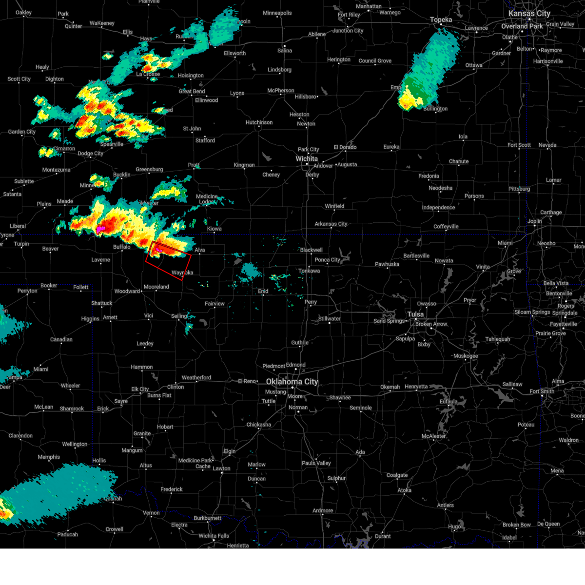
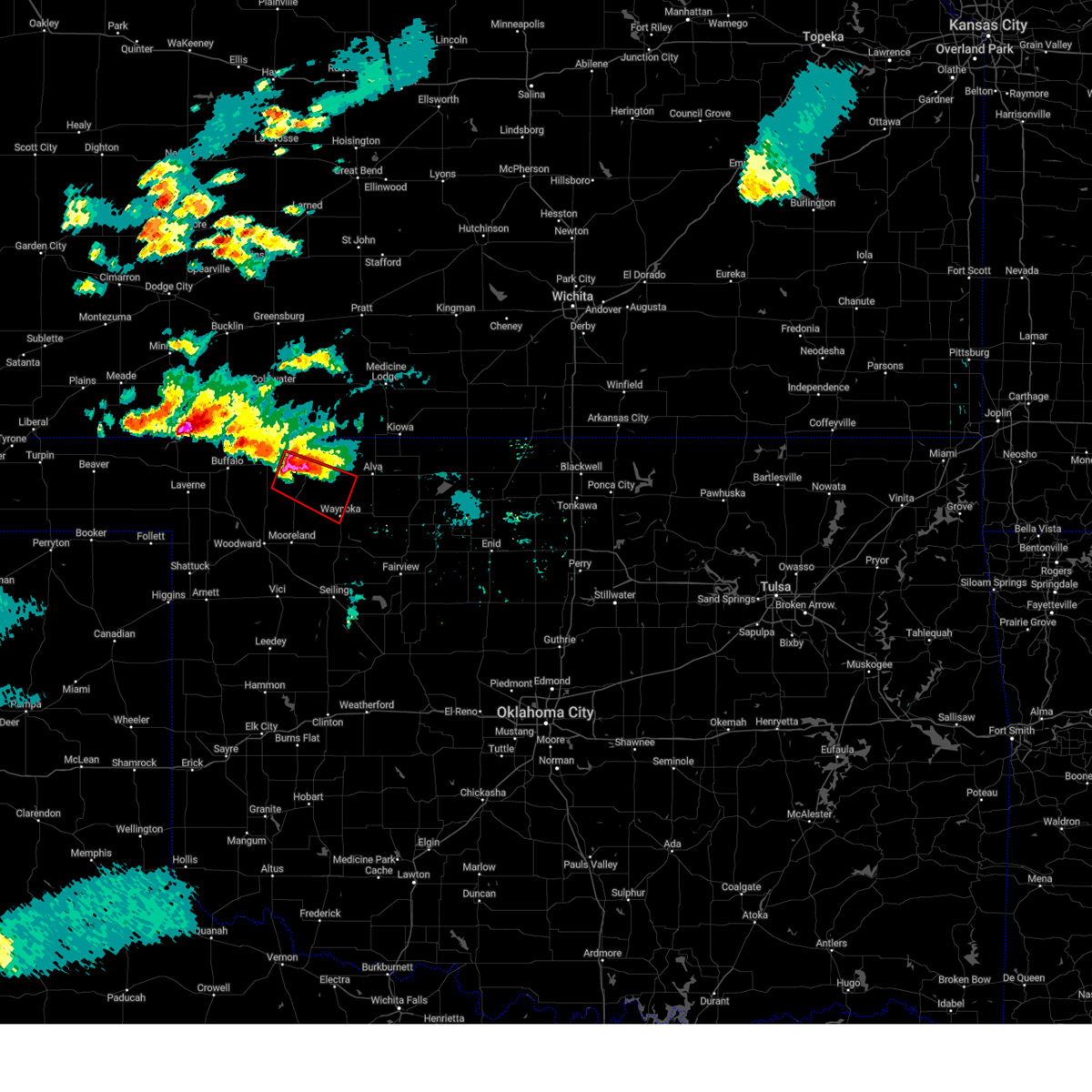
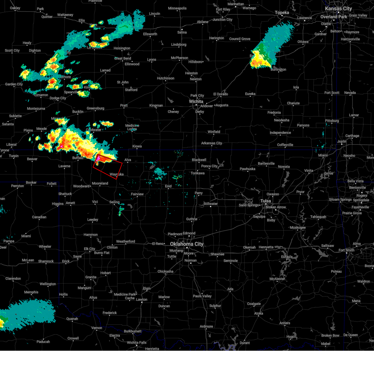
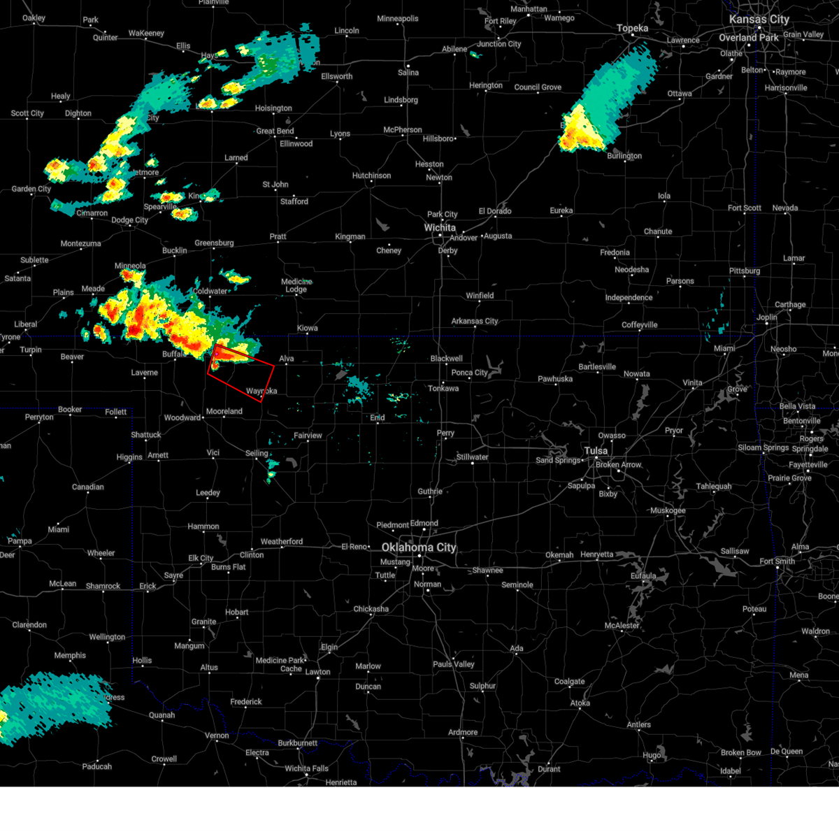
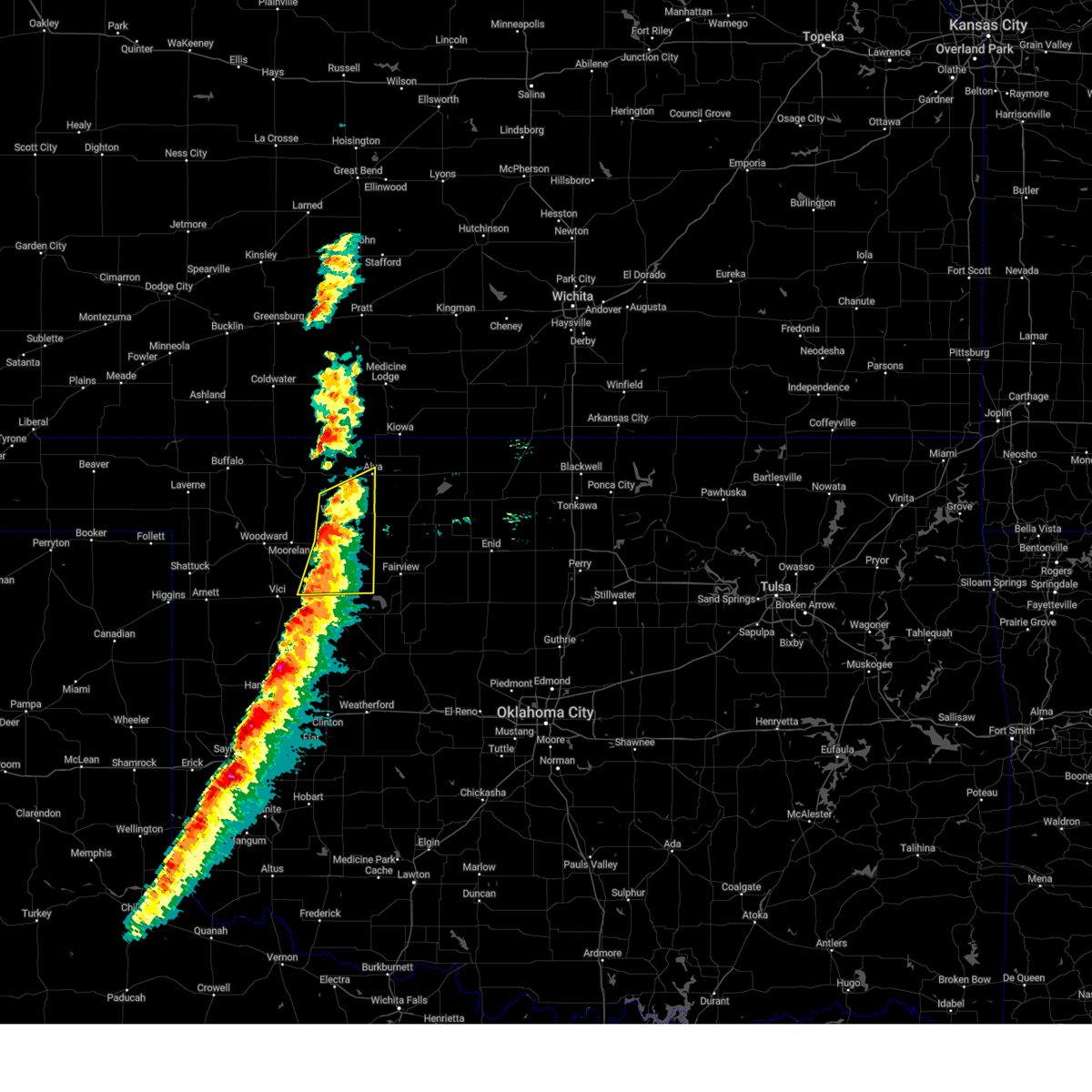
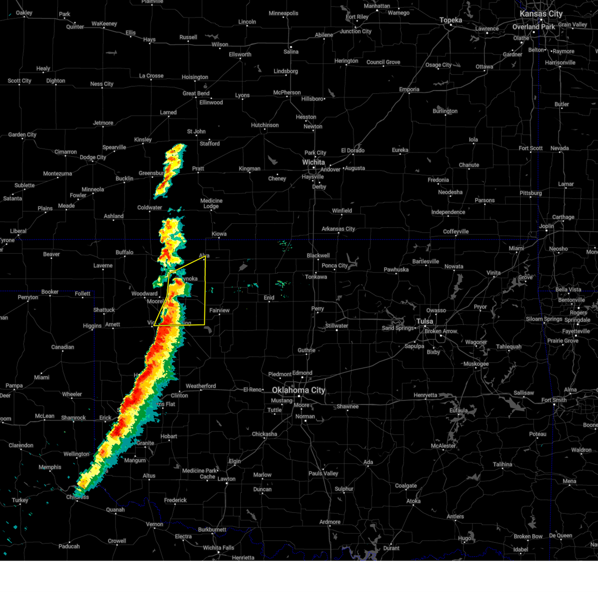
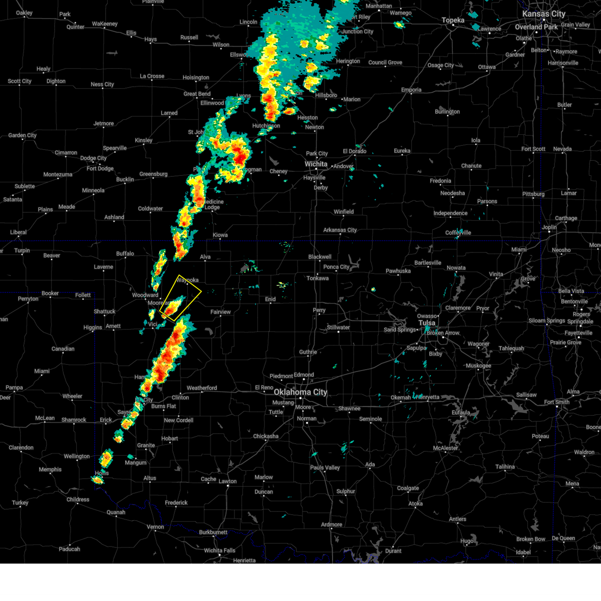
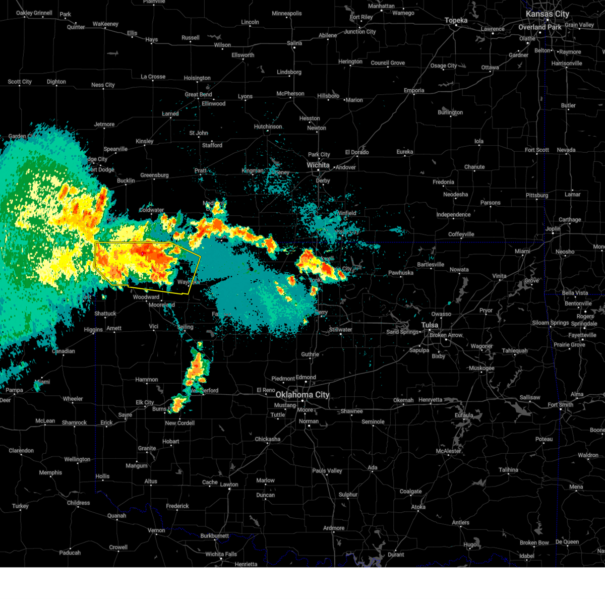
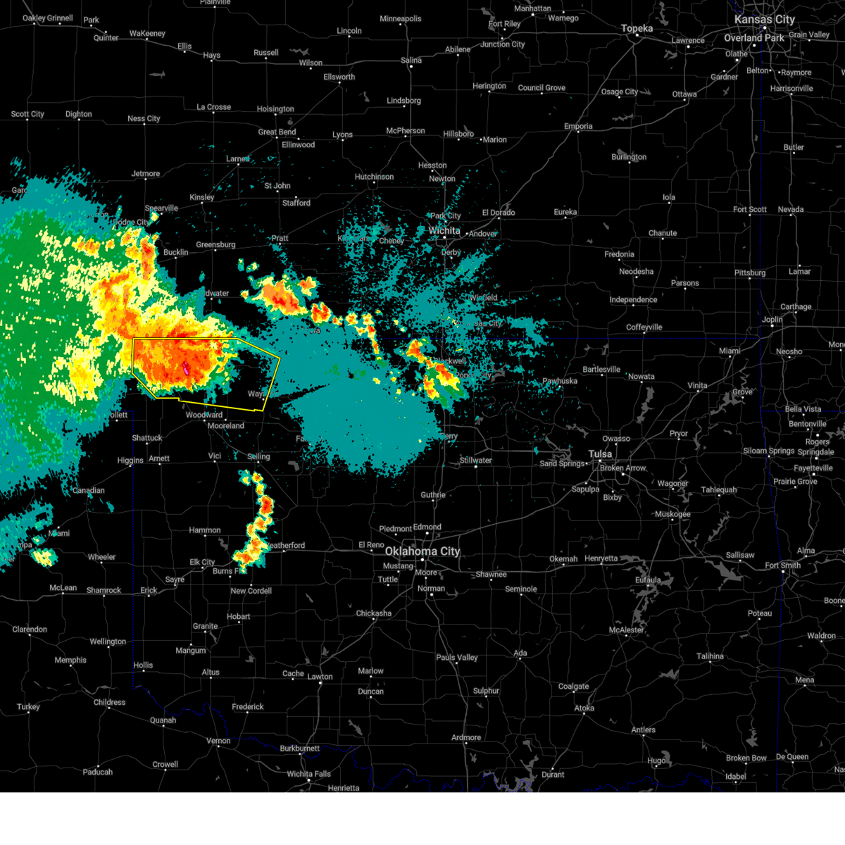
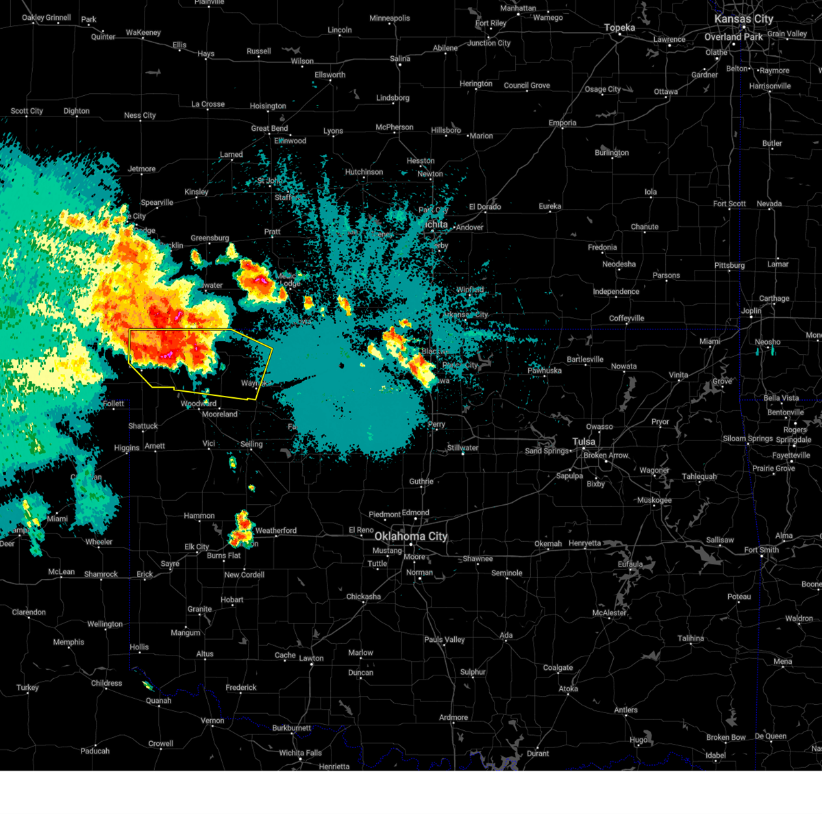
Hail Map for Waynoka, OK
The Waynoka, OK area has had 13 reports of on-the-ground hail by trained spotters, and has been under severe weather warnings 42 times during the past 12 months. Doppler radar has detected hail at or near Waynoka, OK on 84 occasions, including 8 occasions during the past year.
| Name: | Waynoka, OK |
| Where Located: | 30.8 miles ENE of Woodward, OK |
| Map: | Google Map for Waynoka, OK |
| Population: | 927 |
| Housing Units: | 582 |
| More Info: | Search Google for Waynoka, OK |
1
The Top Recent Hail Date for Waynoka, OK is Thursday, April 24, 2025 (8th out of 84)
Hail and Wind Damage Spotted near Waynoka, OK
| Date / Time | Report Details |
|---|---|
| 6/17/2025 8:17 PM CDT |
 Svroun the national weather service in norman has issued a * severe thunderstorm warning for, east central woods county in northwestern oklahoma, northeastern woodward county in northwestern oklahoma, * until 900 pm cdt. * at 817 pm cdt, a severe thunderstorm was located near freedom, moving east-southeast at 30 mph (radar indicated). Hazards include 60 mph wind gusts and quarter size hail. Hail damage to vehicles is expected. Expect wind damage to roofs, siding, and trees. Svroun the national weather service in norman has issued a * severe thunderstorm warning for, east central woods county in northwestern oklahoma, northeastern woodward county in northwestern oklahoma, * until 900 pm cdt. * at 817 pm cdt, a severe thunderstorm was located near freedom, moving east-southeast at 30 mph (radar indicated). Hazards include 60 mph wind gusts and quarter size hail. Hail damage to vehicles is expected. Expect wind damage to roofs, siding, and trees.
|
| 6/8/2025 2:14 PM CDT |
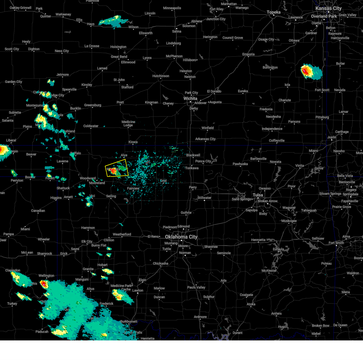 At 213 pm cdt, a severe thunderstorm was located near waynoka, moving east at 25 mph (radar indicated). Hazards include golf ball size hail and 60 mph wind gusts. People and animals outdoors will be injured. expect hail damage to roofs, siding, windows, and vehicles. expect wind damage to roofs, siding, and trees. Locations impacted include, waynoka, avard, and hopeton. At 213 pm cdt, a severe thunderstorm was located near waynoka, moving east at 25 mph (radar indicated). Hazards include golf ball size hail and 60 mph wind gusts. People and animals outdoors will be injured. expect hail damage to roofs, siding, windows, and vehicles. expect wind damage to roofs, siding, and trees. Locations impacted include, waynoka, avard, and hopeton.
|
| 6/8/2025 2:03 PM CDT |
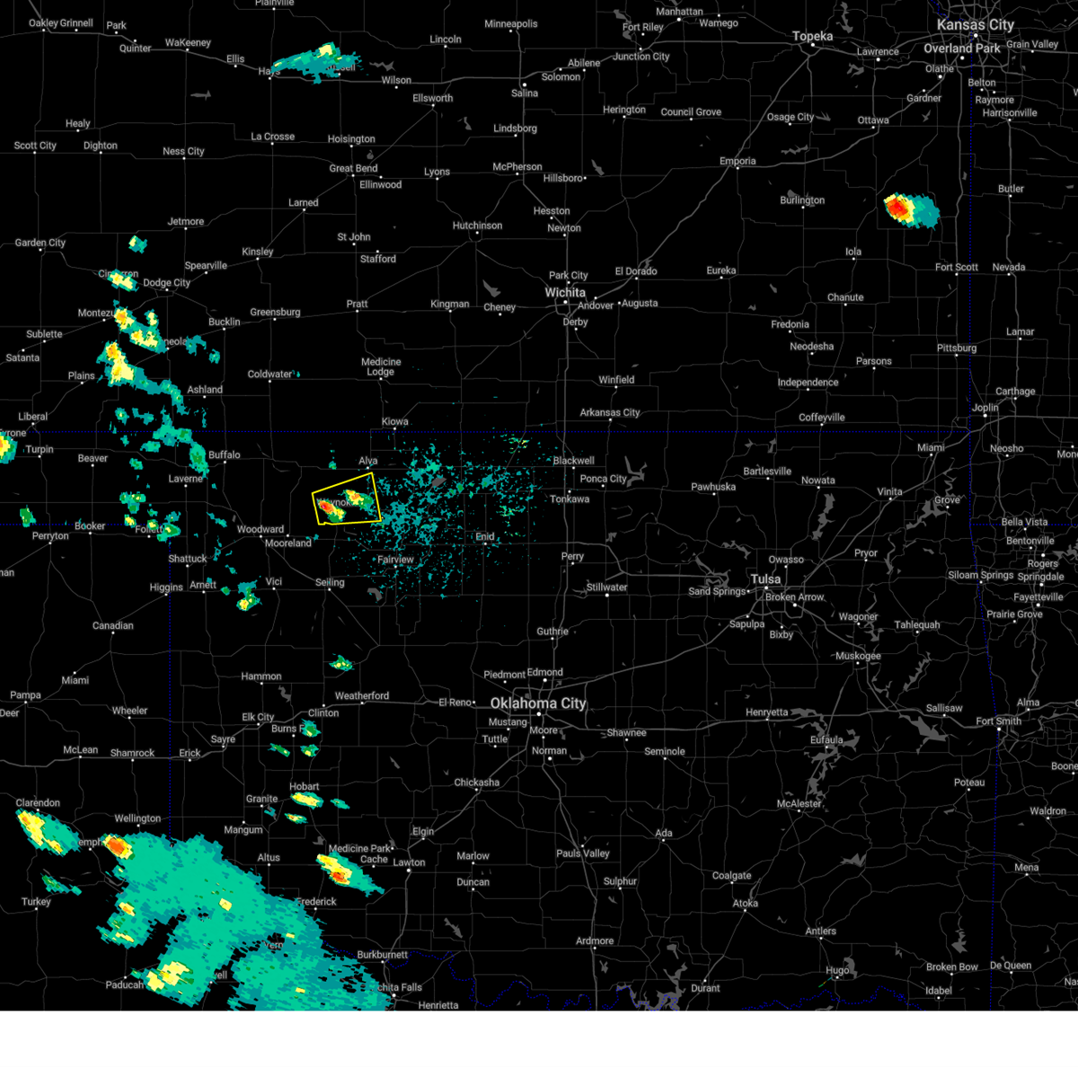 Svroun the national weather service in norman has issued a * severe thunderstorm warning for, southeastern woods county in northwestern oklahoma, northeastern woodward county in northwestern oklahoma, * until 245 pm cdt. * at 202 pm cdt, a severe thunderstorm was located near waynoka, moving east at 25 mph (radar indicated). Hazards include ping pong ball size hail and 60 mph wind gusts. People and animals outdoors will be injured. expect hail damage to roofs, siding, windows, and vehicles. Expect wind damage to roofs, siding, and trees. Svroun the national weather service in norman has issued a * severe thunderstorm warning for, southeastern woods county in northwestern oklahoma, northeastern woodward county in northwestern oklahoma, * until 245 pm cdt. * at 202 pm cdt, a severe thunderstorm was located near waynoka, moving east at 25 mph (radar indicated). Hazards include ping pong ball size hail and 60 mph wind gusts. People and animals outdoors will be injured. expect hail damage to roofs, siding, windows, and vehicles. Expect wind damage to roofs, siding, and trees.
|
| 6/7/2025 1:02 AM CDT |
 At 100 am cdt, a severe thunderstorm was located 10 miles southwest of hardtner, moving east at 50 mph. this is a destructive storm for woods and western alfalfa counties (radar indicated). Hazards include 80 mph wind gusts and quarter size hail. Flying debris will be dangerous to those caught without shelter. mobile homes will be heavily damaged. expect considerable damage to roofs, windows, and vehicles. extensive tree damage and power outages are likely. Locations impacted include, alva, cherokee, waynoka, carmen, freedom, aline, burlington, dacoma, amorita, byron, lambert, alabaster caverns state park, quinlan, avard, ingersoll, driftwood, capron, hopeton, bouse junction, and camp houston. At 100 am cdt, a severe thunderstorm was located 10 miles southwest of hardtner, moving east at 50 mph. this is a destructive storm for woods and western alfalfa counties (radar indicated). Hazards include 80 mph wind gusts and quarter size hail. Flying debris will be dangerous to those caught without shelter. mobile homes will be heavily damaged. expect considerable damage to roofs, windows, and vehicles. extensive tree damage and power outages are likely. Locations impacted include, alva, cherokee, waynoka, carmen, freedom, aline, burlington, dacoma, amorita, byron, lambert, alabaster caverns state park, quinlan, avard, ingersoll, driftwood, capron, hopeton, bouse junction, and camp houston.
|
| 6/7/2025 1:02 AM CDT |
 the severe thunderstorm warning has been cancelled and is no longer in effect the severe thunderstorm warning has been cancelled and is no longer in effect
|
| 6/7/2025 12:42 AM CDT |
 Svroun the national weather service in norman has issued a * severe thunderstorm warning for, north central ellis county in northwestern oklahoma, woods county in northwestern oklahoma, eastern harper county in northwestern oklahoma, western alfalfa county in northwestern oklahoma, western major county in northwestern oklahoma, central woodward county in northwestern oklahoma, * until 130 am cdt. * at 1242 am cdt, a severe thunderstorm was located 4 miles west of freedom, moving east at 50 mph. this is a destructive storm for woods and northern harper counties (radar indicated). Hazards include 80 mph wind gusts and quarter size hail. Flying debris will be dangerous to those caught without shelter. mobile homes will be heavily damaged. expect considerable damage to roofs, windows, and vehicles. Extensive tree damage and power outages are likely. Svroun the national weather service in norman has issued a * severe thunderstorm warning for, north central ellis county in northwestern oklahoma, woods county in northwestern oklahoma, eastern harper county in northwestern oklahoma, western alfalfa county in northwestern oklahoma, western major county in northwestern oklahoma, central woodward county in northwestern oklahoma, * until 130 am cdt. * at 1242 am cdt, a severe thunderstorm was located 4 miles west of freedom, moving east at 50 mph. this is a destructive storm for woods and northern harper counties (radar indicated). Hazards include 80 mph wind gusts and quarter size hail. Flying debris will be dangerous to those caught without shelter. mobile homes will be heavily damaged. expect considerable damage to roofs, windows, and vehicles. Extensive tree damage and power outages are likely.
|
| 6/6/2025 2:12 AM CDT |
 Svroun the national weather service in norman has issued a * severe thunderstorm warning for, southeastern woods county in northwestern oklahoma, southwestern alfalfa county in northwestern oklahoma, western major county in northwestern oklahoma, northeastern woodward county in northwestern oklahoma, * until 315 am cdt. * at 212 am cdt, a severe thunderstorm was located near waynoka, or 23 miles southwest of alva, moving southeast at 25 mph (radar indicated). Hazards include 60 mph wind gusts and quarter size hail. Hail damage to vehicles is expected. Expect wind damage to roofs, siding, and trees. Svroun the national weather service in norman has issued a * severe thunderstorm warning for, southeastern woods county in northwestern oklahoma, southwestern alfalfa county in northwestern oklahoma, western major county in northwestern oklahoma, northeastern woodward county in northwestern oklahoma, * until 315 am cdt. * at 212 am cdt, a severe thunderstorm was located near waynoka, or 23 miles southwest of alva, moving southeast at 25 mph (radar indicated). Hazards include 60 mph wind gusts and quarter size hail. Hail damage to vehicles is expected. Expect wind damage to roofs, siding, and trees.
|
| 6/6/2025 1:55 AM CDT |
 At 155 am cdt, a severe thunderstorm was located 8 miles north of quinlan, or 22 miles northeast of woodward, moving southeast at 30 mph (radar indicated). Hazards include 60 mph wind gusts and quarter size hail. Hail damage to vehicles is expected. expect wind damage to roofs, siding, and trees. Locations impacted include, hopeton, alabaster caverns state park, avard, waynoka, bouse junction, quinlan, and freedom. At 155 am cdt, a severe thunderstorm was located 8 miles north of quinlan, or 22 miles northeast of woodward, moving southeast at 30 mph (radar indicated). Hazards include 60 mph wind gusts and quarter size hail. Hail damage to vehicles is expected. expect wind damage to roofs, siding, and trees. Locations impacted include, hopeton, alabaster caverns state park, avard, waynoka, bouse junction, quinlan, and freedom.
|
| 6/6/2025 1:38 AM CDT |
 the severe thunderstorm warning has been cancelled and is no longer in effect the severe thunderstorm warning has been cancelled and is no longer in effect
|
| 6/6/2025 1:38 AM CDT |
 At 137 am cdt, a severe thunderstorm was located over alabaster caverns state park, or 22 miles northeast of woodward, moving southeast at 30 mph (radar indicated). Hazards include 60 mph wind gusts and quarter size hail. Hail damage to vehicles is expected. expect wind damage to roofs, siding, and trees. Locations impacted include, hopeton, alabaster caverns state park, avard, waynoka, bouse junction, quinlan, camp houston, and freedom. At 137 am cdt, a severe thunderstorm was located over alabaster caverns state park, or 22 miles northeast of woodward, moving southeast at 30 mph (radar indicated). Hazards include 60 mph wind gusts and quarter size hail. Hail damage to vehicles is expected. expect wind damage to roofs, siding, and trees. Locations impacted include, hopeton, alabaster caverns state park, avard, waynoka, bouse junction, quinlan, camp houston, and freedom.
|
| 6/6/2025 1:13 AM CDT |
 Svroun the national weather service in norman has issued a * severe thunderstorm warning for, central woods county in northwestern oklahoma, eastern harper county in northwestern oklahoma, northwestern major county in northwestern oklahoma, northeastern woodward county in northwestern oklahoma, * until 215 am cdt. * at 112 am cdt, a severe thunderstorm was located 8 miles east of selman, or 15 miles east of buffalo, moving southeast at 35 mph (radar indicated). Hazards include 60 mph wind gusts and half dollar size hail. Hail damage to vehicles is expected. Expect wind damage to roofs, siding, and trees. Svroun the national weather service in norman has issued a * severe thunderstorm warning for, central woods county in northwestern oklahoma, eastern harper county in northwestern oklahoma, northwestern major county in northwestern oklahoma, northeastern woodward county in northwestern oklahoma, * until 215 am cdt. * at 112 am cdt, a severe thunderstorm was located 8 miles east of selman, or 15 miles east of buffalo, moving southeast at 35 mph (radar indicated). Hazards include 60 mph wind gusts and half dollar size hail. Hail damage to vehicles is expected. Expect wind damage to roofs, siding, and trees.
|
| 6/2/2025 8:39 PM CDT |
 Svroun the national weather service in norman has issued a * severe thunderstorm warning for, eastern woods county in northwestern oklahoma, alfalfa county in northwestern oklahoma, northern major county in northwestern oklahoma, * until 930 pm cdt. * at 839 pm cdt, severe thunderstorms were located along a line extending from 3 miles southwest of hardtner to 7 miles east of quinlan, moving east at 30 mph (radar indicated). Hazards include 60 mph wind gusts and nickel size hail. expect damage to roofs, siding, and trees Svroun the national weather service in norman has issued a * severe thunderstorm warning for, eastern woods county in northwestern oklahoma, alfalfa county in northwestern oklahoma, northern major county in northwestern oklahoma, * until 930 pm cdt. * at 839 pm cdt, severe thunderstorms were located along a line extending from 3 miles southwest of hardtner to 7 miles east of quinlan, moving east at 30 mph (radar indicated). Hazards include 60 mph wind gusts and nickel size hail. expect damage to roofs, siding, and trees
|
| 5/28/2025 11:40 PM CDT |
 At 1140 pm cdt, severe thunderstorms were located along a line extending from near alva to 3 miles south of seiling, moving east at 45 mph (radar indicated). Hazards include 60 mph wind gusts and penny size hail. Expect damage to roofs, siding, and trees. Locations impacted include, fairview, cherokee, helena, waynoka, seiling, canton, carmen, cleo springs, longdale, aline, dacoma, lambert, canton lake, orion, chester, avard, orienta, southwestern great salt plains lake, southard, and hopeton. At 1140 pm cdt, severe thunderstorms were located along a line extending from near alva to 3 miles south of seiling, moving east at 45 mph (radar indicated). Hazards include 60 mph wind gusts and penny size hail. Expect damage to roofs, siding, and trees. Locations impacted include, fairview, cherokee, helena, waynoka, seiling, canton, carmen, cleo springs, longdale, aline, dacoma, lambert, canton lake, orion, chester, avard, orienta, southwestern great salt plains lake, southard, and hopeton.
|
| 5/28/2025 11:27 PM CDT |
 Svroun the national weather service in norman has issued a * severe thunderstorm warning for, southeastern woods county in northwestern oklahoma, southwestern alfalfa county in northwestern oklahoma, northwestern blaine county in northwestern oklahoma, northeastern dewey county in northwestern oklahoma, major county in northwestern oklahoma, eastern woodward county in northwestern oklahoma, * until 1215 am cdt. * at 1127 pm cdt, severe thunderstorms were located along a line extending from 7 miles northwest of avard to near cestos, moving east at 45 mph (radar indicated). Hazards include 60 mph wind gusts. expect damage to roofs, siding, and trees Svroun the national weather service in norman has issued a * severe thunderstorm warning for, southeastern woods county in northwestern oklahoma, southwestern alfalfa county in northwestern oklahoma, northwestern blaine county in northwestern oklahoma, northeastern dewey county in northwestern oklahoma, major county in northwestern oklahoma, eastern woodward county in northwestern oklahoma, * until 1215 am cdt. * at 1127 pm cdt, severe thunderstorms were located along a line extending from 7 miles northwest of avard to near cestos, moving east at 45 mph (radar indicated). Hazards include 60 mph wind gusts. expect damage to roofs, siding, and trees
|
| 5/28/2025 10:31 PM CDT |
 the severe thunderstorm warning has been cancelled and is no longer in effect the severe thunderstorm warning has been cancelled and is no longer in effect
|
| 5/28/2025 10:19 PM CDT |
 the severe thunderstorm warning has been cancelled and is no longer in effect the severe thunderstorm warning has been cancelled and is no longer in effect
|
| 5/28/2025 10:19 PM CDT |
 At 1018 pm cdt, severe thunderstorms were located along a line extending from 4 miles northeast of avard to 13 miles northwest of orienta to 5 miles northeast of chester, moving east at 45 mph (radar indicated). Hazards include 60 mph wind gusts and penny size hail. Expect damage to roofs, siding, and trees. Locations impacted include, alva, waynoka, avard, bouse junction, and hopeton. At 1018 pm cdt, severe thunderstorms were located along a line extending from 4 miles northeast of avard to 13 miles northwest of orienta to 5 miles northeast of chester, moving east at 45 mph (radar indicated). Hazards include 60 mph wind gusts and penny size hail. Expect damage to roofs, siding, and trees. Locations impacted include, alva, waynoka, avard, bouse junction, and hopeton.
|
| 5/28/2025 9:56 PM CDT |
 Svroun the national weather service in norman has issued a * severe thunderstorm warning for, southeastern woods county in northwestern oklahoma, northwestern major county in northwestern oklahoma, southeastern woodward county in northwestern oklahoma, * until 1045 pm cdt. * at 956 pm cdt, severe thunderstorms were located along a line extending from 6 miles northwest of avard to 6 miles northeast of quinlan to 4 miles north of mutual, moving east at 20 mph (radar indicated). Hazards include 60 mph wind gusts and penny size hail. expect damage to roofs, siding, and trees Svroun the national weather service in norman has issued a * severe thunderstorm warning for, southeastern woods county in northwestern oklahoma, northwestern major county in northwestern oklahoma, southeastern woodward county in northwestern oklahoma, * until 1045 pm cdt. * at 956 pm cdt, severe thunderstorms were located along a line extending from 6 miles northwest of avard to 6 miles northeast of quinlan to 4 miles north of mutual, moving east at 20 mph (radar indicated). Hazards include 60 mph wind gusts and penny size hail. expect damage to roofs, siding, and trees
|
| 5/24/2025 2:38 AM CDT |
 Svroun the national weather service in norman has issued a * severe thunderstorm warning for, northeastern woods county in northwestern oklahoma, alfalfa county in northwestern oklahoma, northwestern grant county in northern oklahoma, * until 345 am cdt. * at 237 am cdt, severe thunderstorms were located along a line extending from 6 miles northeast of nashville to 3 miles south of medicine lodge to 8 miles northwest of hardtner to near aetna, moving southeast at 35 mph (radar indicated). Hazards include 60 mph wind gusts and quarter size hail. Hail damage to vehicles is expected. Expect wind damage to roofs, siding, and trees. Svroun the national weather service in norman has issued a * severe thunderstorm warning for, northeastern woods county in northwestern oklahoma, alfalfa county in northwestern oklahoma, northwestern grant county in northern oklahoma, * until 345 am cdt. * at 237 am cdt, severe thunderstorms were located along a line extending from 6 miles northeast of nashville to 3 miles south of medicine lodge to 8 miles northwest of hardtner to near aetna, moving southeast at 35 mph (radar indicated). Hazards include 60 mph wind gusts and quarter size hail. Hail damage to vehicles is expected. Expect wind damage to roofs, siding, and trees.
|
| 5/18/2025 7:28 PM CDT | the severe thunderstorm warning has been cancelled and is no longer in effect |
| 5/18/2025 7:28 PM CDT | At 728 pm cdt, a severe thunderstorm was located 8 miles south of alabaster caverns state park, moving northeast at 30 mph (radar indicated). Hazards include golf ball size hail and 60 mph wind gusts. People and animals outdoors will be injured. expect hail damage to roofs, siding, windows, and vehicles. expect wind damage to roofs, siding, and trees. Locations impacted include, waynoka and alabaster caverns state park. |
| 5/18/2025 7:21 PM CDT | At 721 pm cdt, a severe thunderstorm was located 7 miles north of mooreland, moving northeast at 30 mph. this is a destructive storm for northern woodward county (radar indicated). Hazards include baseball size hail and 60 mph wind gusts. People and animals outdoors will be severely injured. expect shattered windows, extensive damage to roofs, siding, and vehicles. Locations impacted include, mooreland, waynoka, and alabaster caverns state park. |
| 5/18/2025 7:06 PM CDT | Svroun the national weather service in norman has issued a * severe thunderstorm warning for, central woods county in northwestern oklahoma, southeastern harper county in northwestern oklahoma, central woodward county in northwestern oklahoma, * until 745 pm cdt. * at 705 pm cdt, a severe thunderstorm was located near woodward, moving northeast at 30 mph. this is a destructive storm for areas northeast of woodward (radar indicated). Hazards include baseball size hail and 60 mph wind gusts. People and animals outdoors will be severely injured. Expect shattered windows, extensive damage to roofs, siding, and vehicles. |
| 4/29/2025 3:33 AM CDT |
 Svroun the national weather service in norman has issued a * severe thunderstorm warning for, southeastern woods county in northwestern oklahoma, southwestern alfalfa county in northwestern oklahoma, northwestern major county in northwestern oklahoma, southern woodward county in northwestern oklahoma, * until 415 am cdt. * at 333 am cdt, a severe thunderstorm was located 4 miles south of mooreland, moving northeast at 45 mph (radar indicated). Hazards include 60 mph wind gusts and quarter size hail. Hail damage to vehicles is expected. Expect wind damage to roofs, siding, and trees. Svroun the national weather service in norman has issued a * severe thunderstorm warning for, southeastern woods county in northwestern oklahoma, southwestern alfalfa county in northwestern oklahoma, northwestern major county in northwestern oklahoma, southern woodward county in northwestern oklahoma, * until 415 am cdt. * at 333 am cdt, a severe thunderstorm was located 4 miles south of mooreland, moving northeast at 45 mph (radar indicated). Hazards include 60 mph wind gusts and quarter size hail. Hail damage to vehicles is expected. Expect wind damage to roofs, siding, and trees.
|
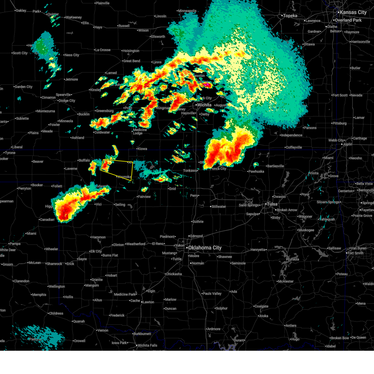
| 4/24/2025 9:13 PM CDT |
 Svroun the national weather service in norman has issued a * severe thunderstorm warning for, southeastern woods county in northwestern oklahoma, northwestern major county in northwestern oklahoma, east central woodward county in northwestern oklahoma, * until 930 pm cdt. * at 913 pm cdt, a severe thunderstorm was located 6 miles southwest of waynoka, moving southeast at 20 mph (radar indicated). Hazards include 60 mph wind gusts and half dollar size hail. Hail damage to vehicles is expected. Expect wind damage to roofs, siding, and trees. Svroun the national weather service in norman has issued a * severe thunderstorm warning for, southeastern woods county in northwestern oklahoma, northwestern major county in northwestern oklahoma, east central woodward county in northwestern oklahoma, * until 930 pm cdt. * at 913 pm cdt, a severe thunderstorm was located 6 miles southwest of waynoka, moving southeast at 20 mph (radar indicated). Hazards include 60 mph wind gusts and half dollar size hail. Hail damage to vehicles is expected. Expect wind damage to roofs, siding, and trees.
|
| 4/24/2025 9:03 PM CDT |
 At 903 pm cdt, a severe thunderstorm was located near waynoka, moving southeast at 10 mph (radar indicated). Hazards include golf ball size hail and 60 mph wind gusts. People and animals outdoors will be injured. expect hail damage to roofs, siding, windows, and vehicles. expect wind damage to roofs, siding, and trees. Locations impacted include, waynoka. At 903 pm cdt, a severe thunderstorm was located near waynoka, moving southeast at 10 mph (radar indicated). Hazards include golf ball size hail and 60 mph wind gusts. People and animals outdoors will be injured. expect hail damage to roofs, siding, windows, and vehicles. expect wind damage to roofs, siding, and trees. Locations impacted include, waynoka.
|
| 4/24/2025 8:56 PM CDT |
 Svroun the national weather service in norman has issued a * severe thunderstorm warning for, southeastern woods county in northwestern oklahoma, northwestern major county in northwestern oklahoma, east central woodward county in northwestern oklahoma, * until 915 pm cdt. * at 856 pm cdt, a severe thunderstorm was located 6 miles north of quinlan, moving southeast at 30 mph (radar indicated). Hazards include 60 mph wind gusts and quarter size hail. Hail damage to vehicles is expected. Expect wind damage to roofs, siding, and trees. Svroun the national weather service in norman has issued a * severe thunderstorm warning for, southeastern woods county in northwestern oklahoma, northwestern major county in northwestern oklahoma, east central woodward county in northwestern oklahoma, * until 915 pm cdt. * at 856 pm cdt, a severe thunderstorm was located 6 miles north of quinlan, moving southeast at 30 mph (radar indicated). Hazards include 60 mph wind gusts and quarter size hail. Hail damage to vehicles is expected. Expect wind damage to roofs, siding, and trees.
|
| 4/24/2025 8:40 PM CDT |
 Svroun the national weather service in norman has issued a * severe thunderstorm warning for, southeastern woods county in northwestern oklahoma, western major county in northwestern oklahoma, * until 930 pm cdt. * at 840 pm cdt, severe thunderstorms were located along a line extending from near avard to near waynoka, moving southeast at 15 mph (radar indicated). Hazards include 70 mph wind gusts and ping pong ball size hail. People and animals outdoors will be injured. expect hail damage to roofs, siding, windows, and vehicles. expect considerable tree damage. Wind damage is also likely to mobile homes, roofs, and outbuildings. Svroun the national weather service in norman has issued a * severe thunderstorm warning for, southeastern woods county in northwestern oklahoma, western major county in northwestern oklahoma, * until 930 pm cdt. * at 840 pm cdt, severe thunderstorms were located along a line extending from near avard to near waynoka, moving southeast at 15 mph (radar indicated). Hazards include 70 mph wind gusts and ping pong ball size hail. People and animals outdoors will be injured. expect hail damage to roofs, siding, windows, and vehicles. expect considerable tree damage. Wind damage is also likely to mobile homes, roofs, and outbuildings.
|
| 4/24/2025 7:24 PM CDT |
 Toroun the national weather service in norman has issued a * tornado warning for, northeastern woods county in northwestern oklahoma, northeastern woodward county in northwestern oklahoma, * until 815 pm cdt. * at 723 pm cdt, a severe thunderstorm capable of producing a tornado was located near freedom, moving east at 25 mph (radar indicated rotation). Hazards include tornado and tennis ball size hail. Flying debris will be dangerous to those caught without shelter. mobile homes will be damaged or destroyed. damage to roofs, windows, and vehicles will occur. Tree damage is likely. Toroun the national weather service in norman has issued a * tornado warning for, northeastern woods county in northwestern oklahoma, northeastern woodward county in northwestern oklahoma, * until 815 pm cdt. * at 723 pm cdt, a severe thunderstorm capable of producing a tornado was located near freedom, moving east at 25 mph (radar indicated rotation). Hazards include tornado and tennis ball size hail. Flying debris will be dangerous to those caught without shelter. mobile homes will be damaged or destroyed. damage to roofs, windows, and vehicles will occur. Tree damage is likely.
|
| 4/24/2025 6:46 PM CDT |
 At 646 pm cdt, a confirmed tornado was located 8 miles west of freedom, moving west at 5 mph (broadcast media confirmed tornado). Hazards include damaging tornado and two inch hail. Flying debris will be dangerous to those caught without shelter. mobile homes will be damaged or destroyed. damage to roofs, windows, and vehicles will occur. tree damage is likely. Locations impacted include, waynoka, freedom, alabaster caverns state park, and camp houston. At 646 pm cdt, a confirmed tornado was located 8 miles west of freedom, moving west at 5 mph (broadcast media confirmed tornado). Hazards include damaging tornado and two inch hail. Flying debris will be dangerous to those caught without shelter. mobile homes will be damaged or destroyed. damage to roofs, windows, and vehicles will occur. tree damage is likely. Locations impacted include, waynoka, freedom, alabaster caverns state park, and camp houston.
|
| 4/24/2025 6:32 PM CDT |
 At 632 pm cdt, a severe thunderstorm capable of producing a tornado was located 7 miles west of freedom, and is nearly stationary (radar indicated rotation). Hazards include tornado and two inch hail. Flying debris will be dangerous to those caught without shelter. mobile homes will be damaged or destroyed. damage to roofs, windows, and vehicles will occur. tree damage is likely. Locations impacted include, waynoka, freedom, alabaster caverns state park, and camp houston. At 632 pm cdt, a severe thunderstorm capable of producing a tornado was located 7 miles west of freedom, and is nearly stationary (radar indicated rotation). Hazards include tornado and two inch hail. Flying debris will be dangerous to those caught without shelter. mobile homes will be damaged or destroyed. damage to roofs, windows, and vehicles will occur. tree damage is likely. Locations impacted include, waynoka, freedom, alabaster caverns state park, and camp houston.
|
| 4/24/2025 6:23 PM CDT |
 At 623 pm cdt, a confirmed tornado was located 7 miles west of freedom, moving southeast at 10 mph (broadcast media confirmed tornado). Hazards include at 6:21, broadcast media confirmed a damaging tornado. three inch hail also possible. Flying debris will be dangerous to those caught without shelter. mobile homes will be damaged or destroyed. damage to roofs, windows, and vehicles will occur. tree damage is likely. Locations impacted include, waynoka, freedom, alabaster caverns state park, and camp houston. At 623 pm cdt, a confirmed tornado was located 7 miles west of freedom, moving southeast at 10 mph (broadcast media confirmed tornado). Hazards include at 6:21, broadcast media confirmed a damaging tornado. three inch hail also possible. Flying debris will be dangerous to those caught without shelter. mobile homes will be damaged or destroyed. damage to roofs, windows, and vehicles will occur. tree damage is likely. Locations impacted include, waynoka, freedom, alabaster caverns state park, and camp houston.
|
| 4/24/2025 6:15 PM CDT |
 Toroun the national weather service in norman has issued a * tornado warning for, central woods county in northwestern oklahoma, east central harper county in northwestern oklahoma, northeastern woodward county in northwestern oklahoma, * until 700 pm cdt. * at 615 pm cdt, a severe thunderstorm capable of producing a tornado was located 7 miles west of freedom, moving east at 25 mph (radar indicated rotation). Hazards include tornado and tennis ball size hail. Flying debris will be dangerous to those caught without shelter. mobile homes will be damaged or destroyed. damage to roofs, windows, and vehicles will occur. Tree damage is likely. Toroun the national weather service in norman has issued a * tornado warning for, central woods county in northwestern oklahoma, east central harper county in northwestern oklahoma, northeastern woodward county in northwestern oklahoma, * until 700 pm cdt. * at 615 pm cdt, a severe thunderstorm capable of producing a tornado was located 7 miles west of freedom, moving east at 25 mph (radar indicated rotation). Hazards include tornado and tennis ball size hail. Flying debris will be dangerous to those caught without shelter. mobile homes will be damaged or destroyed. damage to roofs, windows, and vehicles will occur. Tree damage is likely.
|
| 3/3/2025 9:54 PM CST |
 At 953 pm cst, severe thunderstorms were located along a line extending from 4 miles north of waynoka to 8 miles east of quinlan to 3 miles west of chester, moving northeast at 30 mph (radar indicated). Hazards include golf ball size hail and 60 mph wind gusts. People and animals outdoors will be injured. expect hail damage to roofs, siding, windows, and vehicles. expect wind damage to roofs, siding, and trees. Locations impacted include, chester, hopeton, avard, waynoka, alva, bouse junction, quinlan, and orion. At 953 pm cst, severe thunderstorms were located along a line extending from 4 miles north of waynoka to 8 miles east of quinlan to 3 miles west of chester, moving northeast at 30 mph (radar indicated). Hazards include golf ball size hail and 60 mph wind gusts. People and animals outdoors will be injured. expect hail damage to roofs, siding, windows, and vehicles. expect wind damage to roofs, siding, and trees. Locations impacted include, chester, hopeton, avard, waynoka, alva, bouse junction, quinlan, and orion.
|
| 3/3/2025 9:44 PM CST |
 Svroun the national weather service in norman has issued a * severe thunderstorm warning for, southeastern woods county in northwestern oklahoma, western major county in northwestern oklahoma, southeastern woodward county in northwestern oklahoma, * until 1015 pm cst. * at 944 pm cst, severe thunderstorms were located along a line extending from 5 miles west of waynoka to 5 miles southeast of quinlan to 3 miles northeast of cestos, moving northeast at 45 mph (radar indicated). Hazards include 60 mph wind gusts and quarter size hail. Hail damage to vehicles is expected. Expect wind damage to roofs, siding, and trees. Svroun the national weather service in norman has issued a * severe thunderstorm warning for, southeastern woods county in northwestern oklahoma, western major county in northwestern oklahoma, southeastern woodward county in northwestern oklahoma, * until 1015 pm cst. * at 944 pm cst, severe thunderstorms were located along a line extending from 5 miles west of waynoka to 5 miles southeast of quinlan to 3 miles northeast of cestos, moving northeast at 45 mph (radar indicated). Hazards include 60 mph wind gusts and quarter size hail. Hail damage to vehicles is expected. Expect wind damage to roofs, siding, and trees.
|
| 10/30/2024 2:55 PM CDT |
 Svroun the national weather service in norman has issued a * severe thunderstorm warning for, southeastern woods county in northwestern oklahoma, northwestern major county in northwestern oklahoma, southeastern woodward county in northwestern oklahoma, * until 345 pm cdt. * at 254 pm cdt, a severe thunderstorm was located 8 miles south of quinlan, moving northeast at 30 mph (radar indicated). Hazards include 60 mph wind gusts and half dollar size hail. Hail damage to vehicles is expected. Expect wind damage to roofs, siding, and trees. Svroun the national weather service in norman has issued a * severe thunderstorm warning for, southeastern woods county in northwestern oklahoma, northwestern major county in northwestern oklahoma, southeastern woodward county in northwestern oklahoma, * until 345 pm cdt. * at 254 pm cdt, a severe thunderstorm was located 8 miles south of quinlan, moving northeast at 30 mph (radar indicated). Hazards include 60 mph wind gusts and half dollar size hail. Hail damage to vehicles is expected. Expect wind damage to roofs, siding, and trees.
|
| 8/2/2024 1:16 AM CDT |
 The storms which prompted the warning have weakened below severe limits, therefore the warning has been allowed to expire. however, gusty winds of 50 mph and small hail are still possible with these thunderstorms. The storms which prompted the warning have weakened below severe limits, therefore the warning has been allowed to expire. however, gusty winds of 50 mph and small hail are still possible with these thunderstorms.
|
| 8/2/2024 12:56 AM CDT |
 At 1255 am cdt, severe thunderstorms were located along a line extending from 8 miles north of freedom to 5 miles northeast of fort supply, moving southeast at 20 mph. the mesonet station near buffalo measured a wind gust of 56 mph at 1230 am (radar indicated). Hazards include 60 mph wind gusts and quarter size hail. Hail damage to vehicles is expected. expect wind damage to roofs, siding, and trees. Locations impacted include, laverne, buffalo, waynoka, fort supply, freedom, may, rosston, alabaster caverns state park, selman, and camp houston. At 1255 am cdt, severe thunderstorms were located along a line extending from 8 miles north of freedom to 5 miles northeast of fort supply, moving southeast at 20 mph. the mesonet station near buffalo measured a wind gust of 56 mph at 1230 am (radar indicated). Hazards include 60 mph wind gusts and quarter size hail. Hail damage to vehicles is expected. expect wind damage to roofs, siding, and trees. Locations impacted include, laverne, buffalo, waynoka, fort supply, freedom, may, rosston, alabaster caverns state park, selman, and camp houston.
|
| 8/2/2024 12:32 AM CDT |
 Svroun the national weather service in norman has issued a * severe thunderstorm warning for, northeastern woods county in northwestern oklahoma, harper county in northwestern oklahoma, northern woodward county in northwestern oklahoma, * until 115 am cdt. * at 1231 am cdt, severe thunderstorms were located along a line extending from 11 miles southeast of buttermilk to 9 miles southeast of selman to 3 miles south of rosston, moving southeast at 25 mph. winds to near 60 mph were measured near the kansas border northwest of freedom (radar indicated). Hazards include 60 mph wind gusts and quarter size hail. Hail damage to vehicles is expected. Expect wind damage to roofs, siding, and trees. Svroun the national weather service in norman has issued a * severe thunderstorm warning for, northeastern woods county in northwestern oklahoma, harper county in northwestern oklahoma, northern woodward county in northwestern oklahoma, * until 115 am cdt. * at 1231 am cdt, severe thunderstorms were located along a line extending from 11 miles southeast of buttermilk to 9 miles southeast of selman to 3 miles south of rosston, moving southeast at 25 mph. winds to near 60 mph were measured near the kansas border northwest of freedom (radar indicated). Hazards include 60 mph wind gusts and quarter size hail. Hail damage to vehicles is expected. Expect wind damage to roofs, siding, and trees.
|
| 7/16/2024 11:39 PM CDT |
 Svroun the national weather service in norman has issued a * severe thunderstorm warning for, western woods county in northwestern oklahoma, eastern harper county in northwestern oklahoma, northwestern major county in northwestern oklahoma, woodward county in northwestern oklahoma, * until 1230 am cdt. * at 1138 pm cdt, severe thunderstorms were located along a line extending from 9 miles southwest of buttermilk to 8 miles east of selman to 9 miles northwest of mooreland to 6 miles northeast of sharon to near vici, moving east at 40 mph (radar indicated). Hazards include 60 mph wind gusts and quarter size hail. Hail damage to vehicles is expected. Expect wind damage to roofs, siding, and trees. Svroun the national weather service in norman has issued a * severe thunderstorm warning for, western woods county in northwestern oklahoma, eastern harper county in northwestern oklahoma, northwestern major county in northwestern oklahoma, woodward county in northwestern oklahoma, * until 1230 am cdt. * at 1138 pm cdt, severe thunderstorms were located along a line extending from 9 miles southwest of buttermilk to 8 miles east of selman to 9 miles northwest of mooreland to 6 miles northeast of sharon to near vici, moving east at 40 mph (radar indicated). Hazards include 60 mph wind gusts and quarter size hail. Hail damage to vehicles is expected. Expect wind damage to roofs, siding, and trees.
|
| 7/16/2024 10:52 PM CDT |
 At 1051 pm cdt, a severe thunderstorm was located 11 miles southeast of waynoka, moving east at 20 mph (radar indicated). Hazards include 60 mph wind gusts and quarter size hail. Hail damage to vehicles is expected. expect wind damage to roofs, siding, and trees. Locations impacted include, waynoka, carmen, cleo springs, aline, and orienta. At 1051 pm cdt, a severe thunderstorm was located 11 miles southeast of waynoka, moving east at 20 mph (radar indicated). Hazards include 60 mph wind gusts and quarter size hail. Hail damage to vehicles is expected. expect wind damage to roofs, siding, and trees. Locations impacted include, waynoka, carmen, cleo springs, aline, and orienta.
|
| 7/16/2024 10:41 PM CDT |
 Svroun the national weather service in norman has issued a * severe thunderstorm warning for, southeastern woods county in northwestern oklahoma, southwestern alfalfa county in northwestern oklahoma, central major county in northwestern oklahoma, * until 1130 pm cdt. * at 1041 pm cdt, a severe thunderstorm was located 10 miles southeast of waynoka, moving east at 20 mph (radar indicated). Hazards include 70 mph wind gusts and ping pong ball size hail. People and animals outdoors will be injured. expect hail damage to roofs, siding, windows, and vehicles. expect considerable tree damage. Wind damage is also likely to mobile homes, roofs, and outbuildings. Svroun the national weather service in norman has issued a * severe thunderstorm warning for, southeastern woods county in northwestern oklahoma, southwestern alfalfa county in northwestern oklahoma, central major county in northwestern oklahoma, * until 1130 pm cdt. * at 1041 pm cdt, a severe thunderstorm was located 10 miles southeast of waynoka, moving east at 20 mph (radar indicated). Hazards include 70 mph wind gusts and ping pong ball size hail. People and animals outdoors will be injured. expect hail damage to roofs, siding, windows, and vehicles. expect considerable tree damage. Wind damage is also likely to mobile homes, roofs, and outbuildings.
|
| 6/28/2024 2:09 AM CDT |
 The storms which prompted the warning have weakened below severe limits, therefore the warning will be allowed to expire. however, gusty winds are still possible with these thunderstorms. The storms which prompted the warning have weakened below severe limits, therefore the warning will be allowed to expire. however, gusty winds are still possible with these thunderstorms.
|
| 6/28/2024 2:03 AM CDT |
 At 203 am cdt, severe thunderstorms were located along a line extending from 4 miles southwest of kiowa to 5 miles north of dacoma to 6 miles southwest of quinlan, moving east at 30 mph (radar indicated). Hazards include 60 mph wind gusts and penny size hail. Expect damage to roofs, siding, and trees. Locations impacted include, alva, mooreland, waynoka, avard, quinlan, capron, hopeton, and bouse junction. At 203 am cdt, severe thunderstorms were located along a line extending from 4 miles southwest of kiowa to 5 miles north of dacoma to 6 miles southwest of quinlan, moving east at 30 mph (radar indicated). Hazards include 60 mph wind gusts and penny size hail. Expect damage to roofs, siding, and trees. Locations impacted include, alva, mooreland, waynoka, avard, quinlan, capron, hopeton, and bouse junction.
|
| 6/28/2024 1:47 AM CDT |
 At 146 am cdt, severe thunderstorms were located along a line extending from the kansas state line northwest of alva to just west of alva to 4 miles southeast of sharon, moving east at 35 mph (radar indicated). Hazards include 60 mph wind gusts and penny size hail. Expect damage to roofs, siding, and trees. Locations impacted include, alva, mooreland, waynoka, sharon, mutual, avard, quinlan, capron, hopeton, and bouse junction. At 146 am cdt, severe thunderstorms were located along a line extending from the kansas state line northwest of alva to just west of alva to 4 miles southeast of sharon, moving east at 35 mph (radar indicated). Hazards include 60 mph wind gusts and penny size hail. Expect damage to roofs, siding, and trees. Locations impacted include, alva, mooreland, waynoka, sharon, mutual, avard, quinlan, capron, hopeton, and bouse junction.
|
| 6/28/2024 1:29 AM CDT |
 Svroun the national weather service in norman has issued a * severe thunderstorm warning for, woods county in northwestern oklahoma, northwestern major county in northwestern oklahoma, woodward county in northwestern oklahoma, * until 215 am cdt. * at 128 am cdt, severe thunderstorms were located along a line extending from 13 miles northwest of alva to 7 miles southwest of sharon, moving east at 30 mph. winds of 60 to 65 mph have been measured near woodward and near freedom (radar indicated). Hazards include 60 mph wind gusts and nickel size hail. expect damage to roofs, siding, and trees Svroun the national weather service in norman has issued a * severe thunderstorm warning for, woods county in northwestern oklahoma, northwestern major county in northwestern oklahoma, woodward county in northwestern oklahoma, * until 215 am cdt. * at 128 am cdt, severe thunderstorms were located along a line extending from 13 miles northwest of alva to 7 miles southwest of sharon, moving east at 30 mph. winds of 60 to 65 mph have been measured near woodward and near freedom (radar indicated). Hazards include 60 mph wind gusts and nickel size hail. expect damage to roofs, siding, and trees
|
| 6/2/2024 12:18 AM CDT |
 the severe thunderstorm warning has been cancelled and is no longer in effect the severe thunderstorm warning has been cancelled and is no longer in effect
|
| 6/2/2024 12:12 AM CDT |
 At 1211 am cdt, severe thunderstorms were located along a line extending from 6 miles west of avard to 6 miles northwest of waynoka, moving east at 50 mph (radar indicated). Hazards include 60 mph wind gusts and penny size hail. Expect damage to roofs, siding, and trees. Locations impacted include, alva, waynoka, freedom, alabaster caverns state park, avard, hopeton, and bouse junction. At 1211 am cdt, severe thunderstorms were located along a line extending from 6 miles west of avard to 6 miles northwest of waynoka, moving east at 50 mph (radar indicated). Hazards include 60 mph wind gusts and penny size hail. Expect damage to roofs, siding, and trees. Locations impacted include, alva, waynoka, freedom, alabaster caverns state park, avard, hopeton, and bouse junction.
|
| 6/2/2024 12:12 AM CDT |
 the severe thunderstorm warning has been cancelled and is no longer in effect the severe thunderstorm warning has been cancelled and is no longer in effect
|
| 6/1/2024 11:57 PM CDT |
 Svroun the national weather service in norman has issued a * severe thunderstorm warning for, southeastern woods county in northwestern oklahoma, southeastern harper county in northwestern oklahoma, northwestern major county in northwestern oklahoma, northeastern woodward county in northwestern oklahoma, * until 1230 am cdt. * at 1157 pm cdt, severe thunderstorms were located along a line extending from near freedom to 4 miles southwest of alabaster caverns state park, moving east at 40 mph (radar indicated). Hazards include 60 mph wind gusts and penny size hail. expect damage to roofs, siding, and trees Svroun the national weather service in norman has issued a * severe thunderstorm warning for, southeastern woods county in northwestern oklahoma, southeastern harper county in northwestern oklahoma, northwestern major county in northwestern oklahoma, northeastern woodward county in northwestern oklahoma, * until 1230 am cdt. * at 1157 pm cdt, severe thunderstorms were located along a line extending from near freedom to 4 miles southwest of alabaster caverns state park, moving east at 40 mph (radar indicated). Hazards include 60 mph wind gusts and penny size hail. expect damage to roofs, siding, and trees
|
| 5/25/2024 7:13 PM CDT |
 Svroun the national weather service in norman has issued a * severe thunderstorm warning for, eastern woods county in northwestern oklahoma, northwestern alfalfa county in northwestern oklahoma, * until 800 pm cdt. * at 713 pm cdt, a severe thunderstorm was located near waynoka, moving northeast at 45 mph (radar indicated). Hazards include ping pong ball size hail and 60 mph wind gusts. People and animals outdoors will be injured. expect hail damage to roofs, siding, windows, and vehicles. Expect wind damage to roofs, siding, and trees. Svroun the national weather service in norman has issued a * severe thunderstorm warning for, eastern woods county in northwestern oklahoma, northwestern alfalfa county in northwestern oklahoma, * until 800 pm cdt. * at 713 pm cdt, a severe thunderstorm was located near waynoka, moving northeast at 45 mph (radar indicated). Hazards include ping pong ball size hail and 60 mph wind gusts. People and animals outdoors will be injured. expect hail damage to roofs, siding, windows, and vehicles. Expect wind damage to roofs, siding, and trees.
|
| 5/19/2024 11:24 PM CDT |
 Svroun the national weather service in norman has issued a * severe thunderstorm warning for, northeastern woods county in northwestern oklahoma, western alfalfa county in northwestern oklahoma, * until 1215 am cdt. * at 1124 pm cdt, severe thunderstorms were located along a line extending from 5 miles northeast of freedom to near avard, moving east at 25 mph. these are destructive storms for avard and hopeton (radar indicated). Hazards include baseball size hail and 70 mph wind gusts. People and animals outdoors will be severely injured. Expect shattered windows, extensive damage to roofs, siding, and vehicles. Svroun the national weather service in norman has issued a * severe thunderstorm warning for, northeastern woods county in northwestern oklahoma, western alfalfa county in northwestern oklahoma, * until 1215 am cdt. * at 1124 pm cdt, severe thunderstorms were located along a line extending from 5 miles northeast of freedom to near avard, moving east at 25 mph. these are destructive storms for avard and hopeton (radar indicated). Hazards include baseball size hail and 70 mph wind gusts. People and animals outdoors will be severely injured. Expect shattered windows, extensive damage to roofs, siding, and vehicles.
|
| 5/19/2024 11:17 PM CDT |
 the tornado warning has been cancelled and is no longer in effect the tornado warning has been cancelled and is no longer in effect
|
| 5/19/2024 11:17 PM CDT |
 At 1116 pm cdt, a severe thunderstorm capable of producing a tornado was located 6 miles northwest of waynoka, and is nearly stationary (radar indicated rotation). Hazards include tornado and golf ball size hail. Flying debris will be dangerous to those caught without shelter. mobile homes will be damaged or destroyed. damage to roofs, windows, and vehicles will occur. tree damage is likely. Locations impacted include, waynoka, avard, and hopeton. At 1116 pm cdt, a severe thunderstorm capable of producing a tornado was located 6 miles northwest of waynoka, and is nearly stationary (radar indicated rotation). Hazards include tornado and golf ball size hail. Flying debris will be dangerous to those caught without shelter. mobile homes will be damaged or destroyed. damage to roofs, windows, and vehicles will occur. tree damage is likely. Locations impacted include, waynoka, avard, and hopeton.
|
| 5/19/2024 11:02 PM CDT |
 Svroun the national weather service in norman has issued a * severe thunderstorm warning for, northeastern woods county in northwestern oklahoma, * until 1130 pm cdt. * at 1102 pm cdt, a severe thunderstorm was located 6 miles west of avard, moving east at 30 mph. this warning is in addition to the tornado warning for woods county (radar indicated). Hazards include golf ball size hail and 60 mph wind gusts. People and animals outdoors will be injured. expect hail damage to roofs, siding, windows, and vehicles. Expect wind damage to roofs, siding, and trees. Svroun the national weather service in norman has issued a * severe thunderstorm warning for, northeastern woods county in northwestern oklahoma, * until 1130 pm cdt. * at 1102 pm cdt, a severe thunderstorm was located 6 miles west of avard, moving east at 30 mph. this warning is in addition to the tornado warning for woods county (radar indicated). Hazards include golf ball size hail and 60 mph wind gusts. People and animals outdoors will be injured. expect hail damage to roofs, siding, windows, and vehicles. Expect wind damage to roofs, siding, and trees.
|
| 5/19/2024 10:48 PM CDT |
 Toroun the national weather service in norman has issued a * tornado warning for, east central woods county in northwestern oklahoma, northeastern woodward county in northwestern oklahoma, * until 1130 pm cdt. * at 1048 pm cdt, a severe thunderstorm capable of producing a tornado was located 7 miles northwest of waynoka, moving east at 25 mph (radar indicated rotation). Hazards include tornado and golf ball size hail. Flying debris will be dangerous to those caught without shelter. mobile homes will be damaged or destroyed. damage to roofs, windows, and vehicles will occur. Tree damage is likely. Toroun the national weather service in norman has issued a * tornado warning for, east central woods county in northwestern oklahoma, northeastern woodward county in northwestern oklahoma, * until 1130 pm cdt. * at 1048 pm cdt, a severe thunderstorm capable of producing a tornado was located 7 miles northwest of waynoka, moving east at 25 mph (radar indicated rotation). Hazards include tornado and golf ball size hail. Flying debris will be dangerous to those caught without shelter. mobile homes will be damaged or destroyed. damage to roofs, windows, and vehicles will occur. Tree damage is likely.
|
| 5/19/2024 8:53 PM CDT |
 Svroun the national weather service in norman has issued a * severe thunderstorm warning for, southeastern woods county in northwestern oklahoma, northwestern major county in northwestern oklahoma, east central woodward county in northwestern oklahoma, * until 945 pm cdt. * at 853 pm cdt, a severe thunderstorm was located 5 miles northeast of quinlan, moving east at 35 mph (radar indicated). Hazards include 60 mph wind gusts and quarter size hail. Hail damage to vehicles is expected. Expect wind damage to roofs, siding, and trees. Svroun the national weather service in norman has issued a * severe thunderstorm warning for, southeastern woods county in northwestern oklahoma, northwestern major county in northwestern oklahoma, east central woodward county in northwestern oklahoma, * until 945 pm cdt. * at 853 pm cdt, a severe thunderstorm was located 5 miles northeast of quinlan, moving east at 35 mph (radar indicated). Hazards include 60 mph wind gusts and quarter size hail. Hail damage to vehicles is expected. Expect wind damage to roofs, siding, and trees.
|
| 5/19/2024 8:24 PM CDT |
 At 824 pm cdt, a severe thunderstorm was located 4 miles northeast of quinlan, moving northeast at 35 mph (radar indicated). Hazards include 60 mph wind gusts and quarter size hail. Hail damage to vehicles is expected. expect wind damage to roofs, siding, and trees. Locations impacted include, waynoka and avard. At 824 pm cdt, a severe thunderstorm was located 4 miles northeast of quinlan, moving northeast at 35 mph (radar indicated). Hazards include 60 mph wind gusts and quarter size hail. Hail damage to vehicles is expected. expect wind damage to roofs, siding, and trees. Locations impacted include, waynoka and avard.
|
| 5/19/2024 7:59 PM CDT |
 Svroun the national weather service in norman has issued a * severe thunderstorm warning for, southeastern woods county in northwestern oklahoma, northeastern woodward county in northwestern oklahoma, * until 845 pm cdt. * at 759 pm cdt, a severe thunderstorm was located 7 miles north of mooreland, moving northeast at 30 mph (radar indicated). Hazards include 60 mph wind gusts and quarter size hail. Hail damage to vehicles is expected. Expect wind damage to roofs, siding, and trees. Svroun the national weather service in norman has issued a * severe thunderstorm warning for, southeastern woods county in northwestern oklahoma, northeastern woodward county in northwestern oklahoma, * until 845 pm cdt. * at 759 pm cdt, a severe thunderstorm was located 7 miles north of mooreland, moving northeast at 30 mph (radar indicated). Hazards include 60 mph wind gusts and quarter size hail. Hail damage to vehicles is expected. Expect wind damage to roofs, siding, and trees.
|
| 5/6/2024 4:52 PM CDT |
 At 452 pm cdt, a severe thunderstorm capable of producing a tornado was located near waynoka, moving northeast at 40 mph (radar indicated rotation). Hazards include tornado and golf ball size hail. Flying debris will be dangerous to those caught without shelter. mobile homes will be damaged or destroyed. damage to roofs, windows, and vehicles will occur. tree damage is likely. Locations impacted include, alva, waynoka, dacoma, avard, and hopeton. At 452 pm cdt, a severe thunderstorm capable of producing a tornado was located near waynoka, moving northeast at 40 mph (radar indicated rotation). Hazards include tornado and golf ball size hail. Flying debris will be dangerous to those caught without shelter. mobile homes will be damaged or destroyed. damage to roofs, windows, and vehicles will occur. tree damage is likely. Locations impacted include, alva, waynoka, dacoma, avard, and hopeton.
|
| 5/6/2024 4:52 PM CDT |
 the tornado warning has been cancelled and is no longer in effect the tornado warning has been cancelled and is no longer in effect
|
| 5/6/2024 4:45 PM CDT |
 At 445 pm cdt, a severe thunderstorm capable of producing a tornado was located 6 miles southwest of waynoka, moving east at 45 mph (radar indicated rotation). Hazards include tornado and golf ball size hail. Flying debris will be dangerous to those caught without shelter. mobile homes will be damaged or destroyed. damage to roofs, windows, and vehicles will occur. tree damage is likely. Locations impacted include, alva, waynoka, dacoma, avard, and hopeton. At 445 pm cdt, a severe thunderstorm capable of producing a tornado was located 6 miles southwest of waynoka, moving east at 45 mph (radar indicated rotation). Hazards include tornado and golf ball size hail. Flying debris will be dangerous to those caught without shelter. mobile homes will be damaged or destroyed. damage to roofs, windows, and vehicles will occur. tree damage is likely. Locations impacted include, alva, waynoka, dacoma, avard, and hopeton.
|
| 5/6/2024 4:45 PM CDT |
 the tornado warning has been cancelled and is no longer in effect the tornado warning has been cancelled and is no longer in effect
|
| 5/6/2024 4:35 PM CDT |
 At 434 pm cdt, a severe thunderstorm was located 5 miles north of quinlan, moving northeast at 45 mph (radar indicated). Hazards include golf ball size hail and 60 mph wind gusts. People and animals outdoors will be injured. expect hail damage to roofs, siding, windows, and vehicles. expect wind damage to roofs, siding, and trees. Locations impacted include, alva, waynoka, quinlan, avard, and hopeton. At 434 pm cdt, a severe thunderstorm was located 5 miles north of quinlan, moving northeast at 45 mph (radar indicated). Hazards include golf ball size hail and 60 mph wind gusts. People and animals outdoors will be injured. expect hail damage to roofs, siding, windows, and vehicles. expect wind damage to roofs, siding, and trees. Locations impacted include, alva, waynoka, quinlan, avard, and hopeton.
|
| 5/6/2024 4:33 PM CDT |
 Toroun the national weather service in norman has issued a * tornado warning for, southeastern woods county in northwestern oklahoma, southwestern alfalfa county in northwestern oklahoma, northwestern major county in northwestern oklahoma, east central woodward county in northwestern oklahoma, * until 515 pm cdt. * at 433 pm cdt, a severe thunderstorm capable of producing a tornado was located 4 miles northwest of quinlan, moving east at 40 mph (radar indicated rotation). Hazards include tornado and golf ball size hail. Flying debris will be dangerous to those caught without shelter. mobile homes will be damaged or destroyed. damage to roofs, windows, and vehicles will occur. Tree damage is likely. Toroun the national weather service in norman has issued a * tornado warning for, southeastern woods county in northwestern oklahoma, southwestern alfalfa county in northwestern oklahoma, northwestern major county in northwestern oklahoma, east central woodward county in northwestern oklahoma, * until 515 pm cdt. * at 433 pm cdt, a severe thunderstorm capable of producing a tornado was located 4 miles northwest of quinlan, moving east at 40 mph (radar indicated rotation). Hazards include tornado and golf ball size hail. Flying debris will be dangerous to those caught without shelter. mobile homes will be damaged or destroyed. damage to roofs, windows, and vehicles will occur. Tree damage is likely.
|
| 5/6/2024 4:22 PM CDT |
 Svroun the national weather service in norman has issued a * severe thunderstorm warning for, southeastern woods county in northwestern oklahoma, northwestern major county in northwestern oklahoma, east central woodward county in northwestern oklahoma, * until 500 pm cdt. * at 421 pm cdt, a severe thunderstorm was located near mooreland, moving northeast at 45 mph (trained weather spotters reported ping pong hail 1 mile east of woodward). Hazards include golf ball size hail and 60 mph wind gusts. People and animals outdoors will be injured. expect hail damage to roofs, siding, windows, and vehicles. Expect wind damage to roofs, siding, and trees. Svroun the national weather service in norman has issued a * severe thunderstorm warning for, southeastern woods county in northwestern oklahoma, northwestern major county in northwestern oklahoma, east central woodward county in northwestern oklahoma, * until 500 pm cdt. * at 421 pm cdt, a severe thunderstorm was located near mooreland, moving northeast at 45 mph (trained weather spotters reported ping pong hail 1 mile east of woodward). Hazards include golf ball size hail and 60 mph wind gusts. People and animals outdoors will be injured. expect hail damage to roofs, siding, windows, and vehicles. Expect wind damage to roofs, siding, and trees.
|
| 5/3/2024 11:20 PM CDT |
 At 1120 pm cdt, a severe thunderstorm was located near avard, moving northeast at 30 mph (radar indicated). Hazards include 60 mph wind gusts and quarter size hail. Hail damage to vehicles is expected. expect wind damage to roofs, siding, and trees. Locations impacted include, alva, waynoka, dacoma, avard, and hopeton. At 1120 pm cdt, a severe thunderstorm was located near avard, moving northeast at 30 mph (radar indicated). Hazards include 60 mph wind gusts and quarter size hail. Hail damage to vehicles is expected. expect wind damage to roofs, siding, and trees. Locations impacted include, alva, waynoka, dacoma, avard, and hopeton.
|
| 5/3/2024 11:20 PM CDT |
 the severe thunderstorm warning has been cancelled and is no longer in effect the severe thunderstorm warning has been cancelled and is no longer in effect
|
| 5/3/2024 10:57 PM CDT |
 Svroun the national weather service in norman has issued a * severe thunderstorm warning for, southeastern woods county in northwestern oklahoma, northeastern woodward county in northwestern oklahoma, * until 1145 pm cdt. * at 1057 pm cdt, a severe thunderstorm was located 6 miles west of waynoka, moving east at 40 mph (radar indicated). Hazards include 60 mph wind gusts and half dollar size hail. Hail damage to vehicles is expected. Expect wind damage to roofs, siding, and trees. Svroun the national weather service in norman has issued a * severe thunderstorm warning for, southeastern woods county in northwestern oklahoma, northeastern woodward county in northwestern oklahoma, * until 1145 pm cdt. * at 1057 pm cdt, a severe thunderstorm was located 6 miles west of waynoka, moving east at 40 mph (radar indicated). Hazards include 60 mph wind gusts and half dollar size hail. Hail damage to vehicles is expected. Expect wind damage to roofs, siding, and trees.
|
| 4/27/2024 8:15 PM CDT |
 Svroun the national weather service in norman has issued a * severe thunderstorm warning for, central woods county in northwestern oklahoma, northwestern major county in northwestern oklahoma, southeastern woodward county in northwestern oklahoma, * until 845 pm cdt. * at 815 pm cdt, severe thunderstorms were located along a line extending from 5 miles north of quinlan to 4 miles north of mutual, moving northeast at 40 mph (radar indicated). Hazards include 60 mph wind gusts and quarter size hail. Hail damage to vehicles is expected. Expect wind damage to roofs, siding, and trees. Svroun the national weather service in norman has issued a * severe thunderstorm warning for, central woods county in northwestern oklahoma, northwestern major county in northwestern oklahoma, southeastern woodward county in northwestern oklahoma, * until 845 pm cdt. * at 815 pm cdt, severe thunderstorms were located along a line extending from 5 miles north of quinlan to 4 miles north of mutual, moving northeast at 40 mph (radar indicated). Hazards include 60 mph wind gusts and quarter size hail. Hail damage to vehicles is expected. Expect wind damage to roofs, siding, and trees.
|
| 10/4/2023 7:09 AM CDT |
 At 709 am cdt, a severe thunderstorm was located near quinlan, moving northeast at 25 mph (radar indicated). Hazards include 60 mph wind gusts and quarter size hail. Hail damage to vehicles is expected. Expect wind damage to roofs, siding, and trees. At 709 am cdt, a severe thunderstorm was located near quinlan, moving northeast at 25 mph (radar indicated). Hazards include 60 mph wind gusts and quarter size hail. Hail damage to vehicles is expected. Expect wind damage to roofs, siding, and trees.
|
| 8/8/2023 2:05 AM CDT |
 At 205 am cdt, a severe thunderstorm was located near quinlan, moving east at 50 mph (radar indicated). Hazards include tennis ball size hail and 70 mph wind gusts. People and animals outdoors will be injured. expect hail damage to roofs, siding, windows, and vehicles. expect considerable tree damage. wind damage is also likely to mobile homes, roofs, and outbuildings. Locations impacted include, quinlan and bouse junction. At 205 am cdt, a severe thunderstorm was located near quinlan, moving east at 50 mph (radar indicated). Hazards include tennis ball size hail and 70 mph wind gusts. People and animals outdoors will be injured. expect hail damage to roofs, siding, windows, and vehicles. expect considerable tree damage. wind damage is also likely to mobile homes, roofs, and outbuildings. Locations impacted include, quinlan and bouse junction.
|
| 8/8/2023 1:54 AM CDT |
 At 154 am cdt, a severe thunderstorm was located 5 miles northeast of mooreland, moving southeast at 50 mph (radar indicated). Hazards include tennis ball size hail and 70 mph wind gusts. People and animals outdoors will be injured. expect hail damage to roofs, siding, windows, and vehicles. expect considerable tree damage. Wind damage is also likely to mobile homes, roofs, and outbuildings. At 154 am cdt, a severe thunderstorm was located 5 miles northeast of mooreland, moving southeast at 50 mph (radar indicated). Hazards include tennis ball size hail and 70 mph wind gusts. People and animals outdoors will be injured. expect hail damage to roofs, siding, windows, and vehicles. expect considerable tree damage. Wind damage is also likely to mobile homes, roofs, and outbuildings.
|
| 8/7/2023 3:26 AM CDT |
 At 326 am cdt, a severe thunderstorm was located 9 miles south of waynoka, moving southeast at 50 mph (radar indicated). Hazards include 60 mph wind gusts and quarter size hail. Hail damage to vehicles is expected. expect wind damage to roofs, siding, and trees. locations impacted include, fairview, cleo springs, longdale, orienta, and bouse junction. hail threat, radar indicated max hail size, 1. 00 in wind threat, radar indicated max wind gust, 60 mph. At 326 am cdt, a severe thunderstorm was located 9 miles south of waynoka, moving southeast at 50 mph (radar indicated). Hazards include 60 mph wind gusts and quarter size hail. Hail damage to vehicles is expected. expect wind damage to roofs, siding, and trees. locations impacted include, fairview, cleo springs, longdale, orienta, and bouse junction. hail threat, radar indicated max hail size, 1. 00 in wind threat, radar indicated max wind gust, 60 mph.
|
| 8/7/2023 3:07 AM CDT |
 At 307 am cdt, a severe thunderstorm was located 8 miles north of quinlan, moving southeast at 50 mph (radar indicated). Hazards include 60 mph wind gusts and quarter size hail. Hail damage to vehicles is expected. Expect wind damage to roofs, siding, and trees. At 307 am cdt, a severe thunderstorm was located 8 miles north of quinlan, moving southeast at 50 mph (radar indicated). Hazards include 60 mph wind gusts and quarter size hail. Hail damage to vehicles is expected. Expect wind damage to roofs, siding, and trees.
|
| 8/6/2023 2:07 AM CDT |
 At 206 am cdt, severe thunderstorms were located along a line extending from 8 miles southwest of hardtner to 8 miles southeast of freedom, moving southeast at 50 mph (radar indicated). Hazards include 60 mph wind gusts and penny size hail. expect damage to roofs, siding, and trees At 206 am cdt, severe thunderstorms were located along a line extending from 8 miles southwest of hardtner to 8 miles southeast of freedom, moving southeast at 50 mph (radar indicated). Hazards include 60 mph wind gusts and penny size hail. expect damage to roofs, siding, and trees
|
| 8/5/2023 4:08 AM CDT |
 At 408 am cdt, a severe thunderstorm was located 4 miles northwest of avard, moving east at 50 mph (radar indicated). Hazards include 70 mph wind gusts and penny size hail. Expect considerable tree damage. damage is likely to mobile homes, roofs, and outbuildings. locations impacted include, alva, cherokee, helena, waynoka, carmen, goltry, jet, aline, burlington, dacoma, amorita, byron, lambert, avard, ingersoll, great salt plains lake, driftwood, capron, waldron, and hopeton. thunderstorm damage threat, considerable hail threat, radar indicated max hail size, 0. 75 in wind threat, radar indicated max wind gust, 70 mph. At 408 am cdt, a severe thunderstorm was located 4 miles northwest of avard, moving east at 50 mph (radar indicated). Hazards include 70 mph wind gusts and penny size hail. Expect considerable tree damage. damage is likely to mobile homes, roofs, and outbuildings. locations impacted include, alva, cherokee, helena, waynoka, carmen, goltry, jet, aline, burlington, dacoma, amorita, byron, lambert, avard, ingersoll, great salt plains lake, driftwood, capron, waldron, and hopeton. thunderstorm damage threat, considerable hail threat, radar indicated max hail size, 0. 75 in wind threat, radar indicated max wind gust, 70 mph.
|
| 8/5/2023 4:03 AM CDT |
 At 403 am cdt, a severe thunderstorm was located 8 miles northwest of avard, moving east at 50 mph (radar indicated). Hazards include 60 mph wind gusts and penny size hail. expect damage to roofs, siding, and trees At 403 am cdt, a severe thunderstorm was located 8 miles northwest of avard, moving east at 50 mph (radar indicated). Hazards include 60 mph wind gusts and penny size hail. expect damage to roofs, siding, and trees
|
| 8/5/2023 3:34 AM CDT |
 At 334 am cdt, a severe thunderstorm was located 9 miles northeast of selman, moving east at 35 mph (radar indicated). Hazards include 60 mph wind gusts and penny size hail. expect damage to roofs, siding, and trees At 334 am cdt, a severe thunderstorm was located 9 miles northeast of selman, moving east at 35 mph (radar indicated). Hazards include 60 mph wind gusts and penny size hail. expect damage to roofs, siding, and trees
|
| 7/21/2023 2:35 AM CDT |
 At 235 am cdt, severe thunderstorms were located along a line extending from 9 miles southeast of aetna to 3 miles northwest of avard to 8 miles east of quinlan to 3 miles east of mutual, moving east at 50 mph (radar indicated). Hazards include 70 mph wind gusts. Expect considerable tree damage. damage is likely to mobile homes, roofs, and outbuildings. locations impacted include, alva, waynoka, dacoma, mutual, chester, avard, quinlan, capron, hopeton, and bouse junction. thunderstorm damage threat, considerable hail threat, radar indicated max hail size, <. 75 in wind threat, radar indicated max wind gust, 70 mph. At 235 am cdt, severe thunderstorms were located along a line extending from 9 miles southeast of aetna to 3 miles northwest of avard to 8 miles east of quinlan to 3 miles east of mutual, moving east at 50 mph (radar indicated). Hazards include 70 mph wind gusts. Expect considerable tree damage. damage is likely to mobile homes, roofs, and outbuildings. locations impacted include, alva, waynoka, dacoma, mutual, chester, avard, quinlan, capron, hopeton, and bouse junction. thunderstorm damage threat, considerable hail threat, radar indicated max hail size, <. 75 in wind threat, radar indicated max wind gust, 70 mph.
|
| 7/21/2023 2:27 AM CDT |
 At 227 am cdt, severe thunderstorms were located along a line extending from 9 miles south of aetna to 7 miles northwest of waynoka to near quinlan to 5 miles southeast of sharon, moving east at 50 mph (radar indicated). Hazards include 70 mph wind gusts. Expect considerable tree damage. damage is likely to mobile homes, roofs, and outbuildings. locations impacted include, alva, mooreland, waynoka, freedom, sharon, dacoma, mutual, alabaster caverns state park, quinlan, chester, avard, capron, hopeton, bouse junction, and camp houston. thunderstorm damage threat, considerable hail threat, radar indicated max hail size, <. 75 in wind threat, radar indicated max wind gust, 70 mph. At 227 am cdt, severe thunderstorms were located along a line extending from 9 miles south of aetna to 7 miles northwest of waynoka to near quinlan to 5 miles southeast of sharon, moving east at 50 mph (radar indicated). Hazards include 70 mph wind gusts. Expect considerable tree damage. damage is likely to mobile homes, roofs, and outbuildings. locations impacted include, alva, mooreland, waynoka, freedom, sharon, dacoma, mutual, alabaster caverns state park, quinlan, chester, avard, capron, hopeton, bouse junction, and camp houston. thunderstorm damage threat, considerable hail threat, radar indicated max hail size, <. 75 in wind threat, radar indicated max wind gust, 70 mph.
|
| 7/21/2023 2:11 AM CDT |
 At 211 am cdt, severe thunderstorms were located along a line extending from 13 miles southwest of aetna to 3 miles southwest of alabaster caverns state park to 5 miles northwest of mooreland to 7 miles southeast of fargo, moving east at 50 mph (radar indicated). Hazards include 70 mph wind gusts. Expect considerable tree damage. Damage is likely to mobile homes, roofs, and outbuildings. At 211 am cdt, severe thunderstorms were located along a line extending from 13 miles southwest of aetna to 3 miles southwest of alabaster caverns state park to 5 miles northwest of mooreland to 7 miles southeast of fargo, moving east at 50 mph (radar indicated). Hazards include 70 mph wind gusts. Expect considerable tree damage. Damage is likely to mobile homes, roofs, and outbuildings.
|
| 6/17/2023 9:08 PM CDT |
 At 906 pm cdt, severe thunderstorms were located along a line extending from 9 miles northwest of alva to 9 miles southeast of waynoka to 9 miles east of taloga, moving east at 60 mph. the freedom mesonet site measured a 77 mph wind gust along with a 76 mph gust at the seiling mesonet in the last 10 minutes. these are destructive storms for waynoka to alva (public). Hazards include 80 mph wind gusts and half dollar size hail. Flying debris will be dangerous to those caught without shelter. mobile homes will be heavily damaged. expect considerable damage to roofs, windows, and vehicles. extensive tree damage and power outages are likely. locations impacted include, alva, fairview, cherokee, helena, okeene, waynoka, seiling, ringwood, carmen, cleo springs, freedom, longdale, ames, meno, aline, burlington, dacoma, mutual, amorita, and byron. thunderstorm damage threat, destructive hail threat, radar indicated max hail size, 1. 25 in wind threat, radar indicated max wind gust, 80 mph. At 906 pm cdt, severe thunderstorms were located along a line extending from 9 miles northwest of alva to 9 miles southeast of waynoka to 9 miles east of taloga, moving east at 60 mph. the freedom mesonet site measured a 77 mph wind gust along with a 76 mph gust at the seiling mesonet in the last 10 minutes. these are destructive storms for waynoka to alva (public). Hazards include 80 mph wind gusts and half dollar size hail. Flying debris will be dangerous to those caught without shelter. mobile homes will be heavily damaged. expect considerable damage to roofs, windows, and vehicles. extensive tree damage and power outages are likely. locations impacted include, alva, fairview, cherokee, helena, okeene, waynoka, seiling, ringwood, carmen, cleo springs, freedom, longdale, ames, meno, aline, burlington, dacoma, mutual, amorita, and byron. thunderstorm damage threat, destructive hail threat, radar indicated max hail size, 1. 25 in wind threat, radar indicated max wind gust, 80 mph.
|
| 6/17/2023 8:46 PM CDT |
 At 845 pm cdt, severe thunderstorms were located along a line extending from 10 miles southwest of aetna to 7 miles southeast of alabaster caverns state park to near cestos, moving east at 60 mph (radar indicated). Hazards include 70 mph wind gusts and half dollar size hail. Hail damage to vehicles is expected. expect considerable tree damage. Wind damage is also likely to mobile homes, roofs, and outbuildings. At 845 pm cdt, severe thunderstorms were located along a line extending from 10 miles southwest of aetna to 7 miles southeast of alabaster caverns state park to near cestos, moving east at 60 mph (radar indicated). Hazards include 70 mph wind gusts and half dollar size hail. Hail damage to vehicles is expected. expect considerable tree damage. Wind damage is also likely to mobile homes, roofs, and outbuildings.
|
| 6/15/2023 6:58 PM CDT |
 At 658 pm cdt, severe thunderstorms were located along a line extending from 9 miles west of hardtner to 5 miles west of avard to 6 miles northwest of mooreland, moving east at 55 mph (radar indicated). Hazards include 60 mph wind gusts and quarter size hail. Hail damage to vehicles is expected. Expect wind damage to roofs, siding, and trees. At 658 pm cdt, severe thunderstorms were located along a line extending from 9 miles west of hardtner to 5 miles west of avard to 6 miles northwest of mooreland, moving east at 55 mph (radar indicated). Hazards include 60 mph wind gusts and quarter size hail. Hail damage to vehicles is expected. Expect wind damage to roofs, siding, and trees.
|
| 6/2/2023 2:32 PM CDT |
 At 232 pm cdt, a severe thunderstorm was located 12 miles southeast of waynoka, moving northwest at 10 mph (radar indicated). Hazards include 60 mph wind gusts and quarter size hail. Hail damage to vehicles is expected. Expect wind damage to roofs, siding, and trees. At 232 pm cdt, a severe thunderstorm was located 12 miles southeast of waynoka, moving northwest at 10 mph (radar indicated). Hazards include 60 mph wind gusts and quarter size hail. Hail damage to vehicles is expected. Expect wind damage to roofs, siding, and trees.
|
| 2/26/2023 8:12 PM CST |
 At 811 pm cst, severe thunderstorms were located along a line extending from 3 miles northeast of alva to 10 miles southwest of dacoma to 3 miles northwest of custer city, moving east at 50 mph (radar indicated). Hazards include 60 mph wind gusts and penny size hail. expect damage to roofs, siding, and trees At 811 pm cst, severe thunderstorms were located along a line extending from 3 miles northeast of alva to 10 miles southwest of dacoma to 3 miles northwest of custer city, moving east at 50 mph (radar indicated). Hazards include 60 mph wind gusts and penny size hail. expect damage to roofs, siding, and trees
|
| 2/26/2023 8:08 PM CST |
 At 808 pm cst, severe thunderstorms were located along a line extending from 4 miles south of avard to 12 miles southeast of waynoka to 6 miles southeast of seiling to near putnam, moving east at 50 mph (radar indicated). Hazards include 70 mph wind gusts and nickel size hail. Expect considerable tree damage. damage is likely to mobile homes, roofs, and outbuildings. Locations impacted include, fairview, taloga, waynoka, seiling, canton, longdale, hitchcock, oakwood, putnam, canton lake, orion, chester, avard, eagle city, cestos, hucmac, southard and bouse junction. At 808 pm cst, severe thunderstorms were located along a line extending from 4 miles south of avard to 12 miles southeast of waynoka to 6 miles southeast of seiling to near putnam, moving east at 50 mph (radar indicated). Hazards include 70 mph wind gusts and nickel size hail. Expect considerable tree damage. damage is likely to mobile homes, roofs, and outbuildings. Locations impacted include, fairview, taloga, waynoka, seiling, canton, longdale, hitchcock, oakwood, putnam, canton lake, orion, chester, avard, eagle city, cestos, hucmac, southard and bouse junction.
|
| 2/26/2023 7:57 PM CST |
 At 757 pm cst, severe thunderstorms were located along a line extending from near waynoka to 8 miles southeast of quinlan to near taloga to 10 miles west of putnam, moving northeast at 75 mph (radar indicated). Hazards include 70 mph wind gusts and nickel size hail. Expect considerable tree damage. damage is likely to mobile homes, roofs, and outbuildings. Locations impacted include, fairview, taloga, waynoka, seiling, canton, longdale, hitchcock, oakwood, mutual, putnam, canton lake, quinlan, orion, chester, avard, eagle city, cestos, hucmac, southard and bouse junction. At 757 pm cst, severe thunderstorms were located along a line extending from near waynoka to 8 miles southeast of quinlan to near taloga to 10 miles west of putnam, moving northeast at 75 mph (radar indicated). Hazards include 70 mph wind gusts and nickel size hail. Expect considerable tree damage. damage is likely to mobile homes, roofs, and outbuildings. Locations impacted include, fairview, taloga, waynoka, seiling, canton, longdale, hitchcock, oakwood, mutual, putnam, canton lake, quinlan, orion, chester, avard, eagle city, cestos, hucmac, southard and bouse junction.
|
| 2/26/2023 7:43 PM CST |
 At 743 pm cst, a severe thunderstorm was located 4 miles northeast of leedey, moving northeast at 60 mph (radar indicated). Hazards include 70 mph wind gusts and nickel size hail. Expect considerable tree damage. Damage is likely to mobile homes, roofs, and outbuildings. At 743 pm cst, a severe thunderstorm was located 4 miles northeast of leedey, moving northeast at 60 mph (radar indicated). Hazards include 70 mph wind gusts and nickel size hail. Expect considerable tree damage. Damage is likely to mobile homes, roofs, and outbuildings.
|
| 6/6/2022 1:08 AM CDT |
 At 108 am cdt, severe thunderstorms were located along a line extending from 11 miles northwest of freedom to 7 miles west of waynoka to 9 miles southwest of dacoma, moving southeast at 30 mph (radar indicated). Hazards include ping pong ball size hail and 60 mph wind gusts. People and animals outdoors will be injured. expect hail damage to roofs, siding, windows, and vehicles. expect wind damage to roofs, siding, and trees. locations impacted include, waynoka, freedom, alabaster caverns state park, avard, hopeton, camp houston and bouse junction. hail threat, radar indicated max hail size, 1. 50 in wind threat, radar indicated max wind gust, 60 mph. At 108 am cdt, severe thunderstorms were located along a line extending from 11 miles northwest of freedom to 7 miles west of waynoka to 9 miles southwest of dacoma, moving southeast at 30 mph (radar indicated). Hazards include ping pong ball size hail and 60 mph wind gusts. People and animals outdoors will be injured. expect hail damage to roofs, siding, windows, and vehicles. expect wind damage to roofs, siding, and trees. locations impacted include, waynoka, freedom, alabaster caverns state park, avard, hopeton, camp houston and bouse junction. hail threat, radar indicated max hail size, 1. 50 in wind threat, radar indicated max wind gust, 60 mph.
|
| 6/6/2022 12:28 AM CDT |
 At 1228 am cdt, severe thunderstorms were located along a line extending from 10 miles northwest of freedom to 7 miles west of avard, moving southeast at 30 mph (radar indicated). Hazards include golf ball size hail and 60 mph wind gusts. People and animals outdoors will be injured. expect hail damage to roofs, siding, windows, and vehicles. Expect wind damage to roofs, siding, and trees. At 1228 am cdt, severe thunderstorms were located along a line extending from 10 miles northwest of freedom to 7 miles west of avard, moving southeast at 30 mph (radar indicated). Hazards include golf ball size hail and 60 mph wind gusts. People and animals outdoors will be injured. expect hail damage to roofs, siding, windows, and vehicles. Expect wind damage to roofs, siding, and trees.
|
| 6/5/2022 11:34 PM CDT |
 At 1133 pm cdt, a severe thunderstorm was located 7 miles southeast of avard, moving southeast at 25 mph (radar and trained weather spotters). Hazards include golf ball size hail and 70 mph wind gusts. People and animals outdoors will be injured. expect hail damage to roofs, siding, windows, and vehicles. expect considerable tree damage. wind damage is also likely to mobile homes, roofs, and outbuildings. locations impacted include, waynoka, avard and hopeton. thunderstorm damage threat, considerable hail threat, observed max hail size, 1. 75 in wind threat, radar indicated max wind gust, 70 mph. At 1133 pm cdt, a severe thunderstorm was located 7 miles southeast of avard, moving southeast at 25 mph (radar and trained weather spotters). Hazards include golf ball size hail and 70 mph wind gusts. People and animals outdoors will be injured. expect hail damage to roofs, siding, windows, and vehicles. expect considerable tree damage. wind damage is also likely to mobile homes, roofs, and outbuildings. locations impacted include, waynoka, avard and hopeton. thunderstorm damage threat, considerable hail threat, observed max hail size, 1. 75 in wind threat, radar indicated max wind gust, 70 mph.
|
| 6/5/2022 11:13 PM CDT |
 At 1112 pm cdt, a severe thunderstorm was located near avard, moving south at 25 mph (trained weather spotters reported two inch diameter hail just northwest of avard). Hazards include two inch hail and 70 mph wind gusts. People and animals outdoors will be injured. expect hail damage to roofs, siding, windows, and vehicles. expect considerable tree damage. wind damage is also likely to mobile homes, roofs, and outbuildings. locations impacted include, alva, waynoka, avard, bouse junction and hopeton. thunderstorm damage threat, considerable hail threat, observed max hail size, 2. 00 in wind threat, radar indicated max wind gust, 70 mph. At 1112 pm cdt, a severe thunderstorm was located near avard, moving south at 25 mph (trained weather spotters reported two inch diameter hail just northwest of avard). Hazards include two inch hail and 70 mph wind gusts. People and animals outdoors will be injured. expect hail damage to roofs, siding, windows, and vehicles. expect considerable tree damage. wind damage is also likely to mobile homes, roofs, and outbuildings. locations impacted include, alva, waynoka, avard, bouse junction and hopeton. thunderstorm damage threat, considerable hail threat, observed max hail size, 2. 00 in wind threat, radar indicated max wind gust, 70 mph.
|
| 6/5/2022 10:54 PM CDT |
 At 1054 pm cdt, a severe thunderstorm was located 7 miles northwest of avard, moving south at 30 mph (radar indicated). Hazards include two inch hail and 70 mph wind gusts. People and animals outdoors will be injured. expect hail damage to roofs, siding, windows, and vehicles. expect considerable tree damage. Wind damage is also likely to mobile homes, roofs, and outbuildings. At 1054 pm cdt, a severe thunderstorm was located 7 miles northwest of avard, moving south at 30 mph (radar indicated). Hazards include two inch hail and 70 mph wind gusts. People and animals outdoors will be injured. expect hail damage to roofs, siding, windows, and vehicles. expect considerable tree damage. Wind damage is also likely to mobile homes, roofs, and outbuildings.
|
| 5/19/2022 1:55 AM CDT |
 At 155 am cdt, severe thunderstorms were located along a line extending from 4 miles northwest of alva to 6 miles southwest of carmen to 5 miles southwest of isabella to 4 miles south of eagle city, moving east at 60 mph (radar indicated). Hazards include 70 mph wind gusts and half dollar size hail. Hail damage to vehicles is expected. expect considerable tree damage. wind damage is also likely to mobile homes, roofs, and outbuildings. locations impacted include, watonga, alva, fairview, cherokee, helena, okeene, thomas, waynoka, canton, ringwood, custer city, carmen, cleo springs, longdale, goltry, ames, meno, jet, aline and burlington. thunderstorm damage threat, considerable hail threat, radar indicated max hail size, 1. 25 in wind threat, radar indicated max wind gust, 70 mph. At 155 am cdt, severe thunderstorms were located along a line extending from 4 miles northwest of alva to 6 miles southwest of carmen to 5 miles southwest of isabella to 4 miles south of eagle city, moving east at 60 mph (radar indicated). Hazards include 70 mph wind gusts and half dollar size hail. Hail damage to vehicles is expected. expect considerable tree damage. wind damage is also likely to mobile homes, roofs, and outbuildings. locations impacted include, watonga, alva, fairview, cherokee, helena, okeene, thomas, waynoka, canton, ringwood, custer city, carmen, cleo springs, longdale, goltry, ames, meno, jet, aline and burlington. thunderstorm damage threat, considerable hail threat, radar indicated max hail size, 1. 25 in wind threat, radar indicated max wind gust, 70 mph.
|
| 5/19/2022 1:26 AM CDT |
 At 126 am cdt, severe thunderstorms were located along a line extending from 11 miles south of aetna to 7 miles west of waynoka to 6 miles north of chester to 7 miles west of putnam, moving east at 45 mph (radar indicated). Hazards include 70 mph wind gusts and quarter size hail. Hail damage to vehicles is expected. expect considerable tree damage. Wind damage is also likely to mobile homes, roofs, and outbuildings. At 126 am cdt, severe thunderstorms were located along a line extending from 11 miles south of aetna to 7 miles west of waynoka to 6 miles north of chester to 7 miles west of putnam, moving east at 45 mph (radar indicated). Hazards include 70 mph wind gusts and quarter size hail. Hail damage to vehicles is expected. expect considerable tree damage. Wind damage is also likely to mobile homes, roofs, and outbuildings.
|
| 5/19/2022 1:09 AM CDT |
 At 107 am cdt, severe thunderstorms were located along a line extending from 12 miles southwest of aetna to near alabaster caverns state park to 5 miles northeast of mooreland to 3 miles west of mutual to near camargo, moving east at 45 mph. these are destructive storms for the camargo, vici, and mutual areas! (an 80 mph wind gust was measured by the camargo mesonet weather station at 100 am!). Hazards include 80 mph wind gusts and quarter size hail. Flying debris will be dangerous to those caught without shelter. mobile homes will be heavily damaged. expect considerable damage to roofs, windows, and vehicles. extensive tree damage and power outages are likely. locations impacted include, woodward, alva, taloga, mooreland, waynoka, seiling, vici, freedom, camargo, sharon, mutual, alabaster caverns state park, quinlan, chester, avard, harmon, cestos, hopeton, bouse junction and camp houston. thunderstorm damage threat, destructive hail threat, radar indicated max hail size, 1. 00 in wind threat, observed max wind gust, 80 mph. At 107 am cdt, severe thunderstorms were located along a line extending from 12 miles southwest of aetna to near alabaster caverns state park to 5 miles northeast of mooreland to 3 miles west of mutual to near camargo, moving east at 45 mph. these are destructive storms for the camargo, vici, and mutual areas! (an 80 mph wind gust was measured by the camargo mesonet weather station at 100 am!). Hazards include 80 mph wind gusts and quarter size hail. Flying debris will be dangerous to those caught without shelter. mobile homes will be heavily damaged. expect considerable damage to roofs, windows, and vehicles. extensive tree damage and power outages are likely. locations impacted include, woodward, alva, taloga, mooreland, waynoka, seiling, vici, freedom, camargo, sharon, mutual, alabaster caverns state park, quinlan, chester, avard, harmon, cestos, hopeton, bouse junction and camp houston. thunderstorm damage threat, destructive hail threat, radar indicated max hail size, 1. 00 in wind threat, observed max wind gust, 80 mph.
|
| 5/19/2022 12:52 AM CDT |
 At 1252 am cdt, severe thunderstorms were located along a line extending from 8 miles south of buttermilk to 9 miles east of selman to 10 miles east of fort supply to 4 miles east of harmon, moving east at 45 mph (radar indicated). Hazards include 70 mph wind gusts and quarter size hail. Hail damage to vehicles is expected. expect considerable tree damage. Wind damage is also likely to mobile homes, roofs, and outbuildings. At 1252 am cdt, severe thunderstorms were located along a line extending from 8 miles south of buttermilk to 9 miles east of selman to 10 miles east of fort supply to 4 miles east of harmon, moving east at 45 mph (radar indicated). Hazards include 70 mph wind gusts and quarter size hail. Hail damage to vehicles is expected. expect considerable tree damage. Wind damage is also likely to mobile homes, roofs, and outbuildings.
|
| 5/2/2022 3:18 PM CDT | Quarter sized hail reported 12.3 miles NNW of Waynoka, OK |
| 5/2/2022 3:02 PM CDT |
 At 301 pm cdt, severe thunderstorms were located along a line extending from 3 miles southwest of avard to near chester, moving northeast at 35 mph (radar indicated). Hazards include 60 mph wind gusts and quarter size hail. Hail damage to vehicles is expected. Expect wind damage to roofs, siding, and trees. At 301 pm cdt, severe thunderstorms were located along a line extending from 3 miles southwest of avard to near chester, moving northeast at 35 mph (radar indicated). Hazards include 60 mph wind gusts and quarter size hail. Hail damage to vehicles is expected. Expect wind damage to roofs, siding, and trees.
|
| 10/26/2021 10:11 PM CDT |
 At 1011 pm cdt, severe thunderstorms were located along a line extending from 3 miles southeast of waynoka to 8 miles north of chester, moving northeast at 60 mph (radar indicated). Hazards include 60 mph wind gusts and half dollar size hail. Hail damage to vehicles is expected. Expect wind damage to roofs, siding, and trees. At 1011 pm cdt, severe thunderstorms were located along a line extending from 3 miles southeast of waynoka to 8 miles north of chester, moving northeast at 60 mph (radar indicated). Hazards include 60 mph wind gusts and half dollar size hail. Hail damage to vehicles is expected. Expect wind damage to roofs, siding, and trees.
|
| 10/26/2021 10:02 PM CDT |
 At 1002 pm cdt, severe thunderstorms were located along a line extending from near kiowa to near dacoma to 7 miles east of quinlan, moving northeast at 40 mph (radar indicated). Hazards include 60 mph wind gusts and quarter size hail. Hail damage to vehicles is expected. expect wind damage to roofs, siding, and trees. locations impacted include, alva, cherokee, waynoka, carmen, cleo springs, aline, burlington, dacoma, amorita, byron, lambert, quinlan, avard, orienta, ingersoll, driftwood, capron, hopeton and bouse junction. hail threat, radar indicated max hail size, 1. 00 in wind threat, radar indicated max wind gust, 60 mph. At 1002 pm cdt, severe thunderstorms were located along a line extending from near kiowa to near dacoma to 7 miles east of quinlan, moving northeast at 40 mph (radar indicated). Hazards include 60 mph wind gusts and quarter size hail. Hail damage to vehicles is expected. expect wind damage to roofs, siding, and trees. locations impacted include, alva, cherokee, waynoka, carmen, cleo springs, aline, burlington, dacoma, amorita, byron, lambert, quinlan, avard, orienta, ingersoll, driftwood, capron, hopeton and bouse junction. hail threat, radar indicated max hail size, 1. 00 in wind threat, radar indicated max wind gust, 60 mph.
|
| 10/26/2021 9:39 PM CDT |
 At 937 pm cdt, severe thunderstorms were located along a line extending from 7 miles southwest of hardtner to 3 miles southwest of alva to 5 miles south of avard to near mutual, moving northeast at 50 mph (radar indicated). Hazards include 70 mph wind gusts and half dollar ball size hail. two inch hail is possible for the storm just north of mutual. People and animals outdoors will be injured. expect hail damage to roofs, siding, windows, and vehicles. expect considerable tree damage. wind damage is also likely to mobile homes, roofs, and outbuildings. Locations impacted include, alva, cherokee, waynoka, carmen, cleo springs, aline, burlington, dacoma, mutual, amorita, byron, lambert, quinlan, orion, chester, avard, orienta, ingersoll, driftwood and capron. At 937 pm cdt, severe thunderstorms were located along a line extending from 7 miles southwest of hardtner to 3 miles southwest of alva to 5 miles south of avard to near mutual, moving northeast at 50 mph (radar indicated). Hazards include 70 mph wind gusts and half dollar ball size hail. two inch hail is possible for the storm just north of mutual. People and animals outdoors will be injured. expect hail damage to roofs, siding, windows, and vehicles. expect considerable tree damage. wind damage is also likely to mobile homes, roofs, and outbuildings. Locations impacted include, alva, cherokee, waynoka, carmen, cleo springs, aline, burlington, dacoma, mutual, amorita, byron, lambert, quinlan, orion, chester, avard, orienta, ingersoll, driftwood and capron.
|
| 10/26/2021 9:31 PM CDT |
 At 930 pm cdt, severe thunderstorms were located along a line extending from 8 miles northwest of alva to 3 miles north of avard to 5 miles southeast of waynoka to 3 miles south of mutual, moving northeast at 45 mph (radar indicated). Hazards include 70 mph wind gusts and half dollar size hail. Hail damage to vehicles is expected. expect considerable tree damage. Wind damage is also likely to mobile homes, roofs, and outbuildings. At 930 pm cdt, severe thunderstorms were located along a line extending from 8 miles northwest of alva to 3 miles north of avard to 5 miles southeast of waynoka to 3 miles south of mutual, moving northeast at 45 mph (radar indicated). Hazards include 70 mph wind gusts and half dollar size hail. Hail damage to vehicles is expected. expect considerable tree damage. Wind damage is also likely to mobile homes, roofs, and outbuildings.
|
| 10/26/2021 9:04 PM CDT |
 At 902 pm cdt, severe thunderstorms were located along a line extending from 5 miles south of aetna to 3 miles north of mutual to 7 miles north of angora, moving northeast at 25 mph. these are destructive storms for dewey and woodward counties (radar indicated). Hazards include 80 mph wind gusts and ping pong ball size hail. Flying debris will be dangerous to those caught without shelter. mobile homes will be heavily damaged. expect considerable damage to roofs, windows, and vehicles. extensive tree damage and power outages are likely. Locations impacted include, woodward, alva, taloga, mooreland, waynoka, seiling, vici, freedom, camargo, sharon, mutual, putnam, alabaster caverns state park, quinlan, chester, avard, cestos, hopeton, bouse junction and camp houston. At 902 pm cdt, severe thunderstorms were located along a line extending from 5 miles south of aetna to 3 miles north of mutual to 7 miles north of angora, moving northeast at 25 mph. these are destructive storms for dewey and woodward counties (radar indicated). Hazards include 80 mph wind gusts and ping pong ball size hail. Flying debris will be dangerous to those caught without shelter. mobile homes will be heavily damaged. expect considerable damage to roofs, windows, and vehicles. extensive tree damage and power outages are likely. Locations impacted include, woodward, alva, taloga, mooreland, waynoka, seiling, vici, freedom, camargo, sharon, mutual, putnam, alabaster caverns state park, quinlan, chester, avard, cestos, hopeton, bouse junction and camp houston.
|
| 10/26/2021 8:53 PM CDT |
 At 852 pm cdt, severe thunderstorms were located along a line extending from 10 miles south of aetna to near mutual to 3 miles north of angora, moving northeast at 40 mph. these are destructive storms for southern woodward county (radar indicated). Hazards include 80 mph wind gusts and half dollar size hail. Flying debris will be dangerous to those caught without shelter. mobile homes will be heavily damaged. expect considerable damage to roofs, windows, and vehicles. extensive tree damage and power outages are likely. Locations impacted include, woodward, alva, taloga, mooreland, waynoka, seiling, vici, leedey, freedom, camargo, sharon, mutual, putnam, alabaster caverns state park, quinlan, angora, chester, avard, moorewood and cestos. At 852 pm cdt, severe thunderstorms were located along a line extending from 10 miles south of aetna to near mutual to 3 miles north of angora, moving northeast at 40 mph. these are destructive storms for southern woodward county (radar indicated). Hazards include 80 mph wind gusts and half dollar size hail. Flying debris will be dangerous to those caught without shelter. mobile homes will be heavily damaged. expect considerable damage to roofs, windows, and vehicles. extensive tree damage and power outages are likely. Locations impacted include, woodward, alva, taloga, mooreland, waynoka, seiling, vici, leedey, freedom, camargo, sharon, mutual, putnam, alabaster caverns state park, quinlan, angora, chester, avard, moorewood and cestos.
|
| 10/26/2021 8:41 PM CDT |
 At 841 pm cdt, severe thunderstorms were located along a line extending from 9 miles north of freedom to near vici to 7 miles northeast of roll, moving northeast at 35 mph (radar indicated). Hazards include 70 mph wind gusts and half dollar size hail. Hail damage to vehicles is expected. expect considerable tree damage. Wind damage is also likely to mobile homes, roofs, and outbuildings. At 841 pm cdt, severe thunderstorms were located along a line extending from 9 miles north of freedom to near vici to 7 miles northeast of roll, moving northeast at 35 mph (radar indicated). Hazards include 70 mph wind gusts and half dollar size hail. Hail damage to vehicles is expected. expect considerable tree damage. Wind damage is also likely to mobile homes, roofs, and outbuildings.
|
| 10/13/2021 1:51 AM CDT |
 At 151 am cdt, severe thunderstorms were located along a line extending from near aetna to near waynoka, moving northeast at 40 mph (radar indicated). Hazards include 70 mph wind gusts and penny size hail. Expect considerable tree damage. damage is likely to mobile homes, roofs, and outbuildings. locations impacted include, alva, waynoka, avard, capron and hopeton. thunderstorm damage threat, considerable hail threat, radar indicated max hail size, 0. 75 in wind threat, radar indicated max wind gust, 70 mph. At 151 am cdt, severe thunderstorms were located along a line extending from near aetna to near waynoka, moving northeast at 40 mph (radar indicated). Hazards include 70 mph wind gusts and penny size hail. Expect considerable tree damage. damage is likely to mobile homes, roofs, and outbuildings. locations impacted include, alva, waynoka, avard, capron and hopeton. thunderstorm damage threat, considerable hail threat, radar indicated max hail size, 0. 75 in wind threat, radar indicated max wind gust, 70 mph.
|
| 10/13/2021 1:39 AM CDT |
 At 139 am cdt, severe thunderstorms were located along a line extending from 4 miles southeast of aetna to 5 miles south of alabaster caverns state park to near sharon, moving east at 35 mph (radar indicated). Hazards include 70 mph wind gusts and penny size hail. Expect considerable tree damage. damage is likely to mobile homes, roofs, and outbuildings. locations impacted include, woodward, alva, mooreland, waynoka, freedom, alabaster caverns state park, avard, quinlan, capron, hopeton, bouse junction and camp houston. thunderstorm damage threat, considerable hail threat, radar indicated max hail size, 0. 75 in wind threat, radar indicated max wind gust, 70 mph. At 139 am cdt, severe thunderstorms were located along a line extending from 4 miles southeast of aetna to 5 miles south of alabaster caverns state park to near sharon, moving east at 35 mph (radar indicated). Hazards include 70 mph wind gusts and penny size hail. Expect considerable tree damage. damage is likely to mobile homes, roofs, and outbuildings. locations impacted include, woodward, alva, mooreland, waynoka, freedom, alabaster caverns state park, avard, quinlan, capron, hopeton, bouse junction and camp houston. thunderstorm damage threat, considerable hail threat, radar indicated max hail size, 0. 75 in wind threat, radar indicated max wind gust, 70 mph.
|
| 10/13/2021 1:28 AM CDT |
 At 128 am cdt, severe thunderstorms were located along a line extending from 4 miles southwest of aetna to 8 miles southwest of alabaster caverns state park to 7 miles west of sharon, moving east at 35 mph (radar indicated). Hazards include 70 mph wind gusts and penny size hail. Expect considerable tree damage. damage is likely to mobile homes, roofs, and outbuildings. locations impacted include, woodward, alva, mooreland, waynoka, seiling, freedom, sharon, mutual, alabaster caverns state park, quinlan, chester, avard, capron, hopeton, bouse junction and camp houston. thunderstorm damage threat, considerable hail threat, radar indicated max hail size, 0. 75 in wind threat, radar indicated max wind gust, 70 mph. At 128 am cdt, severe thunderstorms were located along a line extending from 4 miles southwest of aetna to 8 miles southwest of alabaster caverns state park to 7 miles west of sharon, moving east at 35 mph (radar indicated). Hazards include 70 mph wind gusts and penny size hail. Expect considerable tree damage. damage is likely to mobile homes, roofs, and outbuildings. locations impacted include, woodward, alva, mooreland, waynoka, seiling, freedom, sharon, mutual, alabaster caverns state park, quinlan, chester, avard, capron, hopeton, bouse junction and camp houston. thunderstorm damage threat, considerable hail threat, radar indicated max hail size, 0. 75 in wind threat, radar indicated max wind gust, 70 mph.
|
| 10/13/2021 1:14 AM CDT |
 At 113 am cdt, severe thunderstorms were located along a line extending from 11 miles southwest of aetna to 10 miles east of fort supply to 7 miles northwest of harmon, moving east at 35 mph (radar indicated). Hazards include 60 mph wind gusts and penny size hail. expect damage to roofs, siding, and trees At 113 am cdt, severe thunderstorms were located along a line extending from 11 miles southwest of aetna to 10 miles east of fort supply to 7 miles northwest of harmon, moving east at 35 mph (radar indicated). Hazards include 60 mph wind gusts and penny size hail. expect damage to roofs, siding, and trees
|
| 10/13/2021 1:04 AM CDT |
 At 104 am cdt, severe thunderstorms were located along a line extending from 9 miles southeast of buttermilk to near fort supply to near shattuck, moving east at 35 mph (radar indicated). Hazards include 70 mph wind gusts and nickel size hail. Expect considerable tree damage. damage is likely to mobile homes, roofs, and outbuildings. locations impacted include, woodward, alva, shattuck, mooreland, waynoka, gage, fargo, fort supply, freedom, sharon, alabaster caverns state park, selman, quinlan, avard, capron, tangier and camp houston. thunderstorm damage threat, considerable hail threat, radar indicated max hail size, 0. 88 in wind threat, radar indicated max wind gust, 70 mph. At 104 am cdt, severe thunderstorms were located along a line extending from 9 miles southeast of buttermilk to near fort supply to near shattuck, moving east at 35 mph (radar indicated). Hazards include 70 mph wind gusts and nickel size hail. Expect considerable tree damage. damage is likely to mobile homes, roofs, and outbuildings. locations impacted include, woodward, alva, shattuck, mooreland, waynoka, gage, fargo, fort supply, freedom, sharon, alabaster caverns state park, selman, quinlan, avard, capron, tangier and camp houston. thunderstorm damage threat, considerable hail threat, radar indicated max hail size, 0. 88 in wind threat, radar indicated max wind gust, 70 mph.
|
| 10/13/2021 12:42 AM CDT |
 At 1242 am cdt, severe thunderstorms were located along a line extending from 9 miles southwest of buttermilk to near buffalo to near shattuck, moving northeast at 45 mph (radar indicated). Hazards include 70 mph wind gusts and nickel size hail. Expect considerable tree damage. damage is likely to mobile homes, roofs, and outbuildings. locations impacted include, woodward, alva, shattuck, buffalo, mooreland, waynoka, gage, fargo, fort supply, freedom, sharon, may, alabaster caverns state park, selman, quinlan, avard, capron, tangier, catesby and camp houston. thunderstorm damage threat, considerable hail threat, radar indicated max hail size, 0. 88 in wind threat, radar indicated max wind gust, 70 mph. At 1242 am cdt, severe thunderstorms were located along a line extending from 9 miles southwest of buttermilk to near buffalo to near shattuck, moving northeast at 45 mph (radar indicated). Hazards include 70 mph wind gusts and nickel size hail. Expect considerable tree damage. damage is likely to mobile homes, roofs, and outbuildings. locations impacted include, woodward, alva, shattuck, buffalo, mooreland, waynoka, gage, fargo, fort supply, freedom, sharon, may, alabaster caverns state park, selman, quinlan, avard, capron, tangier, catesby and camp houston. thunderstorm damage threat, considerable hail threat, radar indicated max hail size, 0. 88 in wind threat, radar indicated max wind gust, 70 mph.
|
| 10/13/2021 12:14 AM CDT |
 At 1214 am cdt, severe thunderstorms were located along a line extending from near buttermilk to near buffalo to near may to near follett, moving northeast at 50 mph (radar indicated). Hazards include 70 mph wind gusts and nickel size hail. Expect considerable tree damage. Damage is likely to mobile homes, roofs, and outbuildings. At 1214 am cdt, severe thunderstorms were located along a line extending from near buttermilk to near buffalo to near may to near follett, moving northeast at 50 mph (radar indicated). Hazards include 70 mph wind gusts and nickel size hail. Expect considerable tree damage. Damage is likely to mobile homes, roofs, and outbuildings.
|
| 8/29/2021 1:57 PM CDT |
 At 156 pm cdt, severe thunderstorms were located along a line extending from 9 miles northwest of avard to 4 miles southwest of laverne, moving south at 10 mph (radar indicated). Hazards include 60 mph wind gusts. expect damage to roofs, siding, and trees At 156 pm cdt, severe thunderstorms were located along a line extending from 9 miles northwest of avard to 4 miles southwest of laverne, moving south at 10 mph (radar indicated). Hazards include 60 mph wind gusts. expect damage to roofs, siding, and trees
|
| 7/25/2021 4:20 PM CDT |
 The severe thunderstorm warning for central woods, northwestern major and northeastern woodward counties will expire at 430 pm cdt, the storm which prompted the warning has weakened below severe limits, therefore the warning will be allowed to expire. however gusty winds are still possible with this thunderstorm. The severe thunderstorm warning for central woods, northwestern major and northeastern woodward counties will expire at 430 pm cdt, the storm which prompted the warning has weakened below severe limits, therefore the warning will be allowed to expire. however gusty winds are still possible with this thunderstorm.
|
| 7/25/2021 4:02 PM CDT |
 At 402 pm cdt, a severe thunderstorm was located near freedom, moving southeast at 30 mph (radar indicated). Hazards include 60 mph wind gusts and nickel size hail. Expect damage to roofs, siding, and trees. Locations impacted include, waynoka, freedom, alabaster caverns state park and camp houston. At 402 pm cdt, a severe thunderstorm was located near freedom, moving southeast at 30 mph (radar indicated). Hazards include 60 mph wind gusts and nickel size hail. Expect damage to roofs, siding, and trees. Locations impacted include, waynoka, freedom, alabaster caverns state park and camp houston.
|
| 7/25/2021 3:48 PM CDT |
 At 347 pm cdt, a severe thunderstorm was located 6 miles northwest of freedom, moving southeast at 30 mph (radar indicated). Hazards include 70 mph wind gusts and nickel size hail. Expect considerable tree damage. Damage is likely to mobile homes, roofs, and outbuildings. At 347 pm cdt, a severe thunderstorm was located 6 miles northwest of freedom, moving southeast at 30 mph (radar indicated). Hazards include 70 mph wind gusts and nickel size hail. Expect considerable tree damage. Damage is likely to mobile homes, roofs, and outbuildings.
|
| 6/2/2021 4:11 PM CDT |
 The severe thunderstorm warning for east central woods county will expire at 415 pm cdt, the storm which prompted the warning has weakened below severe limits, therefore the warning will be allowed to expire. The severe thunderstorm warning for east central woods county will expire at 415 pm cdt, the storm which prompted the warning has weakened below severe limits, therefore the warning will be allowed to expire.
|
| 6/2/2021 3:59 PM CDT |
 At 334 pm cdt, a severe thunderstorm was located 5 miles west of alva, moving south at 10 mph (radar indicated). Hazards include 60 mph wind gusts and quarter size hail. Hail damage to vehicles is expected. Expect wind damage to roofs, siding, and trees. At 334 pm cdt, a severe thunderstorm was located 5 miles west of alva, moving south at 10 mph (radar indicated). Hazards include 60 mph wind gusts and quarter size hail. Hail damage to vehicles is expected. Expect wind damage to roofs, siding, and trees.
|
| 6/2/2021 3:35 PM CDT |
 At 334 pm cdt, a severe thunderstorm was located 5 miles west of alva, moving south at 10 mph (radar indicated). Hazards include 60 mph wind gusts and quarter size hail. Hail damage to vehicles is expected. Expect wind damage to roofs, siding, and trees. At 334 pm cdt, a severe thunderstorm was located 5 miles west of alva, moving south at 10 mph (radar indicated). Hazards include 60 mph wind gusts and quarter size hail. Hail damage to vehicles is expected. Expect wind damage to roofs, siding, and trees.
|
| 5/27/2021 1:29 PM CDT |
 At 129 pm cdt, a severe thunderstorm was located near quinlan, moving east at 30 mph (radar indicated). Hazards include golf ball size hail and 60 mph wind gusts. People and animals outdoors will be injured. expect hail damage to roofs, siding, windows, and vehicles. expect wind damage to roofs, siding, and trees. Locations impacted include, waynoka, quinlan and hopeton. At 129 pm cdt, a severe thunderstorm was located near quinlan, moving east at 30 mph (radar indicated). Hazards include golf ball size hail and 60 mph wind gusts. People and animals outdoors will be injured. expect hail damage to roofs, siding, windows, and vehicles. expect wind damage to roofs, siding, and trees. Locations impacted include, waynoka, quinlan and hopeton.
|
| 5/27/2021 1:23 PM CDT |
 At 123 pm cdt, a severe thunderstorm was located near quinlan, moving east at 25 mph (radar indicated). Hazards include 60 mph wind gusts and quarter size hail. Hail damage to vehicles is expected. Expect wind damage to roofs, siding, and trees. At 123 pm cdt, a severe thunderstorm was located near quinlan, moving east at 25 mph (radar indicated). Hazards include 60 mph wind gusts and quarter size hail. Hail damage to vehicles is expected. Expect wind damage to roofs, siding, and trees.
|
| 5/26/2021 10:41 PM CDT |
 At 1041 pm cdt, severe thunderstorms were located along a line extending from near amorita to 3 miles northwest of lambert to 6 miles east of freedom to 8 miles north of mooreland, moving east at 45 mph (radar indicated). Hazards include 60 mph wind gusts and quarter size hail. Hail damage to vehicles is expected. Expect wind damage to roofs, siding, and trees. At 1041 pm cdt, severe thunderstorms were located along a line extending from near amorita to 3 miles northwest of lambert to 6 miles east of freedom to 8 miles north of mooreland, moving east at 45 mph (radar indicated). Hazards include 60 mph wind gusts and quarter size hail. Hail damage to vehicles is expected. Expect wind damage to roofs, siding, and trees.
|
| 5/26/2021 10:34 PM CDT |
 At 1033 pm cdt, severe thunderstorms were located along a line extending from 3 miles northeast of burlington to 6 miles north of dacoma to near avard to 10 miles southwest of alabaster caverns state park, moving east at 30 mph (radar indicated). Hazards include 70 mph wind gusts and quarter size hail. Hail damage to vehicles is expected. expect considerable tree damage. wind damage is also likely to mobile homes, roofs, and outbuildings. Locations impacted include, alva, cherokee, waynoka, freedom, burlington, dacoma, amorita, byron, lambert, alabaster caverns state park, avard, ingersoll, great salt plains lake, driftwood, capron, waldron, hopeton and camp houston. At 1033 pm cdt, severe thunderstorms were located along a line extending from 3 miles northeast of burlington to 6 miles north of dacoma to near avard to 10 miles southwest of alabaster caverns state park, moving east at 30 mph (radar indicated). Hazards include 70 mph wind gusts and quarter size hail. Hail damage to vehicles is expected. expect considerable tree damage. wind damage is also likely to mobile homes, roofs, and outbuildings. Locations impacted include, alva, cherokee, waynoka, freedom, burlington, dacoma, amorita, byron, lambert, alabaster caverns state park, avard, ingersoll, great salt plains lake, driftwood, capron, waldron, hopeton and camp houston.
|
| 5/26/2021 10:07 PM CDT |
 At 1007 pm cdt, severe thunderstorms were located along a line extending from near burlington to near alva to 4 miles southeast of alabaster caverns state park to near fort supply, moving east at 40 mph (radar indicated). Hazards include 70 mph wind gusts and quarter size hail. Hail damage to vehicles is expected. expect considerable tree damage. wind damage is also likely to mobile homes, roofs, and outbuildings. Locations impacted include, alva, cherokee, waynoka, fort supply, freedom, burlington, dacoma, amorita, byron, lambert, alabaster caverns state park, selman, avard, ingersoll, great salt plains lake, driftwood, capron, waldron, hopeton and camp houston. At 1007 pm cdt, severe thunderstorms were located along a line extending from near burlington to near alva to 4 miles southeast of alabaster caverns state park to near fort supply, moving east at 40 mph (radar indicated). Hazards include 70 mph wind gusts and quarter size hail. Hail damage to vehicles is expected. expect considerable tree damage. wind damage is also likely to mobile homes, roofs, and outbuildings. Locations impacted include, alva, cherokee, waynoka, fort supply, freedom, burlington, dacoma, amorita, byron, lambert, alabaster caverns state park, selman, avard, ingersoll, great salt plains lake, driftwood, capron, waldron, hopeton and camp houston.
|
| 5/26/2021 9:56 PM CDT |
 At 956 pm cdt, severe thunderstorms were located along a line extending from near capron to 5 miles west of alva to 3 miles west of alabaster caverns state park to 4 miles southeast of may, moving east at 35 mph (radar indicated). Hazards include 60 mph wind gusts and quarter size hail. Hail damage to vehicles is expected. Expect wind damage to roofs, siding, and trees. At 956 pm cdt, severe thunderstorms were located along a line extending from near capron to 5 miles west of alva to 3 miles west of alabaster caverns state park to 4 miles southeast of may, moving east at 35 mph (radar indicated). Hazards include 60 mph wind gusts and quarter size hail. Hail damage to vehicles is expected. Expect wind damage to roofs, siding, and trees.
|
| 5/26/2021 9:42 PM CDT |
 At 942 pm cdt, severe thunderstorms were located along a line extending from 5 miles northwest of alva to 7 miles east of freedom to 7 miles northeast of fort supply, moving east at 40 mph (radar indicated). Hazards include 70 mph wind gusts and nickel size hail. Expect considerable tree damage. damage is likely to mobile homes, roofs, and outbuildings. Locations impacted include, alva, waynoka, freedom, dacoma, alabaster caverns state park, selman, avard, capron, hopeton and camp houston. At 942 pm cdt, severe thunderstorms were located along a line extending from 5 miles northwest of alva to 7 miles east of freedom to 7 miles northeast of fort supply, moving east at 40 mph (radar indicated). Hazards include 70 mph wind gusts and nickel size hail. Expect considerable tree damage. damage is likely to mobile homes, roofs, and outbuildings. Locations impacted include, alva, waynoka, freedom, dacoma, alabaster caverns state park, selman, avard, capron, hopeton and camp houston.
|
| 5/26/2021 9:16 PM CDT |
 At 916 pm cdt, severe thunderstorms were located along a line extending from 4 miles northeast of avard to 10 miles north of freedom to 6 miles southeast of selman, moving east at 45 mph (radar indicated). Hazards include 70 mph wind gusts and nickel size hail. Expect considerable tree damage. Damage is likely to mobile homes, roofs, and outbuildings. At 916 pm cdt, severe thunderstorms were located along a line extending from 4 miles northeast of avard to 10 miles north of freedom to 6 miles southeast of selman, moving east at 45 mph (radar indicated). Hazards include 70 mph wind gusts and nickel size hail. Expect considerable tree damage. Damage is likely to mobile homes, roofs, and outbuildings.
|
| 3/16/2021 11:52 PM CDT |
 At 1152 pm cdt, severe thunderstorms were located along a line extending from near avard to 11 miles southwest of dacoma to 8 miles northeast of orion, moving northeast at 40 mph (radar indicated). Hazards include 60 mph wind gusts and quarter size hail. Hail damage to vehicles is expected. expect wind damage to roofs, siding, and trees. Locations impacted include, alva, cherokee, helena, waynoka, carmen, cleo springs, aline, dacoma, lambert, avard, orienta, ingersoll, hopeton and bouse junction. At 1152 pm cdt, severe thunderstorms were located along a line extending from near avard to 11 miles southwest of dacoma to 8 miles northeast of orion, moving northeast at 40 mph (radar indicated). Hazards include 60 mph wind gusts and quarter size hail. Hail damage to vehicles is expected. expect wind damage to roofs, siding, and trees. Locations impacted include, alva, cherokee, helena, waynoka, carmen, cleo springs, aline, dacoma, lambert, avard, orienta, ingersoll, hopeton and bouse junction.
|
| 3/16/2021 11:32 PM CDT |
 At 1132 pm cdt, severe thunderstorms were located along a line extending from 6 miles southeast of alabaster caverns state park to 7 miles east of quinlan to near chester, moving east at 35 mph (radar indicated). Hazards include 70 mph wind gusts and quarter size hail. Hail damage to vehicles is expected. expect considerable tree damage. Wind damage is also likely to mobile homes, roofs, and outbuildings. At 1132 pm cdt, severe thunderstorms were located along a line extending from 6 miles southeast of alabaster caverns state park to 7 miles east of quinlan to near chester, moving east at 35 mph (radar indicated). Hazards include 70 mph wind gusts and quarter size hail. Hail damage to vehicles is expected. expect considerable tree damage. Wind damage is also likely to mobile homes, roofs, and outbuildings.
|
| 11/24/2020 4:10 PM CST |
 At 410 pm cst, severe thunderstorms were located along a line extending from 11 miles south of aetna to near avard to 7 miles northeast of chester, moving northeast at 55 mph (radar indicated). Hazards include 70 mph wind gusts and nickel size hail. Expect considerable tree damage. damage is likely to mobile homes, roofs, and outbuildings. Locations impacted include, alva, waynoka, dacoma, avard, capron, hopeton and bouse junction. At 410 pm cst, severe thunderstorms were located along a line extending from 11 miles south of aetna to near avard to 7 miles northeast of chester, moving northeast at 55 mph (radar indicated). Hazards include 70 mph wind gusts and nickel size hail. Expect considerable tree damage. damage is likely to mobile homes, roofs, and outbuildings. Locations impacted include, alva, waynoka, dacoma, avard, capron, hopeton and bouse junction.
|
| 11/24/2020 3:55 PM CST |
 At 355 pm cst, severe thunderstorms were located along a line extending from near freedom to near mutual, moving northeast at 50 mph (radar indicated). Hazards include 60 mph wind gusts and penny size hail. Expect damage to roofs, siding, and trees. Locations impacted include, alva, mooreland, waynoka, freedom, dacoma, mutual, alabaster caverns state park, quinlan, avard, capron, hopeton, bouse junction and camp houston. At 355 pm cst, severe thunderstorms were located along a line extending from near freedom to near mutual, moving northeast at 50 mph (radar indicated). Hazards include 60 mph wind gusts and penny size hail. Expect damage to roofs, siding, and trees. Locations impacted include, alva, mooreland, waynoka, freedom, dacoma, mutual, alabaster caverns state park, quinlan, avard, capron, hopeton, bouse junction and camp houston.
|
| 11/24/2020 3:45 PM CST |
 At 345 pm cst, severe thunderstorms were located along a line extending from 9 miles west of alabaster caverns state park to 4 miles northwest of mutual, moving northeast at 55 mph (radar indicated). Hazards include 60 mph wind gusts and quarter size hail. Hail damage to vehicles is expected. Expect wind damage to roofs, siding, and trees. At 345 pm cst, severe thunderstorms were located along a line extending from 9 miles west of alabaster caverns state park to 4 miles northwest of mutual, moving northeast at 55 mph (radar indicated). Hazards include 60 mph wind gusts and quarter size hail. Hail damage to vehicles is expected. Expect wind damage to roofs, siding, and trees.
|
| 7/20/2020 3:10 PM CDT |
 The severe thunderstorm warning for southeastern woods county will expire at 315 pm cdt, the storms which prompted the warning have weakened below severe limits, therefore the warning will be allowed to expire. however gusty winds will still be possible with these storms in southern woods county. The severe thunderstorm warning for southeastern woods county will expire at 315 pm cdt, the storms which prompted the warning have weakened below severe limits, therefore the warning will be allowed to expire. however gusty winds will still be possible with these storms in southern woods county.
|
| 7/20/2020 3:04 PM CDT |
 At 302 pm cdt, severe thunderstorms were located along a line extending from 4 miles east of avard to 10 miles southwest of dacoma, moving east-northeast at 20 mph (radar indicated). Hazards include 60 mph wind gusts and penny size hail. Expect damage to roofs, siding, and trees. Locations impacted include, waynoka, avard and hopeton. At 302 pm cdt, severe thunderstorms were located along a line extending from 4 miles east of avard to 10 miles southwest of dacoma, moving east-northeast at 20 mph (radar indicated). Hazards include 60 mph wind gusts and penny size hail. Expect damage to roofs, siding, and trees. Locations impacted include, waynoka, avard and hopeton.
|
| 7/20/2020 2:50 PM CDT |
 At 250 pm cdt, a severe thunderstorm was located 6 miles east of waynoka, moving east-northeast at 20 mph (radar indicated). Hazards include 60 mph wind gusts and quarter size hail. Hail damage to vehicles is expected. expect wind damage to roofs, siding, and trees. Locations impacted include, waynoka, avard and hopeton. At 250 pm cdt, a severe thunderstorm was located 6 miles east of waynoka, moving east-northeast at 20 mph (radar indicated). Hazards include 60 mph wind gusts and quarter size hail. Hail damage to vehicles is expected. expect wind damage to roofs, siding, and trees. Locations impacted include, waynoka, avard and hopeton.
|
| 7/20/2020 2:30 PM CDT |
 At 229 pm cdt, a severe thunderstorm was located near waynoka and little sahara state park, moving east-northeast at 20 mph (radar indicated). Hazards include 60 mph wind gusts and quarter size hail. Hail damage to vehicles is expected. Expect wind damage to roofs, siding, and trees. At 229 pm cdt, a severe thunderstorm was located near waynoka and little sahara state park, moving east-northeast at 20 mph (radar indicated). Hazards include 60 mph wind gusts and quarter size hail. Hail damage to vehicles is expected. Expect wind damage to roofs, siding, and trees.
|
| 7/11/2020 10:24 PM CDT |
 At 1024 pm cdt, a severe thunderstorm was located 12 miles south of aetna, moving east at 35 mph (radar indicated). Hazards include 60 mph wind gusts and nickel size hail. Expect damage to roofs, siding, and trees. Locations impacted include, waynoka, freedom, avard and camp houston. At 1024 pm cdt, a severe thunderstorm was located 12 miles south of aetna, moving east at 35 mph (radar indicated). Hazards include 60 mph wind gusts and nickel size hail. Expect damage to roofs, siding, and trees. Locations impacted include, waynoka, freedom, avard and camp houston.
|
| 7/11/2020 10:05 PM CDT |
 At 1005 pm cdt, a severe thunderstorm was located 7 miles north of freedom, moving east at 35 mph (radar indicated). Hazards include 70 mph wind gusts and quarter size hail. Hail damage to vehicles is expected. expect considerable tree damage. Wind damage is also likely to mobile homes, roofs, and outbuildings. At 1005 pm cdt, a severe thunderstorm was located 7 miles north of freedom, moving east at 35 mph (radar indicated). Hazards include 70 mph wind gusts and quarter size hail. Hail damage to vehicles is expected. expect considerable tree damage. Wind damage is also likely to mobile homes, roofs, and outbuildings.
|
| 7/11/2020 8:57 PM CDT |
 At 856 pm cdt, a severe thunderstorm was located 6 miles northwest of avard, moving east at 30 mph (radar indicated). Hazards include 70 mph wind gusts and ping pong ball size hail. People and animals outdoors will be injured. expect hail damage to roofs, siding, windows, and vehicles. expect considerable tree damage. Wind damage is also likely to mobile homes, roofs, and outbuildings. At 856 pm cdt, a severe thunderstorm was located 6 miles northwest of avard, moving east at 30 mph (radar indicated). Hazards include 70 mph wind gusts and ping pong ball size hail. People and animals outdoors will be injured. expect hail damage to roofs, siding, windows, and vehicles. expect considerable tree damage. Wind damage is also likely to mobile homes, roofs, and outbuildings.
|
| 7/11/2020 8:28 PM CDT |
 At 827 pm cdt, a severe thunderstorm was located near avard, moving east at 20 mph (radar indicated). Hazards include two inch hail and 70 mph wind gusts. People and animals outdoors will be injured. expect hail damage to roofs, siding, windows, and vehicles. expect considerable tree damage. wind damage is also likely to mobile homes, roofs, and outbuildings. Locations impacted include, alva, waynoka, dacoma, avard and hopeton. At 827 pm cdt, a severe thunderstorm was located near avard, moving east at 20 mph (radar indicated). Hazards include two inch hail and 70 mph wind gusts. People and animals outdoors will be injured. expect hail damage to roofs, siding, windows, and vehicles. expect considerable tree damage. wind damage is also likely to mobile homes, roofs, and outbuildings. Locations impacted include, alva, waynoka, dacoma, avard and hopeton.
|
| 7/11/2020 8:11 PM CDT |
 At 811 pm cdt, severe thunderstorms were located along a line extending from near alabaster caverns state park to near waynoka to 8 miles southwest of dacoma, moving east at 10 mph (radar indicated). Hazards include 70 mph wind gusts and ping pong ball size hail. People and animals outdoors will be injured. expect hail damage to roofs, siding, windows, and vehicles. expect considerable tree damage. Wind damage is also likely to mobile homes, roofs, and outbuildings. At 811 pm cdt, severe thunderstorms were located along a line extending from near alabaster caverns state park to near waynoka to 8 miles southwest of dacoma, moving east at 10 mph (radar indicated). Hazards include 70 mph wind gusts and ping pong ball size hail. People and animals outdoors will be injured. expect hail damage to roofs, siding, windows, and vehicles. expect considerable tree damage. Wind damage is also likely to mobile homes, roofs, and outbuildings.
|
| 7/11/2020 8:00 PM CDT |
 At 800 pm cdt, severe thunderstorms were located along a line extending from 5 miles east of waynoka to 4 miles southwest of alabaster caverns state park, moving east at 25 mph (radar indicated). Hazards include 70 mph wind gusts and ping pong ball size hail. People and animals outdoors will be injured. expect hail damage to roofs, siding, windows, and vehicles. expect considerable tree damage. wind damage is also likely to mobile homes, roofs, and outbuildings. Locations impacted include, mooreland, waynoka, alabaster caverns state park, avard, quinlan, hopeton and bouse junction. At 800 pm cdt, severe thunderstorms were located along a line extending from 5 miles east of waynoka to 4 miles southwest of alabaster caverns state park, moving east at 25 mph (radar indicated). Hazards include 70 mph wind gusts and ping pong ball size hail. People and animals outdoors will be injured. expect hail damage to roofs, siding, windows, and vehicles. expect considerable tree damage. wind damage is also likely to mobile homes, roofs, and outbuildings. Locations impacted include, mooreland, waynoka, alabaster caverns state park, avard, quinlan, hopeton and bouse junction.
|
| 7/11/2020 7:29 PM CDT |
 At 729 pm cdt, severe thunderstorms were located along a line extending from near alabaster caverns state park to 4 miles northwest of mooreland, moving east at 15 mph (radar indicated). Hazards include 70 mph wind gusts and ping pong ball size hail. People and animals outdoors will be injured. expect hail damage to roofs, siding, windows, and vehicles. expect considerable tree damage. Wind damage is also likely to mobile homes, roofs, and outbuildings. At 729 pm cdt, severe thunderstorms were located along a line extending from near alabaster caverns state park to 4 miles northwest of mooreland, moving east at 15 mph (radar indicated). Hazards include 70 mph wind gusts and ping pong ball size hail. People and animals outdoors will be injured. expect hail damage to roofs, siding, windows, and vehicles. expect considerable tree damage. Wind damage is also likely to mobile homes, roofs, and outbuildings.
|
| 7/11/2020 7:11 PM CDT |
 At 711 pm cdt, severe thunderstorms were located along a line extending from 11 miles west of alabaster caverns state park to near mooreland, moving east at 15 mph (radar indicated). Hazards include 70 mph wind gusts and ping pong ball size hail. People and animals outdoors will be injured. expect hail damage to roofs, siding, windows, and vehicles. expect considerable tree damage. wind damage is also likely to mobile homes, roofs, and outbuildings. Locations impacted include, mooreland, waynoka, quinlan, alabaster caverns state park, avard and bouse junction. At 711 pm cdt, severe thunderstorms were located along a line extending from 11 miles west of alabaster caverns state park to near mooreland, moving east at 15 mph (radar indicated). Hazards include 70 mph wind gusts and ping pong ball size hail. People and animals outdoors will be injured. expect hail damage to roofs, siding, windows, and vehicles. expect considerable tree damage. wind damage is also likely to mobile homes, roofs, and outbuildings. Locations impacted include, mooreland, waynoka, quinlan, alabaster caverns state park, avard and bouse junction.
|
| 7/11/2020 6:55 PM CDT |
 At 655 pm cdt, severe thunderstorms were located along a line extending from 9 miles southwest of alabaster caverns state park to 4 miles west of mooreland, moving east at 25 mph (radar indicated). Hazards include 70 mph wind gusts and ping pong ball size hail. People and animals outdoors will be injured. expect hail damage to roofs, siding, windows, and vehicles. expect considerable tree damage. Wind damage is also likely to mobile homes, roofs, and outbuildings. At 655 pm cdt, severe thunderstorms were located along a line extending from 9 miles southwest of alabaster caverns state park to 4 miles west of mooreland, moving east at 25 mph (radar indicated). Hazards include 70 mph wind gusts and ping pong ball size hail. People and animals outdoors will be injured. expect hail damage to roofs, siding, windows, and vehicles. expect considerable tree damage. Wind damage is also likely to mobile homes, roofs, and outbuildings.
|
| 6/21/2020 9:19 PM CDT |
 At 918 pm cdt, severe thunderstorms were located along a line extending from 8 miles southwest of hardtner to 13 miles northwest of orienta to 4 miles southeast of chester to 4 miles south of cestos, moving southeast at 55 mph (radar indicated). Hazards include 60 mph wind gusts and quarter size hail. Hail damage to vehicles is expected. expect wind damage to roofs, siding, and trees. Locations impacted include, alva, fairview, cherokee, taloga, waynoka, seiling, canton, carmen, cleo springs, longdale, aline, burlington, dacoma, mutual, byron, lambert, canton lake, avard, orienta and cestos. At 918 pm cdt, severe thunderstorms were located along a line extending from 8 miles southwest of hardtner to 13 miles northwest of orienta to 4 miles southeast of chester to 4 miles south of cestos, moving southeast at 55 mph (radar indicated). Hazards include 60 mph wind gusts and quarter size hail. Hail damage to vehicles is expected. expect wind damage to roofs, siding, and trees. Locations impacted include, alva, fairview, cherokee, taloga, waynoka, seiling, canton, carmen, cleo springs, longdale, aline, burlington, dacoma, mutual, byron, lambert, canton lake, avard, orienta and cestos.
|
| 6/21/2020 9:04 PM CDT |
 At 904 pm cdt, severe thunderstorms were located along a line extending from 11 miles south of aetna to 4 miles south of waynoka to 5 miles northeast of mutual to 5 miles northeast of harmon, moving southeast at 45 mph (radar indicated). Hazards include 70 mph wind gusts and quarter size hail. Hail damage to vehicles is expected. expect considerable tree damage. wind damage is also likely to mobile homes, roofs, and outbuildings. Locations impacted include, woodward, alva, fairview, cherokee, taloga, mooreland, waynoka, seiling, vici, canton, carmen, cleo springs, freedom, longdale, aline, camargo, burlington, sharon, dacoma and mutual. At 904 pm cdt, severe thunderstorms were located along a line extending from 11 miles south of aetna to 4 miles south of waynoka to 5 miles northeast of mutual to 5 miles northeast of harmon, moving southeast at 45 mph (radar indicated). Hazards include 70 mph wind gusts and quarter size hail. Hail damage to vehicles is expected. expect considerable tree damage. wind damage is also likely to mobile homes, roofs, and outbuildings. Locations impacted include, woodward, alva, fairview, cherokee, taloga, mooreland, waynoka, seiling, vici, canton, carmen, cleo springs, freedom, longdale, aline, camargo, burlington, sharon, dacoma and mutual.
|
| 6/21/2020 8:46 PM CDT |
 At 846 pm cdt, severe thunderstorms were located along a line extending from 11 miles north of freedom to 3 miles northeast of mooreland to 4 miles south of gage, moving southeast at 50 mph. these are very dangerous storms (radar indicated). Hazards include 80 mph wind gusts and quarter size hail. Flying debris will be dangerous to those caught without shelter. mobile homes will be heavily damaged. expect considerable damage to roofs, windows, and vehicles. Extensive tree damage and power outages are likely. At 846 pm cdt, severe thunderstorms were located along a line extending from 11 miles north of freedom to 3 miles northeast of mooreland to 4 miles south of gage, moving southeast at 50 mph. these are very dangerous storms (radar indicated). Hazards include 80 mph wind gusts and quarter size hail. Flying debris will be dangerous to those caught without shelter. mobile homes will be heavily damaged. expect considerable damage to roofs, windows, and vehicles. Extensive tree damage and power outages are likely.
|
| 6/21/2020 8:40 PM CDT |
 At 840 pm cdt, a severe thunderstorm capable of producing a tornado was located 8 miles south of alabaster caverns state park, moving southeast at 40 mph (radar indicated rotation). Hazards include tornado and ping pong ball size hail. Flying debris will be dangerous to those caught without shelter. mobile homes will be damaged or destroyed. damage to roofs, windows, and vehicles will occur. Tree damage is likely. At 840 pm cdt, a severe thunderstorm capable of producing a tornado was located 8 miles south of alabaster caverns state park, moving southeast at 40 mph (radar indicated rotation). Hazards include tornado and ping pong ball size hail. Flying debris will be dangerous to those caught without shelter. mobile homes will be damaged or destroyed. damage to roofs, windows, and vehicles will occur. Tree damage is likely.
|
| 5/24/2020 10:49 PM CDT |
 At 1048 pm cdt, severe thunderstorms were located along a line extending from 9 miles west of aetna to 5 miles east of orion, moving northeast at 35 mph (radar indicated). Hazards include 60 mph wind gusts and quarter size hail. Hail damage to vehicles is expected. expect wind damage to roofs, siding, and trees. Locations impacted include, alva, fairview, cherokee, helena, waynoka, ringwood, carmen, cleo springs, freedom, ames, meno, aline, burlington, dacoma, lambert, orion, avard, orienta, ingersoll and isabella. At 1048 pm cdt, severe thunderstorms were located along a line extending from 9 miles west of aetna to 5 miles east of orion, moving northeast at 35 mph (radar indicated). Hazards include 60 mph wind gusts and quarter size hail. Hail damage to vehicles is expected. expect wind damage to roofs, siding, and trees. Locations impacted include, alva, fairview, cherokee, helena, waynoka, ringwood, carmen, cleo springs, freedom, ames, meno, aline, burlington, dacoma, lambert, orion, avard, orienta, ingersoll and isabella.
|
| 5/24/2020 10:34 PM CDT |
 At 1034 pm cdt, severe thunderstorms were located along a line extending from 8 miles southeast of buttermilk to 4 miles south of orion, moving northeast at 35 mph (radar indicated). Hazards include 60 mph wind gusts and quarter size hail. Hail damage to vehicles is expected. Expect wind damage to roofs, siding, and trees. At 1034 pm cdt, severe thunderstorms were located along a line extending from 8 miles southeast of buttermilk to 4 miles south of orion, moving northeast at 35 mph (radar indicated). Hazards include 60 mph wind gusts and quarter size hail. Hail damage to vehicles is expected. Expect wind damage to roofs, siding, and trees.
|
| 5/24/2020 10:11 PM CDT |
 At 1011 pm cdt, severe thunderstorms were located along a line extending from near quinlan to 6 miles east of seiling to 3 miles southwest of custer city, moving east at 30 mph. a 78 mph gust was recorded at the putnam mesonet at 10 pm (radar indicated). Hazards include 70 mph wind gusts and quarter size hail. Hail damage to vehicles is expected. expect considerable tree damage. wind damage is also likely to mobile homes, roofs, and outbuildings. Locations impacted include, taloga, mooreland, waynoka, seiling, oakwood, mutual, putnam, quinlan, orion, chester, cestos, northwestern canton lake, hucmac and bouse junction. At 1011 pm cdt, severe thunderstorms were located along a line extending from near quinlan to 6 miles east of seiling to 3 miles southwest of custer city, moving east at 30 mph. a 78 mph gust was recorded at the putnam mesonet at 10 pm (radar indicated). Hazards include 70 mph wind gusts and quarter size hail. Hail damage to vehicles is expected. expect considerable tree damage. wind damage is also likely to mobile homes, roofs, and outbuildings. Locations impacted include, taloga, mooreland, waynoka, seiling, oakwood, mutual, putnam, quinlan, orion, chester, cestos, northwestern canton lake, hucmac and bouse junction.
|
| 5/24/2020 9:59 PM CDT |
 At 958 pm cdt, severe thunderstorms were located along a line extending from 3 miles west of quinlan to 3 miles southeast of seiling to 3 miles north of arapaho, moving east at 30 mph (radar indicated). Hazards include 60 mph wind gusts and quarter size hail. Hail damage to vehicles is expected. Expect wind damage to roofs, siding, and trees. At 958 pm cdt, severe thunderstorms were located along a line extending from 3 miles west of quinlan to 3 miles southeast of seiling to 3 miles north of arapaho, moving east at 30 mph (radar indicated). Hazards include 60 mph wind gusts and quarter size hail. Hail damage to vehicles is expected. Expect wind damage to roofs, siding, and trees.
|
| 5/24/2020 9:49 PM CDT |
 At 949 pm cdt, severe thunderstorms were located along a line extending from 8 miles south of buttermilk to 4 miles north of camargo, moving east at 30 mph (radar indicated). Hazards include 60 mph wind gusts and quarter size hail. Hail damage to vehicles is expected. expect wind damage to roofs, siding, and trees. Locations impacted include, woodward, mooreland, waynoka, seiling, vici, freedom, sharon, mutual, alabaster caverns state park, selman, quinlan, chester, cestos, bouse junction and camp houston. At 949 pm cdt, severe thunderstorms were located along a line extending from 8 miles south of buttermilk to 4 miles north of camargo, moving east at 30 mph (radar indicated). Hazards include 60 mph wind gusts and quarter size hail. Hail damage to vehicles is expected. expect wind damage to roofs, siding, and trees. Locations impacted include, woodward, mooreland, waynoka, seiling, vici, freedom, sharon, mutual, alabaster caverns state park, selman, quinlan, chester, cestos, bouse junction and camp houston.
|
| 5/24/2020 9:27 PM CDT |
 At 927 pm cdt, severe thunderstorms were located along a line extending from 11 miles southwest of buttermilk to 7 miles southeast of harmon, moving east at 30 mph (radar indicated). Hazards include 60 mph wind gusts and quarter size hail. Hail damage to vehicles is expected. Expect wind damage to roofs, siding, and trees. At 927 pm cdt, severe thunderstorms were located along a line extending from 11 miles southwest of buttermilk to 7 miles southeast of harmon, moving east at 30 mph (radar indicated). Hazards include 60 mph wind gusts and quarter size hail. Hail damage to vehicles is expected. Expect wind damage to roofs, siding, and trees.
|
| 5/22/2020 2:12 AM CDT |
 At 211 am cdt, a severe thunderstorm was located near waynoka, moving northeast at 25 mph (radar indicated). Hazards include 60 mph wind gusts and quarter size hail. Hail damage to vehicles is expected. Expect wind damage to roofs, siding, and trees. At 211 am cdt, a severe thunderstorm was located near waynoka, moving northeast at 25 mph (radar indicated). Hazards include 60 mph wind gusts and quarter size hail. Hail damage to vehicles is expected. Expect wind damage to roofs, siding, and trees.
|
| 5/14/2020 9:20 PM CDT | Half Dollar sized hail reported 16.2 miles NNW of Waynoka, OK |
| 5/14/2020 8:12 PM CDT | Quarter sized hail reported 12.1 miles NNE of Waynoka, OK |
| 5/7/2020 10:30 PM CDT |
 At 1029 pm cdt, a severe thunderstorm was located 8 miles southeast of avard, moving southeast at 45 mph (radar indicated). Hazards include 60 mph wind gusts and quarter size hail. Hail damage to vehicles is expected. expect wind damage to roofs, siding, and trees. Locations impacted include, alva, waynoka, dacoma, avard and hopeton. At 1029 pm cdt, a severe thunderstorm was located 8 miles southeast of avard, moving southeast at 45 mph (radar indicated). Hazards include 60 mph wind gusts and quarter size hail. Hail damage to vehicles is expected. expect wind damage to roofs, siding, and trees. Locations impacted include, alva, waynoka, dacoma, avard and hopeton.
|
| 5/7/2020 10:09 PM CDT |
 At 1007 pm cdt, a severe thunderstorm was located 6 miles east of freedom, moving southeast at 45 mph. winds of 64 mph were just measured 3 miles south-southwest of freedom. this storm also has a history of producing golf ball size hail (radar indicated). Hazards include golf ball size hail and 70 mph wind gusts. People and animals outdoors will be injured. expect hail damage to roofs, siding, windows, and vehicles. expect considerable tree damage. wind damage is also likely to mobile homes, roofs, and outbuildings. Locations impacted include, alva, waynoka, freedom, dacoma, alabaster caverns state park, avard, hopeton and bouse junction. At 1007 pm cdt, a severe thunderstorm was located 6 miles east of freedom, moving southeast at 45 mph. winds of 64 mph were just measured 3 miles south-southwest of freedom. this storm also has a history of producing golf ball size hail (radar indicated). Hazards include golf ball size hail and 70 mph wind gusts. People and animals outdoors will be injured. expect hail damage to roofs, siding, windows, and vehicles. expect considerable tree damage. wind damage is also likely to mobile homes, roofs, and outbuildings. Locations impacted include, alva, waynoka, freedom, dacoma, alabaster caverns state park, avard, hopeton and bouse junction.
|
| 5/7/2020 9:55 PM CDT |
 At 955 pm cdt, a severe thunderstorm was located near freedom, moving southeast at 45 mph (radar indicated). Hazards include golf ball size hail and 60 mph wind gusts. People and animals outdoors will be injured. expect hail damage to roofs, siding, windows, and vehicles. Expect wind damage to roofs, siding, and trees. At 955 pm cdt, a severe thunderstorm was located near freedom, moving southeast at 45 mph (radar indicated). Hazards include golf ball size hail and 60 mph wind gusts. People and animals outdoors will be injured. expect hail damage to roofs, siding, windows, and vehicles. Expect wind damage to roofs, siding, and trees.
|
| 4/22/2020 5:52 AM CDT |
 At 552 am cdt, severe thunderstorms were located along a line extending from 5 miles west of woodward to 6 miles southwest of quinlan, moving northeast at 40 mph (radar indicated). Hazards include 60 mph wind gusts and quarter size hail. Hail damage to vehicles is expected. Expect wind damage to roofs, siding, and trees. At 552 am cdt, severe thunderstorms were located along a line extending from 5 miles west of woodward to 6 miles southwest of quinlan, moving northeast at 40 mph (radar indicated). Hazards include 60 mph wind gusts and quarter size hail. Hail damage to vehicles is expected. Expect wind damage to roofs, siding, and trees.
|
| 1/10/2020 8:33 AM CST |
 At 833 am cst, a severe thunderstorm was located 7 miles northeast of mutual, moving northeast at 45 mph (radar indicated). Hazards include quarter size hail. Damage to vehicles is expected. Locations impacted include, waynoka, quinlan and bouse junction. At 833 am cst, a severe thunderstorm was located 7 miles northeast of mutual, moving northeast at 45 mph (radar indicated). Hazards include quarter size hail. Damage to vehicles is expected. Locations impacted include, waynoka, quinlan and bouse junction.
|
| 1/10/2020 8:23 AM CST |
 At 822 am cst, a severe thunderstorm was located over mutual, moving northeast at 45 mph (radar indicated). Hazards include quarter size hail. damage to vehicles is expected At 822 am cst, a severe thunderstorm was located over mutual, moving northeast at 45 mph (radar indicated). Hazards include quarter size hail. damage to vehicles is expected
|
| 10/2/2019 5:38 PM CDT |
 At 538 pm cdt, a severe thunderstorm was located near avard, moving northeast at 25 mph (radar indicated). Hazards include ping pong ball size hail and 60 mph wind gusts. People and animals outdoors will be injured. expect hail damage to roofs, siding, windows, and vehicles. expect wind damage to roofs, siding, and trees. Locations impacted include, alva, waynoka, dacoma, avard, capron and hopeton. At 538 pm cdt, a severe thunderstorm was located near avard, moving northeast at 25 mph (radar indicated). Hazards include ping pong ball size hail and 60 mph wind gusts. People and animals outdoors will be injured. expect hail damage to roofs, siding, windows, and vehicles. expect wind damage to roofs, siding, and trees. Locations impacted include, alva, waynoka, dacoma, avard, capron and hopeton.
|
| 10/2/2019 5:29 PM CDT |
 At 528 pm cdt, a severe thunderstorm was located 4 miles north of waynoka, moving northeast at 25 mph (radar indicated). Hazards include 60 mph wind gusts and quarter size hail. Hail damage to vehicles is expected. Expect wind damage to roofs, siding, and trees. At 528 pm cdt, a severe thunderstorm was located 4 miles north of waynoka, moving northeast at 25 mph (radar indicated). Hazards include 60 mph wind gusts and quarter size hail. Hail damage to vehicles is expected. Expect wind damage to roofs, siding, and trees.
|
| 8/25/2019 6:14 AM CDT |
 At 614 am cdt, a severe thunderstorm was located 5 miles west of cleo springs, moving southeast at 50 mph (radar indicated). Hazards include 60 mph wind gusts and nickel size hail. Expect damage to roofs, siding, and trees. Locations impacted include, helena, waynoka, carmen, cleo springs, aline, dacoma, lambert, avard, hopeton and bouse junction. At 614 am cdt, a severe thunderstorm was located 5 miles west of cleo springs, moving southeast at 50 mph (radar indicated). Hazards include 60 mph wind gusts and nickel size hail. Expect damage to roofs, siding, and trees. Locations impacted include, helena, waynoka, carmen, cleo springs, aline, dacoma, lambert, avard, hopeton and bouse junction.
|
| 8/25/2019 5:55 AM CDT |
 The national weather service in norman has issued a * severe thunderstorm warning for. southeastern woods county in northwestern oklahoma. southwestern alfalfa county in northwestern oklahoma. northern major county in northwestern oklahoma. Until 645 am cdt. The national weather service in norman has issued a * severe thunderstorm warning for. southeastern woods county in northwestern oklahoma. southwestern alfalfa county in northwestern oklahoma. northern major county in northwestern oklahoma. Until 645 am cdt.
|
| 8/16/2019 10:24 PM CDT |
 The severe thunderstorm warning for central woods and east central woodward counties will expire at 1030 pm cdt, the storm which prompted the warning has weakened below severe limits, and no longer poses an immediate threat to life or property. therefore, the warning will be allowed to expire. however gusty winds and heavy rain are still possible with this thunderstorm. The severe thunderstorm warning for central woods and east central woodward counties will expire at 1030 pm cdt, the storm which prompted the warning has weakened below severe limits, and no longer poses an immediate threat to life or property. therefore, the warning will be allowed to expire. however gusty winds and heavy rain are still possible with this thunderstorm.
|
| 8/16/2019 9:54 PM CDT |
 At 954 pm cdt, a severe thunderstorm was located near waynoka, moving east at 20 mph (radar indicated). Hazards include 70 mph wind gusts and quarter size hail. Hail damage to vehicles is expected. expect considerable tree damage. wind damage is also likely to mobile homes, roofs, and outbuildings. Locations impacted include, waynoka and avard. At 954 pm cdt, a severe thunderstorm was located near waynoka, moving east at 20 mph (radar indicated). Hazards include 70 mph wind gusts and quarter size hail. Hail damage to vehicles is expected. expect considerable tree damage. wind damage is also likely to mobile homes, roofs, and outbuildings. Locations impacted include, waynoka and avard.
|
| 8/16/2019 9:27 PM CDT |
 At 925 pm cdt, a severe thunderstorm was located near alabaster caverns state park, moving southeast at 20 mph. another severe thunderstorm was located 9 miles southwest of avard moving southeast at 15 mph (radar indicated). Hazards include 70 mph wind gusts and quarter size hail. Hail damage to vehicles is expected. expect considerable tree damage. Wind damage is also likely to mobile homes, roofs, and outbuildings. At 925 pm cdt, a severe thunderstorm was located near alabaster caverns state park, moving southeast at 20 mph. another severe thunderstorm was located 9 miles southwest of avard moving southeast at 15 mph (radar indicated). Hazards include 70 mph wind gusts and quarter size hail. Hail damage to vehicles is expected. expect considerable tree damage. Wind damage is also likely to mobile homes, roofs, and outbuildings.
|
| 8/13/2019 10:17 PM CDT |
 At 1016 pm cdt, severe thunderstorms were located along a line extending from 8 miles northwest of alva to 7 miles north of mooreland to 10 miles southwest of may, moving southeast at 45 mph (radar indicated). Hazards include 60 mph wind gusts. Expect damage to roofs, siding, and trees. Locations impacted include, alva, mooreland, waynoka, carmen, freedom, burlington, dacoma, mutual, lambert, alabaster caverns state park, quinlan, chester, avard, ingersoll, driftwood, capron, hopeton, bouse junction and camp houston. At 1016 pm cdt, severe thunderstorms were located along a line extending from 8 miles northwest of alva to 7 miles north of mooreland to 10 miles southwest of may, moving southeast at 45 mph (radar indicated). Hazards include 60 mph wind gusts. Expect damage to roofs, siding, and trees. Locations impacted include, alva, mooreland, waynoka, carmen, freedom, burlington, dacoma, mutual, lambert, alabaster caverns state park, quinlan, chester, avard, ingersoll, driftwood, capron, hopeton, bouse junction and camp houston.
|
| 8/13/2019 9:45 PM CDT |
 At 945 pm cdt, severe thunderstorms were located along a line extending from 7 miles northeast of aetna to 8 miles east of selman to 4 miles south of gate, moving southeast at 45 mph (radar indicated). Hazards include 60 mph wind gusts and nickel size hail. expect damage to roofs, siding, and trees At 945 pm cdt, severe thunderstorms were located along a line extending from 7 miles northeast of aetna to 8 miles east of selman to 4 miles south of gate, moving southeast at 45 mph (radar indicated). Hazards include 60 mph wind gusts and nickel size hail. expect damage to roofs, siding, and trees
|
| 8/12/2019 6:34 PM CDT |
 At 633 pm cdt, a severe thunderstorm was located 8 miles south of waynoka, moving east at 20 mph (radar indicated). Hazards include 60 mph wind gusts. Expect damage to roofs, siding, and trees. Locations impacted include, quinlan and bouse junction. At 633 pm cdt, a severe thunderstorm was located 8 miles south of waynoka, moving east at 20 mph (radar indicated). Hazards include 60 mph wind gusts. Expect damage to roofs, siding, and trees. Locations impacted include, quinlan and bouse junction.
|
| 8/12/2019 6:20 PM CDT |
 At 619 pm cdt, a severe thunderstorm was located near quinlan, moving northeast at 20 mph (radar indicated). Hazards include 60 mph wind gusts and penny size hail. expect damage to roofs, siding, and trees At 619 pm cdt, a severe thunderstorm was located near quinlan, moving northeast at 20 mph (radar indicated). Hazards include 60 mph wind gusts and penny size hail. expect damage to roofs, siding, and trees
|
| 7/6/2019 1:07 AM CDT |
 At 107 am cdt, severe thunderstorms were located along a line extending from 6 miles east of byron to 3 miles southeast of lambert to 5 miles south of dacoma to 4 miles southeast of waynoka, moving southeast at 25 mph (radar indicated). Hazards include 60 mph wind gusts and nickel size hail. Expect damage to roofs, siding, and trees. Locations impacted include, alva, cherokee, helena, waynoka, lahoma, ringwood, carmen, wakita, cleo springs, goltry, meno, jet, aline, nash, burlington, hillsdale, dacoma, manchester, carrier and amorita. At 107 am cdt, severe thunderstorms were located along a line extending from 6 miles east of byron to 3 miles southeast of lambert to 5 miles south of dacoma to 4 miles southeast of waynoka, moving southeast at 25 mph (radar indicated). Hazards include 60 mph wind gusts and nickel size hail. Expect damage to roofs, siding, and trees. Locations impacted include, alva, cherokee, helena, waynoka, lahoma, ringwood, carmen, wakita, cleo springs, goltry, meno, jet, aline, nash, burlington, hillsdale, dacoma, manchester, carrier and amorita.
|
| 7/6/2019 12:43 AM CDT |
 At 1242 am cdt, the leading edge of winds from a line of severe thunderstorms was located along a line extending from 4 miles southwest of wakita to 4 miles west of jet to near dacoma to near waynoka, moving southeast at 40 mph (radar indicated). Hazards include 60 mph wind gusts and nickel size hail. expect damage to roofs, siding, and trees At 1242 am cdt, the leading edge of winds from a line of severe thunderstorms was located along a line extending from 4 miles southwest of wakita to 4 miles west of jet to near dacoma to near waynoka, moving southeast at 40 mph (radar indicated). Hazards include 60 mph wind gusts and nickel size hail. expect damage to roofs, siding, and trees
|
| 7/6/2019 12:07 AM CDT |
 At 1207 am cdt, the leading edge of winds from a line of severe thunderstorms was located along a line extending from 9 miles south of attica to near kiowa to 6 miles south of aetna, moving southeast at 50 mph (radar indicated). Hazards include 60 mph wind gusts and quarter size hail. Hail damage to vehicles is expected. Expect wind damage to roofs, siding, and trees. At 1207 am cdt, the leading edge of winds from a line of severe thunderstorms was located along a line extending from 9 miles south of attica to near kiowa to 6 miles south of aetna, moving southeast at 50 mph (radar indicated). Hazards include 60 mph wind gusts and quarter size hail. Hail damage to vehicles is expected. Expect wind damage to roofs, siding, and trees.
|
| 6/23/2019 10:14 PM CDT |
 At 1014 pm cdt, severe thunderstorms were located along a line extending from 6 miles west of waynoka to 4 miles east of quinlan to 3 miles north of mutual, moving east at 45 mph (radar indicated). Hazards include 60 mph wind gusts and nickel size hail. Expect damage to roofs, siding, and trees. Locations impacted include, waynoka, quinlan and bouse junction. At 1014 pm cdt, severe thunderstorms were located along a line extending from 6 miles west of waynoka to 4 miles east of quinlan to 3 miles north of mutual, moving east at 45 mph (radar indicated). Hazards include 60 mph wind gusts and nickel size hail. Expect damage to roofs, siding, and trees. Locations impacted include, waynoka, quinlan and bouse junction.
|
| 6/23/2019 10:06 PM CDT |
 At 1005 pm cdt, severe thunderstorms were located along a line extending from 6 miles southeast of alabaster caverns state park to near quinlan to 5 miles northwest of mutual, moving east at 50 mph (radar indicated). Hazards include 60 mph wind gusts and nickel size hail. Expect damage to roofs, siding, and trees. Locations impacted include, woodward, mooreland, waynoka, sharon, quinlan and bouse junction. At 1005 pm cdt, severe thunderstorms were located along a line extending from 6 miles southeast of alabaster caverns state park to near quinlan to 5 miles northwest of mutual, moving east at 50 mph (radar indicated). Hazards include 60 mph wind gusts and nickel size hail. Expect damage to roofs, siding, and trees. Locations impacted include, woodward, mooreland, waynoka, sharon, quinlan and bouse junction.
|
| 6/23/2019 9:55 PM CDT |
 At 955 pm cdt, severe thunderstorms were located along a line extending from 7 miles southwest of alabaster caverns state park to 4 miles northwest of mooreland to 6 miles south of woodward, moving east at 45 mph (radar indicated). Hazards include 60 mph wind gusts and nickel size hail. Expect damage to roofs, siding, and trees. Locations impacted include, woodward, mooreland, waynoka, sharon, quinlan, alabaster caverns state park, tangier and bouse junction. At 955 pm cdt, severe thunderstorms were located along a line extending from 7 miles southwest of alabaster caverns state park to 4 miles northwest of mooreland to 6 miles south of woodward, moving east at 45 mph (radar indicated). Hazards include 60 mph wind gusts and nickel size hail. Expect damage to roofs, siding, and trees. Locations impacted include, woodward, mooreland, waynoka, sharon, quinlan, alabaster caverns state park, tangier and bouse junction.
|
| 6/23/2019 9:45 PM CDT |
 At 945 pm cdt, severe thunderstorms were located along a line extending from 10 miles southeast of selman to 5 miles north of woodward to 5 miles east of fargo, moving east at 45 mph (radar indicated). Hazards include 60 mph wind gusts and nickel size hail. expect damage to roofs, siding, and trees At 945 pm cdt, severe thunderstorms were located along a line extending from 10 miles southeast of selman to 5 miles north of woodward to 5 miles east of fargo, moving east at 45 mph (radar indicated). Hazards include 60 mph wind gusts and nickel size hail. expect damage to roofs, siding, and trees
|
| 6/22/2019 6:43 PM CDT |
 At 642 pm cdt, a severe thunderstorm was located 9 miles south of waynoka, or near bouse junction, moving northeast at 30 mph (radar indicated). Hazards include ping pong ball size hail and 60 mph wind gusts. People and animals outdoors will be injured. expect hail damage to roofs, siding, windows, and vehicles. Expect wind damage to roofs, siding, and trees. At 642 pm cdt, a severe thunderstorm was located 9 miles south of waynoka, or near bouse junction, moving northeast at 30 mph (radar indicated). Hazards include ping pong ball size hail and 60 mph wind gusts. People and animals outdoors will be injured. expect hail damage to roofs, siding, windows, and vehicles. Expect wind damage to roofs, siding, and trees.
|
| 6/19/2019 12:00 AM CDT |
 At 1159 pm cdt, severe thunderstorms were located along a line extending from near freedom to near avard to near waynoka, moving east at 50 mph (radar indicated). Hazards include 60 mph wind gusts and penny size hail. Expect damage to roofs, siding, and trees. Locations impacted include, alva, waynoka, dacoma, avard, capron, hopeton and camp houston. At 1159 pm cdt, severe thunderstorms were located along a line extending from near freedom to near avard to near waynoka, moving east at 50 mph (radar indicated). Hazards include 60 mph wind gusts and penny size hail. Expect damage to roofs, siding, and trees. Locations impacted include, alva, waynoka, dacoma, avard, capron, hopeton and camp houston.
|
| 6/18/2019 11:42 PM CDT |
 At 1141 pm cdt, severe thunderstorms were located along a line extending from 14 miles north of alabaster caverns state park to 3 miles east of freedom to 6 miles west of waynoka, moving east at 50 mph (radar indicated). Hazards include 60 mph wind gusts and penny size hail. expect damage to roofs, siding, and trees At 1141 pm cdt, severe thunderstorms were located along a line extending from 14 miles north of alabaster caverns state park to 3 miles east of freedom to 6 miles west of waynoka, moving east at 50 mph (radar indicated). Hazards include 60 mph wind gusts and penny size hail. expect damage to roofs, siding, and trees
|
| 6/18/2019 10:22 PM CDT |
 At 1022 pm cdt, severe thunderstorms were located along a line extending from 3 miles west of waynoka to 13 miles west of aline, moving northeast at 35 mph (radar indicated). Hazards include quarter size hail. Damage to vehicles is expected. Locations impacted include, waynoka, dacoma, bouse junction and hopeton. At 1022 pm cdt, severe thunderstorms were located along a line extending from 3 miles west of waynoka to 13 miles west of aline, moving northeast at 35 mph (radar indicated). Hazards include quarter size hail. Damage to vehicles is expected. Locations impacted include, waynoka, dacoma, bouse junction and hopeton.
|
| 6/18/2019 10:06 PM CDT |
 At 1006 pm cdt, a severe thunderstorm was located near quinlan, moving east at 30 mph (trained weather spotters). Hazards include ping pong ball size hail. People and animals outdoors will be injured. Expect damage to roofs, siding, windows, and vehicles. At 1006 pm cdt, a severe thunderstorm was located near quinlan, moving east at 30 mph (trained weather spotters). Hazards include ping pong ball size hail. People and animals outdoors will be injured. Expect damage to roofs, siding, windows, and vehicles.
|
| 6/15/2019 10:35 PM CDT |
 At 1034 pm cdt, severe thunderstorms were located along a line extending from 4 miles south of byron to 5 miles northwest of waynoka to 3 miles south of woodward, and are drifting slowly north (radar indicated). Hazards include ping pong ball size hail and 60 mph wind gusts. People and animals outdoors will be injured. expect hail damage to roofs, siding, windows, and vehicles. expect wind damage to roofs, siding, and trees. Locations impacted include, woodward, alva, cherokee, mooreland, waynoka, wakita, freedom, burlington, sharon, dacoma, manchester, amorita, byron, lambert, alabaster caverns state park, avard, great salt plains lake, quinlan, ingersoll and driftwood. At 1034 pm cdt, severe thunderstorms were located along a line extending from 4 miles south of byron to 5 miles northwest of waynoka to 3 miles south of woodward, and are drifting slowly north (radar indicated). Hazards include ping pong ball size hail and 60 mph wind gusts. People and animals outdoors will be injured. expect hail damage to roofs, siding, windows, and vehicles. expect wind damage to roofs, siding, and trees. Locations impacted include, woodward, alva, cherokee, mooreland, waynoka, wakita, freedom, burlington, sharon, dacoma, manchester, amorita, byron, lambert, alabaster caverns state park, avard, great salt plains lake, quinlan, ingersoll and driftwood.
|
| 6/15/2019 9:56 PM CDT |
 At 956 pm cdt, severe thunderstorms were located along a line extending from 5 miles southwest of manchester to 3 miles northeast of waynoka to 6 miles northwest of sharon, moving west at 10 mph (radar indicated). Hazards include golf ball size hail and 70 mph wind gusts. People and animals outdoors will be injured. expect hail damage to roofs, siding, windows, and vehicles. expect considerable tree damage. Wind damage is also likely to mobile homes, roofs, and outbuildings. At 956 pm cdt, severe thunderstorms were located along a line extending from 5 miles southwest of manchester to 3 miles northeast of waynoka to 6 miles northwest of sharon, moving west at 10 mph (radar indicated). Hazards include golf ball size hail and 70 mph wind gusts. People and animals outdoors will be injured. expect hail damage to roofs, siding, windows, and vehicles. expect considerable tree damage. Wind damage is also likely to mobile homes, roofs, and outbuildings.
|
| 6/15/2019 12:56 AM CDT |
 At 1255 am cdt, severe thunderstorms were located along a line extending from 5 miles northeast of south haven to 3 miles northwest of renfrow to 4 miles southwest of burlington to 4 miles west of waynoka, moving east at 40 mph (radar indicated). Hazards include 60 mph wind gusts and quarter size hail. Hail damage to vehicles is expected. Expect wind damage to roofs, siding, and trees. At 1255 am cdt, severe thunderstorms were located along a line extending from 5 miles northeast of south haven to 3 miles northwest of renfrow to 4 miles southwest of burlington to 4 miles west of waynoka, moving east at 40 mph (radar indicated). Hazards include 60 mph wind gusts and quarter size hail. Hail damage to vehicles is expected. Expect wind damage to roofs, siding, and trees.
|
| 6/15/2019 12:10 AM CDT |
 At 1210 am cdt, the leading edge of winds from a severe thunderstorm was located 5 miles northeast of selman, moving east at 40 mph (radar indicated). Hazards include 70 mph wind gusts and ping pong ball size hail. People and animals outdoors will be injured. expect hail damage to roofs, siding, windows, and vehicles. expect considerable tree damage. wind damage is also likely to mobile homes, roofs, and outbuildings. Locations impacted include, alva, waynoka, freedom, alabaster caverns state park, selman, avard, capron, hopeton and camp houston. At 1210 am cdt, the leading edge of winds from a severe thunderstorm was located 5 miles northeast of selman, moving east at 40 mph (radar indicated). Hazards include 70 mph wind gusts and ping pong ball size hail. People and animals outdoors will be injured. expect hail damage to roofs, siding, windows, and vehicles. expect considerable tree damage. wind damage is also likely to mobile homes, roofs, and outbuildings. Locations impacted include, alva, waynoka, freedom, alabaster caverns state park, selman, avard, capron, hopeton and camp houston.
|
| 6/14/2019 11:44 PM CDT |
 At 1143 pm cdt, the leading edge of winds from a line of severe thunderstorms was located along a line extending from 6 miles southwest of hardtner to 4 miles east of freedom to 6 miles north of woodward, moving east at 75 mph. this is a very dangerous gust front well ahead of the thunderstorms. prepare now for damaging wind gusts (public). Hazards include 80 mph wind gusts. Flying debris will be dangerous to those caught without shelter. mobile homes will be heavily damaged. expect considerable damage to roofs, windows, and vehicles. Extensive tree damage and power outages are likely. At 1143 pm cdt, the leading edge of winds from a line of severe thunderstorms was located along a line extending from 6 miles southwest of hardtner to 4 miles east of freedom to 6 miles north of woodward, moving east at 75 mph. this is a very dangerous gust front well ahead of the thunderstorms. prepare now for damaging wind gusts (public). Hazards include 80 mph wind gusts. Flying debris will be dangerous to those caught without shelter. mobile homes will be heavily damaged. expect considerable damage to roofs, windows, and vehicles. Extensive tree damage and power outages are likely.
|
| 6/11/2019 10:14 PM CDT |
 At 1013 pm cdt, severe thunderstorms were located along a line extending from 8 miles northwest of waynoka to 4 miles northwest of lambert, moving south at 30 mph. the strongest part of the line is over waynoka (radar indicated). Hazards include ping pong ball size hail and 60 mph wind gusts. People and animals outdoors will be injured. expect hail damage to roofs, siding, windows, and vehicles. expect wind damage to roofs, siding, and trees. Locations impacted include, waynoka, ringwood, carmen, cleo springs, aline, dacoma, lambert, avard, orienta, hopeton and bouse junction. At 1013 pm cdt, severe thunderstorms were located along a line extending from 8 miles northwest of waynoka to 4 miles northwest of lambert, moving south at 30 mph. the strongest part of the line is over waynoka (radar indicated). Hazards include ping pong ball size hail and 60 mph wind gusts. People and animals outdoors will be injured. expect hail damage to roofs, siding, windows, and vehicles. expect wind damage to roofs, siding, and trees. Locations impacted include, waynoka, ringwood, carmen, cleo springs, aline, dacoma, lambert, avard, orienta, hopeton and bouse junction.
|
| 6/11/2019 10:01 PM CDT |
 At 1000 pm cdt, severe thunderstorms were located along a line extending from 6 miles east of alabaster caverns state park to 5 miles west of ingersoll, moving south at 30 mph (radar indicated). Hazards include golf ball size hail and 60 mph wind gusts. People and animals outdoors will be injured. expect hail damage to roofs, siding, windows, and vehicles. Expect wind damage to roofs, siding, and trees. At 1000 pm cdt, severe thunderstorms were located along a line extending from 6 miles east of alabaster caverns state park to 5 miles west of ingersoll, moving south at 30 mph (radar indicated). Hazards include golf ball size hail and 60 mph wind gusts. People and animals outdoors will be injured. expect hail damage to roofs, siding, windows, and vehicles. Expect wind damage to roofs, siding, and trees.
|
| 6/11/2019 9:57 PM CDT |
 At 955 pm cdt, severe thunderstorms were located along a line extending from 4 miles southeast of freedom to 6 miles west of ingersoll, moving south at 30 mph (radar indicated). Hazards include 60 mph wind gusts and quarter size hail. Hail damage to vehicles is expected. Expect wind damage to roofs, siding, and trees. At 955 pm cdt, severe thunderstorms were located along a line extending from 4 miles southeast of freedom to 6 miles west of ingersoll, moving south at 30 mph (radar indicated). Hazards include 60 mph wind gusts and quarter size hail. Hail damage to vehicles is expected. Expect wind damage to roofs, siding, and trees.
|
| 6/11/2019 9:52 PM CDT |
 At 952 pm cdt, severe thunderstorms were located along a line extending from 9 miles southeast of freedom to 3 miles west of ingersoll, moving southeast at 30 mph. the strongest part of this storm is near freedom (radar indicated). Hazards include tennis ball size hail and 60 mph wind gusts. People and animals outdoors will be injured. expect hail damage to roofs, siding, windows, and vehicles. expect wind damage to roofs, siding, and trees. Locations impacted include, alva, waynoka, freedom, dacoma, lambert, avard, capron, hopeton and camp houston. At 952 pm cdt, severe thunderstorms were located along a line extending from 9 miles southeast of freedom to 3 miles west of ingersoll, moving southeast at 30 mph. the strongest part of this storm is near freedom (radar indicated). Hazards include tennis ball size hail and 60 mph wind gusts. People and animals outdoors will be injured. expect hail damage to roofs, siding, windows, and vehicles. expect wind damage to roofs, siding, and trees. Locations impacted include, alva, waynoka, freedom, dacoma, lambert, avard, capron, hopeton and camp houston.
|
| 6/11/2019 9:35 PM CDT |
 At 934 pm cdt, severe thunderstorms were located along a line extending from 4 miles northeast of freedom to near capron, moving southeast at 30 mph. the strongest part of this storm is headed near camp houston and freedom (radar indicated). Hazards include tennis ball size hail and 60 mph wind gusts. People and animals outdoors will be injured. expect hail damage to roofs, siding, windows, and vehicles. expect wind damage to roofs, siding, and trees. Locations impacted include, alva, waynoka, freedom, dacoma, lambert, avard, capron, hopeton and camp houston. At 934 pm cdt, severe thunderstorms were located along a line extending from 4 miles northeast of freedom to near capron, moving southeast at 30 mph. the strongest part of this storm is headed near camp houston and freedom (radar indicated). Hazards include tennis ball size hail and 60 mph wind gusts. People and animals outdoors will be injured. expect hail damage to roofs, siding, windows, and vehicles. expect wind damage to roofs, siding, and trees. Locations impacted include, alva, waynoka, freedom, dacoma, lambert, avard, capron, hopeton and camp houston.
|
| 6/11/2019 9:24 PM CDT |
 At 923 pm cdt, severe thunderstorms were located along a line extending from 8 miles north of freedom to 4 miles east of hardtner, moving southeast at 30 mph. the most intense part of this storm is approaching freedom (radar indicated). Hazards include golf ball size hail and 60 mph wind gusts. People and animals outdoors will be injured. expect hail damage to roofs, siding, windows, and vehicles. expect wind damage to roofs, siding, and trees. Locations impacted include, alva, cherokee, waynoka, freedom, burlington, dacoma, lambert, avard, ingersoll, capron, southwestern great salt plains lake, hopeton and camp houston. At 923 pm cdt, severe thunderstorms were located along a line extending from 8 miles north of freedom to 4 miles east of hardtner, moving southeast at 30 mph. the most intense part of this storm is approaching freedom (radar indicated). Hazards include golf ball size hail and 60 mph wind gusts. People and animals outdoors will be injured. expect hail damage to roofs, siding, windows, and vehicles. expect wind damage to roofs, siding, and trees. Locations impacted include, alva, cherokee, waynoka, freedom, burlington, dacoma, lambert, avard, ingersoll, capron, southwestern great salt plains lake, hopeton and camp houston.
|
| 6/11/2019 9:17 PM CDT |
 At 916 pm cdt, severe thunderstorms were located along a line extending from 10 miles north of freedom to 3 miles northeast of hardtner, moving southeast at 30 mph (radar indicated). Hazards include 60 mph wind gusts and quarter size hail. Hail damage to vehicles is expected. Expect wind damage to roofs, siding, and trees. At 916 pm cdt, severe thunderstorms were located along a line extending from 10 miles north of freedom to 3 miles northeast of hardtner, moving southeast at 30 mph (radar indicated). Hazards include 60 mph wind gusts and quarter size hail. Hail damage to vehicles is expected. Expect wind damage to roofs, siding, and trees.
|
| 5/27/2019 4:24 AM CDT |
 At 424 am cdt, severe thunderstorms were located along a line extending from near capron to 6 miles northwest of lambert to 9 miles west of aline, moving northeast at 55 mph (radar indicated). Hazards include 60 mph wind gusts and quarter size hail. Hail damage to vehicles is expected. expect wind damage to roofs, siding, and trees. Locations impacted include, alva, waynoka, carmen, dacoma, lambert, avard, capron and hopeton. At 424 am cdt, severe thunderstorms were located along a line extending from near capron to 6 miles northwest of lambert to 9 miles west of aline, moving northeast at 55 mph (radar indicated). Hazards include 60 mph wind gusts and quarter size hail. Hail damage to vehicles is expected. expect wind damage to roofs, siding, and trees. Locations impacted include, alva, waynoka, carmen, dacoma, lambert, avard, capron and hopeton.
|
| 5/27/2019 4:00 AM CDT |
 At 400 am cdt, a severe thunderstorm was located 5 miles southwest of waynoka, moving east at 45 mph (radar indicated). Hazards include 60 mph wind gusts and quarter size hail. Hail damage to vehicles is expected. Expect wind damage to roofs, siding, and trees. At 400 am cdt, a severe thunderstorm was located 5 miles southwest of waynoka, moving east at 45 mph (radar indicated). Hazards include 60 mph wind gusts and quarter size hail. Hail damage to vehicles is expected. Expect wind damage to roofs, siding, and trees.
|
| 5/27/2019 1:42 AM CDT |
 At 141 am cdt, severe thunderstorms were located along a line extending from near waynoka to 10 miles east of quinlan to near seiling, moving northeast at 60 mph (radar indicated). Hazards include 60 mph wind gusts. expect damage to roofs, siding, and trees At 141 am cdt, severe thunderstorms were located along a line extending from near waynoka to 10 miles east of quinlan to near seiling, moving northeast at 60 mph (radar indicated). Hazards include 60 mph wind gusts. expect damage to roofs, siding, and trees
|
| 5/27/2019 12:56 AM CDT |
 At 1256 am cdt, severe thunderstorms were located along a line extending from near amorita to near dacoma to 3 miles southeast of quinlan, moving east at 50 mph (radar indicated). Hazards include 60 mph wind gusts and penny size hail. expect damage to roofs, siding, and trees At 1256 am cdt, severe thunderstorms were located along a line extending from near amorita to near dacoma to 3 miles southeast of quinlan, moving east at 50 mph (radar indicated). Hazards include 60 mph wind gusts and penny size hail. expect damage to roofs, siding, and trees
|
| 5/27/2019 12:42 AM CDT |
 At 1242 am cdt, severe thunderstorms were located along a line extending from 4 miles south of kiowa to near waynoka to 4 miles southwest of mooreland, moving east at 55 mph (radar indicated). Hazards include 60 mph wind gusts and penny size hail. Expect damage to roofs, siding, and trees. Locations impacted include, woodward, alva, mooreland, waynoka, freedom, burlington, sharon, dacoma, amorita, byron, alabaster caverns state park, quinlan, avard, ingersoll, driftwood, capron, hopeton, bouse junction and camp houston. At 1242 am cdt, severe thunderstorms were located along a line extending from 4 miles south of kiowa to near waynoka to 4 miles southwest of mooreland, moving east at 55 mph (radar indicated). Hazards include 60 mph wind gusts and penny size hail. Expect damage to roofs, siding, and trees. Locations impacted include, woodward, alva, mooreland, waynoka, freedom, burlington, sharon, dacoma, amorita, byron, alabaster caverns state park, quinlan, avard, ingersoll, driftwood, capron, hopeton, bouse junction and camp houston.
|
| 5/27/2019 12:13 AM CDT |
 At 1212 am cdt, severe thunderstorms were located along a line extending from 9 miles southeast of aetna to near mooreland to 7 miles southeast of gage, moving northeast at 60 mph (radar indicated). Hazards include 60 mph wind gusts and penny size hail. expect damage to roofs, siding, and trees At 1212 am cdt, severe thunderstorms were located along a line extending from 9 miles southeast of aetna to near mooreland to 7 miles southeast of gage, moving northeast at 60 mph (radar indicated). Hazards include 60 mph wind gusts and penny size hail. expect damage to roofs, siding, and trees
|
| 5/25/2019 6:58 PM CDT |
 At 657 pm cdt, severe thunderstorms were located along a line extending from 3 miles southwest of hardtner to near alva to near waynoka, moving northeast at 50 mph (radar indicated). Hazards include 70 mph wind gusts and nickel size hail. Expect considerable tree damage. Damage is likely to mobile homes, roofs, and outbuildings. At 657 pm cdt, severe thunderstorms were located along a line extending from 3 miles southwest of hardtner to near alva to near waynoka, moving northeast at 50 mph (radar indicated). Hazards include 70 mph wind gusts and nickel size hail. Expect considerable tree damage. Damage is likely to mobile homes, roofs, and outbuildings.
|
| 5/25/2019 6:46 PM CDT |
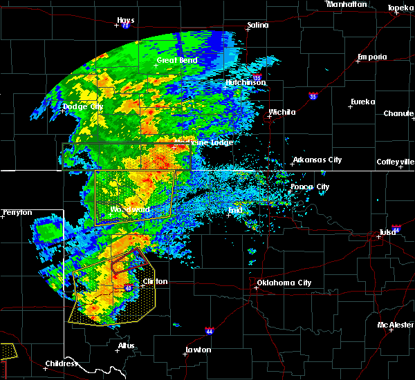 At 645 pm cdt, severe thunderstorms were located along a line extending from 8 miles southeast of aetna to 3 miles northwest of avard to 4 miles east of quinlan, moving east at 50 mph (radar indicated). Hazards include 70 mph wind gusts and nickel size hail. Expect considerable tree damage. damage is likely to mobile homes, roofs, and outbuildings. Locations impacted include, alva, mooreland, waynoka, freedom, alabaster caverns state park, avard, quinlan, capron, hopeton, bouse junction and camp houston. At 645 pm cdt, severe thunderstorms were located along a line extending from 8 miles southeast of aetna to 3 miles northwest of avard to 4 miles east of quinlan, moving east at 50 mph (radar indicated). Hazards include 70 mph wind gusts and nickel size hail. Expect considerable tree damage. damage is likely to mobile homes, roofs, and outbuildings. Locations impacted include, alva, mooreland, waynoka, freedom, alabaster caverns state park, avard, quinlan, capron, hopeton, bouse junction and camp houston.
|
| 5/25/2019 6:22 PM CDT |
 At 622 pm cdt, severe thunderstorms were located along a line extending from 12 miles southeast of buttermilk to near alabaster caverns state park to near mooreland, moving northeast at 40 mph (radar indicated). Hazards include 70 mph wind gusts and nickel size hail. Expect considerable tree damage. Damage is likely to mobile homes, roofs, and outbuildings. At 622 pm cdt, severe thunderstorms were located along a line extending from 12 miles southeast of buttermilk to near alabaster caverns state park to near mooreland, moving northeast at 40 mph (radar indicated). Hazards include 70 mph wind gusts and nickel size hail. Expect considerable tree damage. Damage is likely to mobile homes, roofs, and outbuildings.
|
| 5/20/2019 9:10 AM CDT |
 At 848 am cdt, a severe thunderstorm was located 10 miles west of alabaster caverns state park, moving northeast at 45 mph (radar indicated). Hazards include 60 mph wind gusts and quarter size hail. Hail damage to vehicles is expected. Expect wind damage to roofs, siding, and trees. At 848 am cdt, a severe thunderstorm was located 10 miles west of alabaster caverns state park, moving northeast at 45 mph (radar indicated). Hazards include 60 mph wind gusts and quarter size hail. Hail damage to vehicles is expected. Expect wind damage to roofs, siding, and trees.
|
| 5/20/2019 8:49 AM CDT |
 The national weather service in norman has issued a * severe thunderstorm warning for. woods county in northwestern oklahoma. southeastern harper county in northwestern oklahoma. central woodward county in northwestern oklahoma. Northwestern major county in northwestern oklahoma. The national weather service in norman has issued a * severe thunderstorm warning for. woods county in northwestern oklahoma. southeastern harper county in northwestern oklahoma. central woodward county in northwestern oklahoma. Northwestern major county in northwestern oklahoma.
|
| 5/18/2019 6:29 PM CDT |
 At 629 pm cdt, a severe thunderstorm was located 4 miles southwest of waynoka, moving east at 30 mph (radar indicated). Hazards include up to quarter size hail. Damage to vehicles is possible. Locations impacted include, waynoka and bouse junction. At 629 pm cdt, a severe thunderstorm was located 4 miles southwest of waynoka, moving east at 30 mph (radar indicated). Hazards include up to quarter size hail. Damage to vehicles is possible. Locations impacted include, waynoka and bouse junction.
|
| 5/18/2019 6:14 PM CDT |
 At 614 pm cdt, a severe thunderstorm was located 4 miles northwest of quinlan, moving east at 30 mph (radar indicated). Hazards include quarter size hail. Damage to vehicles is expected. Locations impacted include, waynoka, quinlan and bouse junction. At 614 pm cdt, a severe thunderstorm was located 4 miles northwest of quinlan, moving east at 30 mph (radar indicated). Hazards include quarter size hail. Damage to vehicles is expected. Locations impacted include, waynoka, quinlan and bouse junction.
|
| 5/18/2019 6:12 PM CDT | Quarter sized hail reported 7.2 miles W of Waynoka, OK, report via spotter network. |
| 5/18/2019 5:59 PM CDT |
 At 559 pm cdt, a severe thunderstorm was located 4 miles north of mooreland, moving east at 30 mph (radar indicated). Hazards include quarter size hail. damage to vehicles is possible At 559 pm cdt, a severe thunderstorm was located 4 miles north of mooreland, moving east at 30 mph (radar indicated). Hazards include quarter size hail. damage to vehicles is possible
|
| 5/13/2019 4:52 PM CDT |
 At 451 pm cdt, a severe thunderstorm was located 4 miles southwest of waynoka, moving east at 25 mph. storm intensity has decreased and the warning may be allowed to expire at 5 pm (radar indicated). Hazards include 60 mph wind gusts and penny size hail. Expect damage to roofs, siding, and trees. Locations impacted include, waynoka, quinlan and bouse junction. At 451 pm cdt, a severe thunderstorm was located 4 miles southwest of waynoka, moving east at 25 mph. storm intensity has decreased and the warning may be allowed to expire at 5 pm (radar indicated). Hazards include 60 mph wind gusts and penny size hail. Expect damage to roofs, siding, and trees. Locations impacted include, waynoka, quinlan and bouse junction.
|
| 5/13/2019 4:23 PM CDT |
 At 423 pm cdt, a severe thunderstorm was located near quinlan, moving southeast at 15 mph (radar indicated). Hazards include ping pong ball size hail and 60 mph wind gusts. People and animals outdoors will be injured. expect hail damage to roofs, siding, windows, and vehicles. expect wind damage to roofs, siding, and trees. Locations impacted include, waynoka, quinlan, alabaster caverns state park and bouse junction. At 423 pm cdt, a severe thunderstorm was located near quinlan, moving southeast at 15 mph (radar indicated). Hazards include ping pong ball size hail and 60 mph wind gusts. People and animals outdoors will be injured. expect hail damage to roofs, siding, windows, and vehicles. expect wind damage to roofs, siding, and trees. Locations impacted include, waynoka, quinlan, alabaster caverns state park and bouse junction.
|
| 5/13/2019 4:20 PM CDT |
 At 419 pm cdt, a severe thunderstorm was located near quinlan, moving southeast at 15 mph (radar indicated). Hazards include 65 mph wind gusts and quarter size hail. Hail damage to vehicles is expected. Expect wind damage to roofs, siding, and trees. At 419 pm cdt, a severe thunderstorm was located near quinlan, moving southeast at 15 mph (radar indicated). Hazards include 65 mph wind gusts and quarter size hail. Hail damage to vehicles is expected. Expect wind damage to roofs, siding, and trees.
|
| 5/7/2019 9:03 PM CDT |
 At 833 pm cdt, severe thunderstorms were located along a line extending from 4 miles northeast of capron to near alva to 6 miles northwest of waynoka, moving east at 25 mph (radar indicated). Hazards include 70 mph wind gusts and nickel size hail. Expect considerable tree damage. Damage is likely to mobile homes, roofs, and outbuildings. At 833 pm cdt, severe thunderstorms were located along a line extending from 4 miles northeast of capron to near alva to 6 miles northwest of waynoka, moving east at 25 mph (radar indicated). Hazards include 70 mph wind gusts and nickel size hail. Expect considerable tree damage. Damage is likely to mobile homes, roofs, and outbuildings.
|
| 5/7/2019 8:33 PM CDT |
 At 833 pm cdt, severe thunderstorms were located along a line extending from 4 miles northeast of capron to near alva to 6 miles northwest of waynoka, moving east at 25 mph (radar indicated). Hazards include 70 mph wind gusts and nickel size hail. Expect considerable tree damage. Damage is likely to mobile homes, roofs, and outbuildings. At 833 pm cdt, severe thunderstorms were located along a line extending from 4 miles northeast of capron to near alva to 6 miles northwest of waynoka, moving east at 25 mph (radar indicated). Hazards include 70 mph wind gusts and nickel size hail. Expect considerable tree damage. Damage is likely to mobile homes, roofs, and outbuildings.
|
| 5/7/2019 8:04 PM CDT |
 At 804 pm cdt, a severe thunderstorm was located near chester, moving northeast at 20 mph (radar indicated). Hazards include quarter size hail. Damage to vehicles is possible. Locations impacted include, waynoka, seiling, chester, orion and bouse junction. At 804 pm cdt, a severe thunderstorm was located near chester, moving northeast at 20 mph (radar indicated). Hazards include quarter size hail. Damage to vehicles is possible. Locations impacted include, waynoka, seiling, chester, orion and bouse junction.
|
| 5/7/2019 7:56 PM CDT |
 At 756 pm cdt, a severe thunderstorm was located over chester, moving northeast at 35 mph (radar indicated). Hazards include ping pong ball size hail. People and animals outdoors will be injured. Expect damage to roofs, siding, windows, and vehicles. At 756 pm cdt, a severe thunderstorm was located over chester, moving northeast at 35 mph (radar indicated). Hazards include ping pong ball size hail. People and animals outdoors will be injured. Expect damage to roofs, siding, windows, and vehicles.
|
| 5/7/2019 7:26 PM CDT |
 At 726 pm cdt, a severe thunderstorm was located 5 miles east of waynoka, moving north at 30 mph (radar indicated). Hazards include ping pong ball size hail. People and animals outdoors will be injured. Expect damage to roofs, siding, windows, and vehicles. At 726 pm cdt, a severe thunderstorm was located 5 miles east of waynoka, moving north at 30 mph (radar indicated). Hazards include ping pong ball size hail. People and animals outdoors will be injured. Expect damage to roofs, siding, windows, and vehicles.
|
| 4/17/2019 7:18 PM CDT |
 At 717 pm cdt, a severe thunderstorm was located near avard, moving northeast at 25 mph (radar indicated). Hazards include 60 mph wind gusts and nickel size hail. Expect damage to roofs, siding, and trees. Locations impacted include, waynoka, avard and hopeton. At 717 pm cdt, a severe thunderstorm was located near avard, moving northeast at 25 mph (radar indicated). Hazards include 60 mph wind gusts and nickel size hail. Expect damage to roofs, siding, and trees. Locations impacted include, waynoka, avard and hopeton.
|
| 4/17/2019 7:01 PM CDT |
 At 701 pm cdt, a severe thunderstorm was located near waynoka, moving northeast at 30 mph (radar indicated). Hazards include 60 mph wind gusts and nickel size hail. expect damage to roofs, siding, and trees At 701 pm cdt, a severe thunderstorm was located near waynoka, moving northeast at 30 mph (radar indicated). Hazards include 60 mph wind gusts and nickel size hail. expect damage to roofs, siding, and trees
|
| 8/8/2018 2:32 AM CDT |
 At 232 am cdt, a severe thunderstorm was located near avard, moving south at 20 mph (radar indicated). Hazards include 60 mph wind gusts and quarter size hail. Hail damage to vehicles is expected. Expect wind damage to roofs, siding, and trees. At 232 am cdt, a severe thunderstorm was located near avard, moving south at 20 mph (radar indicated). Hazards include 60 mph wind gusts and quarter size hail. Hail damage to vehicles is expected. Expect wind damage to roofs, siding, and trees.
|
| 7/29/2018 2:59 AM CDT |
 At 259 am cdt, a severe thunderstorm was located near avard, moving east at 40 mph (radar indicated). Hazards include 60 mph wind gusts. Expect damage to roofs, siding, and trees. Locations impacted include, alva, cherokee, waynoka, carmen, aline, burlington, dacoma, lambert, avard, ingersoll, capron and hopeton. At 259 am cdt, a severe thunderstorm was located near avard, moving east at 40 mph (radar indicated). Hazards include 60 mph wind gusts. Expect damage to roofs, siding, and trees. Locations impacted include, alva, cherokee, waynoka, carmen, aline, burlington, dacoma, lambert, avard, ingersoll, capron and hopeton.
|
| 7/29/2018 2:43 AM CDT |
 At 243 am cdt, a severe thunderstorm was located 8 miles west of avard, moving east at 40 mph (radar indicated). Hazards include 60 mph wind gusts. expect damage to roofs, siding, and trees At 243 am cdt, a severe thunderstorm was located 8 miles west of avard, moving east at 40 mph (radar indicated). Hazards include 60 mph wind gusts. expect damage to roofs, siding, and trees
|
| 7/17/2018 10:30 PM CDT |
 At 1029 pm cdt, severe thunderstorms were located along a line extending from 3 miles southwest of hardtner to 4 miles west of alva to 5 miles north of quinlan to near isabella, moving east at 30 mph (radar indicated). Hazards include 60 mph wind gusts and penny size hail. expect damage to roofs, siding, and trees At 1029 pm cdt, severe thunderstorms were located along a line extending from 3 miles southwest of hardtner to 4 miles west of alva to 5 miles north of quinlan to near isabella, moving east at 30 mph (radar indicated). Hazards include 60 mph wind gusts and penny size hail. expect damage to roofs, siding, and trees
|
| 7/17/2018 10:09 PM CDT |
 At 1009 pm cdt, severe thunderstorms were located along a line extending from 9 miles west of hardtner to 8 miles west of alva to 3 miles east of alabaster caverns state park to near mooreland, moving east at 10 mph (radar indicated). Hazards include 60 mph wind gusts and nickel size hail. Expect damage to roofs, siding, and trees. Locations impacted include, alva, waynoka, freedom, dacoma, alabaster caverns state park, avard, capron, hopeton and camp houston. At 1009 pm cdt, severe thunderstorms were located along a line extending from 9 miles west of hardtner to 8 miles west of alva to 3 miles east of alabaster caverns state park to near mooreland, moving east at 10 mph (radar indicated). Hazards include 60 mph wind gusts and nickel size hail. Expect damage to roofs, siding, and trees. Locations impacted include, alva, waynoka, freedom, dacoma, alabaster caverns state park, avard, capron, hopeton and camp houston.
|
| 7/17/2018 9:47 PM CDT |
 At 947 pm cdt, severe thunderstorms were located along a line extending from 6 miles southwest of aetna to 11 miles northeast of freedom to 6 miles west of alabaster caverns state park to 6 miles northwest of mooreland, moving east at 45 mph (radar indicated). Hazards include 60 mph wind gusts and nickel size hail. expect damage to roofs, siding, and trees At 947 pm cdt, severe thunderstorms were located along a line extending from 6 miles southwest of aetna to 11 miles northeast of freedom to 6 miles west of alabaster caverns state park to 6 miles northwest of mooreland, moving east at 45 mph (radar indicated). Hazards include 60 mph wind gusts and nickel size hail. expect damage to roofs, siding, and trees
|
| 6/25/2018 12:34 AM CDT |
 At 1234 am cdt, severe thunderstorms were located along a line extending from near amorita to 9 miles southwest of dacoma to 7 miles east of taloga to 9 miles southwest of putnam, moving southeast at 45 mph. these are very dangerous storms (radar indicated). Hazards include 80 mph wind gusts and ping pong ball size hail. Flying debris will be dangerous to those caught without shelter. mobile homes will be heavily damaged. expect considerable damage to roofs, windows, and vehicles. extensive tree damage and power outages are likely. Locations impacted include, woodward, alva, cherokee, arnett, taloga, mooreland, waynoka, seiling, vici, leedey, carmen, freedom, aline, camargo, burlington, sharon, dacoma, mutual, amorita and byron. At 1234 am cdt, severe thunderstorms were located along a line extending from near amorita to 9 miles southwest of dacoma to 7 miles east of taloga to 9 miles southwest of putnam, moving southeast at 45 mph. these are very dangerous storms (radar indicated). Hazards include 80 mph wind gusts and ping pong ball size hail. Flying debris will be dangerous to those caught without shelter. mobile homes will be heavily damaged. expect considerable damage to roofs, windows, and vehicles. extensive tree damage and power outages are likely. Locations impacted include, woodward, alva, cherokee, arnett, taloga, mooreland, waynoka, seiling, vici, leedey, carmen, freedom, aline, camargo, burlington, sharon, dacoma, mutual, amorita and byron.
|
| 6/25/2018 12:25 AM CDT |
 At 1224 am cdt, severe thunderstorms were located along a line extending from near burlington to 8 miles east of quinlan to 9 miles east of leedey, moving east at 35 mph. these are very dangerous storms (radar indicated). Hazards include 80 mph wind gusts and two inch hail. Flying debris will be dangerous to those caught without shelter. mobile homes will be heavily damaged. expect considerable damage to roofs, windows, and vehicles. extensive tree damage and power outages are likely. Locations impacted include, woodward, alva, cherokee, arnett, taloga, mooreland, waynoka, seiling, vici, leedey, carmen, freedom, aline, camargo, burlington, sharon, dacoma, mutual, amorita and byron. At 1224 am cdt, severe thunderstorms were located along a line extending from near burlington to 8 miles east of quinlan to 9 miles east of leedey, moving east at 35 mph. these are very dangerous storms (radar indicated). Hazards include 80 mph wind gusts and two inch hail. Flying debris will be dangerous to those caught without shelter. mobile homes will be heavily damaged. expect considerable damage to roofs, windows, and vehicles. extensive tree damage and power outages are likely. Locations impacted include, woodward, alva, cherokee, arnett, taloga, mooreland, waynoka, seiling, vici, leedey, carmen, freedom, aline, camargo, burlington, sharon, dacoma, mutual, amorita and byron.
|
| 6/25/2018 12:07 AM CDT |
 At 1207 am cdt, severe thunderstorms were located along a line extending from 3 miles northwest of capron to near quinlan to near leedey, moving east at 45 mph. these are very dangerous storms (radar indicated). Hazards include 80 mph wind gusts and tennis ball size hail. Flying debris will be dangerous to those caught without shelter. mobile homes will be heavily damaged. expect considerable damage to roofs, windows, and vehicles. extensive tree damage and power outages are likely. Locations impacted include, woodward, alva, cherokee, arnett, taloga, mooreland, waynoka, seiling, vici, gage, leedey, fargo, carmen, fort supply, freedom, aline, camargo, burlington, sharon and dacoma. At 1207 am cdt, severe thunderstorms were located along a line extending from 3 miles northwest of capron to near quinlan to near leedey, moving east at 45 mph. these are very dangerous storms (radar indicated). Hazards include 80 mph wind gusts and tennis ball size hail. Flying debris will be dangerous to those caught without shelter. mobile homes will be heavily damaged. expect considerable damage to roofs, windows, and vehicles. extensive tree damage and power outages are likely. Locations impacted include, woodward, alva, cherokee, arnett, taloga, mooreland, waynoka, seiling, vici, gage, leedey, fargo, carmen, fort supply, freedom, aline, camargo, burlington, sharon and dacoma.
|
| 6/24/2018 11:54 PM CDT |
 At 1153 pm cdt, severe thunderstorms were located along a line extending from 10 miles southeast of aetna to 6 miles northwest of mooreland to 10 miles northeast of roll, moving east at 40 mph. these are very dangerous storms (radar indicated). Hazards include 80 mph wind gusts and two inch hail. Flying debris will be dangerous to those caught without shelter. mobile homes will be heavily damaged. expect considerable damage to roofs, windows, and vehicles. Extensive tree damage and power outages are likely. At 1153 pm cdt, severe thunderstorms were located along a line extending from 10 miles southeast of aetna to 6 miles northwest of mooreland to 10 miles northeast of roll, moving east at 40 mph. these are very dangerous storms (radar indicated). Hazards include 80 mph wind gusts and two inch hail. Flying debris will be dangerous to those caught without shelter. mobile homes will be heavily damaged. expect considerable damage to roofs, windows, and vehicles. Extensive tree damage and power outages are likely.
|
| 6/24/2018 1:45 AM CDT |
 A severe thunderstorm warning remains in effect until 200 am cdt for eastern woods and northwestern alfalfa counties. at 144 am cdt, severe thunderstorms were located along a line extending from 4 miles southwest of kiowa to 4 miles southeast of alva to near waynoka, moving east at 40 mph. The most dangerous part of the storm was located near alva. A severe thunderstorm warning remains in effect until 200 am cdt for eastern woods and northwestern alfalfa counties. at 144 am cdt, severe thunderstorms were located along a line extending from 4 miles southwest of kiowa to 4 miles southeast of alva to near waynoka, moving east at 40 mph. The most dangerous part of the storm was located near alva.
|
| 6/24/2018 1:38 AM CDT |
 At 138 am cdt, severe thunderstorms were located along a line extending from 4 miles southeast of hardtner to 4 miles north of waynoka to 9 miles southeast of alabaster caverns state park, moving east at 35 mph (radar indicated). Hazards include 70 mph wind gusts and ping pong ball size hail. People and animals outdoors will be injured. expect hail damage to roofs, siding, windows, and vehicles. expect considerable tree damage. wind damage is also likely to mobile homes, roofs, and outbuildings. Locations impacted include, alva, waynoka, burlington, dacoma, lambert, avard, ingersoll, driftwood, capron and hopeton. At 138 am cdt, severe thunderstorms were located along a line extending from 4 miles southeast of hardtner to 4 miles north of waynoka to 9 miles southeast of alabaster caverns state park, moving east at 35 mph (radar indicated). Hazards include 70 mph wind gusts and ping pong ball size hail. People and animals outdoors will be injured. expect hail damage to roofs, siding, windows, and vehicles. expect considerable tree damage. wind damage is also likely to mobile homes, roofs, and outbuildings. Locations impacted include, alva, waynoka, burlington, dacoma, lambert, avard, ingersoll, driftwood, capron and hopeton.
|
| 6/24/2018 1:25 AM CDT |
 At 125 am cdt, severe thunderstorms were located along a line extending from 5 miles west of hardtner to 8 miles southeast of freedom to 6 miles southwest of alabaster caverns state park, moving east at 35 mph (radar indicated). Hazards include 70 mph wind gusts and ping pong ball size hail. People and animals outdoors will be injured. expect hail damage to roofs, siding, windows, and vehicles. expect considerable tree damage. wind damage is also likely to mobile homes, roofs, and outbuildings. Locations impacted include, alva, waynoka, freedom, burlington, dacoma, lambert, alabaster caverns state park, avard, ingersoll, driftwood, capron and hopeton. At 125 am cdt, severe thunderstorms were located along a line extending from 5 miles west of hardtner to 8 miles southeast of freedom to 6 miles southwest of alabaster caverns state park, moving east at 35 mph (radar indicated). Hazards include 70 mph wind gusts and ping pong ball size hail. People and animals outdoors will be injured. expect hail damage to roofs, siding, windows, and vehicles. expect considerable tree damage. wind damage is also likely to mobile homes, roofs, and outbuildings. Locations impacted include, alva, waynoka, freedom, burlington, dacoma, lambert, alabaster caverns state park, avard, ingersoll, driftwood, capron and hopeton.
|
| 6/24/2018 1:13 AM CDT |
 At 113 am cdt, severe thunderstorms were located along a line extending from 7 miles west of hardtner to near alabaster caverns state park to 9 miles southwest of freedom, moving east at 35 mph (radar indicated). Hazards include 60 mph wind gusts and quarter size hail. Hail damage to vehicles is expected. Expect wind damage to roofs, siding, and trees. At 113 am cdt, severe thunderstorms were located along a line extending from 7 miles west of hardtner to near alabaster caverns state park to 9 miles southwest of freedom, moving east at 35 mph (radar indicated). Hazards include 60 mph wind gusts and quarter size hail. Hail damage to vehicles is expected. Expect wind damage to roofs, siding, and trees.
|
| 6/22/2018 9:07 PM CDT |
 At 907 pm cdt, severe thunderstorms were located along a line extending from near amorita to 7 miles northeast of mutual, moving southeast at 45 mph. these are very dangerous storms (radar indicated). Hazards include 80 mph wind gusts and quarter size hail. Flying debris will be dangerous to those caught without shelter. mobile homes will be heavily damaged. expect considerable damage to roofs, windows, and vehicles. extensive tree damage and power outages are likely. Locations impacted include, alva, fairview, cherokee, helena, waynoka, ringwood, carmen, wakita, cleo springs, longdale, goltry, meno, jet, aline, nash, burlington, hillsdale, dacoma, manchester and amorita. At 907 pm cdt, severe thunderstorms were located along a line extending from near amorita to 7 miles northeast of mutual, moving southeast at 45 mph. these are very dangerous storms (radar indicated). Hazards include 80 mph wind gusts and quarter size hail. Flying debris will be dangerous to those caught without shelter. mobile homes will be heavily damaged. expect considerable damage to roofs, windows, and vehicles. extensive tree damage and power outages are likely. Locations impacted include, alva, fairview, cherokee, helena, waynoka, ringwood, carmen, wakita, cleo springs, longdale, goltry, meno, jet, aline, nash, burlington, hillsdale, dacoma, manchester and amorita.
|
| 6/22/2018 8:56 PM CDT |
 At 855 pm cdt, severe thunderstorms were located along a line extending from 3 miles north of burlington to 5 miles south of mooreland, moving southeast at 45 mph. these are very dangerous storms (radar indicated). Hazards include 80 mph wind gusts and quarter size hail. Flying debris will be dangerous to those caught without shelter. mobile homes will be heavily damaged. expect considerable damage to roofs, windows, and vehicles. Extensive tree damage and power outages are likely. At 855 pm cdt, severe thunderstorms were located along a line extending from 3 miles north of burlington to 5 miles south of mooreland, moving southeast at 45 mph. these are very dangerous storms (radar indicated). Hazards include 80 mph wind gusts and quarter size hail. Flying debris will be dangerous to those caught without shelter. mobile homes will be heavily damaged. expect considerable damage to roofs, windows, and vehicles. Extensive tree damage and power outages are likely.
|
| 6/22/2018 8:51 PM CDT |
 At 850 pm cdt, severe thunderstorms were located along a line extending from 3 miles southeast of hardtner to 4 miles south of alabaster caverns state park to 10 miles south of harmon, moving east at 40 mph. these are very dangerous storms. the strongest wind gusts are east of woodward, approaching quinlan (radar indicated). Hazards include 80 mph wind gusts and quarter size hail. Flying debris will be dangerous to those caught without shelter. mobile homes will be heavily damaged. expect considerable damage to roofs, windows, and vehicles. extensive tree damage and power outages are likely. Locations impacted include, woodward, alva, cherokee, arnett, mooreland, waynoka, vici, gage, fargo, fort supply, freedom, camargo, burlington, sharon, dacoma, mutual, amorita, byron, alabaster caverns state park and avard. At 850 pm cdt, severe thunderstorms were located along a line extending from 3 miles southeast of hardtner to 4 miles south of alabaster caverns state park to 10 miles south of harmon, moving east at 40 mph. these are very dangerous storms. the strongest wind gusts are east of woodward, approaching quinlan (radar indicated). Hazards include 80 mph wind gusts and quarter size hail. Flying debris will be dangerous to those caught without shelter. mobile homes will be heavily damaged. expect considerable damage to roofs, windows, and vehicles. extensive tree damage and power outages are likely. Locations impacted include, woodward, alva, cherokee, arnett, mooreland, waynoka, vici, gage, fargo, fort supply, freedom, camargo, burlington, sharon, dacoma, mutual, amorita, byron, alabaster caverns state park and avard.
|
| 6/22/2018 8:38 PM CDT |
 At 837 pm cdt, severe thunderstorms were located along a line extending from 6 miles west of hardtner to 9 miles west of alabaster caverns state park to 9 miles north of crawford, moving southeast at 50 mph (radar indicated). Hazards include 70 mph wind gusts and quarter size hail. Hail damage to vehicles is expected. expect considerable tree damage. wind damage is also likely to mobile homes, roofs, and outbuildings. Locations impacted include, woodward, alva, cherokee, shattuck, buffalo, arnett, mooreland, waynoka, vici, gage, fargo, fort supply, freedom, camargo, burlington, sharon, dacoma, mutual, may and amorita. At 837 pm cdt, severe thunderstorms were located along a line extending from 6 miles west of hardtner to 9 miles west of alabaster caverns state park to 9 miles north of crawford, moving southeast at 50 mph (radar indicated). Hazards include 70 mph wind gusts and quarter size hail. Hail damage to vehicles is expected. expect considerable tree damage. wind damage is also likely to mobile homes, roofs, and outbuildings. Locations impacted include, woodward, alva, cherokee, shattuck, buffalo, arnett, mooreland, waynoka, vici, gage, fargo, fort supply, freedom, camargo, burlington, sharon, dacoma, mutual, may and amorita.
|
| 6/22/2018 8:26 PM CDT |
 At 826 pm cdt, severe thunderstorms were located along a line extending from 5 miles east of aetna to 8 miles southeast of selman to 10 miles southeast of higgins, moving southeast at 50 mph (radar indicated). Hazards include 70 mph wind gusts and quarter size hail. Hail damage to vehicles is expected. expect considerable tree damage. wind damage is also likely to mobile homes, roofs, and outbuildings. Locations impacted include, woodward, alva, cherokee, shattuck, laverne, buffalo, arnett, mooreland, waynoka, vici, gage, fargo, fort supply, freedom, camargo, burlington, sharon, dacoma, mutual and may. At 826 pm cdt, severe thunderstorms were located along a line extending from 5 miles east of aetna to 8 miles southeast of selman to 10 miles southeast of higgins, moving southeast at 50 mph (radar indicated). Hazards include 70 mph wind gusts and quarter size hail. Hail damage to vehicles is expected. expect considerable tree damage. wind damage is also likely to mobile homes, roofs, and outbuildings. Locations impacted include, woodward, alva, cherokee, shattuck, laverne, buffalo, arnett, mooreland, waynoka, vici, gage, fargo, fort supply, freedom, camargo, burlington, sharon, dacoma, mutual and may.
|
| 6/22/2018 8:12 PM CDT |
 At 811 pm cdt, severe thunderstorms were located along a line extending from 3 miles northwest of aetna to 4 miles southwest of selman to 3 miles south of higgins, moving southeast at 50 mph (radar indicated). Hazards include 70 mph wind gusts and quarter size hail. Hail damage to vehicles is expected. expect considerable tree damage. Wind damage is also likely to mobile homes, roofs, and outbuildings. At 811 pm cdt, severe thunderstorms were located along a line extending from 3 miles northwest of aetna to 4 miles southwest of selman to 3 miles south of higgins, moving southeast at 50 mph (radar indicated). Hazards include 70 mph wind gusts and quarter size hail. Hail damage to vehicles is expected. expect considerable tree damage. Wind damage is also likely to mobile homes, roofs, and outbuildings.
|
| 5/31/2018 12:16 AM CDT |
 At 1216 am cdt, severe thunderstorms were located along a line extending from near nash to 4 miles northeast of okeene to 7 miles west of oakwood to 8 miles northwest of leedey, moving east at 45 mph. these are very dangerous storms (radar indicated). Hazards include 80 mph wind gusts and golf ball size hail. Flying debris will be dangerous to those caught without shelter. mobile homes will be heavily damaged. expect considerable damage to roofs, windows, and vehicles. extensive tree damage and power outages are likely. Locations impacted include, enid, watonga, alva, kingfisher, fairview, cherokee, medford, taloga, hennessey, helena, waukomis, okeene, waynoka, seiling, pond creek, garber, canton, lahoma, covington and ringwood. At 1216 am cdt, severe thunderstorms were located along a line extending from near nash to 4 miles northeast of okeene to 7 miles west of oakwood to 8 miles northwest of leedey, moving east at 45 mph. these are very dangerous storms (radar indicated). Hazards include 80 mph wind gusts and golf ball size hail. Flying debris will be dangerous to those caught without shelter. mobile homes will be heavily damaged. expect considerable damage to roofs, windows, and vehicles. extensive tree damage and power outages are likely. Locations impacted include, enid, watonga, alva, kingfisher, fairview, cherokee, medford, taloga, hennessey, helena, waukomis, okeene, waynoka, seiling, pond creek, garber, canton, lahoma, covington and ringwood.
|
| 5/30/2018 11:56 PM CDT |
 The national weather service in norman has issued a * severe thunderstorm warning for. kingfisher county in central oklahoma. eastern woods county in northwestern oklahoma. northeastern roger mills county in western oklahoma. Alfalfa county in northwestern oklahoma. The national weather service in norman has issued a * severe thunderstorm warning for. kingfisher county in central oklahoma. eastern woods county in northwestern oklahoma. northeastern roger mills county in western oklahoma. Alfalfa county in northwestern oklahoma.
|
| 5/30/2018 11:37 PM CDT |
 At 1135 pm cdt, severe thunderstorms were located along a line extending from 5 miles southwest of dacoma to 3 miles northeast of chester to 4 miles northeast of leedey to 7 miles northwest of durham, moving east at 45 mph. these are very dangerous storms (radar indicated). Hazards include 80 mph wind gusts and tennis ball size hail. the largest hail is over southern ellis county. Flying debris will be dangerous to those caught without shelter. mobile homes will be heavily damaged. expect considerable damage to roofs, windows, and vehicles. extensive tree damage and power outages are likely. Locations impacted include, fairview, arnett, taloga, helena, okeene, thomas, waynoka, seiling, vici, canton, ringwood, leedey, custer city, carmen, cleo springs, longdale, goltry, ames, meno and jet. At 1135 pm cdt, severe thunderstorms were located along a line extending from 5 miles southwest of dacoma to 3 miles northeast of chester to 4 miles northeast of leedey to 7 miles northwest of durham, moving east at 45 mph. these are very dangerous storms (radar indicated). Hazards include 80 mph wind gusts and tennis ball size hail. the largest hail is over southern ellis county. Flying debris will be dangerous to those caught without shelter. mobile homes will be heavily damaged. expect considerable damage to roofs, windows, and vehicles. extensive tree damage and power outages are likely. Locations impacted include, fairview, arnett, taloga, helena, okeene, thomas, waynoka, seiling, vici, canton, ringwood, leedey, custer city, carmen, cleo springs, longdale, goltry, ames, meno and jet.
|
| 5/30/2018 11:27 PM CDT |
 At 1126 pm cdt, a severe thunderstorm capable of producing a tornado was located 5 miles northwest of waynoka, moving northeast at 35 mph. another area of rotation capable of producing a tornado was also located near waynoka (radar indicated rotation). Hazards include tornado and baseball size hail. Flying debris will be dangerous to those caught without shelter. mobile homes will be damaged or destroyed. damage to roofs, windows, and vehicles will occur. tree damage is likely. Locations impacted include, waynoka, dacoma, avard and hopeton. At 1126 pm cdt, a severe thunderstorm capable of producing a tornado was located 5 miles northwest of waynoka, moving northeast at 35 mph. another area of rotation capable of producing a tornado was also located near waynoka (radar indicated rotation). Hazards include tornado and baseball size hail. Flying debris will be dangerous to those caught without shelter. mobile homes will be damaged or destroyed. damage to roofs, windows, and vehicles will occur. tree damage is likely. Locations impacted include, waynoka, dacoma, avard and hopeton.
|
| 5/30/2018 11:22 PM CDT |
 At 1121 pm cdt, severe thunderstorms were located along a line extending from near waynoka to 4 miles north of chester to 4 miles northwest of moorewood, moving east at 45 mph. these are very dangerous storms (radar indicated). Hazards include 90 mph wind gusts and tennis ball size hail. You are in a life-threatening situation. flying debris may be deadly to those caught without shelter. mobile homes will be heavily damaged or destroyed. homes and businesses will have substantial roof and window damage. Expect extensive tree damage and power outages. At 1121 pm cdt, severe thunderstorms were located along a line extending from near waynoka to 4 miles north of chester to 4 miles northwest of moorewood, moving east at 45 mph. these are very dangerous storms (radar indicated). Hazards include 90 mph wind gusts and tennis ball size hail. You are in a life-threatening situation. flying debris may be deadly to those caught without shelter. mobile homes will be heavily damaged or destroyed. homes and businesses will have substantial roof and window damage. Expect extensive tree damage and power outages.
|
| 5/30/2018 11:09 PM CDT |
 At 1109 pm cdt, a severe thunderstorm capable of producing a tornado was located 8 miles northwest of quinlan, moving east at 50 mph (radar indicated rotation). Hazards include tornado and baseball size hail. Flying debris will be dangerous to those caught without shelter. mobile homes will be damaged or destroyed. damage to roofs, windows, and vehicles will occur. Tree damage is likely. At 1109 pm cdt, a severe thunderstorm capable of producing a tornado was located 8 miles northwest of quinlan, moving east at 50 mph (radar indicated rotation). Hazards include tornado and baseball size hail. Flying debris will be dangerous to those caught without shelter. mobile homes will be damaged or destroyed. damage to roofs, windows, and vehicles will occur. Tree damage is likely.
|
| 5/29/2018 9:48 PM CDT |
 At 948 pm cdt, a severe thunderstorm was located near dacoma, moving east at 30 mph (radar indicated). Hazards include ping pong ball size hail and 60 mph wind gusts. People and animals outdoors will be injured. expect hail damage to roofs, siding, windows, and vehicles. expect wind damage to roofs, siding, and trees. Locations impacted include, alva, cherokee, waynoka, carmen, aline, burlington, dacoma, lambert, avard, ingersoll, driftwood, capron and hopeton. At 948 pm cdt, a severe thunderstorm was located near dacoma, moving east at 30 mph (radar indicated). Hazards include ping pong ball size hail and 60 mph wind gusts. People and animals outdoors will be injured. expect hail damage to roofs, siding, windows, and vehicles. expect wind damage to roofs, siding, and trees. Locations impacted include, alva, cherokee, waynoka, carmen, aline, burlington, dacoma, lambert, avard, ingersoll, driftwood, capron and hopeton.
|
| 5/29/2018 9:11 PM CDT |
 At 910 pm cdt, a severe thunderstorm was located 6 miles southeast of avard, moving east at 35 mph. several other strong to severe thunderstorms were located across central and eastern woods county (radar indicated). Hazards include golf ball size hail and 60 mph wind gusts. People and animals outdoors will be injured. expect hail damage to roofs, siding, windows, and vehicles. Expect wind damage to roofs, siding, and trees. At 910 pm cdt, a severe thunderstorm was located 6 miles southeast of avard, moving east at 35 mph. several other strong to severe thunderstorms were located across central and eastern woods county (radar indicated). Hazards include golf ball size hail and 60 mph wind gusts. People and animals outdoors will be injured. expect hail damage to roofs, siding, windows, and vehicles. Expect wind damage to roofs, siding, and trees.
|
| 5/29/2018 8:11 PM CDT |
 At 811 pm cdt, a severe thunderstorm was located 8 miles west of aline, moving southeast at 20 mph (radar indicated). Hazards include two inch hail and 70 mph wind gusts. People and animals outdoors will be injured. expect hail damage to roofs, siding, windows, and vehicles. expect considerable tree damage. wind damage is also likely to mobile homes, roofs, and outbuildings. Locations impacted include, alva, waynoka, carmen, cleo springs, aline, dacoma, avard, orienta and hopeton. At 811 pm cdt, a severe thunderstorm was located 8 miles west of aline, moving southeast at 20 mph (radar indicated). Hazards include two inch hail and 70 mph wind gusts. People and animals outdoors will be injured. expect hail damage to roofs, siding, windows, and vehicles. expect considerable tree damage. wind damage is also likely to mobile homes, roofs, and outbuildings. Locations impacted include, alva, waynoka, carmen, cleo springs, aline, dacoma, avard, orienta and hopeton.
|
| 5/29/2018 7:53 PM CDT |
 The tornado warning for southeastern woods county will expire at 800 pm cdt, the tornado threat has diminished and the tornado warning has been cancelled. however, large hail and damaging winds remain likely and a severe thunderstorm warning remains in effect for the area. The tornado warning for southeastern woods county will expire at 800 pm cdt, the tornado threat has diminished and the tornado warning has been cancelled. however, large hail and damaging winds remain likely and a severe thunderstorm warning remains in effect for the area.
|
| 5/29/2018 7:49 PM CDT | Tennis Ball sized hail reported 7.1 miles WNW of Waynoka, OK |
| 5/29/2018 7:43 PM CDT |
 At 743 pm cdt, a severe thunderstorm was located 4 miles northeast of waynoka, moving southeast at 15 mph (radar indicated). Hazards include two inch hail and 70 mph wind gusts. People and animals outdoors will be injured. expect hail damage to roofs, siding, windows, and vehicles. expect considerable tree damage. Wind damage is also likely to mobile homes, roofs, and outbuildings. At 743 pm cdt, a severe thunderstorm was located 4 miles northeast of waynoka, moving southeast at 15 mph (radar indicated). Hazards include two inch hail and 70 mph wind gusts. People and animals outdoors will be injured. expect hail damage to roofs, siding, windows, and vehicles. expect considerable tree damage. Wind damage is also likely to mobile homes, roofs, and outbuildings.
|
| 5/29/2018 7:39 PM CDT | Half Dollar sized hail reported 1.3 miles S of Waynoka, OK |
| 5/29/2018 7:24 PM CDT |
 At 723 pm cdt, a severe thunderstorm capable of producing a tornado was located near waynoka, moving east at 15 mph (radar indicated rotation). Hazards include tornado and golf ball size hail. Flying debris will be dangerous to those caught without shelter. mobile homes will be damaged or destroyed. damage to roofs, windows, and vehicles will occur. Tree damage is likely. At 723 pm cdt, a severe thunderstorm capable of producing a tornado was located near waynoka, moving east at 15 mph (radar indicated rotation). Hazards include tornado and golf ball size hail. Flying debris will be dangerous to those caught without shelter. mobile homes will be damaged or destroyed. damage to roofs, windows, and vehicles will occur. Tree damage is likely.
|
| 5/29/2018 7:20 PM CDT |
 At 720 pm cdt, a severe thunderstorm was located over waynoka, moving southeast at 20 mph (radar indicated). Hazards include golf ball size hail and 70 mph wind gusts. People and animals outdoors will be injured. expect hail damage to roofs, siding, windows, and vehicles. expect considerable tree damage. wind damage is also likely to mobile homes, roofs, and outbuildings. Locations impacted include, alva, waynoka, freedom, alabaster caverns state park, avard, quinlan, hopeton, bouse junction and camp houston. At 720 pm cdt, a severe thunderstorm was located over waynoka, moving southeast at 20 mph (radar indicated). Hazards include golf ball size hail and 70 mph wind gusts. People and animals outdoors will be injured. expect hail damage to roofs, siding, windows, and vehicles. expect considerable tree damage. wind damage is also likely to mobile homes, roofs, and outbuildings. Locations impacted include, alva, waynoka, freedom, alabaster caverns state park, avard, quinlan, hopeton, bouse junction and camp houston.
|
| 5/29/2018 7:15 PM CDT | Hen Egg sized hail reported 8.5 miles SE of Waynoka, OK |
| 5/29/2018 6:57 PM CDT |
 At 657 pm cdt, a severe thunderstorm was located 8 miles northwest of waynoka, moving southeast at 20 mph (radar indicated). Hazards include two inch hail and 70 mph wind gusts. People and animals outdoors will be injured. expect hail damage to roofs, siding, windows, and vehicles. expect considerable tree damage. Wind damage is also likely to mobile homes, roofs, and outbuildings. At 657 pm cdt, a severe thunderstorm was located 8 miles northwest of waynoka, moving southeast at 20 mph (radar indicated). Hazards include two inch hail and 70 mph wind gusts. People and animals outdoors will be injured. expect hail damage to roofs, siding, windows, and vehicles. expect considerable tree damage. Wind damage is also likely to mobile homes, roofs, and outbuildings.
|
| 5/19/2018 7:23 PM CDT |
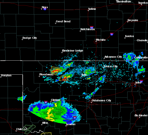 At 722 pm cdt, a severe thunderstorm was located over waynoka, moving north at 15 mph (radar indicated). Hazards include ping pong ball size hail and 60 mph wind gusts. People and animals outdoors will be injured. expect hail damage to roofs, siding, windows, and vehicles. Expect wind damage to roofs, siding, and trees. At 722 pm cdt, a severe thunderstorm was located over waynoka, moving north at 15 mph (radar indicated). Hazards include ping pong ball size hail and 60 mph wind gusts. People and animals outdoors will be injured. expect hail damage to roofs, siding, windows, and vehicles. Expect wind damage to roofs, siding, and trees.
|
| 5/19/2018 6:55 PM CDT |
 The national weather service in norman has issued a * severe thunderstorm warning for. southeastern woods county in northwestern oklahoma. Until 730 pm cdt * at 655 pm cdt, a severe thunderstorm was located 4 miles south of waynoka, moving northeast at 30 mph. The national weather service in norman has issued a * severe thunderstorm warning for. southeastern woods county in northwestern oklahoma. Until 730 pm cdt * at 655 pm cdt, a severe thunderstorm was located 4 miles south of waynoka, moving northeast at 30 mph.
|
| 5/14/2018 7:31 PM CDT |
 At 730 pm cdt, a severe thunderstorm was located 4 miles east of waynoka, moving northeast at 35 mph (radar indicated). Hazards include golf ball size hail and 60 mph wind gusts. People and animals outdoors will be injured. expect hail damage to roofs, siding, windows, and vehicles. expect wind damage to roofs, siding, and trees. Locations impacted include, waynoka, dacoma, avard and hopeton. At 730 pm cdt, a severe thunderstorm was located 4 miles east of waynoka, moving northeast at 35 mph (radar indicated). Hazards include golf ball size hail and 60 mph wind gusts. People and animals outdoors will be injured. expect hail damage to roofs, siding, windows, and vehicles. expect wind damage to roofs, siding, and trees. Locations impacted include, waynoka, dacoma, avard and hopeton.
|
| 5/14/2018 7:19 PM CDT |
 At 719 pm cdt, a severe thunderstorm was located 6 miles northeast of quinlan, moving northeast at 30 mph (radar indicated). Hazards include golf ball size hail. People and animals outdoors will be injured. Expect damage to roofs, siding, windows, and vehicles. At 719 pm cdt, a severe thunderstorm was located 6 miles northeast of quinlan, moving northeast at 30 mph (radar indicated). Hazards include golf ball size hail. People and animals outdoors will be injured. Expect damage to roofs, siding, windows, and vehicles.
|
| 10/6/2017 10:30 PM CDT |
 At 1030 pm cdt, severe thunderstorms were located along a line extending from 3 miles northwest of burlington to 8 miles southeast of alabaster caverns state park to near fargo to 4 miles southwest of durham, moving northeast at 60 mph (radar indicated). Hazards include 60 mph wind gusts and quarter size hail. Hail damage to vehicles is expected. Expect wind damage to roofs, siding, and trees. At 1030 pm cdt, severe thunderstorms were located along a line extending from 3 miles northwest of burlington to 8 miles southeast of alabaster caverns state park to near fargo to 4 miles southwest of durham, moving northeast at 60 mph (radar indicated). Hazards include 60 mph wind gusts and quarter size hail. Hail damage to vehicles is expected. Expect wind damage to roofs, siding, and trees.
|
| 10/6/2017 10:01 PM CDT |
 At 1001 pm cdt, severe thunderstorms were located along a line extending from 6 miles southeast of aetna to 6 miles northwest of alabaster caverns state park to 4 miles northwest of fargo, moving east at 50 mph (radar indicated). Hazards include 60 mph wind gusts and quarter size hail. Hail damage to vehicles is expected. Expect wind damage to roofs, siding, and trees. At 1001 pm cdt, severe thunderstorms were located along a line extending from 6 miles southeast of aetna to 6 miles northwest of alabaster caverns state park to 4 miles northwest of fargo, moving east at 50 mph (radar indicated). Hazards include 60 mph wind gusts and quarter size hail. Hail damage to vehicles is expected. Expect wind damage to roofs, siding, and trees.
|
| 7/3/2017 6:31 PM CDT |
 At 631 pm cdt, a severe thunderstorm was located 4 miles southwest of alva, moving northeast at 45 mph (radar indicated). Hazards include 70 mph wind gusts and quarter size hail. Hail damage to vehicles is expected. expect considerable tree damage. wind damage is also likely to mobile homes, roofs, and outbuildings. Locations impacted include, alva, waynoka, dacoma, avard, capron, hopeton and bouse junction. At 631 pm cdt, a severe thunderstorm was located 4 miles southwest of alva, moving northeast at 45 mph (radar indicated). Hazards include 70 mph wind gusts and quarter size hail. Hail damage to vehicles is expected. expect considerable tree damage. wind damage is also likely to mobile homes, roofs, and outbuildings. Locations impacted include, alva, waynoka, dacoma, avard, capron, hopeton and bouse junction.
|
| 7/3/2017 6:05 PM CDT | Quarter sized hail reported 7.6 miles W of Waynoka, OK |
| 7/3/2017 6:00 PM CDT | Storm damage reported in major county OK, 9.8 miles N of Waynoka, OK |
| 7/3/2017 5:57 PM CDT |
 The national weather service in norman has issued a * tornado warning for. southeastern woods county in northwestern oklahoma. east central woodward county in northwestern oklahoma. Until 630 pm cdt * at 557 pm cdt, a severe thunderstorm capable of producing a tornado. The national weather service in norman has issued a * tornado warning for. southeastern woods county in northwestern oklahoma. east central woodward county in northwestern oklahoma. Until 630 pm cdt * at 557 pm cdt, a severe thunderstorm capable of producing a tornado.
|
| 7/3/2017 5:54 PM CDT |
 At 553 pm cdt, a severe thunderstorm was located 6 miles west of waynoka, moving east at 30 mph. another severe thunderstorm was located over waynoka. the strongest storm has yet to arrive. this is a very dangerous storm (radar indicated). Hazards include 80 mph wind gusts and quarter size hail. Flying debris will be dangerous to those caught without shelter. mobile homes will be heavily damaged. expect considerable damage to roofs, windows, and vehicles. extensive tree damage and power outages are likely. Locations impacted include, alva, waynoka, dacoma, avard, capron, hopeton and bouse junction. At 553 pm cdt, a severe thunderstorm was located 6 miles west of waynoka, moving east at 30 mph. another severe thunderstorm was located over waynoka. the strongest storm has yet to arrive. this is a very dangerous storm (radar indicated). Hazards include 80 mph wind gusts and quarter size hail. Flying debris will be dangerous to those caught without shelter. mobile homes will be heavily damaged. expect considerable damage to roofs, windows, and vehicles. extensive tree damage and power outages are likely. Locations impacted include, alva, waynoka, dacoma, avard, capron, hopeton and bouse junction.
|
| 7/3/2017 5:38 PM CDT |
 At 537 pm cdt, a severe thunderstorm was located near waynoka, moving north at 15 mph (radar indicated). Hazards include 70 mph wind gusts and quarter size hail. Hail damage to vehicles is expected. expect considerable tree damage. Wind damage is also likely to mobile homes, roofs, and outbuildings. At 537 pm cdt, a severe thunderstorm was located near waynoka, moving north at 15 mph (radar indicated). Hazards include 70 mph wind gusts and quarter size hail. Hail damage to vehicles is expected. expect considerable tree damage. Wind damage is also likely to mobile homes, roofs, and outbuildings.
|
| 6/15/2017 6:08 PM CDT |
 At 607 pm cdt, severe thunderstorms were located along a line extending from 3 miles southeast of alabaster caverns state park to near selman, moving northeast at 25 mph (radar indicated). Hazards include 60 mph wind gusts and half dollar size hail. Hail damage to vehicles is expected. Expect wind damage to roofs, siding, and trees. At 607 pm cdt, severe thunderstorms were located along a line extending from 3 miles southeast of alabaster caverns state park to near selman, moving northeast at 25 mph (radar indicated). Hazards include 60 mph wind gusts and half dollar size hail. Hail damage to vehicles is expected. Expect wind damage to roofs, siding, and trees.
|
| 5/27/2017 11:33 PM CDT |
 At 1132 pm cdt, severe thunderstorms were located along a line extending from 6 miles northwest of mooreland to 5 miles southeast of orion, moving east at 45 mph (emergency management reported windows blown out near mutual). Hazards include tennis ball size hail and 70 mph wind gusts. People and animals outdoors will be injured. expect hail damage to roofs, siding, windows, and vehicles. expect considerable tree damage. wind damage is also likely to mobile homes, roofs, and outbuildings. Locations impacted include, woodward, mooreland, waynoka, seiling, longdale, chester, canton lake, quinlan, orion and bouse junction. At 1132 pm cdt, severe thunderstorms were located along a line extending from 6 miles northwest of mooreland to 5 miles southeast of orion, moving east at 45 mph (emergency management reported windows blown out near mutual). Hazards include tennis ball size hail and 70 mph wind gusts. People and animals outdoors will be injured. expect hail damage to roofs, siding, windows, and vehicles. expect considerable tree damage. wind damage is also likely to mobile homes, roofs, and outbuildings. Locations impacted include, woodward, mooreland, waynoka, seiling, longdale, chester, canton lake, quinlan, orion and bouse junction.
|
| 5/27/2017 11:14 PM CDT |
 At 1114 pm cdt, severe thunderstorms were located along a line extending from near fort supply to 6 miles east of mutual, moving east at 40 mph (radar indicated). Hazards include tennis ball size hail and 70 mph wind gusts. People and animals outdoors will be injured. expect hail damage to roofs, siding, windows, and vehicles. expect considerable tree damage. Wind damage is also likely to mobile homes, roofs, and outbuildings. At 1114 pm cdt, severe thunderstorms were located along a line extending from near fort supply to 6 miles east of mutual, moving east at 40 mph (radar indicated). Hazards include tennis ball size hail and 70 mph wind gusts. People and animals outdoors will be injured. expect hail damage to roofs, siding, windows, and vehicles. expect considerable tree damage. Wind damage is also likely to mobile homes, roofs, and outbuildings.
|
| 5/18/2017 6:44 PM CDT |
 At 644 pm cdt, a severe thunderstorm was located 6 miles northwest of waynoka, moving northeast at 35 mph (radar indicated). Hazards include 60 mph wind gusts and half dollar size hail. Hail damage to vehicles is expected. Expect wind damage to roofs, siding, and trees. At 644 pm cdt, a severe thunderstorm was located 6 miles northwest of waynoka, moving northeast at 35 mph (radar indicated). Hazards include 60 mph wind gusts and half dollar size hail. Hail damage to vehicles is expected. Expect wind damage to roofs, siding, and trees.
|
| 5/18/2017 5:17 PM CDT |
 At 517 pm cdt, a confirmed tornado was located near waynoka, moving north at 30 mph (weather spotters confirmed tornado). Hazards include damaging tornado and golf ball size hail. Flying debris will be dangerous to those caught without shelter. mobile homes will be damaged or destroyed. damage to roofs, windows, and vehicles will occur. tree damage is likely. Locations impacted include, waynoka and avard. At 517 pm cdt, a confirmed tornado was located near waynoka, moving north at 30 mph (weather spotters confirmed tornado). Hazards include damaging tornado and golf ball size hail. Flying debris will be dangerous to those caught without shelter. mobile homes will be damaged or destroyed. damage to roofs, windows, and vehicles will occur. tree damage is likely. Locations impacted include, waynoka and avard.
|
| 5/18/2017 5:06 PM CDT |
 At 506 pm cdt, a confirmed tornado was located 4 miles southwest of waynoka, moving north at 30 mph (weather spotters confirmed tornado). Hazards include damaging tornado and golf ball size hail. Flying debris will be dangerous to those caught without shelter. mobile homes will be damaged or destroyed. damage to roofs, windows, and vehicles will occur. tree damage is likely. Locations impacted include, waynoka. At 506 pm cdt, a confirmed tornado was located 4 miles southwest of waynoka, moving north at 30 mph (weather spotters confirmed tornado). Hazards include damaging tornado and golf ball size hail. Flying debris will be dangerous to those caught without shelter. mobile homes will be damaged or destroyed. damage to roofs, windows, and vehicles will occur. tree damage is likely. Locations impacted include, waynoka.
|
| 5/18/2017 5:03 PM CDT |
 At 503 pm cdt, a confirmed tornado was located 4 miles southwest of waynoka, moving north at 30 mph (weather spotters confirmed tornado). Hazards include damaging tornado and golf ball size hail. Flying debris will be dangerous to those caught without shelter. mobile homes will be damaged or destroyed. damage to roofs, windows, and vehicles will occur. Tree damage is likely. At 503 pm cdt, a confirmed tornado was located 4 miles southwest of waynoka, moving north at 30 mph (weather spotters confirmed tornado). Hazards include damaging tornado and golf ball size hail. Flying debris will be dangerous to those caught without shelter. mobile homes will be damaged or destroyed. damage to roofs, windows, and vehicles will occur. Tree damage is likely.
|
| 5/18/2017 4:55 PM CDT |
 At 455 pm cdt, a confirmed large and extremely dangerous tornado was located 8 miles south of waynoka, moving northeast at 30 mph. this is a particularly dangerous situation. take cover now! (weather spotters confirmed tornado). Hazards include damaging tornado. You are in a life-threatening situation. flying debris may be deadly to those caught without shelter. mobile homes will be destroyed. considerable damage to homes, businesses, and vehicles is likely and complete destruction is possible. Locations impacted include, waynoka and bouse junction. At 455 pm cdt, a confirmed large and extremely dangerous tornado was located 8 miles south of waynoka, moving northeast at 30 mph. this is a particularly dangerous situation. take cover now! (weather spotters confirmed tornado). Hazards include damaging tornado. You are in a life-threatening situation. flying debris may be deadly to those caught without shelter. mobile homes will be destroyed. considerable damage to homes, businesses, and vehicles is likely and complete destruction is possible. Locations impacted include, waynoka and bouse junction.
|
| 5/18/2017 4:46 PM CDT |
 At 446 pm cdt, a confirmed tornado was located 8 miles southeast of quinlan, moving northeast at 30 mph (weather spotters confirmed tornado). Hazards include damaging tornado and golf ball size hail. Flying debris will be dangerous to those caught without shelter. mobile homes will be damaged or destroyed. damage to roofs, windows, and vehicles will occur. tree damage is likely. Locations impacted include, waynoka and bouse junction. At 446 pm cdt, a confirmed tornado was located 8 miles southeast of quinlan, moving northeast at 30 mph (weather spotters confirmed tornado). Hazards include damaging tornado and golf ball size hail. Flying debris will be dangerous to those caught without shelter. mobile homes will be damaged or destroyed. damage to roofs, windows, and vehicles will occur. tree damage is likely. Locations impacted include, waynoka and bouse junction.
|
| 5/18/2017 4:34 PM CDT |
 At 434 pm cdt, a confirmed large and extremely dangerous tornado was located 5 miles north of chester, moving northeast at 30 mph. this is a particularly dangerous situation. take cover now! (weather spotters confirmed tornado). Hazards include damaging tornado. You are in a life-threatening situation. flying debris may be deadly to those caught without shelter. mobile homes will be destroyed. Considerable damage to homes, businesses, and vehicles is likely and complete destruction is possible. At 434 pm cdt, a confirmed large and extremely dangerous tornado was located 5 miles north of chester, moving northeast at 30 mph. this is a particularly dangerous situation. take cover now! (weather spotters confirmed tornado). Hazards include damaging tornado. You are in a life-threatening situation. flying debris may be deadly to those caught without shelter. mobile homes will be destroyed. Considerable damage to homes, businesses, and vehicles is likely and complete destruction is possible.
|
| 5/18/2017 4:23 PM CDT |
 At 423 pm cdt, a severe thunderstorm was located 4 miles southwest of avard, moving northeast at 35 mph (radar indicated). Hazards include golf ball size hail and 60 mph wind gusts. People and animals outdoors will be injured. expect hail damage to roofs, siding, windows, and vehicles. expect wind damage to roofs, siding, and trees. Locations impacted include, alva, waynoka, burlington, amorita, avard, capron and hopeton. At 423 pm cdt, a severe thunderstorm was located 4 miles southwest of avard, moving northeast at 35 mph (radar indicated). Hazards include golf ball size hail and 60 mph wind gusts. People and animals outdoors will be injured. expect hail damage to roofs, siding, windows, and vehicles. expect wind damage to roofs, siding, and trees. Locations impacted include, alva, waynoka, burlington, amorita, avard, capron and hopeton.
|
| 5/18/2017 4:18 PM CDT |
 At 418 pm cdt, a severe thunderstorm was located 5 miles northwest of waynoka, moving northeast at 35 mph (radar indicated). Hazards include golf ball size hail and 60 mph wind gusts. People and animals outdoors will be injured. expect hail damage to roofs, siding, windows, and vehicles. Expect wind damage to roofs, siding, and trees. At 418 pm cdt, a severe thunderstorm was located 5 miles northwest of waynoka, moving northeast at 35 mph (radar indicated). Hazards include golf ball size hail and 60 mph wind gusts. People and animals outdoors will be injured. expect hail damage to roofs, siding, windows, and vehicles. Expect wind damage to roofs, siding, and trees.
|
| 5/18/2017 4:08 PM CDT |
 At 407 pm cdt, a severe thunderstorm was located 6 miles west of waynoka, moving northeast at 35 mph (radar indicated). Hazards include two inch hail and 60 mph wind gusts. People and animals outdoors will be injured. expect hail damage to roofs, siding, windows, and vehicles. expect wind damage to roofs, siding, and trees. Locations impacted include, waynoka and avard. At 407 pm cdt, a severe thunderstorm was located 6 miles west of waynoka, moving northeast at 35 mph (radar indicated). Hazards include two inch hail and 60 mph wind gusts. People and animals outdoors will be injured. expect hail damage to roofs, siding, windows, and vehicles. expect wind damage to roofs, siding, and trees. Locations impacted include, waynoka and avard.
|
| 5/18/2017 3:59 PM CDT |
 At 359 pm cdt, a severe thunderstorm was located 4 miles north of quinlan, moving northeast at 30 mph (radar indicated). Hazards include two inch hail and 60 mph wind gusts. People and animals outdoors will be injured. expect hail damage to roofs, siding, windows, and vehicles. expect wind damage to roofs, siding, and trees. Locations impacted include, mooreland, waynoka, quinlan, avard and hopeton. At 359 pm cdt, a severe thunderstorm was located 4 miles north of quinlan, moving northeast at 30 mph (radar indicated). Hazards include two inch hail and 60 mph wind gusts. People and animals outdoors will be injured. expect hail damage to roofs, siding, windows, and vehicles. expect wind damage to roofs, siding, and trees. Locations impacted include, mooreland, waynoka, quinlan, avard and hopeton.
|
| 5/18/2017 3:37 PM CDT |
 At 337 pm cdt, a severe thunderstorm was located 5 miles southwest of quinlan, moving north at 40 mph (radar indicated). Hazards include two inch hail and 60 mph wind gusts. People and animals outdoors will be injured. expect hail damage to roofs, siding, windows, and vehicles. Expect wind damage to roofs, siding, and trees. At 337 pm cdt, a severe thunderstorm was located 5 miles southwest of quinlan, moving north at 40 mph (radar indicated). Hazards include two inch hail and 60 mph wind gusts. People and animals outdoors will be injured. expect hail damage to roofs, siding, windows, and vehicles. Expect wind damage to roofs, siding, and trees.
|
| 5/3/2017 12:48 AM CDT |
 At 1248 am cdt, a severe thunderstorm was located over waynoka, moving east at 45 mph (radar indicated). Hazards include ping pong ball size hail and 60 mph wind gusts. People and animals outdoors will be injured. expect hail damage to roofs, siding, windows, and vehicles. expect wind damage to roofs, siding, and trees. Locations impacted include, alva, waynoka, dacoma, avard, bouse junction and hopeton. At 1248 am cdt, a severe thunderstorm was located over waynoka, moving east at 45 mph (radar indicated). Hazards include ping pong ball size hail and 60 mph wind gusts. People and animals outdoors will be injured. expect hail damage to roofs, siding, windows, and vehicles. expect wind damage to roofs, siding, and trees. Locations impacted include, alva, waynoka, dacoma, avard, bouse junction and hopeton.
|
| 5/3/2017 12:22 AM CDT |
 At 1221 am cdt, a severe thunderstorm was located near mooreland, moving east at 35 mph (radar indicated). Hazards include ping pong ball size hail and 60 mph wind gusts. People and animals outdoors will be injured. expect hail damage to roofs, siding, windows, and vehicles. Expect wind damage to roofs, siding, and trees. At 1221 am cdt, a severe thunderstorm was located near mooreland, moving east at 35 mph (radar indicated). Hazards include ping pong ball size hail and 60 mph wind gusts. People and animals outdoors will be injured. expect hail damage to roofs, siding, windows, and vehicles. Expect wind damage to roofs, siding, and trees.
|
| 9/9/2016 7:59 PM CDT |
 At 759 pm cdt, severe thunderstorms were located along a line extending from 8 miles northwest of waynoka to 3 miles northeast of sharon, moving southeast at 30 mph (radar indicated). Hazards include 60 mph wind gusts and quarter size hail. Hail damage to vehicles is expected. Expect wind damage to roofs, siding, and trees. At 759 pm cdt, severe thunderstorms were located along a line extending from 8 miles northwest of waynoka to 3 miles northeast of sharon, moving southeast at 30 mph (radar indicated). Hazards include 60 mph wind gusts and quarter size hail. Hail damage to vehicles is expected. Expect wind damage to roofs, siding, and trees.
|
| 8/7/2016 10:19 PM CDT |
 At 1019 pm cdt, a severe thunderstorm was located 10 miles southeast of waynoka, moving northeast at 20 mph (radar indicated). Hazards include 60 mph wind gusts. Expect damage to roofs. siding. And trees. At 1019 pm cdt, a severe thunderstorm was located 10 miles southeast of waynoka, moving northeast at 20 mph (radar indicated). Hazards include 60 mph wind gusts. Expect damage to roofs. siding. And trees.
|
| 7/15/2016 9:24 PM CDT |
 At 923 pm cdt, severe thunderstorms were located along a line extending from 8 miles west of avard to 5 miles west of vici, moving east at 35 mph. 59 mph winds were measured near woodward (radar indicated). Hazards include 70 mph wind gusts and penny size hail. Expect considerable tree damage. Damage is likely to mobile homes, roofs, and outbuildings. At 923 pm cdt, severe thunderstorms were located along a line extending from 8 miles west of avard to 5 miles west of vici, moving east at 35 mph. 59 mph winds were measured near woodward (radar indicated). Hazards include 70 mph wind gusts and penny size hail. Expect considerable tree damage. Damage is likely to mobile homes, roofs, and outbuildings.
|
| 6/28/2016 5:50 PM CDT | Several tree limbs blown dow in major county OK, 9 miles NNW of Waynoka, OK |
| 6/28/2016 5:46 PM CDT |
 At 545 pm cdt, severe thunderstorms were located along a line extending from 3 miles east of woodward to 3 miles northeast of aline, moving south at 25 mph (radar indicated). Hazards include 70 mph wind gusts and ping pong ball size hail. People and animals outdoors will be injured. expect hail damage to roofs, siding, windows, and vehicles. expect considerable tree damage. wind damage is also likely to mobile homes, roofs, and outbuildings. Locations impacted include, woodward, fairview, cherokee, helena, okeene, mooreland, waynoka, seiling, vici, ringwood, carmen, cleo springs, longdale, aline, sharon, dacoma, mutual, lambert, orienta and isabella. At 545 pm cdt, severe thunderstorms were located along a line extending from 3 miles east of woodward to 3 miles northeast of aline, moving south at 25 mph (radar indicated). Hazards include 70 mph wind gusts and ping pong ball size hail. People and animals outdoors will be injured. expect hail damage to roofs, siding, windows, and vehicles. expect considerable tree damage. wind damage is also likely to mobile homes, roofs, and outbuildings. Locations impacted include, woodward, fairview, cherokee, helena, okeene, mooreland, waynoka, seiling, vici, ringwood, carmen, cleo springs, longdale, aline, sharon, dacoma, mutual, lambert, orienta and isabella.
|
| 6/28/2016 5:27 PM CDT |
 At 527 pm cdt, severe thunderstorms were located along a line extending from 9 miles north of mooreland to 3 miles southeast of carmen, moving south at 35 mph (radar indicated). Hazards include golf ball size hail and 70 mph wind gusts. People and animals outdoors will be injured. expect hail damage to roofs, siding, windows, and vehicles. expect considerable tree damage. wind damage is also likely to mobile homes, roofs, and outbuildings. Locations impacted include, alva, fairview, cherokee, helena, waynoka, carmen, cleo springs, freedom, aline, dacoma, lambert, orienta, alabaster caverns state park, quinlan, ingersoll, driftwood, avard, hopeton and bouse junction. At 527 pm cdt, severe thunderstorms were located along a line extending from 9 miles north of mooreland to 3 miles southeast of carmen, moving south at 35 mph (radar indicated). Hazards include golf ball size hail and 70 mph wind gusts. People and animals outdoors will be injured. expect hail damage to roofs, siding, windows, and vehicles. expect considerable tree damage. wind damage is also likely to mobile homes, roofs, and outbuildings. Locations impacted include, alva, fairview, cherokee, helena, waynoka, carmen, cleo springs, freedom, aline, dacoma, lambert, orienta, alabaster caverns state park, quinlan, ingersoll, driftwood, avard, hopeton and bouse junction.
|
| 6/28/2016 5:24 PM CDT |
 At 524 pm cdt, severe thunderstorms were located along a line extending from 10 miles northwest of mooreland to 4 miles west of helena, moving south at 30 mph (radar indicated). Hazards include golf ball size hail and 70 mph wind gusts. People and animals outdoors will be injured. expect hail damage to roofs, siding, windows, and vehicles. expect considerable tree damage. Wind damage is also likely to mobile homes, roofs, and outbuildings. At 524 pm cdt, severe thunderstorms were located along a line extending from 10 miles northwest of mooreland to 4 miles west of helena, moving south at 30 mph (radar indicated). Hazards include golf ball size hail and 70 mph wind gusts. People and animals outdoors will be injured. expect hail damage to roofs, siding, windows, and vehicles. expect considerable tree damage. Wind damage is also likely to mobile homes, roofs, and outbuildings.
|
| 6/28/2016 5:15 PM CDT |
 At 513 pm cdt, severe thunderstorms were located along a line extending from 8 miles southeast of freedom to near carmen, moving south at 35 mph (radar indicated. at 503 pm...a 61 mph wind gust was observed by mesonet 7 miles south southwest of alva). Hazards include two inch hail and 70 mph wind gusts. People and animals outdoors will be injured. expect hail damage to roofs, siding, windows, and vehicles. expect considerable tree damage. wind damage is also likely to mobile homes, roofs, and outbuildings. Locations impacted include, alva, fairview, cherokee, helena, waynoka, carmen, cleo springs, freedom, aline, burlington, dacoma, amorita, byron, lambert, orienta, alabaster caverns state park, quinlan, ingersoll, driftwood and capron. At 513 pm cdt, severe thunderstorms were located along a line extending from 8 miles southeast of freedom to near carmen, moving south at 35 mph (radar indicated. at 503 pm...a 61 mph wind gust was observed by mesonet 7 miles south southwest of alva). Hazards include two inch hail and 70 mph wind gusts. People and animals outdoors will be injured. expect hail damage to roofs, siding, windows, and vehicles. expect considerable tree damage. wind damage is also likely to mobile homes, roofs, and outbuildings. Locations impacted include, alva, fairview, cherokee, helena, waynoka, carmen, cleo springs, freedom, aline, burlington, dacoma, amorita, byron, lambert, orienta, alabaster caverns state park, quinlan, ingersoll, driftwood and capron.
|
| 6/28/2016 5:01 PM CDT |
 At 500 pm cdt, severe thunderstorms were located along a line extending from 4 miles southeast of freedom to 3 miles southeast of dacoma, moving south at 50 mph (radar indicated). Hazards include 70 mph wind gusts and half dollar size hail. Hail damage to vehicles is expected. expect considerable tree damage. wind damage is also likely to mobile homes, roofs, and outbuildings. Locations impacted include, alva, fairview, cherokee, helena, waynoka, carmen, cleo springs, freedom, aline, burlington, dacoma, amorita, byron, lambert, orienta, alabaster caverns state park, quinlan, ingersoll, driftwood and capron. At 500 pm cdt, severe thunderstorms were located along a line extending from 4 miles southeast of freedom to 3 miles southeast of dacoma, moving south at 50 mph (radar indicated). Hazards include 70 mph wind gusts and half dollar size hail. Hail damage to vehicles is expected. expect considerable tree damage. wind damage is also likely to mobile homes, roofs, and outbuildings. Locations impacted include, alva, fairview, cherokee, helena, waynoka, carmen, cleo springs, freedom, aline, burlington, dacoma, amorita, byron, lambert, orienta, alabaster caverns state park, quinlan, ingersoll, driftwood and capron.
|
| 6/28/2016 4:43 PM CDT |
 At 442 pm cdt, severe thunderstorms were located along a line extending from 11 miles north of freedom to 5 miles southeast of capron, moving south at 50 mph (radar indicated). Hazards include golf ball size hail and 70 mph wind gusts. People and animals outdoors will be injured. expect hail damage to roofs, siding, windows, and vehicles. expect considerable tree damage. Wind damage is also likely to mobile homes, roofs, and outbuildings. At 442 pm cdt, severe thunderstorms were located along a line extending from 11 miles north of freedom to 5 miles southeast of capron, moving south at 50 mph (radar indicated). Hazards include golf ball size hail and 70 mph wind gusts. People and animals outdoors will be injured. expect hail damage to roofs, siding, windows, and vehicles. expect considerable tree damage. Wind damage is also likely to mobile homes, roofs, and outbuildings.
|
| 6/18/2016 3:54 AM CDT |
 At 353 am cdt, the leading edge of a line of severe thunderstorms was located along a line extending from 40 miles north of alva to 7 miles southwest of dacoma to 6 miles northeast of sharon, moving southeast at 40 mph (radar indicated). Hazards include 70 mph wind gusts and ping pong ball size hail. People and animals outdoors will be injured. expect hail damage to roofs, siding, windows, and vehicles. expect considerable tree damage. Wind damage is also likely to mobile homes, roofs, and outbuildings. At 353 am cdt, the leading edge of a line of severe thunderstorms was located along a line extending from 40 miles north of alva to 7 miles southwest of dacoma to 6 miles northeast of sharon, moving southeast at 40 mph (radar indicated). Hazards include 70 mph wind gusts and ping pong ball size hail. People and animals outdoors will be injured. expect hail damage to roofs, siding, windows, and vehicles. expect considerable tree damage. Wind damage is also likely to mobile homes, roofs, and outbuildings.
|
| 6/18/2016 3:38 AM CDT |
 At 338 am cdt, severe thunderstorms were located along a line extending from 6 miles southwest of hardtner to near waynoka to 5 miles southeast of woodward, moving southeast at 40 mph (radar indicated). Hazards include 70 mph wind gusts and half dollar size hail. Hail damage to vehicles is expected. expect considerable tree damage. wind damage is also likely to mobile homes, roofs, and outbuildings. Locations impacted include, woodward, alva, mooreland, waynoka, fort supply, freedom, sharon, dacoma, mutual, alabaster caverns state park, quinlan, selman, chester, capron, avard, orion, hopeton, tangier, camp houston and bouse junction. At 338 am cdt, severe thunderstorms were located along a line extending from 6 miles southwest of hardtner to near waynoka to 5 miles southeast of woodward, moving southeast at 40 mph (radar indicated). Hazards include 70 mph wind gusts and half dollar size hail. Hail damage to vehicles is expected. expect considerable tree damage. wind damage is also likely to mobile homes, roofs, and outbuildings. Locations impacted include, woodward, alva, mooreland, waynoka, fort supply, freedom, sharon, dacoma, mutual, alabaster caverns state park, quinlan, selman, chester, capron, avard, orion, hopeton, tangier, camp houston and bouse junction.
|
| 6/18/2016 3:17 AM CDT |
 At 316 am cdt, severe thunderstorms were located along a line extending from 11 miles southeast of aetna to 7 miles south of alabaster caverns state park to near fort supply, moving southeast at 50 mph. these are very dangerous storms. 80 mph winds have been measured near freedom (radar indicated). Hazards include 80 mph wind gusts and ping pong ball size hail. Flying debris will be dangerous to those caught without shelter. mobile homes will be heavily damaged. expect considerable damage to roofs, windows, and vehicles. Extensive tree damage and power outages are likely. At 316 am cdt, severe thunderstorms were located along a line extending from 11 miles southeast of aetna to 7 miles south of alabaster caverns state park to near fort supply, moving southeast at 50 mph. these are very dangerous storms. 80 mph winds have been measured near freedom (radar indicated). Hazards include 80 mph wind gusts and ping pong ball size hail. Flying debris will be dangerous to those caught without shelter. mobile homes will be heavily damaged. expect considerable damage to roofs, windows, and vehicles. Extensive tree damage and power outages are likely.
|
| 5/31/2016 4:47 AM CDT |
 At 447 am cdt, severe thunderstorms were located along a line extending from near capron to 5 miles northwest of dacoma to 3 miles east of waynoka to 16 miles south of avard to 5 miles south of quinlan, moving east at 40 mph (radar indicated). Hazards include 60 mph wind gusts and quarter size hail. Hail damage to vehicles is expected. expect wind damage to roofs, siding, and trees. Locations impacted include, alva, mooreland, waynoka, burlington, dacoma, capron, avard, quinlan, driftwood, hopeton and bouse junction. At 447 am cdt, severe thunderstorms were located along a line extending from near capron to 5 miles northwest of dacoma to 3 miles east of waynoka to 16 miles south of avard to 5 miles south of quinlan, moving east at 40 mph (radar indicated). Hazards include 60 mph wind gusts and quarter size hail. Hail damage to vehicles is expected. expect wind damage to roofs, siding, and trees. Locations impacted include, alva, mooreland, waynoka, burlington, dacoma, capron, avard, quinlan, driftwood, hopeton and bouse junction.
|
| 5/31/2016 4:29 AM CDT |
 At 429 am cdt, severe thunderstorms were located along a line extending from 10 miles southeast of aetna to 8 miles east of freedom to 6 miles south of alabaster caverns state park to 4 miles north of mooreland to 3 miles southeast of woodward, moving east at 35 mph (radar indicated). Hazards include 60 mph wind gusts and nickel size hail. Expect damage to roofs. siding. And trees. At 429 am cdt, severe thunderstorms were located along a line extending from 10 miles southeast of aetna to 8 miles east of freedom to 6 miles south of alabaster caverns state park to 4 miles north of mooreland to 3 miles southeast of woodward, moving east at 35 mph (radar indicated). Hazards include 60 mph wind gusts and nickel size hail. Expect damage to roofs. siding. And trees.
|
| 5/26/2016 8:57 PM CDT |
 At 857 pm cdt, severe thunderstorms were located along a line extending from 9 miles north of mooreland to 4 miles northwest of woodward to 5 miles southeast of gage, moving northeast at 35 mph (radar indicated). Hazards include 60 mph wind gusts and half dollar size hail. Hail damage to vehicles is expected. Expect wind damage to roofs, siding, and trees. At 857 pm cdt, severe thunderstorms were located along a line extending from 9 miles north of mooreland to 4 miles northwest of woodward to 5 miles southeast of gage, moving northeast at 35 mph (radar indicated). Hazards include 60 mph wind gusts and half dollar size hail. Hail damage to vehicles is expected. Expect wind damage to roofs, siding, and trees.
|
| 4/26/2016 6:54 PM CDT |
 At 652 pm cdt, an area of severe thunderstorms was located from 4 miles northwest of cleo springs, to near avard, to alva, and capron. these storms were moving east northeast at 50 mph (radar indicated). Hazards include 60 mph wind gusts and quarter size hail. Hail damage to vehicles is expected. Expect wind damage to roofs, siding, and trees. At 652 pm cdt, an area of severe thunderstorms was located from 4 miles northwest of cleo springs, to near avard, to alva, and capron. these storms were moving east northeast at 50 mph (radar indicated). Hazards include 60 mph wind gusts and quarter size hail. Hail damage to vehicles is expected. Expect wind damage to roofs, siding, and trees.
|
| 4/26/2016 6:31 PM CDT |
 At 630 pm cdt, a severe thunderstorm was located 7 miles southeast of quinlan, moving northeast at 45 mph. other severe storms were also located near hopeton and waynoka (radar indicated). Hazards include 70 mph wind gusts and quarter size hail. Hail damage to vehicles is expected. expect considerable tree damage. wind damage is also likely to mobile homes, roofs, and outbuildings. Locations impacted include, alva, cherokee, helena, waynoka, carmen, aline, burlington, dacoma, lambert, quinlan, ingersoll, capron, avard, hopeton and bouse junction. At 630 pm cdt, a severe thunderstorm was located 7 miles southeast of quinlan, moving northeast at 45 mph. other severe storms were also located near hopeton and waynoka (radar indicated). Hazards include 70 mph wind gusts and quarter size hail. Hail damage to vehicles is expected. expect considerable tree damage. wind damage is also likely to mobile homes, roofs, and outbuildings. Locations impacted include, alva, cherokee, helena, waynoka, carmen, aline, burlington, dacoma, lambert, quinlan, ingersoll, capron, avard, hopeton and bouse junction.
|
| 4/26/2016 6:19 PM CDT |
 At 619 pm cdt, a severe thunderstorm was located 7 miles north of chester, moving northeast at 65 mph (radar indicated). Hazards include 70 mph wind gusts and quarter size hail. Hail damage to vehicles is expected. expect considerable tree damage. Wind damage is also likely to mobile homes, roofs, and outbuildings. At 619 pm cdt, a severe thunderstorm was located 7 miles north of chester, moving northeast at 65 mph (radar indicated). Hazards include 70 mph wind gusts and quarter size hail. Hail damage to vehicles is expected. expect considerable tree damage. Wind damage is also likely to mobile homes, roofs, and outbuildings.
|
| 4/10/2016 7:10 PM CDT |
 At 710 pm cdt, a severe thunderstorm was located 6 miles southeast of waynoka, moving northeast at 25 mph (radar indicated). Hazards include 60 mph wind gusts and half dollar size hail. Hail damage to vehicles is expected. expect wind damage to roofs, siding, and trees. Locations impacted include, waynoka, avard and hopeton. At 710 pm cdt, a severe thunderstorm was located 6 miles southeast of waynoka, moving northeast at 25 mph (radar indicated). Hazards include 60 mph wind gusts and half dollar size hail. Hail damage to vehicles is expected. expect wind damage to roofs, siding, and trees. Locations impacted include, waynoka, avard and hopeton.
|
| 4/10/2016 7:01 PM CDT |
 At 700 pm cdt, a severe thunderstorm was located 7 miles south of waynoka, moving northeast at 40 mph (radar indicated). Hazards include 60 mph wind gusts and quarter size hail. Hail damage to vehicles is expected. expect wind damage to roofs, siding, and trees. Locations impacted include, waynoka, avard, hopeton and bouse junction. At 700 pm cdt, a severe thunderstorm was located 7 miles south of waynoka, moving northeast at 40 mph (radar indicated). Hazards include 60 mph wind gusts and quarter size hail. Hail damage to vehicles is expected. expect wind damage to roofs, siding, and trees. Locations impacted include, waynoka, avard, hopeton and bouse junction.
|
| 4/10/2016 6:47 PM CDT |
 At 647 pm cdt, a severe thunderstorm was located 4 miles southeast of quinlan, moving northeast at 25 mph (radar indicated). Hazards include 60 mph wind gusts and quarter size hail. Hail damage to vehicles is expected. Expect wind damage to roofs, siding, and trees. At 647 pm cdt, a severe thunderstorm was located 4 miles southeast of quinlan, moving northeast at 25 mph (radar indicated). Hazards include 60 mph wind gusts and quarter size hail. Hail damage to vehicles is expected. Expect wind damage to roofs, siding, and trees.
|
| 6/7/2015 7:14 PM CDT | At 713 pm cdt, severe thunderstorms were located along a line extending from 5 miles east of alabaster caverns state park to 3 miles north of woodward to 6 miles northwest of shattuck, moving east at 30 mph (radar indicated). Hazards include 60 mph wind gusts and penny size hail. Expect damage to roofs. Siding and trees. |
| 5/16/2015 5:41 PM CDT | At 540 pm cdt, severe thunderstorms were located along a line extending from 12 miles northeast of freedom to 7 miles south of waynoka, moving east at 40 mph (radar indicated). Hazards include 60 mph wind gusts and quarter size hail. Hail damage to vehicles is expected. expect wind damage to roofs, siding and trees. locations impacted include, alva, waynoka, freedom, avard, quinlan, hopeton, camp houston and bouse junction. 1. 00in. |
| 5/16/2015 5:20 PM CDT | At 519 pm cdt, severe thunderstorms were located along a line extending from 6 miles northwest of freedom to near mooreland, moving east at 35 mph (radar indicated). Hazards include 60 mph wind gusts and quarter size hail. Hail damage to vehicles is expected. Expect wind damage to roofs, siding and trees. |
| 4/18/2015 7:09 PM CDT | Half Dollar sized hail reported 2 miles S of Waynoka, OK |
| 4/18/2015 3:01 PM CDT | At 300 pm cdt, a severe thunderstorm was located 6 miles west of waynoka, moving northeast at 20 mph (radar indicated). Hazards include 60 mph wind gusts and half dollar size hail. Hail damage to vehicles is expected. Expect wind damage to roofs, siding and trees. |
| 4/16/2015 4:45 PM CDT | At 444 pm cdt, severe thunderstorms were located along a line extending from 7 miles southwest of hardtner to 13 miles south of aetna to 5 miles northwest of waynoka, moving north at 20 mph (radar indicated). Hazards include 60 mph wind gusts and half dollar size hail. Hail damage to vehicles is expected. expect wind damage to roofs, siding and trees. locations impacted include, alva, waynoka, freedom, capron, avard, hopeton and camp houston. 1. 25in. |
| 4/16/2015 4:32 PM CDT | At 431 pm cdt, severe thunderstorms were located along a line extending from 8 miles northwest of alva to 11 miles northwest of avard to 4 miles west of waynoka, moving north at 20 mph (radar indicated). Hazards include 60 mph wind gusts and half dollar size hail. Hail damage to vehicles is expected. Expect wind damage to roofs, siding and trees. |
| 8/28/2014 5:55 PM CDT | South side of waynoka in woods county OK, 0.2 miles NE of Waynoka, OK |
| 6/28/2014 8:40 AM CDT | Storm damage reported in woods county OK, 7.1 miles W of Waynoka, OK |
| 10/4/2013 6:02 PM CDT | Quarter sized hail reported 10 miles NNW of Waynoka, OK |
| 8/6/2013 9:44 PM CDT | Storm damage reported in woodward county OK, 11.4 miles NNE of Waynoka, OK |
| 5/8/2013 8:10 PM CDT | Golf Ball sized hail reported 0.2 miles NE of Waynoka, OK |
| 4/29/2012 11:10 PM CDT | Quarter sized hail reported 11.8 miles WNW of Waynoka, OK |
| 1/1/0001 12:00 AM | Storm damage reported in major county OK, 9 miles NNW of Waynoka, OK |
| 1/1/0001 12:00 AM | Golf Ball sized hail reported 7.6 miles W of Waynoka, OK |
Hail Maps for Waynoka, OK

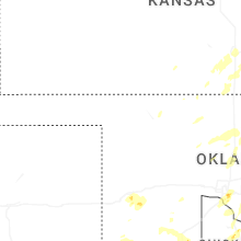
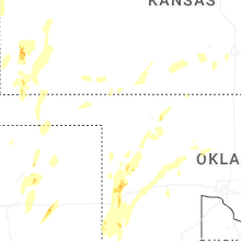
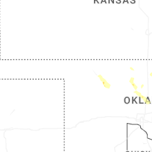
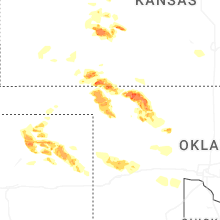
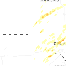


Connect with Interactive Hail Maps