

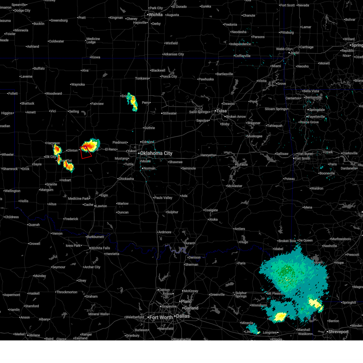
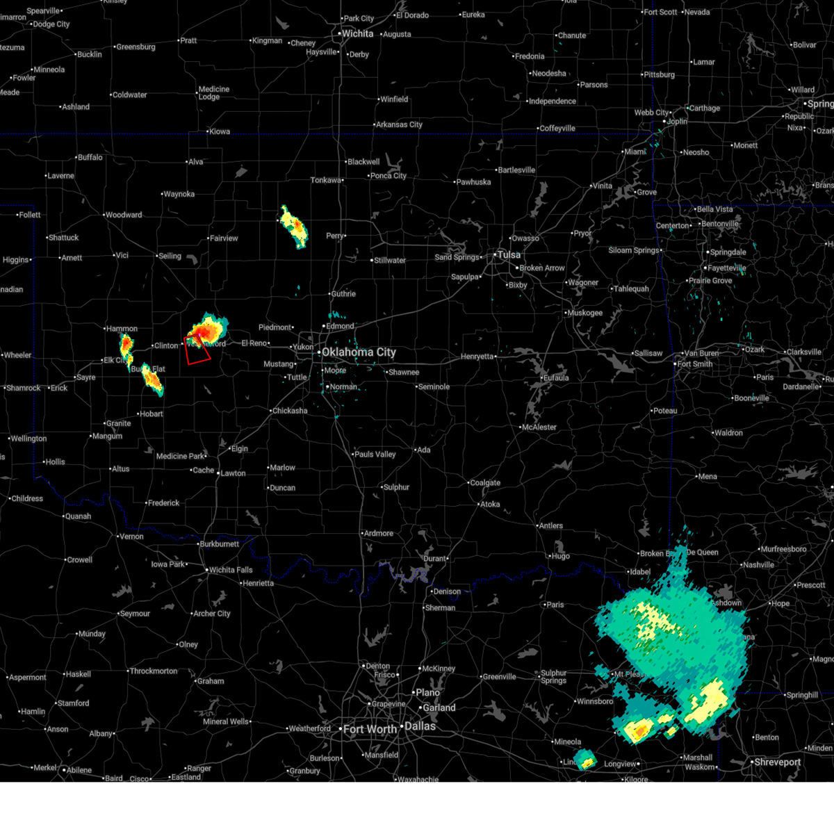
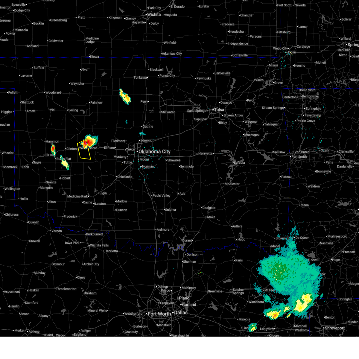
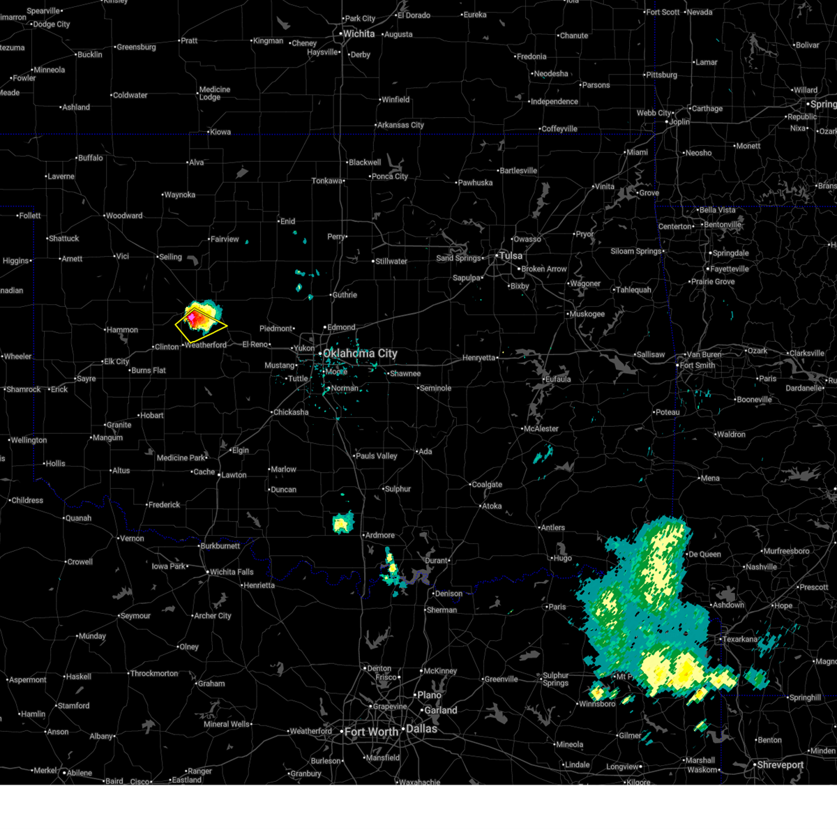
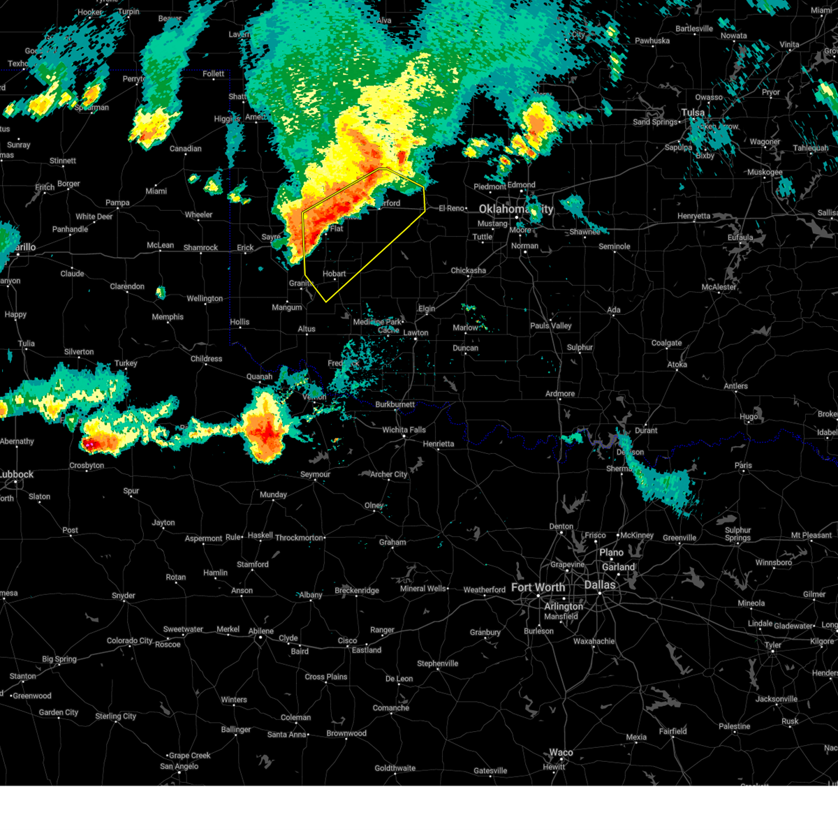
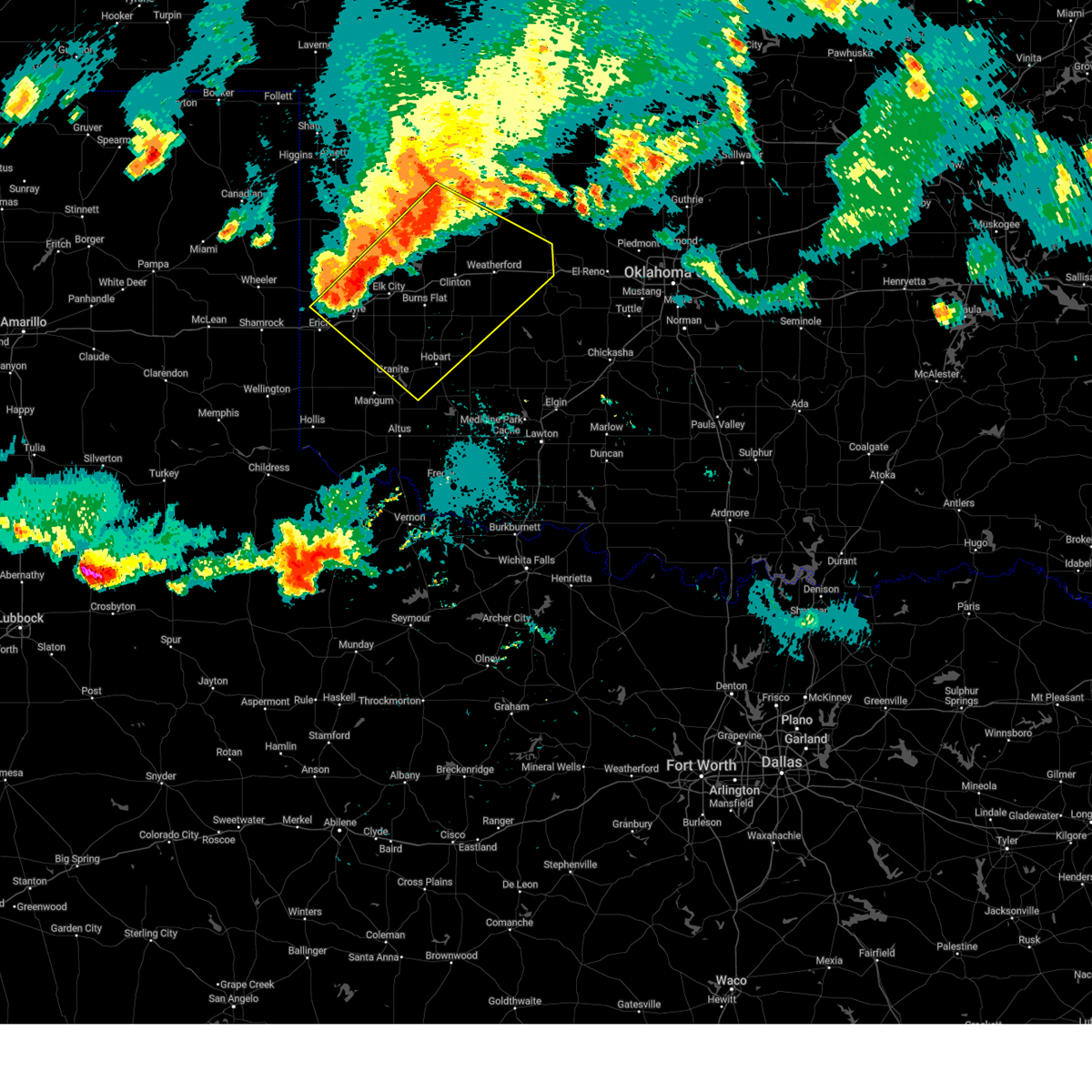
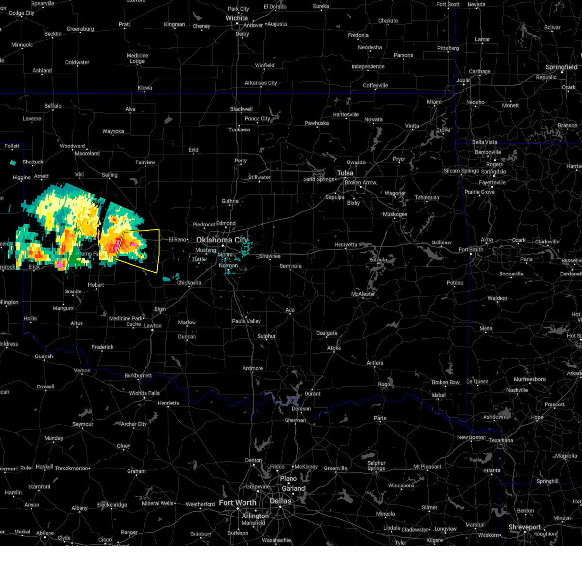
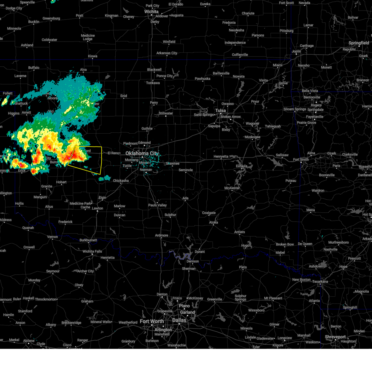
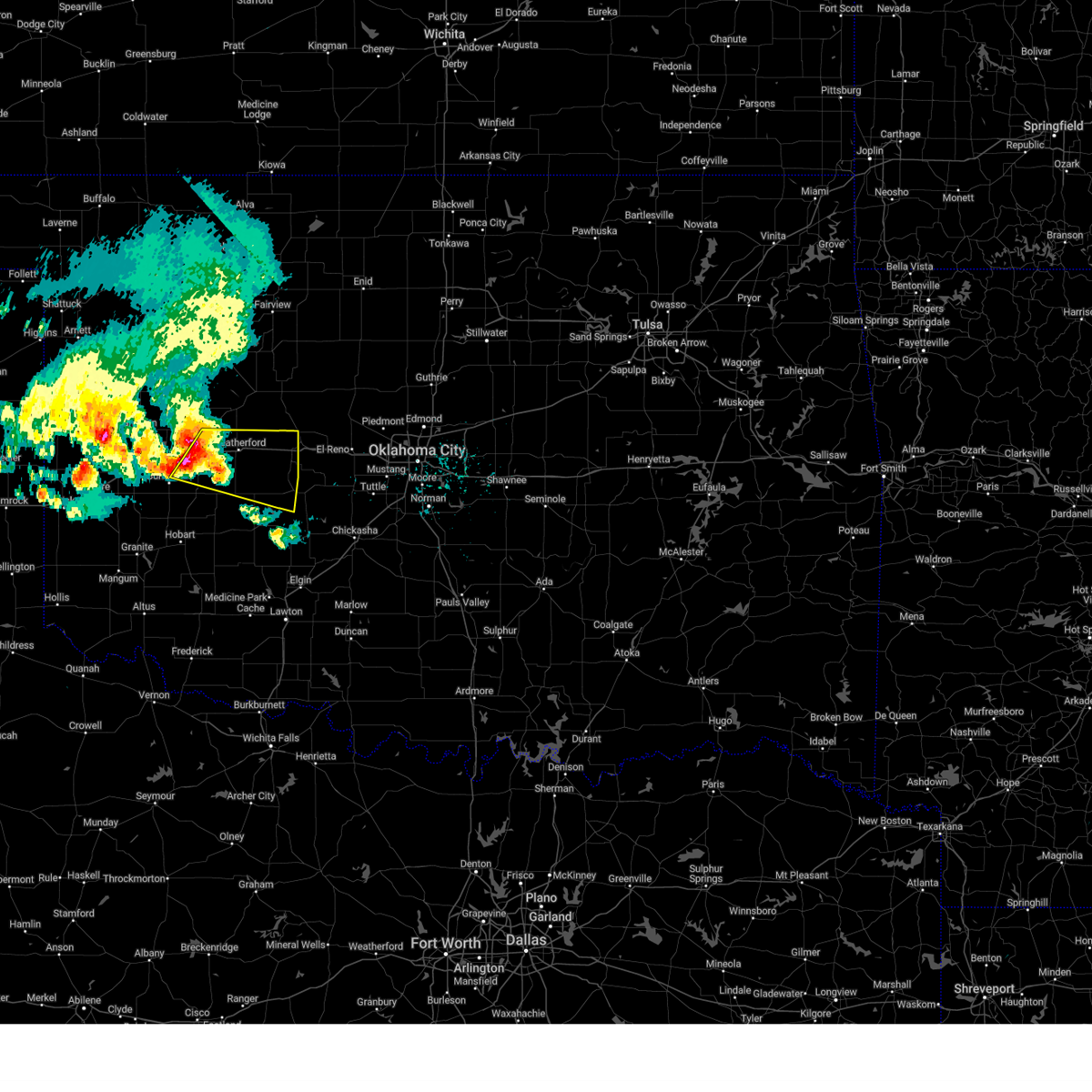
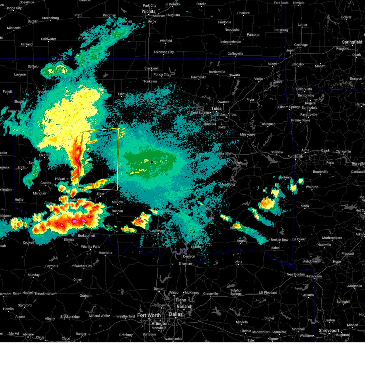
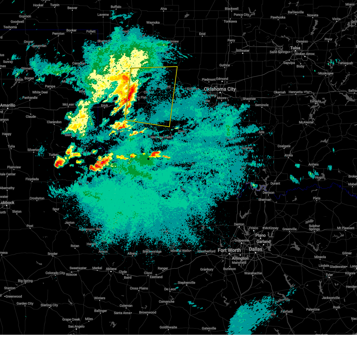
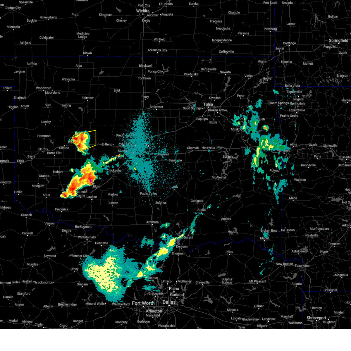
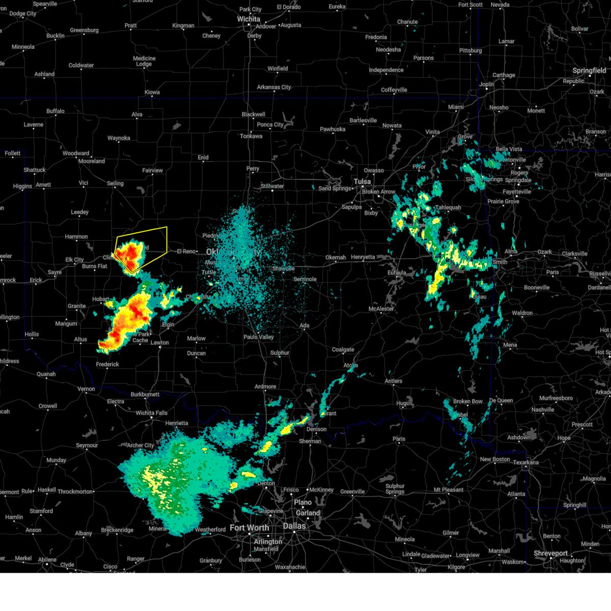
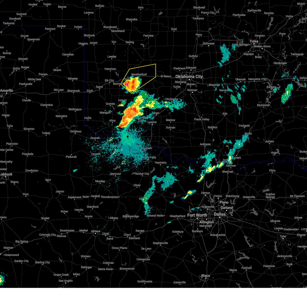
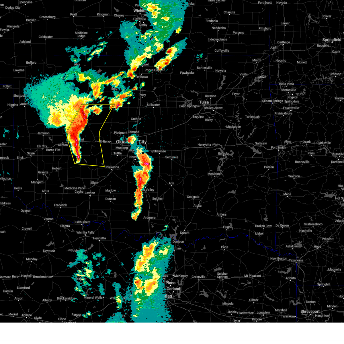
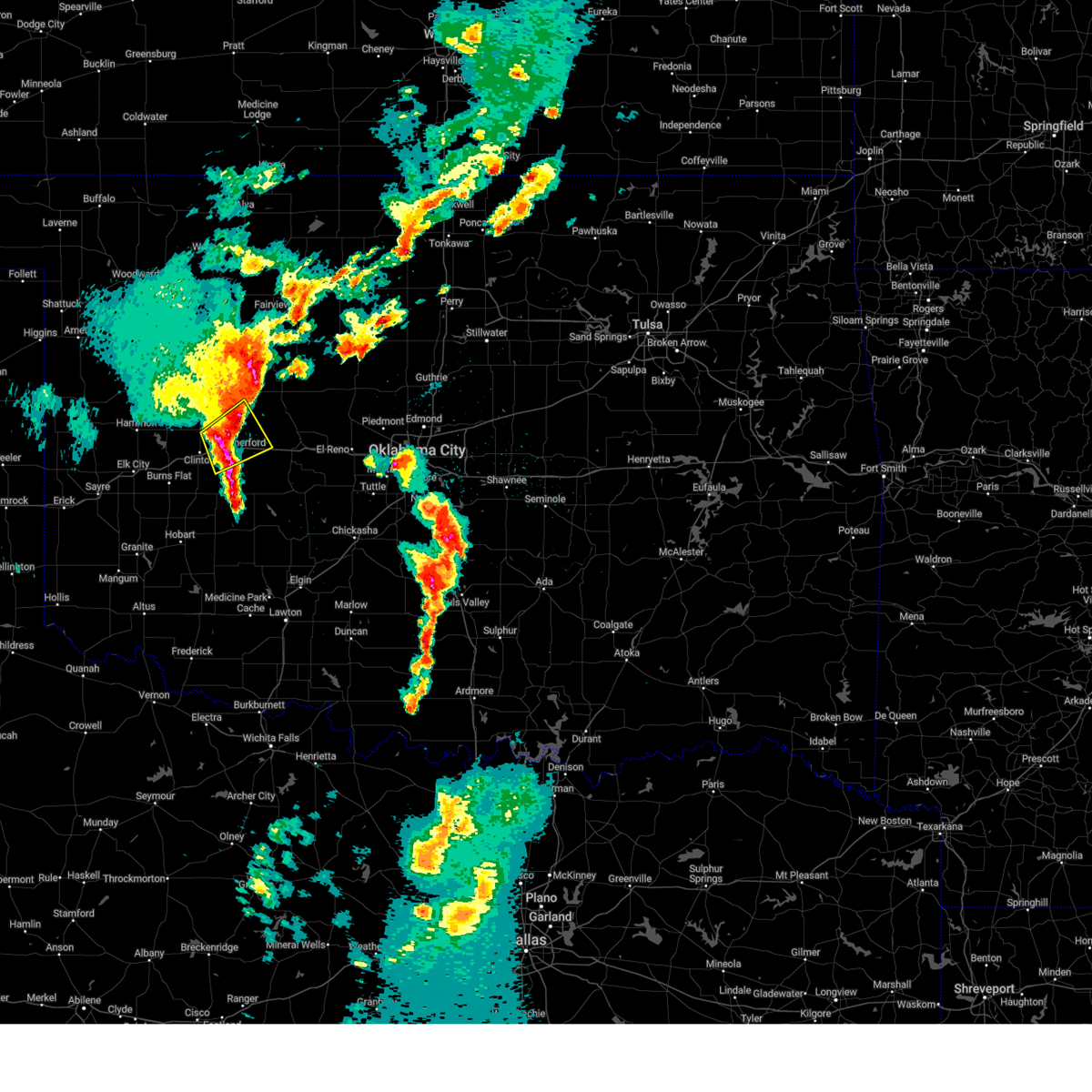
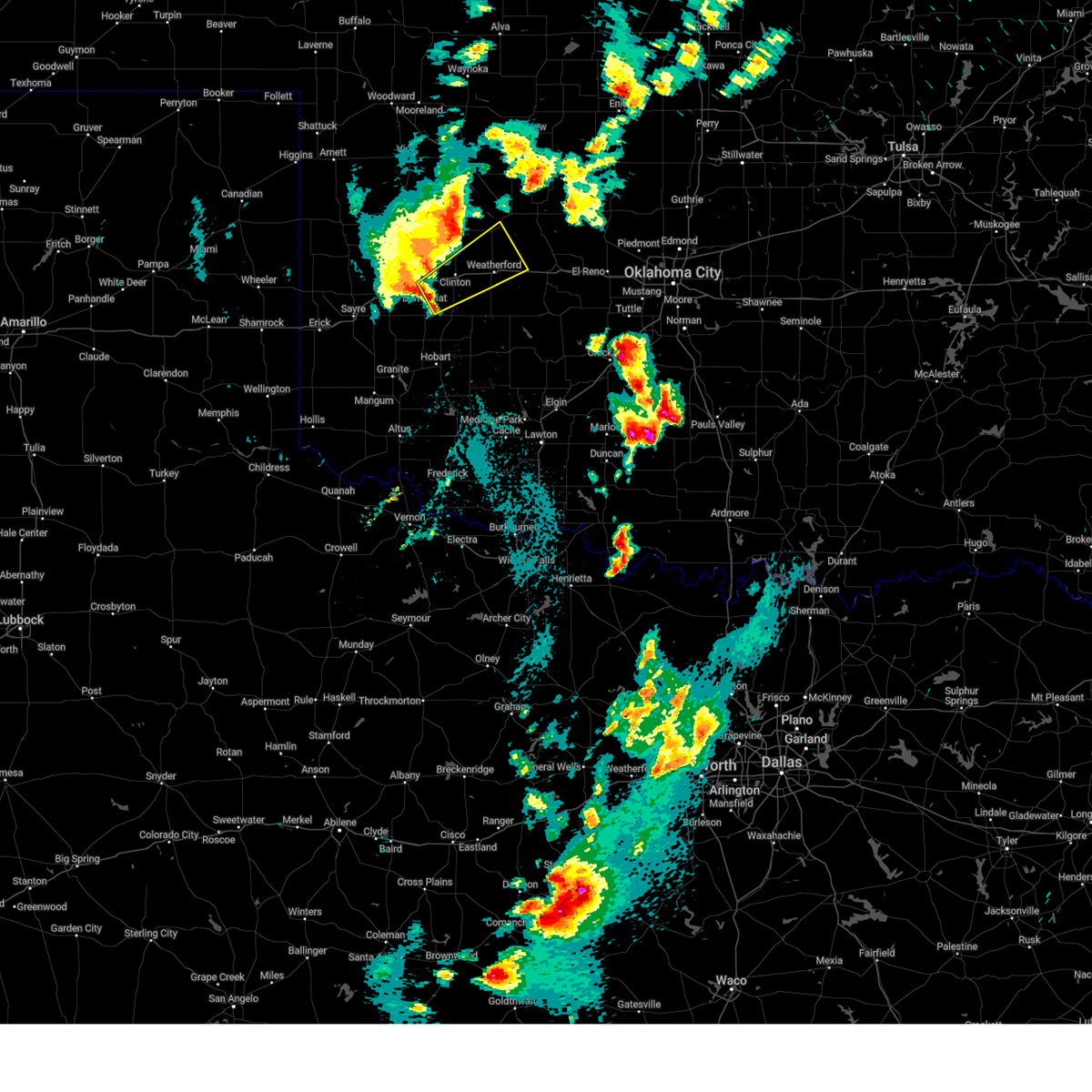
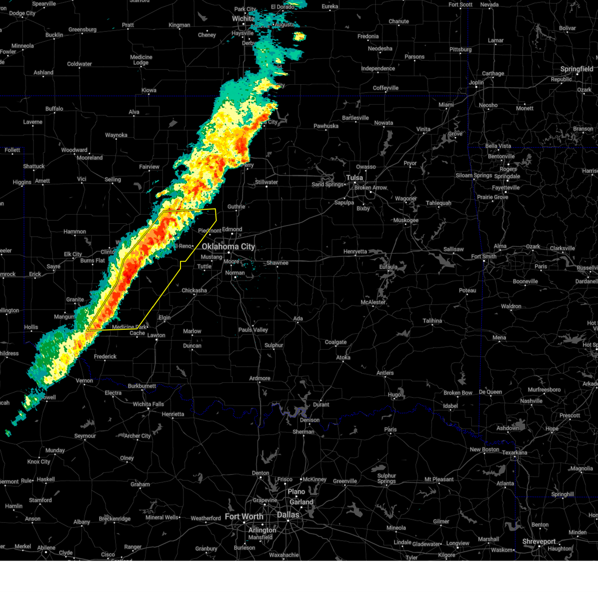
Hail Map for Weatherford, OK
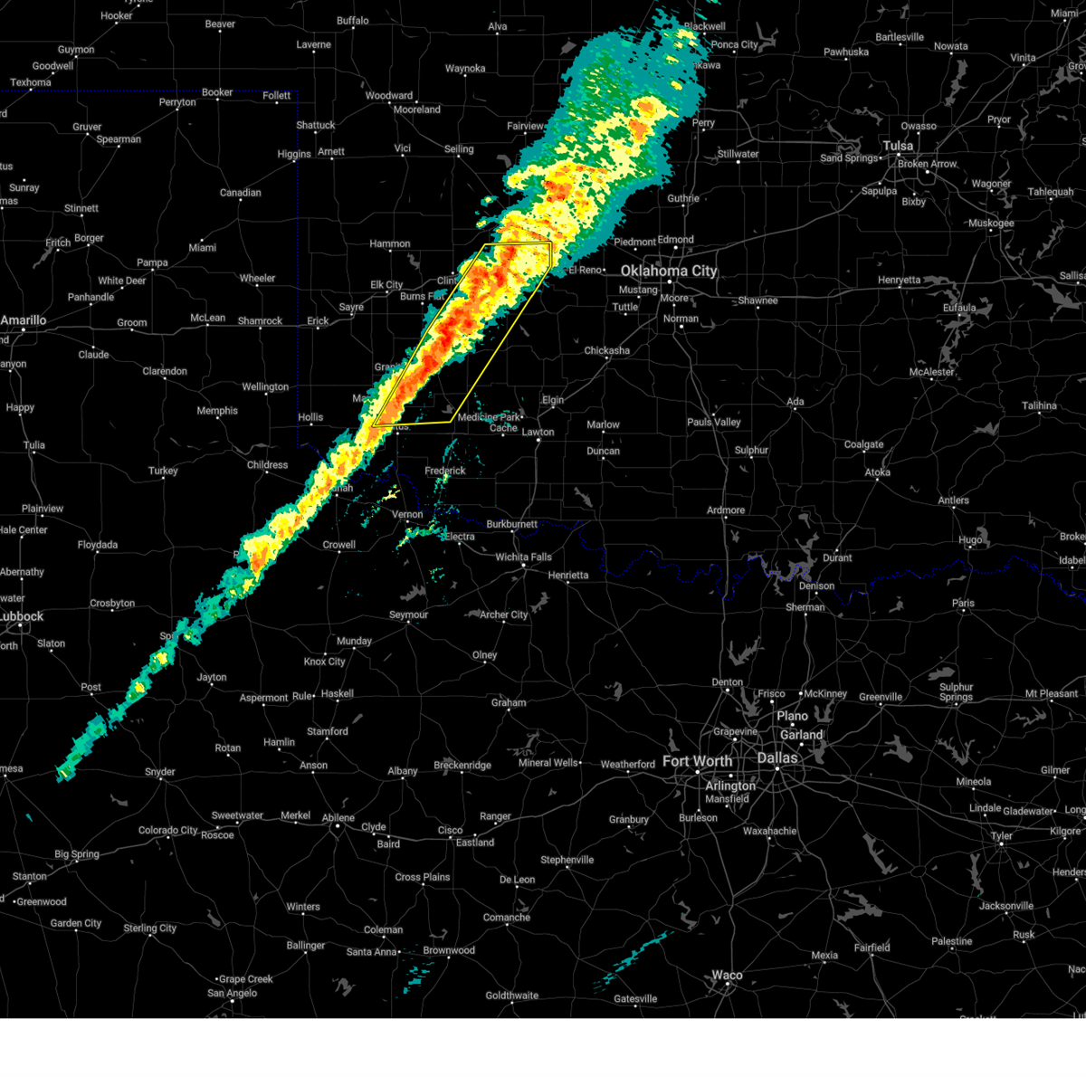
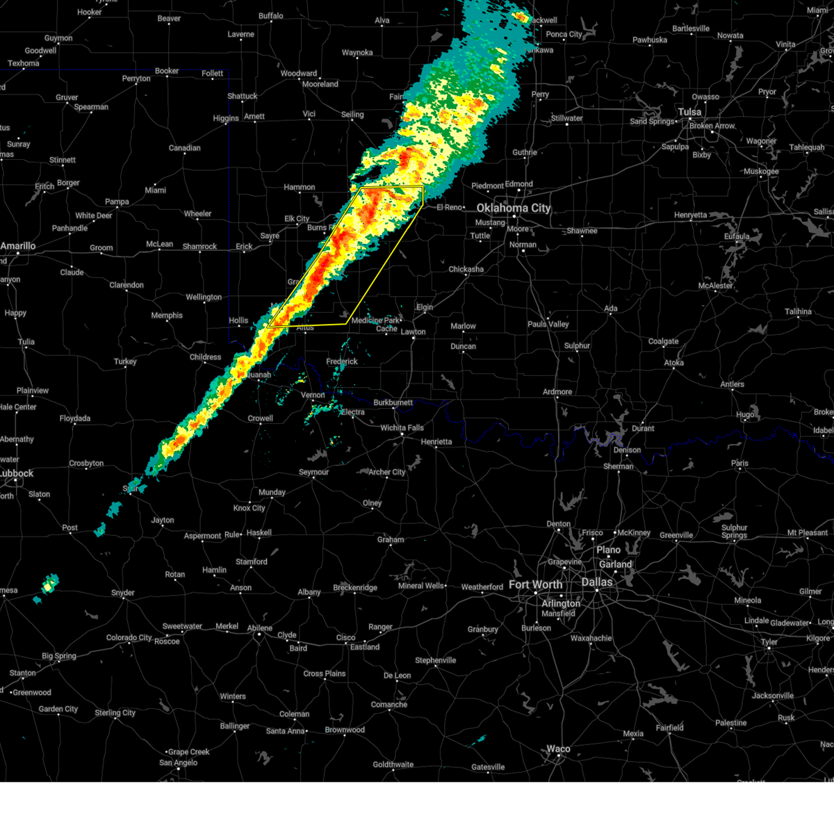
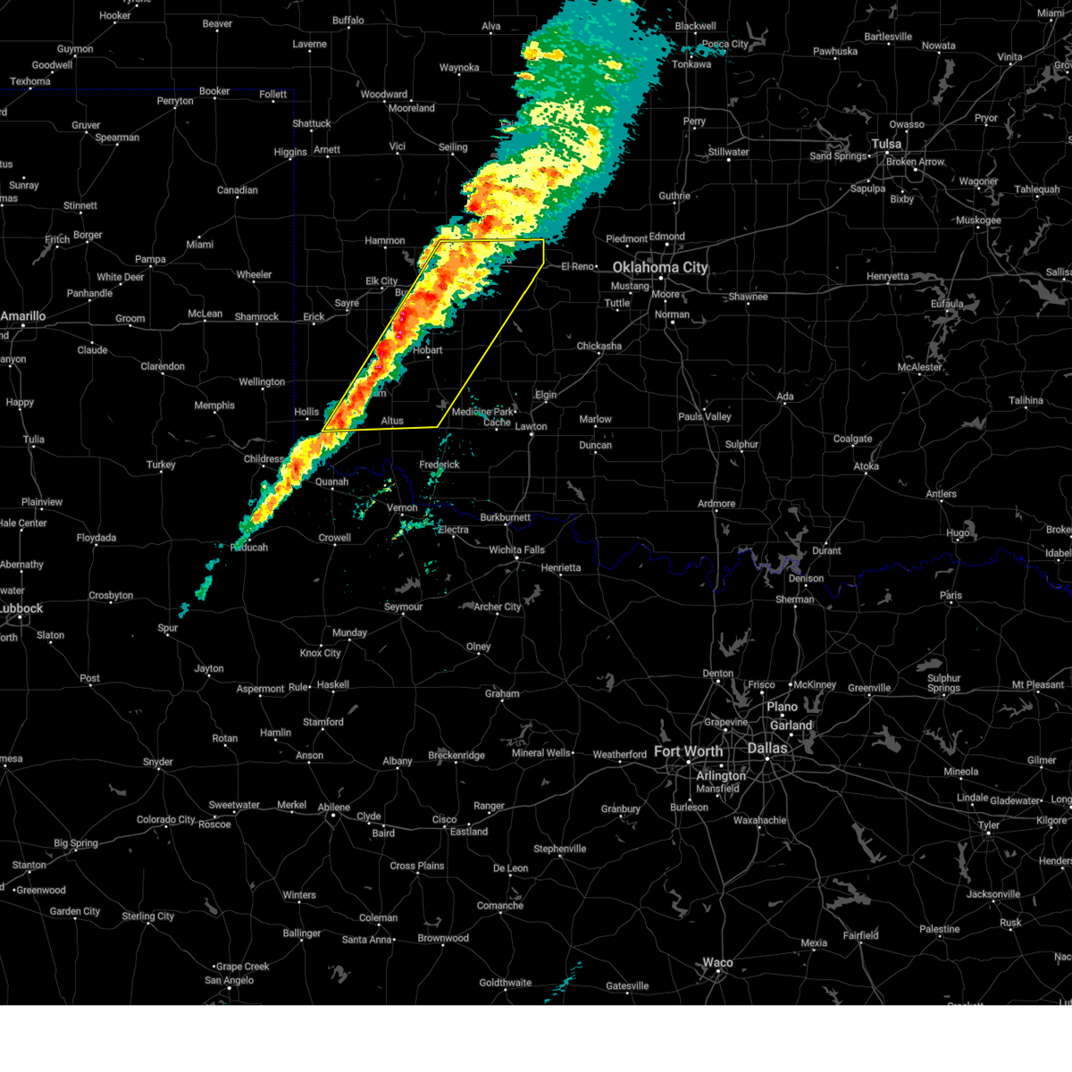
The Weatherford, OK area has had 26 reports of on-the-ground hail by trained spotters, and has been under severe weather warnings 55 times during the past 12 months. Doppler radar has detected hail at or near Weatherford, OK on 106 occasions, including 8 occasions during the past year.
| Name: | Weatherford, OK |
| Where Located: | 66 miles W of Oklahoma City, OK |
| Map: | Google Map for Weatherford, OK |
| Population: | 10833 |
| Housing Units: | 4802 |
| More Info: | Search Google for Weatherford, OK |
2
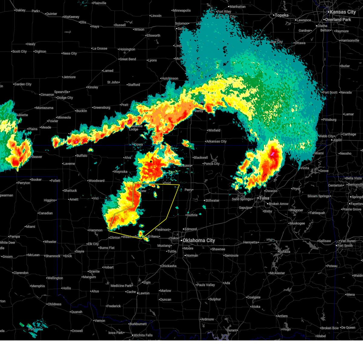
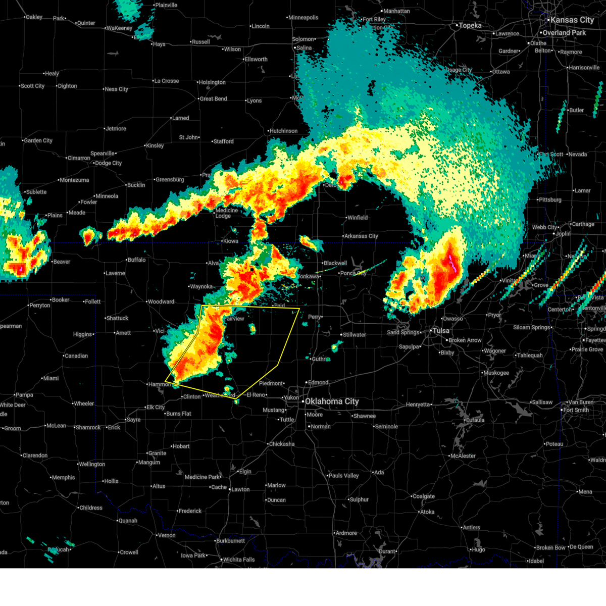
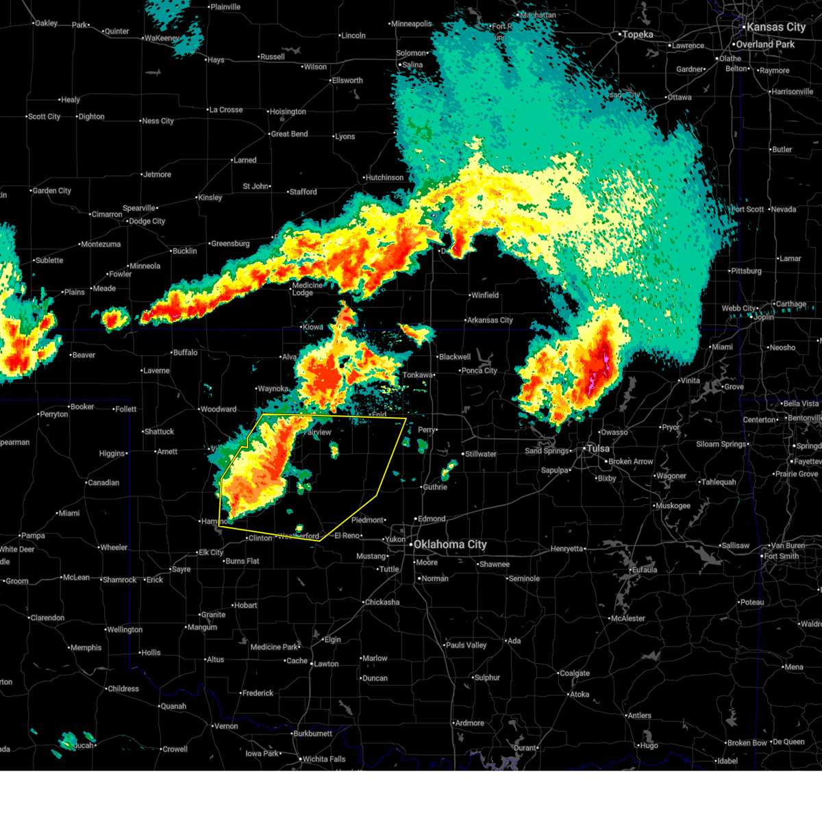
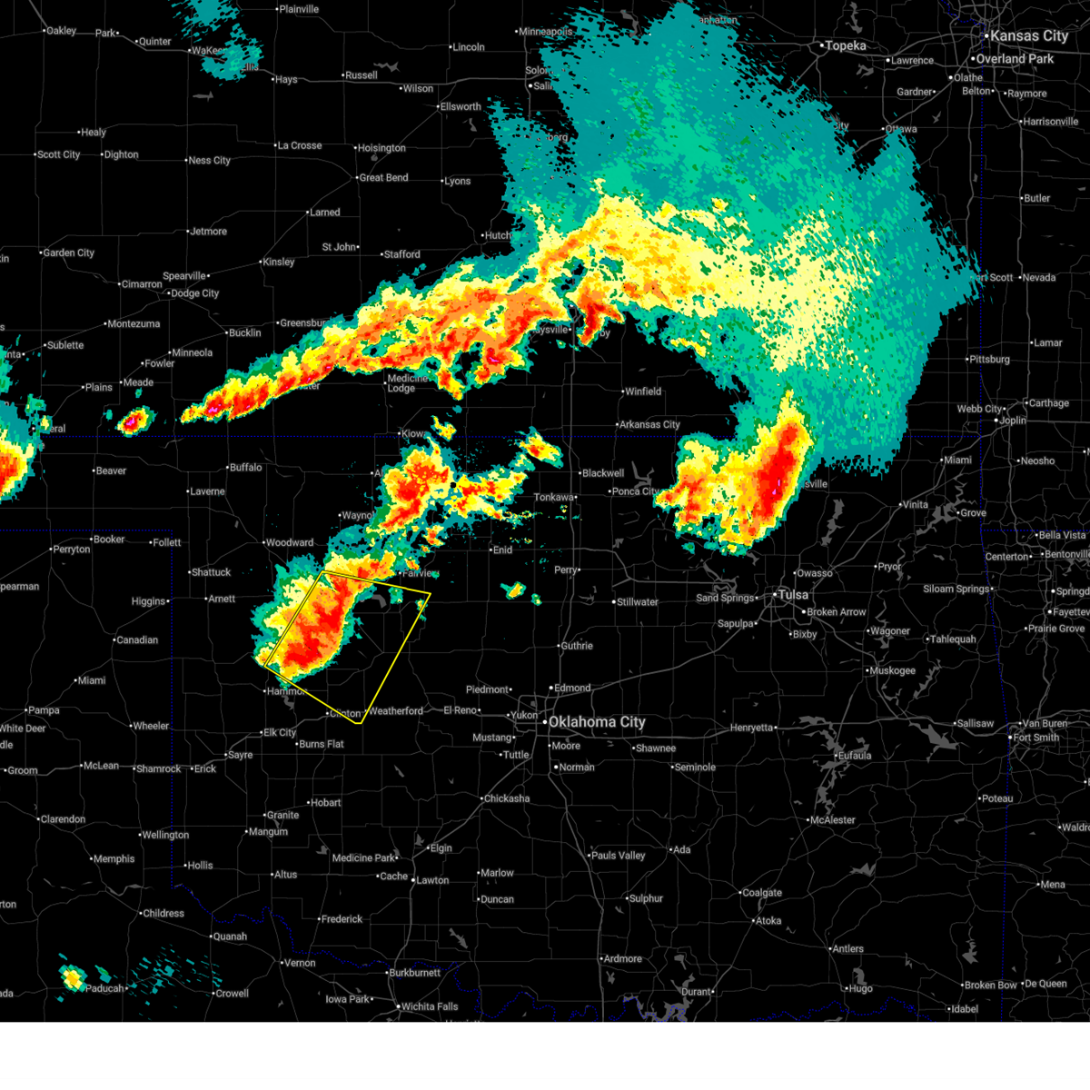
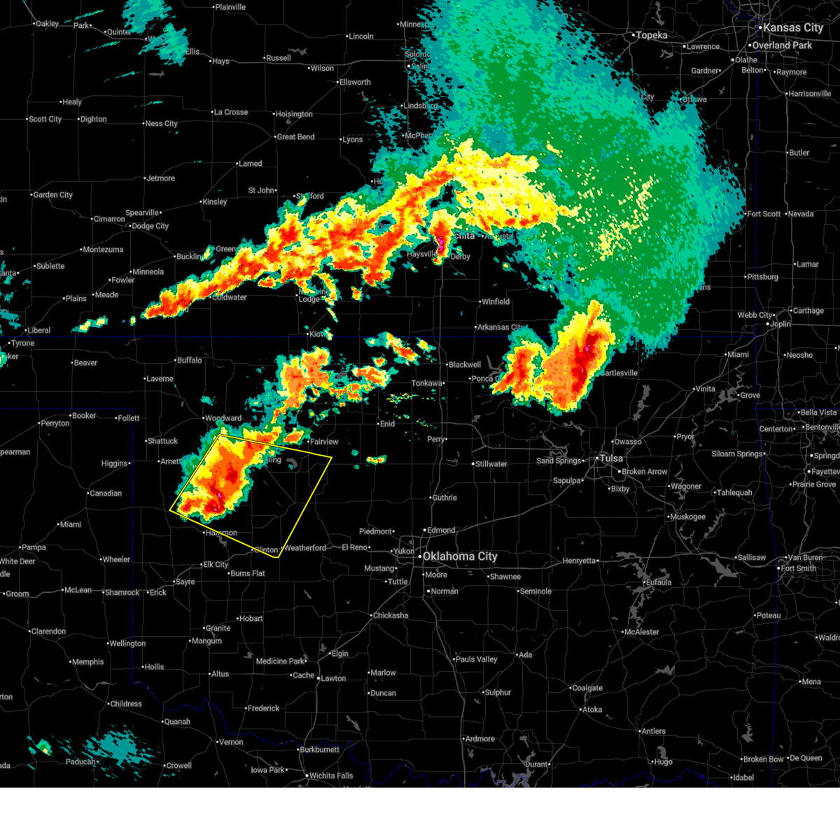
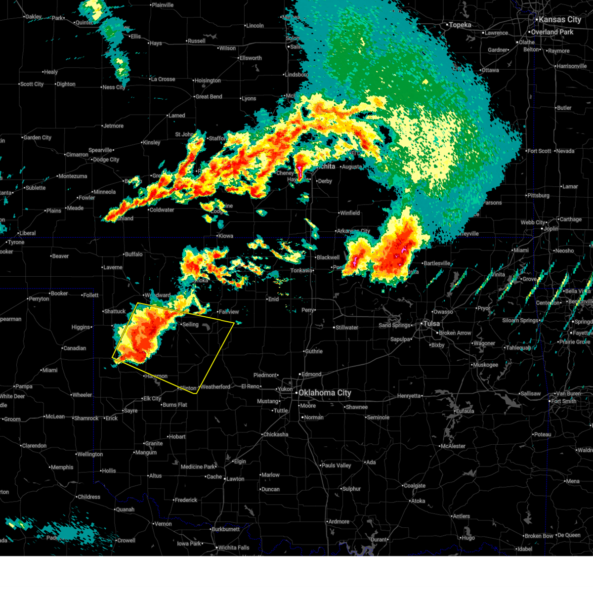
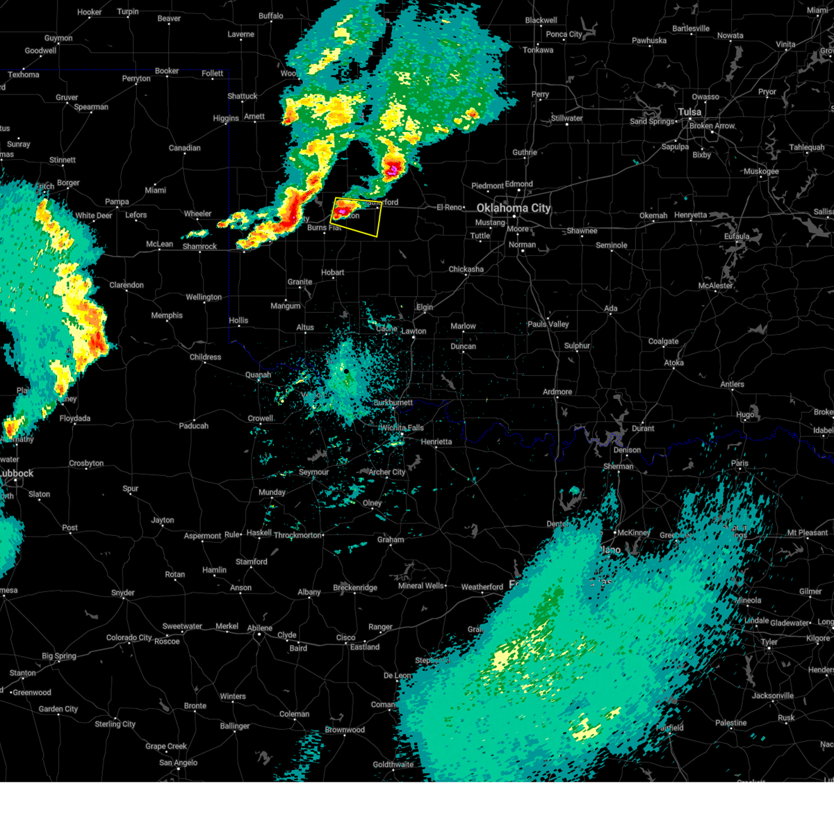
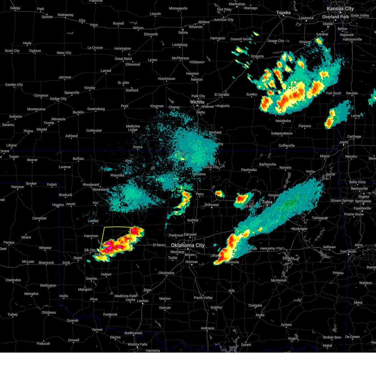
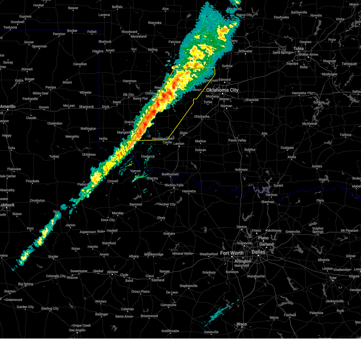
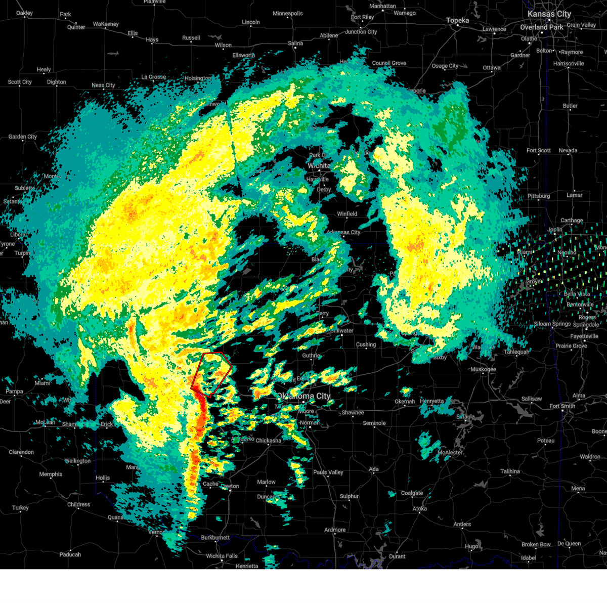
The Top Recent Hail Date for Weatherford, OK is Saturday, March 29, 2025 (10th out of 106)

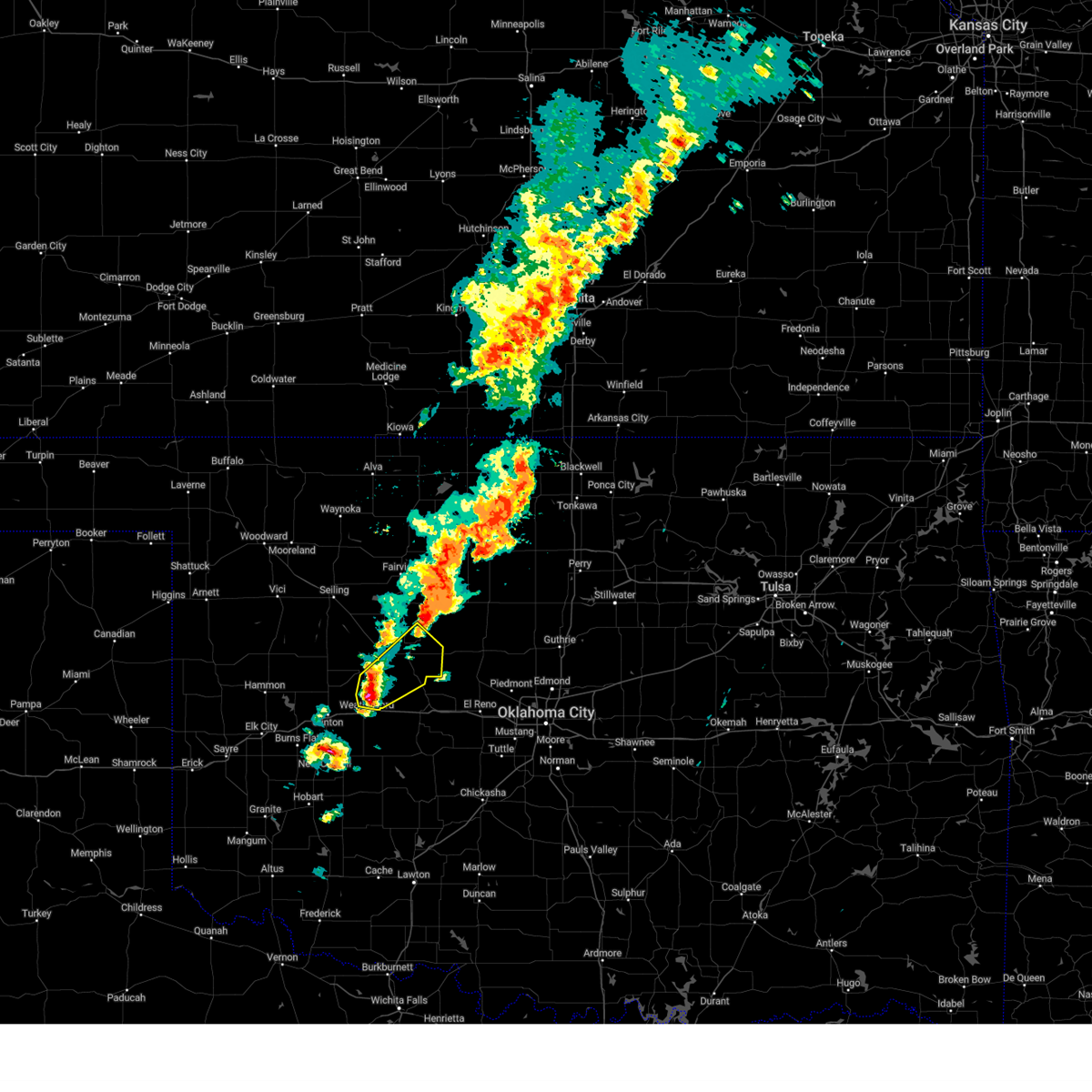
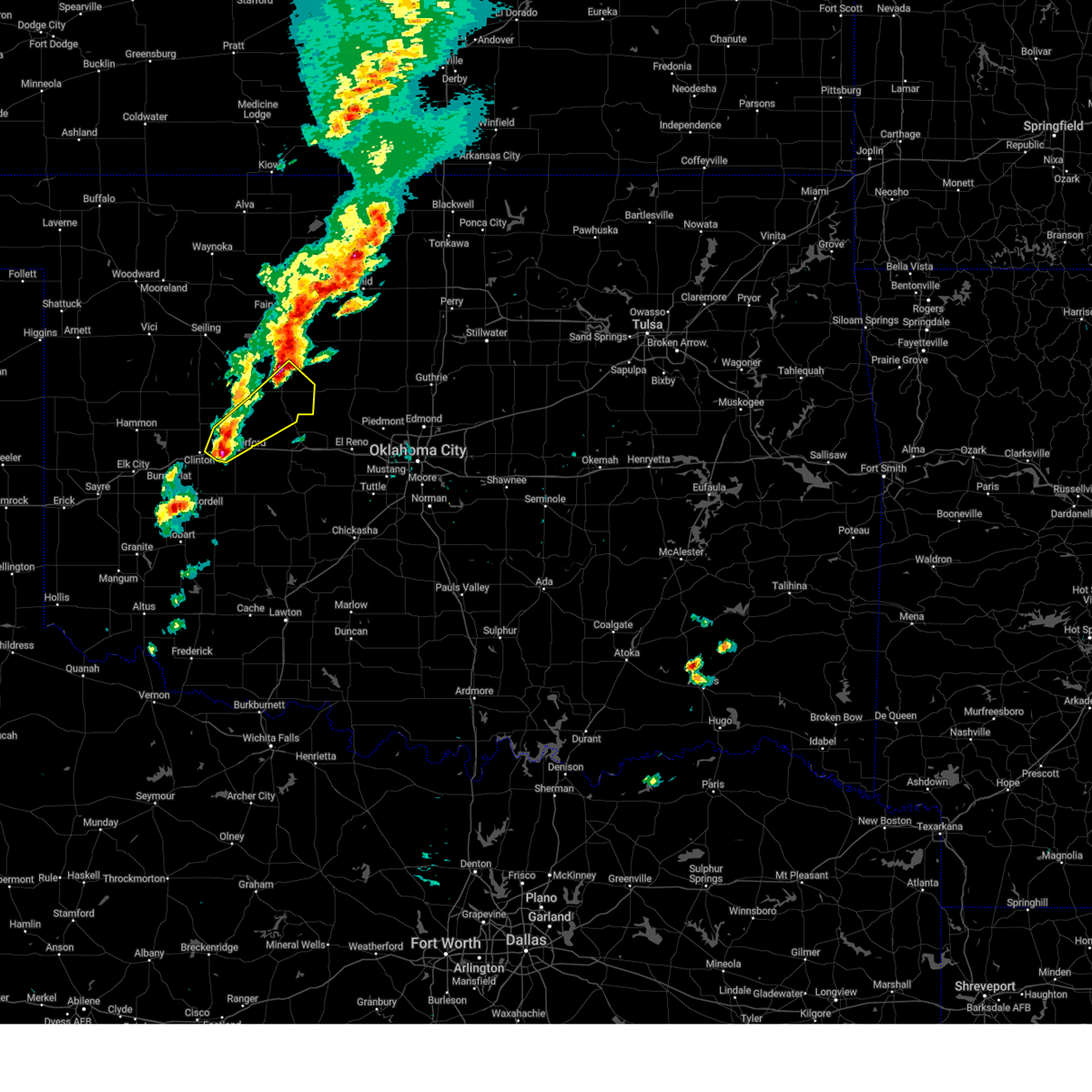
Hail and Wind Damage Spotted near Weatherford, OK
| Date / Time | Report Details |
|---|---|
| 6/17/2025 10:05 PM CDT |
 At 1004 pm cdt, severe thunderstorms were located along a line extending from near drummond to 6 miles southeast of hitchcock to 6 miles southeast of thomas, moving east at 60 mph (at 9:45 pm, there was a 66 mph wind gust at the watonga mesonet site). Hazards include 70 mph wind gusts and quarter size hail. Hail damage to vehicles is expected. expect considerable tree damage. wind damage is also likely to mobile homes, roofs, and outbuildings. Locations impacted include, enid, weatherford, watonga, kingfisher, fairview, hennessey, waukomis, geary, okarche, okeene, thomas, hydro, covington, ringwood, dover, drummond, custer city, ames, fairmont, and hitchcock. At 1004 pm cdt, severe thunderstorms were located along a line extending from near drummond to 6 miles southeast of hitchcock to 6 miles southeast of thomas, moving east at 60 mph (at 9:45 pm, there was a 66 mph wind gust at the watonga mesonet site). Hazards include 70 mph wind gusts and quarter size hail. Hail damage to vehicles is expected. expect considerable tree damage. wind damage is also likely to mobile homes, roofs, and outbuildings. Locations impacted include, enid, weatherford, watonga, kingfisher, fairview, hennessey, waukomis, geary, okarche, okeene, thomas, hydro, covington, ringwood, dover, drummond, custer city, ames, fairmont, and hitchcock.
|
| 6/17/2025 9:51 PM CDT |
 At 951 pm cdt, severe thunderstorms were located along a line extending from near isabella to 5 miles southeast of eagle city to 4 miles north of arapaho, moving east at 45 mph (radar indicated). Hazards include 70 mph wind gusts and quarter size hail. Hail damage to vehicles is expected. expect considerable tree damage. wind damage is also likely to mobile homes, roofs, and outbuildings. Locations impacted include, enid, weatherford, watonga, kingfisher, fairview, hennessey, waukomis, geary, okarche, okeene, thomas, hydro, canton, covington, ringwood, dover, drummond, custer city, longdale, and ames. At 951 pm cdt, severe thunderstorms were located along a line extending from near isabella to 5 miles southeast of eagle city to 4 miles north of arapaho, moving east at 45 mph (radar indicated). Hazards include 70 mph wind gusts and quarter size hail. Hail damage to vehicles is expected. expect considerable tree damage. wind damage is also likely to mobile homes, roofs, and outbuildings. Locations impacted include, enid, weatherford, watonga, kingfisher, fairview, hennessey, waukomis, geary, okarche, okeene, thomas, hydro, canton, covington, ringwood, dover, drummond, custer city, longdale, and ames.
|
| 6/17/2025 9:41 PM CDT |
 Svroun the national weather service in norman has issued a * severe thunderstorm warning for, kingfisher county in central oklahoma, northwestern caddo county in southwestern oklahoma, central custer county in western oklahoma, blaine county in northwestern oklahoma, dewey county in northwestern oklahoma, southern garfield county in northern oklahoma, major county in northwestern oklahoma, northwestern canadian county in central oklahoma, * until 1030 pm cdt. * at 941 pm cdt, severe thunderstorms were located along a line extending from near fairview to 4 miles northeast of fay to 6 miles northwest of arapaho, moving east at 50 mph (radar indicated). Hazards include 70 mph wind gusts and quarter size hail. Hail damage to vehicles is expected. expect considerable tree damage. Wind damage is also likely to mobile homes, roofs, and outbuildings. Svroun the national weather service in norman has issued a * severe thunderstorm warning for, kingfisher county in central oklahoma, northwestern caddo county in southwestern oklahoma, central custer county in western oklahoma, blaine county in northwestern oklahoma, dewey county in northwestern oklahoma, southern garfield county in northern oklahoma, major county in northwestern oklahoma, northwestern canadian county in central oklahoma, * until 1030 pm cdt. * at 941 pm cdt, severe thunderstorms were located along a line extending from near fairview to 4 miles northeast of fay to 6 miles northwest of arapaho, moving east at 50 mph (radar indicated). Hazards include 70 mph wind gusts and quarter size hail. Hail damage to vehicles is expected. expect considerable tree damage. Wind damage is also likely to mobile homes, roofs, and outbuildings.
|
| 6/17/2025 9:27 PM CDT |
 the severe thunderstorm warning has been cancelled and is no longer in effect the severe thunderstorm warning has been cancelled and is no longer in effect
|
| 6/17/2025 9:27 PM CDT |
 At 925 pm cdt, severe thunderstorms were located along a line extending from 3 miles southeast of orion to near butler, moving southeast at 40 mph. these are destructive storms for putnam and oakwood (radar indicated). Hazards include 80 mph wind gusts and half dollar size hail. Flying debris will be dangerous to those caught without shelter. mobile homes will be heavily damaged. expect considerable damage to roofs, windows, and vehicles. extensive tree damage and power outages are likely. Locations impacted include, weatherford, taloga, okeene, thomas, seiling, arapaho, canton, custer city, longdale, oakwood, putnam, canton lake, orion, chester, eagle city, cestos, fay, homestead, hucmac, and southard. At 925 pm cdt, severe thunderstorms were located along a line extending from 3 miles southeast of orion to near butler, moving southeast at 40 mph. these are destructive storms for putnam and oakwood (radar indicated). Hazards include 80 mph wind gusts and half dollar size hail. Flying debris will be dangerous to those caught without shelter. mobile homes will be heavily damaged. expect considerable damage to roofs, windows, and vehicles. extensive tree damage and power outages are likely. Locations impacted include, weatherford, taloga, okeene, thomas, seiling, arapaho, canton, custer city, longdale, oakwood, putnam, canton lake, orion, chester, eagle city, cestos, fay, homestead, hucmac, and southard.
|
| 6/17/2025 9:10 PM CDT |
 At 910 pm cdt, severe thunderstorms were located along a line extending from 3 miles northeast of chester to 3 miles southeast of moorewood, moving east at 40 mph (at 8:55 pm, a 63 mph wind gust occurred at the putnam mesonet site). Hazards include 70 mph wind gusts and half dollar size hail. Hail damage to vehicles is expected. expect considerable tree damage. wind damage is also likely to mobile homes, roofs, and outbuildings. Locations impacted include, weatherford, clinton, taloga, okeene, thomas, seiling, arapaho, vici, canton, leedey, custer city, butler, longdale, camargo, oakwood, mutual, putnam, canton lake, angora, and moorewood. At 910 pm cdt, severe thunderstorms were located along a line extending from 3 miles northeast of chester to 3 miles southeast of moorewood, moving east at 40 mph (at 8:55 pm, a 63 mph wind gust occurred at the putnam mesonet site). Hazards include 70 mph wind gusts and half dollar size hail. Hail damage to vehicles is expected. expect considerable tree damage. wind damage is also likely to mobile homes, roofs, and outbuildings. Locations impacted include, weatherford, clinton, taloga, okeene, thomas, seiling, arapaho, vici, canton, leedey, custer city, butler, longdale, camargo, oakwood, mutual, putnam, canton lake, angora, and moorewood.
|
| 6/17/2025 8:58 PM CDT |
 Svroun the national weather service in norman has issued a * severe thunderstorm warning for, southeastern ellis county in northwestern oklahoma, northeastern roger mills county in western oklahoma, custer county in western oklahoma, northwestern blaine county in northwestern oklahoma, dewey county in northwestern oklahoma, southwestern major county in northwestern oklahoma, southern woodward county in northwestern oklahoma, * until 945 pm cdt. * at 858 pm cdt, severe thunderstorms were located along a line extending from 5 miles west of chester to 4 miles west of moorewood, moving southeast at 40 mph (radar indicated). Hazards include 70 mph wind gusts and half dollar size hail. Hail damage to vehicles is expected. expect considerable tree damage. Wind damage is also likely to mobile homes, roofs, and outbuildings. Svroun the national weather service in norman has issued a * severe thunderstorm warning for, southeastern ellis county in northwestern oklahoma, northeastern roger mills county in western oklahoma, custer county in western oklahoma, northwestern blaine county in northwestern oklahoma, dewey county in northwestern oklahoma, southwestern major county in northwestern oklahoma, southern woodward county in northwestern oklahoma, * until 945 pm cdt. * at 858 pm cdt, severe thunderstorms were located along a line extending from 5 miles west of chester to 4 miles west of moorewood, moving southeast at 40 mph (radar indicated). Hazards include 70 mph wind gusts and half dollar size hail. Hail damage to vehicles is expected. expect considerable tree damage. Wind damage is also likely to mobile homes, roofs, and outbuildings.
|
| 6/14/2025 8:12 PM CDT |
 Toroun the national weather service in norman has issued a * tornado warning for, northeastern washita county in western oklahoma, northwestern caddo county in southwestern oklahoma, southeastern custer county in western oklahoma, south central blaine county in northwestern oklahoma, * until 845 pm cdt. * at 811 pm cdt, a severe thunderstorm capable of producing a tornado was located 6 miles south of hydro, moving south at 15 mph (radar indicated rotation). Hazards include tornado and hail up to two inches in diameter. Flying debris will be dangerous to those caught without shelter. mobile homes will be damaged or destroyed. damage to roofs, windows, and vehicles will occur. Tree damage is likely. Toroun the national weather service in norman has issued a * tornado warning for, northeastern washita county in western oklahoma, northwestern caddo county in southwestern oklahoma, southeastern custer county in western oklahoma, south central blaine county in northwestern oklahoma, * until 845 pm cdt. * at 811 pm cdt, a severe thunderstorm capable of producing a tornado was located 6 miles south of hydro, moving south at 15 mph (radar indicated rotation). Hazards include tornado and hail up to two inches in diameter. Flying debris will be dangerous to those caught without shelter. mobile homes will be damaged or destroyed. damage to roofs, windows, and vehicles will occur. Tree damage is likely.
|
| 6/14/2025 7:53 PM CDT |
 At 753 pm cdt, a severe thunderstorm was located over hydro, moving south at 15 mph. two inch diameter hail was reported just west of hydro (trained weather spotters). Hazards include two inch hail and 70 mph wind gusts. People and animals outdoors will be injured. expect hail damage to roofs, siding, windows, and vehicles. expect considerable tree damage. wind damage is also likely to mobile homes, roofs, and outbuildings. Locations impacted include, weatherford and hydro. At 753 pm cdt, a severe thunderstorm was located over hydro, moving south at 15 mph. two inch diameter hail was reported just west of hydro (trained weather spotters). Hazards include two inch hail and 70 mph wind gusts. People and animals outdoors will be injured. expect hail damage to roofs, siding, windows, and vehicles. expect considerable tree damage. wind damage is also likely to mobile homes, roofs, and outbuildings. Locations impacted include, weatherford and hydro.
|
| 6/14/2025 7:49 PM CDT |
 At 749 pm cdt, a severe thunderstorm capable of producing a tornado was located 2 miles east of weatherford, ., moving south at 10 mph (radar indicated rotation). Hazards include tornado and golf ball size hail. Flying debris will be dangerous to those caught without shelter. mobile homes will be damaged or destroyed. damage to roofs, windows, and vehicles will occur. tree damage is likely. locations impacted include, weatherford and hydro. This includes interstate 40 between mile markers 83 and 91. At 749 pm cdt, a severe thunderstorm capable of producing a tornado was located 2 miles east of weatherford, ., moving south at 10 mph (radar indicated rotation). Hazards include tornado and golf ball size hail. Flying debris will be dangerous to those caught without shelter. mobile homes will be damaged or destroyed. damage to roofs, windows, and vehicles will occur. tree damage is likely. locations impacted include, weatherford and hydro. This includes interstate 40 between mile markers 83 and 91.
|
| 6/14/2025 7:37 PM CDT |
 Toroun the national weather service in norman has issued a * tornado warning for, northeastern washita county in western oklahoma, northwestern caddo county in southwestern oklahoma, southeastern custer county in western oklahoma, southwestern blaine county in northwestern oklahoma, * until 815 pm cdt. * at 737 pm cdt, a severe thunderstorm capable of producing a tornado was located near hydro, moving south at 25 mph (radar indicated rotation). Hazards include tornado and golf ball size hail. Flying debris will be dangerous to those caught without shelter. mobile homes will be damaged or destroyed. damage to roofs, windows, and vehicles will occur. Tree damage is likely. Toroun the national weather service in norman has issued a * tornado warning for, northeastern washita county in western oklahoma, northwestern caddo county in southwestern oklahoma, southeastern custer county in western oklahoma, southwestern blaine county in northwestern oklahoma, * until 815 pm cdt. * at 737 pm cdt, a severe thunderstorm capable of producing a tornado was located near hydro, moving south at 25 mph (radar indicated rotation). Hazards include tornado and golf ball size hail. Flying debris will be dangerous to those caught without shelter. mobile homes will be damaged or destroyed. damage to roofs, windows, and vehicles will occur. Tree damage is likely.
|
| 6/14/2025 7:32 PM CDT |
 Svroun the national weather service in norman has issued a * severe thunderstorm warning for, northeastern washita county in western oklahoma, northwestern caddo county in southwestern oklahoma, southeastern custer county in western oklahoma, southwestern blaine county in northwestern oklahoma, * until 815 pm cdt. * at 732 pm cdt, a severe thunderstorm was located near weatherford, moving south at 25 mph (radar indicated). Hazards include golf ball size hail and 70 mph wind gusts. People and animals outdoors will be injured. expect hail damage to roofs, siding, windows, and vehicles. expect considerable tree damage. Wind damage is also likely to mobile homes, roofs, and outbuildings. Svroun the national weather service in norman has issued a * severe thunderstorm warning for, northeastern washita county in western oklahoma, northwestern caddo county in southwestern oklahoma, southeastern custer county in western oklahoma, southwestern blaine county in northwestern oklahoma, * until 815 pm cdt. * at 732 pm cdt, a severe thunderstorm was located near weatherford, moving south at 25 mph (radar indicated). Hazards include golf ball size hail and 70 mph wind gusts. People and animals outdoors will be injured. expect hail damage to roofs, siding, windows, and vehicles. expect considerable tree damage. Wind damage is also likely to mobile homes, roofs, and outbuildings.
|
| 6/14/2025 6:45 PM CDT |
 Svroun the national weather service in norman has issued a * severe thunderstorm warning for, east central custer county in western oklahoma, southwestern blaine county in northwestern oklahoma, * until 730 pm cdt. * at 645 pm cdt, a severe thunderstorm was located 8 miles southeast of thomas, moving southeast at 10 mph (trained weather spotters). Hazards include golf ball size hail and 70 mph wind gusts. People and animals outdoors will be injured. expect hail damage to roofs, siding, windows, and vehicles. expect considerable tree damage. wind damage is also likely to mobile homes, roofs, and outbuildings. This severe thunderstorm will remain over mainly rural areas of east central custer and southwestern blaine counties. Svroun the national weather service in norman has issued a * severe thunderstorm warning for, east central custer county in western oklahoma, southwestern blaine county in northwestern oklahoma, * until 730 pm cdt. * at 645 pm cdt, a severe thunderstorm was located 8 miles southeast of thomas, moving southeast at 10 mph (trained weather spotters). Hazards include golf ball size hail and 70 mph wind gusts. People and animals outdoors will be injured. expect hail damage to roofs, siding, windows, and vehicles. expect considerable tree damage. wind damage is also likely to mobile homes, roofs, and outbuildings. This severe thunderstorm will remain over mainly rural areas of east central custer and southwestern blaine counties.
|
| 6/8/2025 7:05 PM CDT | Svroun the national weather service in norman has issued a * severe thunderstorm warning for, northeastern washita county in western oklahoma, southwestern kingfisher county in central oklahoma, northwestern grady county in central oklahoma, central caddo county in southwestern oklahoma, west central oklahoma county in central oklahoma, southeastern custer county in western oklahoma, southern blaine county in northwestern oklahoma, canadian county in central oklahoma, * until 745 pm cdt. * at 705 pm cdt, severe thunderstorms were located along a line extending from 3 miles east of greenfield to 6 miles north of colony, moving southeast at 35 mph (radar indicated). Hazards include 70 mph wind gusts and ping pong ball size hail. People and animals outdoors will be injured. expect hail damage to roofs, siding, windows, and vehicles. expect considerable tree damage. Wind damage is also likely to mobile homes, roofs, and outbuildings. |
| 6/8/2025 6:26 PM CDT | Svroun the national weather service in norman has issued a * severe thunderstorm warning for, northeastern washita county in western oklahoma, kingfisher county in central oklahoma, northwestern caddo county in southwestern oklahoma, custer county in western oklahoma, blaine county in northwestern oklahoma, southeastern dewey county in northwestern oklahoma, northwestern canadian county in central oklahoma, * until 715 pm cdt. * at 626 pm cdt, severe thunderstorms were located along a line extending from 3 miles southeast of okeene to 6 miles south of fay to 6 miles southeast of butler, moving southeast at 25 mph (radar indicated). Hazards include 70 mph wind gusts and ping pong ball size hail. People and animals outdoors will be injured. expect hail damage to roofs, siding, windows, and vehicles. expect considerable tree damage. Wind damage is also likely to mobile homes, roofs, and outbuildings. |
| 6/8/2025 6:14 PM CDT | Svroun the national weather service in norman has issued a * severe thunderstorm warning for, northern washita county in western oklahoma, northwestern caddo county in southwestern oklahoma, east central roger mills county in western oklahoma, custer county in western oklahoma, southwestern blaine county in northwestern oklahoma, southeastern dewey county in northwestern oklahoma, * until 700 pm cdt. * at 614 pm cdt, severe thunderstorms were located along a line extending from near hammon to 3 miles east of foss, moving northeast at 40 mph (radar indicated). Hazards include 70 mph wind gusts and half dollar size hail. Hail damage to vehicles is expected. expect considerable tree damage. Wind damage is also likely to mobile homes, roofs, and outbuildings. |
| 6/7/2025 3:09 AM CDT |
 At 308 am cdt, severe thunderstorms were located along a line extending from 8 miles west of greenfield to near hydro to near sentinel, moving southeast at 75 mph (radar indicated). Hazards include 60 mph wind gusts and penny size hail. Expect damage to roofs, siding, and trees. Locations impacted include, weatherford, clinton, hobart, cordell, hinton, burns flat, geary, thomas, hydro, sentinel, arapaho, dill city, canute, corn, lone wolf, custer city, bessie, rocky, foss, and colony. At 308 am cdt, severe thunderstorms were located along a line extending from 8 miles west of greenfield to near hydro to near sentinel, moving southeast at 75 mph (radar indicated). Hazards include 60 mph wind gusts and penny size hail. Expect damage to roofs, siding, and trees. Locations impacted include, weatherford, clinton, hobart, cordell, hinton, burns flat, geary, thomas, hydro, sentinel, arapaho, dill city, canute, corn, lone wolf, custer city, bessie, rocky, foss, and colony.
|
| 6/7/2025 3:09 AM CDT |
 the severe thunderstorm warning has been cancelled and is no longer in effect the severe thunderstorm warning has been cancelled and is no longer in effect
|
| 6/7/2025 2:32 AM CDT |
 Svroun the national weather service in norman has issued a * severe thunderstorm warning for, washita county in western oklahoma, northwestern caddo county in southwestern oklahoma, southeastern roger mills county in western oklahoma, custer county in western oklahoma, northwestern kiowa county in southwestern oklahoma, southwestern blaine county in northwestern oklahoma, southern dewey county in northwestern oklahoma, northeastern greer county in southwestern oklahoma, beckham county in western oklahoma, * until 315 am cdt. * at 231 am cdt, severe thunderstorms were located along a line extending from 3 miles west of putnam to 6 miles west of sayre, moving southeast at 60 mph (radar indicated). Hazards include 60 mph wind gusts and penny size hail. expect damage to roofs, siding, and trees Svroun the national weather service in norman has issued a * severe thunderstorm warning for, washita county in western oklahoma, northwestern caddo county in southwestern oklahoma, southeastern roger mills county in western oklahoma, custer county in western oklahoma, northwestern kiowa county in southwestern oklahoma, southwestern blaine county in northwestern oklahoma, southern dewey county in northwestern oklahoma, northeastern greer county in southwestern oklahoma, beckham county in western oklahoma, * until 315 am cdt. * at 231 am cdt, severe thunderstorms were located along a line extending from 3 miles west of putnam to 6 miles west of sayre, moving southeast at 60 mph (radar indicated). Hazards include 60 mph wind gusts and penny size hail. expect damage to roofs, siding, and trees
|
| 6/5/2025 3:17 PM CDT |
 At 317 pm cdt, severe thunderstorms were located along a line extending from near weatherford to colony, moving east at 30 mph (radar indicated). Hazards include 65 mph wind gusts and half dollar size hail. Hail damage to vehicles is expected. expect wind damage to roofs, siding, and trees. these severe storms will be near, hydro and eakly around 325 pm cdt. hinton and lookeba around 345 pm cdt. Binger around 350 pm cdt. At 317 pm cdt, severe thunderstorms were located along a line extending from near weatherford to colony, moving east at 30 mph (radar indicated). Hazards include 65 mph wind gusts and half dollar size hail. Hail damage to vehicles is expected. expect wind damage to roofs, siding, and trees. these severe storms will be near, hydro and eakly around 325 pm cdt. hinton and lookeba around 345 pm cdt. Binger around 350 pm cdt.
|
| 6/5/2025 3:03 PM CDT |
 At 303 pm cdt, severe thunderstorms were located along a line extending from weatherford to corn, moving east at 35 mph (radar indicated). Hazards include 60 mph wind gusts and quarter size hail. Hail damage to vehicles is expected. expect wind damage to roofs, siding, and trees. these severe storms will be near, hydro, weatherford, and colony around 310 pm cdt. eakly around 325 pm cdt. hinton and bridgeport around 335 pm cdt. lookeba around 340 pm cdt. Binger around 345 pm cdt. At 303 pm cdt, severe thunderstorms were located along a line extending from weatherford to corn, moving east at 35 mph (radar indicated). Hazards include 60 mph wind gusts and quarter size hail. Hail damage to vehicles is expected. expect wind damage to roofs, siding, and trees. these severe storms will be near, hydro, weatherford, and colony around 310 pm cdt. eakly around 325 pm cdt. hinton and bridgeport around 335 pm cdt. lookeba around 340 pm cdt. Binger around 345 pm cdt.
|
| 6/5/2025 2:39 PM CDT |
 Svroun the national weather service in norman has issued a * severe thunderstorm warning for, northeastern washita county in western oklahoma, northwestern caddo county in southwestern oklahoma, southeastern custer county in western oklahoma, southwestern blaine county in northwestern oklahoma, * until 345 pm cdt. * at 239 pm cdt, severe thunderstorms were located along a line extending from arapaho to near bessie, moving east at 40 mph (radar indicated). Hazards include 60 mph wind gusts and quarter size hail. Hail damage to vehicles is expected. expect wind damage to roofs, siding, and trees. severe thunderstorms will be near, clinton and bessie around 245 pm cdt. weatherford around 255 pm cdt. corn around 300 pm cdt. hydro and colony around 305 pm cdt. eakly and bridgeport around 320 pm cdt. hinton around 325 pm cdt. Lookeba around 330 pm cdt. Svroun the national weather service in norman has issued a * severe thunderstorm warning for, northeastern washita county in western oklahoma, northwestern caddo county in southwestern oklahoma, southeastern custer county in western oklahoma, southwestern blaine county in northwestern oklahoma, * until 345 pm cdt. * at 239 pm cdt, severe thunderstorms were located along a line extending from arapaho to near bessie, moving east at 40 mph (radar indicated). Hazards include 60 mph wind gusts and quarter size hail. Hail damage to vehicles is expected. expect wind damage to roofs, siding, and trees. severe thunderstorms will be near, clinton and bessie around 245 pm cdt. weatherford around 255 pm cdt. corn around 300 pm cdt. hydro and colony around 305 pm cdt. eakly and bridgeport around 320 pm cdt. hinton around 325 pm cdt. Lookeba around 330 pm cdt.
|
| 5/26/2025 11:08 PM CDT |
 Svroun the national weather service in norman has issued a * severe thunderstorm warning for, washita county in western oklahoma, southern custer county in western oklahoma, * until midnight cdt. * at 1108 pm cdt, severe thunderstorms were located along a line extending from 6 miles northwest of clinton to 4 miles southwest of burns flat, moving east at 30 mph (radar indicated). Hazards include 70 mph wind gusts and penny size hail. Expect considerable tree damage. Damage is likely to mobile homes, roofs, and outbuildings. Svroun the national weather service in norman has issued a * severe thunderstorm warning for, washita county in western oklahoma, southern custer county in western oklahoma, * until midnight cdt. * at 1108 pm cdt, severe thunderstorms were located along a line extending from 6 miles northwest of clinton to 4 miles southwest of burns flat, moving east at 30 mph (radar indicated). Hazards include 70 mph wind gusts and penny size hail. Expect considerable tree damage. Damage is likely to mobile homes, roofs, and outbuildings.
|
| 5/26/2025 10:50 PM CDT |
 At 1050 pm cdt, a severe thunderstorm was located near clinton, moving east at 20 mph. this is a destructive storm for areas around and north of bessie (radar indicated). Hazards include baseball size hail and 60 mph wind gusts. People and animals outdoors will be severely injured. expect shattered windows, extensive damage to roofs, siding, and vehicles. Locations impacted include, weatherford, clinton, arapaho, corn, and bessie. At 1050 pm cdt, a severe thunderstorm was located near clinton, moving east at 20 mph. this is a destructive storm for areas around and north of bessie (radar indicated). Hazards include baseball size hail and 60 mph wind gusts. People and animals outdoors will be severely injured. expect shattered windows, extensive damage to roofs, siding, and vehicles. Locations impacted include, weatherford, clinton, arapaho, corn, and bessie.
|
| 5/26/2025 10:43 PM CDT |
 At 1043 pm cdt, a severe thunderstorm was located near clinton, moving east at 20 mph (radar indicated). Hazards include two inch hail and 60 mph wind gusts. People and animals outdoors will be injured. expect hail damage to roofs, siding, windows, and vehicles. expect wind damage to roofs, siding, and trees. Locations impacted include, weatherford, clinton, arapaho, corn, and bessie. At 1043 pm cdt, a severe thunderstorm was located near clinton, moving east at 20 mph (radar indicated). Hazards include two inch hail and 60 mph wind gusts. People and animals outdoors will be injured. expect hail damage to roofs, siding, windows, and vehicles. expect wind damage to roofs, siding, and trees. Locations impacted include, weatherford, clinton, arapaho, corn, and bessie.
|
| 5/26/2025 10:38 PM CDT |
 Svroun the national weather service in norman has issued a * severe thunderstorm warning for, northeastern washita county in western oklahoma, southeastern custer county in western oklahoma, * until 1130 pm cdt. * at 1038 pm cdt, a severe thunderstorm was located near clinton, moving east at 20 mph (radar indicated). Hazards include ping pong ball size hail and 60 mph wind gusts. People and animals outdoors will be injured. expect hail damage to roofs, siding, windows, and vehicles. Expect wind damage to roofs, siding, and trees. Svroun the national weather service in norman has issued a * severe thunderstorm warning for, northeastern washita county in western oklahoma, southeastern custer county in western oklahoma, * until 1130 pm cdt. * at 1038 pm cdt, a severe thunderstorm was located near clinton, moving east at 20 mph (radar indicated). Hazards include ping pong ball size hail and 60 mph wind gusts. People and animals outdoors will be injured. expect hail damage to roofs, siding, windows, and vehicles. Expect wind damage to roofs, siding, and trees.
|
| 5/17/2025 11:45 PM CDT |
 The storms which prompted the warning have weakened below severe limits, therefore the warning will be allowed to expire. however, hail to the size of nickels is still possible with the thunderstorm near weatherford. The storms which prompted the warning have weakened below severe limits, therefore the warning will be allowed to expire. however, hail to the size of nickels is still possible with the thunderstorm near weatherford.
|
| 5/17/2025 11:33 PM CDT |
 At 1133 pm cdt, severe thunderstorms were located along a line extending from 6 miles southwest of weatherford to 3 miles south of clinton, moving east at 25 mph (radar indicated). Hazards include 60 mph wind gusts and quarter size hail. Hail damage to vehicles is expected. expect wind damage to roofs, siding, and trees. locations impacted include, weatherford, clinton, arapaho, and custer city. This includes interstate 40 between mile markers 63 and 85. At 1133 pm cdt, severe thunderstorms were located along a line extending from 6 miles southwest of weatherford to 3 miles south of clinton, moving east at 25 mph (radar indicated). Hazards include 60 mph wind gusts and quarter size hail. Hail damage to vehicles is expected. expect wind damage to roofs, siding, and trees. locations impacted include, weatherford, clinton, arapaho, and custer city. This includes interstate 40 between mile markers 63 and 85.
|
| 5/17/2025 11:14 PM CDT |
 At 1114 pm cdt, severe thunderstorms were located along a line extending from near weatherford to near clinton to 3 miles south of foss, moving northeast at 25 mph (radar indicated). Hazards include ping pong ball size hail and 60 mph wind gusts. People and animals outdoors will be injured. expect hail damage to roofs, siding, windows, and vehicles. expect wind damage to roofs, siding, and trees. locations impacted include, weatherford, clinton, thomas, arapaho, custer city, foss, and stafford. This includes interstate 40 between mile markers 51 and 85. At 1114 pm cdt, severe thunderstorms were located along a line extending from near weatherford to near clinton to 3 miles south of foss, moving northeast at 25 mph (radar indicated). Hazards include ping pong ball size hail and 60 mph wind gusts. People and animals outdoors will be injured. expect hail damage to roofs, siding, windows, and vehicles. expect wind damage to roofs, siding, and trees. locations impacted include, weatherford, clinton, thomas, arapaho, custer city, foss, and stafford. This includes interstate 40 between mile markers 51 and 85.
|
| 5/17/2025 10:54 PM CDT |
 Svroun the national weather service in norman has issued a * severe thunderstorm warning for, northern washita county in western oklahoma, custer county in western oklahoma, * until 1145 pm cdt. * at 1054 pm cdt, severe thunderstorms were located along a line extending from 4 miles west of weatherford to 3 miles east of foss, moving northeast at 15 mph (radar indicated). Hazards include 60 mph wind gusts and quarter size hail. Hail damage to vehicles is expected. Expect wind damage to roofs, siding, and trees. Svroun the national weather service in norman has issued a * severe thunderstorm warning for, northern washita county in western oklahoma, custer county in western oklahoma, * until 1145 pm cdt. * at 1054 pm cdt, severe thunderstorms were located along a line extending from 4 miles west of weatherford to 3 miles east of foss, moving northeast at 15 mph (radar indicated). Hazards include 60 mph wind gusts and quarter size hail. Hail damage to vehicles is expected. Expect wind damage to roofs, siding, and trees.
|
| 5/2/2025 1:21 AM CDT |
 Svroun the national weather service in norman has issued a * severe thunderstorm warning for, eastern washita county in western oklahoma, southwestern kingfisher county in central oklahoma, northwestern grady county in central oklahoma, caddo county in southwestern oklahoma, southeastern custer county in western oklahoma, northeastern kiowa county in southwestern oklahoma, southern blaine county in northwestern oklahoma, western canadian county in central oklahoma, * until 200 am cdt. * at 121 am cdt, severe thunderstorms were located along a line extending from 3 miles south of fay to 4 miles southeast of mountain view, moving east at 35 mph (radar indicated). Hazards include 70 mph wind gusts and quarter size hail. Hail damage to vehicles is expected. expect considerable tree damage. Wind damage is also likely to mobile homes, roofs, and outbuildings. Svroun the national weather service in norman has issued a * severe thunderstorm warning for, eastern washita county in western oklahoma, southwestern kingfisher county in central oklahoma, northwestern grady county in central oklahoma, caddo county in southwestern oklahoma, southeastern custer county in western oklahoma, northeastern kiowa county in southwestern oklahoma, southern blaine county in northwestern oklahoma, western canadian county in central oklahoma, * until 200 am cdt. * at 121 am cdt, severe thunderstorms were located along a line extending from 3 miles south of fay to 4 miles southeast of mountain view, moving east at 35 mph (radar indicated). Hazards include 70 mph wind gusts and quarter size hail. Hail damage to vehicles is expected. expect considerable tree damage. Wind damage is also likely to mobile homes, roofs, and outbuildings.
|
| 5/2/2025 12:49 AM CDT |
 the severe thunderstorm warning has been cancelled and is no longer in effect the severe thunderstorm warning has been cancelled and is no longer in effect
|
| 5/2/2025 12:49 AM CDT |
 At 1248 am cdt, severe thunderstorms were located along a line extending from 4 miles southwest of putnam to 4 miles northwest of hobart, moving east at 35 mph (clinton asos reported 66 mph wind gust). Hazards include 70 mph wind gusts and quarter size hail. Hail damage to vehicles is expected. expect considerable tree damage. wind damage is also likely to mobile homes, roofs, and outbuildings. Locations impacted include, weatherford, clinton, watonga, hobart, cordell, burns flat, carnegie, thomas, hydro, sentinel, arapaho, mountain view, dill city, corn, lone wolf, custer city, eakly, butler, gotebo, and bessie. At 1248 am cdt, severe thunderstorms were located along a line extending from 4 miles southwest of putnam to 4 miles northwest of hobart, moving east at 35 mph (clinton asos reported 66 mph wind gust). Hazards include 70 mph wind gusts and quarter size hail. Hail damage to vehicles is expected. expect considerable tree damage. wind damage is also likely to mobile homes, roofs, and outbuildings. Locations impacted include, weatherford, clinton, watonga, hobart, cordell, burns flat, carnegie, thomas, hydro, sentinel, arapaho, mountain view, dill city, corn, lone wolf, custer city, eakly, butler, gotebo, and bessie.
|
| 5/2/2025 12:28 AM CDT |
 Svroun the national weather service in norman has issued a * severe thunderstorm warning for, washita county in western oklahoma, western caddo county in southwestern oklahoma, custer county in western oklahoma, northern kiowa county in southwestern oklahoma, southwestern blaine county in northwestern oklahoma, southern dewey county in northwestern oklahoma, northeastern greer county in southwestern oklahoma, east central beckham county in western oklahoma, * until 130 am cdt. * at 1228 am cdt, severe thunderstorms were located along a line extending from 10 miles southeast of leedey to 5 miles southeast of retrop, moving east at 35 mph (broadcast media reported 60 mph winds south of elk city). Hazards include 60 mph wind gusts and quarter size hail. Hail damage to vehicles is expected. Expect wind damage to roofs, siding, and trees. Svroun the national weather service in norman has issued a * severe thunderstorm warning for, washita county in western oklahoma, western caddo county in southwestern oklahoma, custer county in western oklahoma, northern kiowa county in southwestern oklahoma, southwestern blaine county in northwestern oklahoma, southern dewey county in northwestern oklahoma, northeastern greer county in southwestern oklahoma, east central beckham county in western oklahoma, * until 130 am cdt. * at 1228 am cdt, severe thunderstorms were located along a line extending from 10 miles southeast of leedey to 5 miles southeast of retrop, moving east at 35 mph (broadcast media reported 60 mph winds south of elk city). Hazards include 60 mph wind gusts and quarter size hail. Hail damage to vehicles is expected. Expect wind damage to roofs, siding, and trees.
|
| 4/28/2025 10:02 PM CDT |
 the severe thunderstorm warning has been cancelled and is no longer in effect the severe thunderstorm warning has been cancelled and is no longer in effect
|
| 4/28/2025 9:56 PM CDT |
 the severe thunderstorm warning has been cancelled and is no longer in effect the severe thunderstorm warning has been cancelled and is no longer in effect
|
| 4/28/2025 9:56 PM CDT |
 At 955 pm cdt, severe thunderstorms were located 7 miles southeast of thomas, 10 miles southwest of greenfield, and near hydro, moving northeast at 45 mph (radar indicated). Hazards include 60 mph wind gusts and quarter size hail. Hail damage to vehicles is expected. expect wind damage to roofs, siding, and trees. Locations impacted include, weatherford, geary, hydro, bridgeport, and greenfield. At 955 pm cdt, severe thunderstorms were located 7 miles southeast of thomas, 10 miles southwest of greenfield, and near hydro, moving northeast at 45 mph (radar indicated). Hazards include 60 mph wind gusts and quarter size hail. Hail damage to vehicles is expected. expect wind damage to roofs, siding, and trees. Locations impacted include, weatherford, geary, hydro, bridgeport, and greenfield.
|
| 4/28/2025 9:42 PM CDT |
 At 941 pm cdt, severe thunderstorms were located 7 miles east of arapaho, near weatherford, and 5 miles northeast of corn, moving northeast at 50 mph (radar indicated). Hazards include 60 mph wind gusts and quarter size hail. Hail damage to vehicles is expected. expect wind damage to roofs, siding, and trees. Locations impacted include, weatherford, geary, hydro, corn, custer city, colony, bridgeport, and greenfield. At 941 pm cdt, severe thunderstorms were located 7 miles east of arapaho, near weatherford, and 5 miles northeast of corn, moving northeast at 50 mph (radar indicated). Hazards include 60 mph wind gusts and quarter size hail. Hail damage to vehicles is expected. expect wind damage to roofs, siding, and trees. Locations impacted include, weatherford, geary, hydro, corn, custer city, colony, bridgeport, and greenfield.
|
| 4/28/2025 9:25 PM CDT |
 Svroun the national weather service in norman has issued a * severe thunderstorm warning for, northeastern washita county in western oklahoma, northwestern caddo county in southwestern oklahoma, southeastern custer county in western oklahoma, southwestern blaine county in northwestern oklahoma, * until 1015 pm cdt. * at 924 pm cdt, the leading edge of a line of severe thunderstorms was located from near bessie to 5 miles north of corn, moving northeast at 55 mph (radar indicated). Hazards include 60 mph wind gusts and quarter size hail. Hail damage to vehicles is expected. Expect wind damage to roofs, siding, and trees. Svroun the national weather service in norman has issued a * severe thunderstorm warning for, northeastern washita county in western oklahoma, northwestern caddo county in southwestern oklahoma, southeastern custer county in western oklahoma, southwestern blaine county in northwestern oklahoma, * until 1015 pm cdt. * at 924 pm cdt, the leading edge of a line of severe thunderstorms was located from near bessie to 5 miles north of corn, moving northeast at 55 mph (radar indicated). Hazards include 60 mph wind gusts and quarter size hail. Hail damage to vehicles is expected. Expect wind damage to roofs, siding, and trees.
|
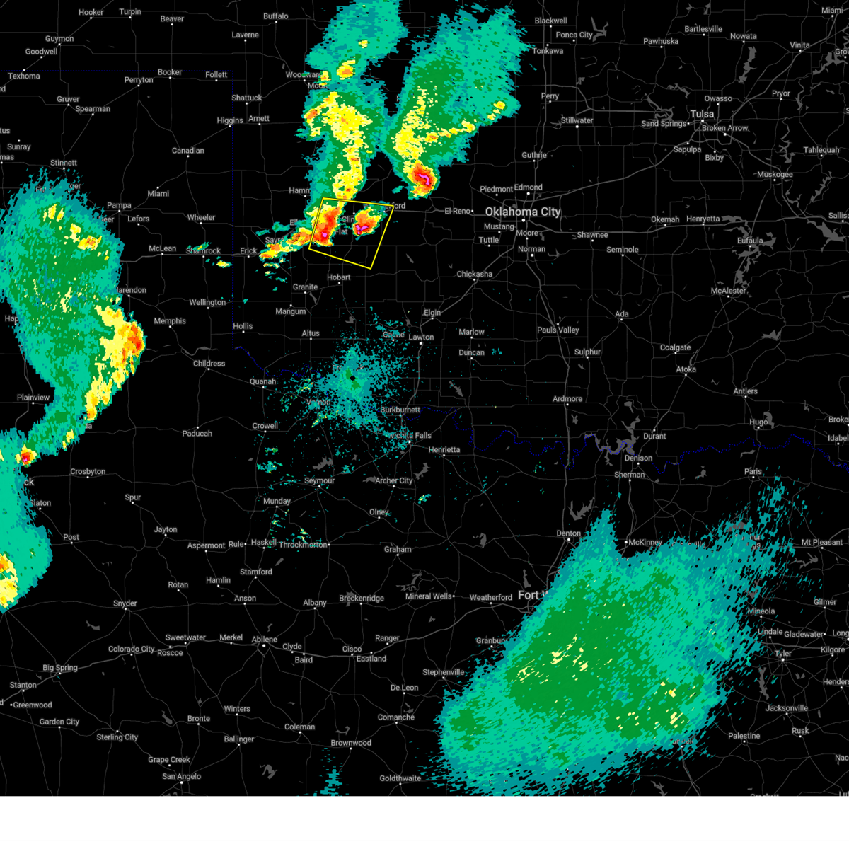
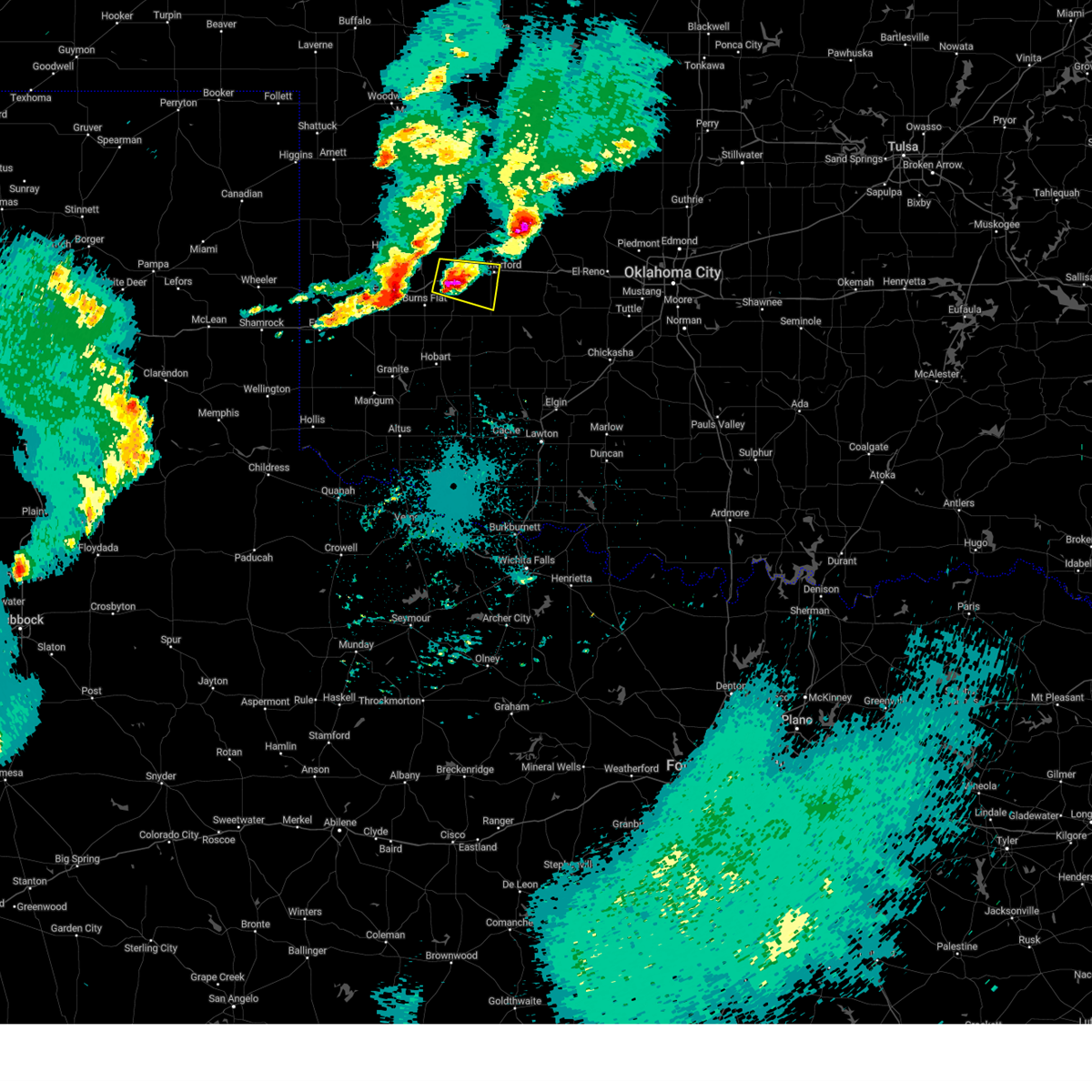
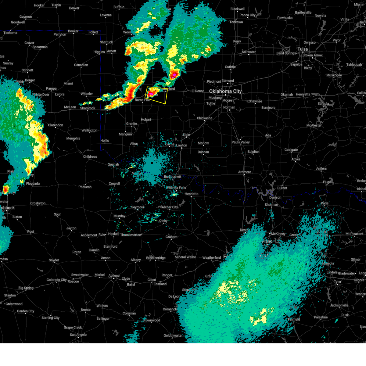
| 3/29/2025 10:41 PM CDT |
 Svroun the national weather service in norman has issued a * severe thunderstorm warning for, northeastern washita county in western oklahoma, western kingfisher county in central oklahoma, northern caddo county in southwestern oklahoma, eastern custer county in western oklahoma, blaine county in northwestern oklahoma, southeastern dewey county in northwestern oklahoma, southeastern major county in northwestern oklahoma, western canadian county in central oklahoma, * until 1130 pm cdt. * at 1040 pm cdt, severe thunderstorms were located along a line extending from near eagle city to 3 miles south of thomas to 3 miles northwest of weatherford to 3 miles west of alfalfa, moving east at 25 mph (radar indicated). Hazards include 60 mph wind gusts and half dollar size hail. Hail damage to vehicles is expected. Expect wind damage to roofs, siding, and trees. Svroun the national weather service in norman has issued a * severe thunderstorm warning for, northeastern washita county in western oklahoma, western kingfisher county in central oklahoma, northern caddo county in southwestern oklahoma, eastern custer county in western oklahoma, blaine county in northwestern oklahoma, southeastern dewey county in northwestern oklahoma, southeastern major county in northwestern oklahoma, western canadian county in central oklahoma, * until 1130 pm cdt. * at 1040 pm cdt, severe thunderstorms were located along a line extending from near eagle city to 3 miles south of thomas to 3 miles northwest of weatherford to 3 miles west of alfalfa, moving east at 25 mph (radar indicated). Hazards include 60 mph wind gusts and half dollar size hail. Hail damage to vehicles is expected. Expect wind damage to roofs, siding, and trees.
|
| 3/29/2025 10:40 PM CDT | Quarter sized hail reported 0.2 miles SSE of Weatherford, OK, report from mping: quarter (1.00 in.). |
| 3/29/2025 10:29 PM CDT |
 At 1029 pm cdt, severe thunderstorms were located along a line extending from 5 miles east of arapaho to 5 miles north of corn, moving east at 25 mph (radar indicated). Hazards include 60 mph wind gusts and half dollar size hail. Hail damage to vehicles is expected. expect wind damage to roofs, siding, and trees. Locations impacted include, thomas, custer city, hydro, and weatherford. At 1029 pm cdt, severe thunderstorms were located along a line extending from 5 miles east of arapaho to 5 miles north of corn, moving east at 25 mph (radar indicated). Hazards include 60 mph wind gusts and half dollar size hail. Hail damage to vehicles is expected. expect wind damage to roofs, siding, and trees. Locations impacted include, thomas, custer city, hydro, and weatherford.
|
| 3/29/2025 10:02 PM CDT |
 Svroun the national weather service in norman has issued a * severe thunderstorm warning for, north central washita county in western oklahoma, northwestern caddo county in southwestern oklahoma, eastern custer county in western oklahoma, southwestern blaine county in northwestern oklahoma, * until 1045 pm cdt. * at 1002 pm cdt, a severe thunderstorm was located 4 miles southeast of foss, moving northeast at 40 mph (radar indicated). Hazards include 60 mph wind gusts and quarter size hail. Hail damage to vehicles is expected. Expect wind damage to roofs, siding, and trees. Svroun the national weather service in norman has issued a * severe thunderstorm warning for, north central washita county in western oklahoma, northwestern caddo county in southwestern oklahoma, eastern custer county in western oklahoma, southwestern blaine county in northwestern oklahoma, * until 1045 pm cdt. * at 1002 pm cdt, a severe thunderstorm was located 4 miles southeast of foss, moving northeast at 40 mph (radar indicated). Hazards include 60 mph wind gusts and quarter size hail. Hail damage to vehicles is expected. Expect wind damage to roofs, siding, and trees.
|
| 3/4/2025 12:00 AM CST |
 At 1159 pm cst, severe thunderstorms were located along a line extending from 6 miles west of kingfisher to 3 miles east of tom steed reservoir, moving east at 45 mph (radar indicated). Hazards include 60 mph wind gusts and penny size hail. Expect damage to roofs, siding, and trees. Locations impacted include, meers, cedar lake, calumet, eakly, carnegie, tom steed reservoir, omega, cloud chief, el reno, bridgeport, friendship, lookeba, fort cobb, binger, cashion, albert, hinton, roosevelt, cogar, and corn. At 1159 pm cst, severe thunderstorms were located along a line extending from 6 miles west of kingfisher to 3 miles east of tom steed reservoir, moving east at 45 mph (radar indicated). Hazards include 60 mph wind gusts and penny size hail. Expect damage to roofs, siding, and trees. Locations impacted include, meers, cedar lake, calumet, eakly, carnegie, tom steed reservoir, omega, cloud chief, el reno, bridgeport, friendship, lookeba, fort cobb, binger, cashion, albert, hinton, roosevelt, cogar, and corn.
|
| 3/3/2025 11:45 PM CST |
 Svroun the national weather service in norman has issued a * severe thunderstorm warning for, eastern washita county in western oklahoma, northwestern comanche county in southwestern oklahoma, southern kingfisher county in central oklahoma, caddo county in southwestern oklahoma, northeastern jackson county in southwestern oklahoma, southeastern custer county in western oklahoma, kiowa county in southwestern oklahoma, southern blaine county in northwestern oklahoma, canadian county in central oklahoma, * until 1230 am cst. * at 1144 pm cst, severe thunderstorms were located along a line extending from 10 miles northeast of greenfield to 4 miles west of tom steed reservoir, moving east at 45 mph (radar indicated). Hazards include 60 mph wind gusts and penny size hail. expect damage to roofs, siding, and trees Svroun the national weather service in norman has issued a * severe thunderstorm warning for, eastern washita county in western oklahoma, northwestern comanche county in southwestern oklahoma, southern kingfisher county in central oklahoma, caddo county in southwestern oklahoma, northeastern jackson county in southwestern oklahoma, southeastern custer county in western oklahoma, kiowa county in southwestern oklahoma, southern blaine county in northwestern oklahoma, canadian county in central oklahoma, * until 1230 am cst. * at 1144 pm cst, severe thunderstorms were located along a line extending from 10 miles northeast of greenfield to 4 miles west of tom steed reservoir, moving east at 45 mph (radar indicated). Hazards include 60 mph wind gusts and penny size hail. expect damage to roofs, siding, and trees
|
| 3/3/2025 11:31 PM CST |
 At 1130 pm cst, severe thunderstorms were located along a line extending from 4 miles southwest of greenfield to near warren, moving east at 30 mph (radar indicated). Hazards include 60 mph wind gusts and penny size hail. Expect damage to roofs, siding, and trees. Locations impacted include, eakly, cordell, tom steed reservoir, cloud chief, weatherford, hobart, bridgeport, friendship, warren, roosevelt, lone wolf, martha, rocky, corn, alfalfa, cowden, blair, colony, cooperton, and gotebo. At 1130 pm cst, severe thunderstorms were located along a line extending from 4 miles southwest of greenfield to near warren, moving east at 30 mph (radar indicated). Hazards include 60 mph wind gusts and penny size hail. Expect damage to roofs, siding, and trees. Locations impacted include, eakly, cordell, tom steed reservoir, cloud chief, weatherford, hobart, bridgeport, friendship, warren, roosevelt, lone wolf, martha, rocky, corn, alfalfa, cowden, blair, colony, cooperton, and gotebo.
|
| 3/3/2025 11:14 PM CST |
 the severe thunderstorm warning has been cancelled and is no longer in effect the severe thunderstorm warning has been cancelled and is no longer in effect
|
| 3/3/2025 11:14 PM CST |
 At 1113 pm cst, severe thunderstorms were located along a line extending from 7 miles north of hydro to near blair, moving east at 30 mph (radar indicated). Hazards include 60 mph wind gusts and quarter size hail. Hail damage to vehicles is expected. expect wind damage to roofs, siding, and trees. Locations impacted include, eakly, cordell, hester, tom steed reservoir, cloud chief, granite, weatherford, hobart, bridgeport, friendship, warren, roosevelt, lone wolf, martha, rocky, sentinel, corn, alfalfa, cowden, and clinton. At 1113 pm cst, severe thunderstorms were located along a line extending from 7 miles north of hydro to near blair, moving east at 30 mph (radar indicated). Hazards include 60 mph wind gusts and quarter size hail. Hail damage to vehicles is expected. expect wind damage to roofs, siding, and trees. Locations impacted include, eakly, cordell, hester, tom steed reservoir, cloud chief, granite, weatherford, hobart, bridgeport, friendship, warren, roosevelt, lone wolf, martha, rocky, sentinel, corn, alfalfa, cowden, and clinton.
|
| 3/3/2025 10:55 PM CST |
 Svroun the national weather service in norman has issued a * severe thunderstorm warning for, washita county in western oklahoma, northwestern caddo county in southwestern oklahoma, northern jackson county in southwestern oklahoma, southeastern custer county in western oklahoma, kiowa county in southwestern oklahoma, southwestern blaine county in northwestern oklahoma, southeastern harmon county in southwestern oklahoma, eastern greer county in southwestern oklahoma, southeastern beckham county in western oklahoma, * until 1145 pm cst. * at 1054 pm cst, severe thunderstorms were located along a line extending from near cordell to near duke, moving east at 30 mph (radar indicated). Hazards include 60 mph wind gusts and quarter size hail. Hail damage to vehicles is expected. Expect wind damage to roofs, siding, and trees. Svroun the national weather service in norman has issued a * severe thunderstorm warning for, washita county in western oklahoma, northwestern caddo county in southwestern oklahoma, northern jackson county in southwestern oklahoma, southeastern custer county in western oklahoma, kiowa county in southwestern oklahoma, southwestern blaine county in northwestern oklahoma, southeastern harmon county in southwestern oklahoma, eastern greer county in southwestern oklahoma, southeastern beckham county in western oklahoma, * until 1145 pm cst. * at 1054 pm cst, severe thunderstorms were located along a line extending from near cordell to near duke, moving east at 30 mph (radar indicated). Hazards include 60 mph wind gusts and quarter size hail. Hail damage to vehicles is expected. Expect wind damage to roofs, siding, and trees.
|
| 11/18/2024 5:03 AM CST |
 Toroun the national weather service in norman has issued a * tornado warning for, northeastern custer county in western oklahoma, southwestern blaine county in northwestern oklahoma, southeastern dewey county in northwestern oklahoma, * until 530 am cst. * at 503 am cst, a severe thunderstorm capable of producing a tornado was located 6 miles north of weatherford, moving northeast at 45 mph (radar indicated rotation). Hazards include tornado and golf ball size hail. Flying debris will be dangerous to those caught without shelter. mobile homes will be damaged or destroyed. damage to roofs, windows, and vehicles will occur. Tree damage is likely. Toroun the national weather service in norman has issued a * tornado warning for, northeastern custer county in western oklahoma, southwestern blaine county in northwestern oklahoma, southeastern dewey county in northwestern oklahoma, * until 530 am cst. * at 503 am cst, a severe thunderstorm capable of producing a tornado was located 6 miles north of weatherford, moving northeast at 45 mph (radar indicated rotation). Hazards include tornado and golf ball size hail. Flying debris will be dangerous to those caught without shelter. mobile homes will be damaged or destroyed. damage to roofs, windows, and vehicles will occur. Tree damage is likely.
|
| 11/18/2024 4:39 AM CST |
 Svroun the national weather service in norman has issued a * severe thunderstorm warning for, eastern washita county in western oklahoma, comanche county in southwestern oklahoma, caddo county in southwestern oklahoma, western cotton county in southwestern oklahoma, southeastern custer county in western oklahoma, eastern kiowa county in southwestern oklahoma, southern blaine county in northwestern oklahoma, tillman county in southwestern oklahoma, western canadian county in central oklahoma, * until 530 am cst. * at 439 am cst, severe thunderstorms were located along a line extending from 6 miles southeast of clinton to 3 miles southwest of mountain view to 5 miles northeast of davidson, moving northeast at 35 mph (radar indicated). Hazards include 60 mph wind gusts and quarter size hail. Hail damage to vehicles is expected. Expect wind damage to roofs, siding, and trees. Svroun the national weather service in norman has issued a * severe thunderstorm warning for, eastern washita county in western oklahoma, comanche county in southwestern oklahoma, caddo county in southwestern oklahoma, western cotton county in southwestern oklahoma, southeastern custer county in western oklahoma, eastern kiowa county in southwestern oklahoma, southern blaine county in northwestern oklahoma, tillman county in southwestern oklahoma, western canadian county in central oklahoma, * until 530 am cst. * at 439 am cst, severe thunderstorms were located along a line extending from 6 miles southeast of clinton to 3 miles southwest of mountain view to 5 miles northeast of davidson, moving northeast at 35 mph (radar indicated). Hazards include 60 mph wind gusts and quarter size hail. Hail damage to vehicles is expected. Expect wind damage to roofs, siding, and trees.
|
| 11/18/2024 4:27 AM CST |
 the severe thunderstorm warning has been cancelled and is no longer in effect the severe thunderstorm warning has been cancelled and is no longer in effect
|
| 11/18/2024 4:27 AM CST |
 At 426 am cst, severe thunderstorms were located along a line extending from 5 miles east of burns flat to 3 miles north of gotebo to 3 miles north of manitou, moving northeast at 40 mph (radar indicated). Hazards include 70 mph wind gusts and quarter size hail. Hail damage to vehicles is expected. expect considerable tree damage. wind damage is also likely to mobile homes, roofs, and outbuildings. Locations impacted include, altus, weatherford, clinton, frederick, hobart, cordell, burns flat, snyder, thomas, tipton, arapaho, mountain view, dill city, corn, mountain park, custer city, davidson, butler, roosevelt, and gotebo. At 426 am cst, severe thunderstorms were located along a line extending from 5 miles east of burns flat to 3 miles north of gotebo to 3 miles north of manitou, moving northeast at 40 mph (radar indicated). Hazards include 70 mph wind gusts and quarter size hail. Hail damage to vehicles is expected. expect considerable tree damage. wind damage is also likely to mobile homes, roofs, and outbuildings. Locations impacted include, altus, weatherford, clinton, frederick, hobart, cordell, burns flat, snyder, thomas, tipton, arapaho, mountain view, dill city, corn, mountain park, custer city, davidson, butler, roosevelt, and gotebo.
|
| 11/18/2024 3:54 AM CST |
 Svroun the national weather service in norman has issued a * severe thunderstorm warning for, washita county in western oklahoma, northwestern comanche county in southwestern oklahoma, southeastern roger mills county in western oklahoma, eastern jackson county in southwestern oklahoma, custer county in western oklahoma, kiowa county in southwestern oklahoma, tillman county in southwestern oklahoma, south central dewey county in northwestern oklahoma, northeastern beckham county in western oklahoma, * until 445 am cst. * at 354 am cst, severe thunderstorms were located along a line extending from 3 miles northwest of canute to near sentinel to near altus air force base, moving northeast at 45 mph (radar indicated). Hazards include 70 mph wind gusts and quarter size hail. Hail damage to vehicles is expected. expect considerable tree damage. Wind damage is also likely to mobile homes, roofs, and outbuildings. Svroun the national weather service in norman has issued a * severe thunderstorm warning for, washita county in western oklahoma, northwestern comanche county in southwestern oklahoma, southeastern roger mills county in western oklahoma, eastern jackson county in southwestern oklahoma, custer county in western oklahoma, kiowa county in southwestern oklahoma, tillman county in southwestern oklahoma, south central dewey county in northwestern oklahoma, northeastern beckham county in western oklahoma, * until 445 am cst. * at 354 am cst, severe thunderstorms were located along a line extending from 3 miles northwest of canute to near sentinel to near altus air force base, moving northeast at 45 mph (radar indicated). Hazards include 70 mph wind gusts and quarter size hail. Hail damage to vehicles is expected. expect considerable tree damage. Wind damage is also likely to mobile homes, roofs, and outbuildings.
|
| 10/30/2024 4:57 PM CDT |
 At 455 pm cdt, a severe thunderstorm was located 6 miles northwest of hydro, moving northeast at 45 mph. this storm has produced quarter size hail north of weatherford and 58 mph winds west- southwest of weatherford (radar indicated). Hazards include 60 mph wind gusts and quarter size hail. Hail damage to vehicles is expected. expect wind damage to roofs, siding, and trees. Locations impacted include, weatherford, watonga, hitchcock, and greenfield. At 455 pm cdt, a severe thunderstorm was located 6 miles northwest of hydro, moving northeast at 45 mph. this storm has produced quarter size hail north of weatherford and 58 mph winds west- southwest of weatherford (radar indicated). Hazards include 60 mph wind gusts and quarter size hail. Hail damage to vehicles is expected. expect wind damage to roofs, siding, and trees. Locations impacted include, weatherford, watonga, hitchcock, and greenfield.
|
| 10/30/2024 4:52 PM CDT | Quarter sized hail reported 6.4 miles S of Weatherford, OK, report from mping: quarter (1.00 in.). |
| 10/30/2024 4:45 PM CDT | Storm damage reported in custer county OK, 4.9 miles ENE of Weatherford, OK |
| 10/30/2024 4:42 PM CDT |
 Svroun the national weather service in norman has issued a * severe thunderstorm warning for, southeastern custer county in western oklahoma, southern blaine county in northwestern oklahoma, * until 530 pm cdt. * at 441 pm cdt, a severe thunderstorm was located 5 miles west of weatherford, moving northeast at 50 mph (radar indicated). Hazards include 60 mph wind gusts and quarter size hail. Hail damage to vehicles is expected. Expect wind damage to roofs, siding, and trees. Svroun the national weather service in norman has issued a * severe thunderstorm warning for, southeastern custer county in western oklahoma, southern blaine county in northwestern oklahoma, * until 530 pm cdt. * at 441 pm cdt, a severe thunderstorm was located 5 miles west of weatherford, moving northeast at 50 mph (radar indicated). Hazards include 60 mph wind gusts and quarter size hail. Hail damage to vehicles is expected. Expect wind damage to roofs, siding, and trees.
|
| 5/28/2024 12:47 PM CDT |
 the severe thunderstorm warning has been cancelled and is no longer in effect the severe thunderstorm warning has been cancelled and is no longer in effect
|
| 5/28/2024 12:28 PM CDT |
 Svroun the national weather service in norman has issued a * severe thunderstorm warning for, eastern washita county in western oklahoma, northern caddo county in southwestern oklahoma, southeastern custer county in western oklahoma, southwestern blaine county in northwestern oklahoma, * until 115 pm cdt. * at 1228 pm cdt, severe thunderstorms were located along a line extending from 4 miles northwest of weatherford to 5 miles northwest of bessie, moving southeast at 30 mph (radar indicated). Hazards include 60 mph wind gusts and quarter size hail. Hail damage to vehicles is expected. Expect wind damage to roofs, siding, and trees. Svroun the national weather service in norman has issued a * severe thunderstorm warning for, eastern washita county in western oklahoma, northern caddo county in southwestern oklahoma, southeastern custer county in western oklahoma, southwestern blaine county in northwestern oklahoma, * until 115 pm cdt. * at 1228 pm cdt, severe thunderstorms were located along a line extending from 4 miles northwest of weatherford to 5 miles northwest of bessie, moving southeast at 30 mph (radar indicated). Hazards include 60 mph wind gusts and quarter size hail. Hail damage to vehicles is expected. Expect wind damage to roofs, siding, and trees.
|
| 5/28/2024 12:12 PM CDT |
 At 1211 pm cdt, a severe thunderstorm was located over custer city, moving southeast at 25 mph (radar indicated). Hazards include 60 mph wind gusts and quarter size hail. Hail damage to vehicles is expected. expect wind damage to roofs, siding, and trees. Locations impacted include, weatherford, clinton, thomas, hydro, arapaho, custer city, butler, and stafford. At 1211 pm cdt, a severe thunderstorm was located over custer city, moving southeast at 25 mph (radar indicated). Hazards include 60 mph wind gusts and quarter size hail. Hail damage to vehicles is expected. expect wind damage to roofs, siding, and trees. Locations impacted include, weatherford, clinton, thomas, hydro, arapaho, custer city, butler, and stafford.
|
| 5/28/2024 12:12 PM CDT |
 the severe thunderstorm warning has been cancelled and is no longer in effect the severe thunderstorm warning has been cancelled and is no longer in effect
|
| 5/28/2024 11:51 AM CDT |
 Svroun the national weather service in norman has issued a * severe thunderstorm warning for, northwestern caddo county in southwestern oklahoma, custer county in western oklahoma, southwestern blaine county in northwestern oklahoma, southeastern dewey county in northwestern oklahoma, * until 1230 pm cdt. * at 1151 am cdt, severe thunderstorms were located along a line extending from 7 miles northeast of butler to 5 miles north of thomas, moving southeast at 20 mph (radar indicated). Hazards include 60 mph wind gusts and quarter size hail. Hail damage to vehicles is expected. Expect wind damage to roofs, siding, and trees. Svroun the national weather service in norman has issued a * severe thunderstorm warning for, northwestern caddo county in southwestern oklahoma, custer county in western oklahoma, southwestern blaine county in northwestern oklahoma, southeastern dewey county in northwestern oklahoma, * until 1230 pm cdt. * at 1151 am cdt, severe thunderstorms were located along a line extending from 7 miles northeast of butler to 5 miles north of thomas, moving southeast at 20 mph (radar indicated). Hazards include 60 mph wind gusts and quarter size hail. Hail damage to vehicles is expected. Expect wind damage to roofs, siding, and trees.
|
| 5/25/2024 5:31 PM CDT |
 At 531 pm cdt, a severe thunderstorm was located 6 miles south of hydro, moving northeast at 40 mph (radar indicated). Hazards include golf ball size hail and 60 mph wind gusts. People and animals outdoors will be injured. expect hail damage to roofs, siding, windows, and vehicles. expect wind damage to roofs, siding, and trees. Locations impacted include, weatherford, hinton, geary, hydro, and bridgeport. At 531 pm cdt, a severe thunderstorm was located 6 miles south of hydro, moving northeast at 40 mph (radar indicated). Hazards include golf ball size hail and 60 mph wind gusts. People and animals outdoors will be injured. expect hail damage to roofs, siding, windows, and vehicles. expect wind damage to roofs, siding, and trees. Locations impacted include, weatherford, hinton, geary, hydro, and bridgeport.
|
| 5/25/2024 5:25 PM CDT | Storm damage reported in custer county OK, 4.9 miles ENE of Weatherford, OK |
| 5/25/2024 5:25 PM CDT |
 At 525 pm cdt, a severe thunderstorm was located 5 miles northeast of colony, moving northeast at 35 mph (radar indicated). Hazards include golf ball size hail and 60 mph wind gusts. People and animals outdoors will be injured. expect hail damage to roofs, siding, windows, and vehicles. expect wind damage to roofs, siding, and trees. Locations impacted include, weatherford, hinton, geary, hydro, colony, and bridgeport. At 525 pm cdt, a severe thunderstorm was located 5 miles northeast of colony, moving northeast at 35 mph (radar indicated). Hazards include golf ball size hail and 60 mph wind gusts. People and animals outdoors will be injured. expect hail damage to roofs, siding, windows, and vehicles. expect wind damage to roofs, siding, and trees. Locations impacted include, weatherford, hinton, geary, hydro, colony, and bridgeport.
|
| 5/25/2024 5:06 PM CDT |
 Svroun the national weather service in norman has issued a * severe thunderstorm warning for, eastern washita county in western oklahoma, northwestern caddo county in southwestern oklahoma, southeastern custer county in western oklahoma, southwestern blaine county in northwestern oklahoma, west central canadian county in central oklahoma, * until 545 pm cdt. * at 506 pm cdt, a severe thunderstorm was located 6 miles west of alfalfa, moving northeast at 40 mph (radar indicated). Hazards include two inch hail and 60 mph wind gusts. People and animals outdoors will be injured. expect hail damage to roofs, siding, windows, and vehicles. Expect wind damage to roofs, siding, and trees. Svroun the national weather service in norman has issued a * severe thunderstorm warning for, eastern washita county in western oklahoma, northwestern caddo county in southwestern oklahoma, southeastern custer county in western oklahoma, southwestern blaine county in northwestern oklahoma, west central canadian county in central oklahoma, * until 545 pm cdt. * at 506 pm cdt, a severe thunderstorm was located 6 miles west of alfalfa, moving northeast at 40 mph (radar indicated). Hazards include two inch hail and 60 mph wind gusts. People and animals outdoors will be injured. expect hail damage to roofs, siding, windows, and vehicles. Expect wind damage to roofs, siding, and trees.
|
| 5/19/2024 8:14 PM CDT | Half Dollar sized hail reported 3.7 miles SW of Weatherford, OK, delayed report. report from mping: half dollar (1.25 in.). |
| 5/19/2024 8:13 PM CDT |
 Toroun the national weather service in norman has issued a * tornado warning for, north central caddo county in southwestern oklahoma, northeastern custer county in western oklahoma, southwestern blaine county in northwestern oklahoma, * until 900 pm cdt. * at 813 pm cdt, a confirmed large and extremely dangerous tornado was located 8 miles northwest of hydro, moving east at 35 mph. this is a particularly dangerous situation. take cover now! (weather spotters confirmed tornado). Hazards include damaging tornado. You are in a life-threatening situation. flying debris may be deadly to those caught without shelter. mobile homes will be destroyed. Considerable damage to homes, businesses, and vehicles is likely and complete destruction is possible. Toroun the national weather service in norman has issued a * tornado warning for, north central caddo county in southwestern oklahoma, northeastern custer county in western oklahoma, southwestern blaine county in northwestern oklahoma, * until 900 pm cdt. * at 813 pm cdt, a confirmed large and extremely dangerous tornado was located 8 miles northwest of hydro, moving east at 35 mph. this is a particularly dangerous situation. take cover now! (weather spotters confirmed tornado). Hazards include damaging tornado. You are in a life-threatening situation. flying debris may be deadly to those caught without shelter. mobile homes will be destroyed. Considerable damage to homes, businesses, and vehicles is likely and complete destruction is possible.
|
| 5/19/2024 8:12 PM CDT |
 Toroun the national weather service in norman has issued a * tornado warning for, north central caddo county in southwestern oklahoma, northeastern custer county in western oklahoma, southwestern blaine county in northwestern oklahoma, * until 900 pm cdt. * at 811 pm cdt, a severe thunderstorm capable of producing a tornado was located 6 miles north of weatherford, moving east at 35 mph (radar indicated rotation). Hazards include tornado and hail up to two inches in diameter. Flying debris will be dangerous to those caught without shelter. mobile homes will be damaged or destroyed. damage to roofs, windows, and vehicles will occur. Tree damage is likely. Toroun the national weather service in norman has issued a * tornado warning for, north central caddo county in southwestern oklahoma, northeastern custer county in western oklahoma, southwestern blaine county in northwestern oklahoma, * until 900 pm cdt. * at 811 pm cdt, a severe thunderstorm capable of producing a tornado was located 6 miles north of weatherford, moving east at 35 mph (radar indicated rotation). Hazards include tornado and hail up to two inches in diameter. Flying debris will be dangerous to those caught without shelter. mobile homes will be damaged or destroyed. damage to roofs, windows, and vehicles will occur. Tree damage is likely.
|
| 5/19/2024 8:11 PM CDT | Tree damage and power poles down. possible tornad in custer county OK, 6 miles SSE of Weatherford, OK |
| 5/19/2024 8:04 PM CDT |
 At 804 pm cdt, a severe thunderstorm capable of producing a tornado was located 7 miles north of weatherford, moving east at 30 mph (radar indicated rotation). Hazards include tornado and tennis ball size hail. Flying debris will be dangerous to those caught without shelter. mobile homes will be damaged or destroyed. damage to roofs, windows, and vehicles will occur. tree damage is likely. locations impacted include, weatherford, thomas, hydro, custer city, bridgeport, and greenfield. This includes interstate 40 between mile markers 74 and 100. At 804 pm cdt, a severe thunderstorm capable of producing a tornado was located 7 miles north of weatherford, moving east at 30 mph (radar indicated rotation). Hazards include tornado and tennis ball size hail. Flying debris will be dangerous to those caught without shelter. mobile homes will be damaged or destroyed. damage to roofs, windows, and vehicles will occur. tree damage is likely. locations impacted include, weatherford, thomas, hydro, custer city, bridgeport, and greenfield. This includes interstate 40 between mile markers 74 and 100.
|
| 5/19/2024 7:57 PM CDT |
 The storm between binger and eakly which prompted this severe thunderstorm warning has weakened below severe limits, therefore the warning will be allowed to expire. however, a large severe storm in custer county may still affect custer, southern blaine and northern caddo counties, and a tornado warning still remains in effect for these areas. The storm between binger and eakly which prompted this severe thunderstorm warning has weakened below severe limits, therefore the warning will be allowed to expire. however, a large severe storm in custer county may still affect custer, southern blaine and northern caddo counties, and a tornado warning still remains in effect for these areas.
|
| 5/19/2024 7:36 PM CDT |
 At 736 pm cdt, a confirmed large and extremely dangerous tornado was located 5 miles west of custer city, moving east at 30 mph. this is a particularly dangerous situation. take cover now! (broadcast media confirmed tornado). Hazards include damaging tornado. You are in a life-threatening situation. flying debris may be deadly to those caught without shelter. mobile homes will be destroyed. considerable damage to homes, businesses, and vehicles is likely and complete destruction is possible. locations impacted include, weatherford, thomas, hydro, arapaho, custer city, bridgeport, and greenfield. This includes interstate 40 between mile markers 73 and 100. At 736 pm cdt, a confirmed large and extremely dangerous tornado was located 5 miles west of custer city, moving east at 30 mph. this is a particularly dangerous situation. take cover now! (broadcast media confirmed tornado). Hazards include damaging tornado. You are in a life-threatening situation. flying debris may be deadly to those caught without shelter. mobile homes will be destroyed. considerable damage to homes, businesses, and vehicles is likely and complete destruction is possible. locations impacted include, weatherford, thomas, hydro, arapaho, custer city, bridgeport, and greenfield. This includes interstate 40 between mile markers 73 and 100.
|
| 5/19/2024 7:33 PM CDT |
 Toroun the national weather service in norman has issued a * tornado warning for, northwestern caddo county in southwestern oklahoma, eastern custer county in western oklahoma, southwestern blaine county in northwestern oklahoma, * until 815 pm cdt. * at 733 pm cdt, a severe thunderstorm capable of producing a tornado was located 6 miles northeast of butler, moving east at 25 mph (radar indicated rotation). Hazards include tornado and tennis ball size hail. Flying debris will be dangerous to those caught without shelter. mobile homes will be damaged or destroyed. damage to roofs, windows, and vehicles will occur. Tree damage is likely. Toroun the national weather service in norman has issued a * tornado warning for, northwestern caddo county in southwestern oklahoma, eastern custer county in western oklahoma, southwestern blaine county in northwestern oklahoma, * until 815 pm cdt. * at 733 pm cdt, a severe thunderstorm capable of producing a tornado was located 6 miles northeast of butler, moving east at 25 mph (radar indicated rotation). Hazards include tornado and tennis ball size hail. Flying debris will be dangerous to those caught without shelter. mobile homes will be damaged or destroyed. damage to roofs, windows, and vehicles will occur. Tree damage is likely.
|
| 5/19/2024 7:28 PM CDT |
 Svroun the national weather service in norman has issued a * severe thunderstorm warning for, eastern washita county in western oklahoma, northern caddo county in southwestern oklahoma, southeastern custer county in western oklahoma, southwestern blaine county in northwestern oklahoma, * until 800 pm cdt. * at 727 pm cdt, a severe thunderstorm was located 5 miles east of cloud chief, moving northeast at 50 mph (radar indicated). Hazards include 60 mph wind gusts and quarter size hail. Hail damage to vehicles is expected. Expect wind damage to roofs, siding, and trees. Svroun the national weather service in norman has issued a * severe thunderstorm warning for, eastern washita county in western oklahoma, northern caddo county in southwestern oklahoma, southeastern custer county in western oklahoma, southwestern blaine county in northwestern oklahoma, * until 800 pm cdt. * at 727 pm cdt, a severe thunderstorm was located 5 miles east of cloud chief, moving northeast at 50 mph (radar indicated). Hazards include 60 mph wind gusts and quarter size hail. Hail damage to vehicles is expected. Expect wind damage to roofs, siding, and trees.
|
| 5/13/2024 1:46 AM CDT |
 At 145 am cdt, severe thunderstorms were located along a line extending from near taloga to 6 miles east of putnam to near arapaho, moving east at 35 mph (radar indicated). Hazards include 60 mph wind gusts and quarter size hail. Hail damage to vehicles is expected. expect wind damage to roofs, siding, and trees. Locations impacted include, weatherford, clinton, taloga, thomas, arapaho, custer city, oakwood, putnam, and fay. At 145 am cdt, severe thunderstorms were located along a line extending from near taloga to 6 miles east of putnam to near arapaho, moving east at 35 mph (radar indicated). Hazards include 60 mph wind gusts and quarter size hail. Hail damage to vehicles is expected. expect wind damage to roofs, siding, and trees. Locations impacted include, weatherford, clinton, taloga, thomas, arapaho, custer city, oakwood, putnam, and fay.
|
| 5/13/2024 1:32 AM CDT |
 Svroun the national weather service in norman has issued a * severe thunderstorm warning for, custer county in western oklahoma, southern dewey county in northwestern oklahoma, * until 200 am cdt. * at 131 am cdt, severe thunderstorms were located along a line extending from 5 miles south of taloga to 6 miles east of foss reservoir, moving southeast at 30 mph (radar indicated). Hazards include 60 mph wind gusts and nickel size hail. expect damage to roofs, siding, and trees Svroun the national weather service in norman has issued a * severe thunderstorm warning for, custer county in western oklahoma, southern dewey county in northwestern oklahoma, * until 200 am cdt. * at 131 am cdt, severe thunderstorms were located along a line extending from 5 miles south of taloga to 6 miles east of foss reservoir, moving southeast at 30 mph (radar indicated). Hazards include 60 mph wind gusts and nickel size hail. expect damage to roofs, siding, and trees
|
| 5/6/2024 7:36 PM CDT |
 Toroun the national weather service in norman has issued a * tornado warning for, southeastern custer county in western oklahoma, southwestern blaine county in northwestern oklahoma, * until 815 pm cdt. * at 736 pm cdt, a severe thunderstorm capable of producing a tornado was located near arapaho, moving east at 35 mph (radar indicated rotation). Hazards include tornado and golf ball size hail. Flying debris will be dangerous to those caught without shelter. mobile homes will be damaged or destroyed. damage to roofs, windows, and vehicles will occur. Tree damage is likely. Toroun the national weather service in norman has issued a * tornado warning for, southeastern custer county in western oklahoma, southwestern blaine county in northwestern oklahoma, * until 815 pm cdt. * at 736 pm cdt, a severe thunderstorm capable of producing a tornado was located near arapaho, moving east at 35 mph (radar indicated rotation). Hazards include tornado and golf ball size hail. Flying debris will be dangerous to those caught without shelter. mobile homes will be damaged or destroyed. damage to roofs, windows, and vehicles will occur. Tree damage is likely.
|
| 5/6/2024 7:27 PM CDT |
 Svroun the national weather service in norman has issued a * severe thunderstorm warning for, central custer county in western oklahoma, southwestern blaine county in northwestern oklahoma, southeastern dewey county in northwestern oklahoma, * until 815 pm cdt. * at 727 pm cdt, a severe thunderstorm was located 4 miles west of custer city, moving east at 35 mph (radar indicated). Hazards include 60 mph wind gusts and half dollar size hail. Hail damage to vehicles is expected. Expect wind damage to roofs, siding, and trees. Svroun the national weather service in norman has issued a * severe thunderstorm warning for, central custer county in western oklahoma, southwestern blaine county in northwestern oklahoma, southeastern dewey county in northwestern oklahoma, * until 815 pm cdt. * at 727 pm cdt, a severe thunderstorm was located 4 miles west of custer city, moving east at 35 mph (radar indicated). Hazards include 60 mph wind gusts and half dollar size hail. Hail damage to vehicles is expected. Expect wind damage to roofs, siding, and trees.
|
| 4/30/2024 5:34 PM CDT |
 At 534 pm cdt, a severe thunderstorm was located near cloud chief, moving east at 20 mph (trained weather spotters). Hazards include tennis ball size hail and 60 mph wind gusts. People and animals outdoors will be injured. expect hail damage to roofs, siding, windows, and vehicles. expect wind damage to roofs, siding, and trees. Locations impacted include, weatherford, cordell, corn, eakly, colony, cloud chief, and cowden. At 534 pm cdt, a severe thunderstorm was located near cloud chief, moving east at 20 mph (trained weather spotters). Hazards include tennis ball size hail and 60 mph wind gusts. People and animals outdoors will be injured. expect hail damage to roofs, siding, windows, and vehicles. expect wind damage to roofs, siding, and trees. Locations impacted include, weatherford, cordell, corn, eakly, colony, cloud chief, and cowden.
|
| 4/30/2024 5:24 PM CDT | Quarter sized hail reported 6.4 miles S of Weatherford, OK, report from mping: quarter (1.00 in.). |
| 4/30/2024 5:21 PM CDT |
 At 520 pm cdt, a severe thunderstorm was located near cordell, moving northeast at 30 mph (radar indicated). Hazards include two inch hail and 60 mph wind gusts. People and animals outdoors will be injured. expect hail damage to roofs, siding, windows, and vehicles. expect wind damage to roofs, siding, and trees. Locations impacted include, weatherford, cordell, corn, eakly, colony, cloud chief, and cowden. At 520 pm cdt, a severe thunderstorm was located near cordell, moving northeast at 30 mph (radar indicated). Hazards include two inch hail and 60 mph wind gusts. People and animals outdoors will be injured. expect hail damage to roofs, siding, windows, and vehicles. expect wind damage to roofs, siding, and trees. Locations impacted include, weatherford, cordell, corn, eakly, colony, cloud chief, and cowden.
|
| 4/30/2024 5:17 PM CDT |
 Svroun the national weather service in norman has issued a * severe thunderstorm warning for, eastern washita county in western oklahoma, west central caddo county in southwestern oklahoma, southeastern custer county in western oklahoma, * until 600 pm cdt. * at 517 pm cdt, a severe thunderstorm was located near cordell, moving northeast at 30 mph (radar indicated). Hazards include golf ball size hail and 60 mph wind gusts. People and animals outdoors will be injured. expect hail damage to roofs, siding, windows, and vehicles. Expect wind damage to roofs, siding, and trees. Svroun the national weather service in norman has issued a * severe thunderstorm warning for, eastern washita county in western oklahoma, west central caddo county in southwestern oklahoma, southeastern custer county in western oklahoma, * until 600 pm cdt. * at 517 pm cdt, a severe thunderstorm was located near cordell, moving northeast at 30 mph (radar indicated). Hazards include golf ball size hail and 60 mph wind gusts. People and animals outdoors will be injured. expect hail damage to roofs, siding, windows, and vehicles. Expect wind damage to roofs, siding, and trees.
|
| 4/30/2024 4:55 PM CDT |
 Svroun the national weather service in norman has issued a * severe thunderstorm warning for, northeastern washita county in western oklahoma, northwestern caddo county in southwestern oklahoma, southeastern custer county in western oklahoma, southwestern blaine county in northwestern oklahoma, * until 530 pm cdt. * at 455 pm cdt, a severe thunderstorm was located 5 miles east of bessie, moving northeast at 35 mph (radar indicated). Hazards include 60 mph wind gusts and half dollar size hail. Hail damage to vehicles is expected. Expect wind damage to roofs, siding, and trees. Svroun the national weather service in norman has issued a * severe thunderstorm warning for, northeastern washita county in western oklahoma, northwestern caddo county in southwestern oklahoma, southeastern custer county in western oklahoma, southwestern blaine county in northwestern oklahoma, * until 530 pm cdt. * at 455 pm cdt, a severe thunderstorm was located 5 miles east of bessie, moving northeast at 35 mph (radar indicated). Hazards include 60 mph wind gusts and half dollar size hail. Hail damage to vehicles is expected. Expect wind damage to roofs, siding, and trees.
|
| 4/1/2024 7:04 PM CDT |
 At 704 pm cdt, severe thunderstorms were located along a line extending from 6 miles north of oakwood to 5 miles east of arapaho, moving northeast at 60 mph (radar indicated). Hazards include 60 mph wind gusts and penny size hail. Expect damage to roofs, siding, and trees. Locations impacted include, weatherford, clinton, thomas, arapaho, custer city, oakwood, putnam, fay, and stafford. At 704 pm cdt, severe thunderstorms were located along a line extending from 6 miles north of oakwood to 5 miles east of arapaho, moving northeast at 60 mph (radar indicated). Hazards include 60 mph wind gusts and penny size hail. Expect damage to roofs, siding, and trees. Locations impacted include, weatherford, clinton, thomas, arapaho, custer city, oakwood, putnam, fay, and stafford.
|
| 4/1/2024 7:04 PM CDT |
 the severe thunderstorm warning has been cancelled and is no longer in effect the severe thunderstorm warning has been cancelled and is no longer in effect
|
| 4/1/2024 6:40 PM CDT |
 Svroun the national weather service in norman has issued a * severe thunderstorm warning for, northern washita county in western oklahoma, custer county in western oklahoma, southern dewey county in northwestern oklahoma, * until 715 pm cdt. * at 640 pm cdt, severe thunderstorms were located along a line extending from 5 miles southwest of putnam to near burns flat, moving northeast at 60 mph (radar indicated). Hazards include 70 mph wind gusts and penny size hail. Expect considerable tree damage. Damage is likely to mobile homes, roofs, and outbuildings. Svroun the national weather service in norman has issued a * severe thunderstorm warning for, northern washita county in western oklahoma, custer county in western oklahoma, southern dewey county in northwestern oklahoma, * until 715 pm cdt. * at 640 pm cdt, severe thunderstorms were located along a line extending from 5 miles southwest of putnam to near burns flat, moving northeast at 60 mph (radar indicated). Hazards include 70 mph wind gusts and penny size hail. Expect considerable tree damage. Damage is likely to mobile homes, roofs, and outbuildings.
|
| 8/13/2023 9:51 PM CDT |
 At 951 pm cdt, severe thunderstorms were located along a line extending from near hitchcock to 7 miles west of greenfield to 6 miles northeast of colony, moving northeast at 35 mph (radar indicated). Hazards include 70 mph wind gusts. Expect considerable tree damage. damage is likely to mobile homes, roofs, and outbuildings. locations impacted include, weatherford, watonga, geary, thomas, hydro, corn, hitchcock, bridgeport, greenfield, eagle city, and fay. thunderstorm damage threat, considerable hail threat, radar indicated max hail size, <. 75 in wind threat, radar indicated max wind gust, 70 mph. At 951 pm cdt, severe thunderstorms were located along a line extending from near hitchcock to 7 miles west of greenfield to 6 miles northeast of colony, moving northeast at 35 mph (radar indicated). Hazards include 70 mph wind gusts. Expect considerable tree damage. damage is likely to mobile homes, roofs, and outbuildings. locations impacted include, weatherford, watonga, geary, thomas, hydro, corn, hitchcock, bridgeport, greenfield, eagle city, and fay. thunderstorm damage threat, considerable hail threat, radar indicated max hail size, <. 75 in wind threat, radar indicated max wind gust, 70 mph.
|
| 8/13/2023 9:45 PM CDT |
 At 944 pm cdt, severe thunderstorms were located along a line extending from 5 miles east of eagle city to 7 miles north of hydro to 3 miles east of corn, moving northeast at 30 mph (radar indicated). Hazards include 60 mph wind gusts. expect damage to roofs, siding, and trees At 944 pm cdt, severe thunderstorms were located along a line extending from 5 miles east of eagle city to 7 miles north of hydro to 3 miles east of corn, moving northeast at 30 mph (radar indicated). Hazards include 60 mph wind gusts. expect damage to roofs, siding, and trees
|
| 8/13/2023 8:59 PM CDT |
 At 859 pm cdt, severe thunderstorms were located along a line extending from 5 miles southwest of putnam to 5 miles southeast of butler to 5 miles southwest of burns flat, moving east at 40 mph (radar indicated). Hazards include 60 mph wind gusts. expect damage to roofs, siding, and trees At 859 pm cdt, severe thunderstorms were located along a line extending from 5 miles southwest of putnam to 5 miles southeast of butler to 5 miles southwest of burns flat, moving east at 40 mph (radar indicated). Hazards include 60 mph wind gusts. expect damage to roofs, siding, and trees
|
| 8/12/2023 7:26 PM CDT |
 The severe thunderstorm warning for washita and southeastern custer counties will expire at 730 pm cdt, the storms which prompted the warning have weakened below severe limits, therefore the warning will be allowed to expire. however, gusty winds are still possible with these thunderstorms. The severe thunderstorm warning for washita and southeastern custer counties will expire at 730 pm cdt, the storms which prompted the warning have weakened below severe limits, therefore the warning will be allowed to expire. however, gusty winds are still possible with these thunderstorms.
|
| 8/12/2023 6:56 PM CDT |
 At 656 pm cdt, severe thunderstorms were located along a line extending from 5 miles west of clinton to near bessie to 5 miles south of cordell, moving northeast at 30 mph (radar indicated). Hazards include 60 mph wind gusts. expect damage to roofs, siding, and trees At 656 pm cdt, severe thunderstorms were located along a line extending from 5 miles west of clinton to near bessie to 5 miles south of cordell, moving northeast at 30 mph (radar indicated). Hazards include 60 mph wind gusts. expect damage to roofs, siding, and trees
|
| 8/11/2023 10:08 PM CDT |
 The severe thunderstorm warning for eastern washita, northwestern caddo, southeastern custer and southwestern blaine counties will expire at 1015 pm cdt, the storm which prompted the warning has weakened below severe limits, therefore the warning will be allowed to expire. however, gusty winds are still possible with this thunderstorm. The severe thunderstorm warning for eastern washita, northwestern caddo, southeastern custer and southwestern blaine counties will expire at 1015 pm cdt, the storm which prompted the warning has weakened below severe limits, therefore the warning will be allowed to expire. however, gusty winds are still possible with this thunderstorm.
|
| 8/11/2023 9:41 PM CDT |
 At 941 pm cdt, a severe thunderstorm was located near corn, moving east at 30 mph (radar indicated). Hazards include 60 mph wind gusts. expect damage to roofs, siding, and trees At 941 pm cdt, a severe thunderstorm was located near corn, moving east at 30 mph (radar indicated). Hazards include 60 mph wind gusts. expect damage to roofs, siding, and trees
|
| 8/11/2023 7:59 PM CDT |
 At 759 pm cdt, severe thunderstorms were located along a line extending from near oakwood to 6 miles southeast of thomas to 4 miles southeast of weatherford, moving east at 25 mph (radar indicated). Hazards include 60 mph wind gusts and penny size hail. expect damage to roofs, siding, and trees At 759 pm cdt, severe thunderstorms were located along a line extending from near oakwood to 6 miles southeast of thomas to 4 miles southeast of weatherford, moving east at 25 mph (radar indicated). Hazards include 60 mph wind gusts and penny size hail. expect damage to roofs, siding, and trees
|
| 8/11/2023 7:48 PM CDT |
 At 748 pm cdt, severe thunderstorms were located along a line extending from 7 miles northeast of putnam to near thomas to near weatherford to near corn, moving east at 40 mph (radar indicated). Hazards include 60 mph wind gusts. Expect damage to roofs, siding, and trees. locations impacted include, weatherford, clinton, taloga, thomas, arapaho, corn, custer city, bessie, oakwood, putnam, and fay. hail threat, radar indicated max hail size, <. 75 in wind threat, radar indicated max wind gust, 60 mph. At 748 pm cdt, severe thunderstorms were located along a line extending from 7 miles northeast of putnam to near thomas to near weatherford to near corn, moving east at 40 mph (radar indicated). Hazards include 60 mph wind gusts. Expect damage to roofs, siding, and trees. locations impacted include, weatherford, clinton, taloga, thomas, arapaho, corn, custer city, bessie, oakwood, putnam, and fay. hail threat, radar indicated max hail size, <. 75 in wind threat, radar indicated max wind gust, 60 mph.
|
| 8/11/2023 7:30 PM CDT |
 At 730 pm cdt, severe thunderstorms were located along a line extending from 10 miles east of leedey to near custer city to 3 miles southeast of clinton to 3 miles northeast of dill city, moving northeast at 35 mph (radar indicated). Hazards include 70 mph wind gusts. Expect considerable tree damage. damage is likely to mobile homes, roofs, and outbuildings. locations impacted include, weatherford, clinton, cordell, taloga, burns flat, thomas, arapaho, hammon, dill city, canute, corn, custer city, butler, bessie, foss, oakwood, putnam, foss reservoir, moorewood, and fay. thunderstorm damage threat, considerable hail threat, radar indicated max hail size, <. 75 in wind threat, radar indicated max wind gust, 70 mph. At 730 pm cdt, severe thunderstorms were located along a line extending from 10 miles east of leedey to near custer city to 3 miles southeast of clinton to 3 miles northeast of dill city, moving northeast at 35 mph (radar indicated). Hazards include 70 mph wind gusts. Expect considerable tree damage. damage is likely to mobile homes, roofs, and outbuildings. locations impacted include, weatherford, clinton, cordell, taloga, burns flat, thomas, arapaho, hammon, dill city, canute, corn, custer city, butler, bessie, foss, oakwood, putnam, foss reservoir, moorewood, and fay. thunderstorm damage threat, considerable hail threat, radar indicated max hail size, <. 75 in wind threat, radar indicated max wind gust, 70 mph.
|
| 8/11/2023 7:13 PM CDT |
 At 712 pm cdt, severe thunderstorms were located along a line extending from near moorewood to 6 miles west of arapaho to 5 miles southeast of foss to 5 miles west of dill city, moving northeast at 35 mph. these are destructive storms for butler, custer city and clinton (radar indicated). Hazards include 80 mph wind gusts. Flying debris will be dangerous to those caught without shelter. mobile homes will be heavily damaged. expect considerable damage to roofs, windows, and vehicles. Extensive tree damage and power outages are likely. At 712 pm cdt, severe thunderstorms were located along a line extending from near moorewood to 6 miles west of arapaho to 5 miles southeast of foss to 5 miles west of dill city, moving northeast at 35 mph. these are destructive storms for butler, custer city and clinton (radar indicated). Hazards include 80 mph wind gusts. Flying debris will be dangerous to those caught without shelter. mobile homes will be heavily damaged. expect considerable damage to roofs, windows, and vehicles. Extensive tree damage and power outages are likely.
|
| 8/11/2023 7:08 PM CDT |
 At 708 pm cdt, severe thunderstorms were located along a line extending from near moorewood to 6 miles west of arapaho to 5 miles southeast of foss to 5 miles west of dill city, moving northeast at 35 mph (radar indicated). Hazards include 70 mph wind gusts. Expect considerable tree damage. Damage is likely to mobile homes, roofs, and outbuildings. At 708 pm cdt, severe thunderstorms were located along a line extending from near moorewood to 6 miles west of arapaho to 5 miles southeast of foss to 5 miles west of dill city, moving northeast at 35 mph (radar indicated). Hazards include 70 mph wind gusts. Expect considerable tree damage. Damage is likely to mobile homes, roofs, and outbuildings.
|
| 8/9/2023 1:28 AM CDT |
 At 128 am cdt, severe thunderstorms were located along a line extending from 3 miles southwest of watonga to 4 miles east of hinton to 3 miles west of gracemont, moving northeast at 60 mph (radar indicated). Hazards include 60 mph wind gusts. expect damage to roofs, siding, and trees At 128 am cdt, severe thunderstorms were located along a line extending from 3 miles southwest of watonga to 4 miles east of hinton to 3 miles west of gracemont, moving northeast at 60 mph (radar indicated). Hazards include 60 mph wind gusts. expect damage to roofs, siding, and trees
|
| 8/9/2023 12:51 AM CDT |
 At 1251 am cdt, severe thunderstorms were located along a line extending from near arapaho to near cloud chief to near cooperton, moving northeast at 55 mph (radar indicated). Hazards include 70 mph wind gusts. Expect considerable tree damage. Damage is likely to mobile homes, roofs, and outbuildings. At 1251 am cdt, severe thunderstorms were located along a line extending from near arapaho to near cloud chief to near cooperton, moving northeast at 55 mph (radar indicated). Hazards include 70 mph wind gusts. Expect considerable tree damage. Damage is likely to mobile homes, roofs, and outbuildings.
|
| 7/14/2023 9:51 PM CDT |
 At 951 pm cdt, a severe thunderstorm was located 5 miles southeast of thomas, moving southeast at 35 mph (radar indicated). Hazards include 60 mph wind gusts and quarter size hail. Hail damage to vehicles is expected. Expect wind damage to roofs, siding, and trees. At 951 pm cdt, a severe thunderstorm was located 5 miles southeast of thomas, moving southeast at 35 mph (radar indicated). Hazards include 60 mph wind gusts and quarter size hail. Hail damage to vehicles is expected. Expect wind damage to roofs, siding, and trees.
|
| 7/11/2023 2:17 AM CDT |
 At 217 am cdt, severe thunderstorms were located along a line extending from 7 miles southeast of fay to near weatherford to 3 miles south of corn, moving east at 40 mph (radar indicated). Hazards include 60 mph wind gusts and nickel size hail. Expect damage to roofs, siding, and trees. locations impacted include, weatherford, clinton, watonga, cordell, thomas, hydro, arapaho, corn, custer city, bessie, colony, and fay. hail threat, radar indicated max hail size, 0. 88 in wind threat, radar indicated max wind gust, 60 mph. At 217 am cdt, severe thunderstorms were located along a line extending from 7 miles southeast of fay to near weatherford to 3 miles south of corn, moving east at 40 mph (radar indicated). Hazards include 60 mph wind gusts and nickel size hail. Expect damage to roofs, siding, and trees. locations impacted include, weatherford, clinton, watonga, cordell, thomas, hydro, arapaho, corn, custer city, bessie, colony, and fay. hail threat, radar indicated max hail size, 0. 88 in wind threat, radar indicated max wind gust, 60 mph.
|
| 7/11/2023 2:14 AM CDT | Storm damage reported in custer county OK, 0.8 miles NE of Weatherford, OK |
| 7/11/2023 1:57 AM CDT |
 At 156 am cdt, severe thunderstorms were located along a line extending from 5 miles southeast of putnam to 3 miles northwest of arapaho to 3 miles northeast of burns flat, moving east at 30 mph (radar indicated). Hazards include 60 mph wind gusts and penny size hail. expect damage to roofs, siding, and trees At 156 am cdt, severe thunderstorms were located along a line extending from 5 miles southeast of putnam to 3 miles northwest of arapaho to 3 miles northeast of burns flat, moving east at 30 mph (radar indicated). Hazards include 60 mph wind gusts and penny size hail. expect damage to roofs, siding, and trees
|
| 7/9/2023 2:54 AM CDT |
 At 253 am cdt, severe thunderstorms were located along a line extending from 8 miles northwest of cogar to 5 miles northeast of dill city to 5 miles northwest of mangum, moving southeast at 45 mph (clinton asos reported 70 mph wind gust). Hazards include golf ball size hail and 70 mph wind gusts. People and animals outdoors will be injured. expect hail damage to roofs, siding, windows, and vehicles. expect considerable tree damage. wind damage is also likely to mobile homes, roofs, and outbuildings. locations impacted include, altus, el reno, elk city, weatherford, clinton, blanchard, anadarko, hobart, mangum, cordell, tuttle, hinton, granite, burns flat, carnegie, union city, minco, geary, hydro, and sentinel. thunderstorm damage threat, considerable hail threat, radar indicated max hail size, 1. 75 in wind threat, observed max wind gust, 70 mph. At 253 am cdt, severe thunderstorms were located along a line extending from 8 miles northwest of cogar to 5 miles northeast of dill city to 5 miles northwest of mangum, moving southeast at 45 mph (clinton asos reported 70 mph wind gust). Hazards include golf ball size hail and 70 mph wind gusts. People and animals outdoors will be injured. expect hail damage to roofs, siding, windows, and vehicles. expect considerable tree damage. wind damage is also likely to mobile homes, roofs, and outbuildings. locations impacted include, altus, el reno, elk city, weatherford, clinton, blanchard, anadarko, hobart, mangum, cordell, tuttle, hinton, granite, burns flat, carnegie, union city, minco, geary, hydro, and sentinel. thunderstorm damage threat, considerable hail threat, radar indicated max hail size, 1. 75 in wind threat, observed max wind gust, 70 mph.
|
| 7/9/2023 2:46 AM CDT |
 At 246 am cdt, severe thunderstorms were located along a line extending from 5 miles east of hinton to near burns flat to 8 miles southwest of willow, moving southeast at 45 mph (radar indicated). Hazards include golf ball size hail and 60 mph wind gusts. People and animals outdoors will be injured. expect hail damage to roofs, siding, windows, and vehicles. expect wind damage to roofs, siding, and trees. locations impacted include, altus, el reno, elk city, weatherford, clinton, blanchard, anadarko, hobart, mangum, cordell, tuttle, hinton, granite, burns flat, carnegie, union city, minco, geary, hydro, and sentinel. thunderstorm damage threat, considerable hail threat, radar indicated max hail size, 1. 75 in wind threat, radar indicated max wind gust, 60 mph. At 246 am cdt, severe thunderstorms were located along a line extending from 5 miles east of hinton to near burns flat to 8 miles southwest of willow, moving southeast at 45 mph (radar indicated). Hazards include golf ball size hail and 60 mph wind gusts. People and animals outdoors will be injured. expect hail damage to roofs, siding, windows, and vehicles. expect wind damage to roofs, siding, and trees. locations impacted include, altus, el reno, elk city, weatherford, clinton, blanchard, anadarko, hobart, mangum, cordell, tuttle, hinton, granite, burns flat, carnegie, union city, minco, geary, hydro, and sentinel. thunderstorm damage threat, considerable hail threat, radar indicated max hail size, 1. 75 in wind threat, radar indicated max wind gust, 60 mph.
|
| 7/9/2023 2:40 AM CDT |
 At 239 am cdt, severe thunderstorms were located along a line extending from 4 miles east of bridgeport to near foss to 10 miles west of willow, moving southeast at 45 mph (radar indicated). Hazards include ping pong ball size hail and 60 mph wind gusts. People and animals outdoors will be injured. expect hail damage to roofs, siding, windows, and vehicles. Expect wind damage to roofs, siding, and trees. At 239 am cdt, severe thunderstorms were located along a line extending from 4 miles east of bridgeport to near foss to 10 miles west of willow, moving southeast at 45 mph (radar indicated). Hazards include ping pong ball size hail and 60 mph wind gusts. People and animals outdoors will be injured. expect hail damage to roofs, siding, windows, and vehicles. Expect wind damage to roofs, siding, and trees.
|
| 7/9/2023 2:34 AM CDT | Ping Pong Ball sized hail reported 6.4 miles S of Weatherford, OK, report from mping: ping pong ball (1.50 in.). |
| 7/9/2023 2:34 AM CDT |
 At 233 am cdt, severe thunderstorms were located along a line extending from near concho to 4 miles east of foss reservoir to 3 miles north of delhi, moving southeast at 50 mph (public reported quarter size hail in weatherford). Hazards include 70 mph wind gusts and ping pong ball size hail. People and animals outdoors will be injured. expect hail damage to roofs, siding, windows, and vehicles. expect considerable tree damage. wind damage is also likely to mobile homes, roofs, and outbuildings. locations impacted include, elk city, weatherford, clinton, sayre, cordell, hinton, burns flat, geary, thomas, erick, hydro, sentinel, arapaho, hammon, dill city, canute, calumet, corn, custer city, and eakly. thunderstorm damage threat, considerable hail threat, observed max hail size, 1. 50 in wind threat, radar indicated max wind gust, 70 mph. At 233 am cdt, severe thunderstorms were located along a line extending from near concho to 4 miles east of foss reservoir to 3 miles north of delhi, moving southeast at 50 mph (public reported quarter size hail in weatherford). Hazards include 70 mph wind gusts and ping pong ball size hail. People and animals outdoors will be injured. expect hail damage to roofs, siding, windows, and vehicles. expect considerable tree damage. wind damage is also likely to mobile homes, roofs, and outbuildings. locations impacted include, elk city, weatherford, clinton, sayre, cordell, hinton, burns flat, geary, thomas, erick, hydro, sentinel, arapaho, hammon, dill city, canute, calumet, corn, custer city, and eakly. thunderstorm damage threat, considerable hail threat, observed max hail size, 1. 50 in wind threat, radar indicated max wind gust, 70 mph.
|
| 7/9/2023 2:31 AM CDT | Quarter sized hail reported 6.4 miles S of Weatherford, OK, report from mping: quarter (1.00 in.). |
| 7/9/2023 2:30 AM CDT | Major roof damage to church youth center near swosu... many roofs damage in weatherford... power lines down mainly in northeast side of town. via kwey. time estimate in custer county OK, 1.2 miles E of Weatherford, OK |
| 7/9/2023 2:08 AM CDT |
 At 208 am cdt, severe thunderstorms were located along a line extending from 8 miles east of greenfield to 3 miles north of hammon to 5 miles southwest of sweetwater, moving southeast at 50 mph (radar indicated). Hazards include 70 mph wind gusts and ping pong ball size hail. People and animals outdoors will be injured. expect hail damage to roofs, siding, windows, and vehicles. expect considerable tree damage. Wind damage is also likely to mobile homes, roofs, and outbuildings. At 208 am cdt, severe thunderstorms were located along a line extending from 8 miles east of greenfield to 3 miles north of hammon to 5 miles southwest of sweetwater, moving southeast at 50 mph (radar indicated). Hazards include 70 mph wind gusts and ping pong ball size hail. People and animals outdoors will be injured. expect hail damage to roofs, siding, windows, and vehicles. expect considerable tree damage. Wind damage is also likely to mobile homes, roofs, and outbuildings.
|
| 7/9/2023 2:01 AM CDT |
 At 201 am cdt, severe thunderstorms were located along a line extending from near cedar valley to 3 miles north of moorewood, moving east at 35 mph (radar indicated). Hazards include 70 mph wind gusts and ping pong ball size hail. People and animals outdoors will be injured. expect hail damage to roofs, siding, windows, and vehicles. expect considerable tree damage. wind damage is also likely to mobile homes, roofs, and outbuildings. locations impacted include, elk city, weatherford, clinton, watonga, hinton, geary, thomas, hydro, arapaho, hammon, canute, leedey, custer city, butler, camargo, foss, hitchcock, bridgeport, greenfield, and oakwood. thunderstorm damage threat, considerable hail threat, radar indicated max hail size, 1. 50 in wind threat, radar indicated max wind gust, 70 mph. At 201 am cdt, severe thunderstorms were located along a line extending from near cedar valley to 3 miles north of moorewood, moving east at 35 mph (radar indicated). Hazards include 70 mph wind gusts and ping pong ball size hail. People and animals outdoors will be injured. expect hail damage to roofs, siding, windows, and vehicles. expect considerable tree damage. wind damage is also likely to mobile homes, roofs, and outbuildings. locations impacted include, elk city, weatherford, clinton, watonga, hinton, geary, thomas, hydro, arapaho, hammon, canute, leedey, custer city, butler, camargo, foss, hitchcock, bridgeport, greenfield, and oakwood. thunderstorm damage threat, considerable hail threat, radar indicated max hail size, 1. 50 in wind threat, radar indicated max wind gust, 70 mph.
|
| 7/9/2023 1:49 AM CDT |
 At 149 am cdt, severe thunderstorms were located along a line extending from 4 miles west of crescent to near angora, moving southeast at 35 mph (radar indicated). Hazards include 60 mph wind gusts and half dollar size hail. Hail damage to vehicles is expected. Expect wind damage to roofs, siding, and trees. At 149 am cdt, severe thunderstorms were located along a line extending from 4 miles west of crescent to near angora, moving southeast at 35 mph (radar indicated). Hazards include 60 mph wind gusts and half dollar size hail. Hail damage to vehicles is expected. Expect wind damage to roofs, siding, and trees.
|
| 7/7/2023 9:48 PM CDT |
 At 947 pm cdt, severe thunderstorms were located along a line extending from near eagle city to near eakly to 5 miles south of mountain view, moving east at 40 mph (radar indicated). Hazards include 60 mph wind gusts and penny size hail. Expect damage to roofs, siding, and trees. locations impacted include, weatherford, anadarko, watonga, hinton, carnegie, geary, thomas, hydro, mountain view, binger, fort cobb, canton, calumet, corn, cement, custer city, eakly, gracemont, gotebo, and lookeba. hail threat, radar indicated max hail size, 0. 75 in wind threat, radar indicated max wind gust, 60 mph. At 947 pm cdt, severe thunderstorms were located along a line extending from near eagle city to near eakly to 5 miles south of mountain view, moving east at 40 mph (radar indicated). Hazards include 60 mph wind gusts and penny size hail. Expect damage to roofs, siding, and trees. locations impacted include, weatherford, anadarko, watonga, hinton, carnegie, geary, thomas, hydro, mountain view, binger, fort cobb, canton, calumet, corn, cement, custer city, eakly, gracemont, gotebo, and lookeba. hail threat, radar indicated max hail size, 0. 75 in wind threat, radar indicated max wind gust, 60 mph.
|
| 7/7/2023 9:25 PM CDT |
 At 925 pm cdt, severe thunderstorms were located along a line extending from 6 miles west of oakwood to near corn to 3 miles west of gotebo, moving east at 40 mph (radar indicated). Hazards include 70 mph wind gusts and penny size hail. Expect considerable tree damage. Damage is likely to mobile homes, roofs, and outbuildings. At 925 pm cdt, severe thunderstorms were located along a line extending from 6 miles west of oakwood to near corn to 3 miles west of gotebo, moving east at 40 mph (radar indicated). Hazards include 70 mph wind gusts and penny size hail. Expect considerable tree damage. Damage is likely to mobile homes, roofs, and outbuildings.
|
| 7/7/2023 9:14 PM CDT |
 At 912 pm cdt, severe thunderstorms were located along a line extending from 4 miles east of mutual to near custer city to 3 miles north of rocky, moving east at 30 mph (automated station. at 850 pm, a 74 mph wind gust was measured in elk city). Hazards include 70 mph wind gusts and penny size hail. Expect considerable tree damage. damage is likely to mobile homes, roofs, and outbuildings. locations impacted include, elk city, weatherford, clinton, cordell, taloga, burns flat, thomas, sentinel, seiling, arapaho, mountain view, vici, dill city, canute, corn, leedey, custer city, butler, gotebo, and bessie. thunderstorm damage threat, considerable hail threat, radar indicated max hail size, 0. 75 in wind threat, observed max wind gust, 70 mph. At 912 pm cdt, severe thunderstorms were located along a line extending from 4 miles east of mutual to near custer city to 3 miles north of rocky, moving east at 30 mph (automated station. at 850 pm, a 74 mph wind gust was measured in elk city). Hazards include 70 mph wind gusts and penny size hail. Expect considerable tree damage. damage is likely to mobile homes, roofs, and outbuildings. locations impacted include, elk city, weatherford, clinton, cordell, taloga, burns flat, thomas, sentinel, seiling, arapaho, mountain view, vici, dill city, canute, corn, leedey, custer city, butler, gotebo, and bessie. thunderstorm damage threat, considerable hail threat, radar indicated max hail size, 0. 75 in wind threat, observed max wind gust, 70 mph.
|
| 7/7/2023 8:54 PM CDT |
 At 854 pm cdt, severe thunderstorms were located along a line extending from 4 miles east of sharon to 7 miles northwest of arapaho to 4 miles north of sentinel, moving east at 30 mph (oklahoma mesonet. at 845 pm, the elk city mesonet measured a 68 mph wind gust). Hazards include 70 mph wind gusts and penny size hail. Expect considerable tree damage. Damage is likely to mobile homes, roofs, and outbuildings. At 854 pm cdt, severe thunderstorms were located along a line extending from 4 miles east of sharon to 7 miles northwest of arapaho to 4 miles north of sentinel, moving east at 30 mph (oklahoma mesonet. at 845 pm, the elk city mesonet measured a 68 mph wind gust). Hazards include 70 mph wind gusts and penny size hail. Expect considerable tree damage. Damage is likely to mobile homes, roofs, and outbuildings.
|
| 7/7/2023 6:13 AM CDT |
 At 612 am cdt, severe thunderstorms were located along a line extending from 4 miles southeast of longdale to 8 miles southeast of fay to 3 miles northwest of bessie, moving east at 45 mph (radar indicated). Hazards include 60 mph wind gusts and nickel size hail. expect damage to roofs, siding, and trees At 612 am cdt, severe thunderstorms were located along a line extending from 4 miles southeast of longdale to 8 miles southeast of fay to 3 miles northwest of bessie, moving east at 45 mph (radar indicated). Hazards include 60 mph wind gusts and nickel size hail. expect damage to roofs, siding, and trees
|
| 7/7/2023 5:52 AM CDT |
 At 552 am cdt, severe thunderstorms were located along a line extending from 5 miles east of orion to 3 miles northwest of fay to 3 miles northwest of foss reservoir, moving southeast at 45 mph (seiling mesonet site reported a 68 mph wind gust). Hazards include 70 mph wind gusts and nickel size hail. Expect considerable tree damage. damage is likely to mobile homes, roofs, and outbuildings. locations impacted include, elk city, weatherford, clinton, watonga, fairview, taloga, burns flat, geary, thomas, hydro, seiling, arapaho, canton, hammon, canute, leedey, custer city, butler, longdale, and foss. thunderstorm damage threat, considerable hail threat, radar indicated max hail size, 0. 88 in wind threat, observed max wind gust, 70 mph. At 552 am cdt, severe thunderstorms were located along a line extending from 5 miles east of orion to 3 miles northwest of fay to 3 miles northwest of foss reservoir, moving southeast at 45 mph (seiling mesonet site reported a 68 mph wind gust). Hazards include 70 mph wind gusts and nickel size hail. Expect considerable tree damage. damage is likely to mobile homes, roofs, and outbuildings. locations impacted include, elk city, weatherford, clinton, watonga, fairview, taloga, burns flat, geary, thomas, hydro, seiling, arapaho, canton, hammon, canute, leedey, custer city, butler, longdale, and foss. thunderstorm damage threat, considerable hail threat, radar indicated max hail size, 0. 88 in wind threat, observed max wind gust, 70 mph.
|
| 7/7/2023 5:49 AM CDT |
 At 548 am cdt, severe thunderstorms were located along a line extending from 4 miles northeast of orion to 4 miles northwest of fay to 5 miles northwest of foss reservoir, moving east at 45 mph (seiling mesonet site reported a 62 mph wind gust). Hazards include 60 mph wind gusts and nickel size hail. Expect damage to roofs, siding, and trees. locations impacted include, elk city, weatherford, clinton, watonga, fairview, taloga, burns flat, geary, thomas, hydro, seiling, arapaho, canton, hammon, canute, leedey, custer city, butler, longdale, and foss. hail threat, radar indicated max hail size, 0. 88 in wind threat, observed max wind gust, 60 mph. At 548 am cdt, severe thunderstorms were located along a line extending from 4 miles northeast of orion to 4 miles northwest of fay to 5 miles northwest of foss reservoir, moving east at 45 mph (seiling mesonet site reported a 62 mph wind gust). Hazards include 60 mph wind gusts and nickel size hail. Expect damage to roofs, siding, and trees. locations impacted include, elk city, weatherford, clinton, watonga, fairview, taloga, burns flat, geary, thomas, hydro, seiling, arapaho, canton, hammon, canute, leedey, custer city, butler, longdale, and foss. hail threat, radar indicated max hail size, 0. 88 in wind threat, observed max wind gust, 60 mph.
|
| 7/7/2023 5:29 AM CDT |
 At 529 am cdt, severe thunderstorms were located along a line extending from 9 miles north of chester to 7 miles southeast of taloga to 6 miles west of moorewood, moving southeast at 30 mph (radar indicated). Hazards include 60 mph wind gusts and nickel size hail. Expect damage to roofs, siding, and trees. locations impacted include, elk city, weatherford, clinton, watonga, fairview, taloga, burns flat, geary, mooreland, thomas, hydro, seiling, arapaho, canton, hammon, canute, leedey, custer city, butler, and longdale. hail threat, radar indicated max hail size, 0. 88 in wind threat, radar indicated max wind gust, 60 mph. At 529 am cdt, severe thunderstorms were located along a line extending from 9 miles north of chester to 7 miles southeast of taloga to 6 miles west of moorewood, moving southeast at 30 mph (radar indicated). Hazards include 60 mph wind gusts and nickel size hail. Expect damage to roofs, siding, and trees. locations impacted include, elk city, weatherford, clinton, watonga, fairview, taloga, burns flat, geary, mooreland, thomas, hydro, seiling, arapaho, canton, hammon, canute, leedey, custer city, butler, and longdale. hail threat, radar indicated max hail size, 0. 88 in wind threat, radar indicated max wind gust, 60 mph.
|
| 7/7/2023 5:09 AM CDT |
 At 509 am cdt, severe thunderstorms were located along a line extending from near quinlan to 4 miles west of taloga to 5 miles east of roll, moving southeast at 45 mph (radar indicated). Hazards include 70 mph wind gusts and quarter size hail. Hail damage to vehicles is expected. expect considerable tree damage. Wind damage is also likely to mobile homes, roofs, and outbuildings. At 509 am cdt, severe thunderstorms were located along a line extending from near quinlan to 4 miles west of taloga to 5 miles east of roll, moving southeast at 45 mph (radar indicated). Hazards include 70 mph wind gusts and quarter size hail. Hail damage to vehicles is expected. expect considerable tree damage. Wind damage is also likely to mobile homes, roofs, and outbuildings.
|
| 6/30/2023 7:33 PM CDT |
 At 732 pm cdt, severe thunderstorms were located along a line extending from near putnam to near custer city to 3 miles south of cordell, moving northeast at 45 mph (radar indicated). Hazards include 60 mph wind gusts. Expect damage to roofs, siding, and trees. locations impacted include, weatherford, clinton, cordell, burns flat, thomas, arapaho, dill city, corn, custer city, bessie, rocky, oakwood, putnam, cloud chief, and fay. hail threat, radar indicated max hail size, <. 75 in wind threat, radar indicated max wind gust, 60 mph. At 732 pm cdt, severe thunderstorms were located along a line extending from near putnam to near custer city to 3 miles south of cordell, moving northeast at 45 mph (radar indicated). Hazards include 60 mph wind gusts. Expect damage to roofs, siding, and trees. locations impacted include, weatherford, clinton, cordell, burns flat, thomas, arapaho, dill city, corn, custer city, bessie, rocky, oakwood, putnam, cloud chief, and fay. hail threat, radar indicated max hail size, <. 75 in wind threat, radar indicated max wind gust, 60 mph.
|
| 6/30/2023 7:06 PM CDT |
 At 704 pm cdt, severe thunderstorms were located along a line extending from 6 miles southwest of putnam to near sentinel, moving northeast at 25 mph (radar indicated. at 655, a 62 mph wind gust was reported at a mesonet site 4 miles west-northwest of bessie). Hazards include 60 mph wind gusts and penny size hail. expect damage to roofs, siding, and trees At 704 pm cdt, severe thunderstorms were located along a line extending from 6 miles southwest of putnam to near sentinel, moving northeast at 25 mph (radar indicated. at 655, a 62 mph wind gust was reported at a mesonet site 4 miles west-northwest of bessie). Hazards include 60 mph wind gusts and penny size hail. expect damage to roofs, siding, and trees
|
| 6/23/2023 11:44 AM CDT |
 At 1143 am cdt, severe thunderstorms were located along a line extending from 3 miles northwest of lookeba to 3 miles northeast of carnegie to 6 miles southeast of gotebo, moving east at 45 mph (radar indicated). Hazards include 70 mph wind gusts and quarter size hail. Hail damage to vehicles is expected. expect considerable tree damage. wind damage is also likely to mobile homes, roofs, and outbuildings. locations impacted include, weatherford, clinton, hobart, cordell, hinton, carnegie, snyder, hydro, sentinel, arapaho, mountain view, binger, fort cobb, dill city, corn, lone wolf, mountain park, custer city, eakly, and roosevelt. thunderstorm damage threat, considerable hail threat, radar indicated max hail size, 1. 00 in wind threat, radar indicated max wind gust, 70 mph. At 1143 am cdt, severe thunderstorms were located along a line extending from 3 miles northwest of lookeba to 3 miles northeast of carnegie to 6 miles southeast of gotebo, moving east at 45 mph (radar indicated). Hazards include 70 mph wind gusts and quarter size hail. Hail damage to vehicles is expected. expect considerable tree damage. wind damage is also likely to mobile homes, roofs, and outbuildings. locations impacted include, weatherford, clinton, hobart, cordell, hinton, carnegie, snyder, hydro, sentinel, arapaho, mountain view, binger, fort cobb, dill city, corn, lone wolf, mountain park, custer city, eakly, and roosevelt. thunderstorm damage threat, considerable hail threat, radar indicated max hail size, 1. 00 in wind threat, radar indicated max wind gust, 70 mph.
|
| 6/23/2023 11:11 AM CDT |
 At 1111 am cdt, severe thunderstorms were located along a line extending from 6 miles north of corn to 4 miles south of cordell to 5 miles southwest of sentinel, moving east at 45 mph (radar indicated). Hazards include 70 mph wind gusts and quarter size hail. Hail damage to vehicles is expected. expect considerable tree damage. Wind damage is also likely to mobile homes, roofs, and outbuildings. At 1111 am cdt, severe thunderstorms were located along a line extending from 6 miles north of corn to 4 miles south of cordell to 5 miles southwest of sentinel, moving east at 45 mph (radar indicated). Hazards include 70 mph wind gusts and quarter size hail. Hail damage to vehicles is expected. expect considerable tree damage. Wind damage is also likely to mobile homes, roofs, and outbuildings.
|
| 6/23/2023 10:53 AM CDT |
 At 1052 am cdt, severe thunderstorms were located along a line extending from 6 miles east of foss reservoir to 3 miles west of retrop, moving southeast at 40 mph (66 mph wind gust reported at the butler mesonet station). Hazards include 70 mph wind gusts and quarter size hail. Hail damage to vehicles is expected. expect considerable tree damage. wind damage is also likely to mobile homes, roofs, and outbuildings. locations impacted include, elk city, weatherford, clinton, sayre, hobart, cordell, granite, burns flat, sentinel, arapaho, hammon, dill city, canute, corn, lone wolf, butler, carter, bessie, rocky, and foss. thunderstorm damage threat, considerable hail threat, radar indicated max hail size, 1. 00 in wind threat, observed max wind gust, 70 mph. At 1052 am cdt, severe thunderstorms were located along a line extending from 6 miles east of foss reservoir to 3 miles west of retrop, moving southeast at 40 mph (66 mph wind gust reported at the butler mesonet station). Hazards include 70 mph wind gusts and quarter size hail. Hail damage to vehicles is expected. expect considerable tree damage. wind damage is also likely to mobile homes, roofs, and outbuildings. locations impacted include, elk city, weatherford, clinton, sayre, hobart, cordell, granite, burns flat, sentinel, arapaho, hammon, dill city, canute, corn, lone wolf, butler, carter, bessie, rocky, and foss. thunderstorm damage threat, considerable hail threat, radar indicated max hail size, 1. 00 in wind threat, observed max wind gust, 70 mph.
|
| 6/23/2023 10:48 AM CDT |
 At 1048 am cdt, severe thunderstorms were located along a line extending from 3 miles northwest of foss reservoir to 4 miles west of carter, moving east at 35 mph (trained weather spotters report tree branches and power poles broken in elk city). Hazards include 60 mph wind gusts and quarter size hail. Hail damage to vehicles is expected. expect wind damage to roofs, siding, and trees. locations impacted include, elk city, weatherford, clinton, sayre, hobart, cordell, granite, burns flat, sentinel, arapaho, hammon, dill city, canute, corn, lone wolf, butler, carter, bessie, rocky, and foss. hail threat, radar indicated max hail size, 1. 00 in wind threat, observed max wind gust, 60 mph. At 1048 am cdt, severe thunderstorms were located along a line extending from 3 miles northwest of foss reservoir to 4 miles west of carter, moving east at 35 mph (trained weather spotters report tree branches and power poles broken in elk city). Hazards include 60 mph wind gusts and quarter size hail. Hail damage to vehicles is expected. expect wind damage to roofs, siding, and trees. locations impacted include, elk city, weatherford, clinton, sayre, hobart, cordell, granite, burns flat, sentinel, arapaho, hammon, dill city, canute, corn, lone wolf, butler, carter, bessie, rocky, and foss. hail threat, radar indicated max hail size, 1. 00 in wind threat, observed max wind gust, 60 mph.
|
| 6/23/2023 10:37 AM CDT |
 At 1037 am cdt, severe thunderstorms were located along a line extending from near hammon to 3 miles southwest of sayre, moving southeast at 35 mph (radar indicated). Hazards include 60 mph wind gusts and quarter size hail. Hail damage to vehicles is expected. Expect wind damage to roofs, siding, and trees. At 1037 am cdt, severe thunderstorms were located along a line extending from near hammon to 3 miles southwest of sayre, moving southeast at 35 mph (radar indicated). Hazards include 60 mph wind gusts and quarter size hail. Hail damage to vehicles is expected. Expect wind damage to roofs, siding, and trees.
|
| 6/22/2023 6:42 PM CDT |
 At 641 pm cdt, severe thunderstorms were located along a line extending from 6 miles southeast of fay to near hinton to near alfalfa, moving east at 40 mph (radar indicated). Hazards include 60 mph wind gusts and quarter size hail. Hail damage to vehicles is expected. Expect wind damage to roofs, siding, and trees. At 641 pm cdt, severe thunderstorms were located along a line extending from 6 miles southeast of fay to near hinton to near alfalfa, moving east at 40 mph (radar indicated). Hazards include 60 mph wind gusts and quarter size hail. Hail damage to vehicles is expected. Expect wind damage to roofs, siding, and trees.
|
| 6/22/2023 6:32 PM CDT |
 At 632 pm cdt, severe thunderstorms were located along a line extending from near thomas to 3 miles southeast of hydro to 3 miles west of eakly, moving east at 30 mph (radar indicated). Hazards include 70 mph wind gusts and quarter size hail. Hail damage to vehicles is expected. expect considerable tree damage. wind damage is also likely to mobile homes, roofs, and outbuildings. Locations impacted include, weatherford, hydro, corn, custer city, eakly, colony, and fort cobb reservoir. At 632 pm cdt, severe thunderstorms were located along a line extending from near thomas to 3 miles southeast of hydro to 3 miles west of eakly, moving east at 30 mph (radar indicated). Hazards include 70 mph wind gusts and quarter size hail. Hail damage to vehicles is expected. expect considerable tree damage. wind damage is also likely to mobile homes, roofs, and outbuildings. Locations impacted include, weatherford, hydro, corn, custer city, eakly, colony, and fort cobb reservoir.
|
| 6/22/2023 6:20 PM CDT |
 At 619 pm cdt, spotters reported a gust of 74 mph 4 miles northeast of corn. these severe thunderstorms were located along a line extending from 4 miles northeast of custer city to 3 miles southeast of weatherford to 4 miles southwest of colony, moving east at 25 mph (trained weather spotters). Hazards include 70 mph wind gusts and quarter size hail. Hail damage to vehicles is expected. expect considerable tree damage. wind damage is also likely to mobile homes, roofs, and outbuildings. Locations impacted include, weatherford, clinton, hydro, arapaho, corn, custer city, eakly, colony, alfalfa, cloud chief, fort cobb reservoir, and cowden. At 619 pm cdt, spotters reported a gust of 74 mph 4 miles northeast of corn. these severe thunderstorms were located along a line extending from 4 miles northeast of custer city to 3 miles southeast of weatherford to 4 miles southwest of colony, moving east at 25 mph (trained weather spotters). Hazards include 70 mph wind gusts and quarter size hail. Hail damage to vehicles is expected. expect considerable tree damage. wind damage is also likely to mobile homes, roofs, and outbuildings. Locations impacted include, weatherford, clinton, hydro, arapaho, corn, custer city, eakly, colony, alfalfa, cloud chief, fort cobb reservoir, and cowden.
|
| 6/22/2023 6:16 PM CDT | Storm damage reported in washita county OK, 7.8 miles NNE of Weatherford, OK |
| 6/22/2023 6:11 PM CDT |
 At 611 pm cdt, severe thunderstorms were located along a line extending from 4 miles north of custer city to 3 miles southeast of weatherford to 4 miles northeast of cloud chief, moving east at 35 mph (radar indicated). Hazards include 70 mph wind gusts and quarter size hail. Hail damage to vehicles is expected. expect considerable tree damage. wind damage is also likely to mobile homes, roofs, and outbuildings. Locations impacted include, weatherford, clinton, cordell, thomas, hydro, arapaho, corn, custer city, eakly, bessie, colony, alfalfa, cloud chief, fort cobb reservoir, and cowden. At 611 pm cdt, severe thunderstorms were located along a line extending from 4 miles north of custer city to 3 miles southeast of weatherford to 4 miles northeast of cloud chief, moving east at 35 mph (radar indicated). Hazards include 70 mph wind gusts and quarter size hail. Hail damage to vehicles is expected. expect considerable tree damage. wind damage is also likely to mobile homes, roofs, and outbuildings. Locations impacted include, weatherford, clinton, cordell, thomas, hydro, arapaho, corn, custer city, eakly, bessie, colony, alfalfa, cloud chief, fort cobb reservoir, and cowden.
|
| 6/22/2023 5:55 PM CDT |
 At 554 pm cdt, severe thunderstorms were located along a line extending from 5 miles north of butler to 4 miles east of clinton to near cordell, moving east at 30 mph (radar indicated). Hazards include 70 mph wind gusts and quarter size hail. Hail damage to vehicles is expected. expect considerable tree damage. Wind damage is also likely to mobile homes, roofs, and outbuildings. At 554 pm cdt, severe thunderstorms were located along a line extending from 5 miles north of butler to 4 miles east of clinton to near cordell, moving east at 30 mph (radar indicated). Hazards include 70 mph wind gusts and quarter size hail. Hail damage to vehicles is expected. expect considerable tree damage. Wind damage is also likely to mobile homes, roofs, and outbuildings.
|
| 6/17/2023 11:11 PM CDT |
 At 1111 pm cdt, severe thunderstorms were located along a line extending from 6 miles west of custer city to near dill city, moving east at 40 mph (radar indicated). Hazards include 60 mph wind gusts and quarter size hail. Hail damage to vehicles is expected. Expect wind damage to roofs, siding, and trees. At 1111 pm cdt, severe thunderstorms were located along a line extending from 6 miles west of custer city to near dill city, moving east at 40 mph (radar indicated). Hazards include 60 mph wind gusts and quarter size hail. Hail damage to vehicles is expected. Expect wind damage to roofs, siding, and trees.
|
| 6/17/2023 9:50 PM CDT |
 At 949 pm cdt, severe thunderstorms were located along a line extending from 3 miles west of ames to 3 miles north of eagle city to 5 miles west of putnam, moving east at 80 mph (radar indicated). Hazards include 70 mph wind gusts and quarter size hail. Hail damage to vehicles is expected. expect considerable tree damage. Wind damage is also likely to mobile homes, roofs, and outbuildings. At 949 pm cdt, severe thunderstorms were located along a line extending from 3 miles west of ames to 3 miles north of eagle city to 5 miles west of putnam, moving east at 80 mph (radar indicated). Hazards include 70 mph wind gusts and quarter size hail. Hail damage to vehicles is expected. expect considerable tree damage. Wind damage is also likely to mobile homes, roofs, and outbuildings.
|
| 6/15/2023 8:53 PM CDT |
 At 853 pm cdt, severe thunderstorms were located along a line extending from 4 miles north of okarche to near hinton to 4 miles south of colony, moving east at 45 mph (radar indicated). Hazards include 70 mph wind gusts and ping pong ball size hail. People and animals outdoors will be injured. expect hail damage to roofs, siding, windows, and vehicles. expect considerable tree damage. Wind damage is also likely to mobile homes, roofs, and outbuildings. At 853 pm cdt, severe thunderstorms were located along a line extending from 4 miles north of okarche to near hinton to 4 miles south of colony, moving east at 45 mph (radar indicated). Hazards include 70 mph wind gusts and ping pong ball size hail. People and animals outdoors will be injured. expect hail damage to roofs, siding, windows, and vehicles. expect considerable tree damage. Wind damage is also likely to mobile homes, roofs, and outbuildings.
|
| 6/15/2023 8:38 PM CDT |
 At 837 pm cdt, severe thunderstorms were located along a line extending from near enid to 3 miles southwest of loyal to 4 miles west of corn, moving east at 45 mph (radar indicated). Hazards include 70 mph wind gusts and half dollar size hail. Hail damage to vehicles is expected. expect considerable tree damage. wind damage is also likely to mobile homes, roofs, and outbuildings. Locations impacted include, enid, weatherford, clinton, watonga, kingfisher, hennessey, waukomis, geary, okeene, thomas, hydro, arapaho, canton, lahoma, corn, ringwood, dover, drummond, custer city, and longdale. At 837 pm cdt, severe thunderstorms were located along a line extending from near enid to 3 miles southwest of loyal to 4 miles west of corn, moving east at 45 mph (radar indicated). Hazards include 70 mph wind gusts and half dollar size hail. Hail damage to vehicles is expected. expect considerable tree damage. wind damage is also likely to mobile homes, roofs, and outbuildings. Locations impacted include, enid, weatherford, clinton, watonga, kingfisher, hennessey, waukomis, geary, okeene, thomas, hydro, arapaho, canton, lahoma, corn, ringwood, dover, drummond, custer city, and longdale.
|
| 6/15/2023 8:26 PM CDT |
 At 826 pm cdt, severe thunderstorms were located along a line extending from 4 miles east of lahoma to 5 miles east of hitchcock to near bessie, moving east at 45 mph (radar indicated). Hazards include 70 mph wind gusts and half dollar size hail. Hail damage to vehicles is expected. expect considerable tree damage. wind damage is also likely to mobile homes, roofs, and outbuildings. Locations impacted include, enid, weatherford, clinton, watonga, kingfisher, fairview, hennessey, waukomis, geary, okeene, thomas, hydro, arapaho, canton, lahoma, corn, ringwood, dover, drummond, and custer city. At 826 pm cdt, severe thunderstorms were located along a line extending from 4 miles east of lahoma to 5 miles east of hitchcock to near bessie, moving east at 45 mph (radar indicated). Hazards include 70 mph wind gusts and half dollar size hail. Hail damage to vehicles is expected. expect considerable tree damage. wind damage is also likely to mobile homes, roofs, and outbuildings. Locations impacted include, enid, weatherford, clinton, watonga, kingfisher, fairview, hennessey, waukomis, geary, okeene, thomas, hydro, arapaho, canton, lahoma, corn, ringwood, dover, drummond, and custer city.
|
| 6/15/2023 8:11 PM CDT |
 At 810 pm cdt, severe thunderstorms were located along a line extending from 3 miles northwest of meno to 5 miles west of hitchcock to near foss, moving east at 45 mph (radar indicated). Hazards include 70 mph wind gusts and ping pong ball size hail. People and animals outdoors will be injured. expect hail damage to roofs, siding, windows, and vehicles. expect considerable tree damage. Wind damage is also likely to mobile homes, roofs, and outbuildings. At 810 pm cdt, severe thunderstorms were located along a line extending from 3 miles northwest of meno to 5 miles west of hitchcock to near foss, moving east at 45 mph (radar indicated). Hazards include 70 mph wind gusts and ping pong ball size hail. People and animals outdoors will be injured. expect hail damage to roofs, siding, windows, and vehicles. expect considerable tree damage. Wind damage is also likely to mobile homes, roofs, and outbuildings.
|
| 6/15/2023 7:47 PM CDT |
 At 746 pm cdt, severe thunderstorms were located along a line extending from 8 miles west of orienta to 5 miles east of foss reservoir to near delhi, moving southeast at 60 mph (radar indicated). Hazards include tennis ball size hail and 70 mph wind gusts. People and animals outdoors will be injured. expect hail damage to roofs, siding, windows, and vehicles. expect considerable tree damage. wind damage is also likely to mobile homes, roofs, and outbuildings. Locations impacted include, elk city, weatherford, clinton, sayre, cordell, fairview, taloga, burns flat, thomas, erick, sentinel, seiling, arapaho, vici, canton, hammon, dill city, canute, leedey, and custer city. At 746 pm cdt, severe thunderstorms were located along a line extending from 8 miles west of orienta to 5 miles east of foss reservoir to near delhi, moving southeast at 60 mph (radar indicated). Hazards include tennis ball size hail and 70 mph wind gusts. People and animals outdoors will be injured. expect hail damage to roofs, siding, windows, and vehicles. expect considerable tree damage. wind damage is also likely to mobile homes, roofs, and outbuildings. Locations impacted include, elk city, weatherford, clinton, sayre, cordell, fairview, taloga, burns flat, thomas, erick, sentinel, seiling, arapaho, vici, canton, hammon, dill city, canute, leedey, and custer city.
|
| 6/15/2023 7:27 PM CDT |
 At 726 pm cdt, severe thunderstorms were located along a line extending from 9 miles south of waynoka to 3 miles east of hammon to 6 miles north of erick, moving southeast at 40 mph (radar indicated). Hazards include tennis ball size hail and 70 mph wind gusts. People and animals outdoors will be injured. expect hail damage to roofs, siding, windows, and vehicles. expect considerable tree damage. Wind damage is also likely to mobile homes, roofs, and outbuildings. At 726 pm cdt, severe thunderstorms were located along a line extending from 9 miles south of waynoka to 3 miles east of hammon to 6 miles north of erick, moving southeast at 40 mph (radar indicated). Hazards include tennis ball size hail and 70 mph wind gusts. People and animals outdoors will be injured. expect hail damage to roofs, siding, windows, and vehicles. expect considerable tree damage. Wind damage is also likely to mobile homes, roofs, and outbuildings.
|
| 6/10/2023 5:41 AM CDT |
 At 541 am cdt, a severe thunderstorm was located 5 miles west of corn, moving east at 35 mph (radar indicated). Hazards include quarter size hail. Damage to vehicles is expected. locations impacted include, weatherford, clinton, hydro, arapaho, corn, bessie, and colony. hail threat, radar indicated max hail size, 1. 00 in wind threat, radar indicated max wind gust, <50 mph. At 541 am cdt, a severe thunderstorm was located 5 miles west of corn, moving east at 35 mph (radar indicated). Hazards include quarter size hail. Damage to vehicles is expected. locations impacted include, weatherford, clinton, hydro, arapaho, corn, bessie, and colony. hail threat, radar indicated max hail size, 1. 00 in wind threat, radar indicated max wind gust, <50 mph.
|
| 6/10/2023 5:24 AM CDT |
 At 523 am cdt, a severe thunderstorm was located 5 miles west of bessie, moving east at 40 mph (radar indicated). Hazards include half dollar size hail. damage to vehicles is expected At 523 am cdt, a severe thunderstorm was located 5 miles west of bessie, moving east at 40 mph (radar indicated). Hazards include half dollar size hail. damage to vehicles is expected
|
| 4/10/2023 4:38 PM CDT |
 The severe thunderstorm warning for southeastern custer county will expire at 445 pm cdt, the storm which prompted the warning has weakened below severe limits, and has exited the warned area. therefore, the warning will be allowed to expire. The severe thunderstorm warning for southeastern custer county will expire at 445 pm cdt, the storm which prompted the warning has weakened below severe limits, and has exited the warned area. therefore, the warning will be allowed to expire.
|
| 4/10/2023 4:34 PM CDT |
 At 434 pm cdt, a severe thunderstorm was located 5 miles northwest of weatherford, moving south at 15 mph (radar indicated). Hazards include 60 mph wind gusts and half dollar size hail. Hail damage to vehicles is expected. expect wind damage to roofs, siding, and trees. locations impacted include, weatherford. hail threat, radar indicated max hail size, 1. 25 in wind threat, radar indicated max wind gust, 60 mph. At 434 pm cdt, a severe thunderstorm was located 5 miles northwest of weatherford, moving south at 15 mph (radar indicated). Hazards include 60 mph wind gusts and half dollar size hail. Hail damage to vehicles is expected. expect wind damage to roofs, siding, and trees. locations impacted include, weatherford. hail threat, radar indicated max hail size, 1. 25 in wind threat, radar indicated max wind gust, 60 mph.
|
| 4/10/2023 4:20 PM CDT |
 At 420 pm cdt, a severe thunderstorm was located 6 miles south of thomas, moving south at 15 mph (trained weather spotters). Hazards include 60 mph wind gusts and half dollar size hail. Hail damage to vehicles is expected. expect wind damage to roofs, siding, and trees. locations impacted include, weatherford. hail threat, observed max hail size, 1. 25 in wind threat, radar indicated max wind gust, 60 mph. At 420 pm cdt, a severe thunderstorm was located 6 miles south of thomas, moving south at 15 mph (trained weather spotters). Hazards include 60 mph wind gusts and half dollar size hail. Hail damage to vehicles is expected. expect wind damage to roofs, siding, and trees. locations impacted include, weatherford. hail threat, observed max hail size, 1. 25 in wind threat, radar indicated max wind gust, 60 mph.
|
| 4/10/2023 4:13 PM CDT |
 At 412 pm cdt, a severe thunderstorm was located 4 miles south of thomas, moving south at 15 mph (trained weather spotters report quarter hail 3 miles south of thomas). Hazards include 60 mph wind gusts and half dollar size hail. Hail damage to vehicles is expected. Expect wind damage to roofs, siding, and trees. At 412 pm cdt, a severe thunderstorm was located 4 miles south of thomas, moving south at 15 mph (trained weather spotters report quarter hail 3 miles south of thomas). Hazards include 60 mph wind gusts and half dollar size hail. Hail damage to vehicles is expected. Expect wind damage to roofs, siding, and trees.
|
| 2/26/2023 8:11 PM CST |
 At 809 pm cst, severe thunderstorms were located along a line extending from 5 miles north of custer city to 5 miles north of corn to 3 miles northwest of carnegie to 5 miles southwest of snyder, moving east at 65 mph. these are destructive storms for binger, geary, and el reno (golf ball size hail and wind gusts up to 75 mph have been observed with this line of thunderstorms). Hazards include 80 mph wind gusts and golf ball size hail. Flying debris will be dangerous to those caught without shelter. mobile homes will be heavily damaged. expect considerable damage to roofs, windows, and vehicles. Extensive tree damage and power outages are likely. At 809 pm cst, severe thunderstorms were located along a line extending from 5 miles north of custer city to 5 miles north of corn to 3 miles northwest of carnegie to 5 miles southwest of snyder, moving east at 65 mph. these are destructive storms for binger, geary, and el reno (golf ball size hail and wind gusts up to 75 mph have been observed with this line of thunderstorms). Hazards include 80 mph wind gusts and golf ball size hail. Flying debris will be dangerous to those caught without shelter. mobile homes will be heavily damaged. expect considerable damage to roofs, windows, and vehicles. Extensive tree damage and power outages are likely.
|
| 2/26/2023 7:55 PM CST |
 At 754 pm cst, severe thunderstorms were located along a line extending from 3 miles northeast of burns flat to 4 miles west of gotebo to 3 miles west of roosevelt to 3 miles north of humphreys, moving east at 65 mph. these are destructive storms for weatherford, hobart, and snyder (radar indicated). Hazards include 80 mph wind gusts and ping pong ball size hail. Flying debris will be dangerous to those caught without shelter. mobile homes will be heavily damaged. expect considerable damage to roofs, windows, and vehicles. extensive tree damage and power outages are likely. Locations impacted include, altus, weatherford, clinton, watonga, hobart, cordell, hinton, cache, burns flat, carnegie, snyder, geary, thomas, hydro, sentinel, blair, arapaho, mountain view, binger and fort cobb. At 754 pm cst, severe thunderstorms were located along a line extending from 3 miles northeast of burns flat to 4 miles west of gotebo to 3 miles west of roosevelt to 3 miles north of humphreys, moving east at 65 mph. these are destructive storms for weatherford, hobart, and snyder (radar indicated). Hazards include 80 mph wind gusts and ping pong ball size hail. Flying debris will be dangerous to those caught without shelter. mobile homes will be heavily damaged. expect considerable damage to roofs, windows, and vehicles. extensive tree damage and power outages are likely. Locations impacted include, altus, weatherford, clinton, watonga, hobart, cordell, hinton, cache, burns flat, carnegie, snyder, geary, thomas, hydro, sentinel, blair, arapaho, mountain view, binger and fort cobb.
|
| 2/26/2023 7:33 PM CST |
 At 732 pm cst, severe thunderstorms were located along a line extending from 7 miles south of hammon to 4 miles northeast of granite to near duke, moving east at 75 mph. these are destructive storms for hobart, foss reservoir, and altus (radar indicated). Hazards include 80 mph wind gusts and ping pong ball size hail. Flying debris will be dangerous to those caught without shelter. mobile homes will be heavily damaged. expect considerable damage to roofs, windows, and vehicles. Extensive tree damage and power outages are likely. At 732 pm cst, severe thunderstorms were located along a line extending from 7 miles south of hammon to 4 miles northeast of granite to near duke, moving east at 75 mph. these are destructive storms for hobart, foss reservoir, and altus (radar indicated). Hazards include 80 mph wind gusts and ping pong ball size hail. Flying debris will be dangerous to those caught without shelter. mobile homes will be heavily damaged. expect considerable damage to roofs, windows, and vehicles. Extensive tree damage and power outages are likely.
|
| 12/13/2022 1:52 AM CST |
 At 152 am cst, severe thunderstorms were located along a line extending from near canton lake to near fay to 5 miles west of weatherford, moving northeast at 55 mph (radar indicated). Hazards include 70 mph wind gusts and penny size hail. Expect considerable tree damage. Damage is likely to mobile homes, roofs, and outbuildings. At 152 am cst, severe thunderstorms were located along a line extending from near canton lake to near fay to 5 miles west of weatherford, moving northeast at 55 mph (radar indicated). Hazards include 70 mph wind gusts and penny size hail. Expect considerable tree damage. Damage is likely to mobile homes, roofs, and outbuildings.
|
| 11/4/2022 12:53 PM CDT |
 At 1253 pm cdt, a severe thunderstorm was located 5 miles southwest of cloud chief, moving northeast at 55 mph (radar indicated). Hazards include 60 mph wind gusts and quarter size hail. Hail damage to vehicles is expected. expect wind damage to roofs, siding, and trees. locations impacted include, weatherford, cordell, hinton, hydro, mountain view, corn, eakly, gotebo, colony, cloud chief and cowden. hail threat, radar indicated max hail size, 1. 00 in wind threat, radar indicated max wind gust, 60 mph. At 1253 pm cdt, a severe thunderstorm was located 5 miles southwest of cloud chief, moving northeast at 55 mph (radar indicated). Hazards include 60 mph wind gusts and quarter size hail. Hail damage to vehicles is expected. expect wind damage to roofs, siding, and trees. locations impacted include, weatherford, cordell, hinton, hydro, mountain view, corn, eakly, gotebo, colony, cloud chief and cowden. hail threat, radar indicated max hail size, 1. 00 in wind threat, radar indicated max wind gust, 60 mph.
|
| 11/4/2022 12:39 PM CDT |
 At 1239 pm cdt, a severe thunderstorm was located 4 miles east of hobart, moving northeast at 55 mph (radar indicated). Hazards include 60 mph wind gusts and quarter size hail. Hail damage to vehicles is expected. Expect wind damage to roofs, siding, and trees. At 1239 pm cdt, a severe thunderstorm was located 4 miles east of hobart, moving northeast at 55 mph (radar indicated). Hazards include 60 mph wind gusts and quarter size hail. Hail damage to vehicles is expected. Expect wind damage to roofs, siding, and trees.
|
| 9/2/2022 5:53 PM CDT |
 The severe thunderstorm warning for northeastern washita, northwestern caddo, southeastern custer and southwestern blaine counties will expire at 600 pm cdt, the storm which prompted the warning has weakened below severe limits, therefore the warning will be allowed to expire. however small hail, gusty winds and heavy rain are still possible with this thunderstorm. The severe thunderstorm warning for northeastern washita, northwestern caddo, southeastern custer and southwestern blaine counties will expire at 600 pm cdt, the storm which prompted the warning has weakened below severe limits, therefore the warning will be allowed to expire. however small hail, gusty winds and heavy rain are still possible with this thunderstorm.
|
| 9/2/2022 5:15 PM CDT |
 At 515 pm cdt, a severe thunderstorm was located near weatherford, moving southwest at 20 mph (radar indicated). Hazards include 60 mph wind gusts and quarter size hail. Hail damage to vehicles is expected. Expect wind damage to roofs, siding, and trees. At 515 pm cdt, a severe thunderstorm was located near weatherford, moving southwest at 20 mph (radar indicated). Hazards include 60 mph wind gusts and quarter size hail. Hail damage to vehicles is expected. Expect wind damage to roofs, siding, and trees.
|
| 9/2/2022 5:09 PM CDT |
 At 509 pm cdt, a severe thunderstorm was located near weatherford, moving southwest at 20 mph (radar indicated). Hazards include 60 mph wind gusts and quarter size hail. Hail damage to vehicles is expected. expect wind damage to roofs, siding, and trees. locations impacted include, weatherford and hydro. hail threat, radar indicated max hail size, 1. 00 in wind threat, radar indicated max wind gust, 60 mph. At 509 pm cdt, a severe thunderstorm was located near weatherford, moving southwest at 20 mph (radar indicated). Hazards include 60 mph wind gusts and quarter size hail. Hail damage to vehicles is expected. expect wind damage to roofs, siding, and trees. locations impacted include, weatherford and hydro. hail threat, radar indicated max hail size, 1. 00 in wind threat, radar indicated max wind gust, 60 mph.
|
| 9/2/2022 4:41 PM CDT |
 At 441 pm cdt, a severe thunderstorm was located 5 miles north of hydro, moving south at 5 mph (radar indicated). Hazards include 60 mph wind gusts and half dollar size hail. Hail damage to vehicles is expected. Expect wind damage to roofs, siding, and trees. At 441 pm cdt, a severe thunderstorm was located 5 miles north of hydro, moving south at 5 mph (radar indicated). Hazards include 60 mph wind gusts and half dollar size hail. Hail damage to vehicles is expected. Expect wind damage to roofs, siding, and trees.
|
| 7/7/2022 6:50 PM CDT | The severe thunderstorm warning for southeastern custer county will expire at 700 pm cdt, the storm which prompted the warning has weakened below severe limits, therefore the warning will be allowed to expire. however gusty winds are still possible with this thunderstorm. |
| 7/7/2022 6:33 PM CDT | At 633 pm cdt, a severe thunderstorm was located 4 miles west of weatherford, moving northeast at 5 mph (radar indicated). Hazards include 60 mph wind gusts. Expect damage to roofs, siding, and trees. locations impacted include, weatherford. hail threat, radar indicated max hail size, <. 75 in wind threat, radar indicated max wind gust, 60 mph. |
| 7/7/2022 6:15 PM CDT | At 614 pm cdt, a severe thunderstorm was located 6 miles west of weatherford, moving northeast at 10 mph (radar indicated). Hazards include 60 mph wind gusts. expect damage to roofs, siding, and trees |
| 6/8/2022 7:38 AM CDT |
 At 709 am cdt, severe thunderstorms were located along a line extending from 4 miles north of weatherford to 4 miles north of corn to near cordell, moving southeast at 25 mph (trained weather spotters reported golf ball size hail and estimated 75 mph winds southwest of clinton). Hazards include golf ball size hail and 70 mph wind gusts. People and animals outdoors will be injured. expect hail damage to roofs, siding, windows, and vehicles. expect considerable tree damage. Wind damage is also likely to mobile homes, roofs, and outbuildings. At 709 am cdt, severe thunderstorms were located along a line extending from 4 miles north of weatherford to 4 miles north of corn to near cordell, moving southeast at 25 mph (trained weather spotters reported golf ball size hail and estimated 75 mph winds southwest of clinton). Hazards include golf ball size hail and 70 mph wind gusts. People and animals outdoors will be injured. expect hail damage to roofs, siding, windows, and vehicles. expect considerable tree damage. Wind damage is also likely to mobile homes, roofs, and outbuildings.
|
| 6/8/2022 7:29 AM CDT | Quarter sized hail reported 0.8 miles NE of Weatherford, OK |
| 6/8/2022 7:29 AM CDT | Quarter sized hail reported 2.6 miles ENE of Weatherford, OK, report from mping: quarter (1.00 in.). |
| 6/8/2022 7:15 AM CDT | Storm damage reported in custer county OK, 4.9 miles ENE of Weatherford, OK |
| 6/8/2022 7:10 AM CDT |
 At 709 am cdt, severe thunderstorms were located along a line extending from 4 miles north of weatherford to 4 miles north of corn to near cordell, moving southeast at 25 mph (trained weather spotters reported golf ball size hail and estimated 75 mph winds southwest of clinton). Hazards include golf ball size hail and 70 mph wind gusts. People and animals outdoors will be injured. expect hail damage to roofs, siding, windows, and vehicles. expect considerable tree damage. Wind damage is also likely to mobile homes, roofs, and outbuildings. At 709 am cdt, severe thunderstorms were located along a line extending from 4 miles north of weatherford to 4 miles north of corn to near cordell, moving southeast at 25 mph (trained weather spotters reported golf ball size hail and estimated 75 mph winds southwest of clinton). Hazards include golf ball size hail and 70 mph wind gusts. People and animals outdoors will be injured. expect hail damage to roofs, siding, windows, and vehicles. expect considerable tree damage. Wind damage is also likely to mobile homes, roofs, and outbuildings.
|
| 6/8/2022 7:06 AM CDT |
 At 705 am cdt, severe thunderstorms were located along a line extending from near corn to 3 miles west of burns flat to 4 miles northeast of elk city to 6 miles northeast of sayre to 4 miles southeast of sweetwater, moving southeast at 25 mph (trained weather spotters reported golf ball size hail and estimated 75 mph winds southwest of clinton). Hazards include golf ball size hail and 70 mph wind gusts. People and animals outdoors will be injured. expect hail damage to roofs, siding, windows, and vehicles. expect considerable tree damage. wind damage is also likely to mobile homes, roofs, and outbuildings. locations impacted include, elk city, weatherford, clinton, sayre, cordell, burns flat, arapaho, dill city, canute, corn, custer city, butler, bessie, foss, colony, sweetwater, foss reservoir, berlin, stafford and dempsey. thunderstorm damage threat, considerable hail threat, observed max hail size, 1. 75 in wind threat, observed max wind gust, 70 mph. At 705 am cdt, severe thunderstorms were located along a line extending from near corn to 3 miles west of burns flat to 4 miles northeast of elk city to 6 miles northeast of sayre to 4 miles southeast of sweetwater, moving southeast at 25 mph (trained weather spotters reported golf ball size hail and estimated 75 mph winds southwest of clinton). Hazards include golf ball size hail and 70 mph wind gusts. People and animals outdoors will be injured. expect hail damage to roofs, siding, windows, and vehicles. expect considerable tree damage. wind damage is also likely to mobile homes, roofs, and outbuildings. locations impacted include, elk city, weatherford, clinton, sayre, cordell, burns flat, arapaho, dill city, canute, corn, custer city, butler, bessie, foss, colony, sweetwater, foss reservoir, berlin, stafford and dempsey. thunderstorm damage threat, considerable hail threat, observed max hail size, 1. 75 in wind threat, observed max wind gust, 70 mph.
|
| 6/8/2022 6:49 AM CDT |
 At 649 am cdt, severe thunderstorms were located along a line extending from 5 miles east of clinton to 3 miles northwest of canute to 7 miles southwest of hammon to 9 miles north of sayre to 3 miles north of sweetwater, moving southeast at 20 mph (radar indicated). Hazards include golf ball size hail and 60 mph wind gusts. People and animals outdoors will be injured. expect hail damage to roofs, siding, windows, and vehicles. Expect wind damage to roofs, siding, and trees. At 649 am cdt, severe thunderstorms were located along a line extending from 5 miles east of clinton to 3 miles northwest of canute to 7 miles southwest of hammon to 9 miles north of sayre to 3 miles north of sweetwater, moving southeast at 20 mph (radar indicated). Hazards include golf ball size hail and 60 mph wind gusts. People and animals outdoors will be injured. expect hail damage to roofs, siding, windows, and vehicles. Expect wind damage to roofs, siding, and trees.
|
| 6/8/2022 5:50 AM CDT |
 The severe thunderstorm warning for northeastern washita and southeastern custer counties will expire at 600 am cdt, the storm which prompted the warning has weakened below severe limits, therefore the warning will be allowed to expire. The severe thunderstorm warning for northeastern washita and southeastern custer counties will expire at 600 am cdt, the storm which prompted the warning has weakened below severe limits, therefore the warning will be allowed to expire.
|
| 6/8/2022 5:42 AM CDT |
 At 540 am cdt, a severe thunderstorm was located 5 miles southwest of weatherford, moving east at 30 mph (radar indicated). Hazards include 60 mph wind gusts and half dollar size hail. Hail damage to vehicles is expected. expect wind damage to roofs, siding, and trees. locations impacted include, weatherford. hail threat, radar indicated max hail size, 1. 25 in wind threat, radar indicated max wind gust, 60 mph. At 540 am cdt, a severe thunderstorm was located 5 miles southwest of weatherford, moving east at 30 mph (radar indicated). Hazards include 60 mph wind gusts and half dollar size hail. Hail damage to vehicles is expected. expect wind damage to roofs, siding, and trees. locations impacted include, weatherford. hail threat, radar indicated max hail size, 1. 25 in wind threat, radar indicated max wind gust, 60 mph.
|
| 6/8/2022 5:18 AM CDT |
 At 518 am cdt, a severe thunderstorm was located near clinton, moving east at 25 mph (radar indicated). Hazards include ping pong ball size hail and 60 mph wind gusts. People and animals outdoors will be injured. expect hail damage to roofs, siding, windows, and vehicles. Expect wind damage to roofs, siding, and trees. At 518 am cdt, a severe thunderstorm was located near clinton, moving east at 25 mph (radar indicated). Hazards include ping pong ball size hail and 60 mph wind gusts. People and animals outdoors will be injured. expect hail damage to roofs, siding, windows, and vehicles. Expect wind damage to roofs, siding, and trees.
|
| 5/31/2022 7:24 PM CDT |
 At 724 pm cdt, severe thunderstorms were located along a line extending from 3 miles southwest of watonga to 5 miles south of weatherford, moving east at 20 mph (radar indicated). Hazards include 60 mph wind gusts and quarter size hail. Hail damage to vehicles is expected. Expect wind damage to roofs, siding, and trees. At 724 pm cdt, severe thunderstorms were located along a line extending from 3 miles southwest of watonga to 5 miles south of weatherford, moving east at 20 mph (radar indicated). Hazards include 60 mph wind gusts and quarter size hail. Hail damage to vehicles is expected. Expect wind damage to roofs, siding, and trees.
|
| 5/31/2022 7:09 PM CDT |
 At 709 pm cdt, a severe thunderstorm was located 5 miles northwest of weatherford, moving east at 30 mph (radar indicated). Hazards include 70 mph wind gusts and ping pong ball size hail. People and animals outdoors will be injured. expect hail damage to roofs, siding, windows, and vehicles. expect considerable tree damage. wind damage is also likely to mobile homes, roofs, and outbuildings. locations impacted include, weatherford, thomas, hydro, custer city, bridgeport and fay. thunderstorm damage threat, considerable hail threat, radar indicated max hail size, 1. 50 in wind threat, radar indicated max wind gust, 70 mph. At 709 pm cdt, a severe thunderstorm was located 5 miles northwest of weatherford, moving east at 30 mph (radar indicated). Hazards include 70 mph wind gusts and ping pong ball size hail. People and animals outdoors will be injured. expect hail damage to roofs, siding, windows, and vehicles. expect considerable tree damage. wind damage is also likely to mobile homes, roofs, and outbuildings. locations impacted include, weatherford, thomas, hydro, custer city, bridgeport and fay. thunderstorm damage threat, considerable hail threat, radar indicated max hail size, 1. 50 in wind threat, radar indicated max wind gust, 70 mph.
|
| 5/31/2022 6:55 PM CDT |
 At 655 pm cdt, a severe thunderstorm was located 5 miles east of arapaho, moving east at 30 mph (radar indicated). Hazards include two inch hail and 70 mph wind gusts. People and animals outdoors will be injured. expect hail damage to roofs, siding, windows, and vehicles. expect considerable tree damage. wind damage is also likely to mobile homes, roofs, and outbuildings. locations impacted include, weatherford, clinton, thomas, hydro, arapaho, custer city, bridgeport and fay. thunderstorm damage threat, considerable hail threat, radar indicated max hail size, 2. 00 in wind threat, radar indicated max wind gust, 70 mph. At 655 pm cdt, a severe thunderstorm was located 5 miles east of arapaho, moving east at 30 mph (radar indicated). Hazards include two inch hail and 70 mph wind gusts. People and animals outdoors will be injured. expect hail damage to roofs, siding, windows, and vehicles. expect considerable tree damage. wind damage is also likely to mobile homes, roofs, and outbuildings. locations impacted include, weatherford, clinton, thomas, hydro, arapaho, custer city, bridgeport and fay. thunderstorm damage threat, considerable hail threat, radar indicated max hail size, 2. 00 in wind threat, radar indicated max wind gust, 70 mph.
|
| 5/31/2022 6:50 PM CDT | Hen Egg sized hail reported 5.7 miles S of Weatherford, OK |
| 5/31/2022 6:44 PM CDT |
 At 643 pm cdt, a severe thunderstorm was located near arapaho, moving east at 30 mph (radar indicated). Hazards include two inch hail and 70 mph wind gusts. People and animals outdoors will be injured. expect hail damage to roofs, siding, windows, and vehicles. expect considerable tree damage. Wind damage is also likely to mobile homes, roofs, and outbuildings. At 643 pm cdt, a severe thunderstorm was located near arapaho, moving east at 30 mph (radar indicated). Hazards include two inch hail and 70 mph wind gusts. People and animals outdoors will be injured. expect hail damage to roofs, siding, windows, and vehicles. expect considerable tree damage. Wind damage is also likely to mobile homes, roofs, and outbuildings.
|
| 5/31/2022 6:26 PM CDT |
 At 625 pm cdt, a cluster of severe thunderstorms were located in custer city as well as near stafford, moving east at 40 mph (radar indicated). Hazards include two inch hail and 70 mph wind gusts. People and animals outdoors will be injured. expect hail damage to roofs, siding, windows, and vehicles. expect considerable tree damage. wind damage is also likely to mobile homes, roofs, and outbuildings. locations impacted include, weatherford, clinton, thomas, hydro, arapaho, hammon, custer city, butler, foss reservoir, fay and stafford. thunderstorm damage threat, considerable hail threat, radar indicated max hail size, 2. 00 in wind threat, radar indicated max wind gust, 70 mph. At 625 pm cdt, a cluster of severe thunderstorms were located in custer city as well as near stafford, moving east at 40 mph (radar indicated). Hazards include two inch hail and 70 mph wind gusts. People and animals outdoors will be injured. expect hail damage to roofs, siding, windows, and vehicles. expect considerable tree damage. wind damage is also likely to mobile homes, roofs, and outbuildings. locations impacted include, weatherford, clinton, thomas, hydro, arapaho, hammon, custer city, butler, foss reservoir, fay and stafford. thunderstorm damage threat, considerable hail threat, radar indicated max hail size, 2. 00 in wind threat, radar indicated max wind gust, 70 mph.
|
| 5/31/2022 6:11 PM CDT |
 At 611 pm cdt, a severe thunderstorm was located 5 miles southeast of butler, moving east at 30 mph (radar indicated). Hazards include two inch hail and 70 mph wind gusts. People and animals outdoors will be injured. expect hail damage to roofs, siding, windows, and vehicles. expect considerable tree damage. wind damage is also likely to mobile homes, roofs, and outbuildings. locations impacted include, weatherford, clinton, thomas, hydro, arapaho, hammon, custer city, butler, foss reservoir, fay and stafford. thunderstorm damage threat, considerable hail threat, radar indicated max hail size, 2. 00 in wind threat, radar indicated max wind gust, 70 mph. At 611 pm cdt, a severe thunderstorm was located 5 miles southeast of butler, moving east at 30 mph (radar indicated). Hazards include two inch hail and 70 mph wind gusts. People and animals outdoors will be injured. expect hail damage to roofs, siding, windows, and vehicles. expect considerable tree damage. wind damage is also likely to mobile homes, roofs, and outbuildings. locations impacted include, weatherford, clinton, thomas, hydro, arapaho, hammon, custer city, butler, foss reservoir, fay and stafford. thunderstorm damage threat, considerable hail threat, radar indicated max hail size, 2. 00 in wind threat, radar indicated max wind gust, 70 mph.
|
| 5/31/2022 6:01 PM CDT |
 At 601 pm cdt, multiple severe thunderstorms were located near foss reservoir, stafford, and custer city, moving east at 30 mph (radar indicated). Hazards include golf ball size hail and 70 mph wind gusts. People and animals outdoors will be injured. expect hail damage to roofs, siding, windows, and vehicles. expect considerable tree damage. Wind damage is also likely to mobile homes, roofs, and outbuildings. At 601 pm cdt, multiple severe thunderstorms were located near foss reservoir, stafford, and custer city, moving east at 30 mph (radar indicated). Hazards include golf ball size hail and 70 mph wind gusts. People and animals outdoors will be injured. expect hail damage to roofs, siding, windows, and vehicles. expect considerable tree damage. Wind damage is also likely to mobile homes, roofs, and outbuildings.
|
| 5/31/2022 5:31 PM CDT |
 At 530 pm cdt, a severe thunderstorm was located near custer city, moving east at 30 mph (radar indicated). Hazards include tennis ball size hail and 60 mph wind gusts. People and animals outdoors will be injured. expect hail damage to roofs, siding, windows, and vehicles. expect wind damage to roofs, siding, and trees. locations impacted include, weatherford, thomas, arapaho, custer city, butler and fay. thunderstorm damage threat, considerable hail threat, radar indicated max hail size, 2. 50 in wind threat, radar indicated max wind gust, 60 mph. At 530 pm cdt, a severe thunderstorm was located near custer city, moving east at 30 mph (radar indicated). Hazards include tennis ball size hail and 60 mph wind gusts. People and animals outdoors will be injured. expect hail damage to roofs, siding, windows, and vehicles. expect wind damage to roofs, siding, and trees. locations impacted include, weatherford, thomas, arapaho, custer city, butler and fay. thunderstorm damage threat, considerable hail threat, radar indicated max hail size, 2. 50 in wind threat, radar indicated max wind gust, 60 mph.
|
| 5/31/2022 5:19 PM CDT |
 At 518 pm cdt, a severe thunderstorm was located 8 miles west of custer city, moving east at 30 mph. baseball sized hail was recently reported west of custer city. this is a destructive storm for areas near and west of custer city (broadcast media). Hazards include baseball size hail and 60 mph wind gusts. People and animals outdoors will be severely injured. expect shattered windows, extensive damage to roofs, siding, and vehicles. locations impacted include, weatherford, thomas, arapaho, custer city, butler and fay. thunderstorm damage threat, destructive hail threat, observed max hail size, 2. 75 in wind threat, radar indicated max wind gust, 60 mph. At 518 pm cdt, a severe thunderstorm was located 8 miles west of custer city, moving east at 30 mph. baseball sized hail was recently reported west of custer city. this is a destructive storm for areas near and west of custer city (broadcast media). Hazards include baseball size hail and 60 mph wind gusts. People and animals outdoors will be severely injured. expect shattered windows, extensive damage to roofs, siding, and vehicles. locations impacted include, weatherford, thomas, arapaho, custer city, butler and fay. thunderstorm damage threat, destructive hail threat, observed max hail size, 2. 75 in wind threat, radar indicated max wind gust, 60 mph.
|
| 5/31/2022 5:08 PM CDT |
 At 508 pm cdt, a severe thunderstorm was located 4 miles northeast of butler, moving east at 30 mph (radar indicated). Hazards include tennis ball size hail and 60 mph wind gusts. People and animals outdoors will be injured. expect hail damage to roofs, siding, windows, and vehicles. Expect wind damage to roofs, siding, and trees. At 508 pm cdt, a severe thunderstorm was located 4 miles northeast of butler, moving east at 30 mph (radar indicated). Hazards include tennis ball size hail and 60 mph wind gusts. People and animals outdoors will be injured. expect hail damage to roofs, siding, windows, and vehicles. Expect wind damage to roofs, siding, and trees.
|
| 5/19/2022 2:09 AM CDT |
 At 209 am cdt, a severe thunderstorm was located near weatherford, moving east at 50 mph (radar indicated). Hazards include 60 mph wind gusts. Expect damage to roofs, siding, and trees. locations impacted include, weatherford, clinton, geary, hydro and bridgeport. hail threat, radar indicated max hail size, <. 75 in wind threat, radar indicated max wind gust, 60 mph. At 209 am cdt, a severe thunderstorm was located near weatherford, moving east at 50 mph (radar indicated). Hazards include 60 mph wind gusts. Expect damage to roofs, siding, and trees. locations impacted include, weatherford, clinton, geary, hydro and bridgeport. hail threat, radar indicated max hail size, <. 75 in wind threat, radar indicated max wind gust, 60 mph.
|
| 5/19/2022 1:41 AM CDT |
 At 141 am cdt, the leading edge of winds from a line of severe thunderstorms was located along a line extending from 7 miles northwest of weatherford to 5 miles southwest of bessie to 3 miles east of retrop, moving southeast at 45 mph (radar indicated). Hazards include 60 mph wind gusts. expect damage to roofs, siding, and trees At 141 am cdt, the leading edge of winds from a line of severe thunderstorms was located along a line extending from 7 miles northwest of weatherford to 5 miles southwest of bessie to 3 miles east of retrop, moving southeast at 45 mph (radar indicated). Hazards include 60 mph wind gusts. expect damage to roofs, siding, and trees
|
| 5/4/2022 1:44 PM CDT |
 At 144 pm cdt, a severe thunderstorm was located 4 miles north of weatherford, moving northeast at 40 mph (radar indicated). Hazards include golf ball size hail and 60 mph wind gusts. People and animals outdoors will be injured. expect hail damage to roofs, siding, windows, and vehicles. expect wind damage to roofs, siding, and trees. locations impacted include, weatherford, watonga, thomas, greenfield, oakwood and fay. thunderstorm damage threat, considerable hail threat, radar indicated max hail size, 1. 75 in wind threat, radar indicated max wind gust, 60 mph. At 144 pm cdt, a severe thunderstorm was located 4 miles north of weatherford, moving northeast at 40 mph (radar indicated). Hazards include golf ball size hail and 60 mph wind gusts. People and animals outdoors will be injured. expect hail damage to roofs, siding, windows, and vehicles. expect wind damage to roofs, siding, and trees. locations impacted include, weatherford, watonga, thomas, greenfield, oakwood and fay. thunderstorm damage threat, considerable hail threat, radar indicated max hail size, 1. 75 in wind threat, radar indicated max wind gust, 60 mph.
|
| 5/4/2022 1:19 PM CDT |
 At 119 pm cdt, a severe thunderstorm was located 6 miles northwest of corn, moving northeast at 40 mph. a second severe storm was located east of foss moving northeast at 40 mph (radar indicated). Hazards include golf ball size hail and 60 mph wind gusts. People and animals outdoors will be injured. expect hail damage to roofs, siding, windows, and vehicles. Expect wind damage to roofs, siding, and trees. At 119 pm cdt, a severe thunderstorm was located 6 miles northwest of corn, moving northeast at 40 mph. a second severe storm was located east of foss moving northeast at 40 mph (radar indicated). Hazards include golf ball size hail and 60 mph wind gusts. People and animals outdoors will be injured. expect hail damage to roofs, siding, windows, and vehicles. Expect wind damage to roofs, siding, and trees.
|
| 10/12/2021 7:54 PM CDT |
 At 753 pm cdt, a severe thunderstorm was located near clinton, moving northeast at 25 mph (radar indicated). Hazards include 70 mph wind gusts and quarter size hail. Hail damage to vehicles is expected. expect considerable tree damage. wind damage is also likely to mobile homes, roofs, and outbuildings. locations impacted include, weatherford, clinton, arapaho, custer city and stafford. thunderstorm damage threat, considerable hail threat, radar indicated max hail size, 1. 00 in wind threat, radar indicated max wind gust, 70 mph. At 753 pm cdt, a severe thunderstorm was located near clinton, moving northeast at 25 mph (radar indicated). Hazards include 70 mph wind gusts and quarter size hail. Hail damage to vehicles is expected. expect considerable tree damage. wind damage is also likely to mobile homes, roofs, and outbuildings. locations impacted include, weatherford, clinton, arapaho, custer city and stafford. thunderstorm damage threat, considerable hail threat, radar indicated max hail size, 1. 00 in wind threat, radar indicated max wind gust, 70 mph.
|
| 10/12/2021 7:38 PM CDT |
 At 737 pm cdt, a severe thunderstorm was located 5 miles east of foss, moving northeast at 30 mph (radar indicated. a 77 mph wind gust was measured at clinton airport at 725 pm cdt). Hazards include golf ball size hail and 70 mph wind gusts. People and animals outdoors will be injured. expect hail damage to roofs, siding, windows, and vehicles. expect considerable tree damage. wind damage is also likely to mobile homes, roofs, and outbuildings. locations impacted include, weatherford, clinton, arapaho, custer city, bessie, foss and stafford. thunderstorm damage threat, considerable hail threat, radar indicated max hail size, 1. 75 in wind threat, radar indicated max wind gust, 70 mph. At 737 pm cdt, a severe thunderstorm was located 5 miles east of foss, moving northeast at 30 mph (radar indicated. a 77 mph wind gust was measured at clinton airport at 725 pm cdt). Hazards include golf ball size hail and 70 mph wind gusts. People and animals outdoors will be injured. expect hail damage to roofs, siding, windows, and vehicles. expect considerable tree damage. wind damage is also likely to mobile homes, roofs, and outbuildings. locations impacted include, weatherford, clinton, arapaho, custer city, bessie, foss and stafford. thunderstorm damage threat, considerable hail threat, radar indicated max hail size, 1. 75 in wind threat, radar indicated max wind gust, 70 mph.
|
| 10/12/2021 7:24 PM CDT |
 At 724 pm cdt, a severe thunderstorm was located near burns flat, moving northeast at 25 mph (radar indicated). Hazards include golf ball size hail and 70 mph wind gusts. People and animals outdoors will be injured. expect hail damage to roofs, siding, windows, and vehicles. expect considerable tree damage. Wind damage is also likely to mobile homes, roofs, and outbuildings. At 724 pm cdt, a severe thunderstorm was located near burns flat, moving northeast at 25 mph (radar indicated). Hazards include golf ball size hail and 70 mph wind gusts. People and animals outdoors will be injured. expect hail damage to roofs, siding, windows, and vehicles. expect considerable tree damage. Wind damage is also likely to mobile homes, roofs, and outbuildings.
|
| 9/7/2021 8:27 PM CDT |
 At 826 pm cdt, a severe thunderstorm was located near thomas, moving south at 25 mph (radar indicated). Hazards include 60 mph wind gusts and quarter size hail. Hail damage to vehicles is expected. Expect wind damage to roofs, siding, and trees. At 826 pm cdt, a severe thunderstorm was located near thomas, moving south at 25 mph (radar indicated). Hazards include 60 mph wind gusts and quarter size hail. Hail damage to vehicles is expected. Expect wind damage to roofs, siding, and trees.
|
| 8/13/2021 7:51 PM CDT |
 At 751 pm cdt, a severe thunderstorm was located near cloud chief, moving north at 20 mph (radar indicated). Hazards include 60 mph wind gusts and nickel size hail. expect damage to roofs, siding, and trees At 751 pm cdt, a severe thunderstorm was located near cloud chief, moving north at 20 mph (radar indicated). Hazards include 60 mph wind gusts and nickel size hail. expect damage to roofs, siding, and trees
|
| 7/25/2021 7:49 PM CDT |
 At 747 pm cdt, severe thunderstorms were located along a line extending from 4 miles east of kingfisher to 5 miles east of greenfield to near clinton to near canute, moving south at 15 mph. the strongest portions of the line are north of geary as well as southwest of foss reservoir, where larger hail and stronger winds are expected (radar indicated). Hazards include 60 mph wind gusts and quarter size hail. Hail damage to vehicles is expected. expect wind damage to roofs, siding, and trees. Locations impacted include, northwestern oklahoma city, el reno, elk city, weatherford, clinton, kingfisher, cordell, piedmont, hinton, burns flat, geary, okarche, hydro, sentinel, arapaho, dill city, canute, calumet, corn and bessie. At 747 pm cdt, severe thunderstorms were located along a line extending from 4 miles east of kingfisher to 5 miles east of greenfield to near clinton to near canute, moving south at 15 mph. the strongest portions of the line are north of geary as well as southwest of foss reservoir, where larger hail and stronger winds are expected (radar indicated). Hazards include 60 mph wind gusts and quarter size hail. Hail damage to vehicles is expected. expect wind damage to roofs, siding, and trees. Locations impacted include, northwestern oklahoma city, el reno, elk city, weatherford, clinton, kingfisher, cordell, piedmont, hinton, burns flat, geary, okarche, hydro, sentinel, arapaho, dill city, canute, calumet, corn and bessie.
|
| 7/25/2021 7:34 PM CDT |
 At 733 pm cdt, severe thunderstorms were located along a line extending from 4 miles northeast of kingfisher to 4 miles northeast of greenfield to 3 miles southwest of arapaho to near canute, moving south at 15 mph (radar indicated). Hazards include 60 mph wind gusts and quarter size hail. Hail damage to vehicles is expected. Expect wind damage to roofs, siding, and trees. At 733 pm cdt, severe thunderstorms were located along a line extending from 4 miles northeast of kingfisher to 4 miles northeast of greenfield to 3 miles southwest of arapaho to near canute, moving south at 15 mph (radar indicated). Hazards include 60 mph wind gusts and quarter size hail. Hail damage to vehicles is expected. Expect wind damage to roofs, siding, and trees.
|
| 7/25/2021 7:00 PM CDT |
 At 700 pm cdt, individual severe thunderstorms were located along a broken line extending from near greenfield to 3 miles south of thomas to near butler, moving south at 15 mph (radar indicated). Hazards include 60 mph wind gusts and quarter size hail. Hail damage to vehicles is expected. Expect wind damage to roofs, siding, and trees. At 700 pm cdt, individual severe thunderstorms were located along a broken line extending from near greenfield to 3 miles south of thomas to near butler, moving south at 15 mph (radar indicated). Hazards include 60 mph wind gusts and quarter size hail. Hail damage to vehicles is expected. Expect wind damage to roofs, siding, and trees.
|
| 7/10/2021 9:19 PM CDT |
 At 919 pm cdt, severe thunderstorms were located along a line extending from near hydro to near hinton to 5 miles east of union city, moving south at 25 mph (radar indicated). Hazards include 60 mph wind gusts and quarter size hail. Hail damage to vehicles is expected. expect wind damage to roofs, siding, and trees. Locations impacted include, southwestern oklahoma city, el reno, weatherford, mustang, tuttle, hinton, union city, minco, hydro, binger, lookeba, colony, bridgeport, cogar and cedar lake. At 919 pm cdt, severe thunderstorms were located along a line extending from near hydro to near hinton to 5 miles east of union city, moving south at 25 mph (radar indicated). Hazards include 60 mph wind gusts and quarter size hail. Hail damage to vehicles is expected. expect wind damage to roofs, siding, and trees. Locations impacted include, southwestern oklahoma city, el reno, weatherford, mustang, tuttle, hinton, union city, minco, hydro, binger, lookeba, colony, bridgeport, cogar and cedar lake.
|
| 7/10/2021 8:59 PM CDT |
 At 858 pm cdt, severe thunderstorms were located along a line extending from 6 miles northwest of hydro to near bridgeport to near el reno, moving south at 25 mph (radar indicated). Hazards include golf ball size hail and 60 mph wind gusts are possible with the storm near bridgeport. hail up to the size of quarters and 60 mph wind gusts elsewhere along this line. People and animals outdoors will be injured. expect hail damage to roofs, siding, windows, and vehicles. Expect wind damage to roofs, siding, and trees. At 858 pm cdt, severe thunderstorms were located along a line extending from 6 miles northwest of hydro to near bridgeport to near el reno, moving south at 25 mph (radar indicated). Hazards include golf ball size hail and 60 mph wind gusts are possible with the storm near bridgeport. hail up to the size of quarters and 60 mph wind gusts elsewhere along this line. People and animals outdoors will be injured. expect hail damage to roofs, siding, windows, and vehicles. Expect wind damage to roofs, siding, and trees.
|
| 6/26/2021 2:20 AM CDT |
 At 219 am cdt, severe thunderstorms were located along a line extending from 3 miles west of fay to 4 miles northeast of corn to 4 miles south of gotebo, moving east at 45 mph (radar indicated). Hazards include 60 mph wind gusts. Expect damage to roofs, siding, and trees. Locations impacted include, weatherford, clinton, hobart, cordell, hinton, burns flat, carnegie, geary, thomas, hydro, sentinel, arapaho, mountain view, binger, fort cobb, dill city, corn, custer city, eakly and gotebo. At 219 am cdt, severe thunderstorms were located along a line extending from 3 miles west of fay to 4 miles northeast of corn to 4 miles south of gotebo, moving east at 45 mph (radar indicated). Hazards include 60 mph wind gusts. Expect damage to roofs, siding, and trees. Locations impacted include, weatherford, clinton, hobart, cordell, hinton, burns flat, carnegie, geary, thomas, hydro, sentinel, arapaho, mountain view, binger, fort cobb, dill city, corn, custer city, eakly and gotebo.
|
| 6/26/2021 1:55 AM CDT |
 At 154 am cdt, severe thunderstorms were located along a line extending from near custer city to 3 miles south of bessie to 4 miles southwest of rocky, moving east at 45 mph (the clinton asos reported a 77 mph wind gust at 1:45 am). Hazards include 70 mph wind gusts and quarter size hail. Hail damage to vehicles is expected. expect considerable tree damage. Wind damage is also likely to mobile homes, roofs, and outbuildings. At 154 am cdt, severe thunderstorms were located along a line extending from near custer city to 3 miles south of bessie to 4 miles southwest of rocky, moving east at 45 mph (the clinton asos reported a 77 mph wind gust at 1:45 am). Hazards include 70 mph wind gusts and quarter size hail. Hail damage to vehicles is expected. expect considerable tree damage. Wind damage is also likely to mobile homes, roofs, and outbuildings.
|
| 3/17/2021 12:36 AM CDT |
 At 1236 am cdt, a severe thunderstorm was located 6 miles south of hydro, moving northeast at 20 mph (radar indicated). Hazards include 70 mph wind gusts and quarter size hail. Hail damage to vehicles is expected. expect considerable tree damage. wind damage is also likely to mobile homes, roofs, and outbuildings. Locations impacted include, hydro and bridgeport. At 1236 am cdt, a severe thunderstorm was located 6 miles south of hydro, moving northeast at 20 mph (radar indicated). Hazards include 70 mph wind gusts and quarter size hail. Hail damage to vehicles is expected. expect considerable tree damage. wind damage is also likely to mobile homes, roofs, and outbuildings. Locations impacted include, hydro and bridgeport.
|
| 3/17/2021 12:20 AM CDT |
 At 1220 am cdt, a severe thunderstorm was located 4 miles north of colony, moving northeast at 20 mph (radar indicated). Hazards include 60 mph wind gusts and quarter size hail. Hail damage to vehicles is expected. Expect wind damage to roofs, siding, and trees. At 1220 am cdt, a severe thunderstorm was located 4 miles north of colony, moving northeast at 20 mph (radar indicated). Hazards include 60 mph wind gusts and quarter size hail. Hail damage to vehicles is expected. Expect wind damage to roofs, siding, and trees.
|
| 3/16/2021 10:43 PM CDT |
 At 1043 pm cdt, severe thunderstorms were located along a line extending from near corn to 3 miles west of cordell, moving northeast at 20 mph (radar indicated). Hazards include 60 mph wind gusts and penny size hail. expect damage to roofs, siding, and trees At 1043 pm cdt, severe thunderstorms were located along a line extending from near corn to 3 miles west of cordell, moving northeast at 20 mph (radar indicated). Hazards include 60 mph wind gusts and penny size hail. expect damage to roofs, siding, and trees
|
| 3/16/2021 10:35 PM CDT | Storm damage reported in custer county OK, 5.7 miles ENE of Weatherford, OK |
| 3/16/2021 10:30 PM CDT | Storm damage reported in custer county OK, 5.2 miles NE of Weatherford, OK |
| 11/24/2020 4:46 PM CST |
 At 446 pm cst, a severe thunderstorm was located 5 miles south of weatherford, moving northeast at 35 mph (radar indicated). Hazards include up to quarter size hail. damage to vehicles is possible At 446 pm cst, a severe thunderstorm was located 5 miles south of weatherford, moving northeast at 35 mph (radar indicated). Hazards include up to quarter size hail. damage to vehicles is possible
|
| 11/24/2020 4:08 PM CST |
 At 407 pm cst, a severe thunderstorm was located 6 miles southeast of custer city, moving northeast at 35 mph (trained weather spotters reported up to quarter size hail in clinton). Hazards include quarter size hail. Damage to vehicles is possible. Locations impacted include, weatherford and thomas. At 407 pm cst, a severe thunderstorm was located 6 miles southeast of custer city, moving northeast at 35 mph (trained weather spotters reported up to quarter size hail in clinton). Hazards include quarter size hail. Damage to vehicles is possible. Locations impacted include, weatherford and thomas.
|
| 11/24/2020 3:52 PM CST |
 At 352 pm cst, a severe thunderstorm was located near clinton, moving northeast at 35 mph (trained weather spotters quarter size hail south of clinton). Hazards include quarter size hail. damage to vehicles is expected At 352 pm cst, a severe thunderstorm was located near clinton, moving northeast at 35 mph (trained weather spotters quarter size hail south of clinton). Hazards include quarter size hail. damage to vehicles is expected
|
| 6/21/2020 10:55 PM CDT | Storm damage reported in custer county OK, 4.9 miles ENE of Weatherford, OK |
| 6/21/2020 10:53 PM CDT |
 At 1053 pm cdt, a severe thunderstorm was located near corn, moving southeast at 45 mph (radar indicated). Hazards include 60 mph wind gusts and quarter size hail. Hail damage to vehicles is expected. Expect wind damage to roofs, siding, and trees. At 1053 pm cdt, a severe thunderstorm was located near corn, moving southeast at 45 mph (radar indicated). Hazards include 60 mph wind gusts and quarter size hail. Hail damage to vehicles is expected. Expect wind damage to roofs, siding, and trees.
|
| 6/21/2020 10:43 PM CDT |
 At 1042 pm cdt, a severe thunderstorm was located near custer city, moving southeast at 35 mph (radar indicated). Hazards include 60 mph wind gusts and quarter size hail. Hail damage to vehicles is expected. expect wind damage to roofs, siding, and trees. Locations impacted include, weatherford, clinton, cordell, thomas, arapaho, corn, custer city, butler, bessie, foss, foss reservoir and stafford. At 1042 pm cdt, a severe thunderstorm was located near custer city, moving southeast at 35 mph (radar indicated). Hazards include 60 mph wind gusts and quarter size hail. Hail damage to vehicles is expected. expect wind damage to roofs, siding, and trees. Locations impacted include, weatherford, clinton, cordell, thomas, arapaho, corn, custer city, butler, bessie, foss, foss reservoir and stafford.
|
| 6/21/2020 10:27 PM CDT |
 At 1027 pm cdt, a severe thunderstorm was located 7 miles west of custer city, moving southeast at 35 mph (radar indicated). Hazards include 60 mph wind gusts and quarter size hail. Hail damage to vehicles is expected. Expect wind damage to roofs, siding, and trees. At 1027 pm cdt, a severe thunderstorm was located 7 miles west of custer city, moving southeast at 35 mph (radar indicated). Hazards include 60 mph wind gusts and quarter size hail. Hail damage to vehicles is expected. Expect wind damage to roofs, siding, and trees.
|
| 6/4/2020 7:15 PM CDT | Storm damage reported in custer county OK, 4.9 miles ENE of Weatherford, OK |
| 6/4/2020 7:14 PM CDT |
 At 714 pm cdt, severe thunderstorms were located along a line extending from near thomas to near weatherford to near cordell to near sentinel, moving southeast at 35 mph (radar indicated. this line of storms has a history of causing wind damage). Hazards include 70 mph wind gusts. Expect considerable tree damage. damage is likely to mobile homes, roofs, and outbuildings. Locations impacted include, weatherford, clinton, anadarko, hobart, cordell, hinton, burns flat, carnegie, apache, geary, thomas, cyril, hydro, sentinel, arapaho, mountain view, binger, fort cobb, dill city and canute. At 714 pm cdt, severe thunderstorms were located along a line extending from near thomas to near weatherford to near cordell to near sentinel, moving southeast at 35 mph (radar indicated. this line of storms has a history of causing wind damage). Hazards include 70 mph wind gusts. Expect considerable tree damage. damage is likely to mobile homes, roofs, and outbuildings. Locations impacted include, weatherford, clinton, anadarko, hobart, cordell, hinton, burns flat, carnegie, apache, geary, thomas, cyril, hydro, sentinel, arapaho, mountain view, binger, fort cobb, dill city and canute.
|
| 6/4/2020 7:02 PM CDT | Storm damage reported in custer county OK, 6.4 miles S of Weatherford, OK |
| 6/4/2020 7:00 PM CDT | Storm damage reported in custer county OK, 1.7 miles SSE of Weatherford, OK |
| 6/4/2020 6:49 PM CDT |
 At 649 pm cdt, severe thunderstorms were located along a line extending from 3 miles southeast of putnam to near elk city, moving southeast at 35 mph. these are very dangerous storms (radar indicated. 80 mph measured wind gusts occurred at both cheyenne and butler. this line of storms has a history of causing wind damage). Hazards include 80 mph wind gusts. Flying debris will be dangerous to those caught without shelter. mobile homes will be heavily damaged. expect considerable damage to roofs, windows, and vehicles. Extensive tree damage and power outages are likely. At 649 pm cdt, severe thunderstorms were located along a line extending from 3 miles southeast of putnam to near elk city, moving southeast at 35 mph. these are very dangerous storms (radar indicated. 80 mph measured wind gusts occurred at both cheyenne and butler. this line of storms has a history of causing wind damage). Hazards include 80 mph wind gusts. Flying debris will be dangerous to those caught without shelter. mobile homes will be heavily damaged. expect considerable damage to roofs, windows, and vehicles. Extensive tree damage and power outages are likely.
|
| 6/4/2020 6:20 PM CDT |
 At 618 pm cdt, severe thunderstorms were located along a line extending from near cestos to near leedey to near hammon to near cheyenne, moving southeast at 40 mph. these are very dangerous storms (emergency management reported damage in cheyenne and across other portions of roger mills county. broadcast meteorologists measured an 80 mph wind in cheyenne). Hazards include 80 mph wind gusts. Flying debris will be dangerous to those caught without shelter. mobile homes will be heavily damaged. expect considerable damage to roofs, windows, and vehicles. extensive tree damage and power outages are likely. Locations impacted include, elk city, weatherford, clinton, sayre, cordell, cheyenne, taloga, burns flat, thomas, erick, sentinel, seiling, arapaho, hammon, dill city, canute, corn, leedey, custer city and butler. At 618 pm cdt, severe thunderstorms were located along a line extending from near cestos to near leedey to near hammon to near cheyenne, moving southeast at 40 mph. these are very dangerous storms (emergency management reported damage in cheyenne and across other portions of roger mills county. broadcast meteorologists measured an 80 mph wind in cheyenne). Hazards include 80 mph wind gusts. Flying debris will be dangerous to those caught without shelter. mobile homes will be heavily damaged. expect considerable damage to roofs, windows, and vehicles. extensive tree damage and power outages are likely. Locations impacted include, elk city, weatherford, clinton, sayre, cordell, cheyenne, taloga, burns flat, thomas, erick, sentinel, seiling, arapaho, hammon, dill city, canute, corn, leedey, custer city and butler.
|
| 6/4/2020 6:09 PM CDT |
 At 607 pm cdt, severe thunderstorms were located along a line extending from 5 miles southwest of camargo to near strong city to near reydon, moving southeast at 40 mph. these are very dangerous storms (trained weather spotters measured 80 mph winds in cheyenne. wind damage has been reported in roger mills county). Hazards include 80 mph wind gusts. Flying debris will be dangerous to those caught without shelter. mobile homes will be heavily damaged. expect considerable damage to roofs, windows, and vehicles. extensive tree damage and power outages are likely. Locations impacted include, elk city, weatherford, clinton, sayre, cordell, cheyenne, taloga, burns flat, thomas, erick, sentinel, seiling, arapaho, vici, hammon, dill city, canute, corn, leedey and custer city. At 607 pm cdt, severe thunderstorms were located along a line extending from 5 miles southwest of camargo to near strong city to near reydon, moving southeast at 40 mph. these are very dangerous storms (trained weather spotters measured 80 mph winds in cheyenne. wind damage has been reported in roger mills county). Hazards include 80 mph wind gusts. Flying debris will be dangerous to those caught without shelter. mobile homes will be heavily damaged. expect considerable damage to roofs, windows, and vehicles. extensive tree damage and power outages are likely. Locations impacted include, elk city, weatherford, clinton, sayre, cordell, cheyenne, taloga, burns flat, thomas, erick, sentinel, seiling, arapaho, vici, hammon, dill city, canute, corn, leedey and custer city.
|
| 6/4/2020 6:06 PM CDT |
 At 605 pm cdt, severe thunderstorms were located along a line extending from 5 miles southwest of camargo to near strong city to 3 miles southeast of reydon, moving southeast at 40 mph (emergency management reported 65 mph winds and trees down in roger mills county). Hazards include 70 mph wind gusts and nickel size hail. Expect considerable tree damage. Damage is likely to mobile homes, roofs, and outbuildings. At 605 pm cdt, severe thunderstorms were located along a line extending from 5 miles southwest of camargo to near strong city to 3 miles southeast of reydon, moving southeast at 40 mph (emergency management reported 65 mph winds and trees down in roger mills county). Hazards include 70 mph wind gusts and nickel size hail. Expect considerable tree damage. Damage is likely to mobile homes, roofs, and outbuildings.
|
| 5/24/2020 10:10 PM CDT |
 At 1010 pm cdt, severe thunderstorms were located along a line extending from 6 miles southwest of putnam to 5 miles northeast of foss to 4 miles south of willow, moving east at 30 mph (radar indicated). Hazards include 60 mph wind gusts and quarter size hail. Hail damage to vehicles is expected. Expect wind damage to roofs, siding, and trees. At 1010 pm cdt, severe thunderstorms were located along a line extending from 6 miles southwest of putnam to 5 miles northeast of foss to 4 miles south of willow, moving east at 30 mph (radar indicated). Hazards include 60 mph wind gusts and quarter size hail. Hail damage to vehicles is expected. Expect wind damage to roofs, siding, and trees.
|
| 5/23/2020 11:09 PM CDT |
 At 1109 pm cdt, a severe thunderstorm was located near fort cobb reservoir, moving east at 30 mph (radar indicated). Hazards include 60 mph wind gusts and quarter size hail. Hail damage to vehicles is expected. Expect wind damage to roofs, siding, and trees. At 1109 pm cdt, a severe thunderstorm was located near fort cobb reservoir, moving east at 30 mph (radar indicated). Hazards include 60 mph wind gusts and quarter size hail. Hail damage to vehicles is expected. Expect wind damage to roofs, siding, and trees.
|
| 5/13/2020 8:28 PM CDT |
 At 827 pm cdt, a severe thunderstorm was located near burns flat, moving northeast at 35 mph (radar indicated). Hazards include 60 mph wind gusts and quarter size hail. Hail damage to vehicles is expected. Expect wind damage to roofs, siding, and trees. At 827 pm cdt, a severe thunderstorm was located near burns flat, moving northeast at 35 mph (radar indicated). Hazards include 60 mph wind gusts and quarter size hail. Hail damage to vehicles is expected. Expect wind damage to roofs, siding, and trees.
|
| 5/8/2020 12:31 AM CDT |
 At 1229 am cdt, severe thunderstorms were located along a line extending from 5 miles east of clinton to near sentinel, moving southeast at 60 mph (radar indicated). Hazards include ping pong ball size hail and 60 mph wind gusts. People and animals outdoors will be injured. expect hail damage to roofs, siding, windows, and vehicles. expect wind damage to roofs, siding, and trees. Locations impacted include, weatherford, clinton, cordell, burns flat, sentinel, arapaho, dill city, corn, custer city, bessie, rocky, colony, cloud chief and cowden. At 1229 am cdt, severe thunderstorms were located along a line extending from 5 miles east of clinton to near sentinel, moving southeast at 60 mph (radar indicated). Hazards include ping pong ball size hail and 60 mph wind gusts. People and animals outdoors will be injured. expect hail damage to roofs, siding, windows, and vehicles. expect wind damage to roofs, siding, and trees. Locations impacted include, weatherford, clinton, cordell, burns flat, sentinel, arapaho, dill city, corn, custer city, bessie, rocky, colony, cloud chief and cowden.
|
| 5/8/2020 12:08 AM CDT |
 At 1208 am cdt, severe thunderstorms were located along a line extending from 3 miles north of butler to 5 miles southeast of elk city, moving east-southeast at 50 mph (radar indicated). Hazards include ping pong ball size hail and 60 mph wind gusts. People and animals outdoors will be injured. expect hail damage to roofs, siding, windows, and vehicles. Expect wind damage to roofs, siding, and trees. At 1208 am cdt, severe thunderstorms were located along a line extending from 3 miles north of butler to 5 miles southeast of elk city, moving east-southeast at 50 mph (radar indicated). Hazards include ping pong ball size hail and 60 mph wind gusts. People and animals outdoors will be injured. expect hail damage to roofs, siding, windows, and vehicles. Expect wind damage to roofs, siding, and trees.
|
| 9/12/2019 9:08 PM CDT |
 The national weather service in norman has issued a * severe thunderstorm warning for. northeastern washita county in western oklahoma. southeastern custer county in western oklahoma. until 1000 pm cdt. At 908 pm cdt, a severe thunderstorm was located 4 miles southwest. The national weather service in norman has issued a * severe thunderstorm warning for. northeastern washita county in western oklahoma. southeastern custer county in western oklahoma. until 1000 pm cdt. At 908 pm cdt, a severe thunderstorm was located 4 miles southwest.
|
| 9/12/2019 8:55 PM CDT | Mesonet report in custer county OK, 4.9 miles ENE of Weatherford, OK |
| 8/30/2019 6:41 AM CDT |
 At 638 am cdt, severe thunderstorms were located along a line extending from 3 miles north of eagle city to near thomas to 3 miles southeast of weatherford, moving northeast at 20 mph. up to 2 inch diameter hail is likely with the storm near thomas. the rest of the line will have smaller hail but strong winds (radar indicated). Hazards include two inch hail and 60 mph wind gusts. People and animals outdoors will be injured. expect hail damage to roofs, siding, windows, and vehicles. expect wind damage to roofs, siding, and trees. Locations impacted include, weatherford, thomas, hydro, canton, oakwood, eagle city, fay and southard. At 638 am cdt, severe thunderstorms were located along a line extending from 3 miles north of eagle city to near thomas to 3 miles southeast of weatherford, moving northeast at 20 mph. up to 2 inch diameter hail is likely with the storm near thomas. the rest of the line will have smaller hail but strong winds (radar indicated). Hazards include two inch hail and 60 mph wind gusts. People and animals outdoors will be injured. expect hail damage to roofs, siding, windows, and vehicles. expect wind damage to roofs, siding, and trees. Locations impacted include, weatherford, thomas, hydro, canton, oakwood, eagle city, fay and southard.
|
| 8/30/2019 6:26 AM CDT |
 At 625 am cdt, severe thunderstorms were located along a line extending from near oakwood to near weatherford, moving northeast at 20 mph. the strongest storm was located near thomas (radar indicated). Hazards include ping pong ball size hail and 60 mph wind gusts. People and animals outdoors will be injured. expect hail damage to roofs, siding, windows, and vehicles. Expect wind damage to roofs, siding, and trees. At 625 am cdt, severe thunderstorms were located along a line extending from near oakwood to near weatherford, moving northeast at 20 mph. the strongest storm was located near thomas (radar indicated). Hazards include ping pong ball size hail and 60 mph wind gusts. People and animals outdoors will be injured. expect hail damage to roofs, siding, windows, and vehicles. Expect wind damage to roofs, siding, and trees.
|
| 8/30/2019 6:15 AM CDT | Storm damage reported in custer county OK, 4.9 miles ENE of Weatherford, OK |
| 7/3/2019 8:25 PM CDT |
 At 824 pm cdt, a severe thunderstorm was located 4 miles east of clinton, moving south at 5 mph (radar indicated). Hazards include tennis ball size hail and 60 mph wind gusts. People and animals outdoors will be injured. expect hail damage to roofs, siding, windows, and vehicles. expect wind damage to roofs, siding, and trees. locations impacted include, weatherford, clinton and arapaho. This includes interstate 40 between mile markers 64 and 85. At 824 pm cdt, a severe thunderstorm was located 4 miles east of clinton, moving south at 5 mph (radar indicated). Hazards include tennis ball size hail and 60 mph wind gusts. People and animals outdoors will be injured. expect hail damage to roofs, siding, windows, and vehicles. expect wind damage to roofs, siding, and trees. locations impacted include, weatherford, clinton and arapaho. This includes interstate 40 between mile markers 64 and 85.
|
| 7/3/2019 8:15 PM CDT |
 At 814 pm cdt, a severe thunderstorm was located 4 miles east of arapaho, moving south at 10 mph (radar indicated). Hazards include two inch hail and 60 mph wind gusts. People and animals outdoors will be injured. expect hail damage to roofs, siding, windows, and vehicles. expect wind damage to roofs, siding, and trees. Locations impacted include, weatherford, clinton, arapaho and custer city. At 814 pm cdt, a severe thunderstorm was located 4 miles east of arapaho, moving south at 10 mph (radar indicated). Hazards include two inch hail and 60 mph wind gusts. People and animals outdoors will be injured. expect hail damage to roofs, siding, windows, and vehicles. expect wind damage to roofs, siding, and trees. Locations impacted include, weatherford, clinton, arapaho and custer city.
|
| 7/3/2019 7:57 PM CDT |
 At 757 pm cdt, a severe thunderstorm was located near custer city, and is nearly stationary (radar indicated). Hazards include golf ball size hail and 60 mph wind gusts. People and animals outdoors will be injured. expect hail damage to roofs, siding, windows, and vehicles. Expect wind damage to roofs, siding, and trees. At 757 pm cdt, a severe thunderstorm was located near custer city, and is nearly stationary (radar indicated). Hazards include golf ball size hail and 60 mph wind gusts. People and animals outdoors will be injured. expect hail damage to roofs, siding, windows, and vehicles. Expect wind damage to roofs, siding, and trees.
|
| 7/3/2019 7:36 PM CDT |
 At 729 pm cdt, a severe thunderstorm was located over weatherford, moving north at 10 mph (radar indicated). Hazards include 60 mph wind gusts and quarter size hail. Hail damage to vehicles is expected. Expect wind damage to roofs, siding, and trees. At 729 pm cdt, a severe thunderstorm was located over weatherford, moving north at 10 mph (radar indicated). Hazards include 60 mph wind gusts and quarter size hail. Hail damage to vehicles is expected. Expect wind damage to roofs, siding, and trees.
|
| 7/3/2019 7:32 PM CDT | Quarter sized hail reported 1.3 miles ENE of Weatherford, OK |
| 7/3/2019 7:32 PM CDT | Half Dollar sized hail reported 0.5 miles N of Weatherford, OK |
| 7/3/2019 7:32 PM CDT | Half Dollar sized hail reported 1.3 miles ENE of Weatherford, OK |
| 7/3/2019 7:29 PM CDT |
 At 729 pm cdt, a severe thunderstorm was located over weatherford, moving north at 10 mph (radar indicated). Hazards include 60 mph wind gusts and quarter size hail. Hail damage to vehicles is expected. Expect wind damage to roofs, siding, and trees. At 729 pm cdt, a severe thunderstorm was located over weatherford, moving north at 10 mph (radar indicated). Hazards include 60 mph wind gusts and quarter size hail. Hail damage to vehicles is expected. Expect wind damage to roofs, siding, and trees.
|
| 6/15/2019 10:13 PM CDT |
 At 1013 pm cdt, severe thunderstorms were located along a line extending from near fay to 7 miles northwest of bridgeport to 3 miles west of fort cobb, moving east at 40 mph (radar indicated). Hazards include 70 mph wind gusts and quarter size hail. Hail damage to vehicles is expected. expect considerable tree damage. Wind damage is also likely to mobile homes, roofs, and outbuildings. At 1013 pm cdt, severe thunderstorms were located along a line extending from near fay to 7 miles northwest of bridgeport to 3 miles west of fort cobb, moving east at 40 mph (radar indicated). Hazards include 70 mph wind gusts and quarter size hail. Hail damage to vehicles is expected. expect considerable tree damage. Wind damage is also likely to mobile homes, roofs, and outbuildings.
|
| 6/15/2019 9:55 PM CDT | Storm damage reported in custer county OK, 4.9 miles ENE of Weatherford, OK |
| 6/15/2019 9:43 PM CDT |
 At 942 pm cdt, severe thunderstorms were located along a line extending from near leedey to 7 miles northwest of custer city to near rocky, moving east at 45 mph (the was a 67 mph wind gust at clinton). Hazards include 70 mph wind gusts and ping pong ball size hail. People and animals outdoors will be injured. expect hail damage to roofs, siding, windows, and vehicles. expect considerable tree damage. Wind damage is also likely to mobile homes, roofs, and outbuildings. At 942 pm cdt, severe thunderstorms were located along a line extending from near leedey to 7 miles northwest of custer city to near rocky, moving east at 45 mph (the was a 67 mph wind gust at clinton). Hazards include 70 mph wind gusts and ping pong ball size hail. People and animals outdoors will be injured. expect hail damage to roofs, siding, windows, and vehicles. expect considerable tree damage. Wind damage is also likely to mobile homes, roofs, and outbuildings.
|
| 5/25/2019 9:39 PM CDT |
 At 938 pm cdt, severe thunderstorms were located along a line extending from 6 miles north of weatherford to 6 miles southeast of hydro to 3 miles south of colony, moving east at 40 mph (radar indicated). Hazards include 70 mph wind gusts. Expect considerable tree damage. damage is likely to mobile homes, roofs, and outbuildings. Locations impacted include, weatherford, hinton, geary, hydro, corn, lookeba, colony, bridgeport and greenfield. At 938 pm cdt, severe thunderstorms were located along a line extending from 6 miles north of weatherford to 6 miles southeast of hydro to 3 miles south of colony, moving east at 40 mph (radar indicated). Hazards include 70 mph wind gusts. Expect considerable tree damage. damage is likely to mobile homes, roofs, and outbuildings. Locations impacted include, weatherford, hinton, geary, hydro, corn, lookeba, colony, bridgeport and greenfield.
|
| 5/25/2019 9:23 PM CDT |
 At 923 pm cdt, a severe thunderstorm was located 7 miles east of clinton, moving east at 25 mph (radar indicated). Hazards include 70 mph wind gusts. Expect considerable tree damage. damage is likely to mobile homes, roofs, and outbuildings. Locations impacted include, weatherford, clinton, hinton, geary, hydro, arapaho, corn, bessie, lookeba, colony, bridgeport and greenfield. At 923 pm cdt, a severe thunderstorm was located 7 miles east of clinton, moving east at 25 mph (radar indicated). Hazards include 70 mph wind gusts. Expect considerable tree damage. damage is likely to mobile homes, roofs, and outbuildings. Locations impacted include, weatherford, clinton, hinton, geary, hydro, arapaho, corn, bessie, lookeba, colony, bridgeport and greenfield.
|
| 5/25/2019 9:10 PM CDT |
 At 909 pm cdt, a severe thunderstorm was located 5 miles west of corn, moving east at 25 mph (radar indicated). Hazards include 70 mph wind gusts. Expect considerable tree damage. Damage is likely to mobile homes, roofs, and outbuildings. At 909 pm cdt, a severe thunderstorm was located 5 miles west of corn, moving east at 25 mph (radar indicated). Hazards include 70 mph wind gusts. Expect considerable tree damage. Damage is likely to mobile homes, roofs, and outbuildings.
|
| 5/25/2019 7:59 PM CDT |
 At 759 pm cdt, severe thunderstorms were located along a line extending from 3 miles southeast of okeene to 5 miles southeast of fay to 5 miles southeast of clinton, moving east at 20 mph (radar indicated). Hazards include 70 mph wind gusts and nickel size hail. Expect considerable tree damage. Damage is likely to mobile homes, roofs, and outbuildings. At 759 pm cdt, severe thunderstorms were located along a line extending from 3 miles southeast of okeene to 5 miles southeast of fay to 5 miles southeast of clinton, moving east at 20 mph (radar indicated). Hazards include 70 mph wind gusts and nickel size hail. Expect considerable tree damage. Damage is likely to mobile homes, roofs, and outbuildings.
|
| 5/25/2019 7:13 PM CDT |
 At 712 pm cdt, severe thunderstorms were located along a line extending from 6 miles northwest of putnam to 7 miles west of clinton to near canute, moving northeast at 45 mph (radar indicated). Hazards include 60 mph wind gusts and nickel size hail. expect damage to roofs, siding, and trees At 712 pm cdt, severe thunderstorms were located along a line extending from 6 miles northwest of putnam to 7 miles west of clinton to near canute, moving northeast at 45 mph (radar indicated). Hazards include 60 mph wind gusts and nickel size hail. expect damage to roofs, siding, and trees
|
| 5/24/2019 6:32 PM CDT |
 At 631 pm cdt, a severe thunderstorm was located near weatherford, moving northeast at 35 mph (radar indicated). Hazards include 60 to 65 mph wind gusts and quarter size hail. Hail damage to vehicles is expected. Expect wind damage to roofs, siding, and trees. At 631 pm cdt, a severe thunderstorm was located near weatherford, moving northeast at 35 mph (radar indicated). Hazards include 60 to 65 mph wind gusts and quarter size hail. Hail damage to vehicles is expected. Expect wind damage to roofs, siding, and trees.
|
| 5/20/2019 6:44 PM CDT |
 The national weather service in norman has issued a * severe thunderstorm warning for. washita county in western oklahoma. northwestern kiowa county in southwestern oklahoma. southeastern custer county in western oklahoma. Northeastern beckham county in western oklahoma. The national weather service in norman has issued a * severe thunderstorm warning for. washita county in western oklahoma. northwestern kiowa county in southwestern oklahoma. southeastern custer county in western oklahoma. Northeastern beckham county in western oklahoma.
|
| 5/20/2019 6:30 PM CDT |
 The national weather service in norman has issued a * severe thunderstorm warning for. central washita county in western oklahoma. southeastern custer county in western oklahoma. until 715 pm cdt. At 630 pm cdt, a severe thunderstorm was located near cordell,. The national weather service in norman has issued a * severe thunderstorm warning for. central washita county in western oklahoma. southeastern custer county in western oklahoma. until 715 pm cdt. At 630 pm cdt, a severe thunderstorm was located near cordell,.
|
| 5/7/2019 11:27 PM CDT |
 At 1127 pm cdt, a severe thunderstorm was located 7 miles east of clinton, moving northeast at 30 mph (radar indicated). Hazards include 60 mph wind gusts and nickel size hail. expect damage to roofs, siding, and trees At 1127 pm cdt, a severe thunderstorm was located 7 miles east of clinton, moving northeast at 30 mph (radar indicated). Hazards include 60 mph wind gusts and nickel size hail. expect damage to roofs, siding, and trees
|
| 5/5/2019 11:50 PM CDT |
 The severe thunderstorm warning for northeastern washita, northwestern caddo and southeastern custer counties will expire at midnight cdt, the storm which prompted the warning has weakened below severe limits, and no longer poses an immediate threat to life or property. therefore, the warning will be allowed to expire. however heavy rain is still possible with this thunderstorm. The severe thunderstorm warning for northeastern washita, northwestern caddo and southeastern custer counties will expire at midnight cdt, the storm which prompted the warning has weakened below severe limits, and no longer poses an immediate threat to life or property. therefore, the warning will be allowed to expire. however heavy rain is still possible with this thunderstorm.
|
| 5/5/2019 11:28 PM CDT |
 At 1128 pm cdt, a severe thunderstorm was located 5 miles northeast of corn, moving east at 30 mph (radar indicated). Hazards include 60 mph wind gusts and quarter size hail. Hail damage to vehicles is expected. expect wind damage to roofs, siding, and trees. locations impacted include, weatherford, corn and colony. This includes interstate 40 between mile markers 75 and 82. At 1128 pm cdt, a severe thunderstorm was located 5 miles northeast of corn, moving east at 30 mph (radar indicated). Hazards include 60 mph wind gusts and quarter size hail. Hail damage to vehicles is expected. expect wind damage to roofs, siding, and trees. locations impacted include, weatherford, corn and colony. This includes interstate 40 between mile markers 75 and 82.
|
| 5/5/2019 11:08 PM CDT |
 At 1108 pm cdt, a severe thunderstorm was located 6 miles southeast of clinton, moving east at 30 mph (radar indicated). Hazards include ping pong ball size hail and 60 mph wind gusts. People and animals outdoors will be injured. expect hail damage to roofs, siding, windows, and vehicles. Expect wind damage to roofs, siding, and trees. At 1108 pm cdt, a severe thunderstorm was located 6 miles southeast of clinton, moving east at 30 mph (radar indicated). Hazards include ping pong ball size hail and 60 mph wind gusts. People and animals outdoors will be injured. expect hail damage to roofs, siding, windows, and vehicles. Expect wind damage to roofs, siding, and trees.
|
| 4/17/2019 7:42 PM CDT |
 At 742 pm cdt, severe thunderstorms were located along a line extending from 6 miles northwest of hitchcock to 3 miles northeast of weatherford, moving east at 30 mph (radar indicated). Hazards include 60 mph wind gusts and half dollar size hail. Hail damage to vehicles is expected. Expect wind damage to roofs, siding, and trees. At 742 pm cdt, severe thunderstorms were located along a line extending from 6 miles northwest of hitchcock to 3 miles northeast of weatherford, moving east at 30 mph (radar indicated). Hazards include 60 mph wind gusts and half dollar size hail. Hail damage to vehicles is expected. Expect wind damage to roofs, siding, and trees.
|
| 4/17/2019 6:56 PM CDT |
 At 655 pm cdt, severe thunderstorms were located along a line extending from 5 miles northeast of camargo to 8 miles west of oakwood to 5 miles south of putnam to 5 miles northwest of arapaho, moving northeast at 40 mph (radar indicated). Hazards include ping pong ball size hail and 60 mph wind gusts. People and animals outdoors will be injured. expect hail damage to roofs, siding, windows, and vehicles. Expect wind damage to roofs, siding, and trees. At 655 pm cdt, severe thunderstorms were located along a line extending from 5 miles northeast of camargo to 8 miles west of oakwood to 5 miles south of putnam to 5 miles northwest of arapaho, moving northeast at 40 mph (radar indicated). Hazards include ping pong ball size hail and 60 mph wind gusts. People and animals outdoors will be injured. expect hail damage to roofs, siding, windows, and vehicles. Expect wind damage to roofs, siding, and trees.
|
| 3/23/2019 1:05 AM CDT | Oklahoma mesonet station. winds from the north-northwes in custer county OK, 4.9 miles ENE of Weatherford, OK |
| 2/6/2019 7:08 PM CST |
 At 706 pm cst, a severe thunderstorm was located 5 miles southeast of custer city, moving northeast at 45 mph (radar indicated). Hazards include quarter size hail and the potential for a large amount of small hail. Damage to vehicles is expected. Locations impacted include, weatherford, thomas, arapaho and custer city. At 706 pm cst, a severe thunderstorm was located 5 miles southeast of custer city, moving northeast at 45 mph (radar indicated). Hazards include quarter size hail and the potential for a large amount of small hail. Damage to vehicles is expected. Locations impacted include, weatherford, thomas, arapaho and custer city.
|
| 2/6/2019 6:57 PM CST |
 At 656 pm cst, a severe thunderstorm was located near clinton and arapaho, moving northeast at 45 mph (radar indicated). Hazards include quarter size hail. Damage to vehicles is expected. Locations impacted include, weatherford, clinton, thomas, arapaho and custer city. At 656 pm cst, a severe thunderstorm was located near clinton and arapaho, moving northeast at 45 mph (radar indicated). Hazards include quarter size hail. Damage to vehicles is expected. Locations impacted include, weatherford, clinton, thomas, arapaho and custer city.
|
| 2/6/2019 6:45 PM CST |
 At 645 pm cst, a severe thunderstorm was located 5 miles west of clinton, moving northeast at 45 mph (radar indicated). Hazards include quarter size hail. damage to vehicles is expected At 645 pm cst, a severe thunderstorm was located 5 miles west of clinton, moving northeast at 45 mph (radar indicated). Hazards include quarter size hail. damage to vehicles is expected
|
| 12/26/2018 7:07 PM CST |
 The severe thunderstorm warning for washita, northwestern comanche, southwestern caddo, southeastern roger mills, kiowa, custer, southwestern dewey and northeastern beckham counties will expire at 715 pm cst, the storms which prompted the warning have weakened below severe limits, and no longer pose an immediate threat to life or property. therefore, the warning will be allowed to expire. however gusty winds and heavy rain are still possible with these thunderstorms. The severe thunderstorm warning for washita, northwestern comanche, southwestern caddo, southeastern roger mills, kiowa, custer, southwestern dewey and northeastern beckham counties will expire at 715 pm cst, the storms which prompted the warning have weakened below severe limits, and no longer pose an immediate threat to life or property. therefore, the warning will be allowed to expire. however gusty winds and heavy rain are still possible with these thunderstorms.
|
| 12/26/2018 6:46 PM CST |
 At 646 pm cst, severe thunderstorms were located along a line extending from 3 miles west of moorewood to 6 miles west of clinton to 4 miles south of cloud chief to 8 miles east of cooperton, moving northeast at 45 mph (radar indicated). Hazards include 70 mph wind gusts. Expect considerable tree damage. damage is likely to mobile homes, roofs, and outbuildings. Locations impacted include, elk city, weatherford, clinton, hobart, cordell, burns flat, carnegie, snyder, sentinel, arapaho, mountain view, fort cobb, hammon, dill city, canute, corn, lone wolf, leedey, mountain park and custer city. At 646 pm cst, severe thunderstorms were located along a line extending from 3 miles west of moorewood to 6 miles west of clinton to 4 miles south of cloud chief to 8 miles east of cooperton, moving northeast at 45 mph (radar indicated). Hazards include 70 mph wind gusts. Expect considerable tree damage. damage is likely to mobile homes, roofs, and outbuildings. Locations impacted include, elk city, weatherford, clinton, hobart, cordell, burns flat, carnegie, snyder, sentinel, arapaho, mountain view, fort cobb, hammon, dill city, canute, corn, lone wolf, leedey, mountain park and custer city.
|
| 12/26/2018 6:23 PM CST |
 At 623 pm cst, severe thunderstorms were located along a line extending from 9 miles west of elk city to 7 miles west of dill city to 3 miles north of roosevelt to 6 miles southeast of snyder, moving northeast at 60 mph (radar indicated). Hazards include 70 mph wind gusts. Expect considerable tree damage. Damage is likely to mobile homes, roofs, and outbuildings. At 623 pm cst, severe thunderstorms were located along a line extending from 9 miles west of elk city to 7 miles west of dill city to 3 miles north of roosevelt to 6 miles southeast of snyder, moving northeast at 60 mph (radar indicated). Hazards include 70 mph wind gusts. Expect considerable tree damage. Damage is likely to mobile homes, roofs, and outbuildings.
|
| 7/30/2018 2:34 AM CDT |
 At 234 am cdt, a severe thunderstorm was located near hydro, moving southeast at 35 mph (radar indicated). Hazards include 60 mph wind gusts. Expect damage to roofs, siding, and trees. locations impacted include, weatherford, hinton, hydro, binger, eakly, lookeba, colony, bridgeport, alfalfa, albert, fort cobb reservoir and cowden. This includes interstate 40 between mile markers 79 and 101. At 234 am cdt, a severe thunderstorm was located near hydro, moving southeast at 35 mph (radar indicated). Hazards include 60 mph wind gusts. Expect damage to roofs, siding, and trees. locations impacted include, weatherford, hinton, hydro, binger, eakly, lookeba, colony, bridgeport, alfalfa, albert, fort cobb reservoir and cowden. This includes interstate 40 between mile markers 79 and 101.
|
| 7/30/2018 2:13 AM CDT |
 At 213 am cdt, a severe thunderstorm was located 7 miles north of weatherford, moving southeast at 35 mph (radar indicated). Hazards include 60 mph wind gusts and nickel size hail. expect damage to roofs, siding, and trees At 213 am cdt, a severe thunderstorm was located 7 miles north of weatherford, moving southeast at 35 mph (radar indicated). Hazards include 60 mph wind gusts and nickel size hail. expect damage to roofs, siding, and trees
|
| 6/25/2018 1:56 AM CDT |
 At 156 am cdt, severe thunderstorms were located along a line extending from 6 miles west of lookeba to 9 miles south of hollis, moving southeast at 60 mph. these are very dangerous storms (radar indicated). Hazards include 80 mph wind gusts and quarter size hail. Flying debris will be dangerous to those caught without shelter. mobile homes will be heavily damaged. expect considerable damage to roofs, windows, and vehicles. Extensive tree damage and power outages are likely. At 156 am cdt, severe thunderstorms were located along a line extending from 6 miles west of lookeba to 9 miles south of hollis, moving southeast at 60 mph. these are very dangerous storms (radar indicated). Hazards include 80 mph wind gusts and quarter size hail. Flying debris will be dangerous to those caught without shelter. mobile homes will be heavily damaged. expect considerable damage to roofs, windows, and vehicles. Extensive tree damage and power outages are likely.
|
| 6/25/2018 1:41 AM CDT |
 At 140 am cdt, severe thunderstorms were located along a line extending from 3 miles southwest of hydro to 3 miles northeast of rocky to 4 miles east of carter, moving southeast at 55 mph. these are very dangerous storms (radar indicated). Hazards include 80 mph wind gusts and quarter size hail. Flying debris will be dangerous to those caught without shelter. mobile homes will be heavily damaged. expect considerable damage to roofs, windows, and vehicles. extensive tree damage and power outages are likely. locations impacted include, elk city, weatherford, clinton, anadarko, hobart, cordell, burns flat, carnegie, hydro, sentinel, arapaho, mountain view, binger, fort cobb, dill city, canute, verden, corn, lone wolf and custer city. This includes interstate 40 between mile markers 25 and 91. At 140 am cdt, severe thunderstorms were located along a line extending from 3 miles southwest of hydro to 3 miles northeast of rocky to 4 miles east of carter, moving southeast at 55 mph. these are very dangerous storms (radar indicated). Hazards include 80 mph wind gusts and quarter size hail. Flying debris will be dangerous to those caught without shelter. mobile homes will be heavily damaged. expect considerable damage to roofs, windows, and vehicles. extensive tree damage and power outages are likely. locations impacted include, elk city, weatherford, clinton, anadarko, hobart, cordell, burns flat, carnegie, hydro, sentinel, arapaho, mountain view, binger, fort cobb, dill city, canute, verden, corn, lone wolf and custer city. This includes interstate 40 between mile markers 25 and 91.
|
| 6/25/2018 1:29 AM CDT |
 At 128 am cdt, severe thunderstorms were located along a line extending from 6 miles north of weatherford to near burns flat to 5 miles north of carter, moving southeast at 55 mph (radar indicated). Hazards include 70 mph wind gusts and quarter size hail. Hail damage to vehicles is expected. expect considerable tree damage. Wind damage is also likely to mobile homes, roofs, and outbuildings. At 128 am cdt, severe thunderstorms were located along a line extending from 6 miles north of weatherford to near burns flat to 5 miles north of carter, moving southeast at 55 mph (radar indicated). Hazards include 70 mph wind gusts and quarter size hail. Hail damage to vehicles is expected. expect considerable tree damage. Wind damage is also likely to mobile homes, roofs, and outbuildings.
|
| 6/25/2018 1:16 AM CDT |
 At 116 am cdt, severe thunderstorms were located along a line extending from 7 miles east of renfrow to near meno to 9 miles northeast of greenfield to 5 miles northeast of hydro, moving east at 50 mph. these are very dangerous storms (radar indicated). Hazards include 80 mph wind gusts and quarter size hail. Flying debris will be dangerous to those caught without shelter. mobile homes will be heavily damaged. expect considerable damage to roofs, windows, and vehicles. extensive tree damage and power outages are likely. locations impacted include, enid, weatherford, blackwell, watonga, fairview, cherokee, medford, hinton, hennessey, helena, waukomis, geary, okeene, thomas, hydro, pond creek, garber, canton, lahoma and calumet. this includes the following highways, interstate 35 between mile markers 215 and 235. Interstate 40 between mile markers 75 and 111. At 116 am cdt, severe thunderstorms were located along a line extending from 7 miles east of renfrow to near meno to 9 miles northeast of greenfield to 5 miles northeast of hydro, moving east at 50 mph. these are very dangerous storms (radar indicated). Hazards include 80 mph wind gusts and quarter size hail. Flying debris will be dangerous to those caught without shelter. mobile homes will be heavily damaged. expect considerable damage to roofs, windows, and vehicles. extensive tree damage and power outages are likely. locations impacted include, enid, weatherford, blackwell, watonga, fairview, cherokee, medford, hinton, hennessey, helena, waukomis, geary, okeene, thomas, hydro, pond creek, garber, canton, lahoma and calumet. this includes the following highways, interstate 35 between mile markers 215 and 235. Interstate 40 between mile markers 75 and 111.
|
| 6/25/2018 1:15 AM CDT | Storm damage reported in custer county OK, 2.2 miles W of Weatherford, OK |
| 6/25/2018 1:09 AM CDT |
 At 1241 am cdt, severe thunderstorms were located along a line extending from 4 miles southwest of manchester to 12 miles west of orienta to 5 miles north of oakwood to 9 miles southwest of putnam, moving southeast at 55 mph. these are very dangerous storms (radar indicated). Hazards include 80 mph wind gusts and ping pong ball size hail. Flying debris will be dangerous to those caught without shelter. mobile homes will be heavily damaged. expect considerable damage to roofs, windows, and vehicles. Extensive tree damage and power outages are likely. At 1241 am cdt, severe thunderstorms were located along a line extending from 4 miles southwest of manchester to 12 miles west of orienta to 5 miles north of oakwood to 9 miles southwest of putnam, moving southeast at 55 mph. these are very dangerous storms (radar indicated). Hazards include 80 mph wind gusts and ping pong ball size hail. Flying debris will be dangerous to those caught without shelter. mobile homes will be heavily damaged. expect considerable damage to roofs, windows, and vehicles. Extensive tree damage and power outages are likely.
|
| 6/25/2018 12:41 AM CDT |
 At 1241 am cdt, severe thunderstorms were located along a line extending from 4 miles southwest of manchester to 12 miles west of orienta to 5 miles north of oakwood to 9 miles southwest of putnam, moving southeast at 55 mph. these are very dangerous storms (radar indicated). Hazards include 80 mph wind gusts and ping pong ball size hail. Flying debris will be dangerous to those caught without shelter. mobile homes will be heavily damaged. expect considerable damage to roofs, windows, and vehicles. Extensive tree damage and power outages are likely. At 1241 am cdt, severe thunderstorms were located along a line extending from 4 miles southwest of manchester to 12 miles west of orienta to 5 miles north of oakwood to 9 miles southwest of putnam, moving southeast at 55 mph. these are very dangerous storms (radar indicated). Hazards include 80 mph wind gusts and ping pong ball size hail. Flying debris will be dangerous to those caught without shelter. mobile homes will be heavily damaged. expect considerable damage to roofs, windows, and vehicles. Extensive tree damage and power outages are likely.
|
| 6/22/2018 11:28 PM CDT |
 At 1128 pm cdt, severe thunderstorms were located along a line extending from near carter to 4 miles south of fort cobb, moving southeast at 40 mph (radar indicated). Hazards include 60 mph wind gusts and nickel size hail. expect damage to roofs, siding, and trees At 1128 pm cdt, severe thunderstorms were located along a line extending from near carter to 4 miles south of fort cobb, moving southeast at 40 mph (radar indicated). Hazards include 60 mph wind gusts and nickel size hail. expect damage to roofs, siding, and trees
|
| 6/22/2018 10:42 PM CDT |
 At 1041 pm cdt, severe thunderstorms were located along a line extending from 3 miles west of binger to 3 miles south of rocky to 5 miles east of shamrock, moving south at 30 mph (radar indicated). Hazards include 70 mph wind gusts and nickel size hail. Expect considerable tree damage. Damage is likely to mobile homes, roofs, and outbuildings. At 1041 pm cdt, severe thunderstorms were located along a line extending from 3 miles west of binger to 3 miles south of rocky to 5 miles east of shamrock, moving south at 30 mph (radar indicated). Hazards include 70 mph wind gusts and nickel size hail. Expect considerable tree damage. Damage is likely to mobile homes, roofs, and outbuildings.
|
| 6/22/2018 10:13 PM CDT |
 At 1012 pm cdt, severe thunderstorms were located along a line extending from 7 miles west of kingfisher to 5 miles west of corn to 7 miles southwest of delhi, moving south at 40 mph (radar indicated). Hazards include 70 mph wind gusts. Expect considerable tree damage. damage is likely to mobile homes, roofs, and outbuildings. locations impacted include, el reno, elk city, weatherford, clinton, watonga, kingfisher, sayre, hobart, mangum, cordell, piedmont, hinton, granite, burns flat, geary, okarche, thomas, erick, hydro and sentinel. This includes interstate 40 between mile markers 7 and 120. At 1012 pm cdt, severe thunderstorms were located along a line extending from 7 miles west of kingfisher to 5 miles west of corn to 7 miles southwest of delhi, moving south at 40 mph (radar indicated). Hazards include 70 mph wind gusts. Expect considerable tree damage. damage is likely to mobile homes, roofs, and outbuildings. locations impacted include, el reno, elk city, weatherford, clinton, watonga, kingfisher, sayre, hobart, mangum, cordell, piedmont, hinton, granite, burns flat, geary, okarche, thomas, erick, hydro and sentinel. This includes interstate 40 between mile markers 7 and 120.
|
| 6/22/2018 9:55 PM CDT | Storm damage reported in custer county OK, 4.4 miles ENE of Weatherford, OK |
| 6/22/2018 9:53 PM CDT |
 At 953 pm cdt, severe thunderstorms were located along a line extending from near hitchcock to 3 miles southeast of clinton to 7 miles south of erick, moving south at 45 mph (radar indicated). Hazards include 70 mph wind gusts and penny size hail. Expect considerable tree damage. Damage is likely to mobile homes, roofs, and outbuildings. At 953 pm cdt, severe thunderstorms were located along a line extending from near hitchcock to 3 miles southeast of clinton to 7 miles south of erick, moving south at 45 mph (radar indicated). Hazards include 70 mph wind gusts and penny size hail. Expect considerable tree damage. Damage is likely to mobile homes, roofs, and outbuildings.
|
| 6/13/2018 1:38 AM CDT |
 The severe thunderstorm warning for eastern custer county will expire at 145 am cdt, the storms which prompted the warning have weakened below severe limits, and no longer pose an immediate threat to life or property. therefore the warning will be allowed to expire. however gusty winds and heavy rain are still possible with these thunderstorms. remember, a severe thunderstorm warning still remains in effect for southwestern custer county until 215 am. The severe thunderstorm warning for eastern custer county will expire at 145 am cdt, the storms which prompted the warning have weakened below severe limits, and no longer pose an immediate threat to life or property. therefore the warning will be allowed to expire. however gusty winds and heavy rain are still possible with these thunderstorms. remember, a severe thunderstorm warning still remains in effect for southwestern custer county until 215 am.
|
| 6/13/2018 1:10 AM CDT |
 At 109 am cdt, severe thunderstorms were located along a line extending from 3 miles south of thomas to 7 miles northwest of custer city, moving south at 25 mph (radar indicated). Hazards include 60 mph wind gusts and quarter size hail. Hail damage to vehicles is expected. expect wind damage to roofs, siding, and trees. locations impacted include, weatherford, clinton, thomas, arapaho and custer city. This includes interstate 40 between mile markers 63 and 83. At 109 am cdt, severe thunderstorms were located along a line extending from 3 miles south of thomas to 7 miles northwest of custer city, moving south at 25 mph (radar indicated). Hazards include 60 mph wind gusts and quarter size hail. Hail damage to vehicles is expected. expect wind damage to roofs, siding, and trees. locations impacted include, weatherford, clinton, thomas, arapaho and custer city. This includes interstate 40 between mile markers 63 and 83.
|
| 6/13/2018 12:41 AM CDT |
 At 1241 am cdt, severe thunderstorms were located along a line extending from near canton to 5 miles northwest of fay to 6 miles south of putnam, moving south at 20 mph (radar indicated). Hazards include ping pong ball size hail and 60 mph wind gusts. People and animals outdoors will be injured. expect hail damage to roofs, siding, windows, and vehicles. Expect wind damage to roofs, siding, and trees. At 1241 am cdt, severe thunderstorms were located along a line extending from near canton to 5 miles northwest of fay to 6 miles south of putnam, moving south at 20 mph (radar indicated). Hazards include ping pong ball size hail and 60 mph wind gusts. People and animals outdoors will be injured. expect hail damage to roofs, siding, windows, and vehicles. Expect wind damage to roofs, siding, and trees.
|
| 5/17/2018 2:22 PM CDT |
 The severe thunderstorm warning for northeastern washita and southeastern custer counties will expire at 230 pm cdt, the storm which prompted the warning has weakened below severe limits, and no longer poses an immediate threat to life or property. therefore the warning will be allowed to expire. however gusty winds are still possible with this thunderstorm. The severe thunderstorm warning for northeastern washita and southeastern custer counties will expire at 230 pm cdt, the storm which prompted the warning has weakened below severe limits, and no longer poses an immediate threat to life or property. therefore the warning will be allowed to expire. however gusty winds are still possible with this thunderstorm.
|
| 5/17/2018 2:08 PM CDT |
 At 208 pm cdt, a severe thunderstorm was located 5 miles east of arapaho, moving southeast at 15 mph (radar indicated). Hazards include 60 mph wind gusts and quarter size hail. Hail damage to vehicles is expected. expect wind damage to roofs, siding, and trees. locations impacted include, weatherford and corn. This includes interstate 40 between mile markers 70 and 82. At 208 pm cdt, a severe thunderstorm was located 5 miles east of arapaho, moving southeast at 15 mph (radar indicated). Hazards include 60 mph wind gusts and quarter size hail. Hail damage to vehicles is expected. expect wind damage to roofs, siding, and trees. locations impacted include, weatherford and corn. This includes interstate 40 between mile markers 70 and 82.
|
| 5/17/2018 1:50 PM CDT |
 At 150 pm cdt, a severe thunderstorm was located over arapaho, moving southeast at 15 mph (radar indicated). Hazards include 60 mph wind gusts and quarter size hail. Hail damage to vehicles is expected. Expect wind damage to roofs, siding, and trees. At 150 pm cdt, a severe thunderstorm was located over arapaho, moving southeast at 15 mph (radar indicated). Hazards include 60 mph wind gusts and quarter size hail. Hail damage to vehicles is expected. Expect wind damage to roofs, siding, and trees.
|
| 5/14/2018 8:25 PM CDT |
 At 825 pm cdt, severe thunderstorms were located along a line extending from 10 miles southeast of fay to 3 miles west of hydro to 5 miles southwest of weatherford, moving east at 25 mph (radar indicated). Hazards include 70 mph wind gusts and nickel size hail. Expect considerable tree damage. damage is likely to mobile homes, roofs, and outbuildings. locations impacted include, weatherford, hinton, geary, hydro, bridgeport and greenfield. This includes interstate 40 between mile markers 72 and 103. At 825 pm cdt, severe thunderstorms were located along a line extending from 10 miles southeast of fay to 3 miles west of hydro to 5 miles southwest of weatherford, moving east at 25 mph (radar indicated). Hazards include 70 mph wind gusts and nickel size hail. Expect considerable tree damage. damage is likely to mobile homes, roofs, and outbuildings. locations impacted include, weatherford, hinton, geary, hydro, bridgeport and greenfield. This includes interstate 40 between mile markers 72 and 103.
|
| 5/14/2018 8:15 PM CDT | Storm damage reported in custer county OK, 4.9 miles ENE of Weatherford, OK |
| 5/14/2018 8:15 PM CDT | Carport collapsed. time estimate based on other nearby report in custer county OK, 1.1 miles W of Weatherford, OK |
| 5/14/2018 8:15 PM CDT | Carport collapsed. time estimate based on other nearby report in custer county OK, 1.1 miles W of Weatherford, OK |
| 5/14/2018 8:04 PM CDT |
 At 804 pm cdt, a severe thunderstorm was located near weatherford, moving east at 35 mph (radar indicated). Hazards include ping pong ball size hail and 60 mph wind gusts. People and animals outdoors will be injured. expect hail damage to roofs, siding, windows, and vehicles. Expect wind damage to roofs, siding, and trees. At 804 pm cdt, a severe thunderstorm was located near weatherford, moving east at 35 mph (radar indicated). Hazards include ping pong ball size hail and 60 mph wind gusts. People and animals outdoors will be injured. expect hail damage to roofs, siding, windows, and vehicles. Expect wind damage to roofs, siding, and trees.
|
| 10/21/2017 5:28 PM CDT |
 At 528 pm cdt, a severe thunderstorm was located 7 miles north of weatherford, moving north-northeast at 50 mph. in addition, a line of strong to possible severe storms extends from canton lake to custer city moving northeast (radar indicated). Hazards include golf ball size hail and 60 mph wind gusts. People and animals outdoors will be injured. expect hail damage to roofs, siding, windows, and vehicles. Expect wind damage to roofs, siding, and trees. At 528 pm cdt, a severe thunderstorm was located 7 miles north of weatherford, moving north-northeast at 50 mph. in addition, a line of strong to possible severe storms extends from canton lake to custer city moving northeast (radar indicated). Hazards include golf ball size hail and 60 mph wind gusts. People and animals outdoors will be injured. expect hail damage to roofs, siding, windows, and vehicles. Expect wind damage to roofs, siding, and trees.
|
| 10/21/2017 5:20 PM CDT |
 At 520 pm cdt, a severe thunderstorm was located 5 miles north of corn, moving northeast at 55 mph (radar indicated). Hazards include ping pong ball size hail and 60 mph wind gusts. People and animals outdoors will be injured. expect hail damage to roofs, siding, windows, and vehicles. expect wind damage to roofs, siding, and trees. locations impacted include, weatherford, thomas, hydro, corn, custer city and colony. This includes interstate 40 between mile markers 69 and 96. At 520 pm cdt, a severe thunderstorm was located 5 miles north of corn, moving northeast at 55 mph (radar indicated). Hazards include ping pong ball size hail and 60 mph wind gusts. People and animals outdoors will be injured. expect hail damage to roofs, siding, windows, and vehicles. expect wind damage to roofs, siding, and trees. locations impacted include, weatherford, thomas, hydro, corn, custer city and colony. This includes interstate 40 between mile markers 69 and 96.
|
| 10/21/2017 5:04 PM CDT |
 At 503 pm cdt, a severe thunderstorm was located near cloud chief, moving north at 25 mph (radar indicated). Hazards include ping pong ball size hail and 60 mph wind gusts. People and animals outdoors will be injured. expect hail damage to roofs, siding, windows, and vehicles. expect wind damage to roofs, siding, and trees. locations impacted include, weatherford, clinton, cordell, geary, thomas, hydro, arapaho, corn, custer city, eakly, bessie, colony, bridgeport, cloud chief and cowden. This includes interstate 40 between mile markers 62 and 103. At 503 pm cdt, a severe thunderstorm was located near cloud chief, moving north at 25 mph (radar indicated). Hazards include ping pong ball size hail and 60 mph wind gusts. People and animals outdoors will be injured. expect hail damage to roofs, siding, windows, and vehicles. expect wind damage to roofs, siding, and trees. locations impacted include, weatherford, clinton, cordell, geary, thomas, hydro, arapaho, corn, custer city, eakly, bessie, colony, bridgeport, cloud chief and cowden. This includes interstate 40 between mile markers 62 and 103.
|
| 10/21/2017 4:45 PM CDT |
 At 445 pm cdt, severe thunderstorms were located along a line extending from 5 miles northeast of rocky to near gotebo to 4 miles southwest of mountain view, moving north at 55 mph (radar indicated). Hazards include two inch hail and 70 mph wind gusts. People and animals outdoors will be injured. expect hail damage to roofs, siding, windows, and vehicles. expect considerable tree damage. Wind damage is also likely to mobile homes, roofs, and outbuildings. At 445 pm cdt, severe thunderstorms were located along a line extending from 5 miles northeast of rocky to near gotebo to 4 miles southwest of mountain view, moving north at 55 mph (radar indicated). Hazards include two inch hail and 70 mph wind gusts. People and animals outdoors will be injured. expect hail damage to roofs, siding, windows, and vehicles. expect considerable tree damage. Wind damage is also likely to mobile homes, roofs, and outbuildings.
|
| 10/14/2017 10:18 PM CDT |
 At 1017 pm cdt, a severe thunderstorm was located near colony, moving east at 40 mph (radar indicated). Hazards include 60 mph wind gusts and quarter size hail. Hail damage to vehicles is expected. expect wind damage to roofs, siding, and trees. locations impacted include, weatherford, hydro, binger, corn, eakly, lookeba, colony and cloud chief. This includes interstate 40 between mile markers 80 and 98. At 1017 pm cdt, a severe thunderstorm was located near colony, moving east at 40 mph (radar indicated). Hazards include 60 mph wind gusts and quarter size hail. Hail damage to vehicles is expected. expect wind damage to roofs, siding, and trees. locations impacted include, weatherford, hydro, binger, corn, eakly, lookeba, colony and cloud chief. This includes interstate 40 between mile markers 80 and 98.
|
| 10/14/2017 9:52 PM CDT |
 At 952 pm cdt, a severe thunderstorm was located 4 miles northeast of cordell, moving east at 40 mph (radar indicated). Hazards include 60 mph wind gusts and quarter size hail. Hail damage to vehicles is expected. Expect wind damage to roofs, siding, and trees. At 952 pm cdt, a severe thunderstorm was located 4 miles northeast of cordell, moving east at 40 mph (radar indicated). Hazards include 60 mph wind gusts and quarter size hail. Hail damage to vehicles is expected. Expect wind damage to roofs, siding, and trees.
|
| 8/16/2017 8:45 PM CDT |
 At 844 pm cdt, severe thunderstorms were located along a line extending from 3 miles east of kingfisher to 3 miles southwest of hydro, moving east at 30 mph (radar indicated). Hazards include 60 mph wind gusts. expect damage to roofs, siding, and trees At 844 pm cdt, severe thunderstorms were located along a line extending from 3 miles east of kingfisher to 3 miles southwest of hydro, moving east at 30 mph (radar indicated). Hazards include 60 mph wind gusts. expect damage to roofs, siding, and trees
|
| 8/16/2017 8:27 PM CDT |
 At 827 pm cdt, severe thunderstorms were located along a line extending from 8 miles southwest of loyal to near weatherford to near clinton, moving east at 30 mph (radar indicated). Hazards include 60 mph wind gusts. Expect damage to roofs, siding, and trees. Locations impacted include, weatherford, clinton, geary, hydro, bridgeport and greenfield. At 827 pm cdt, severe thunderstorms were located along a line extending from 8 miles southwest of loyal to near weatherford to near clinton, moving east at 30 mph (radar indicated). Hazards include 60 mph wind gusts. Expect damage to roofs, siding, and trees. Locations impacted include, weatherford, clinton, geary, hydro, bridgeport and greenfield.
|
| 8/16/2017 8:05 PM CDT |
 At 805 pm cdt, severe thunderstorms were located along a line extending from 7 miles southeast of hitchcock to near thomas to 5 miles east of foss, moving east at 20 mph (radar indicated). Hazards include 60 mph wind gusts and quarter size hail. Expect wind damage to roofs, siding, and trees. Locations impacted include, weatherford, clinton, watonga, geary, thomas, hydro, arapaho, custer city, bridgeport and greenfield. At 805 pm cdt, severe thunderstorms were located along a line extending from 7 miles southeast of hitchcock to near thomas to 5 miles east of foss, moving east at 20 mph (radar indicated). Hazards include 60 mph wind gusts and quarter size hail. Expect wind damage to roofs, siding, and trees. Locations impacted include, weatherford, clinton, watonga, geary, thomas, hydro, arapaho, custer city, bridgeport and greenfield.
|
| 8/16/2017 7:47 PM CDT |
 At 747 pm cdt, severe thunderstorms were located along a line extending from near hitchcock to near thomas to 6 miles west of arapaho, moving east at 20 mph (radar indicated). Hazards include 60 mph wind gusts and quarter size hail. expect wind damage to roofs, siding, and trees At 747 pm cdt, severe thunderstorms were located along a line extending from near hitchcock to near thomas to 6 miles west of arapaho, moving east at 20 mph (radar indicated). Hazards include 60 mph wind gusts and quarter size hail. expect wind damage to roofs, siding, and trees
|
| 7/3/2017 7:55 PM CDT | At thomas p stafford airpor in custer county OK, 1.4 miles SW of Weatherford, OK |
| 7/3/2017 7:53 PM CDT |
 At 752 pm cdt, severe thunderstorms were located along a line extending from 3 miles southwest of greenfield to 4 miles northeast of corn to 3 miles northeast of burns flat, moving southeast at 55 mph (radar indicated). Hazards include 60 mph wind gusts and quarter size hail. Hail damage to vehicles is expected. expect wind damage to roofs, siding, and trees. locations impacted include, weatherford, clinton, cordell, burns flat, geary, thomas, hydro, arapaho, dill city, corn, custer city, bessie, foss, colony, bridgeport, greenfield, foss reservoir and stafford. This includes interstate 40 between mile markers 50 and 103. At 752 pm cdt, severe thunderstorms were located along a line extending from 3 miles southwest of greenfield to 4 miles northeast of corn to 3 miles northeast of burns flat, moving southeast at 55 mph (radar indicated). Hazards include 60 mph wind gusts and quarter size hail. Hail damage to vehicles is expected. expect wind damage to roofs, siding, and trees. locations impacted include, weatherford, clinton, cordell, burns flat, geary, thomas, hydro, arapaho, dill city, corn, custer city, bessie, foss, colony, bridgeport, greenfield, foss reservoir and stafford. This includes interstate 40 between mile markers 50 and 103.
|
| 7/3/2017 7:40 PM CDT | Weatherford sit in custer county OK, 4.9 miles ENE of Weatherford, OK |
| 7/3/2017 7:27 PM CDT |
 At 727 pm cdt, a severe thunderstorm was located near custer city, moving east at 35 mph (radar indicated). Hazards include 60 mph wind gusts and quarter size hail. Hail damage to vehicles is expected. Expect wind damage to roofs, siding, and trees. At 727 pm cdt, a severe thunderstorm was located near custer city, moving east at 35 mph (radar indicated). Hazards include 60 mph wind gusts and quarter size hail. Hail damage to vehicles is expected. Expect wind damage to roofs, siding, and trees.
|
| 6/14/2017 8:45 PM CDT |
 At 845 pm cdt, a severe thunderstorm was located near clinton, moving southeast at 15 mph (trained weather spotters). Hazards include 60 mph wind gusts and quarter size hail. Hail damage to vehicles is expected. expect wind damage to roofs, siding, and trees. locations impacted include, weatherford, clinton and arapaho. This includes interstate 40 between mile markers 63 and 80. At 845 pm cdt, a severe thunderstorm was located near clinton, moving southeast at 15 mph (trained weather spotters). Hazards include 60 mph wind gusts and quarter size hail. Hail damage to vehicles is expected. expect wind damage to roofs, siding, and trees. locations impacted include, weatherford, clinton and arapaho. This includes interstate 40 between mile markers 63 and 80.
|
| 6/14/2017 8:34 PM CDT |
 At 833 pm cdt, a severe thunderstorm was located near clinton, moving southeast at 15 mph (radar indicated). Hazards include 60 mph wind gusts and quarter size hail. Hail damage to vehicles is expected. Expect wind damage to roofs, siding, and trees. At 833 pm cdt, a severe thunderstorm was located near clinton, moving southeast at 15 mph (radar indicated). Hazards include 60 mph wind gusts and quarter size hail. Hail damage to vehicles is expected. Expect wind damage to roofs, siding, and trees.
|
| 5/18/2017 5:00 PM CDT |
 A tornado warning remains in effect until 530 pm cdt for northwestern caddo and southeastern custer counties. at 500 pm cdt, a severe thunderstorm capable of producing a tornado was located near weatherford, moving northeast at 35 mph. hazard. tornado and quarter size hail. source. Radar indicated rotation. A tornado warning remains in effect until 530 pm cdt for northwestern caddo and southeastern custer counties. at 500 pm cdt, a severe thunderstorm capable of producing a tornado was located near weatherford, moving northeast at 35 mph. hazard. tornado and quarter size hail. source. Radar indicated rotation.
|
| 5/18/2017 4:51 PM CDT |
 At 450 pm cdt, a severe thunderstorm capable of producing a tornado was located near corn, moving northeast at 30 mph (radar indicated rotation). Hazards include tornado and half dollar size hail. Flying debris will be dangerous to those caught without shelter. mobile homes will be damaged or destroyed. damage to roofs, windows, and vehicles will occur. tree damage is likely. locations impacted include, weatherford, corn and colony. This includes interstate 40 between mile markers 79 and 82. At 450 pm cdt, a severe thunderstorm capable of producing a tornado was located near corn, moving northeast at 30 mph (radar indicated rotation). Hazards include tornado and half dollar size hail. Flying debris will be dangerous to those caught without shelter. mobile homes will be damaged or destroyed. damage to roofs, windows, and vehicles will occur. tree damage is likely. locations impacted include, weatherford, corn and colony. This includes interstate 40 between mile markers 79 and 82.
|
| 5/18/2017 4:40 PM CDT |
 At 439 pm cdt, a severe thunderstorm capable of producing a tornado was located 5 miles east of cordell, moving northeast at 30 mph (radar indicated rotation). Hazards include tornado and golf ball size hail. Flying debris will be dangerous to those caught without shelter. mobile homes will be damaged or destroyed. damage to roofs, windows, and vehicles will occur. Tree damage is likely. At 439 pm cdt, a severe thunderstorm capable of producing a tornado was located 5 miles east of cordell, moving northeast at 30 mph (radar indicated rotation). Hazards include tornado and golf ball size hail. Flying debris will be dangerous to those caught without shelter. mobile homes will be damaged or destroyed. damage to roofs, windows, and vehicles will occur. Tree damage is likely.
|
| 5/18/2017 4:28 PM CDT |
 At 427 pm cdt, a severe thunderstorm capable of producing a tornado was located near weatherford, moving northeast at 35 mph (radar indicated rotation). Hazards include tornado and golf ball size hail. Flying debris will be dangerous to those caught without shelter. mobile homes will be damaged or destroyed. damage to roofs, windows, and vehicles will occur. tree damage is likely. locations impacted include, weatherford, hydro and greenfield. This includes interstate 40 between mile markers 81 and 92. At 427 pm cdt, a severe thunderstorm capable of producing a tornado was located near weatherford, moving northeast at 35 mph (radar indicated rotation). Hazards include tornado and golf ball size hail. Flying debris will be dangerous to those caught without shelter. mobile homes will be damaged or destroyed. damage to roofs, windows, and vehicles will occur. tree damage is likely. locations impacted include, weatherford, hydro and greenfield. This includes interstate 40 between mile markers 81 and 92.
|
| 5/18/2017 4:08 PM CDT | Quarter sized hail reported 0.8 miles NE of Weatherford, OK |
| 5/18/2017 4:07 PM CDT | Golf Ball sized hail reported 0.8 miles NE of Weatherford, OK, tree limbs downed as well. |
| 5/18/2017 4:07 PM CDT |
 At 407 pm cdt, a severe thunderstorm capable of producing a tornado was located 5 miles south of weatherford, moving northeast at 40 mph (radar indicated rotation). Hazards include tornado and hail up to two inches in diameter. Flying debris will be dangerous to those caught without shelter. mobile homes will be damaged or destroyed. damage to roofs, windows, and vehicles will occur. Tree damage is likely. At 407 pm cdt, a severe thunderstorm capable of producing a tornado was located 5 miles south of weatherford, moving northeast at 40 mph (radar indicated rotation). Hazards include tornado and hail up to two inches in diameter. Flying debris will be dangerous to those caught without shelter. mobile homes will be damaged or destroyed. damage to roofs, windows, and vehicles will occur. Tree damage is likely.
|
| 5/16/2017 7:47 PM CDT |
 At 745 pm cdt, the leading edge of a large severe thunderstorm was located near arapaho, moving northeast at 40 mph. this storm is also capable of producing a tornado near stafford and a tornado warning is in effect for a portion of central custer county. this is a very dangerous storm (radar indicated). Hazards include baseball size hail and 70 mph wind gusts. People and animals outdoors will be severely injured. expect shattered windows, extensive damage to roofs, siding, and vehicles. Locations impacted include, weatherford, clinton, thomas, arapaho, custer city and stafford. At 745 pm cdt, the leading edge of a large severe thunderstorm was located near arapaho, moving northeast at 40 mph. this storm is also capable of producing a tornado near stafford and a tornado warning is in effect for a portion of central custer county. this is a very dangerous storm (radar indicated). Hazards include baseball size hail and 70 mph wind gusts. People and animals outdoors will be severely injured. expect shattered windows, extensive damage to roofs, siding, and vehicles. Locations impacted include, weatherford, clinton, thomas, arapaho, custer city and stafford.
|
| 5/16/2017 7:23 PM CDT |
 At 722 pm cdt, a large severe thunderstorm was located near foss reservoir, moving northeast at 45 mph. this storm is also capable of producing a tornado and tornado warnings are also in effect for portions of these counties. this is a very dangerous storm (radar indicated). Hazards include 80 mph wind gusts and three inch hail. Flying debris will be dangerous to those caught without shelter. mobile homes will be heavily damaged. expect considerable damage to roofs, windows, and vehicles. Extensive tree damage and power outages are likely. At 722 pm cdt, a large severe thunderstorm was located near foss reservoir, moving northeast at 45 mph. this storm is also capable of producing a tornado and tornado warnings are also in effect for portions of these counties. this is a very dangerous storm (radar indicated). Hazards include 80 mph wind gusts and three inch hail. Flying debris will be dangerous to those caught without shelter. mobile homes will be heavily damaged. expect considerable damage to roofs, windows, and vehicles. Extensive tree damage and power outages are likely.
|
| 5/11/2017 4:19 PM CDT |
 At 419 pm cdt, a severe thunderstorm was located 4 miles northwest of weatherford, moving east at 20 mph (radar indicated). Hazards include 60 mph wind gusts and quarter size hail. Hail damage to vehicles is expected. expect wind damage to roofs, siding, and trees. locations impacted include, weatherford and custer city. This includes interstate 40 between mile markers 74 and 86. At 419 pm cdt, a severe thunderstorm was located 4 miles northwest of weatherford, moving east at 20 mph (radar indicated). Hazards include 60 mph wind gusts and quarter size hail. Hail damage to vehicles is expected. expect wind damage to roofs, siding, and trees. locations impacted include, weatherford and custer city. This includes interstate 40 between mile markers 74 and 86.
|
| 5/11/2017 3:53 PM CDT |
 At 353 pm cdt, a severe thunderstorm was located 4 miles east of arapaho, moving east at 20 mph (radar indicated). Hazards include 60 mph wind gusts and half dollar size hail. Hail damage to vehicles is expected. Expect wind damage to roofs, siding, and trees. At 353 pm cdt, a severe thunderstorm was located 4 miles east of arapaho, moving east at 20 mph (radar indicated). Hazards include 60 mph wind gusts and half dollar size hail. Hail damage to vehicles is expected. Expect wind damage to roofs, siding, and trees.
|
| 4/29/2017 4:57 AM CDT |
 The severe thunderstorm warning for washita, northwestern comanche, northeastern jackson, kiowa and southern custer counties will expire at 500 am cdt, the storms which prompted the warning have weakened below severe limits, and have moved east out of the area. however strong storms with gusty winds of 50 mph are still possible as well as heavy rainfall. The severe thunderstorm warning for washita, northwestern comanche, northeastern jackson, kiowa and southern custer counties will expire at 500 am cdt, the storms which prompted the warning have weakened below severe limits, and have moved east out of the area. however strong storms with gusty winds of 50 mph are still possible as well as heavy rainfall.
|
| 4/29/2017 4:16 AM CDT |
 At 416 am cdt, severe thunderstorms were located along a line extending from near foss to 4 miles southeast of rocky to 4 miles southwest of roosevelt, moving northeast at 45 mph. these are very dangerous storms (radar indicated. 80 mph winds have been measured in at hobart). Hazards include 80 mph wind gusts and quarter size hail. Flying debris will be dangerous to those caught without shelter. mobile homes will be heavily damaged. expect considerable damage to roofs, windows, and vehicles. Extensive tree damage and power outages are likely. At 416 am cdt, severe thunderstorms were located along a line extending from near foss to 4 miles southeast of rocky to 4 miles southwest of roosevelt, moving northeast at 45 mph. these are very dangerous storms (radar indicated. 80 mph winds have been measured in at hobart). Hazards include 80 mph wind gusts and quarter size hail. Flying debris will be dangerous to those caught without shelter. mobile homes will be heavily damaged. expect considerable damage to roofs, windows, and vehicles. Extensive tree damage and power outages are likely.
|
| 4/29/2017 1:47 AM CDT |
 At 147 am cdt, severe thunderstorms were located along a line extending from 3 miles northwest of corn to near bessie, moving east at 30 mph (radar indicated). Hazards include golf ball size hail and 60 mph wind gusts. People and animals outdoors will be injured. expect hail damage to roofs, siding, windows, and vehicles. expect wind damage to roofs, siding, and trees. Locations impacted include, weatherford, cordell, hydro, corn, eakly, bessie, lookeba, colony and bridgeport. At 147 am cdt, severe thunderstorms were located along a line extending from 3 miles northwest of corn to near bessie, moving east at 30 mph (radar indicated). Hazards include golf ball size hail and 60 mph wind gusts. People and animals outdoors will be injured. expect hail damage to roofs, siding, windows, and vehicles. expect wind damage to roofs, siding, and trees. Locations impacted include, weatherford, cordell, hydro, corn, eakly, bessie, lookeba, colony and bridgeport.
|
| 4/29/2017 1:30 AM CDT |
 At 130 am cdt, a severe thunderstorm was located 4 miles east of bessie, moving east at 30 mph (radar indicated). Hazards include two inch hail and 60 mph wind gusts. People and animals outdoors will be injured. expect hail damage to roofs, siding, windows, and vehicles. expect wind damage to roofs, siding, and trees. Locations impacted include, weatherford, cordell, hydro, dill city, corn, eakly, bessie, lookeba, colony, bridgeport, alfalfa, cloud chief, albert, fort cobb reservoir and cowden. At 130 am cdt, a severe thunderstorm was located 4 miles east of bessie, moving east at 30 mph (radar indicated). Hazards include two inch hail and 60 mph wind gusts. People and animals outdoors will be injured. expect hail damage to roofs, siding, windows, and vehicles. expect wind damage to roofs, siding, and trees. Locations impacted include, weatherford, cordell, hydro, dill city, corn, eakly, bessie, lookeba, colony, bridgeport, alfalfa, cloud chief, albert, fort cobb reservoir and cowden.
|
| 4/29/2017 1:12 AM CDT |
 At 112 am cdt, a severe thunderstorm was located 4 miles southwest of cordell, moving east at 35 mph (radar indicated). Hazards include tennis ball size hail and 60 mph wind gusts. People and animals outdoors will be injured. expect hail damage to roofs, siding, windows, and vehicles. Expect wind damage to roofs, siding, and trees. At 112 am cdt, a severe thunderstorm was located 4 miles southwest of cordell, moving east at 35 mph (radar indicated). Hazards include tennis ball size hail and 60 mph wind gusts. People and animals outdoors will be injured. expect hail damage to roofs, siding, windows, and vehicles. Expect wind damage to roofs, siding, and trees.
|
| 4/29/2017 12:47 AM CDT |
 At 1247 am cdt, a severe thunderstorm was located near hydro, moving northeast at 40 mph (radar indicated). Hazards include golf ball size hail and 60 mph wind gusts. People and animals outdoors will be injured. expect hail damage to roofs, siding, windows, and vehicles. expect wind damage to roofs, siding, and trees. locations impacted include, weatherford, hinton, hydro and bridgeport. This includes interstate 40 between mile markers 81 and 102. At 1247 am cdt, a severe thunderstorm was located near hydro, moving northeast at 40 mph (radar indicated). Hazards include golf ball size hail and 60 mph wind gusts. People and animals outdoors will be injured. expect hail damage to roofs, siding, windows, and vehicles. expect wind damage to roofs, siding, and trees. locations impacted include, weatherford, hinton, hydro and bridgeport. This includes interstate 40 between mile markers 81 and 102.
|
| 4/29/2017 12:24 AM CDT |
 At 1224 am cdt, a severe thunderstorm was located over corn, moving northeast at 30 mph (radar indicated). Hazards include golf ball size hail and 60 mph wind gusts. People and animals outdoors will be injured. expect hail damage to roofs, siding, windows, and vehicles. expect wind damage to roofs, siding, and trees. locations impacted include, weatherford, hinton, hydro, corn, colony and bridgeport. This includes interstate 40 between mile markers 73 and 102. At 1224 am cdt, a severe thunderstorm was located over corn, moving northeast at 30 mph (radar indicated). Hazards include golf ball size hail and 60 mph wind gusts. People and animals outdoors will be injured. expect hail damage to roofs, siding, windows, and vehicles. expect wind damage to roofs, siding, and trees. locations impacted include, weatherford, hinton, hydro, corn, colony and bridgeport. This includes interstate 40 between mile markers 73 and 102.
|
| 4/29/2017 12:15 AM CDT |
 At 1215 am cdt, a severe thunderstorm was located near corn, moving northeast at 35 mph (radar indicated). Hazards include 60 mph wind gusts and half dollar size hail. Hail damage to vehicles is expected. Expect wind damage to roofs, siding, and trees. At 1215 am cdt, a severe thunderstorm was located near corn, moving northeast at 35 mph (radar indicated). Hazards include 60 mph wind gusts and half dollar size hail. Hail damage to vehicles is expected. Expect wind damage to roofs, siding, and trees.
|
| 4/21/2017 4:29 AM CDT | Quarter sized hail reported 2.6 miles ENE of Weatherford, OK, report received via mping. |
| 4/21/2017 4:02 AM CDT |
 At 402 am cdt, a severe thunderstorm was located near bessie, moving northeast at 30 mph (radar indicated). Hazards include ping pong ball size hail. People and animals outdoors will be injured. Expect damage to roofs, siding, windows, and vehicles. At 402 am cdt, a severe thunderstorm was located near bessie, moving northeast at 30 mph (radar indicated). Hazards include ping pong ball size hail. People and animals outdoors will be injured. Expect damage to roofs, siding, windows, and vehicles.
|
| 4/21/2017 3:49 AM CDT |
 At 349 am cdt, a severe thunderstorm was located near cordell, moving northeast at 25 mph (radar indicated). Hazards include half dollar size hail. damage to vehicles is expected At 349 am cdt, a severe thunderstorm was located near cordell, moving northeast at 25 mph (radar indicated). Hazards include half dollar size hail. damage to vehicles is expected
|
| 4/21/2017 12:25 AM CDT |
 At 1224 am cdt, a severe thunderstorm was located 7 miles south of thomas, moving east at 35 mph (radar indicated). Hazards include half dollar size hail. damage to vehicles is expected At 1224 am cdt, a severe thunderstorm was located 7 miles south of thomas, moving east at 35 mph (radar indicated). Hazards include half dollar size hail. damage to vehicles is expected
|
| 4/21/2017 12:12 AM CDT | Quarter sized hail reported 0.2 miles SSE of Weatherford, OK |
| 4/21/2017 12:08 AM CDT | Golf Ball sized hail reported 0.8 miles NE of Weatherford, OK |
| 4/21/2017 12:08 AM CDT | Hen Egg sized hail reported 0.8 miles NE of Weatherford, OK |
| 4/21/2017 12:05 AM CDT |
 At 1202 am cdt, two severe thunderstorms were located near arapaho and the custer and washita county line southwest of weatherford. the storm near arapaho was moving east at 35 mph. the storm near the county line was moving northeast at 35 mph (a storm chaser has reported half dollar size hail with the storm moving towards interstate 40 southwest of weatherford). Hazards include 60 mph wind gusts and half dollar size hail. Hail damage to vehicles is expected. expect wind damage to roofs, siding, and trees. locations impacted include, weatherford, clinton, thomas, arapaho and custer city. This includes interstate 40 between mile markers 61 and 85. At 1202 am cdt, two severe thunderstorms were located near arapaho and the custer and washita county line southwest of weatherford. the storm near arapaho was moving east at 35 mph. the storm near the county line was moving northeast at 35 mph (a storm chaser has reported half dollar size hail with the storm moving towards interstate 40 southwest of weatherford). Hazards include 60 mph wind gusts and half dollar size hail. Hail damage to vehicles is expected. expect wind damage to roofs, siding, and trees. locations impacted include, weatherford, clinton, thomas, arapaho and custer city. This includes interstate 40 between mile markers 61 and 85.
|
| 4/20/2017 11:46 PM CDT |
 At 1145 pm cdt, a severe thunderstorm was located near foss reservoir, moving east at 35 mph (radar indicated). Hazards include 60 mph wind gusts and quarter size hail. Hail damage to vehicles is expected. Expect wind damage to roofs, siding, and trees. At 1145 pm cdt, a severe thunderstorm was located near foss reservoir, moving east at 35 mph (radar indicated). Hazards include 60 mph wind gusts and quarter size hail. Hail damage to vehicles is expected. Expect wind damage to roofs, siding, and trees.
|
| 4/16/2017 7:27 PM CDT |
 The severe thunderstorm warning for northwestern caddo. southeastern custer and southwestern blaine counties will expire at 730 pm cdt. the storm which prompted the warning has weakened below severe limits, and no longer poses an immediate threat to life or property. Therefore the warning will be allowed to expire. The severe thunderstorm warning for northwestern caddo. southeastern custer and southwestern blaine counties will expire at 730 pm cdt. the storm which prompted the warning has weakened below severe limits, and no longer poses an immediate threat to life or property. Therefore the warning will be allowed to expire.
|
| 4/16/2017 6:40 PM CDT |
 At 639 pm cdt, a severe thunderstorm was located near weatherford, moving east at 15 mph (radar indicated). Hazards include 60 mph wind gusts and quarter size hail. Hail damage to vehicles is expected. Expect wind damage to roofs, siding, and trees. At 639 pm cdt, a severe thunderstorm was located near weatherford, moving east at 15 mph (radar indicated). Hazards include 60 mph wind gusts and quarter size hail. Hail damage to vehicles is expected. Expect wind damage to roofs, siding, and trees.
|
| 3/28/2017 8:41 PM CDT |
 At 841 pm cdt, severe thunderstorms were located along a line extending from near weatherford to 5 miles west of cogar to near cyril, moving northeast at 55 mph (trained weather spotters a wind gust of 66 mph near fort cobb). Hazards include 70 mph wind gusts and nickel size hail. Expect considerable tree damage. damage is likely to mobile homes, roofs, and outbuildings. locations impacted include, el reno, chickasha, weatherford, anadarko, watonga, hinton, carnegie, union city, minco, apache, geary, okarche, fletcher, cyril, hydro, binger, fort cobb, verden, calumet and corn. this includes the following highways, interstate 40 between mile markers 71 and 131. Interstate 44 between mile markers 68 and 89. At 841 pm cdt, severe thunderstorms were located along a line extending from near weatherford to 5 miles west of cogar to near cyril, moving northeast at 55 mph (trained weather spotters a wind gust of 66 mph near fort cobb). Hazards include 70 mph wind gusts and nickel size hail. Expect considerable tree damage. damage is likely to mobile homes, roofs, and outbuildings. locations impacted include, el reno, chickasha, weatherford, anadarko, watonga, hinton, carnegie, union city, minco, apache, geary, okarche, fletcher, cyril, hydro, binger, fort cobb, verden, calumet and corn. this includes the following highways, interstate 40 between mile markers 71 and 131. Interstate 44 between mile markers 68 and 89.
|
| 3/28/2017 8:36 PM CDT |
 At 834 pm cdt, severe thunderstorms were located along a line extending from 5 miles southwest of weatherford to 4 miles north of gracemont to near fletcher, moving northeast at 45 mph (radar indicated). Hazards include 60 mph wind gusts and nickel size hail. Expect damage to roofs, siding, and trees. locations impacted include, el reno, chickasha, weatherford, anadarko, watonga, hinton, carnegie, union city, minco, apache, geary, okarche, fletcher, cyril, hydro, binger, fort cobb, verden, calumet and corn. this includes the following highways, interstate 40 between mile markers 72 and 131. Interstate 44 between mile markers 68 and 89. At 834 pm cdt, severe thunderstorms were located along a line extending from 5 miles southwest of weatherford to 4 miles north of gracemont to near fletcher, moving northeast at 45 mph (radar indicated). Hazards include 60 mph wind gusts and nickel size hail. Expect damage to roofs, siding, and trees. locations impacted include, el reno, chickasha, weatherford, anadarko, watonga, hinton, carnegie, union city, minco, apache, geary, okarche, fletcher, cyril, hydro, binger, fort cobb, verden, calumet and corn. this includes the following highways, interstate 40 between mile markers 72 and 131. Interstate 44 between mile markers 68 and 89.
|
| 3/28/2017 8:19 PM CDT |
 At 818 pm cdt, severe thunderstorms were located along a line extending from 5 miles east of bessie to 3 miles south of albert to 4 miles east of medicine park, moving northeast at 55 mph (radar indicated). Hazards include 60 mph wind gusts and quarter size hail. Hail damage to vehicles is expected. Expect wind damage to roofs, siding, and trees. At 818 pm cdt, severe thunderstorms were located along a line extending from 5 miles east of bessie to 3 miles south of albert to 4 miles east of medicine park, moving northeast at 55 mph (radar indicated). Hazards include 60 mph wind gusts and quarter size hail. Hail damage to vehicles is expected. Expect wind damage to roofs, siding, and trees.
|
| 12/25/2016 12:23 PM CST |
 At 1223 pm cst, severe thunderstorms were located along a line extending from 3 miles northwest of hydro to near colony to 4 miles south of mountain view to 6 miles northeast of mountain park, moving northeast at 50 mph (radar indicated). Hazards include 65 mph wind gusts. expect damage to roofs, siding, and trees At 1223 pm cst, severe thunderstorms were located along a line extending from 3 miles northwest of hydro to near colony to 4 miles south of mountain view to 6 miles northeast of mountain park, moving northeast at 50 mph (radar indicated). Hazards include 65 mph wind gusts. expect damage to roofs, siding, and trees
|
| 9/17/2016 4:10 PM CDT |
 At 409 pm cdt, severe thunderstorms were located along a line extending from 6 miles northwest of corn to near carnegie to 8 miles northwest of meers, moving east at 45 mph (radar indicated). Hazards include 60 mph wind gusts and quarter size hail. Hail damage to vehicles is expected. expect wind damage to roofs, siding, and trees. Locations impacted include, weatherford, clinton, anadarko, cordell, hinton, carnegie, apache, hydro, mountain view, binger, fort cobb, corn, eakly, bessie, lookeba, colony, bridgeport, boone, albert and alfalfa. At 409 pm cdt, severe thunderstorms were located along a line extending from 6 miles northwest of corn to near carnegie to 8 miles northwest of meers, moving east at 45 mph (radar indicated). Hazards include 60 mph wind gusts and quarter size hail. Hail damage to vehicles is expected. expect wind damage to roofs, siding, and trees. Locations impacted include, weatherford, clinton, anadarko, cordell, hinton, carnegie, apache, hydro, mountain view, binger, fort cobb, corn, eakly, bessie, lookeba, colony, bridgeport, boone, albert and alfalfa.
|
| 9/17/2016 4:02 PM CDT |
 At 401 pm cdt, severe thunderstorms were located along a line extending from 4 miles west of arapaho to near mountain view to 5 miles east of cooperton, moving east at 45 mph (radar indicated). Hazards include 60 mph wind gusts and quarter size hail. Hail damage to vehicles is expected. expect wind damage to roofs, siding, and trees. Locations impacted include, weatherford, clinton, anadarko, cordell, hinton, carnegie, apache, geary, thomas, hydro, arapaho, mountain view, binger, fort cobb, corn, custer city, eakly, gotebo, bessie and lookeba. At 401 pm cdt, severe thunderstorms were located along a line extending from 4 miles west of arapaho to near mountain view to 5 miles east of cooperton, moving east at 45 mph (radar indicated). Hazards include 60 mph wind gusts and quarter size hail. Hail damage to vehicles is expected. expect wind damage to roofs, siding, and trees. Locations impacted include, weatherford, clinton, anadarko, cordell, hinton, carnegie, apache, geary, thomas, hydro, arapaho, mountain view, binger, fort cobb, corn, custer city, eakly, gotebo, bessie and lookeba.
|
| 9/17/2016 3:48 PM CDT |
 At 347 pm cdt, severe thunderstorms were located along a line extending from 5 miles west of arapaho to 7 miles northwest of cooperton, moving east at 40 mph (radar indicated). Hazards include 60 mph wind gusts and quarter size hail. Hail damage to vehicles is expected. Expect wind damage to roofs, siding, and trees. At 347 pm cdt, severe thunderstorms were located along a line extending from 5 miles west of arapaho to 7 miles northwest of cooperton, moving east at 40 mph (radar indicated). Hazards include 60 mph wind gusts and quarter size hail. Hail damage to vehicles is expected. Expect wind damage to roofs, siding, and trees.
|
| 9/15/2016 7:35 PM CDT |
 At 735 pm cdt, a severe thunderstorm was located 5 miles north of corn, moving east at 15 mph (radar indicated). Hazards include 60 mph wind gusts and quarter size hail. Hail damage to vehicles is expected. expect wind damage to roofs, siding, and trees. locations impacted include, weatherford, clinton, corn and colony. This includes interstate 40 between mile markers 67 and 85. At 735 pm cdt, a severe thunderstorm was located 5 miles north of corn, moving east at 15 mph (radar indicated). Hazards include 60 mph wind gusts and quarter size hail. Hail damage to vehicles is expected. expect wind damage to roofs, siding, and trees. locations impacted include, weatherford, clinton, corn and colony. This includes interstate 40 between mile markers 67 and 85.
|
| 9/15/2016 7:00 PM CDT |
 At 700 pm cdt, a severe thunderstorm was located 4 miles northeast of bessie, moving east at 15 mph (radar indicated). Hazards include 60 mph wind gusts and quarter size hail. Hail damage to vehicles is expected. Expect wind damage to roofs, siding, and trees. At 700 pm cdt, a severe thunderstorm was located 4 miles northeast of bessie, moving east at 15 mph (radar indicated). Hazards include 60 mph wind gusts and quarter size hail. Hail damage to vehicles is expected. Expect wind damage to roofs, siding, and trees.
|
| 8/25/2016 6:21 PM CDT |
 The severe thunderstorm warning for southeastern custer county will expire at 630 pm cdt, the storm which prompted the warning has weakened below severe limits, and no longer pose an immediate threat to life or property. therefore the warning will be allowed to expire. however gusty winds and heavy rain are still possible with this thunderstorm. The severe thunderstorm warning for southeastern custer county will expire at 630 pm cdt, the storm which prompted the warning has weakened below severe limits, and no longer pose an immediate threat to life or property. therefore the warning will be allowed to expire. however gusty winds and heavy rain are still possible with this thunderstorm.
|
| 8/25/2016 6:07 PM CDT |
 At 607 pm cdt, a severe thunderstorm was located 6 miles northwest of weatherford, moving northeast at 20 mph (radar indicated). Hazards include 60 mph wind gusts and nickel size hail. Expect damage to roofs. siding. and trees. Locations impacted include, weatherford and custer city. At 607 pm cdt, a severe thunderstorm was located 6 miles northwest of weatherford, moving northeast at 20 mph (radar indicated). Hazards include 60 mph wind gusts and nickel size hail. Expect damage to roofs. siding. and trees. Locations impacted include, weatherford and custer city.
|
| 8/25/2016 5:37 PM CDT |
 At 537 pm cdt, a severe thunderstorm was located near clinton, moving east at 20 mph (radar indicated). Hazards include 60 mph wind gusts and quarter size hail. Hail damage to vehicles is expected. Expect wind damage to roofs, siding, and trees. At 537 pm cdt, a severe thunderstorm was located near clinton, moving east at 20 mph (radar indicated). Hazards include 60 mph wind gusts and quarter size hail. Hail damage to vehicles is expected. Expect wind damage to roofs, siding, and trees.
|
| 7/15/2016 11:25 PM CDT |
 At 1125 pm cdt, severe thunderstorms were located along a line extending from 3 miles south of oakwood to 5 miles north of corn to 5 miles southwest of roosevelt, moving southeast at 35 mph (radar indicated). Hazards include 60 mph wind gusts and quarter size hail. Hail damage to vehicles is expected. Expect wind damage to roofs, siding, and trees. At 1125 pm cdt, severe thunderstorms were located along a line extending from 3 miles south of oakwood to 5 miles north of corn to 5 miles southwest of roosevelt, moving southeast at 35 mph (radar indicated). Hazards include 60 mph wind gusts and quarter size hail. Hail damage to vehicles is expected. Expect wind damage to roofs, siding, and trees.
|
| 7/8/2016 5:39 PM CDT |
 The severe thunderstorm warning for southeastern custer county will expire at 545 pm cdt, the storms which prompted the warning have weakened below severe limits, and no longer pose an immediate threat to life or property. therefore the severe thunderstorm warning will be allowed to expire. however heavy rain and flooding will still be possible with these thunderstorms. The severe thunderstorm warning for southeastern custer county will expire at 545 pm cdt, the storms which prompted the warning have weakened below severe limits, and no longer pose an immediate threat to life or property. therefore the severe thunderstorm warning will be allowed to expire. however heavy rain and flooding will still be possible with these thunderstorms.
|
| 7/8/2016 5:01 PM CDT |
 At 501 pm cdt, severe thunderstorms were located along a line extending from 6 miles west of weatherford to near clinton, moving east-northeast at 10 mph (radar indicated). Hazards include 60 mph wind gusts and half dollar size hail. Hail damage to vehicles is expected. Expect wind damage to roofs, siding, and trees. At 501 pm cdt, severe thunderstorms were located along a line extending from 6 miles west of weatherford to near clinton, moving east-northeast at 10 mph (radar indicated). Hazards include 60 mph wind gusts and half dollar size hail. Hail damage to vehicles is expected. Expect wind damage to roofs, siding, and trees.
|
| 7/8/2016 3:59 PM CDT |
 At 358 pm cdt, a severe thunderstorm was located near custer city, moving east at 10 mph (radar indicated). Hazards include 60 mph wind gusts and quarter size hail. Hail damage to vehicles is expected. Expect wind damage to roofs, siding, and trees. At 358 pm cdt, a severe thunderstorm was located near custer city, moving east at 10 mph (radar indicated). Hazards include 60 mph wind gusts and quarter size hail. Hail damage to vehicles is expected. Expect wind damage to roofs, siding, and trees.
|
| 6/28/2016 7:37 PM CDT |
 At 736 pm cdt, severe thunderstorms were located along a line extending from near burns flat to near hinton, moving south at 40 mph. these are very dangerous storms (radar indicated). Hazards include 80 mph wind gusts and golf ball size hail. Flying debris will be dangerous to those caught without shelter. mobile homes will be heavily damaged. expect considerable damage to roofs, windows, and vehicles. extensive tree damage and power outages are likely. locations impacted include, elk city, weatherford, clinton, sayre, cordell, hinton, burns flat, geary, hydro, sentinel, arapaho, binger, hammon, dill city, canute, corn, custer city, eakly, gracemont and butler. This includes interstate 40 between mile markers 14 and 108. At 736 pm cdt, severe thunderstorms were located along a line extending from near burns flat to near hinton, moving south at 40 mph. these are very dangerous storms (radar indicated). Hazards include 80 mph wind gusts and golf ball size hail. Flying debris will be dangerous to those caught without shelter. mobile homes will be heavily damaged. expect considerable damage to roofs, windows, and vehicles. extensive tree damage and power outages are likely. locations impacted include, elk city, weatherford, clinton, sayre, cordell, hinton, burns flat, geary, hydro, sentinel, arapaho, binger, hammon, dill city, canute, corn, custer city, eakly, gracemont and butler. This includes interstate 40 between mile markers 14 and 108.
|
| 6/28/2016 7:35 PM CDT | Storm damage reported in custer county OK, 1.3 miles ENE of Weatherford, OK |
| 6/28/2016 7:20 PM CDT | Kwtv channel 9 spotter reports tractor trailer blown over on i-40 near weatherford. time estimated by rada in custer county OK, 1.3 miles ENE of Weatherford, OK |
| 6/28/2016 7:20 PM CDT | Storm damage reported in custer county OK, 4.9 miles ENE of Weatherford, OK |
| 6/28/2016 7:20 PM CDT |
 At 717 pm cdt, severe thunderstorms were located along a line extending from near foss reservoir to 3 miles northwest of geary, moving south at 50 mph (radar indicated). Hazards include golf ball size hail and 70 mph wind gusts. People and animals outdoors will be injured. expect hail damage to roofs, siding, windows, and vehicles. expect considerable tree damage. wind damage is also likely to mobile homes, roofs, and outbuildings. locations impacted include, elk city, weatherford, clinton, watonga, sayre, cordell, hinton, burns flat, geary, thomas, hydro, sentinel, arapaho, binger, hammon, dill city, canute, corn, custer city and eakly. This includes interstate 40 between mile markers 14 and 110. At 717 pm cdt, severe thunderstorms were located along a line extending from near foss reservoir to 3 miles northwest of geary, moving south at 50 mph (radar indicated). Hazards include golf ball size hail and 70 mph wind gusts. People and animals outdoors will be injured. expect hail damage to roofs, siding, windows, and vehicles. expect considerable tree damage. wind damage is also likely to mobile homes, roofs, and outbuildings. locations impacted include, elk city, weatherford, clinton, watonga, sayre, cordell, hinton, burns flat, geary, thomas, hydro, sentinel, arapaho, binger, hammon, dill city, canute, corn, custer city and eakly. This includes interstate 40 between mile markers 14 and 110.
|
| 6/28/2016 7:18 PM CDT | Storm damage reported in custer county OK, 0.8 miles NE of Weatherford, OK |
| 6/28/2016 7:18 PM CDT | Storm damage reported in custer county OK, 0.8 miles NE of Weatherford, OK |
| 6/28/2016 7:04 PM CDT |
 At 702 pm cdt, severe thunderstorms were located along a line extending from 3 miles northeast of moorewood to 11 miles northeast of greenfield, moving south at 45 mph (radar indicated). Hazards include golf ball size hail and 70 mph wind gusts. People and animals outdoors will be injured. expect hail damage to roofs, siding, windows, and vehicles. expect considerable tree damage. wind damage is also likely to mobile homes, roofs, and outbuildings. locations impacted include, weatherford, clinton, watonga, cheyenne, thomas, arapaho, hammon, leedey, custer city, butler, camargo, hitchcock, greenfield, oakwood, strong city, putnam, angora, fay, foss reservoir and roll. This includes interstate 40 between mile markers 68 and 84. At 702 pm cdt, severe thunderstorms were located along a line extending from 3 miles northeast of moorewood to 11 miles northeast of greenfield, moving south at 45 mph (radar indicated). Hazards include golf ball size hail and 70 mph wind gusts. People and animals outdoors will be injured. expect hail damage to roofs, siding, windows, and vehicles. expect considerable tree damage. wind damage is also likely to mobile homes, roofs, and outbuildings. locations impacted include, weatherford, clinton, watonga, cheyenne, thomas, arapaho, hammon, leedey, custer city, butler, camargo, hitchcock, greenfield, oakwood, strong city, putnam, angora, fay, foss reservoir and roll. This includes interstate 40 between mile markers 68 and 84.
|
| 6/28/2016 6:49 PM CDT |
 At 647 pm cdt, severe thunderstorms were located along a line extending from 4 miles north of leedey to 6 miles northwest of loyal, moving south at 45 mph (radar indicated. at 645 mph...golf ball size hail was reported at watonga). Hazards include golf ball size hail and 70 mph wind gusts. People and animals outdoors will be injured. expect hail damage to roofs, siding, windows, and vehicles. expect considerable tree damage. wind damage is also likely to mobile homes, roofs, and outbuildings. locations impacted include, weatherford, clinton, watonga, cheyenne, taloga, okeene, thomas, arapaho, canton, hammon, leedey, custer city, butler, camargo, hitchcock, greenfield, oakwood, strong city, putnam and angora. This includes interstate 40 between mile markers 68 and 84. At 647 pm cdt, severe thunderstorms were located along a line extending from 4 miles north of leedey to 6 miles northwest of loyal, moving south at 45 mph (radar indicated. at 645 mph...golf ball size hail was reported at watonga). Hazards include golf ball size hail and 70 mph wind gusts. People and animals outdoors will be injured. expect hail damage to roofs, siding, windows, and vehicles. expect considerable tree damage. wind damage is also likely to mobile homes, roofs, and outbuildings. locations impacted include, weatherford, clinton, watonga, cheyenne, taloga, okeene, thomas, arapaho, canton, hammon, leedey, custer city, butler, camargo, hitchcock, greenfield, oakwood, strong city, putnam and angora. This includes interstate 40 between mile markers 68 and 84.
|
| 6/28/2016 6:40 PM CDT |
 At 639 pm cdt, severe thunderstorms were located along a line extending from 4 miles southeast of camargo to 4 miles southwest of okeene, moving south at 40 mph (radar indicated). Hazards include 70 mph wind gusts and ping pong ball size hail. People and animals outdoors will be injured. expect hail damage to roofs, siding, windows, and vehicles. expect considerable tree damage. Wind damage is also likely to mobile homes, roofs, and outbuildings. At 639 pm cdt, severe thunderstorms were located along a line extending from 4 miles southeast of camargo to 4 miles southwest of okeene, moving south at 40 mph (radar indicated). Hazards include 70 mph wind gusts and ping pong ball size hail. People and animals outdoors will be injured. expect hail damage to roofs, siding, windows, and vehicles. expect considerable tree damage. Wind damage is also likely to mobile homes, roofs, and outbuildings.
|
| 6/28/2016 6:23 PM CDT |
 At 622 pm cdt, severe thunderstorms were located along a line extending from 6 miles northeast of harmon to 4 miles north of isabella, moving south at 30 mph (radar indicated. at 615 pm...a 68 mph wind gust was measured by oklahoma mesonet 1 mile west of fairview). Hazards include golf ball size hail and 70 mph wind gusts. People and animals outdoors will be injured. expect hail damage to roofs, siding, windows, and vehicles. expect considerable tree damage. Wind damage is also likely to mobile homes, roofs, and outbuildings. At 622 pm cdt, severe thunderstorms were located along a line extending from 6 miles northeast of harmon to 4 miles north of isabella, moving south at 30 mph (radar indicated. at 615 pm...a 68 mph wind gust was measured by oklahoma mesonet 1 mile west of fairview). Hazards include golf ball size hail and 70 mph wind gusts. People and animals outdoors will be injured. expect hail damage to roofs, siding, windows, and vehicles. expect considerable tree damage. Wind damage is also likely to mobile homes, roofs, and outbuildings.
|
| 6/18/2016 4:29 AM CDT |
 At 428 am cdt, the leading edge of strong winds ahead of severe thunderstorms was located along a line extending from 3 miles south of putnam to 8 miles northwest of hitchcock, moving southeast at 50 mph. winds of 59 mph were measured near putnam (radar indicated). Hazards include 60 mph wind gusts and nickel size hail. Expect damage to roofs. siding. And trees. At 428 am cdt, the leading edge of strong winds ahead of severe thunderstorms was located along a line extending from 3 miles south of putnam to 8 miles northwest of hitchcock, moving southeast at 50 mph. winds of 59 mph were measured near putnam (radar indicated). Hazards include 60 mph wind gusts and nickel size hail. Expect damage to roofs. siding. And trees.
|
| 5/16/2016 11:33 PM CDT |
 At 1133 pm cdt, severe thunderstorms were located along a line extending from 3 miles southwest of canton to 7 miles southeast of fay to near weatherford, moving east at 40 mph (radar indicated). Hazards include 60 mph wind gusts and quarter size hail. Hail damage to vehicles is expected. expect wind damage to roofs, siding, and trees. Locations impacted include, weatherford, okeene, thomas, canton, longdale, oakwood, fay, eagle city, canton lake, southard, hucmac and homestead. At 1133 pm cdt, severe thunderstorms were located along a line extending from 3 miles southwest of canton to 7 miles southeast of fay to near weatherford, moving east at 40 mph (radar indicated). Hazards include 60 mph wind gusts and quarter size hail. Hail damage to vehicles is expected. expect wind damage to roofs, siding, and trees. Locations impacted include, weatherford, okeene, thomas, canton, longdale, oakwood, fay, eagle city, canton lake, southard, hucmac and homestead.
|
| 5/16/2016 11:30 PM CDT | Storm damage reported in custer county OK, 5.2 miles ENE of Weatherford, OK |
| 5/16/2016 11:04 PM CDT |
 At 1103 pm cdt, severe thunderstorms were located along a line extending from 3 miles southeast of taloga to 3 miles northeast of foss, moving east at 35 mph. winds of 58 mph were reported with these storms near butler (radar indicated). Hazards include 60 mph wind gusts and quarter size hail. Hail damage to vehicles is expected. Expect wind damage to roofs, siding, and trees. At 1103 pm cdt, severe thunderstorms were located along a line extending from 3 miles southeast of taloga to 3 miles northeast of foss, moving east at 35 mph. winds of 58 mph were reported with these storms near butler (radar indicated). Hazards include 60 mph wind gusts and quarter size hail. Hail damage to vehicles is expected. Expect wind damage to roofs, siding, and trees.
|
| 5/8/2016 8:18 PM CDT |
 At 818 pm cdt, a severe thunderstorm was located near hydro, moving northeast at 55 mph (radar indicated). Hazards include 60 mph wind gusts and half dollar size hail. Hail damage to vehicles is expected. Expect wind damage to roofs, siding, and trees. At 818 pm cdt, a severe thunderstorm was located near hydro, moving northeast at 55 mph (radar indicated). Hazards include 60 mph wind gusts and half dollar size hail. Hail damage to vehicles is expected. Expect wind damage to roofs, siding, and trees.
|
| 5/8/2016 8:16 PM CDT | Half Dollar sized hail reported 0.8 miles NE of Weatherford, OK, relayed via twitter. |
| 5/8/2016 8:14 PM CDT | Quarter sized hail reported 2.6 miles ENE of Weatherford, OK |
| 5/8/2016 8:11 PM CDT |
 At 810 pm cdt, a severe thunderstorm was located near weatherford, moving northeast at 60 mph (radar indicated). Hazards include ping pong ball size hail and 60 mph wind gusts. People and animals outdoors will be injured. expect hail damage to roofs, siding, windows, and vehicles. expect wind damage to roofs, siding, and trees. locations impacted include, weatherford. This includes interstate 40 between mile markers 76 and 84. At 810 pm cdt, a severe thunderstorm was located near weatherford, moving northeast at 60 mph (radar indicated). Hazards include ping pong ball size hail and 60 mph wind gusts. People and animals outdoors will be injured. expect hail damage to roofs, siding, windows, and vehicles. expect wind damage to roofs, siding, and trees. locations impacted include, weatherford. This includes interstate 40 between mile markers 76 and 84.
|
| 5/8/2016 7:49 PM CDT |
 At 749 pm cdt, a severe thunderstorm was located near cloud chief, moving north at 40 mph (radar indicated). Hazards include ping pong ball size hail and 60 mph wind gusts. People and animals outdoors will be injured. expect hail damage to roofs, siding, windows, and vehicles. Expect wind damage to roofs, siding, and trees. At 749 pm cdt, a severe thunderstorm was located near cloud chief, moving north at 40 mph (radar indicated). Hazards include ping pong ball size hail and 60 mph wind gusts. People and animals outdoors will be injured. expect hail damage to roofs, siding, windows, and vehicles. Expect wind damage to roofs, siding, and trees.
|
| 5/8/2016 5:38 PM CDT |
 At 538 pm cdt, a severe thunderstorm was located near mountain view, moving north-northeast at 50 mph. this is a very dangerous storm (radar indicated). Hazards include baseball size hail and 60 mph wind gusts. People and animals outdoors will be severely injured. Expect shattered windows, extensive damage to roofs, siding, and vehicles. At 538 pm cdt, a severe thunderstorm was located near mountain view, moving north-northeast at 50 mph. this is a very dangerous storm (radar indicated). Hazards include baseball size hail and 60 mph wind gusts. People and animals outdoors will be severely injured. Expect shattered windows, extensive damage to roofs, siding, and vehicles.
|
| 4/26/2016 7:11 PM CDT |
 At 710 pm cdt, a severe thunderstorm was located 4 miles north of corn, moving northeast at 60 mph (radar indicated). Hazards include 60 mph wind gusts and quarter size hail. Hail damage to vehicles is expected. expect wind damage to roofs, siding, and trees. locations impacted include, weatherford, thomas, corn, custer city, colony, oakwood and fay. This includes interstate 40 between mile markers 69 and 85. At 710 pm cdt, a severe thunderstorm was located 4 miles north of corn, moving northeast at 60 mph (radar indicated). Hazards include 60 mph wind gusts and quarter size hail. Hail damage to vehicles is expected. expect wind damage to roofs, siding, and trees. locations impacted include, weatherford, thomas, corn, custer city, colony, oakwood and fay. This includes interstate 40 between mile markers 69 and 85.
|
| 4/26/2016 6:24 PM CDT |
 At 623 pm cdt, a severe thunderstorm was located near putnam, moving northeast at 45 mph. another severe thunderstorm was located near foss also moving northeast at 45 mph (radar indicated). Hazards include 70 mph wind gusts and ping pong ball size hail. People and animals outdoors will be injured. expect hail damage to roofs, siding, windows, and vehicles. expect considerable tree damage. Wind damage is also likely to mobile homes, roofs, and outbuildings. At 623 pm cdt, a severe thunderstorm was located near putnam, moving northeast at 45 mph. another severe thunderstorm was located near foss also moving northeast at 45 mph (radar indicated). Hazards include 70 mph wind gusts and ping pong ball size hail. People and animals outdoors will be injured. expect hail damage to roofs, siding, windows, and vehicles. expect considerable tree damage. Wind damage is also likely to mobile homes, roofs, and outbuildings.
|
| 11/16/2015 11:25 PM CST |
 At 1125 pm cst, a severe thunderstorm was located near colony, moving northeast at 65 mph (radar indicated). Hazards include 70 mph wind gusts and nickel size hail. Expect considerable tree damage. Damage is likely to mobile homes, roofs and outbuildings. At 1125 pm cst, a severe thunderstorm was located near colony, moving northeast at 65 mph (radar indicated). Hazards include 70 mph wind gusts and nickel size hail. Expect considerable tree damage. Damage is likely to mobile homes, roofs and outbuildings.
|
| 11/16/2015 11:01 PM CST |
 At 1100 pm cst, severe thunderstorms were located along a line extending from 3 miles southeast of foss to 4 miles southeast of rocky, moving northeast at 45 mph (radar indicated). Hazards include 70 mph wind gusts and nickel size hail. Expect considerable tree damage. damage is likely to mobile homes, roofs and outbuildings. Locations impacted include, weatherford, clinton, cordell, burns flat, dill city, corn, bessie, rocky, colony, cloud chief and cowden. At 1100 pm cst, severe thunderstorms were located along a line extending from 3 miles southeast of foss to 4 miles southeast of rocky, moving northeast at 45 mph (radar indicated). Hazards include 70 mph wind gusts and nickel size hail. Expect considerable tree damage. damage is likely to mobile homes, roofs and outbuildings. Locations impacted include, weatherford, clinton, cordell, burns flat, dill city, corn, bessie, rocky, colony, cloud chief and cowden.
|
| 11/16/2015 10:53 PM CST |
 At 1052 pm cst, severe thunderstorms were located along a line extending from near burns flat to 4 miles northeast of hobart, moving northeast at 60 mph (radar indicated). Hazards include 70 mph wind gusts and nickel size hail. Expect considerable tree damage. damage is likely to mobile homes, roofs and outbuildings. Locations impacted include, weatherford, clinton, hobart, cordell, burns flat, sentinel, arapaho, dill city, corn, custer city, gotebo, bessie, rocky, foss, colony, cloud chief and cowden. At 1052 pm cst, severe thunderstorms were located along a line extending from near burns flat to 4 miles northeast of hobart, moving northeast at 60 mph (radar indicated). Hazards include 70 mph wind gusts and nickel size hail. Expect considerable tree damage. damage is likely to mobile homes, roofs and outbuildings. Locations impacted include, weatherford, clinton, hobart, cordell, burns flat, sentinel, arapaho, dill city, corn, custer city, gotebo, bessie, rocky, foss, colony, cloud chief and cowden.
|
| 11/16/2015 10:35 PM CST |
 At 1035 pm cst, severe thunderstorms were located along a line extending from 5 miles northeast of carter to 5 miles southeast of granite, moving northeast at 55 mph (radar indicated). Hazards include 70 mph wind gusts and nickel size hail. Expect considerable tree damage. Damage is likely to mobile homes, roofs and outbuildings. At 1035 pm cst, severe thunderstorms were located along a line extending from 5 miles northeast of carter to 5 miles southeast of granite, moving northeast at 55 mph (radar indicated). Hazards include 70 mph wind gusts and nickel size hail. Expect considerable tree damage. Damage is likely to mobile homes, roofs and outbuildings.
|
| 8/18/2015 6:36 PM CDT |
 The severe thunderstorm warning for eastern custer county will expire at 645 pm cdt, the storm which prompted the warning has weakened below severe limits, and no longer pose an immediate threat to life or property. therefore the warning will be allowed to expire. however small hail is still possible with this thunderstorm. The severe thunderstorm warning for eastern custer county will expire at 645 pm cdt, the storm which prompted the warning has weakened below severe limits, and no longer pose an immediate threat to life or property. therefore the warning will be allowed to expire. however small hail is still possible with this thunderstorm.
|
| 8/18/2015 6:28 PM CDT |
 At 628 pm cdt, a severe thunderstorm was located near arapaho, moving east at 25 mph (radar indicated). Hazards include 60 mph wind gusts and quarter size hail. Hail damage to vehicles is expected. expect wind damage to roofs, siding and trees. Locations impacted include, weatherford, clinton, thomas, arapaho and custer city. At 628 pm cdt, a severe thunderstorm was located near arapaho, moving east at 25 mph (radar indicated). Hazards include 60 mph wind gusts and quarter size hail. Hail damage to vehicles is expected. expect wind damage to roofs, siding and trees. Locations impacted include, weatherford, clinton, thomas, arapaho and custer city.
|
| 8/18/2015 6:03 PM CDT |
 At 603 pm cdt, a severe thunderstorm was located near butler, moving east at 40 mph (radar indicated). Hazards include 60 mph wind gusts and quarter size hail. Hail damage to vehicles is expected. Expect wind damage to roofs, siding and trees. At 603 pm cdt, a severe thunderstorm was located near butler, moving east at 40 mph (radar indicated). Hazards include 60 mph wind gusts and quarter size hail. Hail damage to vehicles is expected. Expect wind damage to roofs, siding and trees.
|
| 7/20/2015 6:09 PM CDT |
 The severe thunderstorm warning for southeastern custer county will expire at 615 pm cdt, the severe thunderstorm which prompted the warning has weakened. therefore the warning will be allowed to expire. The severe thunderstorm warning for southeastern custer county will expire at 615 pm cdt, the severe thunderstorm which prompted the warning has weakened. therefore the warning will be allowed to expire.
|
| 7/20/2015 5:45 PM CDT | Carport pulled down. time estimated from rada in custer county OK, 0.8 miles NE of Weatherford, OK |
| 7/20/2015 5:40 PM CDT |
 At 539 pm cdt, a severe thunderstorm was located 4 miles northwest of weatherford, and was nearly stationary (public). Hazards include 60 mph wind gusts and nickel size hail. Expect damage to roofs. siding and trees. Locations impacted include, weatherford. At 539 pm cdt, a severe thunderstorm was located 4 miles northwest of weatherford, and was nearly stationary (public). Hazards include 60 mph wind gusts and nickel size hail. Expect damage to roofs. siding and trees. Locations impacted include, weatherford.
|
| 7/20/2015 5:25 PM CDT | Three power poles down. time estimated from rada in custer county OK, 3.3 miles ESE of Weatherford, OK |
| 7/20/2015 5:25 PM CDT | Power lines downed by strong wind in custer county OK, 1.3 miles ENE of Weatherford, OK |
| 7/20/2015 5:23 PM CDT |
 At 523 pm cdt, a severe thunderstorm was located near weatherford, moving east at 5 mph (radar indicated). Hazards include 60 mph wind gusts and nickel size hail. Expect damage to roofs. Siding and trees. At 523 pm cdt, a severe thunderstorm was located near weatherford, moving east at 5 mph (radar indicated). Hazards include 60 mph wind gusts and nickel size hail. Expect damage to roofs. Siding and trees.
|
| 7/6/2015 9:25 PM CDT | The severe thunderstorm warning for washita and southeastern custer counties will expire at 930 pm cdt. the storms which prompted the warning have weakened below severe limits. and no longer pose an immediate threat to life or property. therefore the warning will be allowed to expire. However gusty winds and heavy rain are still possible with these thunderstorms. |
| 7/6/2015 9:03 PM CDT |
 At 902 pm cdt, severe thunderstorms were located along a line extending from 3 miles north of arapaho to near sentinel, moving east at 20 mph (radar indicated). Hazards include 60 mph wind gusts. Expect damage to roofs. siding and trees. Locations impacted include, weatherford, clinton, cordell, burns flat, sentinel, arapaho, dill city, corn, bessie, rocky, foss, colony, cloud chief, stafford and cowden. At 902 pm cdt, severe thunderstorms were located along a line extending from 3 miles north of arapaho to near sentinel, moving east at 20 mph (radar indicated). Hazards include 60 mph wind gusts. Expect damage to roofs. siding and trees. Locations impacted include, weatherford, clinton, cordell, burns flat, sentinel, arapaho, dill city, corn, bessie, rocky, foss, colony, cloud chief, stafford and cowden.
|
| 7/6/2015 8:41 PM CDT |
 At 841 pm cdt, severe thunderstorms were located along a line extending from 5 miles east of butler to 4 miles east of retrop, moving east at 20 mph (radar indicated). Hazards include 60 mph wind gusts. Expect damage to roofs. Siding and trees. At 841 pm cdt, severe thunderstorms were located along a line extending from 5 miles east of butler to 4 miles east of retrop, moving east at 20 mph (radar indicated). Hazards include 60 mph wind gusts. Expect damage to roofs. Siding and trees.
|
| 5/26/2015 9:17 PM CDT | At 916 pm cdt, severe thunderstorms were located along a line extending from near hydro to 4 miles southeast of weatherford to 3 miles east of corn, moving east at 20 mph (radar indicated). Hazards include two inch hail and 60 mph wind gusts. People and animals outdoors will be injured. expect hail damage to roofs, siding, windows and vehicles. expect wind damage to roofs, siding and trees. Locations impacted include, weatherford, hinton, geary, hydro, colony, bridgeport and greenfield. |
| 5/26/2015 9:09 PM CDT | At 909 pm cdt, severe thunderstorms were located along a line extending from near hydro to 3 miles southeast of weatherford to near corn, moving east at 30 mph (radar indicated). Hazards include ping pong ball size hail and 60 mph wind gusts. People and animals outdoors will be injured. expect hail damage to roofs, siding, windows and vehicles. expect wind damage to roofs, siding and trees. Locations impacted include, weatherford, hinton, geary, hydro, colony, bridgeport and greenfield. |
| 5/26/2015 8:55 PM CDT | At 854 pm cdt, severe thunderstorms were located along a line extending from 5 miles west of weatherford to 3 miles west of corn, moving east at 20 mph (radar indicated). Hazards include golf ball size hail and 60 mph wind gusts. People and animals outdoors will be injured. expect hail damage to roofs, siding, windows and vehicles. Expect wind damage to roofs, siding and trees. |
| 5/26/2015 6:54 PM CDT | At 652 pm cdt, a severe thunderstorm capable of producing a tornado was located near hydro and weatherford, moving east at 25 mph. although the tornado has dissipated and the rotation is not as strong, this storm remains capable of producing a tornado (radar indicated rotation). Hazards include tornado and golf ball size hail. Flying debris will be dangerous to those caught without shelter. mobile homes will be damaged or destroyed. damage to roofs, windows and vehicles will occur. tree damage is likely. Locations impacted include, weatherford, hydro and bridgeport. |
| 5/26/2015 6:33 PM CDT | At 633 pm cdt, a confirmed tornado was located about 3 miles southwest of hydro, moving east at 25 mph (weather spotters confirmed tornado). Hazards include tornado and golf ball size hail. Flying debris will be dangerous to those caught without shelter. mobile homes will be damaged or destroyed. damage to roofs, windows and vehicles will occur. tree damage is likely. Locations impacted include, weatherford, hydro and bridgeport. |
| 5/26/2015 6:23 PM CDT | At 623 pm cdt, a severe thunderstorm capable of producing a tornado was located near weatherford, moving east at 15 mph. spotters report a funnel cloud with this storm (radar indicated rotation). Hazards include tornado and golf ball size hail. Flying debris will be dangerous to those caught without shelter. mobile homes will be damaged or destroyed. damage to roofs, windows and vehicles will occur. Tree damage is likely. |
| 5/26/2015 6:21 PM CDT | At 621 pm cdt, a severe thunderstorm was located over hydro, moving east at 15 mph (radar indicated). Hazards include golf ball size hail and 60 mph wind gusts. People and animals outdoors will be injured. expect hail damage to roofs, siding, windows and vehicles. expect wind damage to roofs, siding and trees. Locations impacted include, weatherford, hinton, hydro, bridgeport and greenfield. |
| 5/26/2015 6:04 PM CDT | At 604 pm cdt, a severe thunderstorm was located near weatherford, moving east at 15 mph (radar indicated). Hazards include 60 mph wind gusts and half dollar size hail. Hail damage to vehicles is expected. Expect wind damage to roofs, siding and trees. |
| 5/6/2015 11:09 PM CDT | At 1109 pm cdt, a severe thunderstorm was located 4 miles northeast of weatherford, moving northeast at 40 mph (radar indicated). Hazards include ping pong ball size hail and 60 mph wind gusts. People and animals outdoors will be injured. expect hail damage to roofs, siding, windows and vehicles. Expect wind damage to roofs, siding and trees. |
| 5/6/2015 10:59 PM CDT | At 1058 pm cdt, a severe thunderstorm was located 4 miles southwest of weatherford, moving northeast at 40 mph (radar indicated). Hazards include golf ball size hail and 60 mph wind gusts. People and animals outdoors will be injured. expect hail damage to roofs, siding, windows and vehicles. expect wind damage to roofs, siding and trees. locations impacted include, weatherford. 1. 75in. |
| 5/6/2015 10:48 PM CDT | At 1048 pm cdt, a severe thunderstorm was located 5 miles east of bessie, moving northeast at 40 mph (radar indicated). Hazards include golf ball size hail and 60 mph wind gusts. People and animals outdoors will be injured. expect hail damage to roofs, siding, windows and vehicles. expect wind damage to roofs, siding and trees. locations impacted include, weatherford, clinton, cordell, arapaho, corn and bessie. 1. 75in. |
| 5/6/2015 10:24 PM CDT | At 1024 pm cdt, a severe thunderstorm was located 4 miles northwest of rocky, moving northeast at 40 mph (radar indicated). Hazards include tennis ball size hail and 60 mph wind gusts. People and animals outdoors will be injured. expect hail damage to roofs, siding, windows and vehicles. Expect wind damage to roofs, siding and trees. |
| 4/18/2015 7:09 PM CDT | At 708 pm cdt, a severe thunderstorm was located near colony, moving northeast at 35 mph. another severe storm was near cordell, and was moving north at around 20 mph (trained weather spotters). Hazards include golf ball size hail and 60 mph wind gusts. People and animals outdoors will be injured. expect hail damage to roofs, siding, windows and vehicles. Expect wind damage to roofs, siding and trees. |
| 3/31/2015 9:38 PM CDT | A severe thunderstorm warning remains in effect until 1015 pm cdt for northern washita and southeastern custer counties. at 938 pm cdt. severe thunderstorms were located along a line extending from 3 miles northeast of arapaho to 4 miles southeast of clinton to 3 miles northwest of bessie to near burns flat. Moving east at 20 mph. |
| 3/31/2015 9:24 PM CDT | The national weather service in norman has issued a * severe thunderstorm warning for. northern washita county in western oklahoma. southeastern custer county in western oklahoma. until 1015 pm cdt * at 923 pm cdt. Severe thunderstorms were located along a line. |
| 8/11/2014 3:00 PM CDT | 4-inch tree branches downed. damage to a wooden swing set and fencing in backyard of residen in custer county OK, 2.1 miles NE of Weatherford, OK |
| 7/25/2013 11:30 PM CDT | Golf Ball sized hail reported 1.3 miles ENE of Weatherford, OK, ping pong to golf ball size hail lasted for 5 minutes. |
| 7/25/2013 11:30 PM CDT | Several large tree branches down in the neighborhoo in custer county OK, 1.3 miles ENE of Weatherford, OK |
| 5/29/2013 10:00 PM CDT | Quarter sized hail reported 1.2 miles N of Weatherford, OK |
| 5/29/2013 10:00 PM CDT | Ping Pong Ball sized hail reported 9.6 miles NNE of Weatherford, OK |
| 5/18/2013 8:10 PM CDT | Storm damage reported in custer county OK, 5.2 miles ENE of Weatherford, OK |
| 5/18/2013 6:30 PM CDT | Storm damage reported in custer county OK, 5.2 miles ENE of Weatherford, OK |
| 4/22/2013 10:24 PM CDT | Golf Ball sized hail reported 2 miles SE of Weatherford, OK, relayed by em |
| 9/25/2012 8:50 PM CDT | Storm damage reported in custer county OK, 5.2 miles ENE of Weatherford, OK |
| 9/25/2012 8:10 PM CDT | Storm damage reported in custer county OK, 5.2 miles ENE of Weatherford, OK |
| 5/30/2012 11:10 PM CDT | Storm damage reported in custer county OK, 4.9 miles ENE of Weatherford, OK |
| 1/1/0001 12:00 AM | Storm damage reported in custer county OK, 5.2 miles ENE of Weatherford, OK |
| 1/1/0001 12:00 AM | Storm damage reported in custer county OK, 5.2 miles ENE of Weatherford, OK |
| 1/1/0001 12:00 AM | 20 to 30 power poles in custer county OK, 2.6 miles NNE of Weatherford, OK |
| 1/1/0001 12:00 AM | Power poles in custer county OK, 2.6 miles NNE of Weatherford, OK |
| 1/1/0001 12:00 AM | The damage began about 5 miles west of weatherford. numerous power poles were blown down as the wind got closer to weatherford. two semi tractor trailers and two automo in custer county OK, 2.6 miles NNE of Weatherford, OK |
| 1/1/0001 12:00 AM | Storm damage reported in custer county OK, 1 miles SSW of Weatherford, OK |
| 1/1/0001 12:00 AM | Numerous reports of wind damage in and near weatherford between 545-610 pm. widespread power line and transmission pole damage...large trees uprooted or snapped. fd est in custer county OK, 0.8 miles NE of Weatherford, OK |
| 1/1/0001 12:00 AM | Quarter sized hail reported 4.6 miles E of Weatherford, OK, spotter also estimated 70 mph wind gust northwest of weatherford. |
| 1/1/0001 12:00 AM | Storm damage reported in custer county OK, 5.2 miles ENE of Weatherford, OK |
| 1/1/0001 12:00 AM | Quarter sized hail reported 11.1 miles SE of Weatherford, OK |
Hail Maps for Weatherford, OK

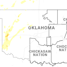


Connect with Interactive Hail Maps