

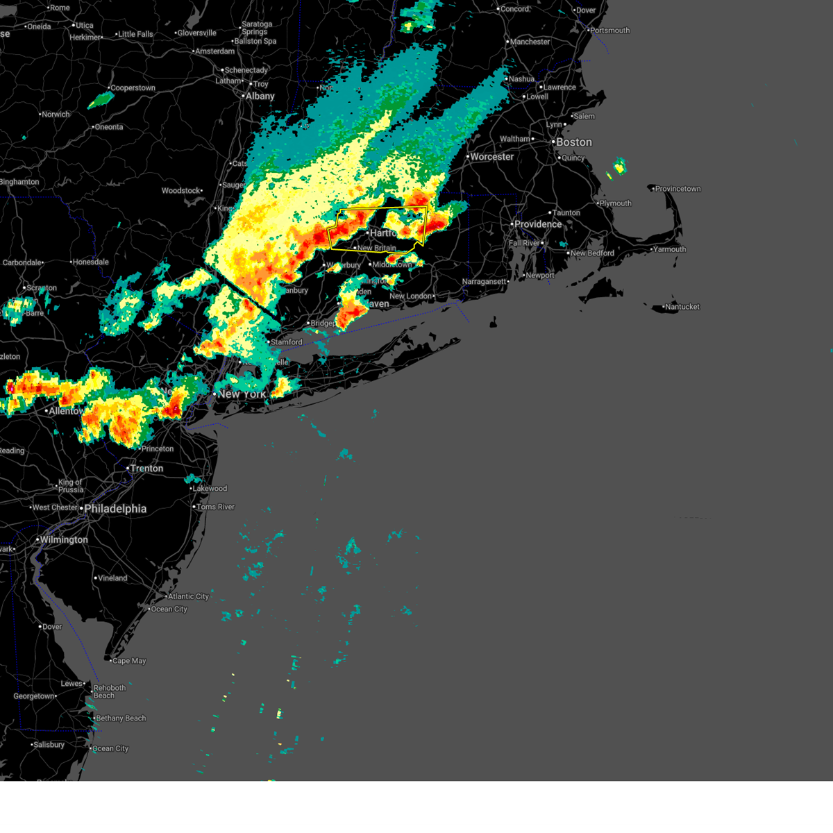
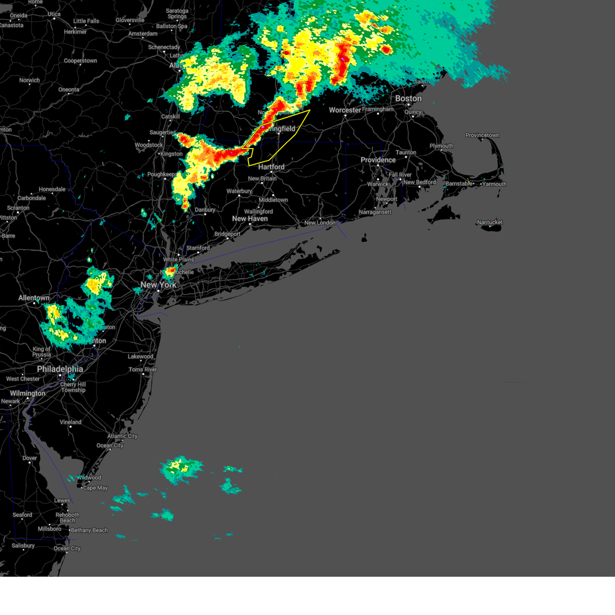
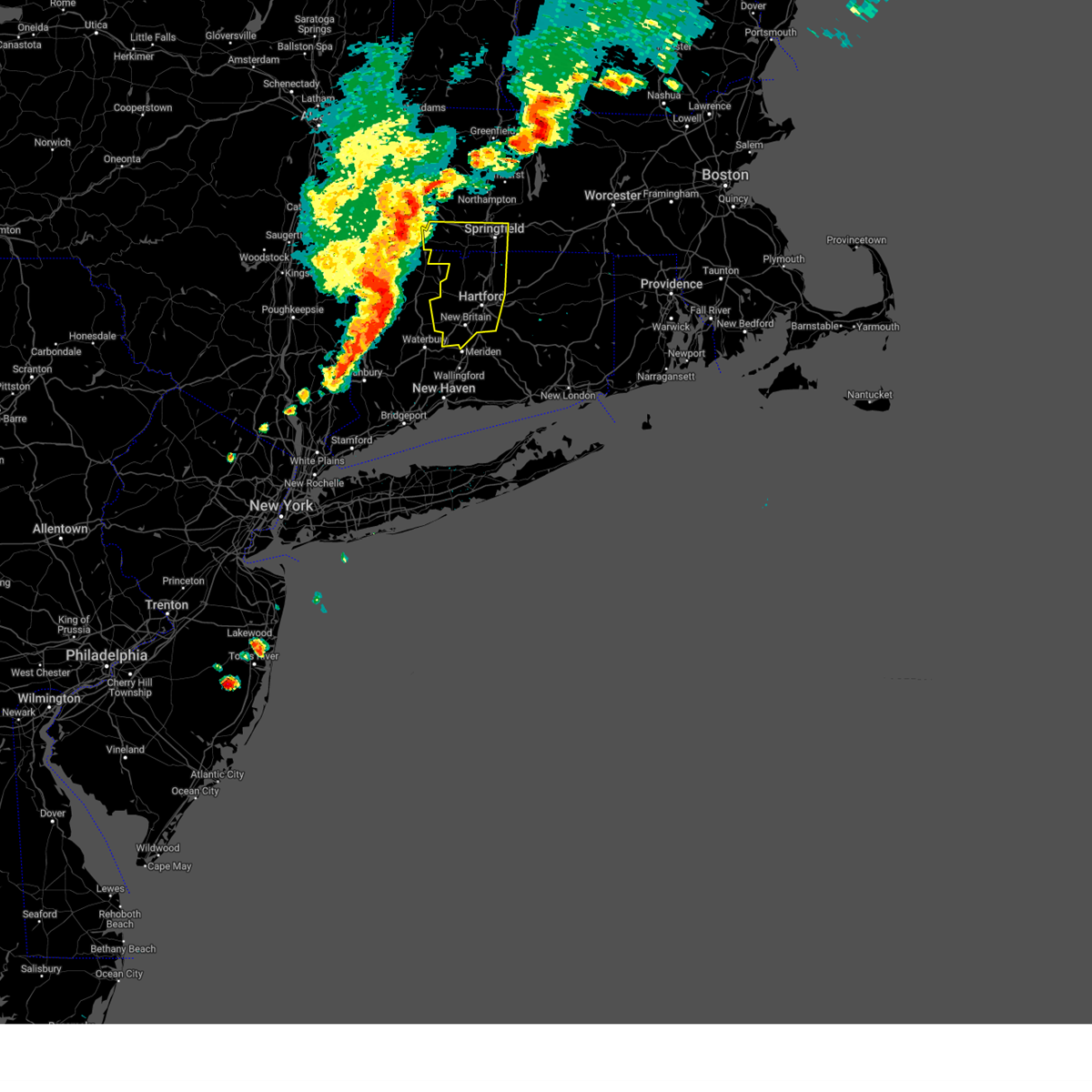
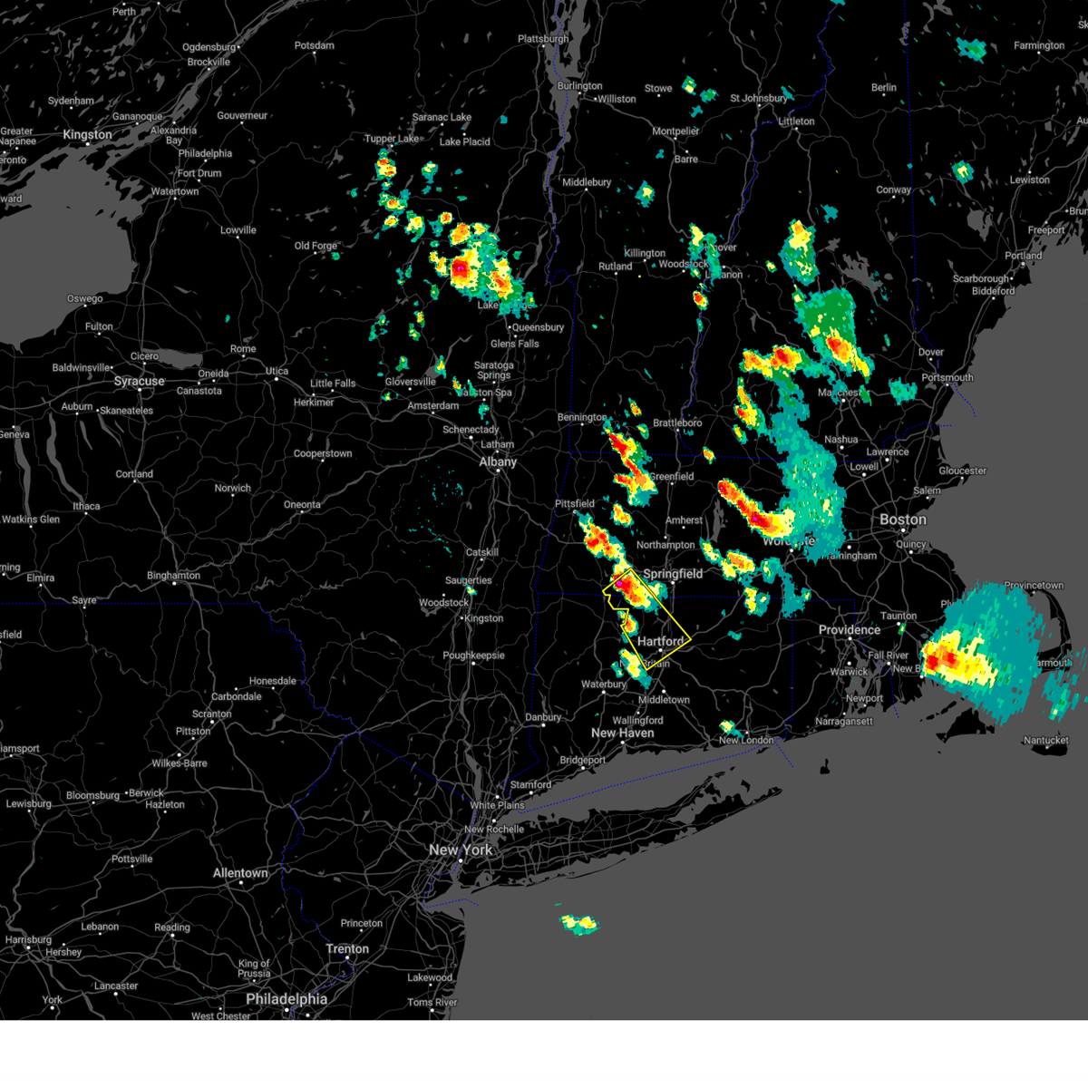
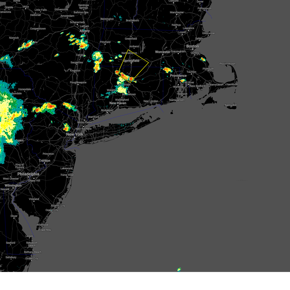
Hail Map for Weatogue, CT
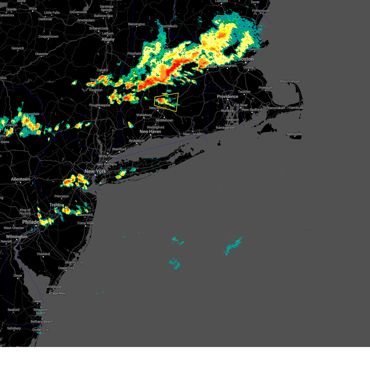
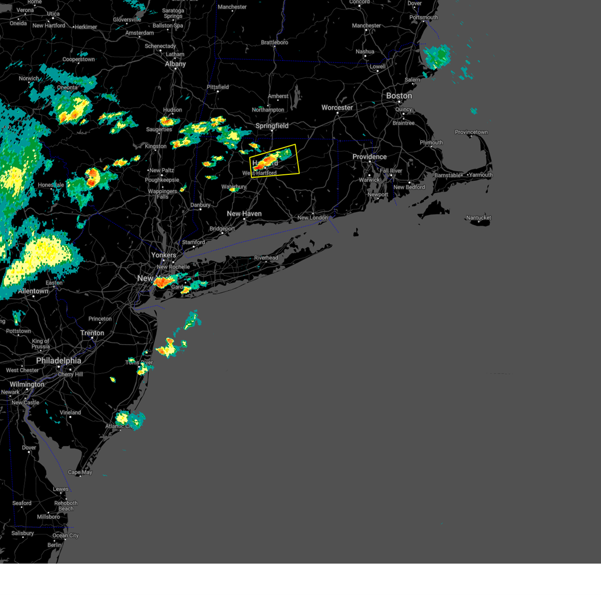
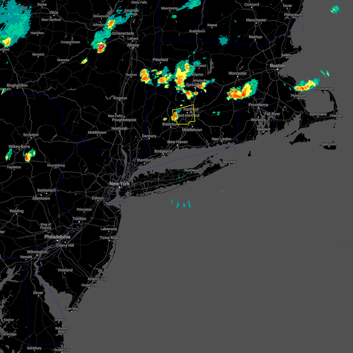
The Weatogue, CT area has had 0 reports of on-the-ground hail by trained spotters, and has been under severe weather warnings 10 times during the past 12 months. Doppler radar has detected hail at or near Weatogue, CT on 16 occasions, including 3 occasions during the past year.
| Name: | Weatogue, CT |
| Where Located: | 73 miles W of Providence, RI |
| Map: | Google Map for Weatogue, CT |
| Population: | 2776 |
| Housing Units: | 1084 |
| More Info: | Search Google for Weatogue, CT |
0
The Top Recent Hail Date for Weatogue, CT is Thursday, June 19, 2025 (16th out of 16)

Hail and Wind Damage Spotted near Weatogue, CT
| Date / Time | Report Details |
|---|---|
| 7/3/2025 6:12 PM EDT |
 Svrbox the national weather service in boston/norton has issued a * severe thunderstorm warning for, southwestern windham county in northern connecticut, tolland county in northern connecticut, hartford county in northern connecticut, * until 700 pm edt. * at 611 pm edt, a severe thunderstorm was located over west hartford, moving east at 35 mph (radar indicated). Hazards include 60 mph wind gusts and penny size hail. expect damage to trees and power lines Svrbox the national weather service in boston/norton has issued a * severe thunderstorm warning for, southwestern windham county in northern connecticut, tolland county in northern connecticut, hartford county in northern connecticut, * until 700 pm edt. * at 611 pm edt, a severe thunderstorm was located over west hartford, moving east at 35 mph (radar indicated). Hazards include 60 mph wind gusts and penny size hail. expect damage to trees and power lines
|
| 7/3/2025 4:52 PM EDT |
 Svrbox the national weather service in boston/norton has issued a * severe thunderstorm warning for, northwestern hartford county in northern connecticut, southwestern hampden county in western massachusetts, * until 530 pm edt. * at 452 pm edt, a severe thunderstorm was located over norfolk, or 10 miles north of torrington, moving southeast at 30 mph (radar indicated). Hazards include 60 mph wind gusts and quarter size hail. Hail damage to vehicles is expected. Expect wind damage to trees and power lines. Svrbox the national weather service in boston/norton has issued a * severe thunderstorm warning for, northwestern hartford county in northern connecticut, southwestern hampden county in western massachusetts, * until 530 pm edt. * at 452 pm edt, a severe thunderstorm was located over norfolk, or 10 miles north of torrington, moving southeast at 30 mph (radar indicated). Hazards include 60 mph wind gusts and quarter size hail. Hail damage to vehicles is expected. Expect wind damage to trees and power lines.
|
| 6/19/2025 3:59 PM EDT | the severe thunderstorm warning has been cancelled and is no longer in effect |
| 6/19/2025 3:35 PM EDT | At 335 pm edt, a severe thunderstorm was located over avon, or near west hartford, moving northeast at 35 mph (radar indicated). Hazards include 60 mph wind gusts and quarter size hail. Hail damage to vehicles is expected. expect wind damage to trees and power lines. Locations impacted include, springfield, hartford, new britain, west hartford, east hartford, enfield, westfield, newington, windsor, agawam, west springfield, south windsor, farmington, simsbury, bloomfield, avon, plainville, longmeadow, suffield, and east longmeadow. |
| 6/19/2025 3:13 PM EDT |
 Svrbox the national weather service in boston/norton has issued a * severe thunderstorm warning for, northwestern tolland county in northern connecticut, hartford county in northern connecticut, south central hampden county in western massachusetts, * until 415 pm edt. * at 312 pm edt, a severe thunderstorm was located over terryville, or over wolcott, moving northeast at 40 mph (radar indicated). Hazards include 60 mph wind gusts and quarter size hail. Hail damage to vehicles is expected. Expect wind damage to trees and power lines. Svrbox the national weather service in boston/norton has issued a * severe thunderstorm warning for, northwestern tolland county in northern connecticut, hartford county in northern connecticut, south central hampden county in western massachusetts, * until 415 pm edt. * at 312 pm edt, a severe thunderstorm was located over terryville, or over wolcott, moving northeast at 40 mph (radar indicated). Hazards include 60 mph wind gusts and quarter size hail. Hail damage to vehicles is expected. Expect wind damage to trees and power lines.
|
| 6/6/2025 6:53 PM EDT |
 The storms which prompted the warning have weakened below severe limits, and no longer pose an immediate threat to life or property. therefore, the warning will be allowed to expire. The storms which prompted the warning have weakened below severe limits, and no longer pose an immediate threat to life or property. therefore, the warning will be allowed to expire.
|
| 6/6/2025 6:09 PM EDT |
 Svrbox the national weather service in boston/norton has issued a * severe thunderstorm warning for, northwestern tolland county in northern connecticut, northwestern hartford county in northern connecticut, southeastern hampshire county in western massachusetts, southern hampden county in western massachusetts, * until 700 pm edt. * at 608 pm edt, severe thunderstorms were located along a line extending from near holyoke to near granby to near torrington, moving east at 20 mph (radar indicated). Hazards include 60 mph wind gusts and quarter size hail. Hail damage to vehicles is expected. Expect wind damage to trees and power lines. Svrbox the national weather service in boston/norton has issued a * severe thunderstorm warning for, northwestern tolland county in northern connecticut, northwestern hartford county in northern connecticut, southeastern hampshire county in western massachusetts, southern hampden county in western massachusetts, * until 700 pm edt. * at 608 pm edt, severe thunderstorms were located along a line extending from near holyoke to near granby to near torrington, moving east at 20 mph (radar indicated). Hazards include 60 mph wind gusts and quarter size hail. Hail damage to vehicles is expected. Expect wind damage to trees and power lines.
|
| 5/3/2025 3:21 PM EDT |
 Svrbox the national weather service in boston/norton has issued a * severe thunderstorm warning for, hartford county in northern connecticut, southwestern hampden county in western massachusetts, * until 415 pm edt. * at 320 pm edt, severe thunderstorms were located along a line extending from near norfolk to near litchfield to 6 miles west of ridgefield, moving east at 45 mph (radar indicated). Hazards include 60 mph wind gusts and nickel size hail. expect damage to trees and power lines Svrbox the national weather service in boston/norton has issued a * severe thunderstorm warning for, hartford county in northern connecticut, southwestern hampden county in western massachusetts, * until 415 pm edt. * at 320 pm edt, severe thunderstorms were located along a line extending from near norfolk to near litchfield to 6 miles west of ridgefield, moving east at 45 mph (radar indicated). Hazards include 60 mph wind gusts and nickel size hail. expect damage to trees and power lines
|
| 8/26/2024 1:32 PM EDT |
 Svrbox the national weather service in boston/norton has issued a * severe thunderstorm warning for, western tolland county in northern connecticut, northern hartford county in northern connecticut, southwestern hampden county in western massachusetts, * until 215 pm edt. * at 131 pm edt, a severe thunderstorm was located near blandford, or 13 miles west of westfield, moving southeast at 25 mph (radar indicated). Hazards include 60 mph wind gusts and quarter size hail. Hail damage to vehicles is expected. Expect wind damage to trees and power lines. Svrbox the national weather service in boston/norton has issued a * severe thunderstorm warning for, western tolland county in northern connecticut, northern hartford county in northern connecticut, southwestern hampden county in western massachusetts, * until 215 pm edt. * at 131 pm edt, a severe thunderstorm was located near blandford, or 13 miles west of westfield, moving southeast at 25 mph (radar indicated). Hazards include 60 mph wind gusts and quarter size hail. Hail damage to vehicles is expected. Expect wind damage to trees and power lines.
|
| 8/2/2024 2:24 PM EDT |
 Svrbox the national weather service in boston/norton has issued a * severe thunderstorm warning for, northwestern tolland county in northern connecticut, northern hartford county in northern connecticut, south central hampshire county in western massachusetts, eastern hampden county in western massachusetts, * until 330 pm edt. * at 224 pm edt, a severe thunderstorm was located over simsbury, or near windsor, moving northeast at 25 mph (radar indicated). Hazards include 60 mph wind gusts and quarter size hail. Hail damage to vehicles is expected. Expect wind damage to trees and power lines. Svrbox the national weather service in boston/norton has issued a * severe thunderstorm warning for, northwestern tolland county in northern connecticut, northern hartford county in northern connecticut, south central hampshire county in western massachusetts, eastern hampden county in western massachusetts, * until 330 pm edt. * at 224 pm edt, a severe thunderstorm was located over simsbury, or near windsor, moving northeast at 25 mph (radar indicated). Hazards include 60 mph wind gusts and quarter size hail. Hail damage to vehicles is expected. Expect wind damage to trees and power lines.
|
| 6/30/2024 1:35 PM EDT |
 The storms which prompted the warning have moved out of the area. therefore, the warning will be allowed to expire. however gusty winds are still possible across southern hartford county. a severe thunderstorm watch remains in effect until 700 pm edt for northern connecticut, and western massachusetts. to report severe weather, contact your nearest law enforcement agency. they will relay your report to the national weather service boston/norton. The storms which prompted the warning have moved out of the area. therefore, the warning will be allowed to expire. however gusty winds are still possible across southern hartford county. a severe thunderstorm watch remains in effect until 700 pm edt for northern connecticut, and western massachusetts. to report severe weather, contact your nearest law enforcement agency. they will relay your report to the national weather service boston/norton.
|
| 6/30/2024 1:26 PM EDT |
 At 126 pm edt, severe thunderstorms were located along a line extending from suffield to hartford to near southington, moving east at 40 mph (radar indicated). Hazards include 60 mph wind gusts and quarter size hail. Hail damage to vehicles is expected. expect wind damage to roofs, siding, and trees. Locations impacted include, hartford, new britain, west hartford, bristol, enfield, southington, newington, windsor, agawam, wethersfield, farmington, simsbury, bloomfield, berlin, rocky hill, avon, plainville, longmeadow, suffield, and windsor locks. At 126 pm edt, severe thunderstorms were located along a line extending from suffield to hartford to near southington, moving east at 40 mph (radar indicated). Hazards include 60 mph wind gusts and quarter size hail. Hail damage to vehicles is expected. expect wind damage to roofs, siding, and trees. Locations impacted include, hartford, new britain, west hartford, bristol, enfield, southington, newington, windsor, agawam, wethersfield, farmington, simsbury, bloomfield, berlin, rocky hill, avon, plainville, longmeadow, suffield, and windsor locks.
|
| 6/30/2024 1:23 PM EDT | In simsbury a tree was down on a house which caused damage to the house. relayed by amateur radi in hartford county CT, 1.3 miles NE of Weatogue, CT |
| 6/30/2024 1:17 PM EDT |
 At 117 pm edt, severe thunderstorms were located along a line extending from near agawam to near thomaston, moving east at 45 mph (radar indicated). Hazards include 60 mph wind gusts and nickel size hail. Expect damage to roofs, siding, and trees. Locations impacted include, hartford, new britain, west hartford, bristol, enfield, southington, newington, windsor, agawam, wethersfield, farmington, simsbury, bloomfield, berlin, rocky hill, avon, plainville, longmeadow, suffield, and windsor locks. At 117 pm edt, severe thunderstorms were located along a line extending from near agawam to near thomaston, moving east at 45 mph (radar indicated). Hazards include 60 mph wind gusts and nickel size hail. Expect damage to roofs, siding, and trees. Locations impacted include, hartford, new britain, west hartford, bristol, enfield, southington, newington, windsor, agawam, wethersfield, farmington, simsbury, bloomfield, berlin, rocky hill, avon, plainville, longmeadow, suffield, and windsor locks.
|
| 6/30/2024 12:39 PM EDT |
 Svrbox the national weather service in boston/norton has issued a * severe thunderstorm warning for, hartford county in northern connecticut, southwestern hampden county in western massachusetts, * until 145 pm edt. * at 1238 pm edt, severe thunderstorms were located along a line extending from near norfolk to near dover plains, moving east at 45 mph (radar indicated). Hazards include 60 mph wind gusts and penny size hail. expect damage to roofs, siding, and trees Svrbox the national weather service in boston/norton has issued a * severe thunderstorm warning for, hartford county in northern connecticut, southwestern hampden county in western massachusetts, * until 145 pm edt. * at 1238 pm edt, severe thunderstorms were located along a line extending from near norfolk to near dover plains, moving east at 45 mph (radar indicated). Hazards include 60 mph wind gusts and penny size hail. expect damage to roofs, siding, and trees
|
| 6/26/2024 10:02 PM EDT | Power lines down. time estimate from rada in hartford county CT, 1.9 miles W of Weatogue, CT |
| 6/26/2024 9:32 PM EDT |
 Svrbox the national weather service in boston/norton has issued a * severe thunderstorm warning for, hartford county in northern connecticut, southwestern hampden county in western massachusetts, * until 1030 pm edt. * at 931 pm edt, severe thunderstorms were located along a line extending from near millerton to near litchfield to near shelton, moving northeast at 45 mph (radar indicated). Hazards include 70 mph wind gusts. Expect considerable tree damage. Damage is likely to mobile homes, roofs, and outbuildings. Svrbox the national weather service in boston/norton has issued a * severe thunderstorm warning for, hartford county in northern connecticut, southwestern hampden county in western massachusetts, * until 1030 pm edt. * at 931 pm edt, severe thunderstorms were located along a line extending from near millerton to near litchfield to near shelton, moving northeast at 45 mph (radar indicated). Hazards include 70 mph wind gusts. Expect considerable tree damage. Damage is likely to mobile homes, roofs, and outbuildings.
|
| 6/23/2024 5:42 PM EDT |
 At 542 pm edt, a severe thunderstorm was located over avon, or near farmington, moving east at 35 mph (radar indicated). Hazards include 60 mph wind gusts and quarter size hail. Hail damage to vehicles is expected. expect wind damage to roofs, siding, and trees. Locations impacted include, hartford, new britain, west hartford, bristol, manchester, east hartford, enfield, glastonbury, newington, windsor, wethersfield, south windsor, farmington, simsbury, bloomfield, rocky hill, avon, plainville, suffield, and windsor locks. At 542 pm edt, a severe thunderstorm was located over avon, or near farmington, moving east at 35 mph (radar indicated). Hazards include 60 mph wind gusts and quarter size hail. Hail damage to vehicles is expected. expect wind damage to roofs, siding, and trees. Locations impacted include, hartford, new britain, west hartford, bristol, manchester, east hartford, enfield, glastonbury, newington, windsor, wethersfield, south windsor, farmington, simsbury, bloomfield, rocky hill, avon, plainville, suffield, and windsor locks.
|
| 6/23/2024 5:13 PM EDT |
 Svrbox the national weather service in boston/norton has issued a * severe thunderstorm warning for, hartford county in northern connecticut, * until 615 pm edt. * at 512 pm edt, a severe thunderstorm was located near torrington, moving east at 45 mph (radar indicated). Hazards include 60 mph wind gusts and quarter size hail. Hail damage to vehicles is expected. Expect wind damage to roofs, siding, and trees. Svrbox the national weather service in boston/norton has issued a * severe thunderstorm warning for, hartford county in northern connecticut, * until 615 pm edt. * at 512 pm edt, a severe thunderstorm was located near torrington, moving east at 45 mph (radar indicated). Hazards include 60 mph wind gusts and quarter size hail. Hail damage to vehicles is expected. Expect wind damage to roofs, siding, and trees.
|
| 6/22/2024 3:13 PM EDT |
 Svrbox the national weather service in boston/norton has issued a * severe thunderstorm warning for, southwestern tolland county in northern connecticut, central hartford county in northern connecticut, * until 415 pm edt. * at 313 pm edt, a severe thunderstorm was located over bloomfield, or near west hartford, moving east at 10 mph (radar indicated). Hazards include 60 mph wind gusts and quarter size hail. Hail damage to vehicles is expected. Expect wind damage to roofs, siding, and trees. Svrbox the national weather service in boston/norton has issued a * severe thunderstorm warning for, southwestern tolland county in northern connecticut, central hartford county in northern connecticut, * until 415 pm edt. * at 313 pm edt, a severe thunderstorm was located over bloomfield, or near west hartford, moving east at 10 mph (radar indicated). Hazards include 60 mph wind gusts and quarter size hail. Hail damage to vehicles is expected. Expect wind damage to roofs, siding, and trees.
|
| 9/13/2023 9:24 AM EDT |
 The severe thunderstorm warning for northwestern tolland and hartford counties will expire at 930 am edt, the storms which prompted the warning have weakened below severe limits, and no longer pose an immediate threat to life or property. therefore, the warning will be allowed to expire. however gusty winds and heavy rain are still possible with these thunderstorms. The severe thunderstorm warning for northwestern tolland and hartford counties will expire at 930 am edt, the storms which prompted the warning have weakened below severe limits, and no longer pose an immediate threat to life or property. therefore, the warning will be allowed to expire. however gusty winds and heavy rain are still possible with these thunderstorms.
|
| 9/13/2023 9:09 AM EDT |
 At 909 am edt, severe thunderstorms were located along a line extending from east granby to near east hartford to wethersfield, moving northeast at 35 mph (radar indicated). Hazards include 60 mph wind gusts. Expect damage to roofs, siding, and trees. Locations impacted include, hartford, new britain, west hartford, bristol, manchester, east hartford, enfield, southington, glastonbury, newington, vernon, windsor, wethersfield, south windsor, farmington, simsbury, bloomfield, berlin, rocky hill, and avon. At 909 am edt, severe thunderstorms were located along a line extending from east granby to near east hartford to wethersfield, moving northeast at 35 mph (radar indicated). Hazards include 60 mph wind gusts. Expect damage to roofs, siding, and trees. Locations impacted include, hartford, new britain, west hartford, bristol, manchester, east hartford, enfield, southington, glastonbury, newington, vernon, windsor, wethersfield, south windsor, farmington, simsbury, bloomfield, berlin, rocky hill, and avon.
|
| 9/13/2023 8:36 AM EDT |
 At 836 am edt, severe thunderstorms were located along a line extending from near canton to plainville to near southington, moving northeast at 35 mph (radar indicated). Hazards include 60 mph wind gusts. expect damage to roofs, siding, and trees At 836 am edt, severe thunderstorms were located along a line extending from near canton to plainville to near southington, moving northeast at 35 mph (radar indicated). Hazards include 60 mph wind gusts. expect damage to roofs, siding, and trees
|
| 9/8/2023 9:19 PM EDT |
 At 919 pm edt, a severe thunderstorm was located over enfield, moving northeast at 20 mph (radar indicated). Hazards include 60 mph wind gusts and quarter size hail. Hail damage to vehicles is expected. expect wind damage to roofs, siding, and trees. locations impacted include, springfield, hartford, new britain, west hartford, bristol, manchester, chicopee, east hartford, enfield, southington, glastonbury, newington, vernon, windsor, agawam, west springfield, wethersfield, south windsor, farmington, and simsbury. hail threat, radar indicated max hail size, 1. 00 in wind threat, radar indicated max wind gust, 60 mph. At 919 pm edt, a severe thunderstorm was located over enfield, moving northeast at 20 mph (radar indicated). Hazards include 60 mph wind gusts and quarter size hail. Hail damage to vehicles is expected. expect wind damage to roofs, siding, and trees. locations impacted include, springfield, hartford, new britain, west hartford, bristol, manchester, chicopee, east hartford, enfield, southington, glastonbury, newington, vernon, windsor, agawam, west springfield, wethersfield, south windsor, farmington, and simsbury. hail threat, radar indicated max hail size, 1. 00 in wind threat, radar indicated max wind gust, 60 mph.
|
| 9/8/2023 8:56 PM EDT |
 At 856 pm edt, a severe thunderstorm was located over farmington, moving northeast at 30 mph (radar indicated). Hazards include 60 mph wind gusts and quarter size hail. Hail damage to vehicles is expected. Expect wind damage to roofs, siding, and trees. At 856 pm edt, a severe thunderstorm was located over farmington, moving northeast at 30 mph (radar indicated). Hazards include 60 mph wind gusts and quarter size hail. Hail damage to vehicles is expected. Expect wind damage to roofs, siding, and trees.
|
| 9/8/2023 5:46 PM EDT |
 At 545 pm edt, severe thunderstorms were located along a line extending from near west hartford to new britain to meriden, moving northeast at 45 mph (radar indicated). Hazards include 60 mph wind gusts and quarter size hail. Hail damage to vehicles is expected. expect wind damage to roofs, siding, and trees. locations impacted include, hartford, new britain, west hartford, bristol, manchester, east hartford, southington, glastonbury, newington, vernon, windsor, wethersfield, south windsor, farmington, simsbury, bloomfield, berlin, rocky hill, avon, and plainville. hail threat, radar indicated max hail size, 1. 00 in wind threat, radar indicated max wind gust, 60 mph. At 545 pm edt, severe thunderstorms were located along a line extending from near west hartford to new britain to meriden, moving northeast at 45 mph (radar indicated). Hazards include 60 mph wind gusts and quarter size hail. Hail damage to vehicles is expected. expect wind damage to roofs, siding, and trees. locations impacted include, hartford, new britain, west hartford, bristol, manchester, east hartford, southington, glastonbury, newington, vernon, windsor, wethersfield, south windsor, farmington, simsbury, bloomfield, berlin, rocky hill, avon, and plainville. hail threat, radar indicated max hail size, 1. 00 in wind threat, radar indicated max wind gust, 60 mph.
|
| 9/8/2023 5:14 PM EDT |
 At 514 pm edt, severe thunderstorms were located along a line extending from near northwest harwinton to near oakville to naugatuck, moving east at 30 mph (radar indicated). Hazards include 60 mph wind gusts and quarter size hail. Hail damage to vehicles is expected. Expect wind damage to roofs, siding, and trees. At 514 pm edt, severe thunderstorms were located along a line extending from near northwest harwinton to near oakville to naugatuck, moving east at 30 mph (radar indicated). Hazards include 60 mph wind gusts and quarter size hail. Hail damage to vehicles is expected. Expect wind damage to roofs, siding, and trees.
|
| 7/27/2023 5:36 PM EDT |
 At 533 pm edt, a severe thunderstorm was located over ashford, or 8 miles north of mansfield, moving east at 40 mph (trained weather spotters have reported pockets of wind damage west hartford, simsbury and south windsor). Hazards include 60 mph wind gusts and half dollar size hail. Expect wind damage to trees and power lines. minor hail damage to vehicles is possible. locations impacted include, hartford, west hartford, manchester, east hartford, enfield, glastonbury, newington, vernon, windsor, wethersfield, mansfield, south windsor, windham, plainfield, bloomfield, berlin, rocky hill, willimantic, killingly and webster hail threat, radar indicated max hail size, 1. 25 in wind threat, radar indicated max wind gust, 60 mph. At 533 pm edt, a severe thunderstorm was located over ashford, or 8 miles north of mansfield, moving east at 40 mph (trained weather spotters have reported pockets of wind damage west hartford, simsbury and south windsor). Hazards include 60 mph wind gusts and half dollar size hail. Expect wind damage to trees and power lines. minor hail damage to vehicles is possible. locations impacted include, hartford, west hartford, manchester, east hartford, enfield, glastonbury, newington, vernon, windsor, wethersfield, mansfield, south windsor, windham, plainfield, bloomfield, berlin, rocky hill, willimantic, killingly and webster hail threat, radar indicated max hail size, 1. 25 in wind threat, radar indicated max wind gust, 60 mph.
|
| 7/27/2023 5:22 PM EDT |
 At 521 pm edt, a severe thunderstorm was located over east windsor, or near vernon, moving east at 40 mph (radar indicated). Hazards include 60 mph wind gusts and penny size hail. expect damage to trees and power lines At 521 pm edt, a severe thunderstorm was located over east windsor, or near vernon, moving east at 40 mph (radar indicated). Hazards include 60 mph wind gusts and penny size hail. expect damage to trees and power lines
|
| 7/27/2023 5:14 PM EDT |
 At 514 pm edt, a severe thunderstorm was located over east windsor, or near enfield, moving east at 40 mph (radar indicated). Hazards include 60 mph wind gusts and penny size hail. Expect damage to trees and power lines. locations impacted include, springfield, hartford, new britain, west hartford, bristol, manchester, east hartford, enfield, westfield, glastonbury, newington, vernon, windsor, agawam, west springfield, wethersfield, south windsor, farmington, simsbury and bloomfield. hail threat, radar indicated max hail size, 0. 75 in wind threat, radar indicated max wind gust, 60 mph. At 514 pm edt, a severe thunderstorm was located over east windsor, or near enfield, moving east at 40 mph (radar indicated). Hazards include 60 mph wind gusts and penny size hail. Expect damage to trees and power lines. locations impacted include, springfield, hartford, new britain, west hartford, bristol, manchester, east hartford, enfield, westfield, glastonbury, newington, vernon, windsor, agawam, west springfield, wethersfield, south windsor, farmington, simsbury and bloomfield. hail threat, radar indicated max hail size, 0. 75 in wind threat, radar indicated max wind gust, 60 mph.
|
| 7/27/2023 5:03 PM EDT |
 At 502 pm edt, a severe thunderstorm was located over avon, or near farmington, moving east at 35 mph (radar indicated). Hazards include 60 mph wind gusts and penny size hail. Expect damage to trees and power lines. locations impacted include, springfield, hartford, new britain, west hartford, bristol, manchester, east hartford, enfield, westfield, glastonbury, newington, vernon, windsor, agawam, west springfield, wethersfield, south windsor, farmington, simsbury and bloomfield. hail threat, radar indicated max hail size, 0. 75 in wind threat, radar indicated max wind gust, 60 mph. At 502 pm edt, a severe thunderstorm was located over avon, or near farmington, moving east at 35 mph (radar indicated). Hazards include 60 mph wind gusts and penny size hail. Expect damage to trees and power lines. locations impacted include, springfield, hartford, new britain, west hartford, bristol, manchester, east hartford, enfield, westfield, glastonbury, newington, vernon, windsor, agawam, west springfield, wethersfield, south windsor, farmington, simsbury and bloomfield. hail threat, radar indicated max hail size, 0. 75 in wind threat, radar indicated max wind gust, 60 mph.
|
| 7/27/2023 4:35 PM EDT |
 At 435 pm edt, a severe thunderstorm was located near litchfield, or near torrington, moving east at 35 mph (radar indicated). Hazards include 60 mph wind gusts and penny size hail. expect damage to trees and power lines At 435 pm edt, a severe thunderstorm was located near litchfield, or near torrington, moving east at 35 mph (radar indicated). Hazards include 60 mph wind gusts and penny size hail. expect damage to trees and power lines
|
| 7/16/2023 9:56 AM EDT |
 The severe thunderstorm warning for central hartford county will expire at 1000 am edt, the storm which prompted the warning has weakened below severe limits, and has exited the warned area. therefore, the warning will be allowed to expire. a tornado watch remains in effect until 300 pm edt for northern connecticut. The severe thunderstorm warning for central hartford county will expire at 1000 am edt, the storm which prompted the warning has weakened below severe limits, and has exited the warned area. therefore, the warning will be allowed to expire. a tornado watch remains in effect until 300 pm edt for northern connecticut.
|
| 7/16/2023 9:15 AM EDT |
 At 915 am edt, a severe thunderstorm was located over plainville, or near farmington, moving northeast at 30 mph (radar indicated). Hazards include 60 mph wind gusts. expect damage to trees and power lines At 915 am edt, a severe thunderstorm was located over plainville, or near farmington, moving northeast at 30 mph (radar indicated). Hazards include 60 mph wind gusts. expect damage to trees and power lines
|
| 7/14/2023 9:32 AM EDT |
 At 932 am edt, a severe thunderstorm was located over bloomfield, or near west hartford, moving northeast at 40 mph (radar indicated). Hazards include 60 mph wind gusts and quarter size hail. Expect wind damage to trees and power lines. minor hail damage to vehicles is possible. locations impacted include, hartford, new britain, west hartford, manchester, east hartford, enfield, glastonbury, newington, vernon, windsor, wethersfield, mansfield, south windsor, farmington, simsbury, bloomfield, berlin, rocky hill, avon and suffield. hail threat, radar indicated max hail size, 1. 00 in wind threat, radar indicated max wind gust, 60 mph. At 932 am edt, a severe thunderstorm was located over bloomfield, or near west hartford, moving northeast at 40 mph (radar indicated). Hazards include 60 mph wind gusts and quarter size hail. Expect wind damage to trees and power lines. minor hail damage to vehicles is possible. locations impacted include, hartford, new britain, west hartford, manchester, east hartford, enfield, glastonbury, newington, vernon, windsor, wethersfield, mansfield, south windsor, farmington, simsbury, bloomfield, berlin, rocky hill, avon and suffield. hail threat, radar indicated max hail size, 1. 00 in wind threat, radar indicated max wind gust, 60 mph.
|
| 7/14/2023 9:11 AM EDT |
 At 911 am edt, a severe thunderstorm was located over bristol, moving northeast at 30 mph (radar indicated). Hazards include 60 mph wind gusts and quarter size hail. Expect wind damage to trees and power lines. Minor hail damage to vehicles is possible. At 911 am edt, a severe thunderstorm was located over bristol, moving northeast at 30 mph (radar indicated). Hazards include 60 mph wind gusts and quarter size hail. Expect wind damage to trees and power lines. Minor hail damage to vehicles is possible.
|
| 7/2/2023 5:38 PM EDT |
 At 538 pm edt, a severe thunderstorm was located over west hartford, moving east at 20 mph (radar indicated). Hazards include 60 mph wind gusts and quarter size hail. Expect wind damage to trees and power lines. Minor hail damage to vehicles is possible. At 538 pm edt, a severe thunderstorm was located over west hartford, moving east at 20 mph (radar indicated). Hazards include 60 mph wind gusts and quarter size hail. Expect wind damage to trees and power lines. Minor hail damage to vehicles is possible.
|
| 8/26/2022 3:39 PM EDT | At 338 pm edt, a severe thunderstorm was located over burlington, or 7 miles east of torrington, moving east at 25 mph (radar indicated). Hazards include 60 mph wind gusts and quarter size hail. Expect wind damage to trees and power lines. Minor hail damage to vehicles is possible. |
| 8/26/2022 1:41 PM EDT | At 140 pm edt, a severe thunderstorm was located over canton, or 10 miles east of torrington, moving northeast at 30 mph (radar indicated). Hazards include 60 mph wind gusts and quarter size hail. Expect wind damage to trees and power lines. Minor hail damage to vehicles is possible. |
| 8/26/2022 1:41 PM EDT | At 140 pm edt, a severe thunderstorm was located over canton, or 10 miles east of torrington, moving northeast at 30 mph (radar indicated). Hazards include 60 mph wind gusts and quarter size hail. Expect wind damage to trees and power lines. Minor hail damage to vehicles is possible. |
| 7/21/2022 2:47 PM EDT |
 At 246 pm edt, severe thunderstorms were located along a line extending from burlington to terryville to woodbury center, moving east at 30 mph (radar indicated). Hazards include 60 mph wind gusts and quarter size hail. Expect wind damage to trees and power lines. minor hail damage to vehicles is possible. Locations impacted include, hartford, new britain, west hartford, bristol, manchester, east hartford, southington, glastonbury, newington, windsor, wethersfield, south windsor, farmington, simsbury, bloomfield, berlin, rocky hill, avon, plainville and east windsor. At 246 pm edt, severe thunderstorms were located along a line extending from burlington to terryville to woodbury center, moving east at 30 mph (radar indicated). Hazards include 60 mph wind gusts and quarter size hail. Expect wind damage to trees and power lines. minor hail damage to vehicles is possible. Locations impacted include, hartford, new britain, west hartford, bristol, manchester, east hartford, southington, glastonbury, newington, windsor, wethersfield, south windsor, farmington, simsbury, bloomfield, berlin, rocky hill, avon, plainville and east windsor.
|
| 7/21/2022 2:30 PM EDT |
 At 230 pm edt, severe thunderstorms were located along a line extending from near northwest harwinton to thomaston to near woodbury center, moving east at 30 mph (radar indicated). Hazards include 60 mph wind gusts and quarter size hail. Expect wind damage to trees and power lines. Minor hail damage to vehicles is possible. At 230 pm edt, severe thunderstorms were located along a line extending from near northwest harwinton to thomaston to near woodbury center, moving east at 30 mph (radar indicated). Hazards include 60 mph wind gusts and quarter size hail. Expect wind damage to trees and power lines. Minor hail damage to vehicles is possible.
|
| 7/12/2022 7:08 PM EDT |
 At 708 pm edt, a severe thunderstorm was located over simsbury, or near windsor, moving east at 35 mph (radar indicated). Hazards include 60 mph wind gusts and penny size hail. expect damage to trees and power lines At 708 pm edt, a severe thunderstorm was located over simsbury, or near windsor, moving east at 35 mph (radar indicated). Hazards include 60 mph wind gusts and penny size hail. expect damage to trees and power lines
|
| 7/12/2022 5:42 PM EDT |
 At 540 pm edt, a severe thunderstorm was located near hartland, or 13 miles northeast of torrington, moving east at 45 mph (radar indicated). Hazards include 60 mph wind gusts and quarter size hail. Expect wind damage to trees and power lines. minor hail damage to vehicles is possible. locations impacted include, hartford, west hartford, manchester, east hartford, enfield, vernon, windsor, south windsor, simsbury, bloomfield, avon, suffield, east longmeadow, windsor locks, somers, granby, east windsor, canton, southwick and east granby. hail threat, radar indicated max hail size, 1. 00 in wind threat, observed max wind gust, 60 mph. At 540 pm edt, a severe thunderstorm was located near hartland, or 13 miles northeast of torrington, moving east at 45 mph (radar indicated). Hazards include 60 mph wind gusts and quarter size hail. Expect wind damage to trees and power lines. minor hail damage to vehicles is possible. locations impacted include, hartford, west hartford, manchester, east hartford, enfield, vernon, windsor, south windsor, simsbury, bloomfield, avon, suffield, east longmeadow, windsor locks, somers, granby, east windsor, canton, southwick and east granby. hail threat, radar indicated max hail size, 1. 00 in wind threat, observed max wind gust, 60 mph.
|
| 7/12/2022 5:37 PM EDT |
 At 537 pm edt, a severe thunderstorm was located near tolland, or 12 miles north of torrington, moving east at 40 mph (radar indicated. amateur radio has reported several trees down in lenox, ma). Hazards include 60 mph wind gusts and quarter size hail. Expect wind damage to trees and power lines. Minor hail damage to vehicles is possible. At 537 pm edt, a severe thunderstorm was located near tolland, or 12 miles north of torrington, moving east at 40 mph (radar indicated. amateur radio has reported several trees down in lenox, ma). Hazards include 60 mph wind gusts and quarter size hail. Expect wind damage to trees and power lines. Minor hail damage to vehicles is possible.
|
| 5/16/2022 6:10 PM EDT |
 At 610 pm edt, a severe thunderstorm was located over east granby, or near windsor, moving northeast at 45 mph (radar indicated). Hazards include 60 mph wind gusts. Expect damage to trees and power lines. locations impacted include, hartford, new britain, west hartford, bristol, manchester, east hartford, enfield, southington, westfield, glastonbury, newington, windsor, agawam, west springfield, wethersfield, south windsor, farmington, simsbury, bloomfield and berlin. hail threat, radar indicated max hail size, <. 75 in wind threat, radar indicated max wind gust, 60 mph. At 610 pm edt, a severe thunderstorm was located over east granby, or near windsor, moving northeast at 45 mph (radar indicated). Hazards include 60 mph wind gusts. Expect damage to trees and power lines. locations impacted include, hartford, new britain, west hartford, bristol, manchester, east hartford, enfield, southington, westfield, glastonbury, newington, windsor, agawam, west springfield, wethersfield, south windsor, farmington, simsbury, bloomfield and berlin. hail threat, radar indicated max hail size, <. 75 in wind threat, radar indicated max wind gust, 60 mph.
|
| 5/16/2022 5:46 PM EDT |
 At 546 pm edt, a severe thunderstorm was located over new hartford center, or 7 miles northeast of torrington, moving northeast at 45 mph (radar indicated). Hazards include 60 mph wind gusts. Expect damage to trees and power lines. locations impacted include, hartford, new britain, west hartford, bristol, manchester, east hartford, enfield, southington, westfield, glastonbury, newington, windsor, northampton, agawam, west springfield, wethersfield, south windsor, farmington, simsbury and bloomfield. hail threat, radar indicated max hail size, <. 75 in wind threat, radar indicated max wind gust, 60 mph. At 546 pm edt, a severe thunderstorm was located over new hartford center, or 7 miles northeast of torrington, moving northeast at 45 mph (radar indicated). Hazards include 60 mph wind gusts. Expect damage to trees and power lines. locations impacted include, hartford, new britain, west hartford, bristol, manchester, east hartford, enfield, southington, westfield, glastonbury, newington, windsor, northampton, agawam, west springfield, wethersfield, south windsor, farmington, simsbury and bloomfield. hail threat, radar indicated max hail size, <. 75 in wind threat, radar indicated max wind gust, 60 mph.
|
| 5/16/2022 5:35 PM EDT |
 At 534 pm edt, a severe thunderstorm was located over torrington, moving northeast at 45 mph (radar indicated). Hazards include 60 mph wind gusts. expect damage to trees and power lines At 534 pm edt, a severe thunderstorm was located over torrington, moving northeast at 45 mph (radar indicated). Hazards include 60 mph wind gusts. expect damage to trees and power lines
|
| 3/7/2022 9:35 PM EST |
 At 934 pm est, severe thunderstorms were located along a line extending from hartland to near brookfield, moving east at 60 mph (radar indicated). Hazards include 60 mph wind gusts. expect damage to trees and power lines At 934 pm est, severe thunderstorms were located along a line extending from hartland to near brookfield, moving east at 60 mph (radar indicated). Hazards include 60 mph wind gusts. expect damage to trees and power lines
|
| 12/11/2021 10:50 PM EST |
 The severe thunderstorm warning for tolland and hartford counties will expire at 1100 pm est, the storms which prompted the warning have weakened below severe limits, and no longer pose an immediate threat to life or property. therefore, the warning will be allowed to expire. however gusty winds are still possible. a wind advisory is in effect until 5 am sunday. The severe thunderstorm warning for tolland and hartford counties will expire at 1100 pm est, the storms which prompted the warning have weakened below severe limits, and no longer pose an immediate threat to life or property. therefore, the warning will be allowed to expire. however gusty winds are still possible. a wind advisory is in effect until 5 am sunday.
|
| 12/11/2021 10:21 PM EST |
 At 1021 pm est, a line of intense showers capable of producing damaging winds extended from near hartland to near woodbury center, moving east at 60 mph (radar indicated). Hazards include 60 mph wind gusts. expect damage to trees and power lines At 1021 pm est, a line of intense showers capable of producing damaging winds extended from near hartland to near woodbury center, moving east at 60 mph (radar indicated). Hazards include 60 mph wind gusts. expect damage to trees and power lines
|
| 8/12/2021 6:26 PM EDT |
 At 625 pm edt, severe thunderstorms were located along a line extending from stafford to canton, moving east at 25 mph (radar indicated). Hazards include 60 mph wind gusts and quarter size hail. Expect wind damage to trees and power lines. Minor hail damage to vehicles is possible. At 625 pm edt, severe thunderstorms were located along a line extending from stafford to canton, moving east at 25 mph (radar indicated). Hazards include 60 mph wind gusts and quarter size hail. Expect wind damage to trees and power lines. Minor hail damage to vehicles is possible.
|
| 8/12/2021 5:57 PM EDT |
 At 556 pm edt, severe thunderstorms were located along a line extending from near ludlow to near simsbury, moving east at 35 mph (radar indicated). Hazards include 60 mph wind gusts and penny size hail. Expect damage to trees and power lines. locations impacted include, springfield, hartford, west hartford, manchester, chicopee, east hartford, enfield, westfield, glastonbury, vernon, windsor, agawam, west springfield, south windsor, simsbury, ludlow, bloomfield, avon, longmeadow and suffield. hail threat, radar indicated max hail size, 0. 75 in wind threat, radar indicated max wind gust, 60 mph. At 556 pm edt, severe thunderstorms were located along a line extending from near ludlow to near simsbury, moving east at 35 mph (radar indicated). Hazards include 60 mph wind gusts and penny size hail. Expect damage to trees and power lines. locations impacted include, springfield, hartford, west hartford, manchester, chicopee, east hartford, enfield, westfield, glastonbury, vernon, windsor, agawam, west springfield, south windsor, simsbury, ludlow, bloomfield, avon, longmeadow and suffield. hail threat, radar indicated max hail size, 0. 75 in wind threat, radar indicated max wind gust, 60 mph.
|
| 8/12/2021 5:35 PM EDT |
 At 534 pm edt, severe thunderstorms were located along a line extending from holyoke to near winsted, moving east at 35 mph (radar indicated). Hazards include 60 mph wind gusts. expect damage to trees and power lines At 534 pm edt, severe thunderstorms were located along a line extending from holyoke to near winsted, moving east at 35 mph (radar indicated). Hazards include 60 mph wind gusts. expect damage to trees and power lines
|
| 7/7/2021 5:17 PM EDT |
 At 517 pm edt, a severe thunderstorm was located over bloomfield, or over windsor, moving southeast at 30 mph (radar indicated. 53 kt gust reported at bdl at 512 pm). Hazards include 60 mph wind gusts and quarter size hail. Expect wind damage to trees and power lines. minor hail damage to vehicles is possible. Locations impacted include, hartford, west hartford, manchester, east hartford, enfield, glastonbury, newington, windsor, wethersfield, south windsor, simsbury, bloomfield, rocky hill, avon, suffield, ellington, windsor locks, east windsor and east granby. At 517 pm edt, a severe thunderstorm was located over bloomfield, or over windsor, moving southeast at 30 mph (radar indicated. 53 kt gust reported at bdl at 512 pm). Hazards include 60 mph wind gusts and quarter size hail. Expect wind damage to trees and power lines. minor hail damage to vehicles is possible. Locations impacted include, hartford, west hartford, manchester, east hartford, enfield, glastonbury, newington, windsor, wethersfield, south windsor, simsbury, bloomfield, rocky hill, avon, suffield, ellington, windsor locks, east windsor and east granby.
|
| 7/7/2021 4:59 PM EDT |
 At 458 pm edt, a severe thunderstorm was located near granby, or 10 miles northwest of windsor, moving southeast at 30 mph (radar indicated. picture of possible wall cloud near bdl on social media). Hazards include 60 mph wind gusts and quarter size hail. Expect wind damage to trees and power lines. minor hail damage to vehicles is possible. Locations impacted include, hartford, west hartford, manchester, east hartford, enfield, glastonbury, newington, windsor, wethersfield, south windsor, simsbury, bloomfield, rocky hill, avon, suffield, ellington, windsor locks, granby, east windsor and canton. At 458 pm edt, a severe thunderstorm was located near granby, or 10 miles northwest of windsor, moving southeast at 30 mph (radar indicated. picture of possible wall cloud near bdl on social media). Hazards include 60 mph wind gusts and quarter size hail. Expect wind damage to trees and power lines. minor hail damage to vehicles is possible. Locations impacted include, hartford, west hartford, manchester, east hartford, enfield, glastonbury, newington, windsor, wethersfield, south windsor, simsbury, bloomfield, rocky hill, avon, suffield, ellington, windsor locks, granby, east windsor and canton.
|
| 7/7/2021 4:50 PM EDT |
 At 450 pm edt, a severe thunderstorm was located near hartland, or 13 miles northeast of torrington, moving southeast at 30 mph (radar indicated). Hazards include 60 mph wind gusts and quarter size hail. Expect wind damage to trees and power lines. Minor hail damage to vehicles is possible. At 450 pm edt, a severe thunderstorm was located near hartland, or 13 miles northeast of torrington, moving southeast at 30 mph (radar indicated). Hazards include 60 mph wind gusts and quarter size hail. Expect wind damage to trees and power lines. Minor hail damage to vehicles is possible.
|
| 7/6/2021 5:33 PM EDT |
 At 532 pm edt, severe thunderstorms were located along a line extending from near union to east hartford to newington to near meriden, moving east at 35 mph (radar indicated). Hazards include 60 mph wind gusts and quarter size hail. Expect wind damage to trees and power lines. minor hail damage to vehicles is possible. Locations impacted include, hartford, new britain, west hartford, bristol, manchester, east hartford, enfield, southington, glastonbury, newington, vernon, windsor, wethersfield, mansfield, south windsor, farmington, windham, simsbury, bloomfield and berlin. At 532 pm edt, severe thunderstorms were located along a line extending from near union to east hartford to newington to near meriden, moving east at 35 mph (radar indicated). Hazards include 60 mph wind gusts and quarter size hail. Expect wind damage to trees and power lines. minor hail damage to vehicles is possible. Locations impacted include, hartford, new britain, west hartford, bristol, manchester, east hartford, enfield, southington, glastonbury, newington, vernon, windsor, wethersfield, mansfield, south windsor, farmington, windham, simsbury, bloomfield and berlin.
|
| 7/6/2021 5:00 PM EDT |
 At 459 pm edt, severe thunderstorms were located along a line extending from near granby to near burlington to bristol, moving east at 30 mph (radar indicated). Hazards include 60 mph wind gusts and nickel size hail. expect damage to trees and power lines At 459 pm edt, severe thunderstorms were located along a line extending from near granby to near burlington to bristol, moving east at 30 mph (radar indicated). Hazards include 60 mph wind gusts and nickel size hail. expect damage to trees and power lines
|
| 6/30/2021 6:54 PM EDT |
 At 654 pm edt, a severe thunderstorm was located over east windsor, or near enfield, moving east at 25 mph (radar indicated). Hazards include 60 mph wind gusts and penny size hail. Expect damage to trees and power lines. Locations impacted include, springfield, manchester, enfield, vernon, windsor, agawam, mansfield, south windsor, simsbury, bloomfield, avon, longmeadow, suffield, east longmeadow, ellington, tolland, windsor locks, coventry, stafford and somers. At 654 pm edt, a severe thunderstorm was located over east windsor, or near enfield, moving east at 25 mph (radar indicated). Hazards include 60 mph wind gusts and penny size hail. Expect damage to trees and power lines. Locations impacted include, springfield, manchester, enfield, vernon, windsor, agawam, mansfield, south windsor, simsbury, bloomfield, avon, longmeadow, suffield, east longmeadow, ellington, tolland, windsor locks, coventry, stafford and somers.
|
| 6/30/2021 6:45 PM EDT |
 At 644 pm edt, a severe thunderstorm was located over east windsor, or near south windsor, moving east at 30 mph (radar indicated). Hazards include 60 mph wind gusts and penny size hail. expect damage to trees and power lines At 644 pm edt, a severe thunderstorm was located over east windsor, or near south windsor, moving east at 30 mph (radar indicated). Hazards include 60 mph wind gusts and penny size hail. expect damage to trees and power lines
|
| 6/29/2021 6:48 PM EDT |
 At 647 pm edt, a severe thunderstorm was located over terryville, or near bristol, moving east at 15 mph (radar indicated). Hazards include 60 mph wind gusts and penny size hail. expect damage to trees and power lines At 647 pm edt, a severe thunderstorm was located over terryville, or near bristol, moving east at 15 mph (radar indicated). Hazards include 60 mph wind gusts and penny size hail. expect damage to trees and power lines
|
| 5/26/2021 7:40 PM EDT |
 At 740 pm edt, severe thunderstorms were located along a line extending from canton to litchfield, moving east at 35 mph (radar indicated). Hazards include 60 mph wind gusts. expect damage to trees and power lines At 740 pm edt, severe thunderstorms were located along a line extending from canton to litchfield, moving east at 35 mph (radar indicated). Hazards include 60 mph wind gusts. expect damage to trees and power lines
|
| 4/21/2021 3:43 PM EDT |
 At 342 pm edt, severe thunderstorms were located along a line extending from near blandford to near southwick to near east granby, moving northeast at 40 mph. the strongest storm along the line was near granby (radar indicated). Hazards include 60 mph wind gusts and penny size hail. Expect damage to trees and power lines. these severe storms will be near, southwick around 350 pm edt. windsor, agawam, suffield and windsor locks around 355 pm edt. westfield, west springfield, longmeadow and montgomery around 400 pm edt. southampton and westhampton around 405 pm edt. chicopee, enfield and somers around 410 pm edt. springfield, holyoke, northampton, easthampton and east longmeadow around 415 pm edt. ludlow, south hadley, wilbraham and hampden around 420 pm edt. Monson and hatfield around 425 pm edt. At 342 pm edt, severe thunderstorms were located along a line extending from near blandford to near southwick to near east granby, moving northeast at 40 mph. the strongest storm along the line was near granby (radar indicated). Hazards include 60 mph wind gusts and penny size hail. Expect damage to trees and power lines. these severe storms will be near, southwick around 350 pm edt. windsor, agawam, suffield and windsor locks around 355 pm edt. westfield, west springfield, longmeadow and montgomery around 400 pm edt. southampton and westhampton around 405 pm edt. chicopee, enfield and somers around 410 pm edt. springfield, holyoke, northampton, easthampton and east longmeadow around 415 pm edt. ludlow, south hadley, wilbraham and hampden around 420 pm edt. Monson and hatfield around 425 pm edt.
|
| 4/21/2021 3:17 PM EDT |
 At 317 pm edt, severe thunderstorms were located along a line extending from near canaan to near winsted to torrington, moving northeast at 50 mph (radar indicated). Hazards include 60 mph wind gusts and penny size hail. Expect damage to trees and power lines. severe thunderstorms will be near, burlington around 325 pm edt. canton, hartland and tolland around 330 pm edt. granby around 335 pm edt. simsbury, granville and blandford around 340 pm edt. windsor, windsor locks, southwick, east granby and russell around 345 pm edt. westfield, agawam, west springfield, suffield and montgomery around 350 pm edt. holyoke, longmeadow, southampton, huntington and westhampton around 355 pm edt. Springfield, chicopee, enfield, easthampton and somers around 400 pm edt. At 317 pm edt, severe thunderstorms were located along a line extending from near canaan to near winsted to torrington, moving northeast at 50 mph (radar indicated). Hazards include 60 mph wind gusts and penny size hail. Expect damage to trees and power lines. severe thunderstorms will be near, burlington around 325 pm edt. canton, hartland and tolland around 330 pm edt. granby around 335 pm edt. simsbury, granville and blandford around 340 pm edt. windsor, windsor locks, southwick, east granby and russell around 345 pm edt. westfield, agawam, west springfield, suffield and montgomery around 350 pm edt. holyoke, longmeadow, southampton, huntington and westhampton around 355 pm edt. Springfield, chicopee, enfield, easthampton and somers around 400 pm edt.
|
| 11/15/2020 9:17 PM EST |
 At 915 pm est, severe thunderstorms were located along a line extending from near sandisfield to near weston, moving east at 35 mph (radar indicated. reports from trained spotters also indicate downed trees in burlington and west hartford, ct). Hazards include 60 mph wind gusts. Expect damage to trees and power lines. Locations impacted include, hartford, new britain, west hartford, bristol, manchester, east hartford, enfield, southington, glastonbury, newington, vernon, windsor, wethersfield, mansfield, south windsor, farmington, simsbury, bloomfield, berlin and rocky hill. At 915 pm est, severe thunderstorms were located along a line extending from near sandisfield to near weston, moving east at 35 mph (radar indicated. reports from trained spotters also indicate downed trees in burlington and west hartford, ct). Hazards include 60 mph wind gusts. Expect damage to trees and power lines. Locations impacted include, hartford, new britain, west hartford, bristol, manchester, east hartford, enfield, southington, glastonbury, newington, vernon, windsor, wethersfield, mansfield, south windsor, farmington, simsbury, bloomfield, berlin and rocky hill.
|
| 11/15/2020 8:52 PM EST |
 At 852 pm est, severe thunderstorms were located along a line extending from near ashley falls to bedford, moving east at 35 mph (radar indicated). Hazards include 60 mph wind gusts. expect damage to trees and power lines At 852 pm est, severe thunderstorms were located along a line extending from near ashley falls to bedford, moving east at 35 mph (radar indicated). Hazards include 60 mph wind gusts. expect damage to trees and power lines
|
| 10/7/2020 5:47 PM EDT |
 At 546 pm edt, severe thunderstorms were located along a line extending from near woodstock to near simsbury, moving east at 50 mph (radar indicated). Hazards include 70 mph wind gusts. Expect considerable damage to trees and power lines. Damage is likely to mobile homes and outbuildings. At 546 pm edt, severe thunderstorms were located along a line extending from near woodstock to near simsbury, moving east at 50 mph (radar indicated). Hazards include 70 mph wind gusts. Expect considerable damage to trees and power lines. Damage is likely to mobile homes and outbuildings.
|
| 8/29/2020 8:52 PM EDT |
 At 851 pm edt, severe thunderstorms were located along a line extending from near tolland to kent, moving east at 50 mph (radar indicated). Hazards include 60 mph wind gusts. expect damage to trees and power lines At 851 pm edt, severe thunderstorms were located along a line extending from near tolland to kent, moving east at 50 mph (radar indicated). Hazards include 60 mph wind gusts. expect damage to trees and power lines
|
| 8/24/2020 4:49 PM EDT |
 At 449 pm edt, a severe thunderstorm was located over simsbury, or 8 miles northwest of west hartford, moving east at 15 mph (radar indicated). Hazards include 60 mph wind gusts and quarter size hail. Expect wind damage to trees and power lines. Minor hail damage to vehicles is possible. At 449 pm edt, a severe thunderstorm was located over simsbury, or 8 miles northwest of west hartford, moving east at 15 mph (radar indicated). Hazards include 60 mph wind gusts and quarter size hail. Expect wind damage to trees and power lines. Minor hail damage to vehicles is possible.
|
| 8/4/2020 3:09 PM EDT |
 At 309 pm edt, a severe thunderstorm capable of producing a tornado was located over hartford, moving north at 45 mph (radar indicated rotation). Hazards include tornado. Flying debris will be dangerous to those caught without shelter. mobile homes will be damaged or destroyed. damage to roofs, windows, and vehicles will occur. tree damage is likely. this dangerous storm will be near, bloomfield around 315 pm edt. east windsor around 320 pm edt. windsor, simsbury and windsor locks around 325 pm edt. east granby around 330 pm edt. granby around 335 pm edt. Suffield and southwick around 340 pm edt. At 309 pm edt, a severe thunderstorm capable of producing a tornado was located over hartford, moving north at 45 mph (radar indicated rotation). Hazards include tornado. Flying debris will be dangerous to those caught without shelter. mobile homes will be damaged or destroyed. damage to roofs, windows, and vehicles will occur. tree damage is likely. this dangerous storm will be near, bloomfield around 315 pm edt. east windsor around 320 pm edt. windsor, simsbury and windsor locks around 325 pm edt. east granby around 330 pm edt. granby around 335 pm edt. Suffield and southwick around 340 pm edt.
|
| 8/4/2020 2:59 PM EDT |
 At 259 pm edt, a severe thunderstorm capable of producing a tornado was located over cromwell, or over middletown, moving northwest at 55 mph (radar indicated rotation). Hazards include tornado. Flying debris will be dangerous to those caught without shelter. mobile homes will be damaged or destroyed. damage to roofs, windows, and vehicles will occur. tree damage is likely. this dangerous storm will be near, new britain, newington and berlin around 305 pm edt. east hartford and wethersfield around 310 pm edt. hartford, west hartford, bloomfield and avon around 315 pm edt. farmington around 320 pm edt. simsbury and canton around 325 pm edt. granby around 330 pm edt. Hartland around 335 pm edt. At 259 pm edt, a severe thunderstorm capable of producing a tornado was located over cromwell, or over middletown, moving northwest at 55 mph (radar indicated rotation). Hazards include tornado. Flying debris will be dangerous to those caught without shelter. mobile homes will be damaged or destroyed. damage to roofs, windows, and vehicles will occur. tree damage is likely. this dangerous storm will be near, new britain, newington and berlin around 305 pm edt. east hartford and wethersfield around 310 pm edt. hartford, west hartford, bloomfield and avon around 315 pm edt. farmington around 320 pm edt. simsbury and canton around 325 pm edt. granby around 330 pm edt. Hartland around 335 pm edt.
|
| 8/2/2020 3:07 PM EDT |
 At 244 pm edt, a severe thunderstorm was located over east granby, or near windsor, moving northeast at 15 mph (radar indicated). Hazards include 60 mph wind gusts. Expect damage to trees and power lines. Locations impacted include, enfield, windsor, agawam, simsbury, bloomfield, suffield, windsor locks, granby, east windsor, southwick and east granby. At 244 pm edt, a severe thunderstorm was located over east granby, or near windsor, moving northeast at 15 mph (radar indicated). Hazards include 60 mph wind gusts. Expect damage to trees and power lines. Locations impacted include, enfield, windsor, agawam, simsbury, bloomfield, suffield, windsor locks, granby, east windsor, southwick and east granby.
|
| 8/2/2020 3:07 PM EDT |
 The severe thunderstorm warning for north central hartford and south central hampden counties will expire at 315 pm edt, the storm which prompted the warning has weakened below severe limits, and no longer poses an immediate threat to life or property. therefore, the warning will be allowed to expire. The severe thunderstorm warning for north central hartford and south central hampden counties will expire at 315 pm edt, the storm which prompted the warning has weakened below severe limits, and no longer poses an immediate threat to life or property. therefore, the warning will be allowed to expire.
|
| 8/2/2020 2:45 PM EDT |
 At 244 pm edt, a severe thunderstorm was located over east granby, or near windsor, moving northeast at 15 mph (radar indicated). Hazards include 60 mph wind gusts. Expect damage to trees and power lines. Locations impacted include, enfield, windsor, agawam, simsbury, bloomfield, suffield, windsor locks, granby, east windsor, southwick and east granby. At 244 pm edt, a severe thunderstorm was located over east granby, or near windsor, moving northeast at 15 mph (radar indicated). Hazards include 60 mph wind gusts. Expect damage to trees and power lines. Locations impacted include, enfield, windsor, agawam, simsbury, bloomfield, suffield, windsor locks, granby, east windsor, southwick and east granby.
|
| 8/2/2020 2:17 PM EDT |
 At 217 pm edt, a severe thunderstorm was located over canton, or 10 miles east of torrington, moving northeast at 15 mph (radar indicated). Hazards include 60 mph wind gusts. expect damage to trees and power lines At 217 pm edt, a severe thunderstorm was located over canton, or 10 miles east of torrington, moving northeast at 15 mph (radar indicated). Hazards include 60 mph wind gusts. expect damage to trees and power lines
|
| 7/23/2020 8:10 PM EDT |
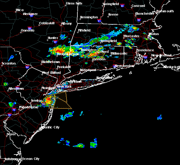 The severe thunderstorm warning for west central tolland and central hartford counties will expire at 815 pm edt, the storm which prompted the warning has weakened below severe limits, and no longer poses an immediate threat to life or property. therefore, the warning will be allowed to expire. however gusty winds and heavy rain are still possible with this thunderstorm. The severe thunderstorm warning for west central tolland and central hartford counties will expire at 815 pm edt, the storm which prompted the warning has weakened below severe limits, and no longer poses an immediate threat to life or property. therefore, the warning will be allowed to expire. however gusty winds and heavy rain are still possible with this thunderstorm.
|
| 7/23/2020 8:00 PM EDT |
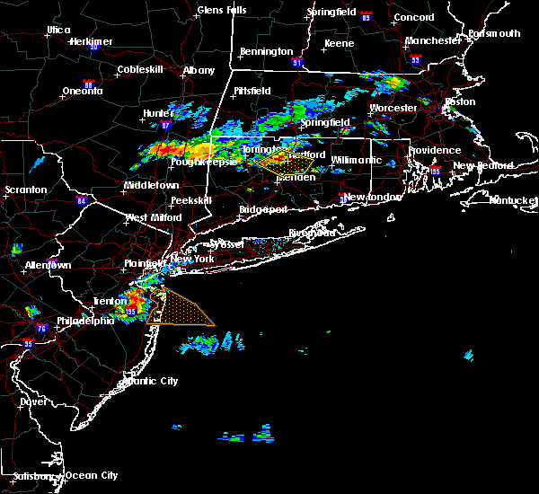 At 800 pm edt, a severe thunderstorm was located over hartford, moving east at 25 mph (radar indicated). Hazards include 60 mph wind gusts and penny size hail. Expect damage to trees and power lines. Locations impacted include, hartford, new britain, west hartford, bristol, manchester, east hartford, glastonbury, newington, vernon, windsor, wethersfield, south windsor, farmington, simsbury, bloomfield, berlin, rocky hill, avon, plainville and coventry. At 800 pm edt, a severe thunderstorm was located over hartford, moving east at 25 mph (radar indicated). Hazards include 60 mph wind gusts and penny size hail. Expect damage to trees and power lines. Locations impacted include, hartford, new britain, west hartford, bristol, manchester, east hartford, glastonbury, newington, vernon, windsor, wethersfield, south windsor, farmington, simsbury, bloomfield, berlin, rocky hill, avon, plainville and coventry.
|
| 7/23/2020 7:47 PM EDT |
 At 746 pm edt, a severe thunderstorm was located over avon, or near west hartford, moving southeast at 25 mph (radar indicated). Hazards include 60 mph wind gusts and penny size hail. Expect damage to trees and power lines. Locations impacted include, hartford, new britain, west hartford, bristol, manchester, east hartford, glastonbury, newington, vernon, windsor, wethersfield, south windsor, farmington, simsbury, bloomfield, berlin, rocky hill, avon, plainville and coventry. At 746 pm edt, a severe thunderstorm was located over avon, or near west hartford, moving southeast at 25 mph (radar indicated). Hazards include 60 mph wind gusts and penny size hail. Expect damage to trees and power lines. Locations impacted include, hartford, new britain, west hartford, bristol, manchester, east hartford, glastonbury, newington, vernon, windsor, wethersfield, south windsor, farmington, simsbury, bloomfield, berlin, rocky hill, avon, plainville and coventry.
|
| 7/23/2020 7:16 PM EDT |
 At 716 pm edt, a severe thunderstorm was located over new hartford, or 7 miles northeast of torrington, moving east at 25 mph (radar indicated). Hazards include 60 mph wind gusts and quarter size hail. Expect wind damage to trees and power lines. Minor hail damage to vehicles is possible. At 716 pm edt, a severe thunderstorm was located over new hartford, or 7 miles northeast of torrington, moving east at 25 mph (radar indicated). Hazards include 60 mph wind gusts and quarter size hail. Expect wind damage to trees and power lines. Minor hail damage to vehicles is possible.
|
| 7/23/2020 4:12 PM EDT |
 At 412 pm edt, severe thunderstorms were located along a line extending from near windsor locks to east granby to canton, moving east at 25 mph (radar indicated). Hazards include 60 mph wind gusts and penny size hail. expect damage to trees and power lines At 412 pm edt, severe thunderstorms were located along a line extending from near windsor locks to east granby to canton, moving east at 25 mph (radar indicated). Hazards include 60 mph wind gusts and penny size hail. expect damage to trees and power lines
|
| 5/15/2020 8:59 PM EDT |
 At 844 pm edt, severe thunderstorms were located along a line extending from east longmeadow to near east granby to burlington, moving east at 40 mph (radar indicated). Hazards include 60 mph wind gusts. Expect damage to trees and power lines. Locations impacted include, springfield, hartford, new britain, west hartford, bristol, manchester, east hartford, enfield, southington, glastonbury, newington, vernon, windsor, agawam, wethersfield, mansfield, south windsor, farmington, windham and simsbury. At 844 pm edt, severe thunderstorms were located along a line extending from east longmeadow to near east granby to burlington, moving east at 40 mph (radar indicated). Hazards include 60 mph wind gusts. Expect damage to trees and power lines. Locations impacted include, springfield, hartford, new britain, west hartford, bristol, manchester, east hartford, enfield, southington, glastonbury, newington, vernon, windsor, agawam, wethersfield, mansfield, south windsor, farmington, windham and simsbury.
|
| 5/15/2020 8:44 PM EDT |
 At 844 pm edt, severe thunderstorms were located along a line extending from east longmeadow to near east granby to burlington, moving east at 40 mph (radar indicated). Hazards include 60 mph wind gusts. Expect damage to trees and power lines. Locations impacted include, springfield, hartford, new britain, west hartford, bristol, manchester, east hartford, enfield, southington, glastonbury, newington, vernon, windsor, agawam, wethersfield, mansfield, south windsor, farmington, windham and simsbury. At 844 pm edt, severe thunderstorms were located along a line extending from east longmeadow to near east granby to burlington, moving east at 40 mph (radar indicated). Hazards include 60 mph wind gusts. Expect damage to trees and power lines. Locations impacted include, springfield, hartford, new britain, west hartford, bristol, manchester, east hartford, enfield, southington, glastonbury, newington, vernon, windsor, agawam, wethersfield, mansfield, south windsor, farmington, windham and simsbury.
|
| 5/15/2020 8:32 PM EDT |
 At 832 pm edt, severe thunderstorms were located along a line extending from agawam to near granby to northwest harwinton, moving east at 40 mph (at 820 pm trained spotters in agawam, ma reported trees and wires down). Hazards include 60 mph wind gusts. Expect damage to trees and power lines. Locations impacted include, springfield, hartford, new britain, west hartford, bristol, manchester, east hartford, enfield, southington, westfield, glastonbury, newington, vernon, windsor, agawam, west springfield, wethersfield, mansfield, south windsor and farmington. At 832 pm edt, severe thunderstorms were located along a line extending from agawam to near granby to northwest harwinton, moving east at 40 mph (at 820 pm trained spotters in agawam, ma reported trees and wires down). Hazards include 60 mph wind gusts. Expect damage to trees and power lines. Locations impacted include, springfield, hartford, new britain, west hartford, bristol, manchester, east hartford, enfield, southington, westfield, glastonbury, newington, vernon, windsor, agawam, west springfield, wethersfield, mansfield, south windsor and farmington.
|
| 5/15/2020 8:15 PM EDT |
 At 814 pm edt, severe thunderstorms were located along a line extending from near westfield to near hartland to near litchfield, moving southeast at 35 mph (radar indicated). Hazards include 60 mph wind gusts. expect damage to trees and power lines At 814 pm edt, severe thunderstorms were located along a line extending from near westfield to near hartland to near litchfield, moving southeast at 35 mph (radar indicated). Hazards include 60 mph wind gusts. expect damage to trees and power lines
|
| 8/21/2019 7:14 PM EDT |
 At 713 pm edt, severe thunderstorms were located along a line extending from hatfield to canton, moving east at 40 mph (radar indicated). Hazards include 60 mph wind gusts. Expect damage to trees and power lines. Locations impacted include, new britain, west hartford, enfield, windsor, farmington, simsbury, bloomfield, avon, longmeadow, suffield, windsor locks, granby, canton, southwick, burlington, east granby and hartland. At 713 pm edt, severe thunderstorms were located along a line extending from hatfield to canton, moving east at 40 mph (radar indicated). Hazards include 60 mph wind gusts. Expect damage to trees and power lines. Locations impacted include, new britain, west hartford, enfield, windsor, farmington, simsbury, bloomfield, avon, longmeadow, suffield, windsor locks, granby, canton, southwick, burlington, east granby and hartland.
|
| 8/21/2019 7:14 PM EDT |
 At 634 pm edt, severe thunderstorms were located along a line extending from near east windsor to falls village, moving east at 40 mph (radar indicated). Hazards include 60 mph wind gusts. expect damage to trees and power lines At 634 pm edt, severe thunderstorms were located along a line extending from near east windsor to falls village, moving east at 40 mph (radar indicated). Hazards include 60 mph wind gusts. expect damage to trees and power lines
|
| 8/21/2019 6:34 PM EDT |
 At 634 pm edt, severe thunderstorms were located along a line extending from near east windsor to falls village, moving east at 40 mph (radar indicated). Hazards include 60 mph wind gusts. expect damage to trees and power lines At 634 pm edt, severe thunderstorms were located along a line extending from near east windsor to falls village, moving east at 40 mph (radar indicated). Hazards include 60 mph wind gusts. expect damage to trees and power lines
|
| 8/21/2019 2:09 PM EDT |
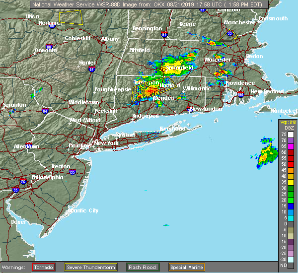 At 208 pm edt, a severe thunderstorm was located over west hartford, moving northeast at 25 mph. in farmington, trees were reported down on wires (radar indicated). Hazards include 60 mph wind gusts and penny size hail. Expect damage to trees and power lines. this severe storm will be near, hartford, east hartford and wethersfield around 220 pm edt. Manchester, windsor, south windsor, windsor locks and east windsor around 230 pm edt. At 208 pm edt, a severe thunderstorm was located over west hartford, moving northeast at 25 mph. in farmington, trees were reported down on wires (radar indicated). Hazards include 60 mph wind gusts and penny size hail. Expect damage to trees and power lines. this severe storm will be near, hartford, east hartford and wethersfield around 220 pm edt. Manchester, windsor, south windsor, windsor locks and east windsor around 230 pm edt.
|
| 8/21/2019 1:57 PM EDT |
 At 156 pm edt, a severe thunderstorm was located over farmington, moving east at 25 mph (radar indicated). Hazards include 60 mph wind gusts and penny size hail. Expect damage to trees and power lines. this severe storm will be near, new britain around 205 pm edt. newington around 210 pm edt. west hartford around 215 pm edt. hartford and bloomfield around 220 pm edt. east hartford and wethersfield around 225 pm edt. Manchester, glastonbury, south windsor, east windsor and bolton around 230 pm edt. At 156 pm edt, a severe thunderstorm was located over farmington, moving east at 25 mph (radar indicated). Hazards include 60 mph wind gusts and penny size hail. Expect damage to trees and power lines. this severe storm will be near, new britain around 205 pm edt. newington around 210 pm edt. west hartford around 215 pm edt. hartford and bloomfield around 220 pm edt. east hartford and wethersfield around 225 pm edt. Manchester, glastonbury, south windsor, east windsor and bolton around 230 pm edt.
|
| 8/21/2019 1:25 PM EDT |
 At 125 pm edt, a severe thunderstorm was located over terryville, or near bristol, moving northeast at 35 mph (radar indicated). Hazards include 60 mph wind gusts and penny size hail. Expect damage to trees and power lines. this severe thunderstorm will be near, plainville around 130 pm edt. southington and farmington around 135 pm edt. canton around 140 pm edt. avon around 145 pm edt. hartford, west hartford, east hartford, simsbury and bloomfield around 155 pm edt. windsor, windsor locks and east granby around 205 pm edt. manchester and east windsor around 210 pm edt. south windsor around 215 pm edt. Other locations impacted by this severe thunderstorm include allentown, pequabuck and terryville station. At 125 pm edt, a severe thunderstorm was located over terryville, or near bristol, moving northeast at 35 mph (radar indicated). Hazards include 60 mph wind gusts and penny size hail. Expect damage to trees and power lines. this severe thunderstorm will be near, plainville around 130 pm edt. southington and farmington around 135 pm edt. canton around 140 pm edt. avon around 145 pm edt. hartford, west hartford, east hartford, simsbury and bloomfield around 155 pm edt. windsor, windsor locks and east granby around 205 pm edt. manchester and east windsor around 210 pm edt. south windsor around 215 pm edt. Other locations impacted by this severe thunderstorm include allentown, pequabuck and terryville station.
|
| 8/7/2019 8:37 PM EDT |
 At 836 pm edt, a severe thunderstorm was located over west hartford, moving northeast at 25 mph (radar indicated). Hazards include 60 mph wind gusts and penny size hail. Expect damage to trees and power lines. Locations impacted include, hartford, new britain, west hartford, manchester, east hartford, enfield, glastonbury, newington, vernon, windsor, wethersfield, mansfield, south windsor, farmington, simsbury, bloomfield, berlin, rocky hill, avon and plainville. At 836 pm edt, a severe thunderstorm was located over west hartford, moving northeast at 25 mph (radar indicated). Hazards include 60 mph wind gusts and penny size hail. Expect damage to trees and power lines. Locations impacted include, hartford, new britain, west hartford, manchester, east hartford, enfield, glastonbury, newington, vernon, windsor, wethersfield, mansfield, south windsor, farmington, simsbury, bloomfield, berlin, rocky hill, avon and plainville.
|
| 8/7/2019 8:30 PM EDT |
 At 829 pm edt, a severe thunderstorm was located over west hartford, moving northeast at 25 mph (radar indicated). Hazards include 60 mph wind gusts and penny size hail. expect damage to trees and power lines At 829 pm edt, a severe thunderstorm was located over west hartford, moving northeast at 25 mph (radar indicated). Hazards include 60 mph wind gusts and penny size hail. expect damage to trees and power lines
|
| 7/27/2019 6:26 PM EDT |
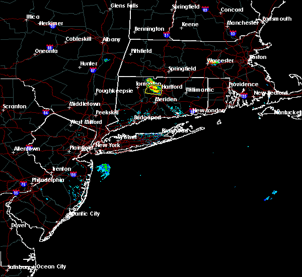 At 626 pm edt, a severe thunderstorm was located over avon, or near farmington (radar indicated). Hazards include quarter size hail. damage to vehicles is possible At 626 pm edt, a severe thunderstorm was located over avon, or near farmington (radar indicated). Hazards include quarter size hail. damage to vehicles is possible
|
| 4/15/2019 5:02 AM EDT |
 At 502 am edt, severe thunderstorms were located along a line extending from near middlefield to near cornwall bridge, moving east at 45 mph (radar indicated). Hazards include 60 mph wind gusts. expect damage to trees and power lines At 502 am edt, severe thunderstorms were located along a line extending from near middlefield to near cornwall bridge, moving east at 45 mph (radar indicated). Hazards include 60 mph wind gusts. expect damage to trees and power lines
|
| 8/17/2018 10:44 PM EDT |
 The national weather service in boston/norton has issued a * severe thunderstorm warning for. northwestern hartford county in northern connecticut. south central hampshire county in western massachusetts. western hampden county in western massachusetts. Until 1145 pm edt. The national weather service in boston/norton has issued a * severe thunderstorm warning for. northwestern hartford county in northern connecticut. south central hampshire county in western massachusetts. western hampden county in western massachusetts. Until 1145 pm edt.
|
| 8/17/2018 10:44 PM EDT |
 At 1043 pm edt, severe thunderstorms were located along a line extending from near sandisfield to near new preston, moving northeast at 40 mph (radar indicated). Hazards include 60 mph wind gusts. expect damage to trees and power lines At 1043 pm edt, severe thunderstorms were located along a line extending from near sandisfield to near new preston, moving northeast at 40 mph (radar indicated). Hazards include 60 mph wind gusts. expect damage to trees and power lines
|
| 7/28/2018 4:47 PM EDT |
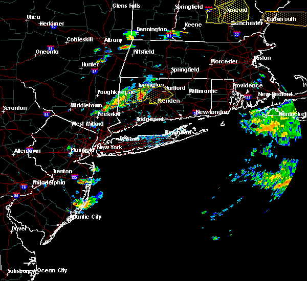 At 447 pm edt, severe thunderstorms were located along a line extending from northwest harwinton to near terryville to near oakville, moving east at 25 mph (radar indicated). Hazards include 60 mph wind gusts and penny size hail. Expect damage to trees and power lines. severe thunderstorms will be near, wolcott and plainville around 505 pm edt. farmington and burlington around 510 pm edt. bristol and canton around 515 pm edt. new britain, southington and avon around 525 pm edt. hartford, west hartford, meriden, east hartford, middletown, newington, wethersfield, hartford, simsbury and bloomfield around 530 pm edt. Other locations impacted by these severe thunderstorms include allentown, pequabuck and terryville station. At 447 pm edt, severe thunderstorms were located along a line extending from northwest harwinton to near terryville to near oakville, moving east at 25 mph (radar indicated). Hazards include 60 mph wind gusts and penny size hail. Expect damage to trees and power lines. severe thunderstorms will be near, wolcott and plainville around 505 pm edt. farmington and burlington around 510 pm edt. bristol and canton around 515 pm edt. new britain, southington and avon around 525 pm edt. hartford, west hartford, meriden, east hartford, middletown, newington, wethersfield, hartford, simsbury and bloomfield around 530 pm edt. Other locations impacted by these severe thunderstorms include allentown, pequabuck and terryville station.
|
| 6/18/2018 8:37 PM EDT |
 The severe thunderstorm warning for northwestern tolland, northwestern hartford and southwestern hampden counties will expire at 845 pm edt, the storms which prompted the warning have weakened below severe limits, and no longer poses an immediate threat to life or property. therefore, the warning will be allowed to expire. however heavy rain is still possible with these storms. &&. The severe thunderstorm warning for northwestern tolland, northwestern hartford and southwestern hampden counties will expire at 845 pm edt, the storms which prompted the warning have weakened below severe limits, and no longer poses an immediate threat to life or property. therefore, the warning will be allowed to expire. however heavy rain is still possible with these storms. &&.
|
| 6/18/2018 8:21 PM EDT |
 At 759 pm edt, a severe thunderstorm was located over tolland massachusetts, or 15 miles west of westfield, moving east at 45 mph (radar indicated). Hazards include 70 mph wind gusts. Expect considerable tree damage. Damage is likely to mobile homes and outbuildings. At 759 pm edt, a severe thunderstorm was located over tolland massachusetts, or 15 miles west of westfield, moving east at 45 mph (radar indicated). Hazards include 70 mph wind gusts. Expect considerable tree damage. Damage is likely to mobile homes and outbuildings.
|
| 6/18/2018 8:21 PM EDT |
 At 821 pm edt, a severe thunderstorm was located near suffield, or near agawam, moving east at 45 mph (radar indicated). Hazards include 70 mph wind gusts. Expect considerable tree damage. damage is likely to mobile homes and outbuildings. Locations impacted include, springfield, hartford, west hartford, enfield, westfield, windsor, agawam, simsbury, bloomfield, avon, longmeadow, suffield, east longmeadow, windsor locks, somers, granby, east windsor, canton, southwick and east granby. At 821 pm edt, a severe thunderstorm was located near suffield, or near agawam, moving east at 45 mph (radar indicated). Hazards include 70 mph wind gusts. Expect considerable tree damage. damage is likely to mobile homes and outbuildings. Locations impacted include, springfield, hartford, west hartford, enfield, westfield, windsor, agawam, simsbury, bloomfield, avon, longmeadow, suffield, east longmeadow, windsor locks, somers, granby, east windsor, canton, southwick and east granby.
|
| 6/18/2018 7:59 PM EDT |
 The national weather service in boston/norton has issued a * severe thunderstorm warning for. northwestern tolland county in northern connecticut. northwestern hartford county in northern connecticut. southwestern hampden county in western massachusetts. Until 845 pm edt. The national weather service in boston/norton has issued a * severe thunderstorm warning for. northwestern tolland county in northern connecticut. northwestern hartford county in northern connecticut. southwestern hampden county in western massachusetts. Until 845 pm edt.
|
| 5/15/2018 5:39 PM EDT |
 The severe thunderstorm warning for northern windham, tolland and hartford counties will expire at 545 pm edt, the storms which prompted the warning have weakened below severe limits, and no longer pose an immediate threat to life or property. therefore, the warning will be allowed to expire. however gusty winds and heavy rain are still possible with these thunderstorms. a tornado watch remains in effect until 900 pm edt for northern connecticut, and central massachusetts. The severe thunderstorm warning for northern windham, tolland and hartford counties will expire at 545 pm edt, the storms which prompted the warning have weakened below severe limits, and no longer pose an immediate threat to life or property. therefore, the warning will be allowed to expire. however gusty winds and heavy rain are still possible with these thunderstorms. a tornado watch remains in effect until 900 pm edt for northern connecticut, and central massachusetts.
|
| 5/15/2018 5:07 PM EDT |
 At 442 pm edt, severe thunderstorms were located along a line extending from suffield to near torrington to pawling, moving east at 45 mph (radar indicated). Hazards include 60 mph wind gusts and quarter size hail. Hail damage to vehicles is possible. Expect damage to trees and power lines. At 442 pm edt, severe thunderstorms were located along a line extending from suffield to near torrington to pawling, moving east at 45 mph (radar indicated). Hazards include 60 mph wind gusts and quarter size hail. Hail damage to vehicles is possible. Expect damage to trees and power lines.
|
| 5/15/2018 4:42 PM EDT |
 At 442 pm edt, severe thunderstorms were located along a line extending from suffield to near torrington to pawling, moving east at 45 mph (radar indicated). Hazards include 60 mph wind gusts and quarter size hail. Hail damage to vehicles is possible. Expect damage to trees and power lines. At 442 pm edt, severe thunderstorms were located along a line extending from suffield to near torrington to pawling, moving east at 45 mph (radar indicated). Hazards include 60 mph wind gusts and quarter size hail. Hail damage to vehicles is possible. Expect damage to trees and power lines.
|
| 5/15/2018 4:23 PM EDT |
 At 422 pm edt, a severe thunderstorm was located over enfield, moving east at 40 mph (radar indicated). Hazards include two inch hail and 60 mph wind gusts. People and animals outdoors will be injured. expect hail damage to roofs, windows, siding, and vehicles. expect damage to trees and power lines. locations impacted include, hartford, new britain, west hartford, meriden, bristol, manchester, east hartford, enfield, southington, glastonbury, newington, vernon, windsor, wethersfield, mansfield, south windsor, farmington, windham, wolcott and colchester. A tornado watch remains in effect until 900 pm edt for northern connecticut, and western and central massachusetts. At 422 pm edt, a severe thunderstorm was located over enfield, moving east at 40 mph (radar indicated). Hazards include two inch hail and 60 mph wind gusts. People and animals outdoors will be injured. expect hail damage to roofs, windows, siding, and vehicles. expect damage to trees and power lines. locations impacted include, hartford, new britain, west hartford, meriden, bristol, manchester, east hartford, enfield, southington, glastonbury, newington, vernon, windsor, wethersfield, mansfield, south windsor, farmington, windham, wolcott and colchester. A tornado watch remains in effect until 900 pm edt for northern connecticut, and western and central massachusetts.
|
| 5/15/2018 4:02 PM EDT |
 At 401 pm edt, a severe thunderstorm capable of producing a tornado was located near simsbury, or 9 miles northwest of windsor, moving east at 35 mph (radar indicated rotation). Hazards include tornado and hail up to two inches in diameter. Flying debris will be dangerous to those caught without shelter. mobile homes will be damaged or destroyed. damage to roofs, windows, and vehicles will occur. tree damage is likely. this dangerous storm will be near, avon around 410 pm edt. west hartford and east granby around 415 pm edt. hartford, windsor, bloomfield and windsor locks around 420 pm edt. east windsor around 425 pm edt. Manchester, vernon and south windsor around 430 pm edt. At 401 pm edt, a severe thunderstorm capable of producing a tornado was located near simsbury, or 9 miles northwest of windsor, moving east at 35 mph (radar indicated rotation). Hazards include tornado and hail up to two inches in diameter. Flying debris will be dangerous to those caught without shelter. mobile homes will be damaged or destroyed. damage to roofs, windows, and vehicles will occur. tree damage is likely. this dangerous storm will be near, avon around 410 pm edt. west hartford and east granby around 415 pm edt. hartford, windsor, bloomfield and windsor locks around 420 pm edt. east windsor around 425 pm edt. Manchester, vernon and south windsor around 430 pm edt.
|
| 5/15/2018 3:46 PM EDT |
 At 345 pm edt, a severe thunderstorm was located near hartland, or 14 miles northeast of torrington, moving east at 40 mph (radar indicated). Hazards include up to ping pong ball size hail and 60 mph wind gusts. People and animals outdoors will be injured. expect hail damage to roofs, siding, windows, and vehicles. Expect damage to trees and power lines. At 345 pm edt, a severe thunderstorm was located near hartland, or 14 miles northeast of torrington, moving east at 40 mph (radar indicated). Hazards include up to ping pong ball size hail and 60 mph wind gusts. People and animals outdoors will be injured. expect hail damage to roofs, siding, windows, and vehicles. Expect damage to trees and power lines.
|
| 5/15/2018 3:36 PM EDT |
 At 335 pm edt, a severe thunderstorm capable of producing a tornado was located over norfolk, or 9 miles north of torrington, moving east at 40 mph (radar indicated rotation). Hazards include tornado and ping pong ball size hail. Flying debris will be dangerous to those caught without shelter. mobile homes will be damaged or destroyed. damage to roofs, windows, and vehicles will occur. tree damage is likely. this dangerous storm will be near, hartland around 350 pm edt. Simsbury, granby, canton and east granby around 400 pm edt. At 335 pm edt, a severe thunderstorm capable of producing a tornado was located over norfolk, or 9 miles north of torrington, moving east at 40 mph (radar indicated rotation). Hazards include tornado and ping pong ball size hail. Flying debris will be dangerous to those caught without shelter. mobile homes will be damaged or destroyed. damage to roofs, windows, and vehicles will occur. tree damage is likely. this dangerous storm will be near, hartland around 350 pm edt. Simsbury, granby, canton and east granby around 400 pm edt.
|
| 5/15/2018 3:06 PM EDT |
 The national weather service in boston/norton has issued a * severe thunderstorm warning for. northwestern hartford county in northern connecticut. southwestern hampshire county in western massachusetts. southwestern hampden county in western massachusetts. Until 400 pm edt. The national weather service in boston/norton has issued a * severe thunderstorm warning for. northwestern hartford county in northern connecticut. southwestern hampshire county in western massachusetts. southwestern hampden county in western massachusetts. Until 400 pm edt.
|
| 5/15/2018 3:06 PM EDT |
 At 305 pm edt, a severe thunderstorm was located near copake, or 12 miles southwest of great barrington, moving east at 40 mph (trained weather spotters). Hazards include up to two inch hail and 60 mph wind gusts. People and animals outdoors will be injured. expect hail damage to roofs, siding, windows, and vehicles. Expect damage to trees and power lines. At 305 pm edt, a severe thunderstorm was located near copake, or 12 miles southwest of great barrington, moving east at 40 mph (trained weather spotters). Hazards include up to two inch hail and 60 mph wind gusts. People and animals outdoors will be injured. expect hail damage to roofs, siding, windows, and vehicles. Expect damage to trees and power lines.
|
| 9/5/2017 6:31 PM EDT |
 At 631 pm edt, a severe thunderstorm was located over bristol, moving northeast at 30 mph (radar indicated). Hazards include 60 mph wind gusts and penny size hail. expect damage to trees and power lines At 631 pm edt, a severe thunderstorm was located over bristol, moving northeast at 30 mph (radar indicated). Hazards include 60 mph wind gusts and penny size hail. expect damage to trees and power lines
|
| 8/2/2017 2:45 PM EDT |
 At 245 pm edt, a severe thunderstorm was located over canton, or 10 miles north of farmington, moving north at 15 mph (radar indicated). Hazards include 60 mph wind gusts and quarter size hail. Hail damage to vehicles is possible. Expect damage to trees and power lines. At 245 pm edt, a severe thunderstorm was located over canton, or 10 miles north of farmington, moving north at 15 mph (radar indicated). Hazards include 60 mph wind gusts and quarter size hail. Hail damage to vehicles is possible. Expect damage to trees and power lines.
|
| 6/30/2017 6:17 PM EDT |
 At 615 pm edt, a severe thunderstorm was located over west hartford, moving east at 30 mph. trees were reported down in canton with this storm (radar indicated). Hazards include 60 mph wind gusts. Expect damage to trees and power lines. Locations impacted include, hartford, new britain, west hartford, manchester, east hartford, glastonbury, newington, windsor, wethersfield, south windsor, farmington, simsbury, bloomfield, rocky hill, avon and burlington. At 615 pm edt, a severe thunderstorm was located over west hartford, moving east at 30 mph. trees were reported down in canton with this storm (radar indicated). Hazards include 60 mph wind gusts. Expect damage to trees and power lines. Locations impacted include, hartford, new britain, west hartford, manchester, east hartford, glastonbury, newington, windsor, wethersfield, south windsor, farmington, simsbury, bloomfield, rocky hill, avon and burlington.
|
| 6/30/2017 6:06 PM EDT |
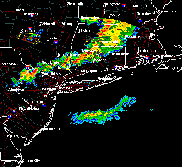 At 604 pm edt, a severe thunderstorm was located over avon, or near farmington, moving southeast at 35 mph (radar indicated). Hazards include 60 mph wind gusts and penny size hail. this storm has some rotation and will be monitored closely for a possible tornado. expect damage to trees and power lines At 604 pm edt, a severe thunderstorm was located over avon, or near farmington, moving southeast at 35 mph (radar indicated). Hazards include 60 mph wind gusts and penny size hail. this storm has some rotation and will be monitored closely for a possible tornado. expect damage to trees and power lines
|
| 6/30/2017 5:52 PM EDT |
 At 549 pm edt, a severe thunderstorm was locateed near new hartford in eastern litchfield county, moving east at 35 mph. this storm may produce large hail and damaging winds from simsbury to canton and burlington connecticut. other strong storms extended along a line from westhampton massachusetts to new preston connecticut (radar indicated). Hazards include 60 mph wind gusts and quarter size hail. Hail damage to vehicles is possible. expect damage to trees and power lines. Locations impacted include, springfield, west hartford, bristol, chicopee, enfield, southington, westfield, holyoke, windsor, northampton, agawam, west springfield, farmington, wolcott, simsbury, ludlow, bloomfield, avon, plainville and south hadley. At 549 pm edt, a severe thunderstorm was locateed near new hartford in eastern litchfield county, moving east at 35 mph. this storm may produce large hail and damaging winds from simsbury to canton and burlington connecticut. other strong storms extended along a line from westhampton massachusetts to new preston connecticut (radar indicated). Hazards include 60 mph wind gusts and quarter size hail. Hail damage to vehicles is possible. expect damage to trees and power lines. Locations impacted include, springfield, west hartford, bristol, chicopee, enfield, southington, westfield, holyoke, windsor, northampton, agawam, west springfield, farmington, wolcott, simsbury, ludlow, bloomfield, avon, plainville and south hadley.
|
| 6/30/2017 5:31 PM EDT |
 At 530 pm edt, severe thunderstorms were located along a line extending from near blandford massachusetts to near new milford, connecticut, moving east at 20 mph (radar indicated). Hazards include 60 mph wind gusts. expect damage to trees and power lines At 530 pm edt, severe thunderstorms were located along a line extending from near blandford massachusetts to near new milford, connecticut, moving east at 20 mph (radar indicated). Hazards include 60 mph wind gusts. expect damage to trees and power lines
|
| 6/21/2017 4:35 PM EDT |
 At 434 pm edt, a severe thunderstorm was located over windsor, moving east at 30 mph (radar indicated). Hazards include 60 mph wind gusts and quarter size hail. Hail damage to vehicles is possible. expect damage to trees and power lines. Locations impacted include, hartford, west hartford, manchester, east hartford, vernon, windsor, south windsor, simsbury, bloomfield, avon, ellington, tolland, windsor locks, granby, east windsor, east granby and bolton. At 434 pm edt, a severe thunderstorm was located over windsor, moving east at 30 mph (radar indicated). Hazards include 60 mph wind gusts and quarter size hail. Hail damage to vehicles is possible. expect damage to trees and power lines. Locations impacted include, hartford, west hartford, manchester, east hartford, vernon, windsor, south windsor, simsbury, bloomfield, avon, ellington, tolland, windsor locks, granby, east windsor, east granby and bolton.
|
| 6/21/2017 4:19 PM EDT |
 At 418 pm edt, a severe thunderstorm was located over east granby, or near windsor, moving east at 35 mph (radar indicated). Hazards include 60 mph wind gusts and quarter size hail. Hail damage to vehicles is possible. expect damage to trees and power lines. Locations impacted include, hartford, manchester, east hartford, enfield, vernon, windsor, mansfield, south windsor, simsbury, bloomfield, willimantic, suffield, ellington, tolland, windsor locks, coventry, stafford, somers, granby and east windsor. At 418 pm edt, a severe thunderstorm was located over east granby, or near windsor, moving east at 35 mph (radar indicated). Hazards include 60 mph wind gusts and quarter size hail. Hail damage to vehicles is possible. expect damage to trees and power lines. Locations impacted include, hartford, manchester, east hartford, enfield, vernon, windsor, mansfield, south windsor, simsbury, bloomfield, willimantic, suffield, ellington, tolland, windsor locks, coventry, stafford, somers, granby and east windsor.
|
| 6/21/2017 3:58 PM EDT |
 At 358 pm edt, a severe thunderstorm was located near winsted, or 10 miles northeast of torrington, moving east at 45 mph (radar indicated). Hazards include 60 mph wind gusts and quarter size hail. Hail damage to vehicles is possible. Expect damage to trees and power lines. At 358 pm edt, a severe thunderstorm was located near winsted, or 10 miles northeast of torrington, moving east at 45 mph (radar indicated). Hazards include 60 mph wind gusts and quarter size hail. Hail damage to vehicles is possible. Expect damage to trees and power lines.
|
| 6/19/2017 5:36 PM EDT |
 At 535 pm edt, a severe thunderstorm was located over terryville, or near bristol, moving northeast at 30 mph (radar indicated). Hazards include 60 mph wind gusts and penny size hail. expect damage to trees and power lines At 535 pm edt, a severe thunderstorm was located over terryville, or near bristol, moving northeast at 30 mph (radar indicated). Hazards include 60 mph wind gusts and penny size hail. expect damage to trees and power lines
|
| 6/19/2017 4:29 PM EDT |
 At 429 pm edt, severe thunderstorms were located along a line extending from near lenox to near norfolk to near litchfield, moving northeast at 30 mph (radar indicated). Hazards include 60 mph wind gusts and penny size hail. expect damage to trees and power lines At 429 pm edt, severe thunderstorms were located along a line extending from near lenox to near norfolk to near litchfield, moving northeast at 30 mph (radar indicated). Hazards include 60 mph wind gusts and penny size hail. expect damage to trees and power lines
|
| 5/31/2017 7:43 PM EDT |
 At 743 pm edt, severe thunderstorms were located along a line extending from barre to west brookfield to near palmer to near west springfield to near granby, moving southeast at 20 mph (trained weather spotters in and around the westfield massachusetts region have reported dime to quarter sized hail). Hazards include quarter size hail. Damage to vehicles is possible. Locations impacted include, springfield, chicopee, enfield, westfield, holyoke, windsor, agawam, west springfield, simsbury, ludlow, bloomfield, avon, south hadley, easthampton, longmeadow, suffield, east longmeadow, ellington, belchertown and wilbraham. At 743 pm edt, severe thunderstorms were located along a line extending from barre to west brookfield to near palmer to near west springfield to near granby, moving southeast at 20 mph (trained weather spotters in and around the westfield massachusetts region have reported dime to quarter sized hail). Hazards include quarter size hail. Damage to vehicles is possible. Locations impacted include, springfield, chicopee, enfield, westfield, holyoke, windsor, agawam, west springfield, simsbury, ludlow, bloomfield, avon, south hadley, easthampton, longmeadow, suffield, east longmeadow, ellington, belchertown and wilbraham.
|
| 5/31/2017 7:28 PM EDT |
 At 726 pm edt, severe thunderstorms were located along a line extending from near petersham to near ware to near ludlow to westfield to near hartland, moving southeast at 20 mph (trained weather spotters have reported mainly dime to nickel sized hail with a couple of reports of quarter sized hail with the latest reports out of granby massachusetts). Hazards include quarter size hail. damage to vehicles is possible At 726 pm edt, severe thunderstorms were located along a line extending from near petersham to near ware to near ludlow to westfield to near hartland, moving southeast at 20 mph (trained weather spotters have reported mainly dime to nickel sized hail with a couple of reports of quarter sized hail with the latest reports out of granby massachusetts). Hazards include quarter size hail. damage to vehicles is possible
|
| 9/11/2016 8:55 AM EDT |
 At 854 am edt, severe thunderstorms were located along a line extending from near hartland to near new hartford center to near litchfield, moving northeast at 55 mph (radar indicated). Hazards include 60 mph wind gusts. Expect damage to roofs. siding. And trees. At 854 am edt, severe thunderstorms were located along a line extending from near hartland to near new hartford center to near litchfield, moving northeast at 55 mph (radar indicated). Hazards include 60 mph wind gusts. Expect damage to roofs. siding. And trees.
|
| 8/16/2016 3:06 PM EDT |
 At 305 pm edt, a severe thunderstorm was located over simsbury, or near windsor, moving northeast at 25 mph (radar indicated). Hazards include 60 mph wind gusts. Expect damage to roofs. siding. And trees. At 305 pm edt, a severe thunderstorm was located over simsbury, or near windsor, moving northeast at 25 mph (radar indicated). Hazards include 60 mph wind gusts. Expect damage to roofs. siding. And trees.
|
| 8/14/2016 12:15 AM EDT |
 At 1214 am edt, a severe thunderstorm was located over thomaston, or near bristol, moving east at 40 mph (radar indicated). Hazards include 60 mph wind gusts. Expect damage to roofs. siding. And trees. At 1214 am edt, a severe thunderstorm was located over thomaston, or near bristol, moving east at 40 mph (radar indicated). Hazards include 60 mph wind gusts. Expect damage to roofs. siding. And trees.
|
| 8/13/2016 9:43 PM EDT |
 At 941 pm edt, a severe thunderstorm was located near ashfield, or 11 miles north of northampton, moving east at 65 mph (radar indicated). Hazards include 70 mph wind gusts. Expect considerable tree damage. damage is likely to mobile homes, roofs, and outbuildings. locations impacted include, conway, sunderland, deerfield,. montague,. leverett,. Wendell, new salem. At 941 pm edt, a severe thunderstorm was located near ashfield, or 11 miles north of northampton, moving east at 65 mph (radar indicated). Hazards include 70 mph wind gusts. Expect considerable tree damage. damage is likely to mobile homes, roofs, and outbuildings. locations impacted include, conway, sunderland, deerfield,. montague,. leverett,. Wendell, new salem.
|
| 8/13/2016 9:29 PM EDT |
 At 927 pm edt, severe thunderstorms were located along a line extending from near guilford center to plainfield to near blandford to 6 miles south of norfolk, moving east at 45 mph (radar indicated). Hazards include 60 mph wind gusts. Expect damage to roofs. siding. And trees. At 927 pm edt, severe thunderstorms were located along a line extending from near guilford center to plainfield to near blandford to 6 miles south of norfolk, moving east at 45 mph (radar indicated). Hazards include 60 mph wind gusts. Expect damage to roofs. siding. And trees.
|
| 8/13/2016 9:09 PM EDT |
 At 908 pm edt, severe thunderstorms were located along a line extending from near readsboro to near pittsfield to near sandisfield to sharon, moving east at 45 mph (radar indicated). Hazards include 60 mph wind gusts. Expect damage to roofs. siding. And trees. At 908 pm edt, severe thunderstorms were located along a line extending from near readsboro to near pittsfield to near sandisfield to sharon, moving east at 45 mph (radar indicated). Hazards include 60 mph wind gusts. Expect damage to roofs. siding. And trees.
|
| 2/25/2016 12:58 AM EST |
 At 1258 am est, doppler radar indicated a severe thunderstorm capable of producing destructive winds in excess of 70 mph. this storm was located over east windsor, or near south windsor, and was moving northeast at 45 mph. At 1258 am est, doppler radar indicated a severe thunderstorm capable of producing destructive winds in excess of 70 mph. this storm was located over east windsor, or near south windsor, and was moving northeast at 45 mph.
|
| 2/25/2016 12:25 AM EST |
 At 1225 am est, doppler radar indicated a line of severe thunderstorms capable of producing destructive winds in excess of 70 mph. these storms were located along a line extending from canton to portland, and was moving northeast at 45 mph. At 1225 am est, doppler radar indicated a line of severe thunderstorms capable of producing destructive winds in excess of 70 mph. these storms were located along a line extending from canton to portland, and was moving northeast at 45 mph.
|
| 9/13/2015 4:36 PM EDT |
 At 435 pm edt, doppler radar continued to indicated a severe thunderstorm capable of producing damaging winds in excess of 60 mph. this storm was located over simsbury, moving northeast at 25 mph. locations impacted include, enfield, windsor, simsbury, bloomfield, avon, suffield, windsor locks, granby, east windsor and east granby. At 435 pm edt, doppler radar continued to indicated a severe thunderstorm capable of producing damaging winds in excess of 60 mph. this storm was located over simsbury, moving northeast at 25 mph. locations impacted include, enfield, windsor, simsbury, bloomfield, avon, suffield, windsor locks, granby, east windsor and east granby.
|
| 9/13/2015 4:16 PM EDT |
 At 416 pm edt, doppler radar indicated a severe thunderstorm capable of producing damaging winds in excess of 60 mph. this storm was located over avon, or near farmington, and was moving northeast at 25 mph. * some locations impacted include, enfield, windsor, farmington, simsbury, bloomfield, avon, suffield, windsor locks, granby, east windsor, canton, burlington and east granby. At 416 pm edt, doppler radar indicated a severe thunderstorm capable of producing damaging winds in excess of 60 mph. this storm was located over avon, or near farmington, and was moving northeast at 25 mph. * some locations impacted include, enfield, windsor, farmington, simsbury, bloomfield, avon, suffield, windsor locks, granby, east windsor, canton, burlington and east granby.
|
| 8/15/2015 6:35 PM EDT | Tree...utility pole and wires down on main street. tree down on page stree in hartford county CT, 2.4 miles N of Weatogue, CT |
| 6/23/2015 8:36 PM EDT |
 At 836 pm edt, doppler radar indicated a severe thunderstorm capable of producing damaging winds in excess of 60 mph. this storm was located over east granby, or near windsor, moving east at 40 mph. locations impacted include, hartford, manchester, east hartford, enfield, windsor, south windsor, simsbury, bloomfield, suffield, windsor locks, granby, east windsor, canton and east granby. At 836 pm edt, doppler radar indicated a severe thunderstorm capable of producing damaging winds in excess of 60 mph. this storm was located over east granby, or near windsor, moving east at 40 mph. locations impacted include, hartford, manchester, east hartford, enfield, windsor, south windsor, simsbury, bloomfield, suffield, windsor locks, granby, east windsor, canton and east granby.
|
| 6/23/2015 8:13 PM EDT |
 At 813 pm edt, doppler radar indicated a severe thunderstorm capable of producing damaging winds in excess of 60 mph. this storm was located over hartland, or 13 miles northeast of torrington, and was moving east at 30 mph. * some locations impacted include, hartford, manchester, east hartford, enfield, windsor, south windsor, simsbury, bloomfield, suffield, windsor locks, granby, east windsor, canton, southwick, east granby and hartland. At 813 pm edt, doppler radar indicated a severe thunderstorm capable of producing damaging winds in excess of 60 mph. this storm was located over hartland, or 13 miles northeast of torrington, and was moving east at 30 mph. * some locations impacted include, hartford, manchester, east hartford, enfield, windsor, south windsor, simsbury, bloomfield, suffield, windsor locks, granby, east windsor, canton, southwick, east granby and hartland.
|
| 6/23/2015 7:51 PM EDT |
 At 750 pm edt, doppler radar indicated a line of severe thunderstorms capable of producing damaging winds in excess of 60 mph. these storms were located along a line extending from ludlow to granville, moving east at 35 mph. in addition, trees and power lines were downed in russell and westfield as the storms moved through. locations impacted include, springfield, chicopee, enfield, westfield, holyoke, windsor, agawam, west springfield, south windsor, simsbury, ludlow, bloomfield, longmeadow, suffield, east longmeadow, ellington, wilbraham, windsor locks, stafford and somers. At 750 pm edt, doppler radar indicated a line of severe thunderstorms capable of producing damaging winds in excess of 60 mph. these storms were located along a line extending from ludlow to granville, moving east at 35 mph. in addition, trees and power lines were downed in russell and westfield as the storms moved through. locations impacted include, springfield, chicopee, enfield, westfield, holyoke, windsor, agawam, west springfield, south windsor, simsbury, ludlow, bloomfield, longmeadow, suffield, east longmeadow, ellington, wilbraham, windsor locks, stafford and somers.
|
| 6/23/2015 7:41 PM EDT |
 At 740 pm edt, doppler radar indicated a line of severe thunderstorms capable of producing damaging winds in excess of 60 mph. these storms were located along a line extending from ludlow to near granville, moving southeast at 20 mph. in addition, at 738 pm, trees and wires were reported downed in westfield. locations impacted include, springfield, chicopee, enfield, westfield, holyoke, windsor, agawam, west springfield, south windsor, simsbury, ludlow, bloomfield, south hadley, easthampton, longmeadow, suffield, east longmeadow, ellington, wilbraham and windsor locks. At 740 pm edt, doppler radar indicated a line of severe thunderstorms capable of producing damaging winds in excess of 60 mph. these storms were located along a line extending from ludlow to near granville, moving southeast at 20 mph. in addition, at 738 pm, trees and wires were reported downed in westfield. locations impacted include, springfield, chicopee, enfield, westfield, holyoke, windsor, agawam, west springfield, south windsor, simsbury, ludlow, bloomfield, south hadley, easthampton, longmeadow, suffield, east longmeadow, ellington, wilbraham and windsor locks.
|
| 6/23/2015 7:19 PM EDT |
 At 718 pm edt, doppler radar indicated a line of severe thunderstorms capable of producing damaging winds in excess of 60 mph. these storms were located along a line extending from south hadley to near otis, and was moving east at 40 mph. * some locations impacted include, springfield, chicopee, enfield, westfield, holyoke, windsor, agawam, west springfield, south windsor, simsbury, ludlow, bloomfield, south hadley, easthampton, longmeadow, suffield, east longmeadow, ellington, wilbraham and windsor locks. At 718 pm edt, doppler radar indicated a line of severe thunderstorms capable of producing damaging winds in excess of 60 mph. these storms were located along a line extending from south hadley to near otis, and was moving east at 40 mph. * some locations impacted include, springfield, chicopee, enfield, westfield, holyoke, windsor, agawam, west springfield, south windsor, simsbury, ludlow, bloomfield, south hadley, easthampton, longmeadow, suffield, east longmeadow, ellington, wilbraham and windsor locks.
|
| 6/9/2015 3:51 PM EDT |
 The national weather service in taunton has issued a * severe thunderstorm warning for. northern hartford county in northern connecticut. until 430 pm edt * at 351 pm edt. Doppler radar indicated a severe thunderstorm capable of producing quarter size hail and damaging winds in excess. The national weather service in taunton has issued a * severe thunderstorm warning for. northern hartford county in northern connecticut. until 430 pm edt * at 351 pm edt. Doppler radar indicated a severe thunderstorm capable of producing quarter size hail and damaging winds in excess.
|
Hail Maps for Weatogue, CT


Connect with Interactive Hail Maps