

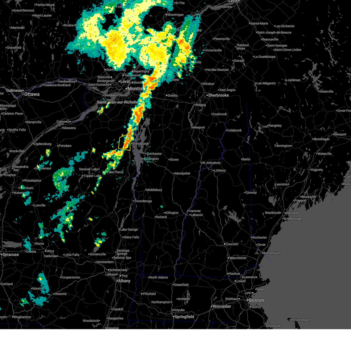
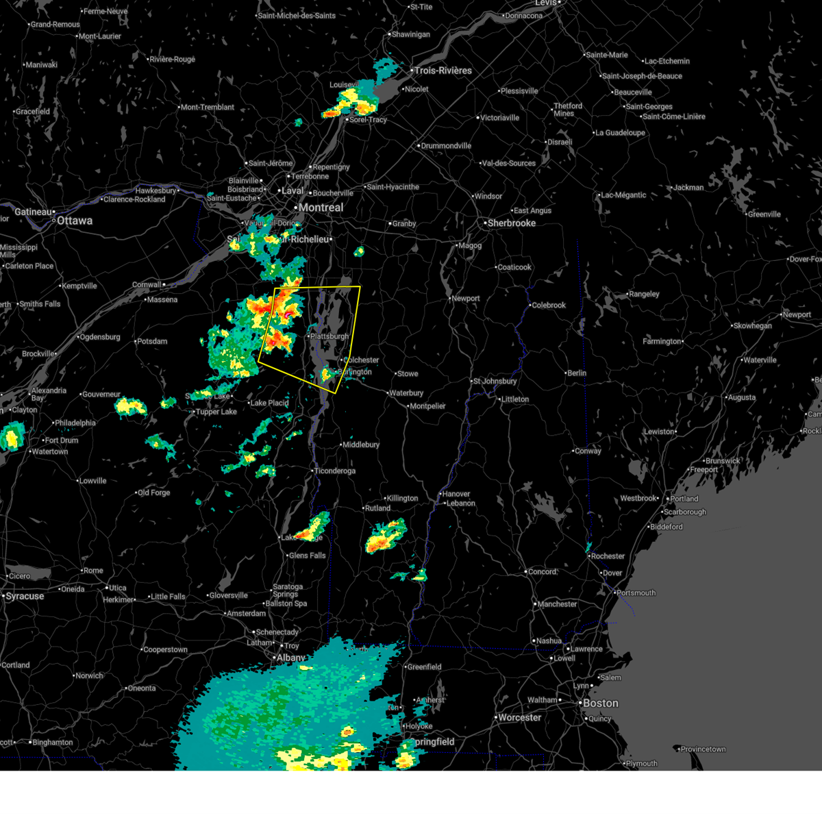
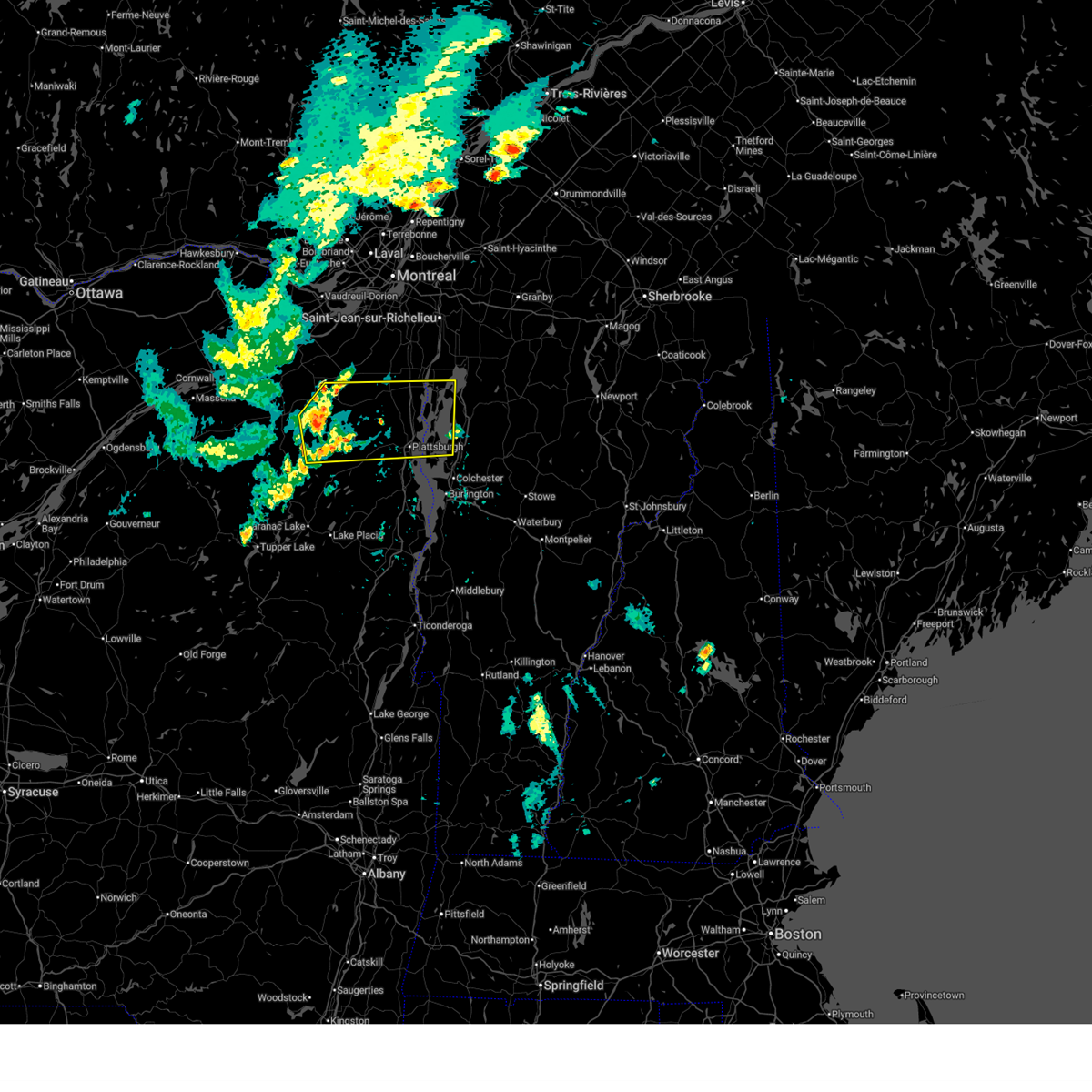
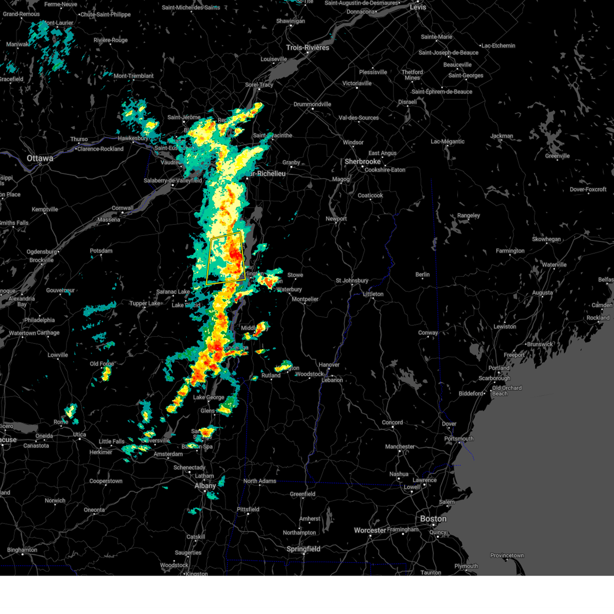
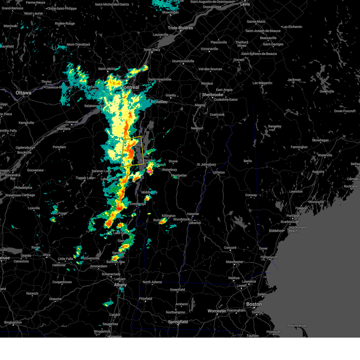
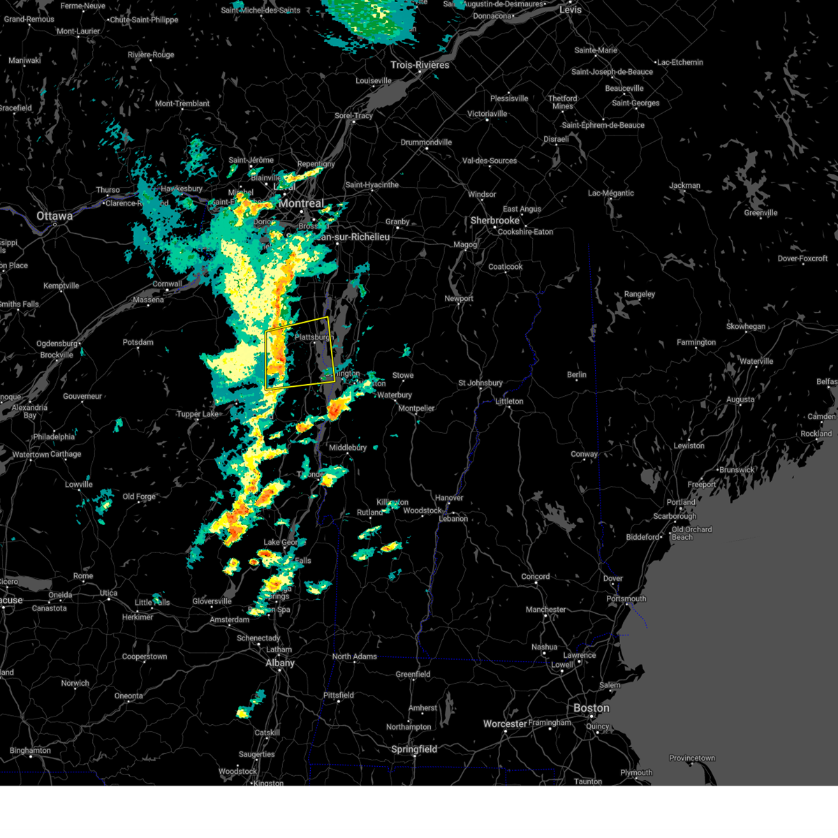
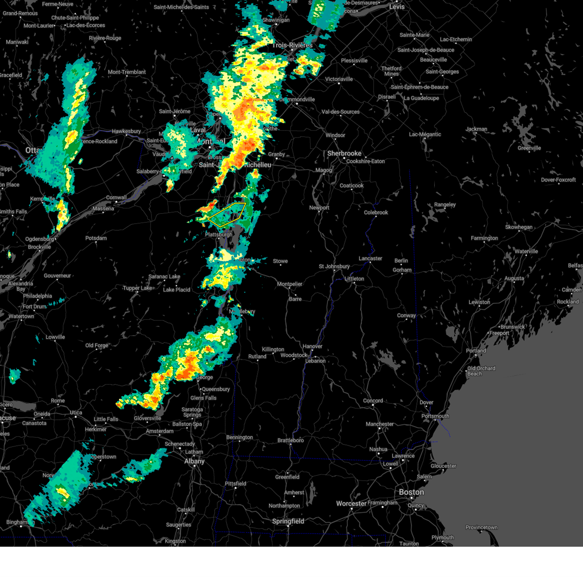
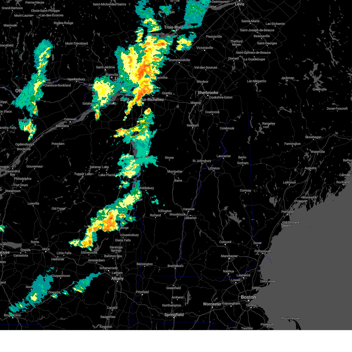
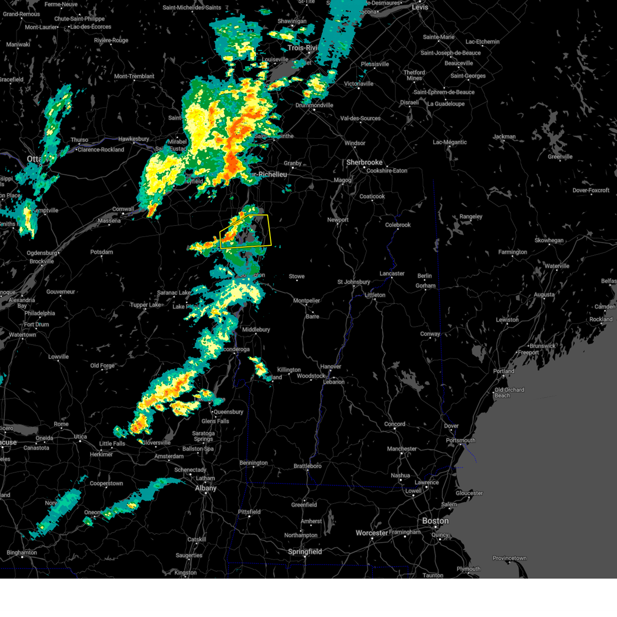
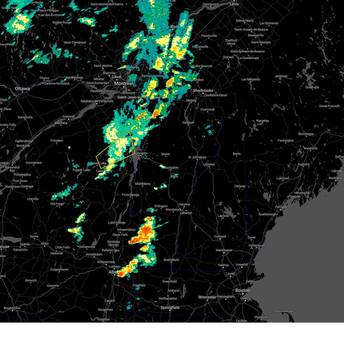
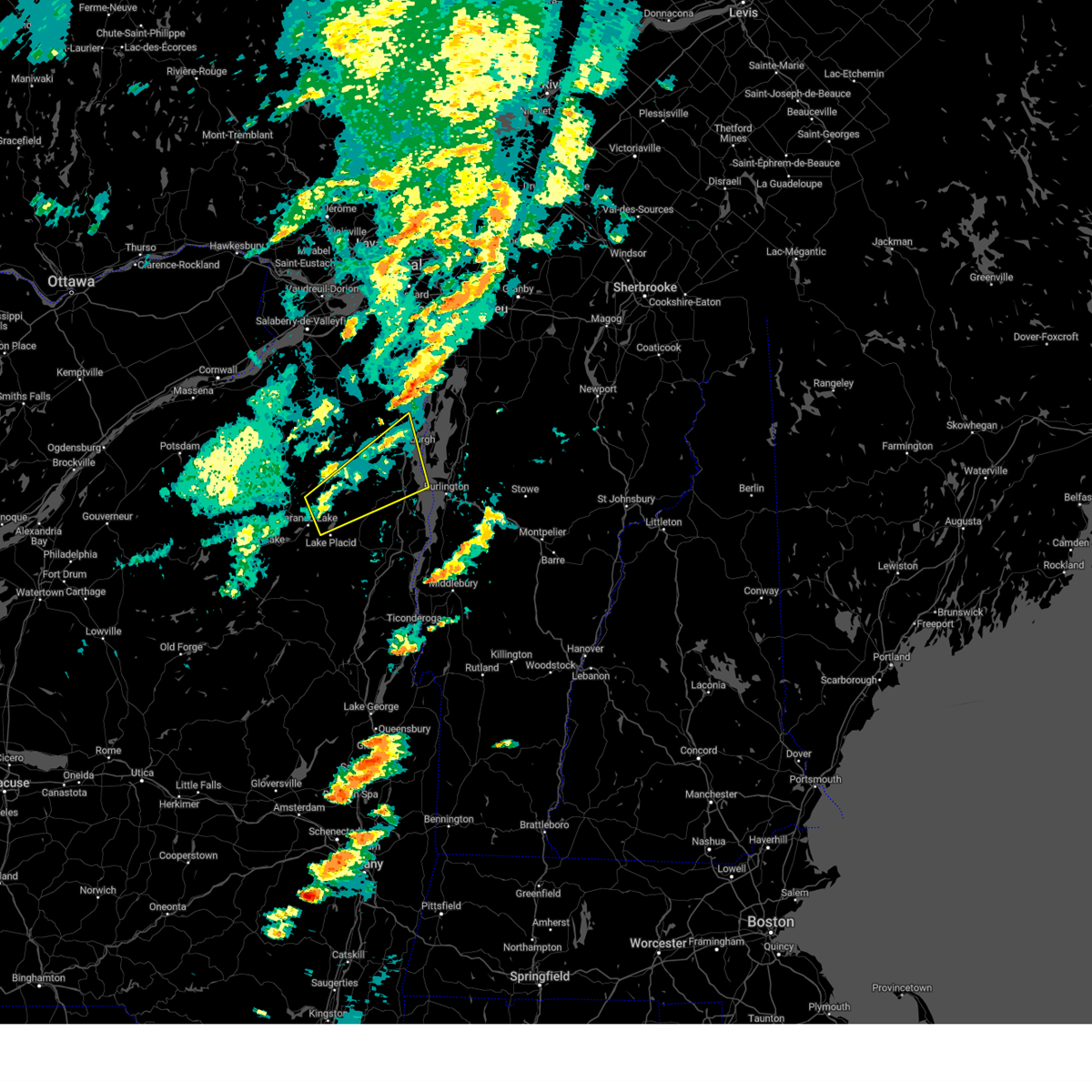
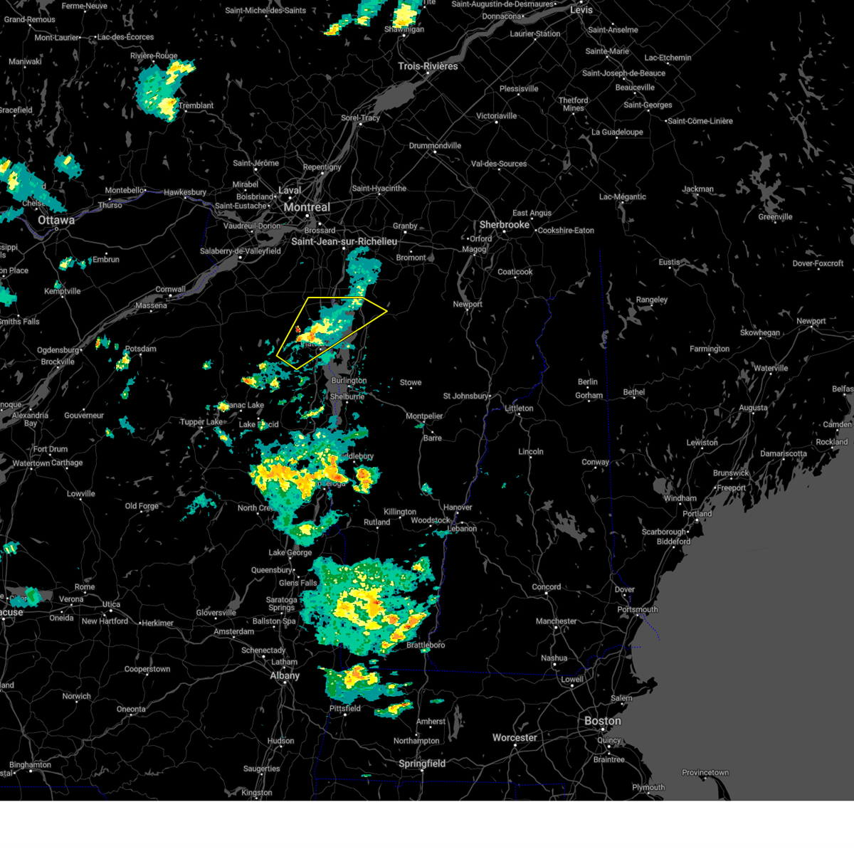
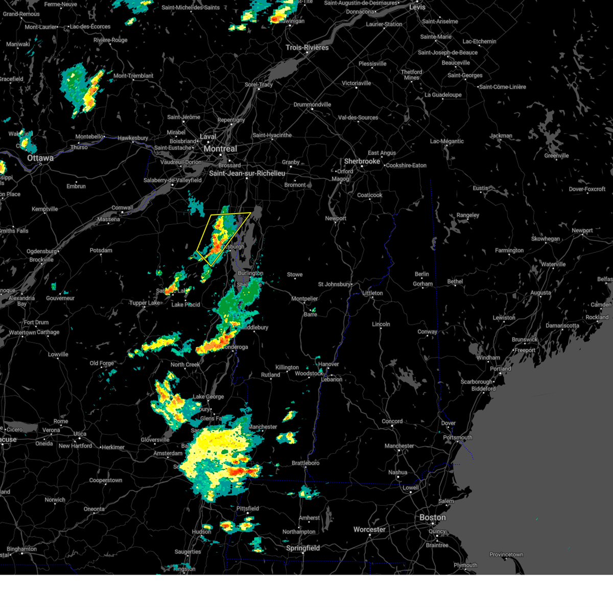
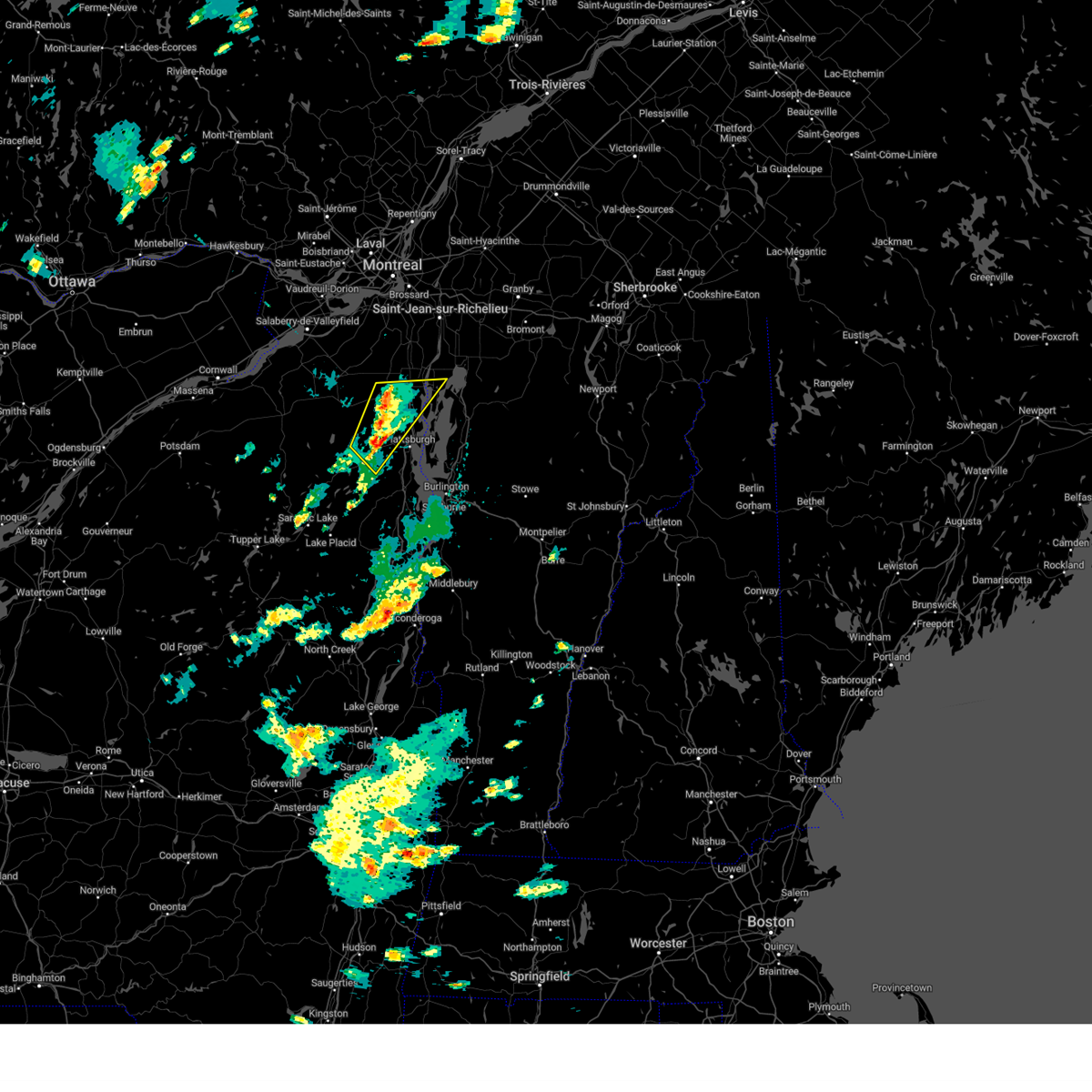
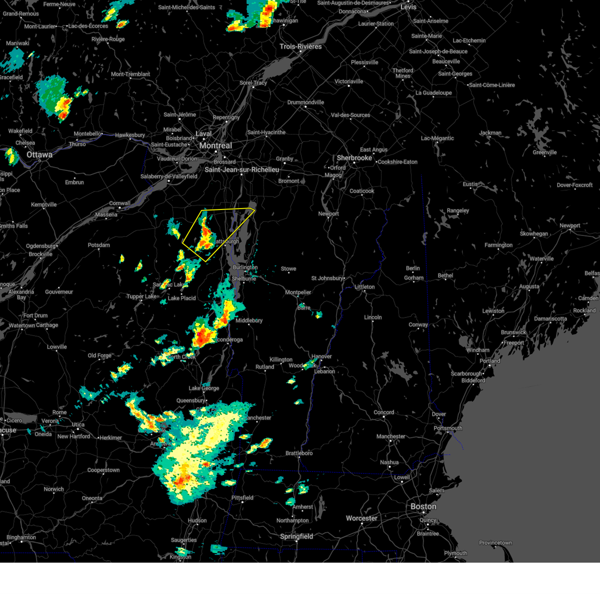
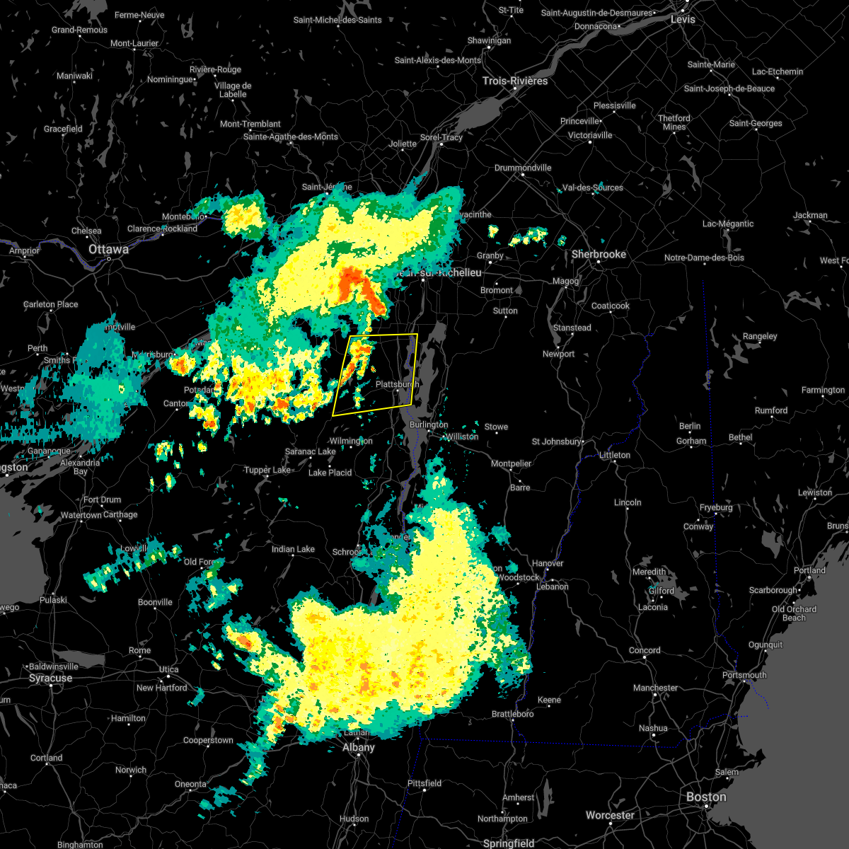
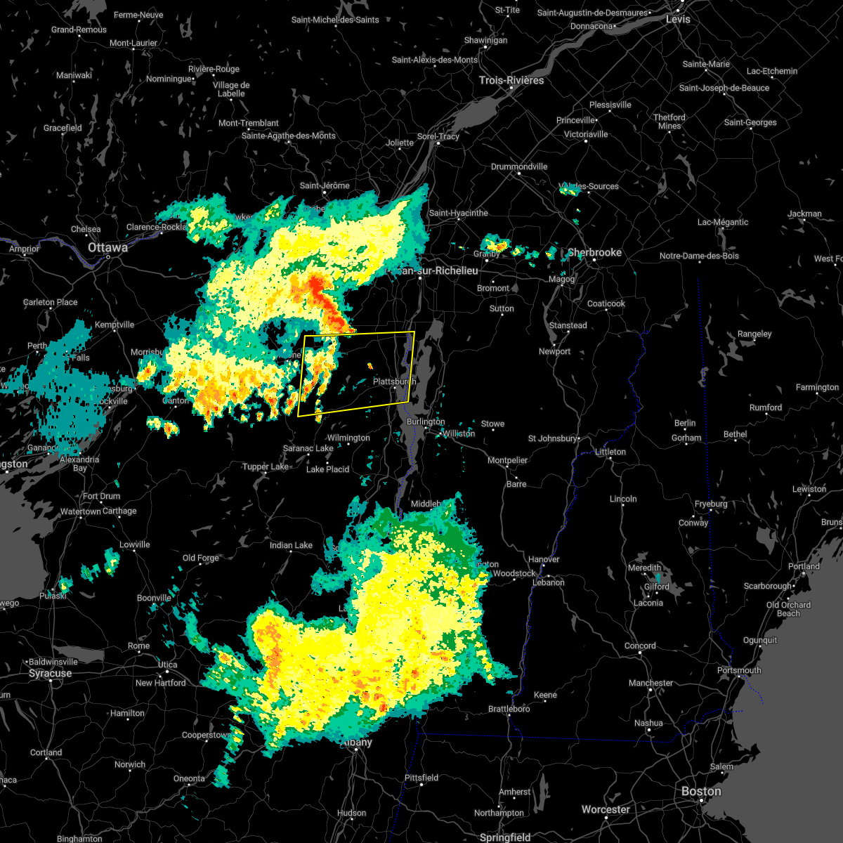
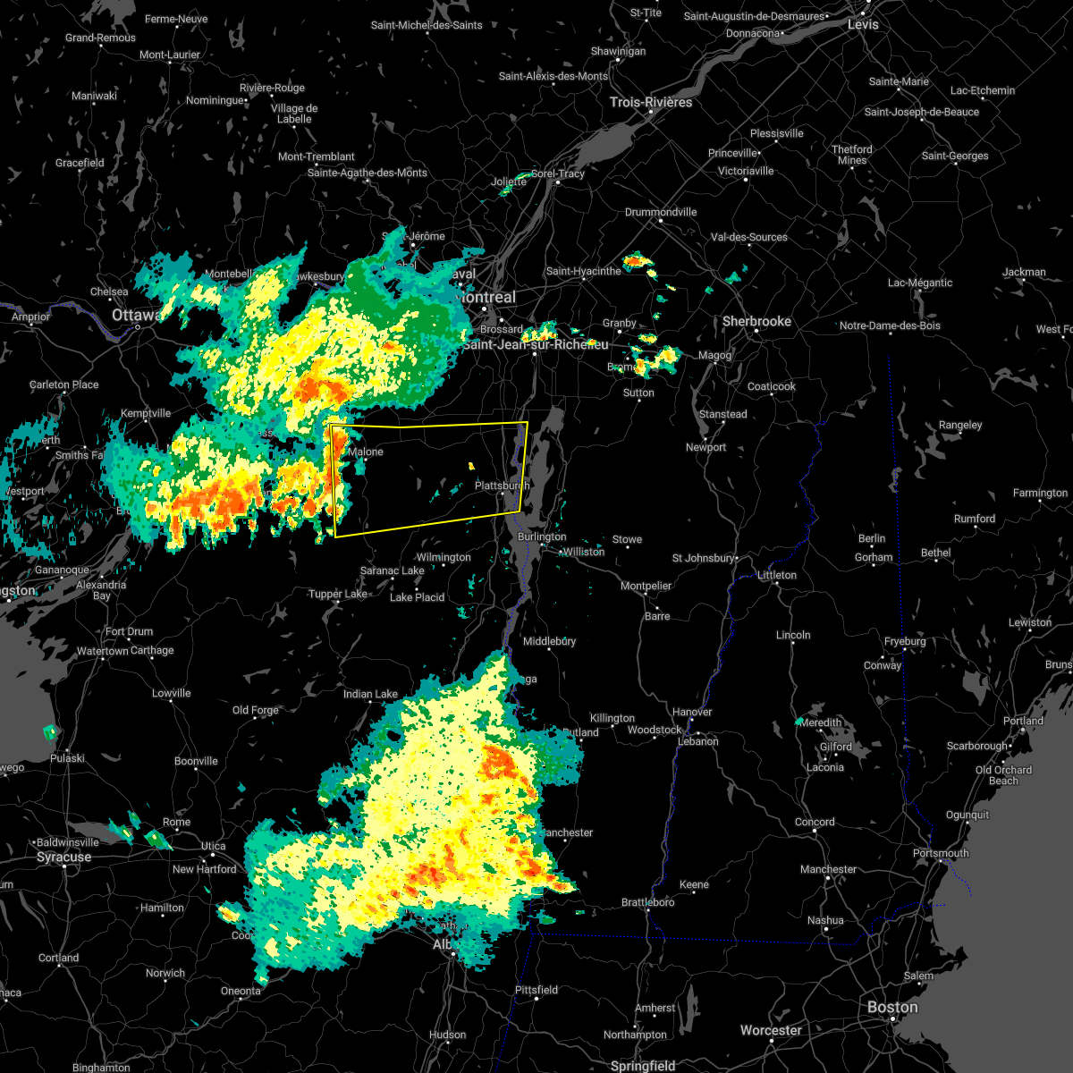
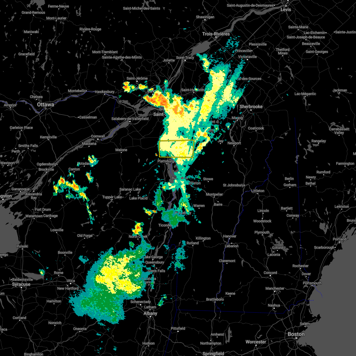
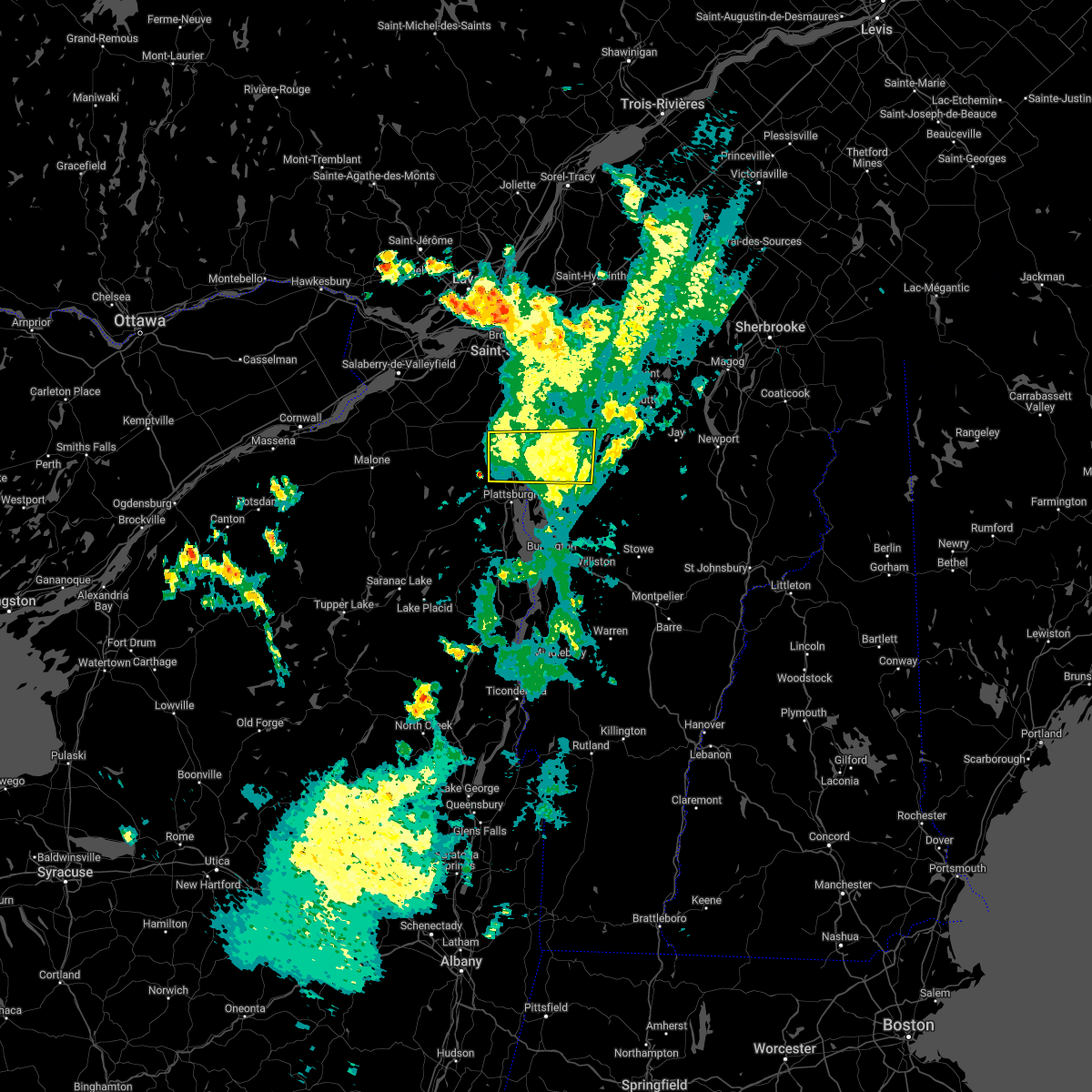
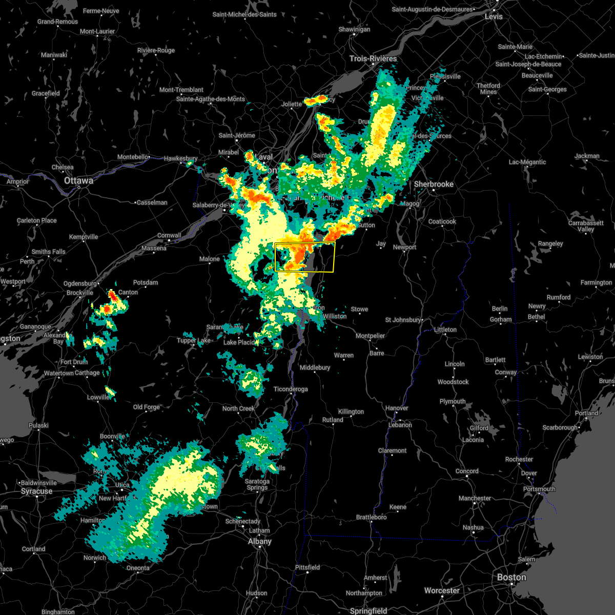
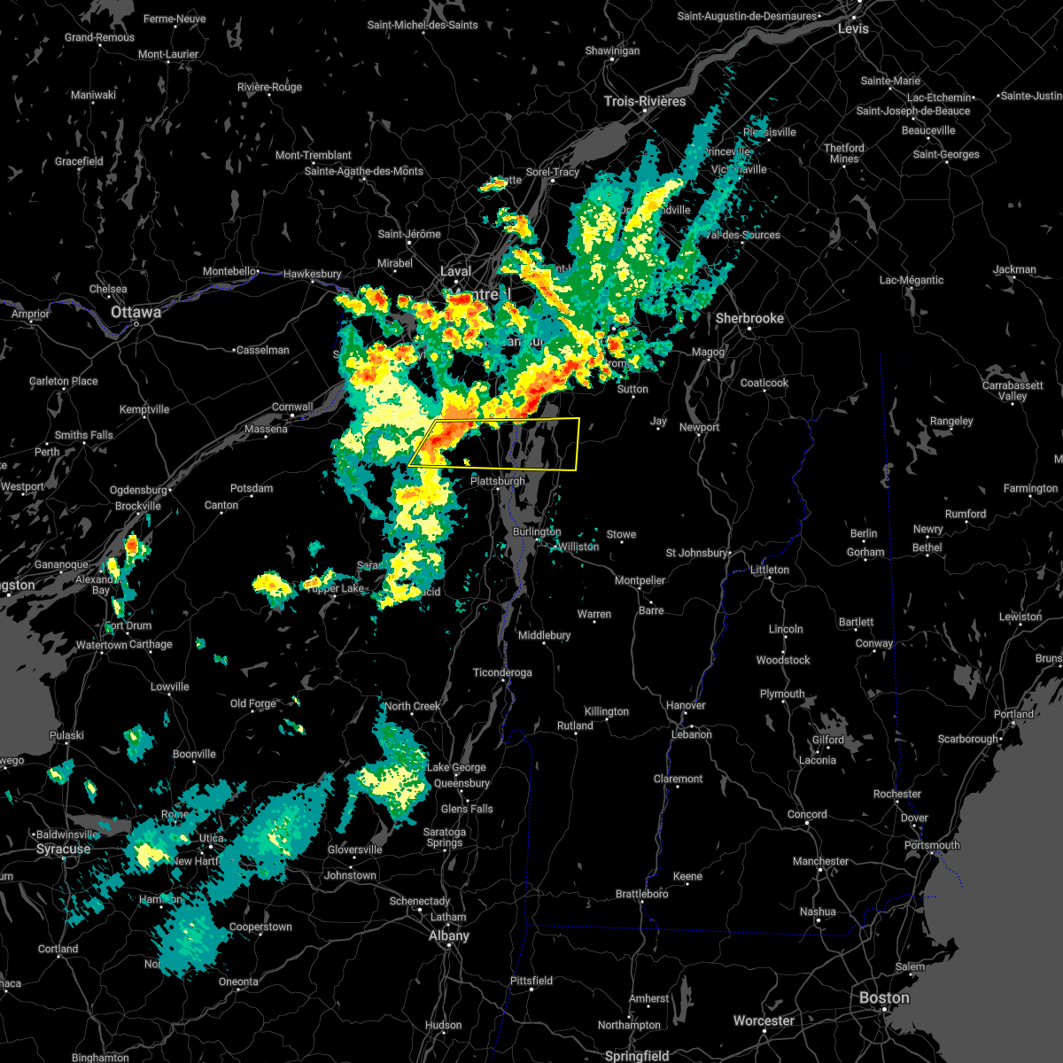
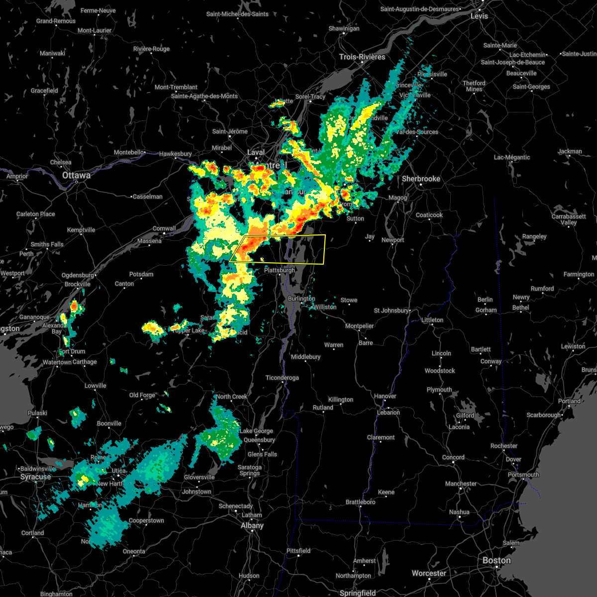
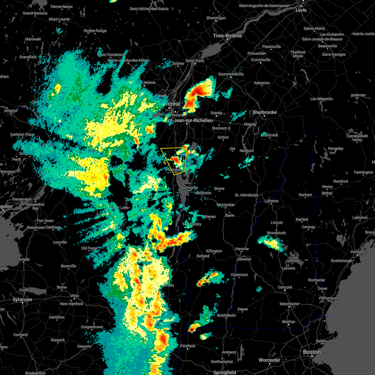
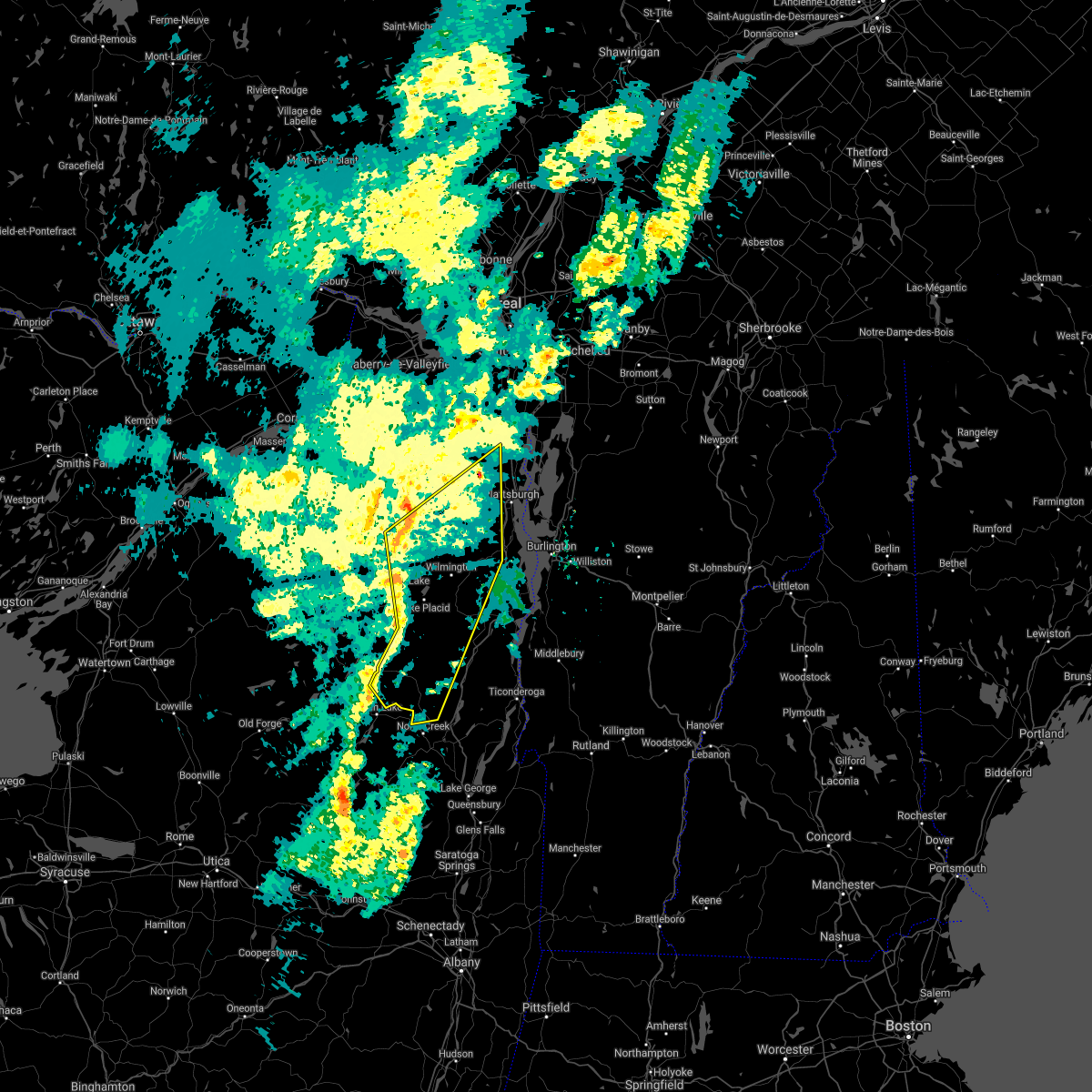
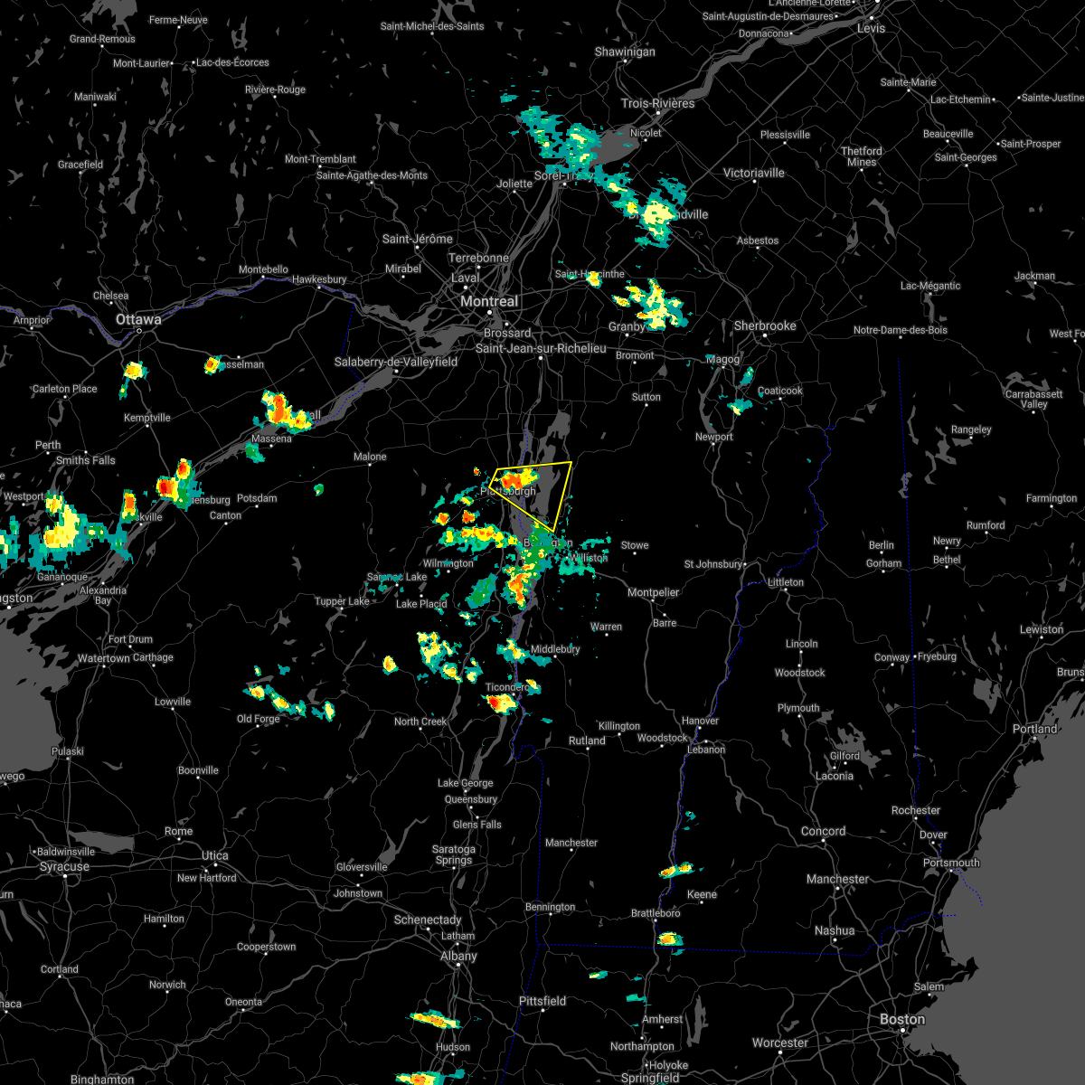
Hail Map for West Chazy, NY
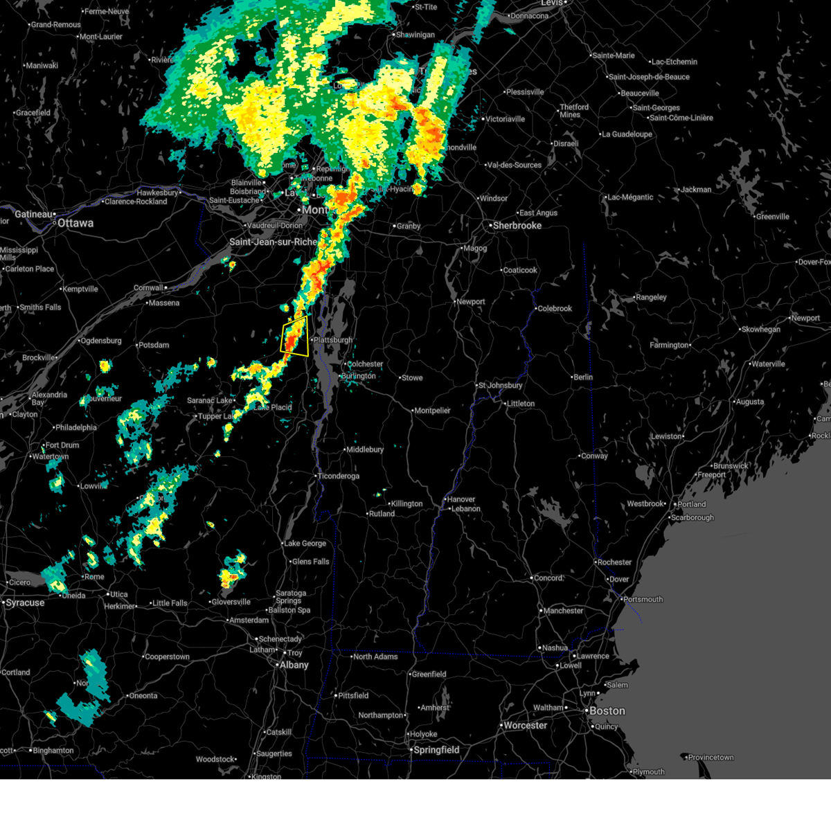
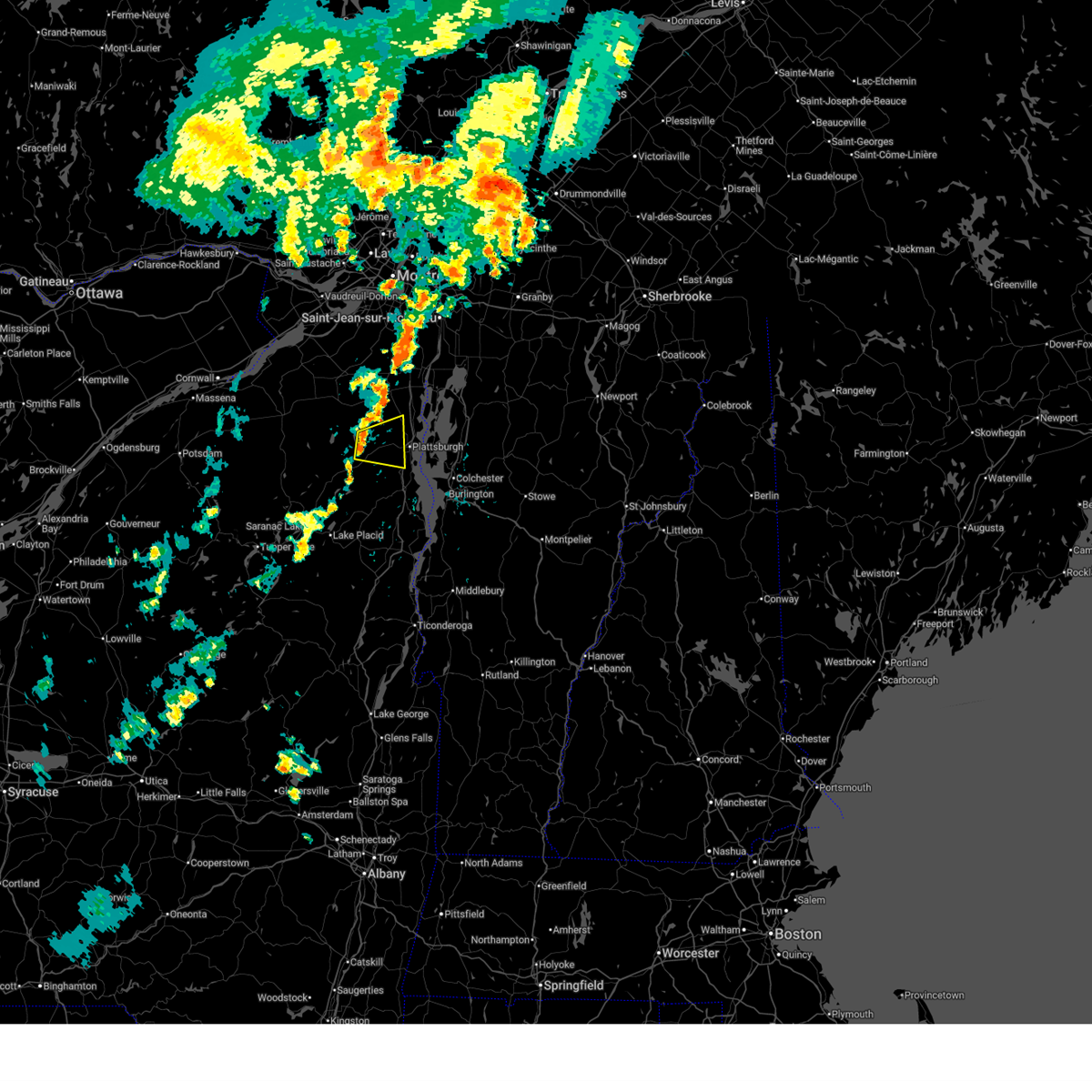
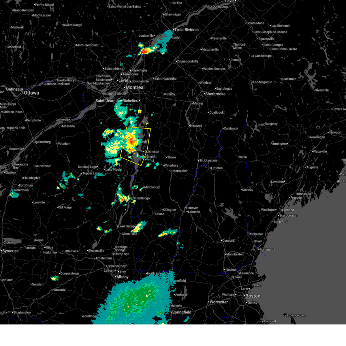
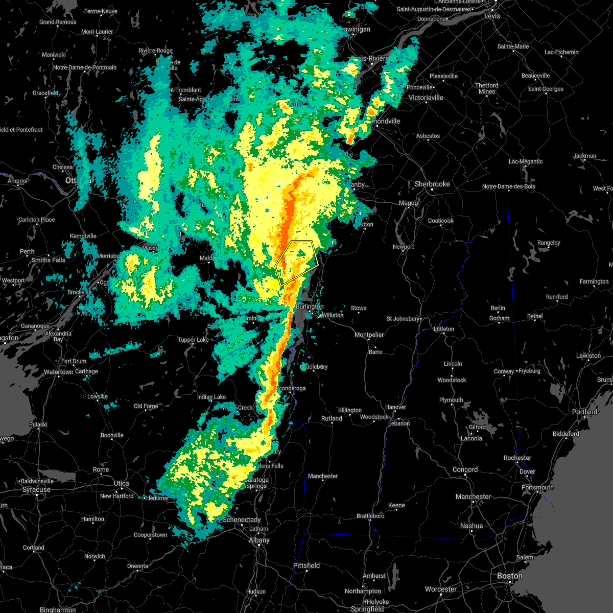
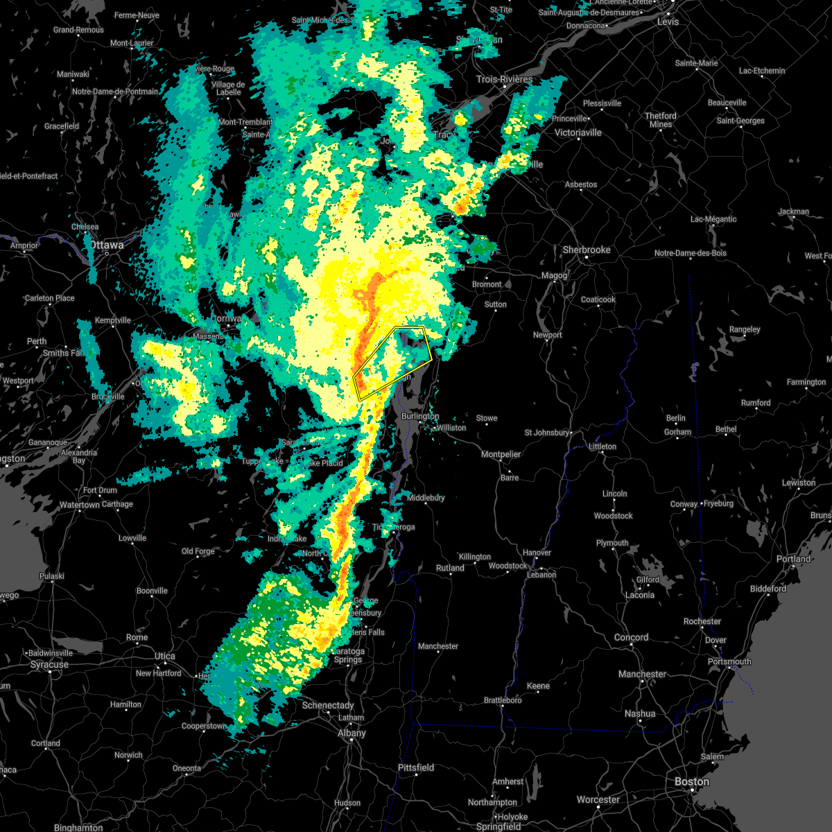
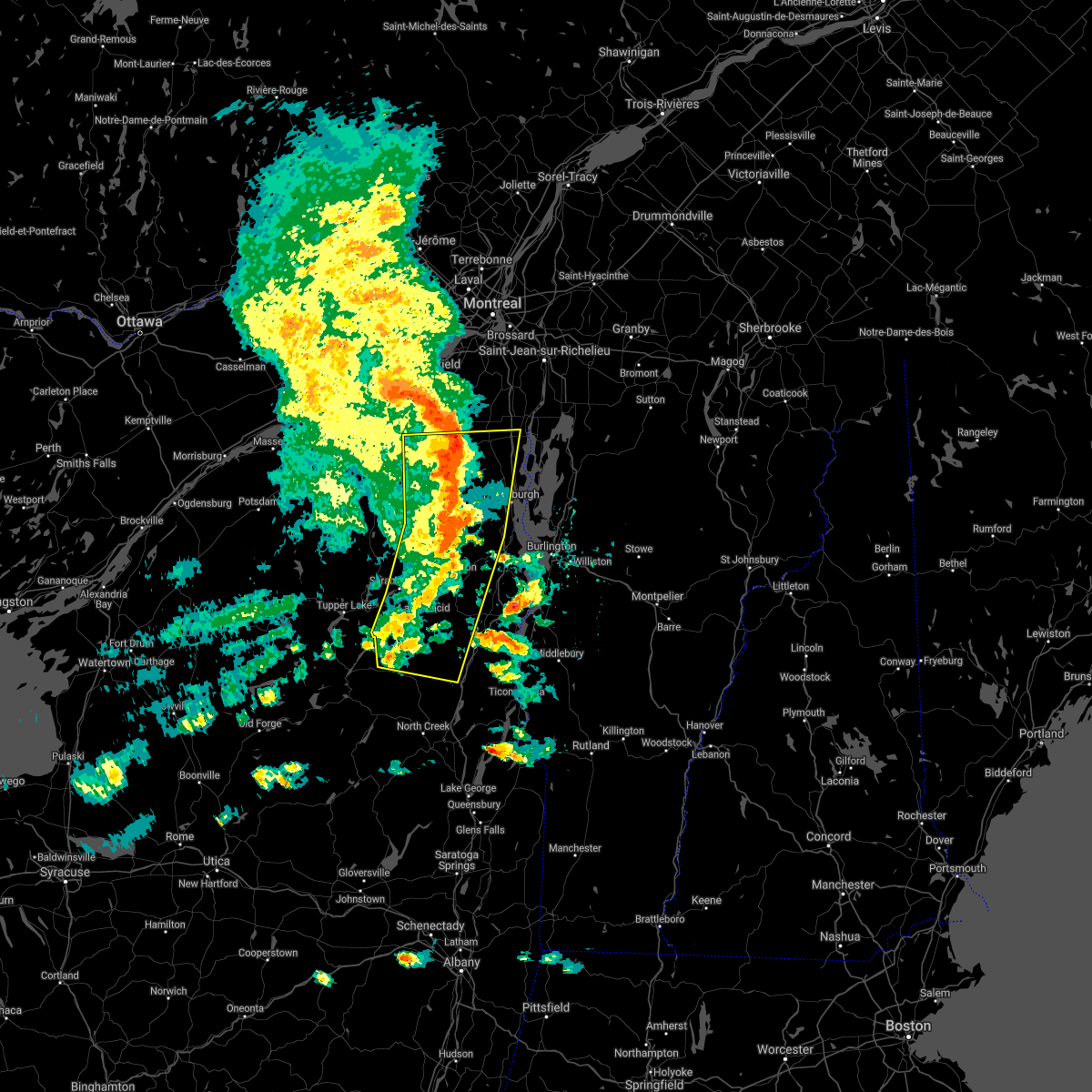
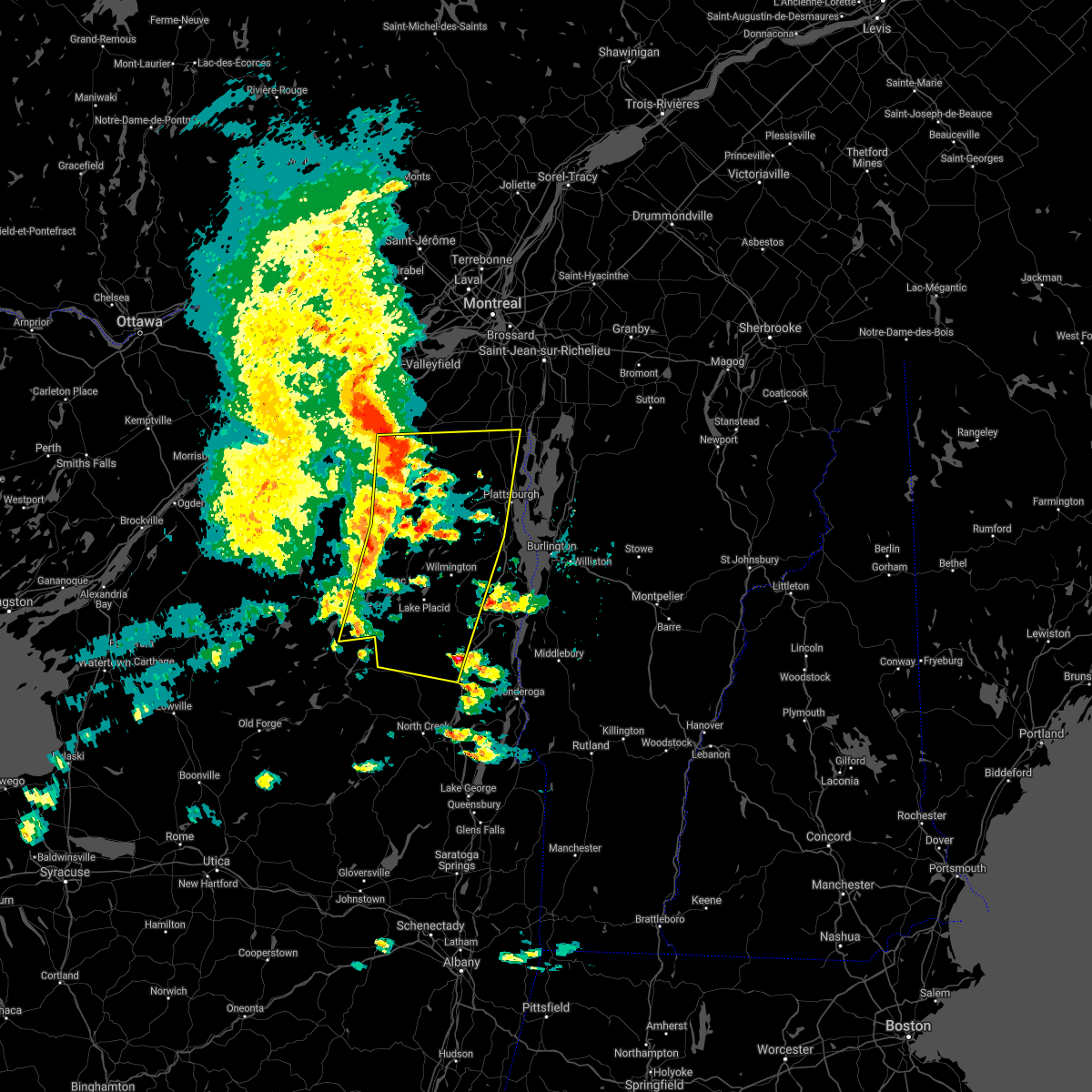
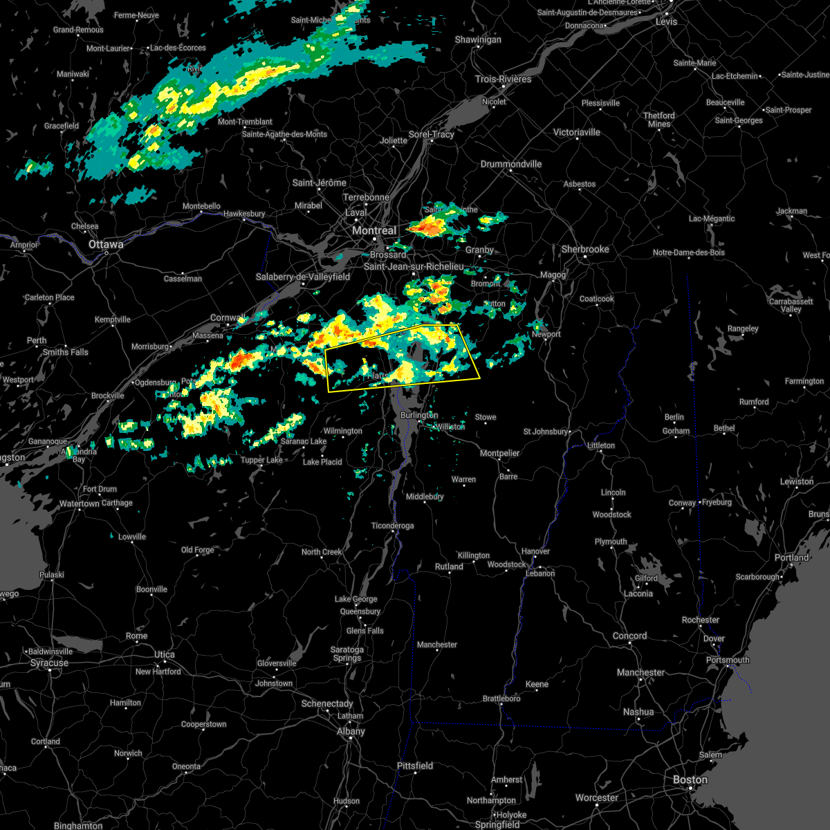
The West Chazy, NY area has had 0 reports of on-the-ground hail by trained spotters, and has been under severe weather warnings 17 times during the past 12 months. Doppler radar has detected hail at or near West Chazy, NY on 12 occasions, including 1 occasion during the past year.
| Name: | West Chazy, NY |
| Where Located: | 27.9 miles NNW of Burlington, VT |
| Map: | Google Map for West Chazy, NY |
| Population: | 529 |
| Housing Units: | 233 |
| More Info: | Search Google for West Chazy, NY |
0
The Top Recent Hail Date for West Chazy, NY is Sunday, August 4, 2024 (12th out of 12)

Hail and Wind Damage Spotted near West Chazy, NY
| Date / Time | Report Details |
|---|---|
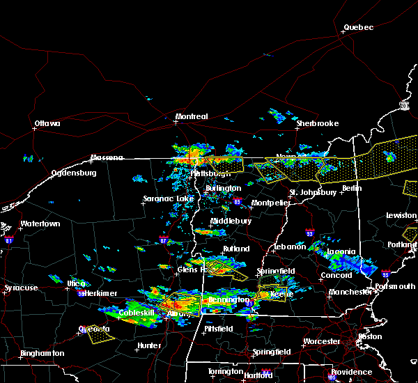
| 7/13/2025 5:58 PM EDT |
 The storm which prompted the warning has weakened below severe limits, and no longer poses an immediate threat to life or property. therefore, the warning will be allowed to expire. however, gusty winds and heavy rain are still possible with this thunderstorm. to report severe weather, contact your nearest law enforcement agency. they will relay your report to the national weather service burlington. The storm which prompted the warning has weakened below severe limits, and no longer poses an immediate threat to life or property. therefore, the warning will be allowed to expire. however, gusty winds and heavy rain are still possible with this thunderstorm. to report severe weather, contact your nearest law enforcement agency. they will relay your report to the national weather service burlington.
|
| 7/13/2025 5:42 PM EDT |
 At 542 pm edt, a severe thunderstorm was located over cadyville, moving east at 15 mph (radar indicated). Hazards include 60 mph wind gusts and quarter size hail. Minor hail damage to vehicles is possible. expect wind damage to trees and powerlines. locations impacted include, dannemora, schuyler falls, beekmantown, plattsburgh, peru, chazy, altona, saranac, west chazy, west beekmantown, jericho, morrisonville, cadyville, and west plattsburgh. This includes interstate 87 near mile marker 146. At 542 pm edt, a severe thunderstorm was located over cadyville, moving east at 15 mph (radar indicated). Hazards include 60 mph wind gusts and quarter size hail. Minor hail damage to vehicles is possible. expect wind damage to trees and powerlines. locations impacted include, dannemora, schuyler falls, beekmantown, plattsburgh, peru, chazy, altona, saranac, west chazy, west beekmantown, jericho, morrisonville, cadyville, and west plattsburgh. This includes interstate 87 near mile marker 146.
|
| 7/13/2025 5:19 PM EDT |
 Svrbtv the national weather service in burlington has issued a * severe thunderstorm warning for, central clinton county in northern new york, * until 600 pm edt. * at 519 pm edt, a severe thunderstorm was located over dannemora, moving east at 15 mph (radar indicated). Hazards include 60 mph wind gusts and quarter size hail. Minor hail damage to vehicles is possible. Expect wind damage to trees and powerlines. Svrbtv the national weather service in burlington has issued a * severe thunderstorm warning for, central clinton county in northern new york, * until 600 pm edt. * at 519 pm edt, a severe thunderstorm was located over dannemora, moving east at 15 mph (radar indicated). Hazards include 60 mph wind gusts and quarter size hail. Minor hail damage to vehicles is possible. Expect wind damage to trees and powerlines.
|
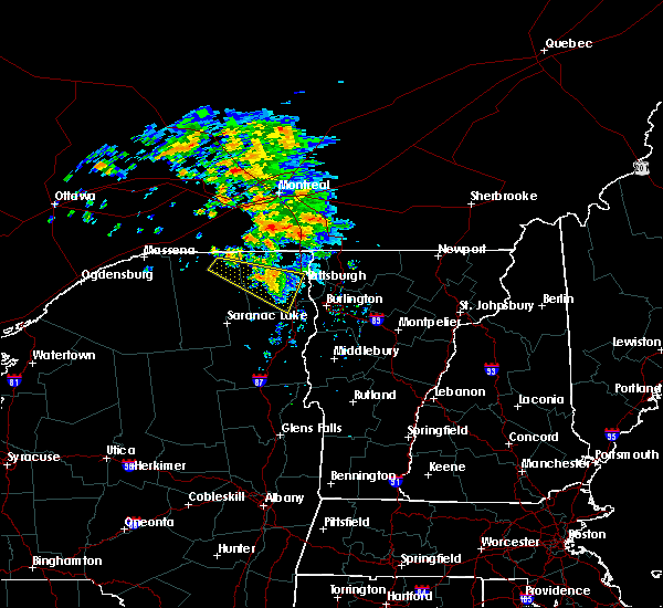
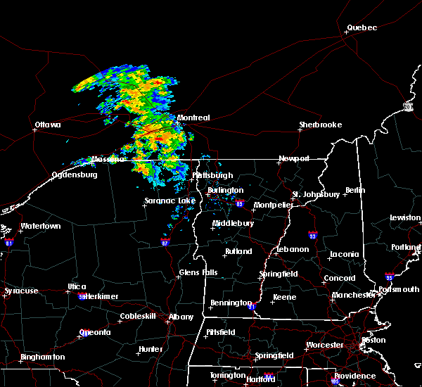
| 7/3/2025 6:11 PM EDT |
 At 610 pm edt, severe thunderstorms were located along a line extending from chapman bay to ladd point to port kent, moving east at 40 mph (radar indicated). Hazards include 60 mph wind gusts and quarter size hail. Minor hail damage to vehicles is possible. wind damage to trees and powerlines has been reported. locations impacted include, burlington international airport, plattsburgh international airport, south burlington, burlington, keeseville, colchester, georgia, grand isle, st. Albans town, south alburgh, alburgh dunes state park, north hero, milton, shelburne, ausable, schuyler falls, isle la motte, plattsburgh, georgia center, and winooski. At 610 pm edt, severe thunderstorms were located along a line extending from chapman bay to ladd point to port kent, moving east at 40 mph (radar indicated). Hazards include 60 mph wind gusts and quarter size hail. Minor hail damage to vehicles is possible. wind damage to trees and powerlines has been reported. locations impacted include, burlington international airport, plattsburgh international airport, south burlington, burlington, keeseville, colchester, georgia, grand isle, st. Albans town, south alburgh, alburgh dunes state park, north hero, milton, shelburne, ausable, schuyler falls, isle la motte, plattsburgh, georgia center, and winooski.
|
| 7/3/2025 5:37 PM EDT |
 Svrbtv the national weather service in burlington has issued a * severe thunderstorm warning for, clinton county in northern new york, northeastern essex county in northern new york, grand isle county in northwestern vermont, northwestern chittenden county in northwestern vermont, western franklin county in northwestern vermont, * until 630 pm edt. * at 535 pm edt, severe thunderstorms were located along a broken line extending from 9 miles north of mooers to alder bend to clayburg, moving east at 30 mph (radar indicated). Hazards include 60 mph wind gusts and quarter size hail. Minor hail damage to vehicles is possible. Expect wind damage to trees and powerlines. Svrbtv the national weather service in burlington has issued a * severe thunderstorm warning for, clinton county in northern new york, northeastern essex county in northern new york, grand isle county in northwestern vermont, northwestern chittenden county in northwestern vermont, western franklin county in northwestern vermont, * until 630 pm edt. * at 535 pm edt, severe thunderstorms were located along a broken line extending from 9 miles north of mooers to alder bend to clayburg, moving east at 30 mph (radar indicated). Hazards include 60 mph wind gusts and quarter size hail. Minor hail damage to vehicles is possible. Expect wind damage to trees and powerlines.
|
| 7/3/2025 12:29 PM EDT |
 The storm which prompted the warning has moved out of the area. therefore, the warning will be allowed to expire. however, gusty winds are still possible with this thunderstorm. to report severe weather, contact your nearest law enforcement agency. they will relay your report to the national weather service burlington. The storm which prompted the warning has moved out of the area. therefore, the warning will be allowed to expire. however, gusty winds are still possible with this thunderstorm. to report severe weather, contact your nearest law enforcement agency. they will relay your report to the national weather service burlington.
|
| 7/3/2025 12:13 PM EDT |
 At 1212 pm edt, a severe thunderstorm was located over point of the tongue, moving east at 20 mph (radar indicated). Hazards include 60 mph wind gusts and quarter size hail. Minor hail damage to vehicles is possible. expect wind damage to trees and powerlines. locations impacted include, plattsburgh international airport, rouses point, alburgh village, grand isle, chazy, beekmantown, south alburgh, alburgh, alburgh dunes state park, north hero, schuyler falls, isle la motte, plattsburgh, champlain, st. Albans town, milton, swanton, south hero, georgia, and altona. At 1212 pm edt, a severe thunderstorm was located over point of the tongue, moving east at 20 mph (radar indicated). Hazards include 60 mph wind gusts and quarter size hail. Minor hail damage to vehicles is possible. expect wind damage to trees and powerlines. locations impacted include, plattsburgh international airport, rouses point, alburgh village, grand isle, chazy, beekmantown, south alburgh, alburgh, alburgh dunes state park, north hero, schuyler falls, isle la motte, plattsburgh, champlain, st. Albans town, milton, swanton, south hero, georgia, and altona.
|
| 7/3/2025 11:48 AM EDT |
 At 1147 am edt, a severe thunderstorm was located near ellenburg mountain, moving east at 40 mph (radar indicated). Hazards include 60 mph wind gusts and quarter size hail. Minor hail damage to vehicles is possible. expect wind damage to trees and powerlines. Locations impacted include, mooers village, dannemora, rouses point, champlain village, plattsburgh international airport, champlain, saranac, grand isle, south alburgh, alburgh, alburgh dunes state park, north hero, schuyler falls, isle la motte, plattsburgh, mooers, alburgh village, altona, chazy, and beekmantown. At 1147 am edt, a severe thunderstorm was located near ellenburg mountain, moving east at 40 mph (radar indicated). Hazards include 60 mph wind gusts and quarter size hail. Minor hail damage to vehicles is possible. expect wind damage to trees and powerlines. Locations impacted include, mooers village, dannemora, rouses point, champlain village, plattsburgh international airport, champlain, saranac, grand isle, south alburgh, alburgh, alburgh dunes state park, north hero, schuyler falls, isle la motte, plattsburgh, mooers, alburgh village, altona, chazy, and beekmantown.
|
| 7/3/2025 11:48 AM EDT |
 the severe thunderstorm warning has been cancelled and is no longer in effect the severe thunderstorm warning has been cancelled and is no longer in effect
|
| 7/3/2025 11:27 AM EDT |
 Svrbtv the national weather service in burlington has issued a * severe thunderstorm warning for, clinton county in northern new york, northeastern franklin county in northern new york, grand isle county in northwestern vermont, northwestern chittenden county in northwestern vermont, northwestern franklin county in northwestern vermont, * until 1230 pm edt. * at 1126 am edt, a severe thunderstorm was located over bellmont, moving east at 40 mph (radar indicated). Hazards include 60 mph wind gusts and quarter size hail. Minor hail damage to vehicles is possible. Expect wind damage to trees and powerlines. Svrbtv the national weather service in burlington has issued a * severe thunderstorm warning for, clinton county in northern new york, northeastern franklin county in northern new york, grand isle county in northwestern vermont, northwestern chittenden county in northwestern vermont, northwestern franklin county in northwestern vermont, * until 1230 pm edt. * at 1126 am edt, a severe thunderstorm was located over bellmont, moving east at 40 mph (radar indicated). Hazards include 60 mph wind gusts and quarter size hail. Minor hail damage to vehicles is possible. Expect wind damage to trees and powerlines.
|
| 5/17/2025 3:14 PM EDT |
 The storm which prompted the warning has weakened below severe limits, and has exited the warned area. therefore, the warning will be allowed to expire. however, heavy rain is still possible with this thunderstorm. a severe thunderstorm watch remains in effect until 800 pm edt for northern new york, and northwestern vermont. The storm which prompted the warning has weakened below severe limits, and has exited the warned area. therefore, the warning will be allowed to expire. however, heavy rain is still possible with this thunderstorm. a severe thunderstorm watch remains in effect until 800 pm edt for northern new york, and northwestern vermont.
|
| 5/17/2025 3:00 PM EDT |
 At 259 pm edt, a severe thunderstorm was located over plattsburgh, moving east at 25 mph (radar indicated). Hazards include 60 mph wind gusts and quarter size hail. Minor hail damage to vehicles is possible. expect wind damage to trees and powerlines. Locations impacted include, young island, wilcox point, scott point, sunset island, conner bay, allens bay in clinton county, monty bay, monty point, martin bay, minnetoska point, plattsburgh international airport, treadwell bay, cumberland head, laphams mills, gravelly point, fisk point, schuyler island, corlaer bay, gordon landing, and sawyer bay. At 259 pm edt, a severe thunderstorm was located over plattsburgh, moving east at 25 mph (radar indicated). Hazards include 60 mph wind gusts and quarter size hail. Minor hail damage to vehicles is possible. expect wind damage to trees and powerlines. Locations impacted include, young island, wilcox point, scott point, sunset island, conner bay, allens bay in clinton county, monty bay, monty point, martin bay, minnetoska point, plattsburgh international airport, treadwell bay, cumberland head, laphams mills, gravelly point, fisk point, schuyler island, corlaer bay, gordon landing, and sawyer bay.
|
| 5/17/2025 2:33 PM EDT |
 Svrbtv the national weather service in burlington has issued a * severe thunderstorm warning for, southern clinton county in northern new york, northeastern essex county in northern new york, southwestern grand isle county in northwestern vermont, northwestern chittenden county in northwestern vermont, * until 315 pm edt. * at 232 pm edt, a severe thunderstorm was located over moffitsville, moving east at 25 mph (radar indicated). Hazards include 60 mph wind gusts and quarter size hail. Minor hail damage to vehicles is possible. Expect wind damage to trees and powerlines. Svrbtv the national weather service in burlington has issued a * severe thunderstorm warning for, southern clinton county in northern new york, northeastern essex county in northern new york, southwestern grand isle county in northwestern vermont, northwestern chittenden county in northwestern vermont, * until 315 pm edt. * at 232 pm edt, a severe thunderstorm was located over moffitsville, moving east at 25 mph (radar indicated). Hazards include 60 mph wind gusts and quarter size hail. Minor hail damage to vehicles is possible. Expect wind damage to trees and powerlines.
|
| 5/16/2025 3:49 PM EDT | Svrbtv the national weather service in burlington has issued a * severe thunderstorm warning for, northeastern clinton county in northern new york, northern grand isle county in northwestern vermont, northwestern franklin county in northwestern vermont, * until 445 pm edt. * at 349 pm edt, a severe thunderstorm was located over irona, moving northeast at 25 mph (radar indicated). Hazards include 60 mph wind gusts and quarter size hail. Minor hail damage to vehicles is possible. Expect wind damage to trees and powerlines. |
| 7/24/2024 9:04 PM EDT |
 the severe thunderstorm warning has been cancelled and is no longer in effect the severe thunderstorm warning has been cancelled and is no longer in effect
|
| 7/24/2024 8:47 PM EDT |
 At 846 pm edt, a severe thunderstorm was located over knight island state park, moving northeast at 25 mph (radar indicated). Hazards include 60 mph wind gusts. Expect damage to trees and powerlines. Locations impacted include, chazy, alburgh village, isle la motte, south alburgh, alburgh, alburgh dunes state park, north hero, swanton, highgate, reed point, wagner point, north hero state park, alburg tongue, scott point, ransoms bay, kings bay, wait bay, allens bay in grand isle county, martindale point, and fee fee point. At 846 pm edt, a severe thunderstorm was located over knight island state park, moving northeast at 25 mph (radar indicated). Hazards include 60 mph wind gusts. Expect damage to trees and powerlines. Locations impacted include, chazy, alburgh village, isle la motte, south alburgh, alburgh, alburgh dunes state park, north hero, swanton, highgate, reed point, wagner point, north hero state park, alburg tongue, scott point, ransoms bay, kings bay, wait bay, allens bay in grand isle county, martindale point, and fee fee point.
|
| 7/24/2024 8:24 PM EDT |
 Svrbtv the national weather service in burlington has issued a * severe thunderstorm warning for, northeastern clinton county in northern new york, northern grand isle county in northwestern vermont, northwestern franklin county in northwestern vermont, * until 915 pm edt. * at 823 pm edt, a severe thunderstorm was located over east beekmantown, moving east at 25 mph (radar indicated). Hazards include 60 mph wind gusts. expect damage to trees and powerlines Svrbtv the national weather service in burlington has issued a * severe thunderstorm warning for, northeastern clinton county in northern new york, northern grand isle county in northwestern vermont, northwestern franklin county in northwestern vermont, * until 915 pm edt. * at 823 pm edt, a severe thunderstorm was located over east beekmantown, moving east at 25 mph (radar indicated). Hazards include 60 mph wind gusts. expect damage to trees and powerlines
|
| 6/23/2024 3:06 PM EDT |
 The storm which prompted the warning has weakened below severe limits, and no longer poses an immediate threat to life or property. therefore, the warning will be allowed to expire. a tornado watch remains in effect until 800 pm edt for northern new york, and northwestern vermont. The storm which prompted the warning has weakened below severe limits, and no longer poses an immediate threat to life or property. therefore, the warning will be allowed to expire. a tornado watch remains in effect until 800 pm edt for northern new york, and northwestern vermont.
|
| 6/23/2024 2:26 PM EDT |
 Svrbtv the national weather service in burlington has issued a * severe thunderstorm warning for, southern clinton county in northern new york, east central franklin county in northern new york, northeastern essex county in northern new york, southwestern grand isle county in northwestern vermont, northwestern chittenden county in northwestern vermont, * until 315 pm edt. * at 225 pm edt, a severe thunderstorm was located over franklin falls, moving northeast at 50 mph (radar indicated). Hazards include 60 mph wind gusts and penny size hail. expect damage to trees and powerlines Svrbtv the national weather service in burlington has issued a * severe thunderstorm warning for, southern clinton county in northern new york, east central franklin county in northern new york, northeastern essex county in northern new york, southwestern grand isle county in northwestern vermont, northwestern chittenden county in northwestern vermont, * until 315 pm edt. * at 225 pm edt, a severe thunderstorm was located over franklin falls, moving northeast at 50 mph (radar indicated). Hazards include 60 mph wind gusts and penny size hail. expect damage to trees and powerlines
|
| 6/23/2024 2:26 PM EDT |
 Svrbtv the national weather service in burlington has issued a * severe thunderstorm warning for, northeastern clinton county in northern new york, northern grand isle county in northwestern vermont, northwestern franklin county in northwestern vermont, * until 315 pm edt. * at 225 pm edt, a severe thunderstorm was located over champlain, moving east at 40 mph (radar indicated). Hazards include 60 mph wind gusts and nickel size hail. expect damage to trees and powerlines Svrbtv the national weather service in burlington has issued a * severe thunderstorm warning for, northeastern clinton county in northern new york, northern grand isle county in northwestern vermont, northwestern franklin county in northwestern vermont, * until 315 pm edt. * at 225 pm edt, a severe thunderstorm was located over champlain, moving east at 40 mph (radar indicated). Hazards include 60 mph wind gusts and nickel size hail. expect damage to trees and powerlines
|
| 6/14/2024 12:40 AM EDT | Outflow produced damaging wind gusts that knocked tree down on 683 and w church street. time estimated by rada in clinton county NY, 0.9 miles NE of West Chazy, NY |
| 7/24/2023 3:56 PM EDT |
 The severe thunderstorm warning for northeastern clinton, grand isle and northwestern franklin counties will expire at 400 pm edt, the storm which prompted the warning has weakened below severe limits, and no longer poses an immediate threat to life or property. therefore, the warning will be allowed to expire. however gusty winds and heavy rain are still possible with this thunderstorm. a severe thunderstorm watch remains in effect until 800 pm edt for northern new york, and northwestern vermont. The severe thunderstorm warning for northeastern clinton, grand isle and northwestern franklin counties will expire at 400 pm edt, the storm which prompted the warning has weakened below severe limits, and no longer poses an immediate threat to life or property. therefore, the warning will be allowed to expire. however gusty winds and heavy rain are still possible with this thunderstorm. a severe thunderstorm watch remains in effect until 800 pm edt for northern new york, and northwestern vermont.
|
| 7/24/2023 2:58 PM EDT |
 The severe thunderstorm warning for northeastern clinton and northwestern grand isle counties will expire at 300 pm edt, a new severe thunderstorm warning has been issued to replace this warning. a severe thunderstorm watch remains in effect until 800 pm edt for northern new york, and northwestern vermont. The severe thunderstorm warning for northeastern clinton and northwestern grand isle counties will expire at 300 pm edt, a new severe thunderstorm warning has been issued to replace this warning. a severe thunderstorm watch remains in effect until 800 pm edt for northern new york, and northwestern vermont.
|
| 7/24/2023 2:58 PM EDT |
 At 258 pm edt, a severe thunderstorm was located over west plattsburgh, moving northeast at 30 mph (radar indicated). Hazards include 60 mph wind gusts and quarter size hail. Minor hail damage to vehicles is possible. Expect wind damage to trees and powerlines. At 258 pm edt, a severe thunderstorm was located over west plattsburgh, moving northeast at 30 mph (radar indicated). Hazards include 60 mph wind gusts and quarter size hail. Minor hail damage to vehicles is possible. Expect wind damage to trees and powerlines.
|
| 7/24/2023 2:45 PM EDT |
 At 245 pm edt, a severe thunderstorm was located over champlain, moving northeast at 35 mph (radar indicated). Hazards include 60 mph wind gusts and quarter size hail. Minor hail damage to vehicles is possible. expect wind damage to trees and powerlines. locations impacted include, beekmantown, chazy, saranac, mooers, altona, alburgh village, champlain, jericho, dannemora, peasleeville, rouses point, alburgh, isle la motte, west chazy, irona, sciota, chazy lake, west beekmantown, mooers forks, and king bay. hail threat, radar indicated max hail size, 1. 00 in wind threat, radar indicated max wind gust, 60 mph. At 245 pm edt, a severe thunderstorm was located over champlain, moving northeast at 35 mph (radar indicated). Hazards include 60 mph wind gusts and quarter size hail. Minor hail damage to vehicles is possible. expect wind damage to trees and powerlines. locations impacted include, beekmantown, chazy, saranac, mooers, altona, alburgh village, champlain, jericho, dannemora, peasleeville, rouses point, alburgh, isle la motte, west chazy, irona, sciota, chazy lake, west beekmantown, mooers forks, and king bay. hail threat, radar indicated max hail size, 1. 00 in wind threat, radar indicated max wind gust, 60 mph.
|
| 7/24/2023 2:19 PM EDT |
 At 218 pm edt, a severe thunderstorm was located over jericho, moving northeast at 35 mph (radar indicated). Hazards include 60 mph wind gusts and quarter size hail. Minor hail damage to vehicles is possible. Expect wind damage to trees and powerlines. At 218 pm edt, a severe thunderstorm was located over jericho, moving northeast at 35 mph (radar indicated). Hazards include 60 mph wind gusts and quarter size hail. Minor hail damage to vehicles is possible. Expect wind damage to trees and powerlines.
|
| 9/22/2022 2:40 AM EDT |
 At 239 am edt, a severe thunderstorm was located jericho and beekmantown point, moving east at 55 mph (radar indicated). Hazards include 60 mph wind gusts and quarter size hail. Minor hail damage to vehicles is possible. Expect wind damage to trees and powerlines. At 239 am edt, a severe thunderstorm was located jericho and beekmantown point, moving east at 55 mph (radar indicated). Hazards include 60 mph wind gusts and quarter size hail. Minor hail damage to vehicles is possible. Expect wind damage to trees and powerlines.
|
| 7/25/2022 1:00 AM EDT |
 At 100 am edt, severe thunderstorms were located along a line extending from near mooers forks to moffitsville, moving east at 40 mph (radar indicated). Hazards include 60 mph wind gusts. Expect damage to trees and powerlines. locations impacted include, plattsburgh international airport, plattsburgh, beekmantown, schuyler falls, chazy, saranac, mooers, altona, ellenburg depot, champlain, isle la motte, lyon mountain, clayburg, jericho, dannemora, peasleeville, rouses point, alburgh village, alburgh and south hero. hail threat, radar indicated max hail size, <. 75 in wind threat, radar indicated max wind gust, 60 mph. At 100 am edt, severe thunderstorms were located along a line extending from near mooers forks to moffitsville, moving east at 40 mph (radar indicated). Hazards include 60 mph wind gusts. Expect damage to trees and powerlines. locations impacted include, plattsburgh international airport, plattsburgh, beekmantown, schuyler falls, chazy, saranac, mooers, altona, ellenburg depot, champlain, isle la motte, lyon mountain, clayburg, jericho, dannemora, peasleeville, rouses point, alburgh village, alburgh and south hero. hail threat, radar indicated max hail size, <. 75 in wind threat, radar indicated max wind gust, 60 mph.
|
| 7/25/2022 12:38 AM EDT |
 At 1237 am edt, severe thunderstorms were located along a line extending from 8 miles north of earlville to near wolf pond, moving east at 45 mph (radar indicated). Hazards include 60 mph wind gusts. Expect damage to trees and powerlines. locations impacted include, plattsburgh international airport, plattsburgh, beekmantown, schuyler falls, chazy, saranac, mooers, altona, ellenburg depot, champlain, bryants mill, churubusco, isle la motte, lyon mountain, merrill, clayburg, jericho, chateaugay, dannemora and peasleeville. hail threat, radar indicated max hail size, <. 75 in wind threat, radar indicated max wind gust, 60 mph. At 1237 am edt, severe thunderstorms were located along a line extending from 8 miles north of earlville to near wolf pond, moving east at 45 mph (radar indicated). Hazards include 60 mph wind gusts. Expect damage to trees and powerlines. locations impacted include, plattsburgh international airport, plattsburgh, beekmantown, schuyler falls, chazy, saranac, mooers, altona, ellenburg depot, champlain, bryants mill, churubusco, isle la motte, lyon mountain, merrill, clayburg, jericho, chateaugay, dannemora and peasleeville. hail threat, radar indicated max hail size, <. 75 in wind threat, radar indicated max wind gust, 60 mph.
|
| 7/25/2022 12:08 AM EDT |
 At 1208 am edt, severe thunderstorms were located along a line extending from near fort covington to madawaska, moving east at 45 mph (radar indicated). Hazards include 60 mph wind gusts. expect damage to trees and powerlines At 1208 am edt, severe thunderstorms were located along a line extending from near fort covington to madawaska, moving east at 45 mph (radar indicated). Hazards include 60 mph wind gusts. expect damage to trees and powerlines
|
| 6/16/2022 7:24 PM EDT |
 The severe thunderstorm warning for northeastern clinton, northern grand isle and northwestern franklin counties will expire at 730 pm edt, the storm which prompted the warning has moved out of the area. therefore, the warning will be allowed to expire. however heavy rain is still possible with this thunderstorm. The severe thunderstorm warning for northeastern clinton, northern grand isle and northwestern franklin counties will expire at 730 pm edt, the storm which prompted the warning has moved out of the area. therefore, the warning will be allowed to expire. however heavy rain is still possible with this thunderstorm.
|
| 6/16/2022 6:51 PM EDT |
 At 651 pm edt, a severe thunderstorm was located over wagner point, moving east at 40 mph (radar indicated). Hazards include 60 mph wind gusts and penny size hail. Expect damage to trees and powerlines. locations impacted include, chazy, mooers, alburgh village, champlain, st. albans city, swanton, st. albans town, south alburgh, alburgh, alburgh dunes state park, north hero, swanton village, highgate falls, isle la motte, rouses point, highgate, fairfield, sheldon, franklin and georgia. hail threat, radar indicated max hail size, 0. 75 in wind threat, radar indicated max wind gust, 60 mph. At 651 pm edt, a severe thunderstorm was located over wagner point, moving east at 40 mph (radar indicated). Hazards include 60 mph wind gusts and penny size hail. Expect damage to trees and powerlines. locations impacted include, chazy, mooers, alburgh village, champlain, st. albans city, swanton, st. albans town, south alburgh, alburgh, alburgh dunes state park, north hero, swanton village, highgate falls, isle la motte, rouses point, highgate, fairfield, sheldon, franklin and georgia. hail threat, radar indicated max hail size, 0. 75 in wind threat, radar indicated max wind gust, 60 mph.
|
| 6/16/2022 6:29 PM EDT |
 At 628 pm edt, a severe thunderstorm was located over cannon corners, moving east at 30 mph (radar indicated). Hazards include 60 mph wind gusts and quarter size hail. Minor hail damage to vehicles is possible. Expect wind damage to trees and powerlines. At 628 pm edt, a severe thunderstorm was located over cannon corners, moving east at 30 mph (radar indicated). Hazards include 60 mph wind gusts and quarter size hail. Minor hail damage to vehicles is possible. Expect wind damage to trees and powerlines.
|
| 5/16/2022 4:56 PM EDT |
 The severe thunderstorm warning for northeastern clinton and northwestern grand isle counties will expire at 500 pm edt, the storm which prompted the warning has moved out of the area. therefore, the warning will be allowed to expire. a severe thunderstorm watch remains in effect until 800 pm edt for northern new york, and northwestern vermont. The severe thunderstorm warning for northeastern clinton and northwestern grand isle counties will expire at 500 pm edt, the storm which prompted the warning has moved out of the area. therefore, the warning will be allowed to expire. a severe thunderstorm watch remains in effect until 800 pm edt for northern new york, and northwestern vermont.
|
| 5/16/2022 4:45 PM EDT |
 At 445 pm edt, a severe thunderstorm was located over sciota, moving northwest at 40 mph (radar indicated). Hazards include 60 mph wind gusts and quarter size hail. Minor hail damage to vehicles is possible. expect wind damage to trees and powerlines. locations impacted include, chazy, mooers, alburgh village, champlain, isle la motte, rouses point, alburgh, reed point, sciota, alburg tongue, mooers forks, king bay, blanchard bay, mud point, earlys point, wait bay, dunn bay, kelly bay, trombley bay and perry mills. hail threat, radar indicated max hail size, 1. 00 in wind threat, radar indicated max wind gust, 60 mph. At 445 pm edt, a severe thunderstorm was located over sciota, moving northwest at 40 mph (radar indicated). Hazards include 60 mph wind gusts and quarter size hail. Minor hail damage to vehicles is possible. expect wind damage to trees and powerlines. locations impacted include, chazy, mooers, alburgh village, champlain, isle la motte, rouses point, alburgh, reed point, sciota, alburg tongue, mooers forks, king bay, blanchard bay, mud point, earlys point, wait bay, dunn bay, kelly bay, trombley bay and perry mills. hail threat, radar indicated max hail size, 1. 00 in wind threat, radar indicated max wind gust, 60 mph.
|
| 5/16/2022 4:33 PM EDT |
 At 432 pm edt, a severe thunderstorm was located over west chazy, moving northwest at 35 mph (radar indicated). Hazards include 60 mph wind gusts and quarter size hail. Minor hail damage to vehicles is possible. Expect wind damage to trees and powerlines. At 432 pm edt, a severe thunderstorm was located over west chazy, moving northwest at 35 mph (radar indicated). Hazards include 60 mph wind gusts and quarter size hail. Minor hail damage to vehicles is possible. Expect wind damage to trees and powerlines.
|
| 10/16/2021 2:35 PM EDT |
 At 235 pm edt, a severe thunderstorm was located over west chazy, moving northeast at 40 mph (radar indicated). Hazards include 60 mph wind gusts. Expect damage to trees and powerlines. locations impacted include, plattsburgh, beekmantown, chazy, alburgh village, south alburgh, alburgh, alburgh dunes state park, north hero, isle la motte, rouses point, champlain, st. Albans town, swanton, grand isle, wagner point, north hero state park, scott point, hazen point, ransoms bay and kings bay. At 235 pm edt, a severe thunderstorm was located over west chazy, moving northeast at 40 mph (radar indicated). Hazards include 60 mph wind gusts. Expect damage to trees and powerlines. locations impacted include, plattsburgh, beekmantown, chazy, alburgh village, south alburgh, alburgh, alburgh dunes state park, north hero, isle la motte, rouses point, champlain, st. Albans town, swanton, grand isle, wagner point, north hero state park, scott point, hazen point, ransoms bay and kings bay.
|
| 10/16/2021 2:32 PM EDT | Trees down on w church st in clinton county NY, 0.6 miles E of West Chazy, NY |
| 10/16/2021 2:21 PM EDT |
 At 221 pm edt, a severe thunderstorm was located over jericho, moving northeast at 40 mph (radar indicated). Hazards include 60 mph wind gusts. expect damage to trees and powerlines At 221 pm edt, a severe thunderstorm was located over jericho, moving northeast at 40 mph (radar indicated). Hazards include 60 mph wind gusts. expect damage to trees and powerlines
|
| 10/16/2021 1:32 PM EDT |
 At 132 pm edt, severe thunderstorms were located along a line extending from near onchiota to 6 miles south of ray brook to 8 miles southwest of newcomb, moving northeast at 65 mph (radar indicated). Hazards include 60 mph wind gusts. expect damage to trees and powerlines At 132 pm edt, severe thunderstorms were located along a line extending from near onchiota to 6 miles south of ray brook to 8 miles southwest of newcomb, moving northeast at 65 mph (radar indicated). Hazards include 60 mph wind gusts. expect damage to trees and powerlines
|
| 7/20/2021 7:06 PM EDT |
 At 704 pm edt, a line of severe thunderstorms over northwest vermont and essex county new york was located along a line extending from shad island to south burlington to near chilson, new york moving east at 35 mph (radar indicated). Hazards include 60 mph wind gusts and quarter size hail. Expect wind damage to trees and powerlines. minor hail damage to vehicles is possible. Locations impacted include, essex junction, plattsburgh international airport, burlington, burlington international airport, plattsburgh, middlebury, south burlington, vergennes, peru, beekmantown, moriah, chazy, willsboro, crown point, morrisville, enosburg falls, westport, elizabethtown, champlain and waterbury village. At 704 pm edt, a line of severe thunderstorms over northwest vermont and essex county new york was located along a line extending from shad island to south burlington to near chilson, new york moving east at 35 mph (radar indicated). Hazards include 60 mph wind gusts and quarter size hail. Expect wind damage to trees and powerlines. minor hail damage to vehicles is possible. Locations impacted include, essex junction, plattsburgh international airport, burlington, burlington international airport, plattsburgh, middlebury, south burlington, vergennes, peru, beekmantown, moriah, chazy, willsboro, crown point, morrisville, enosburg falls, westport, elizabethtown, champlain and waterbury village.
|
| 7/20/2021 6:31 PM EDT |
 At 630 pm edt, a line of severe thunderstorms over northeast new york was located along a line extending from near perry mills to near harkness to 9 miles west of schroon falls, moving east at 40 mph (radar indicated). Hazards include 60 mph wind gusts and quarter size hail. Expect wind damage to trees and powerlines. Minor hail damage to vehicles is possible. At 630 pm edt, a line of severe thunderstorms over northeast new york was located along a line extending from near perry mills to near harkness to 9 miles west of schroon falls, moving east at 40 mph (radar indicated). Hazards include 60 mph wind gusts and quarter size hail. Expect wind damage to trees and powerlines. Minor hail damage to vehicles is possible.
|
| 7/20/2021 6:17 PM EDT |
 At 616 pm edt, a line of severe thunderstorms over northern new york was located along a line extending from near cannon corners to clayburg to near newcomb, moving east at 45 mph (radar indicated). Hazards include 60 mph wind gusts and quarter size hail. Expect wind damage to trees and powerlines. there have been numerous reports of downed trees and power outages across northern new york with this line of storms. minor hail damage to vehicles is possible. Locations impacted include, saranac lake, lake placid, plattsburgh, peru, beekmantown, schuyler falls, chazy, saranac, mooers, altona, wilmington, keene, ellenburg depot, champlain, lyon mountain, clayburg, merrill, keene valley, churubusco and au sable forks. At 616 pm edt, a line of severe thunderstorms over northern new york was located along a line extending from near cannon corners to clayburg to near newcomb, moving east at 45 mph (radar indicated). Hazards include 60 mph wind gusts and quarter size hail. Expect wind damage to trees and powerlines. there have been numerous reports of downed trees and power outages across northern new york with this line of storms. minor hail damage to vehicles is possible. Locations impacted include, saranac lake, lake placid, plattsburgh, peru, beekmantown, schuyler falls, chazy, saranac, mooers, altona, wilmington, keene, ellenburg depot, champlain, lyon mountain, clayburg, merrill, keene valley, churubusco and au sable forks.
|
| 7/20/2021 5:50 PM EDT |
 At 548 pm edt, a line of severe thunderstorms over northern new york was located along a line extending from north burke to debar mountain to 8 miles southwest of axton landing, moving east at 45 mph (radar indicated). Hazards include 60 mph wind gusts and quarter size hail. Expect wind damage to trees and powerlines as there have been numerous reports or trees and powerlines down along with power outages. Minor hail damage to vehicles is possible. At 548 pm edt, a line of severe thunderstorms over northern new york was located along a line extending from north burke to debar mountain to 8 miles southwest of axton landing, moving east at 45 mph (radar indicated). Hazards include 60 mph wind gusts and quarter size hail. Expect wind damage to trees and powerlines as there have been numerous reports or trees and powerlines down along with power outages. Minor hail damage to vehicles is possible.
|
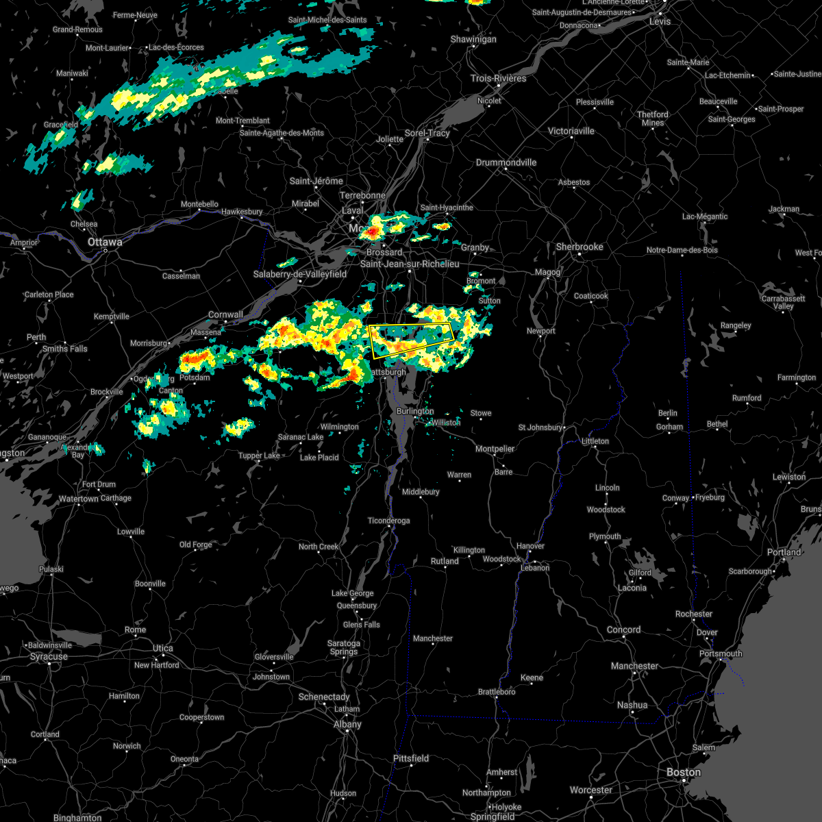
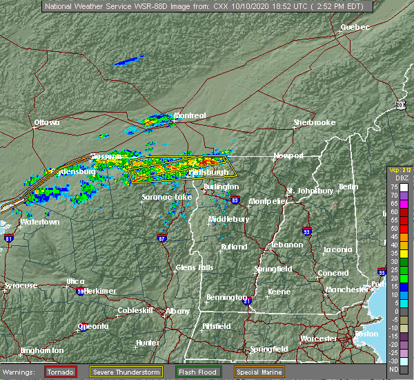
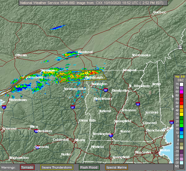
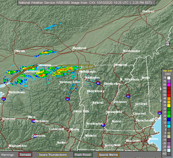
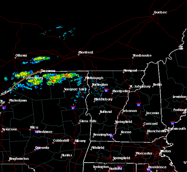
| 10/10/2020 3:27 PM EDT |
 The severe thunderstorm warning for central clinton, northwestern lamoille, grand isle, northwestern chittenden and franklin counties will expire at 330 pm edt, the storm which prompted the warning has weakened below severe limits, and has exited the warned area. therefore, the warning will be allowed to expire. however gusty winds are still possible with this thunderstorm. a severe thunderstorm watch remains in effect until 900 pm edt for northern new york, and northwestern vermont. to report severe weather, contact your nearest law enforcement agency. they will relay your report to the national weather service burlington. The severe thunderstorm warning for central clinton, northwestern lamoille, grand isle, northwestern chittenden and franklin counties will expire at 330 pm edt, the storm which prompted the warning has weakened below severe limits, and has exited the warned area. therefore, the warning will be allowed to expire. however gusty winds are still possible with this thunderstorm. a severe thunderstorm watch remains in effect until 900 pm edt for northern new york, and northwestern vermont. to report severe weather, contact your nearest law enforcement agency. they will relay your report to the national weather service burlington.
|
| 10/10/2020 3:12 PM EDT |
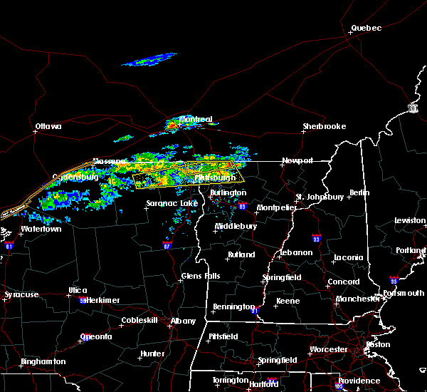 At 312 pm edt, a severe thunderstorm was located over cadyville, moving east at 65 mph (radar indicated). Hazards include 60 mph wind gusts and nickel size hail. Expect damage to trees and powerlines. locations impacted include, plattsburgh, beekmantown, chazy, altona, franklin, sheldon, georgia, grand isle, st. Albans town, south alburgh, alburgh, alburgh dunes state park, north hero, bakersfield, isle la motte, lake carmi state park, dannemora, highgate, georgia center and fletcher. At 312 pm edt, a severe thunderstorm was located over cadyville, moving east at 65 mph (radar indicated). Hazards include 60 mph wind gusts and nickel size hail. Expect damage to trees and powerlines. locations impacted include, plattsburgh, beekmantown, chazy, altona, franklin, sheldon, georgia, grand isle, st. Albans town, south alburgh, alburgh, alburgh dunes state park, north hero, bakersfield, isle la motte, lake carmi state park, dannemora, highgate, georgia center and fletcher.
|
| 10/10/2020 3:12 PM EDT |
 The severe thunderstorm warning for northeastern clinton, northern grand isle and northwestern franklin counties will expire at 315 pm edt, the storm which prompted the warning has weakened below severe limits, and has exited the warned area. therefore, the warning will be allowed to expire. however gusty winds are still possible with this thunderstorm. a severe thunderstorm watch remains in effect until 900 pm edt for northern new york, and northwestern vermont. to report severe weather, contact your nearest law enforcement agency. they will relay your report to the national weather service burlington. The severe thunderstorm warning for northeastern clinton, northern grand isle and northwestern franklin counties will expire at 315 pm edt, the storm which prompted the warning has weakened below severe limits, and has exited the warned area. therefore, the warning will be allowed to expire. however gusty winds are still possible with this thunderstorm. a severe thunderstorm watch remains in effect until 900 pm edt for northern new york, and northwestern vermont. to report severe weather, contact your nearest law enforcement agency. they will relay your report to the national weather service burlington.
|
| 10/10/2020 2:54 PM EDT |
 At 254 pm edt, a severe thunderstorm was located over swanton, moving east at 60 mph (radar indicated). Hazards include 60 mph wind gusts and penny size hail. Expect damage to trees and powerlines. locations impacted include, chazy, alburgh village, champlain, swanton village, highgate falls, isle la motte, swanton, south alburgh, rouses point, highgate, alburgh, alburgh dunes state park, sheldon, franklin, north hero, st. Albans town, reed point, wagner point, north hero state park and alburg tongue. At 254 pm edt, a severe thunderstorm was located over swanton, moving east at 60 mph (radar indicated). Hazards include 60 mph wind gusts and penny size hail. Expect damage to trees and powerlines. locations impacted include, chazy, alburgh village, champlain, swanton village, highgate falls, isle la motte, swanton, south alburgh, rouses point, highgate, alburgh, alburgh dunes state park, sheldon, franklin, north hero, st. Albans town, reed point, wagner point, north hero state park and alburg tongue.
|
| 10/10/2020 2:26 PM EDT |
 At 226 pm edt, a severe thunderstorm was located over nicholville, moving east at 65 mph (radar indicated). Hazards include 60 mph wind gusts and nickel size hail. expect damage to trees and powerlines At 226 pm edt, a severe thunderstorm was located over nicholville, moving east at 65 mph (radar indicated). Hazards include 60 mph wind gusts and nickel size hail. expect damage to trees and powerlines
|
| 10/10/2020 2:13 PM EDT |
 At 212 pm edt, a severe thunderstorm was located over brainardsville, moving east at 50 mph (radar indicated). Hazards include 60 mph wind gusts and nickel size hail. expect damage to trees and powerlines At 212 pm edt, a severe thunderstorm was located over brainardsville, moving east at 50 mph (radar indicated). Hazards include 60 mph wind gusts and nickel size hail. expect damage to trees and powerlines
|
| 8/24/2020 2:42 PM EDT |
 The severe thunderstorm warning for east central clinton, central grand isle, northwestern chittenden and west central franklin counties will expire at 245 pm edt, the storm which prompted the warning has weakened below severe limits, and no longer poses an immediate threat to life or property. therefore, the warning will be allowed to expire. however gusty winds and heavy rain are still possible with this thunderstorm. The severe thunderstorm warning for east central clinton, central grand isle, northwestern chittenden and west central franklin counties will expire at 245 pm edt, the storm which prompted the warning has weakened below severe limits, and no longer poses an immediate threat to life or property. therefore, the warning will be allowed to expire. however gusty winds and heavy rain are still possible with this thunderstorm.
|
| 8/24/2020 2:30 PM EDT |
 At 229 pm edt, a severe thunderstorm was located over young island, moving east at 25 mph (radar indicated). Hazards include 60 mph wind gusts and quarter size hail. Minor hail damage to vehicles is possible. expect wind damage to trees and powerlines. locations impacted include, plattsburgh, beekmantown, grand isle, north hero, st. Albans town, isle la motte, south hero, georgia, milton, young island, wilcox point, colligan point, west beekmantown, scott point, burton island state park, butler island, hazen point, east beekmantown, mooney bay and hen island. At 229 pm edt, a severe thunderstorm was located over young island, moving east at 25 mph (radar indicated). Hazards include 60 mph wind gusts and quarter size hail. Minor hail damage to vehicles is possible. expect wind damage to trees and powerlines. locations impacted include, plattsburgh, beekmantown, grand isle, north hero, st. Albans town, isle la motte, south hero, georgia, milton, young island, wilcox point, colligan point, west beekmantown, scott point, burton island state park, butler island, hazen point, east beekmantown, mooney bay and hen island.
|
| 8/24/2020 2:07 PM EDT |
 At 206 pm edt, a severe thunderstorm was located over west beekmantown, moving east at 25 mph (radar indicated). Hazards include 60 mph wind gusts and quarter size hail. Minor hail damage to vehicles is possible. Expect wind damage to trees and powerlines. At 206 pm edt, a severe thunderstorm was located over west beekmantown, moving east at 25 mph (radar indicated). Hazards include 60 mph wind gusts and quarter size hail. Minor hail damage to vehicles is possible. Expect wind damage to trees and powerlines.
|
| 7/8/2020 4:11 PM EDT |
 At 411 pm edt, a severe thunderstorm was located over fee fee point, moving southeast at 15 mph (radar indicated). Hazards include 60 mph wind gusts and quarter size hail. Minor hail damage to vehicles is possible. Expect wind damage to trees and powerlines. At 411 pm edt, a severe thunderstorm was located over fee fee point, moving southeast at 15 mph (radar indicated). Hazards include 60 mph wind gusts and quarter size hail. Minor hail damage to vehicles is possible. Expect wind damage to trees and powerlines.
|
| 3/20/2020 3:30 PM EDT |
 At 330 pm edt, a severe thunderstorm was located over altona, moving east at 70 mph (radar indicated). Hazards include 60 mph wind gusts and penny size hail. expect damage to trees and powerlines At 330 pm edt, a severe thunderstorm was located over altona, moving east at 70 mph (radar indicated). Hazards include 60 mph wind gusts and penny size hail. expect damage to trees and powerlines
|
| 10/1/2019 3:14 PM EDT |
 At 313 pm edt, a severe thunderstorm was located over chazy lake, moving east at 40 mph (radar indicated). Hazards include 60 mph wind gusts and quarter size hail. Minor hail damage to vehicles is possible. expect wind damage to trees and powerlines. Locations impacted include, plattsburgh, peru, beekmantown, schuyler falls, saranac, peasleeville, jericho, dannemora, lyon mountain, south plattsburgh, west beekmantown, chazy lake, east beekmantown, morrisonville, moffittsville, cadyville, west plattsburgh, ellenburg mountain, moffitsville and harkness. At 313 pm edt, a severe thunderstorm was located over chazy lake, moving east at 40 mph (radar indicated). Hazards include 60 mph wind gusts and quarter size hail. Minor hail damage to vehicles is possible. expect wind damage to trees and powerlines. Locations impacted include, plattsburgh, peru, beekmantown, schuyler falls, saranac, peasleeville, jericho, dannemora, lyon mountain, south plattsburgh, west beekmantown, chazy lake, east beekmantown, morrisonville, moffittsville, cadyville, west plattsburgh, ellenburg mountain, moffitsville and harkness.
|
| 10/1/2019 2:48 PM EDT |
 At 247 pm edt, a severe thunderstorm was located near brainardsville, moving east at 45 mph (radar indicated). Hazards include 60 mph wind gusts and quarter size hail. Minor hail damage to vehicles is possible. Expect wind damage to trees and powerlines. At 247 pm edt, a severe thunderstorm was located near brainardsville, moving east at 45 mph (radar indicated). Hazards include 60 mph wind gusts and quarter size hail. Minor hail damage to vehicles is possible. Expect wind damage to trees and powerlines.
|
| 7/30/2019 3:40 PM EDT |
 At 338 pm edt, a severe thunderstorm was located over vermontville, new york, moving northeast at 40 mph (radar indicated. at 328 pm, a gust of 60 mph was reported at saranac lake airport). Hazards include 60 mph wind gusts and penny size hail. expect damage to trees and powerlines At 338 pm edt, a severe thunderstorm was located over vermontville, new york, moving northeast at 40 mph (radar indicated. at 328 pm, a gust of 60 mph was reported at saranac lake airport). Hazards include 60 mph wind gusts and penny size hail. expect damage to trees and powerlines
|
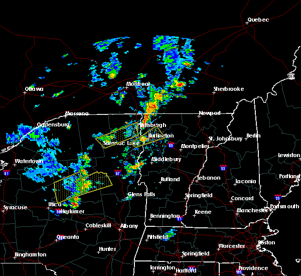
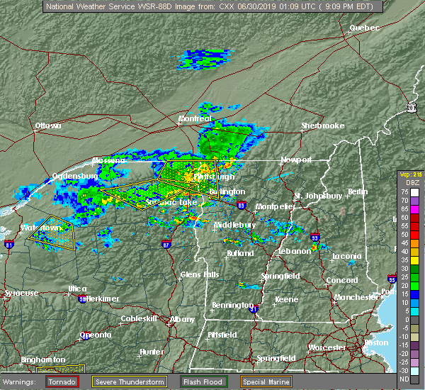
| 6/29/2019 9:09 PM EDT |
 At 842 pm edt, a severe thunderstorm was located over jericho, moving east at 45 mph (radar indicated). Hazards include 60 mph wind gusts and penny size hail. Expect damage to trees and powerlines. locations impacted include, essex junction, plattsburgh, plattsburgh international airport, burlington, beekmantown, schuyler falls, chazy, mooers, altona, champlain, colchester, essex junction village, georgia, grand isle, st. Albans town, south alburgh, alburgh, alburgh dunes state park, north hero and milton. At 842 pm edt, a severe thunderstorm was located over jericho, moving east at 45 mph (radar indicated). Hazards include 60 mph wind gusts and penny size hail. Expect damage to trees and powerlines. locations impacted include, essex junction, plattsburgh, plattsburgh international airport, burlington, beekmantown, schuyler falls, chazy, mooers, altona, champlain, colchester, essex junction village, georgia, grand isle, st. Albans town, south alburgh, alburgh, alburgh dunes state park, north hero and milton.
|
| 6/29/2019 9:09 PM EDT |
 The severe thunderstorm warning for northern clinton, grand isle, northwestern chittenden and western franklin counties will expire at 915 pm edt, the storms which prompted the warning has exited western clinton county and has weakened below severe limits as it approves the champlain valley. therefore, the warning will be allowed to expire. however gusty winds are still possible with these thunderstorms as they move into the champlain valley and across lake champlain. boaters should seek shelter and be prepared for gusty winds in excess of 30-35 mph. The severe thunderstorm warning for northern clinton, grand isle, northwestern chittenden and western franklin counties will expire at 915 pm edt, the storms which prompted the warning has exited western clinton county and has weakened below severe limits as it approves the champlain valley. therefore, the warning will be allowed to expire. however gusty winds are still possible with these thunderstorms as they move into the champlain valley and across lake champlain. boaters should seek shelter and be prepared for gusty winds in excess of 30-35 mph.
|
| 6/29/2019 8:43 PM EDT |
 At 842 pm edt, a severe thunderstorm was located over jericho, moving east at 45 mph (radar indicated). Hazards include 60 mph wind gusts and penny size hail. Expect damage to trees and powerlines. locations impacted include, essex junction, plattsburgh, plattsburgh international airport, burlington, beekmantown, schuyler falls, chazy, mooers, altona, champlain, colchester, essex junction village, georgia, grand isle, st. Albans town, south alburgh, alburgh, alburgh dunes state park, north hero and milton. At 842 pm edt, a severe thunderstorm was located over jericho, moving east at 45 mph (radar indicated). Hazards include 60 mph wind gusts and penny size hail. Expect damage to trees and powerlines. locations impacted include, essex junction, plattsburgh, plattsburgh international airport, burlington, beekmantown, schuyler falls, chazy, mooers, altona, champlain, colchester, essex junction village, georgia, grand isle, st. Albans town, south alburgh, alburgh, alburgh dunes state park, north hero and milton.
|
| 6/29/2019 8:15 PM EDT |
 At 815 pm edt, a severe thunderstorm was located over brainardsville, moving east at 45 mph (radar indicated). Hazards include 60 mph wind gusts and quarter size hail. Minor hail damage to vehicles is possible. Expect wind damage to trees and powerlines. At 815 pm edt, a severe thunderstorm was located over brainardsville, moving east at 45 mph (radar indicated). Hazards include 60 mph wind gusts and quarter size hail. Minor hail damage to vehicles is possible. Expect wind damage to trees and powerlines.
|
| 6/29/2019 8:15 PM EDT |
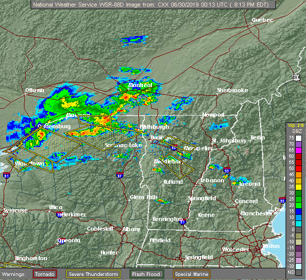 At 815 pm edt, a severe thunderstorm was located over brainardsville, moving east at 45 mph (radar indicated). Hazards include 60 mph wind gusts and quarter size hail. Minor hail damage to vehicles is possible. Expect wind damage to trees and powerlines. At 815 pm edt, a severe thunderstorm was located over brainardsville, moving east at 45 mph (radar indicated). Hazards include 60 mph wind gusts and quarter size hail. Minor hail damage to vehicles is possible. Expect wind damage to trees and powerlines.
|
| 6/28/2019 12:41 AM EDT |
 The severe thunderstorm warning for northeastern clinton, northern grand isle and northwestern franklin counties will expire at 1245 am edt, the storm which prompted the warning has weakened below severe limits and no longer poses an immediate threat to life or property. therefore, the warning will be allowed to expire. however gusty winds and heavy rain are still possible with this thunderstorm. The severe thunderstorm warning for northeastern clinton, northern grand isle and northwestern franklin counties will expire at 1245 am edt, the storm which prompted the warning has weakened below severe limits and no longer poses an immediate threat to life or property. therefore, the warning will be allowed to expire. however gusty winds and heavy rain are still possible with this thunderstorm.
|
| 6/28/2019 12:41 AM EDT |
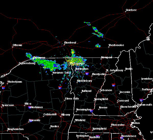 The severe thunderstorm warning for northeastern clinton, northern grand isle and northwestern franklin counties will expire at 1245 am edt, the storm which prompted the warning has weakened below severe limits and no longer poses an immediate threat to life or property. therefore, the warning will be allowed to expire. however gusty winds and heavy rain are still possible with this thunderstorm. The severe thunderstorm warning for northeastern clinton, northern grand isle and northwestern franklin counties will expire at 1245 am edt, the storm which prompted the warning has weakened below severe limits and no longer poses an immediate threat to life or property. therefore, the warning will be allowed to expire. however gusty winds and heavy rain are still possible with this thunderstorm.
|
| 6/28/2019 12:21 AM EDT |
 At 1219 am edt, a severe thunderstorm was located over hemlock island, moving southeast at 15 mph (law enforcement. dime sized hail and several trees were reported down where highway 9 meets interstate 87 near champlain). Hazards include 60 mph wind gusts and quarter size hail. Minor hail damage to vehicles is possible. expect wind damage to trees and powerlines. locations impacted include, beekmantown, chazy, mooers, alburgh village, champlain, st. albans city, swanton, st. Albans town, south alburgh, alburgh, alburgh dunes state park, north hero, swanton village, highgate falls, isle la motte, rouses point, highgate, sheldon, fairfield and grand isle. At 1219 am edt, a severe thunderstorm was located over hemlock island, moving southeast at 15 mph (law enforcement. dime sized hail and several trees were reported down where highway 9 meets interstate 87 near champlain). Hazards include 60 mph wind gusts and quarter size hail. Minor hail damage to vehicles is possible. expect wind damage to trees and powerlines. locations impacted include, beekmantown, chazy, mooers, alburgh village, champlain, st. albans city, swanton, st. Albans town, south alburgh, alburgh, alburgh dunes state park, north hero, swanton village, highgate falls, isle la motte, rouses point, highgate, sheldon, fairfield and grand isle.
|
| 6/28/2019 12:21 AM EDT |
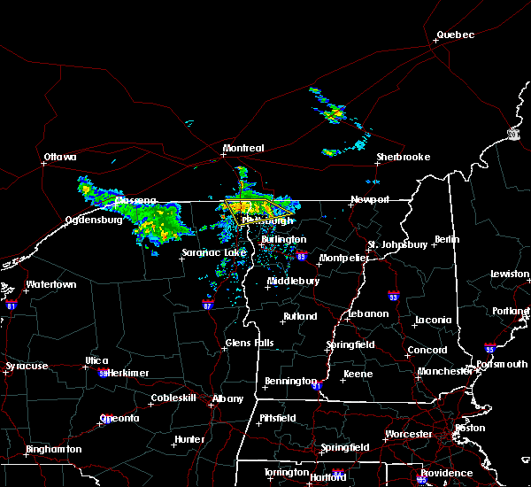 At 1219 am edt, a severe thunderstorm was located over hemlock island, moving southeast at 15 mph (law enforcement. dime sized hail and several trees were reported down where highway 9 meets interstate 87 near champlain). Hazards include 60 mph wind gusts and quarter size hail. Minor hail damage to vehicles is possible. expect wind damage to trees and powerlines. locations impacted include, beekmantown, chazy, mooers, alburgh village, champlain, st. albans city, swanton, st. Albans town, south alburgh, alburgh, alburgh dunes state park, north hero, swanton village, highgate falls, isle la motte, rouses point, highgate, sheldon, fairfield and grand isle. At 1219 am edt, a severe thunderstorm was located over hemlock island, moving southeast at 15 mph (law enforcement. dime sized hail and several trees were reported down where highway 9 meets interstate 87 near champlain). Hazards include 60 mph wind gusts and quarter size hail. Minor hail damage to vehicles is possible. expect wind damage to trees and powerlines. locations impacted include, beekmantown, chazy, mooers, alburgh village, champlain, st. albans city, swanton, st. Albans town, south alburgh, alburgh, alburgh dunes state park, north hero, swanton village, highgate falls, isle la motte, rouses point, highgate, sheldon, fairfield and grand isle.
|
| 6/28/2019 12:03 AM EDT |
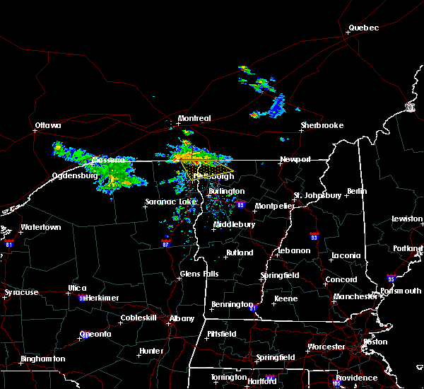 At 1203 am edt, a severe thunderstorm was located over king bay, moving southeast at 20 mph (radar indicated). Hazards include 60 mph wind gusts and quarter size hail. Minor hail damage to vehicles is possible. expect wind damage to trees and powerlines. locations impacted include, beekmantown, chazy, mooers, alburgh village, champlain, st. albans city, swanton, st. Albans town, south alburgh, alburgh, alburgh dunes state park, north hero, swanton village, highgate falls, isle la motte, rouses point, highgate, sheldon, fairfield and grand isle. At 1203 am edt, a severe thunderstorm was located over king bay, moving southeast at 20 mph (radar indicated). Hazards include 60 mph wind gusts and quarter size hail. Minor hail damage to vehicles is possible. expect wind damage to trees and powerlines. locations impacted include, beekmantown, chazy, mooers, alburgh village, champlain, st. albans city, swanton, st. Albans town, south alburgh, alburgh, alburgh dunes state park, north hero, swanton village, highgate falls, isle la motte, rouses point, highgate, sheldon, fairfield and grand isle.
|
| 6/27/2019 11:44 PM EDT |
 At 1144 pm edt, a severe thunderstorm was located over rouses point, moving southeast at 20 mph (radar indicated). Hazards include 60 mph wind gusts and quarter size hail. Minor hail damage to vehicles is possible. Expect wind damage to trees and powerlines. At 1144 pm edt, a severe thunderstorm was located over rouses point, moving southeast at 20 mph (radar indicated). Hazards include 60 mph wind gusts and quarter size hail. Minor hail damage to vehicles is possible. Expect wind damage to trees and powerlines.
|
| 6/27/2019 11:44 PM EDT |
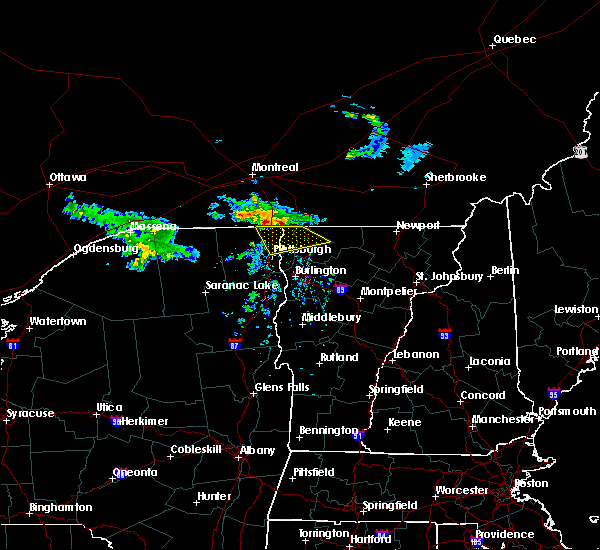 At 1144 pm edt, a severe thunderstorm was located over rouses point, moving southeast at 20 mph (radar indicated). Hazards include 60 mph wind gusts and quarter size hail. Minor hail damage to vehicles is possible. Expect wind damage to trees and powerlines. At 1144 pm edt, a severe thunderstorm was located over rouses point, moving southeast at 20 mph (radar indicated). Hazards include 60 mph wind gusts and quarter size hail. Minor hail damage to vehicles is possible. Expect wind damage to trees and powerlines.
|
| 6/30/2018 11:07 PM EDT |
 At 1043 pm edt, a severe thunderstorm was located 15 miles north of cannon corners, moving southeast at 30 mph (radar indicated). Hazards include 60 mph wind gusts and quarter size hail. Minor hail damage to vehicles is possible. Expect wind damage to trees and powerlines. At 1043 pm edt, a severe thunderstorm was located 15 miles north of cannon corners, moving southeast at 30 mph (radar indicated). Hazards include 60 mph wind gusts and quarter size hail. Minor hail damage to vehicles is possible. Expect wind damage to trees and powerlines.
|
| 6/30/2018 11:07 PM EDT |
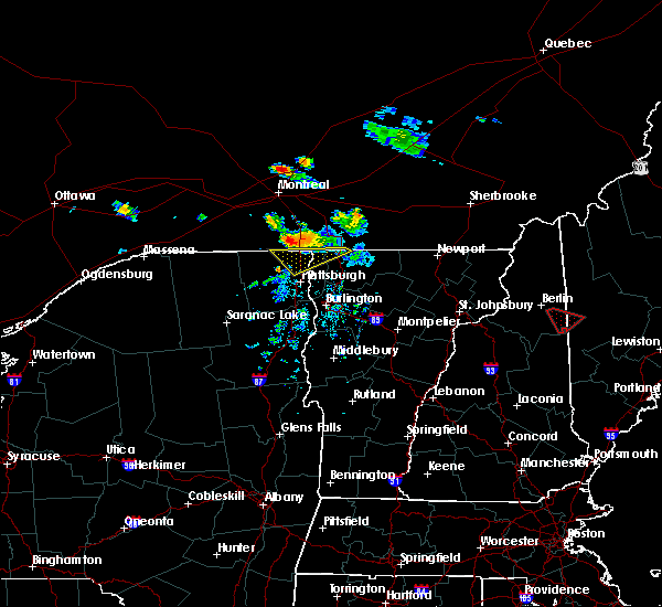 At 1106 pm edt, a severe thunderstorm was located near perry mills, moving southeast at 30 mph (radar indicated). Hazards include ping pong ball size hail and 60 mph wind gusts. People and animals outdoors will be injured. expect hail damage to roofs, siding, windows, and vehicles. expect wind damage to trees and powerlines. Locations impacted include, chazy, mooers, alburgh village, champlain, isle la motte, south alburgh, rouses point, highgate, alburgh, alburgh dunes state park, swanton, north hero, reed point, wagner point, north hero state park, alburg tongue, scott point, mooers forks, ransoms bay and rock river bay. At 1106 pm edt, a severe thunderstorm was located near perry mills, moving southeast at 30 mph (radar indicated). Hazards include ping pong ball size hail and 60 mph wind gusts. People and animals outdoors will be injured. expect hail damage to roofs, siding, windows, and vehicles. expect wind damage to trees and powerlines. Locations impacted include, chazy, mooers, alburgh village, champlain, isle la motte, south alburgh, rouses point, highgate, alburgh, alburgh dunes state park, swanton, north hero, reed point, wagner point, north hero state park, alburg tongue, scott point, mooers forks, ransoms bay and rock river bay.
|
| 6/30/2018 10:44 PM EDT |
 At 1043 pm edt, a severe thunderstorm was located 15 miles north of cannon corners, moving southeast at 30 mph (radar indicated). Hazards include 60 mph wind gusts and quarter size hail. Minor hail damage to vehicles is possible. Expect wind damage to trees and powerlines. At 1043 pm edt, a severe thunderstorm was located 15 miles north of cannon corners, moving southeast at 30 mph (radar indicated). Hazards include 60 mph wind gusts and quarter size hail. Minor hail damage to vehicles is possible. Expect wind damage to trees and powerlines.
|
| 6/30/2018 10:44 PM EDT |
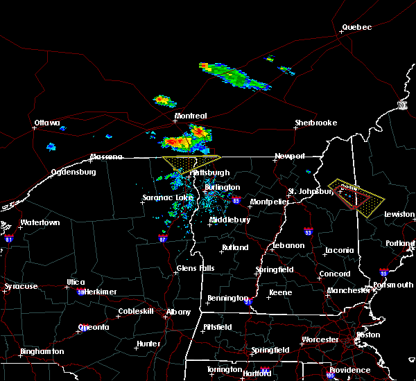 At 1043 pm edt, a severe thunderstorm was located 15 miles north of cannon corners, moving southeast at 30 mph (radar indicated). Hazards include 60 mph wind gusts and quarter size hail. Minor hail damage to vehicles is possible. Expect wind damage to trees and powerlines. At 1043 pm edt, a severe thunderstorm was located 15 miles north of cannon corners, moving southeast at 30 mph (radar indicated). Hazards include 60 mph wind gusts and quarter size hail. Minor hail damage to vehicles is possible. Expect wind damage to trees and powerlines.
|
| 5/4/2018 6:02 PM EDT |
 At 601 pm edt, a severe thunderstorm was located over sciota, moving east at 50 mph (radar indicated). Hazards include 60 mph wind gusts and quarter size hail. Minor hail damage to vehicles is possible. expect wind damage to trees and powerlines. locations impacted include, beekmantown, chazy, mooers, altona, franklin, alburgh village, ellenburg depot, champlain, st. albans city, sheldon, swanton, st. albans town, south alburgh, alburgh, alburgh dunes state park, north hero, swanton village, highgate falls, isle la motte and lake carmi state park. A tornado watch remains in effect until 1000 pm edt for northern new york, and northwestern vermont. At 601 pm edt, a severe thunderstorm was located over sciota, moving east at 50 mph (radar indicated). Hazards include 60 mph wind gusts and quarter size hail. Minor hail damage to vehicles is possible. expect wind damage to trees and powerlines. locations impacted include, beekmantown, chazy, mooers, altona, franklin, alburgh village, ellenburg depot, champlain, st. albans city, sheldon, swanton, st. albans town, south alburgh, alburgh, alburgh dunes state park, north hero, swanton village, highgate falls, isle la motte and lake carmi state park. A tornado watch remains in effect until 1000 pm edt for northern new york, and northwestern vermont.
|
| 5/4/2018 5:41 PM EDT |
 The national weather service in burlington has issued a * severe thunderstorm warning for. northern clinton county in northern new york. northeastern franklin county in northern new york. northern grand isle county in northwestern vermont. Northwestern franklin county in northwestern vermont. The national weather service in burlington has issued a * severe thunderstorm warning for. northern clinton county in northern new york. northeastern franklin county in northern new york. northern grand isle county in northwestern vermont. Northwestern franklin county in northwestern vermont.
|
| 5/4/2018 5:41 PM EDT |
 At 541 pm edt, a severe thunderstorm was located near brainardsville, moving east at 50 mph (radar indicated). Hazards include 60 mph wind gusts and quarter size hail. Minor hail damage to vehicles is possible. Expect wind damage to trees and powerlines. At 541 pm edt, a severe thunderstorm was located near brainardsville, moving east at 50 mph (radar indicated). Hazards include 60 mph wind gusts and quarter size hail. Minor hail damage to vehicles is possible. Expect wind damage to trees and powerlines.
|
| 7/8/2017 7:55 AM EDT |
 The severe thunderstorm warning for southeastern clinton, northeastern essex, grand isle, northwestern chittenden and southwestern franklin counties will expire at 800 am edt, the storms which prompted the warning have weakened below severe limits, and no longer pose an immediate threat to life or property. therefore the warning will be allowed to expire. however gusty winds and heavy rain are still possible with these thunderstorms. The severe thunderstorm warning for southeastern clinton, northeastern essex, grand isle, northwestern chittenden and southwestern franklin counties will expire at 800 am edt, the storms which prompted the warning have weakened below severe limits, and no longer pose an immediate threat to life or property. therefore the warning will be allowed to expire. however gusty winds and heavy rain are still possible with these thunderstorms.
|
| 7/8/2017 7:27 AM EDT |
 At 727 am edt, severe thunderstorms were located along a line extending from deep bay to ausable point to near north jay, moving east at 30 mph (radar indicated). Hazards include 60 mph wind gusts. Expect damage to trees and powerlines. locations impacted include, essex junction, burlington international airport, plattsburgh, plattsburgh international airport, south burlington, burlington, peru, beekmantown, schuyler falls, willsboro, colchester, essex junction village, georgia, au sable forks, grand isle, st. Albans town, north hero, milton, shelburne and port kent. At 727 am edt, severe thunderstorms were located along a line extending from deep bay to ausable point to near north jay, moving east at 30 mph (radar indicated). Hazards include 60 mph wind gusts. Expect damage to trees and powerlines. locations impacted include, essex junction, burlington international airport, plattsburgh, plattsburgh international airport, south burlington, burlington, peru, beekmantown, schuyler falls, willsboro, colchester, essex junction village, georgia, au sable forks, grand isle, st. Albans town, north hero, milton, shelburne and port kent.
|
| 7/8/2017 7:15 AM EDT |
 At 715 am edt, severe thunderstorms were located along a line extending from beekmantown to laphams mills to north jay, moving east at 45 mph (radar indicated). Hazards include 60 mph wind gusts. Expect damage to trees and powerlines. locations impacted include, essex junction, burlington international airport, plattsburgh, plattsburgh international airport, south burlington, burlington, peru, beekmantown, schuyler falls, saranac, willsboro, colchester, essex junction village, georgia, au sable forks, grand isle, st. Albans town, jay in essex county, north hero and milton. At 715 am edt, severe thunderstorms were located along a line extending from beekmantown to laphams mills to north jay, moving east at 45 mph (radar indicated). Hazards include 60 mph wind gusts. Expect damage to trees and powerlines. locations impacted include, essex junction, burlington international airport, plattsburgh, plattsburgh international airport, south burlington, burlington, peru, beekmantown, schuyler falls, saranac, willsboro, colchester, essex junction village, georgia, au sable forks, grand isle, st. Albans town, jay in essex county, north hero and milton.
|
| 7/8/2017 7:04 AM EDT |
 At 703 am edt, severe thunderstorms were located along a line extending from jericho to near peasleeville to near wilmington, moving east at 30 mph (radar indicated). Hazards include 60 mph wind gusts. Expect damage to trees and powerlines. locations impacted include, essex junction, burlington international airport, adirondack regional airport, plattsburgh, plattsburgh international airport, south burlington, burlington, saranac lake, peru, beekmantown, schuyler falls, saranac, willsboro, wilmington, colchester, essex junction village, georgia, au sable forks, grand isle and st. Albans town. At 703 am edt, severe thunderstorms were located along a line extending from jericho to near peasleeville to near wilmington, moving east at 30 mph (radar indicated). Hazards include 60 mph wind gusts. Expect damage to trees and powerlines. locations impacted include, essex junction, burlington international airport, adirondack regional airport, plattsburgh, plattsburgh international airport, south burlington, burlington, saranac lake, peru, beekmantown, schuyler falls, saranac, willsboro, wilmington, colchester, essex junction village, georgia, au sable forks, grand isle and st. Albans town.
|
| 7/8/2017 6:29 AM EDT |
 At 628 am edt, severe thunderstorms were located along a line extending from merrill to near loon lake to adirondack regional airport, moving east at 30 mph (radar indicated). Hazards include 60 mph wind gusts and quarter size hail. Minor hail damage to vehicles is possible. Expect wind damage to trees and powerlines. At 628 am edt, severe thunderstorms were located along a line extending from merrill to near loon lake to adirondack regional airport, moving east at 30 mph (radar indicated). Hazards include 60 mph wind gusts and quarter size hail. Minor hail damage to vehicles is possible. Expect wind damage to trees and powerlines.
|
| 5/18/2017 10:36 PM EDT |
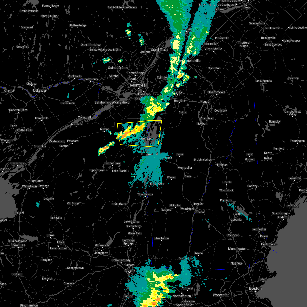 At 1033 pm edt, a severe thunderstorm was located over ellenburg mountain, moving east at 60 mph (radar indicated). Hazards include 60 mph wind gusts. Expect damage to trees and powerlines. locations impacted include, plattsburgh, plattsburgh international airport, beekmantown, chazy, saranac, mooers, altona, champlain, georgia, grand isle, st. Albans town, south alburgh, alburgh, alburgh dunes state park, north hero, milton, isle la motte, merrill, dannemora and rouses point. At 1033 pm edt, a severe thunderstorm was located over ellenburg mountain, moving east at 60 mph (radar indicated). Hazards include 60 mph wind gusts. Expect damage to trees and powerlines. locations impacted include, plattsburgh, plattsburgh international airport, beekmantown, chazy, saranac, mooers, altona, champlain, georgia, grand isle, st. Albans town, south alburgh, alburgh, alburgh dunes state park, north hero, milton, isle la motte, merrill, dannemora and rouses point.
|
| 5/18/2017 10:36 PM EDT |
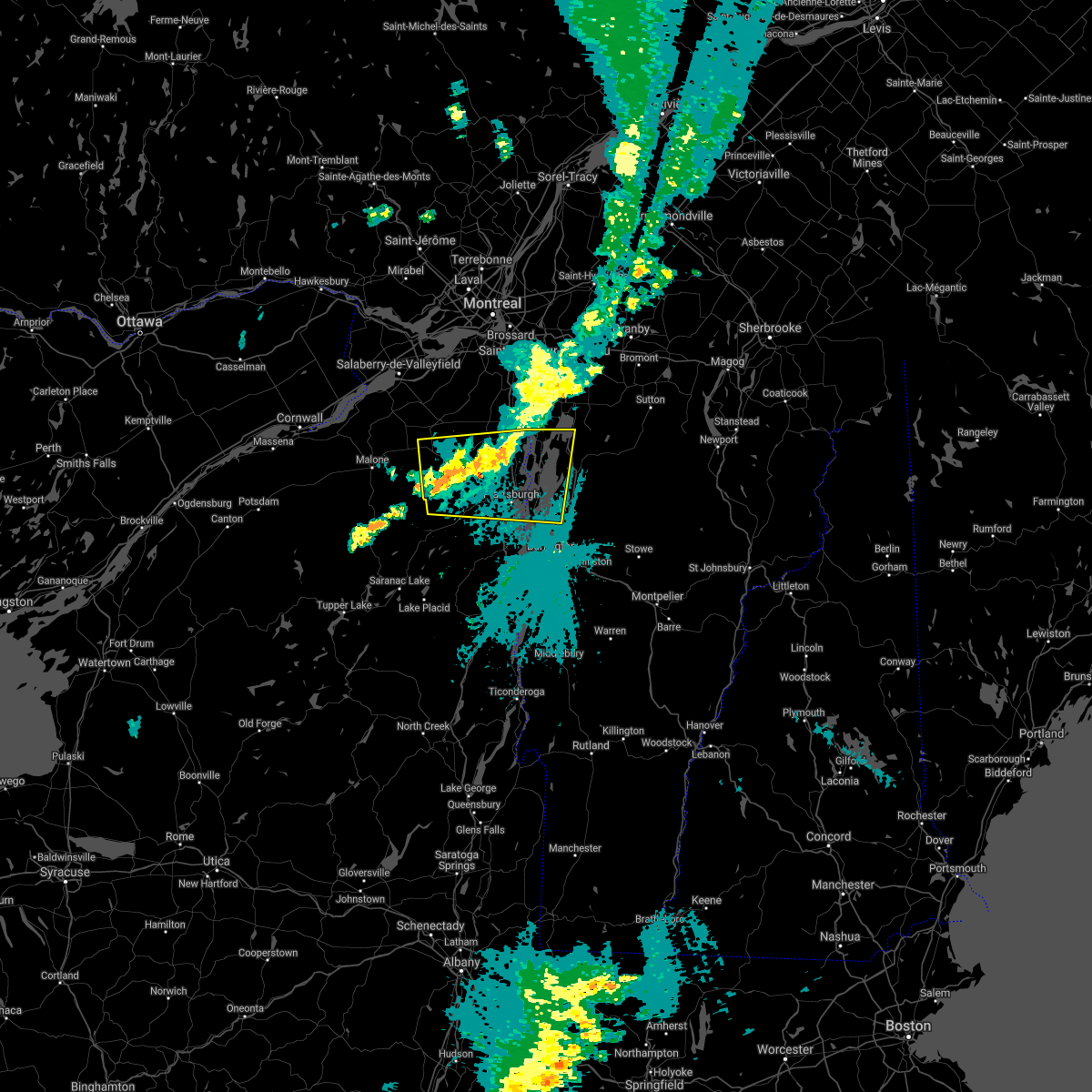 At 1033 pm edt, a severe thunderstorm was located over ellenburg mountain, moving east at 60 mph (radar indicated). Hazards include 60 mph wind gusts. Expect damage to trees and powerlines. locations impacted include, plattsburgh, plattsburgh international airport, beekmantown, chazy, saranac, mooers, altona, champlain, georgia, grand isle, st. Albans town, south alburgh, alburgh, alburgh dunes state park, north hero, milton, isle la motte, merrill, dannemora and rouses point. At 1033 pm edt, a severe thunderstorm was located over ellenburg mountain, moving east at 60 mph (radar indicated). Hazards include 60 mph wind gusts. Expect damage to trees and powerlines. locations impacted include, plattsburgh, plattsburgh international airport, beekmantown, chazy, saranac, mooers, altona, champlain, georgia, grand isle, st. Albans town, south alburgh, alburgh, alburgh dunes state park, north hero, milton, isle la motte, merrill, dannemora and rouses point.
|
| 5/18/2017 10:20 PM EDT |
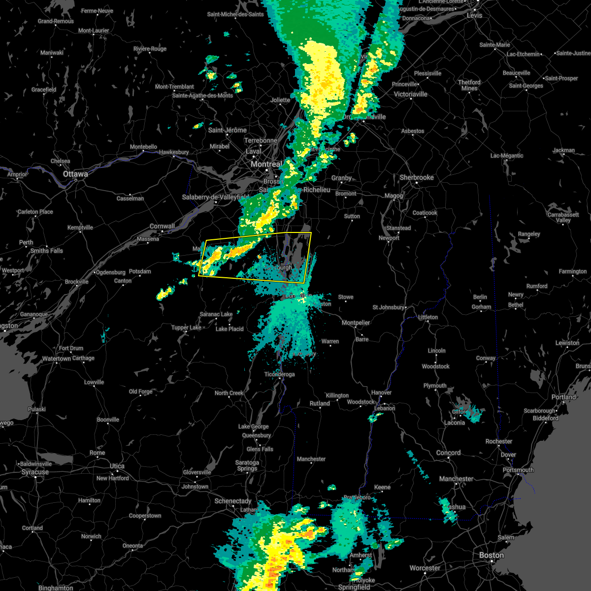 At 1020 pm edt, a severe thunderstorm was located near brainardsville, moving east at 65 mph (radar indicated). Hazards include 60 mph wind gusts. expect damage to trees and powerlines At 1020 pm edt, a severe thunderstorm was located near brainardsville, moving east at 65 mph (radar indicated). Hazards include 60 mph wind gusts. expect damage to trees and powerlines
|
| 5/18/2017 10:20 PM EDT |
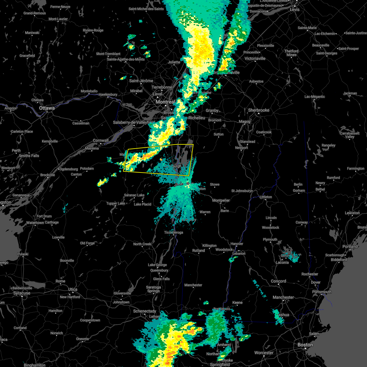 At 1020 pm edt, a severe thunderstorm was located near brainardsville, moving east at 65 mph (radar indicated). Hazards include 60 mph wind gusts. expect damage to trees and powerlines At 1020 pm edt, a severe thunderstorm was located near brainardsville, moving east at 65 mph (radar indicated). Hazards include 60 mph wind gusts. expect damage to trees and powerlines
|
| 8/28/2016 6:12 PM EDT |
 At 611 pm edt, a severe thunderstorm was located over reynolds point, moving east at 30 mph (radar indicated). Hazards include 60 mph wind gusts and quarter size hail. Hail damage to vehicles is expected. Expect wind damage to roofs, siding, and trees. At 611 pm edt, a severe thunderstorm was located over reynolds point, moving east at 30 mph (radar indicated). Hazards include 60 mph wind gusts and quarter size hail. Hail damage to vehicles is expected. Expect wind damage to roofs, siding, and trees.
|
| 7/23/2016 3:01 PM EDT |
 At 300 pm edt, a severe thunderstorm was located over treadwell bay, moving southeast at 40 mph (radar indicated). Hazards include 60 mph wind gusts and quarter size hail. Hail damage to vehicles is expected. Expect wind damage to roofs, siding, and trees. At 300 pm edt, a severe thunderstorm was located over treadwell bay, moving southeast at 40 mph (radar indicated). Hazards include 60 mph wind gusts and quarter size hail. Hail damage to vehicles is expected. Expect wind damage to roofs, siding, and trees.
|
| 7/22/2016 10:09 PM EDT |
 At 1008 pm edt, an area of strong to severe thunderstorms was located from east fletcher vermont westward to cumberland head new york, moving east at 30 mph (radar indicated). Hazards include 60 mph wind gusts and quarter size hail. Hail damage to vehicles is expected. expect wind damage to roofs, siding, and trees. Locations impacted include, colchester, essex junction, plattsburgh international airport, grand isle, beekmantown, jericho, fairfax, chazy, underhill, westford, south hero, johnson, fletcher, north hero, waterville, isle la motte, cambridge, underhill state park, georgia center and schuyler falls. At 1008 pm edt, an area of strong to severe thunderstorms was located from east fletcher vermont westward to cumberland head new york, moving east at 30 mph (radar indicated). Hazards include 60 mph wind gusts and quarter size hail. Hail damage to vehicles is expected. expect wind damage to roofs, siding, and trees. Locations impacted include, colchester, essex junction, plattsburgh international airport, grand isle, beekmantown, jericho, fairfax, chazy, underhill, westford, south hero, johnson, fletcher, north hero, waterville, isle la motte, cambridge, underhill state park, georgia center and schuyler falls.
|
| 7/22/2016 10:09 PM EDT |
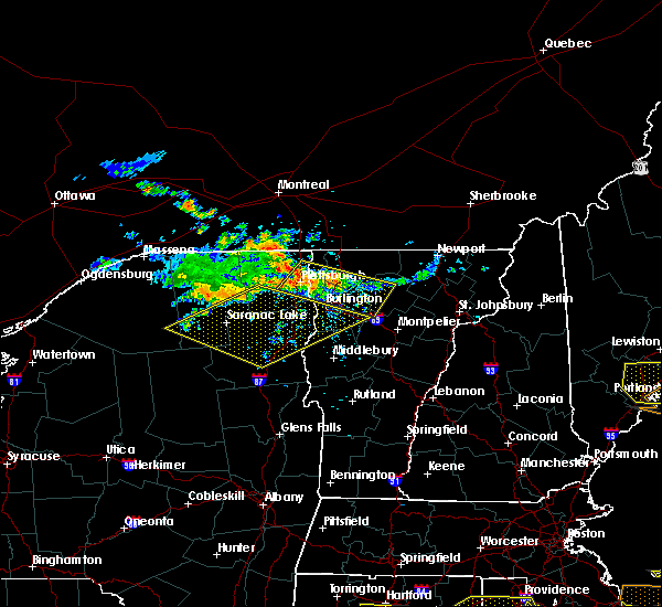 At 1008 pm edt, an area of strong to severe thunderstorms was located from east fletcher vermont westward to cumberland head new york, moving east at 30 mph (radar indicated). Hazards include 60 mph wind gusts and quarter size hail. Hail damage to vehicles is expected. expect wind damage to roofs, siding, and trees. Locations impacted include, colchester, essex junction, plattsburgh international airport, grand isle, beekmantown, jericho, fairfax, chazy, underhill, westford, south hero, johnson, fletcher, north hero, waterville, isle la motte, cambridge, underhill state park, georgia center and schuyler falls. At 1008 pm edt, an area of strong to severe thunderstorms was located from east fletcher vermont westward to cumberland head new york, moving east at 30 mph (radar indicated). Hazards include 60 mph wind gusts and quarter size hail. Hail damage to vehicles is expected. expect wind damage to roofs, siding, and trees. Locations impacted include, colchester, essex junction, plattsburgh international airport, grand isle, beekmantown, jericho, fairfax, chazy, underhill, westford, south hero, johnson, fletcher, north hero, waterville, isle la motte, cambridge, underhill state park, georgia center and schuyler falls.
|
| 7/22/2016 9:42 PM EDT |
 At 941 pm edt, a severe thunderstorm was located over allens bay in clinton county, moving east at 35 mph (radar indicated). Hazards include 60 mph wind gusts and quarter size hail. Hail damage to vehicles is expected. Expect wind damage to roofs, siding, and trees. At 941 pm edt, a severe thunderstorm was located over allens bay in clinton county, moving east at 35 mph (radar indicated). Hazards include 60 mph wind gusts and quarter size hail. Hail damage to vehicles is expected. Expect wind damage to roofs, siding, and trees.
|
| 7/18/2016 1:10 PM EDT |
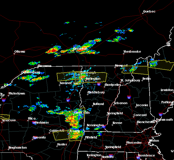 The severe thunderstorm warning for central clinton and east central franklin counties will expire at 115 pm edt, the storm which prompted the warning has moved out of the area. therefore the warning will be allowed to expire. a severe thunderstorm warning still remains in effect for eastern clinton county as this storm nears the ny border of lake champlain. a severe thunderstorm watch remains in effect until 800 pm edt for northern new york. The severe thunderstorm warning for central clinton and east central franklin counties will expire at 115 pm edt, the storm which prompted the warning has moved out of the area. therefore the warning will be allowed to expire. a severe thunderstorm warning still remains in effect for eastern clinton county as this storm nears the ny border of lake champlain. a severe thunderstorm watch remains in effect until 800 pm edt for northern new york.
|
| 7/18/2016 12:43 PM EDT |
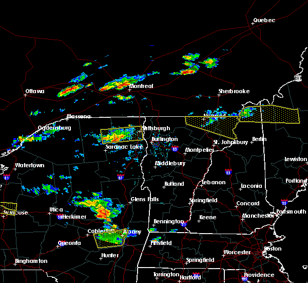 At 1242 pm edt, a severe thunderstorm was located over riverview, moving east at 45 mph (radar indicated). Hazards include 60 mph wind gusts and quarter size hail. Hail damage to vehicles is expected. expect wind damage to roofs, siding, and trees. locations impacted include, plattsburgh international airport, peru, beekmantown, dannemora, jericho, merrill, peasleeville, bryants mill, lyon mountain, clayburg, schuyler falls, saranac, russia, riverview, moffittsville, owls head, moffitsville, ausable point, wolf pond and cumberland bay. At 1242 pm edt, a severe thunderstorm was located over riverview, moving east at 45 mph (radar indicated). Hazards include 60 mph wind gusts and quarter size hail. Hail damage to vehicles is expected. expect wind damage to roofs, siding, and trees. locations impacted include, plattsburgh international airport, peru, beekmantown, dannemora, jericho, merrill, peasleeville, bryants mill, lyon mountain, clayburg, schuyler falls, saranac, russia, riverview, moffittsville, owls head, moffitsville, ausable point, wolf pond and cumberland bay.
|
| 7/18/2016 12:16 PM EDT |
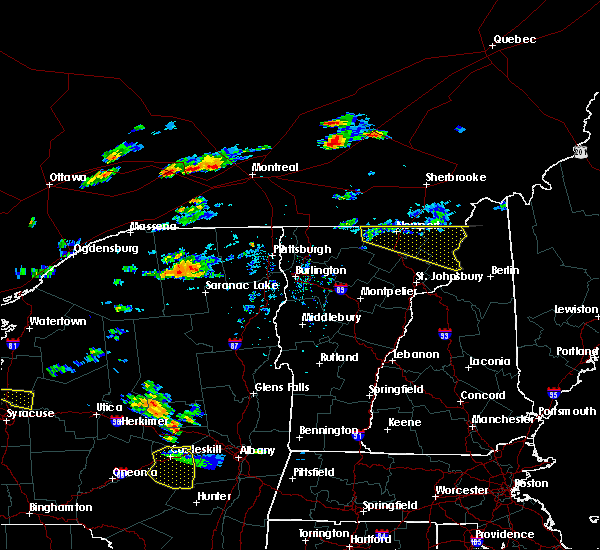 At 1216 pm edt, a severe thunderstorm was located near debar mountain, moving east at 45 mph (radar indicated). Hazards include 60 mph wind gusts and quarter size hail. Hail damage to vehicles is expected. Expect wind damage to roofs, siding, and trees. At 1216 pm edt, a severe thunderstorm was located near debar mountain, moving east at 45 mph (radar indicated). Hazards include 60 mph wind gusts and quarter size hail. Hail damage to vehicles is expected. Expect wind damage to roofs, siding, and trees.
|
| 7/7/2016 1:06 PM EDT |
 At 105 pm edt, a severe thunderstorm was located near chazy, moving east at 20 mph (radar indicated). Hazards include quarter size hail. damage to vehicles is expected At 105 pm edt, a severe thunderstorm was located near chazy, moving east at 20 mph (radar indicated). Hazards include quarter size hail. damage to vehicles is expected
|
| 7/21/2015 12:07 PM EDT |
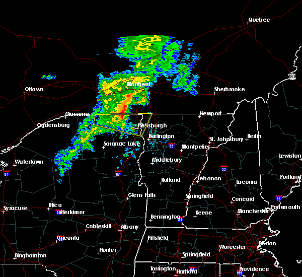 At 1206 pm edt, doppler radar indicated a severe thunderstorm capable of producing quarter size hail and damaging winds in excess of 60 mph. this storm was located over altona, moving east at 40 mph. locations impacted include, plattsburgh international airport, grand isle, beekmantown, chazy, dannemora, mooers, altona, rouses point, champlain, north hero, isle la motte, alburgh, alburgh dunes state park, south alburgh, jericho, ellenburg depot, stony point, schuyler falls, russia and ellenburg. At 1206 pm edt, doppler radar indicated a severe thunderstorm capable of producing quarter size hail and damaging winds in excess of 60 mph. this storm was located over altona, moving east at 40 mph. locations impacted include, plattsburgh international airport, grand isle, beekmantown, chazy, dannemora, mooers, altona, rouses point, champlain, north hero, isle la motte, alburgh, alburgh dunes state park, south alburgh, jericho, ellenburg depot, stony point, schuyler falls, russia and ellenburg.
|
| 7/21/2015 11:41 AM EDT |
 At 1141 am edt, doppler radar indicated a severe thunderstorm capable of producing quarter size hail and damaging winds in excess of 60 mph. this storm was located near chateaugay, and moving east at 40 mph. * locations to be impacted include, plattsburgh international airport, grand isle, beekmantown, chazy, dannemora, mooers, altona, rouses point, champlain, chateaugay, north hero, isle la motte, burke, alburgh, alburgh dunes state park, lyon mountain, south alburgh, jericho, ellenburg depot and merrill. At 1141 am edt, doppler radar indicated a severe thunderstorm capable of producing quarter size hail and damaging winds in excess of 60 mph. this storm was located near chateaugay, and moving east at 40 mph. * locations to be impacted include, plattsburgh international airport, grand isle, beekmantown, chazy, dannemora, mooers, altona, rouses point, champlain, chateaugay, north hero, isle la motte, burke, alburgh, alburgh dunes state park, lyon mountain, south alburgh, jericho, ellenburg depot and merrill.
|
| 7/21/2015 11:41 AM EDT |
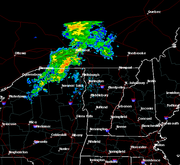 At 1141 am edt, doppler radar indicated a severe thunderstorm capable of producing quarter size hail and damaging winds in excess of 60 mph. this storm was located near chateaugay, and moving east at 40 mph. * locations to be impacted include, plattsburgh international airport, grand isle, beekmantown, chazy, dannemora, mooers, altona, rouses point, champlain, chateaugay, north hero, isle la motte, burke, alburgh, alburgh dunes state park, lyon mountain, south alburgh, jericho, ellenburg depot and merrill. At 1141 am edt, doppler radar indicated a severe thunderstorm capable of producing quarter size hail and damaging winds in excess of 60 mph. this storm was located near chateaugay, and moving east at 40 mph. * locations to be impacted include, plattsburgh international airport, grand isle, beekmantown, chazy, dannemora, mooers, altona, rouses point, champlain, chateaugay, north hero, isle la motte, burke, alburgh, alburgh dunes state park, lyon mountain, south alburgh, jericho, ellenburg depot and merrill.
|
| 5/19/2015 2:01 PM EDT | At 159 pm edt, doppler radar indicated a severe thunderstorm capable of producing damaging winds in excess of 60 mph. this storm was located near jericho, and moving northeast at 35 mph. nickel size hail may also accompany the damaging winds. * locations to be impacted include, franklin, beekmantown, chazy, sheldon, berkshire, north hero, isle la motte, alburgh dunes state park, lake carmi state park, highgate falls, alburgh, south alburgh, jericho, stony point, chellis bay, martin bay, knight point, hog island, gander bay and scott point. |
| 5/19/2015 2:01 PM EDT | At 159 pm edt, doppler radar indicated a severe thunderstorm capable of producing damaging winds in excess of 60 mph. this storm was located near jericho, and moving northeast at 35 mph. nickel size hail may also accompany the damaging winds. * locations to be impacted include, franklin, beekmantown, chazy, sheldon, berkshire, north hero, isle la motte, alburgh dunes state park, lake carmi state park, highgate falls, alburgh, south alburgh, jericho, stony point, chellis bay, martin bay, knight point, hog island, gander bay and scott point. |
Hail Maps for West Chazy, NY


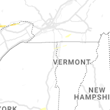
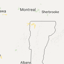

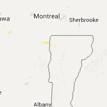

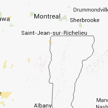


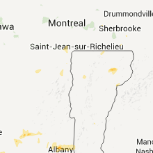
Connect with Interactive Hail Maps