

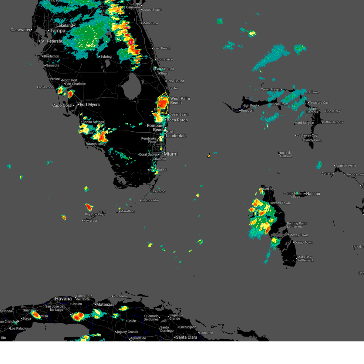
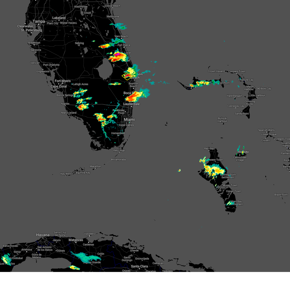
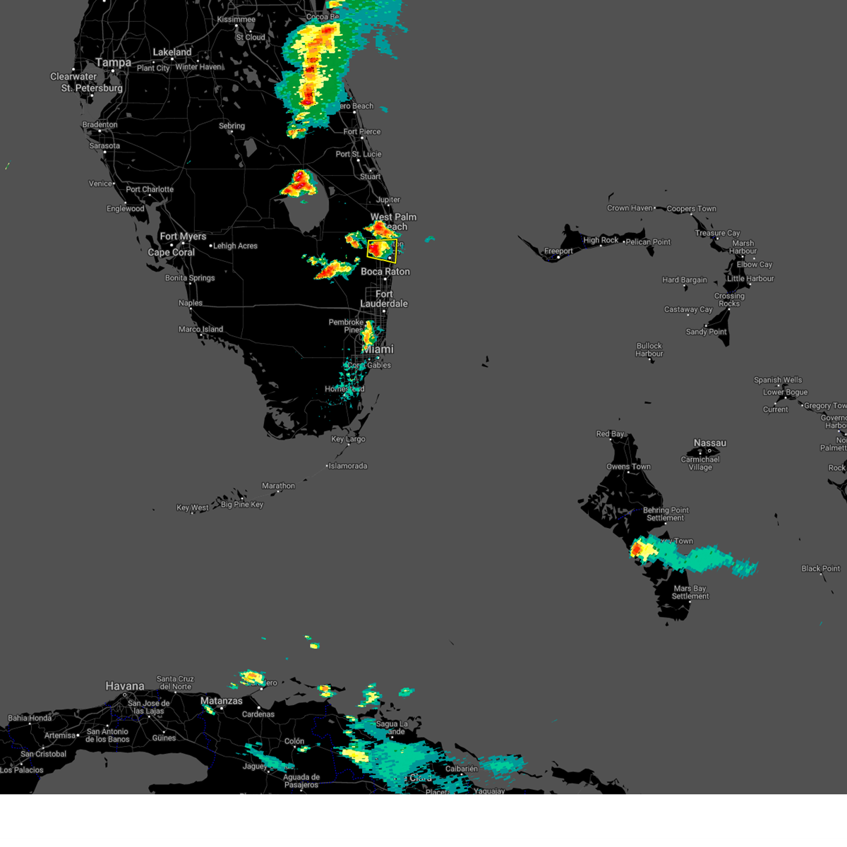
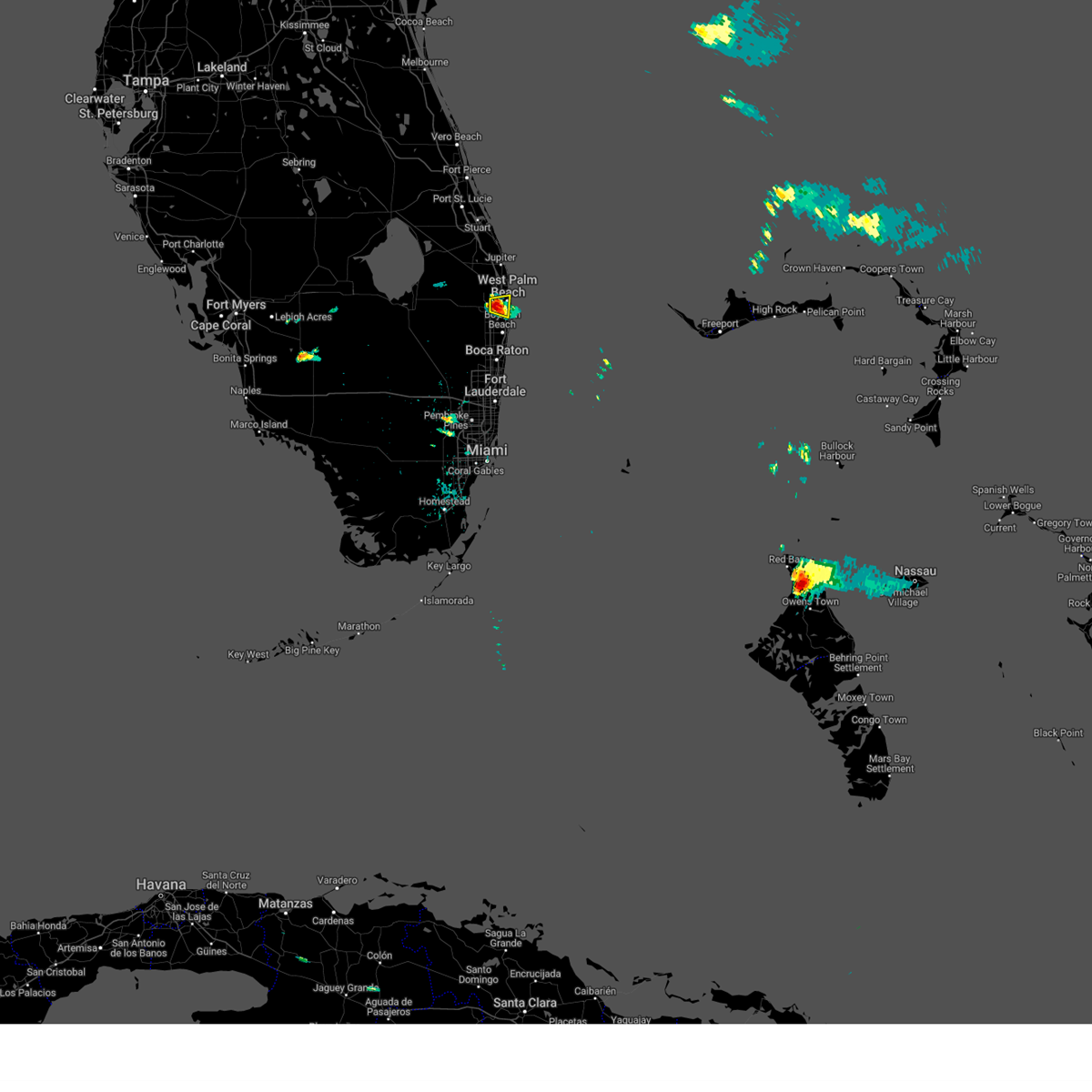
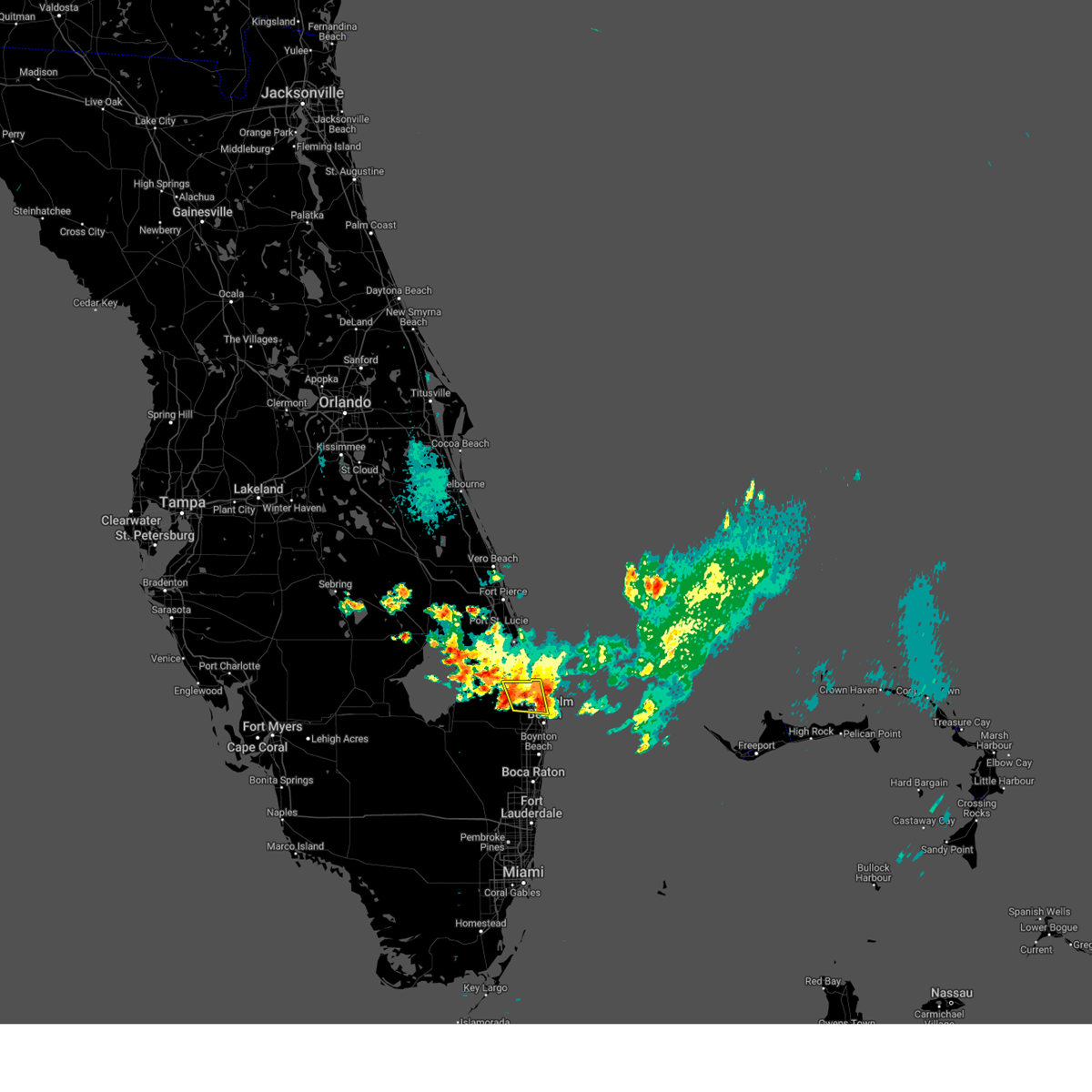
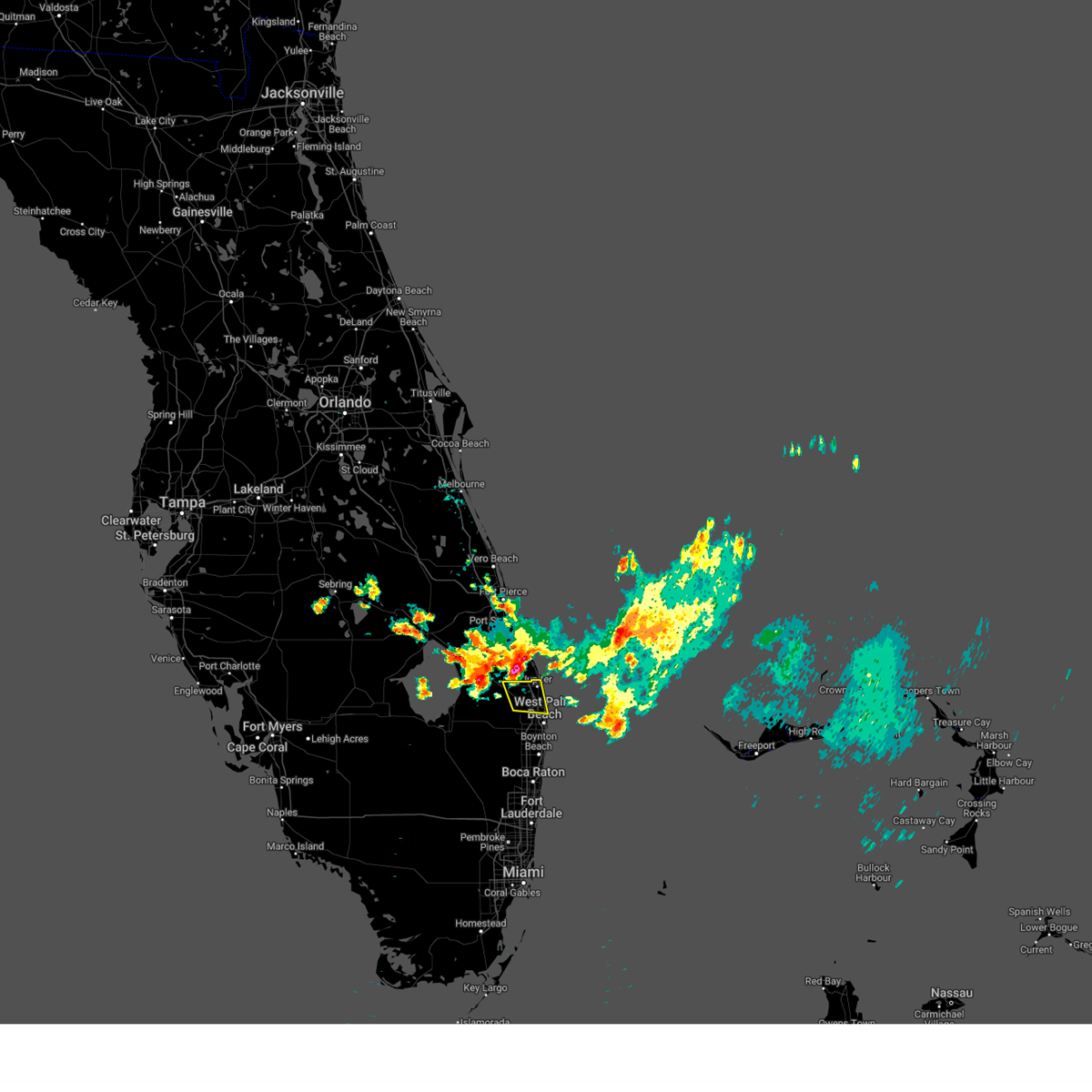
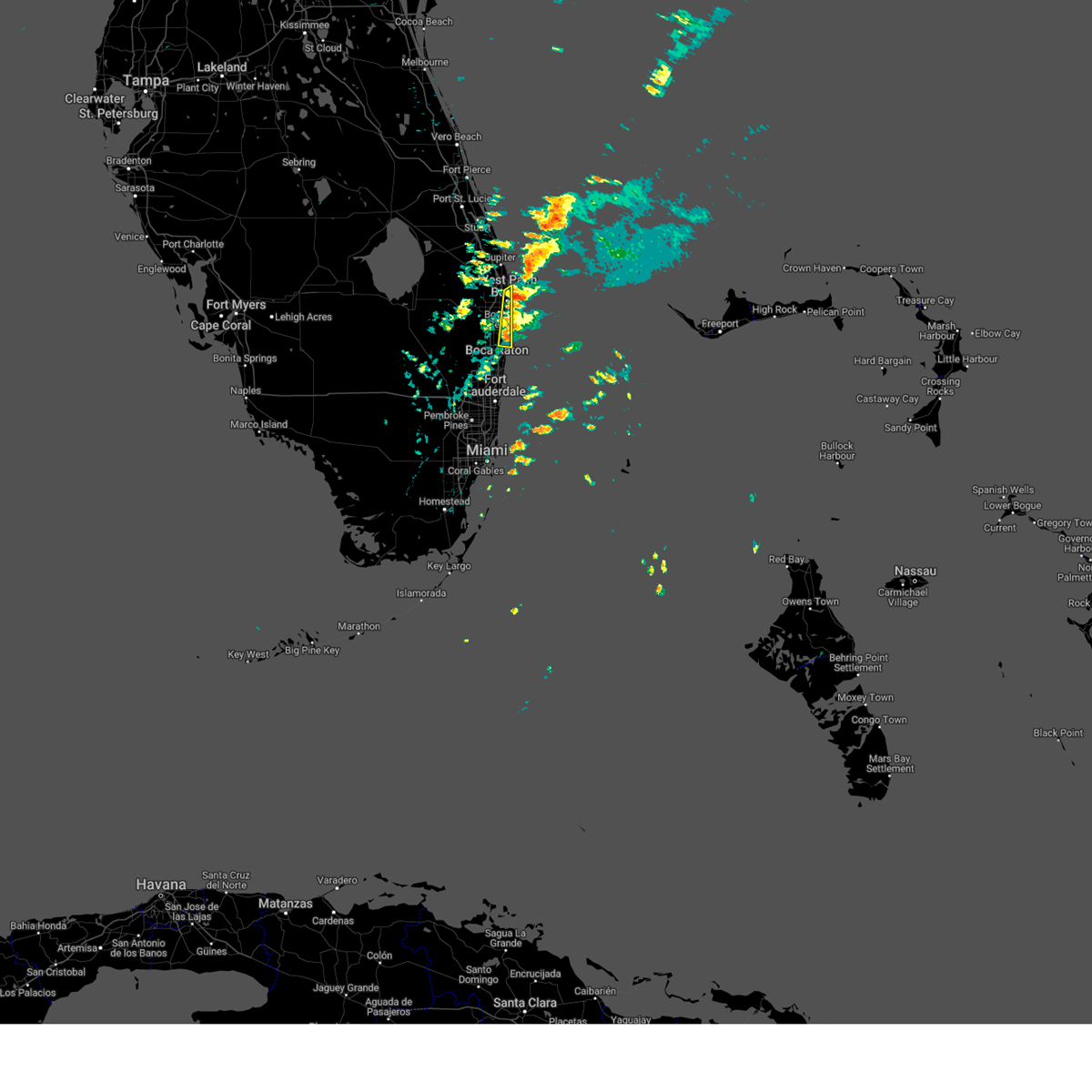
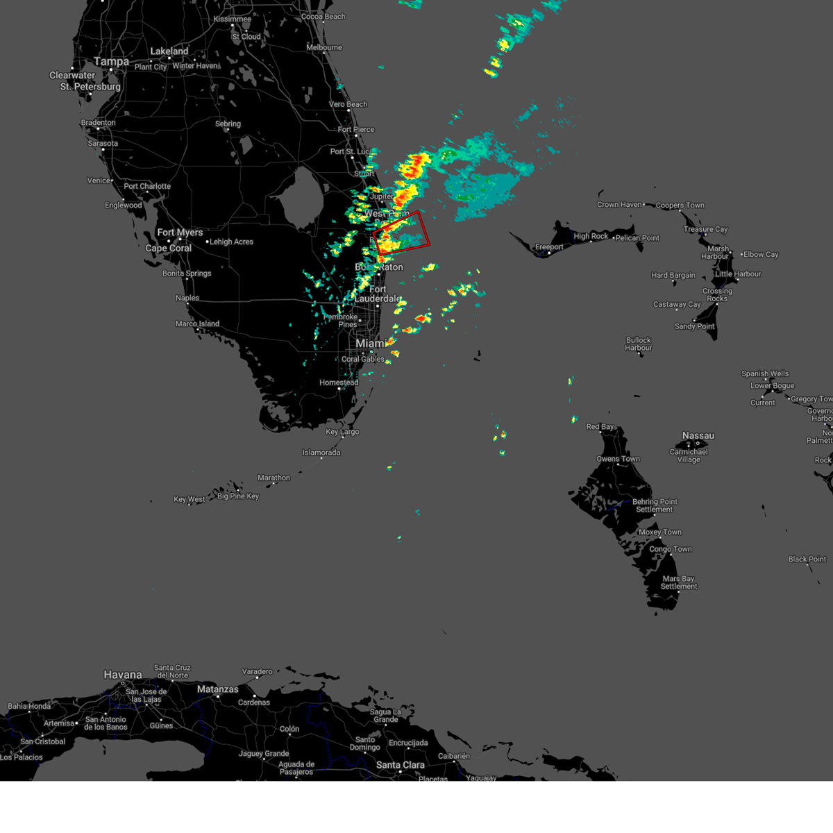
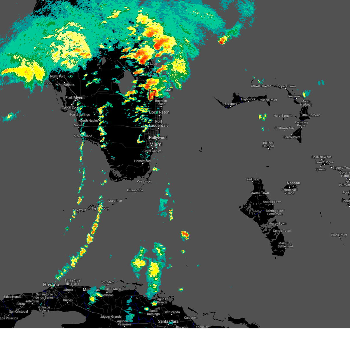
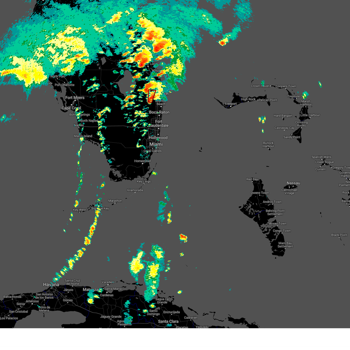
Hail Map for West Palm Beach, FL
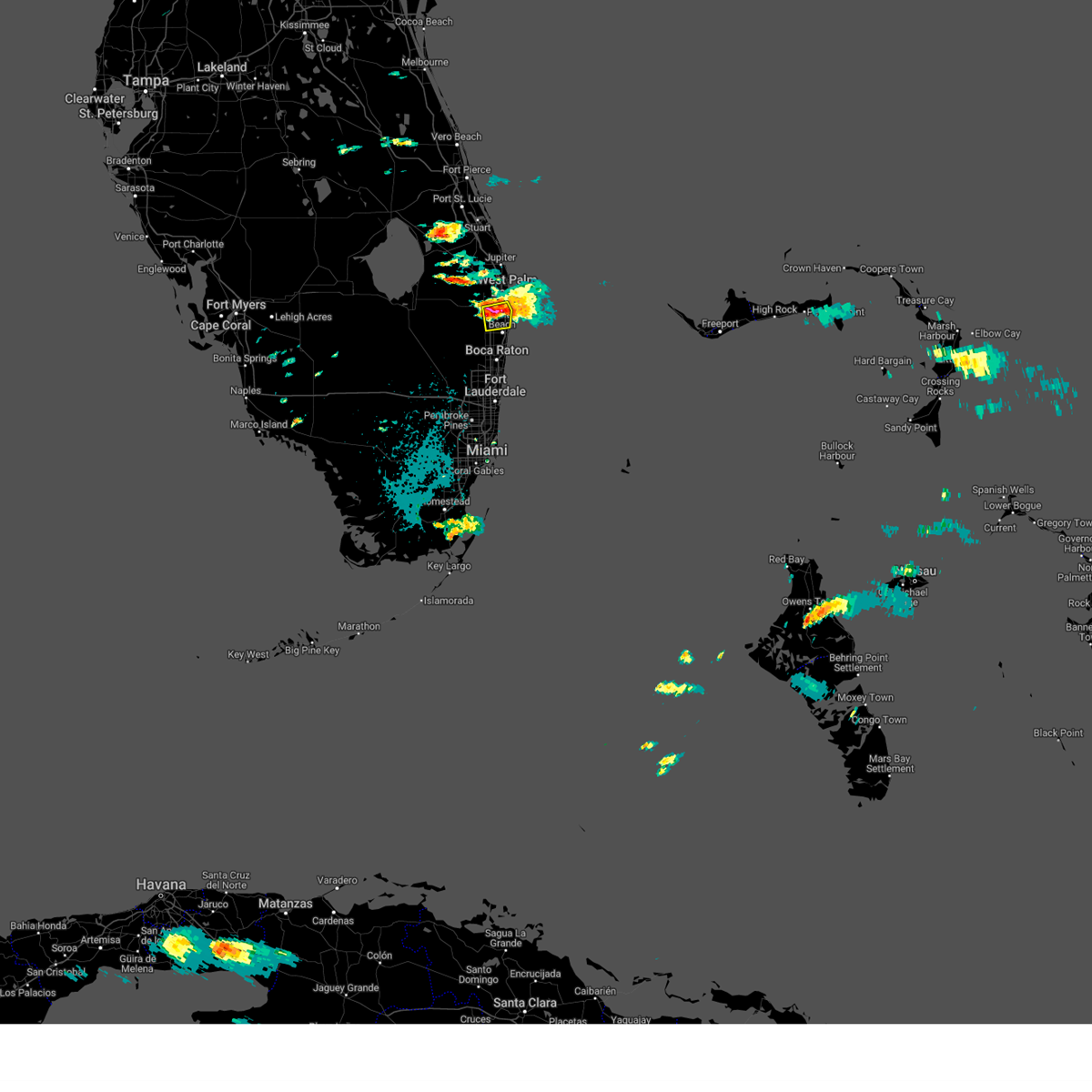
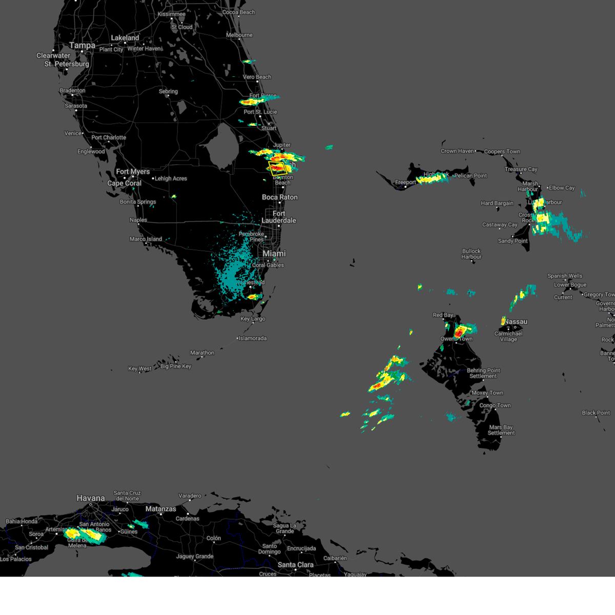
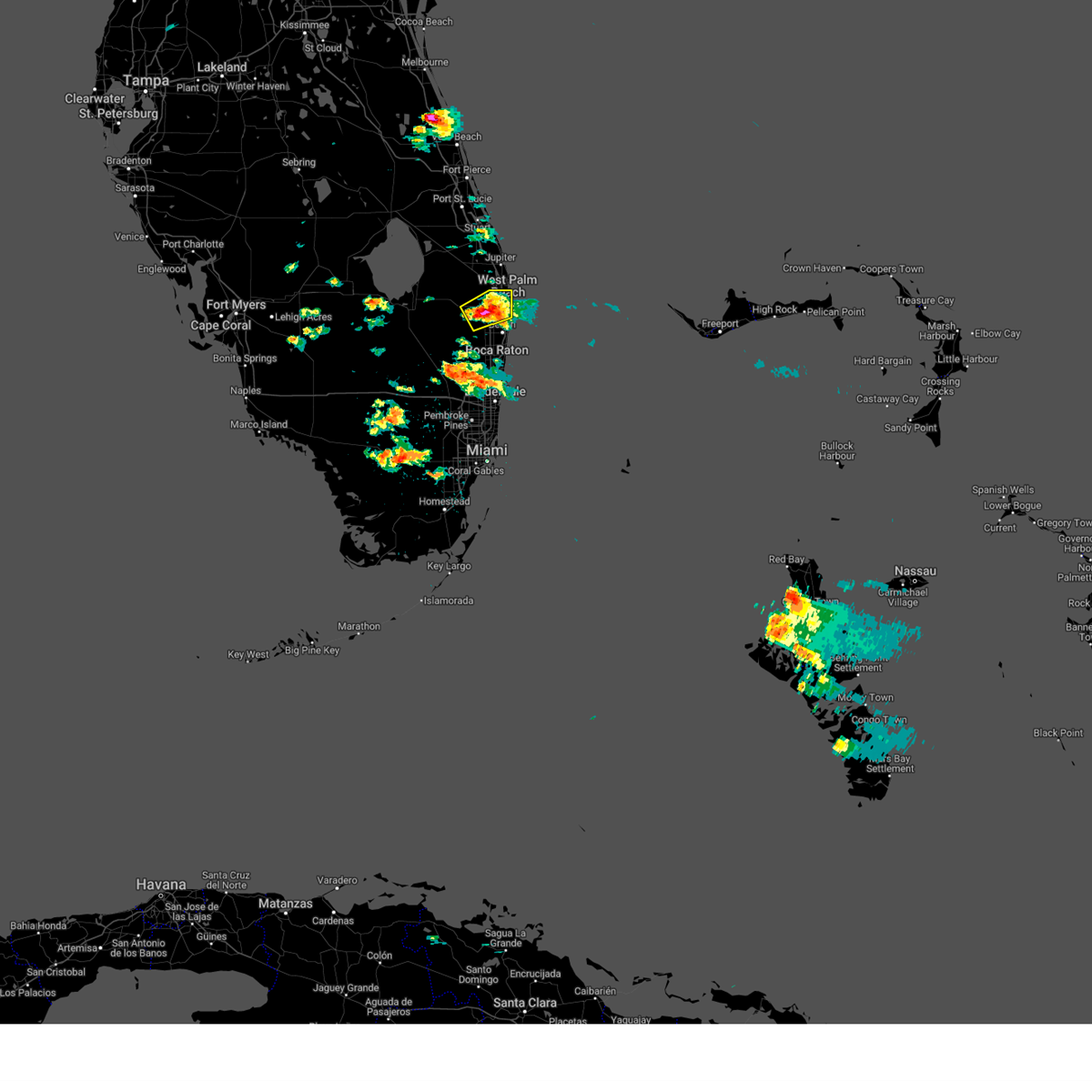
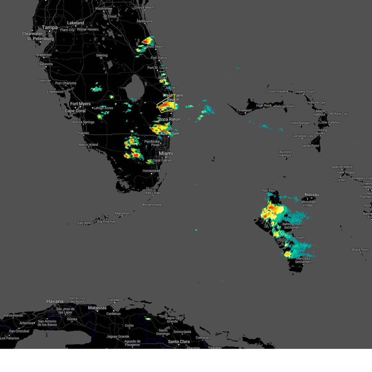
The West Palm Beach, FL area has had 10 reports of on-the-ground hail by trained spotters, and has been under severe weather warnings 30 times during the past 12 months. Doppler radar has detected hail at or near West Palm Beach, FL on 75 occasions, including 8 occasions during the past year.
| Name: | West Palm Beach, FL |
| Where Located: | 40.4 miles SSE of Port Saint Lucie, FL |
| Map: | Google Map for West Palm Beach, FL |
| Population: | 99919 |
| Housing Units: | 54179 |
| More Info: | Search Google for West Palm Beach, FL |
3
The Top Recent Hail Date for West Palm Beach, FL is Thursday, August 22, 2024 (5th out of 75)

Hail and Wind Damage Spotted near West Palm Beach, FL
| Date / Time | Report Details |
|---|---|
| 7/12/2025 4:21 PM EDT |
 At 421 pm edt, a severe thunderstorm was located over greenacres, or near wellington, and is nearly stationary (radar indicated). Hazards include 60 mph wind gusts and quarter size hail. Hail damage to vehicles is expected. expect wind damage to roofs, siding, and trees. Locations impacted include, west palm beach, boynton beach, wellington, palm beach gardens, riviera beach, greenacres, royal palm beach, palm springs, atlantis, haverhill, cloud lake, palm beach international airport, village of golf, golden lakes, loxahatchee groves, gun club estates, schall circle, royal palm estates, lake belvedere estates, and dunes road. At 421 pm edt, a severe thunderstorm was located over greenacres, or near wellington, and is nearly stationary (radar indicated). Hazards include 60 mph wind gusts and quarter size hail. Hail damage to vehicles is expected. expect wind damage to roofs, siding, and trees. Locations impacted include, west palm beach, boynton beach, wellington, palm beach gardens, riviera beach, greenacres, royal palm beach, palm springs, atlantis, haverhill, cloud lake, palm beach international airport, village of golf, golden lakes, loxahatchee groves, gun club estates, schall circle, royal palm estates, lake belvedere estates, and dunes road.
|
| 7/12/2025 3:56 PM EDT |
 Svrmfl the national weather service in miami has issued a * severe thunderstorm warning for, east central palm beach county in southeastern florida, * until 430 pm edt. * at 356 pm edt, a severe thunderstorm was located over greenacres, or near wellington, and is nearly stationary (radar indicated). Hazards include 60 mph wind gusts and quarter size hail. Hail damage to vehicles is expected. Expect wind damage to roofs, siding, and trees. Svrmfl the national weather service in miami has issued a * severe thunderstorm warning for, east central palm beach county in southeastern florida, * until 430 pm edt. * at 356 pm edt, a severe thunderstorm was located over greenacres, or near wellington, and is nearly stationary (radar indicated). Hazards include 60 mph wind gusts and quarter size hail. Hail damage to vehicles is expected. Expect wind damage to roofs, siding, and trees.
|
| 5/26/2025 5:39 PM EDT |
 The severe thunderstorm which prompted the warning has weakened. therefore, the warning will be allowed to expire. The severe thunderstorm which prompted the warning has weakened. therefore, the warning will be allowed to expire.
|
| 5/26/2025 5:06 PM EDT |
 Svrmfl the national weather service in miami has issued a * severe thunderstorm warning for, northeastern palm beach county in southeastern florida, * until 545 pm edt. * at 506 pm edt, a severe thunderstorm was located 8 miles northwest of north county airport, or 11 miles west of palm beach gardens, moving southeast at 10 mph (radar indicated). Hazards include 60 mph wind gusts and quarter size hail. Hail damage to vehicles is expected. Expect wind damage to roofs, siding, and trees. Svrmfl the national weather service in miami has issued a * severe thunderstorm warning for, northeastern palm beach county in southeastern florida, * until 545 pm edt. * at 506 pm edt, a severe thunderstorm was located 8 miles northwest of north county airport, or 11 miles west of palm beach gardens, moving southeast at 10 mph (radar indicated). Hazards include 60 mph wind gusts and quarter size hail. Hail damage to vehicles is expected. Expect wind damage to roofs, siding, and trees.
|
| 5/23/2025 4:15 PM EDT |
 the severe thunderstorm warning has been cancelled and is no longer in effect the severe thunderstorm warning has been cancelled and is no longer in effect
|
| 5/23/2025 4:00 PM EDT |
 Svrmfl the national weather service in miami has issued a * severe thunderstorm warning for, northeastern palm beach county in southeastern florida, * until 430 pm edt. * at 400 pm edt, a severe thunderstorm was located near the acreage, or 7 miles west of palm beach gardens, moving southeast at 10 mph (radar indicated). Hazards include 60 mph wind gusts and quarter size hail. Hail damage to vehicles is expected. Expect wind damage to roofs, siding, and trees. Svrmfl the national weather service in miami has issued a * severe thunderstorm warning for, northeastern palm beach county in southeastern florida, * until 430 pm edt. * at 400 pm edt, a severe thunderstorm was located near the acreage, or 7 miles west of palm beach gardens, moving southeast at 10 mph (radar indicated). Hazards include 60 mph wind gusts and quarter size hail. Hail damage to vehicles is expected. Expect wind damage to roofs, siding, and trees.
|
| 5/23/2025 3:53 PM EDT |
 At 353 pm edt, a severe thunderstorm was located 7 miles west of north county airport, or 10 miles west of palm beach gardens, moving southeast at 20 mph (radar indicated). Hazards include ping pong ball size hail and 60 mph wind gusts. People and animals outdoors will be injured. expect hail damage to roofs, siding, windows, and vehicles. expect wind damage to roofs, siding, and trees. Locations impacted include, west palm beach, palm beach gardens, north county airport, the acreage, and caloosa. At 353 pm edt, a severe thunderstorm was located 7 miles west of north county airport, or 10 miles west of palm beach gardens, moving southeast at 20 mph (radar indicated). Hazards include ping pong ball size hail and 60 mph wind gusts. People and animals outdoors will be injured. expect hail damage to roofs, siding, windows, and vehicles. expect wind damage to roofs, siding, and trees. Locations impacted include, west palm beach, palm beach gardens, north county airport, the acreage, and caloosa.
|
| 5/23/2025 3:26 PM EDT |
 Svrmfl the national weather service in miami has issued a * severe thunderstorm warning for, northeastern palm beach county in southeastern florida, * until 400 pm edt. * at 326 pm edt, a severe thunderstorm was located near indiantown, moving southeast at 20 mph (radar indicated). Hazards include ping pong ball size hail and 60 mph wind gusts. People and animals outdoors will be injured. expect hail damage to roofs, siding, windows, and vehicles. Expect wind damage to roofs, siding, and trees. Svrmfl the national weather service in miami has issued a * severe thunderstorm warning for, northeastern palm beach county in southeastern florida, * until 400 pm edt. * at 326 pm edt, a severe thunderstorm was located near indiantown, moving southeast at 20 mph (radar indicated). Hazards include ping pong ball size hail and 60 mph wind gusts. People and animals outdoors will be injured. expect hail damage to roofs, siding, windows, and vehicles. Expect wind damage to roofs, siding, and trees.
|
| 5/23/2025 3:09 PM EDT | Quarter sized hail reported 4.2 miles NE of West Palm Beach, FL, trained spotter reported quarter size hail in lake worth near the turnpike and southern boulevard. |
| 5/23/2025 2:38 PM EDT |
 Svrmfl the national weather service in miami has issued a * severe thunderstorm warning for, east central palm beach county in southeastern florida, * until 330 pm edt. * at 238 pm edt, a severe thunderstorm was located over royal palm estates, or near lake worth, moving south at 5 mph (radar indicated). Hazards include 60 mph wind gusts and quarter size hail. Hail damage to vehicles is expected. Expect wind damage to roofs, siding, and trees. Svrmfl the national weather service in miami has issued a * severe thunderstorm warning for, east central palm beach county in southeastern florida, * until 330 pm edt. * at 238 pm edt, a severe thunderstorm was located over royal palm estates, or near lake worth, moving south at 5 mph (radar indicated). Hazards include 60 mph wind gusts and quarter size hail. Hail damage to vehicles is expected. Expect wind damage to roofs, siding, and trees.
|
| 5/23/2025 1:56 PM EDT |
 Svrmfl the national weather service in miami has issued a * severe thunderstorm warning for, east central palm beach county in southeastern florida, * until 245 pm edt. * at 156 pm edt, a severe thunderstorm was located over golden lakes, or over west palm beach, and is nearly stationary (radar indicated). Hazards include 60 mph wind gusts and quarter size hail. Hail damage to vehicles is expected. Expect wind damage to roofs, siding, and trees. Svrmfl the national weather service in miami has issued a * severe thunderstorm warning for, east central palm beach county in southeastern florida, * until 245 pm edt. * at 156 pm edt, a severe thunderstorm was located over golden lakes, or over west palm beach, and is nearly stationary (radar indicated). Hazards include 60 mph wind gusts and quarter size hail. Hail damage to vehicles is expected. Expect wind damage to roofs, siding, and trees.
|
| 5/12/2025 6:15 PM EDT | Several pictures showing uprooted trees... torn tree branches... pieces of a broken fence... and tilted/leaning chain-link fences. reports coincide with a supercell tha in palm beach county FL, 9.9 miles ESE of West Palm Beach, FL |
| 5/5/2025 2:19 PM EDT |
 At 218 pm edt, a severe thunderstorm was located over golden lakes, or near west palm beach, moving northeast at 10 mph (radar indicated). Hazards include 60 mph wind gusts and quarter size hail. Hail damage to vehicles is possible. wind damage to roofs, siding, and trees is also possible. Locations impacted include, west palm beach, wellington, lake worth, riviera beach, palm beach, greenacres, royal palm beach, palm springs, atlantis, haverhill, cloud lake, palm beach international airport, port of palm beach, golden lakes, loxahatchee groves, gun club estates, schall circle, royal palm estates, lake belvedere estates, and downtown west palm beach. At 218 pm edt, a severe thunderstorm was located over golden lakes, or near west palm beach, moving northeast at 10 mph (radar indicated). Hazards include 60 mph wind gusts and quarter size hail. Hail damage to vehicles is possible. wind damage to roofs, siding, and trees is also possible. Locations impacted include, west palm beach, wellington, lake worth, riviera beach, palm beach, greenacres, royal palm beach, palm springs, atlantis, haverhill, cloud lake, palm beach international airport, port of palm beach, golden lakes, loxahatchee groves, gun club estates, schall circle, royal palm estates, lake belvedere estates, and downtown west palm beach.
|
| 5/5/2025 2:07 PM EDT |
 Svrmfl the national weather service in miami has issued a * severe thunderstorm warning for, east central palm beach county in southeastern florida, * until 230 pm edt. * at 207 pm edt, a severe thunderstorm was located over golden lakes, or near wellington, moving northeast at 10 mph (radar indicated). Hazards include 60 mph wind gusts and quarter size hail. Hail damage to vehicles is possible. Wind damage to roofs, siding, and trees also possible. Svrmfl the national weather service in miami has issued a * severe thunderstorm warning for, east central palm beach county in southeastern florida, * until 230 pm edt. * at 207 pm edt, a severe thunderstorm was located over golden lakes, or near wellington, moving northeast at 10 mph (radar indicated). Hazards include 60 mph wind gusts and quarter size hail. Hail damage to vehicles is possible. Wind damage to roofs, siding, and trees also possible.
|
| 3/31/2025 8:16 PM EDT |
 Svrmfl the national weather service in miami has issued a * severe thunderstorm warning for, east central palm beach county in southeastern florida, * until 845 pm edt. * at 816 pm edt, a severe thunderstorm was located over wellington, moving east at 15 mph (radar indicated). Hazards include 60 mph wind gusts and quarter size hail. Hail damage to vehicles is expected. Expect wind damage to roofs, siding, and trees. Svrmfl the national weather service in miami has issued a * severe thunderstorm warning for, east central palm beach county in southeastern florida, * until 845 pm edt. * at 816 pm edt, a severe thunderstorm was located over wellington, moving east at 15 mph (radar indicated). Hazards include 60 mph wind gusts and quarter size hail. Hail damage to vehicles is expected. Expect wind damage to roofs, siding, and trees.
|
| 3/31/2025 3:32 PM EDT |
 Svrmfl the national weather service in miami has issued a * severe thunderstorm warning for, east central palm beach county in southeastern florida, * until 400 pm edt. * at 331 pm edt, a severe thunderstorm was located over golden lakes, or near west palm beach, and is nearly stationary (radar indicated). Hazards include quarter size hail. damage to vehicles is expected Svrmfl the national weather service in miami has issued a * severe thunderstorm warning for, east central palm beach county in southeastern florida, * until 400 pm edt. * at 331 pm edt, a severe thunderstorm was located over golden lakes, or near west palm beach, and is nearly stationary (radar indicated). Hazards include quarter size hail. damage to vehicles is expected
|
| 3/25/2025 8:36 PM EDT |
 The storms which prompted the warning have weakened below severe limits, and no longer pose an immediate threat to life or property. therefore, the warning will be allowed to expire. The storms which prompted the warning have weakened below severe limits, and no longer pose an immediate threat to life or property. therefore, the warning will be allowed to expire.
|
| 3/25/2025 7:57 PM EDT |
 Svrmfl the national weather service in miami has issued a * severe thunderstorm warning for, northeastern palm beach county in southeastern florida, * until 845 pm edt. * at 757 pm edt, severe thunderstorms were located along a line extending from hobe sound to 8 miles north of north county airport, moving southeast at 20 mph (radar indicated). Hazards include 60 mph wind gusts and penny size hail. expect damage to roofs, siding, and trees Svrmfl the national weather service in miami has issued a * severe thunderstorm warning for, northeastern palm beach county in southeastern florida, * until 845 pm edt. * at 757 pm edt, severe thunderstorms were located along a line extending from hobe sound to 8 miles north of north county airport, moving southeast at 20 mph (radar indicated). Hazards include 60 mph wind gusts and penny size hail. expect damage to roofs, siding, and trees
|
| 3/17/2025 6:36 AM EDT |
 The storms which prompted the warning have weakened below severe limits, and are exiting the warned area. therefore, the warning will be allowed to expire. however, gusty winds and heavy rain are still possible with these thunderstorms. to report severe weather, contact your nearest law enforcement agency. they will relay your report to the national weather service miami. you can also share your report with nws miami on facebook and twitter. The storms which prompted the warning have weakened below severe limits, and are exiting the warned area. therefore, the warning will be allowed to expire. however, gusty winds and heavy rain are still possible with these thunderstorms. to report severe weather, contact your nearest law enforcement agency. they will relay your report to the national weather service miami. you can also share your report with nws miami on facebook and twitter.
|
| 3/17/2025 6:32 AM EDT |
 At 630 am edt, severe thunderstorms were located along a line extending from near downtown west palm beach to ocean ridge, moving northeast at 30 mph (radar indicated). Hazards include 60 mph wind gusts. Expect damage to roofs, siding, and trees. Locations impacted include, boynton beach, ocean ridge, port of palm beach, village of golf, glen ridge, mangonia park, seminole manor, briny breezes, riviera beach, palm beach, hypoluxo, cloud lake, lake clarke shores, gulf stream, delray beach, palm springs, lake worth, south palm beach, lantana, and manalapan. At 630 am edt, severe thunderstorms were located along a line extending from near downtown west palm beach to ocean ridge, moving northeast at 30 mph (radar indicated). Hazards include 60 mph wind gusts. Expect damage to roofs, siding, and trees. Locations impacted include, boynton beach, ocean ridge, port of palm beach, village of golf, glen ridge, mangonia park, seminole manor, briny breezes, riviera beach, palm beach, hypoluxo, cloud lake, lake clarke shores, gulf stream, delray beach, palm springs, lake worth, south palm beach, lantana, and manalapan.
|
| 3/17/2025 6:29 AM EDT |
 the tornado warning has been cancelled and is no longer in effect the tornado warning has been cancelled and is no longer in effect
|
| 3/17/2025 6:19 AM EDT |
 Tormfl the national weather service in miami has issued a * tornado warning for, east central palm beach county in southeastern florida, * until 645 am edt. * at 619 am edt, a severe thunderstorm capable of producing a tornado was located over lake worth, moving east at 30 mph (radar indicated rotation). Hazards include tornado. Expect damage to mobile homes, roofs, and vehicles. Tree damage is likely. Tormfl the national weather service in miami has issued a * tornado warning for, east central palm beach county in southeastern florida, * until 645 am edt. * at 619 am edt, a severe thunderstorm capable of producing a tornado was located over lake worth, moving east at 30 mph (radar indicated rotation). Hazards include tornado. Expect damage to mobile homes, roofs, and vehicles. Tree damage is likely.
|
| 3/17/2025 6:14 AM EDT |
 Svrmfl the national weather service in miami has issued a * severe thunderstorm warning for, eastern palm beach county in southeastern florida, * until 645 am edt. * at 613 am edt, severe thunderstorms were located along a line extending from lake belvedere estates to near kings point, moving east at 40 mph (radar indicated). Hazards include 60 mph wind gusts. expect damage to roofs, siding, and trees Svrmfl the national weather service in miami has issued a * severe thunderstorm warning for, eastern palm beach county in southeastern florida, * until 645 am edt. * at 613 am edt, severe thunderstorms were located along a line extending from lake belvedere estates to near kings point, moving east at 40 mph (radar indicated). Hazards include 60 mph wind gusts. expect damage to roofs, siding, and trees
|
| 10/9/2024 5:14 PM EDT |
 The storm which prompted the warning has moved out of the area. therefore, the warning will be allowed to expire. a tornado watch remains in effect until 900 pm edt for southeastern florida. remember, a tornado warning still remains in effect for northern palm beach county near the acreage where there is a confirmed large and dangerous tornado ongoing!!!. The storm which prompted the warning has moved out of the area. therefore, the warning will be allowed to expire. a tornado watch remains in effect until 900 pm edt for southeastern florida. remember, a tornado warning still remains in effect for northern palm beach county near the acreage where there is a confirmed large and dangerous tornado ongoing!!!.
|
| 10/9/2024 5:10 PM EDT | Mesonet station kf45 north palm beach county general reported a wind gust of 92mph as a confirmed tornado on the ground passed over or very near the airpor in palm beach county FL, 10.3 miles SE of West Palm Beach, FL |
| 10/9/2024 5:03 PM EDT |
 At 503 pm edt, a confirmed large and extremely dangerous tornado was located over the acreage, or 8 miles north of wellington, moving north at 40 mph. this is a particularly dangerous situation. take cover now! (emergency management confirmed tornado). Hazards include damaging tornado. You are in a life-threatening situation. flying debris may be deadly to those caught without shelter. mobile homes will be destroyed. considerable damage to homes, businesses, and vehicles is likely and complete destruction is possible. Locations impacted include, palm beach gardens, royal palm beach, the acreage, and loxahatchee groves. At 503 pm edt, a confirmed large and extremely dangerous tornado was located over the acreage, or 8 miles north of wellington, moving north at 40 mph. this is a particularly dangerous situation. take cover now! (emergency management confirmed tornado). Hazards include damaging tornado. You are in a life-threatening situation. flying debris may be deadly to those caught without shelter. mobile homes will be destroyed. considerable damage to homes, businesses, and vehicles is likely and complete destruction is possible. Locations impacted include, palm beach gardens, royal palm beach, the acreage, and loxahatchee groves.
|
| 10/9/2024 4:57 PM EDT |
 At 457 pm edt, a confirmed large and extremely dangerous tornado was located over loxahatchee groves, or near wellington, moving north at 30 mph. this is a particularly dangerous situation. take cover now! (weather spotters confirmed tornado). Hazards include damaging tornado. You are in a life-threatening situation. flying debris may be deadly to those caught without shelter. mobile homes will be destroyed. considerable damage to homes, businesses, and vehicles is likely and complete destruction is possible. Locations impacted include, wellington, palm beach gardens, royal palm beach, the acreage, and loxahatchee groves. At 457 pm edt, a confirmed large and extremely dangerous tornado was located over loxahatchee groves, or near wellington, moving north at 30 mph. this is a particularly dangerous situation. take cover now! (weather spotters confirmed tornado). Hazards include damaging tornado. You are in a life-threatening situation. flying debris may be deadly to those caught without shelter. mobile homes will be destroyed. considerable damage to homes, businesses, and vehicles is likely and complete destruction is possible. Locations impacted include, wellington, palm beach gardens, royal palm beach, the acreage, and loxahatchee groves.
|
| 10/9/2024 4:48 PM EDT |
 Tormfl the national weather service in miami has issued a * tornado warning for, northeastern palm beach county in southeastern florida, * until 515 pm edt. * at 447 pm edt, a reported large and extremely dangerous tornado was located near wellington, moving north at 40 mph. this is a particularly dangerous situation. take cover now! (weather spotters reported tornado). Hazards include damaging tornado. You are in a life-threatening situation. flying debris may be deadly to those caught without shelter. mobile homes will be destroyed. Considerable damage to homes, businesses, and vehicles is likely and complete destruction is possible. Tormfl the national weather service in miami has issued a * tornado warning for, northeastern palm beach county in southeastern florida, * until 515 pm edt. * at 447 pm edt, a reported large and extremely dangerous tornado was located near wellington, moving north at 40 mph. this is a particularly dangerous situation. take cover now! (weather spotters reported tornado). Hazards include damaging tornado. You are in a life-threatening situation. flying debris may be deadly to those caught without shelter. mobile homes will be destroyed. Considerable damage to homes, businesses, and vehicles is likely and complete destruction is possible.
|
| 9/26/2024 7:24 AM EDT |
 At 724 am edt, a severe thunderstorm capable of producing a tornado was located 7 miles east of loxahatchee nwr, or 7 miles south of wellington, moving north at 60 mph (radar indicated rotation). Hazards include tornado. Flying debris will be dangerous to those caught without shelter. mobile homes will be damaged or destroyed. damage to roofs, windows, and vehicles will occur. tree damage is likely. Locations impacted include, wellington, royal palm beach, lion country safari park, loxahatchee groves, and loxahatchee nwr. At 724 am edt, a severe thunderstorm capable of producing a tornado was located 7 miles east of loxahatchee nwr, or 7 miles south of wellington, moving north at 60 mph (radar indicated rotation). Hazards include tornado. Flying debris will be dangerous to those caught without shelter. mobile homes will be damaged or destroyed. damage to roofs, windows, and vehicles will occur. tree damage is likely. Locations impacted include, wellington, royal palm beach, lion country safari park, loxahatchee groves, and loxahatchee nwr.
|
| 9/26/2024 7:15 AM EDT |
 Tormfl the national weather service in miami has issued a * tornado warning for, southeastern palm beach county in southeastern florida, * until 730 am edt. * at 715 am edt, a severe thunderstorm capable of producing a tornado was located near kings point, or near delray beach, moving north at 55 mph (radar indicated rotation). Hazards include tornado. Flying debris will be dangerous to those caught without shelter. mobile homes will be damaged or destroyed. damage to roofs, windows, and vehicles will occur. Tree damage is likely. Tormfl the national weather service in miami has issued a * tornado warning for, southeastern palm beach county in southeastern florida, * until 730 am edt. * at 715 am edt, a severe thunderstorm capable of producing a tornado was located near kings point, or near delray beach, moving north at 55 mph (radar indicated rotation). Hazards include tornado. Flying debris will be dangerous to those caught without shelter. mobile homes will be damaged or destroyed. damage to roofs, windows, and vehicles will occur. Tree damage is likely.
|
| 9/25/2024 1:30 PM EDT | Powerlines down across military and vilma road in palm beach county FL, 2.1 miles NNW of West Palm Beach, FL |
| 8/7/2024 4:23 PM EDT |
 The storm which prompted the warning has weakened below severe limits, and no longer poses an immediate threat to life or property. therefore, the warning will be allowed to expire. however, gusty winds and heavy rain are still possible with this thunderstorm. to report severe weather, contact your nearest law enforcement agency. they will relay your report to the national weather service miami. you can also share your report with nws miami on facebook and twitter. The storm which prompted the warning has weakened below severe limits, and no longer poses an immediate threat to life or property. therefore, the warning will be allowed to expire. however, gusty winds and heavy rain are still possible with this thunderstorm. to report severe weather, contact your nearest law enforcement agency. they will relay your report to the national weather service miami. you can also share your report with nws miami on facebook and twitter.
|
| 8/7/2024 3:51 PM EDT |
 Svrmfl the national weather service in miami has issued a * severe thunderstorm warning for, east central palm beach county in southeastern florida, * until 430 pm edt. * at 351 pm edt, a severe thunderstorm was located near wellington, moving southeast at 10 mph (radar indicated). Hazards include 60 mph wind gusts. expect damage to roofs, siding, and trees Svrmfl the national weather service in miami has issued a * severe thunderstorm warning for, east central palm beach county in southeastern florida, * until 430 pm edt. * at 351 pm edt, a severe thunderstorm was located near wellington, moving southeast at 10 mph (radar indicated). Hazards include 60 mph wind gusts. expect damage to roofs, siding, and trees
|
| 8/3/2024 10:57 PM EDT | Svrmfl the national weather service in miami has issued a * severe thunderstorm warning for, northeastern palm beach county in southeastern florida, * until 1115 pm edt. * at 1057 pm edt, a severe thunderstorm was located near north county airport, or 7 miles west of palm beach gardens, moving north at 35 mph (radar indicated). Hazards include 60 mph wind gusts. expect damage to roofs, siding, and trees |
| 6/12/2024 11:53 AM EDT |
 The storm which prompted the warning has weakened below severe limits, and no longer appears capable of producing a tornado. therefore, the warning will be allowed to expire. to report severe weather, contact your nearest law enforcement agency. they will relay your report to the national weather service miami. you can also share your report with nws miami on facebook and twitter. The storm which prompted the warning has weakened below severe limits, and no longer appears capable of producing a tornado. therefore, the warning will be allowed to expire. to report severe weather, contact your nearest law enforcement agency. they will relay your report to the national weather service miami. you can also share your report with nws miami on facebook and twitter.
|
| 6/12/2024 11:41 AM EDT |
 At 1141 am edt, a severe thunderstorm capable of producing a tornado was located over loxahatchee groves, or near wellington, moving east at 10 mph (radar indicated rotation). Hazards include tornado. Expect damage to mobile homes, roofs, and vehicles. tree damage is likely. Locations impacted include, west palm beach, wellington, palm beach gardens, royal palm beach, loxahatchee groves, lion country safari park, the acreage, golden lakes, and loxahatchee nwr. At 1141 am edt, a severe thunderstorm capable of producing a tornado was located over loxahatchee groves, or near wellington, moving east at 10 mph (radar indicated rotation). Hazards include tornado. Expect damage to mobile homes, roofs, and vehicles. tree damage is likely. Locations impacted include, west palm beach, wellington, palm beach gardens, royal palm beach, loxahatchee groves, lion country safari park, the acreage, golden lakes, and loxahatchee nwr.
|
| 6/12/2024 11:26 AM EDT |
 Tormfl the national weather service in miami has issued a * tornado warning for, northeastern palm beach county in southeastern florida, * until noon edt. * at 1126 am edt, a severe thunderstorm capable of producing a tornado was located over lion country safari park, or near wellington, moving east at 10 mph (radar indicated rotation). Hazards include tornado. Expect damage to mobile homes, roofs, and vehicles. Tree damage is likely. Tormfl the national weather service in miami has issued a * tornado warning for, northeastern palm beach county in southeastern florida, * until noon edt. * at 1126 am edt, a severe thunderstorm capable of producing a tornado was located over lion country safari park, or near wellington, moving east at 10 mph (radar indicated rotation). Hazards include tornado. Expect damage to mobile homes, roofs, and vehicles. Tree damage is likely.
|
| 6/7/2024 4:09 PM EDT |
 The storm which prompted the warning has weakened below severe limits, and has exited the warned area. therefore, the warning will be allowed to expire. The storm which prompted the warning has weakened below severe limits, and has exited the warned area. therefore, the warning will be allowed to expire.
|
| 6/7/2024 4:02 PM EDT |
 At 402 pm edt, a severe thunderstorm was located near greenacres, or near boynton beach, moving north at 20 mph (radar indicated). Hazards include 60 mph wind gusts and penny size hail. Expect damage to roofs, siding, and trees. Locations impacted include, west palm beach, boynton beach, delray beach, wellington, lake worth, palm beach, ocean ridge, greenacres, royal palm beach, palm springs, lantana, atlantis, haverhill, cloud lake, palm beach international airport, village of golf, golden lakes, gun club estates, royal palm estates, and lake belvedere estates. At 402 pm edt, a severe thunderstorm was located near greenacres, or near boynton beach, moving north at 20 mph (radar indicated). Hazards include 60 mph wind gusts and penny size hail. Expect damage to roofs, siding, and trees. Locations impacted include, west palm beach, boynton beach, delray beach, wellington, lake worth, palm beach, ocean ridge, greenacres, royal palm beach, palm springs, lantana, atlantis, haverhill, cloud lake, palm beach international airport, village of golf, golden lakes, gun club estates, royal palm estates, and lake belvedere estates.
|
| 6/7/2024 3:41 PM EDT |
 Svrmfl the national weather service in miami has issued a * severe thunderstorm warning for, southeastern palm beach county in southeastern florida, * until 415 pm edt. * at 340 pm edt, a severe thunderstorm was located near kings point, or 7 miles west of delray beach, moving north at 20 mph (radar indicated). Hazards include 60 mph wind gusts and penny size hail. expect damage to roofs, siding, and trees Svrmfl the national weather service in miami has issued a * severe thunderstorm warning for, southeastern palm beach county in southeastern florida, * until 415 pm edt. * at 340 pm edt, a severe thunderstorm was located near kings point, or 7 miles west of delray beach, moving north at 20 mph (radar indicated). Hazards include 60 mph wind gusts and penny size hail. expect damage to roofs, siding, and trees
|
| 5/28/2024 6:30 PM EDT |
 At 630 pm edt, a severe thunderstorm was located near north county airport, or 7 miles northwest of palm beach gardens, moving south at 15 mph (radar indicated). Hazards include 60 mph wind gusts and quarter size hail. Hail damage to vehicles is expected. expect wind damage to roofs, siding, and trees. Locations impacted include, west palm beach, jupiter, palm beach gardens, riviera beach, tequesta, royal palm beach, haverhill, schall circle, golden lakes, north county airport, the acreage, loxahatchee groves, lakeside green, philo farms, plantation mobile home park, limestone creek, caloosa, stacey street, jupiter farms, and century village. At 630 pm edt, a severe thunderstorm was located near north county airport, or 7 miles northwest of palm beach gardens, moving south at 15 mph (radar indicated). Hazards include 60 mph wind gusts and quarter size hail. Hail damage to vehicles is expected. expect wind damage to roofs, siding, and trees. Locations impacted include, west palm beach, jupiter, palm beach gardens, riviera beach, tequesta, royal palm beach, haverhill, schall circle, golden lakes, north county airport, the acreage, loxahatchee groves, lakeside green, philo farms, plantation mobile home park, limestone creek, caloosa, stacey street, jupiter farms, and century village.
|
| 5/28/2024 6:13 PM EDT |
 Svrmfl the national weather service in miami has issued a * severe thunderstorm warning for, northeastern palm beach county in southeastern florida, * until 645 pm edt. * at 613 pm edt, a severe thunderstorm was located 9 miles northwest of north county airport, or 11 miles southeast of indiantown, moving south at 15 mph (radar indicated). Hazards include 60 mph wind gusts and quarter size hail. Hail damage to vehicles is expected. Expect wind damage to roofs, siding, and trees. Svrmfl the national weather service in miami has issued a * severe thunderstorm warning for, northeastern palm beach county in southeastern florida, * until 645 pm edt. * at 613 pm edt, a severe thunderstorm was located 9 miles northwest of north county airport, or 11 miles southeast of indiantown, moving south at 15 mph (radar indicated). Hazards include 60 mph wind gusts and quarter size hail. Hail damage to vehicles is expected. Expect wind damage to roofs, siding, and trees.
|
| 5/19/2024 4:16 PM EDT |
 At 416 pm edt, a severe thunderstorm was located over north county airport, or over palm beach gardens, moving east at 10 mph (radar indicated). Hazards include ping pong ball size hail and 60 mph wind gusts. People and animals outdoors will be injured. expect hail damage to roofs, siding, windows, and vehicles. expect wind damage to roofs, siding, and trees. Locations impacted include, west palm beach, jupiter, palm beach gardens, riviera beach, palm beach, tequesta, juno beach, north palm beach, lake park, port of palm beach, north county airport, juno ridge, the acreage, mangonia park, lakeside green, fau north campus, philo farms, limestone creek, jupiter farms, and cypress lakes. At 416 pm edt, a severe thunderstorm was located over north county airport, or over palm beach gardens, moving east at 10 mph (radar indicated). Hazards include ping pong ball size hail and 60 mph wind gusts. People and animals outdoors will be injured. expect hail damage to roofs, siding, windows, and vehicles. expect wind damage to roofs, siding, and trees. Locations impacted include, west palm beach, jupiter, palm beach gardens, riviera beach, palm beach, tequesta, juno beach, north palm beach, lake park, port of palm beach, north county airport, juno ridge, the acreage, mangonia park, lakeside green, fau north campus, philo farms, limestone creek, jupiter farms, and cypress lakes.
|
| 5/19/2024 3:57 PM EDT |
 Svrmfl the national weather service in miami has issued a * severe thunderstorm warning for, northeastern palm beach county in southeastern florida, * until 430 pm edt. * at 356 pm edt, a severe thunderstorm was located over north county airport, or near palm beach gardens, moving east at 10 mph (radar indicated). Hazards include golf ball size hail and 60 mph wind gusts. People and animals outdoors will be injured. expect hail damage to roofs, siding, windows, and vehicles. Expect wind damage to roofs, siding, and trees. Svrmfl the national weather service in miami has issued a * severe thunderstorm warning for, northeastern palm beach county in southeastern florida, * until 430 pm edt. * at 356 pm edt, a severe thunderstorm was located over north county airport, or near palm beach gardens, moving east at 10 mph (radar indicated). Hazards include golf ball size hail and 60 mph wind gusts. People and animals outdoors will be injured. expect hail damage to roofs, siding, windows, and vehicles. Expect wind damage to roofs, siding, and trees.
|
| 5/19/2024 3:50 PM EDT |
 At 350 pm edt, a severe thunderstorm was located near north county airport, or 8 miles west of palm beach gardens, moving northeast at 20 mph (radar indicated). Hazards include golf ball size hail and 60 mph wind gusts. People and animals outdoors will be injured. expect hail damage to roofs, siding, windows, and vehicles. Locations impacted include, west palm beach, jupiter, palm beach gardens, tequesta, juno beach, north county airport, juno ridge, the acreage, fau north campus, philo farms, limestone creek, caloosa, and jupiter farms. At 350 pm edt, a severe thunderstorm was located near north county airport, or 8 miles west of palm beach gardens, moving northeast at 20 mph (radar indicated). Hazards include golf ball size hail and 60 mph wind gusts. People and animals outdoors will be injured. expect hail damage to roofs, siding, windows, and vehicles. Locations impacted include, west palm beach, jupiter, palm beach gardens, tequesta, juno beach, north county airport, juno ridge, the acreage, fau north campus, philo farms, limestone creek, caloosa, and jupiter farms.
|
| 5/19/2024 3:36 PM EDT |
 Svrmfl the national weather service in miami has issued a * severe thunderstorm warning for, northeastern palm beach county in southeastern florida, * until 400 pm edt. * at 335 pm edt, a severe thunderstorm was located 8 miles northwest of the acreage, or 12 miles west of palm beach gardens, moving northeast at 20 mph (radar indicated). Hazards include 60 mph wind gusts and penny size hail. expect damage to roofs, siding, and trees Svrmfl the national weather service in miami has issued a * severe thunderstorm warning for, northeastern palm beach county in southeastern florida, * until 400 pm edt. * at 335 pm edt, a severe thunderstorm was located 8 miles northwest of the acreage, or 12 miles west of palm beach gardens, moving northeast at 20 mph (radar indicated). Hazards include 60 mph wind gusts and penny size hail. expect damage to roofs, siding, and trees
|
| 5/18/2024 6:52 PM EDT |
 At 652 pm edt, a severe thunderstorm was located over greenacres, or near wellington, moving east at 20 mph (radar indicated). Hazards include 60 mph wind gusts and quarter size hail. Hail damage to vehicles is expected. expect wind damage to roofs, siding, and trees. Locations impacted include, west palm beach, boynton beach, wellington, lake worth, palm beach, ocean ridge, greenacres, royal palm beach, palm springs, lantana, atlantis, village of golf, loxahatchee nwr, lake clarke shores, hypoluxo, south palm beach, gulf stream, briny breezes, manalapan, and glen ridge. At 652 pm edt, a severe thunderstorm was located over greenacres, or near wellington, moving east at 20 mph (radar indicated). Hazards include 60 mph wind gusts and quarter size hail. Hail damage to vehicles is expected. expect wind damage to roofs, siding, and trees. Locations impacted include, west palm beach, boynton beach, wellington, lake worth, palm beach, ocean ridge, greenacres, royal palm beach, palm springs, lantana, atlantis, village of golf, loxahatchee nwr, lake clarke shores, hypoluxo, south palm beach, gulf stream, briny breezes, manalapan, and glen ridge.
|
| 5/18/2024 6:37 PM EDT |
 Svrmfl the national weather service in miami has issued a * severe thunderstorm warning for, east central palm beach county in southeastern florida, * until 715 pm edt. * at 637 pm edt, a severe thunderstorm was located over wellington, moving east at 20 mph (radar indicated). Hazards include 60 mph wind gusts and quarter size hail. Hail damage to vehicles is expected. Expect wind damage to roofs, siding, and trees. Svrmfl the national weather service in miami has issued a * severe thunderstorm warning for, east central palm beach county in southeastern florida, * until 715 pm edt. * at 637 pm edt, a severe thunderstorm was located over wellington, moving east at 20 mph (radar indicated). Hazards include 60 mph wind gusts and quarter size hail. Hail damage to vehicles is expected. Expect wind damage to roofs, siding, and trees.
|
| 5/18/2024 6:30 PM EDT |
 At 630 pm edt, a severe thunderstorm was located over wellington, moving east at 20 mph (radar indicated). Hazards include 60 mph wind gusts and quarter size hail. Hail damage to vehicles is expected. expect wind damage to roofs, siding, and trees. Locations impacted include, west palm beach, boynton beach, wellington, palm beach gardens, riviera beach, greenacres, royal palm beach, palm springs, atlantis, haverhill, palm beach international airport, golden lakes, loxahatchee groves, gun club estates, schall circle, royal palm estates, lake belvedere estates, the acreage, loxahatchee nwr, and lakeside green. At 630 pm edt, a severe thunderstorm was located over wellington, moving east at 20 mph (radar indicated). Hazards include 60 mph wind gusts and quarter size hail. Hail damage to vehicles is expected. expect wind damage to roofs, siding, and trees. Locations impacted include, west palm beach, boynton beach, wellington, palm beach gardens, riviera beach, greenacres, royal palm beach, palm springs, atlantis, haverhill, palm beach international airport, golden lakes, loxahatchee groves, gun club estates, schall circle, royal palm estates, lake belvedere estates, the acreage, loxahatchee nwr, and lakeside green.
|
| 5/18/2024 6:11 PM EDT |
 Svrmfl the national weather service in miami has issued a * severe thunderstorm warning for, east central palm beach county in southeastern florida, * until 645 pm edt. * at 611 pm edt, a severe thunderstorm was located near lion country safari park, or near wellington, moving east at 20 mph (radar indicated). Hazards include 60 mph wind gusts and quarter size hail. Hail damage to vehicles is expected. Expect wind damage to roofs, siding, and trees. Svrmfl the national weather service in miami has issued a * severe thunderstorm warning for, east central palm beach county in southeastern florida, * until 645 pm edt. * at 611 pm edt, a severe thunderstorm was located near lion country safari park, or near wellington, moving east at 20 mph (radar indicated). Hazards include 60 mph wind gusts and quarter size hail. Hail damage to vehicles is expected. Expect wind damage to roofs, siding, and trees.
|
| 3/22/2024 9:29 PM EDT |
 Svrmfl the national weather service in miami has issued a * severe thunderstorm warning for, east central palm beach county in southeastern florida, * until 1000 pm edt. * at 929 pm edt, a severe thunderstorm was located over lantana, or over lake worth, moving north at 15 mph (radar indicated). Hazards include 60 mph wind gusts and nickel size hail. expect damage to roofs, siding, and trees Svrmfl the national weather service in miami has issued a * severe thunderstorm warning for, east central palm beach county in southeastern florida, * until 1000 pm edt. * at 929 pm edt, a severe thunderstorm was located over lantana, or over lake worth, moving north at 15 mph (radar indicated). Hazards include 60 mph wind gusts and nickel size hail. expect damage to roofs, siding, and trees
|
| 3/3/2024 2:43 PM EST |
 The storm which prompted the warning has weakened below severe limits, and no longer poses an immediate threat to life or property. therefore, the warning will be allowed to expire. The storm which prompted the warning has weakened below severe limits, and no longer poses an immediate threat to life or property. therefore, the warning will be allowed to expire.
|
| 3/3/2024 2:43 PM EST |
 The storm which prompted the warning has weakened below severe limits, and no longer appears capable of producing a tornado. therefore, the warning will be allowed to expire. however, small hail and heavy rain are still possible with this thunderstorm. to report severe weather, contact your nearest law enforcement agency. they will relay your report to the national weather service miami. you can also share your report with nws miami on facebook and twitter. The storm which prompted the warning has weakened below severe limits, and no longer appears capable of producing a tornado. therefore, the warning will be allowed to expire. however, small hail and heavy rain are still possible with this thunderstorm. to report severe weather, contact your nearest law enforcement agency. they will relay your report to the national weather service miami. you can also share your report with nws miami on facebook and twitter.
|
| 3/3/2024 2:19 PM EST |
 Tormfl the national weather service in miami has issued a * tornado warning for, east central palm beach county in southeastern florida, * until 245 pm est. * at 219 pm est, a severe thunderstorm capable of producing a tornado was located over atlantis, or over boynton beach, and is nearly stationary (radar indicated rotation). Hazards include tornado and quarter size hail. Expect damage to mobile homes, roofs, and vehicles. Tree damage is likely. Tormfl the national weather service in miami has issued a * tornado warning for, east central palm beach county in southeastern florida, * until 245 pm est. * at 219 pm est, a severe thunderstorm capable of producing a tornado was located over atlantis, or over boynton beach, and is nearly stationary (radar indicated rotation). Hazards include tornado and quarter size hail. Expect damage to mobile homes, roofs, and vehicles. Tree damage is likely.
|
| 3/3/2024 2:17 PM EST |
 At 217 pm est, a severe thunderstorm was located over lantana, or over lake worth, moving east at 10 mph (radar indicated). Hazards include 60 mph wind gusts and quarter size hail. Hail damage to vehicles is expected. expect wind damage to roofs, siding, and trees. Locations impacted include, west palm beach, boynton beach, wellington, lake worth, palm beach, ocean ridge, greenacres, royal palm beach, palm springs, lantana, atlantis, haverhill, cloud lake, palm beach international airport, golden lakes, gun club estates, royal palm estates, lake belvedere estates, downtown west palm beach, and lake clarke shores. At 217 pm est, a severe thunderstorm was located over lantana, or over lake worth, moving east at 10 mph (radar indicated). Hazards include 60 mph wind gusts and quarter size hail. Hail damage to vehicles is expected. expect wind damage to roofs, siding, and trees. Locations impacted include, west palm beach, boynton beach, wellington, lake worth, palm beach, ocean ridge, greenacres, royal palm beach, palm springs, lantana, atlantis, haverhill, cloud lake, palm beach international airport, golden lakes, gun club estates, royal palm estates, lake belvedere estates, downtown west palm beach, and lake clarke shores.
|
| 3/3/2024 2:07 PM EST |
 At 207 pm est, a severe thunderstorm was located over atlantis, or near lake worth, moving east at 5 mph (radar indicated). Hazards include 60 mph wind gusts and quarter size hail. Hail damage to vehicles is expected. expect wind damage to roofs, siding, and trees. Locations impacted include, west palm beach, boynton beach, wellington, lake worth, palm beach, ocean ridge, greenacres, royal palm beach, palm springs, lantana, atlantis, haverhill, cloud lake, palm beach international airport, golden lakes, gun club estates, schall circle, royal palm estates, lake belvedere estates, and downtown west palm beach. At 207 pm est, a severe thunderstorm was located over atlantis, or near lake worth, moving east at 5 mph (radar indicated). Hazards include 60 mph wind gusts and quarter size hail. Hail damage to vehicles is expected. expect wind damage to roofs, siding, and trees. Locations impacted include, west palm beach, boynton beach, wellington, lake worth, palm beach, ocean ridge, greenacres, royal palm beach, palm springs, lantana, atlantis, haverhill, cloud lake, palm beach international airport, golden lakes, gun club estates, schall circle, royal palm estates, lake belvedere estates, and downtown west palm beach.
|
| 3/3/2024 1:54 PM EST |
 Svrmfl the national weather service in miami has issued a * severe thunderstorm warning for, east central palm beach county in southeastern florida, * until 245 pm est. * at 154 pm est, a severe thunderstorm was located over palm springs, or near lake worth, moving east at 10 mph (radar indicated). Hazards include 60 mph wind gusts and quarter size hail. Hail damage to vehicles is expected. Expect wind damage to roofs, siding, and trees. Svrmfl the national weather service in miami has issued a * severe thunderstorm warning for, east central palm beach county in southeastern florida, * until 245 pm est. * at 154 pm est, a severe thunderstorm was located over palm springs, or near lake worth, moving east at 10 mph (radar indicated). Hazards include 60 mph wind gusts and quarter size hail. Hail damage to vehicles is expected. Expect wind damage to roofs, siding, and trees.
|
| 8/29/2023 6:36 PM EDT |
 The severe thunderstorm warning for northern broward and central palm beach counties will expire at 645 pm edt, the storms which prompted the warning have weakened below severe limits, and no longer pose an immediate threat to life or property. therefore, the warning will be allowed to expire. however gusty winds are still possible with these thunderstorms, so a special weather statement is in place for winds up to 30 kts through 7 pm et. The severe thunderstorm warning for northern broward and central palm beach counties will expire at 645 pm edt, the storms which prompted the warning have weakened below severe limits, and no longer pose an immediate threat to life or property. therefore, the warning will be allowed to expire. however gusty winds are still possible with these thunderstorms, so a special weather statement is in place for winds up to 30 kts through 7 pm et.
|
| 8/29/2023 6:10 PM EDT |
 At 609 pm edt, severe thunderstorms were located along a line extending from 6 miles southeast of okeelanta to near loxahatchee nwr to deerfield beach, moving north at 40 mph (radar indicated). Hazards include 60 mph wind gusts. expect damage to roofs, siding, and trees At 609 pm edt, severe thunderstorms were located along a line extending from 6 miles southeast of okeelanta to near loxahatchee nwr to deerfield beach, moving north at 40 mph (radar indicated). Hazards include 60 mph wind gusts. expect damage to roofs, siding, and trees
|
| 8/17/2023 4:51 PM EDT |
 The severe thunderstorm warning for northeastern palm beach county will expire at 500 pm edt, the storm which prompted the warning has moved out of the area. therefore, the warning will be allowed to expire. The severe thunderstorm warning for northeastern palm beach county will expire at 500 pm edt, the storm which prompted the warning has moved out of the area. therefore, the warning will be allowed to expire.
|
| 8/17/2023 4:20 PM EDT | Quarter sized hail reported 1.8 miles NW of West Palm Beach, FL, trained spotter reported quarter-size hail for a duration of 5-10 minutes at the intersection of village blvd and palm beach lakes blvd at 4:20pm as a severe thundersto |
| 8/17/2023 4:20 PM EDT | Newspaper employee reports on social media of a large tree branch blocking south olive avenue north of avila road in west palm beach after a severe thunderstorm moved t in palm beach county FL, 5.1 miles WNW of West Palm Beach, FL |
| 8/17/2023 4:16 PM EDT | Broadcast meteorologist reported several large trees uprooted/fallen over in howard park on social media. this occurred in association with a severe thunderstorm that m in palm beach county FL, 4.2 miles WNW of West Palm Beach, FL |
| 8/17/2023 4:15 PM EDT | Earthnetworks mesonet wpbfo west palm beach fire station reported a wind gust of 74mph at 4:15pm as a severe thunderstorm moved through the are in palm beach county FL, 4.2 miles WNW of West Palm Beach, FL |
| 8/17/2023 4:14 PM EDT |
 At 414 pm edt, a severe thunderstorm was located over schall circle, or near west palm beach, moving north at 20 mph (radar indicated). Hazards include 60 mph wind gusts and quarter size hail. Hail damage to vehicles is expected. Expect wind damage to roofs, siding, and trees. At 414 pm edt, a severe thunderstorm was located over schall circle, or near west palm beach, moving north at 20 mph (radar indicated). Hazards include 60 mph wind gusts and quarter size hail. Hail damage to vehicles is expected. Expect wind damage to roofs, siding, and trees.
|
| 7/16/2023 5:09 PM EDT |
 At 509 pm edt, a severe thunderstorm was located over lake belvedere estates, or near west palm beach, moving northeast at 10 mph (radar indicated). Hazards include 60 mph wind gusts. expect damage to roofs, siding, and trees At 509 pm edt, a severe thunderstorm was located over lake belvedere estates, or near west palm beach, moving northeast at 10 mph (radar indicated). Hazards include 60 mph wind gusts. expect damage to roofs, siding, and trees
|
| 7/13/2023 7:53 PM EDT | Asos station kpbi west palm beach reports a wind gust of 67 mph during a strong thunderstor in palm beach county FL, 3.6 miles NNW of West Palm Beach, FL |
| 6/20/2023 4:55 PM EDT |
 The severe thunderstorm warning for east central palm beach county will expire at 500 pm edt, the storms which prompted the warning have moved out of the area. therefore, the warning will be allowed to expire. however gusty winds are still possible with these thunderstorms. to report severe weather, contact your nearest law enforcement agency. they will relay your report to the national weather service miami. you can also share your report with nws miami on facebook and twitter. The severe thunderstorm warning for east central palm beach county will expire at 500 pm edt, the storms which prompted the warning have moved out of the area. therefore, the warning will be allowed to expire. however gusty winds are still possible with these thunderstorms. to report severe weather, contact your nearest law enforcement agency. they will relay your report to the national weather service miami. you can also share your report with nws miami on facebook and twitter.
|
| 6/20/2023 4:38 PM EDT |
 At 438 pm edt, severe thunderstorms were located along a line extending from near juno ridge to near royal palm beach, moving east at 15 mph (radar indicated). Hazards include 60 mph wind gusts and penny size hail. Expect damage to roofs, siding, and trees. Locations impacted include, west palm beach, boynton beach, wellington, palm beach gardens and lake worth. At 438 pm edt, severe thunderstorms were located along a line extending from near juno ridge to near royal palm beach, moving east at 15 mph (radar indicated). Hazards include 60 mph wind gusts and penny size hail. Expect damage to roofs, siding, and trees. Locations impacted include, west palm beach, boynton beach, wellington, palm beach gardens and lake worth.
|
| 6/20/2023 4:36 PM EDT |
 At 436 pm edt, severe thunderstorms were located along a line extending from near juno ridge to near royal palm beach, moving east at 15 mph (radar indicated). Hazards include 60 mph wind gusts and penny size hail. Expect damage to roofs, siding, and trees. Locations impacted include, west palm beach, boynton beach, wellington, palm beach gardens and lake worth. At 436 pm edt, severe thunderstorms were located along a line extending from near juno ridge to near royal palm beach, moving east at 15 mph (radar indicated). Hazards include 60 mph wind gusts and penny size hail. Expect damage to roofs, siding, and trees. Locations impacted include, west palm beach, boynton beach, wellington, palm beach gardens and lake worth.
|
| 6/20/2023 4:28 PM EDT |
 At 428 pm edt, severe thunderstorms were located along a line extending from near palm beach gardens to near wellington, moving east at 15 mph (radar indicated). Hazards include 70 mph wind gusts and penny size hail. Expect considerable tree damage. damage is likely to mobile homes, roofs, and outbuildings. Locations impacted include, west palm beach, boynton beach, wellington, palm beach gardens and lake worth. At 428 pm edt, severe thunderstorms were located along a line extending from near palm beach gardens to near wellington, moving east at 15 mph (radar indicated). Hazards include 70 mph wind gusts and penny size hail. Expect considerable tree damage. damage is likely to mobile homes, roofs, and outbuildings. Locations impacted include, west palm beach, boynton beach, wellington, palm beach gardens and lake worth.
|
| 6/20/2023 4:16 PM EDT |
 At 416 pm edt, severe thunderstorms were located along a line extending from palm beach gardens to near wellington, moving east at 15 mph (radar indicated). Hazards include 70 mph wind gusts and penny size hail. Expect considerable tree damage. damage is likely to mobile homes, roofs, and outbuildings. locations impacted include, west palm beach, boynton beach, wellington, palm beach gardens and lake worth. thunderstorm damage threat, considerable hail threat, radar indicated max hail size, 0. 75 in wind threat, radar indicated max wind gust, 70 mph. At 416 pm edt, severe thunderstorms were located along a line extending from palm beach gardens to near wellington, moving east at 15 mph (radar indicated). Hazards include 70 mph wind gusts and penny size hail. Expect considerable tree damage. damage is likely to mobile homes, roofs, and outbuildings. locations impacted include, west palm beach, boynton beach, wellington, palm beach gardens and lake worth. thunderstorm damage threat, considerable hail threat, radar indicated max hail size, 0. 75 in wind threat, radar indicated max wind gust, 70 mph.
|
| 6/20/2023 4:12 PM EDT |
 At 412 pm edt, severe thunderstorms were located along a line extending from north county airport to near wellington, moving east at 15 mph (radar indicated). Hazards include 60 mph wind gusts and penny size hail. expect damage to roofs, siding, and trees At 412 pm edt, severe thunderstorms were located along a line extending from north county airport to near wellington, moving east at 15 mph (radar indicated). Hazards include 60 mph wind gusts and penny size hail. expect damage to roofs, siding, and trees
|
| 6/20/2023 3:58 PM EDT |
 At 358 pm edt, a severe thunderstorm was located over the acreage, or 8 miles north of wellington, moving northeast at 20 mph (radar indicated). Hazards include 70 mph wind gusts and penny size hail. Expect considerable tree damage. damage is likely to mobile homes, roofs, and outbuildings. locations impacted include, west palm beach, wellington, palm beach gardens, royal palm beach and north county airport. thunderstorm damage threat, considerable hail threat, radar indicated max hail size, 0. 75 in wind threat, radar indicated max wind gust, 70 mph. At 358 pm edt, a severe thunderstorm was located over the acreage, or 8 miles north of wellington, moving northeast at 20 mph (radar indicated). Hazards include 70 mph wind gusts and penny size hail. Expect considerable tree damage. damage is likely to mobile homes, roofs, and outbuildings. locations impacted include, west palm beach, wellington, palm beach gardens, royal palm beach and north county airport. thunderstorm damage threat, considerable hail threat, radar indicated max hail size, 0. 75 in wind threat, radar indicated max wind gust, 70 mph.
|
| 6/20/2023 3:41 PM EDT |
 At 341 pm edt, a severe thunderstorm was located over lion country safari park, or 9 miles northwest of wellington, moving northeast at 20 mph (radar indicated). Hazards include 60 mph wind gusts and penny size hail. expect damage to roofs, siding, and trees At 341 pm edt, a severe thunderstorm was located over lion country safari park, or 9 miles northwest of wellington, moving northeast at 20 mph (radar indicated). Hazards include 60 mph wind gusts and penny size hail. expect damage to roofs, siding, and trees
|
| 6/17/2023 4:52 PM EDT |
 At 451 pm edt, a severe thunderstorm was located over loxahatchee groves, or near wellington, moving east at 5 mph (radar indicated). Hazards include 60 mph wind gusts and quarter size hail. Hail damage to vehicles is expected. Expect wind damage to roofs, siding, and trees. At 451 pm edt, a severe thunderstorm was located over loxahatchee groves, or near wellington, moving east at 5 mph (radar indicated). Hazards include 60 mph wind gusts and quarter size hail. Hail damage to vehicles is expected. Expect wind damage to roofs, siding, and trees.
|
| 6/3/2023 2:42 PM EDT |
 At 242 pm edt, a severe thunderstorm was located over lake worth, and is nearly stationary (public). Hazards include quarter size hail. Damage to vehicles is expected. locations impacted include, west palm beach, boynton beach, delray beach, wellington and lake worth. hail threat, radar indicated max hail size, 1. 00 in wind threat, radar indicated max wind gust, <50 mph. At 242 pm edt, a severe thunderstorm was located over lake worth, and is nearly stationary (public). Hazards include quarter size hail. Damage to vehicles is expected. locations impacted include, west palm beach, boynton beach, delray beach, wellington and lake worth. hail threat, radar indicated max hail size, 1. 00 in wind threat, radar indicated max wind gust, <50 mph.
|
| 6/3/2023 1:56 PM EDT |
 At 156 pm edt, a severe thunderstorm was located over lake worth, and is nearly stationary (radar indicated). Hazards include 60 mph wind gusts and quarter size hail. Hail damage to vehicles is expected. Expect wind damage to roofs, siding, and trees. At 156 pm edt, a severe thunderstorm was located over lake worth, and is nearly stationary (radar indicated). Hazards include 60 mph wind gusts and quarter size hail. Hail damage to vehicles is expected. Expect wind damage to roofs, siding, and trees.
|
| 5/25/2023 4:19 PM EDT |
 At 419 pm edt, a severe thunderstorm was located over golden lakes, or near west palm beach, moving northeast at 10 mph (radar indicated). Hazards include 60 mph wind gusts and nickel size hail. expect damage to roofs, siding, and trees At 419 pm edt, a severe thunderstorm was located over golden lakes, or near west palm beach, moving northeast at 10 mph (radar indicated). Hazards include 60 mph wind gusts and nickel size hail. expect damage to roofs, siding, and trees
|
| 5/25/2023 3:58 PM EDT |
 The severe thunderstorm warning for central palm beach county will expire at 400 pm edt, the storm which prompted the warning no longer poses an immediate threat to produce a tornado. therefore, the warning will be allowed to expire. however large hail, damaging winds and heavy rain are still possible with this thunderstorm. to report severe weather, contact your nearest law enforcement agency. they will relay your report to the national weather service miami. you can also share your report with nws miami on facebook and twitter. remember, a severe thunderstorm warning still remains in effect for this part of palm beach county. The severe thunderstorm warning for central palm beach county will expire at 400 pm edt, the storm which prompted the warning no longer poses an immediate threat to produce a tornado. therefore, the warning will be allowed to expire. however large hail, damaging winds and heavy rain are still possible with this thunderstorm. to report severe weather, contact your nearest law enforcement agency. they will relay your report to the national weather service miami. you can also share your report with nws miami on facebook and twitter. remember, a severe thunderstorm warning still remains in effect for this part of palm beach county.
|
| 5/25/2023 3:28 PM EDT |
 At 328 pm edt, a severe thunderstorm was located near lion country safari park, or 7 miles west of wellington, moving north at 10 mph (radar indicated). Hazards include 60 mph wind gusts and quarter size hail. Hail damage to vehicles is expected. Expect wind damage to roofs, siding, and trees. At 328 pm edt, a severe thunderstorm was located near lion country safari park, or 7 miles west of wellington, moving north at 10 mph (radar indicated). Hazards include 60 mph wind gusts and quarter size hail. Hail damage to vehicles is expected. Expect wind damage to roofs, siding, and trees.
|
| 5/24/2023 4:25 PM EDT |
 The severe thunderstorm warning for east central palm beach county will expire at 430 pm edt, the storm which prompted the warning has weakened below severe limits, and no longer poses an immediate threat to life or property. therefore, the warning will be allowed to expire. however gusty winds are still possible with this thunderstorm. The severe thunderstorm warning for east central palm beach county will expire at 430 pm edt, the storm which prompted the warning has weakened below severe limits, and no longer poses an immediate threat to life or property. therefore, the warning will be allowed to expire. however gusty winds are still possible with this thunderstorm.
|
| 5/24/2023 3:59 PM EDT |
 At 359 pm edt, a severe thunderstorm was located over atlantis, or over boynton beach, moving southeast at 10 mph (radar indicated). Hazards include 60 mph wind gusts and quarter size hail. Hail damage to vehicles is expected. expect wind damage to roofs, siding, and trees. Locations impacted include, west palm beach, boynton beach, delray beach, lake worth and palm beach. At 359 pm edt, a severe thunderstorm was located over atlantis, or over boynton beach, moving southeast at 10 mph (radar indicated). Hazards include 60 mph wind gusts and quarter size hail. Hail damage to vehicles is expected. expect wind damage to roofs, siding, and trees. Locations impacted include, west palm beach, boynton beach, delray beach, lake worth and palm beach.
|
| 5/24/2023 3:50 PM EDT |
 At 350 pm edt, a severe thunderstorm was located over atlantis, or near lake worth, moving southeast at 10 mph (radar indicated). Hazards include 60 mph wind gusts and quarter size hail. Hail damage to vehicles is expected. Expect wind damage to roofs, siding, and trees. At 350 pm edt, a severe thunderstorm was located over atlantis, or near lake worth, moving southeast at 10 mph (radar indicated). Hazards include 60 mph wind gusts and quarter size hail. Hail damage to vehicles is expected. Expect wind damage to roofs, siding, and trees.
|
| 5/18/2023 6:55 PM EDT |
 The severe thunderstorm warning for northeastern palm beach county will expire at 700 pm edt, the storms which prompted the warning have weakened below severe limits, and no longer pose an immediate threat to life or property. therefore, the warning will be allowed to expire. however gusty winds and heavy rain are still possible with these thunderstorms. to report severe weather, contact your nearest law enforcement agency. they will relay your report to the national weather service miami. you can also share your report with nws miami on facebook and twitter. The severe thunderstorm warning for northeastern palm beach county will expire at 700 pm edt, the storms which prompted the warning have weakened below severe limits, and no longer pose an immediate threat to life or property. therefore, the warning will be allowed to expire. however gusty winds and heavy rain are still possible with these thunderstorms. to report severe weather, contact your nearest law enforcement agency. they will relay your report to the national weather service miami. you can also share your report with nws miami on facebook and twitter.
|
| 5/18/2023 6:47 PM EDT |
 At 646 pm edt, severe thunderstorms were located along a line extending from palm beach gardens to atlantis, moving northeast at 15 mph (radar indicated). Hazards include 60 mph wind gusts and penny size hail. Expect damage to roofs, siding, and trees. Locations impacted include, west palm beach, boynton beach, wellington, jupiter and palm beach gardens. At 646 pm edt, severe thunderstorms were located along a line extending from palm beach gardens to atlantis, moving northeast at 15 mph (radar indicated). Hazards include 60 mph wind gusts and penny size hail. Expect damage to roofs, siding, and trees. Locations impacted include, west palm beach, boynton beach, wellington, jupiter and palm beach gardens.
|
| 5/18/2023 6:35 PM EDT |
 At 635 pm edt, severe thunderstorms were located along a line extending from near north county airport to near west palm beach to near greenacres, moving northeast at 10 mph (radar indicated). Hazards include 60 mph wind gusts and penny size hail. Expect damage to roofs, siding, and trees. Locations impacted include, west palm beach, boynton beach, wellington, jupiter and palm beach gardens. At 635 pm edt, severe thunderstorms were located along a line extending from near north county airport to near west palm beach to near greenacres, moving northeast at 10 mph (radar indicated). Hazards include 60 mph wind gusts and penny size hail. Expect damage to roofs, siding, and trees. Locations impacted include, west palm beach, boynton beach, wellington, jupiter and palm beach gardens.
|
| 5/18/2023 6:25 PM EDT |
 At 624 pm edt, severe thunderstorms were located along a line extending from near north county airport to near royal palm beach to near wellington to boca pointe, moving east at 20 mph (radar indicated). Hazards include 60 mph wind gusts and penny size hail. Expect damage to roofs, siding, and trees. Locations impacted include, coral springs, west palm beach, pompano beach, boca raton and deerfield beach. At 624 pm edt, severe thunderstorms were located along a line extending from near north county airport to near royal palm beach to near wellington to boca pointe, moving east at 20 mph (radar indicated). Hazards include 60 mph wind gusts and penny size hail. Expect damage to roofs, siding, and trees. Locations impacted include, coral springs, west palm beach, pompano beach, boca raton and deerfield beach.
|
| 5/18/2023 6:09 PM EDT |
 At 608 pm edt, severe thunderstorms were located along a line extending from near the acreage to near loxahatchee nwr to parkland, moving east at 15 mph (radar indicated). Hazards include 60 mph wind gusts and quarter size hail. Hail damage to vehicles is expected. Expect wind damage to roofs, siding, and trees. At 608 pm edt, severe thunderstorms were located along a line extending from near the acreage to near loxahatchee nwr to parkland, moving east at 15 mph (radar indicated). Hazards include 60 mph wind gusts and quarter size hail. Hail damage to vehicles is expected. Expect wind damage to roofs, siding, and trees.
|
| 4/30/2023 9:50 AM EDT | Tree down on chillingworth drive in west palm beach... time estimated from rada in palm beach county FL, 2.3 miles NW of West Palm Beach, FL |
| 4/30/2023 9:34 AM EDT |
 At 934 am edt, a severe thunderstorm was located over lion country safari park, or 9 miles west of wellington, moving northeast at 45 mph (radar indicated). Hazards include 60 mph wind gusts and penny size hail. Expect damage to roofs, siding, and trees. Locations impacted include, west palm beach, boynton beach, wellington, jupiter and palm beach gardens. At 934 am edt, a severe thunderstorm was located over lion country safari park, or 9 miles west of wellington, moving northeast at 45 mph (radar indicated). Hazards include 60 mph wind gusts and penny size hail. Expect damage to roofs, siding, and trees. Locations impacted include, west palm beach, boynton beach, wellington, jupiter and palm beach gardens.
|
| 4/30/2023 9:31 AM EDT |
 At 931 am edt, a severe thunderstorm capable of producing a tornado was located near wellington, moving northeast at 35 mph (radar indicated rotation). Hazards include tornado. Flying debris will be dangerous to those caught without shelter. mobile homes will be damaged or destroyed. damage to roofs, windows, and vehicles will occur. Tree damage is likely. At 931 am edt, a severe thunderstorm capable of producing a tornado was located near wellington, moving northeast at 35 mph (radar indicated rotation). Hazards include tornado. Flying debris will be dangerous to those caught without shelter. mobile homes will be damaged or destroyed. damage to roofs, windows, and vehicles will occur. Tree damage is likely.
|
| 4/30/2023 9:11 AM EDT |
 At 910 am edt, a severe thunderstorm was located near okeelanta, or 9 miles south of belle glade, moving northeast at 45 mph (radar indicated). Hazards include 60 mph wind gusts and penny size hail. expect damage to roofs, siding, and trees At 910 am edt, a severe thunderstorm was located near okeelanta, or 9 miles south of belle glade, moving northeast at 45 mph (radar indicated). Hazards include 60 mph wind gusts and penny size hail. expect damage to roofs, siding, and trees
|
| 4/29/2023 4:59 PM EDT |
 At 458 pm edt, a severe thunderstorm was located over jupiter, moving northeast at 30 mph (trained weather spotters). Hazards include 60 mph wind gusts and half dollar size hail. Hail damage to vehicles is expected. Expect wind damage to roofs, siding, and trees. At 458 pm edt, a severe thunderstorm was located over jupiter, moving northeast at 30 mph (trained weather spotters). Hazards include 60 mph wind gusts and half dollar size hail. Hail damage to vehicles is expected. Expect wind damage to roofs, siding, and trees.
|
| 4/28/2023 6:17 PM EDT |
 At 617 pm edt, a severe thunderstorm was located over downtown west palm beach, or over palm beach, moving east at 15 to 20 mph (radar indicated). Hazards include 60 mph wind gusts and quarter size hail. Hail damage to vehicles is expected. Expect wind damage to roofs, siding, and trees. At 617 pm edt, a severe thunderstorm was located over downtown west palm beach, or over palm beach, moving east at 15 to 20 mph (radar indicated). Hazards include 60 mph wind gusts and quarter size hail. Hail damage to vehicles is expected. Expect wind damage to roofs, siding, and trees.
|
| 4/26/2023 4:27 PM EDT |
 The severe thunderstorm warning for northeastern palm beach county will expire at 430 pm edt, the storm which prompted the warning has weakened below severe limits, and no longer poses an immediate threat to life or property. therefore, the warning will be allowed to expire. however small hail and gusty winds are still possible with this thunderstorm. a severe thunderstorm watch remains in effect until 900 pm edt for southeastern florida. The severe thunderstorm warning for northeastern palm beach county will expire at 430 pm edt, the storm which prompted the warning has weakened below severe limits, and no longer poses an immediate threat to life or property. therefore, the warning will be allowed to expire. however small hail and gusty winds are still possible with this thunderstorm. a severe thunderstorm watch remains in effect until 900 pm edt for southeastern florida.
|
| 4/26/2023 4:15 PM EDT |
 At 414 pm edt, a severe thunderstorm was located over juno ridge, or over juno beach, moving southeast at 15 mph (public. at 4:08pm edt, hail the size of a half-dollar (1.25 inches) was reported at jupiter, florida). Hazards include 60 mph wind gusts and quarter size hail. Hail damage to vehicles is expected. expect wind damage to roofs, siding, and trees. locations impacted include, west palm beach, jupiter, palm beach gardens, riviera beach and palm beach. hail threat, observed max hail size, 1. 00 in wind threat, radar indicated max wind gust, 60 mph. At 414 pm edt, a severe thunderstorm was located over juno ridge, or over juno beach, moving southeast at 15 mph (public. at 4:08pm edt, hail the size of a half-dollar (1.25 inches) was reported at jupiter, florida). Hazards include 60 mph wind gusts and quarter size hail. Hail damage to vehicles is expected. expect wind damage to roofs, siding, and trees. locations impacted include, west palm beach, jupiter, palm beach gardens, riviera beach and palm beach. hail threat, observed max hail size, 1. 00 in wind threat, radar indicated max wind gust, 60 mph.
|
| 4/26/2023 3:59 PM EDT |
 At 358 pm edt, a severe thunderstorm was located over jupiter, moving southeast at 15 mph (radar indicated). Hazards include 60 mph wind gusts and quarter size hail. Hail damage to vehicles is expected. Expect wind damage to roofs, siding, and trees. At 358 pm edt, a severe thunderstorm was located over jupiter, moving southeast at 15 mph (radar indicated). Hazards include 60 mph wind gusts and quarter size hail. Hail damage to vehicles is expected. Expect wind damage to roofs, siding, and trees.
|
| 4/26/2023 3:51 PM EDT |
 At 350 pm edt, a severe thunderstorm was located over jupiter, moving east at 10 mph (at 3:45pm edt, hail the size of pennies (0.75 inch) was reported at jupiter farms and palm beach gardens). Hazards include 60 mph wind gusts and quarter size hail. Hail damage to vehicles is expected. expect wind damage to roofs, siding, and trees. locations impacted include, west palm beach, jupiter, palm beach gardens, riviera beach and palm beach. hail threat, observed max hail size, 1. 00 in wind threat, radar indicated max wind gust, 60 mph. At 350 pm edt, a severe thunderstorm was located over jupiter, moving east at 10 mph (at 3:45pm edt, hail the size of pennies (0.75 inch) was reported at jupiter farms and palm beach gardens). Hazards include 60 mph wind gusts and quarter size hail. Hail damage to vehicles is expected. expect wind damage to roofs, siding, and trees. locations impacted include, west palm beach, jupiter, palm beach gardens, riviera beach and palm beach. hail threat, observed max hail size, 1. 00 in wind threat, radar indicated max wind gust, 60 mph.
|
| 4/26/2023 3:33 PM EDT |
 At 332 pm edt, a severe thunderstorm was located near jupiter, moving east at 10 mph (radar indicated). Hazards include 60 mph wind gusts and quarter size hail. Hail damage to vehicles is expected. Expect wind damage to roofs, siding, and trees. At 332 pm edt, a severe thunderstorm was located near jupiter, moving east at 10 mph (radar indicated). Hazards include 60 mph wind gusts and quarter size hail. Hail damage to vehicles is expected. Expect wind damage to roofs, siding, and trees.
|
| 4/17/2023 1:53 PM EDT |
 The tornado warning for east central palm beach county will expire at 200 pm edt, the storm which prompted the warning has weakened below severe limits, and has exited the warned area. therefore, the warning will be allowed to expire. however small hail, gusty winds and heavy rain are still possible with this thunderstorm. to report severe weather, contact your nearest law enforcement agency. they will relay your report to the national weather service miami. you can also share your report with nws miami on facebook and twitter. The tornado warning for east central palm beach county will expire at 200 pm edt, the storm which prompted the warning has weakened below severe limits, and has exited the warned area. therefore, the warning will be allowed to expire. however small hail, gusty winds and heavy rain are still possible with this thunderstorm. to report severe weather, contact your nearest law enforcement agency. they will relay your report to the national weather service miami. you can also share your report with nws miami on facebook and twitter.
|
| 4/17/2023 1:23 PM EDT |
 At 123 pm edt, a severe thunderstorm capable of producing a tornado was located over riviera beach, moving northeast at 25 mph (radar indicated rotation). Hazards include tornado. Flying debris will be dangerous to those caught without shelter. mobile homes will be damaged or destroyed. damage to roofs, windows, and vehicles will occur. Tree damage is likely. At 123 pm edt, a severe thunderstorm capable of producing a tornado was located over riviera beach, moving northeast at 25 mph (radar indicated rotation). Hazards include tornado. Flying debris will be dangerous to those caught without shelter. mobile homes will be damaged or destroyed. damage to roofs, windows, and vehicles will occur. Tree damage is likely.
|
| 9/28/2022 5:54 AM EDT |
 At 553 am edt, a severe thunderstorm capable of producing a tornado was located over ocean ridge, moving north at 40 mph (radar indicated rotation). Hazards include tornado. Flying debris will be dangerous to those caught without shelter. mobile homes will be damaged or destroyed. damage to roofs, windows, and vehicles will occur. Tree damage is likely. At 553 am edt, a severe thunderstorm capable of producing a tornado was located over ocean ridge, moving north at 40 mph (radar indicated rotation). Hazards include tornado. Flying debris will be dangerous to those caught without shelter. mobile homes will be damaged or destroyed. damage to roofs, windows, and vehicles will occur. Tree damage is likely.
|
| 9/28/2022 3:00 AM EDT |
 At 300 am edt, a severe thunderstorm capable of producing a tornado was located over port of palm beach, or over riviera beach, moving northwest at 20 mph (radar indicated rotation). Hazards include tornado. Expect damage to mobile homes, roofs, and vehicles. tree damage is likely. Locations impacted include, west palm beach, jupiter, palm beach gardens, riviera beach and juno beach. At 300 am edt, a severe thunderstorm capable of producing a tornado was located over port of palm beach, or over riviera beach, moving northwest at 20 mph (radar indicated rotation). Hazards include tornado. Expect damage to mobile homes, roofs, and vehicles. tree damage is likely. Locations impacted include, west palm beach, jupiter, palm beach gardens, riviera beach and juno beach.
|
| 9/28/2022 2:53 AM EDT |
 At 252 am edt, a severe thunderstorm capable of producing a tornado was located over downtown west palm beach, or over palm beach, moving northwest at 20 mph (radar indicated rotation). Hazards include tornado. Expect damage to mobile homes, roofs, and vehicles. Tree damage is likely. At 252 am edt, a severe thunderstorm capable of producing a tornado was located over downtown west palm beach, or over palm beach, moving northwest at 20 mph (radar indicated rotation). Hazards include tornado. Expect damage to mobile homes, roofs, and vehicles. Tree damage is likely.
|
| 9/27/2022 10:26 PM EDT |
 The tornado warning for northeastern palm beach county will expire at 1030 pm edt, the storm which prompted the warning has weakened below severe limits, and no longer appears capable of producing a tornado. therefore, the warning will be allowed to expire. however gusty winds are still possible with this thunderstorm. a tornado watch remains in effect until 500 am edt for southeastern florida. The tornado warning for northeastern palm beach county will expire at 1030 pm edt, the storm which prompted the warning has weakened below severe limits, and no longer appears capable of producing a tornado. therefore, the warning will be allowed to expire. however gusty winds are still possible with this thunderstorm. a tornado watch remains in effect until 500 am edt for southeastern florida.
|
| 9/27/2022 10:15 PM EDT |
 At 1015 pm edt, a severe thunderstorm capable of producing a tornado was located over palm beach gardens, moving northwest at 25 mph (radar indicated rotation). Hazards include tornado. Flying debris will be dangerous to those caught without shelter. mobile homes will be damaged or destroyed. damage to roofs, windows, and vehicles will occur. tree damage is likely. Locations impacted include, west palm beach, palm beach gardens, riviera beach, haverhill and schall circle. At 1015 pm edt, a severe thunderstorm capable of producing a tornado was located over palm beach gardens, moving northwest at 25 mph (radar indicated rotation). Hazards include tornado. Flying debris will be dangerous to those caught without shelter. mobile homes will be damaged or destroyed. damage to roofs, windows, and vehicles will occur. tree damage is likely. Locations impacted include, west palm beach, palm beach gardens, riviera beach, haverhill and schall circle.
|
| 9/27/2022 9:57 PM EDT |
 At 957 pm edt, a severe thunderstorm capable of producing a tornado was located over schall circle, or over west palm beach, moving northwest at 25 mph (radar indicated rotation). Hazards include tornado. Flying debris will be dangerous to those caught without shelter. mobile homes will be damaged or destroyed. damage to roofs, windows, and vehicles will occur. Tree damage is likely. At 957 pm edt, a severe thunderstorm capable of producing a tornado was located over schall circle, or over west palm beach, moving northwest at 25 mph (radar indicated rotation). Hazards include tornado. Flying debris will be dangerous to those caught without shelter. mobile homes will be damaged or destroyed. damage to roofs, windows, and vehicles will occur. Tree damage is likely.
|
| 9/27/2022 9:54 PM EDT |
 The tornado warning for east central palm beach county will expire at 1000 pm edt, the storm which prompted the warning has weakened below severe limits, and has exited the warned area. therefore, the warning will be allowed to expire. however gusty winds and heavy rain are still possible with this thunderstorm. a tornado watch remains in effect until 500 am edt for southeastern florida. The tornado warning for east central palm beach county will expire at 1000 pm edt, the storm which prompted the warning has weakened below severe limits, and has exited the warned area. therefore, the warning will be allowed to expire. however gusty winds and heavy rain are still possible with this thunderstorm. a tornado watch remains in effect until 500 am edt for southeastern florida.
|
| 9/27/2022 9:45 PM EDT |
 At 944 pm edt, a severe thunderstorm capable of producing a tornado was located over palm beach international airport, or over palm beach, moving northwest at 35 mph (radar indicated rotation). Hazards include tornado. Flying debris will be dangerous to those caught without shelter. mobile homes will be damaged or destroyed. damage to roofs, windows, and vehicles will occur. Tree damage is likely. At 944 pm edt, a severe thunderstorm capable of producing a tornado was located over palm beach international airport, or over palm beach, moving northwest at 35 mph (radar indicated rotation). Hazards include tornado. Flying debris will be dangerous to those caught without shelter. mobile homes will be damaged or destroyed. damage to roofs, windows, and vehicles will occur. Tree damage is likely.
|
| 9/27/2022 9:39 PM EDT |
 At 938 pm edt, a severe thunderstorm capable of producing a tornado was located near wellington, moving northwest at 25 mph (radar indicated rotation). Hazards include tornado. Flying debris will be dangerous to those caught without shelter. mobile homes will be damaged or destroyed. damage to roofs, windows, and vehicles will occur. tree damage is likely. Locations impacted include, west palm beach, wellington, greenacres, royal palm beach and atlantis. At 938 pm edt, a severe thunderstorm capable of producing a tornado was located near wellington, moving northwest at 25 mph (radar indicated rotation). Hazards include tornado. Flying debris will be dangerous to those caught without shelter. mobile homes will be damaged or destroyed. damage to roofs, windows, and vehicles will occur. tree damage is likely. Locations impacted include, west palm beach, wellington, greenacres, royal palm beach and atlantis.
|
| 9/27/2022 9:29 PM EDT |
 At 929 pm edt, a severe thunderstorm capable of producing a tornado was located near village of golf, or 7 miles west of boynton beach, moving northwest at 25 mph (radar indicated rotation). Hazards include tornado. Flying debris will be dangerous to those caught without shelter. mobile homes will be damaged or destroyed. damage to roofs, windows, and vehicles will occur. Tree damage is likely. At 929 pm edt, a severe thunderstorm capable of producing a tornado was located near village of golf, or 7 miles west of boynton beach, moving northwest at 25 mph (radar indicated rotation). Hazards include tornado. Flying debris will be dangerous to those caught without shelter. mobile homes will be damaged or destroyed. damage to roofs, windows, and vehicles will occur. Tree damage is likely.
|
| 7/17/2022 3:30 PM EDT | Member of the public reports green... healthy tree limbs knocked down as severe thunderstorm moved over palm beach gardens community around 3:30 pm ed in palm beach county FL, 7.4 miles SE of West Palm Beach, FL |
| 7/17/2022 3:03 PM EDT |
 At 302 pm edt, a severe thunderstorm was located near loxahatchee nwr, or 7 miles southwest of wellington, moving north at 20 mph (radar indicated). Hazards include 60 mph wind gusts. expect damage to roofs, siding, and trees At 302 pm edt, a severe thunderstorm was located near loxahatchee nwr, or 7 miles southwest of wellington, moving north at 20 mph (radar indicated). Hazards include 60 mph wind gusts. expect damage to roofs, siding, and trees
|
| 5/29/2022 4:05 PM EDT |
 At 405 pm edt, a severe thunderstorm was located over the acreage, or near west palm beach, moving south at 15 mph (radar indicated). Hazards include 70 mph wind gusts and quarter size hail. Hail damage to vehicles is expected. expect considerable tree damage. wind damage is also likely to mobile homes, roofs, and outbuildings. locations impacted include, west palm beach, wellington, palm beach gardens, greenacres and royal palm beach. thunderstorm damage threat, considerable hail threat, radar indicated max hail size, 1. 00 in wind threat, radar indicated max wind gust, 70 mph. At 405 pm edt, a severe thunderstorm was located over the acreage, or near west palm beach, moving south at 15 mph (radar indicated). Hazards include 70 mph wind gusts and quarter size hail. Hail damage to vehicles is expected. expect considerable tree damage. wind damage is also likely to mobile homes, roofs, and outbuildings. locations impacted include, west palm beach, wellington, palm beach gardens, greenacres and royal palm beach. thunderstorm damage threat, considerable hail threat, radar indicated max hail size, 1. 00 in wind threat, radar indicated max wind gust, 70 mph.
|
| 5/29/2022 3:46 PM EDT |
 At 346 pm edt, a severe thunderstorm was located over north county airport, or near palm beach gardens, moving south at 15 mph (radar indicated). Hazards include 60 mph wind gusts and quarter size hail. Hail damage to vehicles is expected. Expect wind damage to roofs, siding, and trees. At 346 pm edt, a severe thunderstorm was located over north county airport, or near palm beach gardens, moving south at 15 mph (radar indicated). Hazards include 60 mph wind gusts and quarter size hail. Hail damage to vehicles is expected. Expect wind damage to roofs, siding, and trees.
|
| 5/20/2022 1:46 PM EDT |
 At 146 pm edt, a severe thunderstorm was located 8 miles southeast of canal point, moving north at 15 mph (radar indicated). Hazards include 60 mph wind gusts and quarter size hail. Hail damage to vehicles is expected. expect wind damage to roofs, siding, and trees. locations impacted include, west palm beach, palm beach gardens, north county airport, the acreage and caloosa. hail threat, radar indicated max hail size, 1. 00 in wind threat, radar indicated max wind gust, 60 mph. At 146 pm edt, a severe thunderstorm was located 8 miles southeast of canal point, moving north at 15 mph (radar indicated). Hazards include 60 mph wind gusts and quarter size hail. Hail damage to vehicles is expected. expect wind damage to roofs, siding, and trees. locations impacted include, west palm beach, palm beach gardens, north county airport, the acreage and caloosa. hail threat, radar indicated max hail size, 1. 00 in wind threat, radar indicated max wind gust, 60 mph.
|
| 5/13/2022 5:20 PM EDT |
 At 520 pm edt, a severe thunderstorm was located over north county airport, or near palm beach gardens, moving north at 25 mph (radar indicated). Hazards include 60 mph wind gusts and quarter size hail. Hail damage to vehicles is expected. Expect wind damage to roofs, siding, and trees. At 520 pm edt, a severe thunderstorm was located over north county airport, or near palm beach gardens, moving north at 25 mph (radar indicated). Hazards include 60 mph wind gusts and quarter size hail. Hail damage to vehicles is expected. Expect wind damage to roofs, siding, and trees.
|
| 5/13/2022 4:45 PM EDT |
 At 444 pm edt, a severe thunderstorm was located near wellington, moving south at 15 mph (radar indicated). Hazards include 60 mph wind gusts and quarter size hail. Hail damage to vehicles is expected. expect wind damage to roofs, siding, and trees. locations impacted include, west palm beach, wellington, palm beach gardens, royal palm beach and loxahatchee nwr. hail threat, radar indicated max hail size, 1. 00 in wind threat, radar indicated max wind gust, 60 mph. At 444 pm edt, a severe thunderstorm was located near wellington, moving south at 15 mph (radar indicated). Hazards include 60 mph wind gusts and quarter size hail. Hail damage to vehicles is expected. expect wind damage to roofs, siding, and trees. locations impacted include, west palm beach, wellington, palm beach gardens, royal palm beach and loxahatchee nwr. hail threat, radar indicated max hail size, 1. 00 in wind threat, radar indicated max wind gust, 60 mph.
|
| 5/13/2022 4:12 PM EDT |
 At 411 pm edt, a severe thunderstorm was located over loxahatchee nwr, or 12 miles southwest of wellington, moving north at 25 mph (radar indicated). Hazards include 60 mph wind gusts and quarter size hail. Hail damage to vehicles is expected. Expect wind damage to roofs, siding, and trees. At 411 pm edt, a severe thunderstorm was located over loxahatchee nwr, or 12 miles southwest of wellington, moving north at 25 mph (radar indicated). Hazards include 60 mph wind gusts and quarter size hail. Hail damage to vehicles is expected. Expect wind damage to roofs, siding, and trees.
|
| 4/6/2022 5:56 PM EDT |
 At 556 pm edt, a severe thunderstorm was located over port of palm beach, or over riviera beach, moving east at 35 mph (radar indicated). Hazards include 60 mph wind gusts and quarter size hail. Hail damage to vehicles is expected. Expect wind damage to roofs, siding, and trees. At 556 pm edt, a severe thunderstorm was located over port of palm beach, or over riviera beach, moving east at 35 mph (radar indicated). Hazards include 60 mph wind gusts and quarter size hail. Hail damage to vehicles is expected. Expect wind damage to roofs, siding, and trees.
|
| 4/6/2022 5:29 PM EDT |
 At 529 pm edt, a severe thunderstorm was located over juno ridge, or near juno beach, moving northeast at 10 mph (radar indicated). Hazards include 60 mph wind gusts and quarter size hail. Hail damage to vehicles is expected. Expect wind damage to roofs, siding, and trees. At 529 pm edt, a severe thunderstorm was located over juno ridge, or near juno beach, moving northeast at 10 mph (radar indicated). Hazards include 60 mph wind gusts and quarter size hail. Hail damage to vehicles is expected. Expect wind damage to roofs, siding, and trees.
|
| 4/6/2022 5:18 PM EDT |
 At 517 pm edt, a severe thunderstorm capable of producing a tornado was located near lake park, or near riviera beach, moving southeast at 10 mph (radar indicated rotation). Hazards include tornado and quarter size hail. Flying debris will be dangerous to those caught without shelter. mobile homes will be damaged or destroyed. damage to roofs, windows, and vehicles will occur. tree damage is likely. Locations impacted include, west palm beach, palm beach gardens, riviera beach, palm beach and juno beach. At 517 pm edt, a severe thunderstorm capable of producing a tornado was located near lake park, or near riviera beach, moving southeast at 10 mph (radar indicated rotation). Hazards include tornado and quarter size hail. Flying debris will be dangerous to those caught without shelter. mobile homes will be damaged or destroyed. damage to roofs, windows, and vehicles will occur. tree damage is likely. Locations impacted include, west palm beach, palm beach gardens, riviera beach, palm beach and juno beach.
|
| 4/6/2022 5:06 PM EDT |
 At 506 pm edt, a severe thunderstorm capable of producing a tornado was located over palm beach gardens, moving southeast at 10 mph (radar indicated rotation). Hazards include tornado and quarter size hail. Flying debris will be dangerous to those caught without shelter. mobile homes will be damaged or destroyed. damage to roofs, windows, and vehicles will occur. Tree damage is likely. At 506 pm edt, a severe thunderstorm capable of producing a tornado was located over palm beach gardens, moving southeast at 10 mph (radar indicated rotation). Hazards include tornado and quarter size hail. Flying debris will be dangerous to those caught without shelter. mobile homes will be damaged or destroyed. damage to roofs, windows, and vehicles will occur. Tree damage is likely.
|
| 4/6/2022 4:55 PM EDT |
 At 455 pm edt, a severe thunderstorm was located over juno ridge, or over juno beach, moving southeast at 15 mph (radar indicated). Hazards include 60 mph wind gusts and quarter size hail. Hail damage to vehicles is expected. expect wind damage to roofs, siding, and trees. Locations impacted include, west palm beach, wellington, jupiter, palm beach gardens and riviera beach. At 455 pm edt, a severe thunderstorm was located over juno ridge, or over juno beach, moving southeast at 15 mph (radar indicated). Hazards include 60 mph wind gusts and quarter size hail. Hail damage to vehicles is expected. expect wind damage to roofs, siding, and trees. Locations impacted include, west palm beach, wellington, jupiter, palm beach gardens and riviera beach.
|
| 4/6/2022 4:50 PM EDT |
 At 450 pm edt, a severe thunderstorm was located over juno ridge, or over juno beach, moving southeast at 15 mph (radar indicated). Hazards include 60 mph wind gusts and quarter size hail. Hail damage to vehicles is expected. Expect wind damage to roofs, siding, and trees. At 450 pm edt, a severe thunderstorm was located over juno ridge, or over juno beach, moving southeast at 15 mph (radar indicated). Hazards include 60 mph wind gusts and quarter size hail. Hail damage to vehicles is expected. Expect wind damage to roofs, siding, and trees.
|
| 4/2/2022 7:09 PM EDT |
 At 709 pm edt, a severe thunderstorm was located over golden lakes, or near west palm beach, moving east at 30 mph (radar indicated). Hazards include 60 mph wind gusts and nickel size hail. Expect damage to roofs, siding, and trees. locations impacted include, west palm beach, boynton beach, delray beach, wellington and palm beach gardens. hail threat, radar indicated max hail size, 0. 88 in wind threat, radar indicated max wind gust, 60 mph. At 709 pm edt, a severe thunderstorm was located over golden lakes, or near west palm beach, moving east at 30 mph (radar indicated). Hazards include 60 mph wind gusts and nickel size hail. Expect damage to roofs, siding, and trees. locations impacted include, west palm beach, boynton beach, delray beach, wellington and palm beach gardens. hail threat, radar indicated max hail size, 0. 88 in wind threat, radar indicated max wind gust, 60 mph.
|
| 4/2/2022 7:07 PM EDT |
 At 706 pm edt, a severe thunderstorm was located over royal palm beach, or near wellington, moving east at 30 mph (radar indicated). Hazards include 60 mph wind gusts and nickel size hail. expect damage to roofs, siding, and trees At 706 pm edt, a severe thunderstorm was located over royal palm beach, or near wellington, moving east at 30 mph (radar indicated). Hazards include 60 mph wind gusts and nickel size hail. expect damage to roofs, siding, and trees
|
| 4/2/2022 5:57 PM EDT |
 The severe thunderstorm warning for northeastern palm beach county will expire at 600 pm edt, the storm which prompted the warning has moved out of the area. therefore, the warning will be allowed to expire. however gusty winds are still possible with this thunderstorm. The severe thunderstorm warning for northeastern palm beach county will expire at 600 pm edt, the storm which prompted the warning has moved out of the area. therefore, the warning will be allowed to expire. however gusty winds are still possible with this thunderstorm.
|
| 4/2/2022 5:25 PM EDT |
 At 525 pm edt, a severe thunderstorm was located over loxahatchee groves, or over wellington, moving northeast at 30 mph (radar indicated). Hazards include 60 mph wind gusts. expect damage to roofs, siding, and trees At 525 pm edt, a severe thunderstorm was located over loxahatchee groves, or over wellington, moving northeast at 30 mph (radar indicated). Hazards include 60 mph wind gusts. expect damage to roofs, siding, and trees
|
| 3/16/2022 4:45 PM EDT |
 At 445 pm edt, a severe thunderstorm capable of producing a tornado was located over north palm beach, or near riviera beach, moving northeast at 15 mph (radar indicated rotation). Hazards include tornado and ping pong ball size hail. Flying debris will be dangerous to those caught without shelter. mobile homes will be damaged or destroyed. damage to roofs, windows, and vehicles will occur. Tree damage is likely. At 445 pm edt, a severe thunderstorm capable of producing a tornado was located over north palm beach, or near riviera beach, moving northeast at 15 mph (radar indicated rotation). Hazards include tornado and ping pong ball size hail. Flying debris will be dangerous to those caught without shelter. mobile homes will be damaged or destroyed. damage to roofs, windows, and vehicles will occur. Tree damage is likely.
|
| 3/16/2022 4:27 PM EDT |
 At 427 pm edt, a severe thunderstorm was located over palm beach gardens, moving northeast at 15 mph (radar indicated). Hazards include 60 mph wind gusts and quarter size hail. Hail damage to vehicles is expected. expect wind damage to roofs, siding, and trees. Locations impacted include, west palm beach, jupiter, palm beach gardens, riviera beach and palm beach. At 427 pm edt, a severe thunderstorm was located over palm beach gardens, moving northeast at 15 mph (radar indicated). Hazards include 60 mph wind gusts and quarter size hail. Hail damage to vehicles is expected. expect wind damage to roofs, siding, and trees. Locations impacted include, west palm beach, jupiter, palm beach gardens, riviera beach and palm beach.
|
| 3/16/2022 4:16 PM EDT |
 At 415 pm edt, a severe thunderstorm was located near north county airport, or near palm beach gardens, moving northeast at 15 mph (radar indicated). Hazards include 60 mph wind gusts and quarter size hail. Hail damage to vehicles is expected. Expect wind damage to roofs, siding, and trees. At 415 pm edt, a severe thunderstorm was located near north county airport, or near palm beach gardens, moving northeast at 15 mph (radar indicated). Hazards include 60 mph wind gusts and quarter size hail. Hail damage to vehicles is expected. Expect wind damage to roofs, siding, and trees.
|
| 10/9/2021 3:31 PM EDT |
 At 330 pm edt, severe thunderstorms were located along a line extending from near jupiter to near palm beach, moving east at 40 mph (radar indicated). Hazards include 70 mph wind gusts. Expect considerable tree damage. damage is likely to mobile homes, roofs, and outbuildings. Locations impacted include, west palm beach, wellington, jupiter, palm beach gardens and lake worth. At 330 pm edt, severe thunderstorms were located along a line extending from near jupiter to near palm beach, moving east at 40 mph (radar indicated). Hazards include 70 mph wind gusts. Expect considerable tree damage. damage is likely to mobile homes, roofs, and outbuildings. Locations impacted include, west palm beach, wellington, jupiter, palm beach gardens and lake worth.
|
| 10/9/2021 3:12 PM EDT |
 At 312 pm edt, severe thunderstorms were located along a line extending from near north county airport to golden lakes, moving east at 40 mph (radar indicated). Hazards include 60 mph wind gusts. expect damage to roofs, siding, and trees At 312 pm edt, severe thunderstorms were located along a line extending from near north county airport to golden lakes, moving east at 40 mph (radar indicated). Hazards include 60 mph wind gusts. expect damage to roofs, siding, and trees
|
| 8/25/2021 9:36 PM EDT |
 The severe thunderstorm warning for northern broward and eastern palm beach counties will expire at 945 pm edt, the storms which prompted the warning have weakened below severe limits, and no longer pose an immediate threat to life or property. therefore, the warning will be allowed to expire. however gusty winds are still possible with these thunderstorms. The severe thunderstorm warning for northern broward and eastern palm beach counties will expire at 945 pm edt, the storms which prompted the warning have weakened below severe limits, and no longer pose an immediate threat to life or property. therefore, the warning will be allowed to expire. however gusty winds are still possible with these thunderstorms.
|
| 8/25/2021 9:04 PM EDT |
 At 903 pm edt, severe thunderstorms were located along a line extending from 11 miles northeast of juno beach to 10 miles southeast of hillsboro beach, moving west at 40 to 45 mph (radar indicated). Hazards include 60 mph wind gusts. expect damage to roofs, siding, and trees At 903 pm edt, severe thunderstorms were located along a line extending from 11 miles northeast of juno beach to 10 miles southeast of hillsboro beach, moving west at 40 to 45 mph (radar indicated). Hazards include 60 mph wind gusts. expect damage to roofs, siding, and trees
|
| 8/3/2021 7:06 PM EDT |
 At 706 pm edt, severe thunderstorms were located along a line extending from near palm beach gardens to near mission bay, moving northeast at 25 mph (radar indicated). Hazards include 60 mph wind gusts and penny size hail. expect damage to roofs, siding, and trees At 706 pm edt, severe thunderstorms were located along a line extending from near palm beach gardens to near mission bay, moving northeast at 25 mph (radar indicated). Hazards include 60 mph wind gusts and penny size hail. expect damage to roofs, siding, and trees
|
| 7/12/2021 3:36 PM EDT |
 At 336 pm edt, a severe thunderstorm was located over north county airport, or near palm beach gardens, moving northwest at 25 mph (radar indicated). Hazards include 60 mph wind gusts. expect damage to roofs, siding, and trees At 336 pm edt, a severe thunderstorm was located over north county airport, or near palm beach gardens, moving northwest at 25 mph (radar indicated). Hazards include 60 mph wind gusts. expect damage to roofs, siding, and trees
|
| 7/12/2021 3:25 PM EDT | Wpshs suncoast river high school reported a wind gust of 58mph at 3:25pm as a strong thunderstorm moved through the area. elevation is 16 fee in palm beach county FL, 4.2 miles SW of West Palm Beach, FL |
| 7/12/2021 3:07 PM EDT |
 The severe thunderstorm warning for northeastern palm beach county will expire at 315 pm edt, the storm which prompted the warning has weakened below severe limits, and no longer poses an immediate threat to life or property. therefore, the warning will be allowed to expire. however gusty winds are still possible with this thunderstorm. The severe thunderstorm warning for northeastern palm beach county will expire at 315 pm edt, the storm which prompted the warning has weakened below severe limits, and no longer poses an immediate threat to life or property. therefore, the warning will be allowed to expire. however gusty winds are still possible with this thunderstorm.
|
| 7/12/2021 2:50 PM EDT |
 At 250 pm edt, a severe thunderstorm was located near greenacres, or near wellington, moving northwest at 20 mph (radar indicated). Hazards include 60 mph wind gusts. Expect damage to roofs, siding, and trees. Locations impacted include, west palm beach, boynton beach, wellington, palm beach gardens and lake worth. At 250 pm edt, a severe thunderstorm was located near greenacres, or near wellington, moving northwest at 20 mph (radar indicated). Hazards include 60 mph wind gusts. Expect damage to roofs, siding, and trees. Locations impacted include, west palm beach, boynton beach, wellington, palm beach gardens and lake worth.
|
| 7/12/2021 2:30 PM EDT |
 At 230 pm edt, a severe thunderstorm was located near wellington, moving northwest at 30 mph (radar indicated). Hazards include 60 mph wind gusts. expect damage to roofs, siding, and trees At 230 pm edt, a severe thunderstorm was located near wellington, moving northwest at 30 mph (radar indicated). Hazards include 60 mph wind gusts. expect damage to roofs, siding, and trees
|
| 5/6/2021 7:00 PM EDT |
 At 700 pm edt, severe thunderstorms were located along a line extending from near north palm beach to golden lakes, moving east at 35 mph (radar indicated). Hazards include 70 mph wind gusts and quarter size hail. Hail damage to vehicles is expected. expect considerable tree damage. wind damage is also likely to mobile homes, roofs, and outbuildings. Locations impacted include, west palm beach, boynton beach, delray beach, wellington and palm beach gardens. At 700 pm edt, severe thunderstorms were located along a line extending from near north palm beach to golden lakes, moving east at 35 mph (radar indicated). Hazards include 70 mph wind gusts and quarter size hail. Hail damage to vehicles is expected. expect considerable tree damage. wind damage is also likely to mobile homes, roofs, and outbuildings. Locations impacted include, west palm beach, boynton beach, delray beach, wellington and palm beach gardens.
|
| 5/6/2021 6:32 PM EDT |
 At 631 pm edt, severe thunderstorms were located along a line extending from north county airport to near lion country safari park to near belle glade, moving east at 35 mph (radar indicated). Hazards include 60 mph wind gusts and quarter size hail. Hail damage to vehicles is expected. Expect wind damage to roofs, siding, and trees. At 631 pm edt, severe thunderstorms were located along a line extending from north county airport to near lion country safari park to near belle glade, moving east at 35 mph (radar indicated). Hazards include 60 mph wind gusts and quarter size hail. Hail damage to vehicles is expected. Expect wind damage to roofs, siding, and trees.
|
| 5/6/2021 5:34 PM EDT |
 At 534 pm edt, a severe thunderstorm was located 9 miles northwest of loxahatchee nwr, or 14 miles west of wellington, moving east at 10 mph (radar indicated). Hazards include 60 mph wind gusts and quarter size hail. Hail damage to vehicles is expected. Expect wind damage to roofs, siding, and trees. At 534 pm edt, a severe thunderstorm was located 9 miles northwest of loxahatchee nwr, or 14 miles west of wellington, moving east at 10 mph (radar indicated). Hazards include 60 mph wind gusts and quarter size hail. Hail damage to vehicles is expected. Expect wind damage to roofs, siding, and trees.
|
| 4/11/2021 3:22 PM EDT |
 At 322 pm edt, severe thunderstorms were located along a line extending from near juno beach to near wellington, moving east at 35 mph (radar indicated). Hazards include 70 mph wind gusts and quarter size hail. Hail damage to vehicles is expected. expect considerable tree damage. wind damage is also likely to mobile homes, roofs, and outbuildings. Locations impacted include, west palm beach, boynton beach, delray beach, wellington and jupiter. At 322 pm edt, severe thunderstorms were located along a line extending from near juno beach to near wellington, moving east at 35 mph (radar indicated). Hazards include 70 mph wind gusts and quarter size hail. Hail damage to vehicles is expected. expect considerable tree damage. wind damage is also likely to mobile homes, roofs, and outbuildings. Locations impacted include, west palm beach, boynton beach, delray beach, wellington and jupiter.
|
| 4/11/2021 3:19 PM EDT |
 At 239 pm edt, severe thunderstorms were located along a line extending from jensen beach to 6 miles west of pahokee, moving southeast at 30 mph (radar indicated). Hazards include 70 mph wind gusts and quarter size hail. Hail damage to vehicles is expected. expect considerable tree damage. Wind damage is also likely to mobile homes, roofs, and outbuildings. At 239 pm edt, severe thunderstorms were located along a line extending from jensen beach to 6 miles west of pahokee, moving southeast at 30 mph (radar indicated). Hazards include 70 mph wind gusts and quarter size hail. Hail damage to vehicles is expected. expect considerable tree damage. Wind damage is also likely to mobile homes, roofs, and outbuildings.
|
| 4/11/2021 2:56 PM EDT |
 At 256 pm edt, severe thunderstorms were located along a line extending from jonathan dickinson state park to belle glade camp, moving southeast at 35 mph (radar indicated). Hazards include 70 mph wind gusts and quarter size hail. Hail damage to vehicles is expected. expect considerable tree damage. Wind damage is also likely to mobile homes, roofs, and outbuildings. At 256 pm edt, severe thunderstorms were located along a line extending from jonathan dickinson state park to belle glade camp, moving southeast at 35 mph (radar indicated). Hazards include 70 mph wind gusts and quarter size hail. Hail damage to vehicles is expected. expect considerable tree damage. Wind damage is also likely to mobile homes, roofs, and outbuildings.
|
| 4/11/2021 2:39 PM EDT |
 At 239 pm edt, severe thunderstorms were located along a line extending from jensen beach to 6 miles west of pahokee, moving southeast at 30 mph (radar indicated). Hazards include 70 mph wind gusts and quarter size hail. Hail damage to vehicles is expected. expect considerable tree damage. Wind damage is also likely to mobile homes, roofs, and outbuildings. At 239 pm edt, severe thunderstorms were located along a line extending from jensen beach to 6 miles west of pahokee, moving southeast at 30 mph (radar indicated). Hazards include 70 mph wind gusts and quarter size hail. Hail damage to vehicles is expected. expect considerable tree damage. Wind damage is also likely to mobile homes, roofs, and outbuildings.
|
| 4/10/2021 8:12 PM EDT |
 At 812 pm edt, a severe thunderstorm was located over loxahatchee groves, or near wellington, moving northeast at 25 mph (radar indicated). Hazards include 60 mph wind gusts. expect damage to roofs, siding, and trees At 812 pm edt, a severe thunderstorm was located over loxahatchee groves, or near wellington, moving northeast at 25 mph (radar indicated). Hazards include 60 mph wind gusts. expect damage to roofs, siding, and trees
|
| 7/23/2020 9:08 AM EDT |
 The severe thunderstorm warning for northern palm beach county will expire at 915 am edt, the storm which prompted the warning has weakened below severe limits, and no longer poses an immediate threat to life or property. therefore, the warning will be allowed to expire. The severe thunderstorm warning for northern palm beach county will expire at 915 am edt, the storm which prompted the warning has weakened below severe limits, and no longer poses an immediate threat to life or property. therefore, the warning will be allowed to expire.
|
| 7/23/2020 8:42 AM EDT |
 At 842 am edt, a severe thunderstorm was located over lion country safari park, or 9 miles west of wellington, moving northwest at 30 mph (radar indicated). Hazards include 60 mph wind gusts. expect damage to roofs, siding, and trees At 842 am edt, a severe thunderstorm was located over lion country safari park, or 9 miles west of wellington, moving northwest at 30 mph (radar indicated). Hazards include 60 mph wind gusts. expect damage to roofs, siding, and trees
|
| 7/14/2020 7:10 PM EDT |
 At 710 pm edt, a severe thunderstorm was located over schall circle, or near west palm beach, moving east at 15 mph (radar indicated). Hazards include 60 mph wind gusts. expect damage to roofs, siding, and trees At 710 pm edt, a severe thunderstorm was located over schall circle, or near west palm beach, moving east at 15 mph (radar indicated). Hazards include 60 mph wind gusts. expect damage to roofs, siding, and trees
|
| 7/5/2020 3:41 PM EDT |
 At 341 pm edt, a severe thunderstorm was located over palm beach international airport, or near west palm beach, and is nearly stationary. a trained spotter has reported quarter-size hail occurring with this storm imminently (trained weather spotters). Hazards include 60 mph wind gusts and quarter size hail. Hail damage to vehicles is expected. expect wind damage to roofs, siding, and trees. Locations impacted include, west palm beach, lake worth, palm beach, greenacres and palm springs. At 341 pm edt, a severe thunderstorm was located over palm beach international airport, or near west palm beach, and is nearly stationary. a trained spotter has reported quarter-size hail occurring with this storm imminently (trained weather spotters). Hazards include 60 mph wind gusts and quarter size hail. Hail damage to vehicles is expected. expect wind damage to roofs, siding, and trees. Locations impacted include, west palm beach, lake worth, palm beach, greenacres and palm springs.
|
| 7/5/2020 3:40 PM EDT | Delayed report: report relayed by broadcast media of nickel-size hail on southern boulevard in eastern parts of west palm beac in palm beach county FL, 4.6 miles NW of West Palm Beach, FL |
| 7/5/2020 3:40 PM EDT | Quarter sized hail reported 4.1 miles NW of West Palm Beach, FL, trained spotter called nws miami to report quarter-size hail at intersection of belvedere road and interstate 95. this corroborates with mrms maximum estimated hail siz |
| 7/5/2020 3:32 PM EDT | National weather service meteorologist reported large... long tree branch snapped alongside military trail by west palm beach international airport. time of report is b in palm beach county FL, 2.8 miles NNW of West Palm Beach, FL |
| 7/5/2020 3:27 PM EDT |
 At 326 pm edt, a severe thunderstorm was located over gun club estates, or near west palm beach, and is nearly stationary (radar indicated). Hazards include 60 mph wind gusts and quarter size hail. Hail damage to vehicles is expected. Expect wind damage to roofs, siding, and trees. At 326 pm edt, a severe thunderstorm was located over gun club estates, or near west palm beach, and is nearly stationary (radar indicated). Hazards include 60 mph wind gusts and quarter size hail. Hail damage to vehicles is expected. Expect wind damage to roofs, siding, and trees.
|
| 6/19/2020 4:41 PM EDT |
 At 441 pm edt, a severe thunderstorm was located over atlantis, or near boynton beach, moving east at 5 mph (radar indicated). Hazards include 60 mph wind gusts and quarter size hail. Hail damage to vehicles is expected. Expect wind damage to roofs, siding, and trees. At 441 pm edt, a severe thunderstorm was located over atlantis, or near boynton beach, moving east at 5 mph (radar indicated). Hazards include 60 mph wind gusts and quarter size hail. Hail damage to vehicles is expected. Expect wind damage to roofs, siding, and trees.
|
| 6/8/2020 1:43 PM EDT |
 At 142 pm edt, a severe thunderstorm was located over loxahatchee nwr, or 9 miles south of wellington, moving north at 10 mph (radar indicated). Hazards include 60 mph wind gusts and penny size hail. expect damage to roofs, siding, and trees At 142 pm edt, a severe thunderstorm was located over loxahatchee nwr, or 9 miles south of wellington, moving north at 10 mph (radar indicated). Hazards include 60 mph wind gusts and penny size hail. expect damage to roofs, siding, and trees
|
| 5/27/2020 3:50 PM EDT |
 At 349 pm edt, severe thunderstorms were located along a line extending from near jonathan dickinson state park to juno beach to port of palm beach, moving northeast at 35 mph (radar indicated). Hazards include 60 mph wind gusts and penny size hail. Expect damage to roofs, siding, and trees. Locations impacted include, west palm beach, jupiter, palm beach gardens, riviera beach and palm beach. At 349 pm edt, severe thunderstorms were located along a line extending from near jonathan dickinson state park to juno beach to port of palm beach, moving northeast at 35 mph (radar indicated). Hazards include 60 mph wind gusts and penny size hail. Expect damage to roofs, siding, and trees. Locations impacted include, west palm beach, jupiter, palm beach gardens, riviera beach and palm beach.
|
| 5/27/2020 3:41 PM EDT |
 At 341 pm edt, severe thunderstorms were located along a line extending from 7 miles southwest of jonathan dickinson state park to palm beach gardens to near cloud lake, moving northeast at 30 mph (radar indicated). Hazards include 60 mph wind gusts and penny size hail. Expect damage to roofs, siding, and trees. Locations impacted include, west palm beach, wellington, jupiter, palm beach gardens and lake worth. At 341 pm edt, severe thunderstorms were located along a line extending from 7 miles southwest of jonathan dickinson state park to palm beach gardens to near cloud lake, moving northeast at 30 mph (radar indicated). Hazards include 60 mph wind gusts and penny size hail. Expect damage to roofs, siding, and trees. Locations impacted include, west palm beach, wellington, jupiter, palm beach gardens and lake worth.
|
| 5/27/2020 3:24 PM EDT | Quarter sized hail reported 8 miles ESE of West Palm Beach, FL, report from mping: quarter (1.00 in.) consistent with near-55 dbz core to -20c with intense multicellular convection that earlier crossed palm beach county. |
| 5/27/2020 3:10 PM EDT |
 At 310 pm edt, severe thunderstorms were located along a line extending from 7 miles northwest of north county airport to near wellington to kings point, moving northeast at 20 mph (radar indicated). Hazards include 60 mph wind gusts and penny size hail. expect damage to roofs, siding, and trees At 310 pm edt, severe thunderstorms were located along a line extending from 7 miles northwest of north county airport to near wellington to kings point, moving northeast at 20 mph (radar indicated). Hazards include 60 mph wind gusts and penny size hail. expect damage to roofs, siding, and trees
|
| 5/21/2020 2:31 PM EDT |
 At 230 pm edt, a severe thunderstorm was located over the acreage, or near wellington, moving north at 15 mph (radar indicated). Hazards include 60 mph wind gusts and quarter size hail. Hail damage to vehicles is expected. expect wind damage to roofs, siding, and trees. Locations impacted include, west palm beach, wellington, palm beach gardens, riviera beach and juno beach. At 230 pm edt, a severe thunderstorm was located over the acreage, or near wellington, moving north at 15 mph (radar indicated). Hazards include 60 mph wind gusts and quarter size hail. Hail damage to vehicles is expected. expect wind damage to roofs, siding, and trees. Locations impacted include, west palm beach, wellington, palm beach gardens, riviera beach and juno beach.
|
| 5/21/2020 2:07 PM EDT |
 At 207 pm edt, a severe thunderstorm was located over wellington, moving north at 15 mph (radar indicated). Hazards include 60 mph wind gusts and quarter size hail. Hail damage to vehicles is expected. Expect wind damage to roofs, siding, and trees. At 207 pm edt, a severe thunderstorm was located over wellington, moving north at 15 mph (radar indicated). Hazards include 60 mph wind gusts and quarter size hail. Hail damage to vehicles is expected. Expect wind damage to roofs, siding, and trees.
|
| 5/17/2020 7:20 PM EDT |
 At 719 pm edt, a severe thunderstorm was located over jupiter, moving northeast at 30 mph (radar indicated). Hazards include 60 mph wind gusts and quarter size hail. Hail damage to vehicles is expected. expect wind damage to roofs, siding, and trees. Locations impacted include, west palm beach, jupiter, palm beach gardens, riviera beach and tequesta. At 719 pm edt, a severe thunderstorm was located over jupiter, moving northeast at 30 mph (radar indicated). Hazards include 60 mph wind gusts and quarter size hail. Hail damage to vehicles is expected. expect wind damage to roofs, siding, and trees. Locations impacted include, west palm beach, jupiter, palm beach gardens, riviera beach and tequesta.
|
| 5/17/2020 6:35 PM EDT |
 At 635 pm edt, severe thunderstorms were located along a line extending from 8 miles northwest of lion country safari park to near wellington, moving northeast at 15 mph (radar indicated). Hazards include 60 mph wind gusts and quarter size hail. Hail damage to vehicles is expected. expect wind damage to roofs, siding, and trees. Locations impacted include, west palm beach, boynton beach, wellington, jupiter and palm beach gardens. At 635 pm edt, severe thunderstorms were located along a line extending from 8 miles northwest of lion country safari park to near wellington, moving northeast at 15 mph (radar indicated). Hazards include 60 mph wind gusts and quarter size hail. Hail damage to vehicles is expected. expect wind damage to roofs, siding, and trees. Locations impacted include, west palm beach, boynton beach, wellington, jupiter and palm beach gardens.
|
| 5/17/2020 6:11 PM EDT |
 At 611 pm edt, severe thunderstorms were located along a line extending from 10 miles east of fremd village-padgett island to near lion country safari park, moving east at 20 mph (radar indicated). Hazards include 60 mph wind gusts and quarter size hail. Hail damage to vehicles is expected. Expect wind damage to roofs, siding, and trees. At 611 pm edt, severe thunderstorms were located along a line extending from 10 miles east of fremd village-padgett island to near lion country safari park, moving east at 20 mph (radar indicated). Hazards include 60 mph wind gusts and quarter size hail. Hail damage to vehicles is expected. Expect wind damage to roofs, siding, and trees.
|
| 4/26/2020 2:22 PM EDT | Quarter sized hail reported 5.7 miles SSW of West Palm Beach, FL, a report relayed by broadcast media... report of quarter size hail in lake park. |
| 4/26/2020 1:35 PM EDT | A thunderstorm wind gust of 62 mph/ 54 knots was recorded by the weatherbug mesonet site rvrpb located at the rivera beach eo in palm beach county FL, 4.2 miles SW of West Palm Beach, FL |
| 4/26/2020 1:27 PM EDT | A thunderstorm wind gust of 61 mph / 53 knots was reported by the weatherbug mesonet site wtpbh located at wpb fire station in palm beach county FL, 4.4 miles W of West Palm Beach, FL |
| 4/26/2020 1:24 PM EDT | Power lines down near royal poinciana way and cocoanut row. time estimated from rada in palm beach county FL, 5 miles W of West Palm Beach, FL |
| 4/26/2020 1:24 PM EDT |
 At 124 pm edt, a severe thunderstorm was located near loxahatchee nwr, or near boynton beach, moving east at 25 mph (radar indicated). Hazards include 60 mph wind gusts and penny size hail. expect damage to roofs, siding, and trees At 124 pm edt, a severe thunderstorm was located near loxahatchee nwr, or near boynton beach, moving east at 25 mph (radar indicated). Hazards include 60 mph wind gusts and penny size hail. expect damage to roofs, siding, and trees
|
| 4/26/2020 1:22 PM EDT | A thunderstorm wind gust of 64 mph/ 56 knots reported by the wxflow mesonet station xmgn mangonia par in palm beach county FL, 3.7 miles SW of West Palm Beach, FL |
| 4/26/2020 1:19 PM EDT | A thunderstorm wind gust of 71 mph/ 62 knots was reported by the asos station kpbi west palm beac in palm beach county FL, 3.6 miles NNW of West Palm Beach, FL |
| 4/26/2020 1:19 PM EDT | Power line down. time estimated from radar. pbi located nearby reported 62 kt / 71 mph gust at this tim in palm beach county FL, 4.1 miles N of West Palm Beach, FL |
| 4/26/2020 1:15 PM EDT | Reports of wires down in the area of royal pinciana way and cocoanut roa in palm beach county FL, 5 miles W of West Palm Beach, FL |
| 4/26/2020 1:15 PM EDT |
 At 115 pm edt, a severe thunderstorm was located over the acreage, or 8 miles west of palm beach gardens, moving east at 25 mph (radar indicated). Hazards include 70 mph wind gusts and quarter size hail. Hail damage to vehicles is expected. expect considerable tree damage. wind damage is also likely to mobile homes, roofs, and outbuildings. Locations impacted include, west palm beach, jupiter, palm beach gardens, lake worth and riviera beach. At 115 pm edt, a severe thunderstorm was located over the acreage, or 8 miles west of palm beach gardens, moving east at 25 mph (radar indicated). Hazards include 70 mph wind gusts and quarter size hail. Hail damage to vehicles is expected. expect considerable tree damage. wind damage is also likely to mobile homes, roofs, and outbuildings. Locations impacted include, west palm beach, jupiter, palm beach gardens, lake worth and riviera beach.
|
| 4/26/2020 1:13 PM EDT | Quarter sized hail reported 6.6 miles ESE of West Palm Beach, FL, small dents to roofs of cars. small branches down. |
| 4/26/2020 1:10 PM EDT | A ham radio operator reported trees down and power outages near the intersection of okeechobee blvd and n jog roa in palm beach county FL, 2.3 miles NE of West Palm Beach, FL |
| 4/26/2020 1:10 PM EDT | A ham radio operator relayed a report of tree damage located at the intersection of northlake blvd and ibis blv in palm beach county FL, 7.8 miles SE of West Palm Beach, FL |
| 4/26/2020 1:10 PM EDT | Quarter sized hail reported 2.2 miles SSW of West Palm Beach, FL, report via twitter of quarter size hail near ballpark of the palm beaches. |
| 4/26/2020 1:09 PM EDT | Estimated 60+ mph winds. trees down and nickel size hail. located on royal palm beach blvd in loxahatchee. time estimated from rada in palm beach county FL, 6.9 miles ENE of West Palm Beach, FL |
| 4/26/2020 1:08 PM EDT | Quarter sized hail reported 5.7 miles SSW of West Palm Beach, FL, corrects time: a report relayed by broadcast media... report of quarter size hail in lake park. |
| 4/26/2020 1:05 PM EDT |
 At 105 pm edt, a severe thunderstorm was located near the acreage, or 10 miles north of wellington, and is nearly stationary (radar indicated). Hazards include 70 mph wind gusts and quarter size hail. Hail damage to vehicles is expected. expect considerable tree damage. wind damage is also likely to mobile homes, roofs, and outbuildings. Locations impacted include, west palm beach, boynton beach, wellington, jupiter and palm beach gardens. At 105 pm edt, a severe thunderstorm was located near the acreage, or 10 miles north of wellington, and is nearly stationary (radar indicated). Hazards include 70 mph wind gusts and quarter size hail. Hail damage to vehicles is expected. expect considerable tree damage. wind damage is also likely to mobile homes, roofs, and outbuildings. Locations impacted include, west palm beach, boynton beach, wellington, jupiter and palm beach gardens.
|
| 4/26/2020 1:00 PM EDT | Quarter sized hail reported 8.8 miles ESE of West Palm Beach, FL, broadcast media reported and relayed photos of quarter size hail in the acreage. |
| 4/26/2020 12:43 PM EDT |
 At 1243 pm edt, a severe thunderstorm was located 9 miles northwest of lion country safari park, or 11 miles east of canal point, moving east at 25 mph (radar indicated). Hazards include 70 mph wind gusts and quarter size hail. Hail damage to vehicles is expected. expect considerable tree damage. wind damage is also likely to mobile homes, roofs, and outbuildings. Locations impacted include, west palm beach, boynton beach, wellington, jupiter and palm beach gardens. At 1243 pm edt, a severe thunderstorm was located 9 miles northwest of lion country safari park, or 11 miles east of canal point, moving east at 25 mph (radar indicated). Hazards include 70 mph wind gusts and quarter size hail. Hail damage to vehicles is expected. expect considerable tree damage. wind damage is also likely to mobile homes, roofs, and outbuildings. Locations impacted include, west palm beach, boynton beach, wellington, jupiter and palm beach gardens.
|
| 4/26/2020 12:29 PM EDT |
 At 1228 pm edt, a severe thunderstorm was located near canal point, moving east at 25 mph (radar indicated). Hazards include 60 mph wind gusts and quarter size hail. Hail damage to vehicles is expected. Expect wind damage to roofs, siding, and trees. At 1228 pm edt, a severe thunderstorm was located near canal point, moving east at 25 mph (radar indicated). Hazards include 60 mph wind gusts and quarter size hail. Hail damage to vehicles is expected. Expect wind damage to roofs, siding, and trees.
|
| 8/6/2019 4:26 PM EDT |
 The severe thunderstorm warning for eastern palm beach county will expire at 430 pm edt, the storms which prompted the warning have weakened below severe limits, and have exited the warned area. therefore, the warning will be allowed to expire. however gusty winds and heavy rain are still possible with these thunderstorms. The severe thunderstorm warning for eastern palm beach county will expire at 430 pm edt, the storms which prompted the warning have weakened below severe limits, and have exited the warned area. therefore, the warning will be allowed to expire. however gusty winds and heavy rain are still possible with these thunderstorms.
|
| 8/6/2019 4:05 PM EDT |
 At 405 pm edt, severe thunderstorms were located along a line extending from near riviera beach to lantana to near boca del mar, moving east at 10 mph (radar indicated). Hazards include 60 mph wind gusts. Expect damage to roofs, siding, and trees. Locations impacted include, west palm beach, boca raton, deerfield beach, boynton beach and delray beach. At 405 pm edt, severe thunderstorms were located along a line extending from near riviera beach to lantana to near boca del mar, moving east at 10 mph (radar indicated). Hazards include 60 mph wind gusts. Expect damage to roofs, siding, and trees. Locations impacted include, west palm beach, boca raton, deerfield beach, boynton beach and delray beach.
|
| 8/6/2019 3:53 PM EDT |
 At 353 pm edt, severe thunderstorms were located along a line extending from near riviera beach to lantana to mission bay, moving east at 15 mph (radar indicated). Hazards include 60 mph wind gusts. Expect damage to roofs, siding, and trees. Locations impacted include, west palm beach, boca raton, deerfield beach, boynton beach and delray beach. At 353 pm edt, severe thunderstorms were located along a line extending from near riviera beach to lantana to mission bay, moving east at 15 mph (radar indicated). Hazards include 60 mph wind gusts. Expect damage to roofs, siding, and trees. Locations impacted include, west palm beach, boca raton, deerfield beach, boynton beach and delray beach.
|
| 8/6/2019 3:39 PM EDT | Tree snapped at the hampton court apartments in mangonia park. reported via the snapchat ma in palm beach county FL, 3.7 miles SW of West Palm Beach, FL |
| 8/6/2019 3:38 PM EDT |
 At 338 pm edt, severe thunderstorms were located along a line extending from north palm beach to atlantis to near mission bay, moving east at 10 mph (radar indicated). Hazards include 60 mph wind gusts. expect damage to roofs, siding, and trees At 338 pm edt, severe thunderstorms were located along a line extending from north palm beach to atlantis to near mission bay, moving east at 10 mph (radar indicated). Hazards include 60 mph wind gusts. expect damage to roofs, siding, and trees
|
| 7/25/2019 4:08 PM EDT |
 The tornado warning for eastern palm beach county will expire at 415 pm edt, the storm which prompted the warning has weakened below severe limits, and no longer appears capable of producing a tornado. therefore, the warning will be allowed to expire. however gusty winds are still possible with this thunderstorm. to report severe weather, contact your nearest law enforcement agency. they will relay your report to the national weather service miami. The tornado warning for eastern palm beach county will expire at 415 pm edt, the storm which prompted the warning has weakened below severe limits, and no longer appears capable of producing a tornado. therefore, the warning will be allowed to expire. however gusty winds are still possible with this thunderstorm. to report severe weather, contact your nearest law enforcement agency. they will relay your report to the national weather service miami.
|
| 7/25/2019 4:08 PM EDT |
 The severe thunderstorm warning for east central palm beach county will expire at 415 pm edt, the storms which prompted the warning have weakened below severe limits, and no longer pose an immediate threat to life or property. therefore, the warning will be allowed to expire. however gusty winds and heavy rain are still possible with these thunderstorms. The severe thunderstorm warning for east central palm beach county will expire at 415 pm edt, the storms which prompted the warning have weakened below severe limits, and no longer pose an immediate threat to life or property. therefore, the warning will be allowed to expire. however gusty winds and heavy rain are still possible with these thunderstorms.
|
| 7/25/2019 4:00 PM EDT |
 At 358 pm edt, severe thunderstorms were located along a line extending from riviera beach to downtown west palm beach, moving east at 10 mph. a tornado warning remains in effect until 415pm for a small portion of palm beach county near haverhill (radar indicated). Hazards include 60 mph wind gusts and quarter size hail. Hail damage to vehicles is expected. expect wind damage to roofs, siding, and trees. Locations impacted include, west palm beach, palm beach gardens, lake worth, riviera beach and palm beach. At 358 pm edt, severe thunderstorms were located along a line extending from riviera beach to downtown west palm beach, moving east at 10 mph. a tornado warning remains in effect until 415pm for a small portion of palm beach county near haverhill (radar indicated). Hazards include 60 mph wind gusts and quarter size hail. Hail damage to vehicles is expected. expect wind damage to roofs, siding, and trees. Locations impacted include, west palm beach, palm beach gardens, lake worth, riviera beach and palm beach.
|
| 7/25/2019 3:55 PM EDT | Fruit tree downed near the intersection of n haverhill rd and club r in palm beach county FL, 2.7 miles N of West Palm Beach, FL |
| 7/25/2019 3:51 PM EDT |
 At 351 pm edt, a severe thunderstorm capable of producing a tornado was located over haverhill, or near west palm beach, and is nearly stationary (radar indicated rotation). Hazards include tornado. Expect damage to mobile homes, roofs, and vehicles. tree damage is likely. Locations impacted include, west palm beach, haverhill, palm beach international airport, schall circle and royal palm estates. At 351 pm edt, a severe thunderstorm capable of producing a tornado was located over haverhill, or near west palm beach, and is nearly stationary (radar indicated rotation). Hazards include tornado. Expect damage to mobile homes, roofs, and vehicles. tree damage is likely. Locations impacted include, west palm beach, haverhill, palm beach international airport, schall circle and royal palm estates.
|
| 7/25/2019 3:47 PM EDT |
 At 346 pm edt, a severe thunderstorm capable of producing a tornado was located over haverhill, or near west palm beach, moving northeast at 5 mph (radar indicated rotation). Hazards include tornado. Expect damage to mobile homes, roofs, and vehicles. Tree damage is likely. At 346 pm edt, a severe thunderstorm capable of producing a tornado was located over haverhill, or near west palm beach, moving northeast at 5 mph (radar indicated rotation). Hazards include tornado. Expect damage to mobile homes, roofs, and vehicles. Tree damage is likely.
|
| 7/25/2019 3:46 PM EDT |
 At 346 pm edt, severe thunderstorms were located along a line extending from lake park to palm beach international airport, moving east at 10 mph (radar indicated). Hazards include 60 mph wind gusts and quarter size hail. Hail damage to vehicles is expected. Expect wind damage to roofs, siding, and trees. At 346 pm edt, severe thunderstorms were located along a line extending from lake park to palm beach international airport, moving east at 10 mph (radar indicated). Hazards include 60 mph wind gusts and quarter size hail. Hail damage to vehicles is expected. Expect wind damage to roofs, siding, and trees.
|
| 6/28/2019 5:35 PM EDT |
 The severe thunderstorm warning for central palm beach county will expire at 545 pm edt, the storms which prompted the warning have weakened. therefore, the warning will be allowed to expire. however gusty winds are still possible with these thunderstorms. to report severe weather, contact your nearest law enforcement agency. they will relay your report to the national weather service miami. The severe thunderstorm warning for central palm beach county will expire at 545 pm edt, the storms which prompted the warning have weakened. therefore, the warning will be allowed to expire. however gusty winds are still possible with these thunderstorms. to report severe weather, contact your nearest law enforcement agency. they will relay your report to the national weather service miami.
|
| 6/28/2019 5:17 PM EDT |
 At 516 pm edt, severe thunderstorms were located along a line extending from near schall circle to 8 miles southwest of lion country safari park, moving west at 30 mph (radar indicated). Hazards include 60 mph wind gusts and penny size hail. Expect damage to roofs, siding, and trees. Locations impacted include, west palm beach, wellington, palm beach gardens, riviera beach and greenacres. At 516 pm edt, severe thunderstorms were located along a line extending from near schall circle to 8 miles southwest of lion country safari park, moving west at 30 mph (radar indicated). Hazards include 60 mph wind gusts and penny size hail. Expect damage to roofs, siding, and trees. Locations impacted include, west palm beach, wellington, palm beach gardens, riviera beach and greenacres.
|
| 6/28/2019 5:01 PM EDT |
 At 501 pm edt, severe thunderstorms were located along a line extending from 6 miles northeast of palm beach to near lion country safari park, moving west at 25 mph (radar indicated). Hazards include 60 mph wind gusts and penny size hail. expect damage to roofs, siding, and trees At 501 pm edt, severe thunderstorms were located along a line extending from 6 miles northeast of palm beach to near lion country safari park, moving west at 25 mph (radar indicated). Hazards include 60 mph wind gusts and penny size hail. expect damage to roofs, siding, and trees
|
| 6/13/2019 1:37 PM EDT | Palm tree down on australian ave in west palm beach. reported by wptv via twitte in palm beach county FL, 3.2 miles WNW of West Palm Beach, FL |
| 6/12/2019 5:54 PM EDT |
 The severe thunderstorm warning for eastern palm beach county will expire at 600 pm edt, the storm which prompted the warning has weakened below severe limits, and no longer poses an immediate threat to life or property. therefore, the warning will be allowed to expire. however small hail and gusty winds are still possible with this thunderstorm and a significant weather advisory has been issued. to report severe weather, contact your nearest law enforcement agency. they will relay your report to the national weather service miami. The severe thunderstorm warning for eastern palm beach county will expire at 600 pm edt, the storm which prompted the warning has weakened below severe limits, and no longer poses an immediate threat to life or property. therefore, the warning will be allowed to expire. however small hail and gusty winds are still possible with this thunderstorm and a significant weather advisory has been issued. to report severe weather, contact your nearest law enforcement agency. they will relay your report to the national weather service miami.
|
| 6/12/2019 5:25 PM EDT |
 At 524 pm edt, a severe thunderstorm was located 7 miles south of lion country safari park, or 9 miles southwest of wellington, moving northeast at 15 mph (radar indicated). Hazards include 60 mph wind gusts and quarter size hail. Hail damage to vehicles is expected. Expect wind damage to roofs, siding, and trees. At 524 pm edt, a severe thunderstorm was located 7 miles south of lion country safari park, or 9 miles southwest of wellington, moving northeast at 15 mph (radar indicated). Hazards include 60 mph wind gusts and quarter size hail. Hail damage to vehicles is expected. Expect wind damage to roofs, siding, and trees.
|
| 6/12/2019 5:03 PM EDT |
 At 503 pm edt, a severe thunderstorm was located 8 miles south of lion country safari park, or 10 miles southwest of wellington, moving northeast at 15 mph (radar indicated). Hazards include 60 mph wind gusts and quarter size hail. Hail damage to vehicles is expected. Expect wind damage to roofs, siding, and trees. At 503 pm edt, a severe thunderstorm was located 8 miles south of lion country safari park, or 10 miles southwest of wellington, moving northeast at 15 mph (radar indicated). Hazards include 60 mph wind gusts and quarter size hail. Hail damage to vehicles is expected. Expect wind damage to roofs, siding, and trees.
|
| 6/11/2019 3:44 PM EDT |
 At 323 pm edt, a severe thunderstorm was located near wellington, moving southwest at 5 mph (radar indicated). Hazards include 60 mph wind gusts and quarter size hail. Hail damage to vehicles is expected. Expect wind damage to roofs, siding, and trees. At 323 pm edt, a severe thunderstorm was located near wellington, moving southwest at 5 mph (radar indicated). Hazards include 60 mph wind gusts and quarter size hail. Hail damage to vehicles is expected. Expect wind damage to roofs, siding, and trees.
|
| 6/11/2019 3:23 PM EDT |
 The national weather service in miami has issued a * severe thunderstorm warning for. east central palm beach county in southeastern florida. until 400 pm edt. At 323 pm edt, a severe thunderstorm was located near wellington, moving southwest at 5 mph. The national weather service in miami has issued a * severe thunderstorm warning for. east central palm beach county in southeastern florida. until 400 pm edt. At 323 pm edt, a severe thunderstorm was located near wellington, moving southwest at 5 mph.
|
| 5/13/2019 2:03 PM EDT |
 At 203 pm edt, a severe thunderstorm was located over palm beach gardens, moving northeast at 25 mph (radar indicated). Hazards include 60 mph wind gusts and nickel size hail. Expect damage to roofs, siding, and trees. Locations impacted include, west palm beach, jupiter, palm beach gardens, riviera beach and juno beach. At 203 pm edt, a severe thunderstorm was located over palm beach gardens, moving northeast at 25 mph (radar indicated). Hazards include 60 mph wind gusts and nickel size hail. Expect damage to roofs, siding, and trees. Locations impacted include, west palm beach, jupiter, palm beach gardens, riviera beach and juno beach.
|
| 5/13/2019 1:56 PM EDT |
 At 156 pm edt, a severe thunderstorm was located over palm beach gardens, moving northeast at 25 mph (radar indicated). Hazards include 60 mph wind gusts. expect damage to roofs, siding, and trees At 156 pm edt, a severe thunderstorm was located over palm beach gardens, moving northeast at 25 mph (radar indicated). Hazards include 60 mph wind gusts. expect damage to roofs, siding, and trees
|
| 5/12/2019 5:20 PM EDT |
 The severe thunderstorm warning for northeastern palm beach county will expire at 530 pm edt, the storm which prompted the warning has weakened below severe limits, and no longer poses an immediate threat to life or property. therefore, the warning will be allowed to expire. The severe thunderstorm warning for northeastern palm beach county will expire at 530 pm edt, the storm which prompted the warning has weakened below severe limits, and no longer poses an immediate threat to life or property. therefore, the warning will be allowed to expire.
|
| 5/12/2019 4:58 PM EDT |
 At 458 pm edt, a severe thunderstorm was located over loxahatchee groves, or near wellington, moving north at 25 mph (radar indicated). Hazards include 60 mph wind gusts and quarter size hail. Hail damage to vehicles is expected. expect wind damage to roofs, siding, and trees. Locations impacted include, west palm beach, wellington, greenacres, royal palm beach and palm springs. At 458 pm edt, a severe thunderstorm was located over loxahatchee groves, or near wellington, moving north at 25 mph (radar indicated). Hazards include 60 mph wind gusts and quarter size hail. Hail damage to vehicles is expected. expect wind damage to roofs, siding, and trees. Locations impacted include, west palm beach, wellington, greenacres, royal palm beach and palm springs.
|
| 5/12/2019 4:41 PM EDT |
 At 441 pm edt, a severe thunderstorm was located near wellington, moving northeast at 10 mph (radar indicated). Hazards include 60 mph wind gusts and quarter size hail. Hail damage to vehicles is expected. Expect wind damage to roofs, siding, and trees. At 441 pm edt, a severe thunderstorm was located near wellington, moving northeast at 10 mph (radar indicated). Hazards include 60 mph wind gusts and quarter size hail. Hail damage to vehicles is expected. Expect wind damage to roofs, siding, and trees.
|
| 5/7/2019 4:28 PM EDT |
 At 428 pm edt, severe thunderstorms were located along a line extending from schall circle to loxahatchee nwr, moving southeast at 20 mph (radar indicated). Hazards include 60 mph wind gusts and penny size hail. Expect damage to roofs, siding, and trees. Locations impacted include, west palm beach, wellington, palm beach gardens, riviera beach and greenacres. At 428 pm edt, severe thunderstorms were located along a line extending from schall circle to loxahatchee nwr, moving southeast at 20 mph (radar indicated). Hazards include 60 mph wind gusts and penny size hail. Expect damage to roofs, siding, and trees. Locations impacted include, west palm beach, wellington, palm beach gardens, riviera beach and greenacres.
|
| 5/7/2019 4:13 PM EDT | Multiple large pine tree limbs down in palisades community park. time estimated from rada in palm beach county FL, 4.2 miles ENE of West Palm Beach, FL |
| 5/7/2019 4:12 PM EDT |
 At 412 pm edt, severe thunderstorms were located along a line extending from near palm beach gardens to near wellington, moving southeast at 25 mph (radar indicated). Hazards include 60 mph wind gusts and penny size hail. Expect damage to roofs, siding, and trees. Locations impacted include, west palm beach, wellington, palm beach gardens, royal palm beach and loxahatchee groves. At 412 pm edt, severe thunderstorms were located along a line extending from near palm beach gardens to near wellington, moving southeast at 25 mph (radar indicated). Hazards include 60 mph wind gusts and penny size hail. Expect damage to roofs, siding, and trees. Locations impacted include, west palm beach, wellington, palm beach gardens, royal palm beach and loxahatchee groves.
|
| 5/7/2019 4:09 PM EDT |
 At 409 pm edt, severe thunderstorms were located along a line extending from near north county airport to near wellington, moving east at 15 mph (radar indicated). Hazards include 60 mph wind gusts and penny size hail. expect damage to roofs, siding, and trees At 409 pm edt, severe thunderstorms were located along a line extending from near north county airport to near wellington, moving east at 15 mph (radar indicated). Hazards include 60 mph wind gusts and penny size hail. expect damage to roofs, siding, and trees
|
| 5/7/2019 4:06 PM EDT |
 The tornado warning for northeastern palm beach county will expire at 415 pm edt, the storm which prompted the warning has weakened, and no longer appears capable of producing a tornado. therefore, the tornado warning will be allowed to expire. remember, a severe thunderstorm warning still remains in effect for portions of palm beach county. to report severe weather, contact your nearest law enforcement agency. they will relay your report to the national weather service miami. The tornado warning for northeastern palm beach county will expire at 415 pm edt, the storm which prompted the warning has weakened, and no longer appears capable of producing a tornado. therefore, the tornado warning will be allowed to expire. remember, a severe thunderstorm warning still remains in effect for portions of palm beach county. to report severe weather, contact your nearest law enforcement agency. they will relay your report to the national weather service miami.
|
| 5/7/2019 4:02 PM EDT |
 At 352 pm edt, a severe thunderstorm capable of producing a tornado was located over the acreage, or 8 miles north of wellington, moving southeast at 10 mph (radar indicated rotation). Hazards include tornado. Expect damage to mobile homes, roofs, and vehicles. Tree damage is likely. At 352 pm edt, a severe thunderstorm capable of producing a tornado was located over the acreage, or 8 miles north of wellington, moving southeast at 10 mph (radar indicated rotation). Hazards include tornado. Expect damage to mobile homes, roofs, and vehicles. Tree damage is likely.
|
| 5/7/2019 3:52 PM EDT |
 At 352 pm edt, a severe thunderstorm capable of producing a tornado was located over the acreage, or 8 miles north of wellington, moving southeast at 10 mph (radar indicated rotation). Hazards include tornado. Expect damage to mobile homes, roofs, and vehicles. Tree damage is likely. At 352 pm edt, a severe thunderstorm capable of producing a tornado was located over the acreage, or 8 miles north of wellington, moving southeast at 10 mph (radar indicated rotation). Hazards include tornado. Expect damage to mobile homes, roofs, and vehicles. Tree damage is likely.
|
| 5/7/2019 3:49 PM EDT |
 At 342 pm edt, severe thunderstorms were located along a line extending from near the acreage to 6 miles northwest of lion country safari park, moving south at 15 mph (radar indicated). Hazards include 60 mph wind gusts and penny size hail. Expect damage to roofs, siding, and trees. Locations impacted include, west palm beach, wellington, palm beach gardens, royal palm beach and north county airport. At 342 pm edt, severe thunderstorms were located along a line extending from near the acreage to 6 miles northwest of lion country safari park, moving south at 15 mph (radar indicated). Hazards include 60 mph wind gusts and penny size hail. Expect damage to roofs, siding, and trees. Locations impacted include, west palm beach, wellington, palm beach gardens, royal palm beach and north county airport.
|
| 5/7/2019 3:42 PM EDT |
 At 342 pm edt, severe thunderstorms were located along a line extending from near the acreage to 6 miles northwest of lion country safari park, moving south at 15 mph (radar indicated). Hazards include 60 mph wind gusts and penny size hail. Expect damage to roofs, siding, and trees. Locations impacted include, west palm beach, wellington, palm beach gardens, royal palm beach and north county airport. At 342 pm edt, severe thunderstorms were located along a line extending from near the acreage to 6 miles northwest of lion country safari park, moving south at 15 mph (radar indicated). Hazards include 60 mph wind gusts and penny size hail. Expect damage to roofs, siding, and trees. Locations impacted include, west palm beach, wellington, palm beach gardens, royal palm beach and north county airport.
|
| 5/7/2019 3:35 PM EDT |
 At 335 pm edt, severe thunderstorms were located along a line extending from near north county airport to 6 miles northwest of lion country safari park, moving south at 20 mph (radar indicated). Hazards include 70 mph wind gusts and nickel size hail. Expect considerable tree damage. damage is likely to mobile homes, roofs, and outbuildings. Locations impacted include, west palm beach, wellington, palm beach gardens, royal palm beach and north county airport. At 335 pm edt, severe thunderstorms were located along a line extending from near north county airport to 6 miles northwest of lion country safari park, moving south at 20 mph (radar indicated). Hazards include 70 mph wind gusts and nickel size hail. Expect considerable tree damage. damage is likely to mobile homes, roofs, and outbuildings. Locations impacted include, west palm beach, wellington, palm beach gardens, royal palm beach and north county airport.
|
| 5/7/2019 3:29 PM EDT |
 At 324 pm edt, intensifying severe thunderstorms were located along a line extending from 9 miles northwest of north county airport to 8 miles east of canal point, moving south at 15 mph (radar indicated). Hazards include 70 mph wind gusts and nickel size hail. Expect considerable tree damage. damage is likely to mobile homes, roofs, and outbuildings. Locations impacted include, west palm beach, wellington, palm beach gardens, royal palm beach and north county airport. At 324 pm edt, intensifying severe thunderstorms were located along a line extending from 9 miles northwest of north county airport to 8 miles east of canal point, moving south at 15 mph (radar indicated). Hazards include 70 mph wind gusts and nickel size hail. Expect considerable tree damage. damage is likely to mobile homes, roofs, and outbuildings. Locations impacted include, west palm beach, wellington, palm beach gardens, royal palm beach and north county airport.
|
| 5/7/2019 3:25 PM EDT |
 At 324 pm edt, intensifying severe thunderstorms were located along a line extending from 9 miles northwest of north county airport to 8 miles east of canal point, moving south at 15 mph (radar indicated). Hazards include 70 mph wind gusts and nickel size hail. Expect considerable tree damage. damage is likely to mobile homes, roofs, and outbuildings. Locations impacted include, west palm beach, wellington, palm beach gardens, royal palm beach and north county airport. At 324 pm edt, intensifying severe thunderstorms were located along a line extending from 9 miles northwest of north county airport to 8 miles east of canal point, moving south at 15 mph (radar indicated). Hazards include 70 mph wind gusts and nickel size hail. Expect considerable tree damage. damage is likely to mobile homes, roofs, and outbuildings. Locations impacted include, west palm beach, wellington, palm beach gardens, royal palm beach and north county airport.
|
| 5/7/2019 3:22 PM EDT |
 At 321 pm edt, severe thunderstorms were located along a line extending from 9 miles northwest of north county airport to 9 miles east of canal point, moving south at 15 mph (radar indicated). Hazards include 60 mph wind gusts and penny size hail. Expect damage to roofs, siding, and trees. Locations impacted include, west palm beach, wellington, palm beach gardens, royal palm beach and north county airport. At 321 pm edt, severe thunderstorms were located along a line extending from 9 miles northwest of north county airport to 9 miles east of canal point, moving south at 15 mph (radar indicated). Hazards include 60 mph wind gusts and penny size hail. Expect damage to roofs, siding, and trees. Locations impacted include, west palm beach, wellington, palm beach gardens, royal palm beach and north county airport.
|
| 5/7/2019 3:09 PM EDT |
 The national weather service in miami has issued a * severe thunderstorm warning for. northeastern palm beach county in southeastern florida. until 430 pm edt. At 309 pm edt, severe thunderstorms were located along a line extending from 11 miles northwest of north county airport to 7. The national weather service in miami has issued a * severe thunderstorm warning for. northeastern palm beach county in southeastern florida. until 430 pm edt. At 309 pm edt, severe thunderstorms were located along a line extending from 11 miles northwest of north county airport to 7.
|
| 4/2/2019 3:49 PM EDT |
 At 348 pm edt, a severe thunderstorm was located over jupiter, moving east at 35 mph (radar indicated). Hazards include 60 mph wind gusts and quarter size hail. Hail damage to vehicles is possible. expect wind damage to roofs, siding, and trees. Locations impacted include, west palm beach, jupiter, palm beach gardens, riviera beach and palm beach. At 348 pm edt, a severe thunderstorm was located over jupiter, moving east at 35 mph (radar indicated). Hazards include 60 mph wind gusts and quarter size hail. Hail damage to vehicles is possible. expect wind damage to roofs, siding, and trees. Locations impacted include, west palm beach, jupiter, palm beach gardens, riviera beach and palm beach.
|
| 4/2/2019 3:38 PM EDT |
 At 338 pm edt, a severe thunderstorm was located near north county airport, or near jupiter, moving east at 35 mph (radar indicated). Hazards include 60 mph wind gusts and quarter size hail. Hail damage to vehicles is possible. Expect wind damage to roofs, siding, and trees. At 338 pm edt, a severe thunderstorm was located near north county airport, or near jupiter, moving east at 35 mph (radar indicated). Hazards include 60 mph wind gusts and quarter size hail. Hail damage to vehicles is possible. Expect wind damage to roofs, siding, and trees.
|
| 7/22/2018 8:37 PM EDT |
 The severe thunderstorm warning for central palm beach county will expire at 845 pm edt, the storm which prompted the warning has weakened below severe limits, and no longer poses an immediate threat to life or property. therefore, the warning will be allowed to expire. however gusty winds and heavy rain are still possible with this thunderstorm. The severe thunderstorm warning for central palm beach county will expire at 845 pm edt, the storm which prompted the warning has weakened below severe limits, and no longer poses an immediate threat to life or property. therefore, the warning will be allowed to expire. however gusty winds and heavy rain are still possible with this thunderstorm.
|
| 7/22/2018 8:21 PM EDT |
 At 821 pm edt, a severe thunderstorm was located near lion country safari park, or near wellington, moving east at 20 mph (radar indicated). Hazards include 60 mph wind gusts. Expect damage to roofs, siding, and trees. Locations impacted include, west palm beach, wellington, royal palm beach, loxahatchee groves and lion country safari park. At 821 pm edt, a severe thunderstorm was located near lion country safari park, or near wellington, moving east at 20 mph (radar indicated). Hazards include 60 mph wind gusts. Expect damage to roofs, siding, and trees. Locations impacted include, west palm beach, wellington, royal palm beach, loxahatchee groves and lion country safari park.
|
| 7/22/2018 8:00 PM EDT |
 At 759 pm edt, a severe thunderstorm was located 8 miles east of belle glade, moving east at 20 mph (radar indicated). Hazards include 60 mph wind gusts and penny size hail. expect damage to roofs, siding, and trees At 759 pm edt, a severe thunderstorm was located 8 miles east of belle glade, moving east at 20 mph (radar indicated). Hazards include 60 mph wind gusts and penny size hail. expect damage to roofs, siding, and trees
|
| 6/5/2018 7:30 PM EDT |
 At 730 pm edt, a severe thunderstorm was located over atlantis, or near boynton beach, moving southeast at 15 mph (radar indicated). Hazards include 60 mph wind gusts. expect damage to roofs, siding, and trees At 730 pm edt, a severe thunderstorm was located over atlantis, or near boynton beach, moving southeast at 15 mph (radar indicated). Hazards include 60 mph wind gusts. expect damage to roofs, siding, and trees
|
| 4/27/2018 4:08 PM EDT |
 The national weather service in miami has issued a * severe thunderstorm warning for. northeastern palm beach county in southeastern florida. until 445 pm edt. At 408 pm edt, a severe thunderstorm was located over loxahatchee groves, or near wellington, moving northeast at 10 mph. The national weather service in miami has issued a * severe thunderstorm warning for. northeastern palm beach county in southeastern florida. until 445 pm edt. At 408 pm edt, a severe thunderstorm was located over loxahatchee groves, or near wellington, moving northeast at 10 mph.
|
| 4/27/2018 2:42 PM EDT |
 At 241 pm edt, a tornado producing storm was located over parkland, or over coral springs, moving east at 10 mph (radar confirmed tornado). Hazards include damaging tornado. Flying debris will be dangerous to those caught without shelter. mobile homes will be damaged or destroyed. damage to roofs, windows, and vehicles will occur. tree damage is likely. this tornadic storm will be near, parkland and loxahatchee nwr around 245 pm edt. godfrey road around 250 pm edt. margate around 255 pm edt. coconut creek and mission bay around 305 pm edt. hamptons at boca raton and whisper walk around 310 pm edt. pompano beach, deerfield beach, boca pointe and boca del mar around 315 pm edt. Other locations impacted by this tornadic thunderstorm include lakeside green, hillsboro ranches, aberdeen, hillsboro pines, north pompano beach, boca west, plantation mobile home park, ramblewood east, aberdeen golf course and south county regional park. At 241 pm edt, a tornado producing storm was located over parkland, or over coral springs, moving east at 10 mph (radar confirmed tornado). Hazards include damaging tornado. Flying debris will be dangerous to those caught without shelter. mobile homes will be damaged or destroyed. damage to roofs, windows, and vehicles will occur. tree damage is likely. this tornadic storm will be near, parkland and loxahatchee nwr around 245 pm edt. godfrey road around 250 pm edt. margate around 255 pm edt. coconut creek and mission bay around 305 pm edt. hamptons at boca raton and whisper walk around 310 pm edt. pompano beach, deerfield beach, boca pointe and boca del mar around 315 pm edt. Other locations impacted by this tornadic thunderstorm include lakeside green, hillsboro ranches, aberdeen, hillsboro pines, north pompano beach, boca west, plantation mobile home park, ramblewood east, aberdeen golf course and south county regional park.
|
| 4/27/2018 2:39 PM EDT |
 The national weather service in miami has issued a * tornado warning for. northern broward county in southeastern florida. southeastern palm beach county in southeastern florida. until 315 pm edt. At 239 pm edt, a severe thunderstorm capable of producing a tornado. The national weather service in miami has issued a * tornado warning for. northern broward county in southeastern florida. southeastern palm beach county in southeastern florida. until 315 pm edt. At 239 pm edt, a severe thunderstorm capable of producing a tornado.
|
| 4/23/2018 3:43 PM EDT |
 At 343 pm edt, a severe thunderstorm was located over lion country safari park, or 9 miles west of wellington, moving northeast at 35 mph (radar indicated). Hazards include 60 mph wind gusts and penny size hail. expect damage to roofs, siding, and trees At 343 pm edt, a severe thunderstorm was located over lion country safari park, or 9 miles west of wellington, moving northeast at 35 mph (radar indicated). Hazards include 60 mph wind gusts and penny size hail. expect damage to roofs, siding, and trees
|
| 4/15/2018 8:27 PM EDT |
 The severe thunderstorm warning for east central palm beach county will expire at 830 pm edt, the storm which prompted the warning has moved out of the area. therefore, the warning will be allowed to expire. The severe thunderstorm warning for east central palm beach county will expire at 830 pm edt, the storm which prompted the warning has moved out of the area. therefore, the warning will be allowed to expire.
|
| 4/15/2018 8:13 PM EDT |
 At 813 pm edt, a severe thunderstorm was located over the acreage, or near wellington, moving northeast at 25 mph (radar indicated). Hazards include 60 mph wind gusts. Expect damage to roofs, siding, and trees. Locations impacted include, west palm beach, wellington, jupiter, palm beach gardens and riviera beach. At 813 pm edt, a severe thunderstorm was located over the acreage, or near wellington, moving northeast at 25 mph (radar indicated). Hazards include 60 mph wind gusts. Expect damage to roofs, siding, and trees. Locations impacted include, west palm beach, wellington, jupiter, palm beach gardens and riviera beach.
|
| 4/15/2018 7:55 PM EDT |
 At 755 pm edt, a severe thunderstorm was located over wellington, moving northeast at 55 mph (radar indicated). Hazards include 70 mph wind gusts. Expect considerable tree damage. Damage is likely to mobile homes, roofs, and outbuildings. At 755 pm edt, a severe thunderstorm was located over wellington, moving northeast at 55 mph (radar indicated). Hazards include 70 mph wind gusts. Expect considerable tree damage. Damage is likely to mobile homes, roofs, and outbuildings.
|
| 4/10/2018 3:43 PM EDT |
 At 343 pm edt, a severe thunderstorm was located over greenacres, or near lake worth, moving southeast at 25 mph (radar indicated). Hazards include 60 mph wind gusts and penny size hail. expect damage to roofs, siding, and trees At 343 pm edt, a severe thunderstorm was located over greenacres, or near lake worth, moving southeast at 25 mph (radar indicated). Hazards include 60 mph wind gusts and penny size hail. expect damage to roofs, siding, and trees
|
| 10/28/2017 6:42 PM EDT |
 At 642 pm edt, a severe thunderstorm capable of producing a tornado was located over port of palm beach, or near west palm beach, moving north at 15 mph (radar indicated rotation). Hazards include tornado. Flying debris will be dangerous to those caught without shelter. mobile homes will be damaged or destroyed. damage to roofs, windows, and vehicles will occur. tree damage is likely. this dangerous storm will be near, riviera beach and lake park around 655 pm edt. west palm beach, juno beach, north palm beach and juno ridge around 700 pm edt. Other locations impacted by this tornadic thunderstorm include fau north campus and mangonia park. At 642 pm edt, a severe thunderstorm capable of producing a tornado was located over port of palm beach, or near west palm beach, moving north at 15 mph (radar indicated rotation). Hazards include tornado. Flying debris will be dangerous to those caught without shelter. mobile homes will be damaged or destroyed. damage to roofs, windows, and vehicles will occur. tree damage is likely. this dangerous storm will be near, riviera beach and lake park around 655 pm edt. west palm beach, juno beach, north palm beach and juno ridge around 700 pm edt. Other locations impacted by this tornadic thunderstorm include fau north campus and mangonia park.
|
| 10/28/2017 6:26 PM EDT |
 The national weather service in miami has issued a * tornado warning for. east central palm beach county in southeastern florida. Until 700 pm edt * at 624 pm edt, a severe thunderstorm capable of producing a tornado was located over west palm beach, moving north at 10 mph. The national weather service in miami has issued a * tornado warning for. east central palm beach county in southeastern florida. Until 700 pm edt * at 624 pm edt, a severe thunderstorm capable of producing a tornado was located over west palm beach, moving north at 10 mph.
|
| 10/28/2017 6:20 PM EDT |
 At 619 pm edt, a severe thunderstorm capable of producing a tornado was located over west palm beach, moving north at 15 mph (radar indicated rotation). Hazards include tornado. Flying debris will be dangerous to those caught without shelter. mobile homes will be damaged or destroyed. damage to roofs, windows, and vehicles will occur. tree damage is likely. this dangerous storm will be near, riviera beach, north palm beach, lake park and port of palm beach around 630 pm edt. Other locations impacted by this tornadic thunderstorm include mangonia park, lakeside green, westgate-belvedere homes, glen ridge and cypress lakes. At 619 pm edt, a severe thunderstorm capable of producing a tornado was located over west palm beach, moving north at 15 mph (radar indicated rotation). Hazards include tornado. Flying debris will be dangerous to those caught without shelter. mobile homes will be damaged or destroyed. damage to roofs, windows, and vehicles will occur. tree damage is likely. this dangerous storm will be near, riviera beach, north palm beach, lake park and port of palm beach around 630 pm edt. Other locations impacted by this tornadic thunderstorm include mangonia park, lakeside green, westgate-belvedere homes, glen ridge and cypress lakes.
|
| 10/28/2017 6:10 PM EDT |
 At 610 pm edt, a severe thunderstorm capable of producing a tornado was located over cloud lake, or over palm beach, moving north at 15 mph (radar indicated rotation). Hazards include tornado. Flying debris will be dangerous to those caught without shelter. mobile homes will be damaged or destroyed. damage to roofs, windows, and vehicles will occur. tree damage is likely. this dangerous storm will be near, palm beach and palm beach international airport around 615 pm edt. haverhill and downtown west palm beach around 620 pm edt. schall circle around 625 pm edt. riviera beach, north palm beach, lake park and port of palm beach around 630 pm edt. Other locations impacted by this tornadic thunderstorm include mangonia park, lakeside green, stacey street, glen ridge, century village, westgate-belvedere homes, lake clarke shores, cypress lakes, lake worth corridor and plantation mobile home park. At 610 pm edt, a severe thunderstorm capable of producing a tornado was located over cloud lake, or over palm beach, moving north at 15 mph (radar indicated rotation). Hazards include tornado. Flying debris will be dangerous to those caught without shelter. mobile homes will be damaged or destroyed. damage to roofs, windows, and vehicles will occur. tree damage is likely. this dangerous storm will be near, palm beach and palm beach international airport around 615 pm edt. haverhill and downtown west palm beach around 620 pm edt. schall circle around 625 pm edt. riviera beach, north palm beach, lake park and port of palm beach around 630 pm edt. Other locations impacted by this tornadic thunderstorm include mangonia park, lakeside green, stacey street, glen ridge, century village, westgate-belvedere homes, lake clarke shores, cypress lakes, lake worth corridor and plantation mobile home park.
|
| 10/28/2017 6:08 PM EDT | South florida water management district mesonet site fhchs near intersection of forest hill blvd and interstate 95 measured a wind gust to 75 mph. likely associated wit in palm beach county FL, 6.3 miles NNW of West Palm Beach, FL |
| 10/28/2017 5:56 PM EDT |
 The tornado warning for east central palm beach county will expire at 600 pm edt, the storm which prompted the warning has weakened below severe limits, and no longer appears capable of producing a tornado. therefore the warning will be allowed to expire. The tornado warning for east central palm beach county will expire at 600 pm edt, the storm which prompted the warning has weakened below severe limits, and no longer appears capable of producing a tornado. therefore the warning will be allowed to expire.
|
| 10/28/2017 5:39 PM EDT |
 At 539 pm edt, a severe thunderstorm capable of producing a tornado was located near boynton beach, moving north at 25 mph (radar indicated rotation). Hazards include tornado. Flying debris will be dangerous to those caught without shelter. mobile homes will be damaged or destroyed. damage to roofs, windows, and vehicles will occur. tree damage is likely. this dangerous storm will be near, lantana around 545 pm edt. palm beach and atlantis around 550 pm edt. lake worth, greenacres and palm springs around 555 pm edt. wellington, royal palm beach, haverhill, cloud lake, lake belvedere estates, royal palm estates, gun club estates, golden lakes, schall circle and palm beach international airport around 600 pm edt. Other locations impacted by this tornadic thunderstorm include lakeside green, aberdeen, glen ridge, plantation mobile home park, lake worth corridor, aberdeen golf course, lake clarke shores, stacey street, florida gardens and century village. At 539 pm edt, a severe thunderstorm capable of producing a tornado was located near boynton beach, moving north at 25 mph (radar indicated rotation). Hazards include tornado. Flying debris will be dangerous to those caught without shelter. mobile homes will be damaged or destroyed. damage to roofs, windows, and vehicles will occur. tree damage is likely. this dangerous storm will be near, lantana around 545 pm edt. palm beach and atlantis around 550 pm edt. lake worth, greenacres and palm springs around 555 pm edt. wellington, royal palm beach, haverhill, cloud lake, lake belvedere estates, royal palm estates, gun club estates, golden lakes, schall circle and palm beach international airport around 600 pm edt. Other locations impacted by this tornadic thunderstorm include lakeside green, aberdeen, glen ridge, plantation mobile home park, lake worth corridor, aberdeen golf course, lake clarke shores, stacey street, florida gardens and century village.
|
| 9/10/2017 4:00 PM EDT |
 At 400 pm edt, a severe thunderstorm capable of producing a tornado was located over greenacres, or near lake worth, moving northwest at 75 mph (radar indicated rotation). Hazards include tornado. Flying debris will be dangerous to those caught without shelter. mobile homes will be damaged or destroyed. damage to roofs, windows, and vehicles will occur. tree damage is likely. Locations impacted include, west palm beach, wellington, lake worth, riviera beach and greenacres. At 400 pm edt, a severe thunderstorm capable of producing a tornado was located over greenacres, or near lake worth, moving northwest at 75 mph (radar indicated rotation). Hazards include tornado. Flying debris will be dangerous to those caught without shelter. mobile homes will be damaged or destroyed. damage to roofs, windows, and vehicles will occur. tree damage is likely. Locations impacted include, west palm beach, wellington, lake worth, riviera beach and greenacres.
|
| 9/10/2017 3:48 PM EDT |
 At 348 pm edt, a severe thunderstorm capable of producing a tornado was located near delray beach, moving northwest at 75 mph (radar indicated rotation). Hazards include tornado. Flying debris will be dangerous to those caught without shelter. mobile homes will be damaged or destroyed. damage to roofs, windows, and vehicles will occur. tree damage is likely. this dangerous storm will be near, boynton beach and palm beach around 355 pm edt. lake worth, greenacres, palm springs, lantana, atlantis, cloud lake, gun club estates, palm beach international airport and downtown west palm beach around 400 pm edt. wellington, haverhill, golden lakes, lake belvedere estates, royal palm estates and schall circle around 405 pm edt. west palm beach, royal palm beach and loxahatchee groves around 410 pm edt. Other locations impacted by this tornadic thunderstorm include lakeside green, hypoluxo, aberdeen, glen ridge, plantation mobile home park, lake worth corridor, aberdeen golf course, lake clarke shores, gulf stream and mangonia park. At 348 pm edt, a severe thunderstorm capable of producing a tornado was located near delray beach, moving northwest at 75 mph (radar indicated rotation). Hazards include tornado. Flying debris will be dangerous to those caught without shelter. mobile homes will be damaged or destroyed. damage to roofs, windows, and vehicles will occur. tree damage is likely. this dangerous storm will be near, boynton beach and palm beach around 355 pm edt. lake worth, greenacres, palm springs, lantana, atlantis, cloud lake, gun club estates, palm beach international airport and downtown west palm beach around 400 pm edt. wellington, haverhill, golden lakes, lake belvedere estates, royal palm estates and schall circle around 405 pm edt. west palm beach, royal palm beach and loxahatchee groves around 410 pm edt. Other locations impacted by this tornadic thunderstorm include lakeside green, hypoluxo, aberdeen, glen ridge, plantation mobile home park, lake worth corridor, aberdeen golf course, lake clarke shores, gulf stream and mangonia park.
|
| 9/10/2017 9:55 AM EDT |
 The tornado warning for northeastern palm beach county will expire at 1000 am edt, the storm which prompted the warning has weakened below severe limits, and no longer appears capable of producing a tornado. therefore the warning will be allowed to expire. a tornado watch remains in effect until noon edt for southeastern florida. The tornado warning for northeastern palm beach county will expire at 1000 am edt, the storm which prompted the warning has weakened below severe limits, and no longer appears capable of producing a tornado. therefore the warning will be allowed to expire. a tornado watch remains in effect until noon edt for southeastern florida.
|
| 9/10/2017 9:42 AM EDT |
 At 942 am edt, a severe thunderstorm capable of producing a tornado was located over port of palm beach, or near riviera beach, moving northwest at 65 mph (radar indicated rotation). Hazards include tornado. Flying debris will be dangerous to those caught without shelter. mobile homes will be damaged or destroyed. damage to roofs, windows, and vehicles will occur. tree damage is likely. this dangerous storm will be near, riviera beach, north palm beach, lake park, schall circle and golden lakes around 945 am edt. juno beach and juno ridge around 950 am edt. west palm beach, jupiter, palm beach gardens, north county airport and the acreage around 955 am edt. Other locations impacted by this tornadic thunderstorm include lakeside green, fau north campus, philo farms, glen ridge, plantation mobile home park, limestone creek, caloosa, mangonia park, stacey street and jupiter farms. At 942 am edt, a severe thunderstorm capable of producing a tornado was located over port of palm beach, or near riviera beach, moving northwest at 65 mph (radar indicated rotation). Hazards include tornado. Flying debris will be dangerous to those caught without shelter. mobile homes will be damaged or destroyed. damage to roofs, windows, and vehicles will occur. tree damage is likely. this dangerous storm will be near, riviera beach, north palm beach, lake park, schall circle and golden lakes around 945 am edt. juno beach and juno ridge around 950 am edt. west palm beach, jupiter, palm beach gardens, north county airport and the acreage around 955 am edt. Other locations impacted by this tornadic thunderstorm include lakeside green, fau north campus, philo farms, glen ridge, plantation mobile home park, limestone creek, caloosa, mangonia park, stacey street and jupiter farms.
|
| 9/10/2017 6:45 AM EDT |
 At 645 am edt, a severe thunderstorm capable of producing a tornado was located over wellington, moving northwest at 60 mph (radar indicated rotation). Hazards include tornado. Flying debris will be dangerous to those caught without shelter. mobile homes will be damaged or destroyed. damage to roofs, windows, and vehicles will occur. tree damage is likely. this dangerous storm will be near, loxahatchee groves and the acreage around 650 am edt. Other locations impacted by this tornadic thunderstorm include florida gardens. At 645 am edt, a severe thunderstorm capable of producing a tornado was located over wellington, moving northwest at 60 mph (radar indicated rotation). Hazards include tornado. Flying debris will be dangerous to those caught without shelter. mobile homes will be damaged or destroyed. damage to roofs, windows, and vehicles will occur. tree damage is likely. this dangerous storm will be near, loxahatchee groves and the acreage around 650 am edt. Other locations impacted by this tornadic thunderstorm include florida gardens.
|
| 9/10/2017 6:21 AM EDT |
 At 620 am edt, a severe thunderstorm capable of producing a tornado was located 10 miles east of ocean ridge, moving northwest at 55 mph (radar indicated rotation). Hazards include tornado. Flying debris will be dangerous to those caught without shelter. mobile homes will be damaged or destroyed. damage to roofs, windows, and vehicles will occur. tree damage is likely. this dangerous storm will be near, delray beach around 630 am edt. boynton beach, palm beach, ocean ridge, lantana, village of golf and dunes road around 635 am edt. lake worth, greenacres, palm springs, atlantis, cloud lake, gun club estates, royal palm estates, palm beach international airport and downtown west palm beach around 640 am edt. wellington, haverhill, golden lakes, lake belvedere estates and schall circle around 645 am edt. royal palm beach and loxahatchee groves around 650 am edt. lion country safari park and the acreage around 655 am edt. Other locations impacted by this tornadic thunderstorm include lakeside green, hypoluxo, aberdeen, glen ridge, plantation mobile home park, lake worth corridor, aberdeen golf course, lake clarke shores, gulf stream and stacey street. At 620 am edt, a severe thunderstorm capable of producing a tornado was located 10 miles east of ocean ridge, moving northwest at 55 mph (radar indicated rotation). Hazards include tornado. Flying debris will be dangerous to those caught without shelter. mobile homes will be damaged or destroyed. damage to roofs, windows, and vehicles will occur. tree damage is likely. this dangerous storm will be near, delray beach around 630 am edt. boynton beach, palm beach, ocean ridge, lantana, village of golf and dunes road around 635 am edt. lake worth, greenacres, palm springs, atlantis, cloud lake, gun club estates, royal palm estates, palm beach international airport and downtown west palm beach around 640 am edt. wellington, haverhill, golden lakes, lake belvedere estates and schall circle around 645 am edt. royal palm beach and loxahatchee groves around 650 am edt. lion country safari park and the acreage around 655 am edt. Other locations impacted by this tornadic thunderstorm include lakeside green, hypoluxo, aberdeen, glen ridge, plantation mobile home park, lake worth corridor, aberdeen golf course, lake clarke shores, gulf stream and stacey street.
|
| 9/9/2017 7:26 PM EDT |
 At 726 pm edt, a severe thunderstorm capable of producing a tornado was located near wellington, moving west at 35 mph (radar indicated rotation). Hazards include tornado. Flying debris will be dangerous to those caught without shelter. mobile homes will be damaged or destroyed. damage to roofs, windows, and vehicles will occur. tree damage is likely. this dangerous storm will be near, lion country safari park around 740 pm edt. Belle glade and belle glade camp around 800 pm edt. At 726 pm edt, a severe thunderstorm capable of producing a tornado was located near wellington, moving west at 35 mph (radar indicated rotation). Hazards include tornado. Flying debris will be dangerous to those caught without shelter. mobile homes will be damaged or destroyed. damage to roofs, windows, and vehicles will occur. tree damage is likely. this dangerous storm will be near, lion country safari park around 740 pm edt. Belle glade and belle glade camp around 800 pm edt.
|
| 9/9/2017 7:12 PM EDT |
 At 712 pm edt, severe thunderstorms capable of producing tornadoes were located over atlantis, or over boynton beach, moving west at 35 mph (radar indicated rotation). Hazards include tornado. Flying debris will be dangerous to those caught without shelter. mobile homes will be damaged or destroyed. damage to roofs, windows, and vehicles will occur. tree damage is likely. these dangerous storms will be near, greenacres and royal palm estates around 715 pm edt. wellington around 720 pm edt. lion country safari park around 740 pm edt. belle glade around 800 pm edt. Other locations impacted by this tornadic thunderstorm include hypoluxo, aberdeen, glen ridge, plantation mobile home park, lake worth corridor, aberdeen golf course, lake clarke shores, gulf stream, stacey street and south palm beach. At 712 pm edt, severe thunderstorms capable of producing tornadoes were located over atlantis, or over boynton beach, moving west at 35 mph (radar indicated rotation). Hazards include tornado. Flying debris will be dangerous to those caught without shelter. mobile homes will be damaged or destroyed. damage to roofs, windows, and vehicles will occur. tree damage is likely. these dangerous storms will be near, greenacres and royal palm estates around 715 pm edt. wellington around 720 pm edt. lion country safari park around 740 pm edt. belle glade around 800 pm edt. Other locations impacted by this tornadic thunderstorm include hypoluxo, aberdeen, glen ridge, plantation mobile home park, lake worth corridor, aberdeen golf course, lake clarke shores, gulf stream, stacey street and south palm beach.
|
| 7/21/2017 1:44 PM EDT |
 At 144 pm edt, a severe thunderstorm was located over palm beach gardens, moving north at 10 mph (radar indicated). Hazards include 60 mph wind gusts and penny size hail. Expect damage to roofs, siding, and trees. Locations impacted include, west palm beach, jupiter, palm beach gardens, riviera beach and palm beach. At 144 pm edt, a severe thunderstorm was located over palm beach gardens, moving north at 10 mph (radar indicated). Hazards include 60 mph wind gusts and penny size hail. Expect damage to roofs, siding, and trees. Locations impacted include, west palm beach, jupiter, palm beach gardens, riviera beach and palm beach.
|
| 7/21/2017 1:32 PM EDT |
 At 132 pm edt, a severe thunderstorm was located near port of palm beach, or near palm beach gardens, moving northeast at 10 mph (radar indicated). Hazards include 60 mph wind gusts and penny size hail. expect damage to roofs, siding, and trees At 132 pm edt, a severe thunderstorm was located near port of palm beach, or near palm beach gardens, moving northeast at 10 mph (radar indicated). Hazards include 60 mph wind gusts and penny size hail. expect damage to roofs, siding, and trees
|
| 5/2/2017 6:26 PM EDT |
 The tornado warning for east central palm beach county will expire at 630 pm edt, the storm which prompted the warning has weakened below severe limits, and no longer appears capable of producing a tornado. therefore the warning will be allowed to expire. however gusty winds are still possible with this thunderstorm. to report severe weather, contact your nearest law enforcement agency. they will relay your report to the national weather service miami. The tornado warning for east central palm beach county will expire at 630 pm edt, the storm which prompted the warning has weakened below severe limits, and no longer appears capable of producing a tornado. therefore the warning will be allowed to expire. however gusty winds are still possible with this thunderstorm. to report severe weather, contact your nearest law enforcement agency. they will relay your report to the national weather service miami.
|
| 5/2/2017 6:18 PM EDT |
 At 617 pm edt, a severe thunderstorm capable of producing a tornado was located over lion country safari park, or near wellington, moving southeast at 15 mph (radar indicated rotation). Hazards include tornado and quarter size hail. Flying debris will be dangerous to those caught without shelter. mobile homes will be damaged or destroyed. damage to roofs, windows, and vehicles will occur. tree damage is likely. This dangerous storm will be near, wellington, royal palm beach and loxahatchee groves around 630 pm edt. At 617 pm edt, a severe thunderstorm capable of producing a tornado was located over lion country safari park, or near wellington, moving southeast at 15 mph (radar indicated rotation). Hazards include tornado and quarter size hail. Flying debris will be dangerous to those caught without shelter. mobile homes will be damaged or destroyed. damage to roofs, windows, and vehicles will occur. tree damage is likely. This dangerous storm will be near, wellington, royal palm beach and loxahatchee groves around 630 pm edt.
|
| 5/2/2017 6:03 PM EDT |
 At 603 pm edt, severe thunderstorms were located along a line extending from 7 miles west of north county airport to 8 miles southwest of lion country safari park, moving east at 30 mph (radar indicated). Hazards include 60 mph wind gusts and quarter size hail. Hail damage to vehicles is expected. expect wind damage to roofs, siding, and trees. Locations impacted include, west palm beach, wellington, jupiter, palm beach gardens and riviera beach. At 603 pm edt, severe thunderstorms were located along a line extending from 7 miles west of north county airport to 8 miles southwest of lion country safari park, moving east at 30 mph (radar indicated). Hazards include 60 mph wind gusts and quarter size hail. Hail damage to vehicles is expected. expect wind damage to roofs, siding, and trees. Locations impacted include, west palm beach, wellington, jupiter, palm beach gardens and riviera beach.
|
| 5/2/2017 5:57 PM EDT |
 At 557 pm edt, a severe thunderstorm capable of producing a tornado was located 7 miles northwest of lion country safari park, or 12 miles east of canal point, moving southeast at 20 mph (radar indicated rotation). Hazards include tornado and quarter size hail. Flying debris will be dangerous to those caught without shelter. mobile homes will be damaged or destroyed. damage to roofs, windows, and vehicles will occur. tree damage is likely. this dangerous storm will be near, lion country safari park around 620 pm edt. Royal palm beach, loxahatchee groves and the acreage around 630 pm edt. At 557 pm edt, a severe thunderstorm capable of producing a tornado was located 7 miles northwest of lion country safari park, or 12 miles east of canal point, moving southeast at 20 mph (radar indicated rotation). Hazards include tornado and quarter size hail. Flying debris will be dangerous to those caught without shelter. mobile homes will be damaged or destroyed. damage to roofs, windows, and vehicles will occur. tree damage is likely. this dangerous storm will be near, lion country safari park around 620 pm edt. Royal palm beach, loxahatchee groves and the acreage around 630 pm edt.
|
| 5/2/2017 5:40 PM EDT |
 At 540 pm edt, severe thunderstorms were located along a line extending from 6 miles southeast of indiantown to near belle glade, moving east at 35 mph (radar indicated). Hazards include 60 mph wind gusts and quarter size hail. Hail damage to vehicles is expected. Expect wind damage to roofs, siding, and trees. At 540 pm edt, severe thunderstorms were located along a line extending from 6 miles southeast of indiantown to near belle glade, moving east at 35 mph (radar indicated). Hazards include 60 mph wind gusts and quarter size hail. Hail damage to vehicles is expected. Expect wind damage to roofs, siding, and trees.
|
| 1/23/2017 2:21 AM EST |
 At 221 am est, severe thunderstorms were located along a line extending from near port of palm beach to palm springs to loxahatchee nwr, moving east at 45 mph (radar indicated). Hazards include 60 mph wind gusts. Expect damage to roofs, siding, and trees. locations impacted include, west palm beach, boynton beach, wellington, lake worth and riviera beach. A tornado watch remains in effect until 600 am est for southeastern florida. At 221 am est, severe thunderstorms were located along a line extending from near port of palm beach to palm springs to loxahatchee nwr, moving east at 45 mph (radar indicated). Hazards include 60 mph wind gusts. Expect damage to roofs, siding, and trees. locations impacted include, west palm beach, boynton beach, wellington, lake worth and riviera beach. A tornado watch remains in effect until 600 am est for southeastern florida.
|
| 1/23/2017 1:33 AM EST |
 At 133 am est, a severe thunderstorm capable of producing a tornado was located over north county airport, or near palm beach gardens, moving northeast at 45 mph (radar indicated rotation). Hazards include tornado. Flying debris will be dangerous to those caught without shelter. mobile homes will be damaged or destroyed. damage to roofs, windows, and vehicles will occur. tree damage is likely. this dangerous storm will be near, west palm beach and palm beach gardens around 140 am est. jupiter, riviera beach, tequesta, juno beach, north palm beach, lake park and juno ridge around 145 am est. Other locations impacted by this tornadic thunderstorm include fau north campus. At 133 am est, a severe thunderstorm capable of producing a tornado was located over north county airport, or near palm beach gardens, moving northeast at 45 mph (radar indicated rotation). Hazards include tornado. Flying debris will be dangerous to those caught without shelter. mobile homes will be damaged or destroyed. damage to roofs, windows, and vehicles will occur. tree damage is likely. this dangerous storm will be near, west palm beach and palm beach gardens around 140 am est. jupiter, riviera beach, tequesta, juno beach, north palm beach, lake park and juno ridge around 145 am est. Other locations impacted by this tornadic thunderstorm include fau north campus.
|
| 1/23/2017 1:17 AM EST |
 At 117 am est, a severe thunderstorm capable of producing a tornado was located near lion country safari park, or 11 miles northwest of wellington, moving east at 45 mph (radar indicated rotation). Hazards include tornado. Flying debris will be dangerous to those caught without shelter. mobile homes will be damaged or destroyed. damage to roofs, windows, and vehicles will occur. tree damage is likely. this dangerous storm will be near, palm beach gardens, royal palm beach and loxahatchee groves around 130 am est. west palm beach, the acreage and north county airport around 135 am est. jupiter, riviera beach, tequesta, juno beach, north palm beach, lake park, juno ridge and port of palm beach around 145 am est. Other locations impacted by this tornadic thunderstorm include lakeside green, mangonia park, fau north campus, cypress lakes and century village. At 117 am est, a severe thunderstorm capable of producing a tornado was located near lion country safari park, or 11 miles northwest of wellington, moving east at 45 mph (radar indicated rotation). Hazards include tornado. Flying debris will be dangerous to those caught without shelter. mobile homes will be damaged or destroyed. damage to roofs, windows, and vehicles will occur. tree damage is likely. this dangerous storm will be near, palm beach gardens, royal palm beach and loxahatchee groves around 130 am est. west palm beach, the acreage and north county airport around 135 am est. jupiter, riviera beach, tequesta, juno beach, north palm beach, lake park, juno ridge and port of palm beach around 145 am est. Other locations impacted by this tornadic thunderstorm include lakeside green, mangonia park, fau north campus, cypress lakes and century village.
|
| 1/7/2017 12:05 PM EST |
 The severe thunderstorm warning for northeastern palm beach county will expire at 1215 pm est, the storm which prompted the warning has moved out of the area. therefore the warning will be allowed to expire. however gusty winds are still possible with this thunderstorm. The severe thunderstorm warning for northeastern palm beach county will expire at 1215 pm est, the storm which prompted the warning has moved out of the area. therefore the warning will be allowed to expire. however gusty winds are still possible with this thunderstorm.
|
| 1/7/2017 11:48 AM EST |
 At 1148 am est, a severe thunderstorm was located near lake park, or near palm beach gardens, moving east at 15 mph (radar indicated). Hazards include 60 mph wind gusts and quarter size hail. Hail damage to vehicles is expected. expect wind damage to roofs, siding, and trees. Locations impacted include, west palm beach, jupiter, palm beach gardens, riviera beach and palm beach. At 1148 am est, a severe thunderstorm was located near lake park, or near palm beach gardens, moving east at 15 mph (radar indicated). Hazards include 60 mph wind gusts and quarter size hail. Hail damage to vehicles is expected. expect wind damage to roofs, siding, and trees. Locations impacted include, west palm beach, jupiter, palm beach gardens, riviera beach and palm beach.
|
| 1/7/2017 11:38 AM EST |
 At 1137 am est, a severe thunderstorm was located near schall circle, or near palm beach gardens, moving east at 15 mph (radar indicated). Hazards include 60 mph wind gusts and quarter size hail. Hail damage to vehicles is expected. Expect wind damage to roofs, siding, and trees. At 1137 am est, a severe thunderstorm was located near schall circle, or near palm beach gardens, moving east at 15 mph (radar indicated). Hazards include 60 mph wind gusts and quarter size hail. Hail damage to vehicles is expected. Expect wind damage to roofs, siding, and trees.
|
| 9/20/2016 2:10 PM EDT |
 At 210 pm edt, a severe thunderstorm was located near golden lakes, or near wellington, moving south at 5 mph (radar indicated). Hazards include 60 mph wind gusts and quarter size hail. Hail damage to vehicles is expected. Expect wind damage to roofs, siding, and trees. At 210 pm edt, a severe thunderstorm was located near golden lakes, or near wellington, moving south at 5 mph (radar indicated). Hazards include 60 mph wind gusts and quarter size hail. Hail damage to vehicles is expected. Expect wind damage to roofs, siding, and trees.
|
| 5/18/2016 4:24 PM EDT | Palm beach county fire rescue reported a powerline down near the intersection of cherry rd and seminole blv in palm beach county FL, 2.4 miles NNW of West Palm Beach, FL |
| 5/18/2016 4:11 PM EDT |
 At 411 pm edt, a severe thunderstorm was located over royal palm beach, or over wellington, moving east at 20 mph (radar indicated). Hazards include 60 mph wind gusts. Expect damage to roofs. siding. And trees. At 411 pm edt, a severe thunderstorm was located over royal palm beach, or over wellington, moving east at 20 mph (radar indicated). Hazards include 60 mph wind gusts. Expect damage to roofs. siding. And trees.
|
| 4/15/2016 6:32 PM EDT |
 At 630 pm edt, severe thunderstorms were located along a line extending from , moving southwest at 15 mph (numerous reports of quarter sized hail have been received across southern palm beach county with hail up to half dollar size reported in delray beach). Hazards include ping pong ball size hail and 60 mph wind gusts. People and animals outdoors will be injured. expect wind and hail damage to roofs, siding, windows, and vehicles. Locations impacted include, fort lauderdale, coral springs, west palm beach, pompano beach and boca raton. At 630 pm edt, severe thunderstorms were located along a line extending from , moving southwest at 15 mph (numerous reports of quarter sized hail have been received across southern palm beach county with hail up to half dollar size reported in delray beach). Hazards include ping pong ball size hail and 60 mph wind gusts. People and animals outdoors will be injured. expect wind and hail damage to roofs, siding, windows, and vehicles. Locations impacted include, fort lauderdale, coral springs, west palm beach, pompano beach and boca raton.
|
| 4/15/2016 6:07 PM EDT |
 At 605 pm edt, severe thunderstorms were located along a line extending from , moving east at 30 mph (several trained weather spotters have reported hail up to quarter sized in lake worth, lantana, and boynton beach). Hazards include ping pong ball size hail and 60 mph wind gusts. People and animals outdoors will be injured. expect wind and hail damage to roofs, siding, windows, and vehicles. Locations impacted include, fort lauderdale, coral springs, west palm beach, pompano beach and boca raton. At 605 pm edt, severe thunderstorms were located along a line extending from , moving east at 30 mph (several trained weather spotters have reported hail up to quarter sized in lake worth, lantana, and boynton beach). Hazards include ping pong ball size hail and 60 mph wind gusts. People and animals outdoors will be injured. expect wind and hail damage to roofs, siding, windows, and vehicles. Locations impacted include, fort lauderdale, coral springs, west palm beach, pompano beach and boca raton.
|
| 4/15/2016 5:54 PM EDT |
 At 553 pm edt, severe thunderstorms were located along a line extending from palm beach to 6 miles southeast of holey land wildlife refuge, moving east southeast at 25 mph (radar indicated). Hazards include ping pong ball size hail and 60 mph wind gusts. People and animals outdoors will be injured. expect hail damage to roofs, siding, windows, and vehicles. Expect wind damage to roofs, siding, and trees. At 553 pm edt, severe thunderstorms were located along a line extending from palm beach to 6 miles southeast of holey land wildlife refuge, moving east southeast at 25 mph (radar indicated). Hazards include ping pong ball size hail and 60 mph wind gusts. People and animals outdoors will be injured. expect hail damage to roofs, siding, windows, and vehicles. Expect wind damage to roofs, siding, and trees.
|
| 4/15/2016 5:42 PM EDT |
 At 542 pm edt, a severe thunderstorm was located over lake worth, moving southeast at 15 mph (radar indicated). Hazards include ping pong ball size hail and 60 mph wind gusts. People and animals outdoors will be injured. expect hail damage to roofs, siding, windows, and vehicles. expect wind damage to roofs, siding, and trees. Locations impacted include, west palm beach, boynton beach, wellington, palm beach gardens and lake worth. At 542 pm edt, a severe thunderstorm was located over lake worth, moving southeast at 15 mph (radar indicated). Hazards include ping pong ball size hail and 60 mph wind gusts. People and animals outdoors will be injured. expect hail damage to roofs, siding, windows, and vehicles. expect wind damage to roofs, siding, and trees. Locations impacted include, west palm beach, boynton beach, wellington, palm beach gardens and lake worth.
|
| 4/15/2016 5:35 PM EDT | Ping Pong Ball sized hail reported 7 miles NW of West Palm Beach, FL, media reported ping pong size hail near forest hill blvd and s flager drive at 535pm |
| 4/15/2016 5:28 PM EDT |
 At 528 pm edt, a severe thunderstorm was located over downtown west palm beach, or over west palm beach, moving east at 10 mph (radar indicated). Hazards include ping pong ball size hail and 60 mph wind gusts. People and animals outdoors will be injured. expect hail damage to roofs, siding, windows, and vehicles. expect wind damage to roofs, siding, and trees. Locations impacted include, west palm beach, boynton beach, wellington, palm beach gardens and lake worth. At 528 pm edt, a severe thunderstorm was located over downtown west palm beach, or over west palm beach, moving east at 10 mph (radar indicated). Hazards include ping pong ball size hail and 60 mph wind gusts. People and animals outdoors will be injured. expect hail damage to roofs, siding, windows, and vehicles. expect wind damage to roofs, siding, and trees. Locations impacted include, west palm beach, boynton beach, wellington, palm beach gardens and lake worth.
|
| 4/15/2016 5:23 PM EDT |
 At 523 pm edt, a severe thunderstorm was located over downtown west palm beach, or over west palm beach, moving east at 20 mph (radar indicated). Hazards include ping pong ball size hail and 60 mph wind gusts. People and animals outdoors will be injured. expect hail damage to roofs, siding, windows, and vehicles. Expect wind damage to roofs, siding, and trees. At 523 pm edt, a severe thunderstorm was located over downtown west palm beach, or over west palm beach, moving east at 20 mph (radar indicated). Hazards include ping pong ball size hail and 60 mph wind gusts. People and animals outdoors will be injured. expect hail damage to roofs, siding, windows, and vehicles. Expect wind damage to roofs, siding, and trees.
|
| 2/16/2016 6:53 AM EST |
 At 652 am est, a severe thunderstorm was located over west palm beach, moving east at 55 mph (radar indicated). Hazards include 60 mph wind gusts. Expect damage to roofs. siding. and trees. locations impacted include, west palm beach, riviera beach, palm beach, cloud lake and palm beach international airport. A tornado watch remains in effect until 800 am est for southeastern florida. At 652 am est, a severe thunderstorm was located over west palm beach, moving east at 55 mph (radar indicated). Hazards include 60 mph wind gusts. Expect damage to roofs. siding. and trees. locations impacted include, west palm beach, riviera beach, palm beach, cloud lake and palm beach international airport. A tornado watch remains in effect until 800 am est for southeastern florida.
|
| 1/27/2016 9:02 AM EST |
 At 900 am est, a severe squall line capable of producing both tornadoes and extensive straight line wind damage was located over palm springs, or over lake worth, moving northeast at 30 mph (radar indicated rotation). Hazards include tornado. Flying debris will be dangerous to those caught without shelter. mobile homes will be damaged or destroyed. damage to roofs, windows and vehicles will occur. tree damage is likely. Locations impacted include, west palm beach, lake worth, palm beach, i-95 between mile marker 63 and 69, us 1, greenacres and palm springs. At 900 am est, a severe squall line capable of producing both tornadoes and extensive straight line wind damage was located over palm springs, or over lake worth, moving northeast at 30 mph (radar indicated rotation). Hazards include tornado. Flying debris will be dangerous to those caught without shelter. mobile homes will be damaged or destroyed. damage to roofs, windows and vehicles will occur. tree damage is likely. Locations impacted include, west palm beach, lake worth, palm beach, i-95 between mile marker 63 and 69, us 1, greenacres and palm springs.
|
| 1/27/2016 8:49 AM EST |
 At 849 am est, severe thunderstorms capable of producing both tornadoes and extensive straight line wind damage were located near atlantis, or near boynton beach, moving northeast at 20 mph (radar indicated rotation). Hazards include tornado. Flying debris will be dangerous to those caught without shelter. mobile homes will be damaged or destroyed. damage to roofs, windows and vehicles will occur. Tree damage is likely. At 849 am est, severe thunderstorms capable of producing both tornadoes and extensive straight line wind damage were located near atlantis, or near boynton beach, moving northeast at 20 mph (radar indicated rotation). Hazards include tornado. Flying debris will be dangerous to those caught without shelter. mobile homes will be damaged or destroyed. damage to roofs, windows and vehicles will occur. Tree damage is likely.
|
| 1/27/2016 8:46 AM EST |
 At 846 am est, a severe thunderstorm was located near atlantis, or near boynton beach, moving northeast at 25 mph (radar indicated). Hazards include 60 mph wind gusts. Expect damage to roofs. siding and trees. Locations impacted include, west palm beach, boynton beach, delray beach, lake worth and palm beach. At 846 am est, a severe thunderstorm was located near atlantis, or near boynton beach, moving northeast at 25 mph (radar indicated). Hazards include 60 mph wind gusts. Expect damage to roofs. siding and trees. Locations impacted include, west palm beach, boynton beach, delray beach, lake worth and palm beach.
|
| 1/27/2016 8:29 AM EST |
 At 829 am est, a severe thunderstorm was located over loxahatchee nwr, or 8 miles west of boynton beach, moving northeast at 45 mph (radar indicated). Hazards include 60 mph wind gusts. Expect damage to roofs. Siding and trees. At 829 am est, a severe thunderstorm was located over loxahatchee nwr, or 8 miles west of boynton beach, moving northeast at 45 mph (radar indicated). Hazards include 60 mph wind gusts. Expect damage to roofs. Siding and trees.
|
| 1/17/2016 7:15 AM EST | Large tree down. time estimated from tdwr pbi radar. picture from social medi in palm beach county FL, 7.9 miles ESE of West Palm Beach, FL |
| 1/17/2016 7:11 AM EST |
 At 711 am est, severe thunderstorms were located along a line extending from 6 miles northeast of north county airport to 10 miles northwest of coral springs, moving east at 45 mph (radar indicated). Hazards include 60 mph wind gusts. Expect damage to roofs. Siding and trees. At 711 am est, severe thunderstorms were located along a line extending from 6 miles northeast of north county airport to 10 miles northwest of coral springs, moving east at 45 mph (radar indicated). Hazards include 60 mph wind gusts. Expect damage to roofs. Siding and trees.
|
| 1/15/2016 2:38 PM EST | Tree down onto car in century village neighborhood of west palm beach. radar estimated winds of 60 mph in the vicinity at the time of the repor in palm beach county FL, 1.5 miles NNE of West Palm Beach, FL |
| 1/15/2016 1:58 PM EST |
 At 158 pm est, severe thunderstorms capable of producing both tornadoes and extensive straight line wind damage were located along a line extending from cloud lake to near mission bay, moving east at 50 mph (radar indicated rotation). Hazards include tornado. Flying debris will be dangerous to those caught without shelter. mobile homes will be damaged or destroyed. damage to roofs, windows and vehicles will occur. Tree damage is likely. At 158 pm est, severe thunderstorms capable of producing both tornadoes and extensive straight line wind damage were located along a line extending from cloud lake to near mission bay, moving east at 50 mph (radar indicated rotation). Hazards include tornado. Flying debris will be dangerous to those caught without shelter. mobile homes will be damaged or destroyed. damage to roofs, windows and vehicles will occur. Tree damage is likely.
|
| 1/15/2016 1:53 PM EST |
 At 152 pm est, a severe squall line capable of producing both tornadoes and extensive straight line wind damage was located along a line extending from palm beach to near mission bay, moving east at 55 mph (radar indicated rotation). Hazards include tornado. Flying debris will be dangerous to those caught without shelter. mobile homes will be damaged or destroyed. damage to roofs, windows and vehicles will occur. tree damage is likely. Locations impacted include, west palm beach, boca raton, boynton beach, delray beach and lake worth. At 152 pm est, a severe squall line capable of producing both tornadoes and extensive straight line wind damage was located along a line extending from palm beach to near mission bay, moving east at 55 mph (radar indicated rotation). Hazards include tornado. Flying debris will be dangerous to those caught without shelter. mobile homes will be damaged or destroyed. damage to roofs, windows and vehicles will occur. tree damage is likely. Locations impacted include, west palm beach, boca raton, boynton beach, delray beach and lake worth.
|
| 1/15/2016 1:42 PM EST |
 At 141 pm est, a severe squall line capable of producing both tornadoes and extensive straight line wind damage was located along a line extending from wellington to 13 miles west of loxahatchee nwr, moving east at 45 mph (radar indicated rotation). Hazards include tornado. Flying debris will be dangerous to those caught without shelter. mobile homes will be damaged or destroyed. damage to roofs, windows and vehicles will occur. tree damage is likely. Locations impacted include, west palm beach, boca raton, boynton beach, delray beach and wellington. At 141 pm est, a severe squall line capable of producing both tornadoes and extensive straight line wind damage was located along a line extending from wellington to 13 miles west of loxahatchee nwr, moving east at 45 mph (radar indicated rotation). Hazards include tornado. Flying debris will be dangerous to those caught without shelter. mobile homes will be damaged or destroyed. damage to roofs, windows and vehicles will occur. tree damage is likely. Locations impacted include, west palm beach, boca raton, boynton beach, delray beach and wellington.
|
| 1/15/2016 1:38 PM EST | Tree down onto car in century village neighborhood of west palm beach. radar estimated winds of 60 mph in the vicinity at the time of the repor in palm beach county FL, 1.5 miles NNE of West Palm Beach, FL |
| 1/15/2016 1:28 PM EST |
 At 128 pm est, severe thunderstorms capable of producing both tornadoes and extensive straight line wind damage were located along a line extending from lion country safari park to 11 miles east of holey land wildlife refuge, moving east at 40 mph (radar indicated rotation). Hazards include tornado. Flying debris will be dangerous to those caught without shelter. mobile homes will be damaged or destroyed. damage to roofs, windows and vehicles will occur. Tree damage is likely. At 128 pm est, severe thunderstorms capable of producing both tornadoes and extensive straight line wind damage were located along a line extending from lion country safari park to 11 miles east of holey land wildlife refuge, moving east at 40 mph (radar indicated rotation). Hazards include tornado. Flying debris will be dangerous to those caught without shelter. mobile homes will be damaged or destroyed. damage to roofs, windows and vehicles will occur. Tree damage is likely.
|
| 1/15/2016 1:22 PM EST |
 A tornado warning remains in effect until 145 pm est for northeastern palm beach county. at 122 pm est. a severe thunderstorm capable of producing a tornado was located over lion country safari park. or 8 miles west of wellington. moving east at 30 mph. hazard. Tornado. A tornado warning remains in effect until 145 pm est for northeastern palm beach county. at 122 pm est. a severe thunderstorm capable of producing a tornado was located over lion country safari park. or 8 miles west of wellington. moving east at 30 mph. hazard. Tornado.
|
| 1/15/2016 1:11 PM EST |
 At 110 pm est, severe thunderstorms capable of producing both tornadoes and extensive straight line wind damage were located near lion country safari park, or 13 miles southeast of canal point, moving northeast at 40 mph (radar indicated rotation). Hazards include tornado. Flying debris will be dangerous to those caught without shelter. mobile homes will be damaged or destroyed. damage to roofs, windows and vehicles will occur. Tree damage is likely. At 110 pm est, severe thunderstorms capable of producing both tornadoes and extensive straight line wind damage were located near lion country safari park, or 13 miles southeast of canal point, moving northeast at 40 mph (radar indicated rotation). Hazards include tornado. Flying debris will be dangerous to those caught without shelter. mobile homes will be damaged or destroyed. damage to roofs, windows and vehicles will occur. Tree damage is likely.
|
| 8/3/2015 4:01 PM EDT |
 At 400 pm edt, doppler radar indicated a severe thunderstorm capable of producing a tornado. this dangerous storm was located over golden lakes, or near wellington, moving north at 10 mph. a second area of strong rotation is located north of this storm, near haverhill. locations impacted include, west palm beach, wellington, greenacres, royal palm beach and haverhill. At 400 pm edt, doppler radar indicated a severe thunderstorm capable of producing a tornado. this dangerous storm was located over golden lakes, or near wellington, moving north at 10 mph. a second area of strong rotation is located north of this storm, near haverhill. locations impacted include, west palm beach, wellington, greenacres, royal palm beach and haverhill.
|
| 8/3/2015 3:54 PM EDT |
 At 354 pm edt, doppler radar indicated a severe thunderstorm capable of producing a tornado. this dangerous storm was located over golden lakes, or near wellington, and moving north at 10 mph. At 354 pm edt, doppler radar indicated a severe thunderstorm capable of producing a tornado. this dangerous storm was located over golden lakes, or near wellington, and moving north at 10 mph.
|
| 7/31/2015 5:21 PM EDT |
 The severe thunderstorm warning for northeastern palm beach county will expire at 530 pm edt, the storm which prompted the warning has weakened below severe limits, and no longer poses an immediate threat to life or property. therefore the warning will be allowed to expire. however heavy rain is still possible with this thunderstorm. The severe thunderstorm warning for northeastern palm beach county will expire at 530 pm edt, the storm which prompted the warning has weakened below severe limits, and no longer poses an immediate threat to life or property. therefore the warning will be allowed to expire. however heavy rain is still possible with this thunderstorm.
|
| 7/31/2015 5:01 PM EDT |
 At 458 pm edt, doppler radar indicated a severe thunderstorm capable of producing damaging winds to near 60 mph. this storm was located over jupiter, or over tequesta, moving northeast at 10 mph. while the strongest winds have moved into the adjacent atlantic waters, winds to near 60 mph are still possible in isolated strong thunderstorms. locations impacted include, west palm beach, jupiter, palm beach gardens, riviera beach and palm beach. At 458 pm edt, doppler radar indicated a severe thunderstorm capable of producing damaging winds to near 60 mph. this storm was located over jupiter, or over tequesta, moving northeast at 10 mph. while the strongest winds have moved into the adjacent atlantic waters, winds to near 60 mph are still possible in isolated strong thunderstorms. locations impacted include, west palm beach, jupiter, palm beach gardens, riviera beach and palm beach.
|
| 7/31/2015 4:45 PM EDT |
 At 445 pm edt, doppler radar indicated a severe thunderstorm capable of producing damaging winds in excess of 60 mph. this storm was located over palm beach gardens, and moving northeast at 10 mph. At 445 pm edt, doppler radar indicated a severe thunderstorm capable of producing damaging winds in excess of 60 mph. this storm was located over palm beach gardens, and moving northeast at 10 mph.
|
| 7/14/2015 4:09 PM EDT |
 The severe thunderstorm warning for east central palm beach county will expire at 415 pm edt, the storm which prompted the warning has weakened below severe limits, and no longer poses an immediate threat to life or property. therefore the warning will be allowed to expire. however gusty winds are still possible with this thunderstorm. The severe thunderstorm warning for east central palm beach county will expire at 415 pm edt, the storm which prompted the warning has weakened below severe limits, and no longer poses an immediate threat to life or property. therefore the warning will be allowed to expire. however gusty winds are still possible with this thunderstorm.
|
| 7/14/2015 3:55 PM EDT |
 At 354 pm edt, the media relayed a report of quarter size hail in boynton beach. this storm is also capable of producing 60 mph winds. this storm was located over boynton beach, moving northeast at 10 mph. locations impacted include, west palm beach, boynton beach, delray beach, lake worth and palm beach. At 354 pm edt, the media relayed a report of quarter size hail in boynton beach. this storm is also capable of producing 60 mph winds. this storm was located over boynton beach, moving northeast at 10 mph. locations impacted include, west palm beach, boynton beach, delray beach, lake worth and palm beach.
|
| 7/14/2015 3:48 PM EDT |
 At 347 pm edt, doppler radar indicated a severe thunderstorm capable of producing quarter size hail and damaging winds in excess of 60 mph. this storm was located over boynton beach, moving northeast at 15 mph. penny sized hail was relayed by media at the intersection of boynton beach blvd and gateway. locations impacted include, west palm beach, boynton beach, delray beach, lake worth and palm beach. At 347 pm edt, doppler radar indicated a severe thunderstorm capable of producing quarter size hail and damaging winds in excess of 60 mph. this storm was located over boynton beach, moving northeast at 15 mph. penny sized hail was relayed by media at the intersection of boynton beach blvd and gateway. locations impacted include, west palm beach, boynton beach, delray beach, lake worth and palm beach.
|
| 7/14/2015 3:41 PM EDT |
 At 341 pm edt, doppler radar indicated a severe thunderstorm capable of producing quarter size hail and damaging winds in excess of 60 mph. this storm was located over village of golf, or over boynton beach, and moving northeast at 15 mph. At 341 pm edt, doppler radar indicated a severe thunderstorm capable of producing quarter size hail and damaging winds in excess of 60 mph. this storm was located over village of golf, or over boynton beach, and moving northeast at 15 mph.
|
| 6/10/2015 8:35 PM EDT |
 At 834 pm edt, doppler radar indicated a severe thunderstorm capable of producing damaging winds in excess of 60 mph. this storm was located over royal palm beach, or near wellington, moving north at 20 mph. locations impacted include, west palm beach, boca raton, boynton beach, delray beach and wellington. At 834 pm edt, doppler radar indicated a severe thunderstorm capable of producing damaging winds in excess of 60 mph. this storm was located over royal palm beach, or near wellington, moving north at 20 mph. locations impacted include, west palm beach, boca raton, boynton beach, delray beach and wellington.
|
| 6/10/2015 8:12 PM EDT |
 At 812 pm edt, doppler radar indicated a severe thunderstorm capable of producing damaging winds in excess of 60 mph. this storm was located near loxahatchee nwr, or 7 miles south of wellington, and moving north at 15 mph. At 812 pm edt, doppler radar indicated a severe thunderstorm capable of producing damaging winds in excess of 60 mph. this storm was located near loxahatchee nwr, or 7 miles south of wellington, and moving north at 15 mph.
|
| 6/10/2015 4:06 PM EDT |
 At 405 pm edt, doppler radar indicated a severe thunderstorm capable of producing damaging winds in excess of 60 mph. this storm was located over royal palm beach, or near wellington, moving northeast at 25 mph. penny size hail may also accompany the damaging winds. locations impacted include, west palm beach, wellington, jupiter, palm beach gardens and riviera beach. At 405 pm edt, doppler radar indicated a severe thunderstorm capable of producing damaging winds in excess of 60 mph. this storm was located over royal palm beach, or near wellington, moving northeast at 25 mph. penny size hail may also accompany the damaging winds. locations impacted include, west palm beach, wellington, jupiter, palm beach gardens and riviera beach.
|
| 6/10/2015 3:36 PM EDT |
 At 336 pm edt, doppler radar indicated a severe thunderstorm capable of producing damaging winds in excess of 60 mph. this storm was located near wellington, and moving northeast at 25 mph. penny size hail may also accompany the damaging winds. At 336 pm edt, doppler radar indicated a severe thunderstorm capable of producing damaging winds in excess of 60 mph. this storm was located near wellington, and moving northeast at 25 mph. penny size hail may also accompany the damaging winds.
|
| 5/22/2015 2:55 PM EDT | The severe thunderstorm warning for northeastern palm beach county will expire at 300 pm edt, the storm which prompted the warning has weakened below severe limits, and no longer poses an immediate threat to life or property. therefore the warning will be allowed to expire. however gusty winds and heavy rain are still possible with this thunderstorm. |
| 5/22/2015 2:29 PM EDT | The national weather service in miami has issued a * severe thunderstorm warning for. northeastern palm beach county in southeastern florida. until 300 pm edt * at 228 pm edt. Doppler radar indicated a severe thunderstorm capable of producing quarter size hail and damaging winds in excess. |
| 4/28/2015 1:36 PM EDT | At 136 pm edt, doppler radar indicated a severe thunderstorm capable of producing damaging winds in excess of 60 mph. this storm was located near jupiter, moving east at 20 mph. locations impacted include, jupiter, palm beach gardens, pahokee, tequesta and juno beach. |
| 4/28/2015 1:22 PM EDT | At 121 pm edt, doppler radar indicated a severe thunderstorm capable of producing damaging winds in excess of 60 mph. this storm was located near north county airport, or 11 miles west of tequesta, moving east at 20 mph. locations impacted include, jupiter, palm beach gardens, pahokee, tequesta and juno beach. |
| 4/28/2015 1:08 PM EDT | At 107 pm edt, doppler radar indicated a severe thunderstorm capable of producing damaging winds in excess of 60 mph. this storm was located near canal point, and moving northeast at 25 mph. |
| 4/27/2015 6:36 PM EDT | At 636 pm edt, doppler radar indicated a severe thunderstorm capable of producing quarter size hail and damaging winds in excess of 60 mph. this storm was located near indiantown, and moving southeast at 35 mph. |
| 3/27/2015 5:42 PM EDT | A severe thunderstorm warning remains in effect until 615 pm edt for northeastern broward and eastern palm beach counties. at 541 pm edt. doppler radar indicated a line of severe thunderstorms capable of producing destructive winds in excess of 70 mph. these storms were located along a line extending from near north county airport to 7 miles northwest of parkland. Moving east at 45. |
| 3/27/2015 5:10 PM EDT | The national weather service in miami has issued a * severe thunderstorm warning for. northwestern broward county in southeastern florida. palm beach county in southeastern florida. until 615 pm edt * at 510 pm edt. Doppler radar indicated a line of severe. |
| 3/6/2014 3:14 PM EST | Weatherbug mesonet site reported a wind gust of 59 mp in palm beach county FL, 5 miles NW of West Palm Beach, FL |
| 9/5/2012 5:42 PM EDT | Two palm trees downed by strong thunderstorm wind gusts in western suburbs of palm beach county near the intersection of northlake boulevard and ibis boulevar in palm beach county FL, 5.5 miles SE of West Palm Beach, FL |
| 5/27/2012 4:51 PM EDT | The asos at palm beach international airport recorded a west-southwest wind gust of 57 kts...or 66 mph...at 451 pm edt. this gust was associated with a line of severe t in palm beach county FL, 3.9 miles WNW of West Palm Beach, FL |
| 1/1/0001 12:00 AM | A thunderstorm wind gust of 51 kts...or 59 mph...was recorded by the asos at palm beach international airport at 127 pm edt. winds were sustained at 40 kts...or 46 mp in palm beach county FL, 3.9 miles WNW of West Palm Beach, FL |
Hail Maps for West Palm Beach, FL
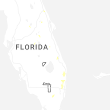
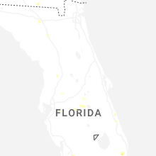
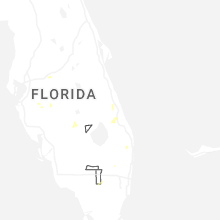
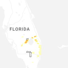
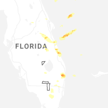
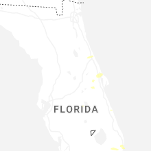


Connect with Interactive Hail Maps