

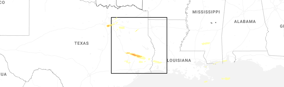
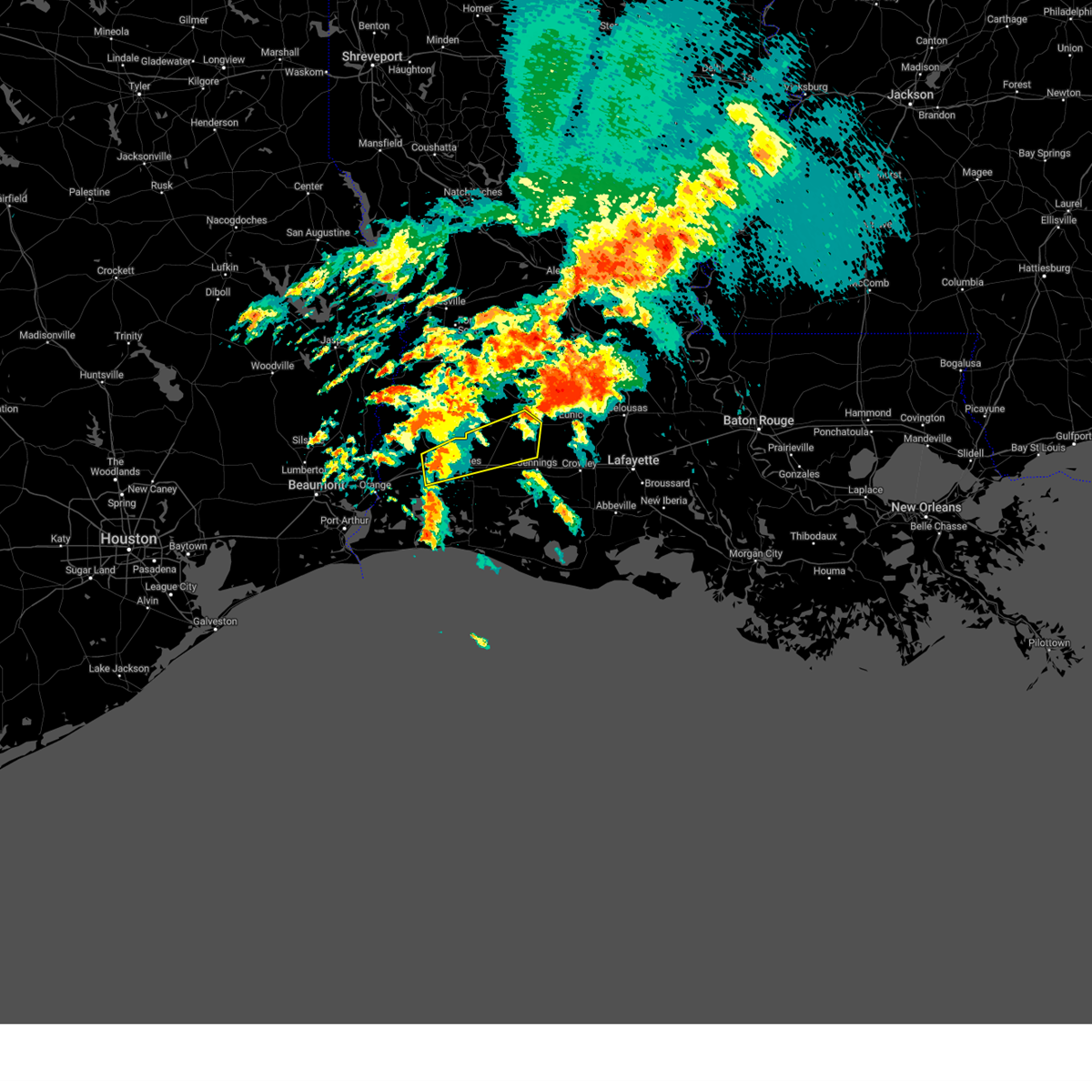
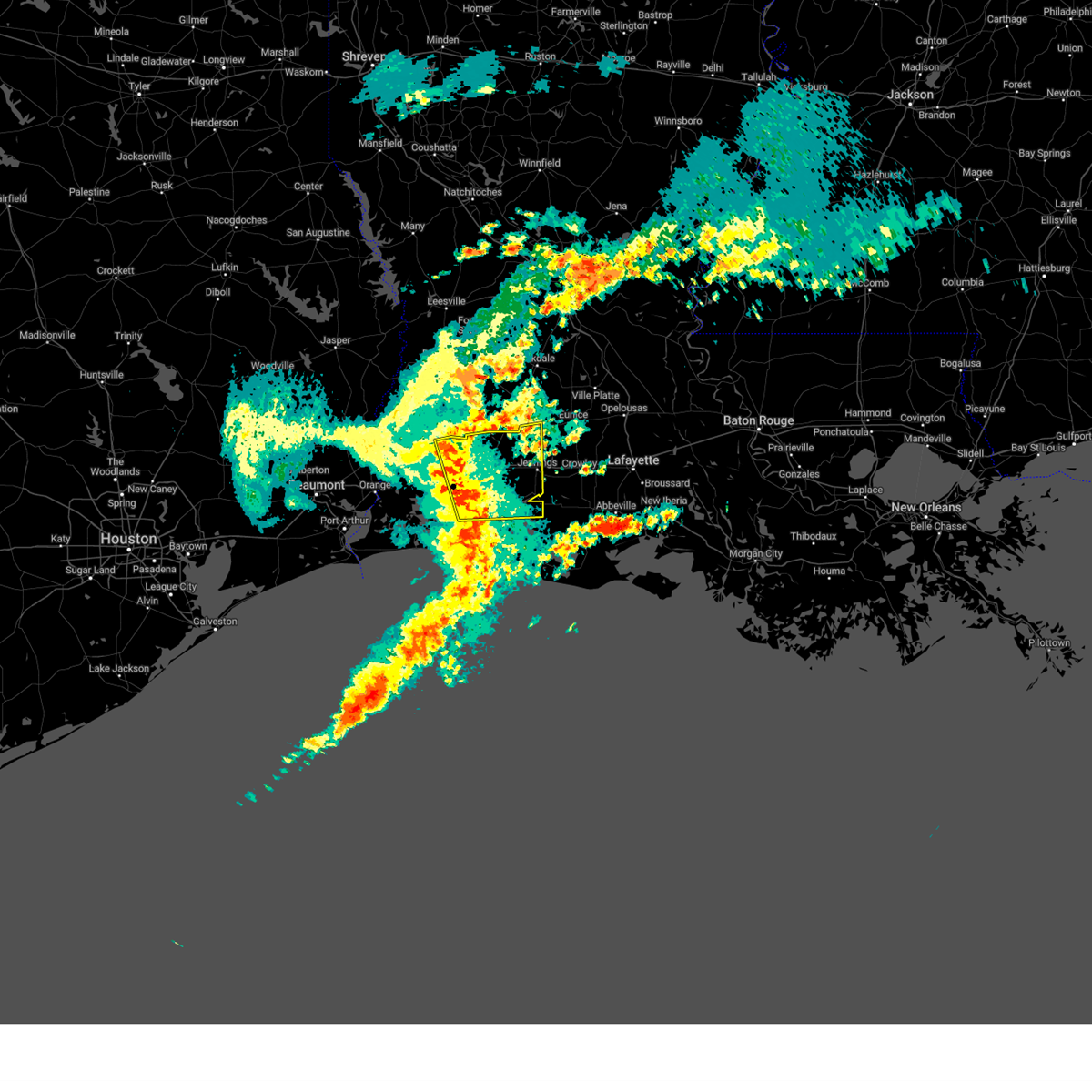
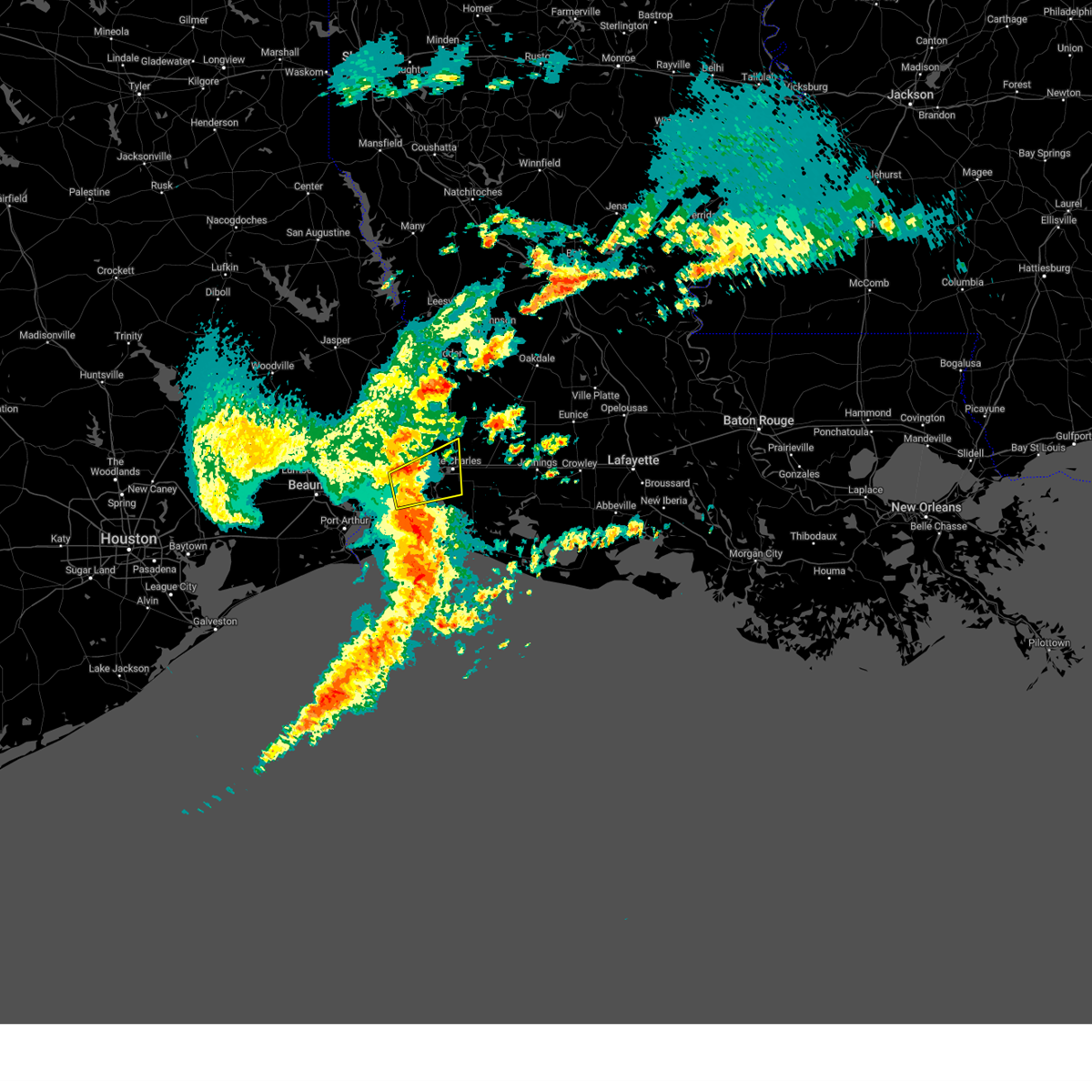
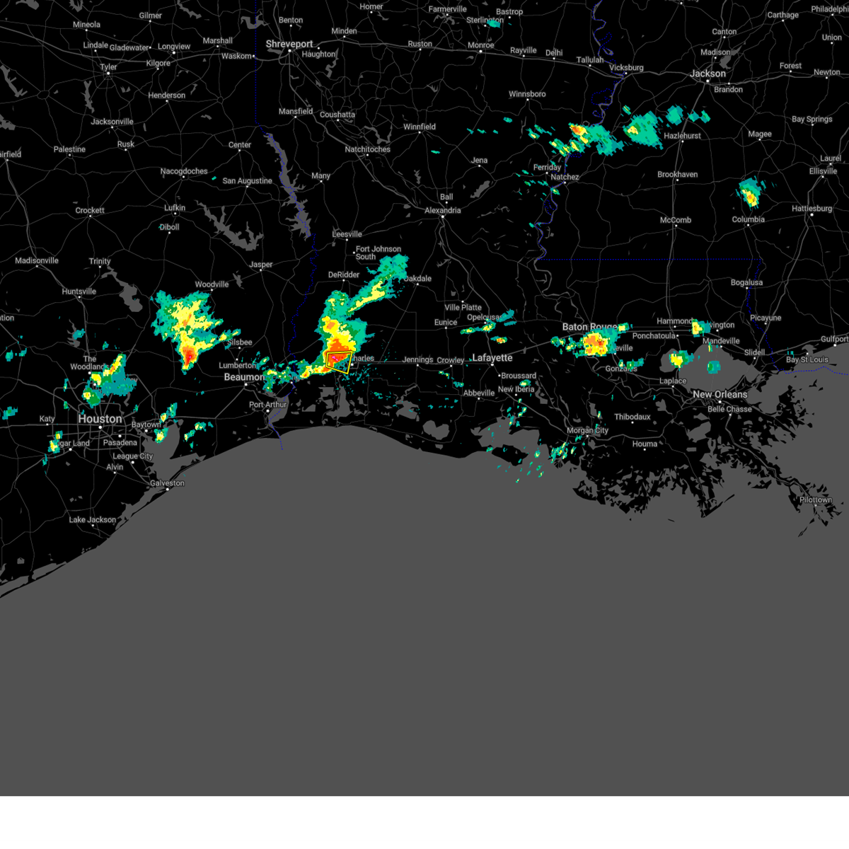
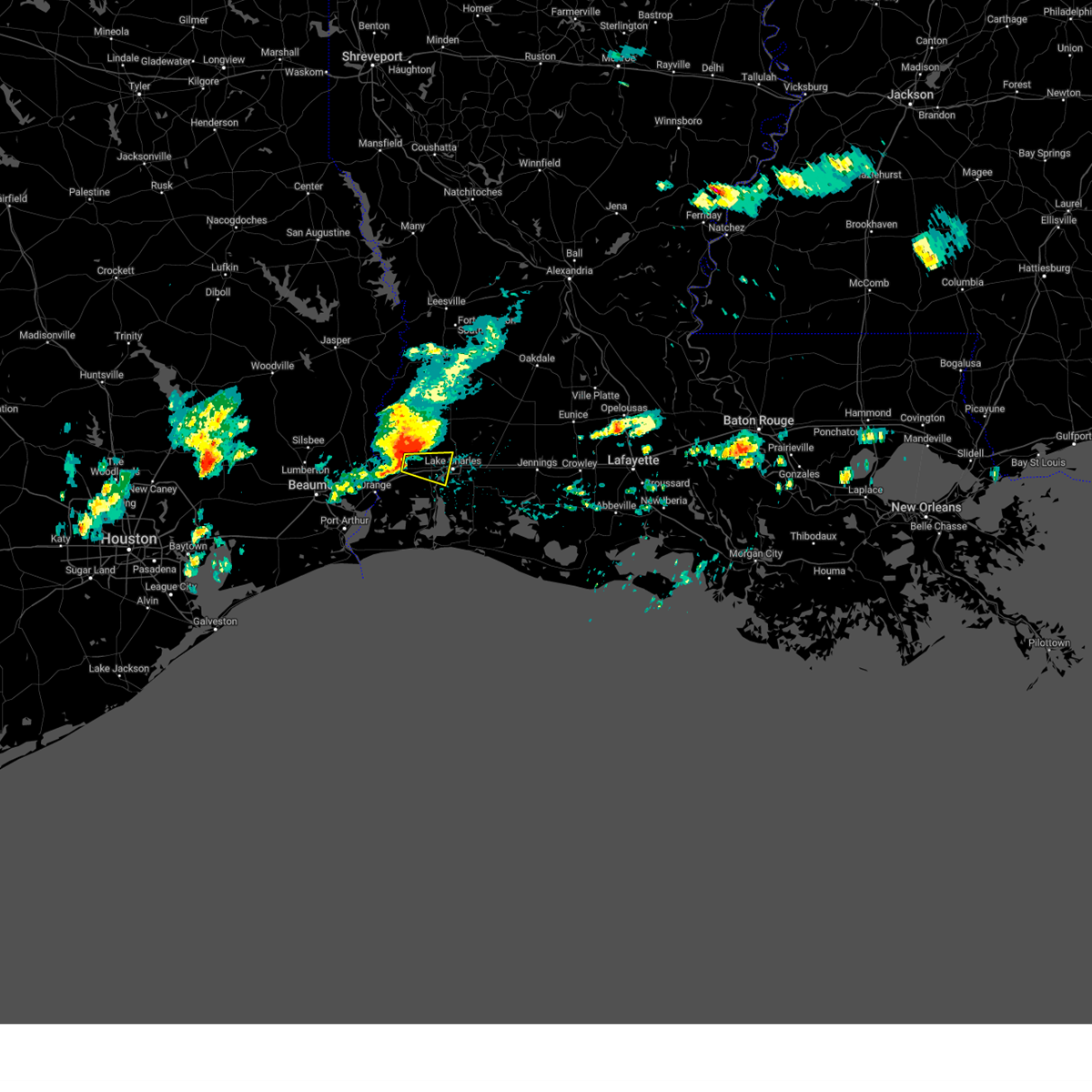
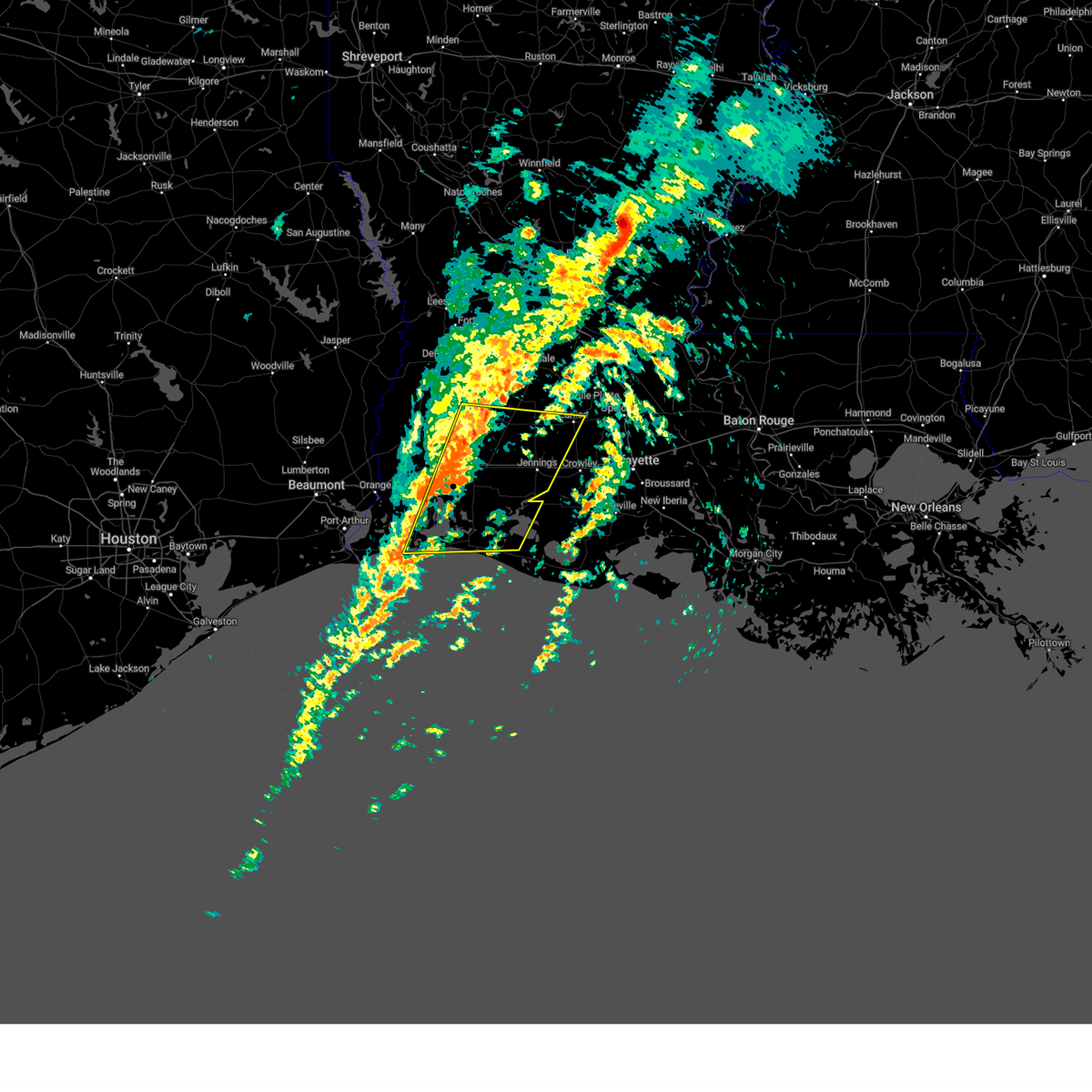
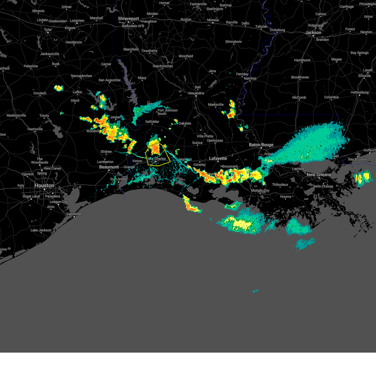
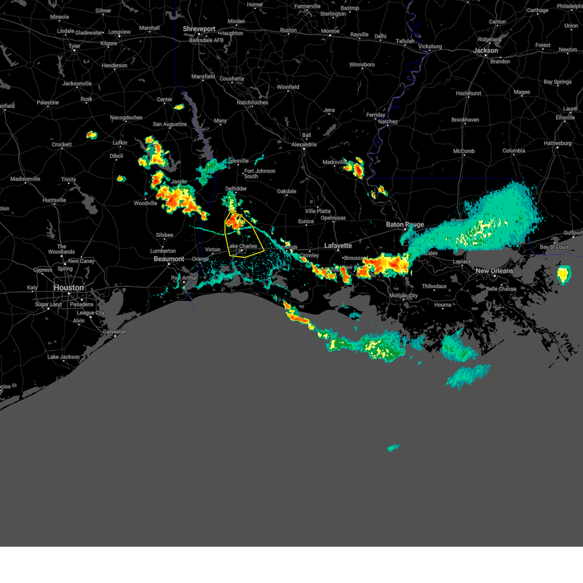
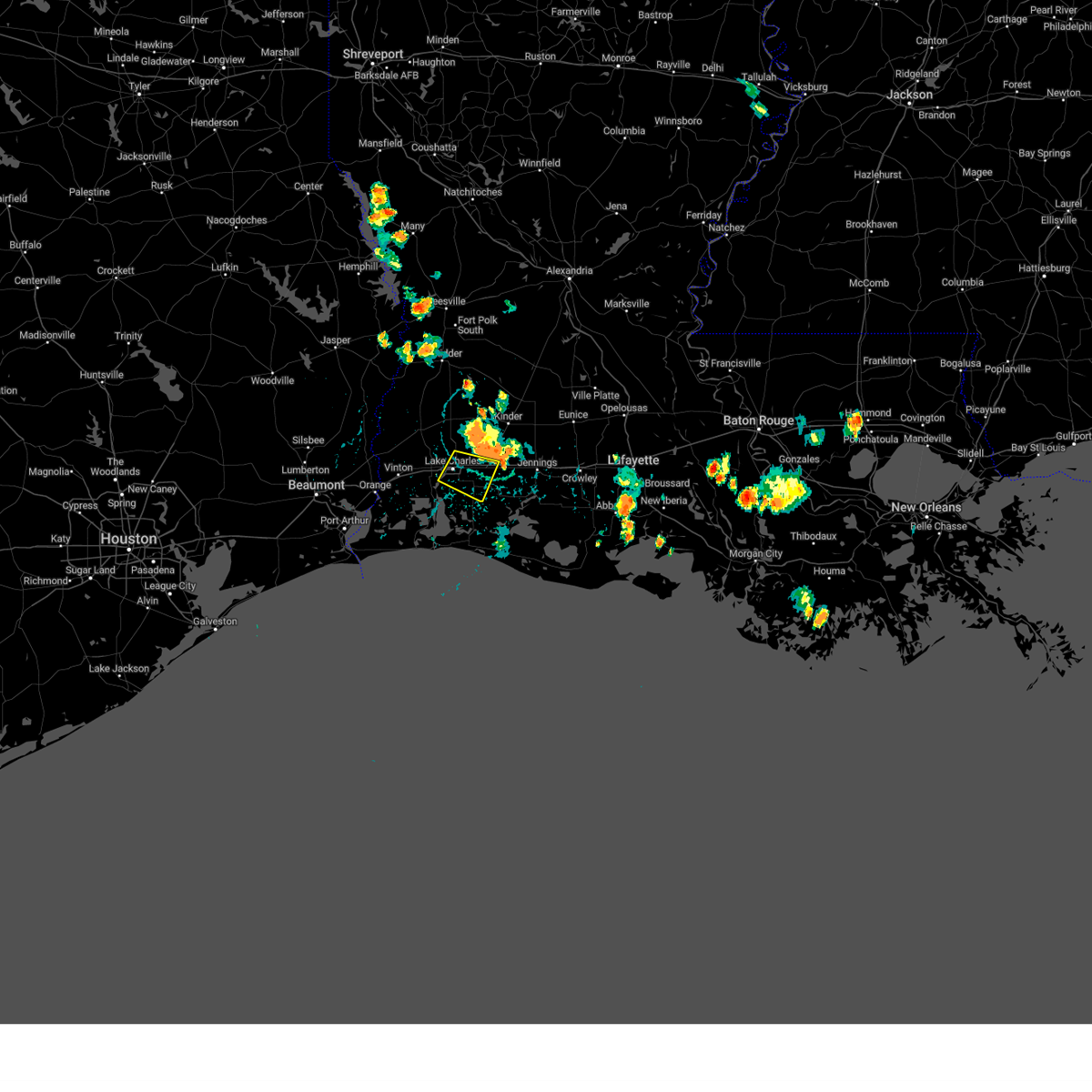
Hail Map for Westlake, LA
The Westlake, LA area has had 4 reports of on-the-ground hail by trained spotters, and has been under severe weather warnings 23 times during the past 12 months. Doppler radar has detected hail at or near Westlake, LA on 62 occasions, including 3 occasions during the past year.
| Name: | Westlake, LA |
| Where Located: | 30.7 miles ENE of Beaumont, TX |
| Map: | Google Map for Westlake, LA |
| Population: | 4568 |
| Housing Units: | 1979 |
| More Info: | Search Google for Westlake, LA |
2
The Top Recent Hail Date for Westlake, LA is Saturday, March 8, 2025 (11th out of 62)
Hail and Wind Damage Spotted near Westlake, LA
| Date / Time | Report Details |
|---|---|
| 5/27/2025 3:08 AM CDT |
 Svrlch the national weather service in lake charles has issued a * severe thunderstorm warning for, northeastern cameron parish in southwestern louisiana, jefferson davis parish in southwestern louisiana, southeastern beauregard parish in southwestern louisiana, eastern calcasieu parish in southwestern louisiana, southwestern allen parish in southwestern louisiana, * until 345 am cdt. * at 308 am cdt, severe thunderstorms were located along a line extending from near ragley to near heberts marina, moving northeast at 50 mph (radar indicated). Hazards include 60 mph wind gusts and penny size hail. expect damage to roofs, siding, and trees Svrlch the national weather service in lake charles has issued a * severe thunderstorm warning for, northeastern cameron parish in southwestern louisiana, jefferson davis parish in southwestern louisiana, southeastern beauregard parish in southwestern louisiana, eastern calcasieu parish in southwestern louisiana, southwestern allen parish in southwestern louisiana, * until 345 am cdt. * at 308 am cdt, severe thunderstorms were located along a line extending from near ragley to near heberts marina, moving northeast at 50 mph (radar indicated). Hazards include 60 mph wind gusts and penny size hail. expect damage to roofs, siding, and trees
|
| 5/27/2025 2:42 AM CDT |
 At 241 am cdt, severe thunderstorms were located along a line extending from 7 miles south of burr ferry to near oretta to near vinton, moving east at 35 mph (radar indicated). Hazards include 60 mph wind gusts. Expect damage to roofs, siding, and trees. Locations impacted include, lake charles, sulphur, orange, de ridder, westlake, vinton, newton, rosepine, merryville, singer, moss bluff, de quincy, ragley, lake charles regional airport, starks, fields, bon weir, lunita, bivens, and toomey. At 241 am cdt, severe thunderstorms were located along a line extending from 7 miles south of burr ferry to near oretta to near vinton, moving east at 35 mph (radar indicated). Hazards include 60 mph wind gusts. Expect damage to roofs, siding, and trees. Locations impacted include, lake charles, sulphur, orange, de ridder, westlake, vinton, newton, rosepine, merryville, singer, moss bluff, de quincy, ragley, lake charles regional airport, starks, fields, bon weir, lunita, bivens, and toomey.
|
| 5/27/2025 2:42 AM CDT |
 the severe thunderstorm warning has been cancelled and is no longer in effect the severe thunderstorm warning has been cancelled and is no longer in effect
|
| 5/27/2025 2:12 AM CDT |
 Svrlch the national weather service in lake charles has issued a * severe thunderstorm warning for, beauregard parish in southwestern louisiana, calcasieu parish in southwestern louisiana, southwestern vernon parish in west central louisiana, newton county in southeastern texas, northeastern orange county in southeastern texas, southeastern jasper county in southeastern texas, * until 315 am cdt. * at 211 am cdt, severe thunderstorms were located along a line extending from near farrsville to near bancroft to near orangefield, moving east at 35 mph (radar indicated). Hazards include 60 mph wind gusts. expect damage to roofs, siding, and trees Svrlch the national weather service in lake charles has issued a * severe thunderstorm warning for, beauregard parish in southwestern louisiana, calcasieu parish in southwestern louisiana, southwestern vernon parish in west central louisiana, newton county in southeastern texas, northeastern orange county in southeastern texas, southeastern jasper county in southeastern texas, * until 315 am cdt. * at 211 am cdt, severe thunderstorms were located along a line extending from near farrsville to near bancroft to near orangefield, moving east at 35 mph (radar indicated). Hazards include 60 mph wind gusts. expect damage to roofs, siding, and trees
|
| 5/2/2025 6:09 PM CDT | The storm which prompted the warning has weakened below severe limits, and no longer poses an immediate threat to life or property. therefore, the warning will be allowed to expire. a severe thunderstorm watch remains in effect until 700 pm cdt for southwestern louisiana. |
| 5/2/2025 5:45 PM CDT | Svrlch the national weather service in lake charles has issued a * severe thunderstorm warning for, southeastern beauregard parish in southwestern louisiana, northwestern calcasieu parish in southwestern louisiana, southwestern allen parish in southwestern louisiana, * until 615 pm cdt. * at 544 pm cdt, a severe thunderstorm was located near de quincy, moving east at 20 mph (radar indicated). Hazards include 60 mph wind gusts and penny size hail. expect damage to roofs, siding, and trees |
| 3/31/2025 5:51 AM CDT | The storm which prompted the warning has weakened below severe limits, and no longer poses an immediate threat to life or property. therefore, the warning will be allowed to expire. a severe thunderstorm watch remains in effect until 800 am cdt for southwestern louisiana. |
| 3/31/2025 5:12 AM CDT | Svrlch the national weather service in lake charles has issued a * severe thunderstorm warning for, calcasieu parish in southwestern louisiana, * until 600 am cdt. * at 512 am cdt, a severe thunderstorm was located over sulphur, moving east at 30 mph (radar indicated). Hazards include 60 mph wind gusts and quarter size hail. Hail damage to vehicles is expected. Expect wind damage to roofs, siding, and trees. |
| 3/31/2025 4:03 AM CDT |
 Svrlch the national weather service in lake charles has issued a * severe thunderstorm warning for, northern jefferson davis parish in southwestern louisiana, central calcasieu parish in southwestern louisiana, southern allen parish in southwestern louisiana, * until 445 am cdt. * at 403 am cdt, a severe thunderstorm was located over sulphur, moving northeast at 55 mph (radar indicated). Hazards include 60 mph wind gusts and quarter size hail. Hail damage to vehicles is expected. Expect wind damage to roofs, siding, and trees. Svrlch the national weather service in lake charles has issued a * severe thunderstorm warning for, northern jefferson davis parish in southwestern louisiana, central calcasieu parish in southwestern louisiana, southern allen parish in southwestern louisiana, * until 445 am cdt. * at 403 am cdt, a severe thunderstorm was located over sulphur, moving northeast at 55 mph (radar indicated). Hazards include 60 mph wind gusts and quarter size hail. Hail damage to vehicles is expected. Expect wind damage to roofs, siding, and trees.
|
| 3/24/2025 5:37 AM CDT |
 At 537 am cdt, severe thunderstorms were located along a line extending from topsy to lacassine national wildlife refuge, moving east at 50 mph (radar indicated). Hazards include 70 mph wind gusts. Expect considerable tree damage. damage is likely to mobile homes, roofs, and outbuildings. Locations impacted include, hacketts corner, topsy, hayes, moss bluff, jennings, roanoke, lebleu settlement, gillis, lacassine, hathaway, lowry, sweet lake, bell city, lacassine national wildlife refuge, lake charles regional airport, buller, welsh, lake arthur, westlake, and pine island. At 537 am cdt, severe thunderstorms were located along a line extending from topsy to lacassine national wildlife refuge, moving east at 50 mph (radar indicated). Hazards include 70 mph wind gusts. Expect considerable tree damage. damage is likely to mobile homes, roofs, and outbuildings. Locations impacted include, hacketts corner, topsy, hayes, moss bluff, jennings, roanoke, lebleu settlement, gillis, lacassine, hathaway, lowry, sweet lake, bell city, lacassine national wildlife refuge, lake charles regional airport, buller, welsh, lake arthur, westlake, and pine island.
|
| 3/24/2025 5:27 AM CDT |
 Svrlch the national weather service in lake charles has issued a * severe thunderstorm warning for, northeastern cameron parish in southwestern louisiana, jefferson davis parish in southwestern louisiana, eastern calcasieu parish in southwestern louisiana, * until 600 am cdt. * at 527 am cdt, severe thunderstorms were located along a line extending from gillis to hacketts corner, moving northeast at 55 mph (radar indicated). Hazards include 60 mph wind gusts. expect damage to roofs, siding, and trees Svrlch the national weather service in lake charles has issued a * severe thunderstorm warning for, northeastern cameron parish in southwestern louisiana, jefferson davis parish in southwestern louisiana, eastern calcasieu parish in southwestern louisiana, * until 600 am cdt. * at 527 am cdt, severe thunderstorms were located along a line extending from gillis to hacketts corner, moving northeast at 55 mph (radar indicated). Hazards include 60 mph wind gusts. expect damage to roofs, siding, and trees
|
| 3/24/2025 5:21 AM CDT |
 At 521 am cdt, a severe thunderstorm was located over westlake, moving northeast at 45 mph (radar indicated). Hazards include 60 mph wind gusts and penny size hail. Expect damage to roofs, siding, and trees. Locations impacted include, westlake, carlyss, lake charles, lake charles regional airport, moss bluff, sulphur, and gillis. At 521 am cdt, a severe thunderstorm was located over westlake, moving northeast at 45 mph (radar indicated). Hazards include 60 mph wind gusts and penny size hail. Expect damage to roofs, siding, and trees. Locations impacted include, westlake, carlyss, lake charles, lake charles regional airport, moss bluff, sulphur, and gillis.
|
| 3/24/2025 5:21 AM CDT |
 the severe thunderstorm warning has been cancelled and is no longer in effect the severe thunderstorm warning has been cancelled and is no longer in effect
|
| 3/24/2025 5:07 AM CDT |
 At 507 am cdt, a severe thunderstorm was located near edgerly, or near sulphur, moving northeast at 35 mph (radar indicated). Hazards include 70 mph wind gusts. Expect considerable tree damage. damage is likely to mobile homes, roofs, and outbuildings. Locations impacted include, westlake, carlyss, lake charles, lake charles regional airport, vinton, moss bluff, sulphur, gillis, edgerly, and hackberry. At 507 am cdt, a severe thunderstorm was located near edgerly, or near sulphur, moving northeast at 35 mph (radar indicated). Hazards include 70 mph wind gusts. Expect considerable tree damage. damage is likely to mobile homes, roofs, and outbuildings. Locations impacted include, westlake, carlyss, lake charles, lake charles regional airport, vinton, moss bluff, sulphur, gillis, edgerly, and hackberry.
|
| 3/24/2025 5:00 AM CDT |
 At 500 am cdt, a severe thunderstorm was located near edgerly, or near sulphur, moving northeast at 45 mph (radar indicated). Hazards include 60 mph wind gusts. Expect damage to roofs, siding, and trees. Locations impacted include, westlake, carlyss, lake charles, lake charles regional airport, vinton, toomey, moss bluff, sulphur, gillis, edgerly, and hackberry. At 500 am cdt, a severe thunderstorm was located near edgerly, or near sulphur, moving northeast at 45 mph (radar indicated). Hazards include 60 mph wind gusts. Expect damage to roofs, siding, and trees. Locations impacted include, westlake, carlyss, lake charles, lake charles regional airport, vinton, toomey, moss bluff, sulphur, gillis, edgerly, and hackberry.
|
| 3/24/2025 5:00 AM CDT |
 the severe thunderstorm warning has been cancelled and is no longer in effect the severe thunderstorm warning has been cancelled and is no longer in effect
|
| 3/24/2025 4:41 AM CDT |
 Svrlch the national weather service in lake charles has issued a * severe thunderstorm warning for, northwestern cameron parish in southwestern louisiana, western calcasieu parish in southwestern louisiana, east central orange county in southeastern texas, * until 530 am cdt. * at 441 am cdt, a severe thunderstorm was located near west orange, moving northeast at 45 mph (radar indicated). Hazards include 60 mph wind gusts. expect damage to roofs, siding, and trees Svrlch the national weather service in lake charles has issued a * severe thunderstorm warning for, northwestern cameron parish in southwestern louisiana, western calcasieu parish in southwestern louisiana, east central orange county in southeastern texas, * until 530 am cdt. * at 441 am cdt, a severe thunderstorm was located near west orange, moving northeast at 45 mph (radar indicated). Hazards include 60 mph wind gusts. expect damage to roofs, siding, and trees
|
| 3/8/2025 11:03 PM CDT |
 the severe thunderstorm warning has been cancelled and is no longer in effect the severe thunderstorm warning has been cancelled and is no longer in effect
|
| 3/8/2025 10:56 PM CDT | Half Dollar sized hail reported 0.4 miles N of Westlake, LA |
| 3/8/2025 10:43 PM CDT |
 At 943 pm cst, a severe thunderstorm was located near sulphur, moving east at 30 mph (radar indicated). Hazards include 60 mph wind gusts and quarter size hail. Hail damage to vehicles is expected. expect wind damage to roofs, siding, and trees. Locations impacted include, westlake, sulphur, carlyss, moss bluff, and lake charles. At 943 pm cst, a severe thunderstorm was located near sulphur, moving east at 30 mph (radar indicated). Hazards include 60 mph wind gusts and quarter size hail. Hail damage to vehicles is expected. expect wind damage to roofs, siding, and trees. Locations impacted include, westlake, sulphur, carlyss, moss bluff, and lake charles.
|
| 3/8/2025 10:26 PM CDT |
 Svrlch the national weather service in lake charles has issued a * severe thunderstorm warning for, central calcasieu parish in southwestern louisiana, * until 1030 pm cst. * at 925 pm cst, a severe thunderstorm was located over edgerly, or near vinton, moving east at 25 mph (radar indicated). Hazards include 60 mph wind gusts and quarter size hail. Hail damage to vehicles is expected. Expect wind damage to roofs, siding, and trees. Svrlch the national weather service in lake charles has issued a * severe thunderstorm warning for, central calcasieu parish in southwestern louisiana, * until 1030 pm cst. * at 925 pm cst, a severe thunderstorm was located over edgerly, or near vinton, moving east at 25 mph (radar indicated). Hazards include 60 mph wind gusts and quarter size hail. Hail damage to vehicles is expected. Expect wind damage to roofs, siding, and trees.
|
| 3/4/2025 12:47 PM CST |
 Svrlch the national weather service in lake charles has issued a * severe thunderstorm warning for, northeastern cameron parish in southwestern louisiana, jefferson davis parish in southwestern louisiana, southwestern evangeline parish in central louisiana, southeastern beauregard parish in southwestern louisiana, northwestern acadia parish in southwestern louisiana, eastern calcasieu parish in southwestern louisiana, west central st. landry parish in central louisiana, southern allen parish in southwestern louisiana, * until 130 pm cst. * at 1247 pm cst, severe thunderstorms were located along a line extending from near oberlin to near holly beach, moving southeast at 35 mph (radar indicated). Hazards include 60 mph wind gusts. expect damage to roofs, siding, and trees Svrlch the national weather service in lake charles has issued a * severe thunderstorm warning for, northeastern cameron parish in southwestern louisiana, jefferson davis parish in southwestern louisiana, southwestern evangeline parish in central louisiana, southeastern beauregard parish in southwestern louisiana, northwestern acadia parish in southwestern louisiana, eastern calcasieu parish in southwestern louisiana, west central st. landry parish in central louisiana, southern allen parish in southwestern louisiana, * until 130 pm cst. * at 1247 pm cst, severe thunderstorms were located along a line extending from near oberlin to near holly beach, moving southeast at 35 mph (radar indicated). Hazards include 60 mph wind gusts. expect damage to roofs, siding, and trees
|
| 8/3/2024 5:25 PM CDT |
 At 524 pm cdt, a severe thunderstorm was located over gillis, or over moss bluff, moving southeast at 25 mph (radar indicated). Hazards include 60 mph wind gusts. Expect damage to roofs, siding, and trees. Locations impacted include, lake charles, sulphur, westlake, iowa, moss bluff, ragley, carlyss, buhler, topsy, lebleu settlement, and gillis. At 524 pm cdt, a severe thunderstorm was located over gillis, or over moss bluff, moving southeast at 25 mph (radar indicated). Hazards include 60 mph wind gusts. Expect damage to roofs, siding, and trees. Locations impacted include, lake charles, sulphur, westlake, iowa, moss bluff, ragley, carlyss, buhler, topsy, lebleu settlement, and gillis.
|
| 8/3/2024 5:05 PM CDT |
 Svrlch the national weather service in lake charles has issued a * severe thunderstorm warning for, northwestern jefferson davis parish in southwestern louisiana, southeastern beauregard parish in southwestern louisiana, central calcasieu parish in southwestern louisiana, southwestern allen parish in southwestern louisiana, * until 600 pm cdt. * at 505 pm cdt, a severe thunderstorm was located near ragley, moving south at 25 mph (radar indicated). Hazards include 60 mph wind gusts. expect damage to roofs, siding, and trees Svrlch the national weather service in lake charles has issued a * severe thunderstorm warning for, northwestern jefferson davis parish in southwestern louisiana, southeastern beauregard parish in southwestern louisiana, central calcasieu parish in southwestern louisiana, southwestern allen parish in southwestern louisiana, * until 600 pm cdt. * at 505 pm cdt, a severe thunderstorm was located near ragley, moving south at 25 mph (radar indicated). Hazards include 60 mph wind gusts. expect damage to roofs, siding, and trees
|
| 7/18/2024 8:45 AM CDT |
 the severe thunderstorm warning has been cancelled and is no longer in effect the severe thunderstorm warning has been cancelled and is no longer in effect
|
| 7/18/2024 8:29 AM CDT |
 Svrlch the national weather service in lake charles has issued a * severe thunderstorm warning for, western calcasieu parish in southwestern louisiana, * until 915 am cdt. * at 829 am cdt, a severe thunderstorm was located near toomey, or near vinton, moving northeast at 35 mph (radar indicated). Hazards include 60 mph wind gusts and penny size hail. expect damage to roofs, siding, and trees Svrlch the national weather service in lake charles has issued a * severe thunderstorm warning for, western calcasieu parish in southwestern louisiana, * until 915 am cdt. * at 829 am cdt, a severe thunderstorm was located near toomey, or near vinton, moving northeast at 35 mph (radar indicated). Hazards include 60 mph wind gusts and penny size hail. expect damage to roofs, siding, and trees
|
| 5/28/2024 2:41 PM CDT |
 Svrlch the national weather service in lake charles has issued a * severe thunderstorm warning for, jefferson davis parish in southwestern louisiana, southeastern beauregard parish in southwestern louisiana, northeastern calcasieu parish in southwestern louisiana, southwestern allen parish in southwestern louisiana, * until 315 pm cdt. * at 241 pm cdt, severe thunderstorms were located along a line extending from near topsy to welsh, moving northeast at 15 mph (radar indicated). Hazards include 60 mph wind gusts and quarter size hail. Hail damage to vehicles is expected. Expect wind damage to roofs, siding, and trees. Svrlch the national weather service in lake charles has issued a * severe thunderstorm warning for, jefferson davis parish in southwestern louisiana, southeastern beauregard parish in southwestern louisiana, northeastern calcasieu parish in southwestern louisiana, southwestern allen parish in southwestern louisiana, * until 315 pm cdt. * at 241 pm cdt, severe thunderstorms were located along a line extending from near topsy to welsh, moving northeast at 15 mph (radar indicated). Hazards include 60 mph wind gusts and quarter size hail. Hail damage to vehicles is expected. Expect wind damage to roofs, siding, and trees.
|
| 5/28/2024 2:36 PM CDT |
 the severe thunderstorm warning has been cancelled and is no longer in effect the severe thunderstorm warning has been cancelled and is no longer in effect
|
| 5/28/2024 2:36 PM CDT |
 At 235 pm cdt, severe thunderstorms were located along a line extending from near starks to 9 miles southeast of lacassine national wildlife refuge, and are nearly stationary (radar indicated). Hazards include 60 mph wind gusts and quarter size hail. Hail damage to vehicles is expected. expect wind damage to roofs, siding, and trees. Locations impacted include, lake charles, sulphur, orange, cameron, westlake, vinton, grand lake, lacassine national wildlife refuge, lake charles regional airport, rockefeller wildlife range, grand chenier, carlyss, hacketts corner, toomey, edgerly, hackberry, creole, sweet lake, gibbstown, and holmwood. At 235 pm cdt, severe thunderstorms were located along a line extending from near starks to 9 miles southeast of lacassine national wildlife refuge, and are nearly stationary (radar indicated). Hazards include 60 mph wind gusts and quarter size hail. Hail damage to vehicles is expected. expect wind damage to roofs, siding, and trees. Locations impacted include, lake charles, sulphur, orange, cameron, westlake, vinton, grand lake, lacassine national wildlife refuge, lake charles regional airport, rockefeller wildlife range, grand chenier, carlyss, hacketts corner, toomey, edgerly, hackberry, creole, sweet lake, gibbstown, and holmwood.
|
| 5/28/2024 2:03 PM CDT |
 Svrlch the national weather service in lake charles has issued a * severe thunderstorm warning for, eastern cameron parish in southwestern louisiana, southwestern beauregard parish in southwestern louisiana, calcasieu parish in southwestern louisiana, * until 300 pm cdt. * at 202 pm cdt, severe thunderstorms were located along a line extending from near starks to 9 miles southeast of lacassine national wildlife refuge, and are nearly stationary (radar indicated). Hazards include 60 mph wind gusts and quarter size hail. Hail damage to vehicles is expected. Expect wind damage to roofs, siding, and trees. Svrlch the national weather service in lake charles has issued a * severe thunderstorm warning for, eastern cameron parish in southwestern louisiana, southwestern beauregard parish in southwestern louisiana, calcasieu parish in southwestern louisiana, * until 300 pm cdt. * at 202 pm cdt, severe thunderstorms were located along a line extending from near starks to 9 miles southeast of lacassine national wildlife refuge, and are nearly stationary (radar indicated). Hazards include 60 mph wind gusts and quarter size hail. Hail damage to vehicles is expected. Expect wind damage to roofs, siding, and trees.
|
| 5/16/2024 8:28 PM CDT |
 the tornado warning has been cancelled and is no longer in effect the tornado warning has been cancelled and is no longer in effect
|
| 5/16/2024 8:27 PM CDT |
 The severe thunderstorm which prompted the warning continues. therefore, the warning will be allowed to expire. however gusty winds are still possible with this thunderstorm. a tornado watch remains in effect until 1000 pm cdt for southwestern louisiana. remember, a severe thunderstorm warning still remains in effect for portions of calcasieu parish. The severe thunderstorm which prompted the warning continues. therefore, the warning will be allowed to expire. however gusty winds are still possible with this thunderstorm. a tornado watch remains in effect until 1000 pm cdt for southwestern louisiana. remember, a severe thunderstorm warning still remains in effect for portions of calcasieu parish.
|
| 5/16/2024 8:21 PM CDT |
 Torlch the national weather service in lake charles has issued a * tornado warning for, south central jefferson davis parish in southwestern louisiana, southeastern calcasieu parish in southwestern louisiana, * until 845 pm cdt. * at 821 pm cdt, a severe thunderstorm capable of producing a tornado was located near lake charles, moving southeast at 15 mph (radar indicated rotation). Hazards include tornado. Flying debris will be dangerous to those caught without shelter. mobile homes will be damaged or destroyed. damage to roofs, windows, and vehicles will occur. tree damage is likely. this dangerous storm will be near, lake charles, iowa, and lebleu settlement around 825 pm cdt. other locations impacted by this tornadic thunderstorm include bell city. this includes the following highways, interstate 10 in louisiana between mile markers 29 and 41. Interstate 210 between mile markers 6 and 12. Torlch the national weather service in lake charles has issued a * tornado warning for, south central jefferson davis parish in southwestern louisiana, southeastern calcasieu parish in southwestern louisiana, * until 845 pm cdt. * at 821 pm cdt, a severe thunderstorm capable of producing a tornado was located near lake charles, moving southeast at 15 mph (radar indicated rotation). Hazards include tornado. Flying debris will be dangerous to those caught without shelter. mobile homes will be damaged or destroyed. damage to roofs, windows, and vehicles will occur. tree damage is likely. this dangerous storm will be near, lake charles, iowa, and lebleu settlement around 825 pm cdt. other locations impacted by this tornadic thunderstorm include bell city. this includes the following highways, interstate 10 in louisiana between mile markers 29 and 41. Interstate 210 between mile markers 6 and 12.
|
| 5/16/2024 8:16 PM CDT |
 At 816 pm cdt, a severe thunderstorm was located near fenton, moving east at 45 mph (radar indicated). Hazards include 70 mph wind gusts. Expect considerable tree damage. damage is likely to mobile homes, roofs, and outbuildings. Locations impacted include, lake charles, sulphur, westlake, iowa, kinder, fenton, reeves, hayes, moss bluff, lake charles regional airport, carlyss, buller, topsy, lebleu settlement, gillis, leblanc, holmwood, buhler, bell city, and lacassine. At 816 pm cdt, a severe thunderstorm was located near fenton, moving east at 45 mph (radar indicated). Hazards include 70 mph wind gusts. Expect considerable tree damage. damage is likely to mobile homes, roofs, and outbuildings. Locations impacted include, lake charles, sulphur, westlake, iowa, kinder, fenton, reeves, hayes, moss bluff, lake charles regional airport, carlyss, buller, topsy, lebleu settlement, gillis, leblanc, holmwood, buhler, bell city, and lacassine.
|
| 5/16/2024 7:57 PM CDT |
 At 757 pm cdt, a severe thunderstorm was located near gillis, or near moss bluff, moving east at 40 mph (radar indicated). Hazards include 70 mph wind gusts and quarter size hail. Hail damage to vehicles is expected. expect considerable tree damage. wind damage is also likely to mobile homes, roofs, and outbuildings. Locations impacted include, lake charles, sulphur, westlake, iowa, kinder, fenton, reeves, lake charles regional airport, hayes, moss bluff, carlyss, buller, buhler, topsy, lebleu settlement, gillis, edgerly, leblanc, holmwood, and bell city. At 757 pm cdt, a severe thunderstorm was located near gillis, or near moss bluff, moving east at 40 mph (radar indicated). Hazards include 70 mph wind gusts and quarter size hail. Hail damage to vehicles is expected. expect considerable tree damage. wind damage is also likely to mobile homes, roofs, and outbuildings. Locations impacted include, lake charles, sulphur, westlake, iowa, kinder, fenton, reeves, lake charles regional airport, hayes, moss bluff, carlyss, buller, buhler, topsy, lebleu settlement, gillis, edgerly, leblanc, holmwood, and bell city.
|
| 5/16/2024 7:48 PM CDT |
 At 748 pm cdt, a severe thunderstorm was located near moss bluff, moving east at 40 mph (radar indicated). Hazards include 70 mph wind gusts and quarter size hail. Hail damage to vehicles is expected. expect considerable tree damage. wind damage is also likely to mobile homes, roofs, and outbuildings. Locations impacted include, lake charles, sulphur, westlake, vinton, iowa, kinder, fenton, reeves, lake charles regional airport, hayes, moss bluff, carlyss, buller, buhler, topsy, lebleu settlement, gillis, edgerly, leblanc, and holmwood. At 748 pm cdt, a severe thunderstorm was located near moss bluff, moving east at 40 mph (radar indicated). Hazards include 70 mph wind gusts and quarter size hail. Hail damage to vehicles is expected. expect considerable tree damage. wind damage is also likely to mobile homes, roofs, and outbuildings. Locations impacted include, lake charles, sulphur, westlake, vinton, iowa, kinder, fenton, reeves, lake charles regional airport, hayes, moss bluff, carlyss, buller, buhler, topsy, lebleu settlement, gillis, edgerly, leblanc, and holmwood.
|
| 5/16/2024 7:39 PM CDT |
 Svrlch the national weather service in lake charles has issued a * severe thunderstorm warning for, western jefferson davis parish in southwestern louisiana, south central beauregard parish in southwestern louisiana, calcasieu parish in southwestern louisiana, southwestern allen parish in southwestern louisiana, * until 830 pm cdt. * at 738 pm cdt, a severe thunderstorm was located over buhler, or 7 miles north of sulphur, moving east at 40 mph (radar indicated). Hazards include 60 mph wind gusts and quarter size hail. Hail damage to vehicles is expected. Expect wind damage to roofs, siding, and trees. Svrlch the national weather service in lake charles has issued a * severe thunderstorm warning for, western jefferson davis parish in southwestern louisiana, south central beauregard parish in southwestern louisiana, calcasieu parish in southwestern louisiana, southwestern allen parish in southwestern louisiana, * until 830 pm cdt. * at 738 pm cdt, a severe thunderstorm was located over buhler, or 7 miles north of sulphur, moving east at 40 mph (radar indicated). Hazards include 60 mph wind gusts and quarter size hail. Hail damage to vehicles is expected. Expect wind damage to roofs, siding, and trees.
|
| 5/13/2024 5:02 PM CDT |
 At 501 pm cdt, severe thunderstorms were located along a line extending from near hacketts corner to near iowa to near topsy, moving east at 45 mph (radar indicated). Hazards include 70 mph wind gusts and ping pong ball size hail. People and animals outdoors will be injured. expect hail damage to roofs, siding, windows, and vehicles. expect considerable tree damage. wind damage is also likely to mobile homes, roofs, and outbuildings. Locations impacted include, lake charles, jennings, westlake, welsh, iowa, lake arthur, mermentau, fenton, lake charles regional airport, hayes, moss bluff, buller, topsy, lebleu settlement, gillis, pine island, thornwell, holmwood, bell city, and roanoke. At 501 pm cdt, severe thunderstorms were located along a line extending from near hacketts corner to near iowa to near topsy, moving east at 45 mph (radar indicated). Hazards include 70 mph wind gusts and ping pong ball size hail. People and animals outdoors will be injured. expect hail damage to roofs, siding, windows, and vehicles. expect considerable tree damage. wind damage is also likely to mobile homes, roofs, and outbuildings. Locations impacted include, lake charles, jennings, westlake, welsh, iowa, lake arthur, mermentau, fenton, lake charles regional airport, hayes, moss bluff, buller, topsy, lebleu settlement, gillis, pine island, thornwell, holmwood, bell city, and roanoke.
|
| 5/13/2024 4:49 PM CDT |
 Torlch the national weather service in lake charles has issued a * tornado warning for, southwestern jefferson davis parish in southwestern louisiana, southeastern calcasieu parish in southwestern louisiana, * until 515 pm cdt. * at 448 pm cdt, a severe thunderstorm capable of producing a tornado was located over lake charles, moving east at 45 mph (radar indicated rotation). Hazards include tornado and ping pong ball size hail. Flying debris will be dangerous to those caught without shelter. mobile homes will be damaged or destroyed. damage to roofs, windows, and vehicles will occur. tree damage is likely. this dangerous storm will be near, lake charles, iowa, and holmwood around 455 pm cdt. other locations impacted by this tornadic thunderstorm include lacassine and bell city. this includes the following highways, interstate 10 in louisiana between mile markers 23 and 53. Interstate 210 between mile markers 1 and 12. Torlch the national weather service in lake charles has issued a * tornado warning for, southwestern jefferson davis parish in southwestern louisiana, southeastern calcasieu parish in southwestern louisiana, * until 515 pm cdt. * at 448 pm cdt, a severe thunderstorm capable of producing a tornado was located over lake charles, moving east at 45 mph (radar indicated rotation). Hazards include tornado and ping pong ball size hail. Flying debris will be dangerous to those caught without shelter. mobile homes will be damaged or destroyed. damage to roofs, windows, and vehicles will occur. tree damage is likely. this dangerous storm will be near, lake charles, iowa, and holmwood around 455 pm cdt. other locations impacted by this tornadic thunderstorm include lacassine and bell city. this includes the following highways, interstate 10 in louisiana between mile markers 23 and 53. Interstate 210 between mile markers 1 and 12.
|
| 5/13/2024 4:47 PM CDT | Overturned truck on i-1 in calcasieu county LA, 1.2 miles NNW of Westlake, LA |
| 5/13/2024 4:43 PM CDT | Damage reported on os in calcasieu county LA, 1.2 miles NNE of Westlake, LA |
| 5/13/2024 4:43 PM CDT |
 At 442 pm cdt, a severe thunderstorm capable of producing a tornado was located over sulphur, moving east at 45 mph (radar indicated rotation). Hazards include tornado. Flying debris will be dangerous to those caught without shelter. mobile homes will be damaged or destroyed. damage to roofs, windows, and vehicles will occur. tree damage is likely. this dangerous storm will be near, lake charles and moss bluff around 450 pm cdt. Lebleu settlement around 455 pm cdt. At 442 pm cdt, a severe thunderstorm capable of producing a tornado was located over sulphur, moving east at 45 mph (radar indicated rotation). Hazards include tornado. Flying debris will be dangerous to those caught without shelter. mobile homes will be damaged or destroyed. damage to roofs, windows, and vehicles will occur. tree damage is likely. this dangerous storm will be near, lake charles and moss bluff around 450 pm cdt. Lebleu settlement around 455 pm cdt.
|
| 5/13/2024 4:29 PM CDT |
 Svrlch the national weather service in lake charles has issued a * severe thunderstorm warning for, jefferson davis parish in southwestern louisiana, calcasieu parish in southwestern louisiana, * until 530 pm cdt. * at 429 pm cdt, severe thunderstorms were located along a line extending from 9 miles northwest of hackberry to near edgerly to near lunita, moving east at 40 mph. these are destructive storms for calcasieu and jefferson davis (radar indicated). Hazards include 80 mph wind gusts. Flying debris will be dangerous to those caught without shelter. mobile homes will be heavily damaged. expect considerable damage to roofs, windows, and vehicles. Extensive tree damage and power outages are likely. Svrlch the national weather service in lake charles has issued a * severe thunderstorm warning for, jefferson davis parish in southwestern louisiana, calcasieu parish in southwestern louisiana, * until 530 pm cdt. * at 429 pm cdt, severe thunderstorms were located along a line extending from 9 miles northwest of hackberry to near edgerly to near lunita, moving east at 40 mph. these are destructive storms for calcasieu and jefferson davis (radar indicated). Hazards include 80 mph wind gusts. Flying debris will be dangerous to those caught without shelter. mobile homes will be heavily damaged. expect considerable damage to roofs, windows, and vehicles. Extensive tree damage and power outages are likely.
|
| 5/13/2024 4:25 PM CDT |
 the severe thunderstorm warning has been cancelled and is no longer in effect the severe thunderstorm warning has been cancelled and is no longer in effect
|
| 5/13/2024 4:25 PM CDT |
 At 424 pm cdt, severe thunderstorms were located along a line extending from 7 miles southeast of toomey to de quincy, moving east at 50 mph. these are destructive storms for calcasieu parish (radar indicated). Hazards include 80 mph wind gusts and quarter size hail. Flying debris will be dangerous to those caught without shelter. mobile homes will be heavily damaged. expect considerable damage to roofs, windows, and vehicles. extensive tree damage and power outages are likely. Locations impacted include, lake charles, sulphur, westlake, vinton, starks, moss bluff, fields, de quincy, ragley, carlyss, lunita, buhler, toomey, gillis, edgerly, and oretta. At 424 pm cdt, severe thunderstorms were located along a line extending from 7 miles southeast of toomey to de quincy, moving east at 50 mph. these are destructive storms for calcasieu parish (radar indicated). Hazards include 80 mph wind gusts and quarter size hail. Flying debris will be dangerous to those caught without shelter. mobile homes will be heavily damaged. expect considerable damage to roofs, windows, and vehicles. extensive tree damage and power outages are likely. Locations impacted include, lake charles, sulphur, westlake, vinton, starks, moss bluff, fields, de quincy, ragley, carlyss, lunita, buhler, toomey, gillis, edgerly, and oretta.
|
| 5/13/2024 4:23 PM CDT |
 Torlch the national weather service in lake charles has issued a * tornado warning for, central calcasieu parish in southwestern louisiana, * until 500 pm cdt. * at 423 pm cdt, a severe thunderstorm capable of producing a tornado was located near lunita, or 7 miles east of starks, moving east at 45 mph (radar indicated rotation). Hazards include tornado. Flying debris will be dangerous to those caught without shelter. mobile homes will be damaged or destroyed. damage to roofs, windows, and vehicles will occur. tree damage is likely. this dangerous storm will be near, sulphur, carlyss, and buhler around 430 pm cdt. lake charles, westlake, and moss bluff around 435 pm cdt. gillis around 440 pm cdt. this includes the following highways, interstate 10 in louisiana between mile markers 13 and 41. Interstate 210 between mile markers 1 and 12. Torlch the national weather service in lake charles has issued a * tornado warning for, central calcasieu parish in southwestern louisiana, * until 500 pm cdt. * at 423 pm cdt, a severe thunderstorm capable of producing a tornado was located near lunita, or 7 miles east of starks, moving east at 45 mph (radar indicated rotation). Hazards include tornado. Flying debris will be dangerous to those caught without shelter. mobile homes will be damaged or destroyed. damage to roofs, windows, and vehicles will occur. tree damage is likely. this dangerous storm will be near, sulphur, carlyss, and buhler around 430 pm cdt. lake charles, westlake, and moss bluff around 435 pm cdt. gillis around 440 pm cdt. this includes the following highways, interstate 10 in louisiana between mile markers 13 and 41. Interstate 210 between mile markers 1 and 12.
|
| 5/13/2024 4:13 PM CDT |
 At 412 pm cdt, severe thunderstorms were located along a line extending from pinehurst to near de quincy, moving east at 40 mph. these are destructive storms for calcasieu parish (radar indicated). Hazards include 80 mph wind gusts and quarter size hail. Flying debris will be dangerous to those caught without shelter. mobile homes will be heavily damaged. expect considerable damage to roofs, windows, and vehicles. extensive tree damage and power outages are likely. Locations impacted include, lake charles, sulphur, orange, bridge city, westlake, west orange, vinton, deweyville, moss bluff, de quincy, ragley, starks, fields, lunita, hartburg, toomey, gillis, edgerly, devils pocket, and oretta. At 412 pm cdt, severe thunderstorms were located along a line extending from pinehurst to near de quincy, moving east at 40 mph. these are destructive storms for calcasieu parish (radar indicated). Hazards include 80 mph wind gusts and quarter size hail. Flying debris will be dangerous to those caught without shelter. mobile homes will be heavily damaged. expect considerable damage to roofs, windows, and vehicles. extensive tree damage and power outages are likely. Locations impacted include, lake charles, sulphur, orange, bridge city, westlake, west orange, vinton, deweyville, moss bluff, de quincy, ragley, starks, fields, lunita, hartburg, toomey, gillis, edgerly, devils pocket, and oretta.
|
| 5/13/2024 4:13 PM CDT |
 the severe thunderstorm warning has been cancelled and is no longer in effect the severe thunderstorm warning has been cancelled and is no longer in effect
|
| 5/13/2024 3:44 PM CDT |
 Svrlch the national weather service in lake charles has issued a * severe thunderstorm warning for, southern beauregard parish in southwestern louisiana, calcasieu parish in southwestern louisiana, north central jefferson county in southeastern texas, southwestern newton county in southeastern texas, orange county in southeastern texas, southeastern jasper county in southeastern texas, * until 445 pm cdt. * at 343 pm cdt, severe thunderstorms were located along a line extending from near rose city to near devils pocket, moving east at 40 mph (radar indicated). Hazards include 70 mph wind gusts and quarter size hail. Hail damage to vehicles is expected. expect considerable tree damage. Wind damage is also likely to mobile homes, roofs, and outbuildings. Svrlch the national weather service in lake charles has issued a * severe thunderstorm warning for, southern beauregard parish in southwestern louisiana, calcasieu parish in southwestern louisiana, north central jefferson county in southeastern texas, southwestern newton county in southeastern texas, orange county in southeastern texas, southeastern jasper county in southeastern texas, * until 445 pm cdt. * at 343 pm cdt, severe thunderstorms were located along a line extending from near rose city to near devils pocket, moving east at 40 mph (radar indicated). Hazards include 70 mph wind gusts and quarter size hail. Hail damage to vehicles is expected. expect considerable tree damage. Wind damage is also likely to mobile homes, roofs, and outbuildings.
|
| 5/12/2024 2:59 PM CDT |
 Svrlch the national weather service in lake charles has issued a * severe thunderstorm warning for, northwestern jefferson davis parish in southwestern louisiana, southeastern beauregard parish in southwestern louisiana, central calcasieu parish in southwestern louisiana, southwestern allen parish in southwestern louisiana, * until 330 pm cdt. * at 258 pm cdt, a severe thunderstorm was located over ragley, moving east at 40 mph (radar indicated). Hazards include 70 mph wind gusts and ping pong ball size hail. People and animals outdoors will be injured. expect hail damage to roofs, siding, windows, and vehicles. expect considerable tree damage. Wind damage is also likely to mobile homes, roofs, and outbuildings. Svrlch the national weather service in lake charles has issued a * severe thunderstorm warning for, northwestern jefferson davis parish in southwestern louisiana, southeastern beauregard parish in southwestern louisiana, central calcasieu parish in southwestern louisiana, southwestern allen parish in southwestern louisiana, * until 330 pm cdt. * at 258 pm cdt, a severe thunderstorm was located over ragley, moving east at 40 mph (radar indicated). Hazards include 70 mph wind gusts and ping pong ball size hail. People and animals outdoors will be injured. expect hail damage to roofs, siding, windows, and vehicles. expect considerable tree damage. Wind damage is also likely to mobile homes, roofs, and outbuildings.
|
| 4/29/2024 5:37 AM CDT |
 The storm which prompted the warning has weakened below severe limits, and no longer poses an immediate threat to life or property. therefore, the warning will be allowed to expire. however heavy rain is still possible with this thunderstorm. a severe thunderstorm watch remains in effect until 900 am cdt for southwestern louisiana. The storm which prompted the warning has weakened below severe limits, and no longer poses an immediate threat to life or property. therefore, the warning will be allowed to expire. however heavy rain is still possible with this thunderstorm. a severe thunderstorm watch remains in effect until 900 am cdt for southwestern louisiana.
|
| 4/29/2024 5:03 AM CDT |
 At 503 am cdt, a severe thunderstorm was located near lake charles regional airport, moving east at 35 mph (radar indicated). Hazards include 60 mph wind gusts and quarter size hail. Hail damage to vehicles is expected. expect wind damage to roofs, siding, and trees. Locations impacted include, lake charles, sulphur, westlake, welsh, iowa, grand lake, lacassine national wildlife refuge, lake charles regional airport, hayes, moss bluff, carlyss, hacketts corner, buhler, lebleu settlement, holmwood, sweet lake, hackberry, bell city, and lacassine. At 503 am cdt, a severe thunderstorm was located near lake charles regional airport, moving east at 35 mph (radar indicated). Hazards include 60 mph wind gusts and quarter size hail. Hail damage to vehicles is expected. expect wind damage to roofs, siding, and trees. Locations impacted include, lake charles, sulphur, westlake, welsh, iowa, grand lake, lacassine national wildlife refuge, lake charles regional airport, hayes, moss bluff, carlyss, hacketts corner, buhler, lebleu settlement, holmwood, sweet lake, hackberry, bell city, and lacassine.
|
| 4/29/2024 4:44 AM CDT |
 Svrlch the national weather service in lake charles has issued a * severe thunderstorm warning for, northeastern cameron parish in southwestern louisiana, central jefferson davis parish in southwestern louisiana, southeastern calcasieu parish in southwestern louisiana, * until 545 am cdt. * at 444 am cdt, a severe thunderstorm was located near edgerly, or 7 miles southwest of sulphur, moving east at 35 mph (radar indicated). Hazards include 60 mph wind gusts and penny size hail. expect damage to roofs, siding, and trees Svrlch the national weather service in lake charles has issued a * severe thunderstorm warning for, northeastern cameron parish in southwestern louisiana, central jefferson davis parish in southwestern louisiana, southeastern calcasieu parish in southwestern louisiana, * until 545 am cdt. * at 444 am cdt, a severe thunderstorm was located near edgerly, or 7 miles southwest of sulphur, moving east at 35 mph (radar indicated). Hazards include 60 mph wind gusts and penny size hail. expect damage to roofs, siding, and trees
|
| 4/10/2024 6:52 AM CDT |
 The storms which prompted the warning have moved out of the area. therefore, the warning has been allowed to expire. a tornado watch remains in effect until 900 am cdt for southwestern louisiana, and southeastern texas. The storms which prompted the warning have moved out of the area. therefore, the warning has been allowed to expire. a tornado watch remains in effect until 900 am cdt for southwestern louisiana, and southeastern texas.
|
| 4/10/2024 6:41 AM CDT |
 The storm which prompted the warning has moved out of the area. therefore, the warning will be allowed to expire. a tornado watch remains in effect until 900 am cdt for southwestern louisiana. The storm which prompted the warning has moved out of the area. therefore, the warning will be allowed to expire. a tornado watch remains in effect until 900 am cdt for southwestern louisiana.
|
| 4/10/2024 6:39 AM CDT |
 Torlch the national weather service in lake charles has issued a * tornado warning for, jefferson davis parish in southwestern louisiana, west central acadia parish in southwestern louisiana, southeastern calcasieu parish in southwestern louisiana, * until 715 am cdt. * at 638 am cdt, severe thunderstorms capable of producing a tornado were located along a line extending from lake charles to near holmwood, moving east at 65 mph (radar indicated rotation). Hazards include tornado. Flying debris will be dangerous to those caught without shelter. mobile homes will be damaged or destroyed. damage to roofs, windows, and vehicles will occur. tree damage is likely. these dangerous storms will be near, lake charles, iowa, and holmwood around 645 am cdt. hayes around 650 am cdt. welsh around 655 am cdt. jennings around 700 am cdt. mermentau around 705 am cdt. other locations impacted by these tornadic storms include lacassine, hathaway, bell city, and roanoke. this includes the following highways, interstate 10 in louisiana between mile markers 25 and 71. Interstate 210 between mile markers 1 and 12. Torlch the national weather service in lake charles has issued a * tornado warning for, jefferson davis parish in southwestern louisiana, west central acadia parish in southwestern louisiana, southeastern calcasieu parish in southwestern louisiana, * until 715 am cdt. * at 638 am cdt, severe thunderstorms capable of producing a tornado were located along a line extending from lake charles to near holmwood, moving east at 65 mph (radar indicated rotation). Hazards include tornado. Flying debris will be dangerous to those caught without shelter. mobile homes will be damaged or destroyed. damage to roofs, windows, and vehicles will occur. tree damage is likely. these dangerous storms will be near, lake charles, iowa, and holmwood around 645 am cdt. hayes around 650 am cdt. welsh around 655 am cdt. jennings around 700 am cdt. mermentau around 705 am cdt. other locations impacted by these tornadic storms include lacassine, hathaway, bell city, and roanoke. this includes the following highways, interstate 10 in louisiana between mile markers 25 and 71. Interstate 210 between mile markers 1 and 12.
|
| 4/10/2024 6:28 AM CDT |
 Svrlch the national weather service in lake charles has issued a * severe thunderstorm warning for, eastern cameron parish in southwestern louisiana, jefferson davis parish in southwestern louisiana, southwestern acadia parish in southwestern louisiana, southeastern calcasieu parish in southwestern louisiana, northwestern vermilion parish in southwestern louisiana, * until 715 am cdt. * at 628 am cdt, severe thunderstorms were located along a line extending from near carlyss to near grand lake to cameron, moving east at 65 mph. these are destructive storms for west lake and lake charles (radar indicated). Hazards include 80 mph wind gusts. Flying debris will be dangerous to those caught without shelter. mobile homes will be heavily damaged. expect considerable damage to roofs, windows, and vehicles. Extensive tree damage and power outages are likely. Svrlch the national weather service in lake charles has issued a * severe thunderstorm warning for, eastern cameron parish in southwestern louisiana, jefferson davis parish in southwestern louisiana, southwestern acadia parish in southwestern louisiana, southeastern calcasieu parish in southwestern louisiana, northwestern vermilion parish in southwestern louisiana, * until 715 am cdt. * at 628 am cdt, severe thunderstorms were located along a line extending from near carlyss to near grand lake to cameron, moving east at 65 mph. these are destructive storms for west lake and lake charles (radar indicated). Hazards include 80 mph wind gusts. Flying debris will be dangerous to those caught without shelter. mobile homes will be heavily damaged. expect considerable damage to roofs, windows, and vehicles. Extensive tree damage and power outages are likely.
|
| 4/10/2024 6:19 AM CDT |
 At 619 am cdt, a severe thunderstorm capable of producing a tornado was located 8 miles southeast of toomey, or 10 miles south of vinton, moving east at 65 mph (radar indicated rotation). Hazards include tornado. Flying debris will be dangerous to those caught without shelter. mobile homes will be damaged or destroyed. damage to roofs, windows, and vehicles will occur. tree damage is likely. this dangerous storm will be near, carlyss and hackberry around 625 am cdt. Lake charles, grand lake, and lake charles regional airport around 630 am cdt. At 619 am cdt, a severe thunderstorm capable of producing a tornado was located 8 miles southeast of toomey, or 10 miles south of vinton, moving east at 65 mph (radar indicated rotation). Hazards include tornado. Flying debris will be dangerous to those caught without shelter. mobile homes will be damaged or destroyed. damage to roofs, windows, and vehicles will occur. tree damage is likely. this dangerous storm will be near, carlyss and hackberry around 625 am cdt. Lake charles, grand lake, and lake charles regional airport around 630 am cdt.
|
| 4/10/2024 6:19 AM CDT |
 the tornado warning has been cancelled and is no longer in effect the tornado warning has been cancelled and is no longer in effect
|
| 4/10/2024 6:17 AM CDT |
 Torlch the national weather service in lake charles has issued a * tornado warning for, northern jefferson davis parish in southwestern louisiana, southeastern beauregard parish in southwestern louisiana, northeastern calcasieu parish in southwestern louisiana, southwestern allen parish in southwestern louisiana, * until 700 am cdt. * at 617 am cdt, severe thunderstorms capable of producing a tornado were located along a line extending from near fields to near buhler, moving east at 55 mph (radar indicated rotation). Hazards include tornado. Flying debris will be dangerous to those caught without shelter. mobile homes will be damaged or destroyed. damage to roofs, windows, and vehicles will occur. tree damage is likely. these dangerous storms will be near, de quincy, oretta, and buhler around 620 am cdt. moss bluff around 625 am cdt. ragley and gillis around 630 am cdt. longville and topsy around 635 am cdt. reeves and buller around 640 am cdt. leblanc around 645 am cdt. Kinder, fenton, and harmony around 650 am cdt. Torlch the national weather service in lake charles has issued a * tornado warning for, northern jefferson davis parish in southwestern louisiana, southeastern beauregard parish in southwestern louisiana, northeastern calcasieu parish in southwestern louisiana, southwestern allen parish in southwestern louisiana, * until 700 am cdt. * at 617 am cdt, severe thunderstorms capable of producing a tornado were located along a line extending from near fields to near buhler, moving east at 55 mph (radar indicated rotation). Hazards include tornado. Flying debris will be dangerous to those caught without shelter. mobile homes will be damaged or destroyed. damage to roofs, windows, and vehicles will occur. tree damage is likely. these dangerous storms will be near, de quincy, oretta, and buhler around 620 am cdt. moss bluff around 625 am cdt. ragley and gillis around 630 am cdt. longville and topsy around 635 am cdt. reeves and buller around 640 am cdt. leblanc around 645 am cdt. Kinder, fenton, and harmony around 650 am cdt.
|
| 4/10/2024 6:12 AM CDT |
 Torlch the national weather service in lake charles has issued a * tornado warning for, northwestern cameron parish in southwestern louisiana, southwestern calcasieu parish in southwestern louisiana, east central orange county in southeastern texas, * until 645 am cdt. * at 612 am cdt, a severe thunderstorm capable of producing a tornado was located 8 miles southeast of west orange, moving east at 65 mph (radar indicated rotation). Hazards include tornado. Flying debris will be dangerous to those caught without shelter. mobile homes will be damaged or destroyed. damage to roofs, windows, and vehicles will occur. tree damage is likely. this dangerous storm will be near, hackberry around 620 am cdt. carlyss around 625 am cdt. grand lake and heberts marina around 630 am cdt. lake charles and lake charles regional airport around 635 am cdt. sweet lake around 640 am cdt. this includes the following highways, interstate 10 in louisiana between mile markers 29 and 31. Interstate 210 between mile markers 1 and 8. Torlch the national weather service in lake charles has issued a * tornado warning for, northwestern cameron parish in southwestern louisiana, southwestern calcasieu parish in southwestern louisiana, east central orange county in southeastern texas, * until 645 am cdt. * at 612 am cdt, a severe thunderstorm capable of producing a tornado was located 8 miles southeast of west orange, moving east at 65 mph (radar indicated rotation). Hazards include tornado. Flying debris will be dangerous to those caught without shelter. mobile homes will be damaged or destroyed. damage to roofs, windows, and vehicles will occur. tree damage is likely. this dangerous storm will be near, hackberry around 620 am cdt. carlyss around 625 am cdt. grand lake and heberts marina around 630 am cdt. lake charles and lake charles regional airport around 635 am cdt. sweet lake around 640 am cdt. this includes the following highways, interstate 10 in louisiana between mile markers 29 and 31. Interstate 210 between mile markers 1 and 8.
|
| 4/10/2024 6:00 AM CDT |
 Svrlch the national weather service in lake charles has issued a * severe thunderstorm warning for, southwestern beauregard parish in southwestern louisiana, northwestern calcasieu parish in southwestern louisiana, southwestern newton county in southeastern texas, northeastern orange county in southeastern texas, * until 645 am cdt. * at 559 am cdt, severe thunderstorms were located along a line extending from near old salem to near deweyville to near orangefield, moving east at 50 mph (radar indicated). Hazards include 60 mph wind gusts. expect damage to roofs, siding, and trees Svrlch the national weather service in lake charles has issued a * severe thunderstorm warning for, southwestern beauregard parish in southwestern louisiana, northwestern calcasieu parish in southwestern louisiana, southwestern newton county in southeastern texas, northeastern orange county in southeastern texas, * until 645 am cdt. * at 559 am cdt, severe thunderstorms were located along a line extending from near old salem to near deweyville to near orangefield, moving east at 50 mph (radar indicated). Hazards include 60 mph wind gusts. expect damage to roofs, siding, and trees
|
| 4/8/2024 5:55 PM CDT |
 the severe thunderstorm warning has been cancelled and is no longer in effect the severe thunderstorm warning has been cancelled and is no longer in effect
|
| 4/8/2024 5:46 PM CDT |
 the severe thunderstorm warning has been cancelled and is no longer in effect the severe thunderstorm warning has been cancelled and is no longer in effect
|
| 4/8/2024 5:46 PM CDT |
 At 545 pm cdt, a severe thunderstorm was located 9 miles southeast of vinton, moving northeast at 30 mph (radar indicated). Hazards include quarter size hail. Damage to vehicles is expected. Locations impacted include, lake charles, sulphur, westlake, carlyss, and buhler. At 545 pm cdt, a severe thunderstorm was located 9 miles southeast of vinton, moving northeast at 30 mph (radar indicated). Hazards include quarter size hail. Damage to vehicles is expected. Locations impacted include, lake charles, sulphur, westlake, carlyss, and buhler.
|
| 4/8/2024 5:22 PM CDT |
 Svrlch the national weather service in lake charles has issued a * severe thunderstorm warning for, northwestern cameron parish in southwestern louisiana, south central calcasieu parish in southwestern louisiana, * until 615 pm cdt. * at 522 pm cdt, a severe thunderstorm was located near sabine national wildlife, moving northeast at 35 mph (radar indicated). Hazards include 60 mph wind gusts and half dollar size hail. Hail damage to vehicles is expected. Expect wind damage to roofs, siding, and trees. Svrlch the national weather service in lake charles has issued a * severe thunderstorm warning for, northwestern cameron parish in southwestern louisiana, south central calcasieu parish in southwestern louisiana, * until 615 pm cdt. * at 522 pm cdt, a severe thunderstorm was located near sabine national wildlife, moving northeast at 35 mph (radar indicated). Hazards include 60 mph wind gusts and half dollar size hail. Hail damage to vehicles is expected. Expect wind damage to roofs, siding, and trees.
|
| 3/22/2024 12:41 AM CDT |
 the severe thunderstorm warning has been cancelled and is no longer in effect the severe thunderstorm warning has been cancelled and is no longer in effect
|
| 3/22/2024 12:41 AM CDT |
 At 1240 am cdt, a severe thunderstorm was located over carlyss, or near sulphur, moving east at 45 mph (radar indicated). Hazards include 60 mph wind gusts and quarter size hail. Hail damage to vehicles is expected. expect wind damage to roofs, siding, and trees. Locations impacted include, lake charles, sulphur, cameron, westlake, grand lake, lake charles regional airport, sabine national wildlife, carlyss, buhler, heberts marina, edgerly, hackberry, and sweet lake. At 1240 am cdt, a severe thunderstorm was located over carlyss, or near sulphur, moving east at 45 mph (radar indicated). Hazards include 60 mph wind gusts and quarter size hail. Hail damage to vehicles is expected. expect wind damage to roofs, siding, and trees. Locations impacted include, lake charles, sulphur, cameron, westlake, grand lake, lake charles regional airport, sabine national wildlife, carlyss, buhler, heberts marina, edgerly, hackberry, and sweet lake.
|
| 3/22/2024 12:12 AM CDT |
 Svrlch the national weather service in lake charles has issued a * severe thunderstorm warning for, north central cameron parish in southwestern louisiana, southwestern beauregard parish in southwestern louisiana, calcasieu parish in southwestern louisiana, * until 100 am cdt. * at 1212 am cdt, a severe thunderstorm was located near west orange, moving east at 45 mph (radar indicated). Hazards include quarter size hail. damage to vehicles is expected Svrlch the national weather service in lake charles has issued a * severe thunderstorm warning for, north central cameron parish in southwestern louisiana, southwestern beauregard parish in southwestern louisiana, calcasieu parish in southwestern louisiana, * until 100 am cdt. * at 1212 am cdt, a severe thunderstorm was located near west orange, moving east at 45 mph (radar indicated). Hazards include quarter size hail. damage to vehicles is expected
|
| 3/5/2024 11:53 AM CST |
 The storm which prompted the warning has weakened below severe limits, and no longer poses an immediate threat to life or property. therefore, the warning will be allowed to expire. The storm which prompted the warning has weakened below severe limits, and no longer poses an immediate threat to life or property. therefore, the warning will be allowed to expire.
|
| 3/5/2024 11:47 AM CST |
 At 1147 am cst, a severe thunderstorm was located over westlake, moving east at 20 mph (radar indicated). Hazards include 60 mph wind gusts and nickel size hail. Expect damage to roofs, siding, and trees. Locations impacted include, lake charles, sulphur, westlake, lake charles regional airport, moss bluff, and carlyss. At 1147 am cst, a severe thunderstorm was located over westlake, moving east at 20 mph (radar indicated). Hazards include 60 mph wind gusts and nickel size hail. Expect damage to roofs, siding, and trees. Locations impacted include, lake charles, sulphur, westlake, lake charles regional airport, moss bluff, and carlyss.
|
| 3/5/2024 11:31 AM CST |
 At 1131 am cst, a severe thunderstorm was located over sulphur, moving east at 20 mph (radar indicated). Hazards include ping pong ball size hail and 60 mph wind gusts. People and animals outdoors will be injured. expect hail damage to roofs, siding, windows, and vehicles. expect wind damage to roofs, siding, and trees. Locations impacted include, lake charles, sulphur, westlake, lake charles regional airport, moss bluff, carlyss, and buhler. At 1131 am cst, a severe thunderstorm was located over sulphur, moving east at 20 mph (radar indicated). Hazards include ping pong ball size hail and 60 mph wind gusts. People and animals outdoors will be injured. expect hail damage to roofs, siding, windows, and vehicles. expect wind damage to roofs, siding, and trees. Locations impacted include, lake charles, sulphur, westlake, lake charles regional airport, moss bluff, carlyss, and buhler.
|
| 3/5/2024 11:22 AM CST |
 Svrlch the national weather service in lake charles has issued a * severe thunderstorm warning for, central calcasieu parish in southwestern louisiana, * until noon cst. * at 1122 am cst, a severe thunderstorm was located near edgerly, or near sulphur, moving east at 20 mph (radar indicated). Hazards include 60 mph wind gusts and quarter size hail. Hail damage to vehicles is expected. Expect wind damage to roofs, siding, and trees. Svrlch the national weather service in lake charles has issued a * severe thunderstorm warning for, central calcasieu parish in southwestern louisiana, * until noon cst. * at 1122 am cst, a severe thunderstorm was located near edgerly, or near sulphur, moving east at 20 mph (radar indicated). Hazards include 60 mph wind gusts and quarter size hail. Hail damage to vehicles is expected. Expect wind damage to roofs, siding, and trees.
|
| 1/8/2024 12:15 PM CST |
 At 1215 pm cst, a severe thunderstorm was located over lake charles, moving northeast at 35 mph (trained weather spotters). Hazards include quarter size hail. Damage to vehicles is expected. locations impacted include, lake charles, sulphur, westlake, fenton, moss bluff, buller, topsy, lebleu settlement, and gillis. hail threat, observed max hail size, 1. 00 in wind threat, radar indicated max wind gust, <50 mph. At 1215 pm cst, a severe thunderstorm was located over lake charles, moving northeast at 35 mph (trained weather spotters). Hazards include quarter size hail. Damage to vehicles is expected. locations impacted include, lake charles, sulphur, westlake, fenton, moss bluff, buller, topsy, lebleu settlement, and gillis. hail threat, observed max hail size, 1. 00 in wind threat, radar indicated max wind gust, <50 mph.
|
| 1/8/2024 12:04 PM CST |
 At 1203 pm cst, a severe thunderstorm was located over lake charles, moving northeast at 30 mph (trained weather spotters). Hazards include 60 mph wind gusts and quarter size hail. Hail damage to vehicles is expected. Expect wind damage to roofs, siding, and trees. At 1203 pm cst, a severe thunderstorm was located over lake charles, moving northeast at 30 mph (trained weather spotters). Hazards include 60 mph wind gusts and quarter size hail. Hail damage to vehicles is expected. Expect wind damage to roofs, siding, and trees.
|
| 9/8/2023 2:40 PM CDT |
 The severe thunderstorm warning for southeastern jefferson davis and calcasieu parishes will expire at 245 pm cdt, the storms which prompted the warning have moved out of the area. therefore, the warning will be allowed to expire. however heavy rain is still possible with these thunderstorms. The severe thunderstorm warning for southeastern jefferson davis and calcasieu parishes will expire at 245 pm cdt, the storms which prompted the warning have moved out of the area. therefore, the warning will be allowed to expire. however heavy rain is still possible with these thunderstorms.
|
| 9/8/2023 2:19 PM CDT |
 At 219 pm cdt, severe thunderstorms were located along a line extending from near deweyville to near thornwell, moving south at 20 mph (radar indicated). Hazards include 60 mph wind gusts and penny size hail. expect damage to roofs, siding, and trees At 219 pm cdt, severe thunderstorms were located along a line extending from near deweyville to near thornwell, moving south at 20 mph (radar indicated). Hazards include 60 mph wind gusts and penny size hail. expect damage to roofs, siding, and trees
|
| 9/8/2023 1:14 PM CDT |
 At 114 pm cdt, severe thunderstorms were located along a line extending from near bivens to 6 miles southwest of longville to near reeves to near oberlin to near basile to near eunice to near chataignier, moving south at 40 mph (radar indicated). Hazards include 60 mph wind gusts and penny size hail. expect damage to roofs, siding, and trees At 114 pm cdt, severe thunderstorms were located along a line extending from near bivens to 6 miles southwest of longville to near reeves to near oberlin to near basile to near eunice to near chataignier, moving south at 40 mph (radar indicated). Hazards include 60 mph wind gusts and penny size hail. expect damage to roofs, siding, and trees
|
| 8/24/2023 6:09 PM CDT |
 At 609 pm cdt, a severe thunderstorm was located over sulphur, moving south at 15 mph (radar indicated). Hazards include 60 mph wind gusts and nickel size hail. Expect damage to roofs, siding, and trees. locations impacted include, lake charles, sulphur, westlake, carlyss, and buhler. hail threat, radar indicated max hail size, 0. 88 in wind threat, radar indicated max wind gust, 60 mph. At 609 pm cdt, a severe thunderstorm was located over sulphur, moving south at 15 mph (radar indicated). Hazards include 60 mph wind gusts and nickel size hail. Expect damage to roofs, siding, and trees. locations impacted include, lake charles, sulphur, westlake, carlyss, and buhler. hail threat, radar indicated max hail size, 0. 88 in wind threat, radar indicated max wind gust, 60 mph.
|
| 8/24/2023 5:56 PM CDT |
 At 556 pm cdt, a severe thunderstorm was located over sulphur, moving south at 15 mph (radar indicated). Hazards include 60 mph wind gusts and nickel size hail. expect damage to roofs, siding, and trees At 556 pm cdt, a severe thunderstorm was located over sulphur, moving south at 15 mph (radar indicated). Hazards include 60 mph wind gusts and nickel size hail. expect damage to roofs, siding, and trees
|
| 7/31/2023 5:35 PM CDT |
 At 535 pm cdt, a severe thunderstorm was located over iowa, moving southwest at 5 mph (radar indicated). Hazards include 60 mph wind gusts and penny size hail. expect damage to roofs, siding, and trees At 535 pm cdt, a severe thunderstorm was located over iowa, moving southwest at 5 mph (radar indicated). Hazards include 60 mph wind gusts and penny size hail. expect damage to roofs, siding, and trees
|
| 7/31/2023 5:12 PM CDT |
 At 512 pm cdt, a severe thunderstorm was located over reeves, moving south at 10 mph (radar indicated). Hazards include 60 mph wind gusts and half dollar size hail. Hail damage to vehicles is expected. Expect wind damage to roofs, siding, and trees. At 512 pm cdt, a severe thunderstorm was located over reeves, moving south at 10 mph (radar indicated). Hazards include 60 mph wind gusts and half dollar size hail. Hail damage to vehicles is expected. Expect wind damage to roofs, siding, and trees.
|
| 7/22/2023 6:53 PM CDT |
 The severe thunderstorm warning for southwestern beauregard and northwestern calcasieu parishes will expire at 700 pm cdt, the storms which prompted the warning have weakened below severe limits, and no longer pose an immediate threat to life or property. therefore, the warning will be allowed to expire. however heavy rain is still possible with these thunderstorms. a severe thunderstorm watch remains in effect until 900 pm cdt for southwestern louisiana, and southeastern texas. The severe thunderstorm warning for southwestern beauregard and northwestern calcasieu parishes will expire at 700 pm cdt, the storms which prompted the warning have weakened below severe limits, and no longer pose an immediate threat to life or property. therefore, the warning will be allowed to expire. however heavy rain is still possible with these thunderstorms. a severe thunderstorm watch remains in effect until 900 pm cdt for southwestern louisiana, and southeastern texas.
|
| 7/22/2023 5:55 PM CDT |
 At 555 pm cdt, severe thunderstorms were located along a line extending from near devils pocket to near westlake, moving south at 15 mph (radar indicated). Hazards include 60 mph wind gusts and penny size hail. expect damage to roofs, siding, and trees At 555 pm cdt, severe thunderstorms were located along a line extending from near devils pocket to near westlake, moving south at 15 mph (radar indicated). Hazards include 60 mph wind gusts and penny size hail. expect damage to roofs, siding, and trees
|
| 7/22/2023 5:31 PM CDT |
 At 531 pm cdt, severe thunderstorms were located along a line extending from near lebleu settlement to mermentau, moving south at 25 mph (radar indicated). Hazards include 60 mph wind gusts and penny size hail. expect damage to roofs, siding, and trees At 531 pm cdt, severe thunderstorms were located along a line extending from near lebleu settlement to mermentau, moving south at 25 mph (radar indicated). Hazards include 60 mph wind gusts and penny size hail. expect damage to roofs, siding, and trees
|
| 7/17/2023 5:58 PM CDT |
 At 558 pm cdt, a severe thunderstorm was located over westlake, moving southwest at 20 mph (radar indicated). Hazards include 60 mph wind gusts and quarter size hail. Hail damage to vehicles is expected. expect wind damage to roofs, siding, and trees. locations impacted include, lake charles, sulphur, westlake, lake charles regional airport, moss bluff and carlyss. hail threat, radar indicated max hail size, 1. 00 in wind threat, radar indicated max wind gust, 60 mph. At 558 pm cdt, a severe thunderstorm was located over westlake, moving southwest at 20 mph (radar indicated). Hazards include 60 mph wind gusts and quarter size hail. Hail damage to vehicles is expected. expect wind damage to roofs, siding, and trees. locations impacted include, lake charles, sulphur, westlake, lake charles regional airport, moss bluff and carlyss. hail threat, radar indicated max hail size, 1. 00 in wind threat, radar indicated max wind gust, 60 mph.
|
| 7/17/2023 5:54 PM CDT | House under construction collapsed and damage in calcasieu county LA, 1.2 miles SSE of Westlake, LA |
| 7/17/2023 5:41 PM CDT |
 At 541 pm cdt, a severe thunderstorm was located over moss bluff, moving southwest at 20 mph (radar indicated). Hazards include 60 mph wind gusts and quarter size hail. Hail damage to vehicles is expected. Expect wind damage to roofs, siding, and trees. At 541 pm cdt, a severe thunderstorm was located over moss bluff, moving southwest at 20 mph (radar indicated). Hazards include 60 mph wind gusts and quarter size hail. Hail damage to vehicles is expected. Expect wind damage to roofs, siding, and trees.
|
| 7/17/2023 5:26 PM CDT |
 At 525 pm cdt, a severe thunderstorm was located near gillis, or near ragley, moving southwest at 15 mph (radar indicated). Hazards include 60 mph wind gusts and quarter size hail. Hail damage to vehicles is expected. expect wind damage to roofs, siding, and trees. locations impacted include, lake charles, westlake, moss bluff, buhler and gillis. hail threat, radar indicated max hail size, 1. 00 in wind threat, radar indicated max wind gust, 60 mph. At 525 pm cdt, a severe thunderstorm was located near gillis, or near ragley, moving southwest at 15 mph (radar indicated). Hazards include 60 mph wind gusts and quarter size hail. Hail damage to vehicles is expected. expect wind damage to roofs, siding, and trees. locations impacted include, lake charles, westlake, moss bluff, buhler and gillis. hail threat, radar indicated max hail size, 1. 00 in wind threat, radar indicated max wind gust, 60 mph.
|
| 7/17/2023 5:07 PM CDT |
 At 507 pm cdt, a severe thunderstorm was located near ragley, moving southwest at 15 mph (radar indicated). Hazards include 60 mph wind gusts and quarter size hail. Hail damage to vehicles is expected. Expect wind damage to roofs, siding, and trees. At 507 pm cdt, a severe thunderstorm was located near ragley, moving southwest at 15 mph (radar indicated). Hazards include 60 mph wind gusts and quarter size hail. Hail damage to vehicles is expected. Expect wind damage to roofs, siding, and trees.
|
| 7/16/2023 7:41 PM CDT |
 At 740 pm cdt, a severe thunderstorm was located near buhler, or near de quincy, and is nearly stationary (radar indicated). Hazards include 60 mph wind gusts and quarter size hail. Hail damage to vehicles is expected. Expect wind damage to roofs, siding, and trees. At 740 pm cdt, a severe thunderstorm was located near buhler, or near de quincy, and is nearly stationary (radar indicated). Hazards include 60 mph wind gusts and quarter size hail. Hail damage to vehicles is expected. Expect wind damage to roofs, siding, and trees.
|
| 6/23/2023 8:42 PM CDT |
 The severe thunderstorm warning for southeastern calcasieu parish will expire at 845 pm cdt, the storm which prompted the warning has weakened below severe limits, and no longer poses an immediate threat to life or property. therefore, the warning will be allowed to expire. The severe thunderstorm warning for southeastern calcasieu parish will expire at 845 pm cdt, the storm which prompted the warning has weakened below severe limits, and no longer poses an immediate threat to life or property. therefore, the warning will be allowed to expire.
|
| 6/23/2023 8:32 PM CDT |
 At 831 pm cdt, a severe thunderstorm was located over buhler, or 7 miles southeast of de quincy, moving southeast at 15 mph (radar indicated). Hazards include 60 mph wind gusts and quarter size hail. Hail damage to vehicles is expected. Expect wind damage to roofs, siding, and trees. At 831 pm cdt, a severe thunderstorm was located over buhler, or 7 miles southeast of de quincy, moving southeast at 15 mph (radar indicated). Hazards include 60 mph wind gusts and quarter size hail. Hail damage to vehicles is expected. Expect wind damage to roofs, siding, and trees.
|
| 6/23/2023 8:10 PM CDT | Golf Ball sized hail reported 0.4 miles N of Westlake, LA, multiple reports of golf ball size hail in westlake. |
| 6/23/2023 8:09 PM CDT |
 At 808 pm cdt, a severe thunderstorm was located over westlake, moving east at 10 mph. golf ball size reported in westlake (radar indicated). Hazards include golf ball size hail and 70 mph wind gusts. People and animals outdoors will be injured. expect hail damage to roofs, siding, windows, and vehicles. expect considerable tree damage. wind damage is also likely to mobile homes, roofs, and outbuildings. locations impacted include, lake charles, sulphur, westlake, lake charles regional airport, moss bluff, carlyss and lebleu settlement. thunderstorm damage threat, considerable hail threat, observed max hail size, 1. 75 in wind threat, radar indicated max wind gust, 70 mph. At 808 pm cdt, a severe thunderstorm was located over westlake, moving east at 10 mph. golf ball size reported in westlake (radar indicated). Hazards include golf ball size hail and 70 mph wind gusts. People and animals outdoors will be injured. expect hail damage to roofs, siding, windows, and vehicles. expect considerable tree damage. wind damage is also likely to mobile homes, roofs, and outbuildings. locations impacted include, lake charles, sulphur, westlake, lake charles regional airport, moss bluff, carlyss and lebleu settlement. thunderstorm damage threat, considerable hail threat, observed max hail size, 1. 75 in wind threat, radar indicated max wind gust, 70 mph.
|
| 6/23/2023 7:54 PM CDT |
 At 754 pm cdt, a severe thunderstorm was located over sulphur, moving east at 15 mph (radar indicated). Hazards include golf ball size hail and 60 mph wind gusts. People and animals outdoors will be injured. expect hail damage to roofs, siding, windows, and vehicles. expect wind damage to roofs, siding, and trees. locations impacted include, lake charles, sulphur, westlake, lake charles regional airport, moss bluff, carlyss, buhler and lebleu settlement. thunderstorm damage threat, considerable hail threat, radar indicated max hail size, 1. 75 in wind threat, radar indicated max wind gust, 60 mph. At 754 pm cdt, a severe thunderstorm was located over sulphur, moving east at 15 mph (radar indicated). Hazards include golf ball size hail and 60 mph wind gusts. People and animals outdoors will be injured. expect hail damage to roofs, siding, windows, and vehicles. expect wind damage to roofs, siding, and trees. locations impacted include, lake charles, sulphur, westlake, lake charles regional airport, moss bluff, carlyss, buhler and lebleu settlement. thunderstorm damage threat, considerable hail threat, radar indicated max hail size, 1. 75 in wind threat, radar indicated max wind gust, 60 mph.
|
| 6/23/2023 7:44 PM CDT |
 At 744 pm cdt, a severe thunderstorm was located over sulphur, moving east at 15 mph (radar indicated). Hazards include 60 mph wind gusts and half dollar size hail. Hail damage to vehicles is expected. Expect wind damage to roofs, siding, and trees. At 744 pm cdt, a severe thunderstorm was located over sulphur, moving east at 15 mph (radar indicated). Hazards include 60 mph wind gusts and half dollar size hail. Hail damage to vehicles is expected. Expect wind damage to roofs, siding, and trees.
|
| 6/22/2023 5:06 PM CDT | Quarter sized hail reported 1.2 miles NNW of Westlake, LA, mostly nickel... some larger. whiteout conditions and winds estimated at least 50 mph. |
| 6/22/2023 5:03 PM CDT |
 At 503 pm cdt, a severe thunderstorm was located over westlake, moving south at 10 mph (radar indicated). Hazards include 60 mph wind gusts and penny size hail. expect damage to roofs, siding, and trees At 503 pm cdt, a severe thunderstorm was located over westlake, moving south at 10 mph (radar indicated). Hazards include 60 mph wind gusts and penny size hail. expect damage to roofs, siding, and trees
|
| 5/8/2023 5:35 PM CDT |
 At 535 pm cdt, a severe thunderstorm was located near grand lake, moving east at 25 mph (radar indicated). Hazards include 60 mph wind gusts. Expect damage to roofs, siding, and trees. locations impacted include, lake charles, sulphur, westlake, iowa, grand lake, lacassine national wildlife refuge, lake charles regional airport, moss bluff, carlyss, hacketts corner, heberts marina, lebleu settlement, edgerly, hackberry, sweet lake, holmwood and bell city. hail threat, radar indicated max hail size, <. 75 in wind threat, radar indicated max wind gust, 60 mph. At 535 pm cdt, a severe thunderstorm was located near grand lake, moving east at 25 mph (radar indicated). Hazards include 60 mph wind gusts. Expect damage to roofs, siding, and trees. locations impacted include, lake charles, sulphur, westlake, iowa, grand lake, lacassine national wildlife refuge, lake charles regional airport, moss bluff, carlyss, hacketts corner, heberts marina, lebleu settlement, edgerly, hackberry, sweet lake, holmwood and bell city. hail threat, radar indicated max hail size, <. 75 in wind threat, radar indicated max wind gust, 60 mph.
|
| 5/8/2023 5:12 PM CDT |
 At 511 pm cdt, a severe thunderstorm was located 7 miles southwest of carlyss, or 10 miles southeast of vinton, moving east at 25 mph (radar indicated). Hazards include 70 mph wind gusts and quarter size hail. Hail damage to vehicles is expected. expect considerable tree damage. Wind damage is also likely to mobile homes, roofs, and outbuildings. At 511 pm cdt, a severe thunderstorm was located 7 miles southwest of carlyss, or 10 miles southeast of vinton, moving east at 25 mph (radar indicated). Hazards include 70 mph wind gusts and quarter size hail. Hail damage to vehicles is expected. expect considerable tree damage. Wind damage is also likely to mobile homes, roofs, and outbuildings.
|
| 4/27/2023 1:21 AM CDT |
 The severe thunderstorm warning for southwestern beauregard and western calcasieu parishes will expire at 130 am cdt, the storm which prompted the warning has weakened below severe limits, and no longer poses an immediate threat to life or property. therefore, the warning will be allowed to expire. a severe thunderstorm watch remains in effect until 500 am cdt for southwestern louisiana, and southeastern texas. The severe thunderstorm warning for southwestern beauregard and western calcasieu parishes will expire at 130 am cdt, the storm which prompted the warning has weakened below severe limits, and no longer poses an immediate threat to life or property. therefore, the warning will be allowed to expire. a severe thunderstorm watch remains in effect until 500 am cdt for southwestern louisiana, and southeastern texas.
|
| 4/27/2023 1:10 AM CDT |
 At 110 am cdt, a severe thunderstorm was located over lunita, or near starks, moving southeast at 45 mph (radar indicated). Hazards include 60 mph wind gusts and quarter size hail. Hail damage to vehicles is expected. expect wind damage to roofs, siding, and trees. locations impacted include, sulphur, westlake, vinton, starks, de quincy, moss bluff, lunita, buhler, edgerly and carlyss. hail threat, radar indicated max hail size, 1. 00 in wind threat, radar indicated max wind gust, 60 mph. At 110 am cdt, a severe thunderstorm was located over lunita, or near starks, moving southeast at 45 mph (radar indicated). Hazards include 60 mph wind gusts and quarter size hail. Hail damage to vehicles is expected. expect wind damage to roofs, siding, and trees. locations impacted include, sulphur, westlake, vinton, starks, de quincy, moss bluff, lunita, buhler, edgerly and carlyss. hail threat, radar indicated max hail size, 1. 00 in wind threat, radar indicated max wind gust, 60 mph.
|
| 4/27/2023 12:58 AM CDT |
 At 1258 am cdt, a severe thunderstorm was located near devils pocket, or near deweyville, moving southeast at 45 mph (radar indicated). Hazards include 60 mph wind gusts and half dollar size hail. Hail damage to vehicles is expected. Expect wind damage to roofs, siding, and trees. At 1258 am cdt, a severe thunderstorm was located near devils pocket, or near deweyville, moving southeast at 45 mph (radar indicated). Hazards include 60 mph wind gusts and half dollar size hail. Hail damage to vehicles is expected. Expect wind damage to roofs, siding, and trees.
|
| 1/24/2023 5:18 PM CST |
 At 517 pm cst, a severe squall line capable of producing both tornadoes and extensive straight line wind damage was located over westlake, moving northeast at 65 mph (radar indicated rotation). Hazards include tornado. Flying debris will be dangerous to those caught without shelter. mobile homes will be damaged or destroyed. damage to roofs, windows, and vehicles will occur. tree damage is likely. Locations impacted include, lake charles, sulphur, westlake, iowa, lake charles regional airport, moss bluff, lebleu settlement and gillis. At 517 pm cst, a severe squall line capable of producing both tornadoes and extensive straight line wind damage was located over westlake, moving northeast at 65 mph (radar indicated rotation). Hazards include tornado. Flying debris will be dangerous to those caught without shelter. mobile homes will be damaged or destroyed. damage to roofs, windows, and vehicles will occur. tree damage is likely. Locations impacted include, lake charles, sulphur, westlake, iowa, lake charles regional airport, moss bluff, lebleu settlement and gillis.
|
| 1/24/2023 5:05 PM CST |
 At 505 pm cst, severe thunderstorms capable of producing both tornadoes and extensive straight line wind damage were located near carlyss, or 8 miles south of sulphur, moving northeast at 65 mph (radar indicated rotation). Hazards include tornado. Flying debris will be dangerous to those caught without shelter. mobile homes will be damaged or destroyed. damage to roofs, windows, and vehicles will occur. Tree damage is likely. At 505 pm cst, severe thunderstorms capable of producing both tornadoes and extensive straight line wind damage were located near carlyss, or 8 miles south of sulphur, moving northeast at 65 mph (radar indicated rotation). Hazards include tornado. Flying debris will be dangerous to those caught without shelter. mobile homes will be damaged or destroyed. damage to roofs, windows, and vehicles will occur. Tree damage is likely.
|
| 1/24/2023 4:38 PM CST |
 At 438 pm cst, severe thunderstorms were located along a line extending from near bancroft to near toomey to 8 miles southwest of sabine pass, moving east at 40 mph (radar indicated). Hazards include 60 mph wind gusts and nickel size hail. expect damage to roofs, siding, and trees At 438 pm cst, severe thunderstorms were located along a line extending from near bancroft to near toomey to 8 miles southwest of sabine pass, moving east at 40 mph (radar indicated). Hazards include 60 mph wind gusts and nickel size hail. expect damage to roofs, siding, and trees
|
| 12/30/2022 2:45 AM CST |
 At 245 am cst, a severe thunderstorm was located over orange, moving northeast at 80 mph (radar indicated). Hazards include 60 mph wind gusts and quarter size hail. Hail damage to vehicles is expected. Expect wind damage to roofs, siding, and trees. At 245 am cst, a severe thunderstorm was located over orange, moving northeast at 80 mph (radar indicated). Hazards include 60 mph wind gusts and quarter size hail. Hail damage to vehicles is expected. Expect wind damage to roofs, siding, and trees.
|
| 10/13/2022 4:34 AM CDT |
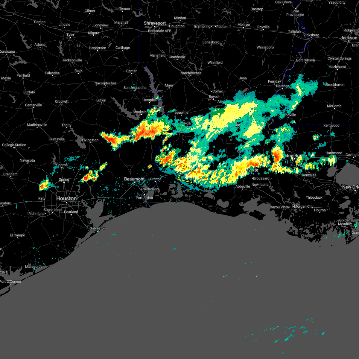 At 434 am cdt, a severe thunderstorm was located near moss bluff, moving south at 15 mph (radar indicated). Hazards include 60 mph wind gusts. Expect damage to roofs, siding, and trees. locations impacted include, lake charles, westlake, lake charles regional airport, moss bluff, lebleu settlement and holmwood. hail threat, radar indicated max hail size, <. 75 in wind threat, radar indicated max wind gust, 60 mph. At 434 am cdt, a severe thunderstorm was located near moss bluff, moving south at 15 mph (radar indicated). Hazards include 60 mph wind gusts. Expect damage to roofs, siding, and trees. locations impacted include, lake charles, westlake, lake charles regional airport, moss bluff, lebleu settlement and holmwood. hail threat, radar indicated max hail size, <. 75 in wind threat, radar indicated max wind gust, 60 mph.
|
| 10/13/2022 4:21 AM CDT |
 At 420 am cdt, a severe thunderstorm was located near moss bluff, moving south at 15 mph (radar indicated). Hazards include 60 mph wind gusts. expect damage to roofs, siding, and trees At 420 am cdt, a severe thunderstorm was located near moss bluff, moving south at 15 mph (radar indicated). Hazards include 60 mph wind gusts. expect damage to roofs, siding, and trees
|
| 7/10/2022 6:43 PM CDT |
 At 642 pm cdt, a severe thunderstorm was located near ragley, moving south at 20 mph (radar indicated). Hazards include 60 mph wind gusts and penny size hail. Expect damage to roofs, siding, and trees. locations impacted include, westlake, moss bluff, ragley, buhler and gillis. hail threat, radar indicated max hail size, 0. 75 in wind threat, radar indicated max wind gust, 60 mph. At 642 pm cdt, a severe thunderstorm was located near ragley, moving south at 20 mph (radar indicated). Hazards include 60 mph wind gusts and penny size hail. Expect damage to roofs, siding, and trees. locations impacted include, westlake, moss bluff, ragley, buhler and gillis. hail threat, radar indicated max hail size, 0. 75 in wind threat, radar indicated max wind gust, 60 mph.
|
| 7/10/2022 6:31 PM CDT |
 At 631 pm cdt, a severe thunderstorm was located over ragley, moving south at 30 mph (radar indicated). Hazards include 60 mph wind gusts and quarter size hail. Hail damage to vehicles is expected. expect wind damage to roofs, siding, and trees. locations impacted include, lake charles, westlake, moss bluff, ragley, buhler and gillis. hail threat, radar indicated max hail size, 1. 00 in wind threat, radar indicated max wind gust, 60 mph. At 631 pm cdt, a severe thunderstorm was located over ragley, moving south at 30 mph (radar indicated). Hazards include 60 mph wind gusts and quarter size hail. Hail damage to vehicles is expected. expect wind damage to roofs, siding, and trees. locations impacted include, lake charles, westlake, moss bluff, ragley, buhler and gillis. hail threat, radar indicated max hail size, 1. 00 in wind threat, radar indicated max wind gust, 60 mph.
|
| 7/10/2022 6:22 PM CDT |
 At 622 pm cdt, a severe thunderstorm was located over longville, or near ragley, moving south at 20 mph (radar indicated). Hazards include 60 mph wind gusts and nickel size hail. expect damage to roofs, siding, and trees At 622 pm cdt, a severe thunderstorm was located over longville, or near ragley, moving south at 20 mph (radar indicated). Hazards include 60 mph wind gusts and nickel size hail. expect damage to roofs, siding, and trees
|
| 5/24/2022 5:55 PM CDT |
 At 553 pm cdt, severe thunderstorms were located along a line extending from near hayes to heberts marina to near sabine national wildlife, moving north at 55 mph. a wind gust to 66 mph was recently reported at calcasieu pass as this line passed (radar indicated). Hazards include 70 mph wind gusts and quarter size hail. Hail damage to vehicles is expected. expect considerable tree damage. Wind damage is also likely to mobile homes, roofs, and outbuildings. At 553 pm cdt, severe thunderstorms were located along a line extending from near hayes to heberts marina to near sabine national wildlife, moving north at 55 mph. a wind gust to 66 mph was recently reported at calcasieu pass as this line passed (radar indicated). Hazards include 70 mph wind gusts and quarter size hail. Hail damage to vehicles is expected. expect considerable tree damage. Wind damage is also likely to mobile homes, roofs, and outbuildings.
|
| 12/18/2021 2:00 PM CST |
 At 200 pm cst, severe thunderstorms were located along a line extending from sugartown to sulphur, moving east at 20 mph (radar indicated). Hazards include 60 mph wind gusts and penny size hail. Expect damage to roofs, siding, and trees. Locations impacted include, lake charles, sulphur, westlake, elizabeth, reeves, dry creek, lake charles regional airport, moss bluff, sugartown, mittie, ragley, grant, carlyss, longville, buller, buhler, harmony, topsy, lebleu settlement and gillis. At 200 pm cst, severe thunderstorms were located along a line extending from sugartown to sulphur, moving east at 20 mph (radar indicated). Hazards include 60 mph wind gusts and penny size hail. Expect damage to roofs, siding, and trees. Locations impacted include, lake charles, sulphur, westlake, elizabeth, reeves, dry creek, lake charles regional airport, moss bluff, sugartown, mittie, ragley, grant, carlyss, longville, buller, buhler, harmony, topsy, lebleu settlement and gillis.
|
| 12/18/2021 1:30 PM CST |
 At 130 pm cst, severe thunderstorms were located along a line extending from 6 miles east of de ridder to near edgerly, moving east at 20 mph (radar indicated). Hazards include 60 mph wind gusts and penny size hail. expect damage to roofs, siding, and trees At 130 pm cst, severe thunderstorms were located along a line extending from 6 miles east of de ridder to near edgerly, moving east at 20 mph (radar indicated). Hazards include 60 mph wind gusts and penny size hail. expect damage to roofs, siding, and trees
|
| 10/27/2021 12:12 PM CDT |
 At 1212 pm cdt, severe thunderstorms were located along a line extending from 6 miles southeast of rosepine to near cameron, moving east at 45 mph (radar indicated). Hazards include 60 mph wind gusts. Expect damage to roofs, siding, and trees. Locations impacted include, lake charles, sulphur, crowley, eunice, jennings, ville platte, cameron, westlake, mamou, welsh, iowa, lake arthur, kinder, basile, oberlin, iota, gueydan, elton, mermentau and fenton. At 1212 pm cdt, severe thunderstorms were located along a line extending from 6 miles southeast of rosepine to near cameron, moving east at 45 mph (radar indicated). Hazards include 60 mph wind gusts. Expect damage to roofs, siding, and trees. Locations impacted include, lake charles, sulphur, crowley, eunice, jennings, ville platte, cameron, westlake, mamou, welsh, iowa, lake arthur, kinder, basile, oberlin, iota, gueydan, elton, mermentau and fenton.
|
| 10/27/2021 12:08 PM CDT |
 At 1208 pm cdt, a severe thunderstorm capable of producing a tornado was located over carlyss, or near sulphur, moving east at 40 mph (radar indicated rotation). Hazards include tornado. Flying debris will be dangerous to those caught without shelter. mobile homes will be damaged or destroyed. damage to roofs, windows, and vehicles will occur. tree damage is likely. this dangerous storm will be near, westlake around 1220 pm cdt. moss bluff around 1225 pm cdt. Lake charles around 1230 pm cdt. At 1208 pm cdt, a severe thunderstorm capable of producing a tornado was located over carlyss, or near sulphur, moving east at 40 mph (radar indicated rotation). Hazards include tornado. Flying debris will be dangerous to those caught without shelter. mobile homes will be damaged or destroyed. damage to roofs, windows, and vehicles will occur. tree damage is likely. this dangerous storm will be near, westlake around 1220 pm cdt. moss bluff around 1225 pm cdt. Lake charles around 1230 pm cdt.
|
| 10/27/2021 12:00 PM CDT |
 At 1200 pm cdt, severe thunderstorms were located along a line extending from near de ridder to 6 miles southeast of holly beach, moving east at 65 mph (radar indicated). Hazards include 60 mph wind gusts. Expect damage to roofs, siding, and trees. Locations impacted include, lake charles, sulphur, crowley, eunice, jennings, ville platte, cameron, westlake, mamou, welsh, iowa, lake arthur, kinder, basile, oberlin, iota, gueydan, elton, mermentau and fenton. At 1200 pm cdt, severe thunderstorms were located along a line extending from near de ridder to 6 miles southeast of holly beach, moving east at 65 mph (radar indicated). Hazards include 60 mph wind gusts. Expect damage to roofs, siding, and trees. Locations impacted include, lake charles, sulphur, crowley, eunice, jennings, ville platte, cameron, westlake, mamou, welsh, iowa, lake arthur, kinder, basile, oberlin, iota, gueydan, elton, mermentau and fenton.
|
| 10/27/2021 11:53 AM CDT |
 At 1153 am cdt, a severe thunderstorm capable of producing a tornado was located near vinton, moving east at 40 mph (radar indicated rotation). Hazards include tornado. Flying debris will be dangerous to those caught without shelter. mobile homes will be damaged or destroyed. damage to roofs, windows, and vehicles will occur. tree damage is likely. this dangerous storm will be near, carlyss around 1205 pm cdt. sulphur around 1210 pm cdt. westlake around 1220 pm cdt. lake charles and moss bluff around 1225 pm cdt. this includes the following highways, interstate 10 in louisiana between mile markers 20 and 32. Interstate 210 between mile markers 1 and 9. At 1153 am cdt, a severe thunderstorm capable of producing a tornado was located near vinton, moving east at 40 mph (radar indicated rotation). Hazards include tornado. Flying debris will be dangerous to those caught without shelter. mobile homes will be damaged or destroyed. damage to roofs, windows, and vehicles will occur. tree damage is likely. this dangerous storm will be near, carlyss around 1205 pm cdt. sulphur around 1210 pm cdt. westlake around 1220 pm cdt. lake charles and moss bluff around 1225 pm cdt. this includes the following highways, interstate 10 in louisiana between mile markers 20 and 32. Interstate 210 between mile markers 1 and 9.
|
| 10/27/2021 11:51 AM CDT |
 At 1150 am cdt, severe thunderstorms were located along a line extending from 7 miles southeast of junction to 9 miles southeast of johnsons bayou, moving northeast at 45 mph (radar indicated). Hazards include 60 mph wind gusts. Expect damage to roofs, siding, and trees. locations impacted include, lake charles, sulphur, crowley, eunice, jennings, ville platte, cameron, westlake, mamou, welsh, vinton, iowa, lake arthur, kinder, basile, oberlin, iota, gueydan, elton and mermentau. hail threat, radar indicated max hail size, <. 75 in wind threat, radar indicated max wind gust, 60 mph. At 1150 am cdt, severe thunderstorms were located along a line extending from 7 miles southeast of junction to 9 miles southeast of johnsons bayou, moving northeast at 45 mph (radar indicated). Hazards include 60 mph wind gusts. Expect damage to roofs, siding, and trees. locations impacted include, lake charles, sulphur, crowley, eunice, jennings, ville platte, cameron, westlake, mamou, welsh, vinton, iowa, lake arthur, kinder, basile, oberlin, iota, gueydan, elton and mermentau. hail threat, radar indicated max hail size, <. 75 in wind threat, radar indicated max wind gust, 60 mph.
|
| 10/27/2021 11:46 AM CDT |
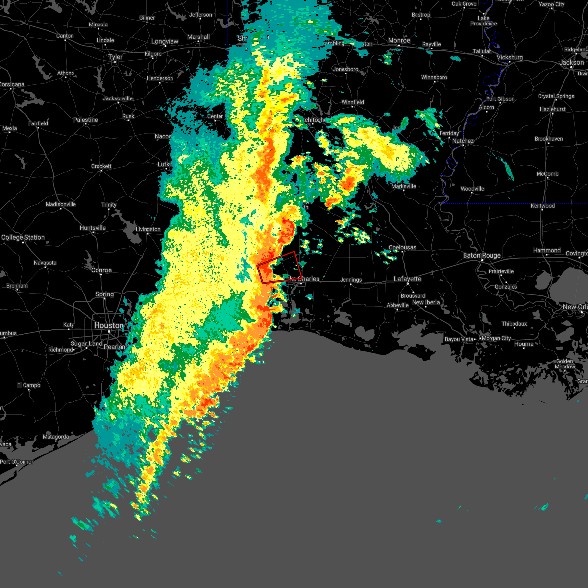 At 1146 am cdt, a tornado producing storm was located over lunita, or near starks, moving east at 30 mph (radar confirmed tornado). Hazards include damaging tornado. Flying debris will be dangerous to those caught without shelter. mobile homes will be damaged or destroyed. damage to roofs, windows, and vehicles will occur. tree damage is likely. this tornadic storm will be near, de quincy around 1210 pm cdt. Buhler around 1215 pm cdt. At 1146 am cdt, a tornado producing storm was located over lunita, or near starks, moving east at 30 mph (radar confirmed tornado). Hazards include damaging tornado. Flying debris will be dangerous to those caught without shelter. mobile homes will be damaged or destroyed. damage to roofs, windows, and vehicles will occur. tree damage is likely. this tornadic storm will be near, de quincy around 1210 pm cdt. Buhler around 1215 pm cdt.
|
| 10/27/2021 11:39 AM CDT |
 At 1138 am cdt, severe thunderstorms were located along a line extending from merryville to 11 miles south of johnsons bayou, moving northeast at 50 mph (radar indicated). Hazards include 70 mph wind gusts. Expect considerable tree damage. damage is likely to mobile homes, roofs, and outbuildings. locations impacted include, lake charles, sulphur, orange, crowley, eunice, jennings, ville platte, cameron, westlake, west orange, mamou, welsh, vinton, iowa, lake arthur, kinder, basile, oberlin, iota and gueydan. thunderstorm damage threat, considerable hail threat, radar indicated max hail size, <. 75 in wind threat, radar indicated max wind gust, 70 mph. At 1138 am cdt, severe thunderstorms were located along a line extending from merryville to 11 miles south of johnsons bayou, moving northeast at 50 mph (radar indicated). Hazards include 70 mph wind gusts. Expect considerable tree damage. damage is likely to mobile homes, roofs, and outbuildings. locations impacted include, lake charles, sulphur, orange, crowley, eunice, jennings, ville platte, cameron, westlake, west orange, mamou, welsh, vinton, iowa, lake arthur, kinder, basile, oberlin, iota and gueydan. thunderstorm damage threat, considerable hail threat, radar indicated max hail size, <. 75 in wind threat, radar indicated max wind gust, 70 mph.
|
| 10/27/2021 11:30 AM CDT |
 At 1129 am cdt, severe thunderstorms were located along a line extending from near bivens to 15 miles south of johnsons bayou, moving east at 75 mph (radar indicated). Hazards include 70 mph wind gusts. Expect considerable tree damage. Damage is likely to mobile homes, roofs, and outbuildings. At 1129 am cdt, severe thunderstorms were located along a line extending from near bivens to 15 miles south of johnsons bayou, moving east at 75 mph (radar indicated). Hazards include 70 mph wind gusts. Expect considerable tree damage. Damage is likely to mobile homes, roofs, and outbuildings.
|
| 8/24/2021 6:50 PM CDT |
 The severe thunderstorm warning for northeastern cameron, western jefferson davis and southeastern calcasieu parishes will expire at 700 pm cdt, the storms which prompted the warning have weakened. therefore, the warning will be allowed to expire. however gusty winds are still possible with these thunderstorms. The severe thunderstorm warning for northeastern cameron, western jefferson davis and southeastern calcasieu parishes will expire at 700 pm cdt, the storms which prompted the warning have weakened. therefore, the warning will be allowed to expire. however gusty winds are still possible with these thunderstorms.
|
| 8/24/2021 6:40 PM CDT |
 At 640 pm cdt, severe thunderstorms were located along a line extending from near lebleu settlement to near holmwood to near lowry, moving southwest at 30 mph (radar indicated). Hazards include 60 mph wind gusts. Expect damage to roofs, siding, and trees. locations impacted include, lake charles, sulphur, westlake, iowa, grand lake, lacassine national wildlife refuge, lake charles regional airport, hayes, moss bluff, carlyss, buller, hacketts corner, heberts marina, lebleu settlement, thornwell, lowry, sweet lake, gibbstown, holmwood and hackberry. hail threat, radar indicated max hail size, <. 75 in wind threat, radar indicated max wind gust, 60 mph. At 640 pm cdt, severe thunderstorms were located along a line extending from near lebleu settlement to near holmwood to near lowry, moving southwest at 30 mph (radar indicated). Hazards include 60 mph wind gusts. Expect damage to roofs, siding, and trees. locations impacted include, lake charles, sulphur, westlake, iowa, grand lake, lacassine national wildlife refuge, lake charles regional airport, hayes, moss bluff, carlyss, buller, hacketts corner, heberts marina, lebleu settlement, thornwell, lowry, sweet lake, gibbstown, holmwood and hackberry. hail threat, radar indicated max hail size, <. 75 in wind threat, radar indicated max wind gust, 60 mph.
|
| 8/24/2021 6:15 PM CDT |
 At 615 pm cdt, severe thunderstorms were located along a line extending from near fenton to near welsh to near lake arthur, moving southwest at 20 mph (radar indicated). Hazards include 60 mph wind gusts. Expect damage to roofs, siding, and trees. locations impacted include, lake charles, sulphur, jennings, westlake, welsh, iowa, lake arthur, mermentau, fenton, grand lake, hayes, moss bluff, lacassine national wildlife refuge, lake charles regional airport, hacketts corner, lebleu settlement, lowry, sweet lake, carlyss and buller. hail threat, radar indicated max hail size, <. 75 in wind threat, radar indicated max wind gust, 60 mph. At 615 pm cdt, severe thunderstorms were located along a line extending from near fenton to near welsh to near lake arthur, moving southwest at 20 mph (radar indicated). Hazards include 60 mph wind gusts. Expect damage to roofs, siding, and trees. locations impacted include, lake charles, sulphur, jennings, westlake, welsh, iowa, lake arthur, mermentau, fenton, grand lake, hayes, moss bluff, lacassine national wildlife refuge, lake charles regional airport, hacketts corner, lebleu settlement, lowry, sweet lake, carlyss and buller. hail threat, radar indicated max hail size, <. 75 in wind threat, radar indicated max wind gust, 60 mph.
|
| 8/24/2021 5:55 PM CDT |
 At 555 pm cdt, severe thunderstorms were located along a line extending from near fenton to near welsh to lake arthur, moving southwest at 30 mph (radar indicated). Hazards include 60 mph wind gusts. expect damage to roofs, siding, and trees At 555 pm cdt, severe thunderstorms were located along a line extending from near fenton to near welsh to lake arthur, moving southwest at 30 mph (radar indicated). Hazards include 60 mph wind gusts. expect damage to roofs, siding, and trees
|
| 7/20/2021 3:53 AM CDT |
 At 353 am cdt, severe thunderstorms were located along a line extending from moss bluff to lebleu settlement to near holmwood to lake charles regional airport, moving east at 30 mph (radar indicated). Hazards include 60 mph wind gusts. Expect damage to roofs, siding, and trees. Locations impacted include, lake charles, westlake, welsh, iowa, fenton, lake charles regional airport, hayes, moss bluff, buller, lebleu settlement, gillis, pine island, holmwood, bell city and lacassine. At 353 am cdt, severe thunderstorms were located along a line extending from moss bluff to lebleu settlement to near holmwood to lake charles regional airport, moving east at 30 mph (radar indicated). Hazards include 60 mph wind gusts. Expect damage to roofs, siding, and trees. Locations impacted include, lake charles, westlake, welsh, iowa, fenton, lake charles regional airport, hayes, moss bluff, buller, lebleu settlement, gillis, pine island, holmwood, bell city and lacassine.
|
| 7/20/2021 3:41 AM CDT |
 At 341 am cdt, severe thunderstorms were located along a line extending from near westlake to near lake charles to near grand lake, moving east at 30 mph (radar indicated). Hazards include 60 mph wind gusts. expect damage to roofs, siding, and trees At 341 am cdt, severe thunderstorms were located along a line extending from near westlake to near lake charles to near grand lake, moving east at 30 mph (radar indicated). Hazards include 60 mph wind gusts. expect damage to roofs, siding, and trees
|
| 5/19/2021 11:18 PM CDT |
 At 1117 pm cdt, severe thunderstorms were located along a line extending from near grand lake to 10 miles south of lowry, moving north at 60 mph (radar indicated). Hazards include 60 mph wind gusts. Expect damage to roofs, siding, and trees. Locations impacted include, lake charles, cameron, westlake, grand lake, lake charles regional airport, lacassine national wildlife refuge, hayes, hacketts corner, heberts marina, thornwell, lowry, sweet lake, gibbstown, holmwood and bell city. At 1117 pm cdt, severe thunderstorms were located along a line extending from near grand lake to 10 miles south of lowry, moving north at 60 mph (radar indicated). Hazards include 60 mph wind gusts. Expect damage to roofs, siding, and trees. Locations impacted include, lake charles, cameron, westlake, grand lake, lake charles regional airport, lacassine national wildlife refuge, hayes, hacketts corner, heberts marina, thornwell, lowry, sweet lake, gibbstown, holmwood and bell city.
|
| 5/19/2021 10:54 PM CDT |
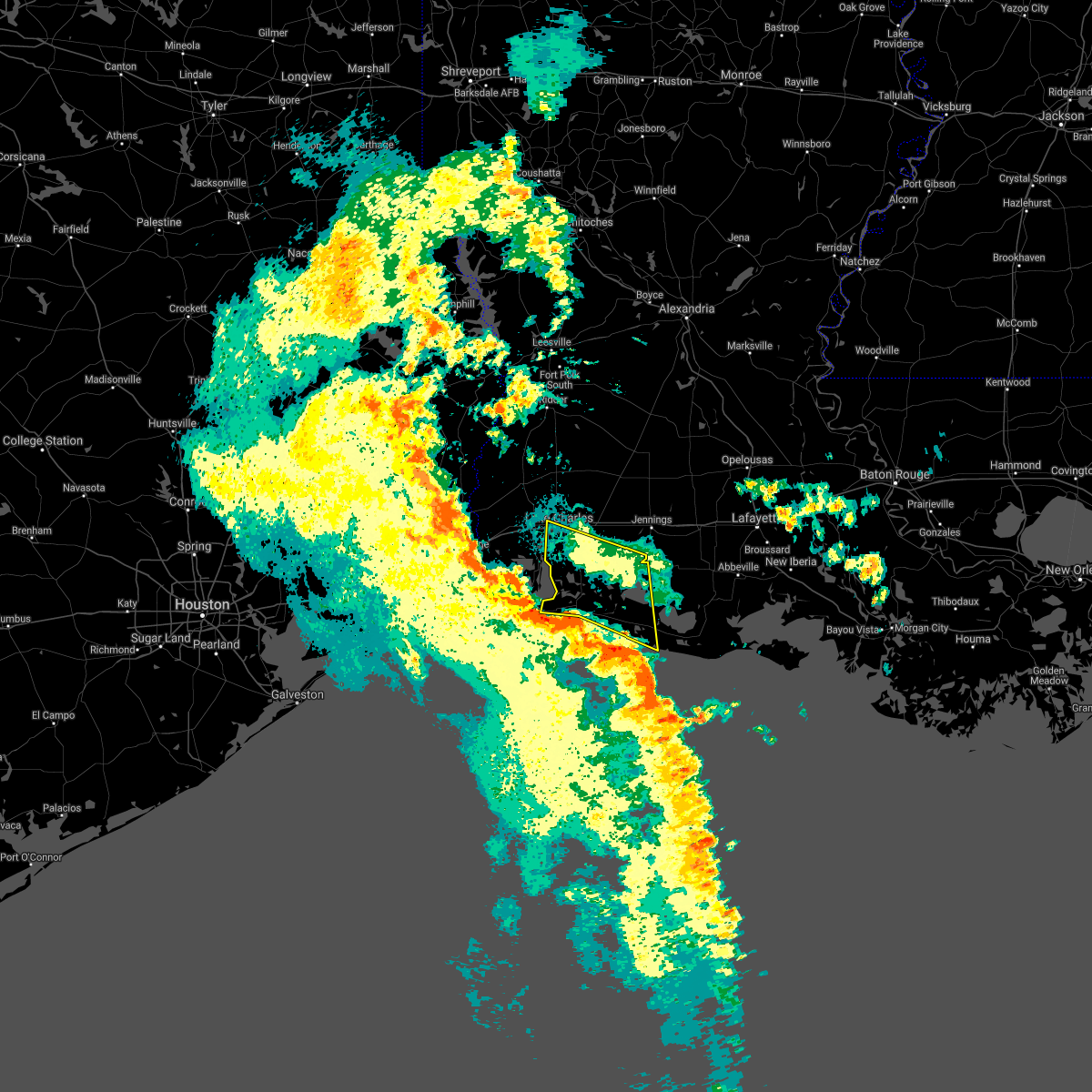 At 1053 pm cdt, severe thunderstorms were located along a line extending from near creole to 10 miles southeast of rockefeller wildlife range, moving north at 60 mph (radar indicated). Hazards include 60 mph wind gusts. expect damage to roofs, siding, and trees At 1053 pm cdt, severe thunderstorms were located along a line extending from near creole to 10 miles southeast of rockefeller wildlife range, moving north at 60 mph (radar indicated). Hazards include 60 mph wind gusts. expect damage to roofs, siding, and trees
|
| 5/17/2021 12:08 PM CDT |
 The severe thunderstorm warning for west central jefferson davis and eastern calcasieu parishes will expire at 1215 pm cdt, the storm which prompted the warning has weakened below severe limits, and no longer poses an immediate threat to life or property. therefore, the warning will be allowed to expire. however gusty winds and heavy rain are still possible with this thunderstorm. The severe thunderstorm warning for west central jefferson davis and eastern calcasieu parishes will expire at 1215 pm cdt, the storm which prompted the warning has weakened below severe limits, and no longer poses an immediate threat to life or property. therefore, the warning will be allowed to expire. however gusty winds and heavy rain are still possible with this thunderstorm.
|
| 5/17/2021 11:34 AM CDT |
 At 1134 am cdt, a severe thunderstorm was located near lake charles, moving northeast at 30 mph (radar indicated). Hazards include 60 mph wind gusts. Expect damage to roofs, siding, and trees. Locations impacted include, lake charles, westlake, welsh, iowa, lake charles regional airport, moss bluff, lebleu settlement, holmwood, topsy and lacassine. At 1134 am cdt, a severe thunderstorm was located near lake charles, moving northeast at 30 mph (radar indicated). Hazards include 60 mph wind gusts. Expect damage to roofs, siding, and trees. Locations impacted include, lake charles, westlake, welsh, iowa, lake charles regional airport, moss bluff, lebleu settlement, holmwood, topsy and lacassine.
|
| 5/17/2021 11:14 AM CDT |
 At 1114 am cdt, a severe thunderstorm was located over lake charles regional airport, moving northeast at 25 mph (radar indicated). Hazards include 60 mph wind gusts. expect damage to roofs, siding, and trees At 1114 am cdt, a severe thunderstorm was located over lake charles regional airport, moving northeast at 25 mph (radar indicated). Hazards include 60 mph wind gusts. expect damage to roofs, siding, and trees
|
| 5/17/2021 10:23 AM CDT |
 At 1023 am cdt, a severe thunderstorm was located near lake charles regional airport, moving northeast at 5 mph (radar indicated). Hazards include 60 mph wind gusts. Expect damage to roofs, siding, and trees. Locations impacted include, lake charles, sulphur, westlake, lake charles regional airport, moss bluff and carlyss. At 1023 am cdt, a severe thunderstorm was located near lake charles regional airport, moving northeast at 5 mph (radar indicated). Hazards include 60 mph wind gusts. Expect damage to roofs, siding, and trees. Locations impacted include, lake charles, sulphur, westlake, lake charles regional airport, moss bluff and carlyss.
|
| 5/17/2021 10:16 AM CDT |
 At 1016 am cdt, a severe thunderstorm was located near grand lake, moving northeast at 5 mph (radar indicated). Hazards include 60 mph wind gusts. expect damage to roofs, siding, and trees At 1016 am cdt, a severe thunderstorm was located near grand lake, moving northeast at 5 mph (radar indicated). Hazards include 60 mph wind gusts. expect damage to roofs, siding, and trees
|
| 5/17/2021 10:09 AM CDT |
 The tornado warning for east central calcasieu parish will expire at 1015 am cdt, the storm which prompted the warning has weakened below severe limits, and no longer appears capable of producing a tornado. therefore, the warning will be allowed to expire. however gusty winds and heavy rain are still possible with this thunderstorm. to report severe weather, contact your nearest law enforcement agency. they will relay your report to the national weather service lake charles. The tornado warning for east central calcasieu parish will expire at 1015 am cdt, the storm which prompted the warning has weakened below severe limits, and no longer appears capable of producing a tornado. therefore, the warning will be allowed to expire. however gusty winds and heavy rain are still possible with this thunderstorm. to report severe weather, contact your nearest law enforcement agency. they will relay your report to the national weather service lake charles.
|
| 5/17/2021 9:50 AM CDT |
 At 950 am cdt, a severe thunderstorm capable of producing a tornado was located over lake charles, moving northeast at 20 mph (radar indicated rotation). Hazards include tornado. Flying debris will be dangerous to those caught without shelter. mobile homes will be damaged or destroyed. damage to roofs, windows, and vehicles will occur. tree damage is likely. This dangerous storm will be near, moss bluff and lebleu settlement around 1005 am cdt. At 950 am cdt, a severe thunderstorm capable of producing a tornado was located over lake charles, moving northeast at 20 mph (radar indicated rotation). Hazards include tornado. Flying debris will be dangerous to those caught without shelter. mobile homes will be damaged or destroyed. damage to roofs, windows, and vehicles will occur. tree damage is likely. This dangerous storm will be near, moss bluff and lebleu settlement around 1005 am cdt.
|
| 5/17/2021 9:43 AM CDT |
 At 943 am cdt, a severe thunderstorm capable of producing a tornado was located over lake charles, moving northeast at 20 mph (radar indicated rotation). Hazards include tornado. Flying debris will be dangerous to those caught without shelter. mobile homes will be damaged or destroyed. damage to roofs, windows, and vehicles will occur. tree damage is likely. This dangerous storm will be near, moss bluff and lebleu settlement around 1005 am cdt. At 943 am cdt, a severe thunderstorm capable of producing a tornado was located over lake charles, moving northeast at 20 mph (radar indicated rotation). Hazards include tornado. Flying debris will be dangerous to those caught without shelter. mobile homes will be damaged or destroyed. damage to roofs, windows, and vehicles will occur. tree damage is likely. This dangerous storm will be near, moss bluff and lebleu settlement around 1005 am cdt.
|
| 5/17/2021 9:37 AM CDT |
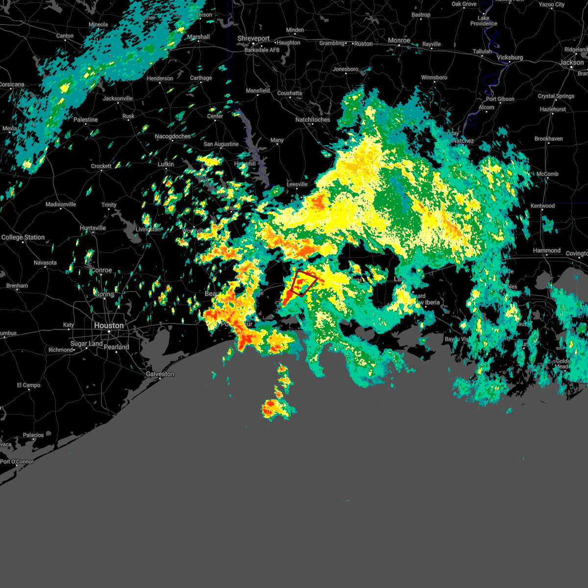 At 937 am cdt, a severe thunderstorm capable of producing a tornado was located over lake charles, moving northeast at 20 mph (radar indicated rotation). Hazards include tornado. Flying debris will be dangerous to those caught without shelter. mobile homes will be damaged or destroyed. damage to roofs, windows, and vehicles will occur. tree damage is likely. this dangerous storm will be near, moss bluff and lebleu settlement around 1005 am cdt. this includes the following highways, interstate 10 in louisiana between mile markers 26 and 40. Interstate 210 between mile markers 1 and 12. At 937 am cdt, a severe thunderstorm capable of producing a tornado was located over lake charles, moving northeast at 20 mph (radar indicated rotation). Hazards include tornado. Flying debris will be dangerous to those caught without shelter. mobile homes will be damaged or destroyed. damage to roofs, windows, and vehicles will occur. tree damage is likely. this dangerous storm will be near, moss bluff and lebleu settlement around 1005 am cdt. this includes the following highways, interstate 10 in louisiana between mile markers 26 and 40. Interstate 210 between mile markers 1 and 12.
|
| 4/16/2021 3:53 AM CDT |
 At 353 am cdt, severe thunderstorms were located along a line extending from near reeves to near moss bluff, moving east at 55 mph (radar indicated). Hazards include 60 mph wind gusts and quarter size hail. Hail damage to vehicles is expected. expect wind damage to roofs, siding, and trees. locations impacted include, lake charles, westlake, iowa, kinder, fenton, reeves, dry creek, hayes, moss bluff, ragley, longville, buller, harmony, topsy, lebleu settlement, gillis, leblanc, bell city and lacassine. this includes the following highways, interstate 10 in louisiana between mile markers 26 and 51. Interstate 210 between mile markers 1 and 12. At 353 am cdt, severe thunderstorms were located along a line extending from near reeves to near moss bluff, moving east at 55 mph (radar indicated). Hazards include 60 mph wind gusts and quarter size hail. Hail damage to vehicles is expected. expect wind damage to roofs, siding, and trees. locations impacted include, lake charles, westlake, iowa, kinder, fenton, reeves, dry creek, hayes, moss bluff, ragley, longville, buller, harmony, topsy, lebleu settlement, gillis, leblanc, bell city and lacassine. this includes the following highways, interstate 10 in louisiana between mile markers 26 and 51. Interstate 210 between mile markers 1 and 12.
|
| 4/16/2021 3:44 AM CDT |
 At 344 am cdt, severe thunderstorms were located along a line extending from near longville to near moss bluff, moving east at 55 mph (radar indicated). Hazards include 60 mph wind gusts and quarter size hail. Hail damage to vehicles is expected. Expect wind damage to roofs, siding, and trees. At 344 am cdt, severe thunderstorms were located along a line extending from near longville to near moss bluff, moving east at 55 mph (radar indicated). Hazards include 60 mph wind gusts and quarter size hail. Hail damage to vehicles is expected. Expect wind damage to roofs, siding, and trees.
|
| 4/14/2021 8:20 AM CDT |
 At 820 am cdt, a severe thunderstorm was located over westlake, moving east at 40 mph (radar indicated). Hazards include 60 mph wind gusts and half dollar size hail. Hail damage to vehicles is expected. expect wind damage to roofs, siding, and trees. locations impacted include, lake charles, sulphur, westlake, iowa, reeves, grand lake, lake charles regional airport, hayes, moss bluff, carlyss, buller, buhler, topsy, lebleu settlement, gillis, edgerly, holmwood, hackberry, bell city and lacassine. this includes the following highways, interstate 10 in louisiana between mile markers 11 and 48. Interstate 210 between mile markers 1 and 12. At 820 am cdt, a severe thunderstorm was located over westlake, moving east at 40 mph (radar indicated). Hazards include 60 mph wind gusts and half dollar size hail. Hail damage to vehicles is expected. expect wind damage to roofs, siding, and trees. locations impacted include, lake charles, sulphur, westlake, iowa, reeves, grand lake, lake charles regional airport, hayes, moss bluff, carlyss, buller, buhler, topsy, lebleu settlement, gillis, edgerly, holmwood, hackberry, bell city and lacassine. this includes the following highways, interstate 10 in louisiana between mile markers 11 and 48. Interstate 210 between mile markers 1 and 12.
|
| 4/14/2021 7:57 AM CDT |
 At 756 am cdt, a severe thunderstorm was located over edgerly, or near vinton, moving east at 40 mph (radar indicated). Hazards include 60 mph wind gusts and half dollar size hail. Hail damage to vehicles is expected. Expect wind damage to roofs, siding, and trees. At 756 am cdt, a severe thunderstorm was located over edgerly, or near vinton, moving east at 40 mph (radar indicated). Hazards include 60 mph wind gusts and half dollar size hail. Hail damage to vehicles is expected. Expect wind damage to roofs, siding, and trees.
|
| 1/6/2021 8:14 PM CST |
 At 814 pm cst, severe thunderstorms were located along a line extending from near westlake to near heberts marina to 6 miles southeast of johnsons bayou, moving east at 40 mph (radar indicated). Hazards include 60 mph wind gusts and nickel size hail. Expect damage to roofs, siding, and trees. locations impacted include, lake charles, sulphur, westlake, iowa, grand lake, lake charles regional airport, moss bluff, carlyss, hacketts corner, heberts marina, lebleu settlement, hackberry, sweet lake, gibbstown and holmwood. this includes the following highways, interstate 10 in louisiana between mile markers 20 and 42. Interstate 210 between mile markers 1 and 12. At 814 pm cst, severe thunderstorms were located along a line extending from near westlake to near heberts marina to 6 miles southeast of johnsons bayou, moving east at 40 mph (radar indicated). Hazards include 60 mph wind gusts and nickel size hail. Expect damage to roofs, siding, and trees. locations impacted include, lake charles, sulphur, westlake, iowa, grand lake, lake charles regional airport, moss bluff, carlyss, hacketts corner, heberts marina, lebleu settlement, hackberry, sweet lake, gibbstown and holmwood. this includes the following highways, interstate 10 in louisiana between mile markers 20 and 42. Interstate 210 between mile markers 1 and 12.
|
| 1/6/2021 8:01 PM CST |
 At 801 pm cst, severe thunderstorms were located along a line extending from near edgerly to near hackberry to 6 miles southwest of johnsons bayou, moving east at 40 mph (radar indicated). Hazards include 60 mph wind gusts and nickel size hail. expect damage to roofs, siding, and trees At 801 pm cst, severe thunderstorms were located along a line extending from near edgerly to near hackberry to 6 miles southwest of johnsons bayou, moving east at 40 mph (radar indicated). Hazards include 60 mph wind gusts and nickel size hail. expect damage to roofs, siding, and trees
|
| 12/19/2020 2:44 PM CST |
 At 244 pm cst, a severe thunderstorm was located over lake charles regional airport, moving east at 40 mph (radar indicated). Hazards include 60 mph wind gusts. Expect damage to roofs, siding, and trees. locations impacted include, lake charles, sulphur, westlake, grand lake, lake charles regional airport, moss bluff, hacketts corner, heberts marina, sweet lake, holmwood and carlyss. this includes the following highways, interstate 10 in louisiana between mile markers 23 and 38. Interstate 210 between mile markers 1 and 12. At 244 pm cst, a severe thunderstorm was located over lake charles regional airport, moving east at 40 mph (radar indicated). Hazards include 60 mph wind gusts. Expect damage to roofs, siding, and trees. locations impacted include, lake charles, sulphur, westlake, grand lake, lake charles regional airport, moss bluff, hacketts corner, heberts marina, sweet lake, holmwood and carlyss. this includes the following highways, interstate 10 in louisiana between mile markers 23 and 38. Interstate 210 between mile markers 1 and 12.
|
| 12/19/2020 2:29 PM CST |
 At 229 pm cst, a severe thunderstorm was located near carlyss, or 7 miles south of sulphur, moving east at 40 mph (radar indicated). Hazards include 60 mph wind gusts. expect damage to roofs, siding, and trees At 229 pm cst, a severe thunderstorm was located near carlyss, or 7 miles south of sulphur, moving east at 40 mph (radar indicated). Hazards include 60 mph wind gusts. expect damage to roofs, siding, and trees
|
| 11/27/2020 11:39 AM CST |
 At 1139 am cst, a severe thunderstorm was located near gillis, or near moss bluff, moving east at 30 mph (radar indicated). Hazards include 60 mph wind gusts and penny size hail. expect damage to roofs, siding, and trees At 1139 am cst, a severe thunderstorm was located near gillis, or near moss bluff, moving east at 30 mph (radar indicated). Hazards include 60 mph wind gusts and penny size hail. expect damage to roofs, siding, and trees
|
| 8/26/2020 12:30 PM CDT |
 At 1229 pm cdt, severe thunderstorms were located along a line extending from lebleu settlement to near sabine national wildlife, moving west at 45 mph (radar indicated). Hazards include 60 mph wind gusts. expect damage to roofs, siding, and trees At 1229 pm cdt, severe thunderstorms were located along a line extending from lebleu settlement to near sabine national wildlife, moving west at 45 mph (radar indicated). Hazards include 60 mph wind gusts. expect damage to roofs, siding, and trees
|
| 5/26/2020 9:50 PM CDT |
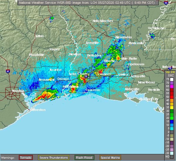 At 948 pm cdt, a severe thunderstorm was located east of carlyss moving east at 25 mph (radar indicated). Hazards include quarter size hail. Damage to vehicles is expected. locations impacted include, lake charles, sulphur, westlake and lake charles regional airport. this includes the following highways, interstate 10 in louisiana between mile markers 24 and 31. Interstate 210 between mile markers 1 and 8. At 948 pm cdt, a severe thunderstorm was located east of carlyss moving east at 25 mph (radar indicated). Hazards include quarter size hail. Damage to vehicles is expected. locations impacted include, lake charles, sulphur, westlake and lake charles regional airport. this includes the following highways, interstate 10 in louisiana between mile markers 24 and 31. Interstate 210 between mile markers 1 and 8.
|
| 5/26/2020 9:04 PM CDT |
 At 904 pm cdt, a severe thunderstorm was located over lake charles, moving east at 20 mph (radar indicated). Hazards include 60 mph wind gusts and half dollar size hail. Hail damage to vehicles is expected. Expect wind damage to roofs, siding, and trees. At 904 pm cdt, a severe thunderstorm was located over lake charles, moving east at 20 mph (radar indicated). Hazards include 60 mph wind gusts and half dollar size hail. Hail damage to vehicles is expected. Expect wind damage to roofs, siding, and trees.
|
| 4/23/2020 12:53 AM CDT |
 At 1252 am cdt, a severe thunderstorm was located near topsy, or near moss bluff, moving northeast at 40 mph (radar indicated). Hazards include 60 mph wind gusts and quarter size hail. Hail damage to vehicles is expected. expect wind damage to roofs, siding, and trees. locations impacted include, lake charles, sulphur, westlake, kinder, oberlin, elton, fenton, reeves, moss bluff, buller, harmony, topsy, lebleu settlement, gillis, leblanc and carlyss. this includes the following highways, interstate 10 in louisiana between mile markers 21 and 34. Interstate 210 between mile markers 1 and 2. At 1252 am cdt, a severe thunderstorm was located near topsy, or near moss bluff, moving northeast at 40 mph (radar indicated). Hazards include 60 mph wind gusts and quarter size hail. Hail damage to vehicles is expected. expect wind damage to roofs, siding, and trees. locations impacted include, lake charles, sulphur, westlake, kinder, oberlin, elton, fenton, reeves, moss bluff, buller, harmony, topsy, lebleu settlement, gillis, leblanc and carlyss. this includes the following highways, interstate 10 in louisiana between mile markers 21 and 34. Interstate 210 between mile markers 1 and 2.
|
| 4/23/2020 12:33 AM CDT |
 At 1233 am cdt, a severe thunderstorm was located near sulphur, moving northeast at 40 mph (radar indicated). Hazards include quarter size hail. damage to vehicles is expected At 1233 am cdt, a severe thunderstorm was located near sulphur, moving northeast at 40 mph (radar indicated). Hazards include quarter size hail. damage to vehicles is expected
|
| 4/9/2020 8:15 PM CDT |
 At 815 pm cdt, severe thunderstorms were located along a line extending from 6 miles southwest of ragley to buhler to edgerly, moving southeast at 45 mph (radar indicated). Hazards include 60 mph wind gusts and penny size hail. Expect damage to roofs, siding, and trees. locations impacted include, lake charles, sulphur, westlake, reeves, moss bluff, de quincy, ragley, carlyss, buhler, topsy, gillis, edgerly and leblanc. this includes the following highways, interstate 10 in louisiana between mile markers 14 and 29. Interstate 210 between mile markers 1 and 2. At 815 pm cdt, severe thunderstorms were located along a line extending from 6 miles southwest of ragley to buhler to edgerly, moving southeast at 45 mph (radar indicated). Hazards include 60 mph wind gusts and penny size hail. Expect damage to roofs, siding, and trees. locations impacted include, lake charles, sulphur, westlake, reeves, moss bluff, de quincy, ragley, carlyss, buhler, topsy, gillis, edgerly and leblanc. this includes the following highways, interstate 10 in louisiana between mile markers 14 and 29. Interstate 210 between mile markers 1 and 2.
|
| 4/9/2020 8:04 PM CDT |
 At 804 pm cdt, severe thunderstorms were located along a line extending from near singer to near lunita to near starks, moving east at 40 mph (radar indicated). Hazards include 60 mph wind gusts and penny size hail. Expect damage to roofs, siding, and trees. locations impacted include, lake charles, sulphur, westlake, reeves, starks, moss bluff, fields, de quincy, ragley, carlyss, bivens, lunita, buhler, topsy, gillis, edgerly, leblanc and oretta. this includes the following highways, interstate 10 in louisiana between mile markers 14 and 29. Interstate 210 between mile markers 1 and 2. At 804 pm cdt, severe thunderstorms were located along a line extending from near singer to near lunita to near starks, moving east at 40 mph (radar indicated). Hazards include 60 mph wind gusts and penny size hail. Expect damage to roofs, siding, and trees. locations impacted include, lake charles, sulphur, westlake, reeves, starks, moss bluff, fields, de quincy, ragley, carlyss, bivens, lunita, buhler, topsy, gillis, edgerly, leblanc and oretta. this includes the following highways, interstate 10 in louisiana between mile markers 14 and 29. Interstate 210 between mile markers 1 and 2.
|
| 4/9/2020 7:58 PM CDT |
 At 758 pm cdt, severe thunderstorms were located along a line extending from near singer to near lunita to near starks, moving east at 45 mph (radar indicated). Hazards include 60 mph wind gusts and penny size hail. Expect damage to roofs, siding, and trees. locations impacted include, lake charles, sulphur, westlake, reeves, deweyville, starks, moss bluff, fields, de quincy, ragley, carlyss, longville, bivens, lunita, buhler, topsy, gillis, edgerly, leblanc and oretta. this includes the following highways, interstate 10 in louisiana between mile markers 14 and 29. Interstate 210 between mile markers 1 and 2. At 758 pm cdt, severe thunderstorms were located along a line extending from near singer to near lunita to near starks, moving east at 45 mph (radar indicated). Hazards include 60 mph wind gusts and penny size hail. Expect damage to roofs, siding, and trees. locations impacted include, lake charles, sulphur, westlake, reeves, deweyville, starks, moss bluff, fields, de quincy, ragley, carlyss, longville, bivens, lunita, buhler, topsy, gillis, edgerly, leblanc and oretta. this includes the following highways, interstate 10 in louisiana between mile markers 14 and 29. Interstate 210 between mile markers 1 and 2.
|
| 4/9/2020 7:50 PM CDT |
 At 749 pm cdt, severe thunderstorms were located along a line extending from near bivens to near lunita to near deweyville, moving southeast at 65 mph (radar indicated). Hazards include 60 mph wind gusts and nickel size hail. Expect damage to roofs, siding, and trees. locations impacted include, lake charles, sulphur, westlake, reeves, deweyville, moss bluff, de quincy, ragley, starks, fields, trout creek, bivens, lunita, topsy, gillis, edgerly, devils pocket, wrights settlement, leblanc and oretta. this includes the following highways, interstate 10 in louisiana between mile markers 14 and 29. Interstate 210 between mile markers 1 and 2. At 749 pm cdt, severe thunderstorms were located along a line extending from near bivens to near lunita to near deweyville, moving southeast at 65 mph (radar indicated). Hazards include 60 mph wind gusts and nickel size hail. Expect damage to roofs, siding, and trees. locations impacted include, lake charles, sulphur, westlake, reeves, deweyville, moss bluff, de quincy, ragley, starks, fields, trout creek, bivens, lunita, topsy, gillis, edgerly, devils pocket, wrights settlement, leblanc and oretta. this includes the following highways, interstate 10 in louisiana between mile markers 14 and 29. Interstate 210 between mile markers 1 and 2.
|
| 4/9/2020 7:35 PM CDT |
 At 734 pm cdt, severe thunderstorms were located along a line extending from near trout creek to near caney head, moving east at 40 mph (radar indicated). Hazards include 60 mph wind gusts and nickel size hail. expect damage to roofs, siding, and trees At 734 pm cdt, severe thunderstorms were located along a line extending from near trout creek to near caney head, moving east at 40 mph (radar indicated). Hazards include 60 mph wind gusts and nickel size hail. expect damage to roofs, siding, and trees
|
| 1/11/2020 3:36 AM CST |
 At 335 am cst, a severe squall line capable of producing both tornadoes and extensive straight line wind damage was located over westlake, moving northeast at 35 mph (radar indicated rotation). Hazards include tornado. Flying debris will be dangerous to those caught without shelter. mobile homes will be damaged or destroyed. damage to roofs, windows, and vehicles will occur. tree damage is likely. these dangerous storms will be near, moss bluff around 345 am cst. this includes the following highways, interstate 10 in louisiana between mile markers 26 and 34. Interstate 210 near mile marker 12. At 335 am cst, a severe squall line capable of producing both tornadoes and extensive straight line wind damage was located over westlake, moving northeast at 35 mph (radar indicated rotation). Hazards include tornado. Flying debris will be dangerous to those caught without shelter. mobile homes will be damaged or destroyed. damage to roofs, windows, and vehicles will occur. tree damage is likely. these dangerous storms will be near, moss bluff around 345 am cst. this includes the following highways, interstate 10 in louisiana between mile markers 26 and 34. Interstate 210 near mile marker 12.
|
| 1/11/2020 3:22 AM CST |
 At 321 am cst, a severe squall line capable of producing both tornadoes and extensive straight line wind damage was located over carlyss, or near sulphur, moving northeast at 40 mph (radar indicated rotation). Hazards include tornado. Flying debris will be dangerous to those caught without shelter. mobile homes will be damaged or destroyed. damage to roofs, windows, and vehicles will occur. tree damage is likely. these dangerous storms will be near, lake charles and sulphur around 325 am cst. westlake around 335 am cst. moss bluff around 340 am cst. this includes the following highways, interstate 10 in louisiana between mile markers 16 and 34. Interstate 210 between mile markers 1 and 3, and near mile marker 12. At 321 am cst, a severe squall line capable of producing both tornadoes and extensive straight line wind damage was located over carlyss, or near sulphur, moving northeast at 40 mph (radar indicated rotation). Hazards include tornado. Flying debris will be dangerous to those caught without shelter. mobile homes will be damaged or destroyed. damage to roofs, windows, and vehicles will occur. tree damage is likely. these dangerous storms will be near, lake charles and sulphur around 325 am cst. westlake around 335 am cst. moss bluff around 340 am cst. this includes the following highways, interstate 10 in louisiana between mile markers 16 and 34. Interstate 210 between mile markers 1 and 3, and near mile marker 12.
|
| 1/11/2020 3:14 AM CST |
 At 313 am cst, severe thunderstorms were located along a line extending from near kurthwood to near johnsons bayou, moving east at 30 mph (radar indicated). Hazards include 60 mph wind gusts. expect damage to roofs, siding, and trees At 313 am cst, severe thunderstorms were located along a line extending from near kurthwood to near johnsons bayou, moving east at 30 mph (radar indicated). Hazards include 60 mph wind gusts. expect damage to roofs, siding, and trees
|
| 1/11/2020 3:12 AM CST |
 At 311 am cst, severe thunderstorms capable of producing both tornadoes and extensive straight line wind damage were located near vinton, moving northeast at 40 mph (radar indicated rotation). Hazards include tornado. Flying debris will be dangerous to those caught without shelter. mobile homes will be damaged or destroyed. damage to roofs, windows, and vehicles will occur. tree damage is likely. these dangerous storms will be near, edgerly around 315 am cst. carlyss around 325 am cst. lake charles and sulphur around 330 am cst. westlake around 335 am cst. moss bluff around 345 am cst. this includes the following highways, interstate 10 in louisiana between mile markers 8 and 34. Interstate 210 between mile markers 1 and 3, and near mile marker 12. At 311 am cst, severe thunderstorms capable of producing both tornadoes and extensive straight line wind damage were located near vinton, moving northeast at 40 mph (radar indicated rotation). Hazards include tornado. Flying debris will be dangerous to those caught without shelter. mobile homes will be damaged or destroyed. damage to roofs, windows, and vehicles will occur. tree damage is likely. these dangerous storms will be near, edgerly around 315 am cst. carlyss around 325 am cst. lake charles and sulphur around 330 am cst. westlake around 335 am cst. moss bluff around 345 am cst. this includes the following highways, interstate 10 in louisiana between mile markers 8 and 34. Interstate 210 between mile markers 1 and 3, and near mile marker 12.
|
| 1/11/2020 2:40 AM CST |
 At 238 am cst, severe thunderstorms were located along a line extending from near hornbeck to near bivens to 22 miles southeast of high island, moving east at 40 mph (radar indicated. at 2:22 am cst jack brooks airport in beaumont reported a wind gust to 69 mph). Hazards include 70 mph wind gusts. Expect considerable tree damage. damage is likely to mobile homes, roofs, and outbuildings. locations impacted include, beaumont, lake charles, port arthur, sulphur, orange, nederland, groves, port neches, vidor, bridge city, leesville, west orange, vinton, newton, rosepine, merryville, anacoco, singer, sabine pass and johnsons bayou. this includes the following highways, interstate 10 in texas between mile markers 880 and 860. interstate 10 in louisiana between mile markers 1 and 26. Interstate 210 near mile marker 1. At 238 am cst, severe thunderstorms were located along a line extending from near hornbeck to near bivens to 22 miles southeast of high island, moving east at 40 mph (radar indicated. at 2:22 am cst jack brooks airport in beaumont reported a wind gust to 69 mph). Hazards include 70 mph wind gusts. Expect considerable tree damage. damage is likely to mobile homes, roofs, and outbuildings. locations impacted include, beaumont, lake charles, port arthur, sulphur, orange, nederland, groves, port neches, vidor, bridge city, leesville, west orange, vinton, newton, rosepine, merryville, anacoco, singer, sabine pass and johnsons bayou. this includes the following highways, interstate 10 in texas between mile markers 880 and 860. interstate 10 in louisiana between mile markers 1 and 26. Interstate 210 near mile marker 1.
|
| 1/11/2020 2:16 AM CST |
 At 216 am cst, severe thunderstorms were located along a line extending from 7 miles north of toledo bend dam to call to 16 miles south of high island, moving east at 40 mph (radar indicated). Hazards include 60 mph wind gusts. expect damage to roofs, siding, and trees At 216 am cst, severe thunderstorms were located along a line extending from 7 miles north of toledo bend dam to call to 16 miles south of high island, moving east at 40 mph (radar indicated). Hazards include 60 mph wind gusts. expect damage to roofs, siding, and trees
|
| 10/21/2019 9:12 AM CDT |
 At 912 am cdt, severe thunderstorms were located along a line extending from gillis to near lake charles to near westlake, moving east at 45 mph (radar indicated). Hazards include 60 mph wind gusts. Expect damage to roofs, siding, and trees. Locations impacted include, lake charles, sulphur, westlake, iowa, moss bluff, carlyss, lebleu settlement and gillis. At 912 am cdt, severe thunderstorms were located along a line extending from gillis to near lake charles to near westlake, moving east at 45 mph (radar indicated). Hazards include 60 mph wind gusts. Expect damage to roofs, siding, and trees. Locations impacted include, lake charles, sulphur, westlake, iowa, moss bluff, carlyss, lebleu settlement and gillis.
|
| 10/21/2019 8:54 AM CDT |
 At 853 am cdt, severe thunderstorms were located along a line extending from near buhler to near sulphur to near edgerly, moving east at 45 mph (radar indicated). Hazards include 60 mph wind gusts. expect damage to roofs, siding, and trees At 853 am cdt, severe thunderstorms were located along a line extending from near buhler to near sulphur to near edgerly, moving east at 45 mph (radar indicated). Hazards include 60 mph wind gusts. expect damage to roofs, siding, and trees
|
| 6/28/2019 8:18 PM CDT |
 At 817 pm cdt, severe thunderstorms were located along a line extending from westlake to near lake charles regional airport, moving southwest at 15 mph (radar indicated). Hazards include 60 mph wind gusts and penny size hail. expect damage to roofs, siding, and trees At 817 pm cdt, severe thunderstorms were located along a line extending from westlake to near lake charles regional airport, moving southwest at 15 mph (radar indicated). Hazards include 60 mph wind gusts and penny size hail. expect damage to roofs, siding, and trees
|
| 5/31/2019 5:48 PM CDT |
 At 547 pm cdt, a severe thunderstorm was located over westlake, moving east at 20 mph (radar indicated). Hazards include 60 mph wind gusts. Expect damage to roofs, siding, and trees. Locations impacted include, lake charles, sulphur, westlake, iowa, moss bluff, buller, buhler, topsy, lebleu settlement, gillis and holmwood. At 547 pm cdt, a severe thunderstorm was located over westlake, moving east at 20 mph (radar indicated). Hazards include 60 mph wind gusts. Expect damage to roofs, siding, and trees. Locations impacted include, lake charles, sulphur, westlake, iowa, moss bluff, buller, buhler, topsy, lebleu settlement, gillis and holmwood.
|
| 5/31/2019 5:46 PM CDT | Social media photos of some trees down on davis rd. in westlake. some minor roof damage also shown in additional photo to a residence in westlake. time estimated by rad in calcasieu county LA, 1.2 miles SSW of Westlake, LA |
| 5/31/2019 5:28 PM CDT |
 At 527 pm cdt, a severe thunderstorm was located over buhler, or near sulphur, moving east at 30 mph (radar indicated). Hazards include 70 mph wind gusts. Expect considerable tree damage. damage is likely to mobile homes, roofs, and outbuildings. Locations impacted include, lake charles, sulphur, westlake, iowa, moss bluff, dequincy, buller, buhler, topsy, lebleu settlement, gillis and holmwood. At 527 pm cdt, a severe thunderstorm was located over buhler, or near sulphur, moving east at 30 mph (radar indicated). Hazards include 70 mph wind gusts. Expect considerable tree damage. damage is likely to mobile homes, roofs, and outbuildings. Locations impacted include, lake charles, sulphur, westlake, iowa, moss bluff, dequincy, buller, buhler, topsy, lebleu settlement, gillis and holmwood.
|
| 5/31/2019 5:20 PM CDT |
 At 520 pm cdt, a severe thunderstorm was located over buhler, or 7 miles northwest of sulphur, moving east at 30 mph (radar indicated). Hazards include 60 mph wind gusts. expect damage to roofs, siding, and trees At 520 pm cdt, a severe thunderstorm was located over buhler, or 7 miles northwest of sulphur, moving east at 30 mph (radar indicated). Hazards include 60 mph wind gusts. expect damage to roofs, siding, and trees
|
| 5/19/2019 3:40 PM CDT |
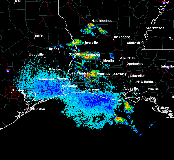 At 340 pm cdt, a severe thunderstorm was located over lake charles, moving southeast at 15 mph (radar indicated). Hazards include quarter size hail. damage to vehicles is expected At 340 pm cdt, a severe thunderstorm was located over lake charles, moving southeast at 15 mph (radar indicated). Hazards include quarter size hail. damage to vehicles is expected
|
| 5/10/2019 2:01 AM CDT |
 At 201 am cdt, severe thunderstorms were located along a line extending from near de quincy to near lake charles to heberts marina to near cameron to 14 miles south of holly beach, moving east at 35 mph (radar indicated). Hazards include 60 mph wind gusts. expect damage to roofs, siding, and trees At 201 am cdt, severe thunderstorms were located along a line extending from near de quincy to near lake charles to heberts marina to near cameron to 14 miles south of holly beach, moving east at 35 mph (radar indicated). Hazards include 60 mph wind gusts. expect damage to roofs, siding, and trees
|
| 5/10/2019 12:54 AM CDT |
 At 1254 am cdt, severe thunderstorms were located along a line extending from near orange to near port arthur to near sabine pass, moving east at 30 mph (radar indicated). Hazards include 60 mph wind gusts and quarter size hail. Hail damage to vehicles is expected. Expect wind damage to roofs, siding, and trees. At 1254 am cdt, severe thunderstorms were located along a line extending from near orange to near port arthur to near sabine pass, moving east at 30 mph (radar indicated). Hazards include 60 mph wind gusts and quarter size hail. Hail damage to vehicles is expected. Expect wind damage to roofs, siding, and trees.
|
| 5/10/2019 12:47 AM CDT |
 At 1247 am cdt, a severe thunderstorm was located over moss bluff, moving northeast at 20 mph (radar indicated). Hazards include 60 mph wind gusts and half dollar size hail. Hail damage to vehicles is expected. Expect wind damage to roofs, siding, and trees. At 1247 am cdt, a severe thunderstorm was located over moss bluff, moving northeast at 20 mph (radar indicated). Hazards include 60 mph wind gusts and half dollar size hail. Hail damage to vehicles is expected. Expect wind damage to roofs, siding, and trees.
|
| 5/10/2019 12:27 AM CDT |
 At 1227 am cdt, a severe thunderstorm was located near sulphur, moving northeast at 20 mph (radar indicated). Hazards include ping pong ball size hail and 60 mph wind gusts. People and animals outdoors will be injured. expect hail damage to roofs, siding, windows, and vehicles. expect wind damage to roofs, siding, and trees. Locations impacted include, lake charles, sulphur, westlake, carlyss and buhler. At 1227 am cdt, a severe thunderstorm was located near sulphur, moving northeast at 20 mph (radar indicated). Hazards include ping pong ball size hail and 60 mph wind gusts. People and animals outdoors will be injured. expect hail damage to roofs, siding, windows, and vehicles. expect wind damage to roofs, siding, and trees. Locations impacted include, lake charles, sulphur, westlake, carlyss and buhler.
|
| 5/10/2019 12:02 AM CDT |
 At 1200 am cdt, a severe thunderstorm was located near carlyss, or 8 miles southwest of sulphur, moving north at 15 mph (radar indicated). Hazards include 60 mph wind gusts and half dollar size hail. Hail damage to vehicles is expected. Expect wind damage to roofs, siding, and trees. At 1200 am cdt, a severe thunderstorm was located near carlyss, or 8 miles southwest of sulphur, moving north at 15 mph (radar indicated). Hazards include 60 mph wind gusts and half dollar size hail. Hail damage to vehicles is expected. Expect wind damage to roofs, siding, and trees.
|
| 5/9/2019 4:36 PM CDT |
 The severe thunderstorm warning for northwestern calcasieu parish will expire at 445 pm cdt, the storm which prompted the warning has weakened below severe limits, and no longer poses an immediate threat to life or property. therefore, the warning will be allowed to expire. The severe thunderstorm warning for northwestern calcasieu parish will expire at 445 pm cdt, the storm which prompted the warning has weakened below severe limits, and no longer poses an immediate threat to life or property. therefore, the warning will be allowed to expire.
|
| 5/9/2019 4:25 PM CDT |
 At 425 pm cdt, a severe thunderstorm was located near edgerly, or near vinton, moving northeast at 20 mph (radar indicated). Hazards include 60 mph wind gusts and quarter size hail. Hail damage to vehicles is expected. expect wind damage to roofs, siding, and trees. Locations impacted include, lake charles, sulphur, westlake, vinton, de quincy, dequincy, buhler and edgerly. At 425 pm cdt, a severe thunderstorm was located near edgerly, or near vinton, moving northeast at 20 mph (radar indicated). Hazards include 60 mph wind gusts and quarter size hail. Hail damage to vehicles is expected. expect wind damage to roofs, siding, and trees. Locations impacted include, lake charles, sulphur, westlake, vinton, de quincy, dequincy, buhler and edgerly.
|
| 5/9/2019 4:12 PM CDT |
 The national weather service in lake charles has issued a * severe thunderstorm warning for. northwestern calcasieu parish in southwestern louisiana. until 445 pm cdt. At 412 pm cdt, a severe thunderstorm was located near vinton, moving northeast at 20 mph. The national weather service in lake charles has issued a * severe thunderstorm warning for. northwestern calcasieu parish in southwestern louisiana. until 445 pm cdt. At 412 pm cdt, a severe thunderstorm was located near vinton, moving northeast at 20 mph.
|
| 4/7/2019 2:53 PM CDT |
 At 253 pm cdt, severe thunderstorms were located along a line extending from near jasper to near bancroft to 6 miles south of holly beach, moving northeast at 50 mph (radar indicated). Hazards include 60 mph wind gusts and quarter size hail. Hail damage to vehicles is expected. expect wind damage to roofs, siding, and trees. Locations impacted include, lake charles, sulphur, cameron, westlake, vinton, kirbyville, colmesneil, grand lake, singer, johnsons bayou, town bluff, de quincy, call, lake charles regional airport, starks, sabine national wildlife, fields, bon weir, dequincy and trout creek. At 253 pm cdt, severe thunderstorms were located along a line extending from near jasper to near bancroft to 6 miles south of holly beach, moving northeast at 50 mph (radar indicated). Hazards include 60 mph wind gusts and quarter size hail. Hail damage to vehicles is expected. expect wind damage to roofs, siding, and trees. Locations impacted include, lake charles, sulphur, cameron, westlake, vinton, kirbyville, colmesneil, grand lake, singer, johnsons bayou, town bluff, de quincy, call, lake charles regional airport, starks, sabine national wildlife, fields, bon weir, dequincy and trout creek.
|
| 4/7/2019 2:36 PM CDT |
 At 236 pm cdt, severe thunderstorms were located along a line extending from near town bluff to wrights settlement to 11 miles south of johnsons bayou, moving northeast at 50 mph (radar indicated). Hazards include 60 mph wind gusts and quarter size hail. Hail damage to vehicles is expected. expect wind damage to roofs, siding, and trees. Locations impacted include, beaumont, lake charles, port arthur, sulphur, orange, nederland, groves, port neches, vidor, bridge city, cameron, westlake, west orange, vinton, woodville, kirbyville, colmesneil, chester, singer and johnsons bayou. At 236 pm cdt, severe thunderstorms were located along a line extending from near town bluff to wrights settlement to 11 miles south of johnsons bayou, moving northeast at 50 mph (radar indicated). Hazards include 60 mph wind gusts and quarter size hail. Hail damage to vehicles is expected. expect wind damage to roofs, siding, and trees. Locations impacted include, beaumont, lake charles, port arthur, sulphur, orange, nederland, groves, port neches, vidor, bridge city, cameron, westlake, west orange, vinton, woodville, kirbyville, colmesneil, chester, singer and johnsons bayou.
|
| 4/7/2019 2:10 PM CDT |
 At 210 pm cdt, severe thunderstorms were located along a line extending from near wildwood to near lumberton to 19 miles south of sabine pass, moving northeast at 50 mph (radar indicated). Hazards include 60 mph wind gusts and quarter size hail. Hail damage to vehicles is expected. Expect wind damage to roofs, siding, and trees. At 210 pm cdt, severe thunderstorms were located along a line extending from near wildwood to near lumberton to 19 miles south of sabine pass, moving northeast at 50 mph (radar indicated). Hazards include 60 mph wind gusts and quarter size hail. Hail damage to vehicles is expected. Expect wind damage to roofs, siding, and trees.
|
| 11/1/2018 12:19 AM CDT |
 At 1219 am cdt, a severe thunderstorm capable of producing a tornado was located near lake charles regional airport, moving east at 20 mph (radar indicated rotation). Hazards include tornado. Flying debris will be dangerous to those caught without shelter. mobile homes will be damaged or destroyed. damage to roofs, windows, and vehicles will occur. tree damage is likely. This dangerous storm will be near, lake charles regional airport around 1230 am cdt. At 1219 am cdt, a severe thunderstorm capable of producing a tornado was located near lake charles regional airport, moving east at 20 mph (radar indicated rotation). Hazards include tornado. Flying debris will be dangerous to those caught without shelter. mobile homes will be damaged or destroyed. damage to roofs, windows, and vehicles will occur. tree damage is likely. This dangerous storm will be near, lake charles regional airport around 1230 am cdt.
|
| 10/31/2018 11:56 PM CDT |
 At 1156 pm cdt, a severe thunderstorm capable of producing a tornado was located over carlyss, or near sulphur, moving east at 20 mph (radar indicated rotation). Hazards include tornado. Flying debris will be dangerous to those caught without shelter. mobile homes will be damaged or destroyed. damage to roofs, windows, and vehicles will occur. tree damage is likely. this dangerous storm will be near, lake charles, sulphur and carlyss around 1205 am cdt. westlake around 1225 am cdt. Lake charles regional airport around 1230 am cdt. At 1156 pm cdt, a severe thunderstorm capable of producing a tornado was located over carlyss, or near sulphur, moving east at 20 mph (radar indicated rotation). Hazards include tornado. Flying debris will be dangerous to those caught without shelter. mobile homes will be damaged or destroyed. damage to roofs, windows, and vehicles will occur. tree damage is likely. this dangerous storm will be near, lake charles, sulphur and carlyss around 1205 am cdt. westlake around 1225 am cdt. Lake charles regional airport around 1230 am cdt.
|
| 6/3/2018 6:15 PM CDT |
 At 615 pm cdt, a severe thunderstorm was located near carlyss, or near sulphur, moving southwest at 30 mph (radar indicated). Hazards include 70 mph wind gusts and quarter size hail. Hail damage to vehicles is expected. expect considerable tree damage. wind damage is also likely to mobile homes, roofs, and outbuildings. Locations impacted include, lake charles, sulphur, westlake, vinton, grand lake, lake charles regional airport, hackberry, carlyss, buhler and edgerly. At 615 pm cdt, a severe thunderstorm was located near carlyss, or near sulphur, moving southwest at 30 mph (radar indicated). Hazards include 70 mph wind gusts and quarter size hail. Hail damage to vehicles is expected. expect considerable tree damage. wind damage is also likely to mobile homes, roofs, and outbuildings. Locations impacted include, lake charles, sulphur, westlake, vinton, grand lake, lake charles regional airport, hackberry, carlyss, buhler and edgerly.
|
| 6/3/2018 5:49 PM CDT |
 At 548 pm cdt, a severe thunderstorm was located near buhler, or near moss bluff, moving southwest at 30 mph (radar indicated). Hazards include 60 mph wind gusts and quarter size hail. Hail damage to vehicles is expected. Expect wind damage to roofs, siding, and trees. At 548 pm cdt, a severe thunderstorm was located near buhler, or near moss bluff, moving southwest at 30 mph (radar indicated). Hazards include 60 mph wind gusts and quarter size hail. Hail damage to vehicles is expected. Expect wind damage to roofs, siding, and trees.
|
| 6/3/2018 5:18 PM CDT |
 At 517 pm cdt, a severe thunderstorm was located over ragley, moving southwest at 20 mph (radar indicated). Hazards include 60 mph wind gusts and quarter size hail. Hail damage to vehicles is expected. expect wind damage to roofs, siding, and trees. Locations impacted include, lake charles, westlake, moss bluff, ragley, buhler and gillis. At 517 pm cdt, a severe thunderstorm was located over ragley, moving southwest at 20 mph (radar indicated). Hazards include 60 mph wind gusts and quarter size hail. Hail damage to vehicles is expected. expect wind damage to roofs, siding, and trees. Locations impacted include, lake charles, westlake, moss bluff, ragley, buhler and gillis.
|
| 6/3/2018 5:01 PM CDT |
 At 501 pm cdt, a severe thunderstorm was located near ragley, moving southwest at 20 mph (radar indicated). Hazards include 60 mph wind gusts and quarter size hail. Hail damage to vehicles is expected. Expect wind damage to roofs, siding, and trees. At 501 pm cdt, a severe thunderstorm was located near ragley, moving southwest at 20 mph (radar indicated). Hazards include 60 mph wind gusts and quarter size hail. Hail damage to vehicles is expected. Expect wind damage to roofs, siding, and trees.
|
| 4/14/2018 5:31 AM CDT |
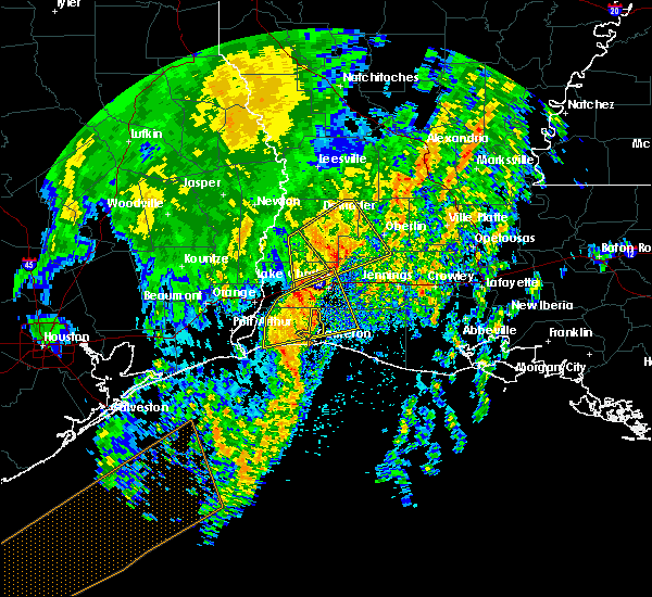 At 531 am cdt, a severe thunderstorm was located near fenton, moving northeast at 50 mph (radar indicated). Hazards include 60 mph wind gusts. Expect damage to roofs, siding, and trees. Locations impacted include, lake charles, westlake, grand lake, lake charles regional airport, moss bluff, hacketts corner, sweet lake, gibbstown and holmwood. At 531 am cdt, a severe thunderstorm was located near fenton, moving northeast at 50 mph (radar indicated). Hazards include 60 mph wind gusts. Expect damage to roofs, siding, and trees. Locations impacted include, lake charles, westlake, grand lake, lake charles regional airport, moss bluff, hacketts corner, sweet lake, gibbstown and holmwood.
|
| 4/14/2018 4:59 AM CDT |
 At 458 am cdt, a severe thunderstorm was located 7 miles southwest of ragley, moving northeast at 50 mph (radar indicated). Hazards include 60 mph wind gusts and quarter size hail. Hail damage to vehicles is expected. Expect wind damage to roofs, siding, and trees. At 458 am cdt, a severe thunderstorm was located 7 miles southwest of ragley, moving northeast at 50 mph (radar indicated). Hazards include 60 mph wind gusts and quarter size hail. Hail damage to vehicles is expected. Expect wind damage to roofs, siding, and trees.
|
| 4/14/2018 4:55 AM CDT |
 At 455 am cdt, a severe thunderstorm was located near hackberry, or 7 miles west of grand lake, moving northeast at 50 mph (radar indicated). Hazards include 60 mph wind gusts and quarter size hail. Hail damage to vehicles is expected. expect wind damage to roofs, siding, and trees. Locations impacted include, lake charles, sulphur, westlake, grand lake, lake charles regional airport, moss bluff, sabine national wildlife, johnsons bayou, carlyss, hacketts corner, heberts marina, hackberry, sweet lake, gibbstown and holmwood. At 455 am cdt, a severe thunderstorm was located near hackberry, or 7 miles west of grand lake, moving northeast at 50 mph (radar indicated). Hazards include 60 mph wind gusts and quarter size hail. Hail damage to vehicles is expected. expect wind damage to roofs, siding, and trees. Locations impacted include, lake charles, sulphur, westlake, grand lake, lake charles regional airport, moss bluff, sabine national wildlife, johnsons bayou, carlyss, hacketts corner, heberts marina, hackberry, sweet lake, gibbstown and holmwood.
|
| 4/14/2018 4:46 AM CDT |
 At 446 am cdt, a severe thunderstorm was located near hackberry, or 7 miles northeast of sabine national wildlife, moving northeast at 50 mph (radar indicated). Hazards include 60 mph wind gusts and quarter size hail. Hail damage to vehicles is expected. Expect wind damage to roofs, siding, and trees. At 446 am cdt, a severe thunderstorm was located near hackberry, or 7 miles northeast of sabine national wildlife, moving northeast at 50 mph (radar indicated). Hazards include 60 mph wind gusts and quarter size hail. Hail damage to vehicles is expected. Expect wind damage to roofs, siding, and trees.
|
| 4/7/2018 2:12 AM CDT |
 At 212 am cdt, severe thunderstorms were located along a line extending from near elizabeth to harmony to topsy to near de quincy, moving east at 40 mph (radar indicated). Hazards include 60 mph wind gusts and nickel size hail. Expect damage to roofs, siding, and trees. Locations impacted include, lake charles, oakdale, westlake, kinder, oberlin, elizabeth, fenton, reeves, dry creek, moss bluff, sugartown, de quincy, ragley, mittie, grant, dequincy, topsy, lebleu settlement, gillis and allen parish airport. At 212 am cdt, severe thunderstorms were located along a line extending from near elizabeth to harmony to topsy to near de quincy, moving east at 40 mph (radar indicated). Hazards include 60 mph wind gusts and nickel size hail. Expect damage to roofs, siding, and trees. Locations impacted include, lake charles, oakdale, westlake, kinder, oberlin, elizabeth, fenton, reeves, dry creek, moss bluff, sugartown, de quincy, ragley, mittie, grant, dequincy, topsy, lebleu settlement, gillis and allen parish airport.
|
| 4/7/2018 1:41 AM CDT |
 At 140 am cdt, severe thunderstorms were located along a line extending from near cravens to near tulla to oretta to near bancroft, moving southeast at 40 mph (radar indicated). Hazards include 60 mph wind gusts and quarter size hail. Hail damage to vehicles is expected. Expect wind damage to roofs, siding, and trees. At 140 am cdt, severe thunderstorms were located along a line extending from near cravens to near tulla to oretta to near bancroft, moving southeast at 40 mph (radar indicated). Hazards include 60 mph wind gusts and quarter size hail. Hail damage to vehicles is expected. Expect wind damage to roofs, siding, and trees.
|
| 4/7/2018 1:41 AM CDT |
 The national weather service in lake charles has issued a * severe thunderstorm warning for. northwestern jefferson davis parish in southwestern louisiana. beauregard parish in southwestern louisiana. northeastern calcasieu parish in southwestern louisiana. Southeastern vernon parish in west central louisiana. The national weather service in lake charles has issued a * severe thunderstorm warning for. northwestern jefferson davis parish in southwestern louisiana. beauregard parish in southwestern louisiana. northeastern calcasieu parish in southwestern louisiana. Southeastern vernon parish in west central louisiana.
|
| 4/3/2018 9:56 PM CDT |
 At 955 pm cdt, severe thunderstorms were located along a line extending from near hineston to gist, moving southeast at 15 mph (radar indicated). Hazards include 60 mph wind gusts and quarter size hail. Hail damage to vehicles is expected. Expect wind damage to roofs, siding, and trees. At 955 pm cdt, severe thunderstorms were located along a line extending from near hineston to gist, moving southeast at 15 mph (radar indicated). Hazards include 60 mph wind gusts and quarter size hail. Hail damage to vehicles is expected. Expect wind damage to roofs, siding, and trees.
|
| 5/3/2017 9:55 AM CDT |
 At 955 am cdt, severe thunderstorms were located along a line extending from near ragley to buhler to vinton, moving east at 25 mph (radar indicated). Hazards include 60 mph wind gusts and quarter size hail. Hail damage to vehicles is expected. Expect wind damage to roofs, siding, and trees. At 955 am cdt, severe thunderstorms were located along a line extending from near ragley to buhler to vinton, moving east at 25 mph (radar indicated). Hazards include 60 mph wind gusts and quarter size hail. Hail damage to vehicles is expected. Expect wind damage to roofs, siding, and trees.
|
| 5/3/2017 9:01 AM CDT |
 At 900 am cdt, severe thunderstorms were located along a line extending from 6 miles east of lunita to gibbstown, and are nearly stationary (radar indicated). Hazards include 60 mph wind gusts and penny size hail. Expect damage to roofs, siding, and trees. locations impacted include, lake charles, sulphur, westlake, vinton, iowa, grand lake, lake charles regional airport, moss bluff, carlyss, lunita, hacketts corner, buhler, lebleu settlement, gillis, edgerly, hackberry, creole, sweet lake, gibbstown and holmwood. A tornado watch remains in effect until 500 pm cdt for southwestern louisiana. At 900 am cdt, severe thunderstorms were located along a line extending from 6 miles east of lunita to gibbstown, and are nearly stationary (radar indicated). Hazards include 60 mph wind gusts and penny size hail. Expect damage to roofs, siding, and trees. locations impacted include, lake charles, sulphur, westlake, vinton, iowa, grand lake, lake charles regional airport, moss bluff, carlyss, lunita, hacketts corner, buhler, lebleu settlement, gillis, edgerly, hackberry, creole, sweet lake, gibbstown and holmwood. A tornado watch remains in effect until 500 pm cdt for southwestern louisiana.
|
| 5/3/2017 8:31 AM CDT |
 At 831 am cdt, severe thunderstorms were located along a line extending from near edgerly to near creole, moving north at 55 mph (radar indicated). Hazards include 60 mph wind gusts and penny size hail. expect damage to roofs, siding, and trees At 831 am cdt, severe thunderstorms were located along a line extending from near edgerly to near creole, moving north at 55 mph (radar indicated). Hazards include 60 mph wind gusts and penny size hail. expect damage to roofs, siding, and trees
|
| 4/29/2017 7:07 PM CDT | Quarter sized hail reported 0.4 miles N of Westlake, LA, nws employee reported quarter sized hail in westlake. |
| 4/29/2017 7:04 PM CDT |
 At 703 pm cdt, a severe thunderstorm was located over moss bluff, moving north at 30 mph (radar indicated). Hazards include 60 mph wind gusts and quarter size hail. Hail damage to vehicles is expected. Expect wind damage to roofs, siding, and trees. At 703 pm cdt, a severe thunderstorm was located over moss bluff, moving north at 30 mph (radar indicated). Hazards include 60 mph wind gusts and quarter size hail. Hail damage to vehicles is expected. Expect wind damage to roofs, siding, and trees.
|
| 3/25/2017 8:52 AM CDT |
 The severe thunderstorm warning for central jefferson davis and southeastern calcasieu parishes will expire at 900 am cdt, the storm which prompted the warning has weakened below severe limits, and no longer poses an immediate threat to life or property. therefore the warning will be allowed to expire. however gusty winds and heavy rain are still possible with this thunderstorm. The severe thunderstorm warning for central jefferson davis and southeastern calcasieu parishes will expire at 900 am cdt, the storm which prompted the warning has weakened below severe limits, and no longer poses an immediate threat to life or property. therefore the warning will be allowed to expire. however gusty winds and heavy rain are still possible with this thunderstorm.
|
| 3/25/2017 8:33 AM CDT |
 At 833 am cdt, a severe thunderstorm was located near carlyss, or near lake charles regional airport, moving east at 30 mph (radar indicated). Hazards include 60 mph wind gusts and penny size hail. Expect damage to roofs, siding, and trees. Locations impacted include, lake charles, sulphur, westlake, welsh, iowa, lake charles regional airport, hayes, moss bluff, carlyss, lebleu settlement, holmwood, bell city and lacassine. At 833 am cdt, a severe thunderstorm was located near carlyss, or near lake charles regional airport, moving east at 30 mph (radar indicated). Hazards include 60 mph wind gusts and penny size hail. Expect damage to roofs, siding, and trees. Locations impacted include, lake charles, sulphur, westlake, welsh, iowa, lake charles regional airport, hayes, moss bluff, carlyss, lebleu settlement, holmwood, bell city and lacassine.
|
| 3/25/2017 8:21 AM CDT |
 At 821 am cdt, a severe thunderstorm was located 7 miles southwest of carlyss, or 7 miles southeast of vinton, moving east at 45 mph (radar indicated). Hazards include 60 mph wind gusts and nickel size hail. expect damage to roofs, siding, and trees At 821 am cdt, a severe thunderstorm was located 7 miles southwest of carlyss, or 7 miles southeast of vinton, moving east at 45 mph (radar indicated). Hazards include 60 mph wind gusts and nickel size hail. expect damage to roofs, siding, and trees
|
| 7/10/2016 12:00 PM CDT | Public posted a photo of trees down in westlake. time estimate in calcasieu county LA, 1.8 miles SSW of Westlake, LA |
| 5/27/2016 5:49 PM CDT |
 At 548 pm cdt, severe thunderstorms were located along a line extending from clifton to elizabeth to lake charles, moving east at 35 mph (radar indicated). Hazards include 60 mph wind gusts. Expect damage to roofs. siding. and trees. Locations impacted include, lake charles, alexandria, sulphur, oakdale, westlake, welsh, iowa, kinder, oberlin, glenmora, elton, boyce, elizabeth, fenton, reeves, lena, dry creek, ragley, sugartown and alexandria international airport. At 548 pm cdt, severe thunderstorms were located along a line extending from clifton to elizabeth to lake charles, moving east at 35 mph (radar indicated). Hazards include 60 mph wind gusts. Expect damage to roofs. siding. and trees. Locations impacted include, lake charles, alexandria, sulphur, oakdale, westlake, welsh, iowa, kinder, oberlin, glenmora, elton, boyce, elizabeth, fenton, reeves, lena, dry creek, ragley, sugartown and alexandria international airport.
|
| 5/27/2016 5:14 PM CDT |
 At 512 pm cdt, severe thunderstorms were located along a line extending from near slagle to 6 miles southwest of sugartown to 6 miles southeast of vinton, moving east at 35 mph (radar indicated). Hazards include 60 mph wind gusts. Expect damage to roofs. siding. And trees. At 512 pm cdt, severe thunderstorms were located along a line extending from near slagle to 6 miles southwest of sugartown to 6 miles southeast of vinton, moving east at 35 mph (radar indicated). Hazards include 60 mph wind gusts. Expect damage to roofs. siding. And trees.
|
| 5/27/2016 4:20 PM CDT |
 At 419 pm cdt, severe thunderstorms were located along a line extending from 6 miles east of mayflower to near deweyville, moving east at 35 mph (radar indicated). Hazards include 60 mph wind gusts. Expect damage to roofs. siding. And trees. At 419 pm cdt, severe thunderstorms were located along a line extending from 6 miles east of mayflower to near deweyville, moving east at 35 mph (radar indicated). Hazards include 60 mph wind gusts. Expect damage to roofs. siding. And trees.
|
| 5/1/2016 4:36 AM CDT |
 At 435 am cdt, a severe thunderstorm was located near vinton, moving northeast at 15 mph (radar indicated). Hazards include half dollar size hail. damage to vehicles is expected At 435 am cdt, a severe thunderstorm was located near vinton, moving northeast at 15 mph (radar indicated). Hazards include half dollar size hail. damage to vehicles is expected
|
| 4/27/2016 7:46 AM CDT |
 At 746 am cdt, severe thunderstorms were located along a line extending from near hornbeck to near rosepine to near longville to near moss bluff to 6 miles northeast of holly beach to 25 miles south of johnsons bayou, moving east at 45 mph (radar indicated). Hazards include 60 mph wind gusts and penny size hail. Expect damage to roofs. siding. And trees. At 746 am cdt, severe thunderstorms were located along a line extending from near hornbeck to near rosepine to near longville to near moss bluff to 6 miles northeast of holly beach to 25 miles south of johnsons bayou, moving east at 45 mph (radar indicated). Hazards include 60 mph wind gusts and penny size hail. Expect damage to roofs. siding. And trees.
|
| 4/27/2016 7:27 AM CDT |
 At 726 am cdt, severe thunderstorms were located along a line extending from near anacoco to near de ridder to longville to sulphur to 16 miles south of johnsons bayou, moving east at 45 mph (radar indicated). Hazards include 60 mph wind gusts and penny size hail. Expect damage to roofs. siding. and trees. Locations impacted include, lake charles, sulphur, cameron, leesville, westlake, iowa, rosepine, anacoco, reeves, moss bluff, lake charles regional airport, mittie, dry creek, pitkin, ragley, fort polk, sabine national wildlife, sugartown, slagle and grand lake. At 726 am cdt, severe thunderstorms were located along a line extending from near anacoco to near de ridder to longville to sulphur to 16 miles south of johnsons bayou, moving east at 45 mph (radar indicated). Hazards include 60 mph wind gusts and penny size hail. Expect damage to roofs. siding. and trees. Locations impacted include, lake charles, sulphur, cameron, leesville, westlake, iowa, rosepine, anacoco, reeves, moss bluff, lake charles regional airport, mittie, dry creek, pitkin, ragley, fort polk, sabine national wildlife, sugartown, slagle and grand lake.
|
| 4/27/2016 6:47 AM CDT |
 At 646 am cdt, severe thunderstorms were located along a line extending from 8 miles southeast of pineland to newton to near bancroft to mauriceville to 12 miles east of high island, moving east at 45 mph (radar indicated). Hazards include 60 mph wind gusts and quarter size hail. Hail damage to vehicles is expected. Expect wind damage to roofs, siding, and trees. At 646 am cdt, severe thunderstorms were located along a line extending from 8 miles southeast of pineland to newton to near bancroft to mauriceville to 12 miles east of high island, moving east at 45 mph (radar indicated). Hazards include 60 mph wind gusts and quarter size hail. Hail damage to vehicles is expected. Expect wind damage to roofs, siding, and trees.
|
| 3/24/2016 8:10 AM CDT |
 The severe thunderstorm warning for north central cameron, southwestern allen, southeastern beauregard, northwestern jefferson davis and calcasieu parishes will expire at 815 am cdt, the storms which prompted the warning have weakened below severe limits, and exited the warned area. therefore the warning will be allowed to expire. The severe thunderstorm warning for north central cameron, southwestern allen, southeastern beauregard, northwestern jefferson davis and calcasieu parishes will expire at 815 am cdt, the storms which prompted the warning have weakened below severe limits, and exited the warned area. therefore the warning will be allowed to expire.
|
| 3/24/2016 7:20 AM CDT |
 At 719 am cdt, severe thunderstorms were located along a line extending from near singer to near west orange, moving northeast at 55 mph (radar indicated). Hazards include 60 mph wind gusts and quarter size hail. Hail damage to vehicles is expected. Expect wind damage to roofs, siding and trees. At 719 am cdt, severe thunderstorms were located along a line extending from near singer to near west orange, moving northeast at 55 mph (radar indicated). Hazards include 60 mph wind gusts and quarter size hail. Hail damage to vehicles is expected. Expect wind damage to roofs, siding and trees.
|
| 2/15/2016 1:28 PM CST |
 At 128 pm cst, a severe thunderstorm was located over moss bluff, moving east at 25 mph (radar indicated). Hazards include quarter size hail. damage to vehicles is expected At 128 pm cst, a severe thunderstorm was located over moss bluff, moving east at 25 mph (radar indicated). Hazards include quarter size hail. damage to vehicles is expected
|
| 1/8/2016 10:00 PM CST |
 The national weather service in lake charles has issued a * severe thunderstorm warning for. central calcasieu parish in southwestern louisiana. until 1030 pm cst * at 959 pm cst. a severe thunderstorm was located over sulphur. Moving northeast at 30 mph. The national weather service in lake charles has issued a * severe thunderstorm warning for. central calcasieu parish in southwestern louisiana. until 1030 pm cst * at 959 pm cst. a severe thunderstorm was located over sulphur. Moving northeast at 30 mph.
|
| 1/8/2016 9:34 PM CST |
 At 934 pm cst, a severe thunderstorm was located near vinton, moving northeast at 35 mph (radar indicated). Hazards include quarter size hail. damage to vehicles is expected At 934 pm cst, a severe thunderstorm was located near vinton, moving northeast at 35 mph (radar indicated). Hazards include quarter size hail. damage to vehicles is expected
|
| 12/13/2015 1:02 PM CST |
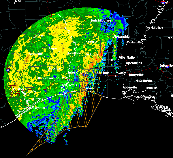 The national weather service in lake charles has issued a * severe thunderstorm warning for. northeastern cameron parish in southwestern louisiana. central jefferson davis parish in southwestern louisiana. southeastern calcasieu parish in southwestern louisiana. Until 130 pm cst. The national weather service in lake charles has issued a * severe thunderstorm warning for. northeastern cameron parish in southwestern louisiana. central jefferson davis parish in southwestern louisiana. southeastern calcasieu parish in southwestern louisiana. Until 130 pm cst.
|
| 10/31/2015 10:48 AM CDT |
 At 1048 am cdt, severe thunderstorms were located along a line extending from near gardner to near oakdale to near leblanc to near holmwood to near west orange, moving southeast at 30 mph (radar indicated). Hazards include 60 mph wind gusts. Expect damage to roofs. siding and trees. locations impacted include, lake charles, port arthur, alexandria, sulphur, orange, jennings, oakdale, westlake, west orange, welsh, vinton, iowa, kinder, oberlin, glenmora, elton, elizabeth, fenton, reeves and alexandria international airport. a tornado watch remains in effect until noon cdt for southeastern texas. A tornado watch also remains in effect until 200 pm cdt for southwestern louisiana. At 1048 am cdt, severe thunderstorms were located along a line extending from near gardner to near oakdale to near leblanc to near holmwood to near west orange, moving southeast at 30 mph (radar indicated). Hazards include 60 mph wind gusts. Expect damage to roofs. siding and trees. locations impacted include, lake charles, port arthur, alexandria, sulphur, orange, jennings, oakdale, westlake, west orange, welsh, vinton, iowa, kinder, oberlin, glenmora, elton, elizabeth, fenton, reeves and alexandria international airport. a tornado watch remains in effect until noon cdt for southeastern texas. A tornado watch also remains in effect until 200 pm cdt for southwestern louisiana.
|
| 10/31/2015 10:23 AM CDT |
 At 1022 am cdt, severe thunderstorms were located along a line extending from near clifton to near pitkin to near reeves to westlake to near vidor, and are nearly stationary (radar indicated). Hazards include 60 mph wind gusts. Expect damage to roofs. Siding and trees. At 1022 am cdt, severe thunderstorms were located along a line extending from near clifton to near pitkin to near reeves to westlake to near vidor, and are nearly stationary (radar indicated). Hazards include 60 mph wind gusts. Expect damage to roofs. Siding and trees.
|
| 8/12/2015 4:09 PM CDT |
 At 409 pm cdt, doppler radar indicated a severe thunderstorm capable of producing damaging winds in excess of 60 mph. this storm was located near holmwood, or near iowa, and moving south at 5 mph. At 409 pm cdt, doppler radar indicated a severe thunderstorm capable of producing damaging winds in excess of 60 mph. this storm was located near holmwood, or near iowa, and moving south at 5 mph.
|
| 6/9/2015 5:58 PM CDT |
 At 557 pm cdt, doppler radar indicated a line of severe thunderstorms capable of producing damaging winds in excess of 60 mph. these storms were located along a line extending from heberts marina to near sulphur, moving southwest at 15 mph. locations impacted include, lake charles, sulphur, westlake, vinton, grand lake, buhler, carlyss and edgerly. At 557 pm cdt, doppler radar indicated a line of severe thunderstorms capable of producing damaging winds in excess of 60 mph. these storms were located along a line extending from heberts marina to near sulphur, moving southwest at 15 mph. locations impacted include, lake charles, sulphur, westlake, vinton, grand lake, buhler, carlyss and edgerly.
|
| 6/9/2015 5:34 PM CDT |
 At 533 pm cdt, doppler radar indicated a severe thunderstorm capable of producing damaging winds in excess of 60 mph. this storm was located near carlyss, or 7 miles south of sulphur, and moving west at 10 mph. At 533 pm cdt, doppler radar indicated a severe thunderstorm capable of producing damaging winds in excess of 60 mph. this storm was located near carlyss, or 7 miles south of sulphur, and moving west at 10 mph.
|
| 5/27/2015 7:11 AM CDT | At 710 am cdt, doppler radar indicated a line of severe thunderstorms capable of producing quarter size hail and damaging winds in excess of 60 mph. these storms were located along a line extending from near buller to near lake charles regional airport to 8 miles southeast of high island, moving southeast at 25 mph. locations impacted include, lake charles, sulphur, cameron, westlake, welsh, vinton, iowa, fenton, moss bluff, lake charles regional airport, sabine national wildlife, johnsons bayou, lacassine national wildlife refuge, hayes, grand lake, gillis, buller, gibbstown, pine island and holmwood. |
| 5/27/2015 6:38 AM CDT | At 637 am cdt, doppler radar indicated a line of severe thunderstorms capable of producing quarter size hail and damaging winds in excess of 60 mph. these storms were located along a line extending from near buhler to carlyss to near high island, and moving southeast at 20 mph. |
| 5/27/2015 6:38 AM CDT | At 637 am cdt, doppler radar indicated a line of severe thunderstorms capable of producing quarter size hail and damaging winds in excess of 60 mph. these storms were located along a line extending from near buhler to carlyss to near high island, and moving southeast at 20 mph. |
| 5/27/2015 6:18 AM CDT | At 617 am cdt, doppler radar indicated a line of severe thunderstorms capable of producing quarter size hail and damaging winds in excess of 60 mph. these storms were located along a line extending from near edgerly to bridge city to near gilchrist, moving southeast at 30 mph. locations impacted include, beaumont, lake charles, port arthur, sulphur, orange, nederland, groves, port neches, vidor, bridge city, westlake, west orange, vinton, deweyville, moss bluff, lake charles regional airport, starks, central gardens, hamshire and fields. |
| 5/27/2015 6:18 AM CDT | At 617 am cdt, doppler radar indicated a line of severe thunderstorms capable of producing quarter size hail and damaging winds in excess of 60 mph. these storms were located along a line extending from near edgerly to bridge city to near gilchrist, moving southeast at 30 mph. locations impacted include, beaumont, lake charles, port arthur, sulphur, orange, nederland, groves, port neches, vidor, bridge city, westlake, west orange, vinton, deweyville, moss bluff, lake charles regional airport, starks, central gardens, hamshire and fields. |
| 5/27/2015 5:30 AM CDT | At 530 am cdt, doppler radar indicated a line of severe thunderstorms capable of producing quarter size hail and damaging winds in excess of 60 mph. these storms were located along a line extending from near bancroft to near weiss bluff to near cove, and moving southeast at 30 mph. |
| 5/27/2015 5:30 AM CDT | At 530 am cdt, doppler radar indicated a line of severe thunderstorms capable of producing quarter size hail and damaging winds in excess of 60 mph. these storms were located along a line extending from near bancroft to near weiss bluff to near cove, and moving southeast at 30 mph. |
| 5/26/2015 12:52 AM CDT | The severe thunderstorm warning for calcasieu, northwestern cameron, jefferson davis, southeastern beauregard, eastern rapides, central st. landry, evangeline, avoyelles, acadia and southeastern allen parishes, southeastern orange and southeastern jefferson counties will expire at 100 am cdt, the storms which prompted the warning have weakened below severe limits and exited the warned area. therefore the warning will be allowed to expire. however gusty winds are still possible with these thunderstorms. |
| 5/26/2015 12:52 AM CDT | The severe thunderstorm warning for calcasieu, northwestern cameron, jefferson davis, southeastern beauregard, eastern rapides, central st. landry, evangeline, avoyelles, acadia and southeastern allen parishes, southeastern orange and southeastern jefferson counties will expire at 100 am cdt, the storms which prompted the warning have weakened below severe limits and exited the warned area. therefore the warning will be allowed to expire. however gusty winds are still possible with these thunderstorms. |
| 5/25/2015 11:29 PM CDT | At 1128 pm cdt, doppler radar indicated a line of severe thunderstorms capable of producing quarter size hail and damaging winds in excess of 60 mph. these storms were located along a line extending from esler regional airport to near elton to near port arthur, and moving southeast at 15 mph. |
| 5/25/2015 11:29 PM CDT | At 1128 pm cdt, doppler radar indicated a line of severe thunderstorms capable of producing quarter size hail and damaging winds in excess of 60 mph. these storms were located along a line extending from esler regional airport to near elton to near port arthur, and moving southeast at 15 mph. |
| 5/25/2015 11:17 PM CDT | At 1117 pm cdt, doppler radar indicated a line of severe thunderstorms capable of producing quarter size hail and damaging winds in excess of 60 mph. these storms were located along a line extending from libuse to near cheneyville to near lake charles to near port acres, moving southeast at 50 mph. locations impacted include, beaumont, lake charles, port arthur, alexandria, sulphur, orange, nederland, groves, pineville, port neches, vidor, jennings, bridge city, oakdale, ville platte, westlake, west orange, mamou, welsh and vinton. a tornado watch remains in effect until 200 am cdt for southwestern louisiana and southeastern texas. a tornado watch also remains in effect until 500 am cdt for central louisiana. |
| 5/25/2015 11:17 PM CDT | At 1117 pm cdt, doppler radar indicated a line of severe thunderstorms capable of producing quarter size hail and damaging winds in excess of 60 mph. these storms were located along a line extending from libuse to near cheneyville to near lake charles to near port acres, moving southeast at 50 mph. locations impacted include, beaumont, lake charles, port arthur, alexandria, sulphur, orange, nederland, groves, pineville, port neches, vidor, jennings, bridge city, oakdale, ville platte, westlake, west orange, mamou, welsh and vinton. a tornado watch remains in effect until 200 am cdt for southwestern louisiana and southeastern texas. a tornado watch also remains in effect until 500 am cdt for central louisiana. |
| 5/25/2015 10:59 PM CDT | At 1058 pm cdt, doppler radar indicated a line of severe thunderstorms capable of producing quarter size hail and damaging winds in excess of 60 mph. these storms were located along a line extending from near boyce to near glenmora to near vinton to hamshire, and moving southeast at 45 mph. |
| 5/25/2015 10:59 PM CDT | At 1058 pm cdt, doppler radar indicated a line of severe thunderstorms capable of producing quarter size hail and damaging winds in excess of 60 mph. these storms were located along a line extending from near boyce to near glenmora to near vinton to hamshire, and moving southeast at 45 mph. |
| 4/27/2015 6:31 PM CDT | At 630 pm cdt, doppler radar indicated a severe thunderstorm capable of producing large hail up to ping pong ball size and damaging winds in excess of 60 mph. this storm was located just west of vinton, moving northeast at 45 mph. |
| 4/27/2015 6:31 PM CDT | At 630 pm cdt, doppler radar indicated a severe thunderstorm capable of producing large hail up to ping pong ball size and damaging winds in excess of 60 mph. this storm was located just west of vinton, moving northeast at 45 mph. |
| 4/27/2015 5:59 PM CDT | At 558 pm cdt, doppler radar indicated a line of severe thunderstorms capable of producing large hail up to ping pong ball size and damaging winds in excess of 60 mph. these storms were located along a line extending from near central gardens to near groves, and moving northeast at 40 mph. |
| 4/27/2015 5:59 PM CDT | At 558 pm cdt, doppler radar indicated a line of severe thunderstorms capable of producing large hail up to ping pong ball size and damaging winds in excess of 60 mph. these storms were located along a line extending from near central gardens to near groves, and moving northeast at 40 mph. |
| 4/27/2015 6:58 AM CDT | At 658 am cdt, doppler radar indicated a line of severe thunderstorms capable of producing quarter size hail and damaging winds in excess of 60 mph. these storms were located along a line extending from near anacoco to near cravens to near sulphur, and moving east at 55 mph. |
| 4/27/2015 6:50 AM CDT | At 649 am cdt, local law enforcement reported a line of severe thunderstorms producing quarter size hail and damaging winds in excess of 60 mph. these storms were located along a line extending from near leesville to near rosepine to near edgerly, moving east at 55 mph. locations impacted include, lake charles, sulphur, leesville, westlake, vinton, rosepine, merryville, anacoco, de ridder, moss bluff, starks, dry creek, pitkin, ragley, fort polk, fields, sugartown, de quincy, singer and slagle. a tornado watch remains in effect until 900 am cdt for southeastern texas. a tornado watch also remains in effect until 100 pm cdt for southwestern louisiana and southeastern texas. |
| 4/27/2015 6:21 AM CDT | At 621 am cdt, doppler radar indicated a line of severe thunderstorms capable of producing damaging winds in excess of 60 mph. these storms were located along a line extending from near mayflower to stringtown to near mauriceville, and moving east at 55 mph. |
| 4/24/2015 12:57 PM CDT | At 1257 pm cdt, doppler radar indicated a severe thunderstorm capable of producing a tornado. this dangerous storm was located near oretta, or near de quincy, moving east at 45 mph. locations impacted include, lake charles, reeves, ragley, moss bluff, de quincy, dequincy, gillis, buller, lebleu settlement, longville, leblanc, oretta and topsy. |
| 4/24/2015 12:45 PM CDT | At 1244 pm cdt, doppler radar indicated a severe thunderstorm capable of producing a tornado. this dangerous storm was located near oretta, or near fields, and moving east at 45 mph. |
| 3/31/2013 2:42 PM CDT | Report of a tree down on a trailer on guillory stree in calcasieu county LA, 0.4 miles N of Westlake, LA |
| 1/1/0001 12:00 AM | Kplc relayed a report of damage from a possible tornado on the corner of evergreen and verret rd outside of westlake. damage included multiple trees in calcasieu county LA, 0.4 miles N of Westlake, LA |
| 1/1/0001 12:00 AM | Trees blown down across a road were related to an accident on woodell lane in calcasieu county LA, 0.4 miles N of Westlake, LA |
Hail Maps for Westlake, LA
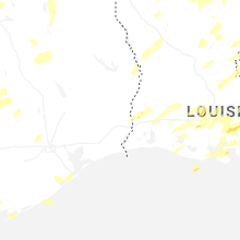
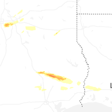


Connect with Interactive Hail Maps