

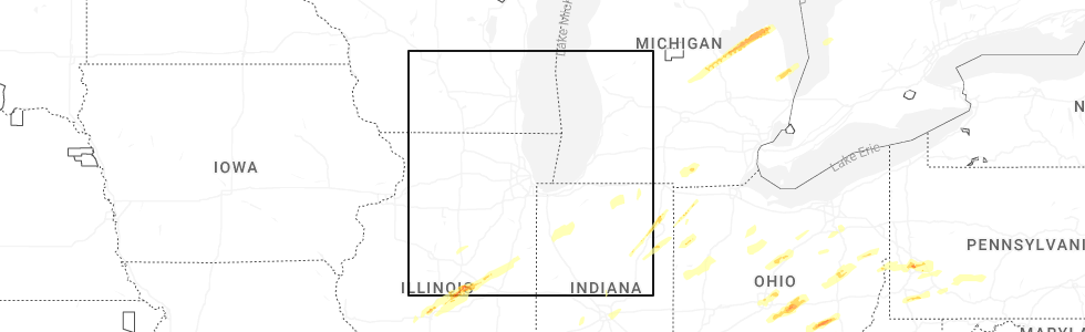
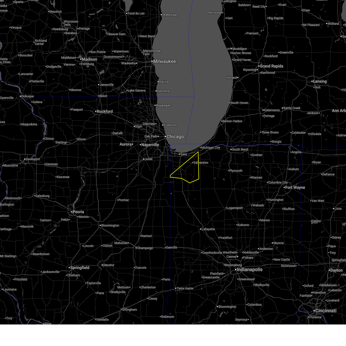
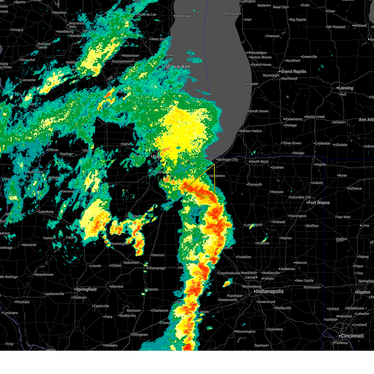
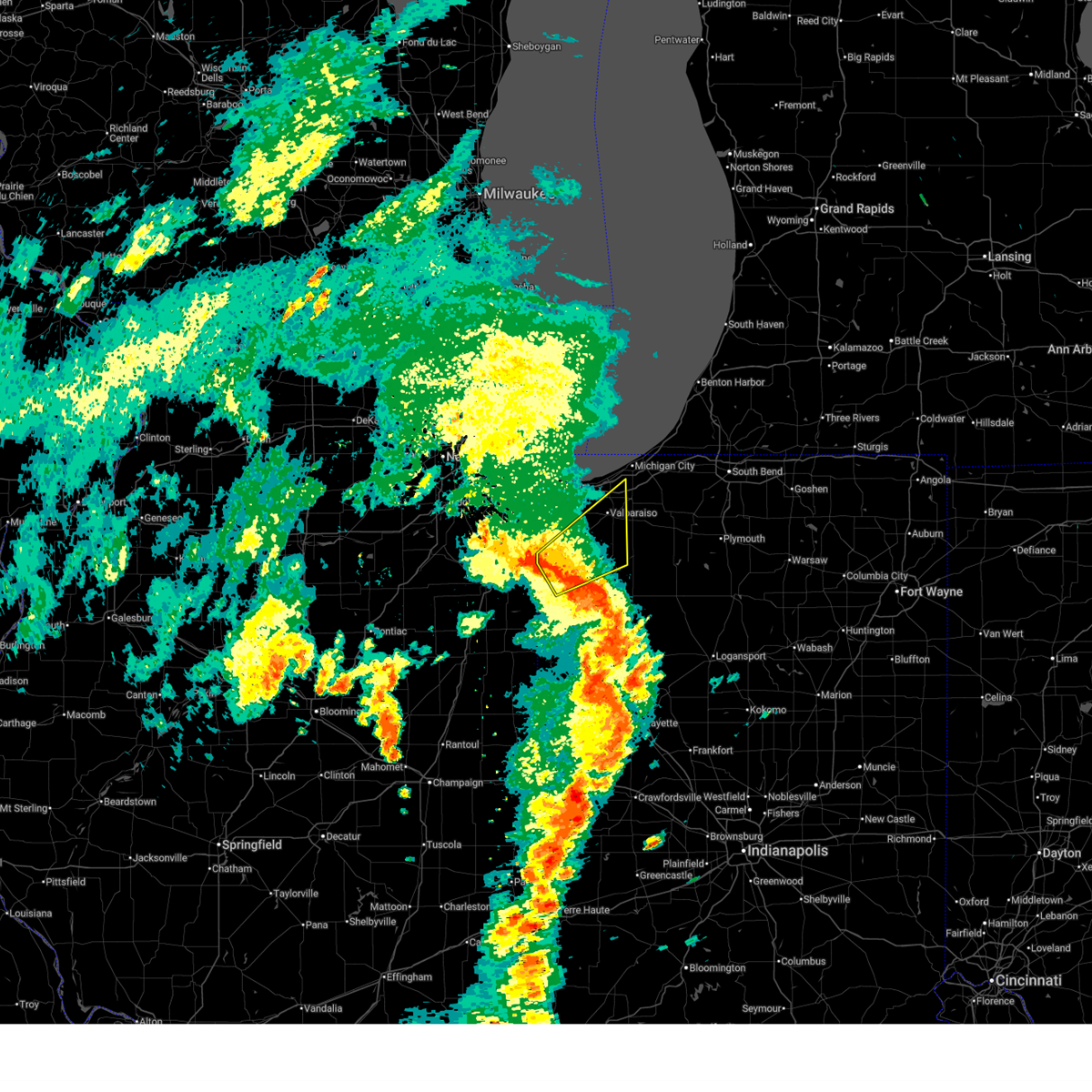
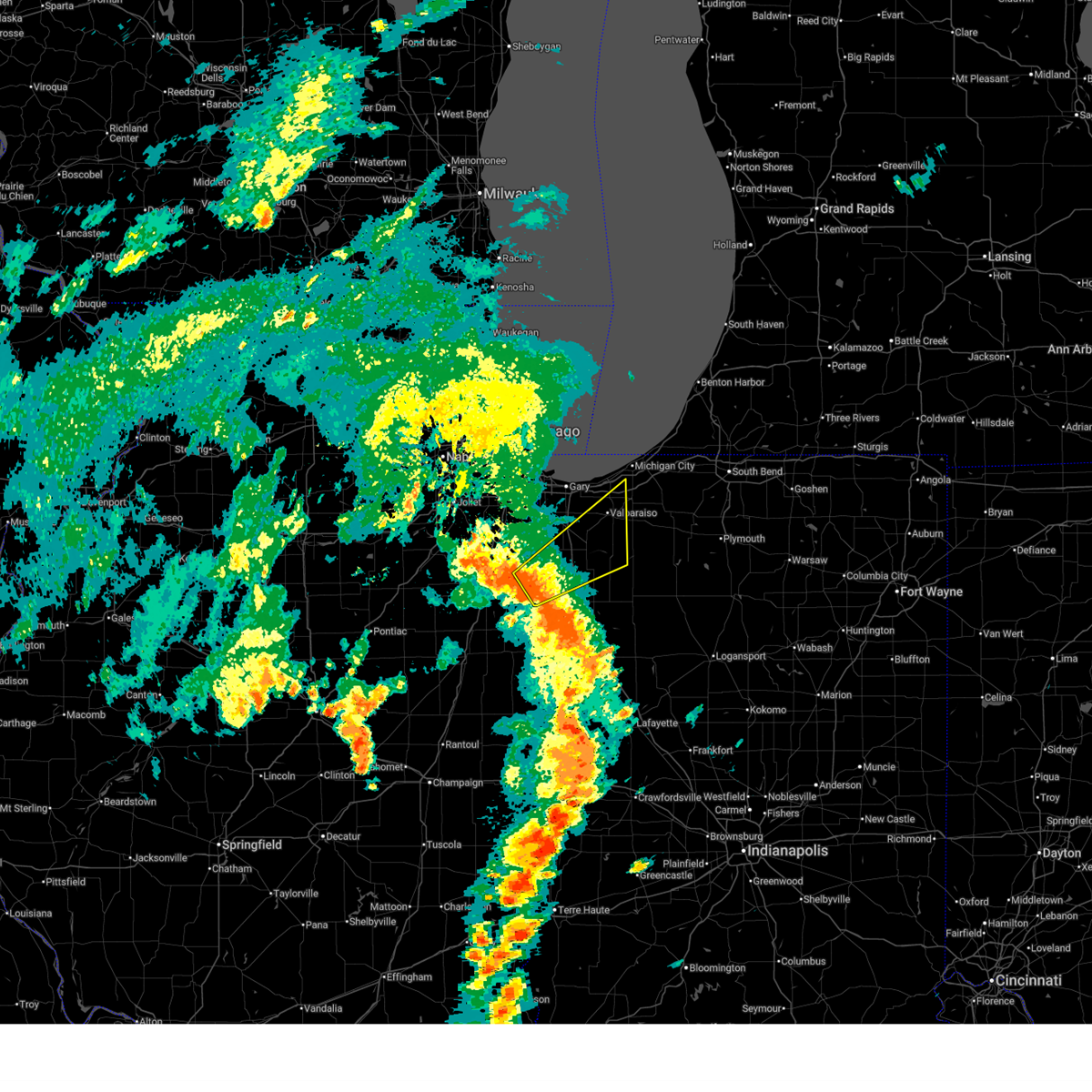
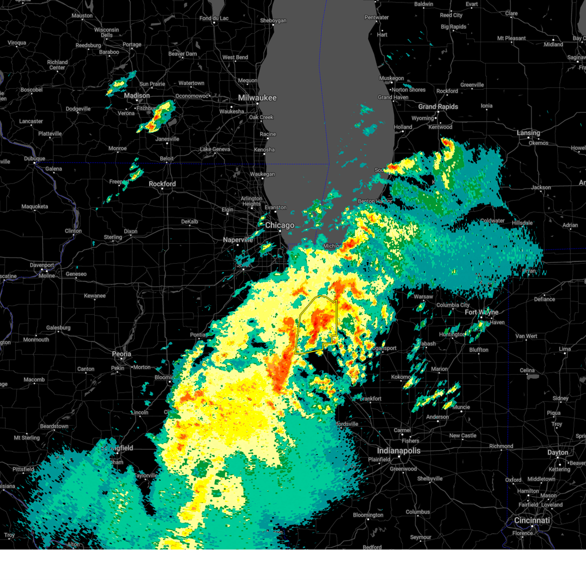
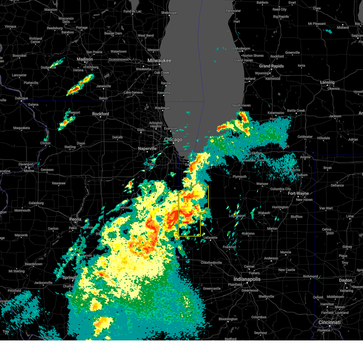
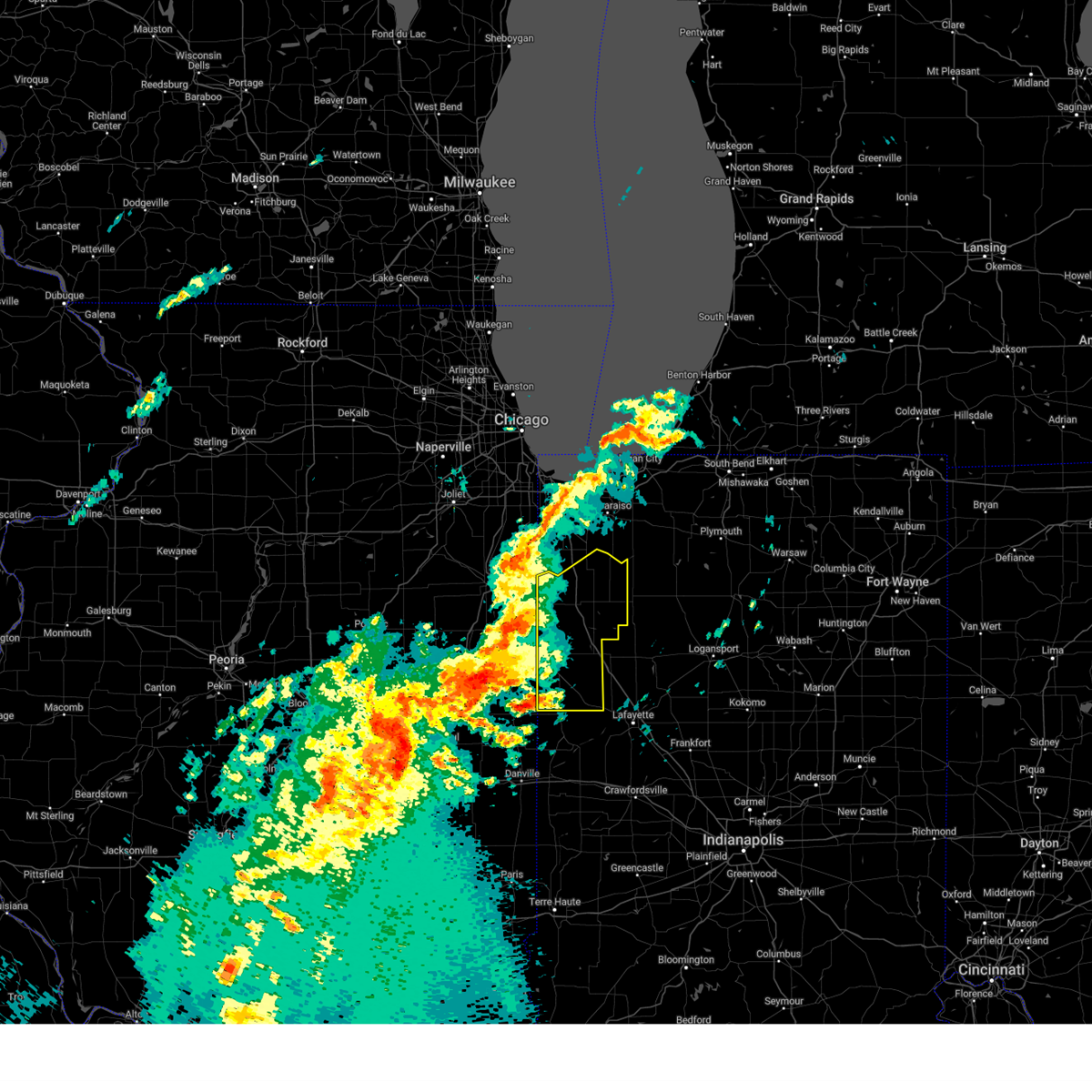
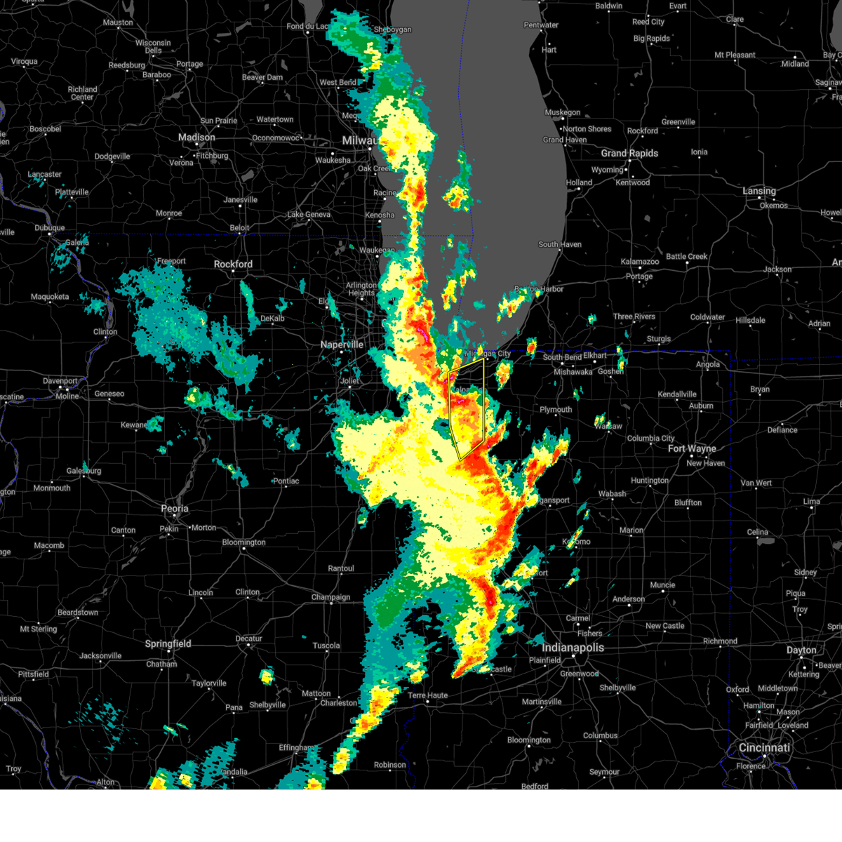
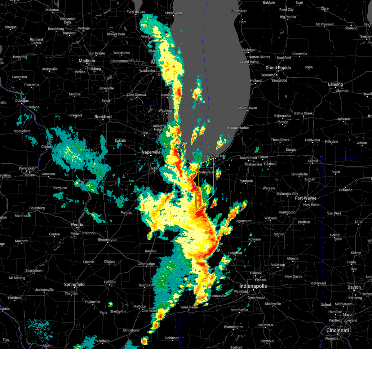
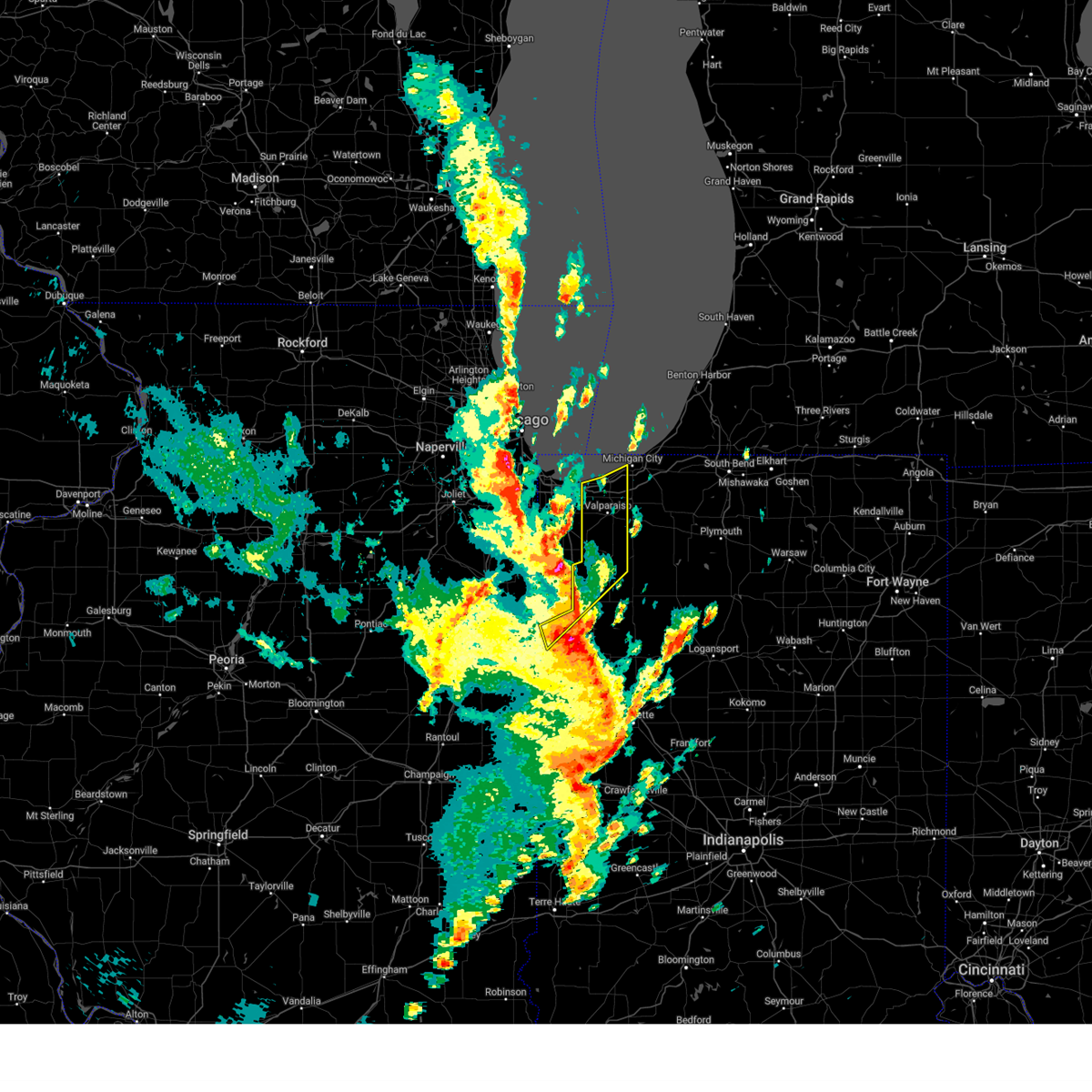
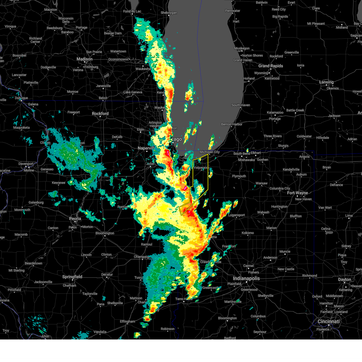
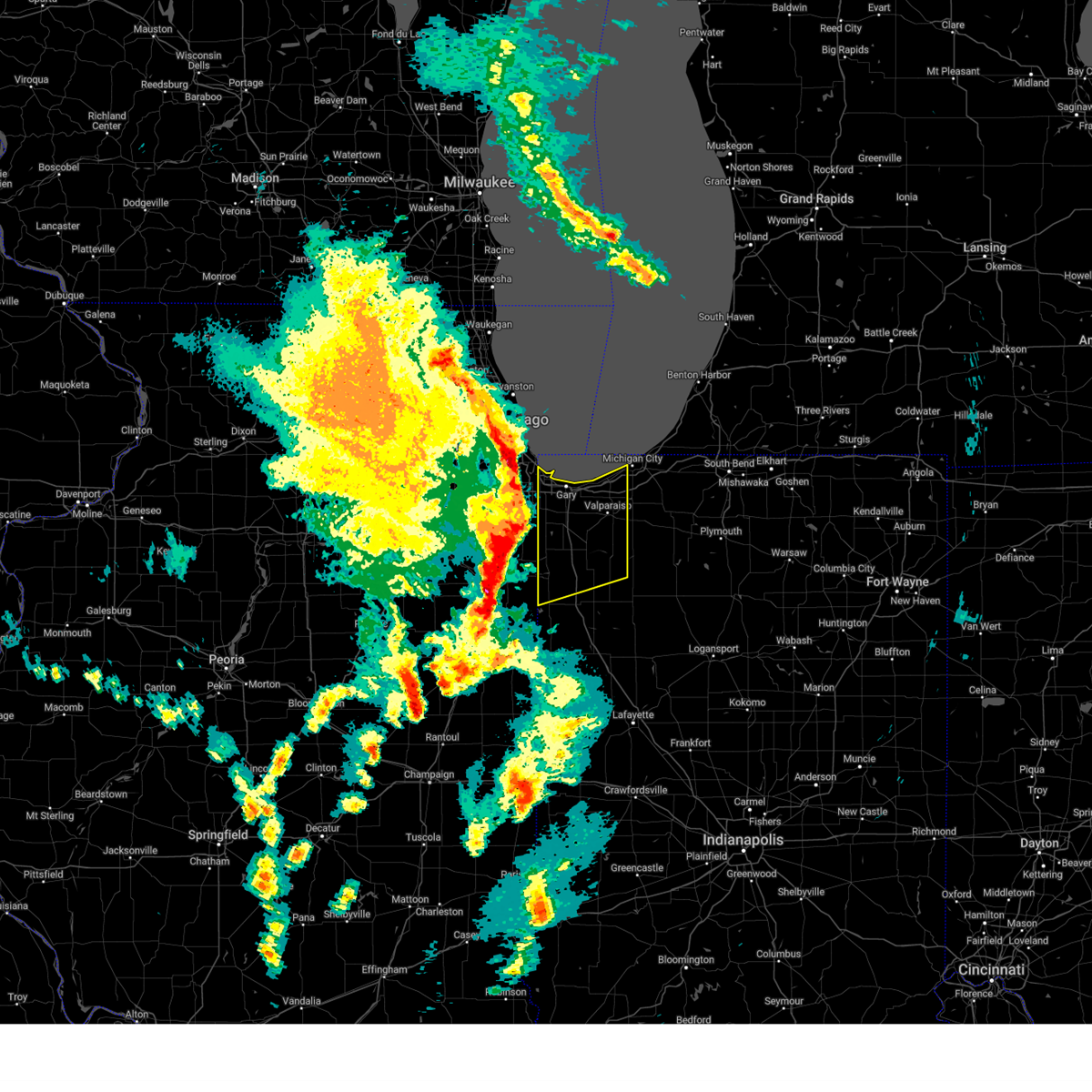
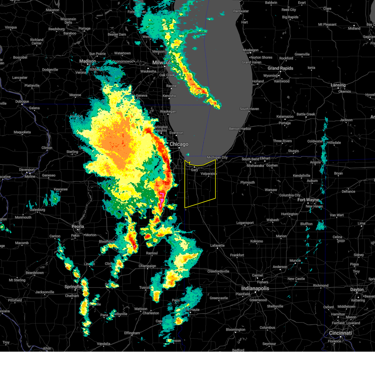
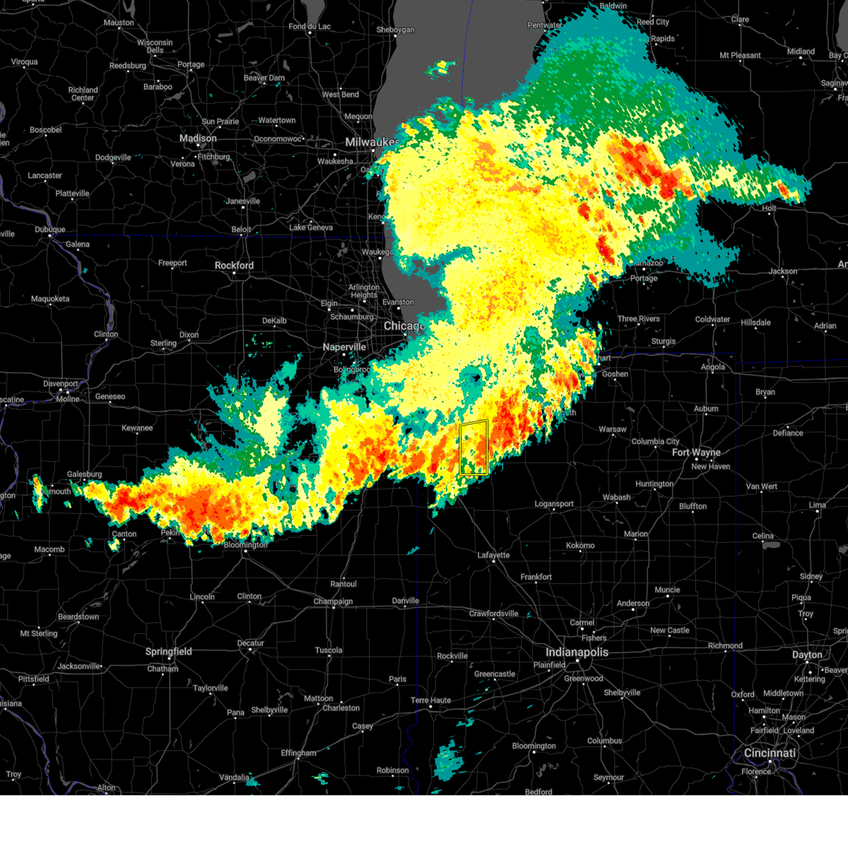
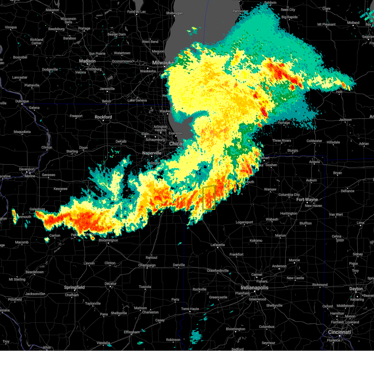
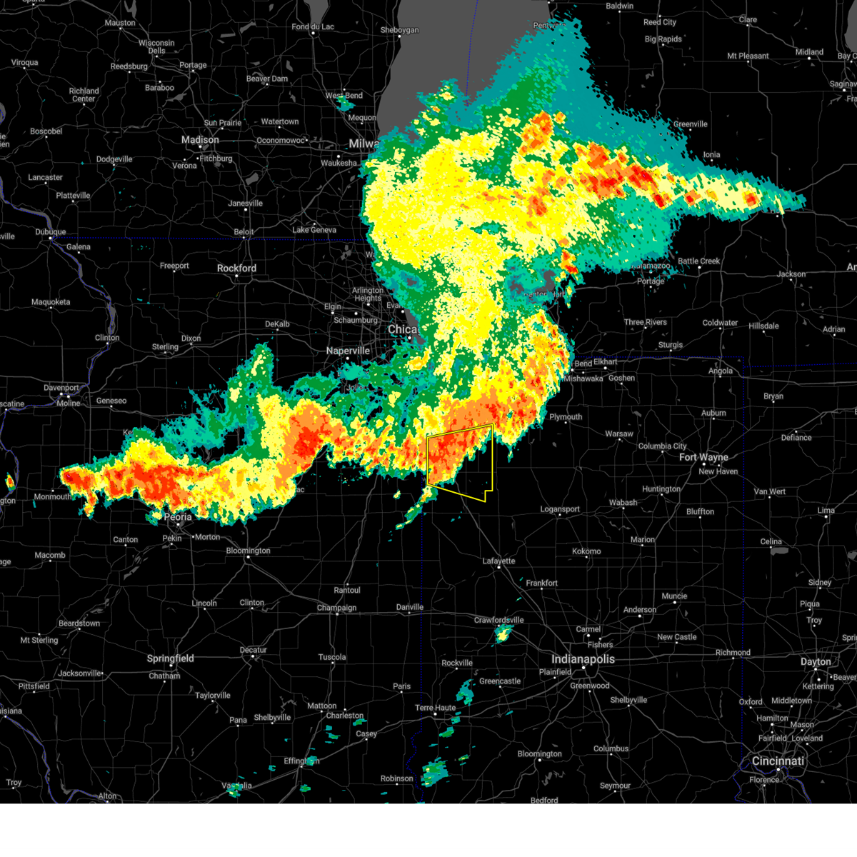
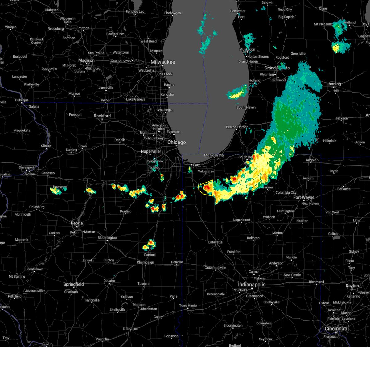
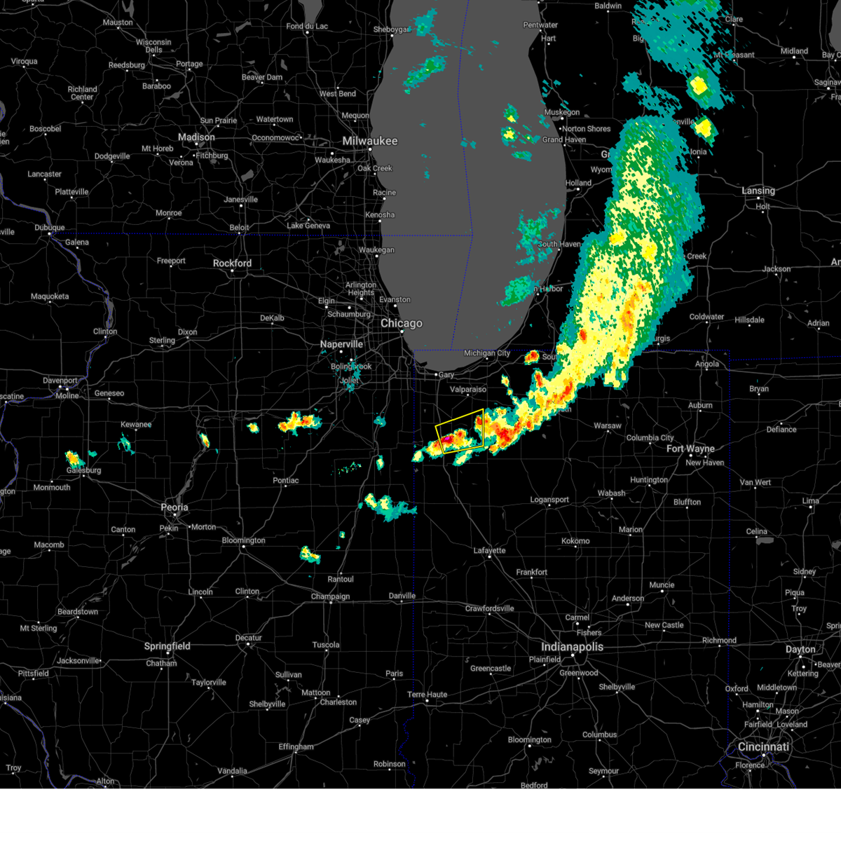
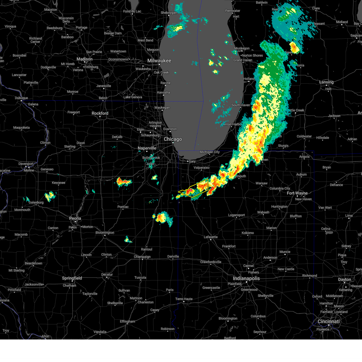
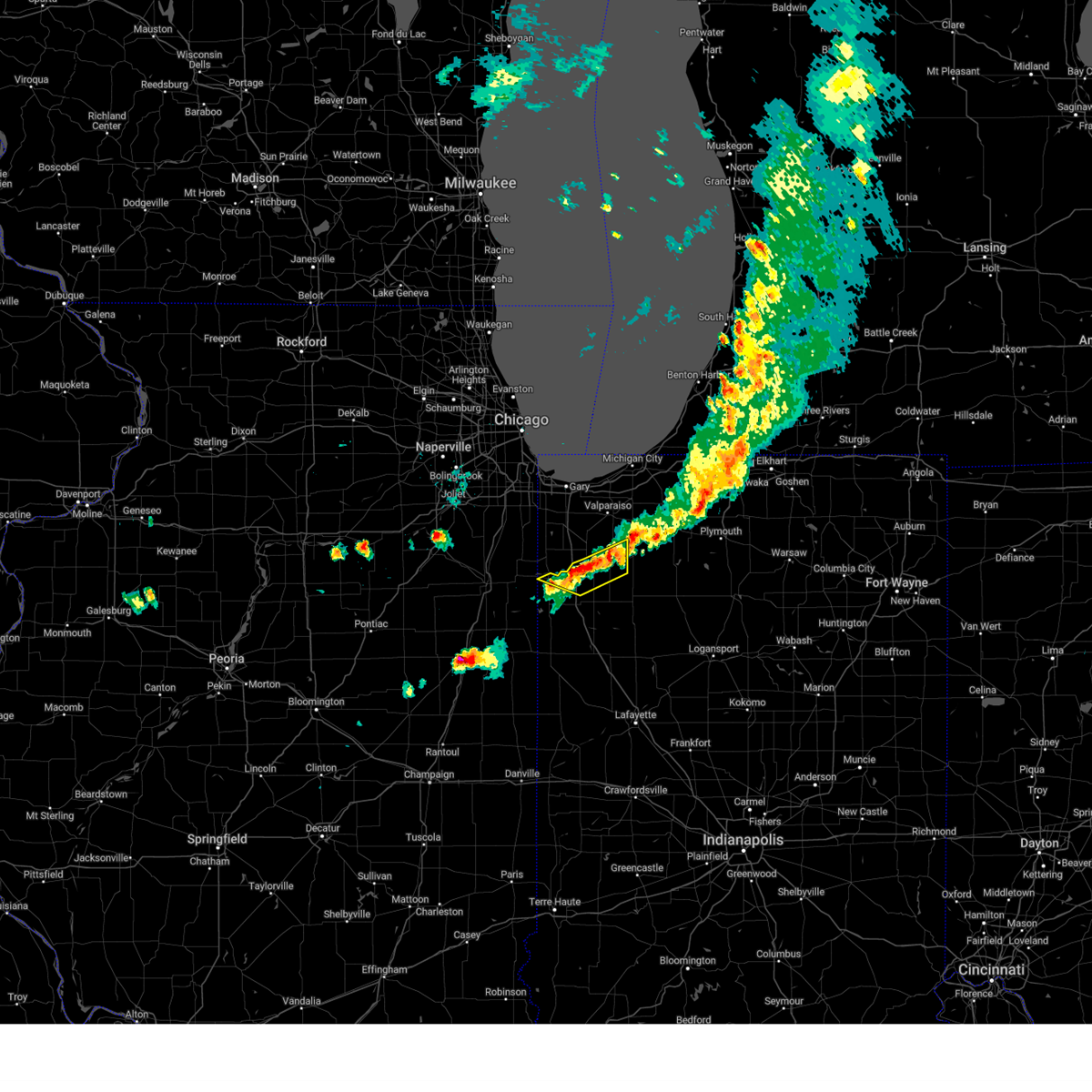
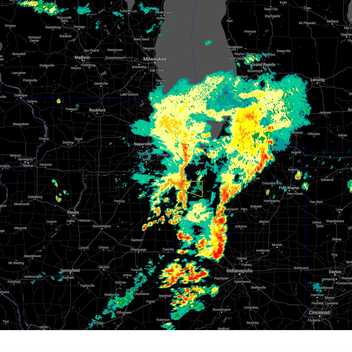
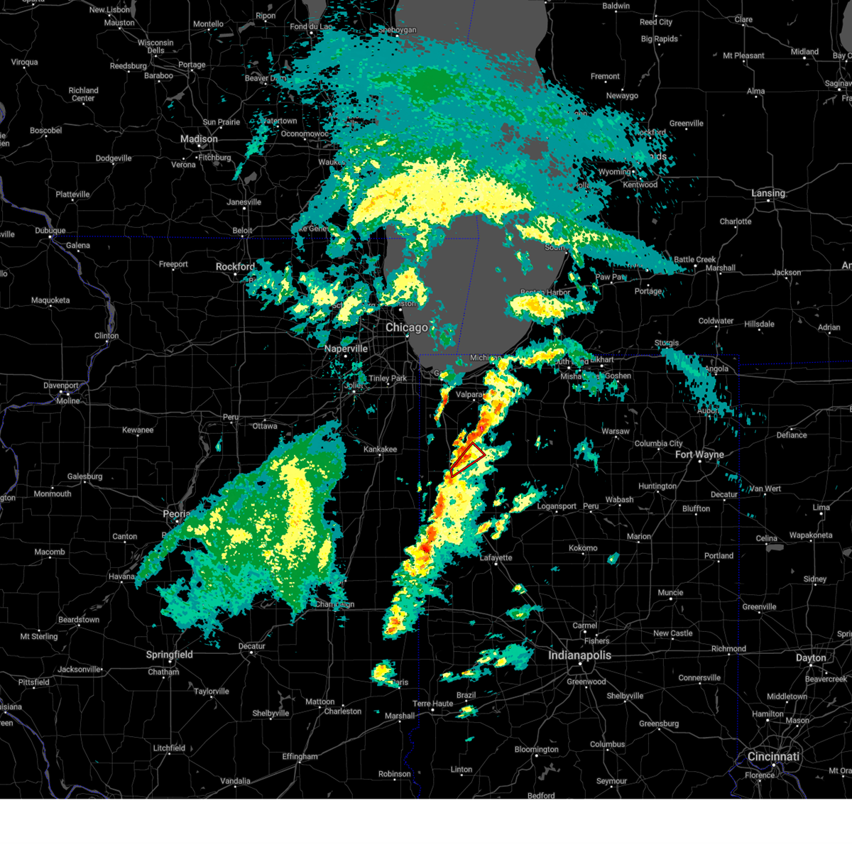
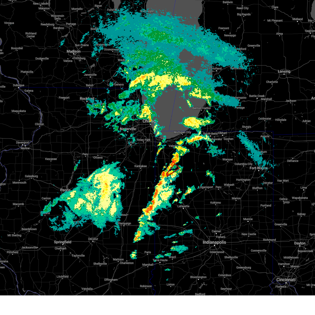
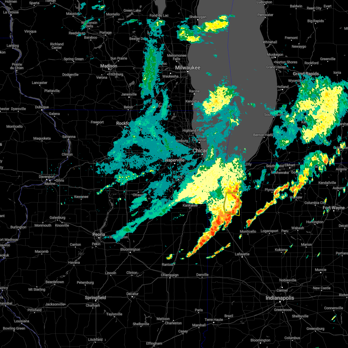
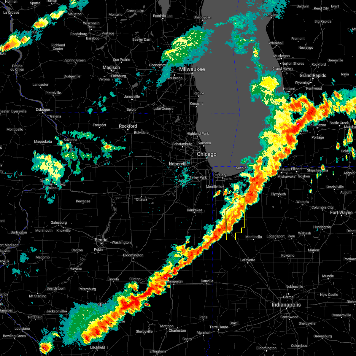
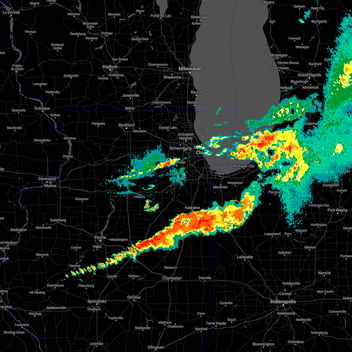
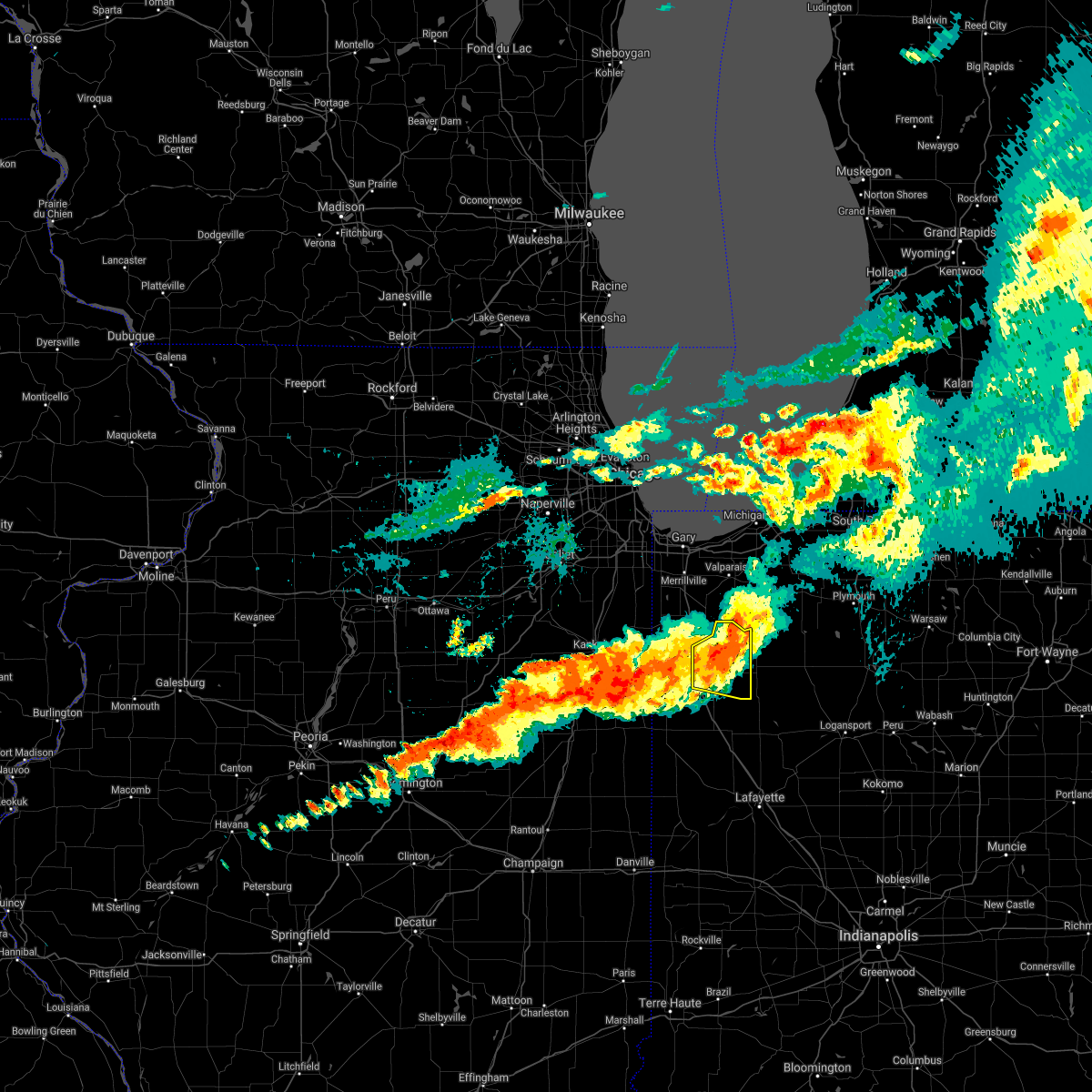
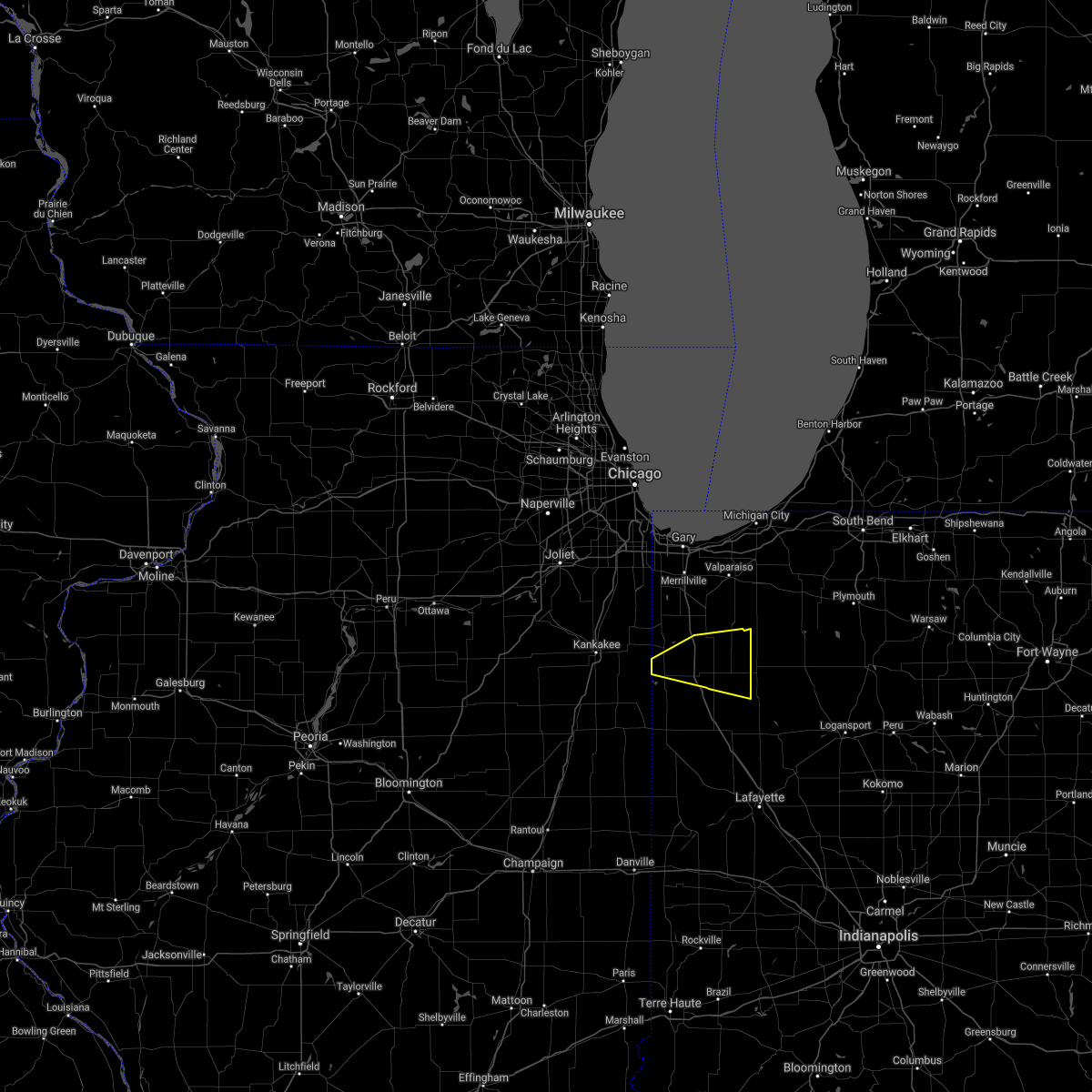
Hail Map for Wheatfield, IN
The Wheatfield, IN area has had 1 report of on-the-ground hail by trained spotters, and has been under severe weather warnings 37 times during the past 12 months. Doppler radar has detected hail at or near Wheatfield, IN on 54 occasions, including 2 occasions during the past year.
| Name: | Wheatfield, IN |
| Where Located: | 56.6 miles SSE of Chicago, IL |
| Map: | Google Map for Wheatfield, IN |
| Population: | 853 |
| Housing Units: | 353 |
| More Info: | Search Google for Wheatfield, IN |
0
The Top Recent Hail Date for Wheatfield, IN is Wednesday, April 2, 2025 (25th out of 54)
Hail and Wind Damage Spotted near Wheatfield, IN
| Date / Time | Report Details |
|---|---|
| 6/18/2025 2:24 PM CDT |
 the severe thunderstorm warning has been cancelled and is no longer in effect the severe thunderstorm warning has been cancelled and is no longer in effect
|
| 6/18/2025 2:24 PM CDT |
 At 224 pm cdt, severe thunderstorms were located along a line extending from near lowell to near hebron to wheatfield, moving northeast at 50 mph (radar indicated). Hazards include 70 mph wind gusts. Expect considerable tree damage. damage is likely to mobile homes, roofs, and outbuildings. these severe storms will be near, merrillville, winfield, lake dalecarlia, hebron, kouts, lakes of the four seasons, and crown point around 230 pm cdt. valparaiso around 235 pm cdt. chesterton around 245 pm cdt. Other locations impacted by these severe thunderstorms include malden, stoutsburg, dunns bridge, and boone grove. At 224 pm cdt, severe thunderstorms were located along a line extending from near lowell to near hebron to wheatfield, moving northeast at 50 mph (radar indicated). Hazards include 70 mph wind gusts. Expect considerable tree damage. damage is likely to mobile homes, roofs, and outbuildings. these severe storms will be near, merrillville, winfield, lake dalecarlia, hebron, kouts, lakes of the four seasons, and crown point around 230 pm cdt. valparaiso around 235 pm cdt. chesterton around 245 pm cdt. Other locations impacted by these severe thunderstorms include malden, stoutsburg, dunns bridge, and boone grove.
|
| 6/18/2025 2:18 PM CDT | Report shared via social media of large tree branch or tree downed along 500w road near 1050 road southeast of de motte. time estimated by rada in jasper county IN, 5 miles ENE of Wheatfield, IN |
| 6/18/2025 2:17 PM CDT | Numerous trees and power lines reported down across a large corridor. ranging from 1300n and 100e to 1300n and 400e... then south to county road 1200/sr-1 in jasper county IN, 1.8 miles WSW of Wheatfield, IN |
| 6/18/2025 2:13 PM CDT |
 At 213 pm cdt, severe thunderstorms were located along a line extending from near grant park to shelby to 6 miles south of demotte, moving northeast at 50 mph (radar indicated). Hazards include 60 mph wind gusts. Expect damage to roofs, siding, and trees. Locations impacted include, wheatfield, lake dalecarlia, hebron, demotte, lowell, winfield, kouts, crown point, merrillville, lakes of the four seasons, valparaiso and chesterton. At 213 pm cdt, severe thunderstorms were located along a line extending from near grant park to shelby to 6 miles south of demotte, moving northeast at 50 mph (radar indicated). Hazards include 60 mph wind gusts. Expect damage to roofs, siding, and trees. Locations impacted include, wheatfield, lake dalecarlia, hebron, demotte, lowell, winfield, kouts, crown point, merrillville, lakes of the four seasons, valparaiso and chesterton.
|
| 6/18/2025 2:13 PM CDT |
 the severe thunderstorm warning has been cancelled and is no longer in effect the severe thunderstorm warning has been cancelled and is no longer in effect
|
| 6/18/2025 1:57 PM CDT |
 Svrlot the national weather service in chicago has issued a * severe thunderstorm warning for, east central kankakee county in northeastern illinois, northern newton county in northwestern indiana, porter county in northwestern indiana, southern lake county in northwestern indiana, northern jasper county in northwestern indiana, * until 300 pm cdt. * at 156 pm cdt, severe thunderstorms were located along a line extending from near momence to near hopkins park to near brook, moving northeast at 55 mph (radar indicated). Hazards include 60 mph wind gusts. Expect damage to roofs, siding, and trees. severe thunderstorms will be near, lake village around 200 pm cdt. shelby, lowell, and roselawn around 205 pm cdt. lake dalecarlia around 210 pm cdt. demotte and crown point around 215 pm cdt. merrillville, winfield, hebron, and lakes of the four seasons around 220 pm cdt. wheatfield around 225 pm cdt. kouts and valparaiso around 230 pm cdt. Chesterton around 235 pm cdt. Svrlot the national weather service in chicago has issued a * severe thunderstorm warning for, east central kankakee county in northeastern illinois, northern newton county in northwestern indiana, porter county in northwestern indiana, southern lake county in northwestern indiana, northern jasper county in northwestern indiana, * until 300 pm cdt. * at 156 pm cdt, severe thunderstorms were located along a line extending from near momence to near hopkins park to near brook, moving northeast at 55 mph (radar indicated). Hazards include 60 mph wind gusts. Expect damage to roofs, siding, and trees. severe thunderstorms will be near, lake village around 200 pm cdt. shelby, lowell, and roselawn around 205 pm cdt. lake dalecarlia around 210 pm cdt. demotte and crown point around 215 pm cdt. merrillville, winfield, hebron, and lakes of the four seasons around 220 pm cdt. wheatfield around 225 pm cdt. kouts and valparaiso around 230 pm cdt. Chesterton around 235 pm cdt.
|
| 4/2/2025 6:26 PM CDT | The storms which prompted the warning have moved out of the area. therefore, the warning will be allowed to expire. however, gusty winds and heavy rain are still possible with these thunderstorms. a tornado watch remains in effect until 1000 pm cdt for northwestern indiana. |
| 4/2/2025 6:23 PM CDT | At 623 pm cdt, severe thunderstorms were located along a line extending from near wheatfield to near remington, moving east at 50 mph (radar indicated). Hazards include 60 mph wind gusts. Expect damage to roofs, siding, and trees. Locations impacted include, demotte, parr, wheatfield, baileys corner, hanging grove, stoutsburg, rensselaer, collegeville, and remington. |
| 4/2/2025 6:23 PM CDT | the severe thunderstorm warning has been cancelled and is no longer in effect |
| 4/2/2025 6:09 PM CDT |
 At 609 pm cdt, severe thunderstorms were located along a line extending from near wheatfield to near remington, moving northeast at 60 mph (radar indicated). Hazards include 70 mph wind gusts and quarter size hail. Hail damage to vehicles is expected. expect considerable tree damage. wind damage is also likely to mobile homes, roofs, and outbuildings. Locations impacted include, wheatfield, roselawn, baileys corner, mount ayr, hanging grove, brook, stoutsburg, goodland, foresman, demotte, fair oaks, parr, rensselaer, collegeville, kentland, and remington. At 609 pm cdt, severe thunderstorms were located along a line extending from near wheatfield to near remington, moving northeast at 60 mph (radar indicated). Hazards include 70 mph wind gusts and quarter size hail. Hail damage to vehicles is expected. expect considerable tree damage. wind damage is also likely to mobile homes, roofs, and outbuildings. Locations impacted include, wheatfield, roselawn, baileys corner, mount ayr, hanging grove, brook, stoutsburg, goodland, foresman, demotte, fair oaks, parr, rensselaer, collegeville, kentland, and remington.
|
| 4/2/2025 5:57 PM CDT | Svrlot the national weather service in chicago has issued a * severe thunderstorm warning for, eastern newton county in northwestern indiana, jasper county in northwestern indiana, * until 630 pm cdt. * at 556 pm cdt, severe thunderstorms were located along a line extending from near roselawn to near goodland, moving northeast at 60 mph (radar indicated). Hazards include 60 mph wind gusts and quarter size hail. Hail damage to vehicles is expected. Expect wind damage to roofs, siding, and trees. |
| 4/2/2025 5:51 PM CDT | At 550 pm cdt/650 pm edt/, a cluster of severe thunderstorms were located from near wheatfield to near morocco to kentland to near rensselaer, moving northeast at 60 mph (radar indicated). Hazards include 60 mph wind gusts. Expect damage to roofs, siding, and trees. Locations impacted include, dunnington, wheatfield, roselawn, earl park, hanging grove, brook, stoutsburg, foresman, demotte, fair oaks, morocco, templeton, oxford, remington, otterbein, boswell, wadena, swanington, ambia, baileys corner, mount ayr, goodland, fowler, parr, and raub. |
| 4/2/2025 5:34 PM CDT |
 At 534 pm cdt/634 pm edt/, severe thunderstorms were located along a line extending from near roselawn to near fowler, moving northeast at 55 mph (radar indicated). Hazards include 60 mph wind gusts. Expect damage to roofs, siding, and trees. Locations impacted include, dunnington, wheatfield, thayer, roselawn, earl park, hanging grove, brook, stoutsburg, foresman, demotte, fair oaks, morocco, templeton, oxford, remington, otterbein, boswell, wadena, sumava resorts, swanington, ambia, baileys corner, mount ayr, goodland, and fowler. At 534 pm cdt/634 pm edt/, severe thunderstorms were located along a line extending from near roselawn to near fowler, moving northeast at 55 mph (radar indicated). Hazards include 60 mph wind gusts. Expect damage to roofs, siding, and trees. Locations impacted include, dunnington, wheatfield, thayer, roselawn, earl park, hanging grove, brook, stoutsburg, foresman, demotte, fair oaks, morocco, templeton, oxford, remington, otterbein, boswell, wadena, sumava resorts, swanington, ambia, baileys corner, mount ayr, goodland, and fowler.
|
| 4/2/2025 5:17 PM CDT |
 Svrlot the national weather service in chicago has issued a * severe thunderstorm warning for, benton county in northwestern indiana, newton county in northwestern indiana, jasper county in northwestern indiana, * until 600 pm cdt/700 pm edt/. * at 516 pm cdt/616 pm edt/, severe thunderstorms were located along a line extending from near morocco to near boswell, moving northeast at 50 mph (radar indicated). Hazards include 60 mph wind gusts and half dollar size hail. Hail damage to vehicles is expected. Expect wind damage to roofs, siding, and trees. Svrlot the national weather service in chicago has issued a * severe thunderstorm warning for, benton county in northwestern indiana, newton county in northwestern indiana, jasper county in northwestern indiana, * until 600 pm cdt/700 pm edt/. * at 516 pm cdt/616 pm edt/, severe thunderstorms were located along a line extending from near morocco to near boswell, moving northeast at 50 mph (radar indicated). Hazards include 60 mph wind gusts and half dollar size hail. Hail damage to vehicles is expected. Expect wind damage to roofs, siding, and trees.
|
| 3/30/2025 2:58 PM CDT |
 At 258 pm cdt, severe thunderstorms were located along a line extending from lakes of the four seasons to near kouts to 7 miles northwest of hanging grove, moving northeast at 60 mph. wind gusts in excess of 70 mph have recently been reported near lake of the four seasons (trained weather spotters and weather stations). Hazards include 70 mph wind gusts. Expect considerable tree damage. damage is likely to mobile homes, roofs, and outbuildings. Locations impacted include, wheatfield, chesterton, valparaiso, town of pines, beverly shores, stoutsburg, dunns bridge, hebron, porter, dune acres, wheeler, lakes of the four seasons, kouts, boone grove, portage, south haven, burns harbor, ogden dunes, malden, demotte, lake station, winfield, hobart, merrillville, and gary. At 258 pm cdt, severe thunderstorms were located along a line extending from lakes of the four seasons to near kouts to 7 miles northwest of hanging grove, moving northeast at 60 mph. wind gusts in excess of 70 mph have recently been reported near lake of the four seasons (trained weather spotters and weather stations). Hazards include 70 mph wind gusts. Expect considerable tree damage. damage is likely to mobile homes, roofs, and outbuildings. Locations impacted include, wheatfield, chesterton, valparaiso, town of pines, beverly shores, stoutsburg, dunns bridge, hebron, porter, dune acres, wheeler, lakes of the four seasons, kouts, boone grove, portage, south haven, burns harbor, ogden dunes, malden, demotte, lake station, winfield, hobart, merrillville, and gary.
|
| 3/30/2025 2:48 PM CDT |
 At 247 pm cdt, severe thunderstorms were located along a line extending from near lake dalecarlia to near demotte to near rensselaer, moving northeast at 60 mph. these storms have a history of producing severe wind gusts (weather stations). Hazards include 70 mph wind gusts. Expect considerable tree damage. damage is likely to mobile homes, roofs, and outbuildings. Locations impacted include, wheatfield, chesterton, valparaiso, town of pines, beverly shores, stoutsburg, demotte, fair oaks, dunns bridge, hebron, porter, dune acres, wheeler, lakes of the four seasons, kouts, boone grove, portage, south haven, burns harbor, ogden dunes, parr, malden, winfield, lake station, and hobart. At 247 pm cdt, severe thunderstorms were located along a line extending from near lake dalecarlia to near demotte to near rensselaer, moving northeast at 60 mph. these storms have a history of producing severe wind gusts (weather stations). Hazards include 70 mph wind gusts. Expect considerable tree damage. damage is likely to mobile homes, roofs, and outbuildings. Locations impacted include, wheatfield, chesterton, valparaiso, town of pines, beverly shores, stoutsburg, demotte, fair oaks, dunns bridge, hebron, porter, dune acres, wheeler, lakes of the four seasons, kouts, boone grove, portage, south haven, burns harbor, ogden dunes, parr, malden, winfield, lake station, and hobart.
|
| 3/30/2025 2:48 PM CDT |
 the severe thunderstorm warning has been cancelled and is no longer in effect the severe thunderstorm warning has been cancelled and is no longer in effect
|
| 3/30/2025 2:39 PM CDT |
 the severe thunderstorm warning has been cancelled and is no longer in effect the severe thunderstorm warning has been cancelled and is no longer in effect
|
| 3/30/2025 2:39 PM CDT |
 At 239 pm cdt, severe thunderstorms were located along a line extending from near shelby to 7 miles south of roselawn to near goodland, moving northeast at 75 mph (radar indicated). Hazards include 70 mph wind gusts. Expect considerable tree damage. damage is likely to mobile homes, roofs, and outbuildings. Locations impacted include, wheatfield, chesterton, valparaiso, town of pines, beverly shores, brook, stoutsburg, demotte, fair oaks, dunns bridge, hebron, porter, dune acres, wheeler, lakes of the four seasons, kouts, boone grove, portage, south haven, mount ayr, burns harbor, ogden dunes, parr, malden, and morocco. At 239 pm cdt, severe thunderstorms were located along a line extending from near shelby to 7 miles south of roselawn to near goodland, moving northeast at 75 mph (radar indicated). Hazards include 70 mph wind gusts. Expect considerable tree damage. damage is likely to mobile homes, roofs, and outbuildings. Locations impacted include, wheatfield, chesterton, valparaiso, town of pines, beverly shores, brook, stoutsburg, demotte, fair oaks, dunns bridge, hebron, porter, dune acres, wheeler, lakes of the four seasons, kouts, boone grove, portage, south haven, mount ayr, burns harbor, ogden dunes, parr, malden, and morocco.
|
| 3/30/2025 2:28 PM CDT | Svrlot the national weather service in chicago has issued a * severe thunderstorm warning for, east central iroquois county in east central illinois, southeastern newton county in northwestern indiana, porter county in northwestern indiana, east central lake county in northwestern indiana, northern jasper county in northwestern indiana, * until 345 pm cdt. * at 228 pm cdt, a severe thunderstorm was located near sheldon, or near kentland, moving northeast at 50 mph (radar indicated). Hazards include 70 mph wind gusts. Expect considerable tree damage. Damage is likely to mobile homes, roofs, and outbuildings. |
| 3/19/2025 5:41 PM CDT |
 At 540 pm cdt, severe thunderstorms were located along a line extending from hammond to st. john to near momence, moving east at 50 mph (radar indicated). Hazards include 70 mph wind gusts and quarter size hail. Hail damage to vehicles is expected. expect considerable tree damage. wind damage is also likely to mobile homes, roofs, and outbuildings. Locations impacted include, dyer, lake station, wheatfield, cedar lake, chesterton, winfield, thayer, roselawn, valparaiso, town of pines, lake dalecarlia, beverly shores, stoutsburg, merrillville, hobart, demotte, fair oaks, dunns bridge, hebron, east chicago, porter, dune acres, wheeler, lakes of the four seasons, and munster. At 540 pm cdt, severe thunderstorms were located along a line extending from hammond to st. john to near momence, moving east at 50 mph (radar indicated). Hazards include 70 mph wind gusts and quarter size hail. Hail damage to vehicles is expected. expect considerable tree damage. wind damage is also likely to mobile homes, roofs, and outbuildings. Locations impacted include, dyer, lake station, wheatfield, cedar lake, chesterton, winfield, thayer, roselawn, valparaiso, town of pines, lake dalecarlia, beverly shores, stoutsburg, merrillville, hobart, demotte, fair oaks, dunns bridge, hebron, east chicago, porter, dune acres, wheeler, lakes of the four seasons, and munster.
|
| 3/19/2025 5:27 PM CDT |
 Svrlot the national weather service in chicago has issued a * severe thunderstorm warning for, northern newton county in northwestern indiana, porter county in northwestern indiana, lake county in northwestern indiana, northern jasper county in northwestern indiana, * until 645 pm cdt. * at 526 pm cdt, severe thunderstorms were located along a line extending from oak lawn to richton park to kankakee, moving northeast at 50 mph (radar indicated). Hazards include 60 mph wind gusts and quarter size hail. Hail damage to vehicles is expected. Expect wind damage to roofs, siding, and trees. Svrlot the national weather service in chicago has issued a * severe thunderstorm warning for, northern newton county in northwestern indiana, porter county in northwestern indiana, lake county in northwestern indiana, northern jasper county in northwestern indiana, * until 645 pm cdt. * at 526 pm cdt, severe thunderstorms were located along a line extending from oak lawn to richton park to kankakee, moving northeast at 50 mph (radar indicated). Hazards include 60 mph wind gusts and quarter size hail. Hail damage to vehicles is expected. Expect wind damage to roofs, siding, and trees.
|
| 7/15/2024 10:45 PM CDT |
 The storms which prompted the warning have moved out of the area. therefore, the warning has been allowed to expire. a tornado watch remains in effect until 100 am cdt/200 am edt/ for northwestern indiana. The storms which prompted the warning have moved out of the area. therefore, the warning has been allowed to expire. a tornado watch remains in effect until 100 am cdt/200 am edt/ for northwestern indiana.
|
| 7/15/2024 10:37 PM CDT |
 At 1036 pm cdt/1136 pm edt/, severe thunderstorms were located along a line extending from la porte to near north judson to near hanging grove to near oxford, moving east at 50 mph (radar indicated). Hazards include 70 mph wind gusts. Expect considerable tree damage. damage is likely to mobile homes, roofs, and outbuildings. Locations impacted include, portage, merrillville, valparaiso, chesterton, rensselaer, demotte, hebron, fowler, otterbein, remington, wheatfield, lakes of the four seasons, south haven, porter, winfield, roselawn, kouts, oxford, burns harbor, goodland, brook, boswell, town of pines, beverly shores, and shelby. At 1036 pm cdt/1136 pm edt/, severe thunderstorms were located along a line extending from la porte to near north judson to near hanging grove to near oxford, moving east at 50 mph (radar indicated). Hazards include 70 mph wind gusts. Expect considerable tree damage. damage is likely to mobile homes, roofs, and outbuildings. Locations impacted include, portage, merrillville, valparaiso, chesterton, rensselaer, demotte, hebron, fowler, otterbein, remington, wheatfield, lakes of the four seasons, south haven, porter, winfield, roselawn, kouts, oxford, burns harbor, goodland, brook, boswell, town of pines, beverly shores, and shelby.
|
| 7/15/2024 10:15 PM CDT | At 1015 pm cdt/1115 pm edt/, severe thunderstorms were located along a line extending from burns harbor to near demotte to near brook to stockland, moving southeast at 55 mph (radar indicated). Hazards include 70 mph wind gusts. Expect considerable tree damage. damage is likely to mobile homes, roofs, and outbuildings. Locations impacted include, hammond, gary, portage, merrillville, valparaiso, east chicago, schererville, hobart, crown point, highland, munster, chesterton, cedar lake, lowell, rensselaer, demotte, hebron, fowler, kentland, otterbein, remington, morocco, wheatfield, lake village, and griffith. |
| 7/15/2024 10:15 PM CDT | At 1014 pm cdt, a severe squall line capable of producing both tornadoes and extensive straight line wind damage was located along a line extending from near kouts to near wheatfield to near demotte to 8 miles northwest of rensselaer to morocco, moving east at 75 mph (radar indicated rotation). Hazards include tornadoes. Flying debris will be dangerous to those caught without shelter. mobile homes will be damaged or destroyed. damage to roofs, windows, and vehicles will occur. tree damage is likely. these dangerous storms will be near, rensselaer and wheatfield around 1020 pm cdt. Hanging grove around 1025 pm cdt. |
| 7/15/2024 10:15 PM CDT | the tornado warning has been cancelled and is no longer in effect |
| 7/15/2024 10:06 PM CDT |
 At 1006 pm cdt, a severe squall line capable of producing both tornadoes and extensive straight line wind damage was located along a line extending from near hebron to near demotte to roselawn to near morocco to near martinton, moving east at 80 mph (radar indicated rotation). Hazards include tornadoes. Flying debris will be dangerous to those caught without shelter. mobile homes will be damaged or destroyed. damage to roofs, windows, and vehicles will occur. tree damage is likely. these dangerous storms will be near, demotte, morocco, and roselawn around 1010 pm cdt. wheatfield and brook around 1015 pm cdt. rensselaer around 1020 pm cdt. Other locations in the path of these tornadic storms include hanging grove. At 1006 pm cdt, a severe squall line capable of producing both tornadoes and extensive straight line wind damage was located along a line extending from near hebron to near demotte to roselawn to near morocco to near martinton, moving east at 80 mph (radar indicated rotation). Hazards include tornadoes. Flying debris will be dangerous to those caught without shelter. mobile homes will be damaged or destroyed. damage to roofs, windows, and vehicles will occur. tree damage is likely. these dangerous storms will be near, demotte, morocco, and roselawn around 1010 pm cdt. wheatfield and brook around 1015 pm cdt. rensselaer around 1020 pm cdt. Other locations in the path of these tornadic storms include hanging grove.
|
| 7/15/2024 10:02 PM CDT |
 At 1001 pm cdt, a severe squall line capable of producing both tornadoes and extensive straight line wind damage was located along a line extending from near lowell to near lake village to martinton, moving east at 60 mph (radar indicated rotation). Hazards include tornado. Flying debris will be dangerous to those caught without shelter. mobile homes will be damaged or destroyed. damage to roofs, windows, and vehicles will occur. tree damage is likely. these dangerous storms will be near, morocco, lake village, roselawn, and shelby around 1005 pm cdt. Other locations in the path of these tornadic storms include demotte, wheatfield, brook, rensselaer and hanging grove. At 1001 pm cdt, a severe squall line capable of producing both tornadoes and extensive straight line wind damage was located along a line extending from near lowell to near lake village to martinton, moving east at 60 mph (radar indicated rotation). Hazards include tornado. Flying debris will be dangerous to those caught without shelter. mobile homes will be damaged or destroyed. damage to roofs, windows, and vehicles will occur. tree damage is likely. these dangerous storms will be near, morocco, lake village, roselawn, and shelby around 1005 pm cdt. Other locations in the path of these tornadic storms include demotte, wheatfield, brook, rensselaer and hanging grove.
|
| 7/15/2024 9:46 PM CDT |
 Torlot the national weather service in chicago has issued a * tornado warning for, northern iroquois county in east central illinois, newton county in northwestern indiana, southern lake county in northwestern indiana, jasper county in northwestern indiana, * until 1045 pm cdt. * at 946 pm cdt, severe thunderstorms capable of producing both tornadoes and extensive straight line wind damage were located along a line extending from near grant park to near bradley to chebanse, moving east at 75 mph (radar indicated rotation). Hazards include tornado. Flying debris will be dangerous to those caught without shelter. mobile homes will be damaged or destroyed. damage to roofs, windows, and vehicles will occur. tree damage is likely. these dangerous storms will be near, lowell and lake village around 955 pm cdt. roselawn and shelby around 1000 pm cdt. demotte around 1005 pm cdt. Other locations in the path of these tornadic storms include wheatfield. Torlot the national weather service in chicago has issued a * tornado warning for, northern iroquois county in east central illinois, newton county in northwestern indiana, southern lake county in northwestern indiana, jasper county in northwestern indiana, * until 1045 pm cdt. * at 946 pm cdt, severe thunderstorms capable of producing both tornadoes and extensive straight line wind damage were located along a line extending from near grant park to near bradley to chebanse, moving east at 75 mph (radar indicated rotation). Hazards include tornado. Flying debris will be dangerous to those caught without shelter. mobile homes will be damaged or destroyed. damage to roofs, windows, and vehicles will occur. tree damage is likely. these dangerous storms will be near, lowell and lake village around 955 pm cdt. roselawn and shelby around 1000 pm cdt. demotte around 1005 pm cdt. Other locations in the path of these tornadic storms include wheatfield.
|
| 7/15/2024 9:35 PM CDT |
 Svrlot the national weather service in chicago has issued a * severe thunderstorm warning for, newton county in northwestern indiana, benton county in northwestern indiana, porter county in northwestern indiana, lake county in northwestern indiana, jasper county in northwestern indiana, * until 1045 pm cdt/1145 pm edt/. * at 935 pm cdt/1035 pm edt/, severe thunderstorms were located along a line extending from la grange park to near frankfort to near herscher to near chatsworth, moving east at 60 mph (radar indicated). Hazards include 70 mph wind gusts. Expect considerable tree damage. Damage is likely to mobile homes, roofs, and outbuildings. Svrlot the national weather service in chicago has issued a * severe thunderstorm warning for, newton county in northwestern indiana, benton county in northwestern indiana, porter county in northwestern indiana, lake county in northwestern indiana, jasper county in northwestern indiana, * until 1045 pm cdt/1145 pm edt/. * at 935 pm cdt/1035 pm edt/, severe thunderstorms were located along a line extending from la grange park to near frankfort to near herscher to near chatsworth, moving east at 60 mph (radar indicated). Hazards include 70 mph wind gusts. Expect considerable tree damage. Damage is likely to mobile homes, roofs, and outbuildings.
|
| 7/15/2024 12:59 AM CDT |
 the severe thunderstorm warning has been cancelled and is no longer in effect the severe thunderstorm warning has been cancelled and is no longer in effect
|
| 7/15/2024 12:49 AM CDT |
 the severe thunderstorm warning has been cancelled and is no longer in effect the severe thunderstorm warning has been cancelled and is no longer in effect
|
| 7/15/2024 12:49 AM CDT |
 At 1248 am cdt, severe thunderstorms were located along a line extending from near north judson to rensselaer, moving east at 30 mph (radar indicated). Hazards include 60 mph wind gusts. Expect damage to roofs, siding, and trees. Locations impacted include, wheatfield, kouts, baileys corner, stoutsburg, and dunns bridge. At 1248 am cdt, severe thunderstorms were located along a line extending from near north judson to rensselaer, moving east at 30 mph (radar indicated). Hazards include 60 mph wind gusts. Expect damage to roofs, siding, and trees. Locations impacted include, wheatfield, kouts, baileys corner, stoutsburg, and dunns bridge.
|
| 7/15/2024 12:25 AM CDT |
 Svrlot the national weather service in chicago has issued a * severe thunderstorm warning for, northern newton county in northwestern indiana, southern porter county in northwestern indiana, southern lake county in northwestern indiana, jasper county in northwestern indiana, * until 115 am cdt. * at 1224 am cdt, severe thunderstorms were located along a line extending from near kouts to 6 miles east of morocco, moving east at 30 mph (radar indicated). Hazards include 60 mph wind gusts. expect damage to roofs, siding, and trees Svrlot the national weather service in chicago has issued a * severe thunderstorm warning for, northern newton county in northwestern indiana, southern porter county in northwestern indiana, southern lake county in northwestern indiana, jasper county in northwestern indiana, * until 115 am cdt. * at 1224 am cdt, severe thunderstorms were located along a line extending from near kouts to 6 miles east of morocco, moving east at 30 mph (radar indicated). Hazards include 60 mph wind gusts. expect damage to roofs, siding, and trees
|
| 7/14/2024 10:04 AM CDT |
 the severe thunderstorm warning has been cancelled and is no longer in effect the severe thunderstorm warning has been cancelled and is no longer in effect
|
| 7/14/2024 9:51 AM CDT |
 At 950 am cdt, a severe thunderstorm was located near demotte, moving southeast at 45 mph. a personal weather station in lowell recorded a 60 mph wind gust (surface observations). Hazards include 60 mph wind gusts. Expect damage to roofs, siding, and trees. Locations impacted include, demotte, wheatfield, roselawn, shelby, dunns bridge, thayer, baileys corner, and stoutsburg. At 950 am cdt, a severe thunderstorm was located near demotte, moving southeast at 45 mph. a personal weather station in lowell recorded a 60 mph wind gust (surface observations). Hazards include 60 mph wind gusts. Expect damage to roofs, siding, and trees. Locations impacted include, demotte, wheatfield, roselawn, shelby, dunns bridge, thayer, baileys corner, and stoutsburg.
|
| 7/14/2024 9:37 AM CDT |
 Svrlot the national weather service in chicago has issued a * severe thunderstorm warning for, northeastern newton county in northwestern indiana, southern porter county in northwestern indiana, southern lake county in northwestern indiana, northern jasper county in northwestern indiana, * until 1030 am cdt. * at 937 am cdt, a severe thunderstorm was located over lowell, moving southeast at 45 mph (radar indicated). Hazards include 60 mph wind gusts. expect damage to roofs, siding, and trees Svrlot the national weather service in chicago has issued a * severe thunderstorm warning for, northeastern newton county in northwestern indiana, southern porter county in northwestern indiana, southern lake county in northwestern indiana, northern jasper county in northwestern indiana, * until 1030 am cdt. * at 937 am cdt, a severe thunderstorm was located over lowell, moving southeast at 45 mph (radar indicated). Hazards include 60 mph wind gusts. expect damage to roofs, siding, and trees
|
| 6/13/2024 5:51 PM CDT |
 The storm which prompted the warning has moved out of the area. therefore, the warning will be allowed to expire. however, gusty winds and heavy rain are still possible with this thunderstorm. a severe thunderstorm watch remains in effect until 800 pm cdt for northwestern indiana. The storm which prompted the warning has moved out of the area. therefore, the warning will be allowed to expire. however, gusty winds and heavy rain are still possible with this thunderstorm. a severe thunderstorm watch remains in effect until 800 pm cdt for northwestern indiana.
|
| 6/13/2024 5:34 PM CDT |
 At 534 pm cdt, a severe thunderstorm was located near wheatfield, moving east at 35 mph (radar indicated). Hazards include 60 mph wind gusts and quarter size hail. Hail damage to vehicles is expected. expect wind damage to roofs, siding, and trees. this severe storm will be near, wheatfield around 540 pm cdt. Other locations impacted by this severe thunderstorm include stoutsburg and dunns bridge. At 534 pm cdt, a severe thunderstorm was located near wheatfield, moving east at 35 mph (radar indicated). Hazards include 60 mph wind gusts and quarter size hail. Hail damage to vehicles is expected. expect wind damage to roofs, siding, and trees. this severe storm will be near, wheatfield around 540 pm cdt. Other locations impacted by this severe thunderstorm include stoutsburg and dunns bridge.
|
| 6/13/2024 5:34 PM CDT |
 the severe thunderstorm warning has been cancelled and is no longer in effect the severe thunderstorm warning has been cancelled and is no longer in effect
|
| 6/13/2024 5:25 PM CDT |
 Svrlot the national weather service in chicago has issued a * severe thunderstorm warning for, southern porter county in northwestern indiana, southeastern lake county in northwestern indiana, northern jasper county in northwestern indiana, * until 600 pm cdt. * at 525 pm cdt, a severe thunderstorm was located near hebron, moving east at 35 mph (radar indicated). Hazards include 60 mph wind gusts and quarter size hail. Hail damage to vehicles is expected. expect wind damage to roofs, siding, and trees. this severe thunderstorm will be near, wheatfield around 535 pm cdt. Other locations impacted by this severe thunderstorm include stoutsburg and dunns bridge. Svrlot the national weather service in chicago has issued a * severe thunderstorm warning for, southern porter county in northwestern indiana, southeastern lake county in northwestern indiana, northern jasper county in northwestern indiana, * until 600 pm cdt. * at 525 pm cdt, a severe thunderstorm was located near hebron, moving east at 35 mph (radar indicated). Hazards include 60 mph wind gusts and quarter size hail. Hail damage to vehicles is expected. expect wind damage to roofs, siding, and trees. this severe thunderstorm will be near, wheatfield around 535 pm cdt. Other locations impacted by this severe thunderstorm include stoutsburg and dunns bridge.
|
| 5/20/2024 7:59 PM CDT |
 The storm which prompted the warning has weakened below severe limits, and no longer poses an immediate threat to life or property. therefore, the warning will be allowed to expire. however, small hail to the size of a penny and gusty winds to 50 mph are still possible with this thunderstorm. The storm which prompted the warning has weakened below severe limits, and no longer poses an immediate threat to life or property. therefore, the warning will be allowed to expire. however, small hail to the size of a penny and gusty winds to 50 mph are still possible with this thunderstorm.
|
| 5/20/2024 7:47 PM CDT |
 the severe thunderstorm warning has been cancelled and is no longer in effect the severe thunderstorm warning has been cancelled and is no longer in effect
|
| 5/20/2024 7:47 PM CDT |
 At 747 pm cdt, a severe thunderstorm was located near kouts, or near wheatfield, moving northeast at 15 mph (radar indicated). Hazards include 60 mph wind gusts and half dollar size hail. Hail damage to vehicles is expected. expect wind damage to roofs, siding, and trees. Locations impacted include, wheatfield, kouts, stoutsburg, and dunns bridge. At 747 pm cdt, a severe thunderstorm was located near kouts, or near wheatfield, moving northeast at 15 mph (radar indicated). Hazards include 60 mph wind gusts and half dollar size hail. Hail damage to vehicles is expected. expect wind damage to roofs, siding, and trees. Locations impacted include, wheatfield, kouts, stoutsburg, and dunns bridge.
|
| 5/20/2024 7:32 PM CDT |
 the severe thunderstorm warning has been cancelled and is no longer in effect the severe thunderstorm warning has been cancelled and is no longer in effect
|
| 5/20/2024 7:32 PM CDT |
 At 731 pm cdt, a severe thunderstorm was located near demotte, moving northeast at 20 mph (radar indicated). Hazards include ping pong ball size hail and 60 mph wind gusts. People and animals outdoors will be injured. expect hail damage to roofs, siding, windows, and vehicles. expect wind damage to roofs, siding, and trees. Locations impacted include, demotte, wheatfield, roselawn, kouts, stoutsburg, and dunns bridge. At 731 pm cdt, a severe thunderstorm was located near demotte, moving northeast at 20 mph (radar indicated). Hazards include ping pong ball size hail and 60 mph wind gusts. People and animals outdoors will be injured. expect hail damage to roofs, siding, windows, and vehicles. expect wind damage to roofs, siding, and trees. Locations impacted include, demotte, wheatfield, roselawn, kouts, stoutsburg, and dunns bridge.
|
| 5/20/2024 7:20 PM CDT |
 At 719 pm cdt, a severe thunderstorm was located over demotte, moving east at 30 mph (radar indicated). Hazards include 60 mph wind gusts and quarter size hail. Hail damage to vehicles is expected. expect wind damage to roofs, siding, and trees. Locations impacted include, demotte, wheatfield, roselawn, kouts, stoutsburg, and dunns bridge. At 719 pm cdt, a severe thunderstorm was located over demotte, moving east at 30 mph (radar indicated). Hazards include 60 mph wind gusts and quarter size hail. Hail damage to vehicles is expected. expect wind damage to roofs, siding, and trees. Locations impacted include, demotte, wheatfield, roselawn, kouts, stoutsburg, and dunns bridge.
|
| 5/20/2024 7:00 PM CDT |
 Svrlot the national weather service in chicago has issued a * severe thunderstorm warning for, northeastern newton county in northwestern indiana, southern porter county in northwestern indiana, southeastern lake county in northwestern indiana, northern jasper county in northwestern indiana, * until 800 pm cdt. * at 659 pm cdt, a severe thunderstorm was located over demotte, moving east at 15 mph (radar indicated). Hazards include 60 mph wind gusts and quarter size hail. Hail damage to vehicles is expected. Expect wind damage to roofs, siding, and trees. Svrlot the national weather service in chicago has issued a * severe thunderstorm warning for, northeastern newton county in northwestern indiana, southern porter county in northwestern indiana, southeastern lake county in northwestern indiana, northern jasper county in northwestern indiana, * until 800 pm cdt. * at 659 pm cdt, a severe thunderstorm was located over demotte, moving east at 15 mph (radar indicated). Hazards include 60 mph wind gusts and quarter size hail. Hail damage to vehicles is expected. Expect wind damage to roofs, siding, and trees.
|
| 5/20/2024 6:37 PM CDT |
 At 636 pm cdt, severe thunderstorms were located along a line extending from near wheatfield to near roselawn, moving east at 20 mph (radar indicated). Hazards include 60 mph wind gusts and nickel size hail. Expect damage to roofs, siding, and trees. Locations impacted include, demotte, wheatfield, lake village, roselawn, fair oaks, dunns bridge, thayer, sumava resorts, and stoutsburg. At 636 pm cdt, severe thunderstorms were located along a line extending from near wheatfield to near roselawn, moving east at 20 mph (radar indicated). Hazards include 60 mph wind gusts and nickel size hail. Expect damage to roofs, siding, and trees. Locations impacted include, demotte, wheatfield, lake village, roselawn, fair oaks, dunns bridge, thayer, sumava resorts, and stoutsburg.
|
| 5/20/2024 6:17 PM CDT |
 Svrlot the national weather service in chicago has issued a * severe thunderstorm warning for, northern newton county in northwestern indiana, southeastern porter county in northwestern indiana, northern jasper county in northwestern indiana, * until 700 pm cdt. * at 617 pm cdt, severe thunderstorms were located along a line extending from near la crosse to lake village, moving east at 20 mph (trained weather spotters). Hazards include 60 mph wind gusts and penny size hail. expect damage to roofs, siding, and trees Svrlot the national weather service in chicago has issued a * severe thunderstorm warning for, northern newton county in northwestern indiana, southeastern porter county in northwestern indiana, northern jasper county in northwestern indiana, * until 700 pm cdt. * at 617 pm cdt, severe thunderstorms were located along a line extending from near la crosse to lake village, moving east at 20 mph (trained weather spotters). Hazards include 60 mph wind gusts and penny size hail. expect damage to roofs, siding, and trees
|
| 7/29/2023 12:07 AM CDT |
 At 1206 am cdt, severe thunderstorms were located along a line extending from near chesterton to near brook, moving east at 45 mph (radar indicated). Hazards include 60 mph wind gusts. Expect damage to roofs, siding, and trees. locations impacted include, portage, valparaiso, chesterton, rensselaer, demotte, hebron, wheatfield, lakes of the four seasons, south haven, porter, roselawn, kouts, burns harbor, ogden dunes, town of pines, beverly shores, hanging grove, wheeler, collegeville and dune acres. this includes, valparaiso university, indiana dunes state park, and porter county fairgrounds. including the following interstates, indiana i-80 near mile marker 16. indiana i-90 between mile markers 22 and 37. indiana i-94 between mile markers 17 and 32. indiana i-65 between mile markers 203 and 232. hail threat, radar indicated max hail size, <. 75 in wind threat, radar indicated max wind gust, 60 mph. At 1206 am cdt, severe thunderstorms were located along a line extending from near chesterton to near brook, moving east at 45 mph (radar indicated). Hazards include 60 mph wind gusts. Expect damage to roofs, siding, and trees. locations impacted include, portage, valparaiso, chesterton, rensselaer, demotte, hebron, wheatfield, lakes of the four seasons, south haven, porter, roselawn, kouts, burns harbor, ogden dunes, town of pines, beverly shores, hanging grove, wheeler, collegeville and dune acres. this includes, valparaiso university, indiana dunes state park, and porter county fairgrounds. including the following interstates, indiana i-80 near mile marker 16. indiana i-90 between mile markers 22 and 37. indiana i-94 between mile markers 17 and 32. indiana i-65 between mile markers 203 and 232. hail threat, radar indicated max hail size, <. 75 in wind threat, radar indicated max wind gust, 60 mph.
|
| 7/28/2023 11:43 PM CDT |
 At 1142 pm cdt, severe thunderstorms were located along a line extending from near gary to near hopkins park, moving east at 45 mph (radar indicated). Hazards include 70 mph wind gusts. Expect considerable tree damage. Damage is likely to mobile homes, roofs, and outbuildings. At 1142 pm cdt, severe thunderstorms were located along a line extending from near gary to near hopkins park, moving east at 45 mph (radar indicated). Hazards include 70 mph wind gusts. Expect considerable tree damage. Damage is likely to mobile homes, roofs, and outbuildings.
|
| 7/28/2023 7:02 AM CDT |
 At 702 am cdt, a severe thunderstorm was located near wheatfield, moving east at 50 mph (radar indicated). Hazards include 60 mph wind gusts. expect damage to roofs, siding, and trees At 702 am cdt, a severe thunderstorm was located near wheatfield, moving east at 50 mph (radar indicated). Hazards include 60 mph wind gusts. expect damage to roofs, siding, and trees
|
| 7/28/2023 6:48 AM CDT |
 At 648 am cdt, a severe thunderstorm was located near roselawn, or near demotte, moving east at 55 mph (radar indicated). Hazards include 60 mph wind gusts. Expect damage to roofs, siding, and trees. locations impacted include, demotte, wheatfield, roselawn, fair oaks, thayer, baileys corner and stoutsburg. including the following interstate, indiana i-65 between mile markers 225 and 235. hail threat, radar indicated max hail size, <. 75 in wind threat, radar indicated max wind gust, 60 mph. At 648 am cdt, a severe thunderstorm was located near roselawn, or near demotte, moving east at 55 mph (radar indicated). Hazards include 60 mph wind gusts. Expect damage to roofs, siding, and trees. locations impacted include, demotte, wheatfield, roselawn, fair oaks, thayer, baileys corner and stoutsburg. including the following interstate, indiana i-65 between mile markers 225 and 235. hail threat, radar indicated max hail size, <. 75 in wind threat, radar indicated max wind gust, 60 mph.
|
| 7/28/2023 6:37 AM CDT |
 At 637 am cdt, a severe thunderstorm was located near lake village, moving east at 50 mph (radar indicated). Hazards include 60 mph wind gusts. expect damage to roofs, siding, and trees At 637 am cdt, a severe thunderstorm was located near lake village, moving east at 50 mph (radar indicated). Hazards include 60 mph wind gusts. expect damage to roofs, siding, and trees
|
| 4/5/2023 9:35 AM CDT |
 The severe thunderstorm warning for jasper county will expire at 945 am cdt, the storms which prompted the warning have moved out of the area. therefore, the warning will be allowed to expire. a severe thunderstorm watch remains in effect until 1100 am cdt for northwestern indiana. The severe thunderstorm warning for jasper county will expire at 945 am cdt, the storms which prompted the warning have moved out of the area. therefore, the warning will be allowed to expire. a severe thunderstorm watch remains in effect until 1100 am cdt for northwestern indiana.
|
| 4/5/2023 9:21 AM CDT |
 At 920 am cdt, severe thunderstorms were located along a line extending from near wheatfield to near rensselaer to remington, moving east at 40 mph (radar indicated). Hazards include 60 mph wind gusts and penny size hail. Expect damage to roofs, siding, and trees. locations impacted include, rensselaer, remington, wheatfield, hanging grove, collegeville, parr and baileys corner. Including the following interstate, indiana i-65 between mile markers 200 and 216. At 920 am cdt, severe thunderstorms were located along a line extending from near wheatfield to near rensselaer to remington, moving east at 40 mph (radar indicated). Hazards include 60 mph wind gusts and penny size hail. Expect damage to roofs, siding, and trees. locations impacted include, rensselaer, remington, wheatfield, hanging grove, collegeville, parr and baileys corner. Including the following interstate, indiana i-65 between mile markers 200 and 216.
|
| 4/5/2023 9:09 AM CDT |
 At 909 am cdt, severe thunderstorms were located along a line extending from near demotte to near rensselaer to goodland, moving east at 45 mph (radar indicated). Hazards include 60 mph wind gusts and nickel size hail. Expect damage to roofs, siding, and trees. locations impacted include, rensselaer, remington, roselawn, goodland, brook, hanging grove, collegeville, mount ayr, foresman, fair oaks, parr and baileys corner. Including the following interstate, indiana i-65 between mile markers 200 and 231. At 909 am cdt, severe thunderstorms were located along a line extending from near demotte to near rensselaer to goodland, moving east at 45 mph (radar indicated). Hazards include 60 mph wind gusts and nickel size hail. Expect damage to roofs, siding, and trees. locations impacted include, rensselaer, remington, roselawn, goodland, brook, hanging grove, collegeville, mount ayr, foresman, fair oaks, parr and baileys corner. Including the following interstate, indiana i-65 between mile markers 200 and 231.
|
| 3/31/2023 9:19 PM CDT | Tree downed onto road. time estimated from rada in jasper county IN, 2.5 miles NE of Wheatfield, IN |
| 2/27/2023 11:10 AM CST |
 The tornado warning for central jasper county will expire at 1115 am cst, the storms which prompted the warning have weakened below severe limits, and no longer appear capable of producing a tornado. therefore, the warning will be allowed to expire. a tornado watch remains in effect until 300 pm cst for northwestern indiana. The tornado warning for central jasper county will expire at 1115 am cst, the storms which prompted the warning have weakened below severe limits, and no longer appear capable of producing a tornado. therefore, the warning will be allowed to expire. a tornado watch remains in effect until 300 pm cst for northwestern indiana.
|
| 2/27/2023 10:59 AM CST |
 At 1058 am cst, there were two severe thunderstorms capable of producing tornadoes. one was located 8 miles southwest of wheatfield and the other was 7 miles northeast of brook. both were moving northeast at 35 mph (radar indicated rotation). Hazards include tornado. Flying debris will be dangerous to those caught without shelter. mobile homes will be damaged or destroyed. damage to roofs, windows, and vehicles will occur. tree damage is likely. these dangerous storms will be near, wheatfield around 1115 am cst. Other locations impacted by these tornadic storms include parr. At 1058 am cst, there were two severe thunderstorms capable of producing tornadoes. one was located 8 miles southwest of wheatfield and the other was 7 miles northeast of brook. both were moving northeast at 35 mph (radar indicated rotation). Hazards include tornado. Flying debris will be dangerous to those caught without shelter. mobile homes will be damaged or destroyed. damage to roofs, windows, and vehicles will occur. tree damage is likely. these dangerous storms will be near, wheatfield around 1115 am cst. Other locations impacted by these tornadic storms include parr.
|
| 2/27/2023 10:46 AM CST |
 At 1045 am cst, a severe thunderstorm capable of producing a tornado was located 7 miles northwest of rensselaer, moving northeast at 40 mph (radar indicated rotation). Hazards include tornado. Flying debris will be dangerous to those caught without shelter. mobile homes will be damaged or destroyed. damage to roofs, windows, and vehicles will occur. tree damage is likely. this dangerous storm will be near, wheatfield around 1110 am cst. Other locations impacted by this tornadic thunderstorm include parr. At 1045 am cst, a severe thunderstorm capable of producing a tornado was located 7 miles northwest of rensselaer, moving northeast at 40 mph (radar indicated rotation). Hazards include tornado. Flying debris will be dangerous to those caught without shelter. mobile homes will be damaged or destroyed. damage to roofs, windows, and vehicles will occur. tree damage is likely. this dangerous storm will be near, wheatfield around 1110 am cst. Other locations impacted by this tornadic thunderstorm include parr.
|
| 8/29/2022 2:03 PM CDT | At 201 pm cdt, severe thunderstorms were located along a line extending from near valparaiso to near wheatfield, moving east at 60 mph. these storms have a history of producing widespread wind damage in parts of will and kankakee counties in illinois. these are destructive storms for wheatfield and dunns bridge (public). Hazards include 80 mph wind gusts. Flying debris will be dangerous to those caught without shelter. mobile homes will be heavily damaged. expect considerable damage to roofs, windows, and vehicles. extensive tree damage and power outages are likely. locations impacted include, valparaiso, wheatfield, kouts, hanging grove, dunns bridge, baileys corner and malden. This includes, porter county fairgrounds. |
| 8/29/2022 2:02 PM CDT | Trained weather spotter relayed extensive damage along state road 10 and surrounding areas from demotte to wheatfield. healthy trees were snapped at their base... and a in jasper county IN, 3.5 miles E of Wheatfield, IN |
| 8/29/2022 2:00 PM CDT | Trained spotter reports numerous 2-3 inch branches downed west of wheatfiel in jasper county IN, 3 miles E of Wheatfield, IN |
| 8/29/2022 1:59 PM CDT | At 158 pm cdt, severe thunderstorms were located along a line extending from hebron to 6 miles south of demotte, moving east at 55 mph. these are destructive storms for demotte and stoutsbburg (radar indicated). Hazards include 80 mph wind gusts. Flying debris will be dangerous to those caught without shelter. mobile homes will be heavily damaged. expect considerable damage to roofs, windows, and vehicles. Extensive tree damage and power outages are likely. |
| 8/29/2022 1:39 PM CDT | At 138 pm cdt, severe thunderstorms were located along a line extending from near st. john to near hopkins park, moving east at 65 mph. these are destructive storms for wheatfield and dunns bridge (radar indicated). Hazards include 80 mph wind gusts. Flying debris will be dangerous to those caught without shelter. mobile homes will be heavily damaged. expect considerable damage to roofs, windows, and vehicles. Extensive tree damage and power outages are likely. |
| 8/7/2022 1:29 PM CDT |
 At 128 pm cdt, a severe thunderstorm was located near north judson, or 10 miles east of wheatfield, moving east at 35 mph (radar indicated). Hazards include 60 mph wind gusts. Expect damage to roofs, siding, and trees. locations impacted include, demotte, wheatfield, kouts, baileys corner, stoutsburg and dunns bridge. hail threat, radar indicated max hail size, <. 75 in wind threat, radar indicated max wind gust, 60 mph. At 128 pm cdt, a severe thunderstorm was located near north judson, or 10 miles east of wheatfield, moving east at 35 mph (radar indicated). Hazards include 60 mph wind gusts. Expect damage to roofs, siding, and trees. locations impacted include, demotte, wheatfield, kouts, baileys corner, stoutsburg and dunns bridge. hail threat, radar indicated max hail size, <. 75 in wind threat, radar indicated max wind gust, 60 mph.
|
| 8/7/2022 1:13 PM CDT |
 At 113 pm cdt, a severe thunderstorm was located over wheatfield, moving east at 40 mph (radar indicated). Hazards include 60 mph wind gusts. Expect damage to roofs, siding, and trees. locations impacted include, demotte, hebron, wheatfield, roselawn, kouts, dunns bridge, baileys corner, stoutsburg and fair oaks. including the following interstate, indiana i-65 between mile markers 225 and 232. hail threat, radar indicated max hail size, <. 75 in wind threat, radar indicated max wind gust, 60 mph. At 113 pm cdt, a severe thunderstorm was located over wheatfield, moving east at 40 mph (radar indicated). Hazards include 60 mph wind gusts. Expect damage to roofs, siding, and trees. locations impacted include, demotte, hebron, wheatfield, roselawn, kouts, dunns bridge, baileys corner, stoutsburg and fair oaks. including the following interstate, indiana i-65 between mile markers 225 and 232. hail threat, radar indicated max hail size, <. 75 in wind threat, radar indicated max wind gust, 60 mph.
|
| 8/7/2022 12:53 PM CDT |
 At 1253 pm cdt, a severe thunderstorm was located near shelby, or near lowell, moving east at 35 mph (radar indicated). Hazards include 60 mph wind gusts. expect damage to roofs, siding, and trees At 1253 pm cdt, a severe thunderstorm was located near shelby, or near lowell, moving east at 35 mph (radar indicated). Hazards include 60 mph wind gusts. expect damage to roofs, siding, and trees
|
| 8/3/2022 3:37 PM CDT |
 At 337 pm cdt, severe thunderstorms were located along a line extending from 6 miles east of la crosse to near brook, moving east at 25 mph (radar indicated). Hazards include 60 mph wind gusts. Expect damage to roofs, siding, and trees. locations impacted include, rensselaer, demotte, remington, wheatfield, roselawn, kouts, hanging grove, collegeville, baileys corner, stoutsburg, fair oaks, parr and dunns bridge. including the following interstate, indiana i-65 between mile markers 200 and 230. hail threat, radar indicated max hail size, <. 75 in wind threat, radar indicated max wind gust, 60 mph. At 337 pm cdt, severe thunderstorms were located along a line extending from 6 miles east of la crosse to near brook, moving east at 25 mph (radar indicated). Hazards include 60 mph wind gusts. Expect damage to roofs, siding, and trees. locations impacted include, rensselaer, demotte, remington, wheatfield, roselawn, kouts, hanging grove, collegeville, baileys corner, stoutsburg, fair oaks, parr and dunns bridge. including the following interstate, indiana i-65 between mile markers 200 and 230. hail threat, radar indicated max hail size, <. 75 in wind threat, radar indicated max wind gust, 60 mph.
|
| 8/3/2022 3:12 PM CDT |
 At 312 pm cdt, severe thunderstorms were located along a line extending from near kouts to near brook, moving east at 25 mph (radar indicated). Hazards include 60 mph wind gusts. Expect damage to roofs, siding, and trees. locations impacted include, rensselaer, demotte, hebron, remington, wheatfield, roselawn, kouts, hanging grove, collegeville, baileys corner, stoutsburg, fair oaks, parr and dunns bridge. including the following interstate, indiana i-65 between mile markers 200 and 234. hail threat, radar indicated max hail size, <. 75 in wind threat, radar indicated max wind gust, 60 mph. At 312 pm cdt, severe thunderstorms were located along a line extending from near kouts to near brook, moving east at 25 mph (radar indicated). Hazards include 60 mph wind gusts. Expect damage to roofs, siding, and trees. locations impacted include, rensselaer, demotte, hebron, remington, wheatfield, roselawn, kouts, hanging grove, collegeville, baileys corner, stoutsburg, fair oaks, parr and dunns bridge. including the following interstate, indiana i-65 between mile markers 200 and 234. hail threat, radar indicated max hail size, <. 75 in wind threat, radar indicated max wind gust, 60 mph.
|
| 8/3/2022 2:56 PM CDT |
 At 256 pm cdt, severe thunderstorms were located along a line extending from near kouts to 6 miles north of sheldon, moving northeast at 20 mph (radar indicated). Hazards include 60 mph wind gusts. expect damage to roofs, siding, and trees At 256 pm cdt, severe thunderstorms were located along a line extending from near kouts to 6 miles north of sheldon, moving northeast at 20 mph (radar indicated). Hazards include 60 mph wind gusts. expect damage to roofs, siding, and trees
|
| 7/23/2022 7:09 AM CDT |
 At 709 am cdt/809 am edt/, severe thunderstorms were located along a line extending from near medaryville to near rensselaer to near goodland, moving southeast at 50 mph (trained weather spotters). Hazards include 60 mph wind gusts. Expect damage to roofs, siding, and trees. locations impacted include, rensselaer, demotte, fowler, kentland, otterbein, remington, morocco, wheatfield, roselawn, oxford, goodland, brook, boswell, earl park, hanging grove, collegeville, mount ayr, stoutsburg, foresman and fair oaks. this includes, us 41 dragway. including the following interstate, indiana i-65 between mile markers 200 and 232. hail threat, radar indicated max hail size, <. 75 in wind threat, observed max wind gust, 60 mph. At 709 am cdt/809 am edt/, severe thunderstorms were located along a line extending from near medaryville to near rensselaer to near goodland, moving southeast at 50 mph (trained weather spotters). Hazards include 60 mph wind gusts. Expect damage to roofs, siding, and trees. locations impacted include, rensselaer, demotte, fowler, kentland, otterbein, remington, morocco, wheatfield, roselawn, oxford, goodland, brook, boswell, earl park, hanging grove, collegeville, mount ayr, stoutsburg, foresman and fair oaks. this includes, us 41 dragway. including the following interstate, indiana i-65 between mile markers 200 and 232. hail threat, radar indicated max hail size, <. 75 in wind threat, observed max wind gust, 60 mph.
|
| 7/23/2022 7:00 AM CDT | Measured 67 mph wind gust with a mobile anemometer at the intersection of sr 10 and 49 in wheatfiel in jasper county IN, 0.1 miles W of Wheatfield, IN |
| 7/23/2022 6:46 AM CDT |
 At 646 am cdt/746 am edt/, severe thunderstorms were located along a line extending from near kouts to near roselawn to 6 miles south of hopkins park, moving southeast at 55 mph (radar indicated). Hazards include 60 mph wind gusts. expect damage to roofs, siding, and trees At 646 am cdt/746 am edt/, severe thunderstorms were located along a line extending from near kouts to near roselawn to 6 miles south of hopkins park, moving southeast at 55 mph (radar indicated). Hazards include 60 mph wind gusts. expect damage to roofs, siding, and trees
|
| 12/10/2021 10:38 PM CST | Couple large trees downed in the area... as well as several downed medium to large trees scattered about the count in jasper county IN, 0.1 miles W of Wheatfield, IN |
| 10/11/2021 5:19 PM CDT |
 At 519 pm cdt, severe thunderstorms were located along a line extending from near hebron to near north judson, moving north at 55 mph (radar indicated). Hazards include 60 mph wind gusts. Expect damage to roofs, siding, and trees. these severe storms will be near, lakes of the four seasons around 530 pm cdt. valparaiso around 535 pm cdt. south haven around 540 pm cdt. portage, chesterton, burns harbor and ogden dunes around 545 pm cdt. porter around 550 pm cdt. town of pines and beverly shores around 555 pm cdt. other locations impacted by these severe thunderstorms include malden, dune acres, wheeler, stoutsburg, dunns bridge and boone grove. this includes, valparaiso university, indiana dunes state park, and porter county fairgrounds. including the following interstates, indiana i-80 near mile marker 16. indiana i-90 between mile markers 22 and 37. Indiana i-94 between mile markers 17 and 32. At 519 pm cdt, severe thunderstorms were located along a line extending from near hebron to near north judson, moving north at 55 mph (radar indicated). Hazards include 60 mph wind gusts. Expect damage to roofs, siding, and trees. these severe storms will be near, lakes of the four seasons around 530 pm cdt. valparaiso around 535 pm cdt. south haven around 540 pm cdt. portage, chesterton, burns harbor and ogden dunes around 545 pm cdt. porter around 550 pm cdt. town of pines and beverly shores around 555 pm cdt. other locations impacted by these severe thunderstorms include malden, dune acres, wheeler, stoutsburg, dunns bridge and boone grove. this includes, valparaiso university, indiana dunes state park, and porter county fairgrounds. including the following interstates, indiana i-80 near mile marker 16. indiana i-90 between mile markers 22 and 37. Indiana i-94 between mile markers 17 and 32.
|
| 10/11/2021 5:04 PM CDT |
 At 504 pm cdt, severe thunderstorms were located along a line extending from near roselawn to near medaryville, moving north at 55 mph (radar indicated). Hazards include 60 mph wind gusts. Expect damage to roofs, siding, and trees. these severe storms will be near, demotte around 515 pm cdt. hebron around 525 pm cdt. lakes of the four seasons around 530 pm cdt. valparaiso around 535 pm cdt. south haven around 540 pm cdt. portage, chesterton, burns harbor and ogden dunes around 545 pm cdt. porter around 550 pm cdt. town of pines and beverly shores around 555 pm cdt. other locations impacted by these severe thunderstorms include fair oaks, parr, dunns bridge, boone grove, baileys corner, malden, dune acres, wheeler and stoutsburg. this includes, valparaiso university, indiana dunes state park, and porter county fairgrounds. including the following interstates, indiana i-80 near mile marker 16. indiana i-90 between mile markers 22 and 37. indiana i-94 between mile markers 17 and 32. Indiana i-65 between mile markers 221 and 231. At 504 pm cdt, severe thunderstorms were located along a line extending from near roselawn to near medaryville, moving north at 55 mph (radar indicated). Hazards include 60 mph wind gusts. Expect damage to roofs, siding, and trees. these severe storms will be near, demotte around 515 pm cdt. hebron around 525 pm cdt. lakes of the four seasons around 530 pm cdt. valparaiso around 535 pm cdt. south haven around 540 pm cdt. portage, chesterton, burns harbor and ogden dunes around 545 pm cdt. porter around 550 pm cdt. town of pines and beverly shores around 555 pm cdt. other locations impacted by these severe thunderstorms include fair oaks, parr, dunns bridge, boone grove, baileys corner, malden, dune acres, wheeler and stoutsburg. this includes, valparaiso university, indiana dunes state park, and porter county fairgrounds. including the following interstates, indiana i-80 near mile marker 16. indiana i-90 between mile markers 22 and 37. indiana i-94 between mile markers 17 and 32. Indiana i-65 between mile markers 221 and 231.
|
| 10/11/2021 4:50 PM CDT |
 At 449 pm cdt, severe thunderstorms were located along a line extending from 8 miles northwest of rensselaer to near hanging grove, moving north at 50 mph (radar indicated). Hazards include 60 mph wind gusts. expect damage to roofs, siding, and trees At 449 pm cdt, severe thunderstorms were located along a line extending from 8 miles northwest of rensselaer to near hanging grove, moving north at 50 mph (radar indicated). Hazards include 60 mph wind gusts. expect damage to roofs, siding, and trees
|
| 9/7/2021 4:57 PM CDT |
 The severe thunderstorm warning for jasper county will expire at 500 pm cdt, the storms which prompted the warning have weakened below severe limits, and no longer pose an immediate threat to life or property. therefore, the warning will be allowed to expire. however gusty winds and locally heavy rain are still possible with these thunderstorms. a severe thunderstorm watch remains in effect until 900 pm cdt for northwestern indiana. The severe thunderstorm warning for jasper county will expire at 500 pm cdt, the storms which prompted the warning have weakened below severe limits, and no longer pose an immediate threat to life or property. therefore, the warning will be allowed to expire. however gusty winds and locally heavy rain are still possible with these thunderstorms. a severe thunderstorm watch remains in effect until 900 pm cdt for northwestern indiana.
|
| 9/7/2021 4:42 PM CDT |
 At 441 pm cdt, severe thunderstorms were located along a line extending from near wheatfield to north of rensselaer, moving east at 50 mph (radar indicated). Hazards include 60 mph wind gusts and penny size hail. Expect damage to roofs, siding, and trees. locations impacted include, rensselaer, demotte, wheatfield, roselawn, hanging grove, fair oaks, parr, baileys corner and stoutsburg. hail threat, radar indicated max hail size, 0. 75 in wind threat, radar indicated max wind gust, 60 mph. At 441 pm cdt, severe thunderstorms were located along a line extending from near wheatfield to north of rensselaer, moving east at 50 mph (radar indicated). Hazards include 60 mph wind gusts and penny size hail. Expect damage to roofs, siding, and trees. locations impacted include, rensselaer, demotte, wheatfield, roselawn, hanging grove, fair oaks, parr, baileys corner and stoutsburg. hail threat, radar indicated max hail size, 0. 75 in wind threat, radar indicated max wind gust, 60 mph.
|
| 9/7/2021 4:21 PM CDT |
 At 421 pm cdt, severe thunderstorms were located along a line extending from near kouts to near wheatfield to near morocco, moving east at 40 mph (trained weather spotters). Hazards include 70 mph wind gusts and quarter size hail. Hail damage to vehicles is expected. expect considerable tree damage. wind damage is also likely to mobile homes, roofs, and outbuildings. locations impacted include, rensselaer, demotte, hebron, wheatfield, roselawn, kouts, hanging grove, boone grove, baileys corner, stoutsburg, fair oaks, parr and dunns bridge. thunderstorm damage threat, considerable hail threat, radar indicated max hail size, 1. 00 in wind threat, observed max wind gust, 70 mph. At 421 pm cdt, severe thunderstorms were located along a line extending from near kouts to near wheatfield to near morocco, moving east at 40 mph (trained weather spotters). Hazards include 70 mph wind gusts and quarter size hail. Hail damage to vehicles is expected. expect considerable tree damage. wind damage is also likely to mobile homes, roofs, and outbuildings. locations impacted include, rensselaer, demotte, hebron, wheatfield, roselawn, kouts, hanging grove, boone grove, baileys corner, stoutsburg, fair oaks, parr and dunns bridge. thunderstorm damage threat, considerable hail threat, radar indicated max hail size, 1. 00 in wind threat, observed max wind gust, 70 mph.
|
| 9/7/2021 3:58 PM CDT |
 At 356 pm cdt, severe thunderstorms were located along a line extending from st. john to near lowell to hopkins park, moving east at 50 mph (trained weather spotters large tree limbs down in peotone, illinois around 345 pm cdt). Hazards include 70 mph wind gusts and quarter size hail. Hail damage to vehicles is expected. expect considerable tree damage. Wind damage is also likely to mobile homes, roofs, and outbuildings. At 356 pm cdt, severe thunderstorms were located along a line extending from st. john to near lowell to hopkins park, moving east at 50 mph (trained weather spotters large tree limbs down in peotone, illinois around 345 pm cdt). Hazards include 70 mph wind gusts and quarter size hail. Hail damage to vehicles is expected. expect considerable tree damage. Wind damage is also likely to mobile homes, roofs, and outbuildings.
|
| 8/11/2021 11:56 AM CDT |
 The severe thunderstorm warning for southern porter, southeastern lake and northern jasper counties will expire at noon cdt, the storms which prompted the warning have weakened below severe limits, and have exited the warned area. therefore, the warning will be allowed to expire. a severe thunderstorm watch remains in effect until 100 pm cdt for northwestern indiana. The severe thunderstorm warning for southern porter, southeastern lake and northern jasper counties will expire at noon cdt, the storms which prompted the warning have weakened below severe limits, and have exited the warned area. therefore, the warning will be allowed to expire. a severe thunderstorm watch remains in effect until 100 pm cdt for northwestern indiana.
|
| 8/11/2021 11:46 AM CDT |
 At 1146 am cdt, severe thunderstorms were located along a line extending from hebron to near medaryville, moving east at 15 mph. some of the strongest winds are apart from the storms (radar indicated). Hazards include 60 mph wind gusts. Expect damage to roofs, siding, and trees. locations impacted include, merrillville, valparaiso, crown point, demotte, hebron, wheatfield, lakes of the four seasons, winfield, kouts, boone grove, baileys corner, stoutsburg, dunns bridge and malden. hail threat, radar indicated max hail size, <. 75 in wind threat, radar indicated max wind gust, 60 mph. At 1146 am cdt, severe thunderstorms were located along a line extending from hebron to near medaryville, moving east at 15 mph. some of the strongest winds are apart from the storms (radar indicated). Hazards include 60 mph wind gusts. Expect damage to roofs, siding, and trees. locations impacted include, merrillville, valparaiso, crown point, demotte, hebron, wheatfield, lakes of the four seasons, winfield, kouts, boone grove, baileys corner, stoutsburg, dunns bridge and malden. hail threat, radar indicated max hail size, <. 75 in wind threat, radar indicated max wind gust, 60 mph.
|
| 8/11/2021 11:35 AM CDT |
 At 1134 am cdt, severe thunderstorms were located along a line extending from near hebron to near medaryville, moving east at 35 mph (radar indicated). Hazards include 60 mph wind gusts and nickel size hail. Expect damage to roofs, siding, and trees. locations impacted include, merrillville, valparaiso, crown point, cedar lake, lowell, rensselaer, demotte, hebron, wheatfield, lake village, lakes of the four seasons, winfield, roselawn, kouts, lake dalecarlia, shelby, hanging grove, schneider, thayer and stoutsburg. hail threat, radar indicated max hail size, 0. 88 in wind threat, radar indicated max wind gust, 60 mph. At 1134 am cdt, severe thunderstorms were located along a line extending from near hebron to near medaryville, moving east at 35 mph (radar indicated). Hazards include 60 mph wind gusts and nickel size hail. Expect damage to roofs, siding, and trees. locations impacted include, merrillville, valparaiso, crown point, cedar lake, lowell, rensselaer, demotte, hebron, wheatfield, lake village, lakes of the four seasons, winfield, roselawn, kouts, lake dalecarlia, shelby, hanging grove, schneider, thayer and stoutsburg. hail threat, radar indicated max hail size, 0. 88 in wind threat, radar indicated max wind gust, 60 mph.
|
| 8/11/2021 11:26 AM CDT |
 At 1125 am cdt, severe thunderstorms were located along a line extending from lakes of the four seasons to near demotte, moving east at 40 mph. some of the strongest winds may be apart from the rain. valparaiso airport gusted to 55 mph with these storms (radar indicated). Hazards include 60 mph wind gusts and nickel size hail. Expect damage to roofs, siding, and trees. locations impacted include, merrillville, valparaiso, crown point, cedar lake, lowell, rensselaer, demotte, hebron, morocco, wheatfield, lake village, lakes of the four seasons, winfield, roselawn, kouts, lake dalecarlia, brook, shelby, hanging grove and collegeville. hail threat, radar indicated max hail size, 0. 88 in wind threat, radar indicated max wind gust, 60 mph. At 1125 am cdt, severe thunderstorms were located along a line extending from lakes of the four seasons to near demotte, moving east at 40 mph. some of the strongest winds may be apart from the rain. valparaiso airport gusted to 55 mph with these storms (radar indicated). Hazards include 60 mph wind gusts and nickel size hail. Expect damage to roofs, siding, and trees. locations impacted include, merrillville, valparaiso, crown point, cedar lake, lowell, rensselaer, demotte, hebron, morocco, wheatfield, lake village, lakes of the four seasons, winfield, roselawn, kouts, lake dalecarlia, brook, shelby, hanging grove and collegeville. hail threat, radar indicated max hail size, 0. 88 in wind threat, radar indicated max wind gust, 60 mph.
|
| 8/11/2021 11:16 AM CDT | 4 inch diameter tree branches downe in jasper county IN, 4.1 miles N of Wheatfield, IN |
| 8/11/2021 11:15 AM CDT |
 At 1114 am cdt, severe thunderstorms were located along a line extending from crown point to near roselawn, moving east at 15 mph. some of the strongest winds may be apart from the rain (radar indicated). Hazards include 60 mph wind gusts and nickel size hail. expect damage to roofs, siding, and trees At 1114 am cdt, severe thunderstorms were located along a line extending from crown point to near roselawn, moving east at 15 mph. some of the strongest winds may be apart from the rain (radar indicated). Hazards include 60 mph wind gusts and nickel size hail. expect damage to roofs, siding, and trees
|
| 8/10/2021 10:20 PM CDT |
 At 1016 pm cdt, a severe thunderstorm was located near bailey`s corner, moving east at 45 mph. additional thunderstorms were developing to the west of this storm. this storm downed at least one large tree on the newton and jasper county border (law enforcement). Hazards include 70 mph wind gusts and quarter size hail. Hail damage to vehicles is expected. expect considerable tree damage. wind damage is also likely to mobile homes, roofs, and outbuildings. locations impacted include, rensselaer, demotte, wheatfield, lake village, roselawn, hanging grove, fair oaks, parr, baileys corner, stoutsburg, thayer and dunns bridge. thunderstorm damage threat, considerable hail threat, radar indicated max hail size, 1. 00 in wind threat, radar indicated max wind gust, 70 mph. At 1016 pm cdt, a severe thunderstorm was located near bailey`s corner, moving east at 45 mph. additional thunderstorms were developing to the west of this storm. this storm downed at least one large tree on the newton and jasper county border (law enforcement). Hazards include 70 mph wind gusts and quarter size hail. Hail damage to vehicles is expected. expect considerable tree damage. wind damage is also likely to mobile homes, roofs, and outbuildings. locations impacted include, rensselaer, demotte, wheatfield, lake village, roselawn, hanging grove, fair oaks, parr, baileys corner, stoutsburg, thayer and dunns bridge. thunderstorm damage threat, considerable hail threat, radar indicated max hail size, 1. 00 in wind threat, radar indicated max wind gust, 70 mph.
|
| 8/10/2021 10:04 PM CDT | Large tree downed. measured 57 mph wind gust near the location of the downed tre in jasper county IN, 0.7 miles S of Wheatfield, IN |
| 8/10/2021 10:04 PM CDT |
 At 1002 pm cdt, a line of severe thunderstorm was located from near wheatfield to 5 miles north of rensselaer, moving east at 45 mph. this storm downed at least one large tree on the newton and jasper county border (law enforcement). Hazards include 70 mph wind gusts and quarter size hail. Hail damage to vehicles is expected. expect considerable tree damage. wind damage is also likely to mobile homes, roofs, and outbuildings. locations impacted include, rensselaer, demotte, hebron, wheatfield, lake village, roselawn, kouts, hanging grove, sumava resorts, thayer, baileys corner, stoutsburg, fair oaks, parr and dunns bridge. thunderstorm damage threat, considerable hail threat, radar indicated max hail size, 1. 00 in wind threat, radar indicated max wind gust, 70 mph. At 1002 pm cdt, a line of severe thunderstorm was located from near wheatfield to 5 miles north of rensselaer, moving east at 45 mph. this storm downed at least one large tree on the newton and jasper county border (law enforcement). Hazards include 70 mph wind gusts and quarter size hail. Hail damage to vehicles is expected. expect considerable tree damage. wind damage is also likely to mobile homes, roofs, and outbuildings. locations impacted include, rensselaer, demotte, hebron, wheatfield, lake village, roselawn, kouts, hanging grove, sumava resorts, thayer, baileys corner, stoutsburg, fair oaks, parr and dunns bridge. thunderstorm damage threat, considerable hail threat, radar indicated max hail size, 1. 00 in wind threat, radar indicated max wind gust, 70 mph.
|
| 8/10/2021 9:54 PM CDT |
 At 953 pm cdt, a line of severe thunderstorms was located from near demotte to near fair oaks, moving east at 45 mph (radar indicated). Hazards include 70 mph wind gusts and quarter size hail. Hail damage to vehicles is expected. expect considerable tree damage. wind damage is also likely to mobile homes, roofs, and outbuildings. locations impacted include, rensselaer, demotte, hebron, wheatfield, lake village, roselawn, kouts, shelby, hanging grove, schneider, sumava resorts, thayer, baileys corner, stoutsburg, fair oaks, parr and dunns bridge. thunderstorm damage threat, considerable hail threat, radar indicated max hail size, 1. 00 in wind threat, radar indicated max wind gust, 70 mph. At 953 pm cdt, a line of severe thunderstorms was located from near demotte to near fair oaks, moving east at 45 mph (radar indicated). Hazards include 70 mph wind gusts and quarter size hail. Hail damage to vehicles is expected. expect considerable tree damage. wind damage is also likely to mobile homes, roofs, and outbuildings. locations impacted include, rensselaer, demotte, hebron, wheatfield, lake village, roselawn, kouts, shelby, hanging grove, schneider, sumava resorts, thayer, baileys corner, stoutsburg, fair oaks, parr and dunns bridge. thunderstorm damage threat, considerable hail threat, radar indicated max hail size, 1. 00 in wind threat, radar indicated max wind gust, 70 mph.
|
| 8/10/2021 9:46 PM CDT |
 At 945 pm cdt, a severe thunderstorm was located over roselawn, or miles west of demotte, moving east at 45 mph. the most severe winds are likely to reach demotte by 10 pm cdt (radar indicated). Hazards include 70 mph wind gusts and quarter size hail. Hail damage to vehicles is expected. expect considerable tree damage. wind damage is also likely to mobile homes, roofs, and outbuildings. locations impacted include, rensselaer, demotte, hebron, wheatfield, lake village, roselawn, kouts, shelby, hanging grove, schneider, sumava resorts, thayer, baileys corner, stoutsburg, fair oaks, parr and dunns bridge. thunderstorm damage threat, considerable hail threat, radar indicated max hail size, 1. 00 in wind threat, radar indicated max wind gust, 70 mph. At 945 pm cdt, a severe thunderstorm was located over roselawn, or miles west of demotte, moving east at 45 mph. the most severe winds are likely to reach demotte by 10 pm cdt (radar indicated). Hazards include 70 mph wind gusts and quarter size hail. Hail damage to vehicles is expected. expect considerable tree damage. wind damage is also likely to mobile homes, roofs, and outbuildings. locations impacted include, rensselaer, demotte, hebron, wheatfield, lake village, roselawn, kouts, shelby, hanging grove, schneider, sumava resorts, thayer, baileys corner, stoutsburg, fair oaks, parr and dunns bridge. thunderstorm damage threat, considerable hail threat, radar indicated max hail size, 1. 00 in wind threat, radar indicated max wind gust, 70 mph.
|
| 8/10/2021 9:37 PM CDT |
 At 937 pm cdt, a severe thunderstorm was located over lake village, moving east at 40 mph. additional strong storms were strengthening over the kankakee river valley (radar indicated). Hazards include 60 mph wind gusts and quarter size hail. Hail damage to vehicles is expected. Expect wind damage to roofs, siding, and trees. At 937 pm cdt, a severe thunderstorm was located over lake village, moving east at 40 mph. additional strong storms were strengthening over the kankakee river valley (radar indicated). Hazards include 60 mph wind gusts and quarter size hail. Hail damage to vehicles is expected. Expect wind damage to roofs, siding, and trees.
|
| 8/6/2021 5:20 PM CDT | One snapped tree and some others with branches down... 3-4 inch diamete in jasper county IN, 4.2 miles S of Wheatfield, IN |
| 7/29/2021 4:42 AM CDT |
 The severe thunderstorm warning for kankakee, northern newton, southern porter, southern lake and northern jasper counties will expire at 445 am cdt, the storms which prompted the warning have weakened below severe limits, and no longer pose an immediate threat to life or property. therefore, the warning will be allowed to expire. however gusty winds and heavy rain are still possible with these storms through 530 am. to report severe weather, contact your nearest law enforcement agency. they will relay your report to the national weather service chicago. The severe thunderstorm warning for kankakee, northern newton, southern porter, southern lake and northern jasper counties will expire at 445 am cdt, the storms which prompted the warning have weakened below severe limits, and no longer pose an immediate threat to life or property. therefore, the warning will be allowed to expire. however gusty winds and heavy rain are still possible with these storms through 530 am. to report severe weather, contact your nearest law enforcement agency. they will relay your report to the national weather service chicago.
|
| 7/29/2021 4:30 AM CDT |
 At 429 am cdt, severe thunderstorms were located along a line extending from near kouts to lake village to near herscher illinois, moving south at 40 mph (radar indicated). Hazards include 60 mph wind gusts. Expect damage to roofs, siding, and trees. locations impacted include, kankakee, bourbonnais, bradley, demotte, hebron, momence, herscher, wheatfield, lake village, roselawn, kouts, limestone, st. Anne, chebanse, aroma park, hopkins park, shelby, essex, sun river terrace and bonfield. At 429 am cdt, severe thunderstorms were located along a line extending from near kouts to lake village to near herscher illinois, moving south at 40 mph (radar indicated). Hazards include 60 mph wind gusts. Expect damage to roofs, siding, and trees. locations impacted include, kankakee, bourbonnais, bradley, demotte, hebron, momence, herscher, wheatfield, lake village, roselawn, kouts, limestone, st. Anne, chebanse, aroma park, hopkins park, shelby, essex, sun river terrace and bonfield.
|
| 7/29/2021 4:18 AM CDT |
 At 417 am cdt, severe thunderstorms were located along a line extending from near wanatah to near shelby to near herscher, moving south at 40 mph. these storms have a history of producing scattered wind damage in the chicago metro (emergency management). Hazards include 60 mph wind gusts. Expect damage to roofs, siding, and trees. Locations impacted include, merrillville, valparaiso, kankakee, crown point, bourbonnais, bradley, chesterton, cedar lake, lowell, manteno, demotte, hebron, momence, herscher, wheatfield, lake village, lakes of the four seasons, winfield, roselawn and kouts. At 417 am cdt, severe thunderstorms were located along a line extending from near wanatah to near shelby to near herscher, moving south at 40 mph. these storms have a history of producing scattered wind damage in the chicago metro (emergency management). Hazards include 60 mph wind gusts. Expect damage to roofs, siding, and trees. Locations impacted include, merrillville, valparaiso, kankakee, crown point, bourbonnais, bradley, chesterton, cedar lake, lowell, manteno, demotte, hebron, momence, herscher, wheatfield, lake village, lakes of the four seasons, winfield, roselawn and kouts.
|
| 7/29/2021 4:02 AM CDT |
 At 401 am cdt, severe thunderstorms were located along a line extending from near valparaiso to lowell to near wilmington, illinois, moving southeast at 45 mph. these storms have a history of producing scattered severe wind damage in the chicago metro (emergency management). Hazards include 70 mph wind gusts. Expect considerable tree damage. damage is likely to mobile homes, roofs, and outbuildings. Locations impacted include, gary, portage, merrillville, valparaiso, hobart, kankakee, crown point, bourbonnais, bradley, chesterton, cedar lake, lowell, manteno, demotte, hebron, momence, herscher, wheatfield, lake village and lake station. At 401 am cdt, severe thunderstorms were located along a line extending from near valparaiso to lowell to near wilmington, illinois, moving southeast at 45 mph. these storms have a history of producing scattered severe wind damage in the chicago metro (emergency management). Hazards include 70 mph wind gusts. Expect considerable tree damage. damage is likely to mobile homes, roofs, and outbuildings. Locations impacted include, gary, portage, merrillville, valparaiso, hobart, kankakee, crown point, bourbonnais, bradley, chesterton, cedar lake, lowell, manteno, demotte, hebron, momence, herscher, wheatfield, lake village and lake station.
|
| 7/29/2021 3:45 AM CDT |
 At 344 am cdt, severe thunderstorms were located along a line extending from ogden dunes to crete to channahon, moving southeast at 55 mph (emergency management. multiple reports of wind damage across the chicago metro). Hazards include 70 mph wind gusts. Expect considerable tree damage. Damage is likely to mobile homes, roofs, and outbuildings. At 344 am cdt, severe thunderstorms were located along a line extending from ogden dunes to crete to channahon, moving southeast at 55 mph (emergency management. multiple reports of wind damage across the chicago metro). Hazards include 70 mph wind gusts. Expect considerable tree damage. Damage is likely to mobile homes, roofs, and outbuildings.
|
| 6/29/2021 1:22 PM CDT |
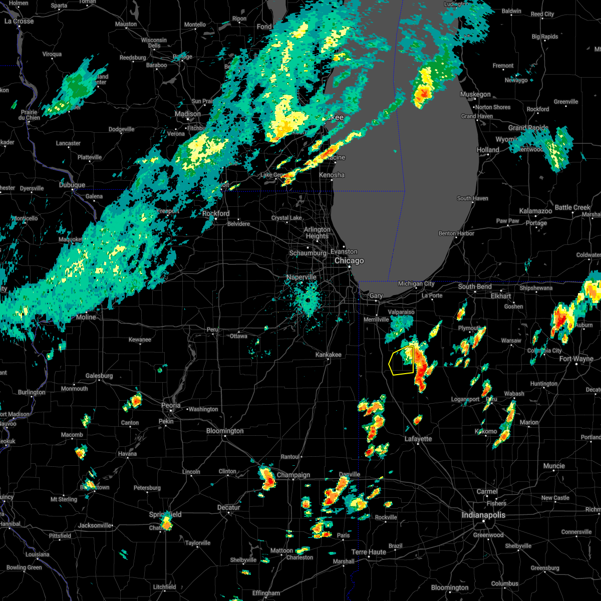 The severe thunderstorm warning for northern jasper county will expire at 130 pm cdt, the storm which prompted the warning has weakened below severe limits, and has exited the warned area. therefore, the warning will be allowed to expire. The severe thunderstorm warning for northern jasper county will expire at 130 pm cdt, the storm which prompted the warning has weakened below severe limits, and has exited the warned area. therefore, the warning will be allowed to expire.
|
| 6/29/2021 1:01 PM CDT |
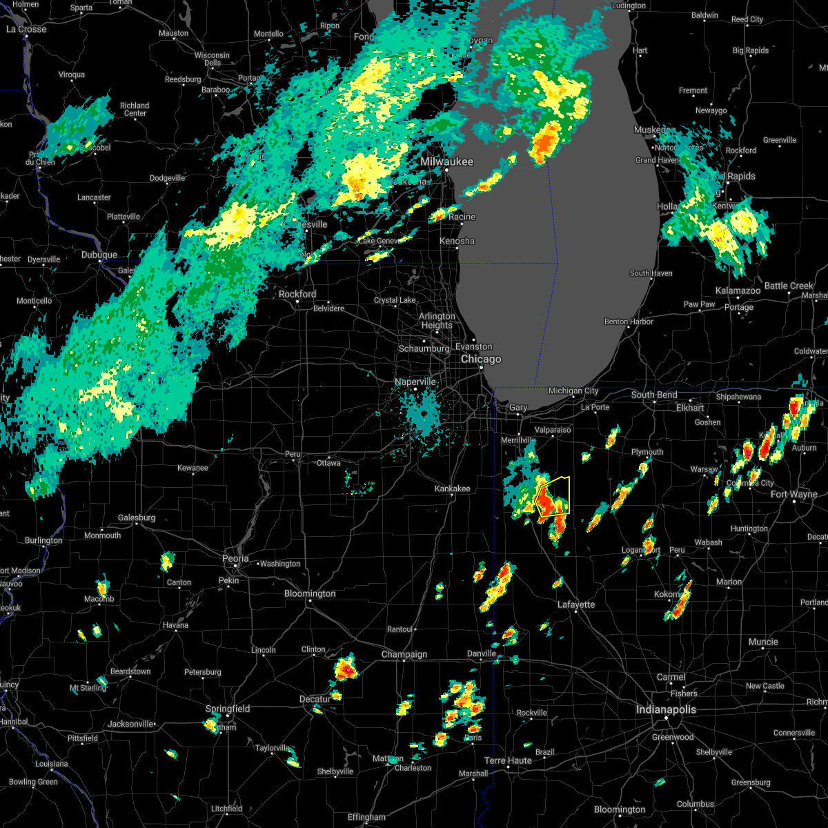 At 100 pm cdt, a severe thunderstorm was located near wheatfield, moving east northeast at 30 mph (radar indicated). Hazards include 60 mph wind gusts and quarter size hail. Hail damage to vehicles is expected. expect wind damage to roofs, siding, and trees. Locations impacted include, wheatfield and baileys corner. At 100 pm cdt, a severe thunderstorm was located near wheatfield, moving east northeast at 30 mph (radar indicated). Hazards include 60 mph wind gusts and quarter size hail. Hail damage to vehicles is expected. expect wind damage to roofs, siding, and trees. Locations impacted include, wheatfield and baileys corner.
|
| 6/29/2021 12:41 PM CDT |
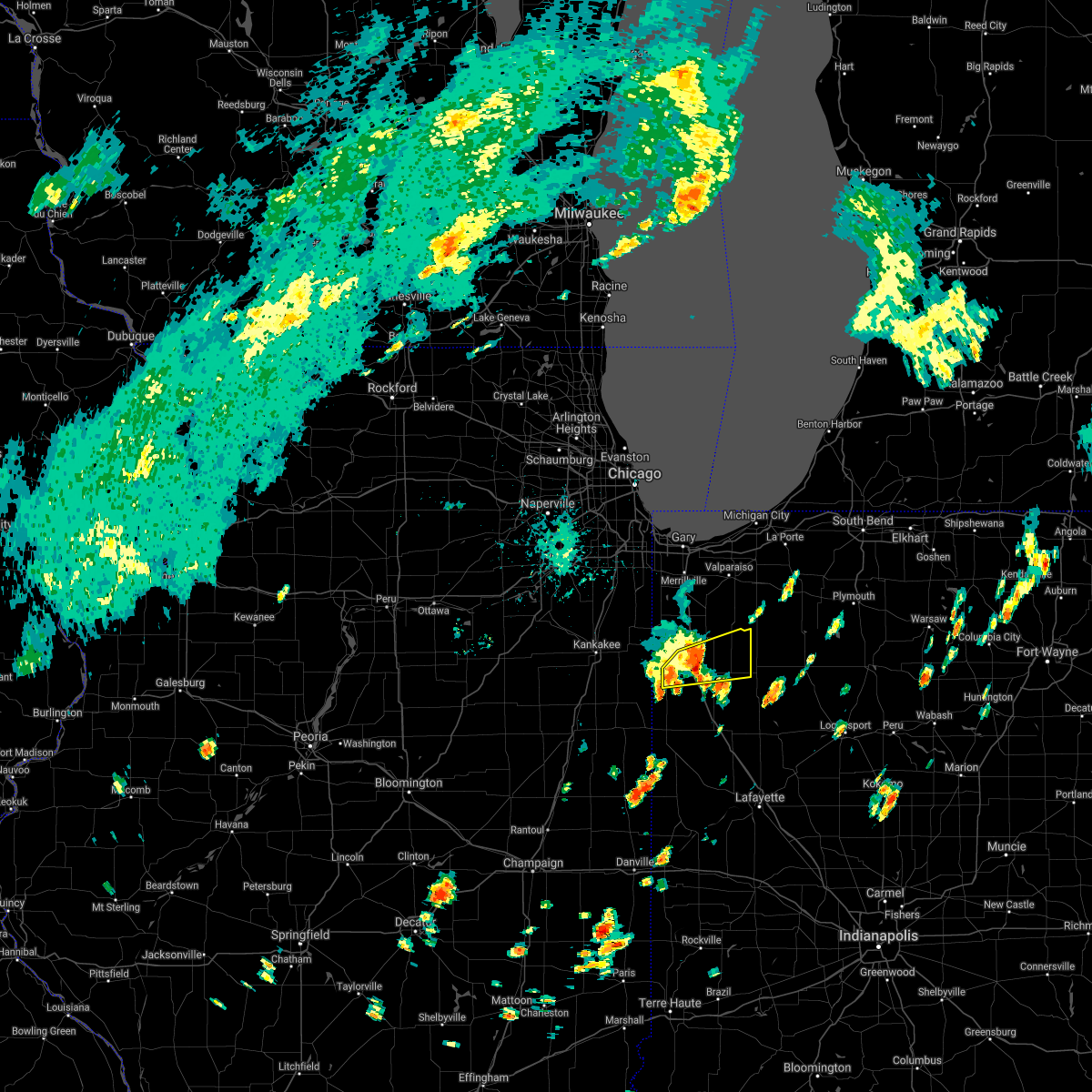 At 1240 pm cdt, a severe thunderstorm was located near fair oaks, or 8 miles south of demotte, moving east northeast at 30 mph (radar indicated). Hazards include 60 mph wind gusts and quarter size hail. Hail damage to vehicles is expected. expect wind damage to roofs, siding, and trees. locations impacted include, wheatfield, roselawn, fair oaks, baileys corner, stoutsburg and parr. Including the following interstate, indiana i-65 between mile markers 218 and 230. At 1240 pm cdt, a severe thunderstorm was located near fair oaks, or 8 miles south of demotte, moving east northeast at 30 mph (radar indicated). Hazards include 60 mph wind gusts and quarter size hail. Hail damage to vehicles is expected. expect wind damage to roofs, siding, and trees. locations impacted include, wheatfield, roselawn, fair oaks, baileys corner, stoutsburg and parr. Including the following interstate, indiana i-65 between mile markers 218 and 230.
|
| 6/29/2021 12:18 PM CDT |
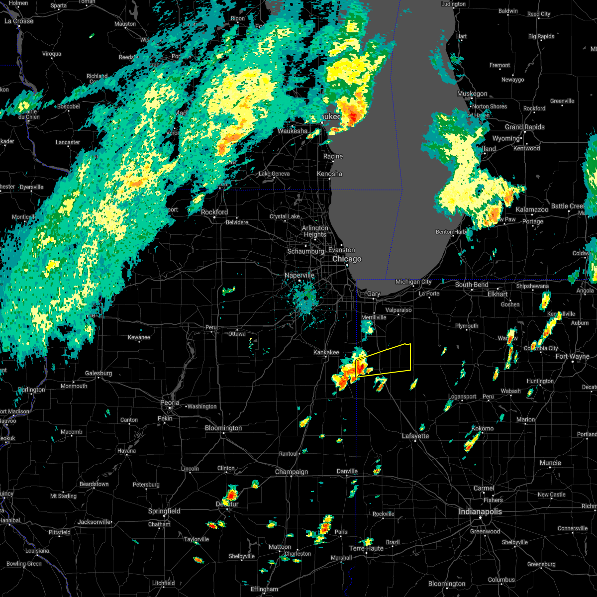 At 1217 pm cdt, a severe thunderstorm was located near morocco, moving east northeast at 30 mph (radar indicated). Hazards include 60 mph wind gusts and quarter size hail. Hail damage to vehicles is expected. Expect wind damage to roofs, siding, and trees. At 1217 pm cdt, a severe thunderstorm was located near morocco, moving east northeast at 30 mph (radar indicated). Hazards include 60 mph wind gusts and quarter size hail. Hail damage to vehicles is expected. Expect wind damage to roofs, siding, and trees.
|
| 6/26/2021 5:38 PM CDT |
 At 538 pm cdt, severe thunderstorms were located along a line extending from hobart to lowell to near roselawn to stockland, moving northeast at 70 mph (radar indicated). Hazards include 70 mph wind gusts. Expect considerable tree damage. damage is likely to mobile homes, roofs, and outbuildings. locations impacted include, gary, portage, merrillville, valparaiso, schererville, hobart, crown point, chesterton, cedar lake, lowell, rensselaer, demotte, hebron, kentland, remington, morocco, wheatfield, lake village, griffith and st. John. At 538 pm cdt, severe thunderstorms were located along a line extending from hobart to lowell to near roselawn to stockland, moving northeast at 70 mph (radar indicated). Hazards include 70 mph wind gusts. Expect considerable tree damage. damage is likely to mobile homes, roofs, and outbuildings. locations impacted include, gary, portage, merrillville, valparaiso, schererville, hobart, crown point, chesterton, cedar lake, lowell, rensselaer, demotte, hebron, kentland, remington, morocco, wheatfield, lake village, griffith and st. John.
|
| 6/26/2021 5:21 PM CDT |
 At 521 pm cdt, severe thunderstorms were located along a line extending from near st. anne to near hopkins park to near sheldon, moving northeast at 55 mph (radar indicated). Hazards include 70 mph wind gusts. Expect considerable tree damage. Damage is likely to mobile homes, roofs, and outbuildings. At 521 pm cdt, severe thunderstorms were located along a line extending from near st. anne to near hopkins park to near sheldon, moving northeast at 55 mph (radar indicated). Hazards include 70 mph wind gusts. Expect considerable tree damage. Damage is likely to mobile homes, roofs, and outbuildings.
|
| 6/26/2021 2:54 PM CDT |
 At 254 pm cdt, a severe thunderstorm was located over kouts, or 7 miles east of hebron, moving northeast at 45 mph (radar indicated). Hazards include 60 mph wind gusts. Expect damage to roofs, siding, and trees. Locations impacted include, valparaiso, demotte, hebron, wheatfield, kouts, dunns bridge, boone grove, malden and stoutsburg. At 254 pm cdt, a severe thunderstorm was located over kouts, or 7 miles east of hebron, moving northeast at 45 mph (radar indicated). Hazards include 60 mph wind gusts. Expect damage to roofs, siding, and trees. Locations impacted include, valparaiso, demotte, hebron, wheatfield, kouts, dunns bridge, boone grove, malden and stoutsburg.
|
| 6/26/2021 2:43 PM CDT |
 At 242 pm cdt, a severe thunderstorm was located near demotte, moving northeast at 45 mph (radar indicated). Hazards include 60 mph wind gusts. Expect damage to roofs, siding, and trees. Locations impacted include, valparaiso, demotte, hebron, wheatfield, roselawn, kouts, shelby, dunns bridge, boone grove, thayer, malden and stoutsburg. At 242 pm cdt, a severe thunderstorm was located near demotte, moving northeast at 45 mph (radar indicated). Hazards include 60 mph wind gusts. Expect damage to roofs, siding, and trees. Locations impacted include, valparaiso, demotte, hebron, wheatfield, roselawn, kouts, shelby, dunns bridge, boone grove, thayer, malden and stoutsburg.
|
| 6/26/2021 2:27 PM CDT |
 At 227 pm cdt, a severe thunderstorm was located over lake village, moving east at 45 mph (radar indicated). Hazards include 60 mph wind gusts. expect damage to roofs, siding, and trees At 227 pm cdt, a severe thunderstorm was located over lake village, moving east at 45 mph (radar indicated). Hazards include 60 mph wind gusts. expect damage to roofs, siding, and trees
|
| 6/21/2021 12:47 AM CDT |
 At 1247 am cdt, severe thunderstorms were located along a line extending from kingsford heights to 6 miles south of demotte, moving southeast at 35 mph. the strongest winds with these storms are in eastern porter county and far northern jasper county (radar indicated). Hazards include 70 mph wind gusts and penny size hail. Expect considerable tree damage. damage is likely to mobile homes, roofs, and outbuildings. Locations impacted include, valparaiso, demotte, wheatfield, kouts, town of pines, hanging grove, fair oaks, parr, dunns bridge, baileys corner, malden and stoutsburg. At 1247 am cdt, severe thunderstorms were located along a line extending from kingsford heights to 6 miles south of demotte, moving southeast at 35 mph. the strongest winds with these storms are in eastern porter county and far northern jasper county (radar indicated). Hazards include 70 mph wind gusts and penny size hail. Expect considerable tree damage. damage is likely to mobile homes, roofs, and outbuildings. Locations impacted include, valparaiso, demotte, wheatfield, kouts, town of pines, hanging grove, fair oaks, parr, dunns bridge, baileys corner, malden and stoutsburg.
|
| 6/21/2021 12:26 AM CDT |
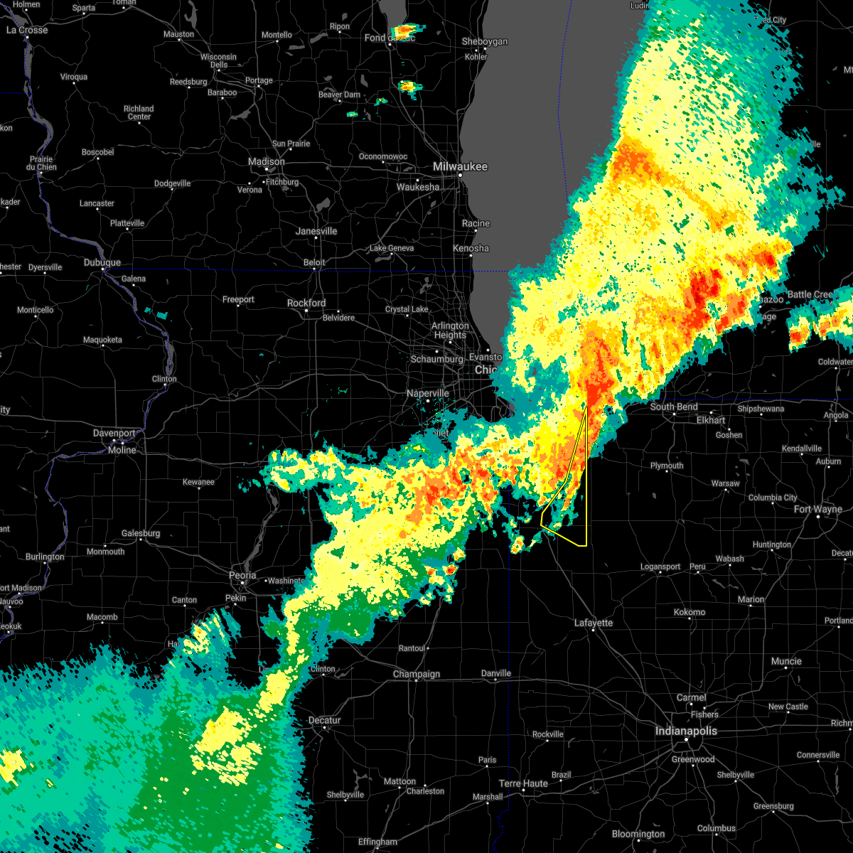 At 1226 am cdt, severe thunderstorms were located along a line extending from near westville to shelby, moving southeast at 40 mph. these storms have a history of producing wind damage (radar indicated). Hazards include 70 mph wind gusts and penny size hail. Expect considerable tree damage. damage is likely to mobile homes, roofs, and outbuildings. Locations impacted include, valparaiso, demotte, wheatfield, kouts, town of pines, hanging grove, fair oaks, parr, dunns bridge, baileys corner, malden and stoutsburg. At 1226 am cdt, severe thunderstorms were located along a line extending from near westville to shelby, moving southeast at 40 mph. these storms have a history of producing wind damage (radar indicated). Hazards include 70 mph wind gusts and penny size hail. Expect considerable tree damage. damage is likely to mobile homes, roofs, and outbuildings. Locations impacted include, valparaiso, demotte, wheatfield, kouts, town of pines, hanging grove, fair oaks, parr, dunns bridge, baileys corner, malden and stoutsburg.
|
| 6/21/2021 12:06 AM CDT |
 At 1205 am cdt, severe thunderstorms were located along a line extending from 8 miles north of porter to near grant park, moving southeast at 40 mph. these storms have a long history of producing wind damage (radar indicated). Hazards include 70 mph wind gusts and penny size hail. Expect considerable tree damage. Damage is likely to mobile homes, roofs, and outbuildings. At 1205 am cdt, severe thunderstorms were located along a line extending from 8 miles north of porter to near grant park, moving southeast at 40 mph. these storms have a long history of producing wind damage (radar indicated). Hazards include 70 mph wind gusts and penny size hail. Expect considerable tree damage. Damage is likely to mobile homes, roofs, and outbuildings.
|
| 8/10/2020 4:48 PM CDT |
 At 448 pm cdt/548 pm edt/, a severe thunderstorm was located near north judson, or 10 miles southwest of knox, moving east at 55 mph. this is a very dangerous storm (radar indicated). Hazards include 80 mph wind gusts. Flying debris will be dangerous to those caught without shelter. mobile homes will be heavily damaged. expect considerable damage to roofs, windows, and vehicles. extensive tree damage and power outages are likely. Locations impacted include, hammond, gary, portage, merrillville, valparaiso, schererville, hobart, crown point, highland, chesterton, cedar lake, lowell, rensselaer, demotte, hebron, fowler, kentland, otterbein, remington and morocco. At 448 pm cdt/548 pm edt/, a severe thunderstorm was located near north judson, or 10 miles southwest of knox, moving east at 55 mph. this is a very dangerous storm (radar indicated). Hazards include 80 mph wind gusts. Flying debris will be dangerous to those caught without shelter. mobile homes will be heavily damaged. expect considerable damage to roofs, windows, and vehicles. extensive tree damage and power outages are likely. Locations impacted include, hammond, gary, portage, merrillville, valparaiso, schererville, hobart, crown point, highland, chesterton, cedar lake, lowell, rensselaer, demotte, hebron, fowler, kentland, otterbein, remington and morocco.
|
| 8/10/2020 4:32 PM CDT |
 At 432 pm cdt/532 pm edt/, a severe thunderstorm was located over wheatfield, moving east at 55 mph. this is a very dangerous storm (radar indicated). Hazards include 80 mph wind gusts and quarter size hail. Flying debris will be dangerous to those caught without shelter. mobile homes will be heavily damaged. expect considerable damage to roofs, windows, and vehicles. extensive tree damage and power outages are likely. Locations impacted include, hammond, gary, portage, merrillville, valparaiso, east chicago, schererville, hobart, crown point, highland, munster, chesterton, cedar lake, lowell, rensselaer, demotte, hebron, fowler, kentland and otterbein. At 432 pm cdt/532 pm edt/, a severe thunderstorm was located over wheatfield, moving east at 55 mph. this is a very dangerous storm (radar indicated). Hazards include 80 mph wind gusts and quarter size hail. Flying debris will be dangerous to those caught without shelter. mobile homes will be heavily damaged. expect considerable damage to roofs, windows, and vehicles. extensive tree damage and power outages are likely. Locations impacted include, hammond, gary, portage, merrillville, valparaiso, east chicago, schererville, hobart, crown point, highland, munster, chesterton, cedar lake, lowell, rensselaer, demotte, hebron, fowler, kentland and otterbein.
|
| 8/10/2020 4:13 PM CDT |
 At 412 pm cdt/512 pm edt/, a severe thunderstorm was located over lake village, moving east at 55 mph. this is a very dangerous storm (radar indicated. the strongest winds are heading toward crown point, lake of the four seasnos, and lowell). Hazards include 80 mph wind gusts and quarter size hail. Flying debris will be dangerous to those caught without shelter. mobile homes will be heavily damaged. expect considerable damage to roofs, windows, and vehicles. extensive tree damage and power outages are likely. Locations impacted include, hammond, gary, portage, merrillville, valparaiso, east chicago, schererville, hobart, lansing, crown point, highland, munster, chesterton, cedar lake, lowell, rensselaer, demotte, hebron, fowler and kentland. At 412 pm cdt/512 pm edt/, a severe thunderstorm was located over lake village, moving east at 55 mph. this is a very dangerous storm (radar indicated. the strongest winds are heading toward crown point, lake of the four seasnos, and lowell). Hazards include 80 mph wind gusts and quarter size hail. Flying debris will be dangerous to those caught without shelter. mobile homes will be heavily damaged. expect considerable damage to roofs, windows, and vehicles. extensive tree damage and power outages are likely. Locations impacted include, hammond, gary, portage, merrillville, valparaiso, east chicago, schererville, hobart, lansing, crown point, highland, munster, chesterton, cedar lake, lowell, rensselaer, demotte, hebron, fowler and kentland.
|
| 8/10/2020 3:53 PM CDT |
 At 353 pm cdt/453 pm edt/, a severe thunderstorm was located near aroma park, or near bradley, moving east at 55 mph. this is a very dangerous storm (radar indicated). Hazards include 80 mph wind gusts. Flying debris will be dangerous to those caught without shelter. mobile homes will be heavily damaged. expect considerable damage to roofs, windows, and vehicles. extensive tree damage and power outages are likely. Locations impacted include, hammond, gary, portage, merrillville, valparaiso, east chicago, schererville, hobart, lansing, crown point, highland, munster, chesterton, cedar lake, lowell, rensselaer, demotte, hebron, fowler and kentland. At 353 pm cdt/453 pm edt/, a severe thunderstorm was located near aroma park, or near bradley, moving east at 55 mph. this is a very dangerous storm (radar indicated). Hazards include 80 mph wind gusts. Flying debris will be dangerous to those caught without shelter. mobile homes will be heavily damaged. expect considerable damage to roofs, windows, and vehicles. extensive tree damage and power outages are likely. Locations impacted include, hammond, gary, portage, merrillville, valparaiso, east chicago, schererville, hobart, lansing, crown point, highland, munster, chesterton, cedar lake, lowell, rensselaer, demotte, hebron, fowler and kentland.
|
| 8/10/2020 3:31 PM CDT |
 At 330 pm cdt/430 pm edt/, a severe thunderstorm was located near herscher, moving east at 55 mph (radar indicated). Hazards include 70 mph wind gusts. Expect considerable tree damage. Damage is likely to mobile homes, roofs, and outbuildings. At 330 pm cdt/430 pm edt/, a severe thunderstorm was located near herscher, moving east at 55 mph (radar indicated). Hazards include 70 mph wind gusts. Expect considerable tree damage. Damage is likely to mobile homes, roofs, and outbuildings.
|
| 7/11/2020 11:09 PM CDT |
 The severe thunderstorm warning for southeastern will, eastern kankakee, eastern iroquois, benton, newton, southern porter, southern lake and jasper counties will expire at 1115 pm cdt/1215 am edt/, the storms which prompted the warning have weakened below severe limits, and no longer pose an immediate threat to life or property. therefore, the warning will be allowed to expire. however gusty winds to 40 to 50 mph are still possible with the outflow ahead of these thunderstorms, and to a lesser degree with the storms themselves. The severe thunderstorm warning for southeastern will, eastern kankakee, eastern iroquois, benton, newton, southern porter, southern lake and jasper counties will expire at 1115 pm cdt/1215 am edt/, the storms which prompted the warning have weakened below severe limits, and no longer pose an immediate threat to life or property. therefore, the warning will be allowed to expire. however gusty winds to 40 to 50 mph are still possible with the outflow ahead of these thunderstorms, and to a lesser degree with the storms themselves.
|
| 7/11/2020 11:03 PM CDT |
 At 1102 pm cdt/1202 am edt/, severe thunderstorms were located along a line extending from near st. john to near boswell, with a gust front extending from crown point south to remington moving east at 30 mph (radar indicated). Hazards include 60 mph wind gusts. Expect damage to roofs, siding, and trees. Locations impacted include, lowell, rensselaer, demotte, hebron, fowler, kentland, otterbein, remington, morocco, wheatfield, lake village, beecher, roselawn, kouts, lake dalecarlia, grant park, oxford, sheldon, goodland and brook. At 1102 pm cdt/1202 am edt/, severe thunderstorms were located along a line extending from near st. john to near boswell, with a gust front extending from crown point south to remington moving east at 30 mph (radar indicated). Hazards include 60 mph wind gusts. Expect damage to roofs, siding, and trees. Locations impacted include, lowell, rensselaer, demotte, hebron, fowler, kentland, otterbein, remington, morocco, wheatfield, lake village, beecher, roselawn, kouts, lake dalecarlia, grant park, oxford, sheldon, goodland and brook.
|
| 7/11/2020 10:39 PM CDT |
 At 1037 pm cdt/1137 pm edt/, severe thunderstorms were located along a line extending from university park to hoopeston, moving east at 40 mph. a personal weather station reported 68 mph winds near cissna park in south central iroquois county, though no reports of damage have been received yet (radar indicated). Hazards include 60 mph wind gusts. Expect damage to roofs, siding, and trees. Locations impacted include, merrillville, valparaiso, schererville, hobart, kankakee, crown point, park forest, mokena, bourbonnais, frankfort, bradley, cedar lake, steger, lowell, manteno, rensselaer, watseka, peotone, demotte and hebron. At 1037 pm cdt/1137 pm edt/, severe thunderstorms were located along a line extending from university park to hoopeston, moving east at 40 mph. a personal weather station reported 68 mph winds near cissna park in south central iroquois county, though no reports of damage have been received yet (radar indicated). Hazards include 60 mph wind gusts. Expect damage to roofs, siding, and trees. Locations impacted include, merrillville, valparaiso, schererville, hobart, kankakee, crown point, park forest, mokena, bourbonnais, frankfort, bradley, cedar lake, steger, lowell, manteno, rensselaer, watseka, peotone, demotte and hebron.
|
| 7/11/2020 10:08 PM CDT |
 At 1006 pm cdt/1106 pm edt/, severe thunderstorms were located along a line extending from near frankfort to near cissna park, moving east at 45 mph. winds to 60 mph were reported in braidwood and to 68 mph in saunemim with this line of storms (radar indicated). Hazards include 60 mph wind gusts. expect damage to roofs, siding, and trees At 1006 pm cdt/1106 pm edt/, severe thunderstorms were located along a line extending from near frankfort to near cissna park, moving east at 45 mph. winds to 60 mph were reported in braidwood and to 68 mph in saunemim with this line of storms (radar indicated). Hazards include 60 mph wind gusts. expect damage to roofs, siding, and trees
|
| 6/26/2020 9:06 PM CDT |
 At 906 pm cdt, severe thunderstorms were located along a line extending from westville to malden to near de motte, moving east at 65 mph (radar indicated). Hazards include 70 mph wind gusts. Expect considerable tree damage. damage is likely to mobile homes, roofs, and outbuildings. These severe thunderstorms will remain over mainly rural areas of southern porter, southern lake and northern jasper counties, including the following locations, wheatfield. At 906 pm cdt, severe thunderstorms were located along a line extending from westville to malden to near de motte, moving east at 65 mph (radar indicated). Hazards include 70 mph wind gusts. Expect considerable tree damage. damage is likely to mobile homes, roofs, and outbuildings. These severe thunderstorms will remain over mainly rural areas of southern porter, southern lake and northern jasper counties, including the following locations, wheatfield.
|
| 6/26/2020 8:50 PM CDT |
 At 850 pm cdt, severe thunderstorms were located along a line extending from gary to crown point to near lowell, moving east at 65 mph (radar indicated). Hazards include 70 mph wind gusts. Expect considerable tree damage. damage is likely to mobile homes, roofs, and outbuildings. severe thunderstorms will be near, hebron and boone grove around 900 pm cdt. de motte, malden and kouts around 905 pm cdt. dunns bridge around 915 pm cdt. other locations impacted by these severe thunderstorms include wheatfield. Including the following interstate, indiana i-65 between mile markers 262 and 243. At 850 pm cdt, severe thunderstorms were located along a line extending from gary to crown point to near lowell, moving east at 65 mph (radar indicated). Hazards include 70 mph wind gusts. Expect considerable tree damage. damage is likely to mobile homes, roofs, and outbuildings. severe thunderstorms will be near, hebron and boone grove around 900 pm cdt. de motte, malden and kouts around 905 pm cdt. dunns bridge around 915 pm cdt. other locations impacted by these severe thunderstorms include wheatfield. Including the following interstate, indiana i-65 between mile markers 262 and 243.
|
| 9/27/2019 7:26 PM CDT |
 At 725 pm cdt, severe thunderstorms were located along a line extending from lakes of the four seasons to near thayer, moving east at 40 mph (radar indicated). Hazards include 70 mph wind gusts and half dollar size hail. Hail damage to vehicles is expected. expect considerable tree damage. wind damage is also likely to mobile homes, roofs, and outbuildings. these severe storms will be near, hebron, lakes of the four seasons and winfield around 730 pm cdt. forest city and boone grove around 735 pm cdt. de motte and kouts around 740 pm cdt. malden around 745 pm cdt. dunns bridge around 800 pm cdt. Other locations impacted by these severe thunderstorms include wheatfield and schneider. At 725 pm cdt, severe thunderstorms were located along a line extending from lakes of the four seasons to near thayer, moving east at 40 mph (radar indicated). Hazards include 70 mph wind gusts and half dollar size hail. Hail damage to vehicles is expected. expect considerable tree damage. wind damage is also likely to mobile homes, roofs, and outbuildings. these severe storms will be near, hebron, lakes of the four seasons and winfield around 730 pm cdt. forest city and boone grove around 735 pm cdt. de motte and kouts around 740 pm cdt. malden around 745 pm cdt. dunns bridge around 800 pm cdt. Other locations impacted by these severe thunderstorms include wheatfield and schneider.
|
| 9/27/2019 7:10 PM CDT |
 At 710 pm cdt, severe thunderstorms were located along a line extending from st. john to near grant park, moving east at 35 mph (radar indicated). Hazards include 70 mph wind gusts and ping pong ball size hail. People and animals outdoors will be injured. expect hail damage to roofs, siding, windows, and vehicles. expect considerable tree damage. wind damage is also likely to mobile homes, roofs, and outbuildings. severe thunderstorms will be near, cedar lake around 715 pm cdt. crown point, lowell and lake dalecarlia around 720 pm cdt. lakes of the four seasons, lake village and winfield around 730 pm cdt. hebron and thayer around 735 pm cdt. sumava resorts and roselawn around 740 pm cdt. boone grove, forest city and pembroke around 745 pm cdt. de motte, malden and kouts around 750 pm cdt. dunns bridge around 810 pm cdt. other locations impacted by these severe thunderstorms include wheatfield and schneider. including the following interstate, indiana i-65 between mile markers 228 and 249. This includes the lake county fairgrounds. At 710 pm cdt, severe thunderstorms were located along a line extending from st. john to near grant park, moving east at 35 mph (radar indicated). Hazards include 70 mph wind gusts and ping pong ball size hail. People and animals outdoors will be injured. expect hail damage to roofs, siding, windows, and vehicles. expect considerable tree damage. wind damage is also likely to mobile homes, roofs, and outbuildings. severe thunderstorms will be near, cedar lake around 715 pm cdt. crown point, lowell and lake dalecarlia around 720 pm cdt. lakes of the four seasons, lake village and winfield around 730 pm cdt. hebron and thayer around 735 pm cdt. sumava resorts and roselawn around 740 pm cdt. boone grove, forest city and pembroke around 745 pm cdt. de motte, malden and kouts around 750 pm cdt. dunns bridge around 810 pm cdt. other locations impacted by these severe thunderstorms include wheatfield and schneider. including the following interstate, indiana i-65 between mile markers 228 and 249. This includes the lake county fairgrounds.
|
| 8/18/2019 5:27 AM CDT |
 At 527 am cdt, a severe thunderstorm was located near dunns bridge, moving northeast at 25 mph (radar indicated). Hazards include quarter size hail. Damage to vehicles is expected. Locations impacted include, de motte, hebron, gifford, dunns bridge, boone grove and wheatfield. At 527 am cdt, a severe thunderstorm was located near dunns bridge, moving northeast at 25 mph (radar indicated). Hazards include quarter size hail. Damage to vehicles is expected. Locations impacted include, de motte, hebron, gifford, dunns bridge, boone grove and wheatfield.
|
| 8/18/2019 5:12 AM CDT |
 At 512 am cdt, a severe thunderstorm was located over de motte, moving northeast at 25 mph (radar indicated). Hazards include quarter size hail. Damage to vehicles is expected. Locations impacted include, de motte, hebron, fair oaks, dunns bridge, boone grove, thayer, sumava resorts, roselawn, gifford, forest city, pembroke and wheatfield. At 512 am cdt, a severe thunderstorm was located over de motte, moving northeast at 25 mph (radar indicated). Hazards include quarter size hail. Damage to vehicles is expected. Locations impacted include, de motte, hebron, fair oaks, dunns bridge, boone grove, thayer, sumava resorts, roselawn, gifford, forest city, pembroke and wheatfield.
|
| 8/18/2019 4:58 AM CDT |
 At 458 am cdt, a severe thunderstorm was located over pembroke, moving northeast at 25 mph (radar indicated). Hazards include quarter size hail. damage to vehicles is expected At 458 am cdt, a severe thunderstorm was located over pembroke, moving northeast at 25 mph (radar indicated). Hazards include quarter size hail. damage to vehicles is expected
|
| 8/17/2019 3:36 AM CDT |
 A severe thunderstorm warning remains in effect until 400 am cdt for southern porter and northern jasper counties. at 335 am cdt, a severe thunderstorm was located near de motte, moving east at 40 mph. at 330 am, a trained weather spotter reported wind damage with branches down and nickel sized hail near demotte. hazard. Ping pong ball size hail and 60 mph wind gusts. A severe thunderstorm warning remains in effect until 400 am cdt for southern porter and northern jasper counties. at 335 am cdt, a severe thunderstorm was located near de motte, moving east at 40 mph. at 330 am, a trained weather spotter reported wind damage with branches down and nickel sized hail near demotte. hazard. Ping pong ball size hail and 60 mph wind gusts.
|
| 8/17/2019 3:20 AM CDT |
 At 320 am cdt, a severe thunderstorm was located over forest city, moving east at 35 mph (radar indicated). Hazards include 70 mph wind gusts and ping pong ball size hail. People and animals outdoors will be injured. expect hail damage to roofs, siding, windows, and vehicles. expect considerable tree damage. wind damage is also likely to mobile homes, roofs, and outbuildings. Locations impacted include, lowell, de motte, hebron, thayer, sumava resorts, roselawn, gifford, pembroke, fair oaks, dunns bridge, forest city, kouts, lake dalecarlia and wheatfield. At 320 am cdt, a severe thunderstorm was located over forest city, moving east at 35 mph (radar indicated). Hazards include 70 mph wind gusts and ping pong ball size hail. People and animals outdoors will be injured. expect hail damage to roofs, siding, windows, and vehicles. expect considerable tree damage. wind damage is also likely to mobile homes, roofs, and outbuildings. Locations impacted include, lowell, de motte, hebron, thayer, sumava resorts, roselawn, gifford, pembroke, fair oaks, dunns bridge, forest city, kouts, lake dalecarlia and wheatfield.
|
| 8/17/2019 3:07 AM CDT |
 At 305 am cdt, a severe thunderstorm was located near lowell, moving east at 40 mph. this storm has a history of producing large hail across parts of kankakee and southern will counties (radar indicated). Hazards include 70 mph wind gusts and ping pong ball size hail. People and animals outdoors will be injured. expect hail damage to roofs, siding, windows, and vehicles. expect considerable tree damage. wind damage is also likely to mobile homes, roofs, and outbuildings. Locations impacted include, crown point, cedar lake, lowell, de motte, hebron, boone grove, thayer, sumava resorts, roselawn, gifford, pembroke, fair oaks, dunns bridge, malden, forest city, lake village, winfield, kouts, lake dalecarlia and wheatfield. At 305 am cdt, a severe thunderstorm was located near lowell, moving east at 40 mph. this storm has a history of producing large hail across parts of kankakee and southern will counties (radar indicated). Hazards include 70 mph wind gusts and ping pong ball size hail. People and animals outdoors will be injured. expect hail damage to roofs, siding, windows, and vehicles. expect considerable tree damage. wind damage is also likely to mobile homes, roofs, and outbuildings. Locations impacted include, crown point, cedar lake, lowell, de motte, hebron, boone grove, thayer, sumava resorts, roselawn, gifford, pembroke, fair oaks, dunns bridge, malden, forest city, lake village, winfield, kouts, lake dalecarlia and wheatfield.
|
| 8/17/2019 2:54 AM CDT |
 At 253 am cdt, a severe thunderstorm was located near beecher, or 8 miles west of lowell, moving east at 40 mph. this storm is capable of producing large, wind driven hail! (trained weather spotters). Hazards include two inch hail and 70 mph wind gusts. People and animals outdoors will be injured. expect hail damage to roofs, siding, windows, and vehicles. expect considerable tree damage. Wind damage is also likely to mobile homes, roofs, and outbuildings. At 253 am cdt, a severe thunderstorm was located near beecher, or 8 miles west of lowell, moving east at 40 mph. this storm is capable of producing large, wind driven hail! (trained weather spotters). Hazards include two inch hail and 70 mph wind gusts. People and animals outdoors will be injured. expect hail damage to roofs, siding, windows, and vehicles. expect considerable tree damage. Wind damage is also likely to mobile homes, roofs, and outbuildings.
|
| 7/21/2019 3:11 PM CDT |
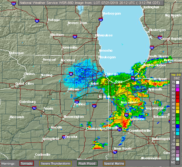 The severe thunderstorm warning for northeastern newton, southern porter, southeastern lake and jasper counties will expire at 315 pm cdt, the storms which prompted the warning have moved out of the area. therefore, the warning will be allowed to expire. The severe thunderstorm warning for northeastern newton, southern porter, southeastern lake and jasper counties will expire at 315 pm cdt, the storms which prompted the warning have moved out of the area. therefore, the warning will be allowed to expire.
|
| 7/21/2019 2:50 PM CDT |
 At 249 pm cdt, severe thunderstorms were located along a line extending from 6 miles northeast of de motte to near medaryville to mccoysburg, moving east at 35 mph (radar indicated). Hazards include 60 mph wind gusts. Expect damage to roofs, siding, and trees. Locations impacted include, rensselaer, de motte, hanging grove, thayer, sumava resorts, roselawn, mccoysburg, gifford, pembroke, fair oaks, moody, pleasant ridge, dunns bridge, forest city, surrey, lake village, kouts, collegeville, wheatfield and schneider. At 249 pm cdt, severe thunderstorms were located along a line extending from 6 miles northeast of de motte to near medaryville to mccoysburg, moving east at 35 mph (radar indicated). Hazards include 60 mph wind gusts. Expect damage to roofs, siding, and trees. Locations impacted include, rensselaer, de motte, hanging grove, thayer, sumava resorts, roselawn, mccoysburg, gifford, pembroke, fair oaks, moody, pleasant ridge, dunns bridge, forest city, surrey, lake village, kouts, collegeville, wheatfield and schneider.
|
| 7/21/2019 2:20 PM CDT |
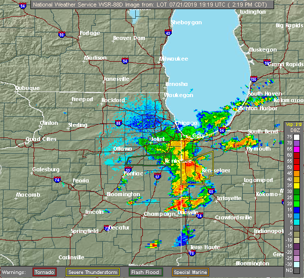 At 220 pm cdt, severe thunderstorms were located along a line extending from near thayer to surrey to foresman, moving east at 40 mph (radar indicated). Hazards include 60 mph wind gusts. Expect damage to roofs, siding, and trees. Locations impacted include, rensselaer, de motte, kentland, morocco, hanging grove, percy junction, thayer, roselawn, gifford, enos, pembroke, fair oaks, pleasant ridge, dunns bridge, conrad, perkins, sumava resorts, mccoysburg, beaver city and moody. At 220 pm cdt, severe thunderstorms were located along a line extending from near thayer to surrey to foresman, moving east at 40 mph (radar indicated). Hazards include 60 mph wind gusts. Expect damage to roofs, siding, and trees. Locations impacted include, rensselaer, de motte, kentland, morocco, hanging grove, percy junction, thayer, roselawn, gifford, enos, pembroke, fair oaks, pleasant ridge, dunns bridge, conrad, perkins, sumava resorts, mccoysburg, beaver city and moody.
|
| 7/21/2019 2:12 PM CDT |
 At 212 pm cdt, severe thunderstorms were located along a line extending from near lake village to near enos to brook, moving east at 35 mph (radar indicated). Hazards include 60 mph wind gusts. expect damage to roofs, siding, and trees At 212 pm cdt, severe thunderstorms were located along a line extending from near lake village to near enos to brook, moving east at 35 mph (radar indicated). Hazards include 60 mph wind gusts. expect damage to roofs, siding, and trees
|
| 6/30/2019 3:58 PM CDT |
 At 355 pm cdt, severe thunderstorms were located along a line extending from near kentland to morocco to perkins to lake village, moving southeast at 30 to 35 mph (radar indicated). Hazards include 60 mph wind gusts. Expect damage to roofs, siding, and trees. Locations impacted include, rensselaer, de motte, kentland, morocco, hanging grove, percy junction, thayer, roselawn, gifford, enos, pembroke, fair oaks, pleasant ridge, conrad, perkins, sumava resorts, mccoysburg, beaver city, moody and forest city. At 355 pm cdt, severe thunderstorms were located along a line extending from near kentland to morocco to perkins to lake village, moving southeast at 30 to 35 mph (radar indicated). Hazards include 60 mph wind gusts. Expect damage to roofs, siding, and trees. Locations impacted include, rensselaer, de motte, kentland, morocco, hanging grove, percy junction, thayer, roselawn, gifford, enos, pembroke, fair oaks, pleasant ridge, conrad, perkins, sumava resorts, mccoysburg, beaver city, moody and forest city.
|
| 6/30/2019 3:32 PM CDT |
 At 303 pm cdt, severe thunderstorms were located along a line extending from near beecher to near grant park to near hopkins park to clifton, moving southeast at 40 mph. these are very dangerous storms (trained weather spotters. winds to 75 mph were reported in manteno illinois with these storms). Hazards include 80 mph wind gusts. Flying debris will be dangerous to those caught without shelter. mobile homes will be heavily damaged. expect considerable damage to roofs, windows, and vehicles. Extensive tree damage and power outages are likely. At 303 pm cdt, severe thunderstorms were located along a line extending from near beecher to near grant park to near hopkins park to clifton, moving southeast at 40 mph. these are very dangerous storms (trained weather spotters. winds to 75 mph were reported in manteno illinois with these storms). Hazards include 80 mph wind gusts. Flying debris will be dangerous to those caught without shelter. mobile homes will be heavily damaged. expect considerable damage to roofs, windows, and vehicles. Extensive tree damage and power outages are likely.
|
| 6/30/2019 3:04 PM CDT |
 At 303 pm cdt, severe thunderstorms were located along a line extending from near beecher to near grant park to near hopkins park to clifton, moving southeast at 40 mph. these are very dangerous storms (trained weather spotters. winds to 75 mph were reported in manteno illinois with these storms). Hazards include 80 mph wind gusts. Flying debris will be dangerous to those caught without shelter. mobile homes will be heavily damaged. expect considerable damage to roofs, windows, and vehicles. Extensive tree damage and power outages are likely. At 303 pm cdt, severe thunderstorms were located along a line extending from near beecher to near grant park to near hopkins park to clifton, moving southeast at 40 mph. these are very dangerous storms (trained weather spotters. winds to 75 mph were reported in manteno illinois with these storms). Hazards include 80 mph wind gusts. Flying debris will be dangerous to those caught without shelter. mobile homes will be heavily damaged. expect considerable damage to roofs, windows, and vehicles. Extensive tree damage and power outages are likely.
|
| 5/23/2019 2:44 AM CDT | Storm damage reported in jasper county IN, 0.7 miles S of Wheatfield, IN |
| 5/23/2019 2:44 AM CDT | Trees down near 1100 w and rt 4 in jasper county IN, 1.4 miles N of Wheatfield, IN |
| 5/23/2019 2:44 AM CDT | Trees down near 900w and rt 4 in jasper county IN, 3.4 miles N of Wheatfield, IN |
| 5/23/2019 2:38 AM CDT |
 At 236 am cdt/336 am edt/, severe thunderstorms were located along a line extending from near lowell to near de motte to near moody to near atkinson, moving northeast at 70 mph. a 61 mph wind gust was recorded at rensselaer and a 63 mph wind gust was recorded at kentland airport. numerous 70 to 80 mph wind gusts have been recorded with these storms across illinois. these are very dangerous storms (radar indicated). Hazards include 80 mph wind gusts and nickel size hail. Flying debris will be dangerous to those caught without shelter. mobile homes will be heavily damaged. expect considerable damage to roofs, windows, and vehicles. extensive tree damage and power outages are likely. locations impacted include, merrillville, schererville, crown point, st. John, cedar lake, lowell, rensselaer, de motte, hebron, fowler, kentland, hanging grove, roselawn, talbot, gifford, pembroke, pleasant ridge, dunns bridge, wadena and boone grove. At 236 am cdt/336 am edt/, severe thunderstorms were located along a line extending from near lowell to near de motte to near moody to near atkinson, moving northeast at 70 mph. a 61 mph wind gust was recorded at rensselaer and a 63 mph wind gust was recorded at kentland airport. numerous 70 to 80 mph wind gusts have been recorded with these storms across illinois. these are very dangerous storms (radar indicated). Hazards include 80 mph wind gusts and nickel size hail. Flying debris will be dangerous to those caught without shelter. mobile homes will be heavily damaged. expect considerable damage to roofs, windows, and vehicles. extensive tree damage and power outages are likely. locations impacted include, merrillville, schererville, crown point, st. John, cedar lake, lowell, rensselaer, de motte, hebron, fowler, kentland, hanging grove, roselawn, talbot, gifford, pembroke, pleasant ridge, dunns bridge, wadena and boone grove.
|
| 5/23/2019 2:27 AM CDT |
 At 226 am cdt/326 am edt/, severe thunderstorms were located along a line extending from grant park to thayer to near collegeville to boswell, moving northeast at 70 mph. numerous measured wind gusts in excess of 70 mph have been reported with these dangerous thunderstorms. these are very dangerous storms (radar indicated). Hazards include 80 mph wind gusts and nickel size hail. Flying debris will be dangerous to those caught without shelter. mobile homes will be heavily damaged. expect considerable damage to roofs, windows, and vehicles. extensive tree damage and power outages are likely. locations impacted include, merrillville, schererville, kankakee, crown point, bourbonnais, bradley, st. John, cedar lake, lowell, manteno, rensselaer, peotone, de motte, hebron, momence, fowler, kentland, morocco, hanging grove and roselawn. At 226 am cdt/326 am edt/, severe thunderstorms were located along a line extending from grant park to thayer to near collegeville to boswell, moving northeast at 70 mph. numerous measured wind gusts in excess of 70 mph have been reported with these dangerous thunderstorms. these are very dangerous storms (radar indicated). Hazards include 80 mph wind gusts and nickel size hail. Flying debris will be dangerous to those caught without shelter. mobile homes will be heavily damaged. expect considerable damage to roofs, windows, and vehicles. extensive tree damage and power outages are likely. locations impacted include, merrillville, schererville, kankakee, crown point, bourbonnais, bradley, st. John, cedar lake, lowell, manteno, rensselaer, peotone, de motte, hebron, momence, fowler, kentland, morocco, hanging grove and roselawn.
|
| 5/23/2019 2:14 AM CDT |
 At 212 am cdt/312 am edt/, severe thunderstorms were located along a line extending from near kankakee to hopkins park to near morocco to near dunnington, moving northeast at 70 mph. at 2:04 am an 83 mph wind gust was measured in watseka. these are very dangerous storms (radar indicated). Hazards include 80 mph wind gusts and nickel size hail. Flying debris will be dangerous to those caught without shelter. mobile homes will be heavily damaged. expect considerable damage to roofs, windows, and vehicles. extensive tree damage and power outages are likely. locations impacted include, merrillville, schererville, kankakee, crown point, bourbonnais, bradley, st. John, cedar lake, lowell, manteno, rensselaer, watseka, peotone, de motte, hebron, momence, fowler, kentland, morocco and stockland. At 212 am cdt/312 am edt/, severe thunderstorms were located along a line extending from near kankakee to hopkins park to near morocco to near dunnington, moving northeast at 70 mph. at 2:04 am an 83 mph wind gust was measured in watseka. these are very dangerous storms (radar indicated). Hazards include 80 mph wind gusts and nickel size hail. Flying debris will be dangerous to those caught without shelter. mobile homes will be heavily damaged. expect considerable damage to roofs, windows, and vehicles. extensive tree damage and power outages are likely. locations impacted include, merrillville, schererville, kankakee, crown point, bourbonnais, bradley, st. John, cedar lake, lowell, manteno, rensselaer, watseka, peotone, de motte, hebron, momence, fowler, kentland, morocco and stockland.
|
| 5/23/2019 1:54 AM CDT |
 At 154 am cdt/254 am edt/, severe thunderstorms were located along a line extending from 8 miles north of cullom to clifton to 6 miles west of watseka to near rankin, moving northeast at 70 mph (radar indicated). Hazards include 70 mph wind gusts and nickel size hail. localized wind gusts to 80 mph will be possible with these storms. Expect considerable tree damage. Damage is likely to mobile homes, roofs, and outbuildings. At 154 am cdt/254 am edt/, severe thunderstorms were located along a line extending from 8 miles north of cullom to clifton to 6 miles west of watseka to near rankin, moving northeast at 70 mph (radar indicated). Hazards include 70 mph wind gusts and nickel size hail. localized wind gusts to 80 mph will be possible with these storms. Expect considerable tree damage. Damage is likely to mobile homes, roofs, and outbuildings.
|
| 3/14/2019 2:15 PM CDT |
 At 214 pm cdt, a severe thunderstorm was located over boone grove, moving northeast at 50 mph (radar indicated). Hazards include 60 mph wind gusts and quarter size hail. Hail damage to vehicles is expected. expect wind damage to roofs, siding, and trees. locations impacted include, wheatfield. A tornado watch remains in effect until 500 pm cdt for northwestern indiana. At 214 pm cdt, a severe thunderstorm was located over boone grove, moving northeast at 50 mph (radar indicated). Hazards include 60 mph wind gusts and quarter size hail. Hail damage to vehicles is expected. expect wind damage to roofs, siding, and trees. locations impacted include, wheatfield. A tornado watch remains in effect until 500 pm cdt for northwestern indiana.
|
| 3/14/2019 2:02 PM CDT |
 At 201 pm cdt, a severe thunderstorm was located over forest city, moving northeast at 50 mph (radar indicated). Hazards include 60 mph wind gusts and quarter size hail. Hail damage to vehicles is expected. expect wind damage to roofs, siding, and trees. locations impacted include, de motte, hebron, fair oaks, thayer, sumava resorts, roselawn, forest city, pembroke and wheatfield. A tornado watch remains in effect until 500 pm cdt for northwestern indiana. At 201 pm cdt, a severe thunderstorm was located over forest city, moving northeast at 50 mph (radar indicated). Hazards include 60 mph wind gusts and quarter size hail. Hail damage to vehicles is expected. expect wind damage to roofs, siding, and trees. locations impacted include, de motte, hebron, fair oaks, thayer, sumava resorts, roselawn, forest city, pembroke and wheatfield. A tornado watch remains in effect until 500 pm cdt for northwestern indiana.
|
| 3/14/2019 1:48 PM CDT |
 At 147 pm cdt, a severe thunderstorm was located over enos, moving northeast at 50 mph (radar indicated). Hazards include 60 mph wind gusts and quarter size hail. Hail damage to vehicles is expected. Expect wind damage to roofs, siding, and trees. At 147 pm cdt, a severe thunderstorm was located over enos, moving northeast at 50 mph (radar indicated). Hazards include 60 mph wind gusts and quarter size hail. Hail damage to vehicles is expected. Expect wind damage to roofs, siding, and trees.
|
| 7/5/2018 4:11 PM CDT |
 The severe thunderstorm warning for central newton and jasper counties will expire at 415 pm cdt, the storms which prompted the warning have weakened below severe limits, and no longer pose an immediate threat to life or property. therefore the warning will be allowed to expire. The severe thunderstorm warning for central newton and jasper counties will expire at 415 pm cdt, the storms which prompted the warning have weakened below severe limits, and no longer pose an immediate threat to life or property. therefore the warning will be allowed to expire.
|
| 7/5/2018 3:53 PM CDT |
 At 353 pm cdt, severe thunderstorms were located along a line extending from near dunns bridge to near gifford to enos, moving southeast at 25 mph (radar indicated). Hazards include 60 mph wind gusts. Expect damage to roofs, siding, and trees. Locations impacted include, rensselaer, de motte, morocco, hanging grove, thayer, sumava resorts, roselawn, mccoysburg, gifford, enos, beaver city, pembroke, fair oaks, moody, pleasant ridge, conrad, forest city, surrey, lake village and collegeville. At 353 pm cdt, severe thunderstorms were located along a line extending from near dunns bridge to near gifford to enos, moving southeast at 25 mph (radar indicated). Hazards include 60 mph wind gusts. Expect damage to roofs, siding, and trees. Locations impacted include, rensselaer, de motte, morocco, hanging grove, thayer, sumava resorts, roselawn, mccoysburg, gifford, enos, beaver city, pembroke, fair oaks, moody, pleasant ridge, conrad, forest city, surrey, lake village and collegeville.
|
| 7/5/2018 3:22 PM CDT |
 At 322 pm cdt, severe thunderstorms were located along a line extending from near forest city to thayer to near lake village, moving southeast at 45 mph (radar indicated). Hazards include 60 mph wind gusts. expect damage to roofs, siding, and trees At 322 pm cdt, severe thunderstorms were located along a line extending from near forest city to thayer to near lake village, moving southeast at 45 mph (radar indicated). Hazards include 60 mph wind gusts. expect damage to roofs, siding, and trees
|
| 5/2/2018 6:20 PM CDT | Measured via mobile weather station at sr 10 and cr 400e in jasper count in jasper county IN, 4.3 miles W of Wheatfield, IN |
| 5/2/2018 6:10 PM CDT |
 At 610 pm cdt, a severe thunderstorm was located near de motte, moving east at 40 mph (radar indicated). Hazards include golf ball size hail and 70 mph wind gusts. People and animals outdoors will be injured. expect hail damage to roofs, siding, windows, and vehicles. expect considerable tree damage. wind damage is also likely to mobile homes, roofs, and outbuildings. Locations impacted include, de motte, hebron, dunns bridge, boone grove, malden, forest city, roselawn, winfield, kouts and wheatfield. At 610 pm cdt, a severe thunderstorm was located near de motte, moving east at 40 mph (radar indicated). Hazards include golf ball size hail and 70 mph wind gusts. People and animals outdoors will be injured. expect hail damage to roofs, siding, windows, and vehicles. expect considerable tree damage. wind damage is also likely to mobile homes, roofs, and outbuildings. Locations impacted include, de motte, hebron, dunns bridge, boone grove, malden, forest city, roselawn, winfield, kouts and wheatfield.
|
| 5/2/2018 5:58 PM CDT |
 At 558 pm cdt, a severe thunderstorm was located near hebron, moving east at 35 mph (radar indicated). Hazards include 60 mph wind gusts and quarter size hail. Hail damage to vehicles is expected. expect wind damage to roofs, siding, and trees. Locations impacted include, de motte, hebron, dunns bridge, boone grove, thayer, sumava resorts, malden, forest city, roselawn, winfield, kouts and wheatfield. At 558 pm cdt, a severe thunderstorm was located near hebron, moving east at 35 mph (radar indicated). Hazards include 60 mph wind gusts and quarter size hail. Hail damage to vehicles is expected. expect wind damage to roofs, siding, and trees. Locations impacted include, de motte, hebron, dunns bridge, boone grove, thayer, sumava resorts, malden, forest city, roselawn, winfield, kouts and wheatfield.
|
| 5/2/2018 5:46 PM CDT |
 At 546 pm cdt, a severe thunderstorm was located over lowell, moving east at 35 mph (radar indicated). Hazards include 60 mph wind gusts and quarter size hail. Hail damage to vehicles is expected. Expect wind damage to roofs, siding, and trees. At 546 pm cdt, a severe thunderstorm was located over lowell, moving east at 35 mph (radar indicated). Hazards include 60 mph wind gusts and quarter size hail. Hail damage to vehicles is expected. Expect wind damage to roofs, siding, and trees.
|
| 7/7/2017 1:28 PM CDT |
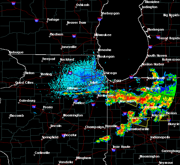 At 128 pm cdt, severe thunderstorms were located along a line extending from lake village to near forest city to near medaryville, moving southeast at 25 mph (radar indicated). Hazards include 60 mph wind gusts and quarter size hail. Hail damage to vehicles is expected. expect wind damage to roofs, siding, and trees. these severe storms will be near, gifford around 200 pm cdt. Other locations impacted by these severe thunderstorms include wheatfield and schneider. At 128 pm cdt, severe thunderstorms were located along a line extending from lake village to near forest city to near medaryville, moving southeast at 25 mph (radar indicated). Hazards include 60 mph wind gusts and quarter size hail. Hail damage to vehicles is expected. expect wind damage to roofs, siding, and trees. these severe storms will be near, gifford around 200 pm cdt. Other locations impacted by these severe thunderstorms include wheatfield and schneider.
|
| 7/7/2017 1:13 PM CDT |
 At 112 pm cdt, severe thunderstorms were located along a line extending from lowell to near medaryville, moving southeast at 20 mph (radar indicated). Hazards include 60 mph wind gusts and quarter size hail. Hail damage to vehicles is expected. expect wind damage to roofs, siding, and trees. severe thunderstorms will be near, de motte around 145 pm cdt. other locations impacted by these severe thunderstorms include wheatfield and schneider. Including the following interstate, indiana i-65 between mile markers 225 and 241. At 112 pm cdt, severe thunderstorms were located along a line extending from lowell to near medaryville, moving southeast at 20 mph (radar indicated). Hazards include 60 mph wind gusts and quarter size hail. Hail damage to vehicles is expected. expect wind damage to roofs, siding, and trees. severe thunderstorms will be near, de motte around 145 pm cdt. other locations impacted by these severe thunderstorms include wheatfield and schneider. Including the following interstate, indiana i-65 between mile markers 225 and 241.
|
| 6/14/2017 3:15 PM CDT |
 At 315 pm cdt, a severe thunderstorm was located near fair oaks, moving northeast at 25 mph (radar indicated). Hazards include quarter size hail. Damage to vehicles is expected. Locations impacted include, de motte, fair oaks, gifford, pembroke, roselawn and wheatfield. At 315 pm cdt, a severe thunderstorm was located near fair oaks, moving northeast at 25 mph (radar indicated). Hazards include quarter size hail. Damage to vehicles is expected. Locations impacted include, de motte, fair oaks, gifford, pembroke, roselawn and wheatfield.
|
| 6/14/2017 2:59 PM CDT |
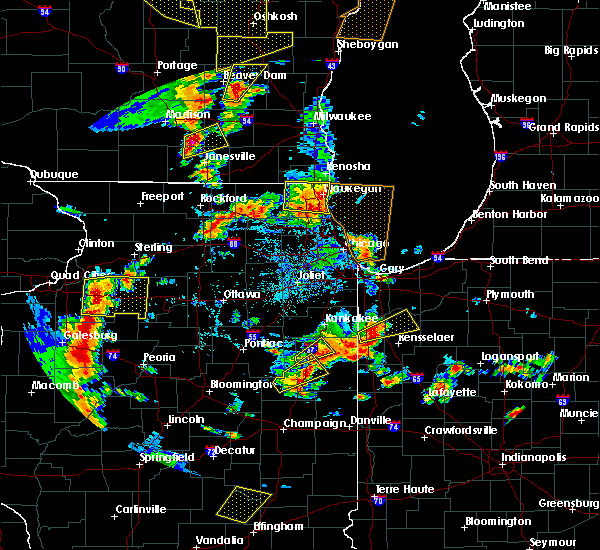 At 243 pm cdt, a severe thunderstorm was located near enos, moving northeast at 35 mph (radar indicated). Hazards include quarter size hail. damage to vehicles is expected At 243 pm cdt, a severe thunderstorm was located near enos, moving northeast at 35 mph (radar indicated). Hazards include quarter size hail. damage to vehicles is expected
|
| 6/14/2017 2:43 PM CDT |
 At 243 pm cdt, a severe thunderstorm was located near enos, moving northeast at 35 mph (radar indicated). Hazards include quarter size hail. damage to vehicles is expected At 243 pm cdt, a severe thunderstorm was located near enos, moving northeast at 35 mph (radar indicated). Hazards include quarter size hail. damage to vehicles is expected
|
| 2/28/2017 11:59 PM CST | County road 900 north and state road 49... near the wheatfield fire station 3. 1 foot diameter tree snappe in jasper county IN, 3.4 miles N of Wheatfield, IN |
| 2/28/2017 11:47 PM CST |
 At 1146 pm cst, a severe thunderstorm was located over boone grove, moving east at 50 mph (radar indicated). Hazards include 70 mph wind gusts. Expect considerable tree damage. damage is likely to mobile homes, roofs, and outbuildings. this severe storm will be near, malden and kouts around 1150 pm cst. other locations impacted by this severe thunderstorm include wheatfield. A tornado watch remains in effect until 400 am cst for northwestern indiana. At 1146 pm cst, a severe thunderstorm was located over boone grove, moving east at 50 mph (radar indicated). Hazards include 70 mph wind gusts. Expect considerable tree damage. damage is likely to mobile homes, roofs, and outbuildings. this severe storm will be near, malden and kouts around 1150 pm cst. other locations impacted by this severe thunderstorm include wheatfield. A tornado watch remains in effect until 400 am cst for northwestern indiana.
|
| 2/28/2017 11:32 PM CST |
 At 1132 pm cst, a severe thunderstorm was located near lake dalecarlia, or near lowell, moving east at 65 mph (radar indicated). Hazards include 60 mph wind gusts. Expect damage to roofs, siding, and trees. this severe thunderstorm will be near, lakes of the four seasons around 1135 pm cst. de motte, hebron and boone grove around 1140 pm cst. malden and kouts around 1145 pm cst. dunns bridge around 1150 pm cst. other locations impacted by this severe thunderstorm include wheatfield. including the following interstate, indiana i-65 between mile markers 236 and 250. A tornado watch remains in effect until 400 am cst for northwestern indiana. At 1132 pm cst, a severe thunderstorm was located near lake dalecarlia, or near lowell, moving east at 65 mph (radar indicated). Hazards include 60 mph wind gusts. Expect damage to roofs, siding, and trees. this severe thunderstorm will be near, lakes of the four seasons around 1135 pm cst. de motte, hebron and boone grove around 1140 pm cst. malden and kouts around 1145 pm cst. dunns bridge around 1150 pm cst. other locations impacted by this severe thunderstorm include wheatfield. including the following interstate, indiana i-65 between mile markers 236 and 250. A tornado watch remains in effect until 400 am cst for northwestern indiana.
|
| 8/3/2015 1:10 AM CDT | The severe thunderstorm warning for northern newton, southern lake and jasper counties will expire at 115 am cdt, the storms which prompted the warning have weakened below severe limits, and exited the warned area. therefore the warning will be allowed to expire. a severe thunderstorm watch remains in effect until 200 am cdt for northwestern indiana. |
| 8/3/2015 12:54 AM CDT |
 At 1253 am cdt, severe thunderstorms were located along a line extending from near north judson to near de motte, moving southeast at 35 mph (radar indicated). Hazards include 60 mph wind gusts and penny size hail. Expect damage to roofs. siding and trees. locations impacted include, rensselaer, de motte, hanging grove, moody, roselawn, forest city, sumava resorts, enos, pembroke, surrey, fair oaks, conrad, lake village, pleasant ridge, thayer, gifford, wheatfield and schneider. Including the following interstate, indiana i-65 between mile markers 216 and 238. At 1253 am cdt, severe thunderstorms were located along a line extending from near north judson to near de motte, moving southeast at 35 mph (radar indicated). Hazards include 60 mph wind gusts and penny size hail. Expect damage to roofs. siding and trees. locations impacted include, rensselaer, de motte, hanging grove, moody, roselawn, forest city, sumava resorts, enos, pembroke, surrey, fair oaks, conrad, lake village, pleasant ridge, thayer, gifford, wheatfield and schneider. Including the following interstate, indiana i-65 between mile markers 216 and 238.
|
| 8/3/2015 12:37 AM CDT |
 At 1236 am cdt, severe thunderstorms were located along a line extending from near north judson to near lake dalecarlia, moving southeast at 45 mph (radar indicated). Hazards include 60 mph wind gusts and penny size hail. Expect damage to roofs. siding and trees. locations impacted include, crown point, st. john, cedar lake, lowell, rensselaer, de motte, hebron, hanging grove, moody, sumava resorts, enos, dunns bridge, fair oaks, pleasant ridge, roselawn, forest city, boone grove, pembroke, malden and lakes of the four seasons. this includes, lake county fairgrounds. Including the following interstate, indiana i-65 between mile markers 216 and 249. At 1236 am cdt, severe thunderstorms were located along a line extending from near north judson to near lake dalecarlia, moving southeast at 45 mph (radar indicated). Hazards include 60 mph wind gusts and penny size hail. Expect damage to roofs. siding and trees. locations impacted include, crown point, st. john, cedar lake, lowell, rensselaer, de motte, hebron, hanging grove, moody, sumava resorts, enos, dunns bridge, fair oaks, pleasant ridge, roselawn, forest city, boone grove, pembroke, malden and lakes of the four seasons. this includes, lake county fairgrounds. Including the following interstate, indiana i-65 between mile markers 216 and 249.
|
| 8/3/2015 12:14 AM CDT |
 At 1214 am cdt, severe thunderstorms were located along a line extending from near kouts to near sauk village, moving southeast at 40 mph (radar indicated). Hazards include 60 mph wind gusts and penny size hail. Expect damage to roofs. Siding and trees. At 1214 am cdt, severe thunderstorms were located along a line extending from near kouts to near sauk village, moving southeast at 40 mph (radar indicated). Hazards include 60 mph wind gusts and penny size hail. Expect damage to roofs. Siding and trees.
|
| 6/22/2015 11:12 PM CDT | The severe thunderstorm warning for southeastern kankakee, northeastern iroquois, central newton and northern jasper counties will expire at 1115 pm cdt, however, another severe thunderstorm warning remains in effect for newton and jasper counties until 1130 pm cdt. a tornado watch remains in effect until 200 am cdt for northeastern illinois and northwestern indiana. |
| 6/22/2015 11:12 PM CDT | The severe thunderstorm warning for southeastern kankakee, northeastern iroquois, central newton and northern jasper counties will expire at 1115 pm cdt, however, another severe thunderstorm warning remains in effect for newton and jasper counties until 1130 pm cdt. a tornado watch remains in effect until 200 am cdt for northeastern illinois and northwestern indiana. |
| 6/22/2015 11:09 PM CDT |
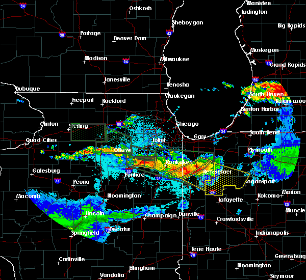 At 1108 pm cdt, severe thunderstorms were located along a line extending from near medaryville to near collegeville to near beaver city, moving southeast at 45 mph (radar indicated). Hazards include 60 mph wind gusts and quarter size hail. Hail damage to vehicles is expected. expect wind damage to roofs, siding and trees. these severe storms will be near, pleasant ridge and moody around 1120 pm cdt. hanging grove and mccoysburg around 1225 am edt. remington around 1230 am edt. other locations impacted by these severe thunderstorms include mount ayr and wheatfield. including the following interstate, indiana i-65 between mile markers 200 and 221. A tornado watch remains in effect until 200 am cdt/300 am edt/ for northwestern indiana. At 1108 pm cdt, severe thunderstorms were located along a line extending from near medaryville to near collegeville to near beaver city, moving southeast at 45 mph (radar indicated). Hazards include 60 mph wind gusts and quarter size hail. Hail damage to vehicles is expected. expect wind damage to roofs, siding and trees. these severe storms will be near, pleasant ridge and moody around 1120 pm cdt. hanging grove and mccoysburg around 1225 am edt. remington around 1230 am edt. other locations impacted by these severe thunderstorms include mount ayr and wheatfield. including the following interstate, indiana i-65 between mile markers 200 and 221. A tornado watch remains in effect until 200 am cdt/300 am edt/ for northwestern indiana.
|
| 6/22/2015 11:00 PM CDT |
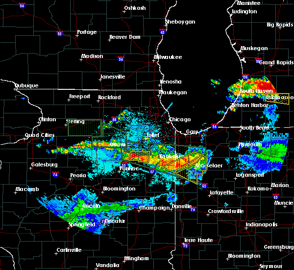 At 1059 pm cdt, severe thunderstorms were located along a line extending from near fair oaks to near surrey to morocco, moving east at 40 mph (radar indicated). Hazards include 70 mph wind gusts. Expect considerable tree damage. damage is likely to mobile homes, roofs and outbuildings. these severe thunderstorms will remain over mainly rural areas of southeastern kankakee, northeastern iroquois, central newton and northern jasper counties, including the following locations, papineau, beaverville and wheatfield. this includes, us 41 dragway. including the following interstate, indiana i-65 between mile markers 219 and 233. A tornado watch remains in effect until 200 am cdt for northeastern illinois and northwestern indiana. At 1059 pm cdt, severe thunderstorms were located along a line extending from near fair oaks to near surrey to morocco, moving east at 40 mph (radar indicated). Hazards include 70 mph wind gusts. Expect considerable tree damage. damage is likely to mobile homes, roofs and outbuildings. these severe thunderstorms will remain over mainly rural areas of southeastern kankakee, northeastern iroquois, central newton and northern jasper counties, including the following locations, papineau, beaverville and wheatfield. this includes, us 41 dragway. including the following interstate, indiana i-65 between mile markers 219 and 233. A tornado watch remains in effect until 200 am cdt for northeastern illinois and northwestern indiana.
|
| 6/22/2015 10:51 PM CDT |
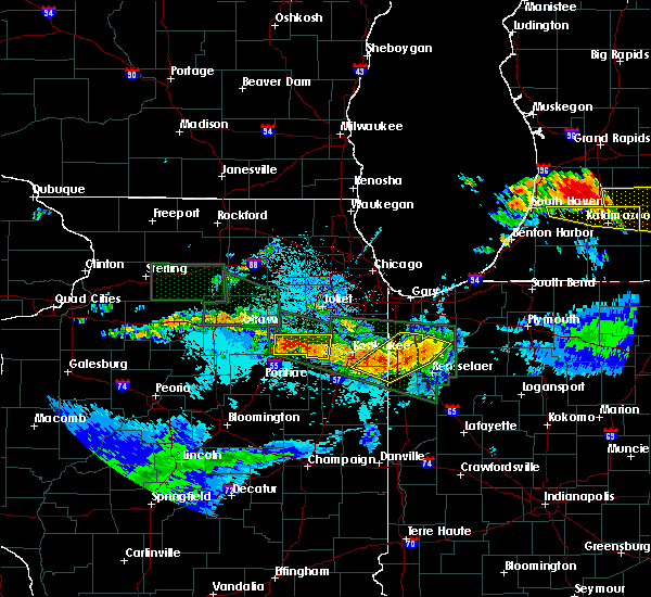 At 1051 pm cdt, severe thunderstorms were located along a line extending from near gifford to enos to 7 miles southeast of st. anne, moving southeast at 45 mph (radar indicated). Hazards include 60 mph wind gusts. Expect damage to roofs. siding and trees. severe thunderstorms will be near, gifford around 1055 pm cdt. moody around 1100 pm cdt. surrey around 1105 pm cdt. rensselaer, brook and collegeville around 1110 pm cdt. percy junction and pleasant ridge around 1115 pm cdt. hanging grove, mccoysburg and goodland around 1220 am edt. remington around 1225 am edt. other locations impacted by these severe thunderstorms include mount ayr and wheatfield. A tornado watch remains in effect until 200 am cdt/300 am edt/ for northwestern indiana. At 1051 pm cdt, severe thunderstorms were located along a line extending from near gifford to enos to 7 miles southeast of st. anne, moving southeast at 45 mph (radar indicated). Hazards include 60 mph wind gusts. Expect damage to roofs. siding and trees. severe thunderstorms will be near, gifford around 1055 pm cdt. moody around 1100 pm cdt. surrey around 1105 pm cdt. rensselaer, brook and collegeville around 1110 pm cdt. percy junction and pleasant ridge around 1115 pm cdt. hanging grove, mccoysburg and goodland around 1220 am edt. remington around 1225 am edt. other locations impacted by these severe thunderstorms include mount ayr and wheatfield. A tornado watch remains in effect until 200 am cdt/300 am edt/ for northwestern indiana.
|
| 6/22/2015 10:46 PM CDT |
 At 1046 pm cdt, severe thunderstorms were located along a line extending from roselawn to near conrad to near hopkins park, moving east at 40 mph (radar indicated). Hazards include 70 mph wind gusts. Expect considerable tree damage. damage is likely to mobile homes, roofs and outbuildings. these severe storms will be near, pembroke, roselawn, sumava resorts, thayer and forest city around 1050 pm cdt. de motte around 1055 pm cdt. morocco and fair oaks around 1100 pm cdt. beaver city around 1105 pm cdt. other locations impacted by these severe thunderstorms include papineau, schneider, beaverville and wheatfield. this includes, us 41 dragway. including the following interstate, indiana i-65 between mile markers 219 and 240. A tornado watch remains in effect until 200 am cdt for northeastern illinois and northwestern indiana. At 1046 pm cdt, severe thunderstorms were located along a line extending from roselawn to near conrad to near hopkins park, moving east at 40 mph (radar indicated). Hazards include 70 mph wind gusts. Expect considerable tree damage. damage is likely to mobile homes, roofs and outbuildings. these severe storms will be near, pembroke, roselawn, sumava resorts, thayer and forest city around 1050 pm cdt. de motte around 1055 pm cdt. morocco and fair oaks around 1100 pm cdt. beaver city around 1105 pm cdt. other locations impacted by these severe thunderstorms include papineau, schneider, beaverville and wheatfield. this includes, us 41 dragway. including the following interstate, indiana i-65 between mile markers 219 and 240. A tornado watch remains in effect until 200 am cdt for northeastern illinois and northwestern indiana.
|
| 6/22/2015 10:34 PM CDT |
 At 1034 pm cdt, severe thunderstorms were located along a line extending from near lake village to near conrad to st. anne, moving southeast at 40 mph (radar indicated). Hazards include 70 mph wind gusts. Expect considerable tree damage. damage is likely to mobile homes, roofs and outbuildings. these severe storms will be near, conrad, sumava resorts, thayer and lake village around 1040 pm cdt. pembroke, roselawn and forest city around 1045 pm cdt. de motte around 1050 pm cdt. morocco, fair oaks and enos around 1055 pm cdt. beaver city around 1100 pm cdt. including the following interstates, i-57 between mile markers 302 and 316. indiana i-65 between mile markers 219 and 240. A tornado watch remains in effect until 200 am cdt for northeastern illinois and northwestern indiana. At 1034 pm cdt, severe thunderstorms were located along a line extending from near lake village to near conrad to st. anne, moving southeast at 40 mph (radar indicated). Hazards include 70 mph wind gusts. Expect considerable tree damage. damage is likely to mobile homes, roofs and outbuildings. these severe storms will be near, conrad, sumava resorts, thayer and lake village around 1040 pm cdt. pembroke, roselawn and forest city around 1045 pm cdt. de motte around 1050 pm cdt. morocco, fair oaks and enos around 1055 pm cdt. beaver city around 1100 pm cdt. including the following interstates, i-57 between mile markers 302 and 316. indiana i-65 between mile markers 219 and 240. A tornado watch remains in effect until 200 am cdt for northeastern illinois and northwestern indiana.
|
| 6/22/2015 10:22 PM CDT |
 At 1022 pm cdt, severe thunderstorms were located along a line extending from near grant park to near momence to aroma park, moving east at 40 mph (radar indicated). Hazards include 70 mph wind gusts. Expect considerable tree damage. damage is likely to mobile homes, roofs and outbuildings. these severe storms will be near, lowell around 1030 pm cdt. thayer, sumava resorts, lake village, conrad and hopkins park around 1040 pm cdt. roselawn and forest city around 1045 pm cdt. de motte and pembroke around 1050 pm cdt. morocco, fair oaks and enos around 1055 pm cdt. beaver city around 1100 pm cdt. other locations impacted by these severe thunderstorms include sun river terrace, papineau, irwin, schneider, beaverville and wheatfield. this includes, kankakee community college, kankakee county fairgrounds and speedway, olivet nazarine university, and us 41 dragway. including the following interstates, i-57 between mile markers 302 and 321. indiana i-65 between mile markers 219 and 241. A tornado watch remains in effect until 200 am cdt for northeastern illinois and northwestern indiana. At 1022 pm cdt, severe thunderstorms were located along a line extending from near grant park to near momence to aroma park, moving east at 40 mph (radar indicated). Hazards include 70 mph wind gusts. Expect considerable tree damage. damage is likely to mobile homes, roofs and outbuildings. these severe storms will be near, lowell around 1030 pm cdt. thayer, sumava resorts, lake village, conrad and hopkins park around 1040 pm cdt. roselawn and forest city around 1045 pm cdt. de motte and pembroke around 1050 pm cdt. morocco, fair oaks and enos around 1055 pm cdt. beaver city around 1100 pm cdt. other locations impacted by these severe thunderstorms include sun river terrace, papineau, irwin, schneider, beaverville and wheatfield. this includes, kankakee community college, kankakee county fairgrounds and speedway, olivet nazarine university, and us 41 dragway. including the following interstates, i-57 between mile markers 302 and 321. indiana i-65 between mile markers 219 and 241. A tornado watch remains in effect until 200 am cdt for northeastern illinois and northwestern indiana.
|
| 6/22/2015 10:09 PM CDT |
 At 1009 pm cdt, severe thunderstorms were located along a line extending from near grant park to near manteno to near bourbonnais, moving east at 40 mph (radar indicated). Hazards include 60 mph wind gusts. Expect damage to roofs. siding and trees. severe thunderstorms will be near, beecher and grant park around 1015 pm cdt. momence around 1020 pm cdt. lowell and st. anne around 1030 pm cdt. conrad, lake village and hopkins park around 1035 pm cdt. sumava resorts and thayer around 1040 pm cdt. roselawn, pembroke and forest city around 1045 pm cdt. de motte, fair oaks and enos around 1050 pm cdt. morocco around 1055 pm cdt. including the following interstates, i-57 between mile markers 302 and 324. indiana i-65 between mile markers 219 and 241. this includes, kankakee community college, kankakee county fairgrounds and speedway, olivet nazarine university, and us 41 dragway. A tornado watch remains in effect until 200 am cdt for northeastern illinois and northwestern indiana. At 1009 pm cdt, severe thunderstorms were located along a line extending from near grant park to near manteno to near bourbonnais, moving east at 40 mph (radar indicated). Hazards include 60 mph wind gusts. Expect damage to roofs. siding and trees. severe thunderstorms will be near, beecher and grant park around 1015 pm cdt. momence around 1020 pm cdt. lowell and st. anne around 1030 pm cdt. conrad, lake village and hopkins park around 1035 pm cdt. sumava resorts and thayer around 1040 pm cdt. roselawn, pembroke and forest city around 1045 pm cdt. de motte, fair oaks and enos around 1050 pm cdt. morocco around 1055 pm cdt. including the following interstates, i-57 between mile markers 302 and 324. indiana i-65 between mile markers 219 and 241. this includes, kankakee community college, kankakee county fairgrounds and speedway, olivet nazarine university, and us 41 dragway. A tornado watch remains in effect until 200 am cdt for northeastern illinois and northwestern indiana.
|
| 6/10/2015 8:38 PM CDT |
 At 837 pm cdt, severe thunderstorms were located along a line extending from near medaryville to enos, moving south at 20 mph (radar indicated). Hazards include 60 mph wind gusts and quarter size hail. Hail damage to vehicles is expected. expect wind damage to roofs, siding and trees. locations impacted include, lowell, de motte, morocco, sumava resorts, gifford, fair oaks, pembroke, lake village, forest city, thayer, conrad, surrey, roselawn, enos, wheatfield, schneider and mount ayr. this includes, us 41 dragway. Including the following interstate, indiana i-65 between mile markers 217 and 242. At 837 pm cdt, severe thunderstorms were located along a line extending from near medaryville to enos, moving south at 20 mph (radar indicated). Hazards include 60 mph wind gusts and quarter size hail. Hail damage to vehicles is expected. expect wind damage to roofs, siding and trees. locations impacted include, lowell, de motte, morocco, sumava resorts, gifford, fair oaks, pembroke, lake village, forest city, thayer, conrad, surrey, roselawn, enos, wheatfield, schneider and mount ayr. this includes, us 41 dragway. Including the following interstate, indiana i-65 between mile markers 217 and 242.
|
| 6/10/2015 8:18 PM CDT |
 At 818 pm cdt, severe thunderstorms were located along a line extending from dunns bridge to conrad, moving southeast at 20 mph (radar indicated). Hazards include 60 mph wind gusts and half dollar size hail. Hail damage to vehicles is expected. expect wind damage to roofs, siding and trees. these severe storms will be near, dunns bridge around 825 pm cdt. morocco and pembroke around 840 pm cdt. fair oaks around 850 pm cdt. surrey around 900 pm cdt. other locations impacted by these severe thunderstorms include schneider, wheatfield and mount ayr. this includes, us 41 dragway. Including the following interstate, indiana i-65 between mile markers 217 and 244. At 818 pm cdt, severe thunderstorms were located along a line extending from dunns bridge to conrad, moving southeast at 20 mph (radar indicated). Hazards include 60 mph wind gusts and half dollar size hail. Hail damage to vehicles is expected. expect wind damage to roofs, siding and trees. these severe storms will be near, dunns bridge around 825 pm cdt. morocco and pembroke around 840 pm cdt. fair oaks around 850 pm cdt. surrey around 900 pm cdt. other locations impacted by these severe thunderstorms include schneider, wheatfield and mount ayr. this includes, us 41 dragway. Including the following interstate, indiana i-65 between mile markers 217 and 244.
|
| 6/10/2015 7:53 PM CDT |
 At 752 pm cdt, severe thunderstorms were located along a line extending from near hebron to near lake village, moving southeast at 25 mph (radar indicated). Hazards include 70 mph wind gusts and quarter size hail. Hail damage to vehicles is expected. expect considerable tree damage. wind damage is also likely to mobile homes, roofs and outbuildings. severe thunderstorms will be near, forest city around 800 pm cdt. de motte, lake village and roselawn around 805 pm cdt. conrad around 810 pm cdt. enos around 825 pm cdt. morocco around 830 pm cdt. gifford around 835 pm cdt. other locations impacted by these severe thunderstorms include schneider, wheatfield and mount ayr. including the following interstate, indiana i-65 between mile markers 217 and 244. This includes, us 41 dragway. At 752 pm cdt, severe thunderstorms were located along a line extending from near hebron to near lake village, moving southeast at 25 mph (radar indicated). Hazards include 70 mph wind gusts and quarter size hail. Hail damage to vehicles is expected. expect considerable tree damage. wind damage is also likely to mobile homes, roofs and outbuildings. severe thunderstorms will be near, forest city around 800 pm cdt. de motte, lake village and roselawn around 805 pm cdt. conrad around 810 pm cdt. enos around 825 pm cdt. morocco around 830 pm cdt. gifford around 835 pm cdt. other locations impacted by these severe thunderstorms include schneider, wheatfield and mount ayr. including the following interstate, indiana i-65 between mile markers 217 and 244. This includes, us 41 dragway.
|
| 6/8/2015 6:36 PM CDT | At 635 pm cdt, a severe thunderstorm was located near medaryville, or near gifford, moving southeast at 30 mph. at 624 pm cdt dime sized hail was reported covering the ground in wheatfield from this storm (radar indicated). Hazards include 60 mph wind gusts and quarter size hail. Hail damage to vehicles is expected. expect wind damage to roofs, siding and trees. Locations impacted include, gifford and wheatfield. |
| 6/8/2015 6:18 PM CDT | At 617 pm cdt, a severe thunderstorm was located near dunns bridge, moving east at 45 mph (radar indicated). Hazards include 60 mph wind gusts and quarter size hail. Hail damage to vehicles is expected. expect wind damage to roofs, siding and trees. this severe thunderstorm will remain over mainly rural areas of southern porter and northern jasper counties, including the following locations, wheatfield. Including the following interstate, indiana i-65 between mile markers 230 and 231. |
| 6/8/2015 6:02 PM CDT | At 601 pm cdt, a severe thunderstorm was located near de motte, moving east at 45 mph (radar indicated). Hazards include 60 mph wind gusts and quarter size hail. Hail damage to vehicles is expected. expect wind damage to roofs, siding and trees. this severe thunderstorm will be near, dunns bridge around 620 pm cdt. other locations impacted by this severe thunderstorm include wheatfield. Including the following interstate, indiana i-65 between mile markers 230 and 241. |
| 6/7/2015 5:16 PM CDT | At 515 pm cdt, dangerous severe thunderstorms were located along a line extending from near dunns bridge to gifford to near fair oaks and moving east at 40 mph (radar indicated). Hazards include 80 mph wind gusts. Flying debris will be dangerous to those caught without shelter. mobile homes will be heavily damaged. expect considerable damage to roofs, windows and vehicles. extensive tree damage and power outages are likely. these severe storms will be near, gifford around 520 pm cdt. hanging grove and moody around 535 pm cdt. other locations impacted by these severe thunderstorms include wheatfield. Including the following interstate, indiana i-65 between mile markers 220 and 227. |
| 6/7/2015 5:02 PM CDT | At 502 pm cdt, severe thunderstorms were located along a line extending from near de motte to near la crosse, moving southeast at 25 mph (radar indicated). Hazards include 60 mph wind gusts. Expect damage to roofs. siding and trees. these severe storms will be near, dunns bridge around 515 pm cdt. Other locations impacted by these severe thunderstorms include wheatfield. |
| 6/7/2015 4:57 PM CDT | At 456 pm cdt, severe thunderstorms were located along a line extending from forest city to roselawn to near conrad, accelerating east at 40 mph. these are very dangerous storms (radar indicated). Hazards include 80 mph wind gusts. Flying debris will be dangerous to those caught without shelter. mobile homes will be heavily damaged. expect considerable damage to roofs, windows and vehicles. extensive tree damage and power outages are likely. severe thunderstorms will be near, pembroke and forest city around 500 pm cdt. de motte around 505 pm cdt. fair oaks around 510 pm cdt. gifford around 515 pm cdt. surrey around 520 pm cdt. hanging grove and moody around 535 pm cdt. other locations impacted by these severe thunderstorms include wheatfield. Including the following interstate, indiana i-65 between mile markers 220 and 234. |
| 6/7/2015 4:47 PM CDT | At 447 pm cdt, severe thunderstorms were located along a line extending from hebron to near malden, moving east at 30 mph (radar indicated). Hazards include 60 mph wind gusts. Expect damage to roofs. siding and trees. these severe storms will be near, malden around 455 pm cdt. kouts around 505 pm cdt. dunns bridge around 510 pm cdt. other locations impacted by these severe thunderstorms include wheatfield. Including the following interstate, indiana i-65 between mile markers 262 and 245. |
| 6/7/2015 4:46 PM CDT | At 446 pm cdt, a severe thunderstorm capable of producing a tornado was located near dunns bridge, moving east at 25 mph (radar indicated rotation). Hazards include tornado. Flying debris will be dangerous to those caught without shelter. mobile homes will be damaged or destroyed. damage to roofs, windows and vehicles will occur. tree damage is likely. this dangerous storm will be near, dunns bridge around 455 pm cdt. Other locations impacted by this tornadic thunderstorm include wheatfield. |
| 6/7/2015 4:35 PM CDT | At 435 pm cdt, a severe thunderstorm capable of producing a tornado was located near de motte, moving east at 25 mph (radar indicated rotation). Hazards include tornado. Flying debris will be dangerous to those caught without shelter. mobile homes will be damaged or destroyed. damage to roofs, windows and vehicles will occur. tree damage is likely. this dangerous storm will be near, dunns bridge around 500 pm cdt. Other locations impacted by this tornadic thunderstorm include wheatfield. |
| 6/7/2015 4:33 PM CDT | At 433 pm cdt, a large severe thunderstorm was located from de motte to near boone grove and moving east at 25 mph (radar indicated). Hazards include 60 mph wind gusts. Expect damage to roofs. siding and trees. these severe storms will be near, malden and kouts around 440 pm cdt. dunns bridge around 500 pm cdt. other locations impacted by these severe thunderstorms include wheatfield. Including the following interstate, indiana i-65 between mile markers 262 and 245. |
| 6/7/2015 4:13 PM CDT | At 412 pm cdt, a large severe thunderstorm was extended from near lowell to near winfield, and moving east at 25 mph (radar indicated). Hazards include 70 mph wind gusts and quarter size hail. Hail damage to vehicles is expected. expect considerable tree damage. wind damage is also likely to mobile homes, roofs and outbuildings. severe thunderstorms will be near, hebron and lakes of the four seasons around 420 pm cdt. boone grove and forest city around 425 pm cdt. de motte around 435 pm cdt. malden and kouts around 440 pm cdt. dunns bridge around 500 pm cdt. other locations impacted by these severe thunderstorms include wheatfield. Including the following interstate, indiana i-65 between mile markers 262 and 245. |
| 4/18/2013 9:10 AM CDT | Storm damage reported in jasper county IN, 0.1 miles W of Wheatfield, IN |
| 7/24/2012 7:33 AM CDT | Numerous large trees dow in jasper county IN, 1.2 miles SE of Wheatfield, IN |
| 6/28/2012 8:58 PM CDT | Quarter sized hail reported 0.1 miles W of Wheatfield, IN, 1400 n near wheatfield |
| 1/1/0001 12:00 AM | Trees down. time estimate in jasper county IN, 0.1 miles W of Wheatfield, IN |
| 1/1/0001 12:00 AM | Trees down. time estimate in jasper county IN, 0.1 miles W of Wheatfield, IN |
| 1/1/0001 12:00 AM | Powerpole and wires dow in jasper county IN, 0.1 miles W of Wheatfield, IN |
Hail Maps for Wheatfield, IN


Connect with Interactive Hail Maps