

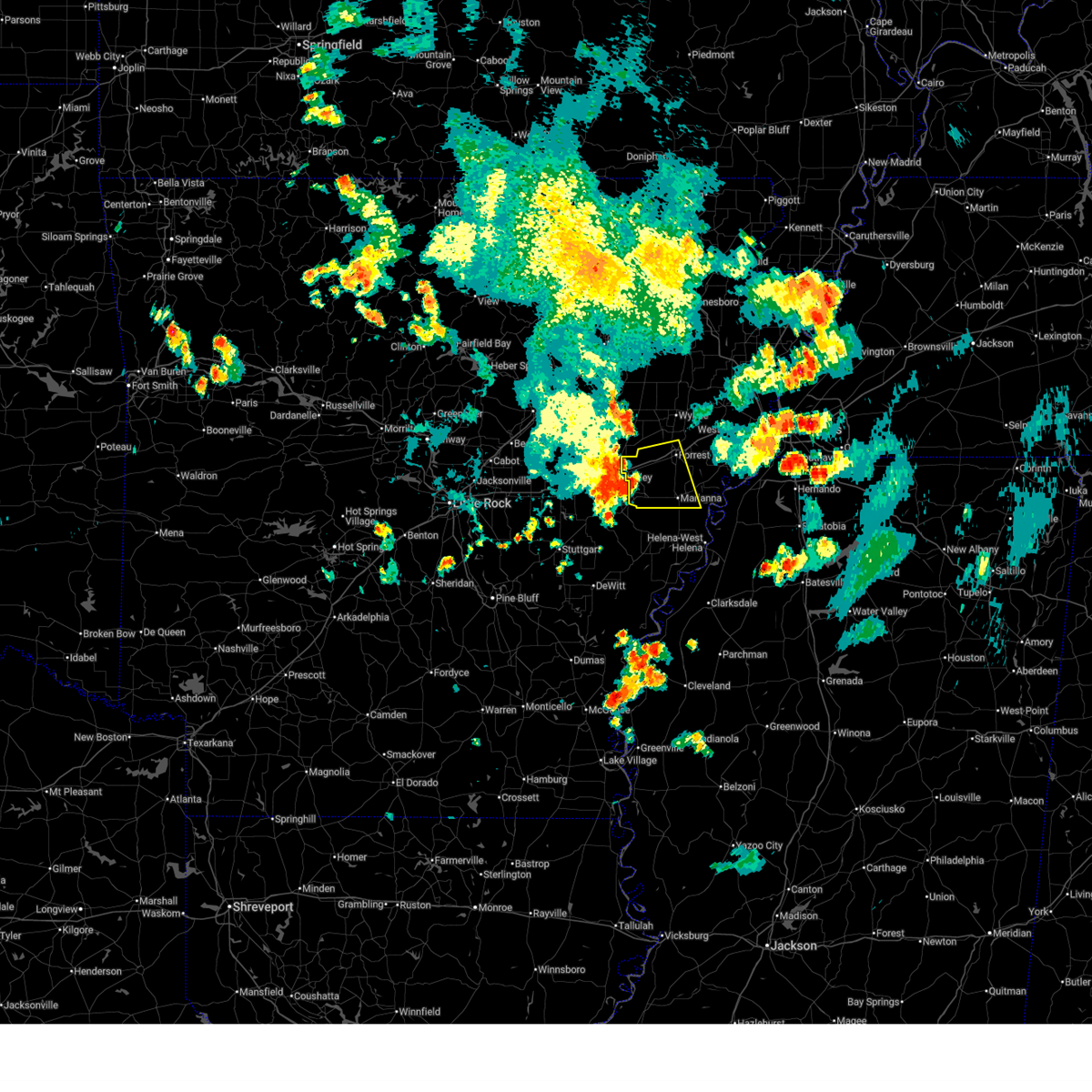
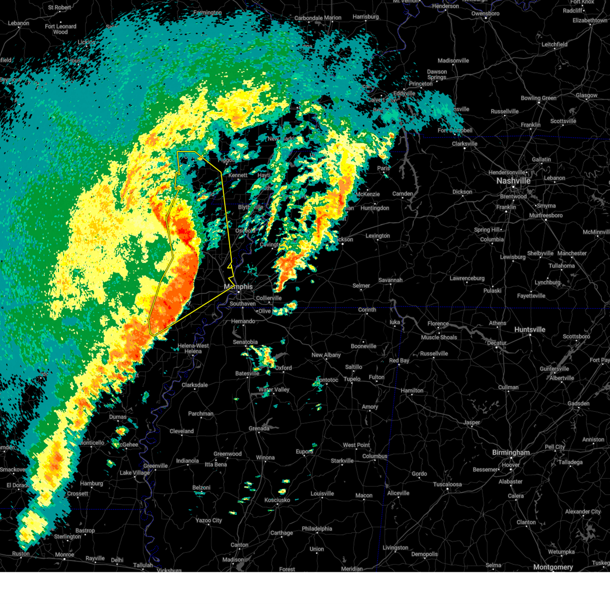
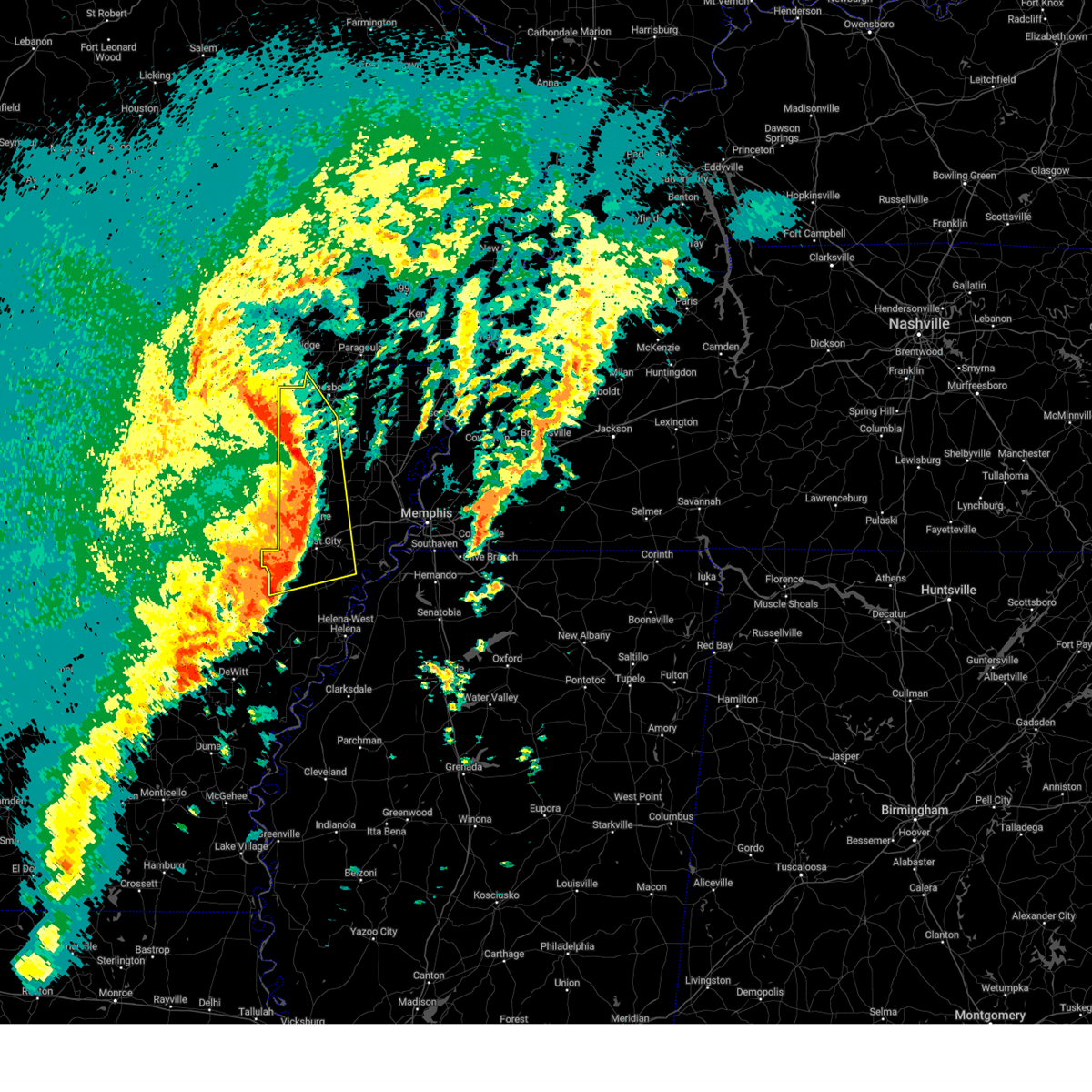
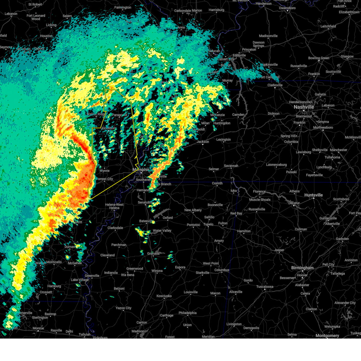
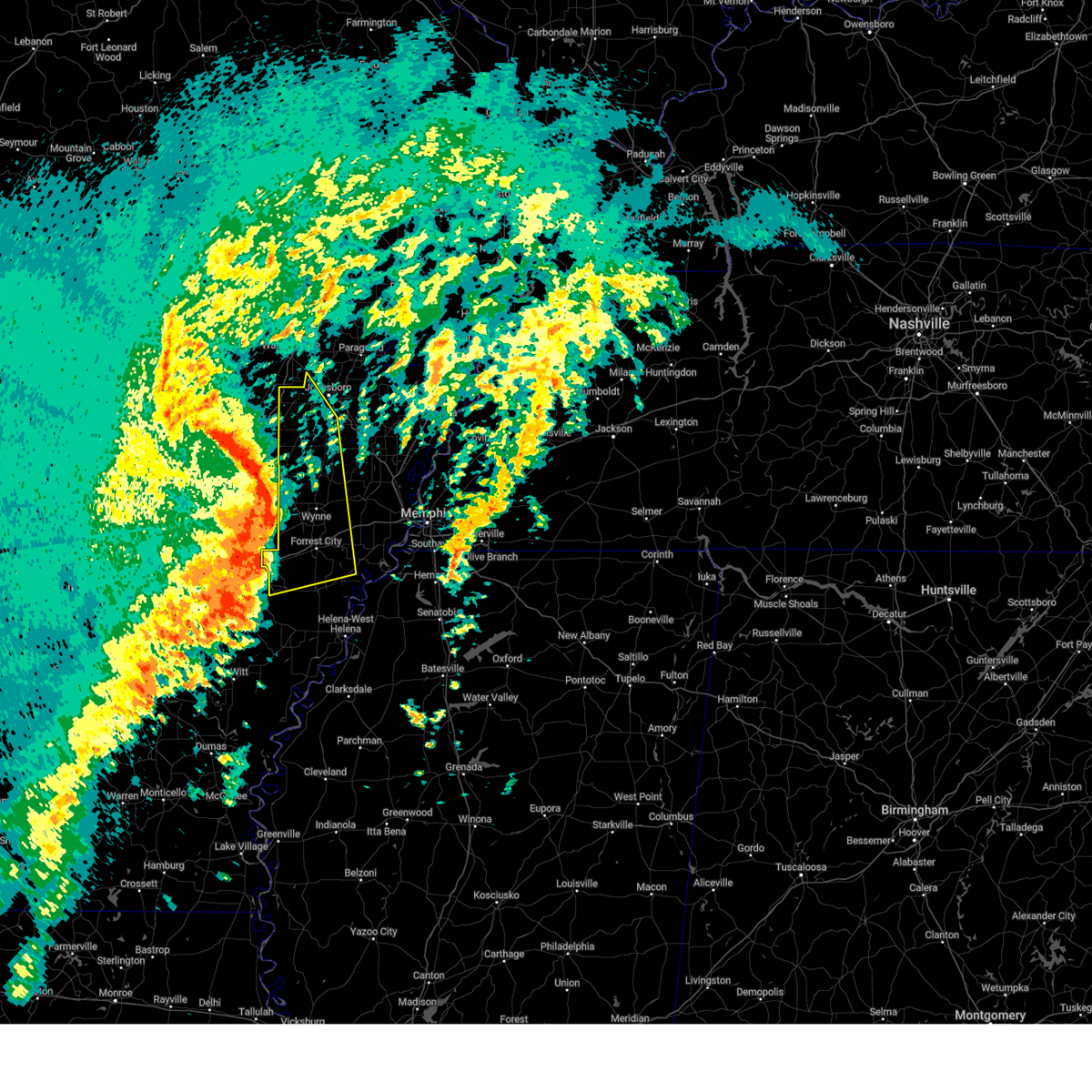
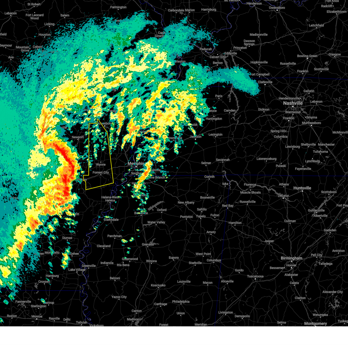
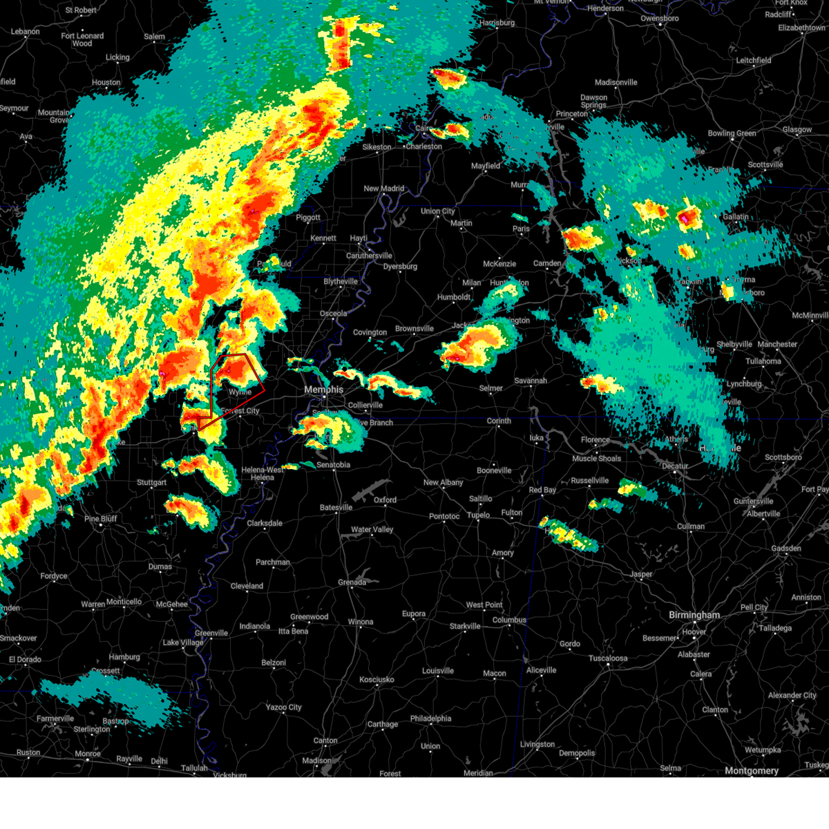
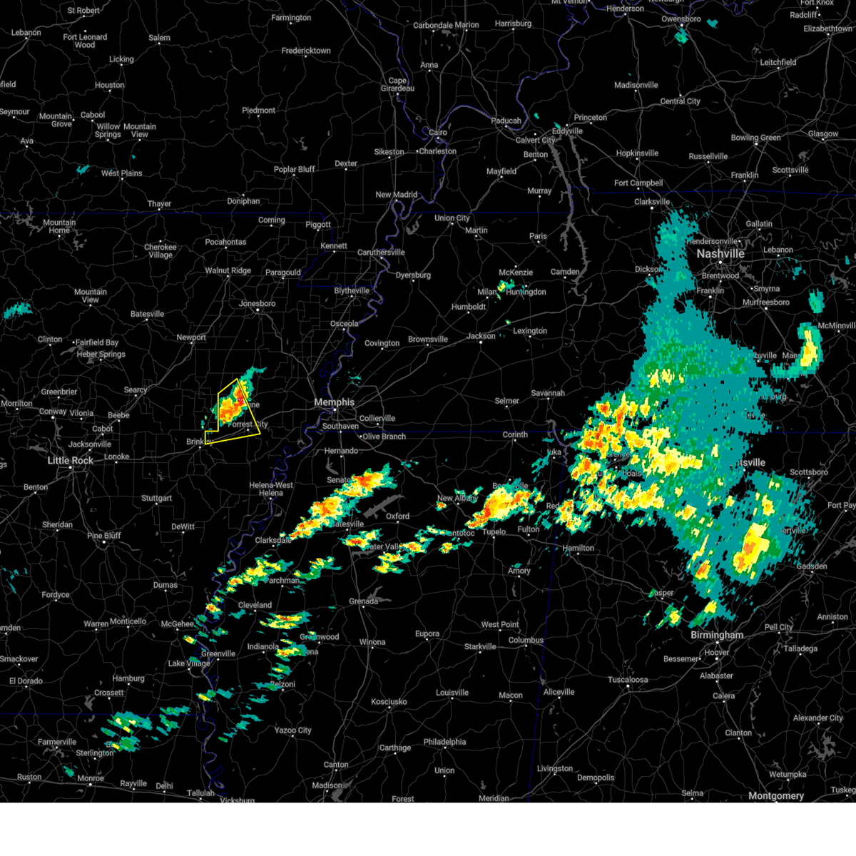
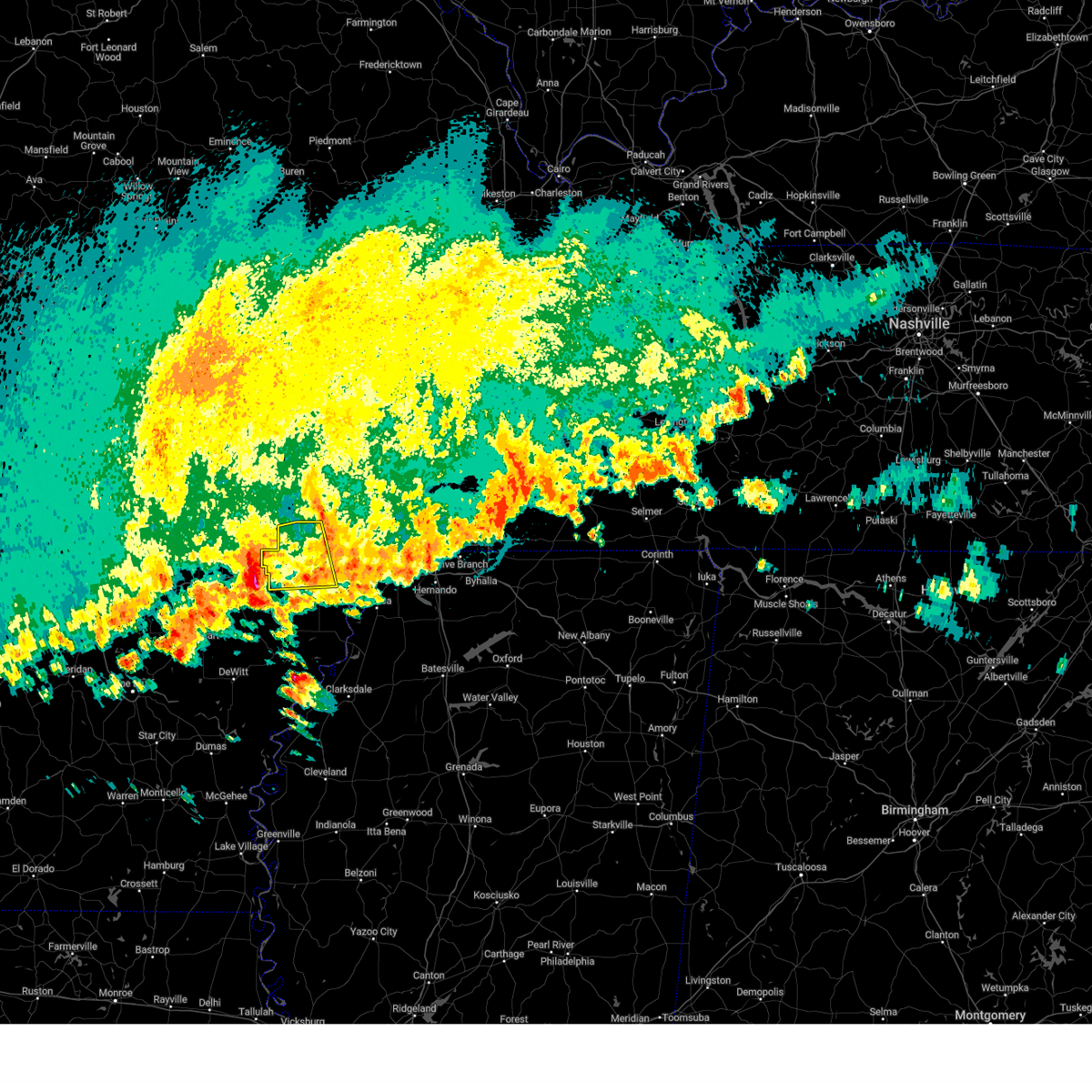
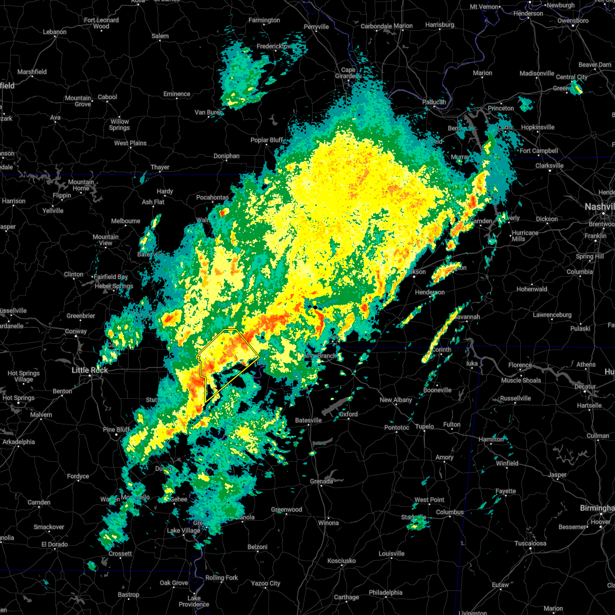
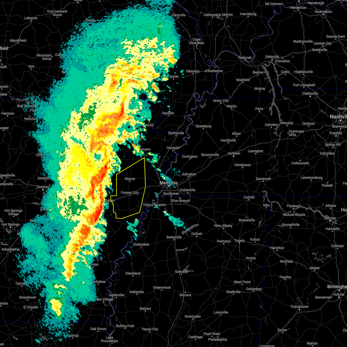
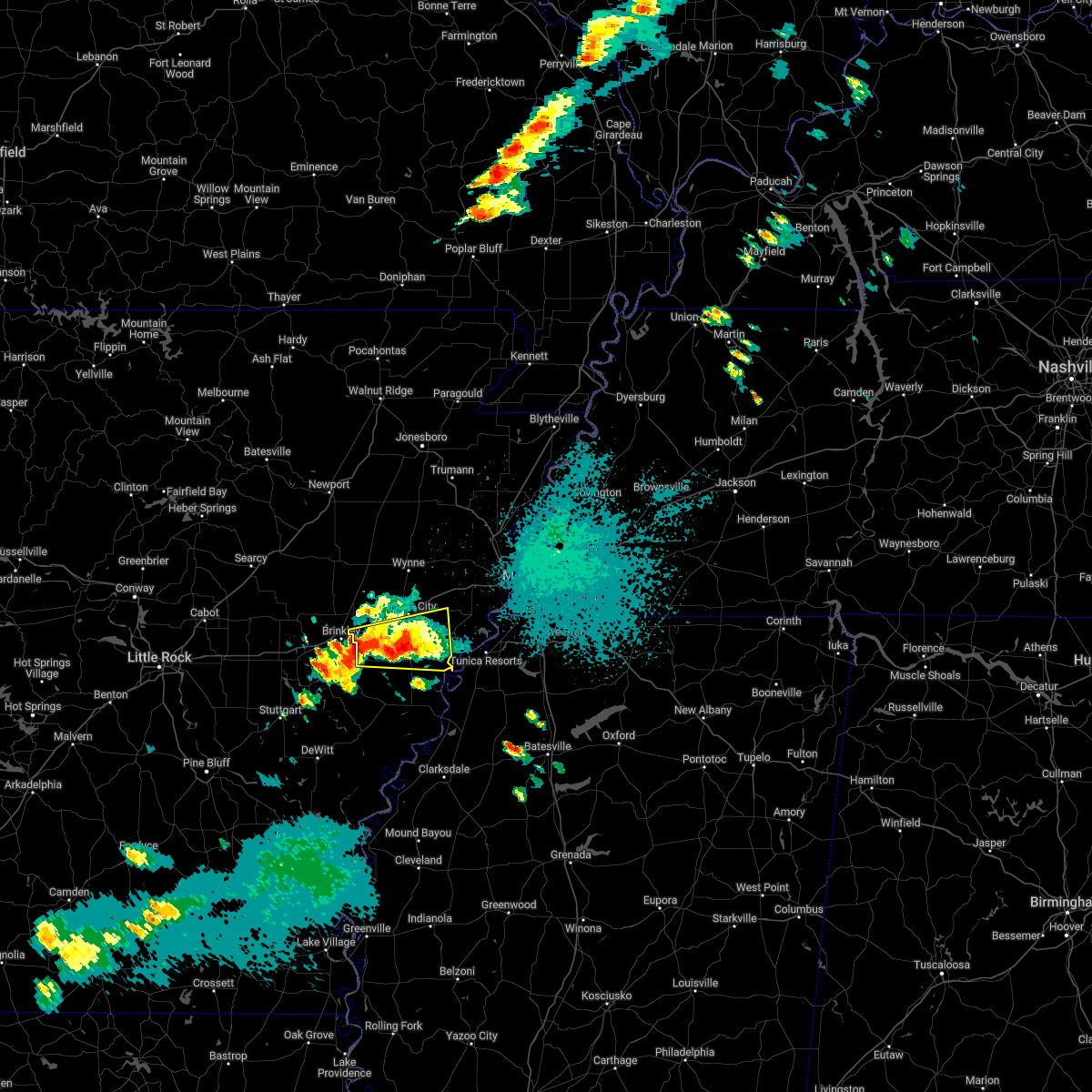
Hail Map for Wheatley, AR
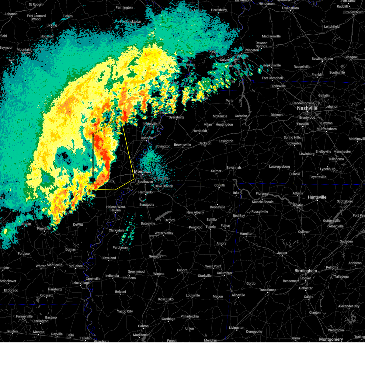
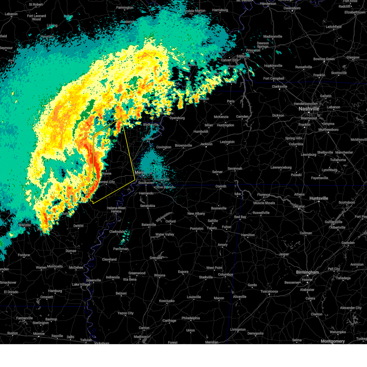
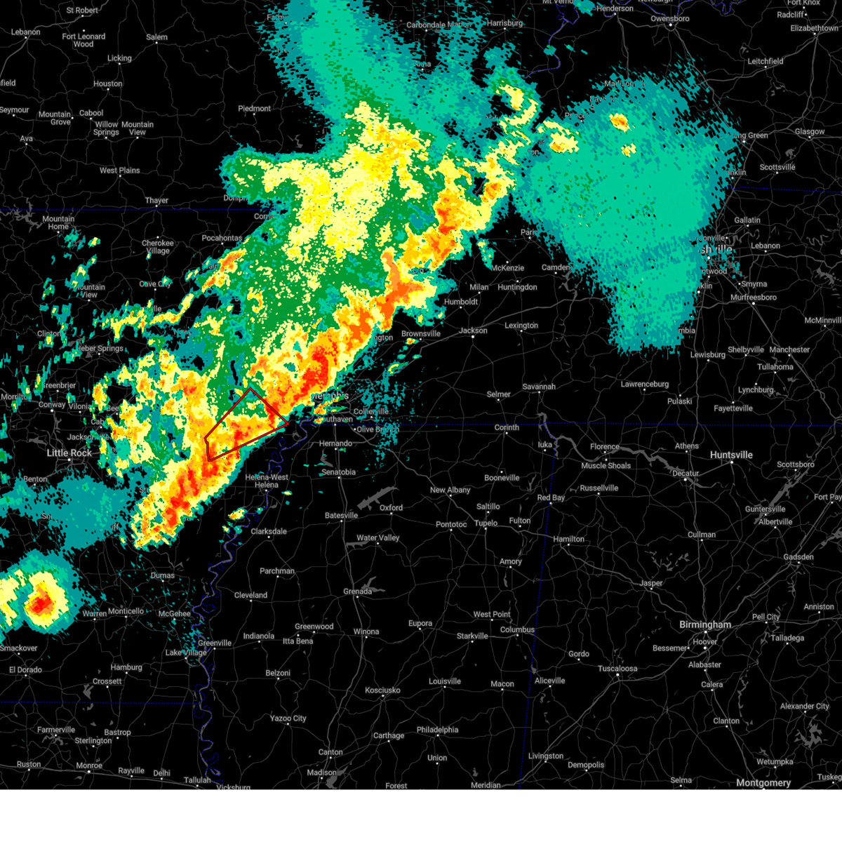
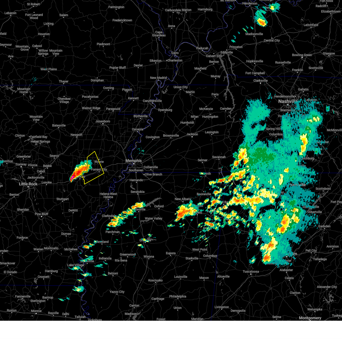
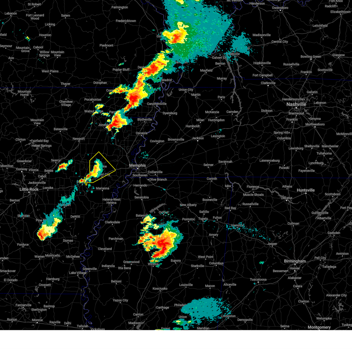
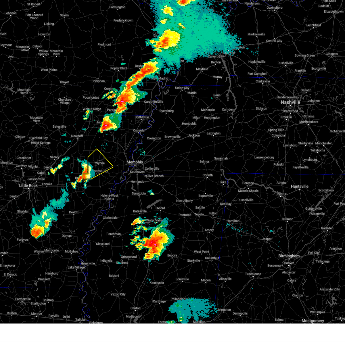
The Wheatley, AR area has had 0 reports of on-the-ground hail by trained spotters, and has been under severe weather warnings 40 times during the past 12 months. Doppler radar has detected hail at or near Wheatley, AR on 65 occasions, including 7 occasions during the past year.
| Name: | Wheatley, AR |
| Where Located: | 62.1 miles WSW of Memphis, TN |
| Map: | Google Map for Wheatley, AR |
| Population: | 355 |
| Housing Units: | 184 |
| More Info: | Search Google for Wheatley, AR |
2
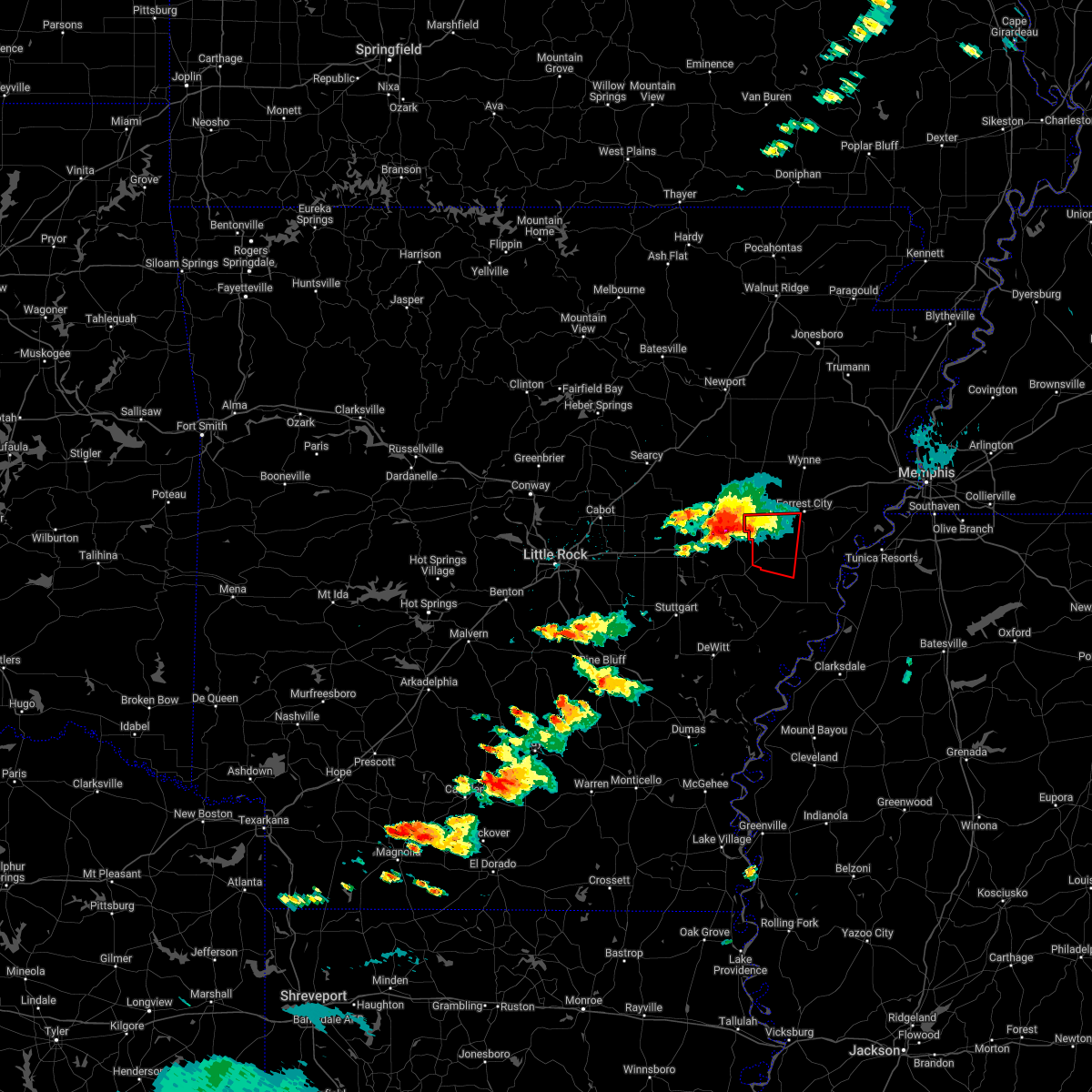
The Top Recent Hail Date for Wheatley, AR is Sunday, March 30, 2025 (10th out of 65)

Hail and Wind Damage Spotted near Wheatley, AR
| Date / Time | Report Details |
|---|---|
| 6/28/2025 5:36 PM CDT |
 Svrmeg the national weather service in memphis has issued a * severe thunderstorm warning for, northwestern lee county in eastern arkansas, western st. francis county in eastern arkansas, * until 615 pm cdt. * at 536 pm cdt, a severe thunderstorm was located over new salem, or 10 miles southwest of palestine, moving east at 20 mph (radar indicated). Hazards include 60 mph wind gusts. expect damage to roofs, siding, and trees Svrmeg the national weather service in memphis has issued a * severe thunderstorm warning for, northwestern lee county in eastern arkansas, western st. francis county in eastern arkansas, * until 615 pm cdt. * at 536 pm cdt, a severe thunderstorm was located over new salem, or 10 miles southwest of palestine, moving east at 20 mph (radar indicated). Hazards include 60 mph wind gusts. expect damage to roofs, siding, and trees
|
| 5/18/2025 9:54 PM CDT | The severe thunderstorm which prompted the warning has moved into eastern st. francis county. a strong storm is currently entering western st. francis county, and is being monitored for possible strengthening. remember, a severe thunderstorm warning still remains in effect for eastern portions of st. francis county until 1030 pm cdt. |
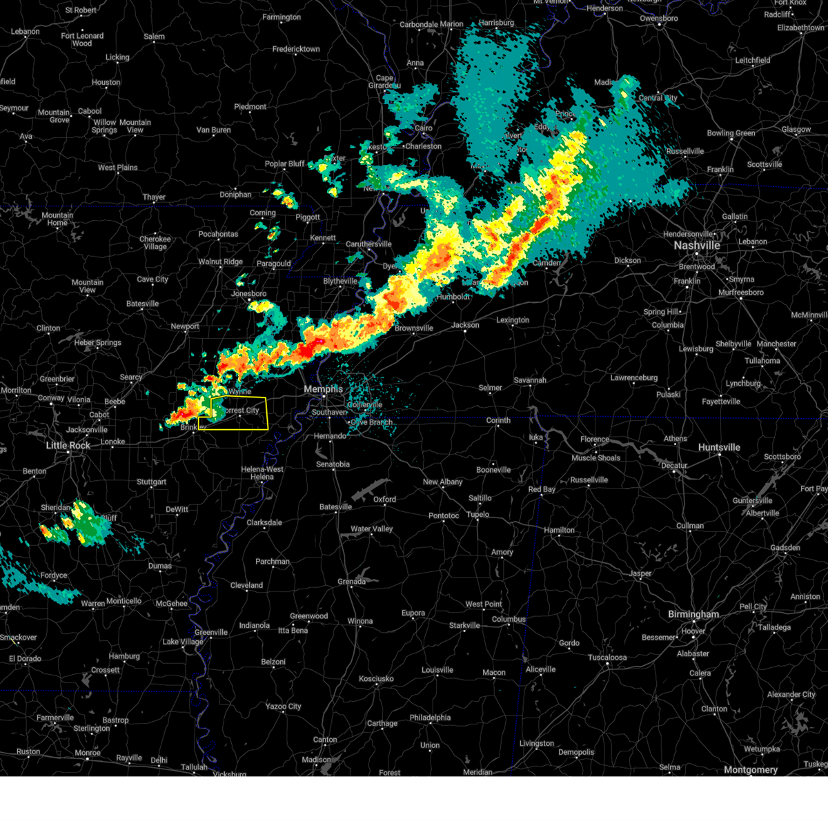
| 5/18/2025 9:27 PM CDT |
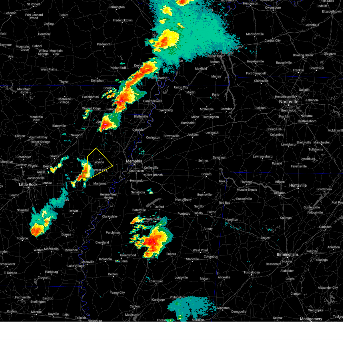
 At 926 pm cdt, a severe thunderstorm was located near forrest city, moving east at 35 mph (radar indicated). Hazards include golf ball size hail and 60 mph wind gusts. People and animals outdoors will be injured. expect hail damage to roofs, siding, windows, and vehicles. expect wind damage to roofs, siding, and trees. Locations impacted include, madison, hughes, cottonwood corner, slonikers mill, jonquil, forrest city, mud lake, wheatley, new castle, goodwin, round pond, widener, blackfish, kinton, new salem, heustess, north hughes, hicks station, lucerne, and shannondale. At 926 pm cdt, a severe thunderstorm was located near forrest city, moving east at 35 mph (radar indicated). Hazards include golf ball size hail and 60 mph wind gusts. People and animals outdoors will be injured. expect hail damage to roofs, siding, windows, and vehicles. expect wind damage to roofs, siding, and trees. Locations impacted include, madison, hughes, cottonwood corner, slonikers mill, jonquil, forrest city, mud lake, wheatley, new castle, goodwin, round pond, widener, blackfish, kinton, new salem, heustess, north hughes, hicks station, lucerne, and shannondale.
|
| 5/18/2025 9:13 PM CDT | At 913 pm cdt, a severe thunderstorm was located near forrest city, moving east at 35 mph (radar indicated). Hazards include 60 mph wind gusts and half dollar size hail. Hail damage to vehicles is expected. expect wind damage to roofs, siding, and trees. Locations impacted include, madison, hughes, cottonwood corner, slonikers mill, jonquil, forrest city, mud lake, wheatley, new castle, goodwin, round pond, widener, blackfish, kinton, new salem, heustess, north hughes, hicks station, lucerne, and shannondale. |
| 5/18/2025 9:01 PM CDT |
 Svrmeg the national weather service in memphis has issued a * severe thunderstorm warning for, northwestern lee county in eastern arkansas, st. francis county in eastern arkansas, west central crittenden county in eastern arkansas, southeastern cross county in eastern arkansas, * until 1000 pm cdt. * at 901 pm cdt, a severe thunderstorm was located near palestine, moving east at 35 mph (radar indicated). Hazards include golf ball size hail and 60 mph wind gusts. People and animals outdoors will be injured. expect hail damage to roofs, siding, windows, and vehicles. Expect wind damage to roofs, siding, and trees. Svrmeg the national weather service in memphis has issued a * severe thunderstorm warning for, northwestern lee county in eastern arkansas, st. francis county in eastern arkansas, west central crittenden county in eastern arkansas, southeastern cross county in eastern arkansas, * until 1000 pm cdt. * at 901 pm cdt, a severe thunderstorm was located near palestine, moving east at 35 mph (radar indicated). Hazards include golf ball size hail and 60 mph wind gusts. People and animals outdoors will be injured. expect hail damage to roofs, siding, windows, and vehicles. Expect wind damage to roofs, siding, and trees.
|
| 5/2/2025 10:32 AM CDT |
 Svrmeg the national weather service in memphis has issued a * severe thunderstorm warning for, northwestern lee county in eastern arkansas, st. francis county in eastern arkansas, south central poinsett county in eastern arkansas, west central crittenden county in eastern arkansas, cross county in eastern arkansas, * until 1130 am cdt. * at 1032 am cdt, a severe thunderstorm was located near hunter, or 13 miles northwest of palestine, moving northeast at 30 mph (radar indicated). Hazards include 60 mph wind gusts and quarter size hail. Hail damage to vehicles is expected. Expect wind damage to roofs, siding, and trees. Svrmeg the national weather service in memphis has issued a * severe thunderstorm warning for, northwestern lee county in eastern arkansas, st. francis county in eastern arkansas, south central poinsett county in eastern arkansas, west central crittenden county in eastern arkansas, cross county in eastern arkansas, * until 1130 am cdt. * at 1032 am cdt, a severe thunderstorm was located near hunter, or 13 miles northwest of palestine, moving northeast at 30 mph (radar indicated). Hazards include 60 mph wind gusts and quarter size hail. Hail damage to vehicles is expected. Expect wind damage to roofs, siding, and trees.
|
| 4/5/2025 1:09 PM CDT |
 At 109 pm cdt, severe thunderstorms were located along a line extending from o'kean to near caraway to near new home, moving northeast at 80 mph. these are destructive storms for truman (radar indicated). Hazards include 90 mph wind gusts and half dollar size hail. You are in a life-threatening situation. flying debris may be deadly to those caught without shelter. mobile homes will be heavily damaged or destroyed. homes and businesses will have substantial roof and window damage. expect extensive tree damage and power outages. Locations impacted include, three forks, payneway, paulding, apt, stonewall, new castle, success, mounds, alto, judd hill, beech grove, gill, needham, bunney, lake poinsett state park, hawkins, milligan ridge, buck donic, village creek state park, and julius. At 109 pm cdt, severe thunderstorms were located along a line extending from o'kean to near caraway to near new home, moving northeast at 80 mph. these are destructive storms for truman (radar indicated). Hazards include 90 mph wind gusts and half dollar size hail. You are in a life-threatening situation. flying debris may be deadly to those caught without shelter. mobile homes will be heavily damaged or destroyed. homes and businesses will have substantial roof and window damage. expect extensive tree damage and power outages. Locations impacted include, three forks, payneway, paulding, apt, stonewall, new castle, success, mounds, alto, judd hill, beech grove, gill, needham, bunney, lake poinsett state park, hawkins, milligan ridge, buck donic, village creek state park, and julius.
|
| 4/5/2025 1:04 PM CDT |
 At 104 pm cdt, severe thunderstorms were located along a line extending from near o'kean to near lepanto to near new home, moving northeast at 65 mph. this storm system is moving over areas already impacted earlier in the week (radar indicated). Hazards include 70 mph wind gusts and quarter size hail. Hail damage to vehicles is expected. expect considerable tree damage. wind damage is also likely to mobile homes, roofs, and outbuildings. Locations impacted include, three forks, payneway, paulding, apt, stonewall, new castle, success, mounds, alto, judd hill, beech grove, gill, needham, bunney, lake poinsett state park, hawkins, milligan ridge, buck donic, dryden, and village creek state park. At 104 pm cdt, severe thunderstorms were located along a line extending from near o'kean to near lepanto to near new home, moving northeast at 65 mph. this storm system is moving over areas already impacted earlier in the week (radar indicated). Hazards include 70 mph wind gusts and quarter size hail. Hail damage to vehicles is expected. expect considerable tree damage. wind damage is also likely to mobile homes, roofs, and outbuildings. Locations impacted include, three forks, payneway, paulding, apt, stonewall, new castle, success, mounds, alto, judd hill, beech grove, gill, needham, bunney, lake poinsett state park, hawkins, milligan ridge, buck donic, dryden, and village creek state park.
|
| 4/5/2025 12:40 PM CDT |
 At 1240 pm cdt, severe thunderstorms were located along a line extending from swifton to 6 miles north of cherry valley to near caldwell, moving northeast at 70 mph. this storm system is moving over areas already impacted earlier in the week (radar indicated). Hazards include 70 mph wind gusts and quarter size hail. Hail damage to vehicles is expected. expect considerable tree damage. wind damage is also likely to mobile homes, roofs, and outbuildings. Locations impacted include, garret grove, cottonwood corner, valley view, fitzgerald crossing, wheatley, new castle, brushy lake, round pond, mcelroy, craighead forest park, bay village, cherry valley, ball point, tongin, pitts, gill, lake poinsett state park, hawkins, river front, and pittinger. At 1240 pm cdt, severe thunderstorms were located along a line extending from swifton to 6 miles north of cherry valley to near caldwell, moving northeast at 70 mph. this storm system is moving over areas already impacted earlier in the week (radar indicated). Hazards include 70 mph wind gusts and quarter size hail. Hail damage to vehicles is expected. expect considerable tree damage. wind damage is also likely to mobile homes, roofs, and outbuildings. Locations impacted include, garret grove, cottonwood corner, valley view, fitzgerald crossing, wheatley, new castle, brushy lake, round pond, mcelroy, craighead forest park, bay village, cherry valley, ball point, tongin, pitts, gill, lake poinsett state park, hawkins, river front, and pittinger.
|
| 4/5/2025 12:39 PM CDT |
 At 1239 pm cdt, severe thunderstorms were located along a line extending from near strawberry to near cherry valley to near new salem, moving northeast at 70 mph. this storm system is moving over areas already impacted earlier in the week (radar indicated). Hazards include 70 mph wind gusts and quarter size hail. Hail damage to vehicles is expected. expect considerable tree damage. wind damage is also likely to mobile homes, roofs, and outbuildings. Locations impacted include, three forks, payneway, paulding, apt, stonewall, new castle, success, mounds, alto, judd hill, beech grove, gill, needham, bunney, lake poinsett state park, hawkins, milligan ridge, buck donic, dryden, and village creek state park. At 1239 pm cdt, severe thunderstorms were located along a line extending from near strawberry to near cherry valley to near new salem, moving northeast at 70 mph. this storm system is moving over areas already impacted earlier in the week (radar indicated). Hazards include 70 mph wind gusts and quarter size hail. Hail damage to vehicles is expected. expect considerable tree damage. wind damage is also likely to mobile homes, roofs, and outbuildings. Locations impacted include, three forks, payneway, paulding, apt, stonewall, new castle, success, mounds, alto, judd hill, beech grove, gill, needham, bunney, lake poinsett state park, hawkins, milligan ridge, buck donic, dryden, and village creek state park.
|
| 4/5/2025 12:31 PM CDT |
 Svrmeg the national weather service in memphis has issued a * severe thunderstorm warning for, greene county in eastern arkansas, northwestern lee county in eastern arkansas, craighead county in eastern arkansas, st. francis county in eastern arkansas, poinsett county in eastern arkansas, western mississippi county in eastern arkansas, crittenden county in eastern arkansas, western clay county in eastern arkansas, cross county in eastern arkansas, southwestern dunklin county in southeastern missouri, * until 130 pm cdt. * at 1230 pm cdt, severe thunderstorms were located along a line extending from 7 miles south of strawberry to near hickory ridge to near alfrey, moving northeast at 65 mph. this storm system is moving over areas already impacted earlier in the week (radar indicated). Hazards include 70 mph wind gusts and quarter size hail. Hail damage to vehicles is expected. expect considerable tree damage. Wind damage is also likely to mobile homes, roofs, and outbuildings. Svrmeg the national weather service in memphis has issued a * severe thunderstorm warning for, greene county in eastern arkansas, northwestern lee county in eastern arkansas, craighead county in eastern arkansas, st. francis county in eastern arkansas, poinsett county in eastern arkansas, western mississippi county in eastern arkansas, crittenden county in eastern arkansas, western clay county in eastern arkansas, cross county in eastern arkansas, southwestern dunklin county in southeastern missouri, * until 130 pm cdt. * at 1230 pm cdt, severe thunderstorms were located along a line extending from 7 miles south of strawberry to near hickory ridge to near alfrey, moving northeast at 65 mph. this storm system is moving over areas already impacted earlier in the week (radar indicated). Hazards include 70 mph wind gusts and quarter size hail. Hail damage to vehicles is expected. expect considerable tree damage. Wind damage is also likely to mobile homes, roofs, and outbuildings.
|
| 4/5/2025 12:24 PM CDT |
 Tormeg the national weather service in memphis has issued a * tornado warning for, northwestern st. francis county in eastern arkansas, northwestern crittenden county in eastern arkansas, southern cross county in eastern arkansas, * until 115 pm cdt. * at 1224 pm cdt, severe thunderstorms capable of producing both tornadoes and extensive straight line wind damage were located near hunter, or 9 miles northeast of brinkley, moving northeast at 65 mph (radar indicated rotation). Hazards include tornado. Flying debris will be dangerous to those caught without shelter. mobile homes will be damaged or destroyed. damage to roofs, windows, and vehicles will occur. Tree damage is likely. Tormeg the national weather service in memphis has issued a * tornado warning for, northwestern st. francis county in eastern arkansas, northwestern crittenden county in eastern arkansas, southern cross county in eastern arkansas, * until 115 pm cdt. * at 1224 pm cdt, severe thunderstorms capable of producing both tornadoes and extensive straight line wind damage were located near hunter, or 9 miles northeast of brinkley, moving northeast at 65 mph (radar indicated rotation). Hazards include tornado. Flying debris will be dangerous to those caught without shelter. mobile homes will be damaged or destroyed. damage to roofs, windows, and vehicles will occur. Tree damage is likely.
|
| 4/5/2025 12:21 PM CDT |
 At 1221 pm cdt, severe thunderstorms were located along a line extending from near salado to near patterson to near brinkley, moving northeast at 45 mph. this storm system is moving over areas already impacted earlier in the week (radar indicated). Hazards include 70 mph wind gusts and quarter size hail. Hail damage to vehicles is expected. expect considerable tree damage. wind damage is also likely to mobile homes, roofs, and outbuildings. Locations impacted include, garret grove, cottonwood corner, valley view, fitzgerald crossing, wheatley, new castle, brushy lake, round pond, mcelroy, craighead forest park, bay village, cherry valley, ball point, tongin, pitts, gill, lake poinsett state park, hawkins, river front, and pittinger. At 1221 pm cdt, severe thunderstorms were located along a line extending from near salado to near patterson to near brinkley, moving northeast at 45 mph. this storm system is moving over areas already impacted earlier in the week (radar indicated). Hazards include 70 mph wind gusts and quarter size hail. Hail damage to vehicles is expected. expect considerable tree damage. wind damage is also likely to mobile homes, roofs, and outbuildings. Locations impacted include, garret grove, cottonwood corner, valley view, fitzgerald crossing, wheatley, new castle, brushy lake, round pond, mcelroy, craighead forest park, bay village, cherry valley, ball point, tongin, pitts, gill, lake poinsett state park, hawkins, river front, and pittinger.
|
| 4/5/2025 12:06 PM CDT |
 Svrmeg the national weather service in memphis has issued a * severe thunderstorm warning for, northern lee county in eastern arkansas, western craighead county in eastern arkansas, st. francis county in eastern arkansas, western poinsett county in eastern arkansas, cross county in eastern arkansas, * until 100 pm cdt. * at 1206 pm cdt, severe thunderstorms were located along a line extending from near pleasant plains to near augusta to near peppers landing, moving northeast at 45 mph (radar indicated). Hazards include 70 mph wind gusts and quarter size hail. Hail damage to vehicles is expected. expect considerable tree damage. Wind damage is also likely to mobile homes, roofs, and outbuildings. Svrmeg the national weather service in memphis has issued a * severe thunderstorm warning for, northern lee county in eastern arkansas, western craighead county in eastern arkansas, st. francis county in eastern arkansas, western poinsett county in eastern arkansas, cross county in eastern arkansas, * until 100 pm cdt. * at 1206 pm cdt, severe thunderstorms were located along a line extending from near pleasant plains to near augusta to near peppers landing, moving northeast at 45 mph (radar indicated). Hazards include 70 mph wind gusts and quarter size hail. Hail damage to vehicles is expected. expect considerable tree damage. Wind damage is also likely to mobile homes, roofs, and outbuildings.
|
| 4/5/2025 1:50 AM CDT |
 At 149 am cdt, severe thunderstorms were located along a line extending from near weiner to near haynes, moving northeast at 55 mph (radar indicated). Hazards include 60 mph wind gusts and nickel size hail. Expect damage to roofs, siding, and trees. Locations impacted include, three forks, payneway, apt, valley view, browns, louise, weona junction, wheatley, new castle, gum point, edmondson, farrville, round pond, craighead forest park, simsboro, promised land, judd hill, herndon, needham, and lake poinsett state park. At 149 am cdt, severe thunderstorms were located along a line extending from near weiner to near haynes, moving northeast at 55 mph (radar indicated). Hazards include 60 mph wind gusts and nickel size hail. Expect damage to roofs, siding, and trees. Locations impacted include, three forks, payneway, apt, valley view, browns, louise, weona junction, wheatley, new castle, gum point, edmondson, farrville, round pond, craighead forest park, simsboro, promised land, judd hill, herndon, needham, and lake poinsett state park.
|
| 4/5/2025 1:50 AM CDT |
 the severe thunderstorm warning has been cancelled and is no longer in effect the severe thunderstorm warning has been cancelled and is no longer in effect
|
| 4/5/2025 1:32 AM CDT |
 Svrmeg the national weather service in memphis has issued a * severe thunderstorm warning for, south central greene county in eastern arkansas, northwestern lee county in eastern arkansas, craighead county in eastern arkansas, st. francis county in eastern arkansas, poinsett county in eastern arkansas, northwestern crittenden county in eastern arkansas, cross county in eastern arkansas, * until 215 am cdt. * at 131 am cdt, severe thunderstorms were located along a line extending from near algoa to moro, moving northeast at 55 mph (radar indicated). Hazards include 60 mph wind gusts and nickel size hail. expect damage to roofs, siding, and trees Svrmeg the national weather service in memphis has issued a * severe thunderstorm warning for, south central greene county in eastern arkansas, northwestern lee county in eastern arkansas, craighead county in eastern arkansas, st. francis county in eastern arkansas, poinsett county in eastern arkansas, northwestern crittenden county in eastern arkansas, cross county in eastern arkansas, * until 215 am cdt. * at 131 am cdt, severe thunderstorms were located along a line extending from near algoa to moro, moving northeast at 55 mph (radar indicated). Hazards include 60 mph wind gusts and nickel size hail. expect damage to roofs, siding, and trees
|
| 4/2/2025 9:53 PM CDT | The storm which prompted the warning has weakened below severe limits, and no longer poses an immediate threat to life or property. therefore, the warning will be allowed to expire. a tornado watch remains in effect until midnight cdt for eastern arkansas, and northwestern mississippi. |
| 4/2/2025 9:18 PM CDT | the severe thunderstorm warning has been cancelled and is no longer in effect |
| 4/2/2025 9:18 PM CDT | At 918 pm cdt, a severe thunderstorm was located near brickeys, or near hughes, moving east at 45 mph (radar indicated). Hazards include 60 mph wind gusts and quarter size hail. Hail damage to vehicles is expected. expect wind damage to roofs, siding, and trees. Locations impacted include, garret grove, cody, helena-west helena, haleside, quarles, commerce, wheatley, soudan, vineyard, beck, brickeys, ball point, whitehall, tongin, raggio, poplar grove, gill, huma, mississippi river state park, and oneida. |
| 4/2/2025 8:55 PM CDT | The tornado threat has diminished and the tornado warning has been cancelled. however, large hail and damaging winds remain likely and a severe thunderstorm warning remains in effect for the area. a tornado watch remains in effect until midnight cdt for eastern arkansas. |
| 4/2/2025 8:54 PM CDT | Svrmeg the national weather service in memphis has issued a * severe thunderstorm warning for, lee county in eastern arkansas, southern st. francis county in eastern arkansas, phillips county in eastern arkansas, south central crittenden county in eastern arkansas, west central desoto county in northwestern mississippi, central tunica county in northwestern mississippi, * until 1000 pm cdt. * at 854 pm cdt, a severe thunderstorms were located near marianna, arkansas moving northeast at 45 mph (radar indicated). Hazards include 60 mph wind gusts and quarter size hail. Hail damage to vehicles is expected. Expect wind damage to roofs, siding, and trees. |
| 4/2/2025 8:47 PM CDT |
 At 847 pm cdt, a severe thunderstorm capable of producing a tornado was located near haynes, or near marianna, moving northeast at 45 mph (radar indicated rotation). Hazards include tornado and golf ball size hail. Flying debris will be dangerous to those caught without shelter. mobile homes will be damaged or destroyed. damage to roofs, windows, and vehicles will occur. tree damage is likely. Locations impacted include, garret grove, madison, cottonwood corner, slonikers mill, fitzgerald crossing, westor, forrest city, new castle, goodwin, round pond, widener, blackfish, kinton, new salem, heustess, moro, hicks station, lucerne, whitmore, and gill. At 847 pm cdt, a severe thunderstorm capable of producing a tornado was located near haynes, or near marianna, moving northeast at 45 mph (radar indicated rotation). Hazards include tornado and golf ball size hail. Flying debris will be dangerous to those caught without shelter. mobile homes will be damaged or destroyed. damage to roofs, windows, and vehicles will occur. tree damage is likely. Locations impacted include, garret grove, madison, cottonwood corner, slonikers mill, fitzgerald crossing, westor, forrest city, new castle, goodwin, round pond, widener, blackfish, kinton, new salem, heustess, moro, hicks station, lucerne, whitmore, and gill.
|
| 4/2/2025 8:13 PM CDT | Tormeg the national weather service in memphis has issued a * tornado warning for, northwestern lee county in eastern arkansas, st. francis county in eastern arkansas, south central cross county in eastern arkansas, * until 900 pm cdt. * at 813 pm cdt, a severe thunderstorm capable of producing a tornado was located near garret grove, or 9 miles southeast of brinkley, moving northeast at 45 mph (radar indicated rotation). Hazards include tornado and golf ball size hail. Flying debris will be dangerous to those caught without shelter. mobile homes will be damaged or destroyed. damage to roofs, windows, and vehicles will occur. Tree damage is likely. |
| 4/2/2025 7:53 PM CDT | the severe thunderstorm warning has been cancelled and is no longer in effect |
| 4/2/2025 7:53 PM CDT | At 753 pm cdt, severe thunderstorms were located along a line extending from 8 miles northwest of palestine to near marvell, moving east at 50 mph (radar indicated). Hazards include 60 mph wind gusts and quarter size hail. Hail damage to vehicles is expected. expect wind damage to roofs, siding, and trees. Locations impacted include, garret grove, cody, hughes, haleside, commerce, wheatley, new castle, soudan, vineyard, beck, simsboro, democrat, brickeys, ball point, whitehall, tongin, raggio, gill, hawkins, and mississippi river state park. |
| 4/2/2025 7:47 PM CDT | Svrmeg the national weather service in memphis has issued a * severe thunderstorm warning for, lee county in eastern arkansas, st. francis county in eastern arkansas, northeastern phillips county in eastern arkansas, southwestern crittenden county in eastern arkansas, northwestern desoto county in northwestern mississippi, northeastern coahoma county in northwestern mississippi, tunica county in northwestern mississippi, southwestern shelby county in west tennessee, * until 830 pm cdt. * at 746 pm cdt, severe thunderstorms were located along a line extending from near caldwell to near palmer, moving northeast at 50 mph (radar indicated). Hazards include 60 mph wind gusts and quarter size hail. Hail damage to vehicles is expected. Expect wind damage to roofs, siding, and trees. |
| 4/2/2025 6:23 PM CDT |
 Tormeg the national weather service in memphis has issued a * tornado warning for, northwestern st. francis county in eastern arkansas, cross county in eastern arkansas, * until 715 pm cdt. * at 622 pm cdt, a severe thunderstorm capable of producing a tornado was located near hunter, or near brinkley, moving northeast at 60 mph (radar indicated rotation). Hazards include tornado and ping pong ball size hail. Flying debris will be dangerous to those caught without shelter. mobile homes will be damaged or destroyed. damage to roofs, windows, and vehicles will occur. Tree damage is likely. Tormeg the national weather service in memphis has issued a * tornado warning for, northwestern st. francis county in eastern arkansas, cross county in eastern arkansas, * until 715 pm cdt. * at 622 pm cdt, a severe thunderstorm capable of producing a tornado was located near hunter, or near brinkley, moving northeast at 60 mph (radar indicated rotation). Hazards include tornado and ping pong ball size hail. Flying debris will be dangerous to those caught without shelter. mobile homes will be damaged or destroyed. damage to roofs, windows, and vehicles will occur. Tree damage is likely.
|
| 3/30/2025 9:27 PM CDT | At 926 pm cdt, a severe thunderstorm was located near palestine, moving east at 30 mph (radar indicated). Hazards include two inch hail and 60 mph wind gusts. People and animals outdoors will be injured. expect hail damage to roofs, siding, windows, and vehicles. expect wind damage to roofs, siding, and trees. Locations impacted include, madison, cottonwood corner, slonikers mill, forrest city, wheatley, new castle, goodwin, round pond, widener, blackfish, heustess, hicks station, rawlinson, whitmore, hawkins, horton, rosenbaum, bonair, crow creek, and caldwell. |
| 3/30/2025 9:18 PM CDT |
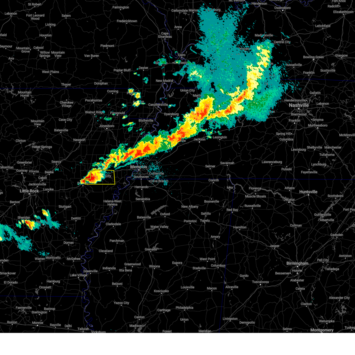 At 917 pm cdt, a severe thunderstorm was located near hunter, or 7 miles northwest of palestine, moving east at 40 mph (radar indicated). Hazards include ping pong ball size hail and 60 mph wind gusts. People and animals outdoors will be injured. expect hail damage to roofs, siding, windows, and vehicles. expect wind damage to roofs, siding, and trees. Locations impacted include, madison, cottonwood corner, slonikers mill, forrest city, wheatley, new castle, goodwin, round pond, widener, blackfish, heustess, hicks station, rawlinson, whitmore, hawkins, horton, rosenbaum, bonair, crow creek, and caldwell. At 917 pm cdt, a severe thunderstorm was located near hunter, or 7 miles northwest of palestine, moving east at 40 mph (radar indicated). Hazards include ping pong ball size hail and 60 mph wind gusts. People and animals outdoors will be injured. expect hail damage to roofs, siding, windows, and vehicles. expect wind damage to roofs, siding, and trees. Locations impacted include, madison, cottonwood corner, slonikers mill, forrest city, wheatley, new castle, goodwin, round pond, widener, blackfish, heustess, hicks station, rawlinson, whitmore, hawkins, horton, rosenbaum, bonair, crow creek, and caldwell.
|
| 3/30/2025 9:03 PM CDT |
 Svrmeg the national weather service in memphis has issued a * severe thunderstorm warning for, st. francis county in eastern arkansas, * until 945 pm cdt. * at 902 pm cdt, a severe thunderstorm was located near hunter, or 9 miles north of brinkley, moving east at 40 mph (radar indicated). Hazards include 60 mph wind gusts and half dollar size hail. Hail damage to vehicles is expected. Expect wind damage to roofs, siding, and trees. Svrmeg the national weather service in memphis has issued a * severe thunderstorm warning for, st. francis county in eastern arkansas, * until 945 pm cdt. * at 902 pm cdt, a severe thunderstorm was located near hunter, or 9 miles north of brinkley, moving east at 40 mph (radar indicated). Hazards include 60 mph wind gusts and half dollar size hail. Hail damage to vehicles is expected. Expect wind damage to roofs, siding, and trees.
|
| 3/15/2025 8:31 AM CDT |
 Svrmeg the national weather service in memphis has issued a * severe thunderstorm warning for, northern lee county in eastern arkansas, st. francis county in eastern arkansas, crittenden county in eastern arkansas, cross county in eastern arkansas, northwestern desoto county in northwestern mississippi, northern tunica county in northwestern mississippi, western shelby county in west tennessee, * until 915 am cdt. * at 831 am cdt, a severe thunderstorm was located near robinsonville, or 7 miles south of hughes, moving northeast at 45 mph (radar indicated). Hazards include 60 mph wind gusts and quarter size hail. Hail damage to vehicles is expected. Expect wind damage to roofs, siding, and trees. Svrmeg the national weather service in memphis has issued a * severe thunderstorm warning for, northern lee county in eastern arkansas, st. francis county in eastern arkansas, crittenden county in eastern arkansas, cross county in eastern arkansas, northwestern desoto county in northwestern mississippi, northern tunica county in northwestern mississippi, western shelby county in west tennessee, * until 915 am cdt. * at 831 am cdt, a severe thunderstorm was located near robinsonville, or 7 miles south of hughes, moving northeast at 45 mph (radar indicated). Hazards include 60 mph wind gusts and quarter size hail. Hail damage to vehicles is expected. Expect wind damage to roofs, siding, and trees.
|
| 3/15/2025 5:35 AM CDT |
 The storm which prompted the warning has moved out of the area. therefore, the warning will be allowed to expire. a new severe thunderstorm warning has been issued downstream. The storm which prompted the warning has moved out of the area. therefore, the warning will be allowed to expire. a new severe thunderstorm warning has been issued downstream.
|
| 3/15/2025 5:18 AM CDT | At 518 am cdt, a severe thunderstorm was located near hunter, or 11 miles northwest of palestine, moving northeast at 35 mph (radar indicated). Hazards include 60 mph wind gusts and quarter size hail. Hail damage to vehicles is expected. expect wind damage to roofs, siding, and trees. Locations impacted include, madison, hydrick, slonikers mill, fitzgerald crossing, forrest city, wheatley, new castle, goodwin, fair oaks, brushy lake, mcelroy, hawkins, horton, rosenbaum, crow creek, caldwell, palestine, four gums, posey, and colt. |
| 3/15/2025 5:18 AM CDT | the severe thunderstorm warning has been cancelled and is no longer in effect |
| 3/15/2025 4:56 AM CDT |
 Svrmeg the national weather service in memphis has issued a * severe thunderstorm warning for, northwestern lee county in eastern arkansas, western st. francis county in eastern arkansas, southwestern cross county in eastern arkansas, * until 545 am cdt. * at 456 am cdt, a severe thunderstorm was located near brinkley, moving northeast at 35 mph (radar indicated). Hazards include 60 mph wind gusts and quarter size hail. Hail damage to vehicles is expected. Expect wind damage to roofs, siding, and trees. Svrmeg the national weather service in memphis has issued a * severe thunderstorm warning for, northwestern lee county in eastern arkansas, western st. francis county in eastern arkansas, southwestern cross county in eastern arkansas, * until 545 am cdt. * at 456 am cdt, a severe thunderstorm was located near brinkley, moving northeast at 35 mph (radar indicated). Hazards include 60 mph wind gusts and quarter size hail. Hail damage to vehicles is expected. Expect wind damage to roofs, siding, and trees.
|
| 3/15/2025 1:06 AM CDT |
 The storm which prompted the warning has weakened below severe limits, and no longer poses an immediate threat to life or property. therefore, the warning will be allowed to expire. a tornado watch remains in effect until 300 am cdt for eastern arkansas. The storm which prompted the warning has weakened below severe limits, and no longer poses an immediate threat to life or property. therefore, the warning will be allowed to expire. a tornado watch remains in effect until 300 am cdt for eastern arkansas.
|
| 3/15/2025 12:47 AM CDT |
 the severe thunderstorm warning has been cancelled and is no longer in effect the severe thunderstorm warning has been cancelled and is no longer in effect
|
| 3/15/2025 12:47 AM CDT |
 At 1246 am cdt, a severe thunderstorm was located near hunter, or 8 miles northeast of brinkley, moving northeast at 55 mph (radar indicated). Hazards include 60 mph wind gusts and quarter size hail. Hail damage to vehicles is expected. expect wind damage to roofs, siding, and trees. Locations impacted include, madison, hydrick, cottonwood corner, slonikers mill, fitzgerald crossing, forrest city, wheatley, new castle, goodwin, fair oaks, brushy lake, mcelroy, vanndale, kinton, hicks station, wynne, hawkins, horton, rosenbaum, and river front. At 1246 am cdt, a severe thunderstorm was located near hunter, or 8 miles northeast of brinkley, moving northeast at 55 mph (radar indicated). Hazards include 60 mph wind gusts and quarter size hail. Hail damage to vehicles is expected. expect wind damage to roofs, siding, and trees. Locations impacted include, madison, hydrick, cottonwood corner, slonikers mill, fitzgerald crossing, forrest city, wheatley, new castle, goodwin, fair oaks, brushy lake, mcelroy, vanndale, kinton, hicks station, wynne, hawkins, horton, rosenbaum, and river front.
|
| 3/15/2025 12:36 AM CDT | Svrmeg the national weather service in memphis has issued a * severe thunderstorm warning for, northwestern lee county in eastern arkansas, st. francis county in eastern arkansas, southwestern cross county in eastern arkansas, * until 115 am cdt. * at 1236 am cdt, a severe thunderstorm was located near brinkley, moving northeast at 55 mph (radar indicated). Hazards include 60 mph wind gusts and half dollar size hail. Hail damage to vehicles is expected. Expect wind damage to roofs, siding, and trees. |
| 5/26/2024 11:36 PM CDT |
 At 1136 pm cdt, severe thunderstorms were located along a line extending from gilmore to 8 miles east of hunter, moving east at 40 mph (radar indicated). Hazards include ping pong ball size hail and 60 mph wind gusts. People and animals outdoors will be injured. expect hail damage to roofs, siding, windows, and vehicles. expect wind damage to roofs, siding, and trees. Locations impacted include, forrest city, wynne, earle, parkin, madison, palestine, village creek state park, caldwell, crawfordsville, colt, wheatley, widener, gilmore, jericho, jennette, fair oaks, vanndale, turrell, clarkedale, and three forks. At 1136 pm cdt, severe thunderstorms were located along a line extending from gilmore to 8 miles east of hunter, moving east at 40 mph (radar indicated). Hazards include ping pong ball size hail and 60 mph wind gusts. People and animals outdoors will be injured. expect hail damage to roofs, siding, windows, and vehicles. expect wind damage to roofs, siding, and trees. Locations impacted include, forrest city, wynne, earle, parkin, madison, palestine, village creek state park, caldwell, crawfordsville, colt, wheatley, widener, gilmore, jericho, jennette, fair oaks, vanndale, turrell, clarkedale, and three forks.
|
| 5/26/2024 11:20 PM CDT |
 Svrmeg the national weather service in memphis has issued a * severe thunderstorm warning for, st. francis county in eastern arkansas, northern crittenden county in eastern arkansas, cross county in eastern arkansas, * until midnight cdt. * at 1119 pm cdt, severe thunderstorms were located along a line extending from 8 miles north of earle to near hunter, moving east at 40 mph (radar indicated). Hazards include 60 mph wind gusts and quarter size hail. Hail damage to vehicles is expected. Expect wind damage to roofs, siding, and trees. Svrmeg the national weather service in memphis has issued a * severe thunderstorm warning for, st. francis county in eastern arkansas, northern crittenden county in eastern arkansas, cross county in eastern arkansas, * until midnight cdt. * at 1119 pm cdt, severe thunderstorms were located along a line extending from 8 miles north of earle to near hunter, moving east at 40 mph (radar indicated). Hazards include 60 mph wind gusts and quarter size hail. Hail damage to vehicles is expected. Expect wind damage to roofs, siding, and trees.
|
| 5/24/2024 4:38 PM CDT |
 the severe thunderstorm warning has been cancelled and is no longer in effect the severe thunderstorm warning has been cancelled and is no longer in effect
|
| 5/24/2024 4:38 PM CDT |
 At 437 pm cdt, a severe thunderstorm was located near moro, or 9 miles west of marianna, moving southeast at 20 mph (radar indicated). Hazards include 60 mph wind gusts and quarter size hail. Hail damage to vehicles is expected. expect wind damage to roofs, siding, and trees. Locations impacted include, marianna, moro, new salem, gill, felton, oak forest, westor, thomasville, four forks, and scott valley. At 437 pm cdt, a severe thunderstorm was located near moro, or 9 miles west of marianna, moving southeast at 20 mph (radar indicated). Hazards include 60 mph wind gusts and quarter size hail. Hail damage to vehicles is expected. expect wind damage to roofs, siding, and trees. Locations impacted include, marianna, moro, new salem, gill, felton, oak forest, westor, thomasville, four forks, and scott valley.
|
| 5/24/2024 4:12 PM CDT | Public reported a tree down in wheatley... a in st. francis county AR, 0.4 miles NE of Wheatley, AR |
| 5/24/2024 4:10 PM CDT | A tree was knocked down in wheatle in st. francis county AR, 0.4 miles SE of Wheatley, AR |
| 5/24/2024 4:04 PM CDT |
 Svrmeg the national weather service in memphis has issued a * severe thunderstorm warning for, western lee county in eastern arkansas, southwestern st. francis county in eastern arkansas, * until 445 pm cdt. * at 404 pm cdt, a severe thunderstorm was located over wheatley, or near brinkley, moving east at 20 mph (radar indicated). Hazards include 60 mph wind gusts and quarter size hail. Hail damage to vehicles is expected. Expect wind damage to roofs, siding, and trees. Svrmeg the national weather service in memphis has issued a * severe thunderstorm warning for, western lee county in eastern arkansas, southwestern st. francis county in eastern arkansas, * until 445 pm cdt. * at 404 pm cdt, a severe thunderstorm was located over wheatley, or near brinkley, moving east at 20 mph (radar indicated). Hazards include 60 mph wind gusts and quarter size hail. Hail damage to vehicles is expected. Expect wind damage to roofs, siding, and trees.
|
| 5/9/2024 1:16 AM CDT |
 The storm which prompted the warning has weakened below severe limits, and no longer poses an immediate threat to life or property. therefore, the warning has been allowed to expire. however, gusty winds are still possible with this thunderstorm. a tornado watch remains in effect until 300 am cdt for eastern arkansas, northwestern mississippi, and west tennessee. The storm which prompted the warning has weakened below severe limits, and no longer poses an immediate threat to life or property. therefore, the warning has been allowed to expire. however, gusty winds are still possible with this thunderstorm. a tornado watch remains in effect until 300 am cdt for eastern arkansas, northwestern mississippi, and west tennessee.
|
| 5/9/2024 12:57 AM CDT |
 At 1256 am cdt, a severe thunderstorm was located over widener, or over madison, moving east at 30 mph (radar indicated). Hazards include 60 mph wind gusts and penny size hail. Expect damage to roofs, siding, and trees. Locations impacted include, forrest city, hughes, madison, palestine, village creek state park, caldwell, edmondson, colt, horseshoe lake, widener, anthonyville, simsboro, new home, pinckney, cottonwood corner, browns, louise, new castle, round pond, and beck. At 1256 am cdt, a severe thunderstorm was located over widener, or over madison, moving east at 30 mph (radar indicated). Hazards include 60 mph wind gusts and penny size hail. Expect damage to roofs, siding, and trees. Locations impacted include, forrest city, hughes, madison, palestine, village creek state park, caldwell, edmondson, colt, horseshoe lake, widener, anthonyville, simsboro, new home, pinckney, cottonwood corner, browns, louise, new castle, round pond, and beck.
|
| 5/9/2024 12:29 AM CDT |
 Svrmeg the national weather service in memphis has issued a * severe thunderstorm warning for, st. francis county in eastern arkansas, southwestern crittenden county in eastern arkansas, southern cross county in eastern arkansas, * until 115 am cdt. * at 1229 am cdt, a severe thunderstorm was located near widener, or near village creek state park, moving east at 45 mph (radar indicated). Hazards include 60 mph wind gusts and quarter size hail. Hail damage to vehicles is expected. Expect wind damage to roofs, siding, and trees. Svrmeg the national weather service in memphis has issued a * severe thunderstorm warning for, st. francis county in eastern arkansas, southwestern crittenden county in eastern arkansas, southern cross county in eastern arkansas, * until 115 am cdt. * at 1229 am cdt, a severe thunderstorm was located near widener, or near village creek state park, moving east at 45 mph (radar indicated). Hazards include 60 mph wind gusts and quarter size hail. Hail damage to vehicles is expected. Expect wind damage to roofs, siding, and trees.
|
| 5/8/2024 4:54 AM CDT |
 The storm which prompted the warning has weakened below severe limits, and no longer poses an immediate threat to life or property. therefore, the warning will be allowed to expire. however, small hail and gusty winds are still possible with this thunderstorm. a tornado watch remains in effect until 600 am cdt for eastern arkansas. The storm which prompted the warning has weakened below severe limits, and no longer poses an immediate threat to life or property. therefore, the warning will be allowed to expire. however, small hail and gusty winds are still possible with this thunderstorm. a tornado watch remains in effect until 600 am cdt for eastern arkansas.
|
| 5/8/2024 4:34 AM CDT |
 At 434 am cdt, a severe thunderstorm was located over aubrey, or 7 miles southwest of marianna, moving east at 40 mph (radar indicated). Hazards include 60 mph wind gusts and quarter size hail. Hail damage to vehicles is expected. expect wind damage to roofs, siding, and trees. Locations impacted include, forrest city, marianna, marvell, madison, palestine, helena-west helena, caldwell, wheatley, lexa, widener, moro, rondo, aubrey, haynes, garret grove, watkins corner, new salem, lagrange, cody, and cottonwood corner. At 434 am cdt, a severe thunderstorm was located over aubrey, or 7 miles southwest of marianna, moving east at 40 mph (radar indicated). Hazards include 60 mph wind gusts and quarter size hail. Hail damage to vehicles is expected. expect wind damage to roofs, siding, and trees. Locations impacted include, forrest city, marianna, marvell, madison, palestine, helena-west helena, caldwell, wheatley, lexa, widener, moro, rondo, aubrey, haynes, garret grove, watkins corner, new salem, lagrange, cody, and cottonwood corner.
|
| 5/8/2024 4:06 AM CDT |
 Svrmeg the national weather service in memphis has issued a * severe thunderstorm warning for, lee county in eastern arkansas, central st. francis county in eastern arkansas, northern phillips county in eastern arkansas, * until 500 am cdt. * at 406 am cdt, a severe thunderstorm was located near clarendon, moving east at 40 mph (radar indicated). Hazards include 70 mph wind gusts and ping pong ball size hail. People and animals outdoors will be injured. expect hail damage to roofs, siding, windows, and vehicles. expect considerable tree damage. Wind damage is also likely to mobile homes, roofs, and outbuildings. Svrmeg the national weather service in memphis has issued a * severe thunderstorm warning for, lee county in eastern arkansas, central st. francis county in eastern arkansas, northern phillips county in eastern arkansas, * until 500 am cdt. * at 406 am cdt, a severe thunderstorm was located near clarendon, moving east at 40 mph (radar indicated). Hazards include 70 mph wind gusts and ping pong ball size hail. People and animals outdoors will be injured. expect hail damage to roofs, siding, windows, and vehicles. expect considerable tree damage. Wind damage is also likely to mobile homes, roofs, and outbuildings.
|
| 3/15/2024 12:13 AM CDT |
 At 1213 am cdt, a severe thunderstorm was located near new salem, or 8 miles west of palestine, moving northeast at 40 mph (radar indicated). Hazards include 60 mph wind gusts and quarter size hail. Hail damage to vehicles is expected. expect wind damage to roofs, siding, and trees. Locations impacted include, forrest city, madison, palestine, caldwell, colt, wheatley, moro, haynes, garret grove, new salem, oak forest, slonikers mill, westor, new castle, soudan, goodwin, heustess, gill, hawkins, and horton. At 1213 am cdt, a severe thunderstorm was located near new salem, or 8 miles west of palestine, moving northeast at 40 mph (radar indicated). Hazards include 60 mph wind gusts and quarter size hail. Hail damage to vehicles is expected. expect wind damage to roofs, siding, and trees. Locations impacted include, forrest city, madison, palestine, caldwell, colt, wheatley, moro, haynes, garret grove, new salem, oak forest, slonikers mill, westor, new castle, soudan, goodwin, heustess, gill, hawkins, and horton.
|
| 3/14/2024 11:58 PM CDT |
 Svrmeg the national weather service in memphis has issued a * severe thunderstorm warning for, northwestern lee county in eastern arkansas, western st. francis county in eastern arkansas, * until 1245 am cdt. * at 1158 pm cdt, a severe thunderstorm was located over brinkley, moving northeast at 35 mph (radar indicated). Hazards include 60 mph wind gusts and quarter size hail. Hail damage to vehicles is expected. Expect wind damage to roofs, siding, and trees. Svrmeg the national weather service in memphis has issued a * severe thunderstorm warning for, northwestern lee county in eastern arkansas, western st. francis county in eastern arkansas, * until 1245 am cdt. * at 1158 pm cdt, a severe thunderstorm was located over brinkley, moving northeast at 35 mph (radar indicated). Hazards include 60 mph wind gusts and quarter size hail. Hail damage to vehicles is expected. Expect wind damage to roofs, siding, and trees.
|
| 7/21/2023 12:18 PM CDT |
 At 1218 pm cdt, severe thunderstorms were located along a line extending from mccrory to 8 miles southwest of fair oaks to near hunter, moving east at 55 mph (radar indicated). Hazards include 60 mph wind gusts. Expect damage to roofs, siding, and trees. locations impacted include, forrest city, wynne, hughes, parkin, madison, palestine, village creek state park, caldwell, colt, widener, haynes, brickeys, fair oaks, vanndale, new home, cody, cottonwood corner, fitzgerald crossing, new castle and soudan. hail threat, radar indicated max hail size, <. 75 in wind threat, radar indicated max wind gust, 60 mph. At 1218 pm cdt, severe thunderstorms were located along a line extending from mccrory to 8 miles southwest of fair oaks to near hunter, moving east at 55 mph (radar indicated). Hazards include 60 mph wind gusts. Expect damage to roofs, siding, and trees. locations impacted include, forrest city, wynne, hughes, parkin, madison, palestine, village creek state park, caldwell, colt, widener, haynes, brickeys, fair oaks, vanndale, new home, cody, cottonwood corner, fitzgerald crossing, new castle and soudan. hail threat, radar indicated max hail size, <. 75 in wind threat, radar indicated max wind gust, 60 mph.
|
| 7/21/2023 12:05 PM CDT |
 At 1205 pm cdt, severe thunderstorms were located along a line extending from augusta to 6 miles southwest of patterson to 9 miles southeast of hurricane lake wma, moving east at 60 mph (radar indicated). Hazards include 60 mph wind gusts and penny size hail. expect damage to roofs, siding, and trees At 1205 pm cdt, severe thunderstorms were located along a line extending from augusta to 6 miles southwest of patterson to 9 miles southeast of hurricane lake wma, moving east at 60 mph (radar indicated). Hazards include 60 mph wind gusts and penny size hail. expect damage to roofs, siding, and trees
|
| 4/15/2023 7:47 PM CDT |
 At 747 pm cdt, severe thunderstorms were located along a line extending from mcfadden to 9 miles northeast of des arc to near stuttgart municipal airport, moving east at 60 mph (radar indicated). Hazards include 60 mph wind gusts and quarter size hail. Hail damage to vehicles is expected. Expect wind damage to roofs, siding, and trees. At 747 pm cdt, severe thunderstorms were located along a line extending from mcfadden to 9 miles northeast of des arc to near stuttgart municipal airport, moving east at 60 mph (radar indicated). Hazards include 60 mph wind gusts and quarter size hail. Hail damage to vehicles is expected. Expect wind damage to roofs, siding, and trees.
|
| 4/15/2023 7:44 PM CDT |
 At 743 pm cdt, severe thunderstorms were located along a line extending from mcfadden to 11 miles northeast of des arc to stuttgart municipal airport, moving east at 75 mph (radar indicated). Hazards include 60 mph wind gusts and quarter size hail. Hail damage to vehicles is expected. Expect wind damage to roofs, siding, and trees. At 743 pm cdt, severe thunderstorms were located along a line extending from mcfadden to 11 miles northeast of des arc to stuttgart municipal airport, moving east at 75 mph (radar indicated). Hazards include 60 mph wind gusts and quarter size hail. Hail damage to vehicles is expected. Expect wind damage to roofs, siding, and trees.
|
| 4/5/2023 12:24 PM CDT |
 The severe thunderstorm warning for northwestern lee, st. francis, south central poinsett and cross counties will expire at 1230 pm cdt, the storms which prompted the warning have moved out of the area. therefore, the warning will be allowed to expire. a tornado watch remains in effect until 400 pm cdt for eastern arkansas. remember, a severe thunderstorm warning still remains in effect for western st. francis and cross county, arkansas until 1230 pm cdt. The severe thunderstorm warning for northwestern lee, st. francis, south central poinsett and cross counties will expire at 1230 pm cdt, the storms which prompted the warning have moved out of the area. therefore, the warning will be allowed to expire. a tornado watch remains in effect until 400 pm cdt for eastern arkansas. remember, a severe thunderstorm warning still remains in effect for western st. francis and cross county, arkansas until 1230 pm cdt.
|
| 4/5/2023 12:05 PM CDT |
 At 1205 pm cdt, severe thunderstorms were located along a line extending from 6 miles west of vanndale to near colt to near palestine, moving northeast at 55 mph (radar indicated). Hazards include 60 mph wind gusts. Expect damage to roofs, siding, and trees. locations impacted include, forrest city, wynne, parkin, madison, palestine, village creek state park, cherry valley, caldwell, colt, wheatley, widener, hickory ridge, fair oaks, vanndale, new salem, cottonwood corner, fitzgerald crossing, new castle, brushy lake and round pond. hail threat, radar indicated max hail size, <. 75 in wind threat, radar indicated max wind gust, 60 mph. At 1205 pm cdt, severe thunderstorms were located along a line extending from 6 miles west of vanndale to near colt to near palestine, moving northeast at 55 mph (radar indicated). Hazards include 60 mph wind gusts. Expect damage to roofs, siding, and trees. locations impacted include, forrest city, wynne, parkin, madison, palestine, village creek state park, cherry valley, caldwell, colt, wheatley, widener, hickory ridge, fair oaks, vanndale, new salem, cottonwood corner, fitzgerald crossing, new castle, brushy lake and round pond. hail threat, radar indicated max hail size, <. 75 in wind threat, radar indicated max wind gust, 60 mph.
|
| 4/5/2023 11:45 AM CDT |
 At 1145 am cdt, severe thunderstorms were located along a line extending from 6 miles southwest of fair oaks to hunter to near brinkley, moving northeast at 55 mph (radar indicated). Hazards include 60 mph wind gusts and quarter size hail. Hail damage to vehicles is expected. Expect wind damage to roofs, siding, and trees. At 1145 am cdt, severe thunderstorms were located along a line extending from 6 miles southwest of fair oaks to hunter to near brinkley, moving northeast at 55 mph (radar indicated). Hazards include 60 mph wind gusts and quarter size hail. Hail damage to vehicles is expected. Expect wind damage to roofs, siding, and trees.
|
| 3/24/2023 6:49 PM CDT |
 At 649 pm cdt, a severe thunderstorm was located near moro, or 10 miles southeast of brinkley, moving northeast at 65 mph (radar indicated). Hazards include 60 mph wind gusts and quarter size hail. Hail damage to vehicles is expected. expect wind damage to roofs, siding, and trees. locations impacted include, forrest city, marianna, madison, palestine, caldwell, wheatley, widener, moro, rondo, aubrey, haynes, garret grove, new salem, lagrange, oak forest, slonikers mill, westor, new castle, goodwin and turkey scratch. hail threat, radar indicated max hail size, 1. 00 in wind threat, radar indicated max wind gust, 60 mph. At 649 pm cdt, a severe thunderstorm was located near moro, or 10 miles southeast of brinkley, moving northeast at 65 mph (radar indicated). Hazards include 60 mph wind gusts and quarter size hail. Hail damage to vehicles is expected. expect wind damage to roofs, siding, and trees. locations impacted include, forrest city, marianna, madison, palestine, caldwell, wheatley, widener, moro, rondo, aubrey, haynes, garret grove, new salem, lagrange, oak forest, slonikers mill, westor, new castle, goodwin and turkey scratch. hail threat, radar indicated max hail size, 1. 00 in wind threat, radar indicated max wind gust, 60 mph.
|
| 3/24/2023 6:32 PM CDT |
 At 632 pm cdt, a severe thunderstorm was located near clarendon, moving northeast at 55 mph (radar indicated). Hazards include 60 mph wind gusts and half dollar size hail. Hail damage to vehicles is expected. Expect wind damage to roofs, siding, and trees. At 632 pm cdt, a severe thunderstorm was located near clarendon, moving northeast at 55 mph (radar indicated). Hazards include 60 mph wind gusts and half dollar size hail. Hail damage to vehicles is expected. Expect wind damage to roofs, siding, and trees.
|
| 1/3/2023 3:55 AM CST |
 At 355 am cst, a severe thunderstorm was located near holly grove, or 8 miles east of clarendon, moving northeast at 55 mph (radar indicated). Hazards include 60 mph wind gusts and nickel size hail. expect damage to roofs, siding, and trees At 355 am cst, a severe thunderstorm was located near holly grove, or 8 miles east of clarendon, moving northeast at 55 mph (radar indicated). Hazards include 60 mph wind gusts and nickel size hail. expect damage to roofs, siding, and trees
|
| 11/5/2022 1:06 AM CDT |
 The severe thunderstorm warning for lee, st. francis, south central poinsett and cross counties will expire at 115 am cdt, the storms which prompted the warning have weakened below severe limits, and no longer pose an immediate threat to life or property. therefore, the warning will be allowed to expire. however gusty winds are still possible with these thunderstorms. a severe thunderstorm watch remains in effect until 400 am cdt for eastern arkansas. The severe thunderstorm warning for lee, st. francis, south central poinsett and cross counties will expire at 115 am cdt, the storms which prompted the warning have weakened below severe limits, and no longer pose an immediate threat to life or property. therefore, the warning will be allowed to expire. however gusty winds are still possible with these thunderstorms. a severe thunderstorm watch remains in effect until 400 am cdt for eastern arkansas.
|
| 11/5/2022 12:29 AM CDT |
 At 1228 am cdt, severe thunderstorms were located along a line extending from 7 miles south of patterson to allendale to near ulm, moving northeast at 50 mph (radar indicated). Hazards include 60 mph wind gusts. expect damage to roofs, siding, and trees At 1228 am cdt, severe thunderstorms were located along a line extending from 7 miles south of patterson to allendale to near ulm, moving northeast at 50 mph (radar indicated). Hazards include 60 mph wind gusts. expect damage to roofs, siding, and trees
|
| 6/8/2022 8:43 AM CDT |
 At 842 am cdt, a severe thunderstorm was located over new salem, or 8 miles east of brinkley, moving southeast at 35 mph (radar indicated). Hazards include 60 mph wind gusts. expect damage to roofs, siding, and trees At 842 am cdt, a severe thunderstorm was located over new salem, or 8 miles east of brinkley, moving southeast at 35 mph (radar indicated). Hazards include 60 mph wind gusts. expect damage to roofs, siding, and trees
|
| 6/7/2022 3:56 PM CDT |
 The severe thunderstorm warning for northwestern lee, st. francis, southwestern poinsett and cross counties will expire at 400 pm cdt, the storms which prompted the warning have moved out of the area. therefore, the warning will be allowed to expire. however gusty winds are still possible with these thunderstorms. The severe thunderstorm warning for northwestern lee, st. francis, southwestern poinsett and cross counties will expire at 400 pm cdt, the storms which prompted the warning have moved out of the area. therefore, the warning will be allowed to expire. however gusty winds are still possible with these thunderstorms.
|
| 6/7/2022 3:16 PM CDT |
 At 316 pm cdt, severe thunderstorms were located along a line extending from near tupelo to fair oaks to near hunter to near wheatley, moving east at 35 mph (radar indicated). Hazards include 60 mph wind gusts. expect damage to roofs, siding, and trees At 316 pm cdt, severe thunderstorms were located along a line extending from near tupelo to fair oaks to near hunter to near wheatley, moving east at 35 mph (radar indicated). Hazards include 60 mph wind gusts. expect damage to roofs, siding, and trees
|
| 5/15/2022 5:05 PM CDT |
 At 504 pm cdt, a severe thunderstorm was located near holly grove, or 8 miles east of clarendon, moving southeast at 30 mph (radar indicated). Hazards include 60 mph wind gusts and penny size hail. expect damage to roofs, siding, and trees At 504 pm cdt, a severe thunderstorm was located near holly grove, or 8 miles east of clarendon, moving southeast at 30 mph (radar indicated). Hazards include 60 mph wind gusts and penny size hail. expect damage to roofs, siding, and trees
|
| 4/30/2022 8:41 PM CDT |
 At 840 pm cdt, a severe thunderstorm was located near garret grove, or 7 miles east of brinkley, moving east at 30 mph (radar indicated). Hazards include 60 mph wind gusts and quarter size hail. Hail damage to vehicles is expected. Expect wind damage to roofs, siding, and trees. At 840 pm cdt, a severe thunderstorm was located near garret grove, or 7 miles east of brinkley, moving east at 30 mph (radar indicated). Hazards include 60 mph wind gusts and quarter size hail. Hail damage to vehicles is expected. Expect wind damage to roofs, siding, and trees.
|
| 4/30/2022 7:43 PM CDT |
 At 742 pm cdt, a severe thunderstorm producing a tornado was located over brinkley, moving east at 20 mph (weather spotters reported funnel cloud). Hazards include tornado and quarter size hail. Flying debris will be dangerous to those caught without shelter. mobile homes will be damaged or destroyed. damage to roofs, windows, and vehicles will occur. Tree damage is likely. At 742 pm cdt, a severe thunderstorm producing a tornado was located over brinkley, moving east at 20 mph (weather spotters reported funnel cloud). Hazards include tornado and quarter size hail. Flying debris will be dangerous to those caught without shelter. mobile homes will be damaged or destroyed. damage to roofs, windows, and vehicles will occur. Tree damage is likely.
|
| 4/13/2022 4:34 PM CDT |
 At 433 pm cdt, severe thunderstorms were located along a line extending from allendale to 6 miles northwest of st. charles to near gillett, moving east at 60 mph (radar indicated). Hazards include 70 mph wind gusts. Expect considerable tree damage. Damage is likely to mobile homes, roofs, and outbuildings. At 433 pm cdt, severe thunderstorms were located along a line extending from allendale to 6 miles northwest of st. charles to near gillett, moving east at 60 mph (radar indicated). Hazards include 70 mph wind gusts. Expect considerable tree damage. Damage is likely to mobile homes, roofs, and outbuildings.
|
| 4/13/2022 3:31 PM CDT |
 At 330 pm cdt, severe thunderstorms were located along a line extending from brinkley to near garret grove to 7 miles southwest of holly grove, moving northeast at 50 mph (radar indicated). Hazards include 70 mph wind gusts and quarter size hail. Hail damage to vehicles is expected. expect considerable tree damage. Wind damage is also likely to mobile homes, roofs, and outbuildings. At 330 pm cdt, severe thunderstorms were located along a line extending from brinkley to near garret grove to 7 miles southwest of holly grove, moving northeast at 50 mph (radar indicated). Hazards include 70 mph wind gusts and quarter size hail. Hail damage to vehicles is expected. expect considerable tree damage. Wind damage is also likely to mobile homes, roofs, and outbuildings.
|
| 4/12/2022 1:14 AM CDT |
 At 113 am cdt, a severe thunderstorm was located near hunter, or 9 miles west of palestine, moving east at 35 mph (radar indicated). Hazards include quarter size hail. damage to vehicles is expected At 113 am cdt, a severe thunderstorm was located near hunter, or 9 miles west of palestine, moving east at 35 mph (radar indicated). Hazards include quarter size hail. damage to vehicles is expected
|
| 4/11/2022 10:27 PM CDT |
 At 1027 pm cdt, a severe thunderstorm was located near wheatley, or near brinkley, moving east at 35 mph (radar indicated). Hazards include golf ball size hail and 60 mph wind gusts. People and animals outdoors will be injured. expect hail damage to roofs, siding, windows, and vehicles. Expect wind damage to roofs, siding, and trees. At 1027 pm cdt, a severe thunderstorm was located near wheatley, or near brinkley, moving east at 35 mph (radar indicated). Hazards include golf ball size hail and 60 mph wind gusts. People and animals outdoors will be injured. expect hail damage to roofs, siding, windows, and vehicles. Expect wind damage to roofs, siding, and trees.
|
| 10/15/2021 4:46 PM CDT |
 At 446 pm cdt, a severe thunderstorm was located near brinkley, moving east at 20 mph (radar indicated). Hazards include 60 mph wind gusts and quarter size hail. Hail damage to vehicles is expected. Expect wind damage to roofs, siding, and trees. At 446 pm cdt, a severe thunderstorm was located near brinkley, moving east at 20 mph (radar indicated). Hazards include 60 mph wind gusts and quarter size hail. Hail damage to vehicles is expected. Expect wind damage to roofs, siding, and trees.
|
| 6/7/2021 7:57 PM CDT |
 The national weather service in memphis has issued a * severe thunderstorm warning for. northwestern lee county in eastern arkansas. western st. francis county in eastern arkansas. western cross county in eastern arkansas. Until 845 pm cdt. The national weather service in memphis has issued a * severe thunderstorm warning for. northwestern lee county in eastern arkansas. western st. francis county in eastern arkansas. western cross county in eastern arkansas. Until 845 pm cdt.
|
| 5/9/2021 4:52 PM CDT |
 The severe thunderstorm warning for lee, st. francis and southern cross counties will expire at 500 pm cdt, the storm which prompted the warning has weakened below severe limits, and no longer poses an immediate threat to life or property. therefore, the warning will be allowed to expire. a severe thunderstorm watch remains in effect until 900 pm cdt for eastern arkansas, and northwestern mississippi. remember, a severe thunderstorm warning still remains in effect. The severe thunderstorm warning for lee, st. francis and southern cross counties will expire at 500 pm cdt, the storm which prompted the warning has weakened below severe limits, and no longer poses an immediate threat to life or property. therefore, the warning will be allowed to expire. a severe thunderstorm watch remains in effect until 900 pm cdt for eastern arkansas, and northwestern mississippi. remember, a severe thunderstorm warning still remains in effect.
|
| 5/9/2021 4:28 PM CDT |
 At 428 pm cdt, doppler radar indicated a severe thunderstorm producing a tornado was located near palestine, moving southeast at 25 mph (radar indicated rotation). Hazards include tornado. Flying debris will be dangerous to those caught without shelter. mobile homes will be damaged or destroyed. damage to roofs, windows, and vehicles will occur. Tree damage is likely. At 428 pm cdt, doppler radar indicated a severe thunderstorm producing a tornado was located near palestine, moving southeast at 25 mph (radar indicated rotation). Hazards include tornado. Flying debris will be dangerous to those caught without shelter. mobile homes will be damaged or destroyed. damage to roofs, windows, and vehicles will occur. Tree damage is likely.
|
| 5/9/2021 4:20 PM CDT |
 At 419 pm cdt, a severe thunderstorm was located near hunter, or 12 miles north of brinkley, moving southeast at 25 mph (radar indicated). Hazards include 60 mph wind gusts and quarter size hail. Hail damage to vehicles is expected. Expect wind damage to roofs, siding, and trees. At 419 pm cdt, a severe thunderstorm was located near hunter, or 12 miles north of brinkley, moving southeast at 25 mph (radar indicated). Hazards include 60 mph wind gusts and quarter size hail. Hail damage to vehicles is expected. Expect wind damage to roofs, siding, and trees.
|
| 8/29/2020 5:26 PM CDT |
 The severe thunderstorm warning for western lee and southwestern st. francis counties will expire at 530 pm cdt, the storm which prompted the warning has weakened below severe limits, and no longer poses an immediate threat to life or property. therefore, the warning will be allowed to expire. The severe thunderstorm warning for western lee and southwestern st. francis counties will expire at 530 pm cdt, the storm which prompted the warning has weakened below severe limits, and no longer poses an immediate threat to life or property. therefore, the warning will be allowed to expire.
|
| 8/29/2020 5:04 PM CDT |
 At 504 pm cdt, a severe thunderstorm was located over brinkley, moving southeast at 25 mph (radar indicated). Hazards include 60 mph wind gusts and quarter size hail. Hail damage to vehicles is expected. expect wind damage to roofs, siding, and trees. Locations impacted include, marianna, wheatley, moro, aubrey, haynes, garret grove, new salem, gill, oak forest, westor, four forks, goodwin, felton, posey, thomasville and blossom. At 504 pm cdt, a severe thunderstorm was located over brinkley, moving southeast at 25 mph (radar indicated). Hazards include 60 mph wind gusts and quarter size hail. Hail damage to vehicles is expected. expect wind damage to roofs, siding, and trees. Locations impacted include, marianna, wheatley, moro, aubrey, haynes, garret grove, new salem, gill, oak forest, westor, four forks, goodwin, felton, posey, thomasville and blossom.
|
| 8/29/2020 4:48 PM CDT |
 At 448 pm cdt, a severe thunderstorm was located 7 miles northwest of brinkley, moving east at 35 mph (radar indicated). Hazards include 60 mph wind gusts and quarter size hail. Hail damage to vehicles is expected. Expect wind damage to roofs, siding, and trees. At 448 pm cdt, a severe thunderstorm was located 7 miles northwest of brinkley, moving east at 35 mph (radar indicated). Hazards include 60 mph wind gusts and quarter size hail. Hail damage to vehicles is expected. Expect wind damage to roofs, siding, and trees.
|
| 8/27/2020 6:09 PM CDT |
 The tornado warning for western lee, southwestern st. francis and north central phillips counties will expire at 615 pm cdt, the storm which prompted the warning has weakened below severe limits, and no longer appears capable of producing a tornado. therefore, the warning will be allowed to expire. a tornado watch remains in effect until 900 pm cdt for eastern arkansas. The tornado warning for western lee, southwestern st. francis and north central phillips counties will expire at 615 pm cdt, the storm which prompted the warning has weakened below severe limits, and no longer appears capable of producing a tornado. therefore, the warning will be allowed to expire. a tornado watch remains in effect until 900 pm cdt for eastern arkansas.
|
| 8/27/2020 5:46 PM CDT |
 At 546 pm cdt, doppler radar indicated a severe thunderstorm producing a tornado was located near rondo, or near marvell, moving north at 30 mph (radar indicated rotation). Hazards include tornado. Flying debris will be dangerous to those caught without shelter. mobile homes will be damaged or destroyed. damage to roofs, windows, and vehicles will occur. Tree damage is likely. At 546 pm cdt, doppler radar indicated a severe thunderstorm producing a tornado was located near rondo, or near marvell, moving north at 30 mph (radar indicated rotation). Hazards include tornado. Flying debris will be dangerous to those caught without shelter. mobile homes will be damaged or destroyed. damage to roofs, windows, and vehicles will occur. Tree damage is likely.
|
| 4/29/2020 12:23 AM CDT |
 The severe thunderstorm warning for lee, st. francis and southeastern cross counties will expire at 1230 am cdt, the storms which prompted the warning have moved out of the area. therefore, the warning will be allowed to expire. a severe thunderstorm watch remains in effect until 300 am cdt for eastern arkansas, and northwestern mississippi. The severe thunderstorm warning for lee, st. francis and southeastern cross counties will expire at 1230 am cdt, the storms which prompted the warning have moved out of the area. therefore, the warning will be allowed to expire. a severe thunderstorm watch remains in effect until 300 am cdt for eastern arkansas, and northwestern mississippi.
|
| 4/29/2020 12:04 AM CDT |
 At 1203 am cdt, severe thunderstorms were located along a line extending from 6 miles north of new home to near aubrey, moving east at 65 mph (radar indicated). Hazards include 60 mph wind gusts. Expect damage to roofs, siding, and trees. Locations impacted include, forrest city, marianna, hughes, madison, palestine, caldwell, colt, wheatley, widener, moro, rondo, aubrey, haynes, garret grove, brickeys, new salem, new home, lagrange, cody and cottonwood corner. At 1203 am cdt, severe thunderstorms were located along a line extending from 6 miles north of new home to near aubrey, moving east at 65 mph (radar indicated). Hazards include 60 mph wind gusts. Expect damage to roofs, siding, and trees. Locations impacted include, forrest city, marianna, hughes, madison, palestine, caldwell, colt, wheatley, widener, moro, rondo, aubrey, haynes, garret grove, brickeys, new salem, new home, lagrange, cody and cottonwood corner.
|
| 4/28/2020 11:43 PM CDT |
 At 1143 pm cdt, a severe thunderstorm was located near palestine, moving east at 60 mph (radar indicated). Hazards include 60 mph wind gusts. expect damage to roofs, siding, and trees At 1143 pm cdt, a severe thunderstorm was located near palestine, moving east at 60 mph (radar indicated). Hazards include 60 mph wind gusts. expect damage to roofs, siding, and trees
|
| 4/12/2020 9:36 PM CDT |
 At 935 pm cdt, severe thunderstorms were located along a line extending from near moro to near friars point to near renova, moving east at 70 mph (radar indicated). Hazards include 70 mph wind gusts. Expect considerable tree damage. damage is likely to mobile homes, roofs, and outbuildings. Locations impacted include, clarksdale, marianna, marvell, elaine, helena-west helena, st francis national park, friars point, lexa, moro, rondo, aubrey, haynes, garret grove, watkins corner, kings, sherard, new salem, lake view, coahoma and lyon. At 935 pm cdt, severe thunderstorms were located along a line extending from near moro to near friars point to near renova, moving east at 70 mph (radar indicated). Hazards include 70 mph wind gusts. Expect considerable tree damage. damage is likely to mobile homes, roofs, and outbuildings. Locations impacted include, clarksdale, marianna, marvell, elaine, helena-west helena, st francis national park, friars point, lexa, moro, rondo, aubrey, haynes, garret grove, watkins corner, kings, sherard, new salem, lake view, coahoma and lyon.
|
| 4/12/2020 9:31 PM CDT |
 At 931 pm cdt, severe thunderstorms were located along a line extending from near wheatley to near marvell to 6 miles south of sherard, moving northeast at 65 mph (radar indicated). Hazards include 70 mph wind gusts. Expect considerable tree damage. Damage is likely to mobile homes, roofs, and outbuildings. At 931 pm cdt, severe thunderstorms were located along a line extending from near wheatley to near marvell to 6 miles south of sherard, moving northeast at 65 mph (radar indicated). Hazards include 70 mph wind gusts. Expect considerable tree damage. Damage is likely to mobile homes, roofs, and outbuildings.
|
| 4/12/2020 9:25 PM CDT |
 At 925 pm cdt, severe thunderstorms were located along a line extending from 7 miles west of algoa to near new salem, moving east at 50 mph (radar indicated). Hazards include 60 mph wind gusts. expect damage to roofs, siding, and trees At 925 pm cdt, severe thunderstorms were located along a line extending from 7 miles west of algoa to near new salem, moving east at 50 mph (radar indicated). Hazards include 60 mph wind gusts. expect damage to roofs, siding, and trees
|
| 4/12/2020 9:13 PM CDT |
 At 913 pm cdt, severe thunderstorms were located along a line extending from peppers landing to near white river national wildlife refuge to near jersey point, moving east at 65 mph (radar indicated). Hazards include 70 mph wind gusts. Expect considerable tree damage. damage is likely to mobile homes, roofs, and outbuildings. Locations impacted include, clarksdale, marianna, marvell, elaine, helena-west helena, st francis national park, friars point, lexa, moro, rondo, aubrey, haynes, garret grove, watkins corner, kings, sherard, new salem, crumrod, lake view and coahoma. At 913 pm cdt, severe thunderstorms were located along a line extending from peppers landing to near white river national wildlife refuge to near jersey point, moving east at 65 mph (radar indicated). Hazards include 70 mph wind gusts. Expect considerable tree damage. damage is likely to mobile homes, roofs, and outbuildings. Locations impacted include, clarksdale, marianna, marvell, elaine, helena-west helena, st francis national park, friars point, lexa, moro, rondo, aubrey, haynes, garret grove, watkins corner, kings, sherard, new salem, crumrod, lake view and coahoma.
|
| 4/12/2020 8:58 PM CDT |
 At 858 pm cdt, severe thunderstorms were located along a line extending from near parkers corner to near de witt to near mcgehee, moving east at 50 mph (radar indicated). Hazards include 70 mph wind gusts. Expect considerable tree damage. damage is likely to mobile homes, roofs, and outbuildings. Locations impacted include, clarksdale, marianna, marvell, elaine, helena-west helena, st francis national park, friars point, lexa, moro, rondo, aubrey, haynes, garret grove, watkins corner, kings, sherard, new salem, crumrod, lake view and coahoma. At 858 pm cdt, severe thunderstorms were located along a line extending from near parkers corner to near de witt to near mcgehee, moving east at 50 mph (radar indicated). Hazards include 70 mph wind gusts. Expect considerable tree damage. damage is likely to mobile homes, roofs, and outbuildings. Locations impacted include, clarksdale, marianna, marvell, elaine, helena-west helena, st francis national park, friars point, lexa, moro, rondo, aubrey, haynes, garret grove, watkins corner, kings, sherard, new salem, crumrod, lake view and coahoma.
|
| 4/12/2020 8:51 PM CDT |
 At 851 pm cdt, severe thunderstorms were located along a line extending from near parkers corner to 7 miles northeast of langford to 6 miles southwest of tillar, moving east at 50 mph (radar indicated). Hazards include 70 mph wind gusts. Expect considerable tree damage. Damage is likely to mobile homes, roofs, and outbuildings. At 851 pm cdt, severe thunderstorms were located along a line extending from near parkers corner to 7 miles northeast of langford to 6 miles southwest of tillar, moving east at 50 mph (radar indicated). Hazards include 70 mph wind gusts. Expect considerable tree damage. Damage is likely to mobile homes, roofs, and outbuildings.
|
| 1/11/2020 2:19 AM CST | 7 tractor trailors blown over on interstate 40 between mile markers 222 and 225 near wheatle in st. francis county AR, 0.9 miles WSW of Wheatley, AR |
| 1/11/2020 2:08 AM CST |
 At 208 am cst, severe thunderstorms were located along a line extending from near harrisburg to near garret grove, moving northeast at 45 mph (radar indicated). Hazards include 70 mph wind gusts. Expect considerable tree damage. damage is likely to mobile homes, roofs, and outbuildings. Locations impacted include, forrest city, wynne, marianna, marked tree, earle, harrisburg, hughes, parkin, madison, tyronza, palestine, village creek state park, cherry valley, caldwell, crawfordsville, dyess, colt, wheatley, widener and hickory ridge. At 208 am cst, severe thunderstorms were located along a line extending from near harrisburg to near garret grove, moving northeast at 45 mph (radar indicated). Hazards include 70 mph wind gusts. Expect considerable tree damage. damage is likely to mobile homes, roofs, and outbuildings. Locations impacted include, forrest city, wynne, marianna, marked tree, earle, harrisburg, hughes, parkin, madison, tyronza, palestine, village creek state park, cherry valley, caldwell, crawfordsville, dyess, colt, wheatley, widener and hickory ridge.
|
| 1/11/2020 1:47 AM CST |
 At 147 am cst, severe thunderstorms were located along a line extending from near hickory ridge to near dobbs landing, moving east at 45 mph (radar indicated). Hazards include 70 mph wind gusts. Expect considerable tree damage. Damage is likely to mobile homes, roofs, and outbuildings. At 147 am cst, severe thunderstorms were located along a line extending from near hickory ridge to near dobbs landing, moving east at 45 mph (radar indicated). Hazards include 70 mph wind gusts. Expect considerable tree damage. Damage is likely to mobile homes, roofs, and outbuildings.
|
| 10/21/2019 5:25 AM CDT |
 At 525 am cdt, severe thunderstorms were located along a line extending from near cherry valley to near new salem, moving northeast at 80 mph (radar indicated). Hazards include 70 mph wind gusts. Expect considerable tree damage. damage is likely to mobile homes, roofs, and outbuildings. Locations impacted include, forrest city, wynne, marianna, earle, parkin, madison, tyronza, palestine, village creek state park, cherry valley, caldwell, colt, wheatley, widener, hickory ridge, moro, aubrey, haynes, jennette and brickeys. At 525 am cdt, severe thunderstorms were located along a line extending from near cherry valley to near new salem, moving northeast at 80 mph (radar indicated). Hazards include 70 mph wind gusts. Expect considerable tree damage. damage is likely to mobile homes, roofs, and outbuildings. Locations impacted include, forrest city, wynne, marianna, earle, parkin, madison, tyronza, palestine, village creek state park, cherry valley, caldwell, colt, wheatley, widener, hickory ridge, moro, aubrey, haynes, jennette and brickeys.
|
| 10/21/2019 5:05 AM CDT |
 At 505 am cdt, severe thunderstorms were located along a line extending from 6 miles south of mccrory to near clarendon, moving east at 65 mph (radar indicated). Hazards include 60 mph wind gusts. expect damage to roofs, siding, and trees At 505 am cdt, severe thunderstorms were located along a line extending from 6 miles south of mccrory to near clarendon, moving east at 65 mph (radar indicated). Hazards include 60 mph wind gusts. expect damage to roofs, siding, and trees
|
| 10/21/2019 4:11 AM CDT |
 At 411 am cdt, severe thunderstorms were located along a line extending from jonesboro to near harrisburg to near colt, moving northeast at 60 mph (radar indicated). Hazards include 60 mph wind gusts. Expect damage to roofs, siding, and trees. Locations impacted include, jonesboro, forrest city, wynne, trumann, marked tree, earle, harrisburg, bono, lake city, bay, brookland, monette, parkin, madison, palestine, village creek state park, weiner, cherry valley, caldwell and colt. At 411 am cdt, severe thunderstorms were located along a line extending from jonesboro to near harrisburg to near colt, moving northeast at 60 mph (radar indicated). Hazards include 60 mph wind gusts. Expect damage to roofs, siding, and trees. Locations impacted include, jonesboro, forrest city, wynne, trumann, marked tree, earle, harrisburg, bono, lake city, bay, brookland, monette, parkin, madison, palestine, village creek state park, weiner, cherry valley, caldwell and colt.
|
| 10/21/2019 4:03 AM CDT |
 At 403 am cdt, severe thunderstorms were located along a line extending from near jonesboro to near harrisburg to 7 miles west of caldwell, moving northeast at 95 mph (radar indicated). Hazards include 60 mph wind gusts. Expect damage to roofs, siding, and trees. Locations impacted include, jonesboro, forrest city, wynne, trumann, marked tree, earle, harrisburg, bono, lake city, bay, brookland, monette, parkin, madison, palestine, village creek state park, weiner, cherry valley, caldwell and colt. At 403 am cdt, severe thunderstorms were located along a line extending from near jonesboro to near harrisburg to 7 miles west of caldwell, moving northeast at 95 mph (radar indicated). Hazards include 60 mph wind gusts. Expect damage to roofs, siding, and trees. Locations impacted include, jonesboro, forrest city, wynne, trumann, marked tree, earle, harrisburg, bono, lake city, bay, brookland, monette, parkin, madison, palestine, village creek state park, weiner, cherry valley, caldwell and colt.
|
| 10/21/2019 3:41 AM CDT |
 At 341 am cdt, severe thunderstorms were located along a line extending from near algoa to near peppers landing, moving northeast at 70 mph (radar indicated). Hazards include 60 mph wind gusts. expect damage to roofs, siding, and trees At 341 am cdt, severe thunderstorms were located along a line extending from near algoa to near peppers landing, moving northeast at 70 mph (radar indicated). Hazards include 60 mph wind gusts. expect damage to roofs, siding, and trees
|
| 6/19/2019 11:02 PM CDT |
 At 1101 pm cdt, severe thunderstorms were located along a line extending from 6 miles south of tyronza to near little texas, moving east at 75 mph (radar indicated). Hazards include 70 mph wind gusts. Expect considerable tree damage. damage is likely to mobile homes, roofs, and outbuildings. Locations impacted include, west memphis, forrest city, marion, wynne, marianna, marked tree, earle, hughes, parkin, madison, tyronza, palestine, village creek state park, tunica, cherry valley, caldwell, crawfordsville, edmondson, colt and horseshoe lake. At 1101 pm cdt, severe thunderstorms were located along a line extending from 6 miles south of tyronza to near little texas, moving east at 75 mph (radar indicated). Hazards include 70 mph wind gusts. Expect considerable tree damage. damage is likely to mobile homes, roofs, and outbuildings. Locations impacted include, west memphis, forrest city, marion, wynne, marianna, marked tree, earle, hughes, parkin, madison, tyronza, palestine, village creek state park, tunica, cherry valley, caldwell, crawfordsville, edmondson, colt and horseshoe lake.
|
| 6/19/2019 10:32 PM CDT |
 At 1031 pm cdt, severe thunderstorms were located along a line extending from near fair oaks to near palmer, moving east at 75 mph (radar indicated). Hazards include 70 mph wind gusts. Expect considerable tree damage. Damage is likely to mobile homes, roofs, and outbuildings. At 1031 pm cdt, severe thunderstorms were located along a line extending from near fair oaks to near palmer, moving east at 75 mph (radar indicated). Hazards include 70 mph wind gusts. Expect considerable tree damage. Damage is likely to mobile homes, roofs, and outbuildings.
|
| 6/19/2019 10:32 PM CDT |
 The national weather service in memphis has issued a * severe thunderstorm warning for. lee county in eastern arkansas. st. francis county in eastern arkansas. southeastern poinsett county in eastern arkansas. Northern phillips county in eastern arkansas. The national weather service in memphis has issued a * severe thunderstorm warning for. lee county in eastern arkansas. st. francis county in eastern arkansas. southeastern poinsett county in eastern arkansas. Northern phillips county in eastern arkansas.
|
| 3/14/2019 7:03 AM CDT |
 At 703 am cdt, a severe thunderstorm was located near caldwell, or 8 miles northwest of forrest city, moving northeast at 55 mph (radar indicated). Hazards include 60 mph wind gusts. Expect damage to roofs, siding, and trees. locations impacted include, forrest city, palestine, caldwell, colt, wheatley, hawkins, horton, rosenbaum, slonikers mill, goodwin, four gums, posey, dodsons corner, blossom and l`angville. A tornado watch remains in effect until noon cdt for eastern arkansas. At 703 am cdt, a severe thunderstorm was located near caldwell, or 8 miles northwest of forrest city, moving northeast at 55 mph (radar indicated). Hazards include 60 mph wind gusts. Expect damage to roofs, siding, and trees. locations impacted include, forrest city, palestine, caldwell, colt, wheatley, hawkins, horton, rosenbaum, slonikers mill, goodwin, four gums, posey, dodsons corner, blossom and l`angville. A tornado watch remains in effect until noon cdt for eastern arkansas.
|
| 3/14/2019 6:38 AM CDT |
 At 638 am cdt, a severe thunderstorm was located near brinkley, moving northeast at 55 mph (radar indicated). Hazards include 60 mph wind gusts. expect damage to roofs, siding, and trees At 638 am cdt, a severe thunderstorm was located near brinkley, moving northeast at 55 mph (radar indicated). Hazards include 60 mph wind gusts. expect damage to roofs, siding, and trees
|
| 8/20/2018 5:18 PM CDT |
 At 518 pm cdt, a severe thunderstorm was located over madison, moving east at 45 mph (radar indicated). Hazards include 60 mph wind gusts. Expect damage to roofs, siding, and trees. Locations impacted include, forrest city, hughes, madison, palestine, caldwell, wheatley, widener, anthonyville, haynes, simsboro, new salem, new home, cottonwood corner, browns, new castle, round pond, beck, democrat, ball point and tongin. At 518 pm cdt, a severe thunderstorm was located over madison, moving east at 45 mph (radar indicated). Hazards include 60 mph wind gusts. Expect damage to roofs, siding, and trees. Locations impacted include, forrest city, hughes, madison, palestine, caldwell, wheatley, widener, anthonyville, haynes, simsboro, new salem, new home, cottonwood corner, browns, new castle, round pond, beck, democrat, ball point and tongin.
|
| 8/20/2018 4:54 PM CDT |
 At 453 pm cdt, a severe thunderstorm was located near palestine, moving east at 50 mph (radar indicated). Hazards include 60 mph wind gusts and quarter size hail. Hail damage to vehicles is expected. Expect wind damage to roofs, siding, and trees. At 453 pm cdt, a severe thunderstorm was located near palestine, moving east at 50 mph (radar indicated). Hazards include 60 mph wind gusts and quarter size hail. Hail damage to vehicles is expected. Expect wind damage to roofs, siding, and trees.
|
| 6/23/2018 7:25 AM CDT |
 At 704 am cdt, severe thunderstorms were located along a line extending from near palestine to near rondo to 8 miles east of watkins corner, moving east at 45 mph (radar indicated). Hazards include 60 mph wind gusts. Expect damage to roofs, siding, and trees. Locations impacted include, marianna, marvell, palestine, west helena, helena, wheatley, lexa, moro, rondo, aubrey, haynes, garret grove, watkins corner, new salem, lake view, lagrange, preston place, haleside, quarles and hoop spur. At 704 am cdt, severe thunderstorms were located along a line extending from near palestine to near rondo to 8 miles east of watkins corner, moving east at 45 mph (radar indicated). Hazards include 60 mph wind gusts. Expect damage to roofs, siding, and trees. Locations impacted include, marianna, marvell, palestine, west helena, helena, wheatley, lexa, moro, rondo, aubrey, haynes, garret grove, watkins corner, new salem, lake view, lagrange, preston place, haleside, quarles and hoop spur.
|
| 6/23/2018 7:05 AM CDT |
 At 704 am cdt, severe thunderstorms were located along a line extending from near palestine to near rondo to 8 miles east of watkins corner, moving east at 45 mph (radar indicated). Hazards include 60 mph wind gusts. Expect damage to roofs, siding, and trees. Locations impacted include, marianna, marvell, palestine, west helena, helena, wheatley, lexa, moro, rondo, aubrey, haynes, garret grove, watkins corner, new salem, lake view, lagrange, preston place, haleside, quarles and hoop spur. At 704 am cdt, severe thunderstorms were located along a line extending from near palestine to near rondo to 8 miles east of watkins corner, moving east at 45 mph (radar indicated). Hazards include 60 mph wind gusts. Expect damage to roofs, siding, and trees. Locations impacted include, marianna, marvell, palestine, west helena, helena, wheatley, lexa, moro, rondo, aubrey, haynes, garret grove, watkins corner, new salem, lake view, lagrange, preston place, haleside, quarles and hoop spur.
|
| 6/23/2018 6:38 AM CDT |
 At 638 am cdt, severe thunderstorms were located along a line extending from near brinkley to near st. charles, moving east at 40 mph (radar indicated). Hazards include 60 mph wind gusts. expect damage to roofs, siding, and trees At 638 am cdt, severe thunderstorms were located along a line extending from near brinkley to near st. charles, moving east at 40 mph (radar indicated). Hazards include 60 mph wind gusts. expect damage to roofs, siding, and trees
|
| 6/2/2018 11:07 PM CDT |
 At 1107 pm cdt, a severe thunderstorm was located over vanndale, or near wynne, moving southeast at 35 mph (radar indicated). Hazards include 60 mph wind gusts and quarter size hail. Hail damage to vehicles is expected. Expect wind damage to roofs, siding, and trees. At 1107 pm cdt, a severe thunderstorm was located over vanndale, or near wynne, moving southeast at 35 mph (radar indicated). Hazards include 60 mph wind gusts and quarter size hail. Hail damage to vehicles is expected. Expect wind damage to roofs, siding, and trees.
|
| 2/24/2018 5:34 PM CST |
 At 534 pm cst, severe thunderstorms were located along a line extending from near wynne to near alfrey, moving east at 50 mph (radar indicated). Hazards include 60 mph wind gusts. expect damage to roofs, siding, and trees At 534 pm cst, severe thunderstorms were located along a line extending from near wynne to near alfrey, moving east at 50 mph (radar indicated). Hazards include 60 mph wind gusts. expect damage to roofs, siding, and trees
|
| 7/4/2017 5:57 PM CDT |
 At 557 pm cdt, a severe thunderstorm was located near garret grove, or 8 miles southeast of brinkley, moving northeast at 55 mph (radar indicated). Hazards include 60 mph wind gusts. expect damage to roofs, siding, and trees At 557 pm cdt, a severe thunderstorm was located near garret grove, or 8 miles southeast of brinkley, moving northeast at 55 mph (radar indicated). Hazards include 60 mph wind gusts. expect damage to roofs, siding, and trees
|
| 7/4/2017 1:47 PM CDT |
 At 147 pm cdt, a severe thunderstorm was located near palestine, moving east at 30 mph (radar indicated). Hazards include 60 mph wind gusts and quarter size hail. Hail damage to vehicles is expected. Expect wind damage to roofs, siding, and trees. At 147 pm cdt, a severe thunderstorm was located near palestine, moving east at 30 mph (radar indicated). Hazards include 60 mph wind gusts and quarter size hail. Hail damage to vehicles is expected. Expect wind damage to roofs, siding, and trees.
|
| 6/18/2017 1:36 PM CDT |
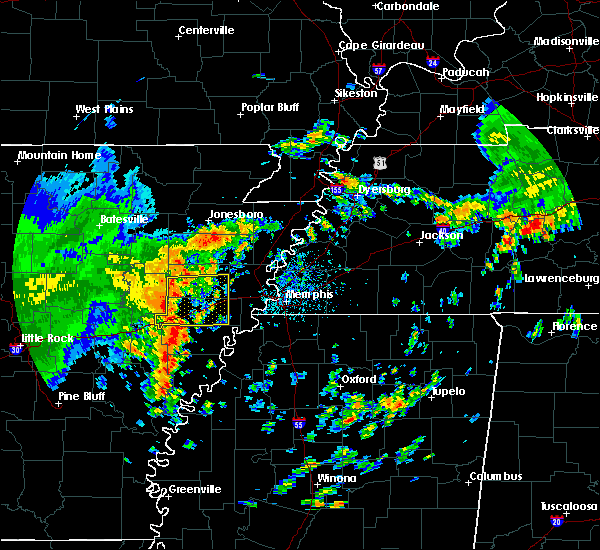 At 134 pm cdt, severe thunderstorms were located along a line extending from near fair oaks to new salem, moving east at 45 mph (radar indicated). Hazards include 60 mph wind gusts. expect damage to roofs, siding, and trees At 134 pm cdt, severe thunderstorms were located along a line extending from near fair oaks to new salem, moving east at 45 mph (radar indicated). Hazards include 60 mph wind gusts. expect damage to roofs, siding, and trees
|
| 4/30/2017 3:54 AM CDT |
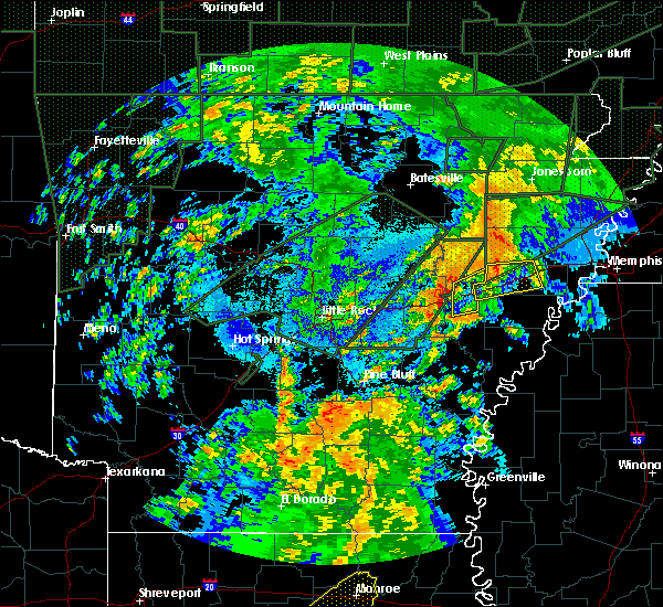 The severe thunderstorm warning for southeastern woodruff and northeastern monroe counties will expire at 400 am cdt, the storms which prompted the warning have moved out of the area. therefore the warning will be allowed to expire. however gusty winds and heavy rain are still possible with these thunderstorms. a severe thunderstorm watch remains in effect until 600 am cdt for eastern arkansas. The severe thunderstorm warning for southeastern woodruff and northeastern monroe counties will expire at 400 am cdt, the storms which prompted the warning have moved out of the area. therefore the warning will be allowed to expire. however gusty winds and heavy rain are still possible with these thunderstorms. a severe thunderstorm watch remains in effect until 600 am cdt for eastern arkansas.
|
| 4/30/2017 3:53 AM CDT |
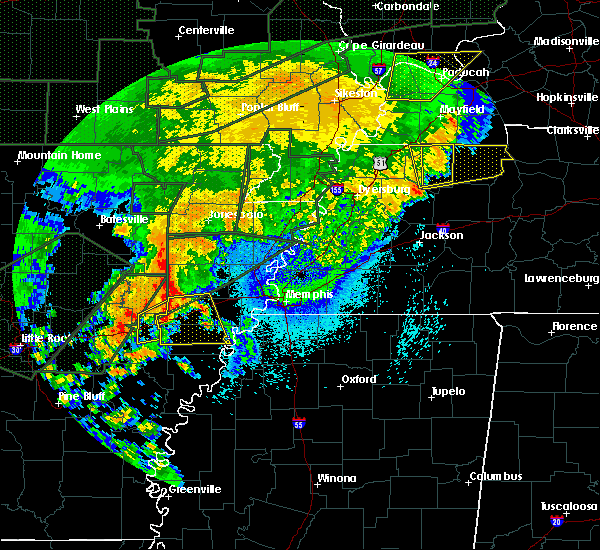 At 353 am cdt, a severe thunderstorm was located over forrest city, moving east at 50 mph (radar indicated). Hazards include 60 mph wind gusts. Expect damage to roofs, siding, and trees. Locations impacted include, forrest city, madison, palestine, village creek state park, caldwell, colt, wheatley, widener, hawkins, horton, rosenbaum, bonair, cottonwood corner, slonikers mill, crow creek, new castle, burnt cane, goodwin, four gums and posey. At 353 am cdt, a severe thunderstorm was located over forrest city, moving east at 50 mph (radar indicated). Hazards include 60 mph wind gusts. Expect damage to roofs, siding, and trees. Locations impacted include, forrest city, madison, palestine, village creek state park, caldwell, colt, wheatley, widener, hawkins, horton, rosenbaum, bonair, cottonwood corner, slonikers mill, crow creek, new castle, burnt cane, goodwin, four gums and posey.
|
| 4/30/2017 3:30 AM CDT |
 At 330 am cdt, severe thunderstorms were located along a line extending from 7 miles southwest of hunter to 6 miles west of wheatley to near brinkley, moving northeast at 40 mph (radar indicated). Hazards include 60 mph wind gusts. Expect damage to roofs, siding, and trees. Locations impacted include, brinkley, hunter, alfrey, allendale, dobbs landing, cotton plant, fargo, keevil, zent, this includes interstate 40 between mile markers 209 and 218. At 330 am cdt, severe thunderstorms were located along a line extending from 7 miles southwest of hunter to 6 miles west of wheatley to near brinkley, moving northeast at 40 mph (radar indicated). Hazards include 60 mph wind gusts. Expect damage to roofs, siding, and trees. Locations impacted include, brinkley, hunter, alfrey, allendale, dobbs landing, cotton plant, fargo, keevil, zent, this includes interstate 40 between mile markers 209 and 218.
|
| 4/30/2017 3:25 AM CDT |
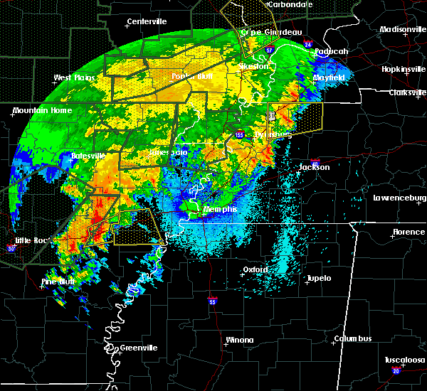 At 324 am cdt, a severe thunderstorm was located over brinkley, moving east at 50 mph (radar indicated). Hazards include 60 mph wind gusts. expect damage to roofs, siding, and trees At 324 am cdt, a severe thunderstorm was located over brinkley, moving east at 50 mph (radar indicated). Hazards include 60 mph wind gusts. expect damage to roofs, siding, and trees
|
| 4/30/2017 3:20 AM CDT |
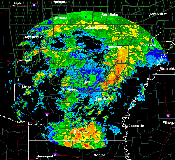 At 320 am cdt, severe thunderstorms were located along a line extending from 9 miles northwest of brinkley to near allendale, moving east at 40 mph (radar indicated). Hazards include 60 mph wind gusts. Expect damage to roofs, siding, and trees. Locations impacted include, brinkley, fredonia, hunter, alfrey, allendale, dobbs landing, peppers landing, cotton plant, fargo, brasfield, dagmar wma, keevil, zent, this includes interstate 40 between mile markers 203 and 218. At 320 am cdt, severe thunderstorms were located along a line extending from 9 miles northwest of brinkley to near allendale, moving east at 40 mph (radar indicated). Hazards include 60 mph wind gusts. Expect damage to roofs, siding, and trees. Locations impacted include, brinkley, fredonia, hunter, alfrey, allendale, dobbs landing, peppers landing, cotton plant, fargo, brasfield, dagmar wma, keevil, zent, this includes interstate 40 between mile markers 203 and 218.
|
| 4/30/2017 3:12 AM CDT |
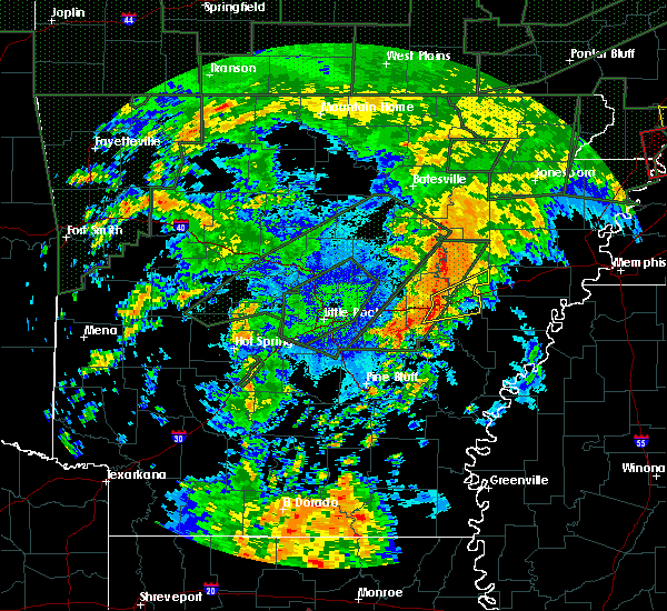 At 312 am cdt, severe thunderstorms were located along a line extending from near hallsville to fredonia to near de valls bluff, moving northeast at 40 mph (radar indicated). Hazards include 60 mph wind gusts. expect damage to roofs, siding, and trees At 312 am cdt, severe thunderstorms were located along a line extending from near hallsville to fredonia to near de valls bluff, moving northeast at 40 mph (radar indicated). Hazards include 60 mph wind gusts. expect damage to roofs, siding, and trees
|
| 4/30/2017 1:15 AM CDT |
 At 115 am cdt, severe thunderstorms were located along a line extending from near cash to near brinkley, moving east at 85 mph (radar indicated). Hazards include 60 mph wind gusts. expect damage to roofs, siding, and trees At 115 am cdt, severe thunderstorms were located along a line extending from near cash to near brinkley, moving east at 85 mph (radar indicated). Hazards include 60 mph wind gusts. expect damage to roofs, siding, and trees
|
| 4/26/2017 5:02 PM CDT | Powerlines down. time estimated on rada in st. francis county AR, 0.4 miles SE of Wheatley, AR |
| 4/26/2017 4:56 PM CDT |
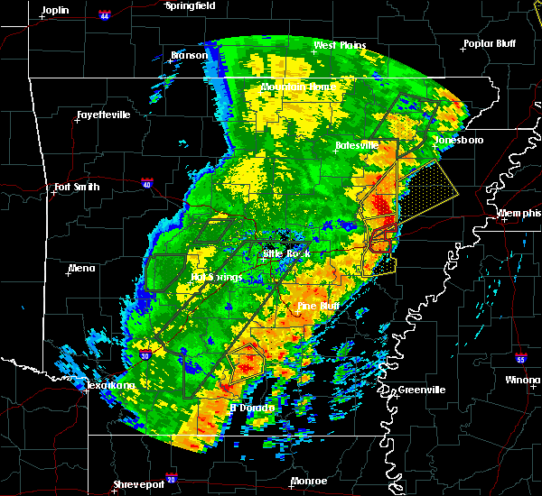 The tornado warning for southeastern woodruff and northeastern monroe counties will expire at 500 pm cdt, the storm which prompted the warning has moved out of the area. therefore the warning will be allowed to expire. a tornado watch remains in effect until 1100 pm cdt for eastern arkansas. remember, a severe thunderstorm warning still remains in effect for woodruff and monroe counties. The tornado warning for southeastern woodruff and northeastern monroe counties will expire at 500 pm cdt, the storm which prompted the warning has moved out of the area. therefore the warning will be allowed to expire. a tornado watch remains in effect until 1100 pm cdt for eastern arkansas. remember, a severe thunderstorm warning still remains in effect for woodruff and monroe counties.
|
| 4/26/2017 4:50 PM CDT |
 At 450 pm cdt, a severe thunderstorm was located over garret grove, or 9 miles southeast of brinkley, moving east at 55 mph (radar indicated). Hazards include 70 mph wind gusts and quarter size hail. Hail damage to vehicles is expected. expect considerable tree damage. wind damage is also likely to mobile homes, roofs, and outbuildings. locations impacted include, brinkley, clarendon, holly grove, alfrey, allendale, dobbs landing, blackton, aberdeen, dagmar wma, keevil, monroe, duncan, this includes interstate 40 between mile markers 208 and 218. A tornado watch remains in effect until 1100 pm cdt for eastern, central and southeastern arkansas. At 450 pm cdt, a severe thunderstorm was located over garret grove, or 9 miles southeast of brinkley, moving east at 55 mph (radar indicated). Hazards include 70 mph wind gusts and quarter size hail. Hail damage to vehicles is expected. expect considerable tree damage. wind damage is also likely to mobile homes, roofs, and outbuildings. locations impacted include, brinkley, clarendon, holly grove, alfrey, allendale, dobbs landing, blackton, aberdeen, dagmar wma, keevil, monroe, duncan, this includes interstate 40 between mile markers 208 and 218. A tornado watch remains in effect until 1100 pm cdt for eastern, central and southeastern arkansas.
|
| 4/26/2017 4:48 PM CDT |
 At 447 pm cdt, a severe squall line capable of producing both tornadoes and extensive straight line wind damage was located over wheatley, or over brinkley, moving east at 55 mph (radar indicated rotation). Hazards include tornado and quarter size hail. Flying debris will be dangerous to those caught without shelter. mobile homes will be damaged or destroyed. damage to roofs, windows, and vehicles will occur. tree damage is likely. Locations impacted include, brinkley, hunter, alfrey, allendale, cotton plant, fargo, zent, this includes interstate 40 between mile markers 210 and 218. At 447 pm cdt, a severe squall line capable of producing both tornadoes and extensive straight line wind damage was located over wheatley, or over brinkley, moving east at 55 mph (radar indicated rotation). Hazards include tornado and quarter size hail. Flying debris will be dangerous to those caught without shelter. mobile homes will be damaged or destroyed. damage to roofs, windows, and vehicles will occur. tree damage is likely. Locations impacted include, brinkley, hunter, alfrey, allendale, cotton plant, fargo, zent, this includes interstate 40 between mile markers 210 and 218.
|
| 4/26/2017 4:34 PM CDT |
 At 434 pm cdt, a severe squall line capable of producing both tornadoes and extensive straight line wind damage was located near fredonia, or 8 miles northeast of de valls bluff, moving east at 50 mph (radar indicated rotation). Hazards include tornado and quarter size hail. Flying debris will be dangerous to those caught without shelter. mobile homes will be damaged or destroyed. damage to roofs, windows, and vehicles will occur. tree damage is likely. Locations impacted include, brinkley, fredonia, hunter, alfrey, allendale, peppers landing, dobbs landing, cotton plant, fargo, brasfield, dagmar wma, keevil, zent, this includes interstate 40 between mile markers 201 and 218. At 434 pm cdt, a severe squall line capable of producing both tornadoes and extensive straight line wind damage was located near fredonia, or 8 miles northeast of de valls bluff, moving east at 50 mph (radar indicated rotation). Hazards include tornado and quarter size hail. Flying debris will be dangerous to those caught without shelter. mobile homes will be damaged or destroyed. damage to roofs, windows, and vehicles will occur. tree damage is likely. Locations impacted include, brinkley, fredonia, hunter, alfrey, allendale, peppers landing, dobbs landing, cotton plant, fargo, brasfield, dagmar wma, keevil, zent, this includes interstate 40 between mile markers 201 and 218.
|
| 4/26/2017 4:30 PM CDT |
 At 430 pm cdt, a severe thunderstorm was located near peppers landing, or near de valls bluff, moving east at 45 mph (radar indicated). Hazards include 70 mph wind gusts and quarter size hail. Hail damage to vehicles is expected. expect considerable tree damage. wind damage is also likely to mobile homes, roofs, and outbuildings. locations impacted include, stuttgart, brinkley, clarendon, hazen, de valls bluff, holly grove, fredonia, ulm, roe, alfrey, allendale, dobbs landing, peppers landing, stuttgart municipal airport, hallsville, fargo, blackton, aberdeen, tollville, monroe, this includes interstate 40 between mile markers 194 and 218. A tornado watch remains in effect until 500 pm cdt for eastern, central and southeastern arkansas. At 430 pm cdt, a severe thunderstorm was located near peppers landing, or near de valls bluff, moving east at 45 mph (radar indicated). Hazards include 70 mph wind gusts and quarter size hail. Hail damage to vehicles is expected. expect considerable tree damage. wind damage is also likely to mobile homes, roofs, and outbuildings. locations impacted include, stuttgart, brinkley, clarendon, hazen, de valls bluff, holly grove, fredonia, ulm, roe, alfrey, allendale, dobbs landing, peppers landing, stuttgart municipal airport, hallsville, fargo, blackton, aberdeen, tollville, monroe, this includes interstate 40 between mile markers 194 and 218. A tornado watch remains in effect until 500 pm cdt for eastern, central and southeastern arkansas.
|
| 4/26/2017 4:21 PM CDT |
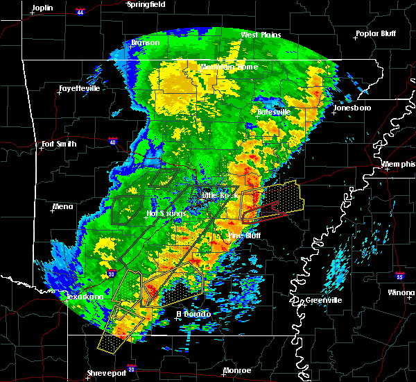 At 421 pm cdt, severe thunderstorms capable of producing both tornadoes and extensive straight line wind damage were located over hallsville, or near hazen, moving east at 50 mph (radar indicated rotation). Hazards include tornado and quarter size hail. Flying debris will be dangerous to those caught without shelter. mobile homes will be damaged or destroyed. damage to roofs, windows, and vehicles will occur. Tree damage is likely. At 421 pm cdt, severe thunderstorms capable of producing both tornadoes and extensive straight line wind damage were located over hallsville, or near hazen, moving east at 50 mph (radar indicated rotation). Hazards include tornado and quarter size hail. Flying debris will be dangerous to those caught without shelter. mobile homes will be damaged or destroyed. damage to roofs, windows, and vehicles will occur. Tree damage is likely.
|
| 4/26/2017 4:07 PM CDT |
 At 407 pm cdt, a severe thunderstorm was located over parkers corner, or 13 miles southeast of lonoke, moving east at 55 mph (radar indicated). Hazards include 70 mph wind gusts and quarter size hail. Hail damage to vehicles is expected. expect considerable tree damage. Wind damage is also likely to mobile homes, roofs, and outbuildings. At 407 pm cdt, a severe thunderstorm was located over parkers corner, or 13 miles southeast of lonoke, moving east at 55 mph (radar indicated). Hazards include 70 mph wind gusts and quarter size hail. Hail damage to vehicles is expected. expect considerable tree damage. Wind damage is also likely to mobile homes, roofs, and outbuildings.
|
| 3/1/2017 5:48 AM CST |
 At 548 am cst, a severe thunderstorm was located near wheatley, or near brinkley, moving east at 50 mph (radar indicated). Hazards include 60 mph wind gusts and quarter size hail. Hail damage to vehicles is expected. Expect wind damage to roofs, siding, and trees. At 548 am cst, a severe thunderstorm was located near wheatley, or near brinkley, moving east at 50 mph (radar indicated). Hazards include 60 mph wind gusts and quarter size hail. Hail damage to vehicles is expected. Expect wind damage to roofs, siding, and trees.
|
| 2/7/2017 7:21 AM CST |
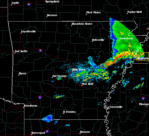 The severe thunderstorm warning for southeastern woodruff and northwestern monroe counties will expire at 730 am cst, the storm which prompted the warning has weakened below severe limits, and no longer pose an immediate threat to life or property. therefore, the warning will be allowed to expire. however gusty winds are still possible with this thunderstorm. The severe thunderstorm warning for southeastern woodruff and northwestern monroe counties will expire at 730 am cst, the storm which prompted the warning has weakened below severe limits, and no longer pose an immediate threat to life or property. therefore, the warning will be allowed to expire. however gusty winds are still possible with this thunderstorm.
|
| 2/7/2017 7:15 AM CST |
 At 714 am cst, a severe thunderstorm was located near wheatley, or near brinkley, moving east at 35 mph (radar indicated). Hazards include 60 mph wind gusts. Expect damage to roofs, siding, and trees. Locations impacted include, brinkley, fargo, zent, dagmar wma, this includes interstate 40 between mile markers 210 and 218. At 714 am cst, a severe thunderstorm was located near wheatley, or near brinkley, moving east at 35 mph (radar indicated). Hazards include 60 mph wind gusts. Expect damage to roofs, siding, and trees. Locations impacted include, brinkley, fargo, zent, dagmar wma, this includes interstate 40 between mile markers 210 and 218.
|
| 2/7/2017 6:56 AM CST |
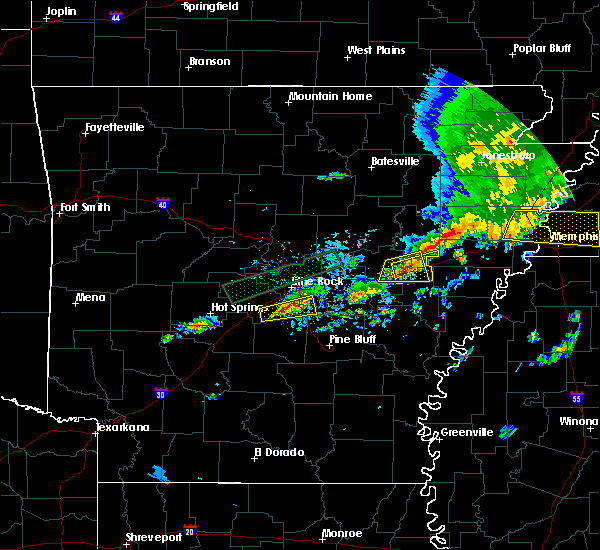 At 656 am cst, a severe thunderstorm was located near fredonia, or 8 miles northeast of de valls bluff, moving east at 35 mph (radar indicated). Hazards include 60 mph wind gusts. expect damage to roofs, siding, and trees At 656 am cst, a severe thunderstorm was located near fredonia, or 8 miles northeast of de valls bluff, moving east at 35 mph (radar indicated). Hazards include 60 mph wind gusts. expect damage to roofs, siding, and trees
|
| 12/17/2016 6:35 PM CST |
 At 634 pm cst, a severe thunderstorm was located over palestine, moving northeast at 85 mph (radar indicated). Hazards include 60 mph wind gusts. expect damage to roofs, siding, and trees At 634 pm cst, a severe thunderstorm was located over palestine, moving northeast at 85 mph (radar indicated). Hazards include 60 mph wind gusts. expect damage to roofs, siding, and trees
|
| 7/14/2016 8:03 PM CDT |
 At 802 pm cdt, a severe thunderstorm was located near almyra, or 10 miles east of stuttgart, moving east at 20 mph (radar indicated). Hazards include 60 mph wind gusts and quarter size hail. Hail damage to vehicles is expected. Expect wind damage to roofs, siding, and trees. At 802 pm cdt, a severe thunderstorm was located near almyra, or 10 miles east of stuttgart, moving east at 20 mph (radar indicated). Hazards include 60 mph wind gusts and quarter size hail. Hail damage to vehicles is expected. Expect wind damage to roofs, siding, and trees.
|
| 7/14/2016 7:55 PM CDT |
 At 754 pm cdt, a severe thunderstorm was located near clarendon, moving east at 20 mph (radar indicated). Hazards include 60 mph wind gusts and penny size hail. Expect damage to roofs. siding. and trees. Locations impacted include, stuttgart, brinkley, clarendon, hazen, de valls bluff, holly grove, fredonia, ulm, roe, alfrey, allendale, palmer, hallsville, stuttgart municipal airport, dobbs landing, peppers landing, blackton, aberdeen, casscoe, brasfield,. At 754 pm cdt, a severe thunderstorm was located near clarendon, moving east at 20 mph (radar indicated). Hazards include 60 mph wind gusts and penny size hail. Expect damage to roofs. siding. and trees. Locations impacted include, stuttgart, brinkley, clarendon, hazen, de valls bluff, holly grove, fredonia, ulm, roe, alfrey, allendale, palmer, hallsville, stuttgart municipal airport, dobbs landing, peppers landing, blackton, aberdeen, casscoe, brasfield,.
|
| 7/14/2016 7:28 PM CDT |
 At 727 pm cdt, a severe thunderstorm was located 7 miles south of de valls bluff, moving east at 35 mph (radar indicated). Hazards include 60 mph wind gusts. Expect damage to roofs. siding. And trees. At 727 pm cdt, a severe thunderstorm was located 7 miles south of de valls bluff, moving east at 35 mph (radar indicated). Hazards include 60 mph wind gusts. Expect damage to roofs. siding. And trees.
|
| 5/10/2016 1:15 AM CDT |
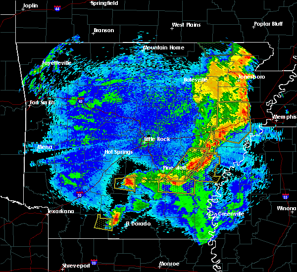 At 115 am cdt, severe thunderstorms were located along a line extending from near wheatley to 6 miles north of palmer to holly grove, moving southeast at 25 mph (radar indicated). Hazards include 60 mph wind gusts and penny size hail. Expect damage to roofs. siding. and trees. Locations impacted include, brinkley, holly grove, alfrey, blackton, duncan, pine city, lawrenceville, monroe, ragtown, a tornado watch remains in effect until 200 am cdt for southeastern arkansas. At 115 am cdt, severe thunderstorms were located along a line extending from near wheatley to 6 miles north of palmer to holly grove, moving southeast at 25 mph (radar indicated). Hazards include 60 mph wind gusts and penny size hail. Expect damage to roofs. siding. and trees. Locations impacted include, brinkley, holly grove, alfrey, blackton, duncan, pine city, lawrenceville, monroe, ragtown, a tornado watch remains in effect until 200 am cdt for southeastern arkansas.
|
| 5/10/2016 12:47 AM CDT |
 At 1247 am cdt, severe thunderstorms were located along a line extending from 6 miles east of hunter to allendale to stuttgart municipal airport, moving east at 45 mph (radar indicated). Hazards include 60 mph wind gusts and penny size hail. Expect damage to roofs. siding. And trees. At 1247 am cdt, severe thunderstorms were located along a line extending from 6 miles east of hunter to allendale to stuttgart municipal airport, moving east at 45 mph (radar indicated). Hazards include 60 mph wind gusts and penny size hail. Expect damage to roofs. siding. And trees.
|
| 5/10/2016 12:37 AM CDT |
 At 1237 am cdt, severe thunderstorms were located along a line extending from near mcfadden to near hunter to near allendale, moving east at 35 mph (radar indicated). Hazards include 60 mph wind gusts and quarter size hail. Hail damage to vehicles is expected. Expect wind damage to roofs, siding, and trees. At 1237 am cdt, severe thunderstorms were located along a line extending from near mcfadden to near hunter to near allendale, moving east at 35 mph (radar indicated). Hazards include 60 mph wind gusts and quarter size hail. Hail damage to vehicles is expected. Expect wind damage to roofs, siding, and trees.
|
| 5/10/2016 12:23 AM CDT |
 At 1222 am cdt, severe thunderstorms were located along a line extending from near tupelo to near brinkley to stuttgart municipal airport, moving east at 50 mph (radar indicated). Hazards include 70 mph wind gusts and penny size hail. Expect considerable tree damage. damage is likely to mobile homes, roofs, and outbuildings. Locations impacted include, brinkley, augusta, clarendon, hazen, de valls bluff, patterson, fredonia, tupelo, roe, hunter, alfrey, allendale, hallsville, stuttgart municipal , dobbs landing, mcfadden, mccrory, peppers landing, parkers corner, cotton plant, a tornado watch remains in effect until 200 am cdt for eastern arkansas. At 1222 am cdt, severe thunderstorms were located along a line extending from near tupelo to near brinkley to stuttgart municipal airport, moving east at 50 mph (radar indicated). Hazards include 70 mph wind gusts and penny size hail. Expect considerable tree damage. damage is likely to mobile homes, roofs, and outbuildings. Locations impacted include, brinkley, augusta, clarendon, hazen, de valls bluff, patterson, fredonia, tupelo, roe, hunter, alfrey, allendale, hallsville, stuttgart municipal , dobbs landing, mcfadden, mccrory, peppers landing, parkers corner, cotton plant, a tornado watch remains in effect until 200 am cdt for eastern arkansas.
|
| 5/10/2016 12:03 AM CDT |
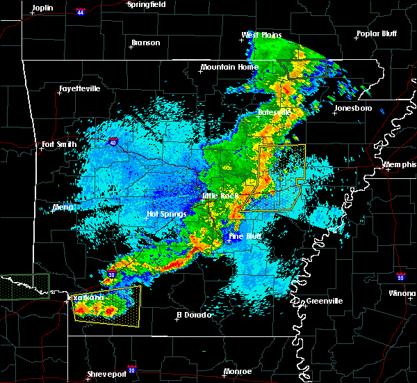 At 1202 am cdt, severe thunderstorms were located along a line extending from near bald knob to near barrettsville to near keo, moving east at 50 mph (radar indicated). Hazards include 70 mph wind gusts and penny size hail. Expect considerable tree damage. damage is likely to mobile homes, roofs, and outbuildings. Locations impacted include, brinkley, augusta, des arc, clarendon, hazen, de valls bluff, bald knob, carlisle, judsonia, patterson, fredonia, russell, west point, tupelo, roe, hunter, barrettsville, alfrey, allendale, parkers corner, a tornado watch remains in effect until 200 am cdt for eastern arkansas. At 1202 am cdt, severe thunderstorms were located along a line extending from near bald knob to near barrettsville to near keo, moving east at 50 mph (radar indicated). Hazards include 70 mph wind gusts and penny size hail. Expect considerable tree damage. damage is likely to mobile homes, roofs, and outbuildings. Locations impacted include, brinkley, augusta, des arc, clarendon, hazen, de valls bluff, bald knob, carlisle, judsonia, patterson, fredonia, russell, west point, tupelo, roe, hunter, barrettsville, alfrey, allendale, parkers corner, a tornado watch remains in effect until 200 am cdt for eastern arkansas.
|
| 5/9/2016 11:56 PM CDT |
 At 1156 pm cdt, severe thunderstorms were located along a line extending from near russell to near des arc to 7 miles northeast of england, moving east at 45 mph (radar indicated). Hazards include 60 mph wind gusts and penny size hail. Expect damage to roofs. siding. And trees. At 1156 pm cdt, severe thunderstorms were located along a line extending from near russell to near des arc to 7 miles northeast of england, moving east at 45 mph (radar indicated). Hazards include 60 mph wind gusts and penny size hail. Expect damage to roofs. siding. And trees.
|
| 3/31/2016 3:39 PM CDT |
 At 339 pm cdt, a severe thunderstorm was located over moro, or 11 miles southeast of brinkley, moving northeast at 45 mph (radar indicated). Hazards include 60 mph wind gusts and quarter size hail. Hail damage to vehicles is expected. Expect wind damage to roofs, siding, and trees. At 339 pm cdt, a severe thunderstorm was located over moro, or 11 miles southeast of brinkley, moving northeast at 45 mph (radar indicated). Hazards include 60 mph wind gusts and quarter size hail. Hail damage to vehicles is expected. Expect wind damage to roofs, siding, and trees.
|
| 3/31/2016 3:38 PM CDT | A severe thunderstorm warning remains in effect until 345 pm cdt for central monroe county. at 338 pm cdt. a severe thunderstorm was located near holly grove. or 10 miles southeast of clarendon. moving east at 40 mph. hazard. 60 mph wind gusts and quarter size hail. source. Radar indicated. |
| 3/31/2016 3:07 PM CDT |
 At 307 pm cdt, a severe thunderstorm was located over ulm, or near stuttgart, moving northeast at 40 mph (radar indicated). Hazards include 60 mph wind gusts and quarter size hail. Hail damage to vehicles is expected. Expect wind damage to roofs, siding, and trees. At 307 pm cdt, a severe thunderstorm was located over ulm, or near stuttgart, moving northeast at 40 mph (radar indicated). Hazards include 60 mph wind gusts and quarter size hail. Hail damage to vehicles is expected. Expect wind damage to roofs, siding, and trees.
|
| 3/13/2016 7:14 PM CDT |
 At 714 pm cdt, a severe thunderstorm was located near parkers corner, or 9 miles southwest of hazen, moving northeast at 40 mph (radar indicated). Hazards include golf ball size hail and 70 mph wind gusts. People and animals outdoors will be injured. expect hail damage to roofs, siding, windows, and vehicles. expect considerable tree damage. Wind damage is also likely to mobile homes, roofs, and outbuildings. At 714 pm cdt, a severe thunderstorm was located near parkers corner, or 9 miles southwest of hazen, moving northeast at 40 mph (radar indicated). Hazards include golf ball size hail and 70 mph wind gusts. People and animals outdoors will be injured. expect hail damage to roofs, siding, windows, and vehicles. expect considerable tree damage. Wind damage is also likely to mobile homes, roofs, and outbuildings.
|
| 12/28/2015 4:35 AM CST |
 At 435 am cst, a severe thunderstorm was located near palmer, or 10 miles northwest of marvell, moving north at 40 mph (radar indicated). Hazards include 60 mph wind gusts. Expect damage to roofs. Siding and trees. At 435 am cst, a severe thunderstorm was located near palmer, or 10 miles northwest of marvell, moving north at 40 mph (radar indicated). Hazards include 60 mph wind gusts. Expect damage to roofs. Siding and trees.
|
| 12/23/2015 2:38 PM CST | The severe thunderstorm warning for southern cross and northern st. francis counties will expire at 245 pm cst, the storm which prompted the warning has weakened below severe limits, and no longer poses an immediate threat to life or property. therefore the warning will be allowed to expire. a tornado watch remains in effect until 800 pm cst for eastern arkansas. |
| 12/23/2015 2:04 PM CST | At 203 pm cst, a severe thunderstorm was located 7 miles east of hunter, or 8 miles northwest of palestine, moving east at 50 mph (radar indicated). Hazards include golf ball size hail and 60 mph wind gusts. People and animals outdoors will be injured. expect hail damage to roofs, siding, windows and vehicles. Expect wind damage to roofs, siding and trees. |
| 11/17/2015 4:37 PM CST |
 At 437 pm cst, severe thunderstorms were located along a line extending from 10 miles south of patterson to near clarendon to near st. charles, moving east at 40 mph (radar indicated). Hazards include 70 mph wind gusts. Expect considerable tree damage. damage is likely to mobile homes, roofs and outbuildings. locations impacted include, brinkley, clarendon, holly grove, st. charles, hunter, alfrey, allendale, palmer, dobbs landing, cotton plant, fargo, blackton, aberdeen, becton, little dixie, dixie, hilleman, brasfield, wiville and penrose. A tornado watch remains in effect until 600 pm cst for southeastern arkansas. At 437 pm cst, severe thunderstorms were located along a line extending from 10 miles south of patterson to near clarendon to near st. charles, moving east at 40 mph (radar indicated). Hazards include 70 mph wind gusts. Expect considerable tree damage. damage is likely to mobile homes, roofs and outbuildings. locations impacted include, brinkley, clarendon, holly grove, st. charles, hunter, alfrey, allendale, palmer, dobbs landing, cotton plant, fargo, blackton, aberdeen, becton, little dixie, dixie, hilleman, brasfield, wiville and penrose. A tornado watch remains in effect until 600 pm cst for southeastern arkansas.
|
| 11/17/2015 4:14 PM CST |
 At 412 pm cst, severe thunderstorms were located along a line extending from des arc to roe to near de witt, moving east at 45 mph (radar indicated). Hazards include 70 mph wind gusts. Expect considerable tree damage. Damage is likely to mobile homes, roofs and outbuildings. At 412 pm cst, severe thunderstorms were located along a line extending from des arc to roe to near de witt, moving east at 45 mph (radar indicated). Hazards include 70 mph wind gusts. Expect considerable tree damage. Damage is likely to mobile homes, roofs and outbuildings.
|
| 11/17/2015 4:09 PM CST |
 At 409 pm cst, severe thunderstorms were located along a line extending from near des arc to roe to near de witt, moving northeast at 25 mph (radar indicated). Hazards include 70 mph wind gusts. Expect considerable tree damage. damage is likely to mobile homes, roofs and outbuildings. locations impacted include, brinkley, des arc, clarendon, de valls bluff, holly grove, fredonia, almyra, st. charles, ulm, roe, alfrey, allendale, palmer, hallsville, de witt, dobbs landing, peppers landing, cotton plant, fargo and blackton. A tornado watch remains in effect until 600 pm cst for southeastern arkansas. At 409 pm cst, severe thunderstorms were located along a line extending from near des arc to roe to near de witt, moving northeast at 25 mph (radar indicated). Hazards include 70 mph wind gusts. Expect considerable tree damage. damage is likely to mobile homes, roofs and outbuildings. locations impacted include, brinkley, des arc, clarendon, de valls bluff, holly grove, fredonia, almyra, st. charles, ulm, roe, alfrey, allendale, palmer, hallsville, de witt, dobbs landing, peppers landing, cotton plant, fargo and blackton. A tornado watch remains in effect until 600 pm cst for southeastern arkansas.
|
| 11/17/2015 3:30 PM CST |
 At 329 pm cst, severe thunderstorms were located along a line extending from carlisle to humnoke and grady, moving northeast at 45 mph (radar indicated). Hazards include 70 mph wind gusts. Expect considerable tree damage. Damage is likely to mobile homes, roofs and outbuildings. At 329 pm cst, severe thunderstorms were located along a line extending from carlisle to humnoke and grady, moving northeast at 45 mph (radar indicated). Hazards include 70 mph wind gusts. Expect considerable tree damage. Damage is likely to mobile homes, roofs and outbuildings.
|
| 8/7/2015 8:34 AM CDT |
 At 833 am cdt, severe thunderstorms were located along a line extending from lake cormorant to near brickeys to near marianna, moving southeast at 65 mph (radar indicated). Hazards include 60 mph wind gusts. Expect damage to roofs. siding and trees. Locations impacted include, forrest city, marianna, hughes, madison, palestine, tunica, caldwell, wheatley, widener, moro, rondo, aubrey, haynes, north tunica, garret grove, new home, brickeys, new salem, lagrange and dodsons corner. At 833 am cdt, severe thunderstorms were located along a line extending from lake cormorant to near brickeys to near marianna, moving southeast at 65 mph (radar indicated). Hazards include 60 mph wind gusts. Expect damage to roofs. siding and trees. Locations impacted include, forrest city, marianna, hughes, madison, palestine, tunica, caldwell, wheatley, widener, moro, rondo, aubrey, haynes, north tunica, garret grove, new home, brickeys, new salem, lagrange and dodsons corner.
|
| 8/7/2015 8:24 AM CDT |
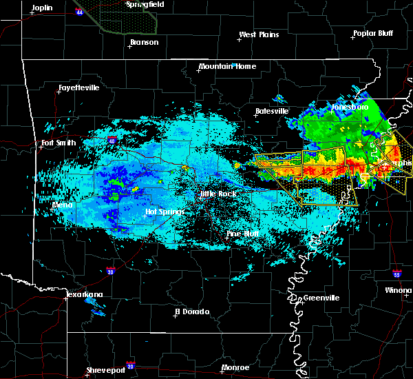 At 823 am cdt, severe thunderstorms were located along a line extending from near hunter to 9 miles northeast of des arc, moving southeast at 35 mph (radar indicated). Hazards include 60 mph wind gusts and quarter size hail. Hail damage to vehicles is expected. expect wind damage to roofs, siding and trees. Locations impacted include, brinkley, west point, hunter, alfrey, pryor, cotton plant, fargo, blackton, becton, little dixie, dixie, hilleman, gregory, wiville, penrose, dagmar wma, howell, mcclelland, georgetown and zent. At 823 am cdt, severe thunderstorms were located along a line extending from near hunter to 9 miles northeast of des arc, moving southeast at 35 mph (radar indicated). Hazards include 60 mph wind gusts and quarter size hail. Hail damage to vehicles is expected. expect wind damage to roofs, siding and trees. Locations impacted include, brinkley, west point, hunter, alfrey, pryor, cotton plant, fargo, blackton, becton, little dixie, dixie, hilleman, gregory, wiville, penrose, dagmar wma, howell, mcclelland, georgetown and zent.
|
| 8/7/2015 8:09 AM CDT |
 At 809 am cdt, severe thunderstorms were located along a line extending from near jennette to caldwell to 7 miles east of hunter, moving southeast at 65 mph (radar indicated). Hazards include 60 mph wind gusts. Expect damage to roofs. Siding and trees. At 809 am cdt, severe thunderstorms were located along a line extending from near jennette to caldwell to 7 miles east of hunter, moving southeast at 65 mph (radar indicated). Hazards include 60 mph wind gusts. Expect damage to roofs. Siding and trees.
|
| 8/7/2015 7:56 AM CDT |
 At 755 am cdt, severe thunderstorms were located along a line extending from 6 miles east of vanndale to near hurricane lake wma, moving southeast at 70 mph (radar indicated). Hazards include 60 mph wind gusts and quarter size hail. Hail damage to vehicles is expected. Expect wind damage to roofs, siding and trees. At 755 am cdt, severe thunderstorms were located along a line extending from 6 miles east of vanndale to near hurricane lake wma, moving southeast at 70 mph (radar indicated). Hazards include 60 mph wind gusts and quarter size hail. Hail damage to vehicles is expected. Expect wind damage to roofs, siding and trees.
|
| 5/24/2015 6:07 PM CDT | At 606 pm cdt, severe thunderstorms were located along a line extending from clarendon to st. charles and snow lake, and moving northeast at 45 mph (radar indicated). Hazards include 60 mph wind gusts. Expect damage to roofs. Siding and trees. |
| 5/24/2015 5:52 PM CDT | At 549 pm cdt, severe thunderstorms were located along a line extending from almyra to 6 miles east of de witt to white river nwr, and moving northeast at 45 mph (radar indicated). Hazards include 60 mph wind gusts. Expect damage to roofs. Siding and trees. |
| 5/17/2015 5:57 PM CDT | At 557 pm cdt, a severe thunderstorm was located near wheatley, or 7 miles west of palestine, moving northeast at 20 mph (radar indicated). Hazards include 60 mph wind gusts and quarter size hail. Hail damage to vehicles is expected. Expect wind damage to roofs, siding and trees. |
| 5/15/2015 8:54 PM CDT | At 851 pm cdt, a severe thunderstorm was located near allendale, and moving north at 25 mph (radar indicated). Hazards include 60 mph wind gusts and quarter size hail. Hail damage to vehicles is expected. Expect wind damage to roofs, siding and trees. |
| 5/15/2015 8:46 PM CDT | At 844 pm cdt, a severe thunderstorm was located near allendale, and moving north at 25 mph (radar indicated). Hazards include 60 mph wind gusts and quarter size hail. Hail damage to vehicles is expected. Expect wind damage to roofs, siding and trees. |
| 5/15/2015 8:35 PM CDT | At 832 pm cdt, a severe thunderstorm was located 7 miles east of clarendon, and moving north at 25 mph (radar indicated). Hazards include 60 mph wind gusts and quarter size hail. Hail damage to vehicles is expected. Expect wind damage to roofs, siding and trees. |
| 1/1/0001 12:00 AM | I40 truckstop at mm221 had an awning blown across the parking lot and a power pole snapped of in st. francis county AR, 0.4 miles SE of Wheatley, AR |
| 1/1/0001 12:00 AM | Restaurant just north of wheatley had roof damage on trailer side of restauran in st. francis county AR, 0.4 miles SE of Wheatley, AR |
| 1/1/0001 12:00 AM | 30 foot tall tree blown over...top of a pine tree missing...power out in st. francis county AR, 0.4 miles SE of Wheatley, AR |
| 1/1/0001 12:00 AM | 30 foot tall tree blown over...top of a pine tree missing...power out near the intersection of state route 78 and us-70 in st. francis county AR, 0.4 miles SE of Wheatley, AR |
Hail Maps for Wheatley, AR
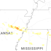

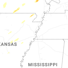


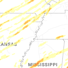


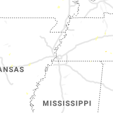


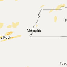


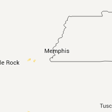


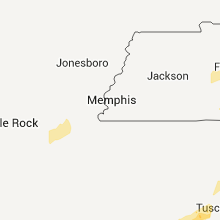

Connect with Interactive Hail Maps