

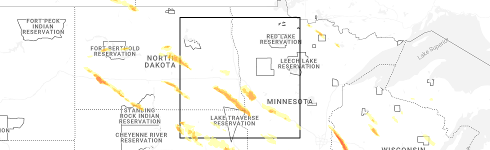
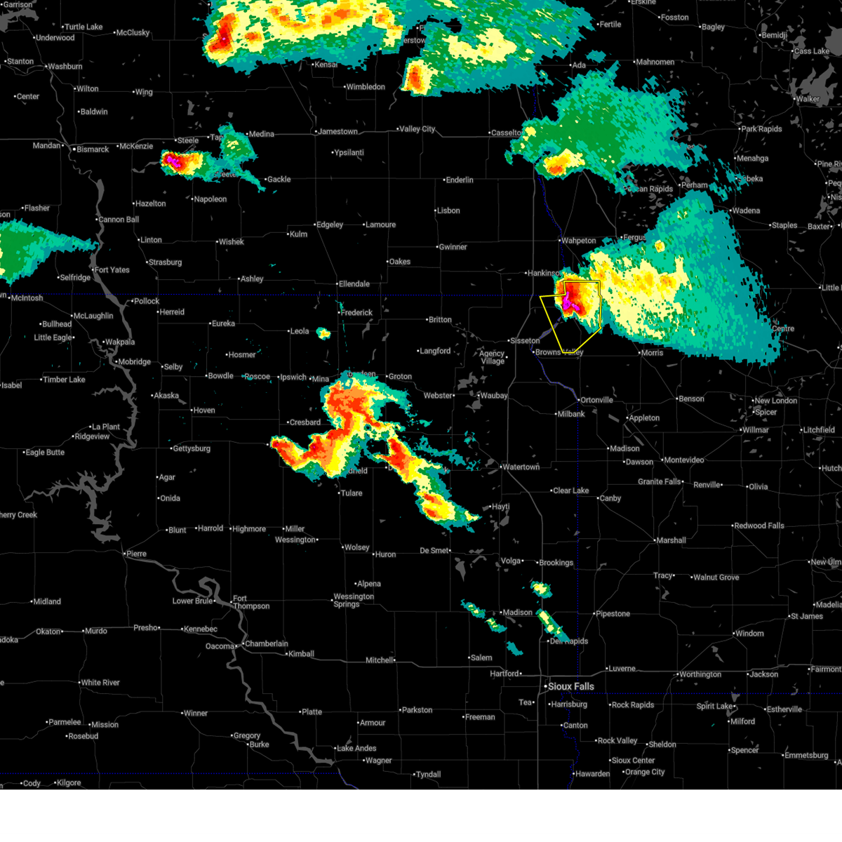
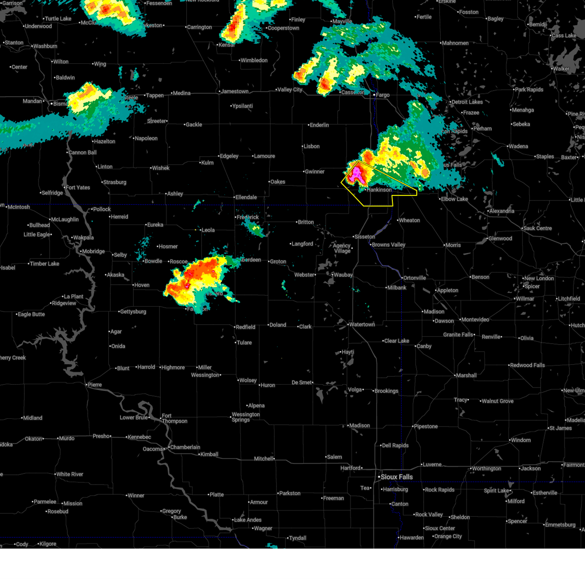
Hail Map for White Rock, SD
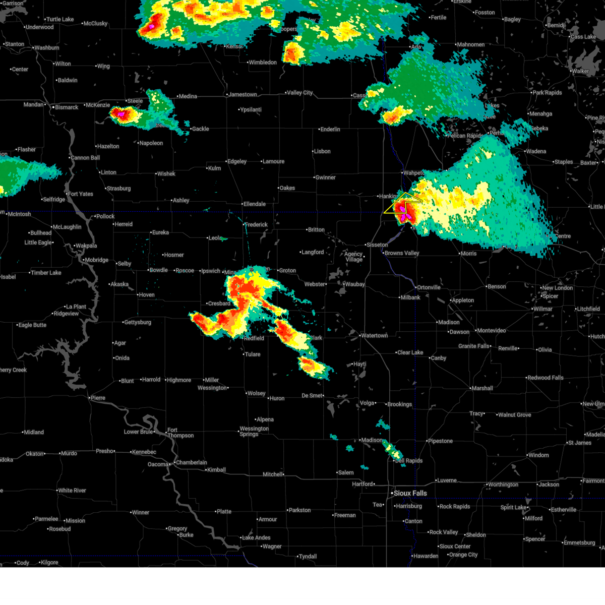
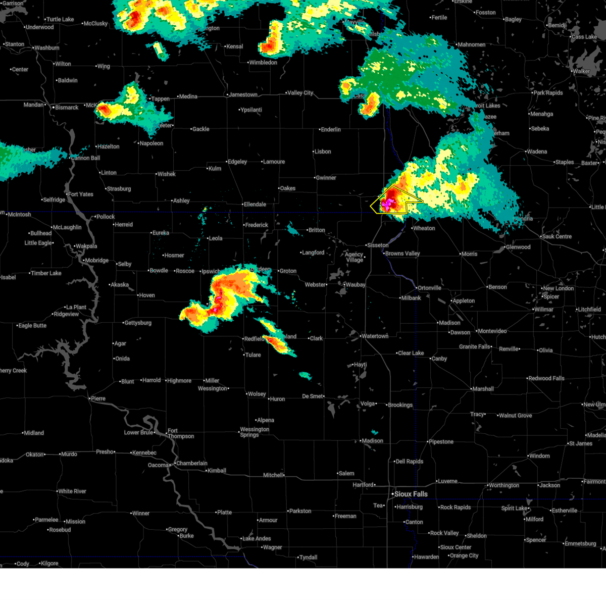
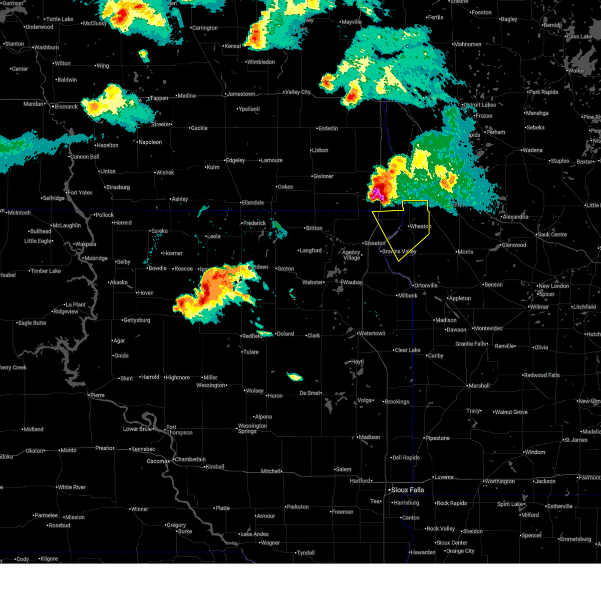
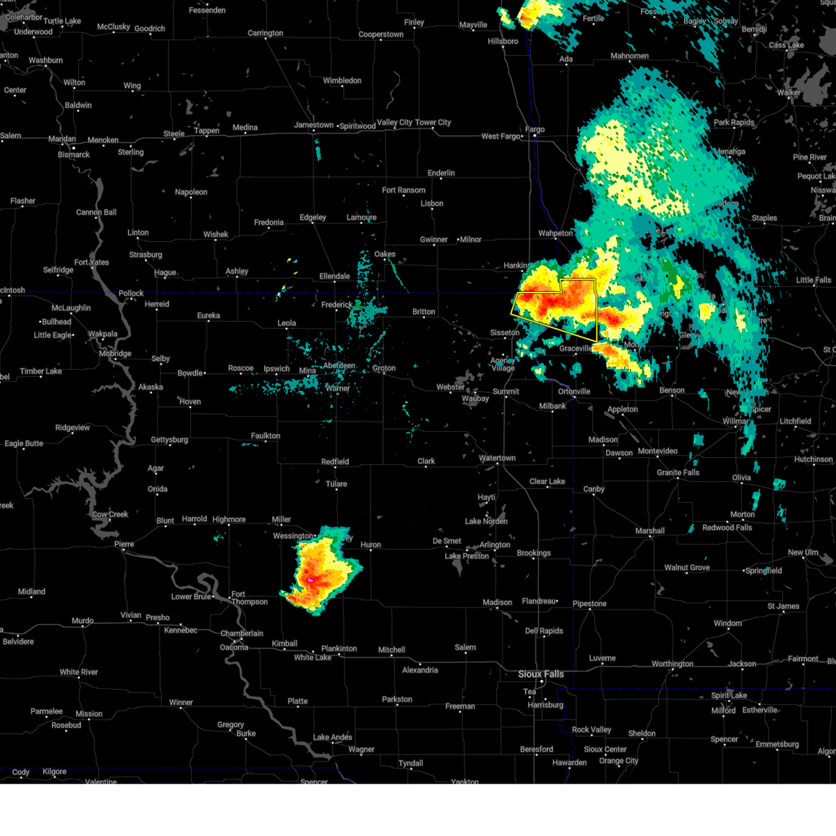
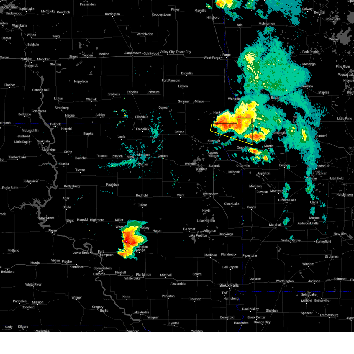
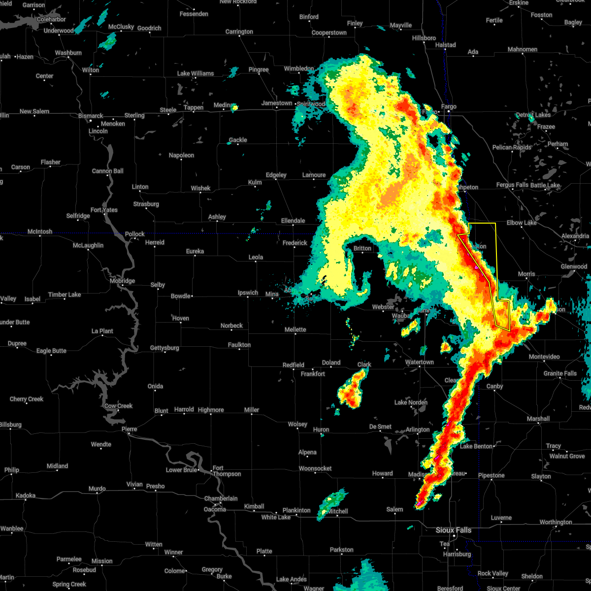
The White Rock, SD area has had 0 reports of on-the-ground hail by trained spotters, and has been under severe weather warnings 31 times during the past 12 months. Doppler radar has detected hail at or near White Rock, SD on 41 occasions, including 5 occasions during the past year.
| Name: | White Rock, SD |
| Where Located: | 66.7 miles S of Fargo, ND |
| Map: | Google Map for White Rock, SD |
| Population: | 3 |
| Housing Units: | 8 |
| More Info: | Search Google for White Rock, SD |
5
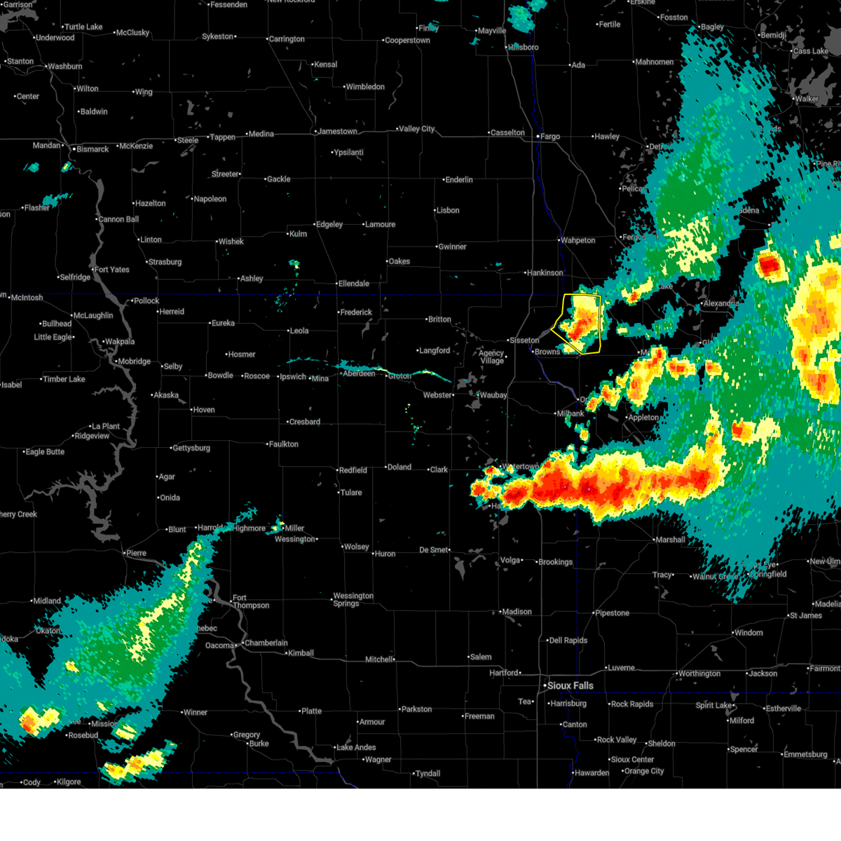
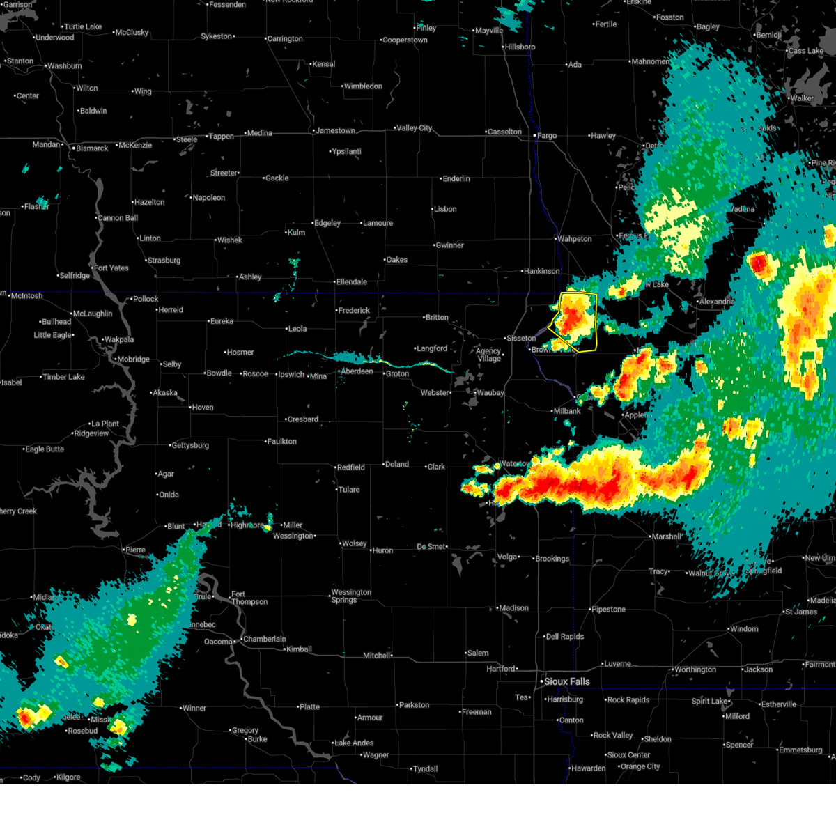
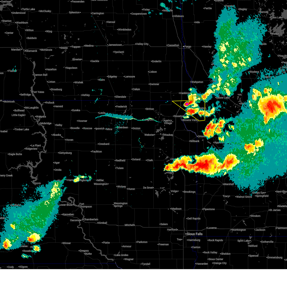
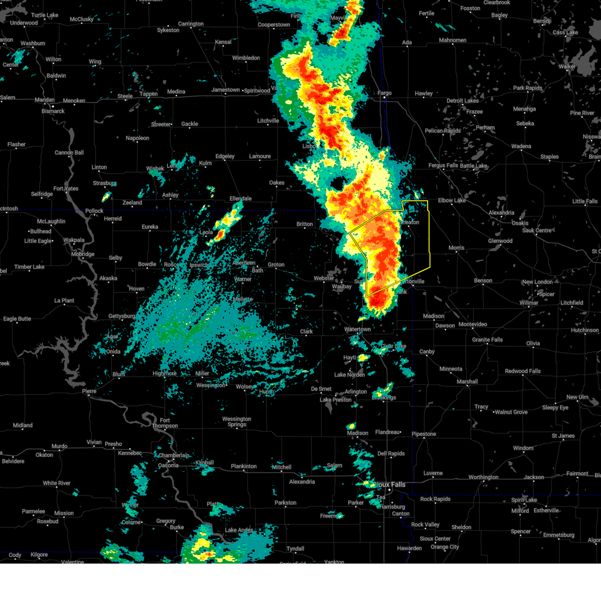
The Top Recent Hail Date for White Rock, SD is Thursday, June 19, 2025 (1st out of 41)
Hail and Wind Damage Spotted near White Rock, SD
| Date / Time | Report Details |
|---|---|
| 6/28/2025 9:56 PM CDT |
 The storm which prompted the warning has weakened below severe limits, and no longer poses an immediate threat to life or property. therefore, the warning will be allowed to expire. a tornado watch remains in effect until 100 am cdt for west central minnesota, and northeastern south dakota. The storm which prompted the warning has weakened below severe limits, and no longer poses an immediate threat to life or property. therefore, the warning will be allowed to expire. a tornado watch remains in effect until 100 am cdt for west central minnesota, and northeastern south dakota.
|
| 6/28/2025 9:45 PM CDT |
 the severe thunderstorm warning has been cancelled and is no longer in effect the severe thunderstorm warning has been cancelled and is no longer in effect
|
| 6/28/2025 9:45 PM CDT |
 At 944 pm cdt, a severe thunderstorm was located over wheaton, moving east at 40 mph (radar indicated). Hazards include 60 mph wind gusts and quarter size hail. Hail damage to vehicles is expected. expect wind damage to roofs, siding, and trees. Locations impacted include, wheaton, dumont, trinity lutheran country church, collis, immanuel church, mud lake landing, silver bridge, halls landing, and lake traverse. At 944 pm cdt, a severe thunderstorm was located over wheaton, moving east at 40 mph (radar indicated). Hazards include 60 mph wind gusts and quarter size hail. Hail damage to vehicles is expected. expect wind damage to roofs, siding, and trees. Locations impacted include, wheaton, dumont, trinity lutheran country church, collis, immanuel church, mud lake landing, silver bridge, halls landing, and lake traverse.
|
| 6/28/2025 9:33 PM CDT |
 At 933 pm cdt, a severe thunderstorm was located near immanuel church, or 7 miles northeast of wheaton, moving southeast at 30 mph (radar indicated). Hazards include ping pong ball size hail and 60 mph wind gusts. People and animals outdoors will be injured. expect hail damage to roofs, siding, windows, and vehicles. expect wind damage to roofs, siding, and trees. This severe thunderstorm will remain over mainly rural areas of traverse and northeastern roberts counties. At 933 pm cdt, a severe thunderstorm was located near immanuel church, or 7 miles northeast of wheaton, moving southeast at 30 mph (radar indicated). Hazards include ping pong ball size hail and 60 mph wind gusts. People and animals outdoors will be injured. expect hail damage to roofs, siding, windows, and vehicles. expect wind damage to roofs, siding, and trees. This severe thunderstorm will remain over mainly rural areas of traverse and northeastern roberts counties.
|
| 6/28/2025 9:17 PM CDT |
 the severe thunderstorm warning has been cancelled and is no longer in effect the severe thunderstorm warning has been cancelled and is no longer in effect
|
| 6/28/2025 9:04 PM CDT |
 At 903 pm cdt, a severe thunderstorm was located over sonora, or 14 miles north of rosholt, moving east at 15 mph (radar indicated). Hazards include 60 mph wind gusts and half dollar size hail. Hail damage to vehicles is expected. expect wind damage to roofs, siding, and trees. locations impacted include, fairmount, lamars, blackmer, and sonora. This includes interstate 29 between mile markers 1 and 10. At 903 pm cdt, a severe thunderstorm was located over sonora, or 14 miles north of rosholt, moving east at 15 mph (radar indicated). Hazards include 60 mph wind gusts and half dollar size hail. Hail damage to vehicles is expected. expect wind damage to roofs, siding, and trees. locations impacted include, fairmount, lamars, blackmer, and sonora. This includes interstate 29 between mile markers 1 and 10.
|
| 6/28/2025 8:59 PM CDT |
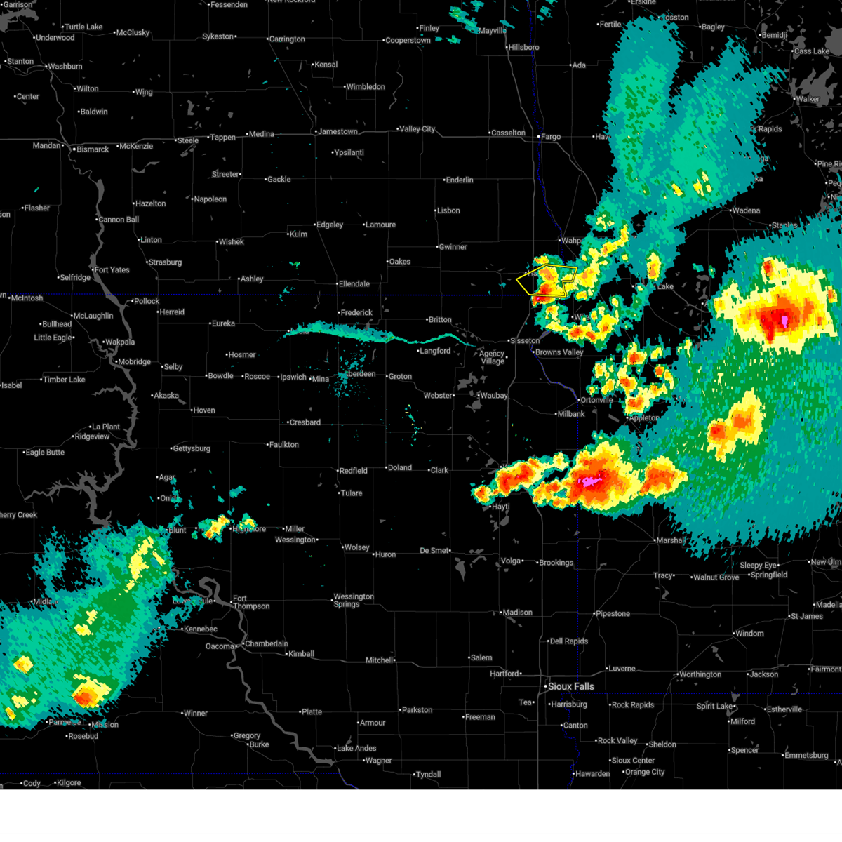
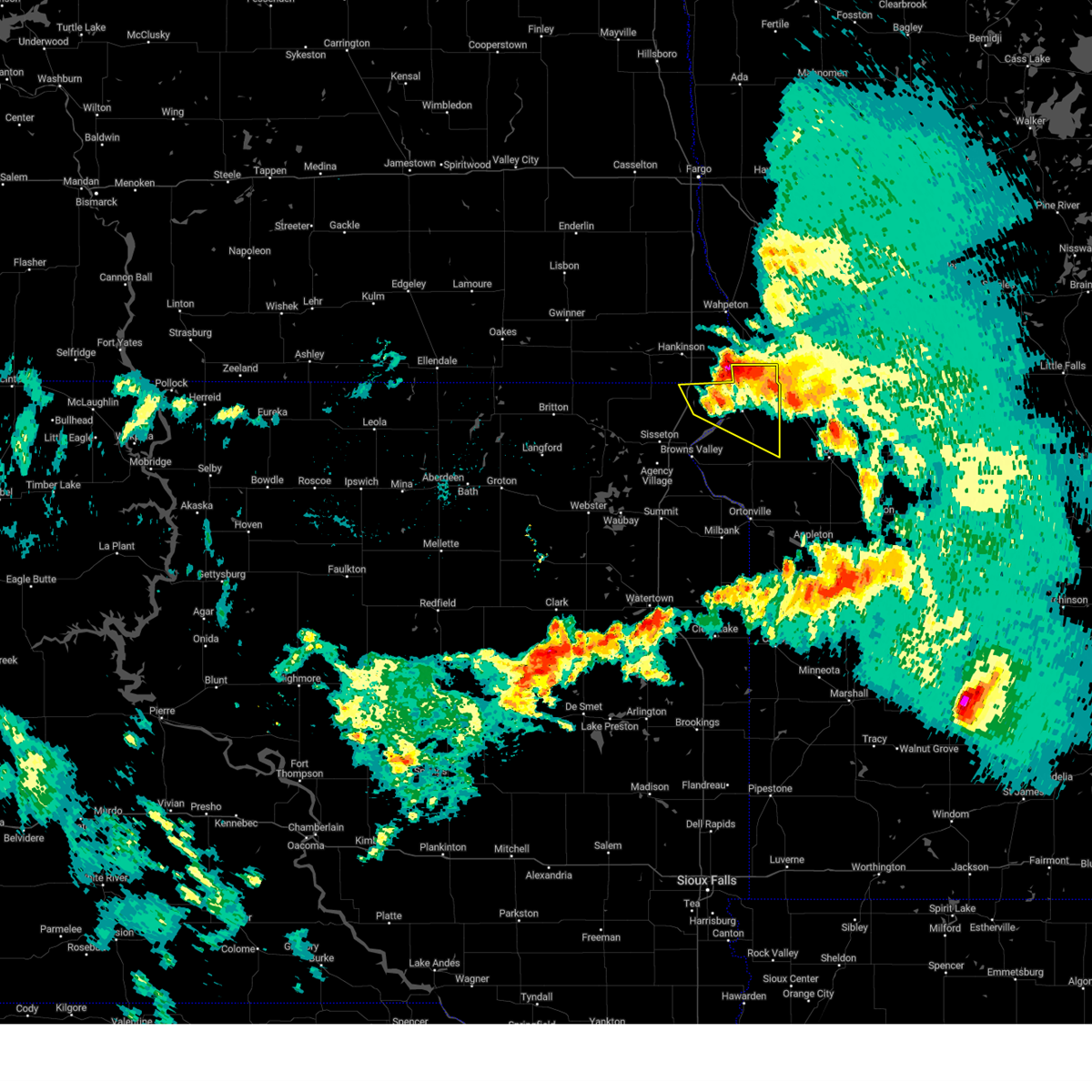
 Svrabr the national weather service in aberdeen has issued a * severe thunderstorm warning for, traverse county in west central minnesota, northeastern roberts county in northeastern south dakota, * until 1000 pm cdt. * at 859 pm cdt, a severe thunderstorm was located near whiterock colony, or 8 miles north of rosholt, moving southeast at 30 mph (radar indicated). Hazards include 60 mph wind gusts and half dollar size hail. Hail damage to vehicles is expected. expect wind damage to roofs, siding, and trees. this severe thunderstorm will be near, whiterock colony around 905 pm cdt. immanuel church around 915 pm cdt. Other locations in the path of this severe thunderstorm include wheaton. Svrabr the national weather service in aberdeen has issued a * severe thunderstorm warning for, traverse county in west central minnesota, northeastern roberts county in northeastern south dakota, * until 1000 pm cdt. * at 859 pm cdt, a severe thunderstorm was located near whiterock colony, or 8 miles north of rosholt, moving southeast at 30 mph (radar indicated). Hazards include 60 mph wind gusts and half dollar size hail. Hail damage to vehicles is expected. expect wind damage to roofs, siding, and trees. this severe thunderstorm will be near, whiterock colony around 905 pm cdt. immanuel church around 915 pm cdt. Other locations in the path of this severe thunderstorm include wheaton.
|
| 6/28/2025 8:24 PM CDT |
 Svrfgf the national weather service in grand forks has issued a * severe thunderstorm warning for, south central wilkin county in west central minnesota, southeastern richland county in southeastern north dakota, * until 930 pm cdt. * at 824 pm cdt, a severe thunderstorm was located over hankinson, or 17 miles southwest of wahpeton, moving east at 10 mph (radar indicated). Hazards include 60 mph wind gusts and half dollar size hail. Hail damage to vehicles is expected. Expect wind damage to roofs, siding, and trees. Svrfgf the national weather service in grand forks has issued a * severe thunderstorm warning for, south central wilkin county in west central minnesota, southeastern richland county in southeastern north dakota, * until 930 pm cdt. * at 824 pm cdt, a severe thunderstorm was located over hankinson, or 17 miles southwest of wahpeton, moving east at 10 mph (radar indicated). Hazards include 60 mph wind gusts and half dollar size hail. Hail damage to vehicles is expected. Expect wind damage to roofs, siding, and trees.
|
| 6/19/2025 9:56 PM CDT |
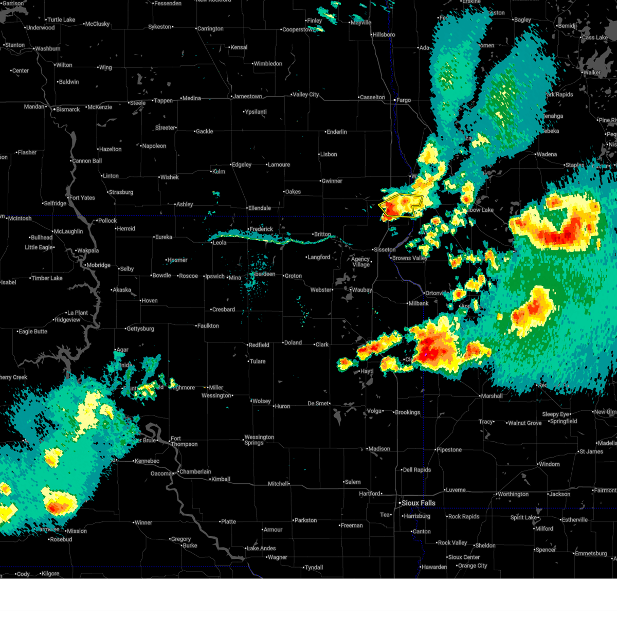
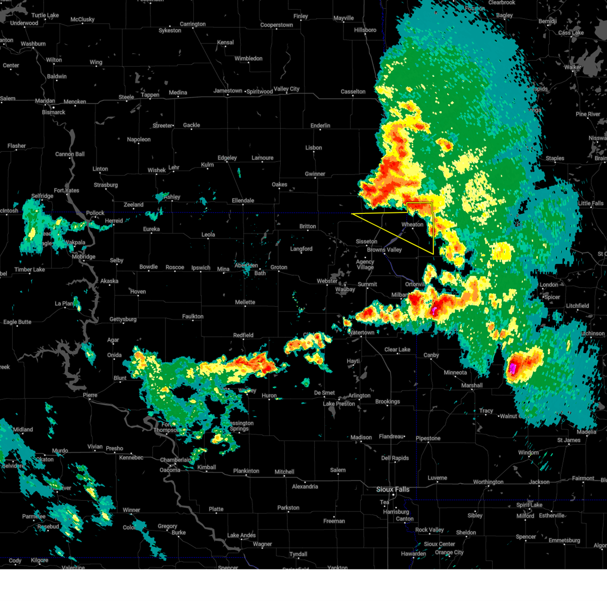
 Svrabr the national weather service in aberdeen has issued a * severe thunderstorm warning for, traverse county in west central minnesota, northeastern big stone county in west central minnesota, * until 1045 pm cdt. * at 956 pm cdt, a severe thunderstorm was located near wheaton, moving southeast at 40 mph (radar indicated). Hazards include 60 mph wind gusts and quarter size hail. Hail damage to vehicles is expected. expect wind damage to roofs, siding, and trees. this severe thunderstorm will be near, dumont around 1000 pm cdt. Trinity lutheran country church around 1015 pm cdt. Svrabr the national weather service in aberdeen has issued a * severe thunderstorm warning for, traverse county in west central minnesota, northeastern big stone county in west central minnesota, * until 1045 pm cdt. * at 956 pm cdt, a severe thunderstorm was located near wheaton, moving southeast at 40 mph (radar indicated). Hazards include 60 mph wind gusts and quarter size hail. Hail damage to vehicles is expected. expect wind damage to roofs, siding, and trees. this severe thunderstorm will be near, dumont around 1000 pm cdt. Trinity lutheran country church around 1015 pm cdt.
|
| 6/19/2025 9:52 PM CDT |
 The storm which prompted the warning has moved out of the area. therefore, the warning will be allowed to expire. a severe thunderstorm watch remains in effect until 400 am cdt for west central minnesota, and southeastern north dakota. to report severe weather, contact your nearest law enforcement agency. they will relay your report to the national weather service grand forks. The storm which prompted the warning has moved out of the area. therefore, the warning will be allowed to expire. a severe thunderstorm watch remains in effect until 400 am cdt for west central minnesota, and southeastern north dakota. to report severe weather, contact your nearest law enforcement agency. they will relay your report to the national weather service grand forks.
|
| 6/19/2025 9:50 PM CDT |
 At 948 pm cdt, a severe thunderstorm was located over wheaton, moving southeast at 35 mph (trained weather spotters. at 945 pm cdt, a 56 mph wind was reported 2 miles north of wheaton). Hazards include ping pong ball size hail and 60 mph wind gusts. People and animals outdoors will be injured. expect hail damage to roofs, siding, windows, and vehicles. expect wind damage to roofs, siding, and trees. Locations impacted include, dumont and collis. At 948 pm cdt, a severe thunderstorm was located over wheaton, moving southeast at 35 mph (trained weather spotters. at 945 pm cdt, a 56 mph wind was reported 2 miles north of wheaton). Hazards include ping pong ball size hail and 60 mph wind gusts. People and animals outdoors will be injured. expect hail damage to roofs, siding, windows, and vehicles. expect wind damage to roofs, siding, and trees. Locations impacted include, dumont and collis.
|
| 6/19/2025 9:50 PM CDT |
 the severe thunderstorm warning has been cancelled and is no longer in effect the severe thunderstorm warning has been cancelled and is no longer in effect
|
| 6/19/2025 9:47 PM CDT |
 At 946 pm cdt, a severe thunderstorm was located near wheaton, moving southeast at 35 mph (public). Hazards include ping pong ball size hail and 60 mph wind gusts. People and animals outdoors will be injured. expect hail damage to roofs, siding, windows, and vehicles. expect wind damage to roofs, siding, and trees. Locations impacted include, fairmount, lamars, blackmer, and tenney. At 946 pm cdt, a severe thunderstorm was located near wheaton, moving southeast at 35 mph (public). Hazards include ping pong ball size hail and 60 mph wind gusts. People and animals outdoors will be injured. expect hail damage to roofs, siding, windows, and vehicles. expect wind damage to roofs, siding, and trees. Locations impacted include, fairmount, lamars, blackmer, and tenney.
|
| 6/19/2025 9:26 PM CDT |
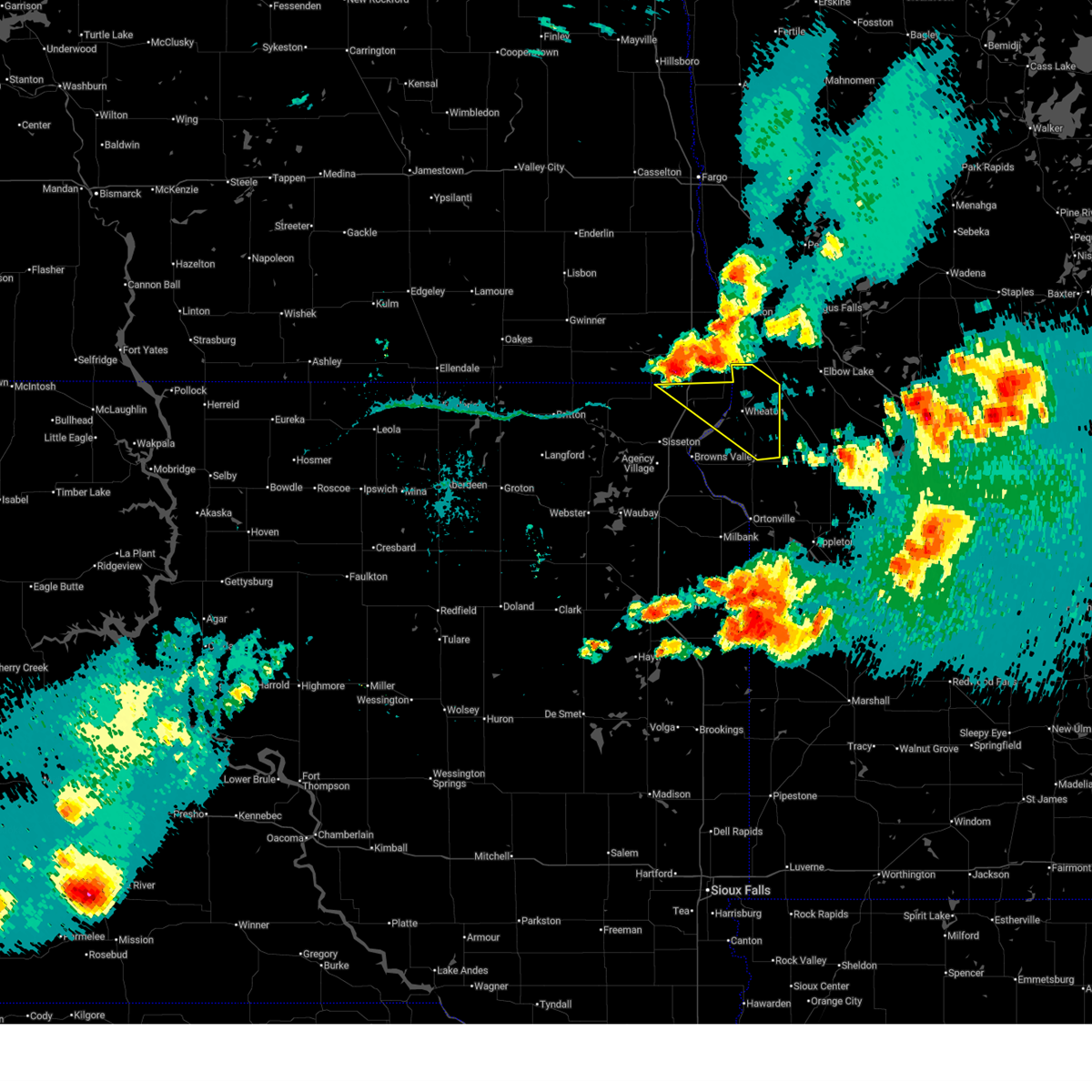
 At 925 pm cdt, a severe thunderstorm was located near whiterock colony, or near rosholt, moving southeast at 40 mph (trained weather spotters. quarter sized hail and trees were reported down in hankinson from this storm). Hazards include ping pong ball size hail and 60 mph wind gusts. People and animals outdoors will be injured. expect hail damage to roofs, siding, windows, and vehicles. expect wind damage to roofs, siding, and trees. this severe storm will be near, rosholt and whiterock colony around 930 pm cdt. Other locations in the path of this severe thunderstorm include wheaton, mud lake landing, lake traverse, silver bridge, dumont and collis. At 925 pm cdt, a severe thunderstorm was located near whiterock colony, or near rosholt, moving southeast at 40 mph (trained weather spotters. quarter sized hail and trees were reported down in hankinson from this storm). Hazards include ping pong ball size hail and 60 mph wind gusts. People and animals outdoors will be injured. expect hail damage to roofs, siding, windows, and vehicles. expect wind damage to roofs, siding, and trees. this severe storm will be near, rosholt and whiterock colony around 930 pm cdt. Other locations in the path of this severe thunderstorm include wheaton, mud lake landing, lake traverse, silver bridge, dumont and collis.
|
| 6/19/2025 9:20 PM CDT |
 At 920 pm cdt, a severe thunderstorm was located over lamars, or near rosholt, moving southeast at 35 mph (radar indicated). Hazards include ping pong ball size hail and 60 mph wind gusts. People and animals outdoors will be injured. expect hail damage to roofs, siding, windows, and vehicles. expect wind damage to roofs, siding, and trees. locations impacted include, hankinson, fairmount, lamars, blackmer, sonora, and tenney. This includes interstate 29 between mile markers 0 and 11. At 920 pm cdt, a severe thunderstorm was located over lamars, or near rosholt, moving southeast at 35 mph (radar indicated). Hazards include ping pong ball size hail and 60 mph wind gusts. People and animals outdoors will be injured. expect hail damage to roofs, siding, windows, and vehicles. expect wind damage to roofs, siding, and trees. locations impacted include, hankinson, fairmount, lamars, blackmer, sonora, and tenney. This includes interstate 29 between mile markers 0 and 11.
|
| 6/19/2025 9:12 PM CDT |
 Svrabr the national weather service in aberdeen has issued a * severe thunderstorm warning for, traverse county in west central minnesota, north central big stone county in west central minnesota, northeastern roberts county in northeastern south dakota, * until 1000 pm cdt. * at 912 pm cdt, a severe thunderstorm was located 7 miles southeast of hankinson, or 9 miles north of rosholt, moving southeast at 45 mph (radar indicated). Hazards include ping pong ball size hail and 60 mph wind gusts. People and animals outdoors will be injured. expect hail damage to roofs, siding, windows, and vehicles. expect wind damage to roofs, siding, and trees. this severe thunderstorm will be near, whiterock colony around 915 pm cdt. rosholt around 920 pm cdt. mud lake landing around 925 pm cdt. wheaton, lake traverse, and silver bridge around 930 pm cdt. Other locations in the path of this severe thunderstorm include dumont and collis. Svrabr the national weather service in aberdeen has issued a * severe thunderstorm warning for, traverse county in west central minnesota, north central big stone county in west central minnesota, northeastern roberts county in northeastern south dakota, * until 1000 pm cdt. * at 912 pm cdt, a severe thunderstorm was located 7 miles southeast of hankinson, or 9 miles north of rosholt, moving southeast at 45 mph (radar indicated). Hazards include ping pong ball size hail and 60 mph wind gusts. People and animals outdoors will be injured. expect hail damage to roofs, siding, windows, and vehicles. expect wind damage to roofs, siding, and trees. this severe thunderstorm will be near, whiterock colony around 915 pm cdt. rosholt around 920 pm cdt. mud lake landing around 925 pm cdt. wheaton, lake traverse, and silver bridge around 930 pm cdt. Other locations in the path of this severe thunderstorm include dumont and collis.
|
| 6/19/2025 9:12 PM CDT |
 At 912 pm cdt, a severe thunderstorm was located near hankinson, or 10 miles northwest of rosholt, moving southeast at 35 mph (radar indicated). Hazards include golf ball size hail and 60 mph wind gusts. People and animals outdoors will be injured. expect hail damage to roofs, siding, windows, and vehicles. expect wind damage to roofs, siding, and trees. locations impacted include, hankinson, fairmount, great bend, lamars, blackmer, sonora, and tenney. This includes interstate 29 between mile markers 0 and 16. At 912 pm cdt, a severe thunderstorm was located near hankinson, or 10 miles northwest of rosholt, moving southeast at 35 mph (radar indicated). Hazards include golf ball size hail and 60 mph wind gusts. People and animals outdoors will be injured. expect hail damage to roofs, siding, windows, and vehicles. expect wind damage to roofs, siding, and trees. locations impacted include, hankinson, fairmount, great bend, lamars, blackmer, sonora, and tenney. This includes interstate 29 between mile markers 0 and 16.
|
| 6/19/2025 8:55 PM CDT |
 Svrfgf the national weather service in grand forks has issued a * severe thunderstorm warning for, southeastern wilkin county in west central minnesota, southern richland county in southeastern north dakota, * until 1000 pm cdt. * at 855 pm cdt, a severe thunderstorm was located over mantador, or 19 miles southwest of wahpeton, moving southeast at 35 mph (radar indicated). Hazards include golf ball size hail and 60 mph wind gusts. People and animals outdoors will be injured. expect hail damage to roofs, siding, windows, and vehicles. Expect wind damage to roofs, siding, and trees. Svrfgf the national weather service in grand forks has issued a * severe thunderstorm warning for, southeastern wilkin county in west central minnesota, southern richland county in southeastern north dakota, * until 1000 pm cdt. * at 855 pm cdt, a severe thunderstorm was located over mantador, or 19 miles southwest of wahpeton, moving southeast at 35 mph (radar indicated). Hazards include golf ball size hail and 60 mph wind gusts. People and animals outdoors will be injured. expect hail damage to roofs, siding, windows, and vehicles. Expect wind damage to roofs, siding, and trees.
|
| 7/31/2024 1:19 PM CDT |
 At 119 pm cdt, severe thunderstorms were located along a line extending from near dalton to near barrett to near morris, moving northeast at 55 mph (radar indicated). Hazards include 60 mph wind gusts. Expect damage to roofs, siding, and trees. Locations impacted include, wheaton, graceville, clinton, rosholt, dumont, tintah, johnson, barry, siloah country church, big stone colony, silver bridge, mud lake landing, trinity lutheran country church, collis, immanuel church, whiterock colony, halls landing, and lake traverse. At 119 pm cdt, severe thunderstorms were located along a line extending from near dalton to near barrett to near morris, moving northeast at 55 mph (radar indicated). Hazards include 60 mph wind gusts. Expect damage to roofs, siding, and trees. Locations impacted include, wheaton, graceville, clinton, rosholt, dumont, tintah, johnson, barry, siloah country church, big stone colony, silver bridge, mud lake landing, trinity lutheran country church, collis, immanuel church, whiterock colony, halls landing, and lake traverse.
|
| 7/31/2024 1:05 PM CDT |
 the severe thunderstorm warning has been cancelled and is no longer in effect the severe thunderstorm warning has been cancelled and is no longer in effect
|
| 7/31/2024 1:05 PM CDT |
 At 105 pm cdt, severe thunderstorms were located along a line extending from 7 miles northwest of wendell to near herman to near artichoke, moving east at 55 mph (radar indicated). Hazards include 60 mph wind gusts. Expect damage to roofs, siding, and trees. These severe thunderstorms will remain over mainly rural areas of traverse, northern big stone and eastern roberts counties, including the following locations, northeastern lake traverse reservation. At 105 pm cdt, severe thunderstorms were located along a line extending from 7 miles northwest of wendell to near herman to near artichoke, moving east at 55 mph (radar indicated). Hazards include 60 mph wind gusts. Expect damage to roofs, siding, and trees. These severe thunderstorms will remain over mainly rural areas of traverse, northern big stone and eastern roberts counties, including the following locations, northeastern lake traverse reservation.
|
| 7/31/2024 12:45 PM CDT |
 Svrfgf the national weather service in grand forks has issued a * severe thunderstorm warning for, southwestern otter tail county in west central minnesota, grant county in west central minnesota, wilkin county in west central minnesota, richland county in southeastern north dakota, northeastern sargent county in southeastern north dakota, * until 130 pm cdt. * at 1244 pm cdt, severe thunderstorms were located along a line extending from near barney to near sonora to mud lake landing to lismore colony, moving east at 45 mph (radar indicated). Hazards include 70 mph wind gusts and nickel size hail. Expect considerable tree damage. Damage is likely to mobile homes, roofs, and outbuildings. Svrfgf the national weather service in grand forks has issued a * severe thunderstorm warning for, southwestern otter tail county in west central minnesota, grant county in west central minnesota, wilkin county in west central minnesota, richland county in southeastern north dakota, northeastern sargent county in southeastern north dakota, * until 130 pm cdt. * at 1244 pm cdt, severe thunderstorms were located along a line extending from near barney to near sonora to mud lake landing to lismore colony, moving east at 45 mph (radar indicated). Hazards include 70 mph wind gusts and nickel size hail. Expect considerable tree damage. Damage is likely to mobile homes, roofs, and outbuildings.
|
| 7/31/2024 12:40 PM CDT |
 Svrabr the national weather service in aberdeen has issued a * severe thunderstorm warning for, traverse county in west central minnesota, northern big stone county in west central minnesota, roberts county in northeastern south dakota, north central grant county in northeastern south dakota, * until 130 pm cdt. * at 1239 pm cdt, severe thunderstorms were located along a line extending from near whiterock colony to near siloah country church to near lismore colony, moving northeast at 55 mph (radar indicated). Hazards include 70 mph wind gusts and penny size hail. Expect considerable tree damage. damage is likely to mobile homes, roofs, and outbuildings. severe thunderstorms will be near, wheaton, graceville, clinton, dumont, johnson, collis, immanuel church, trinity lutheran country church, and big stone colony around 1245 pm cdt. Tintah around 1250 pm cdt. Svrabr the national weather service in aberdeen has issued a * severe thunderstorm warning for, traverse county in west central minnesota, northern big stone county in west central minnesota, roberts county in northeastern south dakota, north central grant county in northeastern south dakota, * until 130 pm cdt. * at 1239 pm cdt, severe thunderstorms were located along a line extending from near whiterock colony to near siloah country church to near lismore colony, moving northeast at 55 mph (radar indicated). Hazards include 70 mph wind gusts and penny size hail. Expect considerable tree damage. damage is likely to mobile homes, roofs, and outbuildings. severe thunderstorms will be near, wheaton, graceville, clinton, dumont, johnson, collis, immanuel church, trinity lutheran country church, and big stone colony around 1245 pm cdt. Tintah around 1250 pm cdt.
|
| 7/15/2024 5:23 AM CDT |
 The storms which prompted the warning have moved out of the area. therefore, the warning will be allowed to expire. a severe thunderstorm watch remains in effect until 700 am cdt for west central minnesota, and southeastern north dakota. The storms which prompted the warning have moved out of the area. therefore, the warning will be allowed to expire. a severe thunderstorm watch remains in effect until 700 am cdt for west central minnesota, and southeastern north dakota.
|
| 7/15/2024 5:15 AM CDT |
 At 514 am cdt, severe thunderstorms were located along a line extending from near charlesville to near whiterock colony to near rosholt, moving southeast at 50 mph (radar indicated). Hazards include 60 mph wind gusts and quarter size hail. Hail damage to vehicles is expected. expect wind damage to roofs, siding, and trees. Locations impacted include, wheaton, lake traverse, silver bridge, immanuel church, mud lake landing, dumont and trinity lutheran country church. At 514 am cdt, severe thunderstorms were located along a line extending from near charlesville to near whiterock colony to near rosholt, moving southeast at 50 mph (radar indicated). Hazards include 60 mph wind gusts and quarter size hail. Hail damage to vehicles is expected. expect wind damage to roofs, siding, and trees. Locations impacted include, wheaton, lake traverse, silver bridge, immanuel church, mud lake landing, dumont and trinity lutheran country church.
|
| 7/15/2024 5:07 AM CDT |
 At 506 am cdt, severe thunderstorms were located along a line extending from near rothsay to near western to near whiterock colony, moving southeast at 60 mph (radar indicated). Hazards include 60 mph wind gusts and quarter size hail. Hail damage to vehicles is expected. expect wind damage to roofs, siding, and trees. locations impacted include, fergus falls, wahpeton, breckenridge, southwestern ottertail lake, elbow lake, hankinson, and battle lake. this includes the following highways, interstate 29 between mile markers 0 and 43. Interstate 94 in minnesota between mile markers 36 and 75. At 506 am cdt, severe thunderstorms were located along a line extending from near rothsay to near western to near whiterock colony, moving southeast at 60 mph (radar indicated). Hazards include 60 mph wind gusts and quarter size hail. Hail damage to vehicles is expected. expect wind damage to roofs, siding, and trees. locations impacted include, fergus falls, wahpeton, breckenridge, southwestern ottertail lake, elbow lake, hankinson, and battle lake. this includes the following highways, interstate 29 between mile markers 0 and 43. Interstate 94 in minnesota between mile markers 36 and 75.
|
| 7/15/2024 4:50 AM CDT |
 Svrabr the national weather service in aberdeen has issued a * severe thunderstorm warning for, traverse county in west central minnesota, northern roberts county in northeastern south dakota, * until 530 am cdt. * at 450 am cdt, severe thunderstorms were located along a line extending from 6 miles southwest of foxhome to 6 miles northwest of whiterock colony to 7 miles southwest of hankinson, moving southeast at 60 mph (radar indicated). Hazards include 60 mph wind gusts and nickel size hail. Expect damage to roofs, siding, and trees. severe thunderstorms will be near, rosholt, new effington, tintah, victor, and whiterock colony around 455 am cdt. wheaton, immanuel church, and mud lake landing around 500 am cdt. lake traverse around 505 am cdt. silver bridge around 510 am cdt. Other locations in the path of these severe thunderstorms include dumont. Svrabr the national weather service in aberdeen has issued a * severe thunderstorm warning for, traverse county in west central minnesota, northern roberts county in northeastern south dakota, * until 530 am cdt. * at 450 am cdt, severe thunderstorms were located along a line extending from 6 miles southwest of foxhome to 6 miles northwest of whiterock colony to 7 miles southwest of hankinson, moving southeast at 60 mph (radar indicated). Hazards include 60 mph wind gusts and nickel size hail. Expect damage to roofs, siding, and trees. severe thunderstorms will be near, rosholt, new effington, tintah, victor, and whiterock colony around 455 am cdt. wheaton, immanuel church, and mud lake landing around 500 am cdt. lake traverse around 505 am cdt. silver bridge around 510 am cdt. Other locations in the path of these severe thunderstorms include dumont.
|
| 7/15/2024 4:47 AM CDT |
 the severe thunderstorm warning has been cancelled and is no longer in effect the severe thunderstorm warning has been cancelled and is no longer in effect
|
| 7/15/2024 4:47 AM CDT |
 Svrabr the national weather service in aberdeen has issued a * severe thunderstorm warning for, traverse county in west central minnesota, northern roberts county in northeastern south dakota, * until 530 am cdt. * at 446 am cdt, severe thunderstorms were located along a line extending from near breckenridge to 6 miles southeast of hankinson to 6 miles southeast of lidgerwood, moving southeast at 60 mph (radar indicated). Hazards include 60 mph wind gusts and nickel size hail. Expect damage to roofs, siding, and trees. severe thunderstorms will be near, whiterock colony around 450 am cdt. rosholt, new effington, tintah, and victor around 455 am cdt. immanuel church and mud lake landing around 500 am cdt. wheaton around 505 am cdt. Other locations in the path of these severe thunderstorms include lake traverse, silver bridge and dumont. Svrabr the national weather service in aberdeen has issued a * severe thunderstorm warning for, traverse county in west central minnesota, northern roberts county in northeastern south dakota, * until 530 am cdt. * at 446 am cdt, severe thunderstorms were located along a line extending from near breckenridge to 6 miles southeast of hankinson to 6 miles southeast of lidgerwood, moving southeast at 60 mph (radar indicated). Hazards include 60 mph wind gusts and nickel size hail. Expect damage to roofs, siding, and trees. severe thunderstorms will be near, whiterock colony around 450 am cdt. rosholt, new effington, tintah, and victor around 455 am cdt. immanuel church and mud lake landing around 500 am cdt. wheaton around 505 am cdt. Other locations in the path of these severe thunderstorms include lake traverse, silver bridge and dumont.
|
| 7/15/2024 4:47 AM CDT |
 At 447 am cdt, severe thunderstorms were located along a line extending from near wolverton to breckenridge to near hankinson, moving east at 60 mph (radar indicated). Hazards include 60 mph wind gusts and quarter size hail. Hail damage to vehicles is expected. expect wind damage to roofs, siding, and trees. locations impacted include, fergus falls, wahpeton, breckenridge, southwestern ottertail lake, elbow lake, hankinson, and battle lake. this includes the following highways, interstate 29 between mile markers 0 and 48. Interstate 94 in minnesota between mile markers 36 and 75. At 447 am cdt, severe thunderstorms were located along a line extending from near wolverton to breckenridge to near hankinson, moving east at 60 mph (radar indicated). Hazards include 60 mph wind gusts and quarter size hail. Hail damage to vehicles is expected. expect wind damage to roofs, siding, and trees. locations impacted include, fergus falls, wahpeton, breckenridge, southwestern ottertail lake, elbow lake, hankinson, and battle lake. this includes the following highways, interstate 29 between mile markers 0 and 48. Interstate 94 in minnesota between mile markers 36 and 75.
|
| 7/15/2024 4:30 AM CDT |
 Svrfgf the national weather service in grand forks has issued a * severe thunderstorm warning for, southwestern otter tail county in west central minnesota, northern grant county in west central minnesota, wilkin county in west central minnesota, southeastern ransom county in southeastern north dakota, richland county in southeastern north dakota, eastern sargent county in southeastern north dakota, * until 530 am cdt. * at 429 am cdt, severe thunderstorms were located along a line extending from near kindred to near galchutt to near lidgerwood, moving southeast at 60 mph (radar indicated). Hazards include 60 mph wind gusts and quarter size hail. Hail damage to vehicles is expected. Expect wind damage to roofs, siding, and trees. Svrfgf the national weather service in grand forks has issued a * severe thunderstorm warning for, southwestern otter tail county in west central minnesota, northern grant county in west central minnesota, wilkin county in west central minnesota, southeastern ransom county in southeastern north dakota, richland county in southeastern north dakota, eastern sargent county in southeastern north dakota, * until 530 am cdt. * at 429 am cdt, severe thunderstorms were located along a line extending from near kindred to near galchutt to near lidgerwood, moving southeast at 60 mph (radar indicated). Hazards include 60 mph wind gusts and quarter size hail. Hail damage to vehicles is expected. Expect wind damage to roofs, siding, and trees.
|
| 6/18/2024 4:27 AM CDT |
 Svrfgf the national weather service in grand forks has issued a * severe thunderstorm warning for, southeastern clay county in northwestern minnesota, southern wadena county in central minnesota, otter tail county in west central minnesota, grant county in west central minnesota, wilkin county in west central minnesota, richland county in southeastern north dakota, southeastern sargent county in southeastern north dakota, * until 530 am cdt. * at 427 am cdt, severe thunderstorms were located along a line extending from near vergas to near barry, moving southeast at 50 mph (radar indicated). Hazards include 60 mph wind gusts. expect damage to roofs, siding, and trees Svrfgf the national weather service in grand forks has issued a * severe thunderstorm warning for, southeastern clay county in northwestern minnesota, southern wadena county in central minnesota, otter tail county in west central minnesota, grant county in west central minnesota, wilkin county in west central minnesota, richland county in southeastern north dakota, southeastern sargent county in southeastern north dakota, * until 530 am cdt. * at 427 am cdt, severe thunderstorms were located along a line extending from near vergas to near barry, moving southeast at 50 mph (radar indicated). Hazards include 60 mph wind gusts. expect damage to roofs, siding, and trees
|
| 6/18/2024 3:58 AM CDT |
 At 358 am cdt, severe thunderstorms were located along a line extending from near wolverton to near hillhead, moving east at 55 mph (radar indicated). Hazards include 60 mph wind gusts. Expect damage to roofs, siding, and trees. locations impacted include, fergus falls, wahpeton, breckenridge, pelican rapids, lake lida, hankinson, and gwinner. this includes the following highways, interstate 29 between mile markers 0 and 48. Interstate 94 in minnesota between mile markers 28 and 54. At 358 am cdt, severe thunderstorms were located along a line extending from near wolverton to near hillhead, moving east at 55 mph (radar indicated). Hazards include 60 mph wind gusts. Expect damage to roofs, siding, and trees. locations impacted include, fergus falls, wahpeton, breckenridge, pelican rapids, lake lida, hankinson, and gwinner. this includes the following highways, interstate 29 between mile markers 0 and 48. Interstate 94 in minnesota between mile markers 28 and 54.
|
| 6/18/2024 3:25 AM CDT |
 Svrfgf the national weather service in grand forks has issued a * severe thunderstorm warning for, western otter tail county in west central minnesota, wilkin county in west central minnesota, ransom county in southeastern north dakota, richland county in southeastern north dakota, sargent county in southeastern north dakota, * until 430 am cdt. * at 325 am cdt, severe thunderstorms were located along a line extending from near comstock to 7 miles south of havana, moving east at 45 mph (radar indicated). Hazards include 60 mph wind gusts. expect damage to roofs, siding, and trees Svrfgf the national weather service in grand forks has issued a * severe thunderstorm warning for, western otter tail county in west central minnesota, wilkin county in west central minnesota, ransom county in southeastern north dakota, richland county in southeastern north dakota, sargent county in southeastern north dakota, * until 430 am cdt. * at 325 am cdt, severe thunderstorms were located along a line extending from near comstock to 7 miles south of havana, moving east at 45 mph (radar indicated). Hazards include 60 mph wind gusts. expect damage to roofs, siding, and trees
|
| 6/2/2024 10:30 PM CDT |
 At 1029 pm cdt, severe thunderstorms were located along a line extending from near breckenridge to fairmount to near victor, moving east at 30 mph (radar indicated). Hazards include 60 mph wind gusts and penny size hail. Expect damage to roofs, siding, and trees. locations impacted include, wahpeton, breckenridge, fairmount, campbell, nashua, doran, and lamars. This includes interstate 29 between mile markers 1 and 11. At 1029 pm cdt, severe thunderstorms were located along a line extending from near breckenridge to fairmount to near victor, moving east at 30 mph (radar indicated). Hazards include 60 mph wind gusts and penny size hail. Expect damage to roofs, siding, and trees. locations impacted include, wahpeton, breckenridge, fairmount, campbell, nashua, doran, and lamars. This includes interstate 29 between mile markers 1 and 11.
|
| 6/2/2024 10:30 PM CDT |
 the severe thunderstorm warning has been cancelled and is no longer in effect the severe thunderstorm warning has been cancelled and is no longer in effect
|
| 6/2/2024 9:58 PM CDT |
 Svrfgf the national weather service in grand forks has issued a * severe thunderstorm warning for, southwestern otter tail county in west central minnesota, wilkin county in west central minnesota, southeastern richland county in southeastern north dakota, * until 1100 pm cdt. * at 958 pm cdt, severe thunderstorms were located along a line extending from near galchutt to near dwight to great bend to lake traverse reservation, moving east at 30 mph (radar indicated). Hazards include 60 mph wind gusts and nickel size hail. expect damage to roofs, siding, and trees Svrfgf the national weather service in grand forks has issued a * severe thunderstorm warning for, southwestern otter tail county in west central minnesota, wilkin county in west central minnesota, southeastern richland county in southeastern north dakota, * until 1100 pm cdt. * at 958 pm cdt, severe thunderstorms were located along a line extending from near galchutt to near dwight to great bend to lake traverse reservation, moving east at 30 mph (radar indicated). Hazards include 60 mph wind gusts and nickel size hail. expect damage to roofs, siding, and trees
|
| 7/25/2023 9:09 PM CDT |
 At 909 pm cdt, a severe thunderstorm was located over mud lake landing, or near wheaton, moving east at 35 mph (radar indicated). Hazards include ping pong ball size hail and 60 mph wind gusts. People and animals outdoors will be injured. expect hail damage to roofs, siding, windows, and vehicles. expect wind damage to roofs, siding, and trees. locations impacted include, wheaton, immanuel church and dumont. hail threat, radar indicated max hail size, 1. 50 in wind threat, radar indicated max wind gust, 60 mph. At 909 pm cdt, a severe thunderstorm was located over mud lake landing, or near wheaton, moving east at 35 mph (radar indicated). Hazards include ping pong ball size hail and 60 mph wind gusts. People and animals outdoors will be injured. expect hail damage to roofs, siding, windows, and vehicles. expect wind damage to roofs, siding, and trees. locations impacted include, wheaton, immanuel church and dumont. hail threat, radar indicated max hail size, 1. 50 in wind threat, radar indicated max wind gust, 60 mph.
|
| 7/25/2023 8:56 PM CDT |
 At 855 pm cdt, a severe thunderstorm was located over rosholt, moving east at 40 mph (radar indicated). Hazards include 60 mph wind gusts and quarter size hail. Hail damage to vehicles is expected. expect wind damage to roofs, siding, and trees. this severe thunderstorm will be near, whiterock colony around 905 pm cdt. mud lake landing and silver bridge around 910 pm cdt. wheaton and immanuel church around 915 pm cdt. hail threat, radar indicated max hail size, 1. 00 in wind threat, radar indicated max wind gust, 60 mph. At 855 pm cdt, a severe thunderstorm was located over rosholt, moving east at 40 mph (radar indicated). Hazards include 60 mph wind gusts and quarter size hail. Hail damage to vehicles is expected. expect wind damage to roofs, siding, and trees. this severe thunderstorm will be near, whiterock colony around 905 pm cdt. mud lake landing and silver bridge around 910 pm cdt. wheaton and immanuel church around 915 pm cdt. hail threat, radar indicated max hail size, 1. 00 in wind threat, radar indicated max wind gust, 60 mph.
|
| 6/24/2022 11:53 PM CDT |
 The severe thunderstorm warning for traverse, northern big stone and central roberts counties will expire at midnight cdt, the storms which prompted the warning have weakened below severe limits, and no longer pose an immediate threat to life or property. therefore, the warning will be allowed to expire. however gusty winds are still possible with these thunderstorms. a severe thunderstorm watch remains in effect until 300 am cdt for west central minnesota, and northeastern south dakota. to report severe weather, contact your nearest law enforcement agency. they will relay your report to the national weather service aberdeen. The severe thunderstorm warning for traverse, northern big stone and central roberts counties will expire at midnight cdt, the storms which prompted the warning have weakened below severe limits, and no longer pose an immediate threat to life or property. therefore, the warning will be allowed to expire. however gusty winds are still possible with these thunderstorms. a severe thunderstorm watch remains in effect until 300 am cdt for west central minnesota, and northeastern south dakota. to report severe weather, contact your nearest law enforcement agency. they will relay your report to the national weather service aberdeen.
|
| 6/24/2022 11:44 PM CDT |
 At 1143 pm cdt, severe thunderstorms were located along a line extending from near tintah to 6 miles west of herman to collis, moving east at 35 mph (radar indicated). Hazards include 60 mph wind gusts. Expect damage to roofs, siding, and trees. these severe thunderstorms will remain over mainly rural areas of traverse, northern big stone and central roberts counties. hail threat, radar indicated max hail size, <. 75 in wind threat, radar indicated max wind gust, 60 mph. At 1143 pm cdt, severe thunderstorms were located along a line extending from near tintah to 6 miles west of herman to collis, moving east at 35 mph (radar indicated). Hazards include 60 mph wind gusts. Expect damage to roofs, siding, and trees. these severe thunderstorms will remain over mainly rural areas of traverse, northern big stone and central roberts counties. hail threat, radar indicated max hail size, <. 75 in wind threat, radar indicated max wind gust, 60 mph.
|
| 6/24/2022 11:22 PM CDT |
 At 1121 pm cdt, severe thunderstorms were located along a line extending from near fairmount to near silver bridge to near beardsley, moving east at 35 mph (radar indicated). Hazards include 60 mph wind gusts. Expect damage to roofs, siding, and trees. these severe storms will be near, wheaton and immanuel church around 1125 pm cdt. dumont around 1130 pm cdt. other locations in the path of these severe thunderstorms include tintah, big stone colony, graceville, collis, charlesville, johnson and trinity lutheran country church. hail threat, radar indicated max hail size, <. 75 in wind threat, observed max wind gust, 60 mph. At 1121 pm cdt, severe thunderstorms were located along a line extending from near fairmount to near silver bridge to near beardsley, moving east at 35 mph (radar indicated). Hazards include 60 mph wind gusts. Expect damage to roofs, siding, and trees. these severe storms will be near, wheaton and immanuel church around 1125 pm cdt. dumont around 1130 pm cdt. other locations in the path of these severe thunderstorms include tintah, big stone colony, graceville, collis, charlesville, johnson and trinity lutheran country church. hail threat, radar indicated max hail size, <. 75 in wind threat, observed max wind gust, 60 mph.
|
| 6/24/2022 11:11 PM CDT |
 At 1110 pm cdt, severe thunderstorms were located along a line extending from near whiterock colony to halls landing to browns valley, moving east at 35 mph (radar indicated). Hazards include 60 mph wind gusts. Expect damage to roofs, siding, and trees. these severe storms will be near, whiterock colony around 1115 pm cdt. other locations in the path of these severe thunderstorms include silver bridge, mud lake landing, immanuel church, wheaton, dumont, barry, tintah, siloah country church, big stone colony, graceville, charlesville, collis and johnson. hail threat, radar indicated max hail size, <. 75 in wind threat, radar indicated max wind gust, 60 mph. At 1110 pm cdt, severe thunderstorms were located along a line extending from near whiterock colony to halls landing to browns valley, moving east at 35 mph (radar indicated). Hazards include 60 mph wind gusts. Expect damage to roofs, siding, and trees. these severe storms will be near, whiterock colony around 1115 pm cdt. other locations in the path of these severe thunderstorms include silver bridge, mud lake landing, immanuel church, wheaton, dumont, barry, tintah, siloah country church, big stone colony, graceville, charlesville, collis and johnson. hail threat, radar indicated max hail size, <. 75 in wind threat, radar indicated max wind gust, 60 mph.
|
| 6/24/2022 11:02 PM CDT |
 At 1102 pm cdt, severe thunderstorms were located along a line extending from 7 miles north of everdell to lake traverse reservation, moving east at 40 mph (radar indicated). Hazards include 60 mph wind gusts and nickel size hail. Expect damage to roofs, siding, and trees. severe thunderstorms will be near, everdell around 1105 pm cdt. foxhome around 1110 pm cdt. rothsay around 1115 pm cdt. carlisle around 1120 pm cdt. other locations in the path of these severe thunderstorms include elizabeth. this includes the following highways, interstate 29 between mile markers 1 and 18. interstate 94 in minnesota between mile markers 38 and 81. hail threat, radar indicated max hail size, 0. 88 in wind threat, radar indicated max wind gust, 60 mph. At 1102 pm cdt, severe thunderstorms were located along a line extending from 7 miles north of everdell to lake traverse reservation, moving east at 40 mph (radar indicated). Hazards include 60 mph wind gusts and nickel size hail. Expect damage to roofs, siding, and trees. severe thunderstorms will be near, everdell around 1105 pm cdt. foxhome around 1110 pm cdt. rothsay around 1115 pm cdt. carlisle around 1120 pm cdt. other locations in the path of these severe thunderstorms include elizabeth. this includes the following highways, interstate 29 between mile markers 1 and 18. interstate 94 in minnesota between mile markers 38 and 81. hail threat, radar indicated max hail size, 0. 88 in wind threat, radar indicated max wind gust, 60 mph.
|
| 6/24/2022 10:55 PM CDT |
 At 1054 pm cdt, severe thunderstorms were located along a line extending from near victor to near lake traverse housing units to near agency village, moving east at 35 mph (radar indicated). Hazards include 60 mph wind gusts. Expect damage to roofs, siding, and trees. severe thunderstorms will be near, rosholt and victor around 1100 pm cdt. rainbow island and traverse country park around 1105 pm cdt. halls landing, lake traverse and whiterock colony around 1110 pm cdt. other locations in the path of these severe thunderstorms include silver bridge, yankeetown, beardsley, mud lake landing, wheaton, immanuel church, dumont, barry, siloah country church, tintah and big stone colony. hail threat, radar indicated max hail size, <. 75 in wind threat, radar indicated max wind gust, 60 mph. At 1054 pm cdt, severe thunderstorms were located along a line extending from near victor to near lake traverse housing units to near agency village, moving east at 35 mph (radar indicated). Hazards include 60 mph wind gusts. Expect damage to roofs, siding, and trees. severe thunderstorms will be near, rosholt and victor around 1100 pm cdt. rainbow island and traverse country park around 1105 pm cdt. halls landing, lake traverse and whiterock colony around 1110 pm cdt. other locations in the path of these severe thunderstorms include silver bridge, yankeetown, beardsley, mud lake landing, wheaton, immanuel church, dumont, barry, siloah country church, tintah and big stone colony. hail threat, radar indicated max hail size, <. 75 in wind threat, radar indicated max wind gust, 60 mph.
|
| 6/20/2022 11:13 PM CDT |
 At 1113 pm cdt, severe thunderstorms were located along a line extending from near rothsay to near herman, moving east at 50 mph. these are destructive storms. highest wind gusts up to 80 mph expected in grant county (radar indicated). Hazards include 80 mph wind gusts and nickel size hail. Flying debris will be dangerous to those caught without shelter. mobile homes will be heavily damaged. expect considerable damage to roofs, windows, and vehicles. extensive tree damage and power outages are likely. locations impacted include, hoffman, erhard, pelican rapids, lake lida, maplewood state park, edwards, star lake and big mcdonald lake. this includes the following highways, interstate 29 between mile markers 0 and 40. interstate 94 in minnesota between mile markers 29 and 80. thunderstorm damage threat, destructive hail threat, radar indicated max hail size, 0. 88 in wind threat, radar indicated max wind gust, 80 mph. At 1113 pm cdt, severe thunderstorms were located along a line extending from near rothsay to near herman, moving east at 50 mph. these are destructive storms. highest wind gusts up to 80 mph expected in grant county (radar indicated). Hazards include 80 mph wind gusts and nickel size hail. Flying debris will be dangerous to those caught without shelter. mobile homes will be heavily damaged. expect considerable damage to roofs, windows, and vehicles. extensive tree damage and power outages are likely. locations impacted include, hoffman, erhard, pelican rapids, lake lida, maplewood state park, edwards, star lake and big mcdonald lake. this includes the following highways, interstate 29 between mile markers 0 and 40. interstate 94 in minnesota between mile markers 29 and 80. thunderstorm damage threat, destructive hail threat, radar indicated max hail size, 0. 88 in wind threat, radar indicated max wind gust, 80 mph.
|
| 6/20/2022 10:58 PM CDT |
 At 1058 pm cdt, severe thunderstorms were located along a line extending from near fairmount to trinity lutheran country church to near appleton, moving northeast at 45 mph (trained weather spotters). Hazards include 70 mph wind gusts. Expect considerable tree damage. damage is likely to mobile homes, roofs, and outbuildings. these severe thunderstorms will remain over mainly rural areas of traverse, eastern big stone and northeastern roberts counties. thunderstorm damage threat, considerable hail threat, radar indicated max hail size, <. 75 in wind threat, radar indicated max wind gust, 70 mph. At 1058 pm cdt, severe thunderstorms were located along a line extending from near fairmount to trinity lutheran country church to near appleton, moving northeast at 45 mph (trained weather spotters). Hazards include 70 mph wind gusts. Expect considerable tree damage. damage is likely to mobile homes, roofs, and outbuildings. these severe thunderstorms will remain over mainly rural areas of traverse, eastern big stone and northeastern roberts counties. thunderstorm damage threat, considerable hail threat, radar indicated max hail size, <. 75 in wind threat, radar indicated max wind gust, 70 mph.
|
| 6/20/2022 10:58 PM CDT |
 At 1057 pm cdt, severe thunderstorms were located along a line extending from near brushvale to near dumont, moving east at 65 mph. these are destructive storms. the strongest wind gusts around 80 mph are expected in grant county (radar indicated). Hazards include 80 mph wind gusts and nickel size hail. Flying debris will be dangerous to those caught without shelter. mobile homes will be heavily damaged. expect considerable damage to roofs, windows, and vehicles. extensive tree damage and power outages are likely. these severe storms will be near, herman around 1105 pm cdt. other locations in the path of these severe thunderstorms include rothsay, elizabeth, carlisle, erhard, hoffman, edwards, maplewood state park and southern lake lida. this includes the following highways, interstate 29 between mile markers 0 and 40. interstate 94 in minnesota between mile markers 29 and 80. thunderstorm damage threat, destructive hail threat, radar indicated max hail size, 0. 88 in wind threat, radar indicated max wind gust, 80 mph. At 1057 pm cdt, severe thunderstorms were located along a line extending from near brushvale to near dumont, moving east at 65 mph. these are destructive storms. the strongest wind gusts around 80 mph are expected in grant county (radar indicated). Hazards include 80 mph wind gusts and nickel size hail. Flying debris will be dangerous to those caught without shelter. mobile homes will be heavily damaged. expect considerable damage to roofs, windows, and vehicles. extensive tree damage and power outages are likely. these severe storms will be near, herman around 1105 pm cdt. other locations in the path of these severe thunderstorms include rothsay, elizabeth, carlisle, erhard, hoffman, edwards, maplewood state park and southern lake lida. this includes the following highways, interstate 29 between mile markers 0 and 40. interstate 94 in minnesota between mile markers 29 and 80. thunderstorm damage threat, destructive hail threat, radar indicated max hail size, 0. 88 in wind threat, radar indicated max wind gust, 80 mph.
|
| 6/20/2022 10:58 PM CDT |
 At 1058 pm cdt, severe thunderstorms were located along a line extending from near fairmount to trinity lutheran country church to near appleton, moving northeast at 45 mph (trained weather spotters). Hazards include 70 mph wind gusts. Expect considerable tree damage. damage is likely to mobile homes, roofs, and outbuildings. these severe thunderstorms will remain over mainly rural areas of traverse, eastern big stone and northeastern roberts counties. thunderstorm damage threat, considerable hail threat, radar indicated max hail size, <. 75 in wind threat, radar indicated max wind gust, 70 mph. At 1058 pm cdt, severe thunderstorms were located along a line extending from near fairmount to trinity lutheran country church to near appleton, moving northeast at 45 mph (trained weather spotters). Hazards include 70 mph wind gusts. Expect considerable tree damage. damage is likely to mobile homes, roofs, and outbuildings. these severe thunderstorms will remain over mainly rural areas of traverse, eastern big stone and northeastern roberts counties. thunderstorm damage threat, considerable hail threat, radar indicated max hail size, <. 75 in wind threat, radar indicated max wind gust, 70 mph.
|
| 6/20/2022 10:50 PM CDT |
 At 1050 pm cdt, severe thunderstorms were located along a line extending from near rosholt to near ortonville to astoria, moving east at 50 mph (trained weather spotters). Hazards include 60 mph wind gusts. Expect damage to roofs, siding, and trees. Locations impacted include, ortonville, wheaton, clear lake, big stone city, graceville, clinton, rosholt, beardsley, gary, toronto, marietta, astoria, odessa, brandt, dumont, artichoke, tintah, victor, correll and johnson. At 1050 pm cdt, severe thunderstorms were located along a line extending from near rosholt to near ortonville to astoria, moving east at 50 mph (trained weather spotters). Hazards include 60 mph wind gusts. Expect damage to roofs, siding, and trees. Locations impacted include, ortonville, wheaton, clear lake, big stone city, graceville, clinton, rosholt, beardsley, gary, toronto, marietta, astoria, odessa, brandt, dumont, artichoke, tintah, victor, correll and johnson.
|
| 6/20/2022 10:46 PM CDT |
 At 1046 pm cdt, severe thunderstorms were located along a line extending from galchutt to near siloah country church, moving east at 55 mph (radar indicated). Hazards include 60 mph wind gusts and nickel size hail. Expect damage to roofs, siding, and trees. severe thunderstorms will be near, mccauleyville, kent and abercrombie around 1050 pm cdt. brushvale and wahpeton around 1055 pm cdt. other locations in the path of these severe thunderstorms include lawndale, rothsay, herman, erhard and elizabeth. this includes the following highways, interstate 29 between mile markers 0 and 40. interstate 94 in minnesota between mile markers 29 and 80. hail threat, radar indicated max hail size, 0. 88 in wind threat, radar indicated max wind gust, 60 mph. At 1046 pm cdt, severe thunderstorms were located along a line extending from galchutt to near siloah country church, moving east at 55 mph (radar indicated). Hazards include 60 mph wind gusts and nickel size hail. Expect damage to roofs, siding, and trees. severe thunderstorms will be near, mccauleyville, kent and abercrombie around 1050 pm cdt. brushvale and wahpeton around 1055 pm cdt. other locations in the path of these severe thunderstorms include lawndale, rothsay, herman, erhard and elizabeth. this includes the following highways, interstate 29 between mile markers 0 and 40. interstate 94 in minnesota between mile markers 29 and 80. hail threat, radar indicated max hail size, 0. 88 in wind threat, radar indicated max wind gust, 60 mph.
|
| 6/20/2022 10:40 PM CDT |
 At 1040 pm cdt, severe thunderstorms were located along a line extending from 6 miles north of new effington to near corona to near toronto, moving east at 50 mph (trained weather spotters). Hazards include 60 mph wind gusts. Expect damage to roofs, siding, and trees. Locations impacted include, milbank, brandt, lismore colony, big stone city, astoria, lagoona beach, ortonville, whiterock colony, odessa, artichoke, correll, artichoke lake, immanuel church, tintah and charlesville. At 1040 pm cdt, severe thunderstorms were located along a line extending from 6 miles north of new effington to near corona to near toronto, moving east at 50 mph (trained weather spotters). Hazards include 60 mph wind gusts. Expect damage to roofs, siding, and trees. Locations impacted include, milbank, brandt, lismore colony, big stone city, astoria, lagoona beach, ortonville, whiterock colony, odessa, artichoke, correll, artichoke lake, immanuel church, tintah and charlesville.
|
| 6/20/2022 10:20 PM CDT |
 At 1019 pm cdt, severe thunderstorms were located along a line extending from near veblen flats housing to near summit to near estelline, moving east at 50 mph (trained weather spotters). Hazards include 60 mph wind gusts. Expect damage to roofs, siding, and trees. severe thunderstorms will be near, toronto, brandt and marvin around 1030 pm cdt. wilmot and astoria around 1035 pm cdt. Other locations in the path of these severe thunderstorms include new effington, corona, twin brooks, victor, big stone lake, milbank, rosholt, lismore colony, big stone city, whiterock colony, lagoona beach, ortonville, odessa and immanuel church. At 1019 pm cdt, severe thunderstorms were located along a line extending from near veblen flats housing to near summit to near estelline, moving east at 50 mph (trained weather spotters). Hazards include 60 mph wind gusts. Expect damage to roofs, siding, and trees. severe thunderstorms will be near, toronto, brandt and marvin around 1030 pm cdt. wilmot and astoria around 1035 pm cdt. Other locations in the path of these severe thunderstorms include new effington, corona, twin brooks, victor, big stone lake, milbank, rosholt, lismore colony, big stone city, whiterock colony, lagoona beach, ortonville, odessa and immanuel church.
|
| 5/30/2022 8:00 PM CDT |
 At 759 pm cdt, severe thunderstorms were located along a line extending from near wyndmere to near wahpeton, moving north at 40 mph (radar indicated). Hazards include 60 mph wind gusts and nickel size hail. Expect damage to roofs, siding, and trees. locations impacted include, hankinson, lidgerwood, wyndmere, fairmount, mooreton, mantador and great bend. this includes interstate 29 between mile markers 0 and 23. hail threat, radar indicated max hail size, 0. 88 in wind threat, radar indicated max wind gust, 60 mph. At 759 pm cdt, severe thunderstorms were located along a line extending from near wyndmere to near wahpeton, moving north at 40 mph (radar indicated). Hazards include 60 mph wind gusts and nickel size hail. Expect damage to roofs, siding, and trees. locations impacted include, hankinson, lidgerwood, wyndmere, fairmount, mooreton, mantador and great bend. this includes interstate 29 between mile markers 0 and 23. hail threat, radar indicated max hail size, 0. 88 in wind threat, radar indicated max wind gust, 60 mph.
|
| 5/30/2022 7:51 PM CDT |
 The severe thunderstorm warning for traverse, northeastern big stone and northern roberts counties will expire at 800 pm cdt, the storms which prompted the warning have weakened below severe limits, and have exited the warned area. therefore, the warning will be allowed to expire. however gusty winds and heavy rain are still possible with these thunderstorms. The severe thunderstorm warning for traverse, northeastern big stone and northern roberts counties will expire at 800 pm cdt, the storms which prompted the warning have weakened below severe limits, and have exited the warned area. therefore, the warning will be allowed to expire. however gusty winds and heavy rain are still possible with these thunderstorms.
|
| 5/30/2022 7:35 PM CDT |
 At 735 pm cdt, severe thunderstorms were located along a line extending from lake traverse reservation to whiterock colony, moving northeast at 35 mph (radar indicated). Hazards include 60 mph wind gusts and nickel size hail. expect damage to roofs, siding, and trees At 735 pm cdt, severe thunderstorms were located along a line extending from lake traverse reservation to whiterock colony, moving northeast at 35 mph (radar indicated). Hazards include 60 mph wind gusts and nickel size hail. expect damage to roofs, siding, and trees
|
| 5/30/2022 7:35 PM CDT |
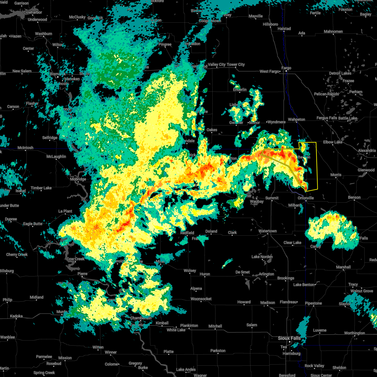 At 735 pm cdt, severe thunderstorms were located along a line extending from near claire city to near mud lake landing to clinton, moving northeast at 40 mph (radar indicated). Hazards include 60 mph wind gusts. Expect damage to roofs, siding, and trees. these severe storms will be near, wheaton, rosholt, whiterock colony and mud lake landing around 740 pm cdt. other locations in the path of these severe thunderstorms include immanuel church, collis and dumont. hail threat, radar indicated max hail size, <. 75 in wind threat, radar indicated max wind gust, 60 mph. At 735 pm cdt, severe thunderstorms were located along a line extending from near claire city to near mud lake landing to clinton, moving northeast at 40 mph (radar indicated). Hazards include 60 mph wind gusts. Expect damage to roofs, siding, and trees. these severe storms will be near, wheaton, rosholt, whiterock colony and mud lake landing around 740 pm cdt. other locations in the path of these severe thunderstorms include immanuel church, collis and dumont. hail threat, radar indicated max hail size, <. 75 in wind threat, radar indicated max wind gust, 60 mph.
|
| 5/30/2022 7:35 PM CDT |
 At 735 pm cdt, severe thunderstorms were located along a line extending from lake traverse reservation to whiterock colony, moving northeast at 35 mph (radar indicated). Hazards include 60 mph wind gusts and nickel size hail. expect damage to roofs, siding, and trees At 735 pm cdt, severe thunderstorms were located along a line extending from lake traverse reservation to whiterock colony, moving northeast at 35 mph (radar indicated). Hazards include 60 mph wind gusts and nickel size hail. expect damage to roofs, siding, and trees
|
| 5/30/2022 7:20 PM CDT |
 At 720 pm cdt, severe thunderstorms were located along a line extending from near claire city to near rainbow island to lagoona beach, moving northeast at 45 mph (radar indicated). Hazards include 60 mph wind gusts. Expect damage to roofs, siding, and trees. severe thunderstorms will be near, lake traverse, halls landing, rainbow island and siloah country church around 725 pm cdt. clinton, silver bridge and big stone colony around 730 pm cdt. graceville, new effington, dumont and mud lake landing around 735 pm cdt. wheaton around 740 pm cdt. other locations in the path of these severe thunderstorms include johnson, trinity lutheran country church, immanuel church, charlesville and tintah. hail threat, radar indicated max hail size, <. 75 in wind threat, radar indicated max wind gust, 60 mph. At 720 pm cdt, severe thunderstorms were located along a line extending from near claire city to near rainbow island to lagoona beach, moving northeast at 45 mph (radar indicated). Hazards include 60 mph wind gusts. Expect damage to roofs, siding, and trees. severe thunderstorms will be near, lake traverse, halls landing, rainbow island and siloah country church around 725 pm cdt. clinton, silver bridge and big stone colony around 730 pm cdt. graceville, new effington, dumont and mud lake landing around 735 pm cdt. wheaton around 740 pm cdt. other locations in the path of these severe thunderstorms include johnson, trinity lutheran country church, immanuel church, charlesville and tintah. hail threat, radar indicated max hail size, <. 75 in wind threat, radar indicated max wind gust, 60 mph.
|
| 5/30/2022 4:12 PM CDT |
 The severe thunderstorm warning for traverse, northern big stone and northeastern roberts counties will expire at 415 pm cdt, the storms which prompted the warning have moved out of the area. therefore, the warning will be allowed to expire. however gusty winds are still possible with these thunderstorms. a tornado watch remains in effect until 1000 pm cdt for west central minnesota, and northeastern south dakota. to report severe weather, contact your nearest law enforcement agency. they will relay your report to the national weather service aberdeen. The severe thunderstorm warning for traverse, northern big stone and northeastern roberts counties will expire at 415 pm cdt, the storms which prompted the warning have moved out of the area. therefore, the warning will be allowed to expire. however gusty winds are still possible with these thunderstorms. a tornado watch remains in effect until 1000 pm cdt for west central minnesota, and northeastern south dakota. to report severe weather, contact your nearest law enforcement agency. they will relay your report to the national weather service aberdeen.
|
| 5/30/2022 3:45 PM CDT |
 At 345 pm cdt, severe thunderstorms were located along a line extending from near traverse country park to near dumont to near chokio to near lake oliver, moving north at 65 mph (radar indicated). Hazards include 70 mph wind gusts. Expect considerable tree damage. damage is likely to mobile homes, roofs, and outbuildings. severe thunderstorms will be near, wheaton, dumont and mud lake landing around 350 pm cdt. silver bridge around 355 pm cdt. rosholt and immanuel church around 400 pm cdt. Tintah and whiterock colony around 405 pm cdt. At 345 pm cdt, severe thunderstorms were located along a line extending from near traverse country park to near dumont to near chokio to near lake oliver, moving north at 65 mph (radar indicated). Hazards include 70 mph wind gusts. Expect considerable tree damage. damage is likely to mobile homes, roofs, and outbuildings. severe thunderstorms will be near, wheaton, dumont and mud lake landing around 350 pm cdt. silver bridge around 355 pm cdt. rosholt and immanuel church around 400 pm cdt. Tintah and whiterock colony around 405 pm cdt.
|
| 5/30/2022 3:43 PM CDT |
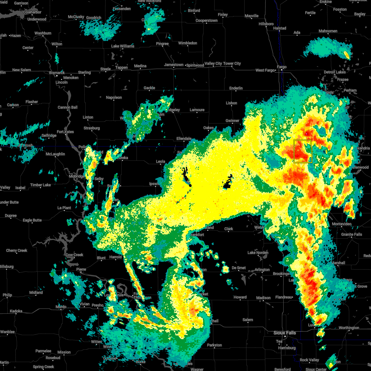 At 343 pm cdt, a severe thunderstorm was located 7 miles east of wheaton, moving north at 45 mph (radar indicated). Hazards include 60 mph wind gusts. Expect damage to roofs, siding, and trees. this severe thunderstorm will be near, immanuel church around 355 pm cdt. tintah around 400 pm cdt. hail threat, radar indicated max hail size, <. 75 in wind threat, radar indicated max wind gust, 60 mph. At 343 pm cdt, a severe thunderstorm was located 7 miles east of wheaton, moving north at 45 mph (radar indicated). Hazards include 60 mph wind gusts. Expect damage to roofs, siding, and trees. this severe thunderstorm will be near, immanuel church around 355 pm cdt. tintah around 400 pm cdt. hail threat, radar indicated max hail size, <. 75 in wind threat, radar indicated max wind gust, 60 mph.
|
| 5/30/2022 3:33 PM CDT |
 At 333 pm cdt, a severe thunderstorm was located near wheaton, moving north at 40 mph (radar indicated). Hazards include 60 mph wind gusts and half dollar size hail. Hail damage to vehicles is expected. expect wind damage to roofs, siding, and trees. Locations impacted include, whiterock colony and immanuel church. At 333 pm cdt, a severe thunderstorm was located near wheaton, moving north at 40 mph (radar indicated). Hazards include 60 mph wind gusts and half dollar size hail. Hail damage to vehicles is expected. expect wind damage to roofs, siding, and trees. Locations impacted include, whiterock colony and immanuel church.
|
| 5/30/2022 3:17 PM CDT |
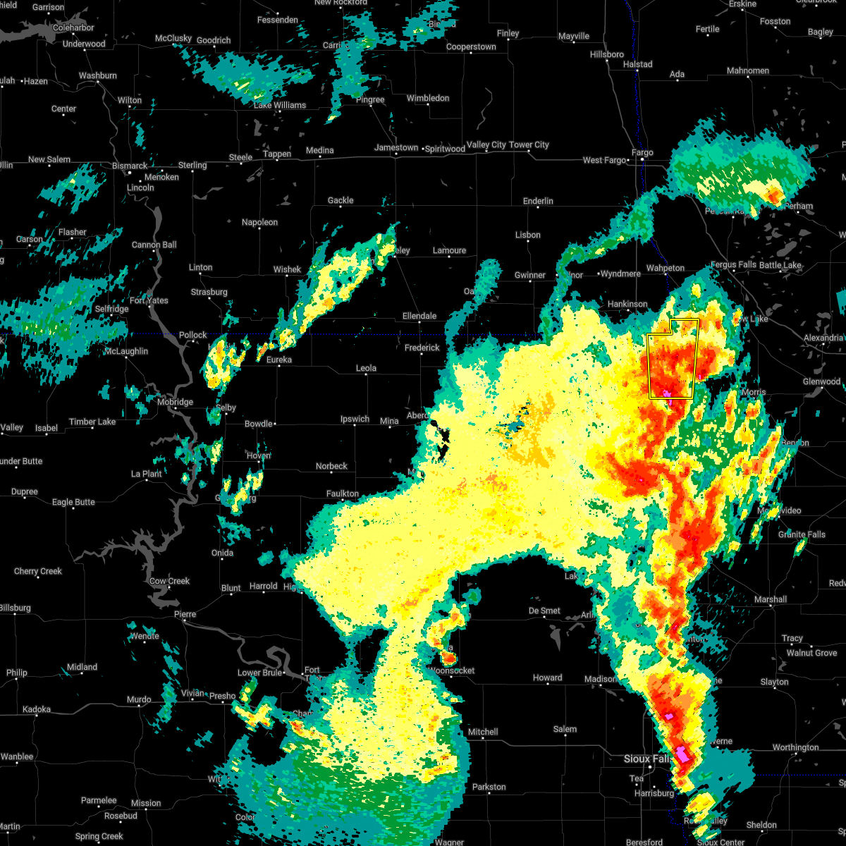 At 316 pm cdt, a severe thunderstorm was located over siloah country church, or 11 miles south of wheaton, moving north at 40 mph (radar indicated). Hazards include 60 mph wind gusts and quarter size hail. Hail damage to vehicles is expected. expect wind damage to roofs, siding, and trees. this severe thunderstorm will be near, dumont, lake traverse and halls landing around 325 pm cdt. silver bridge around 330 pm cdt. wheaton and mud lake landing around 335 pm cdt. Other locations in the path of this severe thunderstorm include whiterock colony and immanuel church. At 316 pm cdt, a severe thunderstorm was located over siloah country church, or 11 miles south of wheaton, moving north at 40 mph (radar indicated). Hazards include 60 mph wind gusts and quarter size hail. Hail damage to vehicles is expected. expect wind damage to roofs, siding, and trees. this severe thunderstorm will be near, dumont, lake traverse and halls landing around 325 pm cdt. silver bridge around 330 pm cdt. wheaton and mud lake landing around 335 pm cdt. Other locations in the path of this severe thunderstorm include whiterock colony and immanuel church.
|
| 5/30/2022 2:07 PM CDT |
 At 207 pm cdt, a severe thunderstorm was located over beardsley, or 19 miles southeast of sisseton, moving north at 55 mph (radar indicated). Hazards include half dollar size hail. Damage to vehicles is expected. this severe storm will be near, siloah country church around 215 pm cdt. other locations in the path of this severe thunderstorm include rainbow island, lake traverse, halls landing, silver bridge, wheaton, mud lake landing, rosholt and whiterock colony. hail threat, radar indicated max hail size, 1. 25 in wind threat, radar indicated max wind gust, <50 mph. At 207 pm cdt, a severe thunderstorm was located over beardsley, or 19 miles southeast of sisseton, moving north at 55 mph (radar indicated). Hazards include half dollar size hail. Damage to vehicles is expected. this severe storm will be near, siloah country church around 215 pm cdt. other locations in the path of this severe thunderstorm include rainbow island, lake traverse, halls landing, silver bridge, wheaton, mud lake landing, rosholt and whiterock colony. hail threat, radar indicated max hail size, 1. 25 in wind threat, radar indicated max wind gust, <50 mph.
|
| 5/30/2022 1:55 PM CDT |
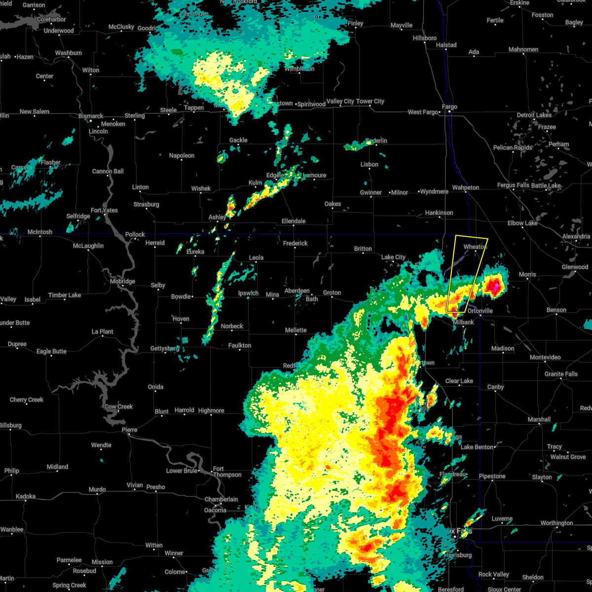 At 155 pm cdt, a severe thunderstorm was located near corona, or 11 miles north of milbank, moving north at 55 mph (radar indicated). Hazards include half dollar size hail. Damage to vehicles is expected. this severe thunderstorm will be near, big stone lake, bonanza grove and lismore colony around 200 pm cdt. yankeetown around 205 pm cdt. beardsley and barry around 210 pm cdt. other locations in the path of this severe thunderstorm include siloah country church, halls landing, rainbow island, traverse country park, silver bridge, lake traverse, wheaton, mud lake landing and whiterock colony. hail threat, radar indicated max hail size, 1. 25 in wind threat, radar indicated max wind gust, <50 mph. At 155 pm cdt, a severe thunderstorm was located near corona, or 11 miles north of milbank, moving north at 55 mph (radar indicated). Hazards include half dollar size hail. Damage to vehicles is expected. this severe thunderstorm will be near, big stone lake, bonanza grove and lismore colony around 200 pm cdt. yankeetown around 205 pm cdt. beardsley and barry around 210 pm cdt. other locations in the path of this severe thunderstorm include siloah country church, halls landing, rainbow island, traverse country park, silver bridge, lake traverse, wheaton, mud lake landing and whiterock colony. hail threat, radar indicated max hail size, 1. 25 in wind threat, radar indicated max wind gust, <50 mph.
|
| 5/12/2022 7:15 PM CDT |
 At 715 pm cdt, severe thunderstorms were located along a line extending from near crete to near donnelly, moving north at 55 mph (radar indicated). Hazards include 70 mph wind gusts and quarter size hail. Hail damage to vehicles is expected. expect considerable tree damage. wind damage is also likely to mobile homes, roofs, and outbuildings. locations impacted include, crete, englevale, elbow lake, erdahl, elliott, fort ransom, ashby and dalton. this includes the following highways, interstate 29 between mile markers 0 and 34. Interstate 94 in minnesota between mile markers 49 and 81. At 715 pm cdt, severe thunderstorms were located along a line extending from near crete to near donnelly, moving north at 55 mph (radar indicated). Hazards include 70 mph wind gusts and quarter size hail. Hail damage to vehicles is expected. expect considerable tree damage. wind damage is also likely to mobile homes, roofs, and outbuildings. locations impacted include, crete, englevale, elbow lake, erdahl, elliott, fort ransom, ashby and dalton. this includes the following highways, interstate 29 between mile markers 0 and 34. Interstate 94 in minnesota between mile markers 49 and 81.
|
| 5/12/2022 7:08 PM CDT |
 At 706 pm cdt, tornado producing storms were located along a line extending from near rosholt to immanuel church, moving north at 65 mph (weather spotters confirmed tornado. at 652 pm, a tornado was reported 5 mile to the south, southeast of new effington). Hazards include damaging tornado. Flying debris will be dangerous to those caught without shelter. mobile homes will be damaged or destroyed. damage to roofs, windows, and vehicles will occur. tree damage is likely. These tornadic storms will be near, tintah around 715 pm cdt. At 706 pm cdt, tornado producing storms were located along a line extending from near rosholt to immanuel church, moving north at 65 mph (weather spotters confirmed tornado. at 652 pm, a tornado was reported 5 mile to the south, southeast of new effington). Hazards include damaging tornado. Flying debris will be dangerous to those caught without shelter. mobile homes will be damaged or destroyed. damage to roofs, windows, and vehicles will occur. tree damage is likely. These tornadic storms will be near, tintah around 715 pm cdt.
|
| 5/12/2022 7:07 PM CDT |
 At 706 pm cdt, severe thunderstorms capable of producing both tornadoes and extensive straight line wind damage were located along a line extending from 6 miles south of lidgerwood to near immanuel church, moving north at 60 mph (radar indicated rotation). Hazards include tornado. Flying debris will be dangerous to those caught without shelter. mobile homes will be damaged or destroyed. damage to roofs, windows, and vehicles will occur. tree damage is likely. these dangerous storms will be near, tenney around 710 pm cdt. nashua and campbell around 715 pm cdt. mantador and wyndmere around 720 pm cdt. barney, foxhome and mooreton around 725 pm cdt. other locations in the path of these tornadic storms include carlisle and galchutt. this includes the following highways, interstate 29 between mile markers 0 and 45. Interstate 94 in minnesota between mile markers 31 and 49. At 706 pm cdt, severe thunderstorms capable of producing both tornadoes and extensive straight line wind damage were located along a line extending from 6 miles south of lidgerwood to near immanuel church, moving north at 60 mph (radar indicated rotation). Hazards include tornado. Flying debris will be dangerous to those caught without shelter. mobile homes will be damaged or destroyed. damage to roofs, windows, and vehicles will occur. tree damage is likely. these dangerous storms will be near, tenney around 710 pm cdt. nashua and campbell around 715 pm cdt. mantador and wyndmere around 720 pm cdt. barney, foxhome and mooreton around 725 pm cdt. other locations in the path of these tornadic storms include carlisle and galchutt. this includes the following highways, interstate 29 between mile markers 0 and 45. Interstate 94 in minnesota between mile markers 31 and 49.
|
| 5/12/2022 7:00 PM CDT |
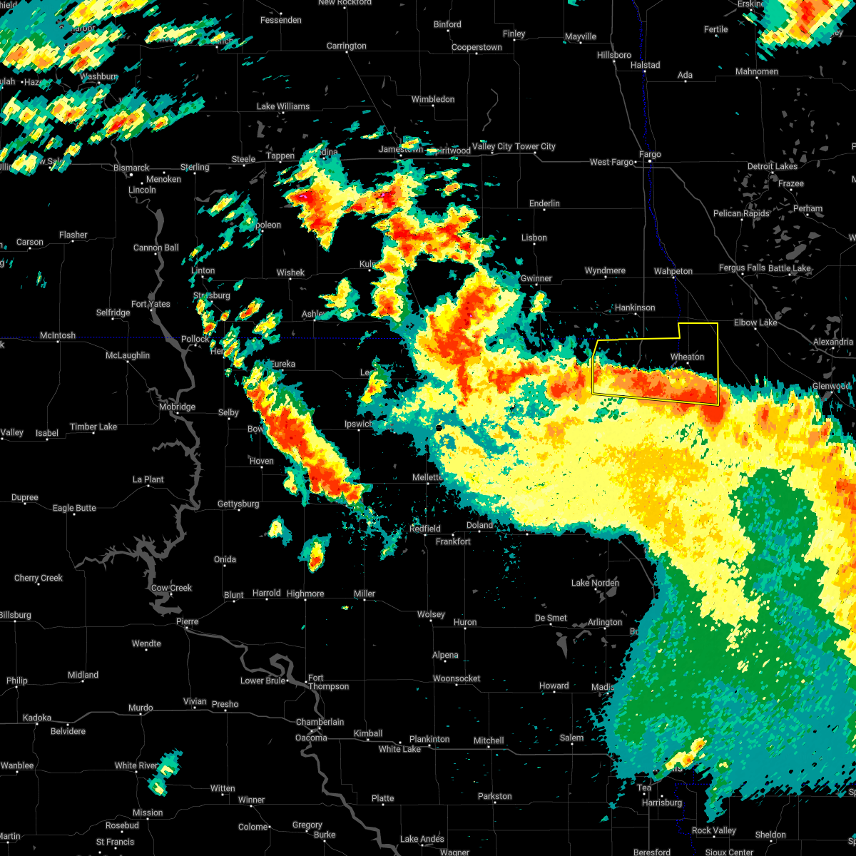 At 700 pm cdt, severe thunderstorms were located along a line extending from 7 miles northwest of new effington to 8 miles west of herman to hoffman, moving north at 70 mph. these are destructive storms for roberts and traverse counties (trained weather spotters). Hazards include 80 mph wind gusts and penny size hail. Flying debris will be dangerous to those caught without shelter. mobile homes will be heavily damaged. expect considerable damage to roofs, windows, and vehicles. extensive tree damage and power outages are likely. Locations impacted include, sisseton, wheaton, rosholt, new effington, dumont, claire city, tintah, victor, siloah country church, traverse country park, mud lake landing, trinity lutheran country church, lake traverse, collis, dakota connection & casino, charlesville, rainbow island, immanuel church, long hollow housing and whiterock colony. At 700 pm cdt, severe thunderstorms were located along a line extending from 7 miles northwest of new effington to 8 miles west of herman to hoffman, moving north at 70 mph. these are destructive storms for roberts and traverse counties (trained weather spotters). Hazards include 80 mph wind gusts and penny size hail. Flying debris will be dangerous to those caught without shelter. mobile homes will be heavily damaged. expect considerable damage to roofs, windows, and vehicles. extensive tree damage and power outages are likely. Locations impacted include, sisseton, wheaton, rosholt, new effington, dumont, claire city, tintah, victor, siloah country church, traverse country park, mud lake landing, trinity lutheran country church, lake traverse, collis, dakota connection & casino, charlesville, rainbow island, immanuel church, long hollow housing and whiterock colony.
|
| 5/12/2022 6:56 PM CDT |
 At 655 pm cdt, tornado producing storms were located along a line extending from near sica hollow state park to halls landing to near collis, moving north at 70 mph (broadcast media confirmed tornado. at 652 pm, a tornado was reported 10 miles north of sisseton). Hazards include damaging tornado. Flying debris will be dangerous to those caught without shelter. mobile homes will be damaged or destroyed. damage to roofs, windows, and vehicles will occur. tree damage is likely. these tornadic storms will be near, claire city around 700 pm cdt. rosholt, victor and whiterock colony around 705 pm cdt. immanuel church around 710 pm cdt. Other locations in the path of these tornadic storms include tintah. At 655 pm cdt, tornado producing storms were located along a line extending from near sica hollow state park to halls landing to near collis, moving north at 70 mph (broadcast media confirmed tornado. at 652 pm, a tornado was reported 10 miles north of sisseton). Hazards include damaging tornado. Flying debris will be dangerous to those caught without shelter. mobile homes will be damaged or destroyed. damage to roofs, windows, and vehicles will occur. tree damage is likely. these tornadic storms will be near, claire city around 700 pm cdt. rosholt, victor and whiterock colony around 705 pm cdt. immanuel church around 710 pm cdt. Other locations in the path of these tornadic storms include tintah.
|
| 5/12/2022 6:53 PM CDT |
 At 653 pm cdt, severe thunderstorms capable of producing both tornadoes and extensive straight line wind damage were located along a line extending from near sica hollow state park to halls landing to dumont, moving north at 70 mph (radar indicated rotation). Hazards include tornado. Flying debris will be dangerous to those caught without shelter. mobile homes will be damaged or destroyed. damage to roofs, windows, and vehicles will occur. tree damage is likely. these dangerous storms will be near, rosholt, claire city and victor around 700 pm cdt. immanuel church and whiterock colony around 705 pm cdt. Tintah around 710 pm cdt. At 653 pm cdt, severe thunderstorms capable of producing both tornadoes and extensive straight line wind damage were located along a line extending from near sica hollow state park to halls landing to dumont, moving north at 70 mph (radar indicated rotation). Hazards include tornado. Flying debris will be dangerous to those caught without shelter. mobile homes will be damaged or destroyed. damage to roofs, windows, and vehicles will occur. tree damage is likely. these dangerous storms will be near, rosholt, claire city and victor around 700 pm cdt. immanuel church and whiterock colony around 705 pm cdt. Tintah around 710 pm cdt.
|
| 5/12/2022 6:47 PM CDT |
 At 646 pm cdt, severe thunderstorms were located along a line from near britton south dakota to morris minnesota, moving north at 55 mph (radar indicated). Hazards include 70 mph wind gusts and quarter size hail. Hail damage to vehicles is expected. expect considerable tree damage. wind damage is also likely to mobile homes, roofs, and outbuildings. severe thunderstorms will be near, straubville around 705 pm cdt. other locations in the path of these severe thunderstorms include crete, stirum, hoffman, barrett, englevale, elbow lake and erdahl. this includes the following highways, interstate 29 between mile markers 0 and 34. Interstate 94 in minnesota between mile markers 49 and 81. At 646 pm cdt, severe thunderstorms were located along a line from near britton south dakota to morris minnesota, moving north at 55 mph (radar indicated). Hazards include 70 mph wind gusts and quarter size hail. Hail damage to vehicles is expected. expect considerable tree damage. wind damage is also likely to mobile homes, roofs, and outbuildings. severe thunderstorms will be near, straubville around 705 pm cdt. other locations in the path of these severe thunderstorms include crete, stirum, hoffman, barrett, englevale, elbow lake and erdahl. this includes the following highways, interstate 29 between mile markers 0 and 34. Interstate 94 in minnesota between mile markers 49 and 81.
|
| 5/12/2022 6:46 PM CDT |
 At 645 pm cdt, severe thunderstorms were located along a line extending from near long hollow housing to collis to near morris, moving north at 70 mph. these are destructive storms for roberts, big stone and traverse counties (trained weather spotters). Hazards include 80 mph wind gusts and penny size hail. Flying debris will be dangerous to those caught without shelter. mobile homes will be heavily damaged. expect considerable damage to roofs, windows, and vehicles. extensive tree damage and power outages are likely. Locations impacted include, wheaton, immanuel church, tintah and charlesville. At 645 pm cdt, severe thunderstorms were located along a line extending from near long hollow housing to collis to near morris, moving north at 70 mph. these are destructive storms for roberts, big stone and traverse counties (trained weather spotters). Hazards include 80 mph wind gusts and penny size hail. Flying debris will be dangerous to those caught without shelter. mobile homes will be heavily damaged. expect considerable damage to roofs, windows, and vehicles. extensive tree damage and power outages are likely. Locations impacted include, wheaton, immanuel church, tintah and charlesville.
|
| 5/12/2022 6:17 PM CDT |
 At 616 pm cdt, severe thunderstorms were located along a line extending from bitter lake to near milbank to near correll, moving north at 75 mph. these are destructive storms for grant, roberts, big stone and traverse counties (trained weather spotters). Hazards include 80 mph wind gusts and penny size hail. Flying debris will be dangerous to those caught without shelter. mobile homes will be heavily damaged. expect considerable damage to roofs, windows, and vehicles. extensive tree damage and power outages are likely. severe thunderstorms will be near, correll around 620 pm cdt. big stone city, enemy swim lake, artichoke lake and rudebusch corner around 625 pm cdt. ortonville, artichoke, lagoona beach, lismore colony, big stone lake and finley heights housing around 630 pm cdt. clinton and agency village around 635 pm cdt. Other locations in the path of these severe thunderstorms include sisseton, graceville, barry, big stone colony, long hollow housing, sica hollow state park, dakota connection & casino, johnson, collis, trinity lutheran country church, siloah country church, dumont, claire city, wheaton and new effington. At 616 pm cdt, severe thunderstorms were located along a line extending from bitter lake to near milbank to near correll, moving north at 75 mph. these are destructive storms for grant, roberts, big stone and traverse counties (trained weather spotters). Hazards include 80 mph wind gusts and penny size hail. Flying debris will be dangerous to those caught without shelter. mobile homes will be heavily damaged. expect considerable damage to roofs, windows, and vehicles. extensive tree damage and power outages are likely. severe thunderstorms will be near, correll around 620 pm cdt. big stone city, enemy swim lake, artichoke lake and rudebusch corner around 625 pm cdt. ortonville, artichoke, lagoona beach, lismore colony, big stone lake and finley heights housing around 630 pm cdt. clinton and agency village around 635 pm cdt. Other locations in the path of these severe thunderstorms include sisseton, graceville, barry, big stone colony, long hollow housing, sica hollow state park, dakota connection & casino, johnson, collis, trinity lutheran country church, siloah country church, dumont, claire city, wheaton and new effington.
|
| 5/9/2022 7:36 AM CDT |
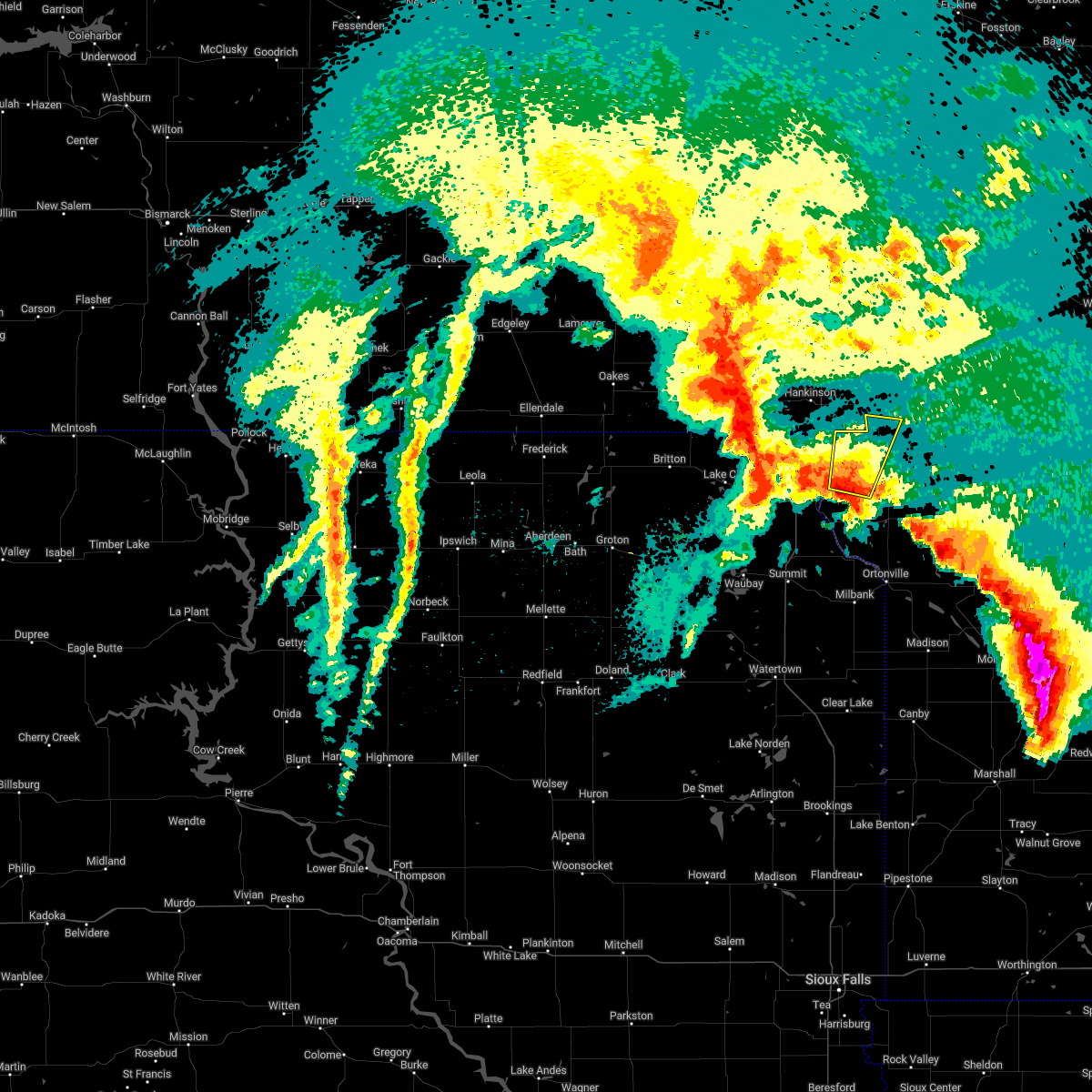 At 736 am cdt, a severe thunderstorm was located over halls landing, or 9 miles southwest of wheaton, moving north at 45 mph (radar indicated). Hazards include 60 mph wind gusts and quarter size hail. Hail damage to vehicles is expected. expect wind damage to roofs, siding, and trees. this severe thunderstorm will be near, silver bridge around 740 am cdt. rosholt and mud lake landing around 745 am cdt. wheaton around 750 am cdt. whiterock colony around 755 am cdt. other locations in the path of this severe thunderstorm include immanuel church. hail threat, radar indicated max hail size, 1. 00 in wind threat, radar indicated max wind gust, 60 mph. At 736 am cdt, a severe thunderstorm was located over halls landing, or 9 miles southwest of wheaton, moving north at 45 mph (radar indicated). Hazards include 60 mph wind gusts and quarter size hail. Hail damage to vehicles is expected. expect wind damage to roofs, siding, and trees. this severe thunderstorm will be near, silver bridge around 740 am cdt. rosholt and mud lake landing around 745 am cdt. wheaton around 750 am cdt. whiterock colony around 755 am cdt. other locations in the path of this severe thunderstorm include immanuel church. hail threat, radar indicated max hail size, 1. 00 in wind threat, radar indicated max wind gust, 60 mph.
|
| 10/13/2021 4:09 PM CDT |
 At 407 pm cdt, a severe squall line capable of producing tornadoes was located along a line extending from 6 miles northwest of victor to rosholt to near wheaton to near trinity lutheran country church, moving north at 35 mph (radar indicated rotation). Hazards include tornado. Flying debris will be dangerous to those caught without shelter. mobile homes will be damaged or destroyed. damage to roofs, windows, and vehicles will occur. tree damage is likely. Locations impacted include, whiterock colony, immanuel church, tintah and charlesville. At 407 pm cdt, a severe squall line capable of producing tornadoes was located along a line extending from 6 miles northwest of victor to rosholt to near wheaton to near trinity lutheran country church, moving north at 35 mph (radar indicated rotation). Hazards include tornado. Flying debris will be dangerous to those caught without shelter. mobile homes will be damaged or destroyed. damage to roofs, windows, and vehicles will occur. tree damage is likely. Locations impacted include, whiterock colony, immanuel church, tintah and charlesville.
|
| 10/13/2021 4:09 PM CDT |
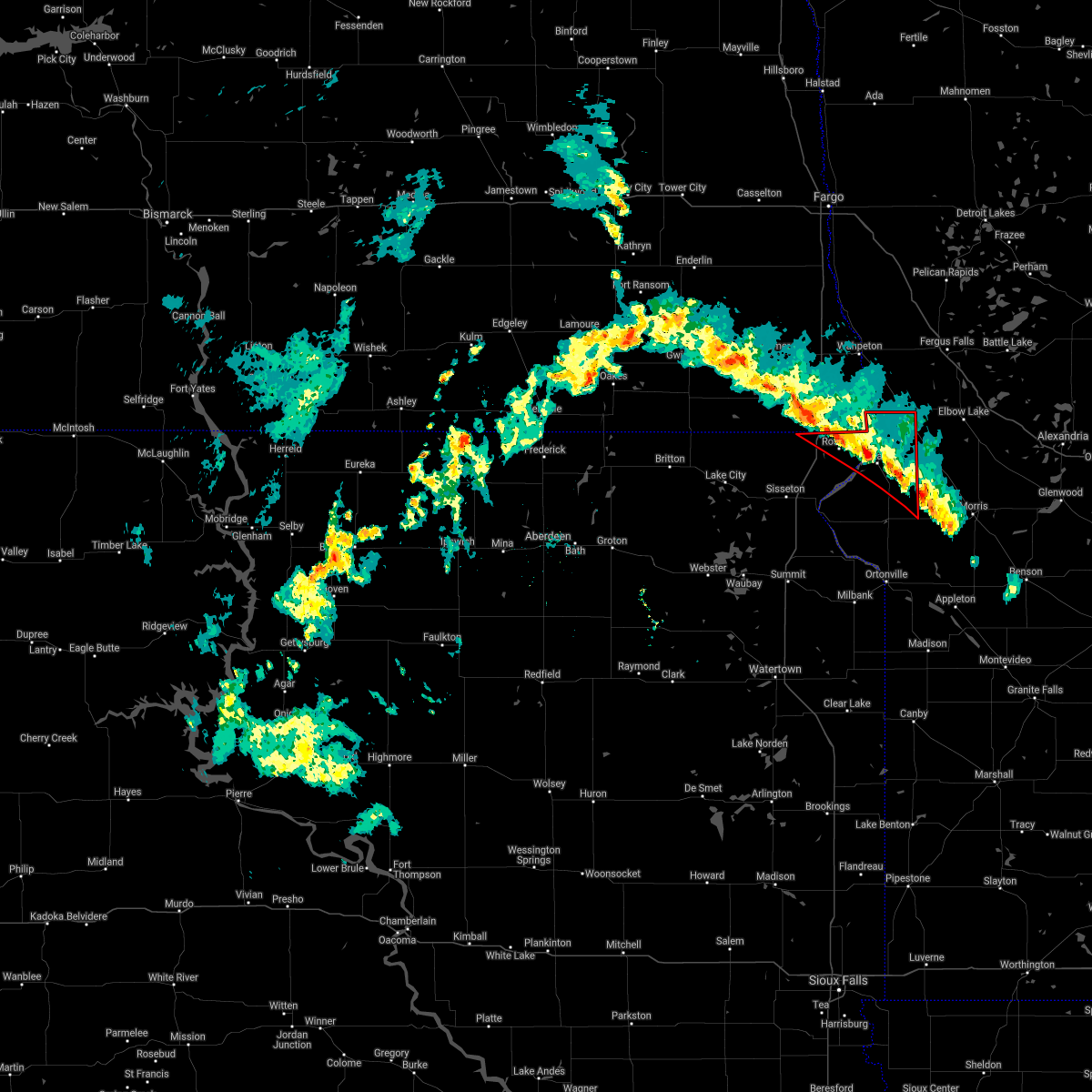 At 407 pm cdt, a severe squall line capable of producing tornadoes was located along a line extending from 6 miles northwest of victor to rosholt to near wheaton to near trinity lutheran country church, moving north at 35 mph (radar indicated rotation). Hazards include tornado. Flying debris will be dangerous to those caught without shelter. mobile homes will be damaged or destroyed. damage to roofs, windows, and vehicles will occur. tree damage is likely. Locations impacted include, whiterock colony, immanuel church, tintah and charlesville. At 407 pm cdt, a severe squall line capable of producing tornadoes was located along a line extending from 6 miles northwest of victor to rosholt to near wheaton to near trinity lutheran country church, moving north at 35 mph (radar indicated rotation). Hazards include tornado. Flying debris will be dangerous to those caught without shelter. mobile homes will be damaged or destroyed. damage to roofs, windows, and vehicles will occur. tree damage is likely. Locations impacted include, whiterock colony, immanuel church, tintah and charlesville.
|
| 10/13/2021 3:50 PM CDT |
 At 349 pm cdt, severe thunderstorms capable of producing tornadoes were located along a line extending from 7 miles northwest of claire city to near victor to near siloah country church to 7 miles east of clinton, moving north at 45 mph (radar indicated rotation). Hazards include tornado. Flying debris will be dangerous to those caught without shelter. mobile homes will be damaged or destroyed. damage to roofs, windows, and vehicles will occur. tree damage is likely. these dangerous storms will be near, rosholt, new effington and victor around 355 pm cdt. whiterock colony around 400 pm cdt. wheaton and mud lake landing around 405 pm cdt. Other locations in the path of these tornadic storms include immanuel church, tintah and charlesville. At 349 pm cdt, severe thunderstorms capable of producing tornadoes were located along a line extending from 7 miles northwest of claire city to near victor to near siloah country church to 7 miles east of clinton, moving north at 45 mph (radar indicated rotation). Hazards include tornado. Flying debris will be dangerous to those caught without shelter. mobile homes will be damaged or destroyed. damage to roofs, windows, and vehicles will occur. tree damage is likely. these dangerous storms will be near, rosholt, new effington and victor around 355 pm cdt. whiterock colony around 400 pm cdt. wheaton and mud lake landing around 405 pm cdt. Other locations in the path of these tornadic storms include immanuel church, tintah and charlesville.
|
| 10/9/2021 7:57 PM CDT |
 The severe thunderstorm warning for traverse, big stone, deuel, eastern roberts, eastern hamlin, eastern grant and southeastern codington counties will expire at 800 pm cdt, the storms which prompted the warning have weakened below severe limits, and no longer pose an immediate threat to life or property. therefore, the warning will be allowed to expire. a severe thunderstorm watch remains in effect until 1000 pm cdt for west central minnesota, and northeastern south dakota. to report severe weather, contact your nearest law enforcement agency. they will relay your report to the national weather service aberdeen. The severe thunderstorm warning for traverse, big stone, deuel, eastern roberts, eastern hamlin, eastern grant and southeastern codington counties will expire at 800 pm cdt, the storms which prompted the warning have weakened below severe limits, and no longer pose an immediate threat to life or property. therefore, the warning will be allowed to expire. a severe thunderstorm watch remains in effect until 1000 pm cdt for west central minnesota, and northeastern south dakota. to report severe weather, contact your nearest law enforcement agency. they will relay your report to the national weather service aberdeen.
|
| 10/9/2021 7:57 PM CDT |
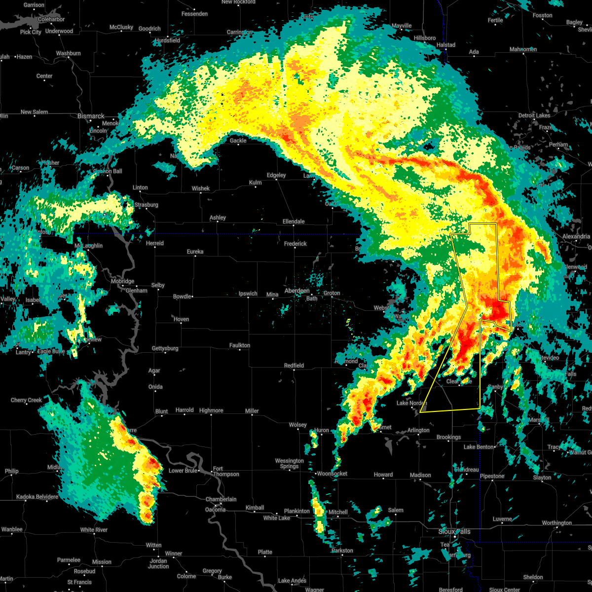 The severe thunderstorm warning for traverse, big stone, deuel, eastern roberts, eastern hamlin, eastern grant and southeastern codington counties will expire at 800 pm cdt, the storms which prompted the warning have weakened below severe limits, and no longer pose an immediate threat to life or property. therefore, the warning will be allowed to expire. a severe thunderstorm watch remains in effect until 1000 pm cdt for west central minnesota, and northeastern south dakota. to report severe weather, contact your nearest law enforcement agency. they will relay your report to the national weather service aberdeen. The severe thunderstorm warning for traverse, big stone, deuel, eastern roberts, eastern hamlin, eastern grant and southeastern codington counties will expire at 800 pm cdt, the storms which prompted the warning have weakened below severe limits, and no longer pose an immediate threat to life or property. therefore, the warning will be allowed to expire. a severe thunderstorm watch remains in effect until 1000 pm cdt for west central minnesota, and northeastern south dakota. to report severe weather, contact your nearest law enforcement agency. they will relay your report to the national weather service aberdeen.
|
| 10/9/2021 7:26 PM CDT |
 At 726 pm cdt, severe thunderstorms were located along a line extending from near mcleod to near doran to near norcross, moving northeast at 55 mph (radar indicated). Hazards include 70 mph wind gusts and penny size hail. Expect considerable tree damage. damage is likely to mobile homes, roofs, and outbuildings. severe thunderstorms will be near, norcross, doran and herman around 730 pm cdt. everdell around 735 pm cdt. foxhome around 740 pm cdt. elbow lake and wendell around 745 pm cdt. other locations in the path of these severe thunderstorms include carlisle, rothsay and elizabeth. this includes the following highways, interstate 29 between mile markers 7 and 40. Interstate 94 in minnesota between mile markers 40 and 81. At 726 pm cdt, severe thunderstorms were located along a line extending from near mcleod to near doran to near norcross, moving northeast at 55 mph (radar indicated). Hazards include 70 mph wind gusts and penny size hail. Expect considerable tree damage. damage is likely to mobile homes, roofs, and outbuildings. severe thunderstorms will be near, norcross, doran and herman around 730 pm cdt. everdell around 735 pm cdt. foxhome around 740 pm cdt. elbow lake and wendell around 745 pm cdt. other locations in the path of these severe thunderstorms include carlisle, rothsay and elizabeth. this includes the following highways, interstate 29 between mile markers 7 and 40. Interstate 94 in minnesota between mile markers 40 and 81.
|
| 10/9/2021 7:17 PM CDT |
 At 717 pm cdt, severe thunderstorms were located along a line extending from near fairmount to near lagoona beach to dempster, moving east at 40 mph (radar indicated). Hazards include 60 mph wind gusts and quarter size hail. Hail damage to vehicles is expected. expect wind damage to roofs, siding, and trees. severe thunderstorms will be near, ortonville, big stone city, clinton, lagoona beach and whiterock colony around 720 pm cdt. toronto, artichoke and artichoke lake around 735 pm cdt. Other locations in the path of these severe thunderstorms include clear lake, brandt, tintah, lake cochrane rec area and gary. At 717 pm cdt, severe thunderstorms were located along a line extending from near fairmount to near lagoona beach to dempster, moving east at 40 mph (radar indicated). Hazards include 60 mph wind gusts and quarter size hail. Hail damage to vehicles is expected. expect wind damage to roofs, siding, and trees. severe thunderstorms will be near, ortonville, big stone city, clinton, lagoona beach and whiterock colony around 720 pm cdt. toronto, artichoke and artichoke lake around 735 pm cdt. Other locations in the path of these severe thunderstorms include clear lake, brandt, tintah, lake cochrane rec area and gary.
|
| 10/9/2021 7:17 PM CDT |
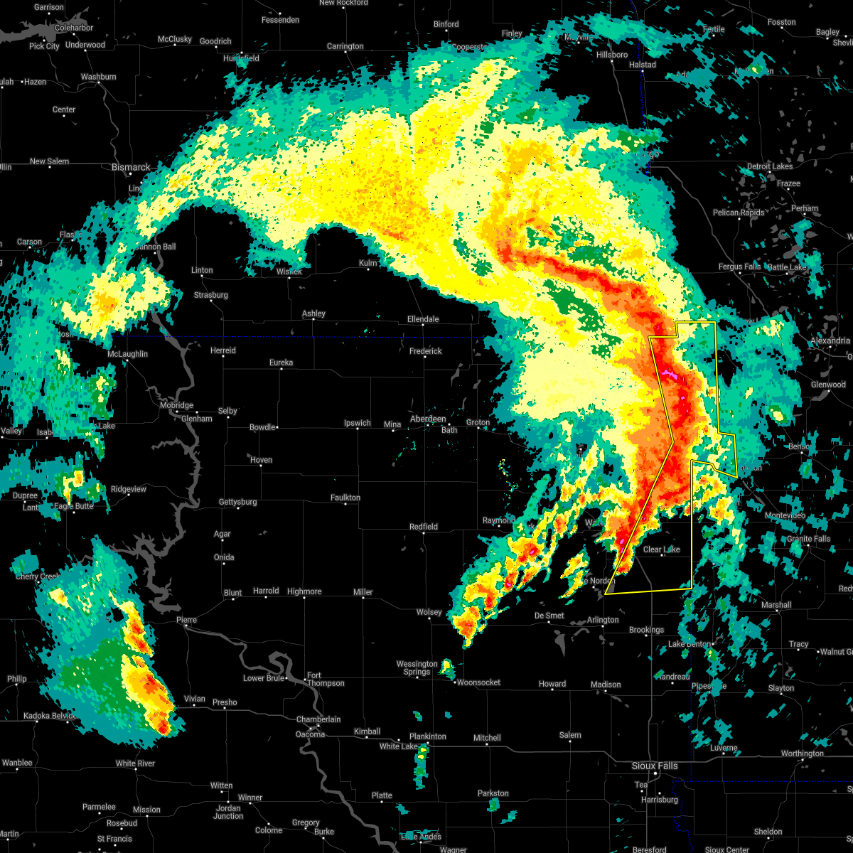 At 717 pm cdt, severe thunderstorms were located along a line extending from near fairmount to near lagoona beach to dempster, moving east at 40 mph (radar indicated). Hazards include 60 mph wind gusts and quarter size hail. Hail damage to vehicles is expected. expect wind damage to roofs, siding, and trees. severe thunderstorms will be near, ortonville, big stone city, clinton, lagoona beach and whiterock colony around 720 pm cdt. toronto, artichoke and artichoke lake around 735 pm cdt. Other locations in the path of these severe thunderstorms include clear lake, brandt, tintah, lake cochrane rec area and gary. At 717 pm cdt, severe thunderstorms were located along a line extending from near fairmount to near lagoona beach to dempster, moving east at 40 mph (radar indicated). Hazards include 60 mph wind gusts and quarter size hail. Hail damage to vehicles is expected. expect wind damage to roofs, siding, and trees. severe thunderstorms will be near, ortonville, big stone city, clinton, lagoona beach and whiterock colony around 720 pm cdt. toronto, artichoke and artichoke lake around 735 pm cdt. Other locations in the path of these severe thunderstorms include clear lake, brandt, tintah, lake cochrane rec area and gary.
|
| 10/9/2021 7:16 PM CDT |
 At 716 pm cdt, severe thunderstorms were located along a line extending from 7 miles north of milnor to near blackmer, moving northeast at 35 mph (radar indicated). Hazards include 70 mph wind gusts and penny size hail. Expect considerable tree damage. damage is likely to mobile homes, roofs, and outbuildings. locations impacted include, lisbon, hankinson, gwinner, milnor, lidgerwood, wyndmere and fairmount. This includes interstate 29 between mile markers 0 and 27. At 716 pm cdt, severe thunderstorms were located along a line extending from 7 miles north of milnor to near blackmer, moving northeast at 35 mph (radar indicated). Hazards include 70 mph wind gusts and penny size hail. Expect considerable tree damage. damage is likely to mobile homes, roofs, and outbuildings. locations impacted include, lisbon, hankinson, gwinner, milnor, lidgerwood, wyndmere and fairmount. This includes interstate 29 between mile markers 0 and 27.
|
| 10/9/2021 7:00 PM CDT |
 At 659 pm cdt, severe thunderstorms were located along a line extending from 6 miles south of hankinson to near lismore colony to near dempster, moving south at 45 mph (radar indicated). Hazards include 60 mph wind gusts and quarter size hail. Hail damage to vehicles is expected. expect wind damage to roofs, siding, and trees. Locations impacted include, estelline, lake poinsett, dempster, stone bridge, poinsett colony, milbank, odessa, lake traverse housing units, rainbow island, halls landing, lake traverse, traverse country park, browns valley, albee, beardsley and yankeetown. At 659 pm cdt, severe thunderstorms were located along a line extending from 6 miles south of hankinson to near lismore colony to near dempster, moving south at 45 mph (radar indicated). Hazards include 60 mph wind gusts and quarter size hail. Hail damage to vehicles is expected. expect wind damage to roofs, siding, and trees. Locations impacted include, estelline, lake poinsett, dempster, stone bridge, poinsett colony, milbank, odessa, lake traverse housing units, rainbow island, halls landing, lake traverse, traverse country park, browns valley, albee, beardsley and yankeetown.
|
| 10/9/2021 6:52 PM CDT |
 At 651 pm cdt, severe thunderstorms were located along a line extending from gwinner to lake traverse reservation, moving northeast at 35 mph (trained weather spotters). Hazards include 70 mph wind gusts and penny size hail. Expect considerable tree damage. damage is likely to mobile homes, roofs, and outbuildings. locations impacted include, lisbon, hankinson, gwinner, milnor, lidgerwood, forman and wyndmere. This includes interstate 29 between mile markers 0 and 27. At 651 pm cdt, severe thunderstorms were located along a line extending from gwinner to lake traverse reservation, moving northeast at 35 mph (trained weather spotters). Hazards include 70 mph wind gusts and penny size hail. Expect considerable tree damage. damage is likely to mobile homes, roofs, and outbuildings. locations impacted include, lisbon, hankinson, gwinner, milnor, lidgerwood, forman and wyndmere. This includes interstate 29 between mile markers 0 and 27.
|
| 10/9/2021 6:43 PM CDT |
 At 643 pm cdt, severe thunderstorms were located along a line extending from near gwinner to lake traverse reservation, moving northeast at 35 mph (radar indicated). Hazards include 60 mph wind gusts and penny size hail. expect damage to roofs, siding, and trees At 643 pm cdt, severe thunderstorms were located along a line extending from near gwinner to lake traverse reservation, moving northeast at 35 mph (radar indicated). Hazards include 60 mph wind gusts and penny size hail. expect damage to roofs, siding, and trees
|
| 10/9/2021 6:15 PM CDT |
 At 615 pm cdt, severe thunderstorms were located along a line extending from 6 miles southwest of rutland to near dakota connection & casino to near badger, moving east at 50 mph (radar indicated). Hazards include 60 mph wind gusts and penny size hail. Expect damage to roofs, siding, and trees. severe thunderstorms will be near, peever, dakota connection & casino and peever flats housing around 620 pm cdt. browns valley, lake poinsett, lake traverse housing units and stone bridge around 625 pm cdt. veblen, beardsley, traverse country park, rainbow island and veblen flats housing around 630 pm cdt. estelline around 635 pm cdt. Other locations in the path of these severe thunderstorms include barry, siloah country church, claire city, big stone colony, graceville, toronto, dumont, collis, new effington, johnson and trinity lutheran country church. At 615 pm cdt, severe thunderstorms were located along a line extending from 6 miles southwest of rutland to near dakota connection & casino to near badger, moving east at 50 mph (radar indicated). Hazards include 60 mph wind gusts and penny size hail. Expect damage to roofs, siding, and trees. severe thunderstorms will be near, peever, dakota connection & casino and peever flats housing around 620 pm cdt. browns valley, lake poinsett, lake traverse housing units and stone bridge around 625 pm cdt. veblen, beardsley, traverse country park, rainbow island and veblen flats housing around 630 pm cdt. estelline around 635 pm cdt. Other locations in the path of these severe thunderstorms include barry, siloah country church, claire city, big stone colony, graceville, toronto, dumont, collis, new effington, johnson and trinity lutheran country church.
|
| 8/24/2021 2:44 AM CDT |
 At 243 am cdt, severe thunderstorms were located along a line extending from 6 miles northeast of wolverton to near doran to white rock, moving east at 50 mph (radar indicated). Hazards include 60 mph wind gusts and penny size hail. Expect damage to roofs, siding, and trees. locations impacted include, doran, everdell, foxhome, western, norcross and herman. this includes the following highways, interstate 29 between mile markers 0 and 37. interstate 94 in minnesota between mile markers 40 and 80. hail threat, radar indicated max hail size, 0. 75 in wind threat, radar indicated max wind gust, 60 mph. At 243 am cdt, severe thunderstorms were located along a line extending from 6 miles northeast of wolverton to near doran to white rock, moving east at 50 mph (radar indicated). Hazards include 60 mph wind gusts and penny size hail. Expect damage to roofs, siding, and trees. locations impacted include, doran, everdell, foxhome, western, norcross and herman. this includes the following highways, interstate 29 between mile markers 0 and 37. interstate 94 in minnesota between mile markers 40 and 80. hail threat, radar indicated max hail size, 0. 75 in wind threat, radar indicated max wind gust, 60 mph.
|
| 8/24/2021 2:14 AM CDT |
 At 214 am cdt, severe thunderstorms were located along a line extending from near kindred to near mooreton to lake traverse reservation, moving east at 50 mph (radar indicated). Hazards include 60 mph wind gusts and nickel size hail. Expect damage to roofs, siding, and trees. severe thunderstorms will be near, mooreton around 215 am cdt. walcott and great bend around 220 am cdt. dwight around 225 am cdt. christine, wolverton and lamars around 230 am cdt. other locations in the path of these severe thunderstorms include breckenridge, wahpeton and blackmer. this includes the following highways, interstate 29 between mile markers 0 and 48. interstate 94 in minnesota between mile markers 28 and 80. hail threat, radar indicated max hail size, 0. 88 in wind threat, radar indicated max wind gust, 60 mph. At 214 am cdt, severe thunderstorms were located along a line extending from near kindred to near mooreton to lake traverse reservation, moving east at 50 mph (radar indicated). Hazards include 60 mph wind gusts and nickel size hail. Expect damage to roofs, siding, and trees. severe thunderstorms will be near, mooreton around 215 am cdt. walcott and great bend around 220 am cdt. dwight around 225 am cdt. christine, wolverton and lamars around 230 am cdt. other locations in the path of these severe thunderstorms include breckenridge, wahpeton and blackmer. this includes the following highways, interstate 29 between mile markers 0 and 48. interstate 94 in minnesota between mile markers 28 and 80. hail threat, radar indicated max hail size, 0. 88 in wind threat, radar indicated max wind gust, 60 mph.
|
| 8/22/2021 6:57 PM CDT |
 At 657 pm cdt, a severe thunderstorm was located over red iron housing, or 14 miles west of sisseton, moving east at 60 mph (radar indicated). Hazards include 70 mph wind gusts and quarter size hail. Hail damage to vehicles is expected. expect considerable tree damage. wind damage is also likely to mobile homes, roofs, and outbuildings. this severe thunderstorm will be near, sica hollow state park around 700 pm cdt. long hollow housing around 705 pm cdt. sisseton around 710 pm cdt. dakota connection & casino around 715 pm cdt. other locations in the path of this severe thunderstorm include new effington, lake traverse housing units, victor, rainbow island, traverse country park, rosholt, lake traverse, halls landing, mud lake landing, silver bridge and whiterock colony. thunderstorm damage threat, considerable hail threat, radar indicated max hail size, 1. 00 in wind threat, radar indicated max wind gust, 70 mph. At 657 pm cdt, a severe thunderstorm was located over red iron housing, or 14 miles west of sisseton, moving east at 60 mph (radar indicated). Hazards include 70 mph wind gusts and quarter size hail. Hail damage to vehicles is expected. expect considerable tree damage. wind damage is also likely to mobile homes, roofs, and outbuildings. this severe thunderstorm will be near, sica hollow state park around 700 pm cdt. long hollow housing around 705 pm cdt. sisseton around 710 pm cdt. dakota connection & casino around 715 pm cdt. other locations in the path of this severe thunderstorm include new effington, lake traverse housing units, victor, rainbow island, traverse country park, rosholt, lake traverse, halls landing, mud lake landing, silver bridge and whiterock colony. thunderstorm damage threat, considerable hail threat, radar indicated max hail size, 1. 00 in wind threat, radar indicated max wind gust, 70 mph.
|
| 7/24/2021 1:27 AM CDT |
 The severe thunderstorm warning for traverse, northern big stone and northeastern roberts counties will expire at 130 am cdt, the storm which prompted the warning has weakened below severe limits, and no longer poses an immediate threat to life or property. therefore, the warning will be allowed to expire. a severe thunderstorm watch remains in effect until 200 am cdt for northeastern south dakota. a severe thunderstorm watch also remains in effect until 500 am cdt for west central minnesota. to report severe weather, contact your nearest law enforcement agency. they will relay your report to the national weather service aberdeen. The severe thunderstorm warning for traverse, northern big stone and northeastern roberts counties will expire at 130 am cdt, the storm which prompted the warning has weakened below severe limits, and no longer poses an immediate threat to life or property. therefore, the warning will be allowed to expire. a severe thunderstorm watch remains in effect until 200 am cdt for northeastern south dakota. a severe thunderstorm watch also remains in effect until 500 am cdt for west central minnesota. to report severe weather, contact your nearest law enforcement agency. they will relay your report to the national weather service aberdeen.
|
| 7/24/2021 12:43 AM CDT |
 At 1243 am cdt, a severe thunderstorm was located over rosholt, or 9 miles west of wheaton, moving east at 35 mph (radar indicated). Hazards include 60 mph wind gusts and penny size hail. Expect damage to roofs, siding, and trees. this severe thunderstorm will be near, silver bridge around 1250 am cdt. mud lake landing around 1255 am cdt. wheaton around 100 am cdt. Other locations in the path of this severe thunderstorm include immanuel church. At 1243 am cdt, a severe thunderstorm was located over rosholt, or 9 miles west of wheaton, moving east at 35 mph (radar indicated). Hazards include 60 mph wind gusts and penny size hail. Expect damage to roofs, siding, and trees. this severe thunderstorm will be near, silver bridge around 1250 am cdt. mud lake landing around 1255 am cdt. wheaton around 100 am cdt. Other locations in the path of this severe thunderstorm include immanuel church.
|
| 7/24/2021 12:43 AM CDT |
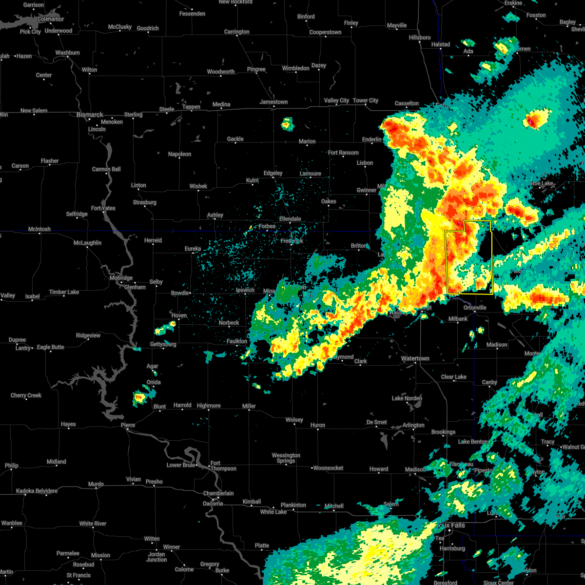 At 1243 am cdt, a severe thunderstorm was located over rosholt, or 9 miles west of wheaton, moving east at 35 mph (radar indicated). Hazards include 60 mph wind gusts and penny size hail. Expect damage to roofs, siding, and trees. this severe thunderstorm will be near, silver bridge around 1250 am cdt. mud lake landing around 1255 am cdt. wheaton around 100 am cdt. Other locations in the path of this severe thunderstorm include immanuel church. At 1243 am cdt, a severe thunderstorm was located over rosholt, or 9 miles west of wheaton, moving east at 35 mph (radar indicated). Hazards include 60 mph wind gusts and penny size hail. Expect damage to roofs, siding, and trees. this severe thunderstorm will be near, silver bridge around 1250 am cdt. mud lake landing around 1255 am cdt. wheaton around 100 am cdt. Other locations in the path of this severe thunderstorm include immanuel church.
|
| 7/19/2021 3:13 PM CDT |
 At 312 pm cdt, severe thunderstorms were located along a line extending from near glyndon to 6 miles east of comstock to mcleod, moving south at 40 mph (radar indicated). Hazards include 60 mph wind gusts and penny size hail. Expect damage to roofs, siding, and trees. severe thunderstorms will be near, wolverton around 315 pm cdt. de lamere around 325 pm cdt. barnesville, wyndmere and kent around 330 pm cdt. other locations in the path of these severe thunderstorms include hamlin, brushvale and lawndale. this includes the following highways, interstate 29 between mile markers 0 and 52. Interstate 94 in minnesota between mile markers 7 and 56. At 312 pm cdt, severe thunderstorms were located along a line extending from near glyndon to 6 miles east of comstock to mcleod, moving south at 40 mph (radar indicated). Hazards include 60 mph wind gusts and penny size hail. Expect damage to roofs, siding, and trees. severe thunderstorms will be near, wolverton around 315 pm cdt. de lamere around 325 pm cdt. barnesville, wyndmere and kent around 330 pm cdt. other locations in the path of these severe thunderstorms include hamlin, brushvale and lawndale. this includes the following highways, interstate 29 between mile markers 0 and 52. Interstate 94 in minnesota between mile markers 7 and 56.
|
| 6/11/2021 5:49 AM CDT |
 At 549 am cdt, severe thunderstorms were located along a line extending from near immanuel church to near bullhead lake, moving southeast at 25 mph (radar indicated). Hazards include 60 mph wind gusts and quarter size hail. Hail damage to vehicles is expected. expect wind damage to roofs, siding, and trees. severe thunderstorms will be near, strandburg and la bolt around 555 am cdt. Wheaton and revillo around 605 am cdt. At 549 am cdt, severe thunderstorms were located along a line extending from near immanuel church to near bullhead lake, moving southeast at 25 mph (radar indicated). Hazards include 60 mph wind gusts and quarter size hail. Hail damage to vehicles is expected. expect wind damage to roofs, siding, and trees. severe thunderstorms will be near, strandburg and la bolt around 555 am cdt. Wheaton and revillo around 605 am cdt.
|
| 6/11/2021 5:47 AM CDT |
 At 546 am cdt, severe thunderstorms were located along a line extending from hitterdal to near nashua, moving east at 55 mph (radar indicated). Hazards include 60 mph wind gusts and quarter size hail. Hail damage to vehicles is expected. Expect wind damage to roofs, siding, and trees. At 546 am cdt, severe thunderstorms were located along a line extending from hitterdal to near nashua, moving east at 55 mph (radar indicated). Hazards include 60 mph wind gusts and quarter size hail. Hail damage to vehicles is expected. Expect wind damage to roofs, siding, and trees.
|
| 6/11/2021 5:39 AM CDT |
 At 538 am cdt, severe thunderstorms were located along a line extending from 6 miles west of hitterdal to campbell, moving east at 60 mph (radar indicated). Hazards include 60 mph wind gusts and quarter size hail. Hail damage to vehicles is expected. Expect wind damage to roofs, siding, and trees. At 538 am cdt, severe thunderstorms were located along a line extending from 6 miles west of hitterdal to campbell, moving east at 60 mph (radar indicated). Hazards include 60 mph wind gusts and quarter size hail. Hail damage to vehicles is expected. Expect wind damage to roofs, siding, and trees.
|
| 6/11/2021 5:02 AM CDT |
 At 501 am cdt, severe thunderstorms were located along a line extending from near claire city to near florence, moving east at 60 mph (radar indicated). Hazards include 60 mph wind gusts and quarter size hail. Hail damage to vehicles is expected. expect wind damage to roofs, siding, and trees. severe thunderstorms will be near, new effington around 505 am cdt. victor around 510 am cdt. rosholt around 515 am cdt. south shore, waverly, whiterock colony and mud lake landing around 520 am cdt. Other locations in the path of these severe thunderstorms include wheaton, stockholm, troy, strandburg, twin brooks, immanuel church, la bolt, tintah, charlesville, revillo and albee. At 501 am cdt, severe thunderstorms were located along a line extending from near claire city to near florence, moving east at 60 mph (radar indicated). Hazards include 60 mph wind gusts and quarter size hail. Hail damage to vehicles is expected. expect wind damage to roofs, siding, and trees. severe thunderstorms will be near, new effington around 505 am cdt. victor around 510 am cdt. rosholt around 515 am cdt. south shore, waverly, whiterock colony and mud lake landing around 520 am cdt. Other locations in the path of these severe thunderstorms include wheaton, stockholm, troy, strandburg, twin brooks, immanuel church, la bolt, tintah, charlesville, revillo and albee.
|
| 8/23/2020 7:49 PM CDT |
 At 749 pm cdt, a severe thunderstorm was located over sonora, or 17 miles southwest of wahpeton, moving east at 15 mph (radar indicated). Hazards include quarter size hail. Damage to vehicles is expected. this severe thunderstorm will be near, sonora around 750 pm cdt. lamars around 810 pm cdt. fairmount around 815 pm cdt. blackmer around 820 pm cdt. tenney around 830 pm cdt. This includes interstate 29 between mile markers 2 and 14. At 749 pm cdt, a severe thunderstorm was located over sonora, or 17 miles southwest of wahpeton, moving east at 15 mph (radar indicated). Hazards include quarter size hail. Damage to vehicles is expected. this severe thunderstorm will be near, sonora around 750 pm cdt. lamars around 810 pm cdt. fairmount around 815 pm cdt. blackmer around 820 pm cdt. tenney around 830 pm cdt. This includes interstate 29 between mile markers 2 and 14.
|
| 7/26/2020 2:08 AM CDT |
 The severe thunderstorm warning for northeastern traverse county will expire at 215 am cdt, the storm which prompted the warning has moved out of the area. therefore, the warning will be allowed to expire. however gusty winds are still possible with this thunderstorm. The severe thunderstorm warning for northeastern traverse county will expire at 215 am cdt, the storm which prompted the warning has moved out of the area. therefore, the warning will be allowed to expire. however gusty winds are still possible with this thunderstorm.
|
| 7/26/2020 1:56 AM CDT |
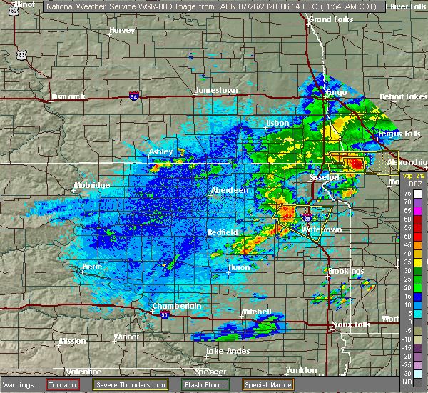 At 155 am cdt, a severe thunderstorm was located over charlesville, or 14 miles northeast of wheaton, moving east at 40 mph (radar indicated). Hazards include 60 mph wind gusts and quarter size hail. Hail damage to vehicles is expected. expect wind damage to roofs, siding, and trees. Locations impacted include, tintah and immanuel church. At 155 am cdt, a severe thunderstorm was located over charlesville, or 14 miles northeast of wheaton, moving east at 40 mph (radar indicated). Hazards include 60 mph wind gusts and quarter size hail. Hail damage to vehicles is expected. expect wind damage to roofs, siding, and trees. Locations impacted include, tintah and immanuel church.
|
| 7/26/2020 1:50 AM CDT |
 At 150 am cdt, a severe thunderstorm was located near charlesville, or 27 miles southeast of wahpeton, moving east at 35 mph (radar indicated). Hazards include golf ball size hail and 60 mph wind gusts. People and animals outdoors will be injured. expect hail damage to roofs, siding, windows, and vehicles. expect wind damage to roofs, siding, and trees. this severe storm will be near, norcross around 205 am cdt. wendell around 210 am cdt. elbow lake around 220 am cdt. barrett around 230 am cdt. erdahl and hoffman around 235 am cdt. This includes interstate 94 in minnesota between mile markers 71 and 80. At 150 am cdt, a severe thunderstorm was located near charlesville, or 27 miles southeast of wahpeton, moving east at 35 mph (radar indicated). Hazards include golf ball size hail and 60 mph wind gusts. People and animals outdoors will be injured. expect hail damage to roofs, siding, windows, and vehicles. expect wind damage to roofs, siding, and trees. this severe storm will be near, norcross around 205 am cdt. wendell around 210 am cdt. elbow lake around 220 am cdt. barrett around 230 am cdt. erdahl and hoffman around 235 am cdt. This includes interstate 94 in minnesota between mile markers 71 and 80.
|
| 7/26/2020 1:31 AM CDT |
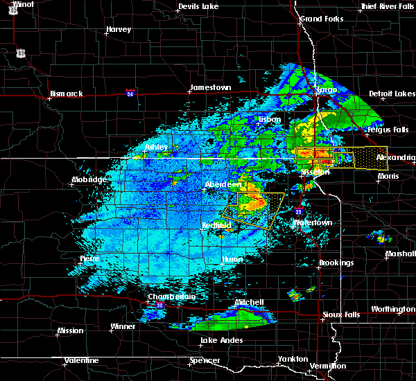 At 130 am cdt, a severe thunderstorm was located over white rock, or near wheaton, moving east at 50 mph (radar indicated). Hazards include 60 mph wind gusts and quarter size hail. Hail damage to vehicles is expected. Expect wind damage to roofs, siding, and trees. At 130 am cdt, a severe thunderstorm was located over white rock, or near wheaton, moving east at 50 mph (radar indicated). Hazards include 60 mph wind gusts and quarter size hail. Hail damage to vehicles is expected. Expect wind damage to roofs, siding, and trees.
|
| 7/26/2020 1:31 AM CDT |
 At 131 am cdt, a severe thunderstorm was located over blackmer, or 20 miles south of wahpeton, moving east at 35 mph (radar indicated). Hazards include 60 mph wind gusts and quarter size hail. Hail damage to vehicles is expected. expect wind damage to roofs, siding, and trees. this severe thunderstorm will be near, tenney around 145 am cdt. nashua around 155 am cdt. wendell around 210 am cdt. elbow lake around 220 am cdt. erdahl and barrett around 230 am cdt. this includes the following highways, interstate 29 between mile markers 0 and 11. Interstate 94 in minnesota between mile markers 71 and 80. At 131 am cdt, a severe thunderstorm was located over blackmer, or 20 miles south of wahpeton, moving east at 35 mph (radar indicated). Hazards include 60 mph wind gusts and quarter size hail. Hail damage to vehicles is expected. expect wind damage to roofs, siding, and trees. this severe thunderstorm will be near, tenney around 145 am cdt. nashua around 155 am cdt. wendell around 210 am cdt. elbow lake around 220 am cdt. erdahl and barrett around 230 am cdt. this includes the following highways, interstate 29 between mile markers 0 and 11. Interstate 94 in minnesota between mile markers 71 and 80.
|
| 7/26/2020 1:31 AM CDT |
 At 130 am cdt, a severe thunderstorm was located over white rock, or near wheaton, moving east at 50 mph (radar indicated). Hazards include 60 mph wind gusts and quarter size hail. Hail damage to vehicles is expected. Expect wind damage to roofs, siding, and trees. At 130 am cdt, a severe thunderstorm was located over white rock, or near wheaton, moving east at 50 mph (radar indicated). Hazards include 60 mph wind gusts and quarter size hail. Hail damage to vehicles is expected. Expect wind damage to roofs, siding, and trees.
|
| 7/17/2020 10:42 PM CDT |
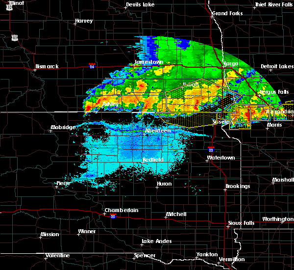 At 1042 pm cdt, a severe thunderstorm was located over silver bridge, or near wheaton, moving east at 35 mph (radar indicated). Hazards include 60 mph wind gusts and quarter size hail. Hail damage to vehicles is expected. Expect wind damage to roofs, siding, and trees. At 1042 pm cdt, a severe thunderstorm was located over silver bridge, or near wheaton, moving east at 35 mph (radar indicated). Hazards include 60 mph wind gusts and quarter size hail. Hail damage to vehicles is expected. Expect wind damage to roofs, siding, and trees.
|
| 7/17/2020 10:21 PM CDT |
 At 1021 pm cdt, a severe thunderstorm was located near tenney, or 21 miles south of wahpeton, moving east at 30 mph (radar indicated). Hazards include 60 mph wind gusts and quarter size hail. Hail damage to vehicles is expected. Expect wind damage to roofs, siding, and trees. At 1021 pm cdt, a severe thunderstorm was located near tenney, or 21 miles south of wahpeton, moving east at 30 mph (radar indicated). Hazards include 60 mph wind gusts and quarter size hail. Hail damage to vehicles is expected. Expect wind damage to roofs, siding, and trees.
|
| 7/17/2020 10:17 PM CDT |
 At 1017 pm cdt, a severe thunderstorm was located near whiterock colony, or 15 miles northwest of wheaton, moving southeast at 40 mph (radar indicated). Hazards include 60 mph wind gusts and quarter size hail. Hail damage to vehicles is expected. Expect wind damage to roofs, siding, and trees. At 1017 pm cdt, a severe thunderstorm was located near whiterock colony, or 15 miles northwest of wheaton, moving southeast at 40 mph (radar indicated). Hazards include 60 mph wind gusts and quarter size hail. Hail damage to vehicles is expected. Expect wind damage to roofs, siding, and trees.
|
| 7/17/2020 10:17 PM CDT |
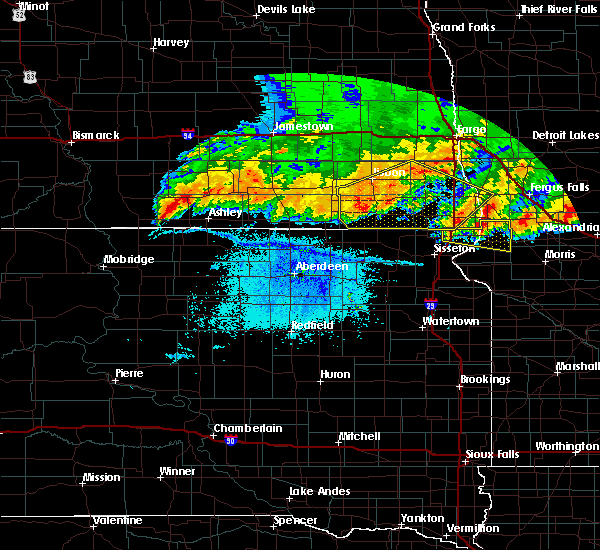 At 1017 pm cdt, a severe thunderstorm was located near whiterock colony, or 15 miles northwest of wheaton, moving southeast at 40 mph (radar indicated). Hazards include 60 mph wind gusts and quarter size hail. Hail damage to vehicles is expected. Expect wind damage to roofs, siding, and trees. At 1017 pm cdt, a severe thunderstorm was located near whiterock colony, or 15 miles northwest of wheaton, moving southeast at 40 mph (radar indicated). Hazards include 60 mph wind gusts and quarter size hail. Hail damage to vehicles is expected. Expect wind damage to roofs, siding, and trees.
|
| 7/9/2020 12:59 AM CDT |
 At 1238 am cdt, a severe thunderstorm was located near immanuel church, or 13 miles north of wheaton, moving northeast at 35 mph (radar indicated). Hazards include 60 mph wind gusts and half dollar size hail. Hail damage to vehicles is expected. expect wind damage to roofs, siding, and trees. This severe thunderstorm will be near, tintah around 1245 am cdt. At 1238 am cdt, a severe thunderstorm was located near immanuel church, or 13 miles north of wheaton, moving northeast at 35 mph (radar indicated). Hazards include 60 mph wind gusts and half dollar size hail. Hail damage to vehicles is expected. expect wind damage to roofs, siding, and trees. This severe thunderstorm will be near, tintah around 1245 am cdt.
|
| 7/9/2020 12:45 AM CDT |
 At 1244 am cdt, a severe thunderstorm was located over campbell, or 15 miles southeast of wahpeton, moving northeast at 35 mph (radar indicated). Hazards include golf ball size hail and 60 mph wind gusts. People and animals outdoors will be injured. expect hail damage to roofs, siding, windows, and vehicles. expect wind damage to roofs, siding, and trees. locations impacted include, fairmount, campbell, nashua, doran, lamars, blackmer and sonora. This includes interstate 29 between mile markers 1 and 7. At 1244 am cdt, a severe thunderstorm was located over campbell, or 15 miles southeast of wahpeton, moving northeast at 35 mph (radar indicated). Hazards include golf ball size hail and 60 mph wind gusts. People and animals outdoors will be injured. expect hail damage to roofs, siding, windows, and vehicles. expect wind damage to roofs, siding, and trees. locations impacted include, fairmount, campbell, nashua, doran, lamars, blackmer and sonora. This includes interstate 29 between mile markers 1 and 7.
|
| 7/9/2020 12:38 AM CDT |
 At 1238 am cdt, a severe thunderstorm was located near immanuel church, or 13 miles north of wheaton, moving northeast at 35 mph (radar indicated). Hazards include 60 mph wind gusts and half dollar size hail. Hail damage to vehicles is expected. expect wind damage to roofs, siding, and trees. This severe thunderstorm will be near, tintah around 1245 am cdt. At 1238 am cdt, a severe thunderstorm was located near immanuel church, or 13 miles north of wheaton, moving northeast at 35 mph (radar indicated). Hazards include 60 mph wind gusts and half dollar size hail. Hail damage to vehicles is expected. expect wind damage to roofs, siding, and trees. This severe thunderstorm will be near, tintah around 1245 am cdt.
|
| 7/9/2020 12:38 AM CDT |
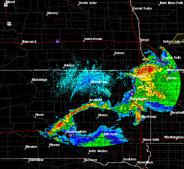 At 1238 am cdt, a severe thunderstorm was located near immanuel church, or 13 miles north of wheaton, moving northeast at 35 mph (radar indicated). Hazards include 60 mph wind gusts and half dollar size hail. Hail damage to vehicles is expected. expect wind damage to roofs, siding, and trees. This severe thunderstorm will be near, tintah around 1245 am cdt. At 1238 am cdt, a severe thunderstorm was located near immanuel church, or 13 miles north of wheaton, moving northeast at 35 mph (radar indicated). Hazards include 60 mph wind gusts and half dollar size hail. Hail damage to vehicles is expected. expect wind damage to roofs, siding, and trees. This severe thunderstorm will be near, tintah around 1245 am cdt.
|
| 7/9/2020 12:33 AM CDT |
 At 1233 am cdt, a severe thunderstorm was located over tenney, or 17 miles southeast of wahpeton, moving northeast at 35 mph (radar indicated). Hazards include ping pong ball size hail and 60 mph wind gusts. People and animals outdoors will be injured. expect hail damage to roofs, siding, windows, and vehicles. Expect wind damage to roofs, siding, and trees. At 1233 am cdt, a severe thunderstorm was located over tenney, or 17 miles southeast of wahpeton, moving northeast at 35 mph (radar indicated). Hazards include ping pong ball size hail and 60 mph wind gusts. People and animals outdoors will be injured. expect hail damage to roofs, siding, windows, and vehicles. Expect wind damage to roofs, siding, and trees.
|
| 7/8/2020 11:36 PM CDT |
 At 1136 pm cdt, a severe thunderstorm was located over lamars, or 23 miles south of wahpeton, moving east at 25 mph (radar indicated). Hazards include 60 mph wind gusts and quarter size hail. Hail damage to vehicles is expected. Expect wind damage to roofs, siding, and trees. At 1136 pm cdt, a severe thunderstorm was located over lamars, or 23 miles south of wahpeton, moving east at 25 mph (radar indicated). Hazards include 60 mph wind gusts and quarter size hail. Hail damage to vehicles is expected. Expect wind damage to roofs, siding, and trees.
|
| 7/8/2020 5:00 AM CDT |
 At 500 am cdt, a severe thunderstorm was located over white rock, or 25 miles south of wahpeton, moving east at 25 mph (radar indicated). Hazards include 60 mph wind gusts and penny size hail. Expect damage to roofs, siding, and trees. this severe thunderstorm will be near, norcross around 540 am cdt. herman around 545 am cdt. barrett and elbow lake around 600 am cdt. This includes interstate 94 in minnesota between mile markers 63 and 80. At 500 am cdt, a severe thunderstorm was located over white rock, or 25 miles south of wahpeton, moving east at 25 mph (radar indicated). Hazards include 60 mph wind gusts and penny size hail. Expect damage to roofs, siding, and trees. this severe thunderstorm will be near, norcross around 540 am cdt. herman around 545 am cdt. barrett and elbow lake around 600 am cdt. This includes interstate 94 in minnesota between mile markers 63 and 80.
|
| 7/8/2020 4:39 AM CDT |
 At 438 am cdt, severe thunderstorms were located along a line extending from near edwards to near charlesville, moving east at 50 mph. these are very dangerous storms (observed. at 435 am, 83 mph winds were reported at the fergus falls airport). Hazards include 80 mph wind gusts and nickel size hail. Flying debris will be dangerous to those caught without shelter. mobile homes will be heavily damaged. expect considerable damage to roofs, windows, and vehicles. extensive tree damage and power outages are likely. these severe storms will be near, maplewood state park, star lake and edwards around 440 am cdt. amor and phelps around 445 am cdt. ottertail lake and glendalough state park around 450 am cdt. richville and elbow lake around 455 am cdt. barrett and ottertail around 500 am cdt. other locations impacted by these severe thunderstorms include fergus falls airport. this includes the following highways, interstate 29 between mile markers 0 and 27. Interstate 94 in minnesota between mile markers 29 and 80. At 438 am cdt, severe thunderstorms were located along a line extending from near edwards to near charlesville, moving east at 50 mph. these are very dangerous storms (observed. at 435 am, 83 mph winds were reported at the fergus falls airport). Hazards include 80 mph wind gusts and nickel size hail. Flying debris will be dangerous to those caught without shelter. mobile homes will be heavily damaged. expect considerable damage to roofs, windows, and vehicles. extensive tree damage and power outages are likely. these severe storms will be near, maplewood state park, star lake and edwards around 440 am cdt. amor and phelps around 445 am cdt. ottertail lake and glendalough state park around 450 am cdt. richville and elbow lake around 455 am cdt. barrett and ottertail around 500 am cdt. other locations impacted by these severe thunderstorms include fergus falls airport. this includes the following highways, interstate 29 between mile markers 0 and 27. Interstate 94 in minnesota between mile markers 29 and 80.
|
| 7/8/2020 4:31 AM CDT |
 At 430 am cdt, severe thunderstorms were located along a line extending from edwards to 6 miles west of charlesville, moving east at 50 mph (radar indicated). Hazards include 70 mph wind gusts and nickel size hail. Expect considerable tree damage. damage is likely to mobile homes, roofs, and outbuildings. these severe storms will be near, maplewood state park and edwards around 435 am cdt. star lake and phelps around 440 am cdt. amor, ottertail lake and herman around 445 am cdt. richville and glendalough state park around 450 am cdt. ottertail and elbow lake around 455 am cdt. other locations impacted by these severe thunderstorms include fergus falls airport. this includes the following highways, interstate 29 between mile markers 0 and 35. Interstate 94 in minnesota between mile markers 29 and 80. At 430 am cdt, severe thunderstorms were located along a line extending from edwards to 6 miles west of charlesville, moving east at 50 mph (radar indicated). Hazards include 70 mph wind gusts and nickel size hail. Expect considerable tree damage. damage is likely to mobile homes, roofs, and outbuildings. these severe storms will be near, maplewood state park and edwards around 435 am cdt. star lake and phelps around 440 am cdt. amor, ottertail lake and herman around 445 am cdt. richville and glendalough state park around 450 am cdt. ottertail and elbow lake around 455 am cdt. other locations impacted by these severe thunderstorms include fergus falls airport. this includes the following highways, interstate 29 between mile markers 0 and 35. Interstate 94 in minnesota between mile markers 29 and 80.
|
| 7/8/2020 3:58 AM CDT |
 At 358 am cdt, severe thunderstorms were located along a line extending from 8 miles east of kent to 6 miles north of new effington, moving east at 50 mph (radar indicated). Hazards include 60 mph wind gusts and nickel size hail. Expect damage to roofs, siding, and trees. severe thunderstorms will be near, lawndale around 405 am cdt. lamars and rothsay around 410 am cdt. blackmer and carlisle around 415 am cdt. erhard and elizabeth around 420 am cdt. southwestern lake lida and tenney around 425 am cdt. other locations impacted by these severe thunderstorms include fergus falls airport. this includes the following highways, interstate 29 between mile markers 0 and 46. Interstate 94 in minnesota between mile markers 29 and 80. At 358 am cdt, severe thunderstorms were located along a line extending from 8 miles east of kent to 6 miles north of new effington, moving east at 50 mph (radar indicated). Hazards include 60 mph wind gusts and nickel size hail. Expect damage to roofs, siding, and trees. severe thunderstorms will be near, lawndale around 405 am cdt. lamars and rothsay around 410 am cdt. blackmer and carlisle around 415 am cdt. erhard and elizabeth around 420 am cdt. southwestern lake lida and tenney around 425 am cdt. other locations impacted by these severe thunderstorms include fergus falls airport. this includes the following highways, interstate 29 between mile markers 0 and 46. Interstate 94 in minnesota between mile markers 29 and 80.
|
| 7/8/2020 3:49 AM CDT |
 At 349 am cdt, severe thunderstorms were located along a line extending from near rustad to near stiles, moving east at 40 mph (radar indicated). Hazards include 60 mph wind gusts and penny size hail. Expect damage to roofs, siding, and trees. these severe storms will be near, rustad, comstock and oxbow around 350 am cdt. baker around 400 am cdt. downer and barnesville around 405 am cdt. sonora and lamars around 410 am cdt. fairmount and blackmer around 415 am cdt. this includes the following highways, interstate 29 between mile markers 0 and 56. Interstate 94 in minnesota between mile markers 15 and 38. At 349 am cdt, severe thunderstorms were located along a line extending from near rustad to near stiles, moving east at 40 mph (radar indicated). Hazards include 60 mph wind gusts and penny size hail. Expect damage to roofs, siding, and trees. these severe storms will be near, rustad, comstock and oxbow around 350 am cdt. baker around 400 am cdt. downer and barnesville around 405 am cdt. sonora and lamars around 410 am cdt. fairmount and blackmer around 415 am cdt. this includes the following highways, interstate 29 between mile markers 0 and 56. Interstate 94 in minnesota between mile markers 15 and 38.
|
| 7/8/2020 3:42 AM CDT |
 At 342 am cdt, severe thunderstorms were located along a line extending from near comstock to near stiles, moving east at 40 mph (radar indicated). Hazards include 60 mph wind gusts and penny size hail. Expect damage to roofs, siding, and trees. these severe storms will be near, rustad, comstock and oxbow around 345 am cdt. baker around 355 am cdt. downer and barnesville around 400 am cdt. sonora and lamars around 405 am cdt. fairmount and blackmer around 410 am cdt. this includes the following highways, interstate 29 between mile markers 0 and 56. Interstate 94 in minnesota between mile markers 15 and 38. At 342 am cdt, severe thunderstorms were located along a line extending from near comstock to near stiles, moving east at 40 mph (radar indicated). Hazards include 60 mph wind gusts and penny size hail. Expect damage to roofs, siding, and trees. these severe storms will be near, rustad, comstock and oxbow around 345 am cdt. baker around 355 am cdt. downer and barnesville around 400 am cdt. sonora and lamars around 405 am cdt. fairmount and blackmer around 410 am cdt. this includes the following highways, interstate 29 between mile markers 0 and 56. Interstate 94 in minnesota between mile markers 15 and 38.
|
| 7/8/2020 3:22 AM CDT |
 At 322 am cdt, severe thunderstorms were located along a line extending from kindred to 6 miles south of geneseo, moving east at 50 mph (radar indicated). Hazards include 60 mph wind gusts and penny size hail. Expect damage to roofs, siding, and trees. severe thunderstorms will be near, kindred and davenport around 325 am cdt. oxbow, hickson and comstock around 335 am cdt. hankinson around 345 am cdt. baker and downer around 350 am cdt. barnesville, lamars and sonora around 355 am cdt. this includes the following highways, interstate 29 between mile markers 0 and 56. Interstate 94 in minnesota between mile markers 15 and 38. At 322 am cdt, severe thunderstorms were located along a line extending from kindred to 6 miles south of geneseo, moving east at 50 mph (radar indicated). Hazards include 60 mph wind gusts and penny size hail. Expect damage to roofs, siding, and trees. severe thunderstorms will be near, kindred and davenport around 325 am cdt. oxbow, hickson and comstock around 335 am cdt. hankinson around 345 am cdt. baker and downer around 350 am cdt. barnesville, lamars and sonora around 355 am cdt. this includes the following highways, interstate 29 between mile markers 0 and 56. Interstate 94 in minnesota between mile markers 15 and 38.
|
| 9/2/2019 7:28 PM CDT |
 At 728 pm cdt, a severe thunderstorm was located near halls landing, or 11 miles southwest of wheaton, moving southeast at 40 mph (radar indicated). Hazards include 60 mph wind gusts. Expect damage to roofs, siding, and trees. Locations impacted include, sisseton, wheaton, browns valley, graceville, rosholt, beardsley, dumont, barry, white rock, siloah country church, yankeetown, silver bridge, mud lake landing, traverse country park, halls landing, lake traverse, lake traverse housing units, collis, dakota connection & casino and rainbow island. At 728 pm cdt, a severe thunderstorm was located near halls landing, or 11 miles southwest of wheaton, moving southeast at 40 mph (radar indicated). Hazards include 60 mph wind gusts. Expect damage to roofs, siding, and trees. Locations impacted include, sisseton, wheaton, browns valley, graceville, rosholt, beardsley, dumont, barry, white rock, siloah country church, yankeetown, silver bridge, mud lake landing, traverse country park, halls landing, lake traverse, lake traverse housing units, collis, dakota connection & casino and rainbow island.
|
| 9/2/2019 7:27 PM CDT |
 At 726 pm cdt, severe thunderstorms were located along a line extending from fergus falls to near wheaton, moving southeast at 40 mph (radar indicated). Hazards include 70 mph wind gusts and quarter size hail. Hail damage to vehicles is expected. expect considerable tree damage. Wind damage is also likely to mobile homes, roofs, and outbuildings. At 726 pm cdt, severe thunderstorms were located along a line extending from fergus falls to near wheaton, moving southeast at 40 mph (radar indicated). Hazards include 70 mph wind gusts and quarter size hail. Hail damage to vehicles is expected. expect considerable tree damage. Wind damage is also likely to mobile homes, roofs, and outbuildings.
|
| 9/2/2019 7:18 PM CDT |
 At 717 pm cdt, severe thunderstorms were located along a line extending from 6 miles north of foxhome to near lamars to lake city, moving southeast at 40 mph (radar indicated). Hazards include 70 mph wind gusts and half dollar size hail. Hail damage to vehicles is expected. expect considerable tree damage. wind damage is also likely to mobile homes, roofs, and outbuildings. locations impacted include, fergus falls, wahpeton, breckenridge, hankinson, rothsay, fairmount and elizabeth. this includes the following highways, interstate 29 between mile markers 0 and 25. Interstate 94 in minnesota between mile markers 40 and 59. At 717 pm cdt, severe thunderstorms were located along a line extending from 6 miles north of foxhome to near lamars to lake city, moving southeast at 40 mph (radar indicated). Hazards include 70 mph wind gusts and half dollar size hail. Hail damage to vehicles is expected. expect considerable tree damage. wind damage is also likely to mobile homes, roofs, and outbuildings. locations impacted include, fergus falls, wahpeton, breckenridge, hankinson, rothsay, fairmount and elizabeth. this includes the following highways, interstate 29 between mile markers 0 and 25. Interstate 94 in minnesota between mile markers 40 and 59.
|
| 9/2/2019 7:17 PM CDT |
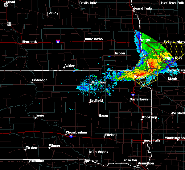 At 717 pm cdt, a severe thunderstorm was located over immanuel church, or 8 miles northeast of wheaton, moving southeast at 55 mph (radar indicated). Hazards include 60 mph wind gusts and penny size hail. expect damage to roofs, siding, and trees At 717 pm cdt, a severe thunderstorm was located over immanuel church, or 8 miles northeast of wheaton, moving southeast at 55 mph (radar indicated). Hazards include 60 mph wind gusts and penny size hail. expect damage to roofs, siding, and trees
|
| 9/2/2019 7:00 PM CDT |
 At 659 pm cdt, severe thunderstorms were located along a line extending from 8 miles east of kent to near hankinson to 7 miles west of hillhead, moving southeast at 40 mph (radar indicated). Hazards include 70 mph wind gusts and half dollar size hail. Hail damage to vehicles is expected. expect considerable tree damage. wind damage is also likely to mobile homes, roofs, and outbuildings. locations impacted include, fergus falls, wahpeton, breckenridge, hankinson, lidgerwood, rothsay and fairmount. this includes the following highways, interstate 29 between mile markers 0 and 45. Interstate 94 in minnesota between mile markers 40 and 59. At 659 pm cdt, severe thunderstorms were located along a line extending from 8 miles east of kent to near hankinson to 7 miles west of hillhead, moving southeast at 40 mph (radar indicated). Hazards include 70 mph wind gusts and half dollar size hail. Hail damage to vehicles is expected. expect considerable tree damage. wind damage is also likely to mobile homes, roofs, and outbuildings. locations impacted include, fergus falls, wahpeton, breckenridge, hankinson, lidgerwood, rothsay and fairmount. this includes the following highways, interstate 29 between mile markers 0 and 45. Interstate 94 in minnesota between mile markers 40 and 59.
|
| 9/2/2019 6:55 PM CDT |
 At 655 pm cdt, a severe thunderstorm was located near new effington, or 16 miles north of sisseton, moving southeast at 55 mph (radar indicated). Hazards include 60 mph wind gusts. expect damage to roofs, siding, and trees At 655 pm cdt, a severe thunderstorm was located near new effington, or 16 miles north of sisseton, moving southeast at 55 mph (radar indicated). Hazards include 60 mph wind gusts. expect damage to roofs, siding, and trees
|
| 9/2/2019 6:29 PM CDT |
 At 629 pm cdt, severe thunderstorms were located along a line extending from hickson to near wyndmere to near brampton, moving southeast at 40 mph (radar indicated). Hazards include 70 mph wind gusts and half dollar size hail. Hail damage to vehicles is expected. expect considerable tree damage. Wind damage is also likely to mobile homes, roofs, and outbuildings. At 629 pm cdt, severe thunderstorms were located along a line extending from hickson to near wyndmere to near brampton, moving southeast at 40 mph (radar indicated). Hazards include 70 mph wind gusts and half dollar size hail. Hail damage to vehicles is expected. expect considerable tree damage. Wind damage is also likely to mobile homes, roofs, and outbuildings.
|
| 8/17/2019 5:48 PM CDT |
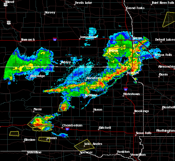 At 548 pm cdt, a severe thunderstorm was located near victor, or 14 miles northeast of sisseton, moving east at 20 mph (radar indicated). Hazards include golf ball size hail and 60 mph wind gusts. People and animals outdoors will be injured. expect hail damage to roofs, siding, windows, and vehicles. Expect wind damage to roofs, siding, and trees. At 548 pm cdt, a severe thunderstorm was located near victor, or 14 miles northeast of sisseton, moving east at 20 mph (radar indicated). Hazards include golf ball size hail and 60 mph wind gusts. People and animals outdoors will be injured. expect hail damage to roofs, siding, windows, and vehicles. Expect wind damage to roofs, siding, and trees.
|
| 8/31/2018 4:43 PM CDT |
 At 443 pm cdt, a severe thunderstorm was located over lamars, or 21 miles south of wahpeton, moving northeast at 45 mph (radar indicated). Hazards include 60 mph wind gusts and quarter size hail. Hail damage to vehicles is expected. expect wind damage to roofs, siding, and trees. this severe thunderstorm will be near, lamars and sonora around 445 pm cdt. blackmer around 450 pm cdt. fairmount around 455 pm cdt. tenney around 505 pm cdt. campbell, nashua and doran around 510 pm cdt. other locations impacted by this severe thunderstorm include fergus falls airport. this includes the following highways, interstate 29 between mile markers 2 and 8. Interstate 94 in minnesota between mile markers 48 and 68. At 443 pm cdt, a severe thunderstorm was located over lamars, or 21 miles south of wahpeton, moving northeast at 45 mph (radar indicated). Hazards include 60 mph wind gusts and quarter size hail. Hail damage to vehicles is expected. expect wind damage to roofs, siding, and trees. this severe thunderstorm will be near, lamars and sonora around 445 pm cdt. blackmer around 450 pm cdt. fairmount around 455 pm cdt. tenney around 505 pm cdt. campbell, nashua and doran around 510 pm cdt. other locations impacted by this severe thunderstorm include fergus falls airport. this includes the following highways, interstate 29 between mile markers 2 and 8. Interstate 94 in minnesota between mile markers 48 and 68.
|
| 8/31/2018 3:58 PM CDT |
 The national weather service in grand forks has issued a * severe thunderstorm warning for. southwestern otter tail county in west central minnesota. northwestern grant county in west central minnesota. southeastern wilkin county in west central minnesota. Southeastern richland county in southeastern north dakota. The national weather service in grand forks has issued a * severe thunderstorm warning for. southwestern otter tail county in west central minnesota. northwestern grant county in west central minnesota. southeastern wilkin county in west central minnesota. Southeastern richland county in southeastern north dakota.
|
| 6/29/2018 4:36 AM CDT |
 At 435 am cdt, severe thunderstorms were located along a line extending from harwood to near walcott to 6 miles north of claire city, moving east at 50 mph (radar indicated). Hazards include 60 mph wind gusts and penny size hail. Expect damage to roofs, siding, and trees. these severe storms will be near, north river, fargo and christine around 440 am cdt. wolverton, oakport and moorhead around 445 am cdt. lamars, glyndon and sonora around 455 am cdt. blackmer, lawndale and fairmount around 500 am cdt. other locations impacted by these severe thunderstorms include moorhead airport and casselton airport. this includes the following highways, interstate 29 between mile markers 0 and 71. interstate 94 in north dakota between mile markers 331 and 352. Interstate 94 in minnesota between mile markers 1 and 44. At 435 am cdt, severe thunderstorms were located along a line extending from harwood to near walcott to 6 miles north of claire city, moving east at 50 mph (radar indicated). Hazards include 60 mph wind gusts and penny size hail. Expect damage to roofs, siding, and trees. these severe storms will be near, north river, fargo and christine around 440 am cdt. wolverton, oakport and moorhead around 445 am cdt. lamars, glyndon and sonora around 455 am cdt. blackmer, lawndale and fairmount around 500 am cdt. other locations impacted by these severe thunderstorms include moorhead airport and casselton airport. this includes the following highways, interstate 29 between mile markers 0 and 71. interstate 94 in north dakota between mile markers 331 and 352. Interstate 94 in minnesota between mile markers 1 and 44.
|
| 6/29/2018 4:06 AM CDT |
 At 405 am cdt, severe thunderstorms were located along a line extending from absaraka to near venlo to near havana, moving east at 50 mph (radar indicated). Hazards include 60 mph wind gusts and penny size hail. Expect damage to roofs, siding, and trees. severe thunderstorms will be near, wheatland around 410 am cdt. casselton around 415 am cdt. barrie around 420 am cdt. mapleton around 425 am cdt. prosper, walcott and west fargo around 430 am cdt. other locations impacted by these severe thunderstorms include moorhead airport and casselton airport. this includes the following highways, interstate 29 between mile markers 0 and 71. interstate 94 in north dakota between mile markers 309 and 352. Interstate 94 in minnesota between mile markers 1 and 44. At 405 am cdt, severe thunderstorms were located along a line extending from absaraka to near venlo to near havana, moving east at 50 mph (radar indicated). Hazards include 60 mph wind gusts and penny size hail. Expect damage to roofs, siding, and trees. severe thunderstorms will be near, wheatland around 410 am cdt. casselton around 415 am cdt. barrie around 420 am cdt. mapleton around 425 am cdt. prosper, walcott and west fargo around 430 am cdt. other locations impacted by these severe thunderstorms include moorhead airport and casselton airport. this includes the following highways, interstate 29 between mile markers 0 and 71. interstate 94 in north dakota between mile markers 309 and 352. Interstate 94 in minnesota between mile markers 1 and 44.
|
| 9/22/2017 1:21 AM CDT |
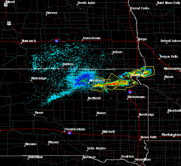 At 120 am cdt, a severe thunderstorm was located over silver bridge, or near wheaton, moving northeast at 30 mph (radar indicated). Hazards include 60 mph wind gusts and nickel size hail. Expect damage to roofs, siding, and trees. Locations impacted include, wheaton, dumont, tintah, white rock, halls landing, immanuel church, whiterock colony, mud lake landing, silver bridge and lake traverse. At 120 am cdt, a severe thunderstorm was located over silver bridge, or near wheaton, moving northeast at 30 mph (radar indicated). Hazards include 60 mph wind gusts and nickel size hail. Expect damage to roofs, siding, and trees. Locations impacted include, wheaton, dumont, tintah, white rock, halls landing, immanuel church, whiterock colony, mud lake landing, silver bridge and lake traverse.
|
| 9/22/2017 1:02 AM CDT |
 At 102 am cdt, a severe thunderstorm was located over traverse country park, or 14 miles southwest of wheaton, moving northeast at 25 mph (radar indicated). Hazards include golf ball size hail. People and animals outdoors will be injured. Expect damage to roofs, siding, windows, and vehicles. At 102 am cdt, a severe thunderstorm was located over traverse country park, or 14 miles southwest of wheaton, moving northeast at 25 mph (radar indicated). Hazards include golf ball size hail. People and animals outdoors will be injured. Expect damage to roofs, siding, windows, and vehicles.
|
| 9/22/2017 1:02 AM CDT |
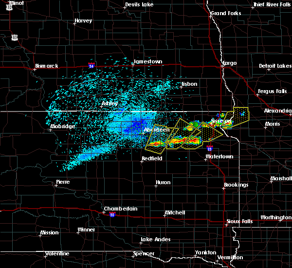 At 102 am cdt, a severe thunderstorm was located over traverse country park, or 14 miles southwest of wheaton, moving northeast at 25 mph (radar indicated). Hazards include golf ball size hail. People and animals outdoors will be injured. Expect damage to roofs, siding, windows, and vehicles. At 102 am cdt, a severe thunderstorm was located over traverse country park, or 14 miles southwest of wheaton, moving northeast at 25 mph (radar indicated). Hazards include golf ball size hail. People and animals outdoors will be injured. Expect damage to roofs, siding, windows, and vehicles.
|
| 7/21/2017 6:16 PM CDT |
 At 615 pm cdt, a severe thunderstorm was located near new effington, or 20 miles north of sisseton, moving southeast at 15 mph (radar indicated). Hazards include 60 mph wind gusts and quarter size hail. Hail damage to vehicles is expected. Expect wind damage to roofs, siding, and trees. At 615 pm cdt, a severe thunderstorm was located near new effington, or 20 miles north of sisseton, moving southeast at 15 mph (radar indicated). Hazards include 60 mph wind gusts and quarter size hail. Hail damage to vehicles is expected. Expect wind damage to roofs, siding, and trees.
|
| 7/21/2017 6:01 PM CDT |
 At 600 pm cdt, a severe thunderstorm was located 7 miles south of stiles, or 21 miles north of sisseton, moving east at 25 mph (radar indicated). Hazards include 60 mph wind gusts and quarter size hail. Hail damage to vehicles is expected. expect wind damage to roofs, siding, and trees. this severe thunderstorm will be near, lamars around 635 pm cdt. blackmer around 645 pm cdt. This includes interstate 29 between mile markers 0 and 12. At 600 pm cdt, a severe thunderstorm was located 7 miles south of stiles, or 21 miles north of sisseton, moving east at 25 mph (radar indicated). Hazards include 60 mph wind gusts and quarter size hail. Hail damage to vehicles is expected. expect wind damage to roofs, siding, and trees. this severe thunderstorm will be near, lamars around 635 pm cdt. blackmer around 645 pm cdt. This includes interstate 29 between mile markers 0 and 12.
|
| 7/17/2017 6:54 PM CDT |
 The severe thunderstorm warning for northeastern traverse and northeastern roberts counties will expire at 700 pm cdt, the storm which prompted the warning has weakened below severe limits, and no longer poses an immediate threat to life or property. therefore the warning will be allowed to expire. however small hail and gusty winds are still possible with this thunderstorm. a severe thunderstorm watch remains in effect until 1100 pm cdt for west central minnesota, and northeastern south dakota. The severe thunderstorm warning for northeastern traverse and northeastern roberts counties will expire at 700 pm cdt, the storm which prompted the warning has weakened below severe limits, and no longer poses an immediate threat to life or property. therefore the warning will be allowed to expire. however small hail and gusty winds are still possible with this thunderstorm. a severe thunderstorm watch remains in effect until 1100 pm cdt for west central minnesota, and northeastern south dakota.
|
| 7/17/2017 6:28 PM CDT |
 At 627 pm cdt, a severe thunderstorm was located near white rock, or 12 miles north of wheaton, moving east at 30 mph (radar indicated). Hazards include 60 mph wind gusts and quarter size hail. Hail damage to vehicles is expected. expect wind damage to roofs, siding, and trees. this severe thunderstorm will be near, immanuel church around 635 pm cdt. Tintah around 650 pm cdt. At 627 pm cdt, a severe thunderstorm was located near white rock, or 12 miles north of wheaton, moving east at 30 mph (radar indicated). Hazards include 60 mph wind gusts and quarter size hail. Hail damage to vehicles is expected. expect wind damage to roofs, siding, and trees. this severe thunderstorm will be near, immanuel church around 635 pm cdt. Tintah around 650 pm cdt.
|
| 7/17/2017 6:28 PM CDT |
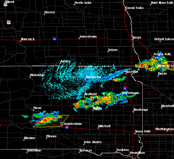 At 627 pm cdt, a severe thunderstorm was located near white rock, or 12 miles north of wheaton, moving east at 30 mph (radar indicated). Hazards include 60 mph wind gusts and quarter size hail. Hail damage to vehicles is expected. expect wind damage to roofs, siding, and trees. this severe thunderstorm will be near, immanuel church around 635 pm cdt. Tintah around 650 pm cdt. At 627 pm cdt, a severe thunderstorm was located near white rock, or 12 miles north of wheaton, moving east at 30 mph (radar indicated). Hazards include 60 mph wind gusts and quarter size hail. Hail damage to vehicles is expected. expect wind damage to roofs, siding, and trees. this severe thunderstorm will be near, immanuel church around 635 pm cdt. Tintah around 650 pm cdt.
|
| 6/13/2017 8:57 PM CDT |
 The severe thunderstorm warning for northeastern traverse and northern roberts counties will expire at 900 pm cdt, the storms which prompted the warning have moved out of the area. therefore the warning will be allowed to expire. however heavy rain is still possible with these thunderstorms. a tornado watch remains in effect until 1000 pm cdt for west central minnesota, and northeastern south dakota. to report severe weather, contact your nearest law enforcement agency. they will relay your report to the national weather service aberdeen. The severe thunderstorm warning for northeastern traverse and northern roberts counties will expire at 900 pm cdt, the storms which prompted the warning have moved out of the area. therefore the warning will be allowed to expire. however heavy rain is still possible with these thunderstorms. a tornado watch remains in effect until 1000 pm cdt for west central minnesota, and northeastern south dakota. to report severe weather, contact your nearest law enforcement agency. they will relay your report to the national weather service aberdeen.
|
| 6/13/2017 8:47 PM CDT |
 At 847 pm cdt, severe thunderstorms were located along a line extending from near campbell to near charlesville, moving northeast at 55 mph (radar indicated). Hazards include 70 mph wind gusts and penny size hail. Expect considerable tree damage. damage is likely to mobile homes, roofs, and outbuildings. locations impacted include, tintah, white rock and immanuel church. A tornado watch remains in effect until 1000 pm cdt for west central minnesota, and northeastern south dakota. At 847 pm cdt, severe thunderstorms were located along a line extending from near campbell to near charlesville, moving northeast at 55 mph (radar indicated). Hazards include 70 mph wind gusts and penny size hail. Expect considerable tree damage. damage is likely to mobile homes, roofs, and outbuildings. locations impacted include, tintah, white rock and immanuel church. A tornado watch remains in effect until 1000 pm cdt for west central minnesota, and northeastern south dakota.
|
| 6/13/2017 8:38 PM CDT |
 At 837 pm cdt, severe thunderstorms were located along a line extending from 7 miles southeast of hankinson to near wheaton, moving northeast at 60 mph (trained weather spotters. at 820 pm cdt, a 70 mph wind gust was reported in new effington). Hazards include 70 mph wind gusts and penny size hail. Expect considerable tree damage. Damage is likely to mobile homes, roofs, and outbuildings. At 837 pm cdt, severe thunderstorms were located along a line extending from 7 miles southeast of hankinson to near wheaton, moving northeast at 60 mph (trained weather spotters. at 820 pm cdt, a 70 mph wind gust was reported in new effington). Hazards include 70 mph wind gusts and penny size hail. Expect considerable tree damage. Damage is likely to mobile homes, roofs, and outbuildings.
|
| 6/13/2017 8:38 PM CDT |
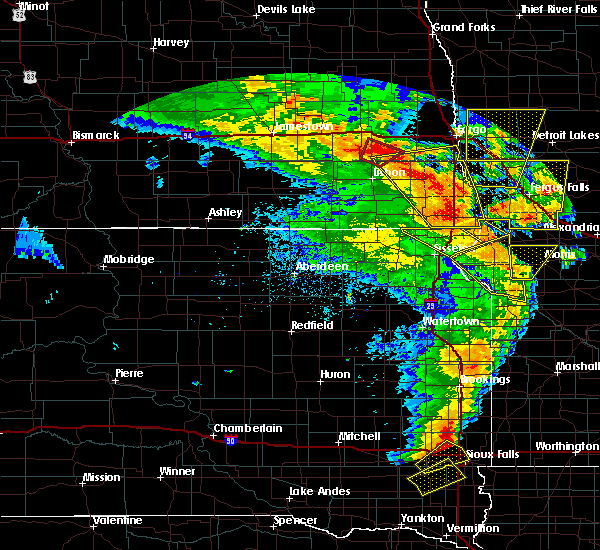 At 837 pm cdt, severe thunderstorms were located along a line extending from 7 miles southeast of hankinson to near wheaton, moving northeast at 60 mph (trained weather spotters. at 820 pm cdt, a 70 mph wind gust was reported in new effington). Hazards include 70 mph wind gusts and penny size hail. Expect considerable tree damage. Damage is likely to mobile homes, roofs, and outbuildings. At 837 pm cdt, severe thunderstorms were located along a line extending from 7 miles southeast of hankinson to near wheaton, moving northeast at 60 mph (trained weather spotters. at 820 pm cdt, a 70 mph wind gust was reported in new effington). Hazards include 70 mph wind gusts and penny size hail. Expect considerable tree damage. Damage is likely to mobile homes, roofs, and outbuildings.
|
| 6/13/2017 8:28 PM CDT |
 At 826 pm cdt, severe thunderstorms were located along a line extending from near lidgerwood to near rosholt, moving northeast at 50 mph (trained weather spotters. at 824 pm cdt, a 70 mph wind gust was reported 1 mile north of new effington by the fire department). Hazards include 70 mph wind gusts and penny size hail. Expect considerable tree damage. damage is likely to mobile homes, roofs, and outbuildings. locations impacted include, wheaton, veblen, rosholt, new effington, claire city, victor, white rock, mud lake landing, silver bridge, halls landing, lake traverse, lake traverse housing units, veblen flats housing, rainbow island, immanuel church and whiterock colony. A tornado watch remains in effect until 1000 pm cdt for west central minnesota, and northeastern south dakota. At 826 pm cdt, severe thunderstorms were located along a line extending from near lidgerwood to near rosholt, moving northeast at 50 mph (trained weather spotters. at 824 pm cdt, a 70 mph wind gust was reported 1 mile north of new effington by the fire department). Hazards include 70 mph wind gusts and penny size hail. Expect considerable tree damage. damage is likely to mobile homes, roofs, and outbuildings. locations impacted include, wheaton, veblen, rosholt, new effington, claire city, victor, white rock, mud lake landing, silver bridge, halls landing, lake traverse, lake traverse housing units, veblen flats housing, rainbow island, immanuel church and whiterock colony. A tornado watch remains in effect until 1000 pm cdt for west central minnesota, and northeastern south dakota.
|
| 6/13/2017 8:28 PM CDT |
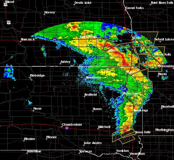 At 826 pm cdt, severe thunderstorms were located along a line extending from near lidgerwood to near rosholt, moving northeast at 50 mph (trained weather spotters. at 824 pm cdt, a 70 mph wind gust was reported 1 mile north of new effington by the fire department). Hazards include 70 mph wind gusts and penny size hail. Expect considerable tree damage. damage is likely to mobile homes, roofs, and outbuildings. locations impacted include, wheaton, veblen, rosholt, new effington, claire city, victor, white rock, mud lake landing, silver bridge, halls landing, lake traverse, lake traverse housing units, veblen flats housing, rainbow island, immanuel church and whiterock colony. A tornado watch remains in effect until 1000 pm cdt for west central minnesota, and northeastern south dakota. At 826 pm cdt, severe thunderstorms were located along a line extending from near lidgerwood to near rosholt, moving northeast at 50 mph (trained weather spotters. at 824 pm cdt, a 70 mph wind gust was reported 1 mile north of new effington by the fire department). Hazards include 70 mph wind gusts and penny size hail. Expect considerable tree damage. damage is likely to mobile homes, roofs, and outbuildings. locations impacted include, wheaton, veblen, rosholt, new effington, claire city, victor, white rock, mud lake landing, silver bridge, halls landing, lake traverse, lake traverse housing units, veblen flats housing, rainbow island, immanuel church and whiterock colony. A tornado watch remains in effect until 1000 pm cdt for west central minnesota, and northeastern south dakota.
|
| 6/13/2017 8:23 PM CDT |
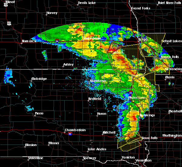 At 822 pm cdt, severe thunderstorms were located along a line extending from 7 miles northwest of claire city to near lake traverse, moving northeast at 50 mph (trained weather spotters. at 814 pm cdt, a 60 mph wind gust was reported in claire city). Hazards include 60 mph wind gusts and penny size hail. Expect damage to roofs, siding, and trees. locations impacted include, wheaton, veblen, rosholt, new effington, claire city, victor, white rock, mud lake landing, silver bridge, halls landing, lake traverse, lake traverse housing units, veblen flats housing, rainbow island, immanuel church and whiterock colony. A tornado watch remains in effect until 1000 pm cdt for west central minnesota, and northeastern south dakota. At 822 pm cdt, severe thunderstorms were located along a line extending from 7 miles northwest of claire city to near lake traverse, moving northeast at 50 mph (trained weather spotters. at 814 pm cdt, a 60 mph wind gust was reported in claire city). Hazards include 60 mph wind gusts and penny size hail. Expect damage to roofs, siding, and trees. locations impacted include, wheaton, veblen, rosholt, new effington, claire city, victor, white rock, mud lake landing, silver bridge, halls landing, lake traverse, lake traverse housing units, veblen flats housing, rainbow island, immanuel church and whiterock colony. A tornado watch remains in effect until 1000 pm cdt for west central minnesota, and northeastern south dakota.
|
| 6/13/2017 8:12 PM CDT |
 At 810 pm cdt, severe thunderstorms were located along a line extending from veblen to near dakota connection & casino, moving northeast at 50 mph (radar indicated). Hazards include 60 mph wind gusts and penny size hail. expect damage to roofs, siding, and trees At 810 pm cdt, severe thunderstorms were located along a line extending from veblen to near dakota connection & casino, moving northeast at 50 mph (radar indicated). Hazards include 60 mph wind gusts and penny size hail. expect damage to roofs, siding, and trees
|
| 6/13/2017 8:12 PM CDT |
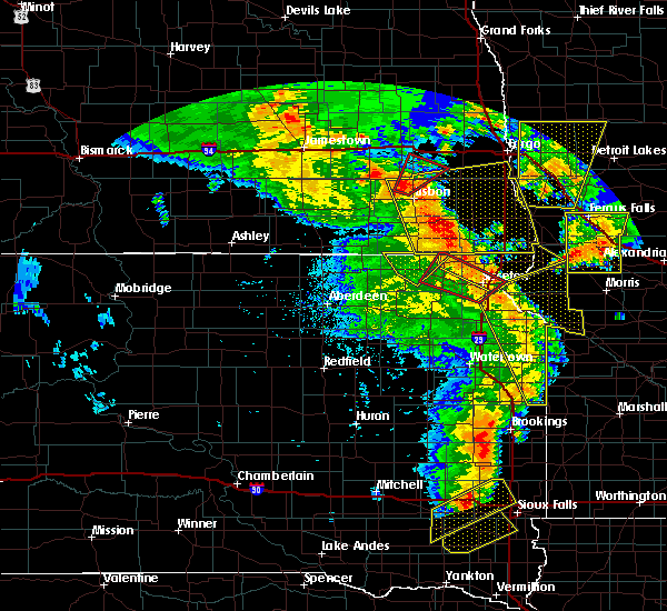 At 810 pm cdt, severe thunderstorms were located along a line extending from veblen to near dakota connection & casino, moving northeast at 50 mph (radar indicated). Hazards include 60 mph wind gusts and penny size hail. expect damage to roofs, siding, and trees At 810 pm cdt, severe thunderstorms were located along a line extending from veblen to near dakota connection & casino, moving northeast at 50 mph (radar indicated). Hazards include 60 mph wind gusts and penny size hail. expect damage to roofs, siding, and trees
|
| 8/10/2016 3:58 AM CDT |
 The severe thunderstorm warning for traverse and northeastern roberts counties will expire at 400 am cdt. the storm which prompted the warning has weakened below severe limits. and no longer pose an immediate threat to life or property. therefore. the warning will be allowed to expire. However gusty winds are still possible with this thunderstorm. The severe thunderstorm warning for traverse and northeastern roberts counties will expire at 400 am cdt. the storm which prompted the warning has weakened below severe limits. and no longer pose an immediate threat to life or property. therefore. the warning will be allowed to expire. However gusty winds are still possible with this thunderstorm.
|
| 8/10/2016 3:42 AM CDT |
 At 341 am cdt, severe thunderstorms were located along a line extending from near kent to near tenney to 6 miles east of wheaton, moving east at 50 mph (radar indicated). Hazards include 70 mph wind gusts and quarter size hail. Hail damage to vehicles is expected. expect considerable tree damage. wind damage is also likely to mobile homes, roofs, and outbuildings. these severe storms will be near, campbell and nashua around 345 am cdt. norcross around 350 am cdt. herman and western around 355 am cdt. wendell around 400 am cdt. elbow lake around 405 am cdt. Also includes interstate 29 between mile markers 15 and 36. At 341 am cdt, severe thunderstorms were located along a line extending from near kent to near tenney to 6 miles east of wheaton, moving east at 50 mph (radar indicated). Hazards include 70 mph wind gusts and quarter size hail. Hail damage to vehicles is expected. expect considerable tree damage. wind damage is also likely to mobile homes, roofs, and outbuildings. these severe storms will be near, campbell and nashua around 345 am cdt. norcross around 350 am cdt. herman and western around 355 am cdt. wendell around 400 am cdt. elbow lake around 405 am cdt. Also includes interstate 29 between mile markers 15 and 36.
|
| 8/10/2016 3:32 AM CDT |
 At 331 am cdt, a severe thunderstorm was located over wheaton, moving east at 50 mph. this is a very dangerous storm (radar indicated). Hazards include 80 mph wind gusts and quarter size hail. Flying debris will be dangerous to those caught without shelter. mobile homes will be heavily damaged. expect considerable damage to roofs, windows, and vehicles. extensive tree damage and power outages are likely. This severe storm will be near, immanuel church around 335 am cdt. At 331 am cdt, a severe thunderstorm was located over wheaton, moving east at 50 mph. this is a very dangerous storm (radar indicated). Hazards include 80 mph wind gusts and quarter size hail. Flying debris will be dangerous to those caught without shelter. mobile homes will be heavily damaged. expect considerable damage to roofs, windows, and vehicles. extensive tree damage and power outages are likely. This severe storm will be near, immanuel church around 335 am cdt.
|
| 8/10/2016 3:09 AM CDT |
 At 308 am cdt, a severe thunderstorm was located near victor, or 14 miles northeast of sisseton, moving east at 55 mph. this is a very dangerous storm (mesonet observation north of lake city reported a gust to 92 mph). Hazards include 80 mph wind gusts and quarter size hail. Flying debris will be dangerous to those caught without shelter. mobile homes will be heavily damaged. expect considerable damage to roofs, windows, and vehicles. extensive tree damage and power outages are likely. this severe storm will be near, halls landing around 315 am cdt. silver bridge and whiterock colony around 320 am cdt. white rock and mud lake landing around 325 am cdt. Wheaton and immanuel church around 330 am cdt. At 308 am cdt, a severe thunderstorm was located near victor, or 14 miles northeast of sisseton, moving east at 55 mph. this is a very dangerous storm (mesonet observation north of lake city reported a gust to 92 mph). Hazards include 80 mph wind gusts and quarter size hail. Flying debris will be dangerous to those caught without shelter. mobile homes will be heavily damaged. expect considerable damage to roofs, windows, and vehicles. extensive tree damage and power outages are likely. this severe storm will be near, halls landing around 315 am cdt. silver bridge and whiterock colony around 320 am cdt. white rock and mud lake landing around 325 am cdt. Wheaton and immanuel church around 330 am cdt.
|
| 8/10/2016 3:09 AM CDT |
 At 308 am cdt, severe thunderstorms were located along a line extending from mcleod to 7 miles southwest of hankinson to 7 miles north of sisseton, moving east at 50 mph (radar indicated). Hazards include 70 mph wind gusts and quarter size hail. Hail damage to vehicles is expected. expect considerable tree damage. wind damage is also likely to mobile homes, roofs, and outbuildings. severe thunderstorms will be near, stiles around 310 am cdt. hankinson around 315 am cdt. sonora around 320 am cdt. lamars around 325 am cdt. colfax, fairmount and blackmer around 330 am cdt. Also includes interstate 29 between mile markers 0 and 37. At 308 am cdt, severe thunderstorms were located along a line extending from mcleod to 7 miles southwest of hankinson to 7 miles north of sisseton, moving east at 50 mph (radar indicated). Hazards include 70 mph wind gusts and quarter size hail. Hail damage to vehicles is expected. expect considerable tree damage. wind damage is also likely to mobile homes, roofs, and outbuildings. severe thunderstorms will be near, stiles around 310 am cdt. hankinson around 315 am cdt. sonora around 320 am cdt. lamars around 325 am cdt. colfax, fairmount and blackmer around 330 am cdt. Also includes interstate 29 between mile markers 0 and 37.
|
| 8/10/2016 3:09 AM CDT |
 At 308 am cdt, a severe thunderstorm was located near victor, or 14 miles northeast of sisseton, moving east at 55 mph. this is a very dangerous storm (mesonet observation north of lake city reported a gust to 92 mph). Hazards include 80 mph wind gusts and quarter size hail. Flying debris will be dangerous to those caught without shelter. mobile homes will be heavily damaged. expect considerable damage to roofs, windows, and vehicles. extensive tree damage and power outages are likely. this severe storm will be near, halls landing around 315 am cdt. silver bridge and whiterock colony around 320 am cdt. white rock and mud lake landing around 325 am cdt. Wheaton and immanuel church around 330 am cdt. At 308 am cdt, a severe thunderstorm was located near victor, or 14 miles northeast of sisseton, moving east at 55 mph. this is a very dangerous storm (mesonet observation north of lake city reported a gust to 92 mph). Hazards include 80 mph wind gusts and quarter size hail. Flying debris will be dangerous to those caught without shelter. mobile homes will be heavily damaged. expect considerable damage to roofs, windows, and vehicles. extensive tree damage and power outages are likely. this severe storm will be near, halls landing around 315 am cdt. silver bridge and whiterock colony around 320 am cdt. white rock and mud lake landing around 325 am cdt. Wheaton and immanuel church around 330 am cdt.
|
| 8/10/2016 3:06 AM CDT |
 At 305 am cdt, a severe thunderstorm was located over new effington, or 12 miles northeast of sisseton, moving east at 55 mph (radar indicated). Hazards include 60 mph wind gusts and quarter size hail. Hail damage to vehicles is expected. expect wind damage to roofs, siding, and trees. this severe thunderstorm will be near, victor around 310 am cdt. rosholt around 315 am cdt. silver bridge, whiterock colony, lake traverse and halls landing around 320 am cdt. white rock and mud lake landing around 325 am cdt. Wheaton and immanuel church around 330 am cdt. At 305 am cdt, a severe thunderstorm was located over new effington, or 12 miles northeast of sisseton, moving east at 55 mph (radar indicated). Hazards include 60 mph wind gusts and quarter size hail. Hail damage to vehicles is expected. expect wind damage to roofs, siding, and trees. this severe thunderstorm will be near, victor around 310 am cdt. rosholt around 315 am cdt. silver bridge, whiterock colony, lake traverse and halls landing around 320 am cdt. white rock and mud lake landing around 325 am cdt. Wheaton and immanuel church around 330 am cdt.
|
| 7/10/2016 1:41 AM CDT |
 At 139 am cdt, severe thunderstorms were located along a line extending from brushvale to near victor, moving east at 50 mph (radar indicated). Hazards include 60 mph wind gusts and penny size hail. Expect damage to roofs. siding. and trees. severe thunderstorms will be near, wahpeton around 145 am cdt. breckenridge and lamars around 150 am cdt. everdell and blackmer around 155 am cdt. foxhome around 200 am cdt. western around 210 am cdt. also includes the following highways, interstate 29 between mile markers 0 and 19. Interstate 94 in minnesota between mile markers 65 and 80. At 139 am cdt, severe thunderstorms were located along a line extending from brushvale to near victor, moving east at 50 mph (radar indicated). Hazards include 60 mph wind gusts and penny size hail. Expect damage to roofs. siding. and trees. severe thunderstorms will be near, wahpeton around 145 am cdt. breckenridge and lamars around 150 am cdt. everdell and blackmer around 155 am cdt. foxhome around 200 am cdt. western around 210 am cdt. also includes the following highways, interstate 29 between mile markers 0 and 19. Interstate 94 in minnesota between mile markers 65 and 80.
|
| 7/10/2016 1:39 AM CDT |
 At 138 am cdt, a severe thunderstorm was located over halls landing, or 10 miles west of wheaton, moving east at 65 mph. this is a very dangerous storm (radar indicated). Hazards include 80 mph wind gusts. Flying debris will be dangerous to those caught without shelter. mobile homes will be heavily damaged. expect considerable damage to roofs, windows, and vehicles. extensive tree damage and power outages are likely. this severe storm will be near, wheaton and siloah country church around 145 am cdt. dumont and collis around 150 am cdt. Johnson and trinity lutheran country church around 200 am cdt. At 138 am cdt, a severe thunderstorm was located over halls landing, or 10 miles west of wheaton, moving east at 65 mph. this is a very dangerous storm (radar indicated). Hazards include 80 mph wind gusts. Flying debris will be dangerous to those caught without shelter. mobile homes will be heavily damaged. expect considerable damage to roofs, windows, and vehicles. extensive tree damage and power outages are likely. this severe storm will be near, wheaton and siloah country church around 145 am cdt. dumont and collis around 150 am cdt. Johnson and trinity lutheran country church around 200 am cdt.
|
| 7/10/2016 1:24 AM CDT |
 At 122 am cdt, a severe thunderstorm was located over new effington, or 15 miles northeast of sisseton, moving east at 80 mph (radar indicated). Hazards include 60 mph wind gusts. Expect damage to roofs. siding. and trees. this severe thunderstorm will be near, whiterock colony and halls landing around 130 am cdt. white rock, mud lake landing and silver bridge around 135 am cdt. Wheaton and dumont around 140 am cdt. At 122 am cdt, a severe thunderstorm was located over new effington, or 15 miles northeast of sisseton, moving east at 80 mph (radar indicated). Hazards include 60 mph wind gusts. Expect damage to roofs. siding. and trees. this severe thunderstorm will be near, whiterock colony and halls landing around 130 am cdt. white rock, mud lake landing and silver bridge around 135 am cdt. Wheaton and dumont around 140 am cdt.
|
| 7/10/2016 12:32 AM CDT |
 At 1231 am cdt, severe thunderstorms were located along a line extending from near western to near barney, moving southwest at 15 mph (radar indicated). Hazards include quarter size hail. Damage to vehicles is expected. these severe storms will be near, mooreton around 1235 am cdt. barney around 1245 am cdt. mantador around 1255 am cdt. doran and tenney around 100 am cdt. Also includes interstate 29 between mile markers 0 and 30. At 1231 am cdt, severe thunderstorms were located along a line extending from near western to near barney, moving southwest at 15 mph (radar indicated). Hazards include quarter size hail. Damage to vehicles is expected. these severe storms will be near, mooreton around 1235 am cdt. barney around 1245 am cdt. mantador around 1255 am cdt. doran and tenney around 100 am cdt. Also includes interstate 29 between mile markers 0 and 30.
|
| 7/10/2016 12:02 AM CDT |
 At 1202 am cdt, a severe thunderstorm was located over breckenridge, or over wahpeton, moving southeast at 10 mph (radar indicated). Hazards include quarter size hail. Damage to vehicles is expected. this severe thunderstorm will be near, everdell around 1235 am cdt. doran around 1250 am cdt. campbell around 100 am cdt. Also includes interstate 29 between mile markers 0 and 36. At 1202 am cdt, a severe thunderstorm was located over breckenridge, or over wahpeton, moving southeast at 10 mph (radar indicated). Hazards include quarter size hail. Damage to vehicles is expected. this severe thunderstorm will be near, everdell around 1235 am cdt. doran around 1250 am cdt. campbell around 100 am cdt. Also includes interstate 29 between mile markers 0 and 36.
|
| 6/12/2016 3:00 PM CDT |
 At 259 pm cdt, a severe thunderstorm was located over campbell, or 16 miles southeast of wahpeton, moving northeast at 40 mph (radar indicated). Hazards include 60 mph wind gusts and quarter size hail. Hail damage to vehicles is expected. expect wind damage to roofs, siding, and trees. This severe thunderstorm will remain over mainly rural areas of traverse and northeastern roberts counties. At 259 pm cdt, a severe thunderstorm was located over campbell, or 16 miles southeast of wahpeton, moving northeast at 40 mph (radar indicated). Hazards include 60 mph wind gusts and quarter size hail. Hail damage to vehicles is expected. expect wind damage to roofs, siding, and trees. This severe thunderstorm will remain over mainly rural areas of traverse and northeastern roberts counties.
|
| 6/12/2016 2:53 PM CDT |
 At 253 pm cdt, a severe thunderstorm was located over fairmount, or 13 miles south of wahpeton, moving northeast at 35 mph (radar indicated). Hazards include half dollar size hail. Damage to vehicles is expected. this severe storm will be near, fairmount around 255 pm cdt. breckenridge, campbell and doran around 310 pm cdt. everdell around 325 pm cdt. foxhome around 330 pm cdt. Also includes interstate 29 between mile markers 6 and 17. At 253 pm cdt, a severe thunderstorm was located over fairmount, or 13 miles south of wahpeton, moving northeast at 35 mph (radar indicated). Hazards include half dollar size hail. Damage to vehicles is expected. this severe storm will be near, fairmount around 255 pm cdt. breckenridge, campbell and doran around 310 pm cdt. everdell around 325 pm cdt. foxhome around 330 pm cdt. Also includes interstate 29 between mile markers 6 and 17.
|
| 6/12/2016 2:37 PM CDT |
 At 236 pm cdt, a severe thunderstorm was located over halls landing, or 8 miles southwest of wheaton, moving northeast at 40 mph (radar indicated). Hazards include two inch hail and 60 mph wind gusts. People and animals outdoors will be injured. expect hail damage to roofs, siding, windows, and vehicles. expect wind damage to roofs, siding, and trees. this severe storm will be near, rosholt and mud lake landing around 240 pm cdt. wheaton, white rock and whiterock colony around 245 pm cdt. immanuel church around 250 pm cdt. Tintah around 255 pm cdt. At 236 pm cdt, a severe thunderstorm was located over halls landing, or 8 miles southwest of wheaton, moving northeast at 40 mph (radar indicated). Hazards include two inch hail and 60 mph wind gusts. People and animals outdoors will be injured. expect hail damage to roofs, siding, windows, and vehicles. expect wind damage to roofs, siding, and trees. this severe storm will be near, rosholt and mud lake landing around 240 pm cdt. wheaton, white rock and whiterock colony around 245 pm cdt. immanuel church around 250 pm cdt. Tintah around 255 pm cdt.
|
| 6/12/2016 2:32 PM CDT |
 At 231 pm cdt, a severe thunderstorm was located near lamars, or 19 miles northwest of wheaton, moving northeast at 35 mph (radar indicated). Hazards include half dollar size hail. Damage to vehicles is expected. this severe thunderstorm will be near, lamars around 240 pm cdt. sonora and blackmer around 245 pm cdt. fairmount around 250 pm cdt. breckenridge, campbell and doran around 310 pm cdt. everdell around 320 pm cdt. Also includes interstate 29 between mile markers 0 and 16. At 231 pm cdt, a severe thunderstorm was located near lamars, or 19 miles northwest of wheaton, moving northeast at 35 mph (radar indicated). Hazards include half dollar size hail. Damage to vehicles is expected. this severe thunderstorm will be near, lamars around 240 pm cdt. sonora and blackmer around 245 pm cdt. fairmount around 250 pm cdt. breckenridge, campbell and doran around 310 pm cdt. everdell around 320 pm cdt. Also includes interstate 29 between mile markers 0 and 16.
|
| 6/12/2016 2:27 PM CDT |
 At 226 pm cdt, a severe thunderstorm was located over browns valley, or 13 miles east of sisseton, moving northeast at 40 mph (radar indicated). Hazards include golf ball size hail and 60 mph wind gusts. People and animals outdoors will be injured. expect hail damage to roofs, siding, windows, and vehicles. expect wind damage to roofs, siding, and trees. this severe thunderstorm will be near, traverse country park around 230 pm cdt. halls landing, lake traverse, rainbow island and siloah country church around 235 pm cdt. rosholt and silver bridge around 240 pm cdt. wheaton, mud lake landing and whiterock colony around 245 pm cdt. white rock and immanuel church around 250 pm cdt. Tintah around 300 pm cdt. At 226 pm cdt, a severe thunderstorm was located over browns valley, or 13 miles east of sisseton, moving northeast at 40 mph (radar indicated). Hazards include golf ball size hail and 60 mph wind gusts. People and animals outdoors will be injured. expect hail damage to roofs, siding, windows, and vehicles. expect wind damage to roofs, siding, and trees. this severe thunderstorm will be near, traverse country park around 230 pm cdt. halls landing, lake traverse, rainbow island and siloah country church around 235 pm cdt. rosholt and silver bridge around 240 pm cdt. wheaton, mud lake landing and whiterock colony around 245 pm cdt. white rock and immanuel church around 250 pm cdt. Tintah around 300 pm cdt.
|
| 6/12/2016 2:25 PM CDT |
 At 224 pm cdt, a severe thunderstorm was located over whiterock colony, or 7 miles northwest of wheaton, moving northeast at 40 mph (radar indicated). Hazards include golf ball size hail and 60 mph wind gusts. People and animals outdoors will be injured. expect hail damage to roofs, siding, windows, and vehicles. expect wind damage to roofs, siding, and trees. This severe storm will be near, immanuel church around 235 pm cdt. At 224 pm cdt, a severe thunderstorm was located over whiterock colony, or 7 miles northwest of wheaton, moving northeast at 40 mph (radar indicated). Hazards include golf ball size hail and 60 mph wind gusts. People and animals outdoors will be injured. expect hail damage to roofs, siding, windows, and vehicles. expect wind damage to roofs, siding, and trees. This severe storm will be near, immanuel church around 235 pm cdt.
|
| 6/12/2016 2:25 PM CDT |
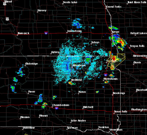 At 224 pm cdt, a severe thunderstorm was located over whiterock colony, or 7 miles northwest of wheaton, moving northeast at 40 mph (radar indicated). Hazards include golf ball size hail and 60 mph wind gusts. People and animals outdoors will be injured. expect hail damage to roofs, siding, windows, and vehicles. expect wind damage to roofs, siding, and trees. This severe storm will be near, immanuel church around 235 pm cdt. At 224 pm cdt, a severe thunderstorm was located over whiterock colony, or 7 miles northwest of wheaton, moving northeast at 40 mph (radar indicated). Hazards include golf ball size hail and 60 mph wind gusts. People and animals outdoors will be injured. expect hail damage to roofs, siding, windows, and vehicles. expect wind damage to roofs, siding, and trees. This severe storm will be near, immanuel church around 235 pm cdt.
|
| 6/12/2016 2:12 PM CDT |
 At 211 pm cdt, a severe thunderstorm was located near lake traverse, or 13 miles northeast of sisseton, moving northeast at 40 mph (radar indicated). Hazards include 60 mph wind gusts and quarter size hail. Hail damage to vehicles is expected. expect wind damage to roofs, siding, and trees. this severe thunderstorm will be near, victor and halls landing around 215 pm cdt. rosholt and silver bridge around 220 pm cdt. whiterock colony and mud lake landing around 225 pm cdt. wheaton and white rock around 230 pm cdt. Immanuel church around 235 pm cdt. At 211 pm cdt, a severe thunderstorm was located near lake traverse, or 13 miles northeast of sisseton, moving northeast at 40 mph (radar indicated). Hazards include 60 mph wind gusts and quarter size hail. Hail damage to vehicles is expected. expect wind damage to roofs, siding, and trees. this severe thunderstorm will be near, victor and halls landing around 215 pm cdt. rosholt and silver bridge around 220 pm cdt. whiterock colony and mud lake landing around 225 pm cdt. wheaton and white rock around 230 pm cdt. Immanuel church around 235 pm cdt.
|
| 7/24/2015 12:54 AM CDT |
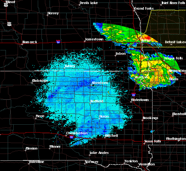 At 1253 am cdt, a severe thunderstorm was located over silver bridge, or near wheaton, moving east at 45 mph (radar indicated). Hazards include 70 mph wind gusts and penny size hail. Expect considerable tree damage. damage is likely to mobile homes, roofs and outbuildings. This severe thunderstorm will be near, dumont around 100 am cdt. At 1253 am cdt, a severe thunderstorm was located over silver bridge, or near wheaton, moving east at 45 mph (radar indicated). Hazards include 70 mph wind gusts and penny size hail. Expect considerable tree damage. damage is likely to mobile homes, roofs and outbuildings. This severe thunderstorm will be near, dumont around 100 am cdt.
|
| 6/27/2015 9:25 PM CDT |
 At 924 pm cdt, a severe thunderstorm capable of producing a tornado was located over mud lake landing, or over wheaton, moving southeast at 35 mph (radar indicated rotation). Hazards include tornado and quarter size hail. Flying debris will be dangerous to those caught without shelter. mobile homes will be damaged or destroyed. damage to roofs, windows and vehicles will occur. tree damage is likely. This tornadic thunderstorm will remain over mainly rural areas of central traverse and northeastern roberts counties. At 924 pm cdt, a severe thunderstorm capable of producing a tornado was located over mud lake landing, or over wheaton, moving southeast at 35 mph (radar indicated rotation). Hazards include tornado and quarter size hail. Flying debris will be dangerous to those caught without shelter. mobile homes will be damaged or destroyed. damage to roofs, windows and vehicles will occur. tree damage is likely. This tornadic thunderstorm will remain over mainly rural areas of central traverse and northeastern roberts counties.
|
| 6/27/2015 9:09 PM CDT |
 At 909 pm cdt, a confirmed tornado was located over whiterock colony, or 10 miles northwest of wheaton, moving south at 30 mph (weather spotters confirmed tornado). Hazards include damaging tornado and quarter size hail. Flying debris will be dangerous to those caught without shelter. mobile homes will be damaged or destroyed. damage to roofs, windows and vehicles will occur. tree damage is likely. the tornado will be near, wheaton and mud lake landing around 925 pm cdt. silver bridge around 930 pm cdt. Lake traverse around 935 pm cdt. At 909 pm cdt, a confirmed tornado was located over whiterock colony, or 10 miles northwest of wheaton, moving south at 30 mph (weather spotters confirmed tornado). Hazards include damaging tornado and quarter size hail. Flying debris will be dangerous to those caught without shelter. mobile homes will be damaged or destroyed. damage to roofs, windows and vehicles will occur. tree damage is likely. the tornado will be near, wheaton and mud lake landing around 925 pm cdt. silver bridge around 930 pm cdt. Lake traverse around 935 pm cdt.
|
| 6/27/2015 8:09 PM CDT |
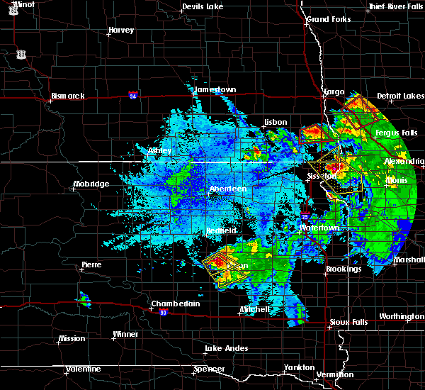 At 808 pm cdt, a severe thunderstorm was located over silver bridge, or near wheaton, moving southeast at 45 mph (public. at 705 pm...half dollar sized hail was reported about 4 miles east, southeast of rosholt). Hazards include 60 mph wind gusts and half dollar size hail. Hail damage to vehicles is expected. expect wind damage to roofs, siding and trees. this severe storm will be near, dumont and siloah country church around 820 pm cdt. barry and collis around 825 pm cdt. Graceville, johnson and trinity lutheran country church around 830 pm cdt. At 808 pm cdt, a severe thunderstorm was located over silver bridge, or near wheaton, moving southeast at 45 mph (public. at 705 pm...half dollar sized hail was reported about 4 miles east, southeast of rosholt). Hazards include 60 mph wind gusts and half dollar size hail. Hail damage to vehicles is expected. expect wind damage to roofs, siding and trees. this severe storm will be near, dumont and siloah country church around 820 pm cdt. barry and collis around 825 pm cdt. Graceville, johnson and trinity lutheran country church around 830 pm cdt.
|
| 6/27/2015 7:59 PM CDT |
 At 759 pm cdt, a severe thunderstorm was located near rosholt, or 8 miles west of wheaton, moving southeast at 45 mph (radar indicated). Hazards include ping pong ball size hail and 60 mph wind gusts. People and animals outdoors will be injured. expect hail damage to roofs, siding, windows and vehicles. expect wind damage to roofs, siding and trees. this severe storm will be near, wheaton and silver bridge around 805 pm cdt. lake traverse, halls landing and rainbow island around 810 pm cdt. dumont around 815 pm cdt. siloah country church and collis around 820 pm cdt. graceville and barry around 825 pm cdt. Johnson around 830 pm cdt. At 759 pm cdt, a severe thunderstorm was located near rosholt, or 8 miles west of wheaton, moving southeast at 45 mph (radar indicated). Hazards include ping pong ball size hail and 60 mph wind gusts. People and animals outdoors will be injured. expect hail damage to roofs, siding, windows and vehicles. expect wind damage to roofs, siding and trees. this severe storm will be near, wheaton and silver bridge around 805 pm cdt. lake traverse, halls landing and rainbow island around 810 pm cdt. dumont around 815 pm cdt. siloah country church and collis around 820 pm cdt. graceville and barry around 825 pm cdt. Johnson around 830 pm cdt.
|
| 6/27/2015 7:59 PM CDT |
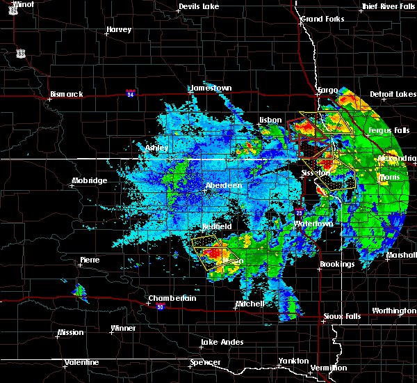 At 759 pm cdt, a severe thunderstorm was located near rosholt, or 8 miles west of wheaton, moving southeast at 45 mph (radar indicated). Hazards include ping pong ball size hail and 60 mph wind gusts. People and animals outdoors will be injured. expect hail damage to roofs, siding, windows and vehicles. expect wind damage to roofs, siding and trees. this severe storm will be near, wheaton and silver bridge around 805 pm cdt. lake traverse, halls landing and rainbow island around 810 pm cdt. dumont around 815 pm cdt. siloah country church and collis around 820 pm cdt. graceville and barry around 825 pm cdt. Johnson around 830 pm cdt. At 759 pm cdt, a severe thunderstorm was located near rosholt, or 8 miles west of wheaton, moving southeast at 45 mph (radar indicated). Hazards include ping pong ball size hail and 60 mph wind gusts. People and animals outdoors will be injured. expect hail damage to roofs, siding, windows and vehicles. expect wind damage to roofs, siding and trees. this severe storm will be near, wheaton and silver bridge around 805 pm cdt. lake traverse, halls landing and rainbow island around 810 pm cdt. dumont around 815 pm cdt. siloah country church and collis around 820 pm cdt. graceville and barry around 825 pm cdt. Johnson around 830 pm cdt.
|
| 6/27/2015 7:57 PM CDT |
 At 756 pm cdt, a severe thunderstorm was located over lamars, or 12 miles northwest of wheaton, moving southeast at 40 mph (radar indicated). Hazards include quarter size hail. Damage to vehicles is expected. locations impacted include, fairmount, lamars and blackmer. A tornado watch remains in effect until 1000 pm cdt for southeastern north dakota. At 756 pm cdt, a severe thunderstorm was located over lamars, or 12 miles northwest of wheaton, moving southeast at 40 mph (radar indicated). Hazards include quarter size hail. Damage to vehicles is expected. locations impacted include, fairmount, lamars and blackmer. A tornado watch remains in effect until 1000 pm cdt for southeastern north dakota.
|
| 6/27/2015 7:52 PM CDT |
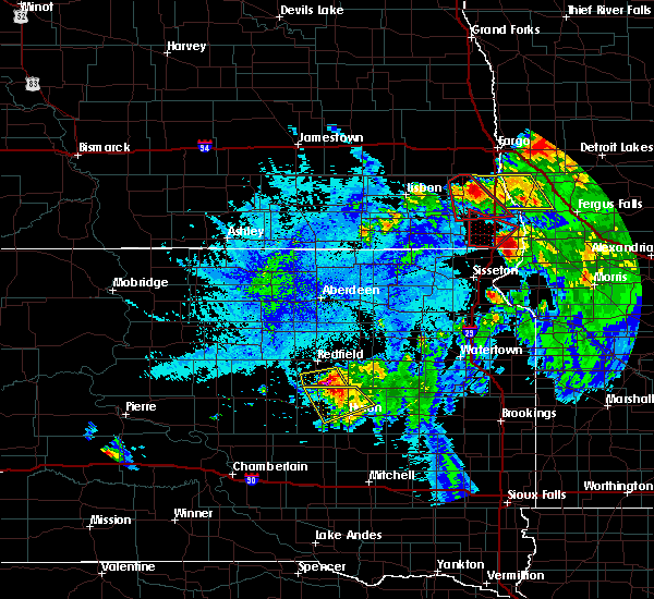 At 752 pm cdt, a severe thunderstorm was located over whiterock colony, or 9 miles northwest of wheaton, moving southeast at 45 mph (radar indicated). Hazards include 60 mph wind gusts and quarter size hail. Hail damage to vehicles is expected. expect wind damage to roofs, siding and trees. this severe thunderstorm will be near, white rock around 755 pm cdt. mud lake landing, silver bridge and lake traverse around 800 pm cdt. wheaton around 805 pm cdt. dumont around 810 pm cdt. collis around 815 pm cdt. graceville around 820 pm cdt. Johnson and trinity lutheran country church around 825 pm cdt. At 752 pm cdt, a severe thunderstorm was located over whiterock colony, or 9 miles northwest of wheaton, moving southeast at 45 mph (radar indicated). Hazards include 60 mph wind gusts and quarter size hail. Hail damage to vehicles is expected. expect wind damage to roofs, siding and trees. this severe thunderstorm will be near, white rock around 755 pm cdt. mud lake landing, silver bridge and lake traverse around 800 pm cdt. wheaton around 805 pm cdt. dumont around 810 pm cdt. collis around 815 pm cdt. graceville around 820 pm cdt. Johnson and trinity lutheran country church around 825 pm cdt.
|
| 6/27/2015 7:52 PM CDT |
 At 751 pm cdt, a severe thunderstorm was located near rosholt, or 15 miles northwest of wheaton, moving southeast at 40 mph (radar indicated). Hazards include quarter size hail. Damage to vehicles is expected. This severe thunderstorm will remain over mainly rural areas of southeastern richland county near dakota magic casino a tornado watch remains in effect until 1000 pm cdt for southeastern north dakota. At 751 pm cdt, a severe thunderstorm was located near rosholt, or 15 miles northwest of wheaton, moving southeast at 40 mph (radar indicated). Hazards include quarter size hail. Damage to vehicles is expected. This severe thunderstorm will remain over mainly rural areas of southeastern richland county near dakota magic casino a tornado watch remains in effect until 1000 pm cdt for southeastern north dakota.
|
| 6/27/2015 7:52 PM CDT |
 At 752 pm cdt, a severe thunderstorm was located over whiterock colony, or 9 miles northwest of wheaton, moving southeast at 45 mph (radar indicated). Hazards include 60 mph wind gusts and quarter size hail. Hail damage to vehicles is expected. expect wind damage to roofs, siding and trees. this severe thunderstorm will be near, white rock around 755 pm cdt. mud lake landing, silver bridge and lake traverse around 800 pm cdt. wheaton around 805 pm cdt. dumont around 810 pm cdt. collis around 815 pm cdt. graceville around 820 pm cdt. Johnson and trinity lutheran country church around 825 pm cdt. At 752 pm cdt, a severe thunderstorm was located over whiterock colony, or 9 miles northwest of wheaton, moving southeast at 45 mph (radar indicated). Hazards include 60 mph wind gusts and quarter size hail. Hail damage to vehicles is expected. expect wind damage to roofs, siding and trees. this severe thunderstorm will be near, white rock around 755 pm cdt. mud lake landing, silver bridge and lake traverse around 800 pm cdt. wheaton around 805 pm cdt. dumont around 810 pm cdt. collis around 815 pm cdt. graceville around 820 pm cdt. Johnson and trinity lutheran country church around 825 pm cdt.
|
Hail Maps for White Rock, SD
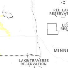
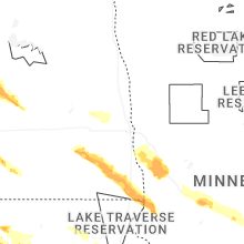


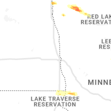


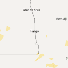


Connect with Interactive Hail Maps