

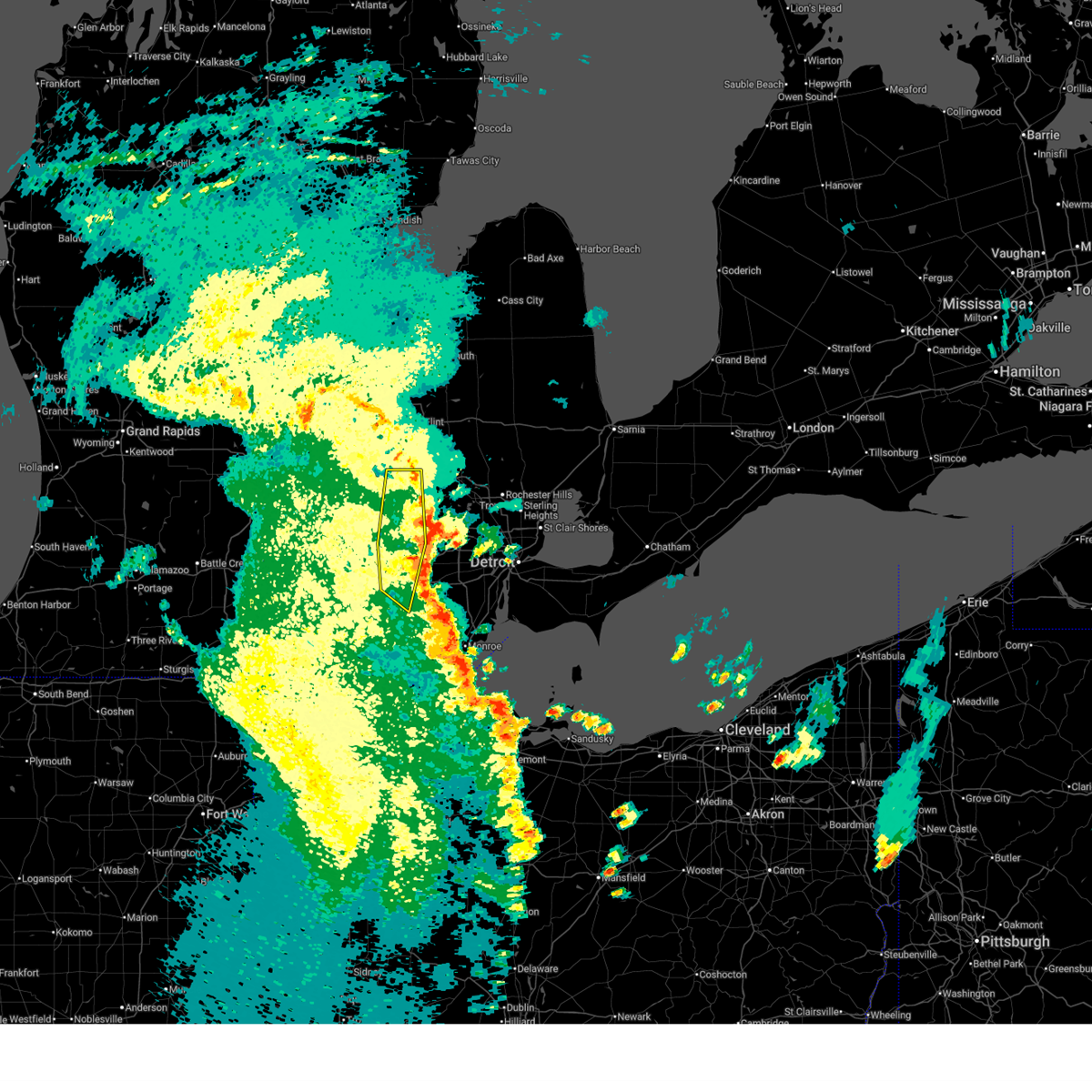
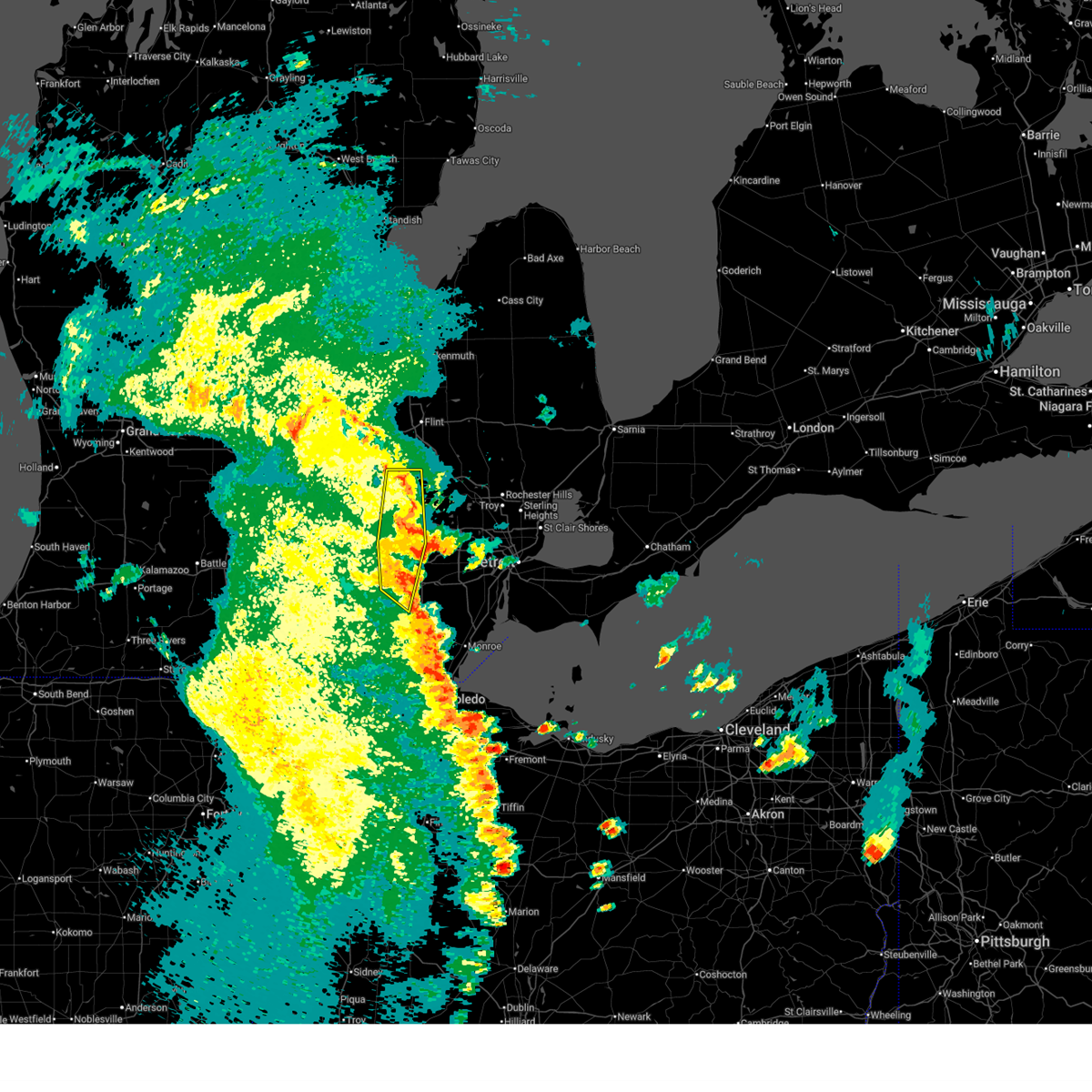
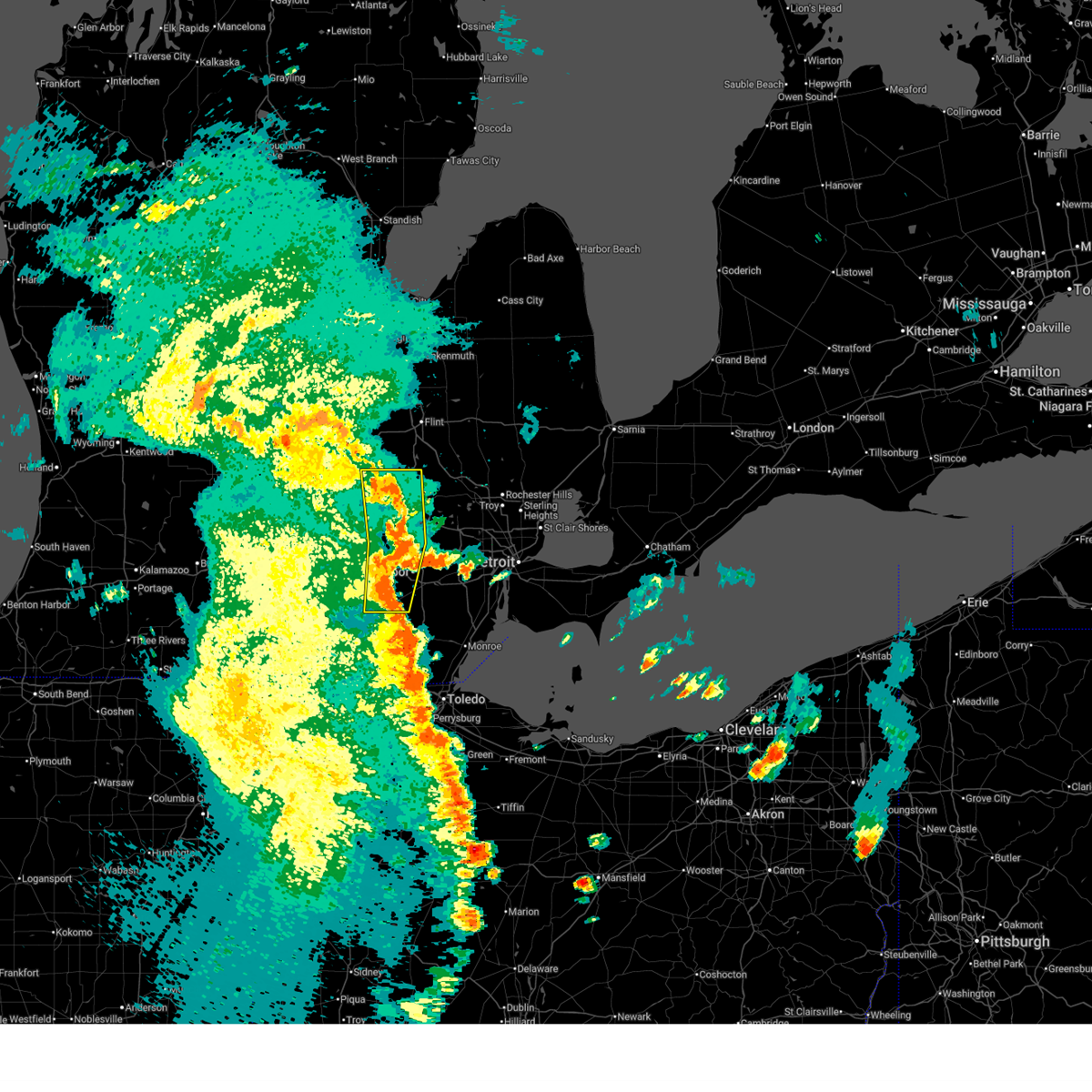
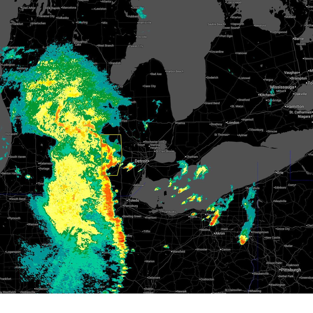
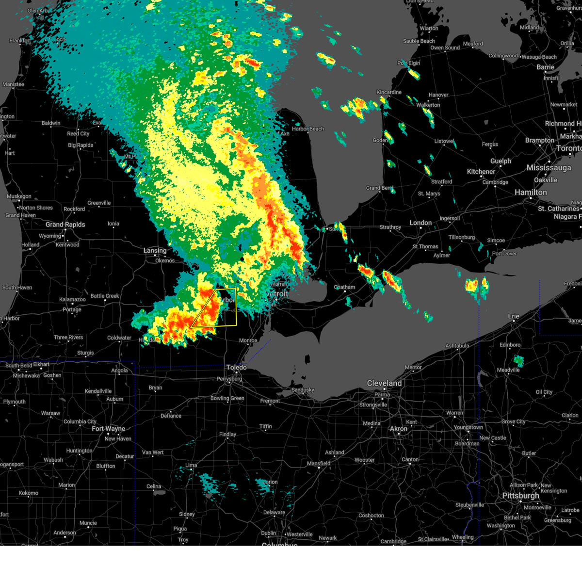
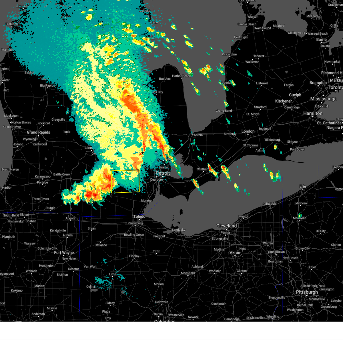
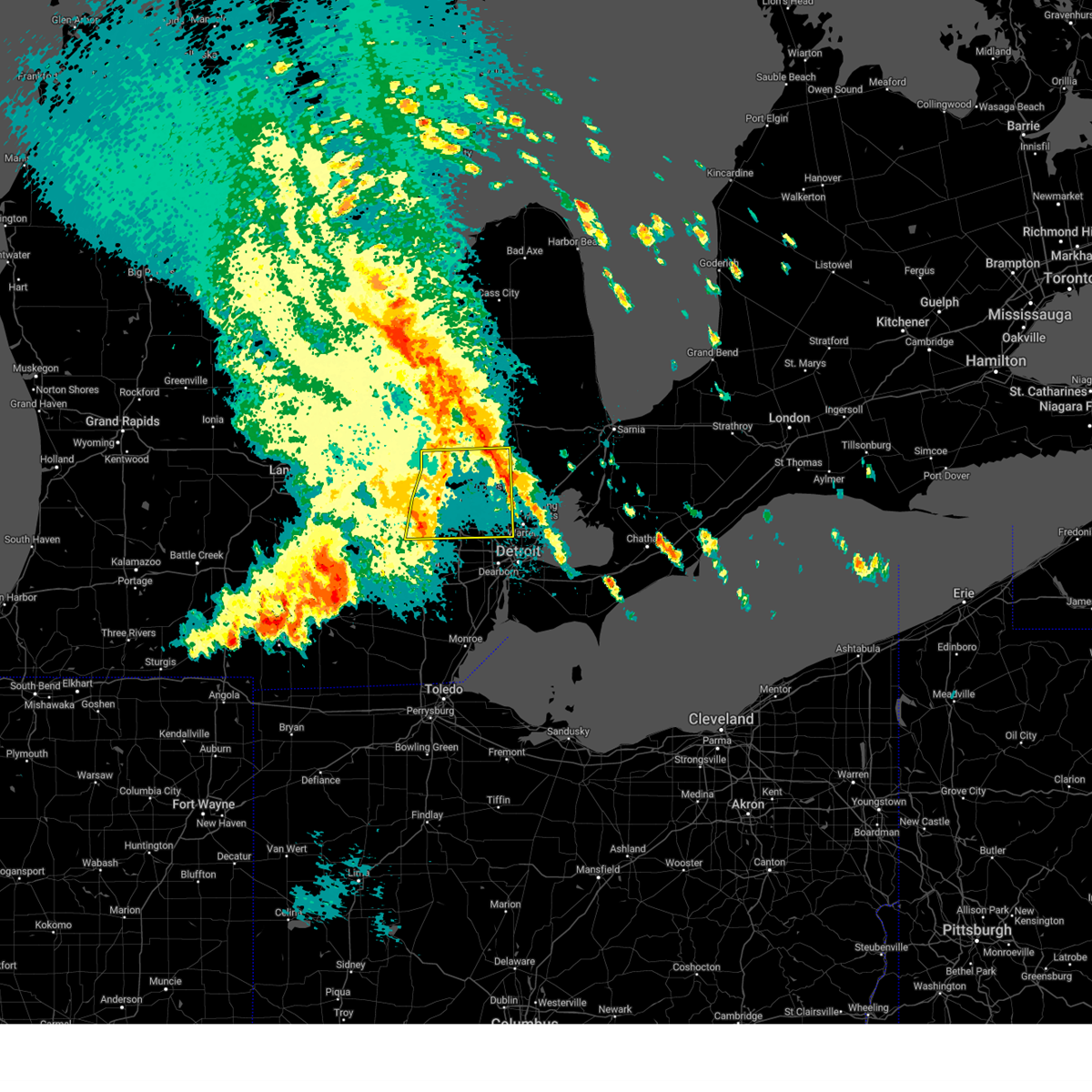
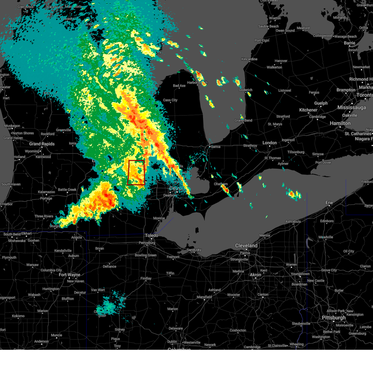
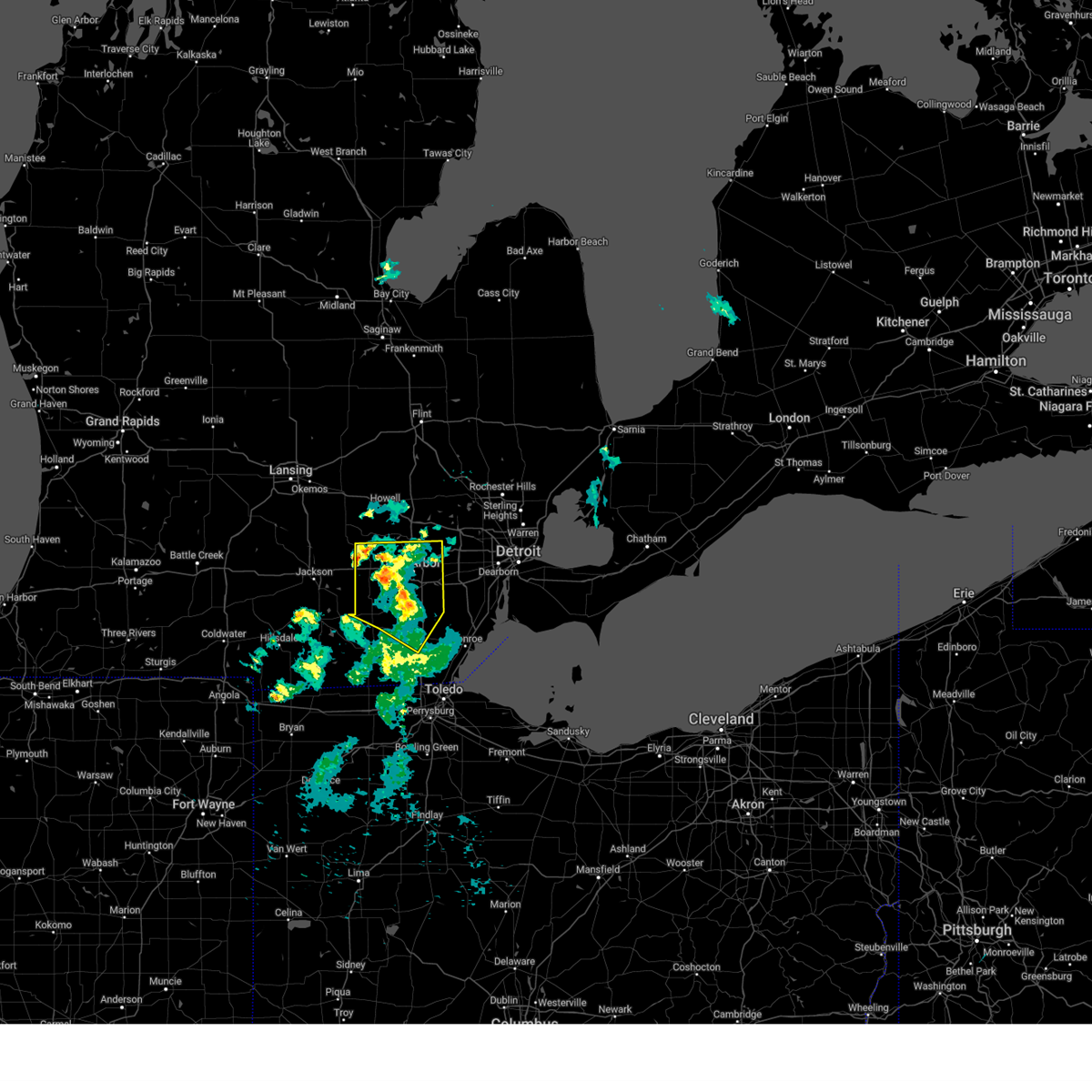
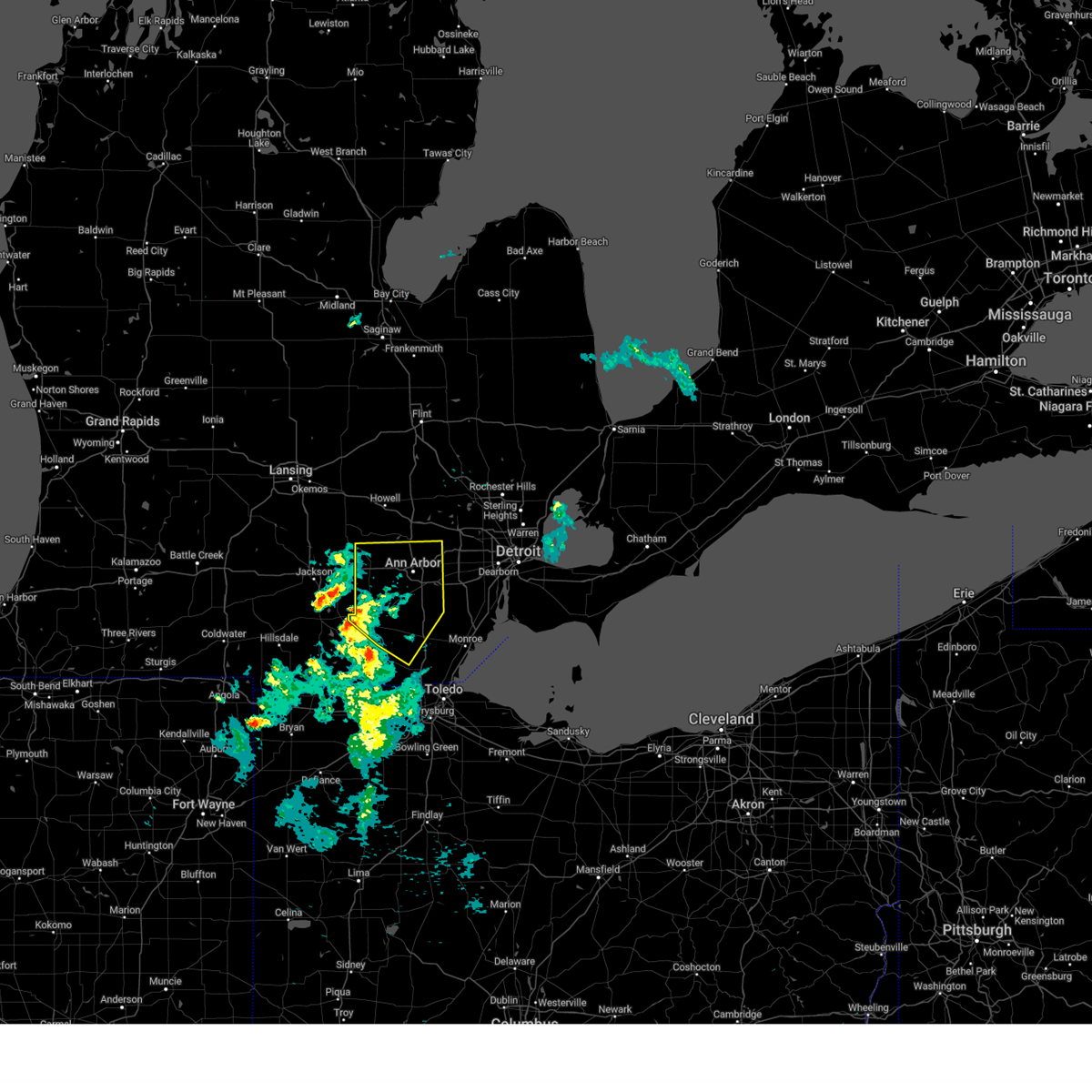
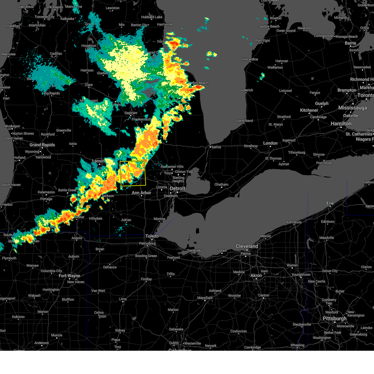
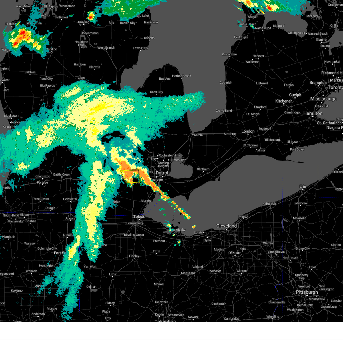
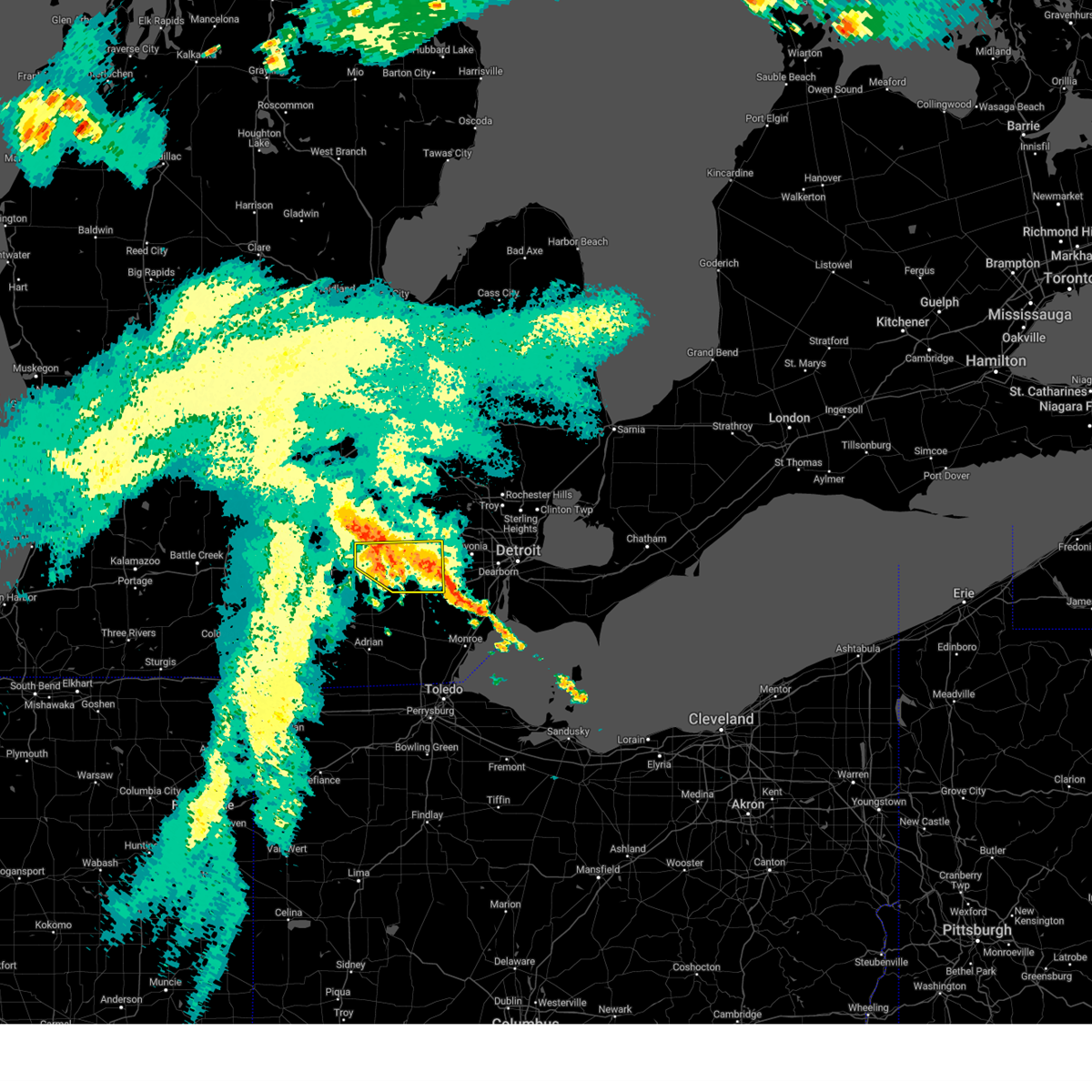
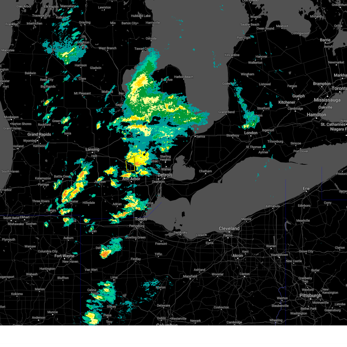
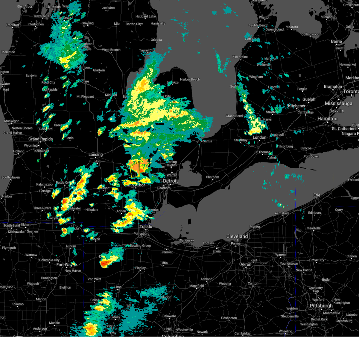
Hail Map for Whitmore Lake, MI
The Whitmore Lake, MI area has had 6 reports of on-the-ground hail by trained spotters, and has been under severe weather warnings 54 times during the past 12 months. Doppler radar has detected hail at or near Whitmore Lake, MI on 29 occasions, including 1 occasion during the past year.
| Name: | Whitmore Lake, MI |
| Where Located: | 40.8 miles S of Flint, MI |
| Map: | Google Map for Whitmore Lake, MI |
| Population: | 6423 |
| Housing Units: | 3086 |
| More Info: | Search Google for Whitmore Lake, MI |
0
The Top Recent Hail Date for Whitmore Lake, MI is Tuesday, July 23, 2024 (29th out of 29)

Hail and Wind Damage Spotted near Whitmore Lake, MI
| Date / Time | Report Details |
|---|---|
| 6/18/2025 8:00 PM EDT |
 The storms which prompted the warning have moved out of the area. therefore, the warning has been allowed to expire. a severe thunderstorm watch remains in effect until 1000 pm edt for southeastern michigan. to report severe weather, contact your nearest law enforcement agency. they will relay your report to the national weather service detroit/pontiac. The storms which prompted the warning have moved out of the area. therefore, the warning has been allowed to expire. a severe thunderstorm watch remains in effect until 1000 pm edt for southeastern michigan. to report severe weather, contact your nearest law enforcement agency. they will relay your report to the national weather service detroit/pontiac.
|
| 6/18/2025 7:46 PM EDT |
 At 746 pm edt, severe thunderstorms were located along a line extending from near linden to south lyon to near saline, moving northeast at 30 mph (radar indicated). Hazards include 60 mph wind gusts. Expect damage to roofs, siding, and trees. these severe storms will be near, ann arbor, saline, and south lyon around 750 pm edt. Other locations impacted by these severe thunderstorms include hudson mills, lakeland, hudson mills metropark, island lake state recreation area, bridgewater, chilson, delhi mills, pleasant lake, barton hills, and pinckney state recreation area. At 746 pm edt, severe thunderstorms were located along a line extending from near linden to south lyon to near saline, moving northeast at 30 mph (radar indicated). Hazards include 60 mph wind gusts. Expect damage to roofs, siding, and trees. these severe storms will be near, ann arbor, saline, and south lyon around 750 pm edt. Other locations impacted by these severe thunderstorms include hudson mills, lakeland, hudson mills metropark, island lake state recreation area, bridgewater, chilson, delhi mills, pleasant lake, barton hills, and pinckney state recreation area.
|
| 6/18/2025 7:34 PM EDT |
 At 734 pm edt, severe thunderstorms were located along a line extending from near oak grove to whitmore lake to near dexter to near saline, moving northeast at 40 mph (radar indicated). Hazards include 60 mph wind gusts. Expect damage to roofs, siding, and trees. these severe storms will be near, ann arbor, hartland, saline, brighton, dexter, hamburg, south lyon, and whitmore lake around 740 pm edt. Other locations impacted by these severe thunderstorms include hudson mills metropark, island lake state recreation area, bridgewater, delhi mills, pleasant lake, barton hills, pinckney state recreation area, hudson mills, lakeland, and chilson. At 734 pm edt, severe thunderstorms were located along a line extending from near oak grove to whitmore lake to near dexter to near saline, moving northeast at 40 mph (radar indicated). Hazards include 60 mph wind gusts. Expect damage to roofs, siding, and trees. these severe storms will be near, ann arbor, hartland, saline, brighton, dexter, hamburg, south lyon, and whitmore lake around 740 pm edt. Other locations impacted by these severe thunderstorms include hudson mills metropark, island lake state recreation area, bridgewater, delhi mills, pleasant lake, barton hills, pinckney state recreation area, hudson mills, lakeland, and chilson.
|
| 6/18/2025 7:19 PM EDT |
 At 719 pm edt, severe thunderstorms were located along a line extending from near fowlerville to near howell to near dexter to near manchester to 6 miles northwest of tecumseh, moving northeast at 40 mph (radar indicated). Hazards include 70 mph wind gusts. Expect considerable tree damage. damage is likely to mobile homes, roofs, and outbuildings. these severe storms will be near, ann arbor, howell, chelsea, dexter, pinckney, manchester, hamburg, oak grove, and whitmore lake around 725 pm edt. brighton and cohoctah around 730 pm edt. hartland and south lyon around 740 pm edt. Other locations impacted by these severe thunderstorms include plainfield, hudson mills metropark, island lake state recreation area, bridgewater, delhi mills, pleasant lake, barton hills, pinckney state recreation area, conway township, and parkers corners. At 719 pm edt, severe thunderstorms were located along a line extending from near fowlerville to near howell to near dexter to near manchester to 6 miles northwest of tecumseh, moving northeast at 40 mph (radar indicated). Hazards include 70 mph wind gusts. Expect considerable tree damage. damage is likely to mobile homes, roofs, and outbuildings. these severe storms will be near, ann arbor, howell, chelsea, dexter, pinckney, manchester, hamburg, oak grove, and whitmore lake around 725 pm edt. brighton and cohoctah around 730 pm edt. hartland and south lyon around 740 pm edt. Other locations impacted by these severe thunderstorms include plainfield, hudson mills metropark, island lake state recreation area, bridgewater, delhi mills, pleasant lake, barton hills, pinckney state recreation area, conway township, and parkers corners.
|
| 6/18/2025 7:07 PM EDT |
 At 706 pm edt, severe thunderstorms were located along a line extending from near dewitt to near fowlerville to chelsea, moving northeast at 45 mph (radar indicated). Hazards include 70 mph wind gusts. Expect considerable tree damage. damage is likely to mobile homes, roofs, and outbuildings. these severe storms will be near, chelsea, fowlerville, and pinckney around 710 pm edt. howell around 715 pm edt. hamburg, cohoctah, and oak grove around 720 pm edt. brighton around 725 pm edt. hartland around 730 pm edt. Other locations impacted by these severe thunderstorms include plainfield, hudson mills metropark, island lake state recreation area, bridgewater, delhi mills, pleasant lake, barton hills, pinckney state recreation area, conway township, and parkers corners. At 706 pm edt, severe thunderstorms were located along a line extending from near dewitt to near fowlerville to chelsea, moving northeast at 45 mph (radar indicated). Hazards include 70 mph wind gusts. Expect considerable tree damage. damage is likely to mobile homes, roofs, and outbuildings. these severe storms will be near, chelsea, fowlerville, and pinckney around 710 pm edt. howell around 715 pm edt. hamburg, cohoctah, and oak grove around 720 pm edt. brighton around 725 pm edt. hartland around 730 pm edt. Other locations impacted by these severe thunderstorms include plainfield, hudson mills metropark, island lake state recreation area, bridgewater, delhi mills, pleasant lake, barton hills, pinckney state recreation area, conway township, and parkers corners.
|
| 6/18/2025 6:57 PM EDT |
 At 656 pm edt, severe thunderstorms were located along a line extending from edgemont park to near stockbridge to near grass lake, moving northeast at 45 mph (radar indicated). Hazards include 60 mph wind gusts. Expect damage to roofs, siding, and trees. these severe storms will be near, chelsea and gregory around 700 pm edt. fowlerville and pinckney around 705 pm edt. howell and dexter around 710 pm edt. brighton, hamburg, cohoctah, oak grove, and whitmore lake around 720 pm edt. hartland around 725 pm edt. south lyon around 730 pm edt. Other locations impacted by these severe thunderstorms include plainfield, hudson mills metropark, island lake state recreation area, bridgewater, delhi mills, pleasant lake, barton hills, pinckney state recreation area, conway township, and parkers corners. At 656 pm edt, severe thunderstorms were located along a line extending from edgemont park to near stockbridge to near grass lake, moving northeast at 45 mph (radar indicated). Hazards include 60 mph wind gusts. Expect damage to roofs, siding, and trees. these severe storms will be near, chelsea and gregory around 700 pm edt. fowlerville and pinckney around 705 pm edt. howell and dexter around 710 pm edt. brighton, hamburg, cohoctah, oak grove, and whitmore lake around 720 pm edt. hartland around 725 pm edt. south lyon around 730 pm edt. Other locations impacted by these severe thunderstorms include plainfield, hudson mills metropark, island lake state recreation area, bridgewater, delhi mills, pleasant lake, barton hills, pinckney state recreation area, conway township, and parkers corners.
|
| 6/18/2025 6:43 PM EDT |
 Svrdtx the national weather service in detroit/pontiac has issued a * severe thunderstorm warning for, livingston county in southeastern michigan, washtenaw county in southeastern michigan, * until 800 pm edt. * at 643 pm edt, severe thunderstorms were located along a line extending from near grand ledge to near leslie to near grass lake, moving northeast at 50 mph (radar indicated). Hazards include 60 mph wind gusts. Expect damage to roofs, siding, and trees. severe thunderstorms will be near, fowlerville and gregory around 700 pm edt. pinckney around 705 pm edt. howell around 710 pm edt. cohoctah and oak grove around 715 pm edt. brighton around 720 pm edt. hartland around 725 pm edt. Other locations impacted by these severe thunderstorms include plainfield, hudson mills metropark, island lake state recreation area, bridgewater, delhi mills, pleasant lake, barton hills, pinckney state recreation area, conway township, and parkers corners. Svrdtx the national weather service in detroit/pontiac has issued a * severe thunderstorm warning for, livingston county in southeastern michigan, washtenaw county in southeastern michigan, * until 800 pm edt. * at 643 pm edt, severe thunderstorms were located along a line extending from near grand ledge to near leslie to near grass lake, moving northeast at 50 mph (radar indicated). Hazards include 60 mph wind gusts. Expect damage to roofs, siding, and trees. severe thunderstorms will be near, fowlerville and gregory around 700 pm edt. pinckney around 705 pm edt. howell around 710 pm edt. cohoctah and oak grove around 715 pm edt. brighton around 720 pm edt. hartland around 725 pm edt. Other locations impacted by these severe thunderstorms include plainfield, hudson mills metropark, island lake state recreation area, bridgewater, delhi mills, pleasant lake, barton hills, pinckney state recreation area, conway township, and parkers corners.
|
| 5/16/2025 1:24 AM EDT |
 The storm which prompted the warning has moved out of the area. therefore, the warning will be allowed to expire. however, gusty winds are still possible with this thunderstorm. a tornado watch remains in effect until 500 am edt for southeastern michigan. The storm which prompted the warning has moved out of the area. therefore, the warning will be allowed to expire. however, gusty winds are still possible with this thunderstorm. a tornado watch remains in effect until 500 am edt for southeastern michigan.
|
| 5/16/2025 1:03 AM EDT |
 At 103 am edt, a severe thunderstorm was located over dixboro, or over ann arbor, moving east at 50 mph (radar indicated). Hazards include 60 mph wind gusts and penny size hail. Expect damage to roofs, siding, and trees. This severe thunderstorm will remain over mainly rural areas of washtenaw county, including the following locations, bridgewater, pittsfield township, delhi mills, pleasant lake, whittaker, and barton hills. At 103 am edt, a severe thunderstorm was located over dixboro, or over ann arbor, moving east at 50 mph (radar indicated). Hazards include 60 mph wind gusts and penny size hail. Expect damage to roofs, siding, and trees. This severe thunderstorm will remain over mainly rural areas of washtenaw county, including the following locations, bridgewater, pittsfield township, delhi mills, pleasant lake, whittaker, and barton hills.
|
| 5/16/2025 12:39 AM EDT |
 At 1239 am edt, a severe thunderstorm was located near chelsea, moving east at 60 mph (radar indicated). Hazards include 60 mph wind gusts and quarter size hail. Hail damage to vehicles is expected. expect wind damage to roofs, siding, and trees. this severe storm will be near, ann arbor around 1250 am edt. ypsilanti and saline around 1255 am edt. dixboro around 100 am edt. Other locations impacted by this severe thunderstorm include hudson mills, pittsfield township, whittaker, lyndon township, hudson mills metropark, bridgewater, delhi mills, pleasant lake, and barton hills. At 1239 am edt, a severe thunderstorm was located near chelsea, moving east at 60 mph (radar indicated). Hazards include 60 mph wind gusts and quarter size hail. Hail damage to vehicles is expected. expect wind damage to roofs, siding, and trees. this severe storm will be near, ann arbor around 1250 am edt. ypsilanti and saline around 1255 am edt. dixboro around 100 am edt. Other locations impacted by this severe thunderstorm include hudson mills, pittsfield township, whittaker, lyndon township, hudson mills metropark, bridgewater, delhi mills, pleasant lake, and barton hills.
|
| 5/16/2025 12:37 AM EDT |
 At 1236 am edt, severe thunderstorms were located along a line extending from near otisville to near clarkston to near salem, moving east at 65 mph (radar indicated). Hazards include 70 mph wind gusts and quarter size hail. Hail damage to vehicles is expected. expect considerable tree damage. wind damage is also likely to mobile homes, roofs, and outbuildings. these severe storms will be near, pontiac, novi, ortonville, west bloomfield, and clarkston around 1240 am edt. southfield and oxford around 1245 am edt. troy, royal oak, birmingham, and rochester around 1250 am edt. sterling heights and detroit zoo around 1255 am edt. warren around 100 am edt. Other locations impacted by these severe thunderstorms include franklin, keego harbor, waterford, orchard lake, holly state recreation area, commerce, rose center, lathrup village, auburn hills, and bingham farms. At 1236 am edt, severe thunderstorms were located along a line extending from near otisville to near clarkston to near salem, moving east at 65 mph (radar indicated). Hazards include 70 mph wind gusts and quarter size hail. Hail damage to vehicles is expected. expect considerable tree damage. wind damage is also likely to mobile homes, roofs, and outbuildings. these severe storms will be near, pontiac, novi, ortonville, west bloomfield, and clarkston around 1240 am edt. southfield and oxford around 1245 am edt. troy, royal oak, birmingham, and rochester around 1250 am edt. sterling heights and detroit zoo around 1255 am edt. warren around 100 am edt. Other locations impacted by these severe thunderstorms include franklin, keego harbor, waterford, orchard lake, holly state recreation area, commerce, rose center, lathrup village, auburn hills, and bingham farms.
|
| 5/16/2025 12:32 AM EDT |
 the tornado warning has been cancelled and is no longer in effect the tornado warning has been cancelled and is no longer in effect
|
| 5/16/2025 12:21 AM EDT |
 Svrdtx the national weather service in detroit/pontiac has issued a * severe thunderstorm warning for, washtenaw county in southeastern michigan, * until 130 am edt. * at 1221 am edt, a severe thunderstorm was located over vandercook lake, or near jackson, moving east at 50 mph (radar indicated). Hazards include 60 mph wind gusts. Expect damage to roofs, siding, and trees. this severe thunderstorm will be near, chelsea around 1245 am edt. ann arbor and dexter around 1255 am edt. ypsilanti and dixboro around 105 am edt. Other locations impacted by this severe thunderstorm include hudson mills, pittsfield township, whittaker, lyndon township, hudson mills metropark, bridgewater, delhi mills, pleasant lake, and barton hills. Svrdtx the national weather service in detroit/pontiac has issued a * severe thunderstorm warning for, washtenaw county in southeastern michigan, * until 130 am edt. * at 1221 am edt, a severe thunderstorm was located over vandercook lake, or near jackson, moving east at 50 mph (radar indicated). Hazards include 60 mph wind gusts. Expect damage to roofs, siding, and trees. this severe thunderstorm will be near, chelsea around 1245 am edt. ann arbor and dexter around 1255 am edt. ypsilanti and dixboro around 105 am edt. Other locations impacted by this severe thunderstorm include hudson mills, pittsfield township, whittaker, lyndon township, hudson mills metropark, bridgewater, delhi mills, pleasant lake, and barton hills.
|
| 5/16/2025 12:18 AM EDT | Report of trees and wires down in livingston county MI, 3.2 miles SE of Whitmore Lake, MI |
| 5/16/2025 12:15 AM EDT |
 At 1215 am edt, a severe thunderstorm capable of producing a tornado was located over pinckney, moving east at 60 mph (radar indicated rotation). Hazards include tornado. Flying debris will be dangerous to those caught without shelter. mobile homes will be damaged or destroyed. damage to roofs, windows, and vehicles will occur. tree damage is likely. this dangerous storm will be near, brighton, hamburg, and whitmore lake around 1220 am edt. Other locations impacted by this tornadic thunderstorm include island lake state recreation area, chilson, lakeland, hell, tyrone township, and deerfield township. At 1215 am edt, a severe thunderstorm capable of producing a tornado was located over pinckney, moving east at 60 mph (radar indicated rotation). Hazards include tornado. Flying debris will be dangerous to those caught without shelter. mobile homes will be damaged or destroyed. damage to roofs, windows, and vehicles will occur. tree damage is likely. this dangerous storm will be near, brighton, hamburg, and whitmore lake around 1220 am edt. Other locations impacted by this tornadic thunderstorm include island lake state recreation area, chilson, lakeland, hell, tyrone township, and deerfield township.
|
| 5/16/2025 12:10 AM EDT |
 At 1209 am edt, severe thunderstorms were located along a line extending from near new lothrop to oak grove to near chelsea, moving east at 65 mph (radar indicated). Hazards include 70 mph wind gusts and penny size hail. Expect considerable tree damage. damage is likely to mobile homes, roofs, and outbuildings. these severe storms will be near, hartland, howell, brighton, and pinckney around 1215 am edt. fenton, holly, hamburg, lake fenton, and whitmore lake around 1220 am edt. milford and south lyon around 1225 am edt. novi, ortonville, and clarkston around 1230 am edt. northville around 1235 am edt. southfield, pontiac, oxford, and west bloomfield around 1240 am edt. troy, birmingham, and rochester around 1245 am edt. sterling heights, royal oak, and detroit zoo around 1250 am edt. Other locations impacted by these severe thunderstorms include franklin, keego harbor, waterford, orchard lake, plainfield, holly state recreation area, commerce, rose center, pinckney state recreation area, and conway township. At 1209 am edt, severe thunderstorms were located along a line extending from near new lothrop to oak grove to near chelsea, moving east at 65 mph (radar indicated). Hazards include 70 mph wind gusts and penny size hail. Expect considerable tree damage. damage is likely to mobile homes, roofs, and outbuildings. these severe storms will be near, hartland, howell, brighton, and pinckney around 1215 am edt. fenton, holly, hamburg, lake fenton, and whitmore lake around 1220 am edt. milford and south lyon around 1225 am edt. novi, ortonville, and clarkston around 1230 am edt. northville around 1235 am edt. southfield, pontiac, oxford, and west bloomfield around 1240 am edt. troy, birmingham, and rochester around 1245 am edt. sterling heights, royal oak, and detroit zoo around 1250 am edt. Other locations impacted by these severe thunderstorms include franklin, keego harbor, waterford, orchard lake, plainfield, holly state recreation area, commerce, rose center, pinckney state recreation area, and conway township.
|
| 5/16/2025 12:01 AM EDT |
 Tordtx the national weather service in detroit/pontiac has issued a * tornado warning for, livingston county in southeastern michigan, * until 1245 am edt. * at 1201 am edt, a severe thunderstorm capable of producing a tornado was located over stockbridge, or 11 miles west of pinckney, moving east at 60 mph (radar indicated rotation). Hazards include tornado. Flying debris will be dangerous to those caught without shelter. mobile homes will be damaged or destroyed. damage to roofs, windows, and vehicles will occur. tree damage is likely. this dangerous storm will be near, gregory around 1205 am edt. pinckney around 1210 am edt. brighton around 1215 am edt. hamburg and whitmore lake around 1220 am edt. other locations impacted by this tornadic thunderstorm include parkers corners, lakeland, plainfield, island lake state recreation area, chilson, unadilla, pinckney state recreation area, conway township, hell, and tyrone township. this includes the following highways, i-96 between mile markers 125 and 151. Us-23 between mile markers 53 and 77. Tordtx the national weather service in detroit/pontiac has issued a * tornado warning for, livingston county in southeastern michigan, * until 1245 am edt. * at 1201 am edt, a severe thunderstorm capable of producing a tornado was located over stockbridge, or 11 miles west of pinckney, moving east at 60 mph (radar indicated rotation). Hazards include tornado. Flying debris will be dangerous to those caught without shelter. mobile homes will be damaged or destroyed. damage to roofs, windows, and vehicles will occur. tree damage is likely. this dangerous storm will be near, gregory around 1205 am edt. pinckney around 1210 am edt. brighton around 1215 am edt. hamburg and whitmore lake around 1220 am edt. other locations impacted by this tornadic thunderstorm include parkers corners, lakeland, plainfield, island lake state recreation area, chilson, unadilla, pinckney state recreation area, conway township, hell, and tyrone township. this includes the following highways, i-96 between mile markers 125 and 151. Us-23 between mile markers 53 and 77.
|
| 5/15/2025 11:45 PM EDT |
 Svrdtx the national weather service in detroit/pontiac has issued a * severe thunderstorm warning for, oakland county in southeastern michigan, livingston county in southeastern michigan, * until 115 am edt. * at 1144 pm edt, severe thunderstorms were located along a line extending from 8 miles west of elsie to near lansing to near albion, moving east at 65 mph (radar indicated). Hazards include 70 mph wind gusts. Expect considerable tree damage. damage is likely to mobile homes, roofs, and outbuildings. severe thunderstorms will be near, fowlerville around 1200 am edt. cohoctah, gregory, and oak grove around 1205 am edt. howell around 1210 am edt. hartland and pinckney around 1215 am edt. fenton, brighton, holly, hamburg, and lake fenton around 1220 am edt. milford and whitmore lake around 1225 am edt. south lyon, ortonville, and clarkston around 1230 am edt. novi and northville around 1235 am edt. Other locations impacted by these severe thunderstorms include franklin, keego harbor, waterford, orchard lake, plainfield, holly state recreation area, commerce, rose center, pinckney state recreation area, and conway township. Svrdtx the national weather service in detroit/pontiac has issued a * severe thunderstorm warning for, oakland county in southeastern michigan, livingston county in southeastern michigan, * until 115 am edt. * at 1144 pm edt, severe thunderstorms were located along a line extending from 8 miles west of elsie to near lansing to near albion, moving east at 65 mph (radar indicated). Hazards include 70 mph wind gusts. Expect considerable tree damage. damage is likely to mobile homes, roofs, and outbuildings. severe thunderstorms will be near, fowlerville around 1200 am edt. cohoctah, gregory, and oak grove around 1205 am edt. howell around 1210 am edt. hartland and pinckney around 1215 am edt. fenton, brighton, holly, hamburg, and lake fenton around 1220 am edt. milford and whitmore lake around 1225 am edt. south lyon, ortonville, and clarkston around 1230 am edt. novi and northville around 1235 am edt. Other locations impacted by these severe thunderstorms include franklin, keego harbor, waterford, orchard lake, plainfield, holly state recreation area, commerce, rose center, pinckney state recreation area, and conway township.
|
| 3/30/2025 7:07 PM EDT |
 The storms which prompted the warning have moved out of the warned area. therefore, the warning will be allowed to expire. a severe thunderstorm watch remains in effect until 1000 pm edt for southeastern michigan. The storms which prompted the warning have moved out of the warned area. therefore, the warning will be allowed to expire. a severe thunderstorm watch remains in effect until 1000 pm edt for southeastern michigan.
|
| 3/30/2025 6:58 PM EDT |
 At 658 pm edt, severe thunderstorms were located along a line extending from near lennon to near brighton to near ypsilanti, moving northeast at 70 mph (radar indicated). Hazards include 70 mph wind gusts and penny size hail. Expect considerable tree damage. damage is likely to mobile homes, roofs, and outbuildings. these severe storms will be near, salem around 705 pm edt. other locations impacted by these severe thunderstorms include pittsfield township, whittaker, lakeland, island lake state recreation area, chilson, delhi mills, barton hills, tyrone township, and deerfield township. this includes the following highways, i-94 between mile markers 170 and 187. i-96 between mile markers 139 and 152. m-14 between mile markers 1 and 15. Us-23 between mile markers 26 and 77. At 658 pm edt, severe thunderstorms were located along a line extending from near lennon to near brighton to near ypsilanti, moving northeast at 70 mph (radar indicated). Hazards include 70 mph wind gusts and penny size hail. Expect considerable tree damage. damage is likely to mobile homes, roofs, and outbuildings. these severe storms will be near, salem around 705 pm edt. other locations impacted by these severe thunderstorms include pittsfield township, whittaker, lakeland, island lake state recreation area, chilson, delhi mills, barton hills, tyrone township, and deerfield township. this includes the following highways, i-94 between mile markers 170 and 187. i-96 between mile markers 139 and 152. m-14 between mile markers 1 and 15. Us-23 between mile markers 26 and 77.
|
| 3/30/2025 6:28 PM EDT | At 627 pm edt, severe thunderstorms were located along a line extending from near east lansing to 6 miles west of stockbridge to onsted, moving northeast at 55 mph (radar indicated). Hazards include 80 mph wind gusts and penny size hail. Flying debris will be dangerous to those caught without shelter. mobile homes will be heavily damaged. expect considerable damage to roofs, windows, and vehicles. extensive tree damage and power outages are likely. these severe storms will be near, manchester around 630 pm edt. gregory and chelsea around 635 pm edt. fowlerville around 640 pm edt. howell, saline, pinckney, and dexter around 645 pm edt. ann arbor, hamburg, oak grove, whitmore lake, and cohoctah around 650 pm edt. brighton and ypsilanti around 655 pm edt. south lyon, hartland, and dixboro around 700 pm edt. salem around 705 pm edt. other locations impacted by these severe thunderstorms include pittsfield township, whittaker, plainfield, hudson mills metropark, island lake state recreation area, bridgewater, delhi mills, pleasant lake, barton hills, and conway township. this includes the following highways, i-94 between mile markers 154 and 187. i-96 between mile markers 125 and 152. m-14 between mile markers 1 and 15. Us-23 between mile markers 26 and 77. |
| 3/30/2025 6:14 PM EDT |
 Svrdtx the national weather service in detroit/pontiac has issued a * severe thunderstorm warning for, livingston county in southeastern michigan, washtenaw county in southeastern michigan, * until 715 pm edt. * at 614 pm edt, severe thunderstorms were located along a line extending from near potterville to 7 miles northwest of jackson to near hudson, moving northeast at 60 mph (radar indicated). Hazards include 70 mph wind gusts and penny size hail. Expect considerable tree damage. damage is likely to mobile homes, roofs, and outbuildings. severe thunderstorms will be near, manchester around 630 pm edt. gregory and chelsea around 635 pm edt. pinckney and fowlerville around 640 pm edt. howell, saline, and dexter around 645 pm edt. brighton, ann arbor, hamburg, oak grove, whitmore lake, and cohoctah around 650 pm edt. hartland, dixboro, and ypsilanti around 655 pm edt. south lyon around 700 pm edt. salem around 705 pm edt. other locations impacted by these severe thunderstorms include pittsfield township, whittaker, plainfield, hudson mills metropark, island lake state recreation area, bridgewater, delhi mills, pleasant lake, barton hills, and conway township. this includes the following highways, i-94 between mile markers 154 and 187. i-96 between mile markers 125 and 152. m-14 between mile markers 1 and 15. Us-23 between mile markers 26 and 77. Svrdtx the national weather service in detroit/pontiac has issued a * severe thunderstorm warning for, livingston county in southeastern michigan, washtenaw county in southeastern michigan, * until 715 pm edt. * at 614 pm edt, severe thunderstorms were located along a line extending from near potterville to 7 miles northwest of jackson to near hudson, moving northeast at 60 mph (radar indicated). Hazards include 70 mph wind gusts and penny size hail. Expect considerable tree damage. damage is likely to mobile homes, roofs, and outbuildings. severe thunderstorms will be near, manchester around 630 pm edt. gregory and chelsea around 635 pm edt. pinckney and fowlerville around 640 pm edt. howell, saline, and dexter around 645 pm edt. brighton, ann arbor, hamburg, oak grove, whitmore lake, and cohoctah around 650 pm edt. hartland, dixboro, and ypsilanti around 655 pm edt. south lyon around 700 pm edt. salem around 705 pm edt. other locations impacted by these severe thunderstorms include pittsfield township, whittaker, plainfield, hudson mills metropark, island lake state recreation area, bridgewater, delhi mills, pleasant lake, barton hills, and conway township. this includes the following highways, i-94 between mile markers 154 and 187. i-96 between mile markers 125 and 152. m-14 between mile markers 1 and 15. Us-23 between mile markers 26 and 77.
|
| 3/15/2025 5:46 PM EDT |
 At 545 pm edt, severe thunderstorms were located along a line extending from hartland to milford to near novi, moving northeast at 65 mph (radar indicated). Hazards include 60 mph wind gusts. Expect damage to roofs, siding, and trees. these severe storms will be near, fenton, west bloomfield, novi, and holly around 550 pm edt. clarkston and pontiac around 555 pm edt. ortonville, oxford, and troy around 600 pm edt. rochester around 605 pm edt. other locations impacted by these severe thunderstorms include franklin, keego harbor, waterford, orchard lake, holly state recreation area, commerce, rose center, lathrup village, auburn hills, and bingham farms. this includes the following highways, i-75 between mile markers 58 and 105. i-275 between mile markers 26 and 29. i-96 between mile markers 139 and 184. i-696 between mile markers 1 and 18. Us-23 between mile markers 54 and 77. At 545 pm edt, severe thunderstorms were located along a line extending from hartland to milford to near novi, moving northeast at 65 mph (radar indicated). Hazards include 60 mph wind gusts. Expect damage to roofs, siding, and trees. these severe storms will be near, fenton, west bloomfield, novi, and holly around 550 pm edt. clarkston and pontiac around 555 pm edt. ortonville, oxford, and troy around 600 pm edt. rochester around 605 pm edt. other locations impacted by these severe thunderstorms include franklin, keego harbor, waterford, orchard lake, holly state recreation area, commerce, rose center, lathrup village, auburn hills, and bingham farms. this includes the following highways, i-75 between mile markers 58 and 105. i-275 between mile markers 26 and 29. i-96 between mile markers 139 and 184. i-696 between mile markers 1 and 18. Us-23 between mile markers 54 and 77.
|
| 3/15/2025 5:44 PM EDT |
 the severe thunderstorm warning has been cancelled and is no longer in effect the severe thunderstorm warning has been cancelled and is no longer in effect
|
| 3/15/2025 5:34 PM EDT |
 At 533 pm edt, severe thunderstorms were located along a line extending from hamburg to dixboro to near ypsilanti, moving northeast at 65 mph (radar indicated). Hazards include 60 mph wind gusts. Expect damage to roofs, siding, and trees. these severe storms will be near, salem around 540 pm edt. other locations impacted by these severe thunderstorms include hudson mills, pittsfield township, delhi mills, barton hills, and hudson mills metropark. this includes the following highways, i-94 between mile markers 167 and 185. m-14 between mile markers 1 and 15. Us-23 between mile markers 34 and 52. At 533 pm edt, severe thunderstorms were located along a line extending from hamburg to dixboro to near ypsilanti, moving northeast at 65 mph (radar indicated). Hazards include 60 mph wind gusts. Expect damage to roofs, siding, and trees. these severe storms will be near, salem around 540 pm edt. other locations impacted by these severe thunderstorms include hudson mills, pittsfield township, delhi mills, barton hills, and hudson mills metropark. this includes the following highways, i-94 between mile markers 167 and 185. m-14 between mile markers 1 and 15. Us-23 between mile markers 34 and 52.
|
| 3/15/2025 5:30 PM EDT | Svrdtx the national weather service in detroit/pontiac has issued a * severe thunderstorm warning for, northwestern wayne county in southeastern michigan, oakland county in southeastern michigan, livingston county in southeastern michigan, * until 630 pm edt. * at 529 pm edt, severe thunderstorms were located along a line extending from near pinckney to whitmore lake to dixboro, moving northeast at 65 mph (radar indicated). Hazards include 60 mph wind gusts. Expect damage to roofs, siding, and trees. severe thunderstorms will be near, canton, south lyon, howell, brighton, northville, and novi around 535 pm edt. milford, hartland, and livonia around 540 pm edt. fenton around 545 pm edt. west bloomfield, clarkston, pontiac, and holly around 550 pm edt. ortonville around 555 pm edt. oxford around 600 pm edt. rochester around 605 pm edt. other locations impacted by these severe thunderstorms include franklin, keego harbor, waterford, holly state recreation area, commerce, auburn hills, lake angelus, pleasant ridge, westland, and huntington woods. this includes the following highways, i-75 between mile markers 58 and 105. i-275 between mile markers 22 and 29. i-96 between mile markers 132 and 184. i-696 between mile markers 1 and 18. m-10 between mile markers 8 and 18. m-14 between mile markers 16 and 21. m-59 between mile markers 38 and 48. Us-23 between mile markers 54 and 77. |
| 3/15/2025 5:22 PM EDT | the severe thunderstorm warning has been cancelled and is no longer in effect |
| 3/15/2025 5:22 PM EDT | At 521 pm edt, severe thunderstorms were located along a line extending from near chelsea to saline to near maybee, moving northeast at 65 mph (radar indicated). Hazards include 60 mph wind gusts. Expect damage to roofs, siding, and trees. these severe storms will be near, saline, willis, ann arbor, dexter, and ypsilanti around 525 pm edt. dixboro and whitmore lake around 530 pm edt. salem around 535 pm edt. other locations impacted by these severe thunderstorms include hudson mills, pittsfield township, whittaker, lyndon township, hudson mills metropark, bridgewater, delhi mills, pleasant lake, and barton hills. this includes the following highways, i-94 between mile markers 155 and 187. m-14 between mile markers 1 and 15. Us-23 between mile markers 26 and 52. |
| 3/15/2025 5:16 PM EDT |
 At 515 pm edt, severe thunderstorms were located along a line extending from near chelsea to near saline to near dundee, moving northeast at 65 mph (radar indicated). Hazards include 60 mph wind gusts. Expect damage to roofs, siding, and trees. these severe storms will be near, saline, willis, milan, chelsea, ann arbor, and dexter around 520 pm edt. ypsilanti around 525 pm edt. dixboro and whitmore lake around 530 pm edt. salem around 535 pm edt. other locations impacted by these severe thunderstorms include pittsfield township, cone, whittaker, macon, hudson mills metropark, bridgewater, ridgeway, delhi mills, pleasant lake, and barton hills. this includes the following highways, i-94 between mile markers 155 and 187. m-14 between mile markers 1 and 15. Us-23 between mile markers 15 and 52. At 515 pm edt, severe thunderstorms were located along a line extending from near chelsea to near saline to near dundee, moving northeast at 65 mph (radar indicated). Hazards include 60 mph wind gusts. Expect damage to roofs, siding, and trees. these severe storms will be near, saline, willis, milan, chelsea, ann arbor, and dexter around 520 pm edt. ypsilanti around 525 pm edt. dixboro and whitmore lake around 530 pm edt. salem around 535 pm edt. other locations impacted by these severe thunderstorms include pittsfield township, cone, whittaker, macon, hudson mills metropark, bridgewater, ridgeway, delhi mills, pleasant lake, and barton hills. this includes the following highways, i-94 between mile markers 155 and 187. m-14 between mile markers 1 and 15. Us-23 between mile markers 15 and 52.
|
| 3/15/2025 5:00 PM EDT |
 Svrdtx the national weather service in detroit/pontiac has issued a * severe thunderstorm warning for, northwestern monroe county in southeastern michigan, northeastern lenawee county in southeastern michigan, washtenaw county in southeastern michigan, * until 600 pm edt. * at 500 pm edt, a severe thunderstorm was located near tecumseh, moving northeast at 65 mph (radar indicated). Hazards include 60 mph wind gusts. Expect damage to roofs, siding, and trees. this severe thunderstorm will be near, britton and tecumseh around 505 pm edt. saline around 515 pm edt. ann arbor and ypsilanti around 520 pm edt. dixboro around 525 pm edt. salem around 530 pm edt. other locations impacted by this severe thunderstorm include pittsfield township, cone, whittaker, macon, hudson mills metropark, bridgewater, ridgeway, delhi mills, pleasant lake, and tipton. this includes the following highways, i-94 between mile markers 155 and 187. m-14 between mile markers 1 and 15. Us-23 between mile markers 16 and 52. Svrdtx the national weather service in detroit/pontiac has issued a * severe thunderstorm warning for, northwestern monroe county in southeastern michigan, northeastern lenawee county in southeastern michigan, washtenaw county in southeastern michigan, * until 600 pm edt. * at 500 pm edt, a severe thunderstorm was located near tecumseh, moving northeast at 65 mph (radar indicated). Hazards include 60 mph wind gusts. Expect damage to roofs, siding, and trees. this severe thunderstorm will be near, britton and tecumseh around 505 pm edt. saline around 515 pm edt. ann arbor and ypsilanti around 520 pm edt. dixboro around 525 pm edt. salem around 530 pm edt. other locations impacted by this severe thunderstorm include pittsfield township, cone, whittaker, macon, hudson mills metropark, bridgewater, ridgeway, delhi mills, pleasant lake, and tipton. this includes the following highways, i-94 between mile markers 155 and 187. m-14 between mile markers 1 and 15. Us-23 between mile markers 16 and 52.
|
| 8/28/2024 1:59 AM EDT |
 Svrdtx the national weather service in detroit/pontiac has issued a * severe thunderstorm warning for, washtenaw county in southeastern michigan, * until 245 am edt. * at 159 am edt, a severe thunderstorm was located over dexter, moving southeast at 30 mph (radar indicated). Hazards include 60 mph wind gusts and penny size hail. Expect damage to roofs, siding, and trees. this severe thunderstorm will be near, ann arbor around 205 am edt. ypsilanti around 210 am edt. dixboro around 215 am edt. willis around 230 am edt. other locations impacted by this severe thunderstorm include hudson mills, pittsfield township, whittaker, lyndon township, hudson mills metropark, bridgewater, delhi mills, pleasant lake, and barton hills. this includes the following highways, i-94 between mile markers 155 and 187. m-14 between mile markers 1 and 15. Us-23 between mile markers 26 and 52. Svrdtx the national weather service in detroit/pontiac has issued a * severe thunderstorm warning for, washtenaw county in southeastern michigan, * until 245 am edt. * at 159 am edt, a severe thunderstorm was located over dexter, moving southeast at 30 mph (radar indicated). Hazards include 60 mph wind gusts and penny size hail. Expect damage to roofs, siding, and trees. this severe thunderstorm will be near, ann arbor around 205 am edt. ypsilanti around 210 am edt. dixboro around 215 am edt. willis around 230 am edt. other locations impacted by this severe thunderstorm include hudson mills, pittsfield township, whittaker, lyndon township, hudson mills metropark, bridgewater, delhi mills, pleasant lake, and barton hills. this includes the following highways, i-94 between mile markers 155 and 187. m-14 between mile markers 1 and 15. Us-23 between mile markers 26 and 52.
|
| 8/27/2024 6:26 PM EDT |
 The storms which prompted the warning have moved out of the area. therefore, the warning will be allowed to expire. a severe thunderstorm watch remains in effect until 900 pm edt for southeastern michigan. The storms which prompted the warning have moved out of the area. therefore, the warning will be allowed to expire. a severe thunderstorm watch remains in effect until 900 pm edt for southeastern michigan.
|
| 8/27/2024 6:06 PM EDT |
 At 606 pm edt, severe thunderstorms were located along a line extending from canton to near willis to near clayton, moving southeast at 35 mph (radar indicated). Hazards include 60 mph wind gusts and penny size hail. Expect damage to roofs, siding, and trees. these severe storms will be near, milan and willis around 610 pm edt. other locations impacted by these severe thunderstorms include pittsfield township, whittaker, hudson mills metropark, bridgewater, delhi mills, pleasant lake, and barton hills. this includes the following highways, i-94 between mile markers 155 and 187. m-14 between mile markers 1 and 15. Us-23 between mile markers 26 and 50. At 606 pm edt, severe thunderstorms were located along a line extending from canton to near willis to near clayton, moving southeast at 35 mph (radar indicated). Hazards include 60 mph wind gusts and penny size hail. Expect damage to roofs, siding, and trees. these severe storms will be near, milan and willis around 610 pm edt. other locations impacted by these severe thunderstorms include pittsfield township, whittaker, hudson mills metropark, bridgewater, delhi mills, pleasant lake, and barton hills. this includes the following highways, i-94 between mile markers 155 and 187. m-14 between mile markers 1 and 15. Us-23 between mile markers 26 and 50.
|
| 8/27/2024 5:48 PM EDT |
 the severe thunderstorm warning has been cancelled and is no longer in effect the severe thunderstorm warning has been cancelled and is no longer in effect
|
| 8/27/2024 5:45 PM EDT |
 At 545 pm edt, severe thunderstorms were located along a line extending from salem to near ann arbor to near addison, moving southeast at 45 mph (radar indicated). Hazards include 60 mph wind gusts and penny size hail. Expect damage to roofs, siding, and trees. these severe storms will be near, ann arbor, ypsilanti, and saline around 550 pm edt. milan and willis around 555 pm edt. other locations impacted by these severe thunderstorms include hudson mills, pittsfield township, whittaker, lyndon township, hudson mills metropark, bridgewater, delhi mills, pleasant lake, and barton hills. this includes the following highways, i-94 between mile markers 155 and 187. m-14 between mile markers 1 and 15. Us-23 between mile markers 26 and 52. At 545 pm edt, severe thunderstorms were located along a line extending from salem to near ann arbor to near addison, moving southeast at 45 mph (radar indicated). Hazards include 60 mph wind gusts and penny size hail. Expect damage to roofs, siding, and trees. these severe storms will be near, ann arbor, ypsilanti, and saline around 550 pm edt. milan and willis around 555 pm edt. other locations impacted by these severe thunderstorms include hudson mills, pittsfield township, whittaker, lyndon township, hudson mills metropark, bridgewater, delhi mills, pleasant lake, and barton hills. this includes the following highways, i-94 between mile markers 155 and 187. m-14 between mile markers 1 and 15. Us-23 between mile markers 26 and 52.
|
| 8/27/2024 5:30 PM EDT |
 At 529 pm edt, severe thunderstorms were located along a line extending from near brighton to near dexter to 7 miles west of cement city, moving east at 40 mph (radar indicated). Hazards include 60 mph wind gusts and penny size hail. Expect damage to roofs, siding, and trees. these severe storms will be near, ann arbor, dexter, manchester, and whitmore lake around 535 pm edt. salem around 540 pm edt. ypsilanti, saline, and dixboro around 545 pm edt. milan and willis around 600 pm edt. other locations impacted by these severe thunderstorms include hudson mills, pittsfield township, whittaker, lyndon township, hudson mills metropark, bridgewater, delhi mills, pleasant lake, and barton hills. this includes the following highways, i-94 between mile markers 155 and 187. m-14 between mile markers 1 and 15. Us-23 between mile markers 26 and 52. At 529 pm edt, severe thunderstorms were located along a line extending from near brighton to near dexter to 7 miles west of cement city, moving east at 40 mph (radar indicated). Hazards include 60 mph wind gusts and penny size hail. Expect damage to roofs, siding, and trees. these severe storms will be near, ann arbor, dexter, manchester, and whitmore lake around 535 pm edt. salem around 540 pm edt. ypsilanti, saline, and dixboro around 545 pm edt. milan and willis around 600 pm edt. other locations impacted by these severe thunderstorms include hudson mills, pittsfield township, whittaker, lyndon township, hudson mills metropark, bridgewater, delhi mills, pleasant lake, and barton hills. this includes the following highways, i-94 between mile markers 155 and 187. m-14 between mile markers 1 and 15. Us-23 between mile markers 26 and 52.
|
| 8/27/2024 5:30 PM EDT |
 At 528 pm edt, severe thunderstorms were located along a line extending from near hartland to near brighton to near chelsea, moving east at 35 mph (radar indicated). Hazards include 70 mph wind gusts and penny size hail. Expect considerable tree damage. damage is likely to mobile homes, roofs, and outbuildings. these severe storms will be near, hamburg, south lyon, and whitmore lake around 535 pm edt. other locations impacted by these severe thunderstorms include parkers corners, lakeland, plainfield, island lake state recreation area, chilson, unadilla, pinckney state recreation area, hell, tyrone township, and deerfield township. this includes the following highways, i-96 between mile markers 128 and 152. Us-23 between mile markers 53 and 77. At 528 pm edt, severe thunderstorms were located along a line extending from near hartland to near brighton to near chelsea, moving east at 35 mph (radar indicated). Hazards include 70 mph wind gusts and penny size hail. Expect considerable tree damage. damage is likely to mobile homes, roofs, and outbuildings. these severe storms will be near, hamburg, south lyon, and whitmore lake around 535 pm edt. other locations impacted by these severe thunderstorms include parkers corners, lakeland, plainfield, island lake state recreation area, chilson, unadilla, pinckney state recreation area, hell, tyrone township, and deerfield township. this includes the following highways, i-96 between mile markers 128 and 152. Us-23 between mile markers 53 and 77.
|
| 8/27/2024 5:13 PM EDT |
 At 513 pm edt, severe thunderstorms were located along a line extending from near fenton to near brighton to near gregory, moving southeast at 45 mph (radar indicated). Hazards include 70 mph wind gusts and penny size hail. Expect considerable tree damage. damage is likely to mobile homes, roofs, and outbuildings. these severe storms will be near, brighton, hamburg, south lyon, and whitmore lake around 520 pm edt. other locations impacted by these severe thunderstorms include parkers corners, lakeland, plainfield, island lake state recreation area, chilson, unadilla, conway township, pinckney state recreation area, hell, and tyrone township. this includes the following highways, i-96 between mile markers 125 and 152. Us-23 between mile markers 53 and 77. At 513 pm edt, severe thunderstorms were located along a line extending from near fenton to near brighton to near gregory, moving southeast at 45 mph (radar indicated). Hazards include 70 mph wind gusts and penny size hail. Expect considerable tree damage. damage is likely to mobile homes, roofs, and outbuildings. these severe storms will be near, brighton, hamburg, south lyon, and whitmore lake around 520 pm edt. other locations impacted by these severe thunderstorms include parkers corners, lakeland, plainfield, island lake state recreation area, chilson, unadilla, conway township, pinckney state recreation area, hell, and tyrone township. this includes the following highways, i-96 between mile markers 125 and 152. Us-23 between mile markers 53 and 77.
|
| 8/27/2024 5:13 PM EDT |
 Svrdtx the national weather service in detroit/pontiac has issued a * severe thunderstorm warning for, washtenaw county in southeastern michigan, * until 630 pm edt. * at 512 pm edt, severe thunderstorms were located along a line extending from near howell to near stockbridge to near homer, moving southeast at 45 mph (radar indicated). Hazards include 60 mph wind gusts and penny size hail. Expect damage to roofs, siding, and trees. severe thunderstorms will be near, chelsea around 525 pm edt. dexter and whitmore lake around 530 pm edt. ann arbor, manchester, and salem around 540 pm edt. saline and dixboro around 545 pm edt. ypsilanti around 550 pm edt. milan and willis around 600 pm edt. other locations impacted by these severe thunderstorms include hudson mills, pittsfield township, whittaker, lyndon township, hudson mills metropark, bridgewater, delhi mills, pleasant lake, and barton hills. this includes the following highways, i-94 between mile markers 155 and 187. m-14 between mile markers 1 and 15. Us-23 between mile markers 26 and 52. Svrdtx the national weather service in detroit/pontiac has issued a * severe thunderstorm warning for, washtenaw county in southeastern michigan, * until 630 pm edt. * at 512 pm edt, severe thunderstorms were located along a line extending from near howell to near stockbridge to near homer, moving southeast at 45 mph (radar indicated). Hazards include 60 mph wind gusts and penny size hail. Expect damage to roofs, siding, and trees. severe thunderstorms will be near, chelsea around 525 pm edt. dexter and whitmore lake around 530 pm edt. ann arbor, manchester, and salem around 540 pm edt. saline and dixboro around 545 pm edt. ypsilanti around 550 pm edt. milan and willis around 600 pm edt. other locations impacted by these severe thunderstorms include hudson mills, pittsfield township, whittaker, lyndon township, hudson mills metropark, bridgewater, delhi mills, pleasant lake, and barton hills. this includes the following highways, i-94 between mile markers 155 and 187. m-14 between mile markers 1 and 15. Us-23 between mile markers 26 and 52.
|
| 8/27/2024 4:55 PM EDT |
 At 455 pm edt, severe thunderstorms were located along a line extending from near gaines to near fowlerville to 7 miles northeast of leslie, moving east at 40 mph (radar indicated). Hazards include 70 mph wind gusts and penny size hail. Expect considerable tree damage. damage is likely to mobile homes, roofs, and outbuildings. these severe storms will be near, howell, fowlerville, cohoctah, and oak grove around 500 pm edt. gregory around 505 pm edt. hartland, brighton, and pinckney around 515 pm edt. hamburg and whitmore lake around 525 pm edt. south lyon around 530 pm edt. other locations impacted by these severe thunderstorms include parkers corners, lakeland, plainfield, island lake state recreation area, chilson, unadilla, conway township, pinckney state recreation area, hell, and tyrone township. this includes the following highways, i-96 between mile markers 125 and 152. Us-23 between mile markers 53 and 77. At 455 pm edt, severe thunderstorms were located along a line extending from near gaines to near fowlerville to 7 miles northeast of leslie, moving east at 40 mph (radar indicated). Hazards include 70 mph wind gusts and penny size hail. Expect considerable tree damage. damage is likely to mobile homes, roofs, and outbuildings. these severe storms will be near, howell, fowlerville, cohoctah, and oak grove around 500 pm edt. gregory around 505 pm edt. hartland, brighton, and pinckney around 515 pm edt. hamburg and whitmore lake around 525 pm edt. south lyon around 530 pm edt. other locations impacted by these severe thunderstorms include parkers corners, lakeland, plainfield, island lake state recreation area, chilson, unadilla, conway township, pinckney state recreation area, hell, and tyrone township. this includes the following highways, i-96 between mile markers 125 and 152. Us-23 between mile markers 53 and 77.
|
| 8/27/2024 4:40 PM EDT |
 Svrdtx the national weather service in detroit/pontiac has issued a * severe thunderstorm warning for, livingston county in southeastern michigan, * until 600 pm edt. * at 439 pm edt, severe thunderstorms were located along a line extending from near owosso to 6 miles west of perry to 6 miles south of lansing, moving east at 40 mph (radar indicated). Hazards include 70 mph wind gusts and penny size hail. Expect considerable tree damage. damage is likely to mobile homes, roofs, and outbuildings. severe thunderstorms will be near, fowlerville around 500 pm edt. cohoctah around 505 pm edt. howell and oak grove around 510 pm edt. gregory around 515 pm edt. hartland and pinckney around 525 pm edt. brighton around 530 pm edt. hamburg around 535 pm edt. whitmore lake around 540 pm edt. other locations impacted by these severe thunderstorms include parkers corners, lakeland, plainfield, island lake state recreation area, chilson, unadilla, conway township, pinckney state recreation area, hell, and tyrone township. this includes the following highways, i-96 between mile markers 125 and 152. Us-23 between mile markers 53 and 77. Svrdtx the national weather service in detroit/pontiac has issued a * severe thunderstorm warning for, livingston county in southeastern michigan, * until 600 pm edt. * at 439 pm edt, severe thunderstorms were located along a line extending from near owosso to 6 miles west of perry to 6 miles south of lansing, moving east at 40 mph (radar indicated). Hazards include 70 mph wind gusts and penny size hail. Expect considerable tree damage. damage is likely to mobile homes, roofs, and outbuildings. severe thunderstorms will be near, fowlerville around 500 pm edt. cohoctah around 505 pm edt. howell and oak grove around 510 pm edt. gregory around 515 pm edt. hartland and pinckney around 525 pm edt. brighton around 530 pm edt. hamburg around 535 pm edt. whitmore lake around 540 pm edt. other locations impacted by these severe thunderstorms include parkers corners, lakeland, plainfield, island lake state recreation area, chilson, unadilla, conway township, pinckney state recreation area, hell, and tyrone township. this includes the following highways, i-96 between mile markers 125 and 152. Us-23 between mile markers 53 and 77.
|
| 7/23/2024 8:21 PM EDT |
 At 821 pm edt, a severe thunderstorm was located near south lyon, or near milford, moving east at 30 mph (radar indicated). Hazards include 60 mph wind gusts and quarter size hail. Hail damage to vehicles is expected. expect wind damage to roofs, siding, and trees. this severe storm will be near, novi around 825 pm edt. west bloomfield around 845 pm edt. other locations impacted by this severe thunderstorm include orchard lake, white lake, island lake state recreation area, commerce, wolverine lake, new hudson, farmington, walled lake, wixom, and farmington hills. this includes the following highways, i-96 between mile markers 148 and 167. i-696 between mile markers 1 and 4. Us-23 between mile markers 59 and 66. At 821 pm edt, a severe thunderstorm was located near south lyon, or near milford, moving east at 30 mph (radar indicated). Hazards include 60 mph wind gusts and quarter size hail. Hail damage to vehicles is expected. expect wind damage to roofs, siding, and trees. this severe storm will be near, novi around 825 pm edt. west bloomfield around 845 pm edt. other locations impacted by this severe thunderstorm include orchard lake, white lake, island lake state recreation area, commerce, wolverine lake, new hudson, farmington, walled lake, wixom, and farmington hills. this includes the following highways, i-96 between mile markers 148 and 167. i-696 between mile markers 1 and 4. Us-23 between mile markers 59 and 66.
|
| 7/23/2024 7:56 PM EDT |
 Svrdtx the national weather service in detroit/pontiac has issued a * severe thunderstorm warning for, southwestern oakland county in southeastern michigan, southeastern livingston county in southeastern michigan, * until 900 pm edt. * at 756 pm edt, a severe thunderstorm was located near brighton, moving east at 30 mph (radar indicated). Hazards include 60 mph wind gusts and quarter size hail. Hail damage to vehicles is expected. expect wind damage to roofs, siding, and trees. this severe thunderstorm will be near, brighton around 800 pm edt. south lyon around 810 pm edt. milford around 815 pm edt. novi around 820 pm edt. west bloomfield around 840 pm edt. other locations impacted by this severe thunderstorm include orchard lake, island lake state recreation area, commerce, new hudson, walled lake, farmington hills, lakeland, white lake, chilson, and wolverine lake. this includes the following highways, i-96 between mile markers 138 and 167. i-696 between mile markers 1 and 4. Us-23 between mile markers 53 and 67. Svrdtx the national weather service in detroit/pontiac has issued a * severe thunderstorm warning for, southwestern oakland county in southeastern michigan, southeastern livingston county in southeastern michigan, * until 900 pm edt. * at 756 pm edt, a severe thunderstorm was located near brighton, moving east at 30 mph (radar indicated). Hazards include 60 mph wind gusts and quarter size hail. Hail damage to vehicles is expected. expect wind damage to roofs, siding, and trees. this severe thunderstorm will be near, brighton around 800 pm edt. south lyon around 810 pm edt. milford around 815 pm edt. novi around 820 pm edt. west bloomfield around 840 pm edt. other locations impacted by this severe thunderstorm include orchard lake, island lake state recreation area, commerce, new hudson, walled lake, farmington hills, lakeland, white lake, chilson, and wolverine lake. this includes the following highways, i-96 between mile markers 138 and 167. i-696 between mile markers 1 and 4. Us-23 between mile markers 53 and 67.
|
| 7/16/2024 2:57 AM EDT |
 the severe thunderstorm warning has been cancelled and is no longer in effect the severe thunderstorm warning has been cancelled and is no longer in effect
|
| 7/16/2024 2:55 AM EDT |
 the severe thunderstorm warning has been cancelled and is no longer in effect the severe thunderstorm warning has been cancelled and is no longer in effect
|
| 7/16/2024 2:50 AM EDT |
 At 250 am edt, a severe thunderstorm was located near south lyon, or near milford, moving northeast at 35 mph (radar indicated). Hazards include 60 mph wind gusts. Expect damage to roofs, siding, and trees. this severe thunderstorm will remain over mainly rural areas of southeastern livingston county, including the following locations, island lake state recreation area. this includes the following highways, i-96 between mile markers 140 and 152. Us-23 between mile markers 53 and 68. At 250 am edt, a severe thunderstorm was located near south lyon, or near milford, moving northeast at 35 mph (radar indicated). Hazards include 60 mph wind gusts. Expect damage to roofs, siding, and trees. this severe thunderstorm will remain over mainly rural areas of southeastern livingston county, including the following locations, island lake state recreation area. this includes the following highways, i-96 between mile markers 140 and 152. Us-23 between mile markers 53 and 68.
|
| 7/16/2024 2:43 AM EDT |
 At 243 am edt, a severe thunderstorm was located near salem, or 9 miles southwest of novi, moving northeast at 45 mph (radar indicated). Hazards include 60 mph wind gusts. Expect damage to roofs, siding, and trees. this severe thunderstorm will remain over mainly rural areas of northeastern washtenaw county, including the following locations, hudson mills, delhi mills, barton hills, and hudson mills metropark. this includes the following highways, i-94 between mile markers 168 and 178, and near mile marker 185. m-14 between mile markers 1 and 15. Us-23 between mile markers 37 and 52. At 243 am edt, a severe thunderstorm was located near salem, or 9 miles southwest of novi, moving northeast at 45 mph (radar indicated). Hazards include 60 mph wind gusts. Expect damage to roofs, siding, and trees. this severe thunderstorm will remain over mainly rural areas of northeastern washtenaw county, including the following locations, hudson mills, delhi mills, barton hills, and hudson mills metropark. this includes the following highways, i-94 between mile markers 168 and 178, and near mile marker 185. m-14 between mile markers 1 and 15. Us-23 between mile markers 37 and 52.
|
| 7/16/2024 2:32 AM EDT |
 Svrdtx the national weather service in detroit/pontiac has issued a * severe thunderstorm warning for, southern livingston county in southeastern michigan, * until 330 am edt. * at 232 am edt, a severe thunderstorm was located over pinckney, moving east at 45 mph (radar indicated). Hazards include 60 mph wind gusts. Expect damage to roofs, siding, and trees. this severe thunderstorm will be near, brighton around 235 am edt. other locations impacted by this severe thunderstorm include island lake state recreation area, chilson, lakeland, pinckney state recreation area, and hell. this includes the following highways, i-96 between mile markers 137 and 152. Us-23 between mile markers 53 and 68. Svrdtx the national weather service in detroit/pontiac has issued a * severe thunderstorm warning for, southern livingston county in southeastern michigan, * until 330 am edt. * at 232 am edt, a severe thunderstorm was located over pinckney, moving east at 45 mph (radar indicated). Hazards include 60 mph wind gusts. Expect damage to roofs, siding, and trees. this severe thunderstorm will be near, brighton around 235 am edt. other locations impacted by this severe thunderstorm include island lake state recreation area, chilson, lakeland, pinckney state recreation area, and hell. this includes the following highways, i-96 between mile markers 137 and 152. Us-23 between mile markers 53 and 68.
|
| 7/16/2024 2:31 AM EDT |
 At 231 am edt, severe thunderstorms were located along a line extending from near pinckney to near salem to near canton, moving northeast at 40 mph (radar indicated). Hazards include 60 mph wind gusts. Expect damage to roofs, siding, and trees. these severe storms will be near, salem and whitmore lake around 235 am edt. other locations impacted by these severe thunderstorms include hudson mills, pittsfield township, delhi mills, barton hills, lyndon township, and hudson mills metropark. this includes the following highways, i-94 between mile markers 155 and 187. m-14 between mile markers 1 and 15. Us-23 between mile markers 33 and 52. At 231 am edt, severe thunderstorms were located along a line extending from near pinckney to near salem to near canton, moving northeast at 40 mph (radar indicated). Hazards include 60 mph wind gusts. Expect damage to roofs, siding, and trees. these severe storms will be near, salem and whitmore lake around 235 am edt. other locations impacted by these severe thunderstorms include hudson mills, pittsfield township, delhi mills, barton hills, lyndon township, and hudson mills metropark. this includes the following highways, i-94 between mile markers 155 and 187. m-14 between mile markers 1 and 15. Us-23 between mile markers 33 and 52.
|
| 7/16/2024 2:14 AM EDT |
 Svrdtx the national weather service in detroit/pontiac has issued a * severe thunderstorm warning for, washtenaw county in southeastern michigan, * until 315 am edt. * at 213 am edt, a severe thunderstorm was located over grass lake, or 8 miles northwest of manchester, moving east at 50 mph (radar indicated). Hazards include 60 mph wind gusts. Expect damage to roofs, siding, and trees. this severe thunderstorm will be near, chelsea around 220 am edt. dexter around 225 am edt. ann arbor around 230 am edt. dixboro around 240 am edt. salem around 245 am edt. other locations impacted by this severe thunderstorm include hudson mills, pittsfield township, whittaker, lyndon township, hudson mills metropark, bridgewater, delhi mills, pleasant lake, and barton hills. this includes the following highways, i-94 between mile markers 155 and 187. m-14 between mile markers 1 and 15. Us-23 between mile markers 26 and 52. Svrdtx the national weather service in detroit/pontiac has issued a * severe thunderstorm warning for, washtenaw county in southeastern michigan, * until 315 am edt. * at 213 am edt, a severe thunderstorm was located over grass lake, or 8 miles northwest of manchester, moving east at 50 mph (radar indicated). Hazards include 60 mph wind gusts. Expect damage to roofs, siding, and trees. this severe thunderstorm will be near, chelsea around 220 am edt. dexter around 225 am edt. ann arbor around 230 am edt. dixboro around 240 am edt. salem around 245 am edt. other locations impacted by this severe thunderstorm include hudson mills, pittsfield township, whittaker, lyndon township, hudson mills metropark, bridgewater, delhi mills, pleasant lake, and barton hills. this includes the following highways, i-94 between mile markers 155 and 187. m-14 between mile markers 1 and 15. Us-23 between mile markers 26 and 52.
|
| 7/16/2024 1:56 AM EDT |
 the severe thunderstorm warning has been cancelled and is no longer in effect the severe thunderstorm warning has been cancelled and is no longer in effect
|
| 7/16/2024 1:52 AM EDT |
 the severe thunderstorm warning has been cancelled and is no longer in effect the severe thunderstorm warning has been cancelled and is no longer in effect
|
| 7/16/2024 1:52 AM EDT |
 At 152 am edt, a severe thunderstorm was located near pinckney, moving northeast at 35 mph (radar indicated). Hazards include 60 mph wind gusts. Expect damage to roofs, siding, and trees. this severe storm will be near, brighton around 155 am edt. hartland around 205 am edt. other locations impacted by this severe thunderstorm include parkers corners, lakeland, plainfield, island lake state recreation area, chilson, unadilla, pinckney state recreation area, hell, tyrone township, and deerfield township. this includes the following highways, i-96 between mile markers 131 and 151. Us-23 between mile markers 53 and 77. At 152 am edt, a severe thunderstorm was located near pinckney, moving northeast at 35 mph (radar indicated). Hazards include 60 mph wind gusts. Expect damage to roofs, siding, and trees. this severe storm will be near, brighton around 155 am edt. hartland around 205 am edt. other locations impacted by this severe thunderstorm include parkers corners, lakeland, plainfield, island lake state recreation area, chilson, unadilla, pinckney state recreation area, hell, tyrone township, and deerfield township. this includes the following highways, i-96 between mile markers 131 and 151. Us-23 between mile markers 53 and 77.
|
| 7/16/2024 1:38 AM EDT |
 At 137 am edt, a severe thunderstorm was located over pinckney, moving northeast at 35 mph (radar indicated). Hazards include 60 mph wind gusts. Expect damage to roofs, siding, and trees. this severe storm will be near, brighton around 150 am edt. hartland around 205 am edt. other locations impacted by this severe thunderstorm include plainfield, hudson mills metropark, island lake state recreation area, delhi mills, pinckney state recreation area, hudson mills, parkers corners, lakeland, lyndon township, and chilson. this includes the following highways, i-94 between mile markers 154 and 164. i-96 between mile markers 131 and 152. Us-23 between mile markers 46 and 77. At 137 am edt, a severe thunderstorm was located over pinckney, moving northeast at 35 mph (radar indicated). Hazards include 60 mph wind gusts. Expect damage to roofs, siding, and trees. this severe storm will be near, brighton around 150 am edt. hartland around 205 am edt. other locations impacted by this severe thunderstorm include plainfield, hudson mills metropark, island lake state recreation area, delhi mills, pinckney state recreation area, hudson mills, parkers corners, lakeland, lyndon township, and chilson. this includes the following highways, i-94 between mile markers 154 and 164. i-96 between mile markers 131 and 152. Us-23 between mile markers 46 and 77.
|
| 7/16/2024 1:24 AM EDT |
 Svrdtx the national weather service in detroit/pontiac has issued a * severe thunderstorm warning for, livingston county in southeastern michigan, northern washtenaw county in southeastern michigan, * until 230 am edt. * at 123 am edt, a severe thunderstorm was located near stockbridge, or 7 miles northwest of chelsea, moving northeast at 35 mph (radar indicated). Hazards include 60 mph wind gusts. Expect damage to roofs, siding, and trees. this severe thunderstorm will be near, gregory around 130 am edt. pinckney around 135 am edt. brighton around 155 am edt. hartland around 205 am edt. other locations impacted by this severe thunderstorm include plainfield, hudson mills metropark, island lake state recreation area, delhi mills, pinckney state recreation area, hudson mills, parkers corners, lakeland, lyndon township, and chilson. this includes the following highways, i-94 between mile markers 154 and 164. i-96 between mile markers 131 and 152. Us-23 between mile markers 46 and 77. Svrdtx the national weather service in detroit/pontiac has issued a * severe thunderstorm warning for, livingston county in southeastern michigan, northern washtenaw county in southeastern michigan, * until 230 am edt. * at 123 am edt, a severe thunderstorm was located near stockbridge, or 7 miles northwest of chelsea, moving northeast at 35 mph (radar indicated). Hazards include 60 mph wind gusts. Expect damage to roofs, siding, and trees. this severe thunderstorm will be near, gregory around 130 am edt. pinckney around 135 am edt. brighton around 155 am edt. hartland around 205 am edt. other locations impacted by this severe thunderstorm include plainfield, hudson mills metropark, island lake state recreation area, delhi mills, pinckney state recreation area, hudson mills, parkers corners, lakeland, lyndon township, and chilson. this includes the following highways, i-94 between mile markers 154 and 164. i-96 between mile markers 131 and 152. Us-23 between mile markers 46 and 77.
|
| 6/19/2024 8:51 PM EDT |
 At 850 pm edt, a severe thunderstorm was located over dixboro, or over ann arbor, moving northeast at 20 mph (radar indicated). Hazards include 70 mph wind gusts and nickel size hail. Expect considerable tree damage. damage is likely to mobile homes, roofs, and outbuildings. this severe storm will be near, ann arbor and dixboro around 855 pm edt. salem around 910 pm edt. other locations impacted by this severe thunderstorm include barton hills and delhi mills. this includes the following highways, i-94 between mile markers 170 and 175, between mile markers 178 and 179, and between mile markers 181 and 184. m-14 between mile markers 1 and 15. Us-23 between mile markers 36 and 52. At 850 pm edt, a severe thunderstorm was located over dixboro, or over ann arbor, moving northeast at 20 mph (radar indicated). Hazards include 70 mph wind gusts and nickel size hail. Expect considerable tree damage. damage is likely to mobile homes, roofs, and outbuildings. this severe storm will be near, ann arbor and dixboro around 855 pm edt. salem around 910 pm edt. other locations impacted by this severe thunderstorm include barton hills and delhi mills. this includes the following highways, i-94 between mile markers 170 and 175, between mile markers 178 and 179, and between mile markers 181 and 184. m-14 between mile markers 1 and 15. Us-23 between mile markers 36 and 52.
|
| 6/19/2024 8:42 PM EDT |
 Svrdtx the national weather service in detroit/pontiac has issued a * severe thunderstorm warning for, northeastern washtenaw county in southeastern michigan, * until 945 pm edt. * at 841 pm edt, a severe thunderstorm was located over ann arbor, moving northeast at 20 mph (radar indicated). Hazards include 60 mph wind gusts and nickel size hail. Expect damage to roofs, siding, and trees. this severe thunderstorm will be near, ann arbor, ypsilanti, and dixboro around 845 pm edt. salem around 915 pm edt. other locations impacted by this severe thunderstorm include barton hills, pittsfield township, and delhi mills. this includes the following highways, i-94 between mile markers 169 and 185. m-14 between mile markers 1 and 15. Us-23 between mile markers 32 and 52. Svrdtx the national weather service in detroit/pontiac has issued a * severe thunderstorm warning for, northeastern washtenaw county in southeastern michigan, * until 945 pm edt. * at 841 pm edt, a severe thunderstorm was located over ann arbor, moving northeast at 20 mph (radar indicated). Hazards include 60 mph wind gusts and nickel size hail. Expect damage to roofs, siding, and trees. this severe thunderstorm will be near, ann arbor, ypsilanti, and dixboro around 845 pm edt. salem around 915 pm edt. other locations impacted by this severe thunderstorm include barton hills, pittsfield township, and delhi mills. this includes the following highways, i-94 between mile markers 169 and 185. m-14 between mile markers 1 and 15. Us-23 between mile markers 32 and 52.
|
| 5/7/2024 8:23 PM EDT |
 the severe thunderstorm warning has been cancelled and is no longer in effect the severe thunderstorm warning has been cancelled and is no longer in effect
|
| 5/7/2024 8:17 PM EDT |
 At 816 pm edt, a severe thunderstorm was located near brighton, moving east at 35 mph (radar indicated). Hazards include 60 mph wind gusts and quarter size hail. Hail damage to vehicles is expected. expect wind damage to roofs, siding, and trees. This severe thunderstorm will remain over mainly rural areas of southeastern livingston county, including the following locations, island lake state recreation area. At 816 pm edt, a severe thunderstorm was located near brighton, moving east at 35 mph (radar indicated). Hazards include 60 mph wind gusts and quarter size hail. Hail damage to vehicles is expected. expect wind damage to roofs, siding, and trees. This severe thunderstorm will remain over mainly rural areas of southeastern livingston county, including the following locations, island lake state recreation area.
|
| 5/7/2024 8:04 PM EDT |
 the severe thunderstorm warning has been cancelled and is no longer in effect the severe thunderstorm warning has been cancelled and is no longer in effect
|
| 5/7/2024 8:04 PM EDT |
 At 803 pm edt, a severe thunderstorm was located near brighton, moving northeast at 35 mph (radar indicated). Hazards include 60 mph wind gusts and quarter size hail. Hail damage to vehicles is expected. expect wind damage to roofs, siding, and trees. this severe storm will be near, brighton around 810 pm edt. Other locations impacted by this severe thunderstorm include lakeland, island lake state recreation area, and chilson. At 803 pm edt, a severe thunderstorm was located near brighton, moving northeast at 35 mph (radar indicated). Hazards include 60 mph wind gusts and quarter size hail. Hail damage to vehicles is expected. expect wind damage to roofs, siding, and trees. this severe storm will be near, brighton around 810 pm edt. Other locations impacted by this severe thunderstorm include lakeland, island lake state recreation area, and chilson.
|
| 5/7/2024 7:52 PM EDT |
 Svrdtx the national weather service in detroit/pontiac has issued a * severe thunderstorm warning for, southern livingston county in southeastern michigan, northwestern washtenaw county in southeastern michigan, * until 845 pm edt. * at 751 pm edt, a severe thunderstorm was located over pinckney, moving east at 35 mph (radar indicated). Hazards include 60 mph wind gusts and quarter size hail. Hail damage to vehicles is expected. expect wind damage to roofs, siding, and trees. this severe thunderstorm will be near, pinckney around 755 pm edt. hamburg around 800 pm edt. brighton around 805 pm edt. whitmore lake around 810 pm edt. Other locations impacted by this severe thunderstorm include island lake state recreation area, chilson, lakeland, unadilla, pinckney state recreation area, and hell. Svrdtx the national weather service in detroit/pontiac has issued a * severe thunderstorm warning for, southern livingston county in southeastern michigan, northwestern washtenaw county in southeastern michigan, * until 845 pm edt. * at 751 pm edt, a severe thunderstorm was located over pinckney, moving east at 35 mph (radar indicated). Hazards include 60 mph wind gusts and quarter size hail. Hail damage to vehicles is expected. expect wind damage to roofs, siding, and trees. this severe thunderstorm will be near, pinckney around 755 pm edt. hamburg around 800 pm edt. brighton around 805 pm edt. whitmore lake around 810 pm edt. Other locations impacted by this severe thunderstorm include island lake state recreation area, chilson, lakeland, unadilla, pinckney state recreation area, and hell.
|
| 4/17/2024 3:24 PM EDT |
 the severe thunderstorm warning has been cancelled and is no longer in effect the severe thunderstorm warning has been cancelled and is no longer in effect
|
| 4/17/2024 3:16 PM EDT |
 At 316 pm edt, a severe thunderstorm was located near south lyon, or 9 miles north of ann arbor, moving northeast at 40 mph (radar indicated). Hazards include 60 mph wind gusts and penny size hail. Expect damage to roofs, siding, and trees. this severe storm will be near, salem around 320 pm edt. Other locations impacted by this severe thunderstorm include pittsfield township, whittaker, and barton hills. At 316 pm edt, a severe thunderstorm was located near south lyon, or 9 miles north of ann arbor, moving northeast at 40 mph (radar indicated). Hazards include 60 mph wind gusts and penny size hail. Expect damage to roofs, siding, and trees. this severe storm will be near, salem around 320 pm edt. Other locations impacted by this severe thunderstorm include pittsfield township, whittaker, and barton hills.
|
| 4/17/2024 3:14 PM EDT |
 the severe thunderstorm warning has been cancelled and is no longer in effect the severe thunderstorm warning has been cancelled and is no longer in effect
|
| 4/17/2024 3:02 PM EDT |
 the severe thunderstorm warning has been cancelled and is no longer in effect the severe thunderstorm warning has been cancelled and is no longer in effect
|
| 4/17/2024 3:02 PM EDT |
 At 302 pm edt, severe thunderstorms were located along a line extending from near new lothrop to near byron to near oak grove to near brighton, moving east at 35 mph (radar indicated). Hazards include 60 mph wind gusts and nickel size hail. Expect damage to roofs, siding, and trees. these severe storms will be near, hartland and brighton around 310 pm edt. Other locations impacted by these severe thunderstorms include lakeland, island lake state recreation area, chilson, pinckney state recreation area, hell, tyrone township, and deerfield township. At 302 pm edt, severe thunderstorms were located along a line extending from near new lothrop to near byron to near oak grove to near brighton, moving east at 35 mph (radar indicated). Hazards include 60 mph wind gusts and nickel size hail. Expect damage to roofs, siding, and trees. these severe storms will be near, hartland and brighton around 310 pm edt. Other locations impacted by these severe thunderstorms include lakeland, island lake state recreation area, chilson, pinckney state recreation area, hell, tyrone township, and deerfield township.
|
| 4/17/2024 3:00 PM EDT |
 At 300 pm edt, severe thunderstorms were located along a line extending from near pinckney to dexter to 6 miles east of manchester, moving east at 30 mph (radar indicated). Hazards include 60 mph wind gusts and penny size hail. Expect damage to roofs, siding, and trees. these severe storms will be near, ann arbor, saline, dexter, and whitmore lake around 305 pm edt. dixboro around 315 pm edt. ypsilanti around 320 pm edt. salem around 325 pm edt. willis around 330 pm edt. Other locations impacted by these severe thunderstorms include hudson mills, pittsfield township, whittaker, hudson mills metropark, bridgewater, delhi mills, pleasant lake, and barton hills. At 300 pm edt, severe thunderstorms were located along a line extending from near pinckney to dexter to 6 miles east of manchester, moving east at 30 mph (radar indicated). Hazards include 60 mph wind gusts and penny size hail. Expect damage to roofs, siding, and trees. these severe storms will be near, ann arbor, saline, dexter, and whitmore lake around 305 pm edt. dixboro around 315 pm edt. ypsilanti around 320 pm edt. salem around 325 pm edt. willis around 330 pm edt. Other locations impacted by these severe thunderstorms include hudson mills, pittsfield township, whittaker, hudson mills metropark, bridgewater, delhi mills, pleasant lake, and barton hills.
|
| 4/17/2024 2:50 PM EDT |
 At 250 pm edt, severe thunderstorms were located along a line extending from near chesaning to near byron to oak grove to near pinckney, moving east at 35 mph (radar indicated). Hazards include 60 mph wind gusts and nickel size hail. Expect damage to roofs, siding, and trees. these severe storms will be near, howell, brighton, durand, new lothrop, byron, lennon, and oak grove around 255 pm edt. hartland around 300 pm edt. Other locations impacted by these severe thunderstorms include plainfield, island lake state recreation area, conway township, pinckney state recreation area, vernon, parkers corners, juddville, lakeland, chilson, and unadilla. At 250 pm edt, severe thunderstorms were located along a line extending from near chesaning to near byron to oak grove to near pinckney, moving east at 35 mph (radar indicated). Hazards include 60 mph wind gusts and nickel size hail. Expect damage to roofs, siding, and trees. these severe storms will be near, howell, brighton, durand, new lothrop, byron, lennon, and oak grove around 255 pm edt. hartland around 300 pm edt. Other locations impacted by these severe thunderstorms include plainfield, island lake state recreation area, conway township, pinckney state recreation area, vernon, parkers corners, juddville, lakeland, chilson, and unadilla.
|
| 4/17/2024 2:49 PM EDT |
 At 248 pm edt, severe thunderstorms were located along a line extending from near pinckney to near chelsea to near manchester, moving east at 30 mph (radar indicated). Hazards include 60 mph wind gusts and penny size hail. Expect damage to roofs, siding, and trees. these severe storms will be near, dexter around 255 pm edt. ann arbor around 300 pm edt. saline and whitmore lake around 305 pm edt. dixboro around 315 pm edt. ypsilanti around 320 pm edt. salem around 325 pm edt. willis around 330 pm edt. Other locations impacted by these severe thunderstorms include hudson mills, pittsfield township, whittaker, lyndon township, hudson mills metropark, bridgewater, delhi mills, pleasant lake, barton hills, and pinckney state recreation area. At 248 pm edt, severe thunderstorms were located along a line extending from near pinckney to near chelsea to near manchester, moving east at 30 mph (radar indicated). Hazards include 60 mph wind gusts and penny size hail. Expect damage to roofs, siding, and trees. these severe storms will be near, dexter around 255 pm edt. ann arbor around 300 pm edt. saline and whitmore lake around 305 pm edt. dixboro around 315 pm edt. ypsilanti around 320 pm edt. salem around 325 pm edt. willis around 330 pm edt. Other locations impacted by these severe thunderstorms include hudson mills, pittsfield township, whittaker, lyndon township, hudson mills metropark, bridgewater, delhi mills, pleasant lake, barton hills, and pinckney state recreation area.
|
| 4/17/2024 2:40 PM EDT |
 At 240 pm edt, severe thunderstorms were located along a line extending from oakley to 6 miles southeast of morrice to fowlerville to gregory, moving east at 35 mph (radar indicated). Hazards include 60 mph wind gusts and nickel size hail. Expect damage to roofs, siding, and trees. these severe storms will be near, howell, durand, pinckney, corunna, cohoctah, byron, bancroft, and oak grove around 245 pm edt. new lothrop and lennon around 250 pm edt. brighton around 255 pm edt. hartland around 300 pm edt. hamburg around 305 pm edt. Other locations impacted by these severe thunderstorms include plainfield, island lake state recreation area, conway township, pinckney state recreation area, vernon, parkers corners, juddville, lakeland, chilson, and unadilla. At 240 pm edt, severe thunderstorms were located along a line extending from oakley to 6 miles southeast of morrice to fowlerville to gregory, moving east at 35 mph (radar indicated). Hazards include 60 mph wind gusts and nickel size hail. Expect damage to roofs, siding, and trees. these severe storms will be near, howell, durand, pinckney, corunna, cohoctah, byron, bancroft, and oak grove around 245 pm edt. new lothrop and lennon around 250 pm edt. brighton around 255 pm edt. hartland around 300 pm edt. hamburg around 305 pm edt. Other locations impacted by these severe thunderstorms include plainfield, island lake state recreation area, conway township, pinckney state recreation area, vernon, parkers corners, juddville, lakeland, chilson, and unadilla.
|
| 4/17/2024 2:38 PM EDT |
 Svrdtx the national weather service in detroit/pontiac has issued a * severe thunderstorm warning for, washtenaw county in southeastern michigan, * until 400 pm edt. * at 237 pm edt, severe thunderstorms were located along a line extending from gregory to near grass lake to near onsted, moving east at 30 mph (radar indicated). Hazards include 60 mph wind gusts and penny size hail. Expect damage to roofs, siding, and trees. severe thunderstorms will be near, chelsea and manchester around 245 pm edt. dexter around 250 pm edt. ann arbor around 300 pm edt. saline and whitmore lake around 305 pm edt. ypsilanti and dixboro around 315 pm edt. salem around 325 pm edt. willis around 330 pm edt. Other locations impacted by these severe thunderstorms include hudson mills, pittsfield township, whittaker, lyndon township, hudson mills metropark, bridgewater, delhi mills, pleasant lake, barton hills, and pinckney state recreation area. Svrdtx the national weather service in detroit/pontiac has issued a * severe thunderstorm warning for, washtenaw county in southeastern michigan, * until 400 pm edt. * at 237 pm edt, severe thunderstorms were located along a line extending from gregory to near grass lake to near onsted, moving east at 30 mph (radar indicated). Hazards include 60 mph wind gusts and penny size hail. Expect damage to roofs, siding, and trees. severe thunderstorms will be near, chelsea and manchester around 245 pm edt. dexter around 250 pm edt. ann arbor around 300 pm edt. saline and whitmore lake around 305 pm edt. ypsilanti and dixboro around 315 pm edt. salem around 325 pm edt. willis around 330 pm edt. Other locations impacted by these severe thunderstorms include hudson mills, pittsfield township, whittaker, lyndon township, hudson mills metropark, bridgewater, delhi mills, pleasant lake, barton hills, and pinckney state recreation area.
|
| 4/17/2024 2:30 PM EDT |
 Svrdtx the national weather service in detroit/pontiac has issued a * severe thunderstorm warning for, shiawassee county in southeastern michigan, livingston county in southeastern michigan, * until 345 pm edt. * at 229 pm edt, severe thunderstorms were located along a line extending from near marion springs to near fowlerville to near gregory, moving east at 35 mph (radar indicated). Hazards include 60 mph wind gusts and nickel size hail. Expect damage to roofs, siding, and trees. severe thunderstorms will be near, owosso, fowlerville, corunna, morrice, bancroft, and henderson around 235 pm edt. howell, durand, and pinckney around 240 pm edt. cohoctah, byron, and oak grove around 245 pm edt. brighton, new lothrop, and lennon around 250 pm edt. hartland around 300 pm edt. Other locations impacted by these severe thunderstorms include plainfield, island lake state recreation area, conway township, pinckney state recreation area, vernon, parkers corners, juddville, lakeland, chilson, and unadilla. Svrdtx the national weather service in detroit/pontiac has issued a * severe thunderstorm warning for, shiawassee county in southeastern michigan, livingston county in southeastern michigan, * until 345 pm edt. * at 229 pm edt, severe thunderstorms were located along a line extending from near marion springs to near fowlerville to near gregory, moving east at 35 mph (radar indicated). Hazards include 60 mph wind gusts and nickel size hail. Expect damage to roofs, siding, and trees. severe thunderstorms will be near, owosso, fowlerville, corunna, morrice, bancroft, and henderson around 235 pm edt. howell, durand, and pinckney around 240 pm edt. cohoctah, byron, and oak grove around 245 pm edt. brighton, new lothrop, and lennon around 250 pm edt. hartland around 300 pm edt. Other locations impacted by these severe thunderstorms include plainfield, island lake state recreation area, conway township, pinckney state recreation area, vernon, parkers corners, juddville, lakeland, chilson, and unadilla.
|
| 2/28/2024 1:49 AM EST |
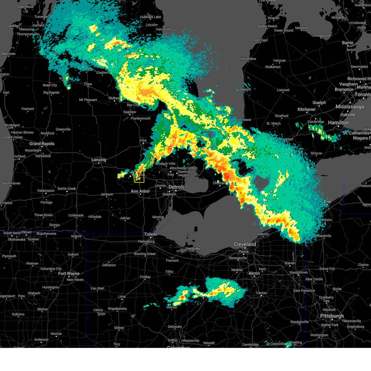 At 149 am est, a severe thunderstorm was located over brighton, moving east at 45 mph (radar indicated). Hazards include 60 mph wind gusts and quarter size hail. Hail damage to vehicles is expected. expect wind damage to roofs, siding, and trees. This severe thunderstorm will remain over mainly rural areas of southeastern livingston county, including the following locations, lakeland, island lake state recreation area, and chilson. At 149 am est, a severe thunderstorm was located over brighton, moving east at 45 mph (radar indicated). Hazards include 60 mph wind gusts and quarter size hail. Hail damage to vehicles is expected. expect wind damage to roofs, siding, and trees. This severe thunderstorm will remain over mainly rural areas of southeastern livingston county, including the following locations, lakeland, island lake state recreation area, and chilson.
|
| 2/28/2024 1:26 AM EST |
 Svrdtx the national weather service in detroit/pontiac has issued a * severe thunderstorm warning for, southern livingston county in southeastern michigan, * until 230 am est. * at 126 am est, a severe thunderstorm was located over gregory, or 8 miles west of pinckney, moving east at 40 mph (radar indicated). Hazards include 60 mph wind gusts and quarter size hail. Hail damage to vehicles is expected. expect wind damage to roofs, siding, and trees. this severe thunderstorm will be near, pinckney around 130 am est. brighton around 140 am est. Other locations impacted by this severe thunderstorm include lakeland, plainfield, island lake state recreation area, chilson, unadilla, pinckney state recreation area, and hell. Svrdtx the national weather service in detroit/pontiac has issued a * severe thunderstorm warning for, southern livingston county in southeastern michigan, * until 230 am est. * at 126 am est, a severe thunderstorm was located over gregory, or 8 miles west of pinckney, moving east at 40 mph (radar indicated). Hazards include 60 mph wind gusts and quarter size hail. Hail damage to vehicles is expected. expect wind damage to roofs, siding, and trees. this severe thunderstorm will be near, pinckney around 130 am est. brighton around 140 am est. Other locations impacted by this severe thunderstorm include lakeland, plainfield, island lake state recreation area, chilson, unadilla, pinckney state recreation area, and hell.
|
| 8/24/2023 10:39 PM EDT |
 The severe thunderstorm warning for northwestern washtenaw county will expire at 1045 pm edt, the storms which prompted the warning have moved out of the area. therefore, the warning will be allowed to expire. however gusty winds and heavy rain are still possible with these thunderstorms. a severe thunderstorm watch remains in effect until 100 am edt for southeastern michigan. The severe thunderstorm warning for northwestern washtenaw county will expire at 1045 pm edt, the storms which prompted the warning have moved out of the area. therefore, the warning will be allowed to expire. however gusty winds and heavy rain are still possible with these thunderstorms. a severe thunderstorm watch remains in effect until 100 am edt for southeastern michigan.
|
| 8/24/2023 10:26 PM EDT |
 At 1025 pm edt, severe thunderstorms were located along a line extending from near canton to near milan to near tecumseh, moving southeast at 45 mph (radar indicated). Hazards include 60 mph wind gusts. Expect damage to roofs, siding, and trees. these severe thunderstorms will remain over mainly rural areas of northwestern washtenaw county, including the following locations, hudson mills, delhi mills, lyndon township, hudson mills metropark and barton hills. people attending chelsea community fair should seek safe shelter immediately! hail threat, radar indicated max hail size, <. 75 in wind threat, radar indicated max wind gust, 60 mph. At 1025 pm edt, severe thunderstorms were located along a line extending from near canton to near milan to near tecumseh, moving southeast at 45 mph (radar indicated). Hazards include 60 mph wind gusts. Expect damage to roofs, siding, and trees. these severe thunderstorms will remain over mainly rural areas of northwestern washtenaw county, including the following locations, hudson mills, delhi mills, lyndon township, hudson mills metropark and barton hills. people attending chelsea community fair should seek safe shelter immediately! hail threat, radar indicated max hail size, <. 75 in wind threat, radar indicated max wind gust, 60 mph.
|
| 8/24/2023 10:07 PM EDT |
 At 1006 pm edt, severe thunderstorms were located along a line extending from near milford to near ann arbor to 9 miles northeast of jonesville, moving southeast at 45 mph (radar indicated). Hazards include 70 mph wind gusts. Expect considerable tree damage. damage is likely to mobile homes, roofs, and outbuildings. these severe storms will be near, ann arbor around 1010 pm edt. other locations impacted by these severe thunderstorms include plainfield, hudson mills metropark, island lake state recreation area, delhi mills, pinckney state recreation area, hudson mills, parkers corners, lakeland, lyndon township and chilson. People attending chelsea community fair should seek safe shelter immediately!. At 1006 pm edt, severe thunderstorms were located along a line extending from near milford to near ann arbor to 9 miles northeast of jonesville, moving southeast at 45 mph (radar indicated). Hazards include 70 mph wind gusts. Expect considerable tree damage. damage is likely to mobile homes, roofs, and outbuildings. these severe storms will be near, ann arbor around 1010 pm edt. other locations impacted by these severe thunderstorms include plainfield, hudson mills metropark, island lake state recreation area, delhi mills, pinckney state recreation area, hudson mills, parkers corners, lakeland, lyndon township and chilson. People attending chelsea community fair should seek safe shelter immediately!.
|
| 8/24/2023 9:46 PM EDT |
 At 946 pm edt, severe thunderstorms were located along a line extending from hartland to near stockbridge to 9 miles southwest of eaton rapids, moving southeast at 40 mph (radar indicated). Hazards include 70 mph wind gusts. Expect considerable tree damage. damage is likely to mobile homes, roofs, and outbuildings. these severe storms will be near, hartland, brighton and gregory around 950 pm edt. pinckney around 955 pm edt. chelsea around 1000 pm edt. dexter and south lyon around 1005 pm edt. ann arbor around 1015 pm edt. other locations impacted by these severe thunderstorms include plainfield, hudson mills metropark, island lake state recreation area, delhi mills, argentine, conway township, pinckney state recreation area, hudson mills, parkers corners and lakeland. People attending chelsea community fair should seek safe shelter immediately!. At 946 pm edt, severe thunderstorms were located along a line extending from hartland to near stockbridge to 9 miles southwest of eaton rapids, moving southeast at 40 mph (radar indicated). Hazards include 70 mph wind gusts. Expect considerable tree damage. damage is likely to mobile homes, roofs, and outbuildings. these severe storms will be near, hartland, brighton and gregory around 950 pm edt. pinckney around 955 pm edt. chelsea around 1000 pm edt. dexter and south lyon around 1005 pm edt. ann arbor around 1015 pm edt. other locations impacted by these severe thunderstorms include plainfield, hudson mills metropark, island lake state recreation area, delhi mills, argentine, conway township, pinckney state recreation area, hudson mills, parkers corners and lakeland. People attending chelsea community fair should seek safe shelter immediately!.
|
| 8/24/2023 9:29 PM EDT |
 At 929 pm edt, severe thunderstorms were located along a line extending from near corunna to williamston to near charlotte, moving east at 45 mph (radar indicated). Hazards include 70 mph wind gusts. Expect considerable tree damage. damage is likely to mobile homes, roofs, and outbuildings. severe thunderstorms will be near, fowlerville around 945 pm edt. cohoctah around 950 pm edt. howell and oak grove around 955 pm edt. hartland and brighton around 1005 pm edt. gregory around 1025 pm edt. pinckney around 1035 pm edt. dexter around 1040 pm edt. hamburg and whitmore lake around 1045 pm edt. other locations impacted by these severe thunderstorms include plainfield, hudson mills metropark, island lake state recreation area, delhi mills, argentine, conway township, pinckney state recreation area, hudson mills, parkers corners and lakeland. people attending chelsea community fair should seek safe shelter immediately! thunderstorm damage threat, considerable hail threat, radar indicated max hail size, <. 75 in wind threat, radar indicated max wind gust, 70 mph. At 929 pm edt, severe thunderstorms were located along a line extending from near corunna to williamston to near charlotte, moving east at 45 mph (radar indicated). Hazards include 70 mph wind gusts. Expect considerable tree damage. damage is likely to mobile homes, roofs, and outbuildings. severe thunderstorms will be near, fowlerville around 945 pm edt. cohoctah around 950 pm edt. howell and oak grove around 955 pm edt. hartland and brighton around 1005 pm edt. gregory around 1025 pm edt. pinckney around 1035 pm edt. dexter around 1040 pm edt. hamburg and whitmore lake around 1045 pm edt. other locations impacted by these severe thunderstorms include plainfield, hudson mills metropark, island lake state recreation area, delhi mills, argentine, conway township, pinckney state recreation area, hudson mills, parkers corners and lakeland. people attending chelsea community fair should seek safe shelter immediately! thunderstorm damage threat, considerable hail threat, radar indicated max hail size, <. 75 in wind threat, radar indicated max wind gust, 70 mph.
|
| 8/24/2023 4:11 AM EDT |
 The severe thunderstorm warning for eastern washtenaw county will expire at 415 am edt, the storm which prompted the warning has weakened below severe limits, and no longer poses an immediate threat to life or property. therefore, the warning will be allowed to expire. however gusty winds and heavy rain are still possible with this thunderstorm. The severe thunderstorm warning for eastern washtenaw county will expire at 415 am edt, the storm which prompted the warning has weakened below severe limits, and no longer poses an immediate threat to life or property. therefore, the warning will be allowed to expire. however gusty winds and heavy rain are still possible with this thunderstorm.
|
| 8/24/2023 3:56 AM EDT |
 At 354 am edt, a severe thunderstorm was located over willis, or near ypsilanti, moving south at 30 mph (radar indicated). Hazards include 60 mph wind gusts. Expect damage to roofs, siding, and trees. this severe storm will be near, milan around 400 am edt. other locations impacted by this severe thunderstorm include pittsfield township, delhi mills, whittaker and barton hills. hail threat, radar indicated max hail size, <. 75 in wind threat, radar indicated max wind gust, 60 mph. At 354 am edt, a severe thunderstorm was located over willis, or near ypsilanti, moving south at 30 mph (radar indicated). Hazards include 60 mph wind gusts. Expect damage to roofs, siding, and trees. this severe storm will be near, milan around 400 am edt. other locations impacted by this severe thunderstorm include pittsfield township, delhi mills, whittaker and barton hills. hail threat, radar indicated max hail size, <. 75 in wind threat, radar indicated max wind gust, 60 mph.
|
| 8/24/2023 3:33 AM EDT |
 At 333 am edt, a severe thunderstorm was located over dixboro, or 7 miles northeast of ann arbor, moving southeast at 25 mph (radar indicated). Hazards include 60 mph wind gusts. Expect damage to roofs, siding, and trees. this severe storm will be near, ypsilanti around 345 am edt. willis around 405 am edt. other locations impacted by this severe thunderstorm include hudson mills, pittsfield township, delhi mills, whittaker, barton hills and hudson mills metropark. hail threat, radar indicated max hail size, <. 75 in wind threat, radar indicated max wind gust, 60 mph. At 333 am edt, a severe thunderstorm was located over dixboro, or 7 miles northeast of ann arbor, moving southeast at 25 mph (radar indicated). Hazards include 60 mph wind gusts. Expect damage to roofs, siding, and trees. this severe storm will be near, ypsilanti around 345 am edt. willis around 405 am edt. other locations impacted by this severe thunderstorm include hudson mills, pittsfield township, delhi mills, whittaker, barton hills and hudson mills metropark. hail threat, radar indicated max hail size, <. 75 in wind threat, radar indicated max wind gust, 60 mph.
|
| 8/24/2023 3:15 AM EDT |
 At 314 am edt, a severe thunderstorm was located over ypsilanti, moving southeast at 25 mph (radar indicated). Hazards include 60 mph wind gusts. Expect damage to roofs, siding, and trees. this severe thunderstorm will be near, willis around 325 am edt. milan around 330 am edt. other locations impacted by this severe thunderstorm include hudson mills, pittsfield township, delhi mills, whittaker, barton hills and hudson mills metropark. hail threat, radar indicated max hail size, <. 75 in wind threat, radar indicated max wind gust, 60 mph. At 314 am edt, a severe thunderstorm was located over ypsilanti, moving southeast at 25 mph (radar indicated). Hazards include 60 mph wind gusts. Expect damage to roofs, siding, and trees. this severe thunderstorm will be near, willis around 325 am edt. milan around 330 am edt. other locations impacted by this severe thunderstorm include hudson mills, pittsfield township, delhi mills, whittaker, barton hills and hudson mills metropark. hail threat, radar indicated max hail size, <. 75 in wind threat, radar indicated max wind gust, 60 mph.
|
| 8/24/2023 2:45 AM EDT |
 At 243 am edt, severe thunderstorms were located along a line extending from near brighton to pinckney to near morrice, moving southeast at 40 mph (radar indicated). Hazards include 60 mph wind gusts. Expect damage to roofs, siding, and trees. these severe storms will be near, pinckney and south lyon around 250 am edt. cohoctah around 255 am edt. oak grove around 300 am edt. other locations impacted by these severe thunderstorms include parkers corners, lakeland, plainfield, island lake state recreation area, chilson, unadilla, conway township, pinckney state recreation area, hell and tyrone township. hail threat, radar indicated max hail size, <. 75 in wind threat, radar indicated max wind gust, 60 mph. At 243 am edt, severe thunderstorms were located along a line extending from near brighton to pinckney to near morrice, moving southeast at 40 mph (radar indicated). Hazards include 60 mph wind gusts. Expect damage to roofs, siding, and trees. these severe storms will be near, pinckney and south lyon around 250 am edt. cohoctah around 255 am edt. oak grove around 300 am edt. other locations impacted by these severe thunderstorms include parkers corners, lakeland, plainfield, island lake state recreation area, chilson, unadilla, conway township, pinckney state recreation area, hell and tyrone township. hail threat, radar indicated max hail size, <. 75 in wind threat, radar indicated max wind gust, 60 mph.
|
| 8/24/2023 2:35 AM EDT |
 At 235 am edt, severe thunderstorms were located along a line extending from near belleville to ypsilanti to near dixboro, moving southeast at 30 mph (radar indicated). Hazards include 60 mph wind gusts. Expect damage to roofs, siding, and trees. these severe thunderstorms will affect the following locations, island lake state recreation area, new hudson, lakeland, plymouth, wixom and westland. hail threat, radar indicated max hail size, <. 75 in wind threat, radar indicated max wind gust, 60 mph. At 235 am edt, severe thunderstorms were located along a line extending from near belleville to ypsilanti to near dixboro, moving southeast at 30 mph (radar indicated). Hazards include 60 mph wind gusts. Expect damage to roofs, siding, and trees. these severe thunderstorms will affect the following locations, island lake state recreation area, new hudson, lakeland, plymouth, wixom and westland. hail threat, radar indicated max hail size, <. 75 in wind threat, radar indicated max wind gust, 60 mph.
|
| 8/24/2023 2:20 AM EDT |
 At 220 am edt, severe thunderstorms were located along a line extending from near milford to brighton to near pinckney, moving southeast at 40 mph (radar indicated). Hazards include 60 mph wind gusts. Expect damage to roofs, siding, and trees. these severe storms will be near, hamburg around 225 am edt. south lyon and whitmore lake around 230 am edt. other locations impacted by these severe thunderstorms include parkers corners, lakeland, plainfield, island lake state recreation area, chilson, unadilla, conway township, pinckney state recreation area, hell and tyrone township. hail threat, radar indicated max hail size, <. 75 in wind threat, radar indicated max wind gust, 60 mph. At 220 am edt, severe thunderstorms were located along a line extending from near milford to brighton to near pinckney, moving southeast at 40 mph (radar indicated). Hazards include 60 mph wind gusts. Expect damage to roofs, siding, and trees. these severe storms will be near, hamburg around 225 am edt. south lyon and whitmore lake around 230 am edt. other locations impacted by these severe thunderstorms include parkers corners, lakeland, plainfield, island lake state recreation area, chilson, unadilla, conway township, pinckney state recreation area, hell and tyrone township. hail threat, radar indicated max hail size, <. 75 in wind threat, radar indicated max wind gust, 60 mph.
|
| 8/24/2023 2:12 AM EDT |
 At 212 am edt, a severe thunderstorm was located over salem, or 8 miles southwest of novi, moving southeast at 30 mph (radar indicated). Hazards include 60 mph wind gusts. Expect damage to roofs, siding, and trees. this severe storm will be near, northville around 220 am edt. dixboro around 225 am edt. ypsilanti and canton around 230 am edt. other locations impacted by this severe thunderstorm include island lake state recreation area, new hudson, lakeland, plymouth, wixom and westland. hail threat, radar indicated max hail size, <. 75 in wind threat, radar indicated max wind gust, 60 mph. At 212 am edt, a severe thunderstorm was located over salem, or 8 miles southwest of novi, moving southeast at 30 mph (radar indicated). Hazards include 60 mph wind gusts. Expect damage to roofs, siding, and trees. this severe storm will be near, northville around 220 am edt. dixboro around 225 am edt. ypsilanti and canton around 230 am edt. other locations impacted by this severe thunderstorm include island lake state recreation area, new hudson, lakeland, plymouth, wixom and westland. hail threat, radar indicated max hail size, <. 75 in wind threat, radar indicated max wind gust, 60 mph.
|
| 8/24/2023 2:00 AM EDT |
 At 200 am edt, a severe thunderstorm was located near hartland, moving east at 30 mph (radar indicated). Hazards include 60 mph wind gusts. Expect damage to roofs, siding, and trees. this severe thunderstorm will be near, hartland around 205 am edt. brighton around 210 am edt. other locations impacted by this severe thunderstorm include parkers corners, lakeland, plainfield, island lake state recreation area, chilson, unadilla, conway township, pinckney state recreation area, hell and tyrone township. hail threat, radar indicated max hail size, <. 75 in wind threat, radar indicated max wind gust, 60 mph. At 200 am edt, a severe thunderstorm was located near hartland, moving east at 30 mph (radar indicated). Hazards include 60 mph wind gusts. Expect damage to roofs, siding, and trees. this severe thunderstorm will be near, hartland around 205 am edt. brighton around 210 am edt. other locations impacted by this severe thunderstorm include parkers corners, lakeland, plainfield, island lake state recreation area, chilson, unadilla, conway township, pinckney state recreation area, hell and tyrone township. hail threat, radar indicated max hail size, <. 75 in wind threat, radar indicated max wind gust, 60 mph.
|
| 8/24/2023 1:47 AM EDT |
 At 147 am edt, a severe thunderstorm was located over south lyon, or near novi, moving southeast at 15 mph (radar indicated). Hazards include 60 mph wind gusts. Expect damage to roofs, siding, and trees. this severe thunderstorm will be near, northville and salem around 200 am edt. dixboro around 215 am edt. ypsilanti and canton around 230 am edt. other locations impacted by this severe thunderstorm include island lake state recreation area, new hudson, lakeland, plymouth, wixom and westland. hail threat, radar indicated max hail size, <. 75 in wind threat, radar indicated max wind gust, 60 mph. At 147 am edt, a severe thunderstorm was located over south lyon, or near novi, moving southeast at 15 mph (radar indicated). Hazards include 60 mph wind gusts. Expect damage to roofs, siding, and trees. this severe thunderstorm will be near, northville and salem around 200 am edt. dixboro around 215 am edt. ypsilanti and canton around 230 am edt. other locations impacted by this severe thunderstorm include island lake state recreation area, new hudson, lakeland, plymouth, wixom and westland. hail threat, radar indicated max hail size, <. 75 in wind threat, radar indicated max wind gust, 60 mph.
|
| 8/11/2023 9:28 PM EDT |
 At 928 pm edt, a severe thunderstorm was located near novi, moving east at 20 mph (radar indicated). Hazards include 60 mph wind gusts and quarter size hail. Hail damage to vehicles is expected. expect wind damage to roofs, siding, and trees. this severe storm will be near, novi around 950 pm edt. west bloomfield around 1000 pm edt. southfield and birmingham around 1025 pm edt. detroit zoo around 1030 pm edt. royal oak around 1035 pm edt. troy around 1045 pm edt. other locations impacted by this severe thunderstorm include franklin, keego harbor, orchard lake, commerce, lathrup village, bingham farms, farmington hills, pleasant ridge, huntington woods and wolverine lake. People attending milford memories summer festival should seek safe shelter immediately!. At 928 pm edt, a severe thunderstorm was located near novi, moving east at 20 mph (radar indicated). Hazards include 60 mph wind gusts and quarter size hail. Hail damage to vehicles is expected. expect wind damage to roofs, siding, and trees. this severe storm will be near, novi around 950 pm edt. west bloomfield around 1000 pm edt. southfield and birmingham around 1025 pm edt. detroit zoo around 1030 pm edt. royal oak around 1035 pm edt. troy around 1045 pm edt. other locations impacted by this severe thunderstorm include franklin, keego harbor, orchard lake, commerce, lathrup village, bingham farms, farmington hills, pleasant ridge, huntington woods and wolverine lake. People attending milford memories summer festival should seek safe shelter immediately!.
|
| 8/11/2023 9:08 PM EDT |
 At 908 pm edt, a severe thunderstorm was located over south lyon, or 7 miles south of milford, moving east at 25 mph (radar indicated). Hazards include 60 mph wind gusts and quarter size hail. Hail damage to vehicles is expected. expect wind damage to roofs, siding, and trees. this severe thunderstorm will be near, milford around 915 pm edt. novi around 935 pm edt. west bloomfield around 945 pm edt. birmingham around 1000 pm edt. southfield around 1005 pm edt. royal oak and detroit zoo around 1010 pm edt. troy around 1015 pm edt. other locations impacted by this severe thunderstorm include franklin, keego harbor, orchard lake, commerce, lathrup village, bingham farms, farmington hills, pleasant ridge, huntington woods and wolverine lake. People attending milford memories summer festival should seek safe shelter immediately!. At 908 pm edt, a severe thunderstorm was located over south lyon, or 7 miles south of milford, moving east at 25 mph (radar indicated). Hazards include 60 mph wind gusts and quarter size hail. Hail damage to vehicles is expected. expect wind damage to roofs, siding, and trees. this severe thunderstorm will be near, milford around 915 pm edt. novi around 935 pm edt. west bloomfield around 945 pm edt. birmingham around 1000 pm edt. southfield around 1005 pm edt. royal oak and detroit zoo around 1010 pm edt. troy around 1015 pm edt. other locations impacted by this severe thunderstorm include franklin, keego harbor, orchard lake, commerce, lathrup village, bingham farms, farmington hills, pleasant ridge, huntington woods and wolverine lake. People attending milford memories summer festival should seek safe shelter immediately!.
|
| 8/11/2023 8:42 PM EDT |
 At 841 pm edt, a severe thunderstorm was located over cohoctah, or 9 miles south of durand, moving east at 20 mph (radar indicated). Hazards include 60 mph wind gusts and quarter size hail. Hail damage to vehicles is expected. expect wind damage to roofs, siding, and trees. this severe storm will be near, cohoctah and gaines around 845 pm edt. oak grove around 855 pm edt. linden around 910 pm edt. fenton around 920 pm edt. hartland around 925 pm edt. Other locations impacted by this severe thunderstorm include parkers corners, lakeland, plainfield, island lake state recreation area, chilson, unadilla, argentine, conway township, hell and tyrone township. At 841 pm edt, a severe thunderstorm was located over cohoctah, or 9 miles south of durand, moving east at 20 mph (radar indicated). Hazards include 60 mph wind gusts and quarter size hail. Hail damage to vehicles is expected. expect wind damage to roofs, siding, and trees. this severe storm will be near, cohoctah and gaines around 845 pm edt. oak grove around 855 pm edt. linden around 910 pm edt. fenton around 920 pm edt. hartland around 925 pm edt. Other locations impacted by this severe thunderstorm include parkers corners, lakeland, plainfield, island lake state recreation area, chilson, unadilla, argentine, conway township, hell and tyrone township.
|
| 8/11/2023 8:30 PM EDT |
 At 828 pm edt, a severe thunderstorm was located near bancroft, or 8 miles south of durand, moving east at 20 mph (radar indicated). Hazards include 60 mph wind gusts and quarter size hail. Hail damage to vehicles is expected. expect wind damage to roofs, siding, and trees. this severe storm will be near, cohoctah, byron and gaines around 845 pm edt. oak grove around 855 pm edt. linden around 910 pm edt. fenton around 920 pm edt. hartland around 925 pm edt. Other locations impacted by this severe thunderstorm include parkers corners, lakeland, plainfield, island lake state recreation area, chilson, unadilla, argentine, conway township, vernon and hell. At 828 pm edt, a severe thunderstorm was located near bancroft, or 8 miles south of durand, moving east at 20 mph (radar indicated). Hazards include 60 mph wind gusts and quarter size hail. Hail damage to vehicles is expected. expect wind damage to roofs, siding, and trees. this severe storm will be near, cohoctah, byron and gaines around 845 pm edt. oak grove around 855 pm edt. linden around 910 pm edt. fenton around 920 pm edt. hartland around 925 pm edt. Other locations impacted by this severe thunderstorm include parkers corners, lakeland, plainfield, island lake state recreation area, chilson, unadilla, argentine, conway township, vernon and hell.
|
| 8/11/2023 8:12 PM EDT |
 At 811 pm edt, a severe thunderstorm was located over morrice, or near perry, moving east at 20 mph (radar indicated). Hazards include 60 mph wind gusts and quarter size hail. Hail damage to vehicles is expected. expect wind damage to roofs, siding, and trees. this severe storm will be near, bancroft around 830 pm edt. durand around 840 pm edt. cohoctah and byron around 850 pm edt. gaines around 855 pm edt. fenton, linden and lake fenton around 915 pm edt. Other locations impacted by this severe thunderstorm include parkers corners, lakeland, plainfield, island lake state recreation area, chilson, unadilla, argentine, conway township, vernon and hell. At 811 pm edt, a severe thunderstorm was located over morrice, or near perry, moving east at 20 mph (radar indicated). Hazards include 60 mph wind gusts and quarter size hail. Hail damage to vehicles is expected. expect wind damage to roofs, siding, and trees. this severe storm will be near, bancroft around 830 pm edt. durand around 840 pm edt. cohoctah and byron around 850 pm edt. gaines around 855 pm edt. fenton, linden and lake fenton around 915 pm edt. Other locations impacted by this severe thunderstorm include parkers corners, lakeland, plainfield, island lake state recreation area, chilson, unadilla, argentine, conway township, vernon and hell.
|
| 8/11/2023 7:51 PM EDT |
 At 750 pm edt, a severe thunderstorm was located near perry, moving east at 20 mph (radar indicated). Hazards include 60 mph wind gusts and quarter size hail. Hail damage to vehicles is expected. expect wind damage to roofs, siding, and trees. this severe thunderstorm will be near, perry around 800 pm edt. morrice around 805 pm edt. bancroft around 825 pm edt. cohoctah, byron and gaines around 850 pm edt. linden and oak grove around 900 pm edt. Other locations impacted by this severe thunderstorm include plainfield, island lake state recreation area, argentine, conway township, vernon, parkers corners, lakeland, chilson, bennington and unadilla. At 750 pm edt, a severe thunderstorm was located near perry, moving east at 20 mph (radar indicated). Hazards include 60 mph wind gusts and quarter size hail. Hail damage to vehicles is expected. expect wind damage to roofs, siding, and trees. this severe thunderstorm will be near, perry around 800 pm edt. morrice around 805 pm edt. bancroft around 825 pm edt. cohoctah, byron and gaines around 850 pm edt. linden and oak grove around 900 pm edt. Other locations impacted by this severe thunderstorm include plainfield, island lake state recreation area, argentine, conway township, vernon, parkers corners, lakeland, chilson, bennington and unadilla.
|
| 7/26/2023 3:36 PM EDT |
 At 334 pm edt, severe thunderstorms were located along a line extending from near fenton to near hartland to near south lyon, moving east at 30 mph (radar indicated). Hazards include 60 mph wind gusts. Expect damage to roofs, siding, and trees. these severe thunderstorms will remain over mainly rural areas of eastern livingston county, including the following locations, island lake state recreation area, tyrone township and deerfield township. hail threat, radar indicated max hail size, <. 75 in wind threat, radar indicated max wind gust, 60 mph. At 334 pm edt, severe thunderstorms were located along a line extending from near fenton to near hartland to near south lyon, moving east at 30 mph (radar indicated). Hazards include 60 mph wind gusts. Expect damage to roofs, siding, and trees. these severe thunderstorms will remain over mainly rural areas of eastern livingston county, including the following locations, island lake state recreation area, tyrone township and deerfield township. hail threat, radar indicated max hail size, <. 75 in wind threat, radar indicated max wind gust, 60 mph.
|
| 7/26/2023 3:27 PM EDT |
 The severe thunderstorm warning for eastern washtenaw county will expire at 330 pm edt, the storms which prompted the warning have moved out of the area. therefore, the warning will be allowed to expire. a severe thunderstorm watch remains in effect until 700 pm edt for southeastern michigan. The severe thunderstorm warning for eastern washtenaw county will expire at 330 pm edt, the storms which prompted the warning have moved out of the area. therefore, the warning will be allowed to expire. a severe thunderstorm watch remains in effect until 700 pm edt for southeastern michigan.
|
| 7/26/2023 3:19 PM EDT |
 At 318 pm edt, severe thunderstorms were located along a line extending from near oak grove to near hartland to near hamburg, moving northeast at 30 mph (radar indicated). Hazards include 60 mph wind gusts. Expect damage to roofs, siding, and trees. these severe storms will be near, hartland and south lyon around 330 pm edt. other locations impacted by these severe thunderstorms include island lake state recreation area, chilson, lakeland, tyrone township and deerfield township. hail threat, radar indicated max hail size, <. 75 in wind threat, radar indicated max wind gust, 60 mph. At 318 pm edt, severe thunderstorms were located along a line extending from near oak grove to near hartland to near hamburg, moving northeast at 30 mph (radar indicated). Hazards include 60 mph wind gusts. Expect damage to roofs, siding, and trees. these severe storms will be near, hartland and south lyon around 330 pm edt. other locations impacted by these severe thunderstorms include island lake state recreation area, chilson, lakeland, tyrone township and deerfield township. hail threat, radar indicated max hail size, <. 75 in wind threat, radar indicated max wind gust, 60 mph.
|
| 7/26/2023 3:09 PM EDT |
 At 308 pm edt, severe thunderstorms were located along a line extending from near whitmore lake to dixboro to near willis, moving east at 55 mph (radar indicated). Hazards include 70 mph wind gusts. Expect considerable tree damage. damage is likely to mobile homes, roofs, and outbuildings. these severe storms will be near, salem around 320 pm edt. other locations impacted by these severe thunderstorms include hudson mills, pittsfield township, delhi mills, whittaker, barton hills and hudson mills metropark. thunderstorm damage threat, considerable hail threat, radar indicated max hail size, <. 75 in wind threat, radar indicated max wind gust, 70 mph. At 308 pm edt, severe thunderstorms were located along a line extending from near whitmore lake to dixboro to near willis, moving east at 55 mph (radar indicated). Hazards include 70 mph wind gusts. Expect considerable tree damage. damage is likely to mobile homes, roofs, and outbuildings. these severe storms will be near, salem around 320 pm edt. other locations impacted by these severe thunderstorms include hudson mills, pittsfield township, delhi mills, whittaker, barton hills and hudson mills metropark. thunderstorm damage threat, considerable hail threat, radar indicated max hail size, <. 75 in wind threat, radar indicated max wind gust, 70 mph.
|
| 7/26/2023 3:01 PM EDT |
 At 300 pm edt, a severe thunderstorm was located near howell, moving east at 35 mph (radar indicated). Hazards include 60 mph wind gusts. Expect damage to roofs, siding, and trees. this severe storm will be near, howell around 310 pm edt. oak grove around 315 pm edt. brighton around 320 pm edt. hartland around 325 pm edt. other locations impacted by this severe thunderstorm include parkers corners, lakeland, plainfield, island lake state recreation area, chilson, unadilla, conway township, pinckney state recreation area, hell and tyrone township. People attending fowlerville family fair should seek safe shelter immediately!. At 300 pm edt, a severe thunderstorm was located near howell, moving east at 35 mph (radar indicated). Hazards include 60 mph wind gusts. Expect damage to roofs, siding, and trees. this severe storm will be near, howell around 310 pm edt. oak grove around 315 pm edt. brighton around 320 pm edt. hartland around 325 pm edt. other locations impacted by this severe thunderstorm include parkers corners, lakeland, plainfield, island lake state recreation area, chilson, unadilla, conway township, pinckney state recreation area, hell and tyrone township. People attending fowlerville family fair should seek safe shelter immediately!.
|
| 7/26/2023 2:58 PM EDT |
 At 257 pm edt, severe thunderstorms were located along a line extending from pinckney to near ann arbor to near saline, moving east at 60 mph. these are destructive storms for dexter and ann arbor (radar indicated). Hazards include 80 mph wind gusts. Flying debris will be dangerous to those caught without shelter. mobile homes will be heavily damaged. expect considerable damage to roofs, windows, and vehicles. extensive tree damage and power outages are likely. these severe storms will be near, dixboro around 305 pm edt. ypsilanti, willis and whitmore lake around 310 pm edt. salem around 315 pm edt. other locations impacted by these severe thunderstorms include hudson mills, pittsfield township, whittaker, lyndon township, hudson mills metropark, bridgewater, delhi mills, pleasant lake, barton hills and pinckney state recreation area. thunderstorm damage threat, destructive hail threat, radar indicated max hail size, <. 75 in wind threat, radar indicated max wind gust, 80 mph. At 257 pm edt, severe thunderstorms were located along a line extending from pinckney to near ann arbor to near saline, moving east at 60 mph. these are destructive storms for dexter and ann arbor (radar indicated). Hazards include 80 mph wind gusts. Flying debris will be dangerous to those caught without shelter. mobile homes will be heavily damaged. expect considerable damage to roofs, windows, and vehicles. extensive tree damage and power outages are likely. these severe storms will be near, dixboro around 305 pm edt. ypsilanti, willis and whitmore lake around 310 pm edt. salem around 315 pm edt. other locations impacted by these severe thunderstorms include hudson mills, pittsfield township, whittaker, lyndon township, hudson mills metropark, bridgewater, delhi mills, pleasant lake, barton hills and pinckney state recreation area. thunderstorm damage threat, destructive hail threat, radar indicated max hail size, <. 75 in wind threat, radar indicated max wind gust, 80 mph.
|
| 7/26/2023 2:53 PM EDT |
 At 252 pm edt, severe thunderstorms were located along a line extending from near gregory to 7 miles south of dexter to 6 miles southwest of saline, moving east at 60 mph (radar indicated). Hazards include 70 mph wind gusts. Expect considerable tree damage. damage is likely to mobile homes, roofs, and outbuildings. these severe storms will be near, ann arbor and milan around 300 pm edt. dixboro and willis around 305 pm edt. ypsilanti and whitmore lake around 310 pm edt. salem around 315 pm edt. other locations impacted by these severe thunderstorms include hudson mills, pittsfield township, whittaker, lyndon township, hudson mills metropark, bridgewater, delhi mills, pleasant lake, barton hills and pinckney state recreation area. thunderstorm damage threat, considerable hail threat, radar indicated max hail size, <. 75 in wind threat, radar indicated max wind gust, 70 mph. At 252 pm edt, severe thunderstorms were located along a line extending from near gregory to 7 miles south of dexter to 6 miles southwest of saline, moving east at 60 mph (radar indicated). Hazards include 70 mph wind gusts. Expect considerable tree damage. damage is likely to mobile homes, roofs, and outbuildings. these severe storms will be near, ann arbor and milan around 300 pm edt. dixboro and willis around 305 pm edt. ypsilanti and whitmore lake around 310 pm edt. salem around 315 pm edt. other locations impacted by these severe thunderstorms include hudson mills, pittsfield township, whittaker, lyndon township, hudson mills metropark, bridgewater, delhi mills, pleasant lake, barton hills and pinckney state recreation area. thunderstorm damage threat, considerable hail threat, radar indicated max hail size, <. 75 in wind threat, radar indicated max wind gust, 70 mph.
|
| 7/26/2023 2:43 PM EDT |
 At 242 pm edt, a severe thunderstorm was located near stockbridge, or 12 miles southeast of mason, moving east at 30 mph (radar indicated). Hazards include 60 mph wind gusts. Expect damage to roofs, siding, and trees. this severe thunderstorm will be near, gregory around 255 pm edt. pinckney around 305 pm edt. howell around 315 pm edt. brighton around 325 pm edt. hartland around 335 pm edt. other locations impacted by this severe thunderstorm include parkers corners, lakeland, plainfield, island lake state recreation area, chilson, unadilla, conway township, pinckney state recreation area, hell and tyrone township. People attending fowlerville family fair should seek safe shelter immediately!. At 242 pm edt, a severe thunderstorm was located near stockbridge, or 12 miles southeast of mason, moving east at 30 mph (radar indicated). Hazards include 60 mph wind gusts. Expect damage to roofs, siding, and trees. this severe thunderstorm will be near, gregory around 255 pm edt. pinckney around 305 pm edt. howell around 315 pm edt. brighton around 325 pm edt. hartland around 335 pm edt. other locations impacted by this severe thunderstorm include parkers corners, lakeland, plainfield, island lake state recreation area, chilson, unadilla, conway township, pinckney state recreation area, hell and tyrone township. People attending fowlerville family fair should seek safe shelter immediately!.
|
| 7/26/2023 2:42 PM EDT |
 At 242 pm edt, severe thunderstorms were located along a line extending from near stockbridge to near brooklyn to clayton, moving east at 50 mph (radar indicated). Hazards include 60 mph wind gusts. Expect damage to roofs, siding, and trees. these severe storms will be near, manchester around 250 pm edt. saline, milan and whitmore lake around 310 pm edt. salem and willis around 320 pm edt. other locations impacted by these severe thunderstorms include hudson mills, pittsfield township, whittaker, lyndon township, hudson mills metropark, bridgewater, delhi mills, pleasant lake, barton hills and pinckney state recreation area. hail threat, radar indicated max hail size, <. 75 in wind threat, radar indicated max wind gust, 60 mph. At 242 pm edt, severe thunderstorms were located along a line extending from near stockbridge to near brooklyn to clayton, moving east at 50 mph (radar indicated). Hazards include 60 mph wind gusts. Expect damage to roofs, siding, and trees. these severe storms will be near, manchester around 250 pm edt. saline, milan and whitmore lake around 310 pm edt. salem and willis around 320 pm edt. other locations impacted by these severe thunderstorms include hudson mills, pittsfield township, whittaker, lyndon township, hudson mills metropark, bridgewater, delhi mills, pleasant lake, barton hills and pinckney state recreation area. hail threat, radar indicated max hail size, <. 75 in wind threat, radar indicated max wind gust, 60 mph.
|
| 7/26/2023 2:32 PM EDT |
 At 231 pm edt, severe thunderstorms were located along a line extending from near leslie to cement city to near hudson, moving east at 50 mph (radar indicated). Hazards include 60 mph wind gusts. Expect damage to roofs, siding, and trees. severe thunderstorms will be near, manchester around 250 pm edt. saline, milan and whitmore lake around 310 pm edt. salem and willis around 320 pm edt. monroe around 330 pm edt. other locations impacted by these severe thunderstorms include pittsfield township, whittaker, toledo beach, hudson mills metropark, bridgewater, delhi mills, pleasant lake, barton hills, hudson mills and lyndon township. hail threat, radar indicated max hail size, <. 75 in wind threat, radar indicated max wind gust, 60 mph. At 231 pm edt, severe thunderstorms were located along a line extending from near leslie to cement city to near hudson, moving east at 50 mph (radar indicated). Hazards include 60 mph wind gusts. Expect damage to roofs, siding, and trees. severe thunderstorms will be near, manchester around 250 pm edt. saline, milan and whitmore lake around 310 pm edt. salem and willis around 320 pm edt. monroe around 330 pm edt. other locations impacted by these severe thunderstorms include pittsfield township, whittaker, toledo beach, hudson mills metropark, bridgewater, delhi mills, pleasant lake, barton hills, hudson mills and lyndon township. hail threat, radar indicated max hail size, <. 75 in wind threat, radar indicated max wind gust, 60 mph.
|
| 7/20/2023 4:15 PM EDT |
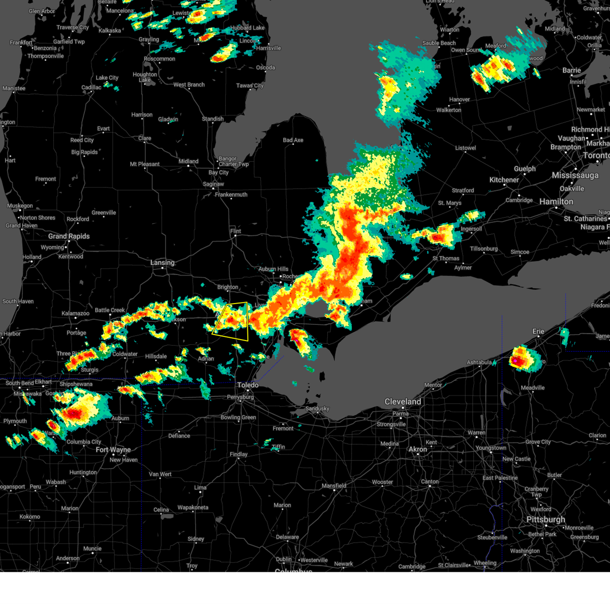 At 415 pm edt, a severe thunderstorm was located over ann arbor, moving east at 35 mph (radar indicated). Hazards include 60 mph wind gusts and quarter size hail. Hail damage to vehicles is expected. expect wind damage to roofs, siding, and trees. this severe storm will be near, dixboro around 420 pm edt. ypsilanti around 425 pm edt. willis around 430 pm edt. other locations impacted by this severe thunderstorm include bridgewater, pittsfield township, delhi mills, whittaker and barton hills. people attending ann arbor art fair should seek safe shelter immediately! hail threat, radar indicated max hail size, 1. 00 in wind threat, radar indicated max wind gust, 60 mph. At 415 pm edt, a severe thunderstorm was located over ann arbor, moving east at 35 mph (radar indicated). Hazards include 60 mph wind gusts and quarter size hail. Hail damage to vehicles is expected. expect wind damage to roofs, siding, and trees. this severe storm will be near, dixboro around 420 pm edt. ypsilanti around 425 pm edt. willis around 430 pm edt. other locations impacted by this severe thunderstorm include bridgewater, pittsfield township, delhi mills, whittaker and barton hills. people attending ann arbor art fair should seek safe shelter immediately! hail threat, radar indicated max hail size, 1. 00 in wind threat, radar indicated max wind gust, 60 mph.
|
| 7/20/2023 3:57 PM EDT |
 At 357 pm edt, severe thunderstorms were located along a line extending from near dixboro to near chelsea to 6 miles south of stockbridge, moving east at 35 mph (radar indicated). Hazards include 60 mph wind gusts and quarter size hail. Hail damage to vehicles is expected. expect wind damage to roofs, siding, and trees. these severe storms will be near, willis around 405 pm edt. ann arbor and saline around 415 pm edt. ypsilanti around 430 pm edt. dixboro around 445 pm edt. salem around 455 pm edt. other locations impacted by these severe thunderstorms include hudson mills, pittsfield township, whittaker, lyndon township, hudson mills metropark, bridgewater, delhi mills, pleasant lake and barton hills. people attending ann arbor art fair should seek safe shelter immediately! hail threat, radar indicated max hail size, 1. 00 in wind threat, radar indicated max wind gust, 60 mph. At 357 pm edt, severe thunderstorms were located along a line extending from near dixboro to near chelsea to 6 miles south of stockbridge, moving east at 35 mph (radar indicated). Hazards include 60 mph wind gusts and quarter size hail. Hail damage to vehicles is expected. expect wind damage to roofs, siding, and trees. these severe storms will be near, willis around 405 pm edt. ann arbor and saline around 415 pm edt. ypsilanti around 430 pm edt. dixboro around 445 pm edt. salem around 455 pm edt. other locations impacted by these severe thunderstorms include hudson mills, pittsfield township, whittaker, lyndon township, hudson mills metropark, bridgewater, delhi mills, pleasant lake and barton hills. people attending ann arbor art fair should seek safe shelter immediately! hail threat, radar indicated max hail size, 1. 00 in wind threat, radar indicated max wind gust, 60 mph.
|
| 7/20/2023 3:53 PM EDT |
 The severe thunderstorm warning for southeastern livingston county will expire at 400 pm edt, the storm which prompted the warning has moved out of the area. therefore, the warning will be allowed to expire. a severe thunderstorm watch remains in effect until 800 pm edt for southeastern michigan. The severe thunderstorm warning for southeastern livingston county will expire at 400 pm edt, the storm which prompted the warning has moved out of the area. therefore, the warning will be allowed to expire. a severe thunderstorm watch remains in effect until 800 pm edt for southeastern michigan.
|
| 7/20/2023 3:45 PM EDT |
 At 345 pm edt, severe thunderstorms were located along a line extending from near salem to near chelsea to near grass lake, moving east at 40 mph (radar indicated). Hazards include 60 mph wind gusts and quarter size hail. Hail damage to vehicles is expected. expect wind damage to roofs, siding, and trees. these severe storms will be near, salem around 350 pm edt. dexter around 400 pm edt. ann arbor around 405 pm edt. dixboro around 415 pm edt. ypsilanti around 420 pm edt. saline around 425 pm edt. milan around 430 pm edt. willis around 440 pm edt. other locations impacted by these severe thunderstorms include hudson mills, pittsfield township, whittaker, lyndon township, hudson mills metropark, bridgewater, delhi mills, pleasant lake and barton hills. people attending ann arbor art fair should seek safe shelter immediately! hail threat, radar indicated max hail size, 1. 00 in wind threat, radar indicated max wind gust, 60 mph. At 345 pm edt, severe thunderstorms were located along a line extending from near salem to near chelsea to near grass lake, moving east at 40 mph (radar indicated). Hazards include 60 mph wind gusts and quarter size hail. Hail damage to vehicles is expected. expect wind damage to roofs, siding, and trees. these severe storms will be near, salem around 350 pm edt. dexter around 400 pm edt. ann arbor around 405 pm edt. dixboro around 415 pm edt. ypsilanti around 420 pm edt. saline around 425 pm edt. milan around 430 pm edt. willis around 440 pm edt. other locations impacted by these severe thunderstorms include hudson mills, pittsfield township, whittaker, lyndon township, hudson mills metropark, bridgewater, delhi mills, pleasant lake and barton hills. people attending ann arbor art fair should seek safe shelter immediately! hail threat, radar indicated max hail size, 1. 00 in wind threat, radar indicated max wind gust, 60 mph.
|
| 7/20/2023 3:42 PM EDT |
 At 342 pm edt, a severe thunderstorm was located near brighton, moving east at 35 mph (radar indicated). Hazards include 60 mph wind gusts and quarter size hail. Hail damage to vehicles is expected. expect wind damage to roofs, siding, and trees. this severe thunderstorm will remain over mainly rural areas of southeastern livingston county, including the following locations, island lake state recreation area. hail threat, radar indicated max hail size, 1. 00 in wind threat, radar indicated max wind gust, 60 mph. At 342 pm edt, a severe thunderstorm was located near brighton, moving east at 35 mph (radar indicated). Hazards include 60 mph wind gusts and quarter size hail. Hail damage to vehicles is expected. expect wind damage to roofs, siding, and trees. this severe thunderstorm will remain over mainly rural areas of southeastern livingston county, including the following locations, island lake state recreation area. hail threat, radar indicated max hail size, 1. 00 in wind threat, radar indicated max wind gust, 60 mph.
|
| 7/20/2023 3:30 PM EDT |
 At 330 pm edt, severe thunderstorms were located along a line extending from near milford to near brighton to near chelsea, moving east at 40 mph (radar indicated). Hazards include 60 mph wind gusts and quarter size hail. Hail damage to vehicles is expected. expect wind damage to roofs, siding, and trees. these severe storms will be near, south lyon around 340 pm edt. hamburg around 345 pm edt. whitmore lake around 355 pm edt. other locations impacted by these severe thunderstorms include island lake state recreation area, chilson, lakeland, unadilla, pinckney state recreation area and hell. hail threat, radar indicated max hail size, 1. 00 in wind threat, radar indicated max wind gust, 60 mph. At 330 pm edt, severe thunderstorms were located along a line extending from near milford to near brighton to near chelsea, moving east at 40 mph (radar indicated). Hazards include 60 mph wind gusts and quarter size hail. Hail damage to vehicles is expected. expect wind damage to roofs, siding, and trees. these severe storms will be near, south lyon around 340 pm edt. hamburg around 345 pm edt. whitmore lake around 355 pm edt. other locations impacted by these severe thunderstorms include island lake state recreation area, chilson, lakeland, unadilla, pinckney state recreation area and hell. hail threat, radar indicated max hail size, 1. 00 in wind threat, radar indicated max wind gust, 60 mph.
|
| 7/20/2023 3:30 PM EDT |
 At 330 pm edt, severe thunderstorms were located along a line extending from brighton to 6 miles southwest of stockbridge to near jackson, moving east at 35 mph (radar indicated). Hazards include 60 mph wind gusts and quarter size hail. Hail damage to vehicles is expected. expect wind damage to roofs, siding, and trees. severe thunderstorms will be near, whitmore lake around 340 pm edt. chelsea around 350 pm edt. dexter around 405 pm edt. ann arbor and dixboro around 425 pm edt. saline and salem around 430 pm edt. ypsilanti around 440 pm edt. willis around 450 pm edt. other locations impacted by these severe thunderstorms include hudson mills, pittsfield township, whittaker, lyndon township, hudson mills metropark, bridgewater, delhi mills, pleasant lake and barton hills. people attending ann arbor art fair should seek safe shelter immediately! hail threat, radar indicated max hail size, 1. 00 in wind threat, radar indicated max wind gust, 60 mph. At 330 pm edt, severe thunderstorms were located along a line extending from brighton to 6 miles southwest of stockbridge to near jackson, moving east at 35 mph (radar indicated). Hazards include 60 mph wind gusts and quarter size hail. Hail damage to vehicles is expected. expect wind damage to roofs, siding, and trees. severe thunderstorms will be near, whitmore lake around 340 pm edt. chelsea around 350 pm edt. dexter around 405 pm edt. ann arbor and dixboro around 425 pm edt. saline and salem around 430 pm edt. ypsilanti around 440 pm edt. willis around 450 pm edt. other locations impacted by these severe thunderstorms include hudson mills, pittsfield township, whittaker, lyndon township, hudson mills metropark, bridgewater, delhi mills, pleasant lake and barton hills. people attending ann arbor art fair should seek safe shelter immediately! hail threat, radar indicated max hail size, 1. 00 in wind threat, radar indicated max wind gust, 60 mph.
|
| 7/20/2023 3:19 PM EDT |
 At 319 pm edt, severe thunderstorms were located along a line extending from near hartland to near howell to near gregory, moving east at 40 mph (radar indicated). Hazards include 60 mph wind gusts and quarter size hail. Hail damage to vehicles is expected. expect wind damage to roofs, siding, and trees. these severe storms will be near, hartland and brighton around 325 pm edt. hamburg around 340 pm edt. whitmore lake around 350 pm edt. south lyon around 355 pm edt. other locations impacted by these severe thunderstorms include parkers corners, lakeland, plainfield, island lake state recreation area, chilson, unadilla, pinckney state recreation area, hell, tyrone township and deerfield township. hail threat, radar indicated max hail size, 1. 00 in wind threat, radar indicated max wind gust, 60 mph. At 319 pm edt, severe thunderstorms were located along a line extending from near hartland to near howell to near gregory, moving east at 40 mph (radar indicated). Hazards include 60 mph wind gusts and quarter size hail. Hail damage to vehicles is expected. expect wind damage to roofs, siding, and trees. these severe storms will be near, hartland and brighton around 325 pm edt. hamburg around 340 pm edt. whitmore lake around 350 pm edt. south lyon around 355 pm edt. other locations impacted by these severe thunderstorms include parkers corners, lakeland, plainfield, island lake state recreation area, chilson, unadilla, pinckney state recreation area, hell, tyrone township and deerfield township. hail threat, radar indicated max hail size, 1. 00 in wind threat, radar indicated max wind gust, 60 mph.
|
| 7/20/2023 3:05 PM EDT |
 At 305 pm edt, severe thunderstorms were located along a line extending from near linden to near oak grove to near leslie, moving east at 45 mph (radar indicated). Hazards include 60 mph wind gusts and quarter size hail. Hail damage to vehicles is expected. expect wind damage to roofs, siding, and trees. these severe storms will be near, cohoctah and oak grove around 310 pm edt. hartland around 315 pm edt. gregory around 325 pm edt. pinckney around 330 pm edt. hamburg around 345 pm edt. whitmore lake around 350 pm edt. south lyon around 355 pm edt. other locations impacted by these severe thunderstorms include parkers corners, lakeland, plainfield, island lake state recreation area, chilson, unadilla, pinckney state recreation area, hell, tyrone township and deerfield township. hail threat, radar indicated max hail size, 1. 00 in wind threat, radar indicated max wind gust, 60 mph. At 305 pm edt, severe thunderstorms were located along a line extending from near linden to near oak grove to near leslie, moving east at 45 mph (radar indicated). Hazards include 60 mph wind gusts and quarter size hail. Hail damage to vehicles is expected. expect wind damage to roofs, siding, and trees. these severe storms will be near, cohoctah and oak grove around 310 pm edt. hartland around 315 pm edt. gregory around 325 pm edt. pinckney around 330 pm edt. hamburg around 345 pm edt. whitmore lake around 350 pm edt. south lyon around 355 pm edt. other locations impacted by these severe thunderstorms include parkers corners, lakeland, plainfield, island lake state recreation area, chilson, unadilla, pinckney state recreation area, hell, tyrone township and deerfield township. hail threat, radar indicated max hail size, 1. 00 in wind threat, radar indicated max wind gust, 60 mph.
|
| 7/20/2023 2:50 PM EDT |
 At 250 pm edt, severe thunderstorms were located along a line extending from gaines to near fowlerville to near leslie, moving east at 50 mph (radar indicated). Hazards include 60 mph wind gusts and quarter size hail. Hail damage to vehicles is expected. expect wind damage to roofs, siding, and trees. these severe storms will be near, howell, fowlerville, cohoctah and oak grove around 255 pm edt. hartland around 310 pm edt. gregory around 315 pm edt. pinckney around 325 pm edt. hamburg around 335 pm edt. whitmore lake around 340 pm edt. south lyon around 345 pm edt. other locations impacted by these severe thunderstorms include parkers corners, lakeland, plainfield, island lake state recreation area, chilson, unadilla, conway township, pinckney state recreation area, hell and tyrone township. hail threat, radar indicated max hail size, 1. 00 in wind threat, radar indicated max wind gust, 60 mph. At 250 pm edt, severe thunderstorms were located along a line extending from gaines to near fowlerville to near leslie, moving east at 50 mph (radar indicated). Hazards include 60 mph wind gusts and quarter size hail. Hail damage to vehicles is expected. expect wind damage to roofs, siding, and trees. these severe storms will be near, howell, fowlerville, cohoctah and oak grove around 255 pm edt. hartland around 310 pm edt. gregory around 315 pm edt. pinckney around 325 pm edt. hamburg around 335 pm edt. whitmore lake around 340 pm edt. south lyon around 345 pm edt. other locations impacted by these severe thunderstorms include parkers corners, lakeland, plainfield, island lake state recreation area, chilson, unadilla, conway township, pinckney state recreation area, hell and tyrone township. hail threat, radar indicated max hail size, 1. 00 in wind threat, radar indicated max wind gust, 60 mph.
|
| 7/20/2023 2:38 PM EDT |
 At 238 pm edt, severe thunderstorms were located along a line extending from durand to near williamston to 7 miles south of eaton rapids, moving east at 45 mph (radar indicated). Hazards include 60 mph wind gusts and quarter size hail. Hail damage to vehicles is expected. expect wind damage to roofs, siding, and trees. severe thunderstorms will be near, fowlerville around 250 pm edt. howell, cohoctah and oak grove around 300 pm edt. hartland around 310 pm edt. gregory around 320 pm edt. pinckney around 330 pm edt. hamburg around 340 pm edt. whitmore lake around 345 pm edt. other locations impacted by these severe thunderstorms include parkers corners, lakeland, plainfield, island lake state recreation area, chilson, unadilla, conway township, pinckney state recreation area, hell and tyrone township. hail threat, radar indicated max hail size, 1. 00 in wind threat, radar indicated max wind gust, 60 mph. At 238 pm edt, severe thunderstorms were located along a line extending from durand to near williamston to 7 miles south of eaton rapids, moving east at 45 mph (radar indicated). Hazards include 60 mph wind gusts and quarter size hail. Hail damage to vehicles is expected. expect wind damage to roofs, siding, and trees. severe thunderstorms will be near, fowlerville around 250 pm edt. howell, cohoctah and oak grove around 300 pm edt. hartland around 310 pm edt. gregory around 320 pm edt. pinckney around 330 pm edt. hamburg around 340 pm edt. whitmore lake around 345 pm edt. other locations impacted by these severe thunderstorms include parkers corners, lakeland, plainfield, island lake state recreation area, chilson, unadilla, conway township, pinckney state recreation area, hell and tyrone township. hail threat, radar indicated max hail size, 1. 00 in wind threat, radar indicated max wind gust, 60 mph.
|
| 7/14/2023 3:37 PM EDT |
 The severe thunderstorm warning for southeastern livingston county will expire at 345 pm edt, the storm which prompted the warning has weakened below severe limits, and has exited the warned area. therefore, the warning will be allowed to expire. The severe thunderstorm warning for southeastern livingston county will expire at 345 pm edt, the storm which prompted the warning has weakened below severe limits, and has exited the warned area. therefore, the warning will be allowed to expire.
|
| 7/14/2023 3:27 PM EDT |
 At 326 pm edt, a severe thunderstorm was located over south lyon, or 7 miles southeast of brighton, moving east at 25 mph (radar indicated). Hazards include 60 mph wind gusts and penny size hail. Expect damage to roofs, siding, and trees. this severe thunderstorm will remain over mainly rural areas of southeastern livingston county, including the following locations, island lake state recreation area. hail threat, radar indicated max hail size, 0. 75 in wind threat, radar indicated max wind gust, 60 mph. At 326 pm edt, a severe thunderstorm was located over south lyon, or 7 miles southeast of brighton, moving east at 25 mph (radar indicated). Hazards include 60 mph wind gusts and penny size hail. Expect damage to roofs, siding, and trees. this severe thunderstorm will remain over mainly rural areas of southeastern livingston county, including the following locations, island lake state recreation area. hail threat, radar indicated max hail size, 0. 75 in wind threat, radar indicated max wind gust, 60 mph.
|
| 7/14/2023 3:17 PM EDT |
 At 316 pm edt, a severe thunderstorm was located near dexter, moving east at 30 mph (radar indicated). Hazards include 60 mph wind gusts and quarter size hail. Hail damage to vehicles is expected. expect wind damage to roofs, siding, and trees. this severe storm will be near, ann arbor and saline around 330 pm edt. dixboro around 340 pm edt. ypsilanti around 345 pm edt. willis around 355 pm edt. other locations impacted by this severe thunderstorm include hudson mills, pittsfield township, whittaker, hudson mills metropark, bridgewater, delhi mills, pleasant lake, barton hills and oakville. hail threat, radar indicated max hail size, 1. 00 in wind threat, radar indicated max wind gust, 60 mph. At 316 pm edt, a severe thunderstorm was located near dexter, moving east at 30 mph (radar indicated). Hazards include 60 mph wind gusts and quarter size hail. Hail damage to vehicles is expected. expect wind damage to roofs, siding, and trees. this severe storm will be near, ann arbor and saline around 330 pm edt. dixboro around 340 pm edt. ypsilanti around 345 pm edt. willis around 355 pm edt. other locations impacted by this severe thunderstorm include hudson mills, pittsfield township, whittaker, hudson mills metropark, bridgewater, delhi mills, pleasant lake, barton hills and oakville. hail threat, radar indicated max hail size, 1. 00 in wind threat, radar indicated max wind gust, 60 mph.
|
| 7/14/2023 3:09 PM EDT |
 At 309 pm edt, a severe thunderstorm was located near whitmore lake, or near brighton, moving east at 30 mph (radar indicated). Hazards include 60 mph wind gusts and penny size hail. Expect damage to roofs, siding, and trees. this severe storm will be near, south lyon around 320 pm edt. other locations impacted by this severe thunderstorm include island lake state recreation area, chilson, lakeland, pinckney state recreation area and hell. hail threat, radar indicated max hail size, 0. 75 in wind threat, radar indicated max wind gust, 60 mph. At 309 pm edt, a severe thunderstorm was located near whitmore lake, or near brighton, moving east at 30 mph (radar indicated). Hazards include 60 mph wind gusts and penny size hail. Expect damage to roofs, siding, and trees. this severe storm will be near, south lyon around 320 pm edt. other locations impacted by this severe thunderstorm include island lake state recreation area, chilson, lakeland, pinckney state recreation area and hell. hail threat, radar indicated max hail size, 0. 75 in wind threat, radar indicated max wind gust, 60 mph.
|
| 7/14/2023 3:01 PM EDT |
 At 301 pm edt, a severe thunderstorm was located near chelsea, moving east at 25 mph (radar indicated). Hazards include 60 mph wind gusts and quarter size hail. Hail damage to vehicles is expected. expect wind damage to roofs, siding, and trees. this severe thunderstorm will be near, chelsea around 305 pm edt. dexter around 320 pm edt. ann arbor around 335 pm edt. saline around 340 pm edt. dixboro around 350 pm edt. ypsilanti around 355 pm edt. willis around 400 pm edt. other locations impacted by this severe thunderstorm include hudson mills, pittsfield township, whittaker, lyndon township, hudson mills metropark, bridgewater, delhi mills, pleasant lake, barton hills and pinckney state recreation area. hail threat, radar indicated max hail size, 1. 00 in wind threat, radar indicated max wind gust, 60 mph. At 301 pm edt, a severe thunderstorm was located near chelsea, moving east at 25 mph (radar indicated). Hazards include 60 mph wind gusts and quarter size hail. Hail damage to vehicles is expected. expect wind damage to roofs, siding, and trees. this severe thunderstorm will be near, chelsea around 305 pm edt. dexter around 320 pm edt. ann arbor around 335 pm edt. saline around 340 pm edt. dixboro around 350 pm edt. ypsilanti around 355 pm edt. willis around 400 pm edt. other locations impacted by this severe thunderstorm include hudson mills, pittsfield township, whittaker, lyndon township, hudson mills metropark, bridgewater, delhi mills, pleasant lake, barton hills and pinckney state recreation area. hail threat, radar indicated max hail size, 1. 00 in wind threat, radar indicated max wind gust, 60 mph.
|
| 7/14/2023 2:44 PM EDT |
 At 243 pm edt, a severe thunderstorm was located near gregory, or near pinckney, moving east at 20 mph (radar indicated). Hazards include 60 mph wind gusts and penny size hail. Expect damage to roofs, siding, and trees. this severe thunderstorm will be near, pinckney around 255 pm edt. hamburg around 320 pm edt. brighton around 325 pm edt. whitmore lake around 335 pm edt. south lyon around 345 pm edt. other locations impacted by this severe thunderstorm include island lake state recreation area, chilson, lakeland, unadilla, pinckney state recreation area and hell. hail threat, radar indicated max hail size, 0. 75 in wind threat, radar indicated max wind gust, 60 mph. At 243 pm edt, a severe thunderstorm was located near gregory, or near pinckney, moving east at 20 mph (radar indicated). Hazards include 60 mph wind gusts and penny size hail. Expect damage to roofs, siding, and trees. this severe thunderstorm will be near, pinckney around 255 pm edt. hamburg around 320 pm edt. brighton around 325 pm edt. whitmore lake around 335 pm edt. south lyon around 345 pm edt. other locations impacted by this severe thunderstorm include island lake state recreation area, chilson, lakeland, unadilla, pinckney state recreation area and hell. hail threat, radar indicated max hail size, 0. 75 in wind threat, radar indicated max wind gust, 60 mph.
|
| 7/11/2023 4:55 PM EDT |
 The severe thunderstorm warning for northeastern washtenaw county will expire at 500 pm edt, the storm which prompted the warning has weakened below severe limits, and no longer poses an immediate threat to life or property. therefore, the warning will be allowed to expire. to report severe weather, contact your nearest law enforcement agency. they will relay your report to the national weather service detroit/pontiac. The severe thunderstorm warning for northeastern washtenaw county will expire at 500 pm edt, the storm which prompted the warning has weakened below severe limits, and no longer poses an immediate threat to life or property. therefore, the warning will be allowed to expire. to report severe weather, contact your nearest law enforcement agency. they will relay your report to the national weather service detroit/pontiac.
|
| 7/11/2023 4:35 PM EDT |
 At 435 pm edt, a severe thunderstorm was located over dixboro, or over ann arbor, moving east at 35 mph (radar indicated). Hazards include 60 mph wind gusts and quarter size hail. Hail damage to vehicles is expected. expect wind damage to roofs, siding, and trees. this severe storm will be near, ypsilanti around 445 pm edt. other locations impacted by this severe thunderstorm include barton hills and delhi mills. hail threat, radar indicated max hail size, 1. 00 in wind threat, radar indicated max wind gust, 60 mph. At 435 pm edt, a severe thunderstorm was located over dixboro, or over ann arbor, moving east at 35 mph (radar indicated). Hazards include 60 mph wind gusts and quarter size hail. Hail damage to vehicles is expected. expect wind damage to roofs, siding, and trees. this severe storm will be near, ypsilanti around 445 pm edt. other locations impacted by this severe thunderstorm include barton hills and delhi mills. hail threat, radar indicated max hail size, 1. 00 in wind threat, radar indicated max wind gust, 60 mph.
|
| 7/11/2023 4:14 PM EDT |
 At 414 pm edt, a severe thunderstorm was located over dexter, moving southeast at 35 mph (radar indicated). Hazards include 60 mph wind gusts and quarter size hail. Hail damage to vehicles is expected. expect wind damage to roofs, siding, and trees. this severe storm will be near, ann arbor around 425 pm edt. dixboro around 435 pm edt. ypsilanti around 440 pm edt. other locations impacted by this severe thunderstorm include hudson mills, lakeland, hudson mills metropark, delhi mills, barton hills, pinckney state recreation area and hell. hail threat, radar indicated max hail size, 1. 00 in wind threat, radar indicated max wind gust, 60 mph. At 414 pm edt, a severe thunderstorm was located over dexter, moving southeast at 35 mph (radar indicated). Hazards include 60 mph wind gusts and quarter size hail. Hail damage to vehicles is expected. expect wind damage to roofs, siding, and trees. this severe storm will be near, ann arbor around 425 pm edt. dixboro around 435 pm edt. ypsilanti around 440 pm edt. other locations impacted by this severe thunderstorm include hudson mills, lakeland, hudson mills metropark, delhi mills, barton hills, pinckney state recreation area and hell. hail threat, radar indicated max hail size, 1. 00 in wind threat, radar indicated max wind gust, 60 mph.
|
| 7/11/2023 3:54 PM EDT |
 At 354 pm edt, a severe thunderstorm was located over gregory, or 7 miles west of pinckney, moving east at 35 mph (radar indicated). Hazards include 60 mph wind gusts and quarter size hail. Hail damage to vehicles is expected. expect wind damage to roofs, siding, and trees. this severe thunderstorm will be near, chelsea around 400 pm edt. pinckney around 405 pm edt. dexter around 415 pm edt. hamburg around 420 pm edt. whitmore lake around 425 pm edt. south lyon and dixboro around 430 pm edt. salem around 440 pm edt. other locations impacted by this severe thunderstorm include hudson mills, lakeland, lyndon township, hudson mills metropark, delhi mills, barton hills, unadilla, pinckney state recreation area and hell. hail threat, radar indicated max hail size, 1. 00 in wind threat, radar indicated max wind gust, 60 mph. At 354 pm edt, a severe thunderstorm was located over gregory, or 7 miles west of pinckney, moving east at 35 mph (radar indicated). Hazards include 60 mph wind gusts and quarter size hail. Hail damage to vehicles is expected. expect wind damage to roofs, siding, and trees. this severe thunderstorm will be near, chelsea around 400 pm edt. pinckney around 405 pm edt. dexter around 415 pm edt. hamburg around 420 pm edt. whitmore lake around 425 pm edt. south lyon and dixboro around 430 pm edt. salem around 440 pm edt. other locations impacted by this severe thunderstorm include hudson mills, lakeland, lyndon township, hudson mills metropark, delhi mills, barton hills, unadilla, pinckney state recreation area and hell. hail threat, radar indicated max hail size, 1. 00 in wind threat, radar indicated max wind gust, 60 mph.
|
| 6/25/2023 6:23 PM EDT |
 At 623 pm edt, a severe thunderstorm was located near oak grove, or near hartland, moving northeast at 35 mph (radar indicated). Hazards include 60 mph wind gusts. Expect damage to roofs, siding, and trees. this severe thunderstorm will be near, linden around 640 pm edt. fenton around 645 pm edt. lake fenton around 650 pm edt. grand blanc and goodrich around 700 pm edt. davison and burton around 715 pm edt. other locations impacted by this severe thunderstorm include atlas, rankin, island lake state recreation area, argentine, conway township, genesee, vernon, juddville, lakeland and chilson. hail threat, radar indicated max hail size, <. 75 in wind threat, radar indicated max wind gust, 60 mph. At 623 pm edt, a severe thunderstorm was located near oak grove, or near hartland, moving northeast at 35 mph (radar indicated). Hazards include 60 mph wind gusts. Expect damage to roofs, siding, and trees. this severe thunderstorm will be near, linden around 640 pm edt. fenton around 645 pm edt. lake fenton around 650 pm edt. grand blanc and goodrich around 700 pm edt. davison and burton around 715 pm edt. other locations impacted by this severe thunderstorm include atlas, rankin, island lake state recreation area, argentine, conway township, genesee, vernon, juddville, lakeland and chilson. hail threat, radar indicated max hail size, <. 75 in wind threat, radar indicated max wind gust, 60 mph.
|
| 6/25/2023 6:22 PM EDT | Nollar road completely blocked due to large downed tree between 6 mile road and 7 mile road. tree diameter approximately 24 inches. time estimated by rada in washtenaw county MI, 0.8 miles SW of Whitmore Lake, MI |
| 6/25/2023 6:22 PM EDT | Trees down along 6 mile road near us 23. time estimated by rada in washtenaw county MI, 2.3 miles NNE of Whitmore Lake, MI |
| 6/25/2023 6:20 PM EDT |
 At 619 pm edt, a severe thunderstorm was located over salem, or 7 miles northwest of canton, moving northeast at 55 mph (radar indicated). Hazards include 60 mph wind gusts. Expect damage to roofs, siding, and trees. this severe thunderstorm will remain over mainly rural areas of southern livingston and washtenaw counties, including the following locations, pittsfield township, whittaker, plainfield, hudson mills metropark, island lake state recreation area, delhi mills, barton hills, pinckney state recreation area, hudson mills and parkers corners. People attending howell high school should seek safe shelter immediately!. At 619 pm edt, a severe thunderstorm was located over salem, or 7 miles northwest of canton, moving northeast at 55 mph (radar indicated). Hazards include 60 mph wind gusts. Expect damage to roofs, siding, and trees. this severe thunderstorm will remain over mainly rural areas of southern livingston and washtenaw counties, including the following locations, pittsfield township, whittaker, plainfield, hudson mills metropark, island lake state recreation area, delhi mills, barton hills, pinckney state recreation area, hudson mills and parkers corners. People attending howell high school should seek safe shelter immediately!.
|
| 6/25/2023 6:01 PM EDT |
 At 600 pm edt, a severe thunderstorm was located over pinckney, moving northeast at 50 mph (radar indicated). Hazards include 60 mph wind gusts. Expect damage to roofs, siding, and trees. this severe storm will be near, hamburg around 605 pm edt. brighton and whitmore lake around 610 pm edt. other locations impacted by this severe thunderstorm include pittsfield township, whittaker, plainfield, hudson mills metropark, island lake state recreation area, bridgewater, delhi mills, pleasant lake, barton hills and pinckney state recreation area. People attending howell high school should seek safe shelter immediately!. At 600 pm edt, a severe thunderstorm was located over pinckney, moving northeast at 50 mph (radar indicated). Hazards include 60 mph wind gusts. Expect damage to roofs, siding, and trees. this severe storm will be near, hamburg around 605 pm edt. brighton and whitmore lake around 610 pm edt. other locations impacted by this severe thunderstorm include pittsfield township, whittaker, plainfield, hudson mills metropark, island lake state recreation area, bridgewater, delhi mills, pleasant lake, barton hills and pinckney state recreation area. People attending howell high school should seek safe shelter immediately!.
|
| 6/25/2023 5:41 PM EDT |
 At 541 pm edt, a severe thunderstorm was located near stockbridge, or 8 miles west of chelsea, moving northeast at 50 mph (radar indicated). Hazards include 60 mph wind gusts. Expect damage to roofs, siding, and trees. this severe storm will be near, chelsea and gregory around 550 pm edt. pinckney around 555 pm edt. hamburg around 605 pm edt. brighton and whitmore lake around 610 pm edt. other locations impacted by this severe thunderstorm include pittsfield township, whittaker, plainfield, hudson mills metropark, island lake state recreation area, bridgewater, delhi mills, pleasant lake, barton hills and pinckney state recreation area. People attending howell high school should seek safe shelter immediately!. At 541 pm edt, a severe thunderstorm was located near stockbridge, or 8 miles west of chelsea, moving northeast at 50 mph (radar indicated). Hazards include 60 mph wind gusts. Expect damage to roofs, siding, and trees. this severe storm will be near, chelsea and gregory around 550 pm edt. pinckney around 555 pm edt. hamburg around 605 pm edt. brighton and whitmore lake around 610 pm edt. other locations impacted by this severe thunderstorm include pittsfield township, whittaker, plainfield, hudson mills metropark, island lake state recreation area, bridgewater, delhi mills, pleasant lake, barton hills and pinckney state recreation area. People attending howell high school should seek safe shelter immediately!.
|
| 6/25/2023 5:28 PM EDT |
 At 528 pm edt, a severe thunderstorm was located near jackson, moving northeast at 50 mph (radar indicated). Hazards include 60 mph wind gusts. Expect damage to roofs, siding, and trees. this severe thunderstorm will be near, chelsea and gregory around 550 pm edt. pinckney around 555 pm edt. hamburg around 605 pm edt. brighton and whitmore lake around 610 pm edt. other locations impacted by this severe thunderstorm include pittsfield township, whittaker, plainfield, hudson mills metropark, island lake state recreation area, bridgewater, delhi mills, pleasant lake, barton hills and pinckney state recreation area. people attending howell high school should seek safe shelter immediately! hail threat, radar indicated max hail size, <. 75 in wind threat, radar indicated max wind gust, 60 mph. At 528 pm edt, a severe thunderstorm was located near jackson, moving northeast at 50 mph (radar indicated). Hazards include 60 mph wind gusts. Expect damage to roofs, siding, and trees. this severe thunderstorm will be near, chelsea and gregory around 550 pm edt. pinckney around 555 pm edt. hamburg around 605 pm edt. brighton and whitmore lake around 610 pm edt. other locations impacted by this severe thunderstorm include pittsfield township, whittaker, plainfield, hudson mills metropark, island lake state recreation area, bridgewater, delhi mills, pleasant lake, barton hills and pinckney state recreation area. people attending howell high school should seek safe shelter immediately! hail threat, radar indicated max hail size, <. 75 in wind threat, radar indicated max wind gust, 60 mph.
|
| 6/15/2023 5:27 PM EDT |
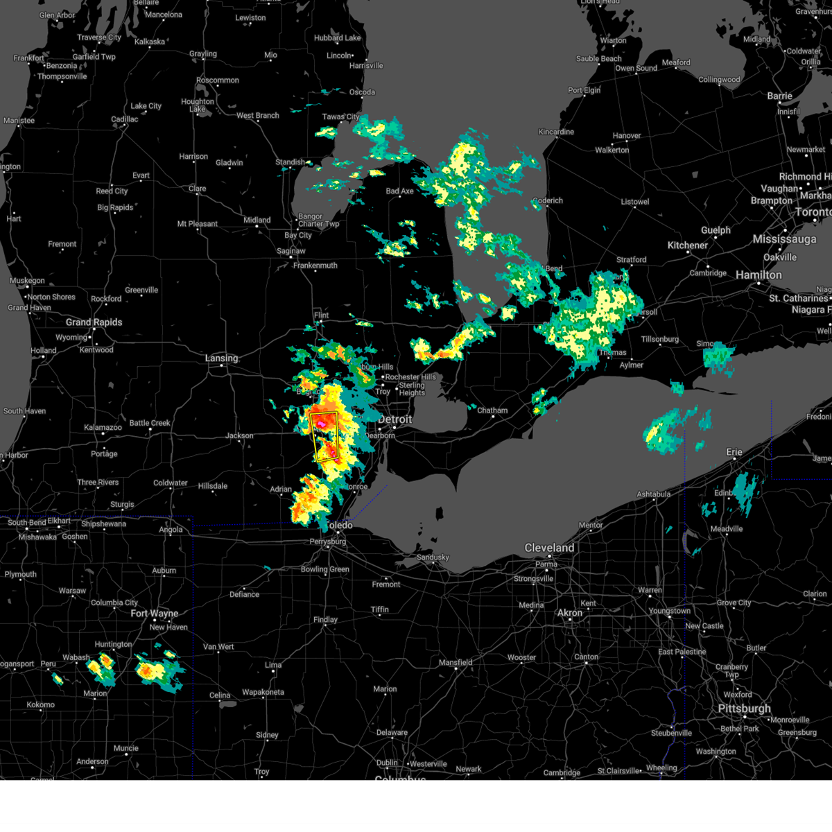 At 527 pm edt, a severe thunderstorm was located over dixboro, or near ypsilanti, moving southeast at 35 mph (radar indicated). Hazards include 60 mph wind gusts and half dollar size hail. Hail damage to vehicles is expected. expect wind damage to roofs, siding, and trees. this severe storm will be near, ypsilanti around 535 pm edt. Other locations impacted by this severe thunderstorm include barton hills and pittsfield township. At 527 pm edt, a severe thunderstorm was located over dixboro, or near ypsilanti, moving southeast at 35 mph (radar indicated). Hazards include 60 mph wind gusts and half dollar size hail. Hail damage to vehicles is expected. expect wind damage to roofs, siding, and trees. this severe storm will be near, ypsilanti around 535 pm edt. Other locations impacted by this severe thunderstorm include barton hills and pittsfield township.
|
| 6/15/2023 5:25 PM EDT |
 The severe thunderstorm warning for southeastern livingston county will expire at 530 pm edt, the storm which prompted the warning has moved out of the area. therefore, the warning will be allowed to expire. however heavy rain is still possible with this thunderstorm. The severe thunderstorm warning for southeastern livingston county will expire at 530 pm edt, the storm which prompted the warning has moved out of the area. therefore, the warning will be allowed to expire. however heavy rain is still possible with this thunderstorm.
|
| 6/15/2023 5:14 PM EDT |
 At 514 pm edt, a severe thunderstorm was located over whitmore lake, or 7 miles northeast of dexter, moving southeast at 40 mph (radar indicated). Hazards include 60 mph wind gusts and quarter size hail. Hail damage to vehicles is expected. expect wind damage to roofs, siding, and trees. this severe storm will be near, salem and dixboro around 525 pm edt. ypsilanti around 530 pm edt. Other locations impacted by this severe thunderstorm include hudson mills, bridgewater, pittsfield township, delhi mills, barton hills and hudson mills metropark. At 514 pm edt, a severe thunderstorm was located over whitmore lake, or 7 miles northeast of dexter, moving southeast at 40 mph (radar indicated). Hazards include 60 mph wind gusts and quarter size hail. Hail damage to vehicles is expected. expect wind damage to roofs, siding, and trees. this severe storm will be near, salem and dixboro around 525 pm edt. ypsilanti around 530 pm edt. Other locations impacted by this severe thunderstorm include hudson mills, bridgewater, pittsfield township, delhi mills, barton hills and hudson mills metropark.
|
| 6/15/2023 5:05 PM EDT |
 At 505 pm edt, a severe thunderstorm was located over hamburg, or near brighton, moving east at 25 mph (radar indicated). Hazards include 60 mph wind gusts and half dollar size hail. Hail damage to vehicles is expected. expect wind damage to roofs, siding, and trees. this severe storm will be near, hamburg around 510 pm edt. whitmore lake around 520 pm edt. south lyon around 530 pm edt. other locations impacted by this severe thunderstorm include lakeland, island lake state recreation area and chilson. people attending manly bennett park should seek safe shelter immediately! hail threat, radar indicated max hail size, 1. 25 in wind threat, radar indicated max wind gust, 60 mph. At 505 pm edt, a severe thunderstorm was located over hamburg, or near brighton, moving east at 25 mph (radar indicated). Hazards include 60 mph wind gusts and half dollar size hail. Hail damage to vehicles is expected. expect wind damage to roofs, siding, and trees. this severe storm will be near, hamburg around 510 pm edt. whitmore lake around 520 pm edt. south lyon around 530 pm edt. other locations impacted by this severe thunderstorm include lakeland, island lake state recreation area and chilson. people attending manly bennett park should seek safe shelter immediately! hail threat, radar indicated max hail size, 1. 25 in wind threat, radar indicated max wind gust, 60 mph.
|
| 6/15/2023 5:01 PM EDT |
 At 500 pm edt, a severe thunderstorm was located near whitmore lake, or near ann arbor, moving east at 30 mph (radar indicated). Hazards include 60 mph wind gusts and quarter size hail. Hail damage to vehicles is expected. expect wind damage to roofs, siding, and trees. this severe storm will be near, ypsilanti and dixboro around 510 pm edt. salem around 520 pm edt. Other locations impacted by this severe thunderstorm include hudson mills, bridgewater, pittsfield township, delhi mills, barton hills and hudson mills metropark. At 500 pm edt, a severe thunderstorm was located near whitmore lake, or near ann arbor, moving east at 30 mph (radar indicated). Hazards include 60 mph wind gusts and quarter size hail. Hail damage to vehicles is expected. expect wind damage to roofs, siding, and trees. this severe storm will be near, ypsilanti and dixboro around 510 pm edt. salem around 520 pm edt. Other locations impacted by this severe thunderstorm include hudson mills, bridgewater, pittsfield township, delhi mills, barton hills and hudson mills metropark.
|
| 6/15/2023 4:54 PM EDT |
 At 454 pm edt, a severe thunderstorm was located near pinckney, moving east at 25 mph (radar indicated). Hazards include ping pong ball size hail and 60 mph wind gusts. People and animals outdoors will be injured. expect hail damage to roofs, siding, windows, and vehicles. expect wind damage to roofs, siding, and trees. this severe storm will be near, brighton around 505 pm edt. hamburg around 510 pm edt. whitmore lake around 520 pm edt. south lyon around 530 pm edt. other locations impacted by this severe thunderstorm include lakeland, island lake state recreation area and chilson. people attending manly bennett park should seek safe shelter immediately! hail threat, radar indicated max hail size, 1. 50 in wind threat, radar indicated max wind gust, 60 mph. At 454 pm edt, a severe thunderstorm was located near pinckney, moving east at 25 mph (radar indicated). Hazards include ping pong ball size hail and 60 mph wind gusts. People and animals outdoors will be injured. expect hail damage to roofs, siding, windows, and vehicles. expect wind damage to roofs, siding, and trees. this severe storm will be near, brighton around 505 pm edt. hamburg around 510 pm edt. whitmore lake around 520 pm edt. south lyon around 530 pm edt. other locations impacted by this severe thunderstorm include lakeland, island lake state recreation area and chilson. people attending manly bennett park should seek safe shelter immediately! hail threat, radar indicated max hail size, 1. 50 in wind threat, radar indicated max wind gust, 60 mph.
|
| 6/15/2023 4:52 PM EDT |
 At 452 pm edt, a severe thunderstorm was located near dexter, moving east at 25 mph (radar indicated). Hazards include 60 mph wind gusts and quarter size hail. Hail damage to vehicles is expected. expect wind damage to roofs, siding, and trees. this severe thunderstorm will be near, ann arbor around 455 pm edt. whitmore lake around 505 pm edt. ypsilanti and dixboro around 510 pm edt. salem around 520 pm edt. Other locations impacted by this severe thunderstorm include hudson mills, bridgewater, pittsfield township, delhi mills, barton hills and hudson mills metropark. At 452 pm edt, a severe thunderstorm was located near dexter, moving east at 25 mph (radar indicated). Hazards include 60 mph wind gusts and quarter size hail. Hail damage to vehicles is expected. expect wind damage to roofs, siding, and trees. this severe thunderstorm will be near, ann arbor around 455 pm edt. whitmore lake around 505 pm edt. ypsilanti and dixboro around 510 pm edt. salem around 520 pm edt. Other locations impacted by this severe thunderstorm include hudson mills, bridgewater, pittsfield township, delhi mills, barton hills and hudson mills metropark.
|
| 6/15/2023 4:45 PM EDT |
 At 445 pm edt, a severe thunderstorm was located near pinckney, moving east at 25 mph (radar indicated). Hazards include 60 mph wind gusts and half dollar size hail. Hail damage to vehicles is expected. expect wind damage to roofs, siding, and trees. this severe storm will be near, pinckney around 450 pm edt. brighton and hamburg around 510 pm edt. whitmore lake around 520 pm edt. south lyon around 530 pm edt. other locations impacted by this severe thunderstorm include island lake state recreation area, parkers corners, chilson, lakeland and plainfield. people attending manly bennett park should seek safe shelter immediately! hail threat, radar indicated max hail size, 1. 25 in wind threat, radar indicated max wind gust, 60 mph. At 445 pm edt, a severe thunderstorm was located near pinckney, moving east at 25 mph (radar indicated). Hazards include 60 mph wind gusts and half dollar size hail. Hail damage to vehicles is expected. expect wind damage to roofs, siding, and trees. this severe storm will be near, pinckney around 450 pm edt. brighton and hamburg around 510 pm edt. whitmore lake around 520 pm edt. south lyon around 530 pm edt. other locations impacted by this severe thunderstorm include island lake state recreation area, parkers corners, chilson, lakeland and plainfield. people attending manly bennett park should seek safe shelter immediately! hail threat, radar indicated max hail size, 1. 25 in wind threat, radar indicated max wind gust, 60 mph.
|
| 6/15/2023 4:36 PM EDT |
 At 436 pm edt, a severe thunderstorm was located near howell, moving east at 25 mph (radar indicated). Hazards include 60 mph wind gusts and quarter size hail. Hail damage to vehicles is expected. expect wind damage to roofs, siding, and trees. this severe storm will be near, pinckney around 445 pm edt. howell around 450 pm edt. brighton around 510 pm edt. hartland around 515 pm edt. other locations impacted by this severe thunderstorm include island lake state recreation area, parkers corners, chilson, lakeland and plainfield. people attending manly bennett park should seek safe shelter immediately! hail threat, radar indicated max hail size, 1. 00 in wind threat, radar indicated max wind gust, 60 mph. At 436 pm edt, a severe thunderstorm was located near howell, moving east at 25 mph (radar indicated). Hazards include 60 mph wind gusts and quarter size hail. Hail damage to vehicles is expected. expect wind damage to roofs, siding, and trees. this severe storm will be near, pinckney around 445 pm edt. howell around 450 pm edt. brighton around 510 pm edt. hartland around 515 pm edt. other locations impacted by this severe thunderstorm include island lake state recreation area, parkers corners, chilson, lakeland and plainfield. people attending manly bennett park should seek safe shelter immediately! hail threat, radar indicated max hail size, 1. 00 in wind threat, radar indicated max wind gust, 60 mph.
|
| 6/15/2023 4:27 PM EDT |
 At 427 pm edt, a severe thunderstorm was located 7 miles southwest of fowlerville, moving east at 25 mph (radar indicated). Hazards include 60 mph wind gusts and quarter size hail. Hail damage to vehicles is expected. expect wind damage to roofs, siding, and trees. this severe thunderstorm will be near, fowlerville around 435 pm edt. howell and pinckney around 450 pm edt. brighton and hamburg around 510 pm edt. hartland around 515 pm edt. whitmore lake around 520 pm edt. south lyon around 530 pm edt. other locations impacted by this severe thunderstorm include island lake state recreation area, parkers corners, chilson, lakeland and plainfield. people attending manly bennett park should seek safe shelter immediately! hail threat, radar indicated max hail size, 1. 00 in wind threat, radar indicated max wind gust, 60 mph. At 427 pm edt, a severe thunderstorm was located 7 miles southwest of fowlerville, moving east at 25 mph (radar indicated). Hazards include 60 mph wind gusts and quarter size hail. Hail damage to vehicles is expected. expect wind damage to roofs, siding, and trees. this severe thunderstorm will be near, fowlerville around 435 pm edt. howell and pinckney around 450 pm edt. brighton and hamburg around 510 pm edt. hartland around 515 pm edt. whitmore lake around 520 pm edt. south lyon around 530 pm edt. other locations impacted by this severe thunderstorm include island lake state recreation area, parkers corners, chilson, lakeland and plainfield. people attending manly bennett park should seek safe shelter immediately! hail threat, radar indicated max hail size, 1. 00 in wind threat, radar indicated max wind gust, 60 mph.
|
| 4/5/2023 12:41 PM EDT |
 At 1241 pm edt, severe thunderstorms were located along a line extending from near hamburg to near chelsea, moving east at 50 mph (radar indicated). Hazards include 60 mph wind gusts. Expect damage to roofs, siding, and trees. these severe storms will be near, ann arbor and whitmore lake around 1250 pm edt. ypsilanti, salem and dixboro around 100 pm edt. canton around 115 pm edt. other locations impacted by these severe thunderstorms include hudson mills, delhi mills, barton hills, lyndon township and hudson mills metropark. hail threat, radar indicated max hail size, <. 75 in wind threat, observed max wind gust, 60 mph. At 1241 pm edt, severe thunderstorms were located along a line extending from near hamburg to near chelsea, moving east at 50 mph (radar indicated). Hazards include 60 mph wind gusts. Expect damage to roofs, siding, and trees. these severe storms will be near, ann arbor and whitmore lake around 1250 pm edt. ypsilanti, salem and dixboro around 100 pm edt. canton around 115 pm edt. other locations impacted by these severe thunderstorms include hudson mills, delhi mills, barton hills, lyndon township and hudson mills metropark. hail threat, radar indicated max hail size, <. 75 in wind threat, observed max wind gust, 60 mph.
|
| 4/5/2023 12:26 PM EDT |
 At 1225 pm edt, severe thunderstorms were located along a line extending from gregory to near stockbridge to near grass lake, moving east at 50 mph (radar indicated. at 12:09pm, the jackson airport reported a wind gust of 63 mph). Hazards include 60 mph wind gusts. Expect damage to roofs, siding, and trees. severe thunderstorms will be near, chelsea around 1235 pm edt. dexter around 1245 pm edt. ann arbor and whitmore lake around 1250 pm edt. ypsilanti, salem and dixboro around 100 pm edt. canton around 115 pm edt. other locations impacted by these severe thunderstorms include hudson mills, delhi mills, barton hills, lyndon township and hudson mills metropark. hail threat, radar indicated max hail size, <. 75 in wind threat, observed max wind gust, 60 mph. At 1225 pm edt, severe thunderstorms were located along a line extending from gregory to near stockbridge to near grass lake, moving east at 50 mph (radar indicated. at 12:09pm, the jackson airport reported a wind gust of 63 mph). Hazards include 60 mph wind gusts. Expect damage to roofs, siding, and trees. severe thunderstorms will be near, chelsea around 1235 pm edt. dexter around 1245 pm edt. ann arbor and whitmore lake around 1250 pm edt. ypsilanti, salem and dixboro around 100 pm edt. canton around 115 pm edt. other locations impacted by these severe thunderstorms include hudson mills, delhi mills, barton hills, lyndon township and hudson mills metropark. hail threat, radar indicated max hail size, <. 75 in wind threat, observed max wind gust, 60 mph.
|
| 4/5/2023 12:19 PM EDT |
 At 1218 pm edt, severe thunderstorms were located along a line extending from 7 miles west of cohoctah to near fowlerville to near howell to 6 miles north of gregory, moving northeast at 50 mph (radar indicated). Hazards include 60 mph wind gusts. Expect damage to roofs, siding, and trees. these severe storms will be near, cohoctah and oak grove around 1225 pm edt. byron around 1230 pm edt. brighton around 1235 pm edt. hartland around 1240 pm edt. other locations impacted by these severe thunderstorms include parkers corners, lakeland, plainfield, island lake state recreation area, chilson, unadilla, conway township, pinckney state recreation area, hell and tyrone township. hail threat, radar indicated max hail size, <. 75 in wind threat, radar indicated max wind gust, 60 mph. At 1218 pm edt, severe thunderstorms were located along a line extending from 7 miles west of cohoctah to near fowlerville to near howell to 6 miles north of gregory, moving northeast at 50 mph (radar indicated). Hazards include 60 mph wind gusts. Expect damage to roofs, siding, and trees. these severe storms will be near, cohoctah and oak grove around 1225 pm edt. byron around 1230 pm edt. brighton around 1235 pm edt. hartland around 1240 pm edt. other locations impacted by these severe thunderstorms include parkers corners, lakeland, plainfield, island lake state recreation area, chilson, unadilla, conway township, pinckney state recreation area, hell and tyrone township. hail threat, radar indicated max hail size, <. 75 in wind threat, radar indicated max wind gust, 60 mph.
|
| 4/5/2023 12:00 PM EDT |
 At 1200 pm edt, severe thunderstorms were located along a line extending from near corunna to bancroft to 6 miles west of cohoctah to near fowlerville to 6 miles southeast of williamston, moving northeast at 60 mph (radar indicated). Hazards include 60 mph wind gusts. Expect damage to roofs, siding, and trees. these severe storms will be near, durand and byron around 1205 pm edt. cohoctah around 1210 pm edt. other locations impacted by these severe thunderstorms include plainfield, island lake state recreation area, conway township, pinckney state recreation area, vernon, parkers corners, lakeland, chilson, bennington and unadilla. hail threat, radar indicated max hail size, <. 75 in wind threat, radar indicated max wind gust, 60 mph. At 1200 pm edt, severe thunderstorms were located along a line extending from near corunna to bancroft to 6 miles west of cohoctah to near fowlerville to 6 miles southeast of williamston, moving northeast at 60 mph (radar indicated). Hazards include 60 mph wind gusts. Expect damage to roofs, siding, and trees. these severe storms will be near, durand and byron around 1205 pm edt. cohoctah around 1210 pm edt. other locations impacted by these severe thunderstorms include plainfield, island lake state recreation area, conway township, pinckney state recreation area, vernon, parkers corners, lakeland, chilson, bennington and unadilla. hail threat, radar indicated max hail size, <. 75 in wind threat, radar indicated max wind gust, 60 mph.
|
| 4/5/2023 11:47 AM EDT |
 At 1146 am edt, severe thunderstorms were located along a line extending from near laingsburg to near williamston to near leslie, moving northeast at 75 mph (radar indicated). Hazards include 60 mph wind gusts. Expect damage to roofs, siding, and trees. severe thunderstorms will be near, laingsburg around 1150 am edt. perry and morrice around 1155 am edt. byron and bancroft around 1200 pm edt. durand and fowlerville around 1205 pm edt. howell around 1210 pm edt. cohoctah and oak grove around 1215 pm edt. other locations impacted by these severe thunderstorms include plainfield, island lake state recreation area, conway township, pinckney state recreation area, vernon, parkers corners, lakeland, chilson, bennington and unadilla. hail threat, radar indicated max hail size, <. 75 in wind threat, radar indicated max wind gust, 60 mph. At 1146 am edt, severe thunderstorms were located along a line extending from near laingsburg to near williamston to near leslie, moving northeast at 75 mph (radar indicated). Hazards include 60 mph wind gusts. Expect damage to roofs, siding, and trees. severe thunderstorms will be near, laingsburg around 1150 am edt. perry and morrice around 1155 am edt. byron and bancroft around 1200 pm edt. durand and fowlerville around 1205 pm edt. howell around 1210 pm edt. cohoctah and oak grove around 1215 pm edt. other locations impacted by these severe thunderstorms include plainfield, island lake state recreation area, conway township, pinckney state recreation area, vernon, parkers corners, lakeland, chilson, bennington and unadilla. hail threat, radar indicated max hail size, <. 75 in wind threat, radar indicated max wind gust, 60 mph.
|
| 8/29/2022 6:09 PM EDT |
 The severe thunderstorm warning for eastern livingston and washtenaw counties will expire at 615 pm edt, the storms which prompted the warning have moved out of the area. therefore, the warning will be allowed to expire. however gusty winds are still possible with these thunderstorms. a severe thunderstorm watch remains in effect until 1000 pm edt for southeastern michigan. The severe thunderstorm warning for eastern livingston and washtenaw counties will expire at 615 pm edt, the storms which prompted the warning have moved out of the area. therefore, the warning will be allowed to expire. however gusty winds are still possible with these thunderstorms. a severe thunderstorm watch remains in effect until 1000 pm edt for southeastern michigan.
|
| 8/29/2022 5:49 PM EDT |
 At 549 pm edt, severe thunderstorms were located along a line extending from near clarkston to near salem to near milan, moving east at 55 mph (radar indicated). Hazards include 60 mph wind gusts. Expect damage to roofs, siding, and trees. these severe thunderstorms will remain over mainly rural areas of eastern livingston and washtenaw counties, including the following locations, pittsfield township, whittaker, hudson mills metropark, island lake state recreation area, bridgewater, delhi mills, pleasant lake, barton hills, pinckney state recreation area and hudson mills. hail threat, radar indicated max hail size, <. 75 in wind threat, radar indicated max wind gust, 60 mph. At 549 pm edt, severe thunderstorms were located along a line extending from near clarkston to near salem to near milan, moving east at 55 mph (radar indicated). Hazards include 60 mph wind gusts. Expect damage to roofs, siding, and trees. these severe thunderstorms will remain over mainly rural areas of eastern livingston and washtenaw counties, including the following locations, pittsfield township, whittaker, hudson mills metropark, island lake state recreation area, bridgewater, delhi mills, pleasant lake, barton hills, pinckney state recreation area and hudson mills. hail threat, radar indicated max hail size, <. 75 in wind threat, radar indicated max wind gust, 60 mph.
|
| 8/29/2022 5:28 PM EDT |
 At 527 pm edt, severe thunderstorms were located along a line extending from near holly to near dexter to near manchester, moving east at 60 mph (radar indicated). Hazards include 70 mph wind gusts. Expect considerable tree damage. damage is likely to mobile homes, roofs, and outbuildings. these severe storms will be near, ann arbor around 535 pm edt. south lyon and dixboro around 540 pm edt. salem around 545 pm edt. milan around 550 pm edt. willis around 555 pm edt. other locations impacted by these severe thunderstorms include pittsfield township, whittaker, plainfield, hudson mills metropark, island lake state recreation area, bridgewater, delhi mills, pleasant lake, barton hills and conway township. thunderstorm damage threat, considerable hail threat, radar indicated max hail size, <. 75 in wind threat, radar indicated max wind gust, 70 mph. At 527 pm edt, severe thunderstorms were located along a line extending from near holly to near dexter to near manchester, moving east at 60 mph (radar indicated). Hazards include 70 mph wind gusts. Expect considerable tree damage. damage is likely to mobile homes, roofs, and outbuildings. these severe storms will be near, ann arbor around 535 pm edt. south lyon and dixboro around 540 pm edt. salem around 545 pm edt. milan around 550 pm edt. willis around 555 pm edt. other locations impacted by these severe thunderstorms include pittsfield township, whittaker, plainfield, hudson mills metropark, island lake state recreation area, bridgewater, delhi mills, pleasant lake, barton hills and conway township. thunderstorm damage threat, considerable hail threat, radar indicated max hail size, <. 75 in wind threat, radar indicated max wind gust, 70 mph.
|
| 8/29/2022 5:12 PM EDT |
 At 512 pm edt, severe thunderstorms were located along a line extending from near cohoctah to near stockbridge to near cement city, moving east at 55 mph (radar indicated). Hazards include 70 mph wind gusts and penny size hail. Expect considerable tree damage. damage is likely to mobile homes, roofs, and outbuildings. these severe storms will be near, cohoctah and oak grove around 515 pm edt. gregory around 520 pm edt. chelsea and pinckney around 525 pm edt. dexter and manchester around 530 pm edt. hamburg around 535 pm edt. whitmore lake around 540 pm edt. south lyon, salem and dixboro around 545 pm edt. milan around 550 pm edt. other locations impacted by these severe thunderstorms include pittsfield township, whittaker, plainfield, hudson mills metropark, island lake state recreation area, bridgewater, delhi mills, pleasant lake, barton hills and conway township. thunderstorm damage threat, considerable hail threat, radar indicated max hail size, 0. 75 in wind threat, radar indicated max wind gust, 70 mph. At 512 pm edt, severe thunderstorms were located along a line extending from near cohoctah to near stockbridge to near cement city, moving east at 55 mph (radar indicated). Hazards include 70 mph wind gusts and penny size hail. Expect considerable tree damage. damage is likely to mobile homes, roofs, and outbuildings. these severe storms will be near, cohoctah and oak grove around 515 pm edt. gregory around 520 pm edt. chelsea and pinckney around 525 pm edt. dexter and manchester around 530 pm edt. hamburg around 535 pm edt. whitmore lake around 540 pm edt. south lyon, salem and dixboro around 545 pm edt. milan around 550 pm edt. other locations impacted by these severe thunderstorms include pittsfield township, whittaker, plainfield, hudson mills metropark, island lake state recreation area, bridgewater, delhi mills, pleasant lake, barton hills and conway township. thunderstorm damage threat, considerable hail threat, radar indicated max hail size, 0. 75 in wind threat, radar indicated max wind gust, 70 mph.
|
| 8/29/2022 4:58 PM EDT |
 At 457 pm edt, severe thunderstorms were located along a line extending from near morrice to near leslie to near jonesville, moving east at 55 mph (radar indicated). Hazards include 60 mph wind gusts and penny size hail. Expect damage to roofs, siding, and trees. severe thunderstorms will be near, gregory around 520 pm edt. chelsea and pinckney around 525 pm edt. dexter around 530 pm edt. ann arbor and hamburg around 535 pm edt. whitmore lake around 540 pm edt. south lyon and dixboro around 545 pm edt. salem around 550 pm edt. milan around 555 pm edt. other locations impacted by these severe thunderstorms include pittsfield township, whittaker, plainfield, hudson mills metropark, island lake state recreation area, bridgewater, delhi mills, pleasant lake, barton hills and conway township. additional isolated storms are located ahead of this main line which may also produce wind gusts to 60 mph and penny size hail hail threat, radar indicated max hail size, 0. 75 in wind threat, radar indicated max wind gust, 60 mph. At 457 pm edt, severe thunderstorms were located along a line extending from near morrice to near leslie to near jonesville, moving east at 55 mph (radar indicated). Hazards include 60 mph wind gusts and penny size hail. Expect damage to roofs, siding, and trees. severe thunderstorms will be near, gregory around 520 pm edt. chelsea and pinckney around 525 pm edt. dexter around 530 pm edt. ann arbor and hamburg around 535 pm edt. whitmore lake around 540 pm edt. south lyon and dixboro around 545 pm edt. salem around 550 pm edt. milan around 555 pm edt. other locations impacted by these severe thunderstorms include pittsfield township, whittaker, plainfield, hudson mills metropark, island lake state recreation area, bridgewater, delhi mills, pleasant lake, barton hills and conway township. additional isolated storms are located ahead of this main line which may also produce wind gusts to 60 mph and penny size hail hail threat, radar indicated max hail size, 0. 75 in wind threat, radar indicated max wind gust, 60 mph.
|
| 8/3/2022 6:47 PM EDT |
 At 646 pm edt, a severe thunderstorm was located near saline, moving east at 35 mph (radar indicated). Hazards include 60 mph wind gusts. Expect damage to roofs, siding, and trees. this severe storm will be near, dixboro around 655 pm edt. ypsilanti and willis around 700 pm edt. belleville around 710 pm edt. canton around 715 pm edt. romulus around 725 pm edt. taylor and greenfield village around 730 pm edt. trenton around 735 pm edt. dearborn and wyandotte around 740 pm edt. other locations impacted by this severe thunderstorm include melvindale, whittaker, new boston, delhi mills, pleasant lake, harper woods, westland, grosse pointe shores, ecorse and grosse pointe woods. people attending the aretha franklin amphitheater should seek safe shelter immediately! hail threat, radar indicated max hail size, <. 75 in wind threat, radar indicated max wind gust, 60 mph. At 646 pm edt, a severe thunderstorm was located near saline, moving east at 35 mph (radar indicated). Hazards include 60 mph wind gusts. Expect damage to roofs, siding, and trees. this severe storm will be near, dixboro around 655 pm edt. ypsilanti and willis around 700 pm edt. belleville around 710 pm edt. canton around 715 pm edt. romulus around 725 pm edt. taylor and greenfield village around 730 pm edt. trenton around 735 pm edt. dearborn and wyandotte around 740 pm edt. other locations impacted by this severe thunderstorm include melvindale, whittaker, new boston, delhi mills, pleasant lake, harper woods, westland, grosse pointe shores, ecorse and grosse pointe woods. people attending the aretha franklin amphitheater should seek safe shelter immediately! hail threat, radar indicated max hail size, <. 75 in wind threat, radar indicated max wind gust, 60 mph.
|
| 8/3/2022 6:31 PM EDT | Report of multiple downed trees and wires in livingston county MI, 3.2 miles SE of Whitmore Lake, MI |
| 8/3/2022 6:24 PM EDT |
 At 624 pm edt, a severe thunderstorm was located near manchester, moving east at 60 mph (radar indicated). Hazards include 60 mph wind gusts. Expect damage to roofs, siding, and trees. this severe thunderstorm will be near, ann arbor and saline around 635 pm edt. ypsilanti, dixboro and willis around 645 pm edt. belleville around 650 pm edt. canton around 655 pm edt. romulus around 700 pm edt. taylor and greenfield village around 705 pm edt. detroit, dearborn and wyandotte around 710 pm edt. downtown detroit and belle isle around 715 pm edt. other locations impacted by this severe thunderstorm include melvindale, whittaker, hudson mills metropark, new boston, delhi mills, pleasant lake, harper woods, westland, grosse pointe shores and ecorse. people attending the aretha franklin amphitheater should seek safe shelter immediately! hail threat, radar indicated max hail size, <. 75 in wind threat, radar indicated max wind gust, 60 mph. At 624 pm edt, a severe thunderstorm was located near manchester, moving east at 60 mph (radar indicated). Hazards include 60 mph wind gusts. Expect damage to roofs, siding, and trees. this severe thunderstorm will be near, ann arbor and saline around 635 pm edt. ypsilanti, dixboro and willis around 645 pm edt. belleville around 650 pm edt. canton around 655 pm edt. romulus around 700 pm edt. taylor and greenfield village around 705 pm edt. detroit, dearborn and wyandotte around 710 pm edt. downtown detroit and belle isle around 715 pm edt. other locations impacted by this severe thunderstorm include melvindale, whittaker, hudson mills metropark, new boston, delhi mills, pleasant lake, harper woods, westland, grosse pointe shores and ecorse. people attending the aretha franklin amphitheater should seek safe shelter immediately! hail threat, radar indicated max hail size, <. 75 in wind threat, radar indicated max wind gust, 60 mph.
|
| 8/3/2022 6:14 PM EDT |
 At 614 pm edt, a severe thunderstorm was located over pinckney, moving northeast at 40 mph (radar indicated). Hazards include 60 mph wind gusts. Expect damage to roofs, siding, and trees. this severe storm will be near, hamburg around 620 pm edt. brighton and whitmore lake around 625 pm edt. south lyon around 630 pm edt. other locations impacted by this severe thunderstorm include hudson mills, parkers corners, lakeland, plainfield, lyndon township, island lake state recreation area, chilson, unadilla, pinckney state recreation area and hell. hail threat, radar indicated max hail size, <. 75 in wind threat, radar indicated max wind gust, 60 mph. At 614 pm edt, a severe thunderstorm was located over pinckney, moving northeast at 40 mph (radar indicated). Hazards include 60 mph wind gusts. Expect damage to roofs, siding, and trees. this severe storm will be near, hamburg around 620 pm edt. brighton and whitmore lake around 625 pm edt. south lyon around 630 pm edt. other locations impacted by this severe thunderstorm include hudson mills, parkers corners, lakeland, plainfield, lyndon township, island lake state recreation area, chilson, unadilla, pinckney state recreation area and hell. hail threat, radar indicated max hail size, <. 75 in wind threat, radar indicated max wind gust, 60 mph.
|
| 8/3/2022 6:10 PM EDT |
 The severe thunderstorm warning for washtenaw county will expire at 615 pm edt, the storm which prompted the warning has moved out of the area. therefore, the warning will be allowed to expire. however gusty winds and heavy rain are still possible as additional thunderstorms are moving into washtenaw county from the west. a severe thunderstorm watch remains in effect until 900 pm edt for southeastern michigan. The severe thunderstorm warning for washtenaw county will expire at 615 pm edt, the storm which prompted the warning has moved out of the area. therefore, the warning will be allowed to expire. however gusty winds and heavy rain are still possible as additional thunderstorms are moving into washtenaw county from the west. a severe thunderstorm watch remains in effect until 900 pm edt for southeastern michigan.
|
| 8/3/2022 5:59 PM EDT |
 At 559 pm edt, a severe thunderstorm was located over chelsea, moving east at 35 mph (radar indicated). Hazards include 60 mph wind gusts. Expect damage to roofs, siding, and trees. this severe storm will be near, dexter around 615 pm edt. ann arbor around 620 pm edt. whitmore lake and dixboro around 630 pm edt. salem around 645 pm edt. other locations impacted by this severe thunderstorm include pittsfield township, whittaker, hudson mills metropark, bridgewater, delhi mills, pleasant lake and barton hills. hail threat, radar indicated max hail size, <. 75 in wind threat, radar indicated max wind gust, 60 mph. At 559 pm edt, a severe thunderstorm was located over chelsea, moving east at 35 mph (radar indicated). Hazards include 60 mph wind gusts. Expect damage to roofs, siding, and trees. this severe storm will be near, dexter around 615 pm edt. ann arbor around 620 pm edt. whitmore lake and dixboro around 630 pm edt. salem around 645 pm edt. other locations impacted by this severe thunderstorm include pittsfield township, whittaker, hudson mills metropark, bridgewater, delhi mills, pleasant lake and barton hills. hail threat, radar indicated max hail size, <. 75 in wind threat, radar indicated max wind gust, 60 mph.
|
| 8/3/2022 5:54 PM EDT |
 At 553 pm edt, a severe thunderstorm was located near brighton, moving east at 55 mph (radar indicated). Hazards include 60 mph wind gusts. Expect damage to roofs, siding, and trees. this severe storm will be near, hartland around 605 pm edt. other locations impacted by this severe thunderstorm include plainfield, island lake state recreation area, conway township, pinckney state recreation area, hudson mills, parkers corners, lakeland, lyndon township, chilson and unadilla. hail threat, radar indicated max hail size, <. 75 in wind threat, radar indicated max wind gust, 60 mph. At 553 pm edt, a severe thunderstorm was located near brighton, moving east at 55 mph (radar indicated). Hazards include 60 mph wind gusts. Expect damage to roofs, siding, and trees. this severe storm will be near, hartland around 605 pm edt. other locations impacted by this severe thunderstorm include plainfield, island lake state recreation area, conway township, pinckney state recreation area, hudson mills, parkers corners, lakeland, lyndon township, chilson and unadilla. hail threat, radar indicated max hail size, <. 75 in wind threat, radar indicated max wind gust, 60 mph.
|
| 8/3/2022 5:37 PM EDT |
 At 536 pm edt, a severe thunderstorm was located near dexter, moving northeast at 35 mph (radar indicated). Hazards include 60 mph wind gusts. Expect damage to roofs, siding, and trees. this severe storm will be near, ann arbor around 540 pm edt. ypsilanti and dixboro around 555 pm edt. salem around 605 pm edt. other locations impacted by this severe thunderstorm include pittsfield township, whittaker, hudson mills metropark, bridgewater, delhi mills, pleasant lake and barton hills. hail threat, radar indicated max hail size, <. 75 in wind threat, radar indicated max wind gust, 60 mph. At 536 pm edt, a severe thunderstorm was located near dexter, moving northeast at 35 mph (radar indicated). Hazards include 60 mph wind gusts. Expect damage to roofs, siding, and trees. this severe storm will be near, ann arbor around 540 pm edt. ypsilanti and dixboro around 555 pm edt. salem around 605 pm edt. other locations impacted by this severe thunderstorm include pittsfield township, whittaker, hudson mills metropark, bridgewater, delhi mills, pleasant lake and barton hills. hail threat, radar indicated max hail size, <. 75 in wind threat, radar indicated max wind gust, 60 mph.
|
| 8/3/2022 5:37 PM EDT |
 At 536 pm edt, a severe thunderstorm was located over stockbridge, or 10 miles west of pinckney, moving northeast at 60 mph (radar indicated). Hazards include 60 mph wind gusts. Expect damage to roofs, siding, and trees. this severe thunderstorm will be near, pinckney around 545 pm edt. howell around 550 pm edt. brighton around 555 pm edt. hartland around 600 pm edt. other locations impacted by this severe thunderstorm include plainfield, island lake state recreation area, conway township, pinckney state recreation area, hudson mills, parkers corners, lakeland, lyndon township, chilson and unadilla. hail threat, radar indicated max hail size, <. 75 in wind threat, radar indicated max wind gust, 60 mph. At 536 pm edt, a severe thunderstorm was located over stockbridge, or 10 miles west of pinckney, moving northeast at 60 mph (radar indicated). Hazards include 60 mph wind gusts. Expect damage to roofs, siding, and trees. this severe thunderstorm will be near, pinckney around 545 pm edt. howell around 550 pm edt. brighton around 555 pm edt. hartland around 600 pm edt. other locations impacted by this severe thunderstorm include plainfield, island lake state recreation area, conway township, pinckney state recreation area, hudson mills, parkers corners, lakeland, lyndon township, chilson and unadilla. hail threat, radar indicated max hail size, <. 75 in wind threat, radar indicated max wind gust, 60 mph.
|
| 8/3/2022 5:18 PM EDT |
 At 518 pm edt, a severe thunderstorm was located over manchester, moving northeast at 30 mph (radar indicated). Hazards include 60 mph wind gusts. Expect damage to roofs, siding, and trees. this severe thunderstorm will be near, saline and dexter around 545 pm edt. ann arbor around 550 pm edt. ypsilanti and dixboro around 605 pm edt. salem around 615 pm edt. other locations impacted by this severe thunderstorm include pittsfield township, whittaker, hudson mills metropark, bridgewater, delhi mills, pleasant lake and barton hills. hail threat, radar indicated max hail size, <. 75 in wind threat, radar indicated max wind gust, 60 mph. At 518 pm edt, a severe thunderstorm was located over manchester, moving northeast at 30 mph (radar indicated). Hazards include 60 mph wind gusts. Expect damage to roofs, siding, and trees. this severe thunderstorm will be near, saline and dexter around 545 pm edt. ann arbor around 550 pm edt. ypsilanti and dixboro around 605 pm edt. salem around 615 pm edt. other locations impacted by this severe thunderstorm include pittsfield township, whittaker, hudson mills metropark, bridgewater, delhi mills, pleasant lake and barton hills. hail threat, radar indicated max hail size, <. 75 in wind threat, radar indicated max wind gust, 60 mph.
|
| 6/16/2022 8:06 AM EDT |
 The severe thunderstorm warning for southern livingston and northern washtenaw counties will expire at 815 am edt, the storms which prompted the warning have weakened below severe limits, and no longer pose an immediate threat to life or property. therefore, the warning will be allowed to expire. however gusty winds are still possible with these thunderstorms. The severe thunderstorm warning for southern livingston and northern washtenaw counties will expire at 815 am edt, the storms which prompted the warning have weakened below severe limits, and no longer pose an immediate threat to life or property. therefore, the warning will be allowed to expire. however gusty winds are still possible with these thunderstorms.
|
| 6/16/2022 7:46 AM EDT |
 At 745 am edt, severe thunderstorms were located along a line extending from near brighton to near south lyon to near whitmore lake, moving east at 45 mph (radar indicated). Hazards include 60 mph wind gusts and nickel size hail. Expect damage to roofs, siding, and trees. these severe storms will be near, south lyon around 750 am edt. salem around 755 am edt. canton around 805 am edt. other locations impacted by these severe thunderstorms include hudson mills, lakeland, plainfield, lyndon township, hudson mills metropark, island lake state recreation area, chilson, delhi mills, barton hills and unadilla. hail threat, radar indicated max hail size, 0. 88 in wind threat, radar indicated max wind gust, 60 mph. At 745 am edt, severe thunderstorms were located along a line extending from near brighton to near south lyon to near whitmore lake, moving east at 45 mph (radar indicated). Hazards include 60 mph wind gusts and nickel size hail. Expect damage to roofs, siding, and trees. these severe storms will be near, south lyon around 750 am edt. salem around 755 am edt. canton around 805 am edt. other locations impacted by these severe thunderstorms include hudson mills, lakeland, plainfield, lyndon township, hudson mills metropark, island lake state recreation area, chilson, delhi mills, barton hills and unadilla. hail threat, radar indicated max hail size, 0. 88 in wind threat, radar indicated max wind gust, 60 mph.
|
| 6/16/2022 7:31 AM EDT |
 At 731 am edt, severe thunderstorms were located along a line extending from near brighton to near whitmore lake to near dexter, moving east at 55 mph (radar indicated). Hazards include 60 mph wind gusts and nickel size hail. Expect damage to roofs, siding, and trees. these severe storms will be near, whitmore lake around 735 am edt. ann arbor and south lyon around 740 am edt. salem and dixboro around 745 am edt. ypsilanti around 750 am edt. other locations impacted by these severe thunderstorms include hudson mills, lakeland, plainfield, lyndon township, hudson mills metropark, island lake state recreation area, chilson, delhi mills, barton hills and unadilla. hail threat, radar indicated max hail size, 0. 88 in wind threat, radar indicated max wind gust, 60 mph. At 731 am edt, severe thunderstorms were located along a line extending from near brighton to near whitmore lake to near dexter, moving east at 55 mph (radar indicated). Hazards include 60 mph wind gusts and nickel size hail. Expect damage to roofs, siding, and trees. these severe storms will be near, whitmore lake around 735 am edt. ann arbor and south lyon around 740 am edt. salem and dixboro around 745 am edt. ypsilanti around 750 am edt. other locations impacted by these severe thunderstorms include hudson mills, lakeland, plainfield, lyndon township, hudson mills metropark, island lake state recreation area, chilson, delhi mills, barton hills and unadilla. hail threat, radar indicated max hail size, 0. 88 in wind threat, radar indicated max wind gust, 60 mph.
|
| 6/16/2022 7:16 AM EDT |
 At 716 am edt, severe thunderstorms were located along a line extending from near howell to near gregory to near grass lake, moving east at 55 mph (radar indicated). Hazards include 60 mph wind gusts. Expect damage to roofs, siding, and trees. severe thunderstorms will be near, howell and pinckney around 720 am edt. brighton and dexter around 725 am edt. hamburg and whitmore lake around 730 am edt. ann arbor and south lyon around 735 am edt. dixboro around 740 am edt. ypsilanti and salem around 745 am edt. other locations impacted by these severe thunderstorms include plainfield, hudson mills metropark, island lake state recreation area, delhi mills, barton hills, pinckney state recreation area, hudson mills, parkers corners, lakeland and lyndon township. hail threat, radar indicated max hail size, <. 75 in wind threat, radar indicated max wind gust, 60 mph. At 716 am edt, severe thunderstorms were located along a line extending from near howell to near gregory to near grass lake, moving east at 55 mph (radar indicated). Hazards include 60 mph wind gusts. Expect damage to roofs, siding, and trees. severe thunderstorms will be near, howell and pinckney around 720 am edt. brighton and dexter around 725 am edt. hamburg and whitmore lake around 730 am edt. ann arbor and south lyon around 735 am edt. dixboro around 740 am edt. ypsilanti and salem around 745 am edt. other locations impacted by these severe thunderstorms include plainfield, hudson mills metropark, island lake state recreation area, delhi mills, barton hills, pinckney state recreation area, hudson mills, parkers corners, lakeland and lyndon township. hail threat, radar indicated max hail size, <. 75 in wind threat, radar indicated max wind gust, 60 mph.
|
| 9/14/2021 4:16 PM EDT |
 At 415 pm edt, a severe thunderstorm was located near whitmore lake, or near brighton, moving northeast at 45 mph (radar indicated). Hazards include 60 mph wind gusts and penny size hail. Expect damage to roofs, siding, and trees. this severe storm will be near, salem around 420 pm edt. milford around 430 pm edt. novi around 435 pm edt. other locations impacted by this severe thunderstorm include lakeland, island lake state recreation area, new hudson, walled lake, wixom, wolverine lake, farmington and farmington hills. hail threat, radar indicated max hail size, 0. 75 in wind threat, radar indicated max wind gust, 60 mph. At 415 pm edt, a severe thunderstorm was located near whitmore lake, or near brighton, moving northeast at 45 mph (radar indicated). Hazards include 60 mph wind gusts and penny size hail. Expect damage to roofs, siding, and trees. this severe storm will be near, salem around 420 pm edt. milford around 430 pm edt. novi around 435 pm edt. other locations impacted by this severe thunderstorm include lakeland, island lake state recreation area, new hudson, walled lake, wixom, wolverine lake, farmington and farmington hills. hail threat, radar indicated max hail size, 0. 75 in wind threat, radar indicated max wind gust, 60 mph.
|
| 9/14/2021 4:03 PM EDT |
 At 403 pm edt, a severe thunderstorm was located near dexter, moving northeast at 35 mph (radar indicated). Hazards include 60 mph wind gusts and quarter size hail. Hail damage to vehicles is expected. expect wind damage to roofs, siding, and trees. this severe thunderstorm will be near, hamburg around 415 pm edt. brighton and whitmore lake around 420 pm edt. south lyon and salem around 430 pm edt. milford and northville around 440 pm edt. novi around 445 pm edt. other locations impacted by this severe thunderstorm include hudson mills metropark, island lake state recreation area, delhi mills, new hudson, barton hills, walled lake, pinckney state recreation area, hudson mills, lakeland and hell. hail threat, radar indicated max hail size, 1. 00 in wind threat, radar indicated max wind gust, 60 mph. At 403 pm edt, a severe thunderstorm was located near dexter, moving northeast at 35 mph (radar indicated). Hazards include 60 mph wind gusts and quarter size hail. Hail damage to vehicles is expected. expect wind damage to roofs, siding, and trees. this severe thunderstorm will be near, hamburg around 415 pm edt. brighton and whitmore lake around 420 pm edt. south lyon and salem around 430 pm edt. milford and northville around 440 pm edt. novi around 445 pm edt. other locations impacted by this severe thunderstorm include hudson mills metropark, island lake state recreation area, delhi mills, new hudson, barton hills, walled lake, pinckney state recreation area, hudson mills, lakeland and hell. hail threat, radar indicated max hail size, 1. 00 in wind threat, radar indicated max wind gust, 60 mph.
|
| 9/13/2021 2:01 PM EDT |
 At 200 pm edt, a severe thunderstorm was located near milford, moving east at 45 mph (radar indicated). Hazards include 60 mph wind gusts and quarter size hail. Hail damage to vehicles is expected. expect wind damage to roofs, siding, and trees. this severe thunderstorm will remain over mainly rural areas of southwestern oakland and eastern livingston counties, including the following locations, white lake, island lake state recreation area, commerce, wolverine lake, new hudson, rose center, walled lake, wixom, tyrone township and farmington hills. hail threat, radar indicated max hail size, 1. 00 in wind threat, radar indicated max wind gust, 60 mph. At 200 pm edt, a severe thunderstorm was located near milford, moving east at 45 mph (radar indicated). Hazards include 60 mph wind gusts and quarter size hail. Hail damage to vehicles is expected. expect wind damage to roofs, siding, and trees. this severe thunderstorm will remain over mainly rural areas of southwestern oakland and eastern livingston counties, including the following locations, white lake, island lake state recreation area, commerce, wolverine lake, new hudson, rose center, walled lake, wixom, tyrone township and farmington hills. hail threat, radar indicated max hail size, 1. 00 in wind threat, radar indicated max wind gust, 60 mph.
|
| 9/13/2021 1:51 PM EDT |
 At 150 pm edt, a severe thunderstorm was located over milford, moving east at 50 mph (radar indicated). Hazards include 60 mph wind gusts and quarter size hail. Hail damage to vehicles is expected. expect wind damage to roofs, siding, and trees. this severe storm will be near, novi around 205 pm edt. other locations impacted by this severe thunderstorm include island lake state recreation area, commerce, new hudson, rose center, walled lake, lakeland, white lake, chilson, wolverine lake and wixom. hail threat, radar indicated max hail size, 1. 00 in wind threat, radar indicated max wind gust, 60 mph. At 150 pm edt, a severe thunderstorm was located over milford, moving east at 50 mph (radar indicated). Hazards include 60 mph wind gusts and quarter size hail. Hail damage to vehicles is expected. expect wind damage to roofs, siding, and trees. this severe storm will be near, novi around 205 pm edt. other locations impacted by this severe thunderstorm include island lake state recreation area, commerce, new hudson, rose center, walled lake, lakeland, white lake, chilson, wolverine lake and wixom. hail threat, radar indicated max hail size, 1. 00 in wind threat, radar indicated max wind gust, 60 mph.
|
| 9/13/2021 1:36 PM EDT |
 At 135 pm edt, a severe thunderstorm was located over howell, moving east at 45 mph (radar indicated). Hazards include 60 mph wind gusts and quarter size hail. Hail damage to vehicles is expected. expect wind damage to roofs, siding, and trees. this severe storm will be near, hartland and brighton around 150 pm edt. milford around 200 pm edt. novi around 215 pm edt. other locations impacted by this severe thunderstorm include plainfield, island lake state recreation area, commerce, new hudson, rose center, walled lake, conway township, parkers corners, lakeland and white lake. hail threat, radar indicated max hail size, 1. 00 in wind threat, radar indicated max wind gust, 60 mph. At 135 pm edt, a severe thunderstorm was located over howell, moving east at 45 mph (radar indicated). Hazards include 60 mph wind gusts and quarter size hail. Hail damage to vehicles is expected. expect wind damage to roofs, siding, and trees. this severe storm will be near, hartland and brighton around 150 pm edt. milford around 200 pm edt. novi around 215 pm edt. other locations impacted by this severe thunderstorm include plainfield, island lake state recreation area, commerce, new hudson, rose center, walled lake, conway township, parkers corners, lakeland and white lake. hail threat, radar indicated max hail size, 1. 00 in wind threat, radar indicated max wind gust, 60 mph.
|
| 9/13/2021 1:19 PM EDT |
 At 119 pm edt, a severe thunderstorm was located near fowlerville, moving east at 40 mph (radar indicated). Hazards include 60 mph wind gusts and quarter size hail. Hail damage to vehicles is expected. expect wind damage to roofs, siding, and trees. this severe thunderstorm will be near, fowlerville around 125 pm edt. howell, cohoctah and oak grove around 135 pm edt. hartland and brighton around 150 pm edt. milford and south lyon around 200 pm edt. novi around 215 pm edt. other locations impacted by this severe thunderstorm include plainfield, island lake state recreation area, commerce, new hudson, rose center, walled lake, conway township, parkers corners, lakeland and white lake. hail threat, radar indicated max hail size, 1. 00 in wind threat, radar indicated max wind gust, 60 mph. At 119 pm edt, a severe thunderstorm was located near fowlerville, moving east at 40 mph (radar indicated). Hazards include 60 mph wind gusts and quarter size hail. Hail damage to vehicles is expected. expect wind damage to roofs, siding, and trees. this severe thunderstorm will be near, fowlerville around 125 pm edt. howell, cohoctah and oak grove around 135 pm edt. hartland and brighton around 150 pm edt. milford and south lyon around 200 pm edt. novi around 215 pm edt. other locations impacted by this severe thunderstorm include plainfield, island lake state recreation area, commerce, new hudson, rose center, walled lake, conway township, parkers corners, lakeland and white lake. hail threat, radar indicated max hail size, 1. 00 in wind threat, radar indicated max wind gust, 60 mph.
|
| 9/7/2021 7:09 PM EDT |
 The severe thunderstorm warning for eastern livingston county will expire at 715 pm edt, the storms which prompted the warning have moved out of the area. therefore, the warning will be allowed to expire. a severe thunderstorm watch remains in effect until 1100 pm edt for southeastern michigan. The severe thunderstorm warning for eastern livingston county will expire at 715 pm edt, the storms which prompted the warning have moved out of the area. therefore, the warning will be allowed to expire. a severe thunderstorm watch remains in effect until 1100 pm edt for southeastern michigan.
|
| 9/7/2021 6:49 PM EDT |
 At 648 pm edt, severe thunderstorms were located along a line extending from near burton to near holly to near hamburg, moving east at 60 mph (radar indicated). Hazards include 60 mph wind gusts. Expect damage to roofs, siding, and trees. locations impacted include, hartland, brighton, pinckney, hamburg, whitmore lake, lakeland, island lake state recreation area, chilson and tyrone township. hail threat, radar indicated max hail size, <. 75 in wind threat, radar indicated max wind gust, 60 mph. At 648 pm edt, severe thunderstorms were located along a line extending from near burton to near holly to near hamburg, moving east at 60 mph (radar indicated). Hazards include 60 mph wind gusts. Expect damage to roofs, siding, and trees. locations impacted include, hartland, brighton, pinckney, hamburg, whitmore lake, lakeland, island lake state recreation area, chilson and tyrone township. hail threat, radar indicated max hail size, <. 75 in wind threat, radar indicated max wind gust, 60 mph.
|
| 9/7/2021 6:37 PM EDT |
 At 636 pm edt, severe thunderstorms were located along a line extending from near gaines to near hartland to near brighton, moving east at 65 mph (radar indicated). Hazards include 60 mph wind gusts. Expect damage to roofs, siding, and trees. these severe thunderstorms will remain over mainly rural areas of livingston county, including the following locations, lakeland, plainfield, island lake state recreation area, chilson, unadilla, hell, tyrone township and deerfield township. hail threat, radar indicated max hail size, <. 75 in wind threat, radar indicated max wind gust, 60 mph. At 636 pm edt, severe thunderstorms were located along a line extending from near gaines to near hartland to near brighton, moving east at 65 mph (radar indicated). Hazards include 60 mph wind gusts. Expect damage to roofs, siding, and trees. these severe thunderstorms will remain over mainly rural areas of livingston county, including the following locations, lakeland, plainfield, island lake state recreation area, chilson, unadilla, hell, tyrone township and deerfield township. hail threat, radar indicated max hail size, <. 75 in wind threat, radar indicated max wind gust, 60 mph.
|
| 9/7/2021 6:17 PM EDT |
 At 617 pm edt, severe thunderstorms were located along a line extending from near laingsburg to near fowlerville to near stockbridge, moving east at 65 mph (radar indicated). Hazards include 60 mph wind gusts. Expect damage to roofs, siding, and trees. these severe storms will be near, fowlerville and morrice around 620 pm edt. howell and gregory around 625 pm edt. pinckney, corunna, cohoctah, bancroft and oak grove around 630 pm edt. hartland, durand, byron and lennon around 635 pm edt. brighton, hamburg and whitmore lake around 640 pm edt. other locations impacted by these severe thunderstorms include plainfield, island lake state recreation area, conway township, vernon, parkers corners, lakeland, chilson, bennington, unadilla and shaftsburg. hail threat, radar indicated max hail size, <. 75 in wind threat, radar indicated max wind gust, 60 mph. At 617 pm edt, severe thunderstorms were located along a line extending from near laingsburg to near fowlerville to near stockbridge, moving east at 65 mph (radar indicated). Hazards include 60 mph wind gusts. Expect damage to roofs, siding, and trees. these severe storms will be near, fowlerville and morrice around 620 pm edt. howell and gregory around 625 pm edt. pinckney, corunna, cohoctah, bancroft and oak grove around 630 pm edt. hartland, durand, byron and lennon around 635 pm edt. brighton, hamburg and whitmore lake around 640 pm edt. other locations impacted by these severe thunderstorms include plainfield, island lake state recreation area, conway township, vernon, parkers corners, lakeland, chilson, bennington, unadilla and shaftsburg. hail threat, radar indicated max hail size, <. 75 in wind threat, radar indicated max wind gust, 60 mph.
|
| 9/7/2021 5:55 PM EDT |
 At 553 pm edt, severe thunderstorms were located along a line extending from waverly to near eaton rapids to 9 miles southwest of leslie, moving east at 70 mph (radar indicated). Hazards include 60 mph wind gusts. Expect damage to roofs, siding, and trees. severe thunderstorms will be near, laingsburg around 610 pm edt. perry, morrice and gregory around 615 pm edt. fowlerville, pinckney and bancroft around 620 pm edt. howell, durand, cohoctah, byron and oak grove around 625 pm edt. brighton, hamburg and whitmore lake around 630 pm edt. hartland around 635 pm edt. other locations impacted by these severe thunderstorms include plainfield, island lake state recreation area, conway township, vernon, parkers corners, lakeland, chilson, bennington, unadilla and shaftsburg. hail threat, radar indicated max hail size, <. 75 in wind threat, radar indicated max wind gust, 60 mph. At 553 pm edt, severe thunderstorms were located along a line extending from waverly to near eaton rapids to 9 miles southwest of leslie, moving east at 70 mph (radar indicated). Hazards include 60 mph wind gusts. Expect damage to roofs, siding, and trees. severe thunderstorms will be near, laingsburg around 610 pm edt. perry, morrice and gregory around 615 pm edt. fowlerville, pinckney and bancroft around 620 pm edt. howell, durand, cohoctah, byron and oak grove around 625 pm edt. brighton, hamburg and whitmore lake around 630 pm edt. hartland around 635 pm edt. other locations impacted by these severe thunderstorms include plainfield, island lake state recreation area, conway township, vernon, parkers corners, lakeland, chilson, bennington, unadilla and shaftsburg. hail threat, radar indicated max hail size, <. 75 in wind threat, radar indicated max wind gust, 60 mph.
|
| 8/29/2021 7:38 PM EDT |
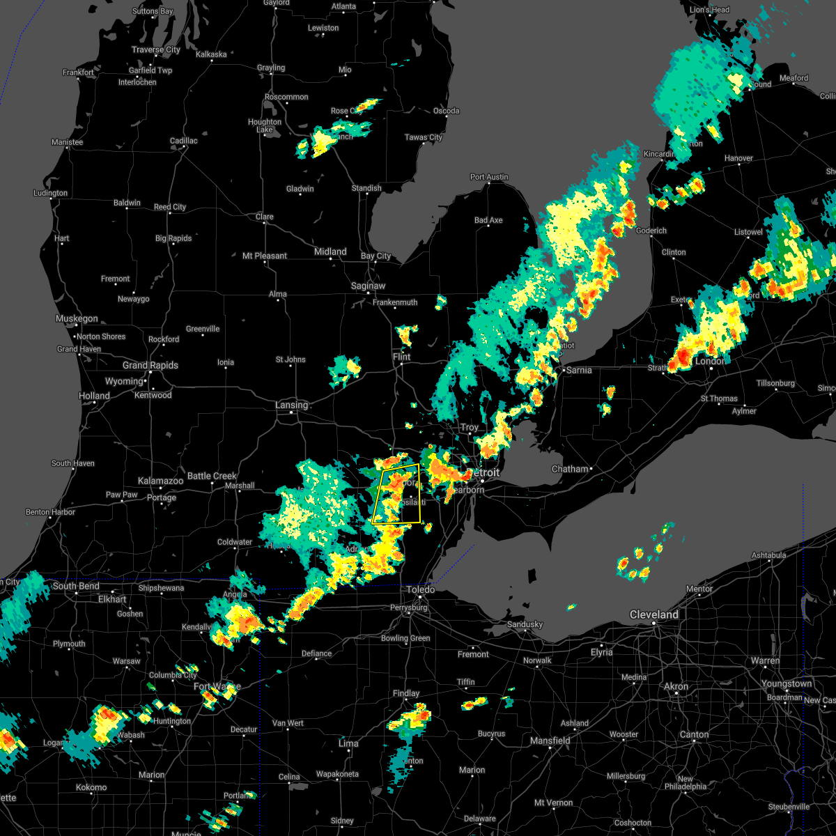 At 738 pm edt, severe thunderstorms were located along a line extending from near dixboro to near ypsilanti to milan, moving east at 40 mph (radar indicated). Hazards include 60 mph wind gusts. Expect damage to roofs, siding, and trees. these severe storms will be near, salem around 745 pm edt. willis around 750 pm edt. other locations impacted by these severe thunderstorms include pittsfield township, delhi mills, whittaker and barton hills. hail threat, radar indicated max hail size, <. 75 in wind threat, radar indicated max wind gust, 60 mph. At 738 pm edt, severe thunderstorms were located along a line extending from near dixboro to near ypsilanti to milan, moving east at 40 mph (radar indicated). Hazards include 60 mph wind gusts. Expect damage to roofs, siding, and trees. these severe storms will be near, salem around 745 pm edt. willis around 750 pm edt. other locations impacted by these severe thunderstorms include pittsfield township, delhi mills, whittaker and barton hills. hail threat, radar indicated max hail size, <. 75 in wind threat, radar indicated max wind gust, 60 mph.
|
| 8/29/2021 7:21 PM EDT |
 At 721 pm edt, severe thunderstorms were located along a line extending from dexter to near saline to near clinton, moving east at 40 mph (radar indicated). Hazards include 60 mph wind gusts. Expect damage to roofs, siding, and trees. these severe storms will be near, ann arbor and saline around 730 pm edt. whitmore lake around 735 pm edt. milan and dixboro around 740 pm edt. ypsilanti and salem around 745 pm edt. willis around 750 pm edt. other locations impacted by these severe thunderstorms include pittsfield township, whittaker, hudson mills metropark, bridgewater, delhi mills, pleasant lake and barton hills. hail threat, radar indicated max hail size, <. 75 in wind threat, radar indicated max wind gust, 60 mph. At 721 pm edt, severe thunderstorms were located along a line extending from dexter to near saline to near clinton, moving east at 40 mph (radar indicated). Hazards include 60 mph wind gusts. Expect damage to roofs, siding, and trees. these severe storms will be near, ann arbor and saline around 730 pm edt. whitmore lake around 735 pm edt. milan and dixboro around 740 pm edt. ypsilanti and salem around 745 pm edt. willis around 750 pm edt. other locations impacted by these severe thunderstorms include pittsfield township, whittaker, hudson mills metropark, bridgewater, delhi mills, pleasant lake and barton hills. hail threat, radar indicated max hail size, <. 75 in wind threat, radar indicated max wind gust, 60 mph.
|
| 8/29/2021 7:12 PM EDT |
 At 712 pm edt, severe thunderstorms were located along a line extending from chelsea to near manchester to near clinton, moving east at 40 mph (radar indicated). Hazards include 60 mph wind gusts. Expect damage to roofs, siding, and trees. these severe storms will be near, chelsea around 715 pm edt. dexter around 725 pm edt. ann arbor around 735 pm edt. saline and whitmore lake around 740 pm edt. milan and dixboro around 745 pm edt. ypsilanti and salem around 750 pm edt. willis around 755 pm edt. other locations impacted by these severe thunderstorms include pittsfield township, whittaker, hudson mills metropark, bridgewater, delhi mills, pleasant lake and barton hills. hail threat, radar indicated max hail size, <. 75 in wind threat, radar indicated max wind gust, 60 mph. At 712 pm edt, severe thunderstorms were located along a line extending from chelsea to near manchester to near clinton, moving east at 40 mph (radar indicated). Hazards include 60 mph wind gusts. Expect damage to roofs, siding, and trees. these severe storms will be near, chelsea around 715 pm edt. dexter around 725 pm edt. ann arbor around 735 pm edt. saline and whitmore lake around 740 pm edt. milan and dixboro around 745 pm edt. ypsilanti and salem around 750 pm edt. willis around 755 pm edt. other locations impacted by these severe thunderstorms include pittsfield township, whittaker, hudson mills metropark, bridgewater, delhi mills, pleasant lake and barton hills. hail threat, radar indicated max hail size, <. 75 in wind threat, radar indicated max wind gust, 60 mph.
|
| 8/29/2021 7:05 PM EDT |
 At 705 pm edt, severe thunderstorms were located along a line extending from near grass lake to near manchester to near clinton, moving east at 40 mph (radar indicated). Hazards include 60 mph wind gusts. Expect damage to roofs, siding, and trees. these severe storms will be near, chelsea around 715 pm edt. ann arbor, saline and dexter around 730 pm edt. milan around 735 pm edt. ypsilanti, dixboro, willis and whitmore lake around 745 pm edt. salem around 755 pm edt. other locations impacted by these severe thunderstorms include pittsfield township, whittaker, hudson mills metropark, bridgewater, delhi mills, pleasant lake and barton hills. people attending chelsea community fair should seek safe shelter immediately! hail threat, radar indicated max hail size, <. 75 in wind threat, radar indicated max wind gust, 60 mph. At 705 pm edt, severe thunderstorms were located along a line extending from near grass lake to near manchester to near clinton, moving east at 40 mph (radar indicated). Hazards include 60 mph wind gusts. Expect damage to roofs, siding, and trees. these severe storms will be near, chelsea around 715 pm edt. ann arbor, saline and dexter around 730 pm edt. milan around 735 pm edt. ypsilanti, dixboro, willis and whitmore lake around 745 pm edt. salem around 755 pm edt. other locations impacted by these severe thunderstorms include pittsfield township, whittaker, hudson mills metropark, bridgewater, delhi mills, pleasant lake and barton hills. people attending chelsea community fair should seek safe shelter immediately! hail threat, radar indicated max hail size, <. 75 in wind threat, radar indicated max wind gust, 60 mph.
|
| 8/29/2021 7:00 PM EDT |
 At 700 pm edt, severe thunderstorms were located along a line extending from near grass lake to 6 miles west of manchester to near onsted, moving east at 40 mph (radar indicated). Hazards include 60 mph wind gusts. Expect damage to roofs, siding, and trees. severe thunderstorms will be near, manchester around 710 pm edt. chelsea around 715 pm edt. saline and dexter around 730 pm edt. ann arbor and milan around 735 pm edt. ypsilanti, dixboro, willis and whitmore lake around 745 pm edt. salem around 755 pm edt. other locations impacted by these severe thunderstorms include pittsfield township, whittaker, hudson mills metropark, bridgewater, delhi mills, pleasant lake and barton hills. people attending chelsea community fair should seek safe shelter immediately! hail threat, radar indicated max hail size, <. 75 in wind threat, radar indicated max wind gust, 60 mph. At 700 pm edt, severe thunderstorms were located along a line extending from near grass lake to 6 miles west of manchester to near onsted, moving east at 40 mph (radar indicated). Hazards include 60 mph wind gusts. Expect damage to roofs, siding, and trees. severe thunderstorms will be near, manchester around 710 pm edt. chelsea around 715 pm edt. saline and dexter around 730 pm edt. ann arbor and milan around 735 pm edt. ypsilanti, dixboro, willis and whitmore lake around 745 pm edt. salem around 755 pm edt. other locations impacted by these severe thunderstorms include pittsfield township, whittaker, hudson mills metropark, bridgewater, delhi mills, pleasant lake and barton hills. people attending chelsea community fair should seek safe shelter immediately! hail threat, radar indicated max hail size, <. 75 in wind threat, radar indicated max wind gust, 60 mph.
|
| 8/24/2021 8:06 PM EDT |
 At 806 pm edt, severe thunderstorms were located along a line extending from near fenton to near hartland to near howell, moving east at 30 mph (radar indicated). Hazards include 60 mph wind gusts. Expect damage to roofs, siding, and trees. these severe storms will be near, hartland around 810 pm edt. brighton around 820 pm edt. hamburg around 825 pm edt. whitmore lake around 835 pm edt. other locations impacted by these severe thunderstorms include island lake state recreation area, chilson, lakeland, conway township, tyrone township and deerfield township. hail threat, radar indicated max hail size, <. 75 in wind threat, radar indicated max wind gust, 60 mph. At 806 pm edt, severe thunderstorms were located along a line extending from near fenton to near hartland to near howell, moving east at 30 mph (radar indicated). Hazards include 60 mph wind gusts. Expect damage to roofs, siding, and trees. these severe storms will be near, hartland around 810 pm edt. brighton around 820 pm edt. hamburg around 825 pm edt. whitmore lake around 835 pm edt. other locations impacted by these severe thunderstorms include island lake state recreation area, chilson, lakeland, conway township, tyrone township and deerfield township. hail threat, radar indicated max hail size, <. 75 in wind threat, radar indicated max wind gust, 60 mph.
|
| 8/24/2021 7:45 PM EDT |
 At 745 pm edt, severe thunderstorms were located along a line extending from byron to oak grove to 7 miles southeast of williamston, moving southeast at 30 mph (radar indicated). Hazards include 60 mph wind gusts. Expect damage to roofs, siding, and trees. severe thunderstorms will be near, howell and oak grove around 750 pm edt. hartland and gregory around 805 pm edt. brighton around 810 pm edt. pinckney around 815 pm edt. hamburg around 825 pm edt. whitmore lake around 830 pm edt. other locations impacted by these severe thunderstorms include parkers corners, lakeland, plainfield, island lake state recreation area, chilson, unadilla, conway township, hell, tyrone township and deerfield township. hail threat, radar indicated max hail size, <. 75 in wind threat, radar indicated max wind gust, 60 mph. At 745 pm edt, severe thunderstorms were located along a line extending from byron to oak grove to 7 miles southeast of williamston, moving southeast at 30 mph (radar indicated). Hazards include 60 mph wind gusts. Expect damage to roofs, siding, and trees. severe thunderstorms will be near, howell and oak grove around 750 pm edt. hartland and gregory around 805 pm edt. brighton around 810 pm edt. pinckney around 815 pm edt. hamburg around 825 pm edt. whitmore lake around 830 pm edt. other locations impacted by these severe thunderstorms include parkers corners, lakeland, plainfield, island lake state recreation area, chilson, unadilla, conway township, hell, tyrone township and deerfield township. hail threat, radar indicated max hail size, <. 75 in wind threat, radar indicated max wind gust, 60 mph.
|
| 8/12/2021 7:20 AM EDT |
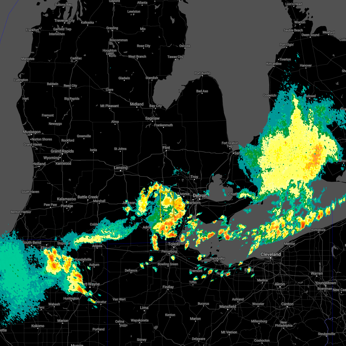 The severe thunderstorm warning for northwestern monroe and eastern washtenaw counties will expire at 730 am edt, the storm which prompted the warning has weakened below severe limits, and no longer poses an immediate threat to life or property. therefore, the warning will be allowed to expire. however heavy rain is still possible with this thunderstorm. The severe thunderstorm warning for northwestern monroe and eastern washtenaw counties will expire at 730 am edt, the storm which prompted the warning has weakened below severe limits, and no longer poses an immediate threat to life or property. therefore, the warning will be allowed to expire. however heavy rain is still possible with this thunderstorm.
|
| 8/12/2021 7:12 AM EDT |
 At 712 am edt, a severe thunderstorm was located over canton, moving east at 50 mph (radar indicated). Hazards include 60 mph wind gusts. Expect damage to roofs, siding, and trees. this severe thunderstorm will remain over mainly rural areas of northwestern monroe and eastern washtenaw counties, including the following locations, oakville, pittsfield township, cone, whittaker and barton hills. hail threat, radar indicated max hail size, <. 75 in wind threat, radar indicated max wind gust, 60 mph. At 712 am edt, a severe thunderstorm was located over canton, moving east at 50 mph (radar indicated). Hazards include 60 mph wind gusts. Expect damage to roofs, siding, and trees. this severe thunderstorm will remain over mainly rural areas of northwestern monroe and eastern washtenaw counties, including the following locations, oakville, pittsfield township, cone, whittaker and barton hills. hail threat, radar indicated max hail size, <. 75 in wind threat, radar indicated max wind gust, 60 mph.
|
| 8/12/2021 6:53 AM EDT |
 At 653 am edt, a severe thunderstorm was located near manchester, moving northeast at 60 mph (radar indicated). Hazards include 60 mph wind gusts. Expect damage to roofs, siding, and trees. this severe storm will be near, ann arbor and saline around 700 am edt. ypsilanti and dixboro around 710 am edt. salem around 715 am edt. other locations impacted by this severe thunderstorm include manitou beach-devils lake, pittsfield township, cone, whittaker, macon, hudson mills metropark, bridgewater, ridgeway, delhi mills and pleasant lake. people attending manchester community fair should seek safe shelter immediately! hail threat, radar indicated max hail size, <. 75 in wind threat, radar indicated max wind gust, 60 mph. At 653 am edt, a severe thunderstorm was located near manchester, moving northeast at 60 mph (radar indicated). Hazards include 60 mph wind gusts. Expect damage to roofs, siding, and trees. this severe storm will be near, ann arbor and saline around 700 am edt. ypsilanti and dixboro around 710 am edt. salem around 715 am edt. other locations impacted by this severe thunderstorm include manitou beach-devils lake, pittsfield township, cone, whittaker, macon, hudson mills metropark, bridgewater, ridgeway, delhi mills and pleasant lake. people attending manchester community fair should seek safe shelter immediately! hail threat, radar indicated max hail size, <. 75 in wind threat, radar indicated max wind gust, 60 mph.
|
| 8/12/2021 6:31 AM EDT |
 At 630 am edt, a severe thunderstorm was located near cement city, or 8 miles south of vandercook lake, moving northeast at 65 mph (radar indicated). Hazards include 60 mph wind gusts and penny size hail. Expect damage to roofs, siding, and trees. this severe thunderstorm will be near, manchester around 650 am edt. chelsea around 655 am edt. ann arbor and dexter around 700 am edt. hamburg around 705 am edt. dixboro and whitmore lake around 710 am edt. south lyon and salem around 715 am edt. other locations impacted by this severe thunderstorm include manitou beach-devils lake, whittaker, hudson mills metropark, ridgeway, delhi mills, pleasant lake, pinckney state recreation area, chilson, cambridge junction and unadilla. people attending manchester community fair should seek safe shelter immediately! hail threat, radar indicated max hail size, 0. 75 in wind threat, radar indicated max wind gust, 60 mph. At 630 am edt, a severe thunderstorm was located near cement city, or 8 miles south of vandercook lake, moving northeast at 65 mph (radar indicated). Hazards include 60 mph wind gusts and penny size hail. Expect damage to roofs, siding, and trees. this severe thunderstorm will be near, manchester around 650 am edt. chelsea around 655 am edt. ann arbor and dexter around 700 am edt. hamburg around 705 am edt. dixboro and whitmore lake around 710 am edt. south lyon and salem around 715 am edt. other locations impacted by this severe thunderstorm include manitou beach-devils lake, whittaker, hudson mills metropark, ridgeway, delhi mills, pleasant lake, pinckney state recreation area, chilson, cambridge junction and unadilla. people attending manchester community fair should seek safe shelter immediately! hail threat, radar indicated max hail size, 0. 75 in wind threat, radar indicated max wind gust, 60 mph.
|
| 8/11/2021 3:26 PM EDT |
 The severe thunderstorm warning for lenawee and washtenaw counties will expire at 330 pm edt, the storms which prompted the warning are moving out of the area. therefore, the warning will be allowed to expire. however heavy rain and gusty wind are still possible with these thunderstorms. a severe thunderstorm watch remains in effect until 800 pm edt for southeastern michigan. The severe thunderstorm warning for lenawee and washtenaw counties will expire at 330 pm edt, the storms which prompted the warning are moving out of the area. therefore, the warning will be allowed to expire. however heavy rain and gusty wind are still possible with these thunderstorms. a severe thunderstorm watch remains in effect until 800 pm edt for southeastern michigan.
|
| 8/11/2021 3:08 PM EDT | Reports of multiple trees and power lines down relayed via social medi in livingston county MI, 3.2 miles SE of Whitmore Lake, MI |
| 8/11/2021 3:02 PM EDT |
 At 301 pm edt, severe thunderstorms were located along a line extending from whitmore lake to 9 miles east of morenci, moving east at 50 mph (radar indicated). Hazards include 60 mph wind gusts. Expect damage to roofs, siding, and trees. these severe storms will be near, salem around 310 pm edt. blissfield around 315 pm edt. deerfield around 320 pm edt. clinton around 355 pm edt. other locations impacted by these severe thunderstorms include manitou beach-devils lake, whittaker, ogden center, canandaigua, hudson mills metropark, ridgeway, delhi mills, palmyra, pleasant lake and sand creek. people attending manchester community fair should seek safe shelter immediately! hail threat, radar indicated max hail size, <. 75 in wind threat, radar indicated max wind gust, 60 mph. At 301 pm edt, severe thunderstorms were located along a line extending from whitmore lake to 9 miles east of morenci, moving east at 50 mph (radar indicated). Hazards include 60 mph wind gusts. Expect damage to roofs, siding, and trees. these severe storms will be near, salem around 310 pm edt. blissfield around 315 pm edt. deerfield around 320 pm edt. clinton around 355 pm edt. other locations impacted by these severe thunderstorms include manitou beach-devils lake, whittaker, ogden center, canandaigua, hudson mills metropark, ridgeway, delhi mills, palmyra, pleasant lake and sand creek. people attending manchester community fair should seek safe shelter immediately! hail threat, radar indicated max hail size, <. 75 in wind threat, radar indicated max wind gust, 60 mph.
|
| 8/11/2021 3:00 PM EDT |
 At 258 pm edt, a severe thunderstorm was located near pinckney, moving northeast at 50 mph (radar indicated). Hazards include 60 mph wind gusts. Expect damage to roofs, siding, and trees. this severe storm will be near, hamburg around 310 pm edt. brighton around 315 pm edt. hartland and south lyon around 320 pm edt. additional storms extended eastward from pinckney and northwest toward fowlerville. other locations impacted by this severe thunderstorm include parkers corners, lakeland, plainfield, island lake state recreation area, chilson, unadilla, pinckney state recreation area, conway township, hell and tyrone township. hail threat, radar indicated max hail size, <. 75 in wind threat, radar indicated max wind gust, 60 mph. At 258 pm edt, a severe thunderstorm was located near pinckney, moving northeast at 50 mph (radar indicated). Hazards include 60 mph wind gusts. Expect damage to roofs, siding, and trees. this severe storm will be near, hamburg around 310 pm edt. brighton around 315 pm edt. hartland and south lyon around 320 pm edt. additional storms extended eastward from pinckney and northwest toward fowlerville. other locations impacted by this severe thunderstorm include parkers corners, lakeland, plainfield, island lake state recreation area, chilson, unadilla, pinckney state recreation area, conway township, hell and tyrone township. hail threat, radar indicated max hail size, <. 75 in wind threat, radar indicated max wind gust, 60 mph.
|
| 8/11/2021 2:42 PM EDT |
 At 240 pm edt, a severe thunderstorm was located over gregory, or 8 miles west of pinckney, moving northeast at 40 mph (radar indicated). Hazards include 60 mph wind gusts. Expect damage to roofs, siding, and trees. this severe thunderstorm will be near, pinckney around 250 pm edt. howell around 300 pm edt. brighton around 310 pm edt. hartland around 320 pm edt. other locations impacted by this severe thunderstorm include parkers corners, lakeland, plainfield, island lake state recreation area, chilson, unadilla, pinckney state recreation area, conway township, hell and tyrone township. hail threat, radar indicated max hail size, <. 75 in wind threat, radar indicated max wind gust, 60 mph. At 240 pm edt, a severe thunderstorm was located over gregory, or 8 miles west of pinckney, moving northeast at 40 mph (radar indicated). Hazards include 60 mph wind gusts. Expect damage to roofs, siding, and trees. this severe thunderstorm will be near, pinckney around 250 pm edt. howell around 300 pm edt. brighton around 310 pm edt. hartland around 320 pm edt. other locations impacted by this severe thunderstorm include parkers corners, lakeland, plainfield, island lake state recreation area, chilson, unadilla, pinckney state recreation area, conway township, hell and tyrone township. hail threat, radar indicated max hail size, <. 75 in wind threat, radar indicated max wind gust, 60 mph.
|
| 8/11/2021 2:41 PM EDT |
 At 240 pm edt, severe thunderstorms were located along a line extending from near pinckney to near clayton, moving east at 40 mph (radar indicated). Hazards include 60 mph wind gusts. Expect damage to roofs, siding, and trees. these severe storms will be near, adrian and whitmore lake around 300 pm edt. tecumseh and blissfield around 310 pm edt. deerfield and britton around 315 pm edt. milan around 330 pm edt. other locations impacted by these severe thunderstorms include manitou beach-devils lake, whittaker, ogden center, canandaigua, hudson mills metropark, ridgeway, delhi mills, palmyra, pleasant lake and sand creek. people attending manchester community fair should seek safe shelter immediately! hail threat, radar indicated max hail size, <. 75 in wind threat, radar indicated max wind gust, 60 mph. At 240 pm edt, severe thunderstorms were located along a line extending from near pinckney to near clayton, moving east at 40 mph (radar indicated). Hazards include 60 mph wind gusts. Expect damage to roofs, siding, and trees. these severe storms will be near, adrian and whitmore lake around 300 pm edt. tecumseh and blissfield around 310 pm edt. deerfield and britton around 315 pm edt. milan around 330 pm edt. other locations impacted by these severe thunderstorms include manitou beach-devils lake, whittaker, ogden center, canandaigua, hudson mills metropark, ridgeway, delhi mills, palmyra, pleasant lake and sand creek. people attending manchester community fair should seek safe shelter immediately! hail threat, radar indicated max hail size, <. 75 in wind threat, radar indicated max wind gust, 60 mph.
|
| 8/11/2021 2:22 PM EDT |
 At 221 pm edt, severe thunderstorms were located along a line extending from near stockbridge to 6 miles southeast of reading, moving east at 45 mph (radar indicated). Hazards include 60 mph wind gusts. Expect damage to roofs, siding, and trees. severe thunderstorms will be near, chelsea around 230 pm edt. dexter around 240 pm edt. hudson around 245 pm edt. clayton and whitmore lake around 255 pm edt. salem around 305 pm edt. adrian around 310 pm edt. tecumseh around 320 pm edt. deerfield and britton around 325 pm edt. other locations impacted by these severe thunderstorms include manitou beach-devils lake, whittaker, ogden center, canandaigua, hudson mills metropark, ridgeway, delhi mills, palmyra, pleasant lake and sand creek. people attending manchester community fair should seek safe shelter immediately! hail threat, radar indicated max hail size, <. 75 in wind threat, radar indicated max wind gust, 60 mph. At 221 pm edt, severe thunderstorms were located along a line extending from near stockbridge to 6 miles southeast of reading, moving east at 45 mph (radar indicated). Hazards include 60 mph wind gusts. Expect damage to roofs, siding, and trees. severe thunderstorms will be near, chelsea around 230 pm edt. dexter around 240 pm edt. hudson around 245 pm edt. clayton and whitmore lake around 255 pm edt. salem around 305 pm edt. adrian around 310 pm edt. tecumseh around 320 pm edt. deerfield and britton around 325 pm edt. other locations impacted by these severe thunderstorms include manitou beach-devils lake, whittaker, ogden center, canandaigua, hudson mills metropark, ridgeway, delhi mills, palmyra, pleasant lake and sand creek. people attending manchester community fair should seek safe shelter immediately! hail threat, radar indicated max hail size, <. 75 in wind threat, radar indicated max wind gust, 60 mph.
|
| 8/11/2021 12:21 AM EDT |
 At 1217 am edt, a gusty outflow boundary was located along a line extending from near new lothrop to near howell to near grass lake, moving east at 50 mph (radar indicated). Hazards include 60 mph wind gusts. Expect damage to roofs, siding, and trees. this gusty boundary will be near, montrose around 1225 am edt. flushing and brighton around 1230 am edt. hartland, clio, mount morris and beecher around 1235 am edt. ann arbor, flint, saline, milford, burton and crossroads village around 1240 am edt. milan, davison and otisville around 1245 am edt. novi, ypsilanti and otter lake around 1250 am edt. willis around 1255 am edt. other locations impacted by these gusty winds include whittaker, plainfield, rankin, hudson mills metropark, holly state recreation area, commerce, delhi mills, pleasant lake, rose center and pinckney state recreation area. this outflow boundary has a history of producing 60 mph winds and tree damage in ingham county. hail threat, radar indicated max hail size, <. 75 in wind threat, observed max wind gust, 60 mph. At 1217 am edt, a gusty outflow boundary was located along a line extending from near new lothrop to near howell to near grass lake, moving east at 50 mph (radar indicated). Hazards include 60 mph wind gusts. Expect damage to roofs, siding, and trees. this gusty boundary will be near, montrose around 1225 am edt. flushing and brighton around 1230 am edt. hartland, clio, mount morris and beecher around 1235 am edt. ann arbor, flint, saline, milford, burton and crossroads village around 1240 am edt. milan, davison and otisville around 1245 am edt. novi, ypsilanti and otter lake around 1250 am edt. willis around 1255 am edt. other locations impacted by these gusty winds include whittaker, plainfield, rankin, hudson mills metropark, holly state recreation area, commerce, delhi mills, pleasant lake, rose center and pinckney state recreation area. this outflow boundary has a history of producing 60 mph winds and tree damage in ingham county. hail threat, radar indicated max hail size, <. 75 in wind threat, observed max wind gust, 60 mph.
|
| 8/11/2021 12:02 AM EDT |
 At 1202 am edt, severe thunderstorms were located along a line extending from 6 miles northeast of elsie to near williamston to near vandercook lake, moving east at 45 mph (radar indicated). Hazards include 60 mph wind gusts. Expect damage to roofs, siding, and trees. severe thunderstorms will be near, henderson around 1210 am edt. fowlerville around 1215 am edt. howell, new lothrop and oak grove around 1225 am edt. manchester and montrose around 1230 am edt. flushing and brighton around 1235 am edt. hartland, clio, mount morris and beecher around 1240 am edt. ann arbor, flint, saline and crossroads village around 1245 am edt. milford and burton around 1250 am edt. other locations impacted by these severe thunderstorms include whittaker, plainfield, rankin, hudson mills metropark, holly state recreation area, commerce, delhi mills, pleasant lake, rose center and pinckney state recreation area. hail threat, radar indicated max hail size, <. 75 in wind threat, radar indicated max wind gust, 60 mph. At 1202 am edt, severe thunderstorms were located along a line extending from 6 miles northeast of elsie to near williamston to near vandercook lake, moving east at 45 mph (radar indicated). Hazards include 60 mph wind gusts. Expect damage to roofs, siding, and trees. severe thunderstorms will be near, henderson around 1210 am edt. fowlerville around 1215 am edt. howell, new lothrop and oak grove around 1225 am edt. manchester and montrose around 1230 am edt. flushing and brighton around 1235 am edt. hartland, clio, mount morris and beecher around 1240 am edt. ann arbor, flint, saline and crossroads village around 1245 am edt. milford and burton around 1250 am edt. other locations impacted by these severe thunderstorms include whittaker, plainfield, rankin, hudson mills metropark, holly state recreation area, commerce, delhi mills, pleasant lake, rose center and pinckney state recreation area. hail threat, radar indicated max hail size, <. 75 in wind threat, radar indicated max wind gust, 60 mph.
|
| 8/9/2021 2:01 PM EDT |
 At 201 pm edt, a severe thunderstorm was located near south lyon, or near milford, moving north at 30 mph (radar indicated). Hazards include 60 mph wind gusts and penny size hail. Expect damage to roofs, siding, and trees. this severe storm will be near, milford around 215 pm edt. other locations impacted by this severe thunderstorm include island lake state recreation area, new hudson, white lake and wixom. hail threat, radar indicated max hail size, 0. 75 in wind threat, radar indicated max wind gust, 60 mph. At 201 pm edt, a severe thunderstorm was located near south lyon, or near milford, moving north at 30 mph (radar indicated). Hazards include 60 mph wind gusts and penny size hail. Expect damage to roofs, siding, and trees. this severe storm will be near, milford around 215 pm edt. other locations impacted by this severe thunderstorm include island lake state recreation area, new hudson, white lake and wixom. hail threat, radar indicated max hail size, 0. 75 in wind threat, radar indicated max wind gust, 60 mph.
|
| 8/9/2021 1:55 PM EDT |
 At 155 pm edt, a severe thunderstorm was located near south lyon, or near brighton, moving north at 30 mph (radar indicated). Hazards include 60 mph wind gusts and penny size hail. Expect damage to roofs, siding, and trees. this severe storm will be near, brighton around 205 pm edt. milford around 215 pm edt. hartland around 220 pm edt. other locations impacted by this severe thunderstorm include island lake state recreation area, chilson, new hudson, lakeland, white lake and wixom. hail threat, radar indicated max hail size, 0. 75 in wind threat, radar indicated max wind gust, 60 mph. At 155 pm edt, a severe thunderstorm was located near south lyon, or near brighton, moving north at 30 mph (radar indicated). Hazards include 60 mph wind gusts and penny size hail. Expect damage to roofs, siding, and trees. this severe storm will be near, brighton around 205 pm edt. milford around 215 pm edt. hartland around 220 pm edt. other locations impacted by this severe thunderstorm include island lake state recreation area, chilson, new hudson, lakeland, white lake and wixom. hail threat, radar indicated max hail size, 0. 75 in wind threat, radar indicated max wind gust, 60 mph.
|
| 8/9/2021 1:49 PM EDT |
 At 149 pm edt, a severe thunderstorm was located over whitmore lake, or 7 miles south of brighton, moving north at 30 mph (radar indicated). Hazards include 60 mph wind gusts and penny size hail. Expect damage to roofs, siding, and trees. this severe thunderstorm will be near, south lyon around 200 pm edt. brighton around 205 pm edt. milford around 215 pm edt. hartland around 220 pm edt. other locations impacted by this severe thunderstorm include lakeland, white lake, island lake state recreation area, chilson, delhi mills, new hudson, barton hills and wixom. hail threat, radar indicated max hail size, 0. 75 in wind threat, radar indicated max wind gust, 60 mph. At 149 pm edt, a severe thunderstorm was located over whitmore lake, or 7 miles south of brighton, moving north at 30 mph (radar indicated). Hazards include 60 mph wind gusts and penny size hail. Expect damage to roofs, siding, and trees. this severe thunderstorm will be near, south lyon around 200 pm edt. brighton around 205 pm edt. milford around 215 pm edt. hartland around 220 pm edt. other locations impacted by this severe thunderstorm include lakeland, white lake, island lake state recreation area, chilson, delhi mills, new hudson, barton hills and wixom. hail threat, radar indicated max hail size, 0. 75 in wind threat, radar indicated max wind gust, 60 mph.
|
| 7/24/2021 8:33 PM EDT |
 At 832 pm edt, severe thunderstorms were located along a line extending from near warren to whitmore lake to near manchester, moving east at 45 mph (radar indicated). Hazards include 60 mph wind gusts. Expect damage to roofs, siding, and trees. these severe storms will be near, grosse pointe around 845 pm edt. northville around 850 pm edt. milan and canton around 855 pm edt. livonia and willis around 900 pm edt. romulus and belleville around 905 pm edt. taylor and greenfield village around 910 pm edt. detroit and dearborn around 915 pm edt. flat rock, downtown detroit and wyandotte around 920 pm edt. other locations impacted by these severe thunderstorms include melvindale, whittaker, gibraltar, new boston, rockwood, harper woods, westland, grosse pointe shores, ecorse and grosse pointe woods. People attending comerica park should seek safe shelter immediately!. At 832 pm edt, severe thunderstorms were located along a line extending from near warren to whitmore lake to near manchester, moving east at 45 mph (radar indicated). Hazards include 60 mph wind gusts. Expect damage to roofs, siding, and trees. these severe storms will be near, grosse pointe around 845 pm edt. northville around 850 pm edt. milan and canton around 855 pm edt. livonia and willis around 900 pm edt. romulus and belleville around 905 pm edt. taylor and greenfield village around 910 pm edt. detroit and dearborn around 915 pm edt. flat rock, downtown detroit and wyandotte around 920 pm edt. other locations impacted by these severe thunderstorms include melvindale, whittaker, gibraltar, new boston, rockwood, harper woods, westland, grosse pointe shores, ecorse and grosse pointe woods. People attending comerica park should seek safe shelter immediately!.
|
| 7/24/2021 8:14 PM EDT |
 At 814 pm edt, severe thunderstorms were located along a line extending from near mount clemens to near brighton, moving southeast at 35 mph (radar indicated). Hazards include 70 mph wind gusts. Expect considerable tree damage. Damage is likely to mobile homes, roofs, and outbuildings. At 814 pm edt, severe thunderstorms were located along a line extending from near mount clemens to near brighton, moving southeast at 35 mph (radar indicated). Hazards include 70 mph wind gusts. Expect considerable tree damage. Damage is likely to mobile homes, roofs, and outbuildings.
|
| 7/24/2021 8:12 PM EDT |
 At 811 pm edt, severe thunderstorms were located along a line extending from near rochester to near west bloomfield to near howell, moving southeast at 20 mph (radar indicated). Hazards include 60 mph wind gusts. Expect damage to roofs, siding, and trees. these severe storms will be near, troy and rochester around 815 pm edt. novi and west bloomfield around 820 pm edt. warren and northville around 830 pm edt. hamburg around 840 pm edt. whitmore lake around 845 pm edt. other locations impacted by these severe thunderstorms include franklin, keego harbor, waterford, orchard lake, plainfield, commerce, pinckney state recreation area, lathrup village, auburn hills and bingham farms. People attending eddies christmas in july fireworks show, orchard lake fine art show, and kensington marathon should seek safe shelter immediately!. At 811 pm edt, severe thunderstorms were located along a line extending from near rochester to near west bloomfield to near howell, moving southeast at 20 mph (radar indicated). Hazards include 60 mph wind gusts. Expect damage to roofs, siding, and trees. these severe storms will be near, troy and rochester around 815 pm edt. novi and west bloomfield around 820 pm edt. warren and northville around 830 pm edt. hamburg around 840 pm edt. whitmore lake around 845 pm edt. other locations impacted by these severe thunderstorms include franklin, keego harbor, waterford, orchard lake, plainfield, commerce, pinckney state recreation area, lathrup village, auburn hills and bingham farms. People attending eddies christmas in july fireworks show, orchard lake fine art show, and kensington marathon should seek safe shelter immediately!.
|
| 7/24/2021 7:58 PM EDT |
 At 757 pm edt, severe thunderstorms were located along a line extending from rochester to near milford to near howell, moving southeast at 40 mph (radar indicated). Hazards include 60 mph wind gusts. Expect damage to roofs, siding, and trees. these severe storms will be near, troy and rochester around 805 pm edt. novi, sterling heights and west bloomfield around 810 pm edt. hamburg and birmingham around 820 pm edt. southfield, royal oak and whitmore lake around 825 pm edt. south lyon and detroit zoo around 830 pm edt. northville around 840 pm edt. other locations impacted by these severe thunderstorms include franklin, keego harbor, waterford, orchard lake, plainfield, commerce, rose center, pinckney state recreation area, lathrup village and auburn hills. People attending eddies christmas in july fireworks show should seek safe shelter immediately!. At 757 pm edt, severe thunderstorms were located along a line extending from rochester to near milford to near howell, moving southeast at 40 mph (radar indicated). Hazards include 60 mph wind gusts. Expect damage to roofs, siding, and trees. these severe storms will be near, troy and rochester around 805 pm edt. novi, sterling heights and west bloomfield around 810 pm edt. hamburg and birmingham around 820 pm edt. southfield, royal oak and whitmore lake around 825 pm edt. south lyon and detroit zoo around 830 pm edt. northville around 840 pm edt. other locations impacted by these severe thunderstorms include franklin, keego harbor, waterford, orchard lake, plainfield, commerce, rose center, pinckney state recreation area, lathrup village and auburn hills. People attending eddies christmas in july fireworks show should seek safe shelter immediately!.
|
| 7/24/2021 7:40 PM EDT |
 At 739 pm edt, a line of severe thunderstorms were located from webberville to lake orion moving southeast at 25 mph (radar indicated). Hazards include 60 mph wind gusts. expect damage to roofs, siding, and trees At 739 pm edt, a line of severe thunderstorms were located from webberville to lake orion moving southeast at 25 mph (radar indicated). Hazards include 60 mph wind gusts. expect damage to roofs, siding, and trees
|
| 7/20/2021 8:06 PM EDT |
 At 806 pm edt, severe thunderstorms were located along a line extending from near chelsea to near dexter to near canton, moving southeast at 25 mph (radar indicated). Hazards include 60 mph wind gusts. Expect damage to roofs, siding, and trees. severe thunderstorms will be near, salem around 810 pm edt. ypsilanti around 815 pm edt. ann arbor and dixboro around 820 pm edt. Other locations in the path of these severe thunderstorms include saline, manchester, willis and milan. At 806 pm edt, severe thunderstorms were located along a line extending from near chelsea to near dexter to near canton, moving southeast at 25 mph (radar indicated). Hazards include 60 mph wind gusts. Expect damage to roofs, siding, and trees. severe thunderstorms will be near, salem around 810 pm edt. ypsilanti around 815 pm edt. ann arbor and dixboro around 820 pm edt. Other locations in the path of these severe thunderstorms include saline, manchester, willis and milan.
|
| 7/7/2021 4:38 PM EDT |
 The severe thunderstorm warning for southeastern livingston county will expire at 445 pm edt, the storms which prompted the warning have moved out of the area. therefore, the warning will be allowed to expire. a severe thunderstorm watch remains in effect until 900 pm edt for southeastern michigan. The severe thunderstorm warning for southeastern livingston county will expire at 445 pm edt, the storms which prompted the warning have moved out of the area. therefore, the warning will be allowed to expire. a severe thunderstorm watch remains in effect until 900 pm edt for southeastern michigan.
|
| 7/7/2021 4:30 PM EDT |
 At 430 pm edt, severe thunderstorms were located along a line extending from near brighton to near whitmore lake, moving east at 30 mph (radar indicated). Hazards include 60 mph wind gusts and quarter size hail. Hail damage to vehicles is expected. expect wind damage to roofs, siding, and trees. These severe thunderstorms will remain over mainly rural areas of southeastern livingston county, including the following locations, lakeland, island lake state recreation area and chilson. At 430 pm edt, severe thunderstorms were located along a line extending from near brighton to near whitmore lake, moving east at 30 mph (radar indicated). Hazards include 60 mph wind gusts and quarter size hail. Hail damage to vehicles is expected. expect wind damage to roofs, siding, and trees. These severe thunderstorms will remain over mainly rural areas of southeastern livingston county, including the following locations, lakeland, island lake state recreation area and chilson.
|
| 7/7/2021 4:18 PM EDT |
 At 418 pm edt, severe thunderstorms were located along a line extending from near brighton to near hamburg to whitmore lake, moving east at 35 mph (radar indicated). Hazards include 60 mph wind gusts and penny size hail. Expect damage to roofs, siding, and trees. these severe storms will be near, south lyon around 430 pm edt. salem around 435 pm edt. Other locations impacted by these severe thunderstorms include lakeland, island lake state recreation area and chilson. At 418 pm edt, severe thunderstorms were located along a line extending from near brighton to near hamburg to whitmore lake, moving east at 35 mph (radar indicated). Hazards include 60 mph wind gusts and penny size hail. Expect damage to roofs, siding, and trees. these severe storms will be near, south lyon around 430 pm edt. salem around 435 pm edt. Other locations impacted by these severe thunderstorms include lakeland, island lake state recreation area and chilson.
|
| 7/7/2021 4:06 PM EDT |
 At 406 pm edt, severe thunderstorms were located along a line extending from near howell to near hamburg to near chelsea, moving east at 35 mph (radar indicated). Hazards include 60 mph wind gusts and penny size hail. Expect damage to roofs, siding, and trees. these severe storms will be near, brighton and hamburg around 415 pm edt. whitmore lake around 420 pm edt. dexter around 425 pm edt. south lyon around 430 pm edt. salem around 450 pm edt. Other locations impacted by these severe thunderstorms include hudson mills, lakeland, lyndon township, plainfield, hudson mills metropark, island lake state recreation area, chilson, unadilla, pinckney state recreation area and hell. At 406 pm edt, severe thunderstorms were located along a line extending from near howell to near hamburg to near chelsea, moving east at 35 mph (radar indicated). Hazards include 60 mph wind gusts and penny size hail. Expect damage to roofs, siding, and trees. these severe storms will be near, brighton and hamburg around 415 pm edt. whitmore lake around 420 pm edt. dexter around 425 pm edt. south lyon around 430 pm edt. salem around 450 pm edt. Other locations impacted by these severe thunderstorms include hudson mills, lakeland, lyndon township, plainfield, hudson mills metropark, island lake state recreation area, chilson, unadilla, pinckney state recreation area and hell.
|
| 7/7/2021 3:49 PM EDT |
 At 349 pm edt, severe thunderstorms were located along a line extending from near fowlerville to gregory to near grass lake, moving east at 40 mph (radar indicated). Hazards include 60 mph wind gusts and penny size hail. Expect damage to roofs, siding, and trees. these severe storms will be near, howell and pinckney around 400 pm edt. brighton and hamburg around 410 pm edt. dexter and whitmore lake around 415 pm edt. ann arbor around 420 pm edt. south lyon around 425 pm edt. salem around 440 pm edt. Other locations impacted by these severe thunderstorms include plainfield, hudson mills metropark, island lake state recreation area, delhi mills, barton hills, pinckney state recreation area, hudson mills, parkers corners, lakeland and lyndon township. At 349 pm edt, severe thunderstorms were located along a line extending from near fowlerville to gregory to near grass lake, moving east at 40 mph (radar indicated). Hazards include 60 mph wind gusts and penny size hail. Expect damage to roofs, siding, and trees. these severe storms will be near, howell and pinckney around 400 pm edt. brighton and hamburg around 410 pm edt. dexter and whitmore lake around 415 pm edt. ann arbor around 420 pm edt. south lyon around 425 pm edt. salem around 440 pm edt. Other locations impacted by these severe thunderstorms include plainfield, hudson mills metropark, island lake state recreation area, delhi mills, barton hills, pinckney state recreation area, hudson mills, parkers corners, lakeland and lyndon township.
|
| 7/7/2021 3:38 PM EDT |
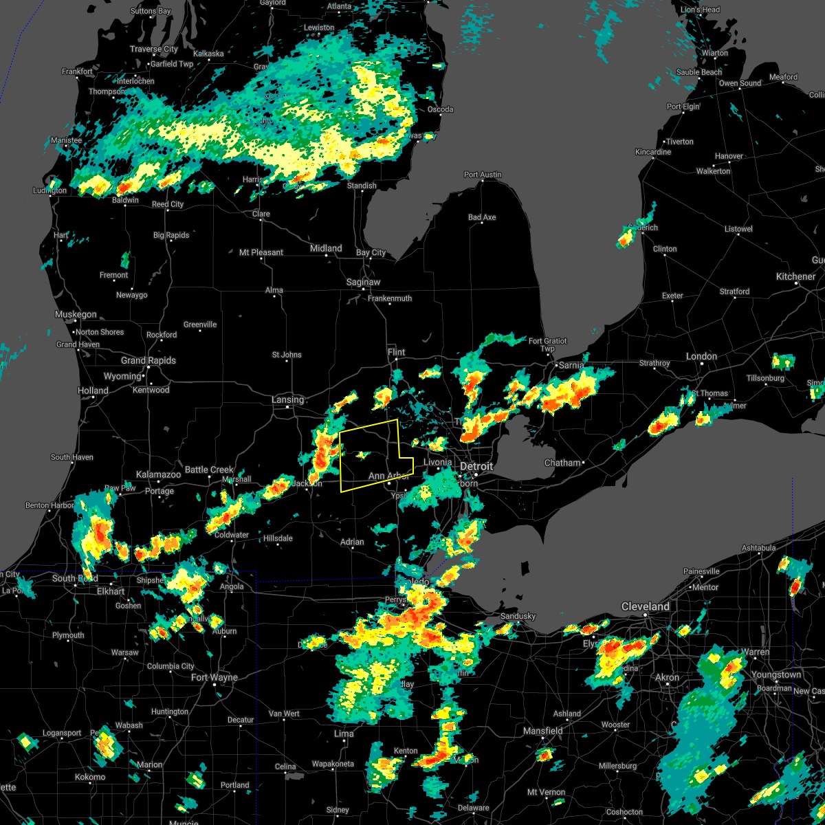 At 337 pm edt, severe thunderstorms were located along a line extending from 8 miles southwest of fowlerville to near stockbridge to near jackson, moving east at 35 mph (radar indicated). Hazards include 60 mph wind gusts and penny size hail. Expect damage to roofs, siding, and trees. severe thunderstorms will be near, gregory around 350 pm edt. howell and pinckney around 400 pm edt. chelsea around 405 pm edt. brighton, dexter and hamburg around 415 pm edt. whitmore lake around 420 pm edt. ann arbor around 425 pm edt. south lyon around 430 pm edt. salem around 435 pm edt. Other locations impacted by these severe thunderstorms include plainfield, hudson mills metropark, island lake state recreation area, delhi mills, barton hills, pinckney state recreation area, hudson mills, parkers corners, lakeland and lyndon township. At 337 pm edt, severe thunderstorms were located along a line extending from 8 miles southwest of fowlerville to near stockbridge to near jackson, moving east at 35 mph (radar indicated). Hazards include 60 mph wind gusts and penny size hail. Expect damage to roofs, siding, and trees. severe thunderstorms will be near, gregory around 350 pm edt. howell and pinckney around 400 pm edt. chelsea around 405 pm edt. brighton, dexter and hamburg around 415 pm edt. whitmore lake around 420 pm edt. ann arbor around 425 pm edt. south lyon around 430 pm edt. salem around 435 pm edt. Other locations impacted by these severe thunderstorms include plainfield, hudson mills metropark, island lake state recreation area, delhi mills, barton hills, pinckney state recreation area, hudson mills, parkers corners, lakeland and lyndon township.
|
| 6/29/2021 2:11 PM EDT | Power lines were reported blown dow in washtenaw county MI, 2.4 miles NNE of Whitmore Lake, MI |
| 6/29/2021 2:02 PM EDT |
 At 201 pm edt, a severe thunderstorm was located near dexter, moving east at 20 mph (radar indicated). Hazards include 60 mph wind gusts and penny size hail. Expect damage to roofs, siding, and trees. this severe thunderstorm will be near, dexter around 210 pm edt. ann arbor and saline around 220 pm edt. Other locations in the path of this severe thunderstorm include dixboro, ypsilanti, salem and canton. At 201 pm edt, a severe thunderstorm was located near dexter, moving east at 20 mph (radar indicated). Hazards include 60 mph wind gusts and penny size hail. Expect damage to roofs, siding, and trees. this severe thunderstorm will be near, dexter around 210 pm edt. ann arbor and saline around 220 pm edt. Other locations in the path of this severe thunderstorm include dixboro, ypsilanti, salem and canton.
|
| 6/26/2021 7:31 PM EDT |
 At 731 pm edt, severe thunderstorms were located along a line extending from near linden to howell to stockbridge, moving east at 35 mph (radar indicated). Hazards include 60 mph wind gusts. Expect damage to roofs, siding, and trees. these severe storms will be near, howell and oak grove around 735 pm edt. hartland around 745 pm edt. pinckney around 755 pm edt. hamburg around 805 pm edt. brighton and whitmore lake around 810 pm edt. south lyon around 820 pm edt. Other locations impacted by these severe thunderstorms include parkers corners, lakeland, plainfield, island lake state recreation area, chilson, unadilla, pinckney state recreation area, hell, tyrone township and deerfield township. At 731 pm edt, severe thunderstorms were located along a line extending from near linden to howell to stockbridge, moving east at 35 mph (radar indicated). Hazards include 60 mph wind gusts. Expect damage to roofs, siding, and trees. these severe storms will be near, howell and oak grove around 735 pm edt. hartland around 745 pm edt. pinckney around 755 pm edt. hamburg around 805 pm edt. brighton and whitmore lake around 810 pm edt. south lyon around 820 pm edt. Other locations impacted by these severe thunderstorms include parkers corners, lakeland, plainfield, island lake state recreation area, chilson, unadilla, pinckney state recreation area, hell, tyrone township and deerfield township.
|
| 6/26/2021 7:10 PM EDT |
 At 710 pm edt, severe thunderstorms were located along a line extending from near cohoctah to near oak grove to near stockbridge, moving east at 30 mph (radar indicated). Hazards include 60 mph wind gusts. Expect damage to roofs, siding, and trees. these severe storms will be near, howell, cohoctah and oak grove around 715 pm edt. hartland around 730 pm edt. pinckney around 735 pm edt. hamburg around 750 pm edt. brighton around 755 pm edt. whitmore lake around 800 pm edt. south lyon around 810 pm edt. Other locations impacted by these severe thunderstorms include parkers corners, lakeland, plainfield, island lake state recreation area, chilson, unadilla, pinckney state recreation area, conway township, hell and tyrone township. At 710 pm edt, severe thunderstorms were located along a line extending from near cohoctah to near oak grove to near stockbridge, moving east at 30 mph (radar indicated). Hazards include 60 mph wind gusts. Expect damage to roofs, siding, and trees. these severe storms will be near, howell, cohoctah and oak grove around 715 pm edt. hartland around 730 pm edt. pinckney around 735 pm edt. hamburg around 750 pm edt. brighton around 755 pm edt. whitmore lake around 800 pm edt. south lyon around 810 pm edt. Other locations impacted by these severe thunderstorms include parkers corners, lakeland, plainfield, island lake state recreation area, chilson, unadilla, pinckney state recreation area, conway township, hell and tyrone township.
|
| 6/26/2021 6:41 PM EDT |
 At 640 pm edt, severe thunderstorms were located along a line extending from near perry to 7 miles south of williamston to leslie, moving east at 35 mph (radar indicated). Hazards include 60 mph wind gusts. Expect damage to roofs, siding, and trees. severe thunderstorms will be near, fowlerville around 700 pm edt. cohoctah around 705 pm edt. howell, oak grove and gregory around 710 pm edt. pinckney around 720 pm edt. hartland around 725 pm edt. brighton around 740 pm edt. Other locations impacted by these severe thunderstorms include parkers corners, lakeland, plainfield, island lake state recreation area, chilson, unadilla, pinckney state recreation area, conway township, hell and tyrone township. At 640 pm edt, severe thunderstorms were located along a line extending from near perry to 7 miles south of williamston to leslie, moving east at 35 mph (radar indicated). Hazards include 60 mph wind gusts. Expect damage to roofs, siding, and trees. severe thunderstorms will be near, fowlerville around 700 pm edt. cohoctah around 705 pm edt. howell, oak grove and gregory around 710 pm edt. pinckney around 720 pm edt. hartland around 725 pm edt. brighton around 740 pm edt. Other locations impacted by these severe thunderstorms include parkers corners, lakeland, plainfield, island lake state recreation area, chilson, unadilla, pinckney state recreation area, conway township, hell and tyrone township.
|
| 6/20/2021 10:35 PM EDT |
 The severe thunderstorm warning for wayne and northeastern washtenaw counties will expire at 1045 pm edt, the storms which prompted the warning have weakened below severe limits, and have exited the warned area. therefore, the warning will be allowed to expire. however heavy rain is still possible with these thunderstorms. a severe thunderstorm watch remains in effect until 100 am edt for southeastern michigan. The severe thunderstorm warning for wayne and northeastern washtenaw counties will expire at 1045 pm edt, the storms which prompted the warning have weakened below severe limits, and have exited the warned area. therefore, the warning will be allowed to expire. however heavy rain is still possible with these thunderstorms. a severe thunderstorm watch remains in effect until 100 am edt for southeastern michigan.
|
| 6/20/2021 10:23 PM EDT |
 At 1022 pm edt, severe thunderstorms were located along a line extending from south lyon to northville to near detroit, moving northeast at 55 mph (radar indicated). Hazards include 60 mph wind gusts. Expect damage to roofs, siding, and trees. these severe storms will be near, detroit around 1030 pm edt. Other locations impacted by these severe thunderstorms include inkster, highland park, melvindale, redford, plymouth, garden city, barton hills, wayne, northwest detroit and westland. At 1022 pm edt, severe thunderstorms were located along a line extending from south lyon to northville to near detroit, moving northeast at 55 mph (radar indicated). Hazards include 60 mph wind gusts. Expect damage to roofs, siding, and trees. these severe storms will be near, detroit around 1030 pm edt. Other locations impacted by these severe thunderstorms include inkster, highland park, melvindale, redford, plymouth, garden city, barton hills, wayne, northwest detroit and westland.
|
| 6/20/2021 10:13 PM EDT |
 At 1013 pm edt, severe thunderstorms were located along a line extending from near dexter to near ypsilanti to near taylor, moving northeast at 45 mph (radar indicated). Hazards include 60 mph wind gusts. Expect damage to roofs, siding, and trees. these severe storms will be near, taylor and greenfield village around 1020 pm edt. dearborn and salem around 1025 pm edt. detroit and northville around 1030 pm edt. livonia around 1040 pm edt. southfield around 1050 pm edt. Other locations impacted by these severe thunderstorms include melvindale, hudson mills metropark, new boston, delhi mills, westland, woodhaven, lincoln park, southgate, brownstown township and inkster. At 1013 pm edt, severe thunderstorms were located along a line extending from near dexter to near ypsilanti to near taylor, moving northeast at 45 mph (radar indicated). Hazards include 60 mph wind gusts. Expect damage to roofs, siding, and trees. these severe storms will be near, taylor and greenfield village around 1020 pm edt. dearborn and salem around 1025 pm edt. detroit and northville around 1030 pm edt. livonia around 1040 pm edt. southfield around 1050 pm edt. Other locations impacted by these severe thunderstorms include melvindale, hudson mills metropark, new boston, delhi mills, westland, woodhaven, lincoln park, southgate, brownstown township and inkster.
|
| 6/20/2021 10:01 PM EDT |
 At 1001 pm edt, severe thunderstorms were located along a line extending from near chelsea to near saline to near romulus, moving northeast at 30 mph (radar indicated). Hazards include 60 mph wind gusts. Expect damage to roofs, siding, and trees. Locations impacted include, flat rock, romulus, ypsilanti, trenton, belleville, dixboro, taylor, greenfield village, salem, whitmore lake, canton, detroit, dearborn, northville, livonia and novi. At 1001 pm edt, severe thunderstorms were located along a line extending from near chelsea to near saline to near romulus, moving northeast at 30 mph (radar indicated). Hazards include 60 mph wind gusts. Expect damage to roofs, siding, and trees. Locations impacted include, flat rock, romulus, ypsilanti, trenton, belleville, dixboro, taylor, greenfield village, salem, whitmore lake, canton, detroit, dearborn, northville, livonia and novi.
|
| 6/20/2021 9:42 PM EDT |
 At 942 pm edt, severe thunderstorms were located along a line extending from near manchester to near britton to maybee, moving northeast at 55 mph (radar indicated). Hazards include 60 mph wind gusts. Expect damage to roofs, siding, and trees. severe thunderstorms will be near, maybee around 945 pm edt. saline, milan and carleton around 950 pm edt. chelsea around 955 pm edt. ann arbor, ypsilanti, flat rock, dexter, willis and dixboro around 1000 pm edt. Other locations in the path of these severe thunderstorms include taylor, romulus, trenton, belleville, salem, greenfield village, canton, detroit, dearborn, northville, whitmore lake and livonia. At 942 pm edt, severe thunderstorms were located along a line extending from near manchester to near britton to maybee, moving northeast at 55 mph (radar indicated). Hazards include 60 mph wind gusts. Expect damage to roofs, siding, and trees. severe thunderstorms will be near, maybee around 945 pm edt. saline, milan and carleton around 950 pm edt. chelsea around 955 pm edt. ann arbor, ypsilanti, flat rock, dexter, willis and dixboro around 1000 pm edt. Other locations in the path of these severe thunderstorms include taylor, romulus, trenton, belleville, salem, greenfield village, canton, detroit, dearborn, northville, whitmore lake and livonia.
|
| 6/12/2021 8:19 PM EDT |
 At 817 pm edt, a severe thunderstorm was located over dexter, moving southeast at 20 mph (radar indicated). Hazards include 60 mph wind gusts and quarter size hail. Hail damage to vehicles is expected. expect wind damage to roofs, siding, and trees. this severe storm will be near, ann arbor around 835 pm edt. saline around 850 pm edt. milan around 915 pm edt. Other locations impacted by this severe thunderstorm include hudson mills, pittsfield township, whittaker, lyndon township, hudson mills metropark, bridgewater, delhi mills, pleasant lake and barton hills. At 817 pm edt, a severe thunderstorm was located over dexter, moving southeast at 20 mph (radar indicated). Hazards include 60 mph wind gusts and quarter size hail. Hail damage to vehicles is expected. expect wind damage to roofs, siding, and trees. this severe storm will be near, ann arbor around 835 pm edt. saline around 850 pm edt. milan around 915 pm edt. Other locations impacted by this severe thunderstorm include hudson mills, pittsfield township, whittaker, lyndon township, hudson mills metropark, bridgewater, delhi mills, pleasant lake and barton hills.
|
| 6/12/2021 7:59 PM EDT |
 At 758 pm edt, a severe thunderstorm was located near pinckney, moving southeast at 20 mph (radar indicated). Hazards include 60 mph wind gusts and quarter size hail. Hail damage to vehicles is expected. expect wind damage to roofs, siding, and trees. this severe thunderstorm will be near, chelsea around 815 pm edt. dexter around 825 pm edt. ann arbor around 840 pm edt. saline around 855 pm edt. milan around 915 pm edt. Other locations impacted by this severe thunderstorm include pittsfield township, whittaker, plainfield, hudson mills metropark, bridgewater, delhi mills, pleasant lake, barton hills, pinckney state recreation area and hudson mills. At 758 pm edt, a severe thunderstorm was located near pinckney, moving southeast at 20 mph (radar indicated). Hazards include 60 mph wind gusts and quarter size hail. Hail damage to vehicles is expected. expect wind damage to roofs, siding, and trees. this severe thunderstorm will be near, chelsea around 815 pm edt. dexter around 825 pm edt. ann arbor around 840 pm edt. saline around 855 pm edt. milan around 915 pm edt. Other locations impacted by this severe thunderstorm include pittsfield township, whittaker, plainfield, hudson mills metropark, bridgewater, delhi mills, pleasant lake, barton hills, pinckney state recreation area and hudson mills.
|
| 6/12/2021 7:37 PM EDT |
 At 736 pm edt, a severe thunderstorm was located near gregory, or 7 miles northwest of pinckney, moving southeast at 25 mph (radar indicated). Hazards include ping pong ball size hail and 60 mph wind gusts. People and animals outdoors will be injured. expect hail damage to roofs, siding, windows, and vehicles. expect wind damage to roofs, siding, and trees. this severe storm will be near, pinckney around 750 pm edt. Other locations impacted by this severe thunderstorm include parkers corners, lakeland, plainfield, chilson, unadilla, pinckney state recreation area and hell. At 736 pm edt, a severe thunderstorm was located near gregory, or 7 miles northwest of pinckney, moving southeast at 25 mph (radar indicated). Hazards include ping pong ball size hail and 60 mph wind gusts. People and animals outdoors will be injured. expect hail damage to roofs, siding, windows, and vehicles. expect wind damage to roofs, siding, and trees. this severe storm will be near, pinckney around 750 pm edt. Other locations impacted by this severe thunderstorm include parkers corners, lakeland, plainfield, chilson, unadilla, pinckney state recreation area and hell.
|
| 6/12/2021 7:16 PM EDT |
 At 715 pm edt, a severe thunderstorm was located just west of fowlerville, moving southeast at 25 mph (radar indicated). Hazards include 60 mph wind gusts and quarter size hail. Hail damage to vehicles is expected. expect wind damage to roofs, siding, and trees. this severe storm will be near, gregory around 745 pm edt. pinckney around 755 pm edt. hamburg around 805 pm edt. Other locations impacted by this severe thunderstorm include parkers corners, lakeland, plainfield, island lake state recreation area, chilson, unadilla, pinckney state recreation area, conway township and hell. At 715 pm edt, a severe thunderstorm was located just west of fowlerville, moving southeast at 25 mph (radar indicated). Hazards include 60 mph wind gusts and quarter size hail. Hail damage to vehicles is expected. expect wind damage to roofs, siding, and trees. this severe storm will be near, gregory around 745 pm edt. pinckney around 755 pm edt. hamburg around 805 pm edt. Other locations impacted by this severe thunderstorm include parkers corners, lakeland, plainfield, island lake state recreation area, chilson, unadilla, pinckney state recreation area, conway township and hell.
|
| 6/12/2021 6:58 PM EDT |
 At 658 pm edt, a severe thunderstorm was located near morrice, or near perry, moving southeast at 25 mph (radar indicated). Hazards include golf ball size hail and 60 mph wind gusts. People and animals outdoors will be injured. expect hail damage to roofs, siding, windows, and vehicles. expect wind damage to roofs, siding, and trees. this severe storm will be near, fowlerville and cohoctah around 715 pm edt. oak grove around 725 pm edt. howell around 735 pm edt. brighton and pinckney around 755 pm edt. hamburg around 810 pm edt. whitmore lake around 815 pm edt. Other locations impacted by this severe thunderstorm include parkers corners, lakeland, plainfield, island lake state recreation area, chilson, unadilla, pinckney state recreation area, conway township, shaftsburg and hell. At 658 pm edt, a severe thunderstorm was located near morrice, or near perry, moving southeast at 25 mph (radar indicated). Hazards include golf ball size hail and 60 mph wind gusts. People and animals outdoors will be injured. expect hail damage to roofs, siding, windows, and vehicles. expect wind damage to roofs, siding, and trees. this severe storm will be near, fowlerville and cohoctah around 715 pm edt. oak grove around 725 pm edt. howell around 735 pm edt. brighton and pinckney around 755 pm edt. hamburg around 810 pm edt. whitmore lake around 815 pm edt. Other locations impacted by this severe thunderstorm include parkers corners, lakeland, plainfield, island lake state recreation area, chilson, unadilla, pinckney state recreation area, conway township, shaftsburg and hell.
|
| 6/12/2021 6:45 PM EDT |
 At 644 pm edt, a severe thunderstorm was located over morrice, or over perry, moving southeast at 25 mph (radar indicated). Hazards include tennis ball size hail and 60 mph wind gusts. People and animals outdoors will be injured. expect hail damage to roofs, siding, windows, and vehicles. expect wind damage to roofs, siding, and trees. this severe thunderstorm will be near, fowlerville and cohoctah around 715 pm edt. oak grove around 720 pm edt. howell around 730 pm edt. brighton and pinckney around 755 pm edt. hamburg and whitmore lake around 800 pm edt. Other locations impacted by this severe thunderstorm include parkers corners, lakeland, plainfield, island lake state recreation area, chilson, unadilla, pinckney state recreation area, conway township, shaftsburg and hell. At 644 pm edt, a severe thunderstorm was located over morrice, or over perry, moving southeast at 25 mph (radar indicated). Hazards include tennis ball size hail and 60 mph wind gusts. People and animals outdoors will be injured. expect hail damage to roofs, siding, windows, and vehicles. expect wind damage to roofs, siding, and trees. this severe thunderstorm will be near, fowlerville and cohoctah around 715 pm edt. oak grove around 720 pm edt. howell around 730 pm edt. brighton and pinckney around 755 pm edt. hamburg and whitmore lake around 800 pm edt. Other locations impacted by this severe thunderstorm include parkers corners, lakeland, plainfield, island lake state recreation area, chilson, unadilla, pinckney state recreation area, conway township, shaftsburg and hell.
|
| 10/23/2020 3:08 PM EDT |
 At 308 pm edt, severe thunderstorms were located along a line extending from near fenton to near howell to near pinckney, moving east at 35 mph (radar indicated). Hazards include 60 mph wind gusts and quarter size hail. Hail damage to vehicles is expected. expect wind damage to roofs, siding, and trees. these severe storms will be near, hartland around 320 pm edt. whitmore lake around 330 pm edt. south lyon around 340 pm edt. Other locations impacted by these severe thunderstorms include lakeland, plainfield, island lake state recreation area, chilson, unadilla, hell, tyrone township and deerfield township. At 308 pm edt, severe thunderstorms were located along a line extending from near fenton to near howell to near pinckney, moving east at 35 mph (radar indicated). Hazards include 60 mph wind gusts and quarter size hail. Hail damage to vehicles is expected. expect wind damage to roofs, siding, and trees. these severe storms will be near, hartland around 320 pm edt. whitmore lake around 330 pm edt. south lyon around 340 pm edt. Other locations impacted by these severe thunderstorms include lakeland, plainfield, island lake state recreation area, chilson, unadilla, hell, tyrone township and deerfield township.
|
| 10/23/2020 2:35 PM EDT |
 At 235 pm edt, severe thunderstorms were located along a line extending from near cohoctah to near fowlerville to near stockbridge, moving east at 40 mph (radar indicated). Hazards include 60 mph wind gusts and quarter size hail. Hail damage to vehicles is expected. expect wind damage to roofs, siding, and trees. these severe storms will be near, cohoctah and oak grove around 240 pm edt. howell around 250 pm edt. pinckney around 300 pm edt. hartland around 305 pm edt. hamburg around 310 pm edt. brighton and whitmore lake around 315 pm edt. south lyon around 325 pm edt. Other locations impacted by these severe thunderstorms include parkers corners, lakeland, plainfield, island lake state recreation area, chilson, unadilla, conway township, hell, tyrone township and deerfield township. At 235 pm edt, severe thunderstorms were located along a line extending from near cohoctah to near fowlerville to near stockbridge, moving east at 40 mph (radar indicated). Hazards include 60 mph wind gusts and quarter size hail. Hail damage to vehicles is expected. expect wind damage to roofs, siding, and trees. these severe storms will be near, cohoctah and oak grove around 240 pm edt. howell around 250 pm edt. pinckney around 300 pm edt. hartland around 305 pm edt. hamburg around 310 pm edt. brighton and whitmore lake around 315 pm edt. south lyon around 325 pm edt. Other locations impacted by these severe thunderstorms include parkers corners, lakeland, plainfield, island lake state recreation area, chilson, unadilla, conway township, hell, tyrone township and deerfield township.
|
| 10/23/2020 2:14 PM EDT |
 At 213 pm edt, severe thunderstorms were located along a line extending from near corunna to near perry to near williamston, moving east at 55 mph (radar indicated). Hazards include 60 mph wind gusts and quarter size hail. Hail damage to vehicles is expected. expect wind damage to roofs, siding, and trees. severe thunderstorms will be near, cohoctah around 225 pm edt. howell and oak grove around 235 pm edt. hartland around 245 pm edt. Other locations impacted by these severe thunderstorms include parkers corners, lakeland, plainfield, island lake state recreation area, chilson, unadilla, conway township, hell, tyrone township and deerfield township. At 213 pm edt, severe thunderstorms were located along a line extending from near corunna to near perry to near williamston, moving east at 55 mph (radar indicated). Hazards include 60 mph wind gusts and quarter size hail. Hail damage to vehicles is expected. expect wind damage to roofs, siding, and trees. severe thunderstorms will be near, cohoctah around 225 pm edt. howell and oak grove around 235 pm edt. hartland around 245 pm edt. Other locations impacted by these severe thunderstorms include parkers corners, lakeland, plainfield, island lake state recreation area, chilson, unadilla, conway township, hell, tyrone township and deerfield township.
|
| 8/29/2020 1:09 AM EDT |
 The severe thunderstorm warning for southeastern livingston and northern washtenaw counties will expire at 115 am edt, the storms which prompted the warning have weakened below severe limits, and will be exiting the warned area shortly. therefore, the warning will be allowed to expire. however gusty winds and heavy rain are still possible with these thunderstorms over northeast washtenaw county. a severe thunderstorm watch remains in effect until 200 am edt for southeastern michigan. The severe thunderstorm warning for southeastern livingston and northern washtenaw counties will expire at 115 am edt, the storms which prompted the warning have weakened below severe limits, and will be exiting the warned area shortly. therefore, the warning will be allowed to expire. however gusty winds and heavy rain are still possible with these thunderstorms over northeast washtenaw county. a severe thunderstorm watch remains in effect until 200 am edt for southeastern michigan.
|
| 8/29/2020 12:58 AM EDT |
 At 1258 am edt, severe thunderstorms were located along a line extending from hartland to near brighton to dexter, moving east at 45 mph (radar indicated). Hazards include 60 mph wind gusts. Expect damage to roofs, siding, and trees. these severe storms will be near, south lyon around 105 am edt. ypsilanti around 115 am edt. salem around 120 am edt. Other locations impacted by these severe thunderstorms include hudson mills, lakeland, hudson mills metropark, island lake state recreation area, chilson, delhi mills and barton hills. At 1258 am edt, severe thunderstorms were located along a line extending from hartland to near brighton to dexter, moving east at 45 mph (radar indicated). Hazards include 60 mph wind gusts. Expect damage to roofs, siding, and trees. these severe storms will be near, south lyon around 105 am edt. ypsilanti around 115 am edt. salem around 120 am edt. Other locations impacted by these severe thunderstorms include hudson mills, lakeland, hudson mills metropark, island lake state recreation area, chilson, delhi mills and barton hills.
|
| 8/29/2020 12:33 AM EDT |
 At 1233 am edt, severe thunderstorms were located along a line extending from near howell to near gregory to near grass lake, moving east at 50 mph (radar indicated). Hazards include 60 mph wind gusts. Expect damage to roofs, siding, and trees. these severe storms will be near, howell and pinckney around 1240 am edt. hamburg around 1245 am edt. hartland, brighton and whitmore lake around 1250 am edt. dexter and south lyon around 1255 am edt. ann arbor around 100 am edt. ypsilanti and dixboro around 110 am edt. salem around 115 am edt. Other locations impacted by these severe thunderstorms include plainfield, hudson mills metropark, island lake state recreation area, delhi mills, barton hills, pinckney state recreation area, hudson mills, parkers corners, lakeland and lyndon township. At 1233 am edt, severe thunderstorms were located along a line extending from near howell to near gregory to near grass lake, moving east at 50 mph (radar indicated). Hazards include 60 mph wind gusts. Expect damage to roofs, siding, and trees. these severe storms will be near, howell and pinckney around 1240 am edt. hamburg around 1245 am edt. hartland, brighton and whitmore lake around 1250 am edt. dexter and south lyon around 1255 am edt. ann arbor around 100 am edt. ypsilanti and dixboro around 110 am edt. salem around 115 am edt. Other locations impacted by these severe thunderstorms include plainfield, hudson mills metropark, island lake state recreation area, delhi mills, barton hills, pinckney state recreation area, hudson mills, parkers corners, lakeland and lyndon township.
|
| 8/29/2020 12:20 AM EDT |
 At 1219 am edt, severe thunderstorms were located along a line extending from near williamston to near leslie to 8 miles southeast of albion, moving east at 55 mph (radar indicated). Hazards include 60 mph wind gusts. Expect damage to roofs, siding, and trees. severe thunderstorms will be near, fowlerville around 1230 am edt. howell and gregory around 1235 am edt. pinckney around 1240 am edt. hartland, brighton and hamburg around 1250 am edt. chelsea and whitmore lake around 1255 am edt. dexter and south lyon around 100 am edt. ann arbor around 105 am edt. ypsilanti and dixboro around 115 am edt. Other locations impacted by these severe thunderstorms include plainfield, hudson mills metropark, island lake state recreation area, delhi mills, barton hills, pinckney state recreation area, hudson mills, parkers corners, lakeland and lyndon township. At 1219 am edt, severe thunderstorms were located along a line extending from near williamston to near leslie to 8 miles southeast of albion, moving east at 55 mph (radar indicated). Hazards include 60 mph wind gusts. Expect damage to roofs, siding, and trees. severe thunderstorms will be near, fowlerville around 1230 am edt. howell and gregory around 1235 am edt. pinckney around 1240 am edt. hartland, brighton and hamburg around 1250 am edt. chelsea and whitmore lake around 1255 am edt. dexter and south lyon around 100 am edt. ann arbor around 105 am edt. ypsilanti and dixboro around 115 am edt. Other locations impacted by these severe thunderstorms include plainfield, hudson mills metropark, island lake state recreation area, delhi mills, barton hills, pinckney state recreation area, hudson mills, parkers corners, lakeland and lyndon township.
|
| 8/28/2020 2:37 PM EDT |
 At 236 pm edt, severe thunderstorms were located along a line extending from chelsea to near clinton to near onsted, moving east at 30 mph (radar indicated). Hazards include 60 mph wind gusts. Expect damage to roofs, siding, and trees. severe thunderstorms will be near, chelsea around 240 pm edt. tecumseh and dexter around 255 pm edt. ann arbor and saline around 300 pm edt. ypsilanti, whitmore lake, willis and dixboro around 315 pm edt. milan and salem around 325 pm edt. Other locations impacted by these severe thunderstorms include manitou beach-devils lake, pittsfield township, whittaker, macon, hudson mills metropark, bridgewater, delhi mills, pleasant lake, tipton and barton hills. At 236 pm edt, severe thunderstorms were located along a line extending from chelsea to near clinton to near onsted, moving east at 30 mph (radar indicated). Hazards include 60 mph wind gusts. Expect damage to roofs, siding, and trees. severe thunderstorms will be near, chelsea around 240 pm edt. tecumseh and dexter around 255 pm edt. ann arbor and saline around 300 pm edt. ypsilanti, whitmore lake, willis and dixboro around 315 pm edt. milan and salem around 325 pm edt. Other locations impacted by these severe thunderstorms include manitou beach-devils lake, pittsfield township, whittaker, macon, hudson mills metropark, bridgewater, delhi mills, pleasant lake, tipton and barton hills.
|
| 7/19/2020 11:56 AM EDT |
 At 1156 am edt, a severe thunderstorm was located near ann arbor, moving east at 50 mph (radar indicated). Hazards include 60 mph wind gusts. Expect damage to roofs, siding, and trees. this severe storm will be near, ypsilanti and dixboro around 1205 pm edt. salem around 1210 pm edt. Other locations impacted by this severe thunderstorm include hudson mills, pittsfield township, delhi mills, barton hills and hudson mills metropark. At 1156 am edt, a severe thunderstorm was located near ann arbor, moving east at 50 mph (radar indicated). Hazards include 60 mph wind gusts. Expect damage to roofs, siding, and trees. this severe storm will be near, ypsilanti and dixboro around 1205 pm edt. salem around 1210 pm edt. Other locations impacted by this severe thunderstorm include hudson mills, pittsfield township, delhi mills, barton hills and hudson mills metropark.
|
| 7/19/2020 11:43 AM EDT |
 At 1143 am edt, a severe thunderstorm was located over chelsea, moving east at 50 mph (radar indicated). Hazards include 60 mph wind gusts. Expect damage to roofs, siding, and trees. this severe thunderstorm will be near, ann arbor around 1155 am edt. dixboro around 1200 pm edt. ypsilanti and salem around 1205 pm edt. Other locations impacted by this severe thunderstorm include hudson mills, pittsfield township, lyndon township, hudson mills metropark, delhi mills, pleasant lake and barton hills. At 1143 am edt, a severe thunderstorm was located over chelsea, moving east at 50 mph (radar indicated). Hazards include 60 mph wind gusts. Expect damage to roofs, siding, and trees. this severe thunderstorm will be near, ann arbor around 1155 am edt. dixboro around 1200 pm edt. ypsilanti and salem around 1205 pm edt. Other locations impacted by this severe thunderstorm include hudson mills, pittsfield township, lyndon township, hudson mills metropark, delhi mills, pleasant lake and barton hills.
|
| 7/9/2020 10:17 PM EDT |
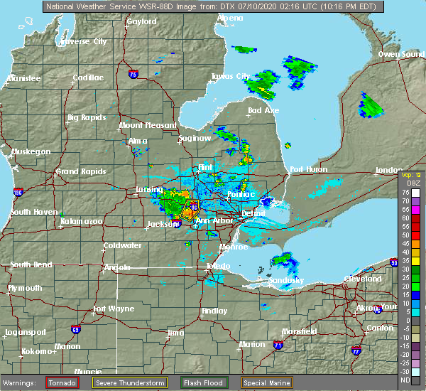 At 1017 pm edt, a severe thunderstorm was located near brighton, and is nearly stationary (radar indicated). Hazards include 60 mph wind gusts. Expect damage to roofs, siding, and trees. This severe thunderstorm will remain over mainly rural areas of southeastern livingston county, including the following locations, lakeland and island lake state recreation area. At 1017 pm edt, a severe thunderstorm was located near brighton, and is nearly stationary (radar indicated). Hazards include 60 mph wind gusts. Expect damage to roofs, siding, and trees. This severe thunderstorm will remain over mainly rural areas of southeastern livingston county, including the following locations, lakeland and island lake state recreation area.
|
| 7/9/2020 10:08 PM EDT |
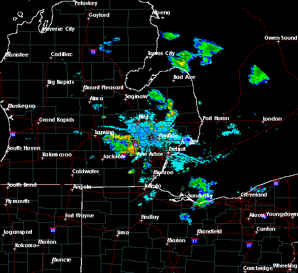 At 1008 pm edt, a severe thunderstorm was located over hamburg, or near brighton, moving northeast at 10 mph (radar indicated). Hazards include 60 mph wind gusts. Expect damage to roofs, siding, and trees. this severe storm will be near, brighton around 1030 pm edt. Other locations impacted by this severe thunderstorm include lakeland, island lake state recreation area and chilson. At 1008 pm edt, a severe thunderstorm was located over hamburg, or near brighton, moving northeast at 10 mph (radar indicated). Hazards include 60 mph wind gusts. Expect damage to roofs, siding, and trees. this severe storm will be near, brighton around 1030 pm edt. Other locations impacted by this severe thunderstorm include lakeland, island lake state recreation area and chilson.
|
| 7/9/2020 9:58 PM EDT |
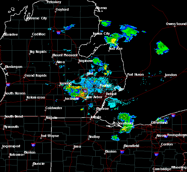 At 958 pm edt, a severe thunderstorm was located over hamburg, or near brighton, moving northeast at 20 mph (radar indicated). Hazards include 60 mph wind gusts. Expect damage to roofs, siding, and trees. this severe storm will be near, brighton around 1020 pm edt. Other locations impacted by this severe thunderstorm include lakeland, island lake state recreation area and chilson. At 958 pm edt, a severe thunderstorm was located over hamburg, or near brighton, moving northeast at 20 mph (radar indicated). Hazards include 60 mph wind gusts. Expect damage to roofs, siding, and trees. this severe storm will be near, brighton around 1020 pm edt. Other locations impacted by this severe thunderstorm include lakeland, island lake state recreation area and chilson.
|
| 7/9/2020 9:50 PM EDT |
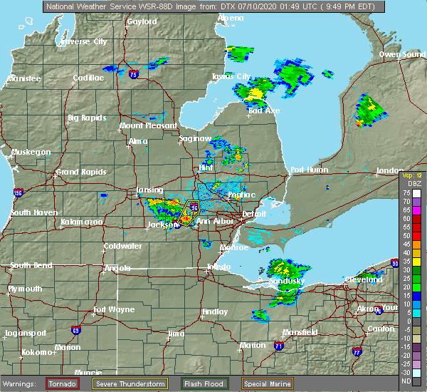 At 950 pm edt, a severe thunderstorm was located over hamburg, or near pinckney, moving northeast at 25 mph (radar indicated). Hazards include 60 mph wind gusts. Expect damage to roofs, siding, and trees. this severe storm will be near, hamburg around 955 pm edt. whitmore lake around 1000 pm edt. brighton around 1010 pm edt. Other locations impacted by this severe thunderstorm include lakeland, island lake state recreation area and chilson. At 950 pm edt, a severe thunderstorm was located over hamburg, or near pinckney, moving northeast at 25 mph (radar indicated). Hazards include 60 mph wind gusts. Expect damage to roofs, siding, and trees. this severe storm will be near, hamburg around 955 pm edt. whitmore lake around 1000 pm edt. brighton around 1010 pm edt. Other locations impacted by this severe thunderstorm include lakeland, island lake state recreation area and chilson.
|
| 7/9/2020 9:41 PM EDT |
 At 940 pm edt, a severe thunderstorm was located over dexter, moving northeast at 20 mph (radar indicated). Hazards include 60 mph wind gusts. Expect damage to roofs, siding, and trees. this severe thunderstorm will be near, hamburg around 1010 pm edt. whitmore lake around 1015 pm edt. brighton around 1030 pm edt. Other locations impacted by this severe thunderstorm include island lake state recreation area, hudson mills, chilson, delhi mills, lakeland and hudson mills metropark. At 940 pm edt, a severe thunderstorm was located over dexter, moving northeast at 20 mph (radar indicated). Hazards include 60 mph wind gusts. Expect damage to roofs, siding, and trees. this severe thunderstorm will be near, hamburg around 1010 pm edt. whitmore lake around 1015 pm edt. brighton around 1030 pm edt. Other locations impacted by this severe thunderstorm include island lake state recreation area, hudson mills, chilson, delhi mills, lakeland and hudson mills metropark.
|
| 6/26/2020 11:34 PM EDT |
 At 1133 pm edt, severe thunderstorms were located along a line extending from brighton to near ann arbor to clinton, moving east at 55 mph (radar indicated). Hazards include 60 mph wind gusts and nickel size hail. Expect damage to roofs, siding, and trees. these severe storms will be near, ypsilanti, south lyon and dixboro around 1140 pm edt. saline and salem around 1145 pm edt. milan around 1150 pm edt. willis around 1155 pm edt. Other locations impacted by these severe thunderstorms include pittsfield township, whittaker, hudson mills metropark, island lake state recreation area, bridgewater, delhi mills, pleasant lake, barton hills, pinckney state recreation area and hudson mills. At 1133 pm edt, severe thunderstorms were located along a line extending from brighton to near ann arbor to clinton, moving east at 55 mph (radar indicated). Hazards include 60 mph wind gusts and nickel size hail. Expect damage to roofs, siding, and trees. these severe storms will be near, ypsilanti, south lyon and dixboro around 1140 pm edt. saline and salem around 1145 pm edt. milan around 1150 pm edt. willis around 1155 pm edt. Other locations impacted by these severe thunderstorms include pittsfield township, whittaker, hudson mills metropark, island lake state recreation area, bridgewater, delhi mills, pleasant lake, barton hills, pinckney state recreation area and hudson mills.
|
| 6/26/2020 11:20 PM EDT |
 At 1106 pm edt, severe thunderstorms were located along a line extending from 8 miles southwest of fowlerville to near stockbridge to near cement city, moving east at 55 mph (radar indicated). Hazards include 60 mph wind gusts and nickel size hail. Expect damage to roofs, siding, and trees. severe thunderstorms will be near, chelsea and gregory around 1115 pm edt. howell, dexter and pinckney around 1120 pm edt. brighton around 1125 pm edt. manchester, hamburg and whitmore lake around 1130 pm edt. south lyon around 1135 pm edt. salem around 1140 pm edt. saline and milan around 1145 pm edt. willis around 1155 pm edt. Other locations impacted by these severe thunderstorms include pittsfield township, whittaker, plainfield, hudson mills metropark, island lake state recreation area, bridgewater, delhi mills, pleasant lake, barton hills and pinckney state recreation area. At 1106 pm edt, severe thunderstorms were located along a line extending from 8 miles southwest of fowlerville to near stockbridge to near cement city, moving east at 55 mph (radar indicated). Hazards include 60 mph wind gusts and nickel size hail. Expect damage to roofs, siding, and trees. severe thunderstorms will be near, chelsea and gregory around 1115 pm edt. howell, dexter and pinckney around 1120 pm edt. brighton around 1125 pm edt. manchester, hamburg and whitmore lake around 1130 pm edt. south lyon around 1135 pm edt. salem around 1140 pm edt. saline and milan around 1145 pm edt. willis around 1155 pm edt. Other locations impacted by these severe thunderstorms include pittsfield township, whittaker, plainfield, hudson mills metropark, island lake state recreation area, bridgewater, delhi mills, pleasant lake, barton hills and pinckney state recreation area.
|
| 6/26/2020 11:07 PM EDT |
 At 1106 pm edt, severe thunderstorms were located along a line extending from 8 miles southwest of fowlerville to near stockbridge to near cement city, moving east at 55 mph (radar indicated). Hazards include 60 mph wind gusts and nickel size hail. Expect damage to roofs, siding, and trees. severe thunderstorms will be near, chelsea and gregory around 1115 pm edt. howell, dexter and pinckney around 1120 pm edt. brighton around 1125 pm edt. manchester, hamburg and whitmore lake around 1130 pm edt. south lyon around 1135 pm edt. salem around 1140 pm edt. saline and milan around 1145 pm edt. willis around 1155 pm edt. Other locations impacted by these severe thunderstorms include pittsfield township, whittaker, plainfield, hudson mills metropark, island lake state recreation area, bridgewater, delhi mills, pleasant lake, barton hills and pinckney state recreation area. At 1106 pm edt, severe thunderstorms were located along a line extending from 8 miles southwest of fowlerville to near stockbridge to near cement city, moving east at 55 mph (radar indicated). Hazards include 60 mph wind gusts and nickel size hail. Expect damage to roofs, siding, and trees. severe thunderstorms will be near, chelsea and gregory around 1115 pm edt. howell, dexter and pinckney around 1120 pm edt. brighton around 1125 pm edt. manchester, hamburg and whitmore lake around 1130 pm edt. south lyon around 1135 pm edt. salem around 1140 pm edt. saline and milan around 1145 pm edt. willis around 1155 pm edt. Other locations impacted by these severe thunderstorms include pittsfield township, whittaker, plainfield, hudson mills metropark, island lake state recreation area, bridgewater, delhi mills, pleasant lake, barton hills and pinckney state recreation area.
|
| 6/26/2020 10:38 PM EDT |
 At 1038 pm edt, a severe thunderstorm was located near ann arbor, moving east at 25 mph (radar indicated). Hazards include 60 mph wind gusts and quarter size hail. Hail damage to vehicles is expected. expect wind damage to roofs, siding, and trees. this severe storm will be near, dixboro around 1055 pm edt. ypsilanti around 1100 pm edt. salem around 1105 pm edt. Other locations impacted by this severe thunderstorm include hudson mills, pittsfield township, delhi mills, barton hills and hudson mills metropark. At 1038 pm edt, a severe thunderstorm was located near ann arbor, moving east at 25 mph (radar indicated). Hazards include 60 mph wind gusts and quarter size hail. Hail damage to vehicles is expected. expect wind damage to roofs, siding, and trees. this severe storm will be near, dixboro around 1055 pm edt. ypsilanti around 1100 pm edt. salem around 1105 pm edt. Other locations impacted by this severe thunderstorm include hudson mills, pittsfield township, delhi mills, barton hills and hudson mills metropark.
|
| 6/26/2020 10:22 PM EDT |
 At 1022 pm edt, a severe thunderstorm was located over dexter, moving east at 35 mph (radar indicated). Hazards include 60 mph wind gusts and quarter size hail. Hail damage to vehicles is expected. expect wind damage to roofs, siding, and trees. this severe thunderstorm will be near, dexter around 1025 pm edt. ann arbor and saline around 1035 pm edt. dixboro around 1045 pm edt. ypsilanti around 1050 pm edt. salem around 1055 pm edt. Other locations impacted by this severe thunderstorm include hudson mills, pittsfield township, delhi mills, barton hills, lyndon township and hudson mills metropark. At 1022 pm edt, a severe thunderstorm was located over dexter, moving east at 35 mph (radar indicated). Hazards include 60 mph wind gusts and quarter size hail. Hail damage to vehicles is expected. expect wind damage to roofs, siding, and trees. this severe thunderstorm will be near, dexter around 1025 pm edt. ann arbor and saline around 1035 pm edt. dixboro around 1045 pm edt. ypsilanti around 1050 pm edt. salem around 1055 pm edt. Other locations impacted by this severe thunderstorm include hudson mills, pittsfield township, delhi mills, barton hills, lyndon township and hudson mills metropark.
|
| 6/10/2020 5:26 PM EDT |
 The severe thunderstorm warning for washtenaw county will expire at 530 pm edt, the storms which prompted the warning have moved out of the area. therefore, the warning will be allowed to expire. however gusty winds and heavy rain are still possible with surrounding thunderstorms. a severe thunderstorm watch remains in effect until 800 pm edt for southeastern michigan. remember, a severe thunderstorm warning still remains in effect for eastern washtenaw county. The severe thunderstorm warning for washtenaw county will expire at 530 pm edt, the storms which prompted the warning have moved out of the area. therefore, the warning will be allowed to expire. however gusty winds and heavy rain are still possible with surrounding thunderstorms. a severe thunderstorm watch remains in effect until 800 pm edt for southeastern michigan. remember, a severe thunderstorm warning still remains in effect for eastern washtenaw county.
|
| 6/10/2020 5:10 PM EDT |
 At 509 pm edt, severe thunderstorms were located along a line extending from near chelsea to near saline, moving northeast at 60 mph (radar indicated). Hazards include 60 mph wind gusts and penny size hail. Expect damage to roofs, siding, and trees. these severe storms will be near, ann arbor around 515 pm edt. whitmore lake around 520 pm edt. dixboro around 525 pm edt. salem around 530 pm edt. Other locations impacted by these severe thunderstorms include hudson mills, pittsfield township, lyndon township, hudson mills metropark, bridgewater, delhi mills, pleasant lake and barton hills. At 509 pm edt, severe thunderstorms were located along a line extending from near chelsea to near saline, moving northeast at 60 mph (radar indicated). Hazards include 60 mph wind gusts and penny size hail. Expect damage to roofs, siding, and trees. these severe storms will be near, ann arbor around 515 pm edt. whitmore lake around 520 pm edt. dixboro around 525 pm edt. salem around 530 pm edt. Other locations impacted by these severe thunderstorms include hudson mills, pittsfield township, lyndon township, hudson mills metropark, bridgewater, delhi mills, pleasant lake and barton hills.
|
| 6/10/2020 4:47 PM EDT |
 At 447 pm edt, severe thunderstorms were located along a line extending from hartland to near whitmore lake to near clinton, moving northeast at 60 mph (radar indicated). Hazards include 60 mph wind gusts and penny size hail. Expect damage to roofs, siding, and trees. these severe storms will be near, hartland, hamburg and whitmore lake around 450 pm edt. brighton and south lyon around 455 pm edt. ann arbor, saline and dexter around 505 pm edt. salem around 520 pm edt. Other locations impacted by these severe thunderstorms include pittsfield township, hudson mills metropark, island lake state recreation area, bridgewater, delhi mills, pleasant lake, barton hills, pinckney state recreation area, hudson mills and lakeland. At 447 pm edt, severe thunderstorms were located along a line extending from hartland to near whitmore lake to near clinton, moving northeast at 60 mph (radar indicated). Hazards include 60 mph wind gusts and penny size hail. Expect damage to roofs, siding, and trees. these severe storms will be near, hartland, hamburg and whitmore lake around 450 pm edt. brighton and south lyon around 455 pm edt. ann arbor, saline and dexter around 505 pm edt. salem around 520 pm edt. Other locations impacted by these severe thunderstorms include pittsfield township, hudson mills metropark, island lake state recreation area, bridgewater, delhi mills, pleasant lake, barton hills, pinckney state recreation area, hudson mills and lakeland.
|
| 6/10/2020 4:28 PM EDT |
 At 428 pm edt, severe thunderstorms were located along a line extending from near hartland to south lyon to near clinton, moving northeast at 30 mph (radar indicated). Hazards include 70 mph wind gusts and quarter size hail. Hail damage to vehicles is expected. expect considerable tree damage. wind damage is also likely to mobile homes, roofs, and outbuildings. severe thunderstorms will be near, south lyon and salem around 435 pm edt. saline around 450 pm edt. ann arbor around 455 pm edt. dixboro around 510 pm edt. Other locations impacted by these severe thunderstorms include pittsfield township, hudson mills metropark, island lake state recreation area, bridgewater, delhi mills, pleasant lake, barton hills, pinckney state recreation area, hudson mills and lakeland. At 428 pm edt, severe thunderstorms were located along a line extending from near hartland to south lyon to near clinton, moving northeast at 30 mph (radar indicated). Hazards include 70 mph wind gusts and quarter size hail. Hail damage to vehicles is expected. expect considerable tree damage. wind damage is also likely to mobile homes, roofs, and outbuildings. severe thunderstorms will be near, south lyon and salem around 435 pm edt. saline around 450 pm edt. ann arbor around 455 pm edt. dixboro around 510 pm edt. Other locations impacted by these severe thunderstorms include pittsfield township, hudson mills metropark, island lake state recreation area, bridgewater, delhi mills, pleasant lake, barton hills, pinckney state recreation area, hudson mills and lakeland.
|
| 6/10/2020 4:18 PM EDT |
 At 416 pm edt, severe thunderstorms were located along a line extending from near lake fenton to near dixboro, moving northeast at 40 mph (radar indicated). Hazards include 70 mph wind gusts. Expect considerable tree damage. damage is likely to mobile homes, roofs, and outbuildings. these severe storms will be near, south lyon around 430 pm edt. Other locations impacted by these severe thunderstorms include pittsfield township, whittaker, plainfield, hudson mills metropark, island lake state recreation area, bridgewater, delhi mills, pleasant lake, barton hills and pinckney state recreation area. At 416 pm edt, severe thunderstorms were located along a line extending from near lake fenton to near dixboro, moving northeast at 40 mph (radar indicated). Hazards include 70 mph wind gusts. Expect considerable tree damage. damage is likely to mobile homes, roofs, and outbuildings. these severe storms will be near, south lyon around 430 pm edt. Other locations impacted by these severe thunderstorms include pittsfield township, whittaker, plainfield, hudson mills metropark, island lake state recreation area, bridgewater, delhi mills, pleasant lake, barton hills and pinckney state recreation area.
|
| 6/10/2020 4:03 PM EDT |
 At 400 pm edt, severe thunderstorms were located along a line extending from near linden to 6 miles northwest of saline, moving east at 50 mph (radar indicated). Hazards include 70 mph wind gusts. Expect considerable tree damage. damage is likely to mobile homes, roofs, and outbuildings. these severe storms will be near, ypsilanti and dixboro around 415 pm edt. salem around 420 pm edt. Other locations impacted by these severe thunderstorms include pittsfield township, whittaker, plainfield, hudson mills metropark, island lake state recreation area, bridgewater, delhi mills, pleasant lake, barton hills and pinckney state recreation area. At 400 pm edt, severe thunderstorms were located along a line extending from near linden to 6 miles northwest of saline, moving east at 50 mph (radar indicated). Hazards include 70 mph wind gusts. Expect considerable tree damage. damage is likely to mobile homes, roofs, and outbuildings. these severe storms will be near, ypsilanti and dixboro around 415 pm edt. salem around 420 pm edt. Other locations impacted by these severe thunderstorms include pittsfield township, whittaker, plainfield, hudson mills metropark, island lake state recreation area, bridgewater, delhi mills, pleasant lake, barton hills and pinckney state recreation area.
|
| 6/10/2020 3:51 PM EDT |
 At 348 pm edt, severe thunderstorms were located along a line extending from 6 miles southeast of morrice to near manchester, moving northeast at 30 mph (radar indicated). Hazards include 70 mph wind gusts. Expect considerable tree damage. damage is likely to mobile homes, roofs, and outbuildings. these severe storms will be near, cohoctah and oak grove around 400 pm edt. saline and dexter around 415 pm edt. ann arbor around 420 pm edt. ypsilanti, dixboro and whitmore lake around 435 pm edt. south lyon and salem around 445 pm edt. Other locations impacted by these severe thunderstorms include pittsfield township, whittaker, plainfield, hudson mills metropark, island lake state recreation area, bridgewater, delhi mills, pleasant lake, barton hills and pinckney state recreation area. At 348 pm edt, severe thunderstorms were located along a line extending from 6 miles southeast of morrice to near manchester, moving northeast at 30 mph (radar indicated). Hazards include 70 mph wind gusts. Expect considerable tree damage. damage is likely to mobile homes, roofs, and outbuildings. these severe storms will be near, cohoctah and oak grove around 400 pm edt. saline and dexter around 415 pm edt. ann arbor around 420 pm edt. ypsilanti, dixboro and whitmore lake around 435 pm edt. south lyon and salem around 445 pm edt. Other locations impacted by these severe thunderstorms include pittsfield township, whittaker, plainfield, hudson mills metropark, island lake state recreation area, bridgewater, delhi mills, pleasant lake, barton hills and pinckney state recreation area.
|
| 6/10/2020 3:35 PM EDT |
 At 334 pm edt, severe thunderstorms were located along a line extending from bancroft to near brooklyn, moving northeast at 45 mph (radar indicated). Hazards include 70 mph wind gusts. Expect considerable tree damage. damage is likely to mobile homes, roofs, and outbuildings. these severe storms will be near, manchester around 345 pm edt. chelsea around 355 pm edt. ann arbor and dexter around 405 pm edt. hamburg and dixboro around 415 pm edt. whitmore lake around 420 pm edt. south lyon and salem around 425 pm edt. Other locations impacted by these severe thunderstorms include pittsfield township, whittaker, plainfield, hudson mills metropark, island lake state recreation area, bridgewater, delhi mills, pleasant lake, barton hills and pinckney state recreation area. At 334 pm edt, severe thunderstorms were located along a line extending from bancroft to near brooklyn, moving northeast at 45 mph (radar indicated). Hazards include 70 mph wind gusts. Expect considerable tree damage. damage is likely to mobile homes, roofs, and outbuildings. these severe storms will be near, manchester around 345 pm edt. chelsea around 355 pm edt. ann arbor and dexter around 405 pm edt. hamburg and dixboro around 415 pm edt. whitmore lake around 420 pm edt. south lyon and salem around 425 pm edt. Other locations impacted by these severe thunderstorms include pittsfield township, whittaker, plainfield, hudson mills metropark, island lake state recreation area, bridgewater, delhi mills, pleasant lake, barton hills and pinckney state recreation area.
|
| 6/10/2020 3:21 PM EDT |
 At 320 pm edt, severe thunderstorms were located along a line extending from near perry to 6 miles southwest of vandercook lake, moving northeast at 40 mph (radar indicated). Hazards include 70 mph wind gusts. Expect considerable tree damage. damage is likely to mobile homes, roofs, and outbuildings. severe thunderstorms will be near, fowlerville around 325 pm edt. cohoctah around 335 pm edt. chelsea around 400 pm edt. gregory around 405 pm edt. dexter around 410 pm edt. pinckney around 415 pm edt. hamburg around 420 pm edt. whitmore lake around 425 pm edt. Other locations impacted by these severe thunderstorms include pittsfield township, whittaker, plainfield, hudson mills metropark, island lake state recreation area, bridgewater, delhi mills, pleasant lake, barton hills and pinckney state recreation area. At 320 pm edt, severe thunderstorms were located along a line extending from near perry to 6 miles southwest of vandercook lake, moving northeast at 40 mph (radar indicated). Hazards include 70 mph wind gusts. Expect considerable tree damage. damage is likely to mobile homes, roofs, and outbuildings. severe thunderstorms will be near, fowlerville around 325 pm edt. cohoctah around 335 pm edt. chelsea around 400 pm edt. gregory around 405 pm edt. dexter around 410 pm edt. pinckney around 415 pm edt. hamburg around 420 pm edt. whitmore lake around 425 pm edt. Other locations impacted by these severe thunderstorms include pittsfield township, whittaker, plainfield, hudson mills metropark, island lake state recreation area, bridgewater, delhi mills, pleasant lake, barton hills and pinckney state recreation area.
|
| 4/7/2020 9:21 PM EDT |
 At 920 pm edt, a severe thunderstorm was located near dexter, moving southeast at 40 mph (radar indicated). Hazards include 60 mph wind gusts and half dollar size hail. Hail damage to vehicles is expected. expect wind damage to roofs, siding, and trees. this severe storm will be near, ann arbor around 925 pm edt. dixboro around 935 pm edt. ypsilanti around 940 pm edt. Other locations impacted by this severe thunderstorm include hudson mills, delhi mills, barton hills and hudson mills metropark. At 920 pm edt, a severe thunderstorm was located near dexter, moving southeast at 40 mph (radar indicated). Hazards include 60 mph wind gusts and half dollar size hail. Hail damage to vehicles is expected. expect wind damage to roofs, siding, and trees. this severe storm will be near, ann arbor around 925 pm edt. dixboro around 935 pm edt. ypsilanti around 940 pm edt. Other locations impacted by this severe thunderstorm include hudson mills, delhi mills, barton hills and hudson mills metropark.
|
| 4/7/2020 8:59 PM EDT |
 At 842 pm edt, a severe thunderstorm was located over pinckney, moving east at 50 mph (radar indicated). Hazards include 60 mph wind gusts and half dollar size hail. Hail damage to vehicles is expected. expect wind damage to roofs, siding, and trees. this severe storm will be near, ann arbor and whitmore lake around 855 pm edt. salem and dixboro around 900 pm edt. ypsilanti around 905 pm edt. Other locations impacted by this severe thunderstorm include plainfield, hudson mills metropark, island lake state recreation area, delhi mills, barton hills, pinckney state recreation area, hudson mills, parkers corners, lakeland and lyndon township. At 842 pm edt, a severe thunderstorm was located over pinckney, moving east at 50 mph (radar indicated). Hazards include 60 mph wind gusts and half dollar size hail. Hail damage to vehicles is expected. expect wind damage to roofs, siding, and trees. this severe storm will be near, ann arbor and whitmore lake around 855 pm edt. salem and dixboro around 900 pm edt. ypsilanti around 905 pm edt. Other locations impacted by this severe thunderstorm include plainfield, hudson mills metropark, island lake state recreation area, delhi mills, barton hills, pinckney state recreation area, hudson mills, parkers corners, lakeland and lyndon township.
|
| 4/7/2020 8:43 PM EDT |
 At 842 pm edt, a severe thunderstorm was located over pinckney, moving east at 50 mph (radar indicated). Hazards include 60 mph wind gusts and half dollar size hail. Hail damage to vehicles is expected. expect wind damage to roofs, siding, and trees. this severe storm will be near, ann arbor and whitmore lake around 855 pm edt. salem and dixboro around 900 pm edt. ypsilanti around 905 pm edt. Other locations impacted by this severe thunderstorm include plainfield, hudson mills metropark, island lake state recreation area, delhi mills, barton hills, pinckney state recreation area, hudson mills, parkers corners, lakeland and lyndon township. At 842 pm edt, a severe thunderstorm was located over pinckney, moving east at 50 mph (radar indicated). Hazards include 60 mph wind gusts and half dollar size hail. Hail damage to vehicles is expected. expect wind damage to roofs, siding, and trees. this severe storm will be near, ann arbor and whitmore lake around 855 pm edt. salem and dixboro around 900 pm edt. ypsilanti around 905 pm edt. Other locations impacted by this severe thunderstorm include plainfield, hudson mills metropark, island lake state recreation area, delhi mills, barton hills, pinckney state recreation area, hudson mills, parkers corners, lakeland and lyndon township.
|
| 4/7/2020 8:25 PM EDT |
 At 825 pm edt, a severe thunderstorm was located near stockbridge, or 12 miles southeast of mason, moving southeast at 50 mph (radar indicated). Hazards include 60 mph wind gusts and half dollar size hail. Hail damage to vehicles is expected. expect wind damage to roofs, siding, and trees. this severe thunderstorm will be near, gregory around 835 pm edt. chelsea and pinckney around 840 pm edt. dexter and hamburg around 850 pm edt. ann arbor and whitmore lake around 855 pm edt. dixboro around 900 pm edt. ypsilanti and salem around 905 pm edt. Other locations impacted by this severe thunderstorm include plainfield, hudson mills metropark, island lake state recreation area, delhi mills, barton hills, pinckney state recreation area, hudson mills, parkers corners, lakeland and lyndon township. At 825 pm edt, a severe thunderstorm was located near stockbridge, or 12 miles southeast of mason, moving southeast at 50 mph (radar indicated). Hazards include 60 mph wind gusts and half dollar size hail. Hail damage to vehicles is expected. expect wind damage to roofs, siding, and trees. this severe thunderstorm will be near, gregory around 835 pm edt. chelsea and pinckney around 840 pm edt. dexter and hamburg around 850 pm edt. ann arbor and whitmore lake around 855 pm edt. dixboro around 900 pm edt. ypsilanti and salem around 905 pm edt. Other locations impacted by this severe thunderstorm include plainfield, hudson mills metropark, island lake state recreation area, delhi mills, barton hills, pinckney state recreation area, hudson mills, parkers corners, lakeland and lyndon township.
|
| 9/13/2019 3:16 PM EDT |
 The national weather service in detroit/pontiac has issued a * severe thunderstorm warning for. oakland county in southeastern michigan. southeastern livingston county in southeastern michigan. until 415 pm edt. At 316 pm edt, a severe thunderstorm was located near whitmore. The national weather service in detroit/pontiac has issued a * severe thunderstorm warning for. oakland county in southeastern michigan. southeastern livingston county in southeastern michigan. until 415 pm edt. At 316 pm edt, a severe thunderstorm was located near whitmore.
|
| 9/13/2019 3:12 PM EDT |
 At 312 pm edt, severe thunderstorms were located along a line extending from near dixboro to near saline to near britton, moving northeast at 45 mph (radar indicated). Hazards include 60 mph wind gusts and quarter size hail. Hail damage to vehicles is expected. expect wind damage to roofs, siding, and trees. these severe storms will be near, ypsilanti, salem, dixboro and whitmore lake around 320 pm edt. Other locations impacted by these severe thunderstorms include pittsfield township, whittaker, macon, bridgewater, ridgeway, delhi mills, barton hills and holloway. At 312 pm edt, severe thunderstorms were located along a line extending from near dixboro to near saline to near britton, moving northeast at 45 mph (radar indicated). Hazards include 60 mph wind gusts and quarter size hail. Hail damage to vehicles is expected. expect wind damage to roofs, siding, and trees. these severe storms will be near, ypsilanti, salem, dixboro and whitmore lake around 320 pm edt. Other locations impacted by these severe thunderstorms include pittsfield township, whittaker, macon, bridgewater, ridgeway, delhi mills, barton hills and holloway.
|
| 9/13/2019 2:57 PM EDT |
 At 257 pm edt, severe thunderstorms were located along a line extending from near saline to 6 miles south of tecumseh, moving northeast at 40 mph (radar indicated). Hazards include 60 mph wind gusts and penny size hail. Expect damage to roofs, siding, and trees. severe thunderstorms will be near, ann arbor and saline around 305 pm edt. ypsilanti and dixboro around 310 pm edt. salem around 320 pm edt. milan around 325 pm edt. willis around 335 pm edt. Other locations impacted by these severe thunderstorms include pittsfield township, whittaker, macon, bridgewater, ridgeway, delhi mills, pleasant lake, tipton, barton hills and holloway. At 257 pm edt, severe thunderstorms were located along a line extending from near saline to 6 miles south of tecumseh, moving northeast at 40 mph (radar indicated). Hazards include 60 mph wind gusts and penny size hail. Expect damage to roofs, siding, and trees. severe thunderstorms will be near, ann arbor and saline around 305 pm edt. ypsilanti and dixboro around 310 pm edt. salem around 320 pm edt. milan around 325 pm edt. willis around 335 pm edt. Other locations impacted by these severe thunderstorms include pittsfield township, whittaker, macon, bridgewater, ridgeway, delhi mills, pleasant lake, tipton, barton hills and holloway.
|
| 9/11/2019 2:28 PM EDT |
 At 228 pm edt, a severe thunderstorm was located over salem, or 7 miles southwest of novi, moving northeast at 15 mph (radar indicated). Hazards include 60 mph wind gusts and quarter size hail. Hail damage to vehicles is expected. expect wind damage to roofs, siding, and trees. this severe storm will be near, northville around 255 pm edt. novi around 300 pm edt. Other locations impacted by this severe thunderstorm include plymouth, island lake state recreation area, new hudson, farmington, wixom, farmington hills, walled lake and redford. At 228 pm edt, a severe thunderstorm was located over salem, or 7 miles southwest of novi, moving northeast at 15 mph (radar indicated). Hazards include 60 mph wind gusts and quarter size hail. Hail damage to vehicles is expected. expect wind damage to roofs, siding, and trees. this severe storm will be near, northville around 255 pm edt. novi around 300 pm edt. Other locations impacted by this severe thunderstorm include plymouth, island lake state recreation area, new hudson, farmington, wixom, farmington hills, walled lake and redford.
|
| 9/11/2019 2:13 PM EDT |
 At 213 pm edt, a severe thunderstorm was located near dixboro, or near ann arbor, moving northeast at 15 mph (radar indicated). Hazards include 60 mph wind gusts and quarter size hail. Hail damage to vehicles is expected. expect wind damage to roofs, siding, and trees. this severe thunderstorm will be near, salem around 240 pm edt. south lyon around 250 pm edt. novi and northville around 300 pm edt. Other locations impacted by this severe thunderstorm include plymouth, island lake state recreation area, wolverine lake, new hudson, barton hills, farmington, walled lake, wixom, farmington hills and redford. At 213 pm edt, a severe thunderstorm was located near dixboro, or near ann arbor, moving northeast at 15 mph (radar indicated). Hazards include 60 mph wind gusts and quarter size hail. Hail damage to vehicles is expected. expect wind damage to roofs, siding, and trees. this severe thunderstorm will be near, salem around 240 pm edt. south lyon around 250 pm edt. novi and northville around 300 pm edt. Other locations impacted by this severe thunderstorm include plymouth, island lake state recreation area, wolverine lake, new hudson, barton hills, farmington, walled lake, wixom, farmington hills and redford.
|
| 8/18/2019 8:05 PM EDT |
 At 751 pm edt, severe thunderstorms were located along a line extending from near whitmore lake to near dexter, moving east at 30 mph (radar indicated). Hazards include 60 mph wind gusts. Expect damage to roofs, siding, and trees. these severe storms will be near, whitmore lake around 755 pm edt. south lyon around 800 pm edt. salem around 805 pm edt. dixboro around 810 pm edt. canton around 815 pm edt. Other locations impacted by these severe thunderstorms include island lake state recreation area, delhi mills, barton hills and hudson mills metropark. At 751 pm edt, severe thunderstorms were located along a line extending from near whitmore lake to near dexter, moving east at 30 mph (radar indicated). Hazards include 60 mph wind gusts. Expect damage to roofs, siding, and trees. these severe storms will be near, whitmore lake around 755 pm edt. south lyon around 800 pm edt. salem around 805 pm edt. dixboro around 810 pm edt. canton around 815 pm edt. Other locations impacted by these severe thunderstorms include island lake state recreation area, delhi mills, barton hills and hudson mills metropark.
|
| 8/18/2019 7:51 PM EDT |
 At 751 pm edt, severe thunderstorms were located along a line extending from near whitmore lake to near dexter, moving east at 30 mph (radar indicated). Hazards include 60 mph wind gusts. Expect damage to roofs, siding, and trees. these severe storms will be near, whitmore lake around 755 pm edt. south lyon around 800 pm edt. salem around 805 pm edt. dixboro around 810 pm edt. canton around 815 pm edt. Other locations impacted by these severe thunderstorms include island lake state recreation area, delhi mills, barton hills and hudson mills metropark. At 751 pm edt, severe thunderstorms were located along a line extending from near whitmore lake to near dexter, moving east at 30 mph (radar indicated). Hazards include 60 mph wind gusts. Expect damage to roofs, siding, and trees. these severe storms will be near, whitmore lake around 755 pm edt. south lyon around 800 pm edt. salem around 805 pm edt. dixboro around 810 pm edt. canton around 815 pm edt. Other locations impacted by these severe thunderstorms include island lake state recreation area, delhi mills, barton hills and hudson mills metropark.
|
| 8/18/2019 7:35 PM EDT |
 At 735 pm edt, severe thunderstorms were located along a line extending from near brighton to near hamburg to near chelsea, moving east at 35 mph (radar indicated). Hazards include 60 mph wind gusts. Expect damage to roofs, siding, and trees. these severe storms will be near, brighton and hamburg around 740 pm edt. whitmore lake around 745 pm edt. south lyon around 755 pm edt. ann arbor and salem around 800 pm edt. canton and dixboro around 810 pm edt. Other locations impacted by these severe thunderstorms include hudson mills, lakeland, hudson mills metropark, island lake state recreation area, chilson, delhi mills, barton hills, pinckney state recreation area and hell. At 735 pm edt, severe thunderstorms were located along a line extending from near brighton to near hamburg to near chelsea, moving east at 35 mph (radar indicated). Hazards include 60 mph wind gusts. Expect damage to roofs, siding, and trees. these severe storms will be near, brighton and hamburg around 740 pm edt. whitmore lake around 745 pm edt. south lyon around 755 pm edt. ann arbor and salem around 800 pm edt. canton and dixboro around 810 pm edt. Other locations impacted by these severe thunderstorms include hudson mills, lakeland, hudson mills metropark, island lake state recreation area, chilson, delhi mills, barton hills, pinckney state recreation area and hell.
|
| 8/18/2019 7:23 PM EDT |
 A severe thunderstorm warning remains in effect until 815 pm edt for southern livingston and northern washtenaw counties. at 723 pm edt, severe thunderstorms were located along a line extending from near howell to near chelsea to grass lake, moving east at 35 mph. hazard. 60 mph wind gusts. A severe thunderstorm warning remains in effect until 815 pm edt for southern livingston and northern washtenaw counties. at 723 pm edt, severe thunderstorms were located along a line extending from near howell to near chelsea to grass lake, moving east at 35 mph. hazard. 60 mph wind gusts.
|
| 8/18/2019 7:12 PM EDT |
 At 712 pm edt, severe thunderstorms were located along a line extending from near gregory to 6 miles south of stockbridge to near jackson, moving east at 35 mph (radar indicated). Hazards include 60 mph wind gusts. Expect damage to roofs, siding, and trees. severe thunderstorms will be near, gregory around 715 pm edt. howell and pinckney around 730 pm edt. brighton and chelsea around 740 pm edt. hamburg around 745 pm edt. dexter and whitmore lake around 750 pm edt. ann arbor and south lyon around 800 pm edt. salem around 805 pm edt. dixboro around 810 pm edt. Other locations impacted by these severe thunderstorms include plainfield, hudson mills metropark, island lake state recreation area, delhi mills, barton hills, pinckney state recreation area, hudson mills, parkers corners, lakeland and lyndon township. At 712 pm edt, severe thunderstorms were located along a line extending from near gregory to 6 miles south of stockbridge to near jackson, moving east at 35 mph (radar indicated). Hazards include 60 mph wind gusts. Expect damage to roofs, siding, and trees. severe thunderstorms will be near, gregory around 715 pm edt. howell and pinckney around 730 pm edt. brighton and chelsea around 740 pm edt. hamburg around 745 pm edt. dexter and whitmore lake around 750 pm edt. ann arbor and south lyon around 800 pm edt. salem around 805 pm edt. dixboro around 810 pm edt. Other locations impacted by these severe thunderstorms include plainfield, hudson mills metropark, island lake state recreation area, delhi mills, barton hills, pinckney state recreation area, hudson mills, parkers corners, lakeland and lyndon township.
|
| 7/29/2019 3:12 PM EDT |
 The severe thunderstorm warning for southeastern livingston county will expire at 315 pm edt, the storms which prompted the warning have moved out of the area. therefore, the warning will be allowed to expire. The severe thunderstorm warning for southeastern livingston county will expire at 315 pm edt, the storms which prompted the warning have moved out of the area. therefore, the warning will be allowed to expire.
|
| 7/29/2019 2:54 PM EDT |
 At 254 pm edt, severe thunderstorms were located along a line extending from near hamburg to near brighton, moving northeast at 25 mph (radar indicated). Hazards include 60 mph wind gusts and penny size hail. Expect damage to roofs, siding, and trees. these severe storms will be near, south lyon around 315 pm edt. Other locations impacted by these severe thunderstorms include lakeland and island lake state recreation area. At 254 pm edt, severe thunderstorms were located along a line extending from near hamburg to near brighton, moving northeast at 25 mph (radar indicated). Hazards include 60 mph wind gusts and penny size hail. Expect damage to roofs, siding, and trees. these severe storms will be near, south lyon around 315 pm edt. Other locations impacted by these severe thunderstorms include lakeland and island lake state recreation area.
|
| 7/29/2019 2:31 PM EDT |
 At 231 pm edt, a severe thunderstorm was located over brighton, moving northeast at 30 mph (radar indicated). Hazards include 60 mph wind gusts and penny size hail. Expect damage to roofs, siding, and trees. this severe storm will be near, hartland and south lyon around 245 pm edt. Other locations impacted by this severe thunderstorm include island lake state recreation area, chilson, lakeland, pinckney state recreation area and hell. At 231 pm edt, a severe thunderstorm was located over brighton, moving northeast at 30 mph (radar indicated). Hazards include 60 mph wind gusts and penny size hail. Expect damage to roofs, siding, and trees. this severe storm will be near, hartland and south lyon around 245 pm edt. Other locations impacted by this severe thunderstorm include island lake state recreation area, chilson, lakeland, pinckney state recreation area and hell.
|
| 7/29/2019 2:21 PM EDT |
 At 221 pm edt, a severe thunderstorm was located near pinckney, moving northeast at 25 mph (radar indicated). Hazards include 60 mph wind gusts and penny size hail. Expect damage to roofs, siding, and trees. this severe storm will be near, hamburg around 230 pm edt. brighton around 235 pm edt. hartland around 245 pm edt. Other locations impacted by this severe thunderstorm include lakeland, island lake state recreation area, chilson, pinckney state recreation area, hell, tyrone township and deerfield township. At 221 pm edt, a severe thunderstorm was located near pinckney, moving northeast at 25 mph (radar indicated). Hazards include 60 mph wind gusts and penny size hail. Expect damage to roofs, siding, and trees. this severe storm will be near, hamburg around 230 pm edt. brighton around 235 pm edt. hartland around 245 pm edt. Other locations impacted by this severe thunderstorm include lakeland, island lake state recreation area, chilson, pinckney state recreation area, hell, tyrone township and deerfield township.
|
| 7/29/2019 2:13 PM EDT |
 At 213 pm edt, a severe thunderstorm was located over pinckney, moving northeast at 25 mph (radar indicated). Hazards include 60 mph wind gusts and penny size hail. Expect damage to roofs, siding, and trees. this severe thunderstorm will be near, hamburg around 230 pm edt. brighton and whitmore lake around 235 pm edt. hartland and south lyon around 245 pm edt. Other locations impacted by this severe thunderstorm include lakeland, island lake state recreation area, chilson, unadilla, pinckney state recreation area, hell, tyrone township and deerfield township. At 213 pm edt, a severe thunderstorm was located over pinckney, moving northeast at 25 mph (radar indicated). Hazards include 60 mph wind gusts and penny size hail. Expect damage to roofs, siding, and trees. this severe thunderstorm will be near, hamburg around 230 pm edt. brighton and whitmore lake around 235 pm edt. hartland and south lyon around 245 pm edt. Other locations impacted by this severe thunderstorm include lakeland, island lake state recreation area, chilson, unadilla, pinckney state recreation area, hell, tyrone township and deerfield township.
|
| 7/20/2019 6:32 PM EDT |
 At 631 pm edt, a severe thunderstorm was located over northville, or over novi, moving east at 40 mph (radar indicated). Hazards include 60 mph wind gusts. Expect damage to roofs, siding, and trees. this severe storm will be near, northville around 635 pm edt. canton around 640 pm edt. livonia around 650 pm edt. southfield around 655 pm edt. detroit zoo and greenfield village around 700 pm edt. detroit and dearborn around 705 pm edt. downtown detroit around 710 pm edt. grosse pointe and belle isle around 715 pm edt. other locations impacted by this severe thunderstorm include franklin, melvindale, lathrup village, bingham farms, farmington hills, pleasant ridge, westland, ecorse, huntington woods and wolverine lake. People attending czech and slovak festival, comerica park, and festival of hope should seek safe shelter immediately!. At 631 pm edt, a severe thunderstorm was located over northville, or over novi, moving east at 40 mph (radar indicated). Hazards include 60 mph wind gusts. Expect damage to roofs, siding, and trees. this severe storm will be near, northville around 635 pm edt. canton around 640 pm edt. livonia around 650 pm edt. southfield around 655 pm edt. detroit zoo and greenfield village around 700 pm edt. detroit and dearborn around 705 pm edt. downtown detroit around 710 pm edt. grosse pointe and belle isle around 715 pm edt. other locations impacted by this severe thunderstorm include franklin, melvindale, lathrup village, bingham farms, farmington hills, pleasant ridge, westland, ecorse, huntington woods and wolverine lake. People attending czech and slovak festival, comerica park, and festival of hope should seek safe shelter immediately!.
|
| 7/20/2019 6:20 PM EDT |
 At 619 pm edt, a severe thunderstorm was located near brighton, moving east at 30 mph (radar indicated). Hazards include 60 mph wind gusts. Expect damage to roofs, siding, and trees. This severe thunderstorm will affect areas including the following locations, lakeland, island lake state recreation area, chilson, unadilla, pinckney state recreation area, hell, tyrone township and deerfield township. At 619 pm edt, a severe thunderstorm was located near brighton, moving east at 30 mph (radar indicated). Hazards include 60 mph wind gusts. Expect damage to roofs, siding, and trees. This severe thunderstorm will affect areas including the following locations, lakeland, island lake state recreation area, chilson, unadilla, pinckney state recreation area, hell, tyrone township and deerfield township.
|
| 7/20/2019 6:18 PM EDT |
 At 618 pm edt, a severe thunderstorm was located over south lyon, or near brighton, moving east at 40 mph (radar indicated). Hazards include 60 mph wind gusts. Expect damage to roofs, siding, and trees. this severe thunderstorm will be near, salem around 630 pm edt. northville around 635 pm edt. novi and canton around 640 pm edt. livonia around 650 pm edt. southfield, detroit zoo and greenfield village around 700 pm edt. detroit and dearborn around 705 pm edt. grosse pointe, downtown detroit and belle isle around 715 pm edt. other locations impacted by this severe thunderstorm include franklin, melvindale, lathrup village, bingham farms, farmington hills, pleasant ridge, westland, ecorse, huntington woods and wolverine lake. People attending czech and slovak festival, comerica park, and festival of hope should seek safe shelter immediately!. At 618 pm edt, a severe thunderstorm was located over south lyon, or near brighton, moving east at 40 mph (radar indicated). Hazards include 60 mph wind gusts. Expect damage to roofs, siding, and trees. this severe thunderstorm will be near, salem around 630 pm edt. northville around 635 pm edt. novi and canton around 640 pm edt. livonia around 650 pm edt. southfield, detroit zoo and greenfield village around 700 pm edt. detroit and dearborn around 705 pm edt. grosse pointe, downtown detroit and belle isle around 715 pm edt. other locations impacted by this severe thunderstorm include franklin, melvindale, lathrup village, bingham farms, farmington hills, pleasant ridge, westland, ecorse, huntington woods and wolverine lake. People attending czech and slovak festival, comerica park, and festival of hope should seek safe shelter immediately!.
|
| 7/20/2019 5:57 PM EDT |
 At 557 pm edt, a severe thunderstorm was located near oak grove, or near howell, moving east at 40 mph (radar indicated). Hazards include 60 mph wind gusts. Expect damage to roofs, siding, and trees. this severe storm will be near, hartland around 605 pm edt. Other locations impacted by this severe thunderstorm include parkers corners, lakeland, plainfield, island lake state recreation area, chilson, unadilla, pinckney state recreation area, conway township, hell and tyrone township. At 557 pm edt, a severe thunderstorm was located near oak grove, or near howell, moving east at 40 mph (radar indicated). Hazards include 60 mph wind gusts. Expect damage to roofs, siding, and trees. this severe storm will be near, hartland around 605 pm edt. Other locations impacted by this severe thunderstorm include parkers corners, lakeland, plainfield, island lake state recreation area, chilson, unadilla, pinckney state recreation area, conway township, hell and tyrone township.
|
| 7/20/2019 5:49 PM EDT |
 The national weather service in detroit/pontiac has issued a * severe thunderstorm warning for. livingston county in southeastern michigan. until 630 pm edt. At 549 pm edt, a severe thunderstorm was located near howell, moving east at 40 mph. The national weather service in detroit/pontiac has issued a * severe thunderstorm warning for. livingston county in southeastern michigan. until 630 pm edt. At 549 pm edt, a severe thunderstorm was located near howell, moving east at 40 mph.
|
| 7/19/2019 8:12 PM EDT |
 At 812 pm edt, a severe thunderstorm was located over dixboro, or near ann arbor, moving southeast at 30 mph (radar indicated). Hazards include 60 mph wind gusts. Expect damage to roofs, siding, and trees. this severe storm will be near, ypsilanti around 820 pm edt. belleville around 835 pm edt. willis around 840 pm edt. other locations impacted by this severe thunderstorm include pittsfield township, whittaker, willow, plymouth, sumpter township, new boston, delhi mills, barton hills, waltz and wayne. People attending ann arbor art fairs should seek safe shelter immediately!. At 812 pm edt, a severe thunderstorm was located over dixboro, or near ann arbor, moving southeast at 30 mph (radar indicated). Hazards include 60 mph wind gusts. Expect damage to roofs, siding, and trees. this severe storm will be near, ypsilanti around 820 pm edt. belleville around 835 pm edt. willis around 840 pm edt. other locations impacted by this severe thunderstorm include pittsfield township, whittaker, willow, plymouth, sumpter township, new boston, delhi mills, barton hills, waltz and wayne. People attending ann arbor art fairs should seek safe shelter immediately!.
|
| 7/19/2019 8:07 PM EDT |
 The severe thunderstorm warning for southwestern oakland and southern livingston counties will expire at 815 pm edt, the storm which prompted the warning has weakened, and has exited the warned area. therefore, the warning will be allowed to expire. however gusty winds and heavy rain are still possible with this thunderstorm. The severe thunderstorm warning for southwestern oakland and southern livingston counties will expire at 815 pm edt, the storm which prompted the warning has weakened, and has exited the warned area. therefore, the warning will be allowed to expire. however gusty winds and heavy rain are still possible with this thunderstorm.
|
| 7/19/2019 8:03 PM EDT |
 At 803 pm edt, a severe thunderstorm was located near whitmore lake, or 7 miles north of ann arbor, moving south at 15 mph (radar indicated). Hazards include 60 mph wind gusts. Expect damage to roofs, siding, and trees. this severe storm will be near, dixboro around 820 pm edt. ypsilanti around 835 pm edt. belleville and willis around 900 pm edt. other locations impacted by this severe thunderstorm include brownstown township, pittsfield township, whittaker, gibraltar, plymouth, sumpter township, new boston, delhi mills, barton hills and rockwood. People attending ann arbor art fairs should seek safe shelter immediately!. At 803 pm edt, a severe thunderstorm was located near whitmore lake, or 7 miles north of ann arbor, moving south at 15 mph (radar indicated). Hazards include 60 mph wind gusts. Expect damage to roofs, siding, and trees. this severe storm will be near, dixboro around 820 pm edt. ypsilanti around 835 pm edt. belleville and willis around 900 pm edt. other locations impacted by this severe thunderstorm include brownstown township, pittsfield township, whittaker, gibraltar, plymouth, sumpter township, new boston, delhi mills, barton hills and rockwood. People attending ann arbor art fairs should seek safe shelter immediately!.
|
| 7/19/2019 7:44 PM EDT |
 At 744 pm edt, a severe thunderstorm was located over whitmore lake, or near brighton, moving southeast at 20 mph (public). Hazards include 70 mph wind gusts and penny size hail. Expect considerable tree damage. damage is likely to mobile homes, roofs, and outbuildings. this severe storm will be near, south lyon around 750 pm edt. other locations impacted by this severe thunderstorm include plainfield, island lake state recreation area, commerce, new hudson, walled lake, pinckney state recreation area, farmington hills, lakeland, white lake and chilson. People attending farmington founders festival should seek safe shelter immediately!. At 744 pm edt, a severe thunderstorm was located over whitmore lake, or near brighton, moving southeast at 20 mph (public). Hazards include 70 mph wind gusts and penny size hail. Expect considerable tree damage. damage is likely to mobile homes, roofs, and outbuildings. this severe storm will be near, south lyon around 750 pm edt. other locations impacted by this severe thunderstorm include plainfield, island lake state recreation area, commerce, new hudson, walled lake, pinckney state recreation area, farmington hills, lakeland, white lake and chilson. People attending farmington founders festival should seek safe shelter immediately!.
|
| 7/19/2019 7:40 PM EDT |
 At 740 pm edt, a severe thunderstorm was located over whitmore lake, or near brighton, moving southeast at 30 mph (radar indicated). Hazards include 60 mph wind gusts. Expect damage to roofs, siding, and trees. this severe thunderstorm will be near, salem around 755 pm edt. dixboro around 800 pm edt. ypsilanti around 810 pm edt. belleville around 825 pm edt. willis around 830 pm edt. other locations impacted by this severe thunderstorm include whittaker, gibraltar, hudson mills metropark, new boston, delhi mills, pleasant lake, rockwood, westland, woodhaven and lincoln park. People attending ann arbor art fairs should seek safe shelter immediately!. At 740 pm edt, a severe thunderstorm was located over whitmore lake, or near brighton, moving southeast at 30 mph (radar indicated). Hazards include 60 mph wind gusts. Expect damage to roofs, siding, and trees. this severe thunderstorm will be near, salem around 755 pm edt. dixboro around 800 pm edt. ypsilanti around 810 pm edt. belleville around 825 pm edt. willis around 830 pm edt. other locations impacted by this severe thunderstorm include whittaker, gibraltar, hudson mills metropark, new boston, delhi mills, pleasant lake, rockwood, westland, woodhaven and lincoln park. People attending ann arbor art fairs should seek safe shelter immediately!.
|
| 7/19/2019 7:40 PM EDT |
 At 734 pm edt, a severe thunderstorm was located near brighton, moving southeast at 30 mph (public). Hazards include 60 mph wind gusts. Expect damage to roofs, siding, and trees. this severe storm will be near, south lyon and whitmore lake around 740 pm edt. other locations impacted by this severe thunderstorm include plainfield, island lake state recreation area, commerce, new hudson, walled lake, pinckney state recreation area, farmington hills, parkers corners, lakeland and white lake. People attending farmington founders festival should seek safe shelter immediately!. At 734 pm edt, a severe thunderstorm was located near brighton, moving southeast at 30 mph (public). Hazards include 60 mph wind gusts. Expect damage to roofs, siding, and trees. this severe storm will be near, south lyon and whitmore lake around 740 pm edt. other locations impacted by this severe thunderstorm include plainfield, island lake state recreation area, commerce, new hudson, walled lake, pinckney state recreation area, farmington hills, parkers corners, lakeland and white lake. People attending farmington founders festival should seek safe shelter immediately!.
|
| 7/19/2019 7:20 PM EDT |
 At 658 pm edt, a severe thunderstorm was located over hartland, moving southeast at 25 mph (radar indicated). Hazards include 60 mph wind gusts and penny size hail. Expect damage to roofs, siding, and trees. this severe thunderstorm will be near, milford around 720 pm edt. south lyon around 725 pm edt. novi and west bloomfield around 745 pm edt. northville around 750 pm edt. southfield around 810 pm edt. detroit zoo around 815 pm edt. other locations impacted by this severe thunderstorm include franklin, keego harbor, orchard lake, plainfield, commerce, rose center, pinckney state recreation area, conway township, lathrup village and bingham farms. People attending farmington founders festival, and festival of hope should seek safe shelter immediately!. At 658 pm edt, a severe thunderstorm was located over hartland, moving southeast at 25 mph (radar indicated). Hazards include 60 mph wind gusts and penny size hail. Expect damage to roofs, siding, and trees. this severe thunderstorm will be near, milford around 720 pm edt. south lyon around 725 pm edt. novi and west bloomfield around 745 pm edt. northville around 750 pm edt. southfield around 810 pm edt. detroit zoo around 815 pm edt. other locations impacted by this severe thunderstorm include franklin, keego harbor, orchard lake, plainfield, commerce, rose center, pinckney state recreation area, conway township, lathrup village and bingham farms. People attending farmington founders festival, and festival of hope should seek safe shelter immediately!.
|
| 7/19/2019 6:58 PM EDT |
 At 658 pm edt, a severe thunderstorm was located over hartland, moving southeast at 25 mph (radar indicated). Hazards include 60 mph wind gusts and penny size hail. Expect damage to roofs, siding, and trees. this severe thunderstorm will be near, milford around 720 pm edt. south lyon around 725 pm edt. novi and west bloomfield around 745 pm edt. northville around 750 pm edt. southfield around 810 pm edt. detroit zoo around 815 pm edt. other locations impacted by this severe thunderstorm include franklin, keego harbor, orchard lake, plainfield, commerce, rose center, pinckney state recreation area, conway township, lathrup village and bingham farms. People attending farmington founders festival, and festival of hope should seek safe shelter immediately!. At 658 pm edt, a severe thunderstorm was located over hartland, moving southeast at 25 mph (radar indicated). Hazards include 60 mph wind gusts and penny size hail. Expect damage to roofs, siding, and trees. this severe thunderstorm will be near, milford around 720 pm edt. south lyon around 725 pm edt. novi and west bloomfield around 745 pm edt. northville around 750 pm edt. southfield around 810 pm edt. detroit zoo around 815 pm edt. other locations impacted by this severe thunderstorm include franklin, keego harbor, orchard lake, plainfield, commerce, rose center, pinckney state recreation area, conway township, lathrup village and bingham farms. People attending farmington founders festival, and festival of hope should seek safe shelter immediately!.
|
| 7/18/2019 3:05 PM EDT |
 The severe thunderstorm warning for eastern washtenaw county will expire at 315 pm edt, the storm which prompted the warning has moved out of the area. therefore, the warning will be allowed to expire. however heavy rain is still possible with this thunderstorm. The severe thunderstorm warning for eastern washtenaw county will expire at 315 pm edt, the storm which prompted the warning has moved out of the area. therefore, the warning will be allowed to expire. however heavy rain is still possible with this thunderstorm.
|
| 7/18/2019 2:48 PM EDT |
 At 247 pm edt, a severe thunderstorm was located over dixboro, or near ann arbor, moving east at 40 mph (radar indicated). Hazards include 60 mph wind gusts. Expect damage to roofs, siding, and trees. this severe thunderstorm will remain over mainly rural areas of eastern washtenaw county, including the following locations, pittsfield township, delhi mills, whittaker and barton hills. People attending ann arbor art fair should seek safe shelter immediately!. At 247 pm edt, a severe thunderstorm was located over dixboro, or near ann arbor, moving east at 40 mph (radar indicated). Hazards include 60 mph wind gusts. Expect damage to roofs, siding, and trees. this severe thunderstorm will remain over mainly rural areas of eastern washtenaw county, including the following locations, pittsfield township, delhi mills, whittaker and barton hills. People attending ann arbor art fair should seek safe shelter immediately!.
|
| 7/18/2019 2:39 PM EDT |
 At 229 pm edt, a severe thunderstorm was located near dexter, moving east at 40 mph (radar indicated). Hazards include 60 mph wind gusts. Expect damage to roofs, siding, and trees. this severe thunderstorm will be near, ann arbor and saline around 240 pm edt. ypsilanti and dixboro around 250 pm edt. salem around 255 pm edt. other locations impacted by this severe thunderstorm include hudson mills, pittsfield township, whittaker, hudson mills metropark, bridgewater, delhi mills, pleasant lake and barton hills. People attending ann arbor art festival should seek safe shelter immediately!. At 229 pm edt, a severe thunderstorm was located near dexter, moving east at 40 mph (radar indicated). Hazards include 60 mph wind gusts. Expect damage to roofs, siding, and trees. this severe thunderstorm will be near, ann arbor and saline around 240 pm edt. ypsilanti and dixboro around 250 pm edt. salem around 255 pm edt. other locations impacted by this severe thunderstorm include hudson mills, pittsfield township, whittaker, hudson mills metropark, bridgewater, delhi mills, pleasant lake and barton hills. People attending ann arbor art festival should seek safe shelter immediately!.
|
| 7/18/2019 2:29 PM EDT |
 At 229 pm edt, a severe thunderstorm was located near dexter, moving east at 40 mph (radar indicated). Hazards include 60 mph wind gusts. Expect damage to roofs, siding, and trees. this severe thunderstorm will be near, ann arbor and saline around 240 pm edt. ypsilanti and dixboro around 250 pm edt. salem around 255 pm edt. other locations impacted by this severe thunderstorm include hudson mills, pittsfield township, whittaker, hudson mills metropark, bridgewater, delhi mills, pleasant lake and barton hills. People attending ann arbor art festival should seek safe shelter immediately!. At 229 pm edt, a severe thunderstorm was located near dexter, moving east at 40 mph (radar indicated). Hazards include 60 mph wind gusts. Expect damage to roofs, siding, and trees. this severe thunderstorm will be near, ann arbor and saline around 240 pm edt. ypsilanti and dixboro around 250 pm edt. salem around 255 pm edt. other locations impacted by this severe thunderstorm include hudson mills, pittsfield township, whittaker, hudson mills metropark, bridgewater, delhi mills, pleasant lake and barton hills. People attending ann arbor art festival should seek safe shelter immediately!.
|
| 7/2/2019 7:02 PM EDT |
 At 702 pm edt, a severe thunderstorm was located near milford, moving southeast at 35 mph (radar indicated). Hazards include 60 mph wind gusts and quarter size hail. Hail damage to vehicles is expected. expect wind damage to roofs, siding, and trees. Locations impacted include, hartland, howell, brighton, hamburg, whitmore lake, lakeland, island lake state recreation area, chilson and tyrone township. At 702 pm edt, a severe thunderstorm was located near milford, moving southeast at 35 mph (radar indicated). Hazards include 60 mph wind gusts and quarter size hail. Hail damage to vehicles is expected. expect wind damage to roofs, siding, and trees. Locations impacted include, hartland, howell, brighton, hamburg, whitmore lake, lakeland, island lake state recreation area, chilson and tyrone township.
|
| 7/2/2019 6:48 PM EDT |
 At 648 pm edt, a severe thunderstorm was located near hartland, moving southeast at 40 mph (radar indicated). Hazards include 60 mph wind gusts and quarter size hail. Hail damage to vehicles is expected. expect wind damage to roofs, siding, and trees. This severe thunderstorm will remain over mainly rural areas of livingston county, including the following locations, island lake state recreation area, chilson, lakeland, tyrone township and deerfield township. At 648 pm edt, a severe thunderstorm was located near hartland, moving southeast at 40 mph (radar indicated). Hazards include 60 mph wind gusts and quarter size hail. Hail damage to vehicles is expected. expect wind damage to roofs, siding, and trees. This severe thunderstorm will remain over mainly rural areas of livingston county, including the following locations, island lake state recreation area, chilson, lakeland, tyrone township and deerfield township.
|
| 7/2/2019 6:42 PM EDT |
 At 642 pm edt, a severe thunderstorm was located near oak grove, or near hartland, moving southeast at 35 mph (radar indicated). Hazards include 60 mph wind gusts and quarter size hail. Hail damage to vehicles is expected. expect wind damage to roofs, siding, and trees. this severe thunderstorm will be near, hartland and brighton around 655 pm edt. Other locations impacted by this severe thunderstorm include island lake state recreation area, chilson, lakeland, tyrone township and deerfield township. At 642 pm edt, a severe thunderstorm was located near oak grove, or near hartland, moving southeast at 35 mph (radar indicated). Hazards include 60 mph wind gusts and quarter size hail. Hail damage to vehicles is expected. expect wind damage to roofs, siding, and trees. this severe thunderstorm will be near, hartland and brighton around 655 pm edt. Other locations impacted by this severe thunderstorm include island lake state recreation area, chilson, lakeland, tyrone township and deerfield township.
|
| 7/2/2019 5:34 PM EDT |
 At 534 pm edt, a severe thunderstorm was located near whitmore lake, or 7 miles north of ann arbor, moving southeast at 25 mph (radar indicated). Hazards include 60 mph wind gusts and quarter size hail. Hail damage to vehicles is expected. expect wind damage to roofs, siding, and trees. this severe thunderstorm will be near, salem around 540 pm edt. ann arbor and dixboro around 545 pm edt. ypsilanti around 555 pm edt. Other locations impacted by this severe thunderstorm include barton hills. At 534 pm edt, a severe thunderstorm was located near whitmore lake, or 7 miles north of ann arbor, moving southeast at 25 mph (radar indicated). Hazards include 60 mph wind gusts and quarter size hail. Hail damage to vehicles is expected. expect wind damage to roofs, siding, and trees. this severe thunderstorm will be near, salem around 540 pm edt. ann arbor and dixboro around 545 pm edt. ypsilanti around 555 pm edt. Other locations impacted by this severe thunderstorm include barton hills.
|
| 7/2/2019 5:26 PM EDT | Quarter sized hail reported 1 miles NNE of Whitmore Lake, MI, time estimated via radar. |
| 7/2/2019 5:18 PM EDT | Quarter sized hail reported 3.3 miles ESE of Whitmore Lake, MI |
| 7/2/2019 5:18 PM EDT | Half Dollar sized hail reported 3.2 miles SE of Whitmore Lake, MI, time estimated via radar. |
| 7/2/2019 5:08 PM EDT |
 At 508 pm edt, a severe thunderstorm was located near hamburg, or near brighton, moving southeast at 20 mph (radar indicated). Hazards include 60 mph wind gusts and quarter size hail. Hail damage to vehicles is expected. expect wind damage to roofs, siding, and trees. this severe storm will be near, hamburg around 520 pm edt. whitmore lake around 530 pm edt. south lyon around 535 pm edt. Other locations impacted by this severe thunderstorm include island lake state recreation area, chilson, lakeland, tyrone township and deerfield township. At 508 pm edt, a severe thunderstorm was located near hamburg, or near brighton, moving southeast at 20 mph (radar indicated). Hazards include 60 mph wind gusts and quarter size hail. Hail damage to vehicles is expected. expect wind damage to roofs, siding, and trees. this severe storm will be near, hamburg around 520 pm edt. whitmore lake around 530 pm edt. south lyon around 535 pm edt. Other locations impacted by this severe thunderstorm include island lake state recreation area, chilson, lakeland, tyrone township and deerfield township.
|
| 7/2/2019 4:56 PM EDT |
 At 455 pm edt, severe thunderstorms were located along a line extending from cohoctah to near howell, moving east at 25 mph (radar indicated). Hazards include 60 mph wind gusts and quarter size hail. Hail damage to vehicles is expected. expect wind damage to roofs, siding, and trees. severe thunderstorms will be near, pinckney around 500 pm edt. brighton and hamburg around 520 pm edt. hartland around 525 pm edt. whitmore lake around 530 pm edt. south lyon around 540 pm edt. Other locations impacted by these severe thunderstorms include island lake state recreation area, chilson, lakeland, hell, tyrone township and deerfield township. At 455 pm edt, severe thunderstorms were located along a line extending from cohoctah to near howell, moving east at 25 mph (radar indicated). Hazards include 60 mph wind gusts and quarter size hail. Hail damage to vehicles is expected. expect wind damage to roofs, siding, and trees. severe thunderstorms will be near, pinckney around 500 pm edt. brighton and hamburg around 520 pm edt. hartland around 525 pm edt. whitmore lake around 530 pm edt. south lyon around 540 pm edt. Other locations impacted by these severe thunderstorms include island lake state recreation area, chilson, lakeland, hell, tyrone township and deerfield township.
|
| 6/1/2019 9:47 PM EDT |
 At 947 pm edt, a severe thunderstorm was located near dexter, moving east at 45 mph (radar indicated). Hazards include 60 mph wind gusts and quarter size hail. Hail damage to vehicles is expected. expect wind damage to roofs, siding, and trees. this severe storm will be near, dixboro around 1000 pm edt. ypsilanti around 1005 pm edt. willis around 1010 pm edt. Other locations impacted by this severe thunderstorm include hudson mills, pittsfield township, whittaker, hudson mills metropark, bridgewater, delhi mills, pleasant lake and barton hills. At 947 pm edt, a severe thunderstorm was located near dexter, moving east at 45 mph (radar indicated). Hazards include 60 mph wind gusts and quarter size hail. Hail damage to vehicles is expected. expect wind damage to roofs, siding, and trees. this severe storm will be near, dixboro around 1000 pm edt. ypsilanti around 1005 pm edt. willis around 1010 pm edt. Other locations impacted by this severe thunderstorm include hudson mills, pittsfield township, whittaker, hudson mills metropark, bridgewater, delhi mills, pleasant lake and barton hills.
|
| 6/1/2019 9:36 PM EDT |
 At 935 pm edt, a severe thunderstorm was located over chelsea, moving east at 45 mph (radar indicated). Hazards include 60 mph wind gusts and quarter size hail. Hail damage to vehicles is expected. expect wind damage to roofs, siding, and trees. this severe storm will be near, dexter around 940 pm edt. ann arbor around 950 pm edt. saline around 955 pm edt. dixboro around 1000 pm edt. ypsilanti around 1005 pm edt. willis around 1010 pm edt. Other locations impacted by this severe thunderstorm include hudson mills, pittsfield township, whittaker, lyndon township, hudson mills metropark, bridgewater, delhi mills, pleasant lake and barton hills. At 935 pm edt, a severe thunderstorm was located over chelsea, moving east at 45 mph (radar indicated). Hazards include 60 mph wind gusts and quarter size hail. Hail damage to vehicles is expected. expect wind damage to roofs, siding, and trees. this severe storm will be near, dexter around 940 pm edt. ann arbor around 950 pm edt. saline around 955 pm edt. dixboro around 1000 pm edt. ypsilanti around 1005 pm edt. willis around 1010 pm edt. Other locations impacted by this severe thunderstorm include hudson mills, pittsfield township, whittaker, lyndon township, hudson mills metropark, bridgewater, delhi mills, pleasant lake and barton hills.
|
| 6/1/2019 9:15 PM EDT |
 At 915 pm edt, a severe thunderstorm was located near stockbridge, or 11 miles northeast of jackson, moving east at 45 mph (radar indicated). Hazards include 60 mph wind gusts and quarter size hail. Hail damage to vehicles is expected. expect wind damage to roofs, siding, and trees. this severe thunderstorm will be near, chelsea around 930 pm edt. dexter around 940 pm edt. ann arbor around 945 pm edt. saline around 950 pm edt. ypsilanti and dixboro around 955 pm edt. milan around 1000 pm edt. willis around 1005 pm edt. Other locations impacted by this severe thunderstorm include pittsfield township, whittaker, plainfield, hudson mills metropark, island lake state recreation area, bridgewater, delhi mills, pleasant lake, barton hills and pinckney state recreation area. At 915 pm edt, a severe thunderstorm was located near stockbridge, or 11 miles northeast of jackson, moving east at 45 mph (radar indicated). Hazards include 60 mph wind gusts and quarter size hail. Hail damage to vehicles is expected. expect wind damage to roofs, siding, and trees. this severe thunderstorm will be near, chelsea around 930 pm edt. dexter around 940 pm edt. ann arbor around 945 pm edt. saline around 950 pm edt. ypsilanti and dixboro around 955 pm edt. milan around 1000 pm edt. willis around 1005 pm edt. Other locations impacted by this severe thunderstorm include pittsfield township, whittaker, plainfield, hudson mills metropark, island lake state recreation area, bridgewater, delhi mills, pleasant lake, barton hills and pinckney state recreation area.
|
| 6/1/2019 2:11 PM EDT |
 At 210 pm edt, a cluster of severe thunderstorms were located near milan, moving east at 35 mph (radar indicated). Hazards include 60 mph wind gusts and quarter size hail. Hail damage to vehicles is expected. expect wind damage to roofs, siding, and trees. these severe storms will be near, willis around 220 pm edt. belleville around 225 pm edt. flat rock around 240 pm edt. taylor and romulus around 245 pm edt. other locations impacted by these severe thunderstorms include whittaker, hudson mills metropark, new boston, ridgeway, delhi mills, palmyra, pleasant lake, azalia, westland and scofield. People attending downtown tecumseh, and tate park should seek safe shelter immediately!. At 210 pm edt, a cluster of severe thunderstorms were located near milan, moving east at 35 mph (radar indicated). Hazards include 60 mph wind gusts and quarter size hail. Hail damage to vehicles is expected. expect wind damage to roofs, siding, and trees. these severe storms will be near, willis around 220 pm edt. belleville around 225 pm edt. flat rock around 240 pm edt. taylor and romulus around 245 pm edt. other locations impacted by these severe thunderstorms include whittaker, hudson mills metropark, new boston, ridgeway, delhi mills, palmyra, pleasant lake, azalia, westland and scofield. People attending downtown tecumseh, and tate park should seek safe shelter immediately!.
|
| 6/1/2019 1:59 PM EDT |
 At 159 pm edt, a severe thunderstorm was located near brighton, moving east at 35 mph (radar indicated). Hazards include 60 mph wind gusts and quarter size hail. Hail damage to vehicles is expected. expect wind damage to roofs, siding, and trees. this severe storm will be near, milford around 210 pm edt. novi around 220 pm edt. other locations impacted by this severe thunderstorm include davisburg, white lake, island lake state recreation area, commerce, wolverine lake, new hudson, rose center, walled lake, wixom and farmington. People attending lyon township kite festival should seek safe shelter immediately!. At 159 pm edt, a severe thunderstorm was located near brighton, moving east at 35 mph (radar indicated). Hazards include 60 mph wind gusts and quarter size hail. Hail damage to vehicles is expected. expect wind damage to roofs, siding, and trees. this severe storm will be near, milford around 210 pm edt. novi around 220 pm edt. other locations impacted by this severe thunderstorm include davisburg, white lake, island lake state recreation area, commerce, wolverine lake, new hudson, rose center, walled lake, wixom and farmington. People attending lyon township kite festival should seek safe shelter immediately!.
|
| 6/1/2019 1:50 PM EDT |
 At 149 pm edt, a cluster of severe thunderstorms were located near britton, or near tecumseh, moving east at 35 mph (radar indicated). Hazards include 60 mph wind gusts and quarter size hail. Hail damage to vehicles is expected. expect wind damage to roofs, siding, and trees. these severes thunderstorms will be near, dundee around 200 pm edt. milan around 205 pm edt. willis around 220 pm edt. belleville around 225 pm edt. flat rock around 240 pm edt. taylor and romulus around 245 pm edt. other locations impacted by these severe thunderstorms include whittaker, hudson mills metropark, new boston, ridgeway, delhi mills, palmyra, pleasant lake, azalia, westland and scofield. People attending downtown tecumseh, and tate park should seek safe shelter immediately!. At 149 pm edt, a cluster of severe thunderstorms were located near britton, or near tecumseh, moving east at 35 mph (radar indicated). Hazards include 60 mph wind gusts and quarter size hail. Hail damage to vehicles is expected. expect wind damage to roofs, siding, and trees. these severes thunderstorms will be near, dundee around 200 pm edt. milan around 205 pm edt. willis around 220 pm edt. belleville around 225 pm edt. flat rock around 240 pm edt. taylor and romulus around 245 pm edt. other locations impacted by these severe thunderstorms include whittaker, hudson mills metropark, new boston, ridgeway, delhi mills, palmyra, pleasant lake, azalia, westland and scofield. People attending downtown tecumseh, and tate park should seek safe shelter immediately!.
|
| 6/1/2019 1:45 PM EDT |
 At 144 pm edt, a severe thunderstorm was located near pinckney, moving east at 35 mph (radar indicated). Hazards include 60 mph wind gusts and quarter size hail. Hail damage to vehicles is expected. expect wind damage to roofs, siding, and trees. this severe thunderstorm will be near, hamburg around 150 pm edt. brighton and whitmore lake around 155 pm edt. hartland around 200 pm edt. south lyon around 205 pm edt. milford around 210 pm edt. novi around 225 pm edt. other locations impacted by this severe thunderstorm include davisburg, island lake state recreation area, commerce, new hudson, rose center, walled lake, lakeland, white lake, chilson and wolverine lake. People attending pinckney art in the park, and lyon township kite festival should seek safe shelter immediately!. At 144 pm edt, a severe thunderstorm was located near pinckney, moving east at 35 mph (radar indicated). Hazards include 60 mph wind gusts and quarter size hail. Hail damage to vehicles is expected. expect wind damage to roofs, siding, and trees. this severe thunderstorm will be near, hamburg around 150 pm edt. brighton and whitmore lake around 155 pm edt. hartland around 200 pm edt. south lyon around 205 pm edt. milford around 210 pm edt. novi around 225 pm edt. other locations impacted by this severe thunderstorm include davisburg, island lake state recreation area, commerce, new hudson, rose center, walled lake, lakeland, white lake, chilson and wolverine lake. People attending pinckney art in the park, and lyon township kite festival should seek safe shelter immediately!.
|
| 3/14/2019 8:01 PM EDT |
 At 759 pm edt, severe thunderstorms were located along a line extending from lake fenton to near pinckney, moving northeast at 40 mph (radar indicated). Hazards include 60 mph wind gusts. Expect damage to roofs, siding, and trees. these severe storms will be near, hartland around 815 pm edt. Other locations impacted by these severe thunderstorms include lakeland, island lake state recreation area, chilson, unadilla, pinckney state recreation area, hell, tyrone township and deerfield township. At 759 pm edt, severe thunderstorms were located along a line extending from lake fenton to near pinckney, moving northeast at 40 mph (radar indicated). Hazards include 60 mph wind gusts. Expect damage to roofs, siding, and trees. these severe storms will be near, hartland around 815 pm edt. Other locations impacted by these severe thunderstorms include lakeland, island lake state recreation area, chilson, unadilla, pinckney state recreation area, hell, tyrone township and deerfield township.
|
| 3/14/2019 7:56 PM EDT |
 The tornado warning for northern washtenaw county will expire at 800 pm edt, the storm which prompted the warning no longer appears capable of producing a tornado. therefore the warning will be allowed to expire. however, hail and gusty winds are still possible with this thunderstorm. a severe thunderstorm watch remains in effect until 1000 pm edt for southeastern michigan. The tornado warning for northern washtenaw county will expire at 800 pm edt, the storm which prompted the warning no longer appears capable of producing a tornado. therefore the warning will be allowed to expire. however, hail and gusty winds are still possible with this thunderstorm. a severe thunderstorm watch remains in effect until 1000 pm edt for southeastern michigan.
|
| 3/14/2019 7:42 PM EDT |
 At 742 pm edt, a severe thunderstorm capable of producing a tornado was located over dexter, moving northeast at 50 mph (radar indicated rotation). Hazards include tornado and ping pong ball size hail. Flying debris will be dangerous to those caught without shelter. mobile homes will be damaged or destroyed. damage to roofs, windows, and vehicles will occur. tree damage is likely. this dangerous storm will be near, ann arbor around 745 pm edt. whitmore lake and dixboro around 755 pm edt. salem around 800 pm edt. Other locations impacted by this tornadic thunderstorm include hudson mills, delhi mills, barton hills, lyndon township and hudson mills metropark. At 742 pm edt, a severe thunderstorm capable of producing a tornado was located over dexter, moving northeast at 50 mph (radar indicated rotation). Hazards include tornado and ping pong ball size hail. Flying debris will be dangerous to those caught without shelter. mobile homes will be damaged or destroyed. damage to roofs, windows, and vehicles will occur. tree damage is likely. this dangerous storm will be near, ann arbor around 745 pm edt. whitmore lake and dixboro around 755 pm edt. salem around 800 pm edt. Other locations impacted by this tornadic thunderstorm include hudson mills, delhi mills, barton hills, lyndon township and hudson mills metropark.
|
| 3/14/2019 7:41 PM EDT |
 At 741 pm edt, severe thunderstorms were located along a line extending from near cohoctah to near gregory, moving northeast at 40 mph (radar indicated). Hazards include 60 mph wind gusts. Expect damage to roofs, siding, and trees. severe thunderstorms will be near, cohoctah around 745 pm edt. howell around 800 pm edt. hamburg around 805 pm edt. brighton around 810 pm edt. hartland around 815 pm edt. Other locations impacted by these severe thunderstorms include parkers corners, lakeland, plainfield, island lake state recreation area, chilson, unadilla, pinckney state recreation area, hell, tyrone township and deerfield township. At 741 pm edt, severe thunderstorms were located along a line extending from near cohoctah to near gregory, moving northeast at 40 mph (radar indicated). Hazards include 60 mph wind gusts. Expect damage to roofs, siding, and trees. severe thunderstorms will be near, cohoctah around 745 pm edt. howell around 800 pm edt. hamburg around 805 pm edt. brighton around 810 pm edt. hartland around 815 pm edt. Other locations impacted by these severe thunderstorms include parkers corners, lakeland, plainfield, island lake state recreation area, chilson, unadilla, pinckney state recreation area, hell, tyrone township and deerfield township.
|
| 3/14/2019 7:21 PM EDT |
 At 721 pm edt, a severe thunderstorm capable of producing a tornado was located near brooklyn, or 8 miles west of manchester, moving northeast at 50 mph (radar indicated rotation). Hazards include tornado. Flying debris will be dangerous to those caught without shelter. mobile homes will be damaged or destroyed. damage to roofs, windows, and vehicles will occur. tree damage is likely. this dangerous storm will be near, manchester around 730 pm edt. chelsea around 740 pm edt. dexter around 745 pm edt. ann arbor around 750 pm edt. dixboro around 755 pm edt. salem and whitmore lake around 800 pm edt. Other locations impacted by this tornadic thunderstorm include hudson mills, lyndon township, hudson mills metropark, bridgewater, delhi mills, pleasant lake and barton hills. At 721 pm edt, a severe thunderstorm capable of producing a tornado was located near brooklyn, or 8 miles west of manchester, moving northeast at 50 mph (radar indicated rotation). Hazards include tornado. Flying debris will be dangerous to those caught without shelter. mobile homes will be damaged or destroyed. damage to roofs, windows, and vehicles will occur. tree damage is likely. this dangerous storm will be near, manchester around 730 pm edt. chelsea around 740 pm edt. dexter around 745 pm edt. ann arbor around 750 pm edt. dixboro around 755 pm edt. salem and whitmore lake around 800 pm edt. Other locations impacted by this tornadic thunderstorm include hudson mills, lyndon township, hudson mills metropark, bridgewater, delhi mills, pleasant lake and barton hills.
|
| 3/14/2019 5:07 PM EDT |
 The severe thunderstorm warning for northern washtenaw county will expire at 515 pm edt, the storm which prompted the warning has moved out of the area. therefore the warning will be allowed to expire. The severe thunderstorm warning for northern washtenaw county will expire at 515 pm edt, the storm which prompted the warning has moved out of the area. therefore the warning will be allowed to expire.
|
| 3/14/2019 4:59 PM EDT |
 At 458 pm edt, a severe thunderstorm was located near salem, or 9 miles southwest of novi, moving northeast at 100 mph (radar indicated). Hazards include 60 mph wind gusts and half dollar size hail. Hail damage to vehicles is expected. expect wind damage to roofs, siding, and trees. This severe thunderstorm will remain over mainly rural areas of northern washtenaw county, including the following locations, hudson mills, delhi mills, barton hills and hudson mills metropark. At 458 pm edt, a severe thunderstorm was located near salem, or 9 miles southwest of novi, moving northeast at 100 mph (radar indicated). Hazards include 60 mph wind gusts and half dollar size hail. Hail damage to vehicles is expected. expect wind damage to roofs, siding, and trees. This severe thunderstorm will remain over mainly rural areas of northern washtenaw county, including the following locations, hudson mills, delhi mills, barton hills and hudson mills metropark.
|
| 3/14/2019 4:52 PM EDT |
 At 458 pm edt, a severe thunderstorm was located near salem, or 9 miles southwest of novi, moving northeast at 100 mph (radar indicated). Hazards include 60 mph wind gusts and half dollar size hail. Hail damage to vehicles is expected. expect wind damage to roofs, siding, and trees. This severe thunderstorm will remain over mainly rural areas of northern washtenaw county, including the following locations, hudson mills, delhi mills, barton hills and hudson mills metropark. At 458 pm edt, a severe thunderstorm was located near salem, or 9 miles southwest of novi, moving northeast at 100 mph (radar indicated). Hazards include 60 mph wind gusts and half dollar size hail. Hail damage to vehicles is expected. expect wind damage to roofs, siding, and trees. This severe thunderstorm will remain over mainly rural areas of northern washtenaw county, including the following locations, hudson mills, delhi mills, barton hills and hudson mills metropark.
|
| 10/20/2018 3:54 PM EDT |
 At 354 pm edt, a severe thunderstorm was located near saline, moving east at 45 mph (radar indicated). Hazards include 60 mph wind gusts. Expect damage to roofs, siding, and trees. this severe storm will be near, ann arbor around 400 pm edt. saline around 405 pm edt. ypsilanti around 410 pm edt. milan around 415 pm edt. willis around 420 pm edt. Other locations impacted by this severe thunderstorm include hudson mills, pittsfield township, whittaker, lyndon township, hudson mills metropark, bridgewater, delhi mills, pleasant lake and barton hills. At 354 pm edt, a severe thunderstorm was located near saline, moving east at 45 mph (radar indicated). Hazards include 60 mph wind gusts. Expect damage to roofs, siding, and trees. this severe storm will be near, ann arbor around 400 pm edt. saline around 405 pm edt. ypsilanti around 410 pm edt. milan around 415 pm edt. willis around 420 pm edt. Other locations impacted by this severe thunderstorm include hudson mills, pittsfield township, whittaker, lyndon township, hudson mills metropark, bridgewater, delhi mills, pleasant lake and barton hills.
|
| 10/20/2018 3:31 PM EDT |
 At 331 pm edt, a severe thunderstorm was located near grass lake, or 9 miles west of chelsea, moving east at 45 mph (radar indicated). Hazards include 60 mph wind gusts. Expect damage to roofs, siding, and trees. this severe thunderstorm will be near, chelsea around 340 pm edt. dexter around 350 pm edt. ann arbor around 400 pm edt. saline around 405 pm edt. ypsilanti around 410 pm edt. milan around 415 pm edt. willis around 420 pm edt. Other locations impacted by this severe thunderstorm include hudson mills, pittsfield township, whittaker, lyndon township, hudson mills metropark, bridgewater, delhi mills, pleasant lake and barton hills. At 331 pm edt, a severe thunderstorm was located near grass lake, or 9 miles west of chelsea, moving east at 45 mph (radar indicated). Hazards include 60 mph wind gusts. Expect damage to roofs, siding, and trees. this severe thunderstorm will be near, chelsea around 340 pm edt. dexter around 350 pm edt. ann arbor around 400 pm edt. saline around 405 pm edt. ypsilanti around 410 pm edt. milan around 415 pm edt. willis around 420 pm edt. Other locations impacted by this severe thunderstorm include hudson mills, pittsfield township, whittaker, lyndon township, hudson mills metropark, bridgewater, delhi mills, pleasant lake and barton hills.
|
| 10/20/2018 2:17 PM EDT |
 At 217 pm edt, a severe thunderstorm was located near ypsilanti, moving east at 40 mph (radar indicated). Hazards include 60 mph wind gusts. Expect damage to roofs, siding, and trees. this severe storm will be near, belleville around 225 pm edt. romulus around 235 pm edt. taylor around 240 pm edt. Other locations impacted by this severe thunderstorm include inkster, pittsfield township, whittaker, redford, plymouth, sumpter township, new boston, island lake state recreation area, delhi mills and new hudson. At 217 pm edt, a severe thunderstorm was located near ypsilanti, moving east at 40 mph (radar indicated). Hazards include 60 mph wind gusts. Expect damage to roofs, siding, and trees. this severe storm will be near, belleville around 225 pm edt. romulus around 235 pm edt. taylor around 240 pm edt. Other locations impacted by this severe thunderstorm include inkster, pittsfield township, whittaker, redford, plymouth, sumpter township, new boston, island lake state recreation area, delhi mills and new hudson.
|
| 10/20/2018 1:55 PM EDT |
 At 155 pm edt, a severe thunderstorm was located near ann arbor, moving east at 55 mph (radar indicated). Hazards include 60 mph wind gusts. Expect damage to roofs, siding, and trees. this severe thunderstorm will be near, ypsilanti and dixboro around 205 pm edt. willis around 210 pm edt. belleville around 215 pm edt. romulus around 220 pm edt. taylor around 225 pm edt. Other locations impacted by this severe thunderstorm include whittaker, hudson mills metropark, new boston, delhi mills, pleasant lake, pinckney state recreation area, westland, chilson, inkster and pittsfield township. At 155 pm edt, a severe thunderstorm was located near ann arbor, moving east at 55 mph (radar indicated). Hazards include 60 mph wind gusts. Expect damage to roofs, siding, and trees. this severe thunderstorm will be near, ypsilanti and dixboro around 205 pm edt. willis around 210 pm edt. belleville around 215 pm edt. romulus around 220 pm edt. taylor around 225 pm edt. Other locations impacted by this severe thunderstorm include whittaker, hudson mills metropark, new boston, delhi mills, pleasant lake, pinckney state recreation area, westland, chilson, inkster and pittsfield township.
|
| 7/26/2018 1:07 PM EDT |
 At 106 pm edt, a severe thunderstorm was located near saline, moving east at 35 mph (radar indicated). Hazards include 70 mph wind gusts and half dollar size hail. Hail damage to vehicles is expected. expect considerable tree damage. wind damage is also likely to mobile homes, roofs, and outbuildings. this severe storm will be near, ann arbor around 110 pm edt. saline around 115 pm edt. dixboro around 120 pm edt. ypsilanti around 125 pm edt. willis around 130 pm edt. other locations impacted by this severe thunderstorm include hudson mills, pittsfield township, whittaker, lyndon township, hudson mills metropark, bridgewater, delhi mills, pleasant lake and barton hills. People attending 4-h youth fair should seek safe shelter immediately!. At 106 pm edt, a severe thunderstorm was located near saline, moving east at 35 mph (radar indicated). Hazards include 70 mph wind gusts and half dollar size hail. Hail damage to vehicles is expected. expect considerable tree damage. wind damage is also likely to mobile homes, roofs, and outbuildings. this severe storm will be near, ann arbor around 110 pm edt. saline around 115 pm edt. dixboro around 120 pm edt. ypsilanti around 125 pm edt. willis around 130 pm edt. other locations impacted by this severe thunderstorm include hudson mills, pittsfield township, whittaker, lyndon township, hudson mills metropark, bridgewater, delhi mills, pleasant lake and barton hills. People attending 4-h youth fair should seek safe shelter immediately!.
|
| 7/26/2018 12:55 PM EDT |
 At 1237 pm edt, a severe thunderstorm was located over grass lake, or 9 miles southwest of chelsea, moving east at 30 mph (radar indicated). Hazards include 60 mph wind gusts and quarter size hail. Hail damage to vehicles is expected. expect wind damage to roofs, siding, and trees. this severe thunderstorm will be near, chelsea and manchester around 1250 pm edt. dexter around 105 pm edt. ann arbor and saline around 115 pm edt. dixboro around 125 pm edt. ypsilanti around 130 pm edt. willis around 135 pm edt. other locations impacted by this severe thunderstorm include hudson mills, pittsfield township, whittaker, lyndon township, hudson mills metropark, bridgewater, delhi mills, pleasant lake and barton hills. People attending washtenaw farm council ground should seek safe shelter immediately!. At 1237 pm edt, a severe thunderstorm was located over grass lake, or 9 miles southwest of chelsea, moving east at 30 mph (radar indicated). Hazards include 60 mph wind gusts and quarter size hail. Hail damage to vehicles is expected. expect wind damage to roofs, siding, and trees. this severe thunderstorm will be near, chelsea and manchester around 1250 pm edt. dexter around 105 pm edt. ann arbor and saline around 115 pm edt. dixboro around 125 pm edt. ypsilanti around 130 pm edt. willis around 135 pm edt. other locations impacted by this severe thunderstorm include hudson mills, pittsfield township, whittaker, lyndon township, hudson mills metropark, bridgewater, delhi mills, pleasant lake and barton hills. People attending washtenaw farm council ground should seek safe shelter immediately!.
|
| 7/26/2018 12:37 PM EDT |
 At 1237 pm edt, a severe thunderstorm was located over grass lake, or 9 miles southwest of chelsea, moving east at 30 mph (radar indicated). Hazards include 60 mph wind gusts and quarter size hail. Hail damage to vehicles is expected. expect wind damage to roofs, siding, and trees. this severe thunderstorm will be near, chelsea and manchester around 1250 pm edt. dexter around 105 pm edt. ann arbor and saline around 115 pm edt. dixboro around 125 pm edt. ypsilanti around 130 pm edt. willis around 135 pm edt. other locations impacted by this severe thunderstorm include hudson mills, pittsfield township, whittaker, lyndon township, hudson mills metropark, bridgewater, delhi mills, pleasant lake and barton hills. People attending washtenaw farm council ground should seek safe shelter immediately!. At 1237 pm edt, a severe thunderstorm was located over grass lake, or 9 miles southwest of chelsea, moving east at 30 mph (radar indicated). Hazards include 60 mph wind gusts and quarter size hail. Hail damage to vehicles is expected. expect wind damage to roofs, siding, and trees. this severe thunderstorm will be near, chelsea and manchester around 1250 pm edt. dexter around 105 pm edt. ann arbor and saline around 115 pm edt. dixboro around 125 pm edt. ypsilanti around 130 pm edt. willis around 135 pm edt. other locations impacted by this severe thunderstorm include hudson mills, pittsfield township, whittaker, lyndon township, hudson mills metropark, bridgewater, delhi mills, pleasant lake and barton hills. People attending washtenaw farm council ground should seek safe shelter immediately!.
|
| 5/2/2018 10:36 PM EDT |
 The severe thunderstorm warning for lenawee and washtenaw counties will expire at 1045 pm edt, the storms which prompted the warning have weakened below severe limits, and no longer pose an immediate threat to life or property. therefore the warning will be allowed to expire. however gusty winds are still possible with these thunderstorms. The severe thunderstorm warning for lenawee and washtenaw counties will expire at 1045 pm edt, the storms which prompted the warning have weakened below severe limits, and no longer pose an immediate threat to life or property. therefore the warning will be allowed to expire. however gusty winds are still possible with these thunderstorms.
|
| 5/2/2018 10:17 PM EDT |
 At 1016 pm edt, severe thunderstorms were located along a line extending from near dixboro to saline to 6 miles south of adrian, moving east at 55 mph (radar indicated). Hazards include 60 mph wind gusts. Expect damage to roofs, siding, and trees. these severe storms will be near, saline and dixboro around 1020 pm edt. blissfield and salem around 1025 pm edt. ypsilanti, deerfield and willis around 1030 pm edt. Other locations impacted by these severe thunderstorms include ann arbor, adrian, tecumseh, saline, chelsea, blissfield, dexter, morenci, ypsilanti and milan. At 1016 pm edt, severe thunderstorms were located along a line extending from near dixboro to saline to 6 miles south of adrian, moving east at 55 mph (radar indicated). Hazards include 60 mph wind gusts. Expect damage to roofs, siding, and trees. these severe storms will be near, saline and dixboro around 1020 pm edt. blissfield and salem around 1025 pm edt. ypsilanti, deerfield and willis around 1030 pm edt. Other locations impacted by these severe thunderstorms include ann arbor, adrian, tecumseh, saline, chelsea, blissfield, dexter, morenci, ypsilanti and milan.
|
| 5/2/2018 10:13 PM EDT |
 At 1012 pm edt, severe thunderstorms were located along a line extending from near milford to near saline to near morenci, moving east at 60 mph (radar indicated). Hazards include 60 mph wind gusts. Expect damage to roofs, siding, and trees. these severe storms will be near, ann arbor around 1020 pm edt. ypsilanti, blissfield and willis around 1030 pm edt. deerfield around 1035 pm edt. Other locations impacted by these severe thunderstorms include chelsea, dexter, morenci, ypsilanti, hudson, milan, pinckney, ann arbor, adrian and tecumseh. At 1012 pm edt, severe thunderstorms were located along a line extending from near milford to near saline to near morenci, moving east at 60 mph (radar indicated). Hazards include 60 mph wind gusts. Expect damage to roofs, siding, and trees. these severe storms will be near, ann arbor around 1020 pm edt. ypsilanti, blissfield and willis around 1030 pm edt. deerfield around 1035 pm edt. Other locations impacted by these severe thunderstorms include chelsea, dexter, morenci, ypsilanti, hudson, milan, pinckney, ann arbor, adrian and tecumseh.
|
| 5/2/2018 10:06 PM EDT |
 At 1006 pm edt, severe thunderstorms were located along a line extending from brighton to near manchester to near morenci, moving east at 60 mph (radar indicated). Hazards include 60 mph wind gusts. Expect damage to roofs, siding, and trees. these severe storms will be near, brighton around 1010 pm edt. south lyon around 1015 pm edt. saline around 1020 pm edt. ypsilanti, blissfield and willis around 1030 pm edt. deerfield around 1035 pm edt. clinton around 1045 pm edt. Other locations impacted by these severe thunderstorms include chelsea, dexter, morenci, ypsilanti, hudson, milan, pinckney, ann arbor, adrian and tecumseh. At 1006 pm edt, severe thunderstorms were located along a line extending from brighton to near manchester to near morenci, moving east at 60 mph (radar indicated). Hazards include 60 mph wind gusts. Expect damage to roofs, siding, and trees. these severe storms will be near, brighton around 1010 pm edt. south lyon around 1015 pm edt. saline around 1020 pm edt. ypsilanti, blissfield and willis around 1030 pm edt. deerfield around 1035 pm edt. clinton around 1045 pm edt. Other locations impacted by these severe thunderstorms include chelsea, dexter, morenci, ypsilanti, hudson, milan, pinckney, ann arbor, adrian and tecumseh.
|
| 5/2/2018 9:57 PM EDT |
 At 944 pm edt, severe thunderstorms were located along a line extending from gregory to near cement city to near pioneer, moving east at 55 mph (radar indicated). Hazards include 60 mph wind gusts and penny size hail. Expect damage to roofs, siding, and trees. severe thunderstorms will be near, pinckney and gregory around 950 pm edt. brighton, manchester and hamburg around 1000 pm edt. morenci and whitmore lake around 1005 pm edt. south lyon around 1010 pm edt. saline around 1015 pm edt. milan around 1020 pm edt. ypsilanti, blissfield and willis around 1025 pm edt. deerfield around 1030 pm edt. Other locations impacted by these severe thunderstorms include chelsea, dexter, morenci, ypsilanti, hudson, milan, pinckney, ann arbor, adrian and tecumseh. At 944 pm edt, severe thunderstorms were located along a line extending from gregory to near cement city to near pioneer, moving east at 55 mph (radar indicated). Hazards include 60 mph wind gusts and penny size hail. Expect damage to roofs, siding, and trees. severe thunderstorms will be near, pinckney and gregory around 950 pm edt. brighton, manchester and hamburg around 1000 pm edt. morenci and whitmore lake around 1005 pm edt. south lyon around 1010 pm edt. saline around 1015 pm edt. milan around 1020 pm edt. ypsilanti, blissfield and willis around 1025 pm edt. deerfield around 1030 pm edt. Other locations impacted by these severe thunderstorms include chelsea, dexter, morenci, ypsilanti, hudson, milan, pinckney, ann arbor, adrian and tecumseh.
|
| 5/2/2018 9:44 PM EDT |
 At 944 pm edt, severe thunderstorms were located along a line extending from gregory to near cement city to near pioneer, moving east at 55 mph (radar indicated). Hazards include 60 mph wind gusts and penny size hail. Expect damage to roofs, siding, and trees. severe thunderstorms will be near, pinckney and gregory around 950 pm edt. brighton, manchester and hamburg around 1000 pm edt. morenci and whitmore lake around 1005 pm edt. south lyon around 1010 pm edt. saline around 1015 pm edt. milan around 1020 pm edt. ypsilanti, blissfield and willis around 1025 pm edt. deerfield around 1030 pm edt. Other locations impacted by these severe thunderstorms include chelsea, dexter, morenci, ypsilanti, hudson, milan, pinckney, ann arbor, adrian and tecumseh. At 944 pm edt, severe thunderstorms were located along a line extending from gregory to near cement city to near pioneer, moving east at 55 mph (radar indicated). Hazards include 60 mph wind gusts and penny size hail. Expect damage to roofs, siding, and trees. severe thunderstorms will be near, pinckney and gregory around 950 pm edt. brighton, manchester and hamburg around 1000 pm edt. morenci and whitmore lake around 1005 pm edt. south lyon around 1010 pm edt. saline around 1015 pm edt. milan around 1020 pm edt. ypsilanti, blissfield and willis around 1025 pm edt. deerfield around 1030 pm edt. Other locations impacted by these severe thunderstorms include chelsea, dexter, morenci, ypsilanti, hudson, milan, pinckney, ann arbor, adrian and tecumseh.
|
| 10/7/2017 10:23 PM EDT |
 The severe thunderstorm warning for livingston county will expire at 1030 pm edt, the storms which prompted the warning have weakened below severe limits, and have exited the warned area. therefore the warning will be allowed to expire. however gusty winds are still possible with these thunderstorms. The severe thunderstorm warning for livingston county will expire at 1030 pm edt, the storms which prompted the warning have weakened below severe limits, and have exited the warned area. therefore the warning will be allowed to expire. however gusty winds are still possible with these thunderstorms.
|
| 10/7/2017 9:52 PM EDT |
 At 952 pm edt, severe thunderstorms were located along a line extending from near williamston to near gregory, moving northeast at 55 mph (radar indicated). Hazards include 60 mph wind gusts. Expect damage to roofs, siding, and trees. severe thunderstorms will be near, pinckney around 1000 pm edt. howell and brighton around 1010 pm edt. hartland around 1020 pm edt. Other locations impacted by these severe thunderstorms include pinckney, brighton, howell, hartland, fowlerville, oak grove, hamburg, gregory, whitmore lake and cohoctah. At 952 pm edt, severe thunderstorms were located along a line extending from near williamston to near gregory, moving northeast at 55 mph (radar indicated). Hazards include 60 mph wind gusts. Expect damage to roofs, siding, and trees. severe thunderstorms will be near, pinckney around 1000 pm edt. howell and brighton around 1010 pm edt. hartland around 1020 pm edt. Other locations impacted by these severe thunderstorms include pinckney, brighton, howell, hartland, fowlerville, oak grove, hamburg, gregory, whitmore lake and cohoctah.
|
| 9/4/2017 5:49 PM EDT |
 At 549 pm edt, severe thunderstorms were located along a line extending from novi to near ann arbor to near onsted, moving east at 35 mph (radar indicated). Hazards include 60 mph wind gusts and quarter size hail. Hail damage to vehicles is expected. expect wind damage to roofs, siding, and trees. these severe storms will be near, ann arbor around 555 pm edt. novi and dixboro around 600 pm edt. ypsilanti around 605 pm edt. milan around 630 pm edt. other locations impacted by these severe thunderstorms include ann arbor, ypsilanti, saline, manchester, dexter, dixboro, south lyon, whitmore lake, willis and salem. People attending arts, beats and eats, washtenaw farm council grounds, and michigan state fair should seek safe shelter immediately!. At 549 pm edt, severe thunderstorms were located along a line extending from novi to near ann arbor to near onsted, moving east at 35 mph (radar indicated). Hazards include 60 mph wind gusts and quarter size hail. Hail damage to vehicles is expected. expect wind damage to roofs, siding, and trees. these severe storms will be near, ann arbor around 555 pm edt. novi and dixboro around 600 pm edt. ypsilanti around 605 pm edt. milan around 630 pm edt. other locations impacted by these severe thunderstorms include ann arbor, ypsilanti, saline, manchester, dexter, dixboro, south lyon, whitmore lake, willis and salem. People attending arts, beats and eats, washtenaw farm council grounds, and michigan state fair should seek safe shelter immediately!.
|
| 9/4/2017 5:33 PM EDT |
 At 533 pm edt, severe thunderstorms were located along a line extending from near west bloomfield to near whitmore lake to near manchester, moving east at 50 mph (radar indicated). Hazards include 60 mph wind gusts and quarter size hail. Hail damage to vehicles is expected. expect wind damage to roofs, siding, and trees. these severe storms will be near, salem around 540 pm edt. ann arbor and saline around 550 pm edt. ypsilanti and dixboro around 600 pm edt. other locations impacted by these severe thunderstorms include ann arbor, saline, chelsea, dexter, milford, ypsilanti, manchester, south lyon, hamburg and salem. People attending arts, beats and eats, washtenaw farm council grounds, and michigan state fair should seek safe shelter immediately!. At 533 pm edt, severe thunderstorms were located along a line extending from near west bloomfield to near whitmore lake to near manchester, moving east at 50 mph (radar indicated). Hazards include 60 mph wind gusts and quarter size hail. Hail damage to vehicles is expected. expect wind damage to roofs, siding, and trees. these severe storms will be near, salem around 540 pm edt. ann arbor and saline around 550 pm edt. ypsilanti and dixboro around 600 pm edt. other locations impacted by these severe thunderstorms include ann arbor, saline, chelsea, dexter, milford, ypsilanti, manchester, south lyon, hamburg and salem. People attending arts, beats and eats, washtenaw farm council grounds, and michigan state fair should seek safe shelter immediately!.
|
| 9/4/2017 5:30 PM EDT | Quarter sized hail reported 5.1 miles E of Whitmore Lake, MI |
| 9/4/2017 5:30 PM EDT | Half Dollar sized hail reported 4.6 miles E of Whitmore Lake, MI, received photo verifying half dollar sized hail |
| 9/4/2017 5:23 PM EDT |
 At 522 pm edt, severe thunderstorms were located along a line extending from near pinckney to near grass lake to 7 miles northeast of hillsdale, moving east at 45 mph (radar indicated). Hazards include 60 mph wind gusts and penny size hail. Expect damage to roofs, siding, and trees. severe thunderstorms will be near, dexter and pinckney around 530 pm edt. manchester and hamburg around 535 pm edt. whitmore lake around 540 pm edt. south lyon around 545 pm edt. ann arbor, saline and salem around 550 pm edt. novi around 600 pm edt. ypsilanti and willis around 605 pm edt. milan around 620 pm edt. other locations impacted by these severe thunderstorms include pinckney, ann arbor, saline, chelsea, dexter, brighton, milford, ypsilanti, manchester and south lyon. People attending arts, beats and eats, washtenaw farm council grounds, and michigan state fair should seek safe shelter immediately!. At 522 pm edt, severe thunderstorms were located along a line extending from near pinckney to near grass lake to 7 miles northeast of hillsdale, moving east at 45 mph (radar indicated). Hazards include 60 mph wind gusts and penny size hail. Expect damage to roofs, siding, and trees. severe thunderstorms will be near, dexter and pinckney around 530 pm edt. manchester and hamburg around 535 pm edt. whitmore lake around 540 pm edt. south lyon around 545 pm edt. ann arbor, saline and salem around 550 pm edt. novi around 600 pm edt. ypsilanti and willis around 605 pm edt. milan around 620 pm edt. other locations impacted by these severe thunderstorms include pinckney, ann arbor, saline, chelsea, dexter, brighton, milford, ypsilanti, manchester and south lyon. People attending arts, beats and eats, washtenaw farm council grounds, and michigan state fair should seek safe shelter immediately!.
|
| 7/7/2017 7:22 PM EDT |
 At 721 pm edt, a severe thunderstorm was located near dexter, moving southeast at 25 mph (radar indicated). Hazards include 60 mph wind gusts and quarter size hail. Hail damage to vehicles is expected. expect wind damage to roofs, siding, and trees. this severe thunderstorm will be near, ann arbor around 735 pm edt. saline around 745 pm edt. milan around 805 pm edt. willis around 815 pm edt. other locations impacted by this severe thunderstorm include ann arbor, ypsilanti, saline, milan, chelsea, dexter, dixboro, willis, salem and pittsfield township. People attending riverside park should seek safe shelter immediately!. At 721 pm edt, a severe thunderstorm was located near dexter, moving southeast at 25 mph (radar indicated). Hazards include 60 mph wind gusts and quarter size hail. Hail damage to vehicles is expected. expect wind damage to roofs, siding, and trees. this severe thunderstorm will be near, ann arbor around 735 pm edt. saline around 745 pm edt. milan around 805 pm edt. willis around 815 pm edt. other locations impacted by this severe thunderstorm include ann arbor, ypsilanti, saline, milan, chelsea, dexter, dixboro, willis, salem and pittsfield township. People attending riverside park should seek safe shelter immediately!.
|
| 4/20/2017 2:34 PM EDT |
 At 234 pm edt, a severe thunderstorm was located near gregory, or 8 miles south of fowlerville, moving east at 35 mph (radar indicated). Hazards include 60 mph wind gusts and penny size hail. Expect damage to roofs, siding, and trees. this severe storm will be near, howell around 250 pm edt. brighton around 300 pm edt. hartland around 305 pm edt. Other locations impacted by this severe thunderstorm include pinckney, brighton, howell, hartland, fowlerville, hamburg, gregory, whitmore lake, plainfield and island lake state recreation area. At 234 pm edt, a severe thunderstorm was located near gregory, or 8 miles south of fowlerville, moving east at 35 mph (radar indicated). Hazards include 60 mph wind gusts and penny size hail. Expect damage to roofs, siding, and trees. this severe storm will be near, howell around 250 pm edt. brighton around 300 pm edt. hartland around 305 pm edt. Other locations impacted by this severe thunderstorm include pinckney, brighton, howell, hartland, fowlerville, hamburg, gregory, whitmore lake, plainfield and island lake state recreation area.
|
| 4/20/2017 2:23 PM EDT |
 At 223 pm edt, a severe thunderstorm was located near stockbridge, or 10 miles east of mason, moving east at 35 mph (radar indicated). Hazards include 60 mph wind gusts and quarter size hail. Hail damage to vehicles is expected. expect wind damage to roofs, siding, and trees. this severe thunderstorm will be near, gregory around 235 pm edt. howell around 250 pm edt. brighton around 300 pm edt. hartland around 305 pm edt. Other locations impacted by this severe thunderstorm include pinckney, brighton, howell, hartland, fowlerville, hamburg, gregory, whitmore lake, plainfield and island lake state recreation area. At 223 pm edt, a severe thunderstorm was located near stockbridge, or 10 miles east of mason, moving east at 35 mph (radar indicated). Hazards include 60 mph wind gusts and quarter size hail. Hail damage to vehicles is expected. expect wind damage to roofs, siding, and trees. this severe thunderstorm will be near, gregory around 235 pm edt. howell around 250 pm edt. brighton around 300 pm edt. hartland around 305 pm edt. Other locations impacted by this severe thunderstorm include pinckney, brighton, howell, hartland, fowlerville, hamburg, gregory, whitmore lake, plainfield and island lake state recreation area.
|
| 11/18/2016 7:49 PM EST |
 At 748 pm est, severe thunderstorms were located along a line extending from durand to hartland to near ann arbor, moving northeast at 65 mph (radar indicated). Hazards include 60 mph wind gusts. Expect damage to roofs. siding. and trees. these severe storms will be near, south lyon around 800 pm est. Other locations impacted by these severe thunderstorms include brighton, ann arbor, hartland, byron, whitmore lake, cohoctah, hamburg, salem, bancroft and oak grove. At 748 pm est, severe thunderstorms were located along a line extending from durand to hartland to near ann arbor, moving northeast at 65 mph (radar indicated). Hazards include 60 mph wind gusts. Expect damage to roofs. siding. and trees. these severe storms will be near, south lyon around 800 pm est. Other locations impacted by these severe thunderstorms include brighton, ann arbor, hartland, byron, whitmore lake, cohoctah, hamburg, salem, bancroft and oak grove.
|
| 11/18/2016 7:39 PM EST |
 At 738 pm est, severe thunderstorms were located along a line extending from near cohoctah to near hamburg to 6 miles northeast of manchester, moving northeast at 65 mph (radar indicated). Hazards include 60 mph wind gusts. Expect damage to roofs. siding. and trees. these severe storms will be near, whitmore lake around 745 pm est. south lyon and dixboro around 750 pm est. ypsilanti around 755 pm est. Other locations impacted by these severe thunderstorms include brighton, chelsea, fowlerville, pinckney, perry, hartland, laingsburg, ypsilanti, ann arbor and dexter. At 738 pm est, severe thunderstorms were located along a line extending from near cohoctah to near hamburg to 6 miles northeast of manchester, moving northeast at 65 mph (radar indicated). Hazards include 60 mph wind gusts. Expect damage to roofs. siding. and trees. these severe storms will be near, whitmore lake around 745 pm est. south lyon and dixboro around 750 pm est. ypsilanti around 755 pm est. Other locations impacted by these severe thunderstorms include brighton, chelsea, fowlerville, pinckney, perry, hartland, laingsburg, ypsilanti, ann arbor and dexter.
|
| 11/18/2016 7:33 PM EST |
 At 732 pm est, severe thunderstorms were located along a line extending from near morrice to pinckney to clinton, moving northeast at 115 mph (radar indicated). Hazards include 60 mph wind gusts. Expect damage to roofs. siding. and trees. these severe storms will be near, hartland and bancroft around 740 pm est. ypsilanti and dixboro around 745 pm est. salem around 750 pm est. other locations impacted by these severe thunderstorms include brighton, pinckney, hartland, perry, laingsburg, tecumseh, ypsilanti, ann arbor, dexter and saline. Time, mot, loc 0032z 224deg 100kt 4278 8416 4246 8398 4209 8395. At 732 pm est, severe thunderstorms were located along a line extending from near morrice to pinckney to clinton, moving northeast at 115 mph (radar indicated). Hazards include 60 mph wind gusts. Expect damage to roofs. siding. and trees. these severe storms will be near, hartland and bancroft around 740 pm est. ypsilanti and dixboro around 745 pm est. salem around 750 pm est. other locations impacted by these severe thunderstorms include brighton, pinckney, hartland, perry, laingsburg, tecumseh, ypsilanti, ann arbor, dexter and saline. Time, mot, loc 0032z 224deg 100kt 4278 8416 4246 8398 4209 8395.
|
| 11/18/2016 7:24 PM EST |
 At 723 pm est, severe thunderstorms were located along a line extending from near leslie to near addison, moving northeast at 80 mph (radar indicated). Hazards include 60 mph wind gusts. Expect damage to roofs. siding. and trees. severe thunderstorms will be near, chelsea, perry and morrice around 745 pm est. dexter and bancroft around 750 pm est. pinckney and hamburg around 755 pm est. brighton around 800 pm est. hartland around 805 pm est. Other locations impacted by these severe thunderstorms include brighton, pinckney, perry, hartland, laingsburg, tecumseh, ypsilanti, ann arbor, dexter and saline. At 723 pm est, severe thunderstorms were located along a line extending from near leslie to near addison, moving northeast at 80 mph (radar indicated). Hazards include 60 mph wind gusts. Expect damage to roofs. siding. and trees. severe thunderstorms will be near, chelsea, perry and morrice around 745 pm est. dexter and bancroft around 750 pm est. pinckney and hamburg around 755 pm est. brighton around 800 pm est. hartland around 805 pm est. Other locations impacted by these severe thunderstorms include brighton, pinckney, perry, hartland, laingsburg, tecumseh, ypsilanti, ann arbor, dexter and saline.
|
| 9/7/2016 4:30 PM EDT |
 At 430 pm edt, a severe thunderstorm was located north of ann arbor, moving east at 35 mph (radar indicated). Hazards include 60 mph wind gusts. Expect damage to roofs. siding. and trees. this severe storm will be near, dixboro around 435 pm edt. ypsilanti around 440 pm edt. Other locations impacted by this severe thunderstorm include ypsilanti, ann arbor, dexter, salem, dixboro, hudson mills, delhi mills, hudson mills metropark, pleasant lake and pittsfield township. At 430 pm edt, a severe thunderstorm was located north of ann arbor, moving east at 35 mph (radar indicated). Hazards include 60 mph wind gusts. Expect damage to roofs. siding. and trees. this severe storm will be near, dixboro around 435 pm edt. ypsilanti around 440 pm edt. Other locations impacted by this severe thunderstorm include ypsilanti, ann arbor, dexter, salem, dixboro, hudson mills, delhi mills, hudson mills metropark, pleasant lake and pittsfield township.
|
| 9/7/2016 4:20 PM EDT |
 At 420 pm edt, a severe thunderstorm was located near dexter, moving east at 30 mph (radar indicated). Hazards include 60 mph wind gusts. Expect damage to roofs. siding. and trees. this severe thunderstorm will be near, ann arbor around 425 pm edt. dixboro around 435 pm edt. ypsilanti and salem around 440 pm edt. Other locations impacted by this severe thunderstorm include ypsilanti, ann arbor, dexter, salem, dixboro, hudson mills, delhi mills, hudson mills metropark, pleasant lake and pittsfield township. At 420 pm edt, a severe thunderstorm was located near dexter, moving east at 30 mph (radar indicated). Hazards include 60 mph wind gusts. Expect damage to roofs. siding. and trees. this severe thunderstorm will be near, ann arbor around 425 pm edt. dixboro around 435 pm edt. ypsilanti and salem around 440 pm edt. Other locations impacted by this severe thunderstorm include ypsilanti, ann arbor, dexter, salem, dixboro, hudson mills, delhi mills, hudson mills metropark, pleasant lake and pittsfield township.
|
| 7/18/2016 3:33 AM EDT |
 At 333 am edt, severe thunderstorms were located along a line extending from near ypsilanti to near milan to near adrian, moving east at 55 mph (radar indicated). Hazards include 60 mph wind gusts. Expect damage to roofs. siding. and trees. these severe storms will be near, willis around 345 am edt. Other locations impacted by these severe thunderstorms include milan, tecumseh, ypsilanti, ann arbor, saline, britton, salem, clinton, deerfield and willis. At 333 am edt, severe thunderstorms were located along a line extending from near ypsilanti to near milan to near adrian, moving east at 55 mph (radar indicated). Hazards include 60 mph wind gusts. Expect damage to roofs. siding. and trees. these severe storms will be near, willis around 345 am edt. Other locations impacted by these severe thunderstorms include milan, tecumseh, ypsilanti, ann arbor, saline, britton, salem, clinton, deerfield and willis.
|
| 7/18/2016 3:18 AM EDT |
 At 317 am edt, severe thunderstorms were located along a line extending from near whitmore lake to near saline to near clayton, moving east at 40 mph (radar indicated). Hazards include 60 mph wind gusts. Expect damage to roofs. siding. and trees. these severe storms will be near, milan, dixboro and whitmore lake around 325 am edt. salem around 330 am edt. willis around 335 am edt. deerfield and britton around 345 am edt. Other locations impacted by these severe thunderstorms include blissfield, adrian, milan, tecumseh, ypsilanti, ann arbor, dexter, saline, manchester and salem. At 317 am edt, severe thunderstorms were located along a line extending from near whitmore lake to near saline to near clayton, moving east at 40 mph (radar indicated). Hazards include 60 mph wind gusts. Expect damage to roofs. siding. and trees. these severe storms will be near, milan, dixboro and whitmore lake around 325 am edt. salem around 330 am edt. willis around 335 am edt. deerfield and britton around 345 am edt. Other locations impacted by these severe thunderstorms include blissfield, adrian, milan, tecumseh, ypsilanti, ann arbor, dexter, saline, manchester and salem.
|
| 7/18/2016 3:04 AM EDT |
 At 303 am edt, severe thunderstorms were located along a line extending from chelsea to near manchester to near addison, moving east at 40 mph (radar indicated). Hazards include 60 mph wind gusts. Expect damage to roofs. siding. and trees. these severe storms will be near, tecumseh and dexter around 310 am edt. ann arbor and saline around 320 am edt. adrian around 325 am edt. milan and dixboro around 330 am edt. ypsilanti around 335 am edt. blissfield around 340 am edt. deerfield around 345 am edt. Other locations impacted by these severe thunderstorms include chelsea, blissfield, adrian, milan, tecumseh, ypsilanti, ann arbor, dexter, saline and manchester. At 303 am edt, severe thunderstorms were located along a line extending from chelsea to near manchester to near addison, moving east at 40 mph (radar indicated). Hazards include 60 mph wind gusts. Expect damage to roofs. siding. and trees. these severe storms will be near, tecumseh and dexter around 310 am edt. ann arbor and saline around 320 am edt. adrian around 325 am edt. milan and dixboro around 330 am edt. ypsilanti around 335 am edt. blissfield around 340 am edt. deerfield around 345 am edt. Other locations impacted by these severe thunderstorms include chelsea, blissfield, adrian, milan, tecumseh, ypsilanti, ann arbor, dexter, saline and manchester.
|
| 7/18/2016 2:50 AM EDT |
 At 250 am edt, severe thunderstorms were located along a line extending from grass lake to brooklyn to near addison, moving east at 40 mph (radar indicated). Hazards include 60 mph wind gusts. Expect damage to roofs. siding. and trees. severe thunderstorms will be near, onsted and clayton around 300 am edt. manchester around 310 am edt. adrian and tecumseh around 315 am edt. ann arbor around 320 am edt. saline around 325 am edt. blissfield and britton around 330 am edt. ypsilanti, milan and deerfield around 335 am edt. willis around 340 am edt. Other locations impacted by these severe thunderstorms include morenci, adrian, milan, tecumseh, ypsilanti, ann arbor, dexter, saline, manchester and chelsea. At 250 am edt, severe thunderstorms were located along a line extending from grass lake to brooklyn to near addison, moving east at 40 mph (radar indicated). Hazards include 60 mph wind gusts. Expect damage to roofs. siding. and trees. severe thunderstorms will be near, onsted and clayton around 300 am edt. manchester around 310 am edt. adrian and tecumseh around 315 am edt. ann arbor around 320 am edt. saline around 325 am edt. blissfield and britton around 330 am edt. ypsilanti, milan and deerfield around 335 am edt. willis around 340 am edt. Other locations impacted by these severe thunderstorms include morenci, adrian, milan, tecumseh, ypsilanti, ann arbor, dexter, saline, manchester and chelsea.
|
| 7/12/2016 8:58 PM EDT |
 At 857 pm edt, a severe thunderstorm was located over hamburg, or near brighton, moving east at 30 mph (radar indicated). Hazards include 60 mph wind gusts. Expect damage to roofs. siding. and trees. this severe storm will be near, whitmore lake around 900 pm edt. salem around 915 pm edt. Other locations impacted by this severe thunderstorm include brighton, ann arbor, dexter, chelsea, whitmore lake, hamburg, salem, dixboro, hudson mills metropark and delhi mills. At 857 pm edt, a severe thunderstorm was located over hamburg, or near brighton, moving east at 30 mph (radar indicated). Hazards include 60 mph wind gusts. Expect damage to roofs. siding. and trees. this severe storm will be near, whitmore lake around 900 pm edt. salem around 915 pm edt. Other locations impacted by this severe thunderstorm include brighton, ann arbor, dexter, chelsea, whitmore lake, hamburg, salem, dixboro, hudson mills metropark and delhi mills.
|
| 7/12/2016 8:47 PM EDT |
 At 847 pm edt, a severe thunderstorm was located near hamburg, or near pinckney, moving east at 40 mph (radar indicated). Hazards include 60 mph wind gusts. Expect damage to roofs. siding. and trees. this severe storm will be near, hamburg around 850 pm edt. whitmore lake around 900 pm edt. south lyon around 905 pm edt. salem around 910 pm edt. Other locations impacted by this severe thunderstorm include brighton, ann arbor, dexter, chelsea, pinckney, whitmore lake, hamburg, salem, dixboro and hudson mills metropark. At 847 pm edt, a severe thunderstorm was located near hamburg, or near pinckney, moving east at 40 mph (radar indicated). Hazards include 60 mph wind gusts. Expect damage to roofs. siding. and trees. this severe storm will be near, hamburg around 850 pm edt. whitmore lake around 900 pm edt. south lyon around 905 pm edt. salem around 910 pm edt. Other locations impacted by this severe thunderstorm include brighton, ann arbor, dexter, chelsea, pinckney, whitmore lake, hamburg, salem, dixboro and hudson mills metropark.
|
| 7/12/2016 8:33 PM EDT |
 At 833 pm edt, a severe thunderstorm was located over gregory, or near pinckney, moving east at 35 mph (radar indicated). Hazards include 60 mph wind gusts. Expect damage to roofs. siding. and trees. this severe thunderstorm will be near, pinckney around 840 pm edt. hamburg around 855 pm edt. whitmore lake around 900 pm edt. south lyon around 910 pm edt. salem around 915 pm edt. Other locations impacted by this severe thunderstorm include brighton, ann arbor, dexter, chelsea, pinckney, whitmore lake, gregory, hamburg, salem and dixboro. At 833 pm edt, a severe thunderstorm was located over gregory, or near pinckney, moving east at 35 mph (radar indicated). Hazards include 60 mph wind gusts. Expect damage to roofs. siding. and trees. this severe thunderstorm will be near, pinckney around 840 pm edt. hamburg around 855 pm edt. whitmore lake around 900 pm edt. south lyon around 910 pm edt. salem around 915 pm edt. Other locations impacted by this severe thunderstorm include brighton, ann arbor, dexter, chelsea, pinckney, whitmore lake, gregory, hamburg, salem and dixboro.
|
| 9/3/2015 6:05 PM EDT | Wires blown down onto house in webster township. house is on fir in washtenaw county MI, 4.2 miles NE of Whitmore Lake, MI |
| 9/3/2015 5:58 PM EDT |
 At 557 pm edt, severe thunderstorms were located along a line extending from near oak grove to near brighton to pinckney, moving east at 25 mph (radar indicated). Hazards include 60 mph wind gusts. Expect damage to roofs. siding and trees. these severe storms will be near, brighton around 605 pm edt. hartland and hamburg around 615 pm edt. whitmore lake around 625 pm edt. south lyon around 635 pm edt. Other locations impacted by these severe thunderstorms include unadilla, lakeland, island lake state recreation area, deerfield township, pinckney state recreation area, parkers corners, tyrone township, hell, plainfield and chilson. At 557 pm edt, severe thunderstorms were located along a line extending from near oak grove to near brighton to pinckney, moving east at 25 mph (radar indicated). Hazards include 60 mph wind gusts. Expect damage to roofs. siding and trees. these severe storms will be near, brighton around 605 pm edt. hartland and hamburg around 615 pm edt. whitmore lake around 625 pm edt. south lyon around 635 pm edt. Other locations impacted by these severe thunderstorms include unadilla, lakeland, island lake state recreation area, deerfield township, pinckney state recreation area, parkers corners, tyrone township, hell, plainfield and chilson.
|
| 9/3/2015 5:39 PM EDT |
 At 539 pm edt, severe thunderstorms were located along a line extending from fowlerville to near howell to gregory, moving east at 25 mph (radar indicated). Hazards include 60 mph wind gusts. Expect damage to roofs. siding and trees. severe thunderstorms will be near, howell around 550 pm edt. pinckney and oak grove around 555 pm edt. brighton around 605 pm edt. hartland and hamburg around 615 pm edt. whitmore lake around 625 pm edt. south lyon around 635 pm edt. Other locations impacted by these severe thunderstorms include unadilla, lakeland, island lake state recreation area, deerfield township, pinckney state recreation area, parkers corners, tyrone township, hell, plainfield and chilson. At 539 pm edt, severe thunderstorms were located along a line extending from fowlerville to near howell to gregory, moving east at 25 mph (radar indicated). Hazards include 60 mph wind gusts. Expect damage to roofs. siding and trees. severe thunderstorms will be near, howell around 550 pm edt. pinckney and oak grove around 555 pm edt. brighton around 605 pm edt. hartland and hamburg around 615 pm edt. whitmore lake around 625 pm edt. south lyon around 635 pm edt. Other locations impacted by these severe thunderstorms include unadilla, lakeland, island lake state recreation area, deerfield township, pinckney state recreation area, parkers corners, tyrone township, hell, plainfield and chilson.
|
| 8/19/2015 2:50 PM EDT | Tree down at chillson and marshal in livingston county MI, 4.8 miles ESE of Whitmore Lake, MI |
| 8/2/2015 11:19 PM EDT |
 At 1119 pm edt, severe thunderstorms were located along a line extending from salem to near grass lake, moving southeast at 15 mph (radar indicated). Hazards include 60 mph wind gusts and penny size hail. Expect damage to roofs. siding and trees. severe thunderstorms will be near, salem around 1125 pm edt. manchester around 1155 pm edt. Other locations impacted by these severe thunderstorms include pittsfield township, delhi mills, hudson mills metropark, hudson mills, pleasant lake, lyndon township, whittaker, barton hills and bridgewater. At 1119 pm edt, severe thunderstorms were located along a line extending from salem to near grass lake, moving southeast at 15 mph (radar indicated). Hazards include 60 mph wind gusts and penny size hail. Expect damage to roofs. siding and trees. severe thunderstorms will be near, salem around 1125 pm edt. manchester around 1155 pm edt. Other locations impacted by these severe thunderstorms include pittsfield township, delhi mills, hudson mills metropark, hudson mills, pleasant lake, lyndon township, whittaker, barton hills and bridgewater.
|
| 6/23/2015 1:26 AM EDT |
 At 126 am edt, a severe thunderstorm was located near manchester, moving east at 50 mph (radar indicated). Hazards include 60 mph wind gusts. Expect damage to roofs. siding and trees. this severe storm will be near, ann arbor and saline around 145 am edt. other locations impacted by this severe thunderstorm include pittsfield township, delhi mills, hudson mills metropark, hudson mills, pleasant lake, lyndon township and barton hills. A tornado watch remains in effect until 300 am edt for southeastern michigan. At 126 am edt, a severe thunderstorm was located near manchester, moving east at 50 mph (radar indicated). Hazards include 60 mph wind gusts. Expect damage to roofs. siding and trees. this severe storm will be near, ann arbor and saline around 145 am edt. other locations impacted by this severe thunderstorm include pittsfield township, delhi mills, hudson mills metropark, hudson mills, pleasant lake, lyndon township and barton hills. A tornado watch remains in effect until 300 am edt for southeastern michigan.
|
| 6/23/2015 1:01 AM EDT |
 At 100 am edt, a severe thunderstorm was located over dexter, moving east at 35 mph (radar indicated). Hazards include 60 mph wind gusts. Expect damage to roofs. siding and trees. this severe storm will be near, ann arbor around 110 am edt. ypsilanti and dixboro around 120 am edt. salem around 125 am edt. canton around 140 am edt. other locations impacted by this severe thunderstorm include pittsfield township, delhi mills, hudson mills metropark, hudson mills, pleasant lake, lyndon township and barton hills. A tornado watch remains in effect until 300 am edt for southeastern michigan. At 100 am edt, a severe thunderstorm was located over dexter, moving east at 35 mph (radar indicated). Hazards include 60 mph wind gusts. Expect damage to roofs. siding and trees. this severe storm will be near, ann arbor around 110 am edt. ypsilanti and dixboro around 120 am edt. salem around 125 am edt. canton around 140 am edt. other locations impacted by this severe thunderstorm include pittsfield township, delhi mills, hudson mills metropark, hudson mills, pleasant lake, lyndon township and barton hills. A tornado watch remains in effect until 300 am edt for southeastern michigan.
|
| 6/23/2015 12:45 AM EDT |
 At 1245 am edt, a severe thunderstorm was located over chelsea, moving east at 30 mph (radar indicated). Hazards include 60 mph wind gusts. Expect damage to roofs. siding and trees. this severe storm will be near, dexter around 100 am edt. ann arbor around 115 am edt. dixboro around 120 am edt. ypsilanti around 125 am edt. salem around 130 am edt. canton around 145 am edt. other locations impacted by this severe thunderstorm include pittsfield township, delhi mills, hudson mills metropark, hudson mills, pleasant lake, lyndon township and barton hills. A tornado watch remains in effect until 300 am edt for southeastern michigan. At 1245 am edt, a severe thunderstorm was located over chelsea, moving east at 30 mph (radar indicated). Hazards include 60 mph wind gusts. Expect damage to roofs. siding and trees. this severe storm will be near, dexter around 100 am edt. ann arbor around 115 am edt. dixboro around 120 am edt. ypsilanti around 125 am edt. salem around 130 am edt. canton around 145 am edt. other locations impacted by this severe thunderstorm include pittsfield township, delhi mills, hudson mills metropark, hudson mills, pleasant lake, lyndon township and barton hills. A tornado watch remains in effect until 300 am edt for southeastern michigan.
|
| 6/23/2015 12:43 AM EDT | 16 inch diameter trees downed in washtenaw county MI, 4.6 miles E of Whitmore Lake, MI |
| 6/23/2015 12:29 AM EDT |
 At 1228 am edt, a severe thunderstorm was located near chelsea, moving east at 35 mph (radar indicated). Hazards include 60 mph wind gusts. Expect damage to roofs. siding and trees. this severe thunderstorm will be near, chelsea around 1240 am edt. dexter around 1250 am edt. ann arbor and saline around 105 am edt. dixboro around 115 am edt. ypsilanti and salem around 120 am edt. canton around 135 am edt. other locations impacted by this severe thunderstorm include pittsfield township, delhi mills, hudson mills metropark, hudson mills, pleasant lake, lyndon township and barton hills. A tornado watch remains in effect until 300 am edt for southeastern michigan. At 1228 am edt, a severe thunderstorm was located near chelsea, moving east at 35 mph (radar indicated). Hazards include 60 mph wind gusts. Expect damage to roofs. siding and trees. this severe thunderstorm will be near, chelsea around 1240 am edt. dexter around 1250 am edt. ann arbor and saline around 105 am edt. dixboro around 115 am edt. ypsilanti and salem around 120 am edt. canton around 135 am edt. other locations impacted by this severe thunderstorm include pittsfield township, delhi mills, hudson mills metropark, hudson mills, pleasant lake, lyndon township and barton hills. A tornado watch remains in effect until 300 am edt for southeastern michigan.
|
| 5/27/2015 3:27 PM EDT | The severe thunderstorm warning for southeastern livingston and northeastern washtenaw counties will expire at 330 pm edt, the storm which prompted the warning has moved out of the area. therefore the warning will be allowed to expire. a severe thunderstorm watch remains in effect until 700 pm edt for southeastern michigan. |
| 5/27/2015 3:12 PM EDT | At 311 pm edt, a severe thunderstorm was located over whitmore lake, or near brighton, moving east at 50 mph (radar indicated). Hazards include 60 mph wind gusts and quarter size hail. Hail damage to vehicles is expected. expect wind damage to roofs, siding and trees. this severe storm will be near, salem around 320 pm edt. Other locations impacted by this severe thunderstorm include island lake state recreation area, lakeland and hudson mills. |
| 5/27/2015 2:58 PM EDT | At 258 pm edt, a severe thunderstorm was located near pinckney, moving east at 45 mph (radar indicated). Hazards include golf ball size hail and 60 mph wind gusts. People and animals outdoors will be injured. expect hail damage to roofs, siding, windows and vehicles. expect wind damage to roofs, siding and trees. this severe storm will be near, brighton, hamburg and whitmore lake around 310 pm edt. salem around 320 pm edt. Other locations impacted by this severe thunderstorm include delhi mills, hudson mills metropark, unadilla, lakeland, hudson mills, island lake state recreation area, pinckney state recreation area, lyndon township, barton hills and hell. |
| 5/27/2015 2:50 PM EDT | At 249 pm edt, a severe thunderstorm was located near gregory, or near pinckney, moving east at 50 mph (radar indicated). Hazards include 60 mph wind gusts and quarter size hail. Hail damage to vehicles is expected. expect wind damage to roofs, siding and trees. this severe storm will be near, pinckney around 255 pm edt. dexter around 300 pm edt. hamburg around 305 pm edt. brighton and whitmore lake around 310 pm edt. salem around 320 pm edt. Other locations impacted by this severe thunderstorm include delhi mills, hudson mills metropark, unadilla, lakeland, hudson mills, island lake state recreation area, pinckney state recreation area, lyndon township, barton hills and hell. |
| 5/27/2015 2:34 PM EDT | At 233 pm edt, a severe thunderstorm was located 8 miles southeast of leslie, or 9 miles northeast of jackson, moving east at 50 mph (radar indicated). Hazards include 60 mph wind gusts and quarter size hail. Hail damage to vehicles is expected. expect wind damage to roofs, siding and trees. this severe thunderstorm will be near, chelsea and gregory around 250 pm edt. dexter and pinckney around 300 pm edt. hamburg around 305 pm edt. brighton and whitmore lake around 310 pm edt. salem around 320 pm edt. Other locations impacted by this severe thunderstorm include delhi mills, hudson mills metropark, unadilla, lakeland, hudson mills, island lake state recreation area, pinckney state recreation area, lyndon township, barton hills and hell. |
| 4/9/2015 7:25 PM EDT | A tornado warning remains in effect until 745 pm edt for eastern washtenaw county. at 724 pm edt. a severe thunderstorm capable of producing a tornado was located over clinton. or near tecumseh. moving east at 40 mph. hazard. tornado. source. Radar indicated rotation. |
| 4/9/2015 7:13 PM EDT | A tornado warning remains in effect until 745 pm edt for washtenaw county. at 713 pm edt. a severe thunderstorm capable of producing a tornado was located 7 miles northwest of saline. moving east at 40 mph. hazard. tornado. source. Radar indicated rotation. |
| 4/9/2015 7:06 PM EDT | A tornado warning remains in effect until 745 pm edt for washtenaw county. at 706 pm edt. a severe thunderstorm capable of producing a tornado was located near manchester. moving east at 40 mph. hazard. tornado. source. Radar indicated rotation. |
| 4/9/2015 6:58 PM EDT | The national weather service in detroit/pontiac has issued a * tornado warning for. washtenaw county in southeastern michigan. until 745 pm edt * at 658 pm edt. a severe thunderstorm capable of producing a tornado was located near manchester. Moving northeast at 40 mph. |
| 9/5/2014 7:27 PM EDT | 6 inch diameter trees down blocking zeeb road north of territorial in washtenaw county MI, 5.1 miles ENE of Whitmore Lake, MI |
| 7/27/2014 7:04 PM EDT | 10 trees down blocking road in washtenaw county MI, 3.3 miles NNW of Whitmore Lake, MI |
| 11/17/2013 5:25 PM EST | Report of 6 inch diameter tree down along with multiple power outage in washtenaw county MI, 1.5 miles N of Whitmore Lake, MI |
| 7/19/2013 11:30 PM EDT | Dispatch relayed several reports of large branches in livingston county MI, 3.2 miles SE of Whitmore Lake, MI |
| 3/15/2012 5:30 PM EDT | Quarter sized hail reported 1 miles E of Whitmore Lake, MI |
| 1/1/0001 12:00 AM | Wires down in green oak township in livingston county MI, 3.7 miles SW of Whitmore Lake, MI |
| 1/1/0001 12:00 AM | Trees and wires down in livingston county MI, 3.2 miles SE of Whitmore Lake, MI |
| 1/1/0001 12:00 AM | Multiple trees down across roads and knocking down powerlines causing power outage in livingston county MI, 4 miles S of Whitmore Lake, MI |
| 1/1/0001 12:00 AM | 28 inch tree down which took down powerlines in washtenaw county MI, 0.1 miles NNW of Whitmore Lake, MI |
| 1/1/0001 12:00 AM | Tree down across roa in washtenaw county MI, 1.8 miles NW of Whitmore Lake, MI |
Hail Maps for Whitmore Lake, MI


Connect with Interactive Hail Maps