

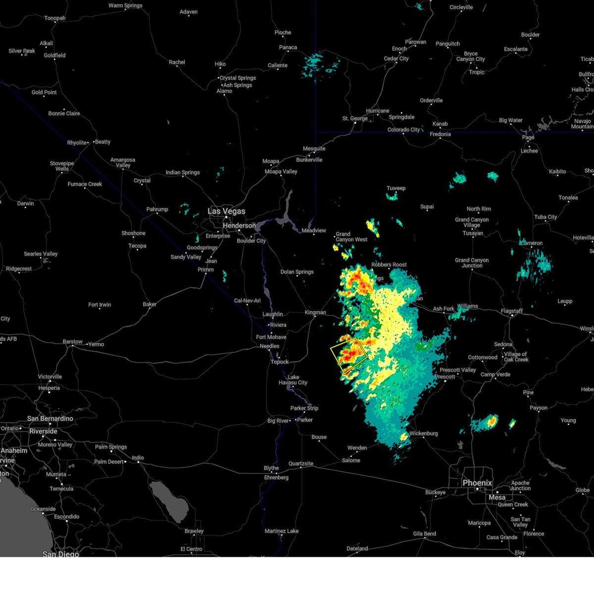
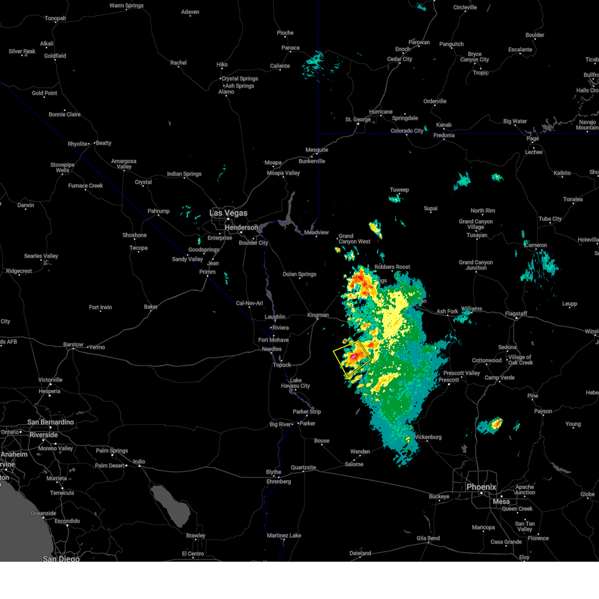
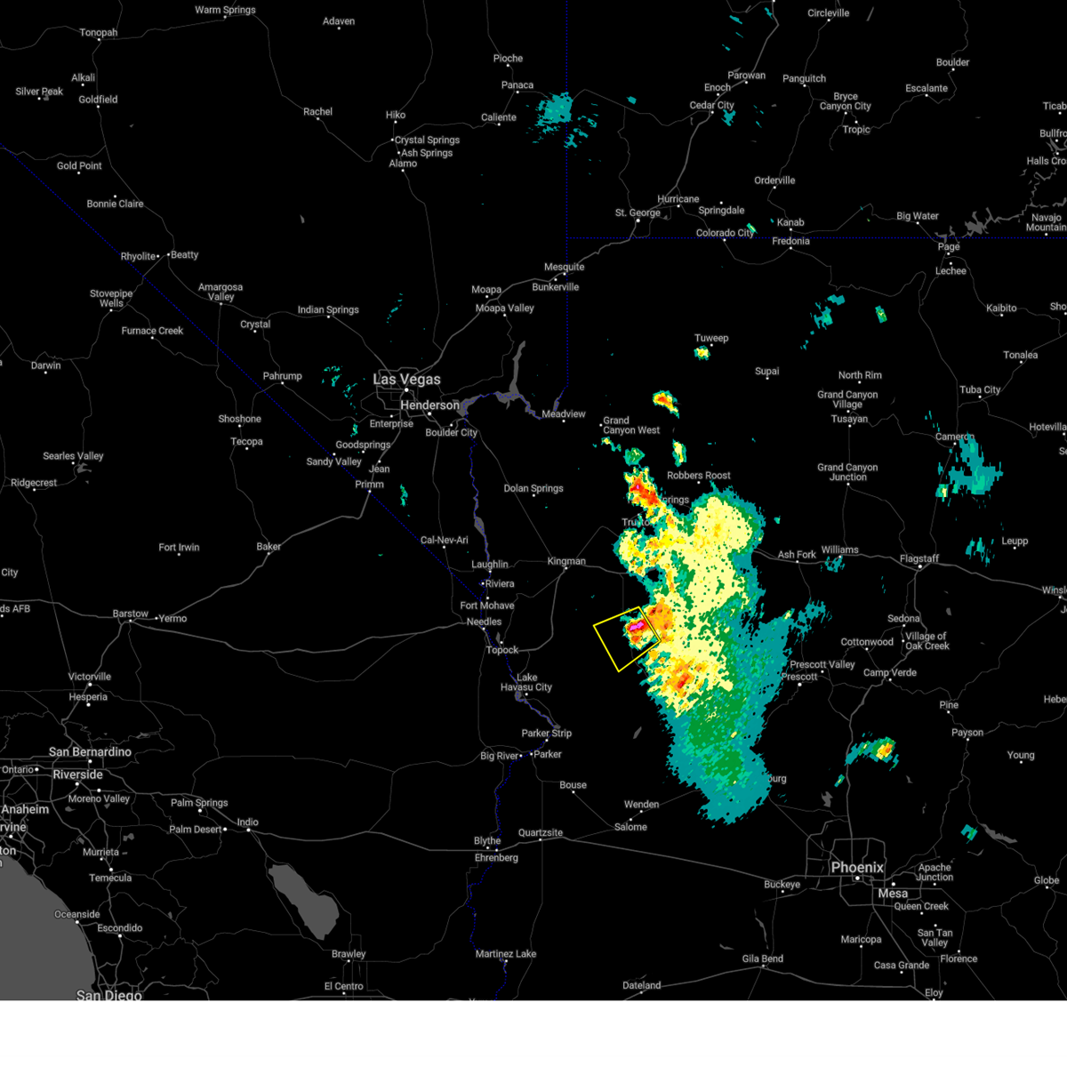
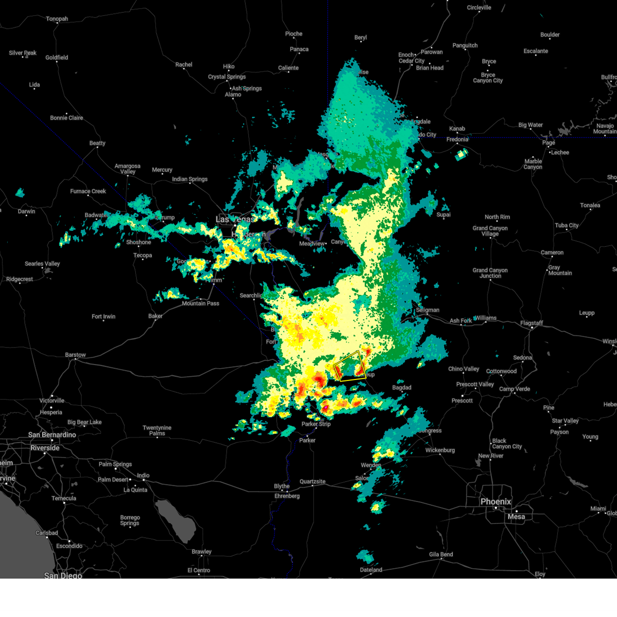
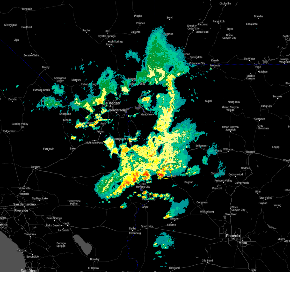
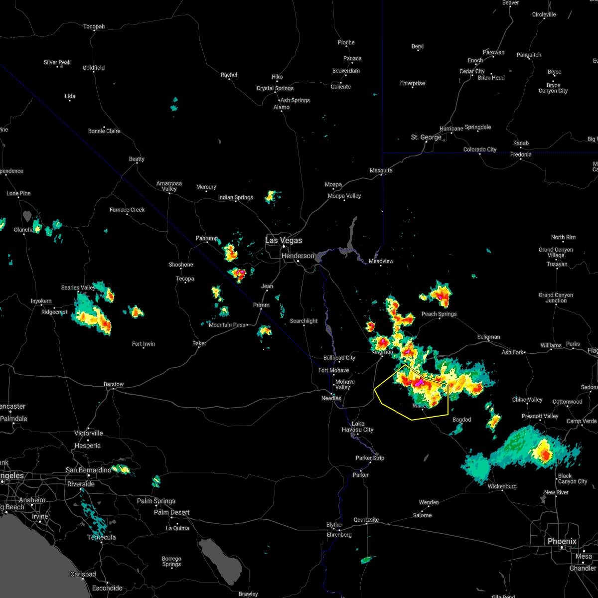
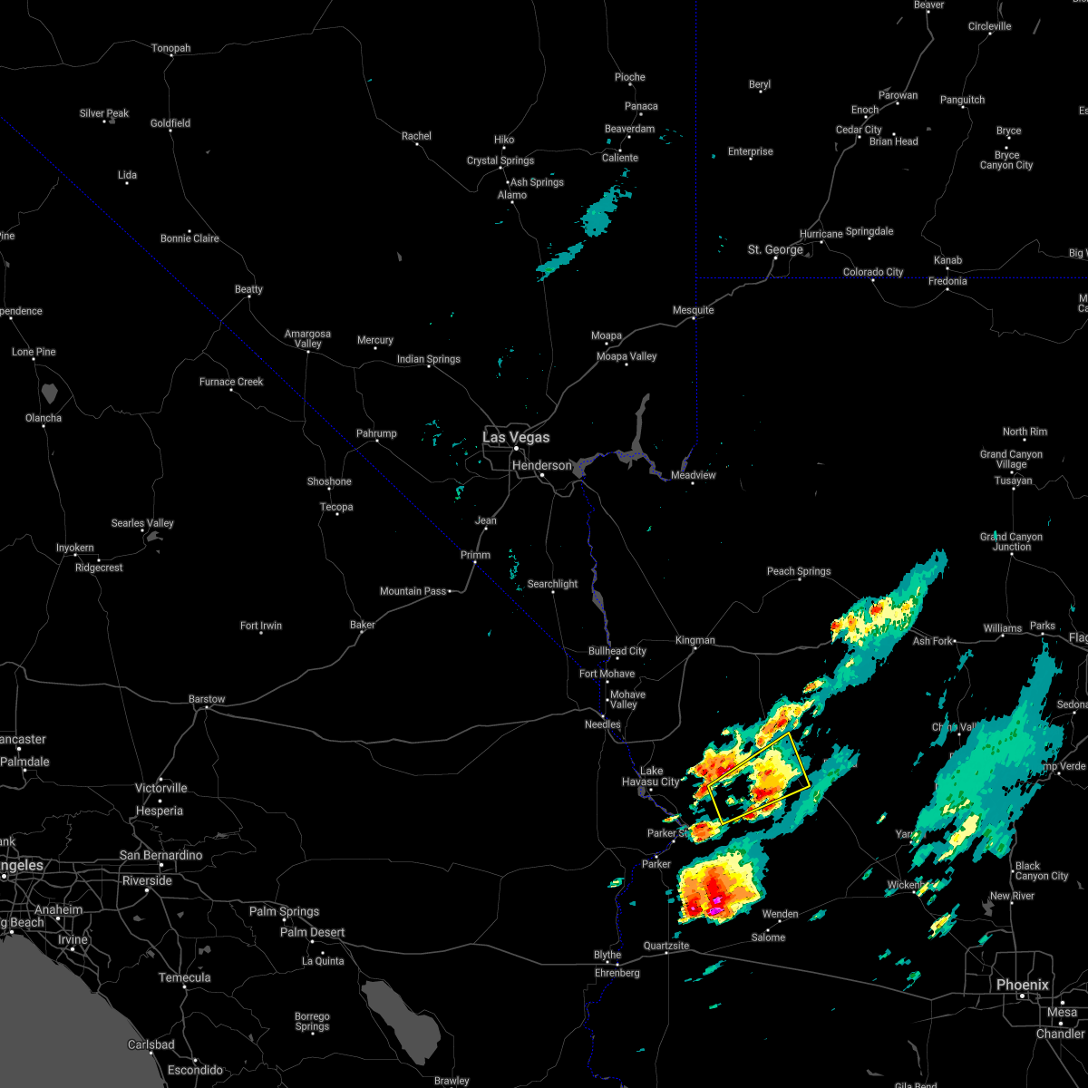
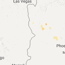
Hail Map for Wikieup, AZ
The Wikieup, AZ area has had 1 report of on-the-ground hail by trained spotters, and has been under severe weather warnings 3 times during the past 12 months. Doppler radar has detected hail at or near Wikieup, AZ on 15 occasions, including 1 occasion during the past year.
| Name: | Wikieup, AZ |
| Where Located: | 45.4 miles ENE of Lake Havasu City, AZ |
| Map: | Google Map for Wikieup, AZ |
| Population: | 133 |
| Housing Units: | 103 |
| More Info: | Search Google for Wikieup, AZ |
0
The Top Recent Hail Date for Wikieup, AZ is Tuesday, August 6, 2024 (15th out of 15)

Hail and Wind Damage Spotted near Wikieup, AZ
| Date / Time | Report Details |
|---|---|
| 8/6/2024 6:44 PM MST |
 The storm which prompted the warning over highway 93 about 10 miles north of wikieup has weakened and no longer poses an immediate threat of damaging winds. therefore, the warning will be allowed to expire. however, heavy rain will continue to occur with this thunderstorm. The storm which prompted the warning over highway 93 about 10 miles north of wikieup has weakened and no longer poses an immediate threat of damaging winds. therefore, the warning will be allowed to expire. however, heavy rain will continue to occur with this thunderstorm.
|
| 8/6/2024 6:35 PM MST |
 At 633 pm mst, a severe thunderstorm was located 10 miles north of wikieup over highway 93, and was moving southwest at 5 mph. this storm was also producing very heavy rain (radar indicated). Hazards include 60 mph wind gusts. Expect damage to roofs and trees. locations impacted include, wikieup. This includes highway 93 in mohave county between mile markers 108 and 125. At 633 pm mst, a severe thunderstorm was located 10 miles north of wikieup over highway 93, and was moving southwest at 5 mph. this storm was also producing very heavy rain (radar indicated). Hazards include 60 mph wind gusts. Expect damage to roofs and trees. locations impacted include, wikieup. This includes highway 93 in mohave county between mile markers 108 and 125.
|
| 8/6/2024 6:21 PM MST |
 Svrvef the national weather service in las vegas has issued a * severe thunderstorm warning for, south central mohave county in northwestern arizona, * until 645 pm mst. * at 621 pm mst, a severe thunderstorm was located 10 miles north of wikieup, moving southwest at 10 mph (radar indicated). Hazards include 60 mph wind gusts. expect damage to roofs and trees Svrvef the national weather service in las vegas has issued a * severe thunderstorm warning for, south central mohave county in northwestern arizona, * until 645 pm mst. * at 621 pm mst, a severe thunderstorm was located 10 miles north of wikieup, moving southwest at 10 mph (radar indicated). Hazards include 60 mph wind gusts. expect damage to roofs and trees
|
| 7/17/2024 4:20 PM MST | Goodwin mesa mesonet sensor measured a gust of 64 mph from the direction of a nearby thunderstorm. humidity increased 20% and temperature dropped nearly 20 degree in mohave county AZ, 15.7 miles WSW of Wikieup, AZ |
| 7/10/2024 3:20 PM MST | Mesonet station qgda3 goodwin mesa (14 nw bagdad). thunderstorm outflow wind accompanied by 11 degree temperature dro in mohave county AZ, 15.7 miles WSW of Wikieup, AZ |
| 3/15/2023 6:27 PM MST |
 The severe thunderstorm warning for south central mohave county will expire at 630 pm mst, the storm which prompted the warning has weakened below severe limits, and no longer poses an immediate threat to life or property. therefore, the warning will be allowed to expire. however heavy rain is still possible with this thunderstorm. The severe thunderstorm warning for south central mohave county will expire at 630 pm mst, the storm which prompted the warning has weakened below severe limits, and no longer poses an immediate threat to life or property. therefore, the warning will be allowed to expire. however heavy rain is still possible with this thunderstorm.
|
| 3/15/2023 5:57 PM MST |
 At 557 pm mst, a severe thunderstorm was located 15 miles west of wikieup, moving east at 25 mph (radar indicated). Hazards include 60 mph wind gusts and quarter size hail. Hail damage to vehicles is expected. expect wind damage to roofs and trees. this severe thunderstorm will remain over mainly rural areas of south central mohave county. hail threat, radar indicated max hail size, 1. 00 in wind threat, radar indicated max wind gust, 60 mph. At 557 pm mst, a severe thunderstorm was located 15 miles west of wikieup, moving east at 25 mph (radar indicated). Hazards include 60 mph wind gusts and quarter size hail. Hail damage to vehicles is expected. expect wind damage to roofs and trees. this severe thunderstorm will remain over mainly rural areas of south central mohave county. hail threat, radar indicated max hail size, 1. 00 in wind threat, radar indicated max wind gust, 60 mph.
|
| 3/15/2023 5:43 PM MST |
 At 542 pm mst, a severe thunderstorm was located over alamo road 11 miles southeast of yucca, moving east at 20 mph (radar indicated). Hazards include 60 mph wind gusts and quarter size hail. Hail damage to vehicles is expected. expect wind damage to roofs and trees. this severe thunderstorm will remain over mainly rural areas of south central mohave county. hail threat, radar indicated max hail size, 1. 00 in wind threat, radar indicated max wind gust, 60 mph. At 542 pm mst, a severe thunderstorm was located over alamo road 11 miles southeast of yucca, moving east at 20 mph (radar indicated). Hazards include 60 mph wind gusts and quarter size hail. Hail damage to vehicles is expected. expect wind damage to roofs and trees. this severe thunderstorm will remain over mainly rural areas of south central mohave county. hail threat, radar indicated max hail size, 1. 00 in wind threat, radar indicated max wind gust, 60 mph.
|
| 8/21/2022 9:39 PM MST | At 939 pm mst, a severe thunderstorm was located 7 miles south of kingman, moving south at 25 mph. numerous reports of dime sized hail have been recieved near golden valley and kingman, with hail of quarter sized or larger possible (radar indicated). Hazards include 60 mph wind gusts and quarter size hail. Hail damage to vehicles is expected. expect wind damage to roofs and trees. locations impacted include, bullhead city, kingman, laughlin, yucca, katherine landing, wild cow campground, oatman, blake ranch road, golden valley, mesquite creek, dw ranch road, new kingman-butler, hualapai mountain park, mohave valley and hualapai peak. this includes interstate 40 in arizona between mile markers 15 and 74. hail threat, radar indicated max hail size, 1. 00 in wind threat, radar indicated max wind gust, 60 mph. |
| 8/21/2022 9:10 PM MST | At 909 pm mst, a severe thunderstorm was located near new kingman-butler, or near kingman, moving south at 25 mph (radar indicated). Hazards include 60 mph wind gusts and quarter size hail. Hail damage to vehicles is expected. Expect wind damage to roofs and trees. |
| 10/5/2021 10:30 AM MST | Reports of severe thunderstorm related wind damage just north of wikieup. multiple heavy duty command tents knocked down as well as every porta potty on sit in mohave county AZ, 11.8 miles S of Wikieup, AZ |
| 8/18/2020 4:23 PM MST |
 The national weather service in las vegas has issued a * severe thunderstorm warning for. south central mohave county in northwestern arizona. until 515 pm mst. At 422 pm mst, severe thunderstorms were located along a line extending from near wild cow campground to 15 miles southeast of. The national weather service in las vegas has issued a * severe thunderstorm warning for. south central mohave county in northwestern arizona. until 515 pm mst. At 422 pm mst, severe thunderstorms were located along a line extending from near wild cow campground to 15 miles southeast of.
|
| 9/23/2019 10:12 AM MST |
 The severe thunderstorm warning for south central mohave county will expire at 1015 am mst, the storm south of wikieup had weakened, and no longer posed an immediate threat to life or property. therefore, the warning will be allowed to expire. heavy rain may still affect highway 93 south of wikieup between 1030 am and 1130 am mst. a severe thunderstorm watch remains in effect until 800 pm mst for northwestern arizona. The severe thunderstorm warning for south central mohave county will expire at 1015 am mst, the storm south of wikieup had weakened, and no longer posed an immediate threat to life or property. therefore, the warning will be allowed to expire. heavy rain may still affect highway 93 south of wikieup between 1030 am and 1130 am mst. a severe thunderstorm watch remains in effect until 800 pm mst for northwestern arizona.
|
| 9/23/2019 9:54 AM MST |
 At 953 am mst, a severe thunderstorm was located 16 miles northwest of alamo lake, moving east at 20 mph. the northern portion of this storm had weakened, and was producing rain over chicken springs road between yucca and wikieup. the southern portion had intensified, and was likely producing large hail over open desert south of chicken springs road (radar indicated). Hazards include 60 mph wind gusts and quarter size hail. Hail damage to vehicles is expected. expect wind damage to roofs and trees. Locations impacted include, wikieup and burro creek campground. At 953 am mst, a severe thunderstorm was located 16 miles northwest of alamo lake, moving east at 20 mph. the northern portion of this storm had weakened, and was producing rain over chicken springs road between yucca and wikieup. the southern portion had intensified, and was likely producing large hail over open desert south of chicken springs road (radar indicated). Hazards include 60 mph wind gusts and quarter size hail. Hail damage to vehicles is expected. expect wind damage to roofs and trees. Locations impacted include, wikieup and burro creek campground.
|
| 9/23/2019 9:32 AM MST |
 At 931 am mst, a severe thunderstorm was located 19 miles southwest of wikieup, moving northeast at 25 mph (radar indicated). Hazards include 60 mph wind gusts and quarter size hail. Hail damage to vehicles is expected. Expect wind damage to roofs and trees. At 931 am mst, a severe thunderstorm was located 19 miles southwest of wikieup, moving northeast at 25 mph (radar indicated). Hazards include 60 mph wind gusts and quarter size hail. Hail damage to vehicles is expected. Expect wind damage to roofs and trees.
|
| 8/10/2018 9:07 PM MST |
 The severe thunderstorm warning for south central mohave county will expire at 915 pm mst, the storms which prompted the warning have weakened below severe limits, and no longer pose an immediate threat to life or property. therefore, the warning will be allowed to expire. however gusty winds are still possible with these thunderstorms. The severe thunderstorm warning for south central mohave county will expire at 915 pm mst, the storms which prompted the warning have weakened below severe limits, and no longer pose an immediate threat to life or property. therefore, the warning will be allowed to expire. however gusty winds are still possible with these thunderstorms.
|
| 8/10/2018 8:24 PM MST |
 At 821 pm mst, severe thunderstorms were located along a line extending from 13 miles west of seligman to 7 miles southeast of diamond m ranch to 28 miles southeast of blake ranch road to 22 miles northeast of wikieup, moving west at 15 mph (radar indicated). Hazards include 60 mph wind gusts. expect damage to roofs and trees At 821 pm mst, severe thunderstorms were located along a line extending from 13 miles west of seligman to 7 miles southeast of diamond m ranch to 28 miles southeast of blake ranch road to 22 miles northeast of wikieup, moving west at 15 mph (radar indicated). Hazards include 60 mph wind gusts. expect damage to roofs and trees
|
| 7/30/2018 4:22 PM MST |
 The severe thunderstorm warning for south central mohave county will expire at 430 pm mst, the storm which prompted the warning has moved out of the area. therefore, the warning will be allowed to expire. however gusty winds are still possible with this thunderstorm. The severe thunderstorm warning for south central mohave county will expire at 430 pm mst, the storm which prompted the warning has moved out of the area. therefore, the warning will be allowed to expire. however gusty winds are still possible with this thunderstorm.
|
| 7/30/2018 4:03 PM MST |
 At 402 pm mst, a severe thunderstorm was located 11 miles northwest of wikieup, moving southwest at 15 mph (radar indicated). Hazards include 60 mph wind gusts. Expect damage to roofs and trees. Locations impacted include, wikieup and highway 93 between wikieup and interstate 40. At 402 pm mst, a severe thunderstorm was located 11 miles northwest of wikieup, moving southwest at 15 mph (radar indicated). Hazards include 60 mph wind gusts. Expect damage to roofs and trees. Locations impacted include, wikieup and highway 93 between wikieup and interstate 40.
|
| 7/30/2018 3:36 PM MST |
 At 335 pm mst, a severe thunderstorm was located 15 miles north of wikieup, moving southwest at 15 mph (radar indicated). Hazards include 60 mph wind gusts. expect damage to roofs and trees At 335 pm mst, a severe thunderstorm was located 15 miles north of wikieup, moving southwest at 15 mph (radar indicated). Hazards include 60 mph wind gusts. expect damage to roofs and trees
|
| 8/2/2017 7:07 PM MST |
 The severe thunderstorm warning for south central mohave county will expire at 715 pm mst, the storm near wikieup which prompted the warning has weakened below severe limits, and no longer poses an immediate threat to life or property. therefore the warning will be allowed to expire. there will still be some heavy rain and gusty winds in the area for a while. The severe thunderstorm warning for south central mohave county will expire at 715 pm mst, the storm near wikieup which prompted the warning has weakened below severe limits, and no longer poses an immediate threat to life or property. therefore the warning will be allowed to expire. there will still be some heavy rain and gusty winds in the area for a while.
|
| 8/2/2017 6:48 PM MST |
 At 647 pm mst, a severe thunderstorm was located over wikieup, moving northwest at 10 mph (radar indicated). Hazards include 60 mph wind gusts and quarter size hail. Hail damage to vehicles is expected. expect wind damage to roofs, siding, and trees. Locations impacted include, wikieup and burro creek campground. At 647 pm mst, a severe thunderstorm was located over wikieup, moving northwest at 10 mph (radar indicated). Hazards include 60 mph wind gusts and quarter size hail. Hail damage to vehicles is expected. expect wind damage to roofs, siding, and trees. Locations impacted include, wikieup and burro creek campground.
|
| 8/2/2017 6:31 PM MST |
 At 631 pm mst, a severe thunderstorm was located near wikieup, moving northwest at 10 mph (radar indicated). Hazards include 60 mph wind gusts and quarter size hail. Hail damage to vehicles is expected. Expect wind damage to roofs, siding, and trees. At 631 pm mst, a severe thunderstorm was located near wikieup, moving northwest at 10 mph (radar indicated). Hazards include 60 mph wind gusts and quarter size hail. Hail damage to vehicles is expected. Expect wind damage to roofs, siding, and trees.
|
| 7/30/2016 12:36 AM MST |
 At 1232 am pdt/1232 am mst/, trained spotters reported thunderstorm wind gusts creating blowing dust reducing visibility to one-quarter mile across southern mohave and southeast san bernardino counties. wind gusts to 60 mph are possible with this storm. the gust front was moving northwest at 35 mph across southeast san bernardino county. locations impacted include, lake havasu city, wikieup, alamo lake, highway 95 at mile marker 29, parker dam, three dunes campground, earp, cattail cove state park, desert hills, burro creek campground, vidal junction, black meadow landing campground and big river. At 1232 am pdt/1232 am mst/, trained spotters reported thunderstorm wind gusts creating blowing dust reducing visibility to one-quarter mile across southern mohave and southeast san bernardino counties. wind gusts to 60 mph are possible with this storm. the gust front was moving northwest at 35 mph across southeast san bernardino county. locations impacted include, lake havasu city, wikieup, alamo lake, highway 95 at mile marker 29, parker dam, three dunes campground, earp, cattail cove state park, desert hills, burro creek campground, vidal junction, black meadow landing campground and big river.
|
| 7/29/2016 11:41 PM MST |
 The national weather service in las vegas has issued a * severe thunderstorm warning for. southwestern mohave county in northwestern arizona. southeastern san bernardino county in southern california. until 115 am pdt/115 am mst/ * at 1139 pm pdt/1139 pm mst/. Doppler radar indicated severe. The national weather service in las vegas has issued a * severe thunderstorm warning for. southwestern mohave county in northwestern arizona. southeastern san bernardino county in southern california. until 115 am pdt/115 am mst/ * at 1139 pm pdt/1139 pm mst/. Doppler radar indicated severe.
|
| 7/29/2016 11:41 PM MST |
 At 1139 pm pdt/1139 pm mst/, doppler radar indicated severe thunderstorm capable of producing damaging winds in excess of 60 mph as well as blowing dust with visibility briefly below one quarter mile. the storms are located just east of lake havasu city moving northwest at 35 mph. At 1139 pm pdt/1139 pm mst/, doppler radar indicated severe thunderstorm capable of producing damaging winds in excess of 60 mph as well as blowing dust with visibility briefly below one quarter mile. the storms are located just east of lake havasu city moving northwest at 35 mph.
|
| 7/2/2016 12:19 AM MST |
 At 1218 am mst, doppler radar indicated a severe thunderstorm capable of producing quarter size hail and damaging winds in excess of 60 mph. this storm was located over wikieup, and moving west at 10 mph. At 1218 am mst, doppler radar indicated a severe thunderstorm capable of producing quarter size hail and damaging winds in excess of 60 mph. this storm was located over wikieup, and moving west at 10 mph.
|
| 10/20/2015 7:42 AM MST | The severe thunderstorm warning for south central mohave county will expire at 745 am mst, the storm which prompted the warning has weakened, and no longer poses an immediate threat to life or property. therefore the warning will be allowed to expire. heavy rain, small hail, and gusty winds are still possible with this thunderstorm, especially along highway 93 south of wikieup. |
| 10/20/2015 7:22 AM MST |
 At 721 am mst, doppler radar indicated a severe thunderstorm capable of producing quarter size hail and damaging winds in excess of 60 mph. this storm was located near burro creek campground, or 10 miles southeast of wikieup, and moving northwest at 20 mph. At 721 am mst, doppler radar indicated a severe thunderstorm capable of producing quarter size hail and damaging winds in excess of 60 mph. this storm was located near burro creek campground, or 10 miles southeast of wikieup, and moving northwest at 20 mph.
|
| 10/20/2015 12:09 AM MST |
 The severe thunderstorm warning for south central mohave county will expire at 1215 am mst, the storms which prompted the warning have weakened a little, and no longer pose an immediate threat to life or property. therefore the warning will be allowed to expire. however small hail is still possible with these thunderstorms. The severe thunderstorm warning for south central mohave county will expire at 1215 am mst, the storms which prompted the warning have weakened a little, and no longer pose an immediate threat to life or property. therefore the warning will be allowed to expire. however small hail is still possible with these thunderstorms.
|
| 10/19/2015 11:48 PM MST |
 At 1147 pm mst, doppler radar indicated a line of severe thunderstorms capable of producing quarter size hail and damaging winds in excess of 60 mph. these storms were located along a line extending from 16 miles southwest of cross mountain to near burro creek campground, moving north at 40 mph. locations impacted include, wikieup and burro creek campground and highway 93 and interstate 40. this includes interstate 40 in arizona between mile markers 71 and 93. At 1147 pm mst, doppler radar indicated a line of severe thunderstorms capable of producing quarter size hail and damaging winds in excess of 60 mph. these storms were located along a line extending from 16 miles southwest of cross mountain to near burro creek campground, moving north at 40 mph. locations impacted include, wikieup and burro creek campground and highway 93 and interstate 40. this includes interstate 40 in arizona between mile markers 71 and 93.
|
| 10/19/2015 11:20 PM MST |
 At 1118 pm mst, doppler radar indicated a line of severe thunderstorms capable of producing quarter size hail and damaging winds in excess of 60 mph. these storms were located along a line extending from 12 miles northwest of bagdad to 6 miles southwest of milepost 160 on hwy 93, and moving north at 20 mph. At 1118 pm mst, doppler radar indicated a line of severe thunderstorms capable of producing quarter size hail and damaging winds in excess of 60 mph. these storms were located along a line extending from 12 miles northwest of bagdad to 6 miles southwest of milepost 160 on hwy 93, and moving north at 20 mph.
|
| 6/29/2015 7:26 PM MST |
 At 725 pm mst, doppler radar indicated a severe thunderstorm capable of producing damaging winds in excess of 60 mph. this storm was located near wikieup, moving southwest at 15 mph. locations impacted include, wikieup and highway 93. At 725 pm mst, doppler radar indicated a severe thunderstorm capable of producing damaging winds in excess of 60 mph. this storm was located near wikieup, moving southwest at 15 mph. locations impacted include, wikieup and highway 93.
|
| 6/29/2015 7:04 PM MST |
 At 703 pm mst, doppler radar indicated a severe thunderstorm capable of producing damaging winds in excess of 60 mph. this storm was located 7 miles northeast of wikieup, and moving southwest at 15 mph. At 703 pm mst, doppler radar indicated a severe thunderstorm capable of producing damaging winds in excess of 60 mph. this storm was located 7 miles northeast of wikieup, and moving southwest at 15 mph.
|
| 8/26/2014 12:15 PM MST | A trained spotter driving along highway 93 southeast of wikieup estimated a 65 mph gust from a thunderstorm. he had to pull over and stop because his car was being blow in mohave county AZ, 8.1 miles NNW of Wikieup, AZ |
| 8/20/2012 3:50 PM MST | Thunderstorm winds of 70 mph lasted for 5 minutes in wikieup. winds caused a pergola to tip ove in mohave county AZ, 1.3 miles E of Wikieup, AZ |
| 9/11/2011 9:05 PM MST | Quarter sized hail reported 1.3 miles E of Wikieup, AZ, a spotter estimated dime to quarter size hail along highway 93 near wikieup. |
Hail Maps for Wikieup, AZ


Connect with Interactive Hail Maps