

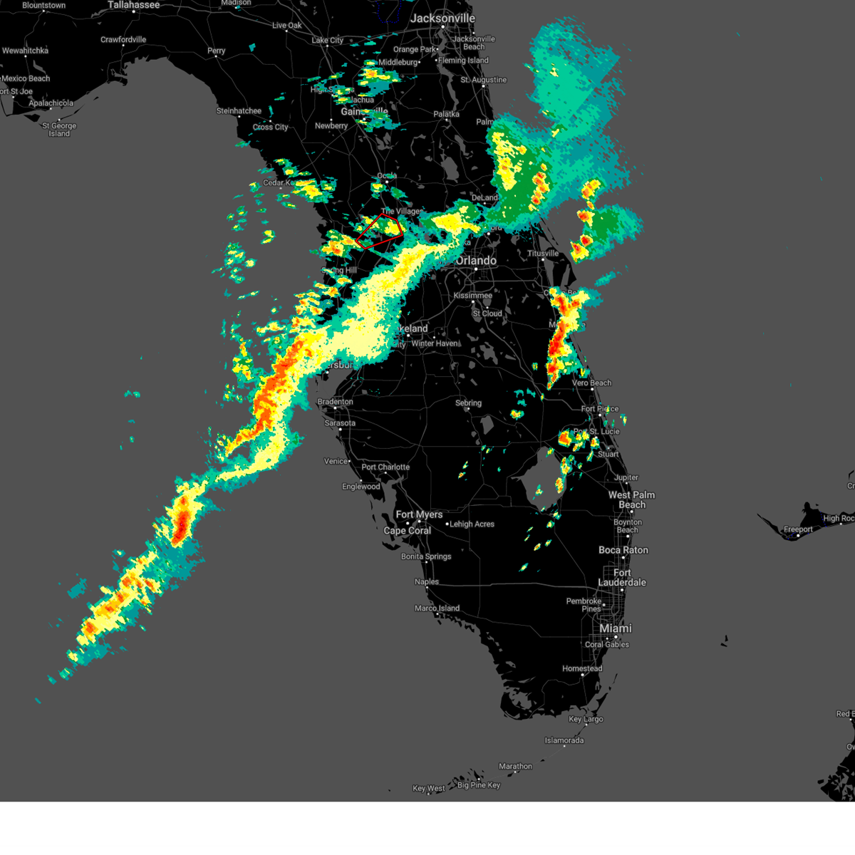
Hail Map for Wildwood, FL
The Wildwood, FL area has had 1 report of on-the-ground hail by trained spotters, and has been under severe weather warnings 11 times during the past 12 months. Doppler radar has detected hail at or near Wildwood, FL on 100 occasions, including 3 occasions during the past year.
| Name: | Wildwood, FL |
| Where Located: | 44.7 miles WNW of Orlando, FL |
| Map: | Google Map for Wildwood, FL |
| Population: | 6709 |
| Housing Units: | 4464 |
| More Info: | Search Google for Wildwood, FL |
1
The Top Recent Hail Date for Wildwood, FL is Friday, August 2, 2024 (17th out of 100)

Hail and Wind Damage Spotted near Wildwood, FL
| Date / Time | Report Details |
|---|---|
| 3/16/2025 5:10 PM EDT |
 the tornado warning has been cancelled and is no longer in effect the tornado warning has been cancelled and is no longer in effect
|
| 3/16/2025 4:58 PM EDT |
 Tortbw the national weather service in ruskin has issued a * tornado warning for, southeastern citrus county in west central florida, northern sumter county in central florida, * until 530 pm edt. * at 457 pm edt, a severe thunderstorm capable of producing a tornado was located near inverness highlands south, or 7 miles south of inverness, moving northeast at 25 mph (radar indicated rotation). Hazards include tornado. Flying debris will be dangerous to those caught without shelter. mobile homes will be damaged or destroyed. damage to roofs, windows, and vehicles will occur. tree damage is likely. this dangerous storm will be near, inverness airport, inverness, and inverness highlands south around 500 pm edt. Other locations impacted by this tornadic thunderstorm include heatherwood, inverness highlands, floral city, rutland, lake panasoffkee, coleman, adamsville, and withlapopka isle. Tortbw the national weather service in ruskin has issued a * tornado warning for, southeastern citrus county in west central florida, northern sumter county in central florida, * until 530 pm edt. * at 457 pm edt, a severe thunderstorm capable of producing a tornado was located near inverness highlands south, or 7 miles south of inverness, moving northeast at 25 mph (radar indicated rotation). Hazards include tornado. Flying debris will be dangerous to those caught without shelter. mobile homes will be damaged or destroyed. damage to roofs, windows, and vehicles will occur. tree damage is likely. this dangerous storm will be near, inverness airport, inverness, and inverness highlands south around 500 pm edt. Other locations impacted by this tornadic thunderstorm include heatherwood, inverness highlands, floral city, rutland, lake panasoffkee, coleman, adamsville, and withlapopka isle.
|
| 1/19/2025 8:26 AM EST |
 The storms which prompted the warning have weakened below severe limits, and no longer pose an immediate threat to life or property. therefore, the warning will be allowed to expire. however, gusty winds are still possible with these thunderstorms. The storms which prompted the warning have weakened below severe limits, and no longer pose an immediate threat to life or property. therefore, the warning will be allowed to expire. however, gusty winds are still possible with these thunderstorms.
|
| 1/19/2025 8:00 AM EST |
 At 800 am est, severe thunderstorms were located along a line extending from 6 miles southwest of rainbow lakes estates to black diamond to 13 miles northwest of pine island, moving east at 40 mph (radar indicated). Hazards include 60 mph wind gusts. Expect damage to roofs, siding, and trees. Locations impacted include, hernando, sugarmill woods, inverness, wildwood, lake panasoffkee, arbor lakes, lecanto, homosassa springs, leisure acres, and inverness highlands. At 800 am est, severe thunderstorms were located along a line extending from 6 miles southwest of rainbow lakes estates to black diamond to 13 miles northwest of pine island, moving east at 40 mph (radar indicated). Hazards include 60 mph wind gusts. Expect damage to roofs, siding, and trees. Locations impacted include, hernando, sugarmill woods, inverness, wildwood, lake panasoffkee, arbor lakes, lecanto, homosassa springs, leisure acres, and inverness highlands.
|
| 1/19/2025 7:38 AM EST |
 Svrtbw the national weather service in ruskin has issued a * severe thunderstorm warning for, citrus county in west central florida, northwestern sumter county in central florida, * until 830 am est. * at 738 am est, severe thunderstorms were located along a line extending from 14 miles northwest of crystal river airport to 11 miles west of homosassa to 28 miles west of pine island, moving east at 50 mph (radar indicated). Hazards include 60 mph wind gusts. expect damage to roofs, siding, and trees Svrtbw the national weather service in ruskin has issued a * severe thunderstorm warning for, citrus county in west central florida, northwestern sumter county in central florida, * until 830 am est. * at 738 am est, severe thunderstorms were located along a line extending from 14 miles northwest of crystal river airport to 11 miles west of homosassa to 28 miles west of pine island, moving east at 50 mph (radar indicated). Hazards include 60 mph wind gusts. expect damage to roofs, siding, and trees
|
| 8/4/2024 1:13 PM EDT |
 The storm which prompted the warning has weakened below severe limits, and no longer poses an immediate threat to life or property. therefore, the warning will be allowed to expire. however gusty winds are still possible with this thunderstorm. a tornado watch remains in effect until 800 pm edt for east central florida. remember, a tornado warning still remains in effect until 8 pm. The storm which prompted the warning has weakened below severe limits, and no longer poses an immediate threat to life or property. therefore, the warning will be allowed to expire. however gusty winds are still possible with this thunderstorm. a tornado watch remains in effect until 800 pm edt for east central florida. remember, a tornado warning still remains in effect until 8 pm.
|
| 8/4/2024 1:02 PM EDT |
 At 101 pm edt, a severe thunderstorm was located over eustis, moving northwest at 45 mph (radar indicated). Hazards include 60 mph wind gusts. Expect damage to roofs, siding, and trees. Locations impacted include, leesburg, eustis, tavares, lady lake, and mount dora. At 101 pm edt, a severe thunderstorm was located over eustis, moving northwest at 45 mph (radar indicated). Hazards include 60 mph wind gusts. Expect damage to roofs, siding, and trees. Locations impacted include, leesburg, eustis, tavares, lady lake, and mount dora.
|
| 8/4/2024 1:02 PM EDT |
 the severe thunderstorm warning has been cancelled and is no longer in effect the severe thunderstorm warning has been cancelled and is no longer in effect
|
| 8/4/2024 12:45 PM EDT |
 Svrmlb the national weather service in melbourne has issued a * severe thunderstorm warning for, west central seminole county in east central florida, central lake county in east central florida, northwestern orange county in east central florida, * until 115 pm edt. * at 1245 pm edt, a severe thunderstorm was located over zellwood, moving northwest at 40 mph (radar indicated). Hazards include 60 mph wind gusts. expect damage to roofs, siding, and trees Svrmlb the national weather service in melbourne has issued a * severe thunderstorm warning for, west central seminole county in east central florida, central lake county in east central florida, northwestern orange county in east central florida, * until 115 pm edt. * at 1245 pm edt, a severe thunderstorm was located over zellwood, moving northwest at 40 mph (radar indicated). Hazards include 60 mph wind gusts. expect damage to roofs, siding, and trees
|
| 8/2/2024 6:45 PM EDT |
 the severe thunderstorm warning has been cancelled and is no longer in effect the severe thunderstorm warning has been cancelled and is no longer in effect
|
| 8/2/2024 6:30 PM EDT |
 Svrtbw the national weather service in ruskin has issued a * severe thunderstorm warning for, northeastern sumter county in central florida, * until 700 pm edt. * at 630 pm edt, a severe thunderstorm was located over wildwood, moving west at 10 mph (radar indicated). Hazards include 60 mph wind gusts and nickel size hail. expect damage to roofs, siding, and trees Svrtbw the national weather service in ruskin has issued a * severe thunderstorm warning for, northeastern sumter county in central florida, * until 700 pm edt. * at 630 pm edt, a severe thunderstorm was located over wildwood, moving west at 10 mph (radar indicated). Hazards include 60 mph wind gusts and nickel size hail. expect damage to roofs, siding, and trees
|
| 7/16/2024 2:41 PM EDT |
 the severe thunderstorm warning has been cancelled and is no longer in effect the severe thunderstorm warning has been cancelled and is no longer in effect
|
| 7/16/2024 2:21 PM EDT |
 Svrmlb the national weather service in melbourne has issued a * severe thunderstorm warning for, west central lake county in east central florida, * until 300 pm edt. * at 220 pm edt, a severe thunderstorm was located near leesburg, and is nearly stationary (radar indicated). Hazards include 60 mph wind gusts and quarter size hail. Hail damage to vehicles is expected. Expect wind damage to roofs, siding, and trees. Svrmlb the national weather service in melbourne has issued a * severe thunderstorm warning for, west central lake county in east central florida, * until 300 pm edt. * at 220 pm edt, a severe thunderstorm was located near leesburg, and is nearly stationary (radar indicated). Hazards include 60 mph wind gusts and quarter size hail. Hail damage to vehicles is expected. Expect wind damage to roofs, siding, and trees.
|
| 5/15/2024 4:21 AM EDT |
 Svrtbw the national weather service in ruskin has issued a * severe thunderstorm warning for, northeastern sumter county in central florida, * until 445 am edt. * at 421 am edt, a severe thunderstorm was located over wildwood, moving east at 25 mph (radar indicated). Hazards include 60 mph wind gusts. expect damage to roofs, siding, and trees Svrtbw the national weather service in ruskin has issued a * severe thunderstorm warning for, northeastern sumter county in central florida, * until 445 am edt. * at 421 am edt, a severe thunderstorm was located over wildwood, moving east at 25 mph (radar indicated). Hazards include 60 mph wind gusts. expect damage to roofs, siding, and trees
|
| 4/11/2024 1:04 PM EDT |
 At 104 pm edt, severe thunderstorms were located along a line extending from 7 miles southwest of bushnell to near pebble creek to near fort desoto park, moving east at 45 mph (radar indicated). Hazards include 60 mph wind gusts. Expect damage to roofs, siding, and trees. locations impacted include, tampa, st. petersburg, bradenton, plant city, temple terrace, zephyrhills, palmetto, gulfport, st. Pete beach, and wildwood. At 104 pm edt, severe thunderstorms were located along a line extending from 7 miles southwest of bushnell to near pebble creek to near fort desoto park, moving east at 45 mph (radar indicated). Hazards include 60 mph wind gusts. Expect damage to roofs, siding, and trees. locations impacted include, tampa, st. petersburg, bradenton, plant city, temple terrace, zephyrhills, palmetto, gulfport, st. Pete beach, and wildwood.
|
| 4/11/2024 12:30 PM EDT |
 Svrtbw the national weather service in ruskin has issued a * severe thunderstorm warning for, southeastern citrus county in west central florida, sumter county in central florida, pasco county in west central florida, hernando county in west central florida, northwestern manatee county in west central florida, pinellas county in west central florida, northwestern polk county in central florida, hillsborough county in west central florida, * until 115 pm edt. * at 1229 pm edt, severe thunderstorms were located along a line extending from near spring hill to 6 miles southwest of citrus park to 17 miles west of anna maria, moving east at 45 mph (radar indicated). Hazards include 60 mph wind gusts. expect damage to roofs, siding, and trees Svrtbw the national weather service in ruskin has issued a * severe thunderstorm warning for, southeastern citrus county in west central florida, sumter county in central florida, pasco county in west central florida, hernando county in west central florida, northwestern manatee county in west central florida, pinellas county in west central florida, northwestern polk county in central florida, hillsborough county in west central florida, * until 115 pm edt. * at 1229 pm edt, severe thunderstorms were located along a line extending from near spring hill to 6 miles southwest of citrus park to 17 miles west of anna maria, moving east at 45 mph (radar indicated). Hazards include 60 mph wind gusts. expect damage to roofs, siding, and trees
|
| 4/11/2024 11:29 AM EDT |
 Svrtbw the national weather service in ruskin has issued a * severe thunderstorm warning for, citrus county in west central florida, northern sumter county in central florida, northern hernando county in west central florida, southeastern levy county in northern florida, * until noon edt. * at 1129 am edt, severe thunderstorms were located along a line extending from 7 miles northwest of crystal river airport to black diamond to near inverness highlands north, moving northeast at 50 mph (radar indicated). Hazards include 60 mph wind gusts. expect damage to roofs, siding, and trees Svrtbw the national weather service in ruskin has issued a * severe thunderstorm warning for, citrus county in west central florida, northern sumter county in central florida, northern hernando county in west central florida, southeastern levy county in northern florida, * until noon edt. * at 1129 am edt, severe thunderstorms were located along a line extending from 7 miles northwest of crystal river airport to black diamond to near inverness highlands north, moving northeast at 50 mph (radar indicated). Hazards include 60 mph wind gusts. expect damage to roofs, siding, and trees
|
| 4/3/2024 2:22 PM EDT | Sumter county em reports tree limbs and power lines near intersection of county roads 227 and 202 near oxfor in sumter county FL, 7.7 miles SSE of Wildwood, FL |
| 1/9/2024 5:07 PM EST |
 At 506 pm est, severe thunderstorms were located along a line extending from near pierson to mid florida lakes to 12 miles southwest of lake louisa, moving northeast at 70 mph (radar indicated). Hazards include 60 mph wind gusts. Expect damage to roofs, siding, and trees. Locations impacted include, apopka, ocoee, winter garden, leesburg, and eustis. At 506 pm est, severe thunderstorms were located along a line extending from near pierson to mid florida lakes to 12 miles southwest of lake louisa, moving northeast at 70 mph (radar indicated). Hazards include 60 mph wind gusts. Expect damage to roofs, siding, and trees. Locations impacted include, apopka, ocoee, winter garden, leesburg, and eustis.
|
| 1/9/2024 4:46 PM EST |
 At 446 pm est, severe thunderstorms were located along a line extending from lake george to near leesburg to 6 miles east of dade city, moving northeast at 65 mph (radar indicated). Hazards include 60 mph wind gusts. expect damage to roofs, siding, and trees At 446 pm est, severe thunderstorms were located along a line extending from lake george to near leesburg to 6 miles east of dade city, moving northeast at 65 mph (radar indicated). Hazards include 60 mph wind gusts. expect damage to roofs, siding, and trees
|
| 1/9/2024 4:13 PM EST |
 The severe thunderstorm warning for central citrus and northern sumter counties will expire at 415 pm est. the storm which prompted the warning has weakened below severe limits, and has exited the warned area. therefore, the warning will be allowed to expire. A tornado watch remains in effect until 900 pm est for central and. The severe thunderstorm warning for central citrus and northern sumter counties will expire at 415 pm est. the storm which prompted the warning has weakened below severe limits, and has exited the warned area. therefore, the warning will be allowed to expire. A tornado watch remains in effect until 900 pm est for central and.
|
| 1/9/2024 3:41 PM EST |
 At 340 pm est, a severe thunderstorm was located near black diamond, or near beverly hills, moving northeast at 45 mph (radar indicated). Hazards include 60 mph wind gusts. expect damage to roofs, siding, and trees At 340 pm est, a severe thunderstorm was located near black diamond, or near beverly hills, moving northeast at 45 mph (radar indicated). Hazards include 60 mph wind gusts. expect damage to roofs, siding, and trees
|
| 10/12/2023 4:01 AM EDT |
 At 401 am edt, a severe thunderstorm was located near bushnell, moving northeast at 40 mph (radar indicated). Hazards include 60 mph wind gusts. expect damage to roofs, siding, and trees At 401 am edt, a severe thunderstorm was located near bushnell, moving northeast at 40 mph (radar indicated). Hazards include 60 mph wind gusts. expect damage to roofs, siding, and trees
|
| 10/12/2023 3:12 AM EDT |
 At 312 am edt, a severe thunderstorm capable of producing a tornado was located near hill n dale, or 10 miles east of brooksville, moving northeast at 35 mph (radar indicated rotation). Hazards include tornado. Flying debris will be dangerous to those caught without shelter. mobile homes will be damaged or destroyed. damage to roofs, windows, and vehicles will occur. tree damage is likely. this dangerous storm will be near, bushnell around 315 am edt. Other locations impacted by this tornadic thunderstorm include webster, ridge manor, tarrytown, croom, center hill, sumterville, adamsville, and spring lake. At 312 am edt, a severe thunderstorm capable of producing a tornado was located near hill n dale, or 10 miles east of brooksville, moving northeast at 35 mph (radar indicated rotation). Hazards include tornado. Flying debris will be dangerous to those caught without shelter. mobile homes will be damaged or destroyed. damage to roofs, windows, and vehicles will occur. tree damage is likely. this dangerous storm will be near, bushnell around 315 am edt. Other locations impacted by this tornadic thunderstorm include webster, ridge manor, tarrytown, croom, center hill, sumterville, adamsville, and spring lake.
|
| 10/11/2023 4:16 PM EDT |
 At 416 pm edt, a severe thunderstorm capable of producing a tornado was located near bushnell, moving northeast at 15 mph (radar indicated rotation). Hazards include tornado. Flying debris will be dangerous to those caught without shelter. mobile homes will be damaged or destroyed. damage to roofs, windows, and vehicles will occur. tree damage is likely. this dangerous storm will be near, bushnell around 420 pm edt. Other locations impacted by this tornadic thunderstorm include wahoo, nobleton, sumterville, istachatta, lake panasoffkee, and floral city. At 416 pm edt, a severe thunderstorm capable of producing a tornado was located near bushnell, moving northeast at 15 mph (radar indicated rotation). Hazards include tornado. Flying debris will be dangerous to those caught without shelter. mobile homes will be damaged or destroyed. damage to roofs, windows, and vehicles will occur. tree damage is likely. this dangerous storm will be near, bushnell around 420 pm edt. Other locations impacted by this tornadic thunderstorm include wahoo, nobleton, sumterville, istachatta, lake panasoffkee, and floral city.
|
| 6/19/2023 7:51 PM EDT |
 At 751 pm edt, doppler radar indicated severe thunderstorms were located along a line extending from the lake county line west of leesburg to 7 miles west of mascotte, moving east at 30 mph (radar indicated). Hazards include 60 mph wind gusts. expect damage to roofs, siding, and trees At 751 pm edt, doppler radar indicated severe thunderstorms were located along a line extending from the lake county line west of leesburg to 7 miles west of mascotte, moving east at 30 mph (radar indicated). Hazards include 60 mph wind gusts. expect damage to roofs, siding, and trees
|
| 6/17/2023 10:59 AM EDT |
 At 1059 am edt, a severe thunderstorm was located 7 miles east of bushnell, moving southeast at 20 mph (radar indicated). Hazards include 60 mph wind gusts. expect damage to roofs, siding, and trees At 1059 am edt, a severe thunderstorm was located 7 miles east of bushnell, moving southeast at 20 mph (radar indicated). Hazards include 60 mph wind gusts. expect damage to roofs, siding, and trees
|
| 6/17/2023 10:46 AM EDT |
 At 1046 am edt, a severe thunderstorm was located 8 miles southwest of leesburg, moving southeast at 55 mph (radar indicated). Hazards include 60 mph wind gusts. expect damage to roofs, siding, and trees At 1046 am edt, a severe thunderstorm was located 8 miles southwest of leesburg, moving southeast at 55 mph (radar indicated). Hazards include 60 mph wind gusts. expect damage to roofs, siding, and trees
|
| 6/10/2023 4:17 PM EDT | Emergency management reports wind damage to a manufactured home in wildwood. radar data and nearby surface observations suggest wind speeds of around 40 mph. time estim in sumter county FL, 4 miles NNW of Wildwood, FL |
| 4/27/2023 9:20 PM EDT |
 At 920 pm edt, severe thunderstorms were located along a line extending from 6 miles south of inverness airport to near wesley chapel south, moving east at 40 mph (radar indicated). Hazards include 60 mph wind gusts. expect damage to roofs, siding, and trees At 920 pm edt, severe thunderstorms were located along a line extending from 6 miles south of inverness airport to near wesley chapel south, moving east at 40 mph (radar indicated). Hazards include 60 mph wind gusts. expect damage to roofs, siding, and trees
|
| 4/26/2023 10:40 PM EDT |
 The severe thunderstorm warning for northeastern sumter county will expire at 1045 pm edt, the storm which prompted the warning has weakened below severe limits, and no longer poses an immediate threat to life or property. therefore, the warning will be allowed to expire. however, small hail, gusty winds and heavy rain are still possible with this thunderstorm. The severe thunderstorm warning for northeastern sumter county will expire at 1045 pm edt, the storm which prompted the warning has weakened below severe limits, and no longer poses an immediate threat to life or property. therefore, the warning will be allowed to expire. however, small hail, gusty winds and heavy rain are still possible with this thunderstorm.
|
| 4/26/2023 10:04 PM EDT |
 At 1004 pm edt, a severe thunderstorm was located 7 miles west of lake weir, or 9 miles west of the villages, moving southeast at 15 mph (radar indicated). Hazards include 60 mph wind gusts and quarter size hail. Hail damage to vehicles is expected. Expect wind damage to roofs, siding, and trees. At 1004 pm edt, a severe thunderstorm was located 7 miles west of lake weir, or 9 miles west of the villages, moving southeast at 15 mph (radar indicated). Hazards include 60 mph wind gusts and quarter size hail. Hail damage to vehicles is expected. Expect wind damage to roofs, siding, and trees.
|
| 4/25/2023 4:56 PM EDT |
 The severe thunderstorm warning for central lake county will expire at 500 pm edt, the storm which prompted the warning has weakened below severe limits, and no longer poses an immediate threat to life or property. therefore, the warning will be allowed to expire. however small hail, gusty winds and heavy rain are still possible with this thunderstorm. The severe thunderstorm warning for central lake county will expire at 500 pm edt, the storm which prompted the warning has weakened below severe limits, and no longer poses an immediate threat to life or property. therefore, the warning will be allowed to expire. however small hail, gusty winds and heavy rain are still possible with this thunderstorm.
|
| 4/25/2023 4:30 PM EDT |
 At 430 pm edt, a severe thunderstorm was located over lake griffin, moving southeast at 25 mph (radar indicated). Hazards include 60 mph wind gusts and quarter size hail. Hail damage to vehicles is expected. Expect wind damage to roofs, siding, and trees. At 430 pm edt, a severe thunderstorm was located over lake griffin, moving southeast at 25 mph (radar indicated). Hazards include 60 mph wind gusts and quarter size hail. Hail damage to vehicles is expected. Expect wind damage to roofs, siding, and trees.
|
| 4/25/2023 4:09 PM EDT |
 At 409 pm edt, a severe thunderstorm was located 8 miles east of bushnell, moving southeast at 25 mph (radar indicated). Hazards include quarter size hail. damage to vehicles is expected At 409 pm edt, a severe thunderstorm was located 8 miles east of bushnell, moving southeast at 25 mph (radar indicated). Hazards include quarter size hail. damage to vehicles is expected
|
| 4/25/2023 4:05 PM EDT |
 At 404 pm edt, a severe thunderstorm was located over the village of briar meadow, or over the villages, moving southeast at 25 mph (radar indicated). Hazards include quarter size hail. Damage to vehicles is expected. this severe thunderstorm will remain over mainly rural areas of northeastern sumter county. hail threat, radar indicated max hail size, 1. 00 in wind threat, radar indicated max wind gust, <50 mph. At 404 pm edt, a severe thunderstorm was located over the village of briar meadow, or over the villages, moving southeast at 25 mph (radar indicated). Hazards include quarter size hail. Damage to vehicles is expected. this severe thunderstorm will remain over mainly rural areas of northeastern sumter county. hail threat, radar indicated max hail size, 1. 00 in wind threat, radar indicated max wind gust, <50 mph.
|
| 4/24/2023 5:17 PM EDT |
 At 517 pm edt, a severe thunderstorm was located near wildwood, moving east at 10 mph (radar indicated). Hazards include 60 mph wind gusts and quarter size hail. Hail damage to vehicles is expected. Expect wind damage to roofs, siding, and trees. At 517 pm edt, a severe thunderstorm was located near wildwood, moving east at 10 mph (radar indicated). Hazards include 60 mph wind gusts and quarter size hail. Hail damage to vehicles is expected. Expect wind damage to roofs, siding, and trees.
|
| 8/17/2022 3:39 PM EDT |
 At 339 pm edt, a severe thunderstorm was located near wildwood, moving south at 15 mph (radar indicated). Hazards include 60 mph wind gusts and quarter size hail. Hail damage to vehicles is expected. expect wind damage to roofs, siding, and trees. Locations impacted include, wildwood, lake panasoffkee, bushnell, coleman and sumterville. At 339 pm edt, a severe thunderstorm was located near wildwood, moving south at 15 mph (radar indicated). Hazards include 60 mph wind gusts and quarter size hail. Hail damage to vehicles is expected. expect wind damage to roofs, siding, and trees. Locations impacted include, wildwood, lake panasoffkee, bushnell, coleman and sumterville.
|
| 8/17/2022 3:38 PM EDT |
 The severe thunderstorm warning for northeastern sumter county will expire at 345 pm edt, the severe thunderstorm which prompted the warning has weakened. moved out of the warned area. therefore, the warning will be allowed to expire. however heavy rain is still possible with this thunderstorm. The severe thunderstorm warning for northeastern sumter county will expire at 345 pm edt, the severe thunderstorm which prompted the warning has weakened. moved out of the warned area. therefore, the warning will be allowed to expire. however heavy rain is still possible with this thunderstorm.
|
| 8/17/2022 3:17 PM EDT |
 At 317 pm edt, a severe thunderstorm was located 7 miles northwest of wildwood, moving south at 15 mph (radar indicated). Hazards include 60 mph wind gusts and quarter size hail. Hail damage to vehicles is expected. Expect wind damage to roofs, siding, and trees. At 317 pm edt, a severe thunderstorm was located 7 miles northwest of wildwood, moving south at 15 mph (radar indicated). Hazards include 60 mph wind gusts and quarter size hail. Hail damage to vehicles is expected. Expect wind damage to roofs, siding, and trees.
|
| 8/17/2022 3:06 PM EDT |
 At 305 pm edt, a severe thunderstorm was located 7 miles west of lake weir, or 10 miles west of the villages, moving southeast at 20 mph (radar indicated). Hazards include 60 mph wind gusts and quarter size hail. Hail damage to vehicles is expected. Expect wind damage to roofs, siding, and trees. At 305 pm edt, a severe thunderstorm was located 7 miles west of lake weir, or 10 miles west of the villages, moving southeast at 20 mph (radar indicated). Hazards include 60 mph wind gusts and quarter size hail. Hail damage to vehicles is expected. Expect wind damage to roofs, siding, and trees.
|
| 6/19/2022 3:21 PM EDT |
 At 320 pm edt, a severe thunderstorm was located over bushnell, and is nearly stationary (radar indicated). Hazards include 60 mph wind gusts and quarter size hail. Hail damage to vehicles is expected. expect wind damage to roofs, siding, and trees. locations impacted include, bushnell, center hill, webster, wahoo, tarrytown and croom. hail threat, radar indicated max hail size, 1. 00 in wind threat, radar indicated max wind gust, 60 mph. At 320 pm edt, a severe thunderstorm was located over bushnell, and is nearly stationary (radar indicated). Hazards include 60 mph wind gusts and quarter size hail. Hail damage to vehicles is expected. expect wind damage to roofs, siding, and trees. locations impacted include, bushnell, center hill, webster, wahoo, tarrytown and croom. hail threat, radar indicated max hail size, 1. 00 in wind threat, radar indicated max wind gust, 60 mph.
|
| 6/19/2022 2:58 PM EDT |
 At 258 pm edt, a severe thunderstorm was located over bushnell, and is nearly stationary (radar indicated). Hazards include 60 mph wind gusts and quarter size hail. Hail damage to vehicles is expected. Expect wind damage to roofs, siding, and trees. At 258 pm edt, a severe thunderstorm was located over bushnell, and is nearly stationary (radar indicated). Hazards include 60 mph wind gusts and quarter size hail. Hail damage to vehicles is expected. Expect wind damage to roofs, siding, and trees.
|
| 6/19/2022 2:53 PM EDT |
 At 253 pm edt, a severe thunderstorm was located near bushnell, and is nearly stationary (radar indicated). Hazards include 60 mph wind gusts and quarter size hail. Hail damage to vehicles is expected. expect wind damage to roofs, siding, and trees. locations impacted include, lake panasoffkee, bushnell, webster, wahoo and sumterville. hail threat, radar indicated max hail size, 1. 00 in wind threat, radar indicated max wind gust, 60 mph. At 253 pm edt, a severe thunderstorm was located near bushnell, and is nearly stationary (radar indicated). Hazards include 60 mph wind gusts and quarter size hail. Hail damage to vehicles is expected. expect wind damage to roofs, siding, and trees. locations impacted include, lake panasoffkee, bushnell, webster, wahoo and sumterville. hail threat, radar indicated max hail size, 1. 00 in wind threat, radar indicated max wind gust, 60 mph.
|
| 6/19/2022 2:43 PM EDT |
 At 242 pm edt, a severe thunderstorm was located near wildwood, and is nearly stationary (radar indicated). Hazards include 60 mph wind gusts and quarter size hail. Hail damage to vehicles is expected. expect wind damage to roofs, siding, and trees. locations impacted include, lake panasoffkee, bushnell, webster, wahoo and sumterville. hail threat, radar indicated max hail size, 1. 00 in wind threat, radar indicated max wind gust, 60 mph. At 242 pm edt, a severe thunderstorm was located near wildwood, and is nearly stationary (radar indicated). Hazards include 60 mph wind gusts and quarter size hail. Hail damage to vehicles is expected. expect wind damage to roofs, siding, and trees. locations impacted include, lake panasoffkee, bushnell, webster, wahoo and sumterville. hail threat, radar indicated max hail size, 1. 00 in wind threat, radar indicated max wind gust, 60 mph.
|
| 6/19/2022 2:38 PM EDT | Tree on house and partial roof remova in sumter county FL, 3.1 miles SE of Wildwood, FL |
| 6/19/2022 2:36 PM EDT |
 At 236 pm edt, a severe thunderstorm was located 7 miles southwest of wildwood, and is nearly stationary (radar indicated). Hazards include 60 mph wind gusts and quarter size hail. Hail damage to vehicles is expected. Expect wind damage to roofs, siding, and trees. At 236 pm edt, a severe thunderstorm was located 7 miles southwest of wildwood, and is nearly stationary (radar indicated). Hazards include 60 mph wind gusts and quarter size hail. Hail damage to vehicles is expected. Expect wind damage to roofs, siding, and trees.
|
| 3/12/2022 8:45 AM EST |
 At 843 am est, severe thunderstorms were located along a line extending from near the villages to near hill n dale to near new port richey to 30 miles west of bay pines, moving east at 45 mph (radar indicated). Hazards include 60 mph wind gusts. expect damage to roofs, siding, and trees At 843 am est, severe thunderstorms were located along a line extending from near the villages to near hill n dale to near new port richey to 30 miles west of bay pines, moving east at 45 mph (radar indicated). Hazards include 60 mph wind gusts. expect damage to roofs, siding, and trees
|
| 3/12/2022 8:35 AM EST |
 At 834 am est, severe thunderstorms were located along a line extending from near the villages to near hill n dale to near beacon square, moving east at 50 mph (radar indicated). Hazards include 60 mph wind gusts. Expect damage to roofs, siding, and trees. locations impacted include, spring hill, new port richey, brooksville, wildwood, lake panasoffkee, ridge manor, bushnell, coleman, new port richey east and shady hills. hail threat, radar indicated max hail size, <. 75 in wind threat, radar indicated max wind gust, 60 mph. At 834 am est, severe thunderstorms were located along a line extending from near the villages to near hill n dale to near beacon square, moving east at 50 mph (radar indicated). Hazards include 60 mph wind gusts. Expect damage to roofs, siding, and trees. locations impacted include, spring hill, new port richey, brooksville, wildwood, lake panasoffkee, ridge manor, bushnell, coleman, new port richey east and shady hills. hail threat, radar indicated max hail size, <. 75 in wind threat, radar indicated max wind gust, 60 mph.
|
| 3/12/2022 7:55 AM EST |
 At 754 am est, severe thunderstorms were located along a line extending from 7 miles south of rainbow lakes estates to 17 miles northwest of beacon square, moving east at 40 mph (radar indicated). Hazards include 60 mph wind gusts. expect damage to roofs, siding, and trees At 754 am est, severe thunderstorms were located along a line extending from 7 miles south of rainbow lakes estates to 17 miles northwest of beacon square, moving east at 40 mph (radar indicated). Hazards include 60 mph wind gusts. expect damage to roofs, siding, and trees
|
| 10/28/2021 1:38 PM EDT |
 At 137 pm edt, a severe thunderstorm was located 7 miles southeast of bushnell, moving northeast at 60 mph (radar indicated). Hazards include 60 mph wind gusts. expect damage to roofs, siding, and trees At 137 pm edt, a severe thunderstorm was located 7 miles southeast of bushnell, moving northeast at 60 mph (radar indicated). Hazards include 60 mph wind gusts. expect damage to roofs, siding, and trees
|
| 3/30/2021 6:48 PM EDT |
 At 648 pm edt, a severe thunderstorm was located near bushnell, moving northeast at 10 mph (radar indicated). Hazards include quarter size hail. damage to vehicles is expected At 648 pm edt, a severe thunderstorm was located near bushnell, moving northeast at 10 mph (radar indicated). Hazards include quarter size hail. damage to vehicles is expected
|
| 7/22/2020 1:48 PM EDT |
 At 148 pm edt, a severe thunderstorm was located near zellwood, moving northwest at 15 mph (radar indicated). Hazards include 60 mph wind gusts. expect damage to roofs, siding, and trees At 148 pm edt, a severe thunderstorm was located near zellwood, moving northwest at 15 mph (radar indicated). Hazards include 60 mph wind gusts. expect damage to roofs, siding, and trees
|
| 6/6/2020 6:04 PM EDT |
 At 603 pm edt, a severe thunderstorm capable of producing a tornado was located near bushnell, moving north at 25 mph (radar indicated rotation). Hazards include tornado. Flying debris will be dangerous to those caught without shelter. mobile homes will be damaged or destroyed. damage to roofs, windows, and vehicles will occur. tree damage is likely. This tornadic thunderstorm will remain over mainly rural areas of northeastern sumter county, including the following locations, webster, adamsville, coleman, center hill, sumterville and lake panasoffkee. At 603 pm edt, a severe thunderstorm capable of producing a tornado was located near bushnell, moving north at 25 mph (radar indicated rotation). Hazards include tornado. Flying debris will be dangerous to those caught without shelter. mobile homes will be damaged or destroyed. damage to roofs, windows, and vehicles will occur. tree damage is likely. This tornadic thunderstorm will remain over mainly rural areas of northeastern sumter county, including the following locations, webster, adamsville, coleman, center hill, sumterville and lake panasoffkee.
|
| 6/6/2020 3:51 PM EDT |
 The tornado warning for east central citrus and north central sumter counties will expire at 400 pm edt, the tornadic thunderstorm which prompted the warning has weakened. therefore, the warning will be allowed to expire. The tornado warning for east central citrus and north central sumter counties will expire at 400 pm edt, the tornadic thunderstorm which prompted the warning has weakened. therefore, the warning will be allowed to expire.
|
| 6/6/2020 3:44 PM EDT |
 At 343 pm edt, a severe thunderstorm capable of producing a tornado was located 8 miles southwest of wildwood, moving north at 25 mph (radar indicated rotation). Hazards include tornado. Flying debris will be dangerous to those caught without shelter. mobile homes will be damaged or destroyed. damage to roofs, windows, and vehicles will occur. tree damage is likely. This tornadic thunderstorm will remain over mainly rural areas of east central citrus and north central sumter counties, including the following locations, lake panasoffkee and rutland. At 343 pm edt, a severe thunderstorm capable of producing a tornado was located 8 miles southwest of wildwood, moving north at 25 mph (radar indicated rotation). Hazards include tornado. Flying debris will be dangerous to those caught without shelter. mobile homes will be damaged or destroyed. damage to roofs, windows, and vehicles will occur. tree damage is likely. This tornadic thunderstorm will remain over mainly rural areas of east central citrus and north central sumter counties, including the following locations, lake panasoffkee and rutland.
|
| 6/6/2020 3:27 PM EDT |
 At 326 pm edt, a severe thunderstorm capable of producing a tornado was located near bushnell, moving north at 25 mph (radar indicated rotation). Hazards include tornado. Flying debris will be dangerous to those caught without shelter. mobile homes will be damaged or destroyed. damage to roofs, windows, and vehicles will occur. tree damage is likely. this dangerous storm will be near, wildwood around 400 pm edt. Other locations impacted by this tornadic thunderstorm include lake panasoffkee, wahoo, coleman, withlapopka isle and rutland. At 326 pm edt, a severe thunderstorm capable of producing a tornado was located near bushnell, moving north at 25 mph (radar indicated rotation). Hazards include tornado. Flying debris will be dangerous to those caught without shelter. mobile homes will be damaged or destroyed. damage to roofs, windows, and vehicles will occur. tree damage is likely. this dangerous storm will be near, wildwood around 400 pm edt. Other locations impacted by this tornadic thunderstorm include lake panasoffkee, wahoo, coleman, withlapopka isle and rutland.
|
| 6/6/2020 2:57 PM EDT |
 At 257 pm edt, a severe thunderstorm was located near wildwood, moving north at 25 mph (radar indicated). Hazards include 60 mph wind gusts. expect damage to roofs, siding, and trees At 257 pm edt, a severe thunderstorm was located near wildwood, moving north at 25 mph (radar indicated). Hazards include 60 mph wind gusts. expect damage to roofs, siding, and trees
|
| 5/21/2020 4:26 PM EDT |
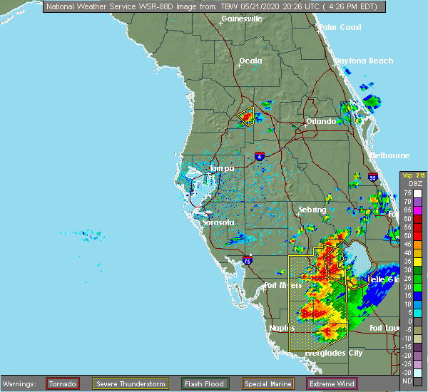 At 425 pm edt, a severe thunderstorm was located near bushnell, moving northeast at 10 mph (radar indicated). Hazards include 60 mph wind gusts and quarter size hail. Hail damage to vehicles is expected. Expect wind damage to roofs, siding, and trees. At 425 pm edt, a severe thunderstorm was located near bushnell, moving northeast at 10 mph (radar indicated). Hazards include 60 mph wind gusts and quarter size hail. Hail damage to vehicles is expected. Expect wind damage to roofs, siding, and trees.
|
| 4/24/2020 5:25 AM EDT |
 At 525 am edt, severe thunderstorms were located along a line extending from near wildwood to 15 miles southwest of harbor bluffs, moving east at 30 mph (radar indicated). Hazards include 60 mph wind gusts. Expect damage to roofs, siding, and trees. locations impacted include, tampa, spring hill, clearwater, largo, pinellas park, seminole, new port richey, brooksville, wildwood, dade city, bushnell, hudson, holiday, lutz, st. petersburg, st. pete beach, st. Leo, weeki wachee, palm harbor and new port richey east. At 525 am edt, severe thunderstorms were located along a line extending from near wildwood to 15 miles southwest of harbor bluffs, moving east at 30 mph (radar indicated). Hazards include 60 mph wind gusts. Expect damage to roofs, siding, and trees. locations impacted include, tampa, spring hill, clearwater, largo, pinellas park, seminole, new port richey, brooksville, wildwood, dade city, bushnell, hudson, holiday, lutz, st. petersburg, st. pete beach, st. Leo, weeki wachee, palm harbor and new port richey east.
|
| 4/24/2020 4:59 AM EDT |
 At 458 am edt, severe thunderstorms were located along a line extending from near inverness highlands north to 27 miles west of harbor bluffs, moving east at 30 mph (radar indicated). Hazards include 60 mph wind gusts. expect damage to roofs, siding, and trees At 458 am edt, severe thunderstorms were located along a line extending from near inverness highlands north to 27 miles west of harbor bluffs, moving east at 30 mph (radar indicated). Hazards include 60 mph wind gusts. expect damage to roofs, siding, and trees
|
| 4/20/2020 10:33 AM EDT |
 At 1033 am edt, a severe thunderstorm capable of producing a tornado was located near bushnell, moving east at 40 mph (radar indicated rotation). Hazards include tornado. Flying debris will be dangerous to those caught without shelter. mobile homes will be damaged or destroyed. damage to roofs, windows, and vehicles will occur. tree damage is likely. This tornadic thunderstorm will remain over mainly rural areas of east central sumter county, including the following locations, sumterville and lake panasoffkee. At 1033 am edt, a severe thunderstorm capable of producing a tornado was located near bushnell, moving east at 40 mph (radar indicated rotation). Hazards include tornado. Flying debris will be dangerous to those caught without shelter. mobile homes will be damaged or destroyed. damage to roofs, windows, and vehicles will occur. tree damage is likely. This tornadic thunderstorm will remain over mainly rural areas of east central sumter county, including the following locations, sumterville and lake panasoffkee.
|
| 4/20/2020 10:25 AM EDT | Tree down on cr 110 near wildwood. location and time estimate in sumter county FL, 5 miles SSE of Wildwood, FL |
| 4/20/2020 10:09 AM EDT |
 At 1008 am edt, severe thunderstorms were located along a line extending from 8 miles west of wildwood to 8 miles northeast of north weeki wachee, moving east at 40 mph (radar indicated). Hazards include 60 mph wind gusts and nickel size hail. expect damage to roofs, siding, and trees At 1008 am edt, severe thunderstorms were located along a line extending from 8 miles west of wildwood to 8 miles northeast of north weeki wachee, moving east at 40 mph (radar indicated). Hazards include 60 mph wind gusts and nickel size hail. expect damage to roofs, siding, and trees
|
| 2/6/2020 10:50 PM EST |
 At 1049 pm est, severe thunderstorms were located along a line extending from 9 miles northeast of inverness to near land o lakes to 25 miles southwest of anna maria, moving east at 35 mph (radar indicated). Hazards include 60 mph wind gusts. expect damage to roofs, siding, and trees At 1049 pm est, severe thunderstorms were located along a line extending from 9 miles northeast of inverness to near land o lakes to 25 miles southwest of anna maria, moving east at 35 mph (radar indicated). Hazards include 60 mph wind gusts. expect damage to roofs, siding, and trees
|
| 2/6/2020 10:39 PM EST |
 At 1038 pm est, severe thunderstorms were located along a line extending from near fruitland to near dade city, moving east at 60 mph (radar indicated). Hazards include 70 mph wind gusts. Expect considerable tree damage. Damage is likely to mobile homes, roofs, and outbuildings. At 1038 pm est, severe thunderstorms were located along a line extending from near fruitland to near dade city, moving east at 60 mph (radar indicated). Hazards include 70 mph wind gusts. Expect considerable tree damage. Damage is likely to mobile homes, roofs, and outbuildings.
|
| 2/6/2020 10:28 PM EST |
 At 1026 pm est, severe thunderstorms were located along a line extending from near ocala airport to 7 miles south of homosassa springs to near new port richey to 23 miles west of anna maria, moving east at 35 mph (radar indicated). Hazards include 60 mph wind gusts. Expect damage to roofs, siding, and trees. locations impacted include, tampa, spring hill, clearwater, largo, pinellas park, seminole, new port richey, brooksville, inverness, wildwood, bushnell, downtown saint petersburg, hudson, beverly hills, holiday, homosassa springs, saint petersburg, lutz, fort desoto park and st. Petersburg. At 1026 pm est, severe thunderstorms were located along a line extending from near ocala airport to 7 miles south of homosassa springs to near new port richey to 23 miles west of anna maria, moving east at 35 mph (radar indicated). Hazards include 60 mph wind gusts. Expect damage to roofs, siding, and trees. locations impacted include, tampa, spring hill, clearwater, largo, pinellas park, seminole, new port richey, brooksville, inverness, wildwood, bushnell, downtown saint petersburg, hudson, beverly hills, holiday, homosassa springs, saint petersburg, lutz, fort desoto park and st. Petersburg.
|
| 2/6/2020 10:02 PM EST |
 At 1002 pm est, severe thunderstorms were located along a line extending from near williston to 8 miles southwest of homosassa to 36 miles southwest of harbor bluffs, moving east at 30 mph (radar indicated). Hazards include 60 mph wind gusts. expect damage to roofs, siding, and trees At 1002 pm est, severe thunderstorms were located along a line extending from near williston to 8 miles southwest of homosassa to 36 miles southwest of harbor bluffs, moving east at 30 mph (radar indicated). Hazards include 60 mph wind gusts. expect damage to roofs, siding, and trees
|
| 6/9/2019 3:01 PM EDT |
 At 301 pm edt, a severe thunderstorm was located over the villages, moving northeast at 30 mph (radar indicated). Hazards include 60 mph wind gusts and penny size hail. Expect damage to roofs, siding, and trees. Locations impacted include, wildwood and oxford. At 301 pm edt, a severe thunderstorm was located over the villages, moving northeast at 30 mph (radar indicated). Hazards include 60 mph wind gusts and penny size hail. Expect damage to roofs, siding, and trees. Locations impacted include, wildwood and oxford.
|
| 6/9/2019 2:44 PM EDT |
 At 244 pm edt, a severe thunderstorm was located near wildwood, moving northeast at 40 mph (radar indicated). Hazards include 60 mph wind gusts and penny size hail. expect damage to roofs, siding, and trees At 244 pm edt, a severe thunderstorm was located near wildwood, moving northeast at 40 mph (radar indicated). Hazards include 60 mph wind gusts and penny size hail. expect damage to roofs, siding, and trees
|
| 5/5/2019 2:11 PM EDT |
 The severe thunderstorm warning for northeastern sumter county will expire at 215 pm edt, the storm which prompted the warning has moved out of the area. therefore, the warning will be allowed to expire. to report severe weather, contact your nearest law enforcement agency. they will relay your report to the national weather service ruskin. The severe thunderstorm warning for northeastern sumter county will expire at 215 pm edt, the storm which prompted the warning has moved out of the area. therefore, the warning will be allowed to expire. to report severe weather, contact your nearest law enforcement agency. they will relay your report to the national weather service ruskin.
|
| 5/5/2019 2:03 PM EDT |
 At 203 pm edt, severe thunderstorms were located along a line extending from near lisbon to near clermont, moving northeast at 40 mph (radar indicated). Hazards include 60 mph wind gusts and penny size hail. Expect damage to roofs, siding, and trees. Locations impacted include, leesburg, eustis, tavares, lady lake and mount dora. At 203 pm edt, severe thunderstorms were located along a line extending from near lisbon to near clermont, moving northeast at 40 mph (radar indicated). Hazards include 60 mph wind gusts and penny size hail. Expect damage to roofs, siding, and trees. Locations impacted include, leesburg, eustis, tavares, lady lake and mount dora.
|
| 5/5/2019 2:03 PM EDT |
 At 202 pm edt, a severe thunderstorm was located near fruitland park, or near lady lake, moving northeast at 50 mph (radar indicated). Hazards include 60 mph wind gusts. Expect damage to roofs, siding, and trees. Locations impacted include, wildwood, coleman, adamsville, sumterville and oxford. At 202 pm edt, a severe thunderstorm was located near fruitland park, or near lady lake, moving northeast at 50 mph (radar indicated). Hazards include 60 mph wind gusts. Expect damage to roofs, siding, and trees. Locations impacted include, wildwood, coleman, adamsville, sumterville and oxford.
|
| 5/5/2019 1:46 PM EDT |
 At 146 pm edt, a severe thunderstorm was located near bushnell, moving northeast at 55 mph (radar indicated). Hazards include 60 mph wind gusts. expect damage to roofs, siding, and trees At 146 pm edt, a severe thunderstorm was located near bushnell, moving northeast at 55 mph (radar indicated). Hazards include 60 mph wind gusts. expect damage to roofs, siding, and trees
|
| 5/5/2019 1:45 PM EDT |
 At 145 pm edt, severe thunderstorms were located along a line extending from lake griffin to 10 miles east of dade city, moving northeast at 45 mph (radar indicated). Hazards include 60 mph wind gusts and nickel size hail. expect damage to roofs, siding, and trees At 145 pm edt, severe thunderstorms were located along a line extending from lake griffin to 10 miles east of dade city, moving northeast at 45 mph (radar indicated). Hazards include 60 mph wind gusts and nickel size hail. expect damage to roofs, siding, and trees
|
| 4/19/2019 1:52 PM EDT |
 At 151 pm edt, severe thunderstorms were located along a line extending from moss bluff to near hill n dale to downtown saint petersburg, moving northeast at 65 mph (radar indicated). Hazards include 60 mph wind gusts. Expect damage to roofs, siding, and trees. locations impacted include, tampa, clearwater, largo, bradenton, pinellas park, plant city, temple terrace, seminole, zephyrhills, palmetto, wildwood, dade city, bushnell, downtown saint petersburg, fort desoto park, fish hawk, saint petersburg, lutz, brandon and st. Petersburg. At 151 pm edt, severe thunderstorms were located along a line extending from moss bluff to near hill n dale to downtown saint petersburg, moving northeast at 65 mph (radar indicated). Hazards include 60 mph wind gusts. Expect damage to roofs, siding, and trees. locations impacted include, tampa, clearwater, largo, bradenton, pinellas park, plant city, temple terrace, seminole, zephyrhills, palmetto, wildwood, dade city, bushnell, downtown saint petersburg, fort desoto park, fish hawk, saint petersburg, lutz, brandon and st. Petersburg.
|
| 4/19/2019 1:51 PM EDT |
 At 149 pm edt, severe thunderstorms were located along a line extending from lake george to eustis to near mascotte, moving northeast at 60 mph (radar indicated). Hazards include 60 mph wind gusts. Expect damage to roofs, siding, and trees. Locations impacted include, apopka, ocoee, winter garden, leesburg and eustis. At 149 pm edt, severe thunderstorms were located along a line extending from lake george to eustis to near mascotte, moving northeast at 60 mph (radar indicated). Hazards include 60 mph wind gusts. Expect damage to roofs, siding, and trees. Locations impacted include, apopka, ocoee, winter garden, leesburg and eustis.
|
| 4/19/2019 1:30 PM EDT |
 At 128 pm edt, severe thunderstorms were located along a line extending from ocala south to tarrytown in southern sumter county, moving northeast at 60 mph (radar indicated). Hazards include 60 mph wind gusts. expect damage to roofs, siding, and trees At 128 pm edt, severe thunderstorms were located along a line extending from ocala south to tarrytown in southern sumter county, moving northeast at 60 mph (radar indicated). Hazards include 60 mph wind gusts. expect damage to roofs, siding, and trees
|
| 4/19/2019 1:18 PM EDT |
 At 118 pm edt, severe thunderstorms were located along a line extending from 6 miles west of bushnell to keystone to 18 miles southwest of anna maria, moving northeast at 65 mph (radar indicated). Hazards include 60 mph wind gusts. expect damage to roofs, siding, and trees At 118 pm edt, severe thunderstorms were located along a line extending from 6 miles west of bushnell to keystone to 18 miles southwest of anna maria, moving northeast at 65 mph (radar indicated). Hazards include 60 mph wind gusts. expect damage to roofs, siding, and trees
|
| 4/19/2019 12:50 PM EDT |
 At 1249 pm edt, a severe thunderstorm was located near north brooksville, or near brooksville, moving northeast at 45 mph (radar indicated). Hazards include 60 mph wind gusts. expect damage to roofs, siding, and trees At 1249 pm edt, a severe thunderstorm was located near north brooksville, or near brooksville, moving northeast at 45 mph (radar indicated). Hazards include 60 mph wind gusts. expect damage to roofs, siding, and trees
|
| 4/19/2019 12:12 PM EDT |
 At 1212 pm edt, a severe thunderstorm was located near homosassa, or 8 miles southwest of homosassa springs, moving northeast at 60 mph (radar indicated). Hazards include 60 mph wind gusts. expect damage to roofs, siding, and trees At 1212 pm edt, a severe thunderstorm was located near homosassa, or 8 miles southwest of homosassa springs, moving northeast at 60 mph (radar indicated). Hazards include 60 mph wind gusts. expect damage to roofs, siding, and trees
|
| 1/24/2019 5:34 AM EST |
 At 533 am est, severe thunderstorms were located along a line extending from near altoona to fruitland park to near mascotte to 9 miles east of dade city, moving east-northeast at 55 mph (radar indicated). Hazards include 60 mph wind gusts. expect damage to roofs, siding, and trees At 533 am est, severe thunderstorms were located along a line extending from near altoona to fruitland park to near mascotte to 9 miles east of dade city, moving east-northeast at 55 mph (radar indicated). Hazards include 60 mph wind gusts. expect damage to roofs, siding, and trees
|
| 11/2/2018 4:25 PM EDT |
 The tornado warning for sumter county will expire at 430 pm edt, the tornadic thunderstorm which prompted the warning has weakened. therefore, the warning will be allowed to expire. The tornado warning for sumter county will expire at 430 pm edt, the tornadic thunderstorm which prompted the warning has weakened. therefore, the warning will be allowed to expire.
|
| 11/2/2018 4:06 PM EDT |
 At 406 pm edt, a severe thunderstorm capable of producing a tornado was located over bushnell, moving northeast at 40 mph (radar indicated rotation). Hazards include tornado. Flying debris will be dangerous to those caught without shelter. mobile homes will be damaged or destroyed. damage to roofs, windows, and vehicles will occur. tree damage is likely. This tornadic thunderstorm will remain over mainly rural areas of sumter county, including the following locations, webster, wahoo, lake panasoffkee, adamsville, coleman, center hill, sumterville, oxford and nobleton. At 406 pm edt, a severe thunderstorm capable of producing a tornado was located over bushnell, moving northeast at 40 mph (radar indicated rotation). Hazards include tornado. Flying debris will be dangerous to those caught without shelter. mobile homes will be damaged or destroyed. damage to roofs, windows, and vehicles will occur. tree damage is likely. This tornadic thunderstorm will remain over mainly rural areas of sumter county, including the following locations, webster, wahoo, lake panasoffkee, adamsville, coleman, center hill, sumterville, oxford and nobleton.
|
| 11/2/2018 3:54 PM EDT |
 At 353 pm edt, a severe thunderstorm was located near dade city, moving east at 45 mph (radar indicated). Hazards include 60 mph wind gusts. expect damage to roofs, siding, and trees At 353 pm edt, a severe thunderstorm was located near dade city, moving east at 45 mph (radar indicated). Hazards include 60 mph wind gusts. expect damage to roofs, siding, and trees
|
| 11/2/2018 3:47 PM EDT |
 At 347 pm edt, severe thunderstorms were located along a line extending from near hill n dale to dade city to near hillsborough river state park, moving northeast at 50 mph (radar indicated). Hazards include 60 mph wind gusts and quarter size hail. Hail damage to vehicles is expected. Expect wind damage to roofs, siding, and trees. At 347 pm edt, severe thunderstorms were located along a line extending from near hill n dale to dade city to near hillsborough river state park, moving northeast at 50 mph (radar indicated). Hazards include 60 mph wind gusts and quarter size hail. Hail damage to vehicles is expected. Expect wind damage to roofs, siding, and trees.
|
| 3/20/2018 2:04 PM EDT |
 At 202 pm edt, multiple severe thunderstorms was located in hernando and pasco counties moving northeast at 55 mph (radar indicated). Hazards include 60 mph wind gusts and quarter size hail. Hail damage to vehicles is expected. Expect wind damage to roofs, siding, and trees. At 202 pm edt, multiple severe thunderstorms was located in hernando and pasco counties moving northeast at 55 mph (radar indicated). Hazards include 60 mph wind gusts and quarter size hail. Hail damage to vehicles is expected. Expect wind damage to roofs, siding, and trees.
|
| 12/8/2017 10:00 PM EST |
 At 1000 pm est, a severe thunderstorm was located over wildwood, moving northeast at 40 mph (radar indicated). Hazards include 60 mph wind gusts. expect damage to roofs, siding, and trees At 1000 pm est, a severe thunderstorm was located over wildwood, moving northeast at 40 mph (radar indicated). Hazards include 60 mph wind gusts. expect damage to roofs, siding, and trees
|
| 2/15/2017 3:39 PM EST | Law enforcement relayed to eergency management that several trees were down around the turnpike. time estimated by rada in sumter county FL, 2 miles N of Wildwood, FL |
| 2/15/2017 3:37 PM EST |
 At 336 pm est, a severe thunderstorm capable of producing a tornado was located over wildwood, moving east at 45 mph (radar indicated rotation). Hazards include tornado. Flying debris will be dangerous to those caught without shelter. mobile homes will be damaged or destroyed. damage to roofs, windows, and vehicles will occur. tree damage is likely. This tornadic thunderstorm will remain over mainly rural areas of northeastern sumter county, including the following locations: adamsville and coleman. At 336 pm est, a severe thunderstorm capable of producing a tornado was located over wildwood, moving east at 45 mph (radar indicated rotation). Hazards include tornado. Flying debris will be dangerous to those caught without shelter. mobile homes will be damaged or destroyed. damage to roofs, windows, and vehicles will occur. tree damage is likely. This tornadic thunderstorm will remain over mainly rural areas of northeastern sumter county, including the following locations: adamsville and coleman.
|
| 2/15/2017 3:28 PM EST |
 At 327 pm est, a severe thunderstorm capable of producing a tornado was located 5 miles southwest of wildwood, moving east at 50 mph (radar indicated rotation). Hazards include tornado. Flying debris will be dangerous to those caught without shelter. mobile homes will be damaged or destroyed. damage to roofs, windows, and vehicles will occur. tree damage is likely. this dangerous storm will be near, wildwood around 340 pm est. Other locations impacted by this tornadic thunderstorm include adamsville, coleman and lake panasoffkee. At 327 pm est, a severe thunderstorm capable of producing a tornado was located 5 miles southwest of wildwood, moving east at 50 mph (radar indicated rotation). Hazards include tornado. Flying debris will be dangerous to those caught without shelter. mobile homes will be damaged or destroyed. damage to roofs, windows, and vehicles will occur. tree damage is likely. this dangerous storm will be near, wildwood around 340 pm est. Other locations impacted by this tornadic thunderstorm include adamsville, coleman and lake panasoffkee.
|
| 1/22/2017 7:25 PM EST |
 At 725 pm est, severe thunderstorms were located along a line extending from near moss bluff to fruitland park to near bushnell to 7 miles southeast of hernando county airport, moving east at 45 mph (radar indicated). Hazards include 70 mph wind gusts. Expect considerable tree damage. damage is likely to mobile homes, roofs, and outbuildings. locations impacted include, spring hill, new port richey, zephyrhills, brooksville, wildwood, dade city, bushnell, hudson, holiday, st. leo, new port richey east, hill `n dale, zephyrhills west, land o lakes, hernando county airport, wesley chapel south, beacon square, jasmine estates, land o` lakes and south brooksville. A tornado watch remains in effect until 1000 pm est for central and west central florida. At 725 pm est, severe thunderstorms were located along a line extending from near moss bluff to fruitland park to near bushnell to 7 miles southeast of hernando county airport, moving east at 45 mph (radar indicated). Hazards include 70 mph wind gusts. Expect considerable tree damage. damage is likely to mobile homes, roofs, and outbuildings. locations impacted include, spring hill, new port richey, zephyrhills, brooksville, wildwood, dade city, bushnell, hudson, holiday, st. leo, new port richey east, hill `n dale, zephyrhills west, land o lakes, hernando county airport, wesley chapel south, beacon square, jasmine estates, land o` lakes and south brooksville. A tornado watch remains in effect until 1000 pm est for central and west central florida.
|
| 1/22/2017 6:42 PM EST |
 At 641 pm est, severe thunderstorms were located along a line extending from 6 miles northeast of inverness highlands north to 6 miles southwest of inverness highlands south to timber pines to 7 miles northwest of beacon square, moving east at 45 mph (radar indicated). Hazards include 60 to 70 mph wind gusts. Expect considerable tree damage. Damage is likely to mobile homes, roofs, and outbuildings. At 641 pm est, severe thunderstorms were located along a line extending from 6 miles northeast of inverness highlands north to 6 miles southwest of inverness highlands south to timber pines to 7 miles northwest of beacon square, moving east at 45 mph (radar indicated). Hazards include 60 to 70 mph wind gusts. Expect considerable tree damage. Damage is likely to mobile homes, roofs, and outbuildings.
|
| 1/22/2017 6:35 PM EST |
 At 634 pm est, a severe thunderstorm capable of producing a tornado was located over bushnell, moving northeast at 60 mph (radar indicated rotation). Hazards include tornado. Flying debris will be dangerous to those caught without shelter. mobile homes will be damaged or destroyed. damage to roofs, windows, and vehicles will occur. tree damage is likely. This tornadic thunderstorm will remain over mainly rural areas of central sumter county, including the following locations: webster, tarrytown, center hill and sumterville. At 634 pm est, a severe thunderstorm capable of producing a tornado was located over bushnell, moving northeast at 60 mph (radar indicated rotation). Hazards include tornado. Flying debris will be dangerous to those caught without shelter. mobile homes will be damaged or destroyed. damage to roofs, windows, and vehicles will occur. tree damage is likely. This tornadic thunderstorm will remain over mainly rural areas of central sumter county, including the following locations: webster, tarrytown, center hill and sumterville.
|
| 1/22/2017 6:20 PM EST |
 At 620 pm est, a severe thunderstorm capable of producing a tornado was located over hill `n dale, or near brooksville, moving northeast at 60 mph (radar indicated rotation). Hazards include tornado. Flying debris will be dangerous to those caught without shelter. mobile homes will be damaged or destroyed. damage to roofs, windows, and vehicles will occur. tree damage is likely. this dangerous storm will be near, bushnell around 635 pm est. Other locations impacted by this tornadic thunderstorm include webster, ridge manor, tarrytown, croom, center hill and sumterville. At 620 pm est, a severe thunderstorm capable of producing a tornado was located over hill `n dale, or near brooksville, moving northeast at 60 mph (radar indicated rotation). Hazards include tornado. Flying debris will be dangerous to those caught without shelter. mobile homes will be damaged or destroyed. damage to roofs, windows, and vehicles will occur. tree damage is likely. this dangerous storm will be near, bushnell around 635 pm est. Other locations impacted by this tornadic thunderstorm include webster, ridge manor, tarrytown, croom, center hill and sumterville.
|
| 1/22/2017 5:59 PM EST |
 At 559 pm est, a severe thunderstorm capable of producing a tornado was located 7 miles west of mascotte, moving northeast at 60 mph (radar indicated rotation). Hazards include tornado. Flying debris will be dangerous to those caught without shelter. mobile homes will be damaged or destroyed. damage to roofs, windows, and vehicles will occur. tree damage is likely. This tornadic thunderstorm will remain over mainly rural areas of east central sumter county, including the following locations: webster, tarrytown and center hill. At 559 pm est, a severe thunderstorm capable of producing a tornado was located 7 miles west of mascotte, moving northeast at 60 mph (radar indicated rotation). Hazards include tornado. Flying debris will be dangerous to those caught without shelter. mobile homes will be damaged or destroyed. damage to roofs, windows, and vehicles will occur. tree damage is likely. This tornadic thunderstorm will remain over mainly rural areas of east central sumter county, including the following locations: webster, tarrytown and center hill.
|
| 1/22/2017 5:52 PM EST |
 At 552 pm est, a severe thunderstorm capable of producing a tornado was located near inverness highlands north, or near inverness, moving northeast at 60 mph (radar indicated rotation). Hazards include tornado. Flying debris will be dangerous to those caught without shelter. mobile homes will be damaged or destroyed. damage to roofs, windows, and vehicles will occur. tree damage is likely. Locations impacted include, inverness, inverness highlands south, inverness airport, inverness highlands north, hernando, arbor lakes, inverness highlands, river lakes manor, rutland, citrus hills, stokes ferry, gospel island, oxford and lecanto. At 552 pm est, a severe thunderstorm capable of producing a tornado was located near inverness highlands north, or near inverness, moving northeast at 60 mph (radar indicated rotation). Hazards include tornado. Flying debris will be dangerous to those caught without shelter. mobile homes will be damaged or destroyed. damage to roofs, windows, and vehicles will occur. tree damage is likely. Locations impacted include, inverness, inverness highlands south, inverness airport, inverness highlands north, hernando, arbor lakes, inverness highlands, river lakes manor, rutland, citrus hills, stokes ferry, gospel island, oxford and lecanto.
|
| 1/7/2017 2:39 AM EST |
 The severe thunderstorm warning for northern sumter and northeastern citrus counties will expire at 245 am est, the storm which prompted the warning has moved out of the area. therefore the warning will be allowed to expire. however heavy rain is still possible with this thunderstorm. a tornado watch remains in effect until 500 am est for west central and central florida. The severe thunderstorm warning for northern sumter and northeastern citrus counties will expire at 245 am est, the storm which prompted the warning has moved out of the area. therefore the warning will be allowed to expire. however heavy rain is still possible with this thunderstorm. a tornado watch remains in effect until 500 am est for west central and central florida.
|
| 1/7/2017 2:17 AM EST |
 At 216 am est, a severe thunderstorm was located near inverness, moving east at 40 mph (radar indicated). Hazards include 60 mph wind gusts and nickel size hail. expect damage to roofs, siding, and trees At 216 am est, a severe thunderstorm was located near inverness, moving east at 40 mph (radar indicated). Hazards include 60 mph wind gusts and nickel size hail. expect damage to roofs, siding, and trees
|
| 8/14/2016 3:22 PM EDT |
 At 332 pm edt, severe thunderstorms were located along a line extending from near eustis to tavares to near howey in the hills, moving northwest at 15 mph (radar indicated). Hazards include 60 mph wind gusts. Expect damage to roofs. siding. and trees. Locations impacted include, leesburg, eustis, tavares, lady lake and mount dora. At 332 pm edt, severe thunderstorms were located along a line extending from near eustis to tavares to near howey in the hills, moving northwest at 15 mph (radar indicated). Hazards include 60 mph wind gusts. Expect damage to roofs. siding. and trees. Locations impacted include, leesburg, eustis, tavares, lady lake and mount dora.
|
| 8/14/2016 3:03 PM EDT |
 At 303 pm edt, severe thunderstorms were located along a line extending from near lake apopka to clermont to 7 miles southwest of lake louisa, moving northwest at 20 mph (radar indicated). Hazards include 60 mph wind gusts. Expect damage to roofs. siding. And trees. At 303 pm edt, severe thunderstorms were located along a line extending from near lake apopka to clermont to 7 miles southwest of lake louisa, moving northwest at 20 mph (radar indicated). Hazards include 60 mph wind gusts. Expect damage to roofs. siding. And trees.
|
| 4/15/2014 12:40 PM EDT | Tree and power lines fell on a mobile home on legion road. damage to the home reporte in sumter county FL, 1 miles E of Wildwood, FL |
| 3/29/2014 12:35 PM EDT | General public report 60 - 70 mph winds in thunderstor in sumter county FL, 1.7 miles ENE of Wildwood, FL |
| 3/29/2014 12:35 PM EDT | Quarter sized hail reported 1.7 miles ENE of Wildwood, FL, public reported quarter sized hail with thunderstorm 1 mile sw of wildwood. |
| 8/10/2012 4:00 PM EDT | Several trees downed along with tree fires and 3 homes damaged in adamsvill in sumter county FL, 3.4 miles N of Wildwood, FL |
| 7/30/2012 3:40 PM EDT | *** 1 inj *** large tree fell on house with one person injured. time estimated by rada in sumter county FL, 7.1 miles SSE of Wildwood, FL |
| 1/1/0001 12:00 AM | Trees were blown down and were blocking the roadway at the intersection of interstate 75 and the florida turnpike. time is estimated off of rada in sumter county FL, 4 miles E of Wildwood, FL |
Hail Maps for Wildwood, FL


Connect with Interactive Hail Maps