

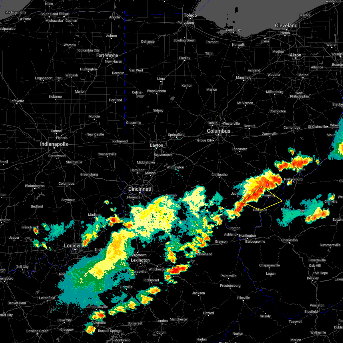
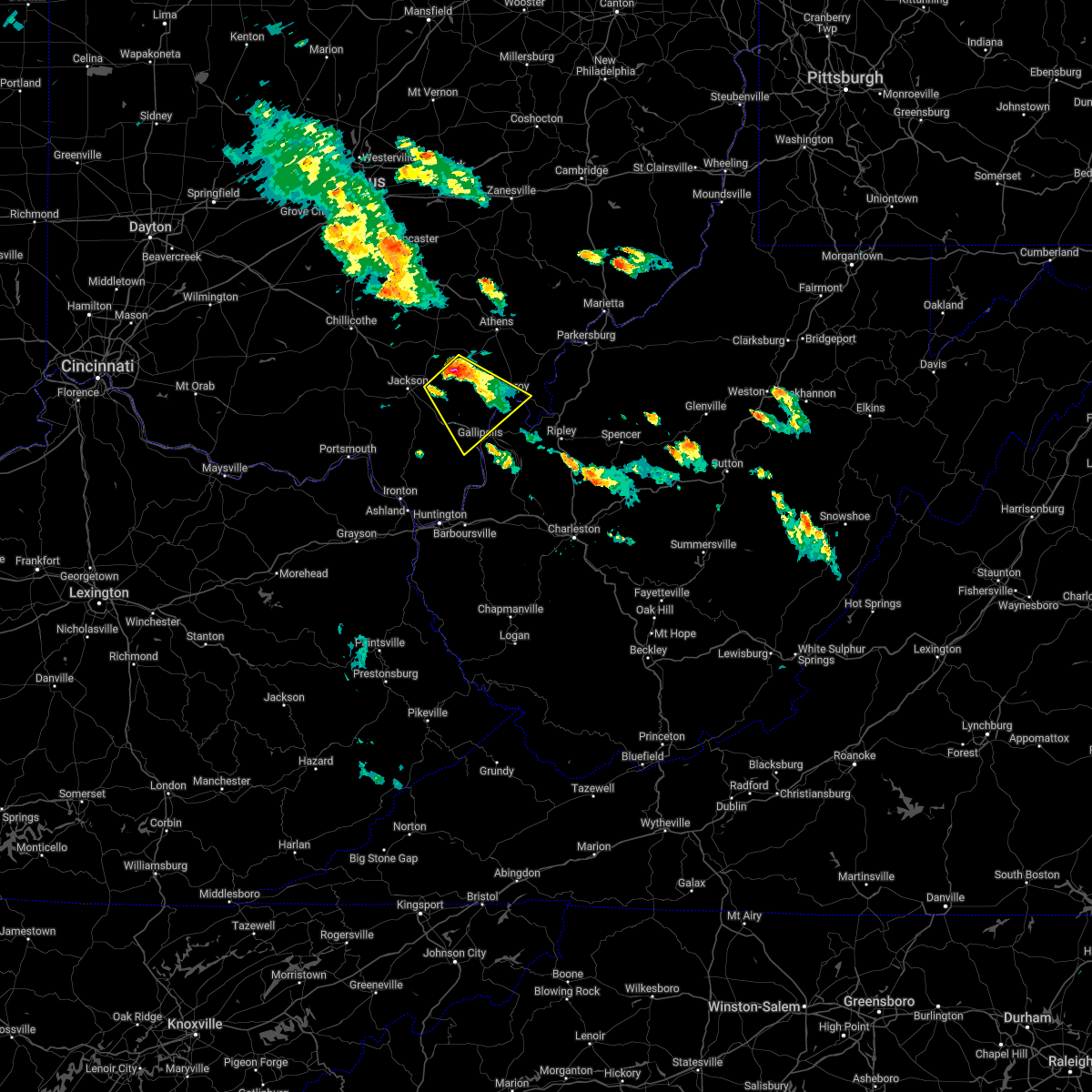
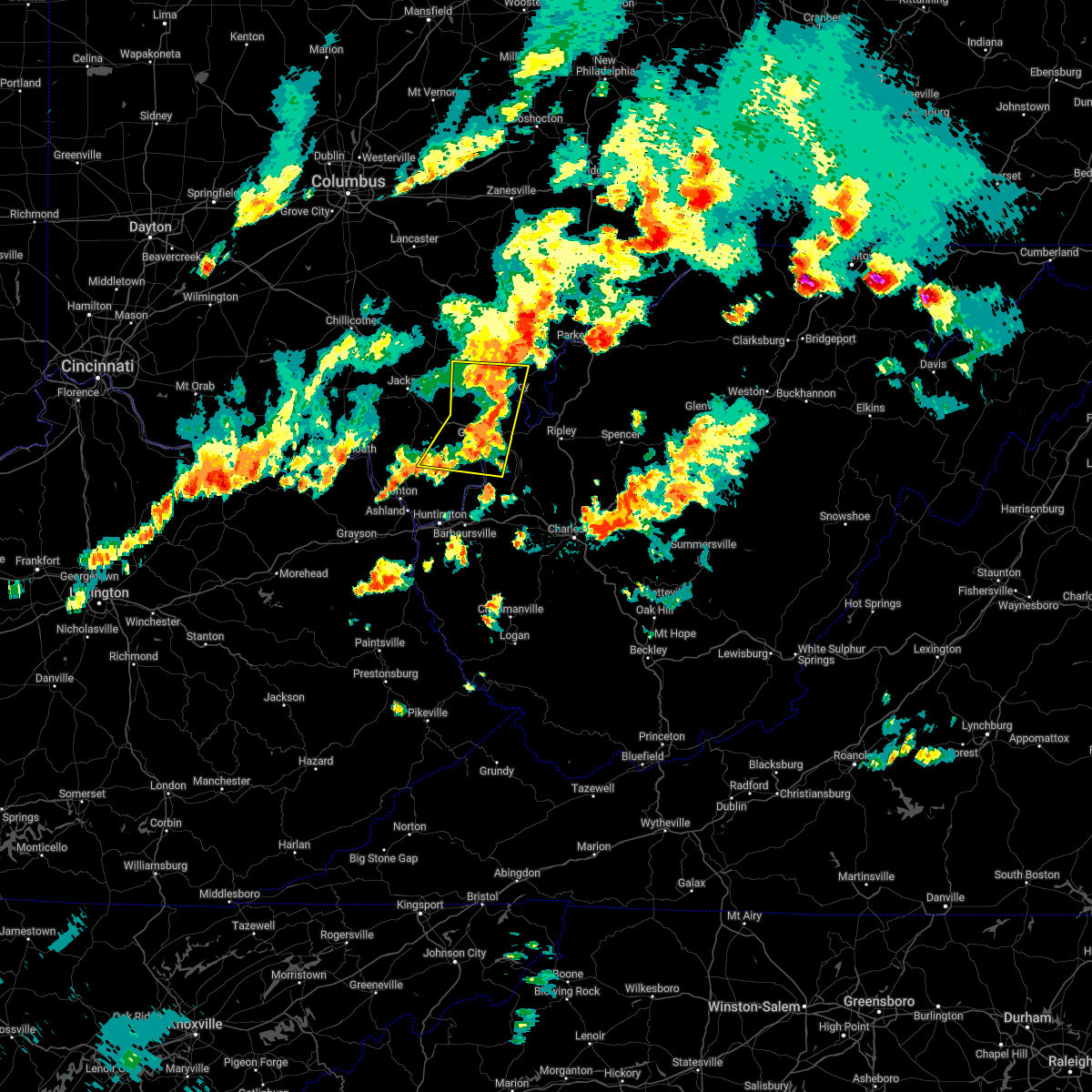
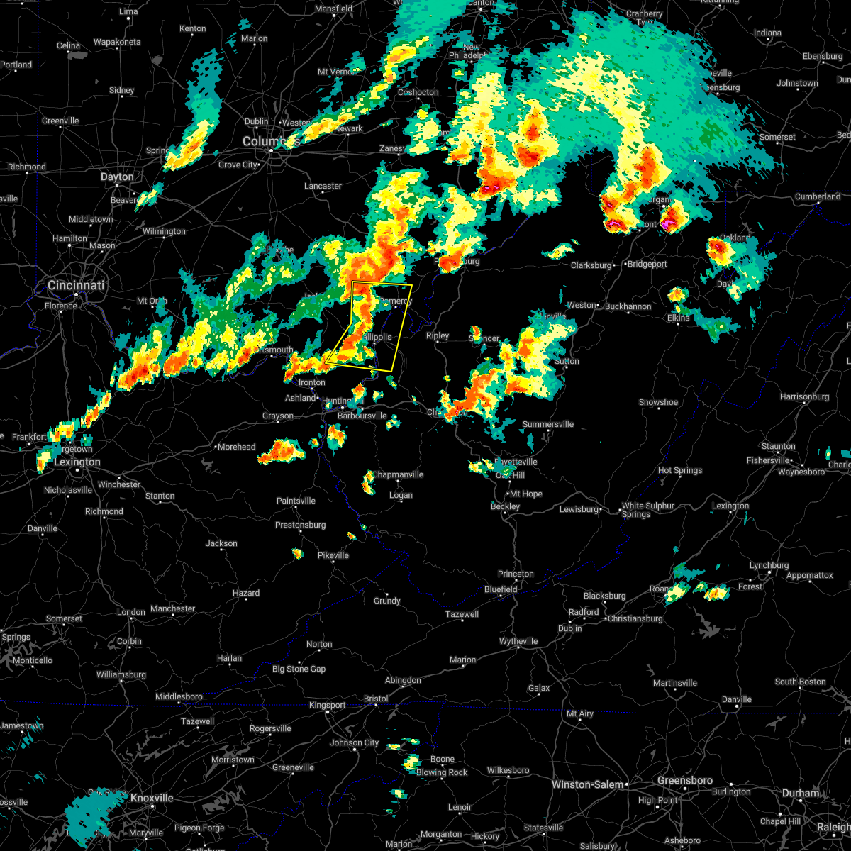
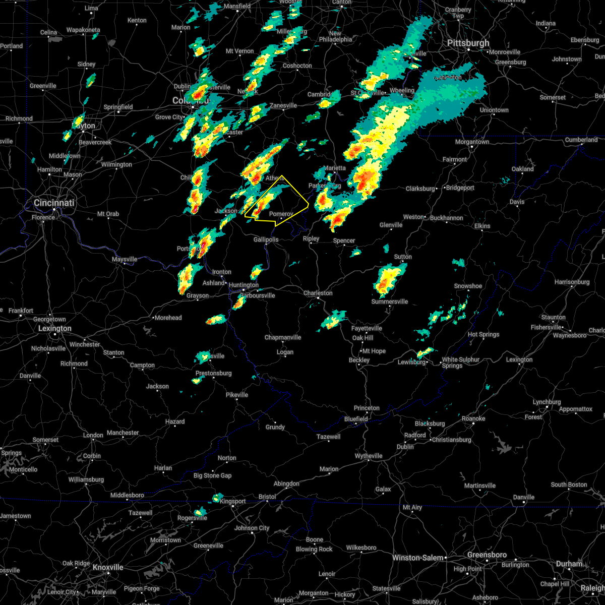
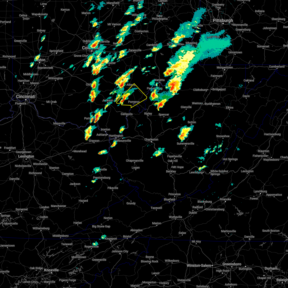
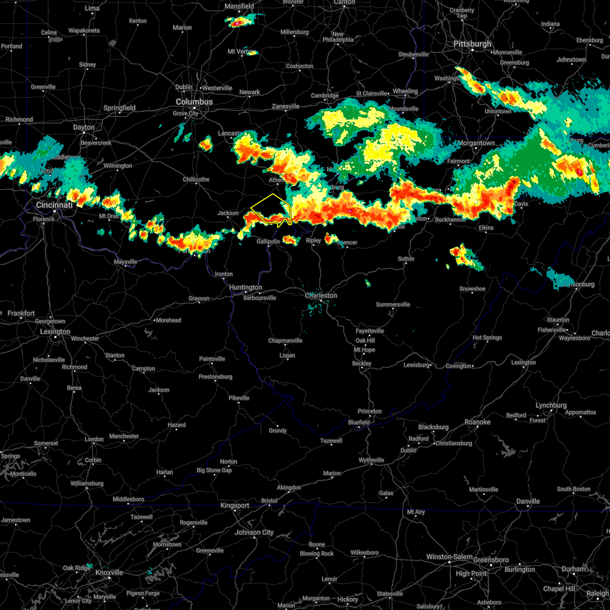
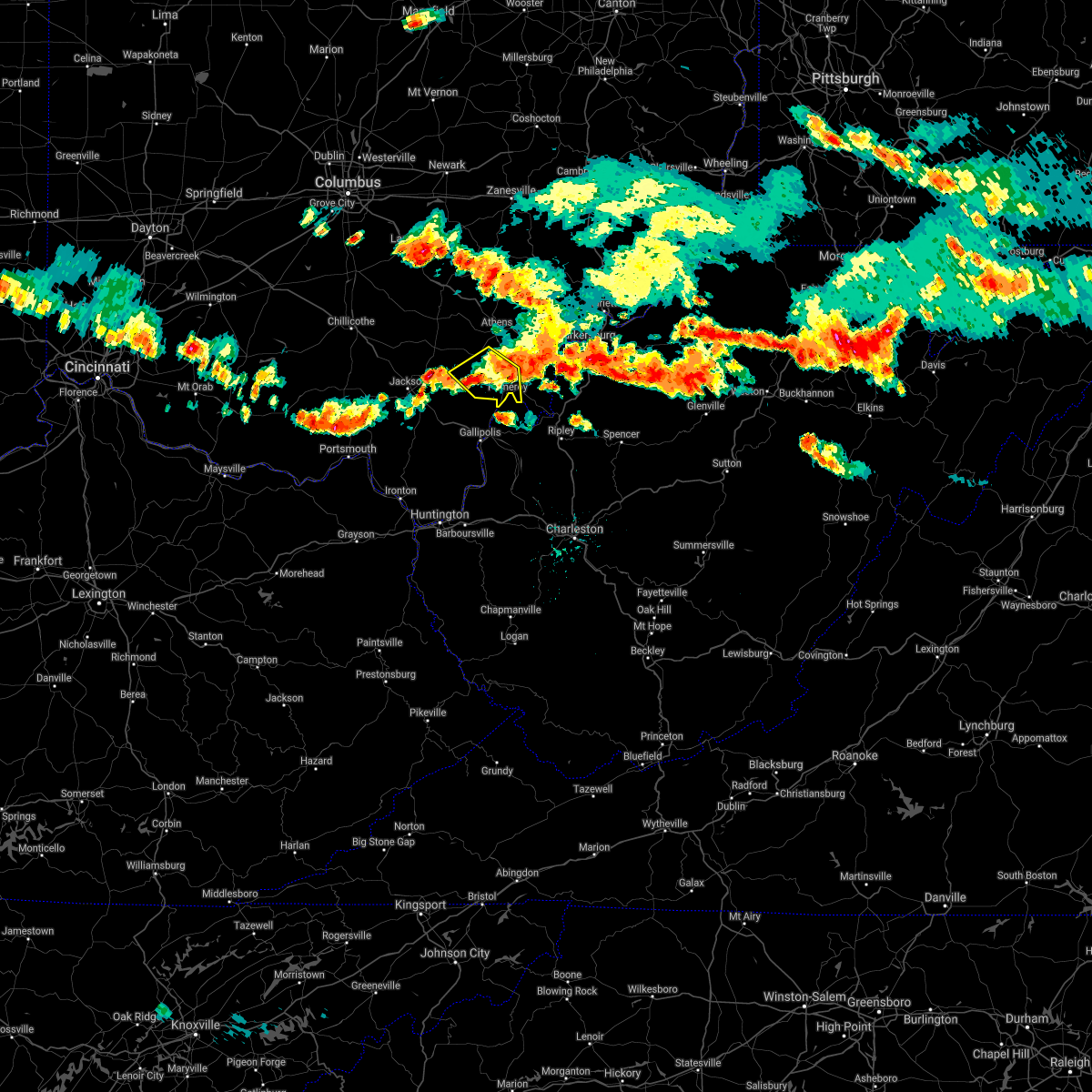
Hail Map for Wilkesville, OH
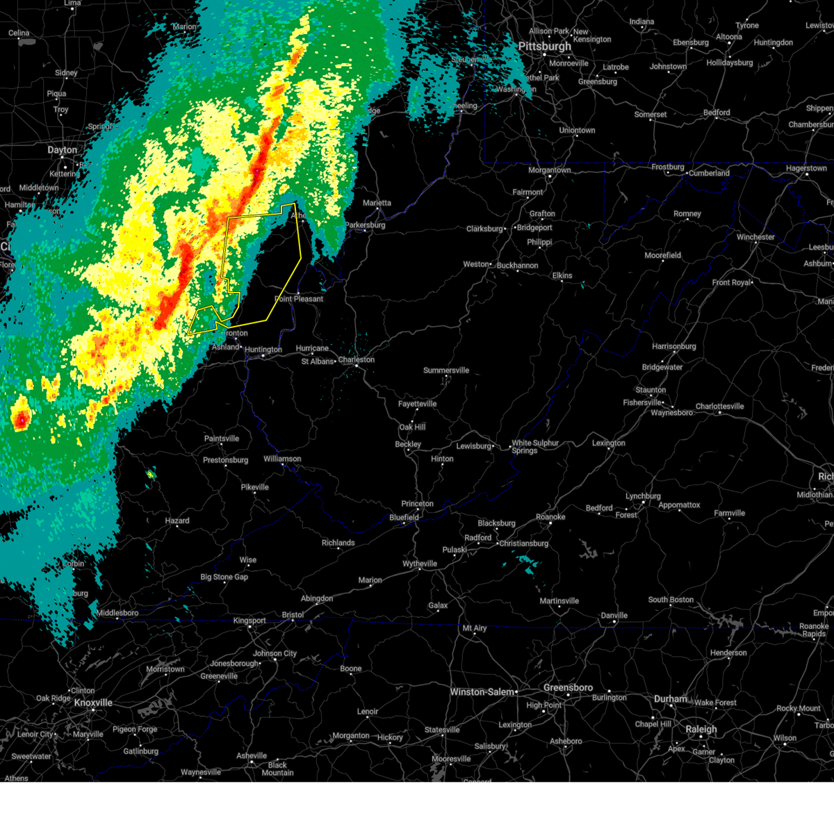
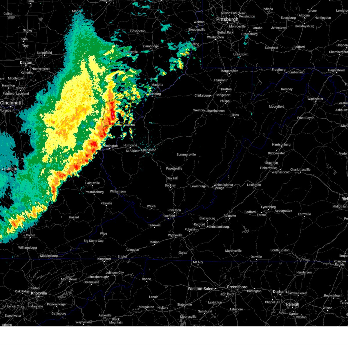
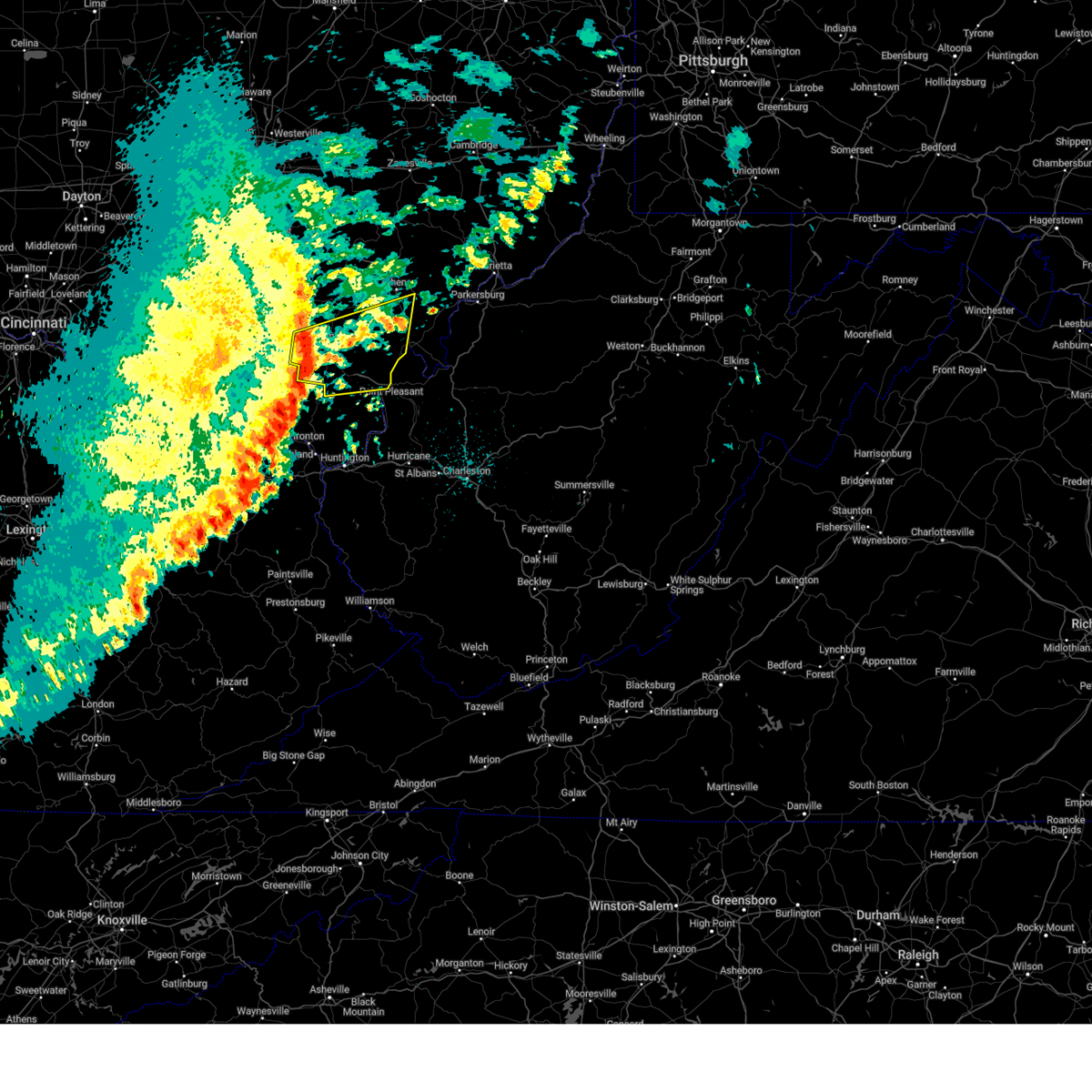
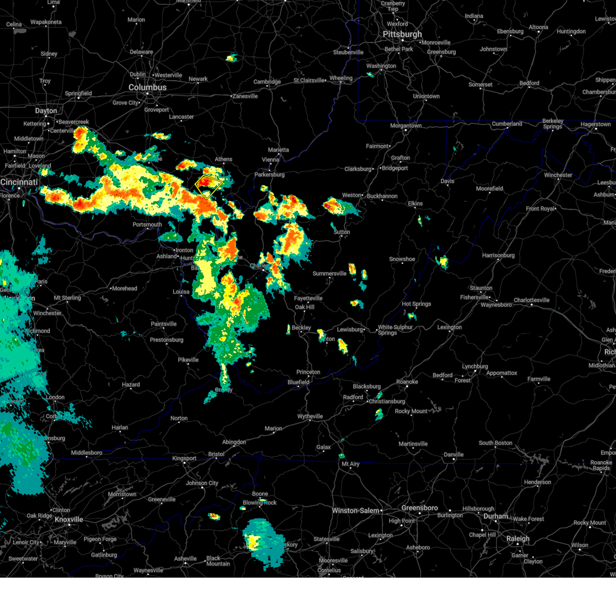
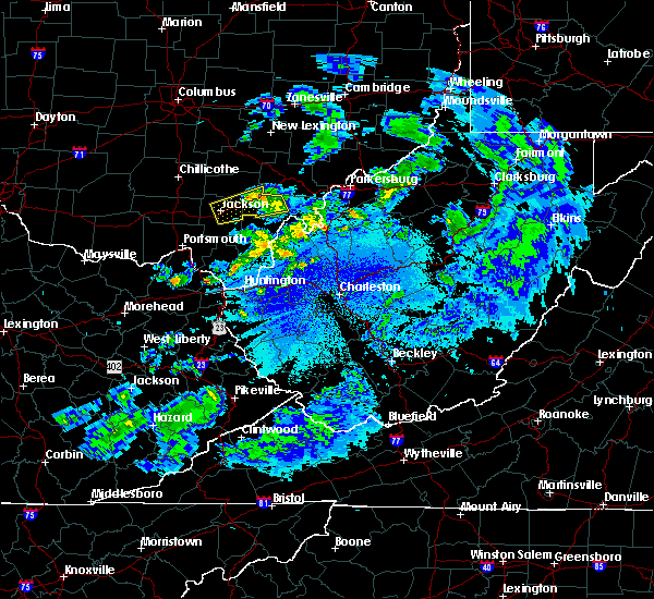
The Wilkesville, OH area has had 1 report of on-the-ground hail by trained spotters, and has been under severe weather warnings 11 times during the past 12 months. Doppler radar has detected hail at or near Wilkesville, OH on 38 occasions, including 1 occasion during the past year.
| Name: | Wilkesville, OH |
| Where Located: | 62.4 miles NW of Charleston, WV |
| Map: | Google Map for Wilkesville, OH |
| Population: | 149 |
| Housing Units: | 78 |
| More Info: | Search Google for Wilkesville, OH |
0
The Top Recent Hail Date for Wilkesville, OH is Wednesday, June 25, 2025 (28th out of 38)
Hail and Wind Damage Spotted near Wilkesville, OH
| Date / Time | Report Details |
|---|---|
| 6/18/2025 10:05 PM EDT |
 Svrrlx the national weather service in charleston west virginia has issued a * severe thunderstorm warning for, northwestern meigs county in southeastern ohio, north central gallia county in southeastern ohio, jackson county in southeastern ohio, vinton county in southeastern ohio, western athens county in southeastern ohio, * until 1045 pm edt. * at 1005 pm edt, severe thunderstorms were located along a line extending from 10 miles southwest of hocking hills state park to piketon, moving east at 45 mph (radar indicated). Hazards include 60 mph wind gusts. expect damage to roofs, siding, and trees Svrrlx the national weather service in charleston west virginia has issued a * severe thunderstorm warning for, northwestern meigs county in southeastern ohio, north central gallia county in southeastern ohio, jackson county in southeastern ohio, vinton county in southeastern ohio, western athens county in southeastern ohio, * until 1045 pm edt. * at 1005 pm edt, severe thunderstorms were located along a line extending from 10 miles southwest of hocking hills state park to piketon, moving east at 45 mph (radar indicated). Hazards include 60 mph wind gusts. expect damage to roofs, siding, and trees
|
| 4/3/2025 3:31 AM EDT |
 At 331 am edt, severe thunderstorms were located along a line extending from near chesterhill to 7 miles northwest of point pleasant, moving east at 45 mph (radar indicated). Hazards include 70 mph wind gusts. Expect considerable tree damage. damage is likely to mobile homes, roofs, and outbuildings. Locations impacted include, sandyville, point pleasant, belmont, stroud run state park, adamsville, pomeroy, mineralwells, little hocking, salem center, fleming, syracuse, dexter, amesville, racine, albany, gallia, peewee, rutland, parkersburg, and hartford city. At 331 am edt, severe thunderstorms were located along a line extending from near chesterhill to 7 miles northwest of point pleasant, moving east at 45 mph (radar indicated). Hazards include 70 mph wind gusts. Expect considerable tree damage. damage is likely to mobile homes, roofs, and outbuildings. Locations impacted include, sandyville, point pleasant, belmont, stroud run state park, adamsville, pomeroy, mineralwells, little hocking, salem center, fleming, syracuse, dexter, amesville, racine, albany, gallia, peewee, rutland, parkersburg, and hartford city.
|
| 4/3/2025 3:29 AM EDT | The storm which prompted the warning has weakened below severe limits, and no longer appears capable of producing a tornado. therefore, the warning will be allowed to expire. a severe thunderstorm watch remains in effect until 700 am edt for southeastern ohio. |
| 4/3/2025 3:19 AM EDT | the tornado warning has been cancelled and is no longer in effect |
| 4/3/2025 3:19 AM EDT | At 318 am edt, a severe thunderstorm capable of producing a tornado was located near albany, moving northeast at 65 mph (radar indicated rotation). Hazards include tornado. Flying debris will be dangerous to those caught without shelter. mobile homes will be damaged or destroyed. damage to roofs, windows, and vehicles will occur. tree damage is likely. this dangerous storm will be near, athens and albany around 325 am edt. Other locations impacted by this tornadic thunderstorm include dyesville, darwin, salem center, wilkesville, radcliffe, harrisonville, dexter, carpenter, and the plains. |
| 4/3/2025 3:09 AM EDT |
 Svrrlx the national weather service in charleston west virginia has issued a * severe thunderstorm warning for, meigs county in southeastern ohio, northern gallia county in southeastern ohio, southern washington county in southeastern ohio, southeastern jackson county in southeastern ohio, southeastern vinton county in southeastern ohio, athens county in southeastern ohio, northwestern lawrence county in southeastern ohio, southwestern pleasants county in northwestern west virginia, northwestern mason county in western west virginia, western wirt county in northwestern west virginia, northern jackson county in northwestern west virginia, wood county in northwestern west virginia, * until 345 am edt. * at 308 am edt, severe thunderstorms were located along a line extending from near nelsonville to near oak hill, moving east at 90 mph (radar indicated). Hazards include 70 mph wind gusts. Expect considerable tree damage. Damage is likely to mobile homes, roofs, and outbuildings. Svrrlx the national weather service in charleston west virginia has issued a * severe thunderstorm warning for, meigs county in southeastern ohio, northern gallia county in southeastern ohio, southern washington county in southeastern ohio, southeastern jackson county in southeastern ohio, southeastern vinton county in southeastern ohio, athens county in southeastern ohio, northwestern lawrence county in southeastern ohio, southwestern pleasants county in northwestern west virginia, northwestern mason county in western west virginia, western wirt county in northwestern west virginia, northern jackson county in northwestern west virginia, wood county in northwestern west virginia, * until 345 am edt. * at 308 am edt, severe thunderstorms were located along a line extending from near nelsonville to near oak hill, moving east at 90 mph (radar indicated). Hazards include 70 mph wind gusts. Expect considerable tree damage. Damage is likely to mobile homes, roofs, and outbuildings.
|
| 4/3/2025 3:05 AM EDT | Torrlx the national weather service in charleston west virginia has issued a * tornado warning for, northwestern meigs county in southeastern ohio, north central gallia county in southeastern ohio, northeastern jackson county in southeastern ohio, southeastern vinton county in southeastern ohio, southwestern athens county in southeastern ohio, * until 330 am edt. * at 305 am edt, a severe thunderstorm capable of producing a tornado was located near wellston, moving northeast at 65 mph (radar indicated rotation). Hazards include tornado. Flying debris will be dangerous to those caught without shelter. mobile homes will be damaged or destroyed. damage to roofs, windows, and vehicles will occur. tree damage is likely. this dangerous storm will be near, albany around 315 am edt. athens around 325 am edt. Other locations impacted by this tornadic thunderstorm include dyesville, darwin, salem center, wilkesville, radcliffe, harrisonville, coalton, dexter, carpenter, and the plains. |
| 4/3/2025 2:32 AM EDT |
 Svrrlx the national weather service in charleston west virginia has issued a * severe thunderstorm warning for, northwestern greenup county in northeastern kentucky, northwestern meigs county in southeastern ohio, central gallia county in southeastern ohio, jackson county in southeastern ohio, vinton county in southeastern ohio, southwestern athens county in southeastern ohio, northern lawrence county in southeastern ohio, * until 315 am edt. * at 232 am edt, severe thunderstorms were located along a line extending from near bainbridge to 7 miles west of lucasville to near vanceburg, moving east at 65 mph (radar indicated). Hazards include 60 mph wind gusts and penny size hail. expect damage to roofs, siding, and trees Svrrlx the national weather service in charleston west virginia has issued a * severe thunderstorm warning for, northwestern greenup county in northeastern kentucky, northwestern meigs county in southeastern ohio, central gallia county in southeastern ohio, jackson county in southeastern ohio, vinton county in southeastern ohio, southwestern athens county in southeastern ohio, northern lawrence county in southeastern ohio, * until 315 am edt. * at 232 am edt, severe thunderstorms were located along a line extending from near bainbridge to 7 miles west of lucasville to near vanceburg, moving east at 65 mph (radar indicated). Hazards include 60 mph wind gusts and penny size hail. expect damage to roofs, siding, and trees
|
| 3/31/2025 12:48 AM EDT |
 At 1247 am edt, severe thunderstorms were located along a line extending from 6 miles east of wellston to near rio grande, moving east at 60 mph (radar indicated). Hazards include 60 mph wind gusts and quarter size hail. Hail damage to vehicles is expected. expect wind damage to roofs, siding, and trees. Locations impacted include, vinton, wilkesville, radcliffe, adamsville, dyesville, darwin, salem center, harrisonville, dexter, oak hill, kyger, albany, gallipolis, wellston, gallia, rutland, middleport, cheshire, gage, and centerpoint. At 1247 am edt, severe thunderstorms were located along a line extending from 6 miles east of wellston to near rio grande, moving east at 60 mph (radar indicated). Hazards include 60 mph wind gusts and quarter size hail. Hail damage to vehicles is expected. expect wind damage to roofs, siding, and trees. Locations impacted include, vinton, wilkesville, radcliffe, adamsville, dyesville, darwin, salem center, harrisonville, dexter, oak hill, kyger, albany, gallipolis, wellston, gallia, rutland, middleport, cheshire, gage, and centerpoint.
|
| 3/31/2025 12:30 AM EDT |
 Svrrlx the national weather service in charleston west virginia has issued a * severe thunderstorm warning for, northwestern meigs county in southeastern ohio, northern gallia county in southeastern ohio, jackson county in southeastern ohio, southeastern vinton county in southeastern ohio, southwestern athens county in southeastern ohio, * until 100 am edt. * at 1230 am edt, severe thunderstorms were located along a line extending from near jackson to near south webster, moving east at 60 mph (radar indicated). Hazards include 60 mph wind gusts and quarter size hail. Hail damage to vehicles is expected. Expect wind damage to roofs, siding, and trees. Svrrlx the national weather service in charleston west virginia has issued a * severe thunderstorm warning for, northwestern meigs county in southeastern ohio, northern gallia county in southeastern ohio, jackson county in southeastern ohio, southeastern vinton county in southeastern ohio, southwestern athens county in southeastern ohio, * until 100 am edt. * at 1230 am edt, severe thunderstorms were located along a line extending from near jackson to near south webster, moving east at 60 mph (radar indicated). Hazards include 60 mph wind gusts and quarter size hail. Hail damage to vehicles is expected. Expect wind damage to roofs, siding, and trees.
|
| 3/30/2025 10:44 PM EDT | Svrrlx the national weather service in charleston west virginia has issued a * severe thunderstorm warning for, northwestern meigs county in southeastern ohio, northwestern gallia county in southeastern ohio, northern jackson county in southeastern ohio, vinton county in southeastern ohio, southwestern athens county in southeastern ohio, * until 1130 pm edt. * at 1043 pm edt, severe thunderstorms were located along a line extending from 7 miles east of kingston to near waverly, moving southeast at 45 mph (radar indicated). Hazards include 60 mph wind gusts and penny size hail. expect damage to roofs, siding, and trees |
| 7/14/2024 5:19 PM EDT |
 At 518 pm edt, severe thunderstorms were located along a line extending from near mcarthur to near jackson to near rosemount, moving southeast at 40 mph (radar indicated). Hazards include 60 mph wind gusts. Expect damage to roofs, siding, and trees. Locations impacted include, athens, jackson, wellston, mcarthur, oak hill, rio grande, albany, lake hope state park, gallia, vernon, hamden, coalton, zaleski, vinton, hanging rock, wilkesville, radcliffe, dyesville, petersburg, and salem center. At 518 pm edt, severe thunderstorms were located along a line extending from near mcarthur to near jackson to near rosemount, moving southeast at 40 mph (radar indicated). Hazards include 60 mph wind gusts. Expect damage to roofs, siding, and trees. Locations impacted include, athens, jackson, wellston, mcarthur, oak hill, rio grande, albany, lake hope state park, gallia, vernon, hamden, coalton, zaleski, vinton, hanging rock, wilkesville, radcliffe, dyesville, petersburg, and salem center.
|
| 7/14/2024 4:45 PM EDT |
 Svrrlx the national weather service in charleston west virginia has issued a * severe thunderstorm warning for, northwestern meigs county in southeastern ohio, northwestern gallia county in southeastern ohio, jackson county in southeastern ohio, vinton county in southeastern ohio, southwestern athens county in southeastern ohio, northwestern lawrence county in southeastern ohio, * until 545 pm edt. * at 442 pm edt, thunderstorms were located along a line extending from near kingston to near waverly to 6 miles south of kincaid springs, moving southeast at 40 mph (radar indicated). Hazards include 60 mph wind gusts. expect damage to roofs, siding, and trees Svrrlx the national weather service in charleston west virginia has issued a * severe thunderstorm warning for, northwestern meigs county in southeastern ohio, northwestern gallia county in southeastern ohio, jackson county in southeastern ohio, vinton county in southeastern ohio, southwestern athens county in southeastern ohio, northwestern lawrence county in southeastern ohio, * until 545 pm edt. * at 442 pm edt, thunderstorms were located along a line extending from near kingston to near waverly to 6 miles south of kincaid springs, moving southeast at 40 mph (radar indicated). Hazards include 60 mph wind gusts. expect damage to roofs, siding, and trees
|
| 5/26/2024 4:24 PM EDT |
 The storms which prompted the warning have moved out of the area. therefore, the warning will be allowed to expire. a severe thunderstorm watch remains in effect until 800 pm edt for southeastern ohio, and western west virginia. a severe thunderstorm watch also remains in effect until 900 pm edt for southeastern ohio. The storms which prompted the warning have moved out of the area. therefore, the warning will be allowed to expire. a severe thunderstorm watch remains in effect until 800 pm edt for southeastern ohio, and western west virginia. a severe thunderstorm watch also remains in effect until 900 pm edt for southeastern ohio.
|
| 5/26/2024 4:06 PM EDT |
 At 405 pm edt, severe thunderstorms were located along a line extending from near bremen to 6 miles southwest of albany to 10 miles south of gallipolis, moving east at 40 mph (radar indicated). Hazards include 60 mph wind gusts and quarter size hail. Hail damage to vehicles is expected. expect wind damage to roofs, siding, and trees. Locations impacted include, athens, nelsonville, new lexington, pomeroy, glouster, mcarthur, albany, shawnee, rutland, lake hope state park, mason, middleport, chauncey, junction city, new straitsville, corning, buchtel, jacksonville, trimble, and zaleski. At 405 pm edt, severe thunderstorms were located along a line extending from near bremen to 6 miles southwest of albany to 10 miles south of gallipolis, moving east at 40 mph (radar indicated). Hazards include 60 mph wind gusts and quarter size hail. Hail damage to vehicles is expected. expect wind damage to roofs, siding, and trees. Locations impacted include, athens, nelsonville, new lexington, pomeroy, glouster, mcarthur, albany, shawnee, rutland, lake hope state park, mason, middleport, chauncey, junction city, new straitsville, corning, buchtel, jacksonville, trimble, and zaleski.
|
| 5/26/2024 3:19 PM EDT |
 Svrrlx the national weather service in charleston west virginia has issued a * severe thunderstorm warning for, northwestern meigs county in southeastern ohio, southern perry county in southeastern ohio, northeastern gallia county in southeastern ohio, northeastern jackson county in southeastern ohio, vinton county in southeastern ohio, athens county in southeastern ohio, northwestern mason county in western west virginia, * until 430 pm edt. * at 319 pm edt, a severe thunderstorm was located over pike lake, or 11 miles west of waverly, moving east at 45 mph (radar indicated). Hazards include 60 mph wind gusts and quarter size hail. Hail damage to vehicles is expected. Expect wind damage to roofs, siding, and trees. Svrrlx the national weather service in charleston west virginia has issued a * severe thunderstorm warning for, northwestern meigs county in southeastern ohio, southern perry county in southeastern ohio, northeastern gallia county in southeastern ohio, northeastern jackson county in southeastern ohio, vinton county in southeastern ohio, athens county in southeastern ohio, northwestern mason county in western west virginia, * until 430 pm edt. * at 319 pm edt, a severe thunderstorm was located over pike lake, or 11 miles west of waverly, moving east at 45 mph (radar indicated). Hazards include 60 mph wind gusts and quarter size hail. Hail damage to vehicles is expected. Expect wind damage to roofs, siding, and trees.
|
| 5/8/2024 12:59 AM EDT |
 the severe thunderstorm warning has been cancelled and is no longer in effect the severe thunderstorm warning has been cancelled and is no longer in effect
|
| 5/8/2024 12:47 AM EDT |
 the severe thunderstorm warning has been cancelled and is no longer in effect the severe thunderstorm warning has been cancelled and is no longer in effect
|
| 5/8/2024 12:47 AM EDT |
 At 1246 am edt, severe thunderstorms were located along a line extending from near wellston to 8 miles southwest of jackson, moving east at 45 mph (radar indicated). Hazards include 60 mph wind gusts. Expect damage to roofs, siding, and trees. Locations impacted include, jackson, wellston, oak hill, rio grande, gallia, middleport, hamden, coalton, vinton, wilkesville, adamsville, mabee, radcliffe, petersburg, salem center, gage, byer, centerpoint, and kyger. At 1246 am edt, severe thunderstorms were located along a line extending from near wellston to 8 miles southwest of jackson, moving east at 45 mph (radar indicated). Hazards include 60 mph wind gusts. Expect damage to roofs, siding, and trees. Locations impacted include, jackson, wellston, oak hill, rio grande, gallia, middleport, hamden, coalton, vinton, wilkesville, adamsville, mabee, radcliffe, petersburg, salem center, gage, byer, centerpoint, and kyger.
|
| 5/8/2024 12:16 AM EDT |
 Svrrlx the national weather service in charleston west virginia has issued a * severe thunderstorm warning for, west central meigs county in southeastern ohio, gallia county in southeastern ohio, jackson county in southeastern ohio, southern vinton county in southeastern ohio, northeastern lawrence county in southeastern ohio, northwestern mason county in western west virginia, * until 115 am edt. * at 1214 am edt, a severe thunderstorm was located near piketon, or near waverly, moving east at 40 mph (radar indicated). Hazards include 60 mph wind gusts and quarter size hail. Hail damage to vehicles is expected. Expect wind damage to roofs, siding, and trees. Svrrlx the national weather service in charleston west virginia has issued a * severe thunderstorm warning for, west central meigs county in southeastern ohio, gallia county in southeastern ohio, jackson county in southeastern ohio, southern vinton county in southeastern ohio, northeastern lawrence county in southeastern ohio, northwestern mason county in western west virginia, * until 115 am edt. * at 1214 am edt, a severe thunderstorm was located near piketon, or near waverly, moving east at 40 mph (radar indicated). Hazards include 60 mph wind gusts and quarter size hail. Hail damage to vehicles is expected. Expect wind damage to roofs, siding, and trees.
|
| 4/17/2024 9:34 PM EDT |
 At 933 pm edt, severe thunderstorms were located along a line extending from near elizabeth to 8 miles southwest of albany, moving southeast at 35 mph (radar indicated). Hazards include 60 mph wind gusts and half dollar size hail. Hail damage to vehicles is expected. expect wind damage to roofs, siding, and trees. Locations impacted include, mcarthur, albany, elizabeth, forked run state park, mineralwells, tuppers plains, chester, wilkesville, radcliffe, smithville, belleville, reedsville, dyesville, darwin, harrisonville, freeport, greencastle, rockport, dexter, and macfarlan. At 933 pm edt, severe thunderstorms were located along a line extending from near elizabeth to 8 miles southwest of albany, moving southeast at 35 mph (radar indicated). Hazards include 60 mph wind gusts and half dollar size hail. Hail damage to vehicles is expected. expect wind damage to roofs, siding, and trees. Locations impacted include, mcarthur, albany, elizabeth, forked run state park, mineralwells, tuppers plains, chester, wilkesville, radcliffe, smithville, belleville, reedsville, dyesville, darwin, harrisonville, freeport, greencastle, rockport, dexter, and macfarlan.
|
| 4/17/2024 9:12 PM EDT |
 Svrrlx the national weather service in charleston west virginia has issued a * severe thunderstorm warning for, meigs county in southeastern ohio, southern vinton county in southeastern ohio, southern athens county in southeastern ohio, southwestern ritchie county in northwestern west virginia, northern wirt county in northwestern west virginia, north central jackson county in northwestern west virginia, southern wood county in northwestern west virginia, * until 945 pm edt. * at 912 pm edt, severe thunderstorms were located along a line extending from near parkersburg to near mcarthur, moving east at 30 mph (radar indicated). Hazards include 60 mph wind gusts and half dollar size hail. Hail damage to vehicles is expected. Expect wind damage to roofs, siding, and trees. Svrrlx the national weather service in charleston west virginia has issued a * severe thunderstorm warning for, meigs county in southeastern ohio, southern vinton county in southeastern ohio, southern athens county in southeastern ohio, southwestern ritchie county in northwestern west virginia, northern wirt county in northwestern west virginia, north central jackson county in northwestern west virginia, southern wood county in northwestern west virginia, * until 945 pm edt. * at 912 pm edt, severe thunderstorms were located along a line extending from near parkersburg to near mcarthur, moving east at 30 mph (radar indicated). Hazards include 60 mph wind gusts and half dollar size hail. Hail damage to vehicles is expected. Expect wind damage to roofs, siding, and trees.
|
| 4/2/2024 9:08 PM EDT |
 The storm which prompted the warning has weakened below severe limits, and no longer poses an immediate threat to life or property. therefore, the warning will be allowed to expire. however, gusty winds and heavy rain are still possible with this thunderstorm. a tornado watch remains in effect until 200 am edt for southeastern ohio. to report severe weather, contact your nearest law enforcement agency. they will relay your report to the national weather service charleston west virginia. The storm which prompted the warning has weakened below severe limits, and no longer poses an immediate threat to life or property. therefore, the warning will be allowed to expire. however, gusty winds and heavy rain are still possible with this thunderstorm. a tornado watch remains in effect until 200 am edt for southeastern ohio. to report severe weather, contact your nearest law enforcement agency. they will relay your report to the national weather service charleston west virginia.
|
| 4/2/2024 8:55 PM EDT |
 At 853 pm edt, a severe thunderstorm was located near jackson, moving northeast at 45 mph (radar indicated). Hazards include 60 mph wind gusts and nickel size hail. Expect damage to roofs, siding, and trees. Locations impacted include, jackson, wellston, mcarthur, oak hill, lake hope state park, hamden, coalton, zaleski, vinton, wilkesville, mabee, creola, radcliffe, dyesville, petersburg, allensville, salem center, byer, carpenter, and dexter. At 853 pm edt, a severe thunderstorm was located near jackson, moving northeast at 45 mph (radar indicated). Hazards include 60 mph wind gusts and nickel size hail. Expect damage to roofs, siding, and trees. Locations impacted include, jackson, wellston, mcarthur, oak hill, lake hope state park, hamden, coalton, zaleski, vinton, wilkesville, mabee, creola, radcliffe, dyesville, petersburg, allensville, salem center, byer, carpenter, and dexter.
|
| 4/2/2024 8:55 PM EDT |
 the severe thunderstorm warning has been cancelled and is no longer in effect the severe thunderstorm warning has been cancelled and is no longer in effect
|
| 4/2/2024 8:32 PM EDT |
 Svrrlx the national weather service in charleston west virginia has issued a * severe thunderstorm warning for, north central greenup county in northeastern kentucky, northwestern meigs county in southeastern ohio, northern gallia county in southeastern ohio, jackson county in southeastern ohio, vinton county in southeastern ohio, southwestern athens county in southeastern ohio, northwestern lawrence county in southeastern ohio, * until 915 pm edt. * at 831 pm edt, a severe thunderstorm was located near lucasville, or 10 miles south of waverly, moving northeast at 45 mph (radar indicated). Hazards include 60 mph wind gusts and nickel size hail. expect damage to roofs, siding, and trees Svrrlx the national weather service in charleston west virginia has issued a * severe thunderstorm warning for, north central greenup county in northeastern kentucky, northwestern meigs county in southeastern ohio, northern gallia county in southeastern ohio, jackson county in southeastern ohio, vinton county in southeastern ohio, southwestern athens county in southeastern ohio, northwestern lawrence county in southeastern ohio, * until 915 pm edt. * at 831 pm edt, a severe thunderstorm was located near lucasville, or 10 miles south of waverly, moving northeast at 45 mph (radar indicated). Hazards include 60 mph wind gusts and nickel size hail. expect damage to roofs, siding, and trees
|
| 7/28/2023 2:01 PM EDT |
 At 201 pm edt, a severe thunderstorm was located near albany, moving east at 35 mph (radar indicated). Hazards include 60 mph wind gusts and quarter size hail. Hail damage to vehicles is expected. Expect wind damage to roofs, siding, and trees. At 201 pm edt, a severe thunderstorm was located near albany, moving east at 35 mph (radar indicated). Hazards include 60 mph wind gusts and quarter size hail. Hail damage to vehicles is expected. Expect wind damage to roofs, siding, and trees.
|
| 7/18/2023 6:57 PM EDT |
 At 657 pm edt, a severe thunderstorm was located 10 miles southwest of albany, moving southeast at 15 mph (radar indicated). Hazards include 60 mph wind gusts and quarter size hail. Hail damage to vehicles is expected. Expect wind damage to roofs, siding, and trees. At 657 pm edt, a severe thunderstorm was located 10 miles southwest of albany, moving southeast at 15 mph (radar indicated). Hazards include 60 mph wind gusts and quarter size hail. Hail damage to vehicles is expected. Expect wind damage to roofs, siding, and trees.
|
| 3/3/2023 7:17 PM EST |
 At 715 pm est, a severe thunderstorm was located over tuppers plains, or near coolville, moving east at 60 mph (radar indicated). Hazards include 60 mph wind gusts. Expect damage to roofs, siding, and trees. locations impacted include, athens, nelsonville, gallipolis, glouster, rio grande, albany, rutland, chauncey, buchtel, jacksonville, trimble, vinton, wilkesville, adamsville, dyesville, salem center, harrisonville, gage, dexter and carpenter. hail threat, radar indicated max hail size, <. 75 in wind threat, radar indicated max wind gust, 60 mph. At 715 pm est, a severe thunderstorm was located over tuppers plains, or near coolville, moving east at 60 mph (radar indicated). Hazards include 60 mph wind gusts. Expect damage to roofs, siding, and trees. locations impacted include, athens, nelsonville, gallipolis, glouster, rio grande, albany, rutland, chauncey, buchtel, jacksonville, trimble, vinton, wilkesville, adamsville, dyesville, salem center, harrisonville, gage, dexter and carpenter. hail threat, radar indicated max hail size, <. 75 in wind threat, radar indicated max wind gust, 60 mph.
|
| 3/3/2023 7:02 PM EST | Vinton county 911 has reports of trees down all along route 160. time estimated by rada in vinton county OH, 4.3 miles SSE of Wilkesville, OH |
| 3/3/2023 6:58 PM EST |
 At 657 pm est, a line of severe thunderstorms was located 8 miles west of rutland, moving east at 60 mph (radar indicated). Hazards include 60 mph wind gusts. expect damage to roofs, siding, and trees At 657 pm est, a line of severe thunderstorms was located 8 miles west of rutland, moving east at 60 mph (radar indicated). Hazards include 60 mph wind gusts. expect damage to roofs, siding, and trees
|
| 3/3/2023 5:20 PM EST |
 At 517 pm est, a severe thunderstorm was located 10 miles west of rutland, moving east at 60 mph (radar indicated). Hazards include 60 mph wind gusts. Expect damage to roofs, siding, and trees. locations impacted include, athens, jackson, wellston, nelsonville, gallipolis, glouster, mcarthur, oak hill, rio grande, albany, rutland, lake hope state park, chauncey, hamden, buchtel, jacksonville, trimble, zaleski, vinton and wilkesville. hail threat, radar indicated max hail size, <. 75 in wind threat, radar indicated max wind gust, 60 mph. At 517 pm est, a severe thunderstorm was located 10 miles west of rutland, moving east at 60 mph (radar indicated). Hazards include 60 mph wind gusts. Expect damage to roofs, siding, and trees. locations impacted include, athens, jackson, wellston, nelsonville, gallipolis, glouster, mcarthur, oak hill, rio grande, albany, rutland, lake hope state park, chauncey, hamden, buchtel, jacksonville, trimble, zaleski, vinton and wilkesville. hail threat, radar indicated max hail size, <. 75 in wind threat, radar indicated max wind gust, 60 mph.
|
| 3/3/2023 4:57 PM EST |
 At 455 pm est, a severe thunderstorm was located over jackson, moving east at 65 mph (radar indicated). Hazards include 60 mph wind gusts. expect damage to roofs, siding, and trees At 455 pm est, a severe thunderstorm was located over jackson, moving east at 65 mph (radar indicated). Hazards include 60 mph wind gusts. expect damage to roofs, siding, and trees
|
| 7/23/2022 1:47 PM EDT |
 At 146 pm edt, a severe thunderstorm was located over albany, moving east at 35 mph (radar indicated). Hazards include 60 mph wind gusts and nickel size hail. expect damage to roofs, siding, and trees At 146 pm edt, a severe thunderstorm was located over albany, moving east at 35 mph (radar indicated). Hazards include 60 mph wind gusts and nickel size hail. expect damage to roofs, siding, and trees
|
| 7/6/2022 5:15 PM EDT |
 At 514 pm edt, severe thunderstorms were located along a line extending from 6 miles northeast of oak hill to near lake vesuvius to naples, moving east at 50 mph (radar indicated). Hazards include 60 mph wind gusts. expect damage to roofs, siding, and trees At 514 pm edt, severe thunderstorms were located along a line extending from 6 miles northeast of oak hill to near lake vesuvius to naples, moving east at 50 mph (radar indicated). Hazards include 60 mph wind gusts. expect damage to roofs, siding, and trees
|
| 6/22/2022 6:57 PM EDT |
 At 657 pm edt, a severe thunderstorm was located 8 miles west of rutland, moving southeast at 40 mph (radar indicated). Hazards include 60 mph wind gusts and quarter size hail. Hail damage to vehicles is expected. Expect wind damage to roofs, siding, and trees. At 657 pm edt, a severe thunderstorm was located 8 miles west of rutland, moving southeast at 40 mph (radar indicated). Hazards include 60 mph wind gusts and quarter size hail. Hail damage to vehicles is expected. Expect wind damage to roofs, siding, and trees.
|
| 6/12/2022 4:16 PM EDT |
 At 414 pm edt, a severe thunderstorm was located 9 miles east of wellston, moving southeast at 25 mph. this is a destructive storm for wilkesville and salem center (radar indicated). Hazards include 80 mph wind gusts and golf ball size hail. Flying debris will be dangerous to those caught without shelter. mobile homes will be heavily damaged. expect considerable damage to roofs, windows, and vehicles. Extensive tree damage and power outages are likely. At 414 pm edt, a severe thunderstorm was located 9 miles east of wellston, moving southeast at 25 mph. this is a destructive storm for wilkesville and salem center (radar indicated). Hazards include 80 mph wind gusts and golf ball size hail. Flying debris will be dangerous to those caught without shelter. mobile homes will be heavily damaged. expect considerable damage to roofs, windows, and vehicles. Extensive tree damage and power outages are likely.
|
| 6/12/2022 3:57 PM EDT |
 At 356 pm edt, a severe thunderstorm was located 8 miles southwest of albany, moving southeast at 20 mph (radar indicated). Hazards include golf ball size hail and 70 mph wind gusts. People and animals outdoors will be injured. expect hail damage to roofs, siding, windows, and vehicles. expect considerable tree damage. wind damage is also likely to mobile homes, roofs, and outbuildings. locations impacted include, wellston, mcarthur, hamden, wilkesville, dyesville, salem center, radcliffe and carpenter. thunderstorm damage threat, considerable hail threat, radar indicated max hail size, 1. 75 in wind threat, radar indicated max wind gust, 70 mph. At 356 pm edt, a severe thunderstorm was located 8 miles southwest of albany, moving southeast at 20 mph (radar indicated). Hazards include golf ball size hail and 70 mph wind gusts. People and animals outdoors will be injured. expect hail damage to roofs, siding, windows, and vehicles. expect considerable tree damage. wind damage is also likely to mobile homes, roofs, and outbuildings. locations impacted include, wellston, mcarthur, hamden, wilkesville, dyesville, salem center, radcliffe and carpenter. thunderstorm damage threat, considerable hail threat, radar indicated max hail size, 1. 75 in wind threat, radar indicated max wind gust, 70 mph.
|
| 6/12/2022 3:49 PM EDT |
 At 349 pm edt, a severe thunderstorm was located near mcarthur, moving southeast at 20 mph (radar indicated). Hazards include 60 mph wind gusts and quarter size hail. Hail damage to vehicles is expected. expect wind damage to roofs, siding, and trees. locations impacted include, wellston, mcarthur, hamden, wilkesville, dyesville, salem center, radcliffe and carpenter. hail threat, radar indicated max hail size, 1. 00 in wind threat, radar indicated max wind gust, 60 mph. At 349 pm edt, a severe thunderstorm was located near mcarthur, moving southeast at 20 mph (radar indicated). Hazards include 60 mph wind gusts and quarter size hail. Hail damage to vehicles is expected. expect wind damage to roofs, siding, and trees. locations impacted include, wellston, mcarthur, hamden, wilkesville, dyesville, salem center, radcliffe and carpenter. hail threat, radar indicated max hail size, 1. 00 in wind threat, radar indicated max wind gust, 60 mph.
|
| 6/12/2022 3:46 PM EDT |
 At 346 pm edt, a severe thunderstorm was located near mcarthur, moving southeast at 20 mph (radar indicated). Hazards include 60 mph wind gusts and quarter size hail. Hail damage to vehicles is expected. Expect wind damage to roofs, siding, and trees. At 346 pm edt, a severe thunderstorm was located near mcarthur, moving southeast at 20 mph (radar indicated). Hazards include 60 mph wind gusts and quarter size hail. Hail damage to vehicles is expected. Expect wind damage to roofs, siding, and trees.
|
| 6/12/2022 3:32 PM EDT |
 At 332 pm edt, a severe thunderstorm was located over mcarthur, moving southeast at 20 mph (radar indicated). Hazards include 60 mph wind gusts and quarter size hail. Hail damage to vehicles is expected. Expect wind damage to roofs, siding, and trees. At 332 pm edt, a severe thunderstorm was located over mcarthur, moving southeast at 20 mph (radar indicated). Hazards include 60 mph wind gusts and quarter size hail. Hail damage to vehicles is expected. Expect wind damage to roofs, siding, and trees.
|
| 6/8/2022 8:57 PM EDT |
 The severe thunderstorm warning for northwestern meigs, gallia, southeastern vinton, northeastern lawrence and northwestern mason counties will expire at 900 pm edt, the storms which prompted the warning have weakened below severe limits, and no longer pose an immediate threat to life or property. therefore, the warning will be allowed to expire. a tornado watch remains in effect until 1000 pm edt for southeastern ohio. a tornado watch also remains in effect until 100 am edt for southeastern ohio, and western west virginia. The severe thunderstorm warning for northwestern meigs, gallia, southeastern vinton, northeastern lawrence and northwestern mason counties will expire at 900 pm edt, the storms which prompted the warning have weakened below severe limits, and no longer pose an immediate threat to life or property. therefore, the warning will be allowed to expire. a tornado watch remains in effect until 1000 pm edt for southeastern ohio. a tornado watch also remains in effect until 100 am edt for southeastern ohio, and western west virginia.
|
| 6/8/2022 8:46 PM EDT |
 At 846 pm edt, severe thunderstorms were located along a line extending from near albany to 7 miles northeast of rio grande, moving east at 60 mph (radar indicated). Hazards include 60 mph wind gusts. Expect damage to roofs, siding, and trees. locations impacted include, point pleasant, gallipolis, pomeroy, rio grande, rutland, new haven, mason, waterloo, middleport, syracuse, hartford city, henderson, vinton, wilkesville, cheshire, adamsville, lakin, dyesville, darwin and gallopolis ferry. hail threat, radar indicated max hail size, <. 75 in wind threat, radar indicated max wind gust, 60 mph. At 846 pm edt, severe thunderstorms were located along a line extending from near albany to 7 miles northeast of rio grande, moving east at 60 mph (radar indicated). Hazards include 60 mph wind gusts. Expect damage to roofs, siding, and trees. locations impacted include, point pleasant, gallipolis, pomeroy, rio grande, rutland, new haven, mason, waterloo, middleport, syracuse, hartford city, henderson, vinton, wilkesville, cheshire, adamsville, lakin, dyesville, darwin and gallopolis ferry. hail threat, radar indicated max hail size, <. 75 in wind threat, radar indicated max wind gust, 60 mph.
|
| 6/8/2022 8:18 PM EDT |
 At 817 pm edt, severe thunderstorms were located along a line extending from near jackson to near south webster, moving east at 55 mph (radar indicated). Hazards include 60 mph wind gusts. expect damage to roofs, siding, and trees At 817 pm edt, severe thunderstorms were located along a line extending from near jackson to near south webster, moving east at 55 mph (radar indicated). Hazards include 60 mph wind gusts. expect damage to roofs, siding, and trees
|
| 3/23/2022 5:45 PM EDT |
 At 544 pm edt, a severe thunderstorm was located near rutland, moving northeast at 55 mph (radar indicated). Hazards include 60 mph wind gusts and nickel size hail. Expect damage to roofs, siding, and trees. locations impacted include, athens, pomeroy, albany, rutland, forked run state park, mason, tuppers plains, middleport, chester, hartford city, wilkesville, stroud run state park, dyesville, darwin, salem center, harrisonville, dexter and carpenter. hail threat, radar indicated max hail size, 0. 88 in wind threat, radar indicated max wind gust, 60 mph. At 544 pm edt, a severe thunderstorm was located near rutland, moving northeast at 55 mph (radar indicated). Hazards include 60 mph wind gusts and nickel size hail. Expect damage to roofs, siding, and trees. locations impacted include, athens, pomeroy, albany, rutland, forked run state park, mason, tuppers plains, middleport, chester, hartford city, wilkesville, stroud run state park, dyesville, darwin, salem center, harrisonville, dexter and carpenter. hail threat, radar indicated max hail size, 0. 88 in wind threat, radar indicated max wind gust, 60 mph.
|
| 3/23/2022 5:27 PM EDT |
 At 526 pm edt, a severe thunderstorm was located near oak hill, moving northeast at 55 mph (radar indicated). Hazards include 60 mph wind gusts and nickel size hail. expect damage to roofs, siding, and trees At 526 pm edt, a severe thunderstorm was located near oak hill, moving northeast at 55 mph (radar indicated). Hazards include 60 mph wind gusts and nickel size hail. expect damage to roofs, siding, and trees
|
| 8/13/2021 4:10 PM EDT | Trees down in salem township and dexte in meigs county OH, 4.2 miles W of Wilkesville, OH |
| 6/21/2021 3:53 PM EDT |
 At 353 pm edt, a severe thunderstorm was located over wellston, moving northeast at 40 mph (radar indicated). Hazards include 60 mph wind gusts and penny size hail. expect damage to roofs, siding, and trees At 353 pm edt, a severe thunderstorm was located over wellston, moving northeast at 40 mph (radar indicated). Hazards include 60 mph wind gusts and penny size hail. expect damage to roofs, siding, and trees
|
| 11/15/2020 1:18 PM EST |
 At 117 pm est, severe thunderstorms were located along a line extending from near farmerstown to near chesterhill to 6 miles southwest of rio grande, moving east at 50 mph (radar indicated. at severe wind gust of 58 mph was recorded at the ohio university airport with this line of storms). Hazards include 60 mph wind gusts. Expect damage to roofs, siding, and trees. Locations impacted include, athens, marietta, belpre, jackson, wellston, glouster, mcconnelsville, beverly, albany, coolville, rutland, chesterhill, tuppers plains, washington, crooksville, chester, chauncey, malta, corning and lowell. At 117 pm est, severe thunderstorms were located along a line extending from near farmerstown to near chesterhill to 6 miles southwest of rio grande, moving east at 50 mph (radar indicated. at severe wind gust of 58 mph was recorded at the ohio university airport with this line of storms). Hazards include 60 mph wind gusts. Expect damage to roofs, siding, and trees. Locations impacted include, athens, marietta, belpre, jackson, wellston, glouster, mcconnelsville, beverly, albany, coolville, rutland, chesterhill, tuppers plains, washington, crooksville, chester, chauncey, malta, corning and lowell.
|
| 11/15/2020 1:05 PM EST | Tree downn along state route 160 in vinton county OH, 7.3 miles SE of Wilkesville, OH |
| 11/15/2020 12:51 PM EST |
 At 1249 pm est, severe thunderstorms were located along a line extending from near danville to near logan to clarktown, moving east at 50 mph (radar indicated). Hazards include 60 mph wind gusts. Expect damage to roofs, siding, and trees. Locations impacted include, athens, marietta, belpre, jackson, wellston, nelsonville, new lexington, glouster, mcconnelsville, mcarthur, somerset, beverly, albany, shawnee, coolville, rutland, chesterhill, perry state forest, lake hope state park and tuppers plains. At 1249 pm est, severe thunderstorms were located along a line extending from near danville to near logan to clarktown, moving east at 50 mph (radar indicated). Hazards include 60 mph wind gusts. Expect damage to roofs, siding, and trees. Locations impacted include, athens, marietta, belpre, jackson, wellston, nelsonville, new lexington, glouster, mcconnelsville, mcarthur, somerset, beverly, albany, shawnee, coolville, rutland, chesterhill, perry state forest, lake hope state park and tuppers plains.
|
| 11/15/2020 12:25 PM EST |
 At 1224 pm est, severe thunderstorms were located along a line extending from chesterville to 10 miles northeast of kingston to 10 miles southeast of peebles, moving east at 50 mph. sporadic severe wind gusts are likely with this line of thunderstorms (radar indicated). Hazards include 60 mph wind gusts. expect damage to roofs, siding, and trees At 1224 pm est, severe thunderstorms were located along a line extending from chesterville to 10 miles northeast of kingston to 10 miles southeast of peebles, moving east at 50 mph. sporadic severe wind gusts are likely with this line of thunderstorms (radar indicated). Hazards include 60 mph wind gusts. expect damage to roofs, siding, and trees
|
| 8/25/2020 5:23 PM EDT |
 The severe thunderstorm warning for northwestern meigs, south central athens and east central vinton counties will expire at 530 pm edt, the storm which prompted the warning has weakened below severe limits, and has exited the warned area. therefore, the warning will be allowed to expire. however gusty winds are still possible with this thunderstorm. a severe thunderstorm watch remains in effect until 1100 pm edt for southeastern ohio, and western west virginia. The severe thunderstorm warning for northwestern meigs, south central athens and east central vinton counties will expire at 530 pm edt, the storm which prompted the warning has weakened below severe limits, and has exited the warned area. therefore, the warning will be allowed to expire. however gusty winds are still possible with this thunderstorm. a severe thunderstorm watch remains in effect until 1100 pm edt for southeastern ohio, and western west virginia.
|
| 8/25/2020 5:05 PM EDT |
 At 505 pm edt, a severe thunderstorm was located near rutland, moving southeast at 30 mph (radar indicated). Hazards include 60 mph wind gusts. Expect damage to roofs, siding, and trees. Locations impacted include, pomeroy, albany, rutland, new haven, mason, middleport, syracuse, hartford city, wilkesville, radcliffe, dyesville, darwin, harrisonville, dexter, carpenter and salem center. At 505 pm edt, a severe thunderstorm was located near rutland, moving southeast at 30 mph (radar indicated). Hazards include 60 mph wind gusts. Expect damage to roofs, siding, and trees. Locations impacted include, pomeroy, albany, rutland, new haven, mason, middleport, syracuse, hartford city, wilkesville, radcliffe, dyesville, darwin, harrisonville, dexter, carpenter and salem center.
|
| 8/25/2020 4:45 PM EDT |
 At 445 pm edt, a severe thunderstorm was located near albany, moving southeast at 30 mph (radar indicated). Hazards include 60 mph wind gusts. expect damage to roofs, siding, and trees At 445 pm edt, a severe thunderstorm was located near albany, moving southeast at 30 mph (radar indicated). Hazards include 60 mph wind gusts. expect damage to roofs, siding, and trees
|
| 8/1/2020 4:52 PM EDT |
 The severe thunderstorm warning for west central meigs, north central gallia, central jackson and eastern vinton counties will expire at 500 pm edt, the storm which prompted the warning has weakened below severe limits, and no longer poses an immediate threat to life or property. therefore, the warning will be allowed to expire. however gusty winds are still possible with this thunderstorm. a severe thunderstorm watch remains in effect until 1100 pm edt for southeastern ohio. The severe thunderstorm warning for west central meigs, north central gallia, central jackson and eastern vinton counties will expire at 500 pm edt, the storm which prompted the warning has weakened below severe limits, and no longer poses an immediate threat to life or property. therefore, the warning will be allowed to expire. however gusty winds are still possible with this thunderstorm. a severe thunderstorm watch remains in effect until 1100 pm edt for southeastern ohio.
|
| 8/1/2020 4:43 PM EDT |
 At 443 pm edt, a severe thunderstorm was located near oak hill, moving northeast at 40 mph (radar indicated). Hazards include 60 mph wind gusts. Expect damage to roofs, siding, and trees. Locations impacted include, jackson, wellston, mcarthur, hamden, coalton, zaleski, wilkesville, creola, radcliffe, salem center, byer, dexter and dyesville. At 443 pm edt, a severe thunderstorm was located near oak hill, moving northeast at 40 mph (radar indicated). Hazards include 60 mph wind gusts. Expect damage to roofs, siding, and trees. Locations impacted include, jackson, wellston, mcarthur, hamden, coalton, zaleski, wilkesville, creola, radcliffe, salem center, byer, dexter and dyesville.
|
| 8/1/2020 4:23 PM EDT |
 At 422 pm edt, a severe thunderstorm was located over jackson, moving northeast at 40 mph (radar indicated). Hazards include 70 mph wind gusts. Expect considerable tree damage. Damage is likely to mobile homes, roofs, and outbuildings. At 422 pm edt, a severe thunderstorm was located over jackson, moving northeast at 40 mph (radar indicated). Hazards include 70 mph wind gusts. Expect considerable tree damage. Damage is likely to mobile homes, roofs, and outbuildings.
|
| 6/10/2020 7:36 PM EDT |
 At 736 pm edt, severe thunderstorms were located along a line extending from near mcarthur to 7 miles northeast of oak hill to near lake vesuvius, moving northeast at 50 mph (radar indicated). Hazards include 60 mph wind gusts. Expect damage to roofs, siding, and trees. Locations impacted include, athens, ironton, jackson, wellston, oak hill, rio grande, albany, rutland, lake vesuvius, greenup, gesling, greenbo lake, load, letitia, gallia, carter, flatwoods, russell, vernon and waterloo. At 736 pm edt, severe thunderstorms were located along a line extending from near mcarthur to 7 miles northeast of oak hill to near lake vesuvius, moving northeast at 50 mph (radar indicated). Hazards include 60 mph wind gusts. Expect damage to roofs, siding, and trees. Locations impacted include, athens, ironton, jackson, wellston, oak hill, rio grande, albany, rutland, lake vesuvius, greenup, gesling, greenbo lake, load, letitia, gallia, carter, flatwoods, russell, vernon and waterloo.
|
| 6/10/2020 6:48 PM EDT |
 At 647 pm edt, severe thunderstorms were located along a line extending from 7 miles northwest of lucasville to 7 miles west of south shore to near head of grassy, moving northeast at 50 mph (radar indicated). Hazards include 60 mph wind gusts. expect damage to roofs, siding, and trees At 647 pm edt, severe thunderstorms were located along a line extending from 7 miles northwest of lucasville to 7 miles west of south shore to near head of grassy, moving northeast at 50 mph (radar indicated). Hazards include 60 mph wind gusts. expect damage to roofs, siding, and trees
|
| 5/10/2020 9:22 PM EDT |
 At 921 pm edt, a severe thunderstorm was located near albany, moving east at 40 mph (trained weather spotters). Hazards include 60 mph wind gusts and quarter size hail. Hail damage to vehicles is expected. expect wind damage to roofs, siding, and trees. Locations impacted include, wilkesville, dyesville, dexter, radcliffe, harrisonville and carpenter. At 921 pm edt, a severe thunderstorm was located near albany, moving east at 40 mph (trained weather spotters). Hazards include 60 mph wind gusts and quarter size hail. Hail damage to vehicles is expected. expect wind damage to roofs, siding, and trees. Locations impacted include, wilkesville, dyesville, dexter, radcliffe, harrisonville and carpenter.
|
| 5/10/2020 8:55 PM EDT |
 At 855 pm edt, a severe thunderstorm was located over jackson, moving east at 40 mph (trained weather spotters). Hazards include 60 mph wind gusts and quarter size hail. Hail damage to vehicles is expected. Expect wind damage to roofs, siding, and trees. At 855 pm edt, a severe thunderstorm was located over jackson, moving east at 40 mph (trained weather spotters). Hazards include 60 mph wind gusts and quarter size hail. Hail damage to vehicles is expected. Expect wind damage to roofs, siding, and trees.
|
| 4/9/2020 12:42 AM EDT |
 At 1242 am edt, a severe thunderstorm was located near rutland, moving east at 45 mph (radar indicated). Hazards include 70 mph wind gusts and quarter size hail. Hail damage to vehicles is expected. expect considerable tree damage. wind damage is also likely to mobile homes, roofs, and outbuildings. Locations impacted include, athens, point pleasant, gallipolis, ripley, pomeroy, mcarthur, rio grande, albany, racine, coolville, rutland, forked run state park, ravenswood, new haven, mason, sandyville, washington, tuppers plains, lubeck and middleport. At 1242 am edt, a severe thunderstorm was located near rutland, moving east at 45 mph (radar indicated). Hazards include 70 mph wind gusts and quarter size hail. Hail damage to vehicles is expected. expect considerable tree damage. wind damage is also likely to mobile homes, roofs, and outbuildings. Locations impacted include, athens, point pleasant, gallipolis, ripley, pomeroy, mcarthur, rio grande, albany, racine, coolville, rutland, forked run state park, ravenswood, new haven, mason, sandyville, washington, tuppers plains, lubeck and middleport.
|
| 4/9/2020 12:24 AM EDT |
 At 1222 am edt, a line of severe thunderstorms were located just west of the above stated counties. another seperate severe thunderstorm is northwest of meigs county. all storms are moving east at 45 mph (radar indicated). Hazards include 70 mph wind gusts and quarter size hail. Hail damage to vehicles is expected. expect considerable tree damage. Wind damage is also likely to mobile homes, roofs, and outbuildings. At 1222 am edt, a line of severe thunderstorms were located just west of the above stated counties. another seperate severe thunderstorm is northwest of meigs county. all storms are moving east at 45 mph (radar indicated). Hazards include 70 mph wind gusts and quarter size hail. Hail damage to vehicles is expected. expect considerable tree damage. Wind damage is also likely to mobile homes, roofs, and outbuildings.
|
| 4/9/2020 12:09 AM EDT |
 At 1208 am edt, a severe thunderstorm was located near rio grande, moving east at 35 mph. a line of severe thunderstorms was also located in western jackson and scioto counties moving eastward (radar indicated). Hazards include 70 mph wind gusts and quarter size hail. Hail damage to vehicles is expected. expect considerable tree damage. wind damage is also likely to mobile homes, roofs, and outbuildings. Locations impacted include, point pleasant, gallipolis, oak hill, rio grande, gallia, vinton, adamsville, salem center, gage and centerpoint. At 1208 am edt, a severe thunderstorm was located near rio grande, moving east at 35 mph. a line of severe thunderstorms was also located in western jackson and scioto counties moving eastward (radar indicated). Hazards include 70 mph wind gusts and quarter size hail. Hail damage to vehicles is expected. expect considerable tree damage. wind damage is also likely to mobile homes, roofs, and outbuildings. Locations impacted include, point pleasant, gallipolis, oak hill, rio grande, gallia, vinton, adamsville, salem center, gage and centerpoint.
|
| 4/8/2020 11:40 PM EDT |
 At 1140 pm edt, a severe thunderstorm was located over oak hill, moving east at 25 mph (radar indicated). Hazards include 70 mph wind gusts and quarter size hail. Hail damage to vehicles is expected. expect considerable tree damage. Wind damage is also likely to mobile homes, roofs, and outbuildings. At 1140 pm edt, a severe thunderstorm was located over oak hill, moving east at 25 mph (radar indicated). Hazards include 70 mph wind gusts and quarter size hail. Hail damage to vehicles is expected. expect considerable tree damage. Wind damage is also likely to mobile homes, roofs, and outbuildings.
|
| 4/8/2020 11:31 PM EDT |
 At 1131 pm edt, a severe thunderstorm was located near oak hill, moving northeast at 45 mph (radar indicated). Hazards include 70 mph wind gusts and quarter size hail. Hail damage to vehicles is expected. expect considerable tree damage. wind damage is also likely to mobile homes, roofs, and outbuildings. Locations impacted include, jackson, wellston, oak hill, rio grande, gallia, vinton, wilkesville, adamsville, petersburg, mabee, radcliffe and centerpoint. At 1131 pm edt, a severe thunderstorm was located near oak hill, moving northeast at 45 mph (radar indicated). Hazards include 70 mph wind gusts and quarter size hail. Hail damage to vehicles is expected. expect considerable tree damage. wind damage is also likely to mobile homes, roofs, and outbuildings. Locations impacted include, jackson, wellston, oak hill, rio grande, gallia, vinton, wilkesville, adamsville, petersburg, mabee, radcliffe and centerpoint.
|
| 4/8/2020 11:19 PM EDT |
 At 1118 pm edt, a severe thunderstorm was located near south webster, or 10 miles north of wheelersburg, moving northeast at 40 mph (radar indicated). Hazards include 70 mph wind gusts and quarter size hail. Hail damage to vehicles is expected. expect considerable tree damage. Wind damage is also likely to mobile homes, roofs, and outbuildings. At 1118 pm edt, a severe thunderstorm was located near south webster, or 10 miles north of wheelersburg, moving northeast at 40 mph (radar indicated). Hazards include 70 mph wind gusts and quarter size hail. Hail damage to vehicles is expected. expect considerable tree damage. Wind damage is also likely to mobile homes, roofs, and outbuildings.
|
| 6/24/2019 7:10 PM EDT |
 The severe thunderstorm warning for north central gallia, jackson and vinton counties will expire at 715 pm edt, the storms which prompted the warning have weakened below severe limits, and no longer pose an immediate threat to life or property. therefore, the warning will be allowed to expire. however gusty winds are still possible with these thunderstorms. a severe thunderstorm watch remains in effect until 900 pm edt for southeastern ohio. The severe thunderstorm warning for north central gallia, jackson and vinton counties will expire at 715 pm edt, the storms which prompted the warning have weakened below severe limits, and no longer pose an immediate threat to life or property. therefore, the warning will be allowed to expire. however gusty winds are still possible with these thunderstorms. a severe thunderstorm watch remains in effect until 900 pm edt for southeastern ohio.
|
| 6/24/2019 6:29 PM EDT |
 At 629 pm edt, severe thunderstorms were located along a line extending from near north folk village to near waverly to 6 miles southeast of piketon to near lucasville, moving east at 50 mph (radar indicated). Hazards include 60 mph wind gusts. expect damage to roofs, siding, and trees At 629 pm edt, severe thunderstorms were located along a line extending from near north folk village to near waverly to 6 miles southeast of piketon to near lucasville, moving east at 50 mph (radar indicated). Hazards include 60 mph wind gusts. expect damage to roofs, siding, and trees
|
| 6/16/2019 8:47 PM EDT |
 At 846 pm edt, severe thunderstorms were located along a line extending from wellston to 7 miles northeast of rio grande to 11 miles northeast of lake vesuvius, moving east at 30 mph (radar indicated). Hazards include 60 mph wind gusts and nickel size hail. Expect damage to roofs, siding, and trees. Locations impacted include, point pleasant, gallipolis, pomeroy, rio grande, racine, rutland, ravenswood, new haven, mason, middleport, chester, syracuse, hartford city, henderson, vinton, leon, wilkesville, cheshire, adamsville and portland. At 846 pm edt, severe thunderstorms were located along a line extending from wellston to 7 miles northeast of rio grande to 11 miles northeast of lake vesuvius, moving east at 30 mph (radar indicated). Hazards include 60 mph wind gusts and nickel size hail. Expect damage to roofs, siding, and trees. Locations impacted include, point pleasant, gallipolis, pomeroy, rio grande, racine, rutland, ravenswood, new haven, mason, middleport, chester, syracuse, hartford city, henderson, vinton, leon, wilkesville, cheshire, adamsville and portland.
|
| 6/16/2019 8:28 PM EDT |
 At 827 pm edt, severe thunderstorms were located along a line extending from near jackson to near rio grande to near lake vesuvius, moving east at 30 mph. an additional thunderstorm was developing across northern gallia county and may also become severe (radar indicated). Hazards include 60 mph wind gusts and nickel size hail. expect damage to roofs, siding, and trees At 827 pm edt, severe thunderstorms were located along a line extending from near jackson to near rio grande to near lake vesuvius, moving east at 30 mph. an additional thunderstorm was developing across northern gallia county and may also become severe (radar indicated). Hazards include 60 mph wind gusts and nickel size hail. expect damage to roofs, siding, and trees
|
| 5/29/2019 11:47 AM EDT |
 At 1146 am edt, a severe thunderstorm was located over oak hill, moving east at 35 mph (radar indicated). Hazards include 60 mph wind gusts and quarter size hail. Hail damage to vehicles is expected. expect wind damage to roofs, siding, and trees. Locations impacted include, wellston, oak hill, rio grande, gallia, vinton, wilkesville, adamsville, gage and centerpoint. At 1146 am edt, a severe thunderstorm was located over oak hill, moving east at 35 mph (radar indicated). Hazards include 60 mph wind gusts and quarter size hail. Hail damage to vehicles is expected. expect wind damage to roofs, siding, and trees. Locations impacted include, wellston, oak hill, rio grande, gallia, vinton, wilkesville, adamsville, gage and centerpoint.
|
| 5/29/2019 11:23 AM EDT |
 At 1121 am edt, a severe thunderstorm was located near clarktown, or 12 miles north of wheelersburg, moving east at 45 mph. an additional severe thunderstorm was located over jackson county (radar indicated). Hazards include 60 mph wind gusts and quarter size hail. Hail damage to vehicles is expected. Expect wind damage to roofs, siding, and trees. At 1121 am edt, a severe thunderstorm was located near clarktown, or 12 miles north of wheelersburg, moving east at 45 mph. an additional severe thunderstorm was located over jackson county (radar indicated). Hazards include 60 mph wind gusts and quarter size hail. Hail damage to vehicles is expected. Expect wind damage to roofs, siding, and trees.
|
| 5/28/2019 2:42 AM EDT |
 The tornado warning for northwestern meigs, southwestern athens and eastern vinton counties will expire at 245 am edt, the storm which prompted the warning has weakened below severe limits, and no longer appears capable of producing a tornado. therefore, the warning will be allowed to expire. however small hail and gusty winds are still possible with this thunderstorm. a tornado watch remains in effect until 400 am edt for southeastern ohio. The tornado warning for northwestern meigs, southwestern athens and eastern vinton counties will expire at 245 am edt, the storm which prompted the warning has weakened below severe limits, and no longer appears capable of producing a tornado. therefore, the warning will be allowed to expire. however small hail and gusty winds are still possible with this thunderstorm. a tornado watch remains in effect until 400 am edt for southeastern ohio.
|
| 5/28/2019 2:24 AM EDT |
 At 223 am edt, a severe thunderstorm capable of producing a tornado was located near albany, moving east at 45 mph (radar indicated rotation). Hazards include tornado and quarter size hail. Flying debris will be dangerous to those caught without shelter. mobile homes will be damaged or destroyed. damage to roofs, windows, and vehicles will occur. tree damage is likely. this dangerous storm will be near, albany around 230 am edt. Other locations impacted by this tornadic thunderstorm include dyesville, salem center, creola, wilkesville, radcliffe, zaleski, carpenter and the plains. At 223 am edt, a severe thunderstorm capable of producing a tornado was located near albany, moving east at 45 mph (radar indicated rotation). Hazards include tornado and quarter size hail. Flying debris will be dangerous to those caught without shelter. mobile homes will be damaged or destroyed. damage to roofs, windows, and vehicles will occur. tree damage is likely. this dangerous storm will be near, albany around 230 am edt. Other locations impacted by this tornadic thunderstorm include dyesville, salem center, creola, wilkesville, radcliffe, zaleski, carpenter and the plains.
|
| 5/28/2019 2:02 AM EDT |
 The national weather service in charleston west virginia has issued a * tornado warning for. northwestern meigs county in southeastern ohio. northeastern jackson county in southeastern ohio. southwestern athens county in southeastern ohio. Vinton county in southeastern ohio. The national weather service in charleston west virginia has issued a * tornado warning for. northwestern meigs county in southeastern ohio. northeastern jackson county in southeastern ohio. southwestern athens county in southeastern ohio. Vinton county in southeastern ohio.
|
| 5/17/2019 5:28 PM EDT |
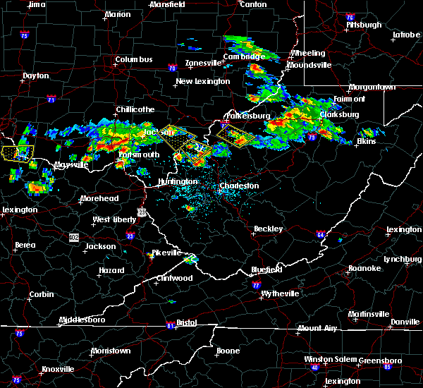 At 528 pm edt, a severe thunderstorm was located 8 miles southwest of albany, moving southeast at 30 mph (radar indicated). Hazards include 60 mph wind gusts and quarter size hail. Hail damage to vehicles is expected. Expect wind damage to roofs, siding, and trees. At 528 pm edt, a severe thunderstorm was located 8 miles southwest of albany, moving southeast at 30 mph (radar indicated). Hazards include 60 mph wind gusts and quarter size hail. Hail damage to vehicles is expected. Expect wind damage to roofs, siding, and trees.
|
| 5/17/2019 4:17 PM EDT |
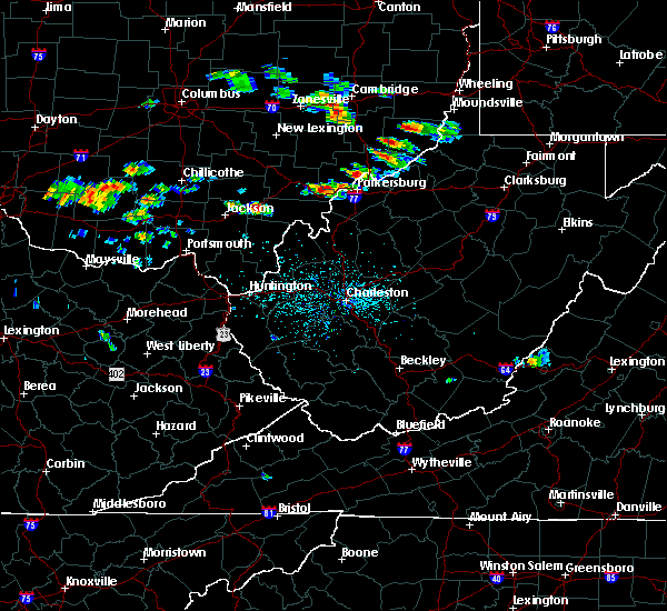 At 417 pm edt, a severe thunderstorm was located 10 miles southwest of albany, moving east at 35 mph (radar indicated). Hazards include 60 mph wind gusts and quarter size hail. Hail damage to vehicles is expected. Expect wind damage to roofs, siding, and trees. At 417 pm edt, a severe thunderstorm was located 10 miles southwest of albany, moving east at 35 mph (radar indicated). Hazards include 60 mph wind gusts and quarter size hail. Hail damage to vehicles is expected. Expect wind damage to roofs, siding, and trees.
|
| 4/3/2018 8:20 PM EDT |
 At 820 pm edt, severe thunderstorms were located along a line extending from 10 miles east of wellston to near rio grande to 8 miles south of oak hill, moving east at 45 mph (radar indicated). Hazards include 60 mph wind gusts and quarter size hail. Hail damage to vehicles is expected. expect wind damage to roofs, siding, and trees. locations impacted include, rio grande, gallia, vinton, wilkesville, adamsville, radcliffe, gage and centerpoint. At 820 pm edt, severe thunderstorms were located along a line extending from 10 miles east of wellston to near rio grande to 8 miles south of oak hill, moving east at 45 mph (radar indicated). Hazards include 60 mph wind gusts and quarter size hail. Hail damage to vehicles is expected. expect wind damage to roofs, siding, and trees. locations impacted include, rio grande, gallia, vinton, wilkesville, adamsville, radcliffe, gage and centerpoint.
|
| 4/3/2018 8:15 PM EDT |
 At 814 pm edt, severe thunderstorms were located along a line extending from near wellston to near oak hill to 6 miles east of south webster, moving east at 50 mph (radar indicated). Hazards include 60 mph wind gusts and quarter size hail. Hail damage to vehicles is expected. Expect wind damage to roofs, siding, and trees. At 814 pm edt, severe thunderstorms were located along a line extending from near wellston to near oak hill to 6 miles east of south webster, moving east at 50 mph (radar indicated). Hazards include 60 mph wind gusts and quarter size hail. Hail damage to vehicles is expected. Expect wind damage to roofs, siding, and trees.
|
| 4/3/2018 8:00 PM EDT |
 At 751 pm edt, severe thunderstorms were located along a line extending from 6 miles southwest of jackson to south shore, moving east at 50 mph (radar indicated). Hazards include 60 mph wind gusts and quarter size hail. Hail damage to vehicles is expected. expect wind damage to roofs, siding, and trees. locations impacted include, portsmouth, jackson, wellston, oak hill, rio grande, letitia, gallia, vernon, waterloo, south shore, vinton, wilkesville, adamsville, mabee, radcliffe, powellsville, petersburg, gage, grays branch and centerpoint. At 751 pm edt, severe thunderstorms were located along a line extending from 6 miles southwest of jackson to south shore, moving east at 50 mph (radar indicated). Hazards include 60 mph wind gusts and quarter size hail. Hail damage to vehicles is expected. expect wind damage to roofs, siding, and trees. locations impacted include, portsmouth, jackson, wellston, oak hill, rio grande, letitia, gallia, vernon, waterloo, south shore, vinton, wilkesville, adamsville, mabee, radcliffe, powellsville, petersburg, gage, grays branch and centerpoint.
|
| 4/3/2018 7:52 PM EDT |
 At 751 pm edt, severe thunderstorms were located along a line extending from 6 miles southwest of jackson to south shore, moving east at 50 mph (radar indicated). Hazards include 60 mph wind gusts and quarter size hail. Hail damage to vehicles is expected. expect wind damage to roofs, siding, and trees. locations impacted include, portsmouth, jackson, wellston, oak hill, rio grande, letitia, gallia, vernon, waterloo, south shore, vinton, wilkesville, adamsville, mabee, radcliffe, powellsville, petersburg, gage, grays branch and centerpoint. At 751 pm edt, severe thunderstorms were located along a line extending from 6 miles southwest of jackson to south shore, moving east at 50 mph (radar indicated). Hazards include 60 mph wind gusts and quarter size hail. Hail damage to vehicles is expected. expect wind damage to roofs, siding, and trees. locations impacted include, portsmouth, jackson, wellston, oak hill, rio grande, letitia, gallia, vernon, waterloo, south shore, vinton, wilkesville, adamsville, mabee, radcliffe, powellsville, petersburg, gage, grays branch and centerpoint.
|
| 4/3/2018 7:35 PM EDT |
 At 735 pm edt, severe thunderstorms were located along a line extending from near lucasville to 7 miles northeast of vanceburg, moving east at 45 mph (radar indicated). Hazards include 60 mph wind gusts and nickel size hail. expect damage to roofs, siding, and trees At 735 pm edt, severe thunderstorms were located along a line extending from near lucasville to 7 miles northeast of vanceburg, moving east at 45 mph (radar indicated). Hazards include 60 mph wind gusts and nickel size hail. expect damage to roofs, siding, and trees
|
| 7/22/2017 7:03 PM EDT |
 At 703 pm edt, a severe thunderstorm capable of producing a tornado was located near mcarthur, moving southeast at 30 mph (radar indicated rotation). Hazards include tornado and quarter size hail. Flying debris will be dangerous to those caught without shelter. mobile homes will be damaged or destroyed. damage to roofs, windows, and vehicles will occur. tree damage is likely. locations impacted include, wilkesville, dyesville and radcliffe. At 703 pm edt, a severe thunderstorm capable of producing a tornado was located near mcarthur, moving southeast at 30 mph (radar indicated rotation). Hazards include tornado and quarter size hail. Flying debris will be dangerous to those caught without shelter. mobile homes will be damaged or destroyed. damage to roofs, windows, and vehicles will occur. tree damage is likely. locations impacted include, wilkesville, dyesville and radcliffe.
|
| 7/22/2017 6:53 PM EDT |
 At 653 pm edt, a severe thunderstorm capable of producing a tornado was located over mcarthur, moving southeast at 25 mph (radar indicated rotation). Hazards include tornado and quarter size hail. Flying debris will be dangerous to those caught without shelter. mobile homes will be damaged or destroyed. damage to roofs, windows, and vehicles will occur. tree damage is likely. locations impacted include, mcarthur, wilkesville, dyesville and radcliffe. At 653 pm edt, a severe thunderstorm capable of producing a tornado was located over mcarthur, moving southeast at 25 mph (radar indicated rotation). Hazards include tornado and quarter size hail. Flying debris will be dangerous to those caught without shelter. mobile homes will be damaged or destroyed. damage to roofs, windows, and vehicles will occur. tree damage is likely. locations impacted include, mcarthur, wilkesville, dyesville and radcliffe.
|
| 7/22/2017 6:44 PM EDT |
 At 643 pm edt, a severe thunderstorm capable of producing a tornado was located over mcarthur, moving southeast at 30 mph (radar indicated rotation). Hazards include tornado and quarter size hail. Flying debris will be dangerous to those caught without shelter. mobile homes will be damaged or destroyed. damage to roofs, windows, and vehicles will occur. tree damage is likely. This tornadic thunderstorm will remain over mainly rural areas of northwestern meigs, northeastern jackson and eastern vinton counties, including the following locations: dyesville, creola, wilkesville, radcliffe, zaleski, carpenter and hamden. At 643 pm edt, a severe thunderstorm capable of producing a tornado was located over mcarthur, moving southeast at 30 mph (radar indicated rotation). Hazards include tornado and quarter size hail. Flying debris will be dangerous to those caught without shelter. mobile homes will be damaged or destroyed. damage to roofs, windows, and vehicles will occur. tree damage is likely. This tornadic thunderstorm will remain over mainly rural areas of northwestern meigs, northeastern jackson and eastern vinton counties, including the following locations: dyesville, creola, wilkesville, radcliffe, zaleski, carpenter and hamden.
|
| 7/22/2017 6:38 PM EDT |
 At 638 pm edt, a severe thunderstorm was located over mcarthur, moving southeast at 30 mph (radar indicated). Hazards include 70 mph wind gusts and quarter size hail. Hail damage to vehicles is expected. expect considerable tree damage. wind damage is also likely to mobile homes, roofs, and outbuildings. locations impacted include, wellston, mcarthur, hamden, zaleski, wilkesville, dyesville, creola, radcliffe, dexter, carpenter and allensville. At 638 pm edt, a severe thunderstorm was located over mcarthur, moving southeast at 30 mph (radar indicated). Hazards include 70 mph wind gusts and quarter size hail. Hail damage to vehicles is expected. expect considerable tree damage. wind damage is also likely to mobile homes, roofs, and outbuildings. locations impacted include, wellston, mcarthur, hamden, zaleski, wilkesville, dyesville, creola, radcliffe, dexter, carpenter and allensville.
|
| 7/22/2017 6:31 PM EDT |
 At 631 pm edt, a severe thunderstorm was located near mcarthur, moving southeast at 40 mph (radar indicated). Hazards include 70 mph wind gusts and quarter size hail. Hail damage to vehicles is expected. expect considerable tree damage. Wind damage is also likely to mobile homes, roofs, and outbuildings. At 631 pm edt, a severe thunderstorm was located near mcarthur, moving southeast at 40 mph (radar indicated). Hazards include 70 mph wind gusts and quarter size hail. Hail damage to vehicles is expected. expect considerable tree damage. Wind damage is also likely to mobile homes, roofs, and outbuildings.
|
| 7/7/2017 8:32 PM EDT |
 At 832 pm edt, severe thunderstorms were located along a line extending from new haven to near oldtown, moving southeast at 25 mph (radar indicated). Hazards include 60 mph wind gusts and nickel size hail. Expect damage to roofs, siding, and trees. locations impacted include, ashland, ironton, point pleasant, grayson, gallipolis, coal grove, pomeroy, olive hill, rio grande, chesapeake, racine, rutland, cannonsburg, lake vesuvius, carter caves state park, kenova, catlettsburg, new haven, ceredo and greenup. This includes interstate 64 in kentucky between mile markers 151 and 190. At 832 pm edt, severe thunderstorms were located along a line extending from new haven to near oldtown, moving southeast at 25 mph (radar indicated). Hazards include 60 mph wind gusts and nickel size hail. Expect damage to roofs, siding, and trees. locations impacted include, ashland, ironton, point pleasant, grayson, gallipolis, coal grove, pomeroy, olive hill, rio grande, chesapeake, racine, rutland, cannonsburg, lake vesuvius, carter caves state park, kenova, catlettsburg, new haven, ceredo and greenup. This includes interstate 64 in kentucky between mile markers 151 and 190.
|
| 7/7/2017 8:16 PM EDT |
 At 816 pm edt, severe thunderstorms were located along a line extending from near pomeroy to near load, moving southeast at 30 mph (radar indicated). Hazards include 60 mph wind gusts and nickel size hail. Expect damage to roofs, siding, and trees. locations impacted include, ashland, portsmouth, ironton, jackson, wellston, point pleasant, grayson, gallipolis, coal grove, pomeroy, olive hill, oak hill, rio grande, chesapeake, racine, rutland, cannonsburg, lake vesuvius, carter caves state park and kenova. This includes interstate 64 in kentucky between mile markers 151 and 190. At 816 pm edt, severe thunderstorms were located along a line extending from near pomeroy to near load, moving southeast at 30 mph (radar indicated). Hazards include 60 mph wind gusts and nickel size hail. Expect damage to roofs, siding, and trees. locations impacted include, ashland, portsmouth, ironton, jackson, wellston, point pleasant, grayson, gallipolis, coal grove, pomeroy, olive hill, oak hill, rio grande, chesapeake, racine, rutland, cannonsburg, lake vesuvius, carter caves state park and kenova. This includes interstate 64 in kentucky between mile markers 151 and 190.
|
| 7/7/2017 7:47 PM EDT |
 At 747 pm edt, severe thunderstorms were located along a line extending from 8 miles south of chesterhill to near vanceburg, moving southeast at 30 mph (radar indicated). Hazards include 60 mph wind gusts and nickel size hail. expect damage to roofs, siding, and trees At 747 pm edt, severe thunderstorms were located along a line extending from 8 miles south of chesterhill to near vanceburg, moving southeast at 30 mph (radar indicated). Hazards include 60 mph wind gusts and nickel size hail. expect damage to roofs, siding, and trees
|
| 5/19/2017 1:33 PM EDT |
 At 132 pm edt, a severe thunderstorm was located 7 miles southeast of mcarthur, moving northeast at 40 mph (radar indicated). Hazards include 60 mph wind gusts and quarter size hail. Hail damage to vehicles is expected. expect wind damage to roofs, siding, and trees. locations impacted include, wellston, mcarthur, albany, lake hope state park, hamden, zaleski, wilkesville, radcliffe and carpenter. At 132 pm edt, a severe thunderstorm was located 7 miles southeast of mcarthur, moving northeast at 40 mph (radar indicated). Hazards include 60 mph wind gusts and quarter size hail. Hail damage to vehicles is expected. expect wind damage to roofs, siding, and trees. locations impacted include, wellston, mcarthur, albany, lake hope state park, hamden, zaleski, wilkesville, radcliffe and carpenter.
|
| 5/19/2017 1:19 PM EDT |
 At 119 pm edt, a severe thunderstorm was located near wellston, moving northeast at 40 mph (radar indicated). Hazards include 60 mph wind gusts and half dollar size hail. Hail damage to vehicles is expected. Expect wind damage to roofs, siding, and trees. At 119 pm edt, a severe thunderstorm was located near wellston, moving northeast at 40 mph (radar indicated). Hazards include 60 mph wind gusts and half dollar size hail. Hail damage to vehicles is expected. Expect wind damage to roofs, siding, and trees.
|
| 5/1/2017 11:48 AM EDT |
 At 1148 am edt, a severe thunderstorm was located near rutland, moving northeast at 55 mph (radar indicated). Hazards include 60 mph wind gusts. Expect damage to roofs, siding, and trees. locations impacted include, point pleasant, gallipolis, rutland, middleport, vinton, wilkesville, cheshire, adamsville, lakin, dyesville, salem center, dexter, kyger and carpenter. At 1148 am edt, a severe thunderstorm was located near rutland, moving northeast at 55 mph (radar indicated). Hazards include 60 mph wind gusts. Expect damage to roofs, siding, and trees. locations impacted include, point pleasant, gallipolis, rutland, middleport, vinton, wilkesville, cheshire, adamsville, lakin, dyesville, salem center, dexter, kyger and carpenter.
|
| 5/1/2017 11:48 AM EDT |
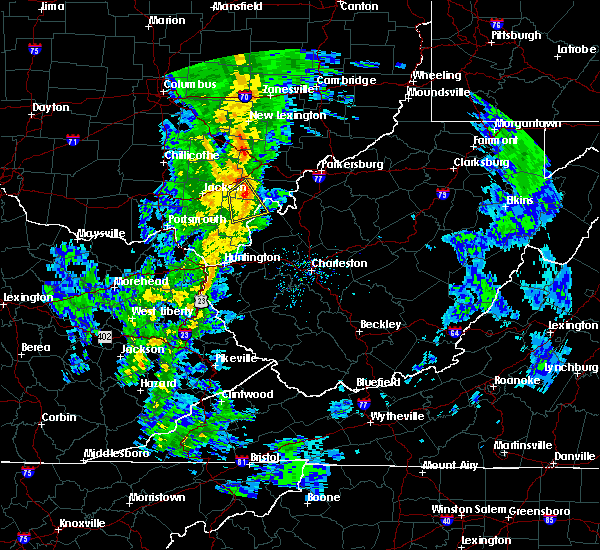 At 1148 am edt, a severe thunderstorm was located near rutland, moving northeast at 55 mph (radar indicated). Hazards include 60 mph wind gusts. Expect damage to roofs, siding, and trees. locations impacted include, point pleasant, gallipolis, rutland, middleport, vinton, wilkesville, cheshire, adamsville, lakin, dyesville, salem center, dexter, kyger and carpenter. At 1148 am edt, a severe thunderstorm was located near rutland, moving northeast at 55 mph (radar indicated). Hazards include 60 mph wind gusts. Expect damage to roofs, siding, and trees. locations impacted include, point pleasant, gallipolis, rutland, middleport, vinton, wilkesville, cheshire, adamsville, lakin, dyesville, salem center, dexter, kyger and carpenter.
|
| 5/1/2017 11:40 AM EDT | Multiple trees and powerlines down southwestern meigs count in meigs county OH, 3.2 miles NW of Wilkesville, OH |
| 5/1/2017 11:28 AM EDT |
 At 1127 am edt, a severe thunderstorm was located near oak hill, moving northeast at 55 mph (radar indicated). Hazards include 60 mph wind gusts. expect damage to roofs, siding, and trees At 1127 am edt, a severe thunderstorm was located near oak hill, moving northeast at 55 mph (radar indicated). Hazards include 60 mph wind gusts. expect damage to roofs, siding, and trees
|
| 3/1/2017 9:05 AM EST |
 At 905 am est, severe thunderstorms were located along a line extending from near lake hope state park to near coal grove, moving east at 55 mph (radar indicated). Hazards include 70 mph wind gusts and half dollar size hail. Hail damage to vehicles is expected. expect considerable tree damage. wind damage is also likely to mobile homes, roofs, and outbuildings. locations impacted include, athens, ashland, ironton, jackson, wellston, point pleasant, gallipolis, coal grove, pomeroy, mcarthur, oak hill, rio grande, albany, rutland, lake vesuvius, mason, gallia, vernon, waterloo and middleport. This includes interstate 64 in west virginia near mile marker 23. At 905 am est, severe thunderstorms were located along a line extending from near lake hope state park to near coal grove, moving east at 55 mph (radar indicated). Hazards include 70 mph wind gusts and half dollar size hail. Hail damage to vehicles is expected. expect considerable tree damage. wind damage is also likely to mobile homes, roofs, and outbuildings. locations impacted include, athens, ashland, ironton, jackson, wellston, point pleasant, gallipolis, coal grove, pomeroy, mcarthur, oak hill, rio grande, albany, rutland, lake vesuvius, mason, gallia, vernon, waterloo and middleport. This includes interstate 64 in west virginia near mile marker 23.
|
| 3/1/2017 8:47 AM EST |
 At 846 am est, severe thunderstorms were located along a line extending from near mcarthur to near greenbo lake, moving east at 55 mph (radar indicated). Hazards include 70 mph wind gusts and half dollar size hail. Hail damage to vehicles is expected. expect considerable tree damage. Wind damage is also likely to mobile homes, roofs, and outbuildings. At 846 am est, severe thunderstorms were located along a line extending from near mcarthur to near greenbo lake, moving east at 55 mph (radar indicated). Hazards include 70 mph wind gusts and half dollar size hail. Hail damage to vehicles is expected. expect considerable tree damage. Wind damage is also likely to mobile homes, roofs, and outbuildings.
|
| 4/26/2016 3:31 PM EDT |
 At 331 pm edt, a severe thunderstorm was located over rutland, moving east at 30 mph (radar indicated). Hazards include quarter size hail. Damage to vehicles is expected. Locations impacted include, pomeroy, racine, rutland, new haven, mason, tuppers plains, middleport, chester, syracuse, hartford city, wilkesville, harrisonville, darwin, dexter, salem center, kyger, lakin, carpenter and dyesville. At 331 pm edt, a severe thunderstorm was located over rutland, moving east at 30 mph (radar indicated). Hazards include quarter size hail. Damage to vehicles is expected. Locations impacted include, pomeroy, racine, rutland, new haven, mason, tuppers plains, middleport, chester, syracuse, hartford city, wilkesville, harrisonville, darwin, dexter, salem center, kyger, lakin, carpenter and dyesville.
|
| 4/26/2016 3:15 PM EDT |
 At 315 pm edt, a severe thunderstorm was located 8 miles northwest of rutland, moving east at 20 mph (public). Hazards include quarter size hail. damage to vehicles is expected At 315 pm edt, a severe thunderstorm was located 8 miles northwest of rutland, moving east at 20 mph (public). Hazards include quarter size hail. damage to vehicles is expected
|
| 4/26/2016 3:15 PM EDT |
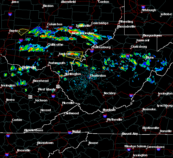 At 315 pm edt, a severe thunderstorm was located 8 miles northwest of rutland, moving east at 20 mph (public). Hazards include quarter size hail. damage to vehicles is expected At 315 pm edt, a severe thunderstorm was located 8 miles northwest of rutland, moving east at 20 mph (public). Hazards include quarter size hail. damage to vehicles is expected
|
| 7/14/2015 4:33 PM EDT |
 At 432 pm edt, doppler radar indicated a line of severe thunderstorms capable of producing damaging winds in excess of 60 mph. these storms were located along a line extending from near oak hill to 6 miles north of south webster, moving southeast at 45 mph. locations impacted include, jackson, wellston, point pleasant, gallipolis, ripley, pomeroy, oak hill, rio grande, racine, rutland, new haven, mason, gallia, vernon, waterloo, middleport, syracuse, hartford city, henderson and vinton. At 432 pm edt, doppler radar indicated a line of severe thunderstorms capable of producing damaging winds in excess of 60 mph. these storms were located along a line extending from near oak hill to 6 miles north of south webster, moving southeast at 45 mph. locations impacted include, jackson, wellston, point pleasant, gallipolis, ripley, pomeroy, oak hill, rio grande, racine, rutland, new haven, mason, gallia, vernon, waterloo, middleport, syracuse, hartford city, henderson and vinton.
|
| 7/14/2015 4:30 PM EDT | Tree down on bar in vinton county OH, 0.3 miles SSE of Wilkesville, OH |
| 7/14/2015 3:59 PM EDT |
 At 358 pm edt, doppler radar indicated a line of severe thunderstorms capable of producing damaging winds in excess of 60 mph. these storms were located along a line extending from 7 miles northeast of waverly to near waverly city, and moving southeast at 45 mph. At 358 pm edt, doppler radar indicated a line of severe thunderstorms capable of producing damaging winds in excess of 60 mph. these storms were located along a line extending from 7 miles northeast of waverly to near waverly city, and moving southeast at 45 mph.
|
| 6/26/2015 5:58 PM EDT | At 557 pm edt, doppler radar indicated a severe thunderstorm capable of producing large damaging hail up to golf ball size and destructive winds in excess of 70 mph. this storm was located over rio grande, and moving southeast at 40 mph. |
| 6/26/2015 5:58 PM EDT | At 557 pm edt, doppler radar indicated a severe thunderstorm capable of producing large damaging hail up to golf ball size and destructive winds in excess of 70 mph. this storm was located over rio grande, and moving southeast at 40 mph. |
| 6/26/2015 5:32 PM EDT | At 531 pm edt, doppler radar indicated a severe thunderstorm capable of producing large damaging hail up to golf ball size and destructive winds in excess of 70 mph. this storm was located near jackson, moving east at 30 mph. locations impacted include, jackson, wellston, oak hill, rio grande, coalton, vinton, wilkesville, adamsville, radcliffe, petersburg, mabee, dexter, salem center, carpenter, centerpoint and dyesville. |
| 6/26/2015 5:01 PM EDT | At 501 pm edt, doppler radar indicated a severe thunderstorm capable of producing quarter size hail and damaging winds in excess of 60 mph. this storm was located 8 miles east of piketon, or 9 miles southeast of waverly, and moving east at 30 mph. |
| 5/11/2015 6:49 PM EDT | At 647 pm edt, national weather service doppler radar continued to indicate a line of severe thunderstorms capable of producing damaging winds in excess of 60 mph. these storms were located along a line extending from eagleport to chesterhill to 6 miles southeast of dexter, or along a line extending from 9 miles north of mcconnelsville to chesterhill to rutland, moving east at 35 mph. other locations in the warning include but are not limited to malta, darwin, stockport, bartlett, bristol, hackney, beverly, fleming, marietta, macksburg, lower salem, lowell and devola this will impact the following interstate, i-77 between mile markers 1 and 17 in ohio. very heavy rain will also fall from this line of severe thunderstorms, and will cause water to pond on roads and quickly fill roadside ditches and small streams. a severe thunderstorm watch remains in effect until 1000 pm edt monday evening for central kentucky and southeast ohio and central west virginia. a severe thunderstorm watch also remains in effect until 100 am edt tuesday morning for central west virginia. please report severe weather to the national weather service by calling toll free, 800-401-9535, when you can do so safely. you may also report severe weather by posting your report to the charleston west virginia national weather service facebook page, or by using the twitter hashtag, nwsrlx. |
| 5/11/2015 6:03 PM EDT | At 602 pm edt, national weather service doppler radar continued to indicate a line of severe thunderstorms capable of producing quarter size hail, and damaging winds in excess of 60 mph. these storms were located along a line extending from glenford to 10 miles west of new straitsville to 7 miles southwest of mabee, or along a line extending from 8 miles northwest of somerset to logan to 13 miles northeast of portsmouth, moving east at 35 mph. other locations in the warning include but are not limited to coalton, jackson, junction city, creola, mcarthur, hamden, wellston, zaleski, perry state forest, new lexington, lake hope state park, oak hill, shawnee, nelsonville, hemlock, radcliffe, buchtel, crooksville, wilkesville and gallia in addition to large hail and damaging winds, continuous cloud to ground lightning is occurring with this storm. move indoors immediately! lightning is one of natures number one killers. remember, if you can hear thunder, you are close enough to be struck by lightning. very heavy rain will also fall from this line of severe thunderstorms, and will cause water to pond on roads and quickly fill roadside ditches and small streams. a severe thunderstorm watch remains in effect until 1000 pm edt monday evening for central kentucky and southeast ohio and central west virginia. a severe thunderstorm watch also remains in effect until 100 am edt tuesday morning for central west virginia. please report severe weather to the national weather service by calling toll free, 800-401-9535, when you can do so safely. you may also report severe weather by posting your report to the charleston west virginia national weather service facebook page, or by using the twitter hashtag, nwsrlx. |
| 5/11/2015 5:25 PM EDT | At 522 pm edt, national weather service doppler radar indicated a line of severe thunderstorms capable of producing quarter size. |
| 4/9/2015 2:26 PM EDT | The severe thunderstorm warning for southeastern vinton. western meigs. east central jackson and northern gallia counties in southeast ohio. and north central mason county in west virginia will expire at 230 pm edt. The storm which prompted the warning has moved out of the warned area. |
| 4/9/2015 2:26 PM EDT | The severe thunderstorm warning for southeastern vinton. western meigs. east central jackson and northern gallia counties in southeast ohio. and north central mason county in west virginia will expire at 230 pm edt. The storm which prompted the warning has moved out of the warned area. |
| 4/9/2015 2:15 PM EDT | Quarter sized hail reported 1.8 miles ENE of Wilkesville, OH, quarter sized hail falling for a short time. |
| 4/9/2015 2:13 PM EDT | The national weather service in charleston has issued a * severe thunderstorm warning for. athens county in southeast ohio. this includes the cities of. nelsonville. glouster. athens. albany. North central gallia county in southeast ohio. |
| 4/9/2015 2:07 PM EDT | A severe thunderstorm warning remains in effect until 230 pm edt for southeastern vinton. western meigs. east central jackson and northern gallia counties in southeast ohio. and north central mason county in west virginia. at 204 pm edt. National weather service doppler radar continued to indicate a severe thunderstorm capable of producing golf ball size. |
| 4/9/2015 2:07 PM EDT | A severe thunderstorm warning remains in effect until 230 pm edt for southeastern vinton. western meigs. east central jackson and northern gallia counties in southeast ohio. and north central mason county in west virginia. at 204 pm edt. National weather service doppler radar continued to indicate a severe thunderstorm capable of producing golf ball size. |
| 4/9/2015 1:47 PM EDT | The national weather service in charleston has issued a * severe thunderstorm warning for. north central mason county in west virginia. this includes the city of pomeroy. northern gallia county in southeast ohio. This includes the city of rio grande. |
| 4/9/2015 1:47 PM EDT | The national weather service in charleston has issued a * severe thunderstorm warning for. north central mason county in west virginia. this includes the city of pomeroy. northern gallia county in southeast ohio. This includes the city of rio grande. |
| 4/8/2015 12:29 PM EDT | A severe thunderstorm warning remains in effect until 100 pm edt for greenup county in kentucky. and vinton. western meigs. northern lawrence. jackson. gallia and western athens counties in southeast ohio. at 1221 pm edt. National weather service doppler radar continued to indicate a line of severe thunderstorms capable of producing damaging. |
| 4/8/2015 12:29 PM EDT | A severe thunderstorm warning remains in effect until 100 pm edt for greenup county in kentucky. and vinton. western meigs. northern lawrence. jackson. gallia and western athens counties in southeast ohio. at 1221 pm edt. National weather service doppler radar continued to indicate a line of severe thunderstorms capable of producing damaging. |
| 4/8/2015 12:02 PM EDT | The national weather service in charleston has issued a * severe thunderstorm warning for. greenup county in kentucky. western athens county in southeast ohio. this includes the cities of. nelsonville. albany. Gallia county in southeast ohio. |
| 4/8/2015 12:02 PM EDT | The national weather service in charleston has issued a * severe thunderstorm warning for. greenup county in kentucky. western athens county in southeast ohio. this includes the cities of. nelsonville. albany. Gallia county in southeast ohio. |
| 1/1/0001 12:00 AM | Tree down on state route 160 near wilkesville in vinton county OH, 0.3 miles SSE of Wilkesville, OH |
| 1/1/0001 12:00 AM | A small barn... several trees and minor roof damage to 2 homes south of state route 50 on county road 12 in vinton county OH, 6.5 miles S of Wilkesville, OH |
Hail Maps for Wilkesville, OH


Connect with Interactive Hail Maps